
I'm an Architect and Urban designer who aims to make a change in our world. I get inspired by the architecture around the globe which drives me to go and discover further. Over my 5 years of experience, I believe that as a designers, we have the strength of demonstrating an integrated environment between the human- well being and the nature. We should seek a green sustainable built environment for the good of our plant.
personal information
FULL NAME
ADDRESS
ALAA AHMED BADAWI
DUBAI, UAE
EDUCATION AND TRAINING
TITLE OF DEGREE
PRINCIPLE SUBJECT
ORGANIZATION NAME
Master's Degree in Urban Planning
CONTACT NATIONALITY
Alaabadawi1993@gmail.com
Egyptian
DATE (2019/ 2020)
Urban Planning & URBAN Development, Urban Social Studies, Sustainable Urban Planning , Environmental Studies, Risk Management and Climate Adaptation.
Faculty of Architecture, Planning and Surveying, Universiti Teknologi MARA (UiTM), Selangor, Malaysia.
TITLE OF DEGREE
PRINCIPLE SUBJECT
ORGANIZATION NAME
Bachelor of Science
DATE (2012/ 2017)
ARCHITECTURE & URBAN DESIGN, URBAN THEORIES.
Faculty of Engineering, Architectural Department, Alexandria University, Egypt.
work experience
DATE
MAIN RESPONSIBILITIES
NAME OF ORGANIZATION
TYPE OF SECTOR
OCCUPATON
2011 - Present Volunteer Head of HOMAT Project for Vulnerable Communities Support.
Life Makers Egyptian Foundation for Community Development, Alexandria, Egypt.
Public Sector
DATE
MAIN RESPONSIBILITIES 2017- 2019
NAME OF ORGANIZATION
TYPE OF SECTOR
OCCUPATON
URBAN DESIGNER INTERN
Urban Development & Heritage Conservation Internship Under the local government with Alexandria University.
Egyptian Ministry of Urban Planning. Governmental.
The2ndClimateSmartandDisasterResilientASEAN(CSDRA)InternationalConferenceIndonesia PresenterofPaperentitled”AssessingtheNGOs’RoleinDisasterRiskManagementinAlexandriaCity,Egypt”.
UrbanConservationProject,Masters’ProjectAlorStar,Malaysia
DATE:OCT2020
DATE:SEPT.2019
DESIGNER oftheConservation,preservation,andrehabilitationprojectoftheoldcitycenter,AlorStar,ofMalaysia.
AutoCAD
Lumion
3D MAX
Photoshop Google Sketch UP
MS Office
Revit Architecture
Volunteering Interests
Life Makers Foundation
Women Dignity Social Enterprise
Architect
Humanity Design
Art
urban design & Development projects
master's projectsBachelor projects
Redevelopmentof MalakaWaterFront, Malaysia....5
CreativeCultural
CorridorinMientElBasal,Alexandria, Egypt....15
AlorStarUrban Conservationand Management, Malaysia.....11
MixedUse/UrbanInfill, Alexandria,Egypt.....19


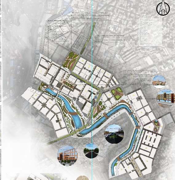
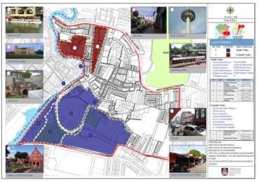
Based on the site analysis and depth study of Malaka city, urban design elements were categorized into two main categorizes, stable and unstable elements. In which the study area landmarks, nodes, boundaries, approaches, and districts were analyzed and categorized in order to create the effective development approach.
For the city’s landmarks, there is a strong unbalanced distribution of the site landmarks. The city needs to be characterized and marked with new features to enrich, reflect, andenhanceitsidentity.
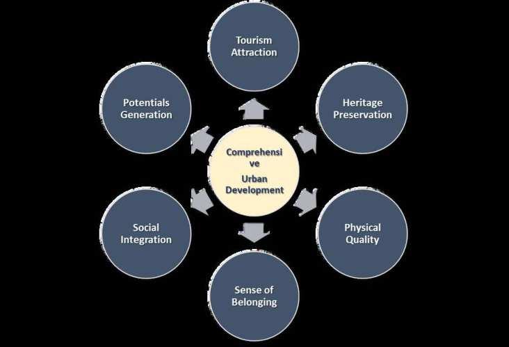
The adopted strategies aim to accelerate the economic, social, cultural, and touristic aspects of thestudyareathroughintegrating its potentials to create the new urban development plan. The main principles of the urban development plan are to promote. The six areas will integrate the urban elements to reach the main aimofthedevelopmentplan.

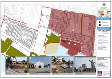
•Most of the site districts considered as unstable districts, due to the addressed lack of preservation and conservation of the potential heritage and rich elements of the districts buildings.
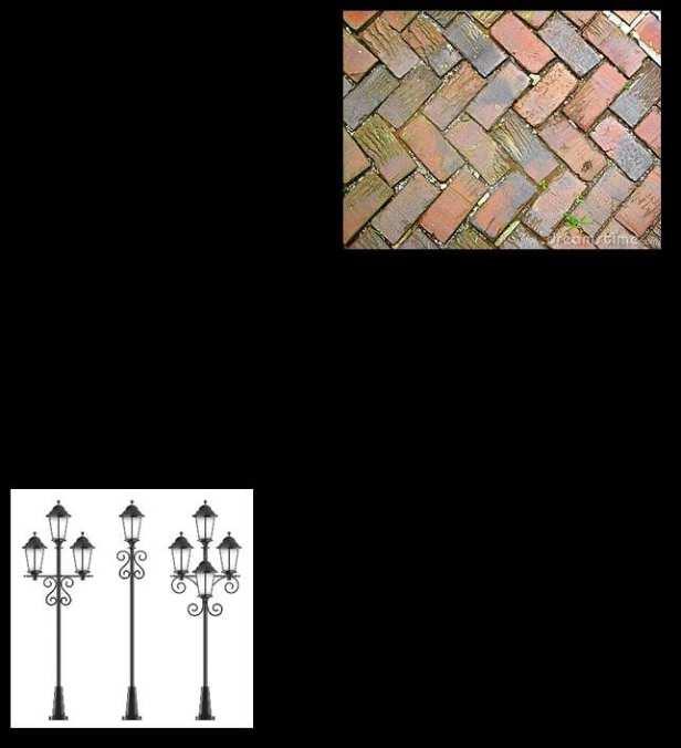
•An absence of adequate urban design features such as; street sidewalks, lighting elements, street furniture, and mostly, lack of visual eligibility.
•Despite some districts’ identity, especially in zone A, have been strongly recognized and varied from Indian, Chinese, to Malay with the profound street cultural and social activities. These zones require an effective buildings and shops renewal, streets activities enhancement, andimprovingtheinfrastructure.
•Most of the Shophouses suffered from lighting pollution, unfollowed rhythm in using advertisementssignsandshopsnames.


Lack of Shophouses adequate and renewableuses.
Lack of accessibility to the residential areas.
Lack of services surrounding the residentialneighborhoods.
Lack of landmarks in different districts ofthesite.
The addressed absence of cultural andpublicnodes.
Several Shophouses are abended and needdevelopment.
The lack of green and open spaces aroundresidentialspaces.
Lack of urban design elements in somestreets.
The percentage of unstable nodes, districts, and edges considered as largerthanthestableurbanelements.
site districts analysis site nodes analysisThe urban design of Bandar Hilier and UjongPasier has adopted three main strategies to overcome the site’s instability. The city characterizes by rich outstanding historical attractive identity, where the mixture of different cultures is reflected in the city’s buildings, layers of streets, piazzas, and plazas. Therefore, the proposed development approach enhancing the city’s identity to become liveable, vibrant, attractive city for various usersandtourists.
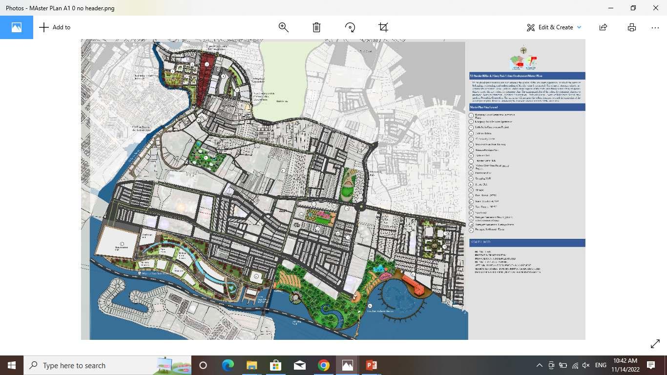
The three main strategies are, conservation and preservation of the heritage features, regenerate new developments, rehabilitate and renewal of the city's’ historical villages, and develop new streets and transportation networks, public nodes, and recreational spots. The main aim is to enhance the experience of the city users. To create a liveable city with day and night activities for different users with different backgrounds, to live a rich unique journeys in Melaka. The adopted concept will focus on the 5 main elements of urban design and will generate action plan to reach the proposed different goals.


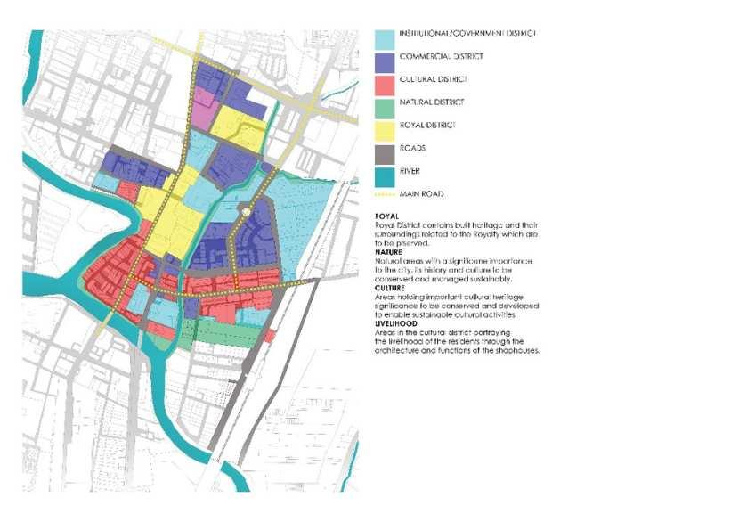
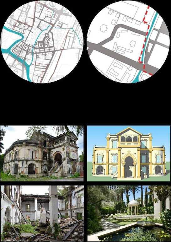
This conservation management plan provides an overview of the historical development of the city of Alor Star, followed by an assessment of the significance of the overall site and its components.
From this understanding of the heritage significance of the place, a discussion of the key issues relating to the site and a set of policies have been produced to guide future use, development and management of the city, buildings and its various parts. In summary,
AlorSetar Heritage zone studied and presented here is home to an array of heritage elements significant to the city and the nation.
Three key elements have been identified, nature, culture and the royal history, which has shaped the city over the years. The river and the natural systems connected to it have been an important part in the sustenance and development of the city. The rich culture evolved with influence from neighbouring countries and travellers give a unique identity to thecity.
The scope of the urban design study addresses the physical design and visual qualities. It consists of analyzing the urban elements where are: landmarks, districts, nodes, edges, buildings and façade design, landscape; pedestrian corridors, street furniture, public spaces and amenities. The elements describe the ways in which different aspects of the city’s landscape especially its buildings, streets and open spaces, work together to define impressions of its neighborhoods. These elements assist in improving the town and urban image in era of development.
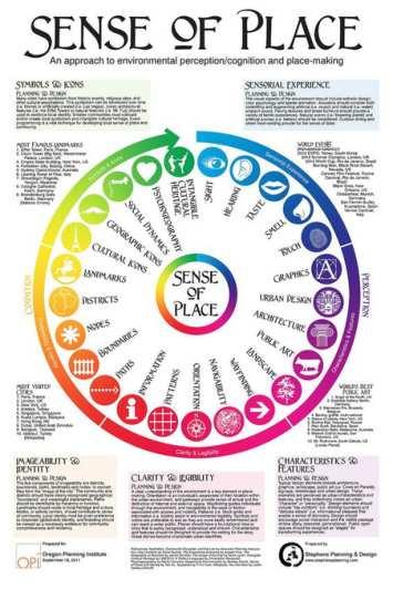
THE CONTENTS OF THE CITY IMAGES, WHICH ARE PREFERABLE TO PHYSICAL FORMS CAN CONVENIENTLY BE CLASSIFIED INTO FIVE TYPES OF ELEMENTS; LANDMARKS, NODES, PATH, DISTRICTS AND EDGES (KEVIN LYNCH, 1960).
FURTHERMORE, THE STUDY WILL IDENTIFY THE FEATURES THAT IDENITIFY THE CHARACTER OF THE CITY WHICH FORMULATE THE SENSE OF THE PLACE AND WELCOMING FOR ITSUSERS.


HERITAGE CONSERVATION STRATEGIES EXTENDS TO THE CITY LEVEL AND LOCAL COMMUNITY LEVEL. AT THE COMMUNITY LEVEL IT SHOULD HELP IN CREATING A “SENSE OF PLACE”, IDENTITY AND PRIDE OF THE COMMUNITY. ALOR SETAR HAS A UNIQUE IDENTITY OF ROYAL LINEAGE, A RICH NATURAL ENVIRONMENT, VIBRANT CULTURAL HERITAGE, WHICH THE LOCALS NEEDTOFEELPROUDOFANDSHOWCASETOTHEWORLD.
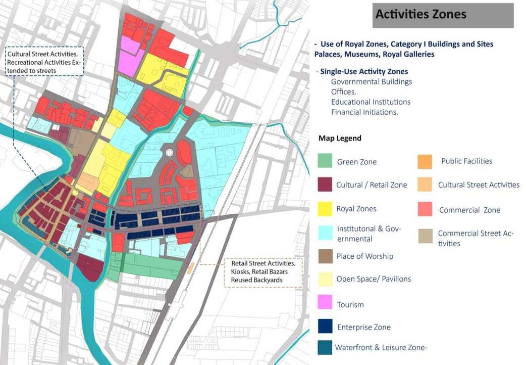

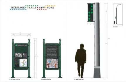
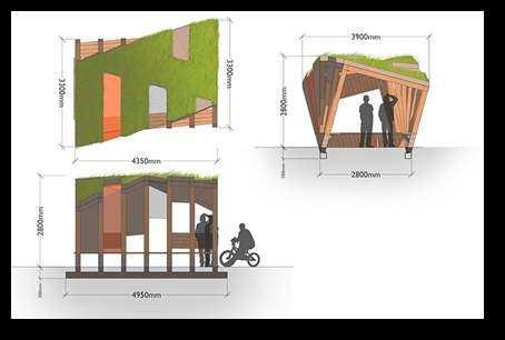
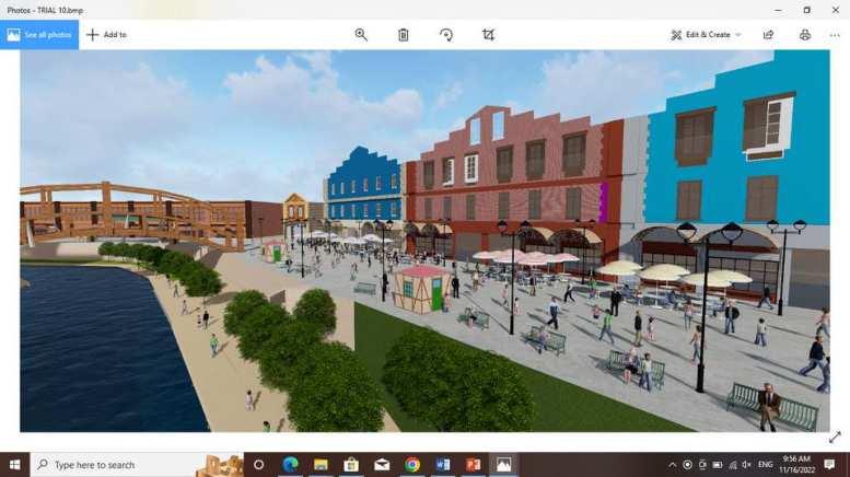
The proposal to upgrade the back lanes involves the area of Lorong Tunku Yaakob, Lorong Raja and Lorong Setar.
Promote pedestrian use in urban areas
Connecting pedestrian networks to nodes within the city.
Increase the potential of economic activity in terms of local entrepreneurs and tourism potential
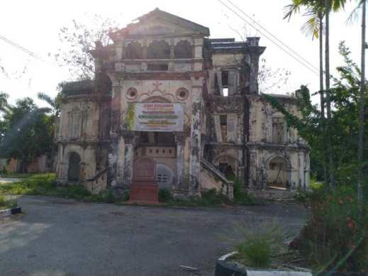
The building is to be reconstructed and restored to its original condition. The damaged sections will be constructed using original materials and techniques used in the palace. The interior layoutwillberestoredtoitsoriginaldesign.
The surrounding compound will be landscaped tocomplimentthepalaceandusedasapalace garden.The building will be used as a museum and education centre depicting the life of the royalfamily.
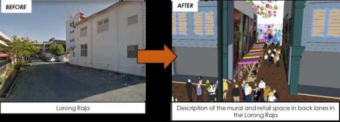
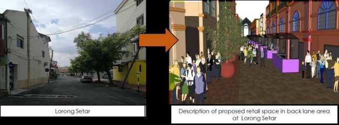

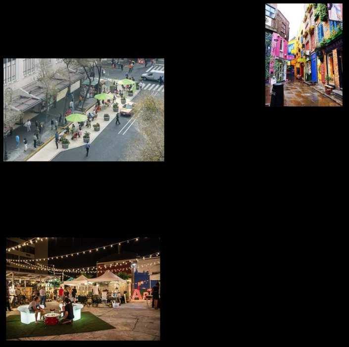
RECOMMENDED USES FOR THE SHOPHOUSES ARE CAFÉ’S AND RESTAURANTS BOUTIQUE HOTELS
HOMESTAY RETAIL SHOPS HANDICRAFT
SHOPSSTUDIOSRESIDENTIALUSE.
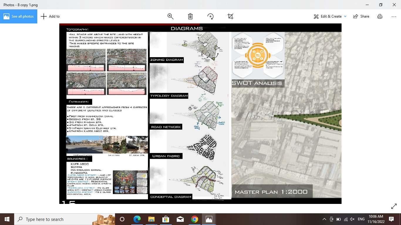
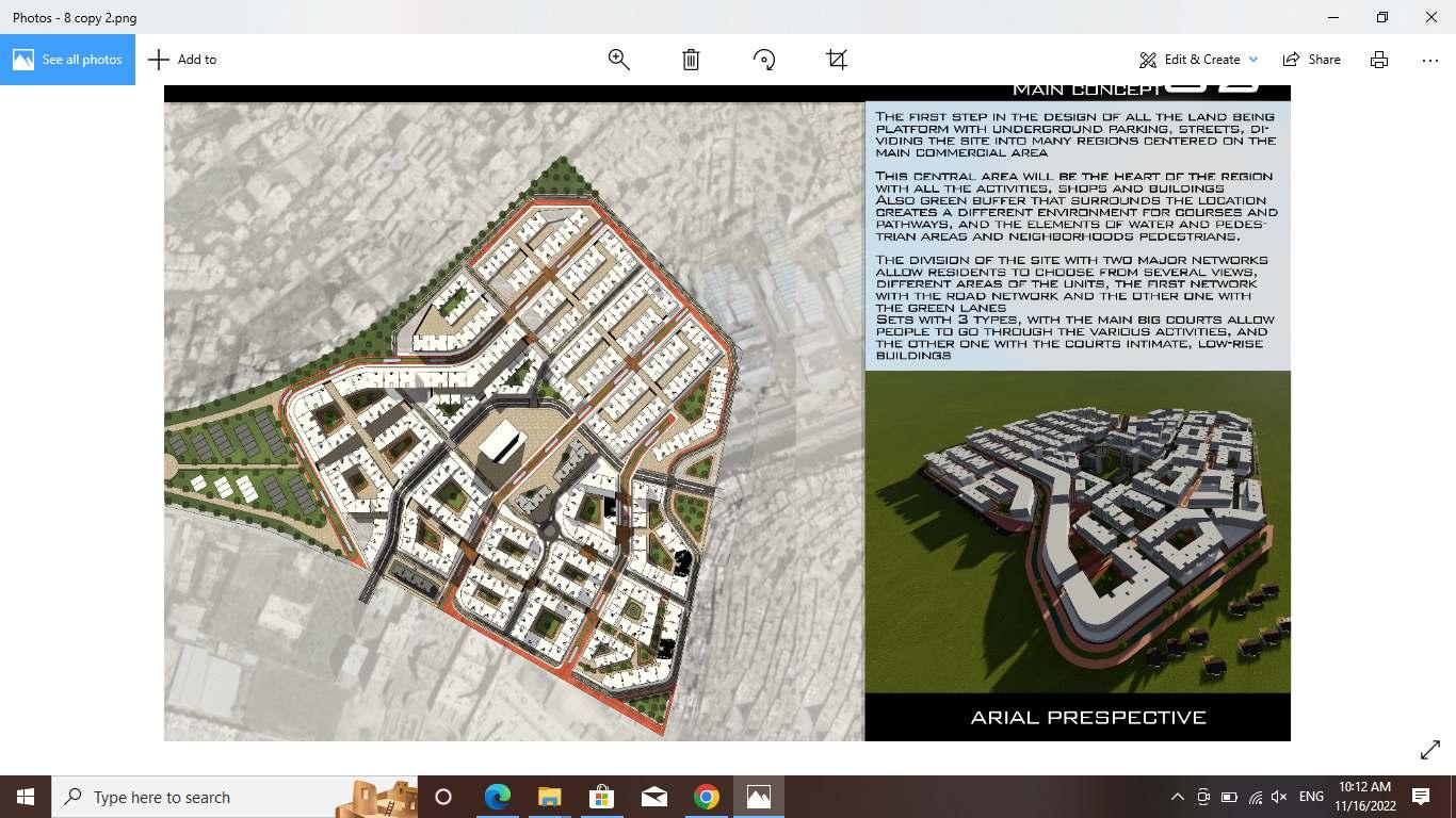
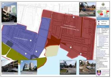
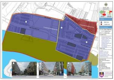
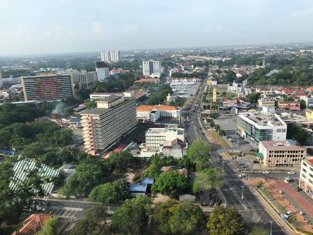
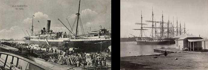
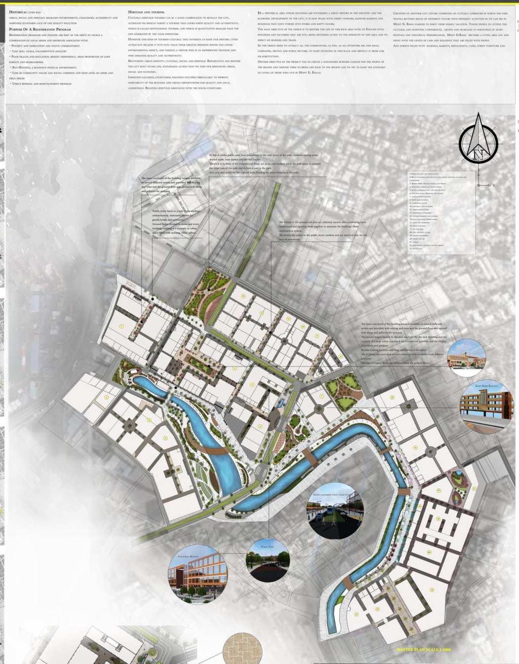
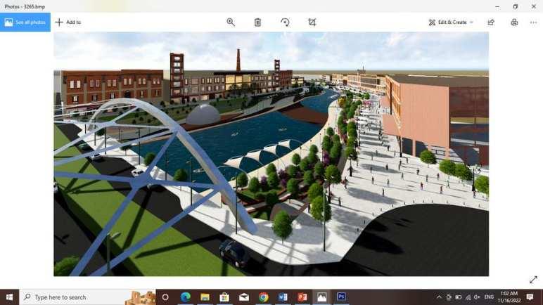
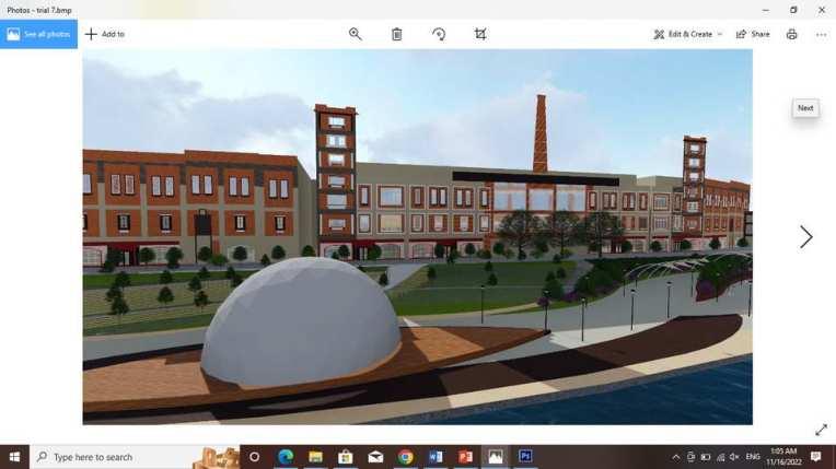
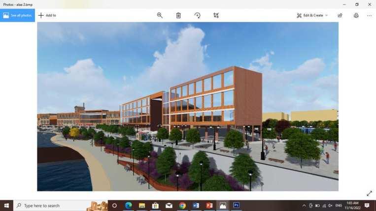
Minet al-Basal, an old industrial area located on the western side of the western port and Al-Mahmoudia channel, Egypt's first major seaport, with a total area of 200 Fadden which is equal to 840.000 m sq. The Historical Importance of the site comes from the heritage of the buildings, Bursa of Mient Al-Basal, Souq Al-Jum'ah, Kafr Ashri, a historical neighborhood well-known for its workers, urban fabric, the old-like building in Alexandria. The business district flourished after the completion of the excavation and expansion of the Mahmoudiah canal in 1820 which became the artery connecting Alexandria to the governorates of Egypt through the Nile waterway.

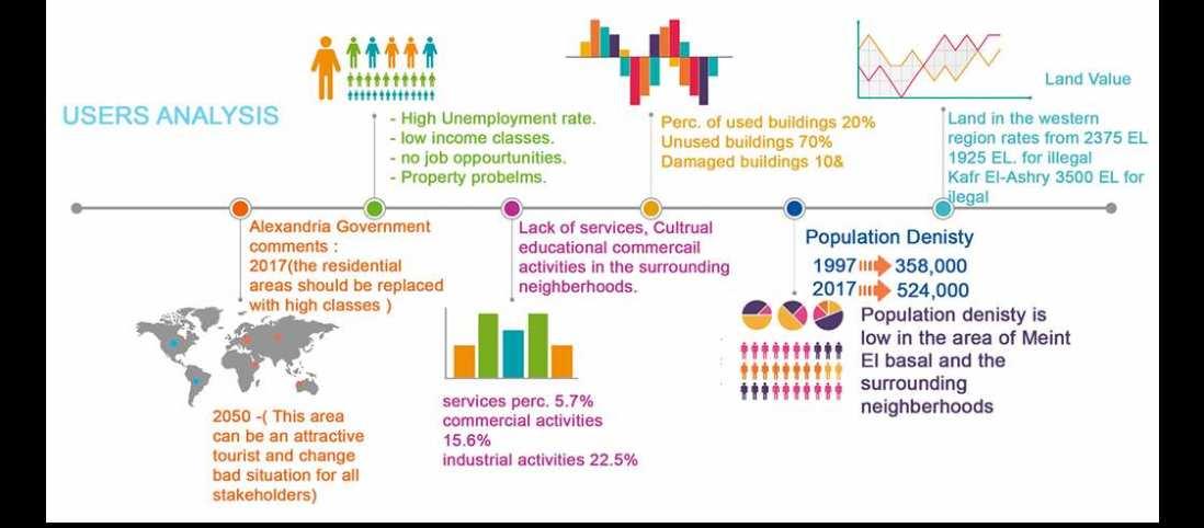


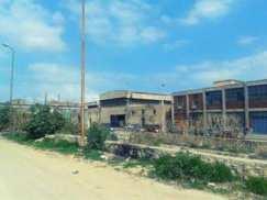


The site is connected to the city's major landmarks and nodes like El Manshia, El Ramal Station, Alexandria Station, and Kom El Shokafa. Besides that, the site is accessible from three major districts with 4 main roads which reflects the strategic location of the site and it's easy accessibility. Moreover, it's surrounded by the railway and the tram lines of Alexandria.
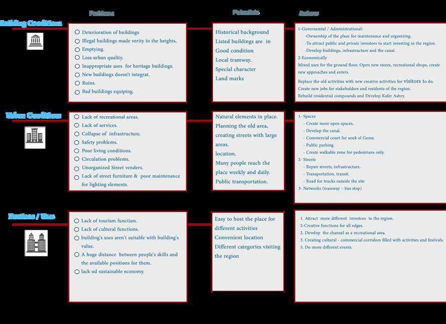
A lack of pedestrians' zones nor special pavement passages. Site nodes were strongly neglected with the No public parking. The Site vehicles density was founded to be higher than pedestrian density. Street vendors were lost in the space.

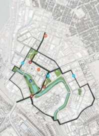


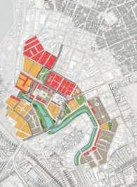

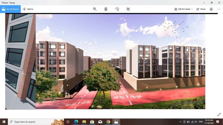
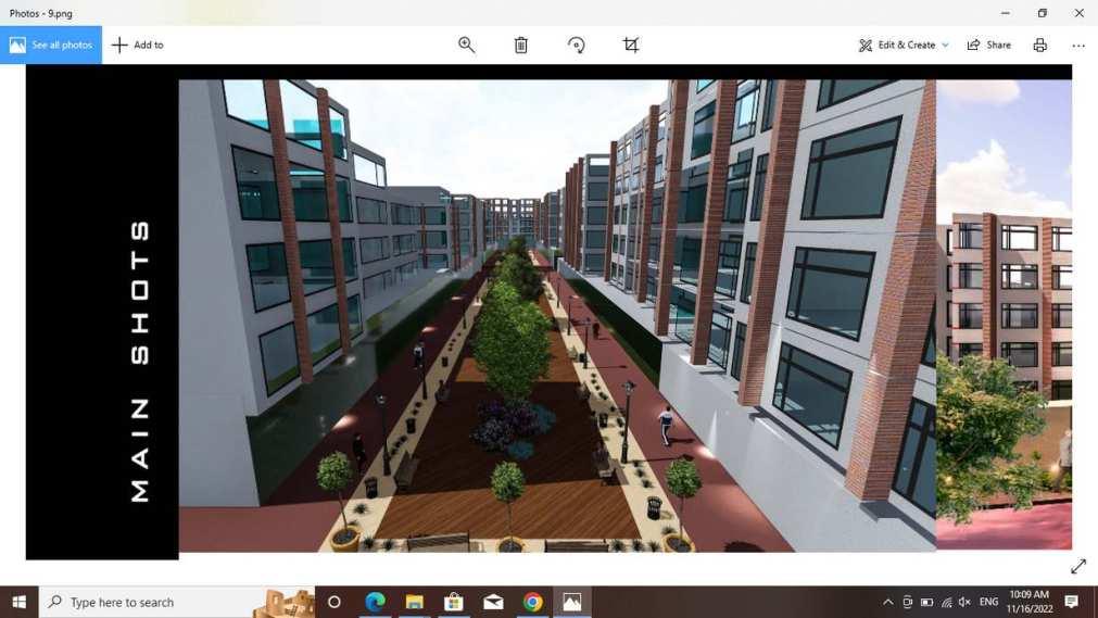
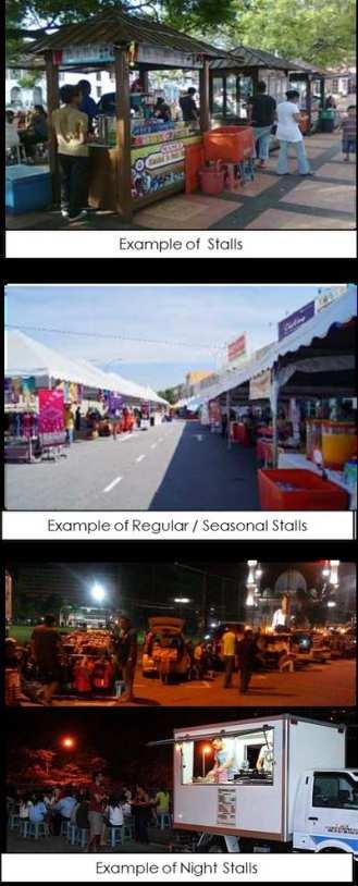
Inahistoricalareawhosebuildingsarewitnessingagreat history in the industry and the economic development of the city, it is now filled with street vendors, random markets and buildings that have turned into stores and emptyfloors. The main objective of the design is to restore the life of this rich area with its English-style buildings and factories that are still being returned attest to the strength of this area and its effect on business and trade. Creation of another city center consisting of cultural corridors in which the user travels between spaces of different nature with different activities so we can see in Meint El Basal familiestoenjoytheirweeklyvacation. Young people to attend the cultural and scientific conferences, artists and musicians to participate in music festivals and theatrical performances, Meint ElBasal becomes a living area day and night with the lightsofcarsandbuildingsthatarefilledwithpeople.And streets filled with seasonal markets, restaurants, cafes, streetfurnitureandstreetvendors.
LAKEARIALVIEW
LAKEWEASTERNVIEW
LAKEEASTERNVIEW

SOUTHERNELEVATION
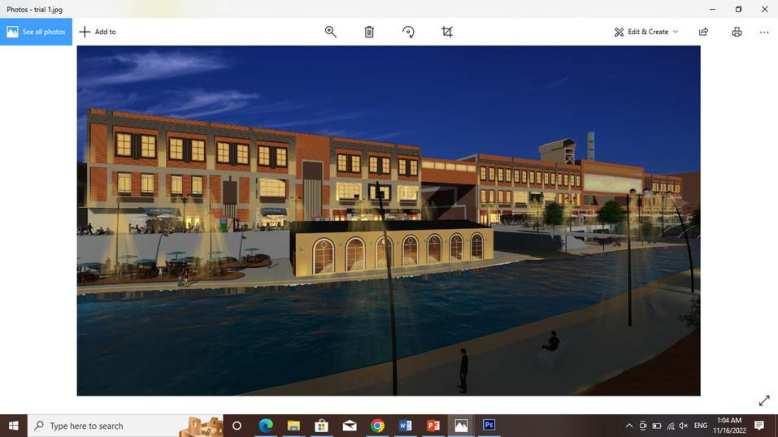
NIGHTVIEWOFTHELAKE
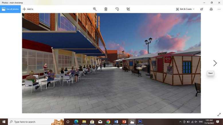
URBANDESIGNDETAILS
WESTERNELEVATION PEDSTRIANSAREASDESIGN