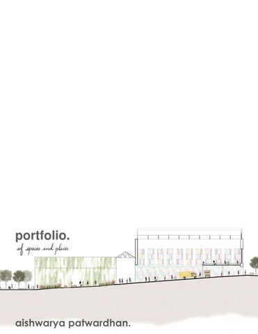
"To me, architecture is the exploration of meaning within spaces - each layer is a chapter in a greater story. It goes beyond individual forms, becoming a vital thread in an everevolving narrative that influences how we perceive, interact with, and navigate our surroundings."
the venn.
Organizing inclusions, exclusions, and intersections
Integration Studio - Spring 2023
kaleidoscope.
Revitalizing a forgotten neighborhood
Urbanism Studio - Spring 2023
reminiscence.
Crafting a dialogue between the old and the new Historic Preservation Studio - Fall 2022 flow.
Investigating placemaking within a high-rise Urbanism Studio - Fall 2021
avasa.
Exploring the idea of "liberal" in a liberal arts institute
Undergraduate Thesis - Spring 2019
cherry capital airport (tvc).
Professional - Architectural Designer at Mead & Hunt, MI, USA
July 2022 - September 2025
Professional - Intern at Somaya and Kalappa, Mumbai, India
June 2018 - November 2018
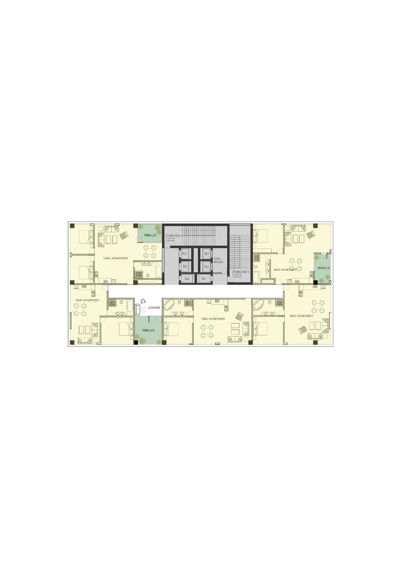
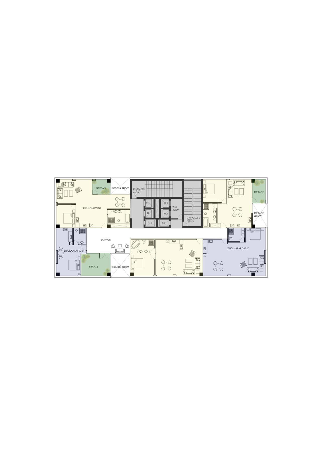
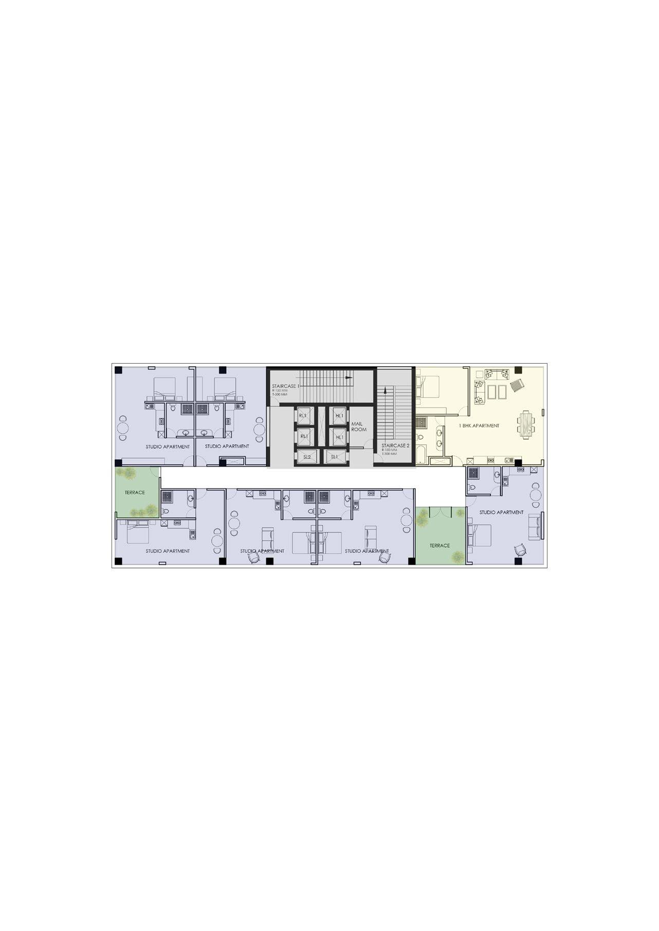
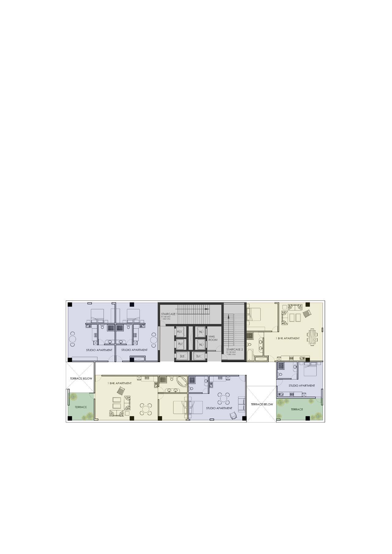
the venn.
Organizing inclusions, exclusions and intersections
M.Arch | UIUC | Spring 2023
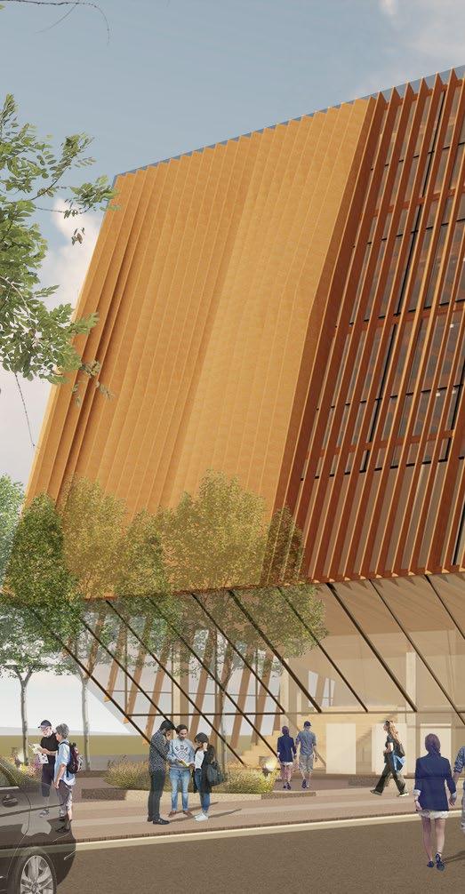
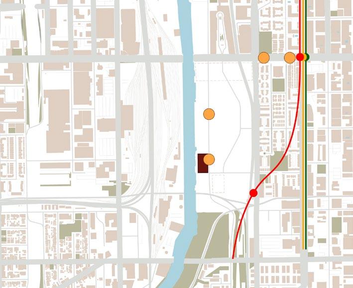
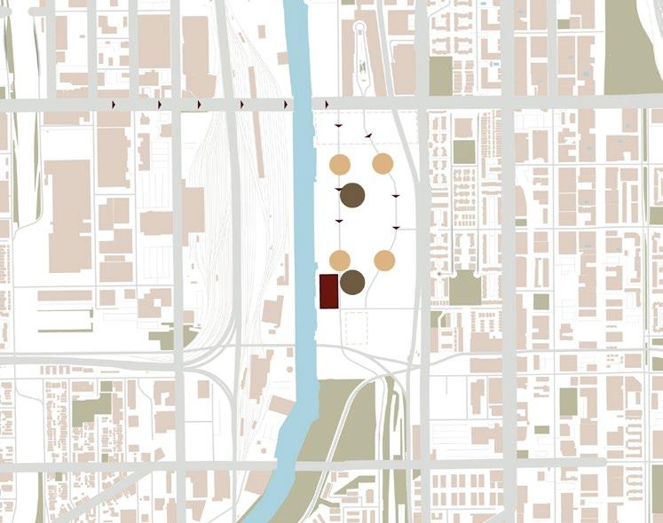
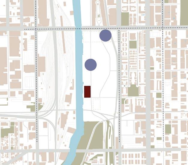
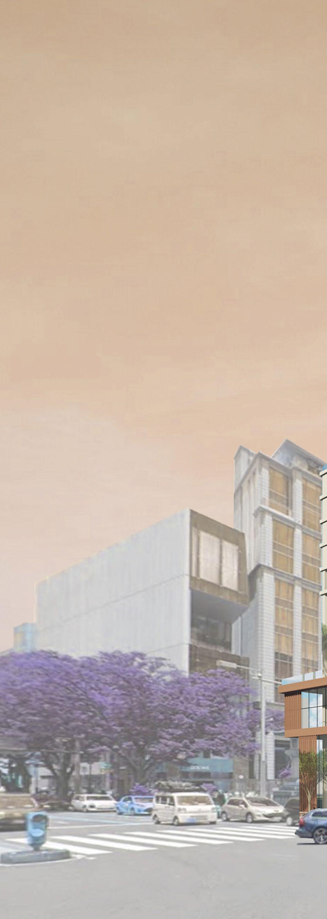
Location: The 78, Chicago, Illinois, USA
Professor: Thomas Leslie
Collaborator: Samruddhi Shirdhankar
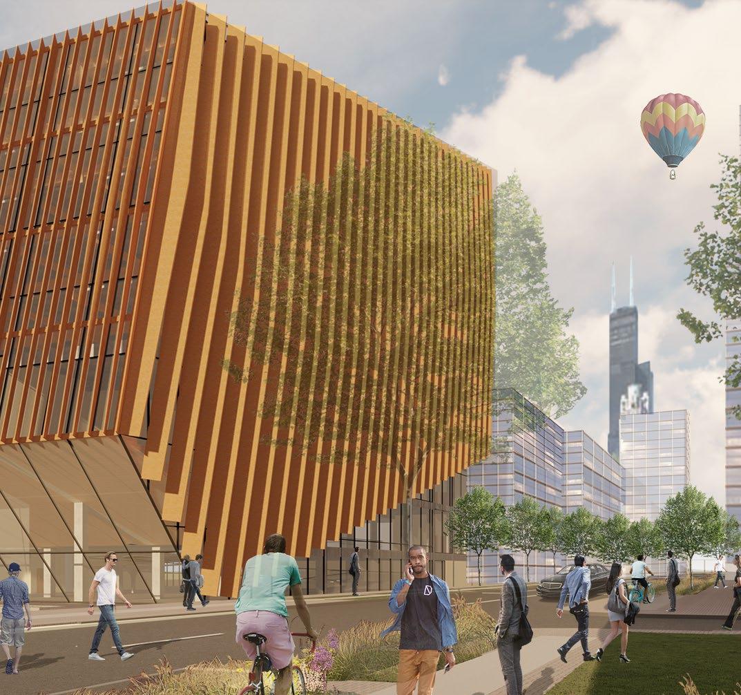
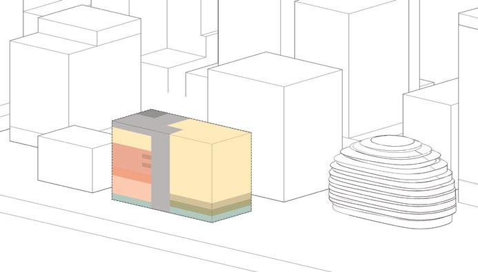
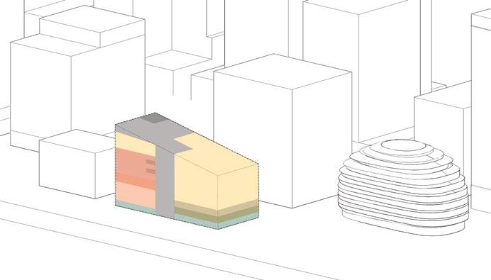
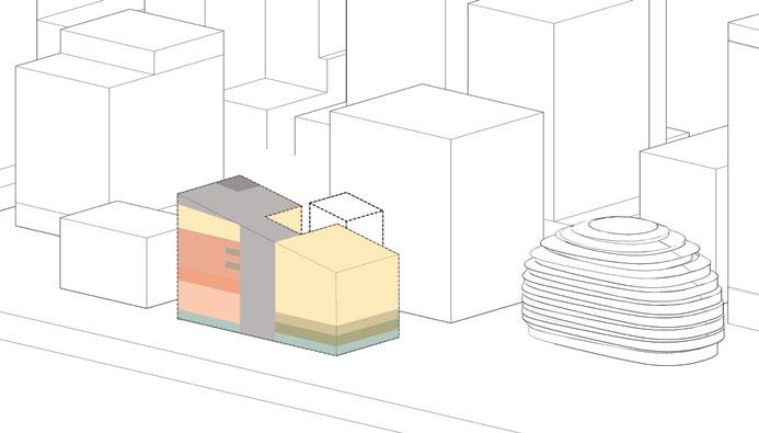
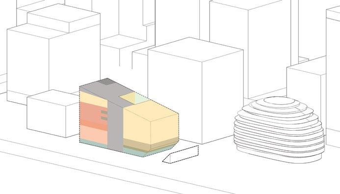
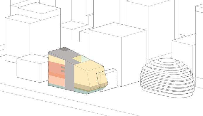
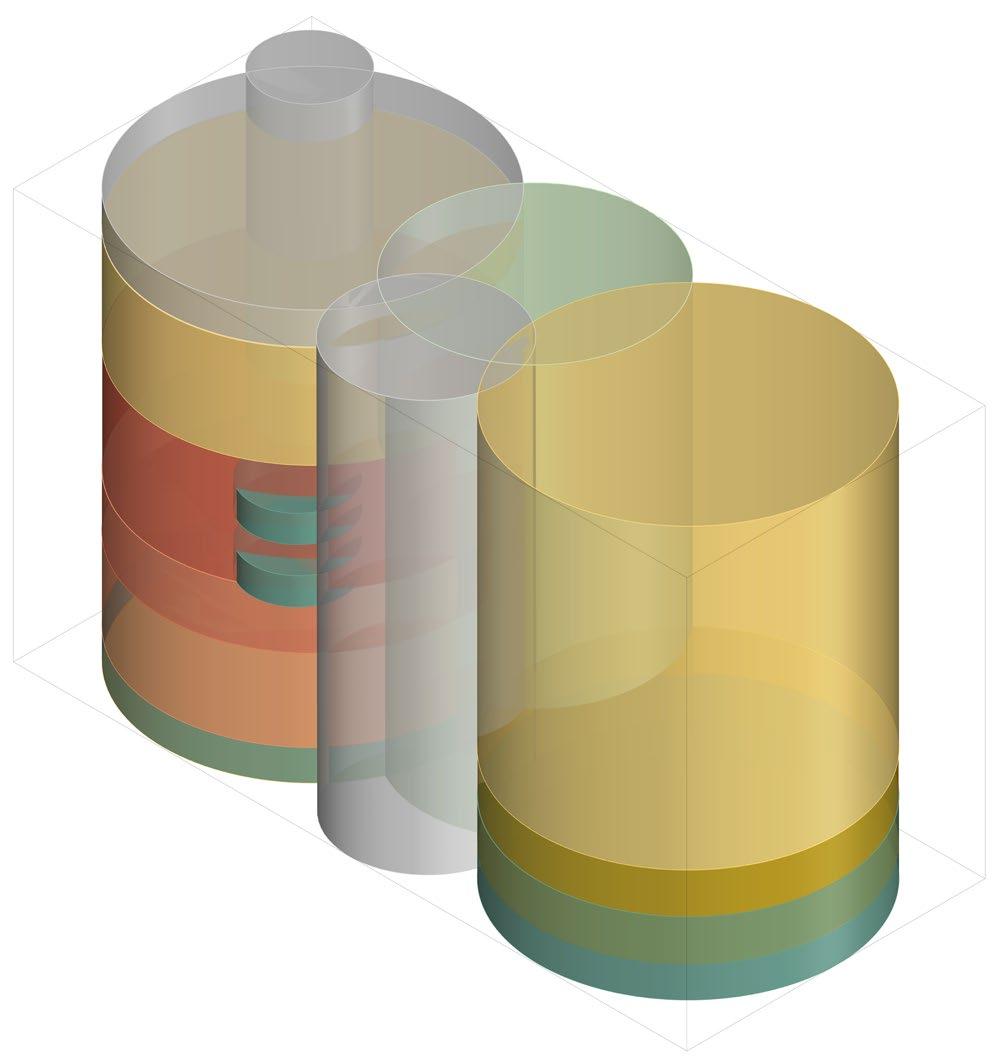
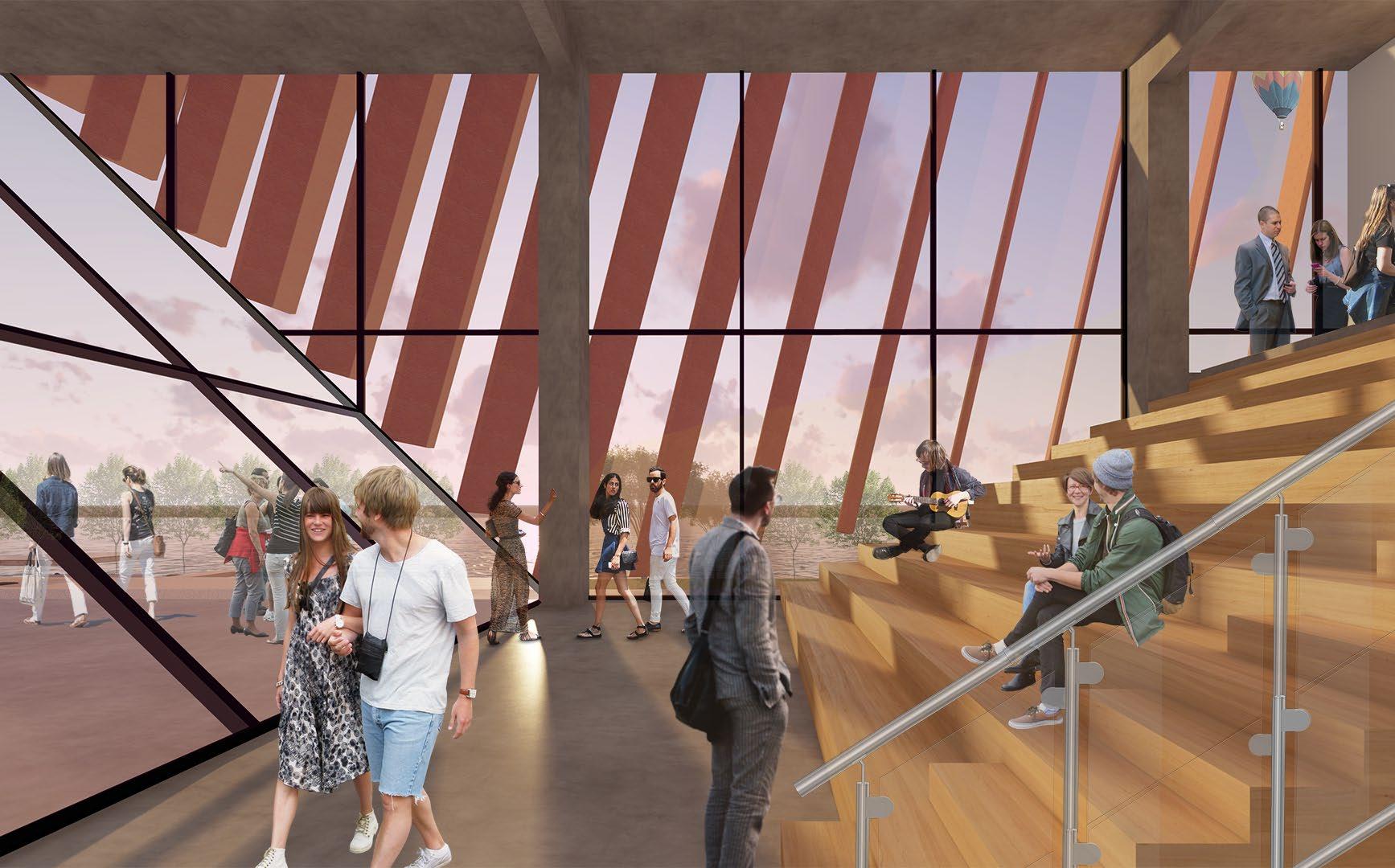
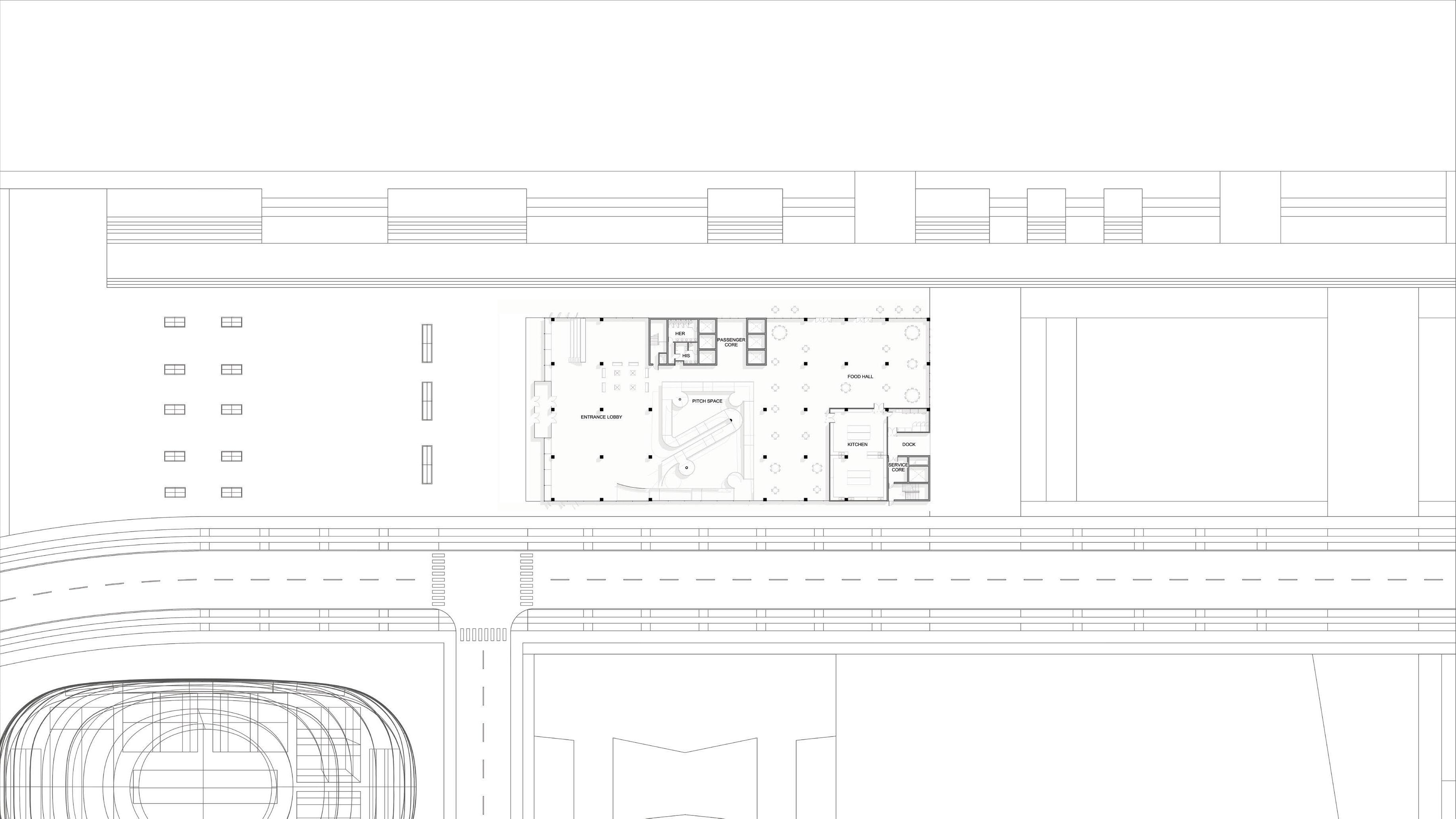
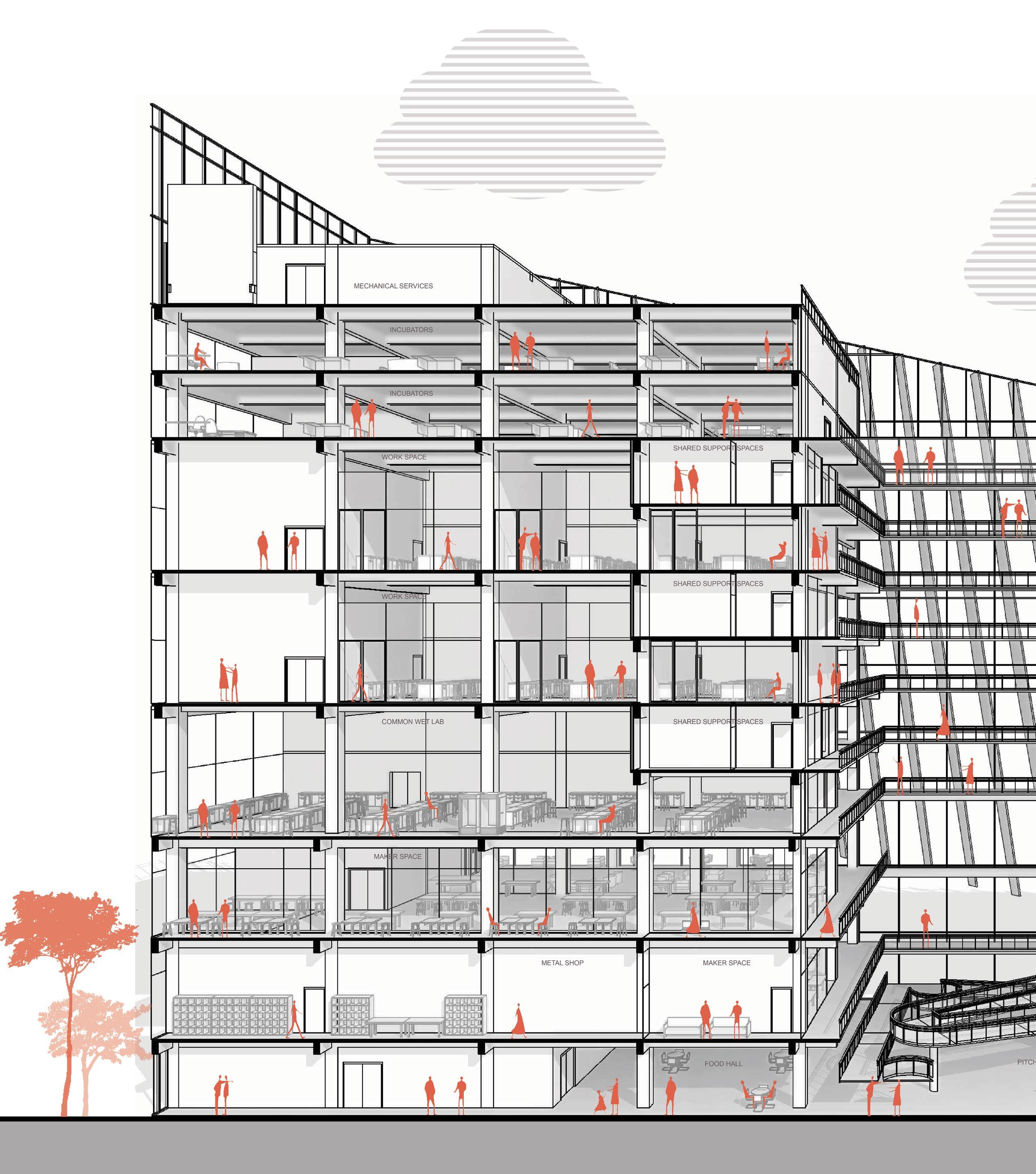
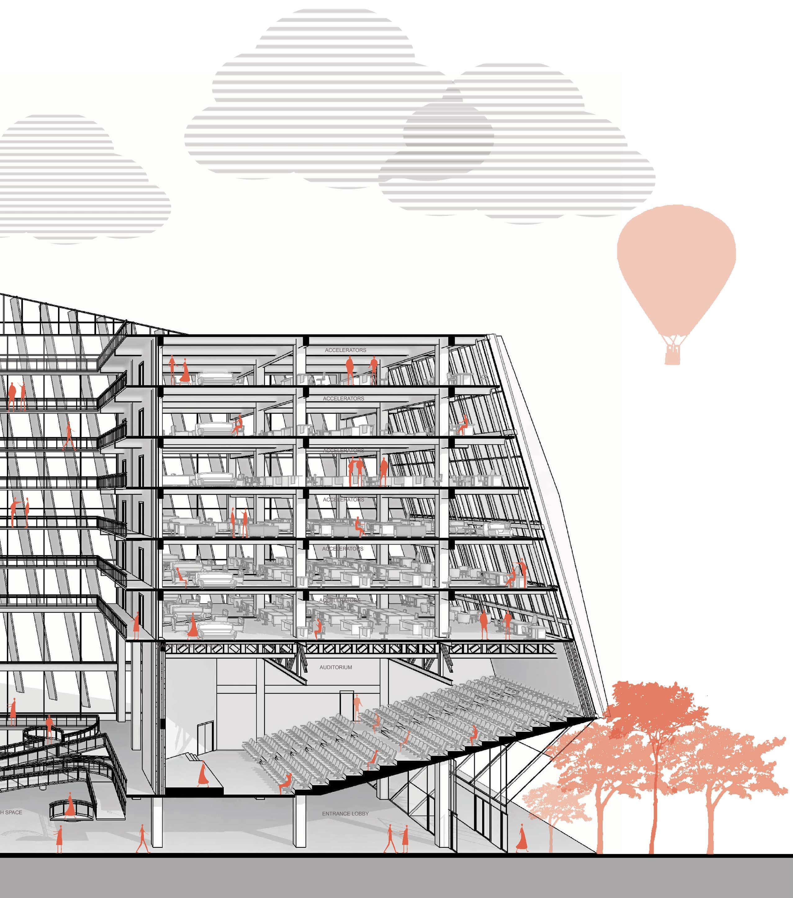
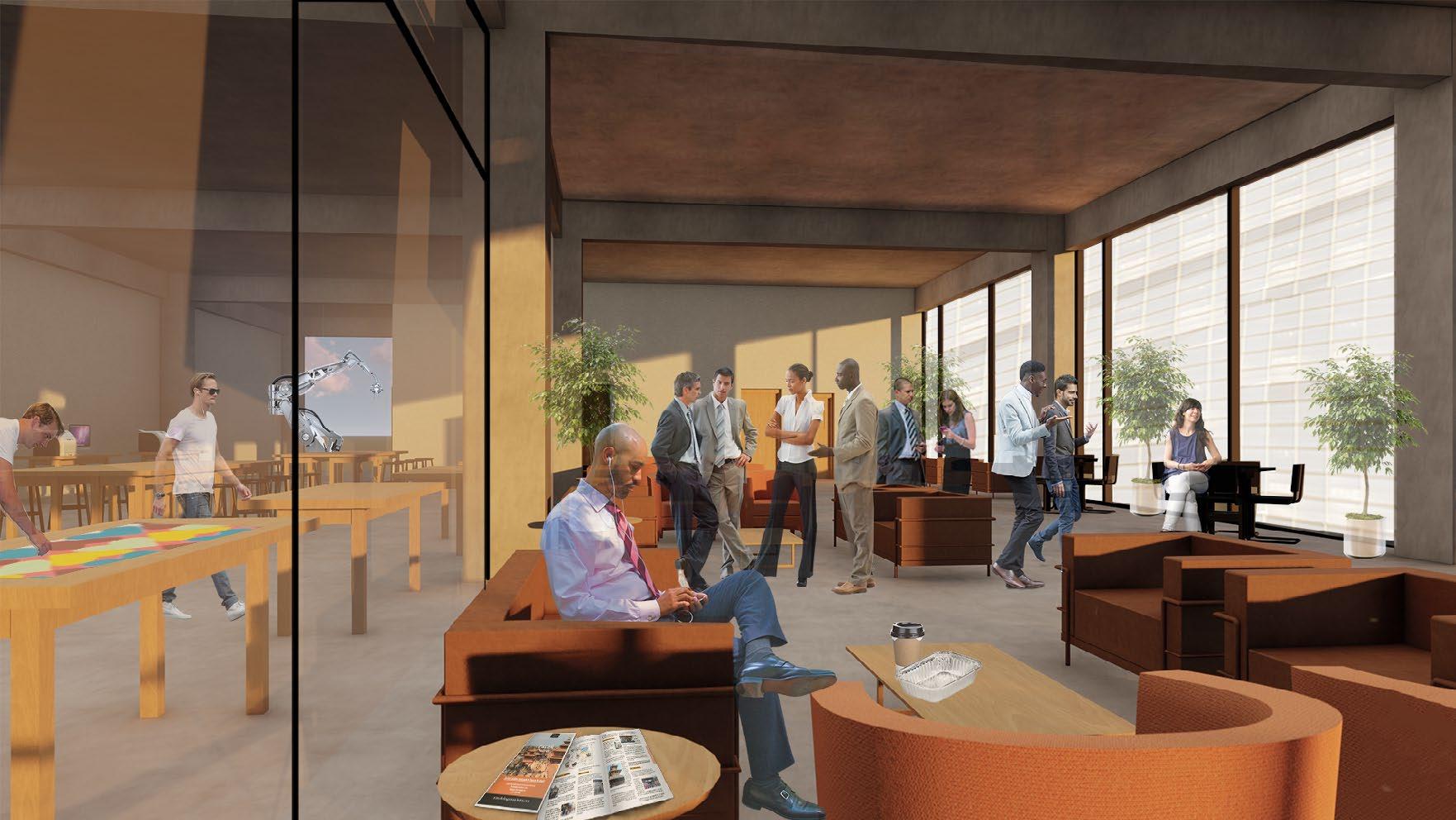
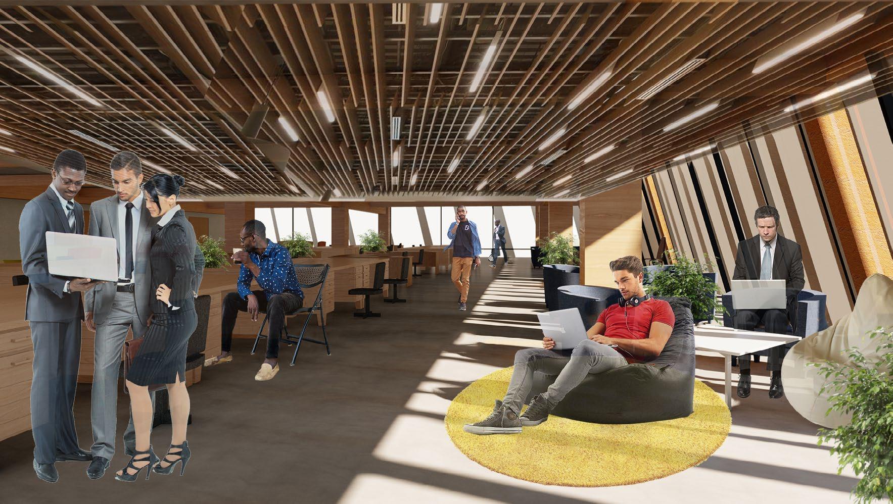
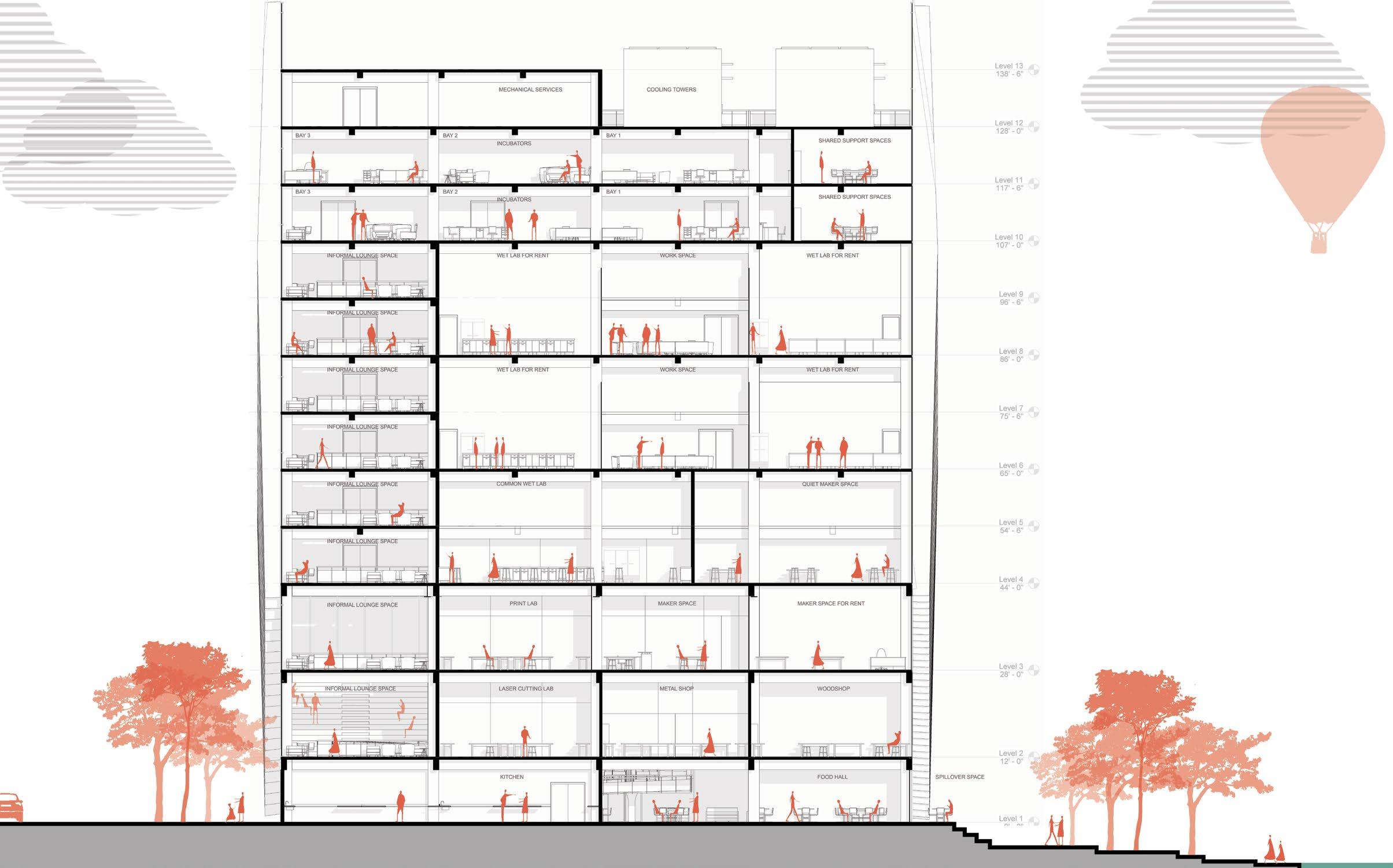
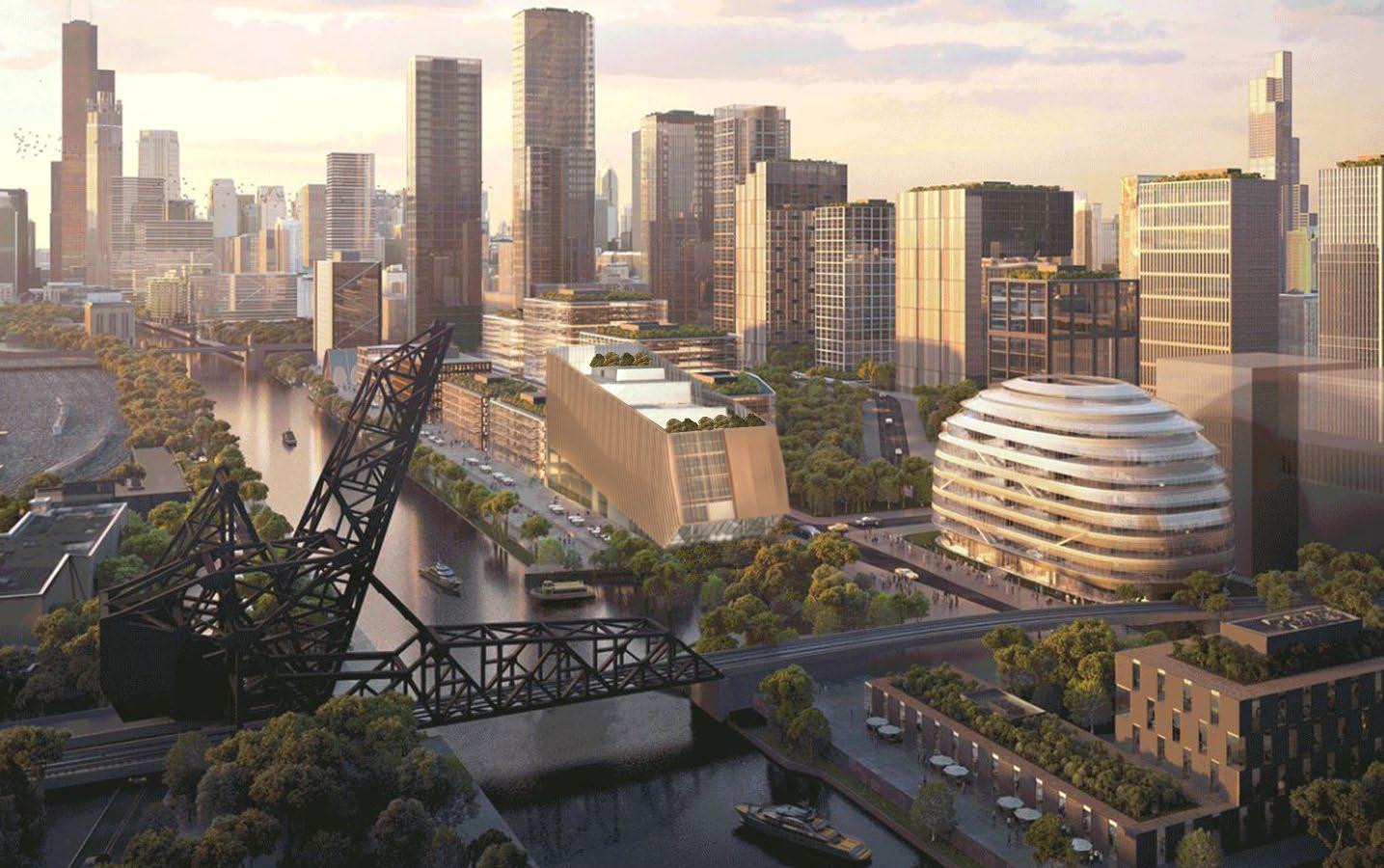
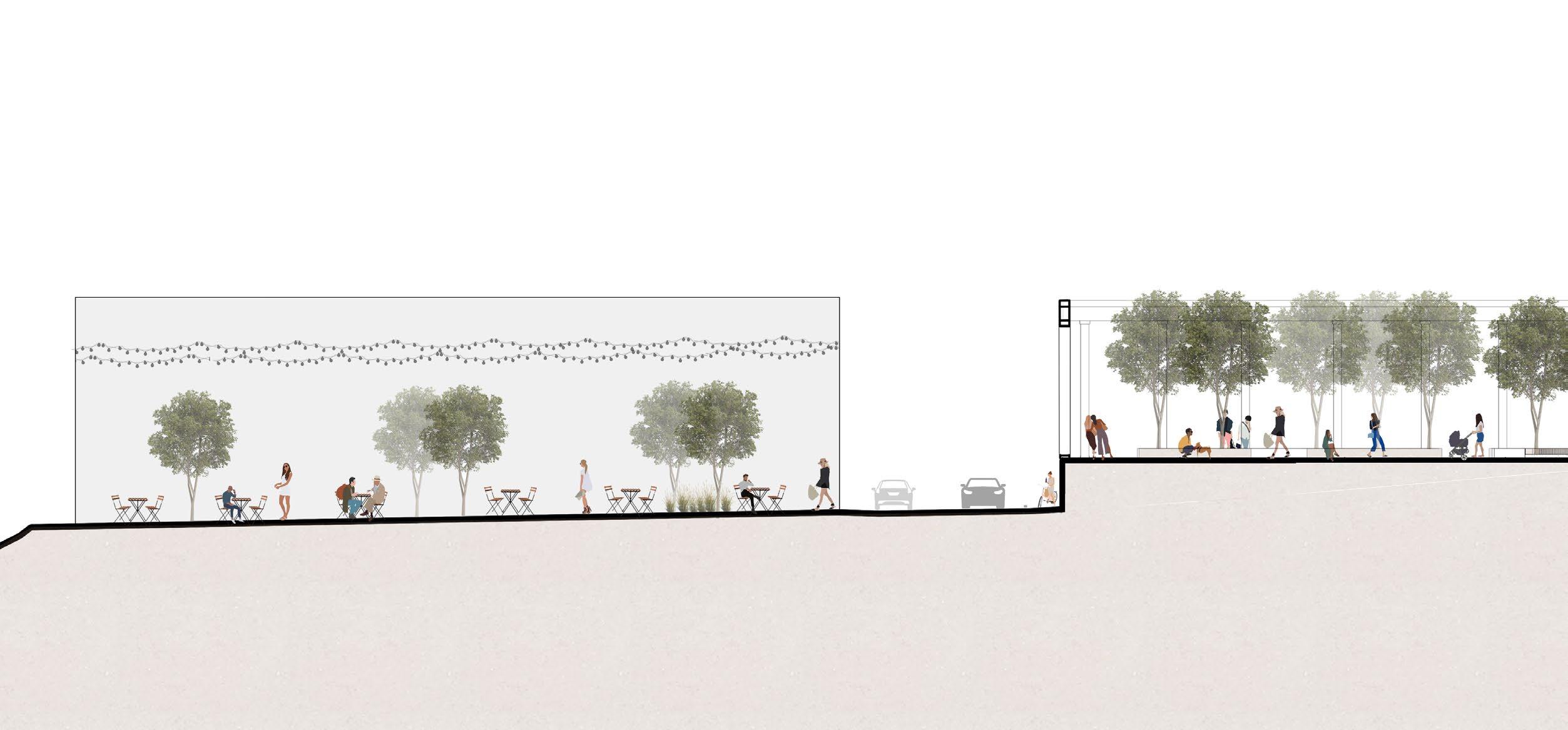
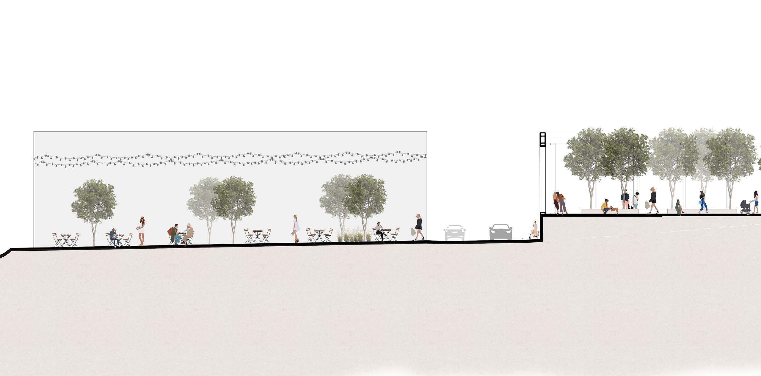
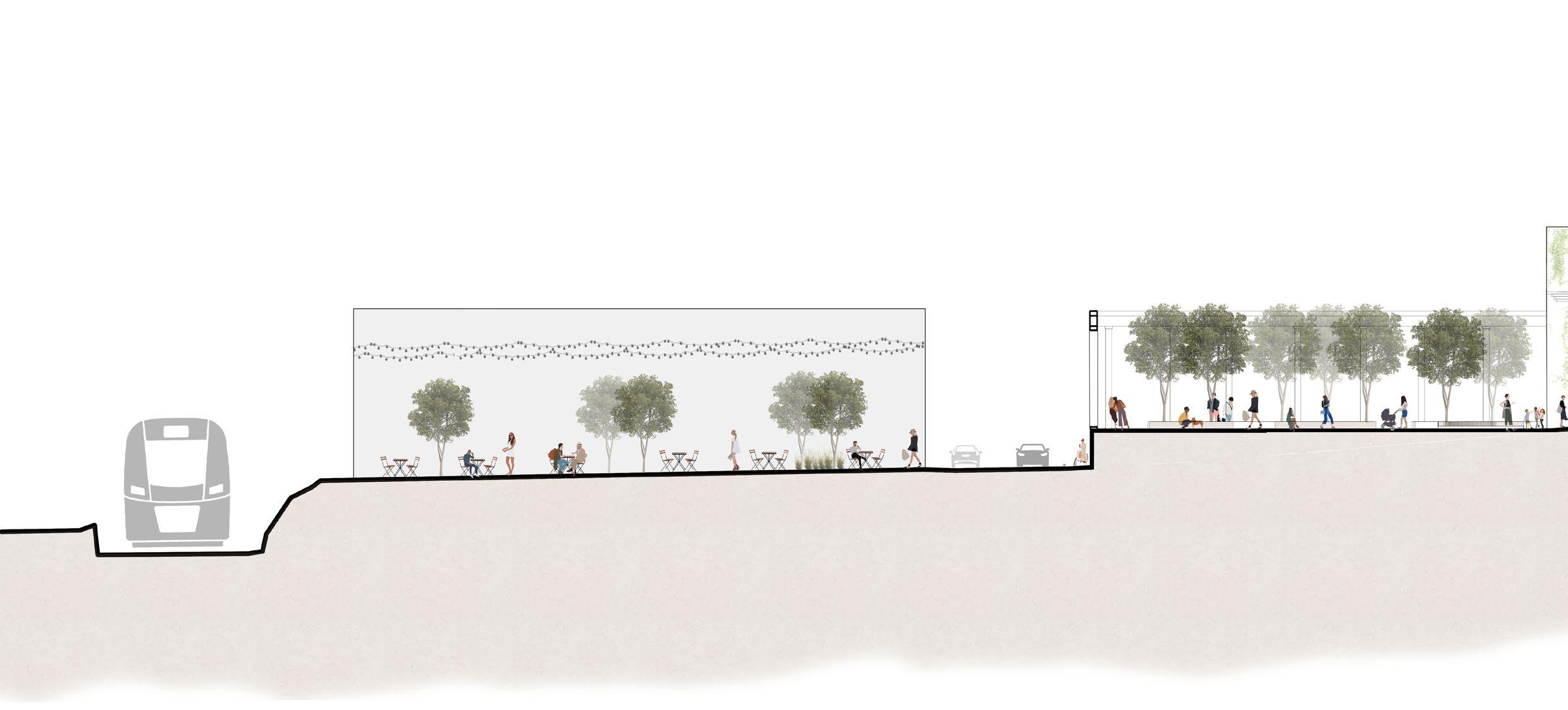
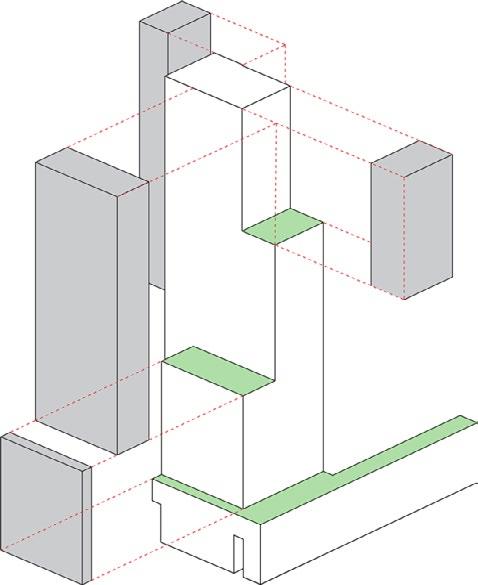
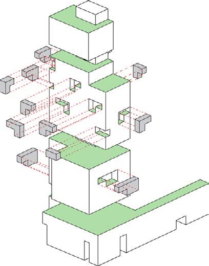
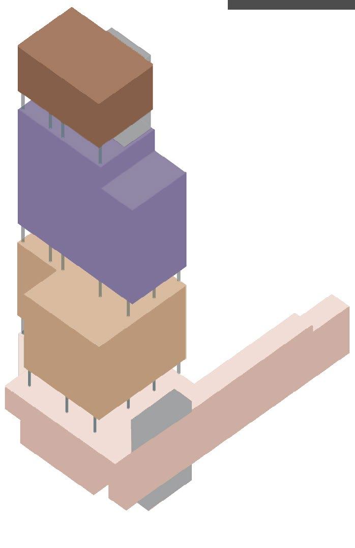
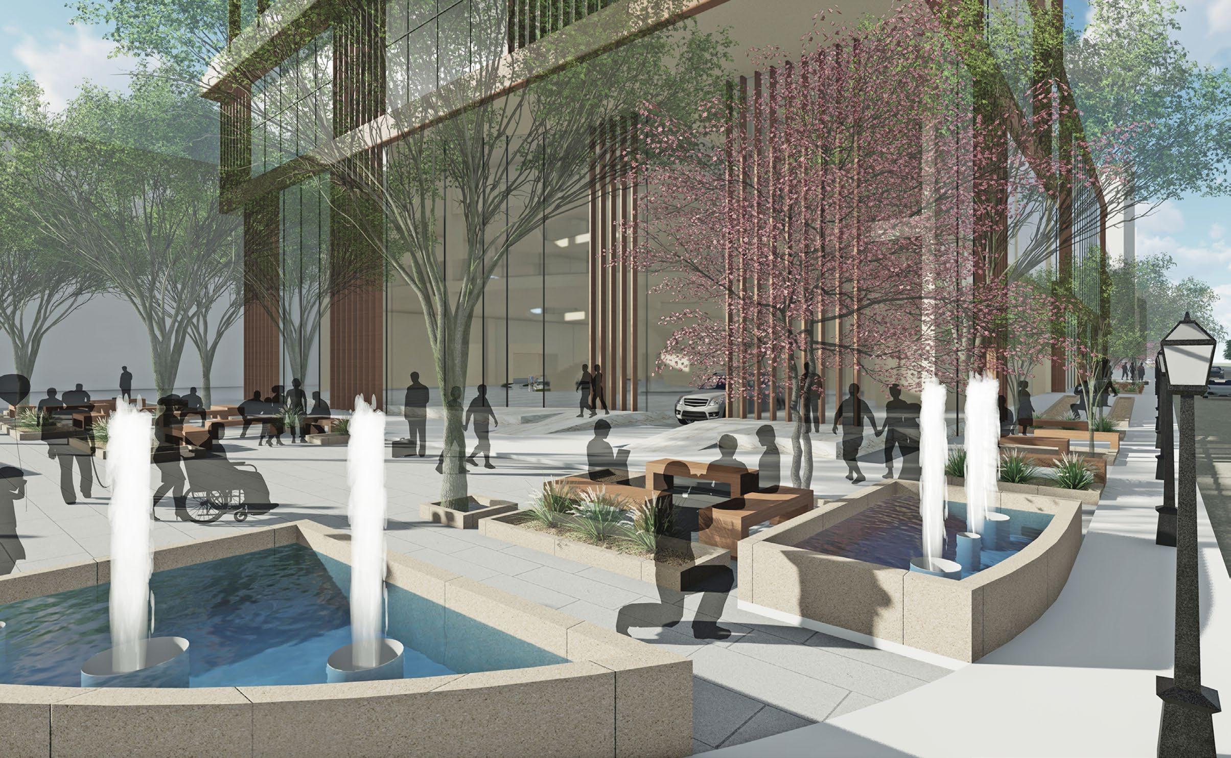
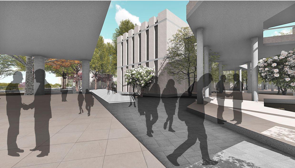
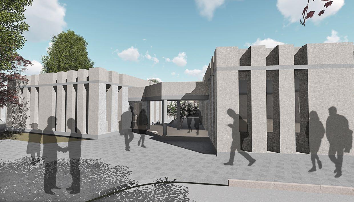
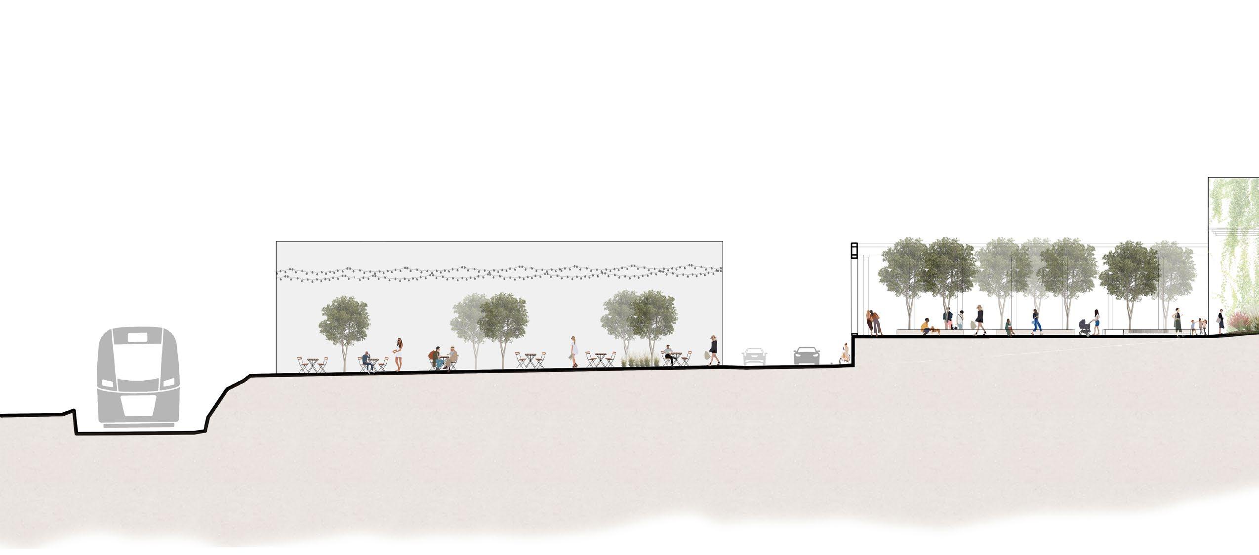
The 78 is an upcoming neighborhood development in Chicago - a transformative project poised to redefine the South Loop with a dynamic blend of residential, commercial, and green spaces. Central to this vision is an Incubator-Accelerator building, a state-of-the-art hub designed to catalyze innovation by offering startups and businesses an environment rich in resources, collaboration, and entrepreneurial opportunity. The design is conceived through the lens of a Venn diagram, where the realms of innovation, entrepreneurship, and collaboration seamlessly intersect. The design is driven by the desire to foster "collisions" - serendipitous encounters that spark creativity and new possibilities - by cultivating interconnectivity both visually and spatially. This vision is realized through a central interactive "spine" that harmonizes diverse programmatic spaces while preserving their functional autonomy. Although distinct, these spaces are intricately linked, allowing users to engage and experience the building in multiple dimensions. The building's dynamic form not only complements the site's unique features, but also thoughtfully maintains its connection to the nearby DPI building, reinforcing the synergy between these architectural landmarks.
Bronzeville Bridgeport
Pilsen
Little Italy South Loop
Chinatown
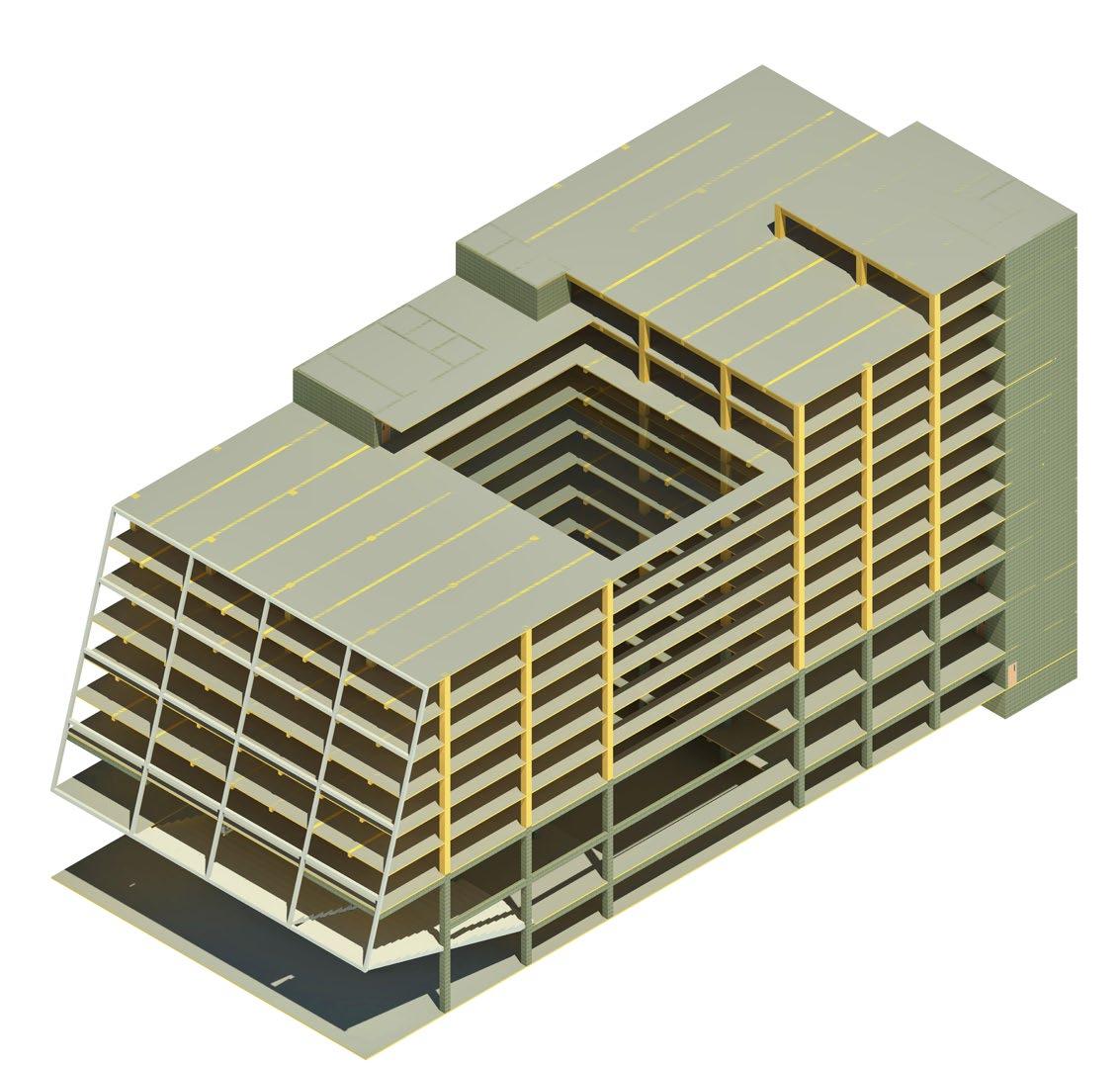
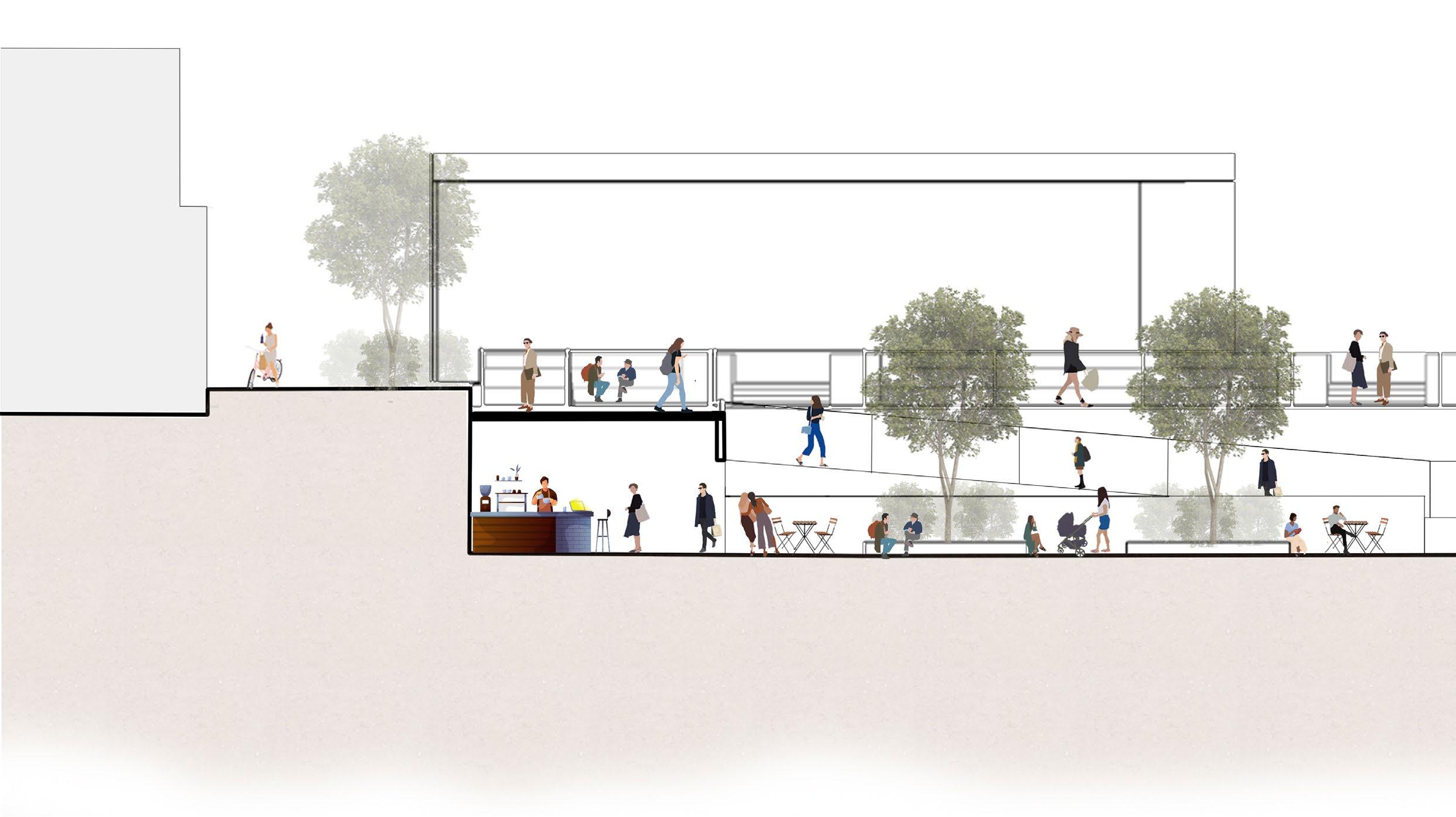
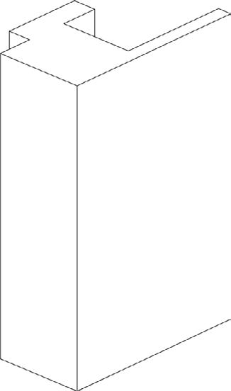
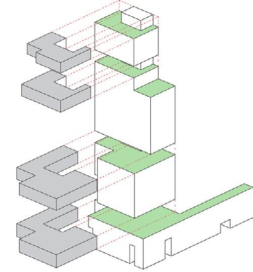
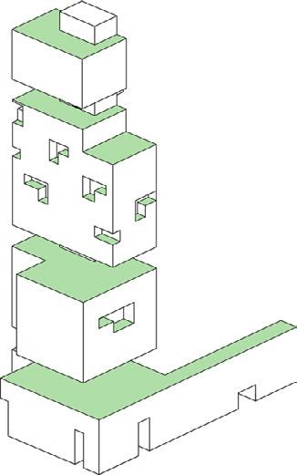
CONCEPT AND FORM DEVELOPMENT
The form development is inspired by the extrusion of a Venn Diagram, resulting in a dynamic, interconnected structure that harmonizes with the adjoining plaza and riverfront while maintaining a connection to the nearby DPI building.
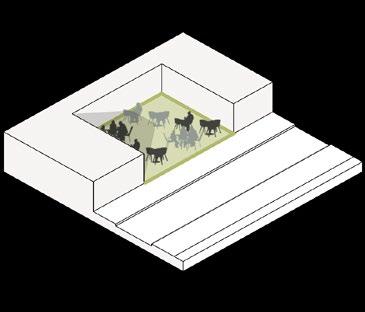
Informal Lounge Space
Central Pitch Space
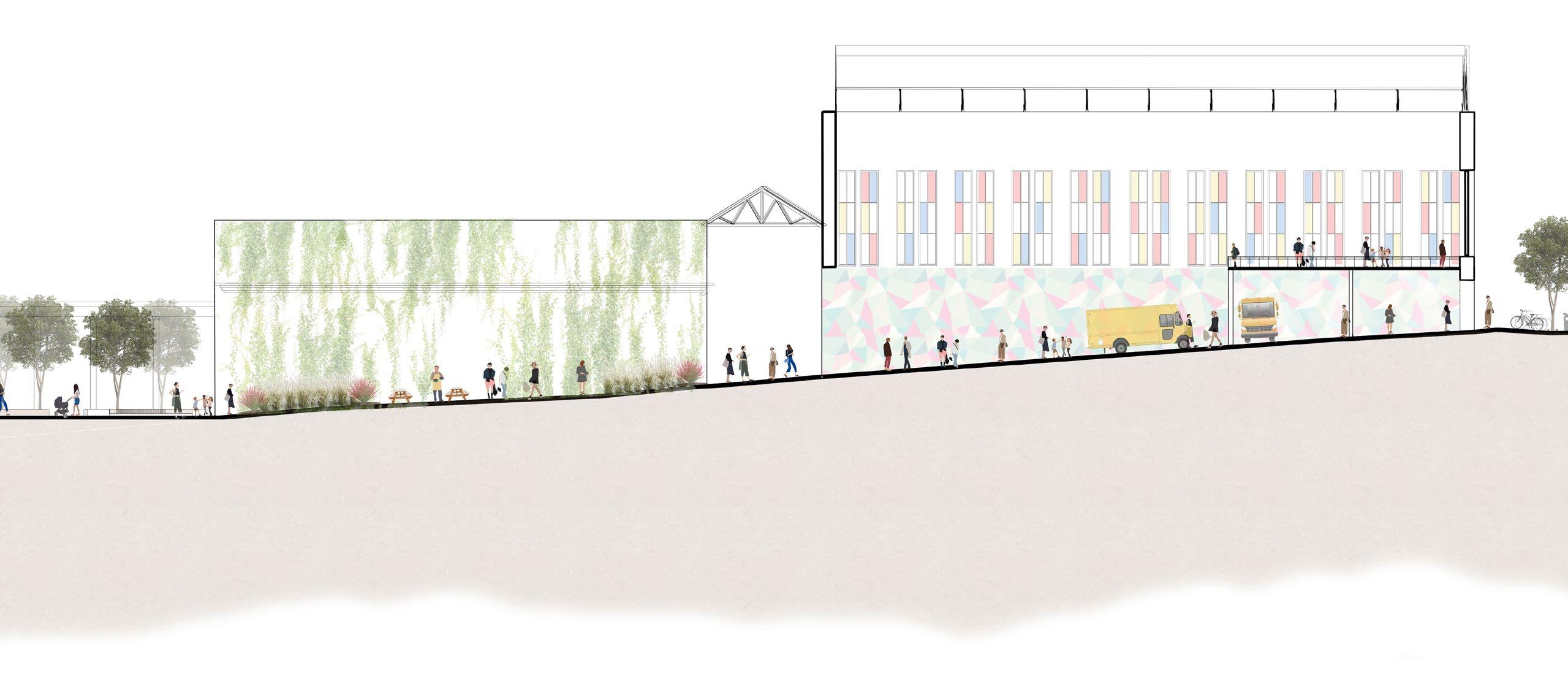
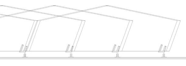
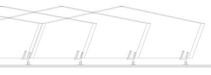
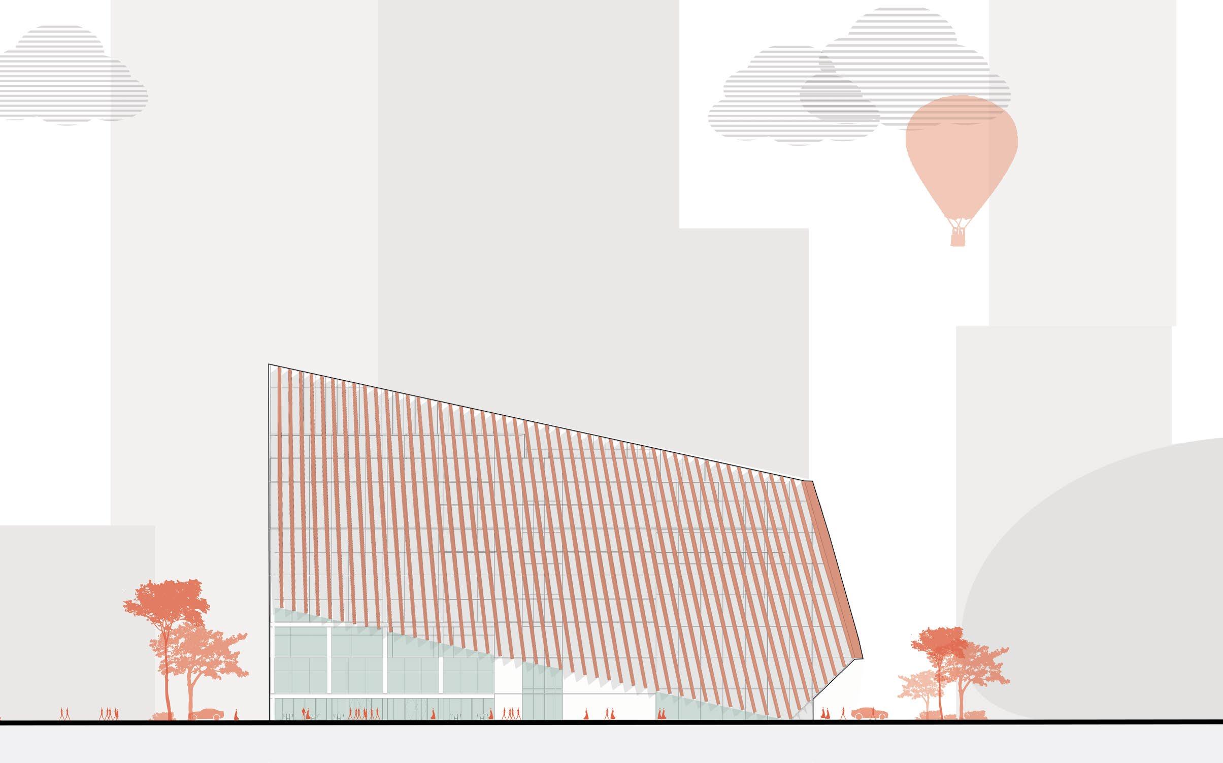
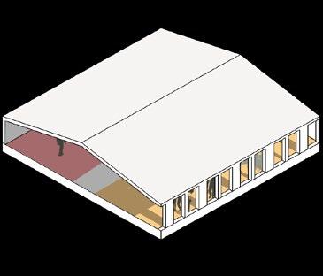
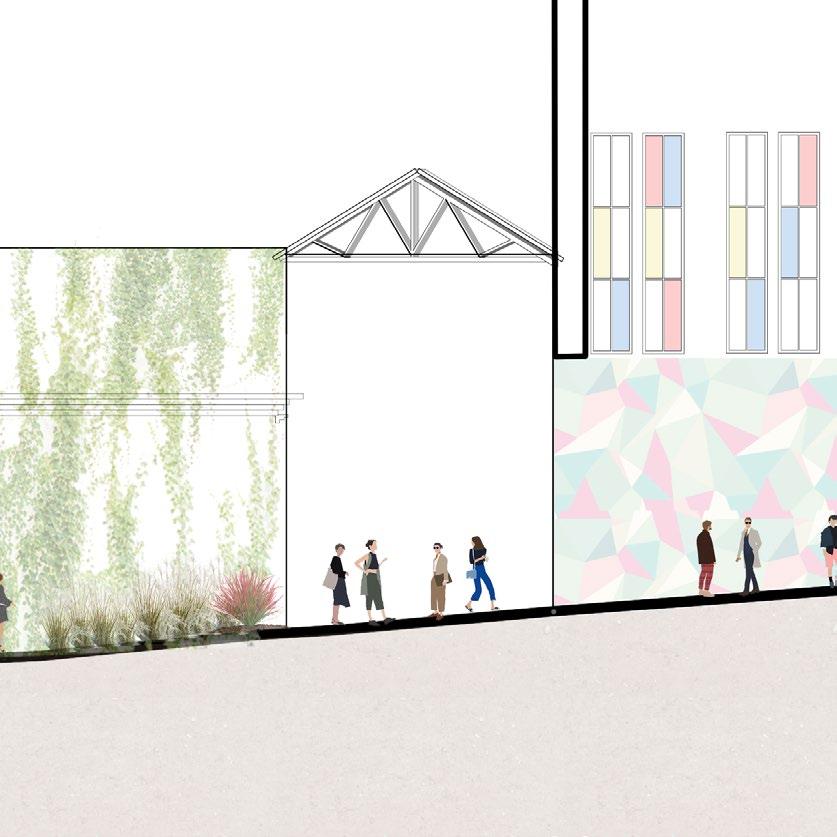
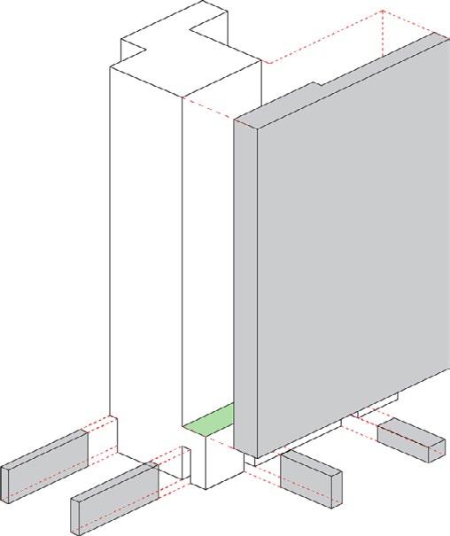
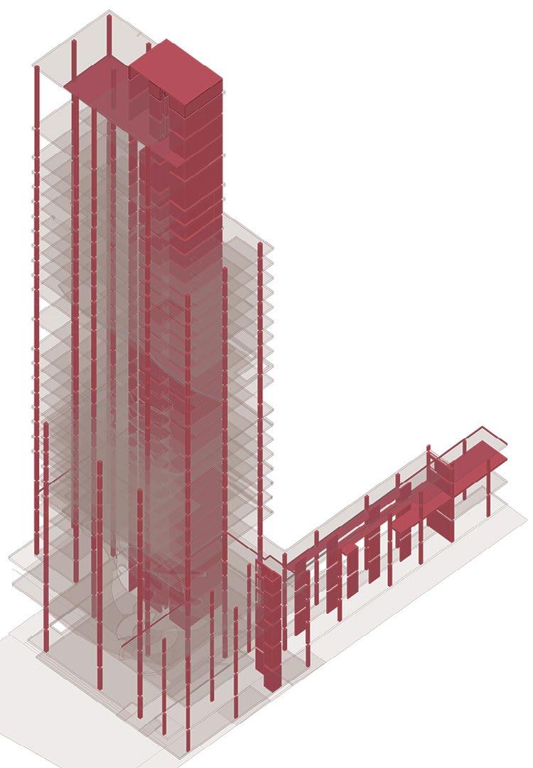
STRUCTURE AND CURTAIN WALL
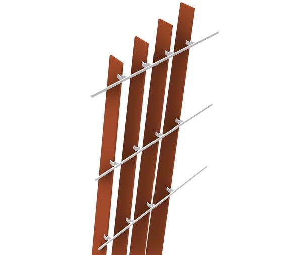
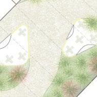
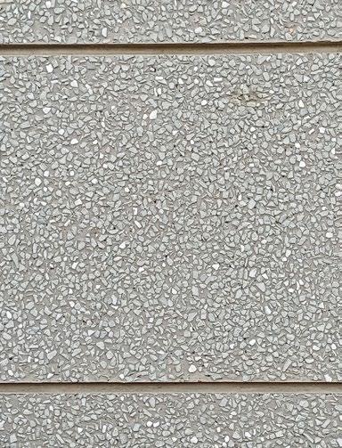
The design features a hybrid timber and concrete structure, blending the warmth and sustainability of timber with the durability of concrete. The facade is enhanced by terracotta panels on the curtain wall, providing a textured, natural aesthetic while offering energy efficiency and weather resistance.
Facade Details
The facade system chosen is insulated curtain wall system to reduce the amount of sunlight that penetrates through the facade. Additonally, angled terra cotta fins have been provided according to the solar analysis.
Facade Details
The facade system chosen is insulated curtain wall system to reduce the amount of sunlight that penetrates through the facade. Additonally, angled terra cotta fins have been provided according to the solar
Facade
02 kaleidoscope.
Revitalizing a forgotten neighborhood
M.Arch | UIUC | Spring 2022
Location: Quatre Cantons, Barcelona, Spain
Professor: Sara Bartumeus
Collaborators: Wenxin Dai | Abhishek Vaidya
"The idea behind a kaleidoscope is that it is a structure that's filled with broken bits and pieces, and somehow if you can look through them you see something beautiful."
~ Sara Bareilles
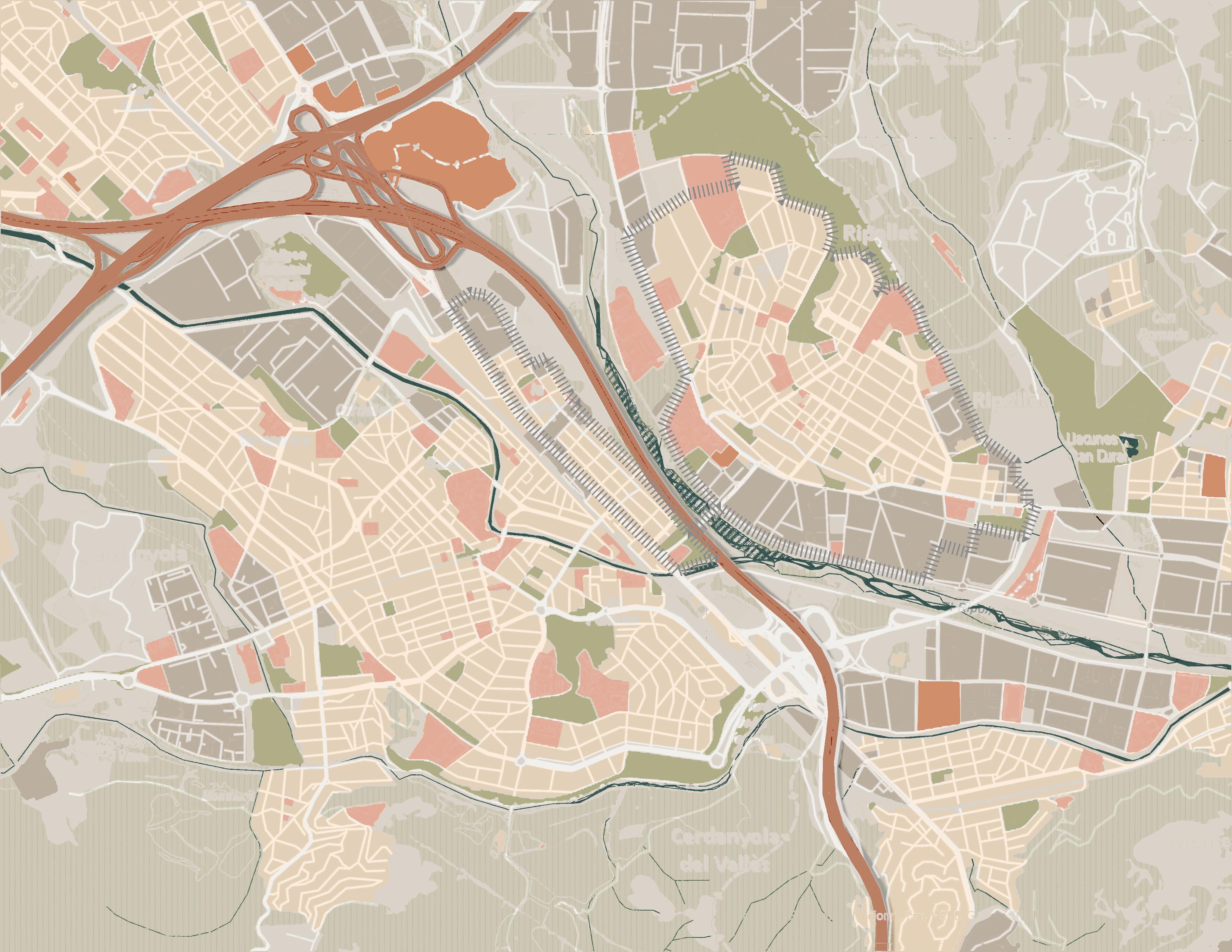
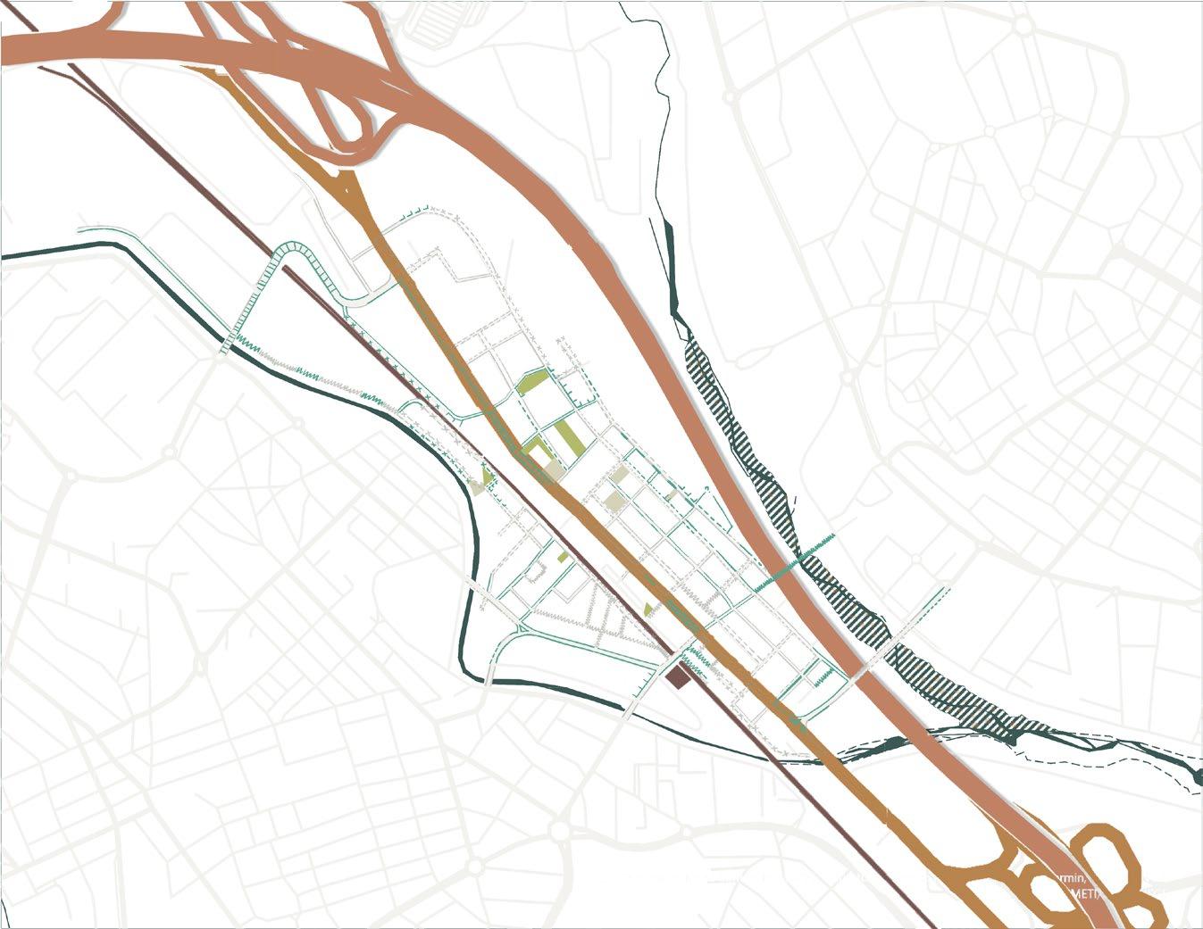
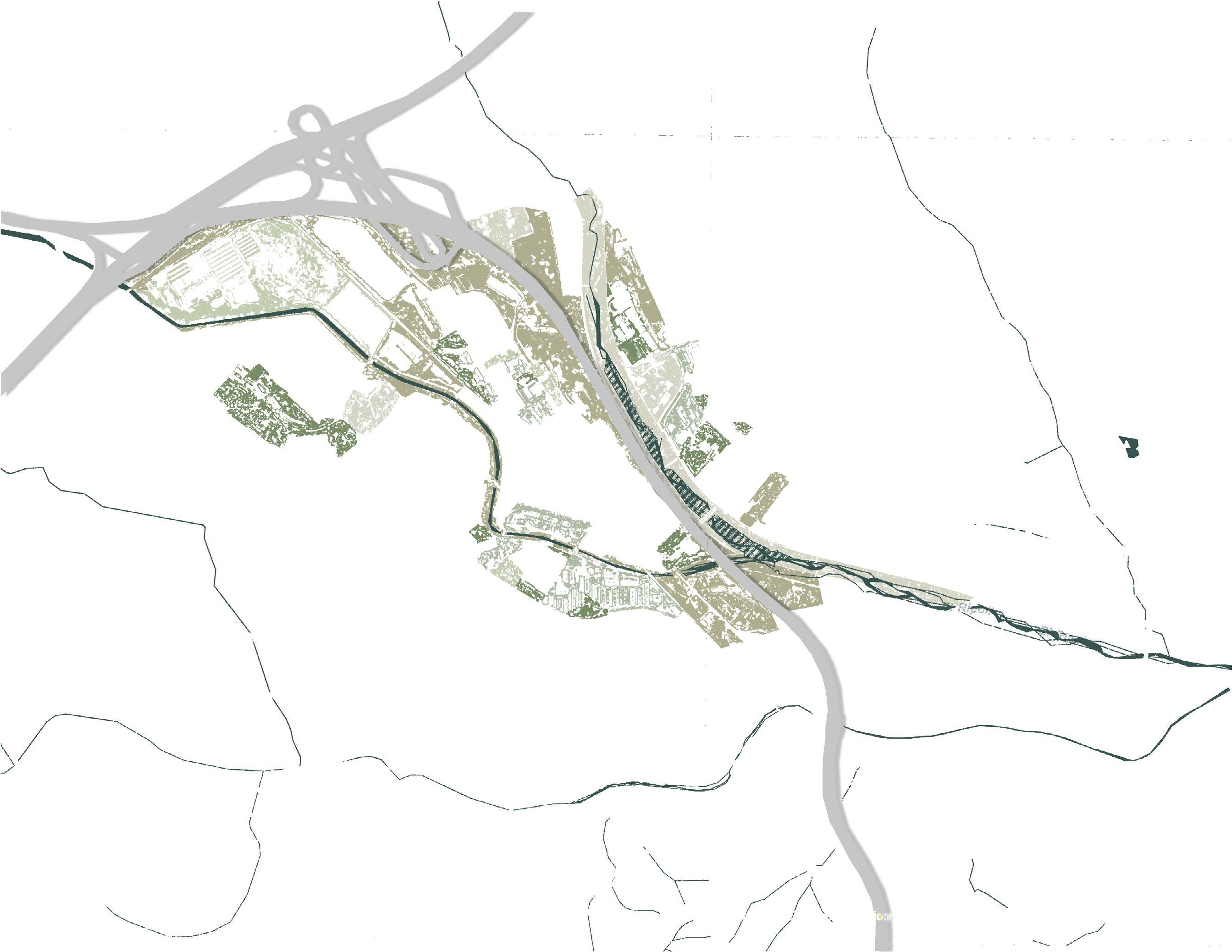
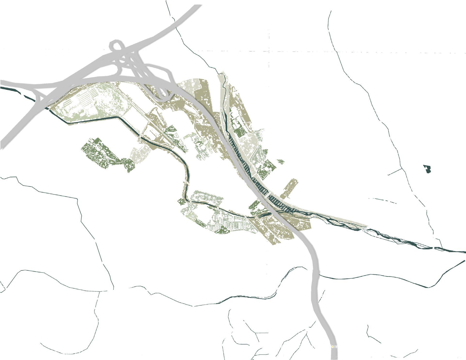
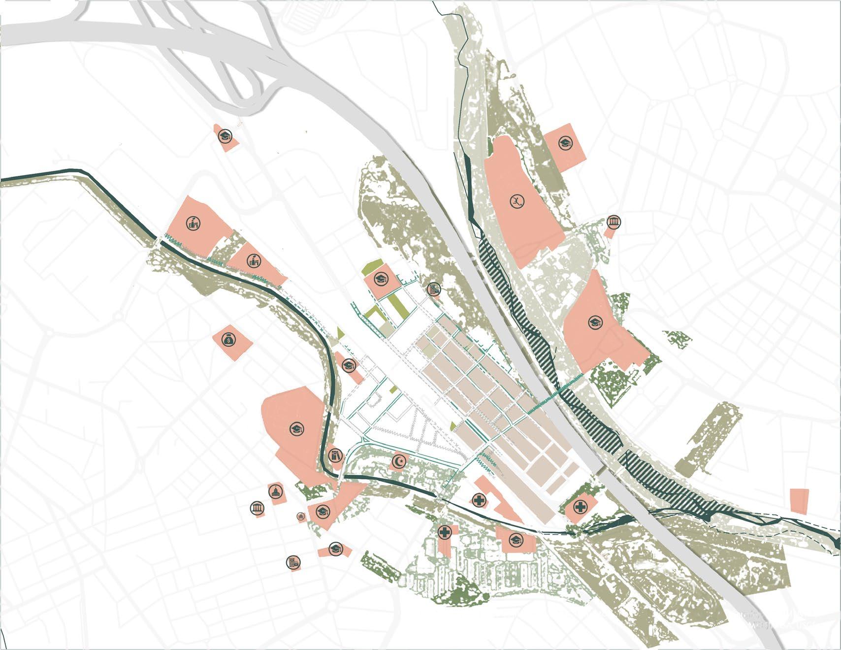
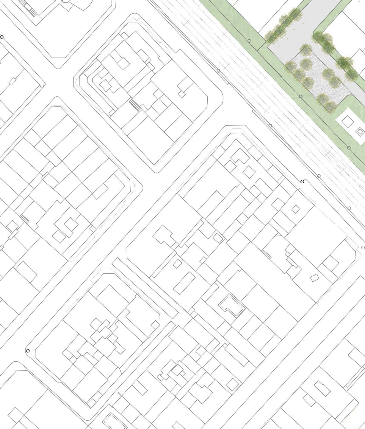
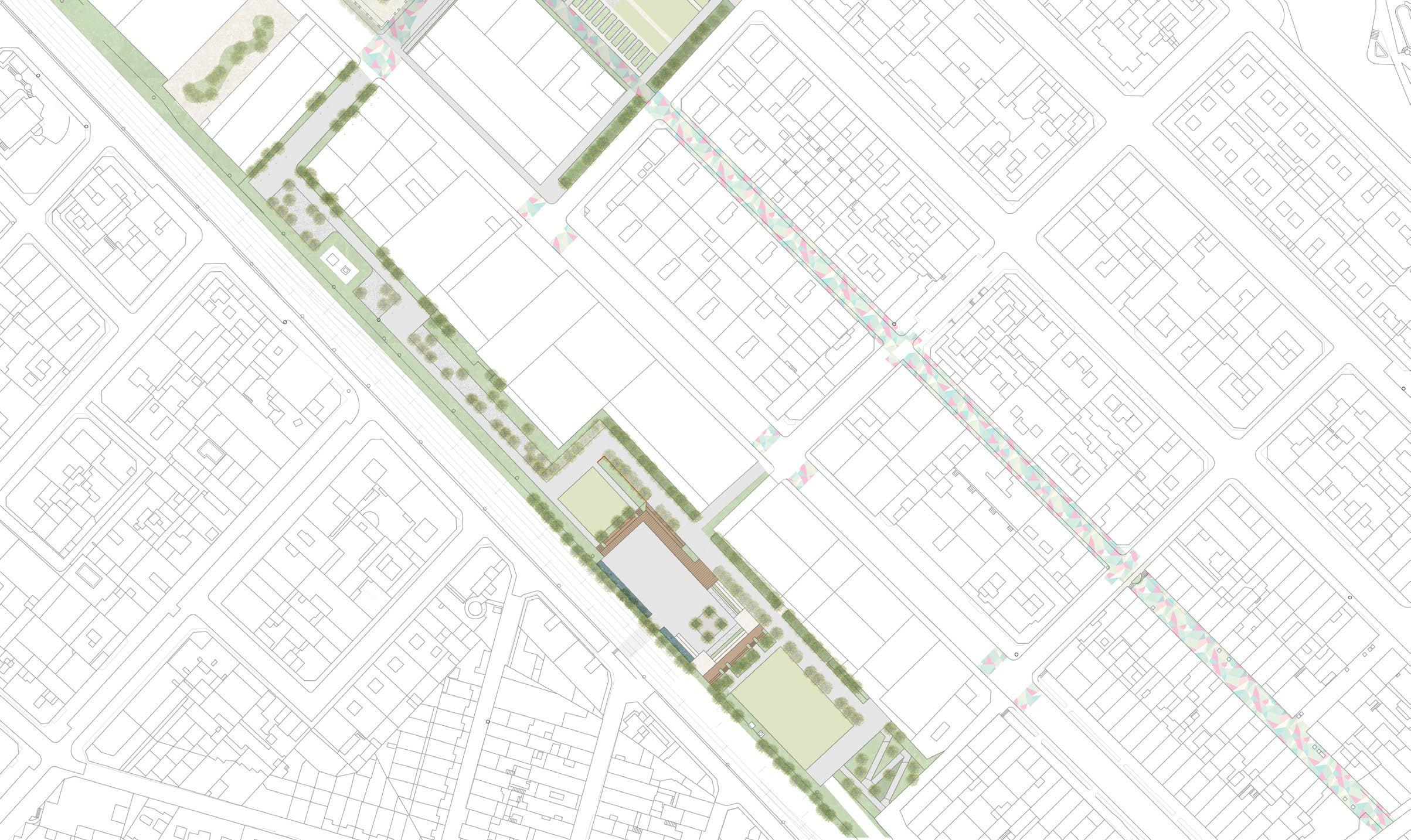
Quatre Cantons is a neighborhood straddling two municipalities - Ripollet and Cerdanyola del Valles - a forgotten entity, overlooked by its own people. Reconnecting this area, which is fragmented by rivers, a national highway, and a railway, serves as the central driving force behind the project. A comprehensive network is proposed, linking key nodes and creating new connections to replace the current disjointed state of the neighborhood. The primary aim is not just to offer isolated solutions, but to unify the entire area into a cohesive whole. Art, as a core cultural identity, plays a pivotal role in this revitalization. Local artistic expressions are interwoven into the fabric of the neighborhood, infusing the spaces with vibrant colors that reflect the dynamic energy of a kaleidoscope. This project seeks to breathe life into lost connections through thoughtful interventions and renovations, all while preserving the neighborhood s unique identity with a renewed perspective.
ANALYSIS
A range of analytical perspectives is employed to explore the existing conditions of both the built and unbuilt fabrics o neighborhood, guiding the formulation of a comprehensive and nuanced intervention strategy.
Pedestrian Network Analysis
Vehicular Network Analysis
One way roads
Double lane roads
Multiple lane roads
Multiple lane roads with vegetation dividors
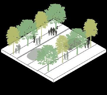
ANALYSIS OVERLAY AND INTERVENTION
The analyses of various existing networks within the neighborhood are layered and refined, focusing on key aspects and intervention zones poised to catalyze transformative changes and drive significant improvements.
Analysis Overlay
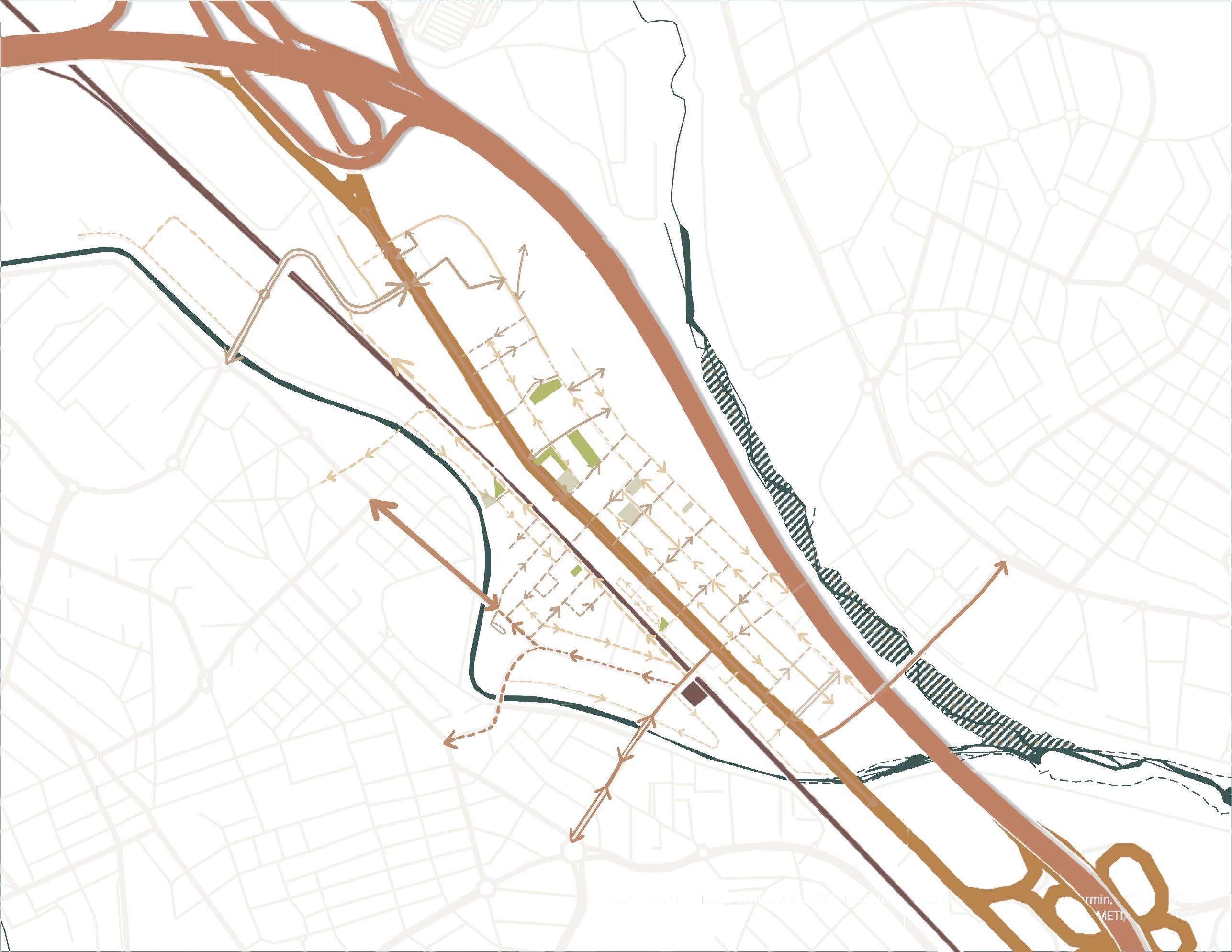
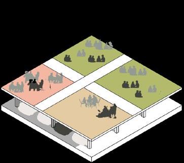
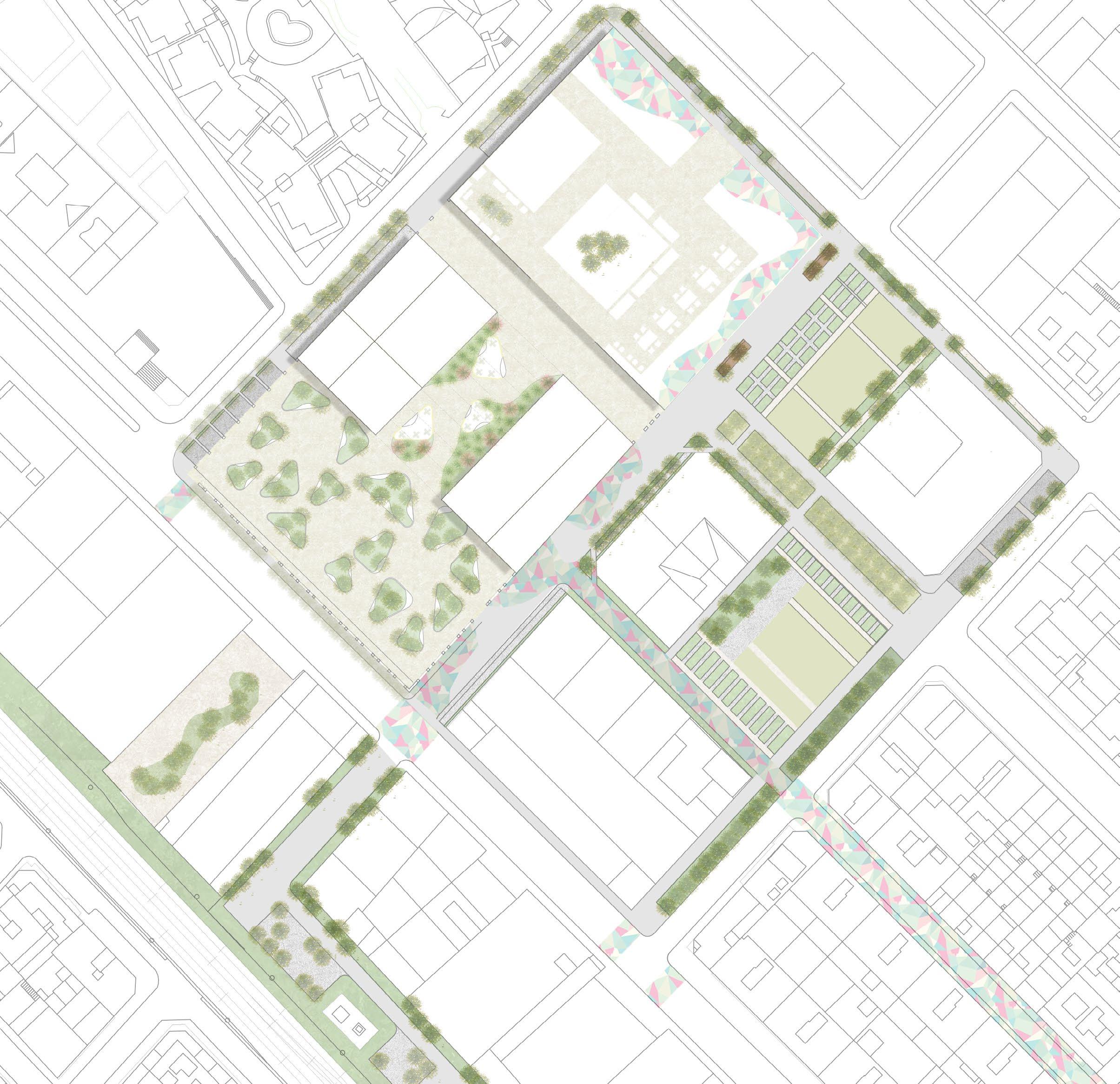
DESIGN INTERVENTION STRATEGIES
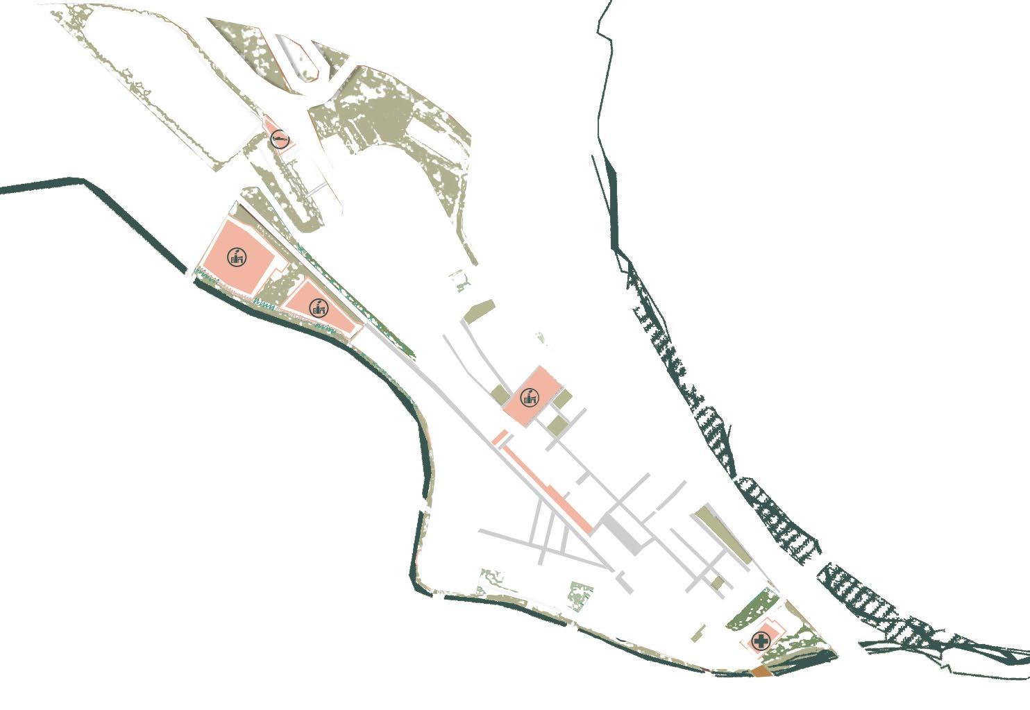
A network is woven across the neighborhood, creating a unifying strategy to restore lost connections. This framework identifies three key areas, serving as anchors for the revitalization and reintegration of the community.
Improving connectivity
Existing connectivity
Adding open spaces
Existing open spaces
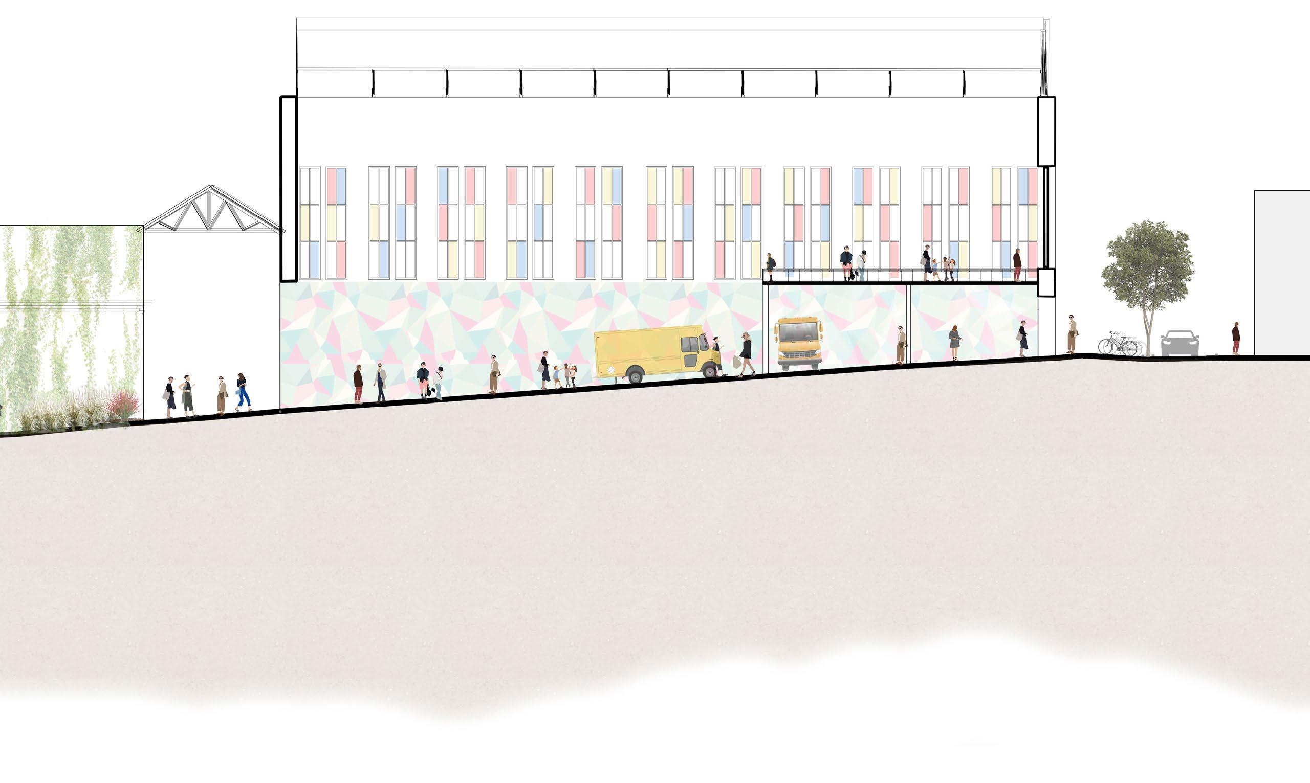
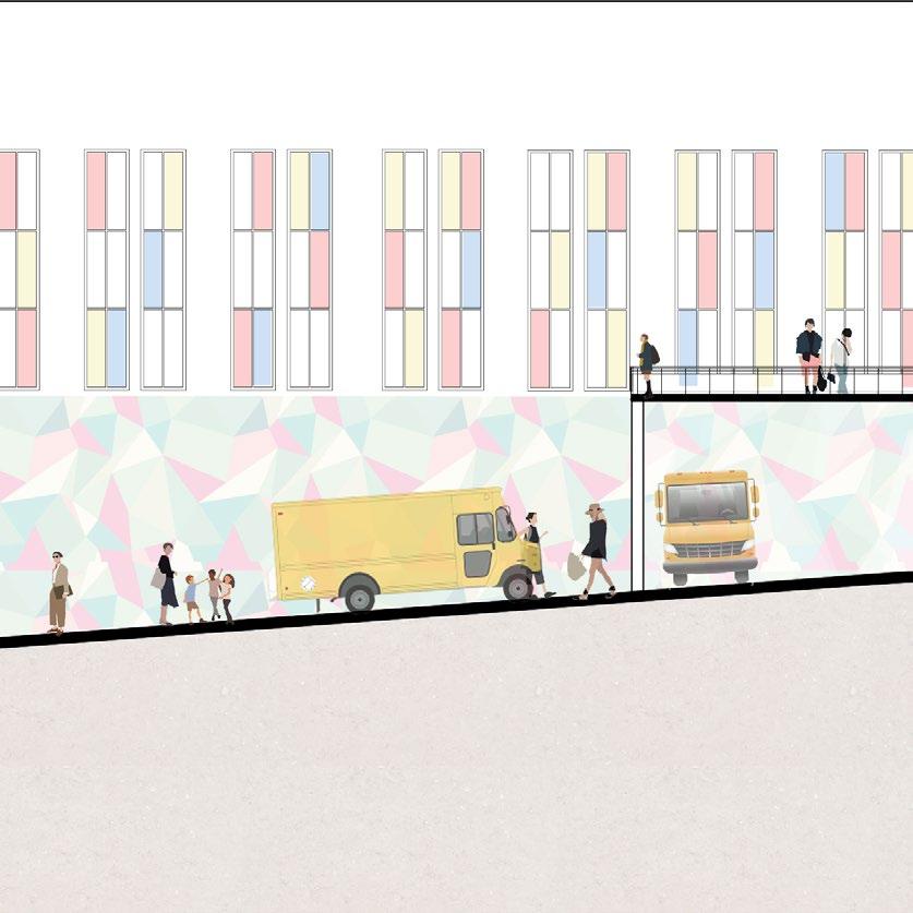
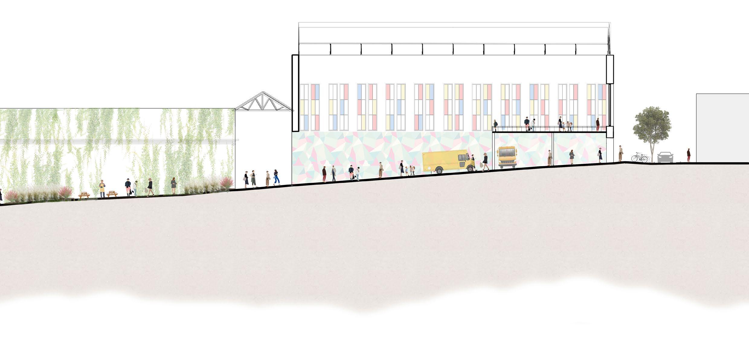
MuralCrossings
PedestrianStreet
CommunityGarden andPark
MuralCrossings
CommunityGarden andPark
Grids and Trees Islands and Clearings
Light, Enclosure, Nature
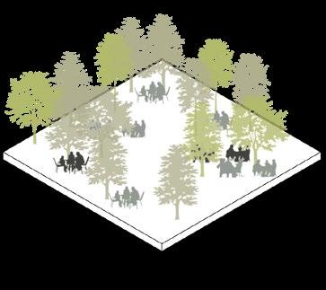
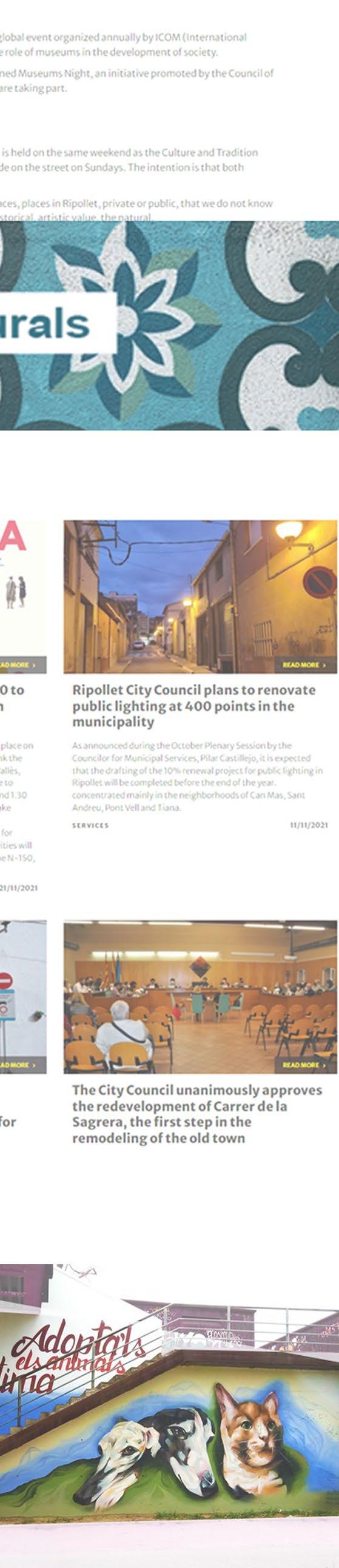
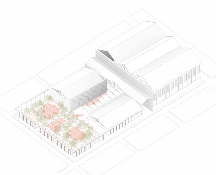
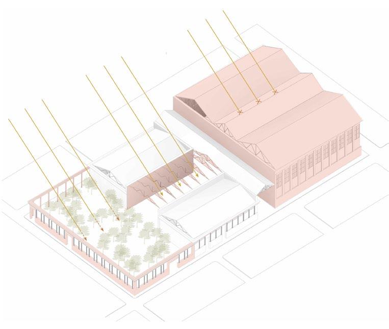
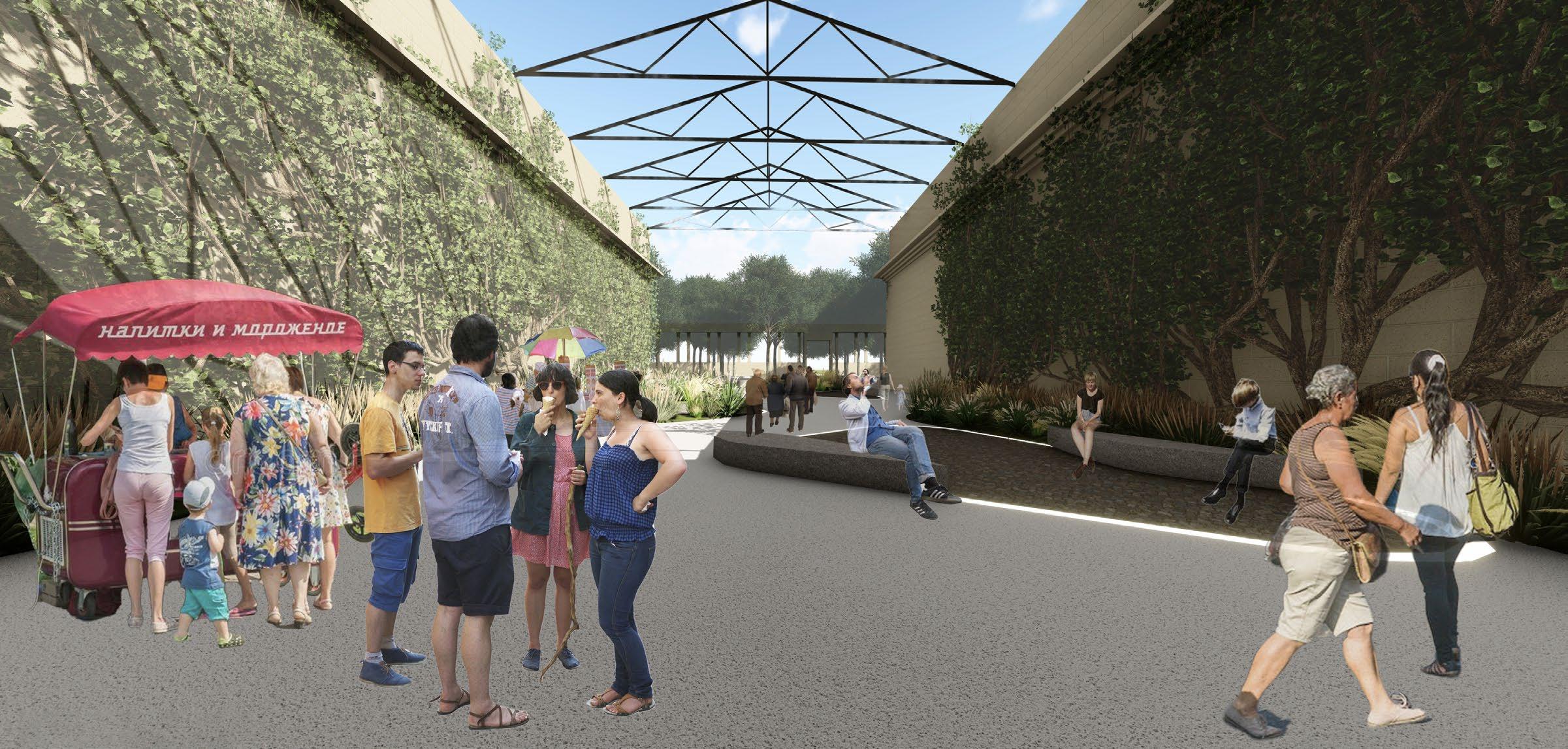
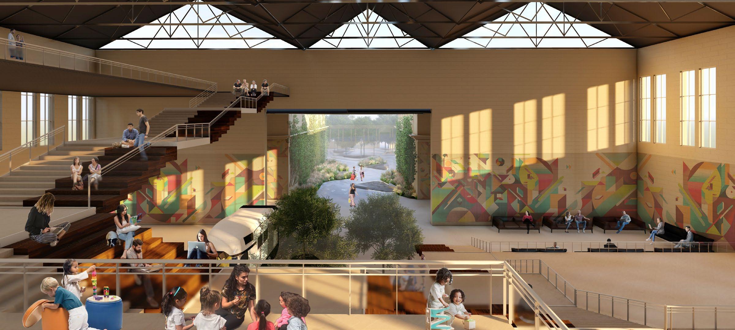
A public plaza is created by removing the roof of an abandoned industry space filled with trees that filter the harsh sunlight
An outdoor seating is added in this plot of land which serves as an extension to an adjoining existing restaurant
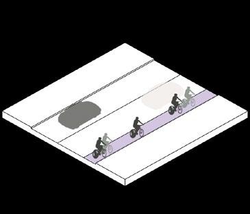
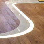
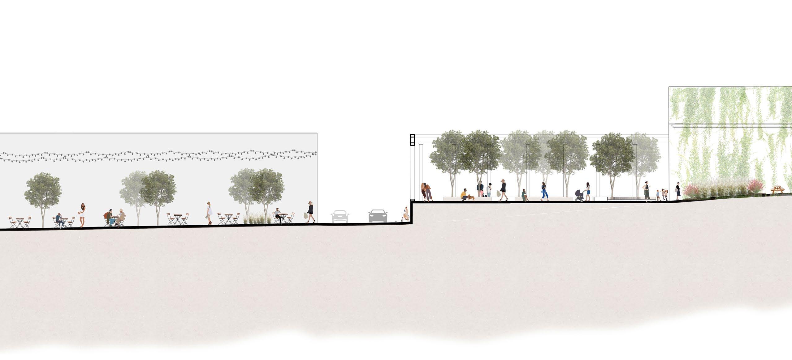
A bike path is added along the N-150 to segregate traffic and to activate the street with plazas overlooking on the road
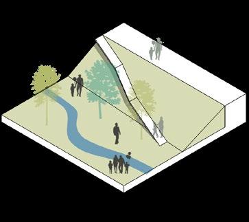
A transverse connection or a buffer is created to diffuse the bottleneck junction traffic near the entrance of the inner center
A rear entry/ exit is planned to keep the circulation flowing throughout the center and a bike lane is added on the adjoining street
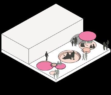
The existing glass panes are colored, bathing the exhibition area and the food court in colored light and creating a unique ambience
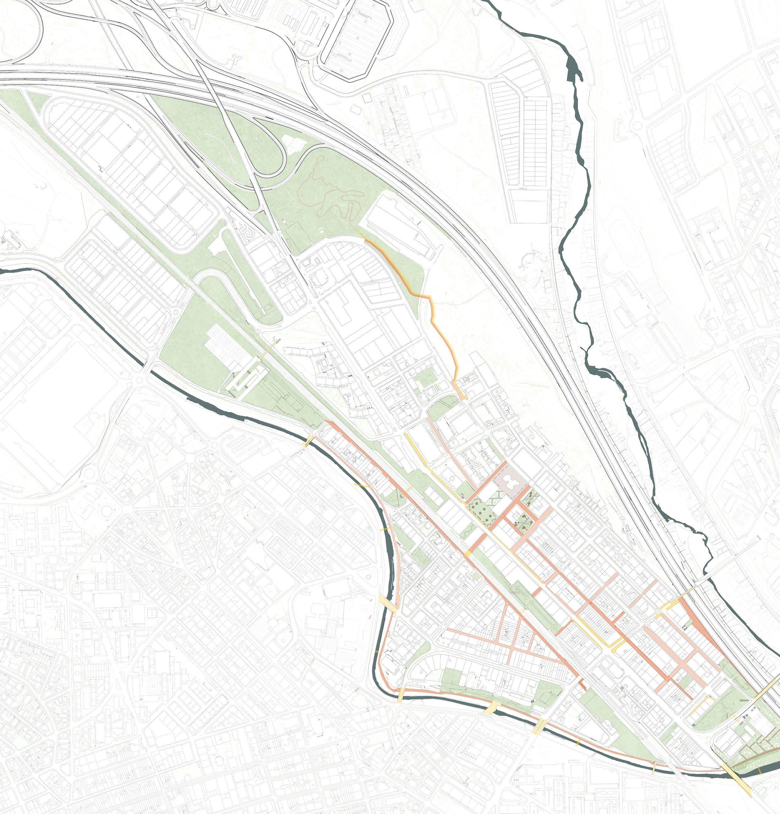
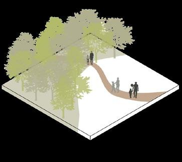
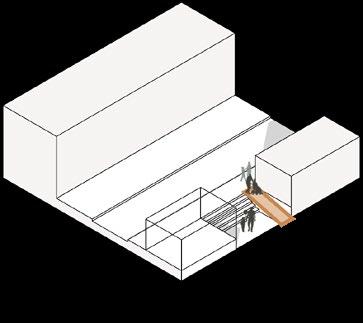
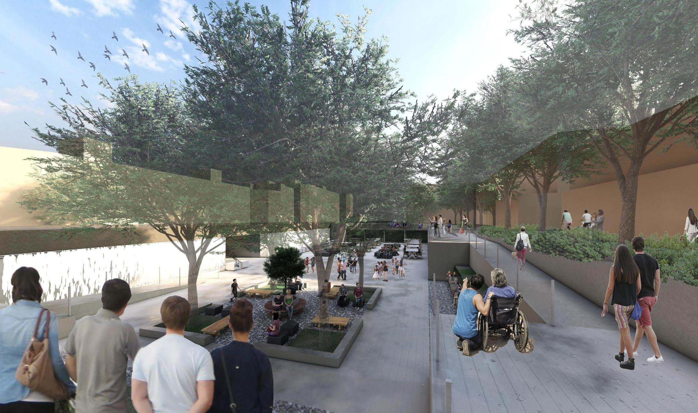
PHASE 2 - PEDESTRIAN STREET NETWORK AND THE UNDERPASS
A carefully integrated pedestrian network is proposed, seamlessly connecting the neighborhood while celebrating the rich local culture of art along these pathways. The underpass near the Railway Station, presently plagued by safety concerns, is reimagined as a vibrant public plaza and aims to reinvigorate the space and make it more welcoming and user-friendly.
Part plan showing the underpass
03 reminiscence.
Crafting a dialogue between the old and the new
M.Arch | UIUC | Fall 2022
Location: Caroll County, Virginia, USA
Professor: Paul Hardin Kapp
Individual Work
Graduate Design Excellence Award, Nomination
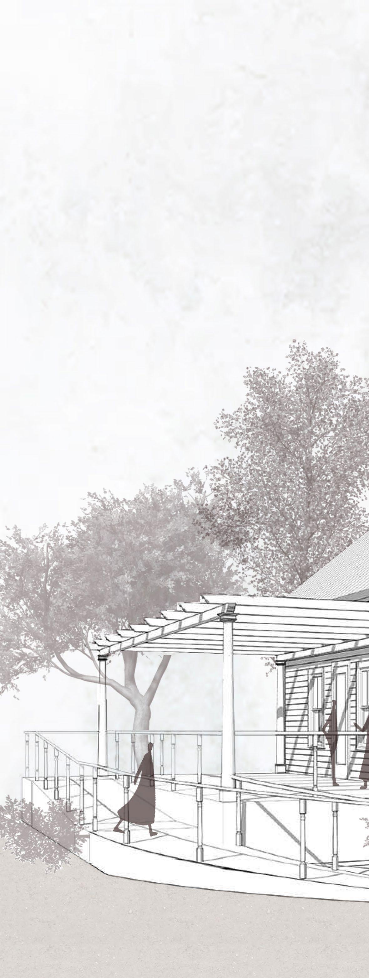
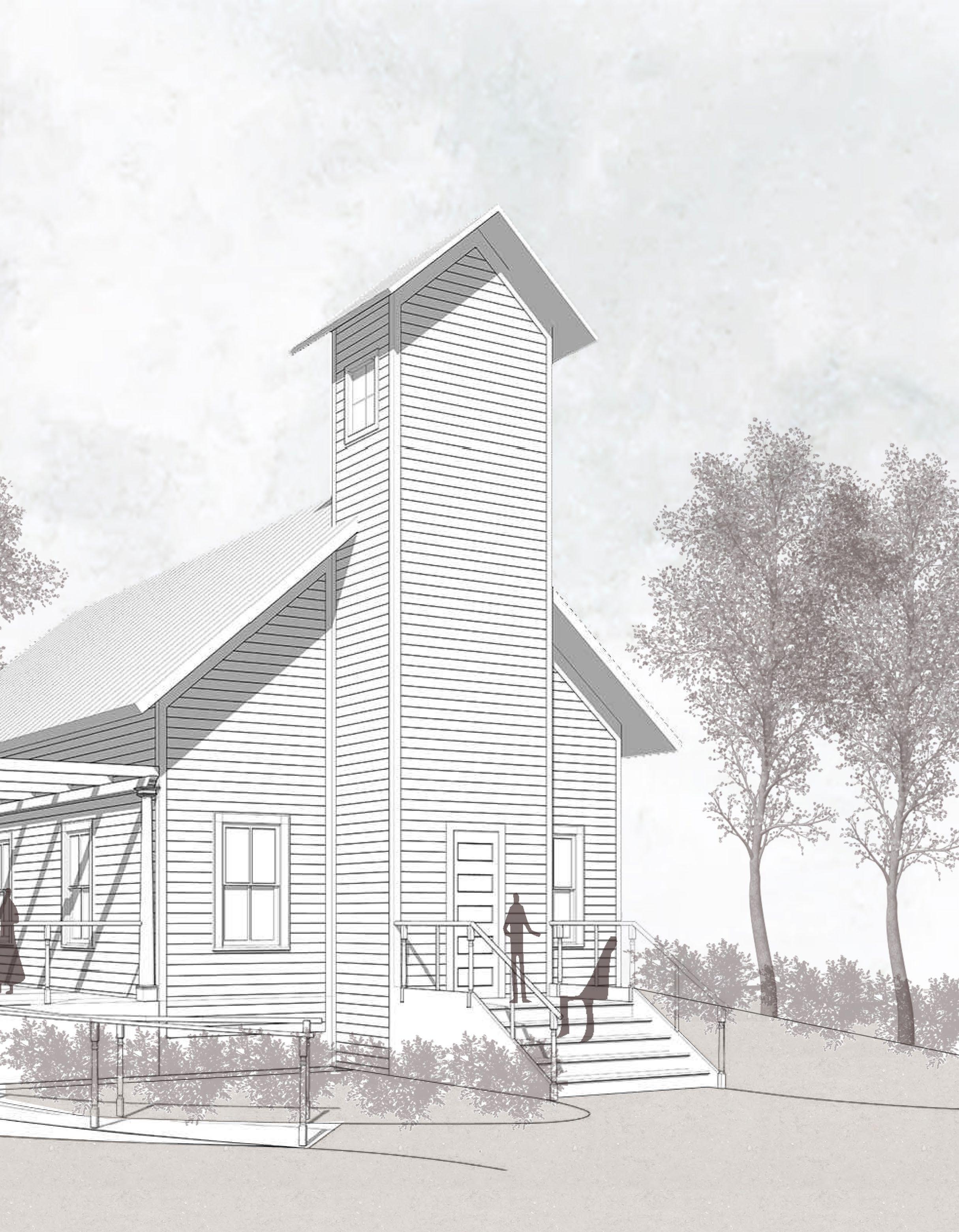
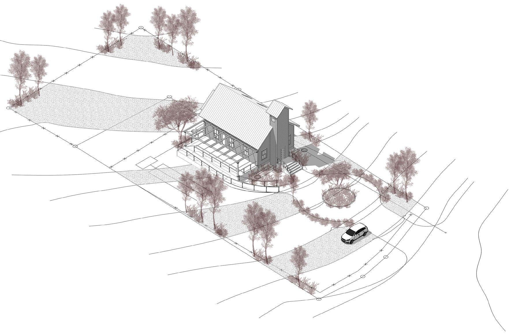
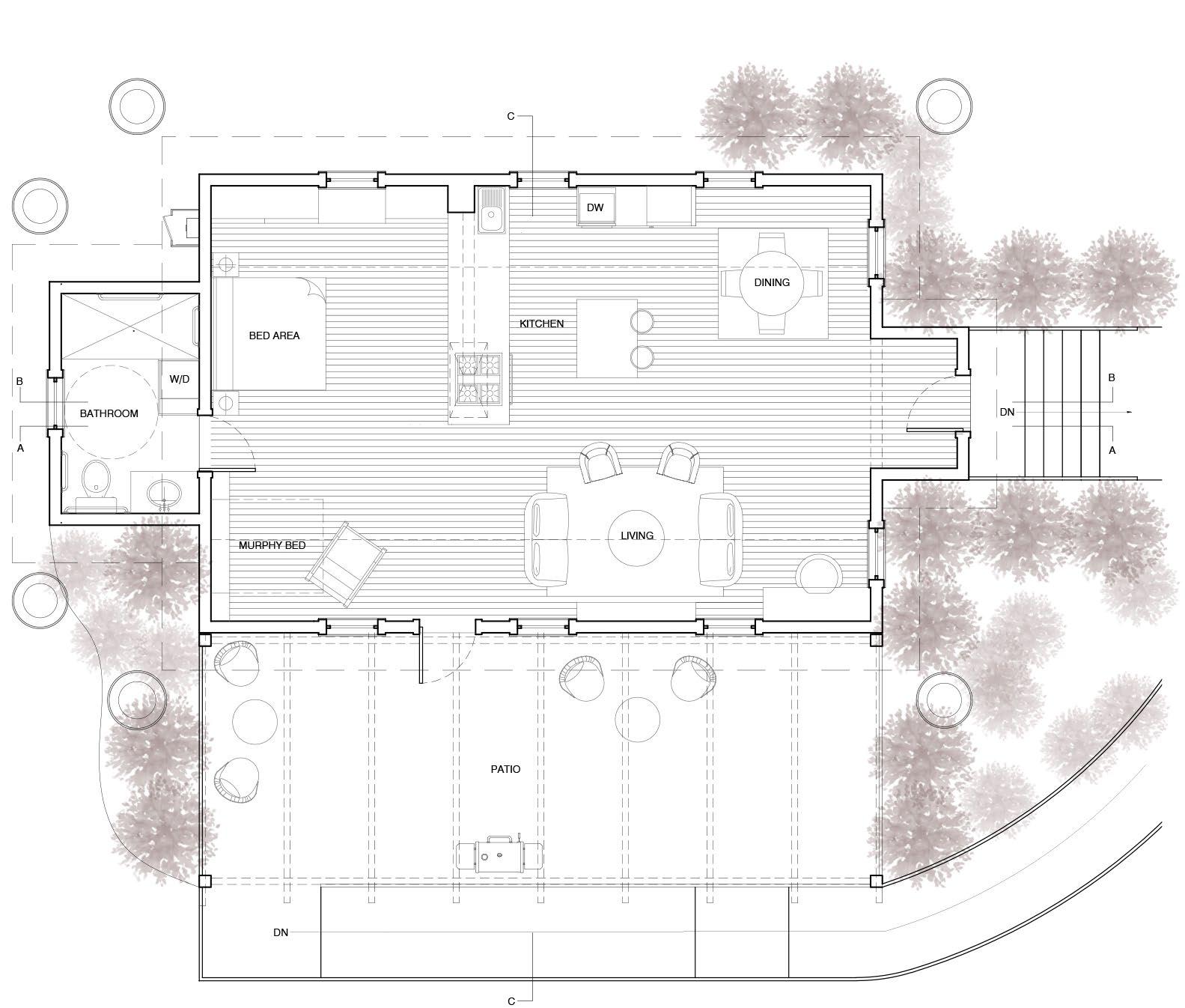
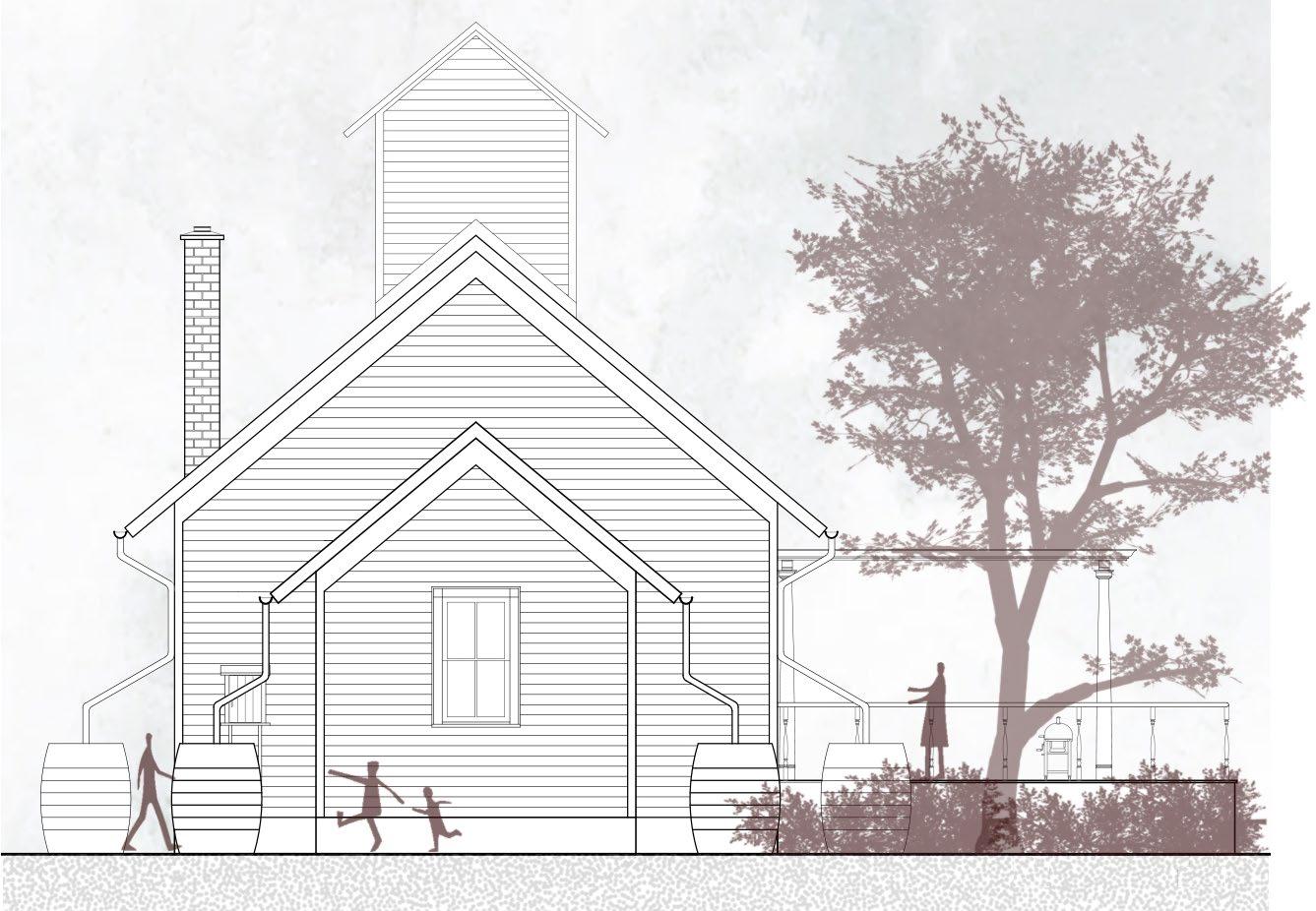
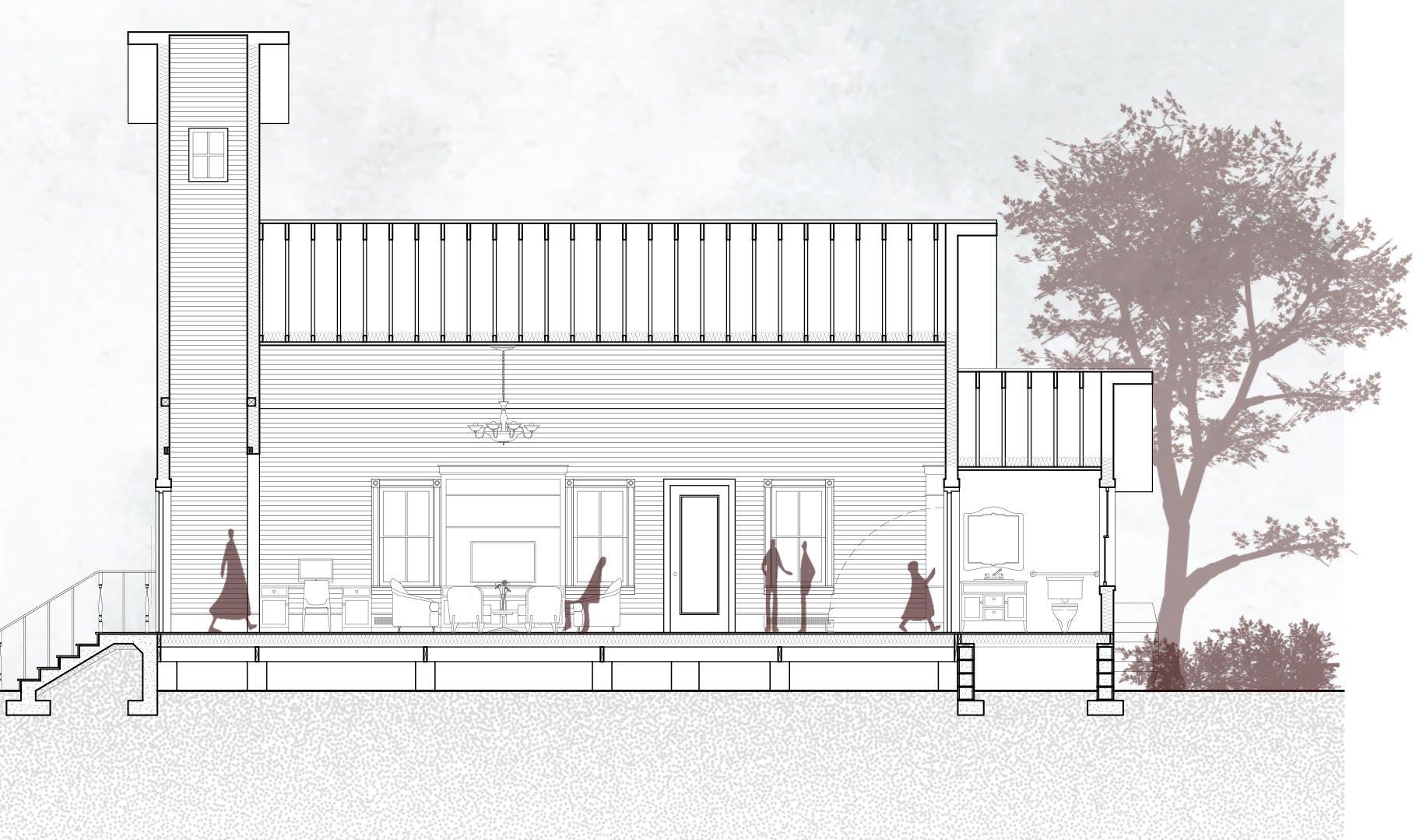
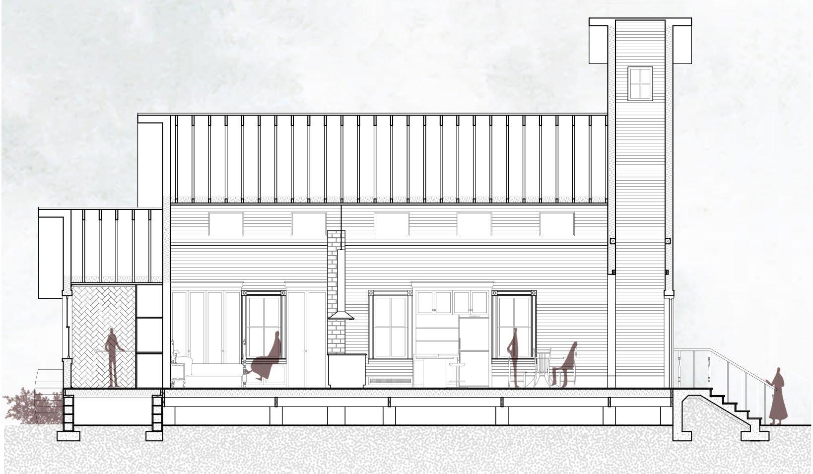
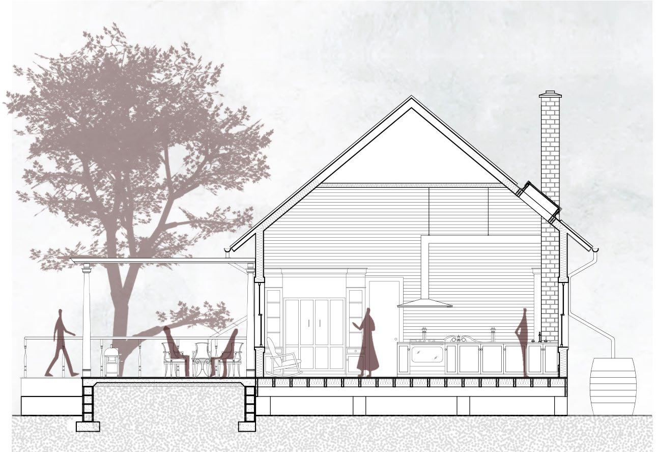
The conversion of the historic Gilmer Chapel in Carroll County, Virginia, into an Airbnb offers guests the opportunity to step back in time while embracing the charm of its timeless setting. To preserve the chapel's original grandeur, the space's volume is retained in its entirety, free from intrusive partitions or dividing walls. The addition, discreetly placed at the rear, respects the chapel's symmetry and axial alignment, creating a telescopic extension that houses an ADA-compliant bathroom with minimal impact on the existing structure. This thoughtful design allows for future modifications, ensuring the addition can be easily detached if needed. The chapel's iconic visual integrity is preserved at the entrance, with the addition of a patio that enhances the indoor-outdoor connection. The heart of the chapel is transformed into a spacious kitchen, paying homage to the community spirit it once fostered. The entire setup functions as a studio apartment, offering guests to reconnect and absorb this quaint and unique experience. Sustainable elements, such as invisible solar panels, a singlepipe heating system with passive cooling, and strategically placed skylights to maximize natural light, are seamlessly integrated to ensure the structure remains relevant for modern living without compromising its historic charm.
Rear Elevation
STANDING METAL SEAM ROOF FITTED WITH
Pergola Fixing Detail
INSULATION
Pergola Detail
SECTION B-B
RESTORED WINDOW
DETAIL
Skylight Detail
RESTORED CLAPBOARD
BASEBOARD RADIATOR FOR HEATING
GUTTER CMU FOUNDATION FOR PATIO
Section B-B
04 flow.
Investigating placemaking within a highrise
M.Arch | UIUC | Fall 2021
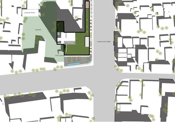
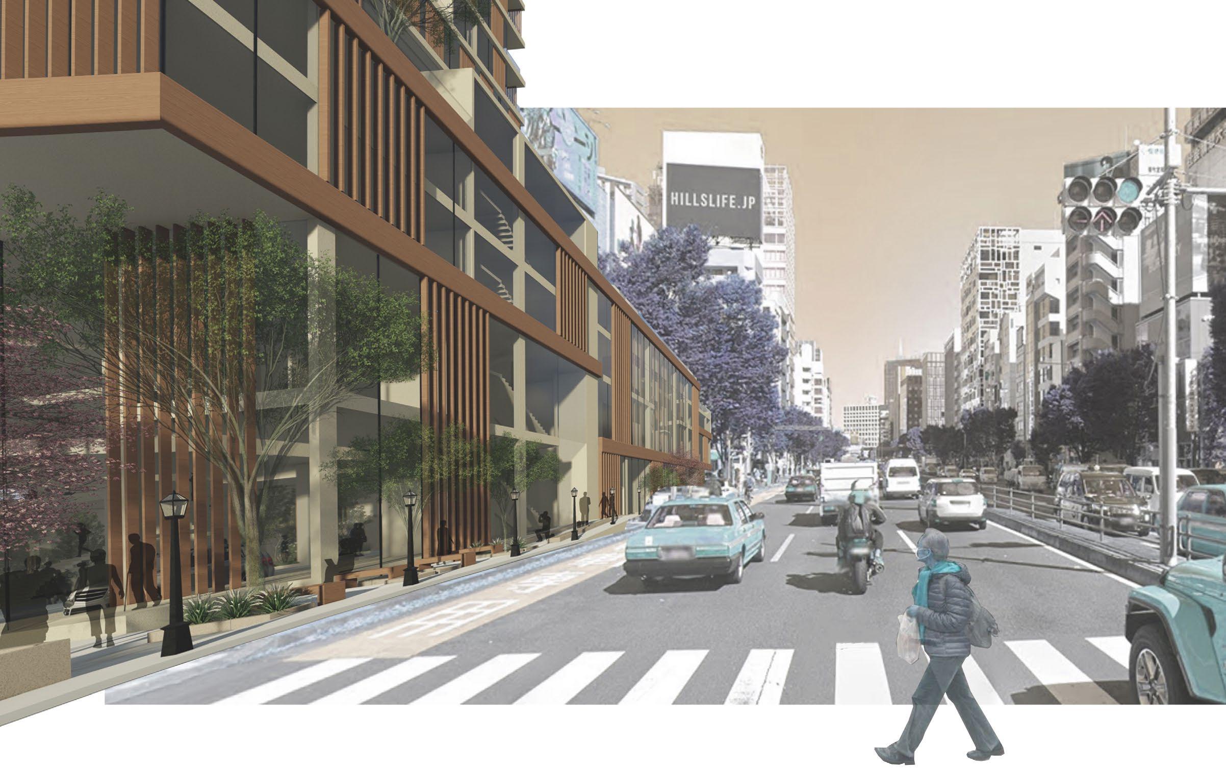
Location: Ometosando Street, Tokyo, Japan
Professor: Botand Bognar
Collaborator: Savani Patil
Graduate Design Excellence Award, Nomination
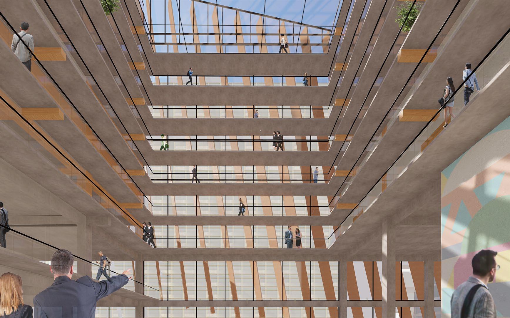
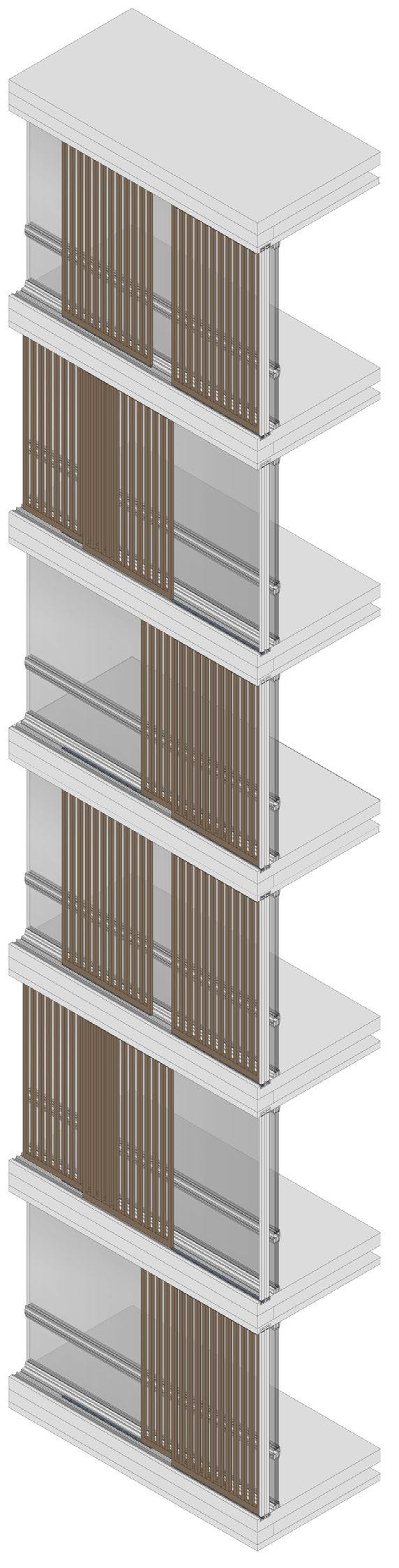
This mixed-use green building is poised on a site divided into three parcels, bisected by two narrow alleys, at the vibrant intersection of Omotesando Street, one of the capital's most iconic and bustling thoroughfares. To harmonize with the neighborhood's scale, the design elegantly tapers upward, set back from the street's edge, avoiding a towering block and instead crafting a more refined silhouette. The architecture is a seamless integration of verdant spaces that meander throughout the structure, flowing organically and interweaving the various zones within. Sky gardens, thoughtfully interspersed, serve as serene buffers between distinct areas, fostering privacy while cultivating a rare culture of shared communal spaces in an increasingly fragmented urban landscape. In contrast to the city's sea of modern skyscrapers, the building's dynamic facade is enlivened by wooden louvered sliding shutters - a nod to the timeless beauty of traditional Japanese partition systems. By weaving contextual strategies with contemporary design, the building offers an unparalleled experience that beautifully bridges the past and the future.
FORM DERIVATION
The massing diagrams show to evolution of the concept available volume to the final massing. Sky gardens are positioned strategically between program zones to enhance privacy, while interspersed terraces provide green "breathers" for occupants. The stacked and shifted volumes establish and create a cohesive and dynamic presence in the skyline.
and Alleys Staggered massing with greens
Hotel
Condos Night Club
Steel Beams, Decking Concrete Core, Slabs
Complete Volume
Street character
Hotel
Condos
Fire Exit
Sky Gardens
Terraces for voids and flow of greens
Final Massing
Public Areas
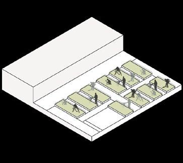
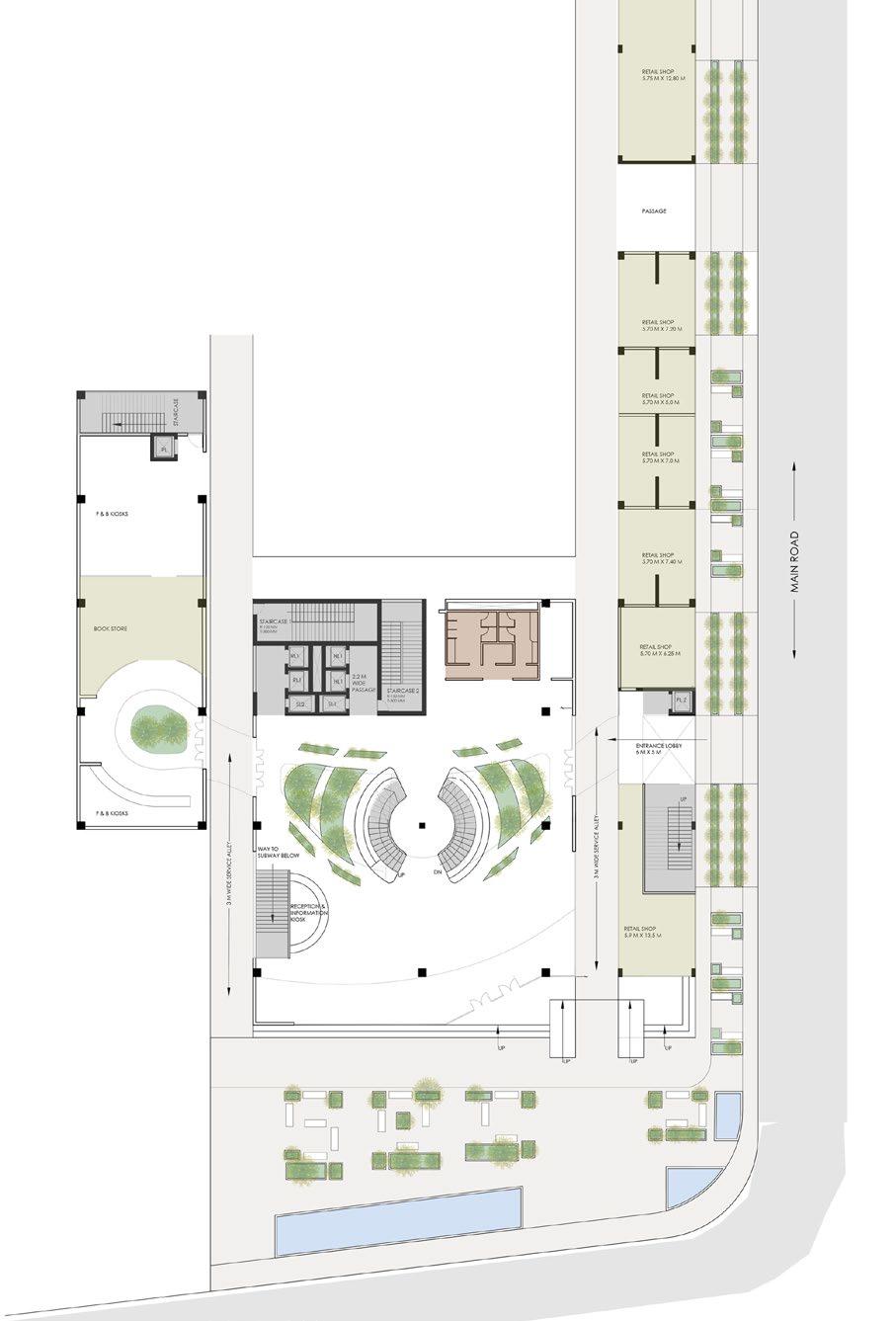
PODIUM FLOOR PLANS
The floor plans of the podium depict various public activities, including spaces for events, various amenities, recreational areas, and a communal gathering zone - the sky garden.
Streetside view Upper
Entrance Lobby
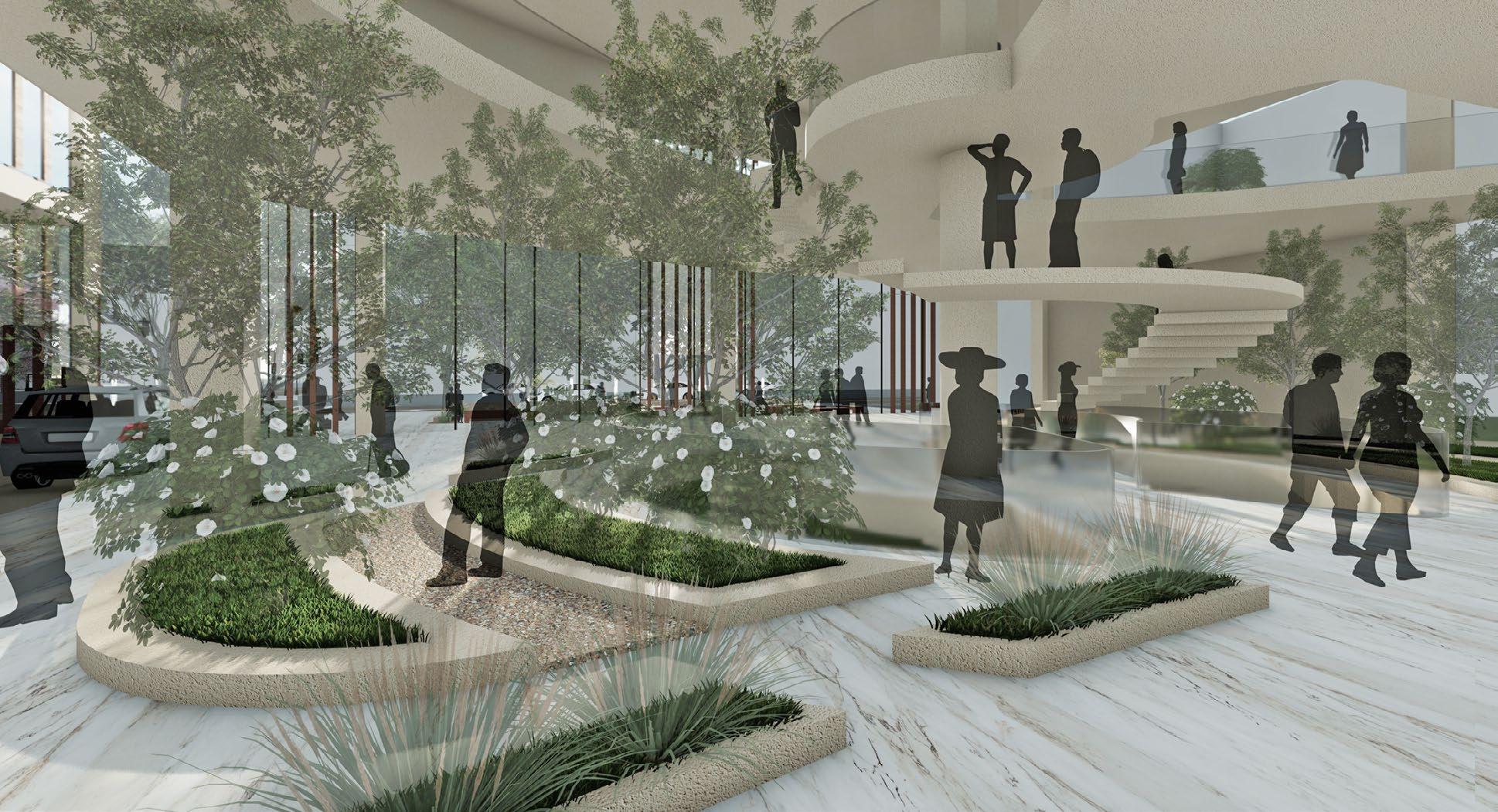
The lobby space acts as the nucleus and is the primary intersection place of functions
Art Gallery
A traditional art gallery experience has been created in the age of digital billboards
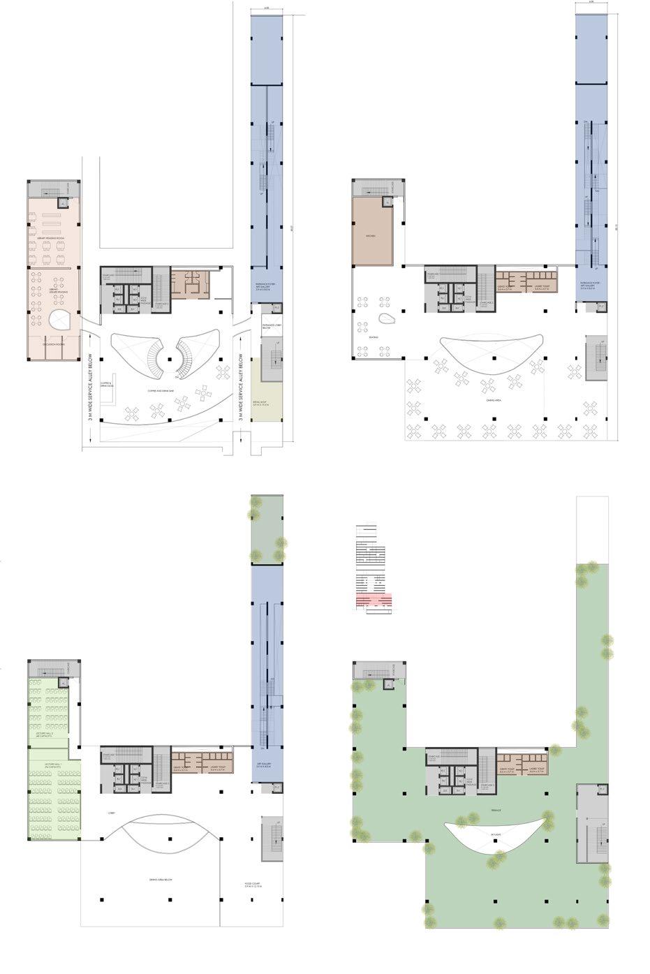
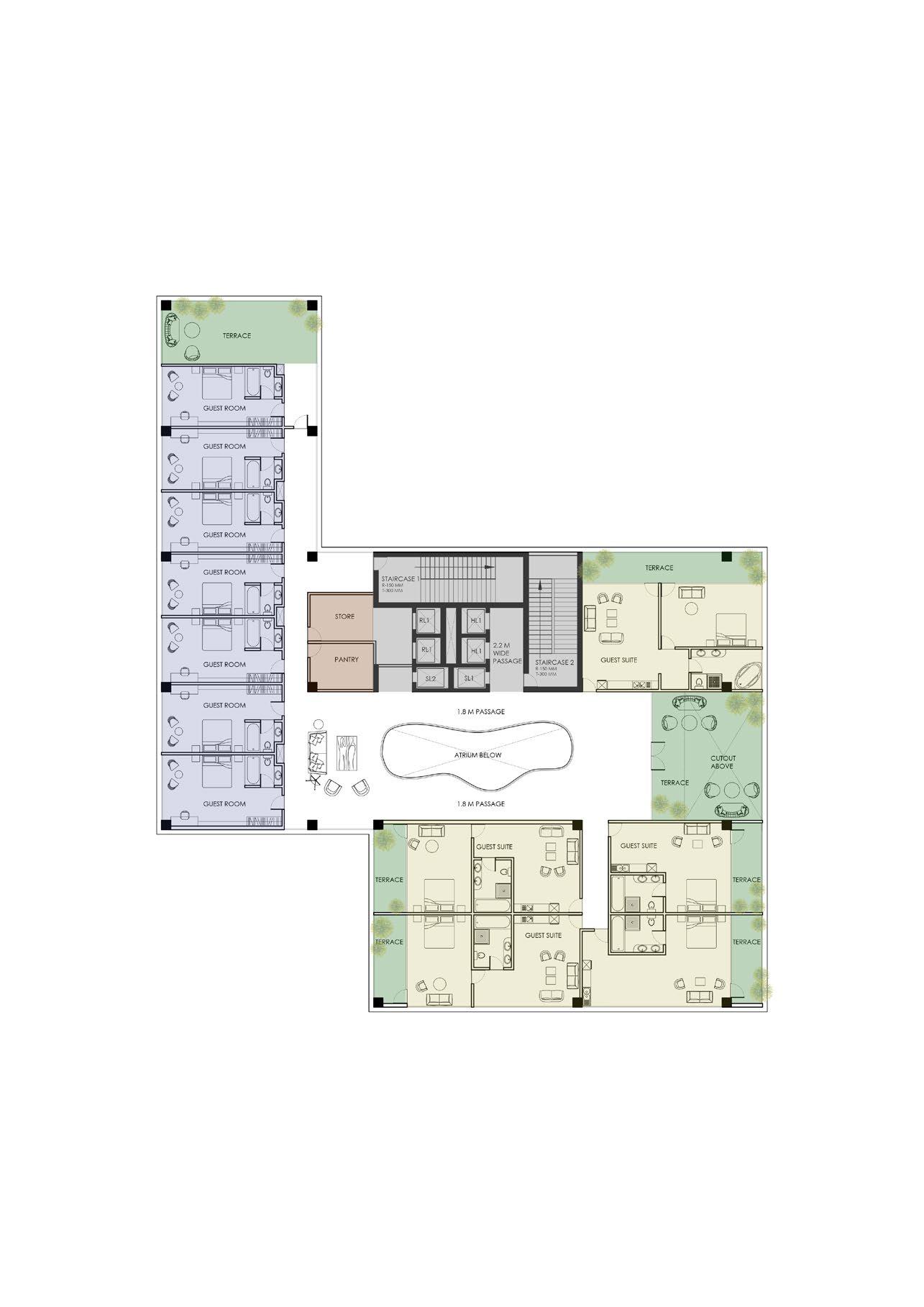
HOTEL PLANS
The following hotel floor plans illustrate the layout of rooms and suites, centered around a grand atrium with a seamless flow connecting each floor, and featuring ardent terraces that enhance the open, inviting atmosphere.
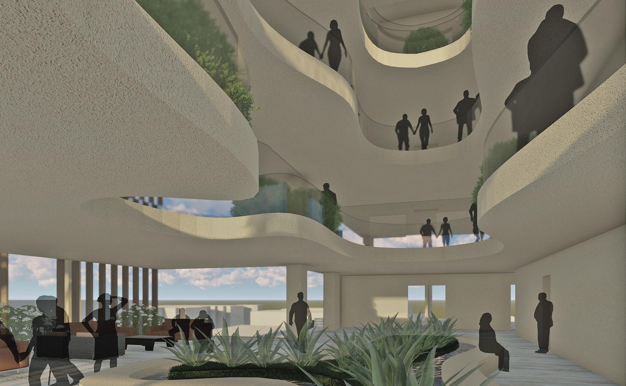
Hotel Atrium
The atrium is a series of interconnected spaces that look onto one another, creating a sense of openness, movement, and continuity, while emphasizing seamless flow and interaction between the different areas.
CONDO PLANS
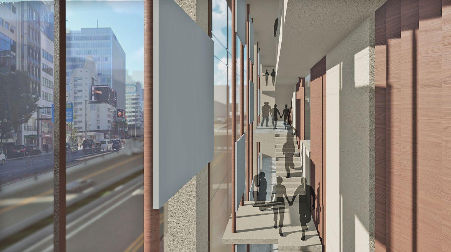
The condo floor plans showcase the arrangement of residential units, and also a rare high-rise community living concept, featuring L-shaped sections where one terrace overlooks another, fostering a sense of connection and enhancing the community spirit.
The Public Plaza
A peculiar trait of Tokyo, we wanted to capture and utilize the corner condition to the maximum by converting it into a place to interact, meet, or coincidentally bump into someone
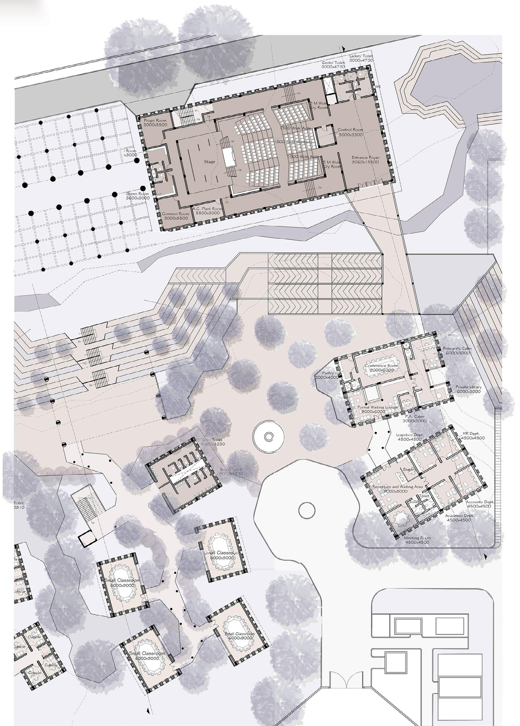
05 avasa.
B.Arch | BKPS | Spring 2019
Location: Pashan, Pune, India
Professor: Nimesh Porwal
Individual Work - Thesis
University Thesis Award - Second Place
Exploring the idea of "liberal" in a liberal arts institute 1
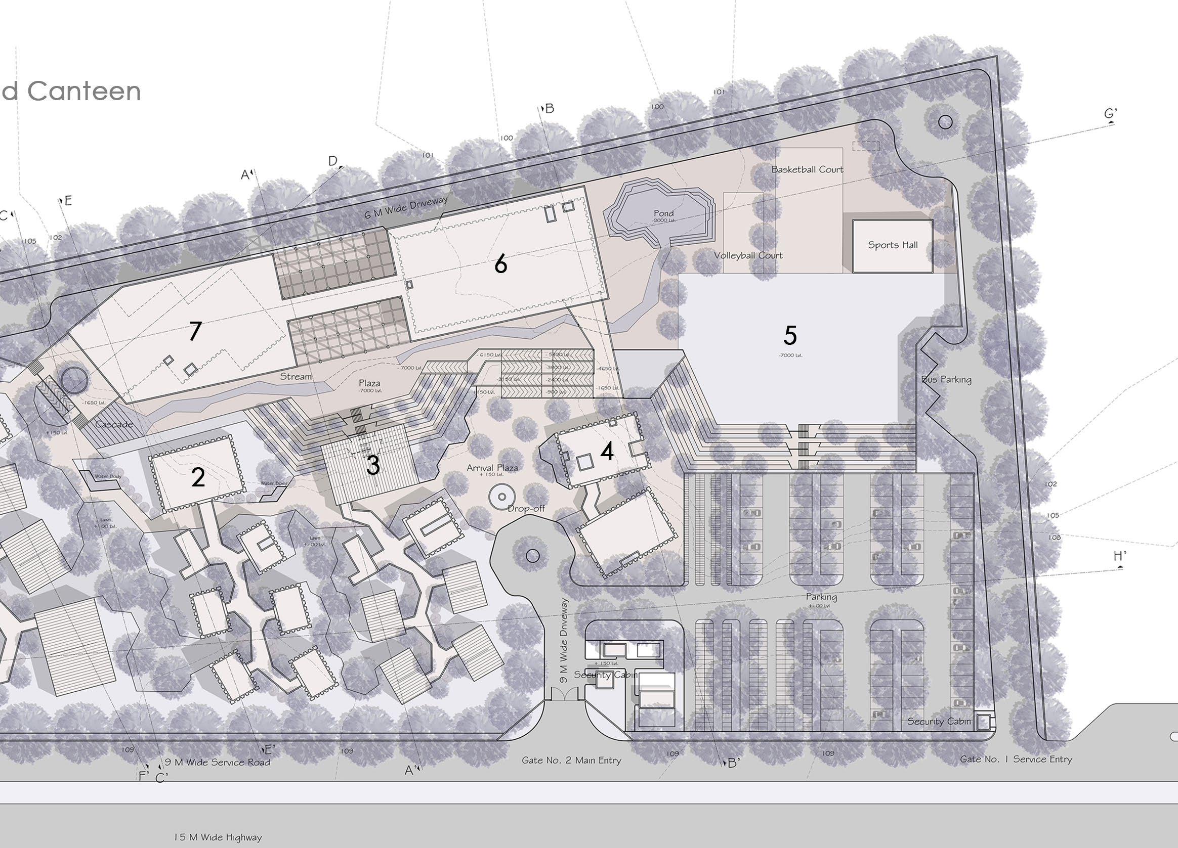
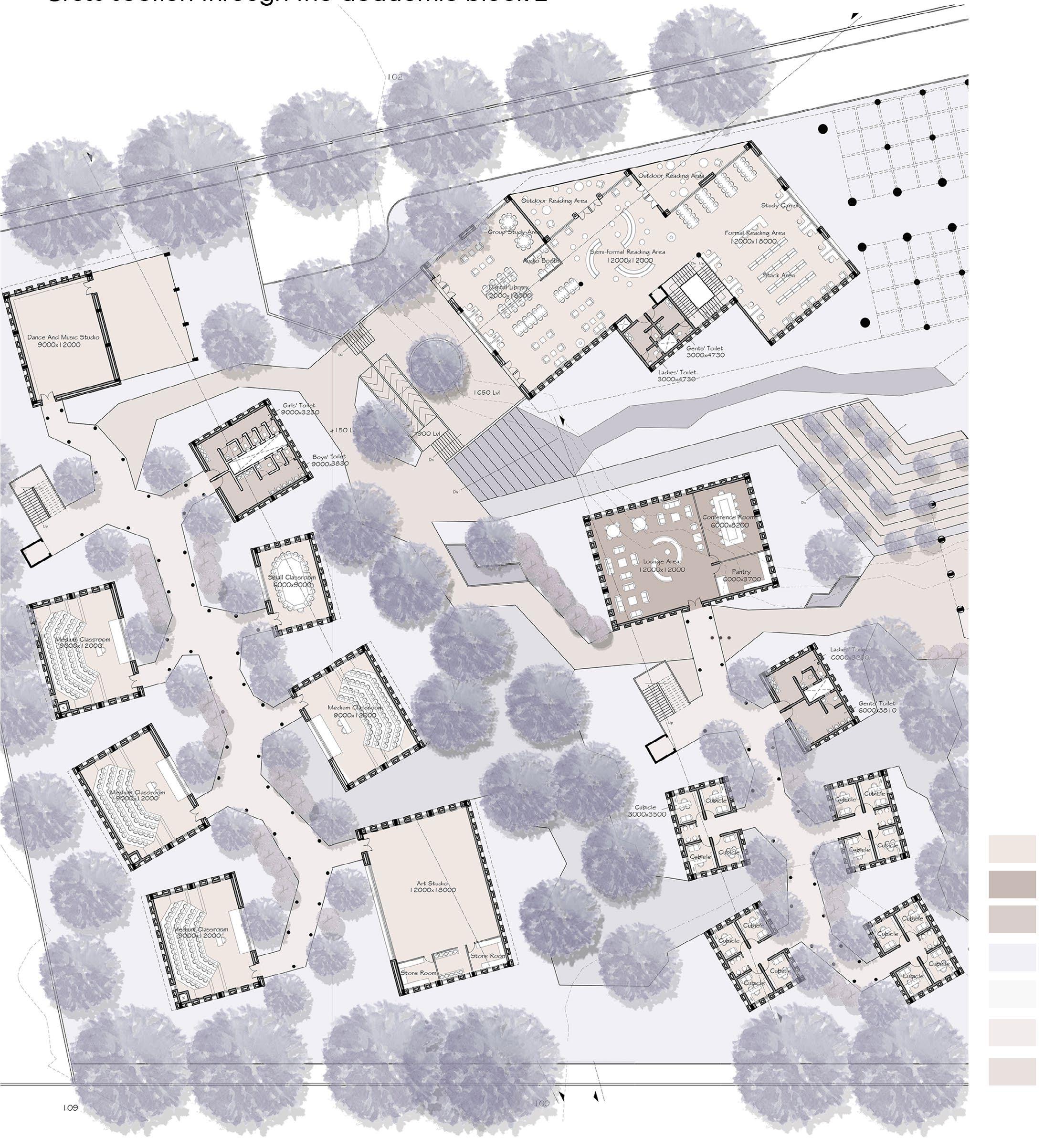
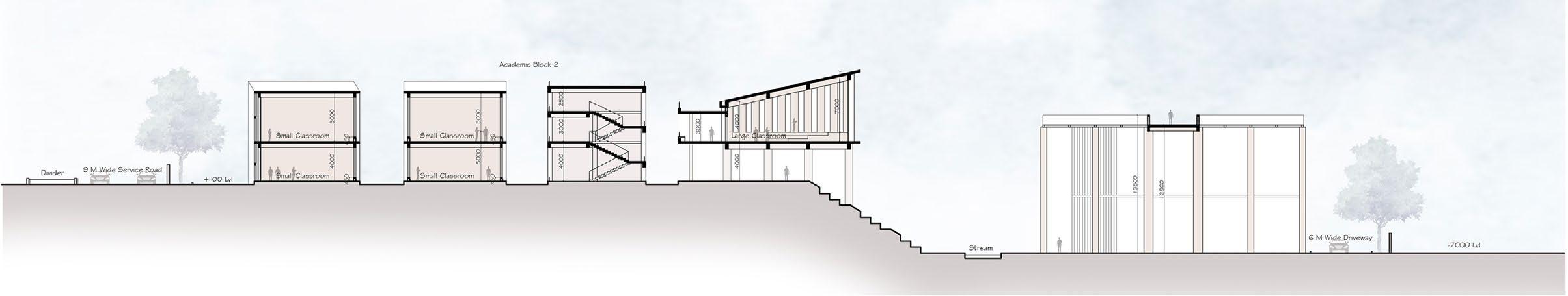
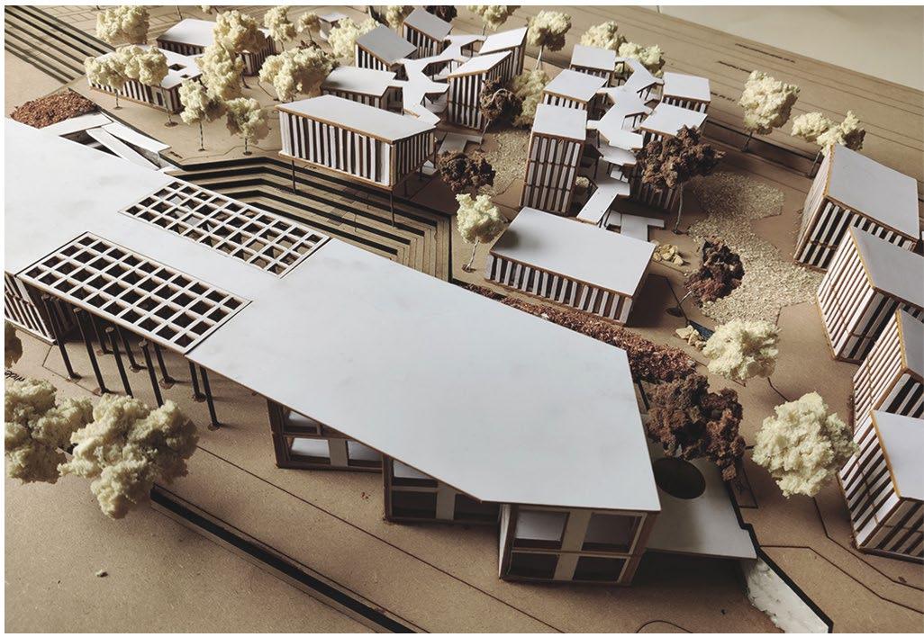
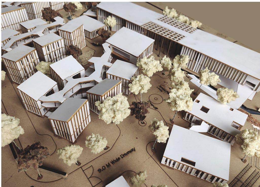
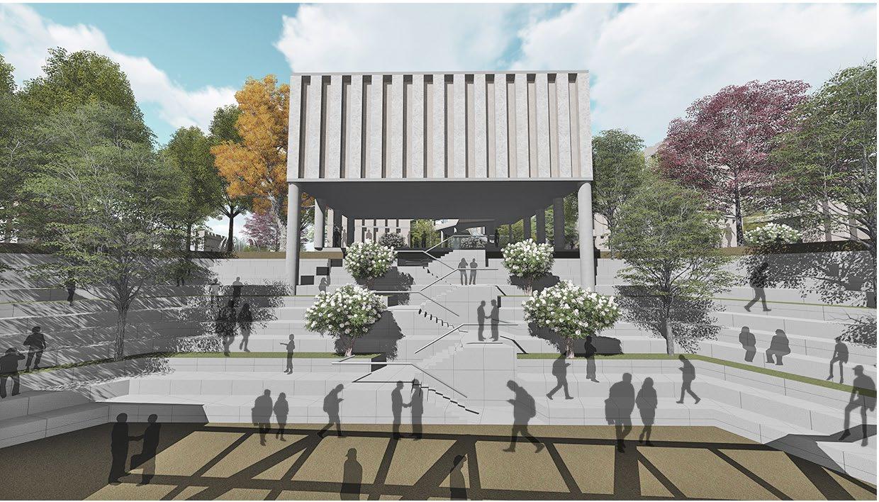
A liberal arts education instills the values and skills necessary to lead a creative, impactful life in an ever-evolving world. This institute is designed to foster boundless interaction, not only among students but also between students and facultyan essential element often absent in traditional education systems. The project aims to cultivate an experiential, interactive learning environment that allows students to explore subjects of personal interest. An "Interaction Promenade" has been thoughtfully integrated into the site, harnessing the natural terrain with minimal alterations to the landscape, ensuring optimal use of existing conditions. The design seeks to capture the true essence of "liberal" by dissolving the boundaries between indoors and outdoors, creating a liberated learning space that maximizes opportunities for spontaneous encounters. Breaking free from conventional rigidity, the spaces are crafted to enrich the learning experience, nurturing holistic development and empowering students to evolve into well-rounded professionals.
through the
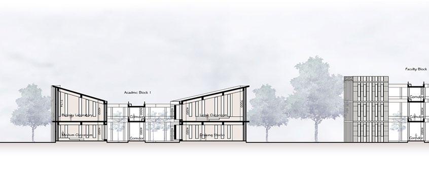
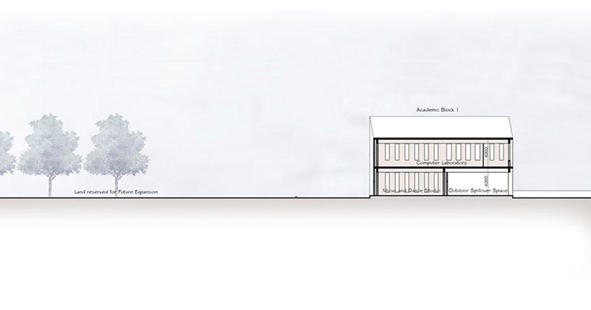
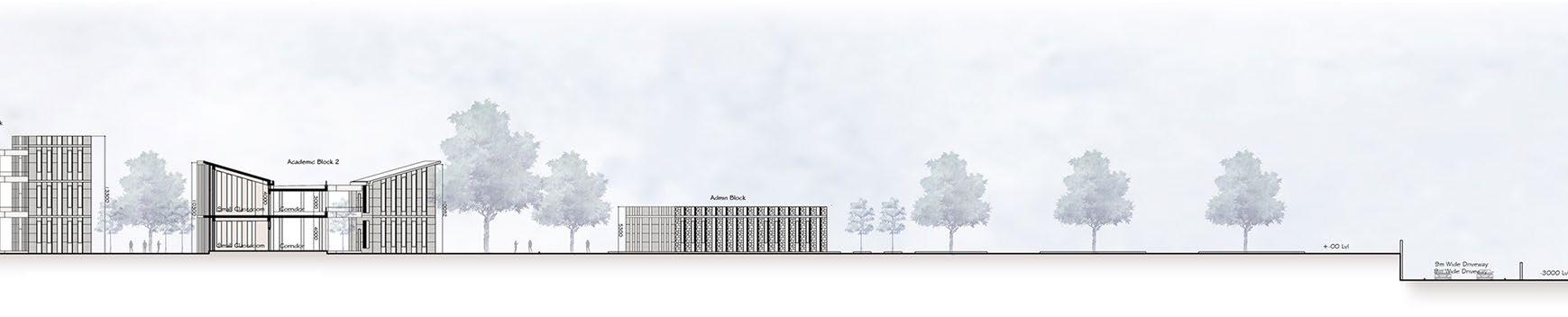
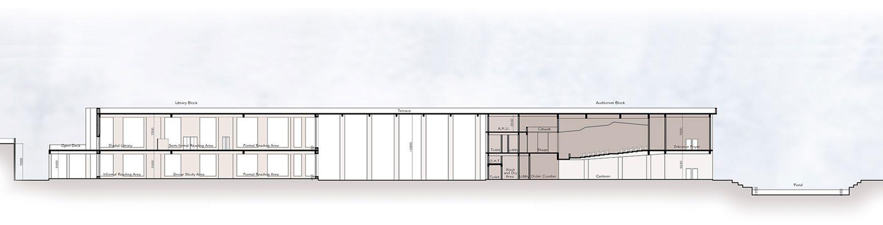
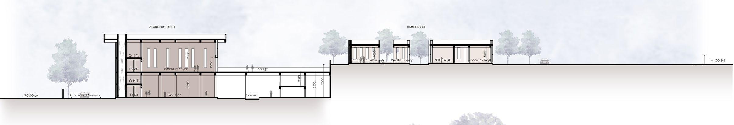
Longitudinal section through the academic block 1, faculty block,
Longitudinal section
academic block 1, library, auditorium
academic block 2 and admin block
auditorium and the pond
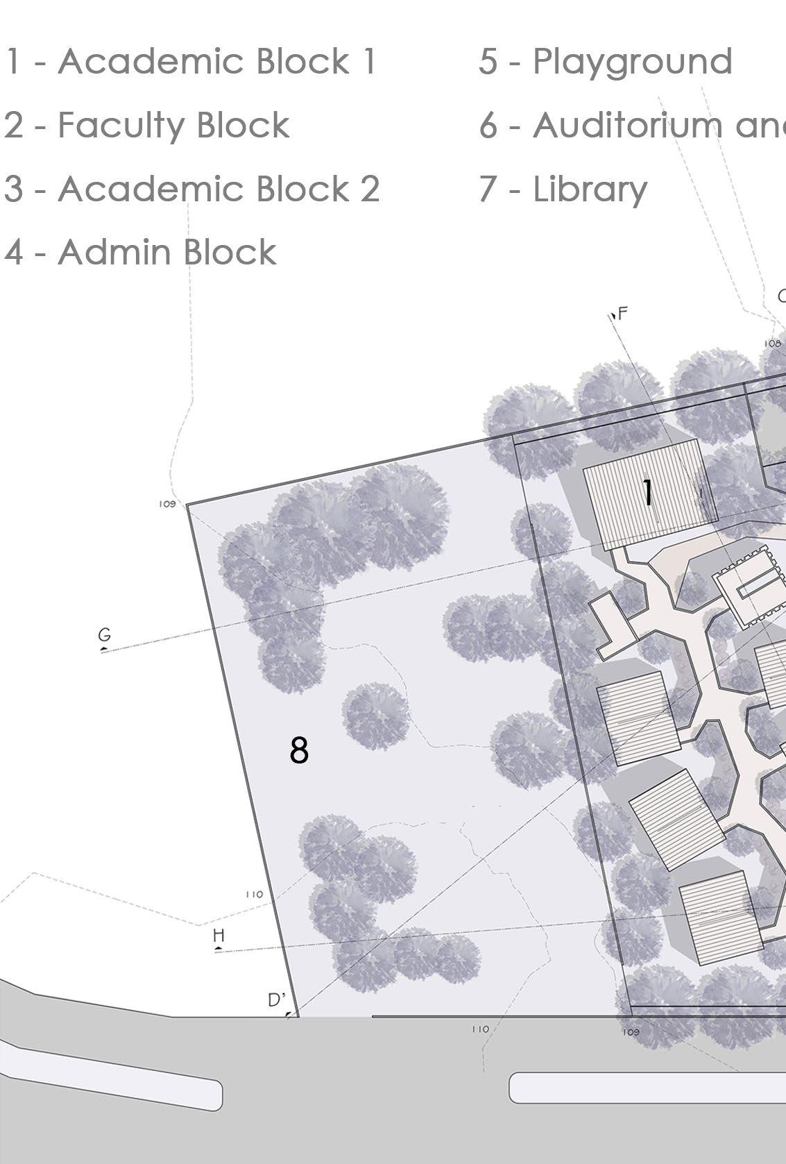
Ground floor plan of the academic block 1, library and the faculty block (from the left)
Physical Model Photo
Physical Model Photo
Brick Masonry Cavity Wall
Stone Cladding
Low-weight Ferrocement Slab
Ground floor plan of the academic block 2, auditorium and the admin block (from the left)
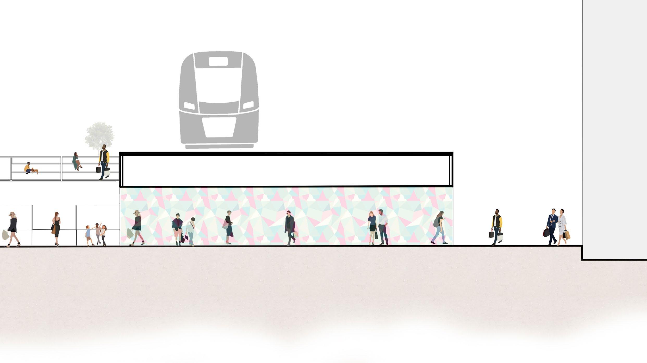
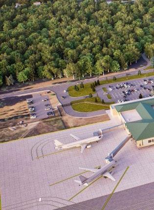
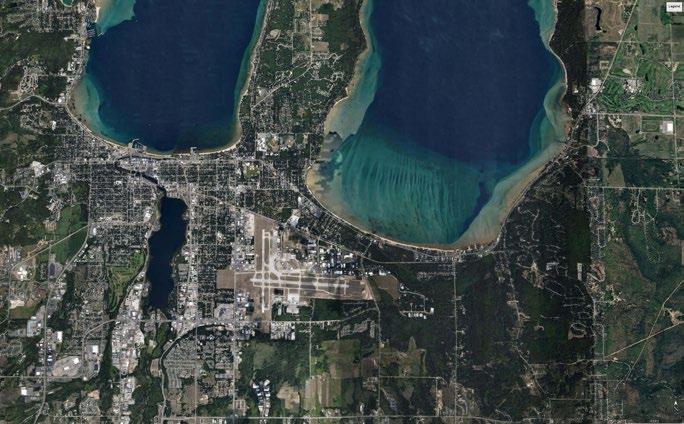
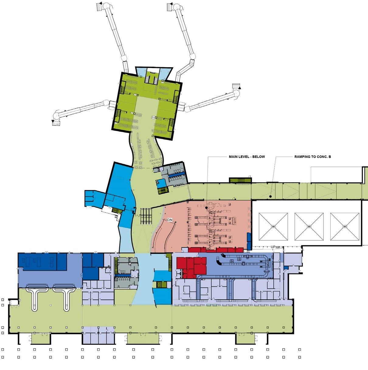
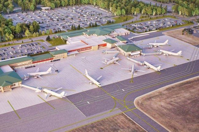
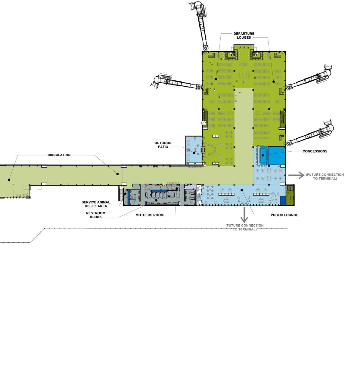
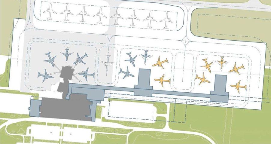
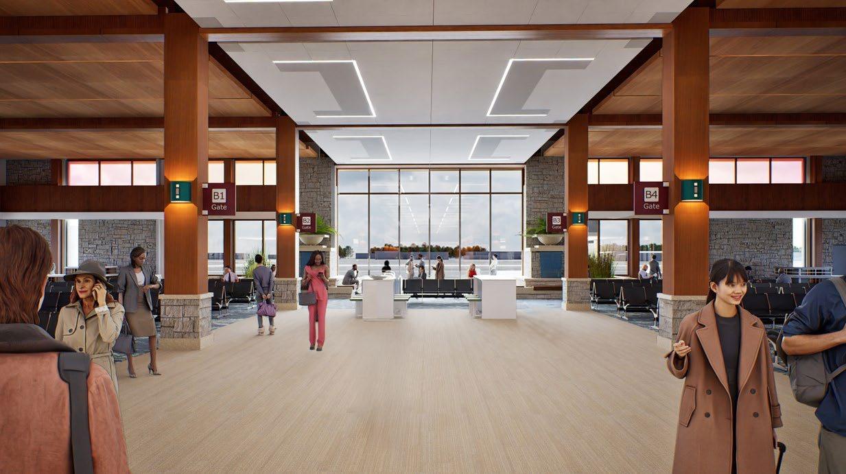
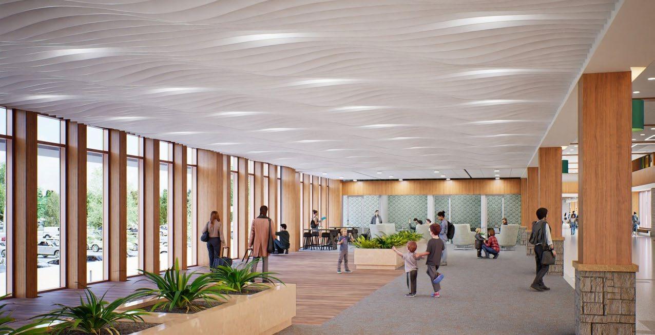
The project at Cherry Capital Airport (TVC) included a new terminal expansion by adding another concourse, existing terminal roof, lighting, and HVAC replacement. The terminal expansion included three key components: a connector linking existing Concourse A to new Concourse B, a relocated and expanded TSA checkpoint, and an enlarged bamakeup area. Together, these upgrades aimed to improve passenger experience and accomodate future growth. Drawing inspiration from the original Frank Lloyd Wright-inspired terminal, the expansion maintained a cohesive architectural language while introducing new spatial experiences. The interiors celebrate the Sleeping Bear Dunes through materiality, creating a strong regional identity. Amenities were thoughtfully integrated, including a multi-user restroom lock designed for inclusive access, spa-like mother's rooms for comfort and privacy, and dedicated sensory and SARA rooms to support diverse passenger needs. The expansion was designed to set the tone for the cit's identity as a summer destination - where the vacation begins at the airport.
All work was completed during professional experience and is attributed to Mead & Hunt, USA
Longitudinal section through the academic block 1, faculty block,
Image Credits: Mead & Hunt, USA
Credits: Mead & Hunt, USA
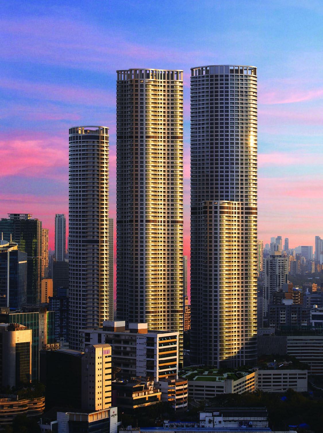
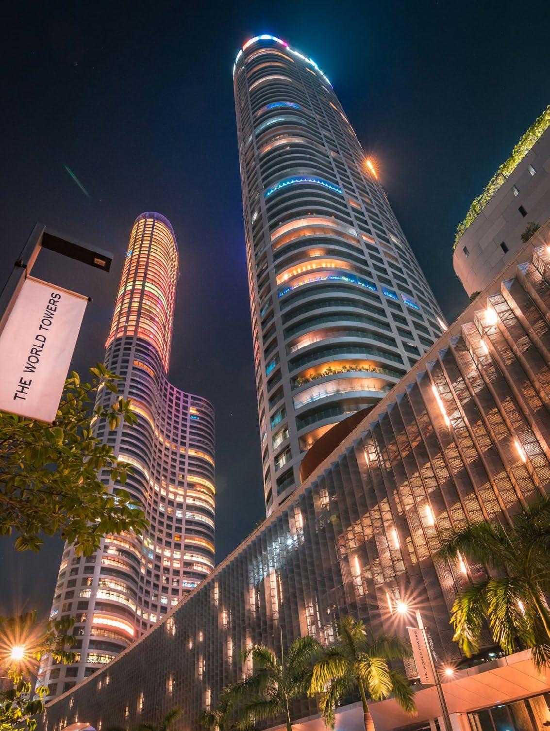
07 the world towers.
Architectural Intern | Somaya and Kalappa Consultants, Mumbai, India | June 2018 - November 2018 Project: The World Towers, Mumbai, India (High-rise); Architect: Pei Cobb Freed & Partners, NYC, USA Role: Construction Documentation, Construction Administration, RFIs, Submittals
All work was completed during professional experience and is attributed to SNK, India.
Credits: PCF, USA and SNK, India
Credits: PCF, USA and SNK, India
08 highlights.
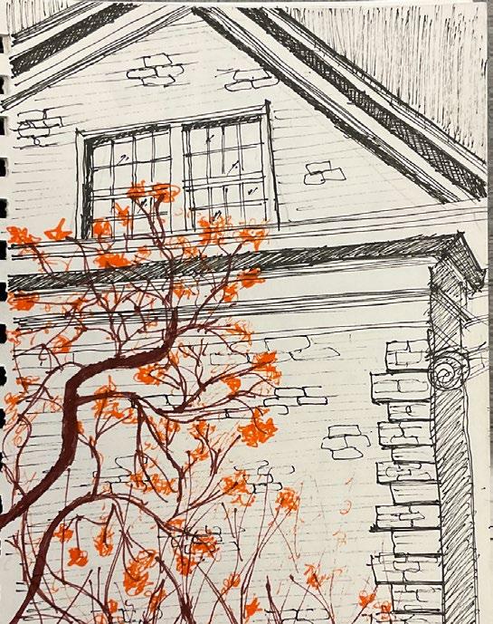
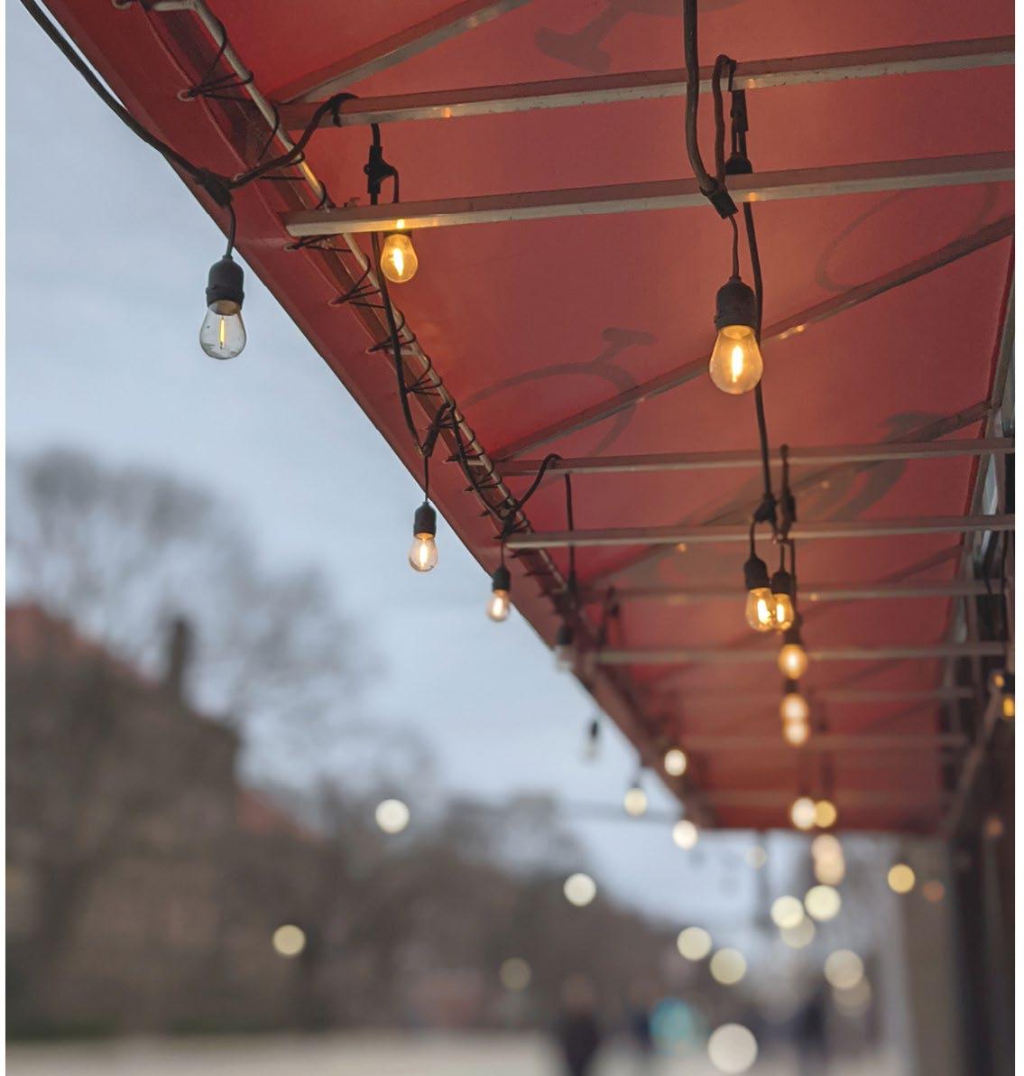
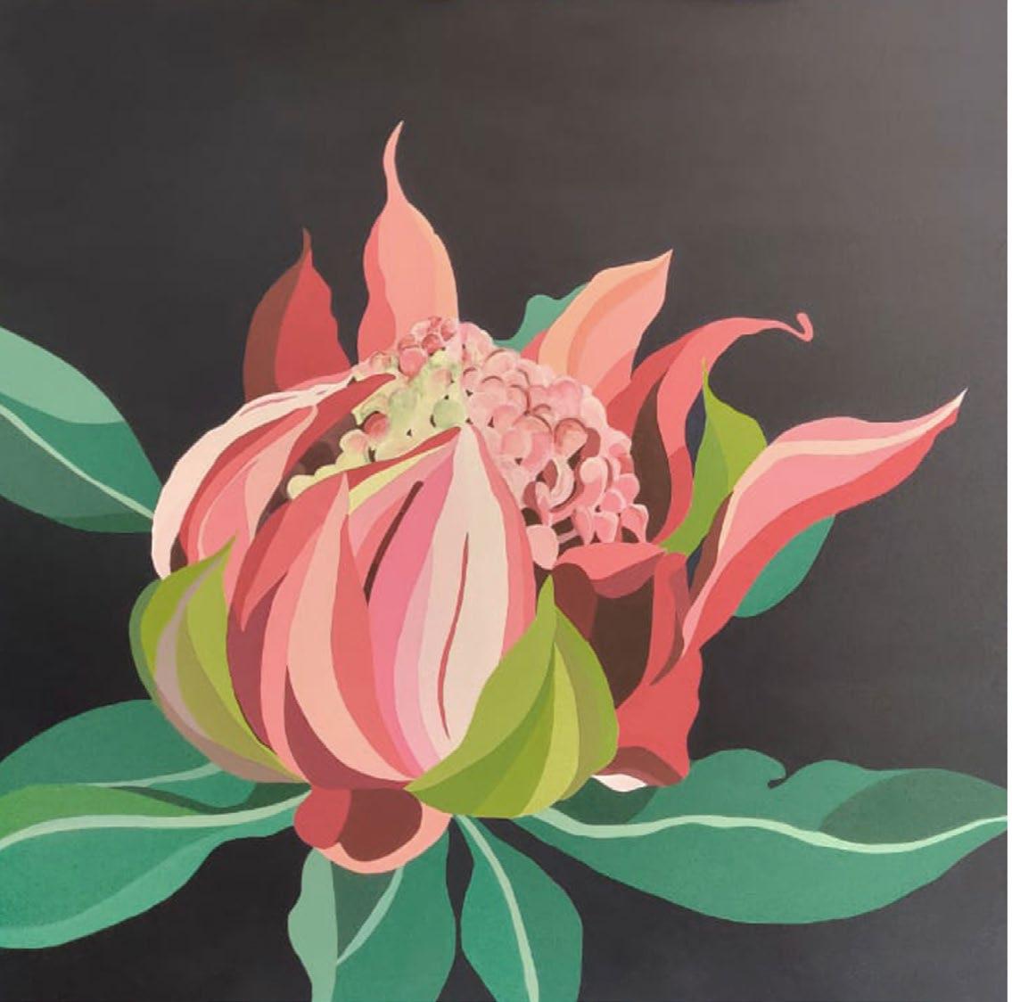
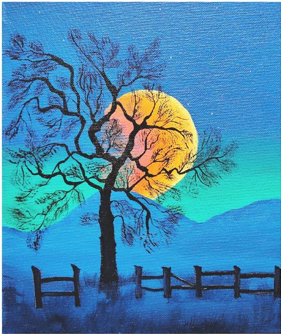
This is a thoughtfully curated collection of my quick sketches, paintings, and photographs - some of the things most dear and personal to me.