WILD AND SCENIC RIVERS

FINAL REPORT
PREPARED BY MICHELLE TOSHACK AND JOHN ROSEBERRY
SEPTEMBER, 2023

ABOVE: VOLUNTEER LINDSAY HUNT SAMPLING ON TINAYGUK RIVER, ALASKA SEAN TROPSA COVER: VOLUNTEER HELEN ANDERSON SAMPLING ON GREEN RIVER, UTAH SETH ANDERSON CONTENTS SUMMARY 3 PROJECT CONTEXT 6 PROJECT DESIGN 9 VOLUNTEER MANAGEMENT 15 DATA COLLECTION & RESULTS 23 MEDIA 28 FEDERAL AND STATE WATER QUALITY ENGAGEMENT 31 CHALLENGES AND LESSONS LEARNED 32 LOOKING AHEAD 33 ACKNOWLEDGEMENT 35 REFERENCES 37
SUMMARY
Adventure Scientists’ Wild and Scenic Rivers project addressed data gaps to update the water quality statuses of rivers across the United States to improve the management and protection of Wild and Scenic Rivers. Data from this project supports strong interagency collaboration, allows land managers to determine status changes of Wild and Scenic Rivers if needed, engages community members in the scientific process, and informs decision-making. Together, we are protecting and preserving these invaluable resources for future generations.
Between June 2020 and February 2023, Adventure Scientists managed the training and data collection process of 479 volunteers. Across 25 states, volunteers visited 197 Wild and Scenic Rivers located on federal and state land. Volunteers completed 1,381 surveys that included field
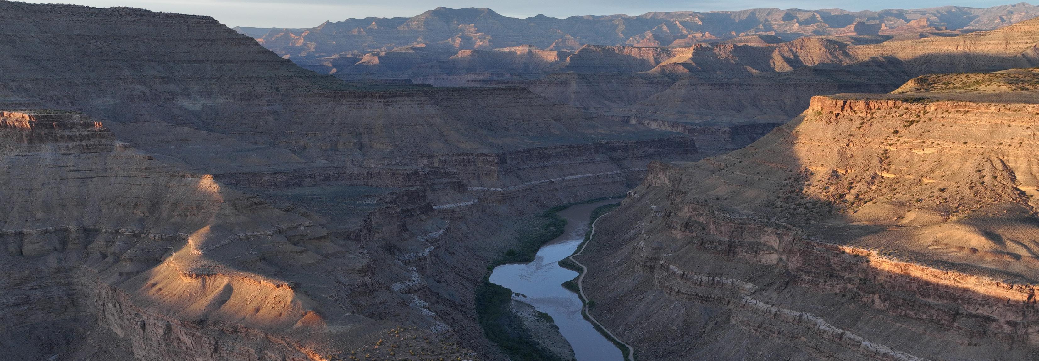 GREEN RIVER WILD AND SCENIC RIVER, UTAH
WILD AND SCENIC RIVERS PROJECT FINAL REPORT 3
SETH ANDERSON
measurements of pH, total dissolved solids, salinity, temperature, and dissolved oxygen. They also collected 217 grab samples for lab analysis and conducted qualitative habitat and invasive species surveys.
Adventure Scientists partnered with the United States Forest Service (USFS), Bureau of Land Management (BLM), National Park Service (NPS), and state water quality agencies to identify project priorities, design protocols and volunteer training materials, and obtain permits. Our staff recruited, trained, and managed volunteer teams, maintained and managed equipment, coordinated with interagency and state partners, and compiled and displayed data in web portals accessible by volunteers, project partners, and the general public.
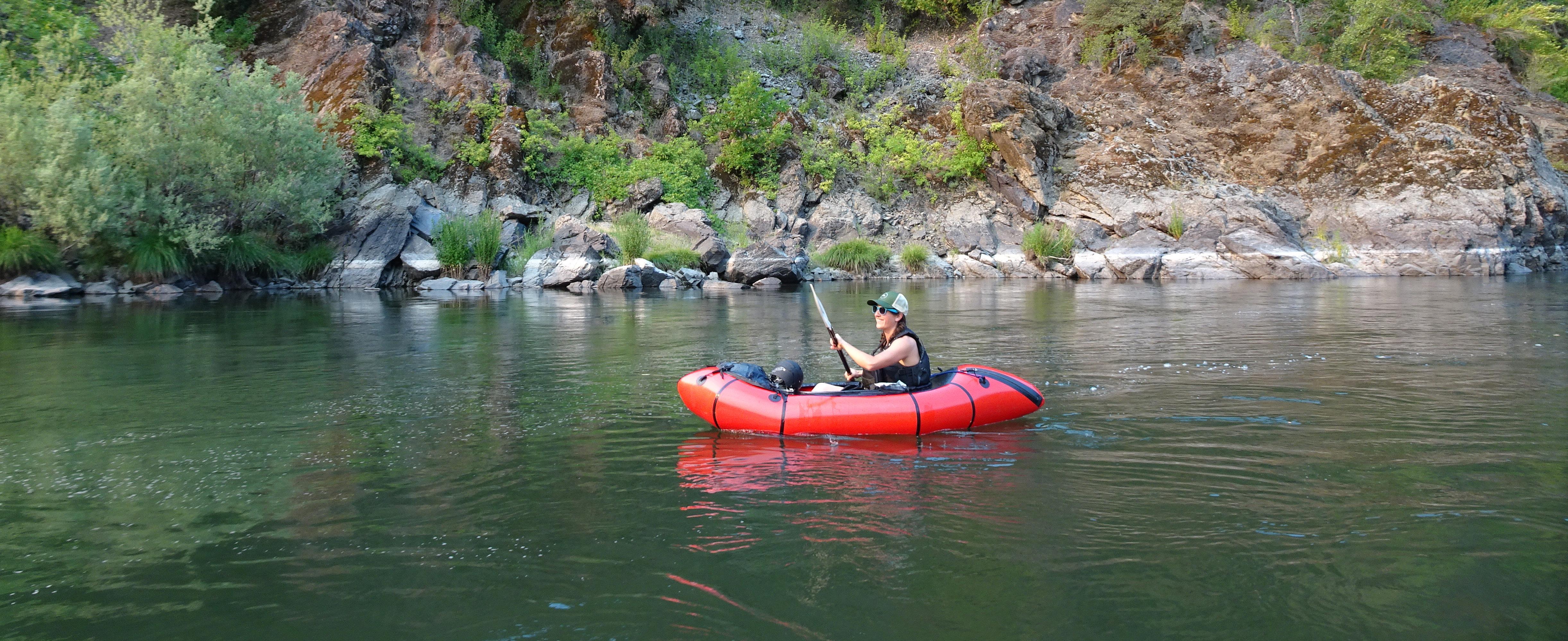
VOLUNTEER LIZI WIRAK PADDLING ON THE ROGUE RIVER, OREGON LINDSAY WANCOUR
93 20
1,381
measurements
271 grab samples collected
197 Wild and Scenic Rivers surveyed
sampling
33 states visited 25
292 volunteers in the field
169 volunteer teams
26 4 9 202 27 2 1 6 1 42 112 1 20 2 3 9 6 54 13 44 65 7 318 53 2 8 3 5 30 4 203 72 2 1 114 12
field
probe
State
Field Probe Measurements Grab Samples
of
Totals
PROJECT SUMMARY months
PROJECT CONTEXT
Established in 1968, the National Wild and Scenic Rivers (WSRs) System has expanded to include more than 13,000 miles on 226 rivers across the United States. These rivers are protected based on three main characteristics: their free-flowing nature, pristine water quality status (or ability to achieve this), and other outstandingly remarkable values that are unique to each river. Those qualities could be unusual or notable geology, scenery, fishing, wildlife, or recreation opportunities. In addition, one in ten people in the U.S. can trace their drinking water source to a wild and scenic river watershed, making water quality a high priority.
ALL WILD AND SCENIC RIVERS
WILD AND SCENIC RIVERS PROJECT FINAL REPORT 6
However, a 2018 report revealed that the WSR system lacks a comprehensive water quality assessment. In addition, the vast majority of rivers within the system either have an unassessed (33%), unknown (6%), or impaired (44%) water quality status. Rivers with an unassessed status have no known water quality data, while those with unknown status may have some data, but the river’s water quality status remains unknown. Rivers with an impaired status have a known impairment that prevents them from meeting water quality standards set forth in the Clean Water Act. Furthermore, because water quality assessments are not standardized across the WSR system, even the designation of “good” (18%), which meets water quality standards, or an “impaired” status may be based purely on assumptions or outdated data. Addressing water quality data gaps was needed to better understand, identify, and assess changes in water quality as they occur.
WILD AND SCENIC RIVERS PROJECT FINAL REPORT 7
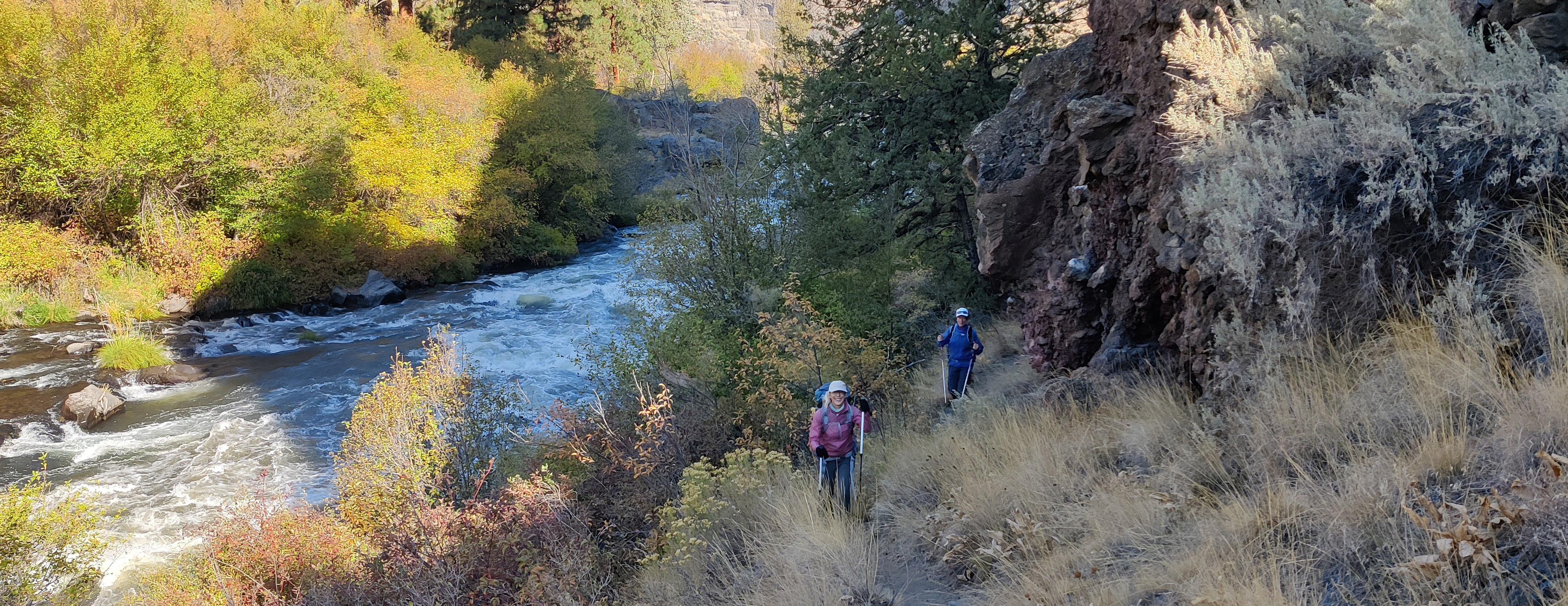
PATTY WATER AND DAVID GAST HIKING TO A SAMPLING LOCATION ON THE DESCHUTES RIVER, OREGON BRIAN CRIPE
Federal land management agencies responsible for managing nearly all of the nation’s WSRs decided to leverage the five-year window between the 50th anniversaries of the Wild and Scenic Rivers Act (2018) and the Clean Water Act (2022) to improve how these rivers are assessed, managed, and protected.
To address water quality data gaps, Adventure Scientists partnered with the United States Forest Service (USFS), Bureau of Land Management (BLM), and the National Park Service (NPS). Adventure Scientists is a nonprofit organization that designs and manages large-scale data collection projects. By recruiting, training, and managing outdoor enthusiasts and local communities, Adventure Scientists provides high-quality data gathered by volunteers.
Between June 2020 and February 2023, Adventure Scientists’ volunteers visited priority rivers across the United States’ Wild and Scenic Rivers network to collect chemical and physical data, conduct habitat assessments, collect grab samples for laboratory analysis, and complete invasive species assessments in select states.
Data from this project informs land managers to help determine if status changes for these rivers are needed. Results also inform decision-making related to activities that managers oversee in the lands surrounding these rivers. Additionally, this project helped build strong interagency partnerships and engaged the public, as required by the Clean Water Act.
WILD AND SCENIC RIVERS PROJECT FINAL REPORT 8
PROJECT DESIGN
FIELD PROTOCOLS
Adventure Scientists developed the field protocols for this Wild and Scenic Rivers project with the guidance of federal agency partners. In addition, staff consulted with state water quality agencies to better understand priorities, as these agencies will use the data to inform their management decisions and compliance with the Clean Water Act. This co-creation process gave us a Quality Assurance Project Plan (QAPP), signed by the interagency partners. The project protocols followed that plan and as a result project data collected met an “advisory data standard,” which allows it to be used to screen for potential priorities in future assessments and to supplement existing data used to determine the condition of water bodies. Although each state’s data needs and standards may vary, they are all based on EPA requirements. This project’s protocols were aligned with those requirements.
Volunteers accessed WSR segments by water or land and conducted their sampling in a portion of the river channel that was well-mixed with moderately flowing
FIELD PROTOCOLS IN USE ON THE GREEN RIVER, UTAH SETH ANDERSON WILD AND SCENIC RIVERS PROJECT FINAL REPORT 8
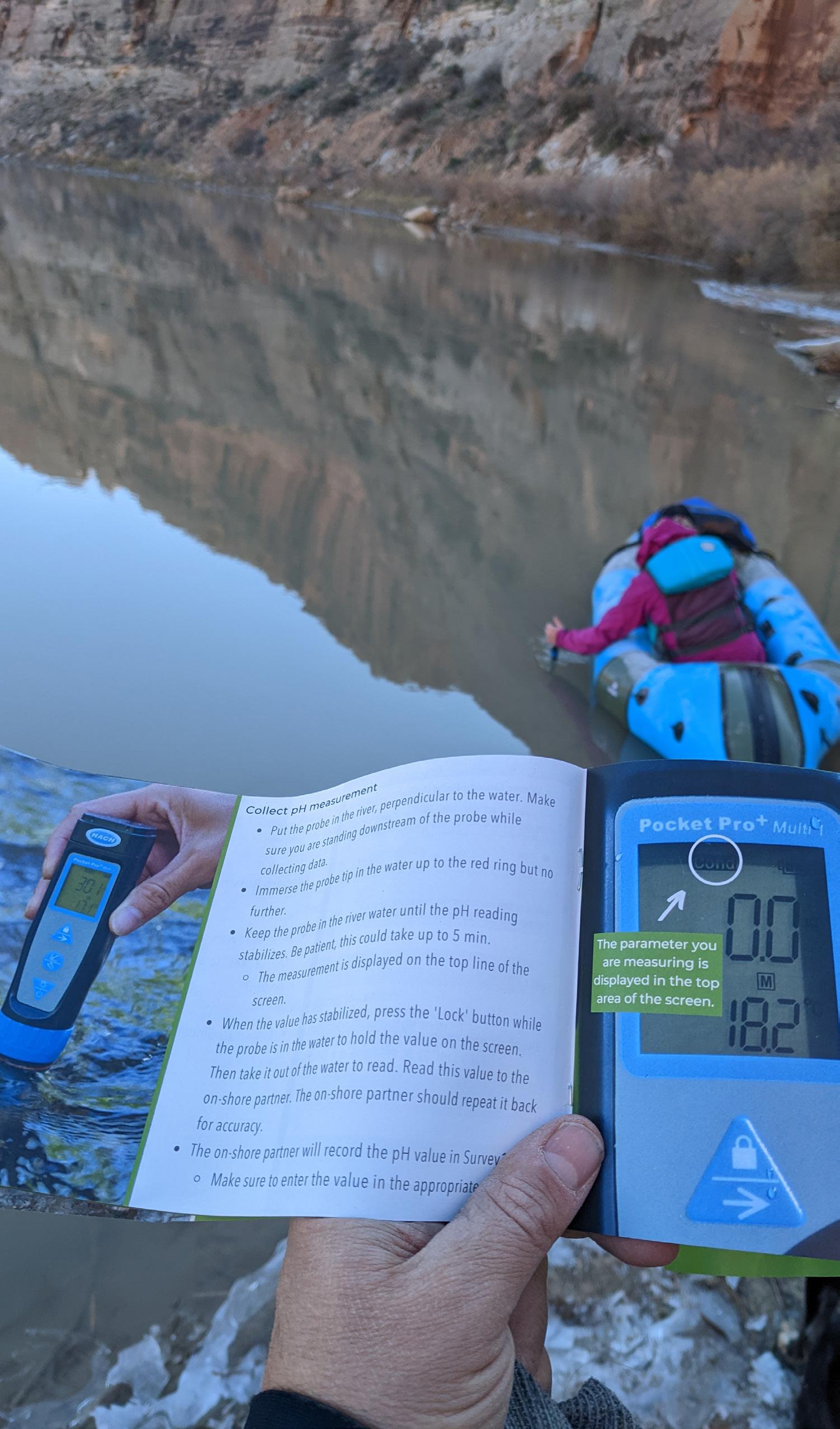
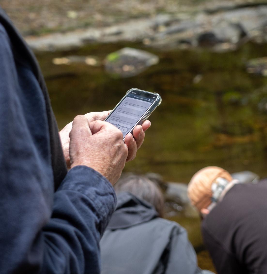
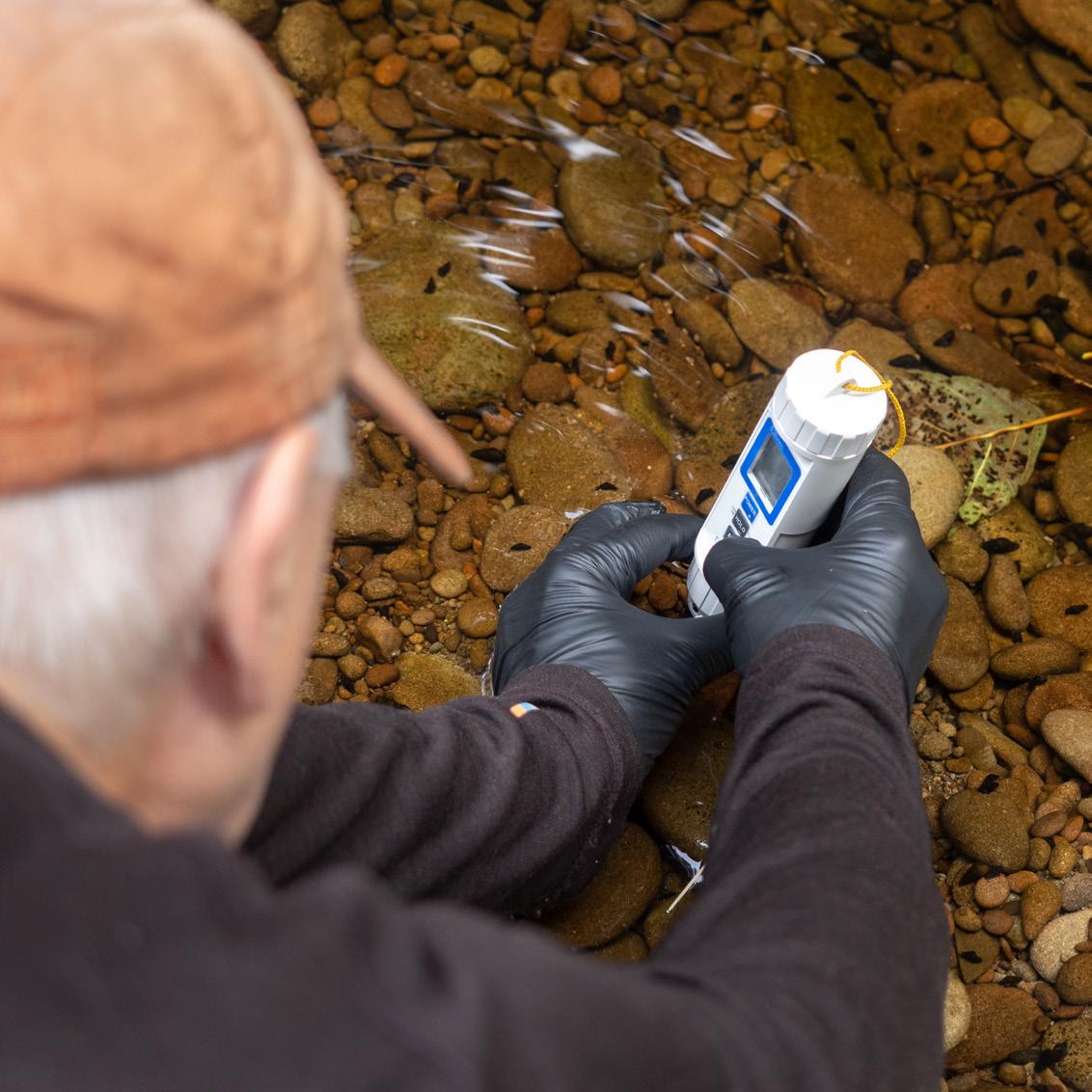
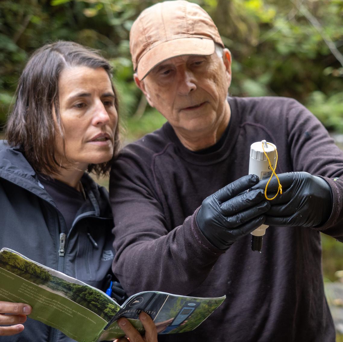
water. On river segments that land managers identified as a priority, and where access allowed, volunteers also collected grab samples that were sent to the Rocky Mountain Research Lab in Fort Collins, Colorado for analysis of nutrients, trace metals, and salinity. Water quality data was then collected using two field probes: a Hach Pocket Pro+ Multi 2 Tester to measure pH, total dissolved solids, salinity, and temperature; and a Sper Scientific Dissolved Oxygen Meter Pen to measure dissolved oxygen. Volunteers learned about the project, data needs, and protocols through an online training course in Adventure Scientists’ learning management system hosted on Adobe’s Captivate Prime platform. Volunteers recorded and submitted data using Survey123, a digital data collection app created by Esri, a geographic information systems software company. Data submitted through the app included water quality parameters from field probes, grab sample and equipment identifiers, photos, and habitat assessment results
FIELD PROBE MEASUREMENTS
pH
TOTAL DISSOLVED SOLIDS
SALINITY
WATER TEMPERATURE
DISSOLVED OXYGEN
FIELD OBSERVATIONS
PRECIPITATION
HABITAT ASSESSMENT
INVASIVE SPECIES ASSESSMENT
PHOTOS
LAB ANALYSES
MAJOR CATIONS
TOTAL METALS
TOTAL DISSOLVED NITROGEN
DISSOLVED ORGANIC CARBON
CONDUCTANCE pH
ACID NEUTRALIZING CAPACITY
WILD AND SCENIC RIVERS PROJECT FINAL REPORT 10
taken while in the field. Volunteers in Washington, Oregon, Alaska, and Idaho also submitted an invasive species assessment.
Sampling took place over two field seasons each year from June 2020 - February 2023. The spring/summer season ran from April 1 to September 1. A month-long break each season allowed Adventure Scientists to inspect, maintain, and calibrate equipment before resuming the season from October 1 to February 28. During the first year of the project (2020), the COVID-19 pandemic delayed the start date. To adapt, the project team held a single field season which spanned from June 1, 2020, to January 31, 2021. During this sampling season, each field probe was calibrated when it was returned by one volunteer team and before sending it out to the next sampling team.
In 2022 and 2023, streamlined gear management systems allowed us to conduct a rolling calibration of probes used year-round. Each volunteer committed to conduct at least three surveys at each sampling location, spaced four to six weeks apart, before returning their sampling equipment by mail.
BEAVER CREEK WILD AND SCENIC RIVER, ALASKA CRAIG McCAA, BLM
TARGETS FOR SAMPLING
We set an initial goal to complete at least 320 field probe surveys and take 50 grab samples each year, for a total of 880 surveys and 150 grab samples from 2020-2023. In addition, we followed guidance and the request of interagency partners and state water quality agencies to collect additional data on select “impaired” and “good” status rivers.
We surpassed our goal by 157%, collecting a total of 1,381 field probe measurements and 217 grab samples! On unassessed and unknown water-quality segments, we completed 715 field probe measurements (51.7% of the total) and 147 grab samples (67.7% of the total).
SITE SELECTION AND PERMITTING
Adventure Scientists collaborated with three federal agencies to identify priorities for the first year of the project (2020). We agreed to focus on unassessed and unknown water quality status rivers in the Pacific Northwest region, which contained the highest concentration of unassessed and unknown rivers. To communicate these location priorities to volunteers, we created a public-facing map with WSRs color-coded based on status and priority. The screening process included prioritizing volunteers who indicated plans to sample unknown and unassessed rivers. Volunteers who selected only “impaired” or “good” status rivers were waitlisted, dependent upon equipment availability and additional high-priority locations communicated by the partners.
Adventure Scientists worked with interagency partners to complete a preliminary assessment of data collected in spring 2022. Based on the interagency partner’s priorities on unassessed
WILD AND SCENIC RIVERS PROJECT FINAL REPORT 12
and unknown rivers, including many remote rivers in Alaska, we refined site selection for the remainder of the project.
Adventure Scientists requested and received the necessary permits from federal and state agencies to collect water quality data on WSRs. The project was allowed, either by formal permit or expressed permissions, to conduct water quality data collection in 30 states in 150 national forests, 66 BLM state/district parcels, 41 national parks, and 11 state properties.
VOLUNTEER RESOURCES
Digital volunteer resources were organized in a password-protected web portal that included links to the required training modules, maps, permits, contact information, logistics, important dates, a data dashboard, and project updates. We required all volunteers to complete the online training before receiving their sampling gear and instructed them to familiarize
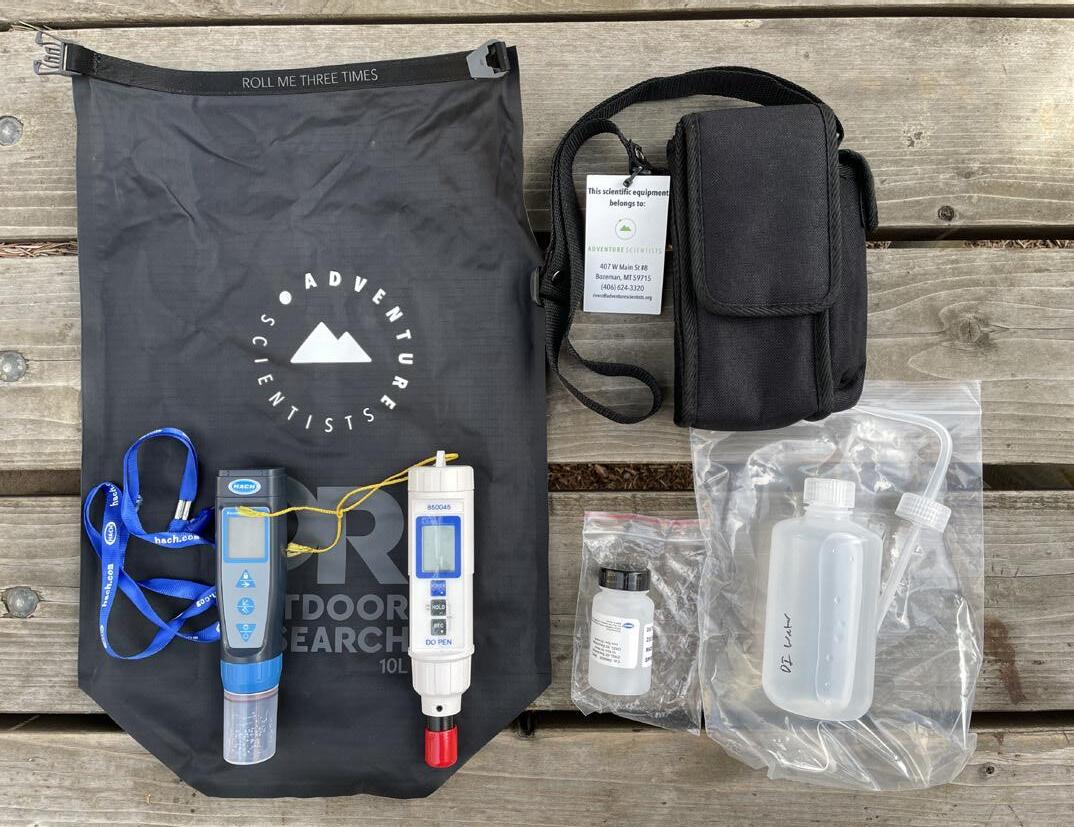
EQUIPMENT PROVIDED TO VOLUNTEERS TO CONDUCT FIELD MEASUREMENTS (LEFT) AND COLLECT GRAB SAMPLES (RIGHT).
MARIS FESSENDEN
WILD AND SCENIC RIVERS PROJECT FINAL REPORT 13
themselves with the gear before going into the field. In addition to sampling equipment protocols, the training also covered background information, how to use digital data collection and navigation tools, and how to conduct habitat and invasive species assessments. To cater to different learning types and keep it interesting, the training modules included written explanations as well as videos and interactive images. All volunteers passed a final, posttraining quiz with 100% accuracy, as required, and they were given unlimited attempts to do so.
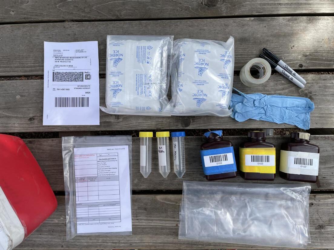
Adventure Scientists provided sampling equipment, printed field protocols, and an invasive species guide to all volunteers. The equipment included a dry bag with two probes in a carrying case, a bottle of deionized water with travel and squirt caps, lab wipes, extra electrolyte solution, spare batteries, and a carabiner. Those collecting grab samples also received a cooler with three sample bottles (plus an additional three if collecting quality control samples), one empty vial, two vials with dilute acid, nitrile gloves, a chain of custody form, a plastic bag, ice packs, packing tape, markers, and a shipping label. Of volunteers who responded to our endof-season surveys, 98.6% indicated that they were “provided with the necessary materials and training resources to be successful as a volunteer” (76.3% strongly agreed, 22.3% agreed).
“[The trainings] were clear, helpful, and repetitive in the right ways so you knew what was important. They presented the material in a variety of formats, and made a complicated process that needs a lot of [quality control] as easy for us as possible.”
WILD AND SCENIC RIVERS PROJECT FINAL REPORT 14
Ellie Friedmann, Westfield River, Massachusetts volunteer
VOLUNTEER MANAGEMENT
RECRUITMENT
Volunteer recruitment began during the project design phase from 2018 to 2019 by making connections with river-focused nonprofit organizations and creating a list of interested volunteers. In February 2020, volunteer recruitment began in earnest and consisted of emailing existing Adventure Scientists volunteers and those on a digital interest list hosted on the Adventure Scientists’ website. We networked with national organizations involved in river conservation and recreation, local organizations such as rafting outfitters, and nonprofits. In addition, we utilized our social media channels and connected with ambassadors and corporate sponsors who shared information about the program with their networks.
VOLUNTEERS LEARNING
PROTOCOLS ON
SAMPLING
WASSON CREEK, OREGON JOSH DANIELS
0 5 10 15 20 25 MultnomahCounty, OR KingCounty, WA DeschutesCounty, OR LosAngelesCounty, CA LaneCounty, OR GallatinCounty, MT FlatheadCounty, MT MissoulaCounty, MT SnohomishCounty, WA CoconinoCounty, AZ Top 10 Counties No. of Volunteers Volunteer Homebases by County No. Volunteers 1 2 3 - 4 5 - 6 7 - 8 9 - 11 12 - 23 158 miles 130 miles Longest Distance Hiked Longest Distance on a River Average No. Days Volunteered 5.8 Multnomah County, OR 23 volunteers VOLUNTEERS WILD AND SCENIC RIVERS PROJECT FINAL REPORT 16
In May 2021, we refined the volunteer recruitment strategy to target areas that had not yet been sampled. Alaska contains the highest number of Wild and Scenic River miles in the United States, yet we were unable to collect data there in 2020 due to the short rafting season in Alaska and the delayed start date due to the COVID-19 pandemic. We targeted recruitment in Alaska through social media, connected with local organizations, and hosted a volunteer recruitment event in Anchorage.
In April 2022, we collaborated with project partners to undergo a prioritization exercise to understand where the highest priority locations to be sampled remained. The priorities largely included rivers in Washington, Oregon, California, and Alaska. We included specific regions and rivers in our social media recruitment efforts.
There was a huge volunteer response to this project. Many volunteers applied for the project but were placed on a waitlist due to equipment limitations. We received 1,177 applications for this project and accepted 479 volunteers. Of accepted volunteers, 99.2% of volunteers completed the online training and received project equipment. Of those who completed training, 72% followed through and collected data for the project. The national average for
“Taking a small action to care for the river deepened my care for the place. As is often the case, volunteering for something you believe in makes you want to give more to that thing or place.
WILD AND SCENIC RIVERS PROJECT FINAL REPORT 17
David Brooks, Middle Fork Salmon River, Idaho volunteer
51.8%
What motivated you to volunteer for this project?
11.5%
“I care about river health, water quality, and aquatic ecosystems”
“I want to help Adventure Scientists with their mission”
Percentage of volunteers that feel like they...
had an impact locally
had an impact in the scientific field
had an impact nationally
contributed to the scientific community
protected a place that was important to them learned a new skill
“I enjoy learning about science and nature”
“I want to be involved in the scientific process.”
“Although I have spent a lot of my life near rivers, measuring one with scientific instruments allowed me to observe it in ways that I have never done before.”
Dan Sproles, Lumber River, North Carolina volunteer
better understand water quality metrics
0 20 40 60 80 100
percent
10.5%
10.5%
70% 75% 93% 87% 84% 83% 73%
WILD AND SCENIC RIVERS PROJECT FINAL REPORT 18
volunteer follow-through is about 65% (Volunteering and Civic Life in America), which means we think Adventure Scientists’ volunteers go above and beyond!
ENGAGEMENT
Adventure Scientists’ engagement strategy with volunteers included monthly informative newsletters and digital events such as online project kick-off parties, Q&A sessions, and volunteer storytelling opportunities. We held a number of competitions (photo contests, data blitz, etc.) where volunteers had opportunities to win prizes from one of our corporate sponsors.
We hosted in-person volunteer celebrations in the following locations: Anchorage, Alaska (Gulkana and Delta Rivers) in June 2021; Walhalla, South Carolina (Chattooga River) in July 2021; and Sisters, Oregon (Whychus River network) in July 2022. These events fostered community, trained volunteers, and supplemented data on high-priority rivers.
Volunteer surveys showed increased engagement with water quality issues. After volunteering with the Wild and Scenic Rivers Project, 72% of volunteers reported taking greater daily actions (examples: posting on social media, starting a conversation with family/friends, staying informed about scientific news, etc), 64% of volunteers reported taking greater recurring
“It felt great to learn about a large scale issue and actually feel like I could make a difference. It was so fun to just drive to a beautiful river and have an intent that was beyond just hanging out or hiking.”
WILD AND SCENIC RIVERS PROJECT FINAL REPORT 19
Taylor
Aldridge,
Clackamas River, Oregon volunteer
actions (examples: leading an event, training, or workshop; voting, petitioning, or donating to conservation; or becoming a member of an organization), and 30% reported taking greater long-term actions (examples: pursuing a conservation career/degree or starting a monitoring/ research project). Volunteers provided specific examples of their actions, such as: volunteering with other organizations, donating, changing daily routines, or joining a local water resources council.
VOLUNTEER MANAGEMENT SYSTEMS
Adventure Scientists specializes in high-quality data collection across large geographic areas. This is made possible through innovative technological tools for both public audiences (partners and volunteers) and internally for organization.
Custom Automations
Through a customer relationship management (CRM) tool called Salesforce, we automated email communication based on the status of a volunteer in a project. We queried information to track volunteer progress and assess how we were tracking on project goals and recruitment targets. We used a texting service for pertinent reminders, as we saw increased response rates with texts compared to email.
Dashboards/Data Visualization
We designed a number of real-time dashboards to relay updates to the public including interagency partners, state water quality agencies, volunteers, and donors. These provided a quick overview of rivers samples, locations, and priority status. We also created internal management dashboards to visualize how we needed to adapt our management of volunteers
WILD AND SCENIC RIVERS PROJECT FINAL REPORT 20
This data exploration dashboard was developed to allow volunteers to explore the entire WSR dataset and see how their data collection efforts contributed to the project.
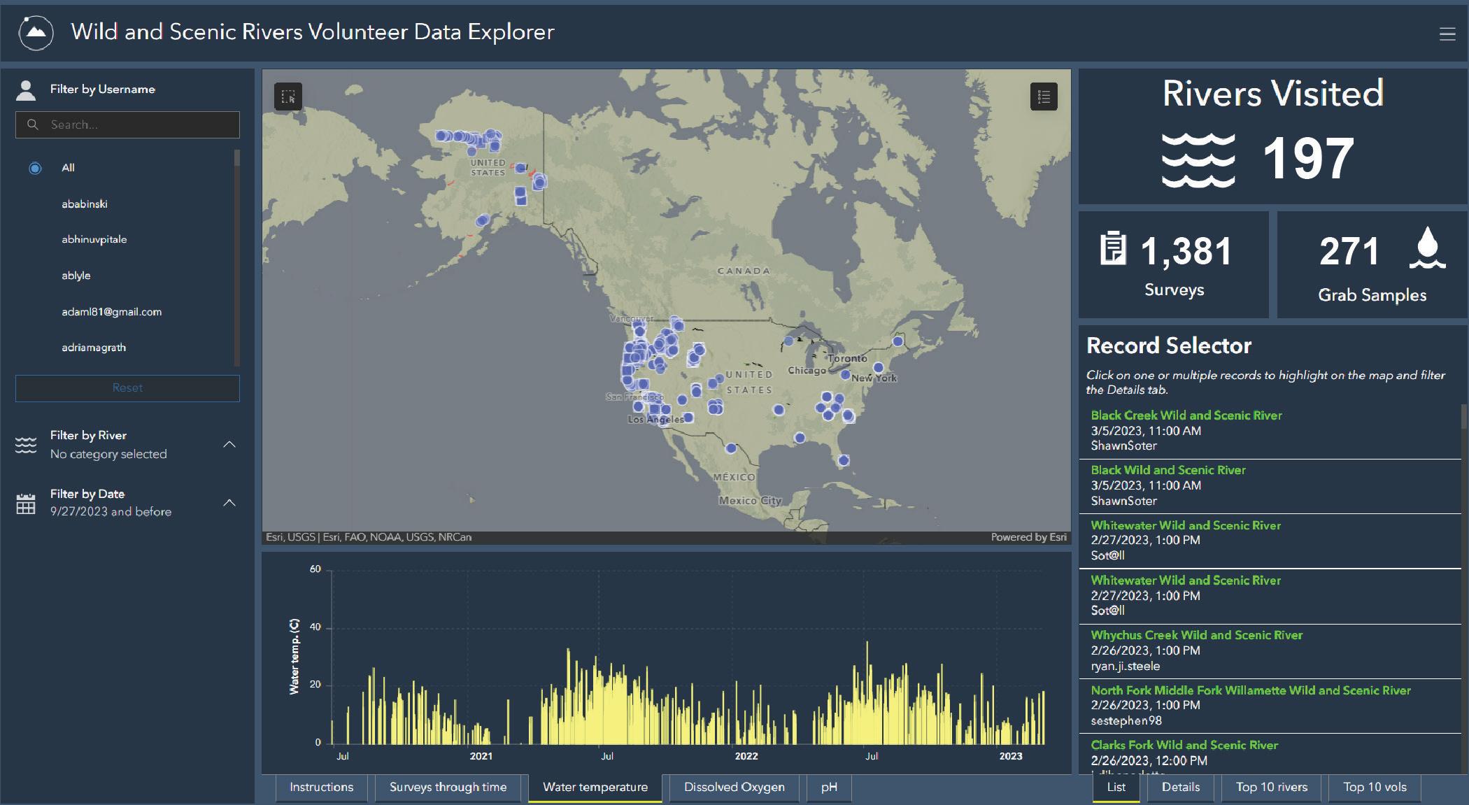
to motivate volunteers in priority areas or recruit volunteers in target areas. These tools allowed us to quality check data and meet the goals of our partners.
VOLUNTEER SPOTLIGHT
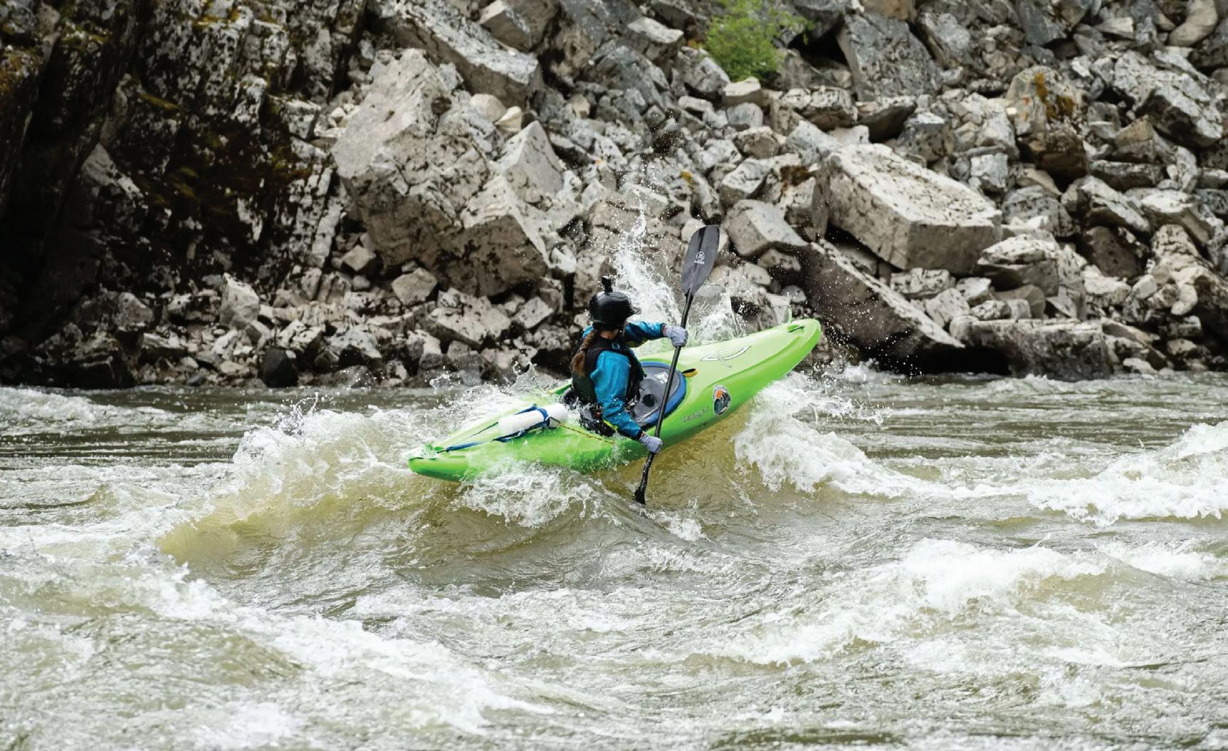
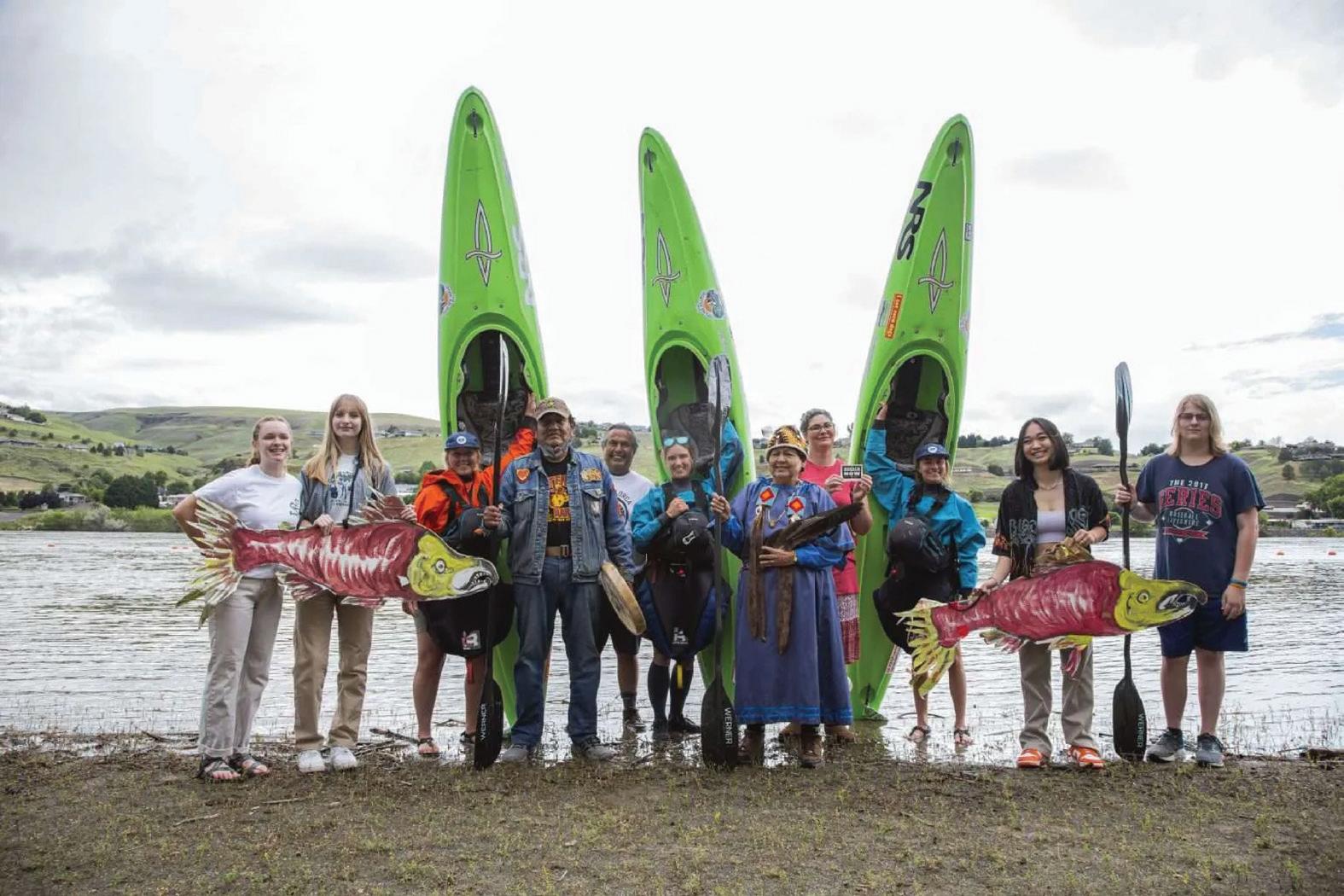
How do conservationists speak for the animals and places that need protection? Three Adventure Scientists volunteers gave voice to a river and its ecosystem by embarking on an epic 1000+ mile adventure, the Grand Salmon Source to Sea.
Libby Tobey, Brooke Hess, and Hailey Thompson spent 78 days skiing, whitewater kayaking, and sea kayaking over 1,000 miles from source-to-sea through Idaho, Oregon, and Washington as a
WILD AND SCENIC RIVERS PROJECT FINAL REPORT 21
conservation campaign promoting the removal of the four lower Snake River dams, in order to save the rapidly dwindling Snake River Basin salmon populations from extinction.
In addition to hosting events and raising awareness around the Lower Snake River dams, the trio collected water quality data for the Wild and Scenic Rivers Project once they entered the unknown water quality sections of the Salmon River and Middle Fork Salmon River.
“Using recreation as a tool for raising awareness and motivating action is pretty freaking cool (at least we think so)! We hope that folks enjoy our stories from the river, but ALSO learn something through those stories – and step up to take action for this cause!” said Libby Tobey.
Libby, Brooke, and Hailey traveled through three rivers, protecting three endangered species of salmon, encountered 4 dams, and are planning on making a film about their journey.
GRAND SALMON SOURCE TO SEA
LEFT: LIBBY, BROOKE AND HAILEY MEETING WITH MEMBERS OF THE NIMIIPUU TRIBE DURING A COMMUNITY PADDLE IN LEWISTON, ID RIGHT: LIBBY TOBEY KAYAKING THROUGH RAPIDS ON THE MIDDLE FORK OF THE SALMON RIVER
DATA COLLECTION & RESULTS
In 2020, 44 volunteer teams visited 41 WSRs, collected 52 grab samples, and submitted 164 surveys. These samples were collected across 10 states: Arizona, California, Colorado, Idaho, Montana, New Mexico, Oregon, South Carolina, Washington, and Wyoming. Of the river surveys, 130 were on USFS land, 45 had shared land managers, eight on BLM land, and none on NPS land.
Wild and Scenic River Survey Location Grab Sample Field Probe Measurements & Site Metadata Capture and Submit with Survey123 ArcGIS Online U.S. Forest Service Rocky Mountain Research Station Field Results Quality Assurance Check Environmental Protection Agency Publicly Availabe via Water Quality Exchange (WQX) Lab Results Quality Assurance Check Upload Verified Field and Lab Data Mail to Laboratory for Analysis Coordination with Partner Organizations U.S. Forest Service National Park Service Bureau of Land Management & State Agencies Adaptive Management of Priority Locations
WILD AND SCENIC RIVERS PROJECT FINAL REPORT 23
Eel River, CA 124.28 W Noatak River, AK 161.9 W John River, AK 68.12 N North Fork Flathead River, MT 49˚N Allagash River, ME 69.21 W Loxahatchee River, FL 26.95N DATA COLLECTION 2020 164 surveys 52 grab samples 46 volunteer teams 41 rivers 2021 596 surveys 92 grab samples 78 volunteer teams 106 rivers 2022 521 surveys 64 grab samples 92 volunteer teams 135 rivers 2023 100 surveys 9 grab samples 23 volunteer teams 34 rivers * * January & February only
In 2021, 78 volunteer teams visited 106 WSRs, collected 92 grab samples, and submitted 596 surveys. These samples were collected across 15 states: Arizona, California, Florida, Idaho, Maine, Massachusetts, Montana, New Mexico, North Carolina, Oregon, South Carolina, Texas, Utah, Washington, and Wyoming. Of the river surveys, 192 were on USFS land, 194 had shared land managers, 38 on BLM land, and 63 on NPS land.
In 2022, 92 volunteer teams visited 135 WSRs, collected 64 grab samples, and submitted 521 surveys. Volunteers collected data across 20 states: Alaska, Arizona, Arkansas, California, Florida, Georgia, Idaho, Kentucky, Mississippi, Montana, New Mexico, North Carolina, Oregon, Pennsylvania, Texas, Utah, Washington, West Virginia, Wisconsin and Wyoming. Of the river surveys, 209 were on USFS land, 195 had shared land managers, 31 on BLM land, and 87 on NPS land.
In January and February of 2023, 23 volunteer teams visited 34 WSRs, collected 9 grab samples, and submitted 100 surveys. Volunteers collected data across 9 states: Arizona, California, Georgia, Mississippi, Montana, Oregon, Pennsylvania, Washington, and Wyoming. Of the river surveys, 49 were on USFS land, 36 had shared land managers, 10 on BLM land, and none on NPS land.
Data results can be accessed through the EPA’s Water Quality Portal or downloaded through Adventure Scientists’ Data Request website.
WILD AND SCENIC RIVERS PROJECT FINAL REPORT 25
WATERSHED SPOTLIGHT
The Skagit-Sauk Rivers watershed in northwest Washington contains two Wild and Scenic Rivers: Illabot Creek WSR and Skagit River WSR (which includes tributary reaches of the Cascade, Sauk, and Suiattle Rivers). Of the 172.5 total river miles in the Skagit-Sauk watershed that are designated as Wild and Scenic, 95 percent have an unassessed water quality status.
To address this water quality data gap, Adventure Scientists placed Illabot Creek and Skagit River and tributaries on the priority sampling list. In total, 103 field probe measurements and 53 grab samples were collected from unassessed WSR reaches throughout the Skagit-Sauk Rivers watershed, with many locations receiving repeat visits by volunteers over the project duration.
 SHRUTI SHETTY AND ABHINUV PITALE DURING A SAMPLING TRIP TO THE SKAGIT RIVER, WASHINGTON ABHINUV PITALE
WILD AND SCENIC RIVERS PROJECT FINAL REPORT 26
WATERSHED SPOTLIGHT


North For k Sk y k o mishRiver W Oak Harbor 14 13 12 11 11 7 6 5 5 4 4 3 3 3 Survey Clusters Bureau of Land Management Forest Service National Park Service
Cascades National Park
SkagitBay North
Mt. Baker - Snoqualmie National Forest
SaukRiver
Cascade River
- Sauk Rivers Watershed Northwest Washington Washington Skagit-Sauk Watershed Unknown Good Wild and Scenic River Water Quality Status Federal Lands LEGEND WILD AND SCENIC RIVERS PROJECT FINAL REPORT 27
Skagit
MEDIA
HOW OUTDOOR ENTHUSIASTS CAN HELP SCIENTIFIC RESEARCH ABOUT CLIMATE AND WILDLIFE - JULY 2022
The Revelator covers the origins of Adventure Scientists and volunteer involvement in many projects, including the Wild and Scenic Rivers Project. Read it here.
THE GRAND SALMON SOURCE TO SEA EXPEDITION - JUNE 2022
Brooke Hess and Libby Tobey, Adventure Scientists’ Wild and Scenic Rivers volunteers, write about their 4,000 mile journey along the Snake river watershed, advocating for wild rivers and collecting water quality along the way. Read it here.
WSR WINTER COLLECTION - JANUARY 2022
Steve Weileman describes and documents his experience volunteering for the Wild and Scenic Rivers project. Explore his posts and photos here.
CITIZEN SCIENTISTS STEP UP FOR WILD AND SCENIC RIVERS - WINTER 2021
The River Management Society’s Journal, published quarterly, featured a write-up of the project at Adventure Scientists featuring volunteer John Soltys. Read it on page 13 here.
KALMIOPSIS TRIP REPORT: EXPLORING CHROME CREEK BLOG POSTAPRIL 25, 2021
A crew of Northwest Rafting Co. guides document their adventure as they explore a proposed
WILD AND SCENIC RIVERS PROJECT FINAL REPORT 28
Wild and Scenic river, Chrome Creek, in Southern Oregon’s Kalmiopsis Wilderness. See how they navigated, explored, and contributed valuable water quality data on this beautiful and remote stretch of water. Read it here.
EVER WANTED TO VOLUNTEER FOR A SCIENTIFIC EXPEDITION? HERE’S HOWAUGUST 25, 2021
This National Geographic article highlights the incredible impact that volunteers can provide to the scientific world including through Adventure Scientists’ Wild and Scenic Rivers project. Follow volunteer Tashi Hackett on a data collection outing on the Snake River in Wyoming and hear from Adventure Scientists’ executive director, Gregg Treinish, on the success of our citizen science programs. See it here.
THIS MONTANA GROUP HAS ADVENTURERS WORKING FOR SCIENTISTS - JANUARY 10, 2020
Bitterroot Magazine profiles Adventure Scientists, volunteers, and scientists, including a spotlight on collaboration that went into developing the Wild and Scenic Rivers project. Read it here.
WILD FOR THE GREEN - MAY 26, 2021
In this video, created by Adventure Scientists, on Utah’s Wild and Scenic Green River, volunteers
Lindsay Hunt and Sean Tropsa share why they love adventuring for science and what it is like to collect water quality data that will help protect Wild and Scenic rivers into the future. Watch it now.
WILD AND SCENIC RIVERS PROJECT FINAL REPORT 29
ADVENTURE SCIENTISTS BLOG POSTS AND SOCIAL MEDIA
Volunteer Spotlight: Seth Anderson on the Green River | read it here and here.
Guest Post: Green River Adventures | read it here and here.
Guest Post: The Grand Salmon Source to Sea Expedition | read it here and here and here.
Guest Post: Meet the River Cowboy of the Red River | read it here.
Mike Forbes, Idaho-based Volunteer | see it here.
Seth Anderson Green River Drone Footage | see it here.
Nutria: Cute but Problematic | see it here.
VOLUNTEER ELLIE FRIEDMANN TAKING A FIELD PROBE READING IN THE KALMIOPSIS WILDERNESS, OREGON ELLIE FRIEDMANN
WILD AND SCENIC RIVERS PROJECT FINAL REPORT 30
FEDERAL AND STATE WATER QUALITY ENGAGEMENT
Adventure Scientists depended upon the input and engagement of federal and state agencies to ensure the data collected fit their needs. To achieve this, we connected with and sought feedback from each state agency in the project area before the project began. Prior to the start of each survey season, usually in March, we checked in with each state agency to discuss their current data collection priorities which then guided our sampling efforts. Following the survey season, usually in October, we sent project updates in a newsletter and hosted a field season debrief webinar for state agency staff. Throughout the project, we met with interagency partners (National Park Service, United States Forest Service, and Bureau of Land Management) bimonthly to discuss project updates and refine prioritization. Furthermore, each agency had access to the data collected, project protocols, and other pertinent information using our website portal found here.
WILD AND SCENIC RIVERS PROJECT FINAL REPORT 31
CHALLENGES AND LESSONS LEARNED
EQUIPMENT LIMITATIONS
High-quality water quality equipment for field use is expensive and this ended up being a limiting factor to the scope and scale of the project. Although we sourced EPA-approved water quality probes from Hach and Sper, we tested the limits of this equipment since they were designed for laboratory use. We periodically replaced sensors and probes throughout the life of the project, and calibrated more frequently than required to keep data quality high. We hope that low-cost, high-quality water quality equipment can be more accessible in the future.
With access to more equipment, we could have engaged more volunteers and collected extensive datasets throughout the lifetime of this project, since we had an extensive waitlist of volunteers but did not have enough gear.
LEARNING MANAGEMENT SYSTEM
As a way to better track volunteer learning and retention, we launched a Learning Management System (LMS) to host our online trainings. Using an LMS to host online trainings allowed us to track important metrics, such as time spent in lessons and completion rates, as well as information on individual learners. We initially selected an LMS created by a smaller company local to Bozeman, Montana but experienced some design limitations and inconsistencies that presented a challenge to the volunteer experience. We decided to move away from this platform and implemented Adobe’s LMS, which provided a much better system for volunteer
WILD AND SCENIC RIVERS PROJECT FINAL REPORT 32
interaction, more detailed reporting, intuitive navigation for volunteers, and fewer technological problems.
PRIORITIZATION OF DATA COLLECTION EFFORTS
Data needs are specific to each state, and in some cases, specific rivers. To rise to this challenge and ensure that the project generated useful data for land managers, we met with interagency partners regularly. In spring 2022, we collaborated with partners to review locations and frequency of data collected to date. As part of the prioritization process, we queried local land managers to better understand their needs and how they would use the data. This process required extensive staff time and effort, and feedback from land managers. The outcome of this prioritization resulted in high-level priorities (focus on specific states, for example) without the nuanced in-depth analysis of water quality data. Based on these conversations, we refined our data collection to specific locations. Volunteers collected data in many of these locations and were overall successful in filling data gaps. From further conversations with interagency partners, we recognized the need for local land managers to analyze and understand all water quality data to further prioritize data collection needs.
LOOKING AHEAD
The Wild and Scenic Rivers Project highlights the successful partnership between state and federal governmental agencies and the public. The dataset is now with federal agency partners – the U.S. Forest Service, Bureau of Land Management, and the National Park Service – for analysis and application to management and regulatory processes. This is one of the many
WILD AND SCENIC RIVERS PROJECT FINAL REPORT 33
water quality projects that could be implemented through participatory science. We encourage conservation leaders and the scientific community to partner with Adventure Scientists for data collection needs, at any scale. We encourage our dedicated volunteer network to continue participation in additional volunteer opportunities in their local communities and through Adventure Scientists’ projects.
 HIEN NGUYEN AND YARISSA MATOR-SOTO COLLECTING DATA ON THE LOXAHATCHEE RIVER, FLORIDA
WILD AND SCENIC RIVERS PROJECT FINAL REPORT 34
YARISSA MATOR-SOTO
ACKNOWLEDGEMENT
We are deeply thankful for the Adventure Scientists’ network of volunteers, whose passion for adventure and science makes it possible to collect an extensive water quality data set. It is incredible to work with so many people who are driven by a desire to contribute directly to change in conservation. Numerous land management agencies supported this project through their partnership in study design, on-the-ground logistics, and help securing permits and authorizations. We would like to thank Steve Chesterton (USFS), Michael Eberle (USFS), Scott Miller (BLM), Jennifer Back (NPS), and Susannah Erwin (NPS) for collaborating with us to gain a better understanding of water quality across the WSR network. We were also fortunate to collaborate with Tim Fegal and Chuck Rhoades at the Rocky Mountain Research Station (USFS) for grab sample analysis.
Adventure Scientists’ donor partners made this project possible, as well as other work of Adventure Scientists. We are incredibly grateful for their partnership and support. CLIF Bar generously supported this effort through donations of CLIF bars for volunteers. GaiaGPS’s inkind donation waived subscription fees for all volunteers. Outdoor Research, Outdoor Prolink, AllTrails, Sunski, Miir, Peak Design, and Croakies helped us award our volunteers with prizes and gifts throughout the field season.
Every member of the Adventure Scientists team contributed their exemplary work ethic to help launch and manage this project. Special thanks go to Senior Systems and Volunteer Manager
WILD AND SCENIC RIVERS PROJECT FINAL REPORT 35
Jessica Eggers, Senior Technology Manager Ricky Jones, Project Coordinator Jordan Garrett, Scientific Director Jenélle Dowling, Volunteer Manager Max Littlefield, Volunteer Manager
Katya Koepsel, Project Coordinator Isabella Pritchard, Project Development Coordinator Aisling
Force, Associate Director of Project Design Joshua Theurer, Senior Executive Administrator
Jessica Smorowski, Chief of Staff Merrill Hallett, and Executive Director Gregg Treinish.
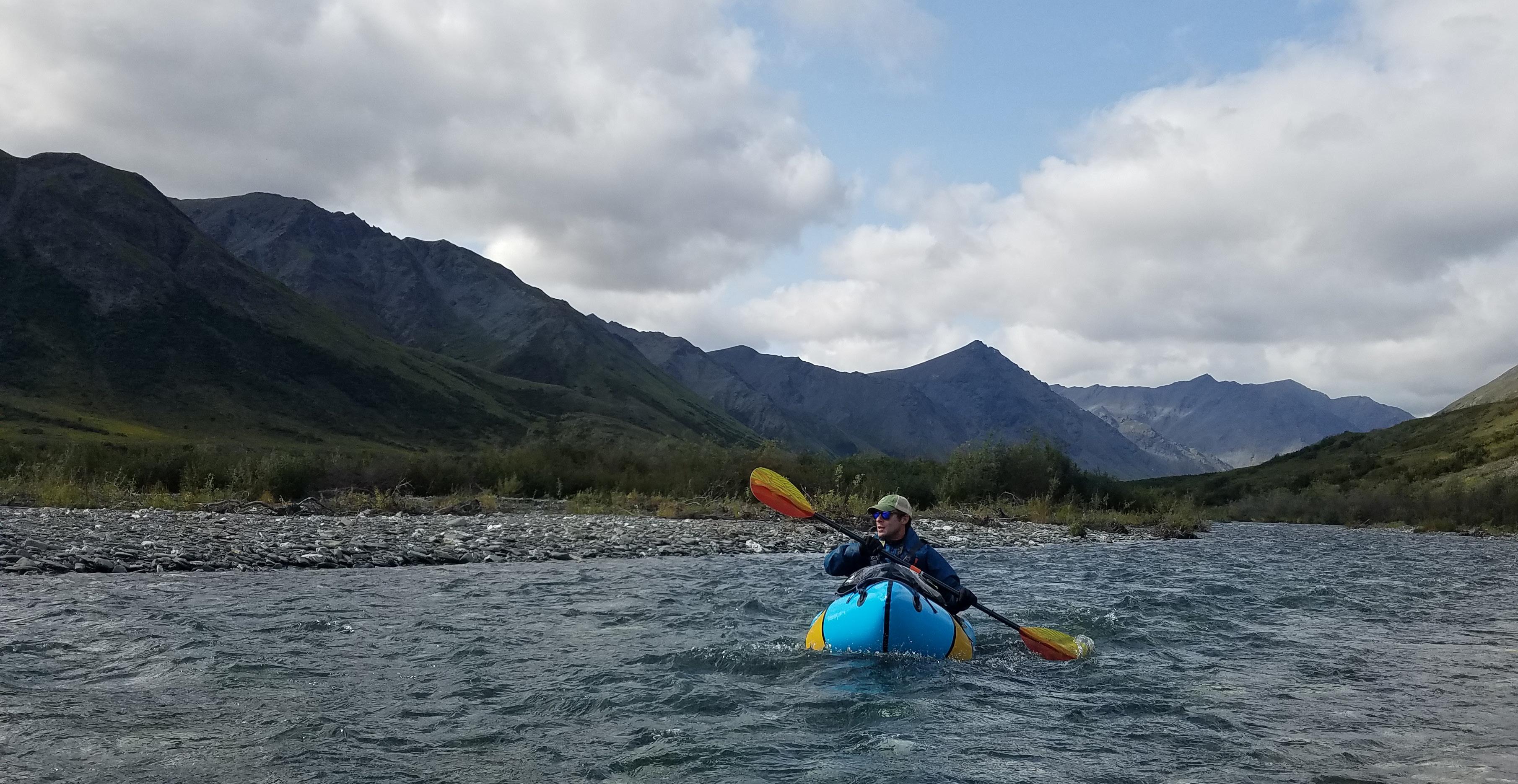
GREGG TREINISH IN A PACKRAFT PADDLING DOWN THE ALATNA RIVER DURING AN AUGUST 2021 SAMPLING TRIP WILD AND SCENIC RIVERS PROJECT FINAL REPORT 36
REFERENCES
2020 Quality Assurance Plan. National Wild and Scenic Rivers System Water Quality Inventory. Updated October 6, 2021.
Clean Water Act of 1977. Pub. L. 95-217, December 27, 1977.
Evaluation of State Water Quality Assessments and the National Wild and Scenic Rivers System. Kathryn Willi and Jennifer Back. 2018. Accessed September 1, 2023.
National Wild and Scenic Rivers Program. Accessed September 1, 2023.
Wild and Scenic Rivers 50 Years Fact Sheet. Ongoing research from Jennifer Back and Kathryn Willi. National Park Service Water Resources Division. Fort Collins, CO.
Volunteering and Civic Life in America. Accessed September 1, 2023.
Water Quality Portal. National Water Quality Monitoring Council. Accessed September 1, 2023.
WILD AND SCENIC RIVERS PROJECT FINAL REPORT 37
406.624.3320 | info@adventurescientists.org For more information: www.adventurescientists.org PO BOX 1834 | BOZEMAN, MT 59771
