
8 minute read
Latent City


Latent City
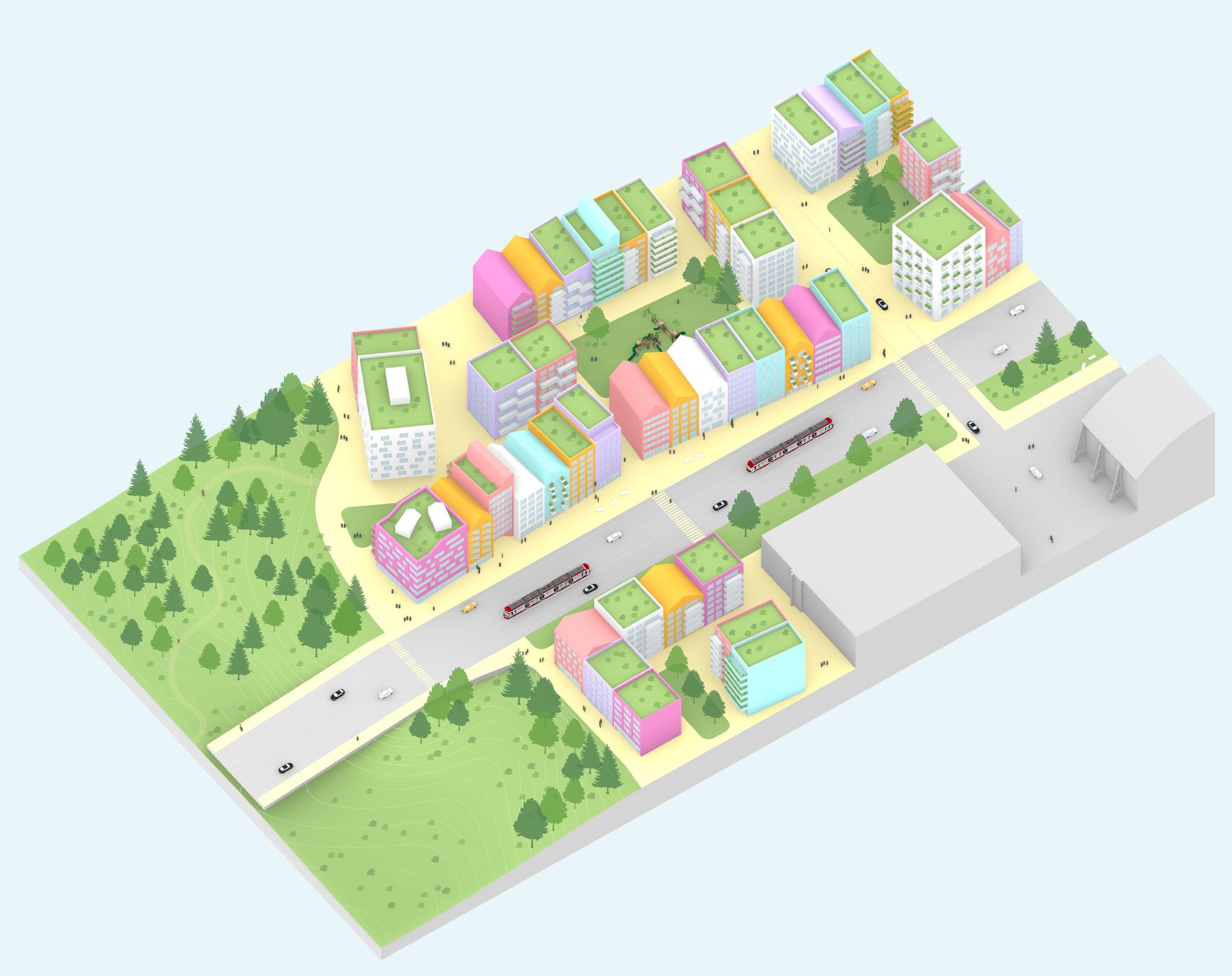
By applying the framework rules, we generate a Latent City form for the Port Lands. Latent City serves as the starting point of an ecologically resilient, dynamic, and changing urban system (Figures 26 & 27). The form shown in this chapter represents an initial state generated and guided by the framework rules (Figures 28 & 31). Because of the latent adaptability built into the urban system by the framework rules, the initial form adapts and changes over time to suit the pressures placed on it.
Advertisement
Exploring this Latent City form (Figure 28), the original Don River outlet greenway is expanded upon increasing the ecological density of the area. This expansion serves as the base connection to which the greenery throughout the city links. The streets are envisioned as walkable pedestrian-first areas intermixed with a layer of greenery and biodiverse planted areas. The two major axis roads of the original Port Lands plan are included but with modifications to allow for plants and animals to connect through them. These two roads function as the major traffic and transit route through the plan. The buildings of the initial urban form are comprised of a series of mid to high rise blocks horizontally divided into separate buildings to allow them a more flexible rate of change.
We can draw some comparisons between the Latent City form and the original Port Lands plan to understand the difference between the two. Looking at both developments we can compare both floor space in the buildings and publicly accessible green space to understand the balance of density versus planted spaces. Green space areas for a data comparison includes wild space, park lawn spaces, and hybrid green-paved surfaces. Data from the Port Lands plan was taken based off the visualizations provided in the Port Land planning framework. In its initial state we see a 25% reduction in floor area from the Port Lands plan to the Latent City form. In exchange, the Latent City form increases green space coverage by roughly 7.5 times that of the original Port Lands plan. This initial reduction in floor area for the Latent City is justifiable through the large increase in public green space in its initial form. Additionally, Latent City can achieve a greater density from this starting point through changes and growth in the buildings. It should also be considered that in a scenario where the City of Toronto adjusted their zoning strategies to a more ecologically resilient model, density could be spread out throughout the city rather than focused in highly dense areas, like the planned development for the Port Lands.
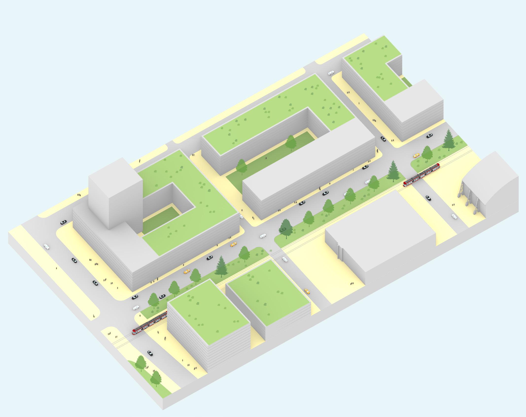
To further explore the detailed elements of the Latent City plan we can look to a sample area of focus taken from it (Figure 29). We will use this area of focus as the base for comparing the Port Lands plan, an ecologically resilient urban form, and the Latent City framework. This selected area is located along Commissioner’s Street at the edge of the greenway, and was chosen because the area effectively demonstrates many aspects of the framework form. Each of the examples covered have had area data taken from them to better allow a comparison of each scenario. The data includes building floor area, public spaces (including both greenery and paved ones), green spaces (greenery accessible to the public), and wild spaces (areas of biodiverse planting).

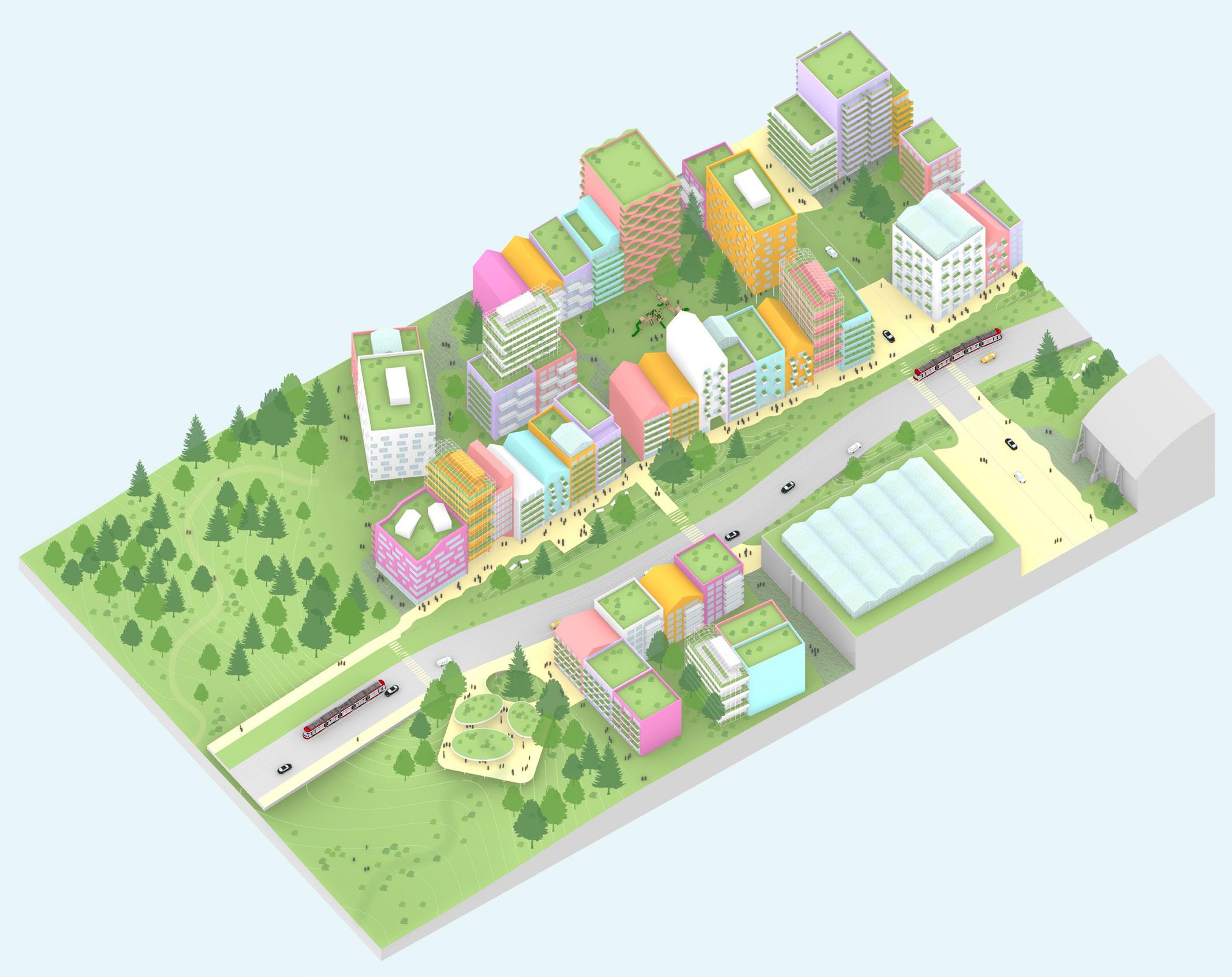
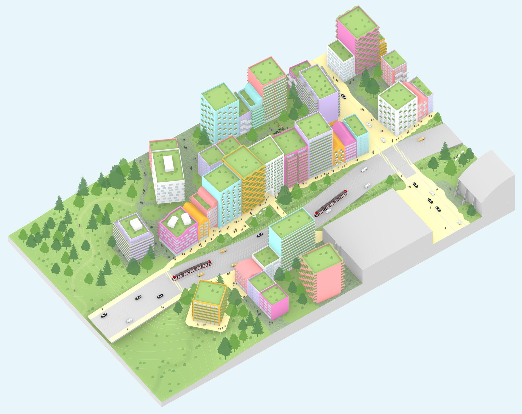
Figure 26. Latent City as a framework for an adaptable and changing urban system. Source: By Author


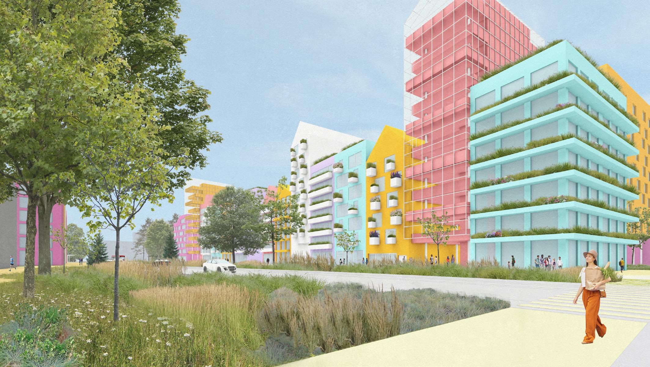
Figure 27. Latent City as a framework for an adaptable and changing urban system. Source: By Author

Figure 28. Latent City initial form aerial view. Source: By Author
Floor Area Public Spaces Green Spaces Wild Spaces
Figure 29. Original Port
Lands plan form. Source: By Author Original Port Lands Plan
Toronto’s Port Lands plan features large courtyard blocks, around 10 floors in height at the base podium, with occasional towers on top. There are some publicly accessible green spaces located inside the courtyard blocks, with a strip of green space that runs along Commissioner’s Street. For transit in the area, a streetcar line runs along Commissioner’s Street. The plan uses wide vehicle-based streets lined with sidewalks. In this version of the area, we see a limited amount of publicly accessibly green space that is a typical low biodiversity grassy lawn landscape.
Through the scale of the buildings, vehicle focused form of streets, lawn public park space, and previously mentioned separation of typologies, this is an engineered resilient urban planning form.
Area data: Floor area 129 565 sqm Public spaces 4547 sqm Green spaces 2717 sqm Wild spaces 241 sqm
Floor Area Public Spaces Green Spaces Wild Spaces
Ecologically Resilient Urban Form
Re-imagining the original plan for the area utilizing ecologically resilient planning concepts, the result shifts away from an engineered resilient system form. This version is an ecologically resilient urban form which demonstrates how the framework concepts informed by David Sim, Jan Gehl, Jane Jacobs, and Tokyo’s planning system could come together to shape an urban system.
This form exhibits the built elements of Latent City’s ecologically resilient urban system. It includes the divided building blocks, changeable building scale, and typology diversity that contribute to form an adaptable urban environment. The streets of the plan are formed as one continuous public space, with public green spaces are dotted throughout the area. Biodiversity is integrated into the city through naturalized planting on green roofs of the buildings, and the greenway of the Don River outlet is expanded upon creating a larger natural system.
Area data: Floor area 73 095 sqm Public spaces 29 823 sqm Green spaces 21 350 sqm Wild spaces 22 884 sqm
Figure 30. Ecologically resilient urban form. Source: By Author
When we compare the data of the Ecologically Resilient Urban Form with Toronto’s Port Lands plan, we can recognize a reduction of building floor area. This is done in exchange for an increase in public space, green space, and wild space.
This form represents an ecologically resilient built environment but is still limited from a full realization without a more thorough integration of ecological systems with the built environment.
Latent City
Latent City is created by introducing a layer of ecological infrastructure into the urban system (Figure 31). This further increases the ecological resilience of the city by bolstering a biodiverse and interconnected ecological layer. This layer is integrated with the Ecologically Resilient Urban Form to create one interconnected system.
Natural systems and spaces are integrated into the urban system through the streets, buildings, and infrastructure (Figures 32). The streets are treated as a dual public and ecological space (Figure 33). They contain a gradient of ecological density and diversity from wilderness areas (both in the greenway ravine and dotted throughout the plan), public park lawn spaces, green paved areas (paved surfaces that allow planting to grown in them), and finally paved public space (sidewalks along shops and public squares). In this framework form all these levels of the ecological density gradient are accessible to the public to create a fully interwoven environment.
The ecological layer throughout the urban system is connected back to the larger and denser ecological space of the Don River outlet redirection greenway. With this connectedness and space, the ecological system is able to form better bio-diverse, continuous, connected, and flexible systems in tandem with the urban systems of the city. Ecological connections are formed through the streetscape of the plan as well some of the building roofs and facades. Channels and tunnels are used to connect the ecological system through built infrastructure such as the major transit roads. Creating interconnected and bio-diverse spaces throughout the plan allows for ecologies to develop adaptable and resilient systems together with the built environment.
Floor Area Public Spaces Green Spaces Wild Spaces
Figure 31. Latent City initial urban form. Source: By Author
Figure 32. View on
Commissioner’s Street looking towards the
Don River redirection greenway. Source: By Author Area data: Floor area 73 095 sqm Public spaces 29 823 sqm Green spaces 34 010 sqm Wild spaces 32 839 sqm
Comparing the Latent City initial form with both Toronto’s Port Lands plan and the Ecologically Resilient Urban Form; we see a further increase of green spaces and wild spaces due to the introduction of the ecological layer in the streets of the city. With an interconnected and biodiverse ecological layer added to the built layers we can realize an ecologically resilient system of a combined urban and ecological environment. We can justify a reduction of floor area from the Port Lands plan through two factors: First, Latent City brings an increased ecological presence and diversity in the city. Second, the Latent City form is a changeable and adaptable starting state rather than a completed final state like in the Port Lands plan.
Placeholder view, greater detail to be added
The Latent City design form has so far been described as an initial state for the urban environment. This is because the Latent City is the starting point for a changing and adapting urban system created by the framework. Over time the city can change depending on the pressures or scenarios it faces. To understand this changing nature, we can explore some potential future scenarios where the city might adapts to the pressure placed on it.

Figure 33. View of Latent
City‘s greenway and green streets. Source: By Author


