University College London
Urban Design: Layout, Density and Typology

University College London
Urban Design: Layout, Density and Typology
 Ahmed Abdelaziz
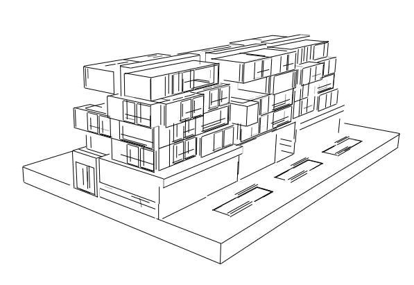
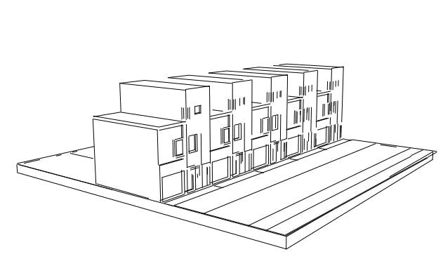
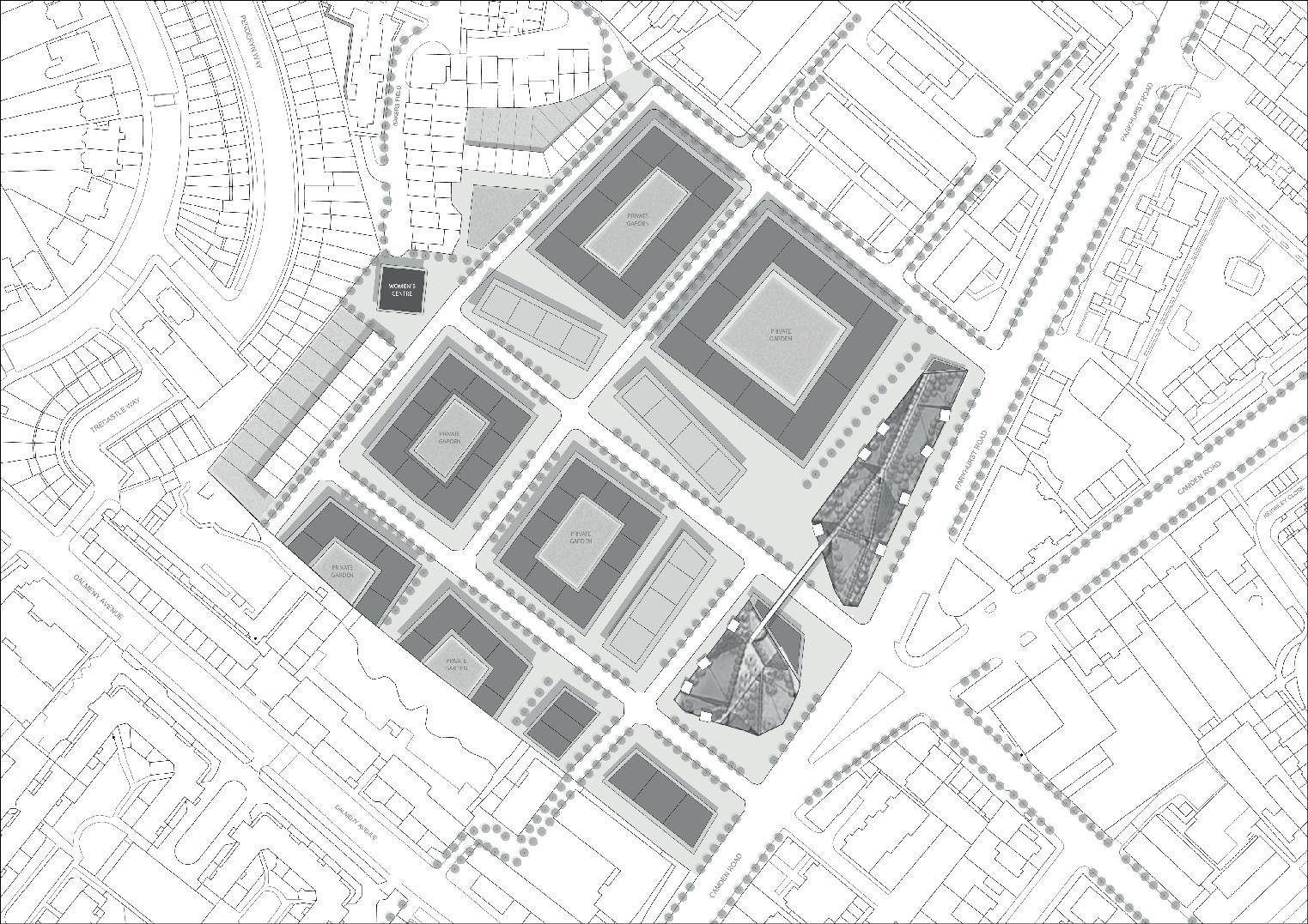
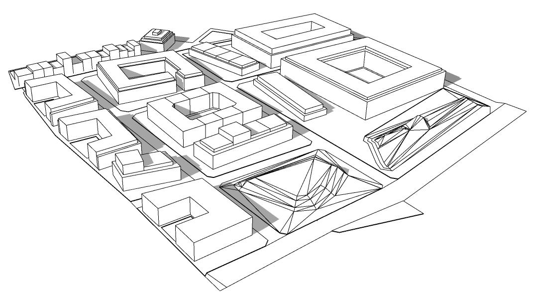
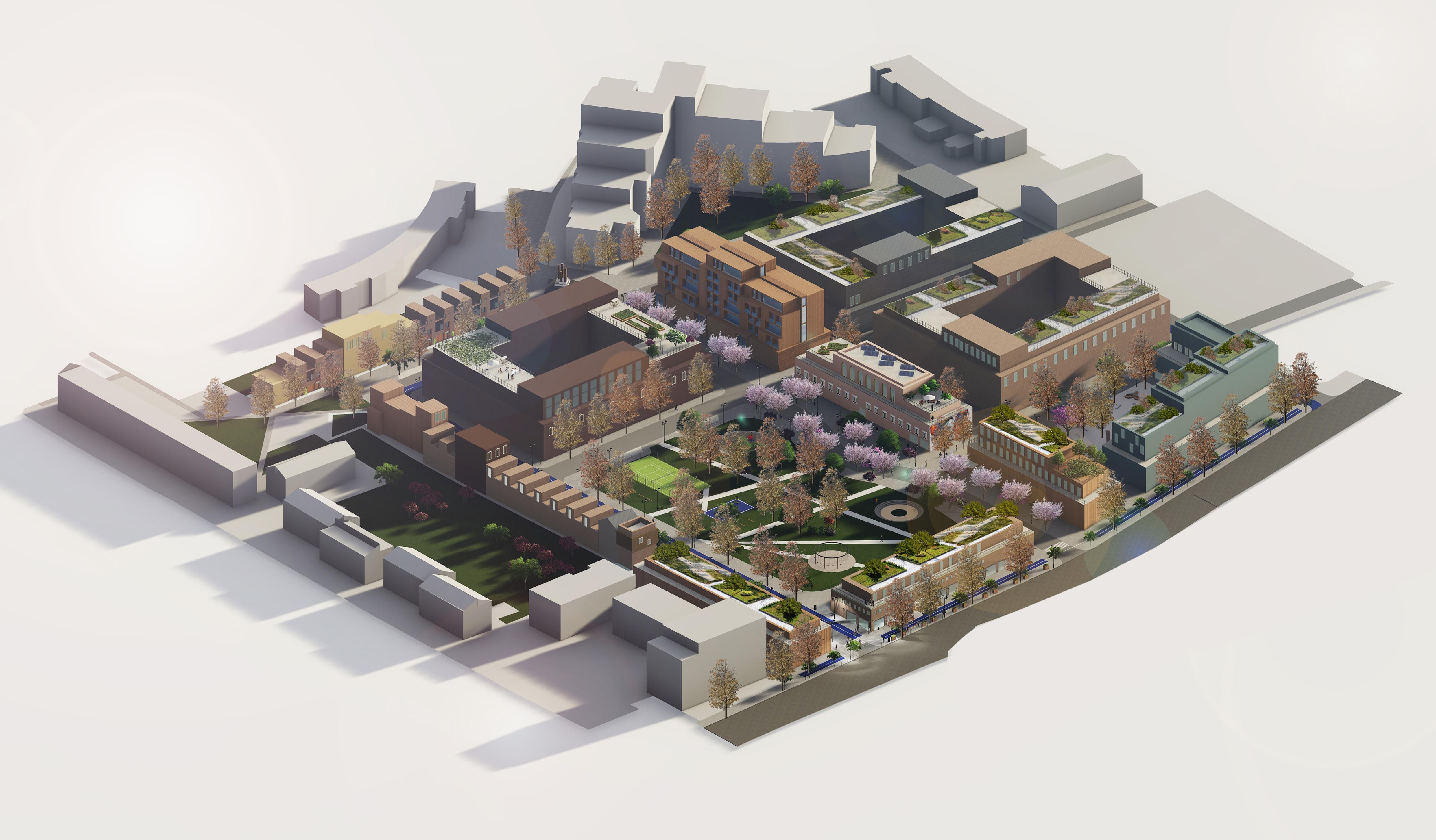
3D Masterplan Building Types: Linear Block Building Types: Terraced Building Types: Courtyard
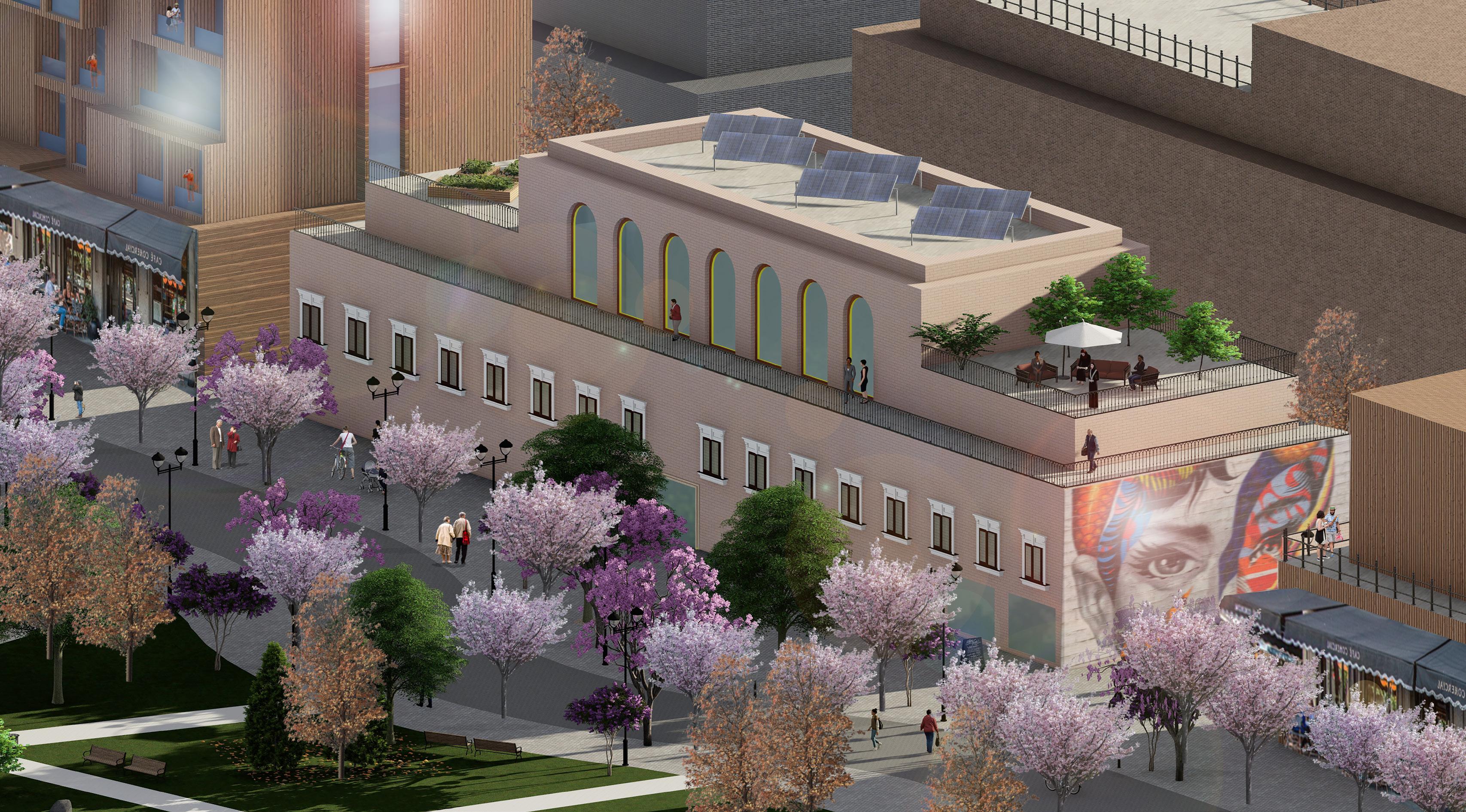
features: Women’s Centre
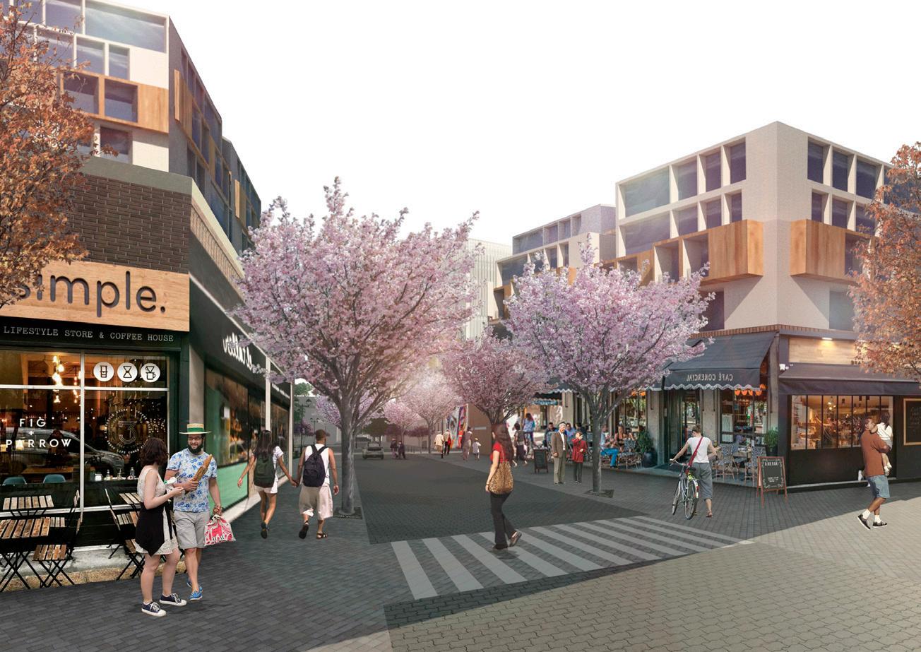
Women’s Street
The purpose of this report is to develop a masterplan for the Holloway Prison Site by exploring urban design concepts and envisioning the creation of a vibrant neighbourhood. It should address the needs of Holloway community and London Borough of Islington also. Thus, to propose a masterplan that is aligned with local aspirations and, at the same time, responds to the greater demand for new homes.
In an effort to balance different demands and aspirations, such as those raised by local communities or the expected ambition of developers to maximise the number of units, the site is a field for negotiations. As part of our analysis, we took under consideration the documents that were produced for the site, and we brainstormed around the critical aspects of the new design.
In addition to that, the site carries an important historic legacy. Holloway prison, as the first women prison in the UK and where suffragettes were imprisoned before World War I, has shaped a historic layer that adds value both to the site and to the broader area. Throughout the design process the female dimension is central. Delivering a new women centre, is just one of different approaches, that highlights our intention to celebrate female nature on the new neighbourhood.
The structure of this report embarks from the urban characteristics analysis of the surrounding area. Then, it briefly explores existing features of the site and it concludes on a summary of the opportunities and constraints for the site.
In the next step, the overall strategy for the new design is adopted, including objectives, key design principles and design approach. Based on the strategy, two alternative schemes are developed. Finally, the selected scheme is presented in detail, in order to illustrate all the key elements of the proposal.
Our vision
‘Create an active and vibrant neighbourhood aiming to bring the Holloway community together.
Rooted in the historic legacy of Holloway Prison, the design of the new neighbourhood is informed by local aspirations and adapted to current needs.’
Our master plan
HOME TO 240, 000 PEOPLE WITHIN LONDON’S TOP 10 MOST DEPRIVED BOROUGHS
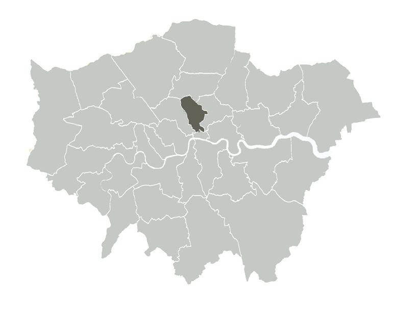
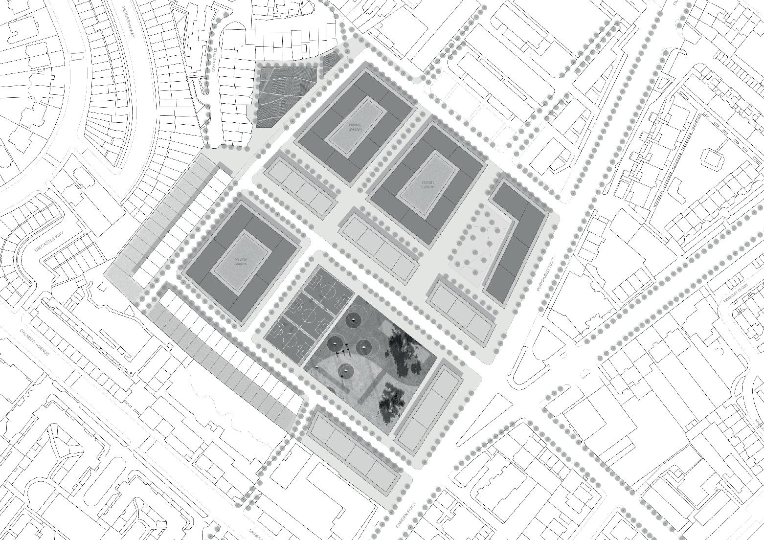
The site is located within the Borough of Islington. It boasts of some well known landmarks and attractions such as the Odeon Cinema and the Arsenal Emirates Stadium.
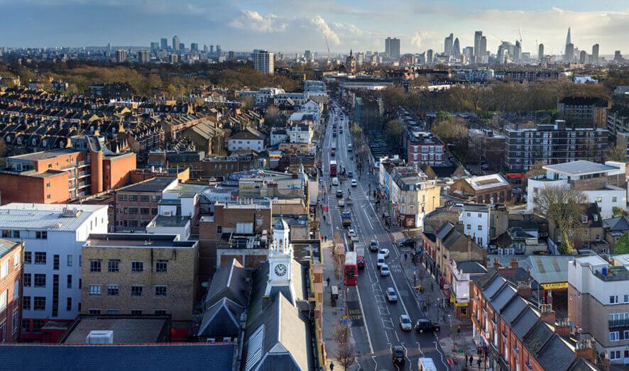
Located along Camden Road and Pankhurst Road, the site itself is in an area that is mainly residental. There are small pockets of a variety of other uses such as retail, eateries, shops, education, community uses and places of workshop within its immediate vicinity.
However majority of the retail and commercial uses like the Nags Head Shopping Centre, restaurants, and educational facilities are some distance away. To the south of the site is the Hillmarton conservation area.
From the figure ground diagram above, we can see that the area is relatively dense and built up. We can also see that the urban fabric and form of the area is of fine-grained structure and made of various typologies.
All in all, these attributes and characteristics of the area will help informed our design for the masterplan.
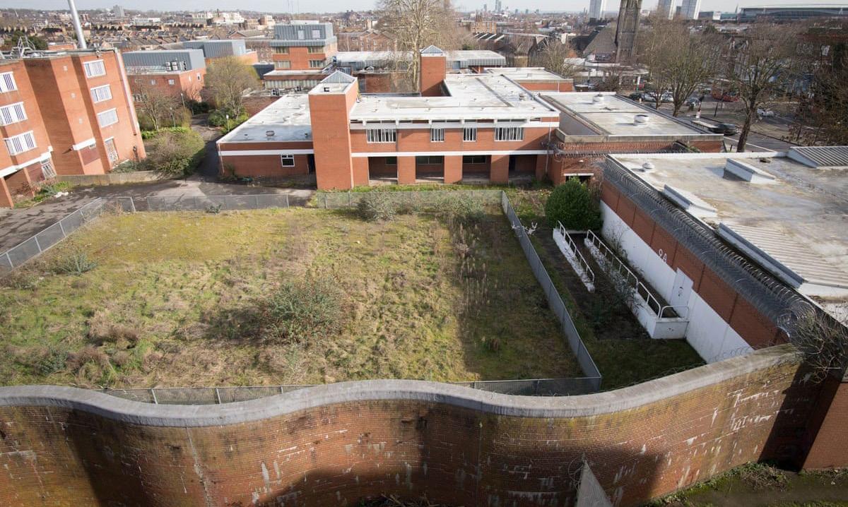
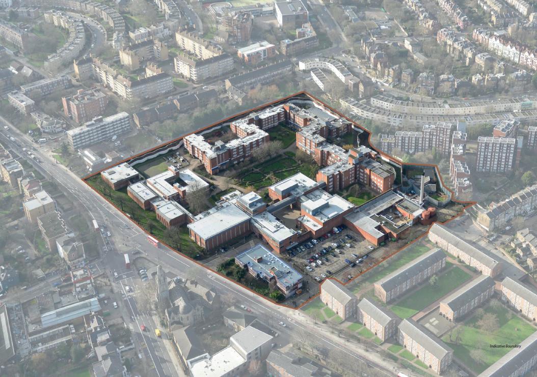
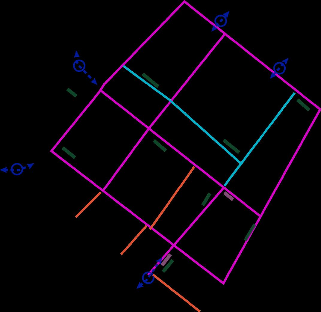
The site is located in an area that is supported by a network of strategic and local roads. As a fomer prison, site is deliberately designed and built to be an impermeable site with limited connectivity.
The perimeter wall around the site serves to cut off any connections of site to its surrounding. As a result of its former use, developments surrounding the site are not planned and implemented to be readily connected to the site.
Connectivity of site to the rest of the area is restricted to Camden Road and Parkhurst Road. Accesses to the site are limited and located mainly on the eastern edge of the site.
However, the site enjoys relatively good public transport accessibility with multiple bus stops and services in the vicinity.
Open and green space is an important element for the quality of residential areas. This map illustrates the proportion between built and green space.
Although a significant amount of green space is apparent on the map, public green parks in the surrounding area are limited. There are few public parks that serve the considerable demand of the residents. As a result, the need for a public park in the new development is identified.
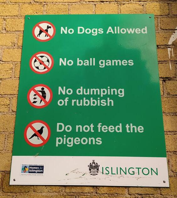
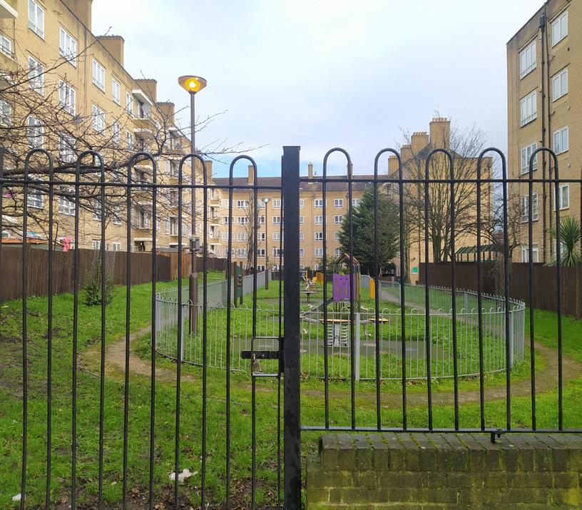
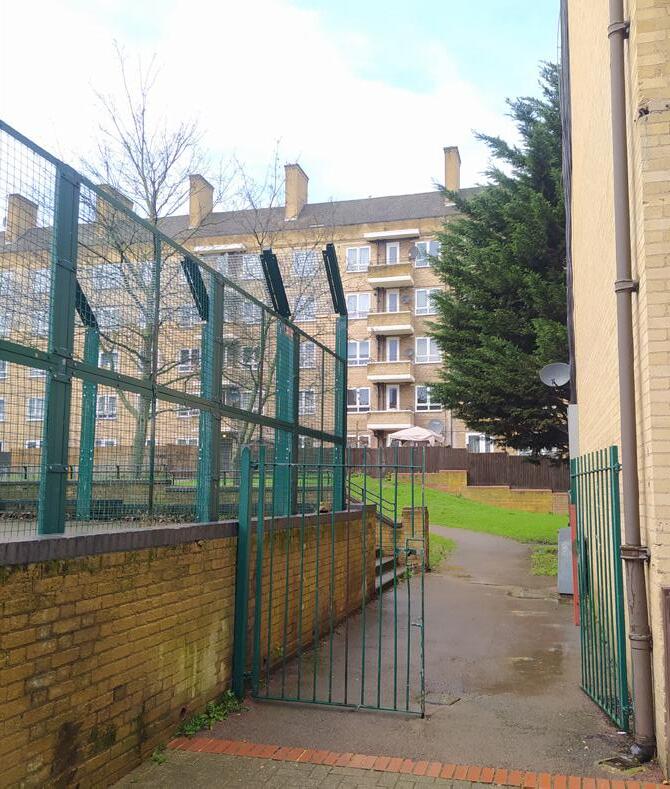
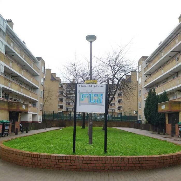
Extensive semi-private green spaces are a common feature surrounding the residential estates. As an illustrative example, in Lower Hilldrop Estate green space has public access, its character, however, feels like private. It is fenced and structured around corridors and accesses, and it includes some playground areas. Additionally, there are restrictions on the use of space e.g. ‘no ball games’, which make those spaces less attractive. These analysis indicates that semi-private green spaces are the desirable practice for the new neighbourhood, where a clear distinction between public and private green space will potentially be adopted.
Assessing building heights on the surrounding area of the site contributes to the identification of the wider height profile. As we can see on the map building heights vary from low to medium height, where buildings over 6 storeys height are very few.
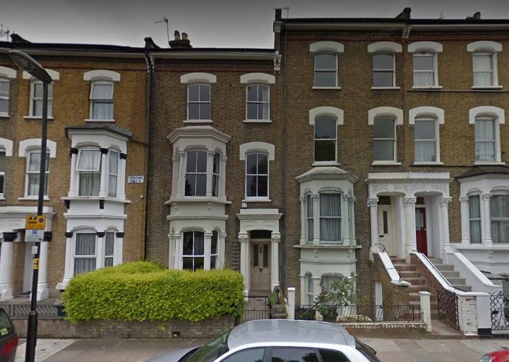
The character of the area is residential and the building typologies are diverse in terms of height, oldness, size and layout. This analysis provides a useful insight for the potential building height and layout of the new development. Thus, the new development has a certain flexibility with regards to the options about its height and building and block typologies. The building height, however, should be moderate in order to be coherent with the surrounding area.
4.05
1.43

Site: Built form and green space
The site currently has a large number of buildings that range in height and form. The current built form is ilegible and bears no relation to the surrounding area, making the development a good opportunity to transform the site.
The current site has a lot of enclosed green space. There are many mature trees which support the rich biodiversity. Our proposal will ensure that as many of the trees as possible are maintained and we provide quality green space.
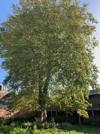
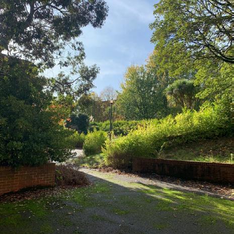
In response to our design strategy, one method of preserving the history of the site was to retain the trees of the site. Our approach is one that leaves the trees untouched as they stand. Our site will be built around them.
Noise and air pollution due to traffic along Parkhurst Road and Camden Road. It will be important to provide a pleasant microclimate.
There are a number of local Listed buildings (2a) and Conservation areas (2b) that add to local place identity. This creates an opportunity to design a development that is adherent to local character.
There are several bus routes (3a) along Parkhurst Road and Camden Road, alongside underground (3b) and national rail train services, making it an ideal location for mixed use development and promoting active travel.
The site is currently impermeable, it will be important to remove some of these barriers.
There is one nearby community centre. There is the opportunity to leverage on local community groups, adding more spaces and centres.
The local school and ‘Cat and Mouse’ library provide limited educational and work space amenities (6a). A lack of local shops and food and drink (6b) create an opportunity to provide more mixed uses.
The area opposite the site is an employment growth area, our development is an opportunity to invite more business to the area by creating jobs and making Camden Road a more appealing place to live and work
There is very limited local public green space (8a) and the site currently has a lot of green space (8b). There is an opportuntiy to provide more community green space by harnessing green space already on the site and creating new green spaces.
The protected viewing corridor means that our development will remain low to mid-rise.
‘Create an active and vibrant neighbourhood aiming to bring the Holloway community together. Rooted in the historic legacy of Holloway Prison, the design of the new neighbourhood is informed by local aspirations and adapted to current needs by which it also Injects diverse range of social and economic spaces’
Female inclusive:
• Embrace place identity and create local landmarks 8, 9
• Provide places for social interaction and collaboration 1, 8, 9
• Deliver an exemplar women centre building, supporting women in local community and broader 2, 8, 9
Active:
• Create a mixed use neighbourhood with active groundfloors 1, 4
• Utilise existing good transport connections to form an integraded site 3, 4
• Prioritise pedestrians and cyclists movement 3, 4, 5, 6, 7
• Retain existing trees where possible 2, 7, 9
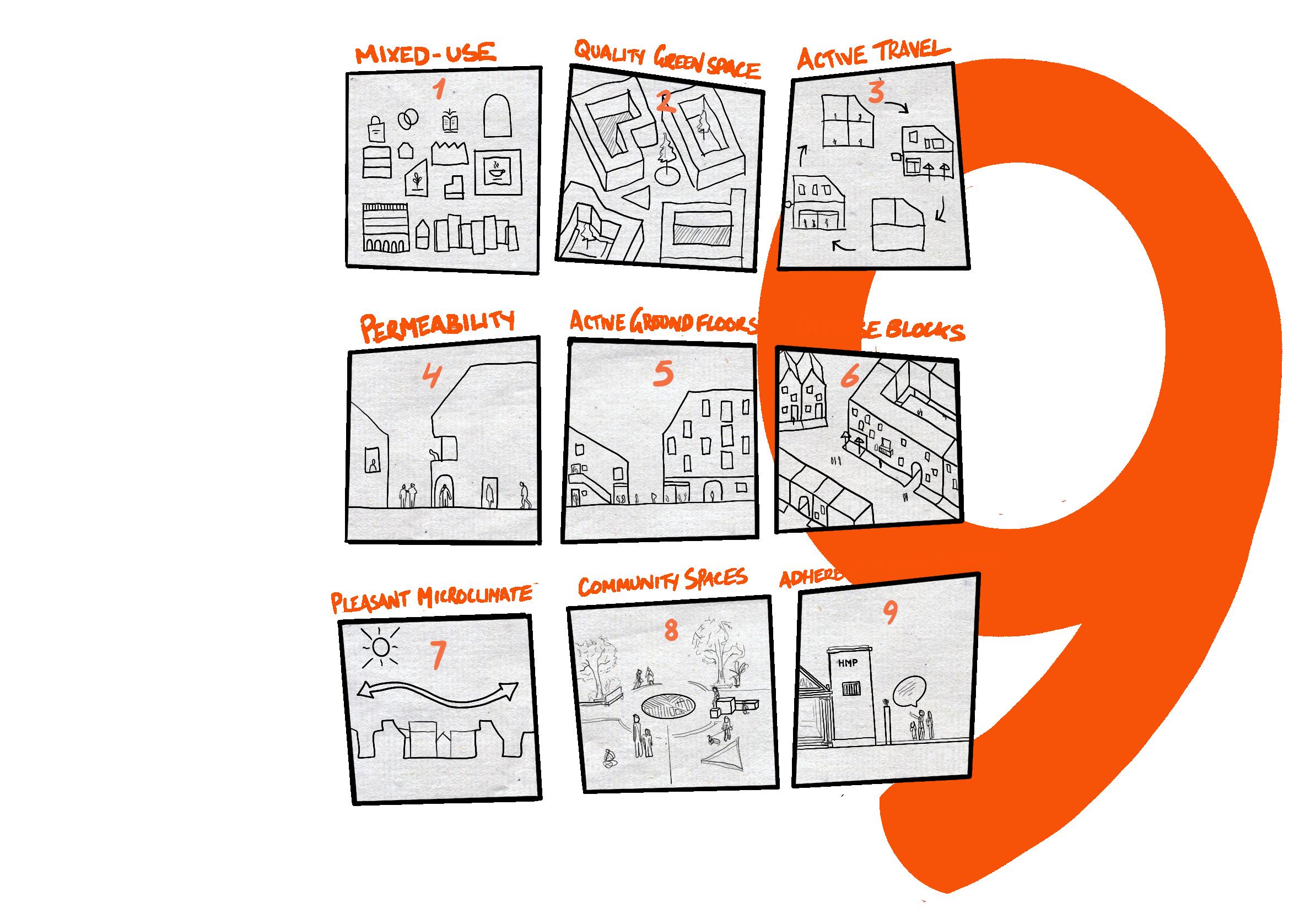
Diverse:
• Design diverse bulding heights and layouts 1, 4, 6, 7
• Diverse uses - residential, commercial 5,8,
• Form quality open and green spaces making a clear distinction between private and public access 2, 4, 8
1 2 3 4
The wall currently creates a barrier between the site and the surrounding community. Removing the wall will open up the site, helping to reduce impermeability.


Creation of roads, cycle lanes and pedestrian walkways opens the site up to the public. Providing attractive public spaces alongside mixed amenities and high quality housing will bring people to the area.
We will maintain as many of the existing trees as possible and enhance them through planting more trees.
Creating public space for residents and guests where both are able to find a bench to sit, eat or drink.
Our design approach is guided by the familiar and easily replicable building types that exist in London. We recognise that historic building types have been successful due to their coherent arangement and ability to respond to people’s needs. Therefore, we have chosen residential types that the GLA (2020) recommends for larger sites and also fit into the local context. Terraced Housing is good for families and has clear public and private access. Linear blocks and courtyard blocks are versatile, making them appropiate for mixed use development and higher densities (GLA, 2020).
Movement and Access

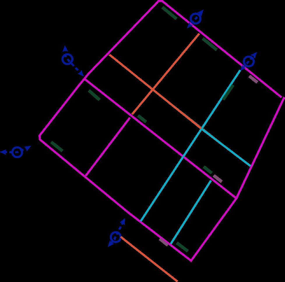
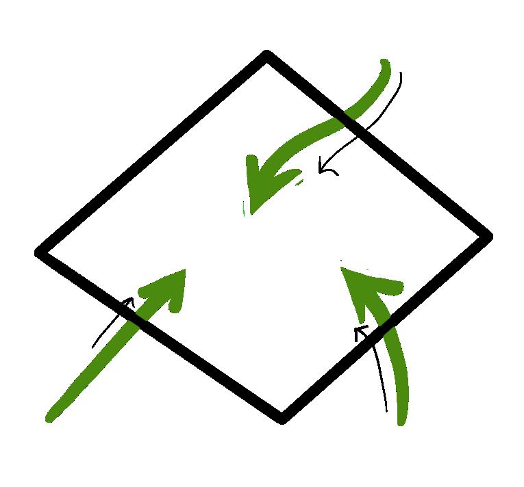
Spatial Concept


Bicycle Parking Loading Bay

Accessible Parking/ Permit Holders


New Access
Residential
Mixed-use Communal Use
Green Space

Access Points
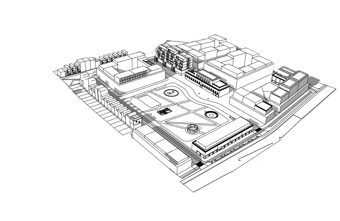

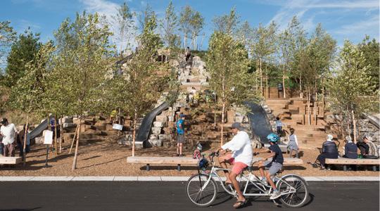
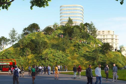
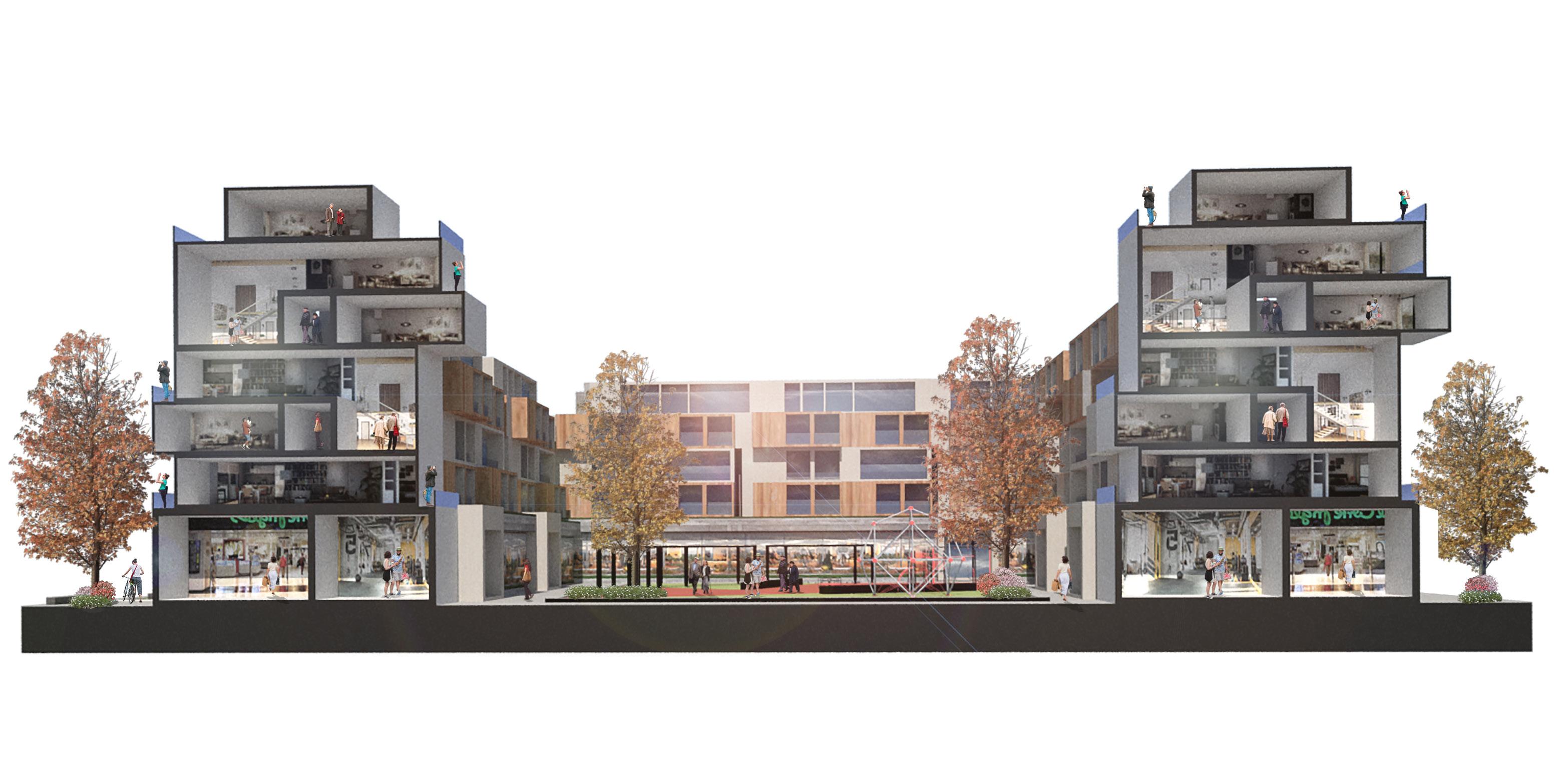
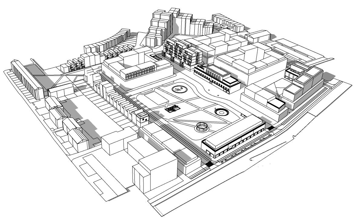
The Hill helps to tackle noise and air pollution by creating a barrier between Camden Road and the site. Mixed uses support the local economy and create an active street front. 843 residential units can be provided through this design and the public space accomodates both green space and retail space in a relatively small surface area. The scheme is low to mid rise which helps to provide a human-scale.
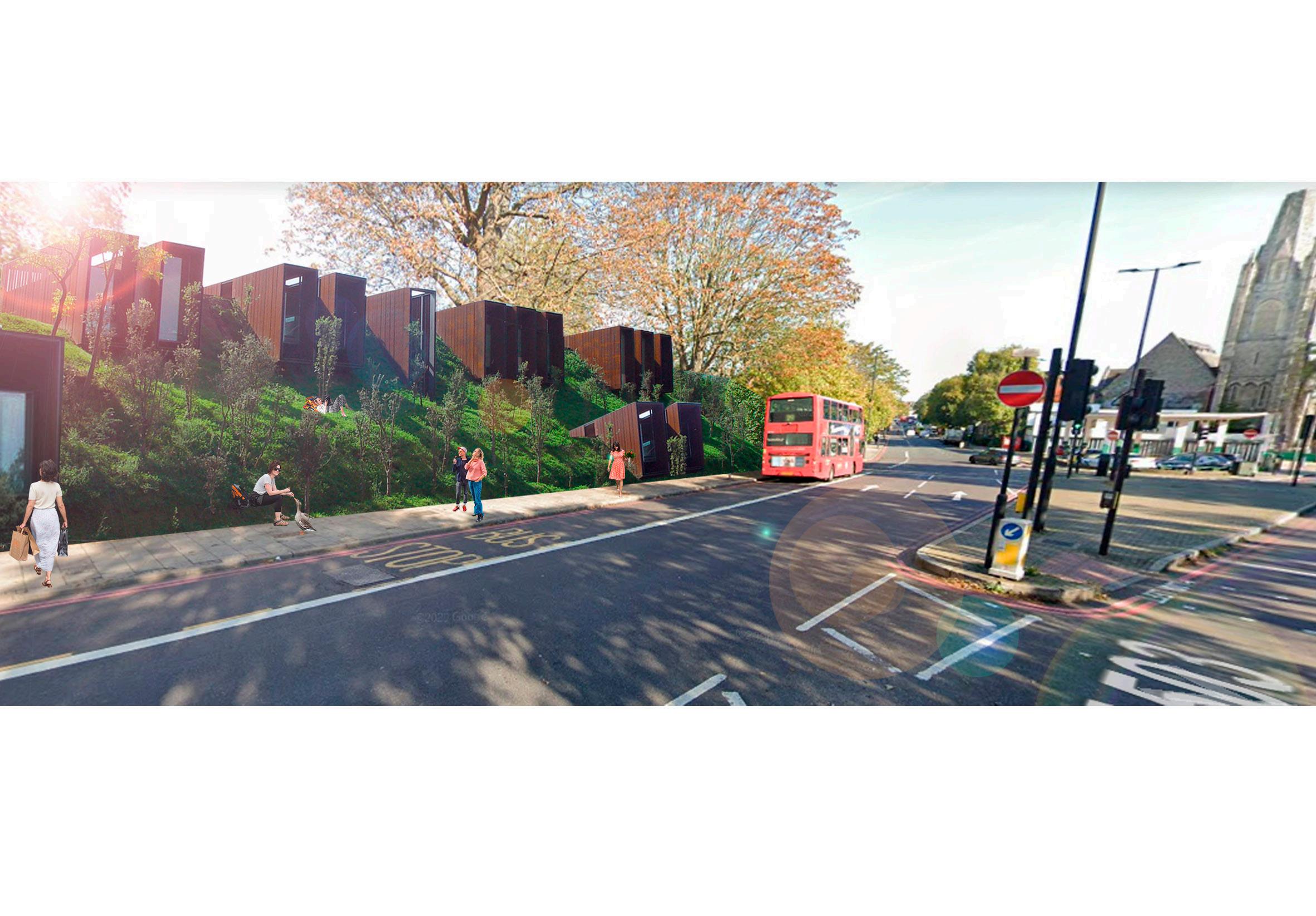
The design of the hill creates both a connection and a barrier to the site which goes against our design approach. The site has been enclosed for a long time, so it is important that we reconnect it to the community. Furthermore, the hill also creates a physical barrier to some disabled people who would be unable to access the green space due to limited accessibility . In order to successfully design for women the site must be inclusive for everyone.


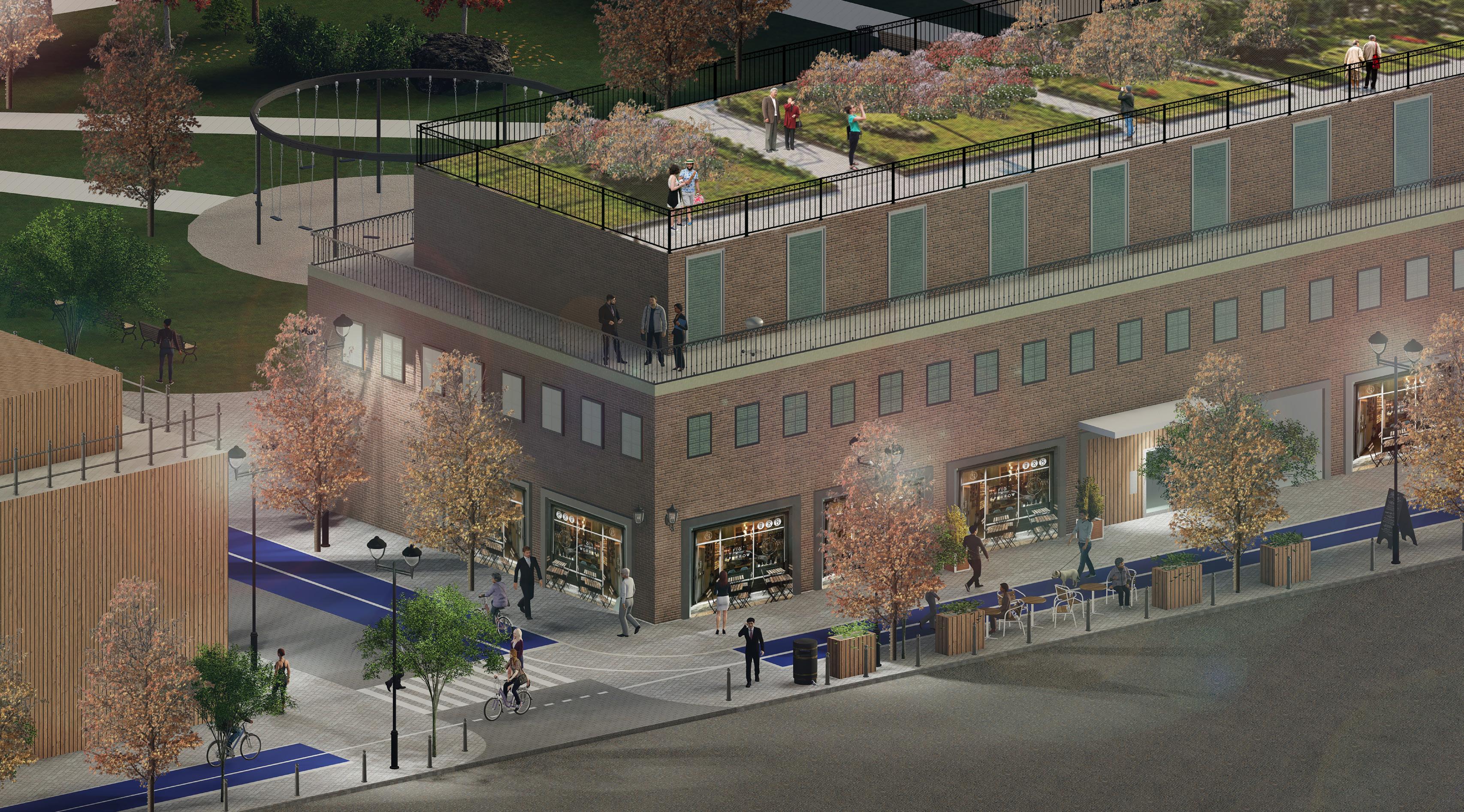
FARMING PLOTS FOR THE LOCAL COMMUNITY

PEDESTRIAN ONLY STREETS PROMOTE ACTIVE TRAVEL
WOMEN TRIBUTE
STATUE TO COMMEMORATE THE LEGACY OF THE WOMEN’S PRISON. NEW TERRACED HOUSES
MODERN TERRACED HOUSES FOR FAMILIES & PEOPLE WITH ADDITIONAL NEEDS
NURSERY
EASILY ACCESSIBLE VIA PEDESTRIAN PATHWAYS
SHARED SPACE FOR RESIDENTS ONLY.
OUTDOOR MARKET SPACE FOR STREET VENDORS AND START-UPS
MIXED USE SPACE DEDICATED TO WOMEN. ENTRANCES ON BOTH SIDES.
CENTRAL STREET LEADING TO THE WOMEN’S STATUE. LINED WITH BLOSSOM TREES AS A CENTRAL FEATURE OF THE DEVELOPMENT.
MOST OF THE EXISTING TREES WILL BE MAINTAINED


EXISTING TREES TO KEEP SPORT FACILITIES
PUBLIC SPACE AMENITIES INCLUDING COURTS, OUTDOOR GYM & CHILDREN’S PARK GROUND FLOOR TO INCLUDE SHOPS, FOOD AND DRINK. UPPER FLOORS FOR RESIDENTIAL.
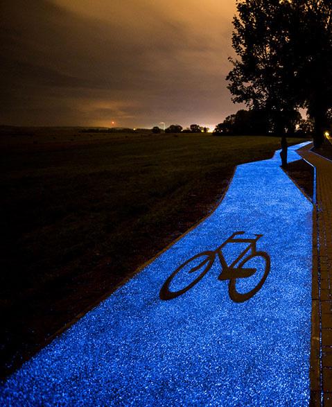
CLEAR CYCLE LANES PROMOTE ACTIVE TRAVEL
MIX USE BUILDING
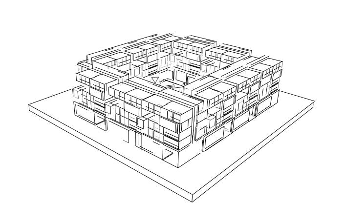
Linear block typology:
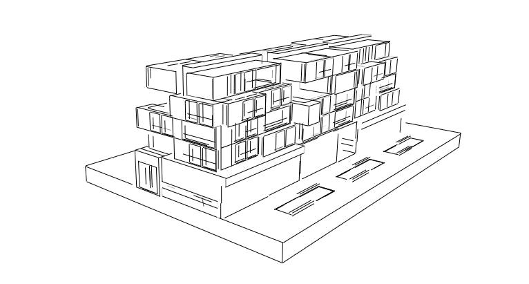
• Active ground floors
• Various size appartements on the upper floors
• Public space with pedestrian access in between the buildings

Terraced-house typology
• Private entrances on the street, creating an active private-public interface
• Smart layout of the buildings, providing two units for each building
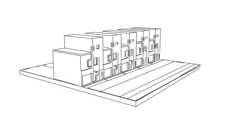
• Private back gardens
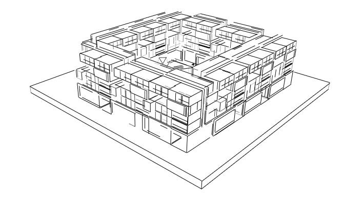
Coutryard typology
• Active ground floors
• Various size appartements on the upper floors
• Private courtyard space
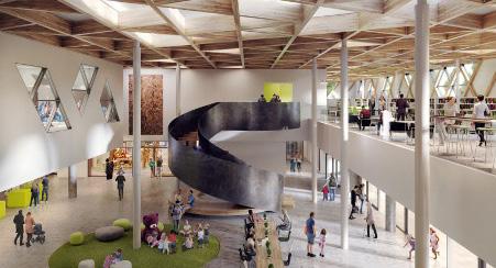
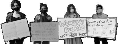
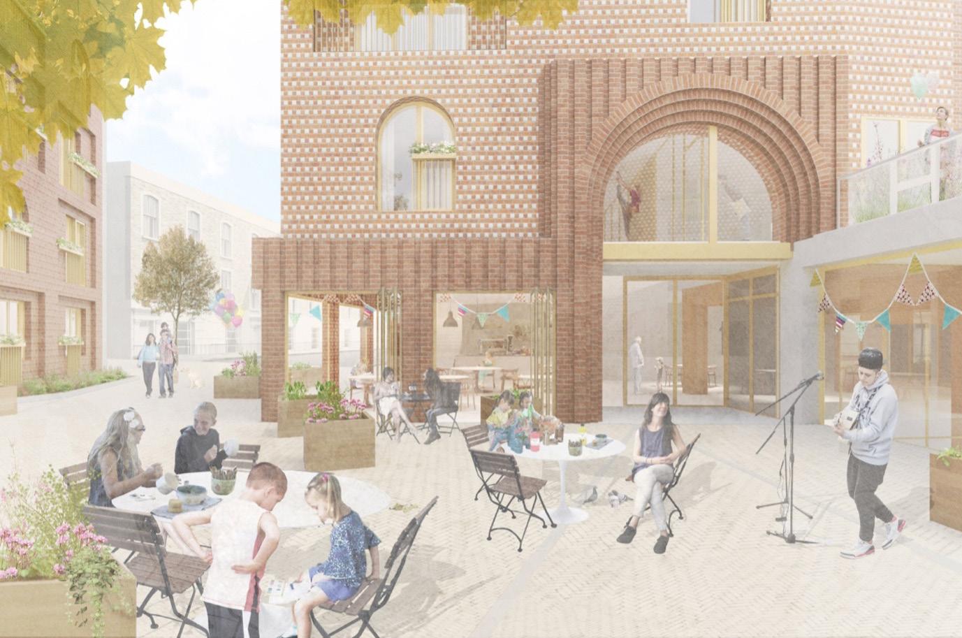
It is recognised that the legacy of the women’s prison is important for our development and there is an opportunity to incorporate for the new women’s centre with exisitng local community organisations.The Women’s centre will be a multi-purpose building for women from all walks of life. The mixed use space will cater to women’s differing needs and requirements. The diversity of uses in the building will ensure that the most vulnerable women, who may feel uncomfortable accessing the centre in a public space, can feel anonymous when entering. Our design ensures that the concerns and issues raised by the Community Plan for Holloway Women’s group are addressed. Through careful design and consideration the prison’s legacy will be remembered.
“I want an accessable public toilet”

“There should be a place where I am able to learning new skills while knowing my child is taken care of at a nearby nursery”
“I want to read and have access to a computer to carry out my work


This Working Group lead CP4H’s efforts to ensure that a Women’s Building will be constructed on the site of the former HMP Holloway. The Working Group meets online every two weeks and the origins of the group go back to November 2016 when the prison closed. The group have developed over time and their concerns have grown into more detailed demands for the site. They want the site to include social housing, green space, and a well-thought Women’s Building.

• To become a multipurpose space
• Have a low cost children’s nursery
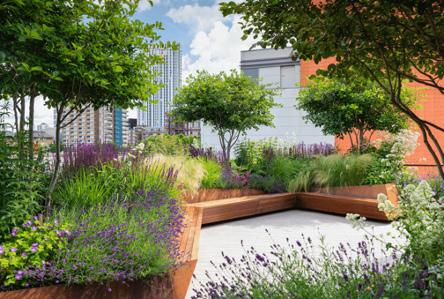
• Have a rooftop garden space for service users
• Have working space and free computers for service users
• Include a specialised women’s job centre
• Offer night classes to women (e.g. college courses)
• Include cooking and DIY class facilities
• Have a cafe that employs women
• Have cheap spaces for existing community groups to use
• Key central street lined with cherry blossom trees as iconic feature
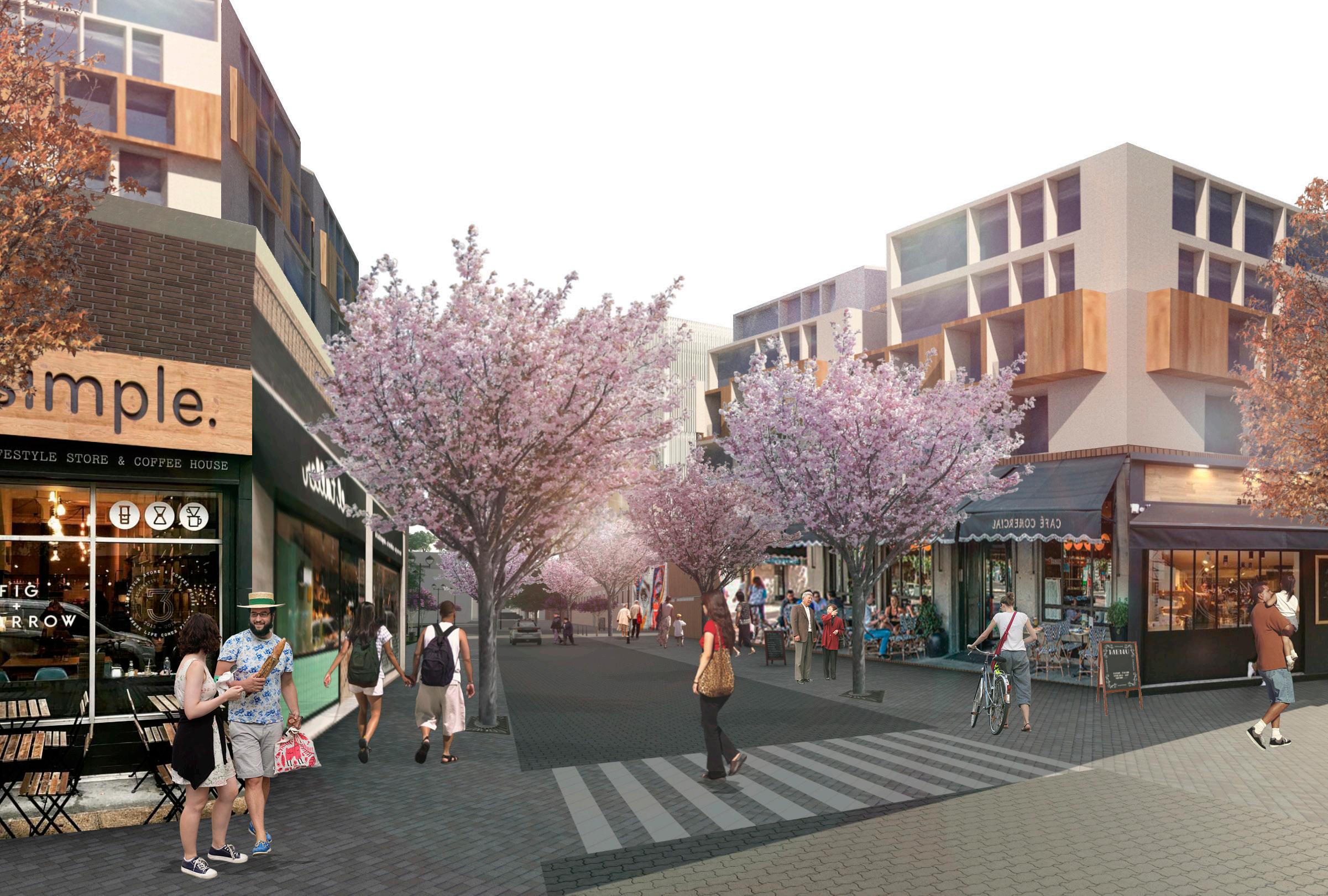
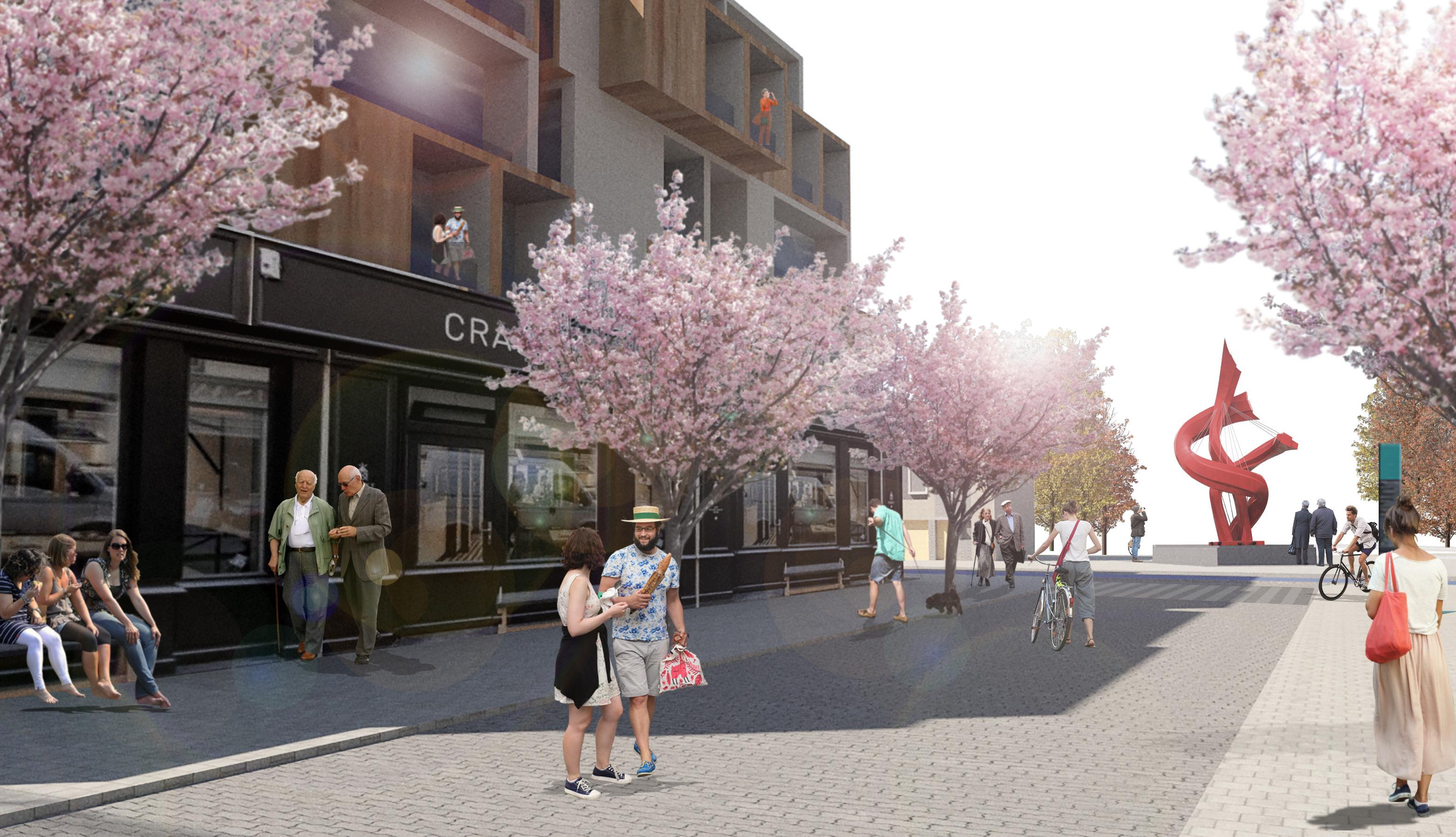
• Serves as a centre spine connecting to the various part of the site
• An inviting corridor to activate the different uses within the site
• A safe and conducive route for pedestrians and cyclists
• Create a sense of place for the community
• Active frontages with commercial activities invite people into the site and provide natural surveillance and ‘eyes on street’
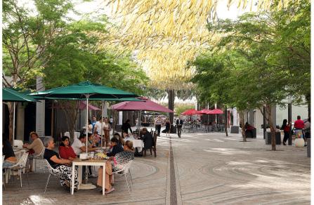
The Plaza:
• A diverse and vibrant marketplace within the mixed-use development for small local businesses and the community
• Piazza serves an extension for development to create an active and inviting ‘living room’ for both residents and guests.
• Space adaptable for other uses e.g., Weekend food stalls

• To become a multi-purpose park catering to different needs
• Have a children play area opposite the women’s building

• Facilitate sports where women are more likely to participate
• Well lit to support use during dark hours
• Permeable to provide natural surveillance and ‘eyes on street’
• Varied seating areas for all ages
• Trees and planting support biodiversity
• Range of natural materials used to encourage children’s learning
KEY
1. Terraced houses make for an active street interface
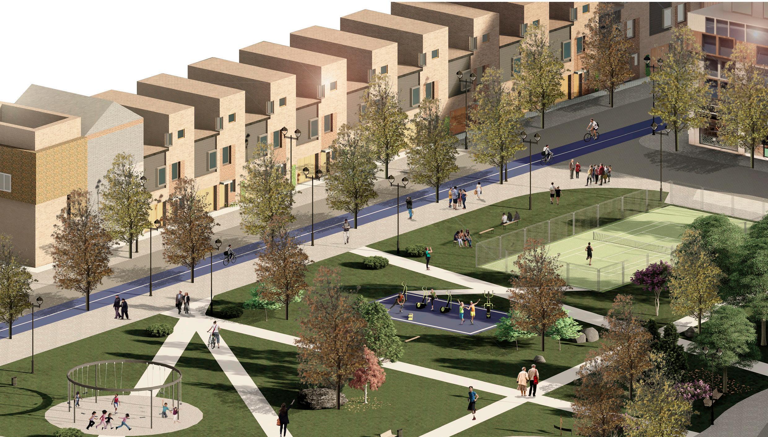
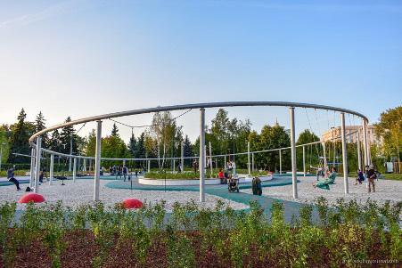
2. Swing area for play and socialising
3. Lighting throughout the park
4. Outdoor gym
5. Trees and planting
6. Courts
7. Bike lane
8. Pathway

Well lit pathway Swings
Varied materials
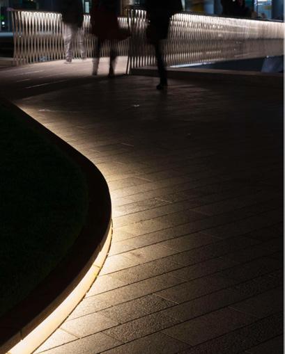
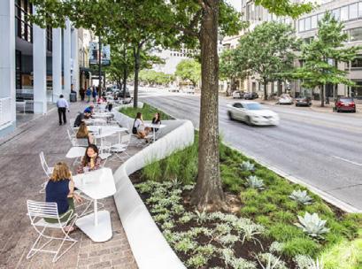
• Attractive fronts inviting commercial activity on the site
• Creating social and ecnomonic vibrancy through mixed-use design
• Set back the top floors to mitigate any visual implications and ensure as much light as possible can reach the ground
• Rooftop gardens provide private green space for residents in mixed use blocks
• Tree lined streets create an attractive and healthy environment
• Clear pedestrian crossings and pathways support active travel
KEY

1. Street interface with Camden Road
2. Tree lined street
3. Active ground floors with shops
4. Residential units on top floor
5. Rooftop gardens
6. Bike lane
7. Street lighting
8. Diverse street furniture
Tree planting
Street furniture
The scheme ensures optimal site capacity and quality through the use of a design led approach. The scheme optimises site capacity by using familiar building types in a coherent arrangement. This has been achieved through a mixture of terraced housing, linear blocks and courtyard blocks, all of which the GLA (2018) promote for larger sites.
We firstly carried out a detailed site analysis and reviewed community responses to the developer’s proposals. Through our analysis, we were then able to propose our own vision and objectives for the site. Our vision centres around female inclusivity, active lifestyles and diversity.
The building arrangement supports well-connected pedestrian and cycle routes, alongside clear public and private spaces. Various arrangements of the different building types were tested, and the final scheme was selected based on site capacity calculations and the quality of design. The final scheme provides 618 residential units alongside 41 mixed-use units. Our scheme has a medium density as we have favoured a good quality of life for all residents over providing more homes. The public space provides a range of amenities and green space which Islington is currently lacking (Ford, 2017). The final design caters for a variety of building uses providing housing, employment opportunities and community space.
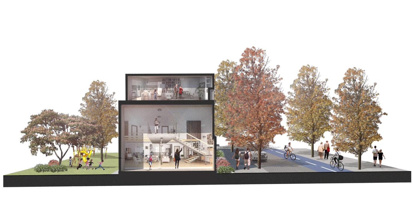
The scheme pays attention to design quality. Our design was guided by the familiar and easily replicable building types that exist in London. We recognise that historic building types have been successful due to their coherent arrangement and ability to respond to people’s needs (GLA, 2020). Where building heights are tall, we have set back the top floors to mitigate the visual implications and ensure as much light as possible can reach the ground (GLA, 2020). Furthermore, roof gardens ensure that residents living in flats can have easy access to private outdoor space.
Our scheme is on a human-scale which helps to promote women’s safety, active travel and community. Human scale was achieved by restricting car access, creating active street frontages, providing a legible street pattern, well-lit public spaces that are overlooked and low to mid rise building heights. Additionally, we have proposed a large number of trees on the scheme which we feel is important for enhancing the wellbeing of residents, reducing air pollution and increasing biodiversity. Most of the existing trees have been retained, serving as a legacy for the prison and preserving the existing biodiversity on the site. To further respect the legacy of the prison, a dedicated mixed-use women’s centre is proposed and a dedicated statue commemorating the prison. This responds to the Community Plan for Holloway vision, further demonstrating the contextualisation of our design.
To conclude, the design led approach has guided us in responding to the needs of Islington. Through careful consideration of community needs, we have designed a new hub for the area that will create job opportunities, provide diverse affordable housing and mixed public space. Through designing for women, we have designed somewhere that is inclusive for everyone.
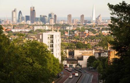
Photo of Archway Viewing corridor
Archway London. (date unknown). Walk- A View from the Bridge. [Online]. Available at: https://archwaylondon.com/pages/walk-view-bridge. [Last accessed 12 April 2021].
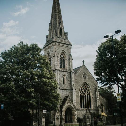
St Luke Church Photo for Analysis
A Church Near You. (2021). St Luke West Holloway. [Online]. Available at: https://www.achurchnearyou.com/church/15435/. [Last accessed 10 April 2021].
Women’s Building
Community Plan for Holloway (2020). Women’s Building Working Group. [Online]. Available at: https://plan4holloway.org/womens-building/ . [Last accessed 21 March 2021].
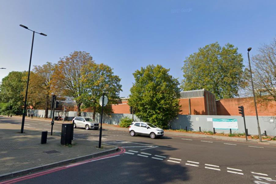
Holloway Prison Site (Connectivity, Accessibility Page)
Consultation on former Holloway Prison site now open (2020). Islington Gazette. [Online] Available at: https://www.islingtongazette.co.uk/news/holloway-prison-site-consultation-3840058. [Last accessed 15 April 2021].
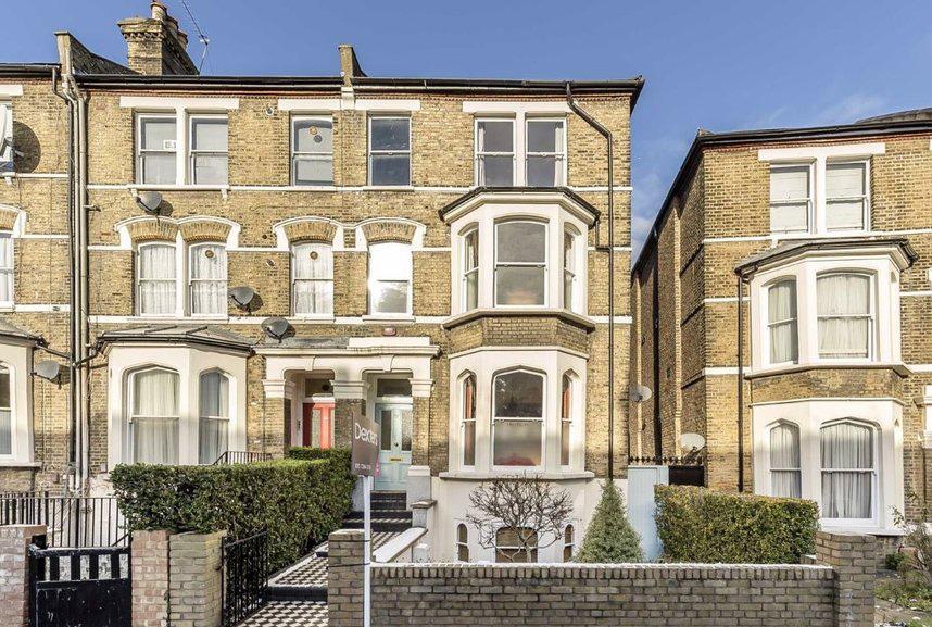
Hillmarton conservation area photo (constraints page)
Dexters (2021). Property for sale in Freegrove Road London. [Online]. Available at: https://www.dexters.co.uk/property-for-sale/property-for-sale-in-freegrove-road-london-n7/156792. [Last accessed 9 April 2021].
Ford, M. (2017). Islington: A local needs analysis. London: A community plan for Holloway
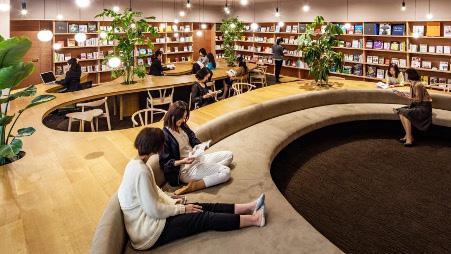
Photo of library on Women’s page Frearson, A. (2016). Woman’s inspiration library completed by Masayoshi Nakanishi in Japan. [Online]. Available at: https://www.dezeen.com/2016/10/15/wil-womans-inspiration-library-masayoshi-nakanishi-architecture-fukui-japan/. [Last accessed 10 April 2021].
Photo of Holloway Road Goslett, M (2018). Horroway Road. [Online]. Available at: https://www.thesun.co.uk/news/6609582/ holloway-road-north-london-shocking-gang-robbery-toll/. [Last accessed 15 March 2021].
Photo of Clayton Community Centre on women’s page Hcma Architecture and Design.(2021). Clayton Community Centre. [Online]. Available at: https:// hcma.ca/project/clayton-community-centre/. [Last accessed 2 April 2021].
Photo of trees on Active Street front page Holmes, D. (2020). The city of Austin Proclaims November 16, 2020 “Street Patio Day”. [Online]. Available at: https://worldlandscapearchitect.com/the-city-of-austin-proclaims-november-16-2020street-patio-day/#.YHmJuRNKjGI. [Last accessed 10 April 2021].
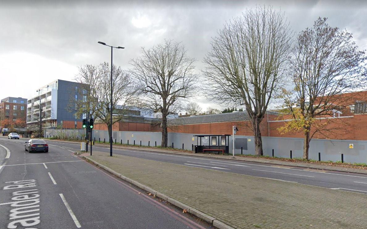
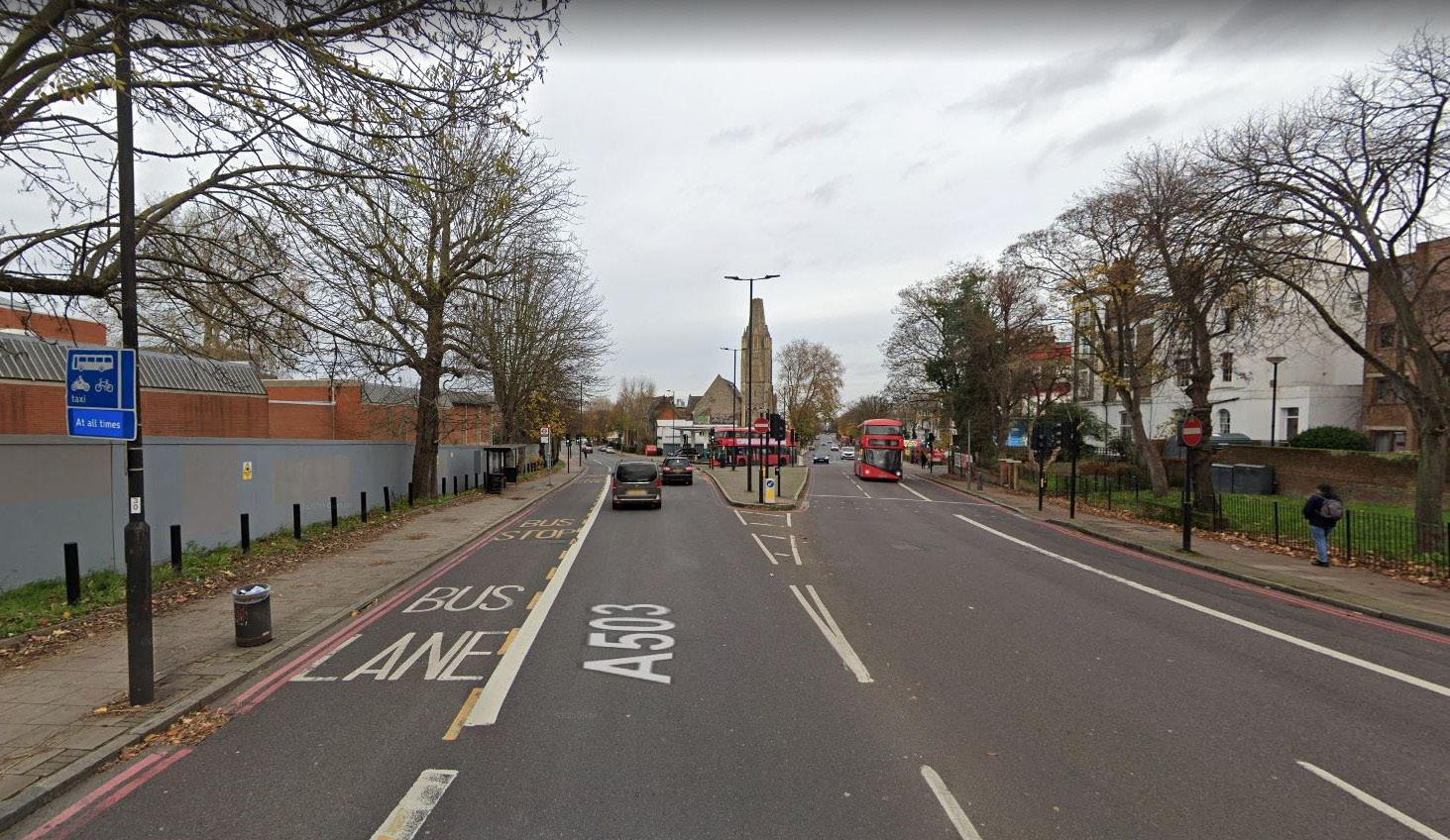
Photo of Camden Road (Connectivity, Accessibility Page)
Image from Google Street view [Last accessed 14 April 2021]
Photo of bus stop along Camden Road (Connectivity, Accessibility Page)
Image from Google Street view [Last accessed 14 April 2021]
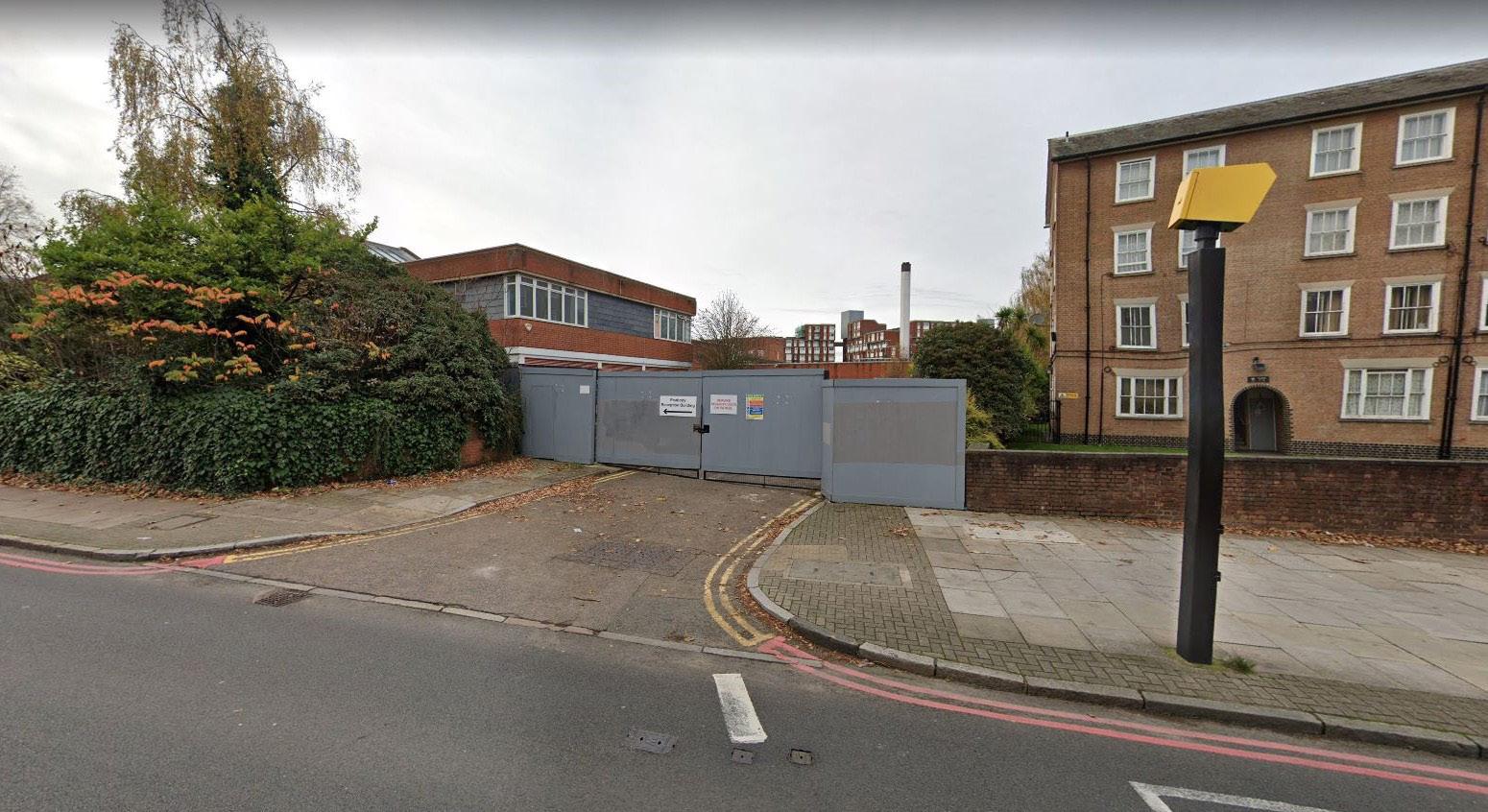
2nd Entrance to Holloway Prison (Connectivity, Accessibility Page)
Image from Google Street view [Last accessed 14 April 2021].
Islington Council (2017). Holloway Prison Site Supplementary Planning Document. London: Islington Council.
Photos on the Central Park page Live Journal. (2018). Title unknown. [Online]. Available at: https://gre4ark.livejournal.com/594239.html. [Last Accessed 10 April 2021].
Mayor of London (2020). Optimising site capacity: A design-led approach Supplementary Planning Guidance. London: Mayor of London. Available at: https://www.london.gov.uk/sites/default/files/hdspg_2020_ module_a.pdf. [Last accessed 14 April 2021].
Robert Rhodes Architecture (2019). The Oldest Building in Islington. [Online]. Available at: https://www. robertrhodes.co.uk/article/the-oldest-building-in-islington/. [Last accessed 21 March 2021].
Photo of rooftop garden on Women’s page SGD. (2020). The SGD Awards 2020 Winners. [Online]. Available at: https://www.sgd.org.uk/events/awards/ archive/winners_2020.aspx. [Last accessed 8 April 2021].
Photo of street furniture on Active fronts page Street+ Garden. (2021). Projects. [Online]. Available at: https://streetandgarden.com/project/hobart-waterfront/. [Last accessed 14 April 2021].
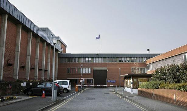
Entrance to Holloway Prison (Connectivity, Accessibility Page)
Teri Pengilley (2016) Daily Mirror [Online]. Available at: https://www.mirror.co.uk/news/uk-news/fight-breaksout-womens-prison-7286490 [Last accessed 15 April 2021].
Photo of blue bike lane on Active fronts page
Unknown author. (date unknown). Poland Unveils Glow-In-The-Dark Bicycle Path That Is Charged By The Sun. [Online]. Available at: https://www.boredpanda.com/glowing-blue-bike-lane-tpa-instytut-badan-technicznych-poland/?utm_source=facebook&utm_medium=link&utm_campaign=BPFacebook. [Last accessed 14 April 2021].
Photo of Camden community centre design (on Women’s page)
Youde, K. (2017). RCKa wins go-ahead for contentious Camden community centre. [online]. Available at: https://www.architectsjournal.co.uk/news/rcka-wins-go-ahead-for-contentious-camden-community-centre. [Last accessed 12 April 2021].
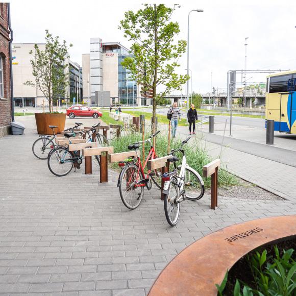
Photo of bicycle rack (on Women’s Street page)
Unknown author. (date unknown). Available at https://www.streetlife.nl/en/products/roughready-bike-parking [Last accessed 16 April 2021]
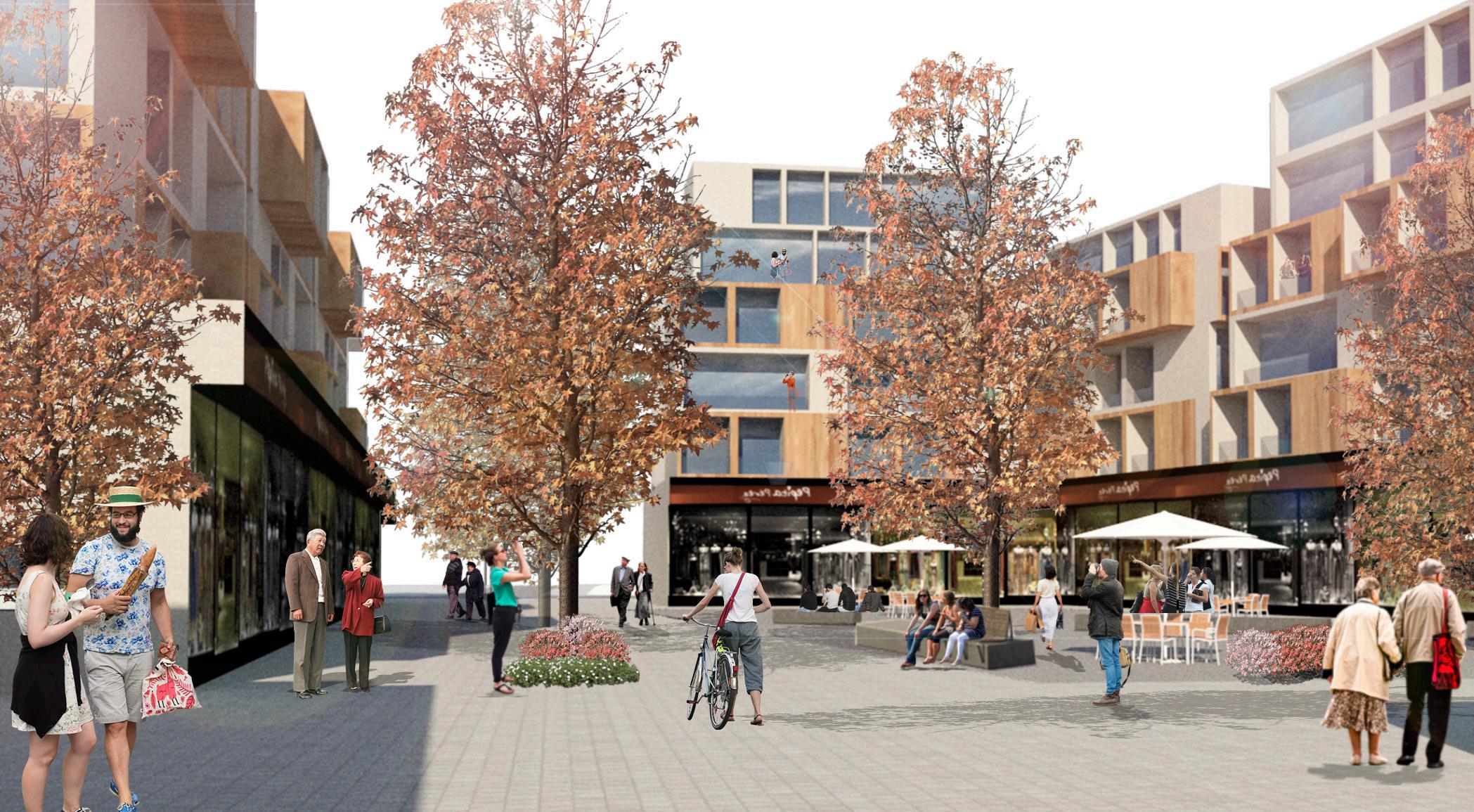
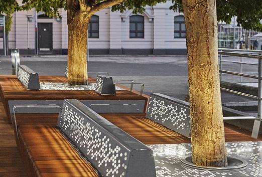
Photo of Miracle Mile Streetscape and Giralda Plaza (on Women’s Street page)
Unknown author. (date unknown). Local Office Landscape and Urban Design [Online] Available at http://localofficelandscape.com/projects/miracle-mile [Last accessed 16 April 2021]