PORTFOLIO


Yanrong Zheng 2018-2022


zhengyarrow@gmail.com


(970)691-4097
University of Washington
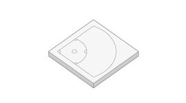
FOOD CO. DUWAMISH COMMUNITY PROJECT
Seattle, Washington,US.
2022 spring
EARTHWORM & P-PATCH FARM REBUILD PROJECT
Seattle, Washington,US.
2022 winter
MFC MUSEUM INDUSTRIAL COMMUNITY COASTAL LANDSCAPE PROJECT
Seattle, Washington,US.
2021 fall
"BLUE TEARS"-THE TRANSFORMATION AND REGENERATION OF THE ISLAND PROJECT
Jidiao island, Fujian, China
2020 summer
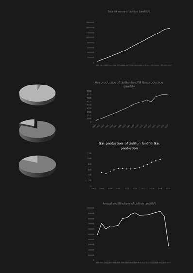
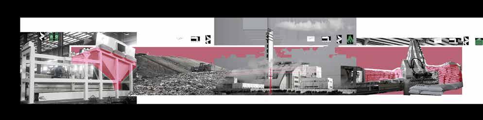
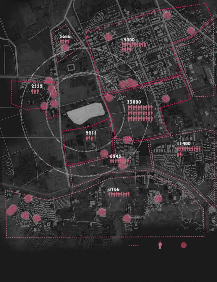
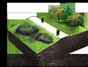
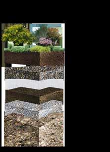
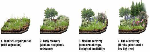
LANDFILL REGENERATION
PROJECT
Haidian District, Beijing, China
2020 summer
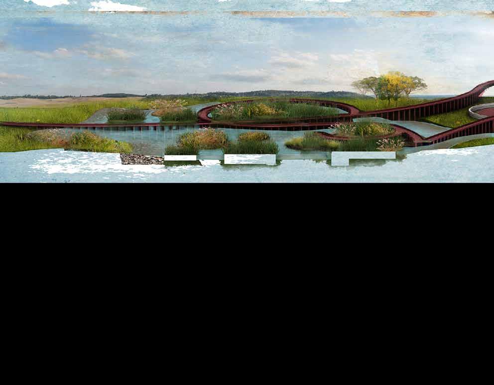
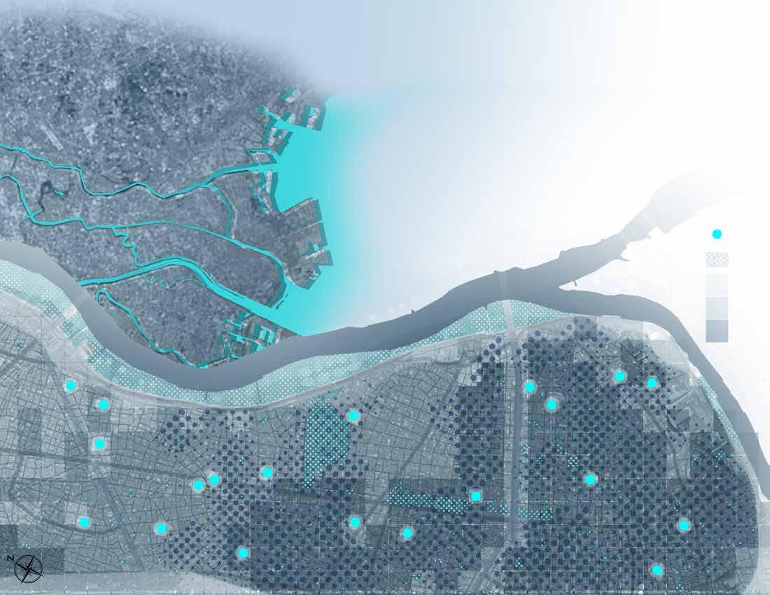
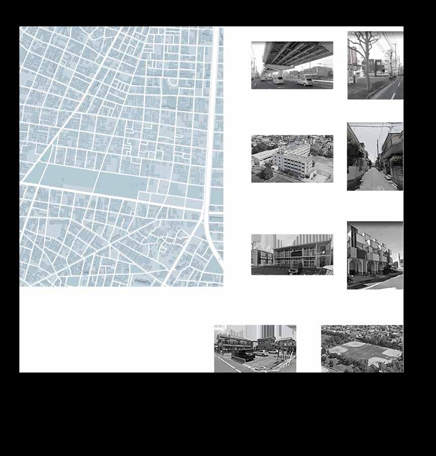
EDOGAWA FLOOD COEXISTENCE COMMUNITY PROJECT
Edogawa, Tokyo, Japan
2020 summer
CARNIVAL TRAIL AND CITY PARK PROJECT
5678
Rio de Janeiro, Brazil
2020 fall
OTHER WORK
2018-2023
Hand model
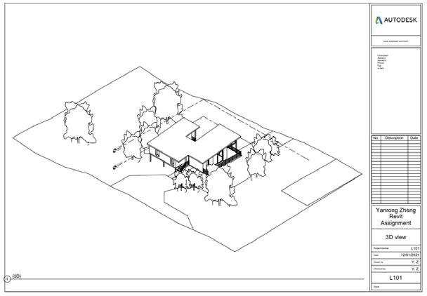
Hand drawing Construction Revit
GIS Model and Render
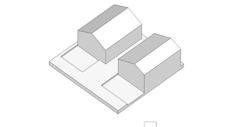
PROJECT NAME:
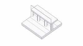
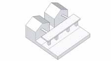
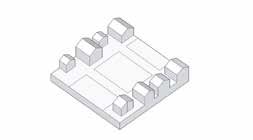
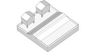
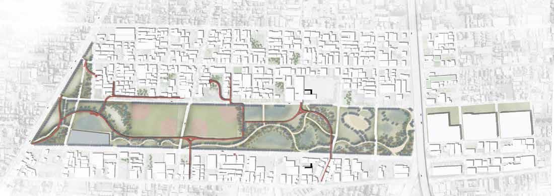
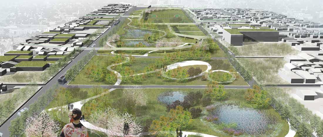
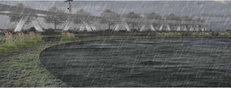
FOOD CO. AN INDUSTRIAL COMMUNITY WASTE STREAM: REGENERATION OF CONTAINERS
LOCATION: Seattle, Washington, US.
TYPE: Group Work
TIME: 03/2022
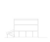
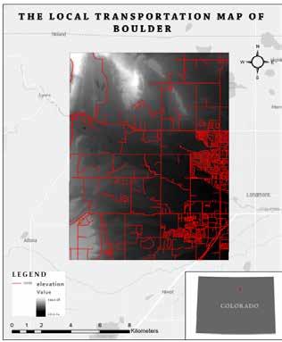
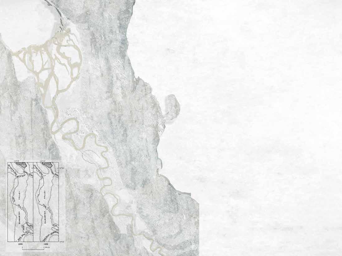
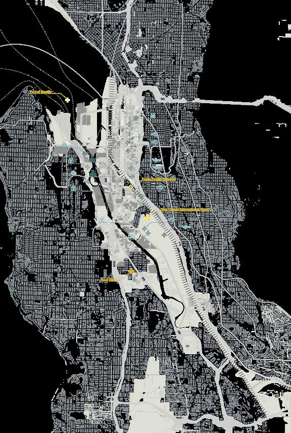
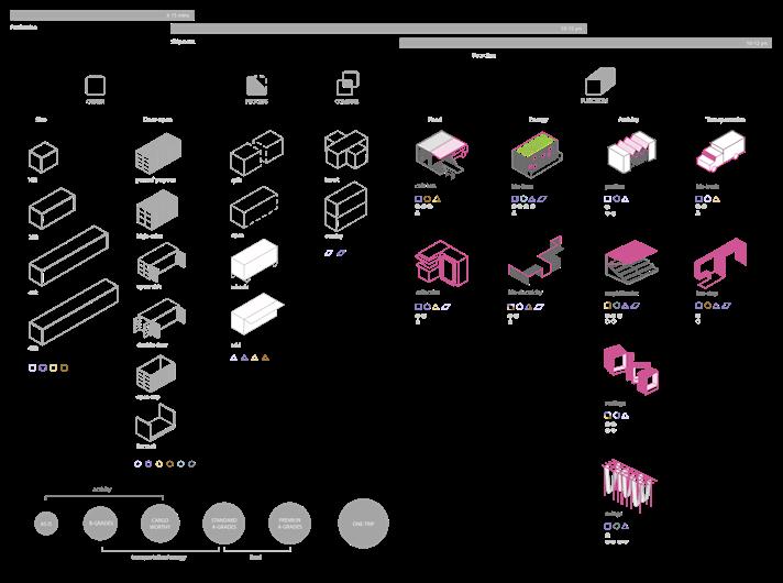
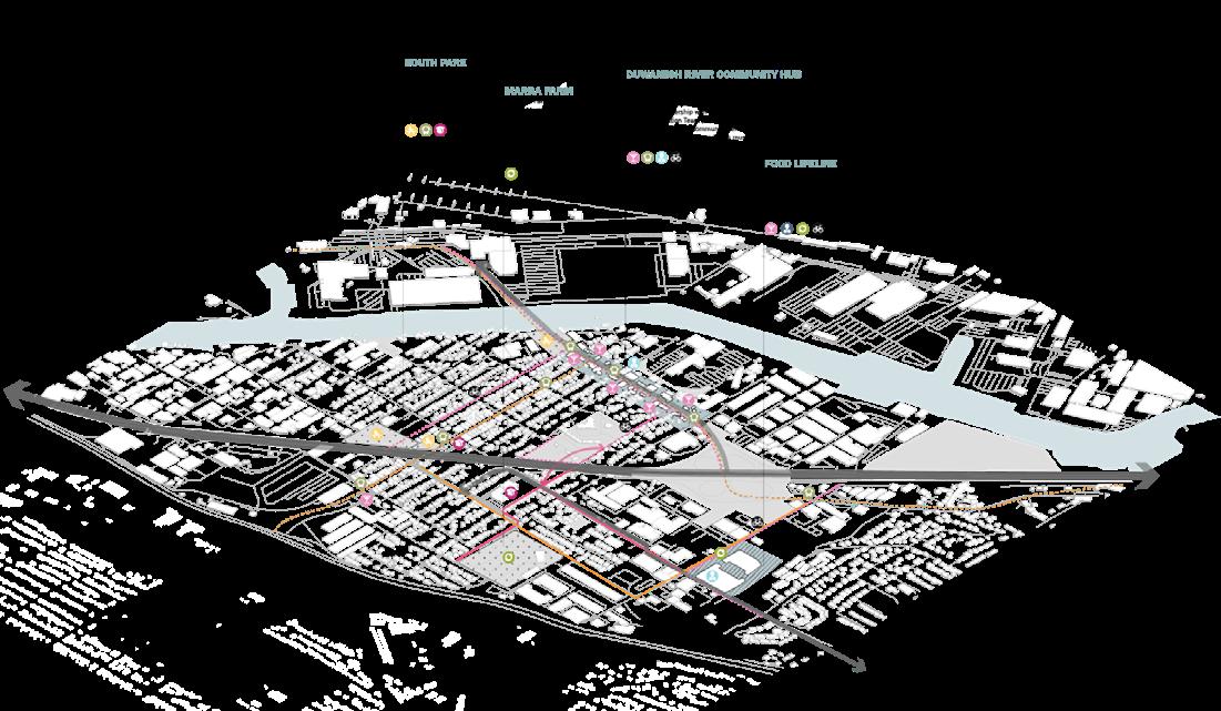
Duwamish is a neighborhood located southwest of Seattle. The neighborhood is surrounded by Seattle's industrial community. Due to this historical background, many containers circulate and go unused in the area each year.
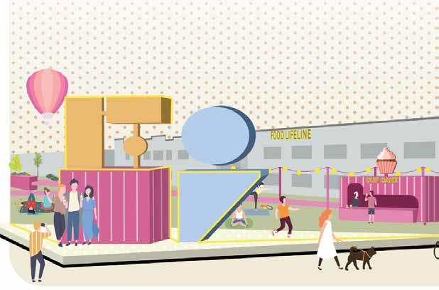
The project aims to use the existing containers on the site to create facilities to serve the residents in the public spaces within the community to meet their needs for public space. During the meeting with the client, the client proposed to improve the public transportation system. The project continues with the design. Using Foodlifeline as the design site, the project extends Duwamish's sustainable waste disposal and community service design principles.
The Georgetown Steam Plant, located near Georgetown in Seattle, Washington, was built in 1906 for the Seattle Power Company to provide electricity to Seattle, especially streetcars.
Boeing Plant 1 was established on the Lower Duwamish in 1916
1855 The Coast Salish people living in the Duwamish-Green Basin signed two treaties with the Territorial Governor, Isaac I. Stevens (1818-1862), ceding the land and establishing reservations, but reserved the right to hunt, fish and gather for the indigenous peoples.
In 1895, Eugene Semple, who had earlier served as Governor of Washington Territory, outlined a plan for a series of major public works projects in the Seattle area, including the straightening and dredging of the Duwamish River, both to open up the area to commercial use and to alleviate flooding.
By 1920, 4½ miles of the Duwamish Waterway had been dredged to a depth of 50 feet, with 20 million cubic feet of mud and sand going into the expansion of Harbor Island. The shallow, meandering, nine-mile-long river became a five-mile engineered waterway capable of handling ocean-going vessels.

European Americans arrived in the area in 1851 and were eventually settled by whites. The Duwamish people continue to work and fish in the area. But by the early 20th century, most of the remains of traditional life along the river had disappeared. The Duwamish basin industrial and commercial included cargo handling construction, ship concrete manufacturing, fabrication, food processing, other industrial operations.
 Boeing Plant 2, further upriver, in 1936.
basin soon became Seattle's commercial core area. Activities handling and storage, marine and boat manufacturing, manufacturing, paper and metals processing, and countless operations.
The EPA declared the Lower Duamish Waterway a "superfund" site in 2001, meaning it was eligible for a special federal cleanup program due to the severity of its pollution. The EPA manages the clean-up of sediment in the river, and the Ministry of Ecology controls the sources of pollution in the river. The City of Seattle, King County, the Port of Seattle, and The Boeing Company unite as the Lower Duamish Waterway Group (LDWG).
Industrial development has resulted in the contamination of waterway sediments (river bottoms) with toxic chemicals from a variety of sources, including stormwater runoff, wastewater, and industrial practices. Most human health risks come from polychlorinated biphenyls (PCBs), arsenic, carcinogenic polycyclic aromatic hydrocarbons (cPAHs), and dioxins and furans.
By the end of 2015, 50%ofPCB contamination from the river bottom was removed through these early action cleanups.


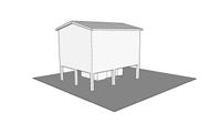
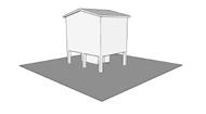
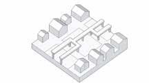
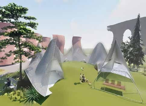
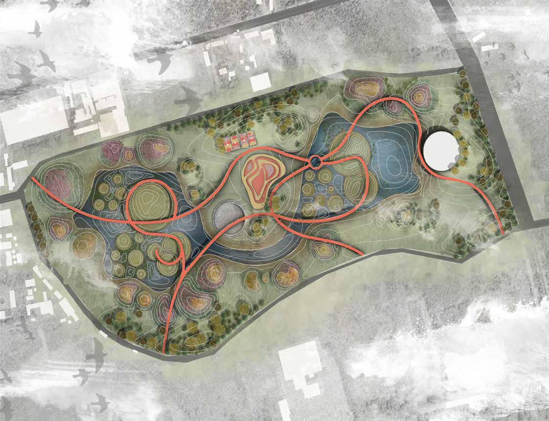
PROJECT NAME: EARTHWORM & P-PATCH FARM REBUILD PROJECT
LOCATION: Seattle, Washington, US.
TYPE: Group Work
TIME: 01/2022
The site is located northeath of UW. The project has three strategies which are smart agriculture, educational farming, and ecological cycle. Create the bottom decomposer in the farm ecological chain through the cultivation of mushrooms and the feeding of earthworms. Cooperate with surrounding farms to achieve product recycling and waste utilization. Taking "food" as the theme, it integrates various experiences and entertainment to create an agricultural landscape experience, and education base. Jointly develop with technology companies, start "Future Farm", and establish a complete set of intelligent agricultural management monitor their farmland in real-time through technology.

Compost Factory

Bottom Mushroom Oyster Mushroom
Mushroom Factory
Crop Rotation Zone


Winter Wheat Canola Straw Grain
Farm Restaurant
P-Patch


Earthworm Factory
Open Space
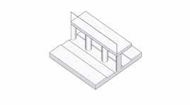
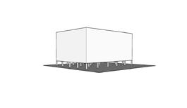
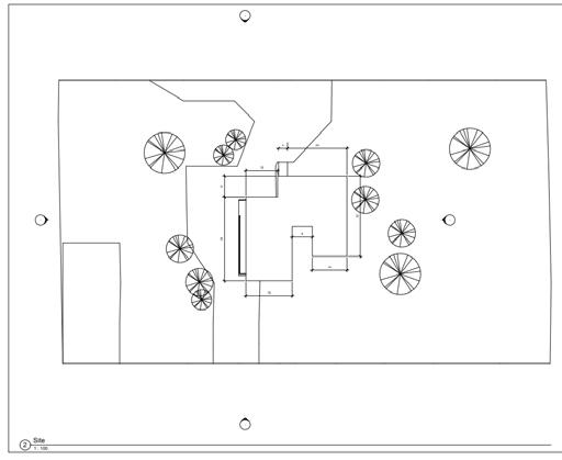
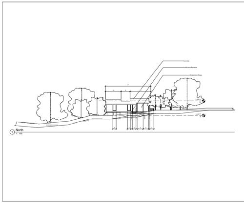
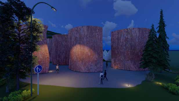
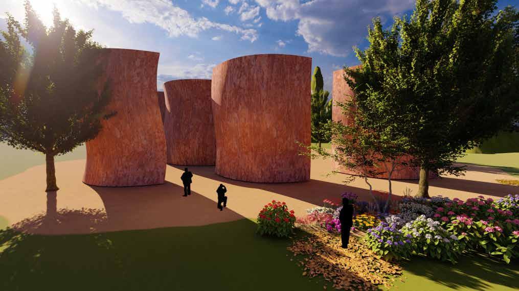
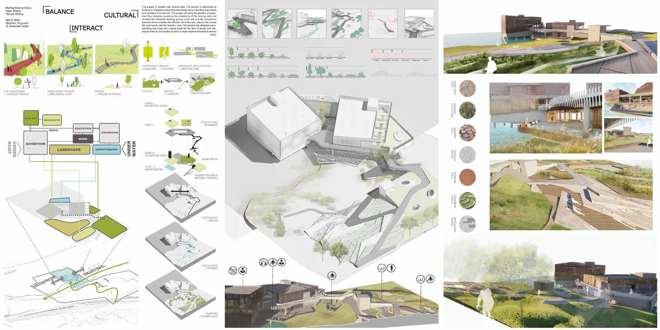
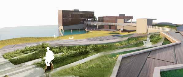
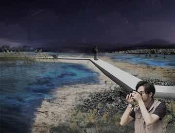
PROJECT NAME:
MFC MUSEUM
INDUSTRIAL COMMUNITY COASTAL LANDSCAPE PROJECT LOCATION: Seattle, Washington, US.
TYPE: Group Work
TIME: 09/2021
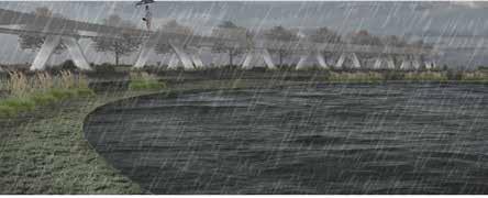
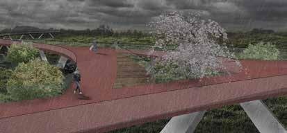
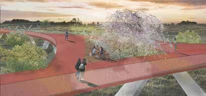
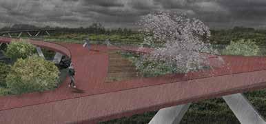
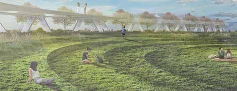
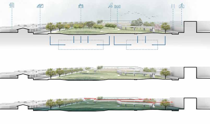
The project is located near Salmon Bay. The project is committed to building an interactive place that showcases the surrounding ship culture and ecological environment. The project will solve the problem of pedes- trian fow obstacles caused by the subsidence of the existing plots and increase the influential building groups in the site and the connections between them to realize the efficient use of the site, improve the crowd the community, and the location. Link. The proiect also designed corre- sponding rest areas and viewing areas for the flow of people and con- nected them to the building to form a whole regional interactive viewing place.


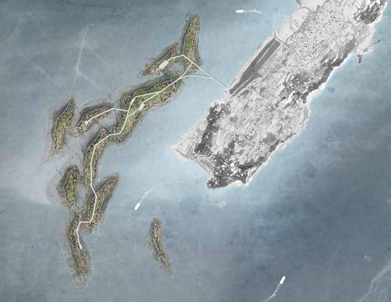
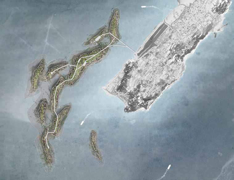
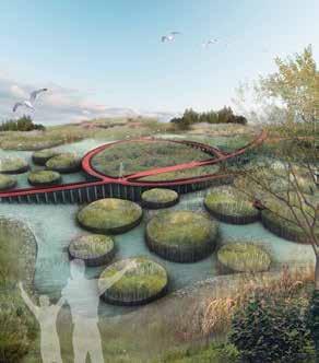
PROJECT NAME: "BLUE TEARS"THE TRANSFORMATION AND REGENERATION OF THE ISLAND PROJECT LOCATION:
Jidiao island, Fuzhou, Fujian, China
TYPE: Individual Work
TIME: 09/2020
AREA: 239.64 Acre
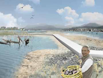
Fujian Jidiao Island is located on the southeast coast of China, adjacent to the Taiwan Strait. Every summer, in the ocean near this island, there will be luminous sea water. The locals call this phenomenon of ocean glow "blue tears." In recent years, the cause of this luminous sea has also changed from harmless marine luminous organisms to luminous algae, which will compete for marine resources. The project attempts to design an ecological installation landscape to help filter harmful noctilucent algae in the ocean and stabilize the existing marine ecosystem. The designed ecological reef island will also provide an interactive viewing experience for the area.
Domestic wastewater
Industrial wastewater
High incidence area of red tide in Fujian Province 70% of the total red tide.
Agricultural wastewater
Diatom red tide
The red tide in Fujian is regional The number of noctiluca is the largest.
Domestic sewage
Farmland sewage

Industrial wastewater
Number of red tides in Fujian Ocean during 1962-2008
The number of animals in the site area is the lowest in the province
2009-2019 34% Noctiluca 24%
The number of red tides between 2009-2019 is 34% of the number between 1962-2019
Total number of Noctiluca is 24% of the total number of red tides
The glowing beaches in Fujian waters have caused a surge in the number of tourists in Fujian.
The element of Luminous sea landscape
The causes of luminous water bodies in Fujian seas are complicated. Noctilucent algae treatment will not absolutely affect the appearance of the luminous ocean

Excessive
The high frequency of red tide and luminous sea
Marine life poisoning
Fisherman poisoning
Lack of ecosystem stability
Decrease in catch
Low abundance of benthic flora and fauna
Decreased production of fishery products
Reduced fishermen’s income Population loss on islands
Number of unemployed population
In 2017, toxic red tides caused local fish and shellfish to ingest toxins, and fishermen were poisoned and fishery production reduction
Number of fishermen
Number of people working outside
Only the production and cultivation of laver in this area leads to a single regional ecological structure
The simple economic structure and the worsening environment have led to a large number of population loss on the island.
“BLUE TEARS”
FRAMEWORK
Issue Phase1: Ecological restoration
Water pollution
Artifical oyster reefs
Outcome Filtered sea water
Ecological habitat
Rich marine species
Phase2: Economic recovery
Marine economic products
Fading island
Single species
Artificial algal reef
Luminous Ocean
Fisheries decline
Ecological fishery
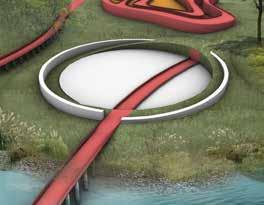
STRATEGY
STRATEGY1: Ecological Installation
Oyster Seed
STRATEGY2: Ecological Reef
Tourism development
Employment demand
Ecotourism
Algal Seed
Deep water/silt area

Growth factor Shallow water
Material
Rough surface
Shell waste: increase the surface roughness of the material
Concrete: increase device stability
Composite fiber rope: fix oyster seedlings in shallow water
Shell concrete cylinder Triangle structure
Rough surface Form
Phasing Diagrams
Phasing Diagrams
Phasing Diagrams
Phasing Diagrams
Master
Master
Master
Analysis Diagrams
Analysis Diagrams
Analysis Diagrams
Analysis Diagrams
Analysis Diagrams
Phasing Diagrams Contour
Phasing Diagrams Analysis


 Section 1
Section 2
Section 3
Section 1
Section 2
Section 3