


Contents
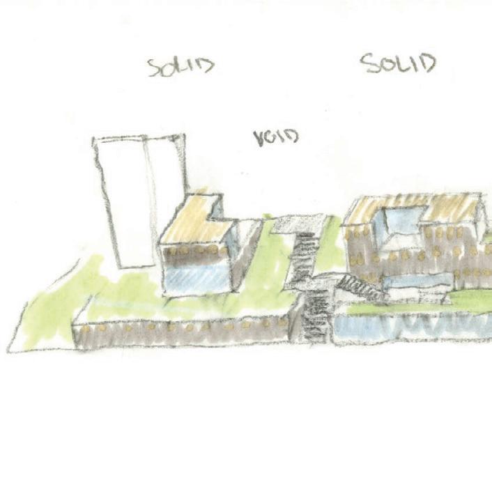
Studio Work
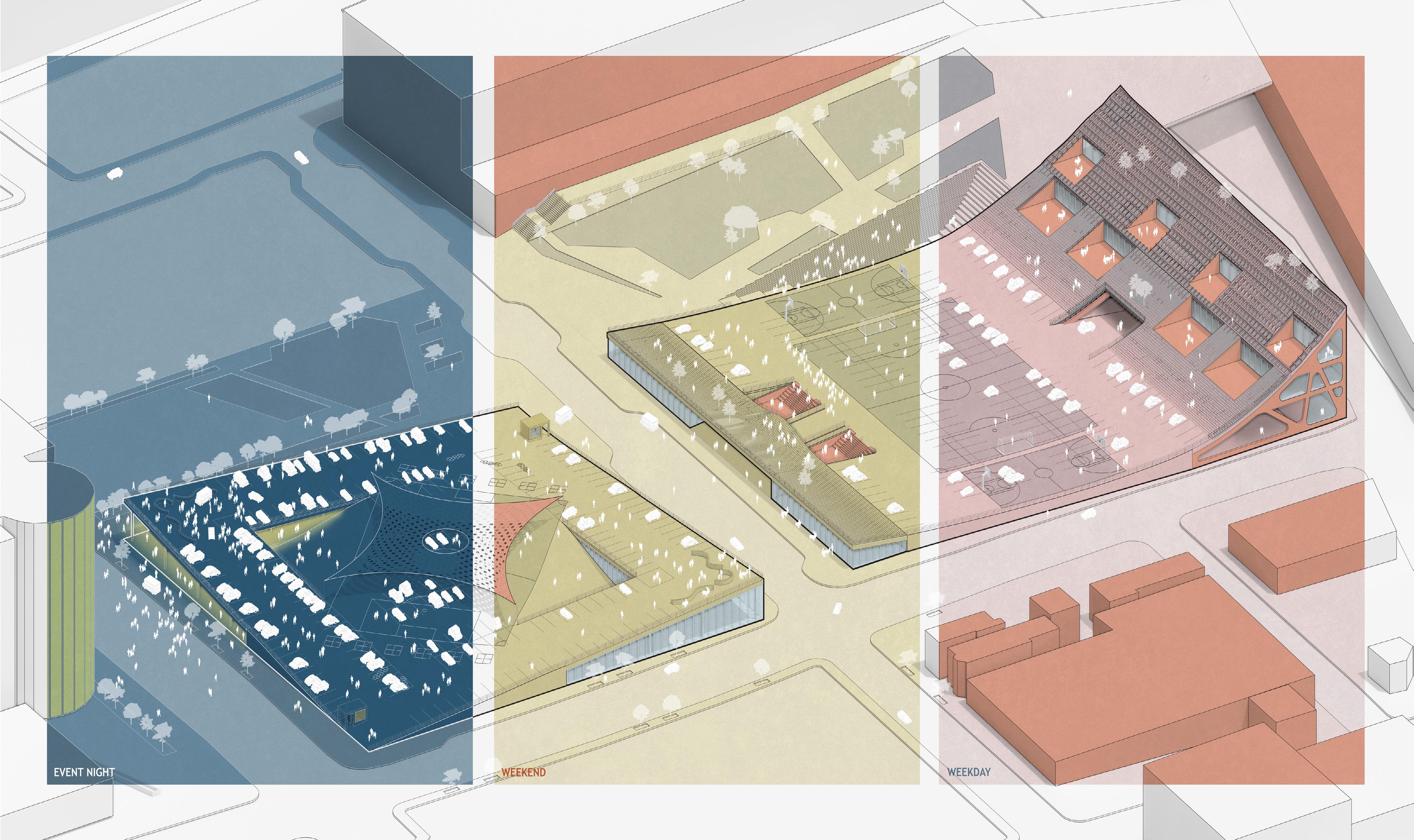
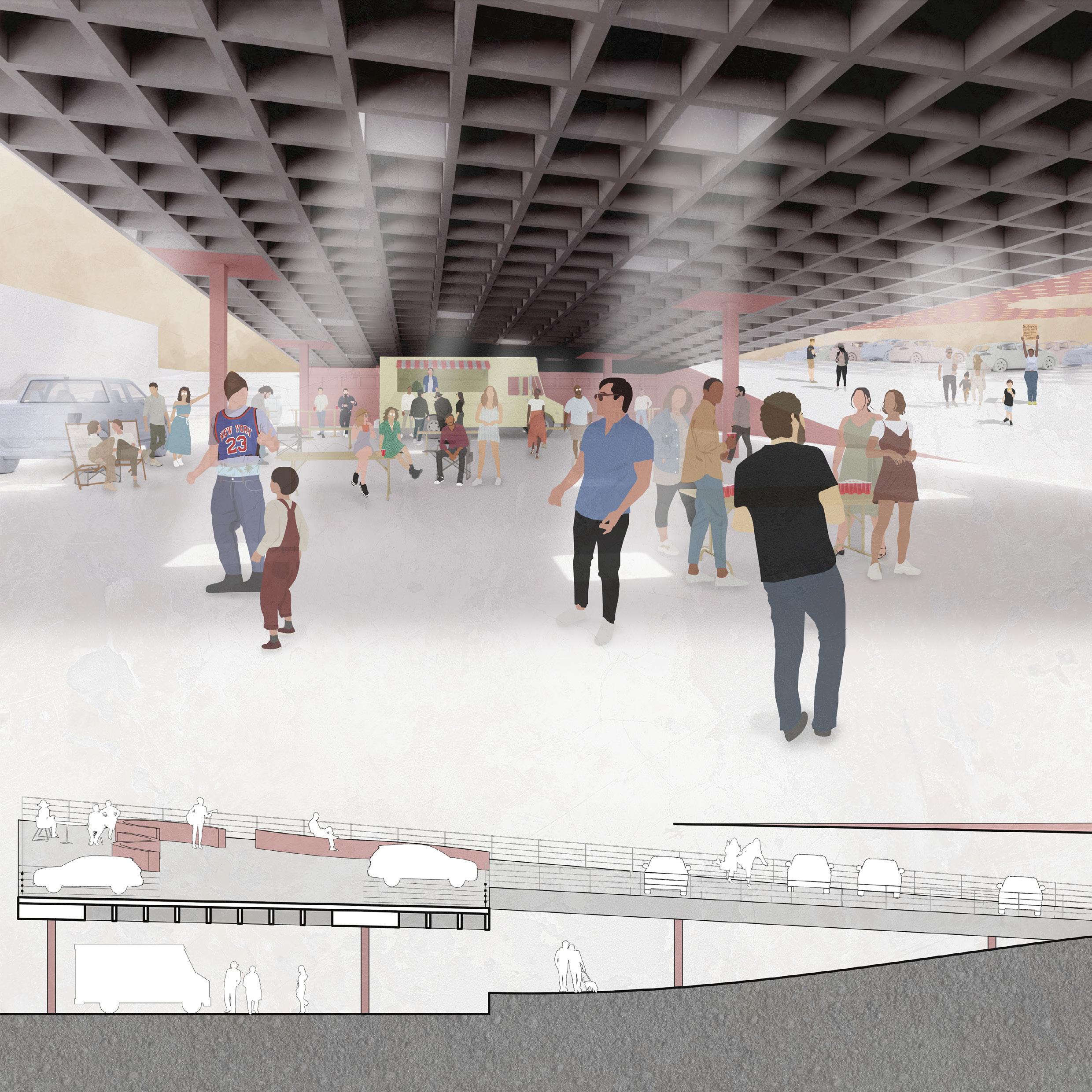
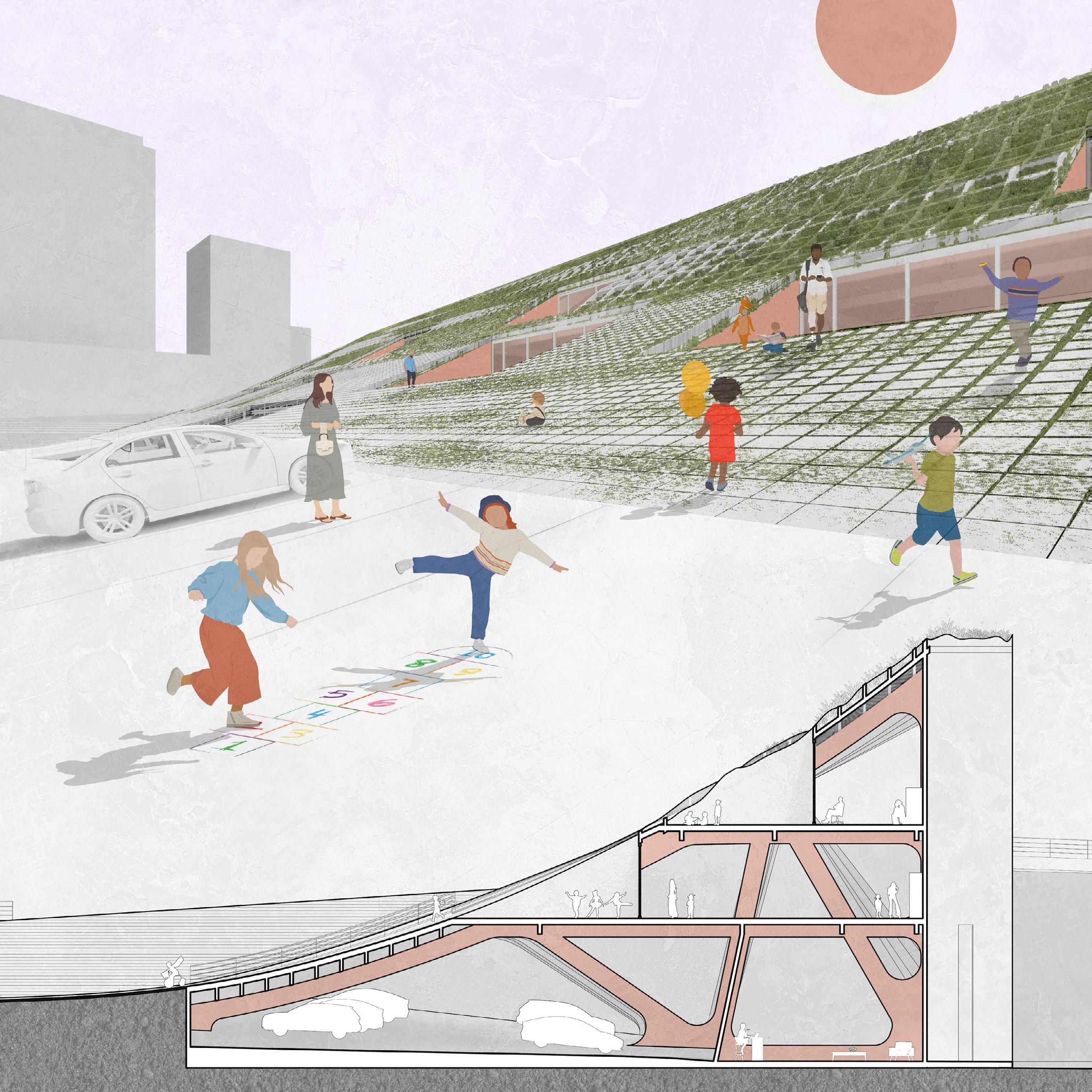
Community Park(ing)
StoopScapes
Waterscape
Connective Island
Some Actual Art
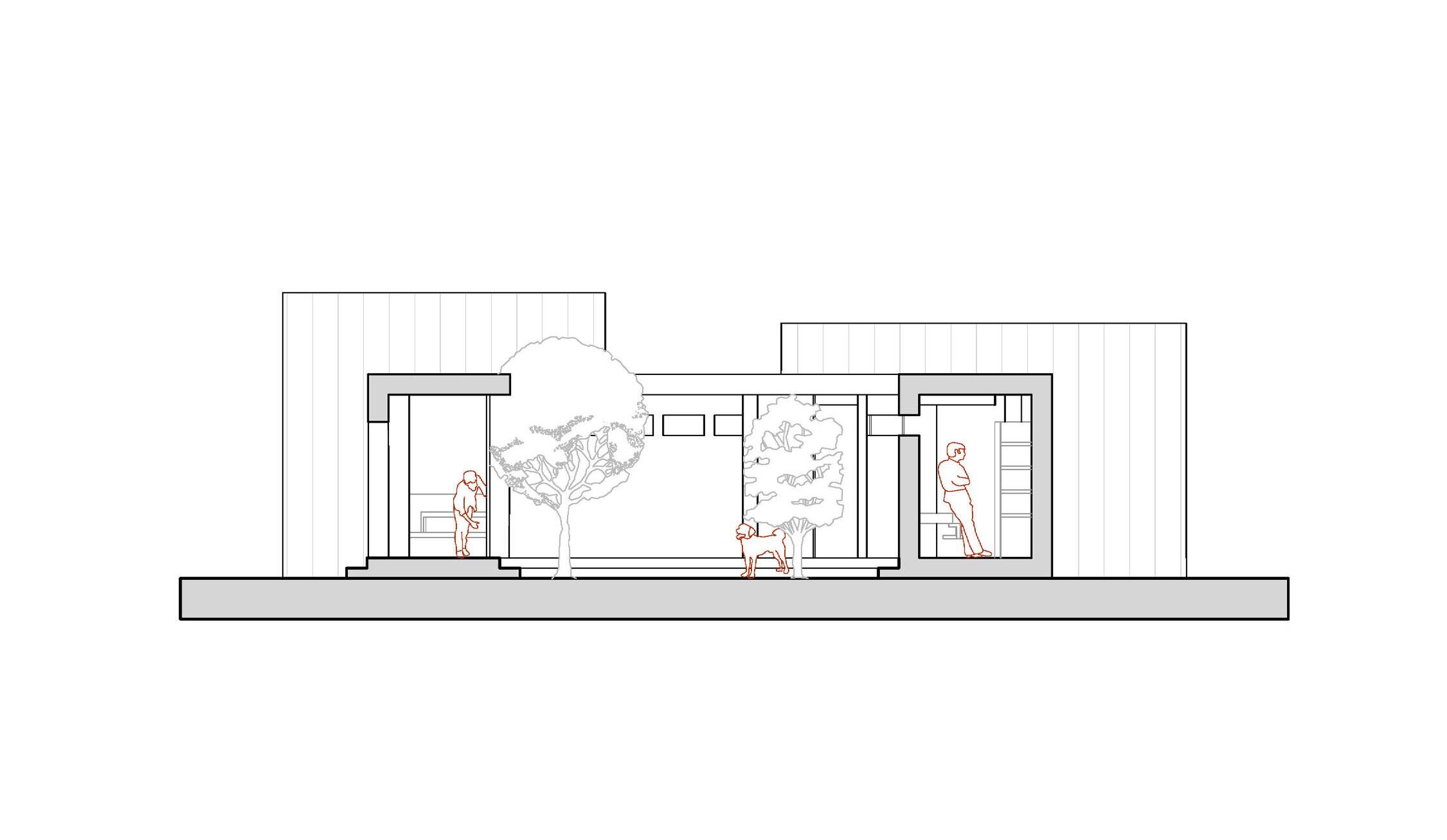
Three Little Houses
Professional Work
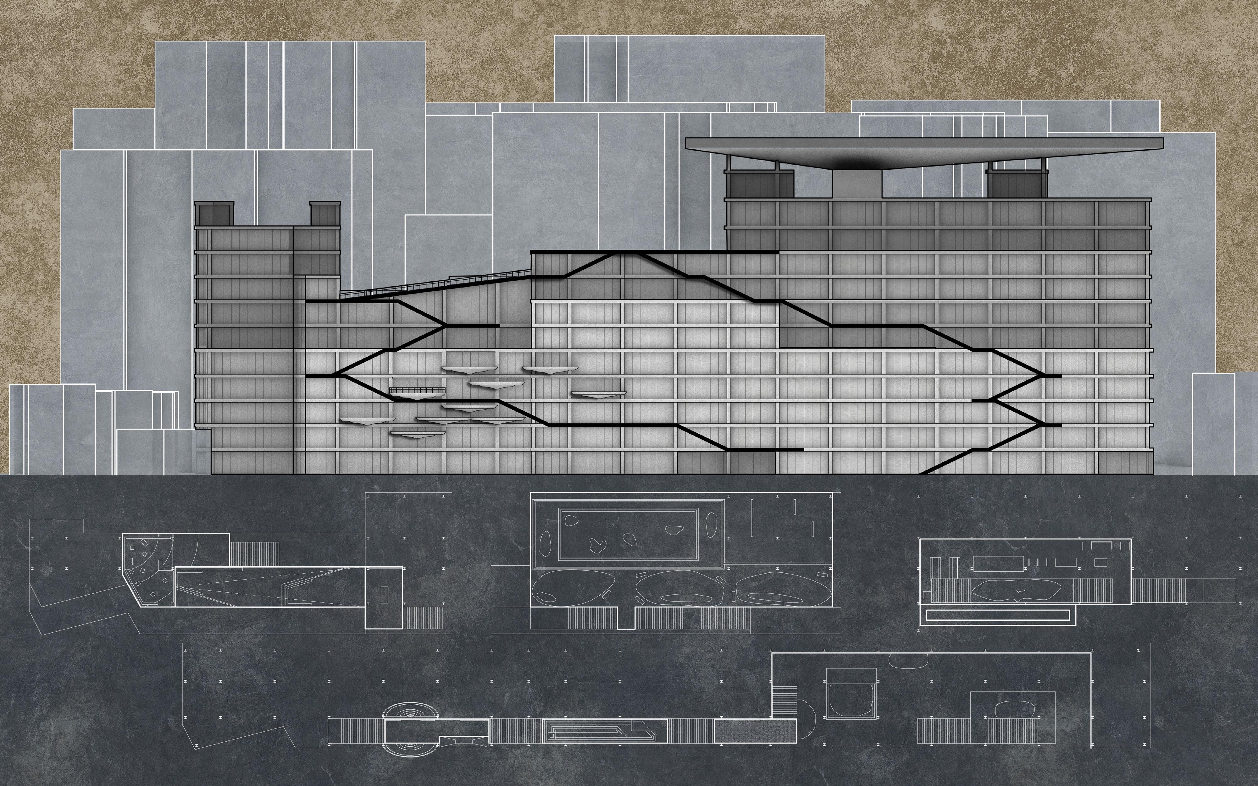
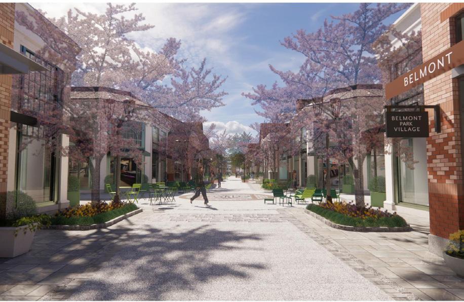
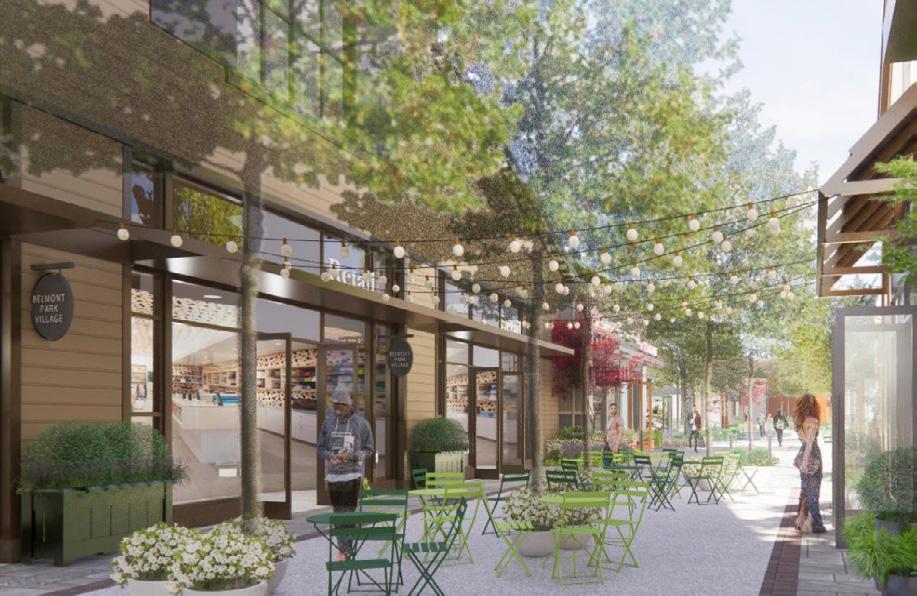
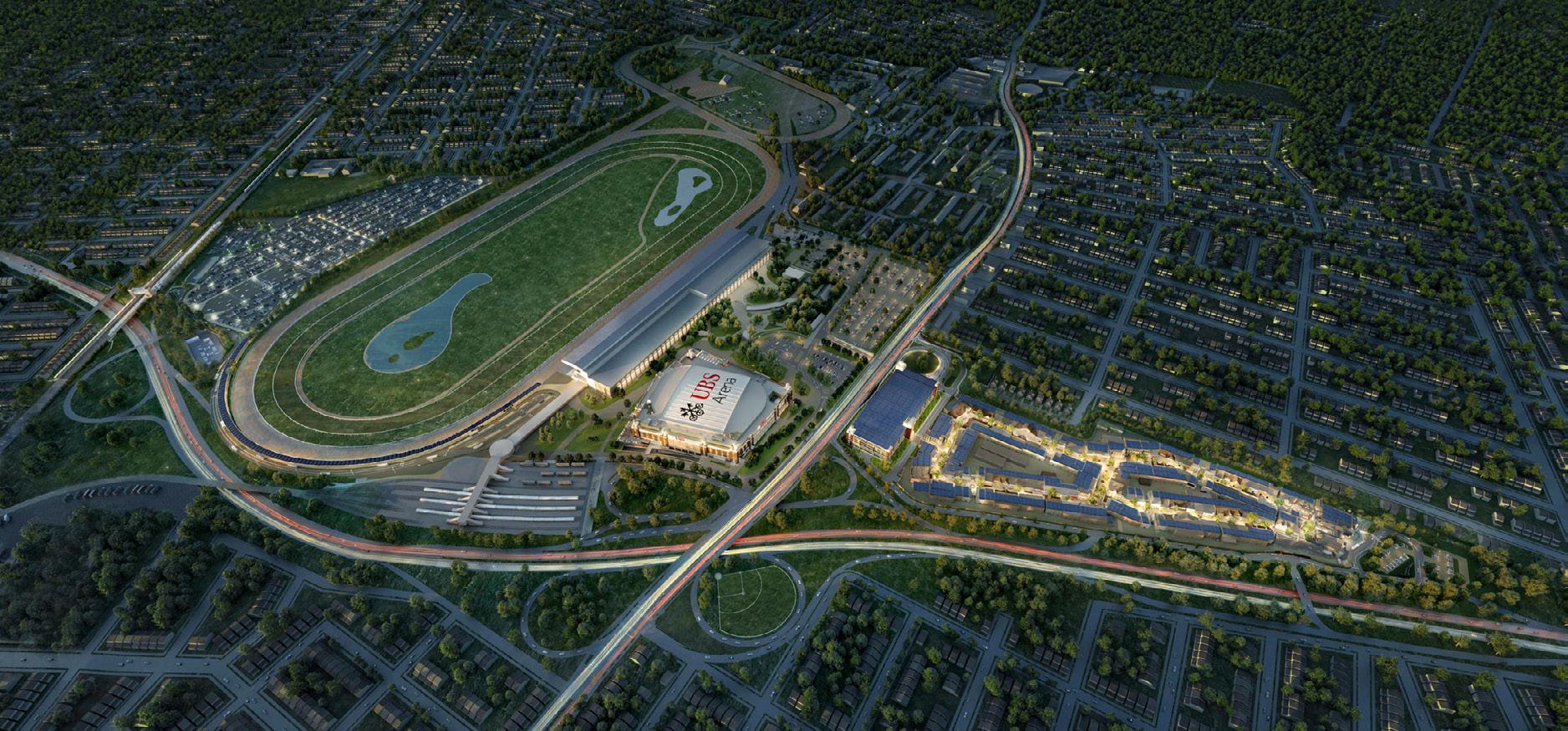
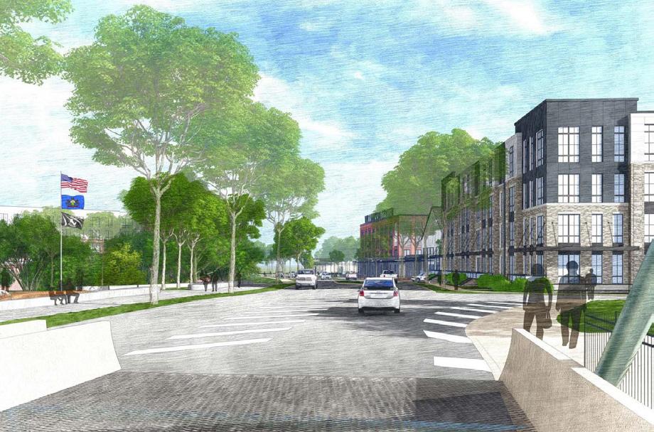
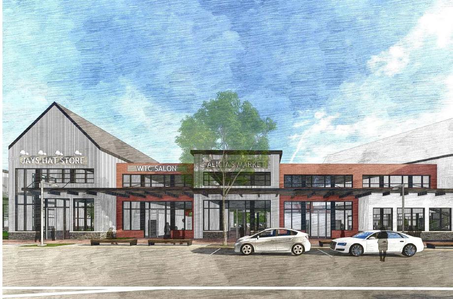
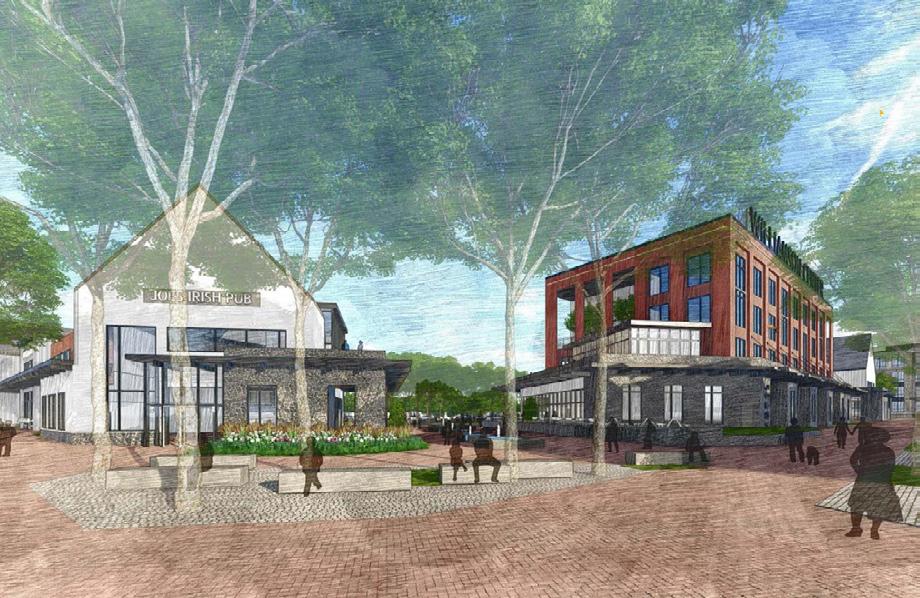
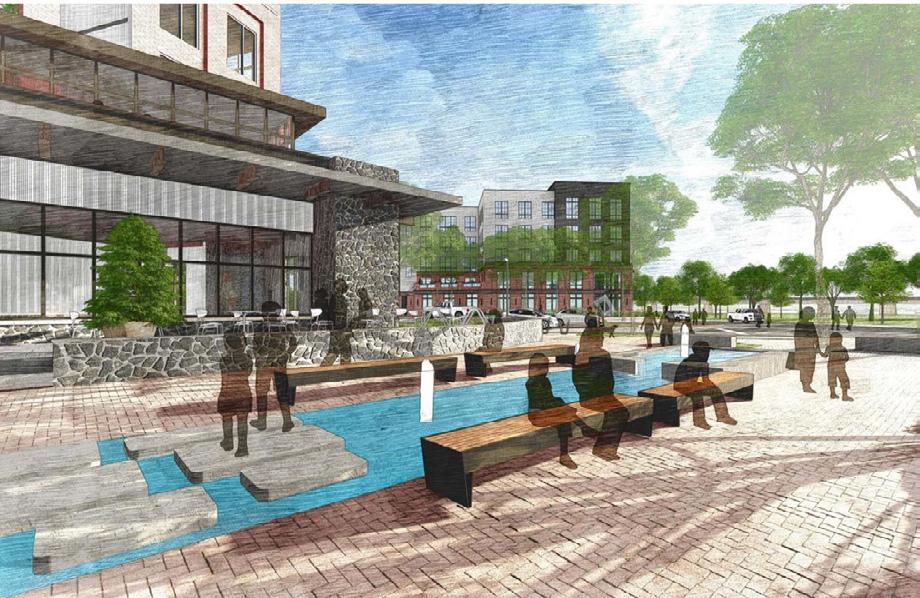
Belmont Park Retail
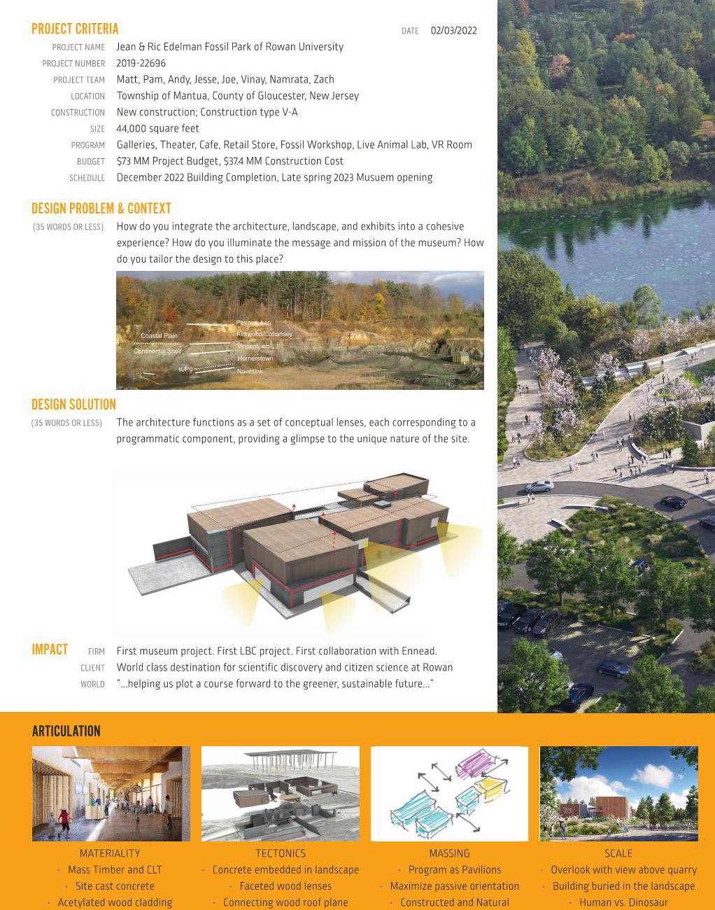
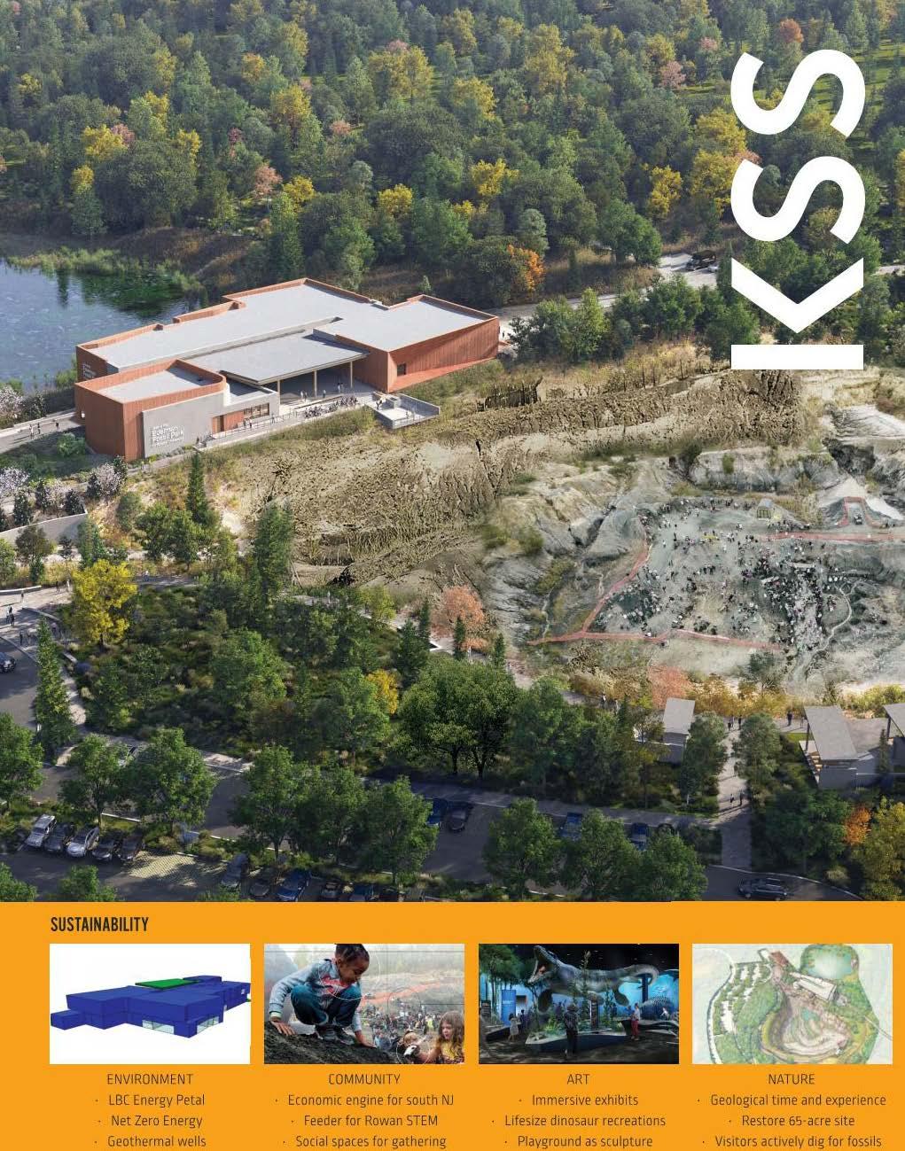
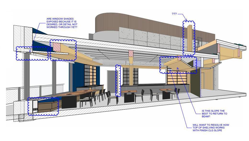
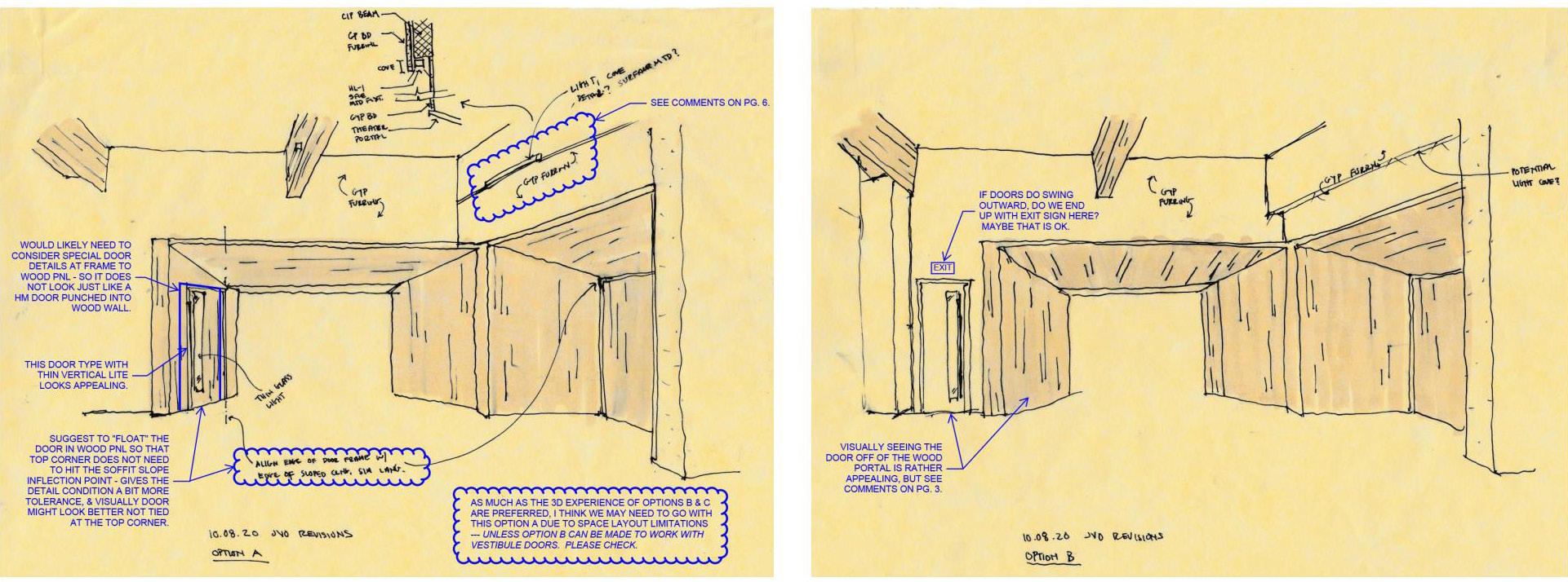
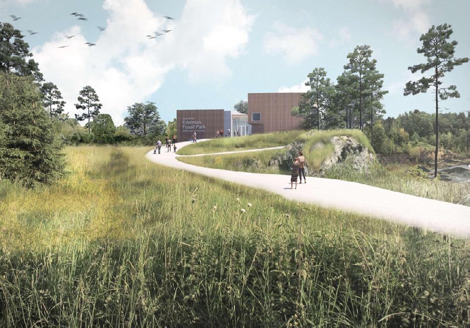
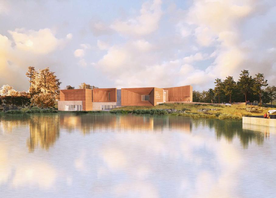
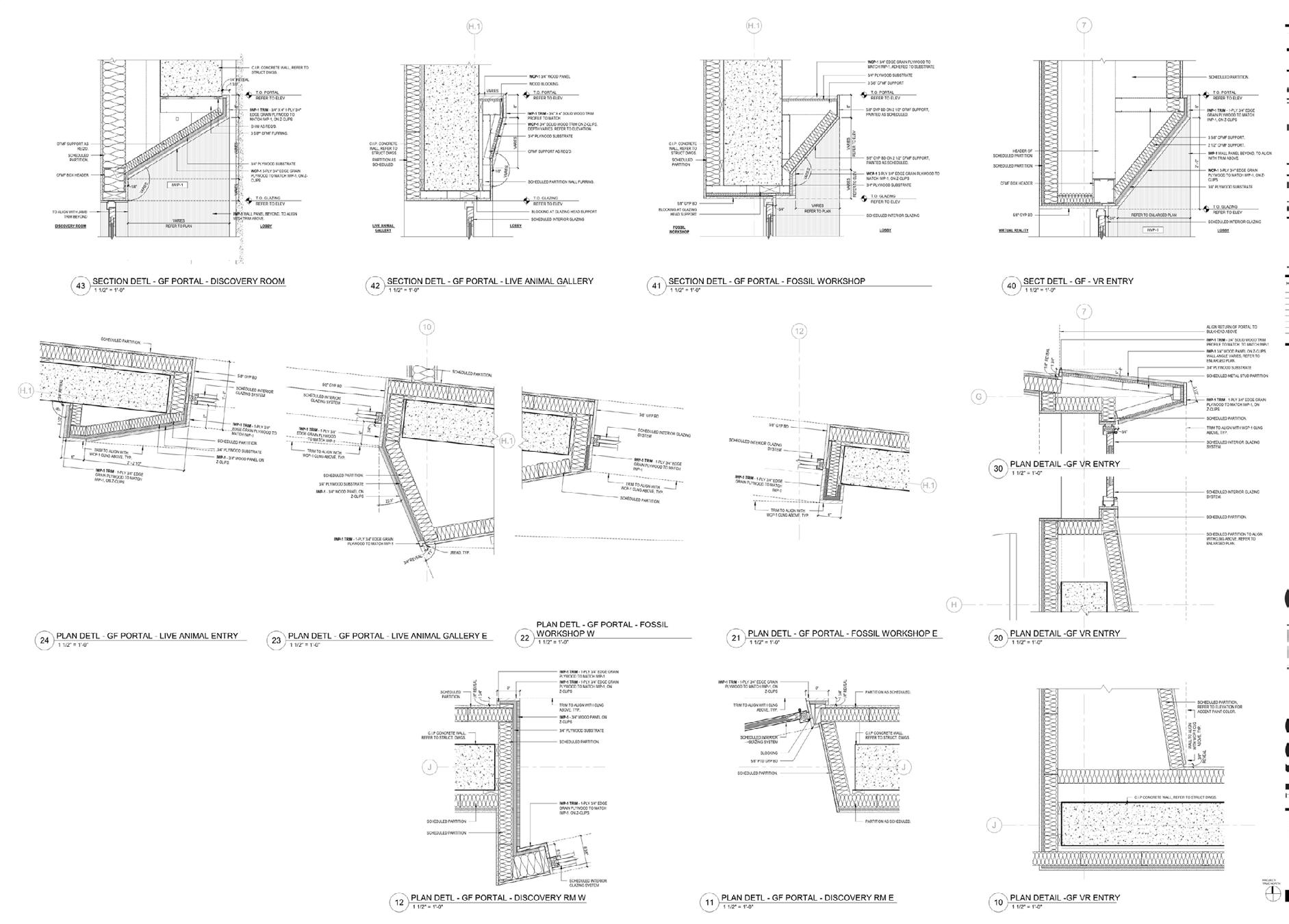
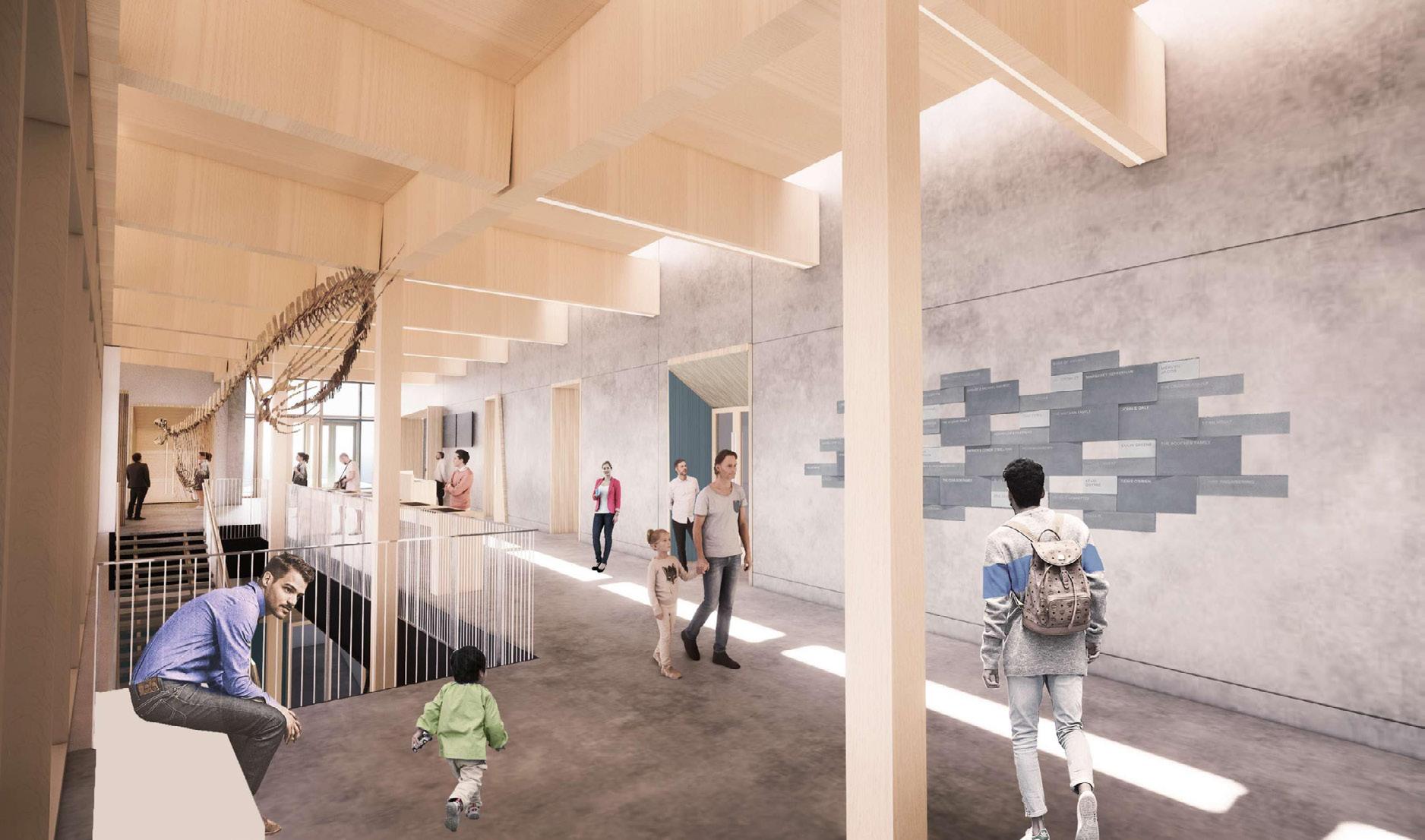
Fossil Park
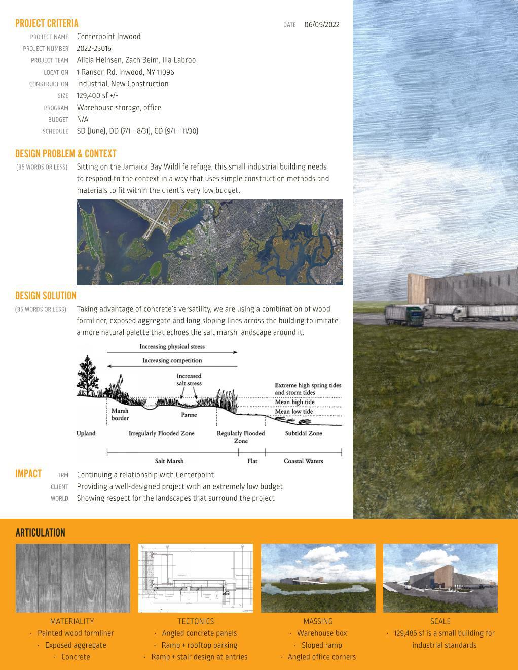
Rason Road
Stoltz Churchman
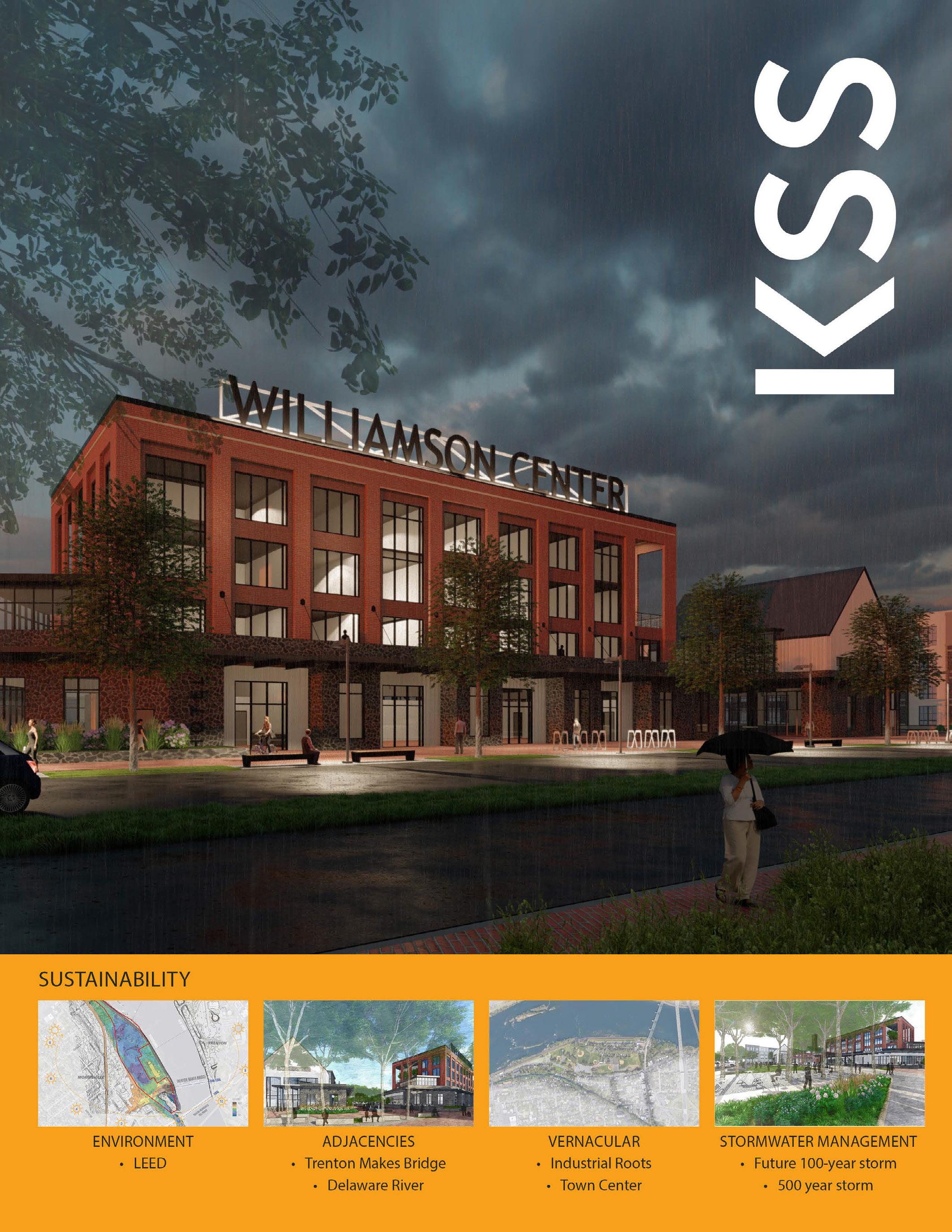
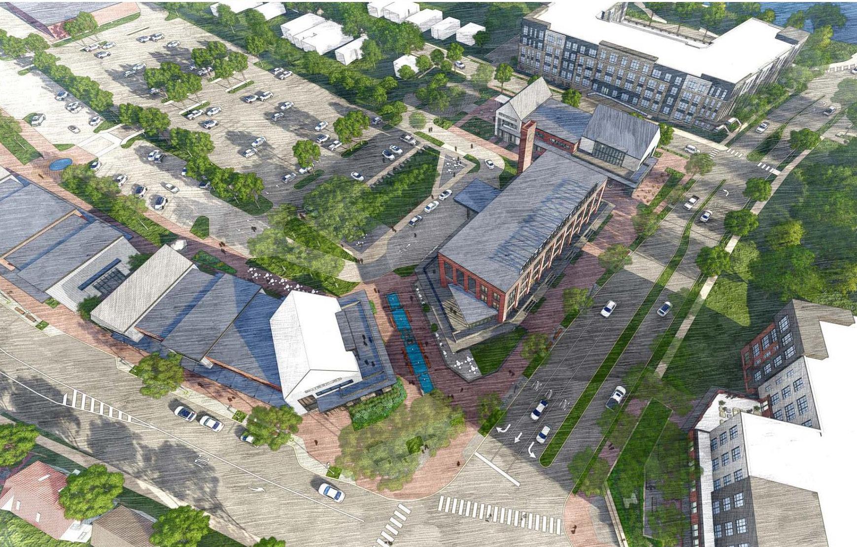
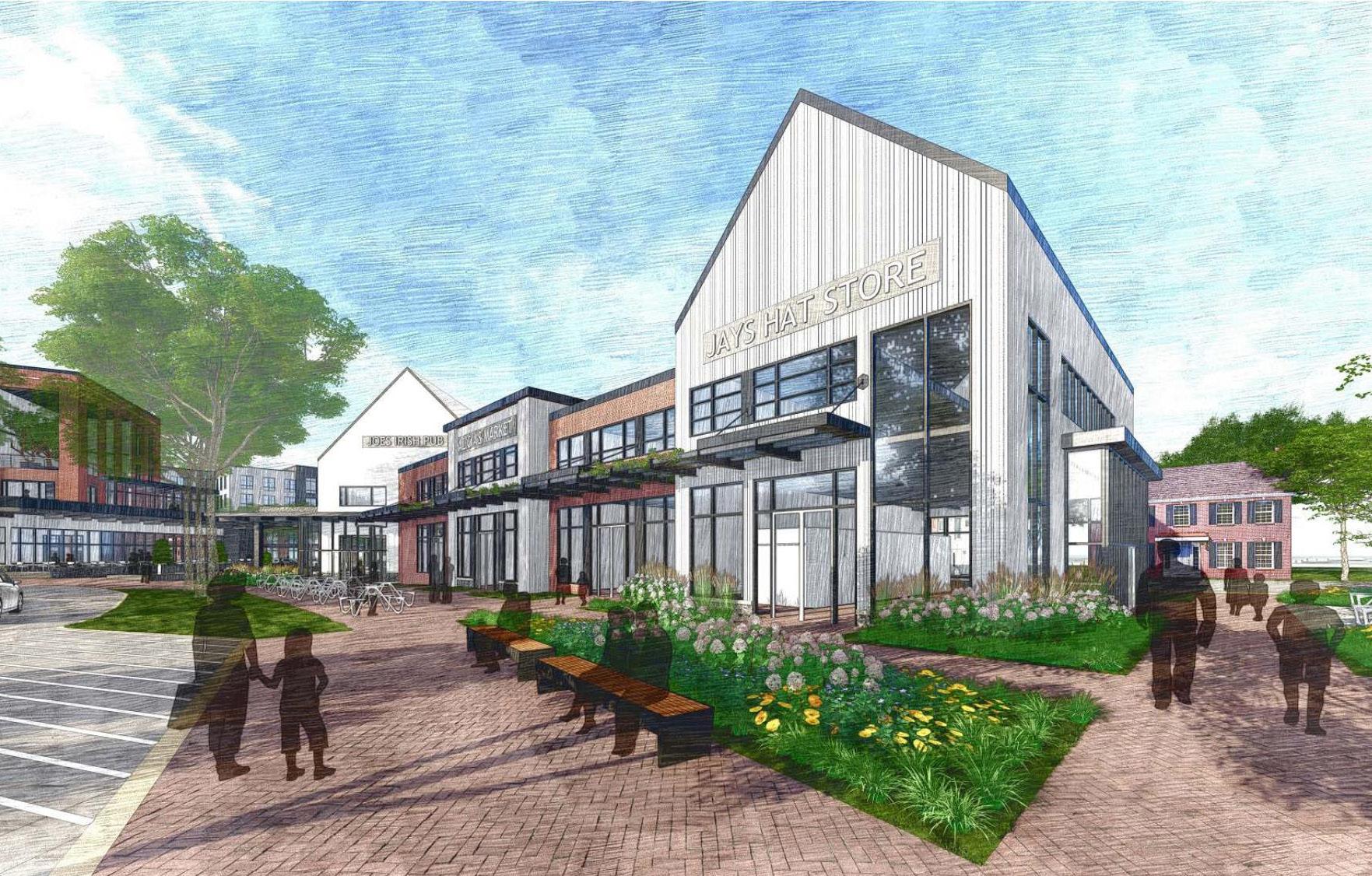
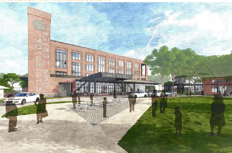
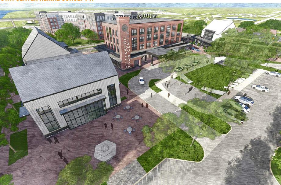
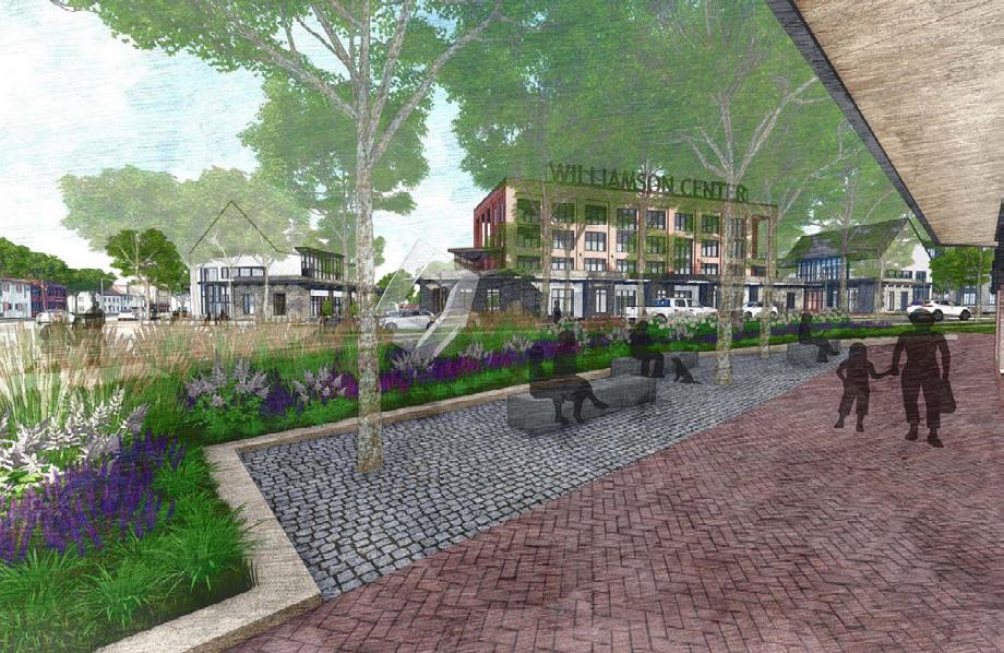
Williamson Town Center
Explorations
Density Mapping
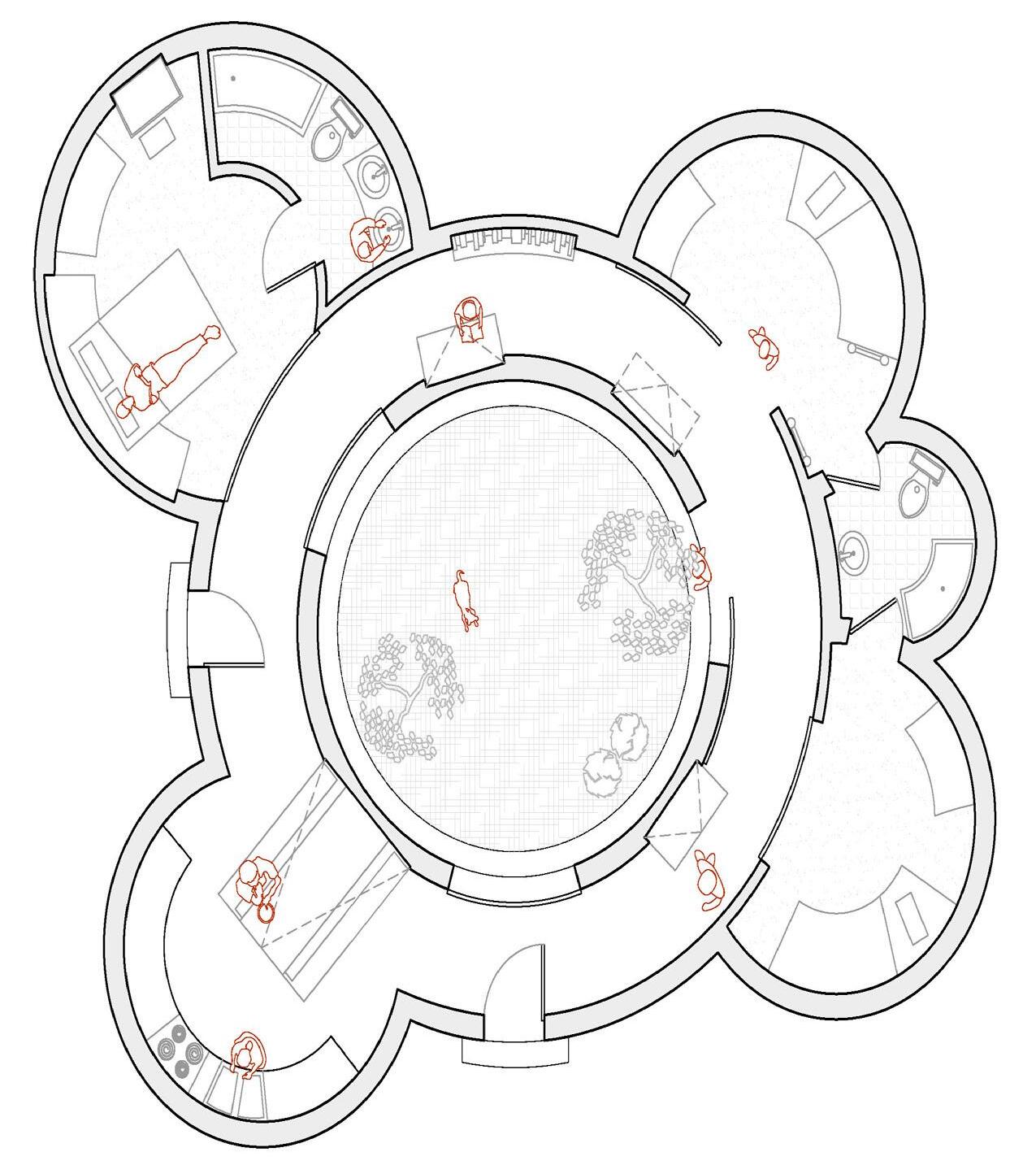
Tiny House
Vicenza


Studio Work

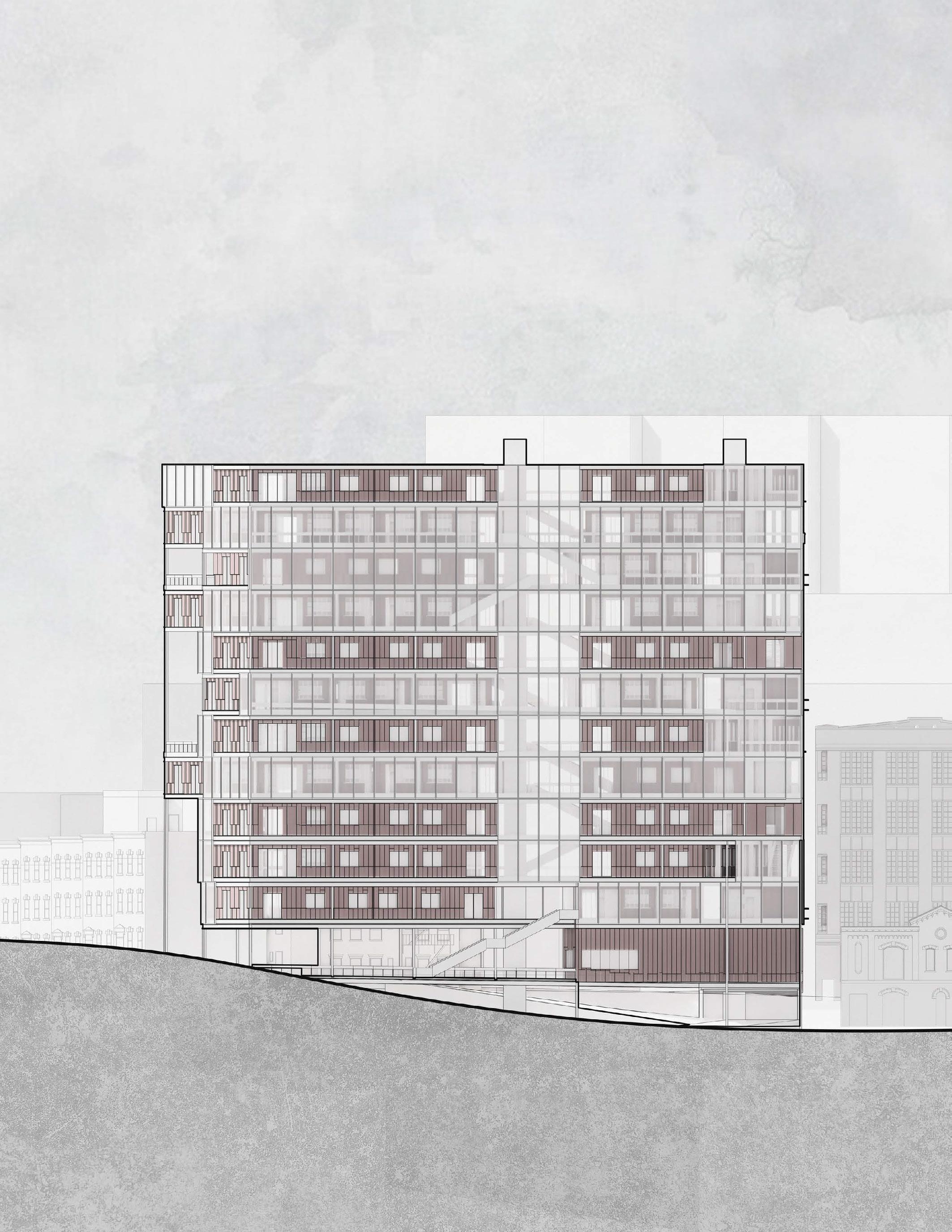
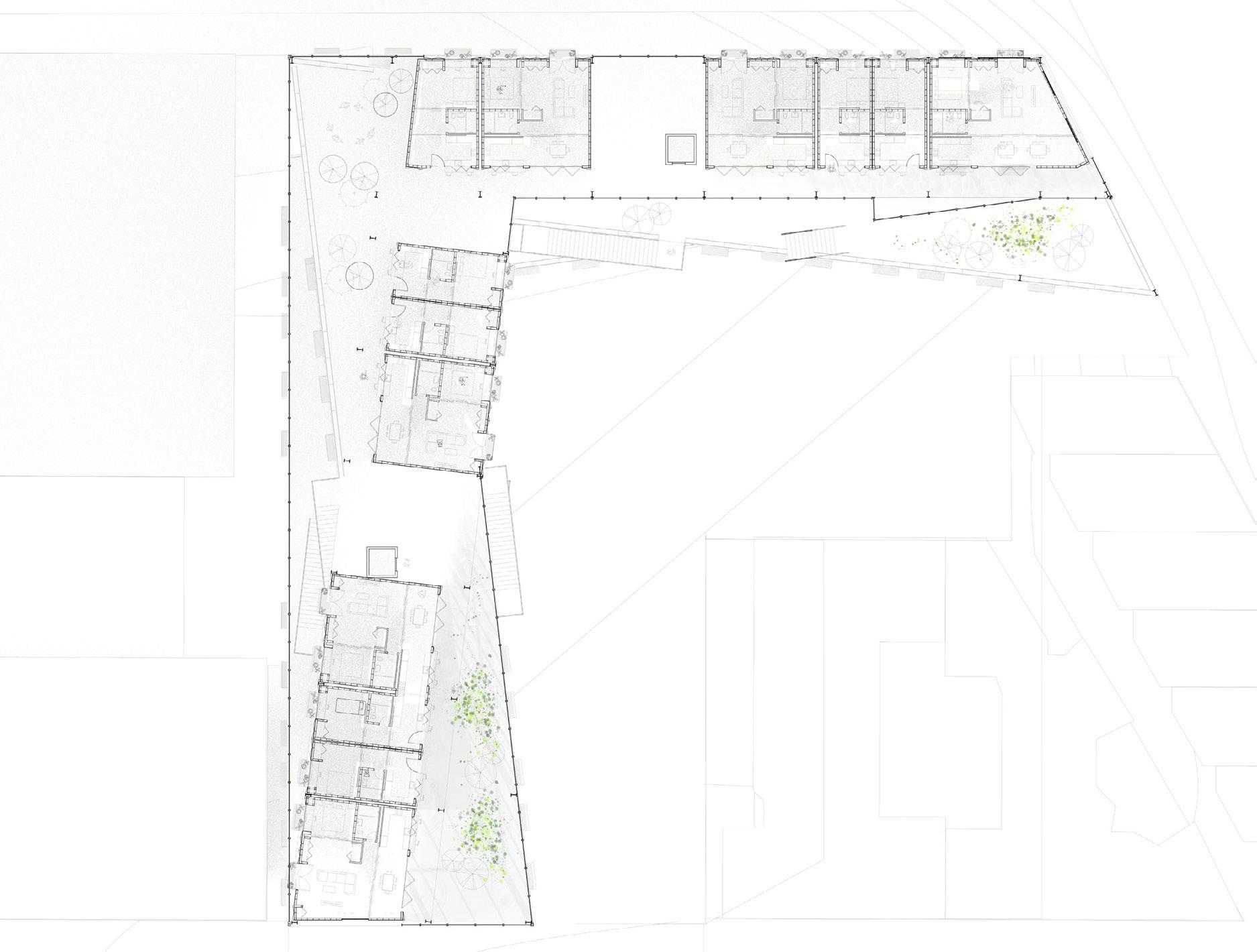
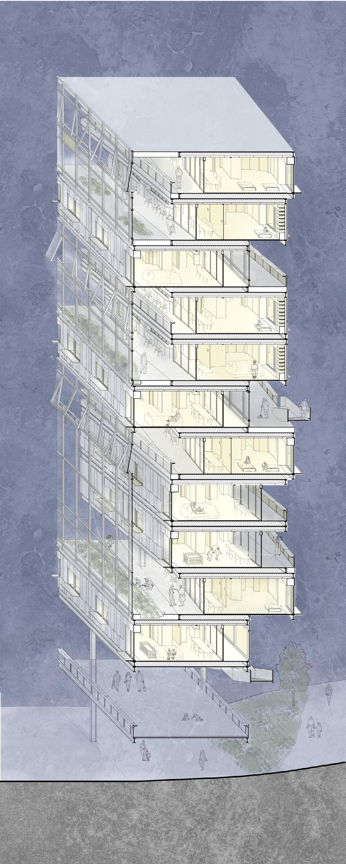
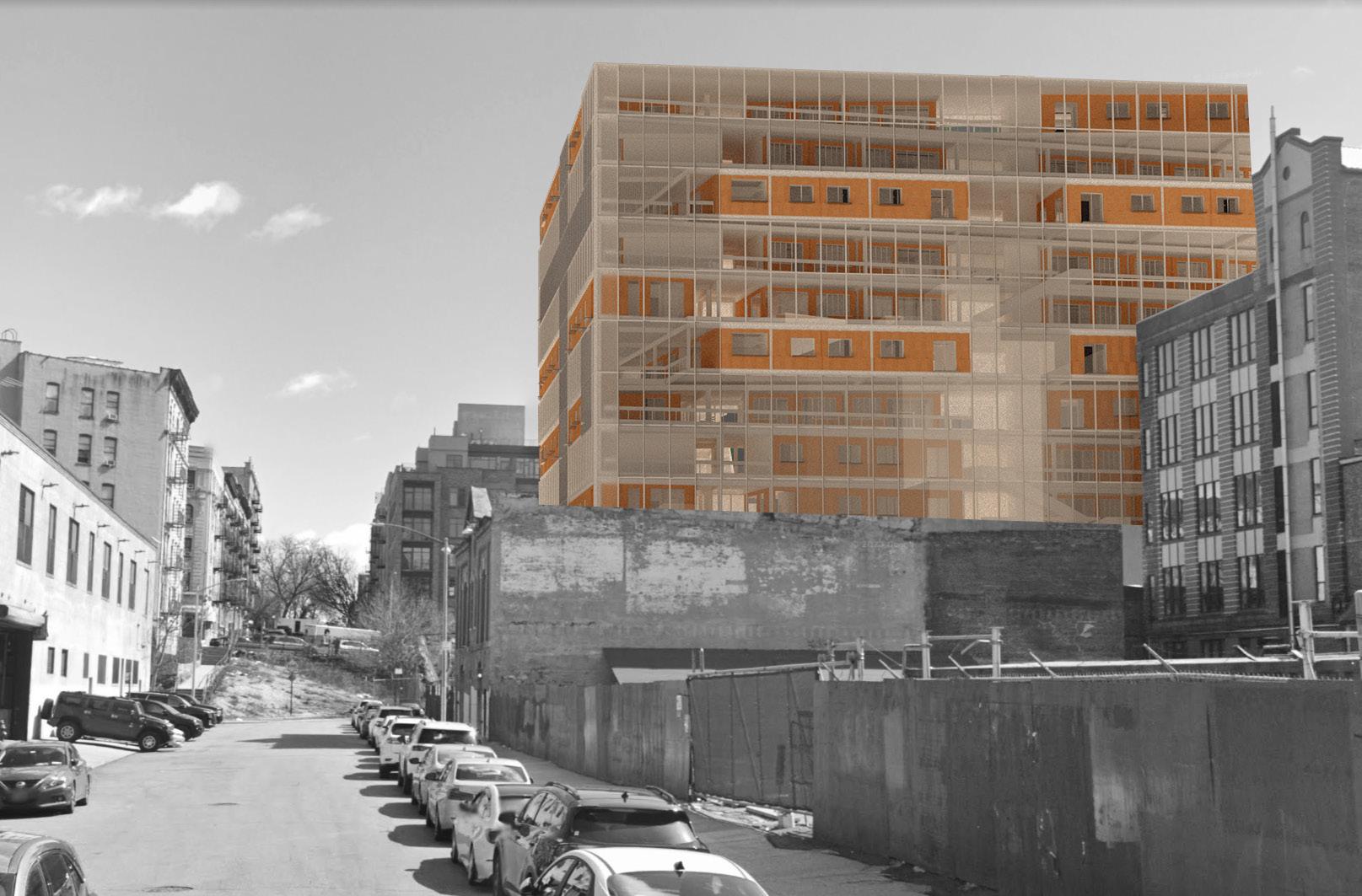
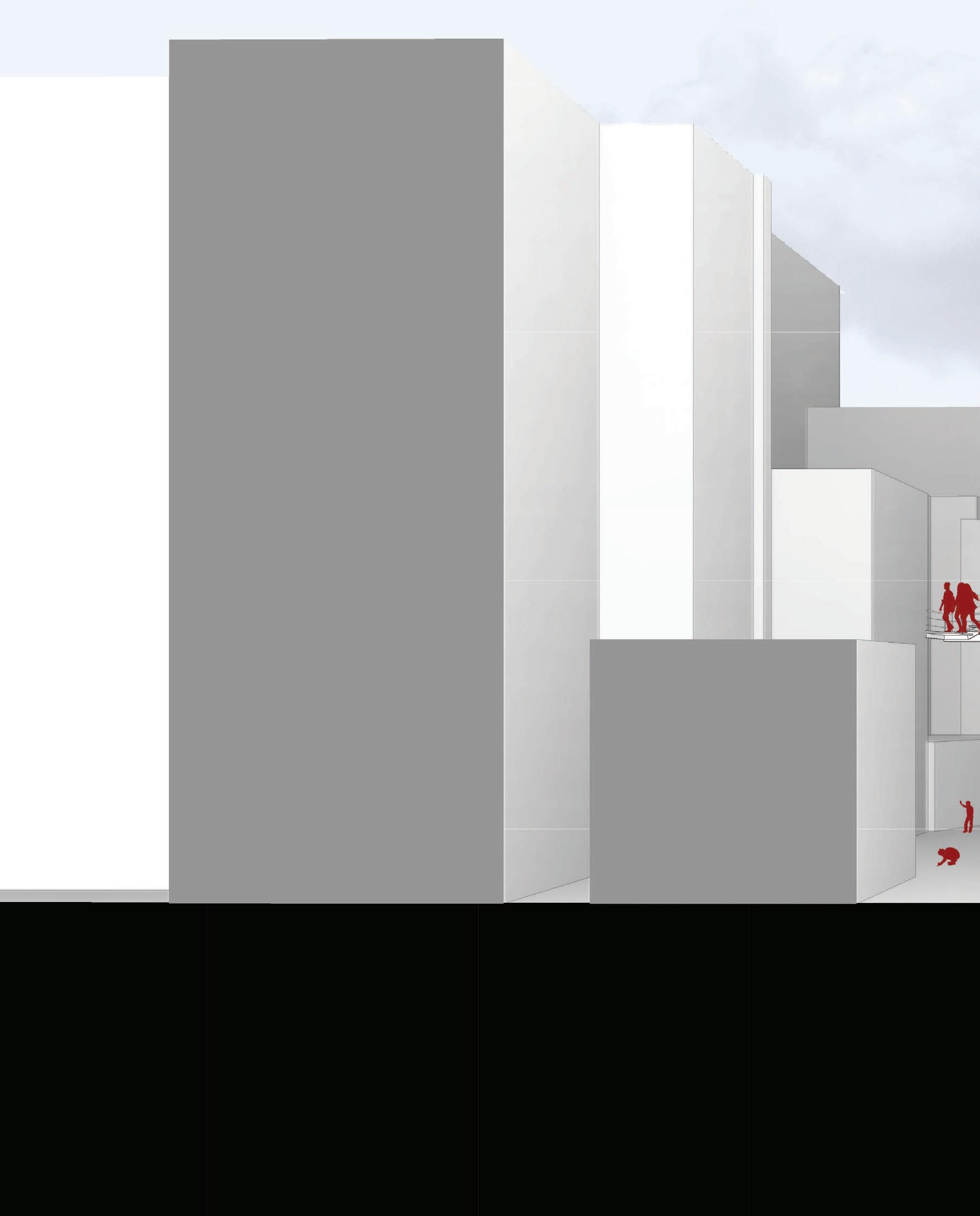
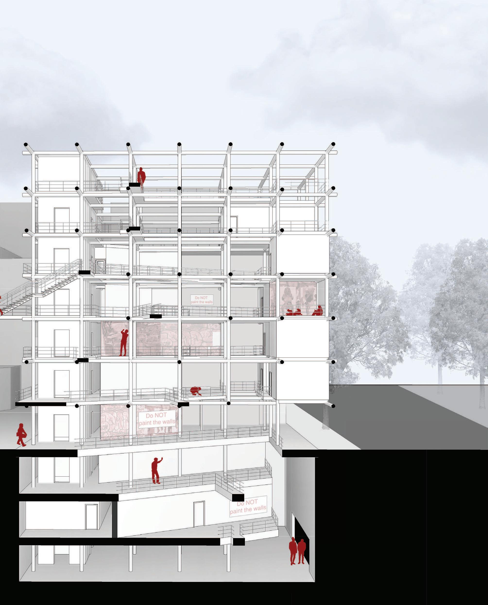
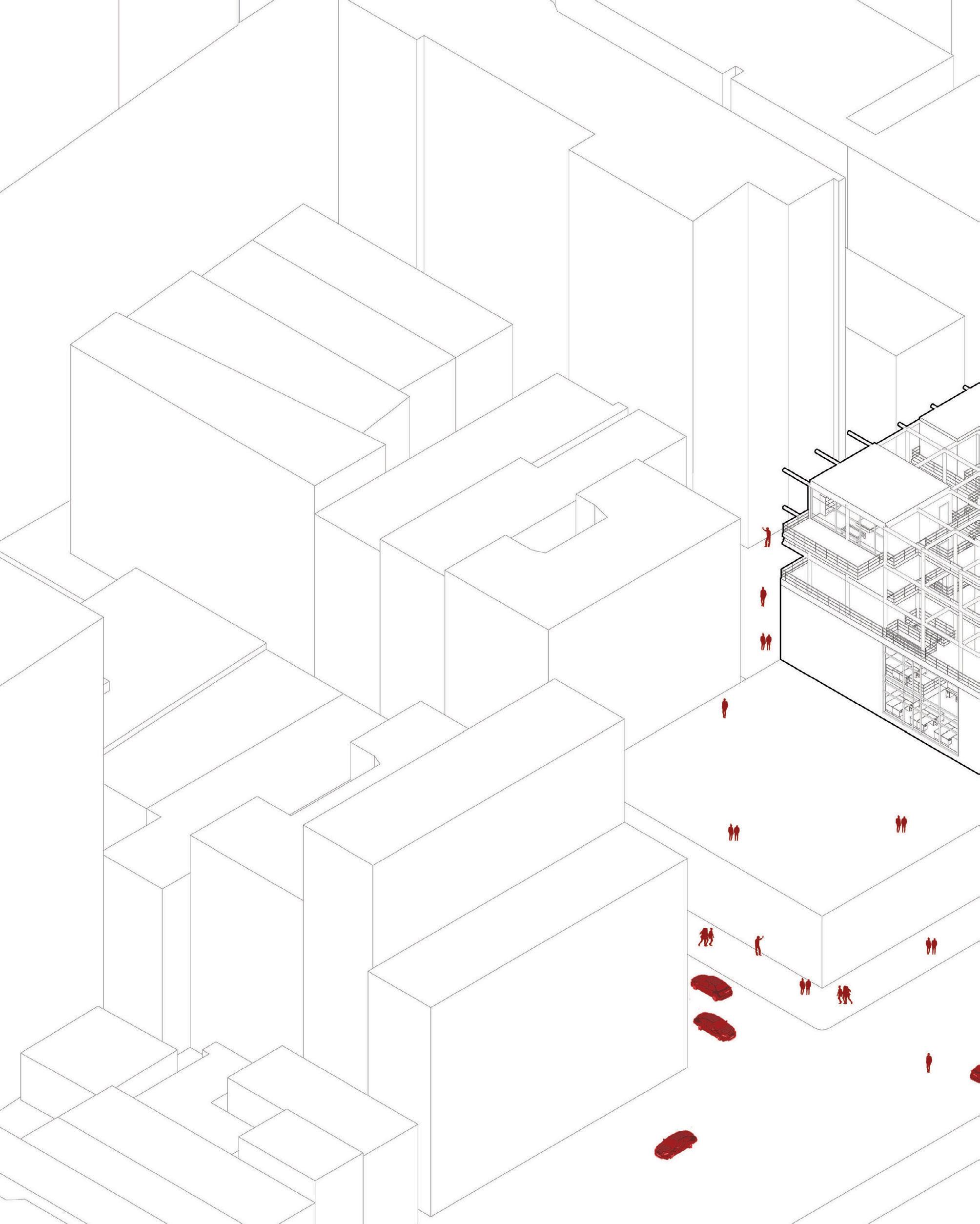
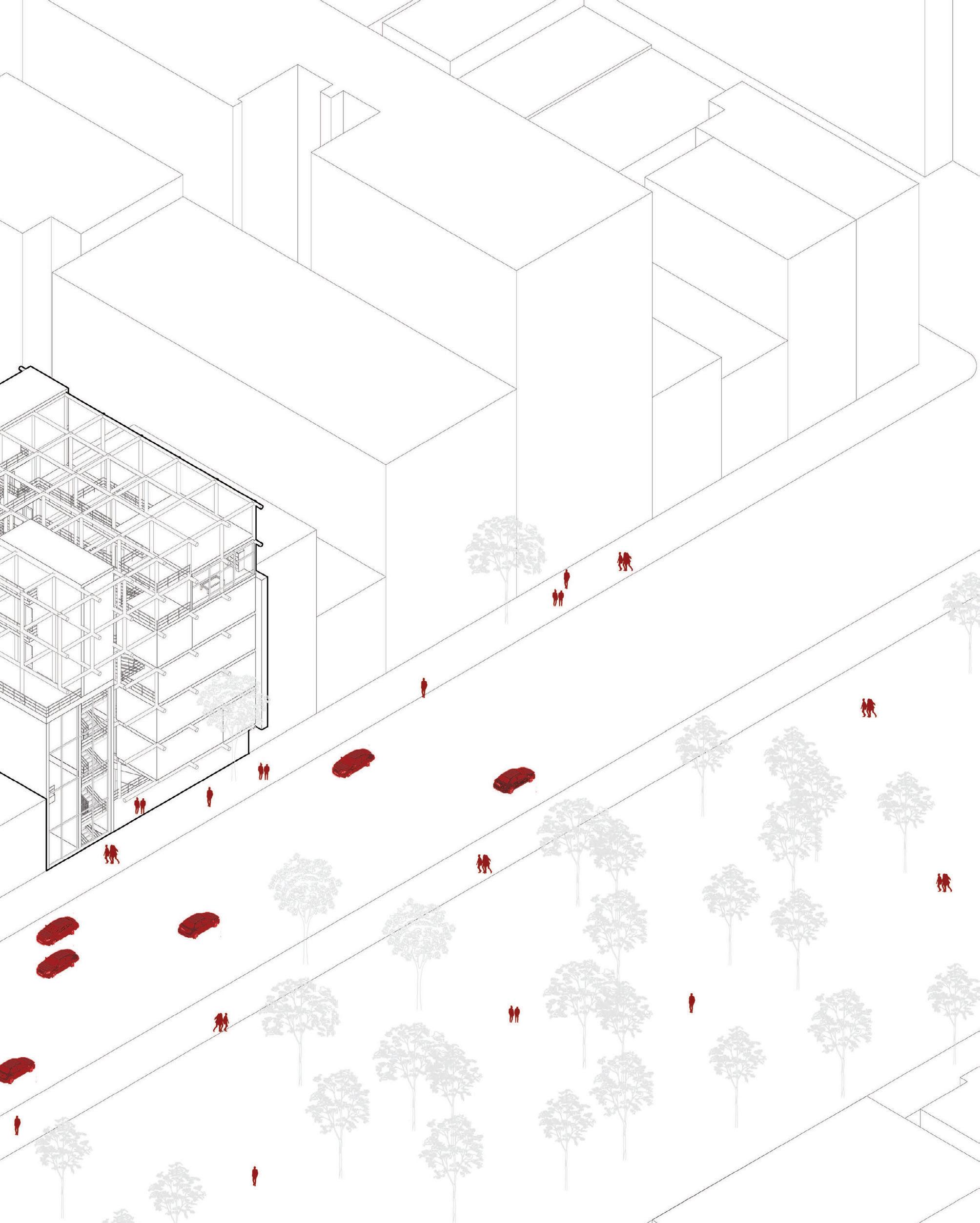
Harlem, New York City

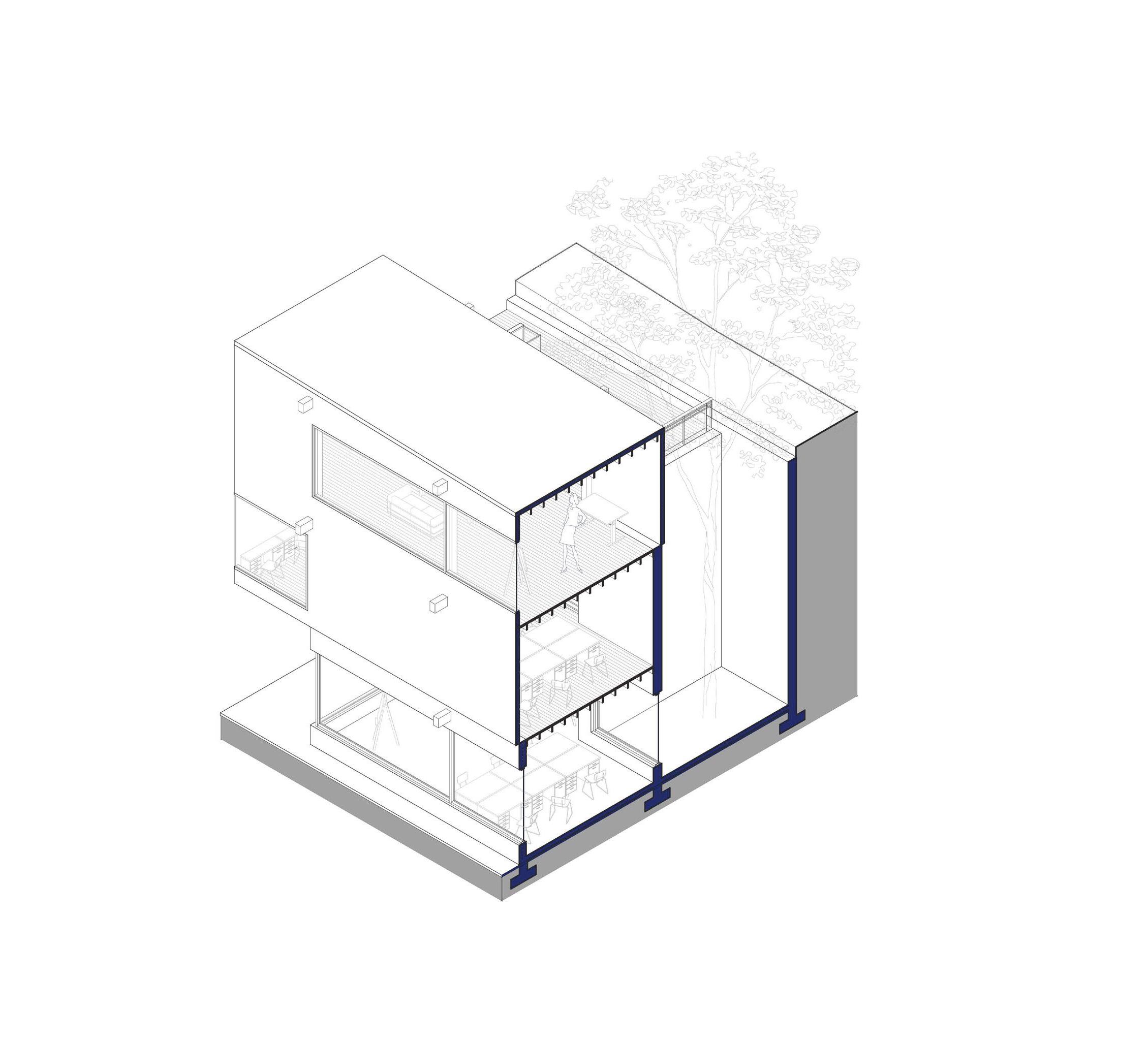
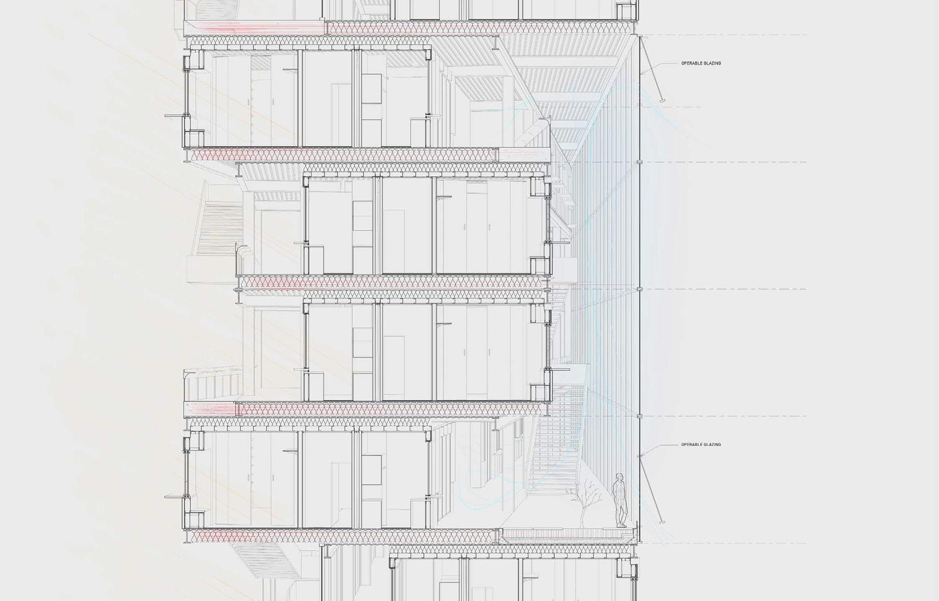
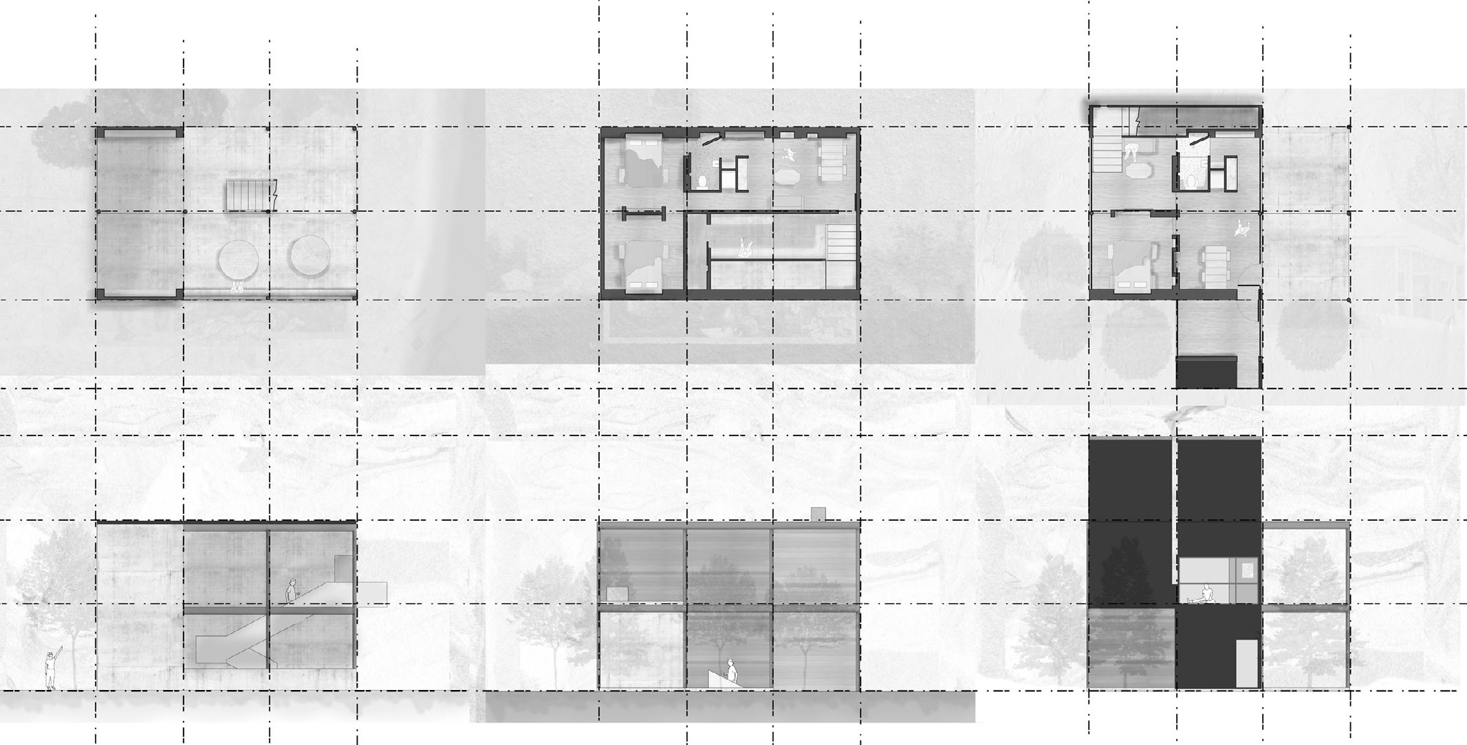
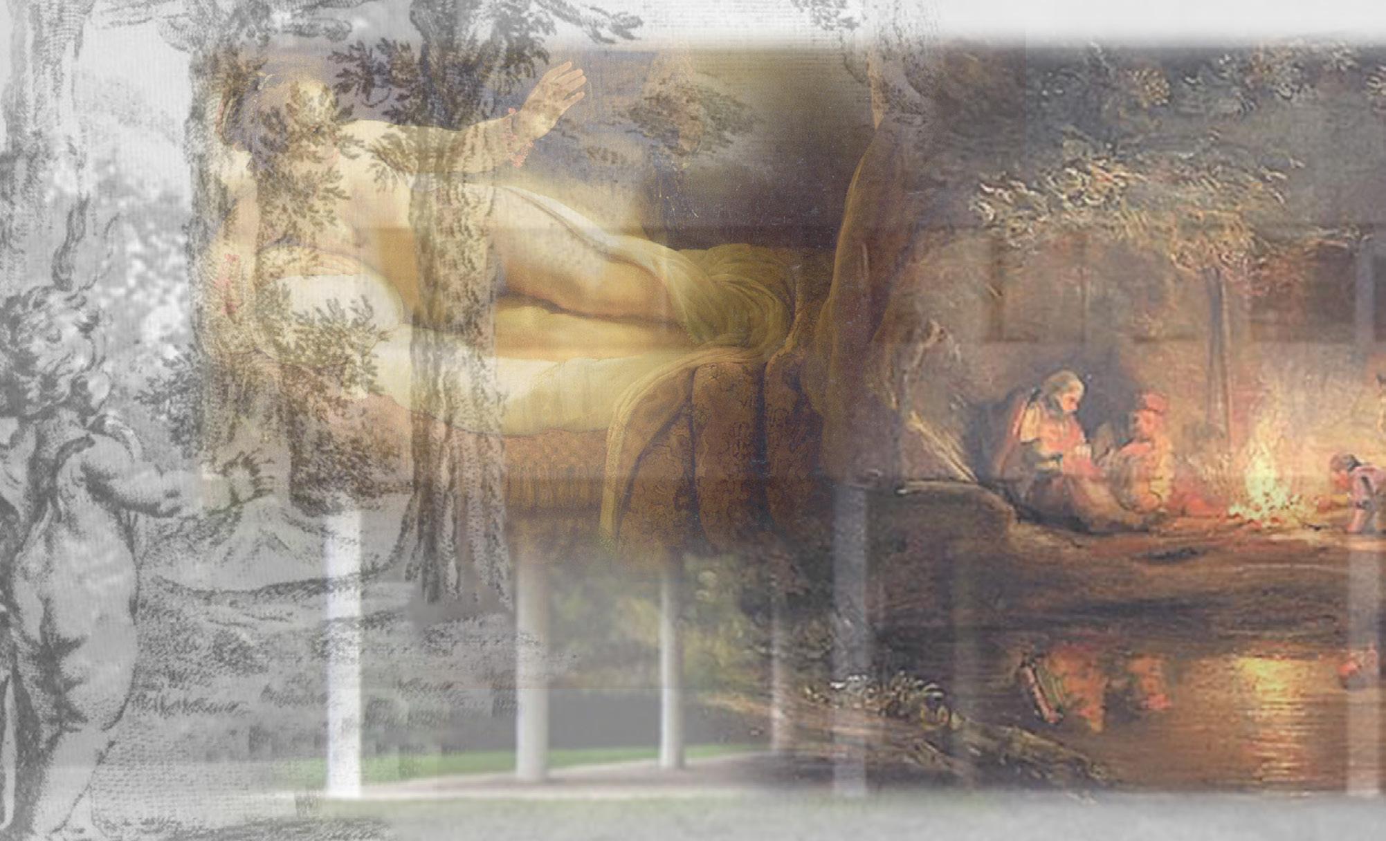
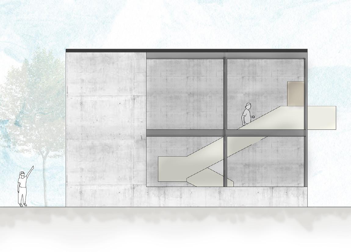
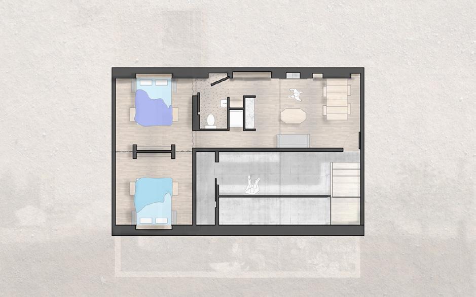
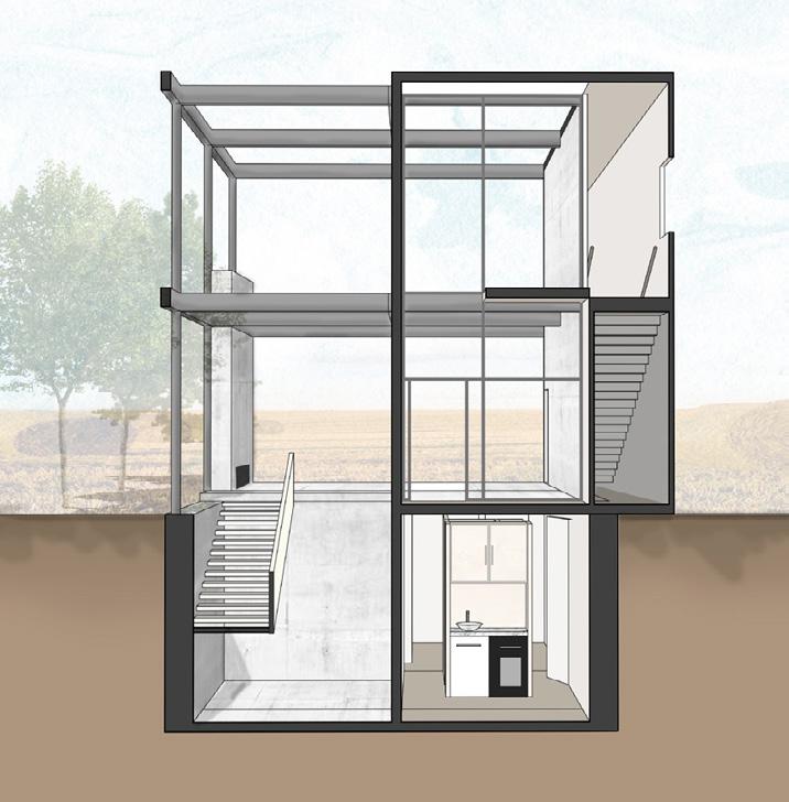
Can we design an apartment complex in a way that feels expansive, open, and connected? Can we bring a sense of spaciousness and community to residents, through architecture?
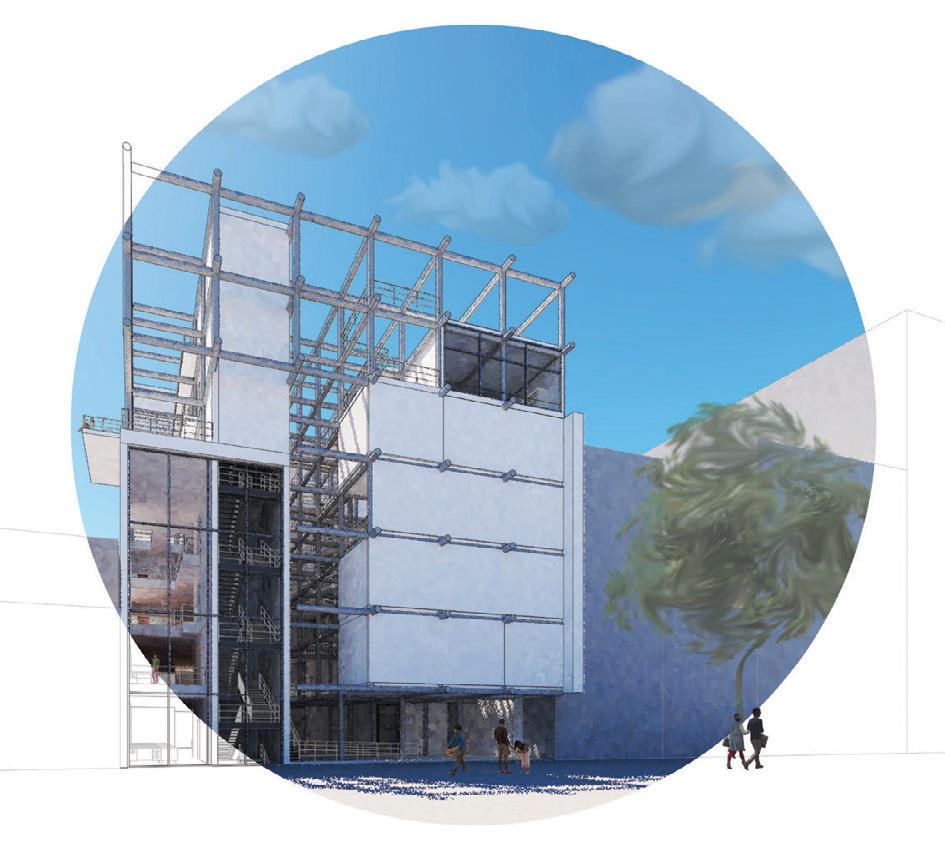
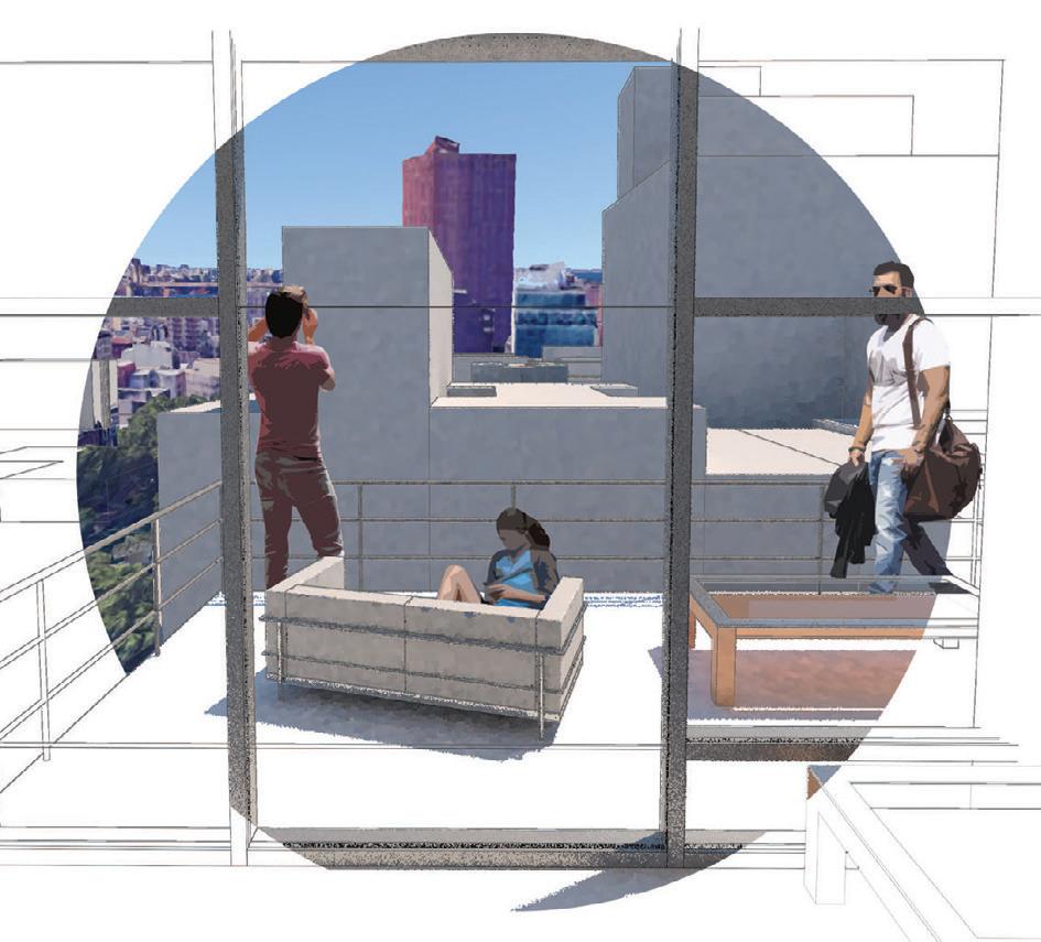
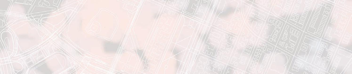
Through the staggering of vierendel trusses containing a single wide corridor of apartment units, summer and winter gardens are created on the north and south sides of the building. These gardens are communal, semi-private “stoops” that connect each unit through a space defined by the community it serves.
The unit plan is designed to “invite” or create a space that entertains the possibility of an informal gathering through the design of a gradient from public to private space, utilizing the “utility” spaces as a buffer zone between the truly private bedroom.
Acknowledging the ebbs and flows of social energy in people, the design of the “porch” allows for user to control the public visibility of the front. Giving the user agency to control their privacy. The idea of exposing the slab within the inside of the unit demarcates where your “home” starts relative to the unit itself because of the contrast. However, relative to the entire building, the slab becomes a similar language with circulation space or “public space”. This design of bringing the perceived public space into the unit is also a subtle gesture towards the resident that the entire building is apart of the home experience by pulling the resident to the semi-outdoor “stoop”.
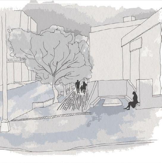
Harlem, New York City, New York
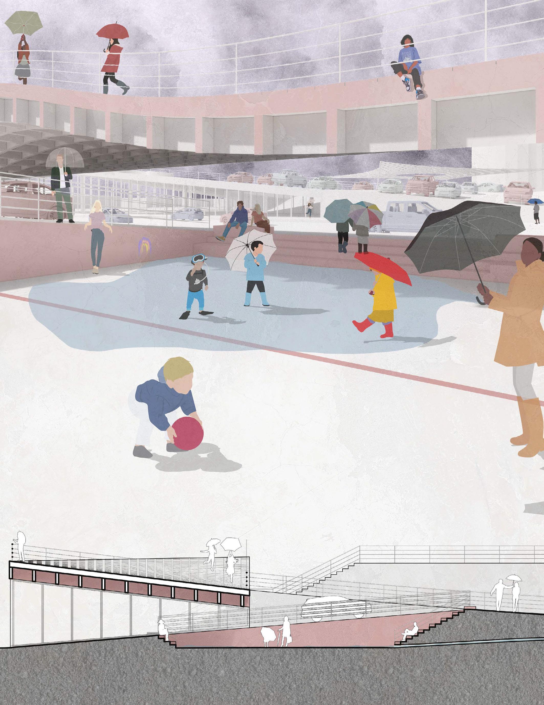
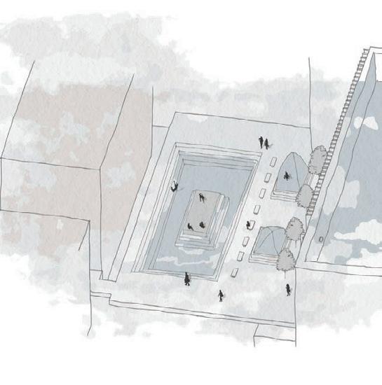
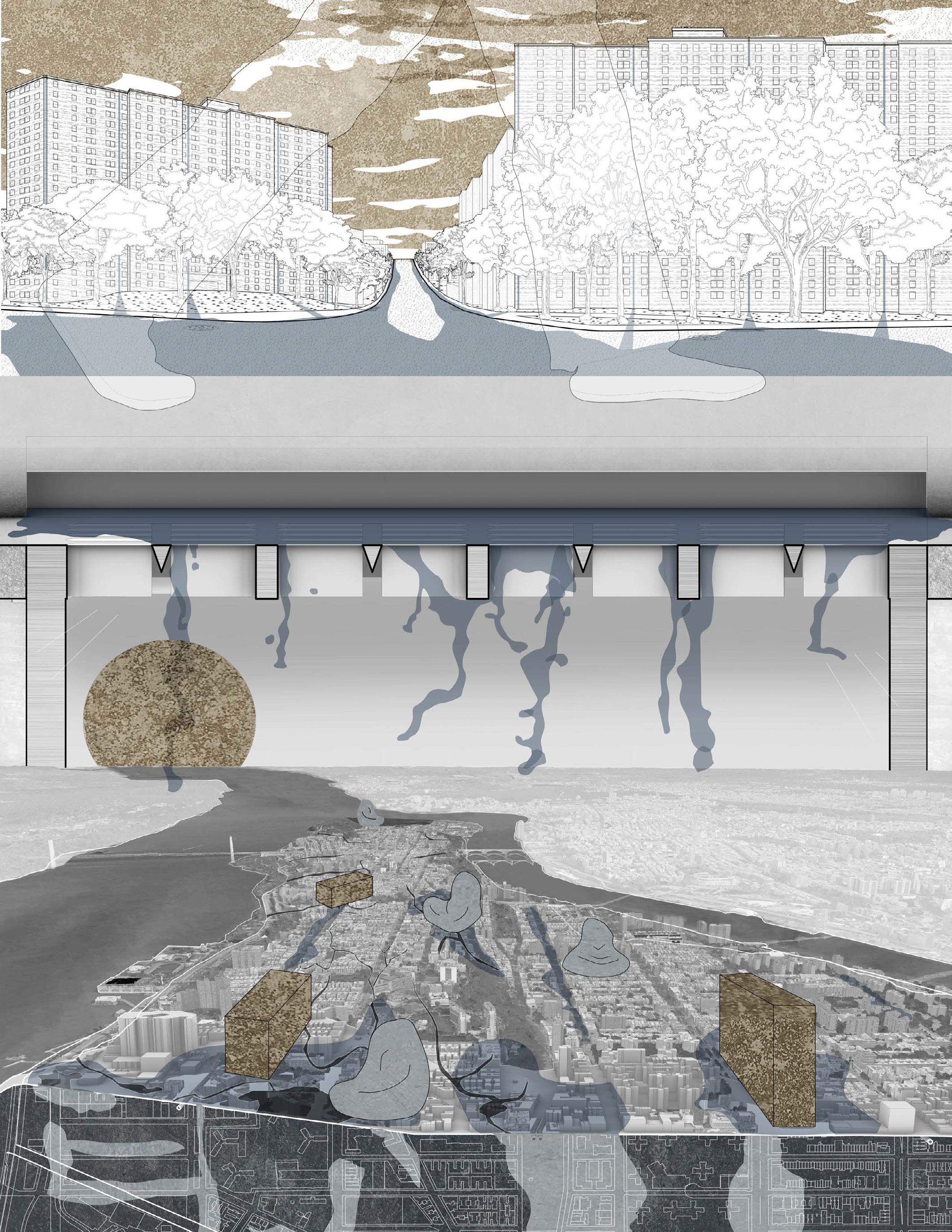
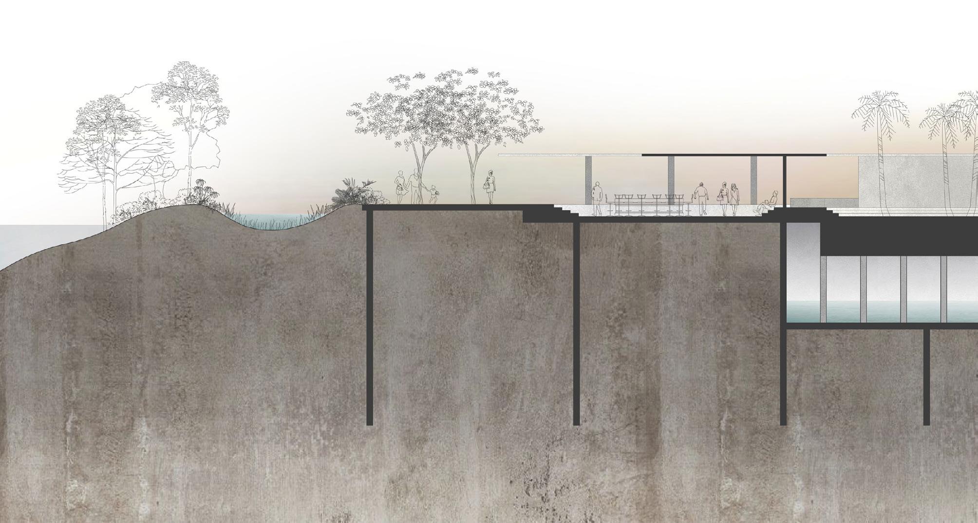
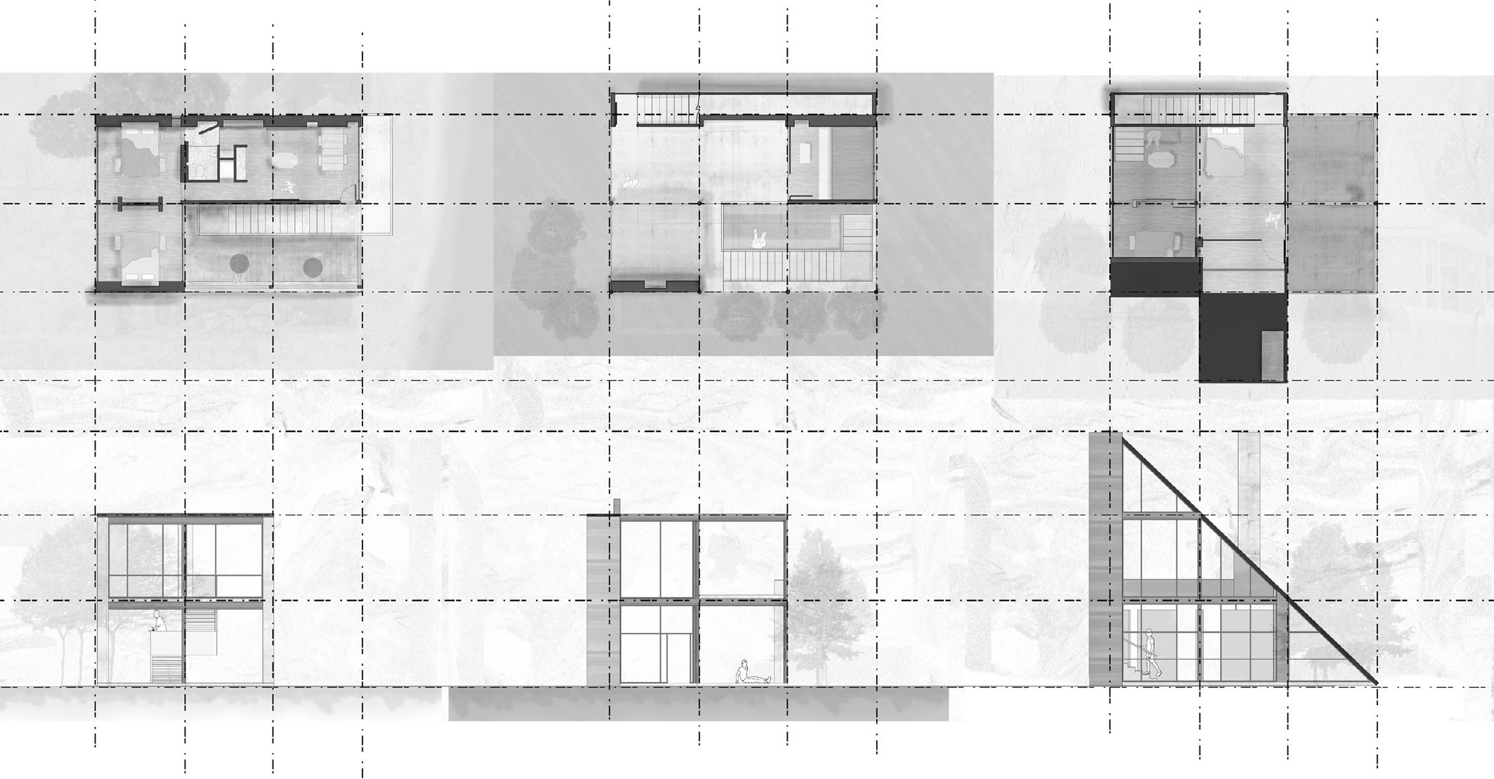
Nicknamed the Concrete Jungle, New York City is a sprawling network of nonporous surfaces that requires an even more complex network of drainage systems to account for the surface runoff produced.
While rising sea levels have drawn the attention of the public in recent years, the impact of climate change on other infrastructure has been largely ignored. As the climate continues to warm, New York City is receiving 10-20% more annual precipitation than 100 years ago, and severe storm precipitation has increased by 70%. The city’s century old infrastructure cannot accommodate the increase in runoff - CSOs dump raw sewage into the nearest river during every storm while many parts of the city experience flood damage multiple times a year.
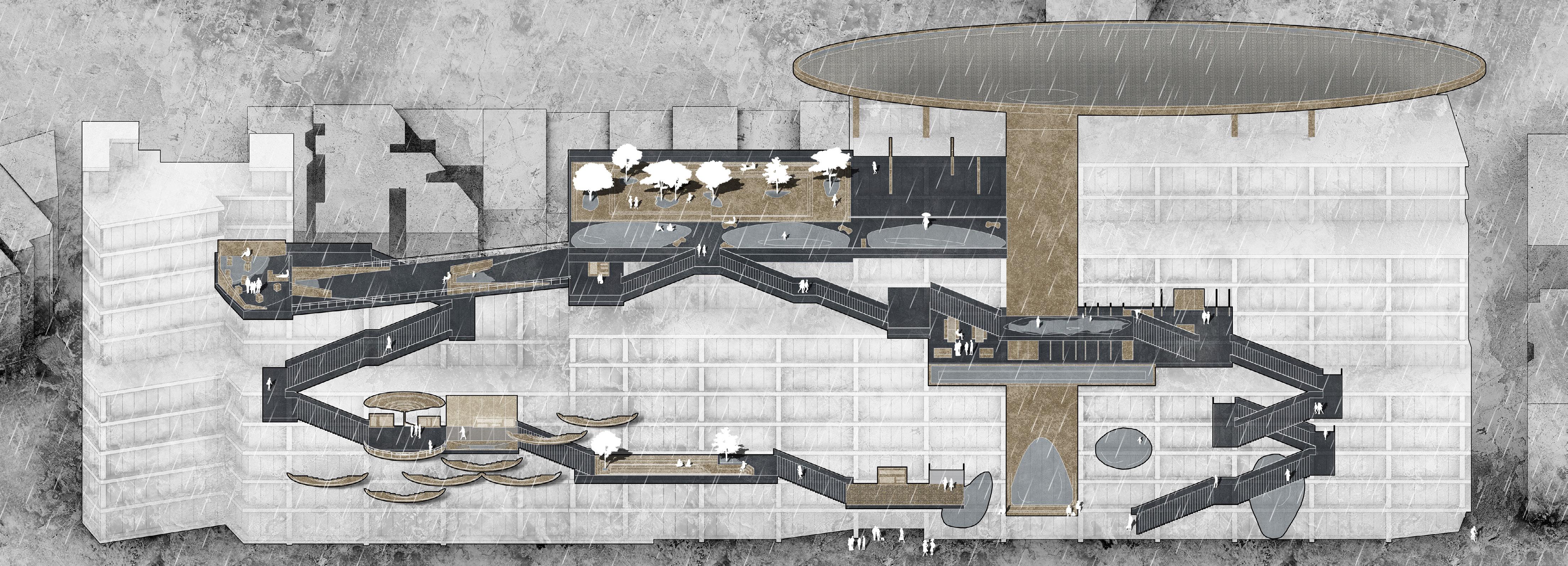
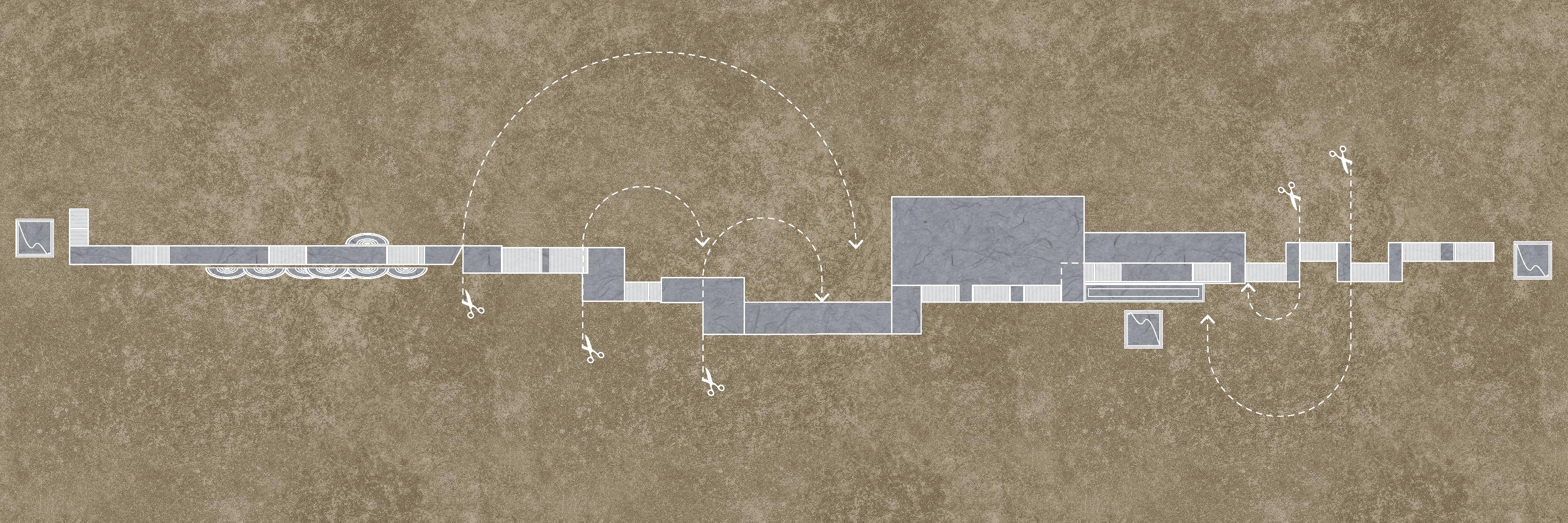
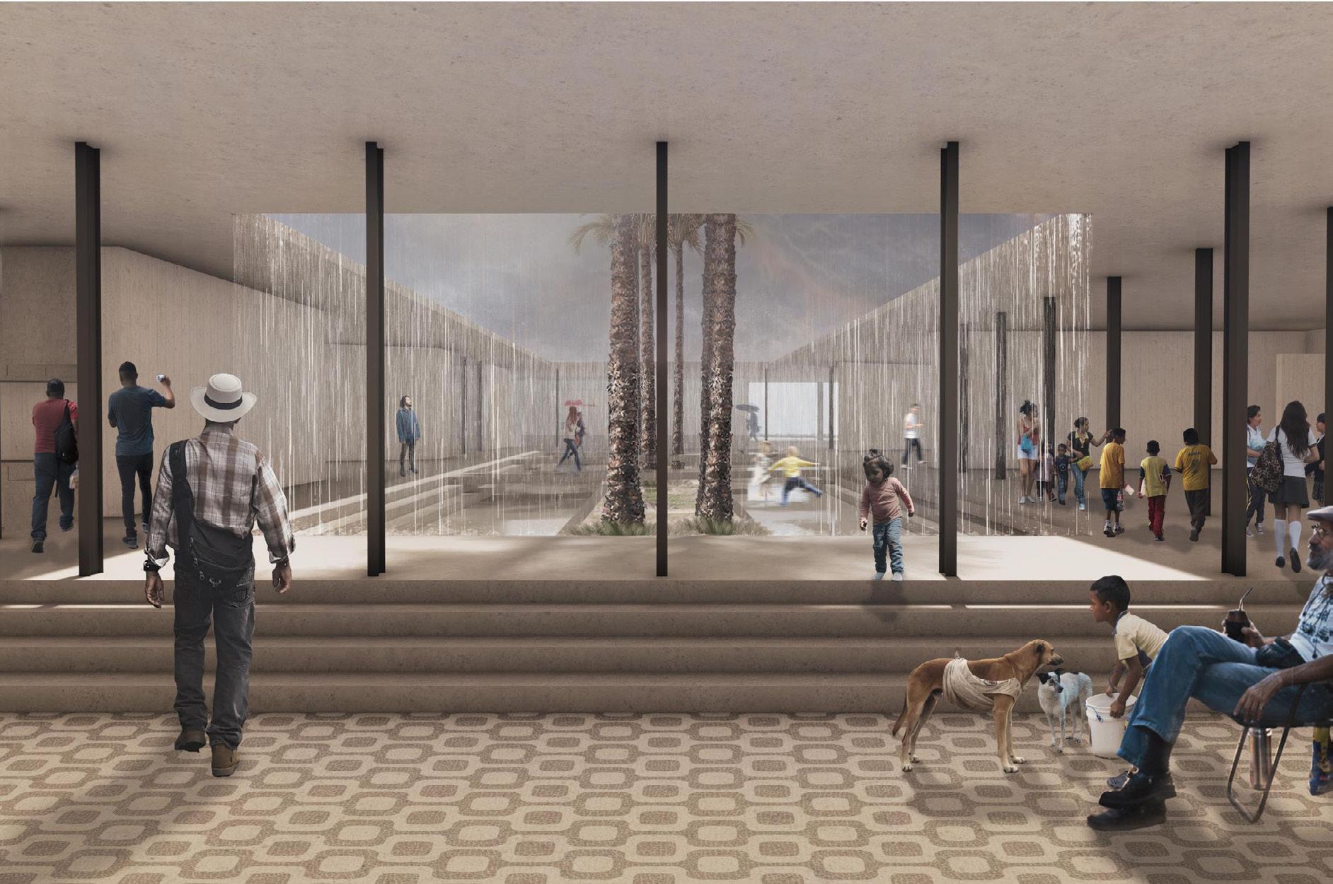
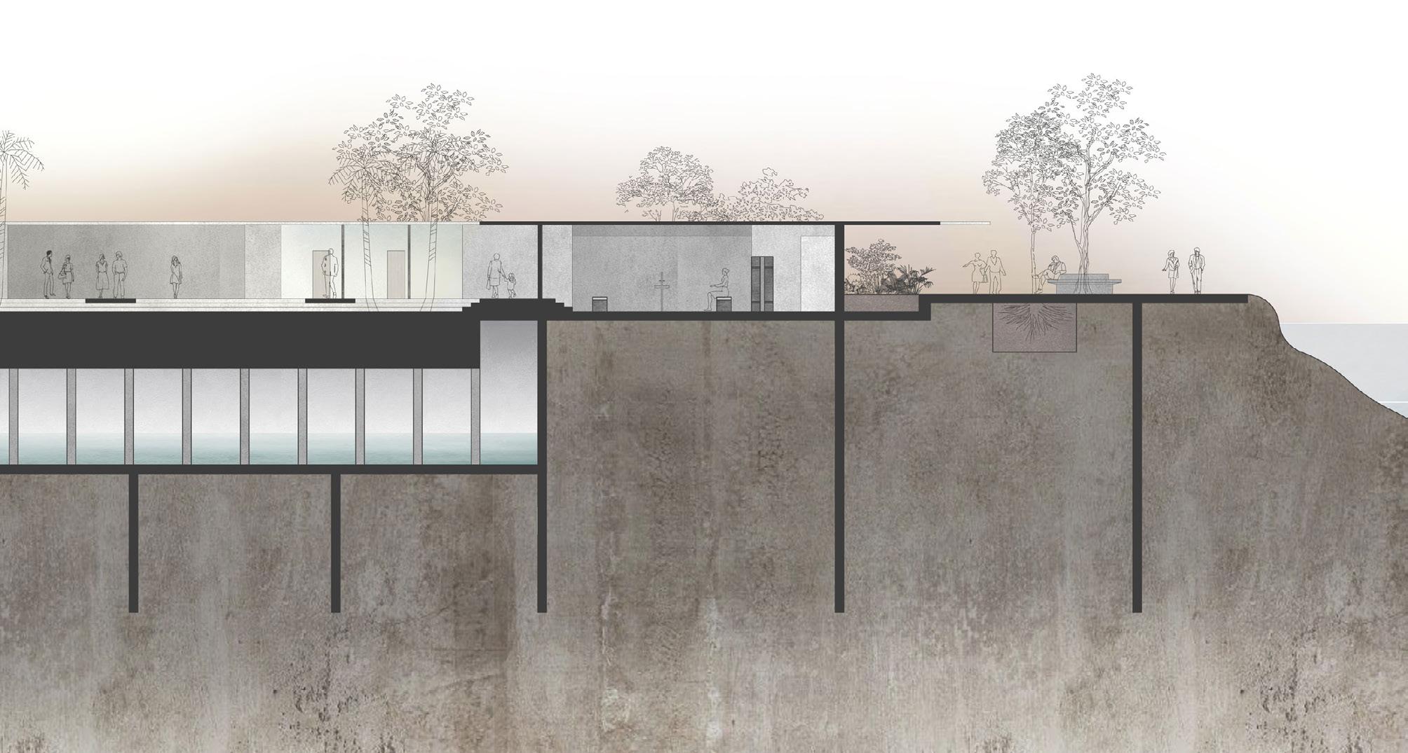
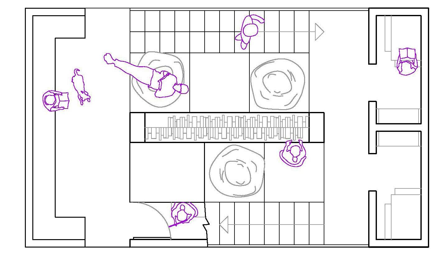
Waterscape is centered around the concept of the water square - public architecture designed to flood during storms and slow the release of runoff into water management systems. The project utilizes the existing Taystee lab, a new construction struggling to find tenants, as a platform for education regarding New York City’s runoff problems. The front bay of the structure has been reworked into a pathway that showcases various systems of temporary water retention in a trade show format. The design of the path allows for each of the installations to function as they would in actual application while viewers interact with them, thus demonstrating how these strategies could be used to benefit both current and future projects.
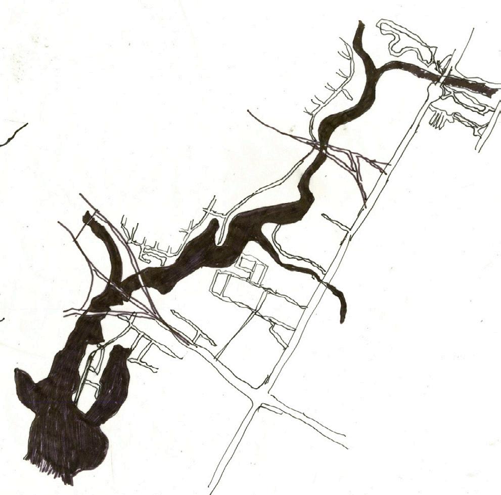

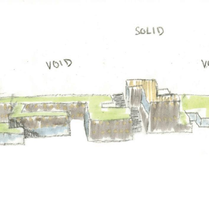
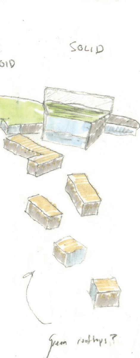
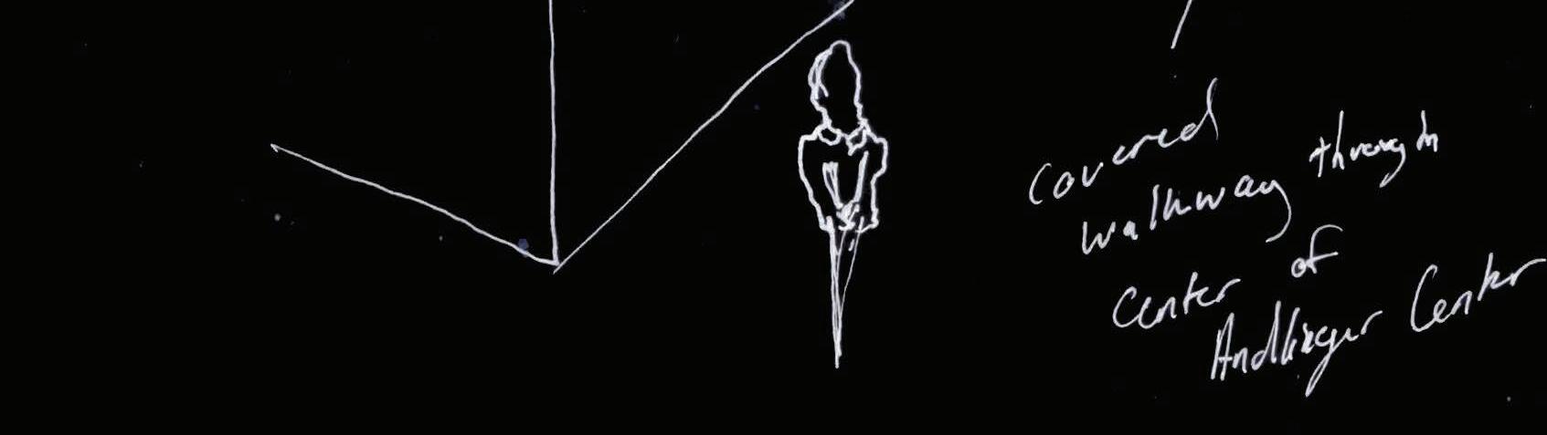
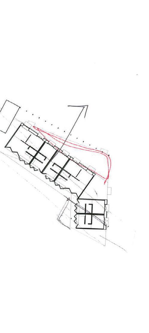
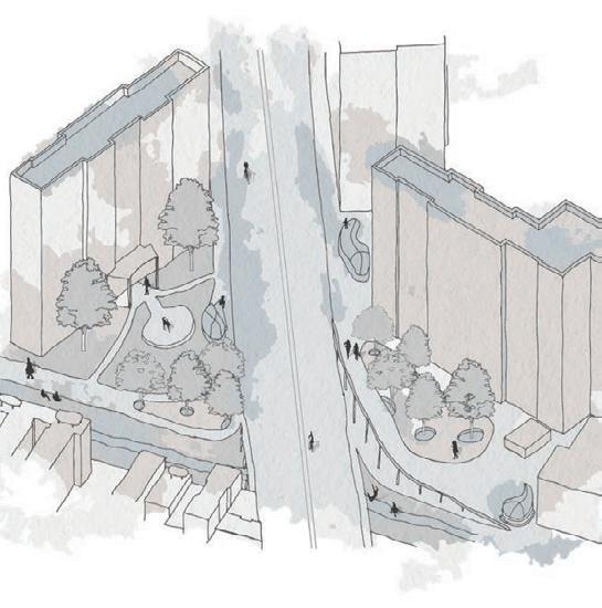
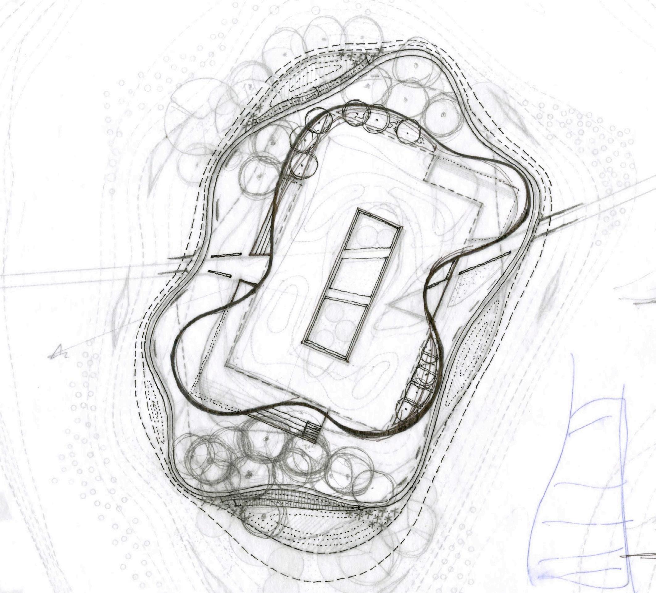
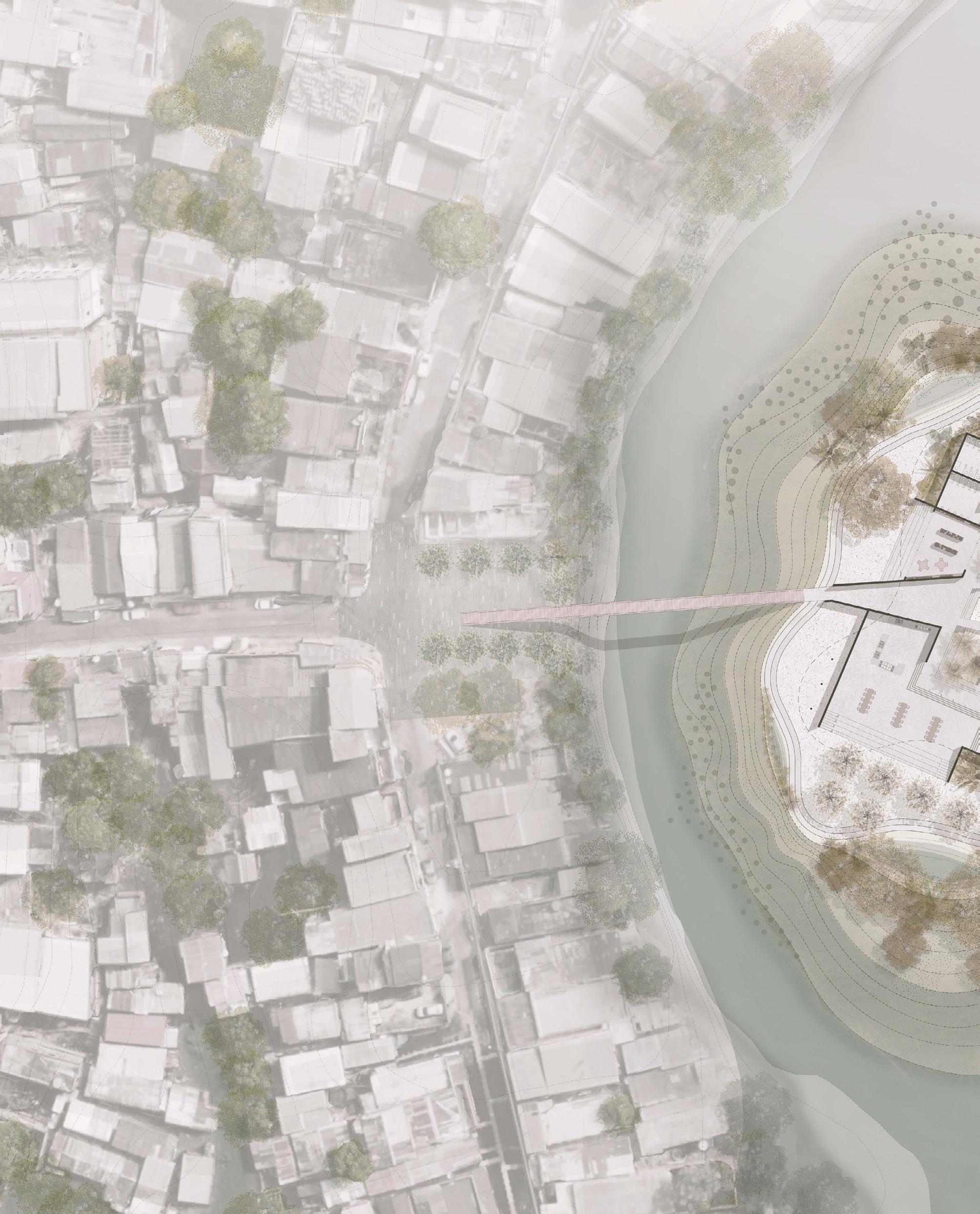
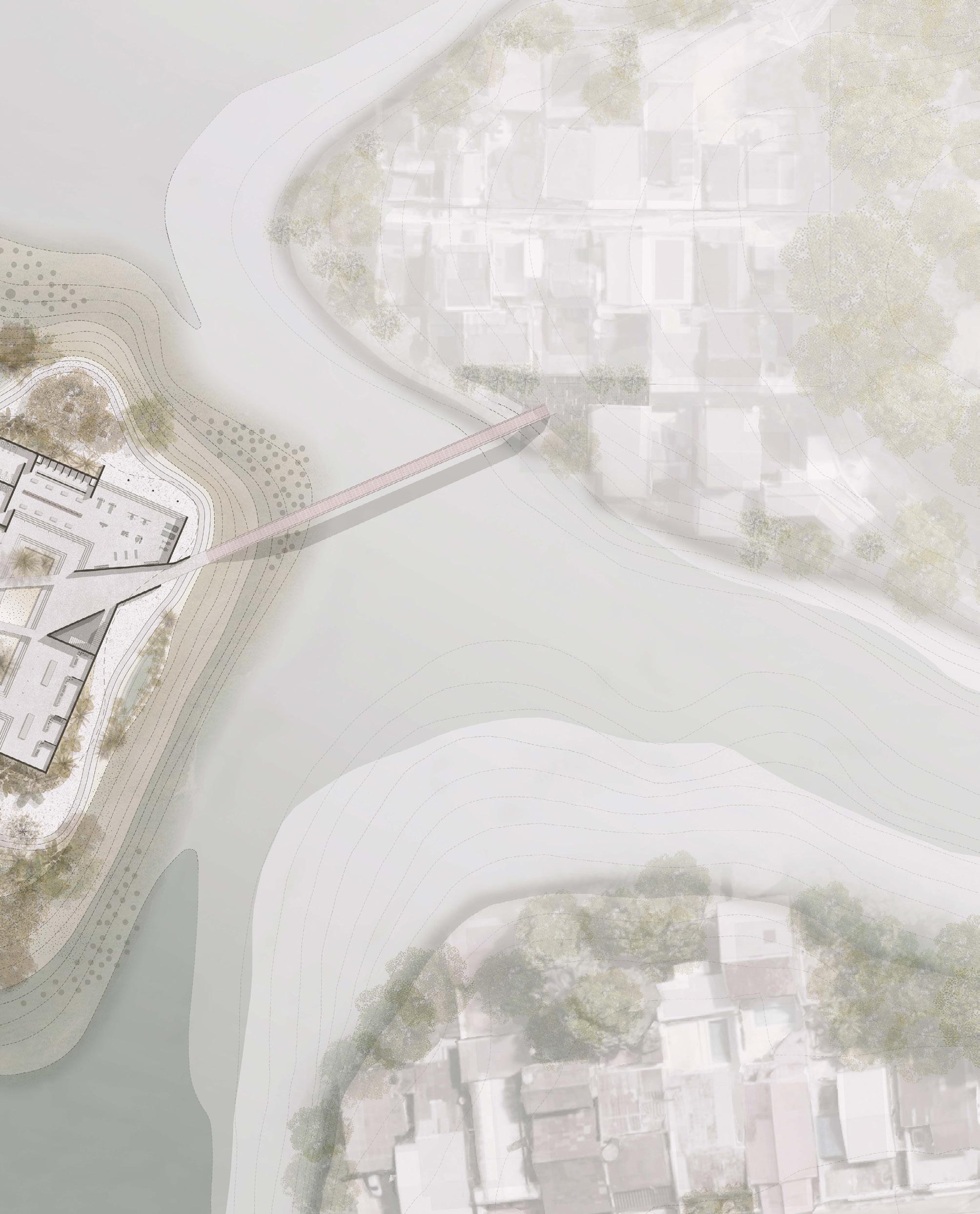
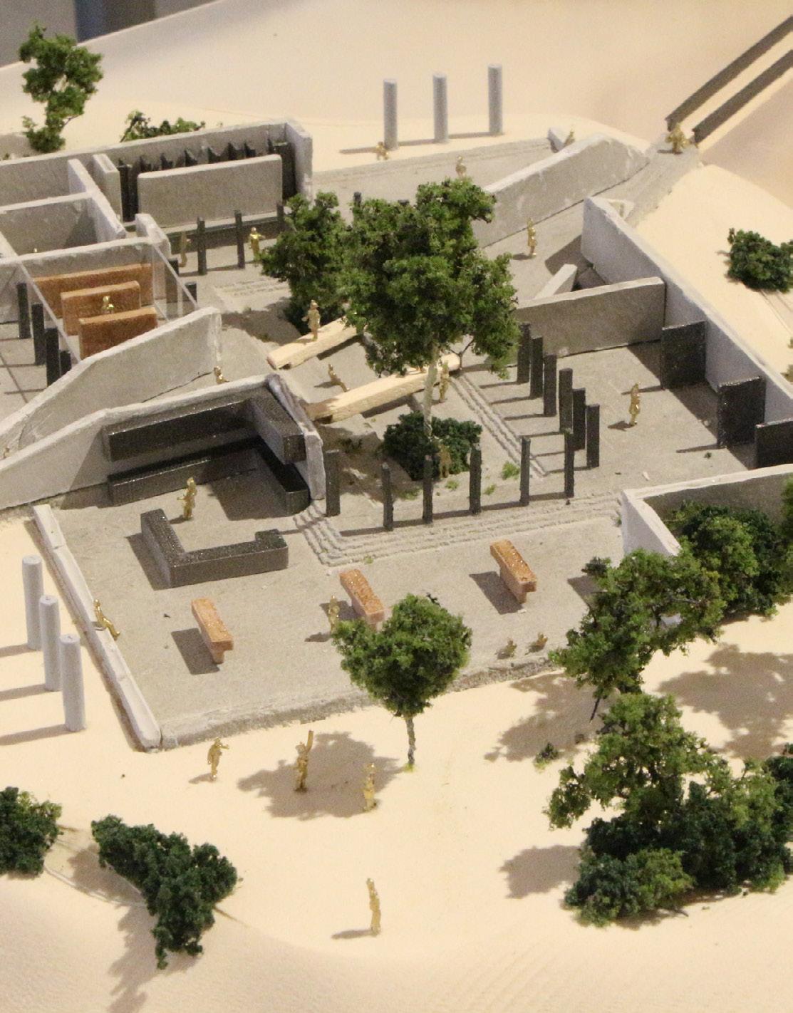
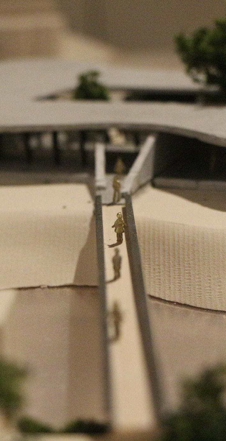
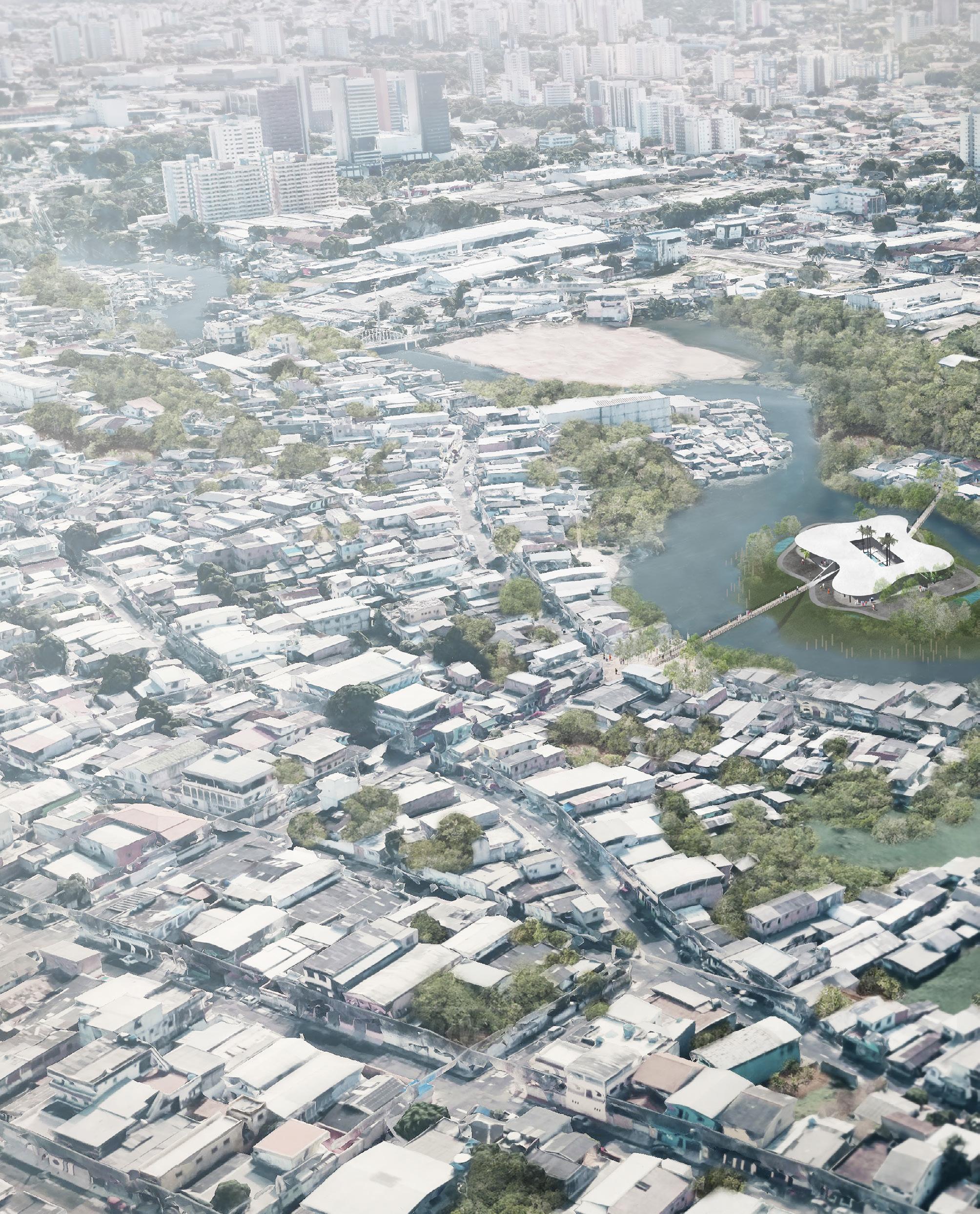
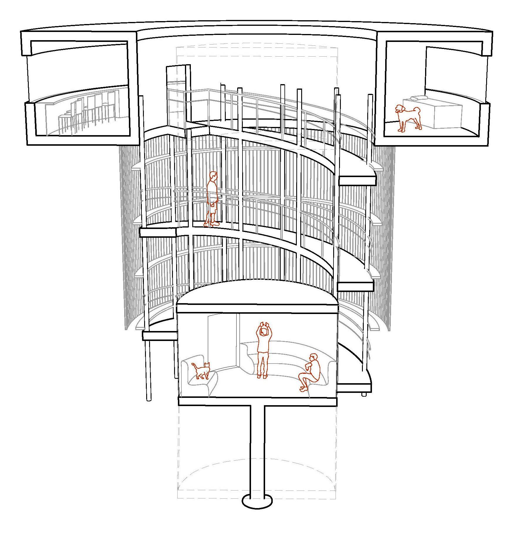
By the construction of an artificial island that serves as new community center, the project links the western edge of the stream to the main bus terminal in the city. In doing so, the project creates a “new commons” on new ground.
The artificial island is created through strategic placing of the building’s foundations and the leftover dredging materials from the city. The shape of the island will change over time, as the water erodes and deposits soil around the building’s foundation.
Instead of being a linear connection, the connective island itself is the combination of architecture and landscape. The roof of the architecture, the courtyard system, and the landscape of the island work together to collect and filter surface runoff that is collected in a cistern for later use by the building. The building houses basic amenities such as a kitchen, bathrooms, a gym, and gathering spaces for casual meetings or an informal market.

Connective Island
Manaus: Re-inscribing the River in the City
Felipe Correa and Alex Yuen

Partner: Yu Chen - landscape Architect University of Virginia - Fall 2019

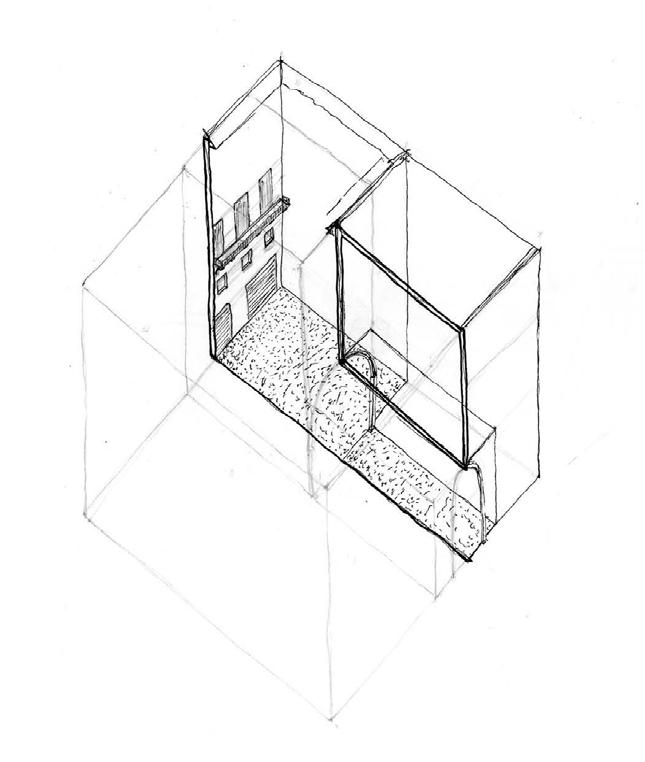
Bowery District, Manhattan, New York
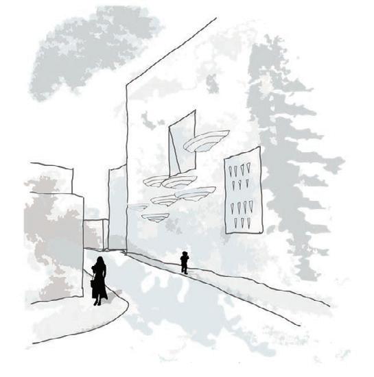
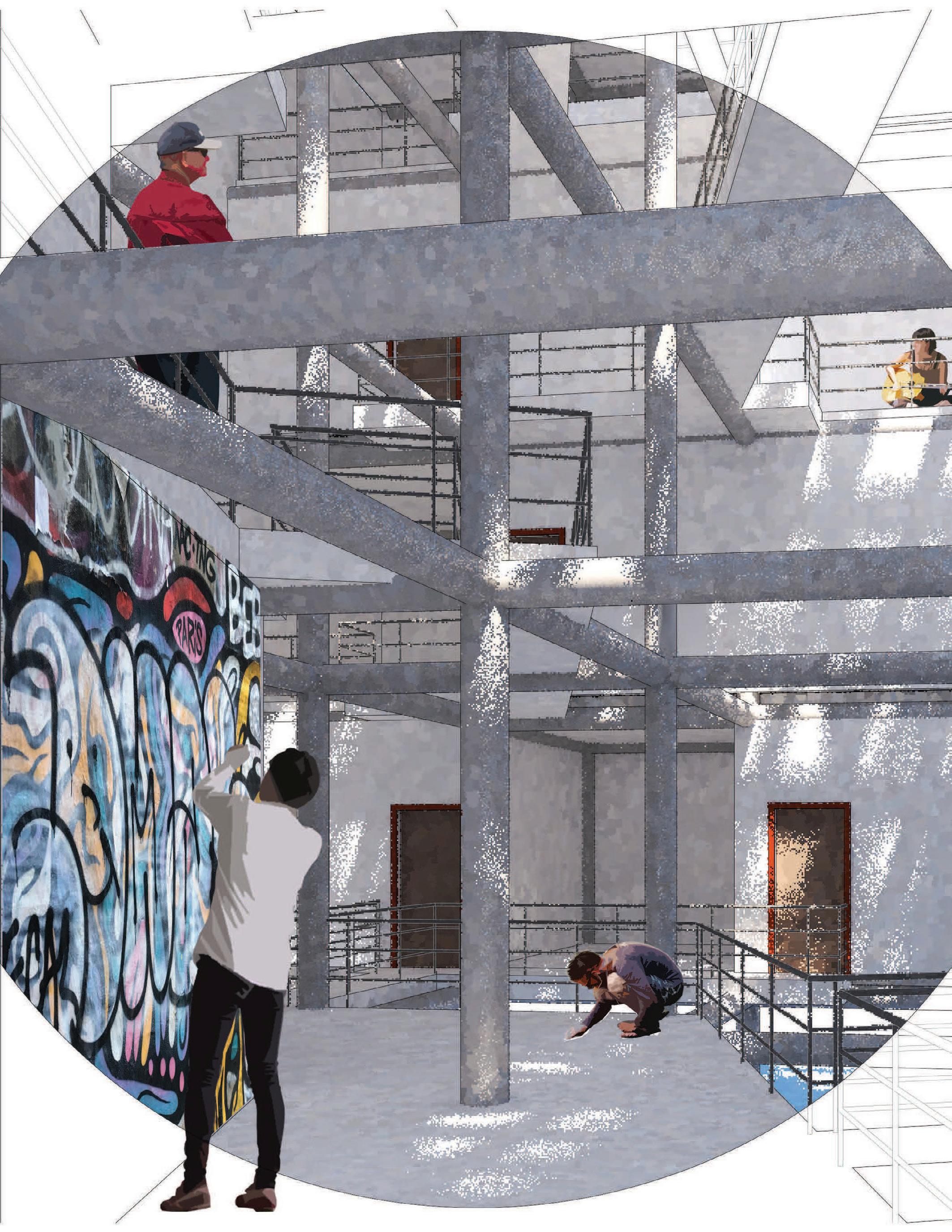
Freeman’s Alley is a dead end off of Rivington Street full of vibrant street art ranging from tags to prints to Banksy recreations. A repetitive, eye catching message sponsored by the local art council among the chaos reads “#SaveFreeman’sAlley”. A response to this message, written by hand, reads “Hey ‘Art Council’ how about some actual art instead of a hashtag”.
This powerful interaction speaks volumes towards what this area needs.
The Lower East Side has historically been a relatively impoverished neighborhood, but times are changing. This is a critical time for the struggling region, as residents strive to fight off gentrification while still improving quality of life in the area. When attempting to revitalize an urban community, it is imperative to find order in disorder, strengthening natural organization (or disorganization) and trends, such as the complex system that is Freeman’s Alley.
This is the objective of “Some Actual Art”.


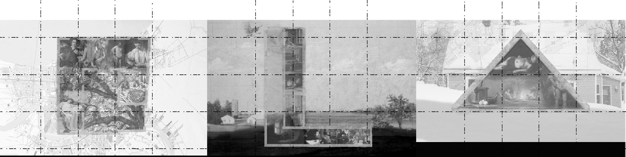
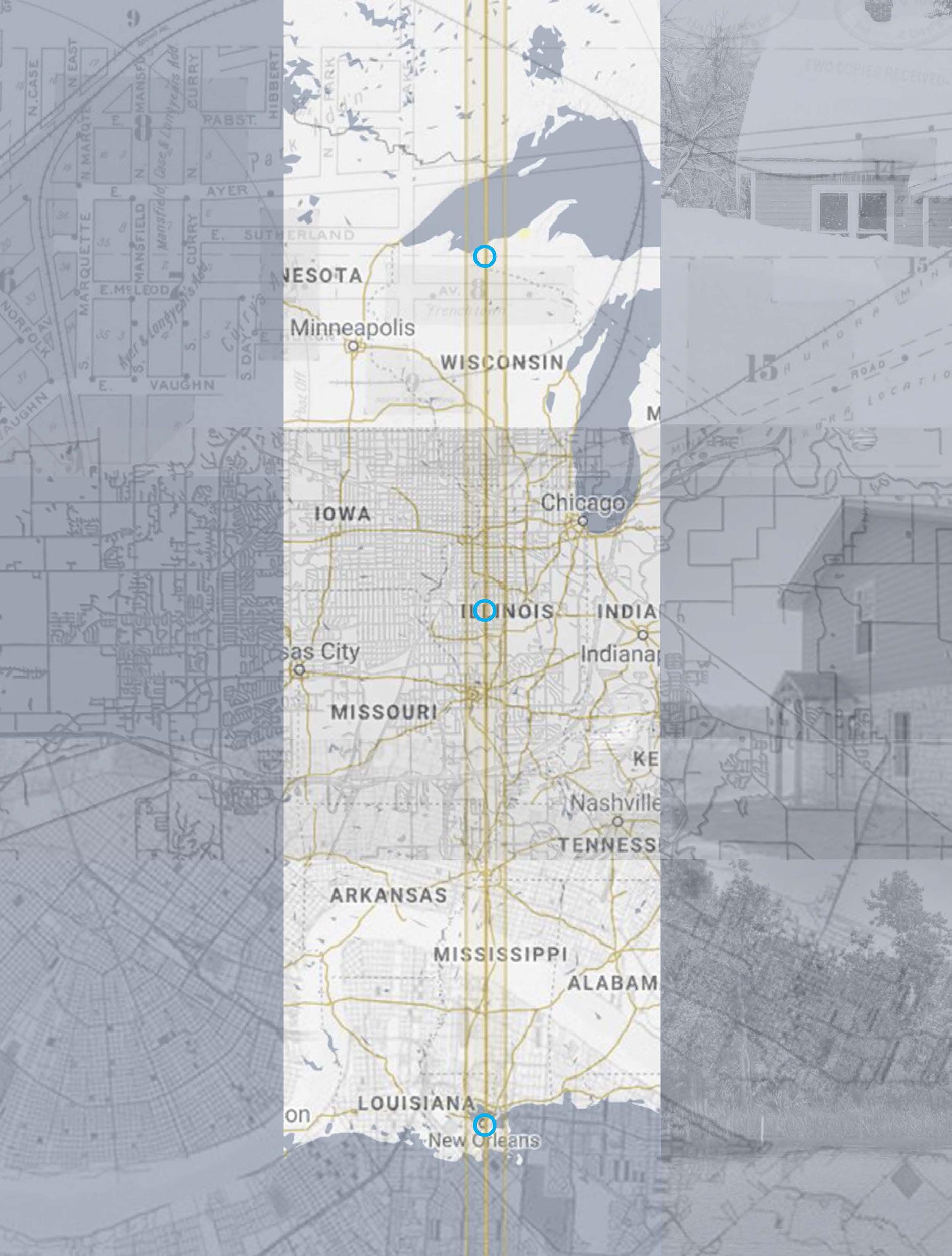
Ironwood, Michigan
West of Springfield, Illinois
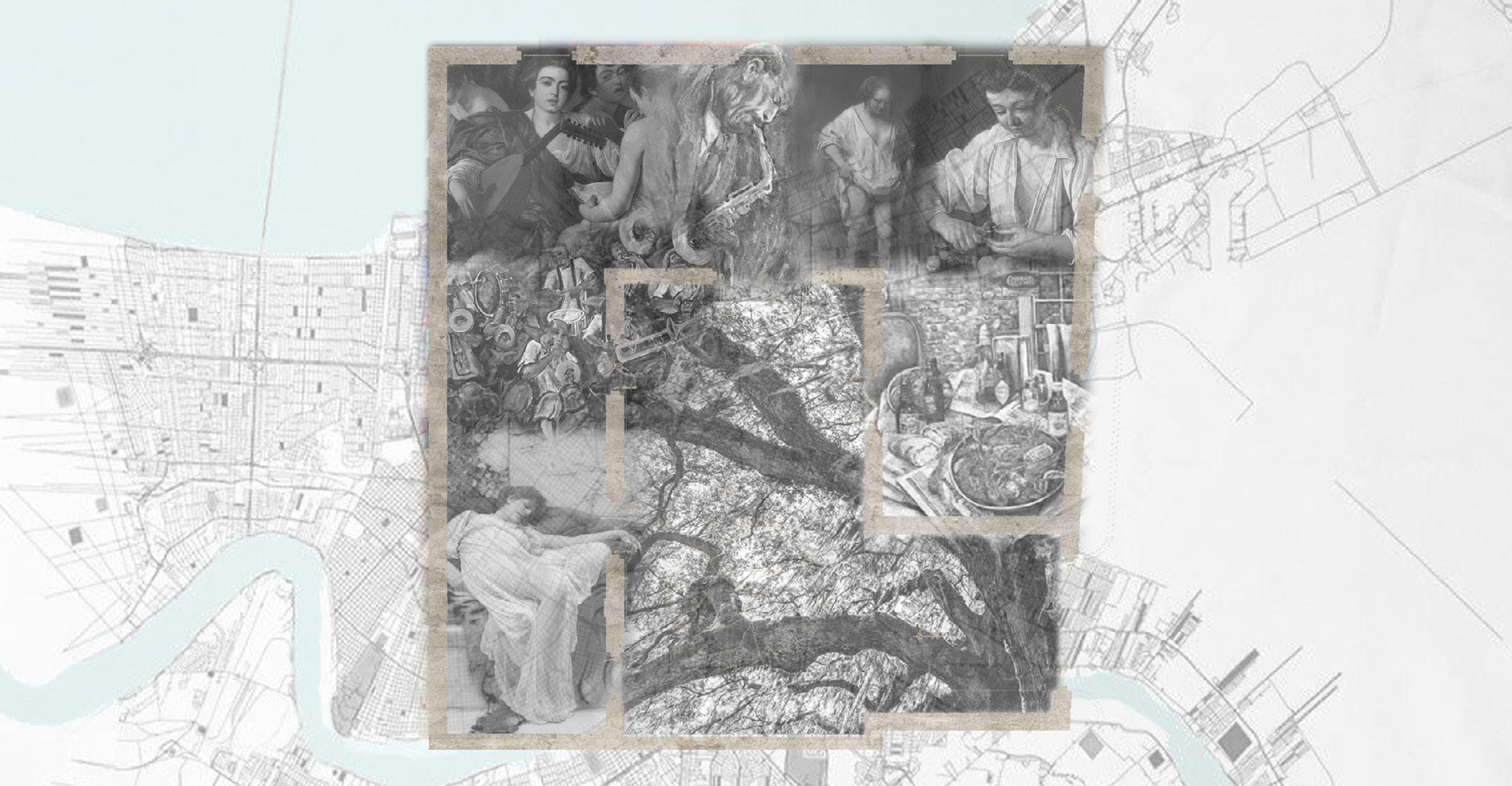
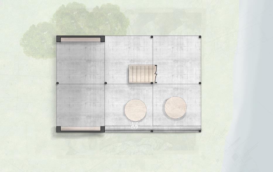
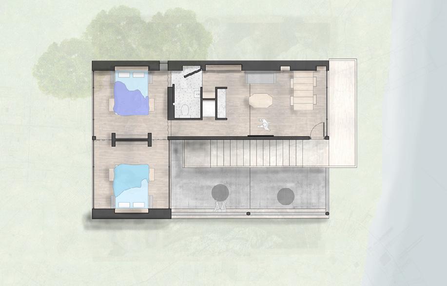
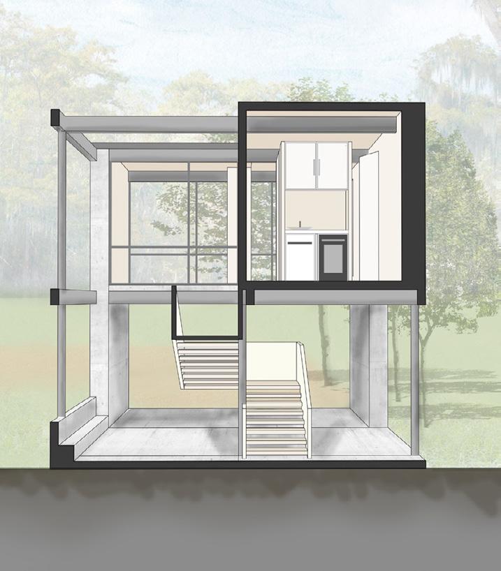
New Orleans, Louisiana
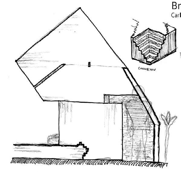
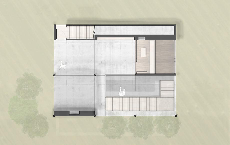
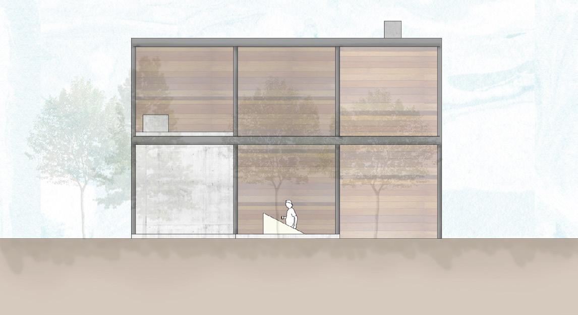
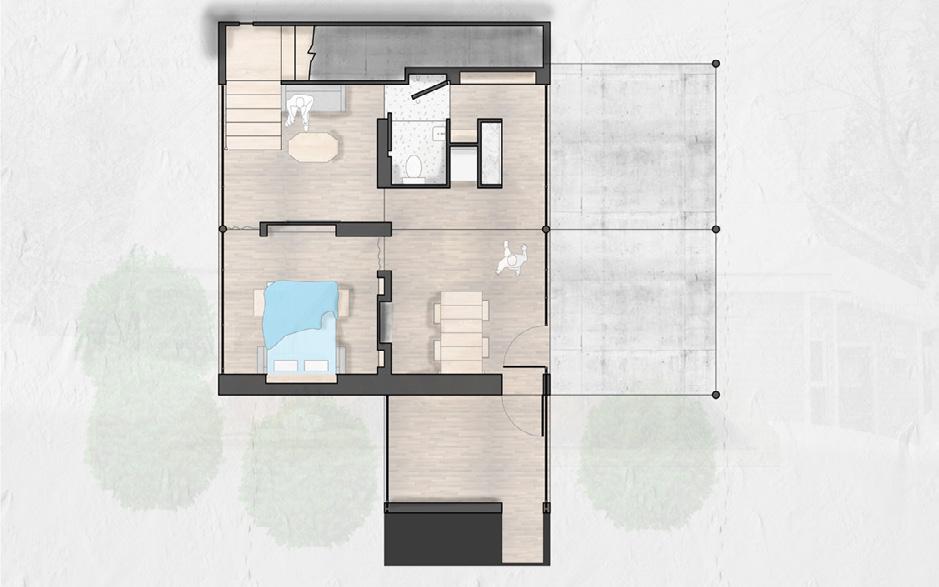
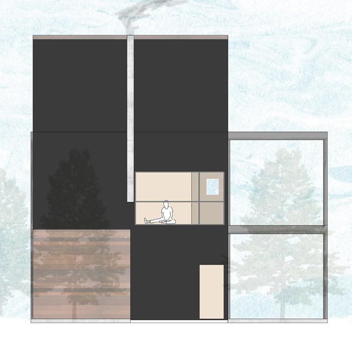
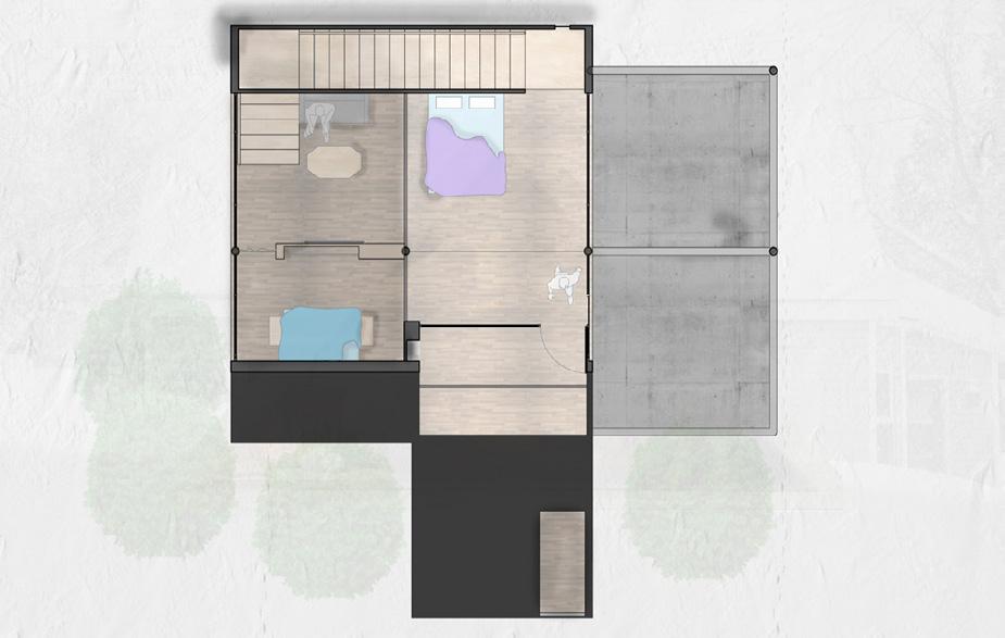
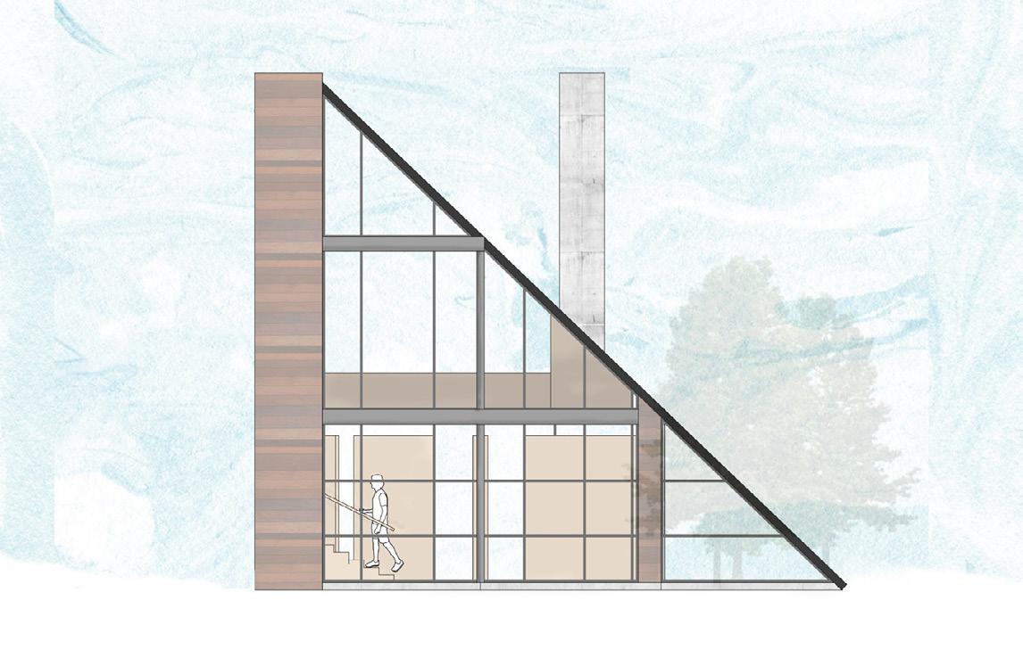
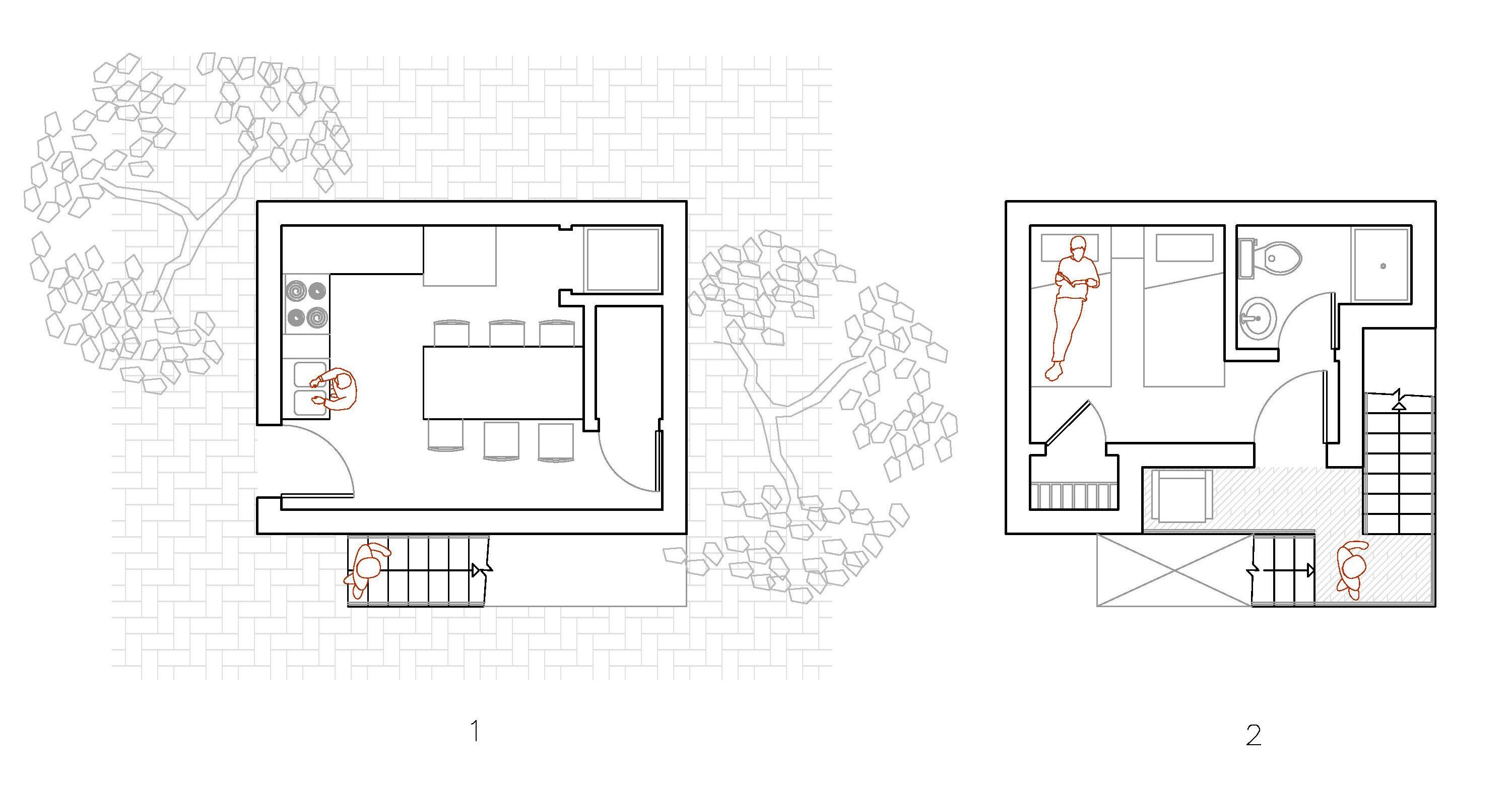
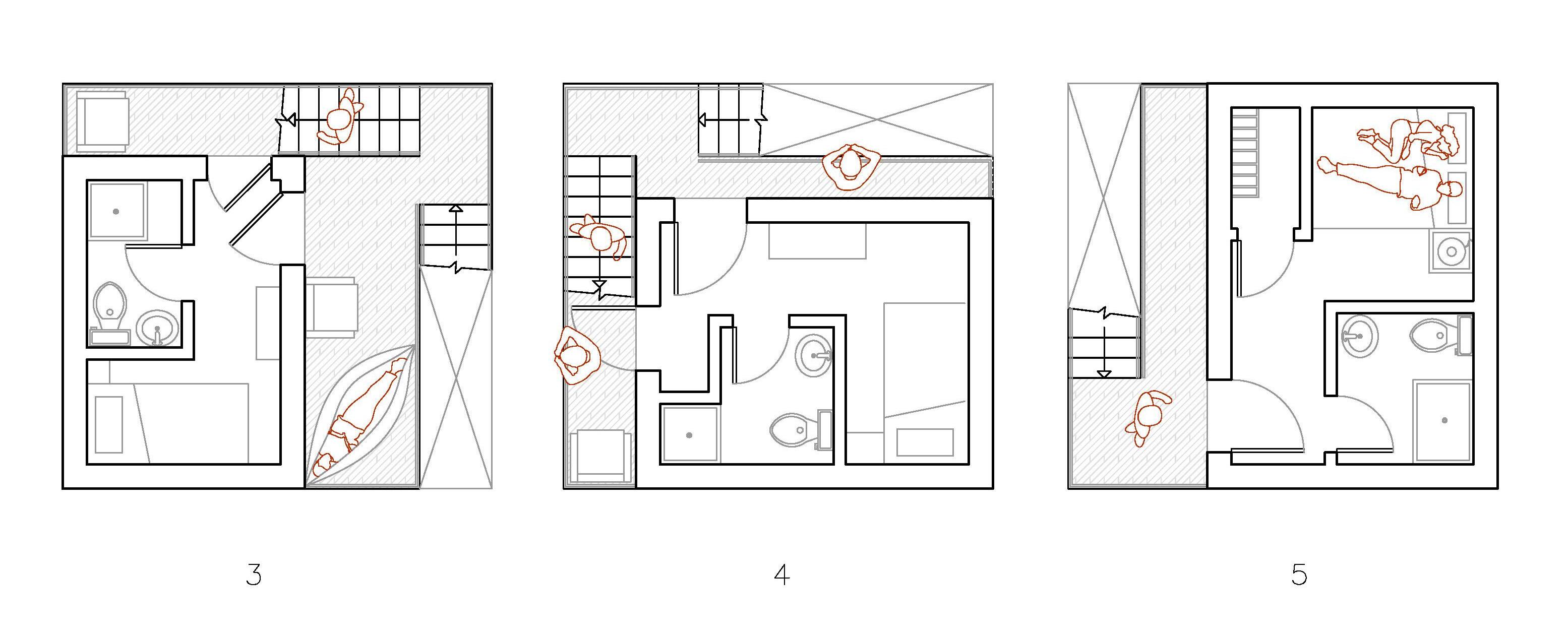
The story of the Three Little Pigs is one of resilience, in which adaptation and smart architecture save the day. The pigs must be expect, learn from, and prepare for the Big Bad Wolf in order to “find their fortune” and continue their lives happily ever after. In a world of rapidly changing climate that places many of our houses at risk to a variety of Big Bad Wolves, how can architecture be more resilient, adaptive, and efficient? How can architecture be utilized to design living spaces that have the ability to grow in a modular, affordable way that respects local vernacular and withstands changing climate?
This thesis focuses on the 90th Meridian West as it travels along the Mississippi River and its basin. The meridian experiences the southern swamps, rolling great plains, and lake effect snow storms as it traverses North America. It sees families in New Orleans, rural Illinois, and Ironwood, Michigan struggling to afford a place to live. It sees houses washed away or otherwise destroyed by storms. The nomad, surveyor, and lunatic work to alleviate these struggles by creating Three Little Houses that showcase affordable, modular, efficient, and resilient architecture in three drastically different climates. The Three Little Houses all follow a similar floor plan with similar interiors within a 3x2 grid of 12’x12’ squares. One lies on the ground, one lies above the ground, and one dives into the ground, while each rebels slightly and breaks from the established grid pattern in order to adapt to local vernacular and climate. In New Orleans courtyards are of utmost importance, while the Midwest is littered with silos, and Michigan with steeply pitched roofs. Each of these conditions is factored into their respective house along with methods of resilience.
Undergraduate Thesis
Peter Waldman
University


Professional work

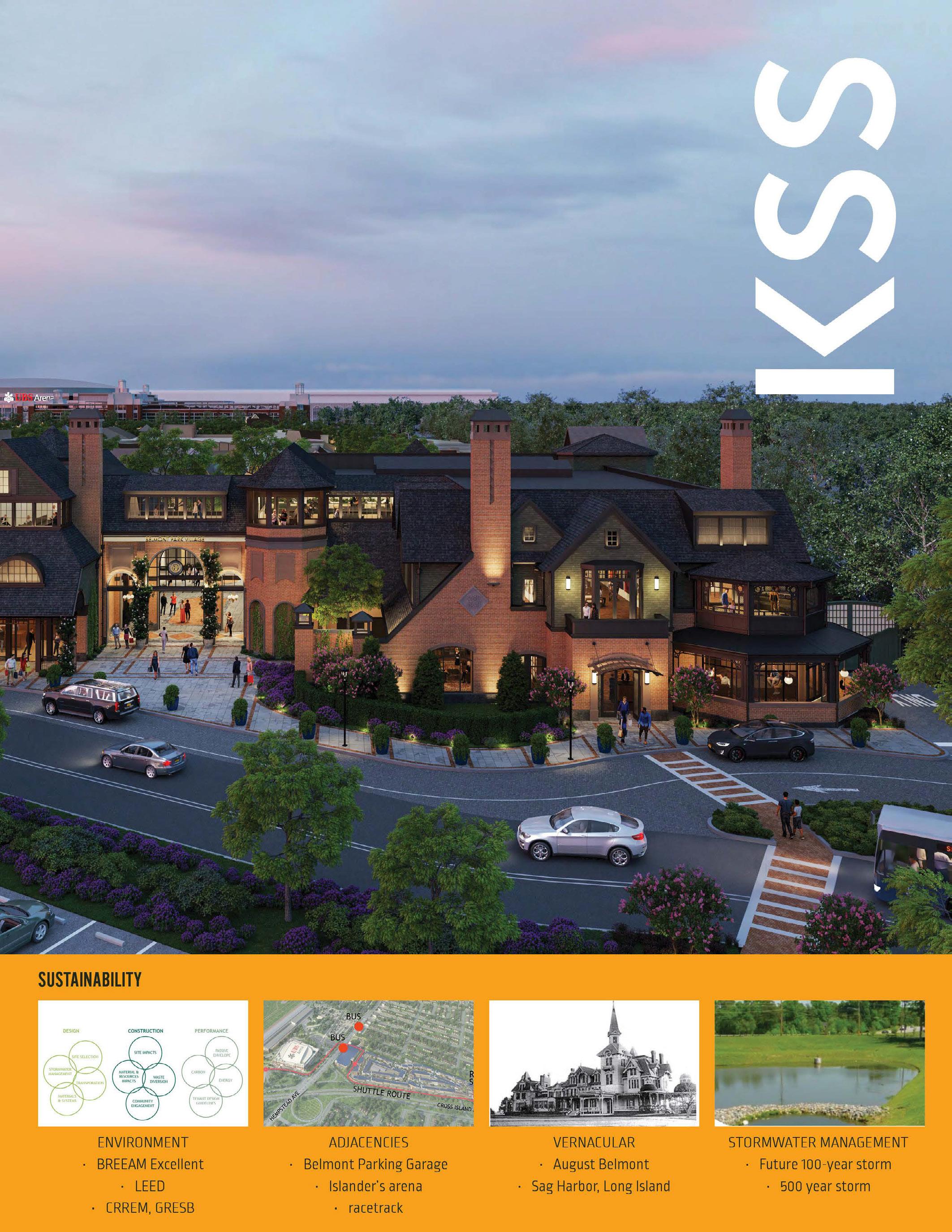
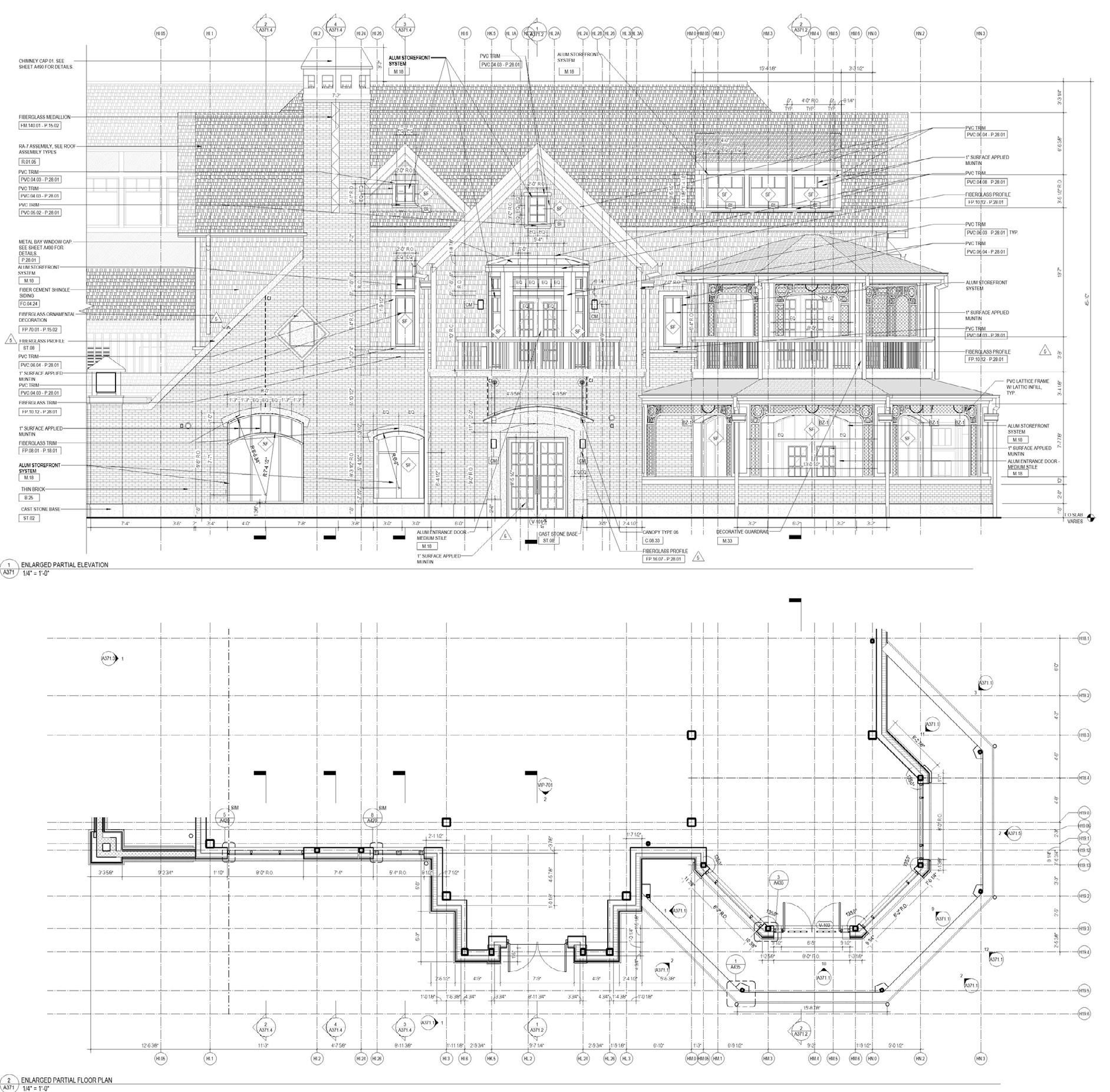
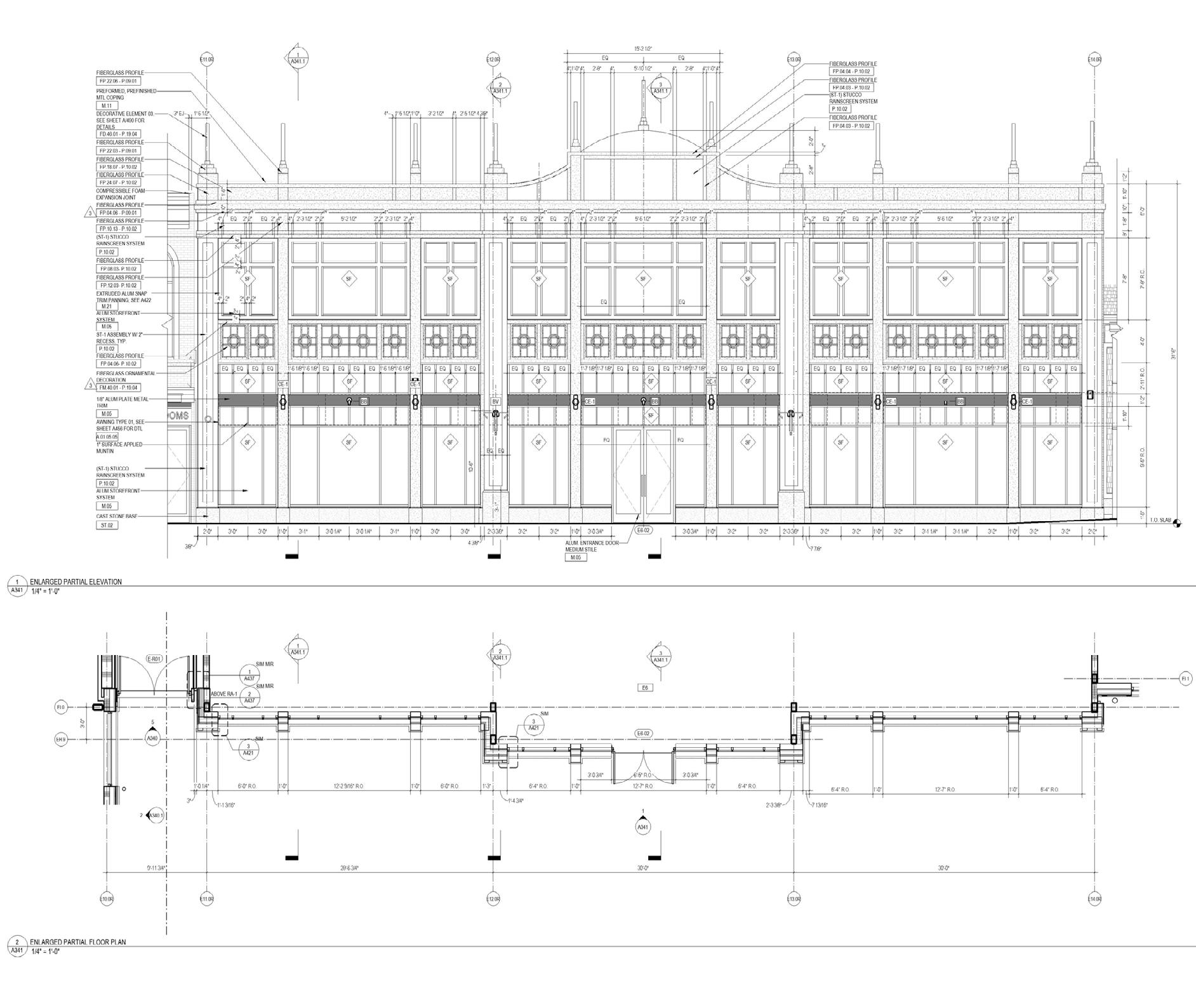
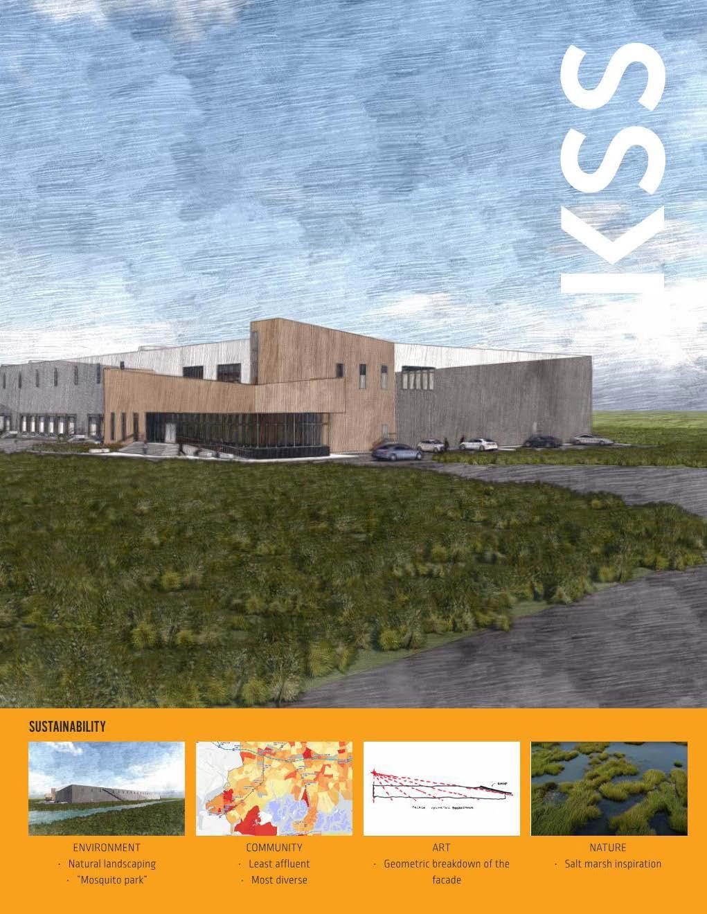
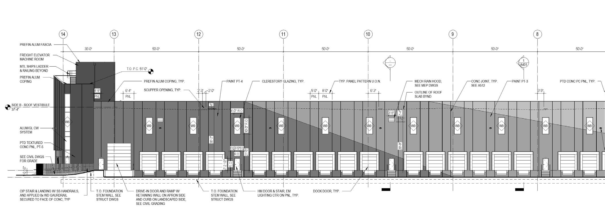
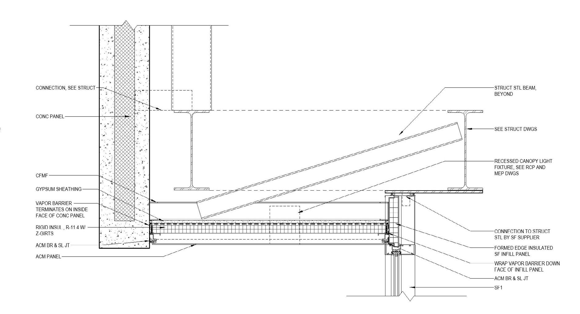
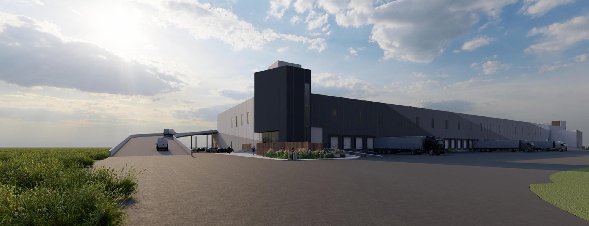
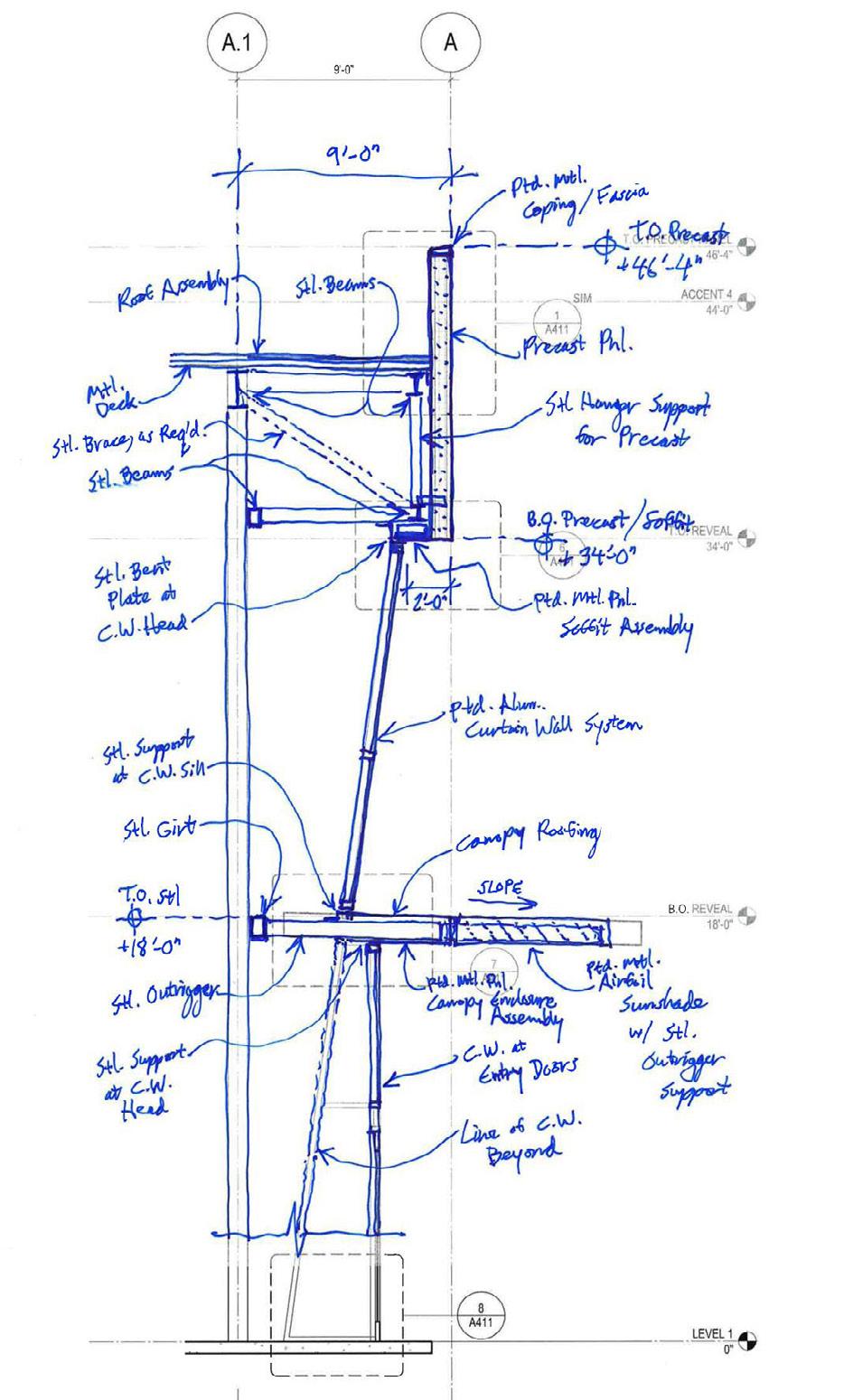
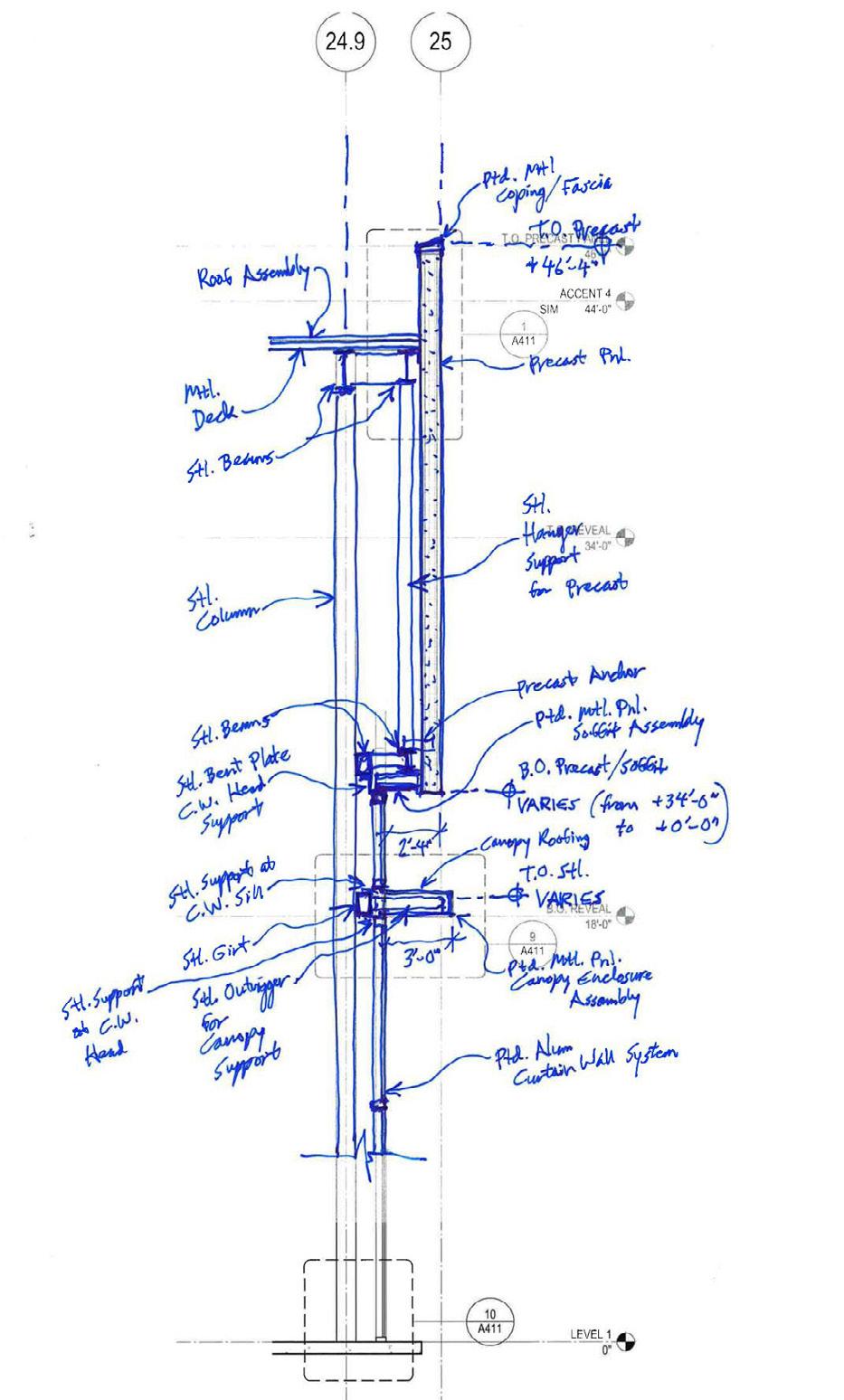
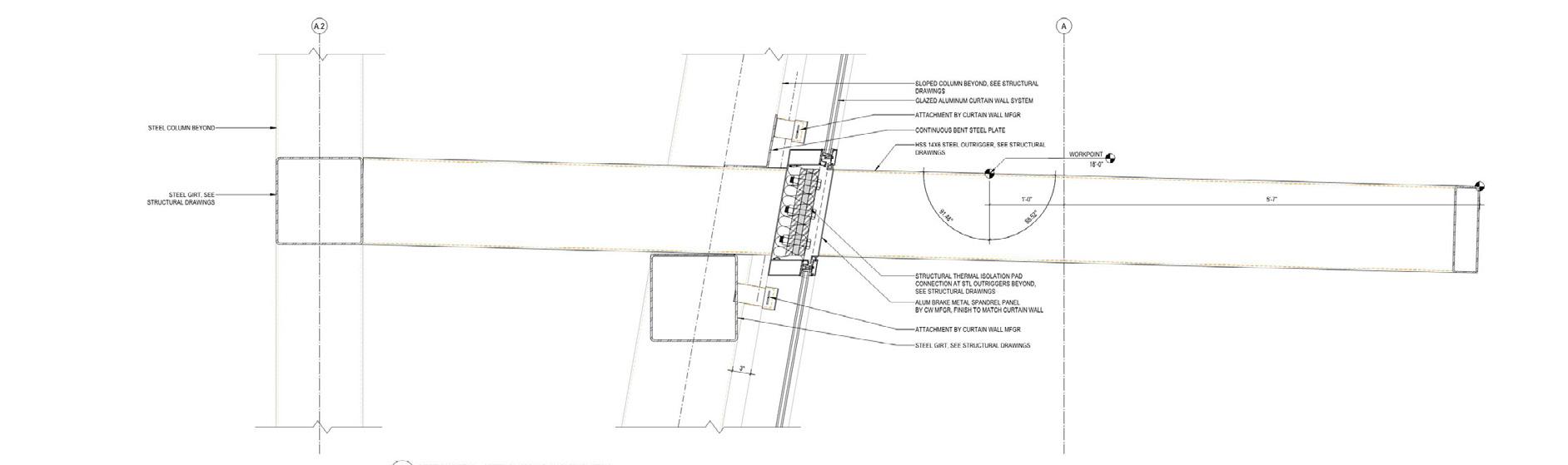
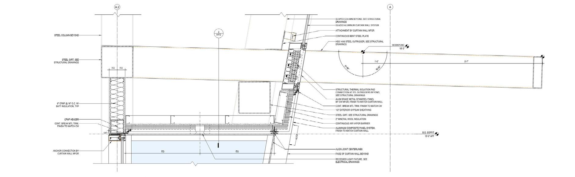
Mantua Township, NJ KSS Architects Aug 2020 - June 2023, june 2024 - Aug 2024
Phases: DD, CD, CA

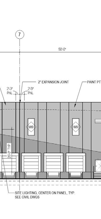

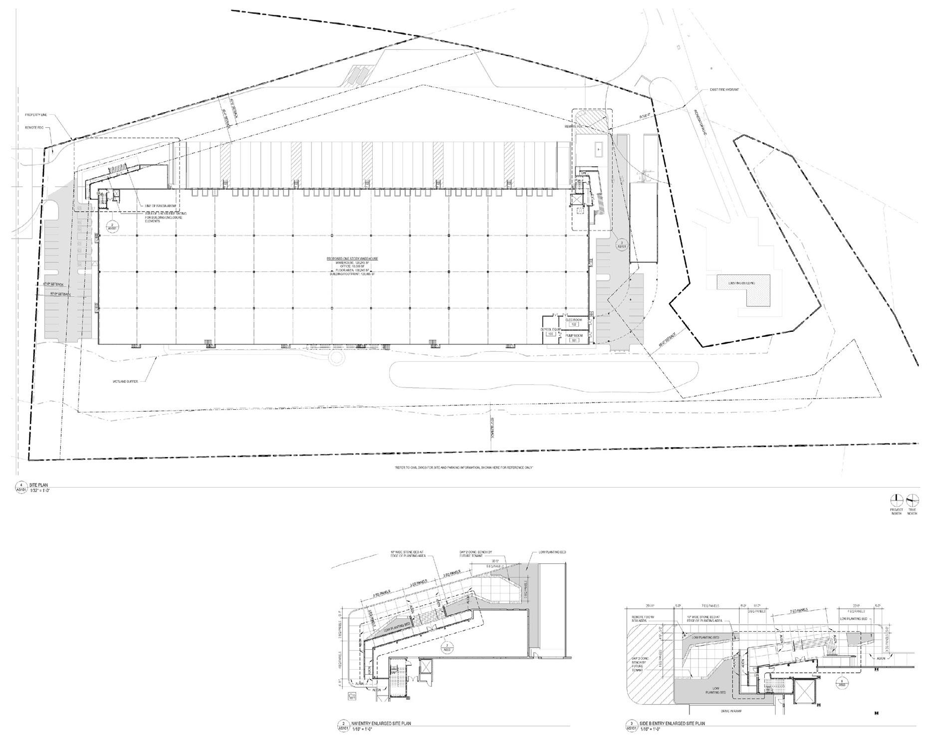
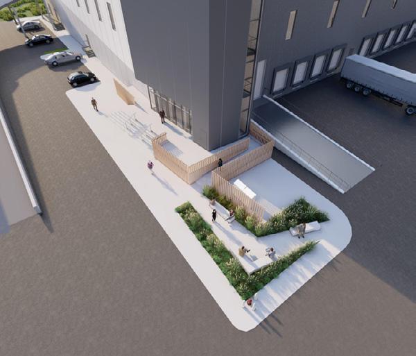
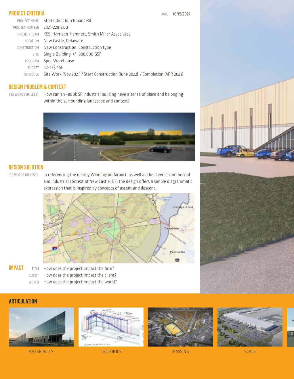
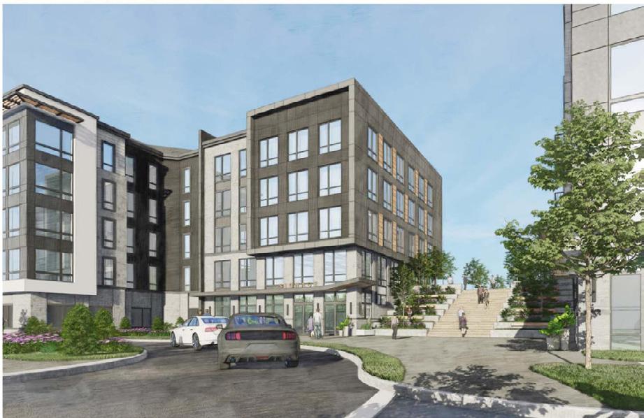
Stoltz Churchman
New Castle, DE
KSS Architects August 2021 - March 2022
Role: Architectural Designer
Phases: SD, DD, CD


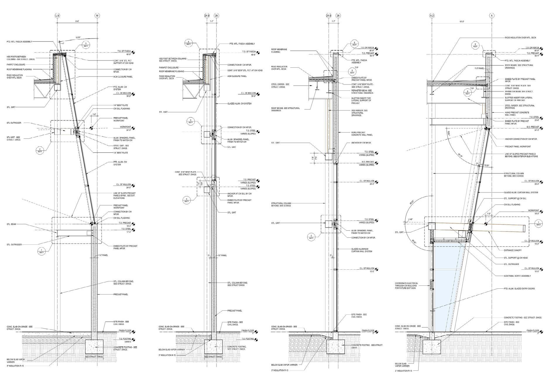
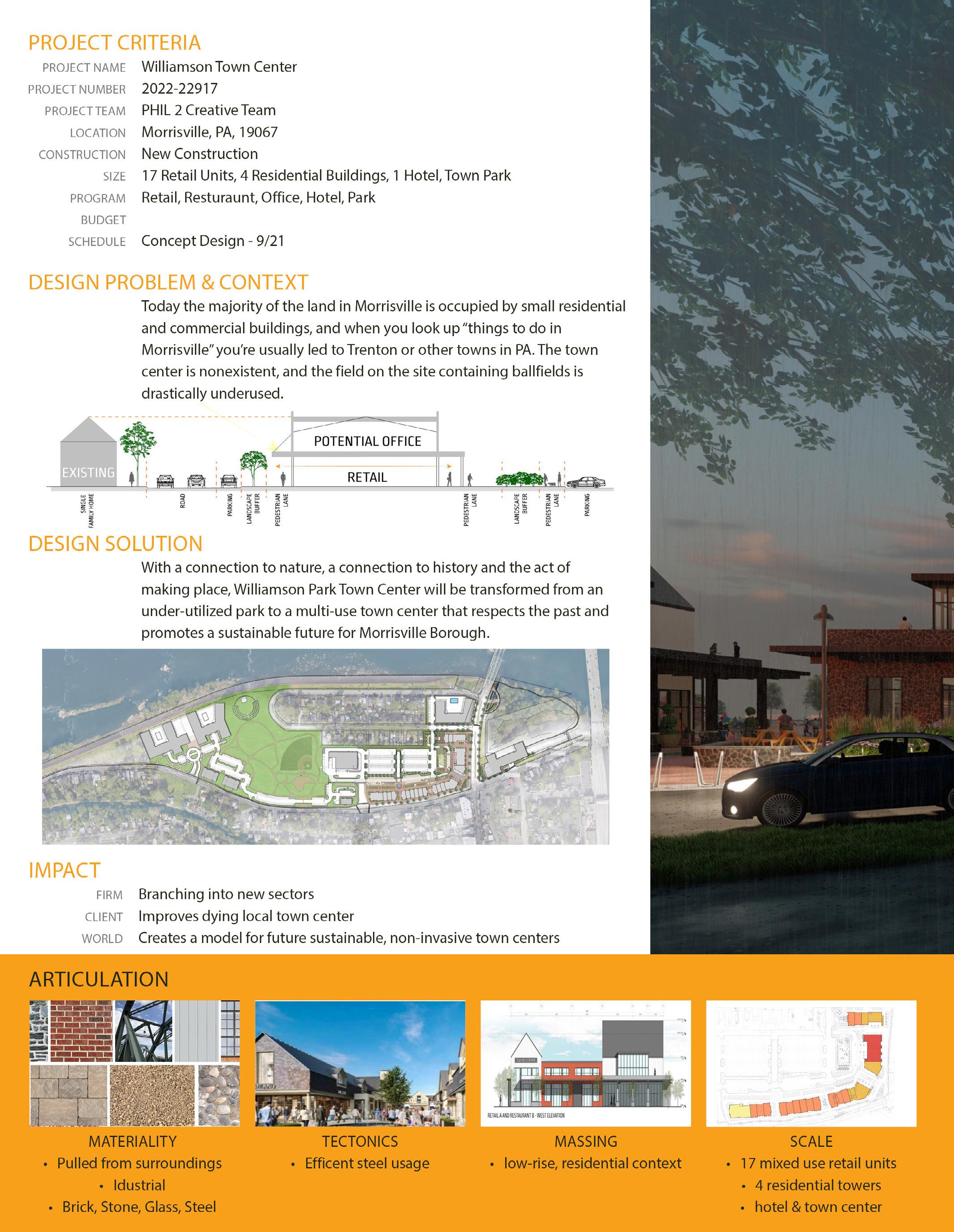
Morrisville, PA
KSS Architects
April 2021 - Sept 2021
Role: Architectural Designer
Phases: Concept, SD


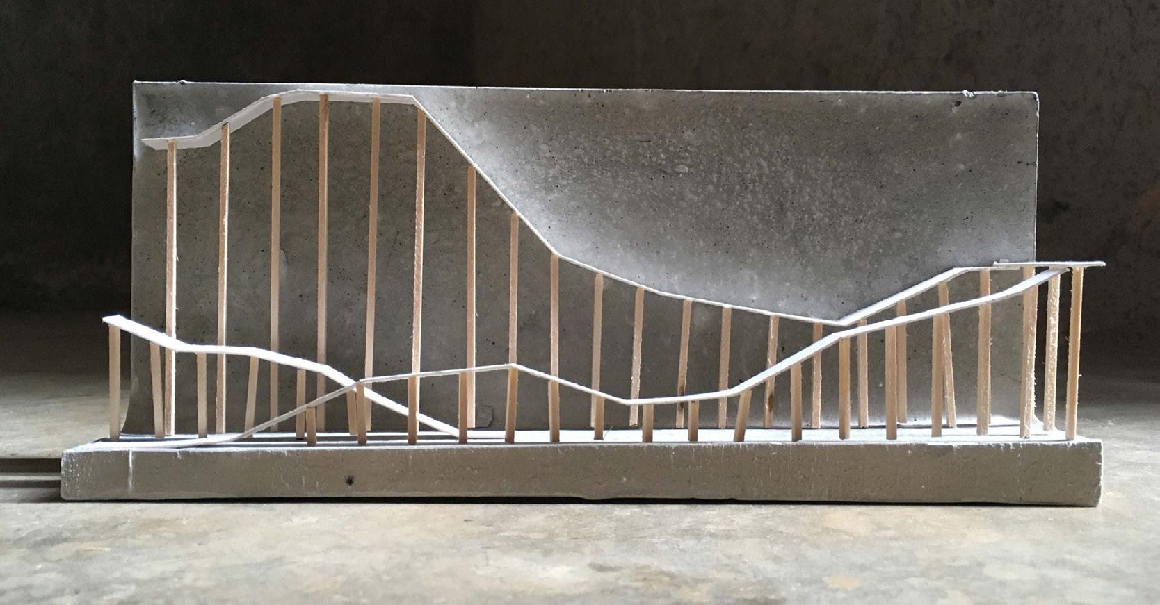
explorations
Location Unspecified
Utilizing parametric design, both analogue and digital, students were tasked with developing a drawing machine.
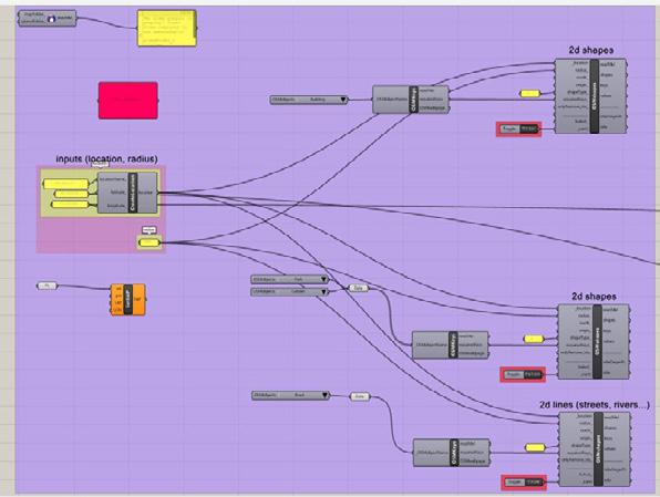
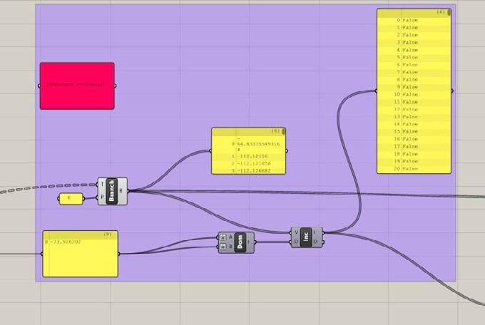
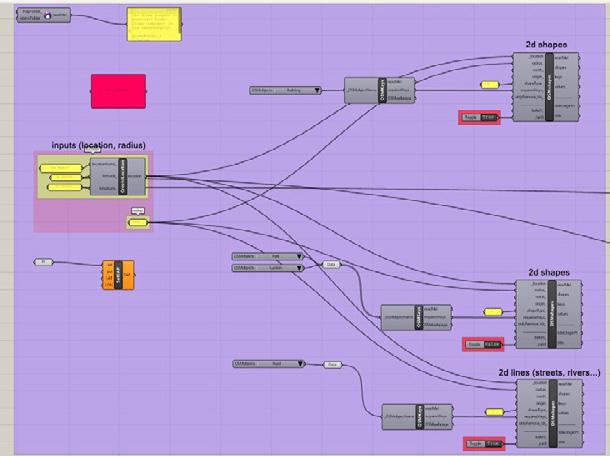
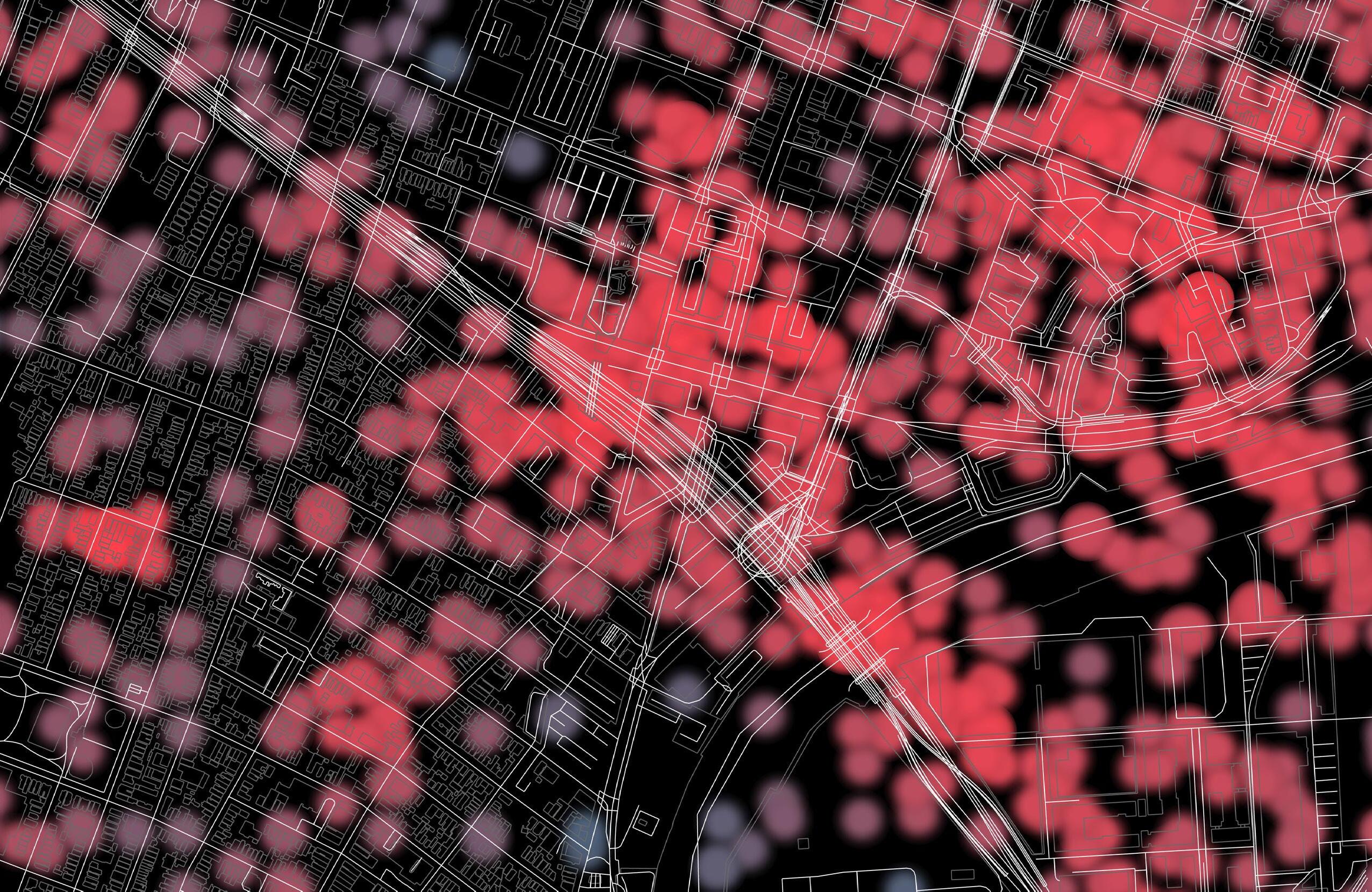
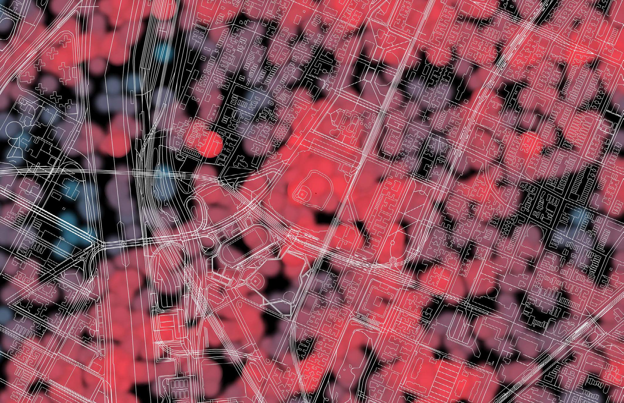
This movement density mapping machine was created utilizing Grasshopper. The user inputs the coordinates of the desired site, and the script pulls mapping base layer information from open source GIS data within a 1.5 mile radius. The heat map data points are pulled from cellphone records available to the public and plotted on the map utilizing the established coordinate system. The user can also choose to filter the heat map by time of day if desired and adjust colors as necessary. Given the prominence of cellphones, this provides an accurate picture of population dispersement within a given space at a level of detail that typical population maps utilizing census data are lacking.

Location Unspecified
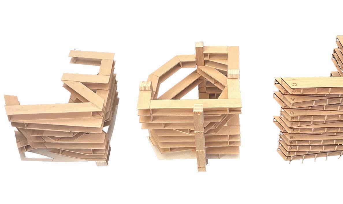
Utilizing specific guidelines, the studio was asked to create a series of housing/ dwelling spaces - one horizontal, one vertical, one removed from the ground, and one set of stairs.
These experiments lasted a week each, and were used to inform the housing project in D.C. later in the semester. They explored aggregation and density in multiple dimensions and unique shapes.
Tiny Housing Studies
Modular Housing
Anthony Averbeck
University of Virginia - Spring 2018

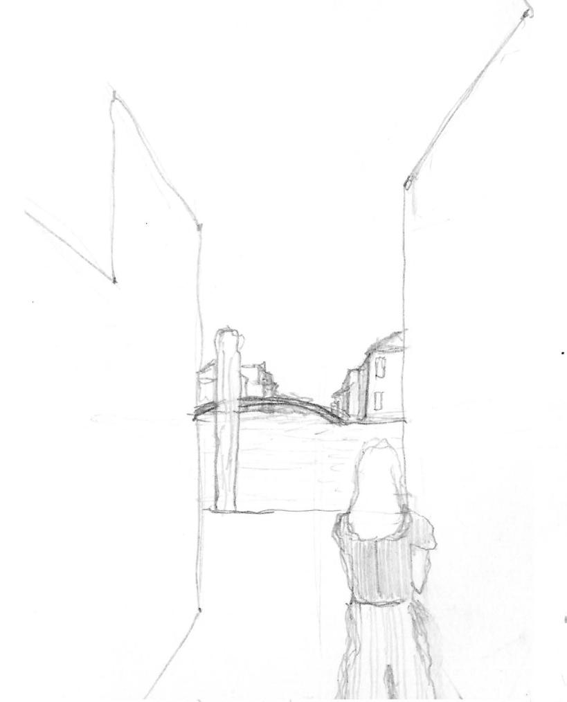
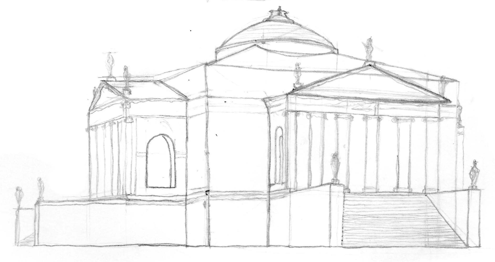
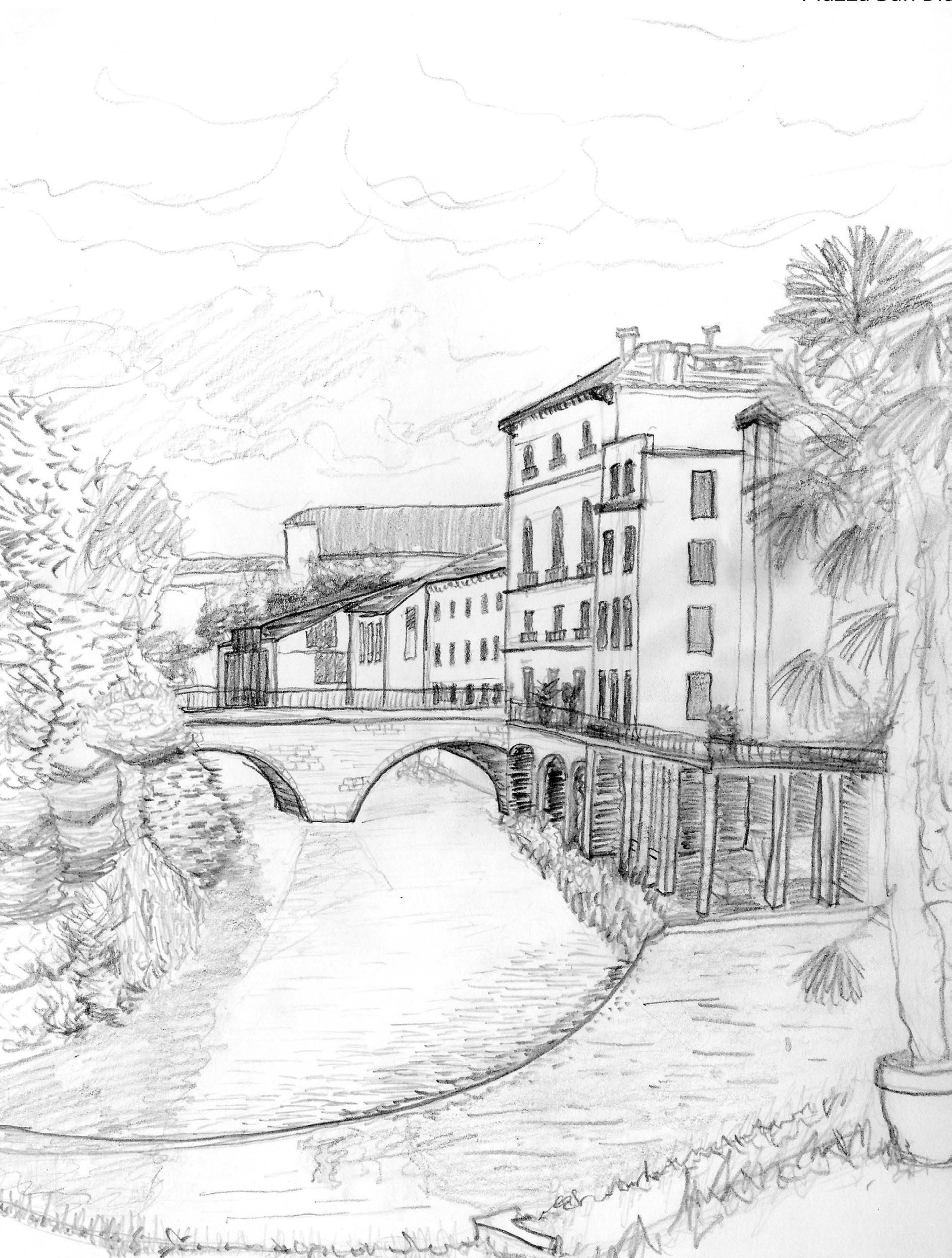
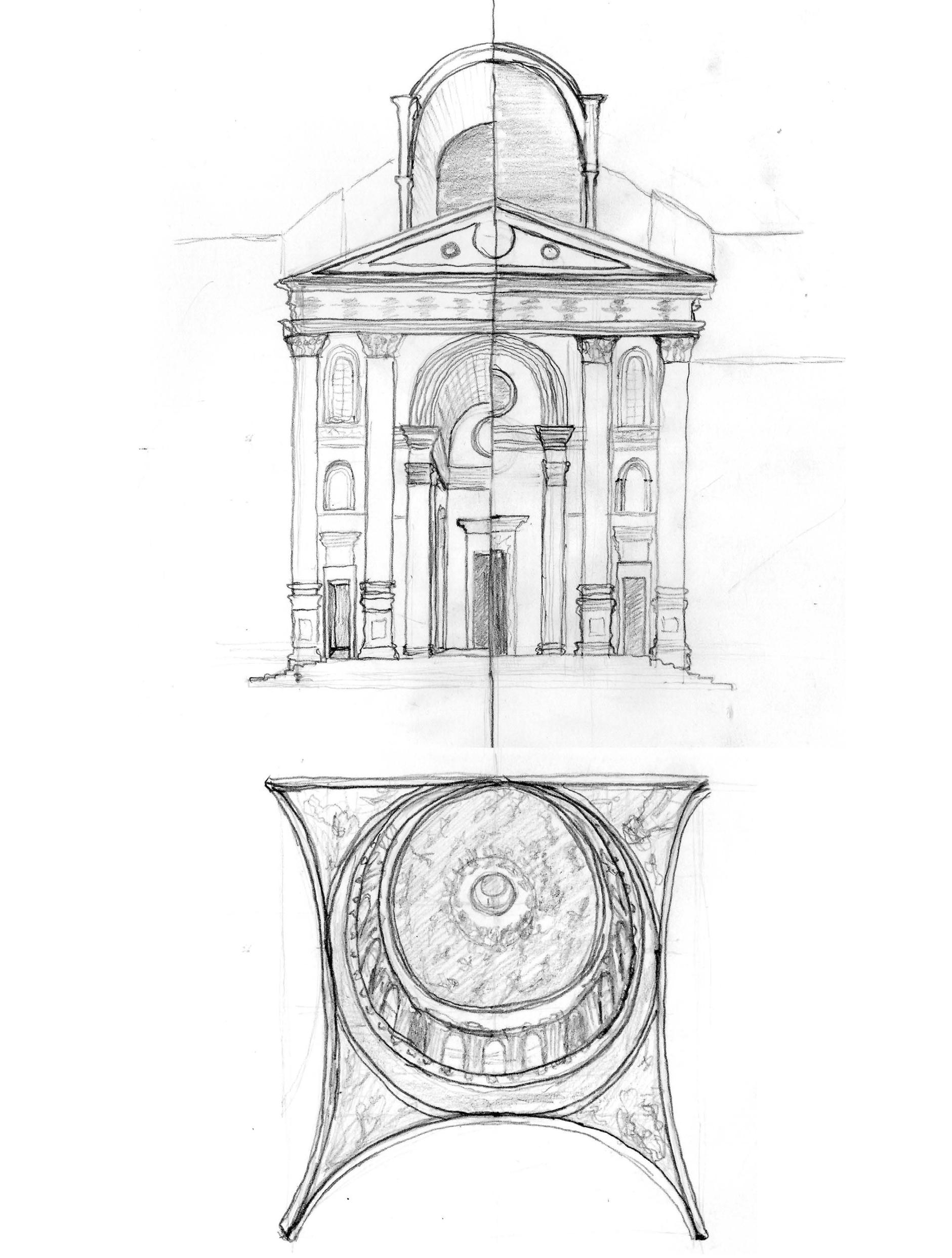
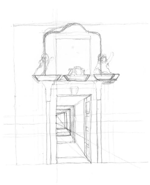
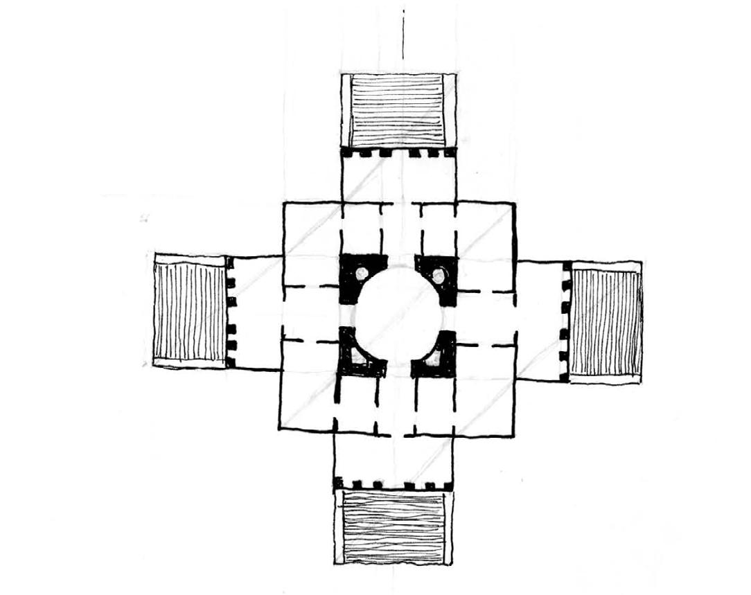
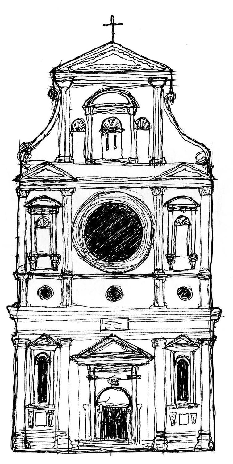
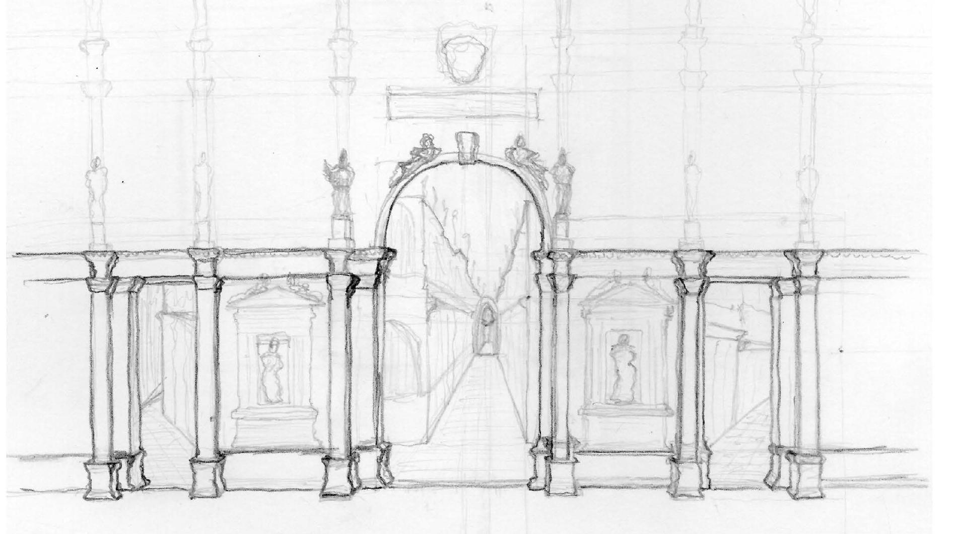
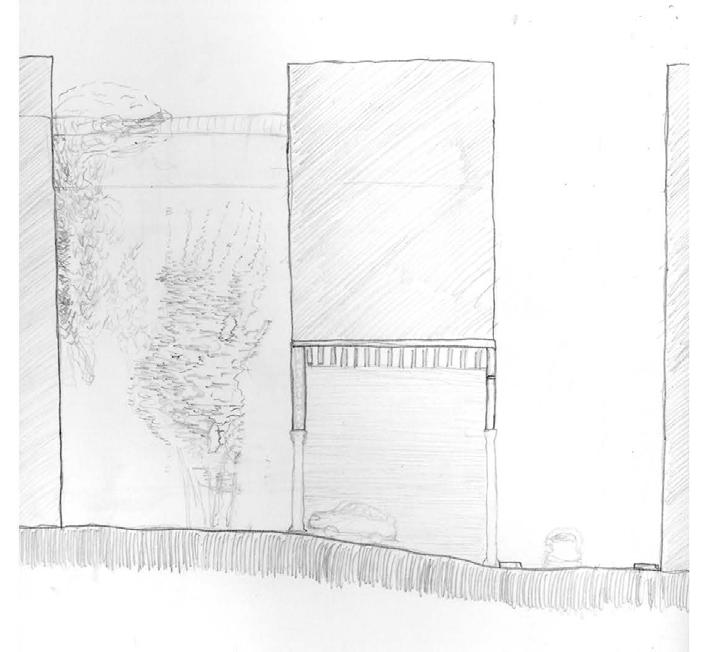
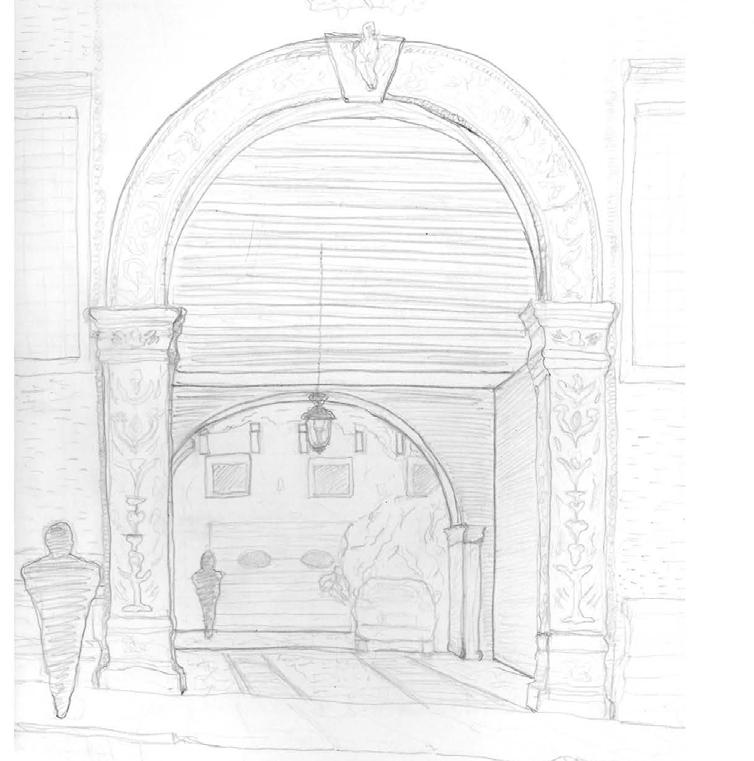
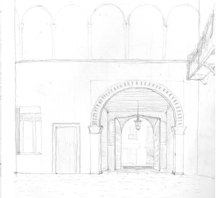
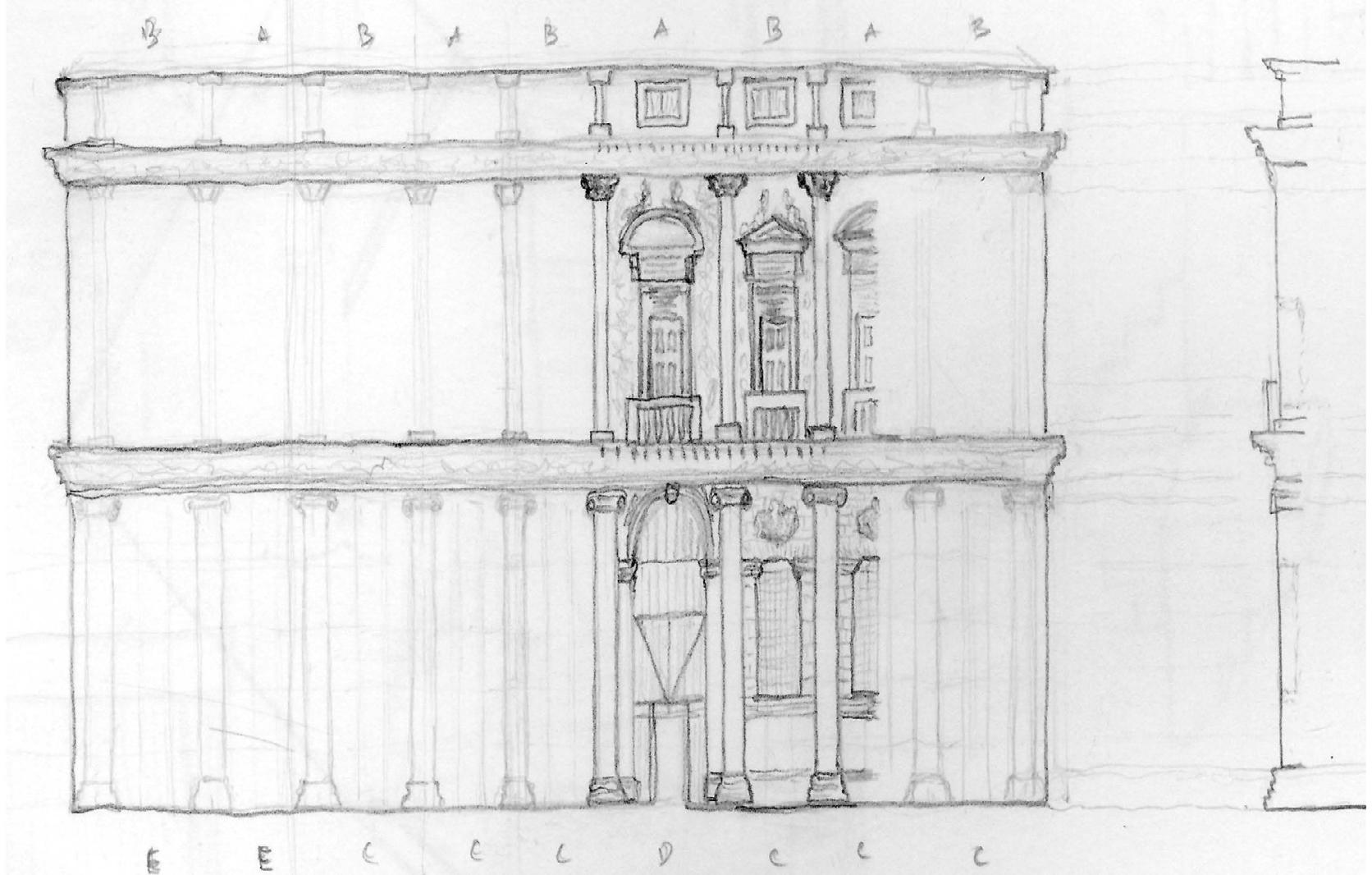
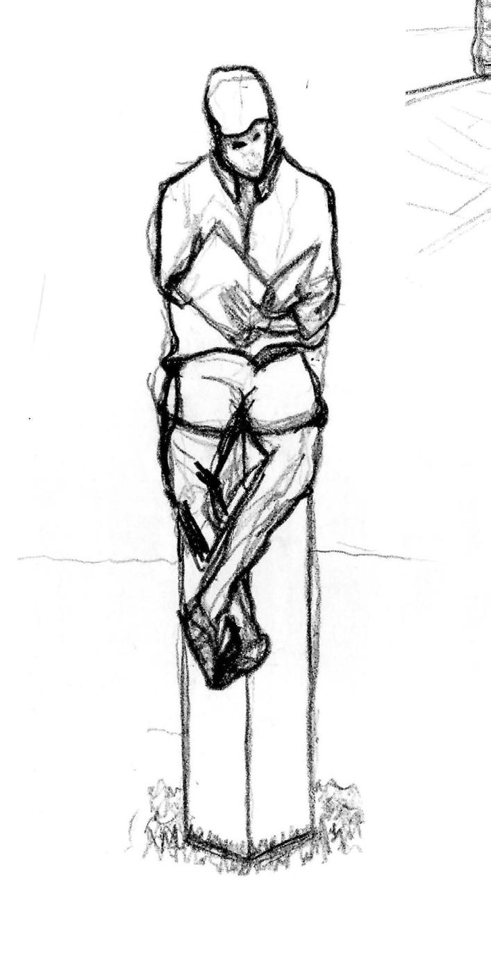
The following drawings and sketches were completed in Vicenza or surrounding Venetian cities. Each drawing was completed in an hour or less, and is intended to show more of an architectural analysis than a hyper-accurate representation.
These images are a selection from a 6 week period during the summer of 2018 competed in pencil, pen, or wax crayon. To view the entire body of finished works with locations and dates, please visit zacharyjbeim.myportfolio.com