am a graduated landscape architect with an honours degree from the University of New South Wales (UNSW), dedicated to creating spaces that enhance both human and ecological wellbeing. My interest lies in designing landscapes that foster community engagement, promote biodiversity, and contribute to resilient urban environments. With five years of experience in design studios through internships and work placements, I have strengthened my skills in site analysis, design concept, and design documentation.
and
Engaged in
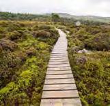
bushcare events, including weeding and planting in public and coastal bush areas. Discovered the unique planting environments of the Randwick coastal region and also Sydney, gaining insights from council instructors.
ATTENDING UNSW FIRST YEAR PEER MENTOR
Guided first-year students in software applications, offering instruction and technical support in design tools. Gained valuable experience working on large-scale projects, collaborating with a multidisciplinary team to develop comprehensive design solutions. Developed a strong understanding of AECOM’s structured design approach, gaining valuable insights into project planning, coordination, and implementation. Followed a project from concept to execution, learning about workflow sequencing, project phases, and real-world implementation.
INTERNSHIP EXPERIENCE AT AECOM (LANDSCAPE DEPARTMENT)
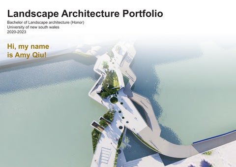
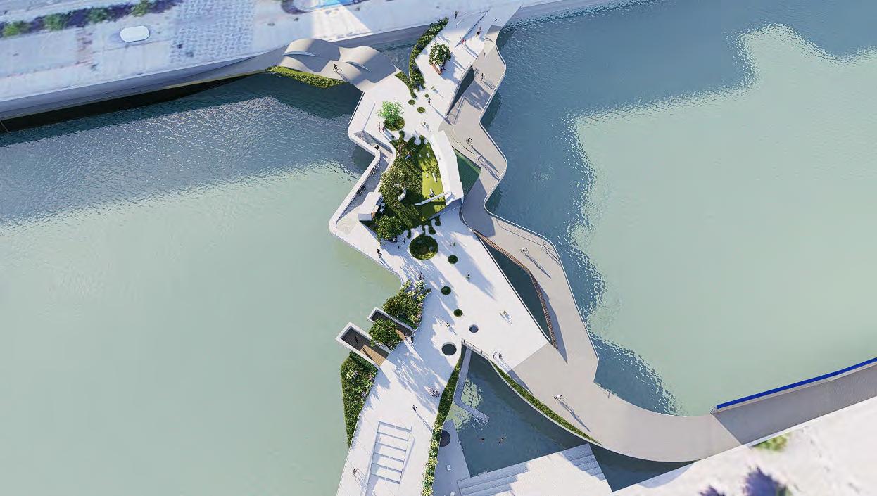
We Live in Copenhagen /
-- BRIDGE DESIGN
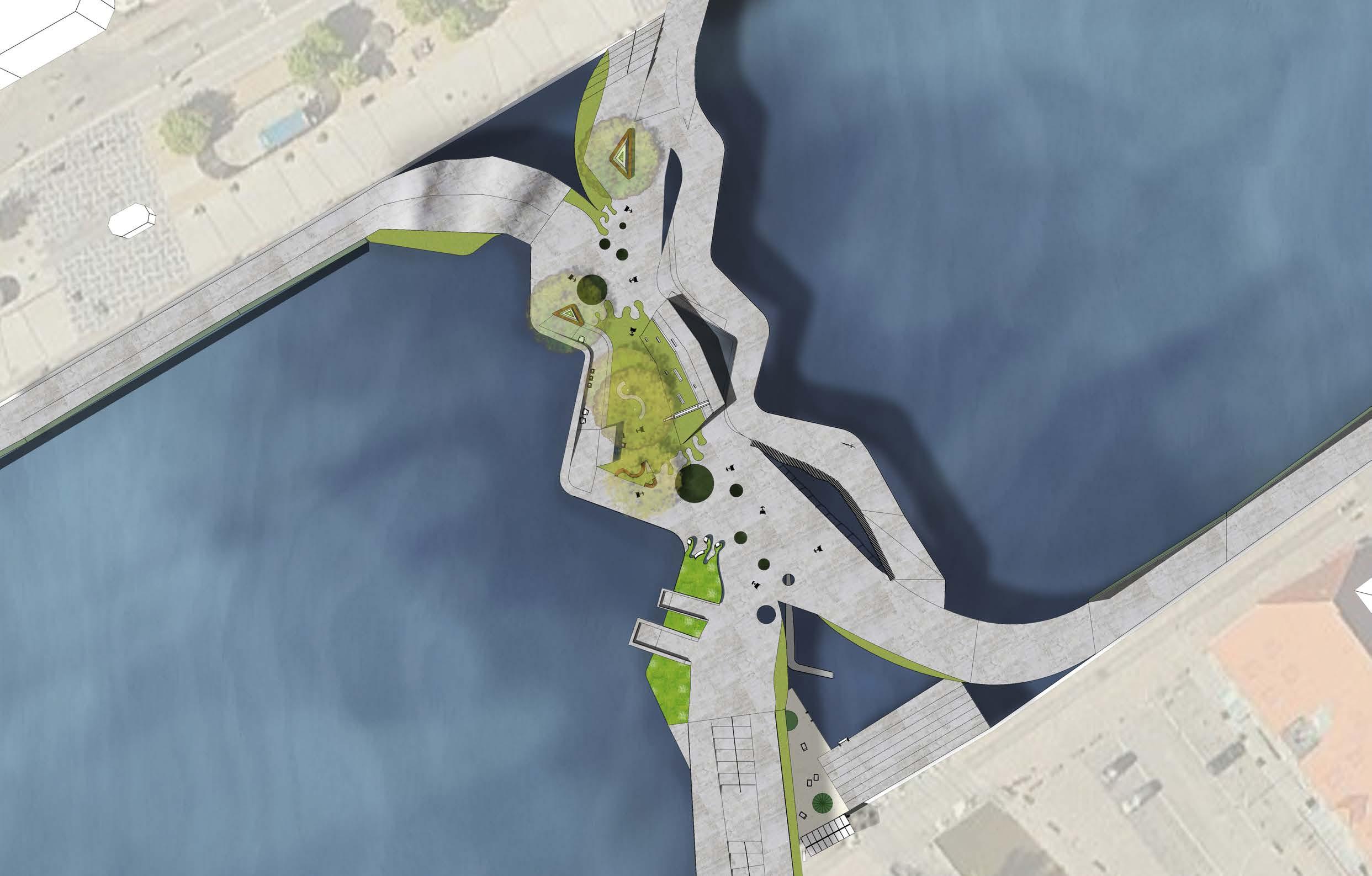
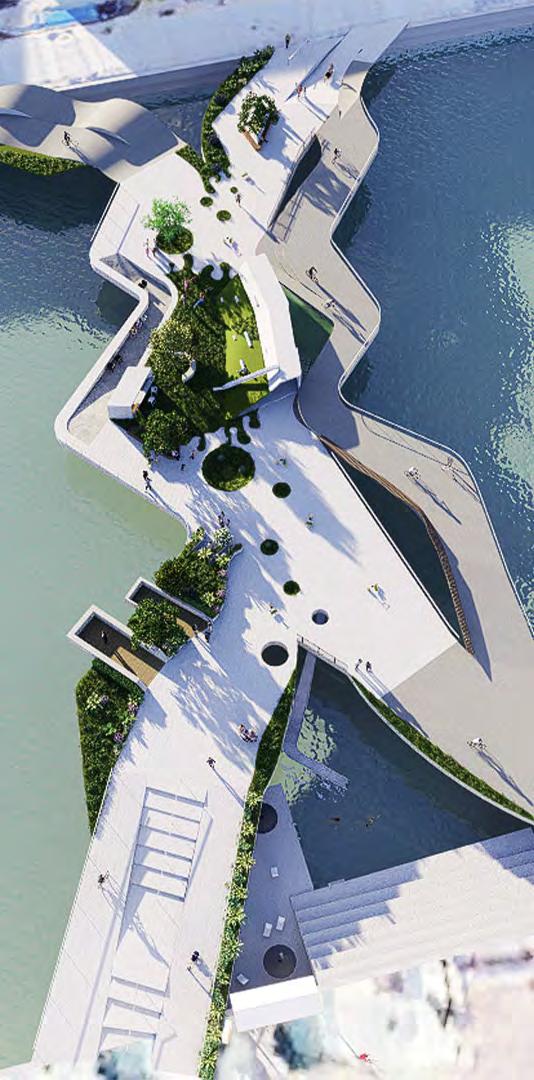
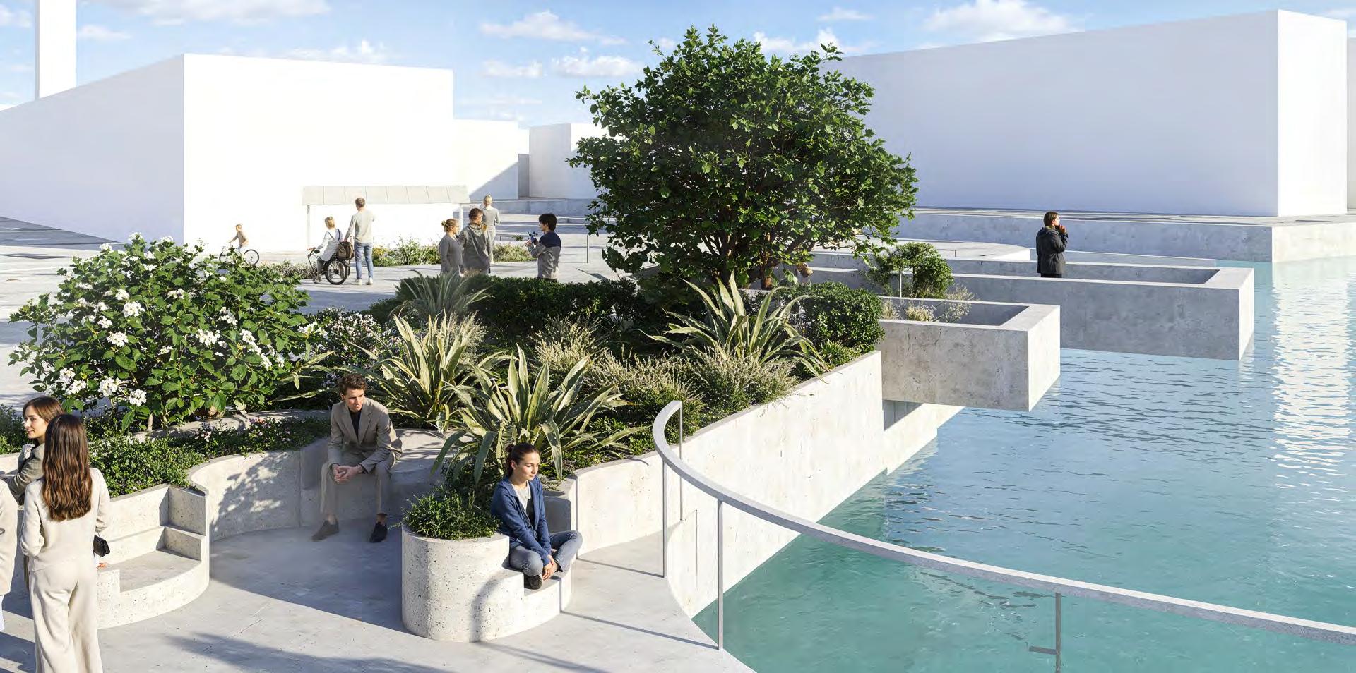
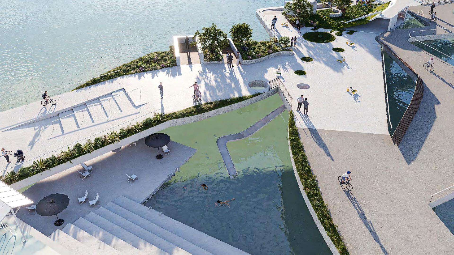
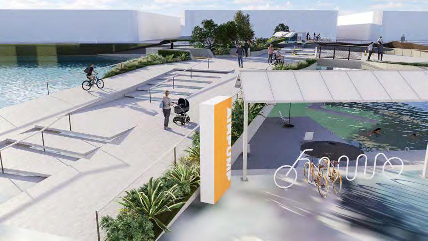
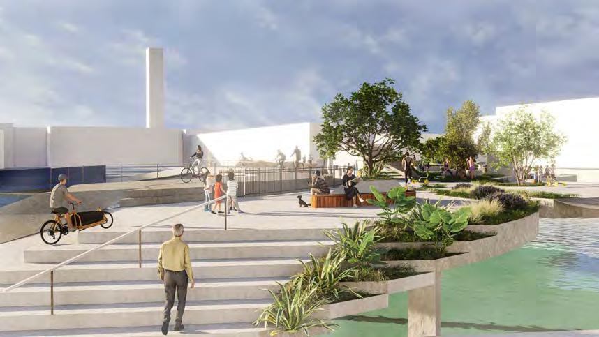
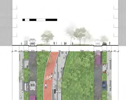
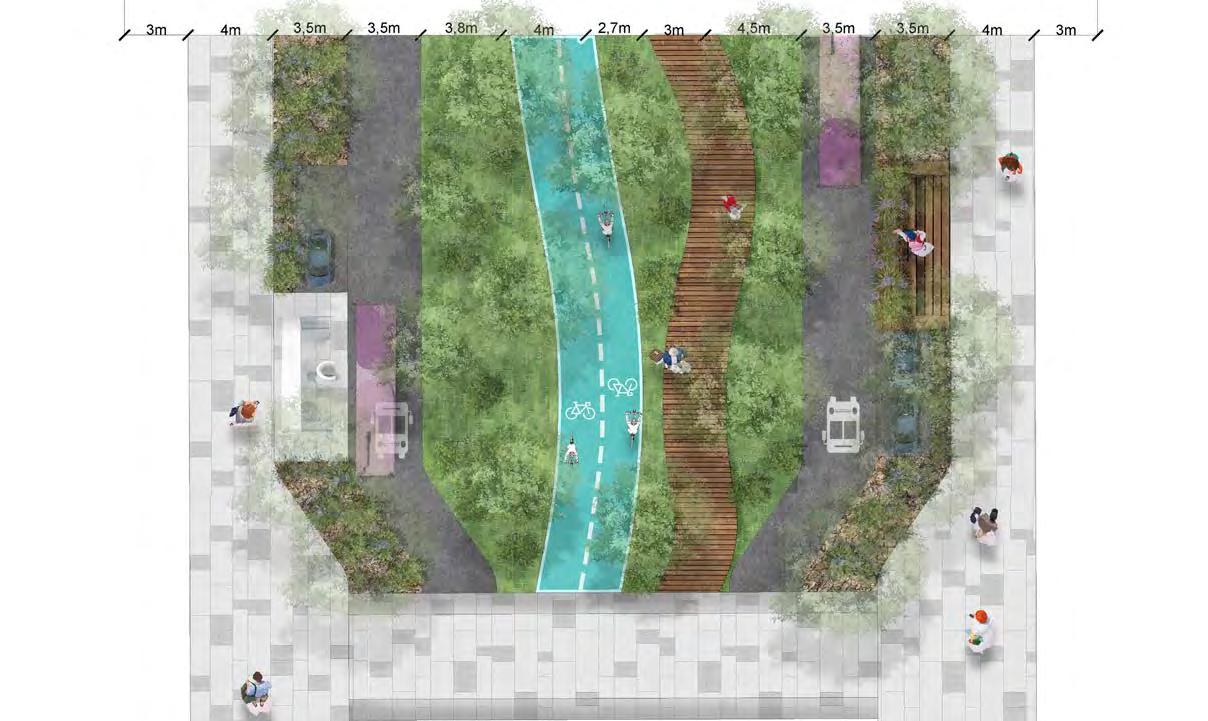
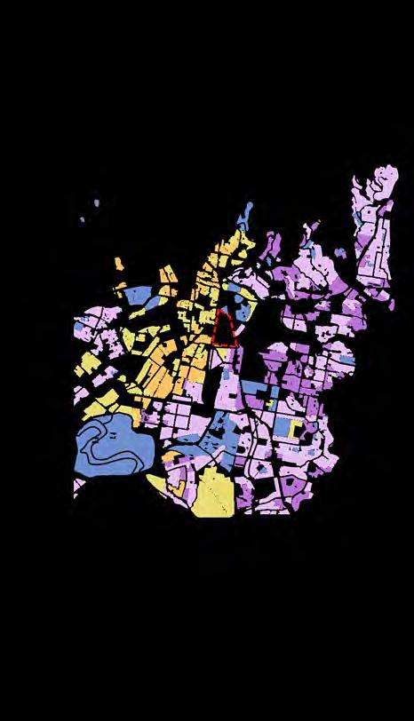
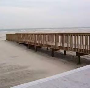
CONNECTING PEOPLE AND GREEN SPACE AT COPENHAGEN
The design idea of this project is to connect cycling highway in Copenhagen at this selected site in city centre. At the same time, the bridge is also a green corridor to connect green ecological patches, helping animals and birds to move in the city.
have learned the skill of sketchup and Autocad in this project. And also testing the knowledge of green corridor and green patches in this project.
Design Vision:
CONNECT, CO-CREATE, RESONATE
Sharing life can lead towards a new living attitude.
Design Principles:
1. Connect green ecological patches for animals by creating this bridge as corridor, which gives opportunities for both insects or animals to cross the river.
2. Link the Superhighway in Copenhagen, to create an integrate cycling route for commuters.
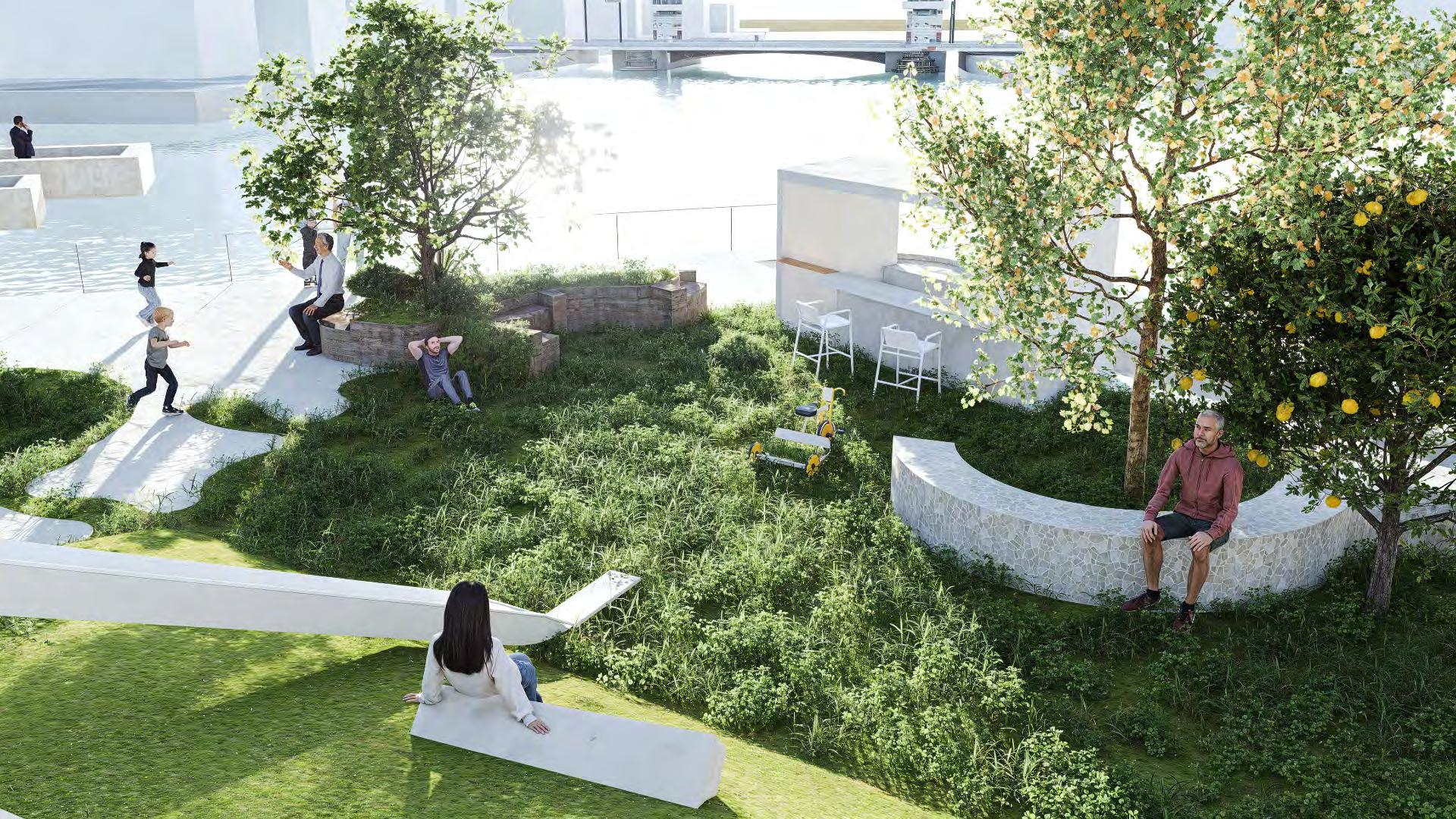
3. Generate a gathering place for people who work and live nearby to share their life on this bridge with good viewing and relaxing space.
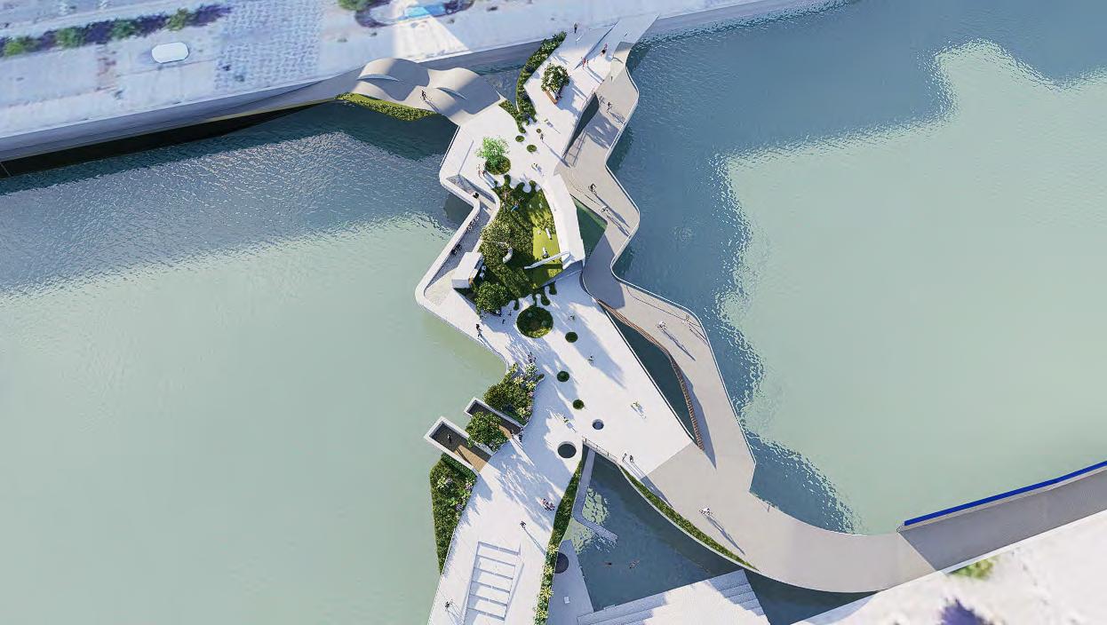
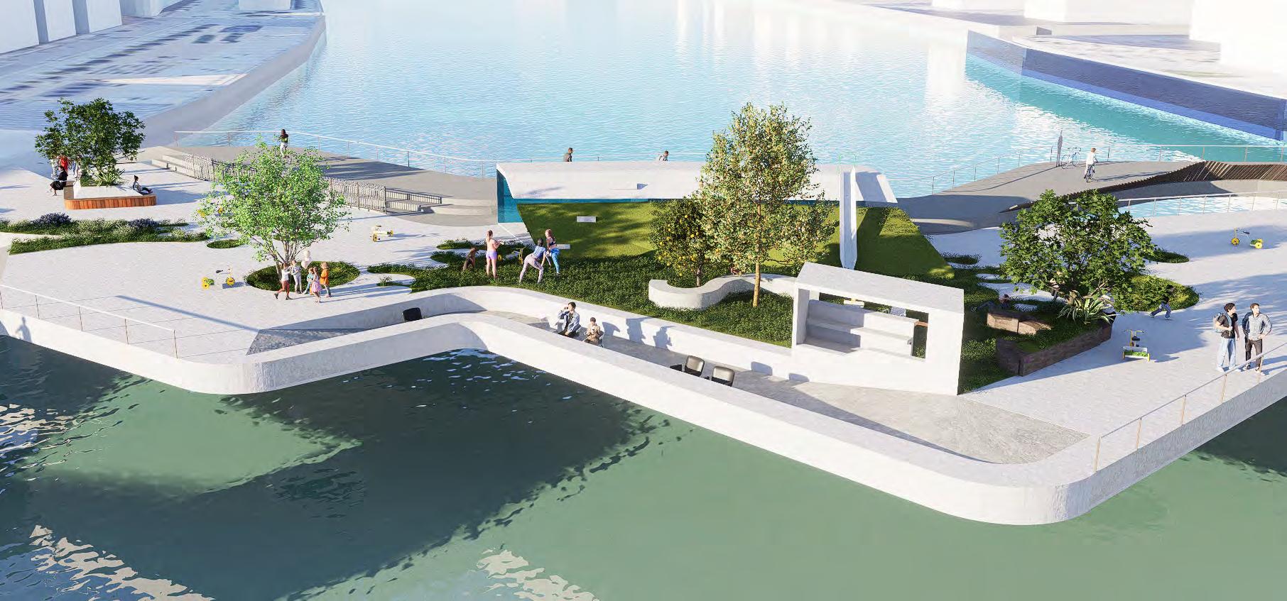
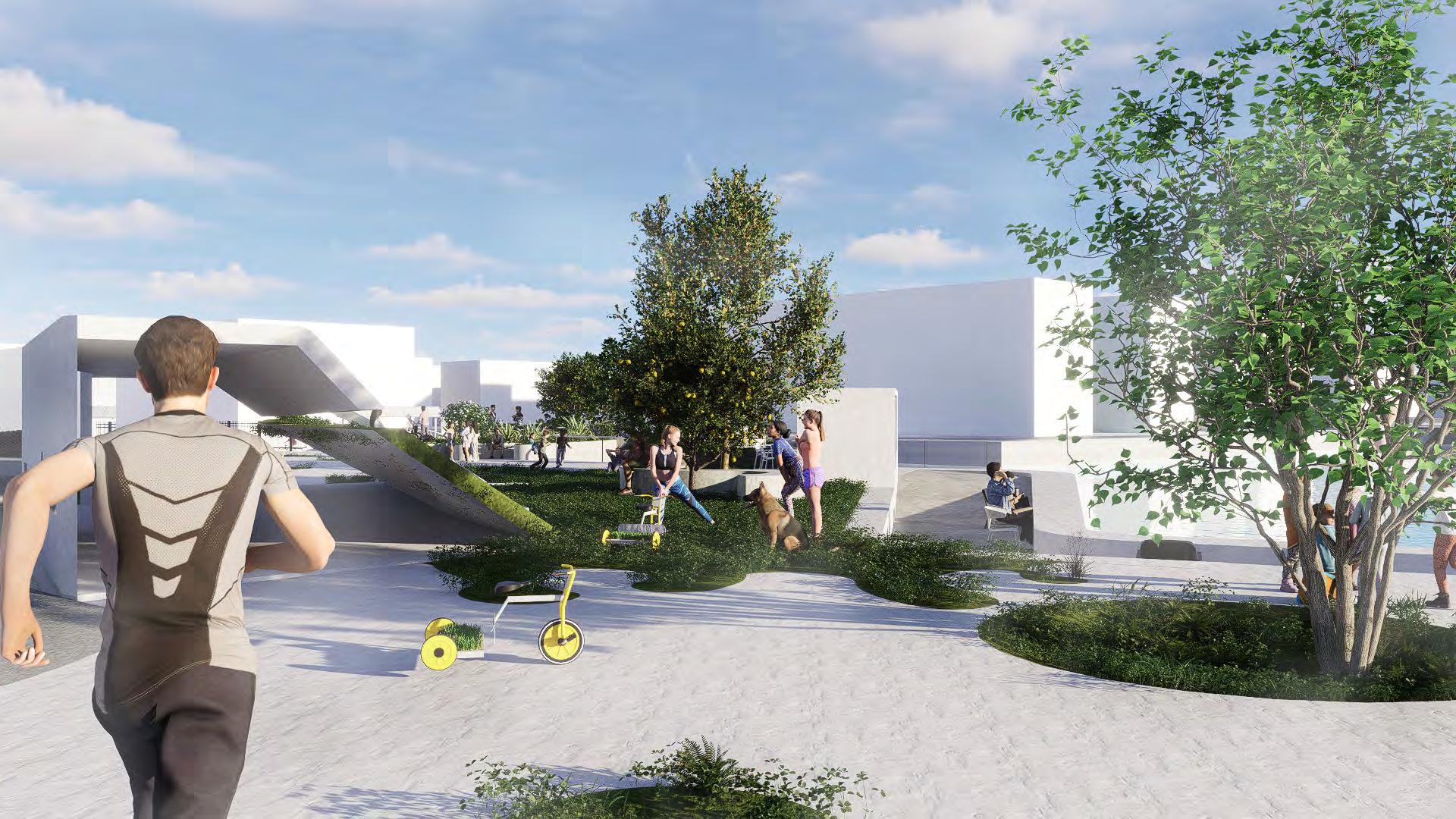
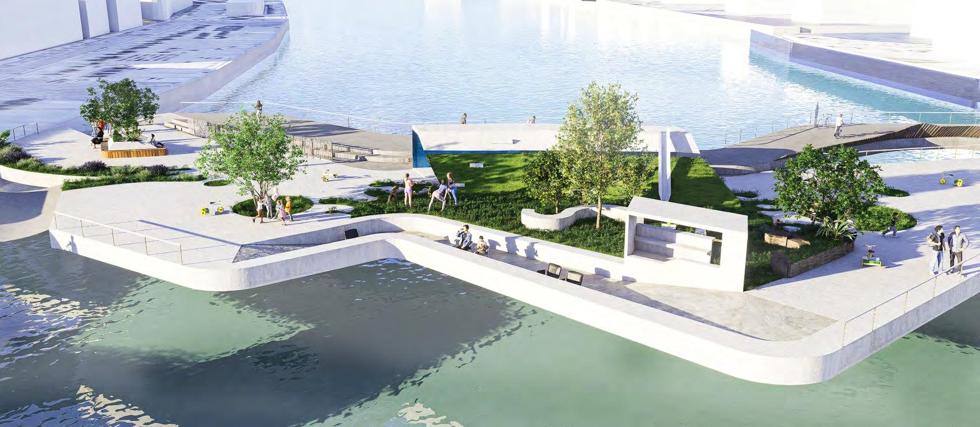
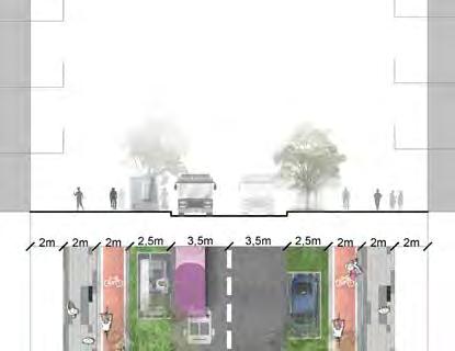
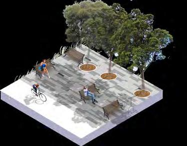
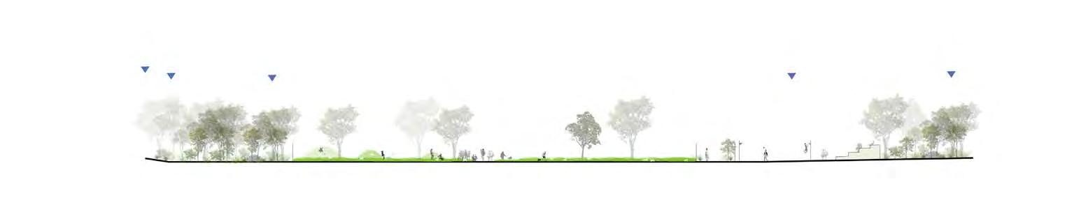
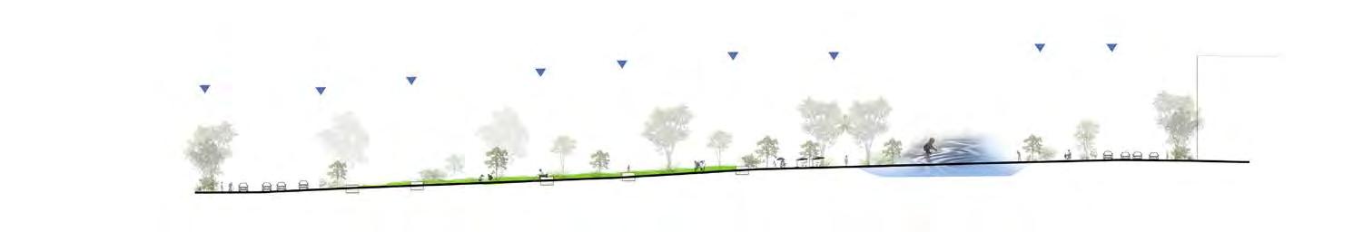
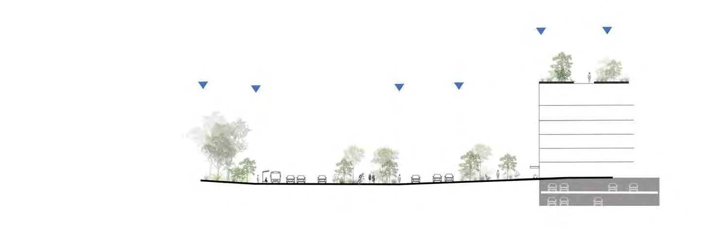
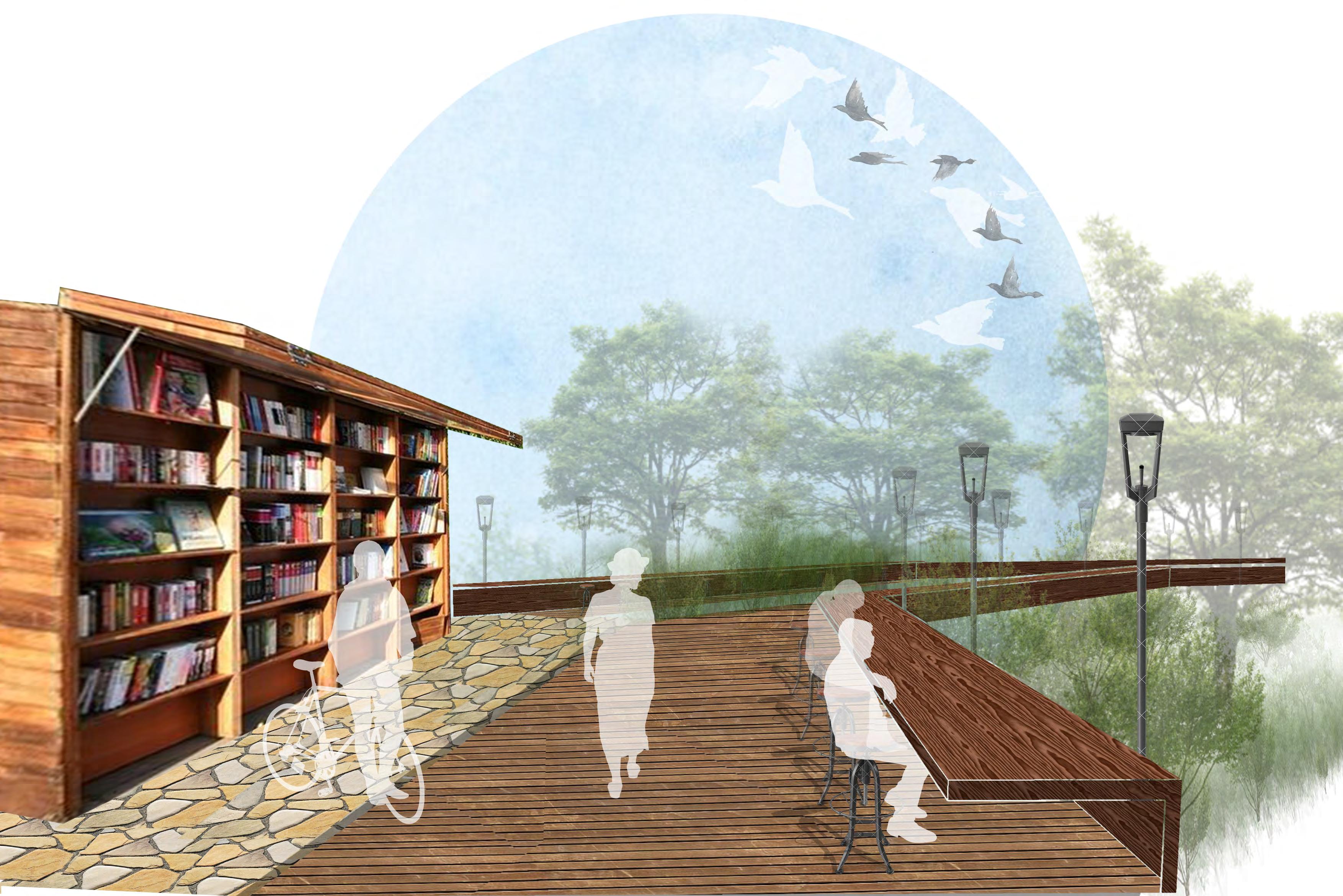
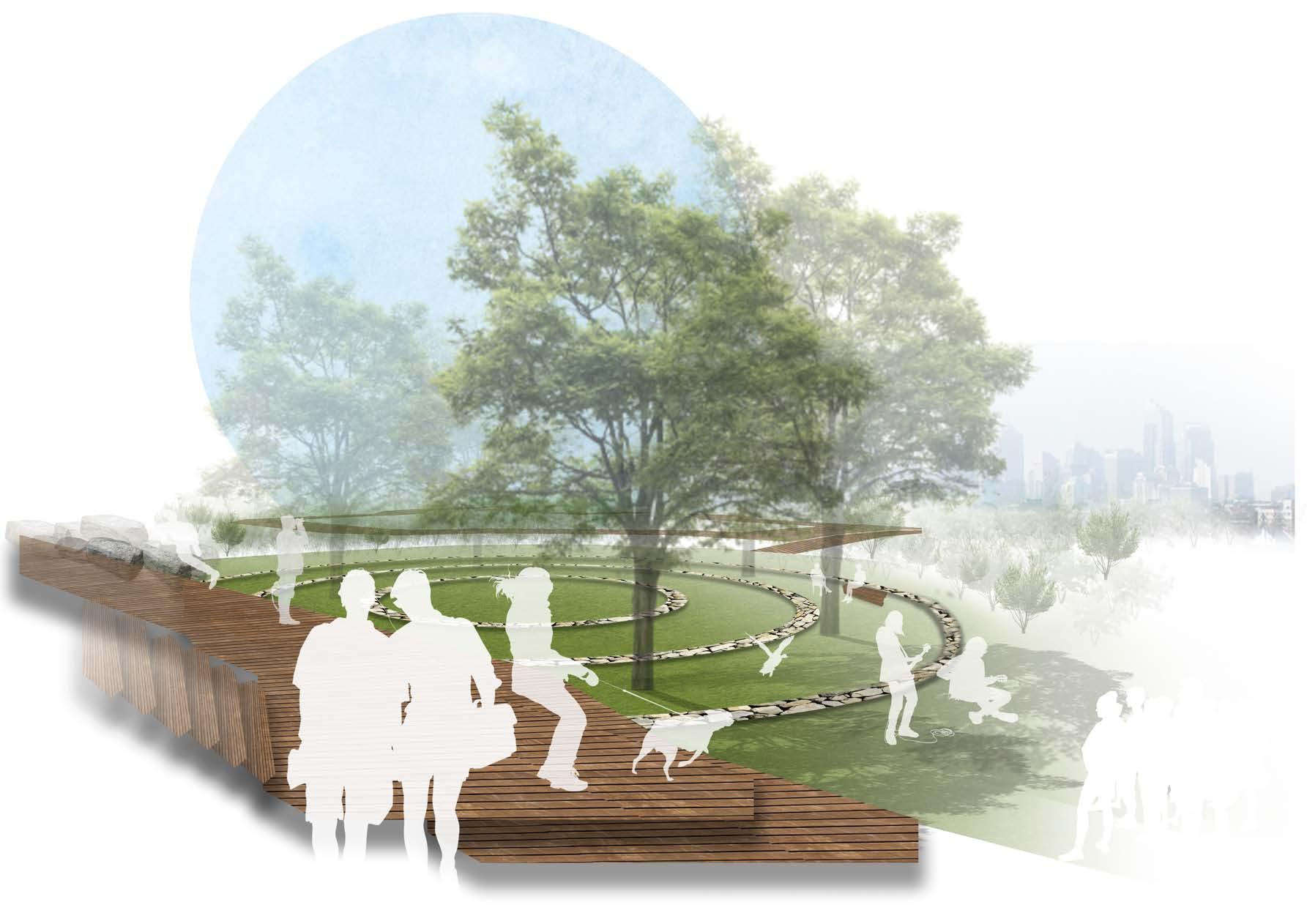
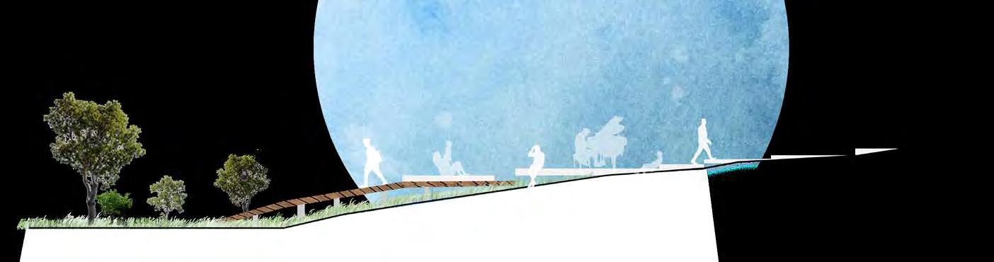
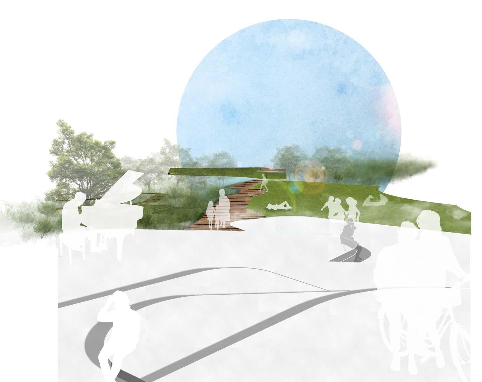
SHARING COMMUNITY PLAZA
GATHERING PLACE AT THE MIDDLE OF THE BRIDGE. THE PLAZA SERVES CAFE, EXERCISING AND RECREATIONAL PLAYGROUND AS WELL AS GOOD VIEWING PLACE TO THE BUILDINGS NEARBY.
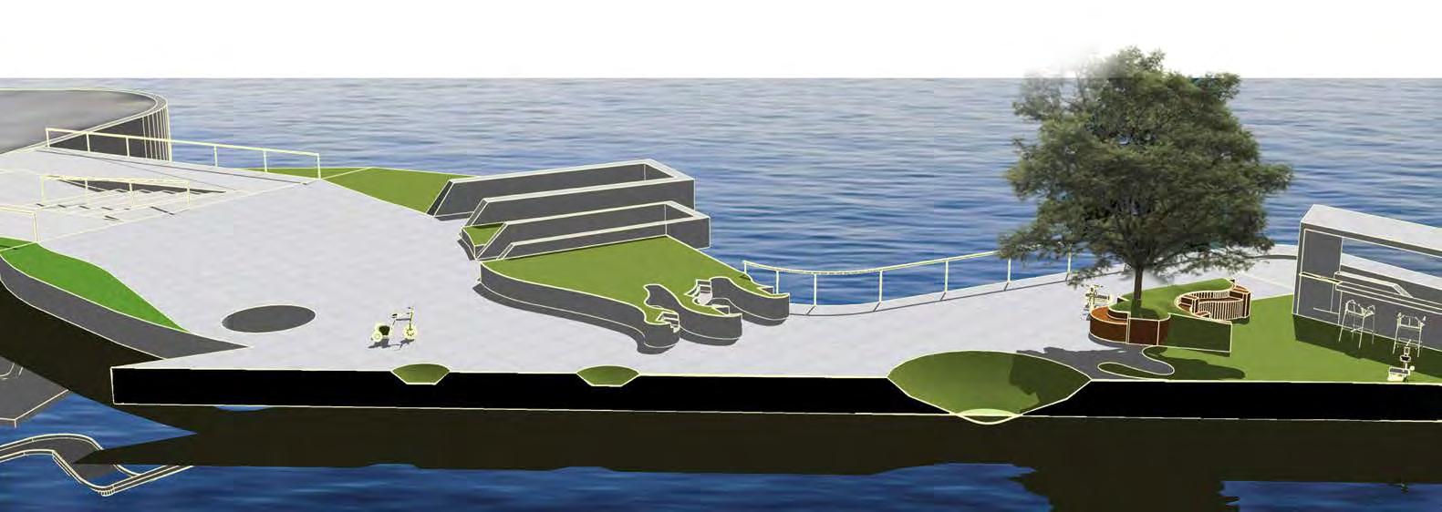
ELAVATED PATH
ALLOWING QUICK ACCESS FOR RIDERS TO THE SUPERHIGHWAY. THE PATH ALSO PROVIDE GOOD VIEWING SPACE FOR PEDESTRIANS AND VISITORS.
GREEN
HOLE
Gathering Community Plaza /
10 15m
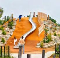
WELCOMING ENTRANCE
BOTH UP THE BRIDGE AND DOWNWARDS TO THE WATER'S EDGE. CONVEYING THE EXPERIENCE BY WATER. THE WATER SLIDE ENGAGE VIEWERS TO GO UP.
PART OF THE GREEN PAT CHES ON THE BRIDGE, ACT ING AS HABITAT FOR ANIMALS, AND OBSERVING PLACE FOR PEOPLE.
SUPERHIGHWAY
FROM LEFT CORNR TO THE RIGHT BOTTOM OF THE BRIDGE. AN IMPORTANT LINK TO THE INNER CITY. ONE OF THE MAIN PURPOSES IN THE DESIGN OF THE BRIDGE.
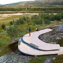
PERSPECTIVE TOWARDS THE PLAZA 1
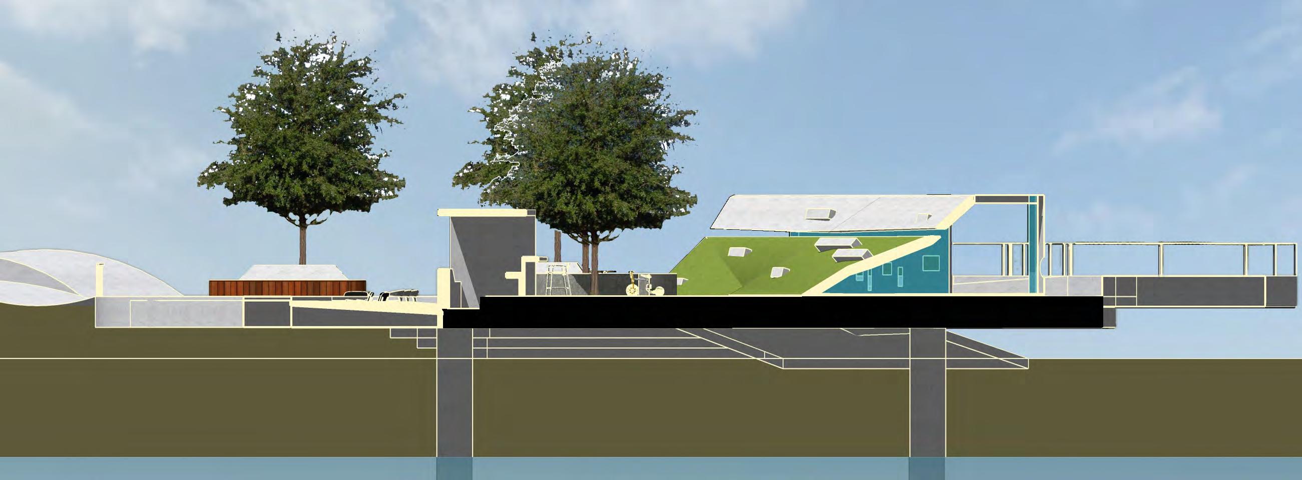
Longitudinal green patches section
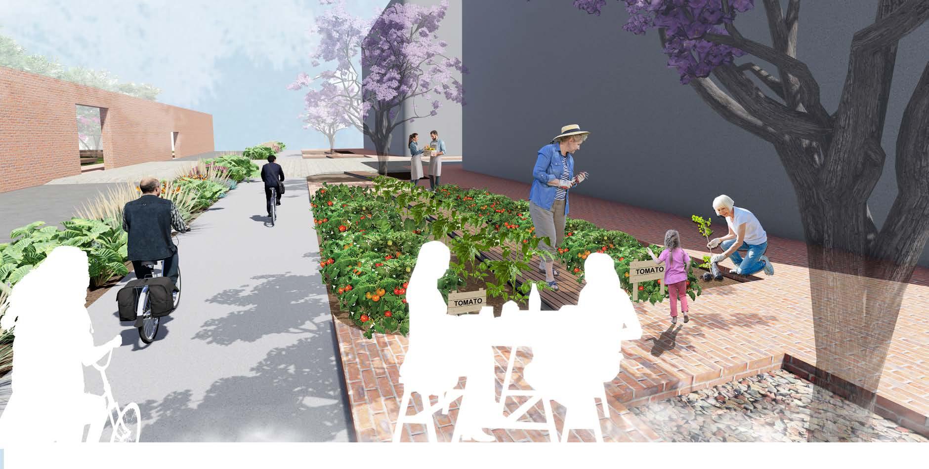
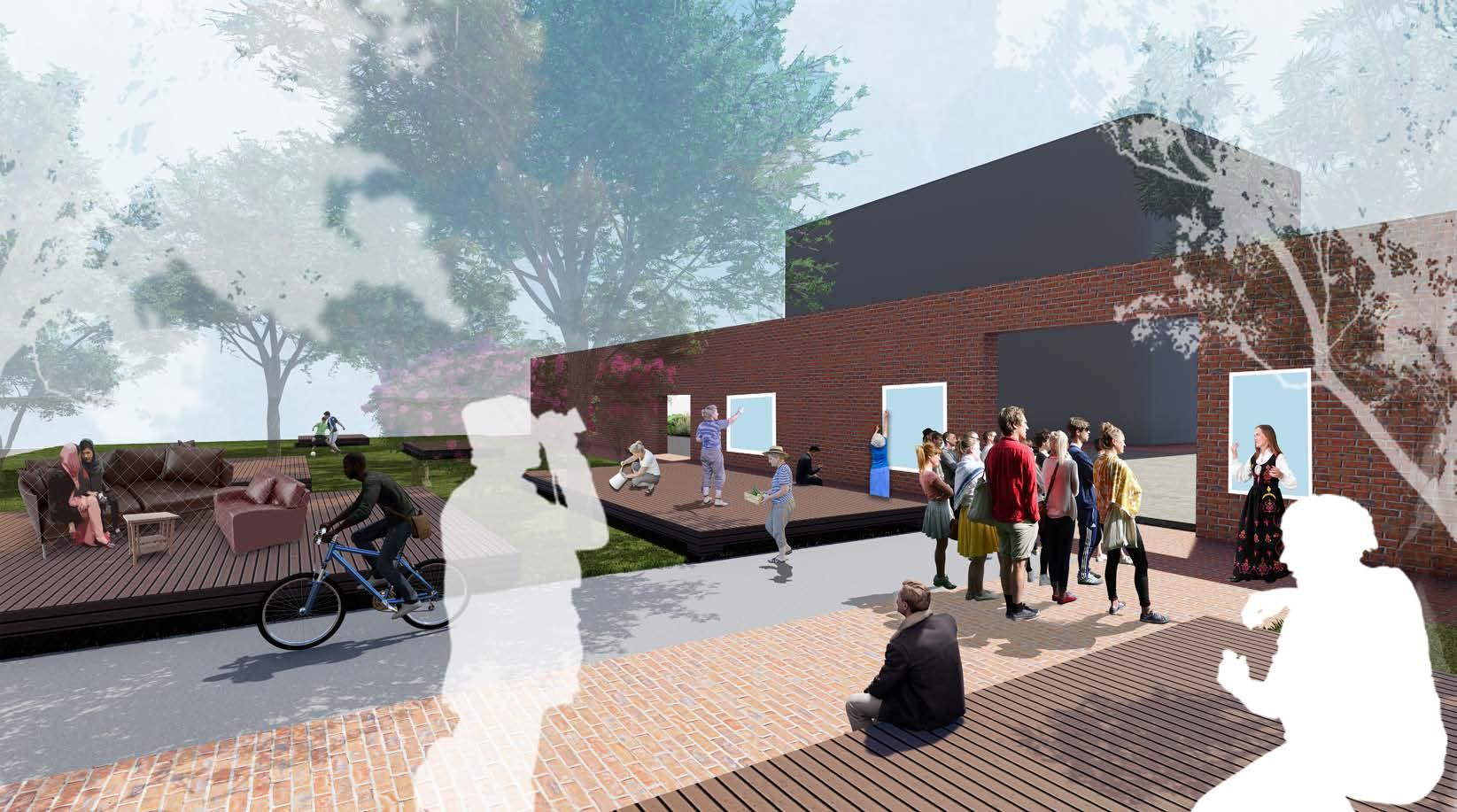
Guerilla Landscape /
-- COMMUNITY DESIGN
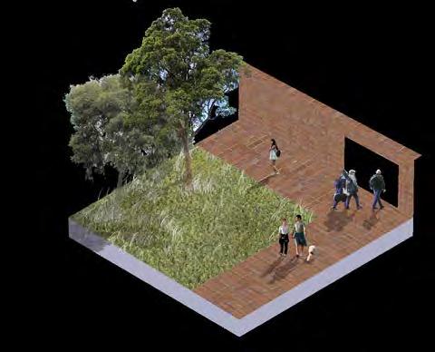
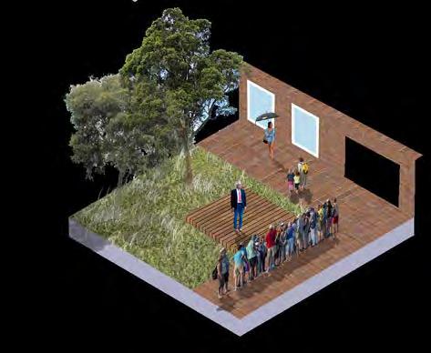
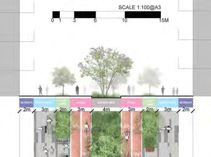
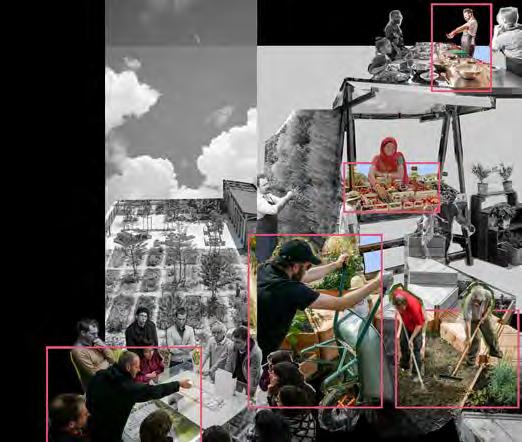
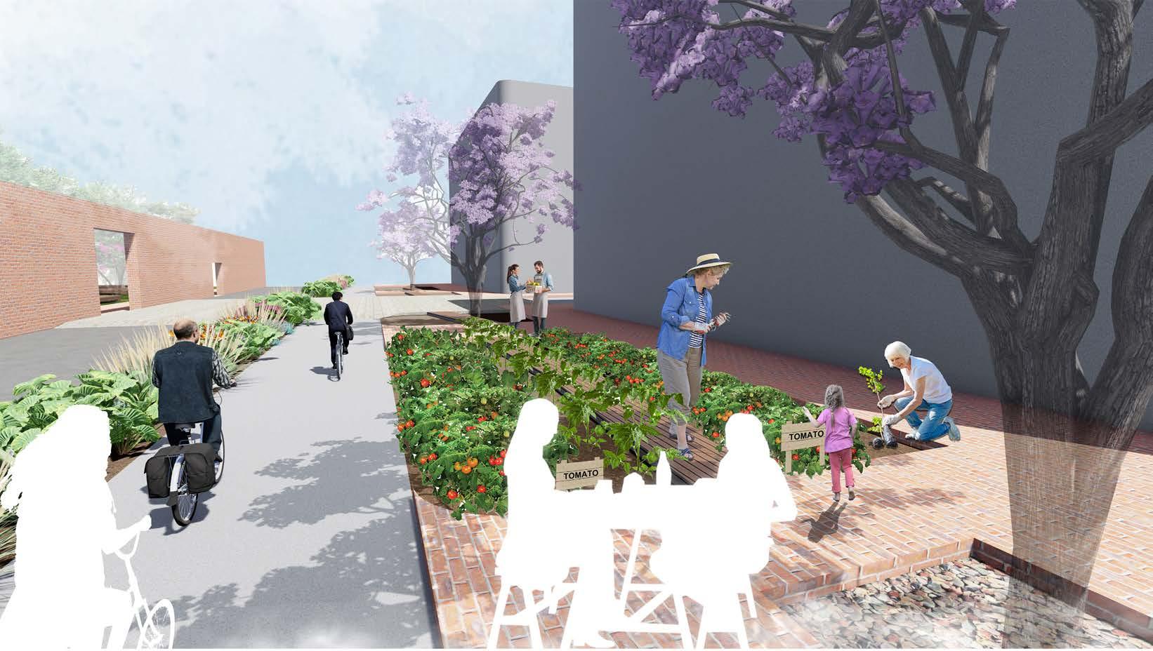
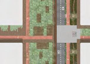
CREATING SHARING AND MODIFIABLE LANDSCAPE IN LIVERPOOL, NSW
Liverpool project is my graduation project which has worked across the whole 4th year of bachleor lancscape architecture study. The project has been divided into three parts, site masterplanning (Group work), idea and concept testing, and lastly detailed design.
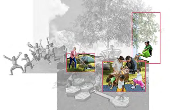
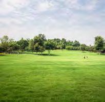
Liverpool is a place with lots of diversity, which includes cultures, ages and land uses. Therefore, the main idea of the design is to utilise these unique characters in the design, to provide a space for all of these diversities, of how everyone can enjoy in the space. Guerilla landscape design focuses on providing design opportunities to residents so that every culture group can enjoy their community.
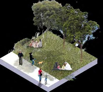
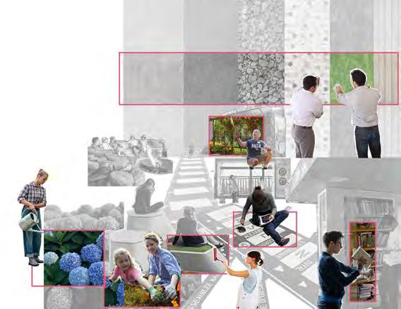
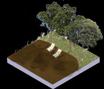
Design your own exhibition space
ENJOY IT!
Enjoy the temporary space quality and express your preference!
Change the function of the lawn, i.e. exhibition type, sports, leisure space
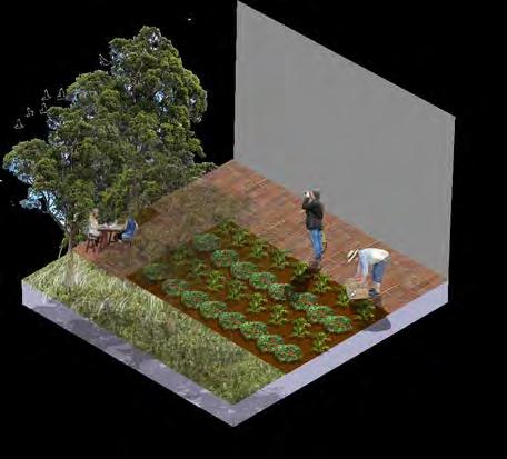
DESIGN IT!
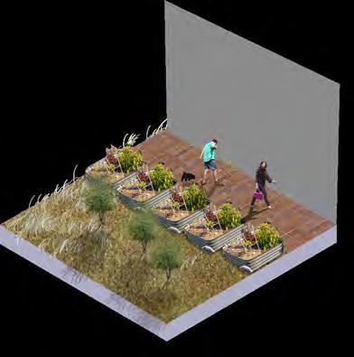
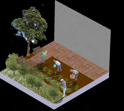
Engage with the phytoremediation program to clean the soil condition
Choose your preferred plants from planting palette and then plant and care for it!
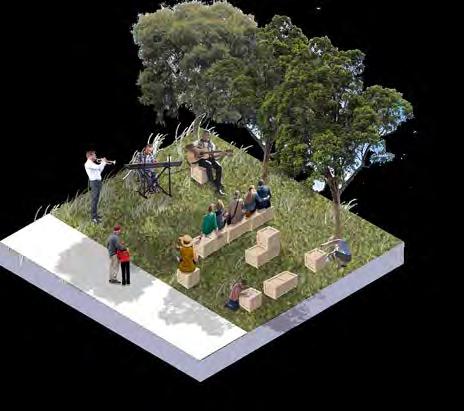
ENJOY IT!
Taste your endeavour!
Education, visit, leisure experience now available!
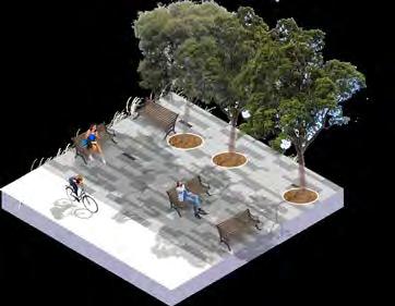
DESIGN IT!
Design this green open space with some leisure activity and events!
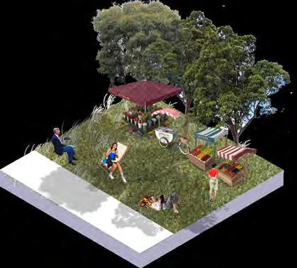
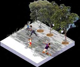
CHANGE IT!
Change the function on the lawn, i.e. market, rest, dining space!
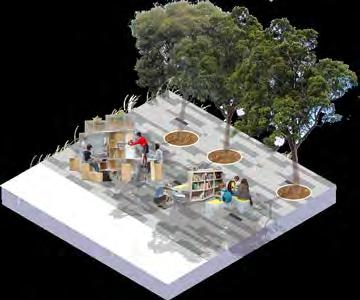
ENJOY IT!
Feel free to express your culture at this cosy place with Liverpool event
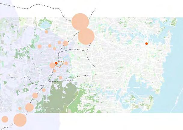
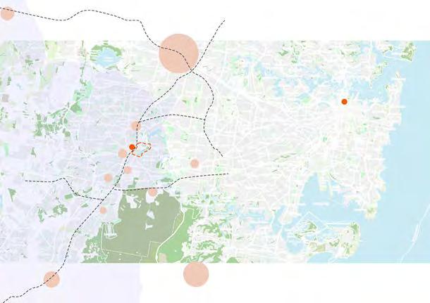
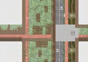
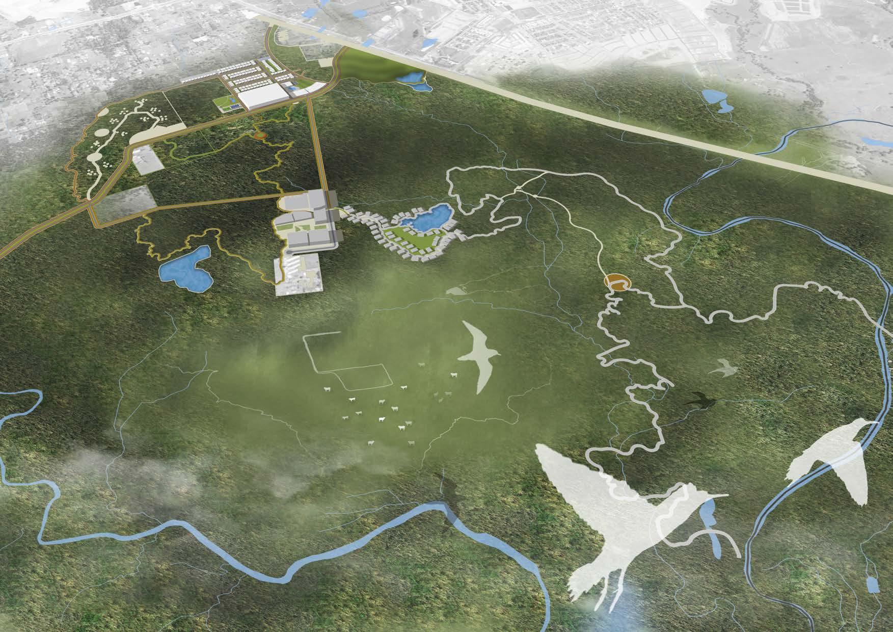
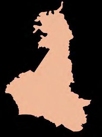
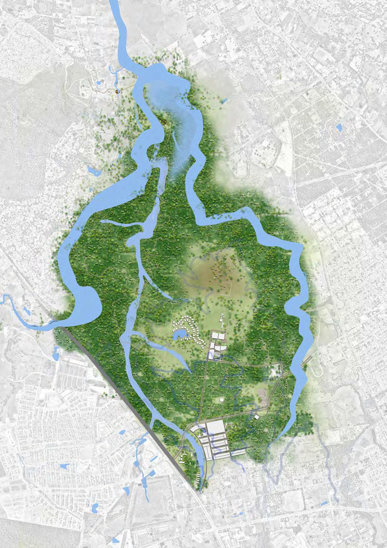
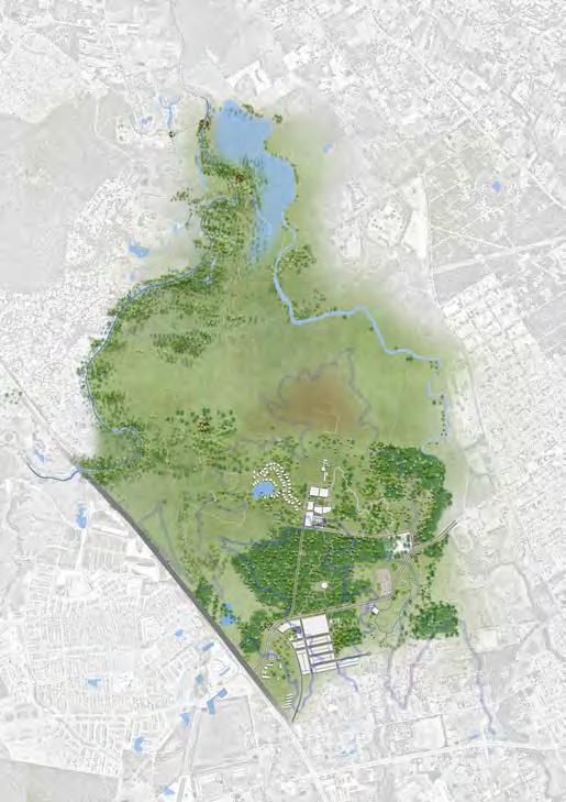
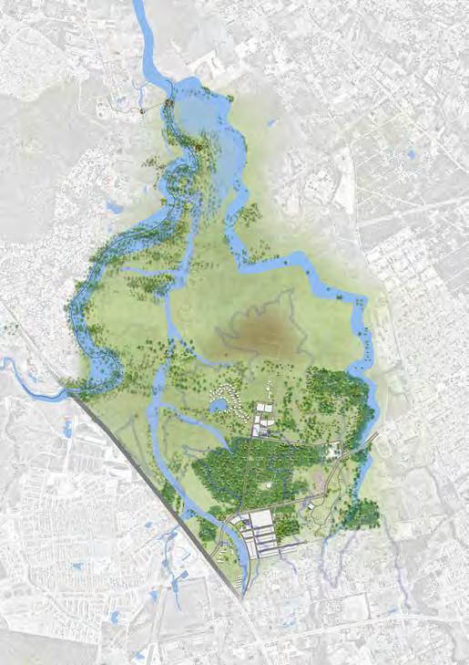
A Masterplan for Angus /
-- Town Planning Project
REPLANNING A PERIURBAN SITE UNDER THE UNDERSTANDING OF COMMONS
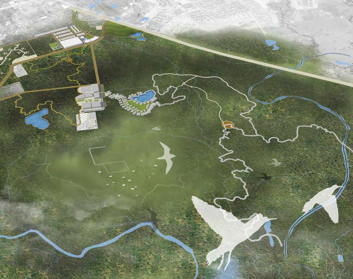
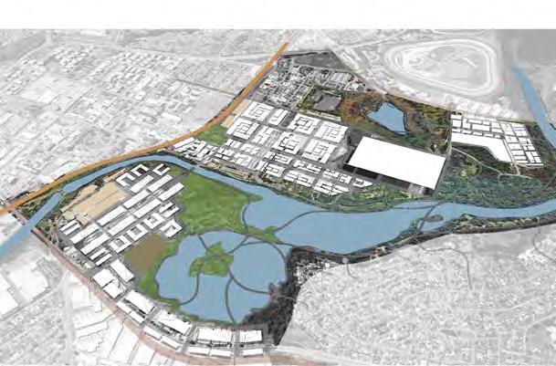
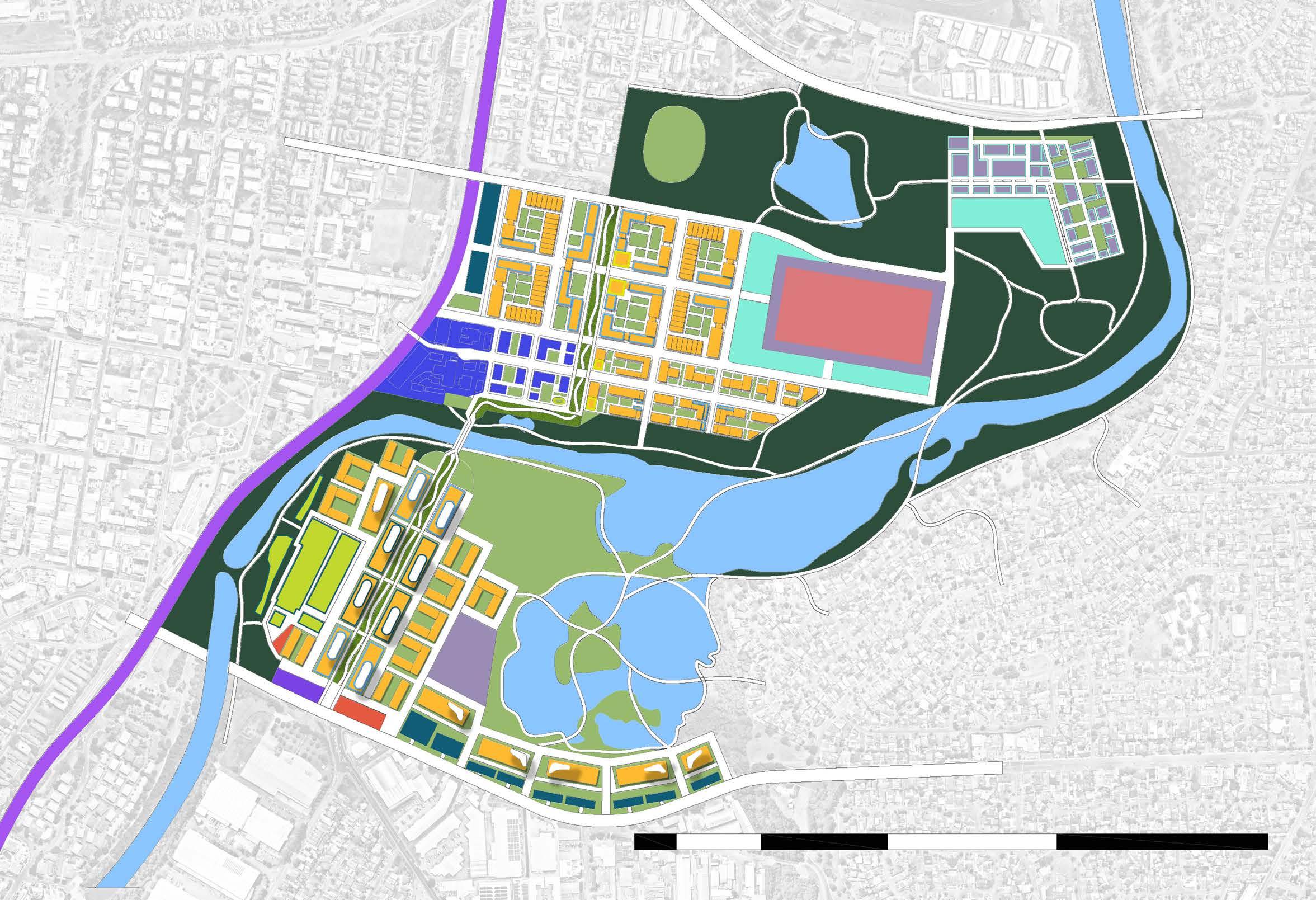
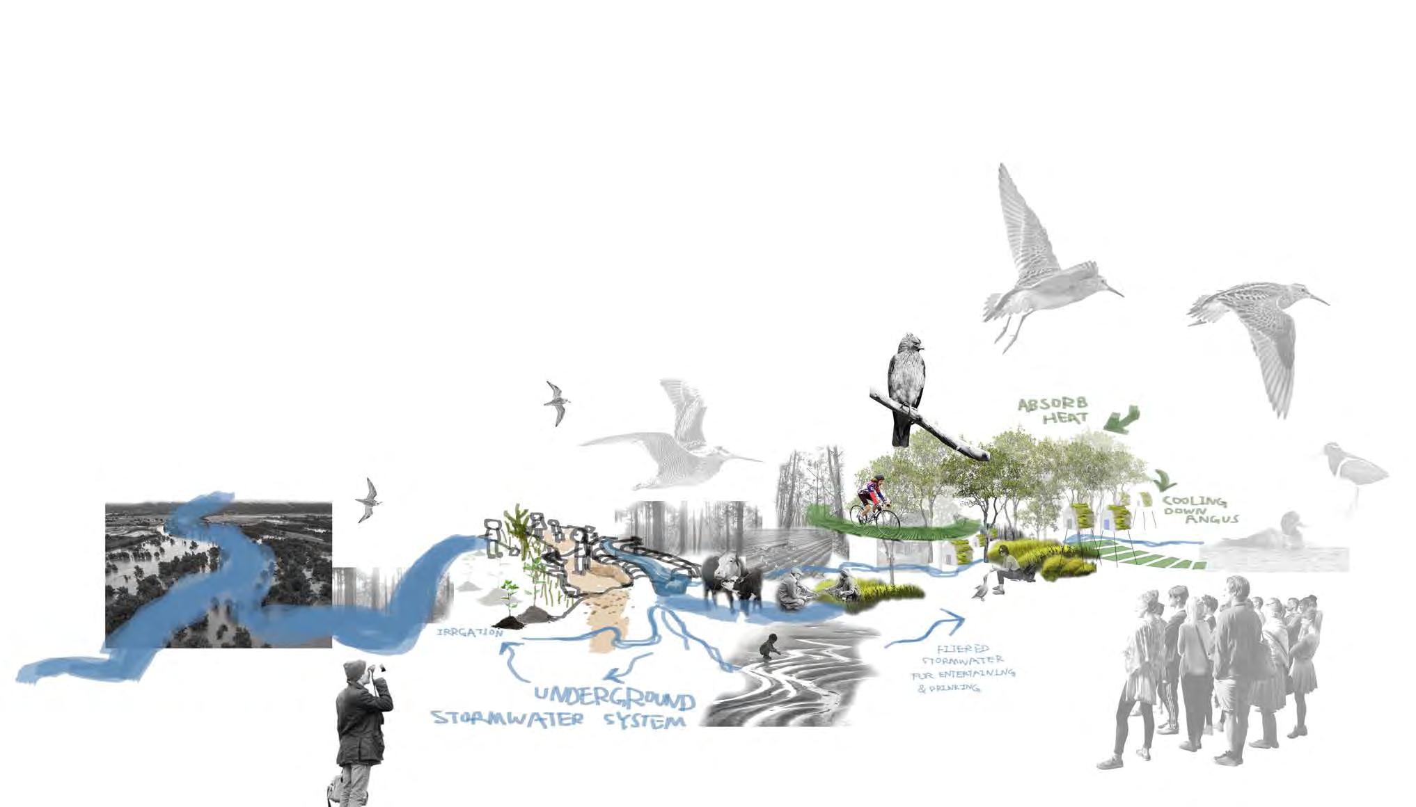
This project is aim to use the concept of commons to give a strategy plan towards the future of the site. In this project, take two selections of commons which are ecological common & cycling and pedestrian friendly common. These two commons can integrate the site into an social-ecological common so that transition the place into a well connected zone to the neighbourhoods in a broader context. In this project, I focus on the systems on site, natural system such as soil, water corridor and vegetation communities which can support a high environmental value. On the other hand, was looking for the opportunities to connect human and nature, by mitigating the rigid boundary at angus. To realize the significant disadvatages of flood prone and population growth on the site is important and should be considered as prequisite in this future planning. Therefore, this is one of the project to help me to understand the systems act as a holistic foundation and complex thinking comes after it.
Design Vision:
"To connect green and grey patches, building road systems and corridors in order to turn angus into a useable & accessible informal parkland for neighbourhoods. The layer of cool tree canopy cover will integrate this place into a liveable and recreational space for both human and non-human. Transition angus into resilient landscape by responding to extreme weather condition."
ANGUS PERSPECTIVE
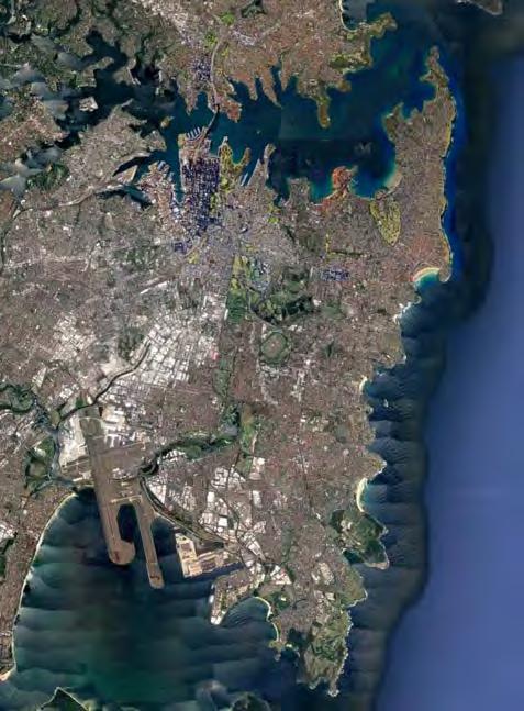
Marsden Park, Syndey
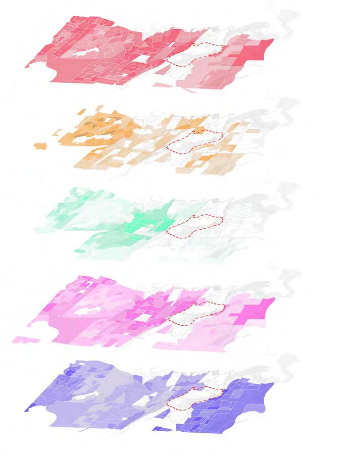
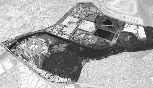
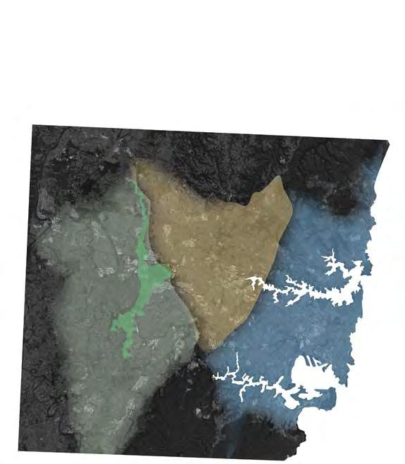
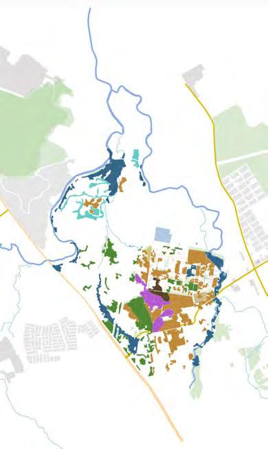
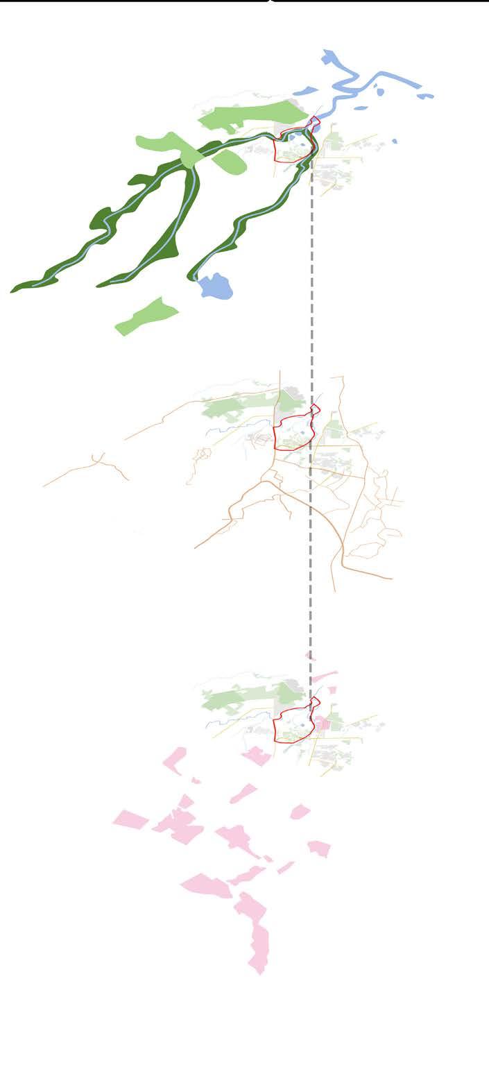
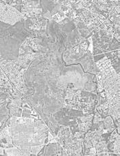
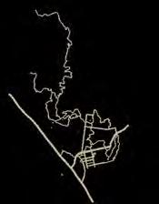
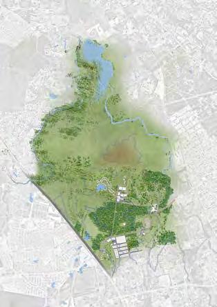
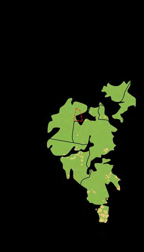
Site Context / Masterplan
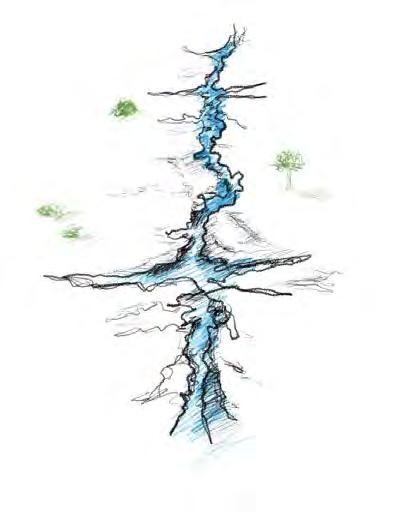
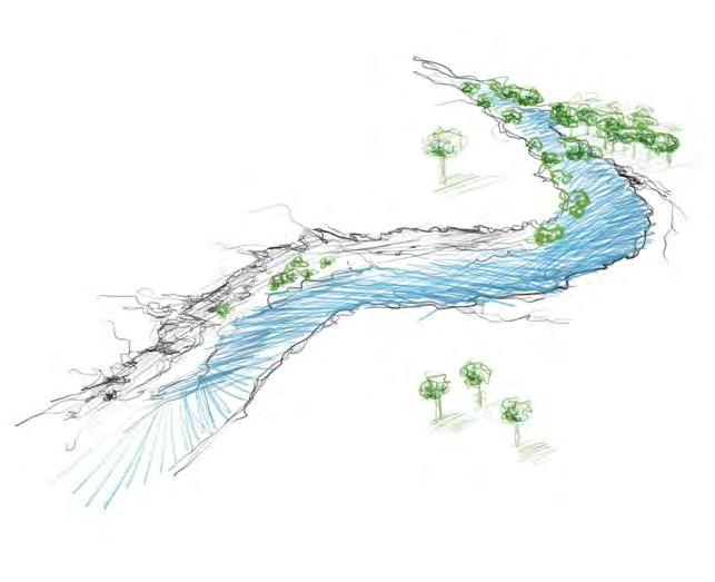
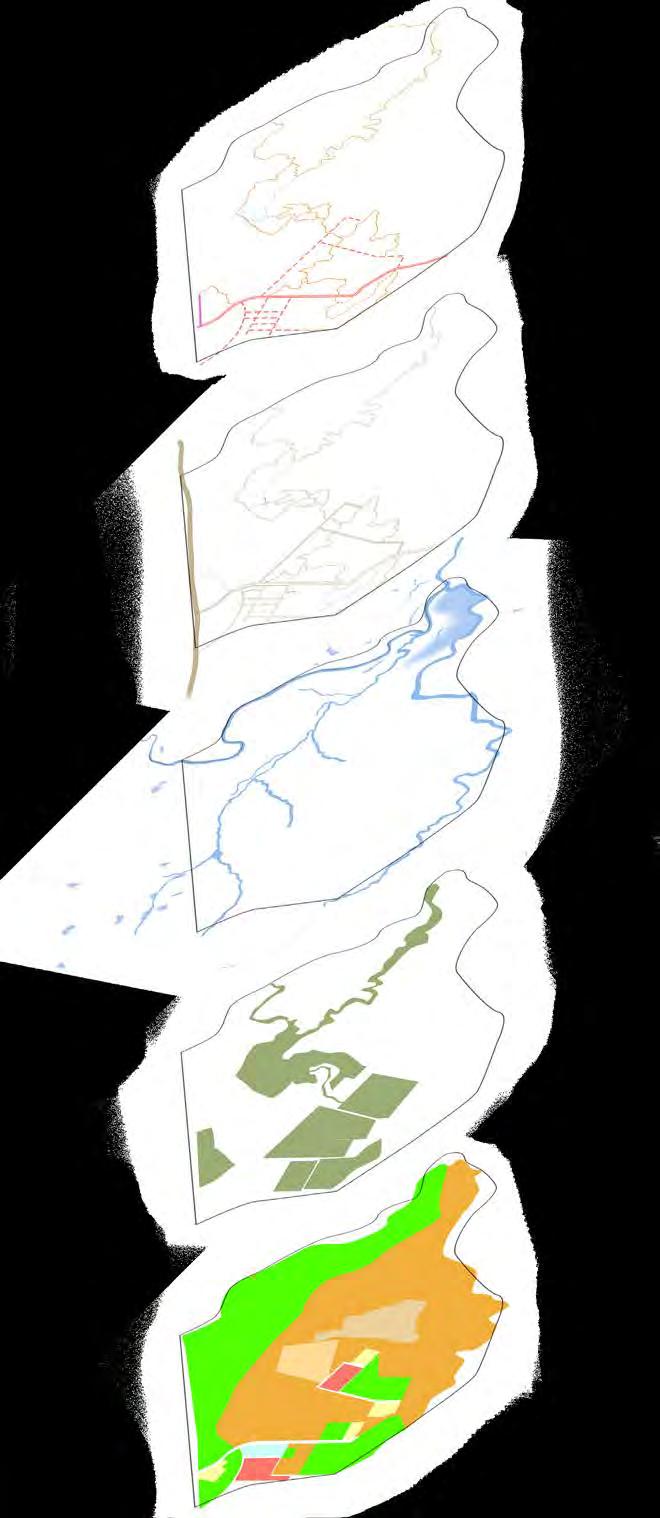
Angus is situated at blacktown within the central city district. On the other side, angus sits on the western parkland city and is part of western sydney parkland. EMBANKMENT ANALYSIS
Scattered trees along the bank, harsh eroded embankment, the creek line is under poor quality for biodiversity and diversity in vegetation.
SITE NEIGHBOURHOOD CONTEXT
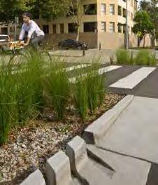
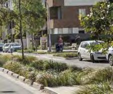
CYCLING PATHWAY
Good quality of cycling pathway are circulated around angus. Potential to connect these at angus.
GREEN AND BLUE PATCHES
Maintain the existing endangered species for futher connection to neighbourhood ecological patches.
EXISTING VEGETATION & FLOODING
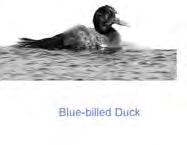
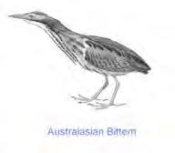
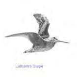
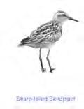
There are large amounts of endangered species at angus, good quality of natural resources.
JOB EMPLOYMENT OPPORTUNITIES
Inadequate job opportunities within 5km of angus, consideration should be taken when design residential zone.
Angus act as a significant peri-urban interchange spot to connect social, environment and economic value.
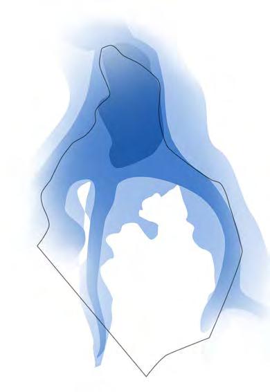
Angus has suffered from significant flooding issue, with half of the place sits in the 1 to 100 yr flood prone zone.
2027, With existing trees and waterway, planting trees with local council volunteer work, long-term but sustainable process
, Widen the waterway, through cut and fill process, to achieve more inclusive and resilient design when flood come
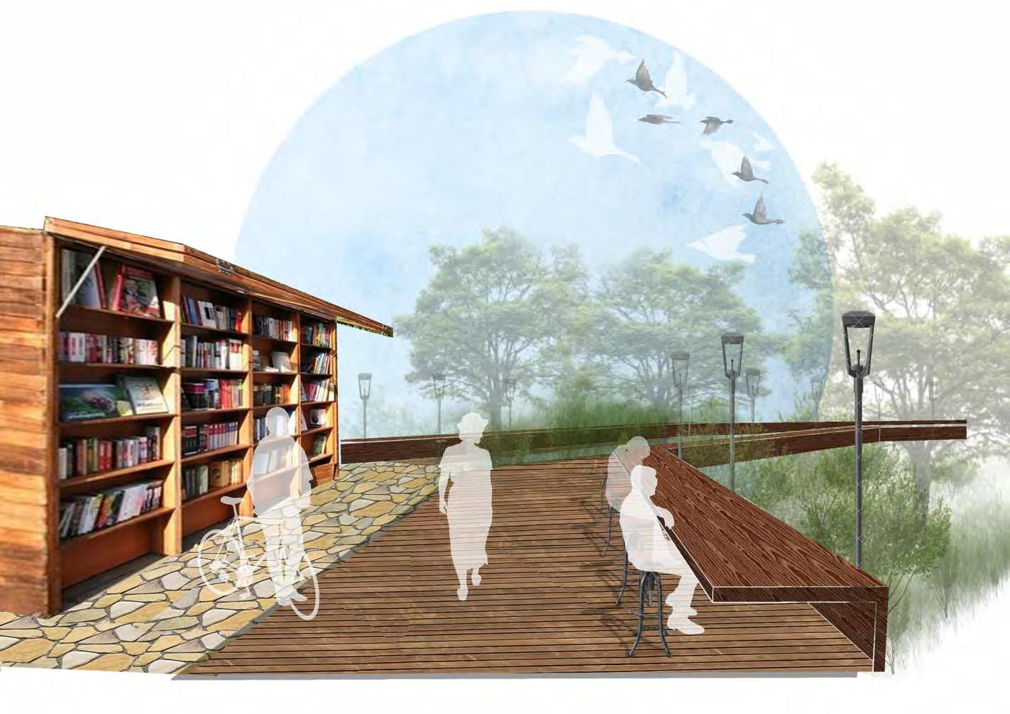
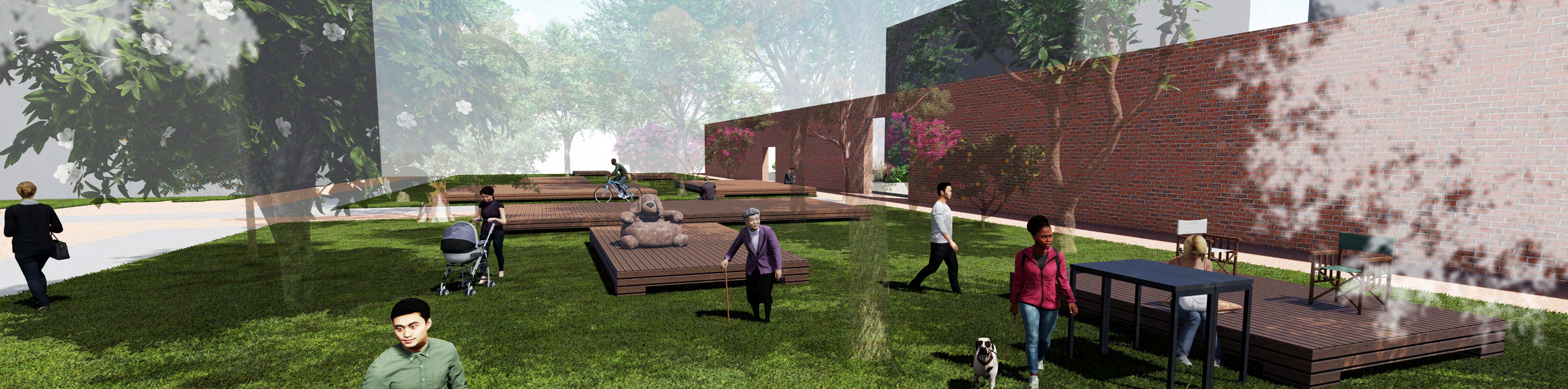
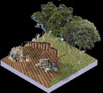
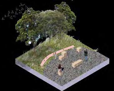
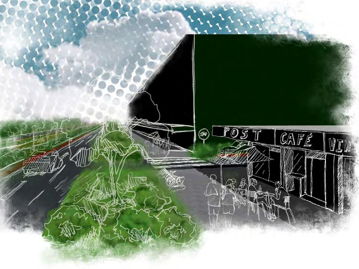
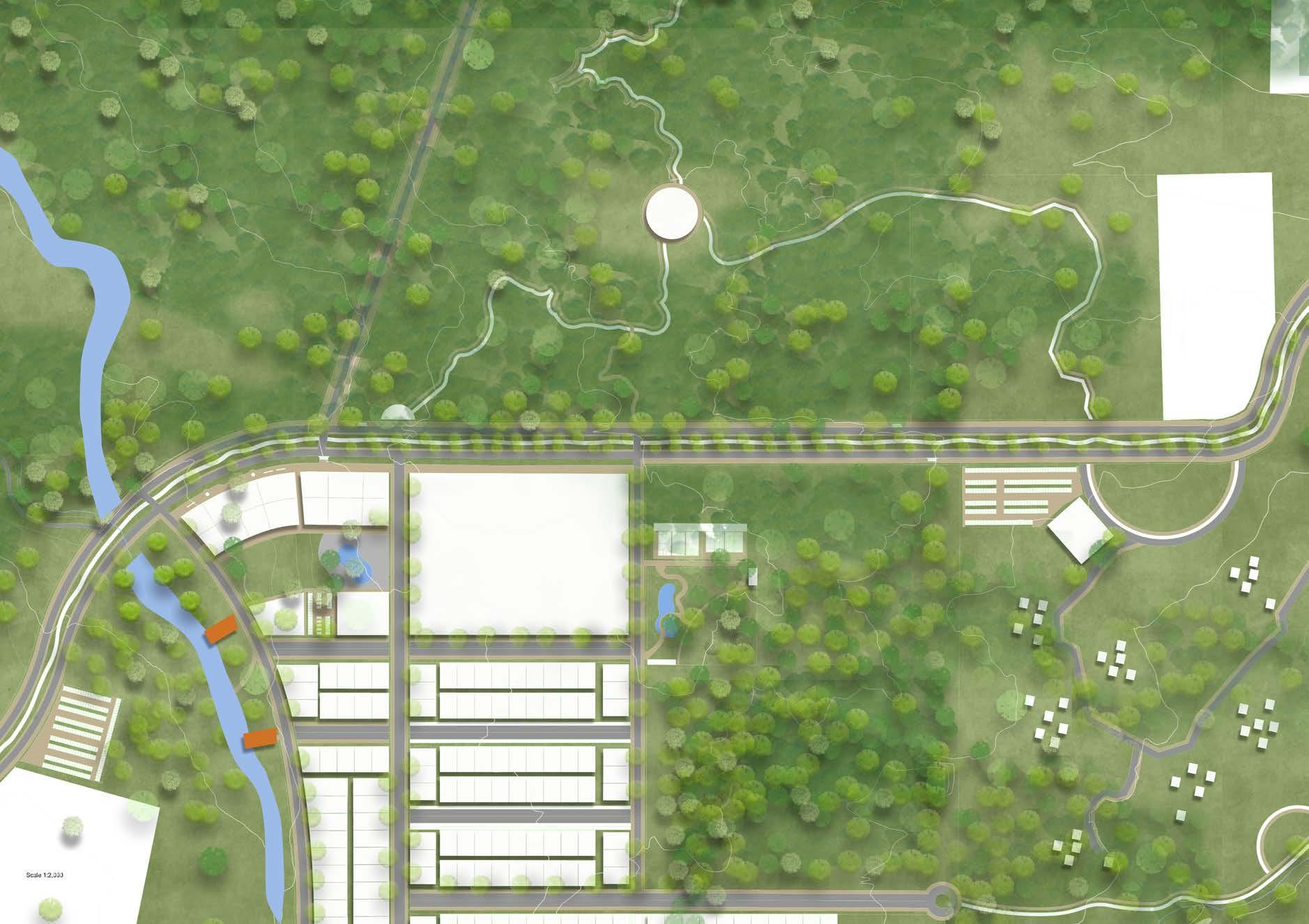
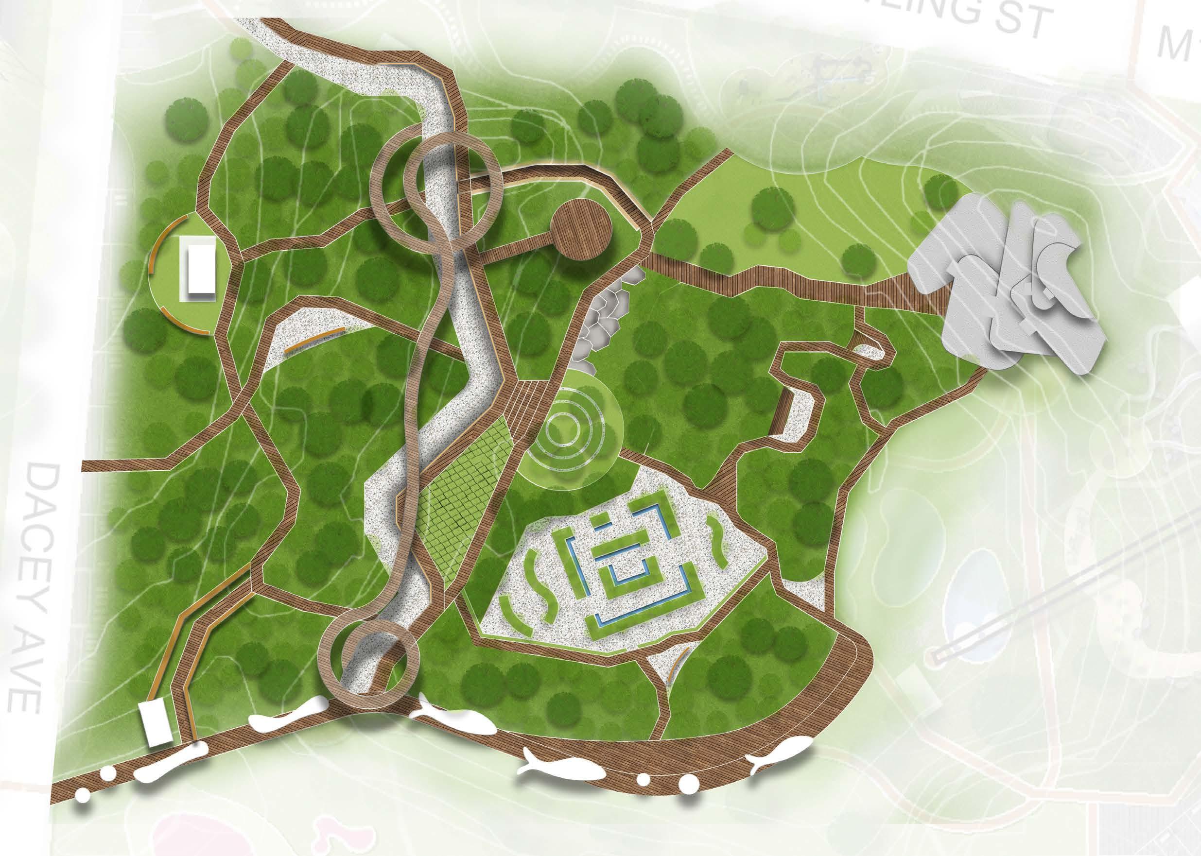
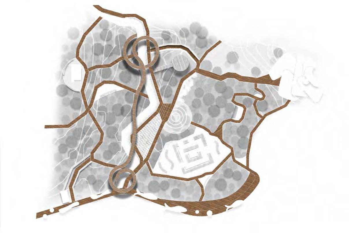
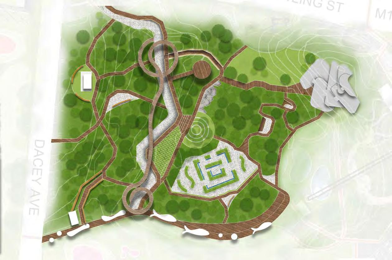
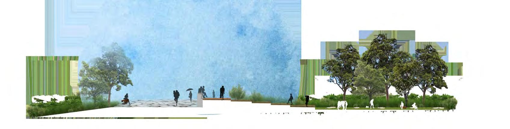
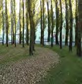
Breathe SLOW Bushland /
--
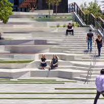
Golf course renovate into parkland
REFRESH AND REVITALISE AT THE SLOW FLOWING BUSHLAND
This project is located at Moore Park which is a significant sports field and golf course where located close to sydney CBD. The design aims to transform golf course into public space where everyone can enjoy , especially during pandemic era.
This project started with group work, and I have produced the masterplan and analyses in the group work. Then individual detailed design was further explored upon the group big idea.
In this project, have learned a lot from our group members of a clear thinking method to generate ideas and concepts.
Design Vision:
SHELTERED PATHWAY PERSPECTIVE
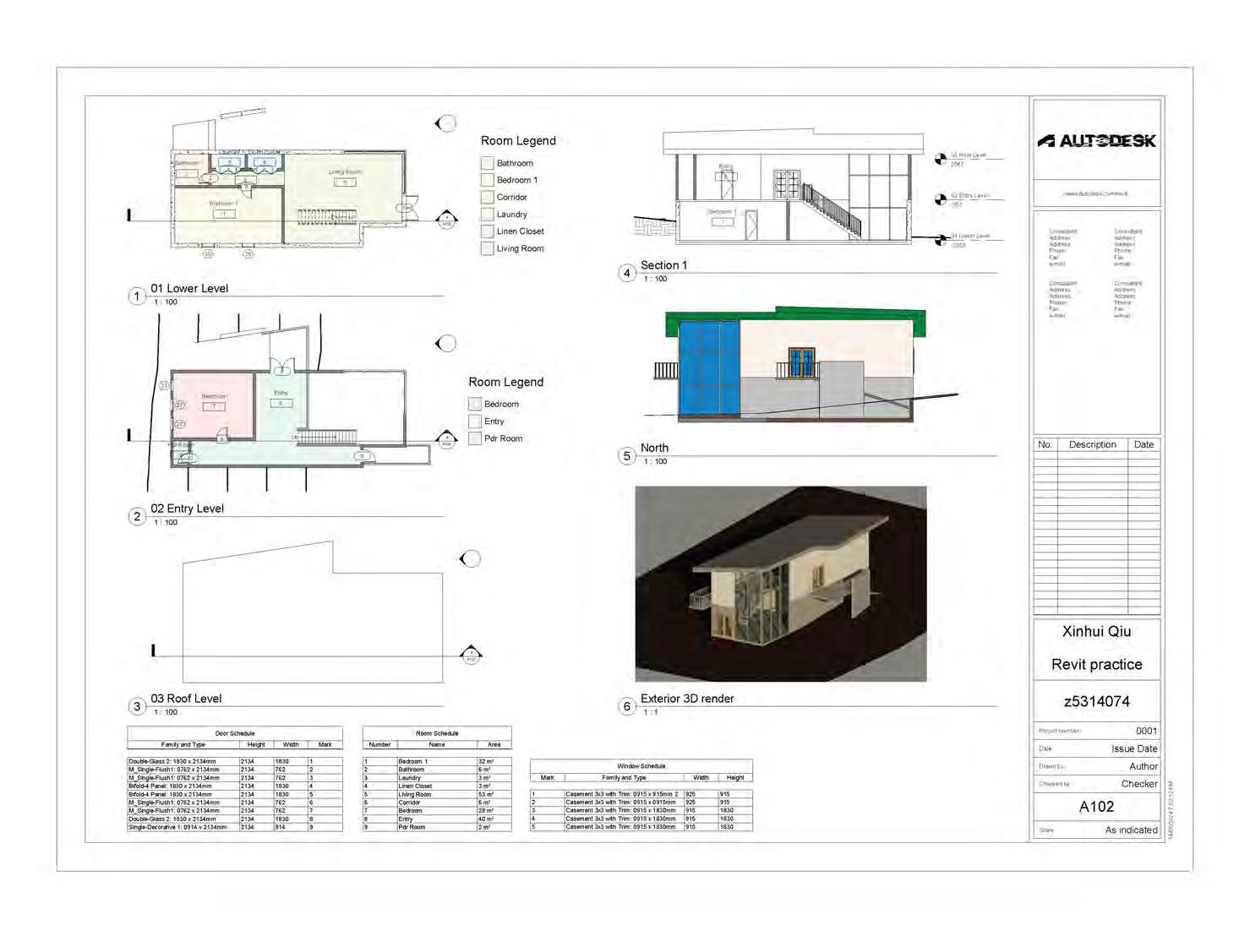
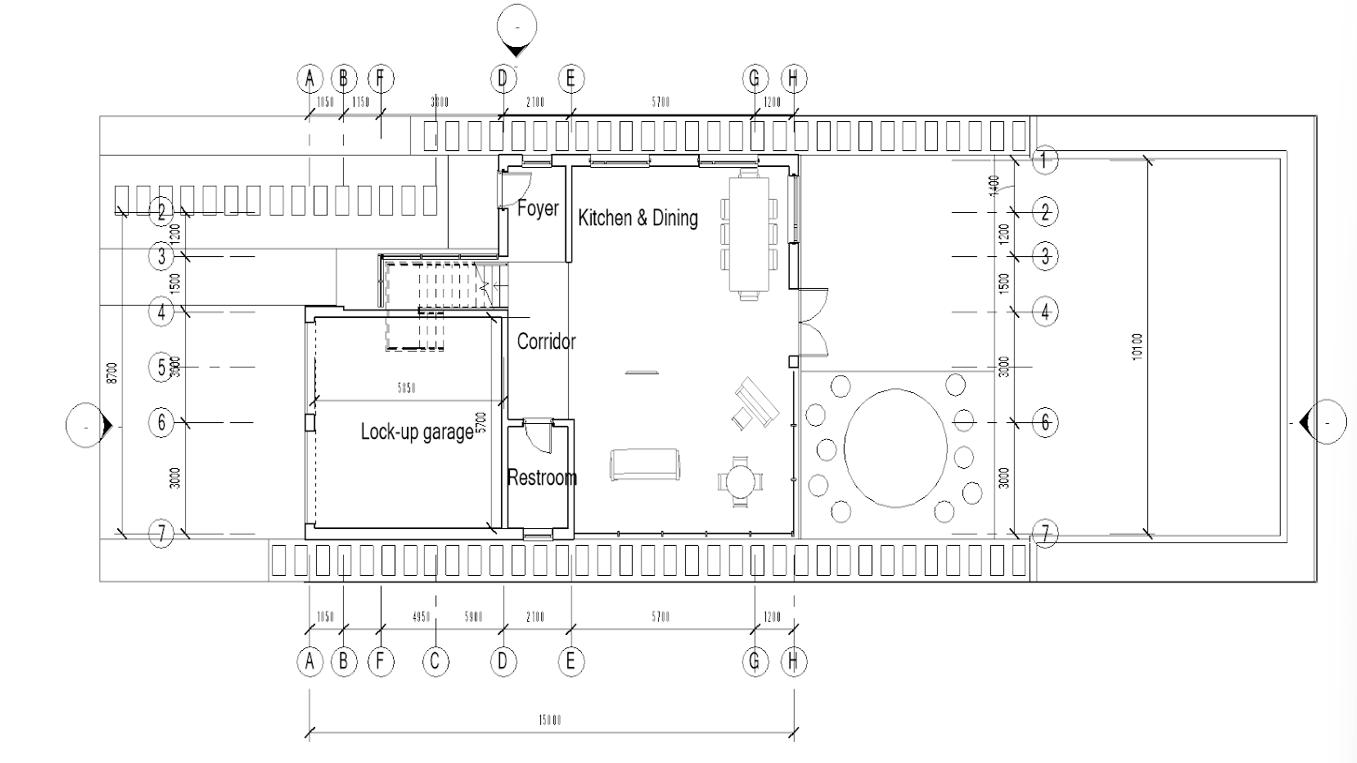
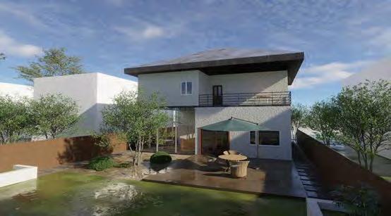
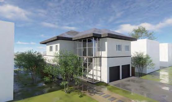
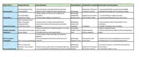
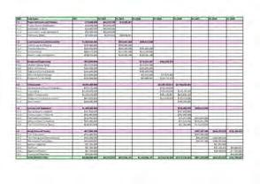
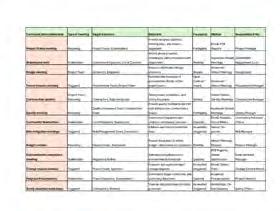
REVIT & PROJECT TIME AND COST MANAGEMENT GRAPHS
Master
During my master's studies, I gained expertise in Building Information Modeling (BIM), leveraging digital workflows to enhance design accuracy, collaboration, and sustainability in landscape architecture projects. I worked with BIM software to develop data-rich models that integrate site analysis, material specifications, and construction documentation, ensuring seamless coordination among project stakeholders.
Additionally, I studied Construction Project Management (CPM), focusing on project planning, scheduling, budgeting, and risk assessment. Through case studies and practical applications, I learned to manage construction phases efficiently, ensuring compliance with timelines and cost constraints. also explored the integration of BIM with CPM, utilizing data-driven decision-making to optimize project execution, improve communication, and enhance the overall efficiency of landscape and urban development projects.
This knowledge equips me with a comprehensive understanding of both design and construction processes, allowing me to contribute effectively to multidisciplinary teams and deliver high-quality, well-managed landscape solutions.