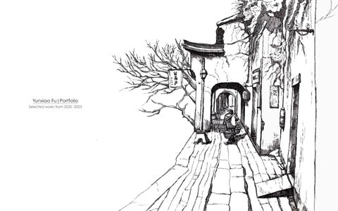
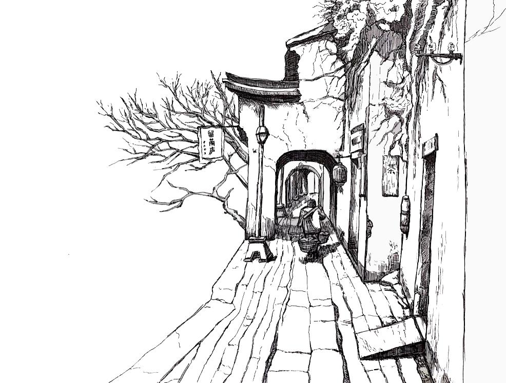
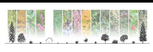
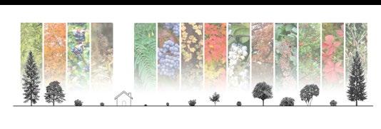
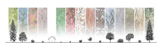
Yunxiao Fu|Portfolio
Selected works from 2020 -2023
CONTENT
01|Protect Barrier Island
Flood Hazard vs Human Vulnerability
Urban & Community Design, Individual Work
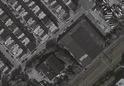
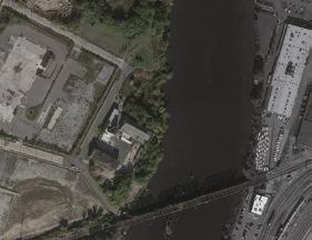
Fire Island, New York, United States
02|Large Green Healing Network
City Transportation’s Connection with Nature & Human
Urban Design, Individual Work
Hillsboro, Oregon, United States
Beaverton, Oregon, United States
03|“ ” District
Industrial Remains vs Human Needs
Urban & Community Design, Group Work
Bartram’s North, Pennsylvania, United States
04|GREEN “FISH”- History moving into Future
Industrial Remains vs Nature Environment
Urban & Community Design, Individual Work
Yangpu District, Shanghai, China
05|Resilient & Fire-safe Residence
Natural Disaster vs Human Vulnerability
Residential Property Design, Individual Work
Vida, Oregon, United States
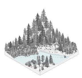
06|Johnny Diamond Park
Open Space vs Human Needs
Community Design, Group Work
Coburge, Oregon, United States
07|Thurman Couryard & Roof
City limits vs Human Experiences
Residential Property Design, Individual Work
Portland, Oregon, United States T
Fu 2
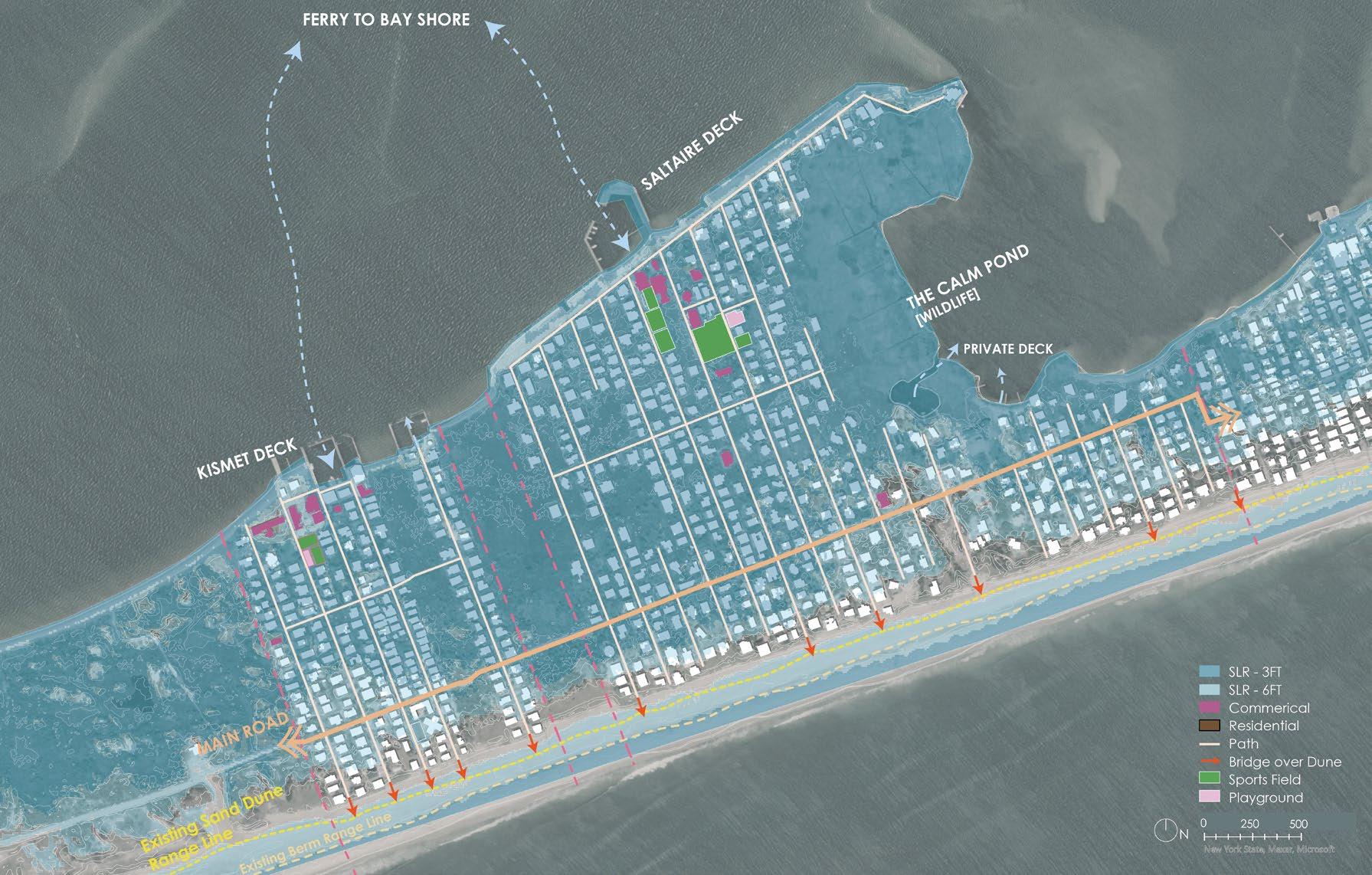
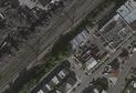
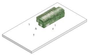
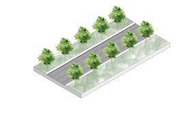
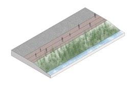
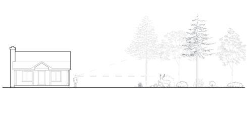
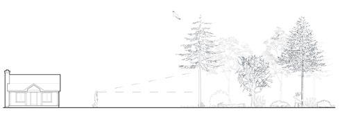
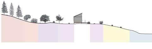
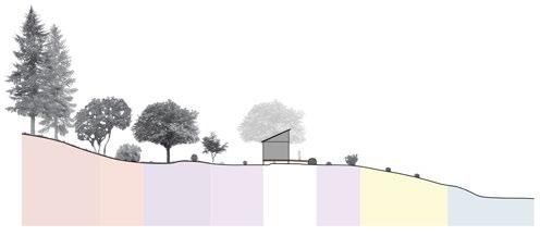
PROTECT BARRIER ISLAND
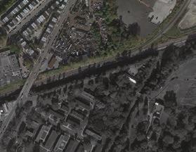
Flood Hazard vs Human Vulnerability Fire Island, NY, United States
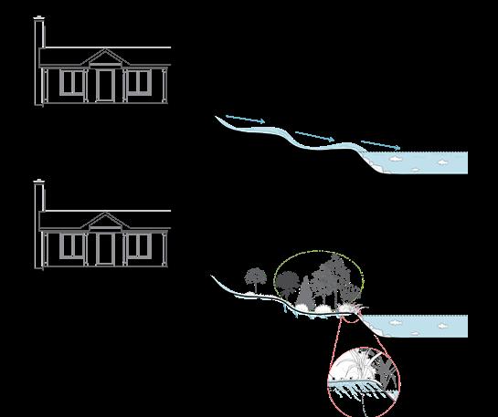
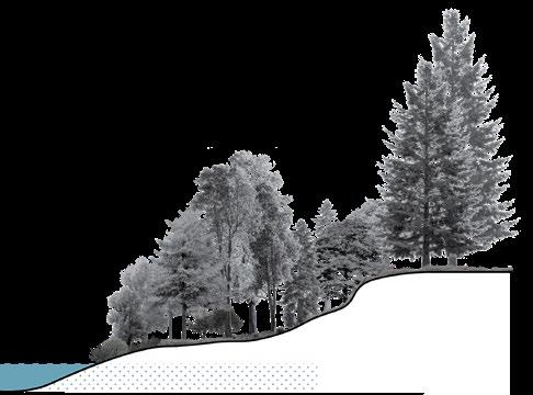
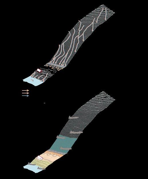
As sea levels rise, coastal areas of Long Island will experience severe flooding, especially in the southern part of the island. There, a long barrier island, facing the bay to the north and the ocean to the south, became a key part of the solution to sea level rise. If the barrier islands are protected in the first place, the inland areas of Long Island will also benefit and be protected against future disaster situations. Refering to US Army Corps of Engineers’ 2020 short-term dune and berm engineered approach, this project will mainly test and apply the sand dune method in the naturalbased solution, considering long-term, fewer sediment usages, and dynamic boundaries.
There are three questions to solve for this project:
1.How to make the sand dune more stable and become a long-term protection?
2. How can the housing fit the movement of the sand?
3. How to keep the island’s special culture?
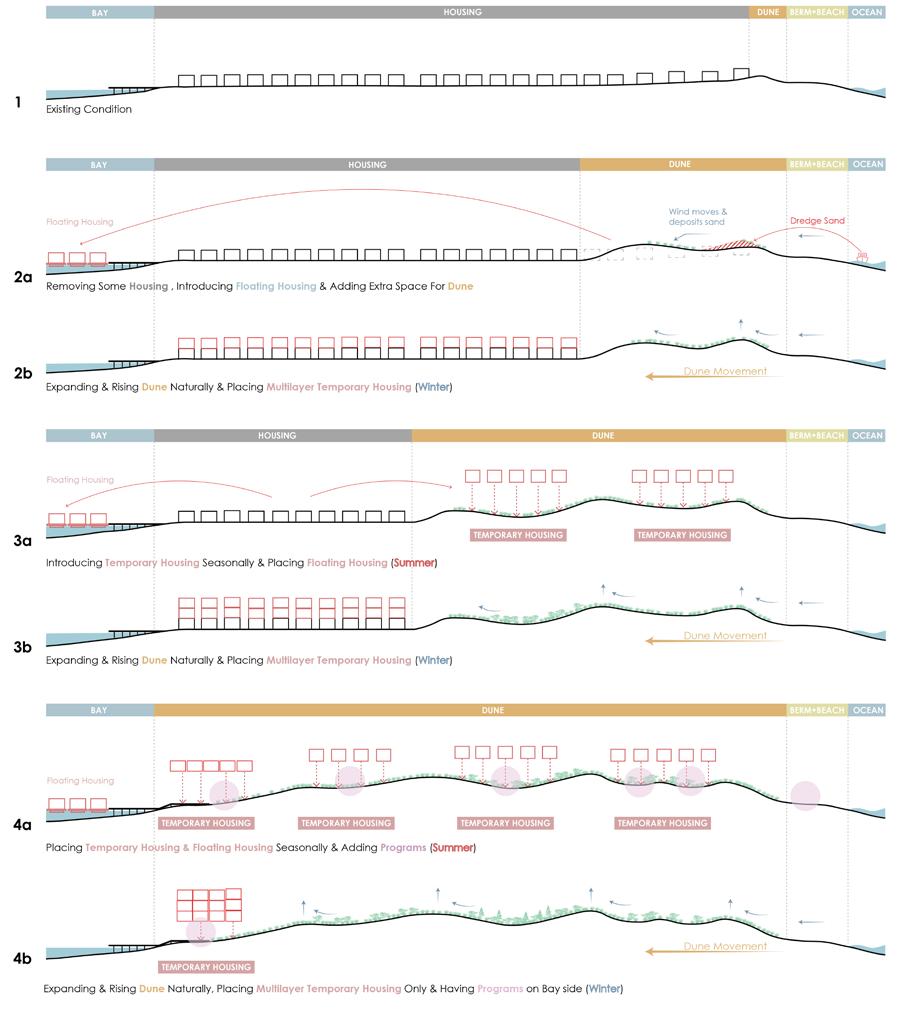
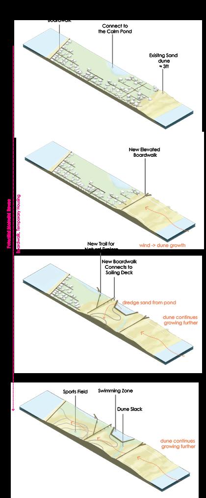
Dynamic sand dune strategy will be examined to solve these questions in this project through three main direction: 1)zone (sand dune & housing), 2) time (century & seasonal), 3) culture
Professor: Matthijs Bouw Course: Fall 2023, LARP 701 Studio
Academic | Individual | One Semester
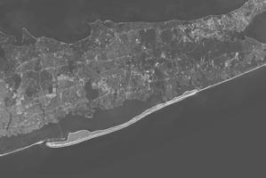
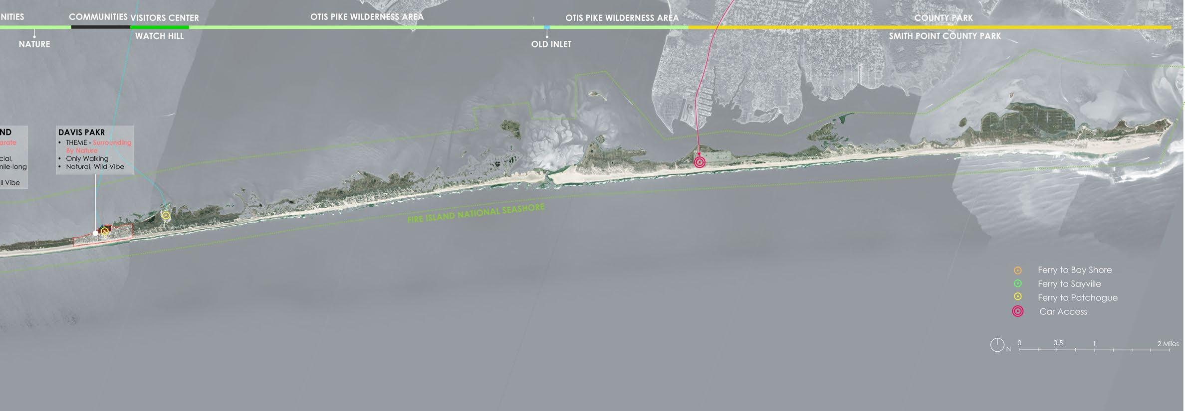
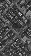
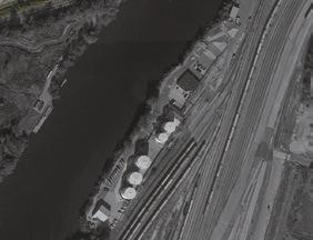
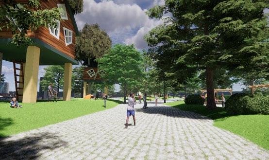
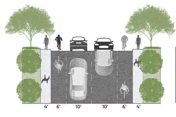
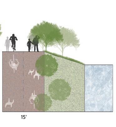
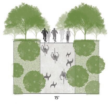
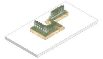
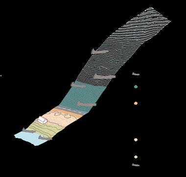
01| Fu SITE ANALYSIS|Existing Conditions in Kismet and Saltaire, Fire Island, NY 3
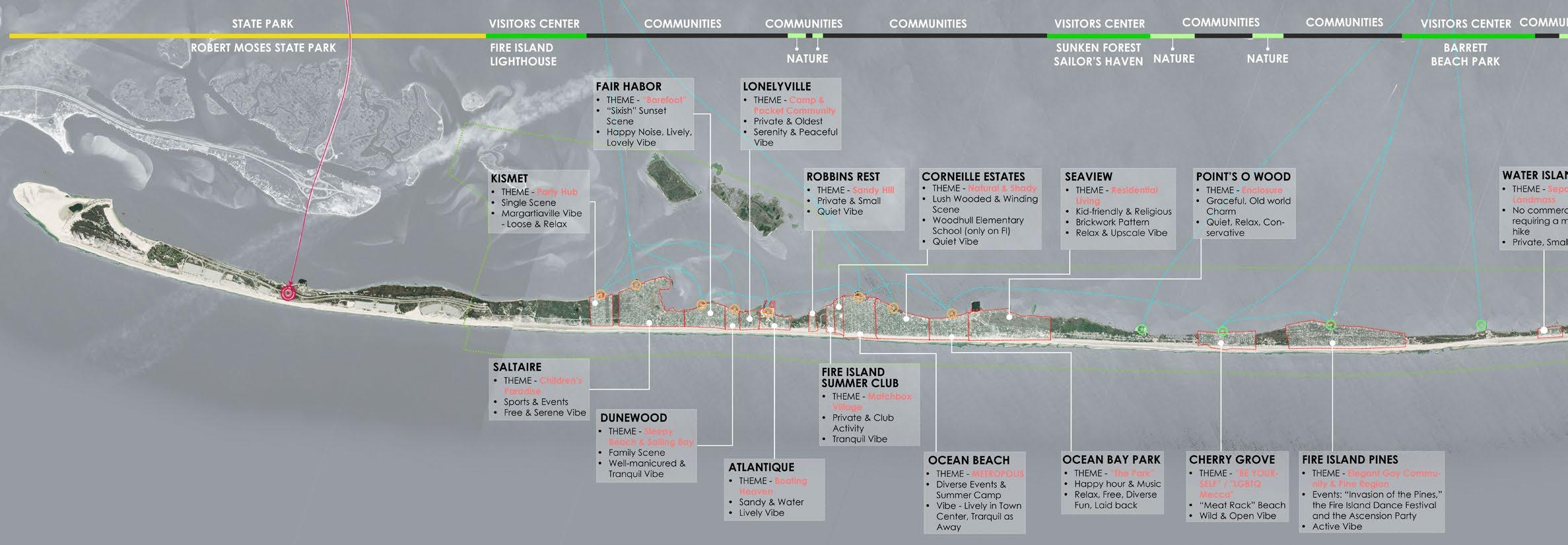
SITE ANALYSIS|17 hamlets/villages unique cultures, transportation culture - no car & ferry, unique zoning on Fire Island
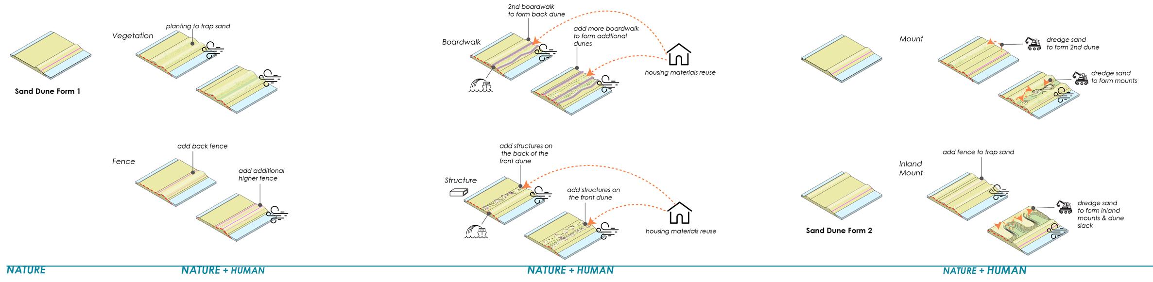
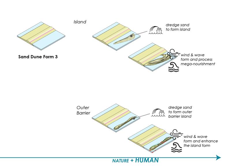
TOOIKITS - SAND DUNE|illustrating three different dune landforms and their natural and human interventions
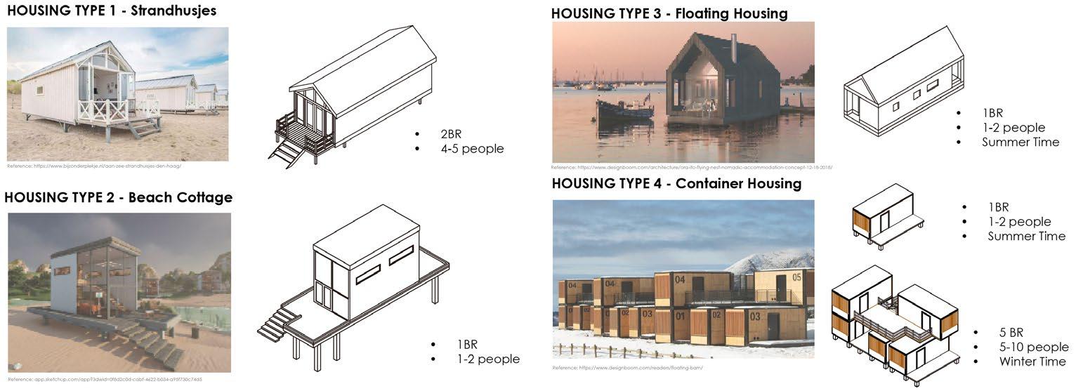 TOOIKITS - HOUSING|illustrating four types of case studies, which can be easily moved, constructed, and combined
DYNAMIC SAND DUNE STRATEGY|illustrating how nature and man interventions can achieve regional resilience through three directions 1) zone (sand dune & housing) 2) time (seasonal & century) 3) culture (program)
Fu 6
Summer Time: Camping Zone Summer Time: Separated Housing, Large Gathering Event Zone & Floating Housing Winter Time: Multlayer Housing & Covered Gathering Shelter Winter Time: Natural Dune Trail - Feel the sand in a close distance - Walk and play inside the sand dune landscape - Three types of housing: container housing, Floating housing, and housing with large glass windows - Sunsite view - Outdoor gathering and event space - Bayside landscape - Bayside - stacked housing - Keep out of the dunes - Sunsite view - Indoor gathering and event space
Protect the sand dune - Let nature do the job
Keep out of the dunes
Experience the dune landscape in a distance
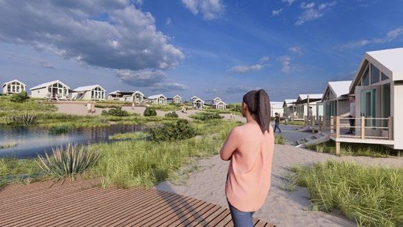
VIEWS|seasonal changes in Kismet’s camping zone and bayside
-
-
-
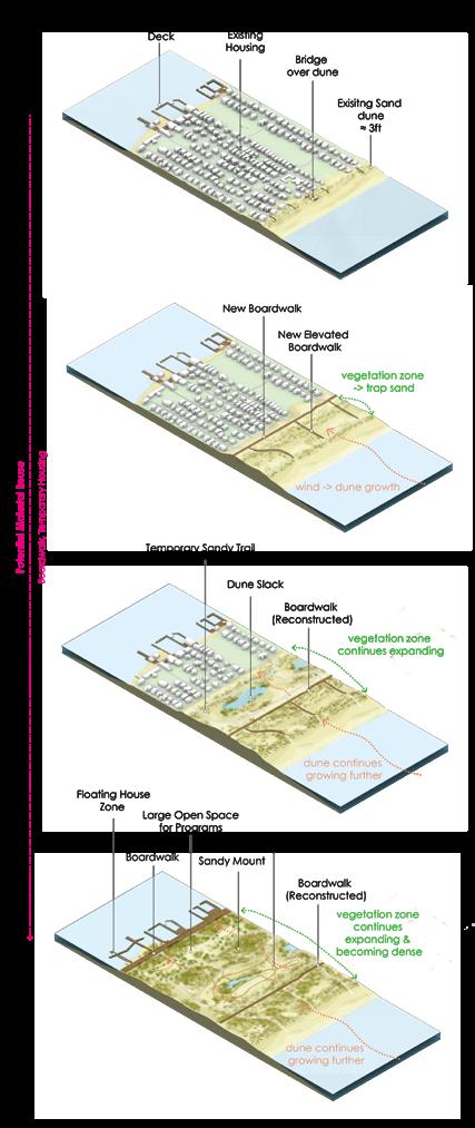
PLAN|Kismet- “Party Hub” Theme (more space to socailize
friends) and Saltaire - “Children’s Paradise” Theme (make children diverse places to play
explore) AXON|
through
in Kismet & Saltaire Fu 7
and make
and
how sand move and intervention
centuries
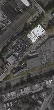
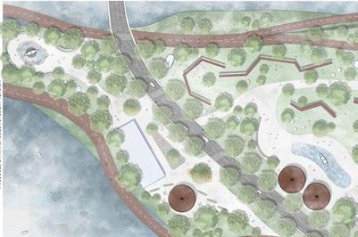
LARGE GREEN HEALING NETWORK
City Transportation’s Connection with Nature & Human Hillsboro, OR, United States Beaverton, OR, United States
Visiting Assistant Professor: Jean Yang Course: Fall 2021, LA 494 Studio
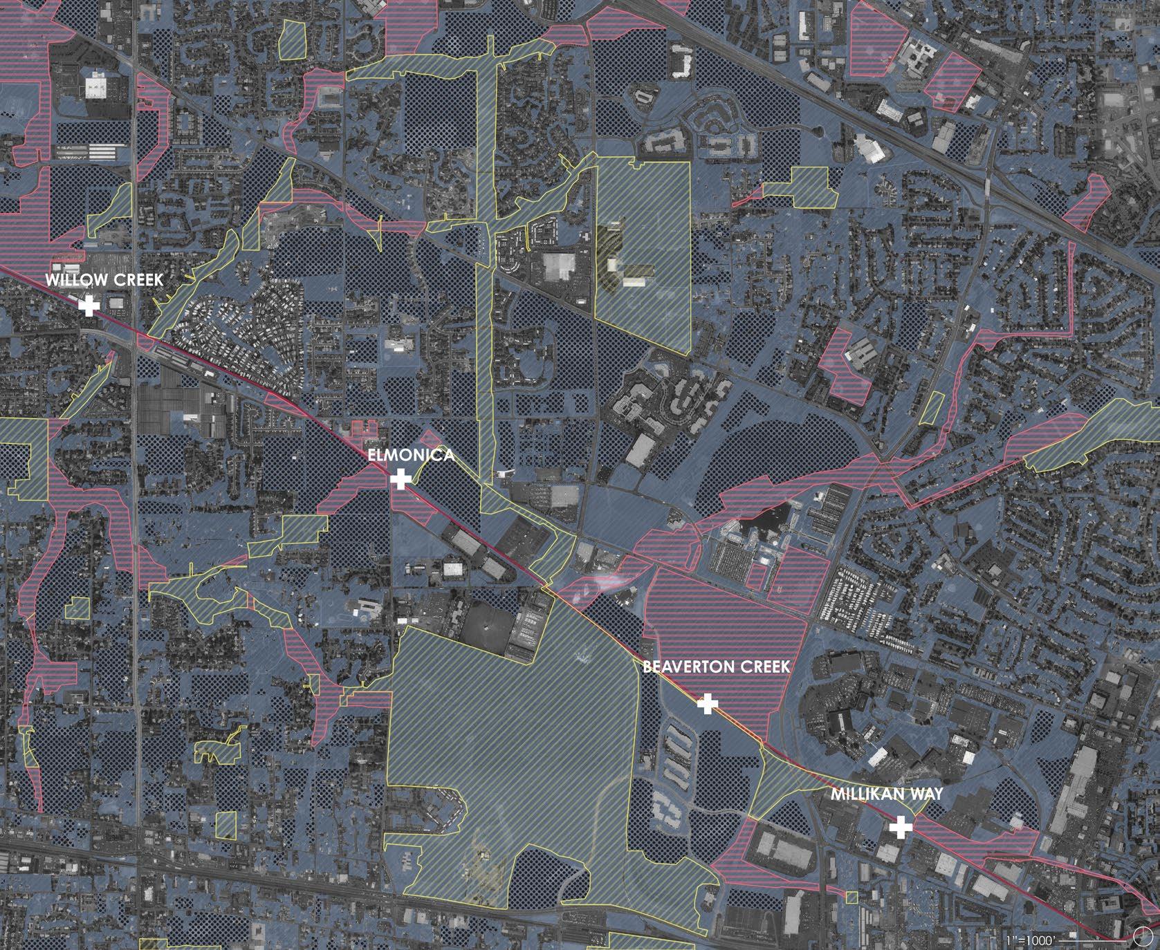
Academic | Individual Work | One Semester TriMet’s four light rail stations in the west have low occupancy and ridership due to poor transportation facilities, lack of environmental programs, and disconnection from the surrounding environment. In order to build and improve the utilization rate of the station, the sense of the station’s presence in the community, and to deal with the possible problems and demands in the future, a question is proposed to consider and design these stations as a whole, that is, what if connecting Willow Creek, Elmonica, Beaverton Creek, and Millikan way into a large green healing network to heal the nature and people?
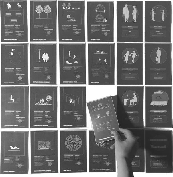
The design proposal combines the detailed data analysis of the suitable walking range of 15 minutes for four stations, including the green planting access, crowd distribution, travel conditions, land use distribution, etc. Secondly, the conventional and specific design methods of healing landscape are made into strategy cards, which can be applied to urban construction. Finally, four highly representative zones are selected for showing how to use strategy cards to design a more communityoriented, integrated, and healing large green space network centered on the four stations. 02|
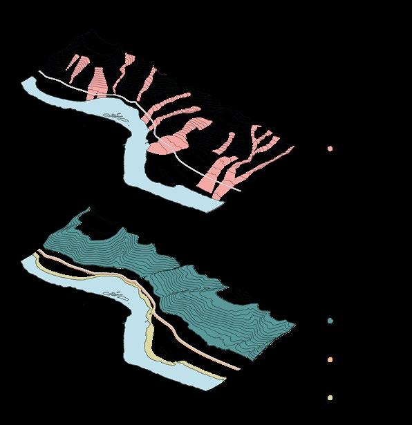
Fu HISTORICAL MAP ANALYSIS|Existing Green Space Could Be Better Connected 8
ISOMETRIC ANALYSIS|healing concept SITE PLAN|15-min walkshed analysis CENSUS DATA|people 9 Fu PEOPLE WHO WORK AND LIVE VULNERABLE POPULATION LIFESTYLE W W W W W W W W 568 3,915 5,112 45.44% 13.91% 30.5% 23.65% 5.63% 7.9% 3% 6.93% 31.5% 32.2% 3.87% 31.7% 27.88% 25.16% 10,368 223.42% 142.35% 26.91% 10.45% 81.2% 11.89% 91.5% 19.26% 120.8% 11.03% 11.03% 34.68% 31.57% 25.16% E E E E E E E E B B B B B B B B M M M M M M M M TOTAL POPULATION DAYTIME WORKER CHILD SENIOR POPULATION POVERTY STATUS NO INSURANCE ADULTS THAT DO NOT HAVE REGULAR EXERCISES WEEKLY COMMUTING TO WORK ≥ HOURS The Range of Data Analyzed: 15 mins Walking Distance from Station W= Willow Creek Station E= Elmonica Station B= Beaverton Creek Station M= Millikan Way Station LEGEND WILLOW CREEK BEAVERTON CREEK MILLIKAN WAY ELMONICA Residential Commerical Institutional Industrial Employment Current Green Space Vacant Space [Potential New Green Space] Parking Lot [Potential New Green Space] 15-Min Walkshed TriMet Red Line 15-Min Walkshed
STRATEGY CARDS|general healing landscape strategies 10 Fu PATHWAY SEATING LIGHTING PROGRAM PROGRAM PROGRAM PROGRAM PROGRAM PROGRAM PROGRAM PROGRAM LIGHTING PLANTING ARCHITECTURE SEATING SEATING SEATING PATHWAY PATHWAY PATHWAY GARDEN PETS SENIOR CHILDREN WORKERS PEOPLE WITH DISABILITIES INTERACTION NATURAL FRAGMENTS LIGHT RAIL SHELTER TRANSPORTATION SURROUNDING BUILDINGS CARDS Design Data Data Data Data Data Design Design Design Design Design TYPE: INFRASTRUCTURE TYPE: RELATIONSHIP TYPE: PEOPLE TYPE: PEOPLE TYPE: PEOPLE TYPE: PEOPLE TYPE: RELATIONSHIP TYPE: INFRASTRUCTURE TYPE: INFRASTRUCTURE TYPE: INFRASTRUCTURE TYPE: INFRASTRUCTURE Comfortable and Diverse Walking Experience Shady vs Sunny, Seasonal Planting, etc. Different Programs for different people’s needs Open vs Enclosed Space, Art Works, etc. Sense of Safety, Control, Privacy, Public Comfortable Environment for People Gathering, Playing, Interacting, Exercising, etc. Willow Creek Station: 18.78% Elmonica Station: 18.89% Beaverton Creek Station: 16.55% Millikan Way Station: 12.95% Willow Creek Station: 11.89% Elmonica Station: 7.9% Beaverton Creek Station: 5.63% Millikan Way Station: 10.45% Willow Creek Station: 23.65% Elmonica Station: 26.91% Beaverton Creek Station: 13.91% Millikan Way Station: 25.16% Willow Creek Station: 30.5% Elmonica Station: 45.44% Beaverton Creek Station: 223.42% Millikan Way Station: 142.35% Willow Creek Station: 8.31% Elmonica Station: 5.76% Beaverton Creek Station: 16.55% Millikan Way Station: 31.37% An Open Space for Group Gathering and Diverse Activities Group Seating Area for Informal Group Meeting and Social Interaction Connect Each Natural Fragments into Whole Natural Environment Smooth Pathway and Natural Tain Connection Several Stop Spots for People Observe Wildlife Comfortable Sitting Environment - Close to Nature Have Natural Views and Views of People in Motions Representative Art Works and Lighting Comfortable Walking Experience Shady, Green Pathway, etc. Artistic Programs Sitting Area, Art Works, etc. Sense Safety Comfortable Place for Short Stay As Part of Natural Environment Instead of Solid Concrete Structure Green Building and Green Roof Surrounding Natural Environment - For people both Inside and Outside TYPE HEALING STRATEGIES TYPE 2: FOCUS GROUPS TYPE 3: LANDFORM - Including standard and basic healing landscape requirements which can be used urban design. The overall design will select and combine several requirements based on the site condition - There are four groups of people (senior, children, workers, and people with disabilities) that are considered into design. - Each group of people will have special needs depending on their lifestyle. The design will depend on the current four stations’ 15 mins walking range to apply for different requirements and programs. - Relationships with pets and other people have some influences on people’s health. - Based on the current four stations’ surrounding situaton, there are five different infrastructures. - Each infrastructure will have different strategies to approach the healing theme. The whole design will consider how to design and connect each infrastructure to approach the healing network aspect. PATHWAY SEATING LIGHTING PLANTING ARCHITECTURE PEOPLE PROGRAM RELATIONSHIP INFRASTRUCTURE (min) Planting Along Pathway Edge every 25 ft Curbs Along Pathway Edge Handrails on Both Side of Pathway Nodes or Passing Areas Seatings with arms and backs Planting Hot Days Cold Days Alley Enclosed Space Public Outdoor Room Fence Planting Hedge Wall HOW DOES RELEASE TO TRAUMA? HOW DOES RELEASE TO TRAUMA? HOW DOES RELEASE TO TRAUMA? HOW DOES IT RELEASE TO TRAUMA? HOW DOES RELEASE TRAUMA? HOW DOES IT RELEASE TO TRAUMA? HOW DOES RELEASE TO TRAUMA? HOW DOES RELEASE TO TRAUMA? HOW DOES RELEASE TO TRAUMA? HOW DOES RELEASE TO TRAUMA? HOW DOES RELEASE TO TRAUMA? HOW DOES RELEASE TO TRAUMA? HOW DOES RELEASE TO TRAUMA? HOW DOES RELEASE TRAUMA? FLAT & CURVILINEAR PATHWAY INDIVIDUAL SEATING SOFT LIGHTING IN THE NIGHT ENCLOSED SPACE WATER FEATURE PLAYGROUND FUN OR WHIMSICAL FEATURE REPRESENTATIVE ART WORKS OPEN GATHERING SPACE COVERED AREA LABYRINTHS AESTHETIC LIGHTING PLANTING GUILDELINES PARKING & GREEN BUILDING GROUP SEATING SEATING WITH TABLES CHAISE LONGUES PRIMARY & SECONDARY PATHWAY EDGE OF THE PATHWAY HANDRAILS MATERIAL RECOMMENDATION MATERIAL RECOMMENDATION MATERIAL RECOMMENDATION MATERIAL RECOMMENDATION MATERIAL RECOMMENDATION RECOMMENDATION FOR WHOM FOR WHOM FOR WHOM FOR WHOM FOR WHOM FOR WHOM FOR WHOM FOR WHOM FOR WHOM FOR WHOM PROGRAMMING EXPERIENCING PROGRAMMING EXPERIENCING PROGRAMMING EXPERIENCING PROGRAMMING EXPERIENCING PROGRAMMING EXPERIENCING PROGRAMMING EXPERIENCING PROGRAMMING EXPERIENCING PROGRAMMING EXPERIENCING PROGRAMMING EXPERIENCING - Easily navigable people wheelchairs and walkers - Frequent and adequate resting spots (nodes) provide comfortable walking experiences - Seating with arms and backs provide comfort and assist sitting down and getting back - Fixed seating with something behind make people feel - Provide a sense safety - Make people feel comfortable explore and walk through the site - Provide people a place to any disturbance - a a of safety, and privacy - An important component therapeutic garden - Provide positive distraction, something soothing interesting - A destination to aim assist wayfinding and an attraction for wildlife - A playground with different play features can distract children’s attention - Provide a place children actively use and play to relieve stress - An attractive point eliciting smile - Allow people to actively engage with - Artistic elements integrate into landmark, seating design, and streetscape encourage people feel familiar and outdoors - Provide people a place gather, interact with people, do exercises, or do anything in comfortable situation - A covered space, like a pavilion, a pergola (not for elder people), gazebo, provides place for people go outdoors to stay and enjoy the environment, especially during the bad weathers - A labyrinth a quiet, private, and enclosed space provides people place meditate while walking - Provide an attractive point the night - Allows, attracts, and encourages people go outside and actively use the space during the nighttime - Seasonal plants with diverse heights provide variety of sensory experiences - Some wildlife animals insects will attracted - The plants can an attractive point for people see and experience (touch, smell, and listen throughout the whole year approach stress relief - Applying a parking building for the station instead having large parking lot to provide more space for environmental designs. - A building with vertical green vegetation can integrate into the surrounding environment to make thearranged for any size group serve as gathering space informal outdoor meeting spaces - Encourage people go outdoors and interact with each other - Provide an outdoor space for people to eat lunch paperwork - Encourage people go outdoor have rest instead staying very stressful environment day long - Provide a place for tired visitors stressed staff have rest nap - Separating design for primary and secondary pathway provide people exercise purpose and improve their walking experiences - Make navigating the garden safer for those using wheelchairs and walkers and prevent washouts from planting beds - Assist those elder people who may have some balance problems - Encourages elder people use the outdoors- Slope: greater than 2% - Nodes: every 25ft along path - *Elder people - Seat dimension: higher than usual -19”), depth 20”, arm height of 25-26”. - Increase levels difficulty changing slope and grade. Only apply to the place that does not have many elder people and people with disabilities) - Tinted concrete - Stablized decomposed granite (minimize extreme contrast dark and light on the ground) - Wooden Seating (Not retain excessive heat or cold) - Not produce glare (No bright and reflective surfaces) - *Moveable - Soft lighting (not shine people’s eyes) - Vegetated screening - Fence - Natural elements not natural, considering seasonal aspects) - Various play opportunties: small fixed rock climb or on, lean against, touch, run around Sand to down dig load into play truck Natural play etc. - Features can be something like hand-painted rocks set the planting bed and fish artworks artistic models the pond. will be sweet surprise to someone walking along the adjacent path pond. - Artworks need related the particular elements the site theme Example: Children -> Animal sculptures Elder people Gardening elements, - Lawn - Primary pathway: the same the pathway requirements - Secondary pathway: can changed, but considering materials are not having huge contrast than the primary pathway - The chaise longues can have a playful form and interesting color. will provide extra help for the staff to relax. - should be placed in a space that has good views nature and comfortable sound. - Soft Edge: planting raised edges - Hard Edge: Curbs - Handrails along part pathway systems - General public - General public - People who want alone or two - General public - General public - General public - *Children - *Children - General public - General public - General public - General public - General public - General public - *Elder people: Gardening - *Children: Plants with Labels - General public - General public - General public - General public- General public - General public - *People who use wheelchairs - General public - *Elder people Walking Walking Walking Walking Walking Walking Walking Walking Walking Walking Walking Walking Walking Walking Walking Walking Walking Walking Walking Walking Waiting Waiting Waiting Waiting Waiting Waiting Waiting Waiting Waiting Waiting Waiting Waiting Waiting Waiting Waiting Waiting Waiting Waiting Waiting Private Private Private Private Private Private Private Private Shady Shady Shady Shady Shady Shady Shady Shady Shady Shady Shady Shady Shady Shady Shady Shady Shady Shady Shady Shady Sunny Sunny Sunny Sunny Sunny Sunny Sunny Sunny Sunny Sunny Sunny Sunny Sunny Sunny Sunny Sunny Sunny Sunny Sunny Sunny Public Public Public Public Public Public Public Public Public Public- Wayfinding signage- Seating - Vegetation - Enclosed space - Pathway - Pathway- Streetscape - Seating - Garden - Garden - Seating nodes - Garden - Streetscape (Large Area) - Garden - Fun or whimsical feature - Playground- Garden - Pathway - Open space - Enclosed space - Streetscape - Seating - Garden - Vegetation - Seating- Seating nodes - Garden - Enclosed space - Small space - Vegetation - Structure- Gardening - Plants with labels - Garden - Natural trail - Station - Vegetation - Seating nodes - Garden - Streetscape (Large Area) - Open Space - Enclosed Space - Seating nodes- Streetscape (Large Area) - Open Space - Enclosed Space- Open space - Enclosed space - Exercise- Vegetation - Natural trail (*Planting) - Pathway - Natural trail PAIRS WELL WITH PAIRS WELL WITH PAIRS WELL WITH PAIRS WELL WITH PAIRS WELL WITH PAIRS WELL WITH PAIRS WELL WITH PAIRS WELL WITH PAIRS WELL WITH PAIRS WELL WITH PAIRS WELL WITH PAIRS WELL WITH PAIRS WELL WITH A1 C1 F1 F5 F6 F7 F8 F2 F3 F4 C2 B2 B3 B4 A4 A2 A3 Height - 7:3 softscape vs hardscape - Multipule heights - Low-maintenance, reilent, and local plants - No poisonous harmful plants - Seasonal plants (various color, texture, smell, etc.) - possible, design the parking building the new surrounding building as vertical green architecture - A green roof and a roof garden can be considered into building designs. - Vegetated circuit - Painted circuit - Need a signage show how works The strategy cards are divided into two main categories, one is healing landscape strategies and the other is function card. Strategy cards can be used to freely select elements and combine them according to different situations to provide different solutions. At the same time, when used in community discussions or large public discussion places, strategy cards can give people in the community to choice of their own needs, thus integrating into different design approaches.
ISSUE MAP AND DESIGN|4 zones plan and usage of strategy cards in each zone

11 Fu OLD AND YOUNG HEALING GARDEN A1 A1 A1 A1 B1 B1 B1 B1 C1 C1 C1 C1 F1 F1 F1 F1 F2 F2 F2 F2 F3 F3 F3 F8 F8 F6 F5 F4 F5 F5 C2 C2 C2 C2 D D D D E E E E B2 B2 B2 B3 B4 B2 B3 A2 A2 A2 A2 A3 A4 A4 A4 A4 Healing Strategy in Zone 1 HEALING STREET WORKER HEALING GARDEN NATURAL HEALING TRAIL Healing Strategy in Zone 2 Healing Strategy in Zone 4 Healing Strategy in Zone 3 Plants Learning Water Feature Gathering Space Rain Garden Planting Hedge Lawn Pathway & Bridge Through Nature Gardening Semiprivate Shelters Habitat Zone for Wildlife Existing Playground Bocce Ball Court Parking Building with Green Roof Shelter Planting Enclosed Alley Parking Building with Green Roof Existing Trail Willow Creen Station Beaverton Creek Station Natural Play & Water Feature Exisiting Self-storage Exisiting Auto-Car Company Storage Box Seating Wooden Group Seating Car & Tire Structural Seating Pavilion & Natural Logs Pathway Through Nature New Podium Building with Green Roof Labyrinths Bridge Parking Building with Green Roof Parking Building with Green Roof Group Seating & Water Feature Amphitheater/ Gathering Space Seating with Colorful Planting & Water Feature Seating with Tables Trees along Streets Group Seating Lawn Lawn Lawn Lawn Natural Pathway Shelter Chaise Longues Statue Millikan Way Station Sunny Area Station Vacant Land Vacant Land (Sunny) Green Space (Trail/Path) Green Space (No Trail) Green Space (Not Public) Original Playground (Include in New Design)
STRATEGIES AND DESIGN|detailed analysis of the strategy cards used in each design by separating each zone into 3 large card categories
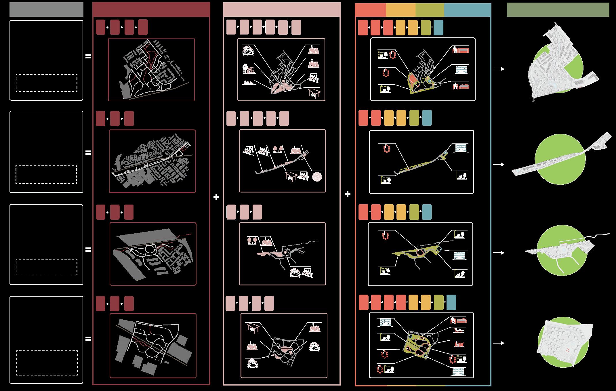
12 Fu ZONE OLD AND YOUNG HEALING GARDEN HEALING STREET NATURAL HEALING TRAIL WORKER HEALING GARDEN Willow Creek Station Willow Creek Station to Elmonica Station Beaverton Creek Station Millikan Way Station CIRCULATION PROGRAM SEATING LIGHTING PLANTING ARCHITECTURE HEALING LANDSCAPE DESIGN 35% of the population within the distance of Willow Creek are either seniors or children. Over 31% of the population at both Willow Creek and Elmonica do not have regular exercises. Over 31% of the population at both Willow Creek and Elmonica do not have regular exercises. The population around Millikan Way are employed with a large rates of poverty, no insurance, long commuting times, and no exercise. A1 F1 B1 B1 B1 B1 F1 F1 F1 A1 A1 A1 A2 F2 B2 B2 B2 B2 B3 B4 F2 F2 F2 A2 A2 A2 A3 F3 B3 F3 F5 F3 F5 A4 A4 A4 A4 F5 C1 C1 C1 C1 F4 F6 C2 C2 C2 C2 F8 F8 D D D D E E Old and Young Healing Garden Healing Street Natural Healing Trail Worker Healing Garden E E Water Feature Bocce Ball Court Plants Learning & Gardening Group Wooden Seating Group Seating around Fountain Planting Screening Planting Screening Rain Garden Parking Building Parking Building Parking Building Natural Pathway Group Seating around Fountain Amphitheater/ Gathering Space Seating with Colorful Plants Seating with Tables Chaise Longues Individual Seating Podium Building with Green Roof Planting Screening & Barrier Trees along Streets Group Seating Individual Seating Individual Seating Parking Building Planting Screening Lawn Statue Shelter Semiprivate Shelters Natural Play Storage Box Seating Alley through Nature Alley through Nature Pavilion & Natural Logs Labyrinths Lawn Lawn Lawn Lawn Water Fountain Water Feature Pavilion Artistic Water Fountain Car & Tire Structural Seating
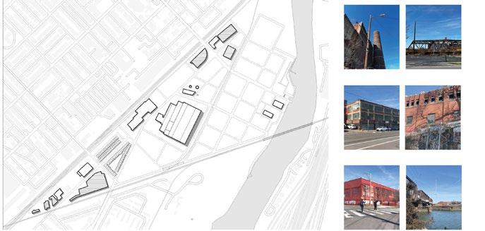
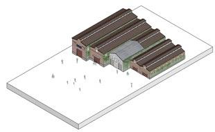
03|
“ ” DISTRICT
Industrial Remains vs Human Needs
Bartram’s North, PA, United States
Academic | Group Work with Zimeng Chen | One Semester
Professor: Anna Darling Course: Spring 2022, LARP 602 Studio
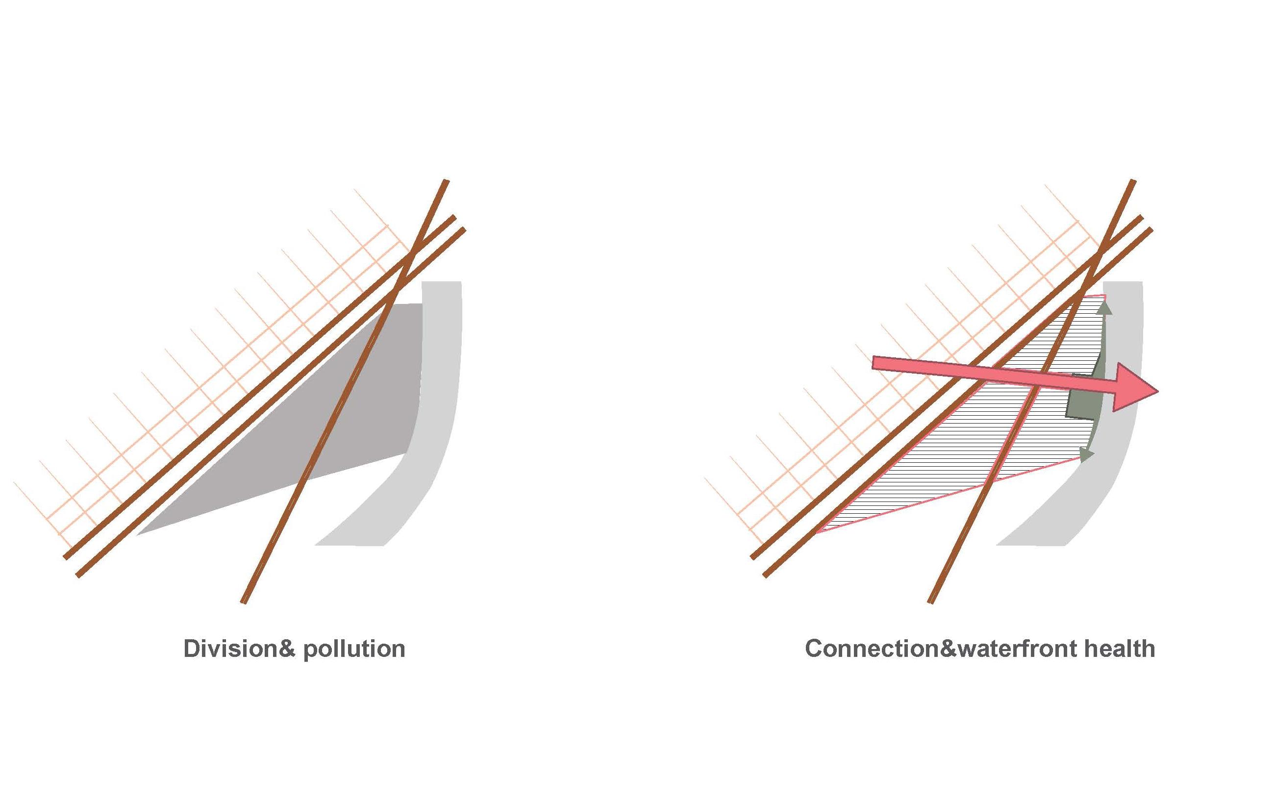
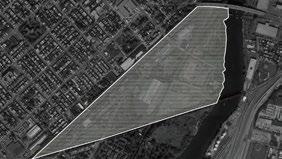
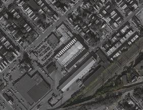
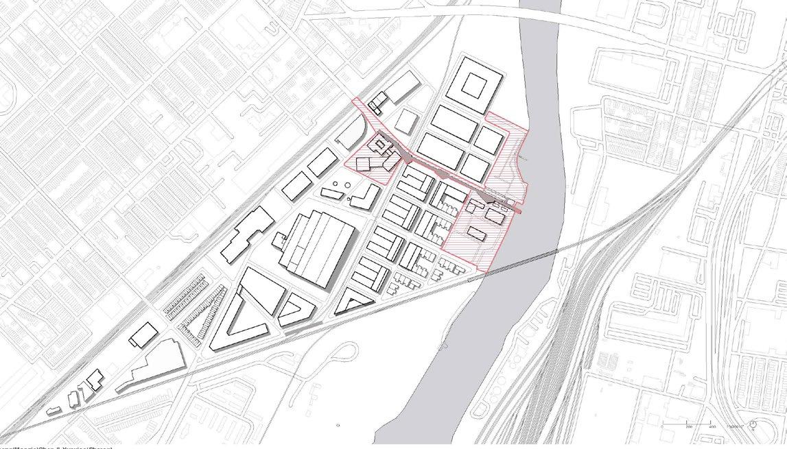
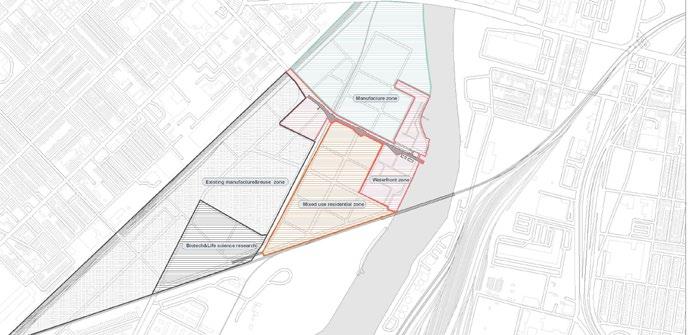
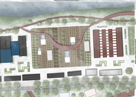
The site is Bartram’s North in the southwest of Philadelphia by the Schuylkill River. The new lifescience companies will locate on the site, so this site needs to have some improvement solutions and designs to help benefit both companies and the surrounding neighborhood. Our group focuses on the northern part of the site, around 120 acres. The Project “ ” district is the main focus area within 120 acres to design in depth during the studio period.
There are two goals for this project:
1.CONNECTION: The original SEPTA rails and railways become barriers blocking the Kingsessing neighborhood, nearby citizens, and visitors to access the river.
2. HEALTH: Old industrial development on the site made surrounding people have health issues, therefore, introducing new industries and using public space as a method to reduce the industrial impact on people’s health.
Fu CONCEPT|Existing to Proposed Condition 13
created by Zimeng Chen & Yunxiao Fu
T T
SITE ANALYSIS|illustrating existing condition and issues on the current site, including transportation routes, accessibility, fence, hydrology, land use, elevation, and slope


FRAMEWORK BREAKDOWN|illustrating how overall framework comes from


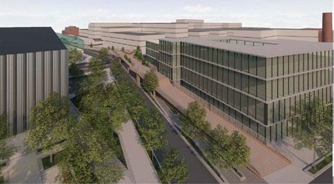
OVERALL FRAMEWORK|demonstrating a new urban development based on the existing transportation routes and preserved historical buildings, and highlighting the new designed district
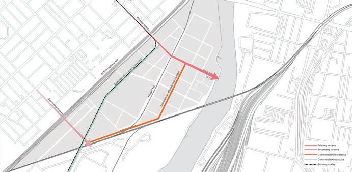
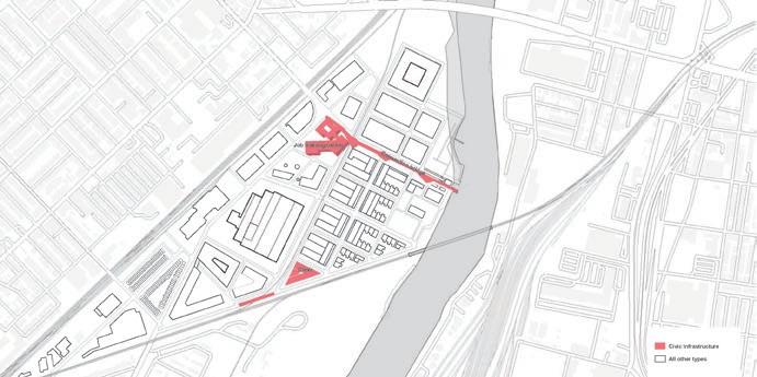
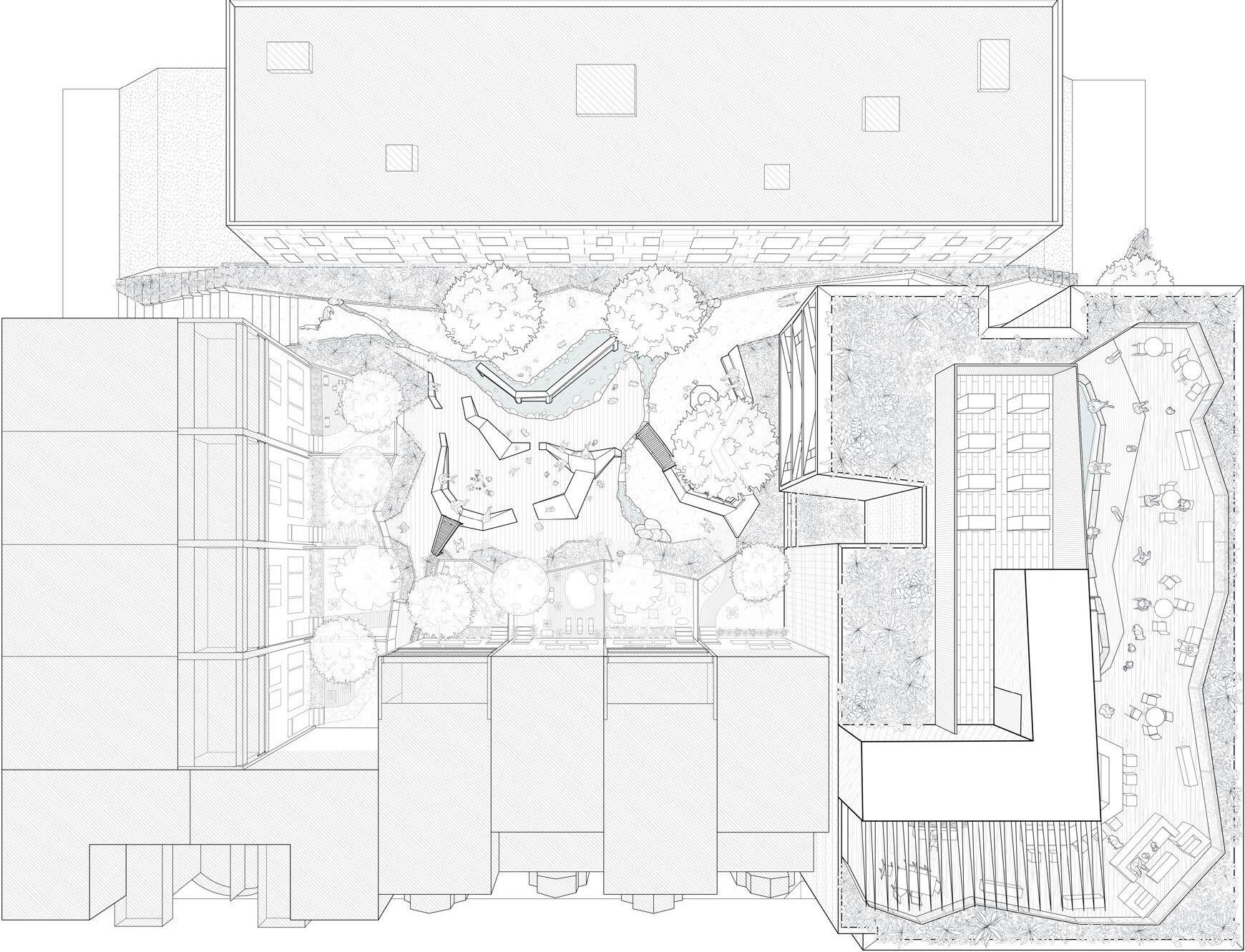
14 Fu 1” 200’ N S54THST S49THST ENTRY FROM BARTRAM’S GARDEN ≈ 1.65 acres BARTRAM’S NORTH +LP +HP +HP SCHUYLKIL L RIVER BARTRAM’S GARDEN NON-FUNCTIONING INDUSTRIAL VACANT LOT SLOPING SLOPING SLOPING SLOPING SLOPING SLOPING 269806ft 12538ft 15869 ft 76498ft 27710ft 2 12882ft 2 FENCE LINE TROLLEY LINE 7.66 acres NON-FUNCTIONING INDUSTRIA VACANT LOT RAI WAY BELOW WALKING PATH RAILWAY ABOVE WALKING PATH RAILWAY BELOW WALKING PATH RAILWAY BELOW WALKING PATH RAI WA ABOVE WALKING PATH RAILWAY BLOCKED WALKING PATH 13646 ft 22260 ft 2 created by Zimeng Chen & Yunxiao Fu created by Zimeng Chen & Yunxiao Fu Preserved Building New Zoning New Access Civic Facility
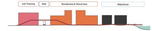
SECTION-PERSPECTIVE VIEWS|demonstrating the views will be seens when passing through the new bridge to the waterfront
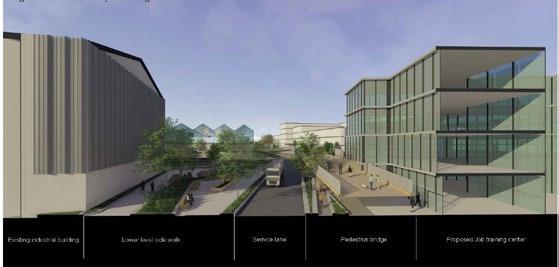
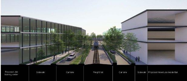
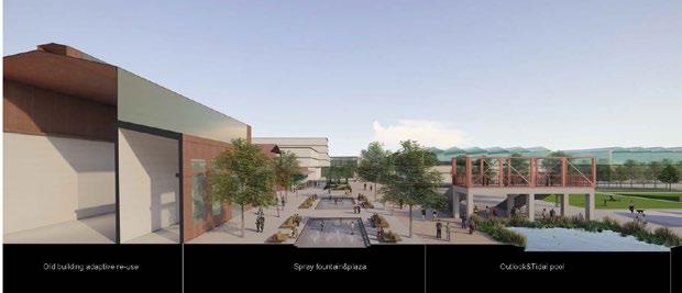
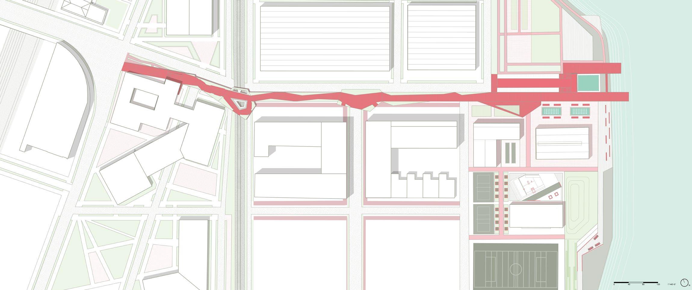
SITE PLAN & LOGIC|illustrating the detailed new
bridge design with new proposed industrial, commercial, and residential buildings, and partial new waterfront designs
pedestrian
15 Fu Job Training Center Mix-used Residential Mix-used Residential Manufacture Complex Old Industrial Building Reuse Old Industrial Building Reuse Old Industrial Building Reuse Manufacture Complex Office Building Office Building Bridge’s Connection with Job Training Center Bridge’s Connection with Job Training Center Bridge Over Existing Railway Outlook-in between Residential and Manufacture Zone Mix-used Residential Commercial Building Mix-used Residential Manufacture Complex
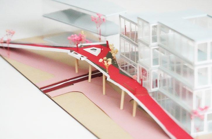
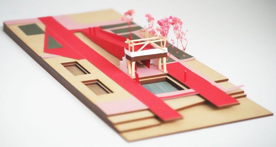
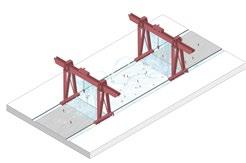
PHYSICAL MODELS|representing the proposed beginning and the end of the pedestrian bridge
FRONT VIEW: THE Beginning of The Bridge
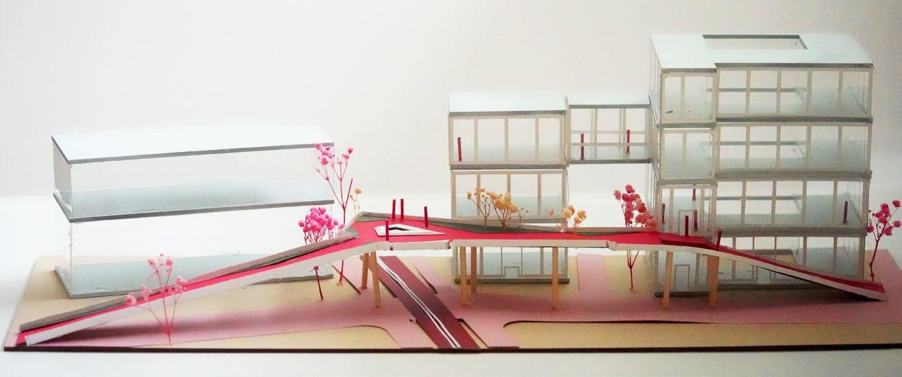
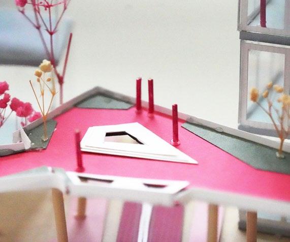
PERSPECTIVE VIEW: THE Beginning of The Bridge ZOOM IN VIEW: Play Zone Over The Railway on The Bridge
FRONT VIEW: THE End of The Bridge with A Elevated Outlook Platform, A Pond, and Waterfront Outlook
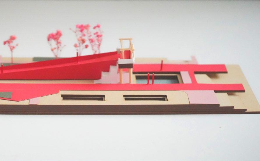
PERSPECTIVE VIEW: THE End of The Bridge with A Elevated Outlook Platform, A Pond, and Waterfront Outlook
Fu 16
created by Zimeng Chen & Yunxiao Fu created by Zimeng Chen & Yunxiao Fu created by Zimeng Chen & Yunxiao Fu created by Zimeng Chen & Yunxiao Fu created by Zimeng Chen & Yunxiao Fu
GREEN “FISH”- History moving into Future Industrial Remains vs
Instructor: Liska Chen Course: Winter 2022, LA 499 Comp Studio Academic | Individual Work | One Semester
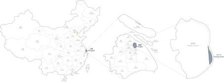
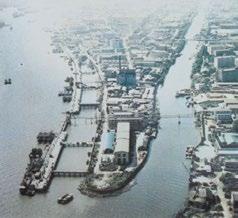
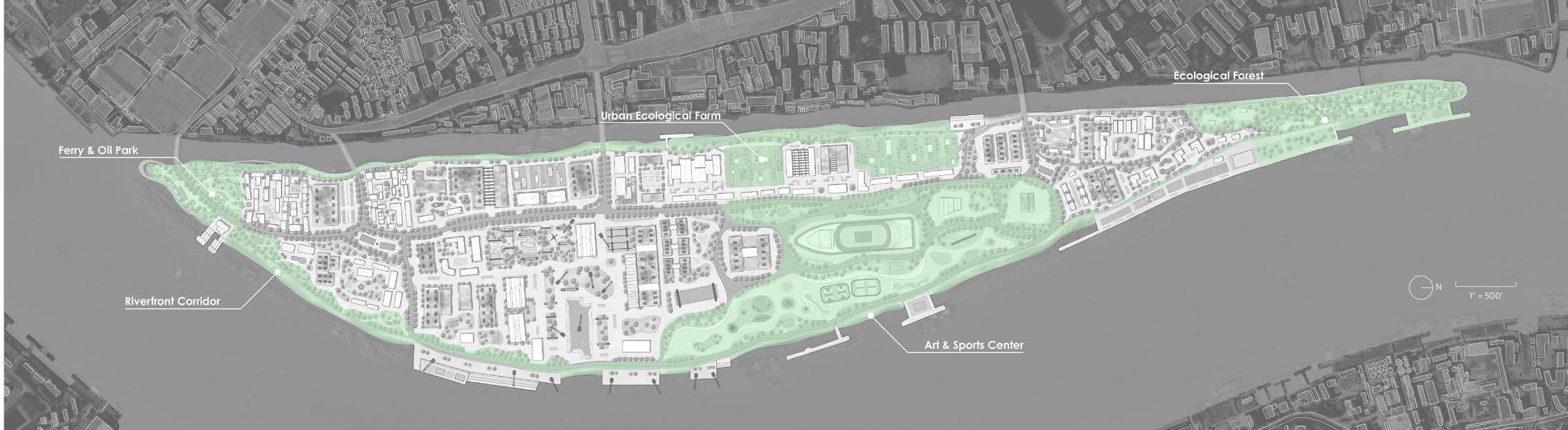
Fuxing Island, approximately 280 acres and located along the Huangpu River, marks the beginning of Shanghai’s shipbuilding history and possesses rich cultural heritage. The island’s redevelopment is highly prioritized by the government. This project aims to transform Fuxing Island in three aspects - culture, nature, and lifestyle - to showcase a new symbol and model of future Shanghai.
For the redevelopment of Fuxing Island, the design proposals for each of the three parts: culture, ecology, and lifestyle
Culture: preservation, renewal, intergration
Ecology: restoration, connection, experience
Lifestyle: innovation, renewal, motivation
Nature Environment Yangpu District, Shanghai, China
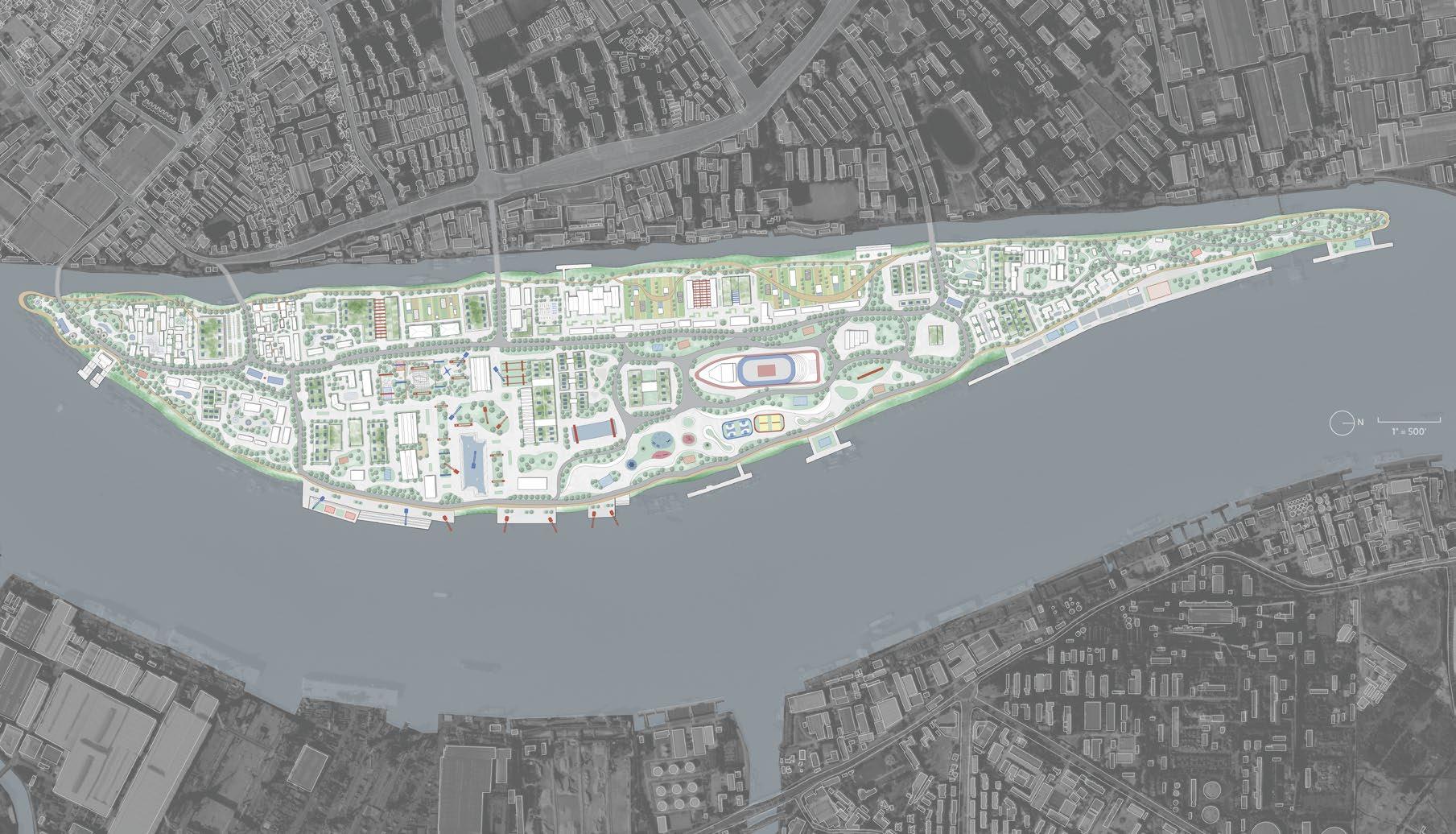
04| PLAN| Master Plan - Fuxing
17 Fu
Island
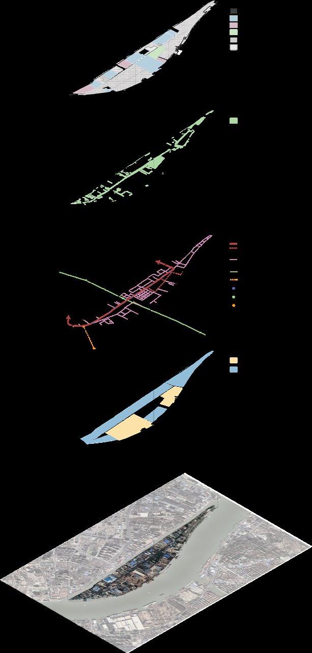
SITE ANALYSIS| illustrating existing zones, green spaces, transportation routes, and preserved regions on the site
HISTORICAL HIGHLIGHTS| illustrating how people interact with new circulations, new landforms, and new programs in the future
GOALS| approaching two goals: revolution and creating a model of future Shanghai through three sub-goals: cultural, ecological, and lifestyle revolution

provide four different Cultural Areas renew & reuse buildings & structures provide four villages restore forest & green spaces
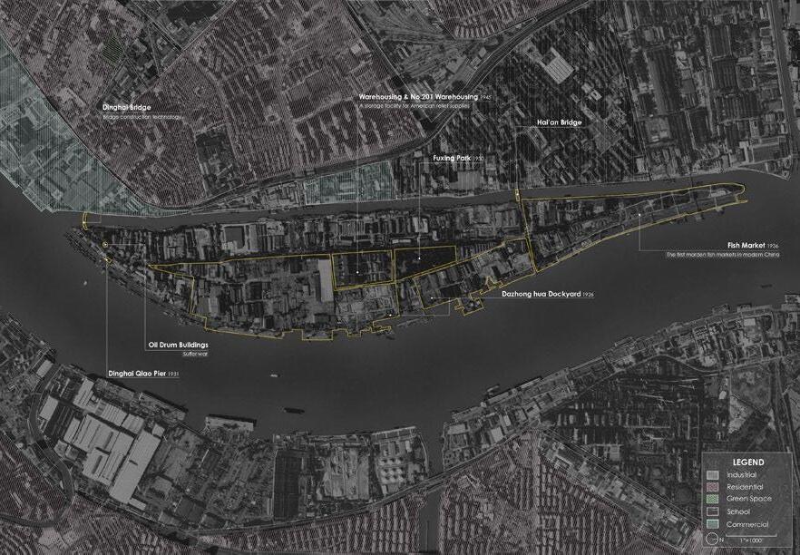
Fu 18 Industrial Dinghai Bridge Dinghai Qiao Pier Rivershid Pier Area
Cultural
Ecological
Lifestyle
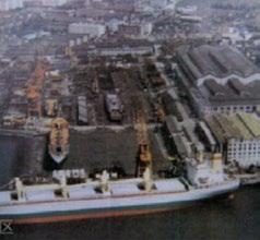
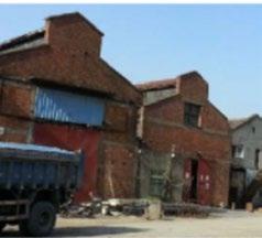
Warehouse Fish Market Oil Frum Buildings Shipyard Workshop Mechanical Garage Over Line Bridge for Ice Transportation 45.1% 17.5% 0.7% 2.9% Warehouse Residential Green Space Municipal Research Existing Green Spaces Main Road Road (public can access) Road (only for industrial or workers) Railway Pier Route Pier Preserved Spaces Refurbished Spaces Bus Station Railway Station
connect green fragments create green buildings create no car island introduce new business: agriculture create a reward system
Revolution
Revolution
Revolution
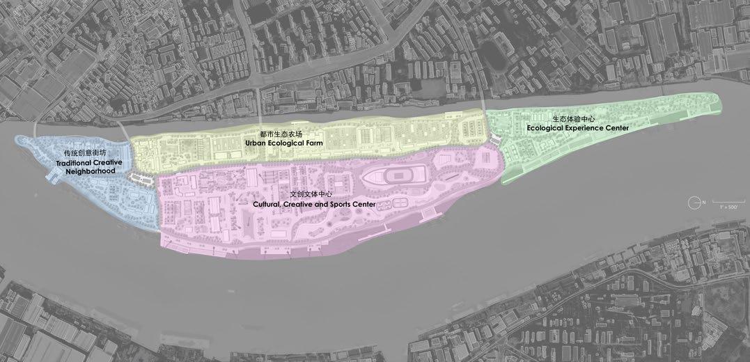
ZONES| illustrating four main zones: traditional creative neighborhood, urban ecological farm, cultural, creative, and sports center, and ecological experience center
ELEMENTS REUSE PROPOSAL| illustrating reusing buildings and structures with new function and renewal form
FOUR VILLAGES SITE PLAN| representing four different villages with special theme designs

19 Fu Oil Drum Building Mechanical
Two rectangular shaped ship workshop Ship workshop with black roof Industrial Sculpture Gantry Crane Gantry Crane Water play area Five-floor warehouses
with ivy
Neighborhood
Natural Village Fishermen Village
Garages
Warehouse-Covered
Yangpu Folk Village
Village
PERSPECTIVE VIEWS| showing key designs and views in four main green spaces
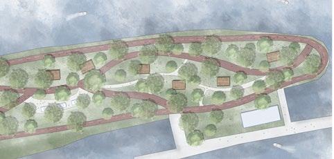
 SITE PLAN| illustrating how people interact with new circulations, new landforms, and new programs in the future
Fu 20 Small Parks Small Gathering Areas Agriculture Forest Corridors Green Buildings Planted Seats Greenways Riverside Slow R oad Ferry & Oil Park Boat shaped Sculpture Area Ferry & Oil Park Urban Ecological Farm Art and Sports Center Ecological Forest Ferry & Oil Park - Memorial Exhibition Plaza & Water Play Area Urban Ecological Farm - Educating Urban Farming Ecological Forest Treehouse
GREEN SPACES PLAN| illustrating four main green spaces with detailed designs on the site

TRANSPORTATION PROPOSAL PLAN| representing new transportation routes on the island to approach the goal of “no car island” SECTION
 & PLAN| illustrating three different types of roads
21 Fu Parking Lot Pier
Bike-sharing Supply
contributed by sketchup warehouse Pier (hard edge) Rooftop Farming Small Planter Beds Large Outdoor Vegetable Farming Vertical Agriculture Seating Type One: Main Road Type Two: Slow Road Type Three: Mixture Road
AXON| illustrating farming types on the island
(soft edge)
Points
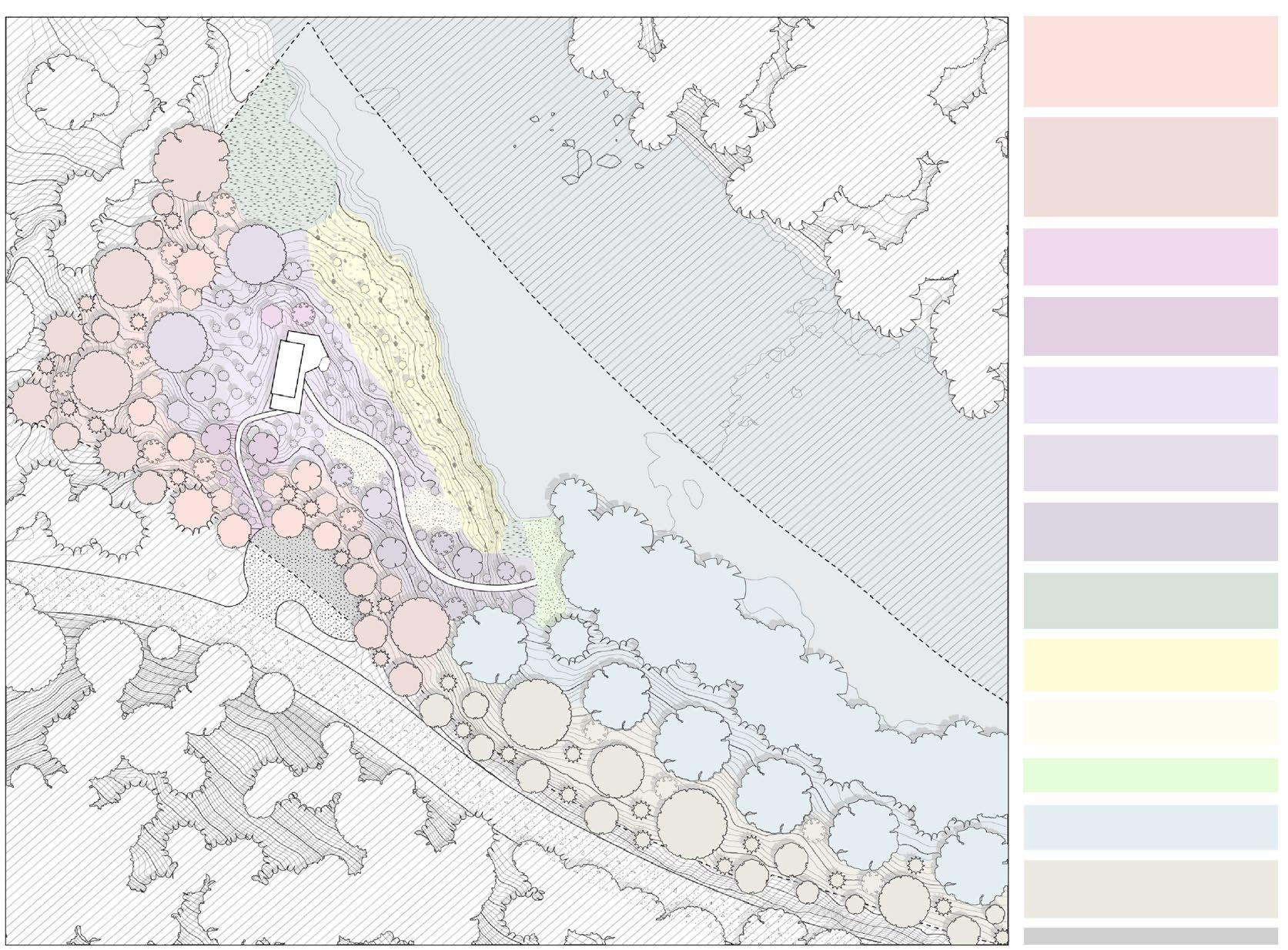
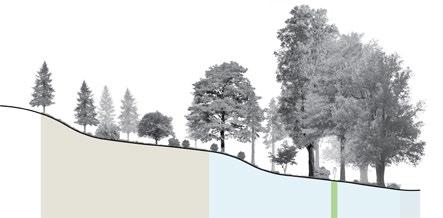
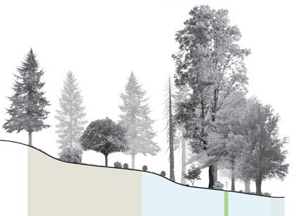
RESILIENT & FIRE-SAFE RESIDENCE
Natural Disaster vs Human Vulnerability Vida, OR, United States
Professor: BartJohnson Course: Winter 2021, LA 489 Studio Academic | Individual Work | One Semester
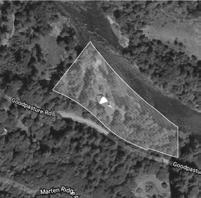
This place is a residential area located along the Mckenzie river, with a pristine natural ecological environment, due to a labor Day wildfire disaster, Oregon Holiday Farm Fire, in 2019, a large area of houses and vegetation was burned down. zThe studio aims to help people who have lost their homes how to unite communities to maintain and build resilient and sustainable landscapes through the design and use of diverse strategy patterns.
The design proposal is mainly focused on five points:
1. Meet the needs of residents for the natural ecological environment and seasonal changes.
2. Preserve and upgrade the original activity areas to meet the requirments to prevent future fire.
3. Create the use of recoverable and native vegetation and standardized planting.
4. Provide landscape maintenance strategies for all kinds of people.
5. Ensure both fire prevention and ecological maintenance in residential areas.
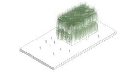
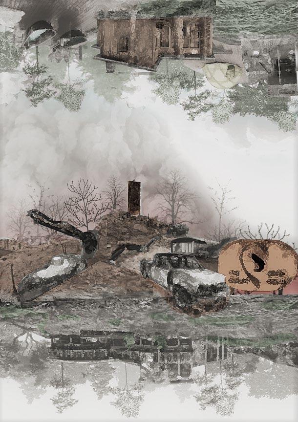
05| Fu PHOTO COLLOGE|Three scenes (Post Fire, After Fire, Future) at Guild’s Property 22
PATTERNS|four sets of diagrams illustrate design patterns/strategies to make communities resilient and fire-safe
23 - Riparian zone forest the transition zone between an upland terrstrial environment and an aquatic environment. - Riparian zone forest i subject to frequent inundation, and plant species found in this zone are adapted to periodic flooding. - Riparian zone forest helps control sediment, reduce the damaging effects of flooding and aid in stablizing stream banks. - Riparian tree species often organized in “tiers” with distance away from river’s edge - Mixed conifer-deciduous forest, which i largely comprised of Bigleaf Maple with a conifer component. - Douglas Fir is the tallest plant species in this area. - Under some climate prejections for the warmer climate, broadleaf evergreen trees, such as Pacific Madrone and Golden Chinquapin, may become more domiant plant species in this area. - Given the variability of future climate projections, planting more diverse forests plant species, which include both exisitng characteristic species and less common but potentially climate-adaped species, may provide greater resilience to the climate change and wildfire. - Open woodland and savanna, with widely spaced, fire resistant and fire-relient trees, grasses, and wildflowers below can reduce the likehood of crown fires and recover quickly after wildfire. - It is easier to maintain these tree species, grasses, and wildflowers with prescribed fires in this area. Drought Tolerance Heat Tolerance HOME ZONE DIVERSITY VEGETATION FOR CLIMATE RESILIENCE HYDROLOGY UPHILL / DOWNHILL SEASONAL VEGETATION Fu run off Native Riparian Buffer Native Plant choices: Cottonwoods Douglas Spiraea Willows Dogwoods Sedges Leave leaf litter below plantings for optional in filtration Soil microbes help to resolve the contaminants water exchange Hyporheic Zone Road Runoff Log Benches or Wattles: Identify hazardous sites in your neighborhood: Collective management & hazard migation of upper slopes: Connected vegetated buffer: Connected riparian area: Hydroseeding: Vegetated buffer along road: Sediment fences: Mulch: Revegetated riparian area: Log check dams near river Place parallel to slope to trap water and sediment. This will establish conditions for revegetating hillsides. Steep, concave slopes are sites of historical debris flow. Sediment will likely continue to move in this pattern. Consider relocationg your home away from the base of these slopes. Create larger-lot incentive for companies to fell trees before roots rot. Protect uour neighbors by ensuring everyone does their part for shorter-term stabilization methods. Collectively manage road run-off through vegetation. Protect the river from runoff, foster healthy sediment flow for water quality. Establish new vegetation to mitigate soil erosion by water flow. Plant vegetation to filter polluted run-off and protect water quality. Place parallel to slope to hold moisture and slow flow Holds moisture and nutrients in burned soil to prepare for future plantings Filters healthy sediments Sediment Flow Water Flow Incense Cedar Incense Cedar Incense Cedar Incense Cedar Douglas Fir Douglas Fir Douglas Fir Douglas Fir Bigleaf Maple Bigleaf Maple Bigleaf Maple Bigleaf Maple Evergreen Huckleberry Evergreen Huckleberry Evergreen Huckleberry Evergreen Huckleberry Western Spirea Western Spirea Western Spirea Western Spirea Sword Fern Sword Fern Sword Fern Sword Fern Oregon Grape Oregon Grape Oregon Grape Oregon Grape Vine Maple Vine Maple Vine Maple Vine Maple Snowberry Snowberry Snowberry Snowberry Oceanspray Oceanspray Oceanspray Oceanspray Salmonberry Salmonberry Salmonberry Salmonberry Pacific Madrone Pacific Madrone Pacific Madrone Pacific Madrone Oregon White Oak Oregon White Oak Oregon White Oak Oregon White Oak Red-flowering Currant Red-flowering Currant Red-flowering Currant Red-flowering Currant Spring Summer Fall Winter contributed by Masayo Simon POLLINATOR GARDENS HABITAT FEATURE HABITAT FEATURE HABITAT FEATURE FUEL REDUCTION FUEL REDUCTION FUEL REDUCTION FIRE RESISTANT PLANTS WATER FEATURE River Groundwater Fire-resistant wildfire habitat Provide food and cover for habitat Create water source for wildlife 0 30’ 30-100’ Zone1 Zone2 Oregon Ash Fraxinus latifolia Black Cottonwood Populus trichocarpa Western Red Cedar Thuja plicata Western Hemlock Tsuga heterophylla Incense Cedar Calocedrus decurrens Oregon White Oak Quercus garryana Oregon White Oak Quercus garryana Oregon White Oak Quercus garryana Oregon White Oak Quercus garryana Pacific Madrone Arbutus menziesii Golden Chinquapin Chrysolepis chrysophylla Douglas Fir Pseudotsuga menziesii Bigleaf Maple Acer macrophyllum Bigleaf Maple Acer macrophyllum Bigleaf Maple Acer macrophyllum Red Alder Alnus rubra Resprouting After Weak Postfire Resprouting After Fire Resprouting After Fire Resprouting After Fire Resprouting After Fire Resprouting After Fire Resprouting After Fire Resprouting After Fire Resprouting After Fire Resprouting After Fire Some Fire Resistance When Large Some Fire Resistance When Large Some Fire Resistance When Large Moderate Fire Resistence When Large Moderate Fire Resistence When Large Moderate Fire Resistence When Large Moderate Fire Resistence When Large Moderate Fire Resistence When Large Fire-adapted PLANT DECIDUOUS SHRUBS PATCH PLANTING 3X HEIGHT OF SHRUB= LEAVE SHURB COVER IN PATHCES 3X X With high moisture content (Oceanspary) For habitat Will create mini fire breaks decreasing the spread of fire Minimum vertical clearance Zone1 Zone1 Zone 100’+ Zone 3 DOWNED LOG VALUABLE HABITAT For nesting and cover SNAGS Can be left but only a few per acre without greatly increasing fire risk SHRUB PATCHES For cover and food Douglas Fir Pseudotsuga menziesii Douglas Fir Pseudotsuga menziesii Douglas Fir Pseudotsuga menziesii Ponderosa Pine Pinus Ponderosa Ponderosa Pine Pinus Ponderosa Fire-adapted Fire-adapted Fire-adapted Fire-adapted Fire-adapted Pacific Madrone Arbutus menziesii Resprouting After Fire
Forested Visual & Noise Buffer [In Zone 2]
FB2
More denser fire-adapted native evergreen trees, deciduous trees, shrubs, and groundcovers will be planted to build the barrier to approach the goal of noise reducing and privacy.
Forested Visual & Noise Buffer [In Zone 3]
FB3
Plant fire-adapted native shrubs, groundcovers, and some native evergreen trees to build the barrier to control noise from the road and create the visual screen to provide privacy for the site. Space trees at least 10 feet apart.
Ornamental Buffers [In Zone 1]
OB1
Use fire-adapted native shrubs and groundcover to reduce fire risk and provide some privacy for the outdoor bath area.
Ornamental Buffers [In Zone 2]
OB2
Plant fire-adapted native trees, shrubs and groudcover to apprach “hide and seen” purpose for the entry path and improve the beauty.
Ornamental Areas [In Zone 1]
OA1
Plant fire-adapted native low shrubs and groundcovers to reduce fire risk, reduce erosion, and hold moisture to the site.
Ornamental Areas [In Zone 2]
OA2
Plant fire-adapted native shrubs and groundcovers to reduce erosion, and provide beauty and natural ecosystem to the site.
Ornamental Areas [In Zone 3]
Plant fire-adapted native shrubs, groundcovers, and some native low height trees to provide beauty, shade and natural ecosystem to the path.
Marsh
An area of low-lying land which is flooeded in wet seasons, and typically remains waterlogged at all times.
Exposed Rock
In the pocket of the rock, plant some plants that can grow on the rock to create different views of the rock.
Mixture of native grasses and turf grass to create a low and habitatble space.
Naturally growing grasses
Grassland Lawn Riparian
Replant native riparian plant species to rebuild the natural riparian zone and ecosystem.
Woodland Parking Lot
Replant native and fire-adapted woodland plant spiecies to rebuild the woodland habitat. Space trees at least 10 feet apart.
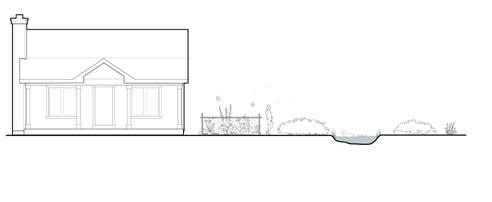
SECTION|illustrating changes and managements through time SITE PLAN|illustrating
24 A A’ B B’
A’
A’ B B B’ B’ Fu
the residential design with fourteen zones based on four sets of patterns
A
A
OA3 M ER G L R W PL
ER OA1 OA2 OA2 OA3 L M R W M PL FB2 FB2 FB3 FB3 OB2 G G Douglas Fir Douglas Fir Douglas Fir Douglas Fir Incense Cedar Incense Cedar Incense Cedar Incense Cedar Pacific Madrone Pacific Madrone Oceanspray Oceanspray Oceanspray Oceanspray Oceanspray Oregon White Oak Oregon White Oak Evergreen Huckleberry Snowberry Oregon White Oak Evergreen Huckleberry Oregon White Oak Snowberry Western Red Cedar Western Red Cedar Snowberry Vine Maple Vine Maple Vine Maple Western Spirea Bigleaf Maple Western Spirea Sword Fern Black Cottonwood Black Cottonwood Red Alder Red Alder Oregon Ash Oregon Ash Sword Fern Red-flowering Currant Salmonberry Salmonberry Vine Maple Sword Fern Sword Fern Rush Rush Willow Willow Sedge Sedge Red-flowering Currant Oregon Grape Oregon Grape FB3 FB3 ZONE ZONE 2 ZONE 1 FB2 FB2 OA2 OA2 OA1 OA1 OA1 OA1 ER ER Mckenzie River Mckenzie River Mckenzie River Mckenzie River Natural Pathway Natural Pathway W [Out of Parcel Line] W [Out of Parcel Line] House & Deck House & Deck Goodpasture Road Goodpasture Road W W R R R R Densely planting young trees to create a natural screen/ barrier for privacy and reducing noise. Staggered planting trees and shrubs to create diverse habitat and become auxiliary natural screen/barrier Staggered planting lower deciduous, evergreen shrubs, and groundcovers to approach seasonal interests and low fire risk environment No dry grasses in this zone. View-2040 View-2040 View-2070 View-2070 80’
OB1
illustrating a resilient, sustainable, and fire-safe resident property, achieved through good managment and planting
2070 SITE PLAN|
Fu 25 Pre-fire Post-fire 2040 2070
AXONS|illustating four views of the site (pre-fire, post-fire, 2040, and 2070)
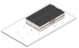
06|
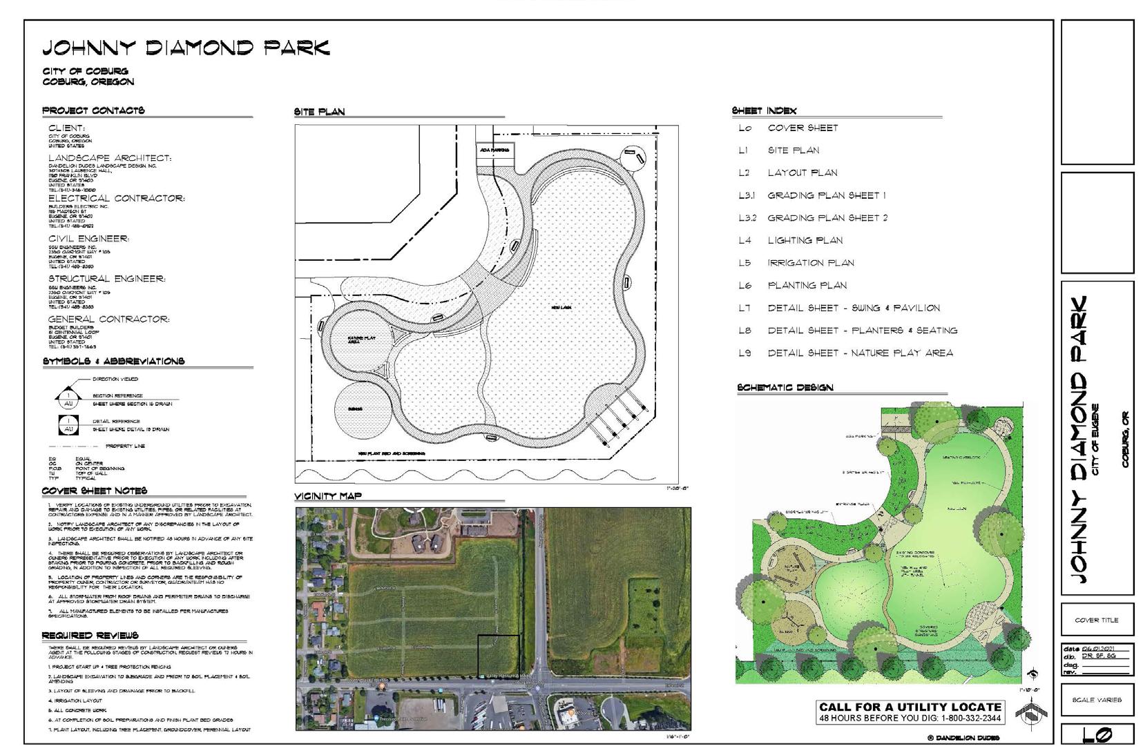
JOHNNY DIAMOND PARK
Open Space vs Human Needs
Coburge, OR, United States
Academic | Group Work with Daniel Ramires & Sydney Gustman | One Semester
Professor: Bard Course: Spring 2021, LARP 489 Studio
This project aims to design and produce a comprehensive set of construction drawings for a new community park in the Willamette Valley. The design must meet the park’s expanding functional requirements and employ best management practices to ensure sustainability and broad accessibility. Key design focuses include accommodating new park needs, universal design, bicycle parking solutions, lighting design, and stormwater best management practices.
The project not only focuses on functionality and sustainability but also strives to create a beautiful and practical public space that promotes interaction and activities among community members. By integrating environmental protection, community needs, and the latest urban design principles, this new park aims to become an iconic green space in the Willamette Valley, providing local residents with an ideal place to connect with nature and enjoy outdoor activities.
Fu CONSTRUCTION SET COVER|Project Information Overview 26 created by Yunxiao Fu, Daniel Ramires & Sydney Gustman
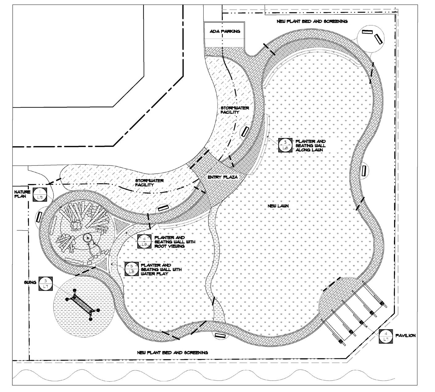
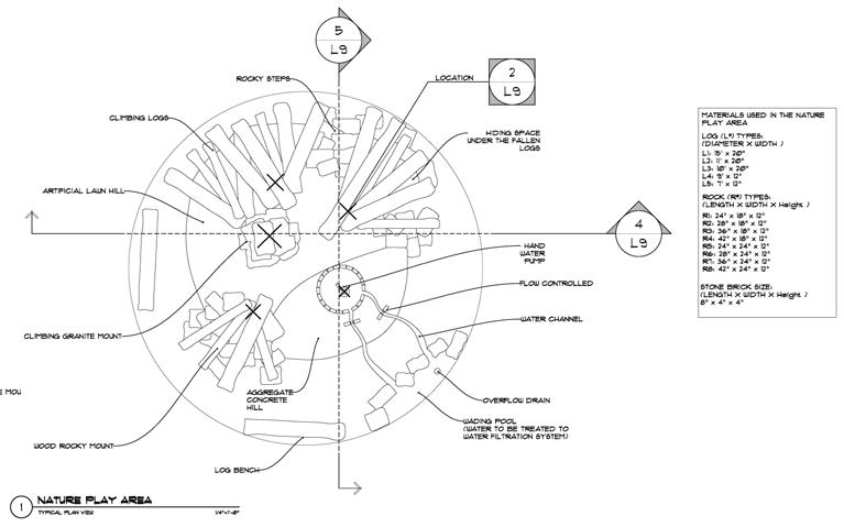
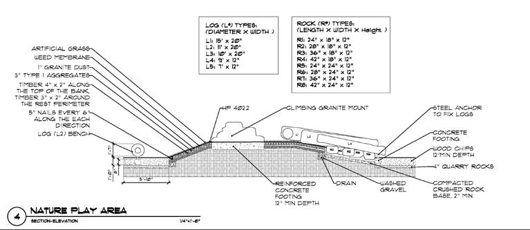
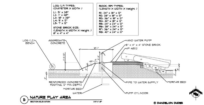
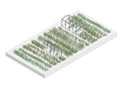
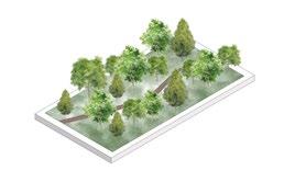
SITE PLAN|illustrating a general design for the park design NATURAL PLAY AREA|illustrating the detailed design for the new natural play area Fu 27
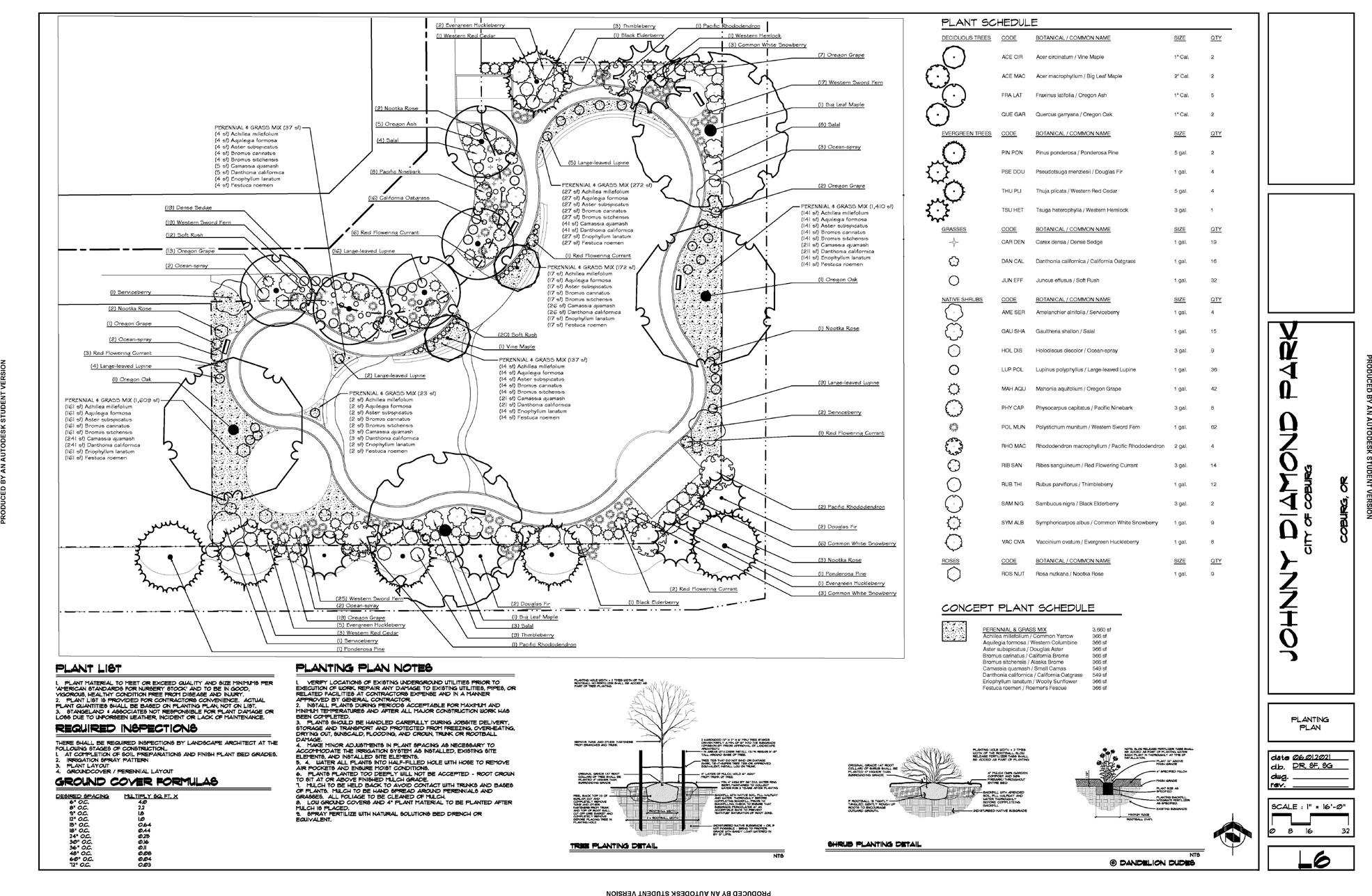
PlANTING PLAN|illustrating diverse plant selections for this park 28 Fu
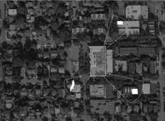
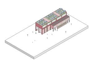
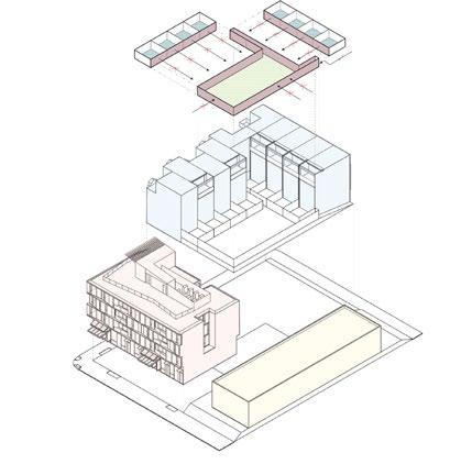
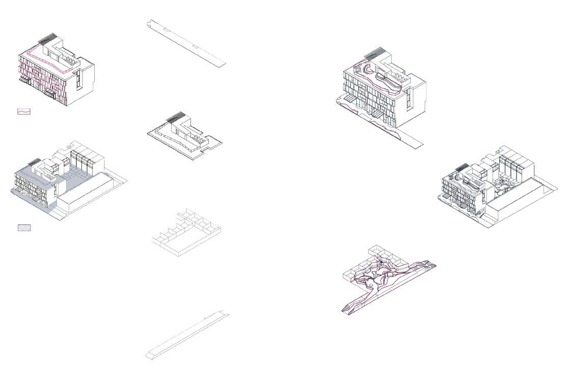
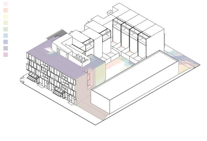
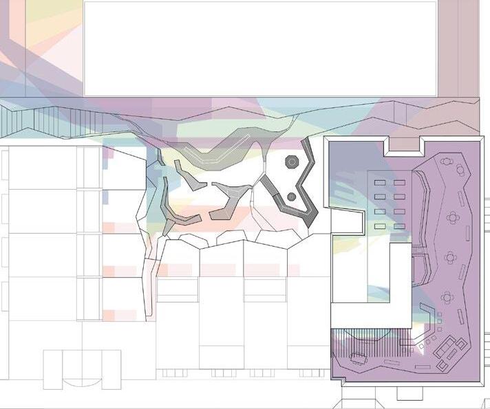
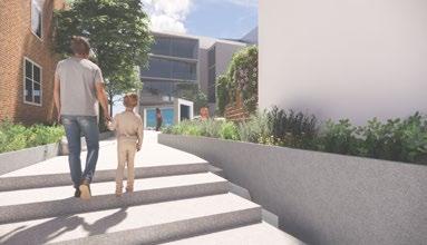
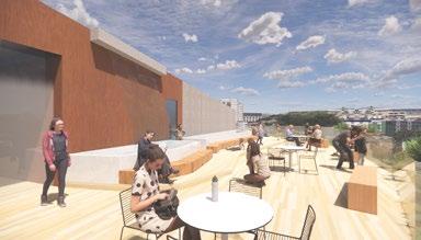
THURMAN COURYARD & ROOF City limits vs Human Experiences
Portland, OR, United States
Instructor: Anita Van Asperdt Course: Spring 2020, LA 439 Studio Academic | Individual Work | One Semester
The studio’s main focus for this site was on two issues:
1. How to make a dark, wet, and enclosed courtyard public.
2. How to combine the roof garden of the new podium building, which is located at the south of the courtyard has some relationships with the courtyard.
The design proposal by providing solution designs for each issue:
1. The courtyard will be open to the public. A variety of spatial patterns are constructed according to the sunlight and shadow for people to choose freely and meet the needs of children playing and residents interacting.
2. The spatial landscape on the roof echoes the landscape elements of the courtyard. The roof programs are arranged based on views that are available from each corner to maximize the interaction with the surrounding environment.
07| Fu PLAN| Thurman Courtyard & Roof 29 mins mins mins 20’
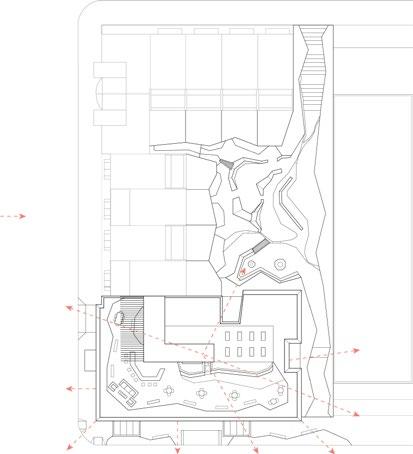
This isometric diagram is summarized through the study of the illumination of the site model in all seasons and the time range from 8 a.m. to 4 p.m. According to the general sunlight and shadow study, some areas of the courtyard have the problem of perennial lack of sunlight.
The courtyard is programmed according to the light and shadow areas throughout the year and the time range from 8 a.m. to 4 p.m. More seating structures and climbing and playing facilities are designed in areas that are often exposed to sunlight. At the same time, the seating structure of these illuminated areas will also be in the shadow at certain times, to ensure that people can choose seats freely.
Also, a glass fountain wall is designed with a water play area next to the alley. Depending on the time and angle of sunlight, the reflection of light with water and glass provides some of the effects of light in the shaded area. In the shaded area, the fireplace areas are designed to provide warmth and light for people in the perennial shaded area.
Programs that most time in the sun:
- Zigzag seating areas with kids’ climbing and tunnel structures.
- A glass fountain wall with a water play area.
Programs that most time in the shade:
- Zigzag seating area with fireplaces
SUN AND SHADE AXON & MAP|illustrating areas and programs response to sunlight and shadow from 8am to 4pm ISOMETRICS|site analysis of site conditions and design concept Fu 30
OnlyAccesstoCourtyard Apartment Private & Fenced-in Yard Thurman Apartment [Built from 1901-1950] Thurman Lofts [New, Not build] Zigzag -- Main Element for New Architecture Design Streetscape Forest Park Views Courtyard Existing Conditions Roof Existing Views Design Concept Future Courtyard Vacant Lot (Futural Residental) Main Intersection (Moving Traffic) Community Activity Downtown Portland Towned Retail & Residential MT. Hood Apartment Building
AM AM 10 AM 11 AM 12 PM PM PM PM PM Zigzag Planting Bed Zigzag Fence, Artificial Elements Zigzag Fence, Planting Bed, Artificial Elements Zigzag Planting Bed + + + + Roof Design Final Design Couryard & Private Yard Alley Design Range Apartment [Built from 1951-1999] Original Fenced-in Courtyard [Built with Apartment Construction]
The Range of Sunlight Changes Over Time [roof, courtyard, private yard, alley] Programs Response to Sunlight and Shade (Focus on Courtyard)
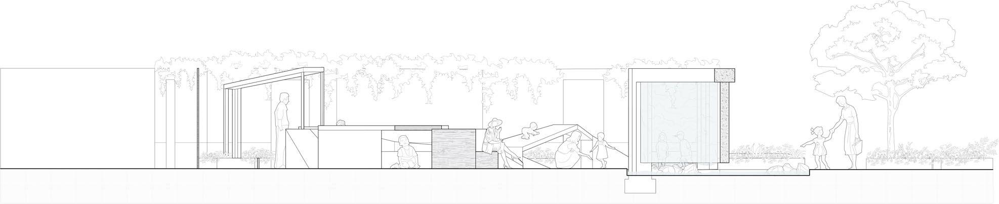
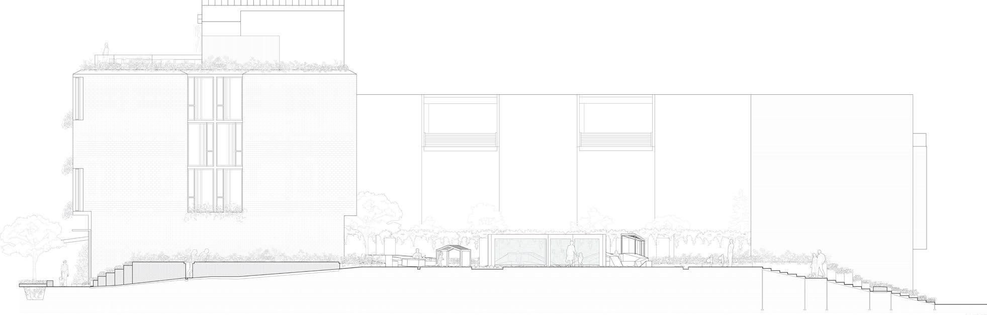
Sections|illustrating activities in the courtyard Fu 31 From West to East Scale: 1/2” = 1’-0’ Scale: 1/4” = 1’-0” From South Street to North Street through the Alley Pergola Seating with Fireplaces Zigzag Seating with Kids’ Climbing & Tunnel Structures Glass Fountain Wall & Water Play Area Glass Fountain Wall & Water Play Area Going through or staying under the structure to enjoy partial sunny and shady experiences. This area is the least sunlighting area. Fireplaces make up for the lack of sunlight. People interaction spaces, kids activity areas, and water play areas to experience the most sunlighting. This area is the most sunlighting area. It creates different sunlighting effects to the courtyard to make people feel the sun. People gather seating spaces and Kids activity areas to enjoy the most sunlighting
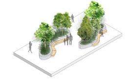
TOP-PERSPECTIVE|illustrating more detailed site designs and scenes
PERSPECTIVE RENDERING|illustating three important scenes in alley, courtyard, and roof
32 Roof Design A Glass Fountain Wall with A Water Play Area North Entrance to the Courtyard An alley with zigzag yearly planting beds and the sound and views of the water fountain wall lead people into the courtyard to explore and enjoy the spaces.
transparent effect created by glass and water forms a medium for the courtyard and walkway, allowing people to create an interactive effect in different areas.
design of the roof echoes the design of the courtyard. The fountain muffles the noise and heat of the air conditioner on the roof. Gathering Seating Roof Design Glass Fountain Wall North Entrance South Entrance Fireplace Pergola Water play Kids’ climbing structure Fu
The
The
Yunxiao Fu
Master of Landscape Architecture University of Pennsylvania
PHOTOGRAPHS|views from China, Korea, and United States.