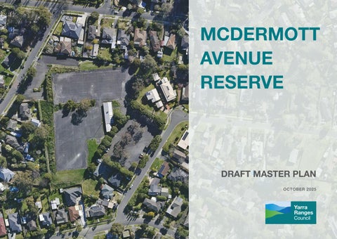
MCDERMOTT AVENUE RESERVE


Yarra Ranges Council acknowledges the Wurundjeri and other Kulin Nation peoples as the Traditional Owners and Custodians of these lands and waterways. We pay our respects to all Elders, past, present, and emerging, who have been, and always will be, integral to the story of our region. We proudly share custodianship to care for Country together.
First Peoples are advised that this document may contain images and names of people now passed and content of cultural significance.
The provision of quality infrastructure within our recreation reserves supports Yarra Ranges Council’s vision for a healthy and active Yarra Ranges community.
In 2015 when netball usage moved from McDermott Avenue to Pinks Reserve in Kilsyth, Council resolved to commence proceedings to sell the 17,260m2 (1.7 hectare) property at 52 McDermott Avenue. Background research underpinning this Master Plan reviewed the prior Council decision with a current statutory and strategic lens, with consideration of community open space needs into the future.
Options to sell all of the land in line with a previous Council resolution, or to retain the land for a mix of open space and residential offerings, were interrogated through a Feasibility Study undertaken in 2025. Retaining at least 10,000m2 (1 hectare) of public open space for social recreation, whilst exploring the potential for multiple dwellings on the remainder of the site, was identified as the most viable option to maximise community benefit.
The Master Plan for 52 McDermott Avenue Mooroolbark (herein called McDermott Avenue Reserve or ‘the reserve’), provides the strategic framework for modification of the site’s topography, for better accessibility and visual connectivity. The provision of new infrastructure and environment improvements will facilitate improved open space outcomes and green infrastructure, and opportunity to participate in social sport and recreation, play and community events.
The Master Plan (‘the Plan’) takes a fresh approach and responds to community feedback to reinvigorate this disused site into an active community destination.
The Plan will consider open space provision in the area and the demand from the community for housing and social recreation space.
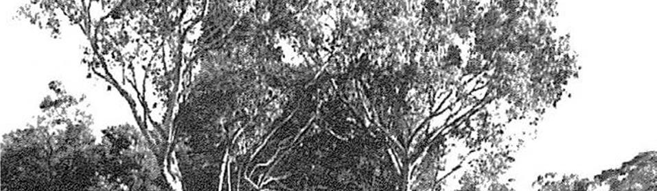
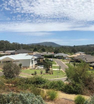
Mooroolbark (Figure 1) is bounded by the southern edge of the East Ridge Business Park, Manchester Road and the Maroondah Highway in the north, Mooroolbark Road, Hull Road, the suburb of Lilydale, the Melbourne Water Pipe Track and Belfast Road in the east, Cambridge Road, Hawthory Road and the locality of Kilsyth in the south, Marion Avenue, Hull Road, Lincoln Road, Newman Road, Sherlock Road and Brushy Creek in the west (.id(informed decisions)), September 2024).

(Source – Mooroolbark College website, accessed 21 November 2024)
Residen�al areas formed around the 1960s around Old Kent Road were part of a programme extensively promoted within Migrant Hostels a�rac�ng people from the United Kingdom. These migrant hostels were located on Rooks Road in Nunawading.
Subsequent housing estates around McDermo� Avenue, Ba�erbee Drive and Rolling Hills were the areas which extended Mooroolbark residen�al land so that they became “li�le more than a stone’s throw from the Maroondah Highway” (James, ‘Border Country, 1984)
Mooroolbark the name, has always been understood to mean ‘red earth’, however there is also an understanding that its meaning is that of ‘the land of Moorool’ which relates to a great body of water. It is said that the area comprising Mooroolbark and surrounds was once underwater. Mooroolbark is also viewed as a derivation of the Wurundjeri word Moorool-bik.
By the 1890s Mooroolbark had become predominately dairy country. The railway and the station ensured that local milk could be easily and quickly transported to the factory at Box Hill and that any other produce could be sent on to the markets in the city.
Slowly but surely, the spread of suburbia began to take hold and local dairy farmers were impacted by fast development of large-scale pasture farming in Gippsland.
Subsequent housing estates around McDermott Avenue, Batterbee Drive and Rolling Hills were the areas which extended Mooroolbark residential land so that they became “little more than a stone’s throw from the Maroondah Highway” (James, ‘Border Country, 1984).
By the 1960s -1970s as so much land was being released, and support facilities and services were required, including secondary schools and sporting grounds. The McDermott Avenue netball courts would soon take off by the late sixties with several local teams established, and other teams around the district competing at the venue.
There have been recollections shared to the Mooroolbark History Group on Facebook, regarding the landfill site where the netball courts were later constructed. It appears the courts were built over an old dam, which needed to be drained and backfilled prior to construction.
The Lilydale and Yarra Ranges Netball Association relocated from McDermott Avenue Reserve to Pinks Reserve, Kilsyth in 2015 and Council resolved to rezone and sell the land for housing. This was not acted on.
Since 2015, 52 McDermott Avenue has remained a vacated and under-utilised open space, other than when used as a Covid testing station in 2019-2020.
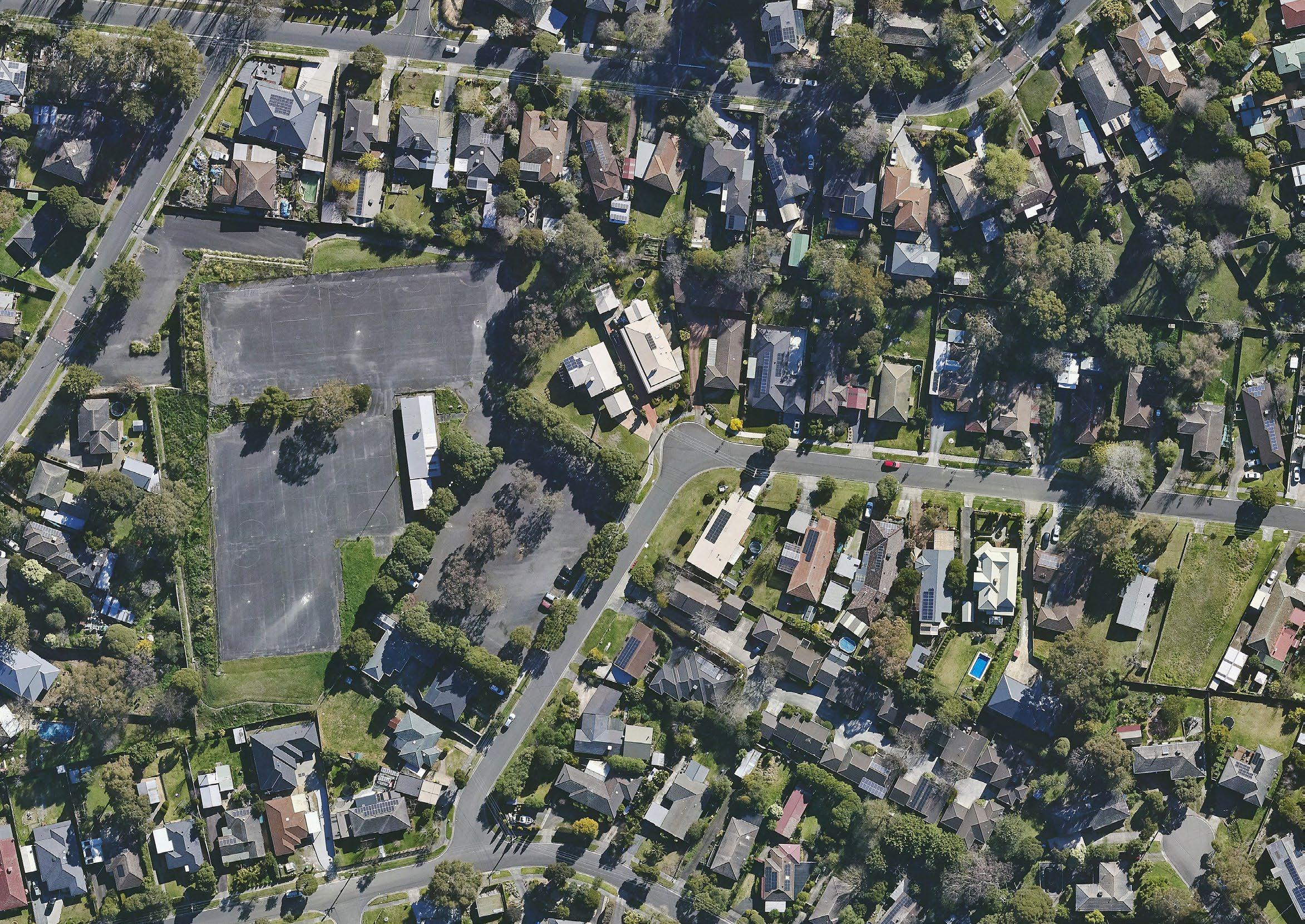
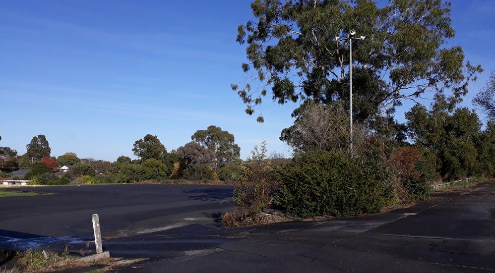
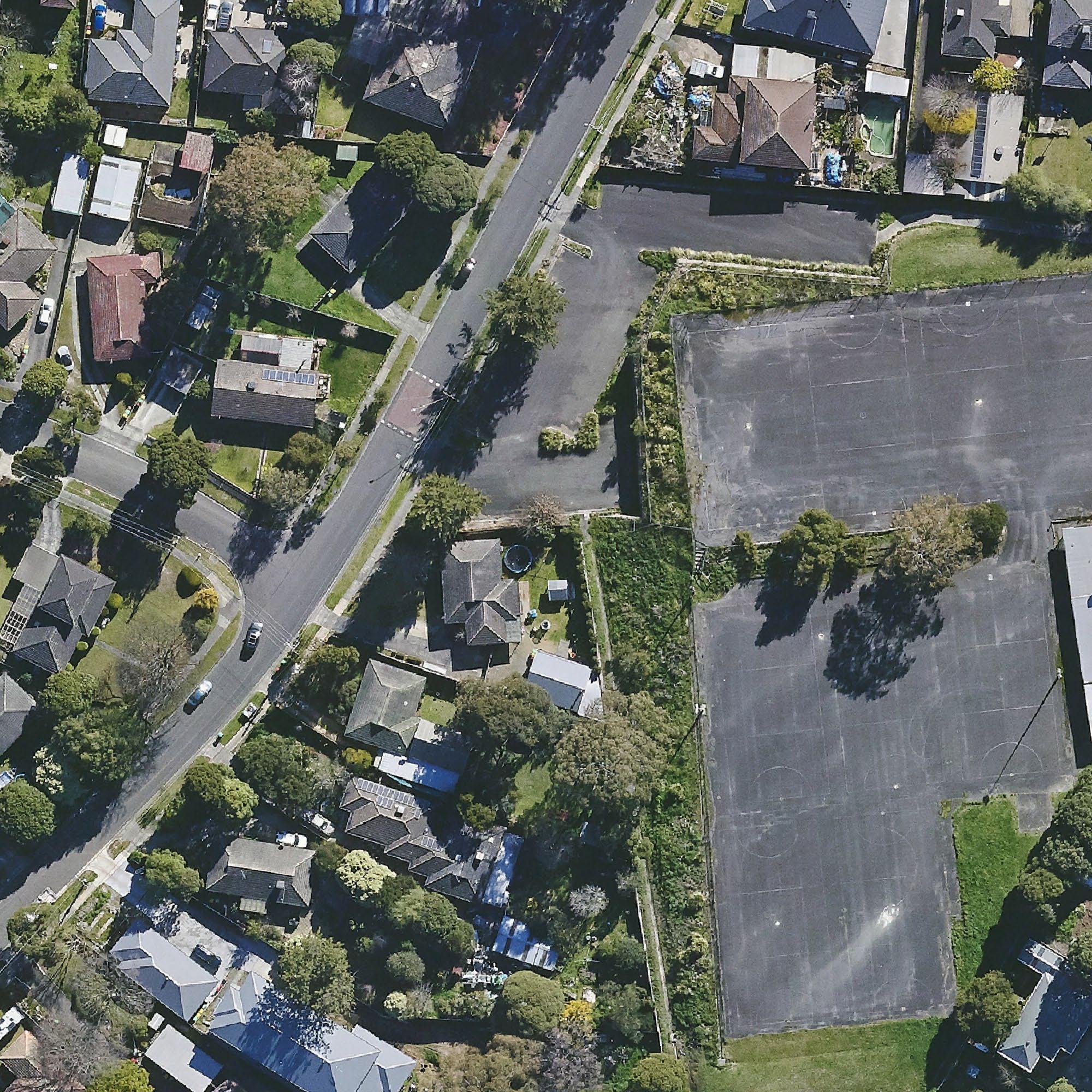
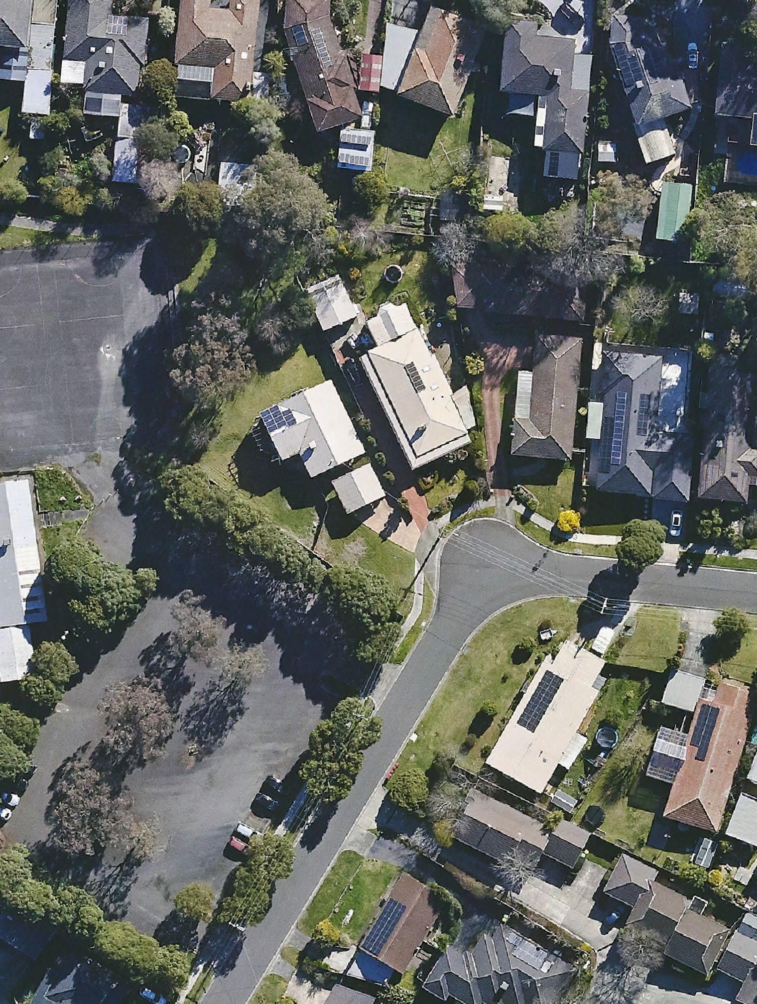
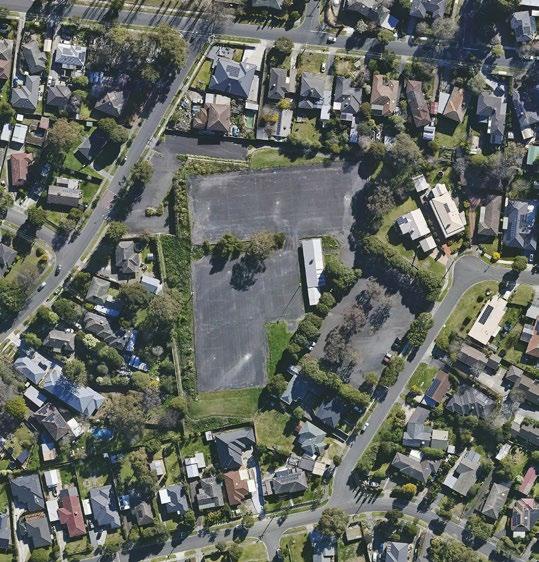
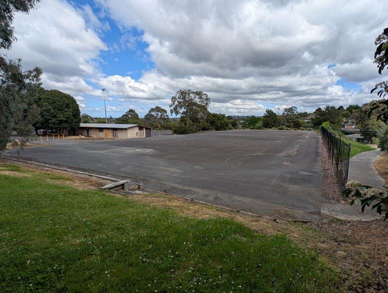
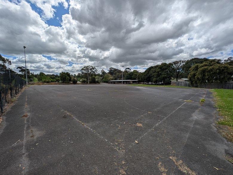
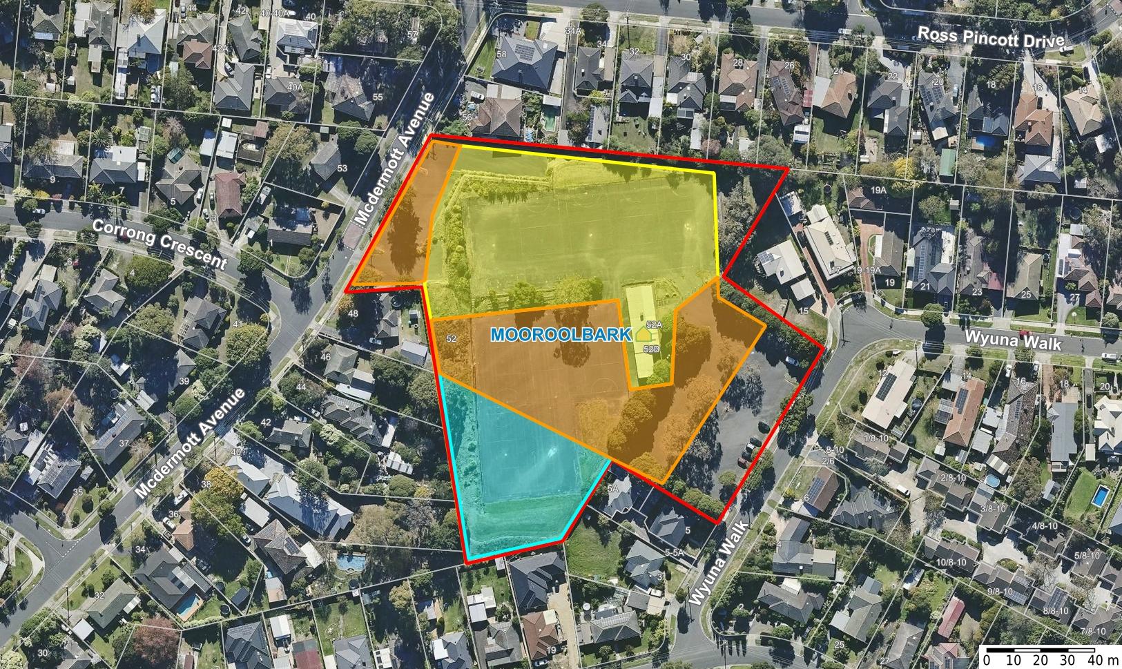
The study site 52 McDermott Avenue, Mooroolbark (Figure 2), is a 1.726ha property located at the western end of the Yarra Ranges between McDermott Avenue and Wyuna Walk.
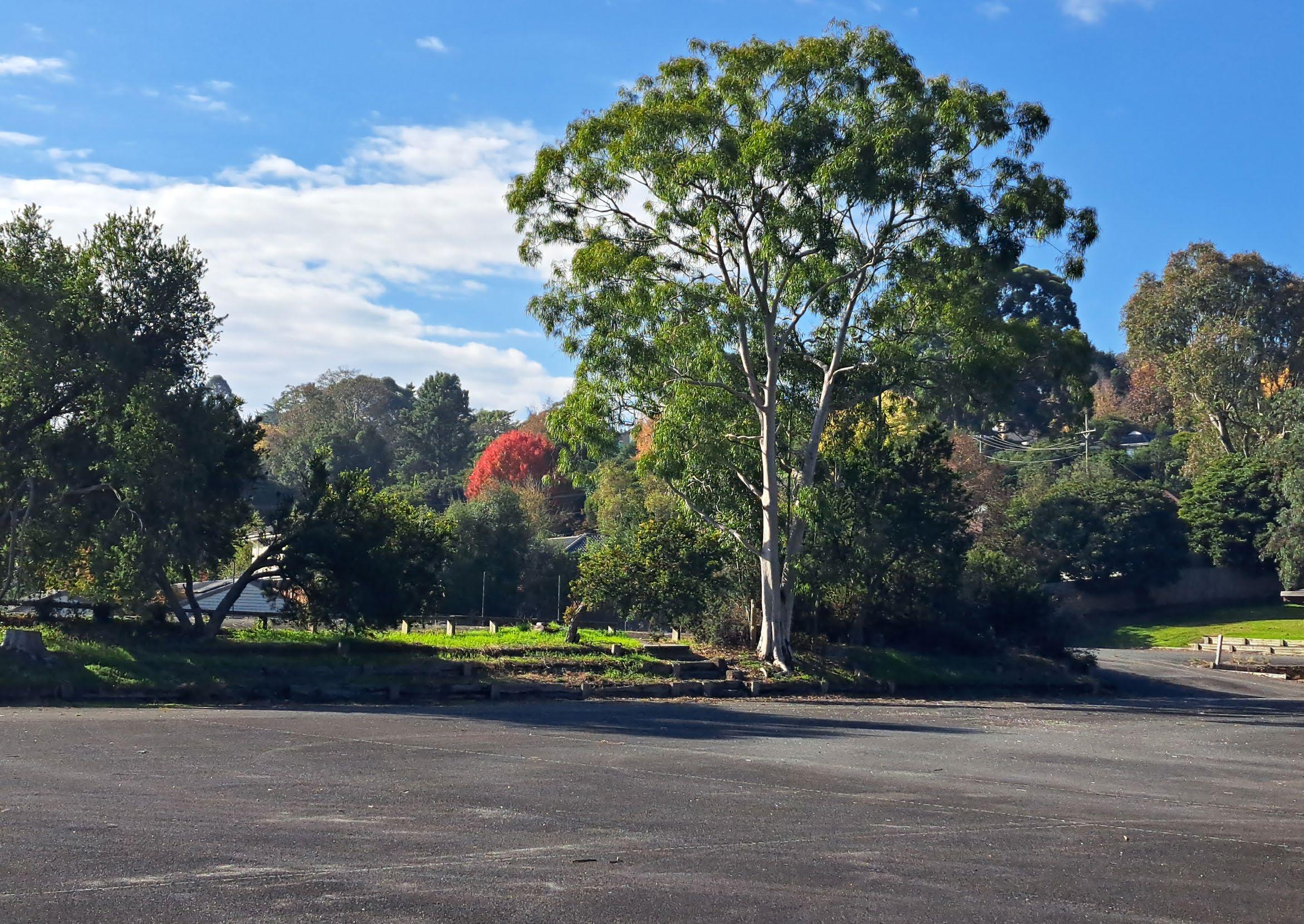
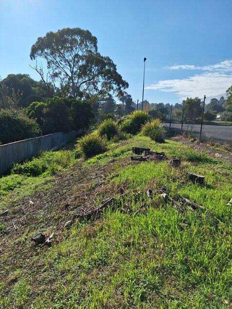
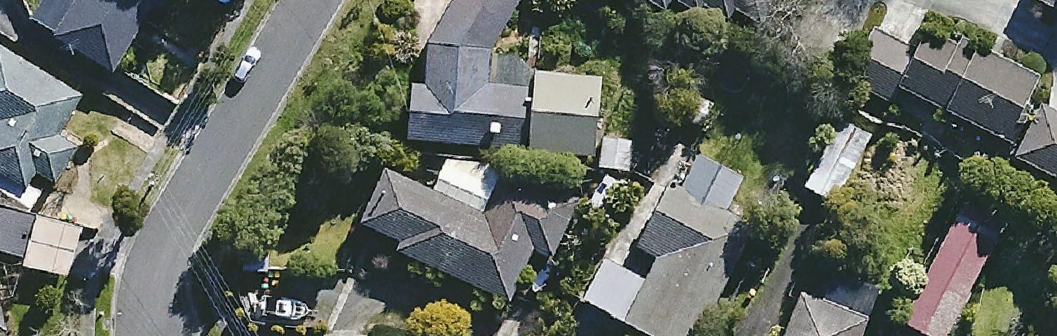
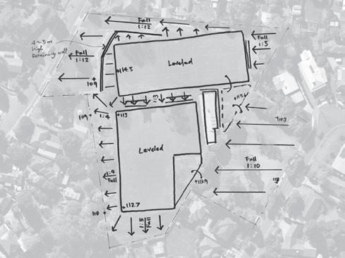
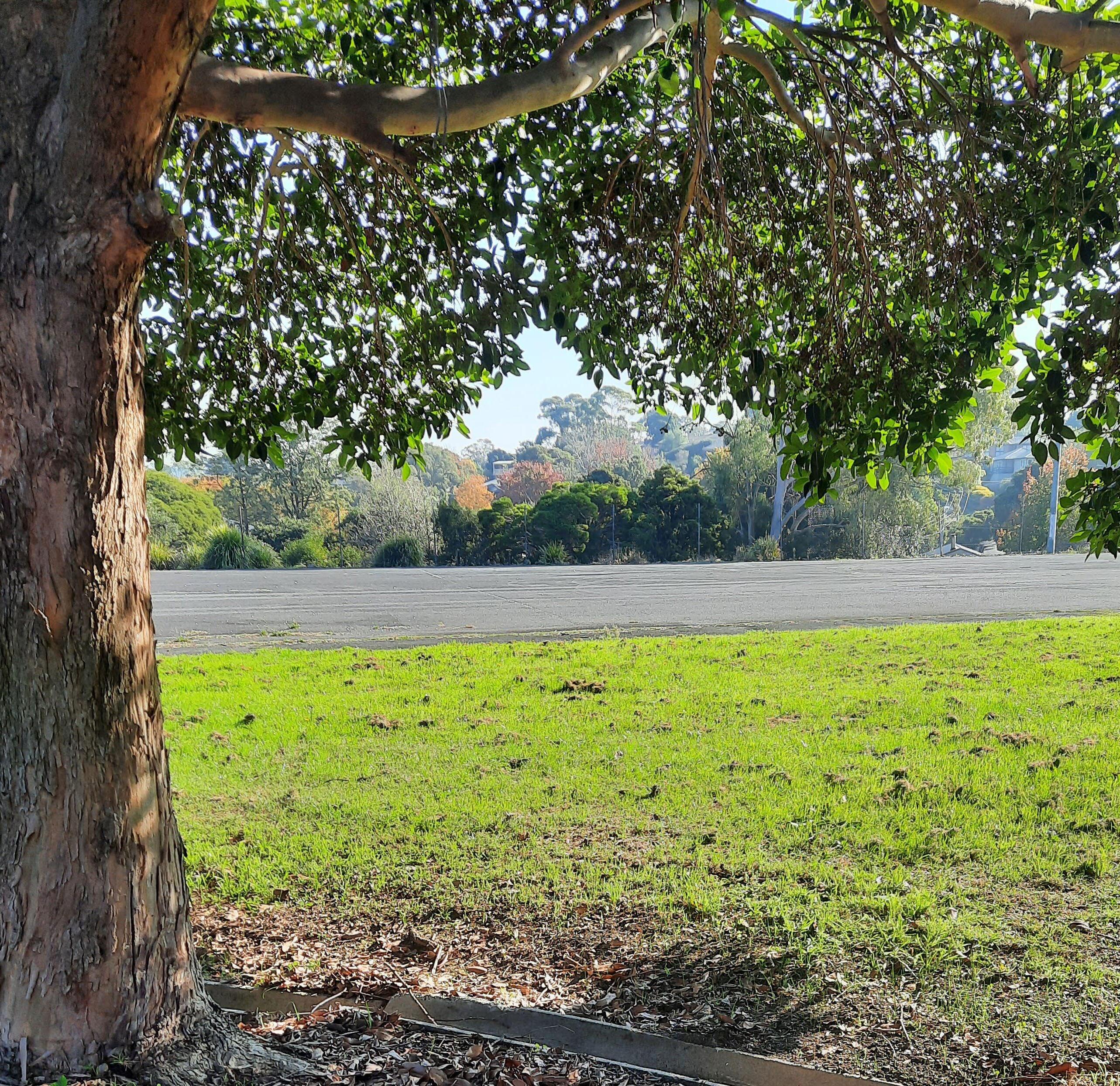
McDermott Avenue Reserve is an irregularly shaped, terraced multi-level complex site. The site features 10 disused and deteriorating asphalt netball courts split over two levels, as well as a redundant pavilion and two car parking areas.
Local residents currently use the reserve as a walking, bike skills training and dog exercise area, plus thoroughfare to the nearby Mooroolbark College. The site in its current condition is underutilised and not welcoming.
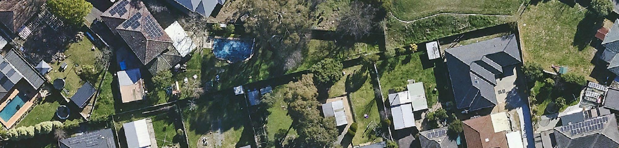
Most neighbouring properties currently back onto the reserve, resulting in overlooking and poor public safety outcomes through negligible opportunities for passive surveillance (a sense of ‘eyes on the park’), of the area. As a result, the site is underutilised and experiences unsafe behaviour and vandalism.
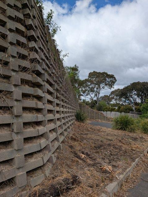
There is a substantial level change with a 13.5 metre fall from Wyuna Walk to McDermott Avenue, and 3 metre crossfall along Wyuna Walk frontage.
• There is a substantial five-metre-high retaining wall to the north west that is showing signs of potential failure. There is no accessible path through the site.
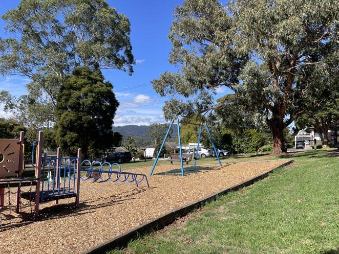
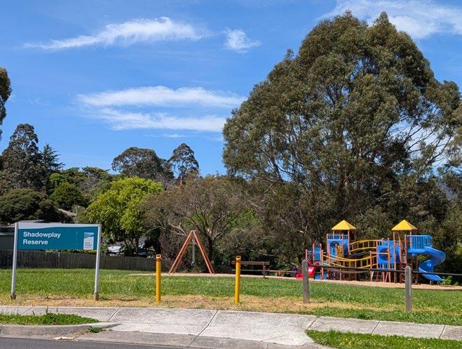
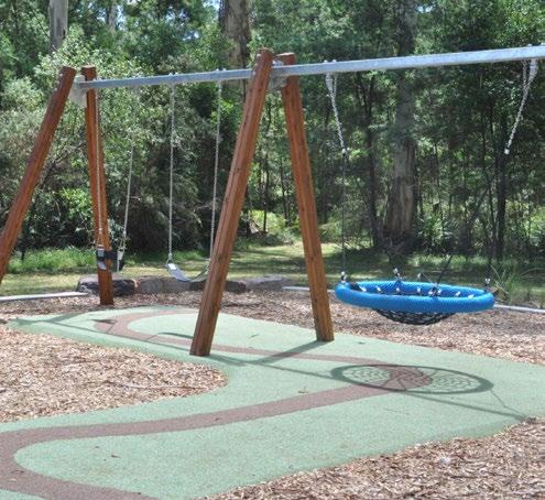
• The old play equipment was decommissioned and removed approximately five years ago. The closest playspace is 600m away at Shadowplay Reserve.

2.
3.
4. Larnook Reserve
5. Bimbadeen Gardens
6.
7.


Mooroolbark is projected to become the second most populous suburb in the Yarra Ranges. Demographic data (.id informed decisions, 2024) underpinning recommendations in the Draft Master Plan, include:
• In 2021, the population of the urban area of Yarra Ranges was 82,346. By 2046, this number is expected to grow to 107,115. This is an increase of 24,769 people (30% overall increase, or about 1.06% growth per year).
• In Mooroolbark, the population is expected to grow by 3,550 people, from 23,349 in 2021 to 26,899 in 2046. This is a 15.2% increase overall, or 0.57% per year.
• In 2021, the largest age group in Mooroolbark was 35 to 39 years old, making up 8.1% of the population.
• The largest increase in persons between 2021 and 2031 is forecast to be in ages 40 to 44, which is expected to increase by 426 and account for 7.7% of the total persons.
• The largest 5-year age group in 2031 is 35 to 39 years, with a total of 1,961 persons.
• Between 2031 and 2046 there is forecast to be an extra 1,885 persons, the 35-39 years olds most dominant (8.1%) followed by 30 to 34 years (7.6%) and 0 to 4 years (7.2%).
• By far the greatest change between 2021 and 2046 is the migration into the 85+ bracket, being an additional 859 persons.
• The number of dwellings in Mooroolbark is forecast to grow from 8,628 in 2021 to 10,173 in 2046, with the average household size falling from 2.77 to 2.71 by 2046.
Population and household forecasts, 2021 to 2046, prepared by .id (informed decisions), September 2024.
Forecast age structure - 5 year age groups
Mooroolbark - Total persons
2021 2031 2046
Number of persons
Age group (years)
Source: Population and household forecasts, 2021 to 2046, prepared by .id (informed decisions), September 2024.
This Master Plan contributes to the following strategic objectives in the Council Plan 20252029:
• Healthy Connected Communities: McDermott Avenue Reserve has the opportunity to provide safe, inclusive, and accessible public open space with quality infrastructure, recognising the role of open space in encouraging active lifestyles for all ages, supporting mental health through connection to nature, and fostering social cohesion through opportunities for unstructured recreation and community interaction.
• Quality Infrastructure and Liveable Places: The recommendations in this Master Plan seek to develop well-planned, safe and quality infrastructure with adequate open space to meet current and future community needs. The preferred option retains most of the site as open space, enhances linkages to the local path network, transport, primary and secondary schools and will meet open space need to residents in the vincinity of the reserve.
• Protected and Enhanced Natural Environment: The draft concept plan developed in the Master Plan reflects the value the community places on preserving natural open space by replacing approximately 70% of existing asphalt with grass and permeable surfaces, reducing urban heat and improving water absorption. The proposed Master Plan enhances canopy cover, native vegetation, and water filtration to support both community use and local wildlife, while strengthening environmental sustainability.
The project and recommendations remain aligned with the updated objectives outlined in the Draft Council Plan 2025-2029 which has yet to be adopted.
Council’s adopted Housing Strategy (2024) identifies actions related to the treatment of Council owned land. This includes:
Action 46: As a general principal, where practical, retain land suitable for housing within residential zones to enable the opportunities for provision of housing and to ensure that land is not lost to other land uses, subject to detailed assessment being undertaken in each case.
Action 47: Commission feasibility studies on the development of sites appropriate for social and affordable housing.
The Urban Area (of Lilydale and Mooroolbark) currently exhibits a social housing occupancy rate of approximately 1.3%, below the state average of 3.0%, and with housing affordability challenges for lower-income groups. Although the Urban area has a higher proportion of social housing than the rest of the region, this is mainly attributed to inner proximity to the metro direction and its higher density of population. This population density and its growing trajectory is also attributable to the acute and growing homelessness cohort in the area. With anticipated growth, an increased shortfall of approximately 1500 social housing units by 2041 is projected, particularly for one and two-bedroom units aimed at single occupants or smaller households.

Other relevant plans and strategies that have been considered for the development of McDermott Avenue Reserve include, but not limited to:
• Open Space for Everyone 2021, Department of Energy, Environment and Climate Action
• Plan for Victoria 2025, Department of Transport and Planning
• Guide for Open Space Strategies (draft), Department of Energy, Environment and Climate Action.
• Health and Wellbeing Strategy 2025 – 2029
• Recreation and Open Space Strategy, 2013 – 2023 (Section 3. Open Space Assessment)
• Sale of Land Policy, 2014
• Liveable Climate Plan, 2020 – 2030
• Active Recreation Plan 2023
• Disability Action Plan 2025 - 2029
• Child and Youth Strategy 2014-2024
• Playspace Plan 2019 – 2029
• Nature Plan 2024 – 2034
• Liveable Climate Plan 2020 – 2030
• Tree Canopy Strategy 2024 - 2044
• Yarra Ranges Planning Scheme: Clause 19.02-6L Open Space: this clause includes strategic guidance concerning provision of open space, including providing open space and recreation facilities for urban areas that includes a local park of approximately one hectare within 400 metres of residential areas and a centralised district park for community events and activities.
The property is a combination of five titles, two of which hold Reserve status, and all are zoned Public Park and Recreation Zone. The implications of these are outlined below.
Subdivision Act 1988, Local Government Act 1989 and Planning and Environment Act 1987
Land which is zoned PPRZ under the Planning Scheme is deemed to be Public Open Space under the Subdivision Act 1988. Ordinarily, land zoned for Public Open Space can only be sold where replacement Public Open Space has been provided.
Should Council proceed with rezoning and sale, the Subdivision Act stipulates that Council must use the proceeds in accordance with Section 24A of the Subdivision Act.
Council can also undertake procedures to remove the reserve status from two of the property titles, by way of a planning application pursuant to Section 24A of the Subdivision Act.
The area of the site being considered for housing would be rezoned to Neighbourhood Residential Zone 1 (NRZ1) and a Significant landscape Overlay SLO023 applied, consistent with surrounding properties.
In 2015, the area was deemed to have adequate open space and the site was not needed for open space. This informed the Council decision to sell the land.
As of 2025, there has been no progress in advancing the sale of the land. The former pavilion and 10 netball courts have remained underutilised, with minimal intervention, for the last 10 years. There was no progress to rezone the land through a Planning Scheme Amendment process.
Local residents have voiced their support for 52 McDermott Avenue to be retained and upgraded for public open space and social recreation. Population numbers and housing densities in the area are increasing and thus demand on open space increases. It was timely to revisit the feasibility of the sale of land at 52 McDermott Avenue, Mooroolbark.
In mid 2025 a Feasibility Study was undertaken including an open space strategic planning assessment and gap analysis provision to consider the current and future needs in the area. The feasibility study reviewed the site with key findings now in this Draft Master Plan. It tested whether the Council resolution to sell 52 McDermott Avenue still has the same strategic support, taking into consideration:
• Subdivision Act 1988
• Yarra Ranges Planning Scheme
• Population projections
• Open space requirement for the area, now and projected
• Council’s open space, sale of land and housing policies
• Land optimisation and development opportunities
• Cost implications of land sale
• Legal advice.

Council’s endorsed Recreation and Open Space Strategy 2013-2023 (ROSS, currently under review) incorporates a strategic framework, to guide Council’s decision-making process in providing recreation and open space services and facilities in Yarra Ranges. It has a focus on providing sufficient open space for the population of Yarra Ranges now and into the future.
The ROSS identifies a range of social, environmental and economic benefits derived from engaging with open spaces. In addition, it considered current and future demographic implications for providing open space, including:
• Emerging Chin, Burmese and Indian communities in the urban areas: providing inclusive participation opportunities and club cultures that respect the cultural differences will be important.
• Catering for the high percentage of young people who use a range of both organised sporting facilities (i.e. playing fields, sports courts) and unstructured open space and facilities (i.e. skate and BMX facilities, half courts, play spaces, etc.).
• Providing a mix of activity spaces that encourage family participation including social recreation parks.
Updated population forecasts indicate a rise in projected population density, placing increased pressure on the provision of public open space. Recent amendments to State Government legislation allows two dwellings per lot without subdivision occurring. This may have had a dual impact: reducing the amount of private backyard space available and increasing the number of residents who rely on access to high-quality public open space to support their health and wellbeing
The ROSS establishes a planning framework and levels of service for open space, considering:
• Function (purpose) of open spaces
• Hierarchy and catchment (the sphere of influence of an open space)
• Location, size and distribution of open space in the area
• Accessibility, visibility
• Site features (vegetation, existing support infrastructure)
• Interface with neighbouring properties
• Opportunity for improved design and community outcomes.
The ROSS provides for Local parks (minimum1hectare) within 400m-500m of every household, and a District park (minimim 2 hectare) centrally located within the precinct. This is also reflected in the Yarra Ranges Planning Scheme (Section 19.02-6L Open Space). More than a decade has passed since the development of these standards and whilst this assessment is grounded in the provision standards of the ROSS, a look at the contemporary context of open space planning to consider what is relevant to the future residents of Mooroolbark has been pursued.
In addition to Local-level parks, preliminary State Government guidance recommends provision of ‘Neighbourhood’ level parks. Neighbourhood parks may have a catchment of approximately 800m and be 1.0-5.0ha in size (Draft Guide for Open Space Strategies, Department of Energy, Environment and Climate Action 2024). This proposed hierarchy adds another layer to the ROSS standards by providing a Neighbourhood park within 800m of households and with increased levels of infrastructure above Local level.
A recent accurate application of the principles of the ROSS and its associated service levels indicates the site is not surplus to need and there is demand for a Local Park at this location under the ROSS hierarchy as well as a Neighbourhood level Public Open Space based on draft Guidelines for Open Space from the Victorian Government.
McDermott Avenue Reserve previously had an organised sport function under the ROSS. Given the transition of this function to an alternative site, there are opportunities for the reserve to fulfil an important Social Recreation Park role in the network.
Social recreation parks support areas for families and friends to meet and socially gather and offer environments for play, relaxation and informal recreation activities.
Currently in Mooroolbark there exists a diverse range of open space distributed throughout the suburb. An analysis, excluding roadside parcels of land, identified a total 84.3 hectares of land as having the potential to perform requirements of public open space. Of this, 42 land parcels were identified as suitable to be used by residents for the purposes of structured and unstructured activity.
The makeup of the open space network under the proposed hierarchy includes three District parks (8.8ha), 14 Neighbourhood parks (53.4ha), 24 Local parks (19.4ha) and eight Pocket parks (2.7ha) in Mooroolbark.
The parks in the vicinity of McDermott Avenue Reserve (Figure 5), perform a range of functions within the network including social recreation, sport, conservation, general landscape and linear/trails providing a vast array of opportunities for residents to engage with nature and be active. Hookey Park (1.4ha) and Red Earth Community Park (7.5ha), located to the south of McDermott Avenue Reserve, are identified as District-level open space with a Social Recreation Park function in Mooroolbark. However, both parks are located beyond the railway line barrier, at the southern boundary of the suburb and their ability to service the population to the north of Mooroolbark is limited.
Open Space catchments near McDermott Avenue Reserve:
• Neighbourhood Park 800m (pink),
• Local Park 400m (blue),
• Pocket Park 200m (green)


Yarra Ranges Council does not guarantee the accuracy of the information on this map. Any person using or relying upon such information does so on the basis that Yarra Ranges Council shall bear no responsibility or liability whatsoever for any errors, faults, defects or omissions on this map.
McDermott Avenue Reserve with Park Hierarchy overlay Scale = 1:8512 @A4 Plan Printed on 17/07/2025

An open space gap analysis was undertaken, applying the proposed park hierarchy framework to parks and reserves closest to the McDermott Avenue Reserve.
It should be noted that in many instances, the actual walking distance may be considerably greater than the direct radial catchment, especially if access is hindered by a physical barrier such as a main road or railway line. In this locality, Mooroolbark Road to the west and the railway line to the south create access barriers and inhibit likelihood of participation at parks and reserve that would require crossing these barriers, especially when walking with children.
However, when assessing provision of open space in a given area, Council is guided by the requirement that at a minimum, people should have access to open space within a Local walkable catchment, i.e. 400m.
In addition to Local-level parks, preliminary State guidelines recommend a Neighbourhood-level of parks, servicing a broader catchment (800m) and offering a greater level of embellishment. Whilst these higher order parks are intended to serve a wider catchment, they may also act as the Local-level park for those residents within 400m walking distance.
The gap analysis applying the proposed hierarchy of Local park (400m - blue) and Pocket park provision (200m – green) within the immediate vicinity of McDermott Avenue Reserve demonstrates that the removal of McDermott Avenue Reserve creates a gap in Local level open space provision for approximately 382 households to the south-west of the reserve, equating to an estimated 1146 residents (based on an average of three persons per household in Mooroolbark). If the pocket park at Larnook Reserve is not included, the gap increases to 483 dwellings, equating to approximately 1,449 persons (Figure 6).
The 400m radius around McDermott Avenue Reserve (red circle) shows the area of catchment a Local level of open space provision would have. A facility of this level would reduce the number of properties not served by a Local park to 169 or 237. However, a gap in Local-level provision still exists to the south of the reserve as shown, plus more on the west of Mooroolbark Road not captured within the blue circles.


When the next level of hierarchy for a Neighbourhood park (800m catchment) is applied, there is a gap in Neighbourhood-level open space provision of 35 dwellings (105 persons).
When reviewing open space catchments, other councils have recently been utilising the more accurate methodology of assessing actual walking distance, rather than ‘as the crow flies’ radial distance. This accounts for factors such as actual walking distance and speed, topography, and physical barriers (such as major arterials and railway lines).
Applying a very simple version of this technique demonstrates that access to existing Neighbourhood and District level parks and reserves south of the railway line, and to the west of Mooroolbark Road, would be hampered for residents in the McDermott Avenue area. The subsequent gap analysis (Figure 7) would reveal a far greater gap in provision that could be almost met by a Neighbourhood-level facility at McDermott Avenue Reserve, benefitting approximately 555 properties (1665 persons).
Other reserves in the area serve their local catchments only. A social recreation facility at McDermott would service the gap in provision identified to the south.
Overall, the Gap Analysis shows that McDermott Avenue Reserve is not surplus to the open space needs to this specific location and the broader Mooroolbark provision.
Based on this gap analysis an application for a Planning Scheme Amendment to rezone the land would be challenging. This assessment confirms that a minimum of 1ha of open space should be retained at McDermott Avenue Reserve with a development level of Neighbourhood park providing an increased level of infrastructure over a Local park, and a change in open space function from Sports to Social Recreation is required.


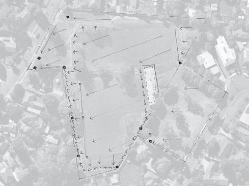
McDermott Avenue Reserve (Figure 8) is an irregular, multi-level complex site. Major features for consideration include:
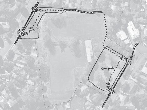
• Extensive bitumen car park areas:
- McDermott Avenue (western frontage) - 29 spaces
- Wyuna Walk (eastern frontage) - 112 spaces
• Extensive, redundant bitumen netball courts (10) over two levels
• Decommissioned netball pavilion
• Massive retaining wall to the east of the McDermott Avenue car park
• Elevated (overlooking) position with steep drop off to neighbouring fence lines on the north, south and west boundaries.
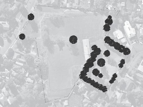
• Mature canopy of valuable trees within the Wyuna Walk car park area.
Site investigations were undertaken to provide a detailed picture of conditions at McDermott Avenue Reserve. The findings together with site specific comments received during consultation with Council officers and members of the community underpin the Master Plan. Investigations undertaken include:
• Feature and Level Survey (July 2022)
• Environmental Assessment (2020 then revised in July 2024)
• Asset condition Report (March 2023)
• Asbestos and Synthetic Mineral Fibre Compliance Survey (February 2024)
• Preliminary Tree Assessment (2020 then revised in July 2024)
• Soil Assessment Report (September 2024)
• Retaining Wall Assessment (2025).
Neighbour privacy
Topography
Drainage
Courts and car parks
Retaining wall
Trees and vegetation
Safety
Security
Decommissioned infrastructure
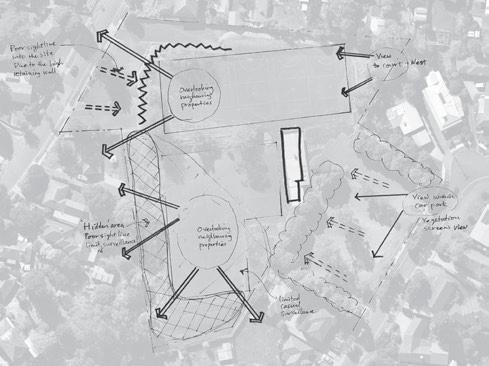
• Neighbours to the west and south are overlooked from court level.
Paths
• Two to four metre drop over short distance into earth drain on the western boundary interface creating an issue to maintain and provides secluded areas.
• Open drain along southern and western fence lines.
• Asphalt is a heat sink and impervious surface, adding to drainage issues elsewhere on site.
• Court area is underutilised. It is unpleasant and lacks sport and recreation opportunities.
• Car park areas are not aligned with current or anticipated future level of use.
• Poor sight lines through the site due to the high and extensive retaining wall.
• The wall is showing signs of deterioration so a structural assessment has been sought to better understand its condition and longevity.
• Sparse vegetation since weed species were removed. Increased lack of privacy for neighbours on west and south boundaries.
• Vandalism (pavilion), antisocial behaviour (i.e. inappropriate use of reserve, broken glass on courts).
• Site and Gender Impact Assessments have identified a lack of passive surveillance for the reserve, resulting in safety concerns for reserve users.
• Reserve lacks residences that front on to the reserve providing passive surveillance, other than six that have frontages on the other side of McDermott Avenue and Wyuna Walk.
• Most properties (18) back onto the reserve.
• Former netball pavilion has been decommissioned and attracts graffiti and vandalism.
• Indirect path of travel through the reserve to the Mooroolbark College located nearby to the north west.
OPPORTUNITY
• Create a vegetative barrier to restrict line of site into neighbouring properties
• Consider residential interface option.
• Landscape treatment to open up the area to greater usage and passive surveillance, including modifying site levels.
• Apply water sensitive urban design (WSUD) consideration and recommendations for the entire site.
• Reduce the amount of hard surface (asphalt) to allow greater water penetration through the soil.
• Remove asphalt courts and replace with grassed open space.
• Decrease car park areas, replacing with activity zones and/or grassed open space.
• Create a terraced layout through the site.
• Create a landscape plan as part of the future design concept development featuring indigenous and native trees and plants.
• Demolish the pavilion and remaining lighting infrastructure.
• Reactivate the site, increasing usage and opportunities for passive surveillance.
• Activation of the site and improved line of sight through the reserve.
• Investigate inclusion of housing in the southern section of the site to introduce an active frontage.
• Remove existing building, consider better positioning of basic infrastructure (toilets, shade, seating etc.) to support use of the reserve for community events and social recreation.
• Landscape design to include better orientation of the connecting path within an accessible path network.

Following extensive research and analysis of the relevant strategies, plans and planning documentation, the preferred option for the future configuration of 52 McDermott Avenue is to retain a minimum of one hectare as open space for social recreation purposes. The southern portion will be reserved for further investigations into housing options.
This option provides social recreation for all ages, genders and abilities. It seeks to reduce the risks associated with concealed corners and overlooking, by introducing increased passive surveillance through design and construction initiatives. Council will undertake further investigation for a reduced localised developmentof housing in the south west corner.
Initial research including community and stakeholder engagement was conducted in the second half of 2020. The community engagement sought to understand how the community had used the reserve area at 52 McDermott Avenue since the netball competition moved to new premises at Pinks Reserve, Kilsyth and understand their vision for the future.
and path connectivity
• Support for a path network for walking, running and connections to nearby schools and surrounding residential areas
• Path suitable for learning to ride a bike
• Lighting of paths
• Activation to deter unsociable behaviour.
Grassed open space
• for social ball games such as soccer
• for community picnics, gatherings and events
Activity spaces
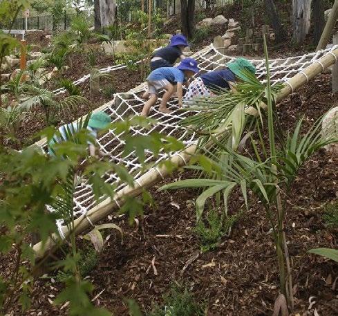
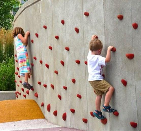
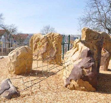
• Half-court area
• Climbing activities
• Exercise equipment
• Gardening experiences
• Range of play activities that include both formal and nature play for a wide range of ages and abilities
• Access to toilet facilities
Park furniture
• Call for more shade (shelters and/or trees), seating, picnic and BBQ facilities
In preparing the Draft Master Plan, officers were asked to review issues and opportunities previously identified to ensure they were still current. Internal teams were also engaged as part of the site analysis and review of the previous Council decision in 2015 to sell the land.
Chin Community Festival 22 February
While not directly targeted at McDermott Avenue, members of the Chin Community were asked what activities they most liked to participate in or would like to do in the outdoor space.
Most community members that engaged were upper primary school aged through to young adults. Each participant was provided five dots to link to favourite activities.
Activities identified (Table 2) reflect the feedback received in December 2020, with the more recent emphasis on volleyball by both male and female respondents of the Chin community. Young males also indicated soccer as a favourite team activity. Social gatherings, walking and relaxing were popular with all age groups.
Mooroolbark Festival 16 March 2022
At the Mooroolbark Festival, engagement with community members confirmed the key outdoor activities enjoyed by Mooroolbark residents (Table 2).
Respondents came from a wide age range and genders. They valued local outdoor space for passive and active pursuits. What the community has told us confirms the feedback we received in 2020 and has been captured in the separate Community Engagement 2020 Summary.
It is proposed that Council do not act on the 2015 decision to sell the land with a new motion: to retain the site at 52 McDermott Avenue Mooroolbark and investigate housing opportunities in the southern portion of the land (approximately 3000m2).
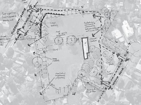
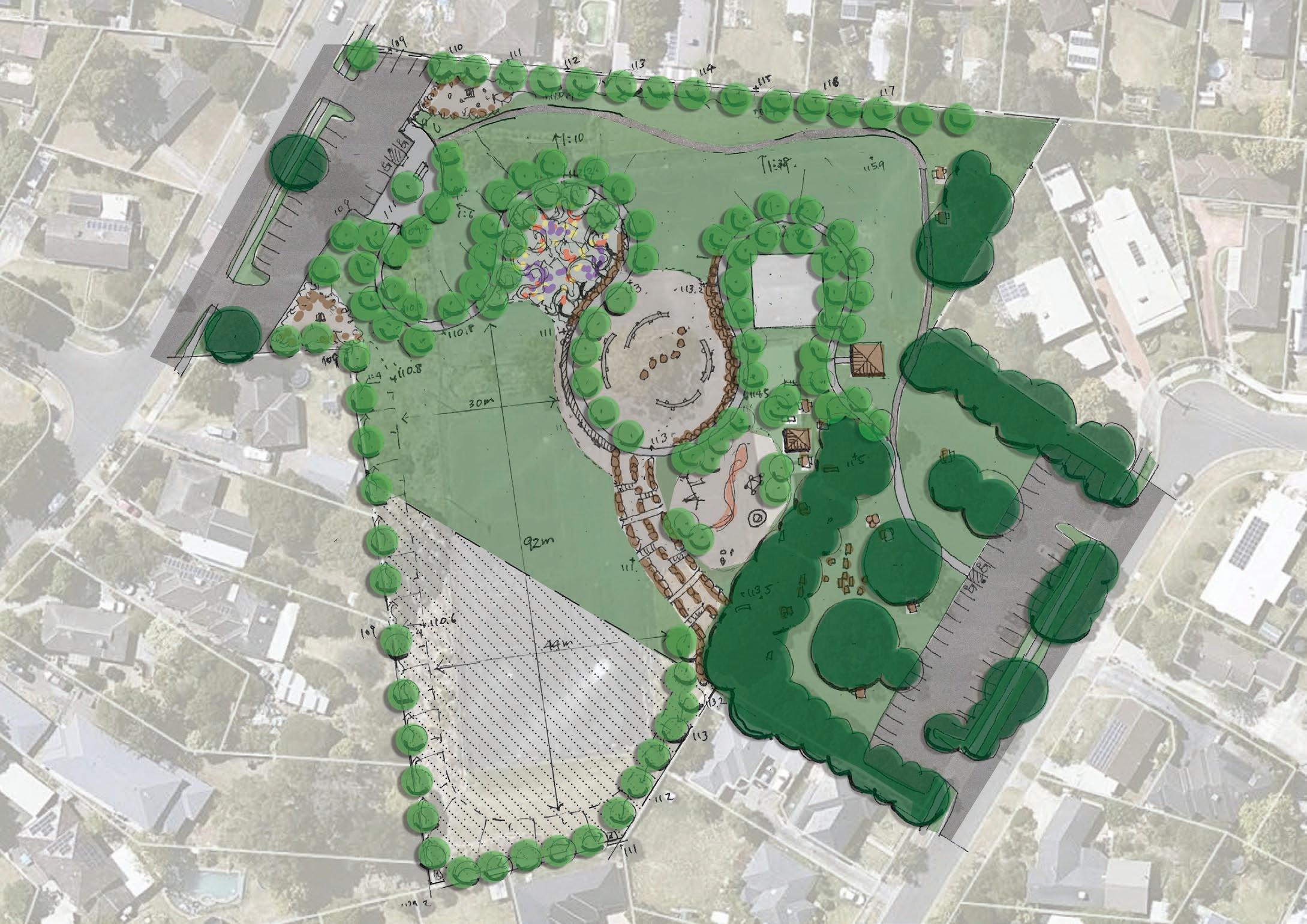
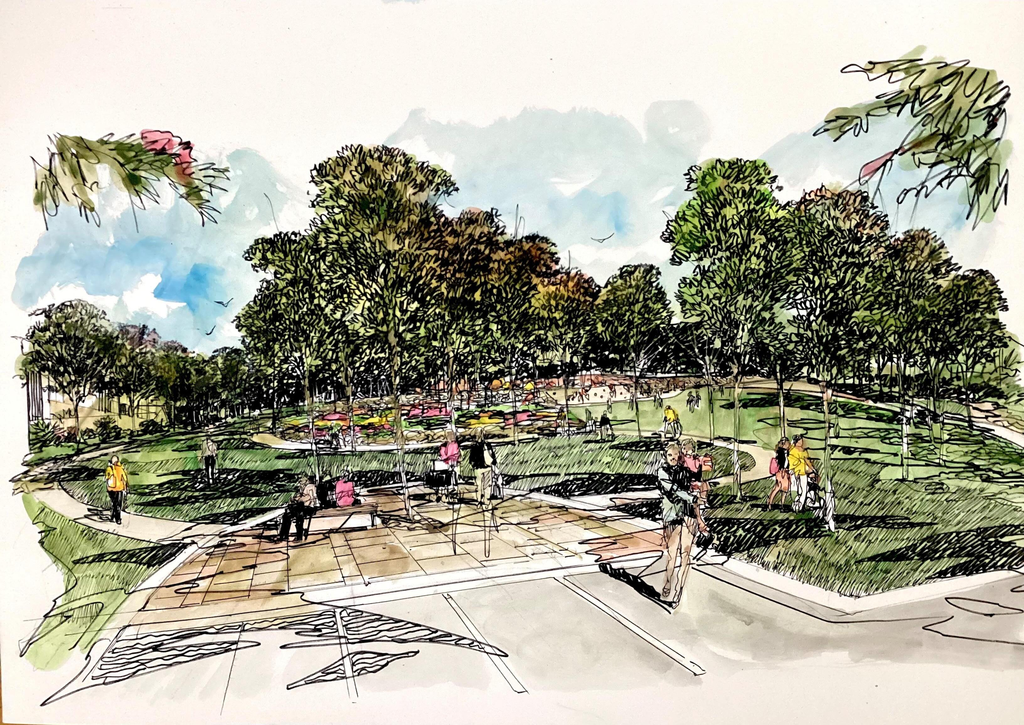
A draft concept plan (Figure 17) has been developed to show the potential layout of the social recreation area (minimum one hectare).
The land at 52 McDermott Avenue, Mooroolbark is already zoned PPRZ. Key considerations for development as community open space for social recreation include, but are not limited to:
• Ensure the plan for the area provides a mix of recreation opportunities suited to the diverse community (age, gender, culture and ability).
• Re-terracing of the site to provide improved sightlines through the reserve, activity zones and accessibility.
• Maintain linkages with abutting streets, schools etc.
• Enhance biodiversity and support indigenous planting.
• Ensure parking provision is appropriate to future usage.
Utilising the southern section for housing eliminates problem sections that have poor safety and obstructed visibility, by providing housing that looks out onto the new open space area, offering passive surveillance. It also responds to identified issues of overlooking from the reserve into surrounding residential properties along the south boundary. This shaded section has been reserved for further investigation and feasibility as a potential housing opportunity.
The following staged implementation process (Figure 8) is based on the recommended redevelopment of 52 McDermott Avenue, Mooroolbark. Infrastructure elements and layout are to be confirmed through community consultation and subsequent Master Plan refinement.
Removal of redundant and failing infrastructure including:
• Large retaining wall,
• Redundant netball pavilion
• Northern five asphalt courts and fencing.
• Preliminary ground works to improve sightlines through the space
• Create useful grassed community open space terraces.
• Estimated cost $1,415,972
• Of this cost, Council has committed to funding of $350,000 in the 2025/26 Council Budget and proposed a further $300,000 for 2026/27.
Stage 2: Secondary site preparation (orange)
• Removal of the remaining five asphalt courts,
• Further earthworks and grassing to reshape the extended social infrastructure area for construction of social infrastructure (Stage 3).
• Estimated cost $722,900
Stage 3: Construction of active and social infrastructure (yellow and orange areas)
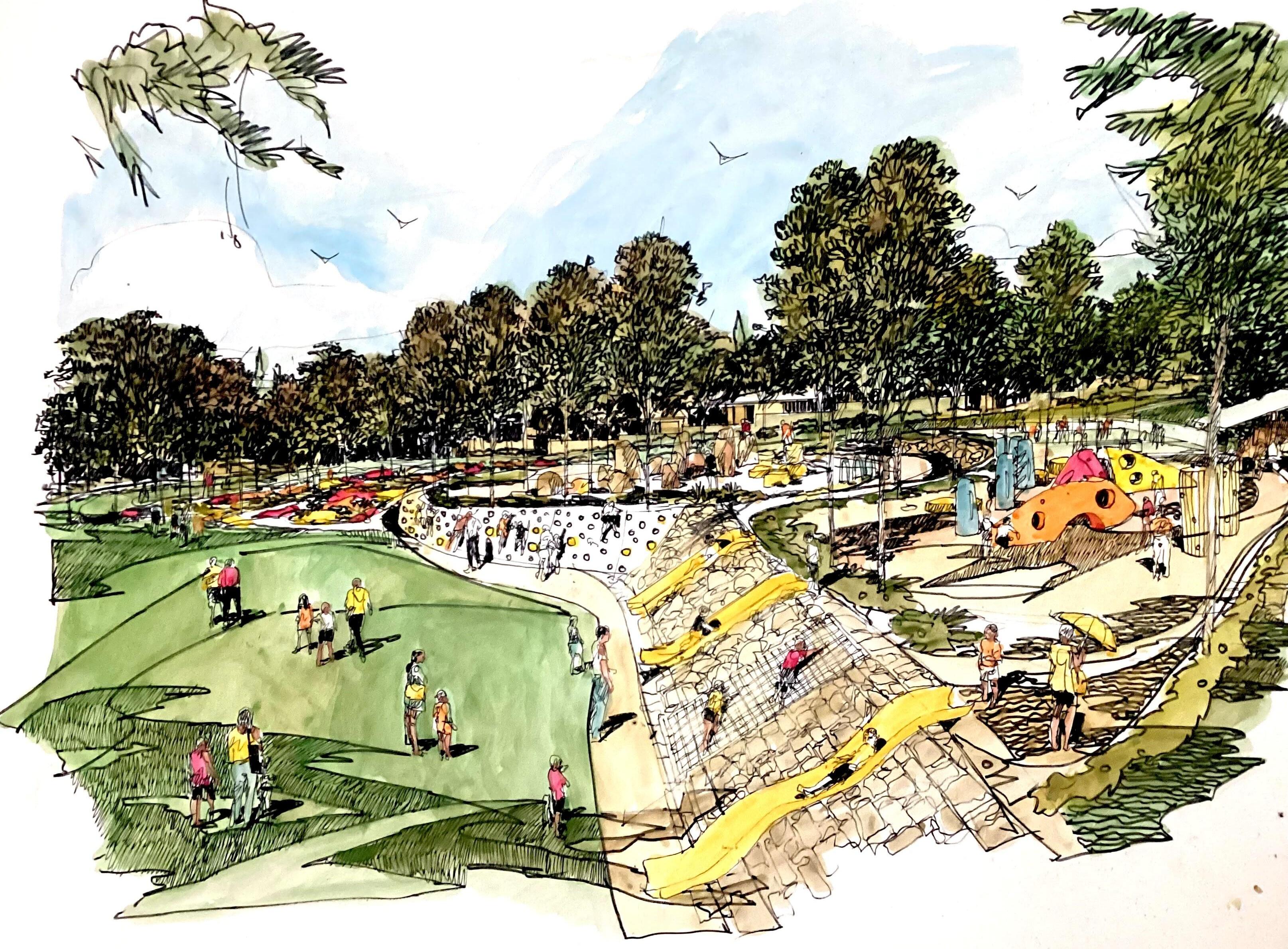
• Improvements may include: playspace, social area, kickabout area, ball games court space, climbing activities, path network, as shown on the provisional concept (Figure 7)
• Preliminary cost estimate $1,944,800
52 McDermott Avenue Redevelopment
Stage 1: Early site works (yellow)
Stage 2: Secondary site preparation (orange)
Area for further investigation (blue)
The development of this reserve will incur a maintenance cost of approximately $374,000 over a 15-year implementation period.
The blue area is reserved for further investigation to determine the feasibility of housing opportunities.
McDermott Avenue Reserve
Community Open Space
Site Improvements
Contributions**Funding (not confirmed)
Investigative Studies (completed)
Site Preparation Works
Stage 1: northern section including:
• removal of retaining wall, asphalt on upper courts, pavilion infrastructure
$13,000
• major earthworks to re-terrace the land $1,415,971 2025/26: $350,000 Committed funds
2026/27: $300,000 Provisional funds Extra $765,971 required, subject to available funds
Stage 2: mid section and part of car parks, including:
• removal of asphalt on lower courts and sections of the car parks,
• remainder of earthworks to prepare the land for the construction of social infrastructure
3a: Construction of paths, playspace, social and activity areas
Stage 3b: Construction of solar path lighting, half court
$722,900 subject to
Potential grant opportunity if grouped with Stage 3 infrastructure works
Prepared by Open Space Strategy and Planning Design and Place, Yarra Ranges Council
Council recommends anyone having difficulties viewing or interpreting elements of this document due to accessibility needs to contact us for assistance.
Published October 2025 © Yarra Ranges Council 2025 ABN: 21 973 226 0120
15 Anderson Street, Lilydale PO Box 105, Anderson Street, Lilydale 3140
Phone: 1300 368 333
Email: mail@yarraranges.vic.gov.au Web: yarraranges.vic.gov.au