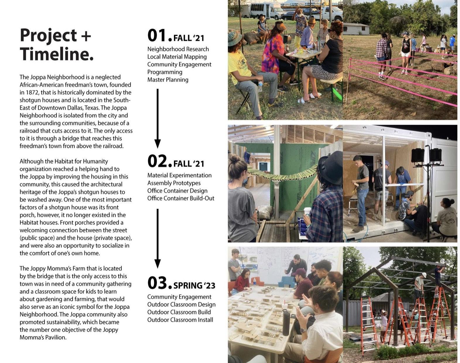
Portfolio
Daniel Yoo
University of Texas at Arlington
2019-2024 selected works
Daniel Yoo
University of Texas at Arlington
2019-2024 selected works
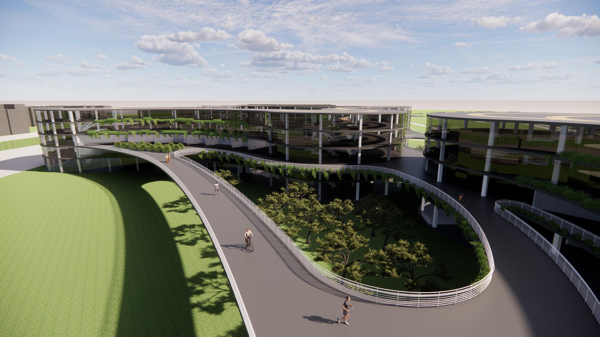
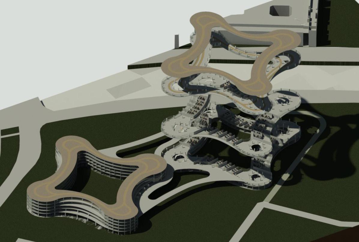
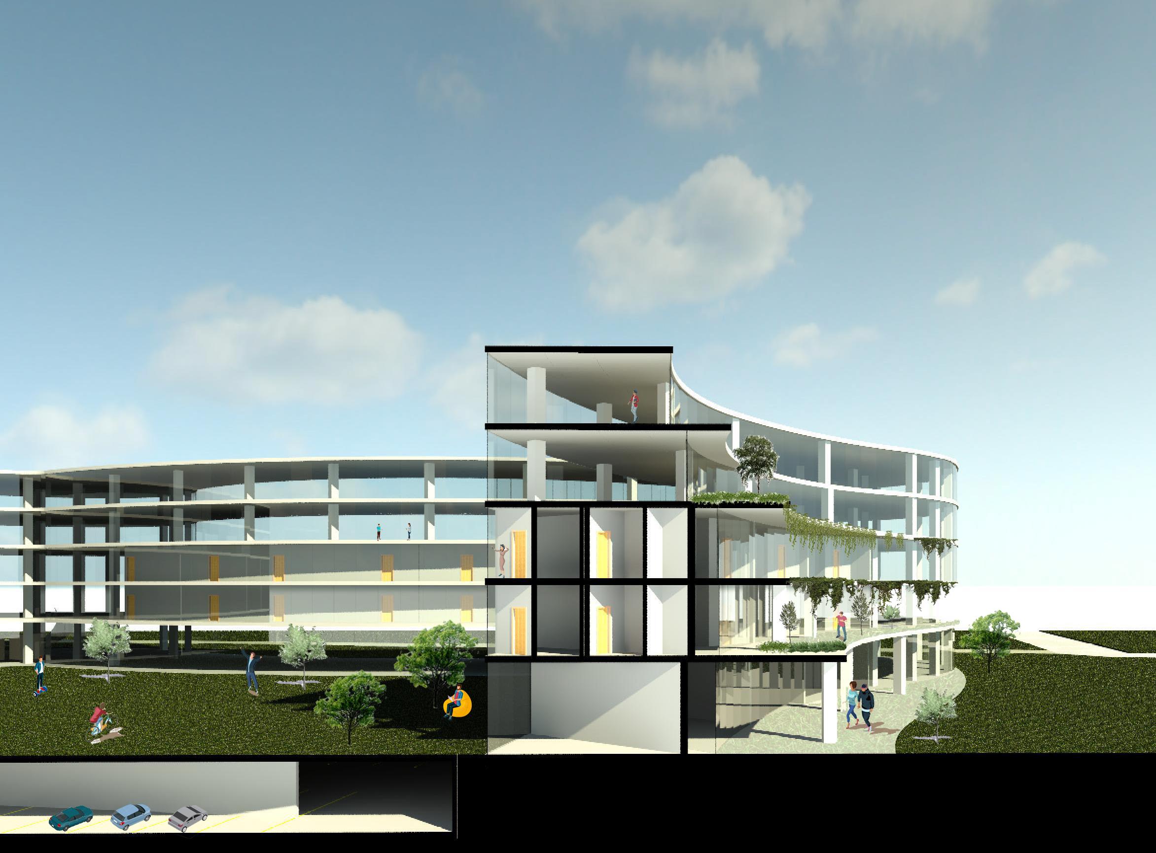
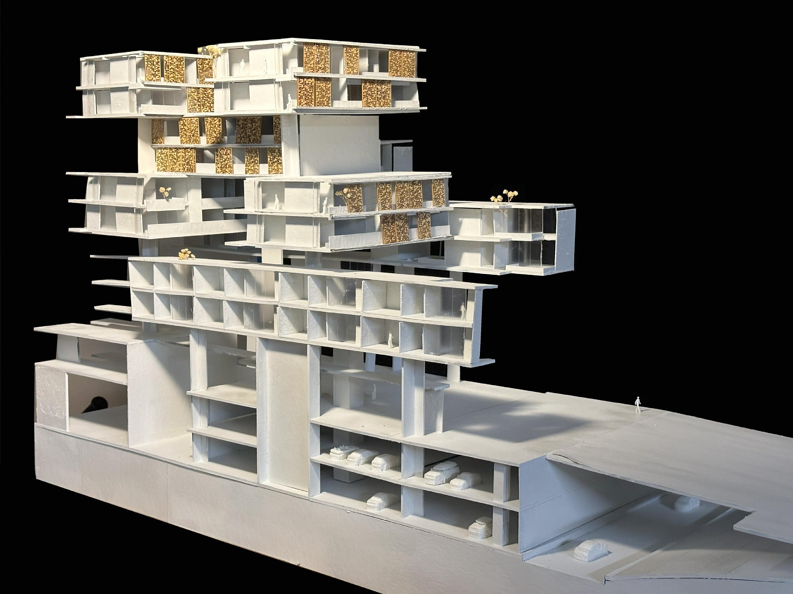
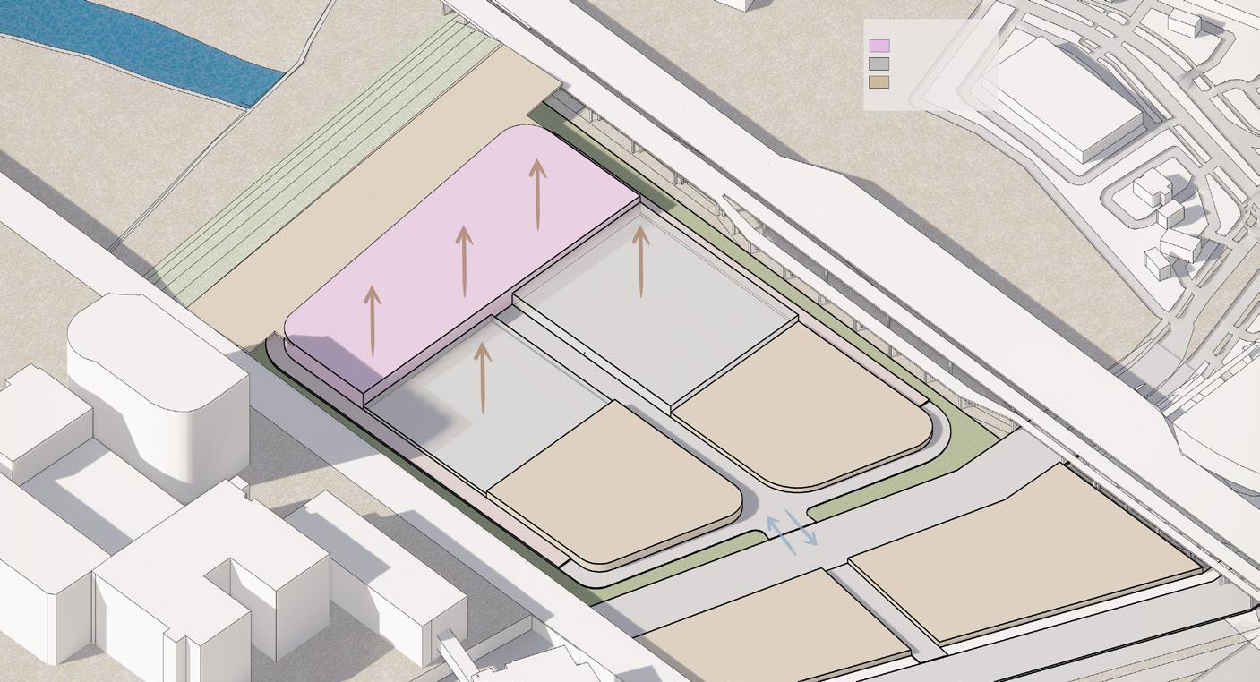
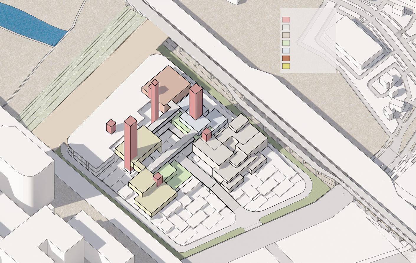
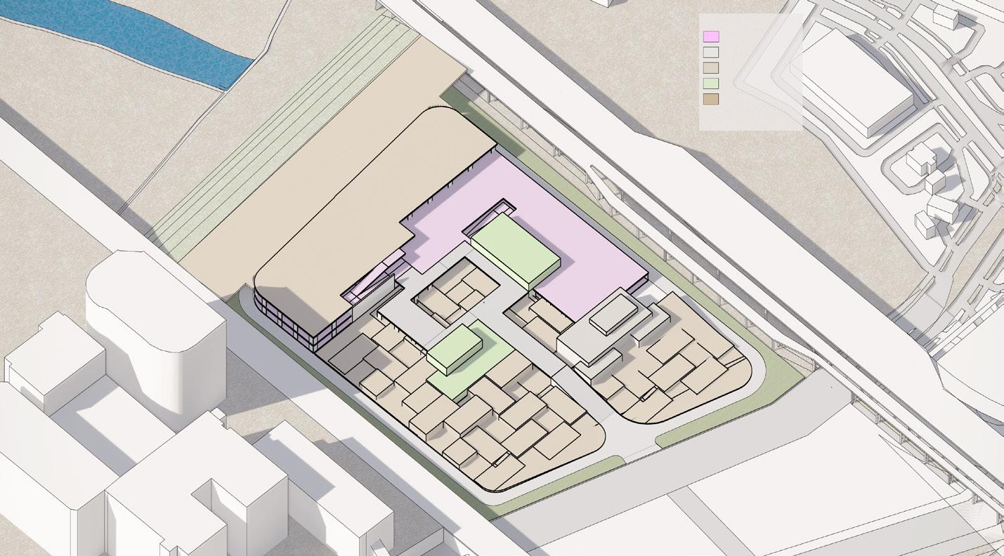
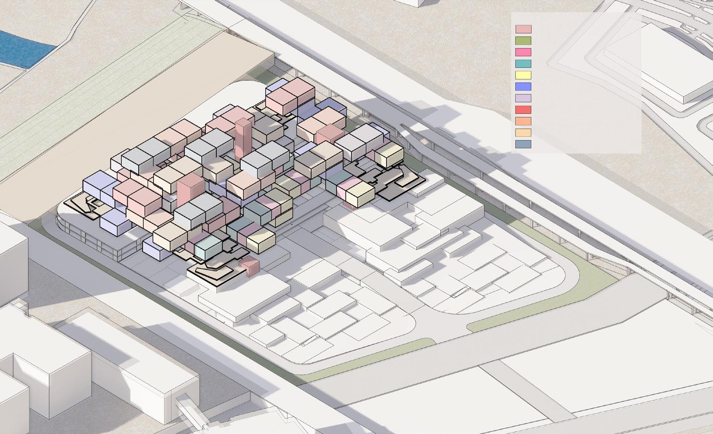
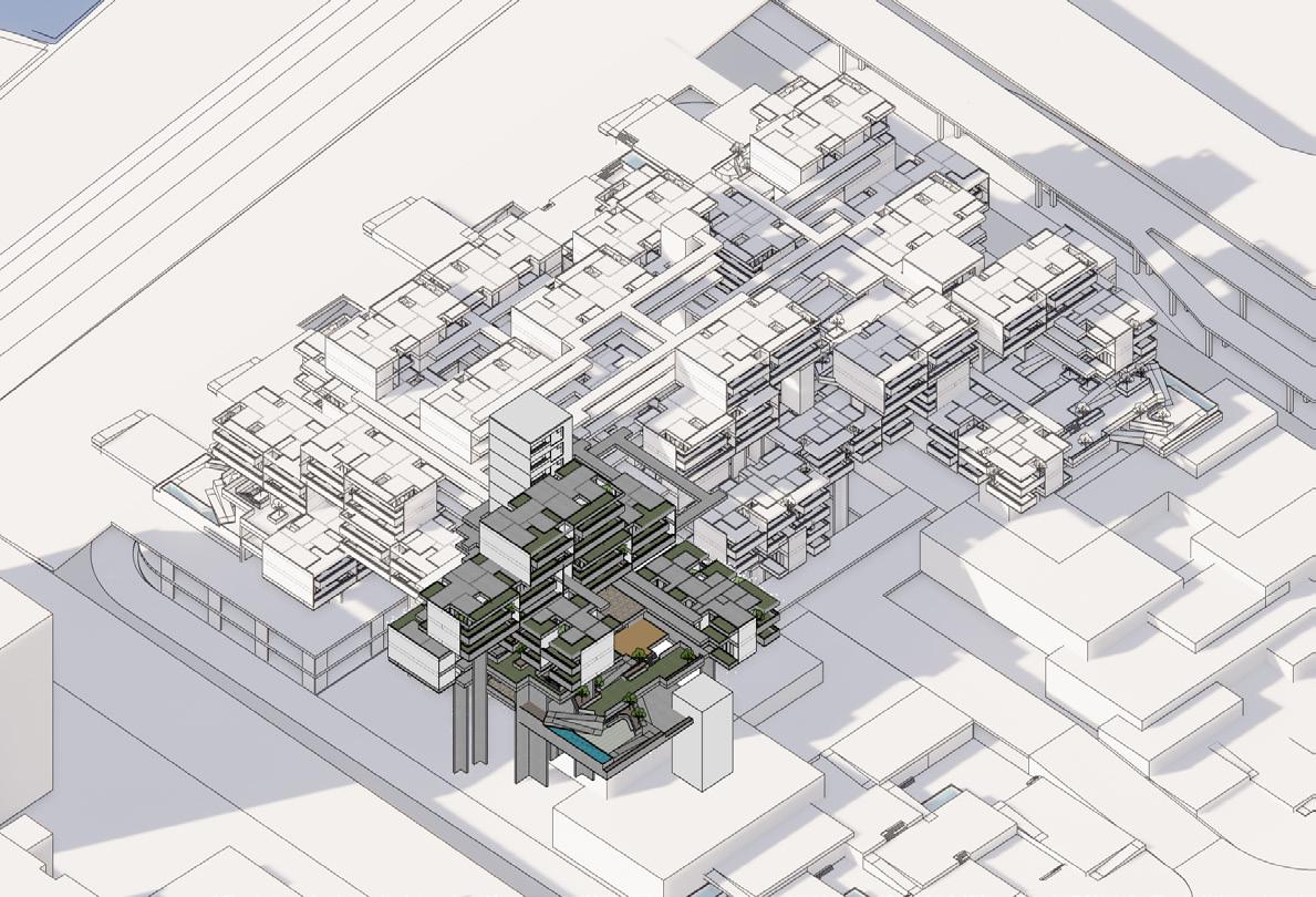
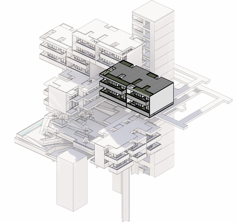
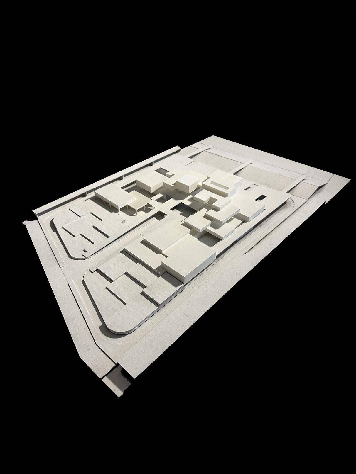
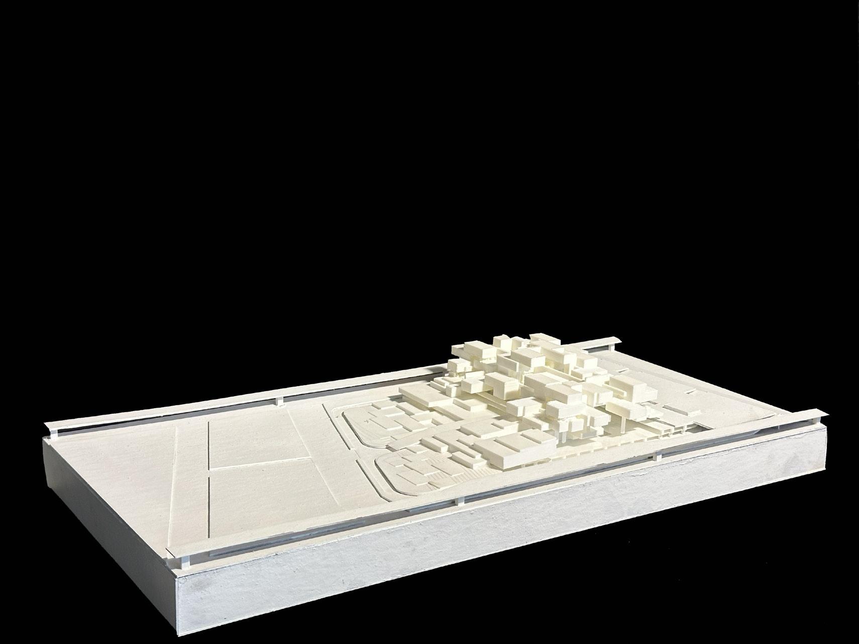
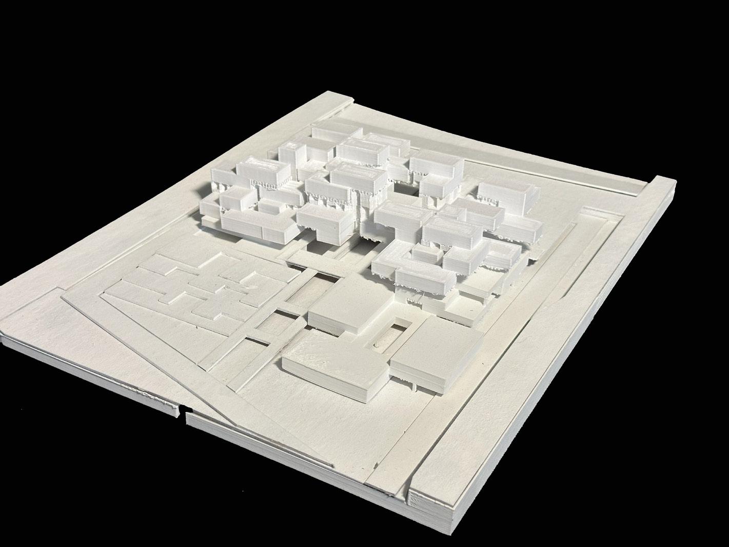
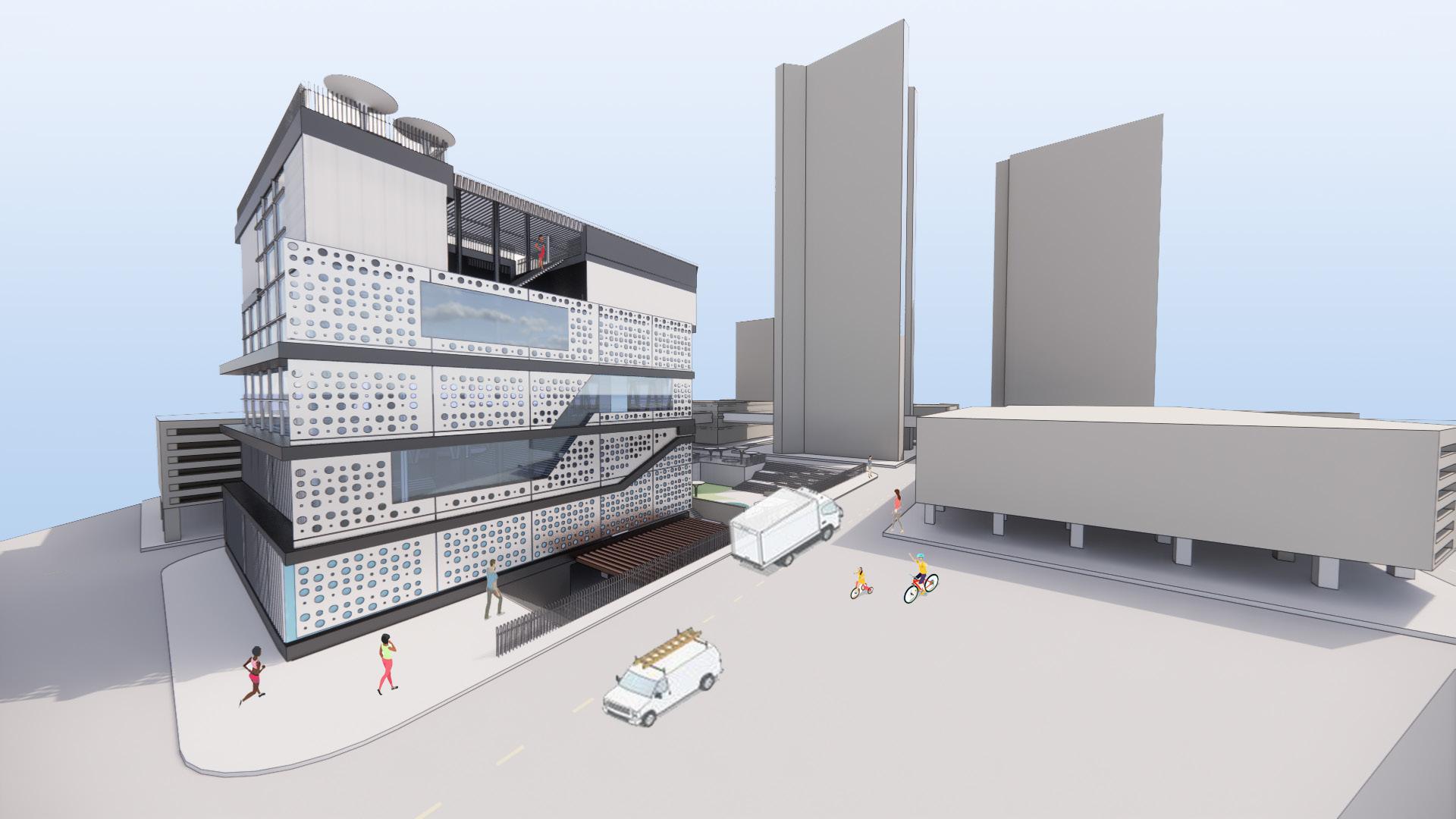
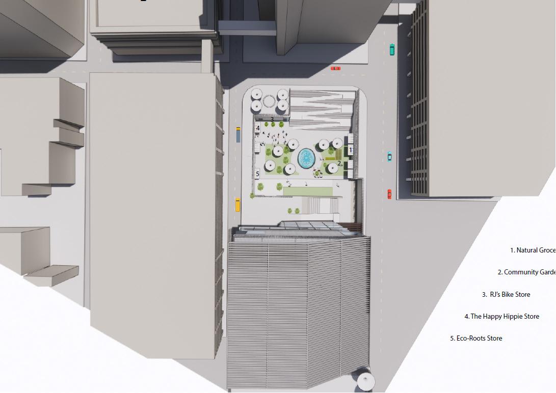
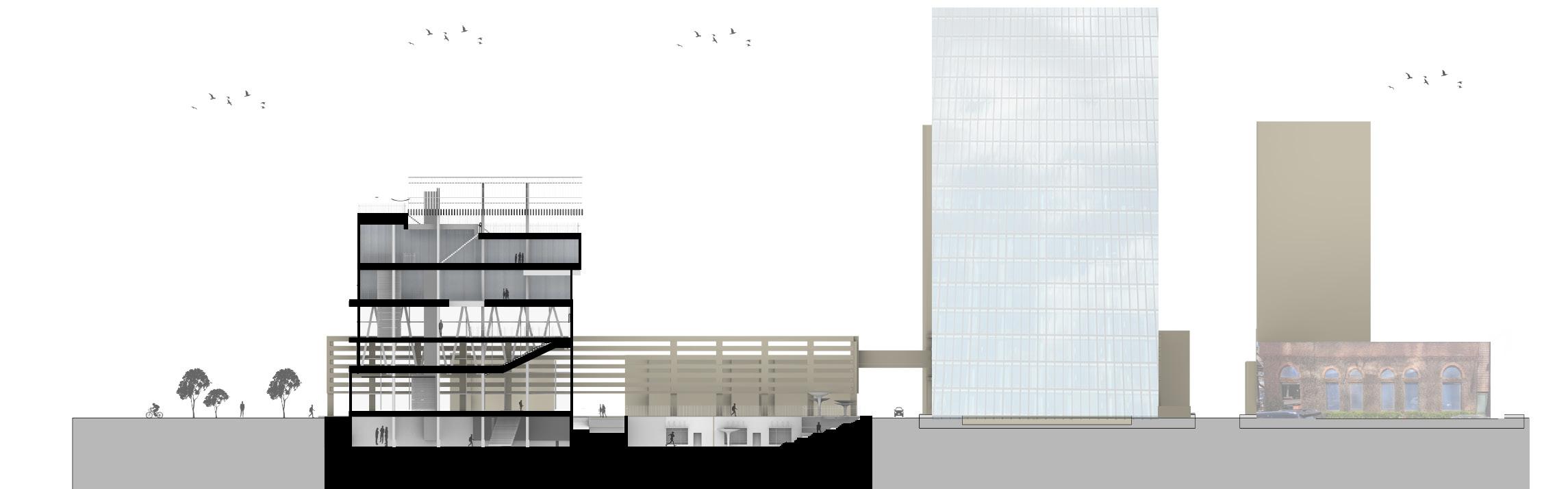
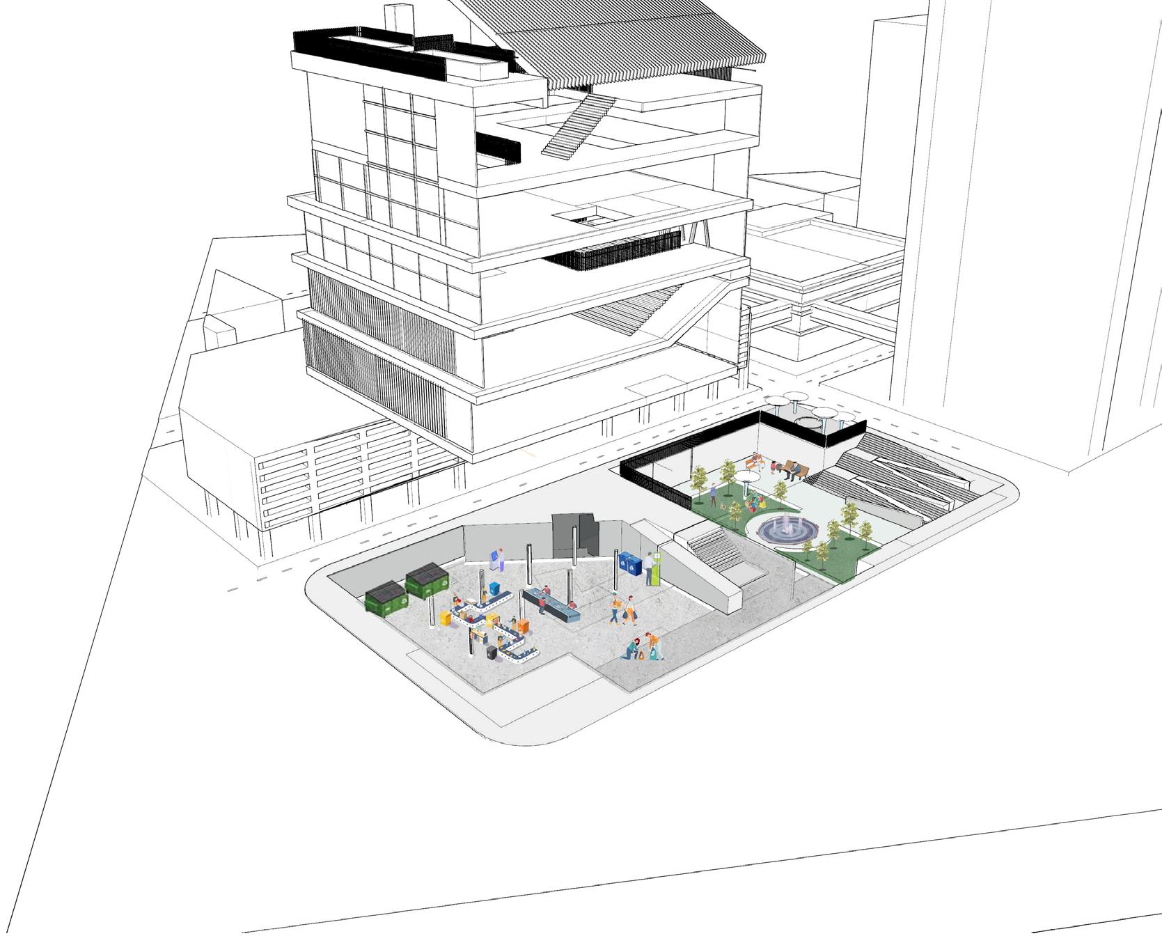
Aggregate Urban mixed used development
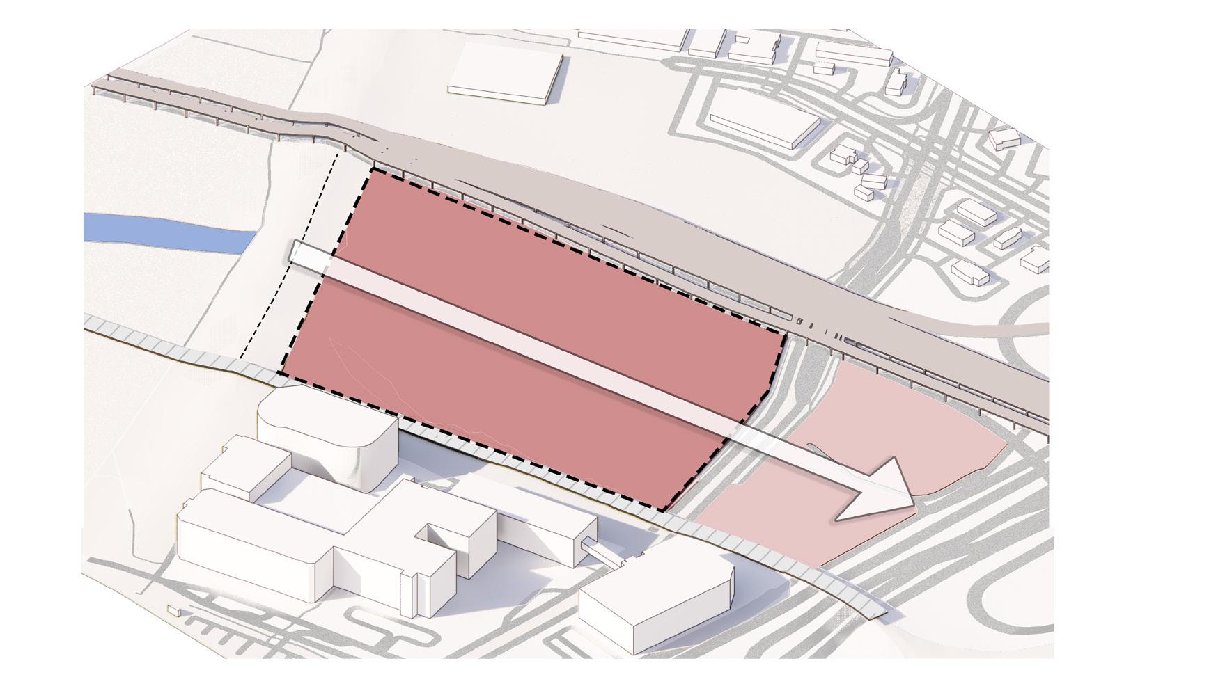
The site is defined by four boundaries: the Trinity Levee and trail to the south, the Margaret Hunt Hill Bridge to the west, N. Riverfront Blvd to the north, and the railroad to the east. The project aimed to address urban density through an aggregate design system, offering the convenience of mixed-use development while seamlessly integrating with the Trinity Water Conservancy’s Harold Simmons Park proposal.
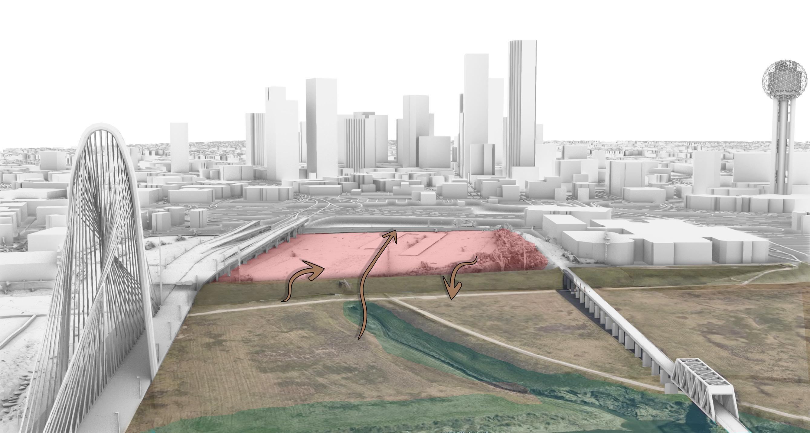
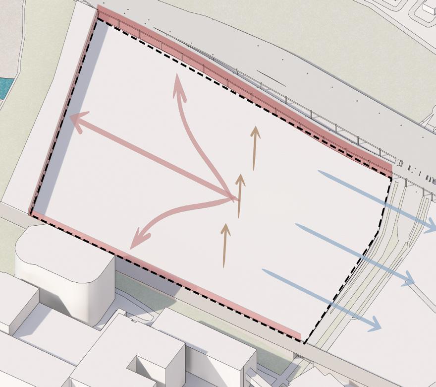
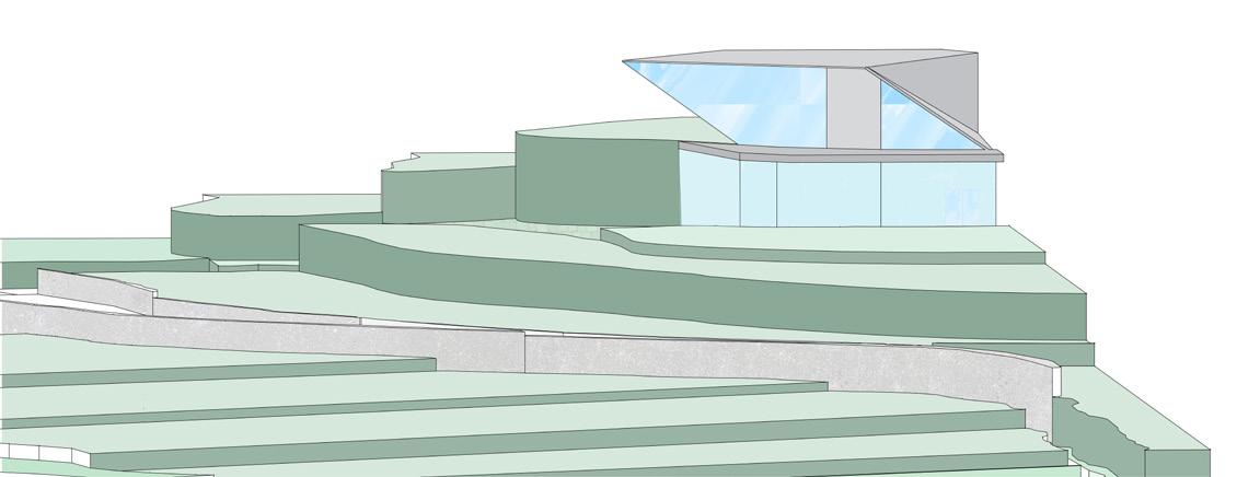
The site is 30 ft. sunken from all the directions except east main access.
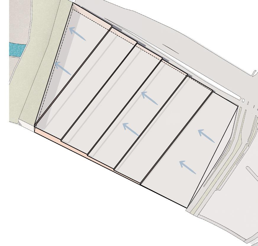
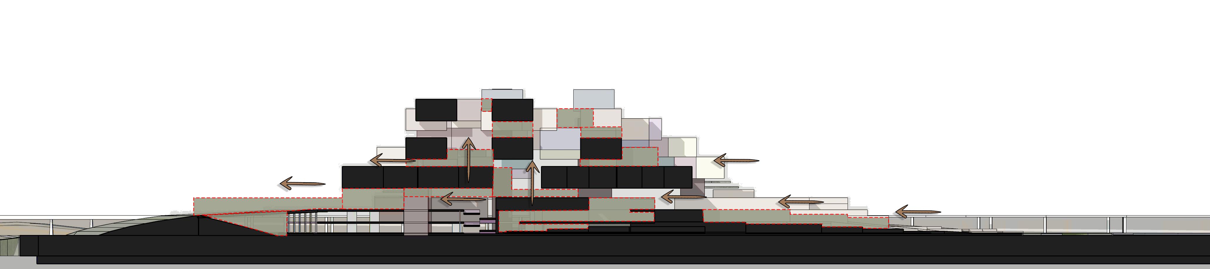
Dividing the slope into multiple levels, gradually rising in steps, using spaces both above and below the built structure.
Considering a geometric grid which opens to all directions
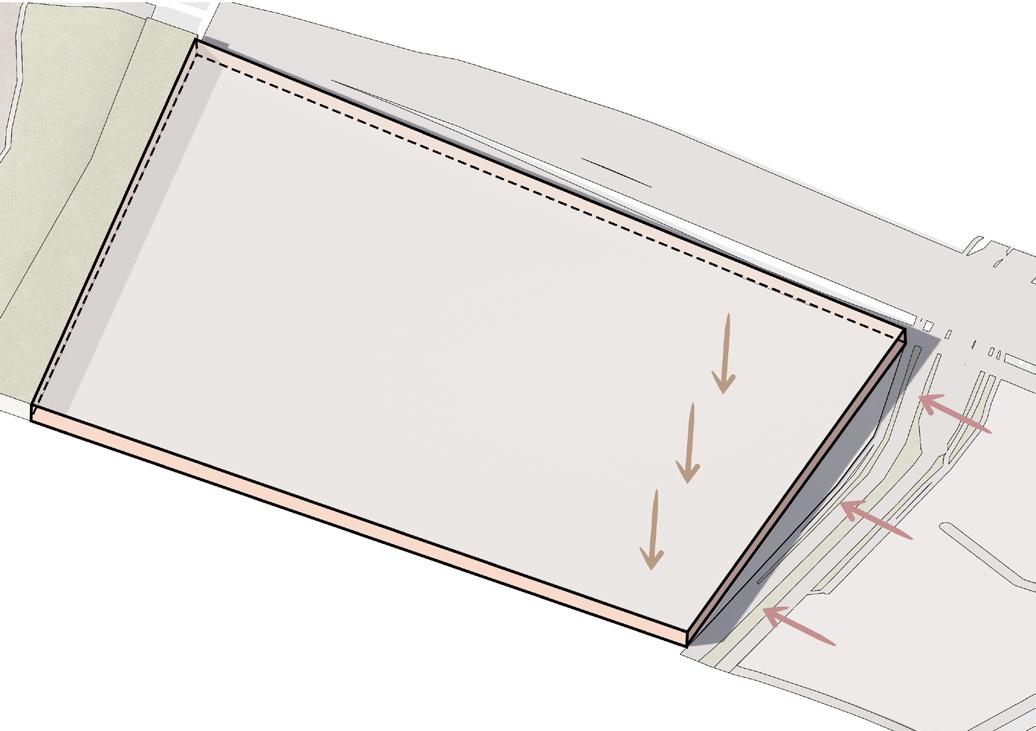
Altering the site topography by creating push and pull of the site. This will connect the site from east to west and north to south.
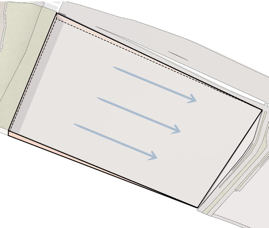
Sloping towards the east by considering the levee as the highest level. This will connect the main road to the levee both visually and physically.
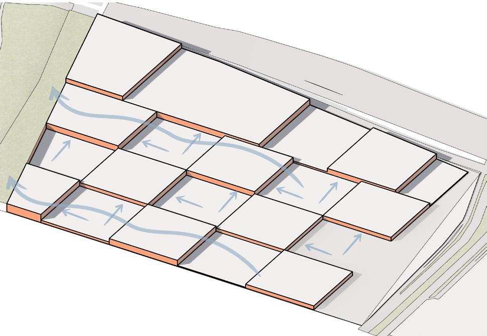
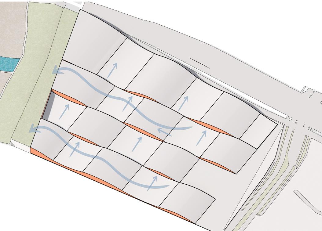
Creating multiple courts with a series of closed and open spaces. While maintaining both visual and physical connectivity to the trinity river.
South side is visually blocked with existing building
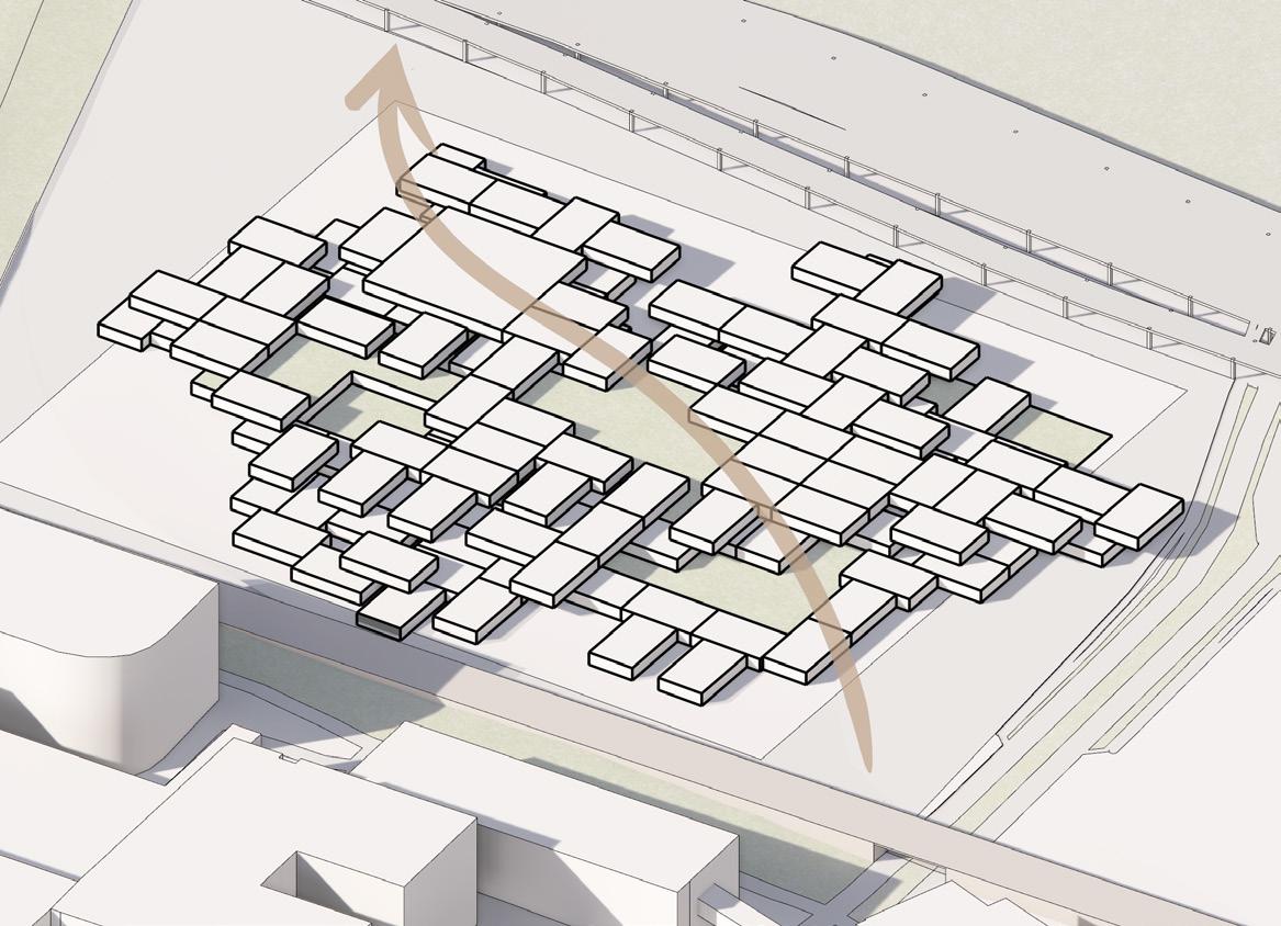
Low height geometric massing scattered crea ting a series of court and open spaces.
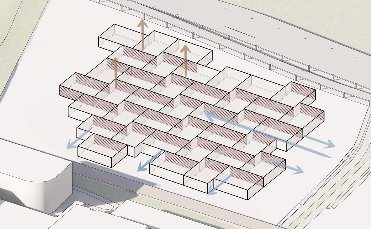
Considering a mass to align with the surrounding context. This move is blocking the East entry.
Massing the built structure towards one end while maintaining the spreed of space throughout the site. This will maintain visual connection to the levee.
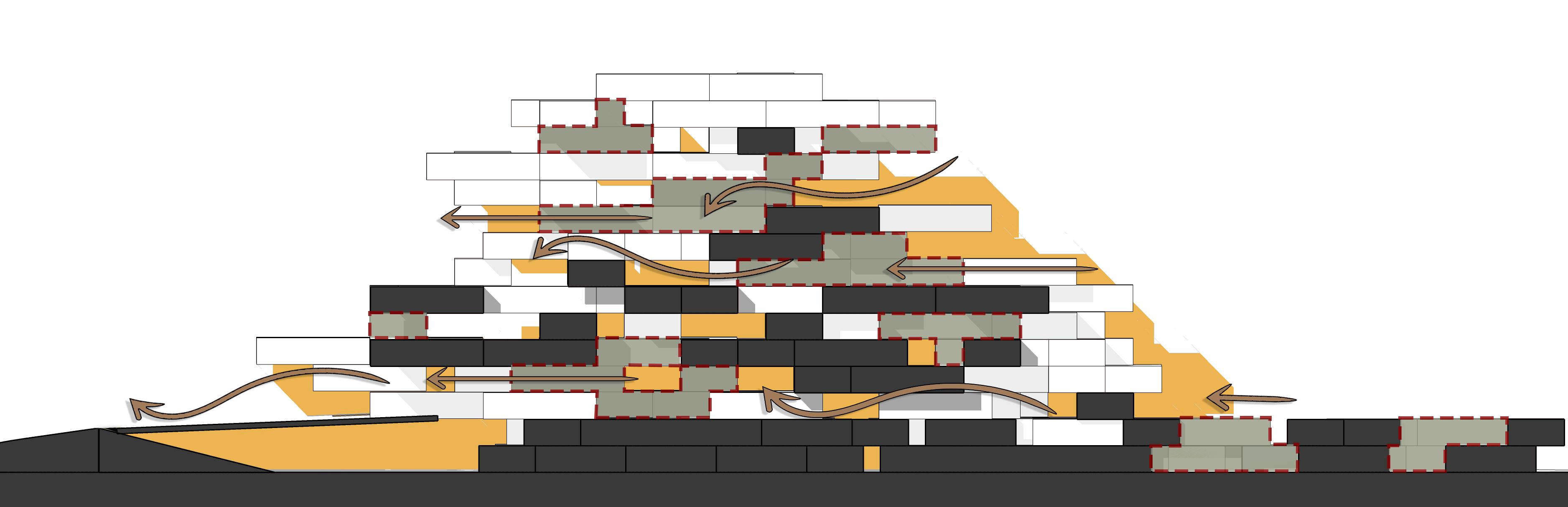
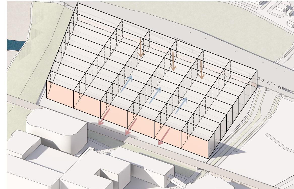
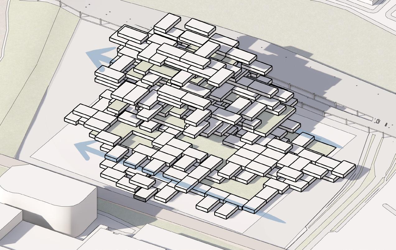
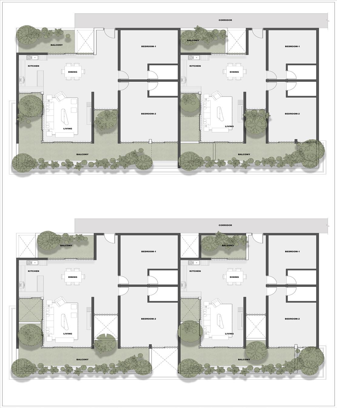
The site is organized with private and semipublic zones to the north and a public activity zone to the south, featuring a stacked layout transitioning from semipublic spaces at the base to private spaces at the top, with stilt parking beneath the structure to maximize accessibility and optimize vantage points.
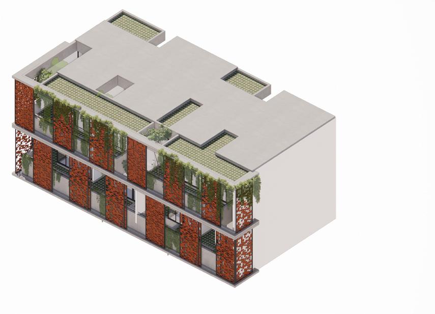
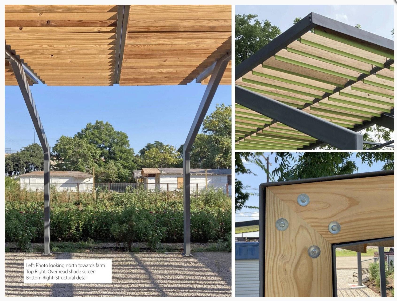
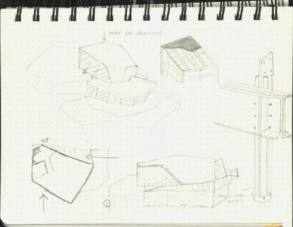
RCC Beam
MS Frame
Terracotta Jali
MS Rods

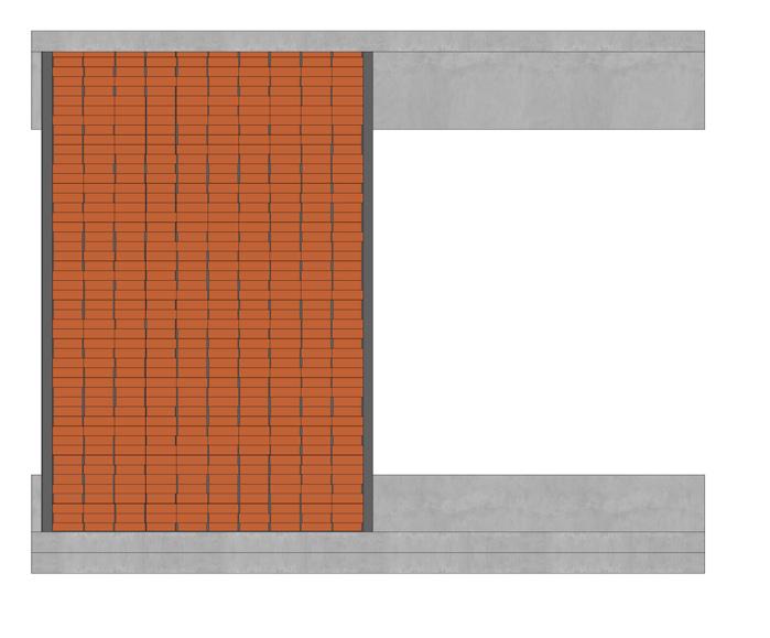
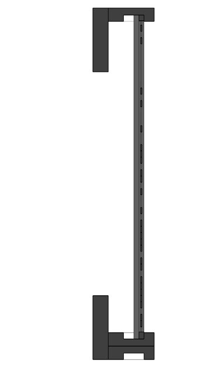
MS Frame
Random Terracotta pattern
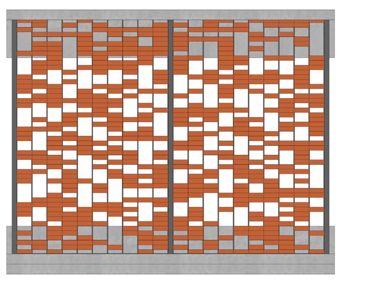
First iteration
Second iteration

Third
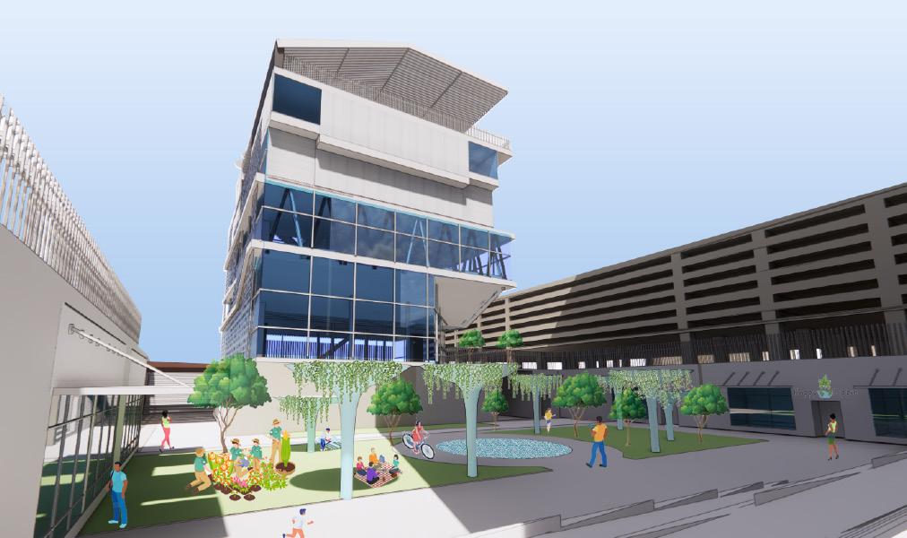
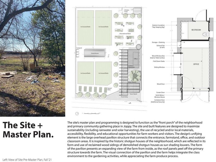
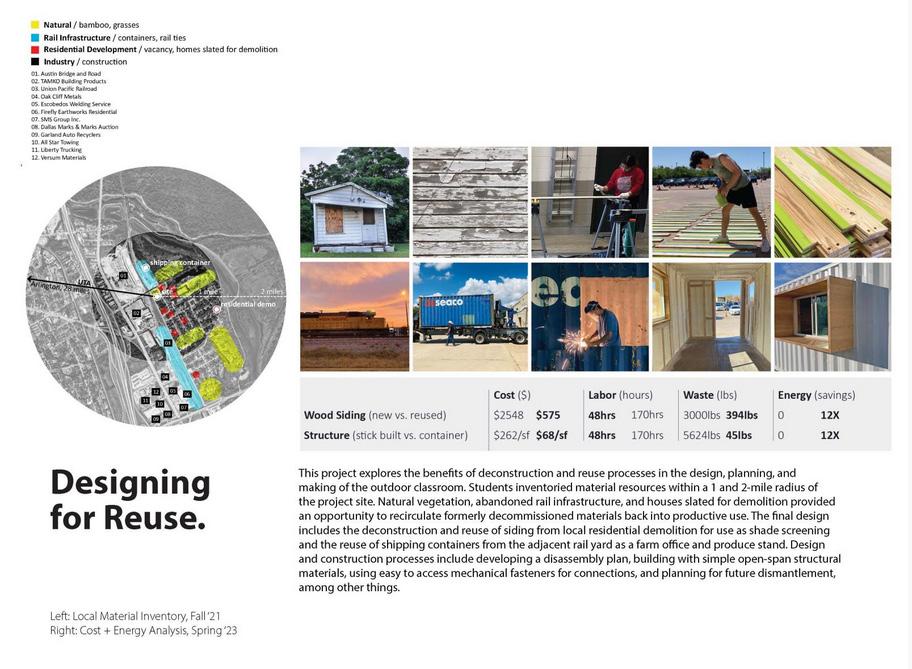
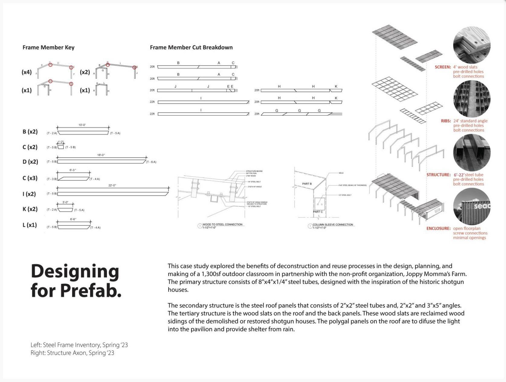
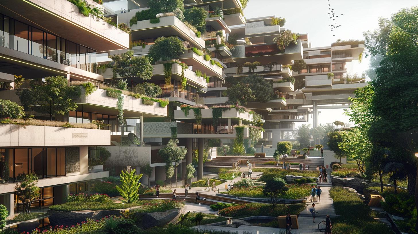
Eco-Cultural
Environmental and Cultural Center
Downtown Fort Worth
The Dallas-Fort Worth Metroplex faces challenges from urbanization, including flooding, pollution, and social disparities worsened by climate change. To address these, this studio explores eco-cultural institutions near downtown Dallas and Fort Worth, focusing on public spaces that promote arts and sustainability education. Students designed mixeduse projects—combining cultural institutions like libraries, theaters, or museums with housing, civic, and ecological programs—on sites in Dallas’s Design District or Fort Worth’s Panther Island, informed by GIS urban analysis.
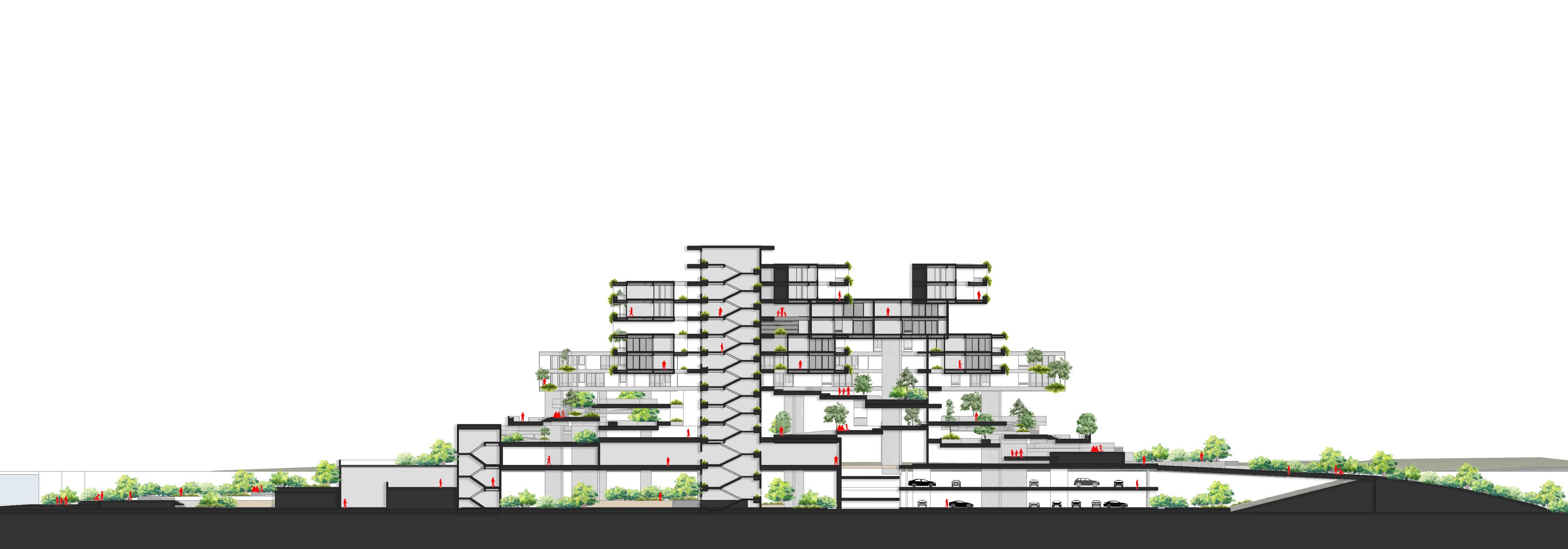
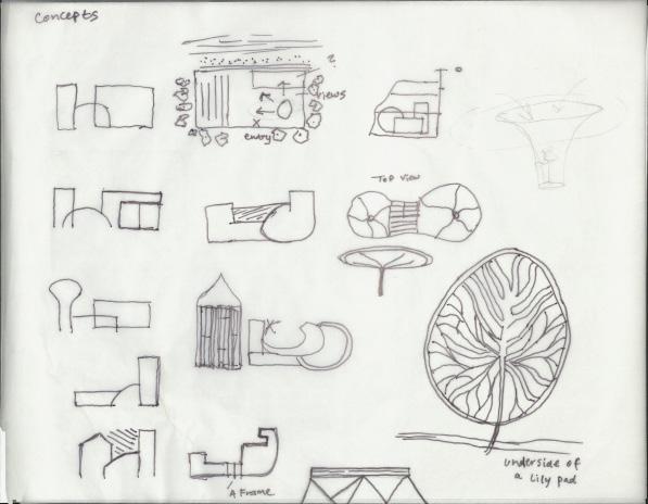
Shift
Voids
Complete
Environmental Musuem in a dense urban context
To let light in naturally, and to allow viewing from outside
To create different viewpoints
Programs stacked to methaphorically represent tree concept.
Volume of modular livable and service space.

The Little Back River House is located on a secluded 4 acre lot on a river island that is North of Savannah’s historic downtown. The island is formed where the Back River breaks off to the north from the Savannah River. Historically, Hutchinson Island’s land use has been primarily industrial, much of which supported the Port of Savannah, one of the busiest containerization cargo ports in the world. The island is roughly 7 miles long and 1 mile wide at its widest point.
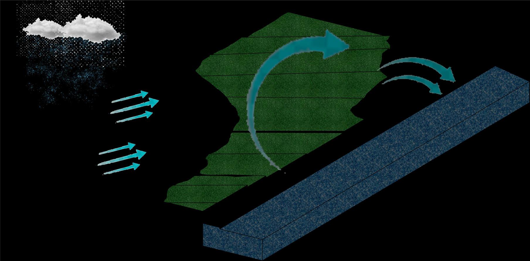
The design of the landscape is specially made for the major flooding that often occurs in the coastal area. Floods in the Savannah area, including Hutchinson Island, now occur about 10 times a year—up from an average of just five or fewer some 40 years ago.
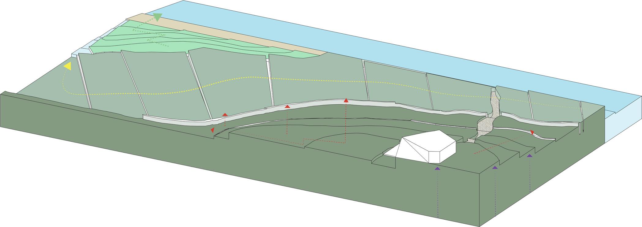
The proposed site is naturally modified to prevent high tides and to divert any excessive amount of rainwater. By implementing 3 raised layers of terrain, the ultimate goal is to place the house at the highest point of elevation to impede overflowing river water, while still being able to functionally use the landscape.
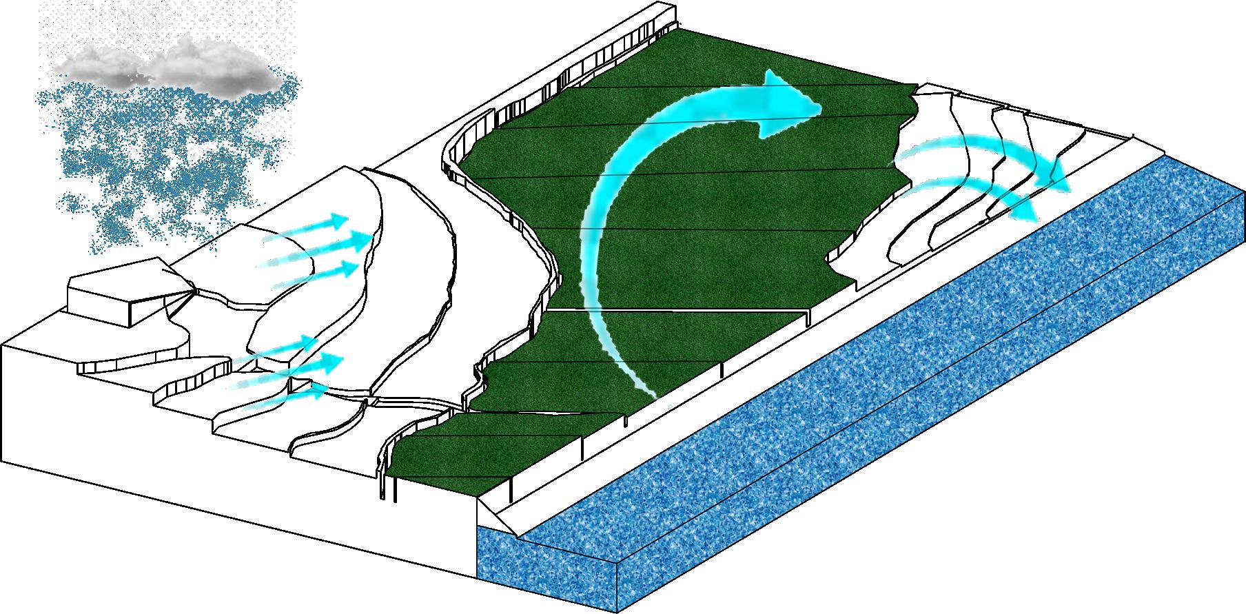
Topographical Strategies
Capture rainwater to trickel down and nutriate the vegtation and going towards the runoff
Differentiating the landscapes into step like forms, this will reduce the amount of natural erosion caused by the river and other natural elements
River sediment from the Savannah River was used as the primary raw material in production of fired brick, to make a pathway for the client.
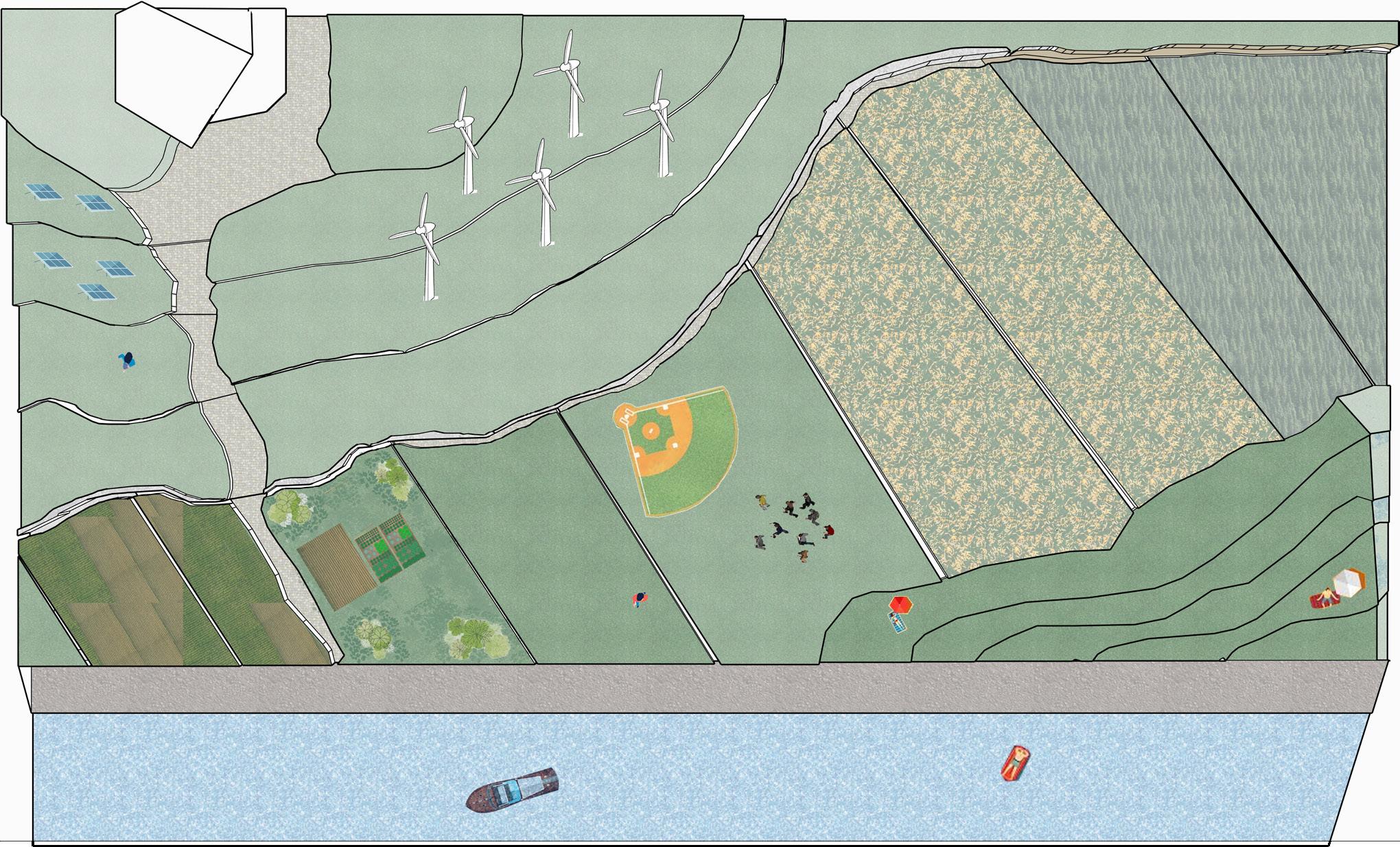
The landscape can be utlized as a multi functional space for the local community including amenities such as communial garden, recreation area, a beach, and a vegatation farm to grow local plants.
Being self suffcient by installing wind turbines and solar panels is vital for living on a island.
An increasing section of the population is threatened with exclusion from the real- estate market whether as renters or buyers because they simply cannot afford the rapidly accelerating cost of housing.
The two key air quality issues facing the City of Dallas are ground level ozone and the emission of greenhouse gases that affect global climate. Air pollution in Dallas has reached a new height in the last few years. The AQI in Dallas is one of the worst in the US for both ozone air pollution and PM2.5. In 2019, Dallas, Texas air quality failed to meet the nationally mandated level, which was PM2.5 pollution. Due to air pollution in Dallas, more than 1.5 million residents in Dallas are at health risk.
is crucial for a big city like Dallas, the goal of Greenway Condos is to replace the land built on with the same amount of greenery. There are many benefits from accomplshing this way of design such as using less electricity, produce less waste, have a lower carbon footprint, improve air quality, and keeps the overall temperature cooler.