

PORTFOLIO
YIZHOU VIOLA TAN
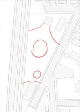
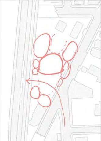
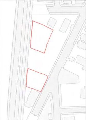
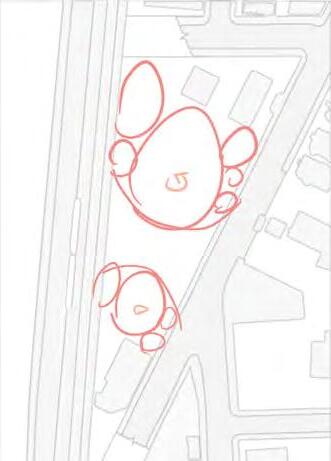
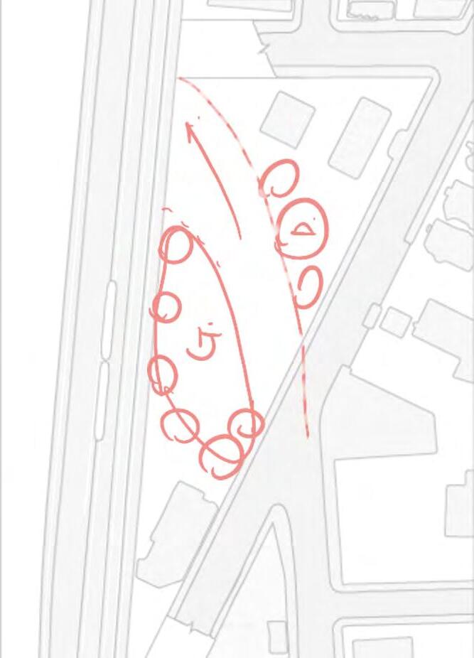
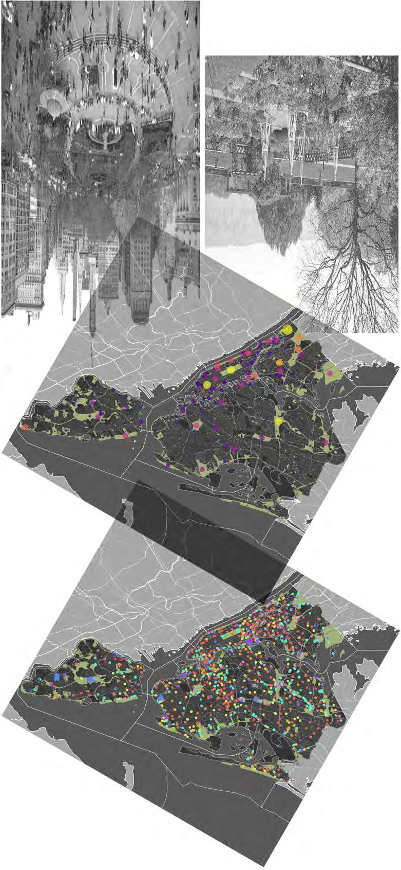
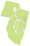
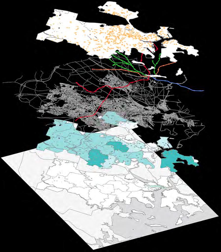
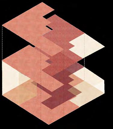
Collage Inspired by Guy Debord, The Naked City (1957)
02 | COMMON GROUND
Urban Design + Stakeholder Engagement Page 7-11
04 | HOUSING REC SYSTEM
Data Analysis + UI/UX Design Page 16-19

01 | TENANT POWER
Data Analysis + Visualization Page 1-6
03 | PARKS AND REC
Urban Sensing + Machine Learning Page 12-15
Page 20-24

01 | TENANT POWER
Data Analysis + Visualization
Cambridge, MA | Summer 2022
VIA Learning Lab Research
PI: Dr. Eric Robsky Huntley
MIT Summer Research Program RISD Somerson Sustainability Innovation Fund (SSIF)
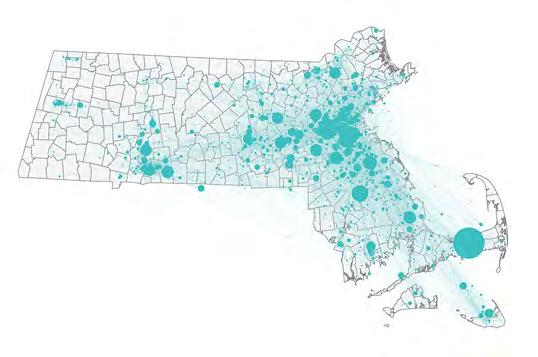
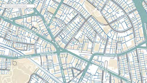
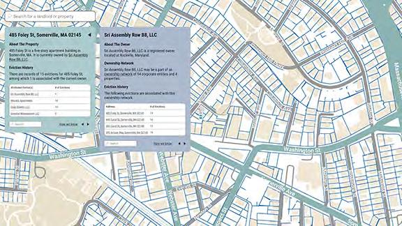
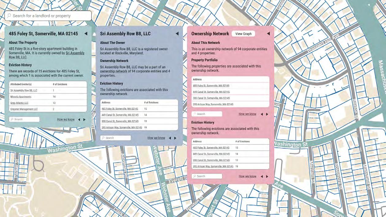
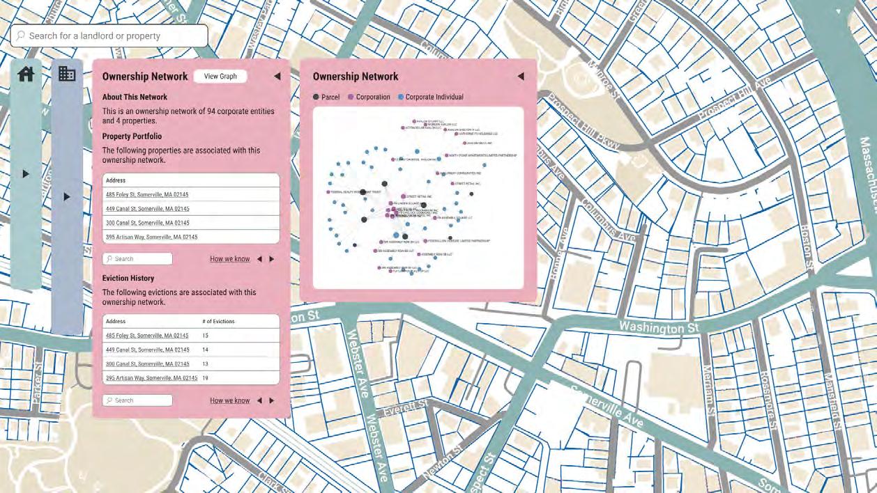
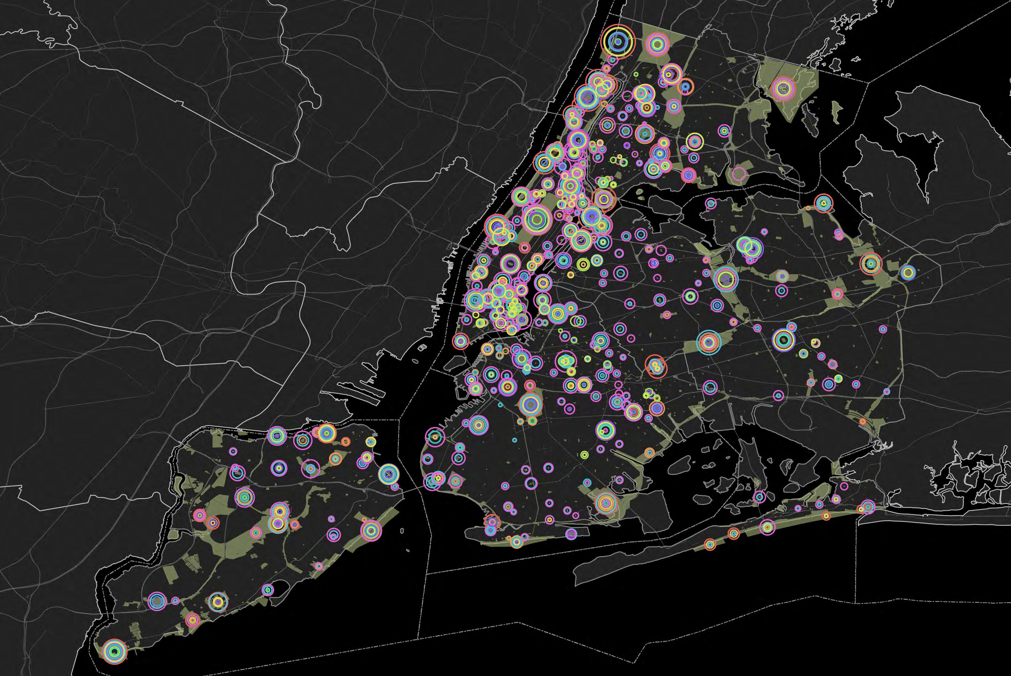
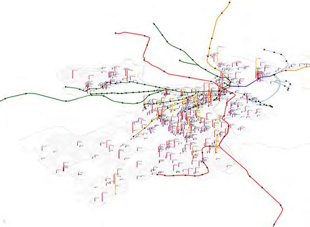
In Massachusetts and across the United States, housing is increasingly owned by large, corporate landlords who tend to file more eviction notices on their tenants than small, individual landlords. These corporate landlords create limited liability companies to conceal their real identities and minimize their liability, while making housing precarious for tenants. This project approaches limited liability company deduplication through the analysis of property tax assessment data, and business filing records in Massachusetts.


By Census Tract


Aside from the formal, judicial evictions, broader eviction practices include informal evictions, forcing tenants out pre-trial, and exits post-filing but pre-judgment.
Landlords use the threat of an official eviction to pressure tenants while avoiding costly evictions. This causes emotional distress and amplifies power imbalance

Landlords file eviction filings repeatedly on the same tenant without the intention to actually remove them, as a means to collect rent and fees, including late fees
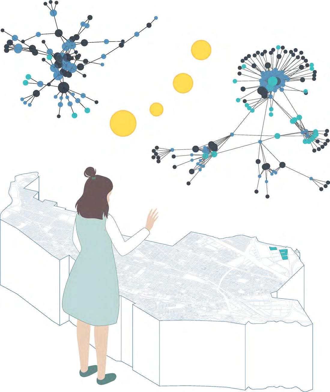
Limited Liability Companies
Corporate landlords create LLCs to conceal their real identities and minimize their liability, while making housing precarious for
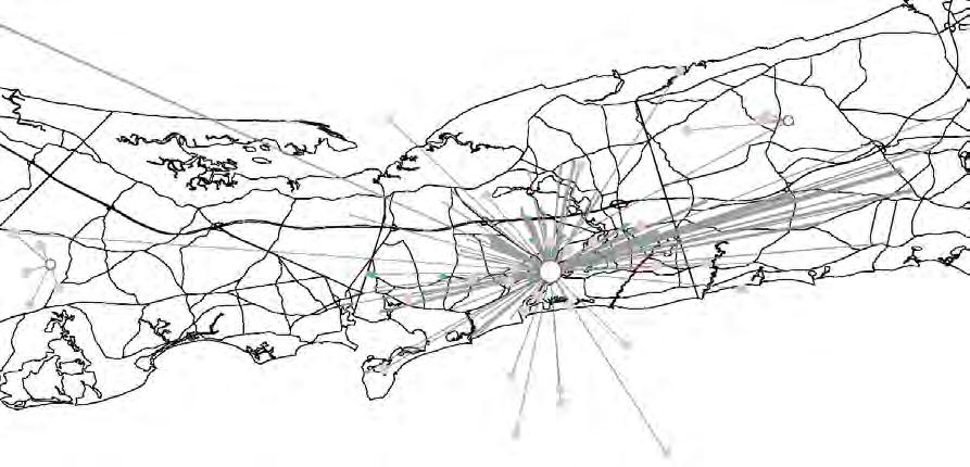
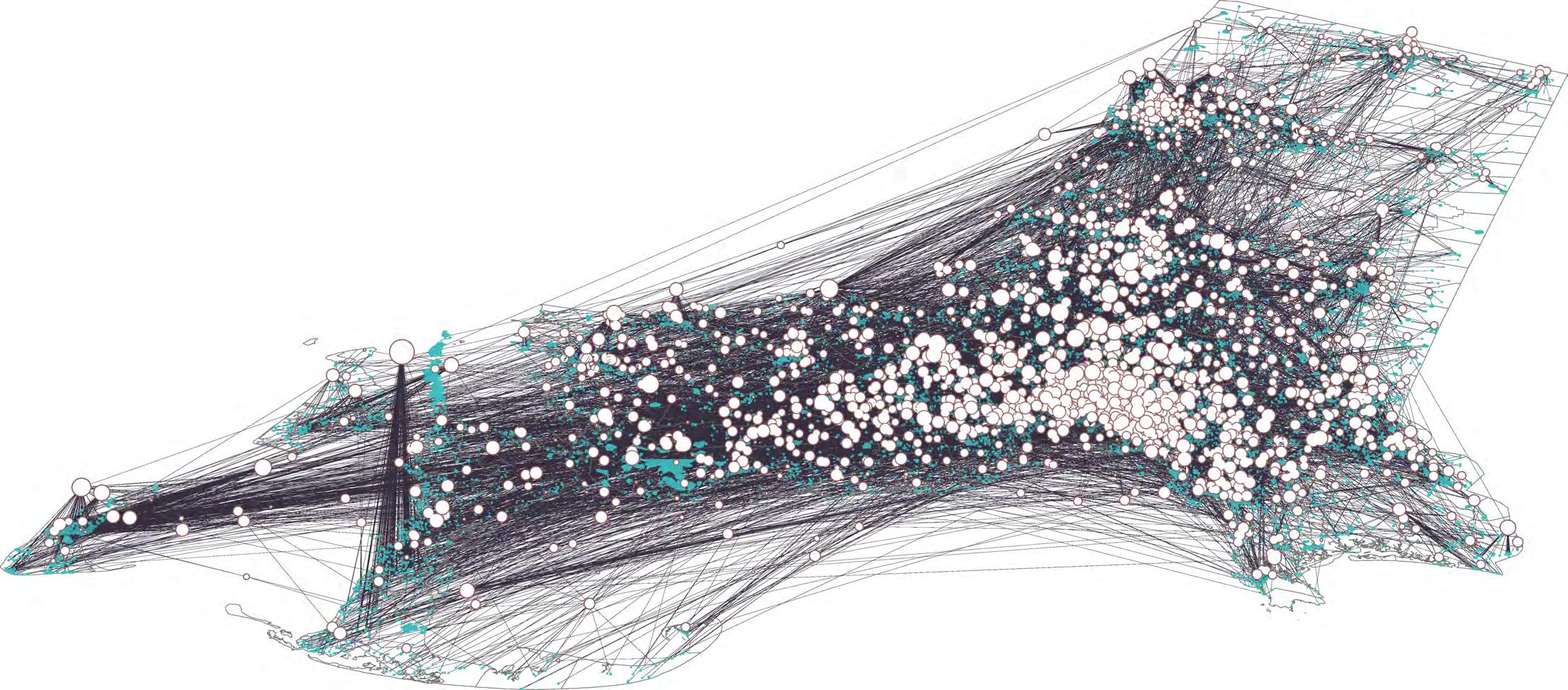
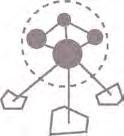
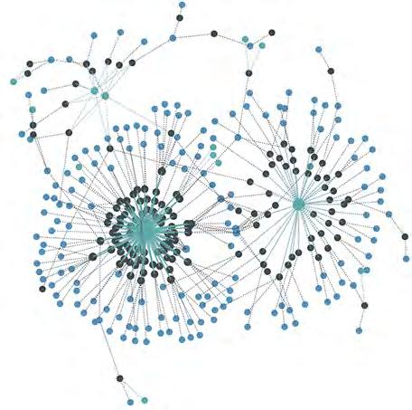
Identifying Corporate Landlord Networks
This project approaches LLC deduplication through the data analysis, with the hope that this information will empower tenants and enable multi-building campaigns against large landlords.

Filter by Use Code
101-109: Residential 013, 031: Mixed-Use

Formatting
Normalize addresses for matching
Individual Deduplication
Deduplicate among

Matching
Match attributes to deduplicate entities

Nodes
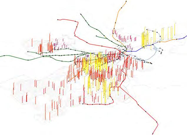
L3_Assess
0-0.001
0.001-0.01
0.01-0.02
0.02-0.05
0.02-0.08
Data Unavailable
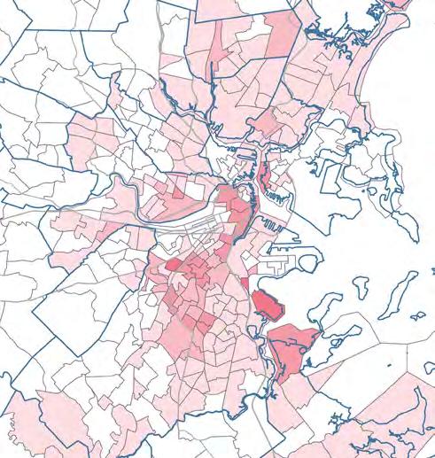
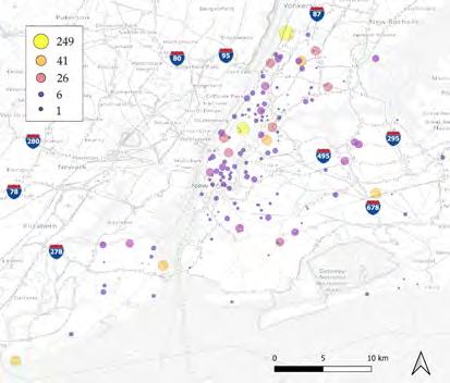
South Holyoke, Holyoke, MA (Tract 8115)
McKnight, Springfield, MA (Tract 8012) Worchester, MA Fall River, MA
* owned by large owner (parcel>=7) residential parcels
Census Tract Boundaries
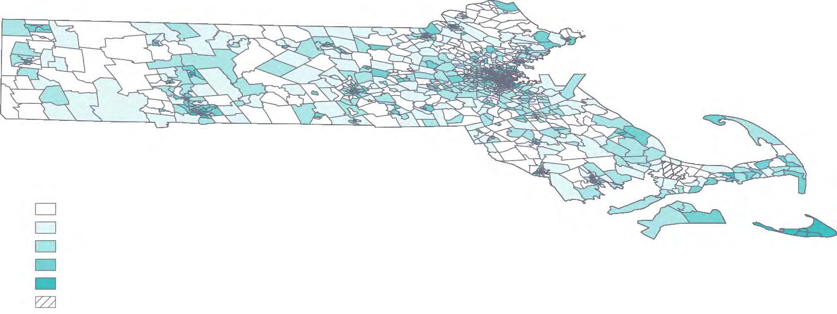
New Bedford, MA Hyannis, Barnstable, MA
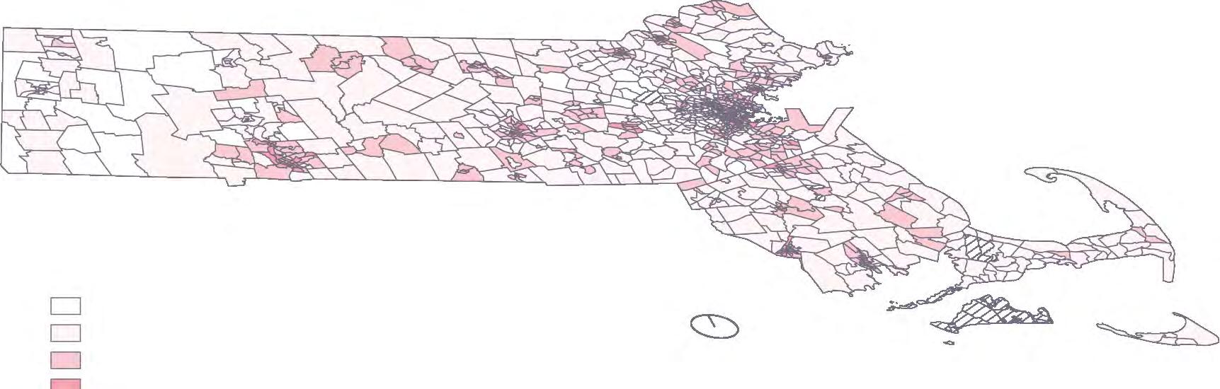
0-0.001
0.001-0.008
0.008-0.05
0.05-1 1-6.208
Data Unavailable
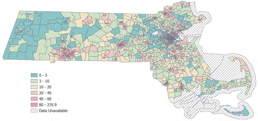
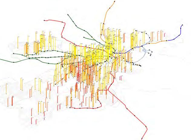
Eviction Filings per Residential/Mixed-Use Parcel Yearly Average 2000-2018
Census Tract Boundaries
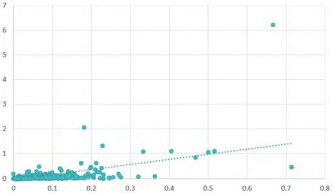
R-value = 0.569
R² = 0.324
Std. Error = 0.177
P-Value Intercept = 9E-10
P-value X variable = 8E-99
Observations = 1139
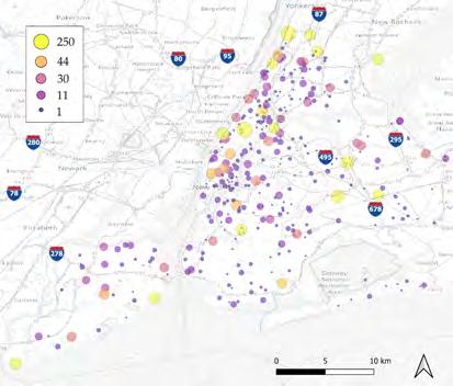
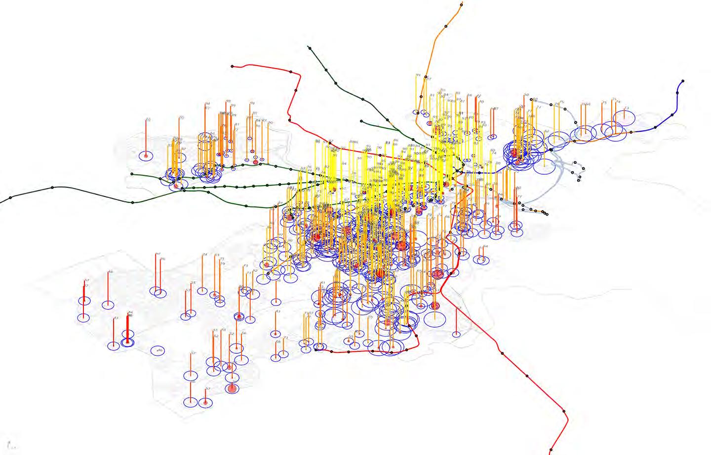
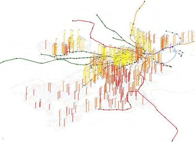
Zooming into the Greater Boston Area...
Town Boundary Major Road
West End + Downtown
Shawmut (Tract 704)
Mission Hill (Tract 808)
Columbia Point (Tract 909)
0-0.01
0.01-0.05
0.05-0.1
0.1-1
1-7
Census Tract 909
Census Tract 8115
Census Tract 808
Census Tract 8012
y = 2.0438x - 0.0384
Census Tract 704
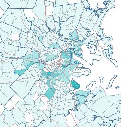
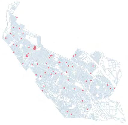
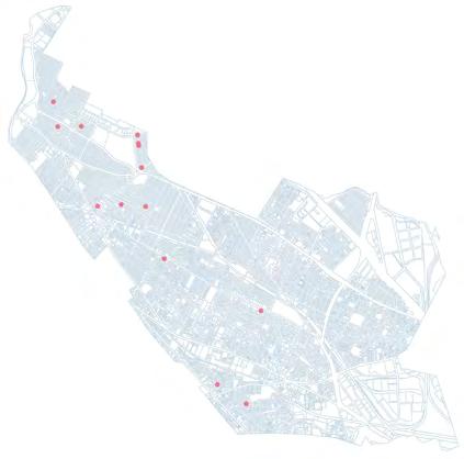
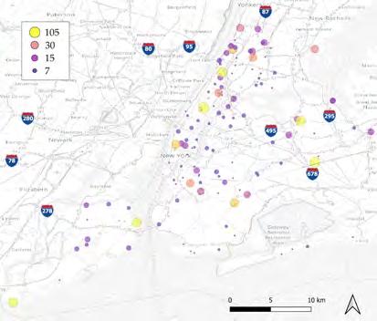
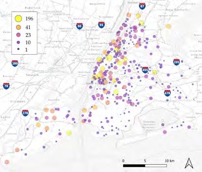
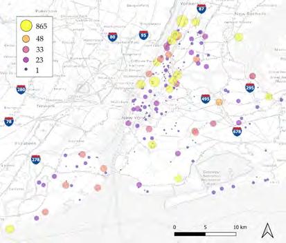
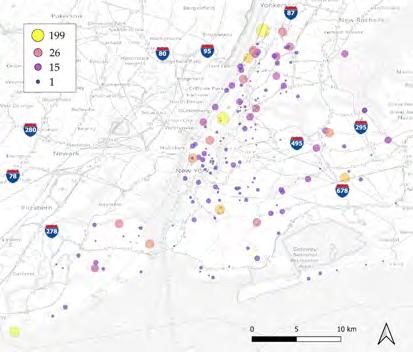
Corporate Ownership and Eviction Filings: The Intersections
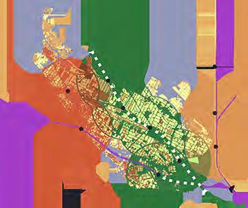
conducted GIS and regression analysis on the per-parcel rates of corporate ownership and eviction filings by census tract in Massachusetts. Originally aimed at identifying major evictors, data limitations redirected the study to compare historical evictions (20002018) with 2021’s corporate ownership rates. This highlights areas that might have experienced gentrification and displacement over the past 20 years, suggesting locations where eviction patterns could have potentially aligned with, or even contribute to, shifts in property ownership. 0-0.001 0.001-0.01 0.01-0.02 0.02-0.05 0.02-0.08 Data Source: Eviction Tracking System: Version 2.0.
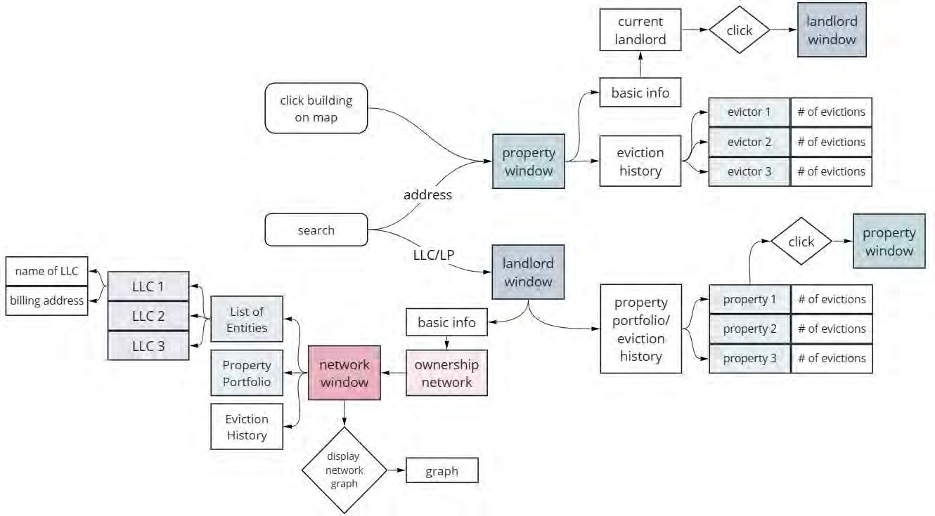
Web Interface Design
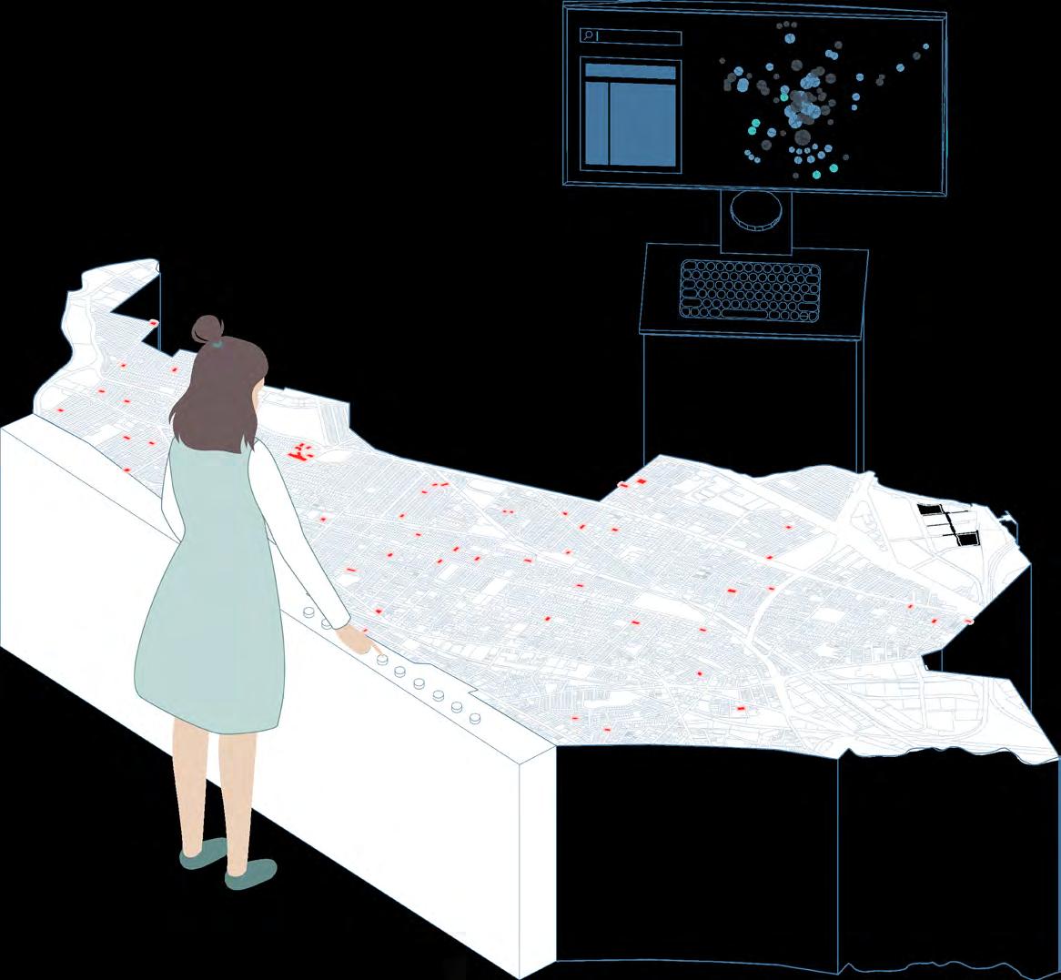
To disseminate this data and information to activists and tenants for effective collaboration and advocacy, we worked on iterating a website, tenantpower.org. Here is my version of the design.
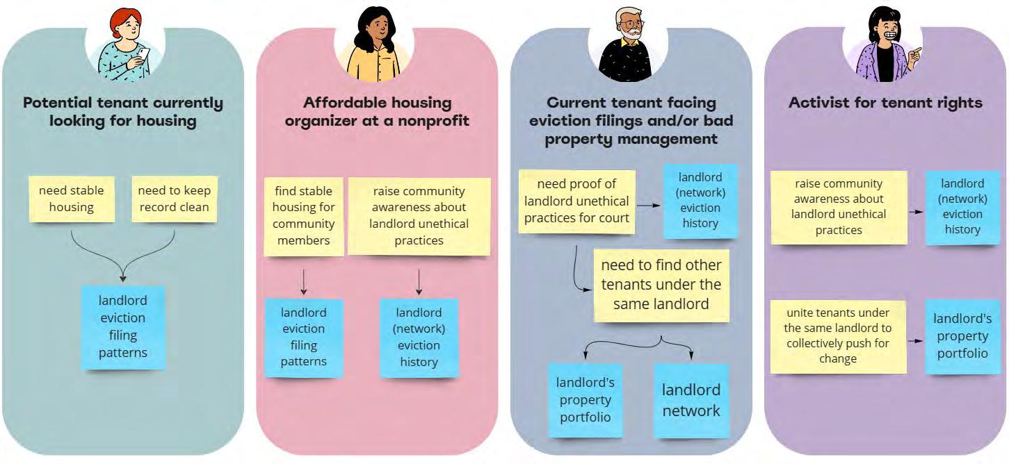
Target Audiences
Key Stakeholders (Somerville as example)


Community Action Agency
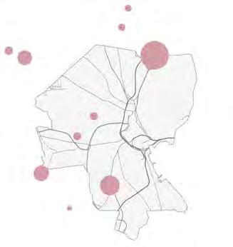
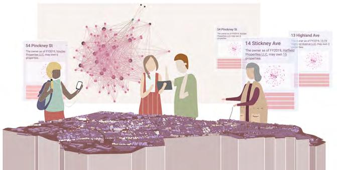
Community Installation also initiated a collaboration with the Community Action Agency of Somerville to create a community installation at Connexion in East Somerville, using Printed Circuit Boards (PCBs) with addressable LEDs to highlight properties in Somerville that belongs to the same corporate landlord network. Launched in May 2024.

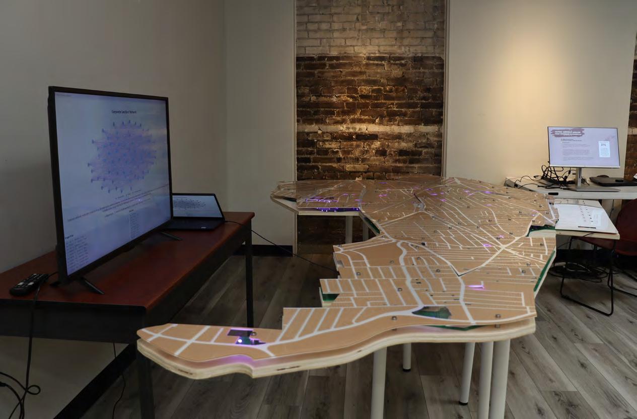
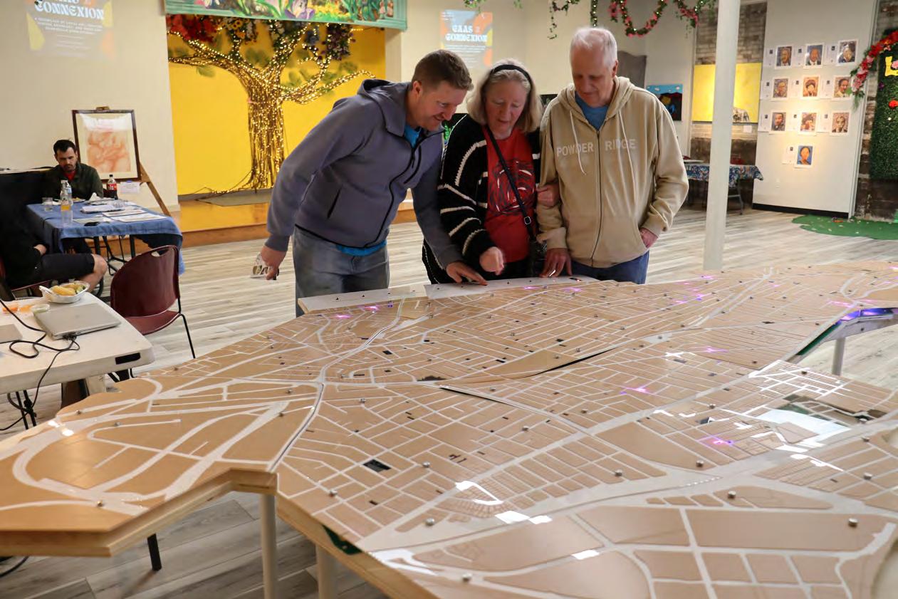
Buttons for 10 Largest Portfolios in Somerville
02 | COMMON GROUND
Urban Design + Stakeholder Engagement
Advanced Architecture Studio | Spring 2023 Instructor: W. Gavin Robb
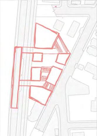
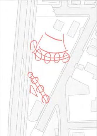
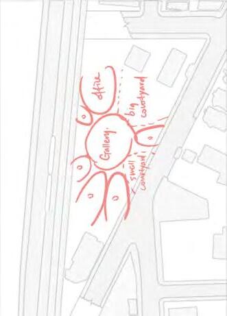
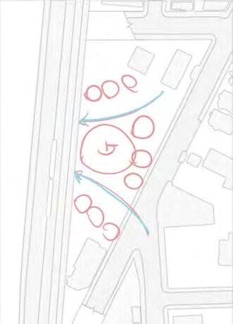
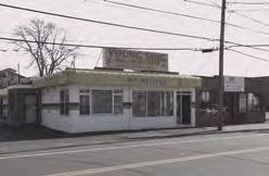
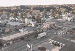
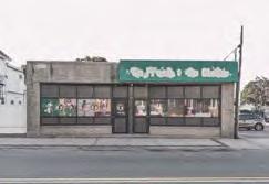
What can we do as Somerville rapidly gentrifies, causing communities to be pushed out? Imagine if we could turn Gilman Square into a central point of connection – a place where Somerville residents can unite, support each other, and access essential resources. Imagine Gilman Square to be a multi-resource, multilingual community center, a hub that empowers through connection, a space for tenant organizing and a physical anchor for information transparency.
Stakeholder Engagement Process
co-facilitated a community engagement process with 11 other students in our class to undertstand the needs, challenges and powers at play in Gilman Square, involving 10 stakeholder interviews and 3 community panels. Then, incorporated Natural Language Processing techniques, Large Language Models, and data visualization to map the themes discussed in these interviews and panel discussions on the Power Framework.

10 Stakeholder Interviews
The 12 students in our class conducted 10 1-2 hour virtual interviews with community organizations, elected officials, and residents.
Desktop Research + Design Iterations
Somerville history, policies, community anchors, spatial possibilities, etc.

3
Community
Panels
We also facilitated 3 panels with 20+ stakeholders discussing topics including community spaces and equitable neighborhoods.
Insights
Interview Transripts
Speech-to-text technology employed.
Research Document
We collectively wrote a 167-page document to summarize findings and envision the future of Gilman.
Large Language Model (LLM)
Use GPT to summarize more abstract ideas and themes in the text.


Designer
Class Collaboration Individual Work
I experimented with the data to explore how to easily index into and visualize these valuable interview insights.
Iterative Analytical Process
Latent Dirichlet Allocation (LDA) Model
Extract explicit topics and keywords through the python library Gensim. Filter and integrate.
Theme Visualizer
used D3.js to visualize the themes of focus emerged in our interviews. Urban Typology Transportation Access


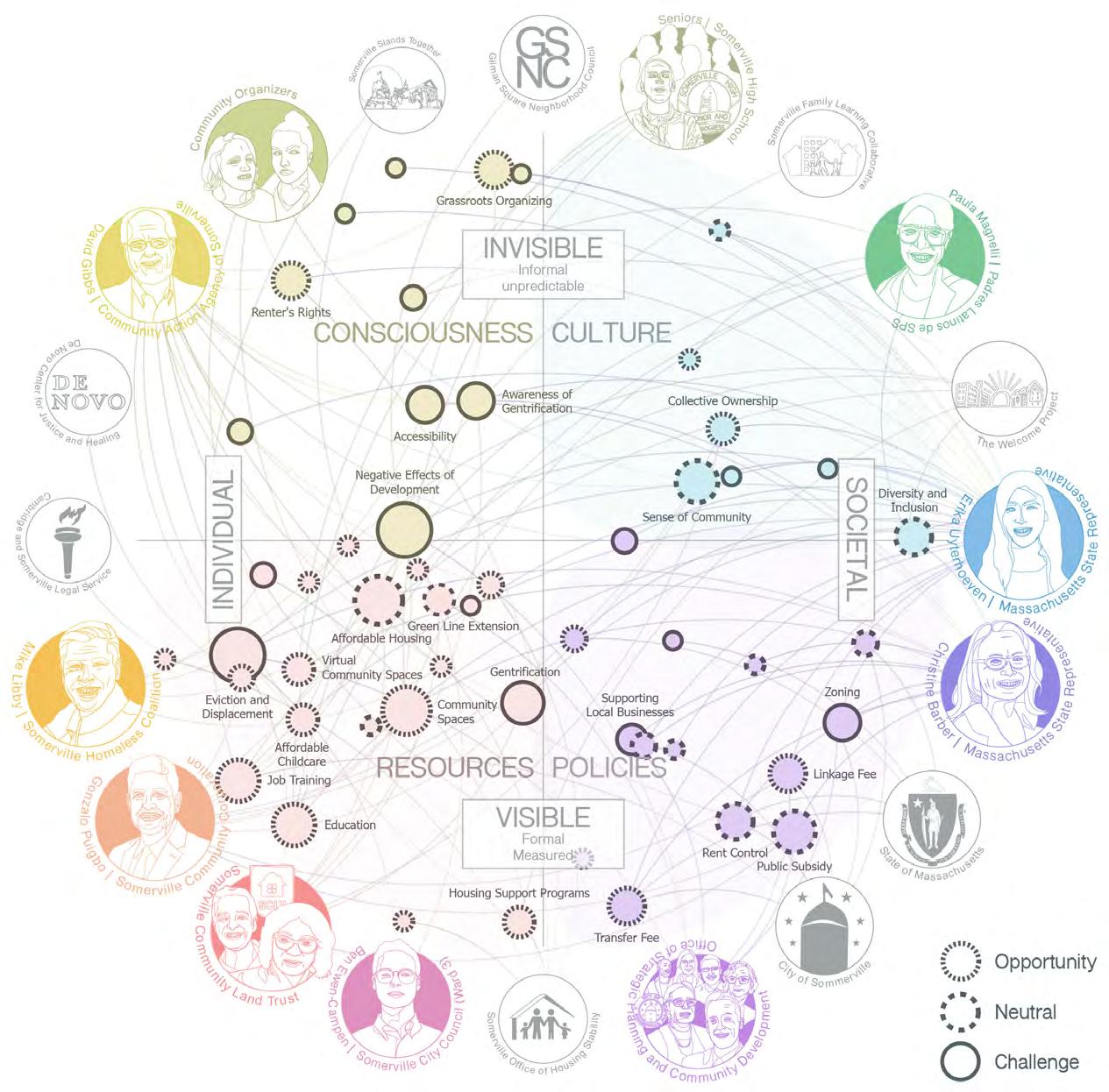
Power + Resource Mapping
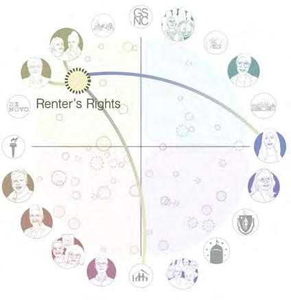
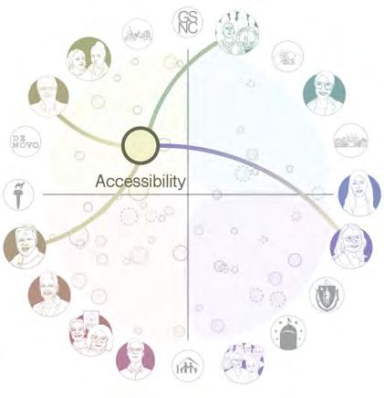
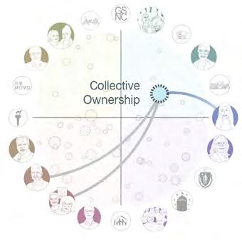
The Power Framework[1] is a tool for informing and planning strategic action to reshape power in the social sector. It can be used to reveal the barriers and opportunities for achieving deeper solidarity, and to map a path to system-wide change[2]. With the help of language processing technologies, mapped the ideas, resources and policies discussed in the stakeholder engagement process onto this framework to be shared and discussed in larger community conversations. [1] Adapted from the Gender at Work Framework, developed by
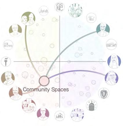
“The goal of designing community space should be to create a supportive gathering point that helps people feel empowered.”
‘When you change the “my rent is so high“ conversation to “all of my neighbors have rents that are too high”, you create consciousness that it’s a systemic problem subject to systemic solutions.’
Iterative Design Process
“Trying to bring services/ resources to people can help fulfill the needs of people rather than asking them to figure it out.”

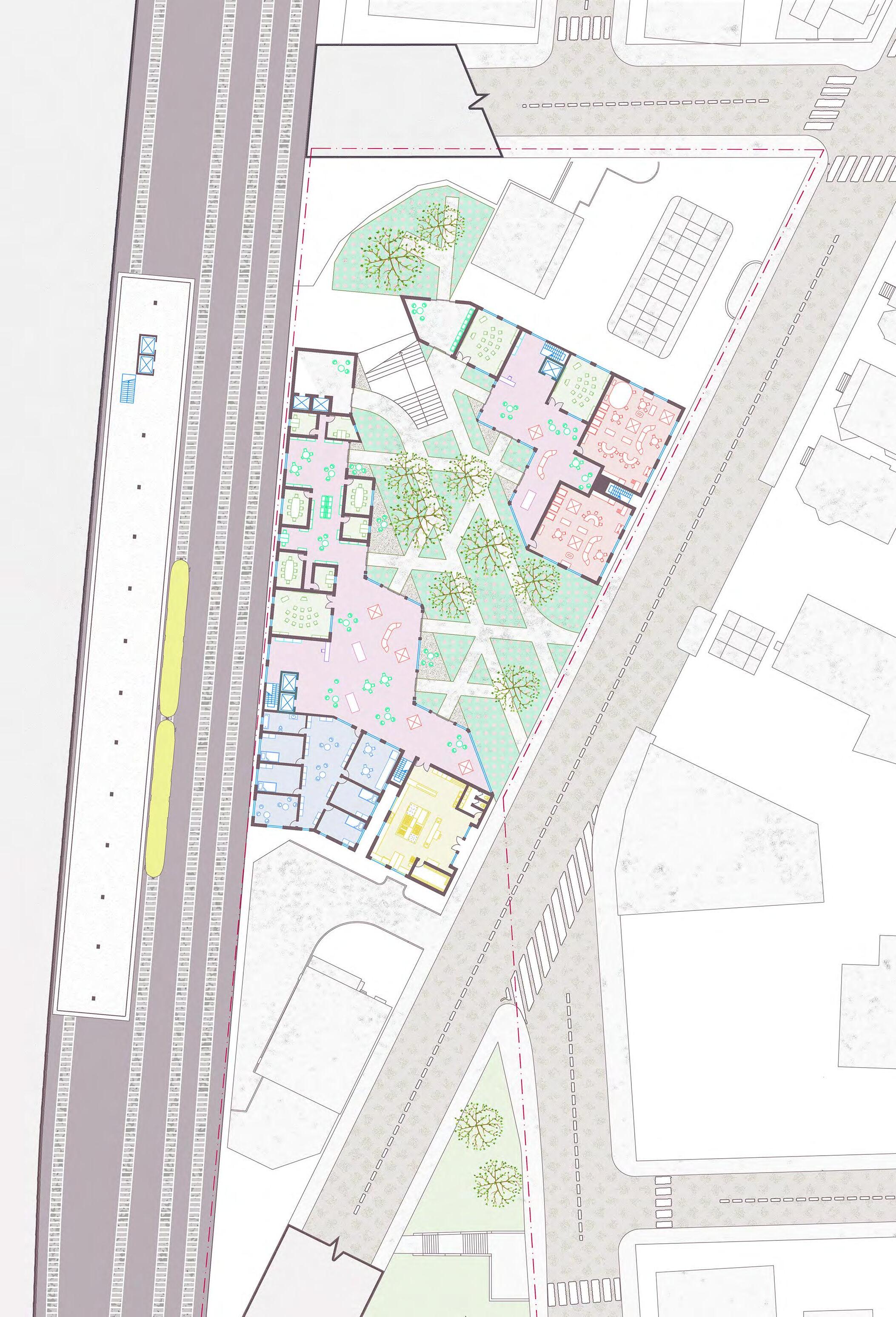
Connection to City Hall
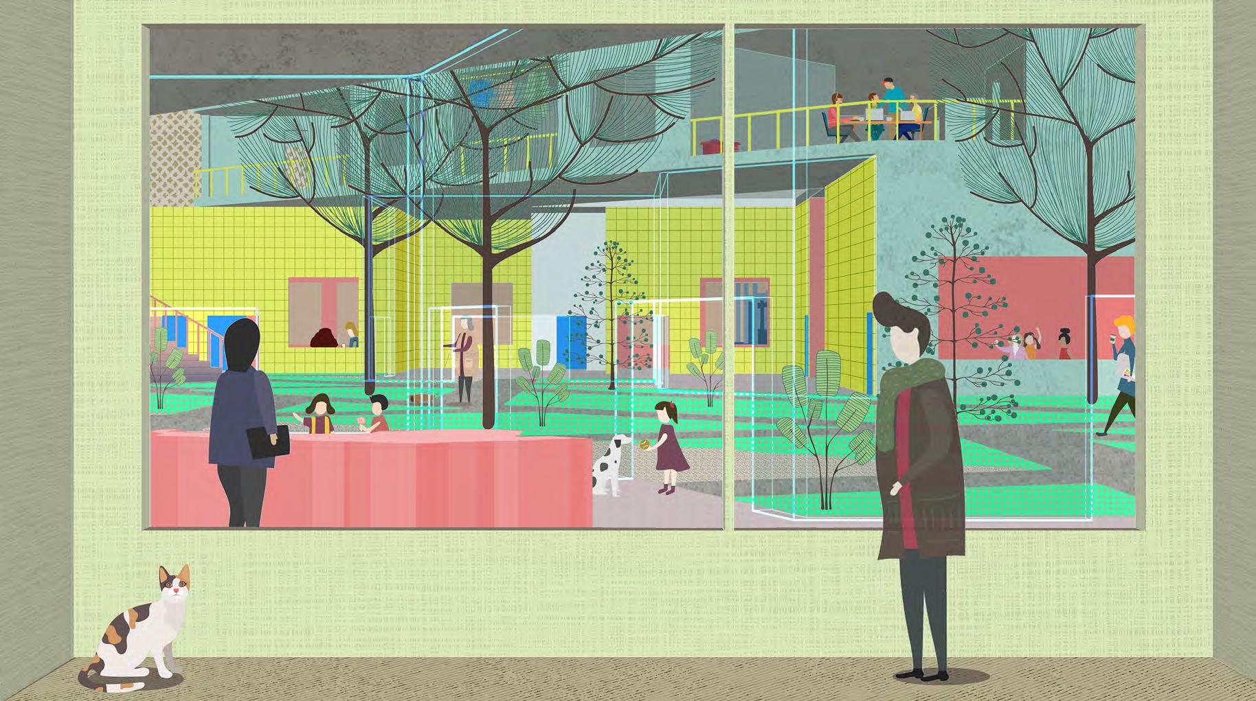
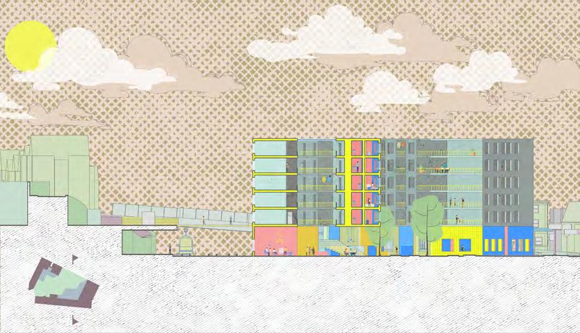
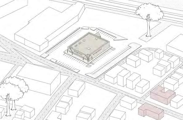
In the elevation, you can see that the site will not only be able to host its own support services and take advantage of the T, but it also connects the city to the City Hall on the upper side of the hill. Altogether, Gilman Square becomes a face for the services available in Somerville, and help people find a way to what they need.

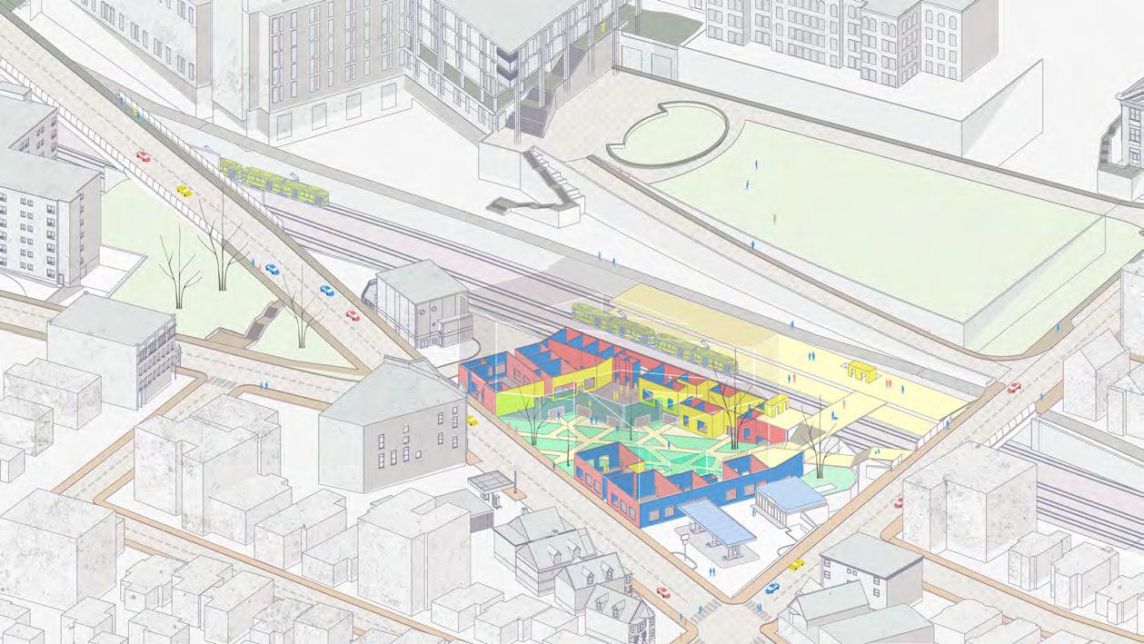
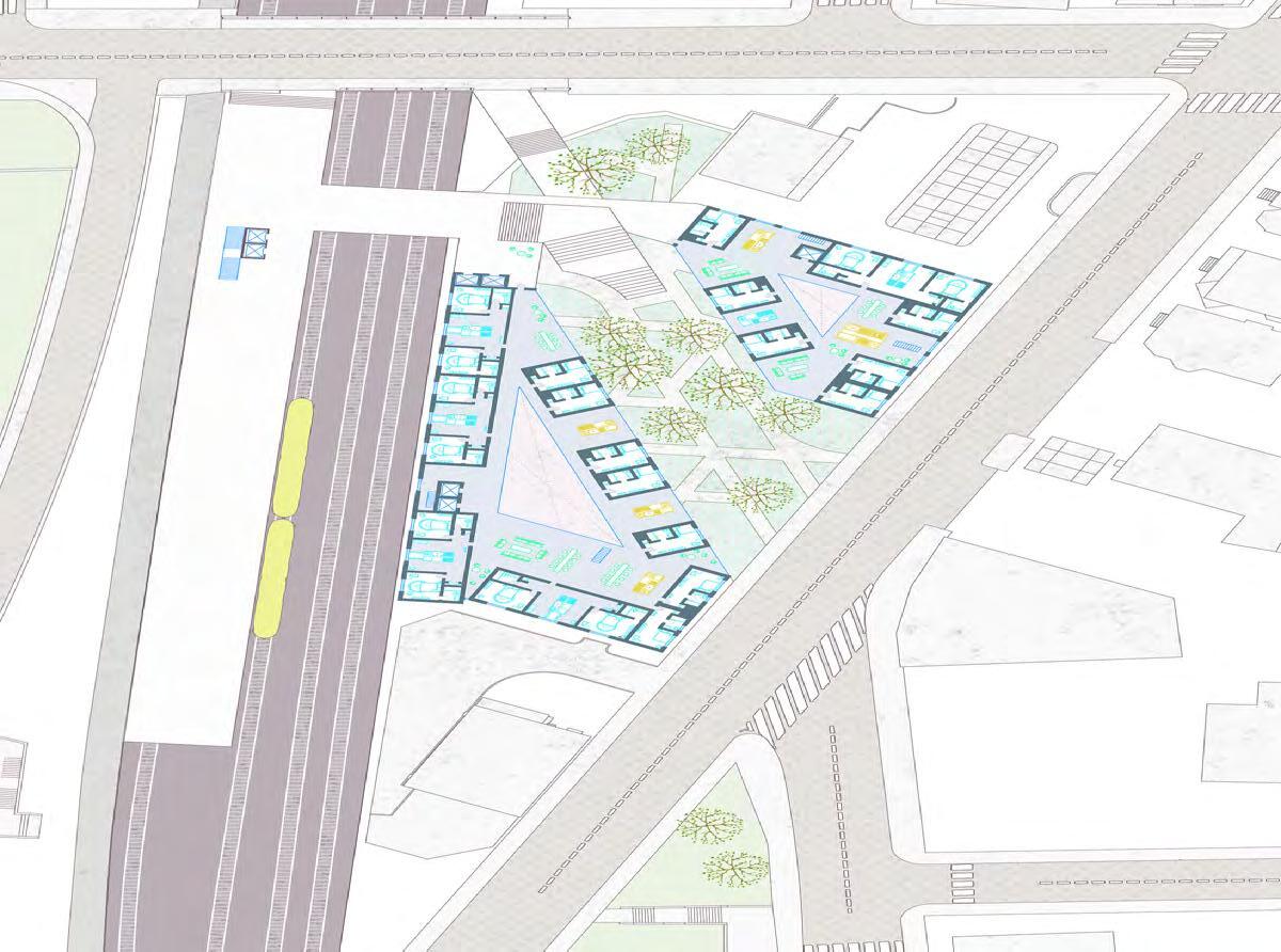
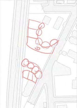
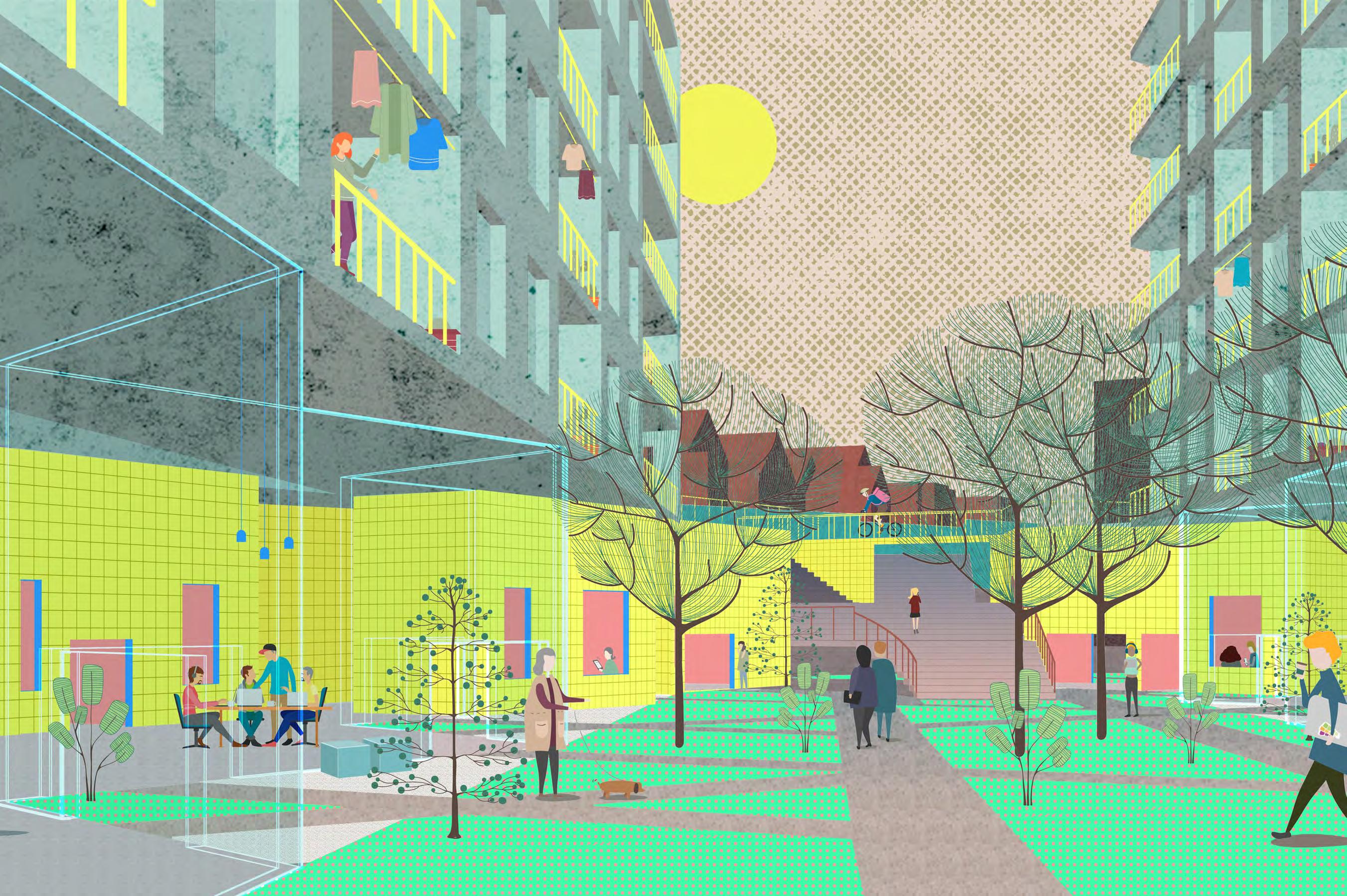
Affordable Co-Housing
On the residential floors, we have mainly co-housing units with shared kitchen amenities and dining areas, accompanied by a few two bedroom units. The co-housing model is designed to further facilitate connections among residents, and create a sense of community.
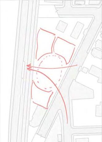
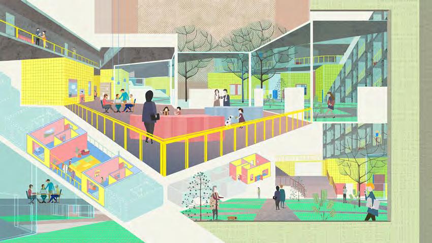
Spatial Buffer Zones
A spatial hierarchy or a series of buffer zones are created on both sides of the green path that transitions from the outdoor path to an unenclosed but sheltered zone, through glass enclosure to an indoor space that receives sunlight from a light well above, and finally to more private rooms.
Moments of Connection
Overall, the project aims to create different scales and speeds of encounter, and maximize people’s chances to connect.
03 | PARKS AND REC
Urban Sensing + Machine Learning
Personal Work | Summer 2023
Advisor: Dr. Waishan Qiu
Published on International Journal of Geo-Information: Identifying Urban Park Events through Computer VisionAssisted Categorization of Publicly-Available Imagery
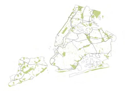
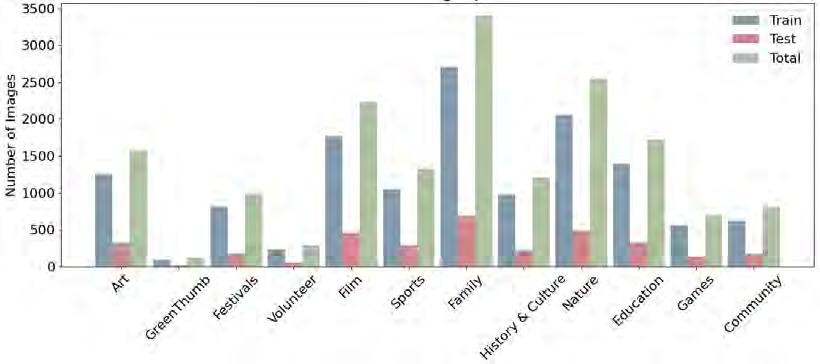
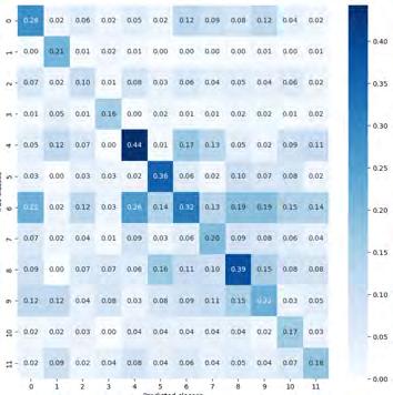
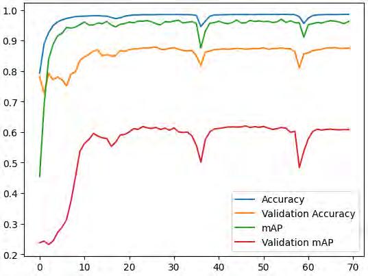
Understanding park events and their categorization offers pivotal insights into urban parks and their integral roles in cities. The objective of this study is to explore the efficacy of Convolutional Neural Networks (CNNs) in categorizing park events through images. Utilizing image and event category data from the New York City Parks Events Listing database, we trained a CNN model with the aim of enhancing the efficiency of park event categorization.


Van Cortlandt Park Pelham Bay Park
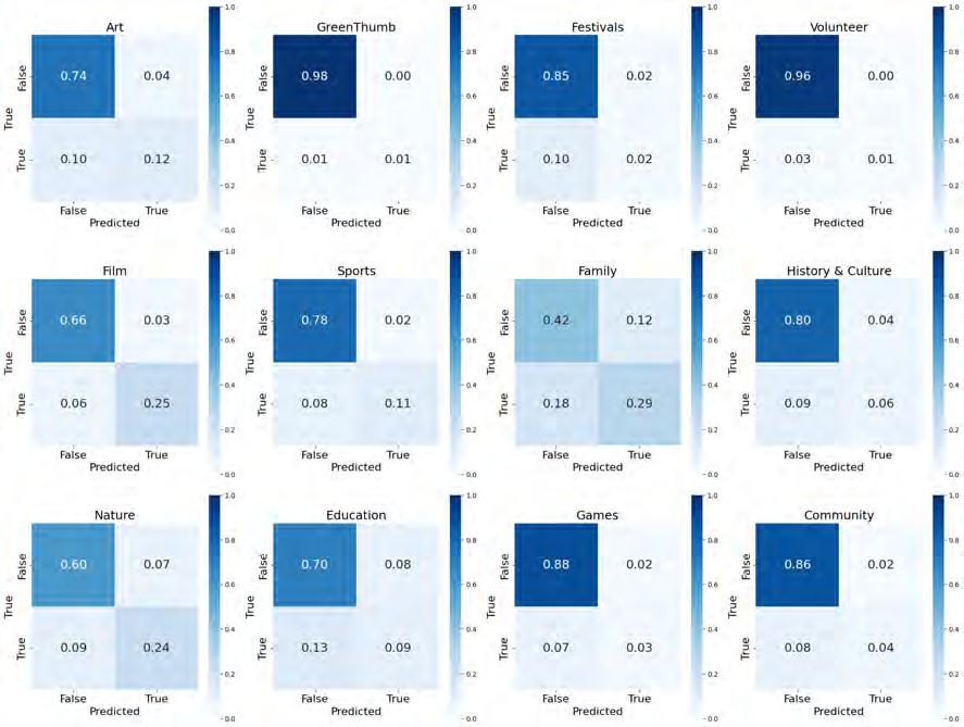
Model Application on Social Media Imagery
Exploring the model’s application on unlabeled images, I obtained 1,063 social media images through the Flickr API with “New York City park events“, “New York City park activities“, and keywords alike. Then, I applied the trained ResNet50 model on these images, and visualized the multi-label classification
map on the
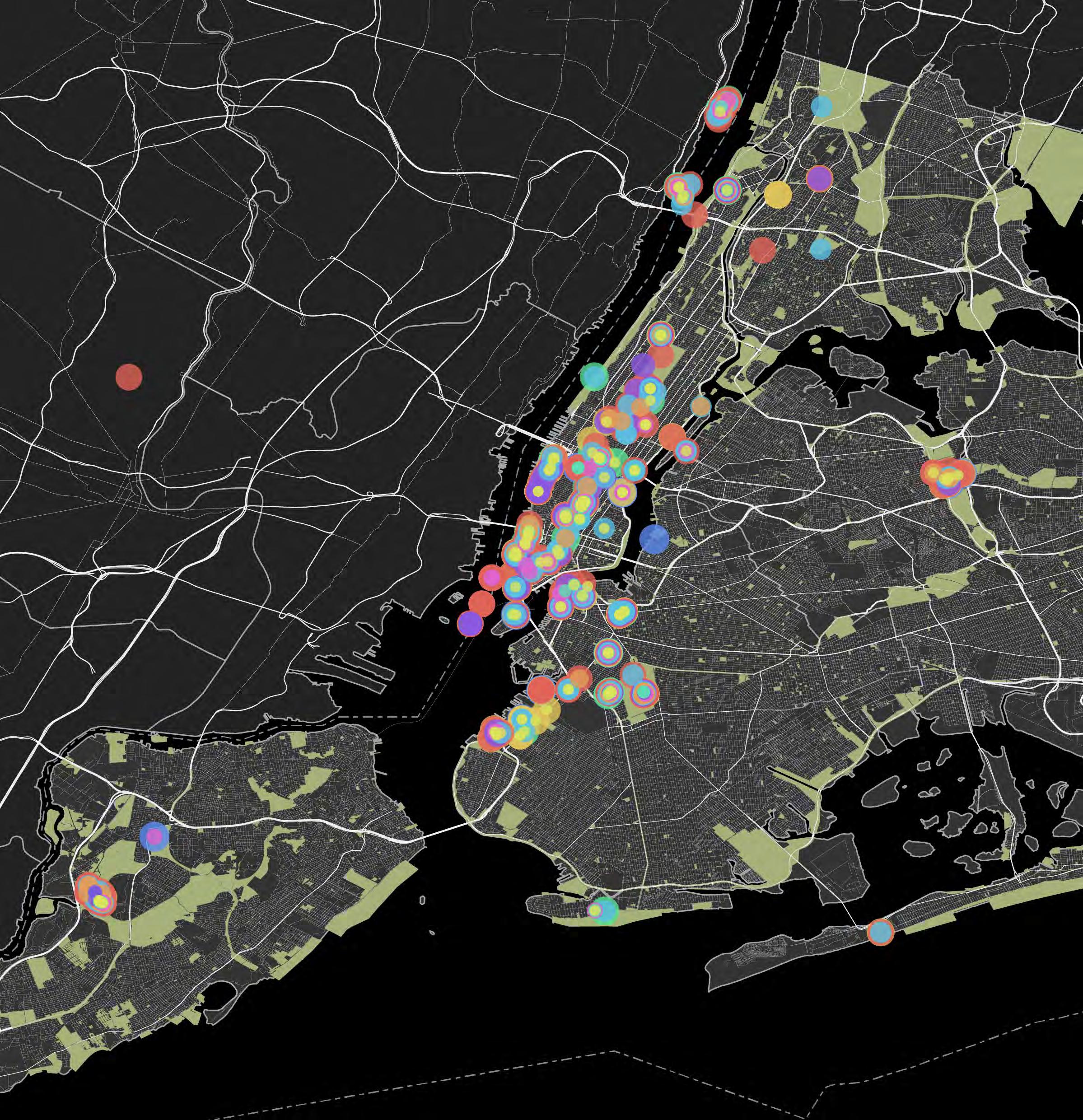
tourism=artwork OR
tourism=gallery OR amenity=arts_centre
leisure=garden
amenity=marketplace
landuse=recreation_ ground
leisure=outdoor_seating amenity=cinema OR amenity=theatre

leisure=picnic_table OR amenity=bbq

SportsEvents SportsFacilities

Data Analysis + UI/UX Design
Personal Work | Fall 2023
Advisor: Jieyu Zhou
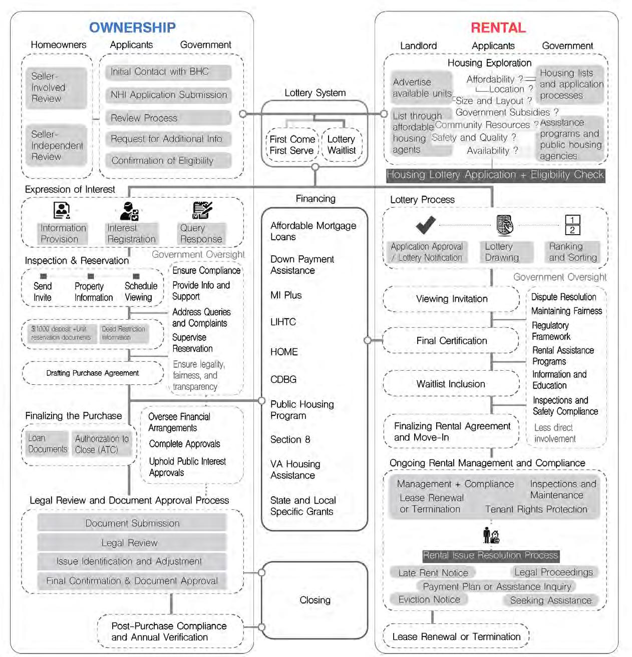
The cumbersome nature of social service applications is especially evident on affordable housing lotteries. For homeownership, this entails a complicated homebuying process and a bunch of hardto-understand legal documents; for rentals, a tiring process of searching among separate web pages of different developments. Even worse, many in Boston have given up on the lottery system because it’s so hard to get a place near their job. This project proposes a recommendation system to help.
Team Members:
Viola Tan (ideation/research/system design/GIS)
Xuechen Li (research/system design) Zheng Fang (programming/visualization)
Supporting Member:
Yuxin Yang (research)
Affordable Housing in Boston: Background & Challenges
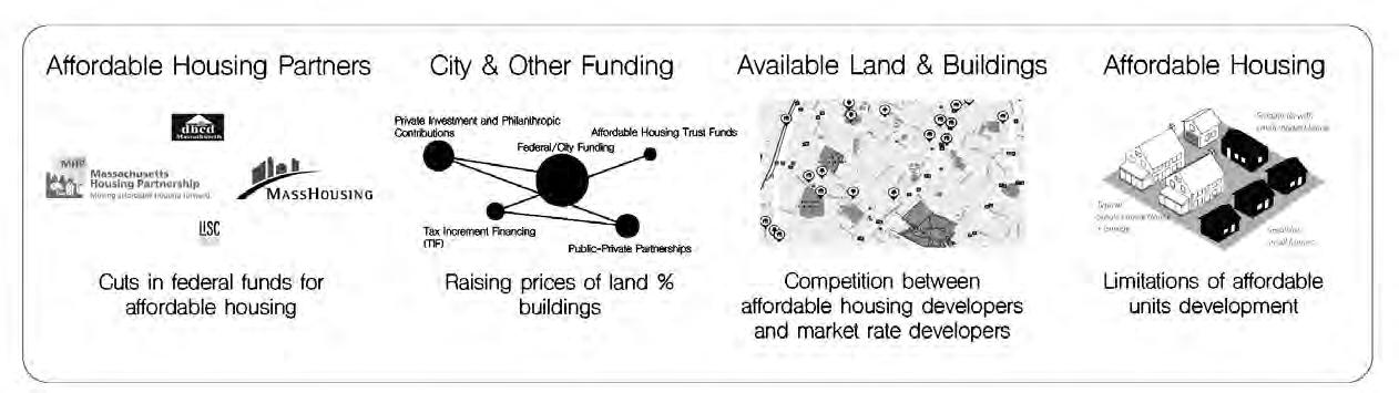
Primary User Painpoint: Location

“I gave up on the lottery because I was never able to get a place near my job.” Boston


“Proximity to job is definitely the first thing I consider when finding a place.“
“Applicants often indicate they would accept housing in many towns, but then reject offers from communities that are far away from their current location.“
Application Process Reccommendation System Design Framework
Merge Sources of Available Affordable Housing Units
We merged multiple data sources by the names of developments to integrate information.
Cluster Units Recommend Clusters to User based on Need

Name of Development Address

Tenant-Based Subsidy ? Income + Household
Target Rent Range: Desired Rent Range + Tenant-Based Subsidy + Project-Based Subsidy
Project-Based Subsidy ?
Income Restriction (AMI)
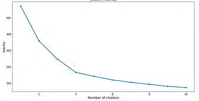
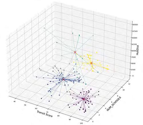
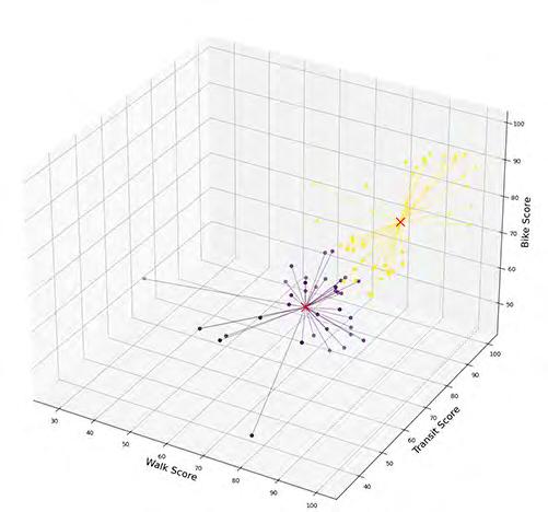
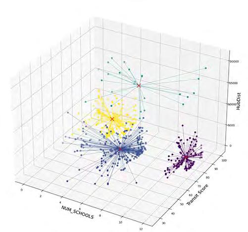
K-Means Clustering
We conducted k-means clustering on 7 dimensions to cluser development projects that contain income-restricted housing units. These clusters are updated on a biweekly basis to ensure timeliness. When residents enter their needs, the system will recommend rental housing for them to apply for, from the cluster closest to residents’ input.
Need & Preferences
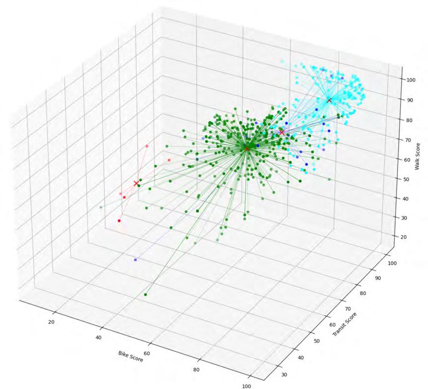
Job Location (Neighborhood)

Bicycle Friendliness
Public Transit Accessibility
Walkability
Proximity to Schools
Proximity to Job Location
Immediate Availability List Priorities
K-Means Clustering
Bike Friendliness
Public Transit Accessibility
Walkability
Neighborhood Accessibility to Schools
Latitude
Longitude
Immediate Availability:
1=First Come First Serve
2=Application Open
3=Waitlist Open
4=Waitlist Closed
Latitude, Longitude
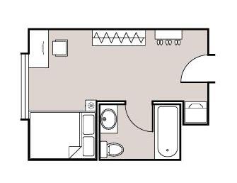
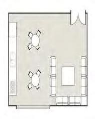
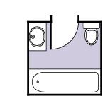
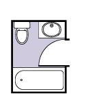
Information Overlay for Affordable Housing Units


05 | DESIGN-PLAY KIT
Interactive Device | Providence, RI Student Organization Work | Spring 2023
Funded by RISD Center for Student Involvement
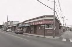
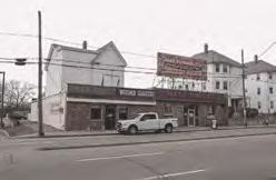
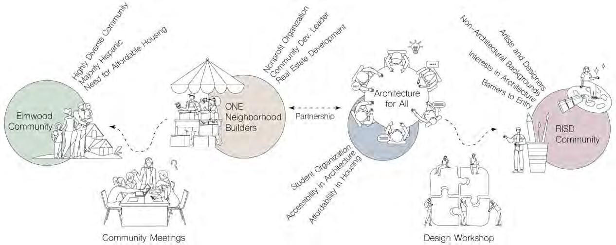
The objective of this collaborative project between Architecture for All and ONE Neighborhood Builders is to develop a prototype converting abandoned retail stores into affordable housing sites, using 533 Elmwood Ave, Providence, RI as an example site. Meanwhile, the incorporation of digital tools in a public event engage people outside of architecture to join the reimagination of these abandoned sites.
By Student Organization Architecture for All:
Viola Tan (President, ideation/programming) Betty Ng, Jacky Yao (Outreach Leads, outreach) Jasmine Lee (physical device design) Jane Xu, Nhat Nguyen, Alexander Carroll (manufacture)


Opportunity for Adaptive Reuse: Abandoned Retail Stores into Affordable Housing
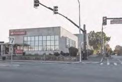
Due to reasons such as historical retail overexpansion, the rise of E-commerce, COVID-driven economic recession and demographic shifts, retail stores are being abandoned and up for sale in Providence and its neighboring areas. Meanwhile, the housing affordability gap is large and still increasing. The objective of this project is to develop a prototype converting abandoned retail stores into affordable housing sites, using 533 Elmwood Ave, Providence, RI as an example site.

Oppurtunities and Challenges of Adaptive Reuse
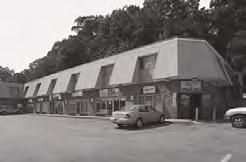
Parking Space
Many of these retail stores have their own parking spaces on the circumference. This presents an opportunity to expand the building footprint, as well as simply providing parking for residents.
Site Challenges
Due to the retail nature, stores often have deep structures. This presents challenges for residential rooms to accessing natural light.
Proximity to Major Roads
Stores locate on commercial corridors, offering a convenient location and access to public transportation.
Proximity to Points of Interest
Similarly, stores are in proximity to other points of interest, such as restaurants, other retail stores and facilities.
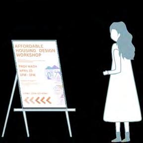
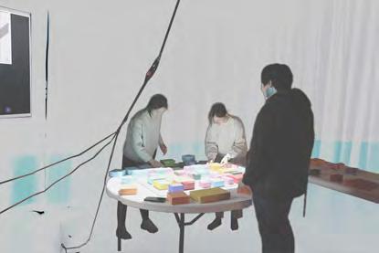
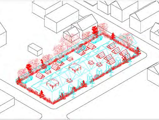
Housing Design Workshop: A Community Collaboration
led he student organization Architecture for All to collaborate with a community nonprofit, ONE Neighborhood Builders, and organize a housing design workshop open to the RISD community as well as the general public. We aim to re-introduce architecture as an accessible and tangible discipline through the interactive workshop, as well as raise awareness to housing advocacy.
533 ELMWOOD AVE
What do you think makes a good space?

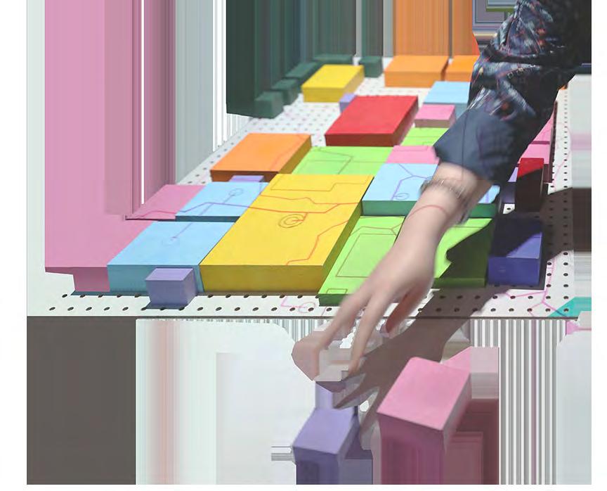
These wood blocks

Seems like the board is the house! Some courtyards are always good.
Interactive
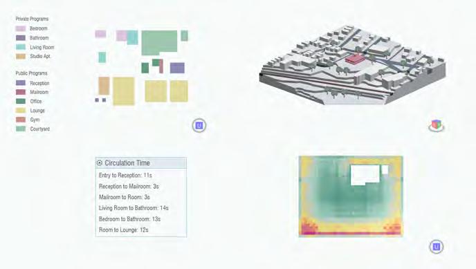
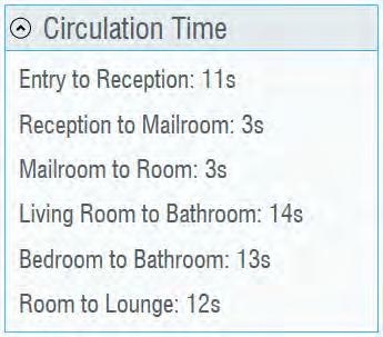
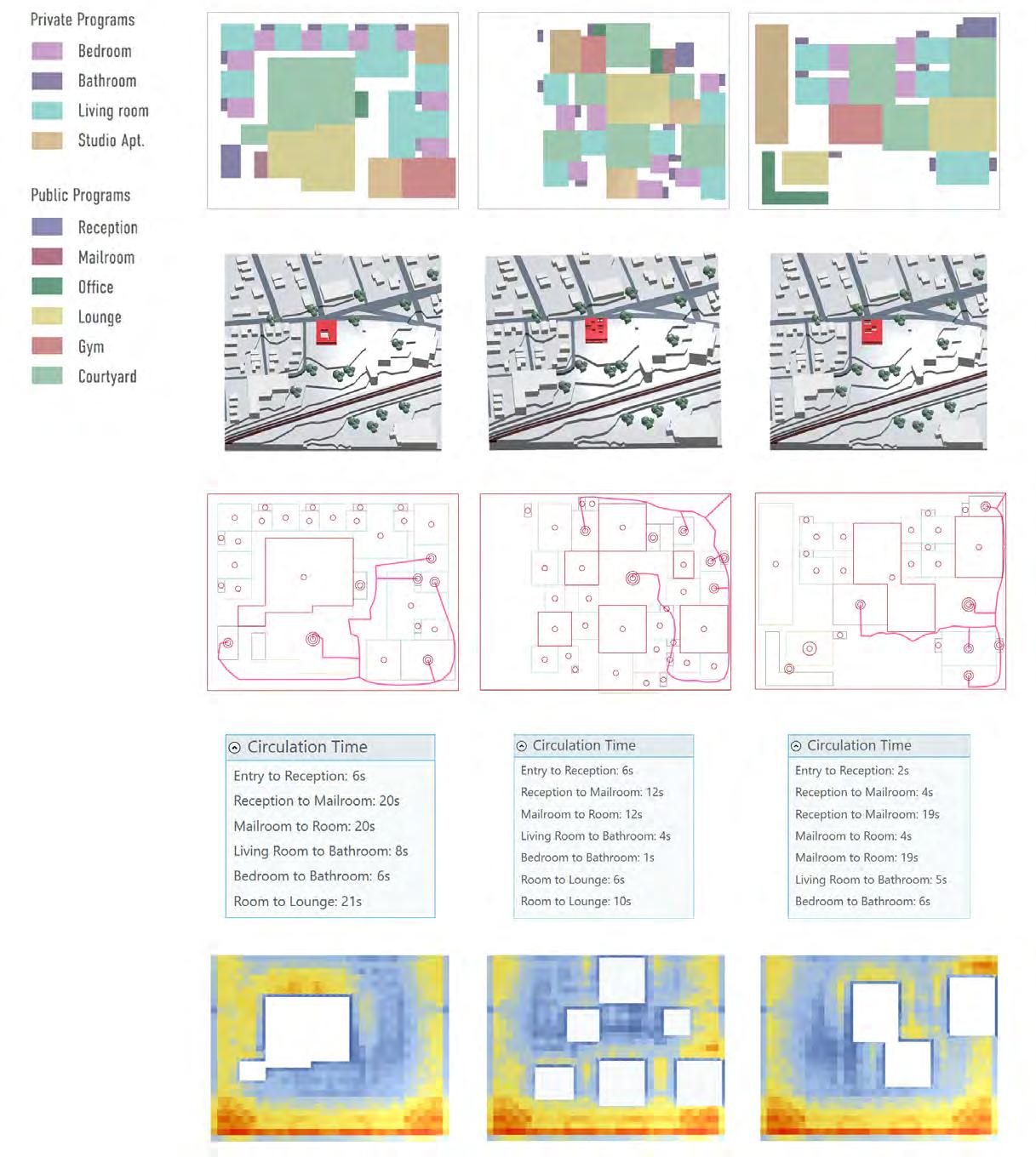
Circulation Time
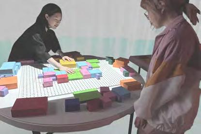
Many potential participants with non-architectural backgrounds identified circulation time as a key indicator of design quality.

Radiation
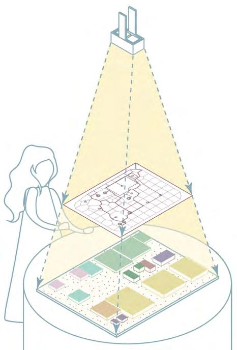
Considering the structure’s depth, access to natural light is also vital. This is simulated with Ladybug’s Incident Radiation module.
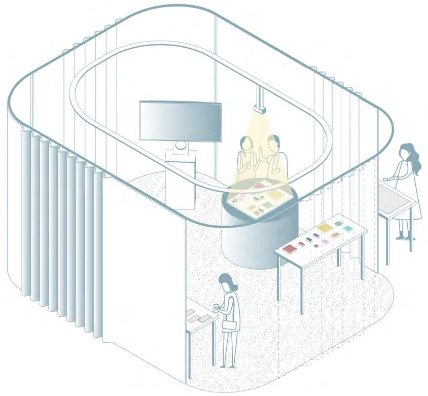
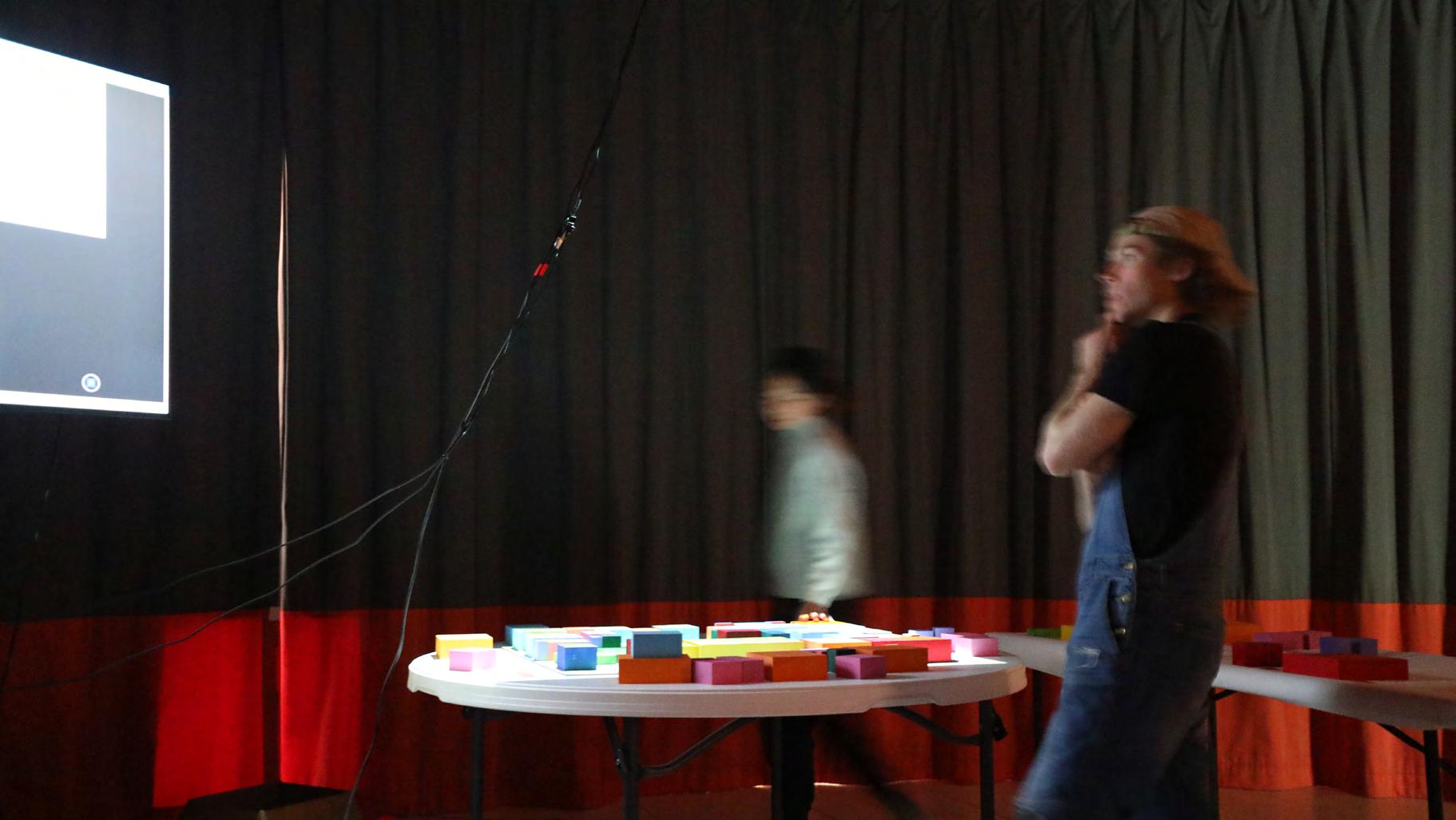
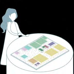
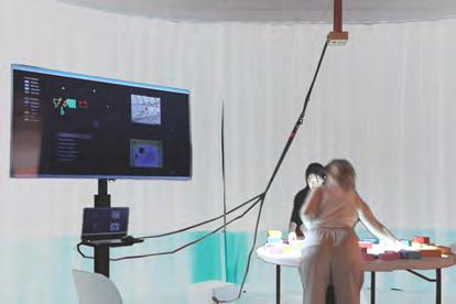
Design Workshop Setup
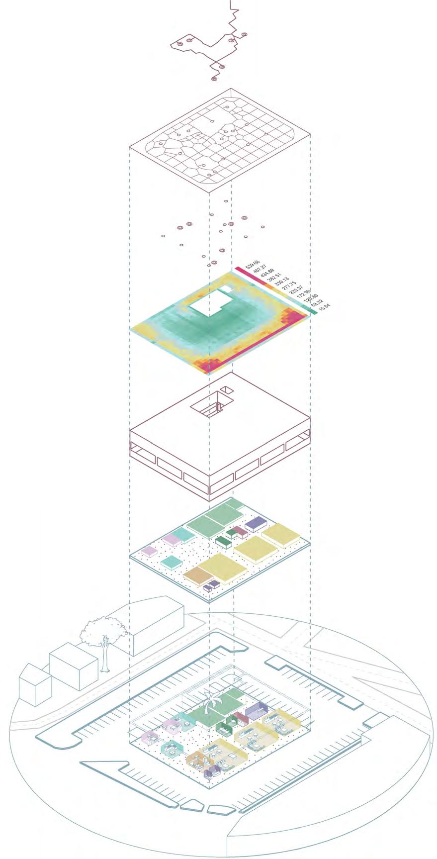
Participants place color-coded wood tiles, representing programs following the legend below, on a 1” grid pegboard, and receive feedbacks including simulated circulation and radiation.
Oh no, it takes a minute to go to the bathroom! Let me go back and fix that.

Display Screen

Did you find the feedbacks helpful in understanding space? Which ones?
Your level of experience with architecture?
Has this experience changed your idea of architecture?
Exit Survey
Circulation Paths
Video Camera Collects real-time data from the board.
Mini Projector Projects the calculated circulation paths back onto the board.
Courtyard
Key Paths*
Other Paths
Key Destinations*
Other Destinations
*Paths and destinations used for the calculation of circulation time. See next page.
Circulation paths are derived from the tile arrangement and projected onto the board. This projection complements the ‘Circulation Time’ metrics on the screen, helping users visualize how program arrangements affect residents’ movements in the building.


Exit Survey
Entry Survey
Interactive Tiles
Display Screen
1. Entry Survey
Legend
Tiles
0. Poster
Key Circulation Path
Circulation Network
Network connecting all nodes.
Programmatic Nodes
Each room (block) as a different node.
Radiance Analysis and Visualization
Digitally Reconstructed Building Envelope
Overall structure with features suchs as fixed window openings and courtyard(s) as detected by the camera.
Video Streaming of Game Board Color Detection Algorithm
Technical Realization
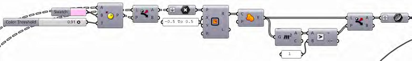
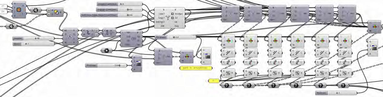
The technical components are programmed in Grasshopper, following the computational logic described above.

Computational Logic Diagram
Housing Design Workshop
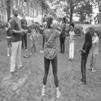
Participants exploring and shaping architectural concepts for affordable housing using the interactive tiles on April 23rd, 2023, in the Providence-Washington Building of RISD. The event gained ~40 attendance and was well-received according to participant feedback.
Interactive Design Tiles

Video Recognition and Translation to GH Geometry
Simulation of Circulation
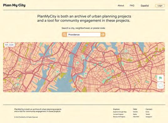
UI/UX Design Providence, RI Fall 2022
Computation, Technology and Culture Interdisciplinary Critique Concentration Degree Project | Instructor: Minkyoung Kim Brown University Breakthrough Lab Scholarly Award
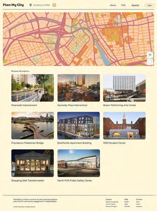
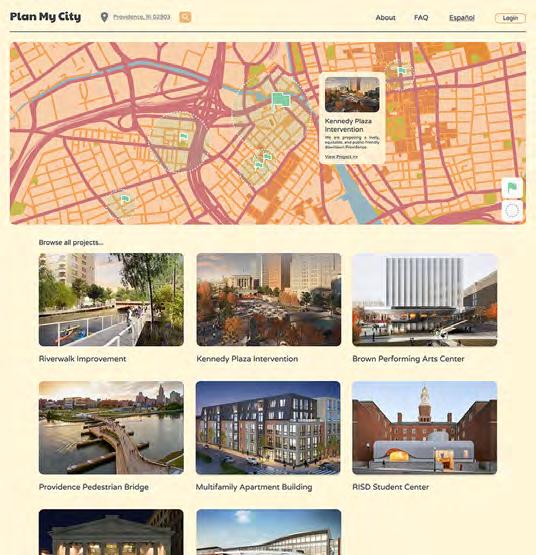
PlanMyCity is a central information hub for ongoing urban development projects, allowing community members to access design updates, provide online feedback, and be informed about upcoming meetings, surveys, and other ways to be engaged. interviewed urban planners, community organizers, and residents to gain their insights on improving this process.
First Community Meeting On-site Interviews First Survey Second Community Meeting
Second Survey Third Community Meeting Typical Community Engagement in Urban Planning
Urban Planner/Designer
Goals:
- obtain feedback from diverse communities
- engage local stakeholders
- maintain a continuous arc of engagement and transparency
Want to get as much engagement as possible, not just people in power.
Resident
- busy schedules might limit abilities to engage in in-person meetings or create gaps of engagement
- desire for information on proposed changes before giving comments
- desire to expand on comments and provide more information than just selecting a category
Frequent project handovers between contracts disrupt continuity and complicate communication.
Fragmentation of information across standalone project websites creates difficulty.
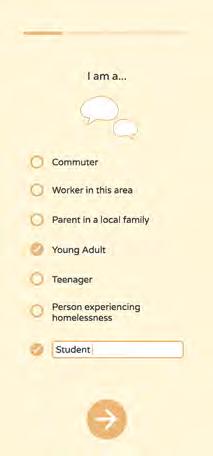
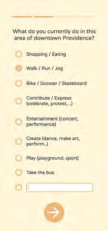
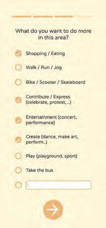
Public Survey
Digital survey that can be easily taken on phone. Distributed through QR codes on site and through nonprofits.

Community Meeting
In-person meetings between the community, the planners, and other stakeholders to expand discussion.

Digital Information Hub
A website that archives urban design projects, past participation data, and ways to be engaged.


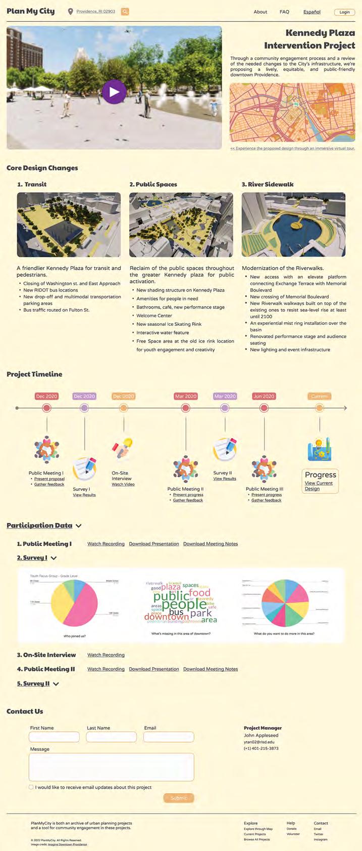
Proposed Digital Tools
07 | HOMEOWNERSHIP HACK
Financial Hack for Housing Affordability | Fall 2023
Overall Winner, Ivory Innovations Hack-A-House
In collaboration with Sharon Wang, July Qi
In charge of ADU design and policy research.
Problem:
Mortgage Affordability at Historical Lows
Housing Affordability Index
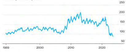
Source: The State of the Nation’s Housing 2023 - Joint
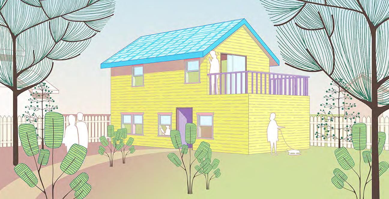
A creative and feasible solution to the housing affordability crisis: Purchase Assist Bridge Loan combined with ADU development. We seek to lend primary mortgage to home buyers with stable income and good credit scores, whose income requirement is not (yet) met by conventional loan standards. Then, we help fund and build a prefab ADU in their backyard and help rent it out. The rental income qualifies homeowner for conventional loan terms, and they refinances us out.
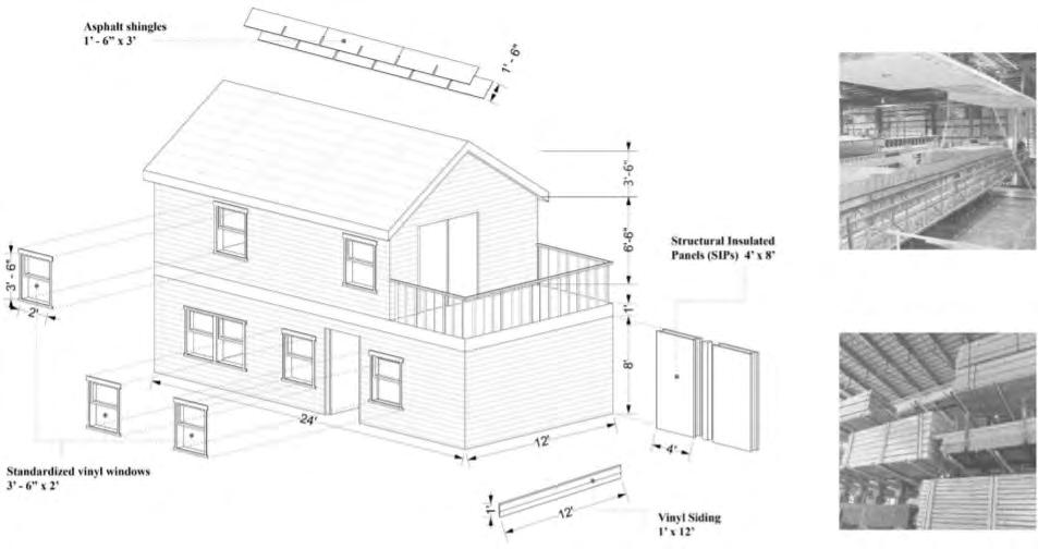
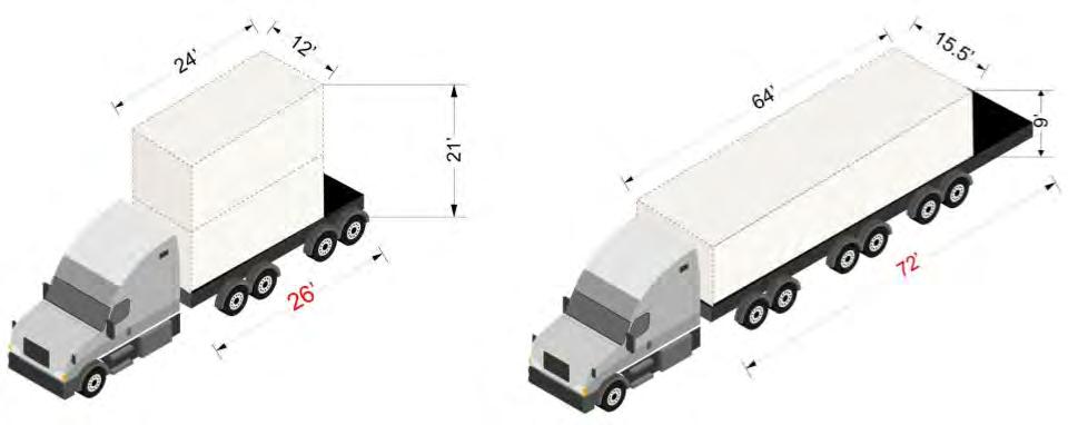
Our Solution: Purchase Assist Bridge Loan combined with prefab ADU development. Step 1 Lend Step 2: Build Step 3: Lease Step 4: Refinance


Lend primary mortgage to home buyers: (A) “Purchase Assist Mortgage” and (B) ADU Construction Loan Obtain ADU Permit (1-3 months). Install a prefab ADU on lot. Lease ADU to tenant. ADUs are usually easily rented out due to price point and livability,

With a lease agreement in place, after 12 months of rental payments, the homeowner qualifies for conventional loan and repays us back in full.
Standardized Components and Materials
Insulated Panels (SIPs) 4’*8’

1. This works because the spread between Yield on Cost and cap rate of single family homes is large due to prefab cost savings.
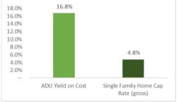
Spread between Yield-on-Cost and Cap Rate

08 | WEST END VISION
Urban Analysis + Design | Providence, RI
Urban Ecologies Studio | Fall 2021
Instructor: Manuel Cordero Alvarado
We conducted analysis of the Providence West End area focusing on the tension between existing community context and the stress caused by ongoing development, and designed for community solidarity in response.

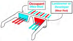
Envisioning Space Through Opposite Lenses In collab. with Ella Matsudaira,
Megan Holzrichter, SJ Kim
This analysis explores the tension between those that view the space as an opportunity for profit and those who view it as a space to inhabit. This tension between the landowner and the occupant can be seen in the chaos and disorder of the opposing views of each drawing. The colored glasses are tools to help filter out one of these contrasting views at a time to focus on how one group may see the space over the other.
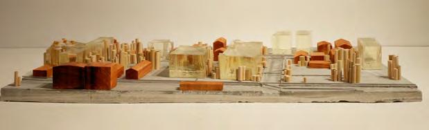
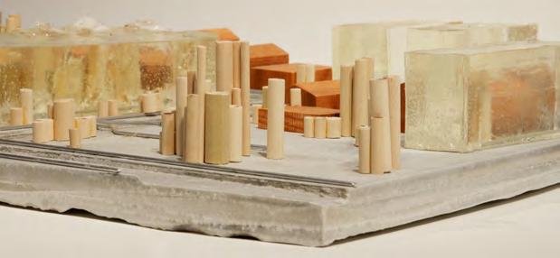
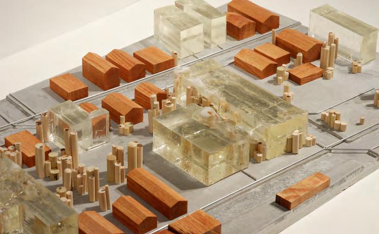
Genius Loci
In collaboration with Yingkai Xiong
The model criticizes the conception of the site as a cleared void. Embodied by real estate developers, this view devours the existing natural and social context and construction of the site. The casted resin visualizes the legal maximum developable space (profit) on vacant lots within the site.
Urban Food Cycle
In collaboration with Crescent Feng
We designed an affordable, mixed-use housing project based upon the adaptive reuse of an abandoned factory, creating a full food-waste cycle for the public to experience. The sequential experience mimics the process of food being grown, processed, cooked, eaten, and composted. Residents make a living through operating the community gardens and food market, components of the sequential experience. The project challenges the traditional conception of cooking as a behind-the-scene action.
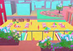

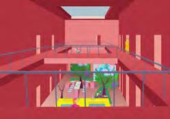
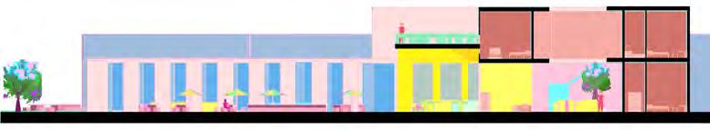


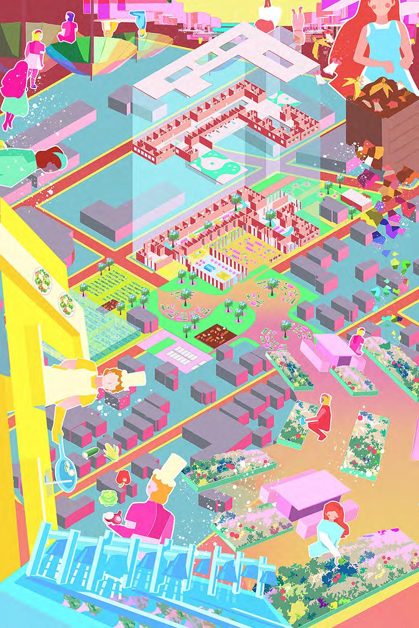
Section Across the Food Cycle
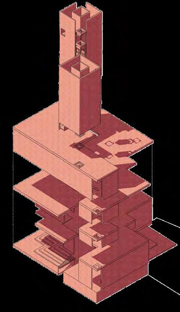
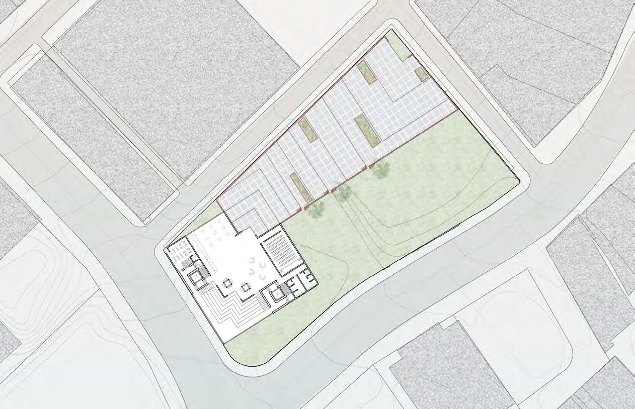
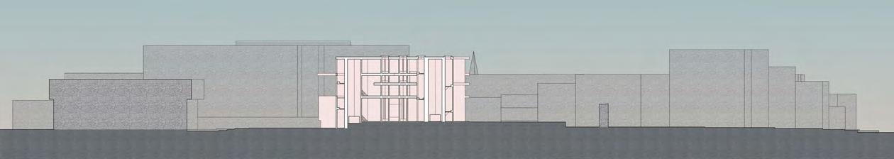
09 | IMPLIED CORNERS: A PUBLIC LIBRARY
Architectural Design
Architectural Design Studio
Remote | Spring 2021
Instructor: Silvia Acosta
In challenging the traditional concept of the corner as the most stable element in architecture, not meant for program usage, this project explores how corners can be both dissolved and inhabited. Dissolved Corners suggest movement through implied intersections while creating experiences of expansion and contraction. Inhabited Corners fold in and create destinations to be occupied and programmed.


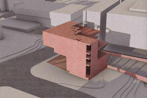

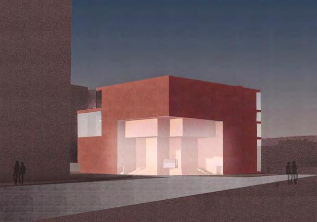
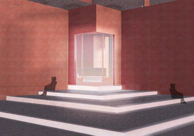
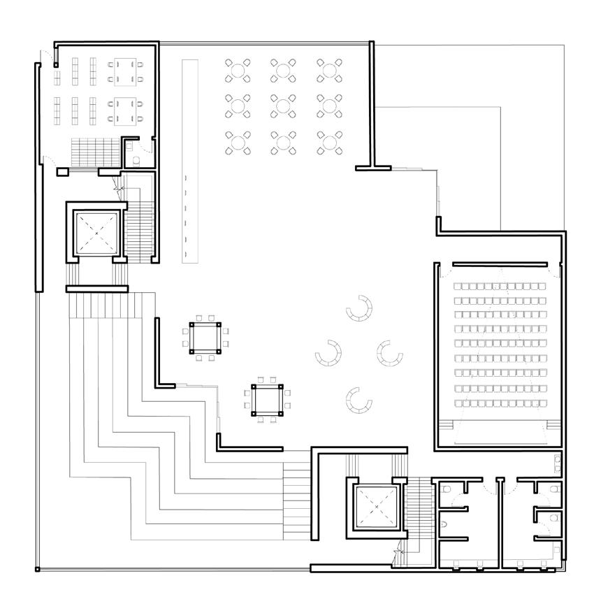
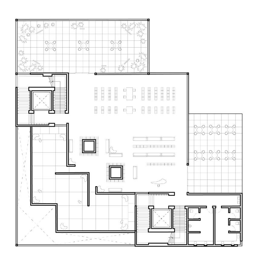
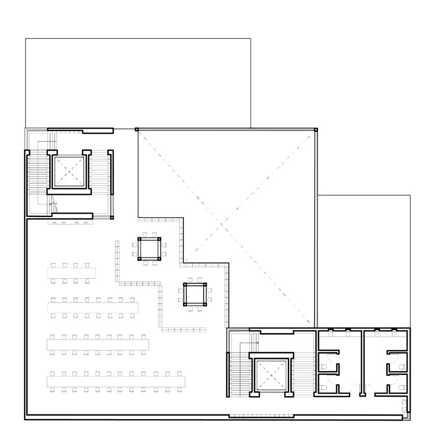
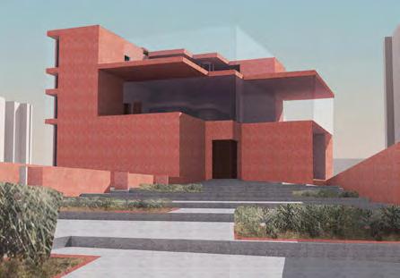
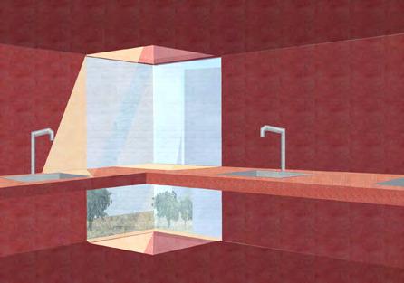
Implied Corners at Different Scales
From an inviting entry point to glass corners introducing light and view into the building, Implied Corners create places of stasis at different scales.
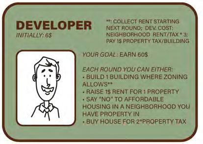
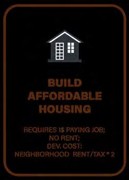
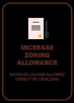
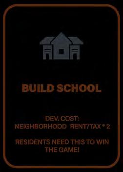
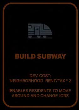
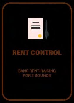
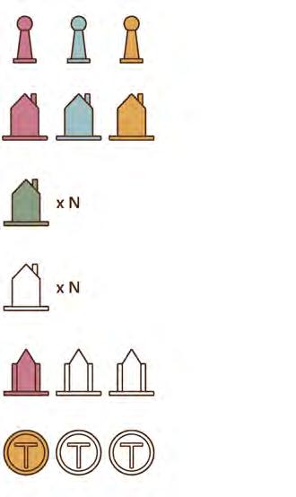
10 | CITYSCAPE: A HOUSING DEVELOPMENT BOARD GAME
Board Game Design
Thesis Seminar: Creative Process
Providence, RI | Fall 2023
Instructor: Lafayette Cruise
This game explores the use of analog simulation in encouraging conversations and thinking around development and densification, highlighting challenges and power imbalances that shaped the housing landscape today. The game serves as an educational tool and a platform for argumentation, allowing players to envision and debate potential solutions to housing inequality.
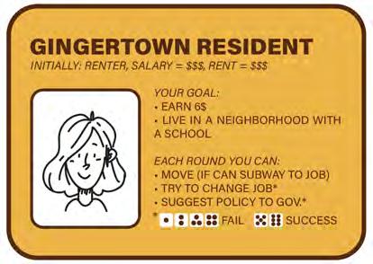
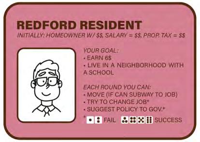
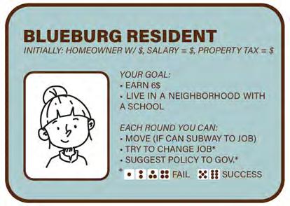
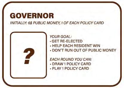


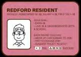
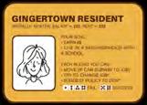

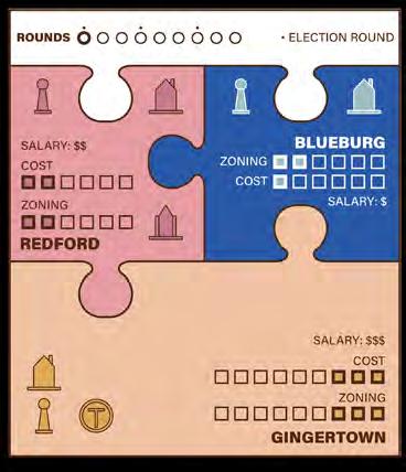


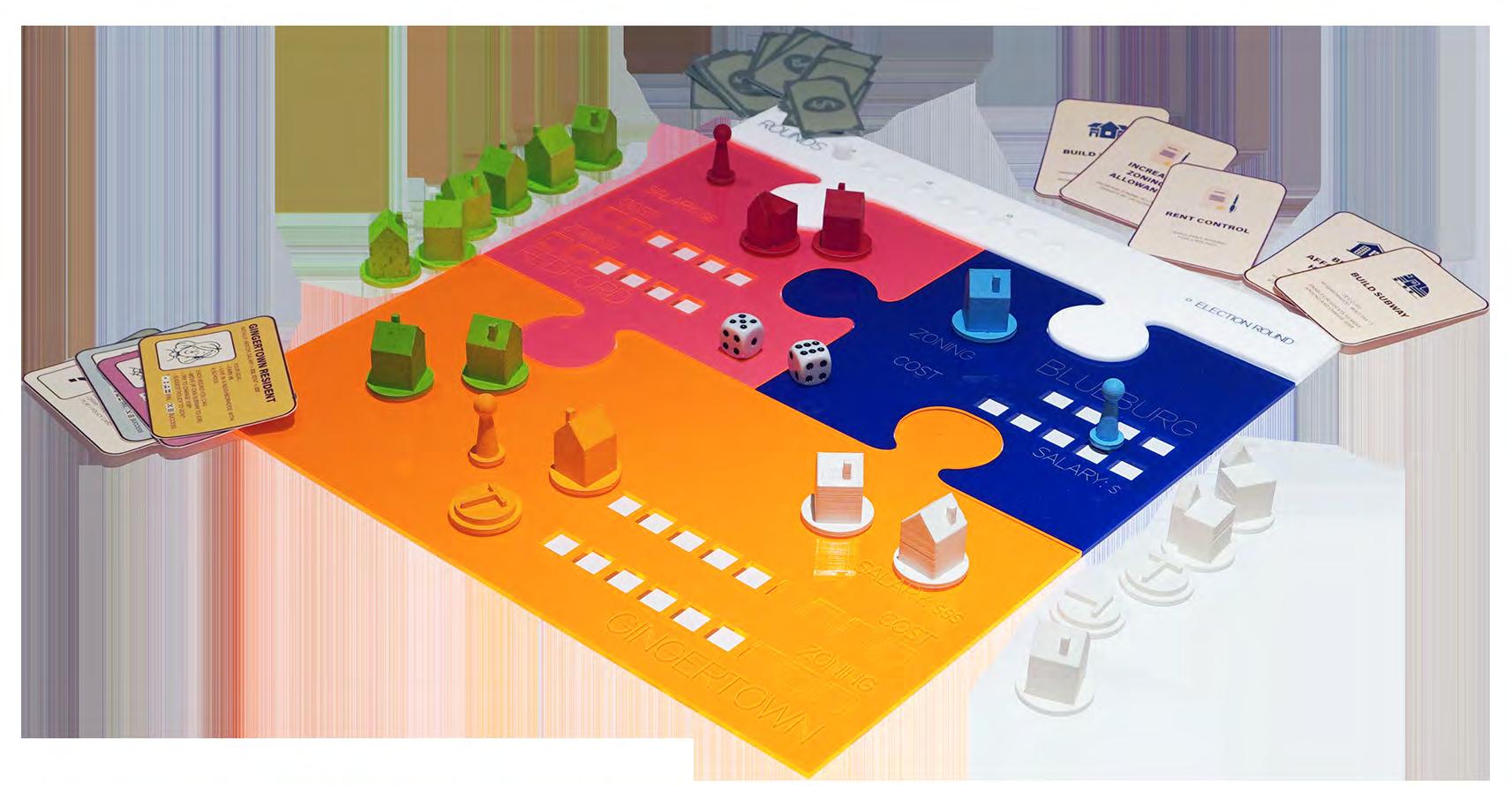
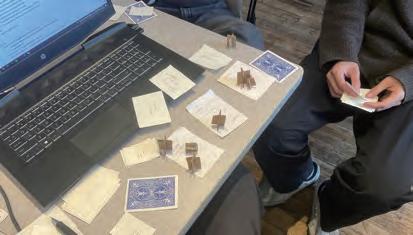
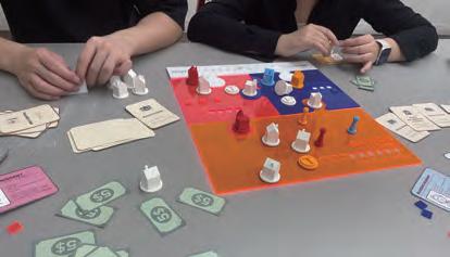
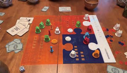
“Renter in Downtown“ “Homeowner in Rich Suburb“ “Homeowner in Lower-Income Suburb“