YIKAI QIAO
Architectural Designer Yale M.Arch. ‘23
EDUCATION
Graduated 05/2023 Yale University, M.Arch. – New Haven w/ Gertrude Vanderbilt Whitney Scholarship
Graduated 05/2019 Soochow University, B.E. – Suzhou, China w/ Dean’s Nomination
PROFESSIONAL EXPERIENCE
08/2023 – Present Design Associate, Richard Turlington Architects – Full Time, New Haven, US
• Spearheaded the BIM modeling and the production of construction document set for a major residential project in Seaside, FL
• Completed the schematic design drawings for 3 adaptive reuse projects.
• Coordinated with various consultants on the ongoing projects through weekly meetings and site visits.
04/2022 – 08/2022 Level Designer, Tencent TiMi Studio Group – Internship, Shenzhen
• Participated in the prototyping for an in-game map for Delta-Force Mobile a cross-platform video game, conducting research to inform the creation of an immersive game environment.
• Created a game level for test, using Unreal Engine.
11/2021 – 04/2022 Architectural Designer, Neri & Hu Design and Research Office – Intern, Shanghai
• Spearheaded the design process for a boutique store of the fashion brand Comme Moi, from schematic design to the production of construction drawings.
• Actively involved in the construction administration of one hotel project.
07/2021 – 09/2021 User Experience Designer, DiDi Global Inc. – Internship, Beijing
• Participated in the development of an in-app feature for the DiDi mobile app, which is a leading taxi app that serves 500 million users.
• Gained insights on prioritizing user experience and accessibility, which inspired a user-centric approach to my architectural design work.
RECOGNITIONS
05/2023
Design Project Nominated, Yale Journal Retrospecta 46, Published 08/2023
2020 - 2022 Media Coverage
• TV Show Participant, the Challenge TV Show The Best Brain, Jiangsu, China
• TV Show Participant, My Artlist, CCTV, Beijing, China
04/2016 – 06/2016
SKILLS
Nominated Director, Self-made Film Kowloon Skyscraper – Soochow University
Architectural Revit, Rhino, AutoCAD, Adobe Suite, SketchUp, Unreal, Blender, Enscape, Keyshot Research GIS Analysis, User Experience Design, Survey, Data Visualization, Ergonomics
Digital Fabrication CNC Milling, Robotic Scripting, Processing, Arduino, C# Coding Basics
Built Projects
Studio Projects
YIKAI QIAO (475) 227 – 7867 yikai.qiao@yale.edu
2
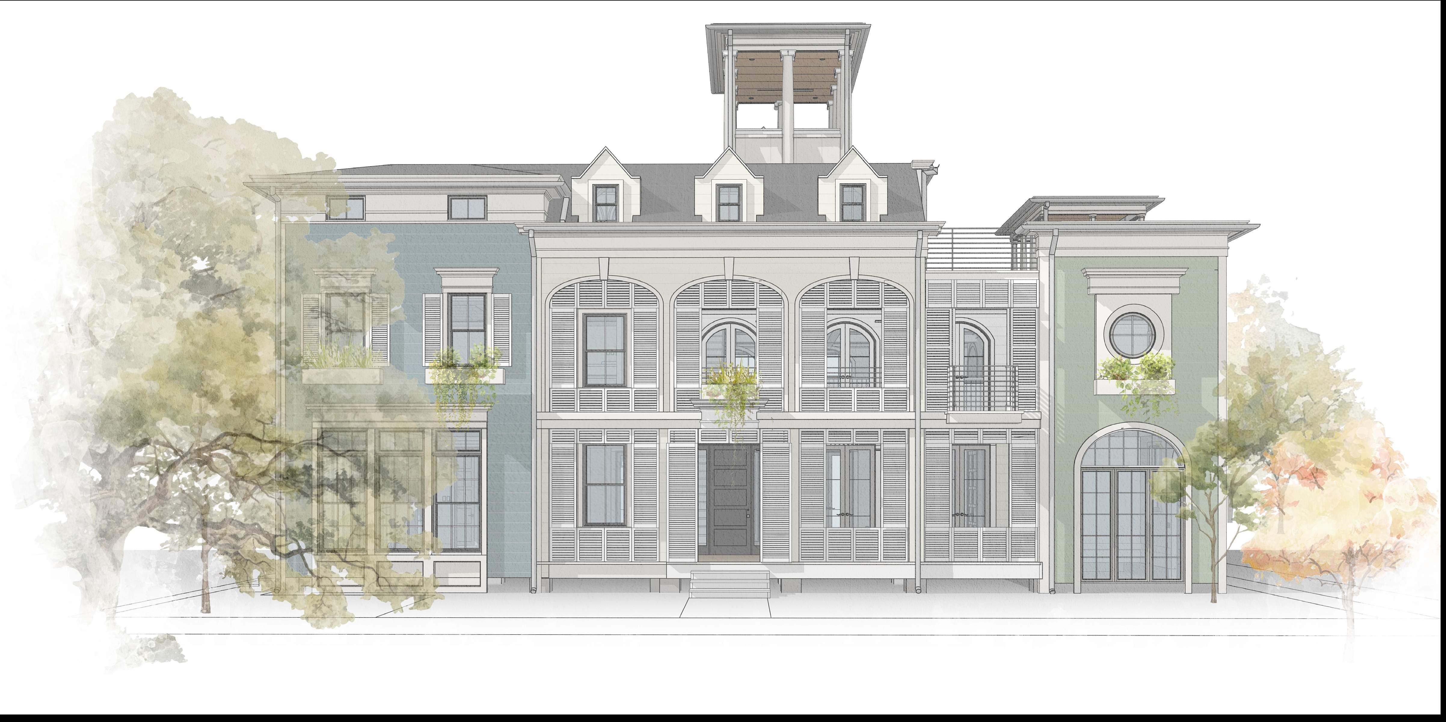
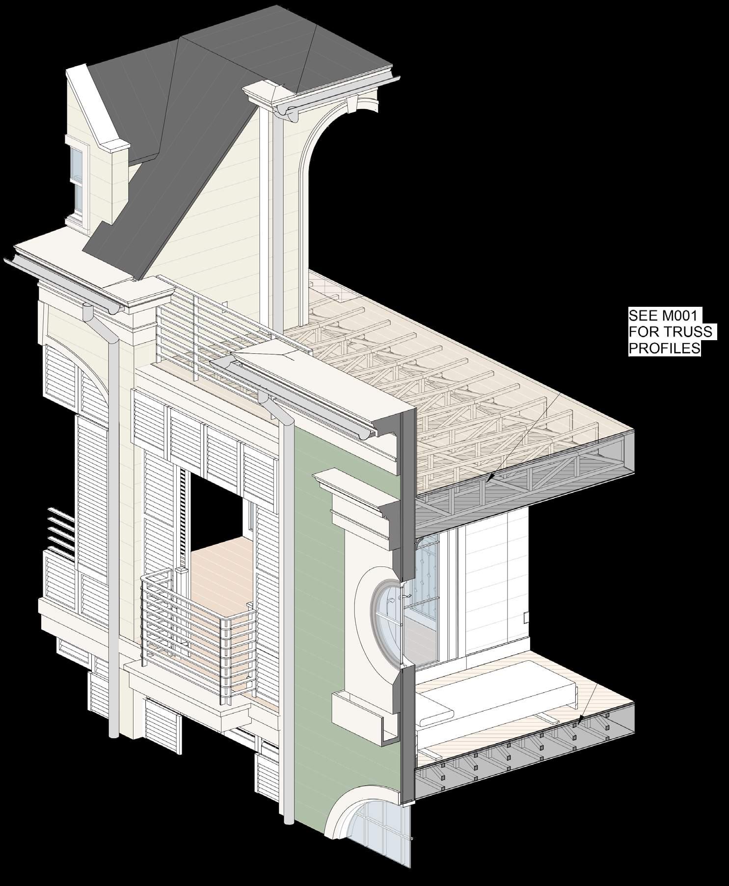
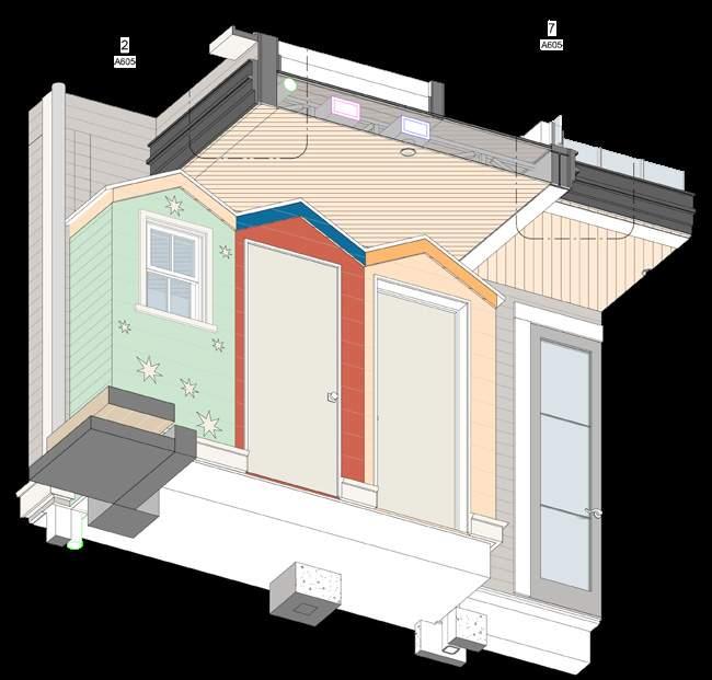
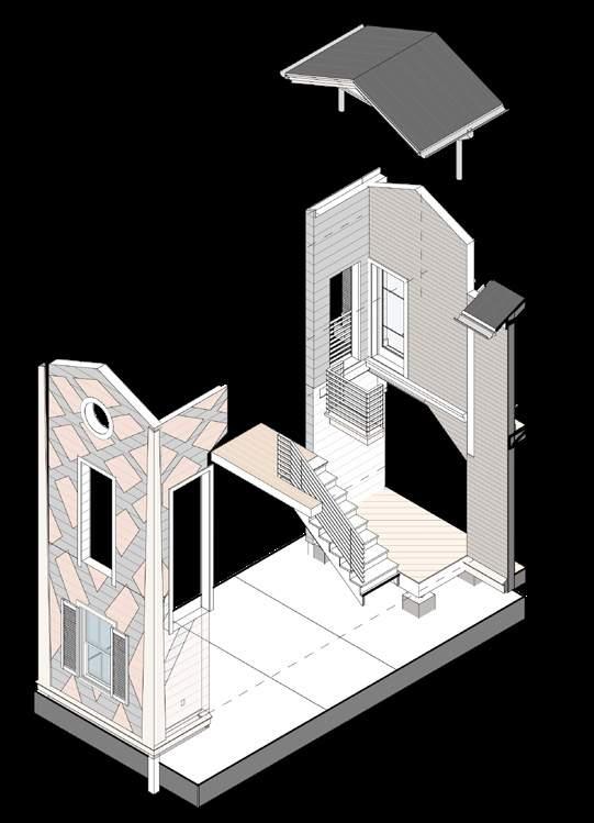
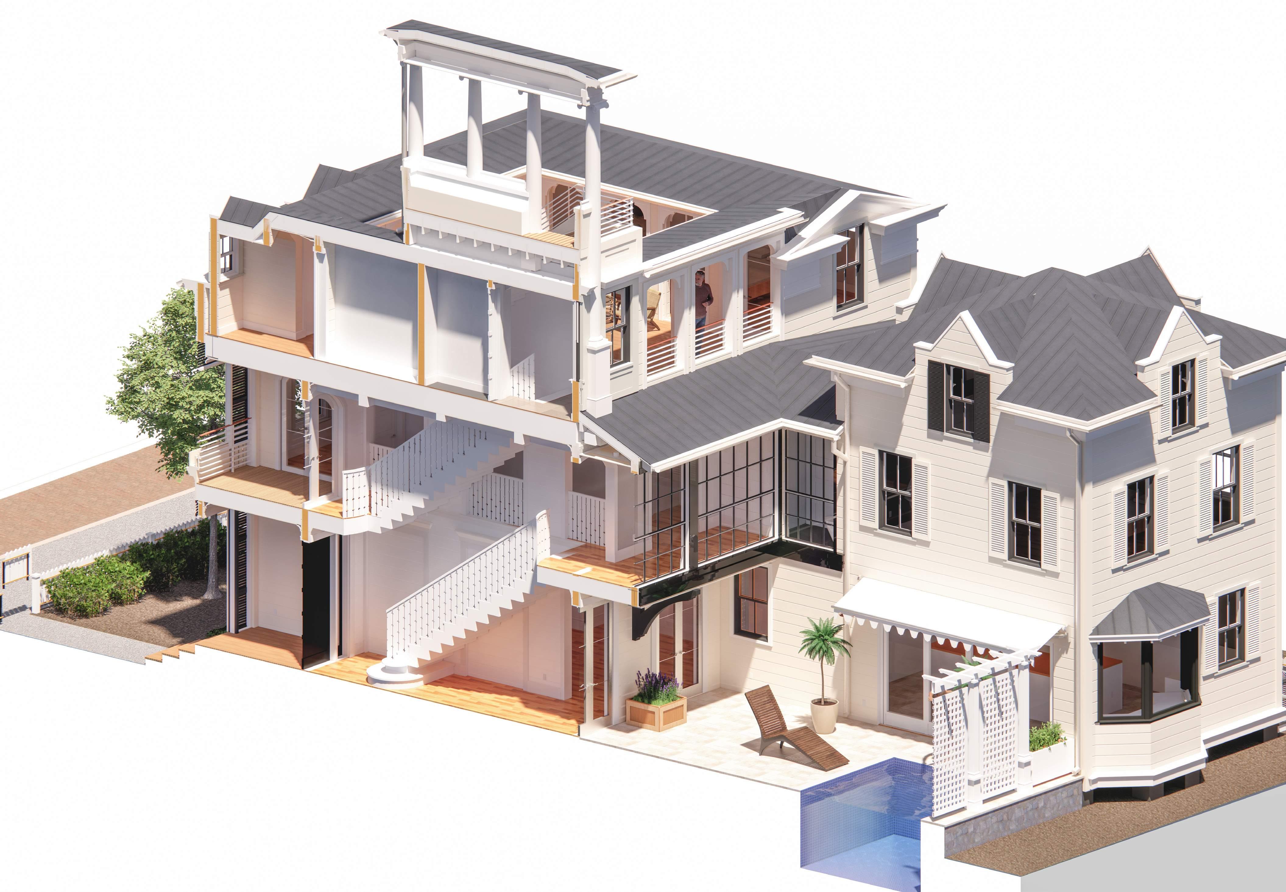
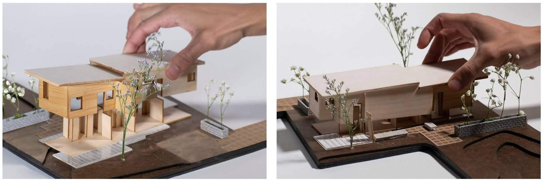
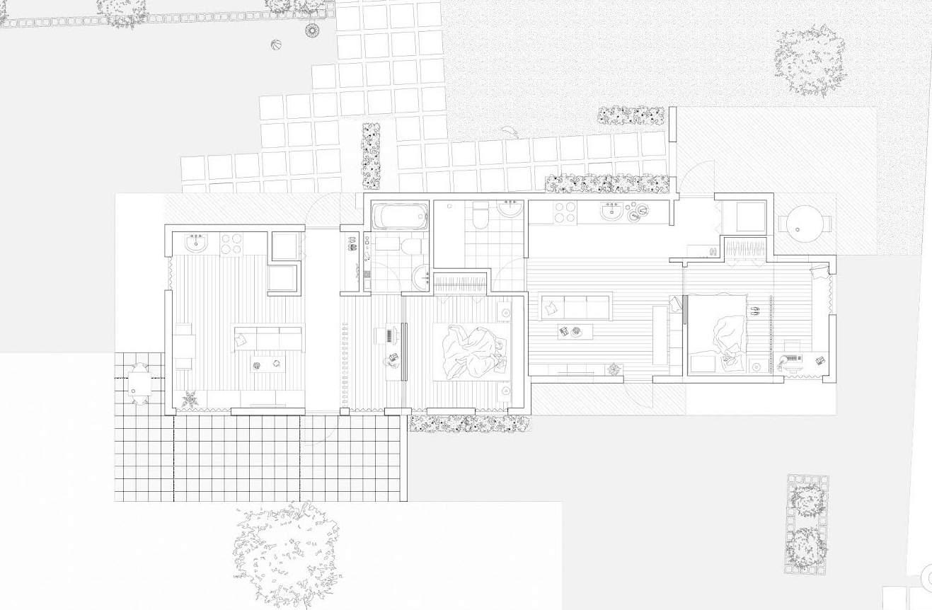
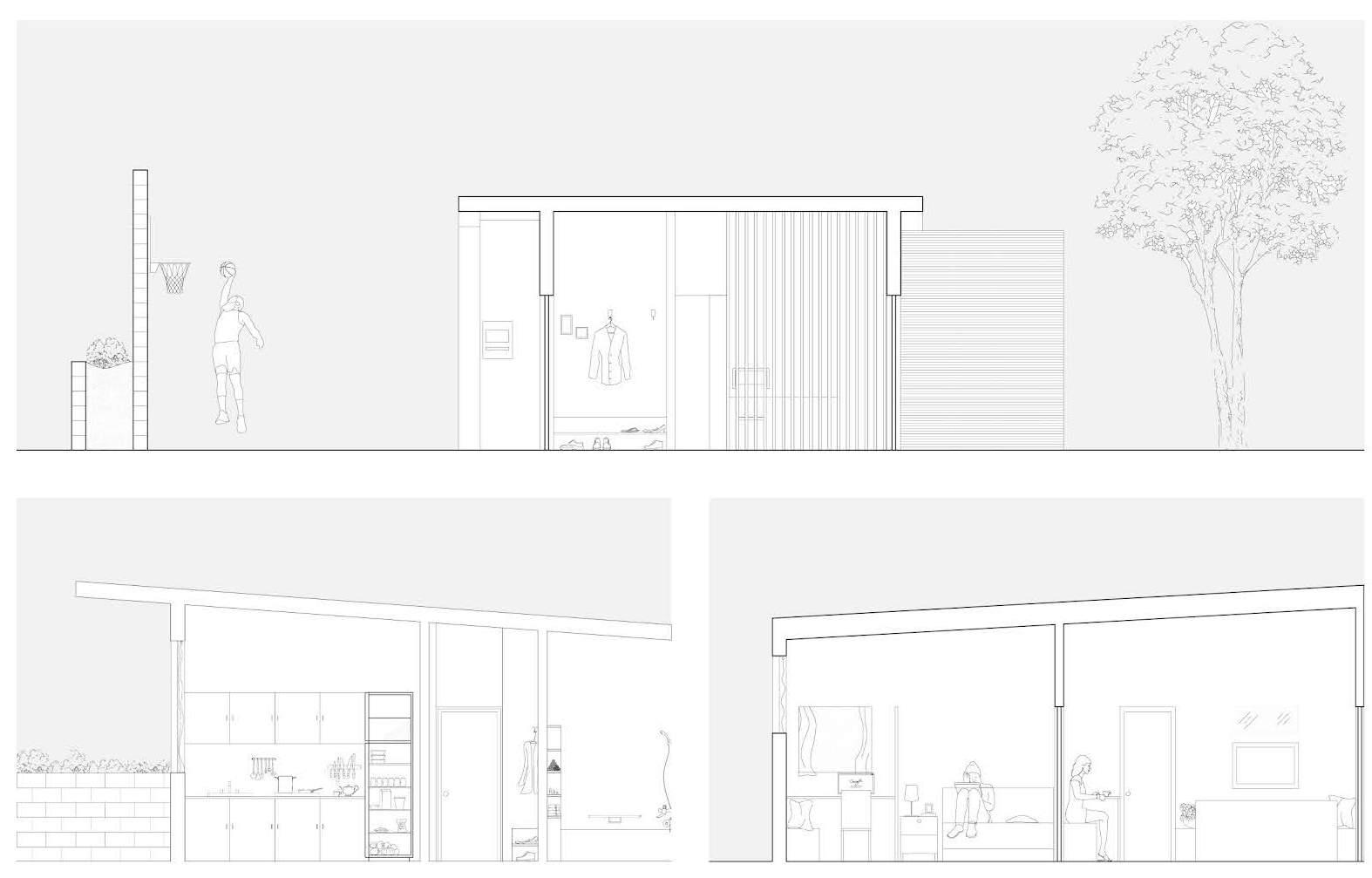
WEEKS RESIDENCE
Construction Document at Richard Turlington Architects
Instructor: Richard Turlington
Collaborator: Douglas Brown, Marta Pelàez
My Role: BIM Modeling of the building Helped with the detailing and coordination.
Location: Seaside, FL
Time: 2023
Video Link: https://youtu.be/dHoETF0Ay4g?si=TBqHIiE1gqDwR_1J
Rendering based on the Revit Model 3
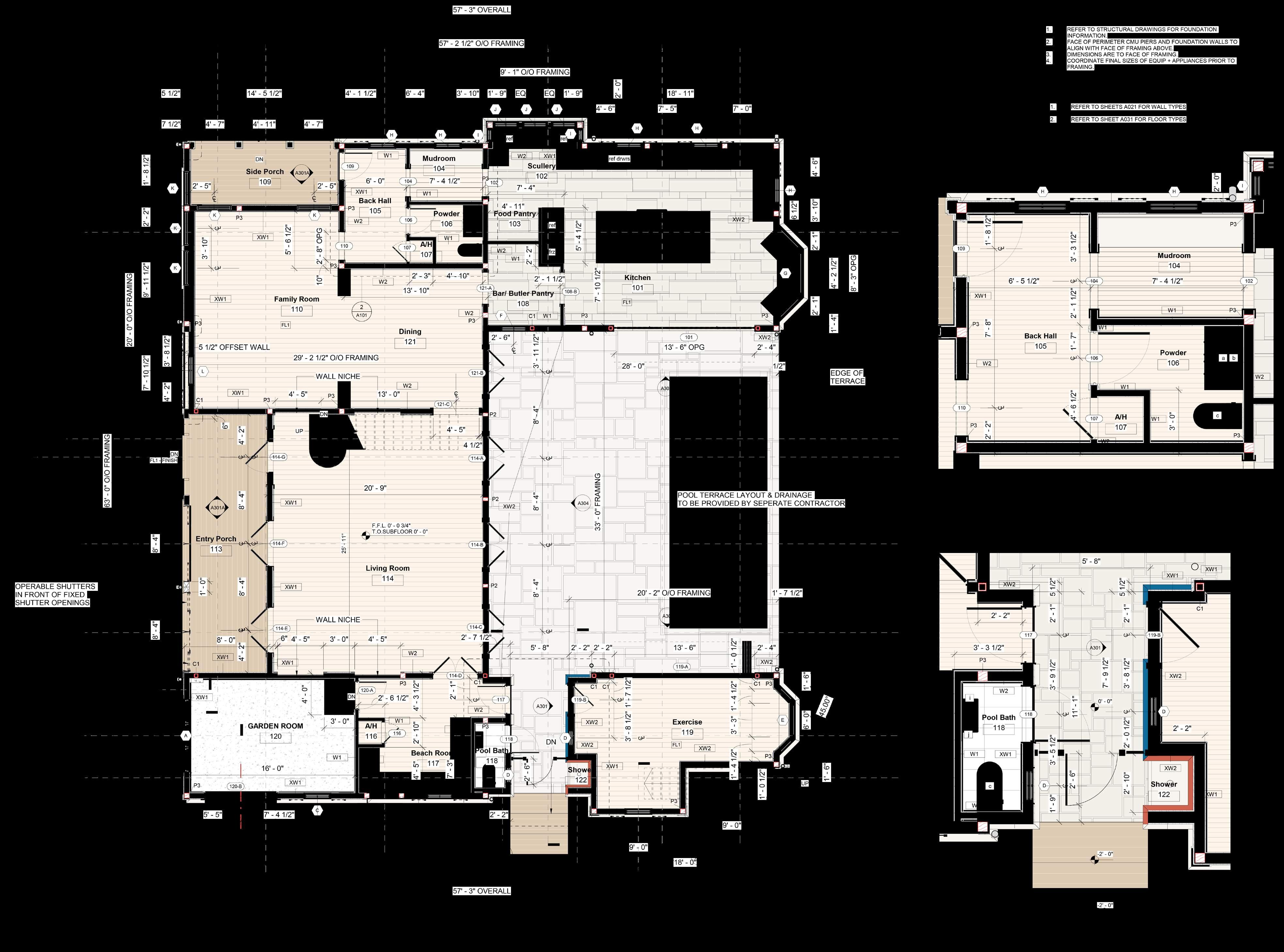
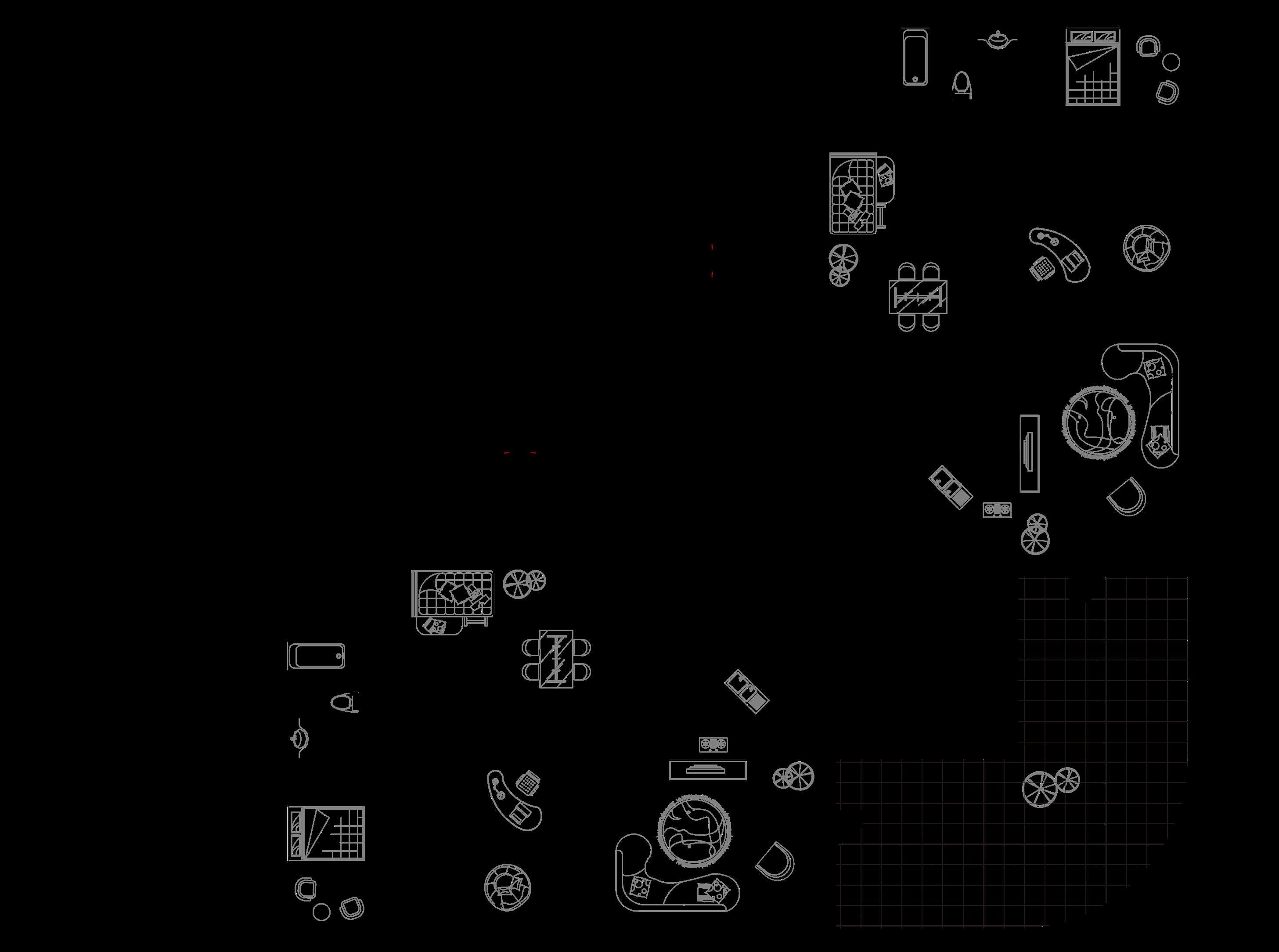
Floor Plan Sample Created and Annotated in Revit WEEKS RESIDENCE 4
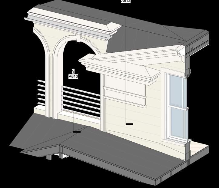
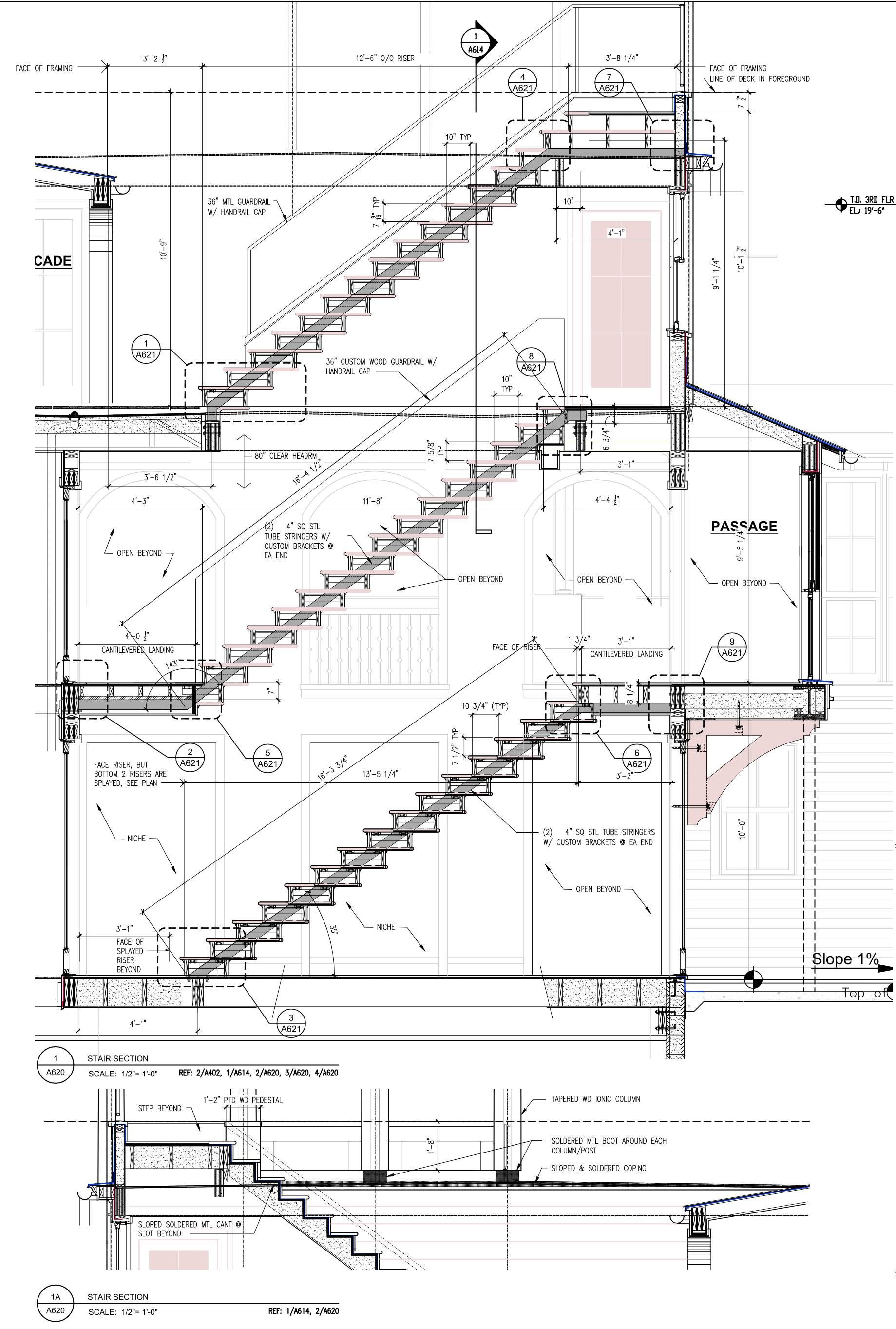
Drawing Samples WEEKS RESIDENCE 5
WEEKS RESIDENCE 3D Section Rendering 6
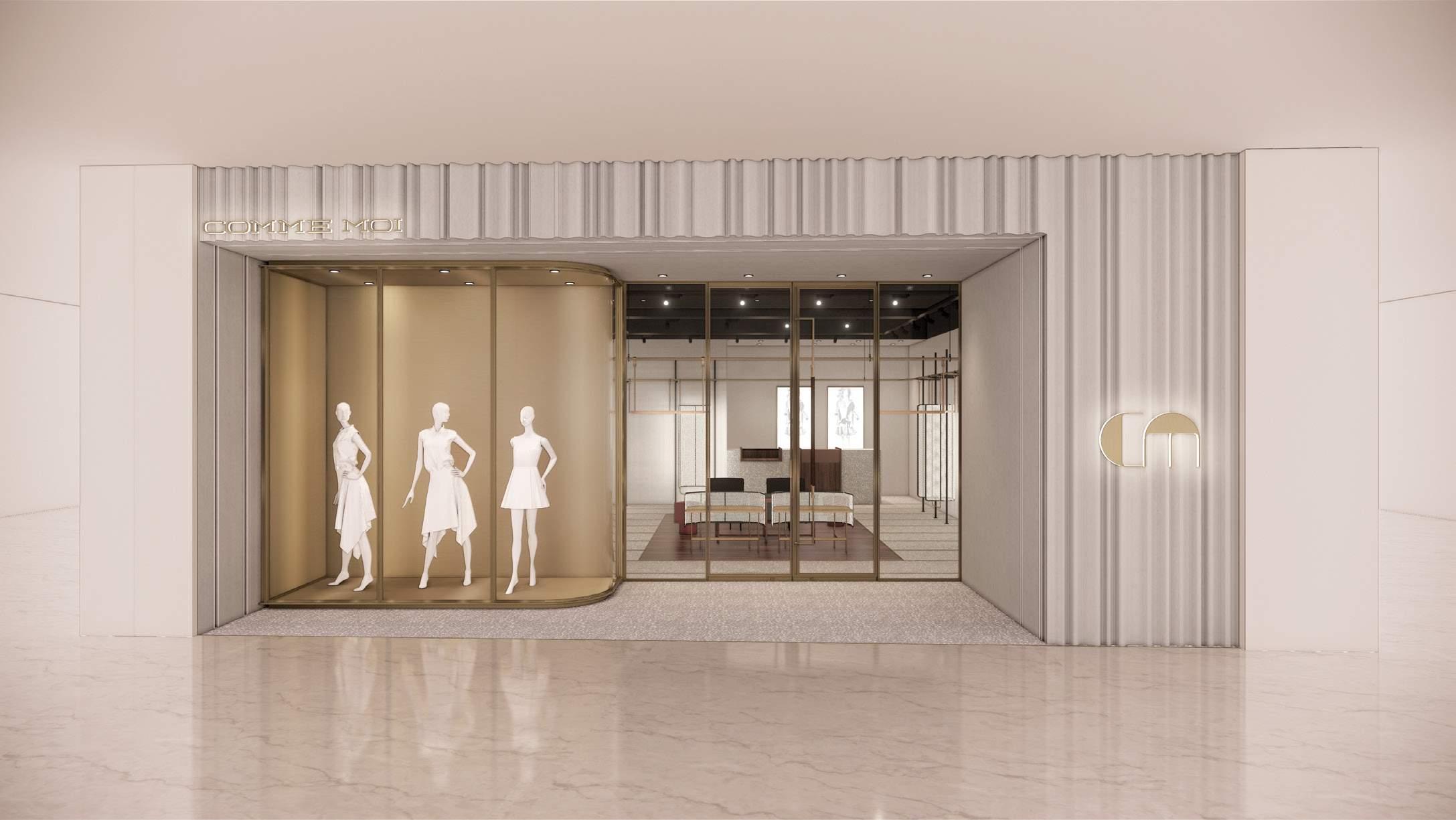
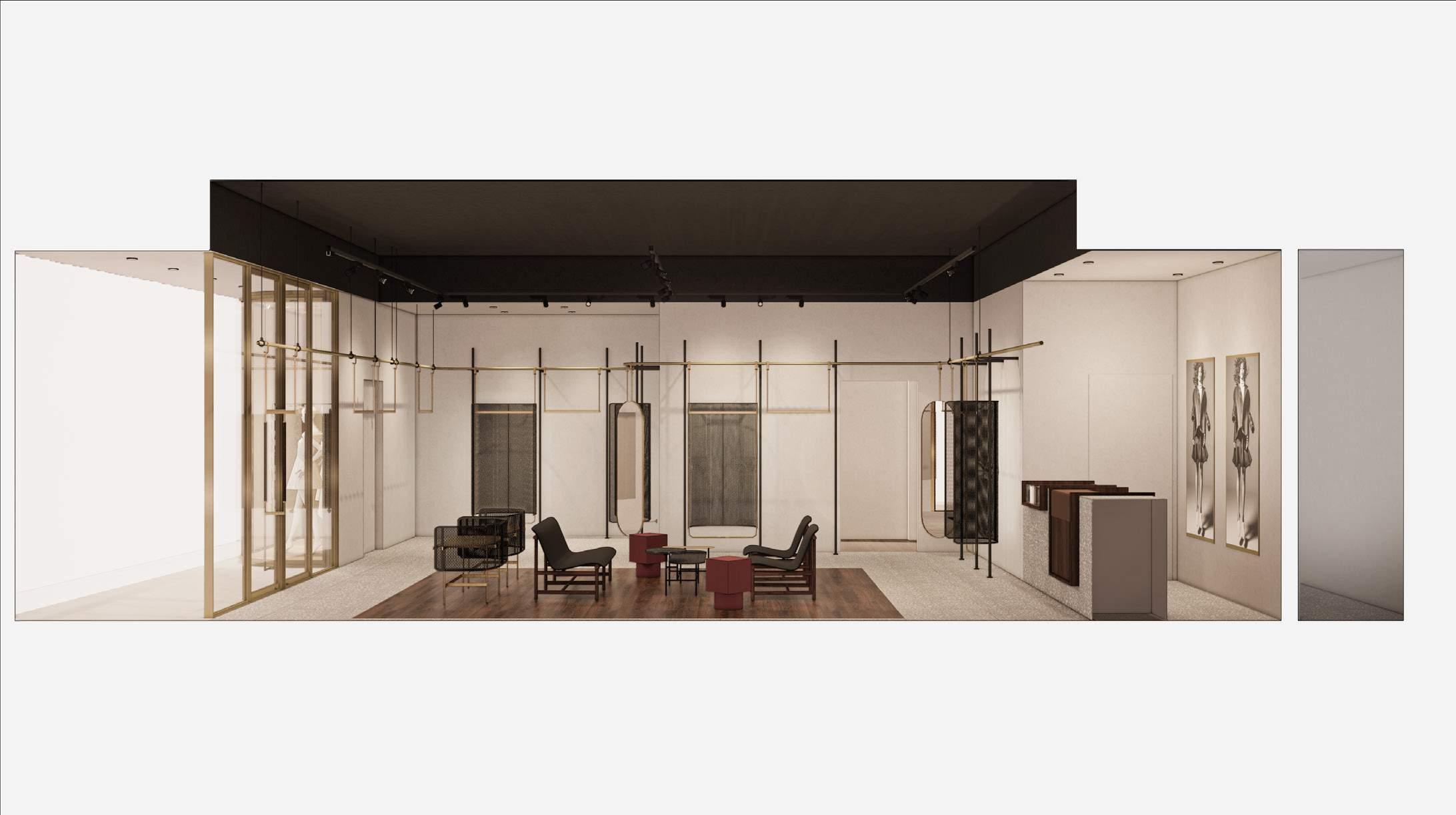
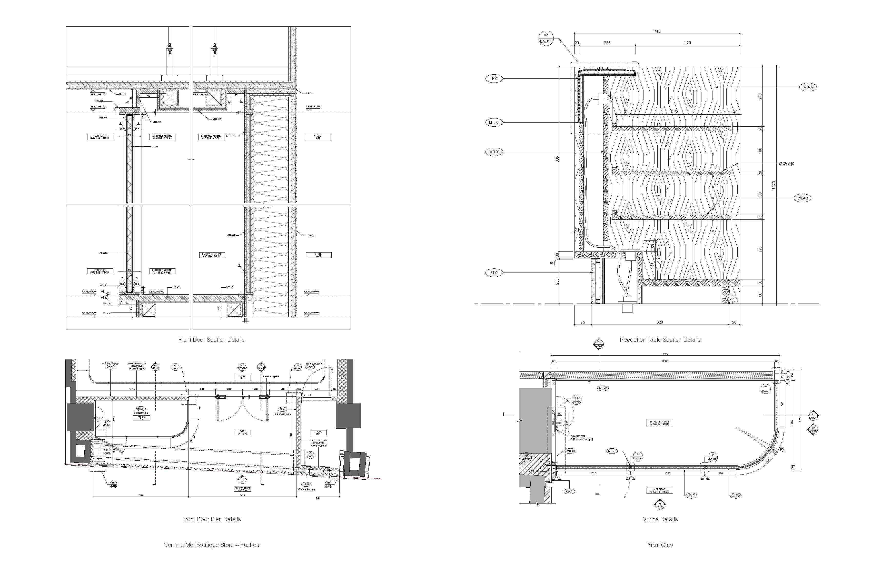
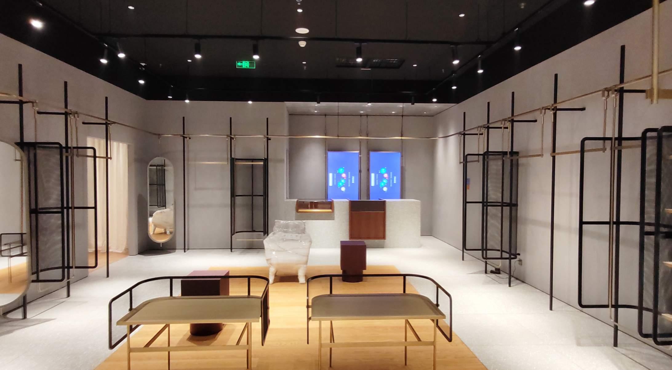
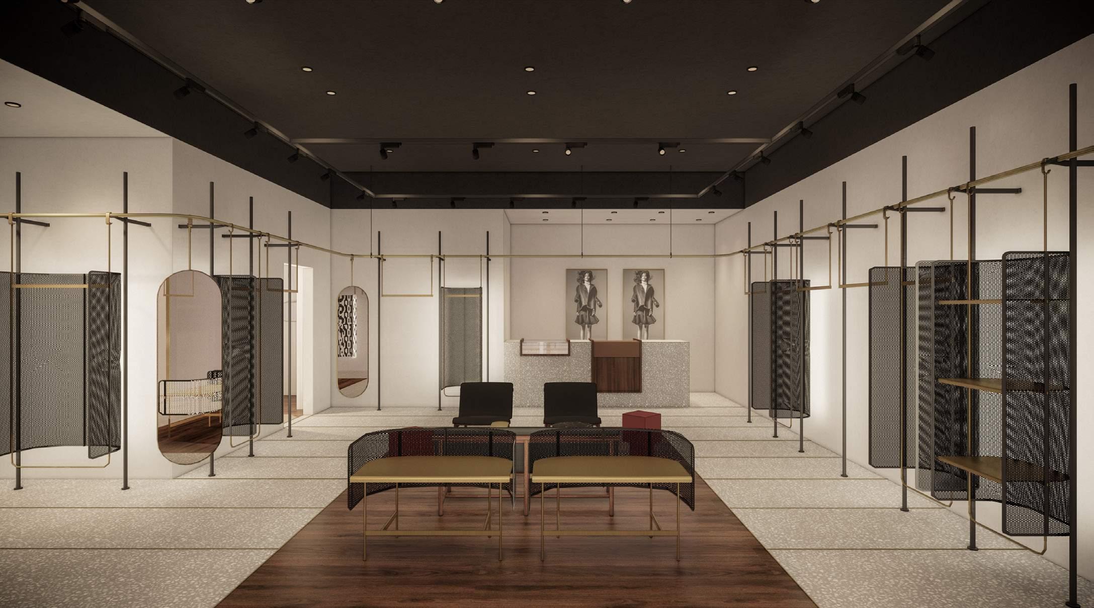
COMME MOI BOUTIQUE STORE -- FUZHOU
Interior Design Project, Neri & Hu
Client: Comme Moi
Instructor: Jacqueline Min, Rovi Qu
Collaborator: Jes Chen
Location: Fuzhou, China
Built Project, completed in 2022
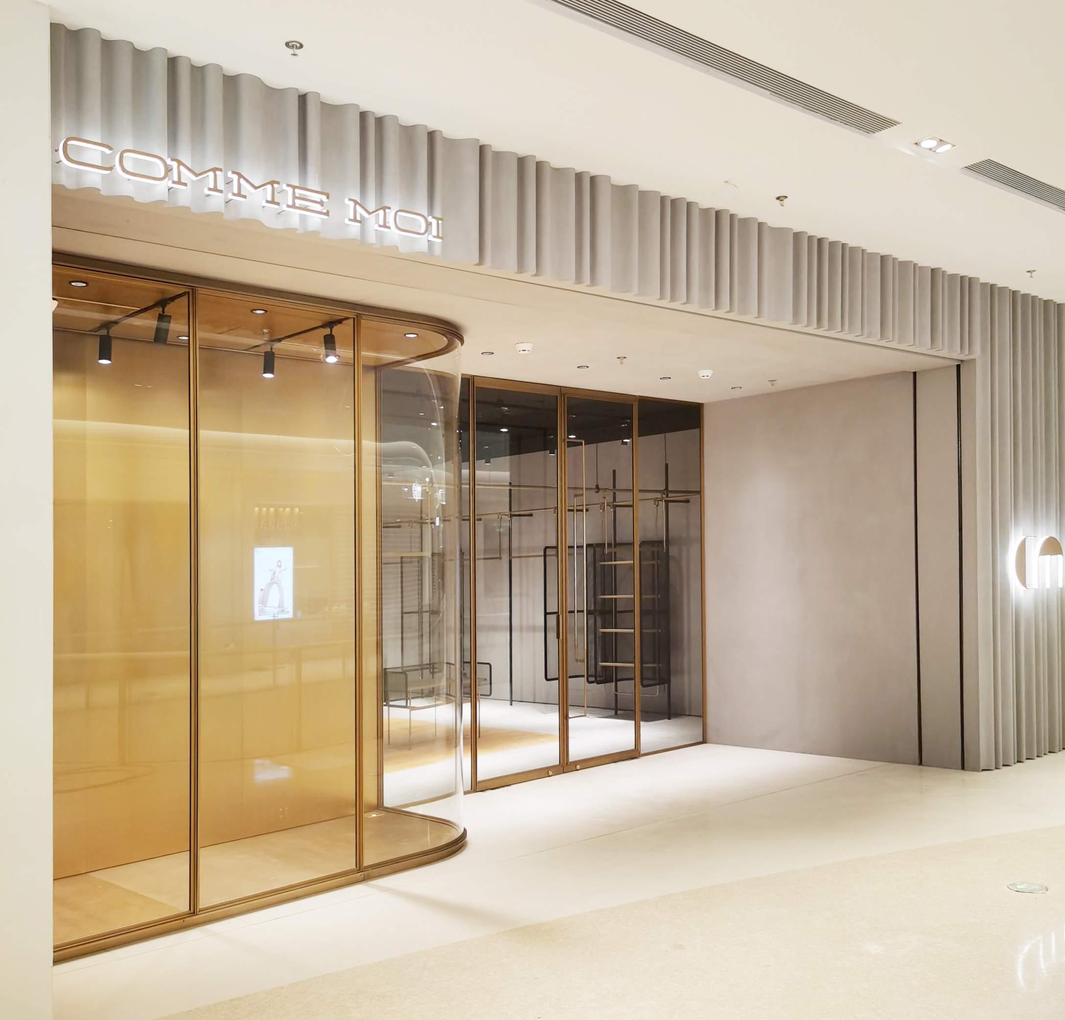
Yikai Qiao
Photo of the storefront 06/2022
Comme Moi Boutique Store -- Fuzhou
7
Render of the storefront & Interior Section 12/2021
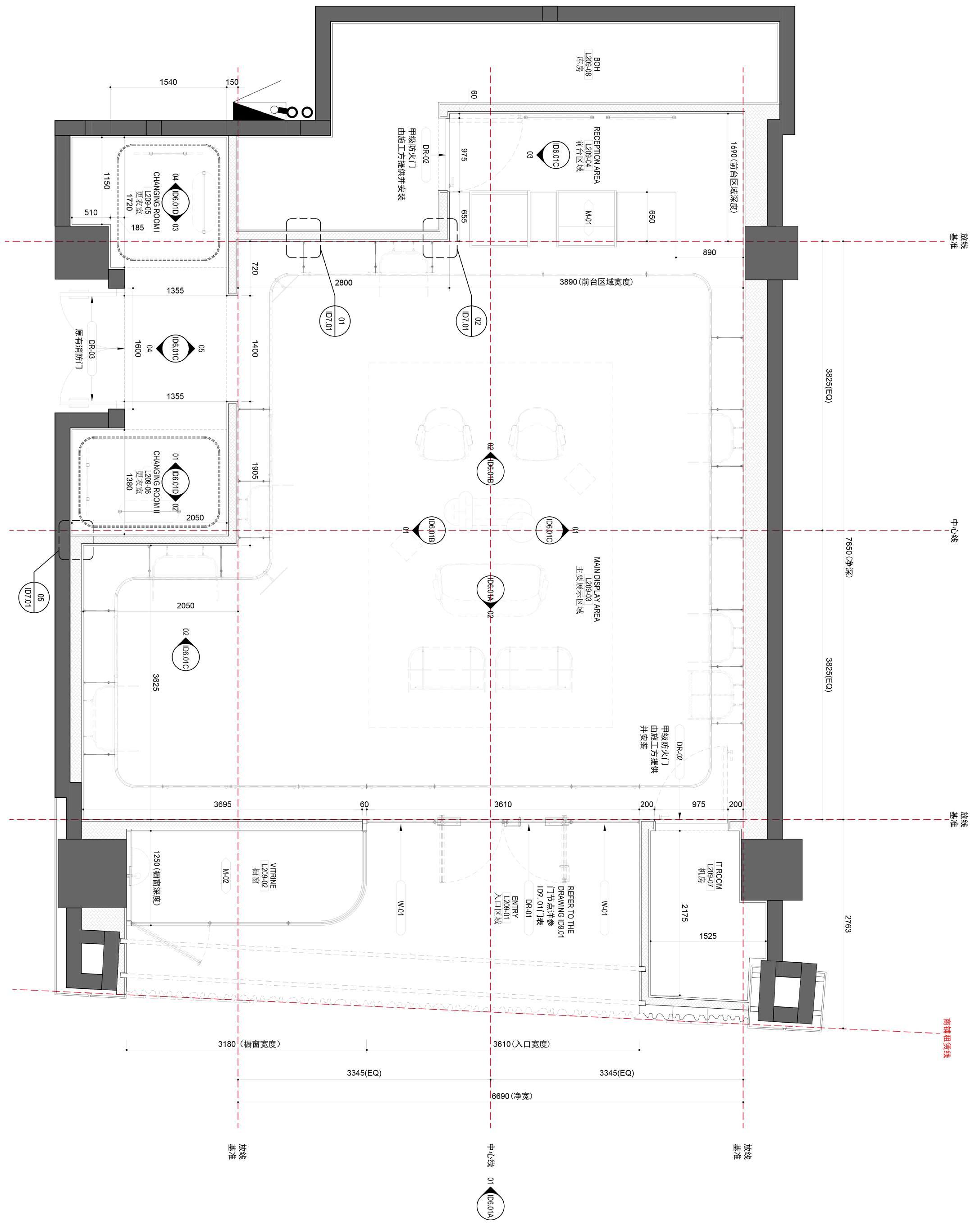
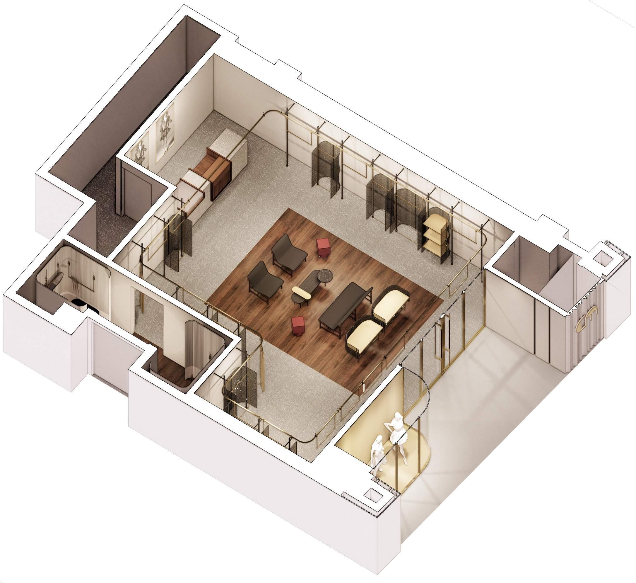
Yikai Qiao Store Plan Comme Moi Boutique Store -- Fuzhou Axon View 8
9
Yikai Qiao
Photo of the Finished Interior 06/2022
Moi Boutique Store -- Fuzhou
Comme
Rendering of the Interior
10
Enscape + SketchUp 12/2021
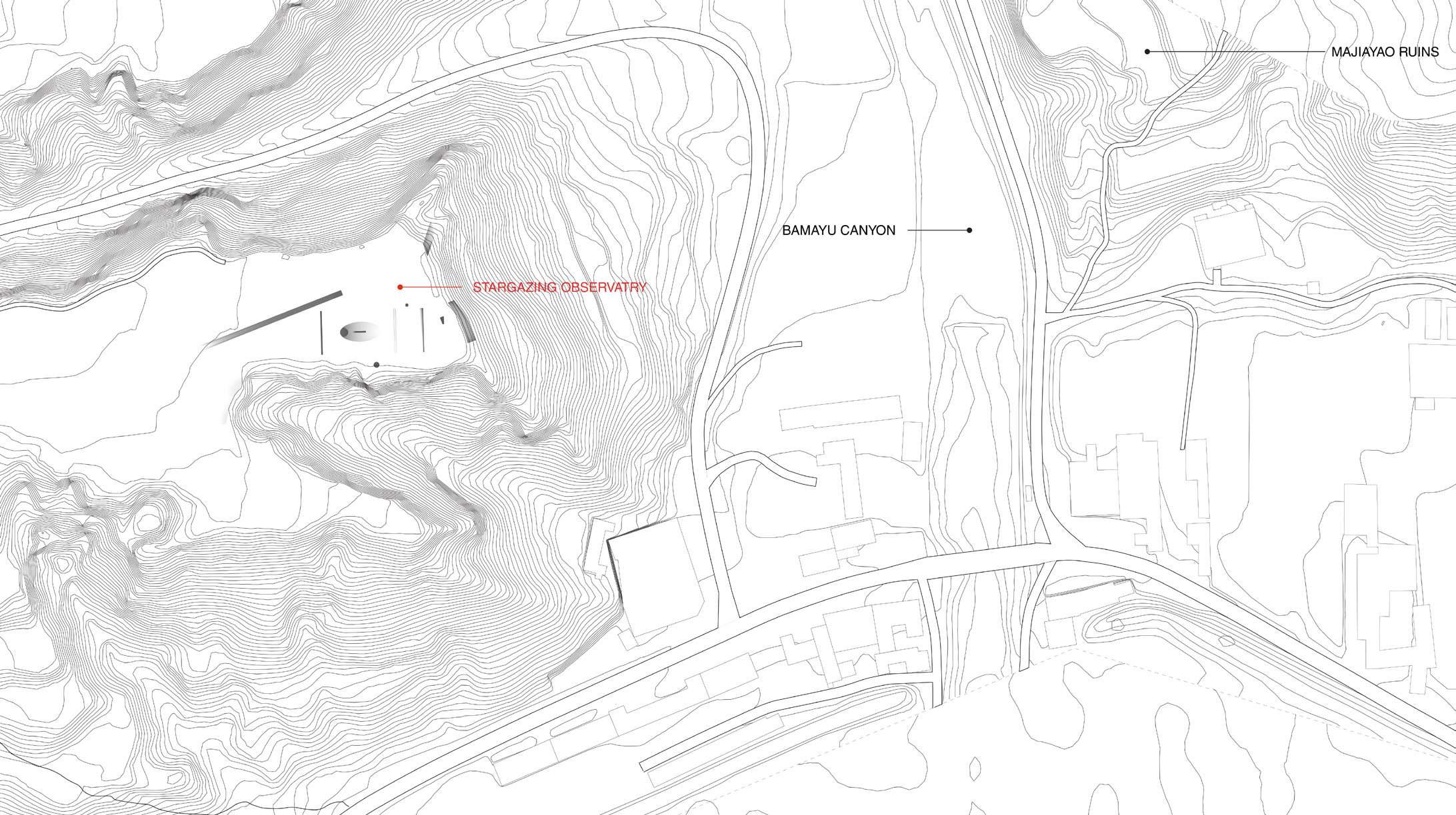
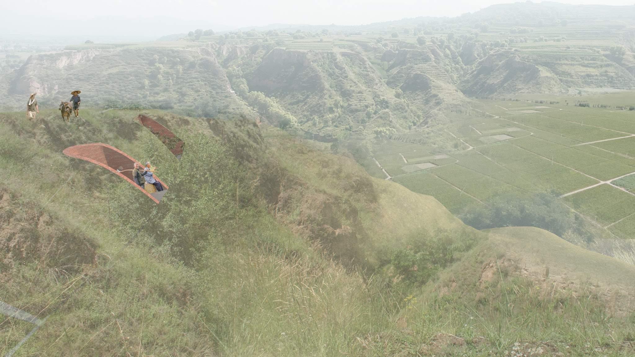
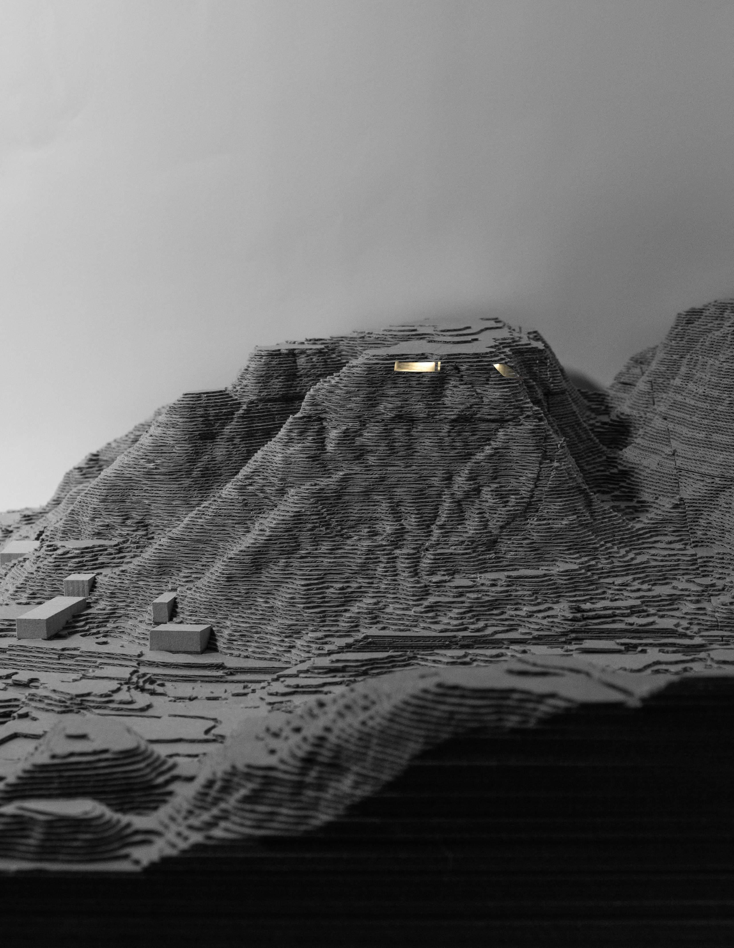
Advanced Design Studio, Yale University
Instructor: Zhu Pei
Location: Majiayao, Gansu, China
Spring 2023
Included in Retrospecta 46
星垂平野阔,月涌大江流。
--杜甫《旅夜书怀》
The stars droop and the fields are wide, the moon surges and the river flows.
--Du Fu Thoughts on a Travel Night, 765 A.D.
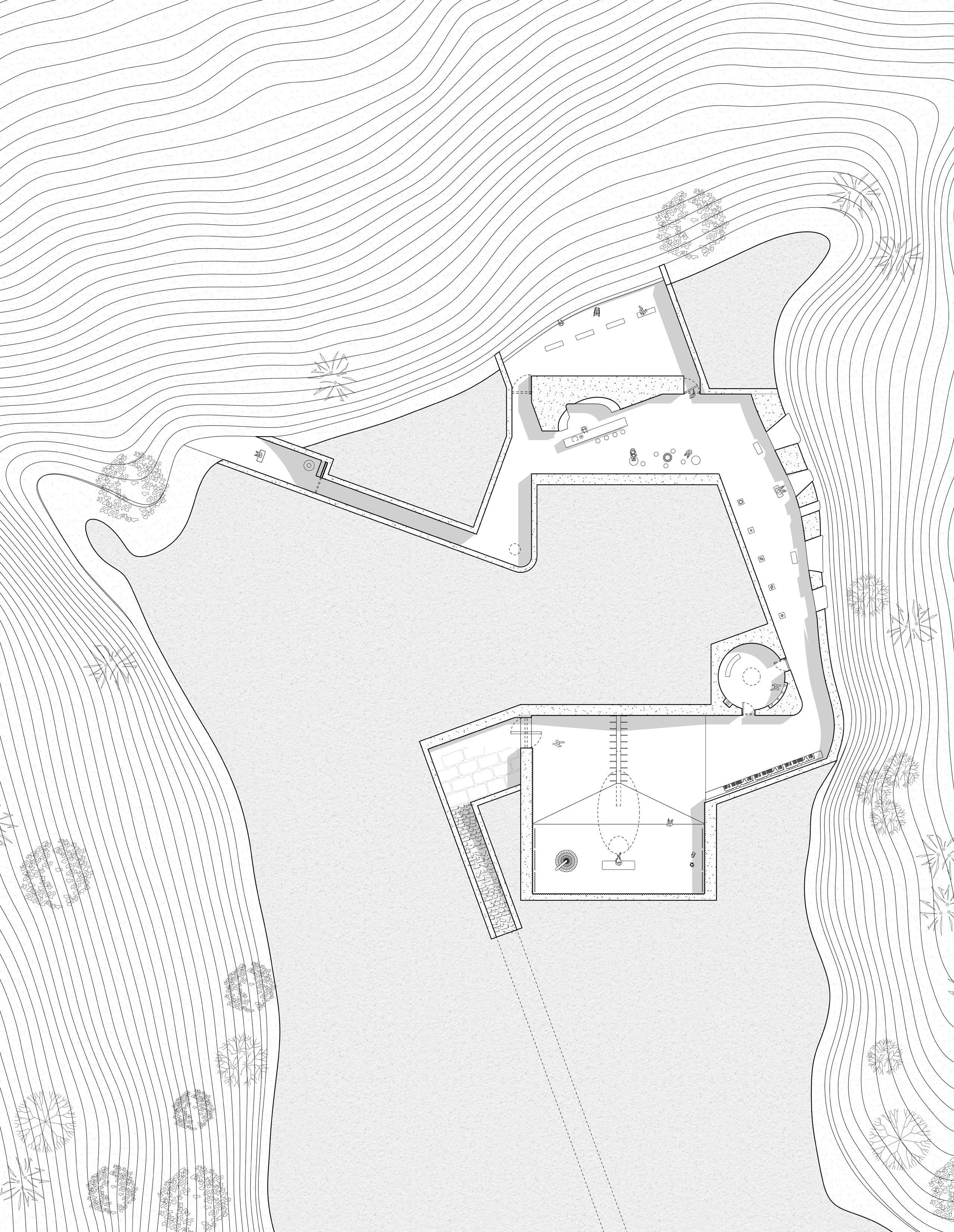
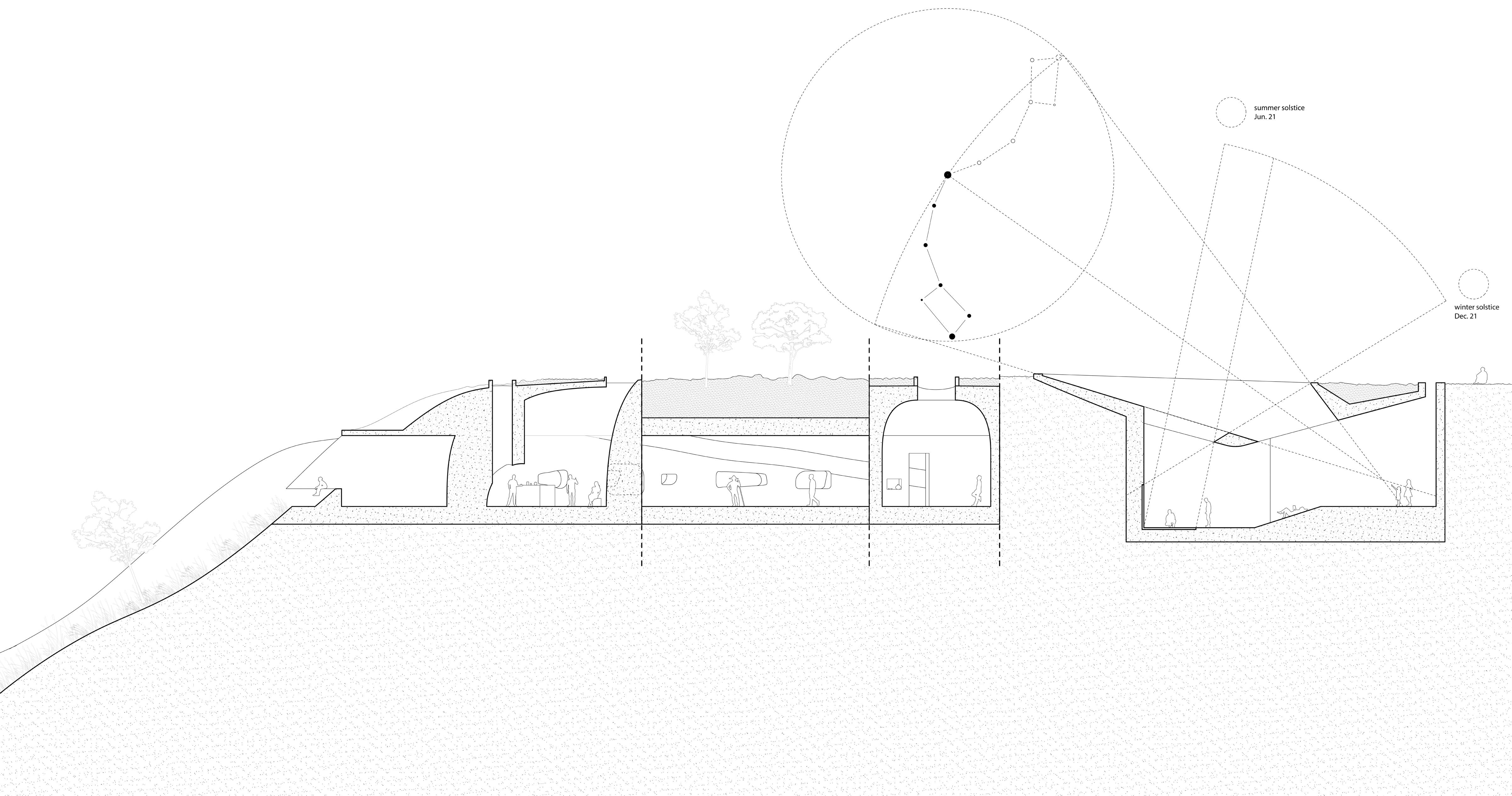
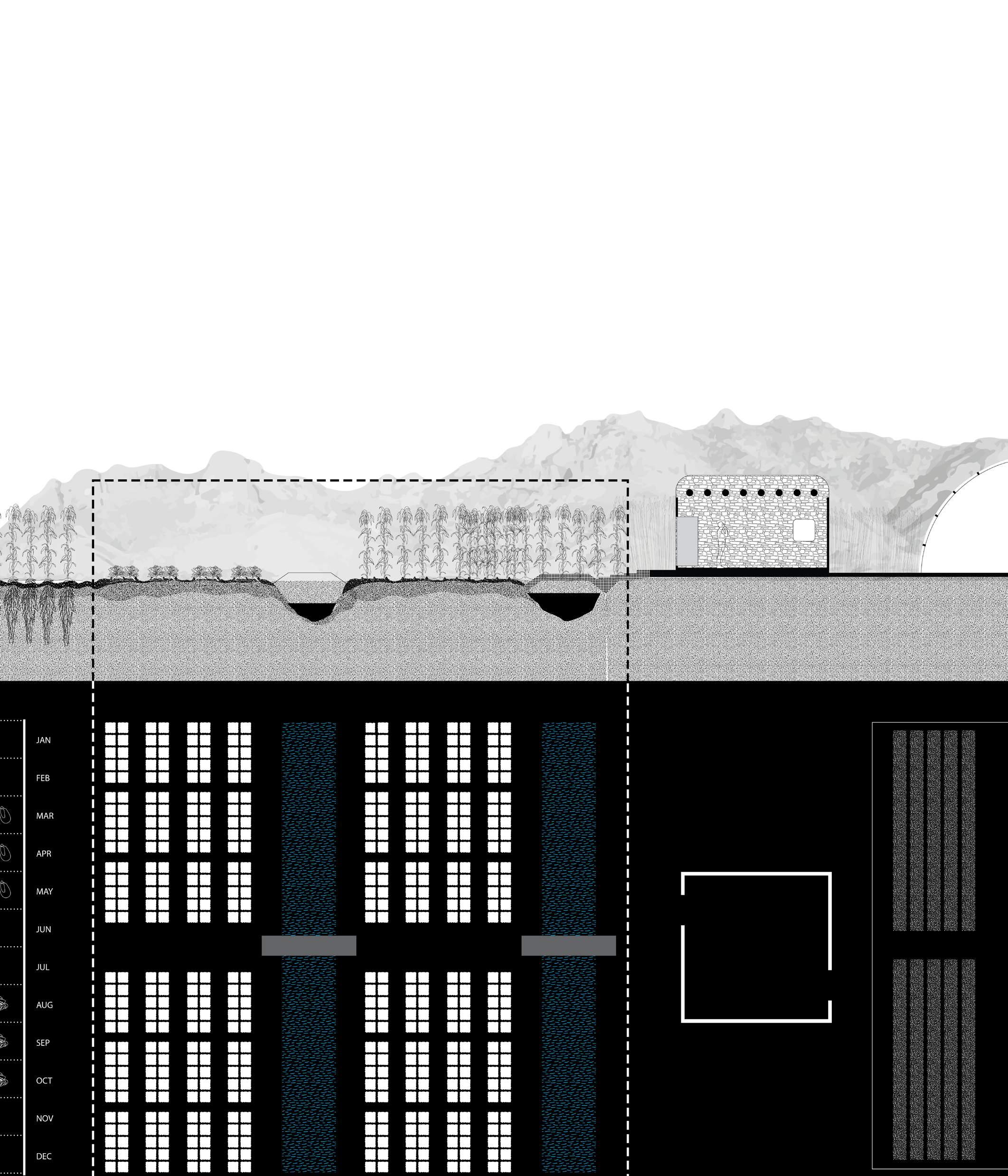
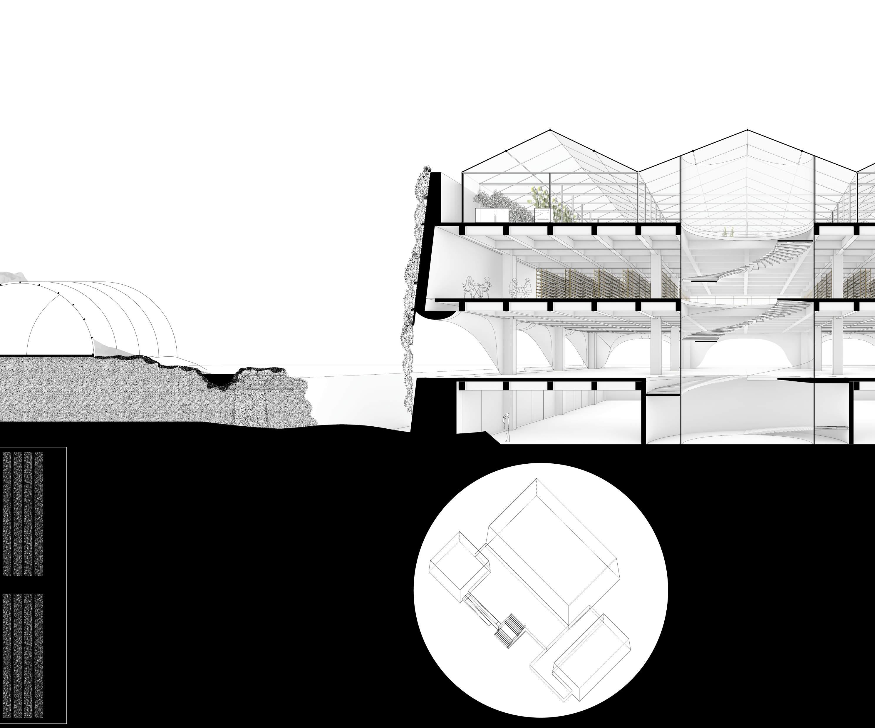
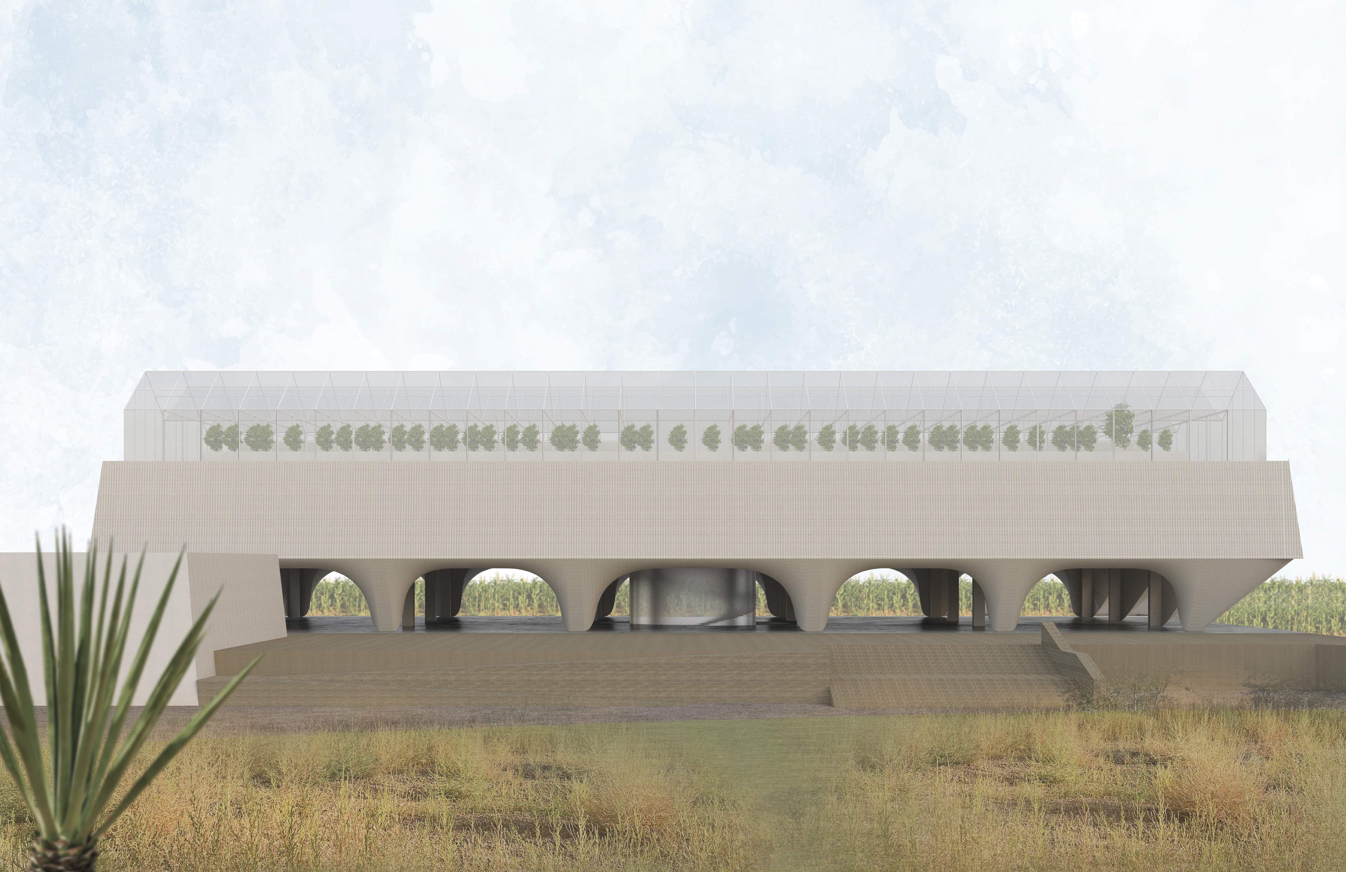
Throughout the history of Chinese agriculture, stargazing has perpetually interwoven with agricultural activities. The ancient Chinese perceived the starry sky and the earth as interconnected entities, both pivotal to their existence. They conceptualized the 24 solar terms, aligning the astronomical phenomena throughout the year with their agricultural seasons.
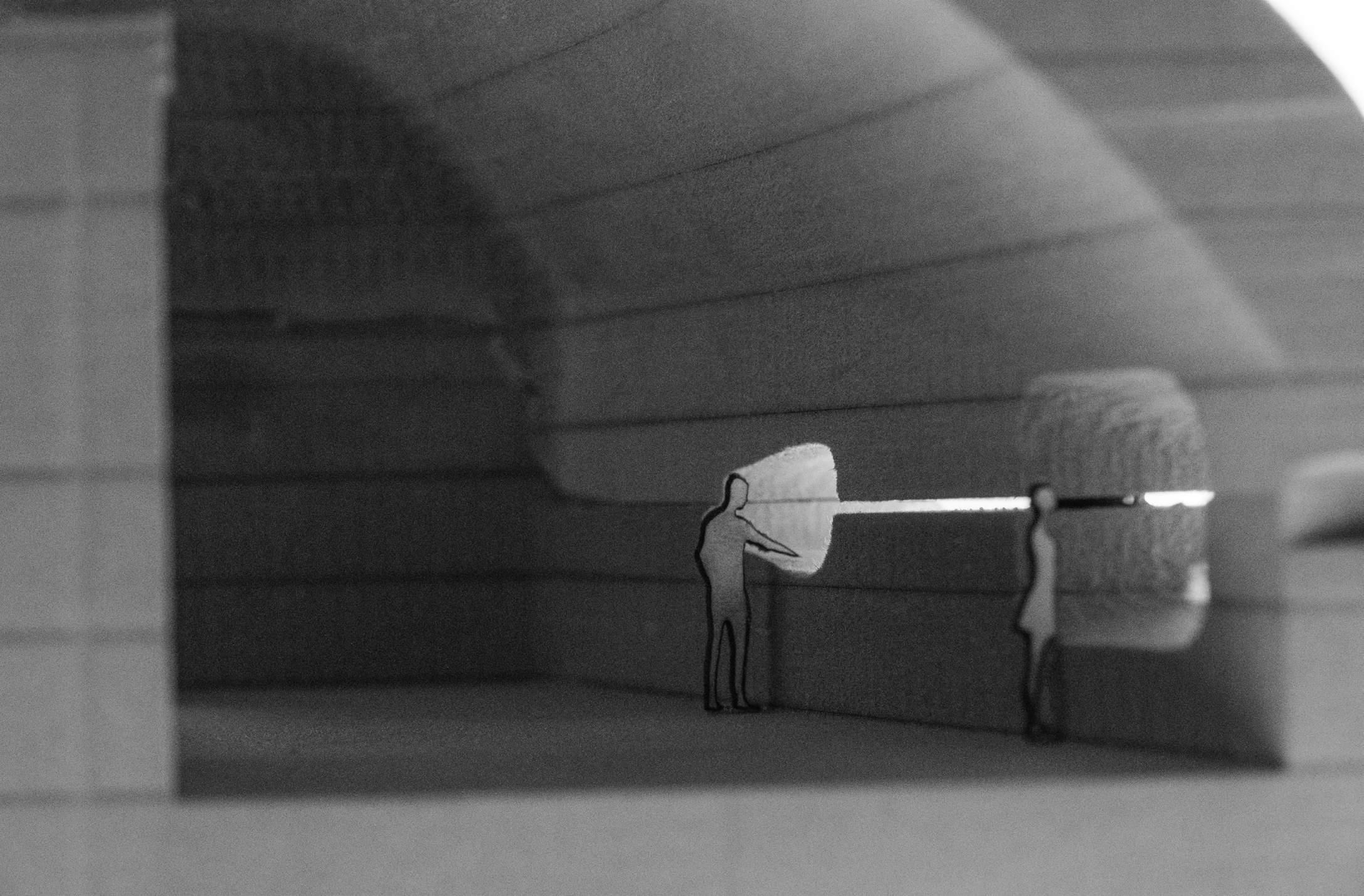
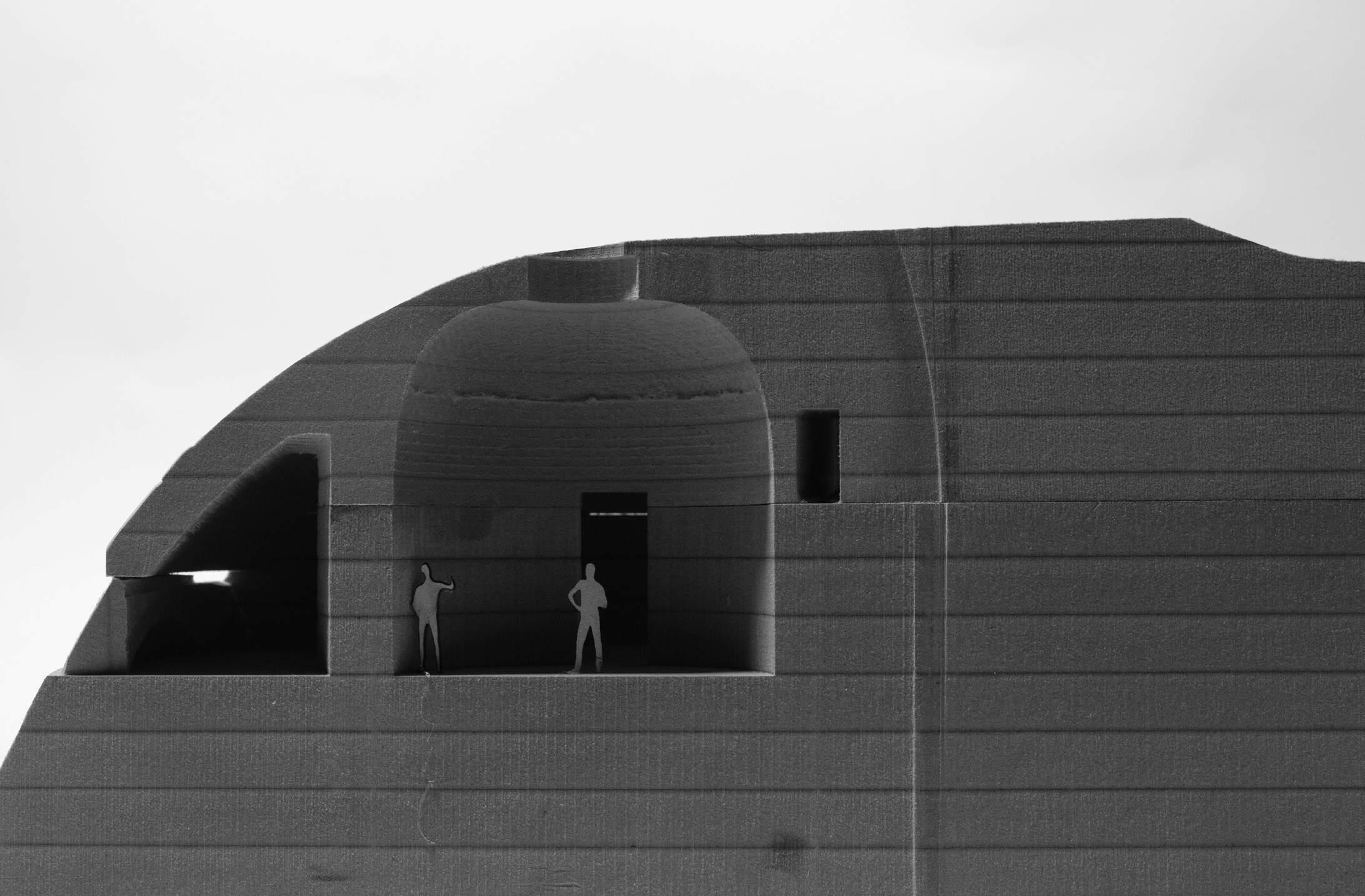
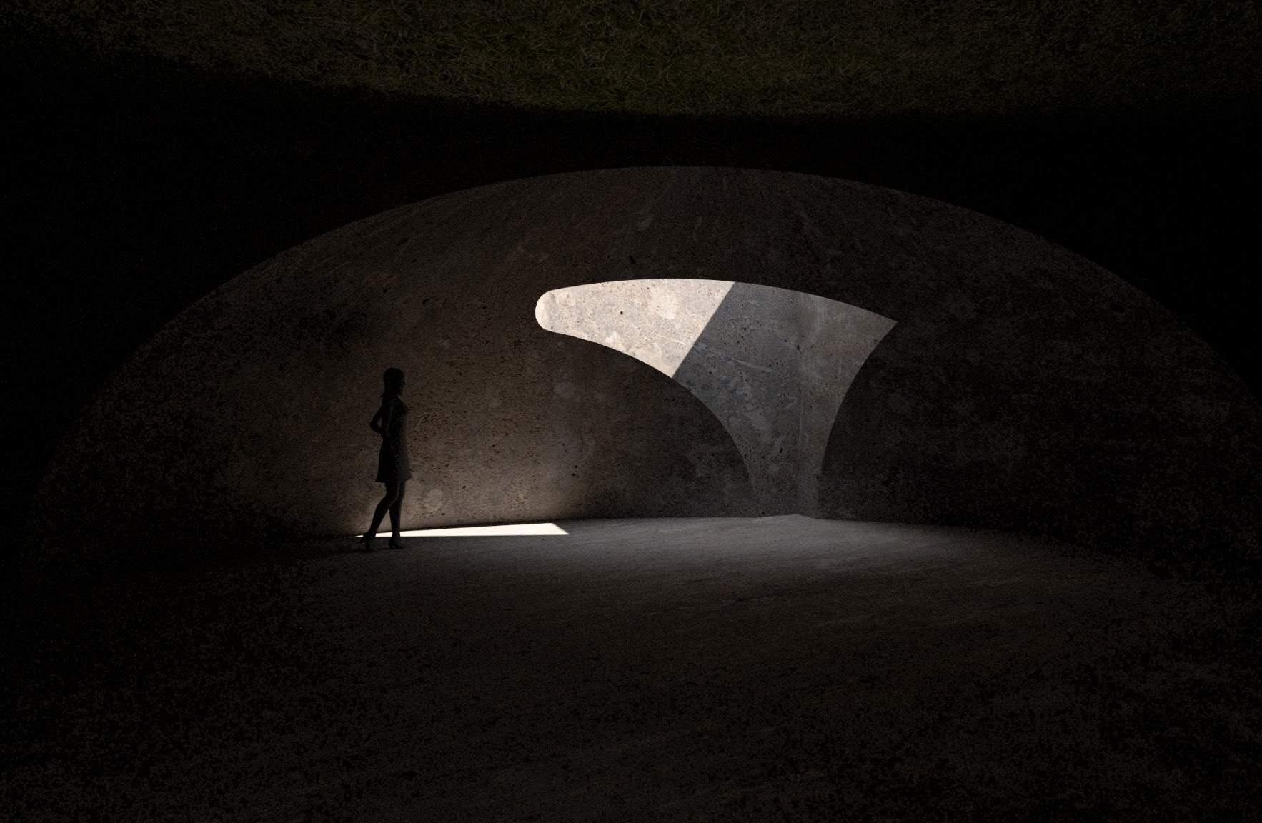
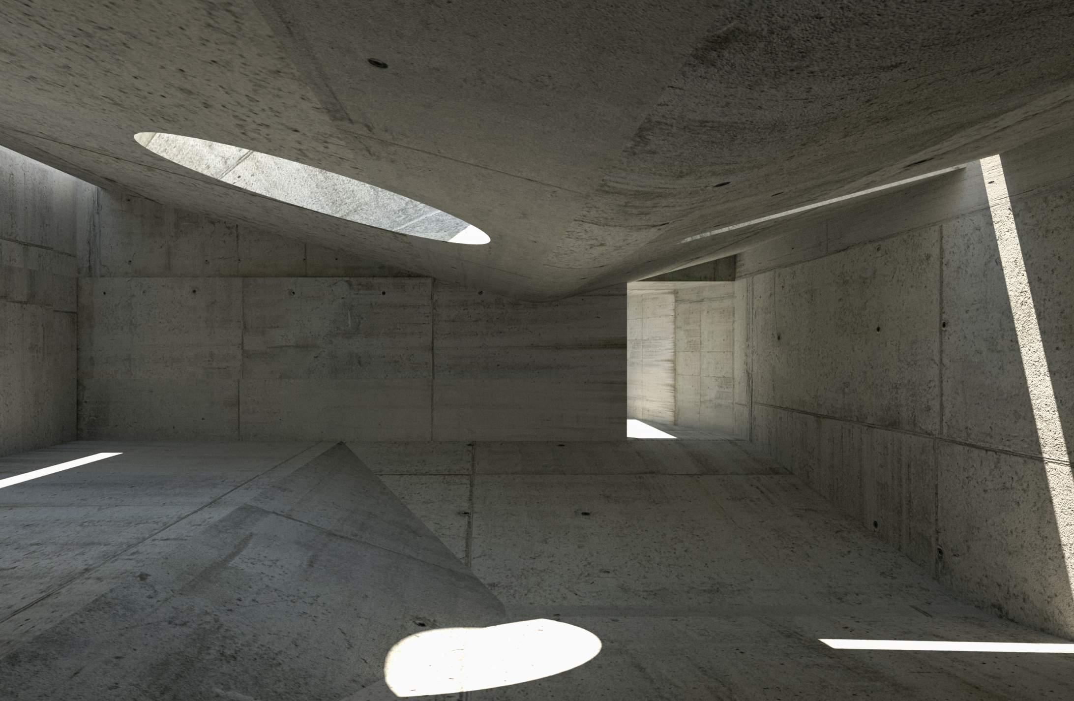
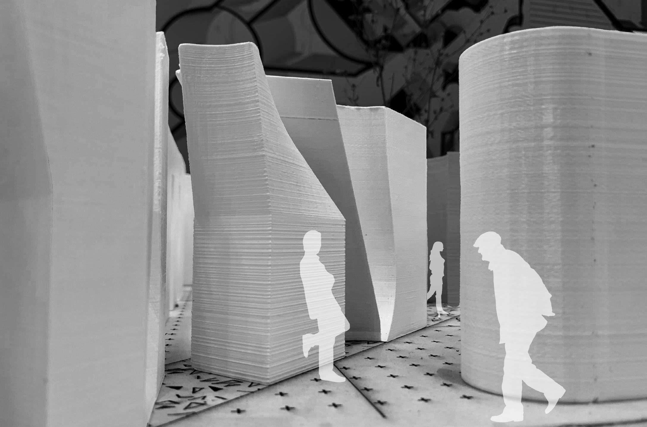
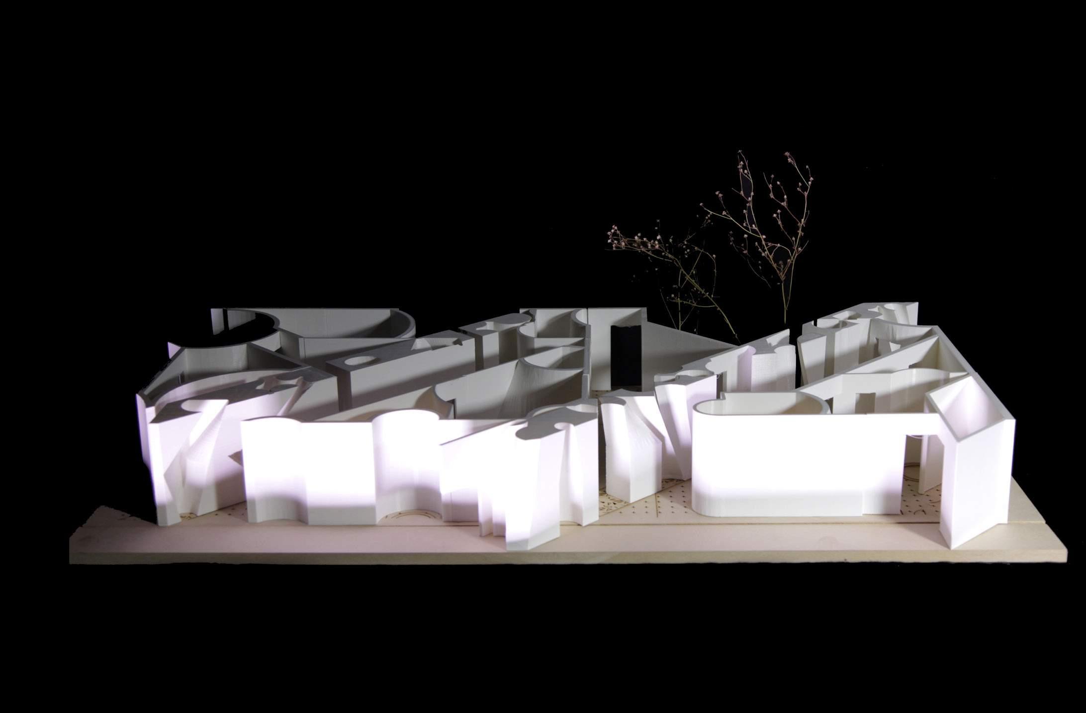
Perched on the hillside of Majiayao Town within the Loess Plateau, this project is a designated platform for celestial observation. With apertures oriented towards the constellation and the fields below, this building introduces the sunlight and picturesque views of the surrounding landscape. It serves as a venue that invites individuals to contemplate the stars and the plateau, offering them a fresh perspective to understand the intricate ties between the constellations and the local agricultural traditions.
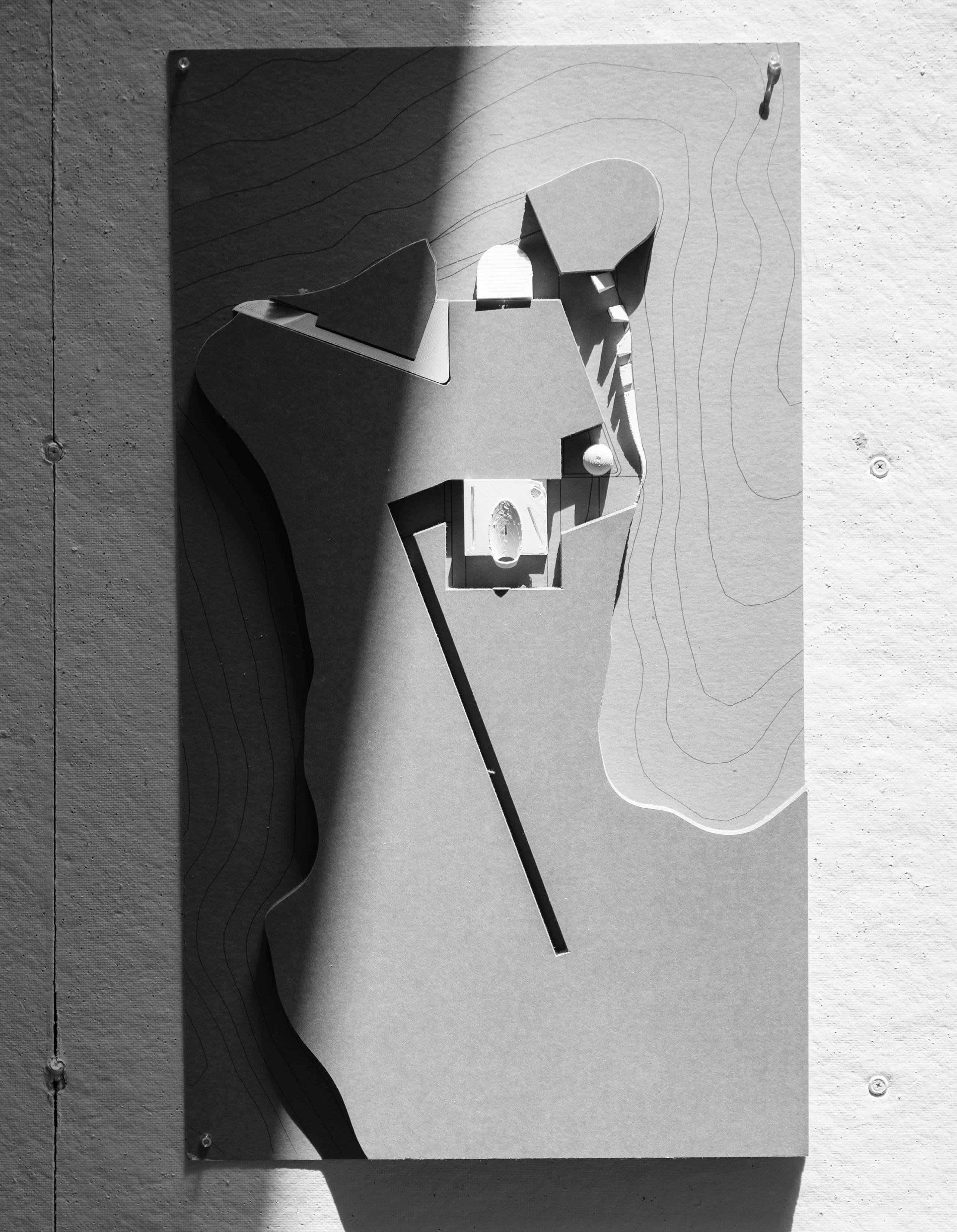

STARGAZING
Stargazing N
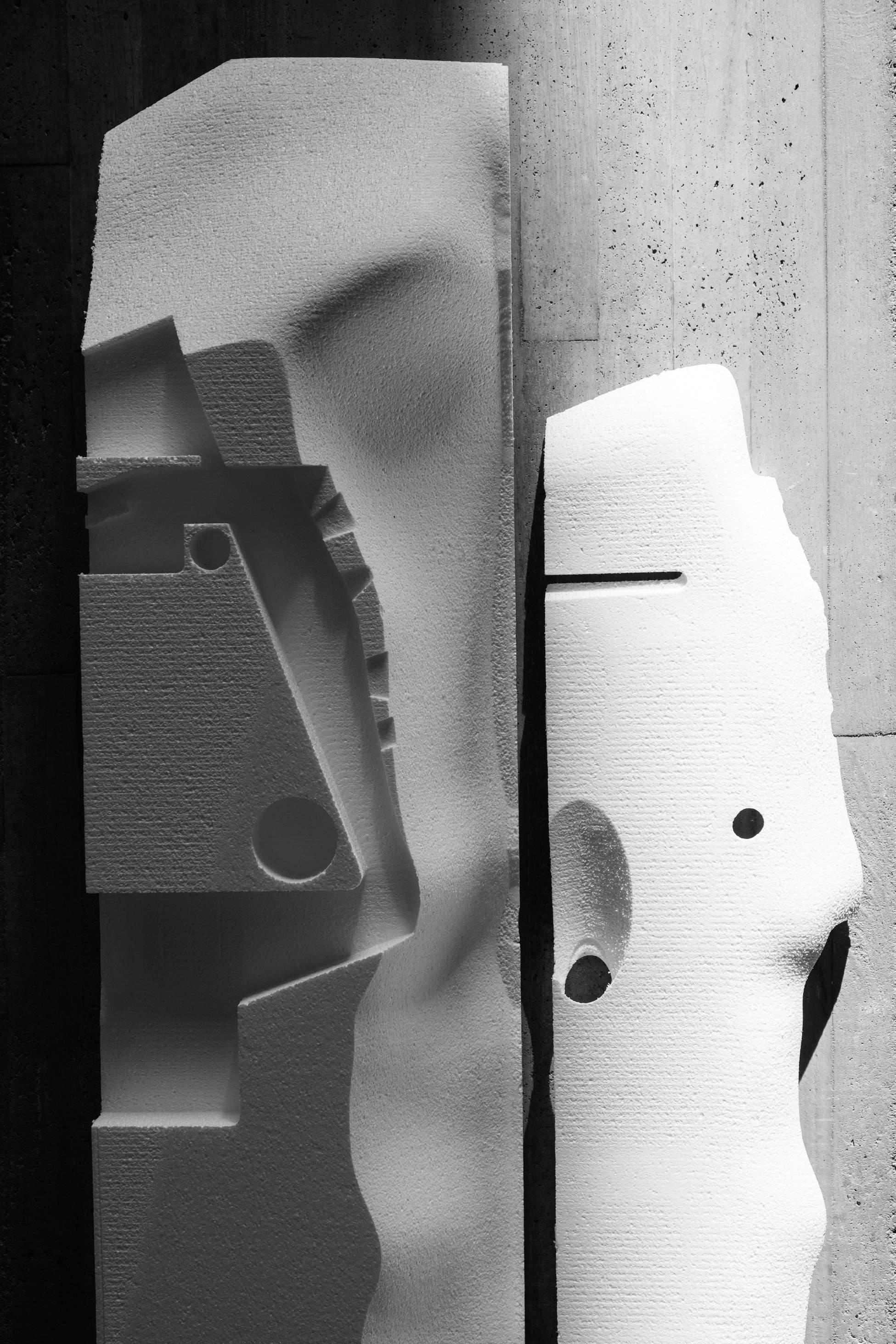
Cardboard and 3D Printed Plastic 11
Study Model 1:200

Stargazing N 12
Stargazing N 13
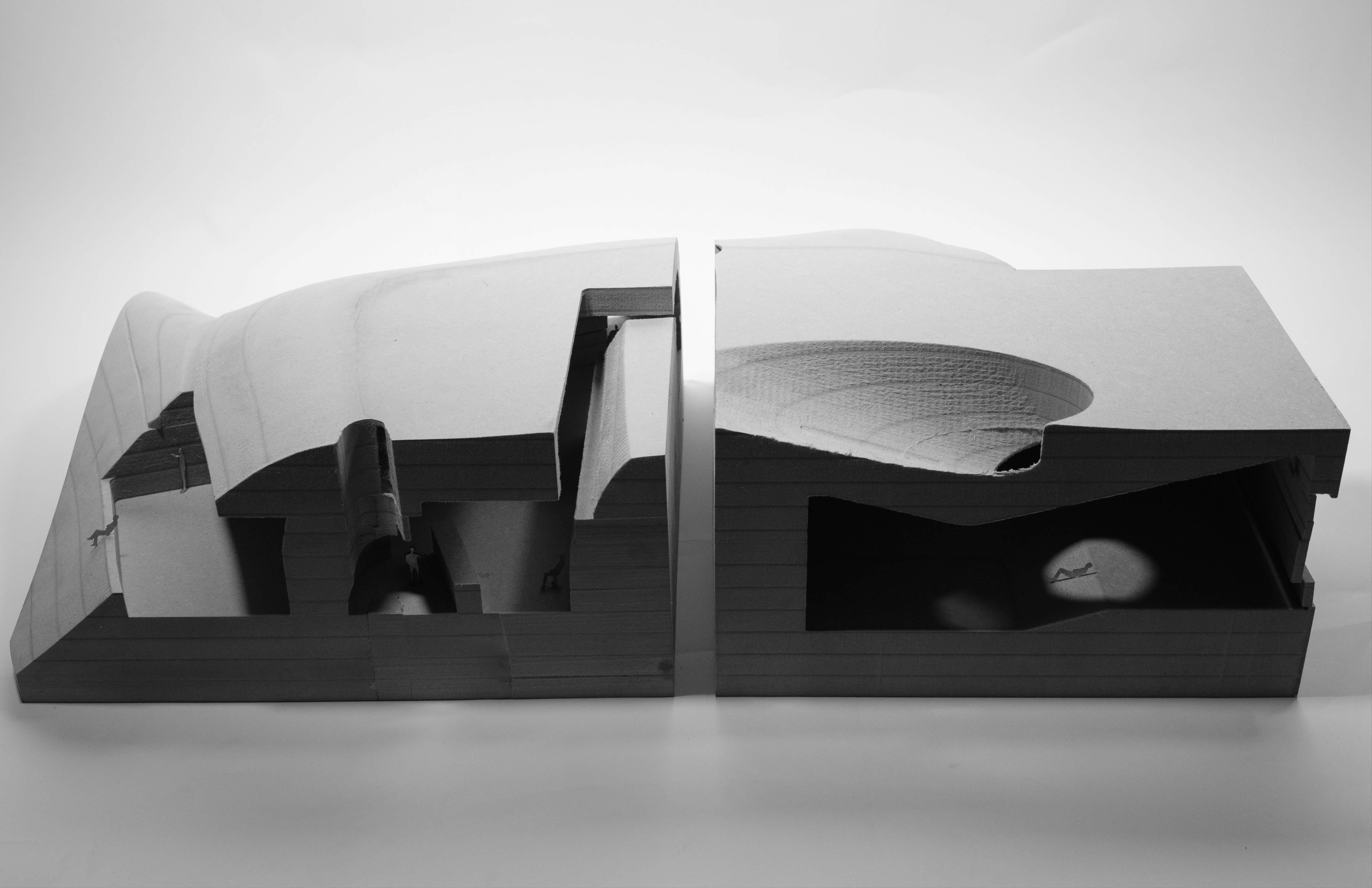
Stargazing
14
Interior Partial Model 1:50 CNC Milling on MDF
Yikai Qiao Stargazing 15
Yikai Qiao Stargazing 16
Senior Design Studio, Soochow University
Instructor: Gu Zhixing
Collaborator: Jingrong Ning, Zhenglin He
Location: Suzhou, China
Spring 2018
“We must invent and rebuild the Futurist city like an immense and tumultuous shipyard, agile, mobile and dynamic in every detail; and the Futurist house must be like a gigantic machine”.
Manifesto of Futurist Architecture
Antonio Sant’Elia
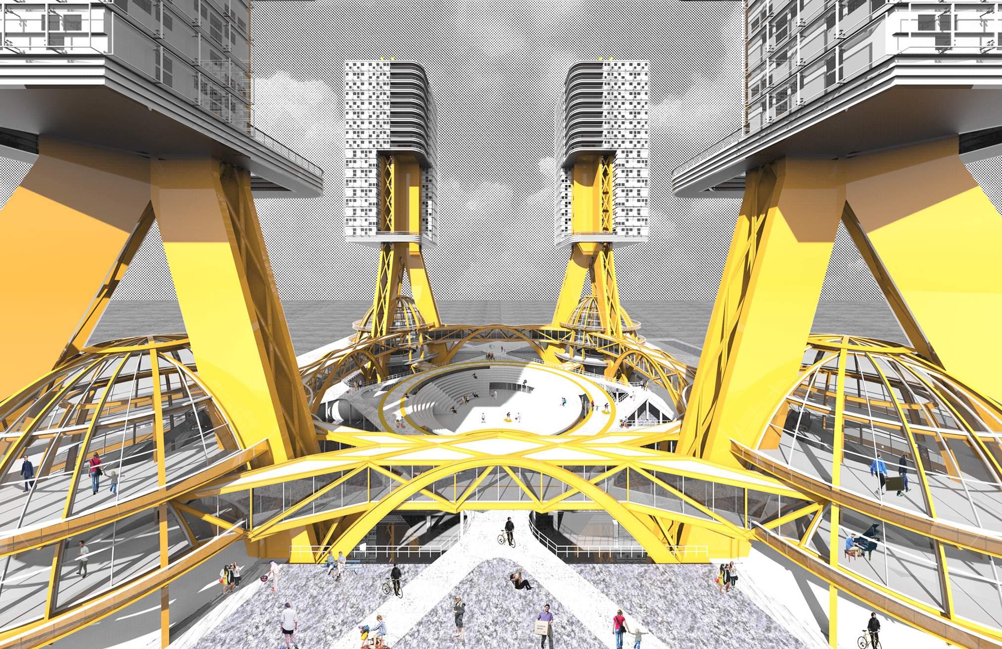
The megastructure as futurist architecture has been discussed by architects as an urban solution to embrace density and effiency. From arcosanti to archigram, the architects proposed experimental projects with the lifestyle of high mobility and efficiency.
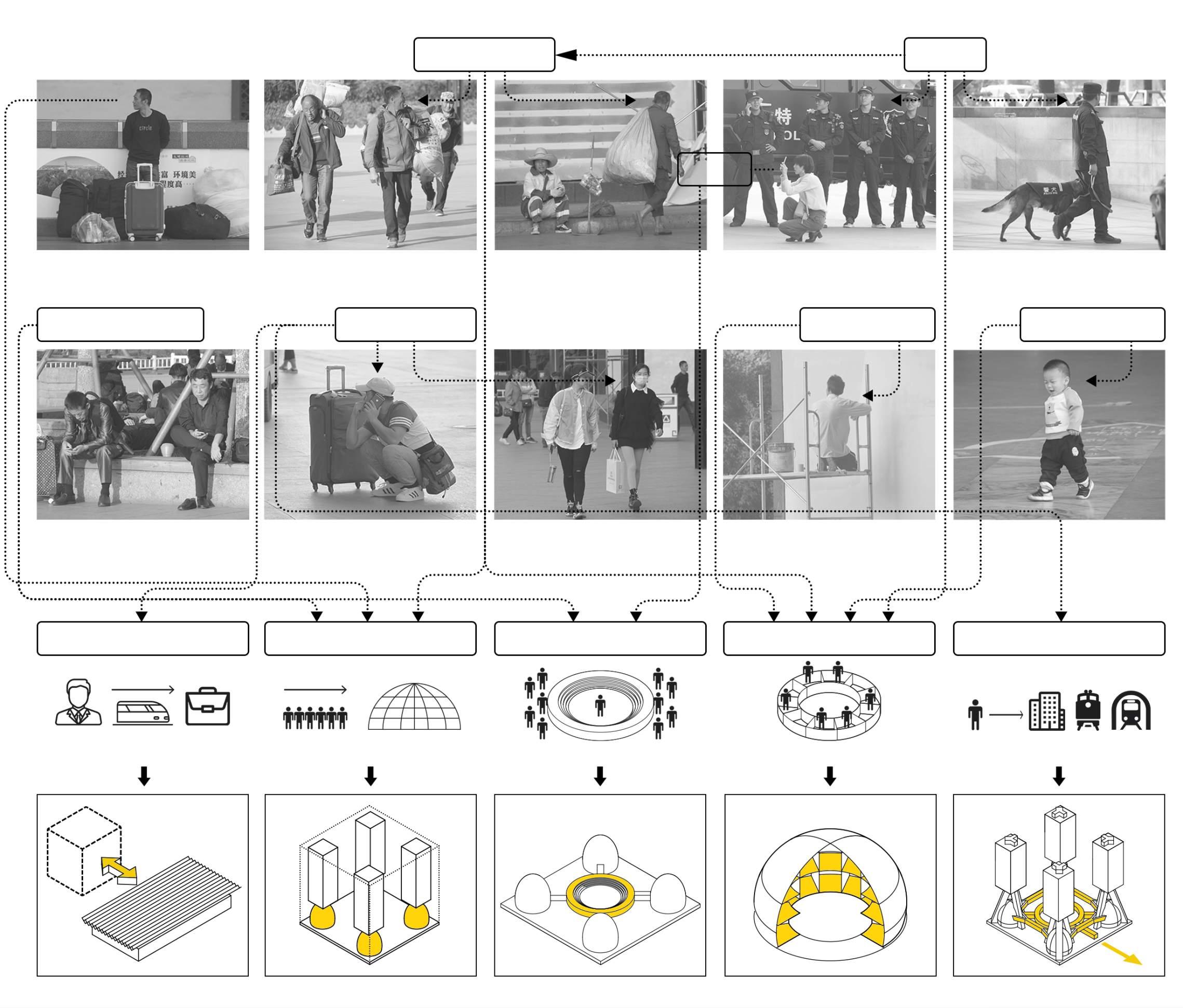
In this project, I explore megastructure based on the environment of a chaotic contemporary city. I focus on the train station area where people are in need of convenience and safety. The project is a building complex with residence and public space. Instead of a utopian proposal, the project aims to use megastructure as a new shelter within a mess of urbanized fields.
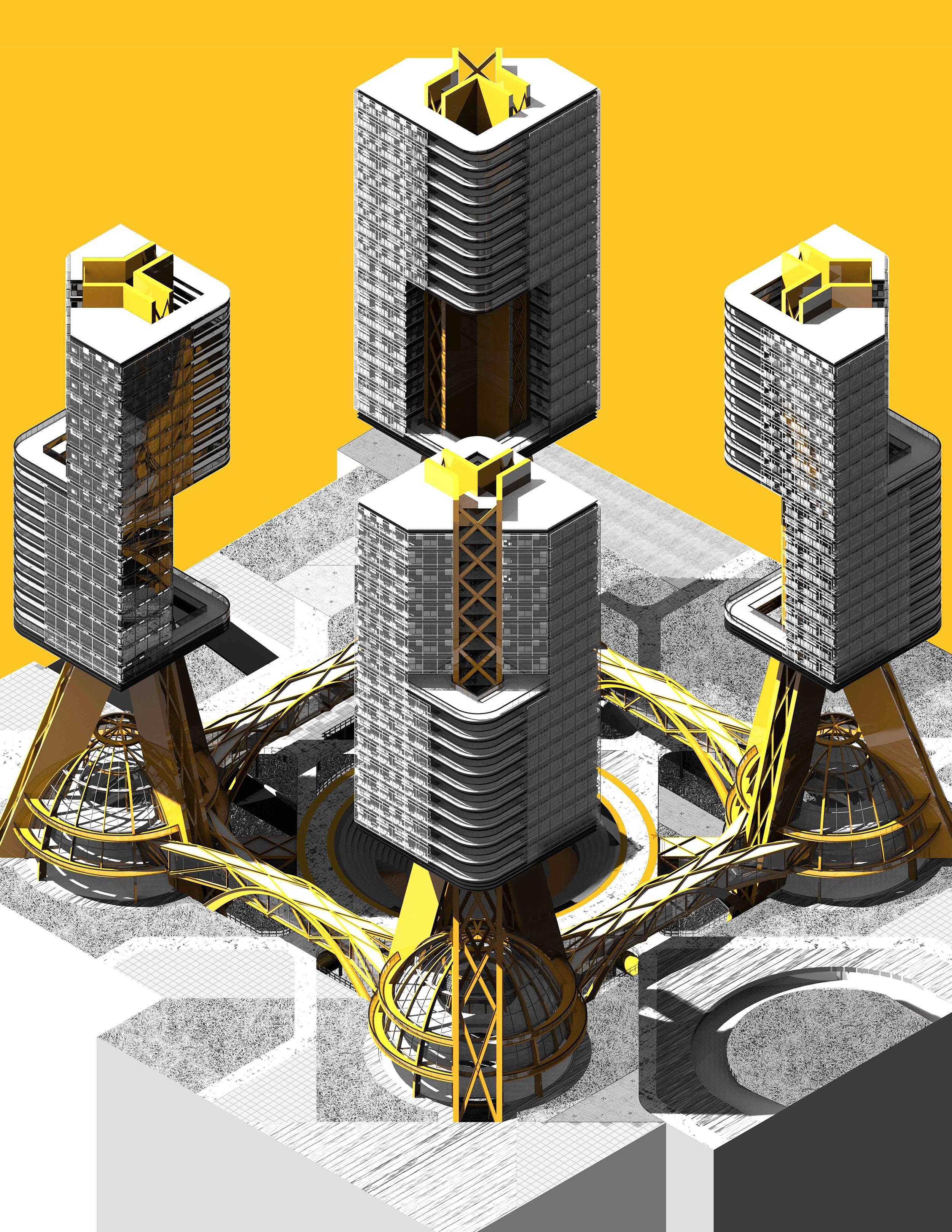
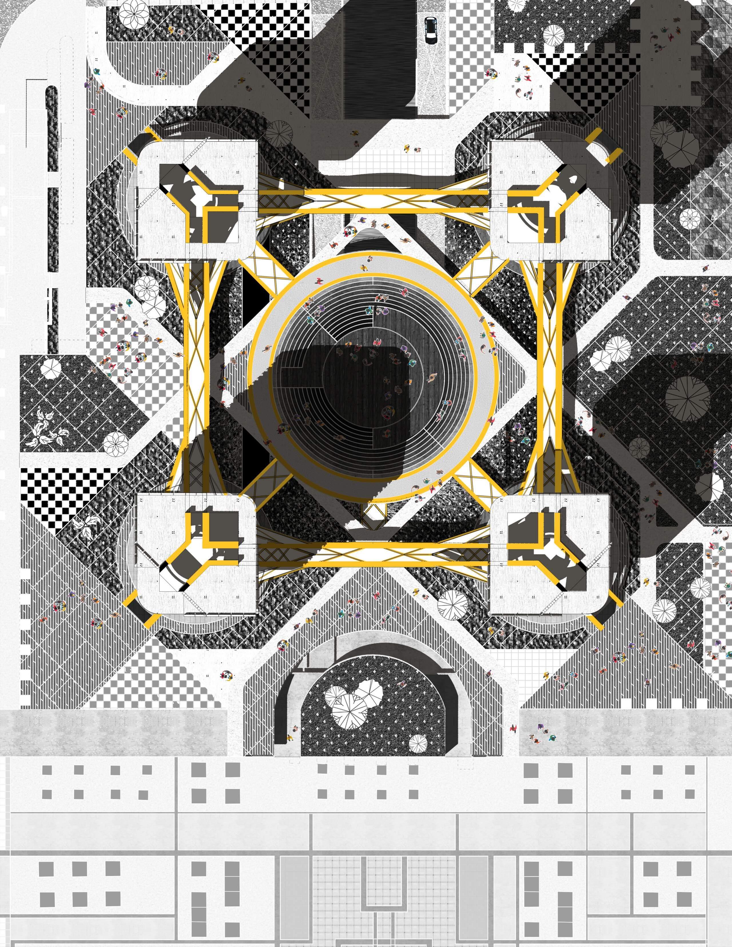
MEGA - RESIDENCE
Mega - Residence 17
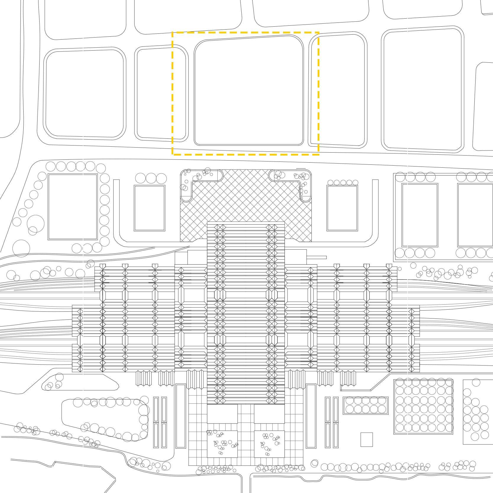
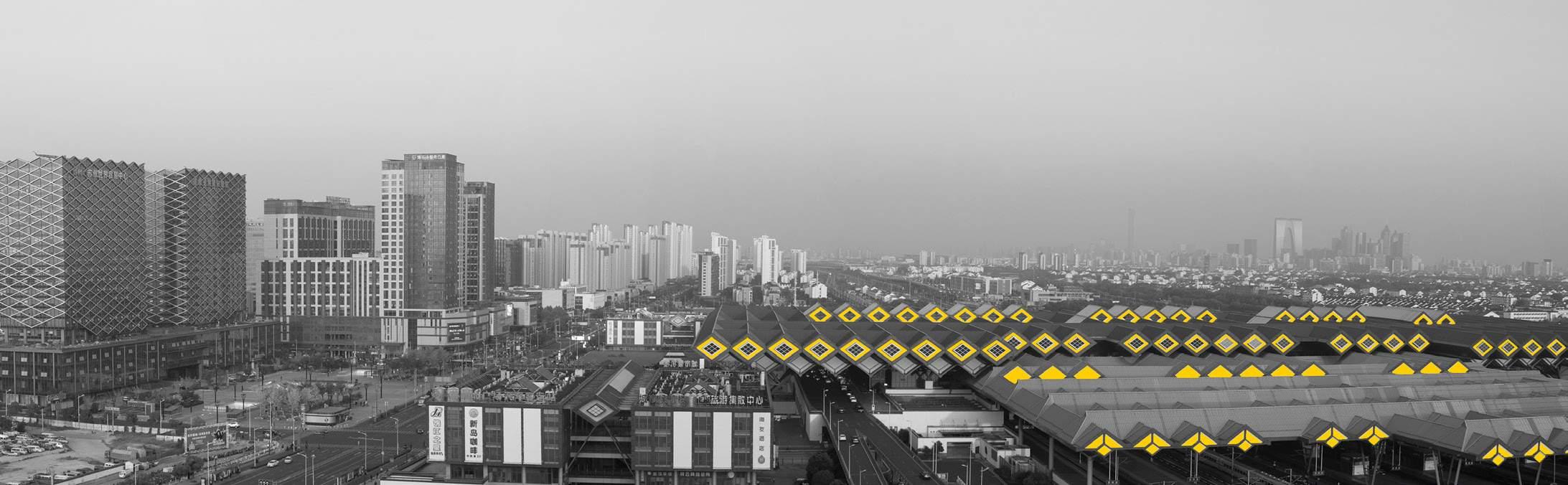
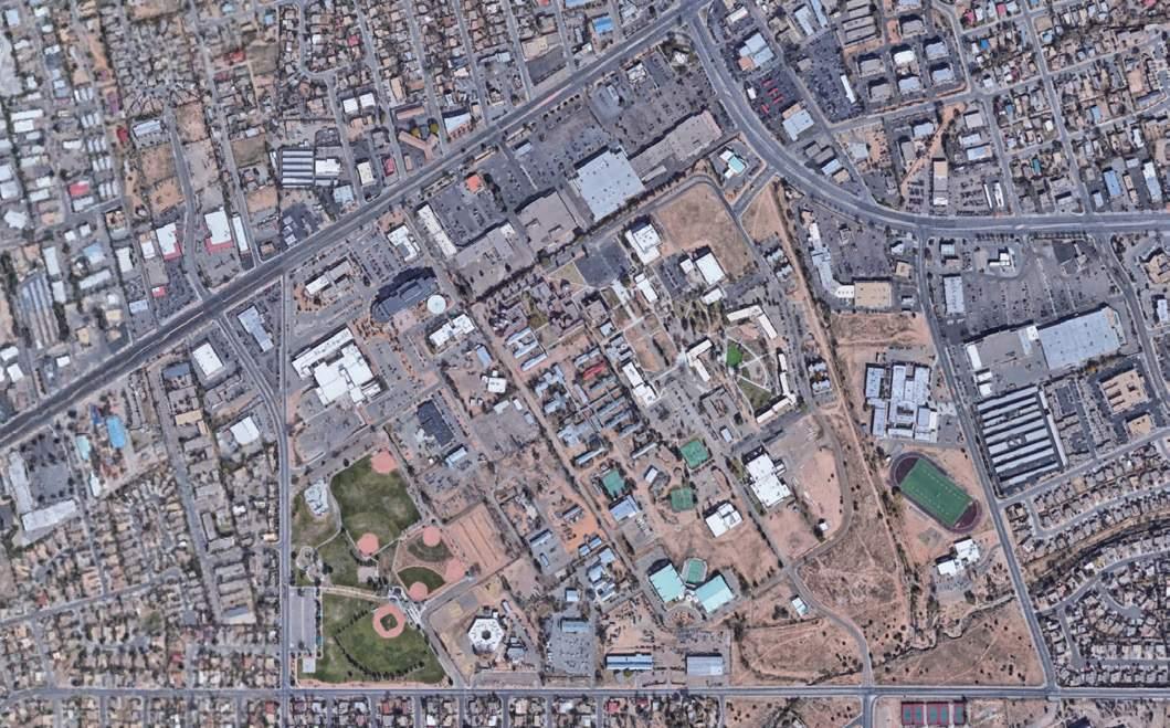
Located near the moat of the old Suzhou City, the Suzhou railway station has been serving millions of citizens with various needs. Our project aims to design a residential building around the train station.
We started with analysing who the people are. We noticed that, with the growing number of young people who work at the neighbouring city and commute by trains everyday to save on rental cost, there is a need for apartments beside the train station, so that these people can save time on commuting. In addition, Suzhou is a city with many migrant workers. The train station is the first stop they arrive at the city. However, the lack of shelter
space and the feeling of loneliness in the big square of the train station have long been an important but ignored issue. If we provide instant shelters for them, the feeling of belonging of these people might be improved.
The project consists of four building units, a fast transportation system and a set of public space which enables people to enjoy break, talks and public activities. The buildings may bring convenience to the people who take trains daily. And through the dialogue from our mega-residence to the railway station, we may rebuild the feeling of safety for the vulnerable working groups.
Yikai Qiao
Urban Context
Project Location
Suzhou Railway Station
Mega - Residence
Siter
Plan Scale1 : 5,000
Vulnerable Groups
Waiting people
Residence Nearby Temporary Shelter Public Communication Private Zone Fast Transportation
Passengers Workering People Children
18
Surveilant
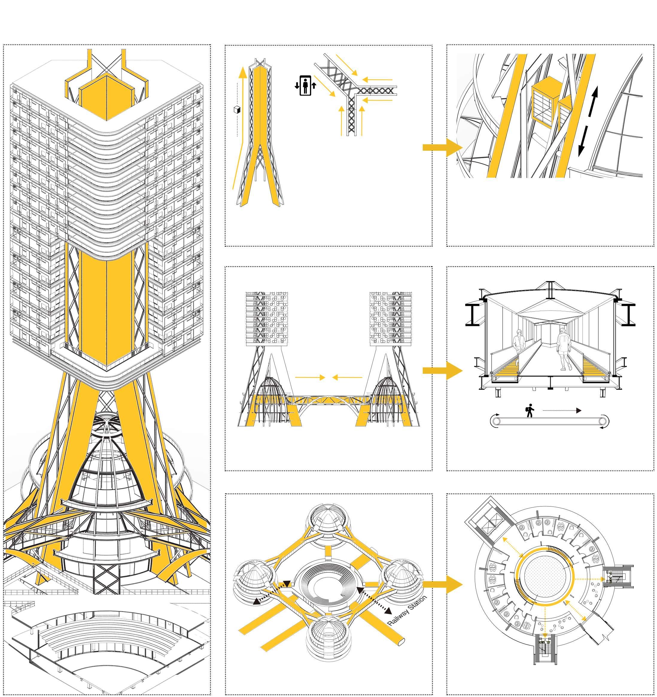
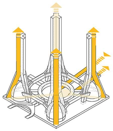
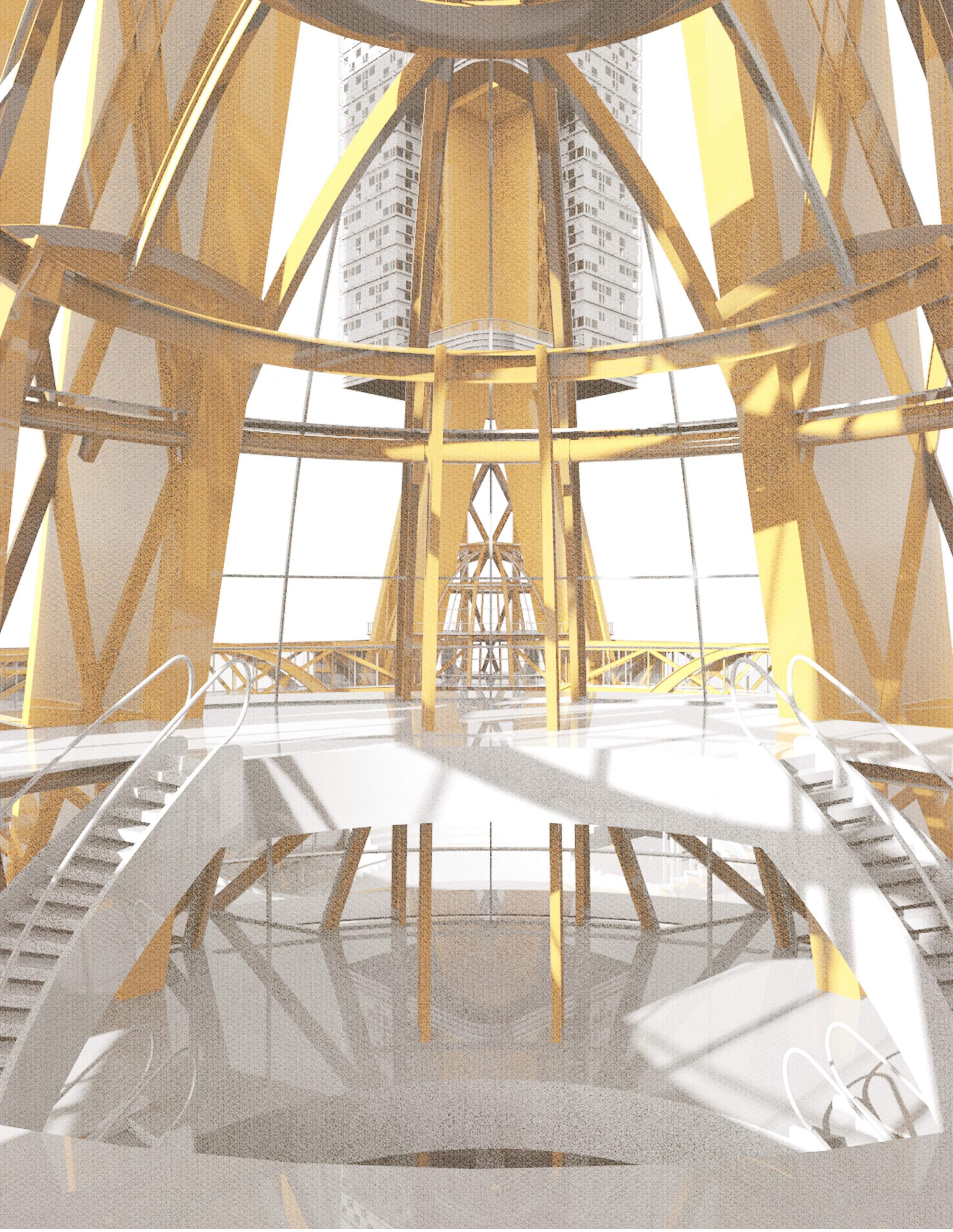
The main structure of the building is an integration of three huge inclined reinforced concrete columns, each containing vertical transportation inside.
The main structure serve as tunnels for the elevators to go upstairs. People may enjoy sightseeing when coming home.
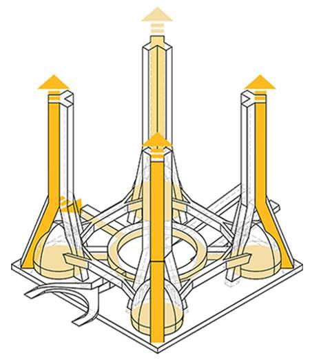
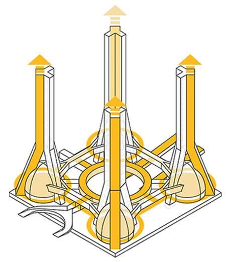
 A set of steel overbridges connect each of the buildings, linking the space of every hemisphere zone.
There are escalators in the overbridges enabling people to move around fast from home till the train station.
The transportation system circulates around, linking the private and the public
A set of steel overbridges connect each of the buildings, linking the space of every hemisphere zone.
There are escalators in the overbridges enabling people to move around fast from home till the train station.
The transportation system circulates around, linking the private and the public
Structure
The hemisphere zone includes the temporary rooms for the people with instant needs
1. Apartment Paths
2. Public Hemisphere Paths
1 2 3 Mega - Residence Master Plan 19
3. Public Square Paths
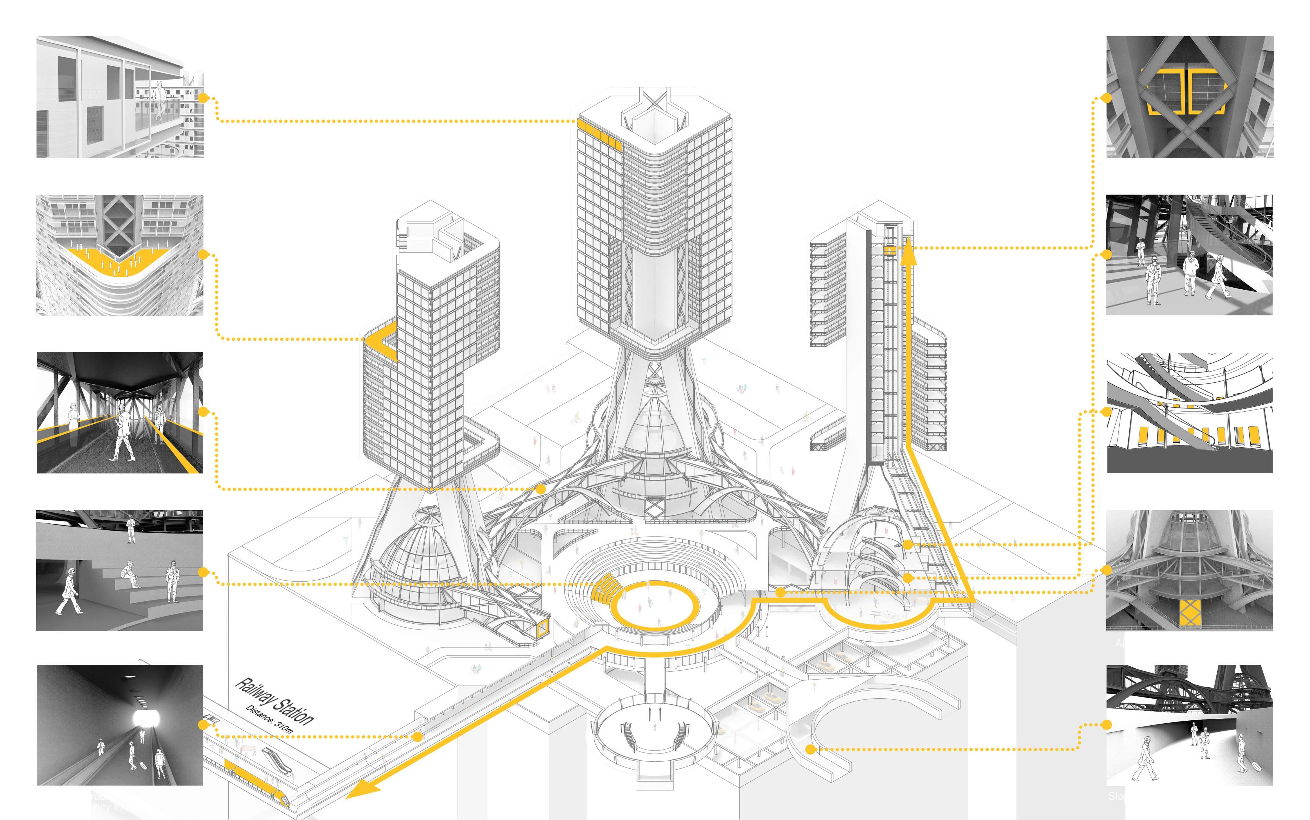
Yikai Qiao Circulation Mega - Residence
The lift of the residential unitis
The public space in the hemisphere for people to take a break
The private rooms for those people who need privacy and security
The corridor between the central square and each hemisphere
20
The slope entering the central square from outside

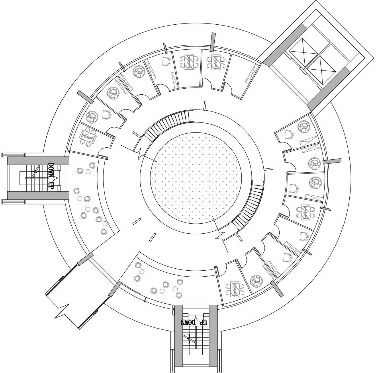
Public Hemisphere
Siter Plan
Northeast Hemisphere
Mega - Residence 21
Plan of the Northeast Hemisphere
Yikai Qiao Residential Units Mega - Residence
130 22
Scale1
23
SEED LAND -- LAND REUSE OF THE SANTA FE ART INSTITUTE
Advanced Design Studio, Yale University
Instructor: Alan Plattus, Elizabeth Galvez
Independent design with group research
Location: Santa Fe Art Institute, Santa Fe, NM Fall 2022
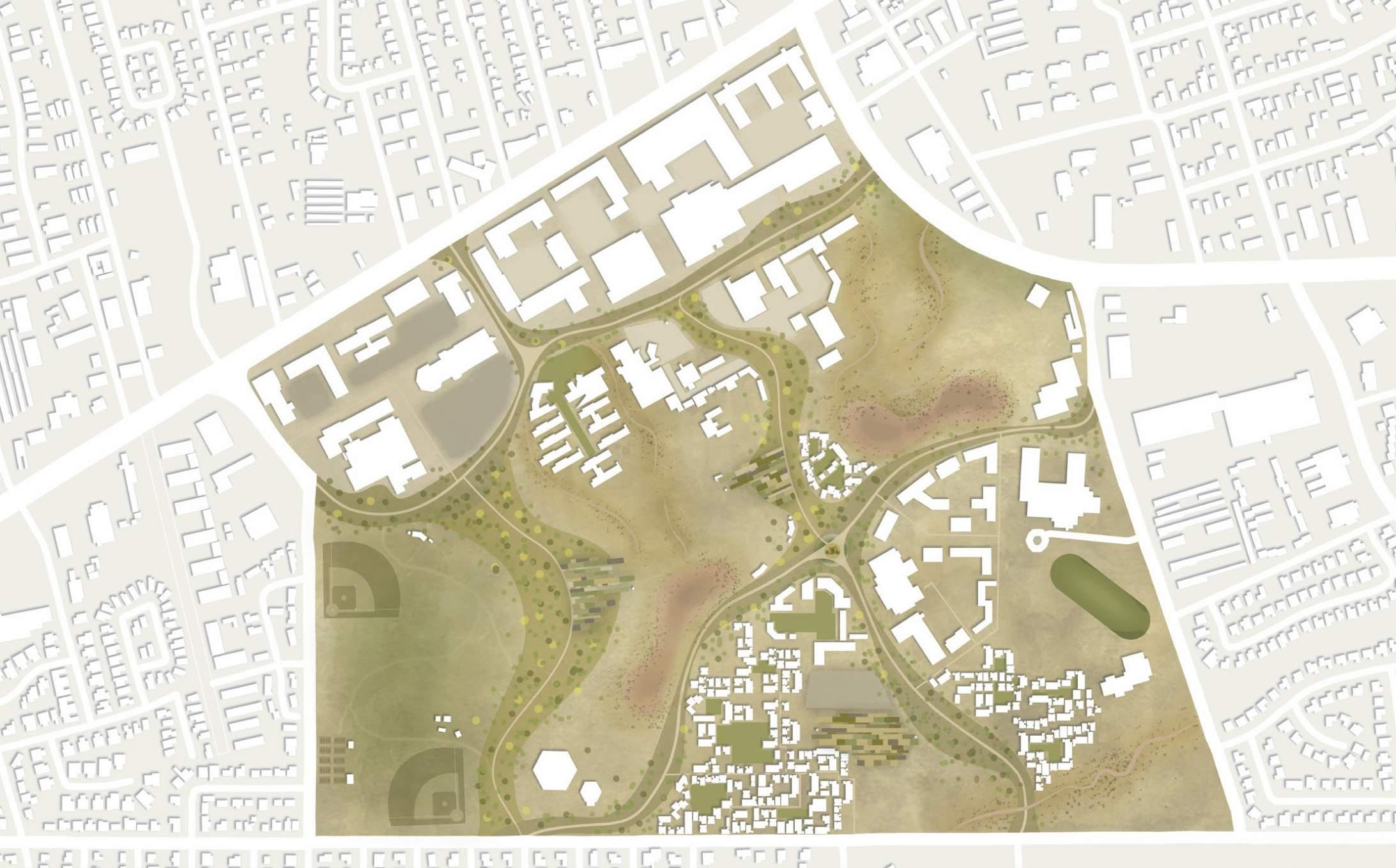
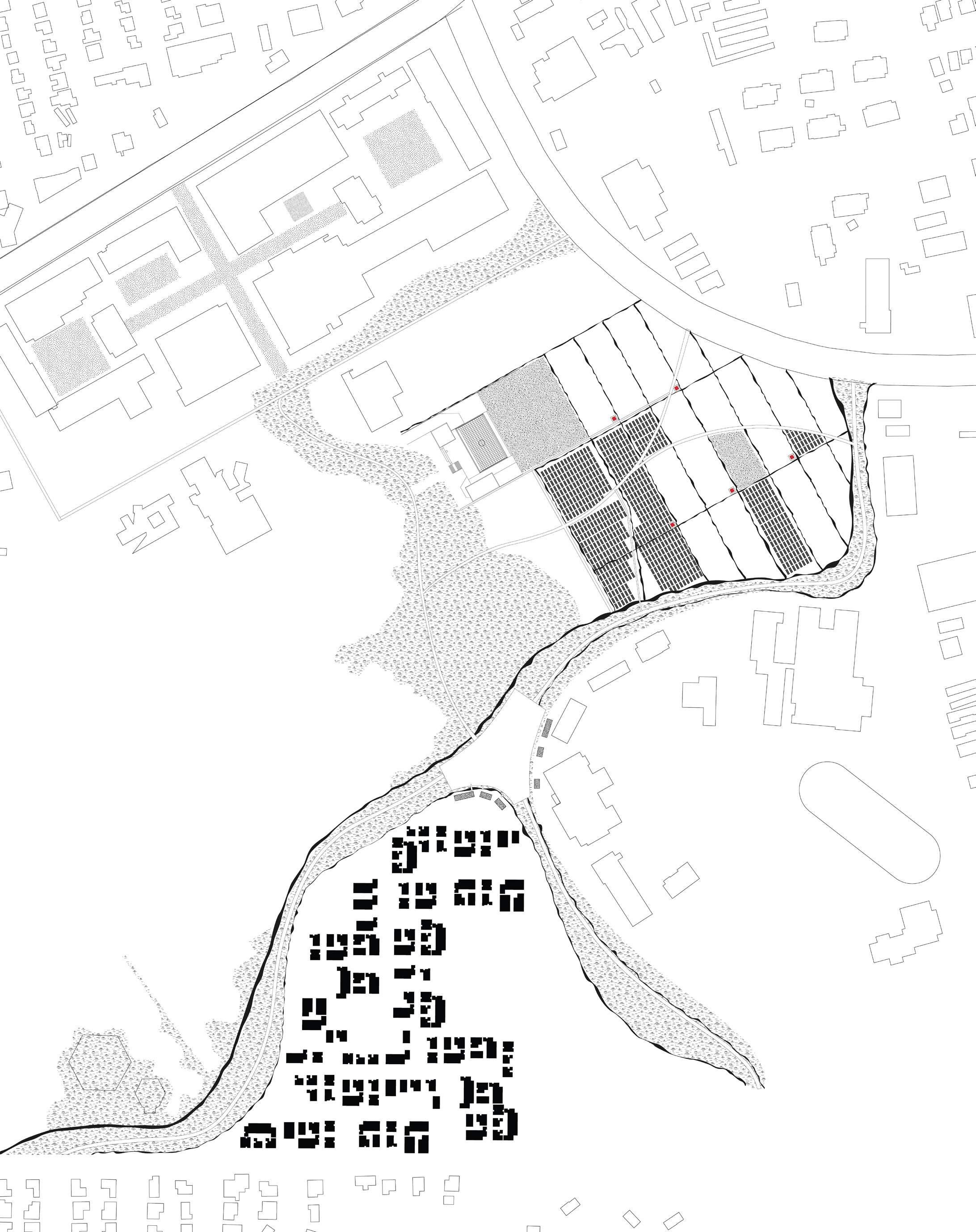
This project proposes a remediation of the site of Santa Fe Art Institute (SFAI). Our research is sensitive to the way that the site creates boundaries between major subdivisions surrounding the midtown center, and we consider how our site may begin to create linkages between these neighbourhoods. The overlap of programming allows us to generate a network in which new means of community living can revitalize this area. The network manifests itself in varying forms of circulation which operate as a shared infrastructure across the site. This allows for new considerations of housing and public space to begin to generate along the circulation, and then begin to inform other new vehicles for new living models such as agriculture.
Site acknowledgement: the wilderness & agriculture
Yikai Qiao
Current condition of the site
Group work site plan
Matters --
Urban Studio
Group: Calvin Liang, Mariel Lindsay, Elizabeth Cornfeld, Calvin Liang, Jerry Chow
Land
Santa Fe
Concept sketch: the chain of seeds & agriculture 24
Yikai Qiao
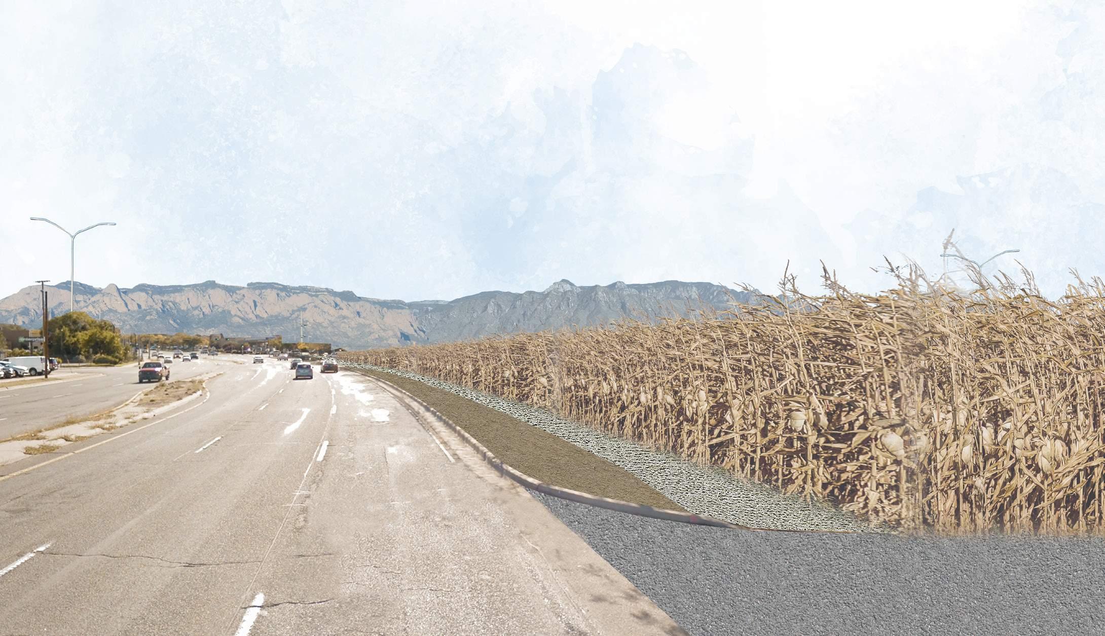
Cornfield alongside St Michaels Road
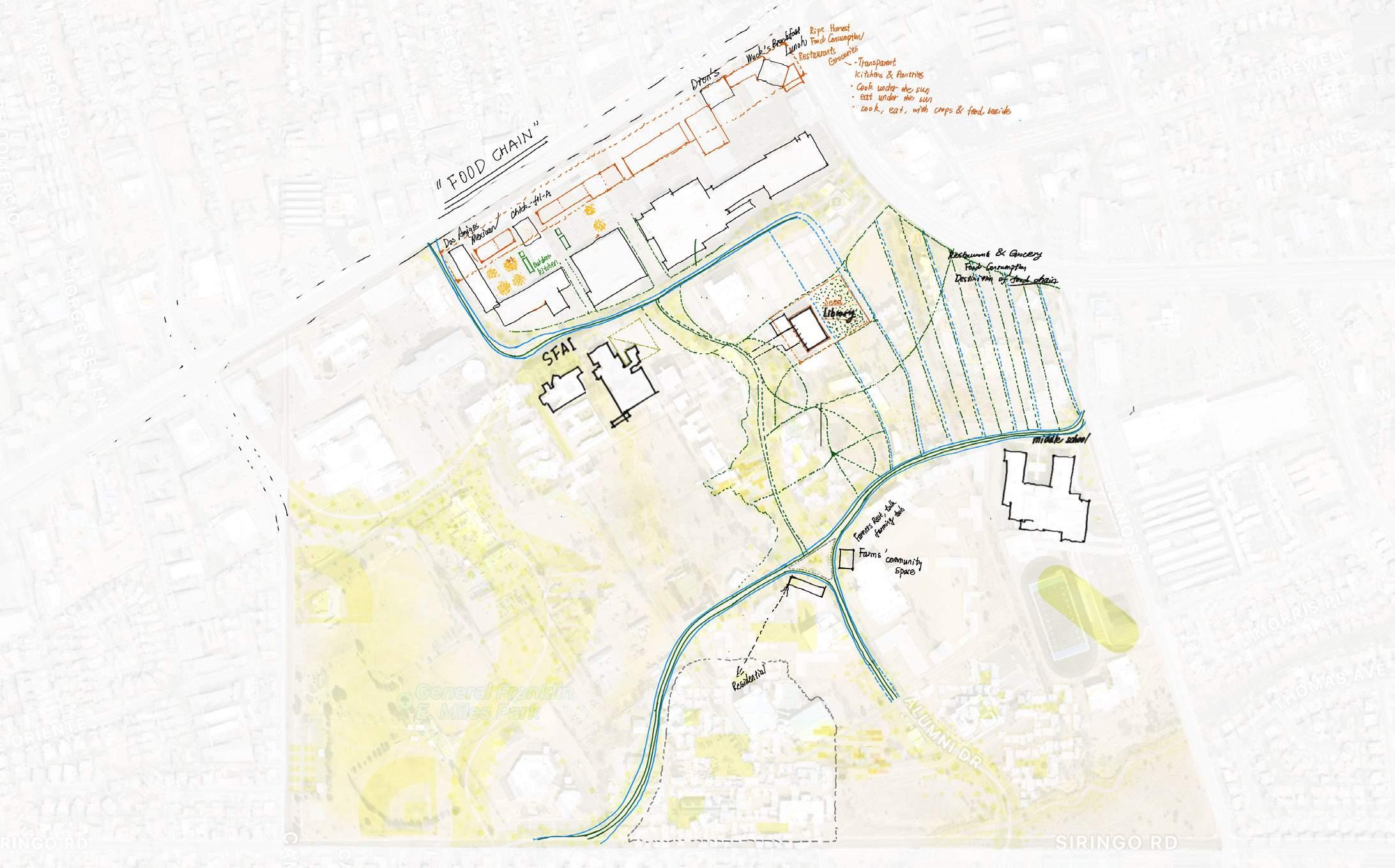
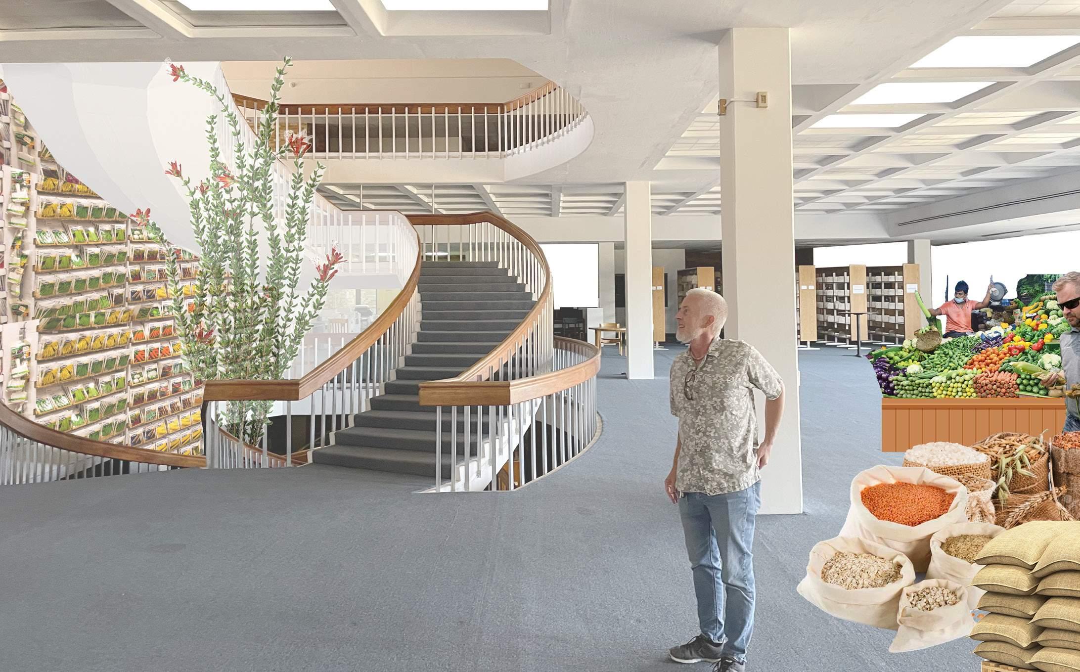
Seed Library: rennovation of the existing library building
Vignettes: Land of Seeds
Land Matters -- Santa Fe Urban Studio
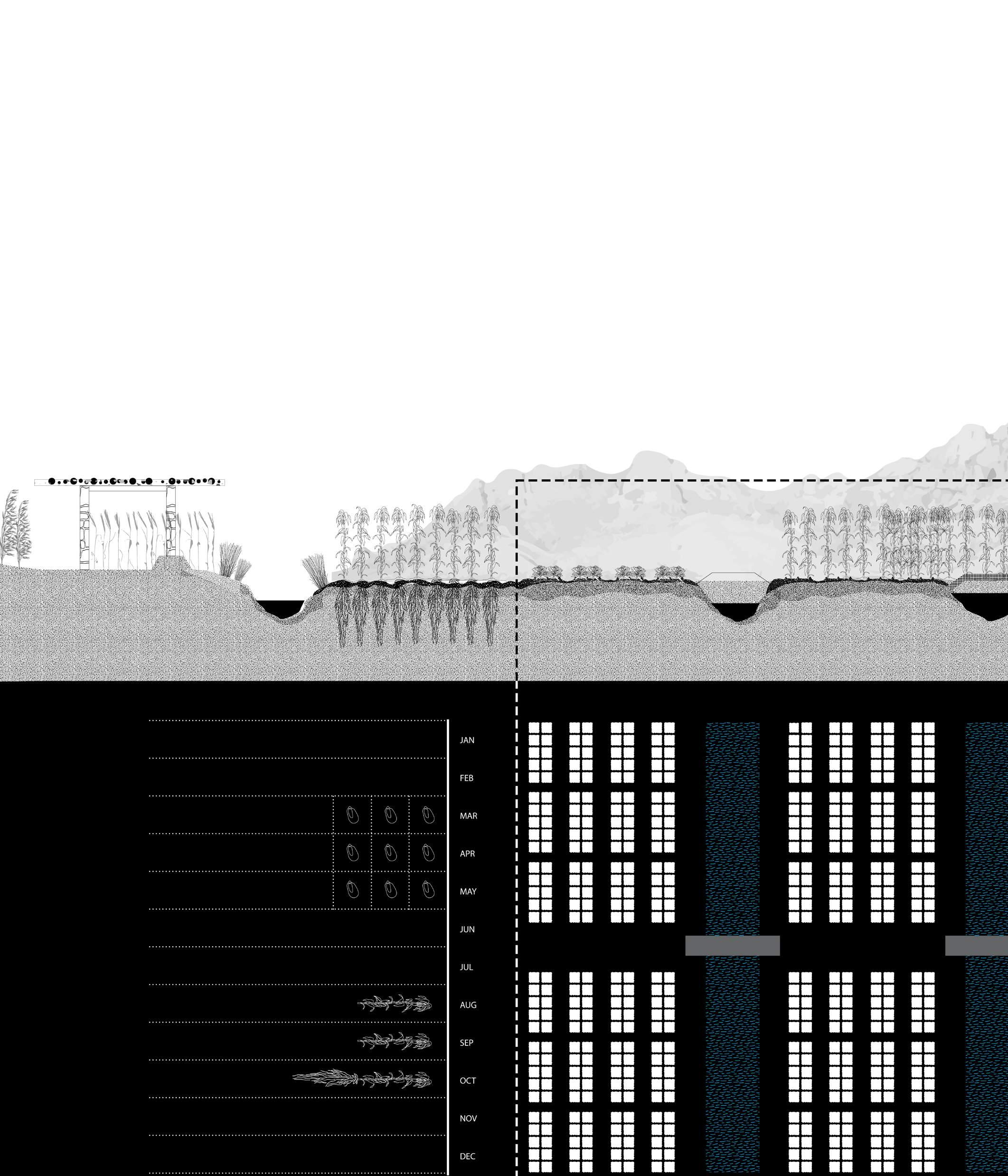
Siteplan of the community, the farmlands and the food library Farming
Community Housing Rewilded Land
Farmlands
sheds
Site Plan 25
Acequia Food Library
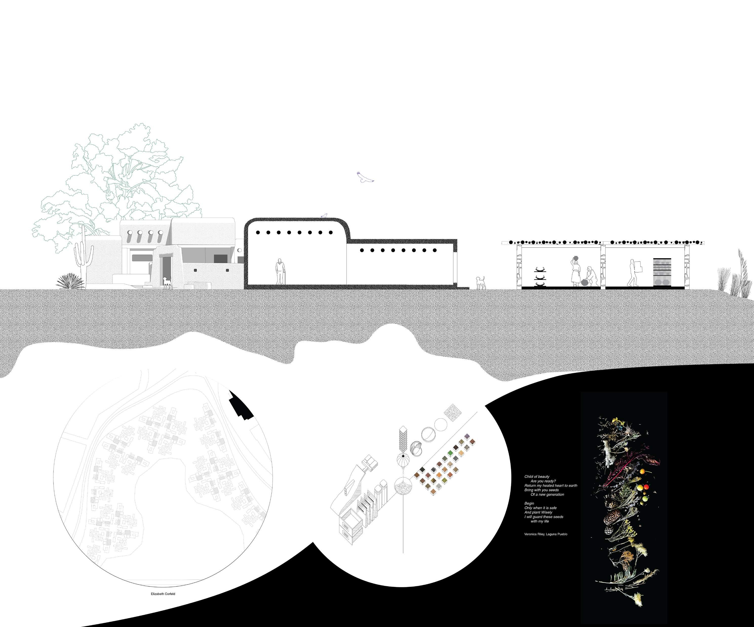
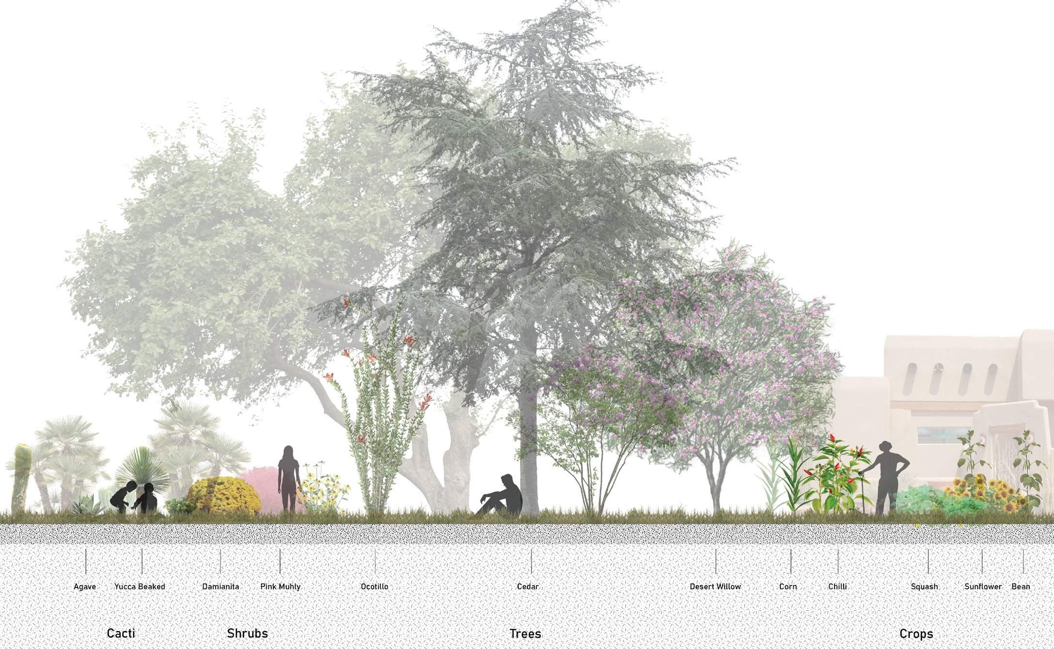
Section: Community Housing 26
 Section: Agriculture
27
Section: Seed Library
28
BUILDING PROJECT 2020
Residential Design Project, Yale University
Collaborator: Abraham Mora-Valle, Brandon Brooks, Claire Hicks, Christina Zhang, Diana Smiljkovic, Suhyun Jang
Location: New Haven, CT
Time: 2020
29
SKYSCRAPER DESIGN
Design Studio, Soochow University
Instructor: Bin Wang
Independent Work
Fall 2017
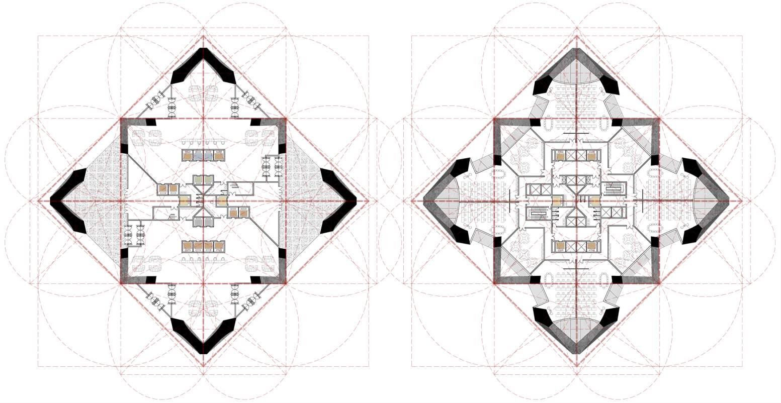
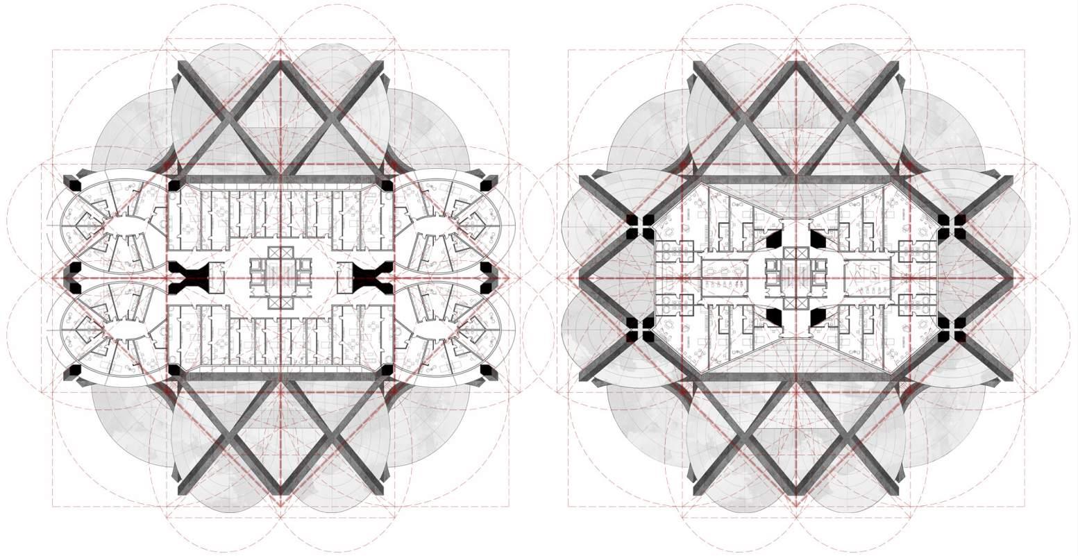
This project explores the structural system of a skyscraper. In tradition, a tall building is framed by the vertical concrete core and the curtain wall system, which leads to homogeneous layered floors. In this project, I try to develop a structural system that is non-linear and can grow upwards in an autonomous way. Starting from a plane centrosymmetric geometry, the structure rotates, folds, and grows itself, generating various space for new possibilities.

Skyscraper Design 30
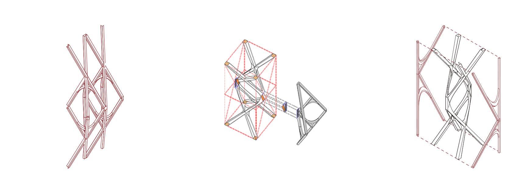
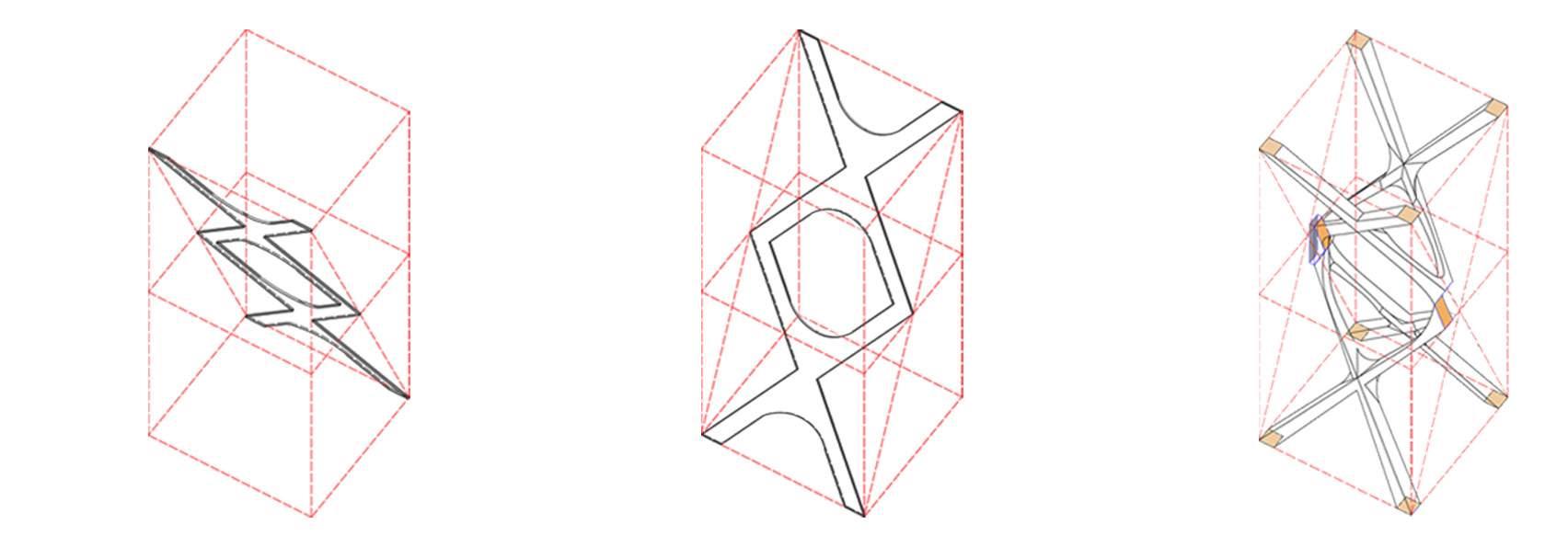
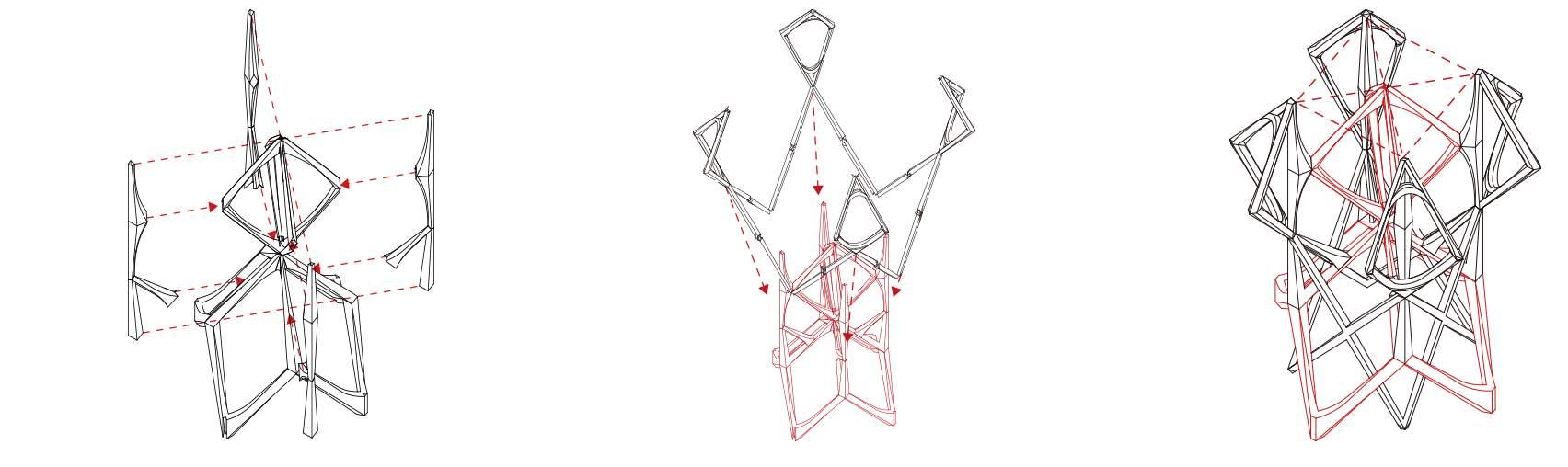
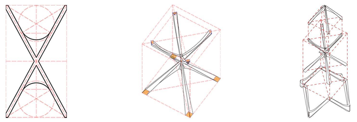
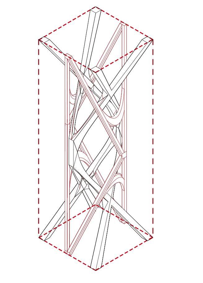
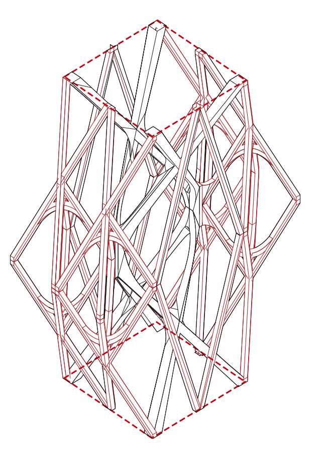

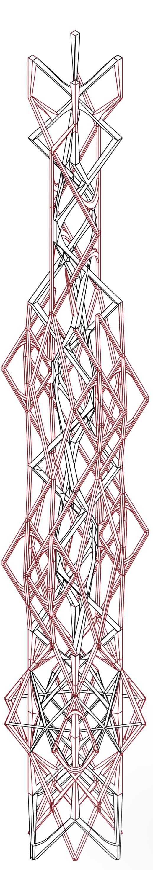
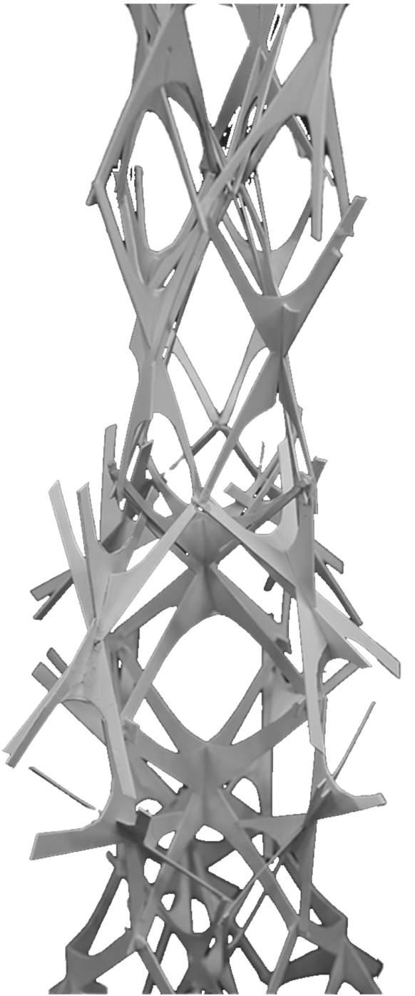
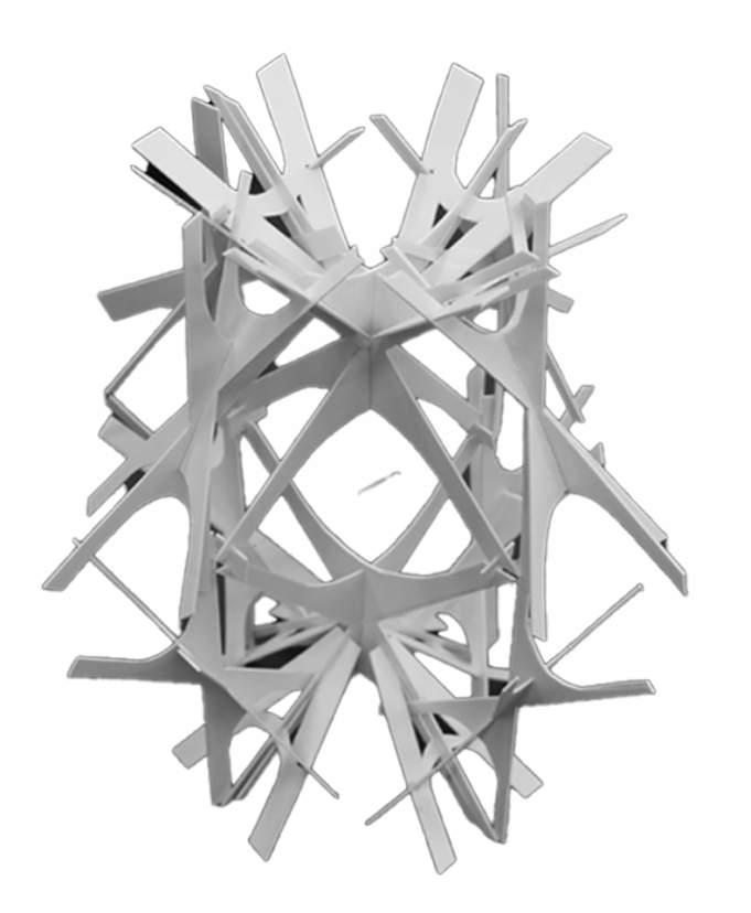
The structure consists of the central structure and the branches, both of which weave together to form a growing system. Accompanied with the growth of the structure, the floors show a constant change in shape and direction. The huge columns may run through each floor at different positions, resulting in various space. The functions of spaces vary based on the feature of the plans.
Yikai Qiao Growth
Structure Root Head Body Growth Body Branch Structure Skyscraper Design
Central
31
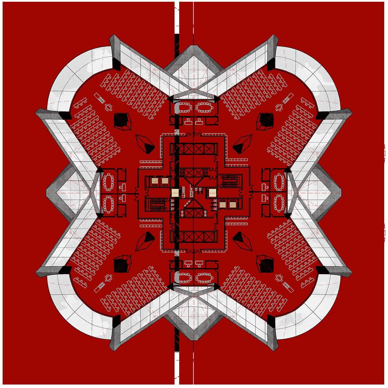

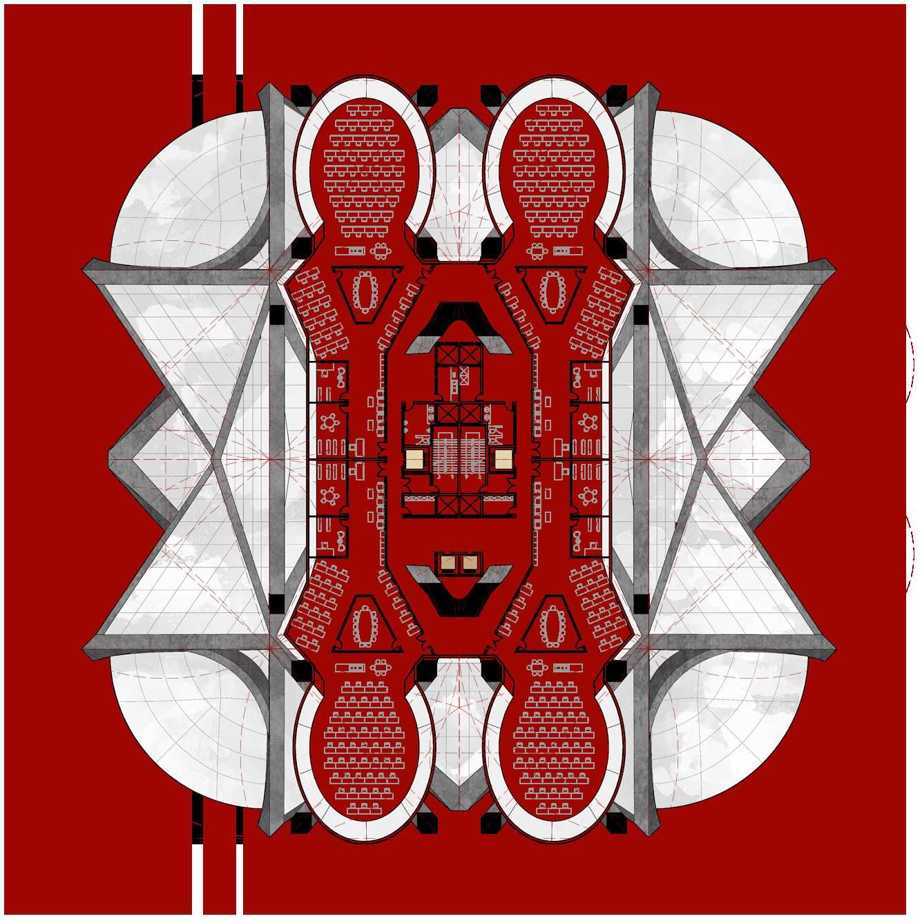
Yikai Qiao Typical Plans List of All Floors
Skyscraper Design
Lower Level Office Plan
32
Upper Level Office Plan
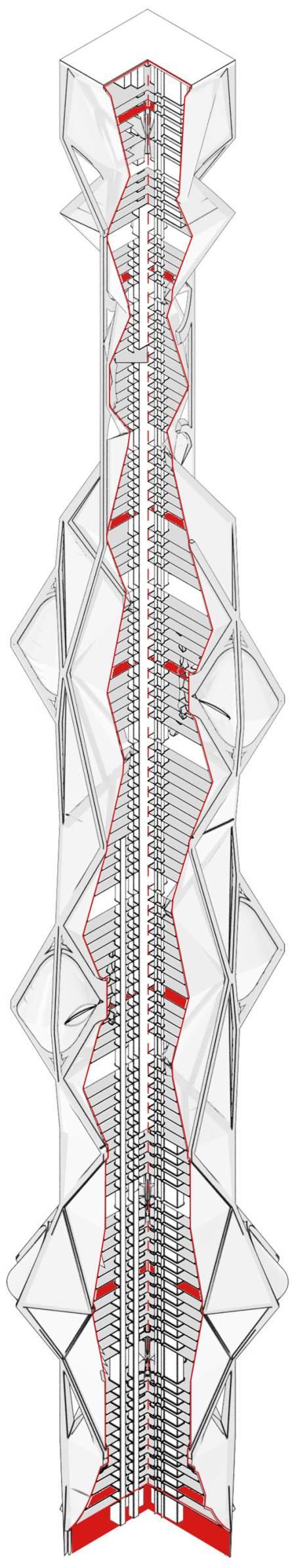
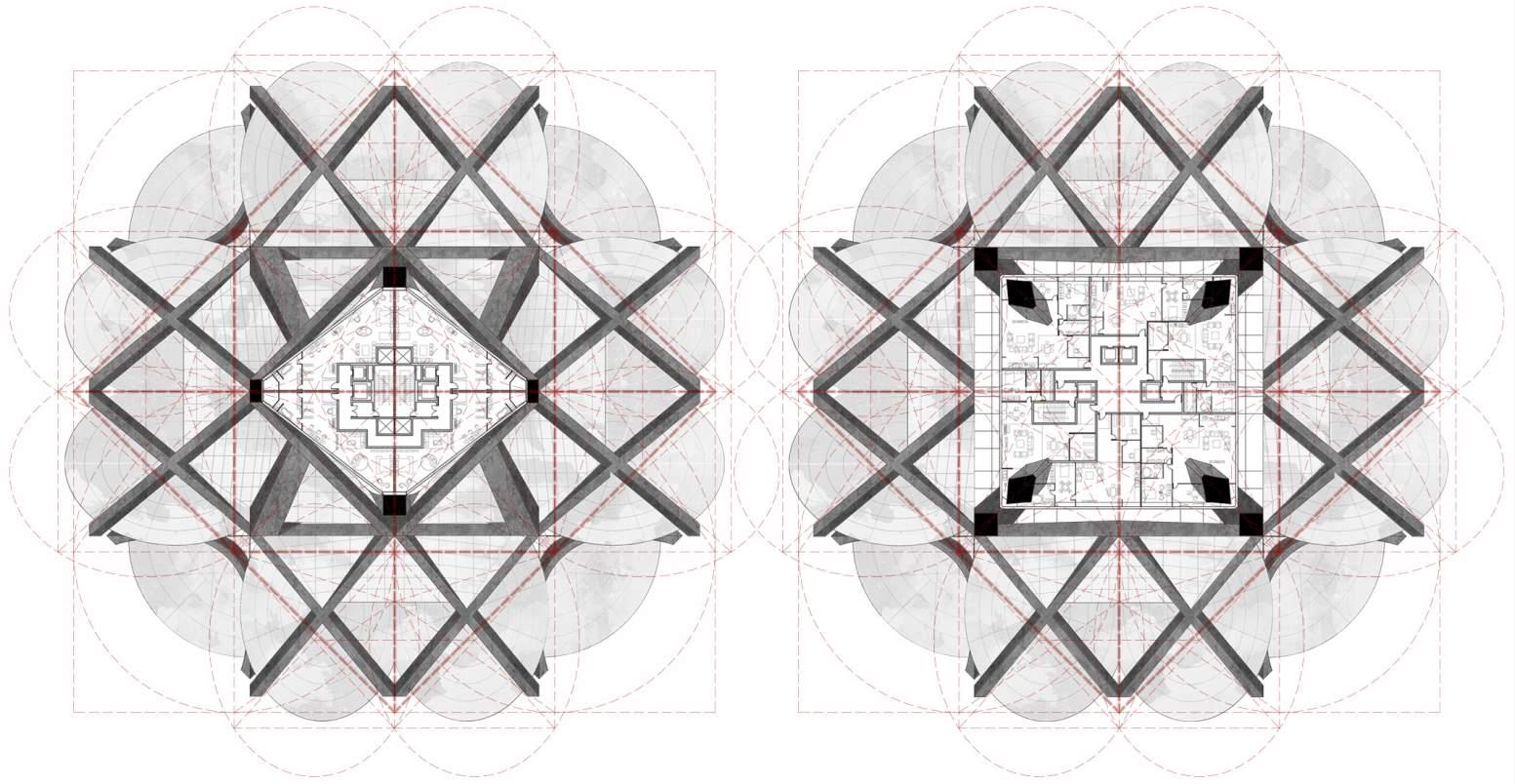
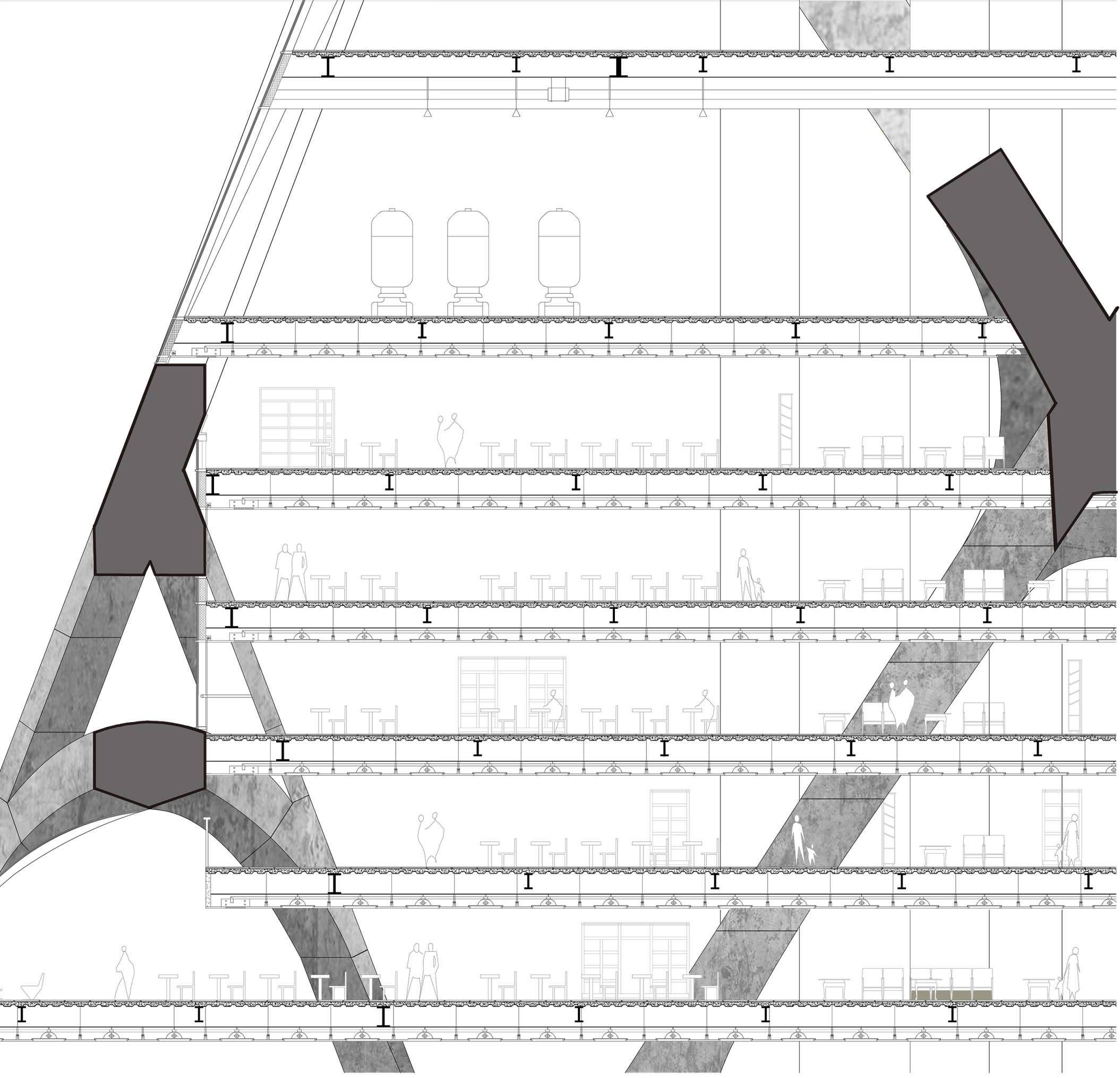
Yikai Qiao Typical Plans 1 2 1. Ground Floor 5. Hotel Plan I 7. Hotel Plan III * Plan 3 & Plan 4 are on the previous page 2. Office Plan 6. Hotel Plan II 8. Apartment Plan 3 4 A A 5 6 7 8 Skyscraper Design Section A-A Section 33
RED HOOK ISLAND
An Outlook of the Future Educational Urban Space of Red Hook, NYC
Core 4 Urban Studio, Yale University
Instructor: Aniket Shahane
Collaborator: Suhyun Jang
Location: Red Hook, Brooklyn, New York Spring 2021
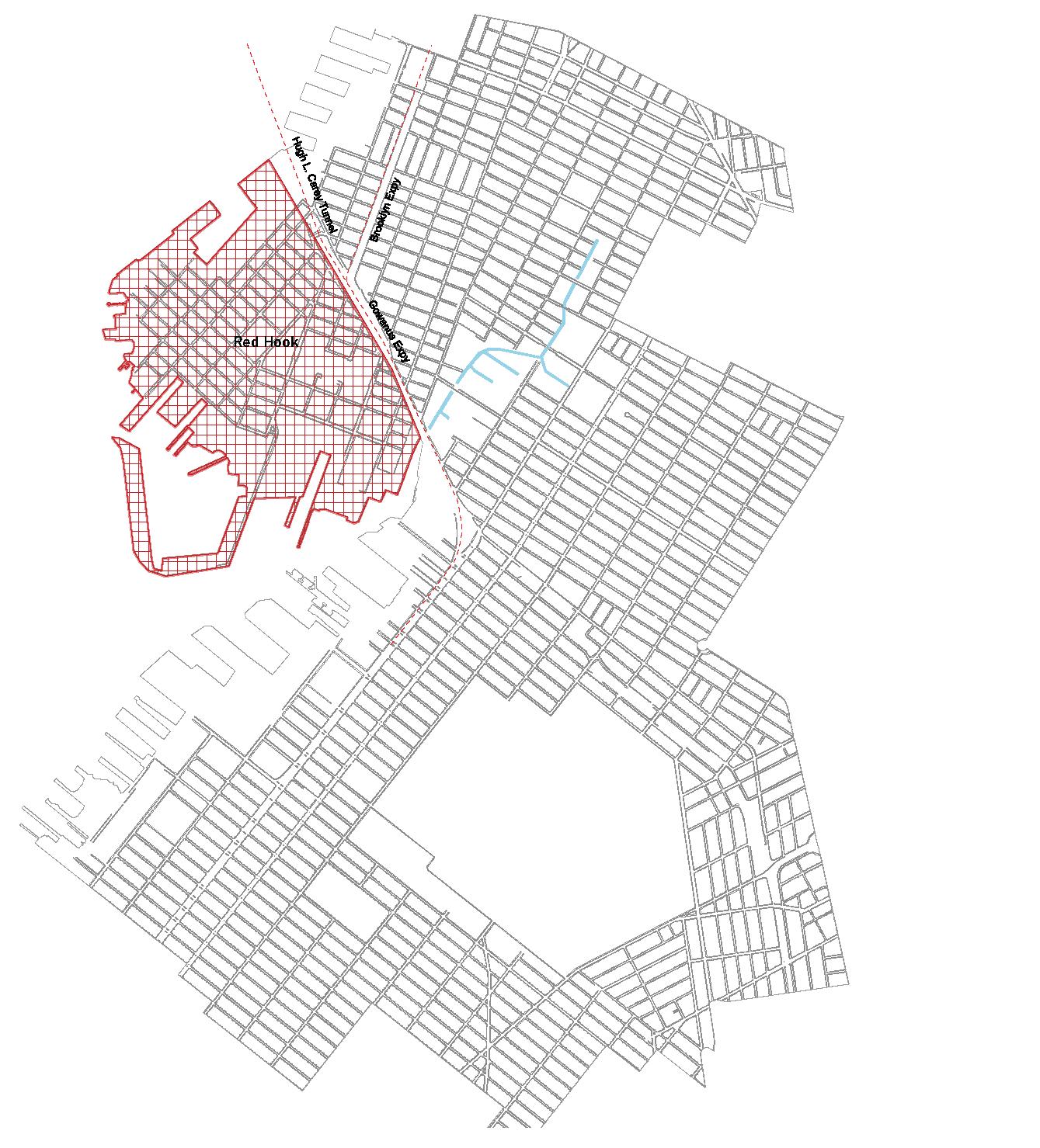
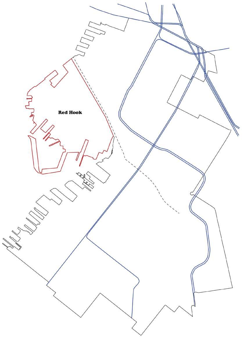
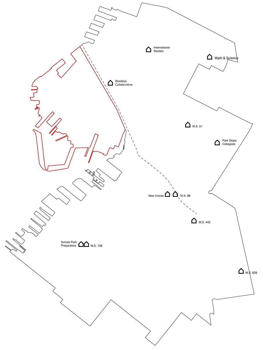
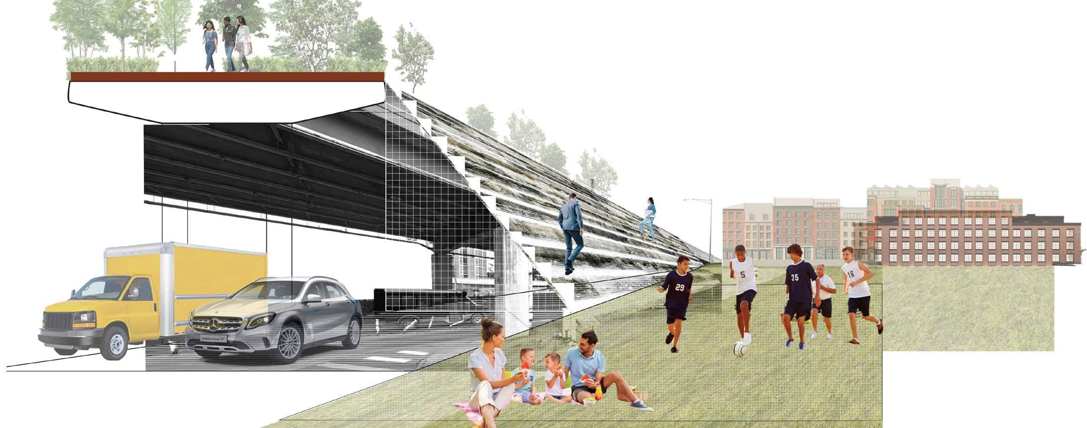
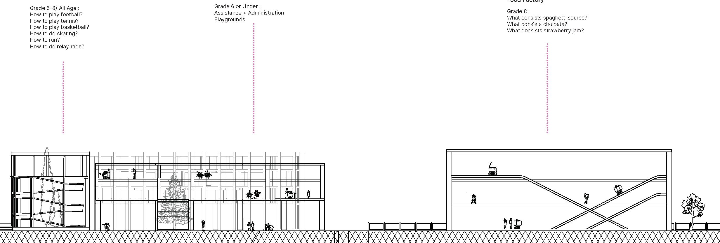
Red Hook, the peninsula at northwestern Brooklyn, witnessed a long history of industrial prosperity followed by reluctant economic decline. It is a special district alongside NYC’s shoreline which experiences the integrated urban effect caused by its gentrification, its flood vulnerability and its isolation by the city’s infrastructure. The Brooklyn Queen’s Expy cuts off Red Hook’s connection with the rest of the city, making Red Hook a literal island. As a result, the educational resource at Red Hook shrinks. The local youth will pay a higher cost to reach to schools and other educational resources.
The aim of the project is to research on what’s at stake in Red Hook at present, then followed by projecting a future Red Hook with a designed new educartional system for teenagers at middle school. We take into consideration the isolation effect of Red Hook and its still valuable manufacturing heritage, and make the assumption that what if we keep (or even further) the isolation of Red Hook, turning it from isolation to independence. Gradually we support Red Hook to become a self-sustained, walking friendly island that teenagers enjoy educational equality.
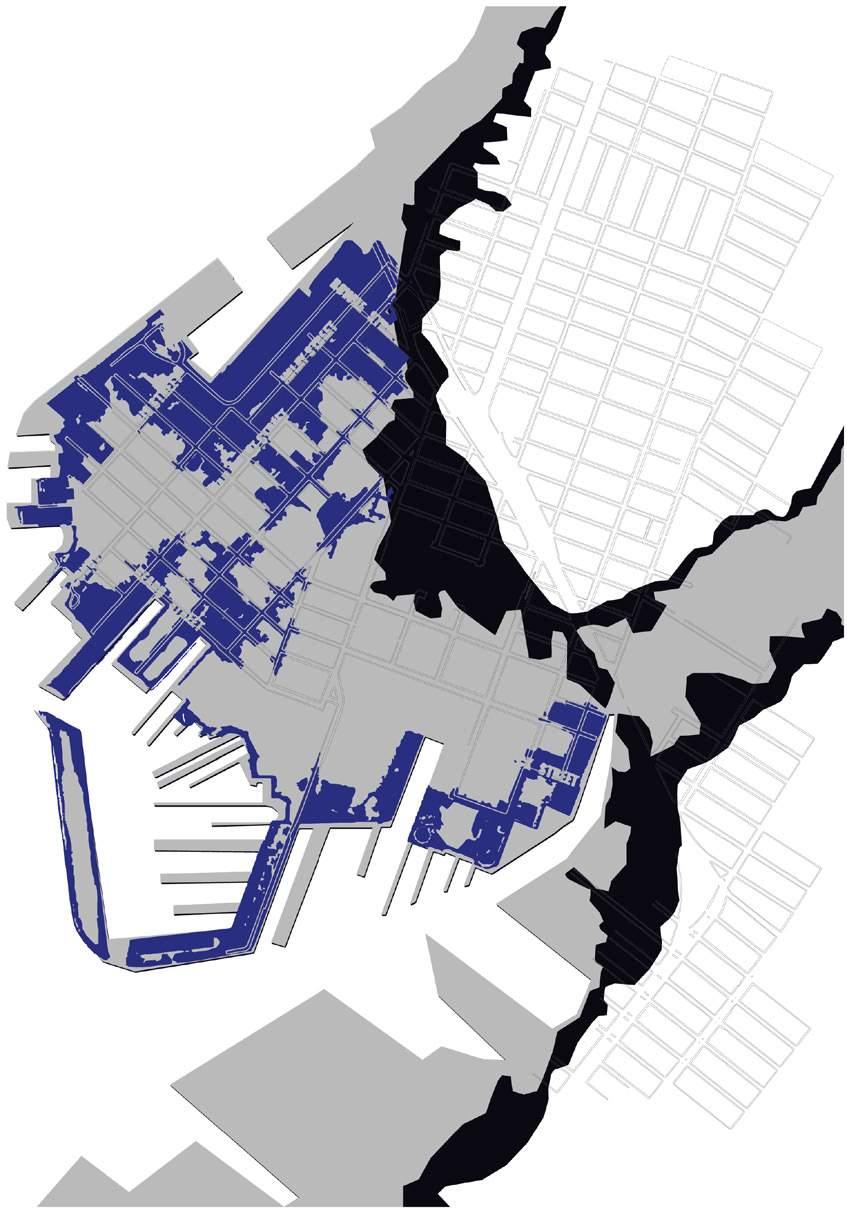
Part of the land of Red Hook is artificially created for industrial use for centuries. As a result, it faces the vulnerability to natrual disasters such as flood. In the year 2012, the hurricane Sandy destroyed Red Hook’s shoreline. From the FEMA flood map, it is expected that 100 years later, Red Hook will be encroached most of its shoreline land.
While attempts have been made to defend against the flood, in our project, we let the flood in. We assume that the sea will slowly flood Red Hook and the whole island will shrink in the following decades. As the sea level rise becomes a universal issue, we see Red Hook as a prototype of the endangered seafront zone that needs a way out.
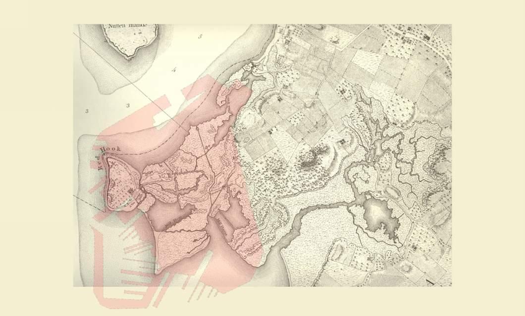
Map of Red Hook, Bemard Ratzer, 1770 overlapped with the area of Red Hook in 2021 (red color)
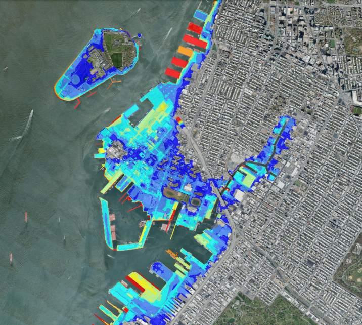
Base Flood Elevations, 2015, FEMA BFEs are the computed elevation to which floodwater is anticipated to rise during a 1% annual chance storm,
Isolation of Red Hook
Yikai Qiao
Red Hook Island
The Brooklyn-Queens Expressway sepertates Red Hook from Brooklyn Lack of Subway in Red Hook
Lack of public schools in Red Hook
34
Flood vulnerability of Red Hook 10% annual chance flood 1% annual chance flood
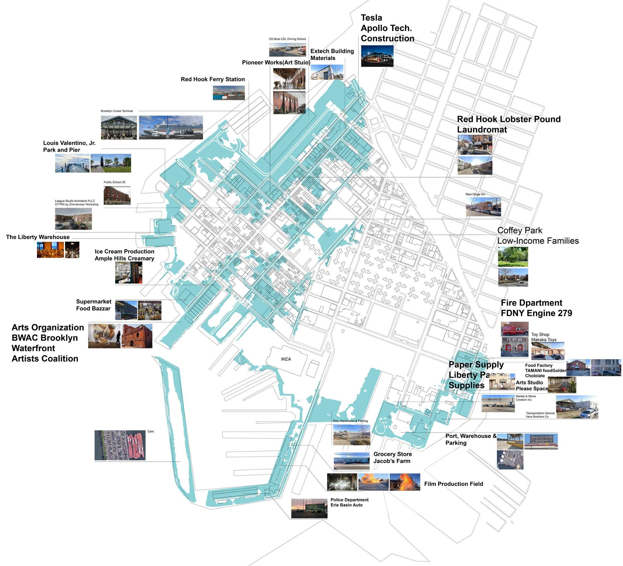
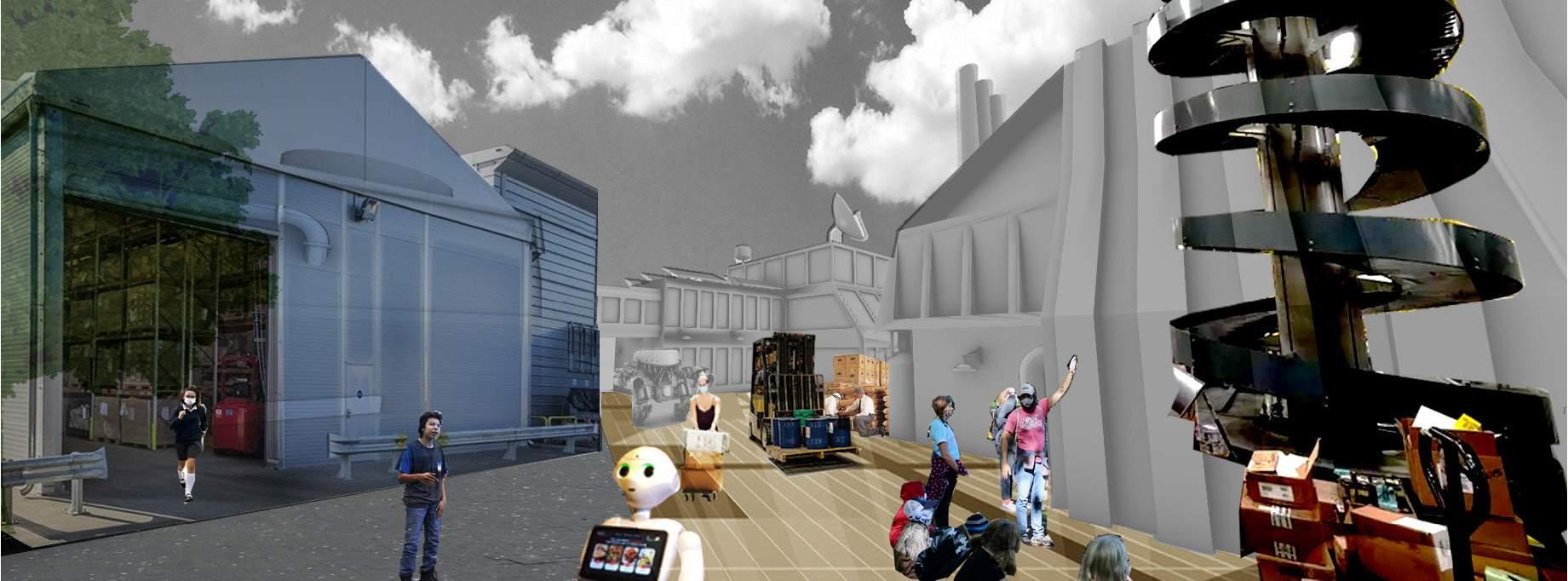
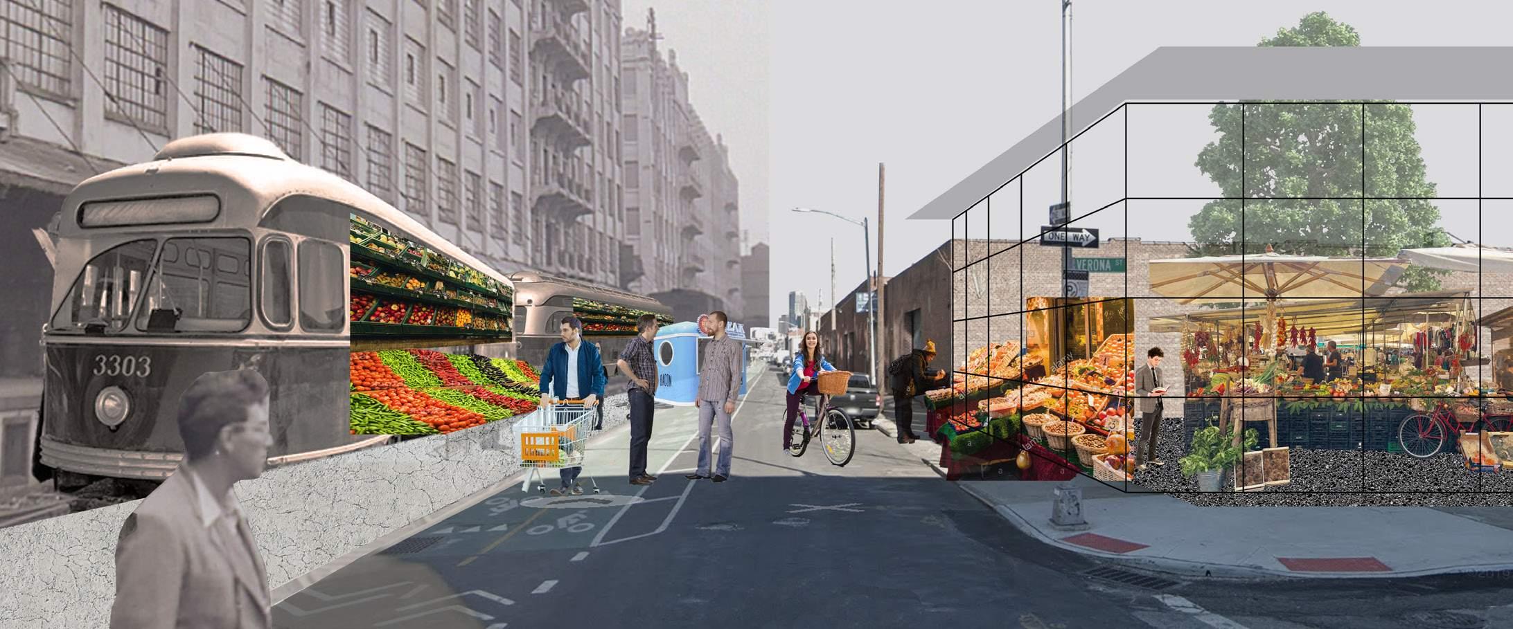
Though declined with marine industry, Red Hook developed a rich culture of making. Shops and small manufacuture zones fill every street. The waterfront warehouses are turned into markets and workshops; and there are food grocery and micro factories in the streets. However, in our outlook for a ‘shrinked‘ future Red Hook, many of these shops will be gone (the noted places above).
This reminds us the issue that how we treat the heritage of manufacture shapes the future community of Red Hook. We plan to document and preserve some of the manufacture zone, especially those with local making culture. This heritage will be the root for a future education for local teenagers -- ‘Learn by Making‘.
Phasing: from isolation to independence
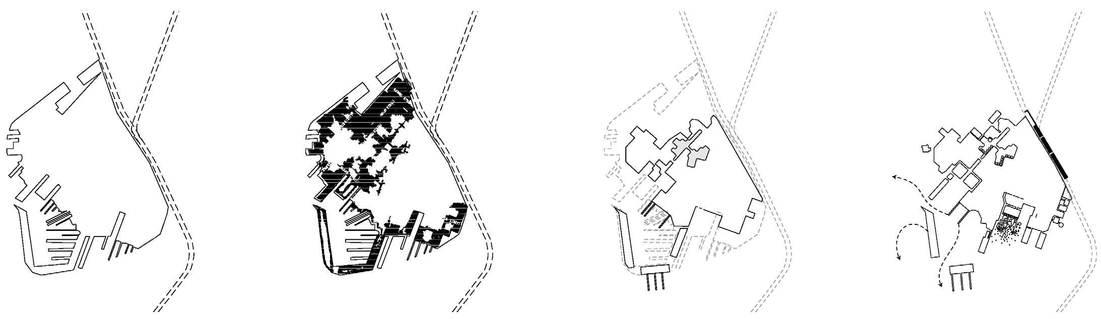
Red Hook gradually shrinks from the sea level rising
A process of rezoning, preserving and reusing Red Hook
Current Red Hook facing the risk of floods Present Near Future
If Red Hook will be flooded, why not just let it shrink and make it more independent? As the shoreline be encroached by the rising sea levele, Red Hook will witness a shrink in its land area. Simutaneously, new urban policies will adjust the whole community to the new environment -- shops get preserved, the communities gathered, public schools distributed and water transportation enhanced.
Red Hook becomes a more integrated community with higher resilience
Yikai Qiao
Heritage of Manufacture Culture Red Hook Island
35
Yikai Qiao “What if”s
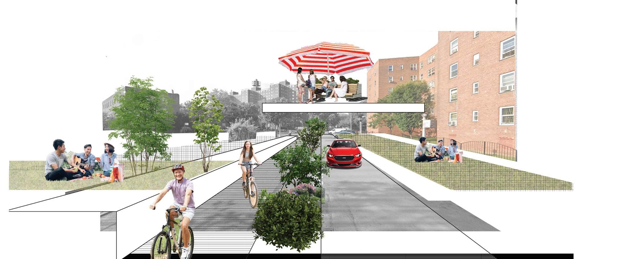
The expressway area turned into walkable and safe place
The moto rvehicle roads turned into walking paths and pocket gardens
Red Hook Island
The industrial warehouses turned into street markets
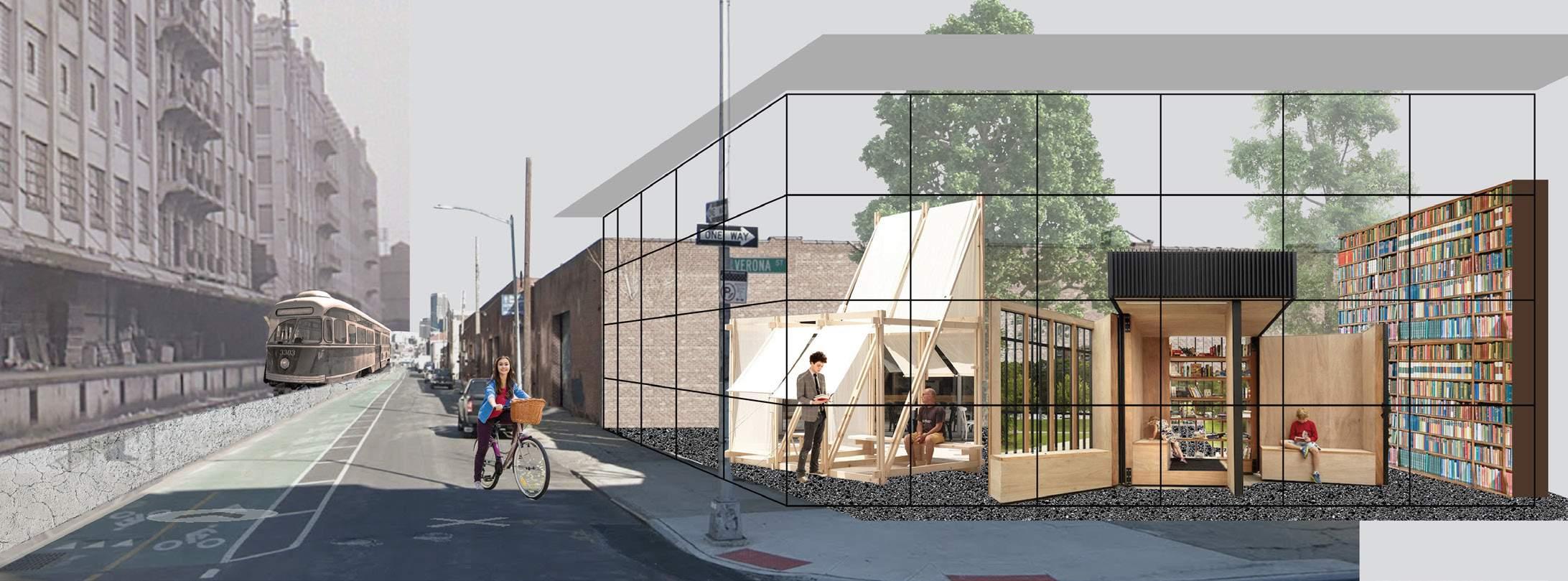
New street classrooms
New food markets
36
New pocket libraries
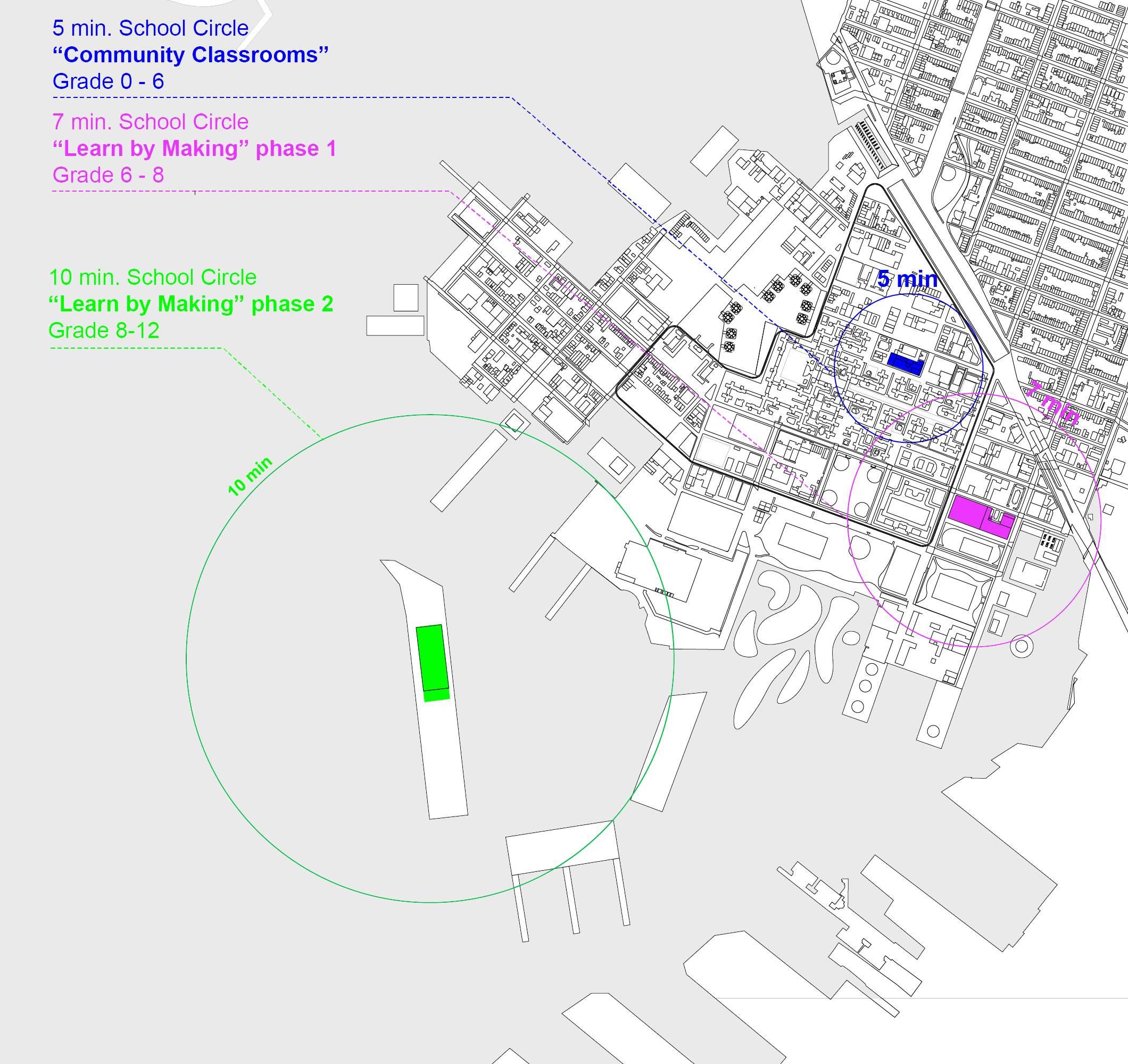
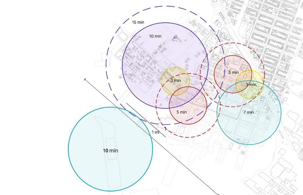
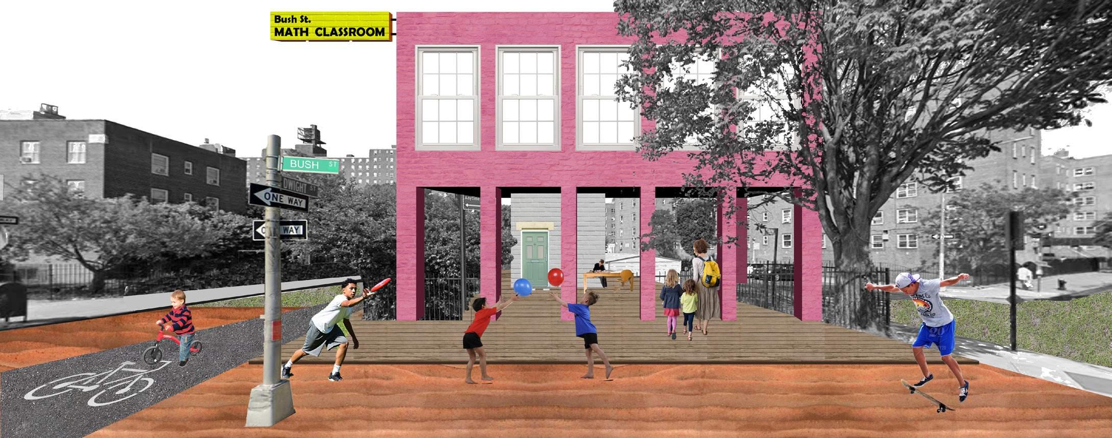
The proposed new school system is rooted on the abundant culture of manufacture in Red Hook and with the consideration of the inaccessibility of public school resources at present. For the pre-K and elementary school students, 5-min walkable circles are set across the new Red Hook Island. Street classrooms are distributed inside the community gardens and streets; for middle school and high school students, the circles get larger as their age grows. The school will take the advantage of the exisiting workshops, and encourage teenagers to learn by making. The whole island is the one school for all local citizens -- instead of going to certain school spots, people learn wherever the resource exists.
Since the maximum time span walking from one side of the island to the other is 19 minutes, there will be no need for car transportation in the new Red Hook Island. Most of the time people walk to their destination. There is also a trolley line running around the island. The trolley circulates people and goods -- sometimes it’s a bus and sometimes it’s a bodega.
The existing street corner fields will be transformed into multi-purpose public zone, maybe a street library, a community food market or just a pocket park. These spots of public space are evenly distributed across the community.
Yikai Qiao
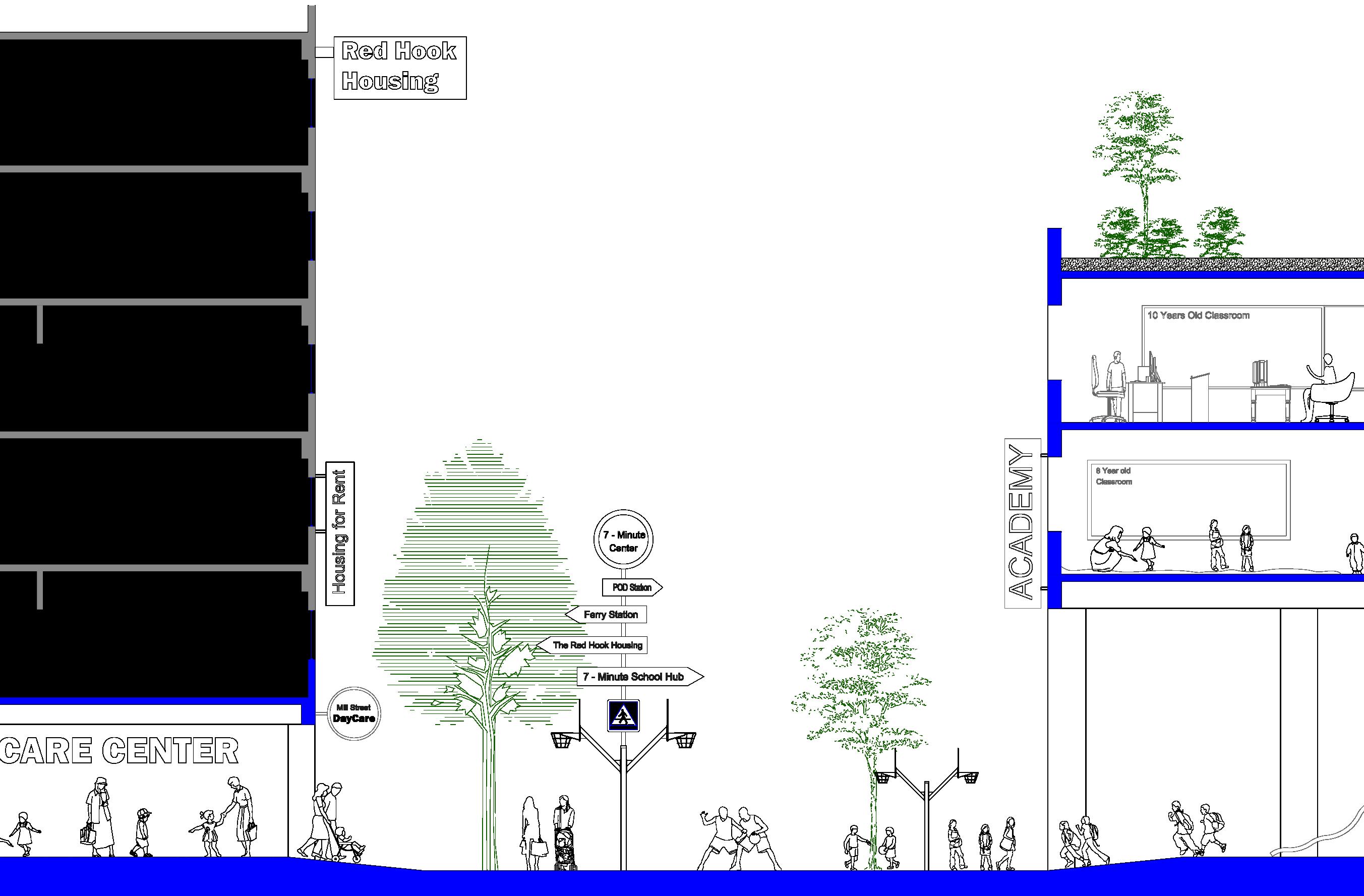
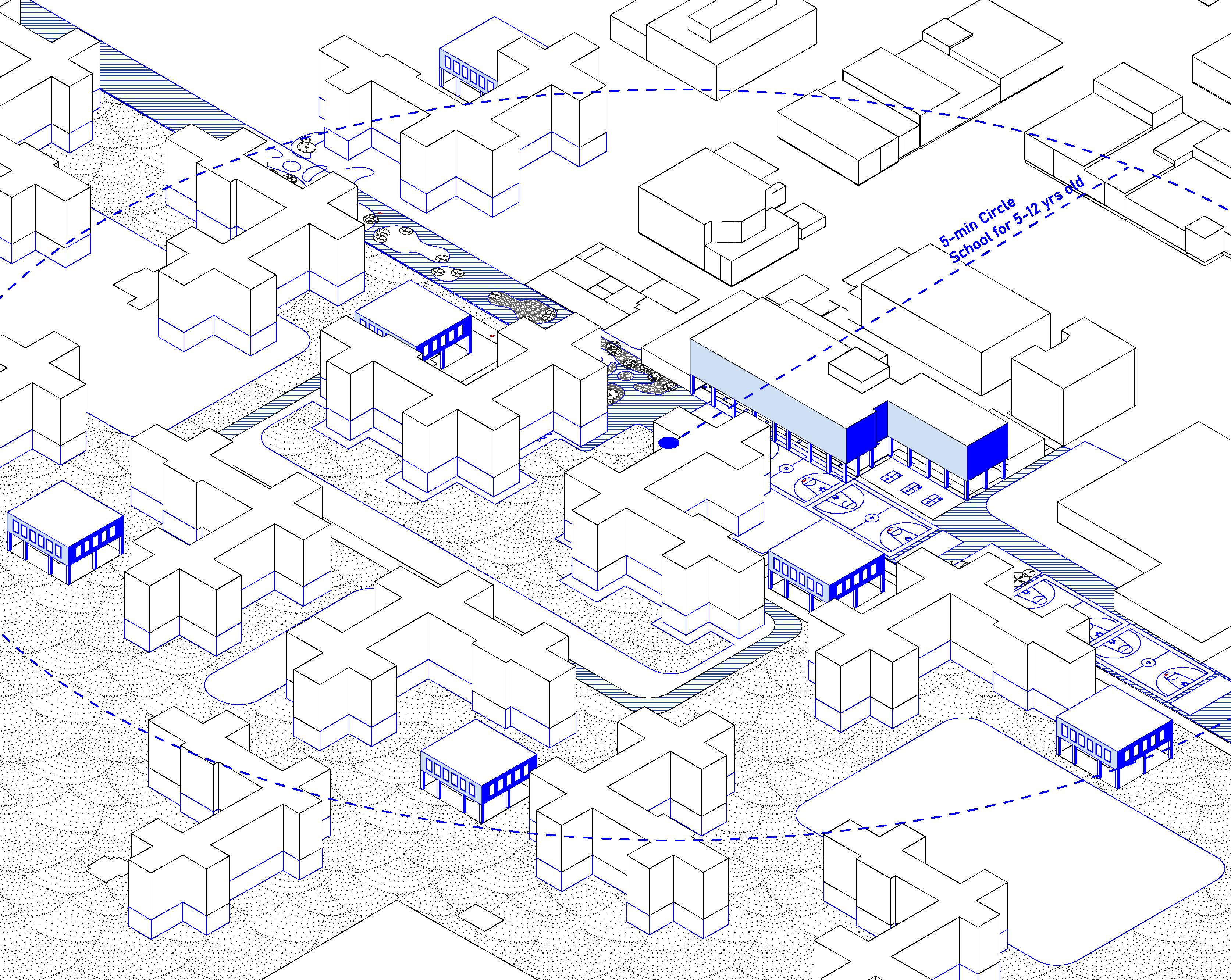
New Public Schools -- Learn by Making Red Hook Island 5 min. School Circle -- Elementary School
37
The residential housings embrace the school hub. Street playgrounds and classrooms sit evenly in the housing community. These dispersed spots serve as the learning space for various age and courses. Children can conveniently transport among the spots. The street itself weaves various communities togethter by providing pocket gardens, playgrounds and other public zones.
Neighbouring the residental housings, an elementary school hub is easily accessible to children between age 5-12. The ground floor of the housing is the daycare center for pre-K children. The street turns into a car-free playground for both the children and adults. Across over the street, the school hub opens its ground floor seamlessly to the street, extending the area for outdoor activities. In the upper floors of the school hub, classrooms are set with various subjects.
Yikai Qiao 5 min. School Circle -- Elementary School
Red Hook Island 38
When the children grow, their school circles enlarge, Eventually, the circle will expand to the area of the whole island. For a typical middle school student in Red Hook Island, he/she will start to learn the scientific truth and technical skills by literally participating in the process of industrial production and manufacturing. The paper factory, the fire department and other existing producting zones can all potentially become learning space. Teenagers get the intro of the professional training from various industries. ‘Learn by Making‘ will be the theme of Red Hook Island’s educational system.
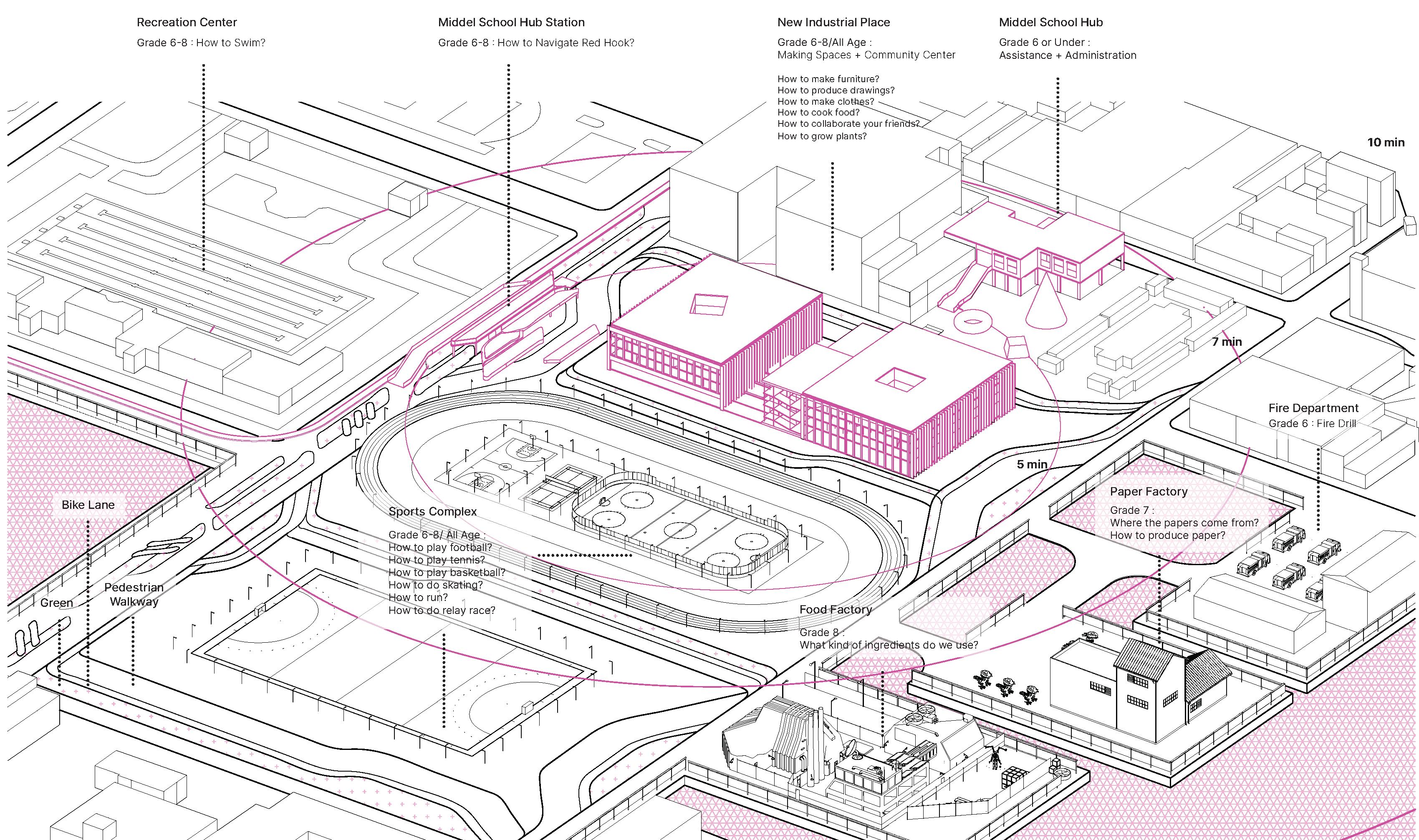
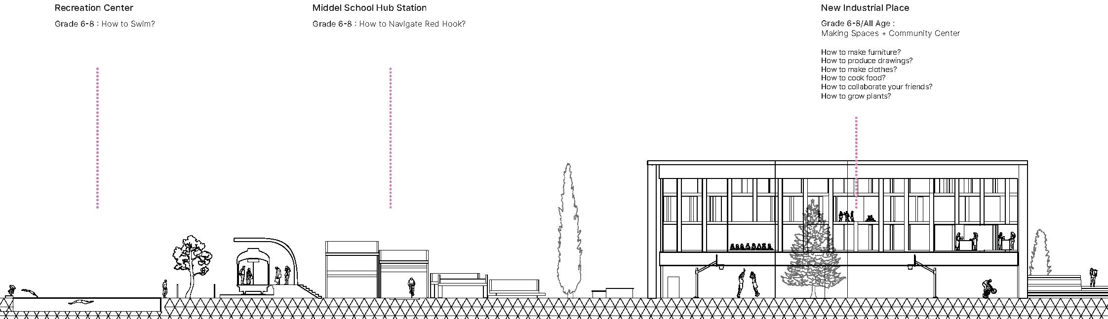
Yikai Qiao 7 min. School Circle -- Middle School
Red Hook Island 39
PLAN (UNPLANNED)
Core 1 Studio, Yale University
Instructor: Nicholas Mcdermott
Independent Work
Fall 2019
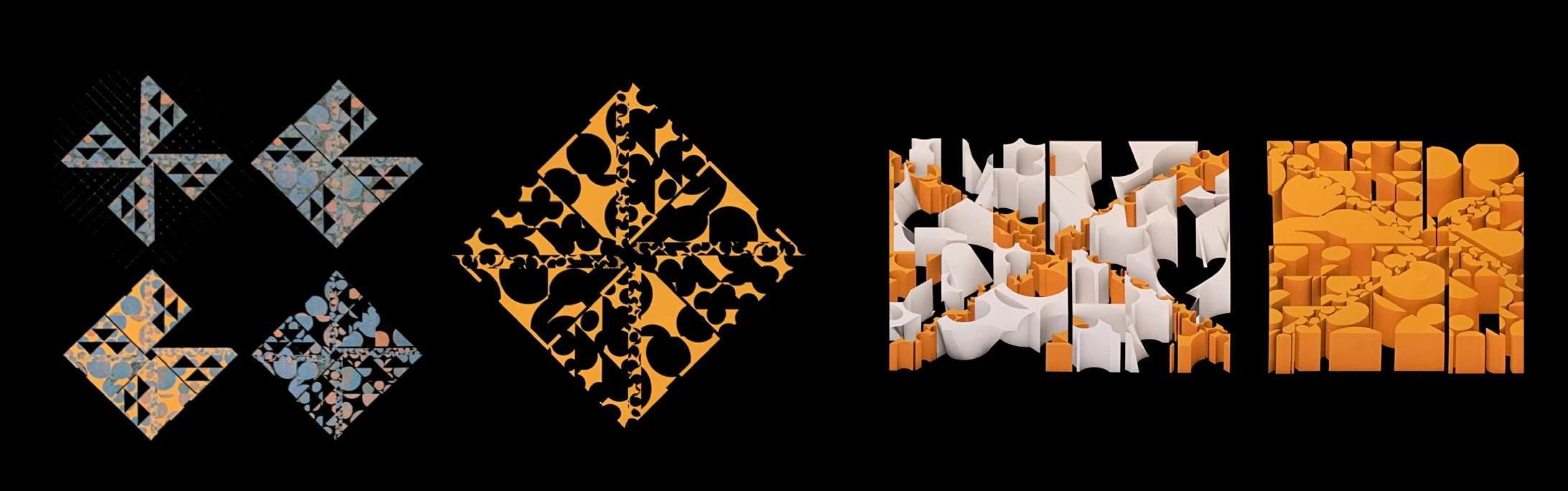
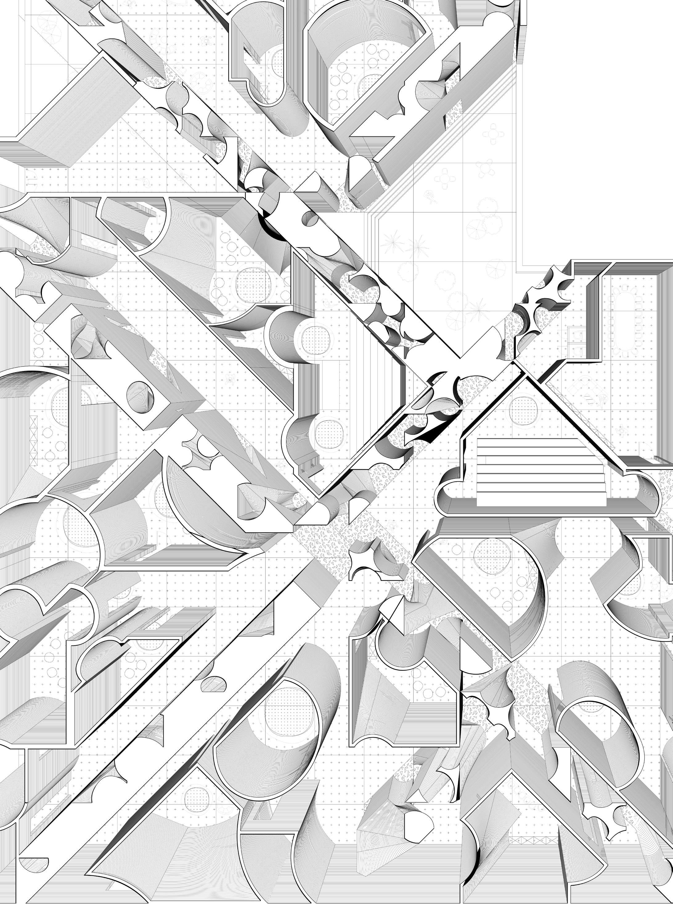
The various scales of a circle can adjust its property from a dot to a field, which applies various spatial metaphor to it. Inspired by Kusama’s paintings, this project explores the spatialization of 2D patterns. By cutting the original image with the curves extrated from the painting, the artwork is dissolved and reassembled, thus transformed into a one-story building with two types of space -- the meditation space embedded in the structural walls, which are deformed dots for single person to fit in; and the bubble chambers for public performance and rehearsal activities. The two space are clearly defined between silence and sound, while unified under similar graphic language.
Yikai Qiao
Plan (unplanned) 40
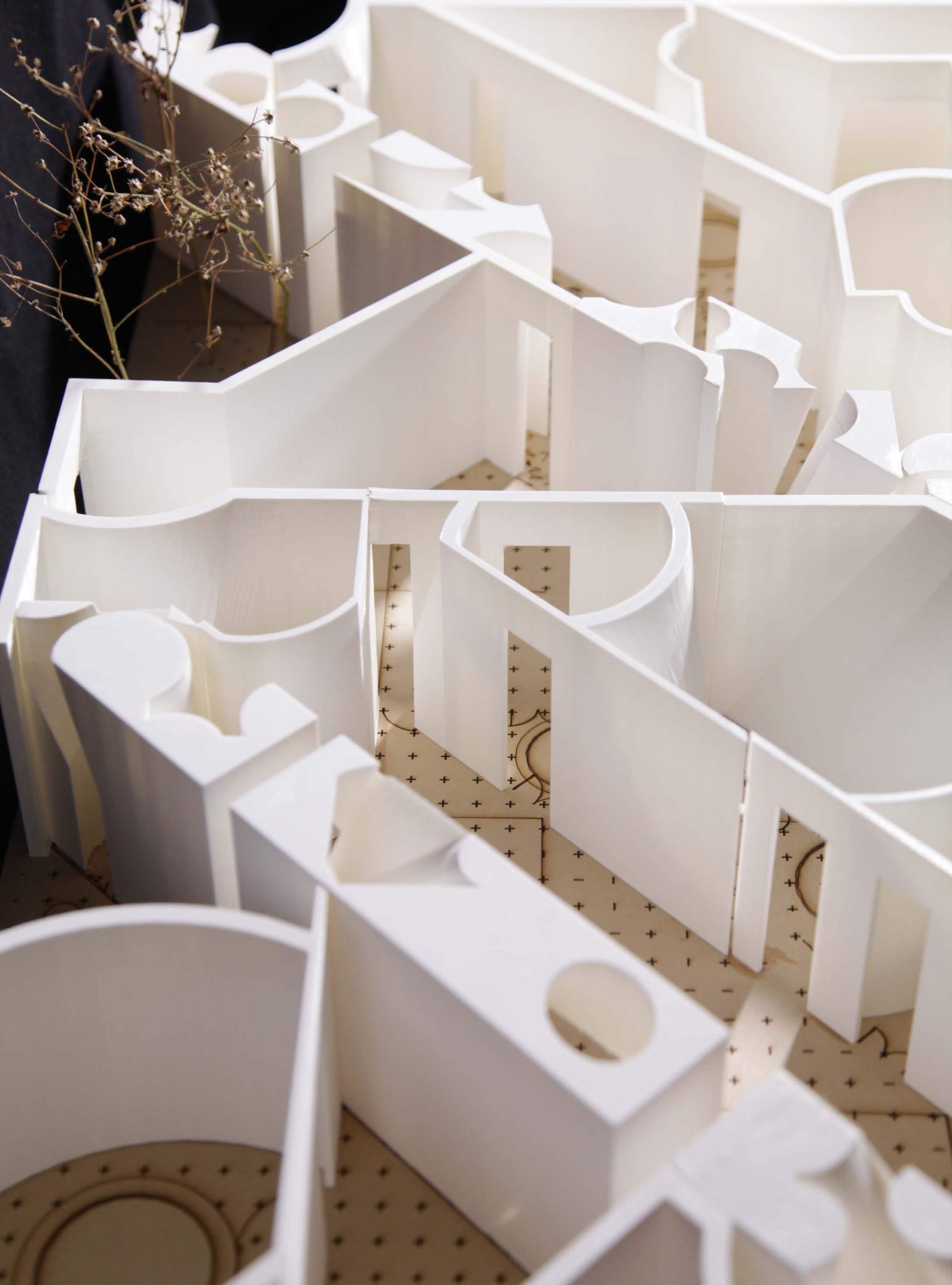
Yikai Qiao Plan (unplanned) 41
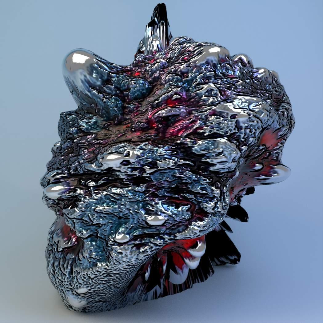
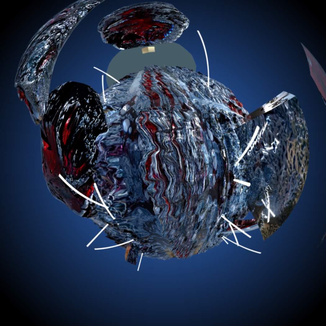
THE FROZEN OCEAN
Visualization Studio, Yale University
Instructor: Daniele Profeto
Independent Work
Summer 2020
This practice explores the ambiguous solidity of liquid. A raw image with the implication of mulitiple materiality was selected and then transformed into 3D objects. The surface of the object reflects the wrinkles, depth and patterns of the image. The objects were further processed and the surfaces of them turned into fluid ground. The motion of water gets framed in a still condition. Icy rocks are lift up from the terrain, mirroring the glimmering lights.

https://vimeo.com/manage/videos/432891356
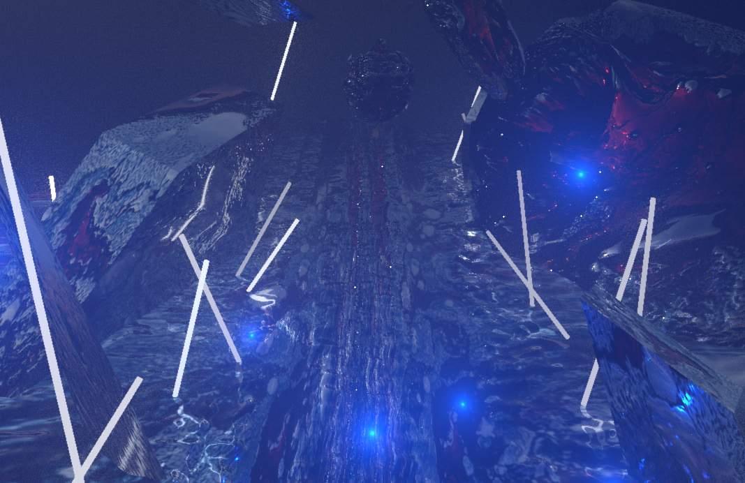
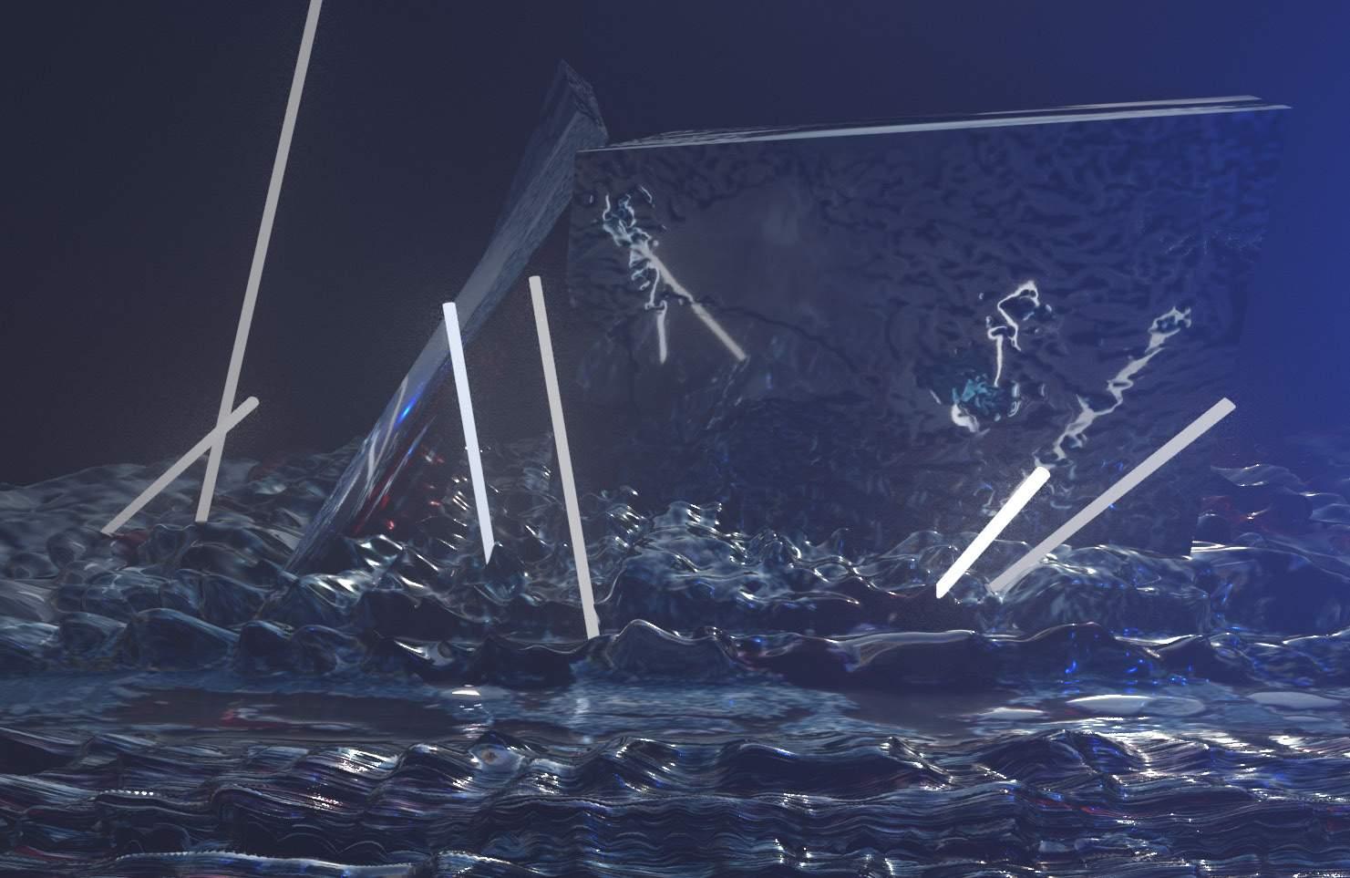
Digital Modeling (maya)
Image: Under the microscope. Photography by Joel Philip
Object transformed from the original image Software: Substance Alchemist + Maya
The Frozen Ocean Rendered animation 42
ROBOTIC DRAWING
Architectural Robotics Class, Yale University
Instructor: Hakim Hasan
Collaborator: Amber Han Spring 2023
A topographic survey tends to depict an accurate elevation changes,includes locating all buildings, structures, aboveground utilities, and major trees on the subject property.
Architecture topography mapping should allow spaces for interpretation of land conditions. How can drawing encourage the imagination of spaces and lands? This project experiments with different drawing techniques to create diverse topographic surfaces at various line densities, discovering robotics expressions in demonstrating different stroke weights, ink saturation, and line continuity.
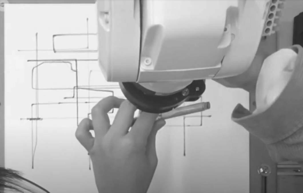
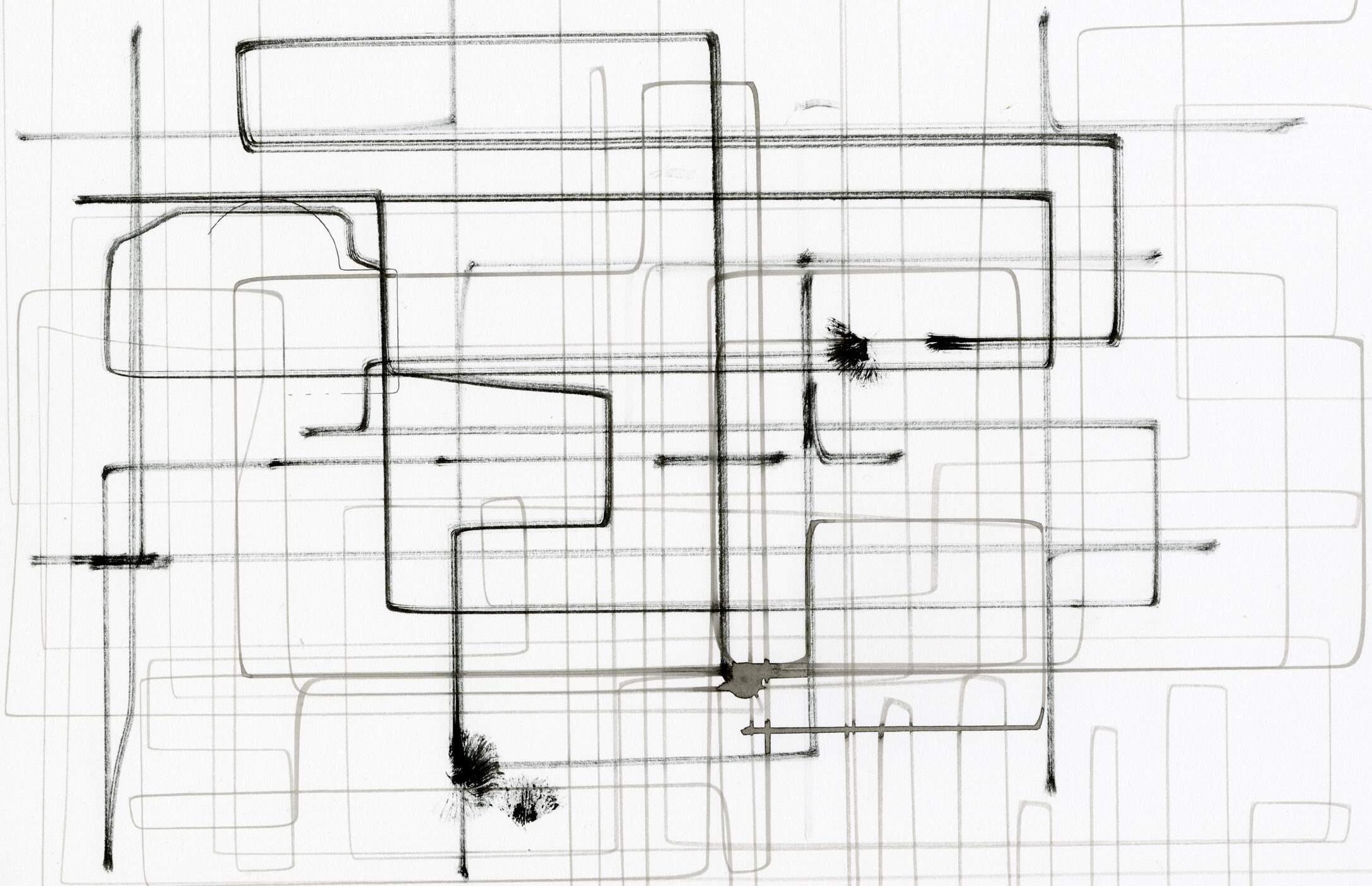

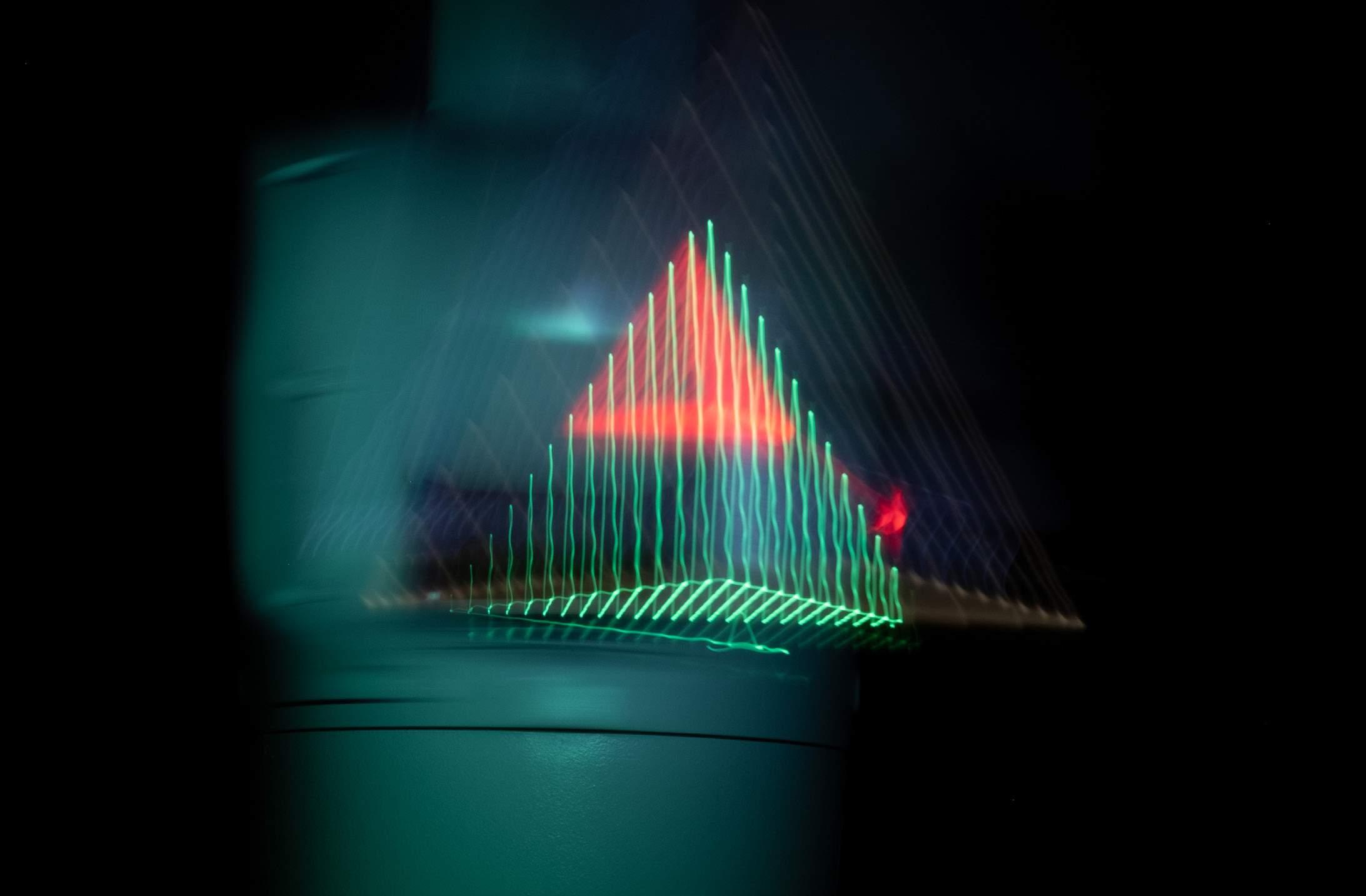
Yikai Qiao
Robotic Drawing 43
FORMAL ANALYSIS
Formal Analysis I, Yale University
Instructor: Peter Eisenman
Independent Drawings
Fall 2019
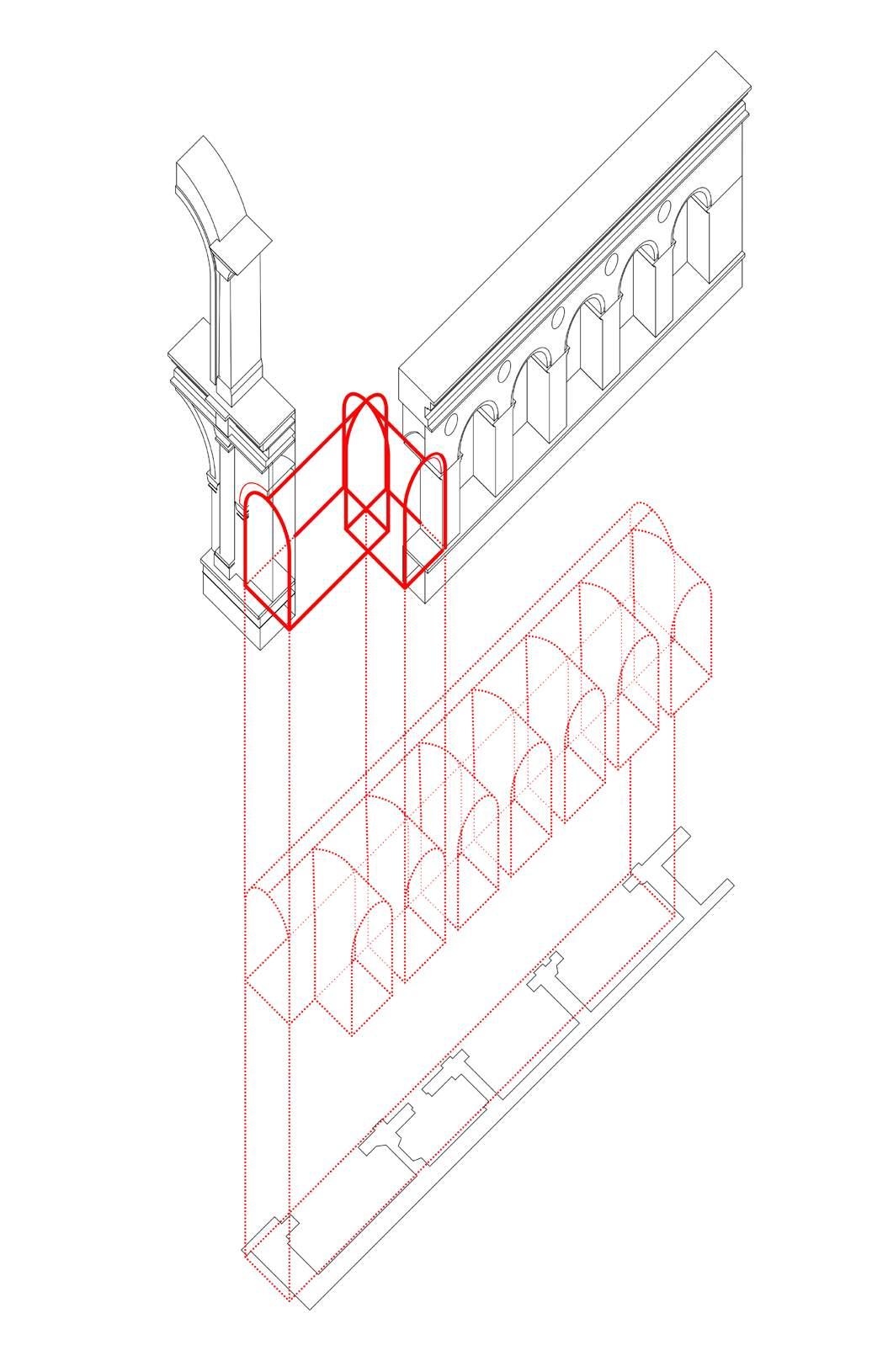
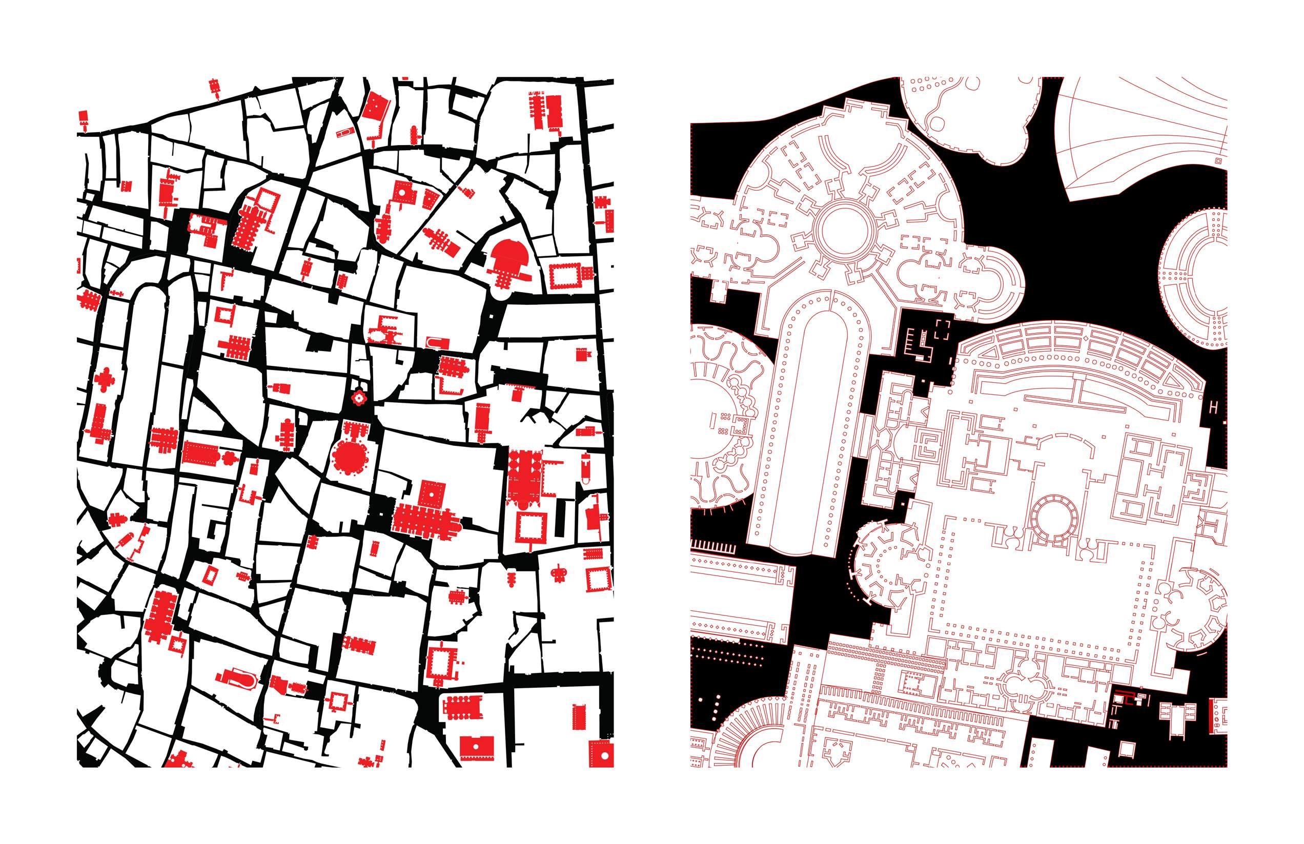

Yikai Qiao
Villa Guilia Vignola
Formal Analysis
Tempio Malatestiano Alberti
Campo Marzio Piranesi
44
Plan of ancient Rome Nolli
Yikai Qiao
M.Arch. ‘23
Yale School of Architecture yikai.qiao@yale.edu
45


