Urban Planning Portfolio YAZAN RASHED
Mr. Yazan Rashed is a fresh graduate Architect from The University Of Jordan. Mr. Rashed has a genuine interest in environmental sustainability and the integration of the environment in the built space of architecture. Also, interested in preserving heritage and design in a modern way.

Education
Bachelor of Architecture
The University of Jordan (2023-2018)
GPA : 3.41
High School
Al Hussien College School (2018-2017)
Experience
BITARCHITECTS, Washington DC
Architectural Intern | ( Virtual )
Oct 02 - Dec 2022-22
Turath: Architecture & Urban Design
Consultant, Amman, Jordan
Architectural Intern | June 27 - Aug 2022 - 29
Friedrich Ebert Stiftung, Amman, Jordan
Architect and Urban Researcher | Aug - Nov 2022
Honors and Awards
Amman, Jordan
yazan.rashed11@gmail.com
00962797391039
Linkedin QR Code : YR

Sustainable Mobility Competition Our mobility is our future
the top five projects - short listed participated in this conference with a TOD Project along BRT Line in four different Locations
6th Jordan International Architecture Conference
Arab Engineers Park Compitition
certificate of participation
Architectural Skills
Software :
Most proficient:
• Revit
• Autocad
• Photoshop
• Lumion
Workshops
Intermediate proficient :
• Sketchup
• Adobe Illustrator
• Adobe Indesign
• Fusion 360
• Microsoft office
Elementary proficient:
• Rhino
• Cinema 4D
• Enscape
International winter School Curtin University , Australia (
Virtual ) Jan - Feb 2022
Sustainable Urban Mobility Workshop with Friedrich Ebert Stiftung
Aug 2022
Volunteering
American Institute of )Architecture Students (AIAS)
Communications and Event Coordinator ( 2022 - present )
Crown Prince Foundation- Nahno ( 2022 - present)
Catch 22
Acadamic leader ( 2020 - present )
Volunteering member ( 2019 - 2020 )


Contents 03 Redevelopment of Iwanai 02 Reclaiming the roads of the Ballad 01 Nostalgia AmmanGraduation Project 04 Restitching the island 06 Mawred City 05 Transit Oriented Development alonge the BRTAmman - Zarqa
01|02|04|05|06 03
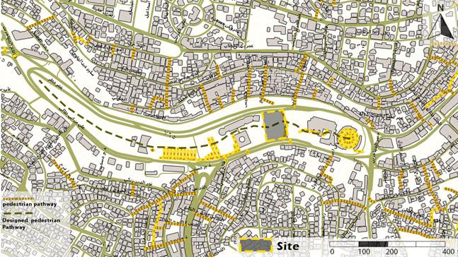
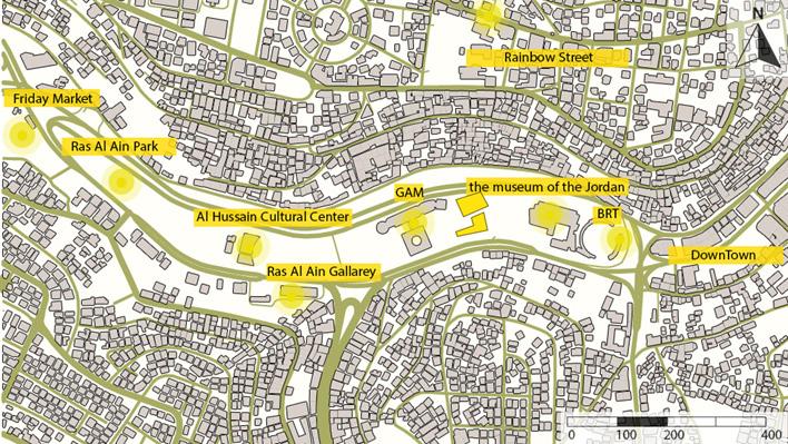
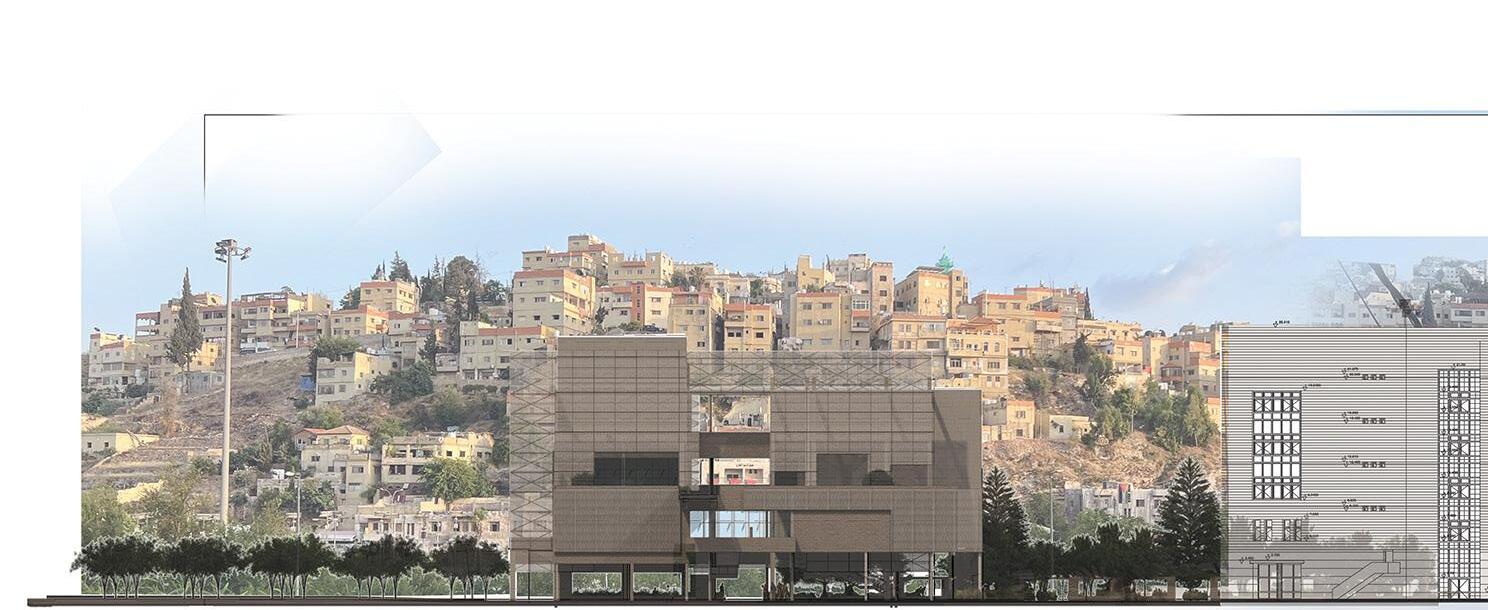
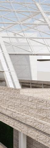
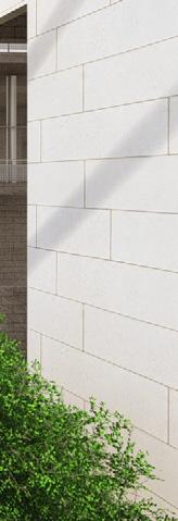
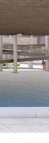
Nostalgia Amman
Graduation Project : Museum and Interpretation center
Location : Ras Al-Ain, Amman
Supervised by Prof Dr Saleem
Dahabreh
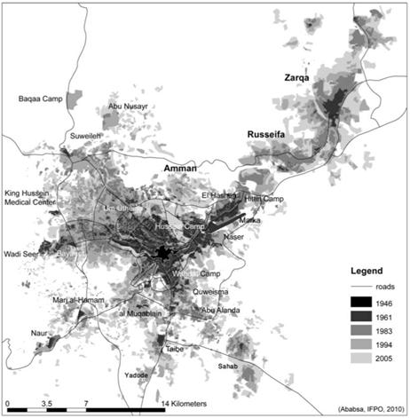
Nostalgia Amman Project is designed in a century while the community of Amman is affected by globalization, historical discontinuity, rapidly changing socio-economic and cultural conditions, and technological advancements. while the new generation is distracted and not connected to their heritage and history, the idea of this project become necessary and important to implement to evoke feelings in the new generations by connecting them with the old generation and moving forward with our heritage.
01.

Theoretical Background

Contemporary living and globalization have contributed to a growing disconnection between younger generations and their hometowns and histories. Urbanization, globalization, and cultural assimilation have weakened the sense of community and attachment to one›s roots. Technology and social media have further distracted young people from learning about their past and heritage. To address this issue, efforts should be made to preserve and promote heritage through education, community initiatives, and preserving historical sites. Individuals can also take the initiative to explore their family history, visit local landmarks, and engage with museums and interpretation centers to reconnect with their cultural heritage. Understanding and appreciating one›s past is crucial for a deeper connection to ones city and heritage.
"The younger generations are growing up in a culture of distraction, where they are constantly bombarded with information and are always looking for the next thing" (Turkle, 2011, p. 67)
Why Interpretation Center is important to have in every city?


Interpretation centers are crucial in preserving and transmitting cultural heritage. They provide visitors with valuable information about a city›s history, culture, and natural environment. These centers serve as educational and community hubs, offering programs and activities for residents and tourists to learn and engage with the city. They also contribute to sustainable tourism by raising awareness about local ecology and conservation efforts. By studying and preserving cultural heritage, interpretation centers foster a deeper understanding and appreciation of a city›s unique characteristics. They play a vital role in promoting respect, pride, and self-worth among individuals and communities.
"The younger generations are growing up in a culture of distraction, where they are constantly bombarded with information and are always looking for the next thing" (Turkle, 2011, p. 67)
Site Selection Process
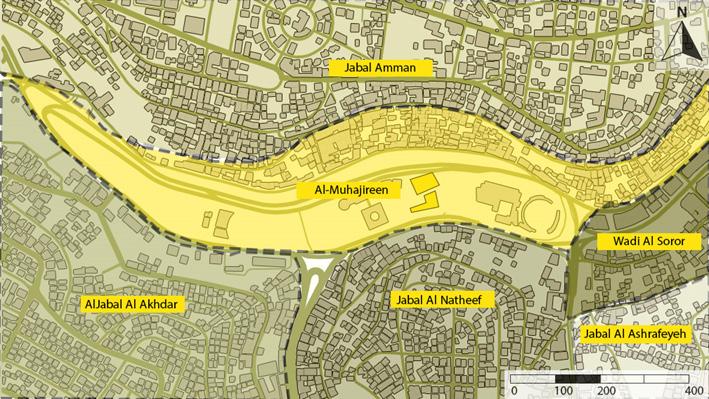
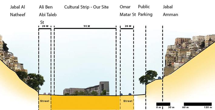
Morphology
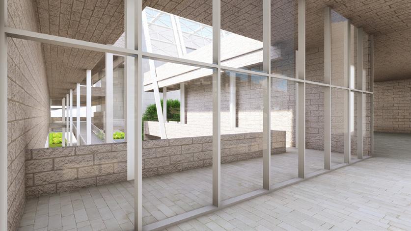
Using the three bay houses as a starting point for the underlying order, applying all the ratios that were influenced by the city›s architecture and legacy, adding two main axes to the grid to emphasize the two pathways in the site, and then using the overall grid as a base point and applying forces to it to demonstrate how the building interacts with the surrounding built environment.


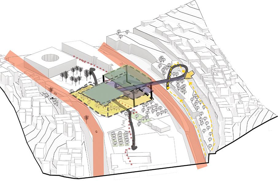
adding a free-standing wall to the walkway to draw attention to the entry and the pedestrian path.

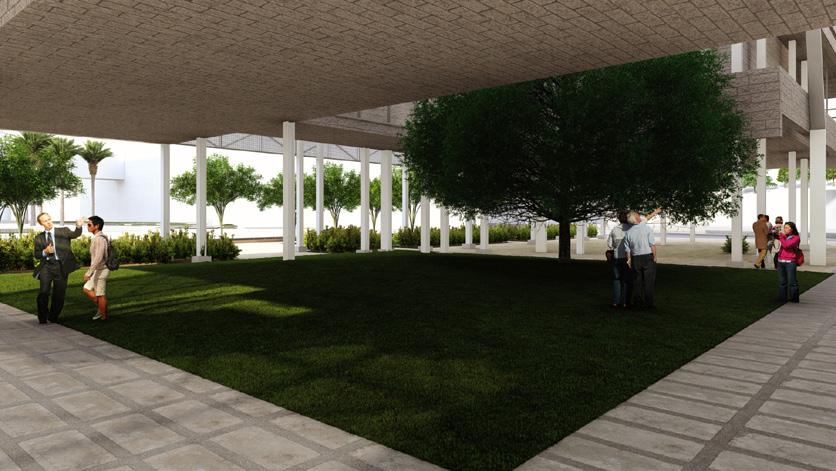
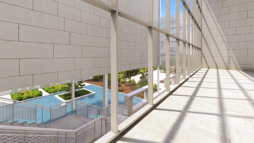
The decision of where to place the tree on the site was made based on two main considerations. The first was to demonstrate the tree to museum visitors as they left the gate. displaying the tree and the water feature for both users who are utilizing the ramp or the stairs. The Water feasture is the nostalgia element for Amman torrent. Additionally, the tree serves as a metaphor for Amman›s historic homes because locals were planting it there. Two ways to reach the entrance of the museum with the same nostalgic experience.

Designing balconies with specific locations and inspirationdrawingfrom those in Amman’s houses

Green Roof level and the bridge that connects the mountainside and this open public space


Site Plan


GF Floor First Floor Secound Floor
Floor
Third

East Elevation West Elevation

South Elevation


North Elevation


Physical Model


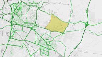
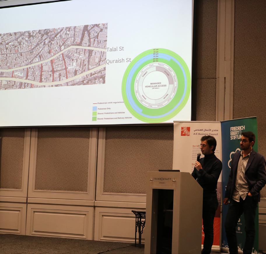
Reclaiming the roads of the Ballad
Compitition project : Urban Planing and Design
Location : Downtown, Amman
Team : Yazan Rashed, Assim Albaw, aws abusalah, Farah Nsour, Taima Alrafayia.
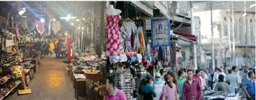
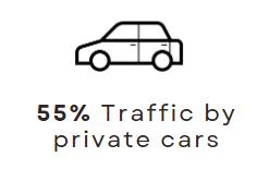
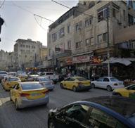
The Downtown of Amman is a vital area in the history of Jordan. Many users use it daily from the local people of the area to the tourist internationally and domestically. Yet, it faces many problems that affect everyday life there and stand in front of a sustainable life in the downtown. Such as high congestion levels, confusing transportation networks, and car dominate city center.
This project highlights downtown issues and proposed solutions that will change the downtown of Amman «Ballad» to a more pedestrian-friendly city center.
the Downtown has to adapt to that change to meet the technological and sustainable standards in 2022.
02.

Introduction
Amman is a frozen city in time where the buildings stay the same, the systems stay the same with just little changes. This may have given Amman›s Downtown the identity throughout the years but the world is developing at a rapid pace and the Downtown has to adapt to that change to meet the technological and sustainable standards in 2022.
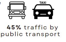
Transportation Assessment
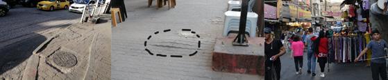
Ratio public cars to private cars is 23( 1:1.22 public car per 30 sec to 28 private car per 30 sec - Street AlHasimi( There are other factors that affects the traffic and the user experience for transportation users:

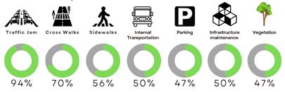

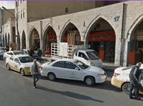

-1 Confusing internaltransportation in the DowntownThere are 90 transportationline in the downtown, it gets confusing what line to use
-2 Unregulated stops and random bus stopsThe busses stop at anytime and anywhere to pick up costumers even if it is blocking a whole street.
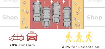
-3 Double parking for white taxi Double parking at some areas takes 3-2 lanes of the streetsthat is almost %60-40 of the street width.

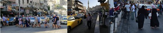
Our Vision
The Ballad's roadways have long been ruled by automobiles; it's time for a change to give the people control of these roads once .again

Transit oriented development is the solution for all these problems Methodology
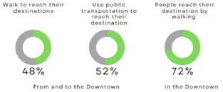
Our vision is to offer the public a strong transportation network\ in the downtown that serves the city center individually and connects with the transportation terminals. Therefore, automobiles traffic will be reduced radically and the spaces for cars will be redesigned to enhance walkability and other modes of transportations like e-scoters, bicycles and public busses

Action Plan
How to implement the transit oriented development plan in the downtown of Amman?

Plan Actions Results
Relieving the congestion in the downtown
Adding a new articulated bus Network in the Downtown of Amman
Redistributing of the mobility lines in Downtown of Amman
Regulate the streets policy
Change the nature of some streets to be fully pedestrians

Reducing the traffic in the Downtown Connecting the Downtown with a strong transportation network
Create an internal transportation network for the Downtown


More Space for pedestrian network development
Enhancing accessibility with the government comprehensive transportation plan
Developing an identity of the Downtow
Vision
Making the streets more pedestrian and other light automobiles friendly


 Studying the transportation lines and designing the new mode of transportation with distribution for the rest of the lines


Pedestrian Lane 3 m Utilities lane, Vegetation, lighting,Cycling stops, Bus Stops 2.2 m Car Lane 2.75 m Car Lane 2.75 m Articulated bus lane 3.5 m Cycling, Escooter lane 1.4 m Utilities lane, Vegetation, lighting,Cycling stops, Bus Stops 2.2 m Pedestrian Lane 4 m
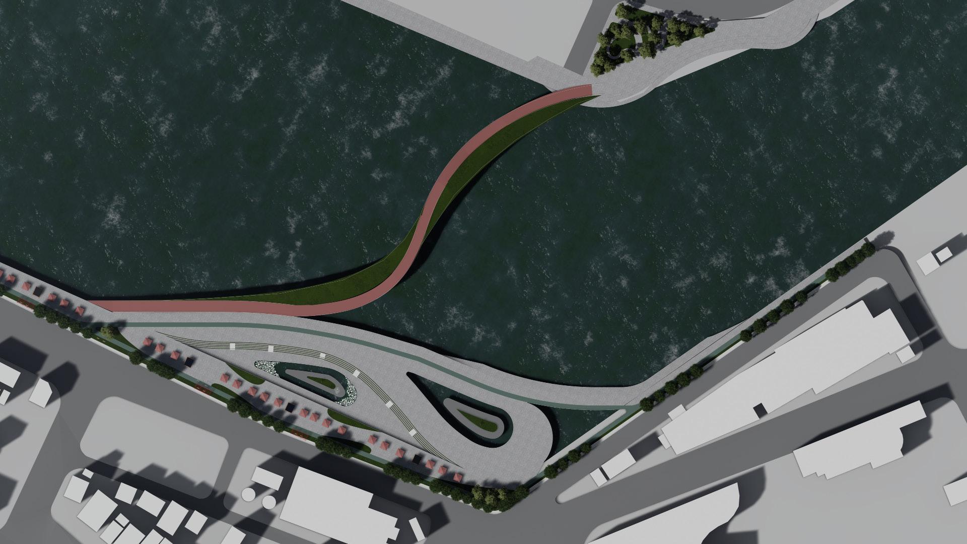
Redevelopment of Iwanai
Compitition and workshop project : Urban Redevelopment
Location : Iwanai , Japan
Team : Yazan Rashed, Fatimah Al Najjar
The Redevelopment of Iwanai port project was designed in the Winter school that I did with Curtin University in Australia.
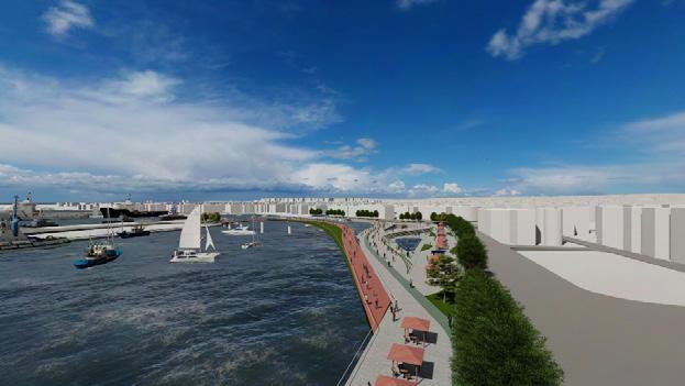
Iwanal port has long been a symbol of economic activity in the area, with many ships entering as one of Hokkaido›s leading fishing bases. So it is a potential area for redevelopment sense. it is suffering from many issues like the lack of interaction between residents and the sea due to the lack of urban designed areas and services, the port does not contain any area for tourist attractions, and the port does not represent the Ainu Culture. so we started thinking about how we can reconnect. so as a solution for this, we build along the sea wall in a specific area in the port.
03.

Site Selection :
The Site selected near to the center of the Town to be accesseble and to achive the idea of reconnecting between human and nature features.
Site Selection
Main Functions

relocate Funstiones and
Zones

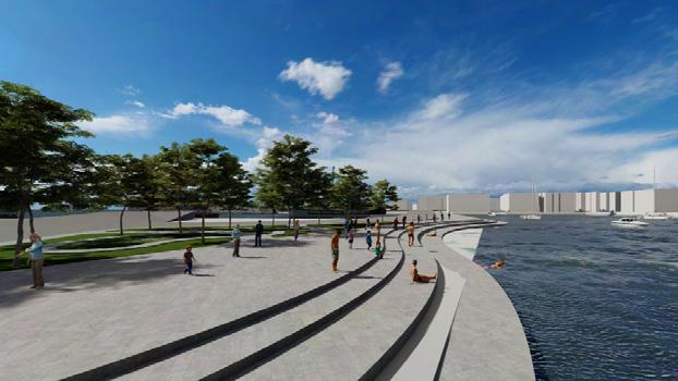
: We did rezoning for the port and became a port with three zones instead of one zone, one of the three zones is for tourism because it's the nearest one to the city center and Cultural facilities, and for the sea bath location that we suggested for indoor activities in winter like swimming or having a cup of coffee on one of its' balconies with view to the ocean and mountains.

Goals :
-Reconnect the town to the Ocean
-Activating tourism and creating job opportunities

Objectives:
- Create a place to spend time with family, reflect, and be active, a community space.
-Provide the area with facilities that attract investments and tourists.
Actions:
- Build along the sea wall
- vegetate the coastal area
Detailed Zoning :

- Adding sculptures along the sea, incorporating Ainu culture and perspectives.
- Separating functions from each other ( commercial, industrial, Urban and tourism area ),Provide the area with more functions ( Visitor center, parks, shops, restaurants and cafes.
Commercial
Industrial
Tourism
Shops / Market Sea Bar Visitore Center ParksSea Bar Warehouses Pedestrian path Sitting Area Verge Garden
Area
Area
and Urban Area https://youtu.be/cXQ
https://youtu.be/cXQ016EG9H0

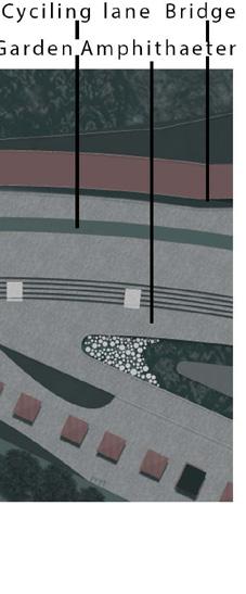 Garden
Cycling lane Bridge
Amphitheater
Garden
Cycling lane Bridge
Amphitheater
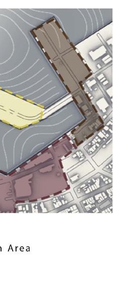
Restitching the island
Compitition project : Urban Planing and Design
Location : Downtown, Amman
Team : Yazan Rashed, Assim
Albaw, Leen Abu Nawas, Sara Al
Khatib
Supervised by Dr. Deyala Al
Tarawneh
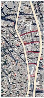
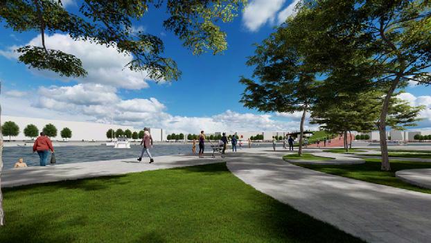
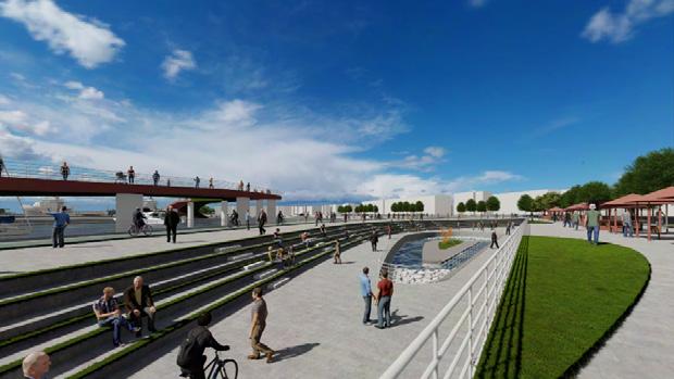
Ras Al Ain Urban Island is situated in the stretch between the BRT Museum Station and Ras Al Ain Park. This island is essentially unconnected to the surrounding residential area because of this.
The strip has cultural structures that serve as tourist and local drawcards, however these attractions are typically only visited by one time or when an event is taking place.
Restretching the island concept entails making urban interventions and creating a tourist route that leads visitors from the mountains down to the valley.
These initiatives go beyond creating urban features or implementing space activation strategies to draw visitors.
04.


strategies of space activating

Temporary Use
-1 Temporary use can adhere to a schedule. It may also involve particular rituals. But in practice, it is informal and has a liminal purpose.
-2 it encourages behaviors or actions that break from everyday routine and promote a sense of social belonging. Temporary use has a variety of forms. It also has no limits on how long it can last.
Reuse
-1 High streets and urban sites can be brought back to life through reuse. It can be done by loaning a vacant space to a community organization at little or no cost.
-2 Reuse only works if it has willing partners. The occupants have to acknowledge that the space is not theirs to keep.
-3 city officials must grant temporary use permits and help occupants limit their financial obligations.
Programming
-1 programming organizes activities— such as art shows, skill-sharing classes, or markets—that are brief or changeable.
-2 programming allows organizers and community members to experiment with ideas because they are not constrained by long-term commitments.
-3 they do not have to make decisions based on feasibility or risk, and so creative ideas are born through trial and error.
Counter-Programming
-1 Counter-programming thrives on adaptability and informality. Organizers who are flexible about how they use a space can accommodate different activities.

-2 Counter-programmed spaces work with materials at hand. They are not curated to suit a particular style. we use resources that are economical and commonly found.
-3 it makes it collaborative because organizers need to go into the community to source materials and local knowledg

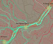
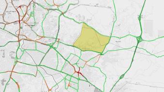
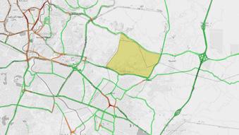
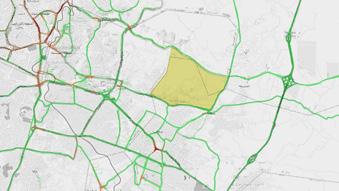
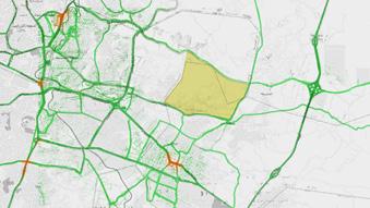
Transit Oriented Development alonge the BRT-
Amman - Zarqa
Compitition project : Urban Planing and Design
Location : Downtown, Amman
Team : Yazan Rashed, Assim Albaw, aws abusalah, Farah Nsour, Taima Alrafayia.
This project was about studying the idea of TOD and the BRT in Amman.
At the end of this study, I was responsible for doing planning for certain areas.
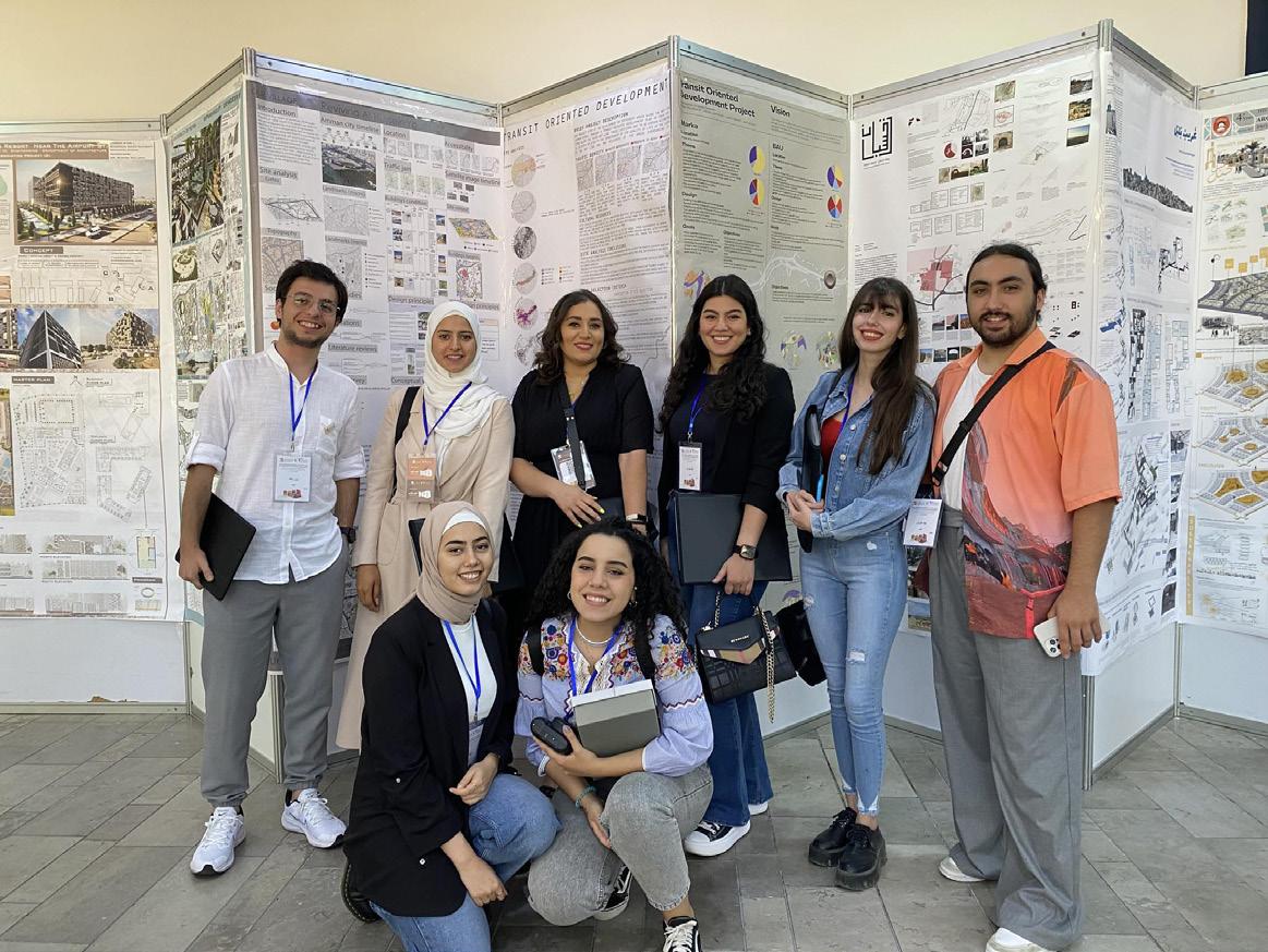
this research gives us, me and the team, the opportunity to be part of the Sixth Jordan International Architectural Conference.
Organized by the Jordan Engineers Association (JEA) Architectural Engineering Division, the conference was launched under the title: ‹The Future of Urban Planning and Jordan›s Centennial.
05.

Mawred City
University Project : Urban Planing Location : Amman
Team : Yazan Rashed, Assim Albaw, Nour Al Omari
Mawred City designed in the concept of a’-15minute city’ where people have the ability to reach services and facilities within walking distance, has been gaining increased attention in recent urban planning discussions, especially in light of the COVID19situation, the constant need to promote healthier lifestyles, and Sustainable Development Goals (SDG’s(.
Many cities have different definitions on the basket of destination types that collectively build a complete and cohesive neighborhood. Things that are commonly included are food, health care, jobs recreation, education, shopping, and cultural activities.
(Live, Work, Play(
06.

Conclusions
Accessibility section conclusions
*The transportation network is weak, trips outside Sahab are difficult and suffering.
*Buses only covers the arterial street. By visiting the site:
*many large trucks were spotted at the collectors and locals!
*Pedestrian network was totally ignored.
*Most of local streets are paths made on lands, which make it easier to plan.


*By asking local people, we inferred that the car is a need in Uhod.
Topographic section conclusions
*Our site slopes are usable for human usage with a gentle slope between %24-%4 and most slopes are under %16. So our site is mostly flat and that’s why people used the lands for agricultural usage.


*Our site skyline is like a plank sheet, this gives us the opportunity to invest in it .

*There is a huge expression diversity in housing around our site , this leads us that there were unorganized planning around it. That’s why our site will be like a focal point that will give other areas lines to plan them in one fabric


Climate
*According given One of to provide the region reasons.

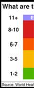
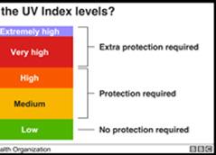
Climate section conclusions
*According to the UV and Solar raduiation index in the data, the region needs protection. of the solutions related to sustainability is provide solar panels that cover some parts of region and at the same time for economic reasons.


Community Services and landuse section conclusions
*Our site is centralized between many urban residential centers which make the site perfect to provide commercial and services demands.
*There are many industrial areas around our site and by making our site an innovation center, this will enhance the Jordanian industry quality
*There are few landmarks around our site , this gives us the opportunity to propose a landmark in the area to identify the area with it.


*Landmarks are not that far from our site, but the complexity of the transportation system makes it hard to reach. Landmarks that helps in growing investments are slightly near.


Morphology

*Within the main intersection which resulted the main center will be there, and it will include many functions associated with the agricultural theme such as an agricultural technical college.
*Including the main center there will be a sub-centers that covers a -15 minutes area, these sub-centers will include all the services needed with no need to use a car or any transportation mode.


*Between blocks, a pedestrian walkways were made to stabilize the walkability concept, this will also improve other concepts such as sustainability. As well as we have seen before through the site analysis section, traffic takes shape between 18:00 – 15:00 so we thought that these roads will be good to enhance the mobility to lower the traffic by prevent pedestrians from walking in it.
*Local streets are open for mobility usage.
*The most remarkable street is the avenue, it connects between all subcenters passing through the main center, motivate walkability, provide services in 15 minutes maximum, and make it a place where people would love to go and sit in open spaces and breath some fresh air and make several activities


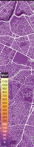
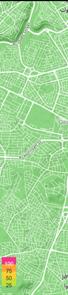
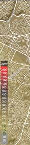
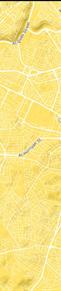
Average Traffic in a week
01:00-04:00 04:00-07:00 07:00-10:00 10:00-12:00 12:00-15:00 15:00-18:00 18:00-24:00


Vision
A high technological city that focuses on agricultural innovations and developments. The city will provide high education in the agricultural fields, many institutions in agricultural research and safe environment for youth category. Mawred city will be the first Jordanian sustainable city and the first city in Jordan that implement the 15 minute concept. Everything can be reached by walking.
Goals
-1 Build a sustainable safe mobility system

-2 Develop Academic and Co-Curricular Academes that is specialized in Agricultural and recycling
-3 Create a living laboratory where innovators and pioneers can experiment to develop new technologies in Agriculture
-4 Implement the principles of a circular economy
-5 Preserve natural resources through agriculture
Objectives
Mobility : Walking , cycling, open spaces, that give people the chance to go out and enjoy the nature and do their daily habits and a communication areas where they contact with each other and breath some fresh air. Build a sustainable transportation system for people inside our site with a zero carbon emission, which we will suggest a eco transportation system with a specific Specifications, so we design a live system more than a just space.

EDUCATION
our site is in an agricultural area, and the site is far away from the educational spaces including universities or colleges, The local people have the agricultural lands but they don›t have the working hands, making an agricultural college and a research center will provide this district with students and researchers. plus training students will provide the district with workers and the college will train and learn peoble more about there lands.
Food and Resources
As we mentioned, the educational facilities will proved the district with workers and will teach the locals, over that we can provide the district with food and natural products that can be made by the local womens and sell it in Mawred City. as a part of making the city more sustainable, Mawred City will sell the wastes to Ghabawi with a sorted waste which that will provide them more electricity that can be used in the city.
Land Use Layer Transportation Layer


Master Plan Services


Conferences , Workshops and Competitions participation
being part of session 6 : Projects by Youth today at the 12th Regional Sustainable Cities Conference “ Pathways towards JUST Urban transition within MENA Cities” , in Amman.
I presented our project Reclaiming the roads of the Balad, that had listed as one of the Top five projects in the national competition of “Our mobility is our future “, that’s specialized in Mobility, sustainability, transportation, and urban
Presenting our project for Downtown Amman for Architects and Engineers from Greater Amman Municipality and friedrich ebert stiftung team
from A/E Business Council, Being part of the Sixth Jordan International Architectural Conference in Amman.
Organized by the Jordan Engineers Association (JEA( Architectural Engineering Division, the conference was launched under the title: ‹The Future of Urban Planning and Jordan›s Centennial›.

Architecture Portfolio QR Code 00962797391039 All Rights Reserved @Yazan Rashed2022 Yazan.rashed11@gmail.com Architecture Portfolio Link : https://issuu.com/yazanrashed/docs/test
