ARCHITECTURAL & URBAN DESIGN PORTFOLIO YAĞMUR KINACI


Contact & Info
Phone / +90 (505) 817 6251
e-mail / yagmurkinaci@gmail.com
Address / Izmir, Turkey
Birthday / 29. 04. 1995
Languages/ Turkish native, English B2
I am an architect who likes to take part in design projects of different scales and to produce creative solutions. I am currently completing my master’s degree in urban design at Mimar Sinan Fine Arts University. I am interested in ecology, physical and social sustainability issues. I like to be involved in social responsibility & volunteering projects.

Urban Design Competition
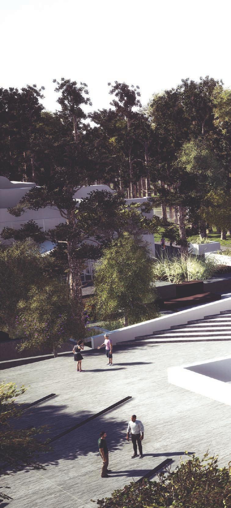
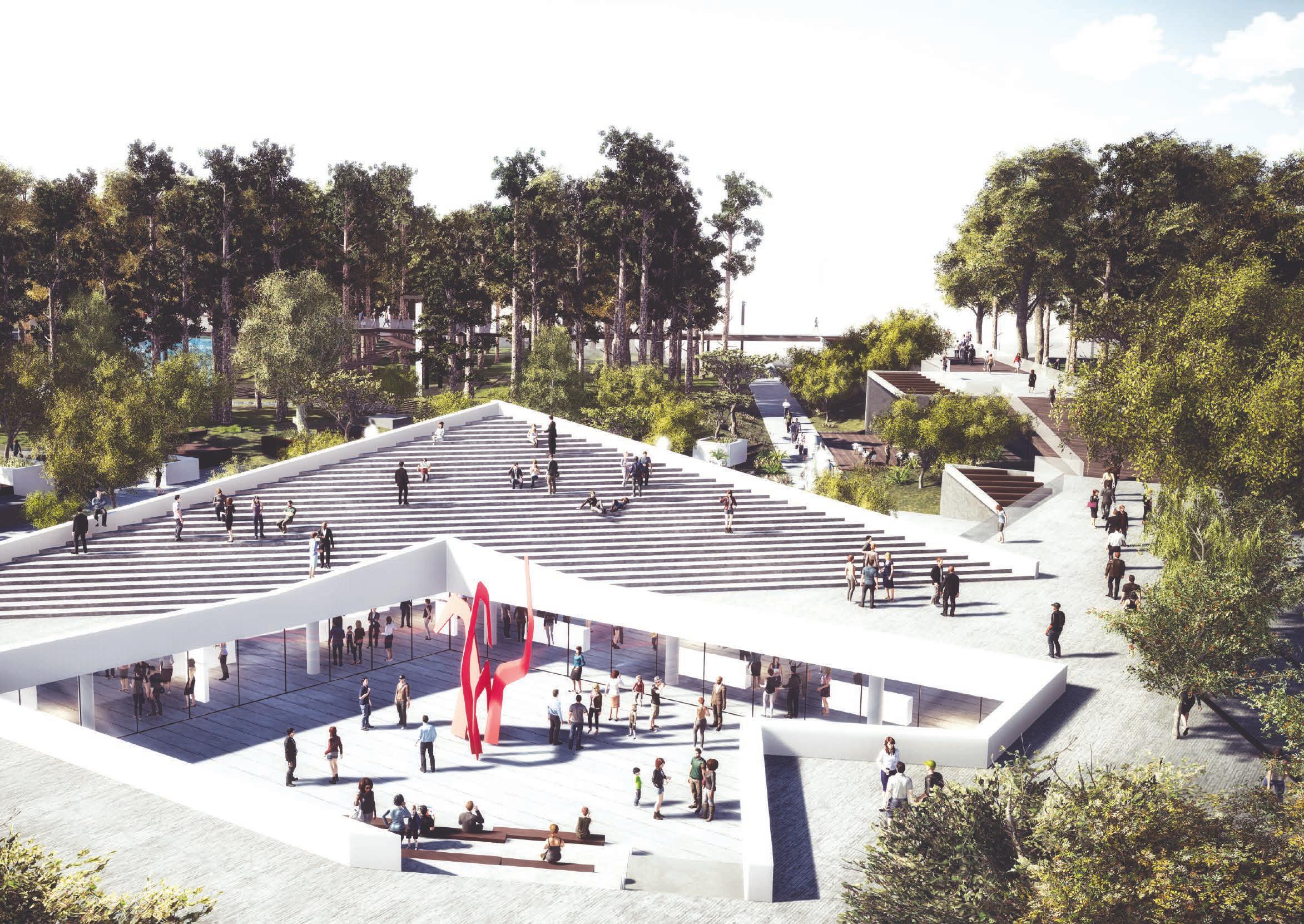
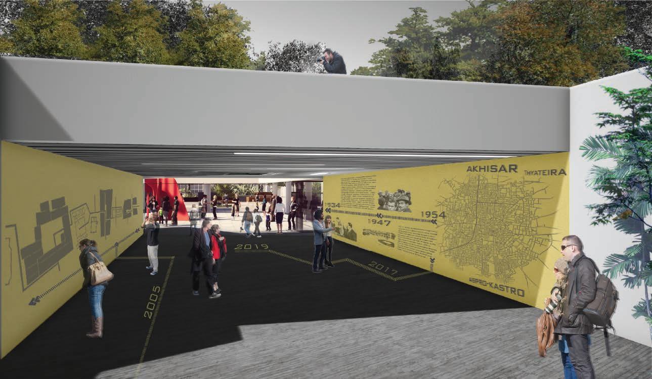
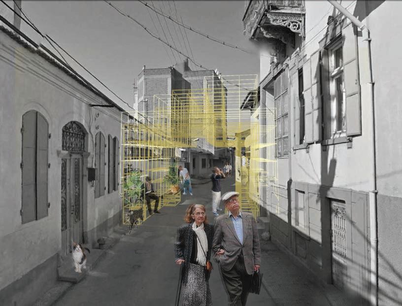
AKHİSAR OLD MUNICIPAL SQUARE & CLOSE SURROUNDINGS
''Through Traces of Urban Memory''
Professional Architectural & Landscape Design
ALBERTI GARDEN ‘‘Seclusion in the City’’
Architectural Design Studio
COMMUNITY CENTER ‘‘Space for Awareness’’
HABITAT ‘‘Productive Urban’’
Urban Design Studio
DESIGNING THREE BOSPHORUS DISTRICTS
National Architecture and Urban Design Ideas Competition / 2019
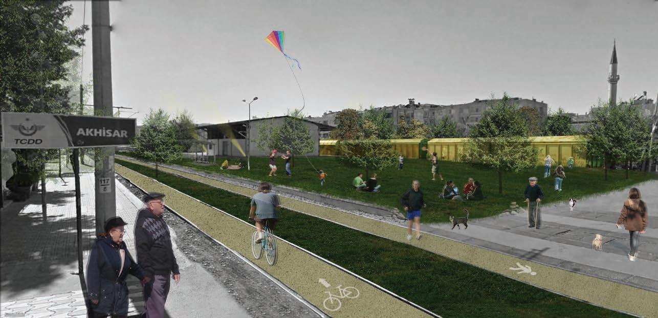
Location | Akhisar, Manisa, Turkey
Team | Melis Varkal Gökhan Çelikağ, Nusret Uşun, Yağmur Kınacı, Merve Köz, Aylin Özkan, Dilek Turhan
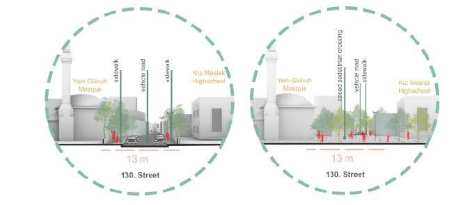
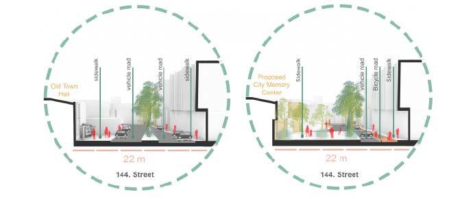
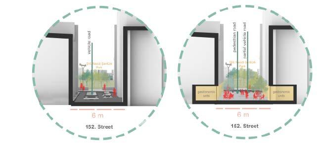
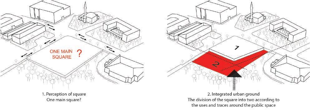
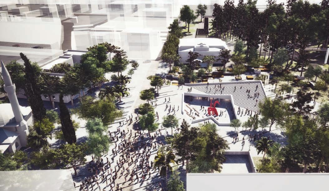
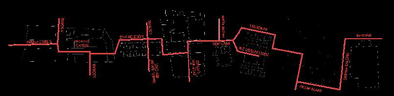
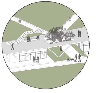
The area surrounded by the old town hall, Yeni Gülruh Mosque, historical school building, old cinema and central park area, which constituted the most important urban focus of Akhisar until a while ago, lost its former vitality and started to lose its importance in the city. Today, this area loses its feature of being a destination center and functions more as a transit point. The region loses its identity due to vehicle-oriented planning decisions.
''THROUGH TRACES OF URBAN MEMORY''
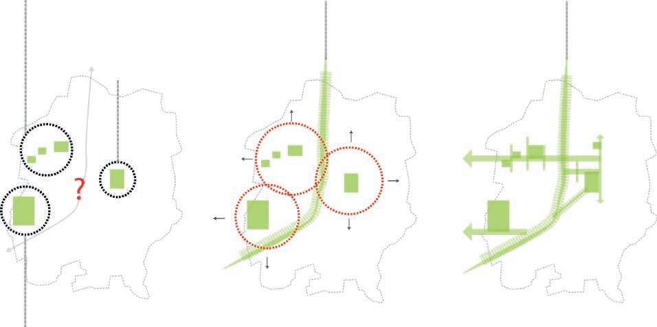
Potential Unused Public Green Spaces
Proposed Green Belt /Cultural Interface
A green belt to the out-of-use railway
Central Park
Lack of public activity Lost the interest
Pond Popular recreation focus for weekends
/ DISCONNECTED GREEN AREAS & PEDESTRIAN IMPACT AREAS
/ THE FORMATION OF THE MAIN GREEN SPINE
Proposal For a Strong Mass Transportation Ring/ Connects the old settlement of the city with the new urban foci
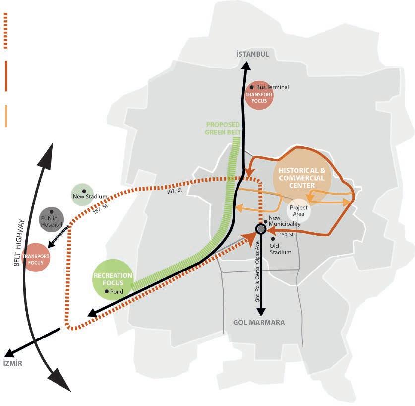
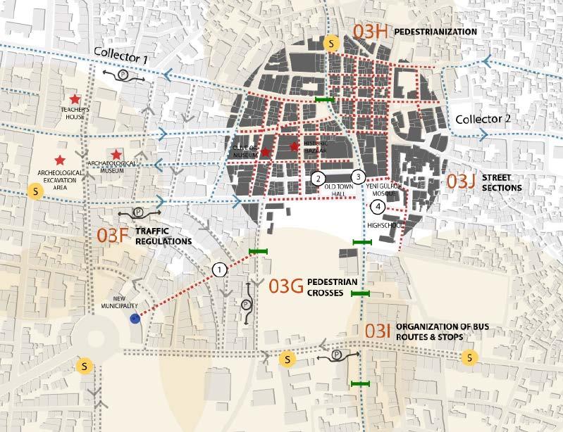
Vehicle Transportation Ring Around The Historical & Commercial Center/ To alleviate the traffic load, the historical city center is free from transit and pedestrianised.
Collectors/ The center is connected to the periphery ring with 2 vehicle rings in a way to receive the services of the commercial units.
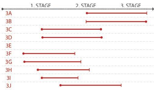
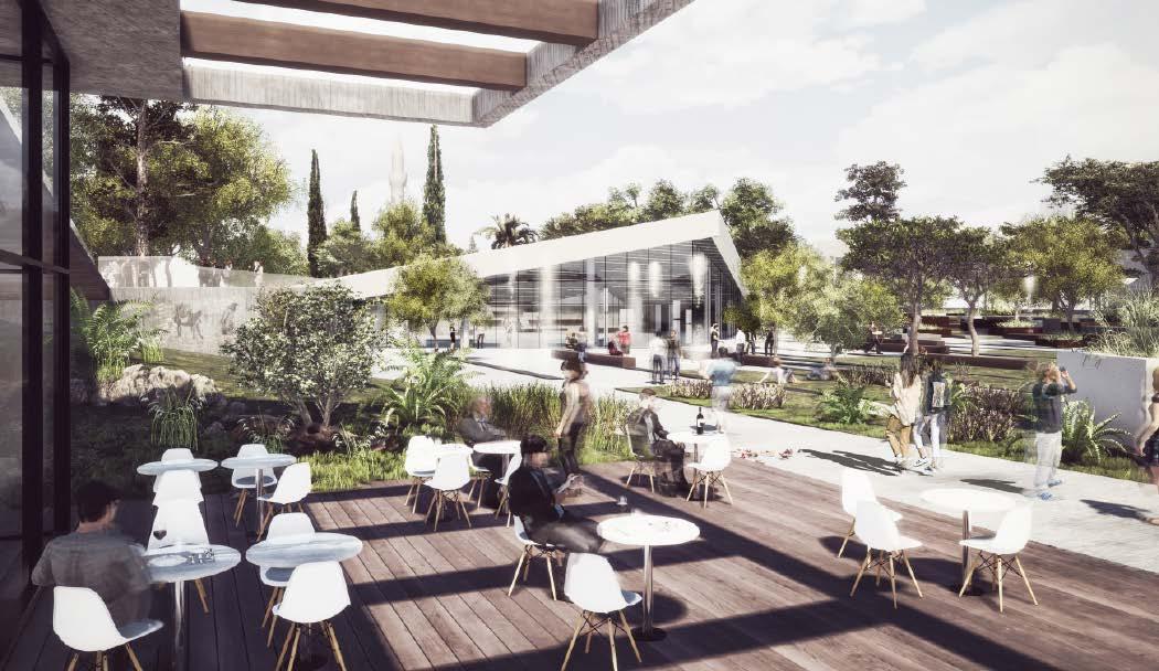
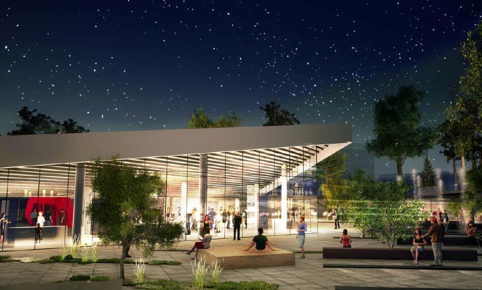
With the proposed project, macro and micro scale strategies have been developed in this area. A new spatial organization was designed by taking Akhisar's existing values, spaces and the relations between these spaces into the focus of the project. In this direction, the Old Municipality Square and its surroundings with the local architectural texture of different periods, historical heritage and covered bazaars are not only for Akhisar; It is intended to be a point of attraction for visitors coming from outside the city as well.
Green Connections & New Green Spaces
/ EXTENSION OF PEDESTRIAN IMPACT AREAS WITH THE GREEN NETWORK
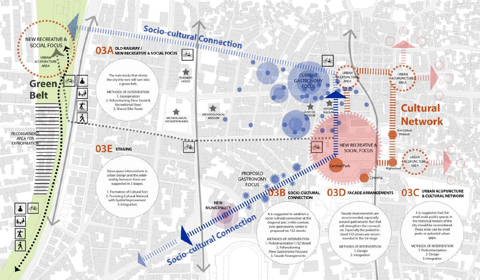
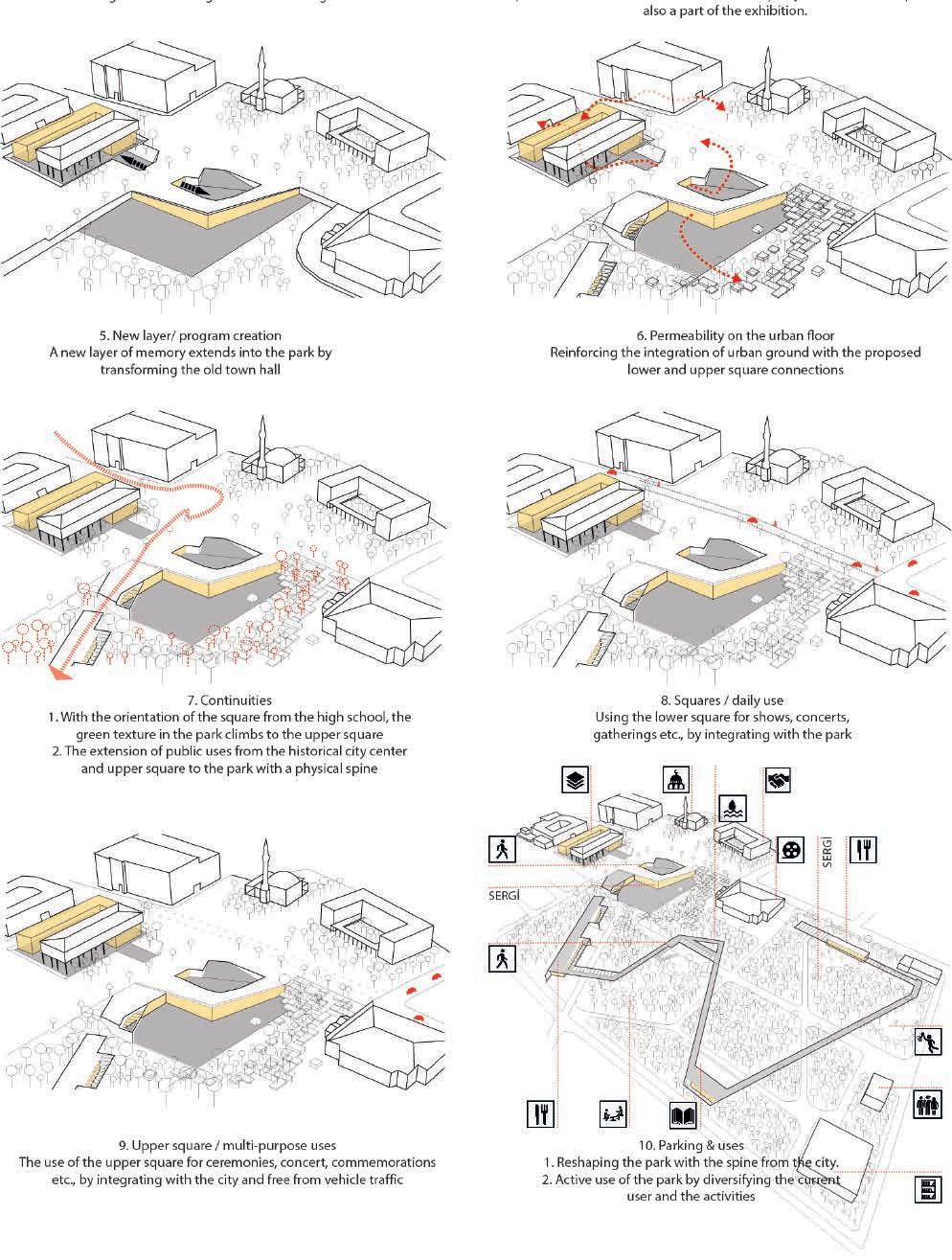
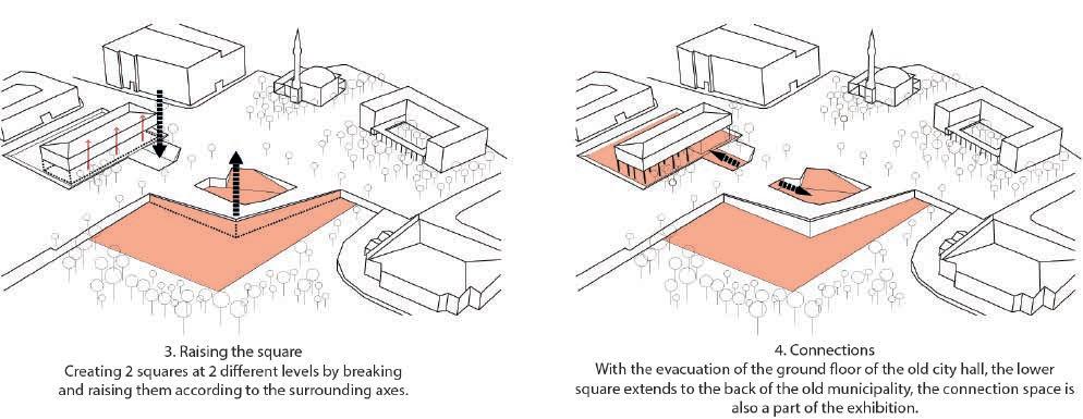
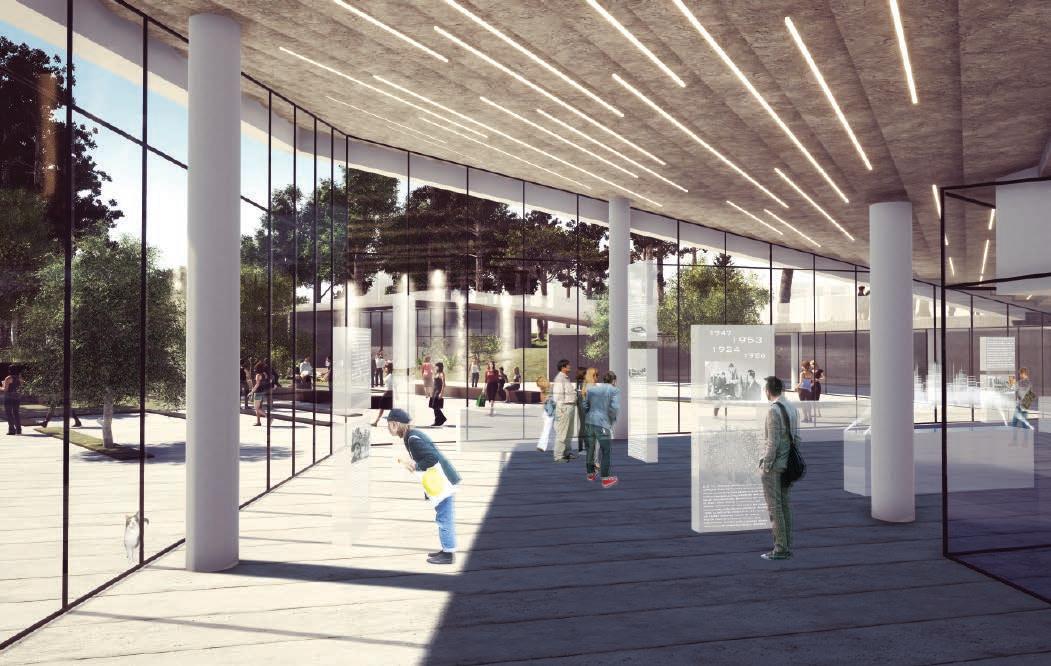
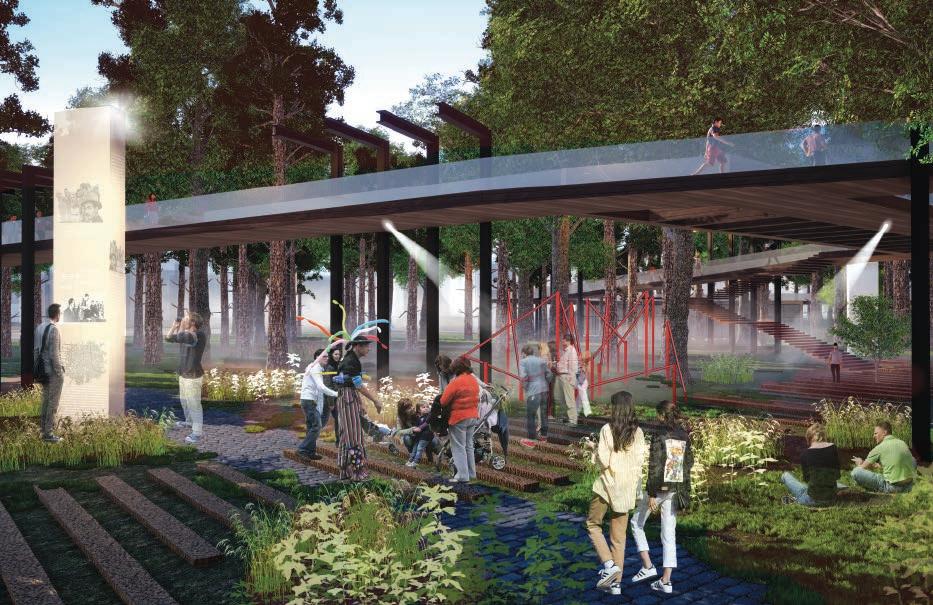
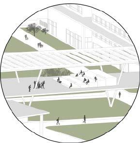
It was aimed to increase the visibility of the park with the proposed facade interventions to the exhibition units, seating units and surrounding structures spread throughout the park.
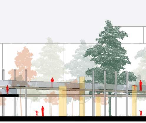
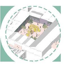
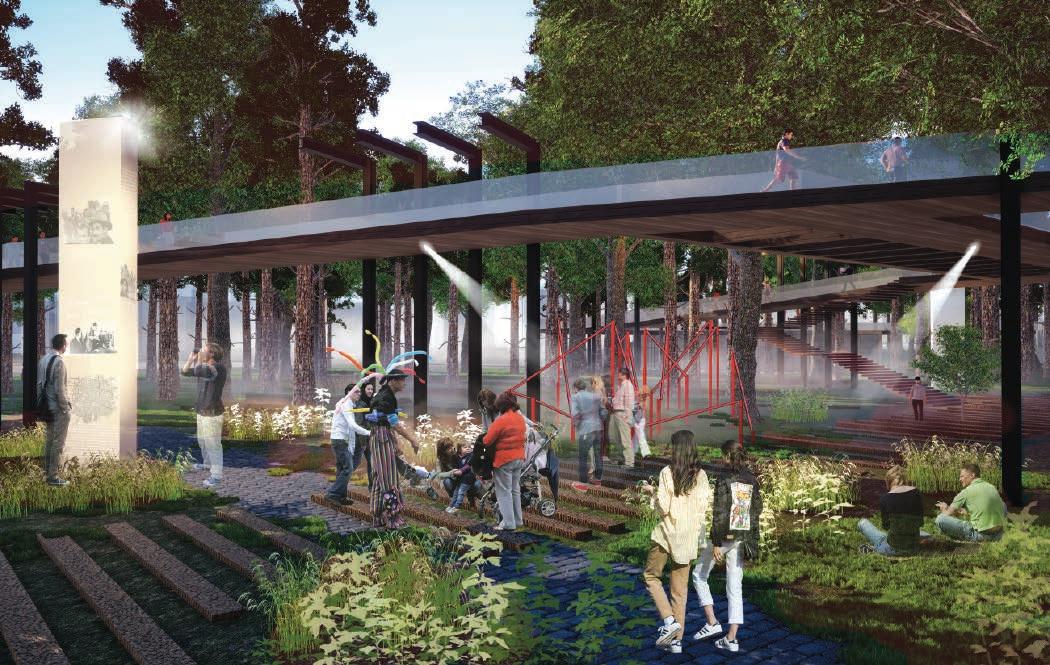
An approach has been adopted to increase the density of the green fabric, in order to ensure that the monumental structures infiltrating the park can establish a holistic relationship with their immediate surroundings and with each other through the new layer that will make the city's memory visible.
Trees
It was aimed to connect the space used by the tradesmen as a resting area with the central market and other acupuncture points. Seating units for tradesmen and informative exhibition units for tourists were proposed.
was

connect the courtyard with other acupuncture points by giving access to the courtyard of Dağcıoğlu Office and to make the production visible with the display elements added to the courtyard.

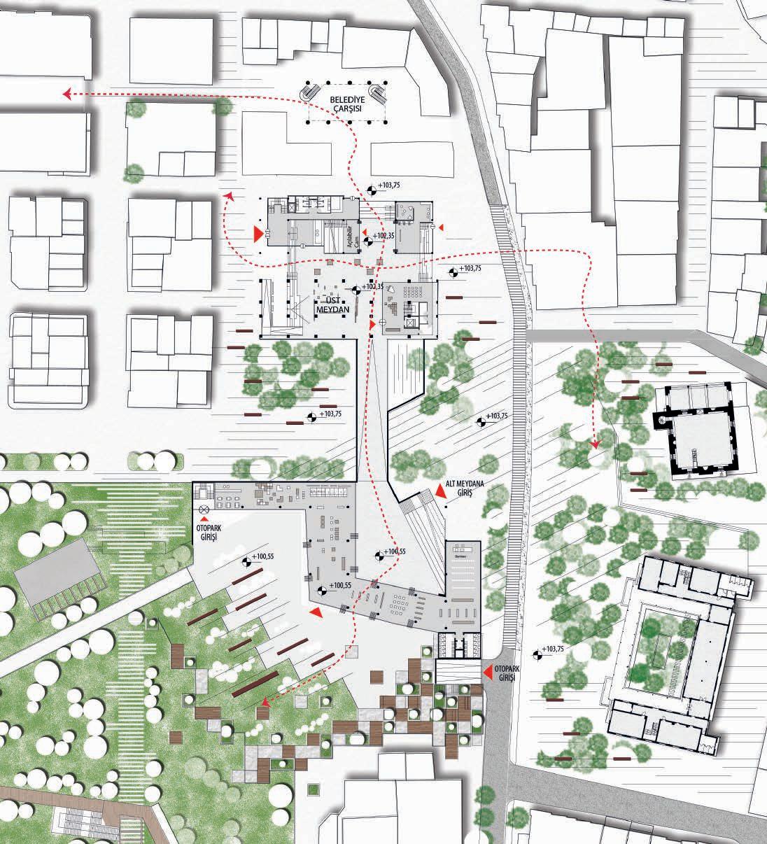
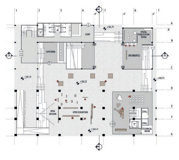
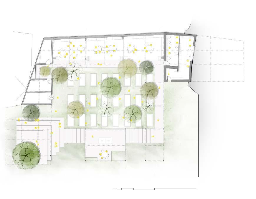
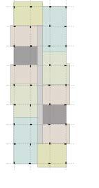
 GROUND FLOOR PLAN 1/500
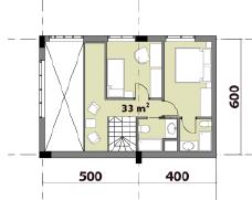
 GROUND FLOOR PLAN 1/200
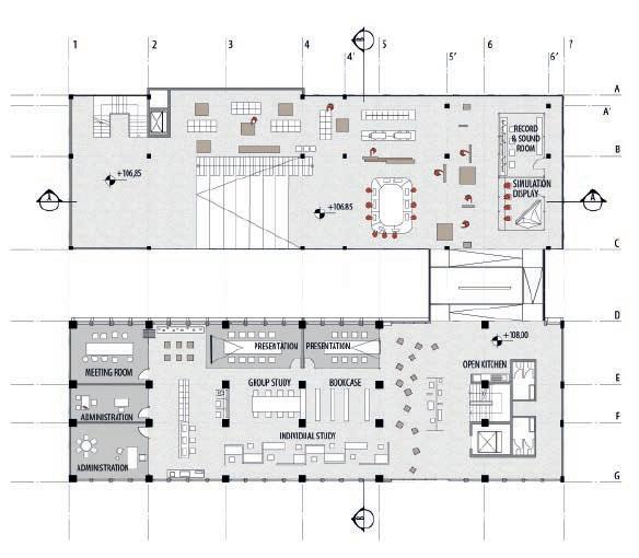
FIRST FLOOR PLAN 1/200
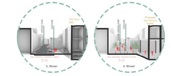
BB SECTION 1/200
AA SECTION 1/200
GROUND FLOOR PLAN 1/200
FIRST FLOOR PLAN 1/200
BB SECTION 1/200
AA SECTION 1/200
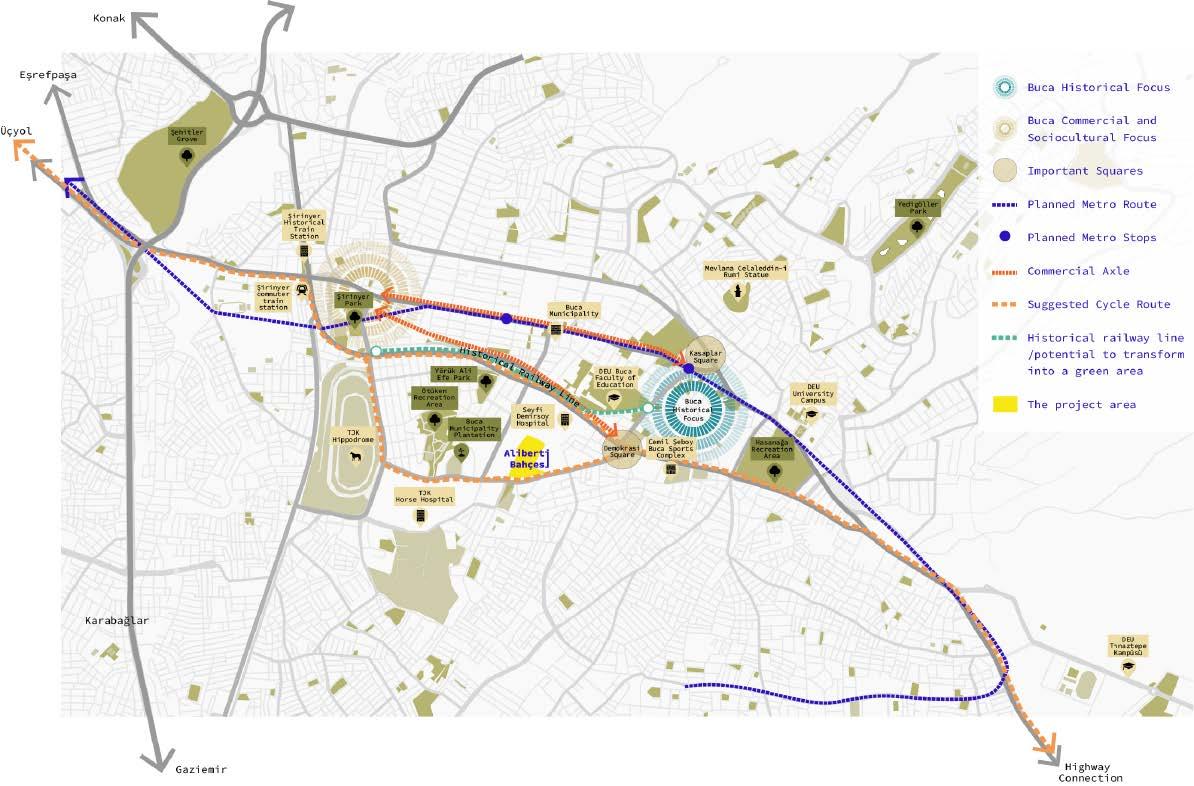
Professional Architectural & Landscape Design Work for İzmir
Municipality/ OfisVesaire Architecture
Office/ 2022
Location | Buca, İzmir, Turkey
Team | Melis Varkal, Gökhan Çelikağ, Yağmur Kınacı, Merve Hilal Aktaş, Mert Ergin
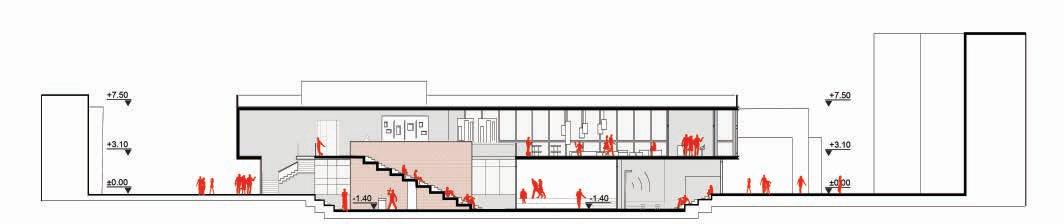
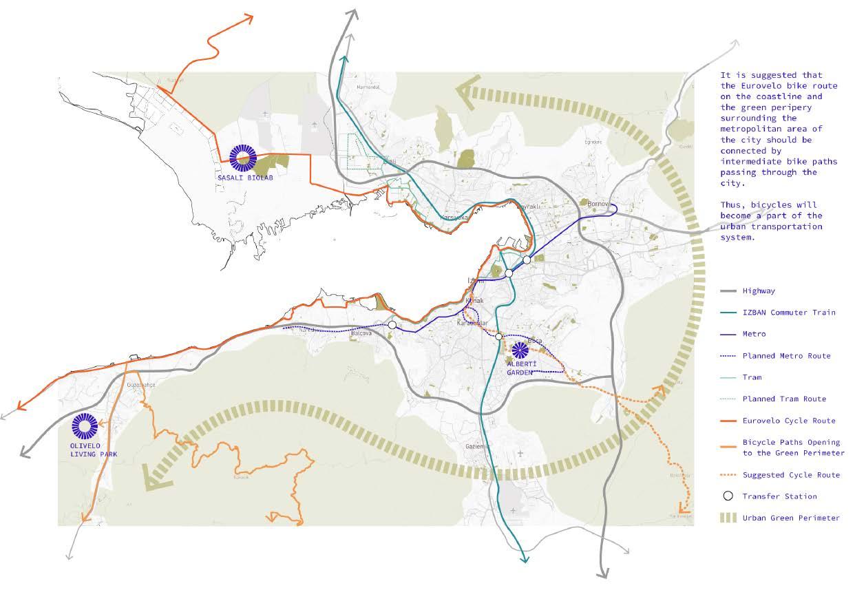
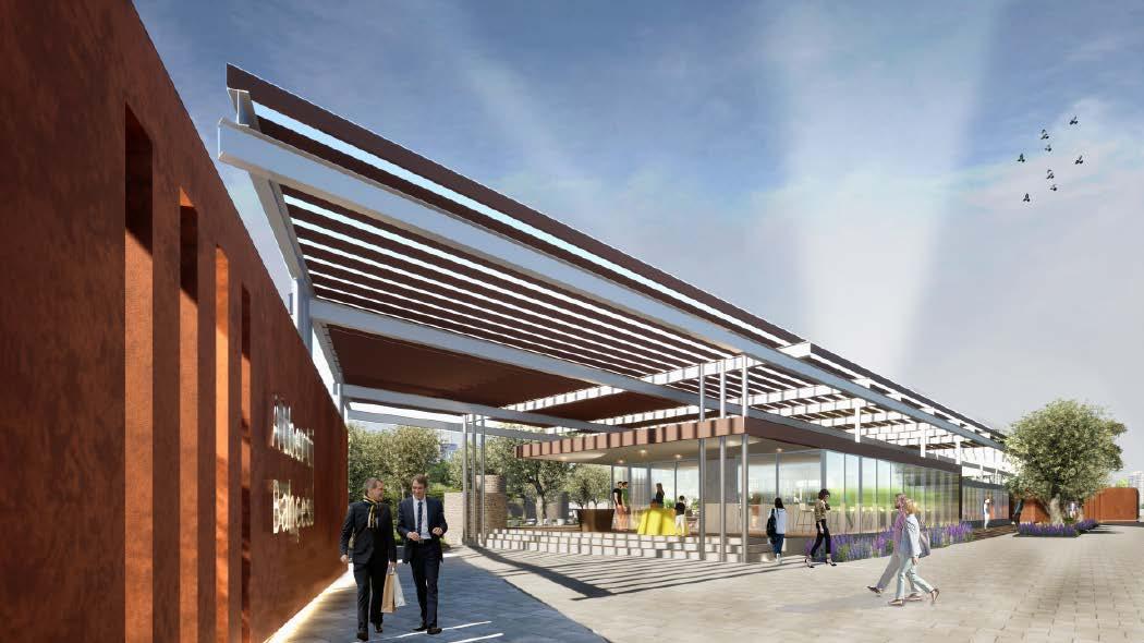
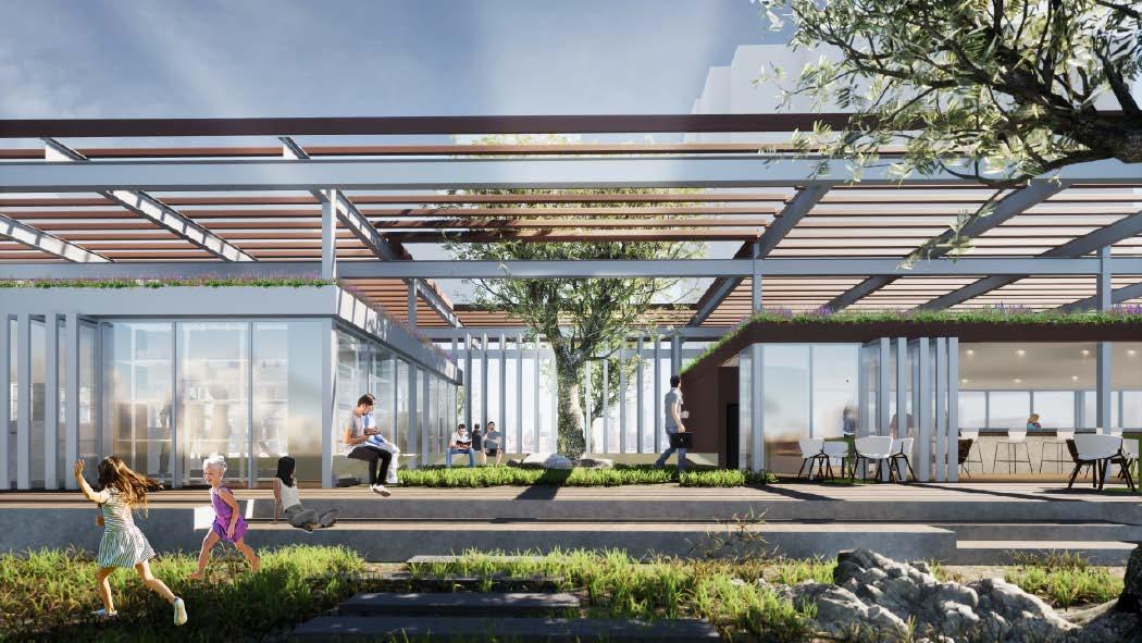
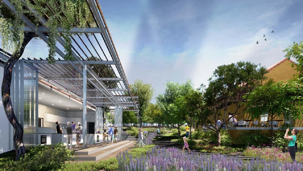
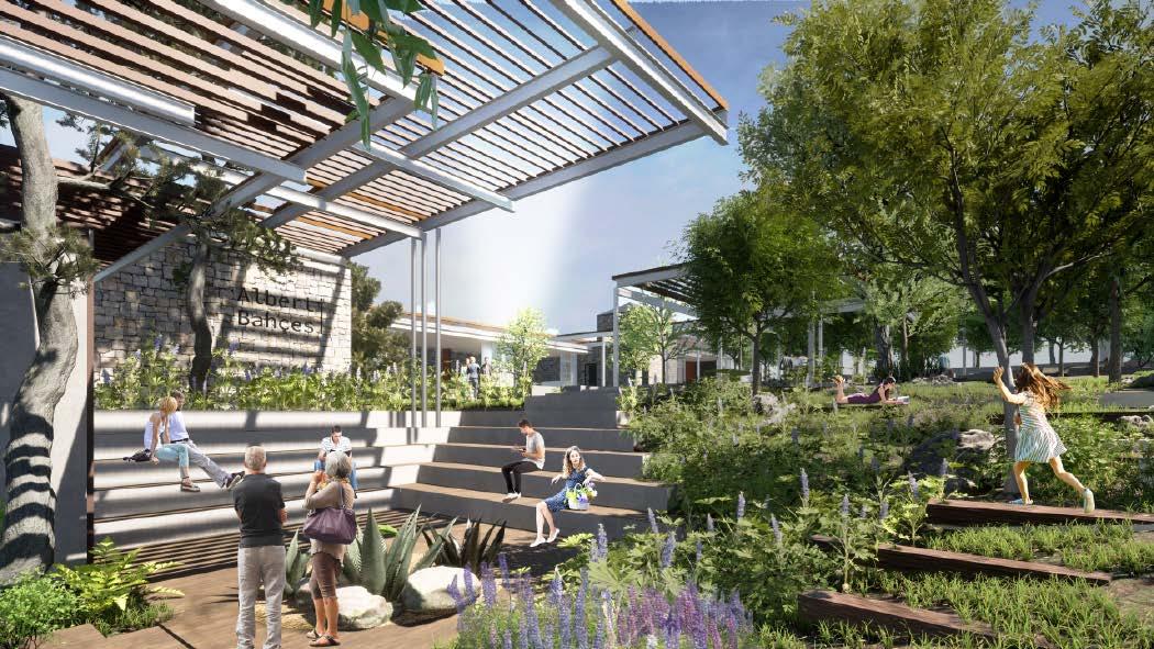
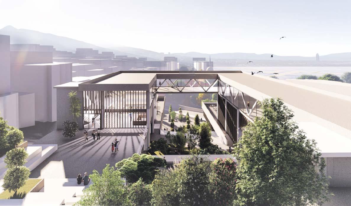
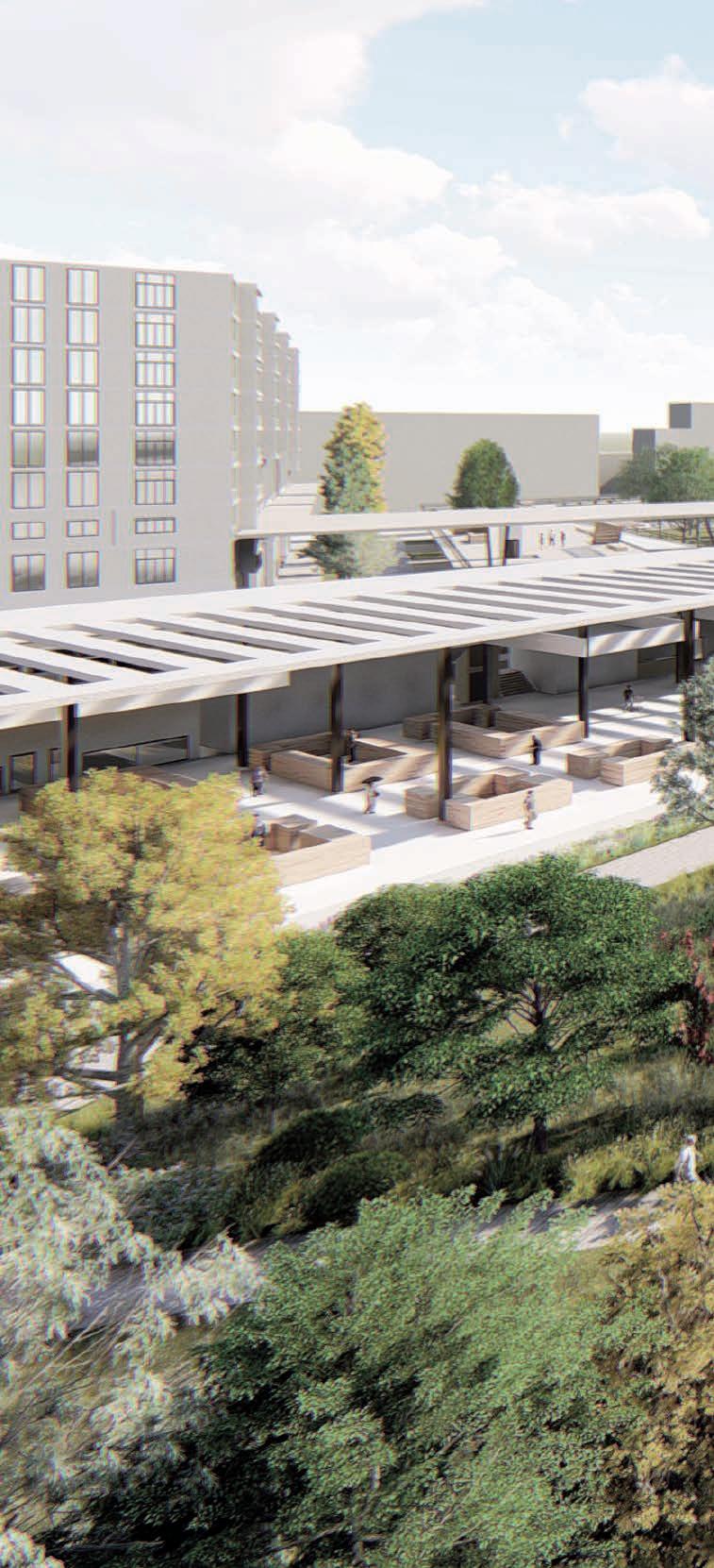
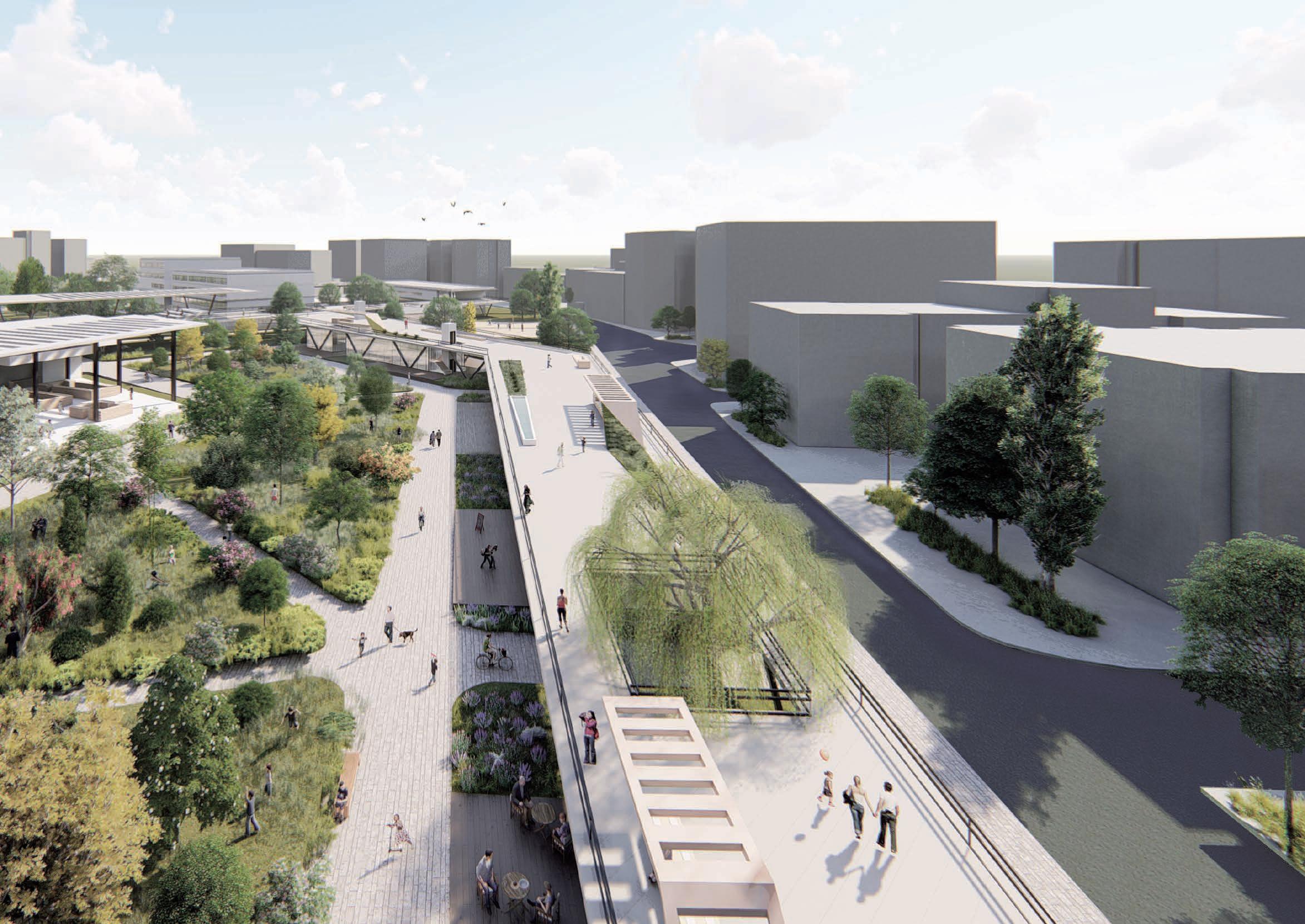
The project area is a farmhouse land inherited from the Levantine Alberti Family within a dense urban fabric. The land that belongs to the Izmir Metropolitan Municipality is intended to be transformed into an urban agriculture and gastronomy center by the municipality. For this purpose, Ofisvesaire architecture office was asked to develop a proposal project in line with the demands of the municipality.
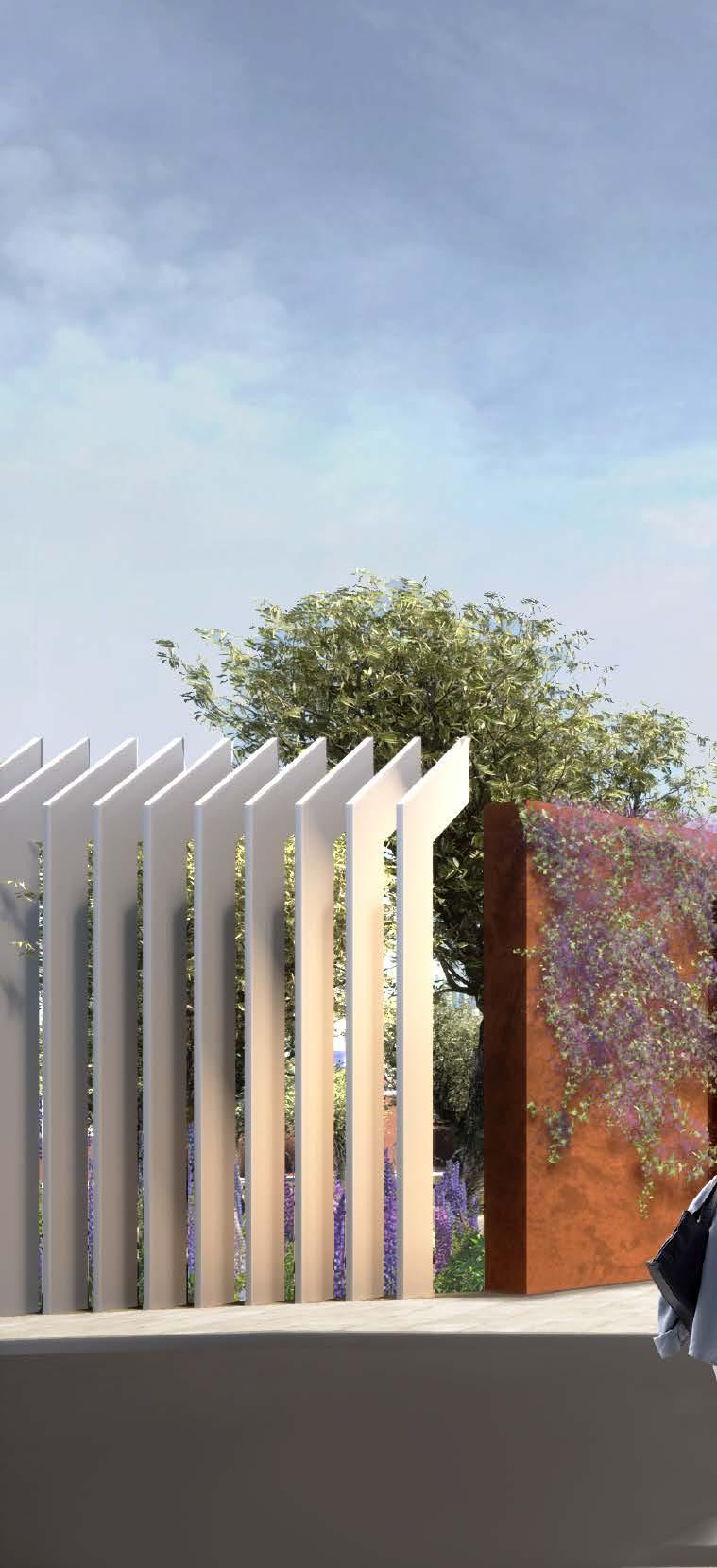
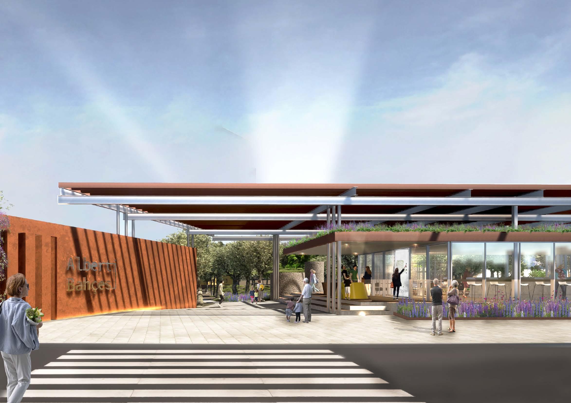
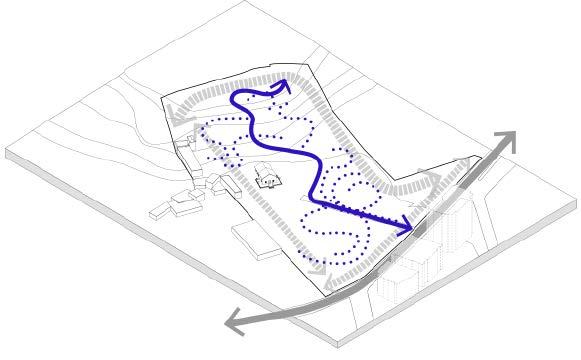
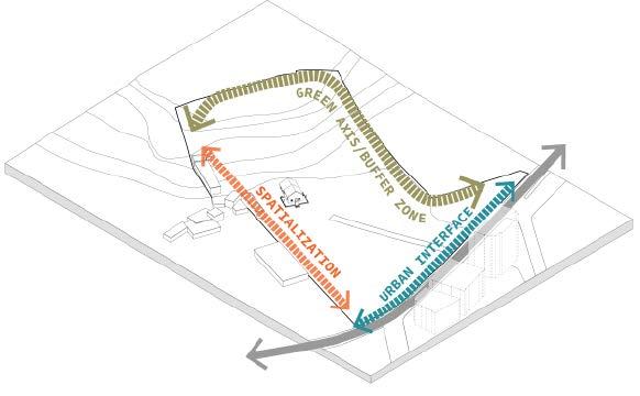
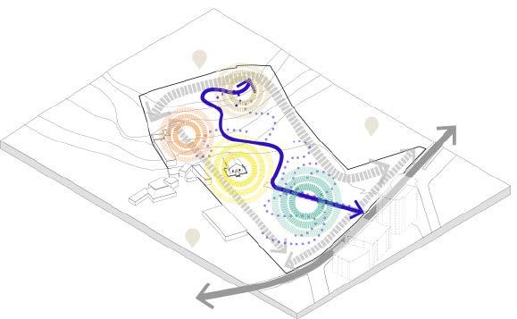
The Alberti garden is an area with many trees and plants of historical and ecological value within a dense urban fabric. At the same time, there are historical buildings, wells and pools in the area. Different focuses are created by taking these historical elements into account within the design. An experience route has been designed that will take the visitors from the entrance and leave them to different focal points in the green texture. It is proposed to create a sensory garden at the entrance of the area with plant selections that stimulate the senses and are compatible with the existing green texture & identity.
Mastic Tree
The Rocks


The ancient element, ‘’Old Mastic Tree’’ in the north of the garden
Highlighting ‘‘Gorgeous Rocks’’ in the design
Old Barns
Maintaining the stable structure of Alberti Garden, remembering the past ‘‘Farm Identity’’, with a new function
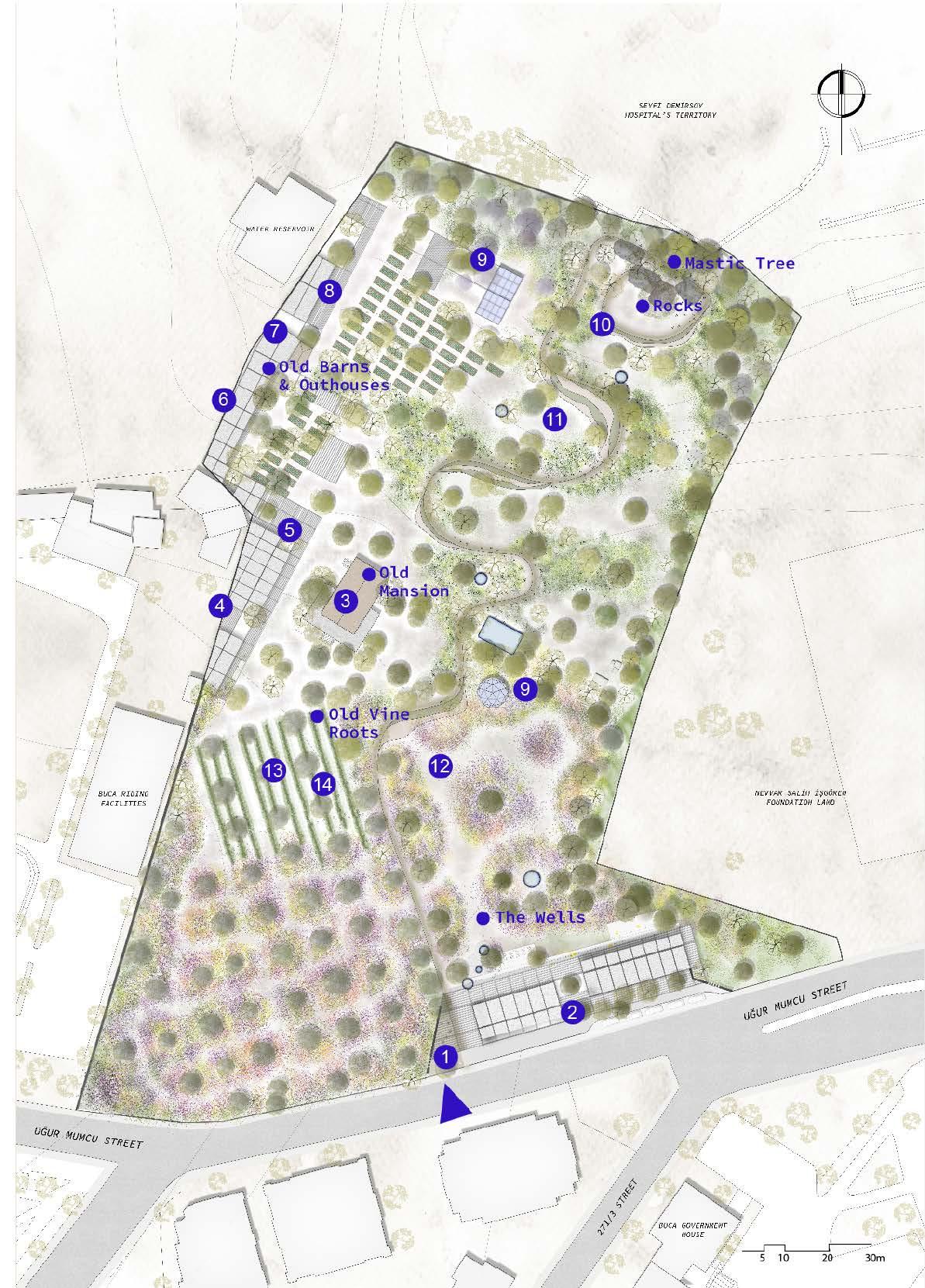
Old Vine Roots
‘‘The Old Vine Root’’ that has witnessed everything in Alberti Garden from past to present
Old Mansion
A new ‘‘Gastronimic Focus’’ with its structure, terraces and its environment
The Wells
The continuation of the well’s functions and transformation of Wels to symbolic items in the project field
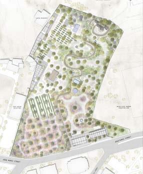
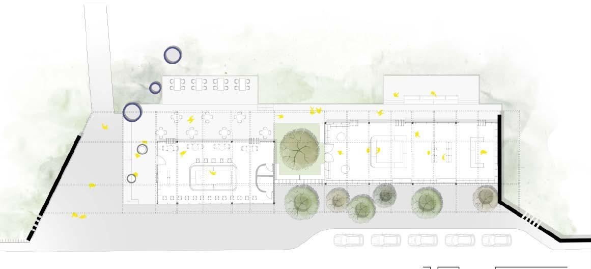
PROGRAM
Entrance
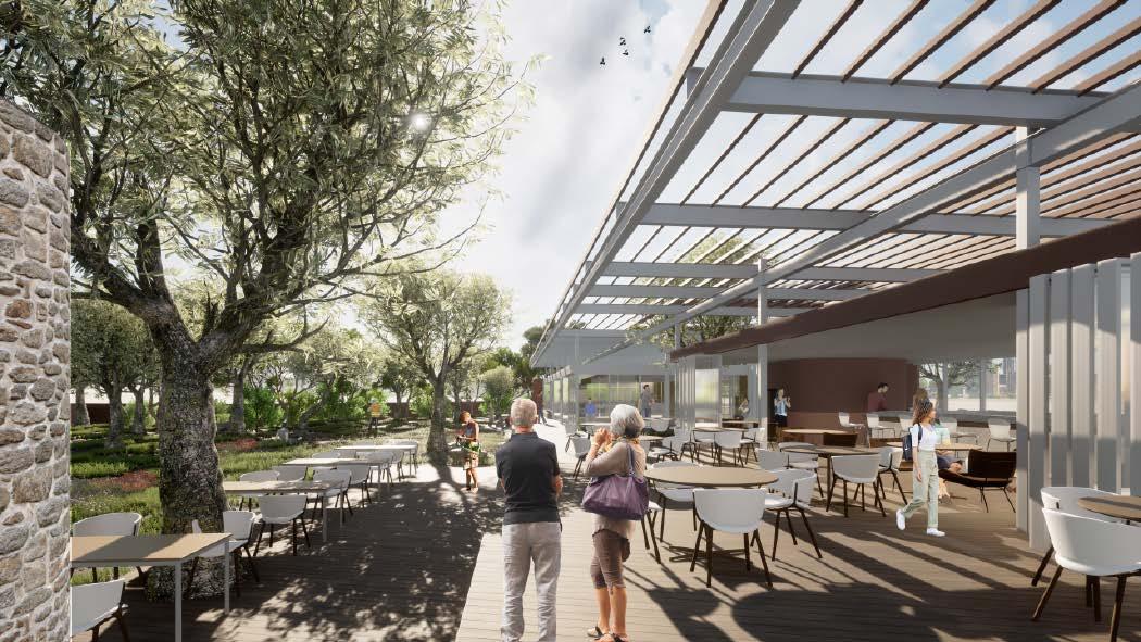
Information, Cafe & Shop
Kösk Restaurant
Olive Oil Making & Taste Workshop
Cooking Workshop
Workshop & Library
Library
Compost Workshop Area
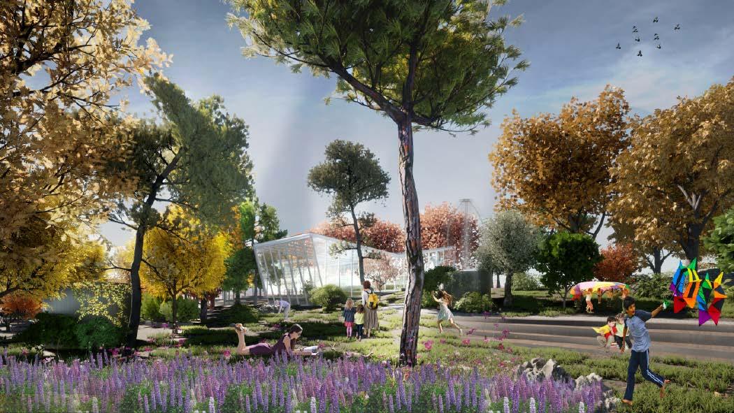
Greenhouse
Event Place
Event Place
Event Place
Vineyard Area on The Trace of Ancient Vine Root
Eating Together at Community
Table

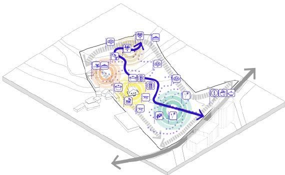
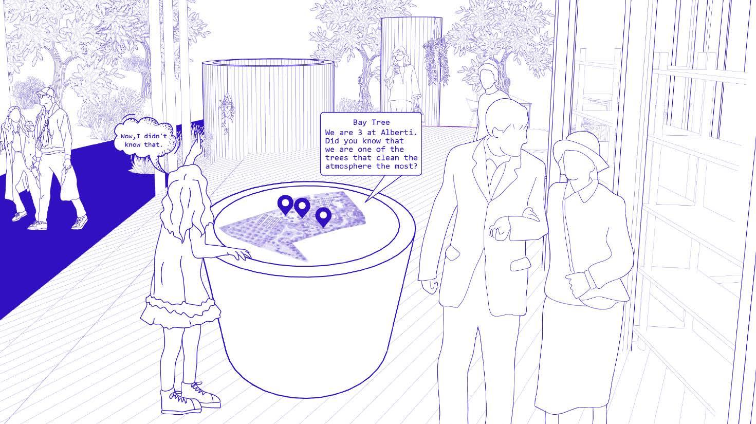 1. Entrance / As an urban interface, it invites people to Alberti Garden.
2. Digital Interface & Archive / Awesome digital interface provides users large plant inventory in Alberti Garden.
3. Cafe / Serves all seasons, turns into a meeting point for citizens
1. Entrance / As an urban interface, it invites people to Alberti Garden.
2. Digital Interface & Archive / Awesome digital interface provides users large plant inventory in Alberti Garden.
3. Cafe / Serves all seasons, turns into a meeting point for citizens
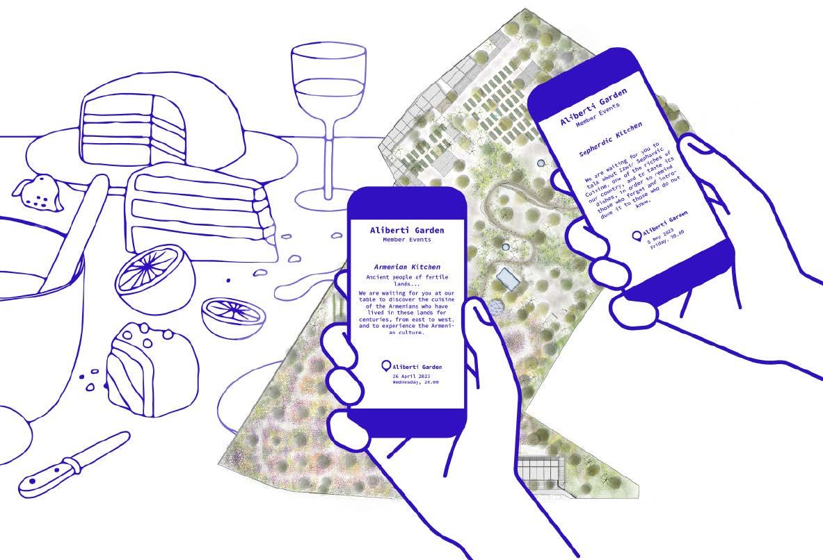
 Entrance of Aliberti Garden & Digital Interface at The Back
the carbon and water footprint through food supply from urban hinterland
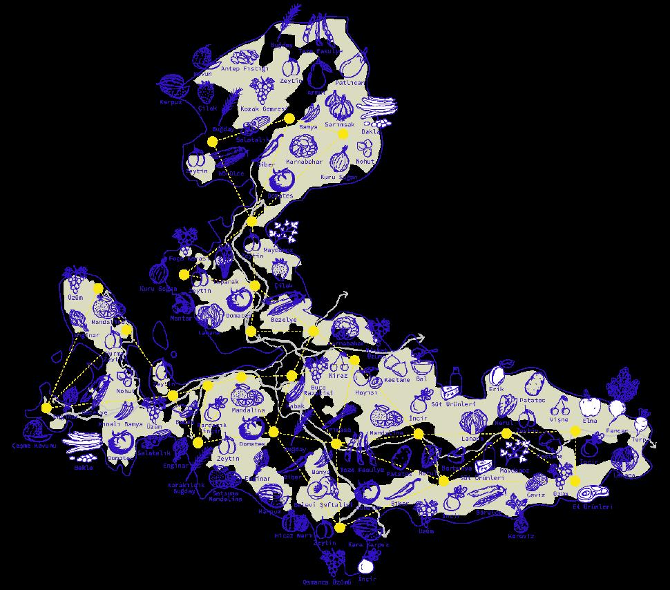
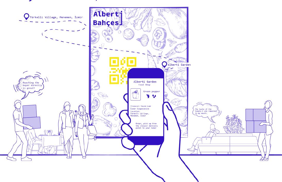
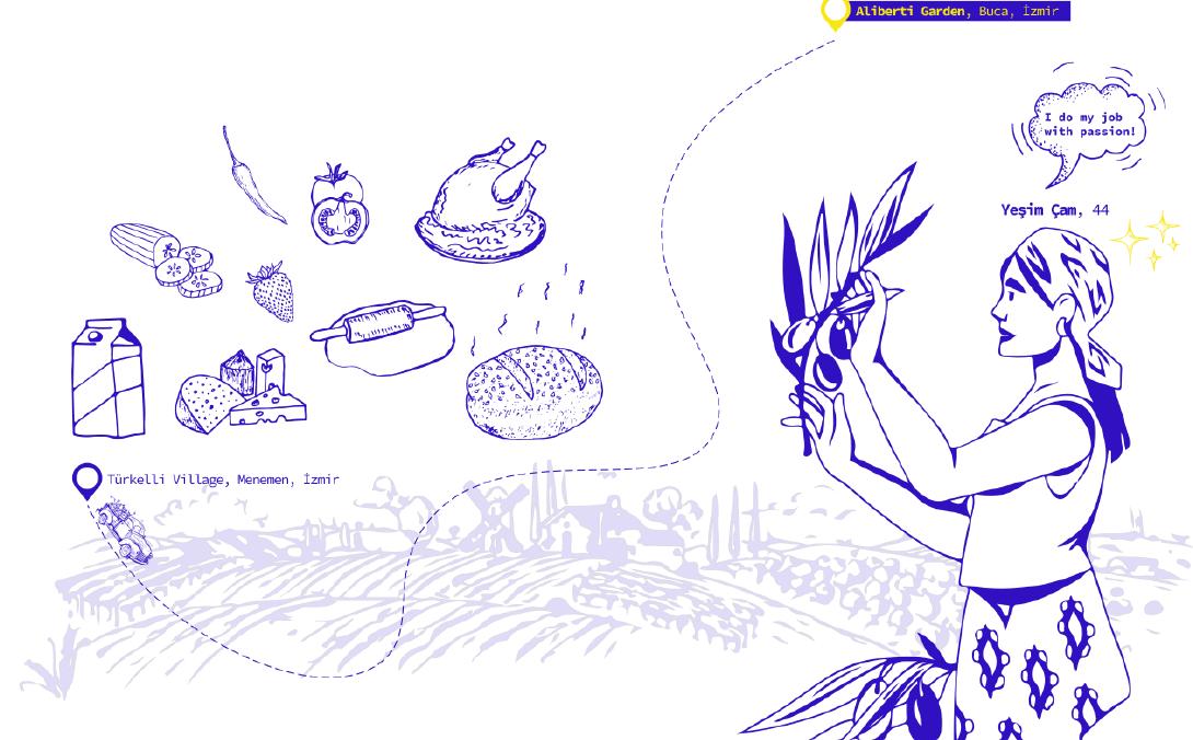 1. İZMİR FOOD NETWORK / Reducing
3. FOOD COOPERATIVES NETWORK AND COMMUNITY
2. FOOD SHOP / FOOD SAFETY OPERATION
1. İZMİR FOOD NETWORK / Reducing
3. FOOD COOPERATIVES NETWORK AND COMMUNITY
2. FOOD SHOP / FOOD SAFETY OPERATION
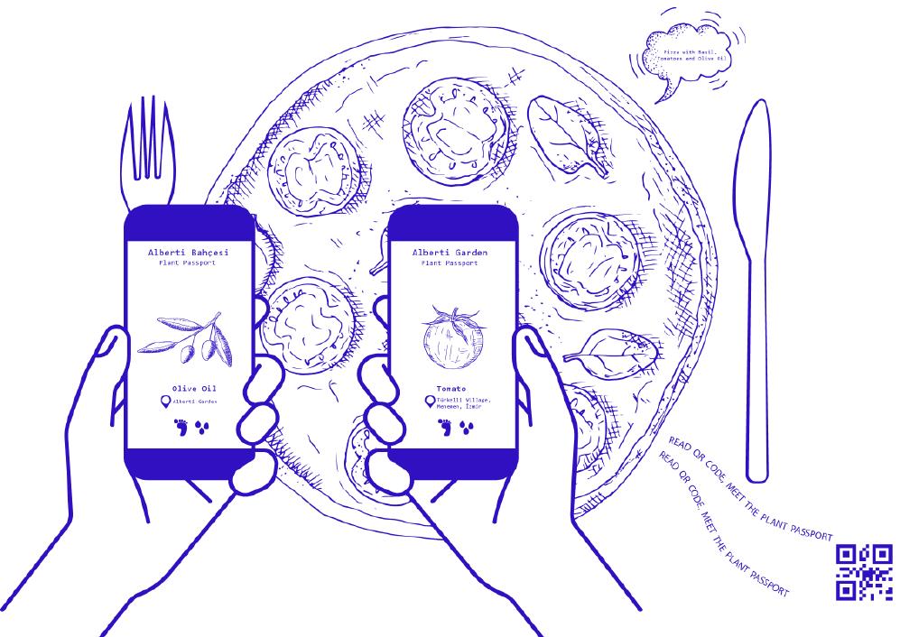
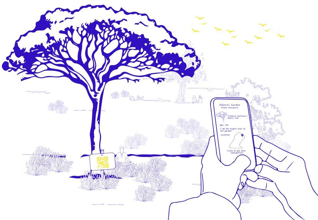 5. PLANT PASSPORTS IN THE ALBERTI GARDEN
4. PLANT PASSPORTS OF THE FOODS IN ALBERTI GARDEN’S RESTAURANT
Cafe Area in The Entrance Building
Greenhouse Where Endemic Plant Species Are Grown
5. PLANT PASSPORTS IN THE ALBERTI GARDEN
4. PLANT PASSPORTS OF THE FOODS IN ALBERTI GARDEN’S RESTAURANT
Cafe Area in The Entrance Building
Greenhouse Where Endemic Plant Species Are Grown
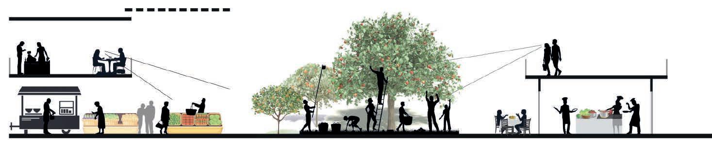
1. Olive Oil Making Workshop / The olive oil obtained from the olive trees, the dominant plant in Alberti Garden.
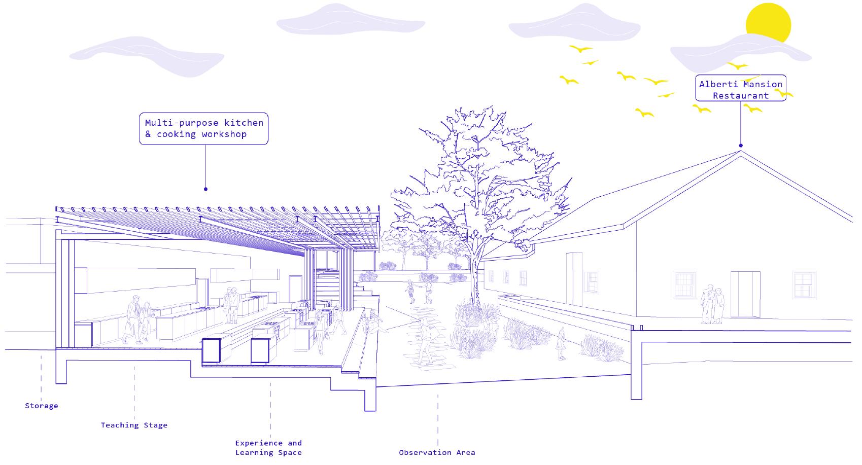
2. Kitchen & Teaching Stage / The stage area where the chefs cook or share their experiences
3. Cooking Workshop / Learning & Experimental cooking section where students learn from masters
4. Equipment Storage / Storage of all required kitchen equipment
Olive oil making Workshop
Kitchen & Teaching Stage
Cooking Workshop
Equipment Storage
Dry Supply Storage
Dish Washing Area
Cold Storage
1. Workshops / Permaculture and agricultural education spaces

3. Library / Hosts the publication collection on agriculture and gastronomy of Alberti Garden
3. Raised Vegetable Beds / Production units where urban people can experience the gardening applications
4. Semi-open Workshop Area / Semi-open area where various workshops on agriculture and permaculture can be made
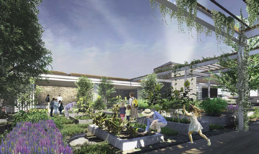
 Gardening Workshop Area
Semi-open Meeting & Resting Amphi of Workshop Areas
Gardening Workshop Area
Semi-open Meeting & Resting Amphi of Workshop Areas
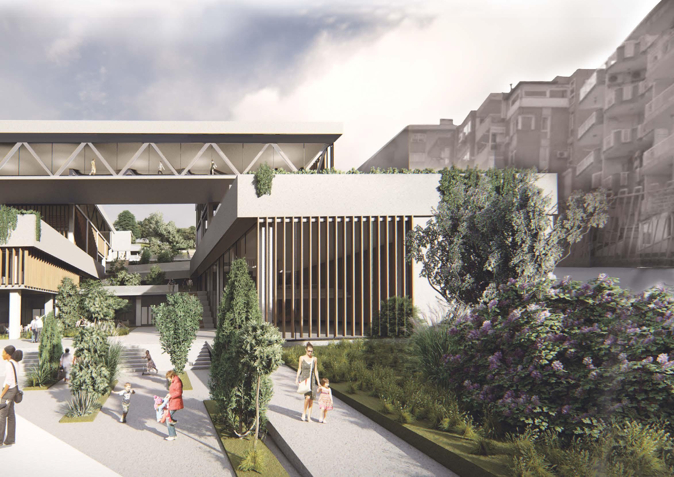
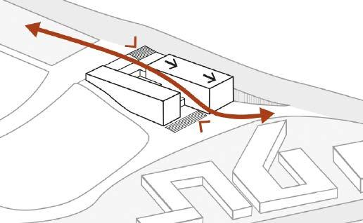
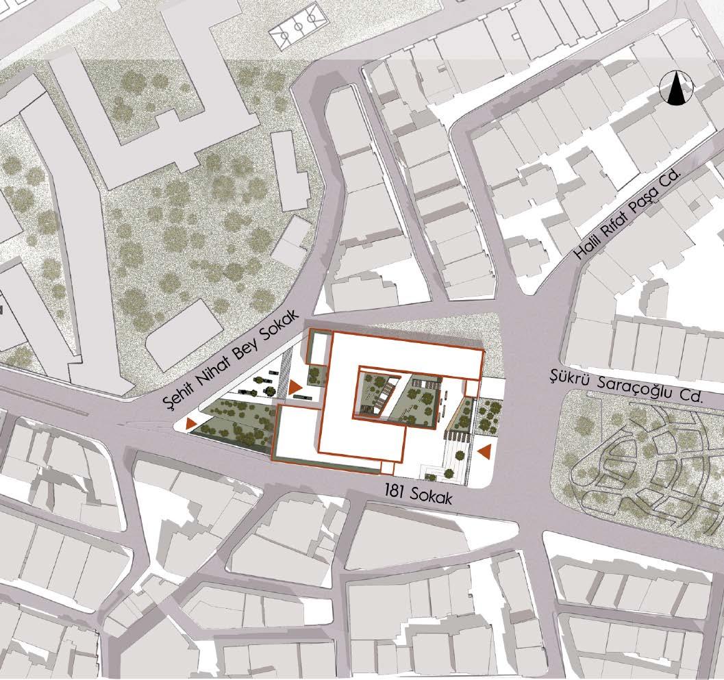
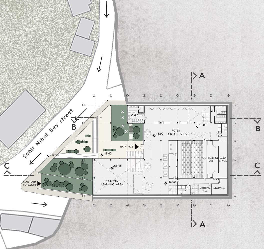
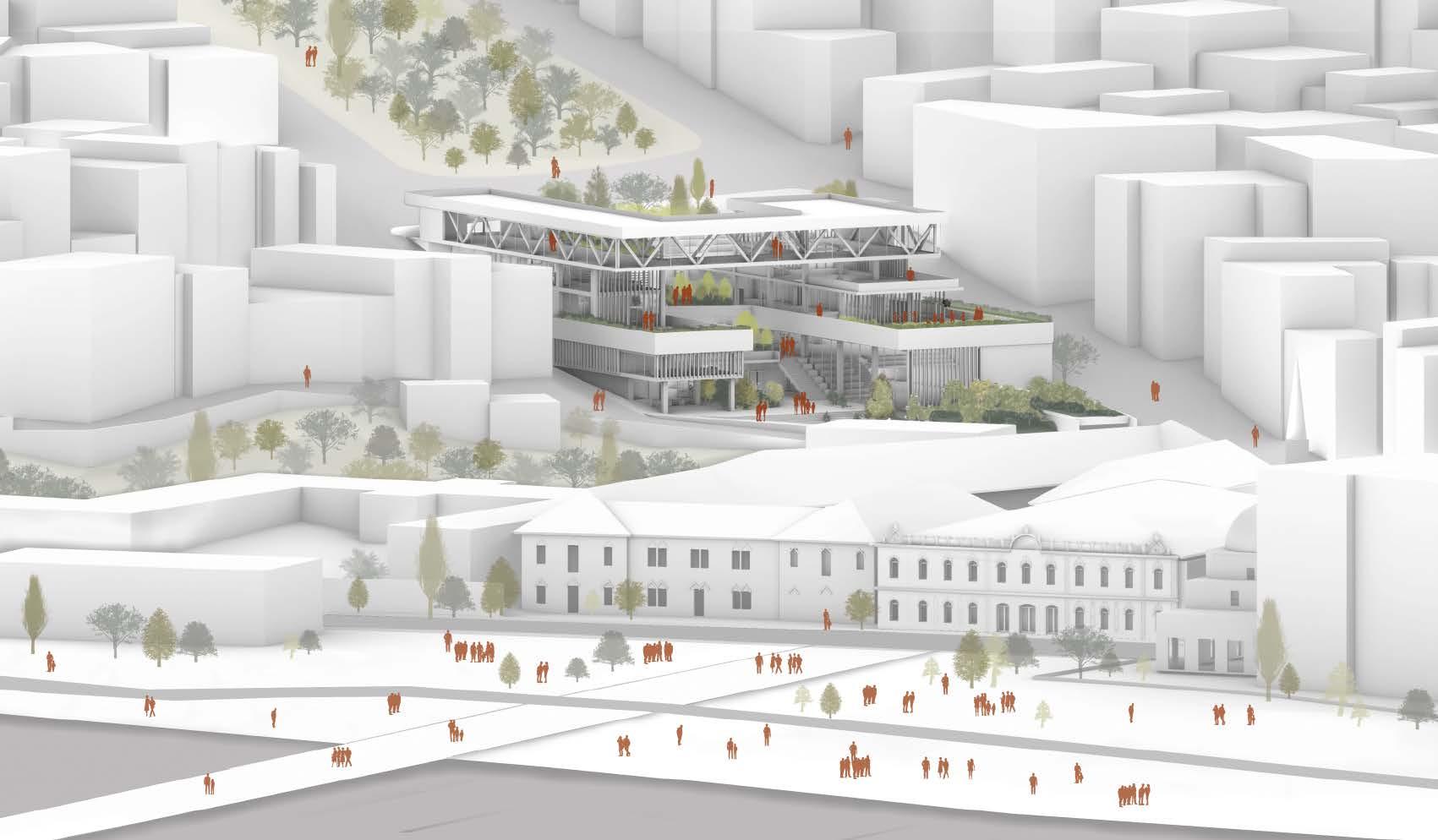
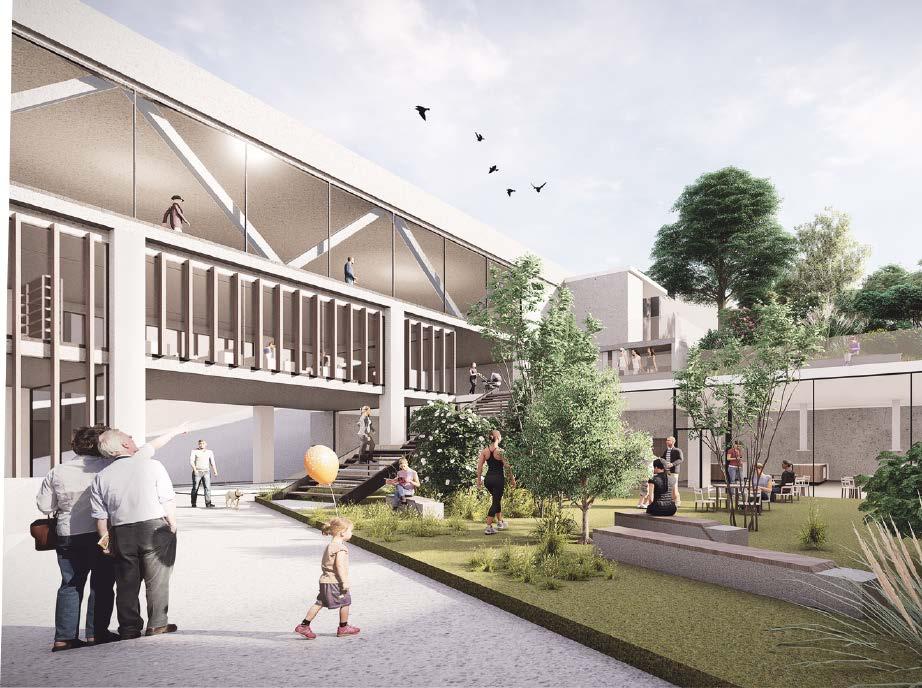
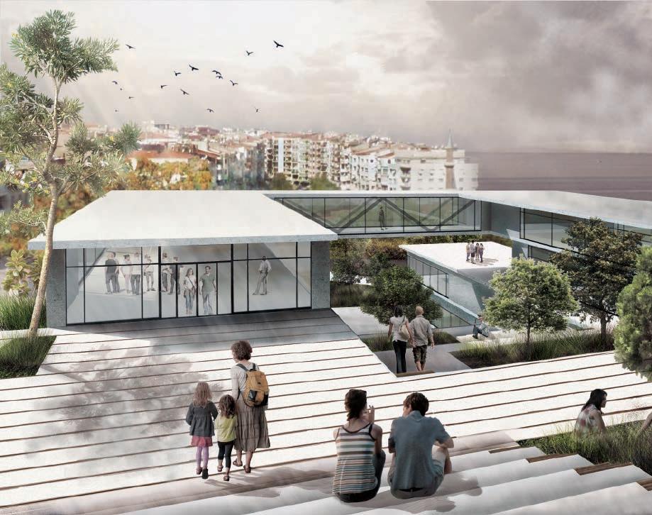
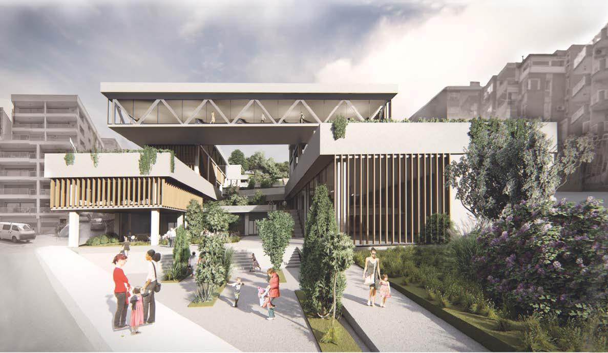
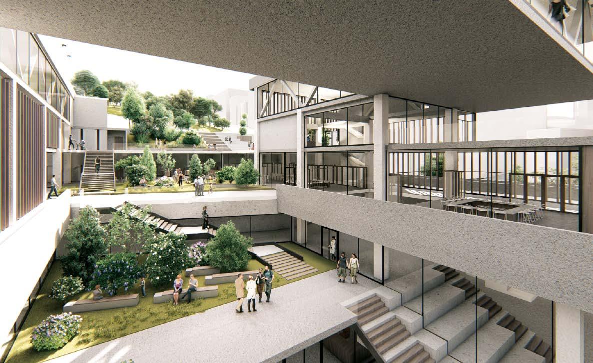
Architectural Design Studio Work/ Yasar University/ 2018
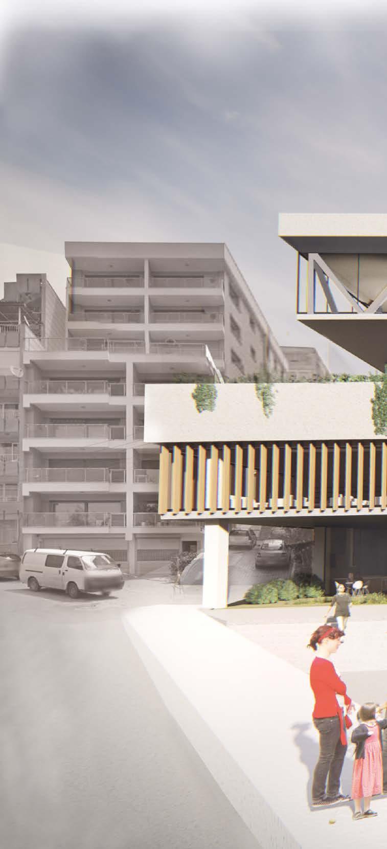
Location | Karantina, İzmir, Turkey
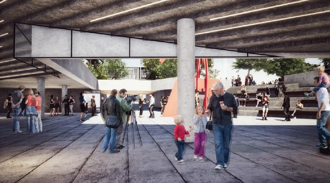
The project in the Karantina region, which has an important place in the history of the city, aims to create a social and cultural awareness amoung city people by taking role of physical and social threshold in the context. While it creates the social threshold by revitalizing the collective city memory and connecting the city people to each other, it provides the physical threshold by connecting the defined urban areas.
'' The in-between space that connects or separates different characters. A threshold may cause positive or negative effects to the environment. ''
Karantina District defines a threshold at urban scale with the streets - attached to the main artery (İnönü Avenue)connect upper part of the city directly to the coastline.
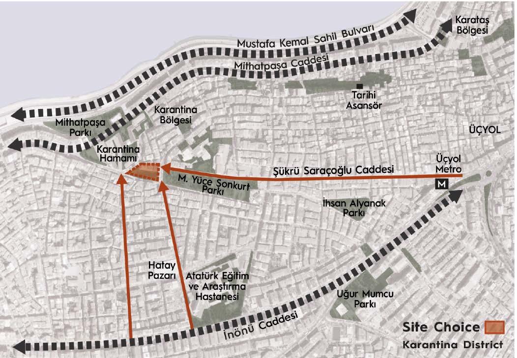
The project area has a strategic importance due to having a potential of connecting these streets and huge greenery to the hist.orical area and main commercial axis (Mithatpaşa Avenue)
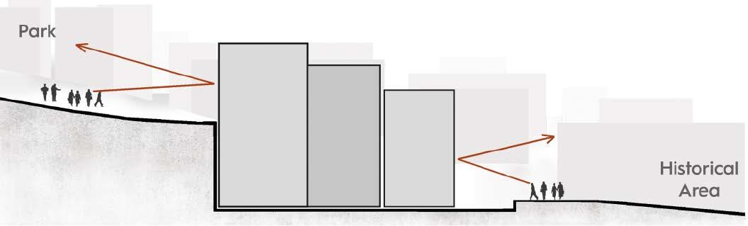
The existing situation a negative threshold that high rundown apartment buildings seperate the public green & historical zone and interrupt accessibility between upper and lower levels.
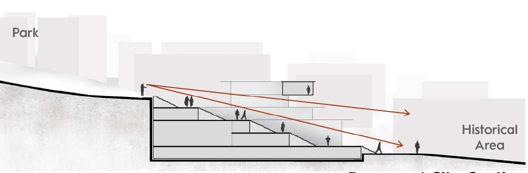
The proposed situation; the land is expropriated as a community center and the negative threshold is transformed into the positive threshold by providing accessibility between the levels.
 1. Karantina District as Urban Threshold
2. Transforming The ''Negative Threshold'' to ''Positive Threshold''
Existing Site Section / Obstacle Effect
Proposed Site Section / Connector
1. Karantina District as Urban Threshold
2. Transforming The ''Negative Threshold'' to ''Positive Threshold''
Existing Site Section / Obstacle Effect
Proposed Site Section / Connector
M. Yüce Sonkurt Public Park
Huge public greenery in high density urban settlement
Transformed into a connector space in between the public park and historical area & city square
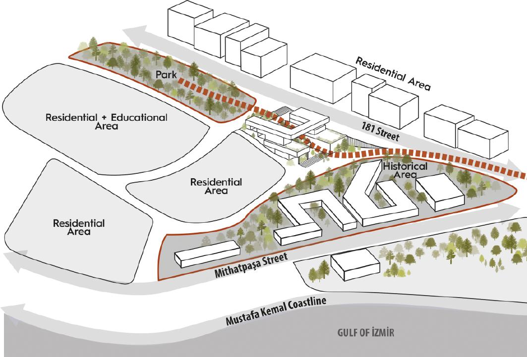
Historical Area
Historical buildings reminding the city history
Mithatpaşa City Square Public space includes recreational areas, sports fields etc.
I-Discontinuites & Boundaries
II-Continuous Pedestrian Access
Approach by the upper city
Approach by the coastline
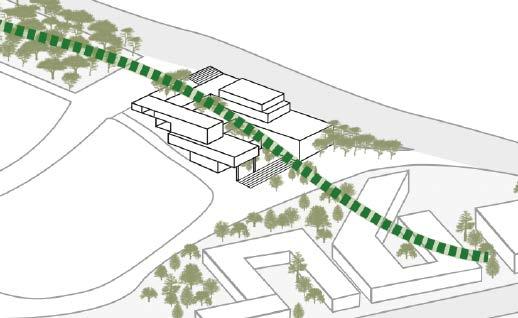
III-Green Continuity & Green Terraces exhibition space
IV-Framing the City View -Visual Connectivity
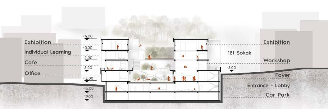
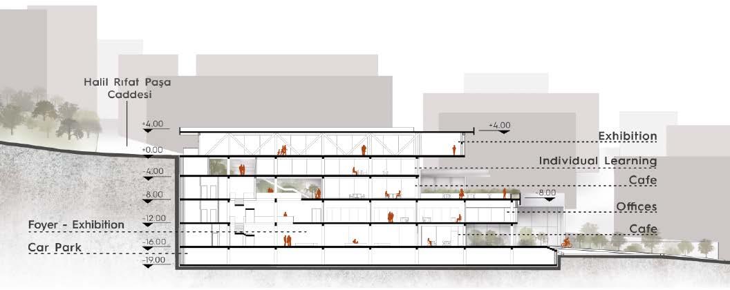
The building terraces are formed as a continuation of the green park at the upper level and connected to the lower green.
The spaces are shaped according to functional requirements and sunlight needs.
The exhibition space located on the top of the building has a panorama view through Karantina district.
This continuous mass at the top, allows to display the city as an exhibition object.


Governorship
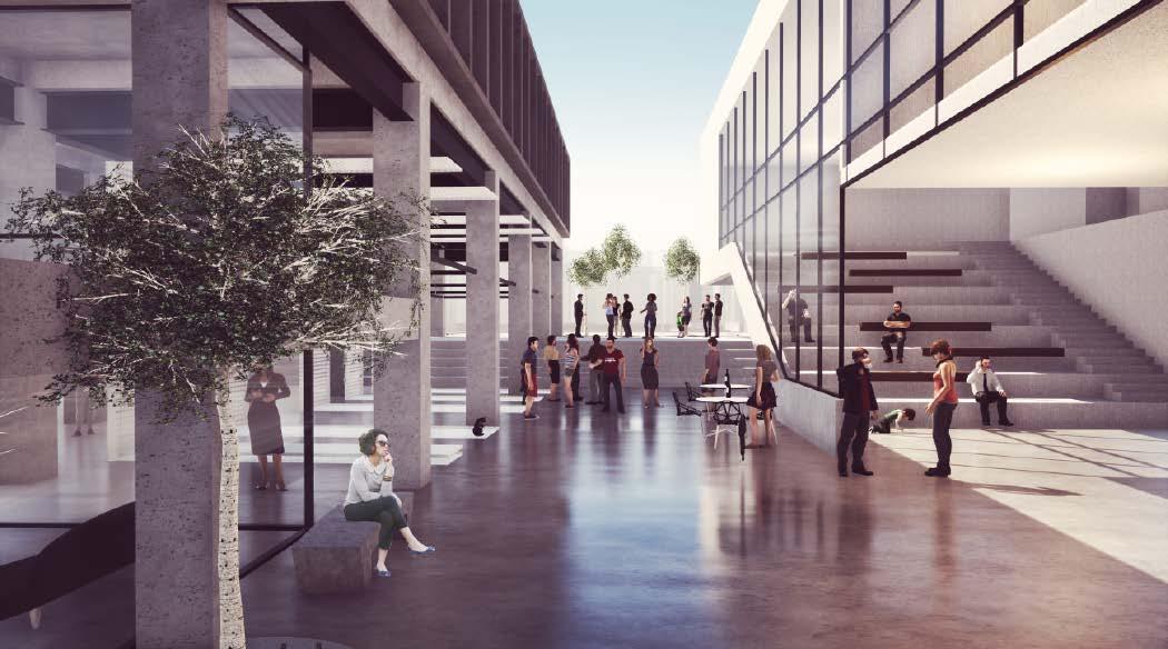
The connectivity idea reflects in the function of the building. The decrease in neighborhood relations in today’s city, isolation amoung the city people and the disappearance of the collective city memory form the basis of ‘‘Awareness’’ idea. The function of building aims to connect citizens to each other, provide communication and sharing environment to make people aware of each other and the city they live in. The social connectivity mission of the building provides a social threshold.
‘’ The space that seeks public profit ’’

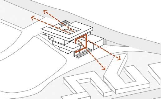
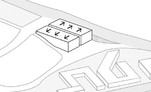
Fire Stairs & Elevators
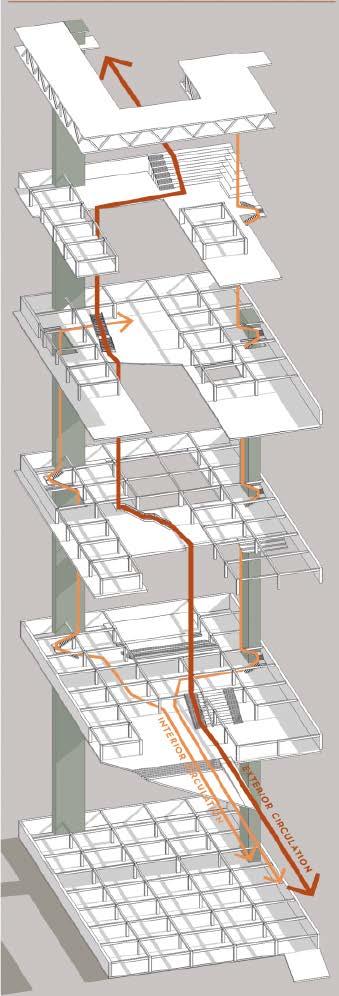
Exterior Circulation
Interior Circulation
Mithatpaşa Vocational High School Mithatpaşa City Square Mehmet Yüce Sonkurt Public Park Gulf of İzmir Karantina Turkish Bath Hamidiye Mosque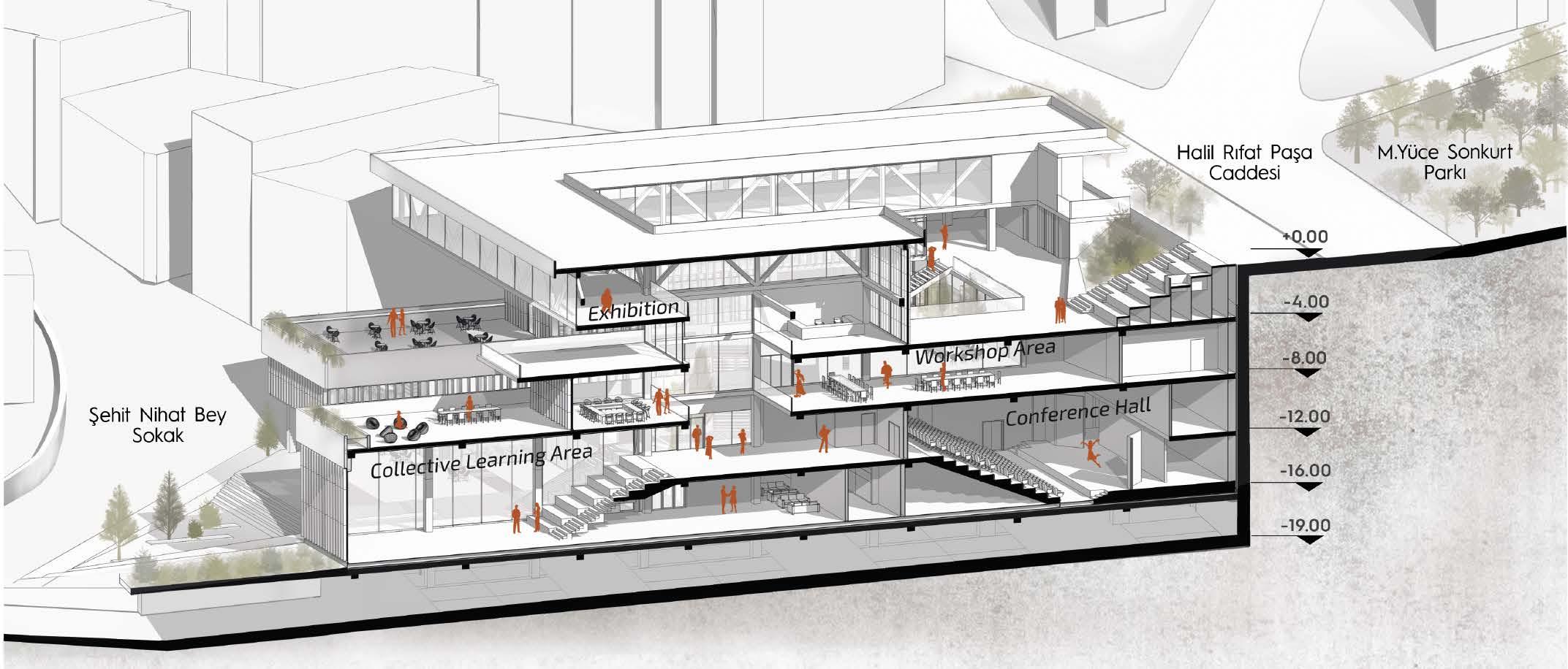
Exhibition Award/ MimED Competition
Architectural Design Studio Work/ Yasar University/ 2018
Location | Üçyol, İzmir, Turkey
Team | Aslı Yavaş, Sinem Kocabaş, Yağmur Kınacı
The project aims to create a living environment with a productive urban green. Habitat scenario is created by a fiction through production & consumption cycle. Active green with the production creates an urban identity and helps the community building. The term ‘’Habitat’’ is not reduced to only housing and it is defined as an integrated space includes set of functions and elements that human beings need for life. The public welfare is considered by satisfying the inadequate public space and greenery need in the high density urban environment.
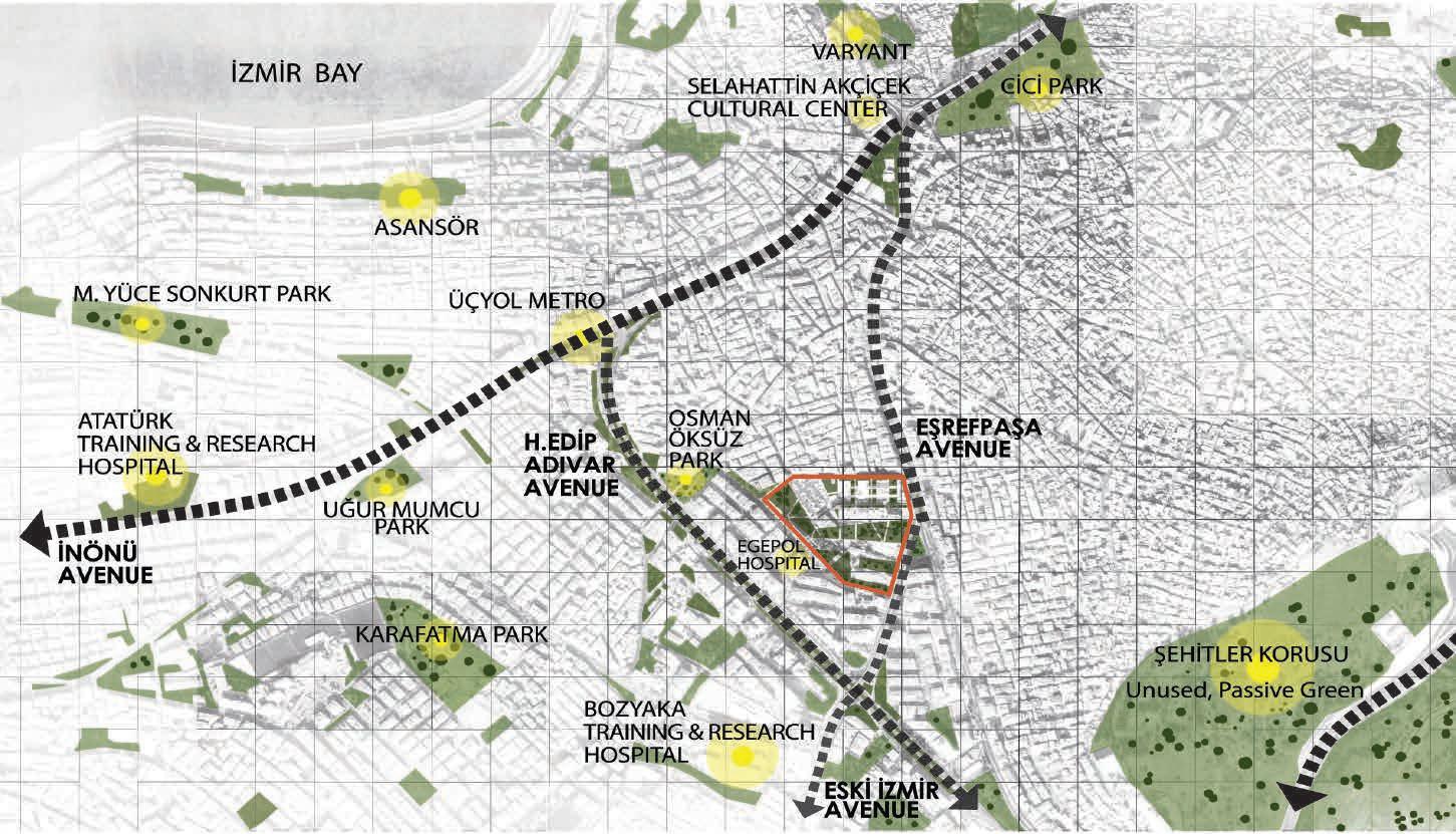
As a macro scale decision, it is proposed a scenario of green identity to Yağhaneler region, trapped between the 3 main arteries in the city. It is foreseen to connect these three axes with each other through this urban green in the future. Productive Habitat is considered as the first step of this fiction.
The order based on consumer action in urban habitats leads people to individualization and competition. The production action emerges as a powerful concept provides cooperation between people and build a community in the alternative habitat scenerio. In more sustainable habitat model , production consumption cycle is achieved thanks to the active green areas with production.
Problems / Discontinuities & Interruption on urban floor
Unbalanced distribution of functions
Zoning & Lack of interaction between functions
Impermeable urban areas
Lack of social interaction
Consumption edicted habitat
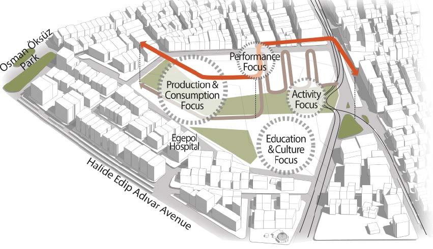
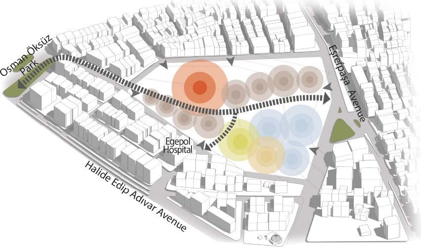
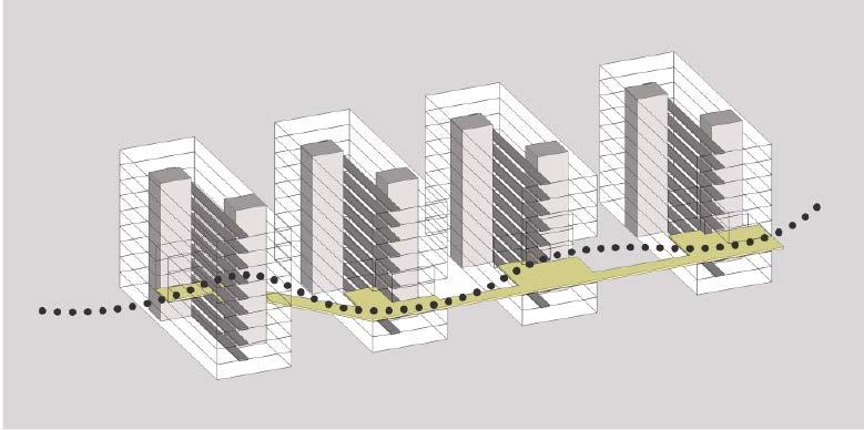
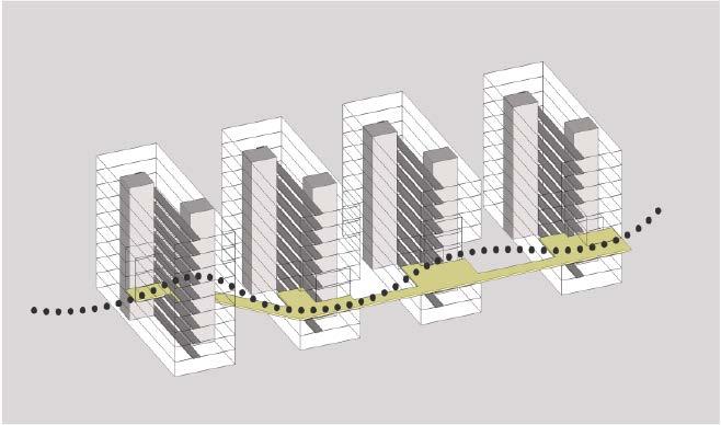
PROJECT FOCUSES & ROUTES
Platform Route
Commercial Route
Project’s focal points are defined around the green spine.
PROPOSED PROGRAM
/ Ground Floor Uses
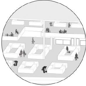
Educational Bazaar
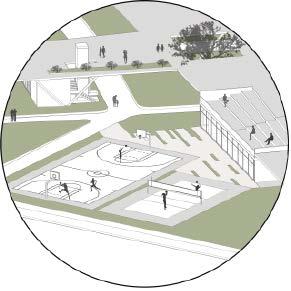
Sport Cultural Housing
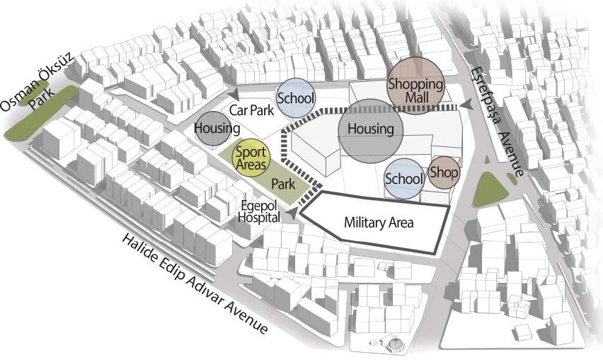
Commercial
Responses / Continuities on urban floor
Balanced distribution of functions
Interactive functions
Permeable urban areas
Diversity of social interaction
Ensuring production - consumption cycle
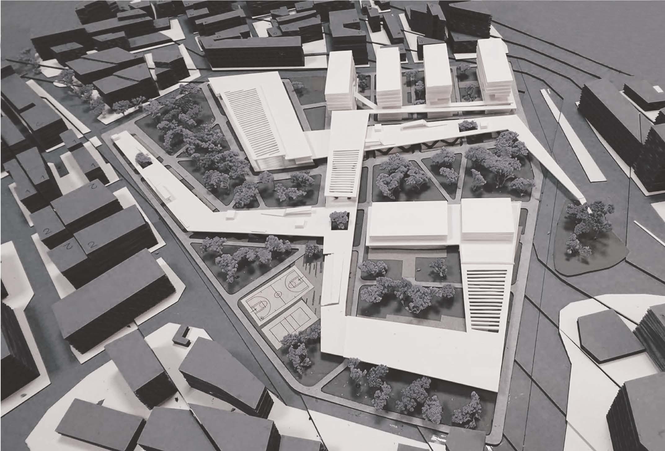
RE-ORGANIZED PROGRAM & MASS
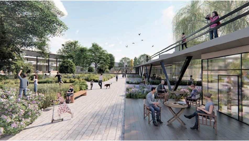
The program elements are integrated to the platform.As the positive spaces around green spine, generates the enclosed spaces and connects the functions.
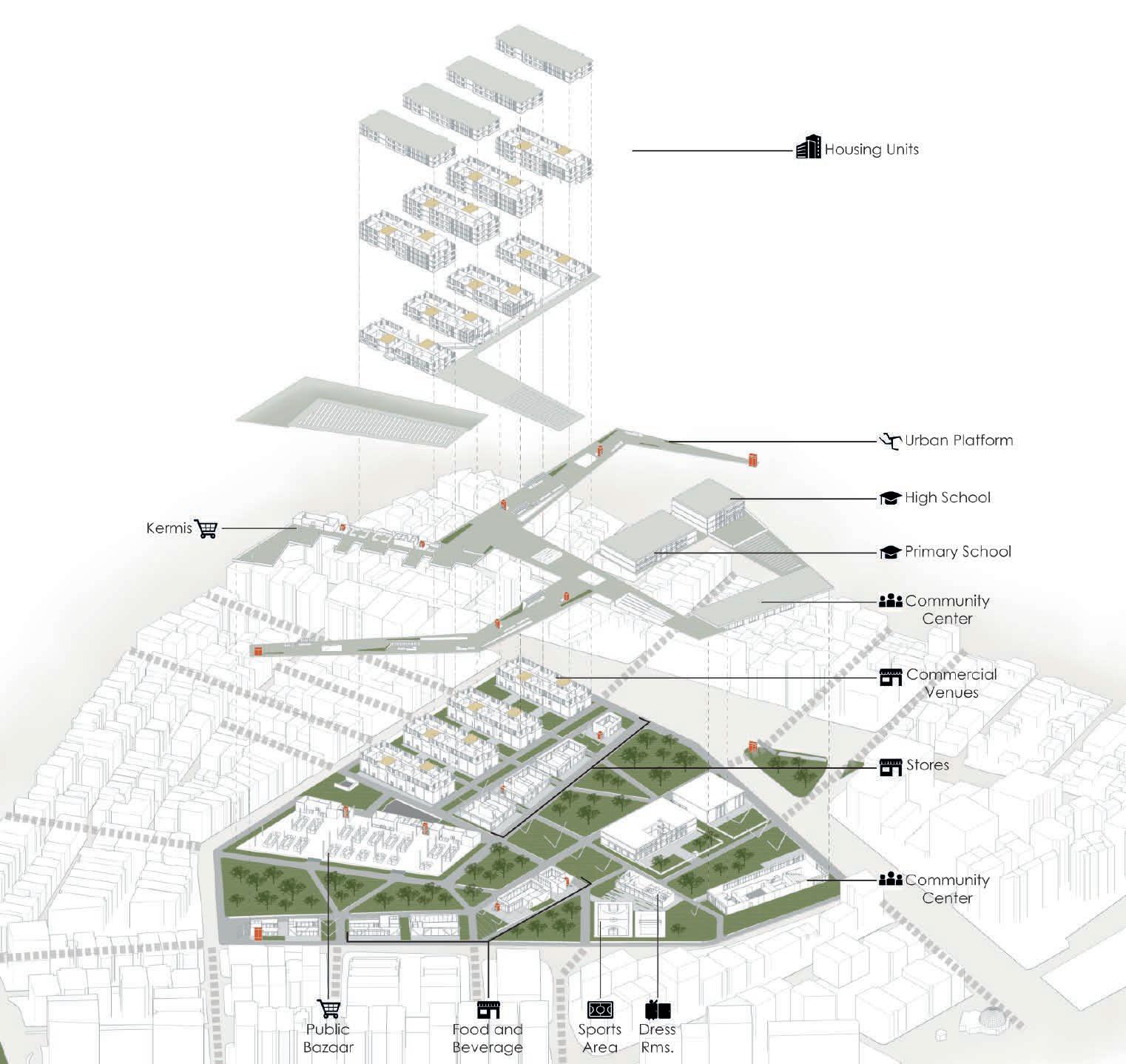
Creates the social, performance and observation areas.
Commercial spaces
Shops are located under the platforms at urban ground level and spread homogenously to the site while balancing the pedestrian density.
Contributes to the production & consumption cycle with the kermis area, active green spaces and food-bevarage commercials beneath the platforms.
The housing layout scheme is designed perpendicularly to the green spine to maximize the green areas instead of a parallel scheme and completely permeable to allow access to the urban garden.
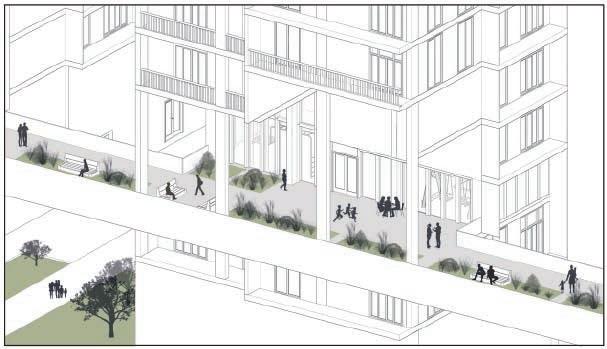
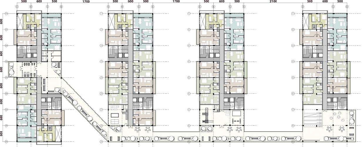
The housing units are connected with a social platform that serves to the apartment residents with social facilities and gives a possibility to observing green areas.
Street Continuity & Permeability/ Streets open to the urban gardens.
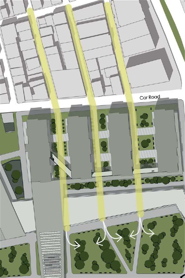
Street References
NEIGBOURHOOD
HOUSING UNITS
URBAN GARDEN

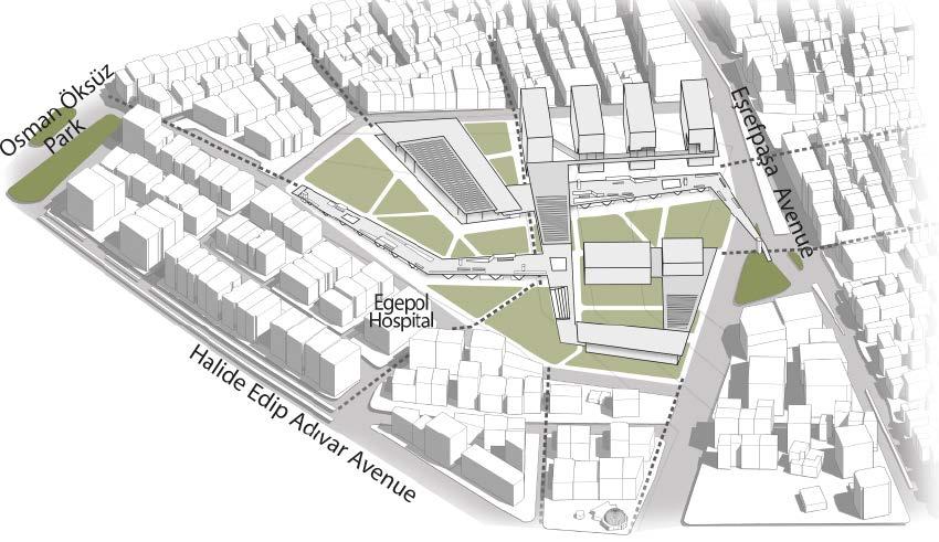
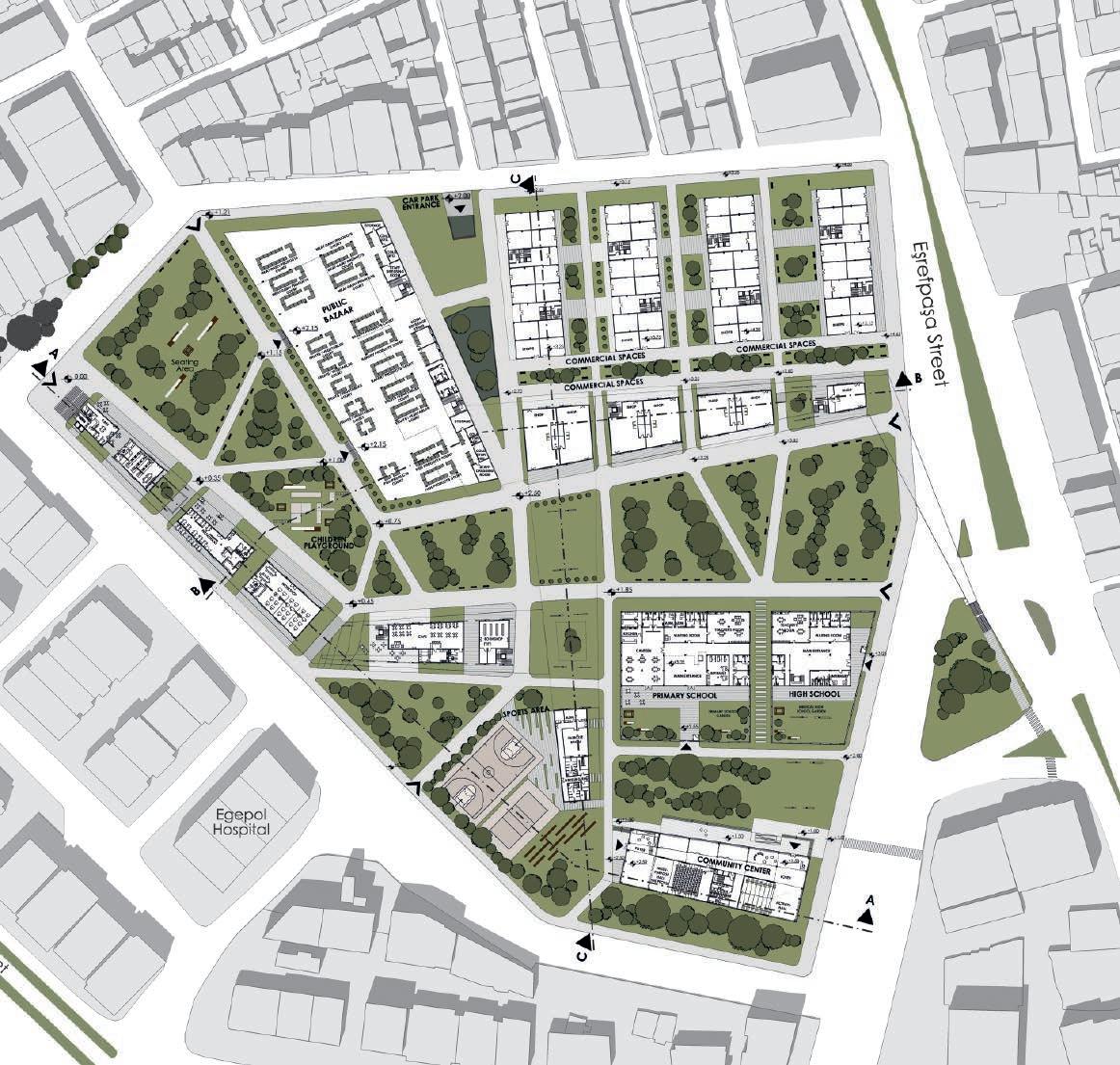 Active Greenery & Commercial Spaces Underneath the Urban Platforms GROUND PLAN 1/500
''IN THE CONTEXT OF URBAN RHYTHM''
Urban Design Studio Work / Mimar Sinan Fine Arts University/ 2021
Location | İstanbul, Turkey
The main theme of the Urban Design Studio course is the concept of "rhythm". The book titled "Rhythmanalysis Space, Time and daily Life" compiled from the writings of Henri Lefébvre, a French sociologist, intellectual and philosopher, are based on. Deep readings and discussions were made on rhythms in daily life & urban space and it was tried to discover how these rhythms can guide urban design.
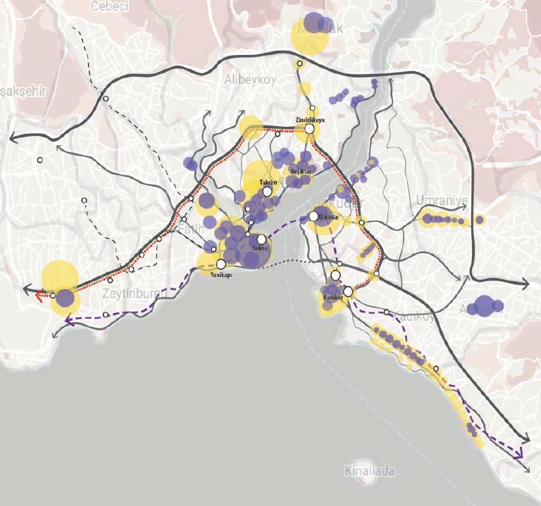
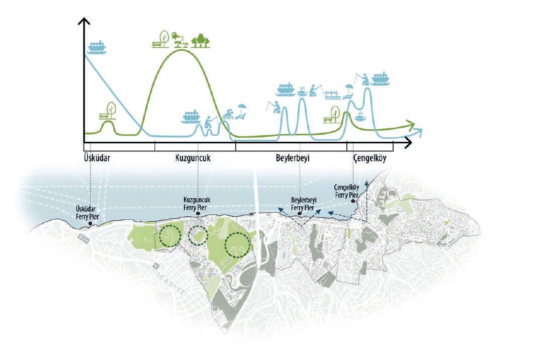
Cities, which are a complex structure, contain many rhythm layers. In this respect, cities are polyrhythmic spaces. According to Lefébvre, daily life rhythms and spatial rhythms differ according to the local framework, and these rhythm layers together shape daily life in the city and determine its identity.
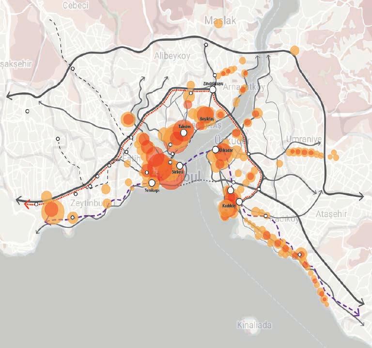
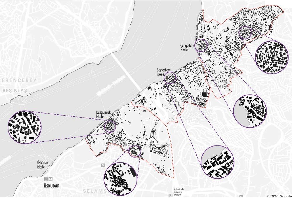
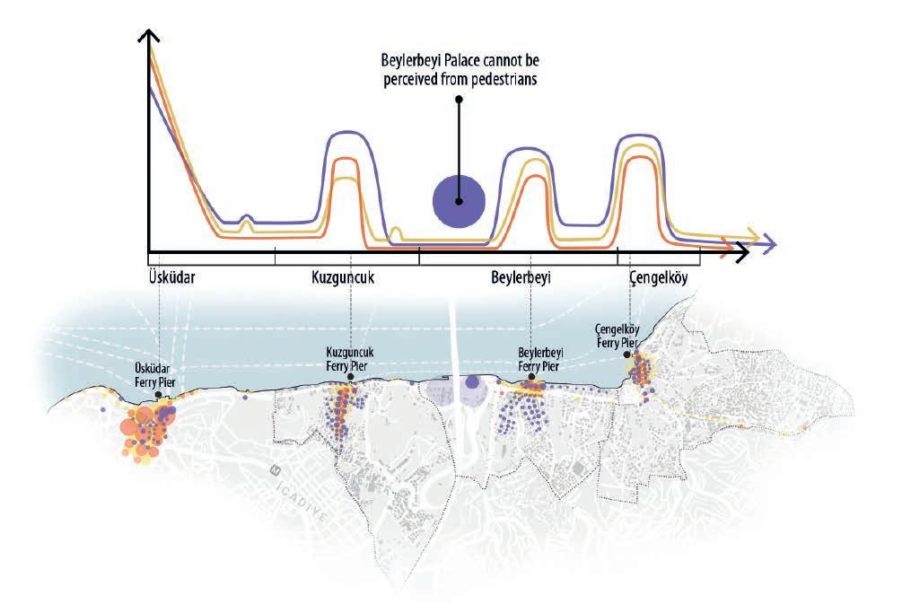
By overlapping the rhythm and transportation maps, it is seen that there is a strong connection between the rhythm centers and the transportation system. The areas where socio-cultural & spatial rhythms are concentrated show parallelism with each other. The areas where all the rhythms are most intense are the coastal regions. This proved that the sea (a natural rhythm) has a strong effect on the rhythms in Istanbul.
According to this; The concept of rhythm can be defined as sth. that creates a sense of motion, repeats cyclically or linearly in a noticeable measure.
Motion/ Feel of Motion
Repetition (cyclically or linearly) Measure
Events, activities, actions that occur in a certain pattern and time period.
- Tourist groups standing in the same spot, mothers dropping off children to school, skaters meeting at certain times, shops opening and closing at certain times, weekly shows, etc.
Gestures, codes, rituals, customs-traditions practiced by a particular group.
- Students wearing school uniforms, people wearing suits, walking community dressed in religious/ethnic clothes, religious rituals, festivals, political rituals, ceremonies etc.
It is the cyclical changes of nature.
- Day-night formation, seasons, weather, etc.
Objects or bodies that move at a certain speed and pattern in space.
- The flow, speed, trajectory, density, etc. of cars or people in the space.
A repetitive or harmonious arrangement of objects and surfaces in a space. (Rhythm is perceived from the eye of the moving observer)
- Repetition of colors or elements on building facades and floors
- Repetition of shops, houses or restaurants
Settlement
- Morphological
Change of Socio-Cultural and Spatial Rhythms in the Coastline
Static Spatial Rhythm
Dynamic Spatial Rhythm
Socio-cultural Rhythm
Social Rhythms
Cultural
Static Spatial Rhythms
Marine Oriented
Natural Rhythm
Green Oriented
Natural Rhythm
Neighbourhood
Active Greenery
Passive Greenery
Cemetery Greenery
Greenery Oriented
Natural Rhythm Focus
Marine Oriented
Natural Rhythm Focus
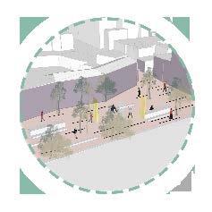
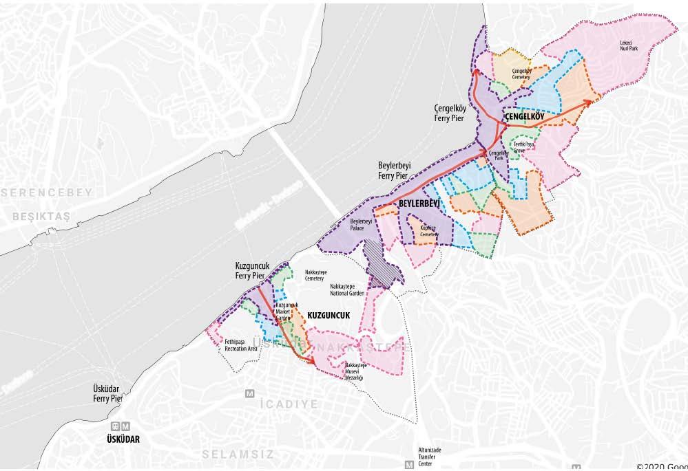
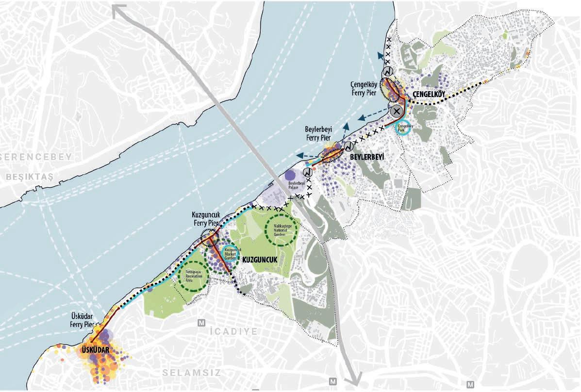
1) Increasing Accessibility Between Rhythm Focal Points // Continuous and safe sidewalk & bike path along the coastal road by regulating rhythm contradiction areas and removing obstacles that interrupt the paths
2) Strengthening Relationships with Natural Rhythms // Strengthening the relations of Bosphorus districts with natural rhythms by intervening in physical conditions such as making floating walking/watch platforms, efficient use of existing green and transformation of parking areas into recreational green areas.
Rhythm Contraction: Excessive concentration of rhythms and occurrence of rhythm conflicts & overlaps
Rhythm Relief: Decreased rhythm intensity/speed, no rhythm conflicts, and relaxation in the experiencer's perception
Rhythm Interruption: The interruption of rhythms and almost non-existence. This interruption may be due to physical disconnection, a spatial condition, or dysfunction.
Hard Rhythm Transition: A sudden transition between areas where the rhythms are very intense and lacking rhythms
Smooth Rhythm Transition: Gradual and slow transition between rhythms of different intensity and nature
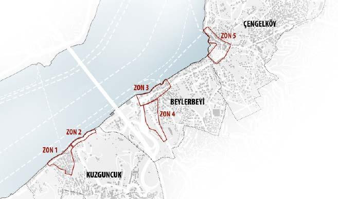
// Zone 3 is selected for further detailed work.
3) Arrangement of Rhythm Interruption Areas // Restarting rhythm cycles through physical interventions and redefining functions in places such as parking lots and dysfunctional streets in historic centers
4) Balancing Areas with Rhythm Contraction // Regulating rhythms with physical interventions such as facade & street arrangements, spreading rhythms to interior areas with traffic arrangements where rhythms are over-condensed and contracted.
5) Arrangement of Rhythm Transitions // Protection and increase of rhythm relief axes. Conversion of hard rhythm transitions to smooth transitions
6) Providing Function and Use Diversity // Creating function and usage diversity in rhythm focal areas by using modular or temporary structures, shading units, urban furniture and installations.
Socio-cultural Rhythms
Static Spatial Rhythms
Dynamic Spatial Rhythms
Neighborhood Boundaries
Active Green Spaces
Passive Green Spaces
Cemetery Green Fields
Greenery Oriented Natural Rhythm
Marine Oriented Natural Rhythm
Rhythm Contraction Zone
Rhythm Relief Zone
Rhythm Interruption Area
Hard Rhythm Transition Area
High-Paced Rhythm
Continuity Axis
Rhythm Relief Axis
Break in Rhythm Transition/ Interruption Axle
Soft Rhythm Transition Axis
Marine Oriented Natural Rhythm Intervention Area
Greenery Oriented Natural Rhythm Intervention Area
The Region to Create Rhythm Relief
Rhythm Interruption
Intervention Area
Continuous Pedestrian & Bike Path
Rhythm Contraction Zone to Reduce Rhythm
Region to Increase Rhythm
Axis to Create Rhythm Harmony
Presevation and enhancement of rhythm relief axes
Preserved High Rhythm
Continuity Axis
Preserved and Added Smooth Rhythm Transition Axis
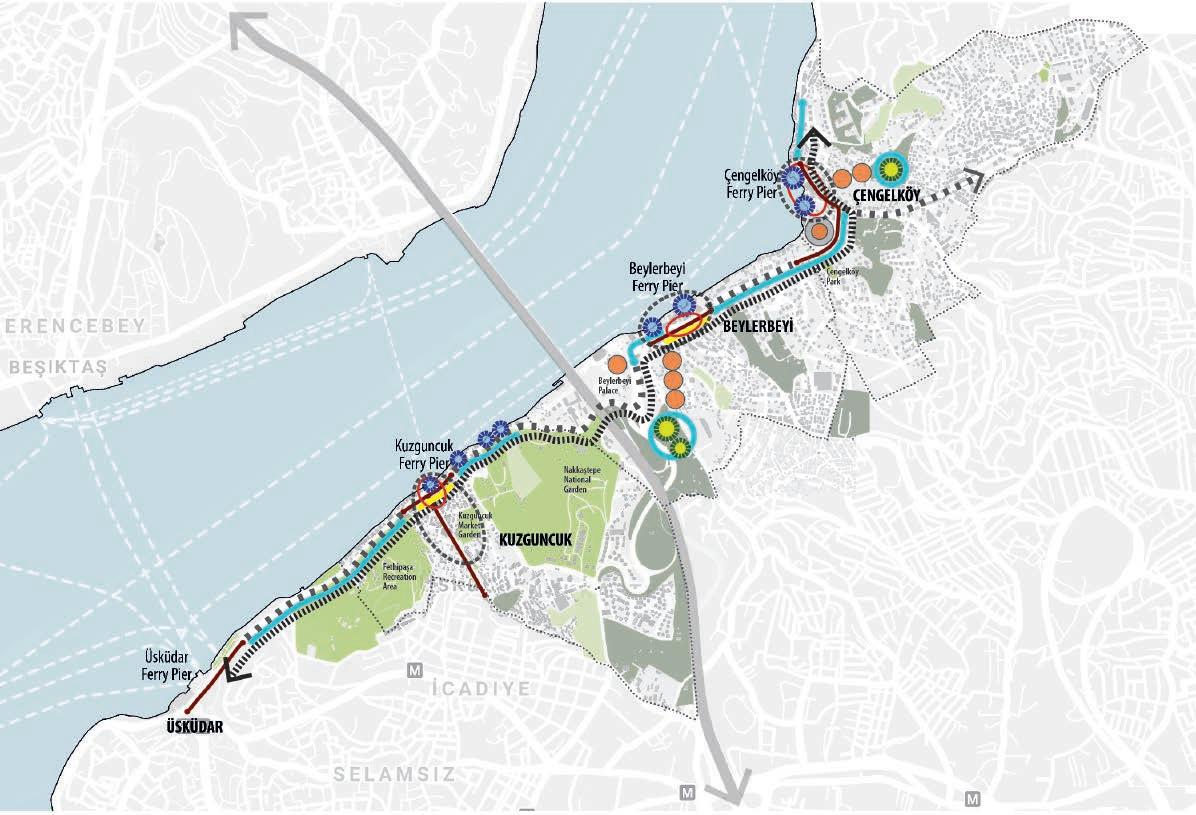
Rhythm Focuses to Create Function Diversity
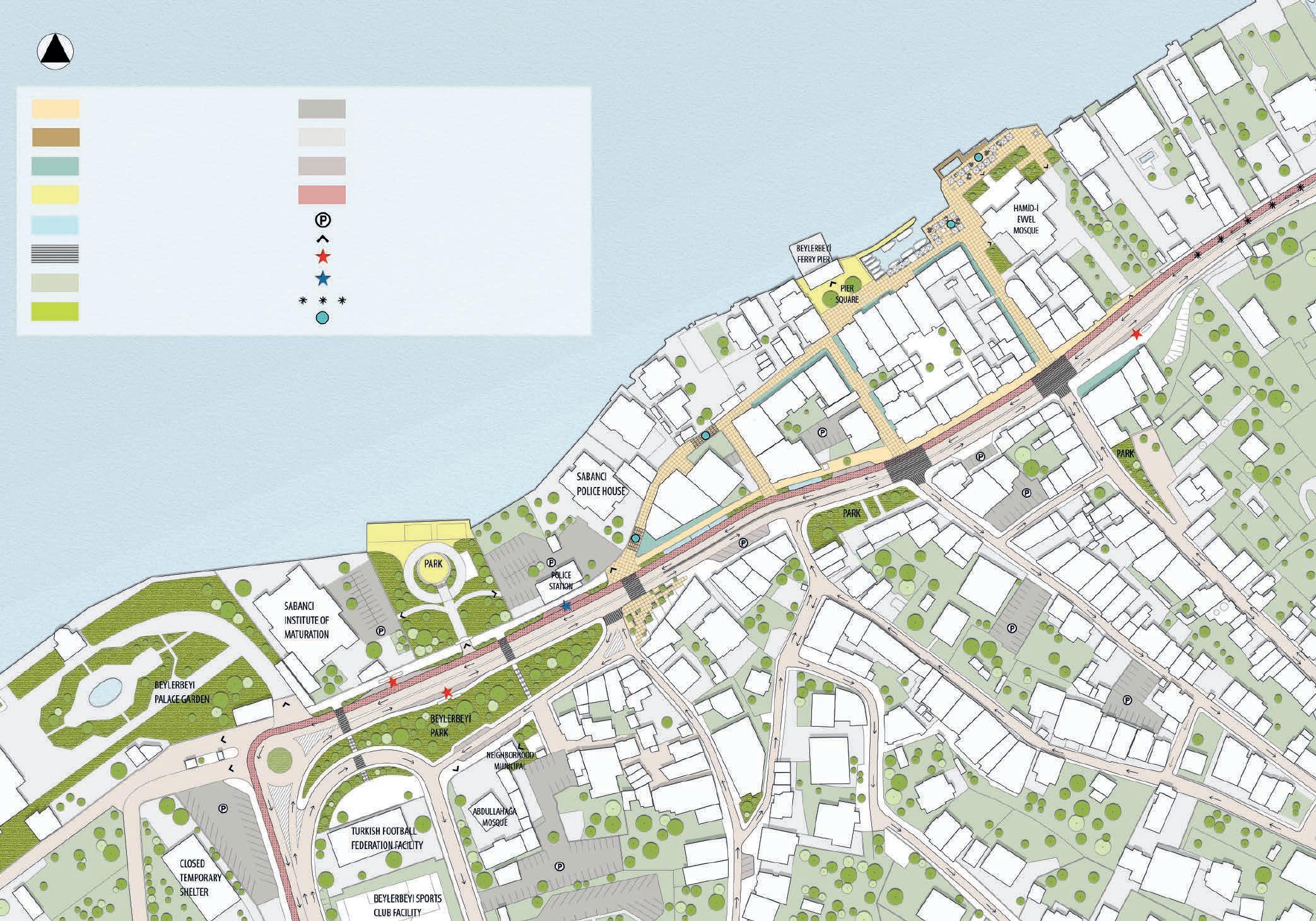
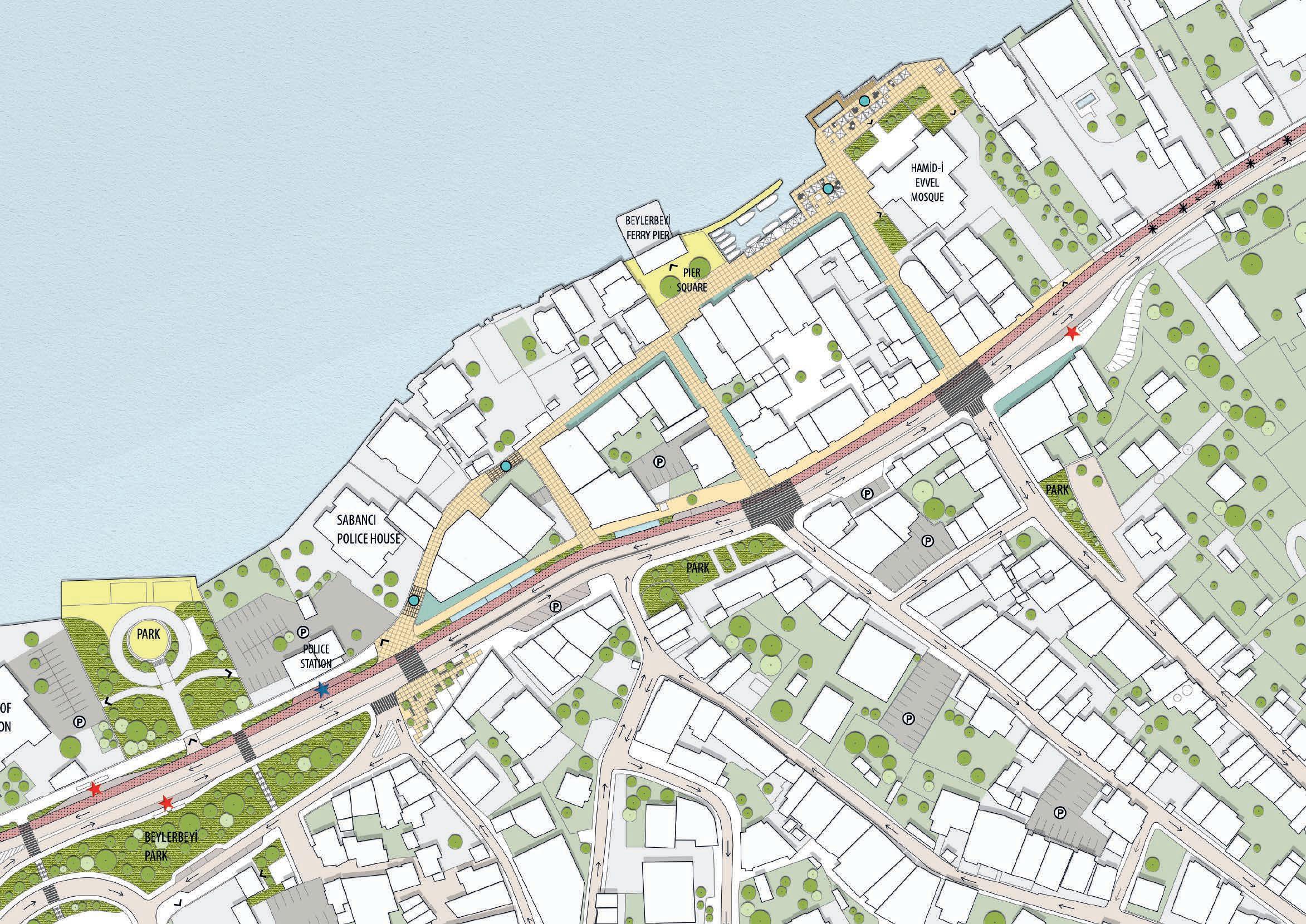
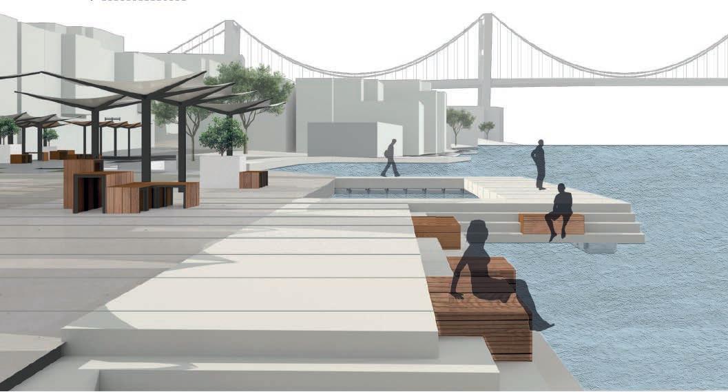
Integral Flooring Around the Pier Square
Observation Deck and Walkable Floating Platform
Semi-Open Parts of Cafes & Restaurants
Preserved Floor Tiles
Parklets
Pedestrian Crossings
Passive Greenery (No Public Access)
Public Greenery
Car Park
Vehicle Roads
Bus & Car Pocket
Bike Path
Car Park
Entrances
Bus Stops
Bicycle Parking Area
Vehicle - Bike Shared Road
Shading Elements and Urban Furniture Designs

Integral Flooring Around the Pier Square
Observation Deck and Walkable Floating Platform
Semi-Open Parts of Cafes & Restaurants
Preserved Floor Tiles
Parklets
Pedestrian Crossings

Passive Greenery (No Public Access)


Public Greenery
Car Park Vehicle Roads
Bus & Car Pocket
Bike Path
Street interventions
Car Park
Entrances
Bus Stops
Bicycle Parking Area
Shading Elements and Urban Furniture Designs


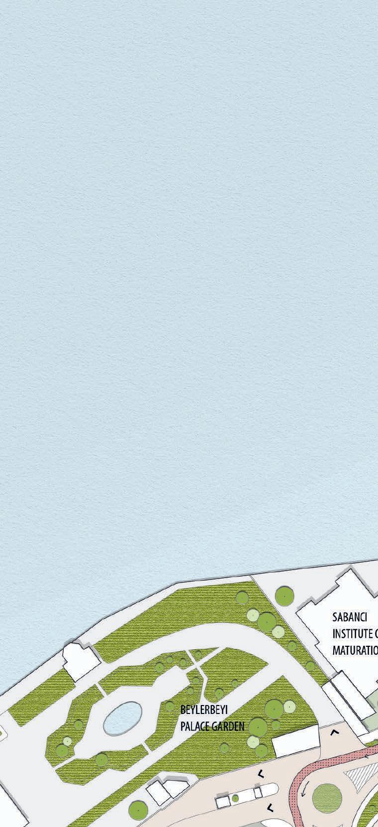
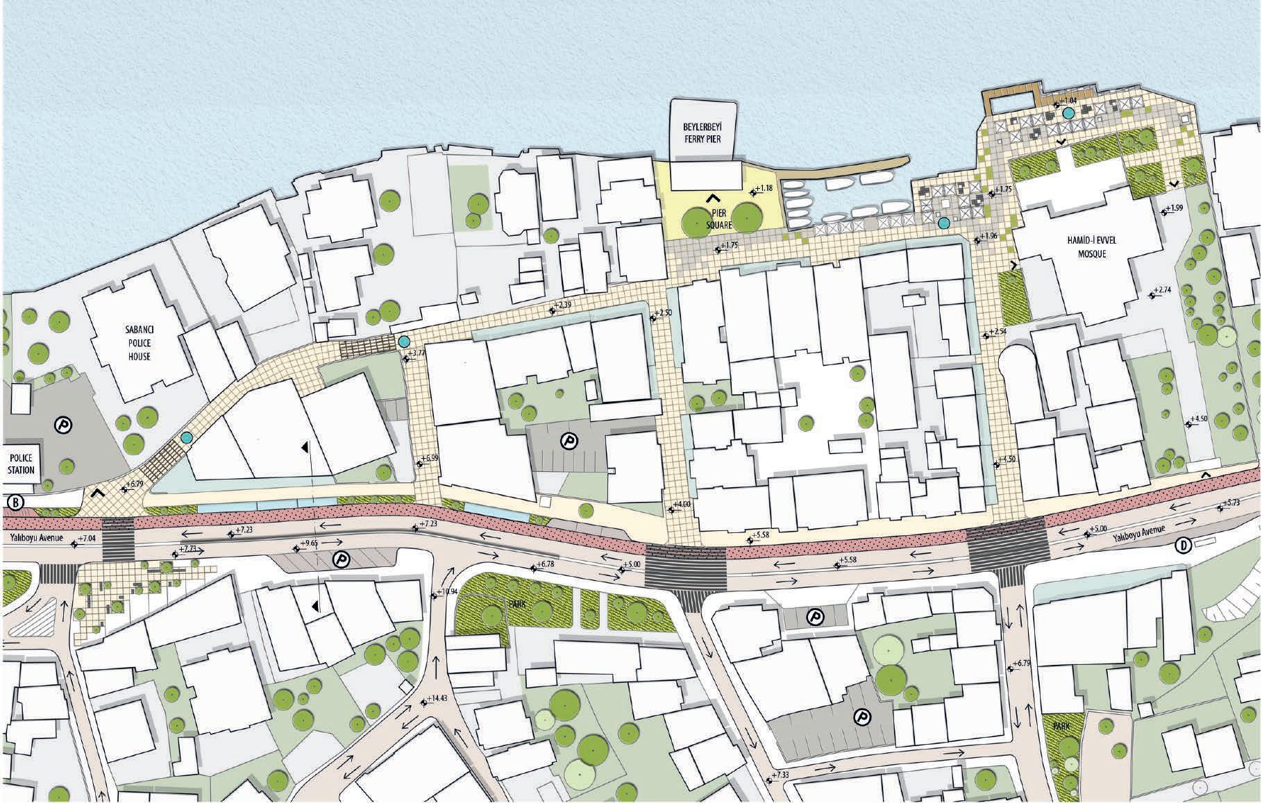
Beylerbeyi Pier Square
Commercial Areas Associated with the Main Street
Cafes & Restaurants Associated with Side Streets and Coast
Light Structures Of The Cafe That Cuts The Connection With The Sea
Eating and Drinking Places Unrelated & Isolated with the Street
Religious & Cultural Facility
Rhythm-Maintained Streets / No intervention required.
Areas Targeted to Increase the Rhythm and Usage Value
Street Entrances Currently Used to Access the Pier Square
Entries Targeted to Activate in Access to Pier Square
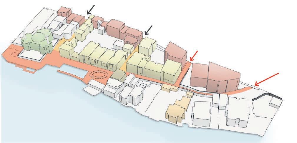
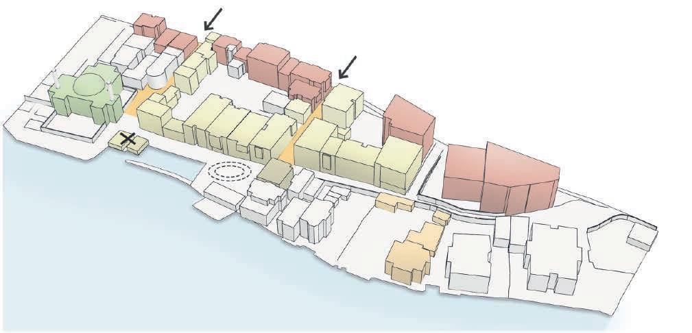
Beylerbeyi Pier Square & It's Surrounding
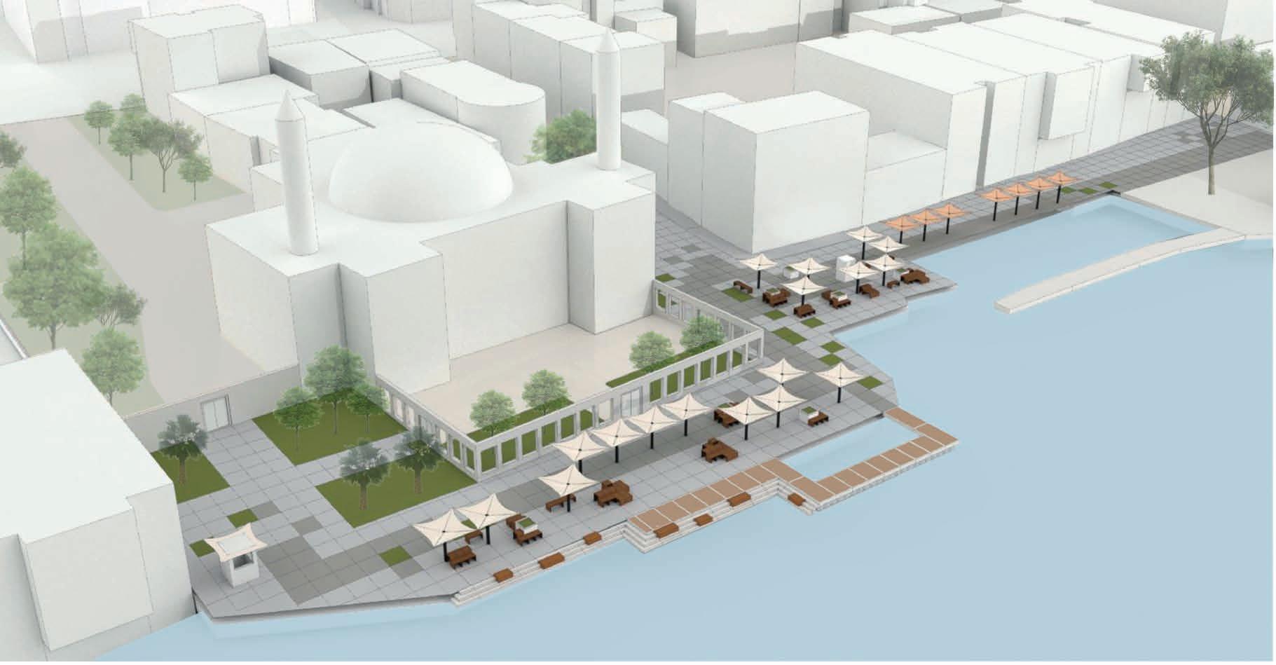
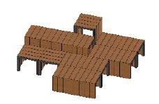
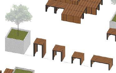
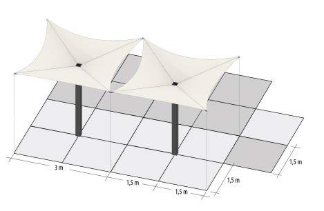
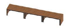
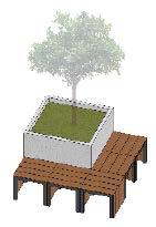
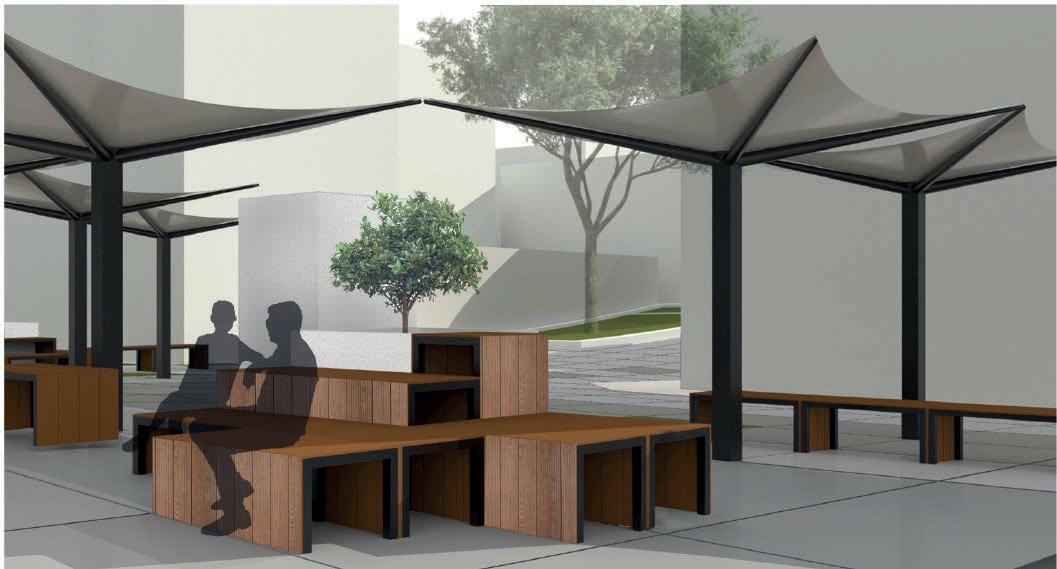
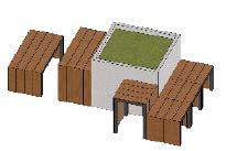 Diversified Urban Furniture Units Different combination of urban furniture units and their use in different ways
Shading Units and Floor Tiles
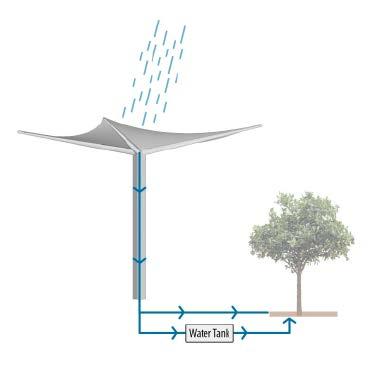
Shading Elements Water Harvesting and Irrigation Scheme
Hamid-i Evvel Mosque
Diversified Urban Furniture Units Different combination of urban furniture units and their use in different ways
Shading Units and Floor Tiles
Shading Elements Water Harvesting and Irrigation Scheme
Hamid-i Evvel Mosque
//
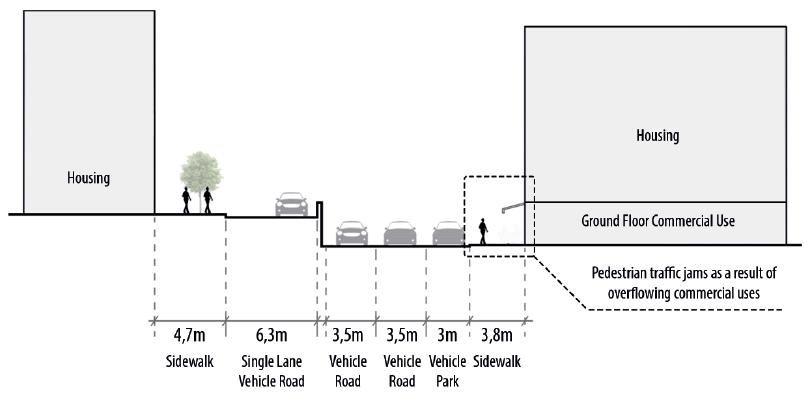
Due to the lack of rhythm in the street with deaf walls, it was aimed to increase the rhythm of the street by suggesting urban
 furniture designs, urban installation and exhibition at the entrance and exit of the street.
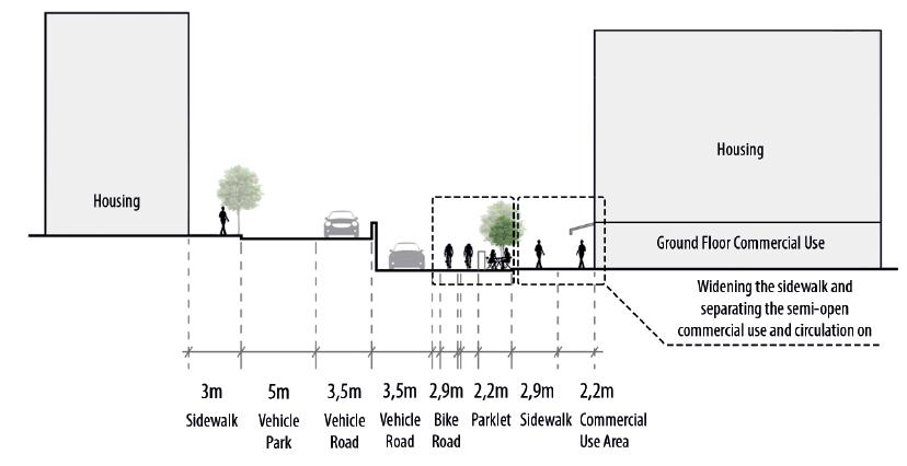
Reducing the vehicle road and parking lot lanes and using them as a bicycle path and parklet.
Current Situation Yalıboyu Avenue Section
// Proposal Yalıboyu Avenue Section
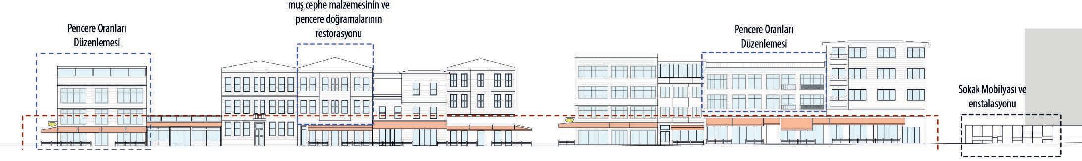
Facade arrangements and street interventions
furniture designs, urban installation and exhibition at the entrance and exit of the street.
Reducing the vehicle road and parking lot lanes and using them as a bicycle path and parklet.
Current Situation Yalıboyu Avenue Section
// Proposal Yalıboyu Avenue Section
Facade arrangements and street interventions