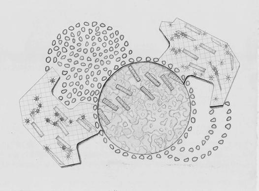
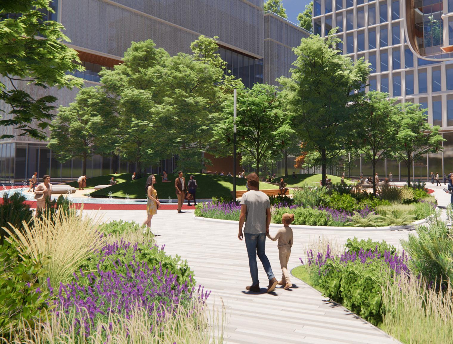
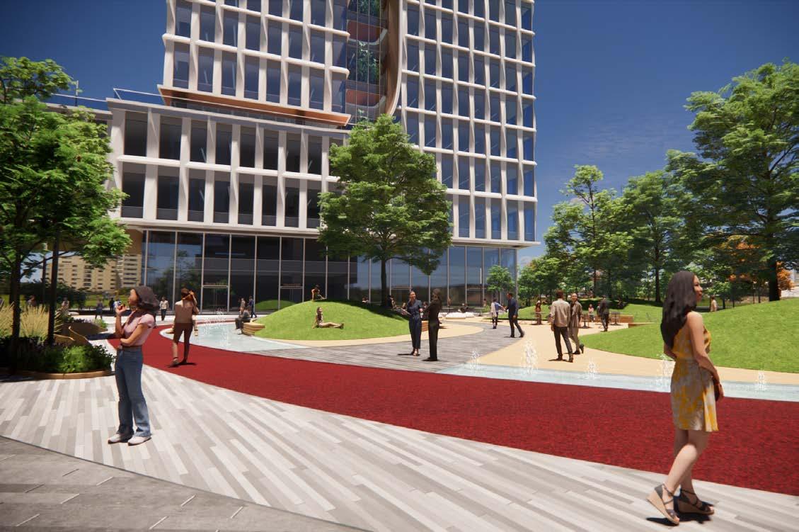
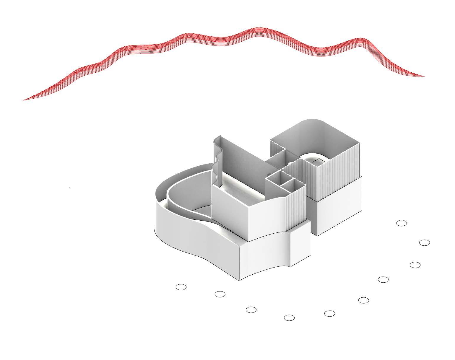
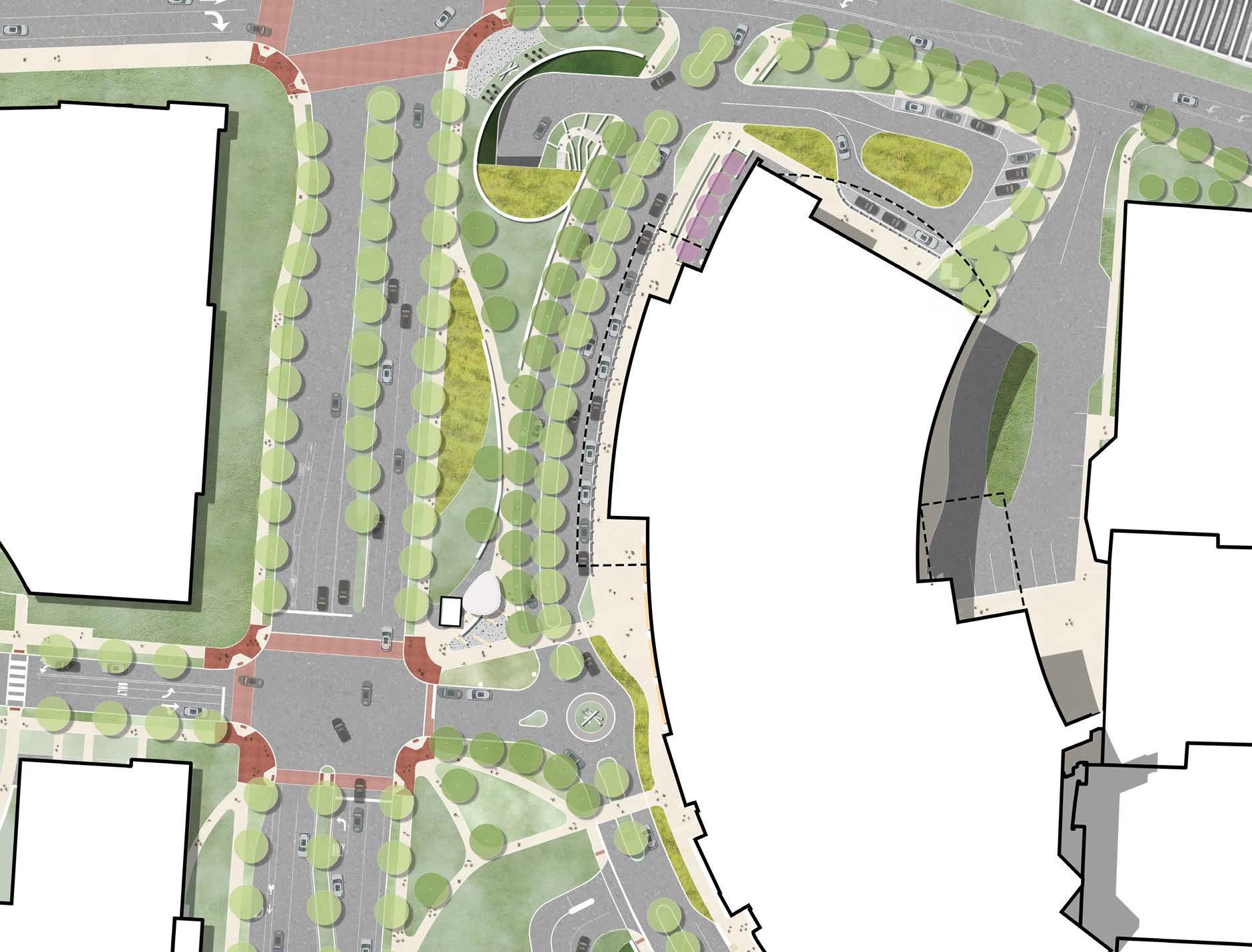
Drawing on inspiration from the traditional Chinese knot, a symbol of longevity and eternity in Chinese culture, the design attempts to embrace the cultural essence and connect to the larger context. The concept emulates the flow of the knot ribbon and re-imagines to tie a know on the site, bringing people and energy in.
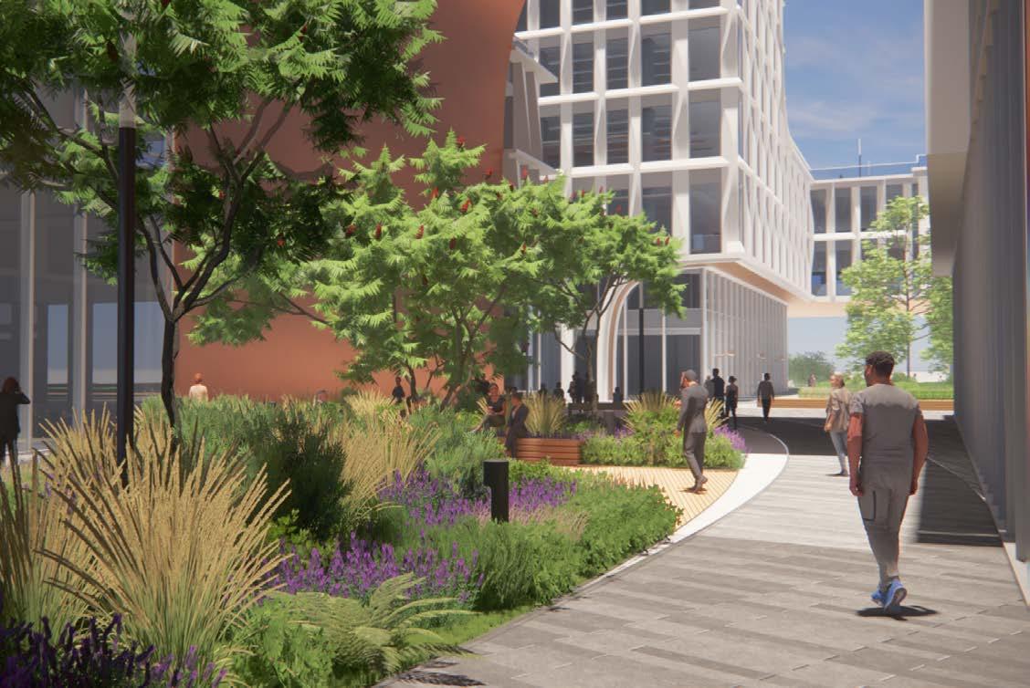
The movement of the ribbons not only creates direct links in between buildings, but also weaves in a variety of levels of energy and dynamics to the site. The central plaza can be expressed as the key knot, which encourage community gatherings and social interaction. Personal places of respite are created along the major movements of the ribbon in various plaza spaces. Moving up to upper levels, the ribbon concept is also integrated to the podium and rooftop landscape, bring a visual consistency to the overall design.
Competition
Winter 2023
Location: Hangzhou, China
Team: Effy Yin / JJ Lai
Landscape Architect: Tony Murry
Programs used: Revit / Adobe
Illustrator / Adobe Photoshop / Enscape
社区连结 / COMMUNITY CONNECTIVITY
/ PROGRAM CONFIGURATION
/ GENERATIVE ENVIRONMENT
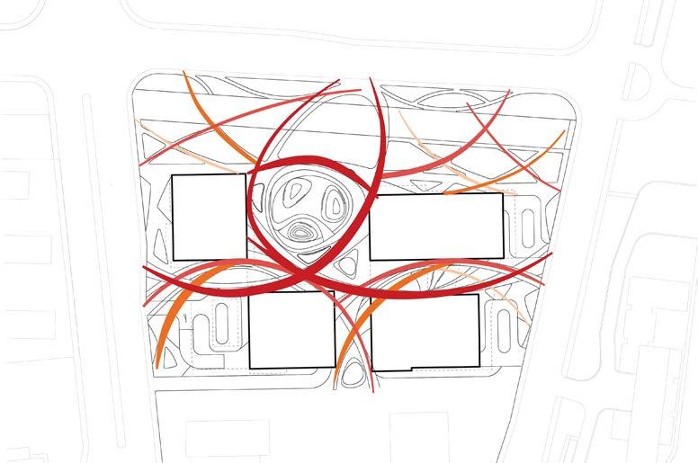
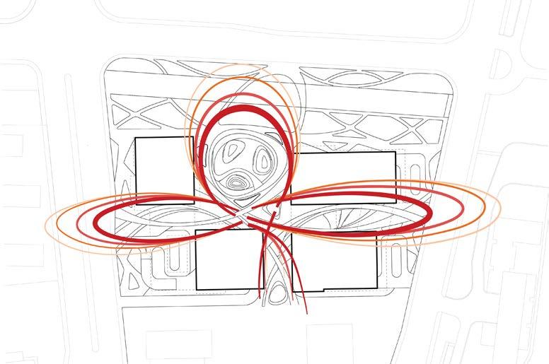
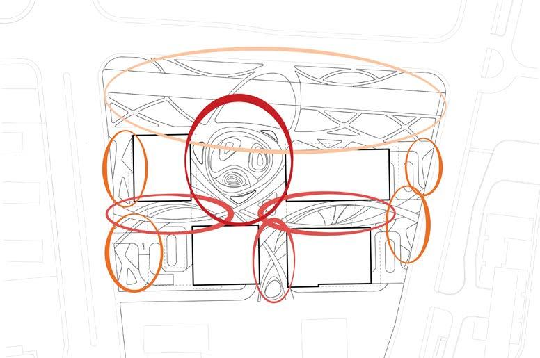
Site seeks to connect to the broader community and becomes a vital link to the surrounding context.
Landscape programming integrate with architecture and interior spaces and utilizes inside/outside strategies.
Through the ribbon movement, a series of generative spaces are created to offer different leisure and social platforms for the community,
太平门直街 Taipingmen St
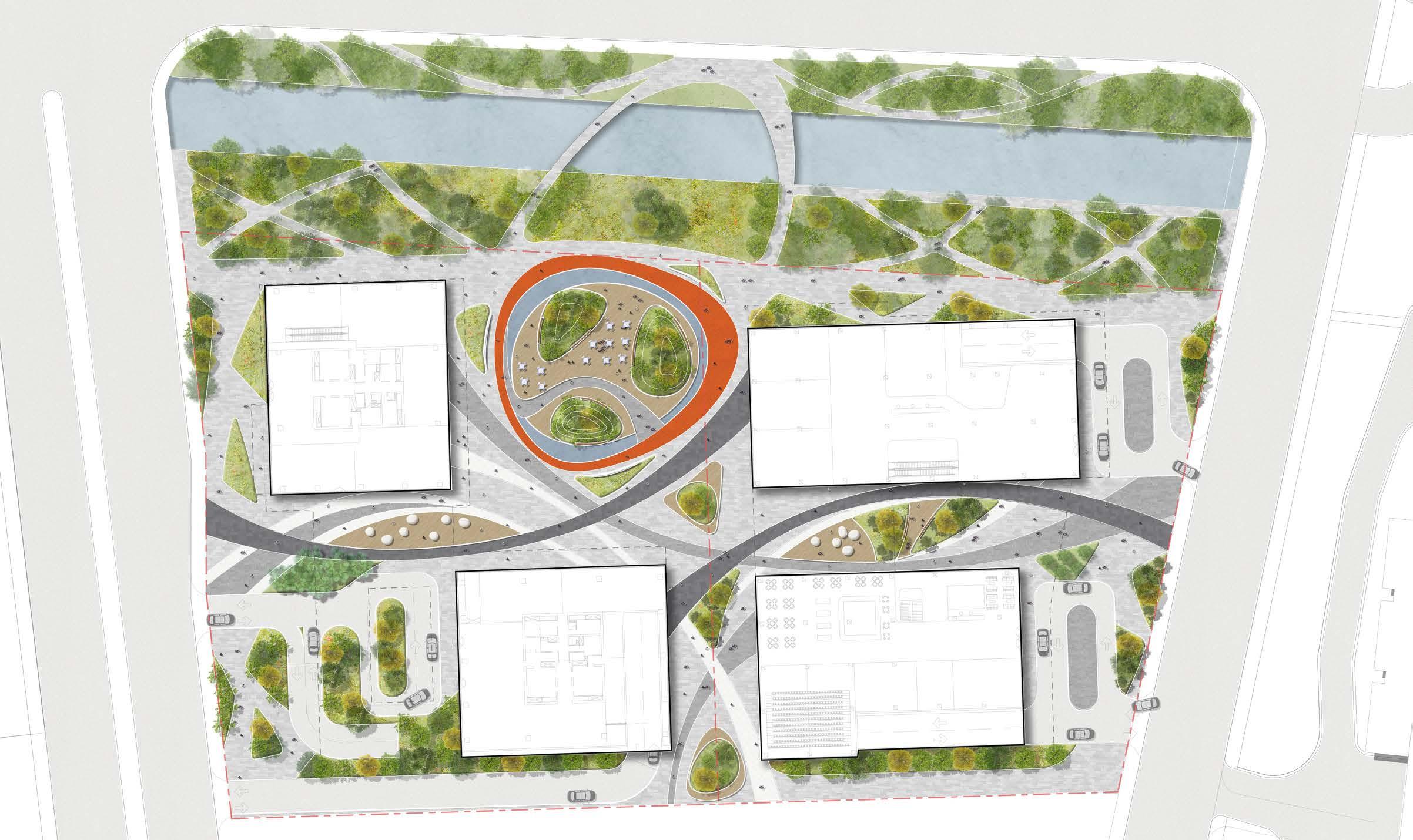
Legend
入口广场 Entry Plaza
静思花园 Wind Pavilion
艺术长廊 Art Pavilion
活动广场 Event Plaza
水环 Ring of Water
雕塑广场 Sculptural Plaza
街心广场 Street Plaza
运河绿带 Canal Greenway
运河桥 Canal Bridge
落客处 Drop-Off
新开河 Xinkaihe
办公楼 Office Building
体育中心 Sports Building
办公楼 Office Building
艺术文化中心 Art and Cultural Building
At the edge of the site, a curved berm serves as the first line of defense against Mars’ intense windstorms. This berm was designed to collect dust and sand particles over time, adding to its structure and providing protection from the elements.
In addition, the building features an aerodynamic facade that is carefully crafted to minimize the impact of windstorms on its exterior. By shaping the facade to deflect and disperse incoming winds, the structure is better equipped to endure the harsh conditions of the Martian environment.
Together, the dust collecting berm and aerodynamic facade offer a solution to the challenges posed by Mars’ extreme weather, ensuring the long-term resilience and durability of the site’s infrastructure.
Competition
Spring 2024
Location: Mars
Team: Ishmael Gad
Programs used: Rhinoceros 3D / Adobe
Illustrator / Adobe Photoshop

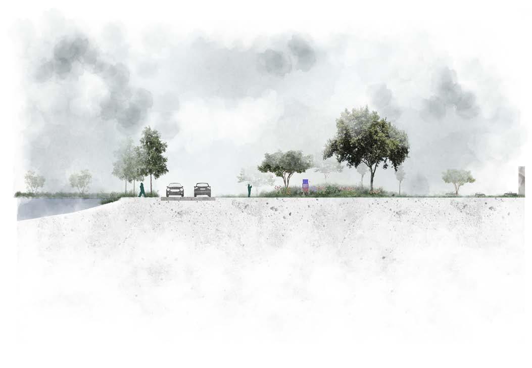
The site design plays on the “twin-ness design precept, prescribing not only similar materials, lightning, furnishings, soils, and native plantings. Site walls form spaces and provide separation and privacy from the surrounding streets, while lawns and planting areas provide clear views to entries and signage locations. The site design seeks to find ways to build on the success of the building D landscape through per formative measures that improve the environment and local biodiversity, further enhancing the NCH brand and patient experience, and aid in creating respite spaces for staff to recharge and families to recenter.
Client Spring 2023
Location: Columbus, Ohio
Team: Xueyang Huang
Landscape Architect: Tony Murry
Programs used: Revit / Adobe
Illustrator / Adobe Photoshop
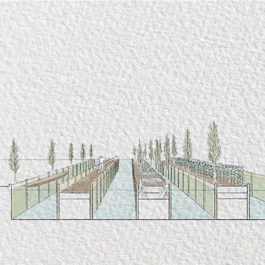
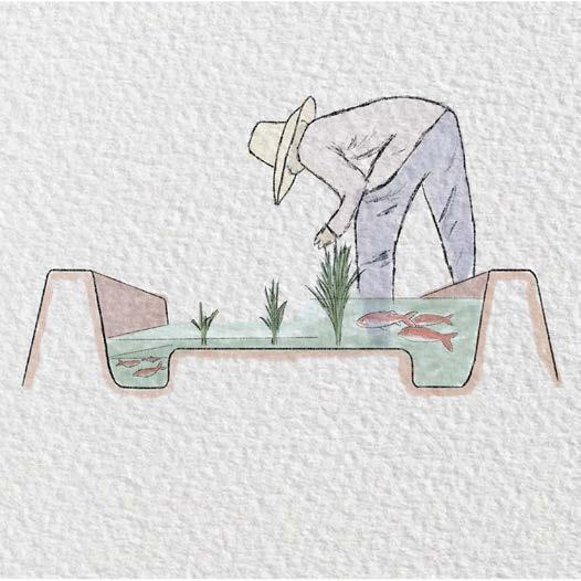
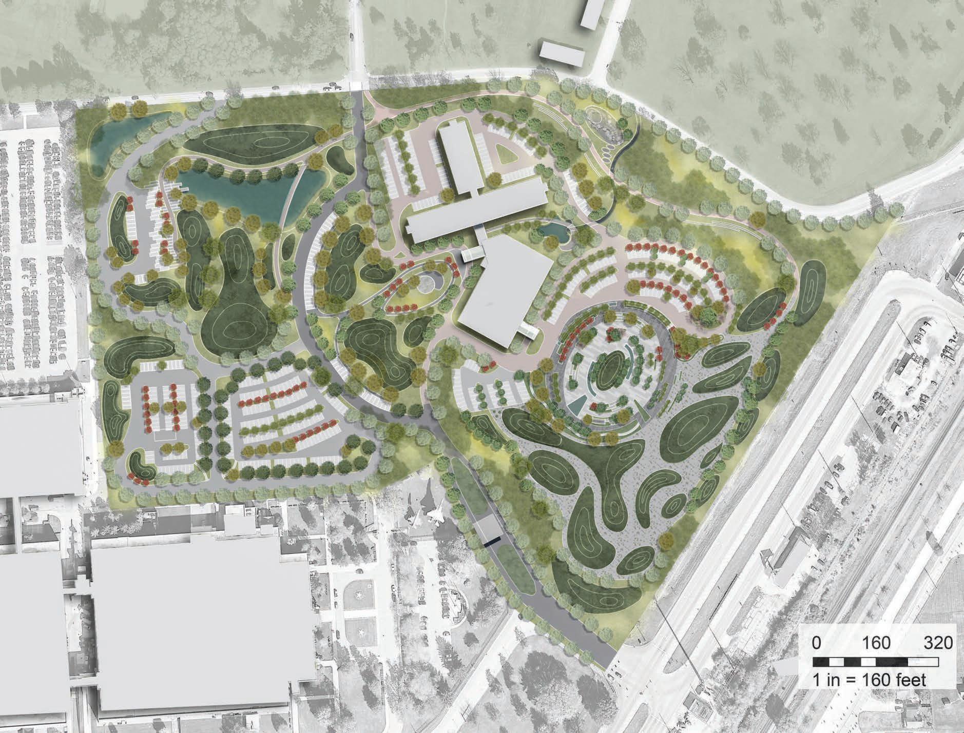
The Hope Hotel Conference Center, situated at the Dayton Air Force Base, currently features a landscape dominated by impermeable asphalt. The proposed redesign aims to transform the outdoor spaces into a vibrant environment that encourages meaningful interactions between humans and local pollinators. The design will focus on attracting and supporting three key pollinators: the ruby-throated humming bird, the Karner blue butterfly and the bumblebee. By integrating habitatfriendly features into the site, the project will create a space for both pollinators and humans to coexist, enhancing the overall experience and ecological value of the Hope Hotel Conference Center. Pollinator Studio
Location: Dayton, Ohio
Team: Jerry Liu
Instructors: Halina Steiner / Jack
Gruber / Karla Trott
Models pulled for accreditation.
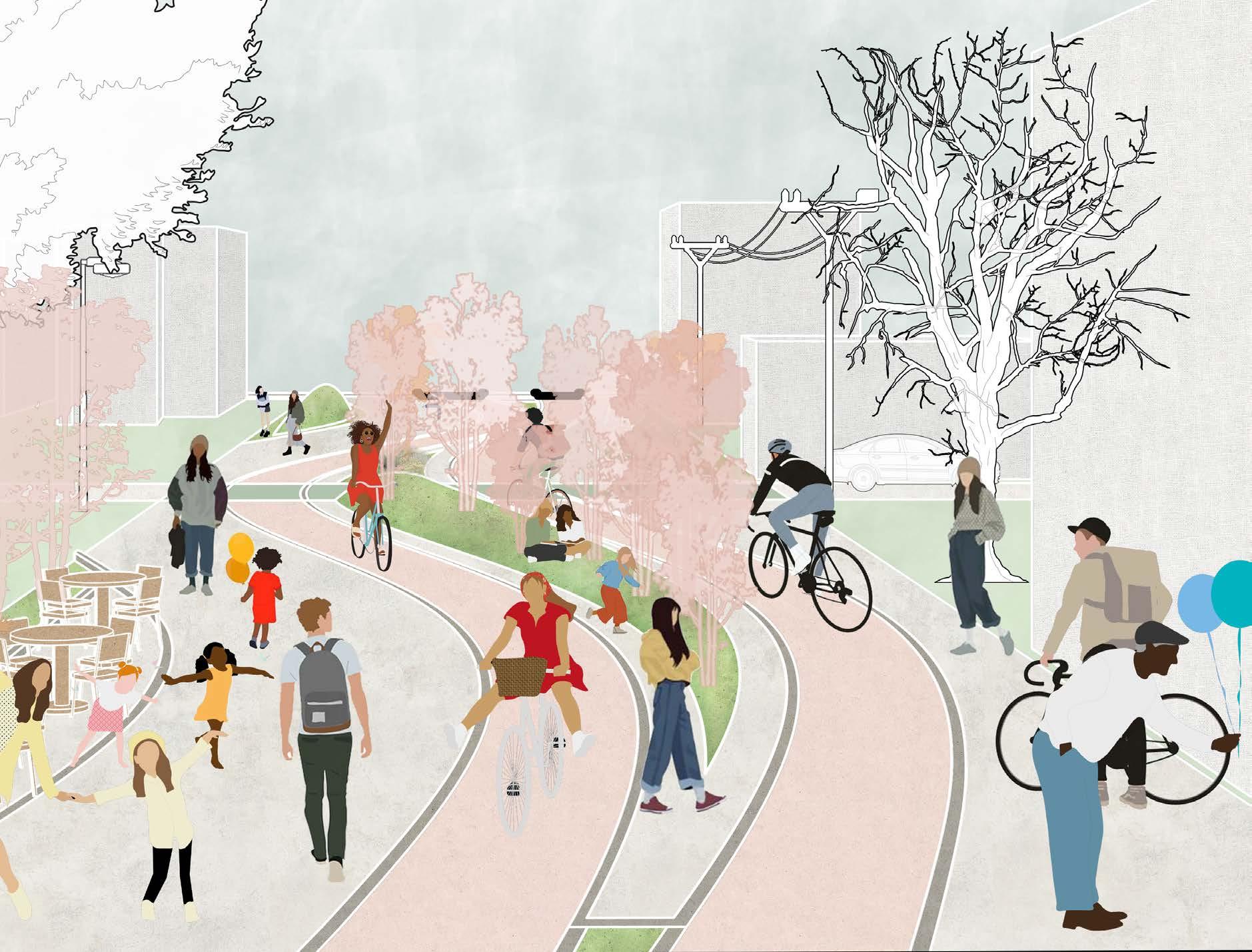
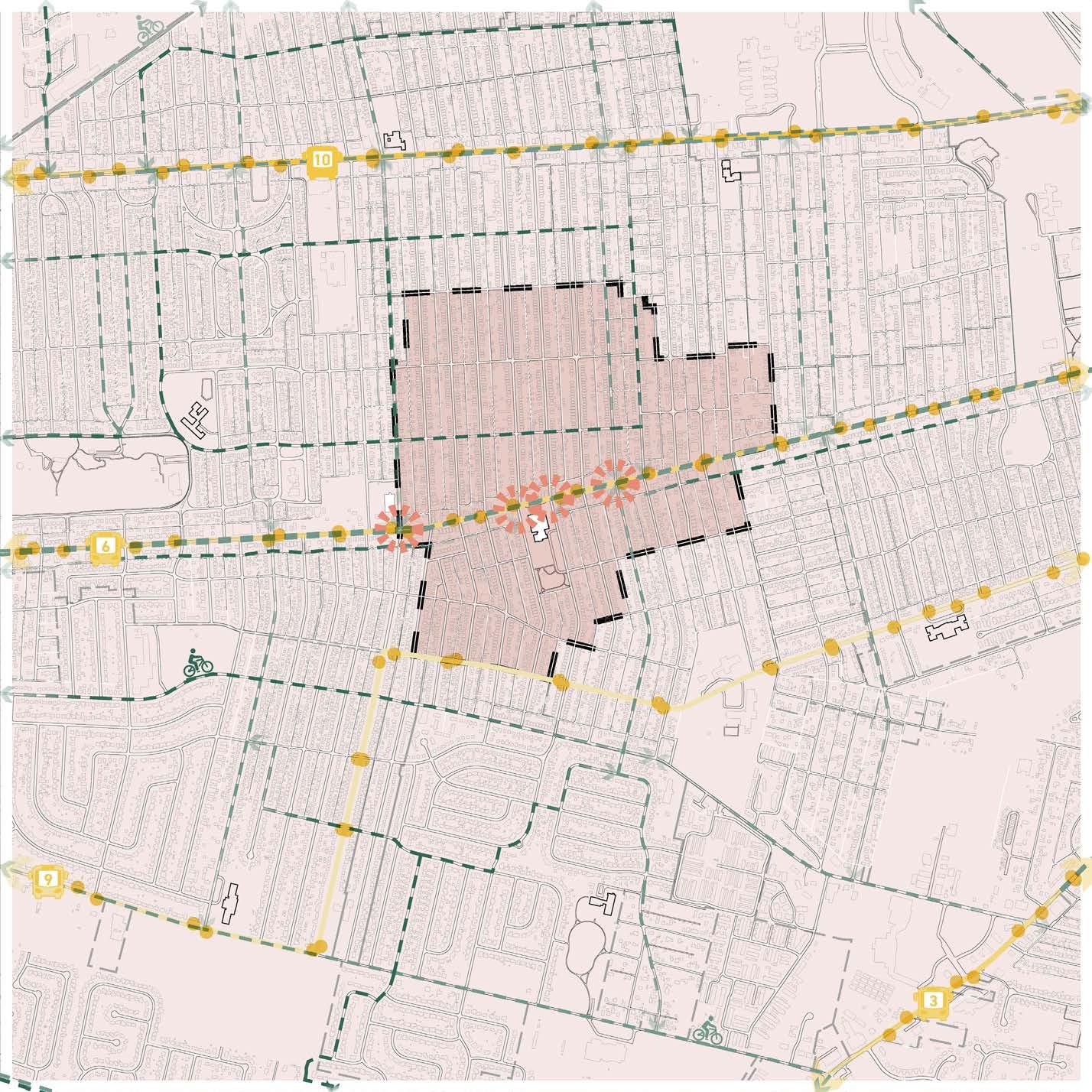
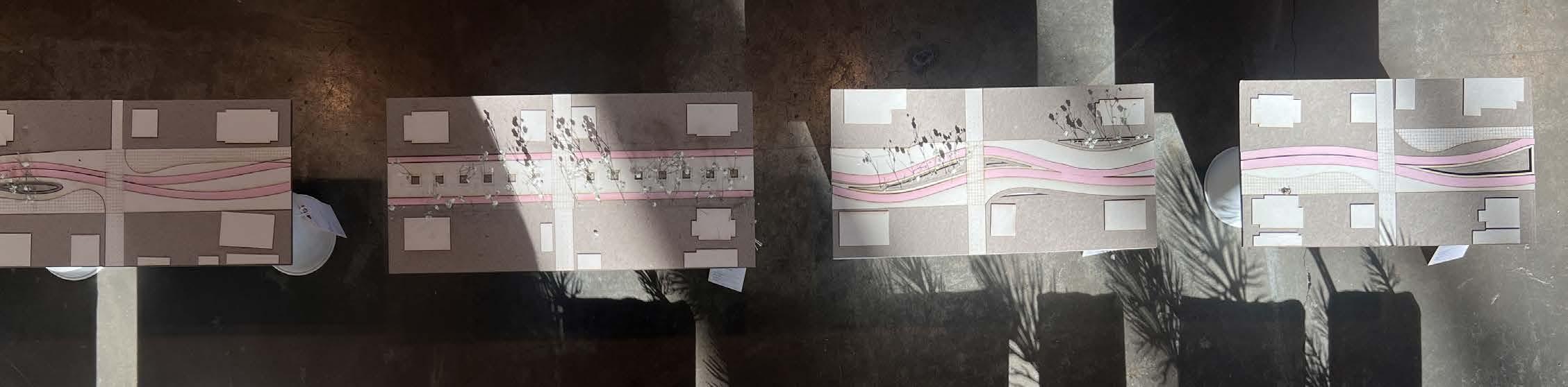
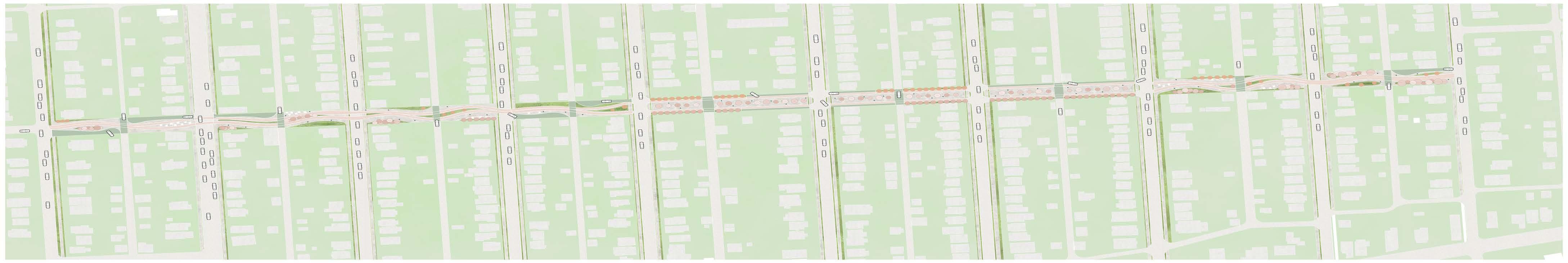
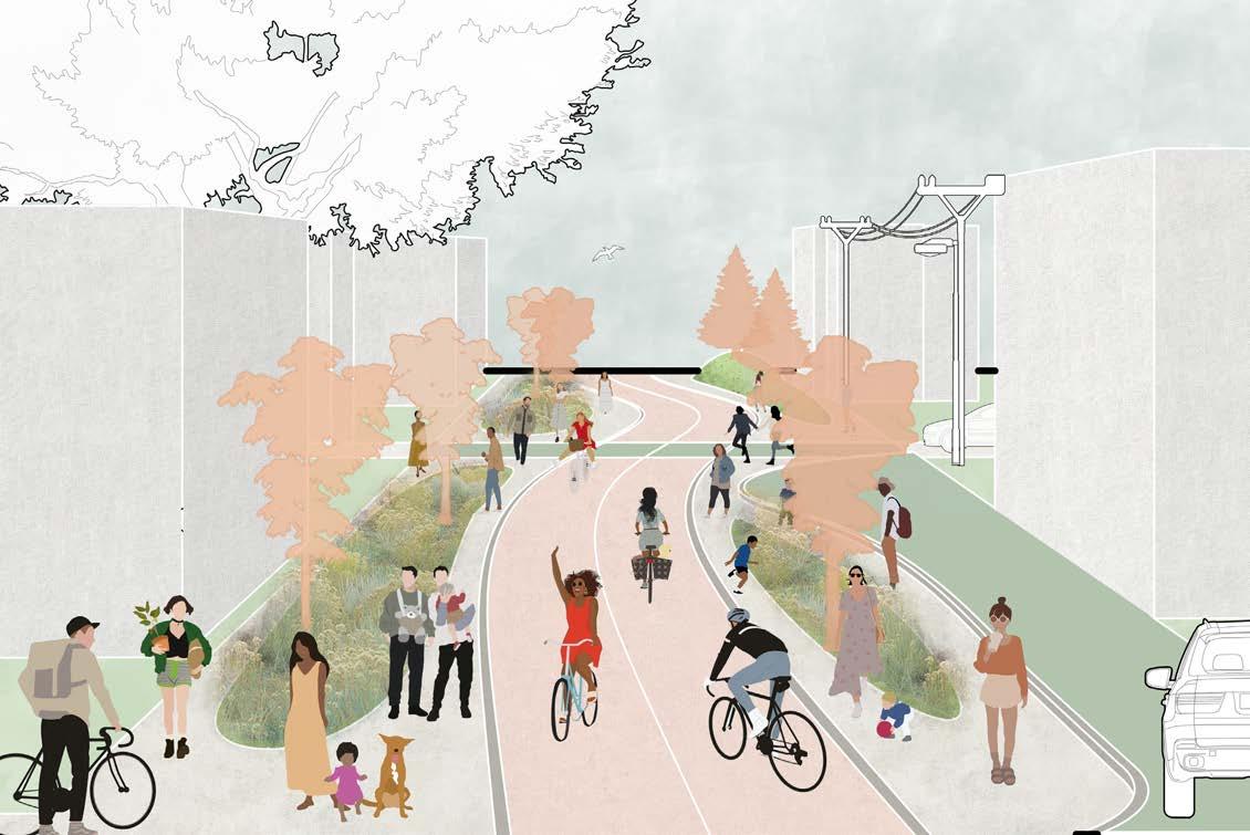
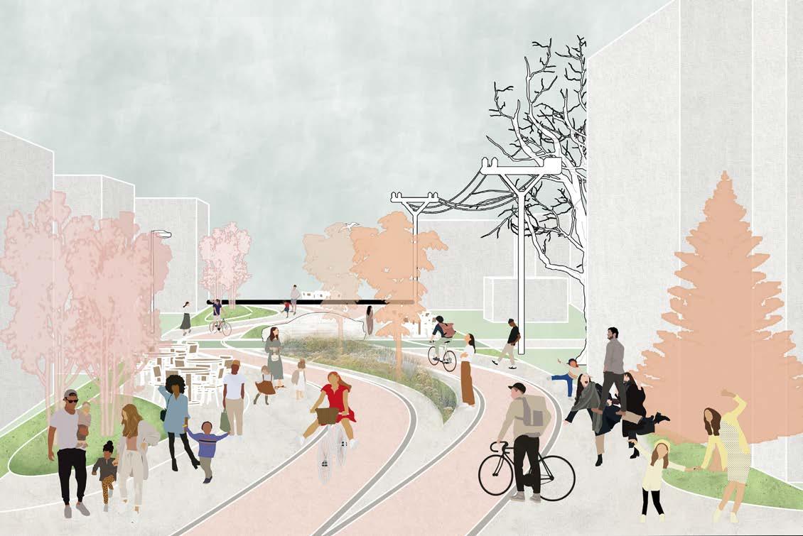
A semester-long study explored the walkability around three schools in Columbus, Ohio, focusing on improving access to Burroughs Elementary School. Located in the Hilltop neighborhood, one of the city’s least walkable areas. Students north of Sullivant Ave face significant challenges, as they have to cross this busy road to attend school.
To improve safety, the project re-purposes Wicklow Rd, an existing bike boulevard one block north of Sullivant Ave, into a dedicated pedestrian and bike corridor. Aligned with Vision Zero principles, the design prioritizes biking while accommodating residents with semi-private driveways. Beyond transportation, the project enhances the neighborhood with spaces for recreation and leisure.
Back to School Studio
Autumn 2023
Location: Hilltop, Ohio
Instructor: Jacob Boswell
Programs used: Rhinoceros 3D / Adobe Illustrator / Adobe Photoshop
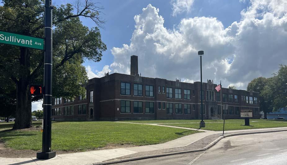
COTA lines run across the main roads of the Hilltop area with frequencies of 15 min, 30 min, and 60 min. The residents North of Sullivant Ave, have the most difficult time walking to school as students have to cross the heavily traffic Sullivant Ave to attend Burroughs Elementary School.
Sullivant Ave is a main road connecting Hilltop to Downtown Columbus. Because of that, it is a heavily trafficked road filled with daily commuters, public transport, bikers, and locals.
The proposed site takes over an existing bike boulevard, Wicklow Rd, a east to west connector one block north from Sullivant Ave, and funnels the students down to Burroughs Elementary.
In accordance to Vision Zero, a dedicated path for bikers is the main form of circulation for the site. In consideration of current residents, who have garages alone Wicklow Rd, specified semi-private driveways are designed throughout the site. The proposed site offers a place for recreation, biking, and leisure.
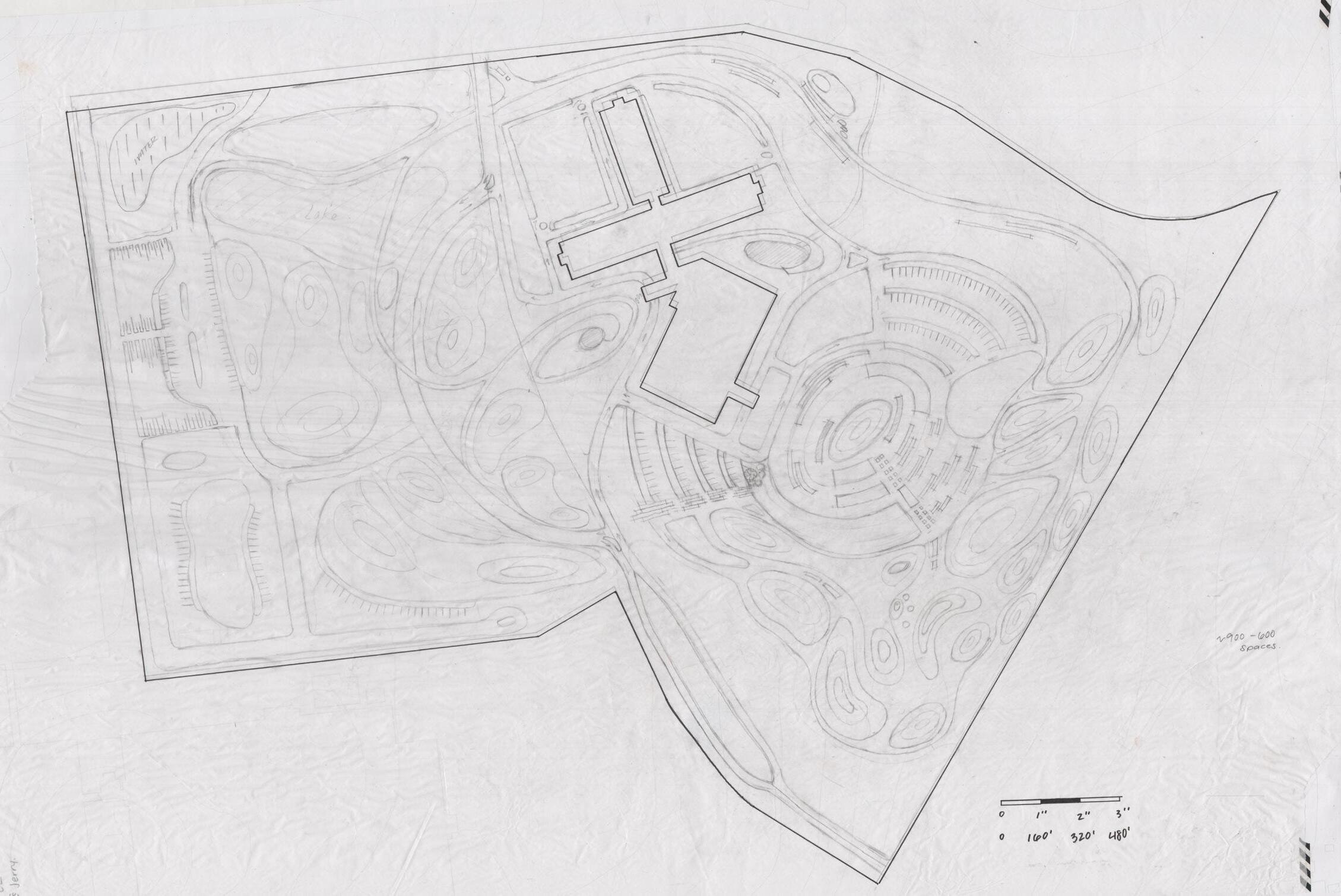
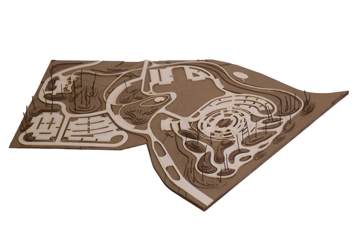
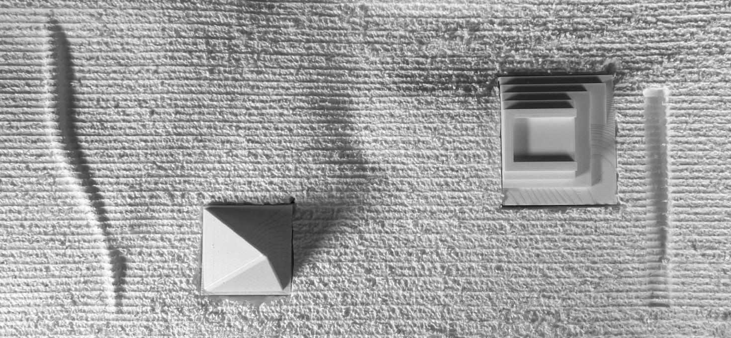
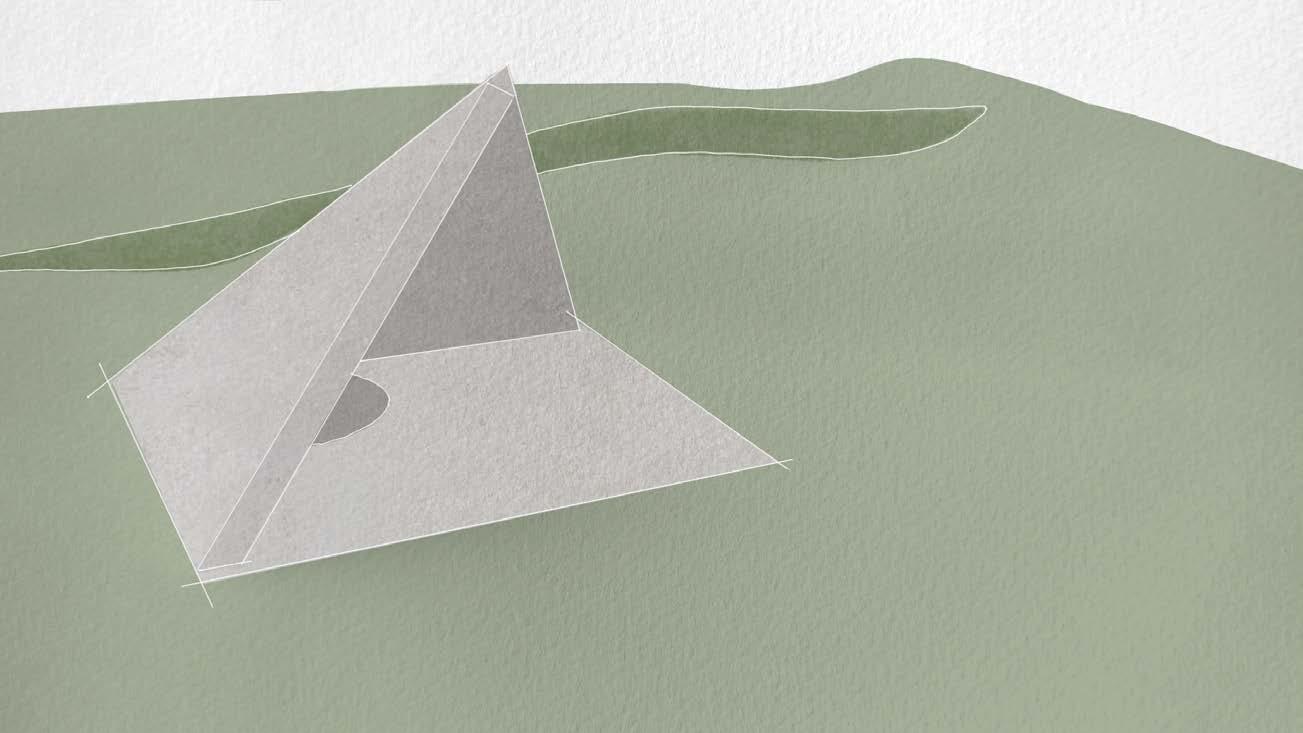
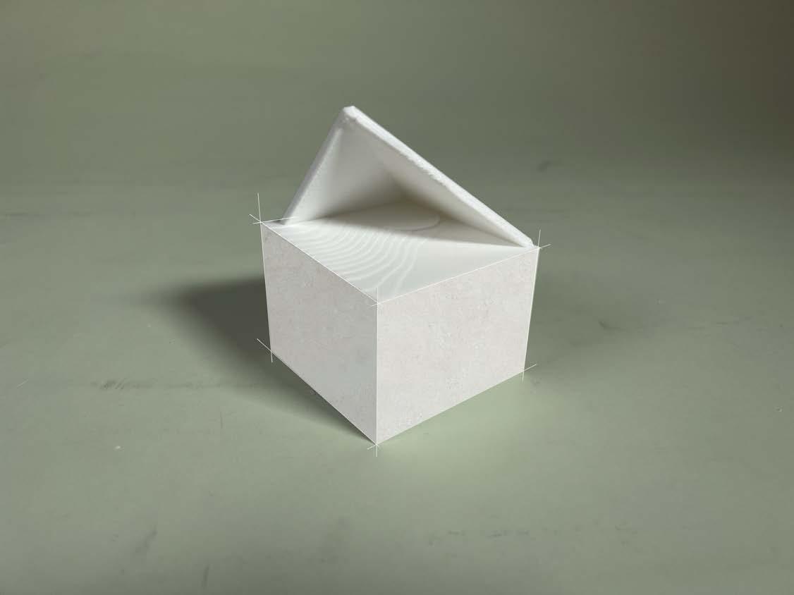
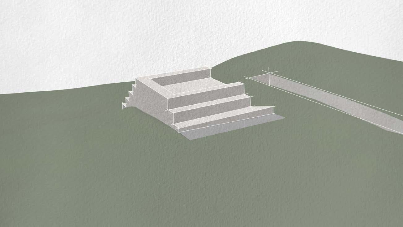
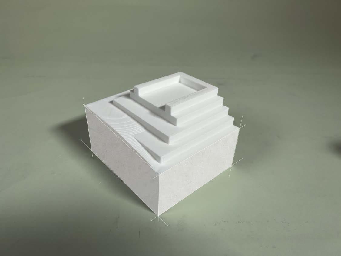
This semester-long project challenged students to explore the capabilities of Rhinoceros 3D, utilizing it tools such as V-Ray, CAM, and Grasshopper.
In the first phase, students selected a site within Ohio and created a 2D topographical drawing of the area. Moving into the second phase, they modeled contour lines of the chosen site. Afterward, they were tasked with shaping these contours to form key landforms, including a berm, swale, and ramp.
The third phase involved adding 3D built elements to the topography at any scale. Students then sent these 3D models to a 3D printer to produce a physical model of their design.
In the final stages, students learned how to operate a CNC router to create a 3D model of the topography. Foam was used as a based to form the model, then the foam was cut-out for the 3D printed elements.
Media Lab
Spring 2022
Location: Franklin County, Ohio
Instructors: Parker Sutton / Michelle Franco
Programs used: Rhinoceros 3D / Adobe Photoshop / Grasshopper / Procreate
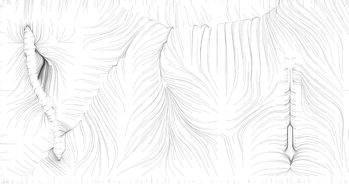
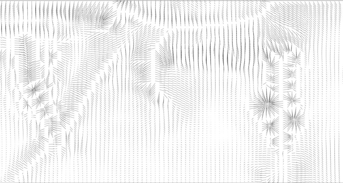
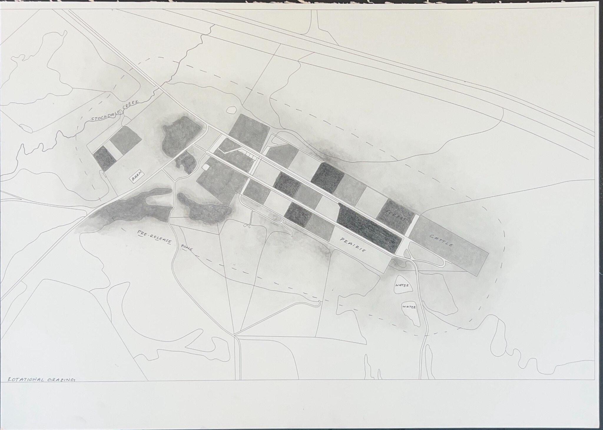
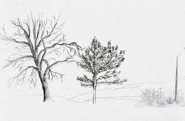
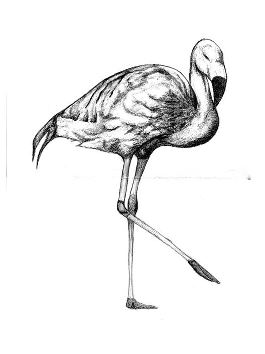
The hand-drawing on the right was done for my final studio class. For my project, I was projecting to turn an existing feedlot into a place for rewilding the fauna species. In the first phase, I gathered as much GIS data I could for the area, before going onto Google Earth Pro to fill in the missing gaps. The lines were exported to Rhinoceros 3D for touch-ups, and to be prepared for the zund.
After the zund, I then finished the drawing using charcoal and graphite to shade in the rest.