INTERWOVEN:
ROCKS WITHIN STREAMS
by Wang Xuechun (Y1S1)
Studio Hwang Yun Hye
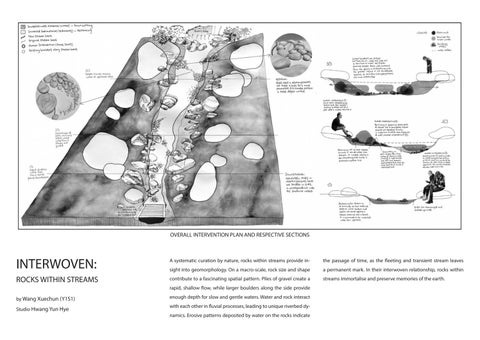
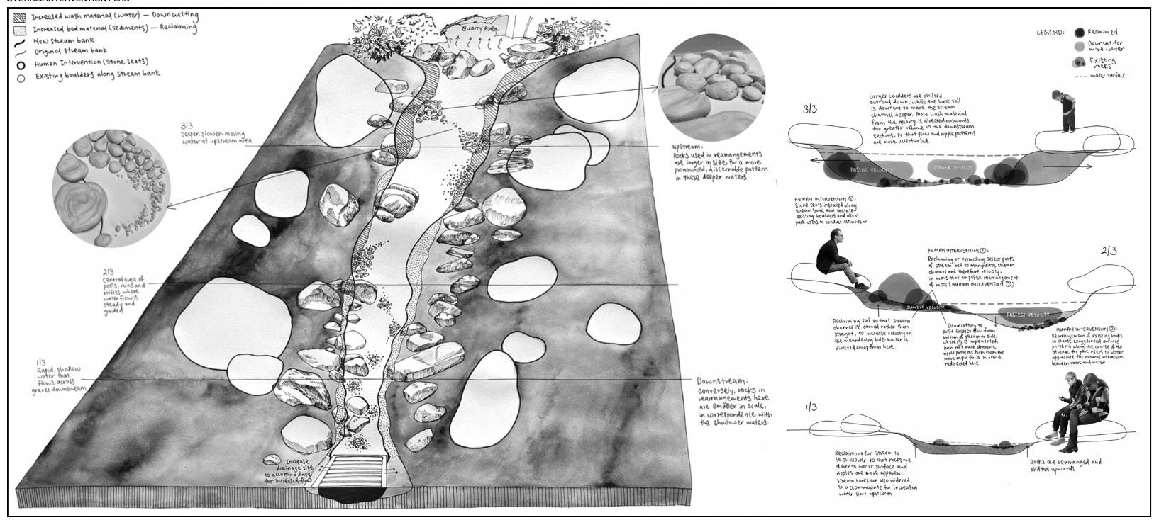
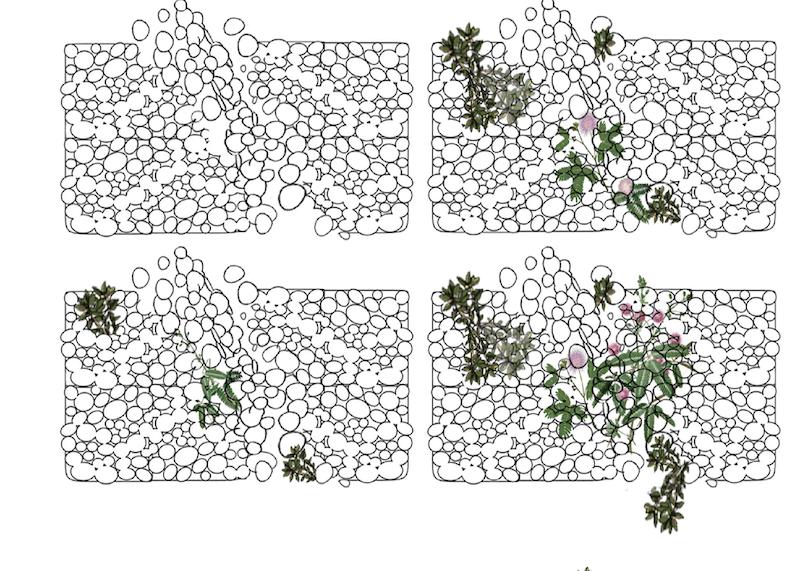
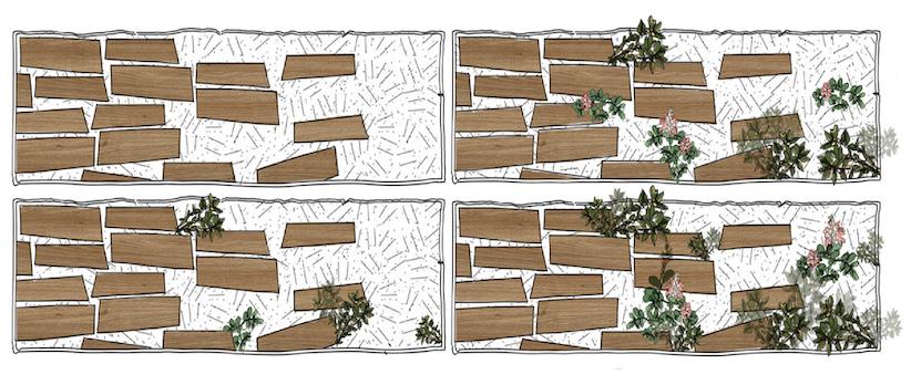
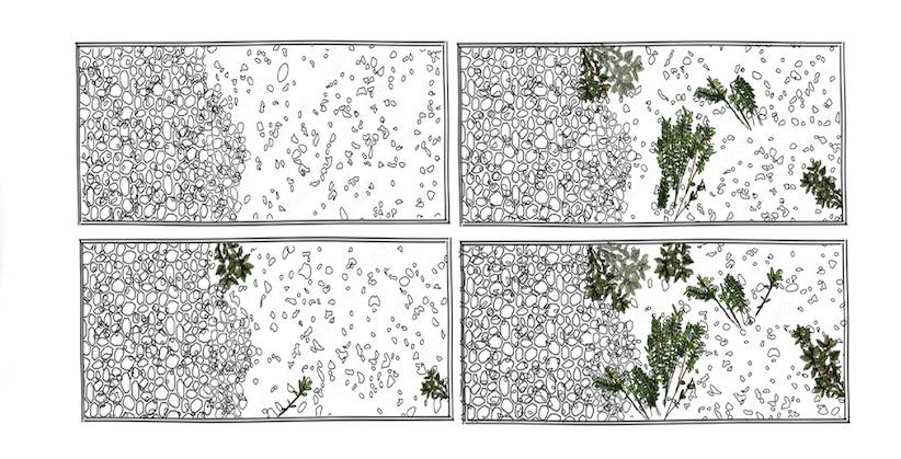
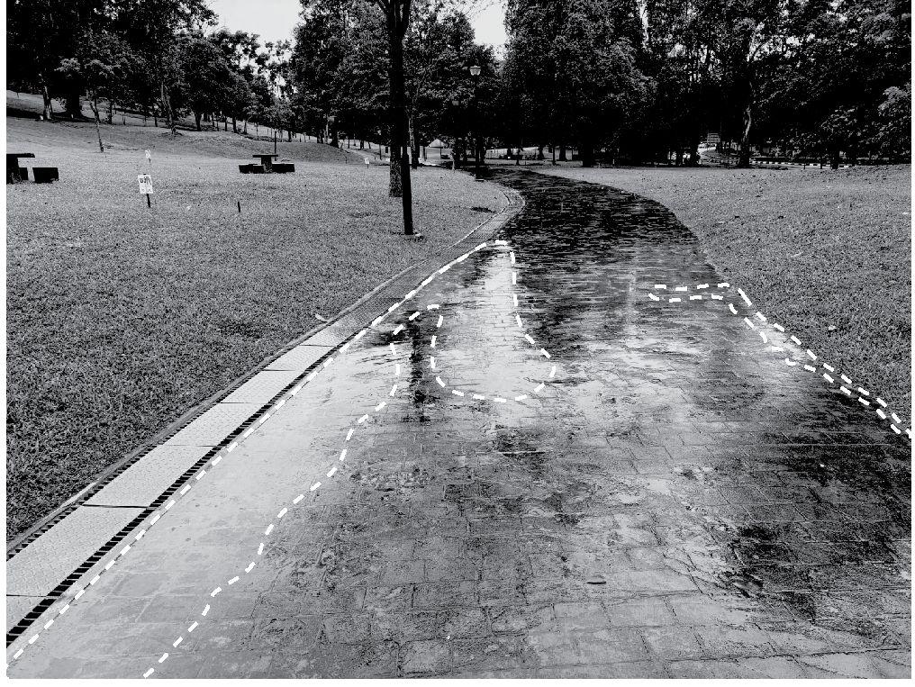
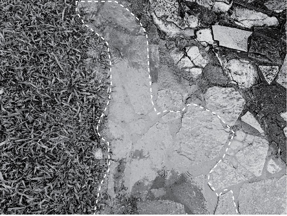
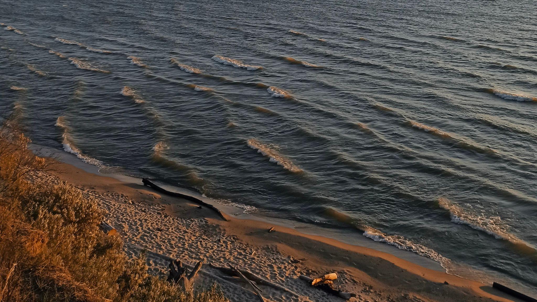
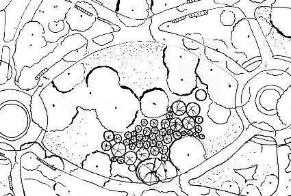
A systematic curation by nature, rocks within streams provide insight into geomorphology. On a macro-scale, rock size and shape contribute to a fascinating spatial pattern. Piles of gravel create a rapid, shallow flow, while larger boulders along the side provide enough depth for slow and gentle waters. Water and rock interact with each other in fluvial processes, leading to unique riverbed dynamics. Erosive patterns deposited by water on the rocks indicate
the passage of time, as the fleeting and transient stream leaves a permanent mark. In their interwoven relationship, rocks within streams immortalise and preserve memories of the earth.
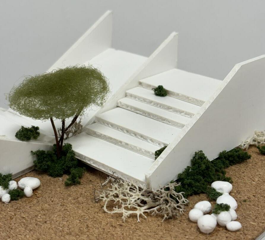
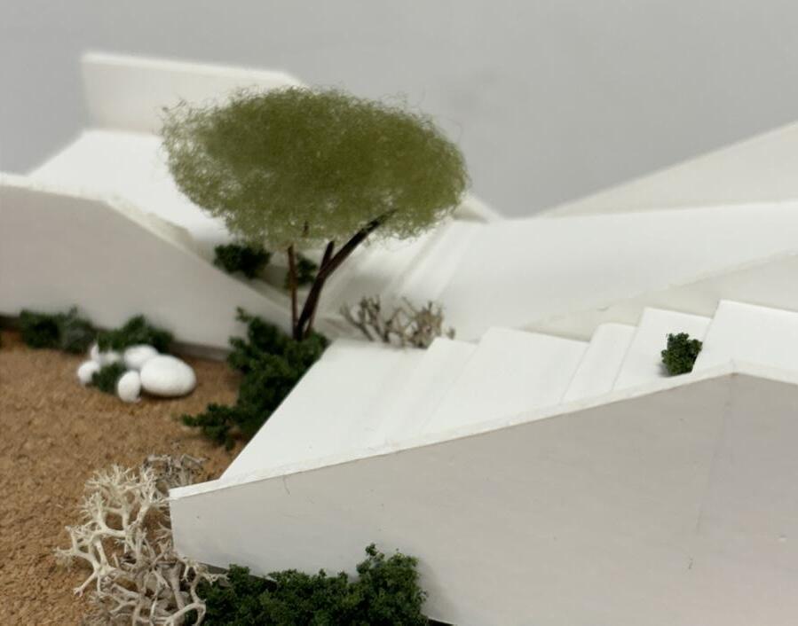
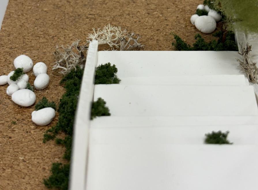
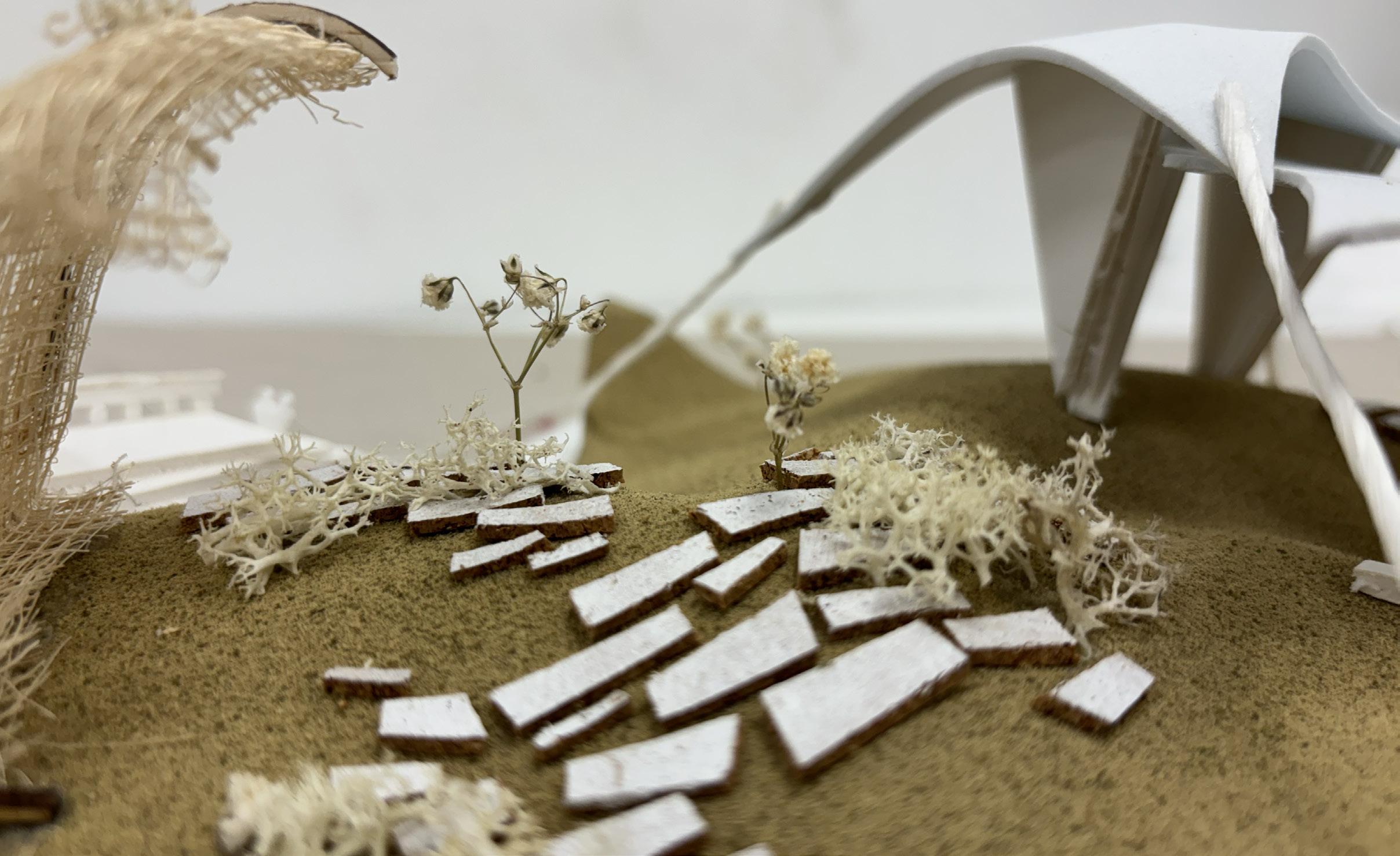
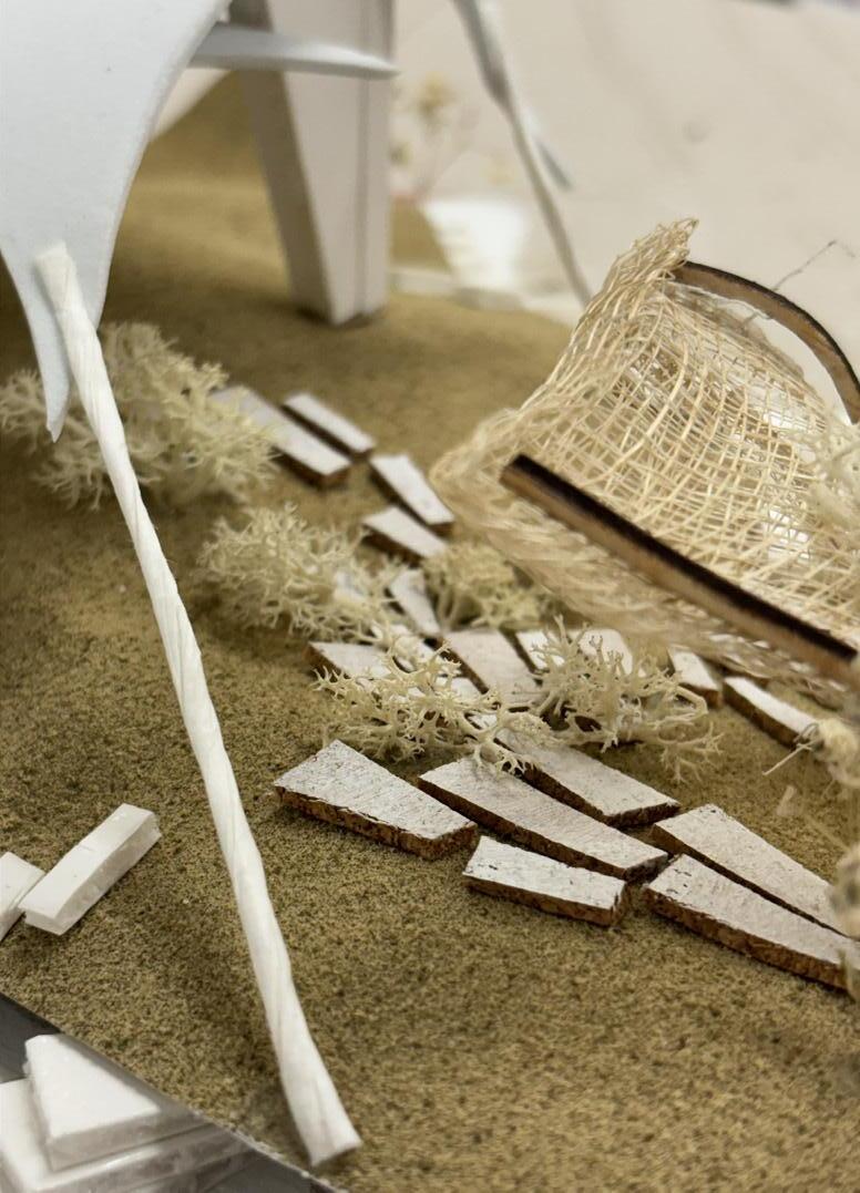
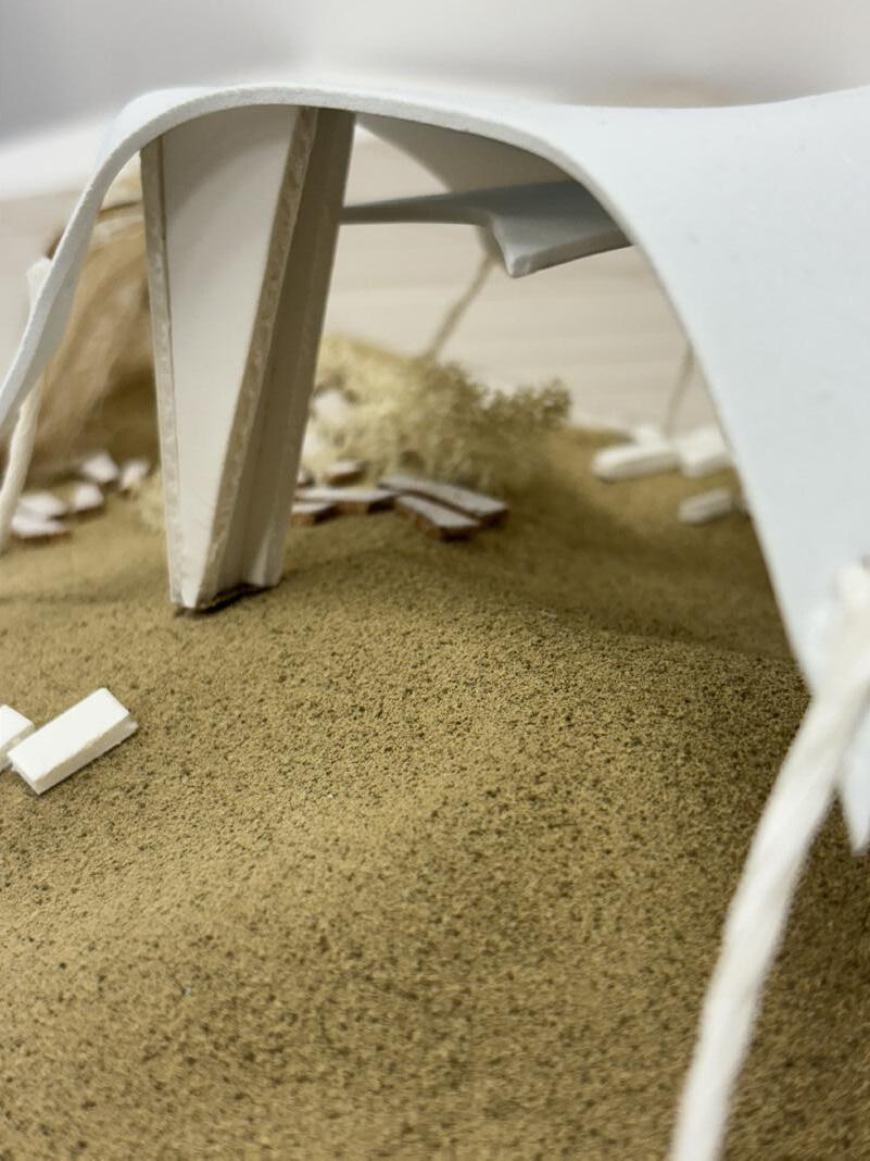
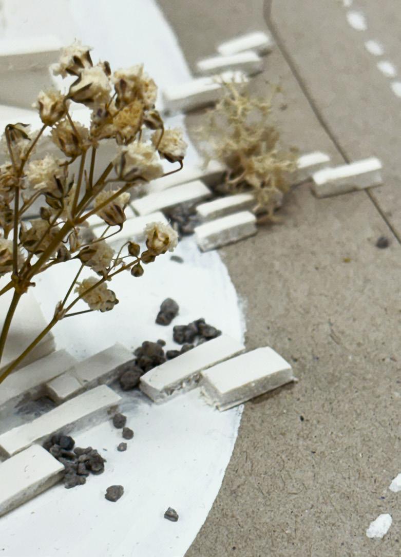
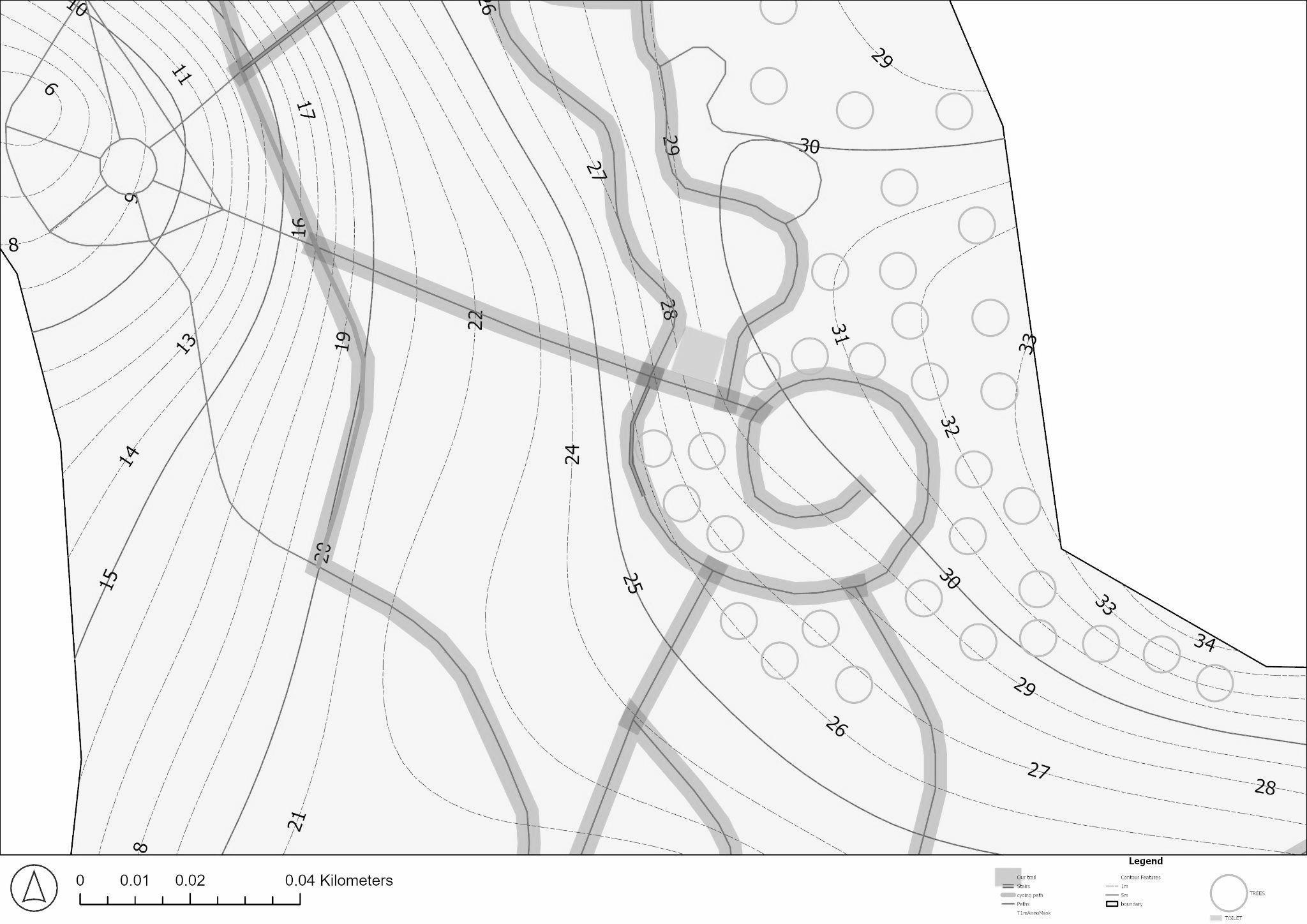
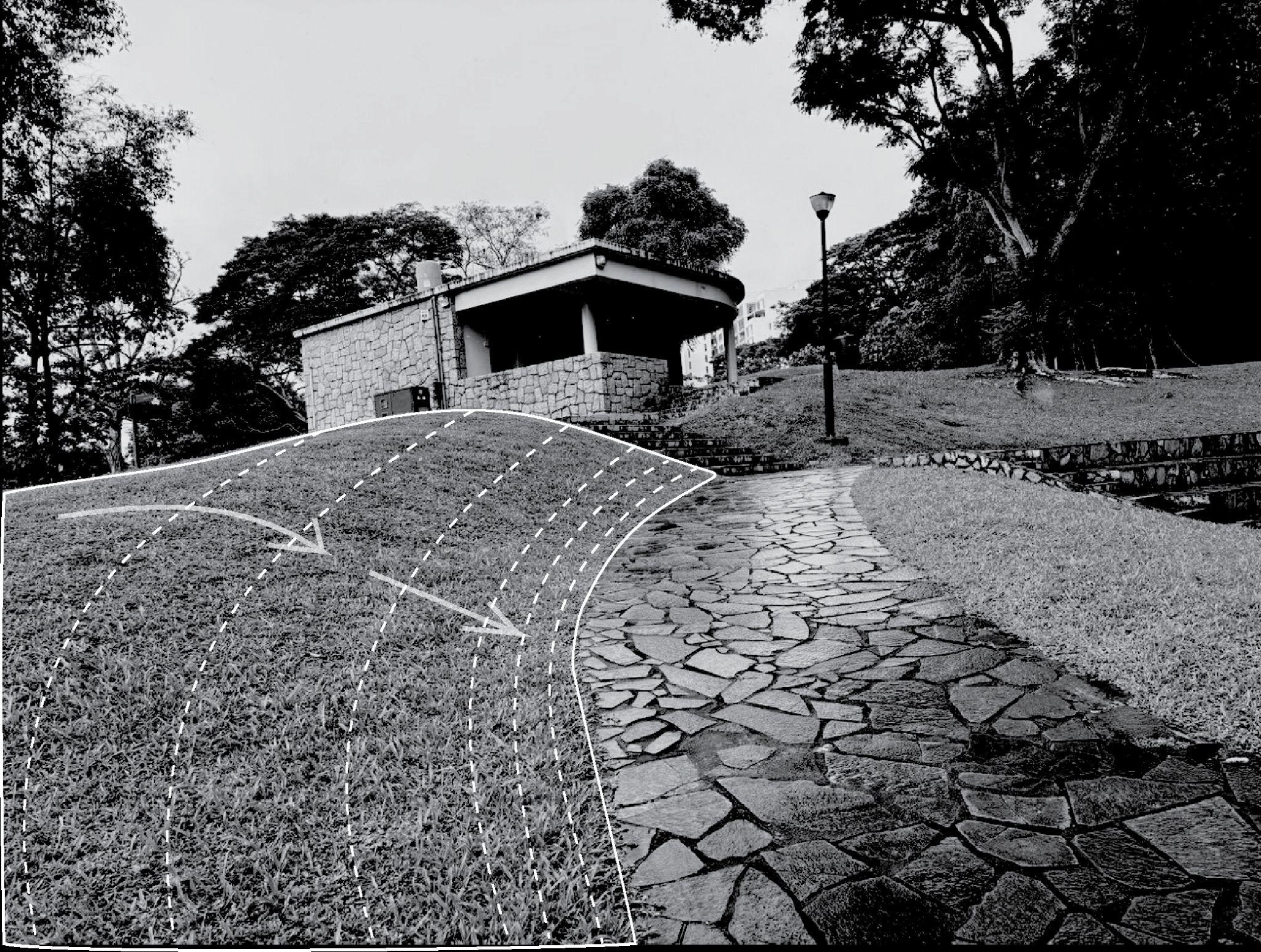
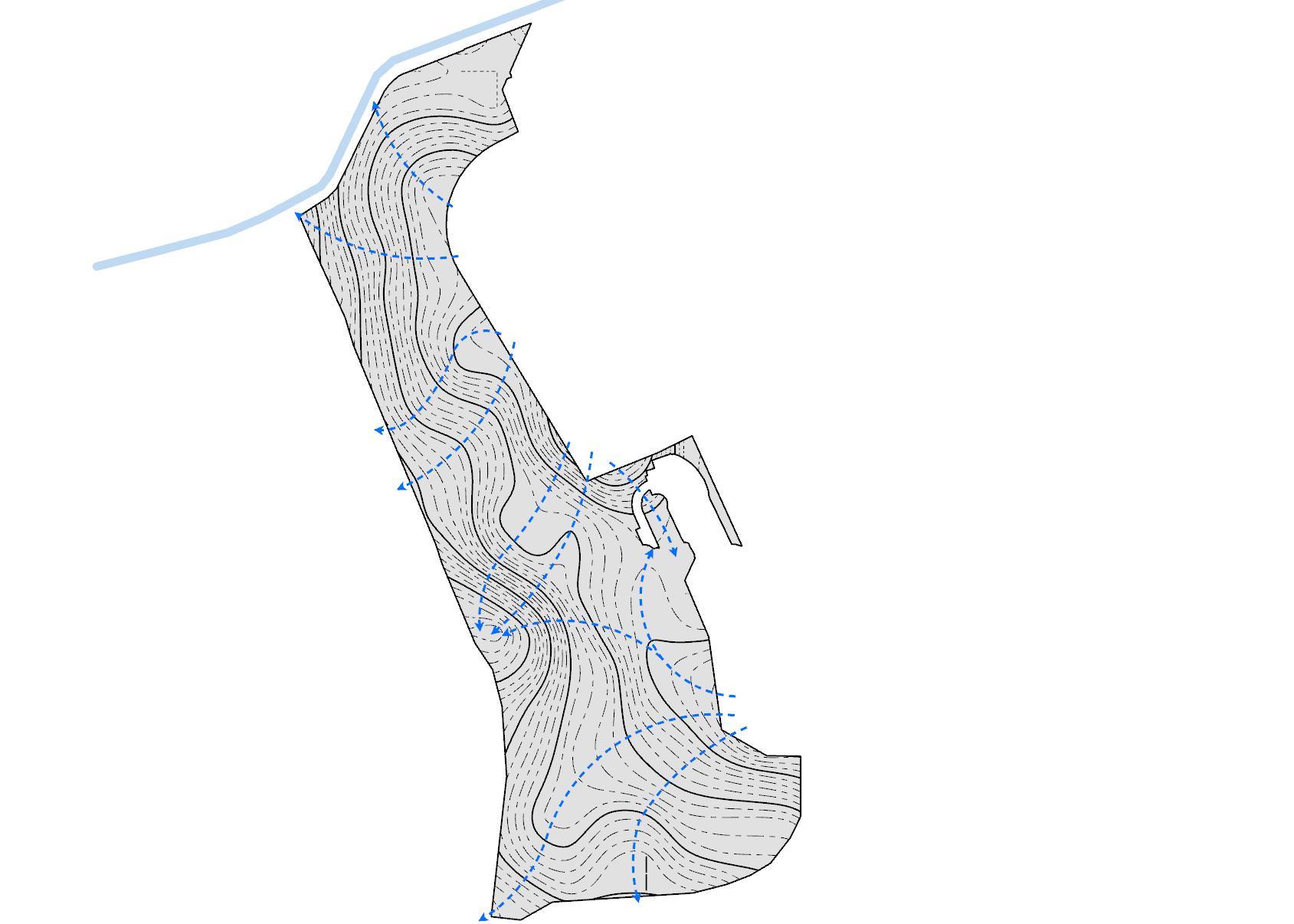
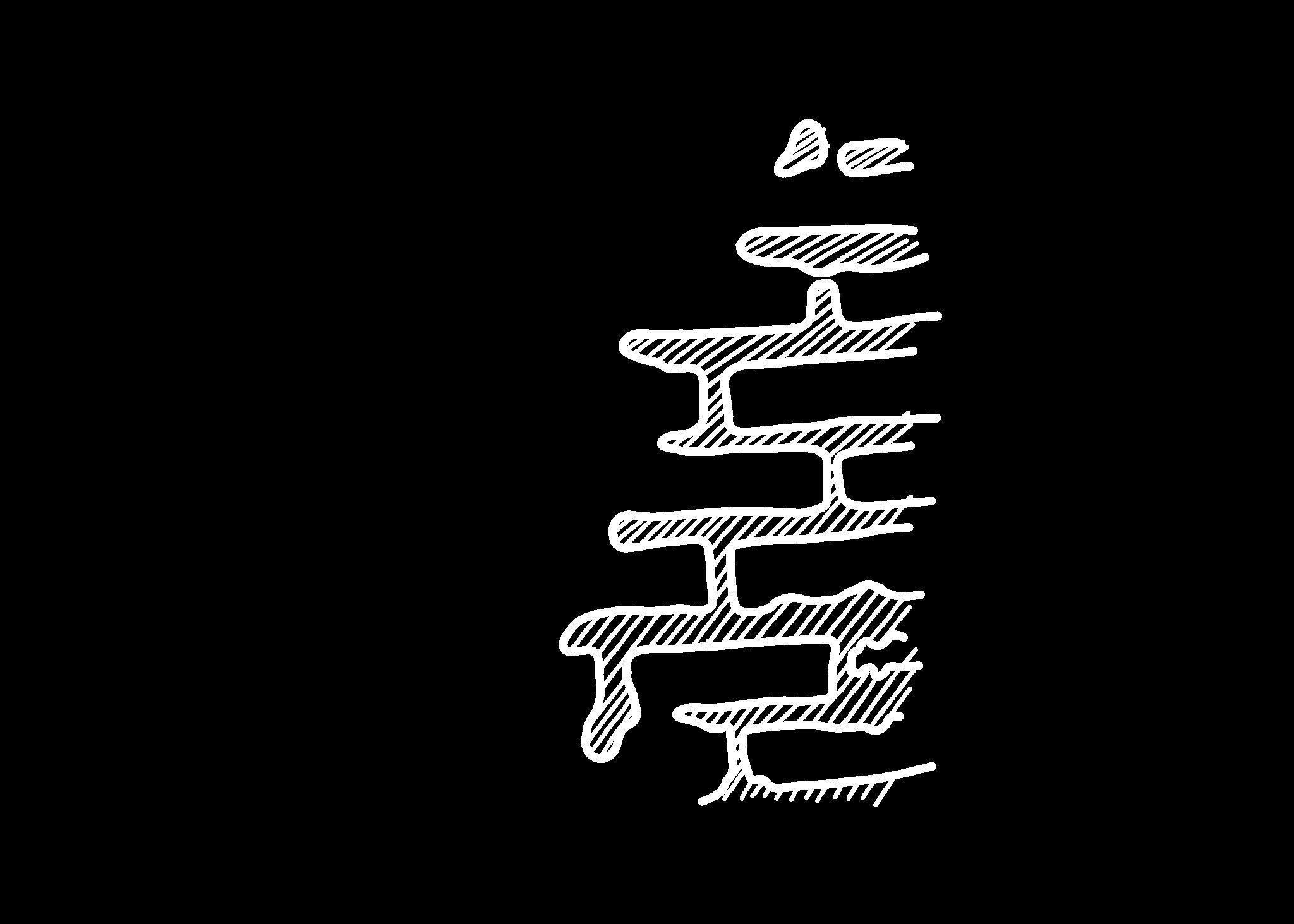
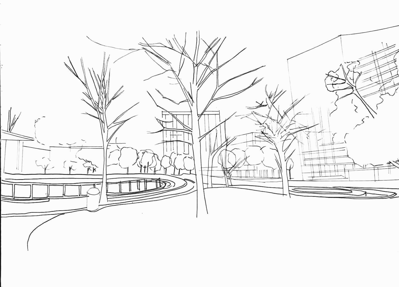
OVERALL INTERVENTION PLAN AND RESPECTIVE SECTIONS
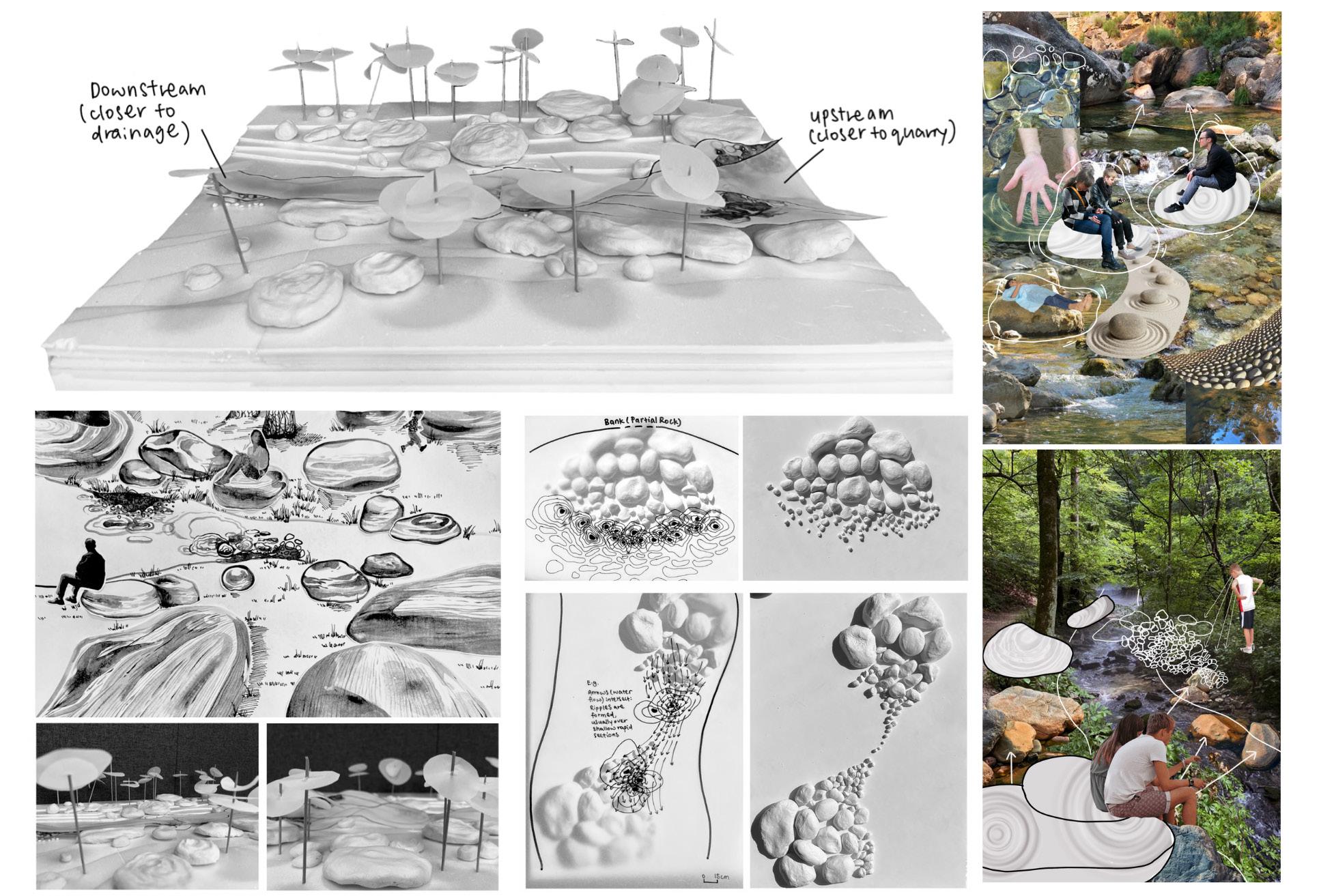
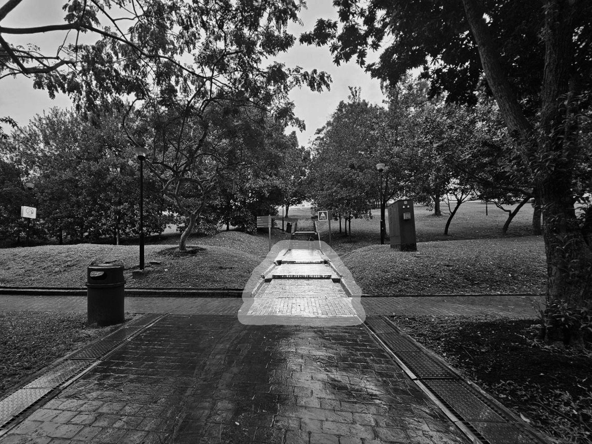
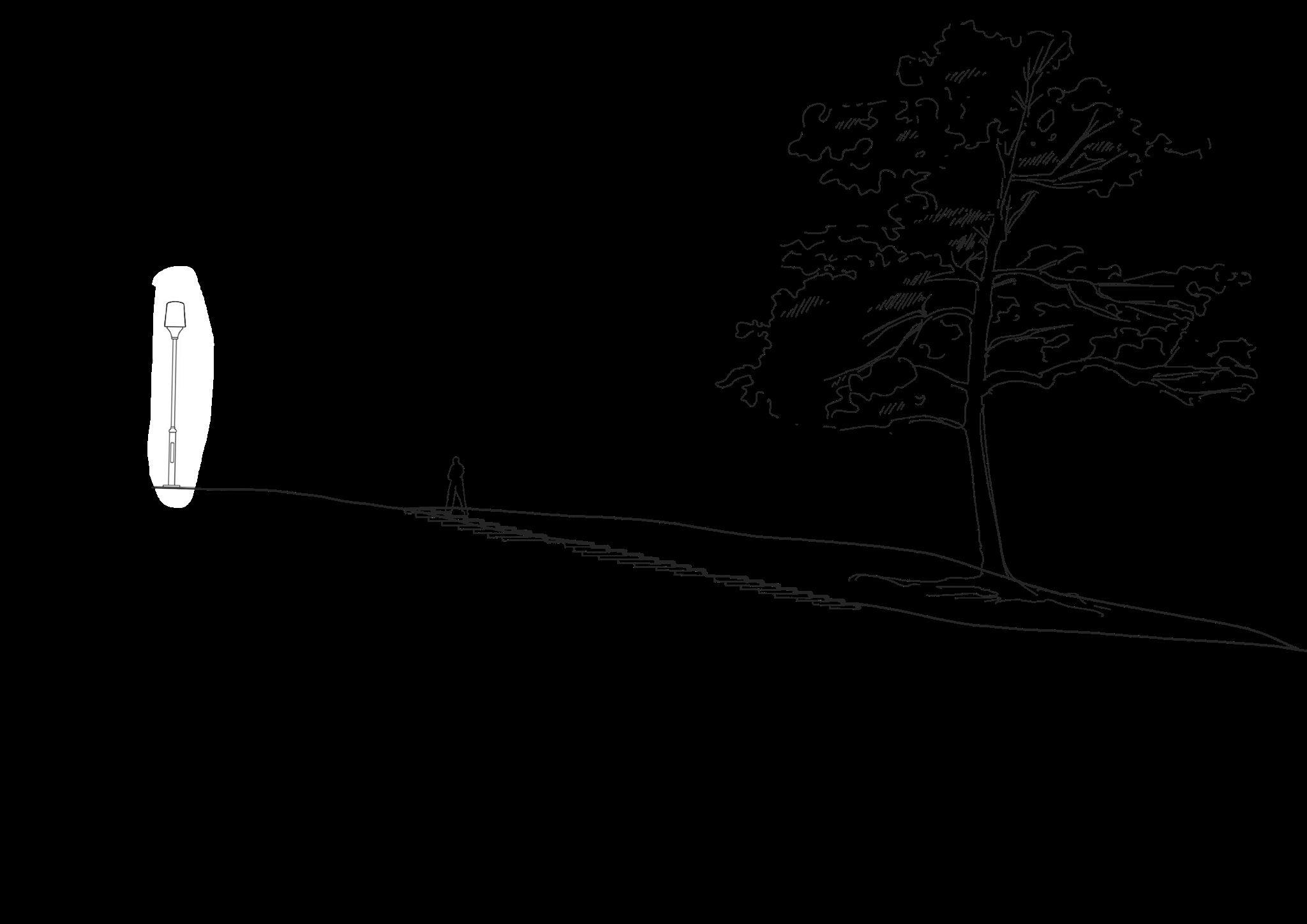
In my investigation of these elements, I realised their potential to be manipulated such that we could better higjlight the organic beauty of ripples and rocks. Hence, I conjured this reimagining of the quintessential stream in Bukit Batok Nature Park. In accordance with the stream bed and water velocities, gravel, pebbles and smaller boulders are rearranged into an assortment of deliberate patterns that produce exaggerated rippling. Morever, with the stream bank being either downcut or reclaimed, its channel will gradually transform into a more pronounced meander that further emphasises the surface patterns. Stone seats, which should resemble existing rocks yet appear larger-thanlife, are implemented for recreation, allowing park-goers to engage with the stream in their own way. These interventions would conceive a visual aesthetic that elevates the interactivity of this space, all while preserving the current landscape. When carefully woven together, the artificial and the natural could form a delicate, harmonious landscape.
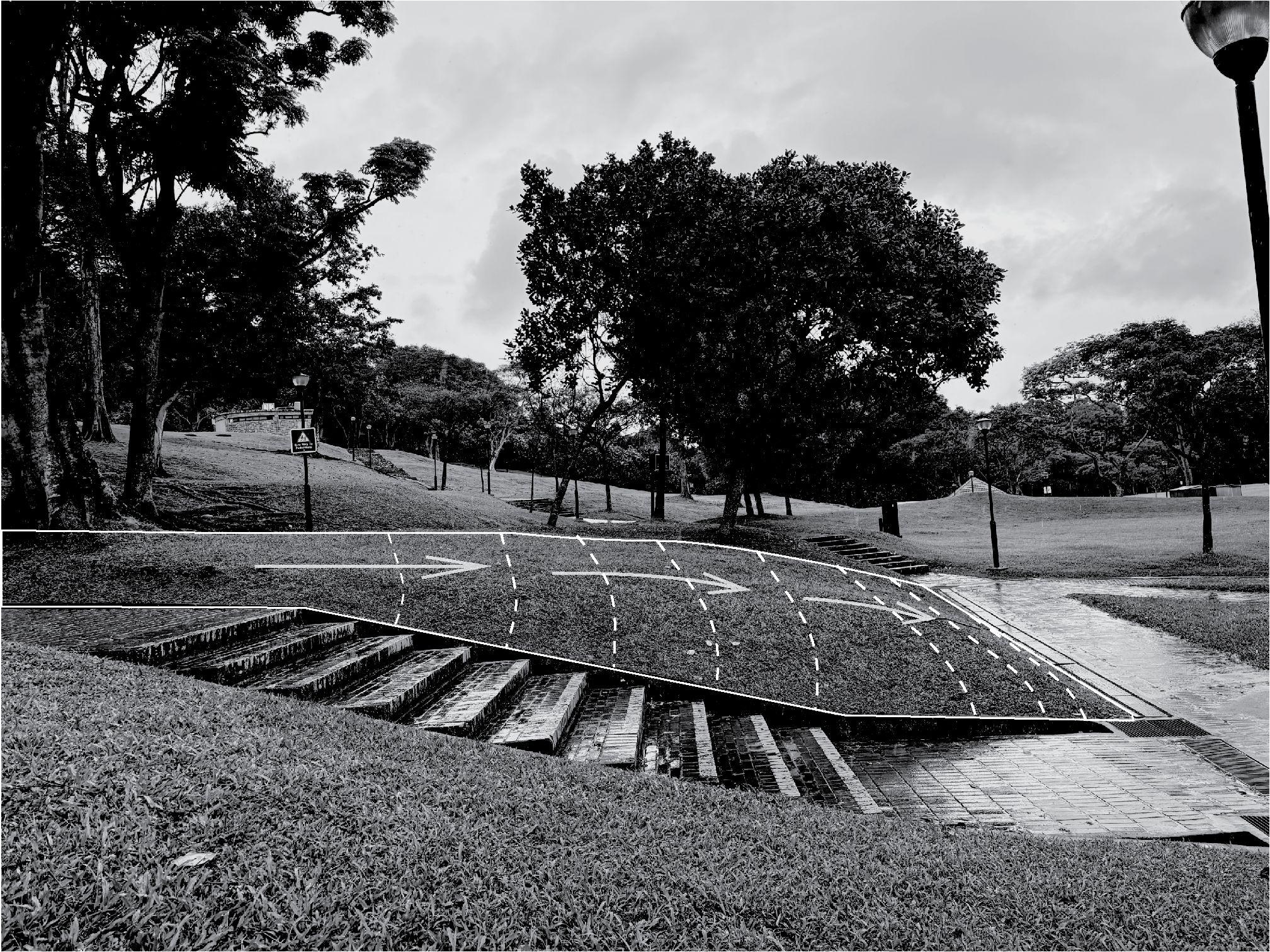
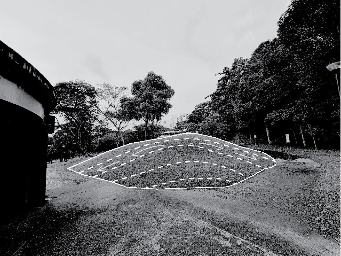
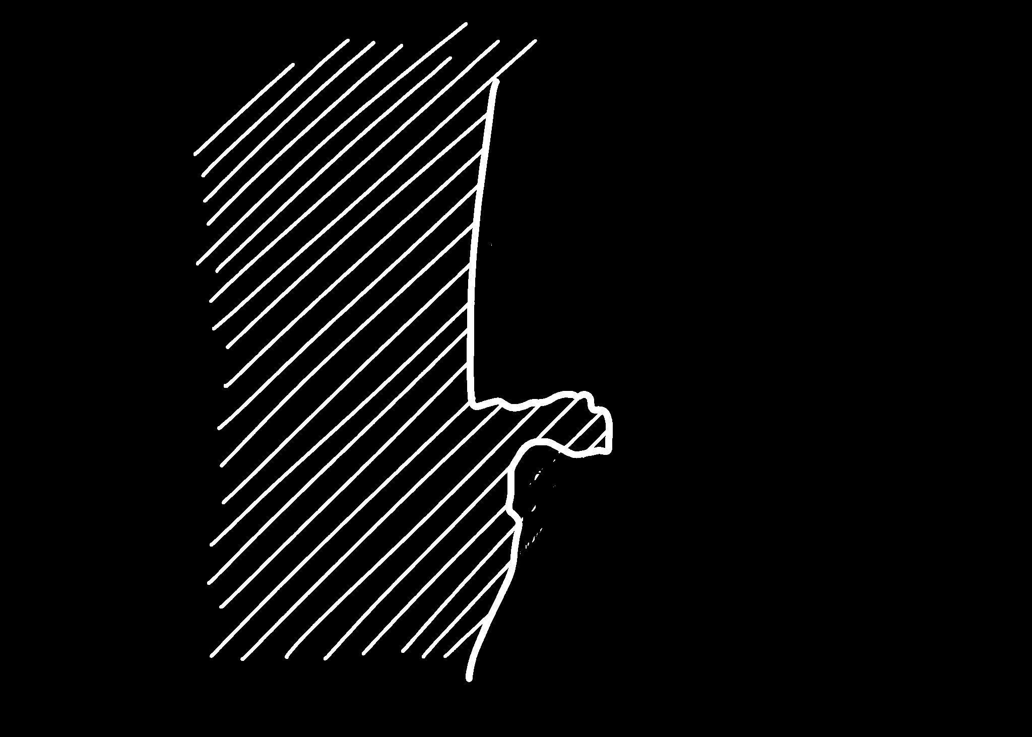
“SENSING” THE CHOSEN SITE
LAD1005 BLA Studio: Design 2 AY 2023-24, Semester 2
Inverted Matter
Extracting the Ephemeral from Canopy and Ground
Studio Tutor: Maxime Cedric Decaudin
Inverted Matter
Our world is composed of positive and negative spaces. Reflected in material, position and form, they complement each other’s existence. In the context of Nasi Ulam, one such example is the canopy and the ground
Looking up, one would realise that the canopy takes on a malleable form. It never occurs in one fixed shape, as the trees would always grow and change over time. Crown shyness brings about a myriad of intricate canopy gaps, which project an ever-changing pattern of light onto the ground. Meanwhile, the landform also changes due to natural weathering. In essence, the canopy is a complex network composed of the sky and surrounding foliage, while the unassuming ground below has potential to correspond with the pattern above it. There lies a sublime quality in the organic, fluid motions of the canopy and the forest floor. This could be further emphasised for passer-bys to notice a relationship between the two, and engage with that personally.
Thus, this project aims to highlight the cognitive dissonance between these two natural elements, by utilising contrast in form and installing human interventions that interpret the canopy in a systematic way. The main method used to achieve this is digging into the ground, a literal extraction of material to create negative space, based off an abstracted negative edit of the canopy that emphasises on its varying light intensity. As the two-dimensional is translated to three-dimensional matter, its nuances are preserved through the diverse materials used and their different purposes. (248 words)
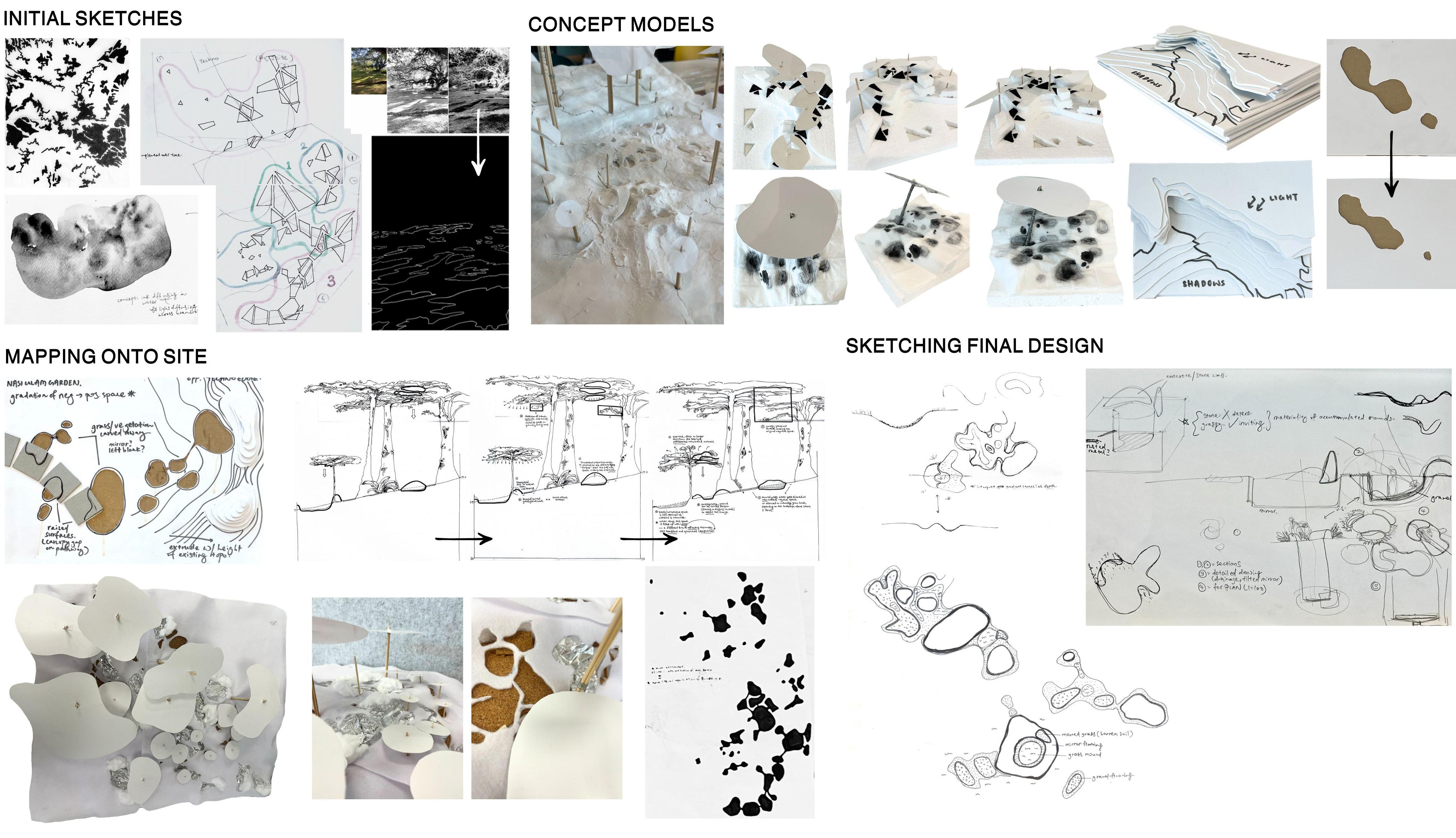
Creative
Process and Experimentation
This details my creative process, from the initial brainstorming tages to eventually testing out these ideas on concept/working models. Attempting to capture the organic, proliferating quality of canopy, I used traditional 2D mediums like watercolours that had a diffusing effect with its bleed, and marker that can delineate canopy gaps clearly. I have also included design directions that I did not end up following through with, but were nonetheless important to my trial-and-error process, such as geometricising the canopy gaps.
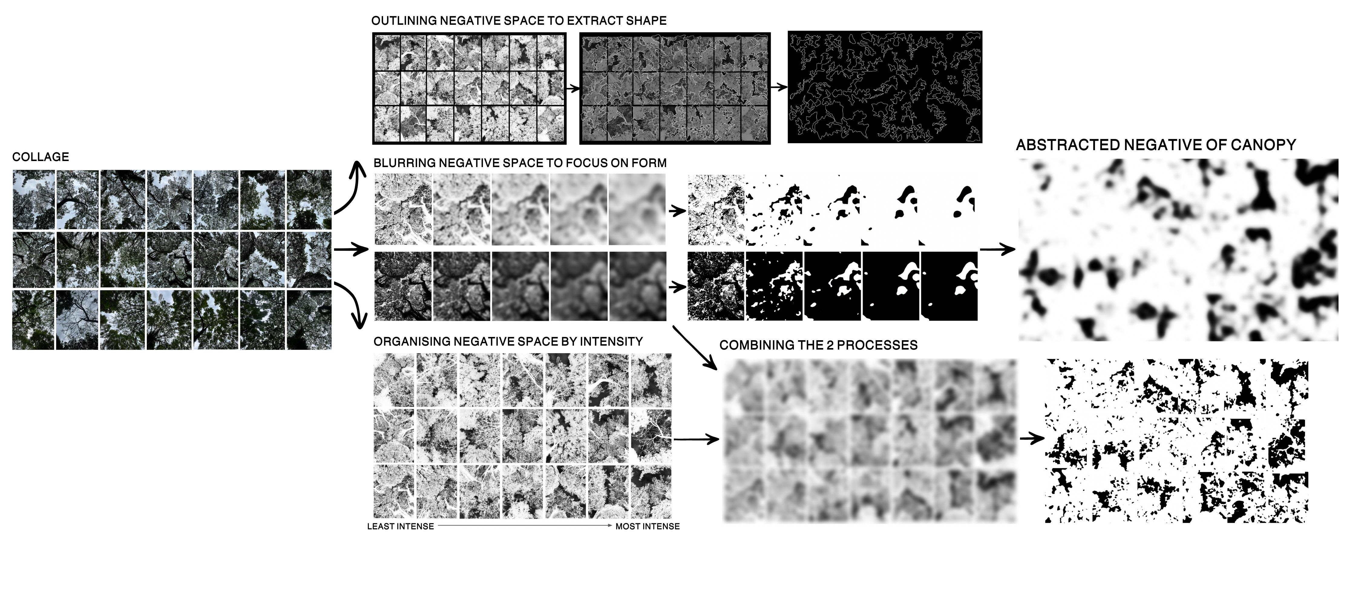
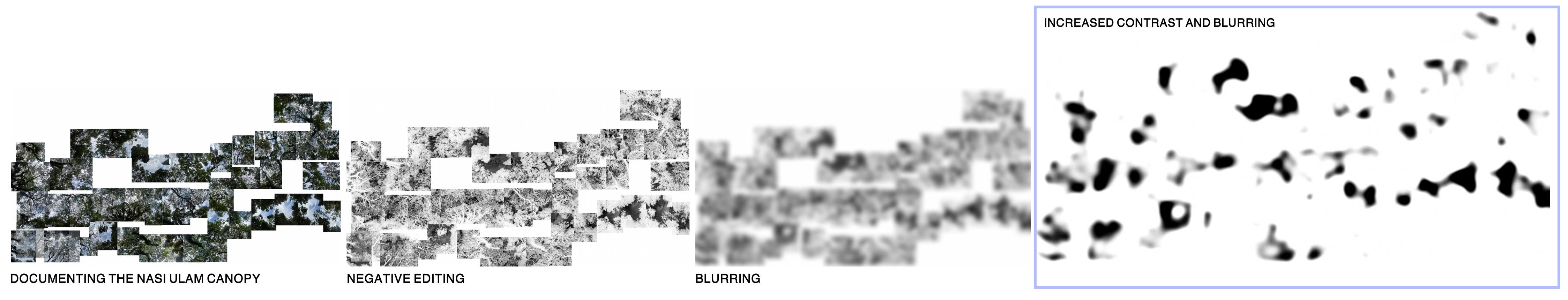
Concept Diagrams
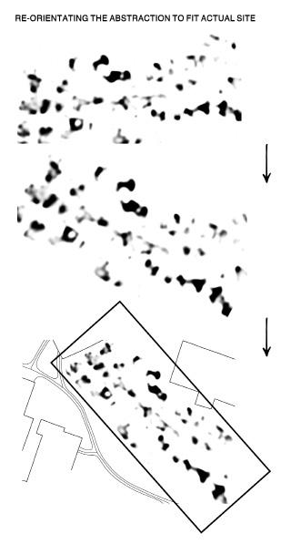
To emphasise solely on form and pattern, I first tried applying B&W negative editing to a collage of canopy snapshots. Subsequently, I manipulated the images using blurring and increased contrast, and also organised the photos accurate to their placement on site. This series of visual experiments prompted me to consider how a deliberate, systematic change in topography could make the landscape more tactile and interesting, as I could alter the terrain based on the 2D abstraction. I wondered how this could express the “sublime”, inspiring terror and awe at once.
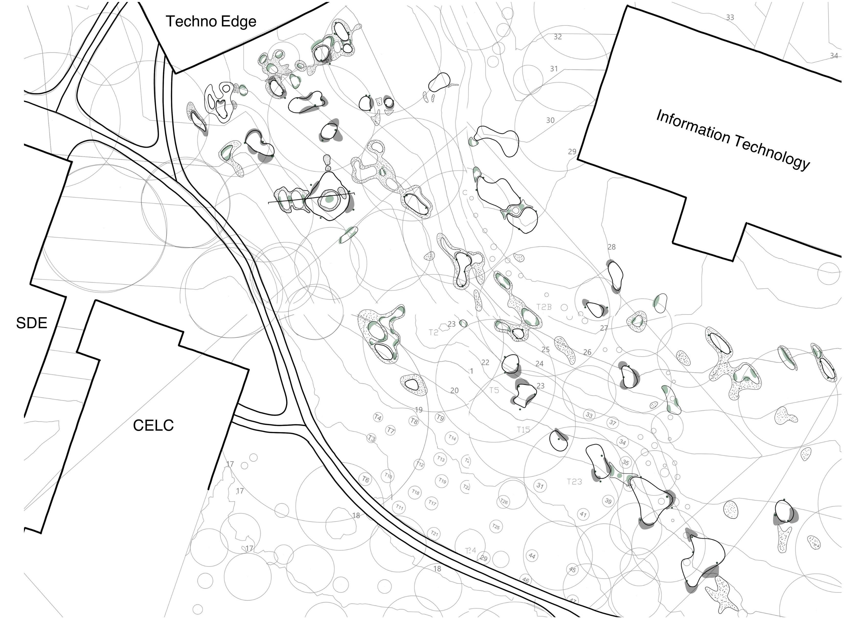
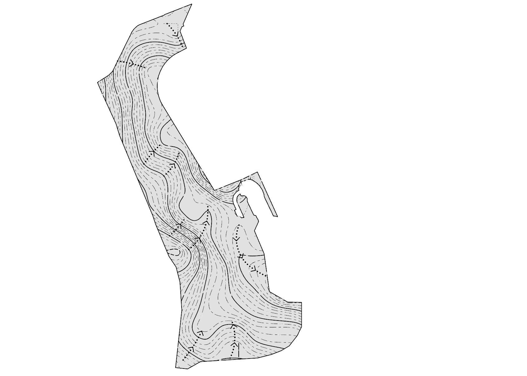
Large Scale Map
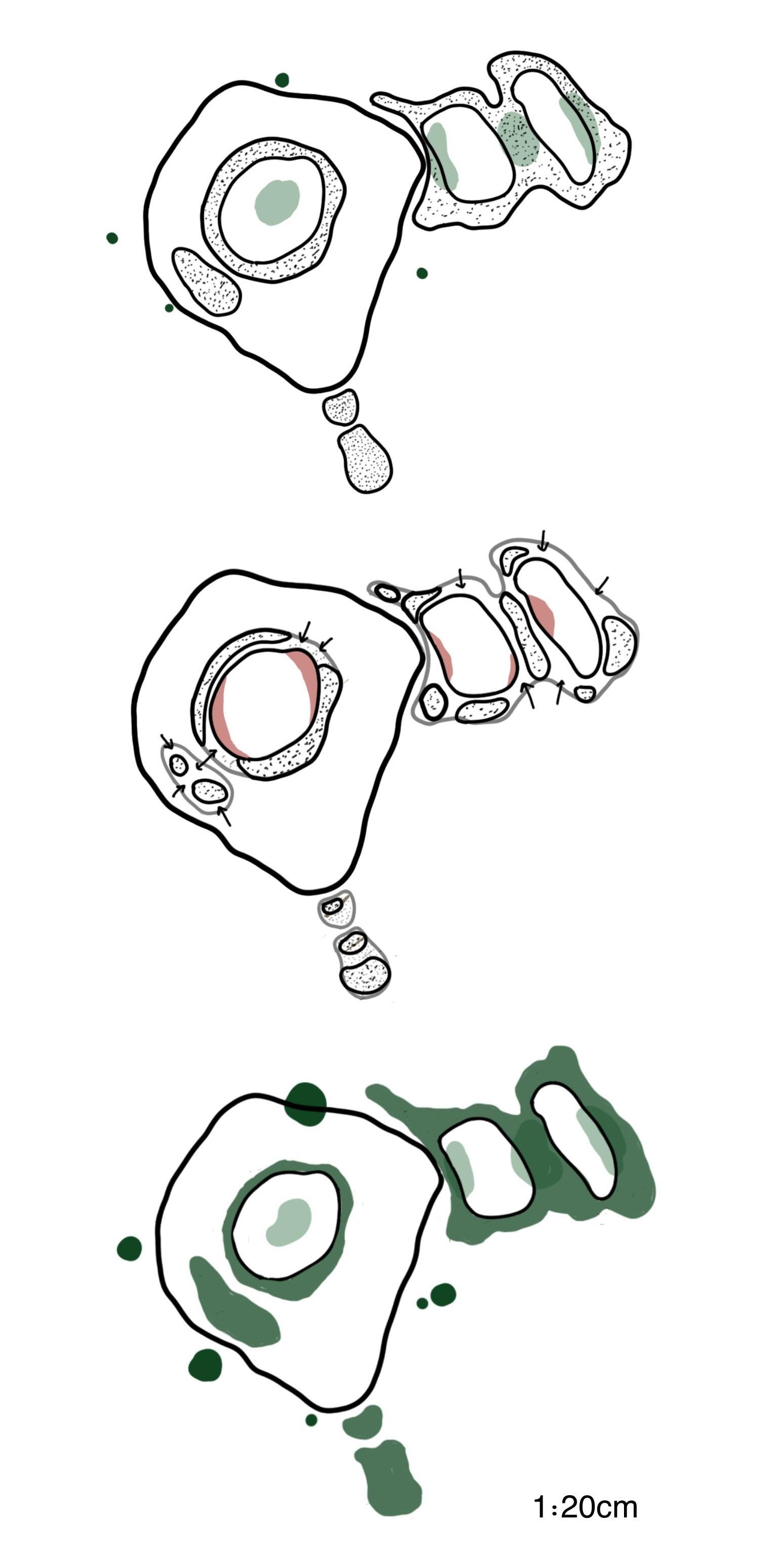
This shows the overall plan view of my final design.
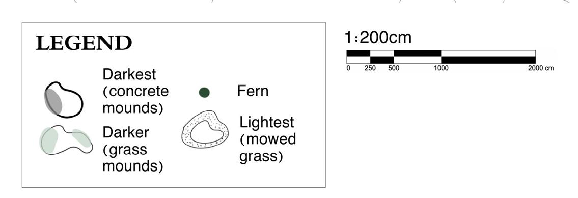
The intervention proposes to dig or carve the ground at different depths, corresponding to different “intensities” of darkness in the abstracted negative canopy. Different materials are then introduced to the space. In some variations, concrete and grass mounds surround the border of the interfered area. Bird’s nest ferns, which require minimal sunlight, are sparsely populated around deeper holes.
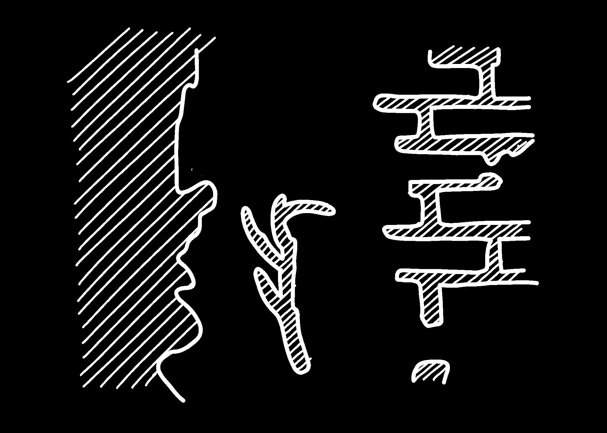
Detailed Section and Perspective Drawings
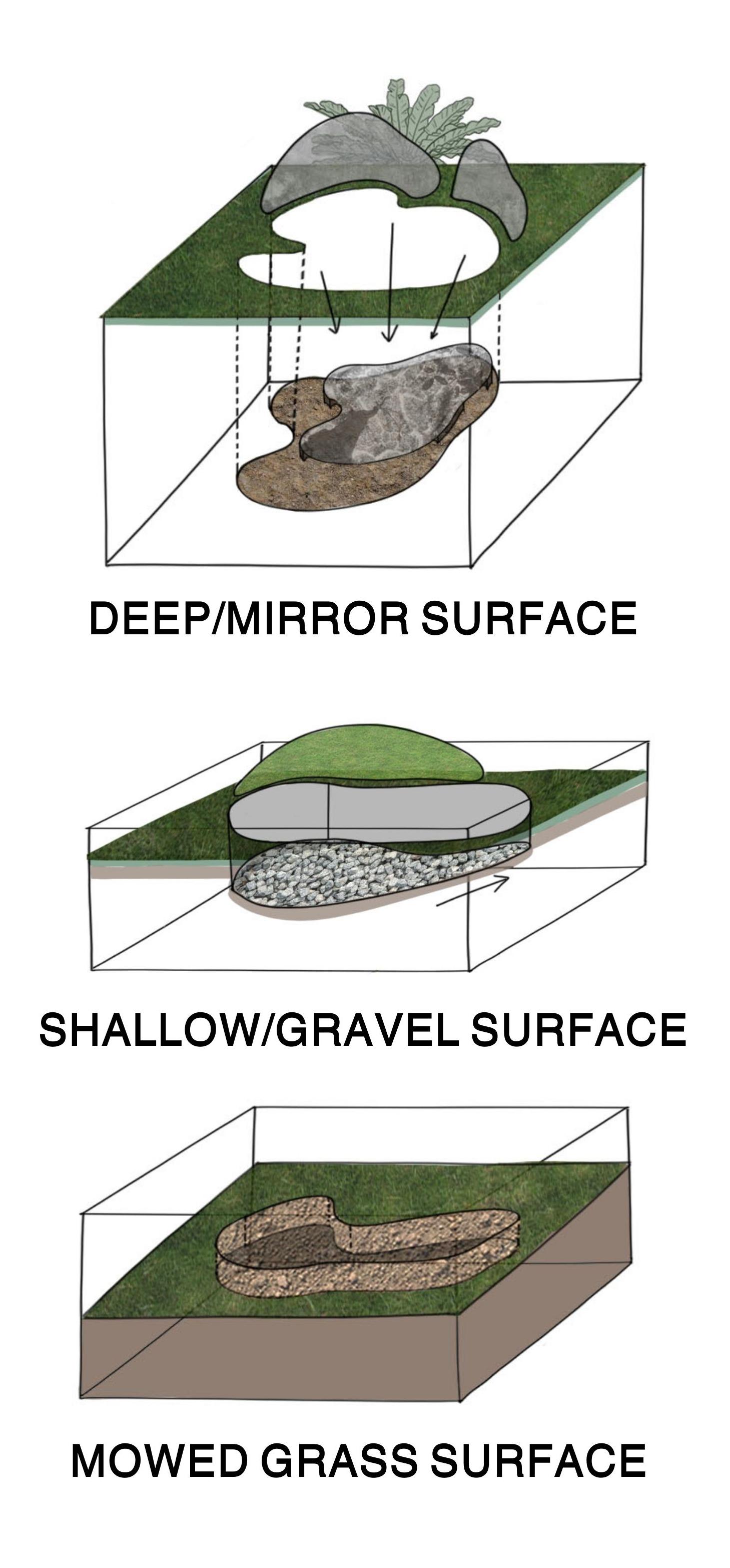
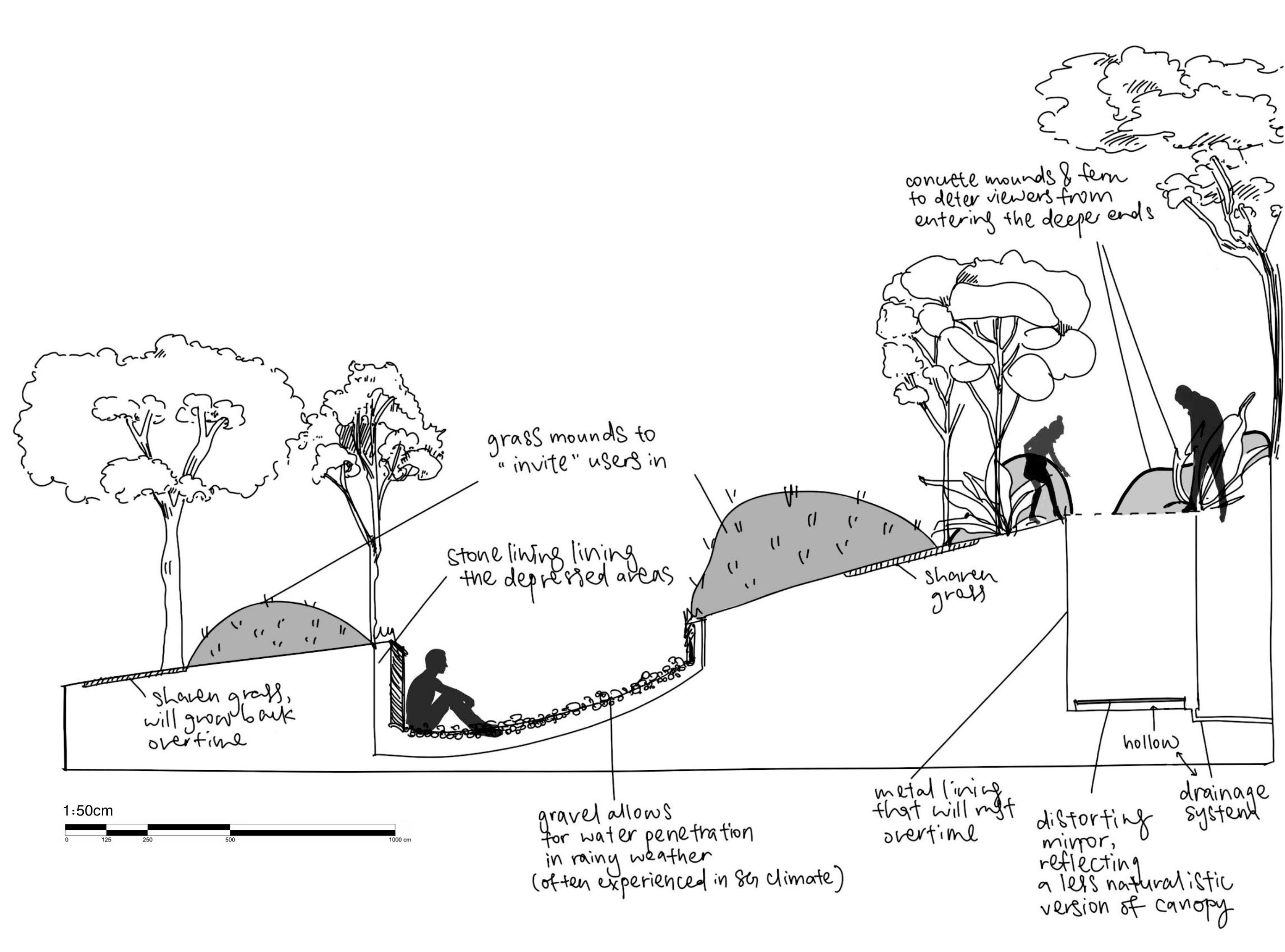
The monochrome gradient of tones in the abstraction could be transformed into a spectrum of human experience at different depths. Around the darkest areas, there will be pronounced, heavyset concrete mounds that act as a barrier from entry, with mirror surfaces fixed to the bottom to reflect the canopy above, the depth making it both terrifying and fascinating. Slightly less dark areas would have shorter grass mounds that appear more inviting, together with a shallower depression filled with gravel which visitors can climb into – a more contemplative, relaxed space.
Detailed Map and Sections Overtime
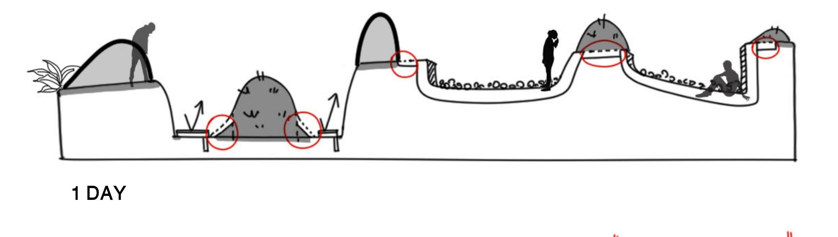
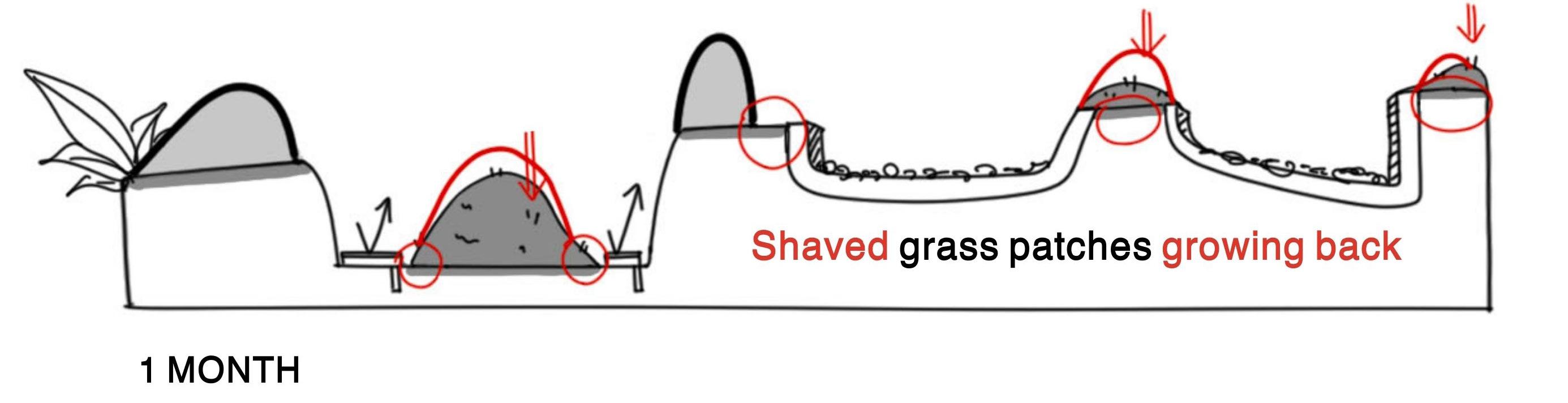
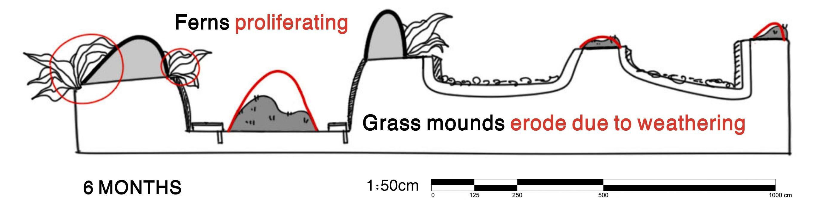
From top to bottom, we observe how this selected area on site evolves over a projected period of 6 months. Grass mounds would change in shape due to natural weathering, while the surrounding grass and ferns planted would continue to grow. Mowed grass patches, which denote the lightest areas in the abstraction, will eventually grow back, corresponding to canopy growth. However, the concrete and gravel remain permanent in their presence. This conveys a sense of ephemerality, as the gradual changes record the passage of time and thus constructs a narrative around time.
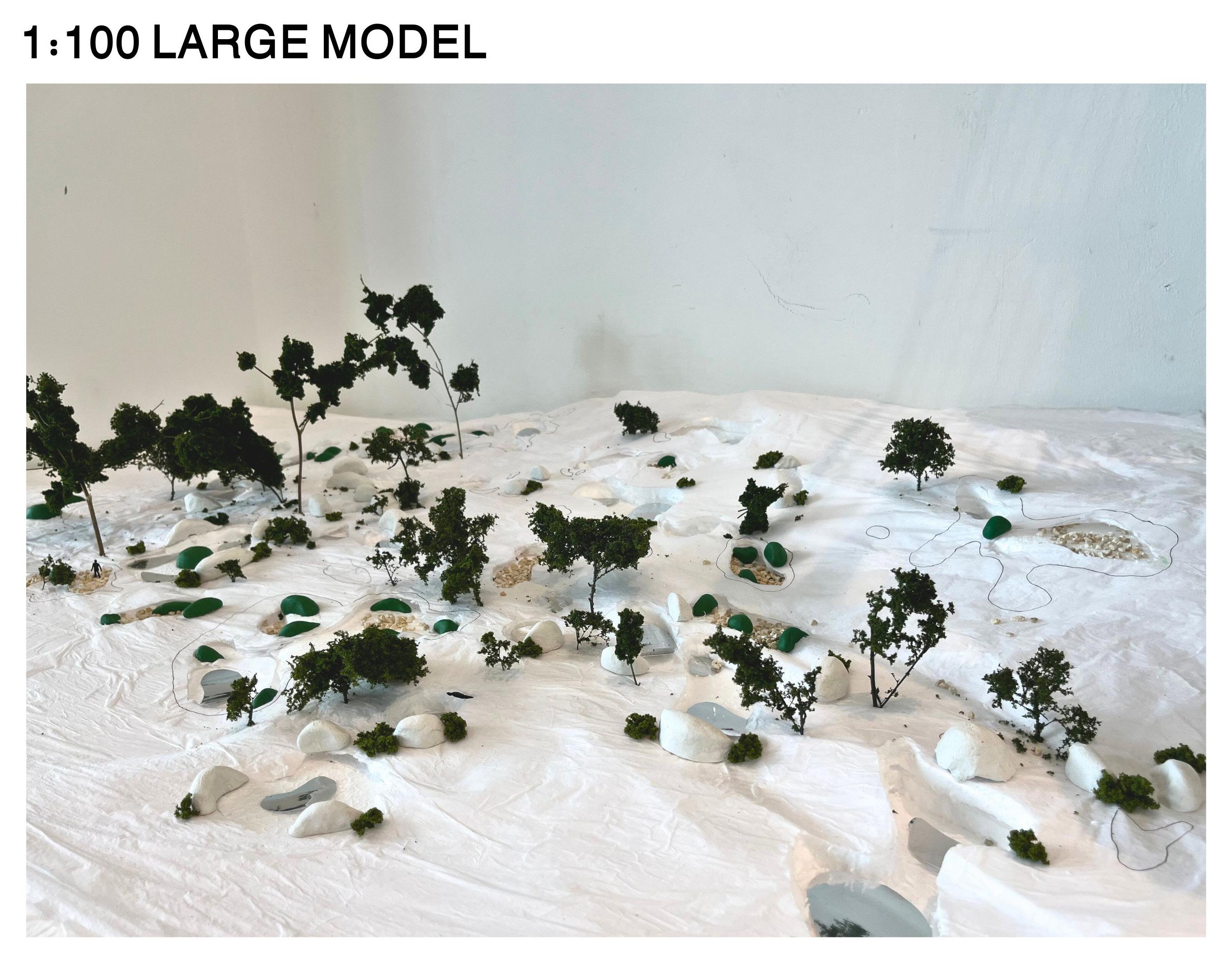
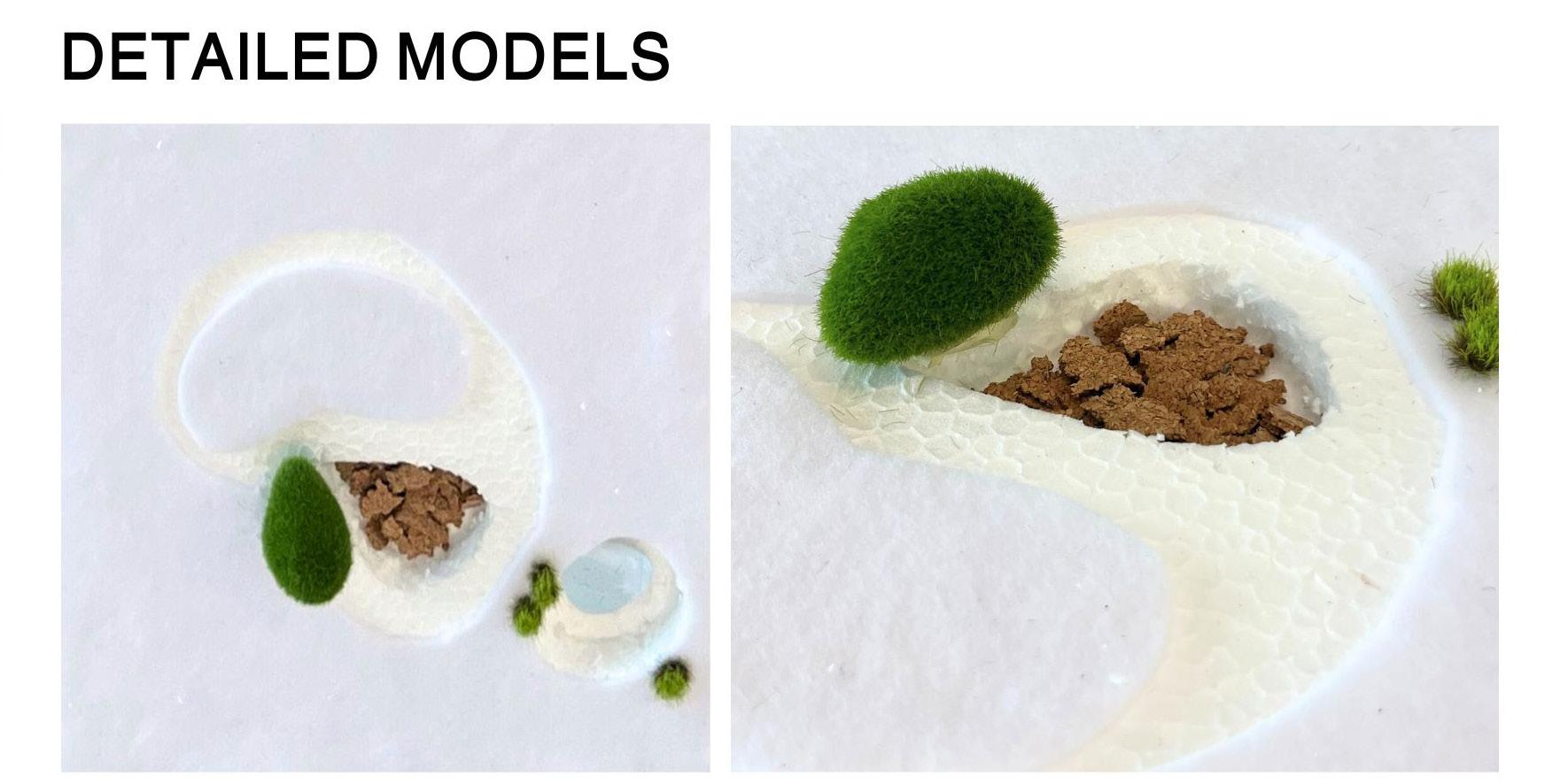
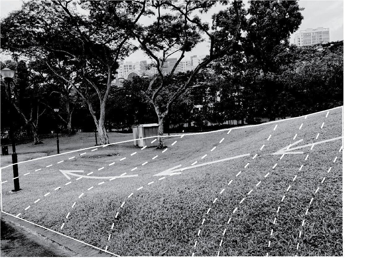
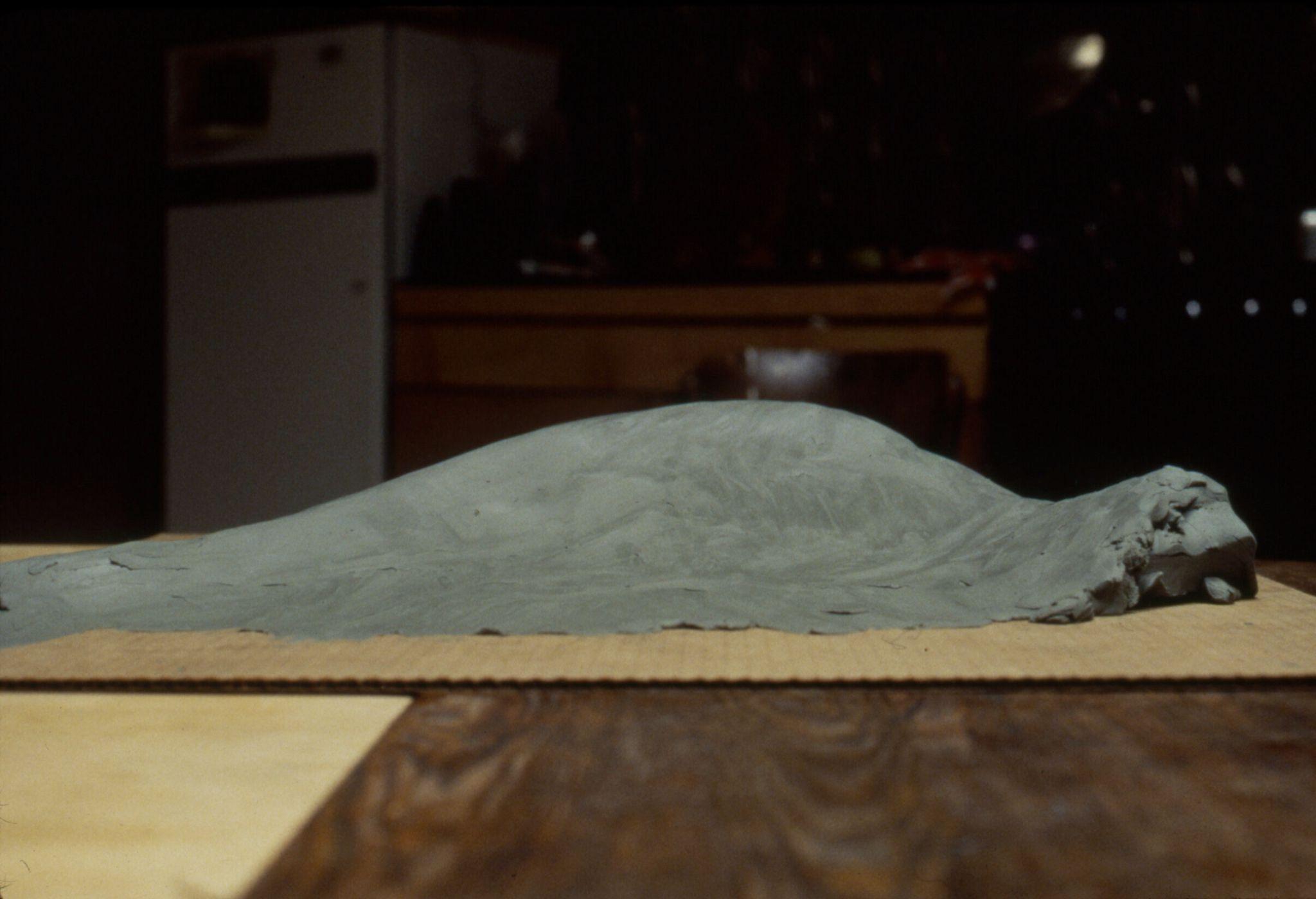
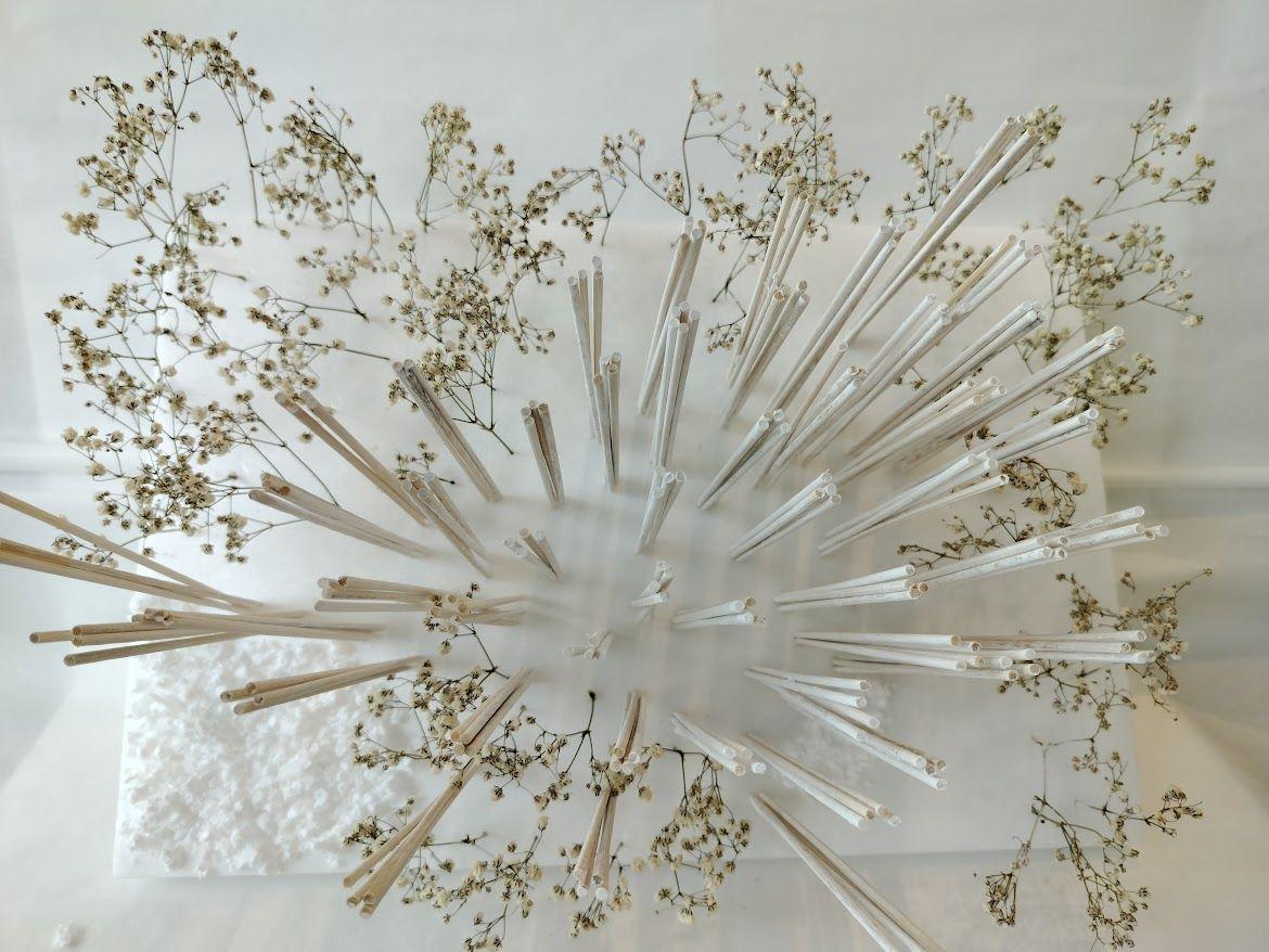
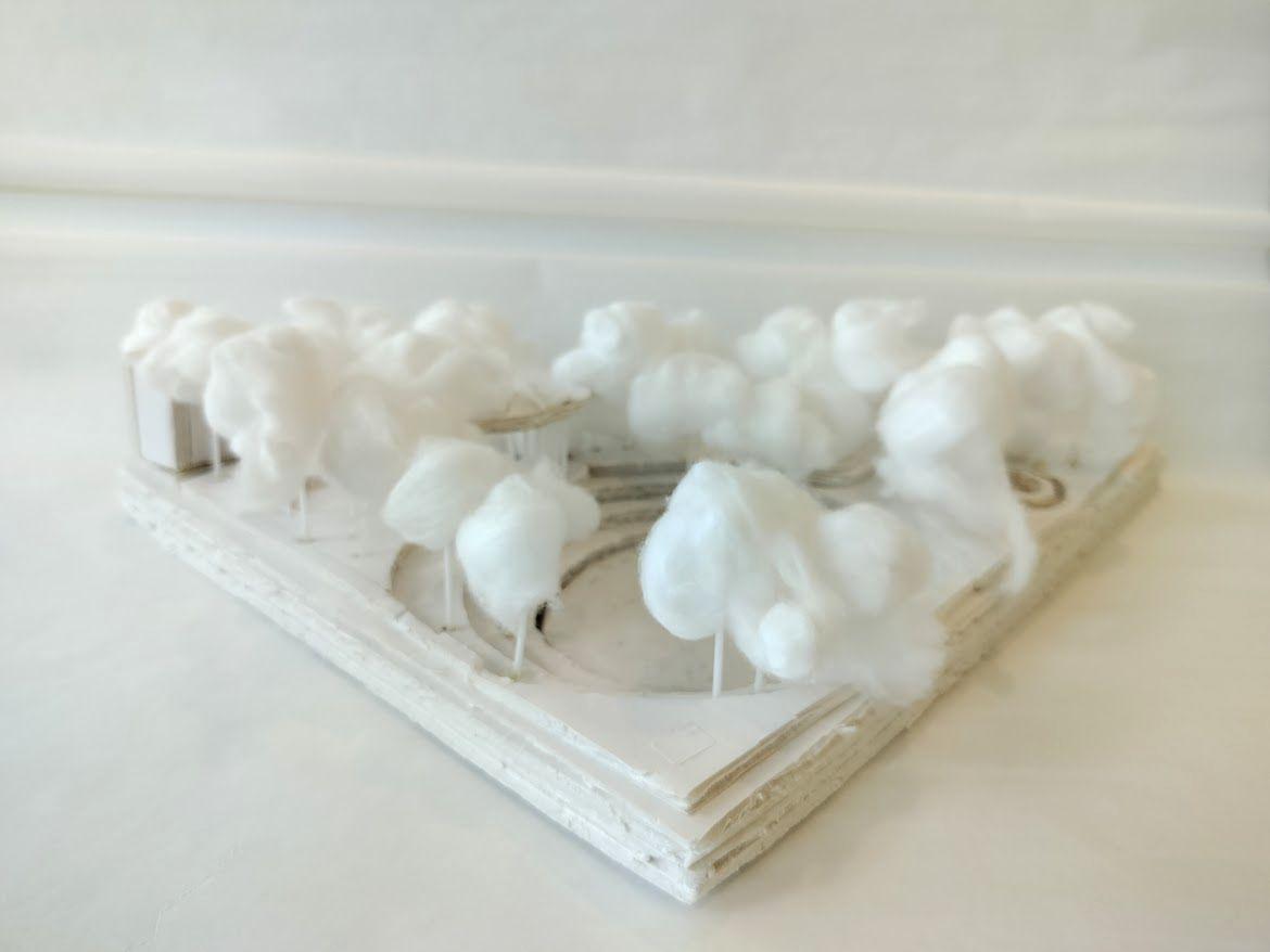
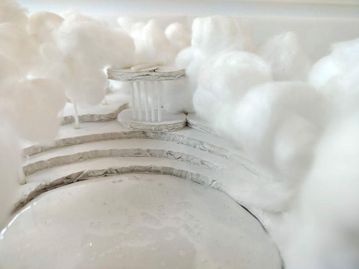
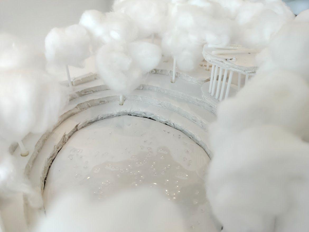
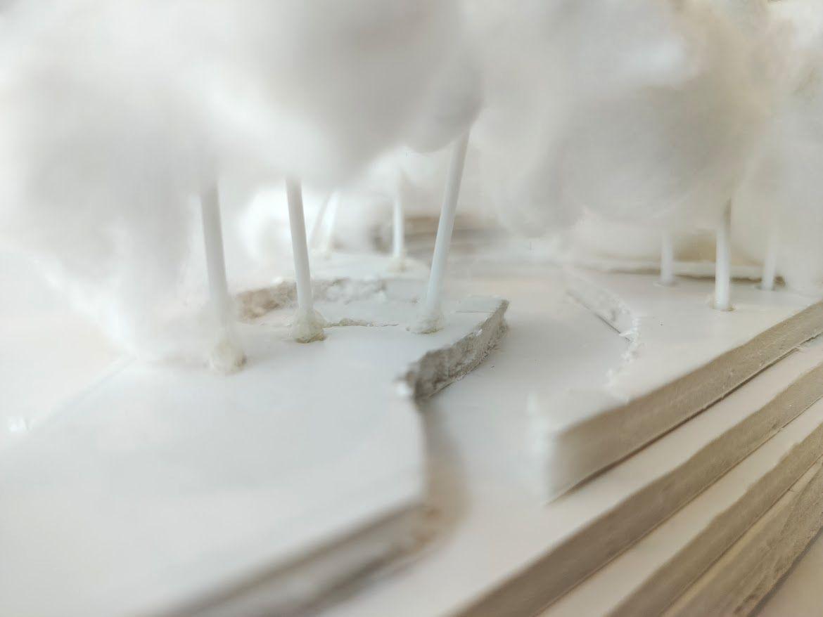
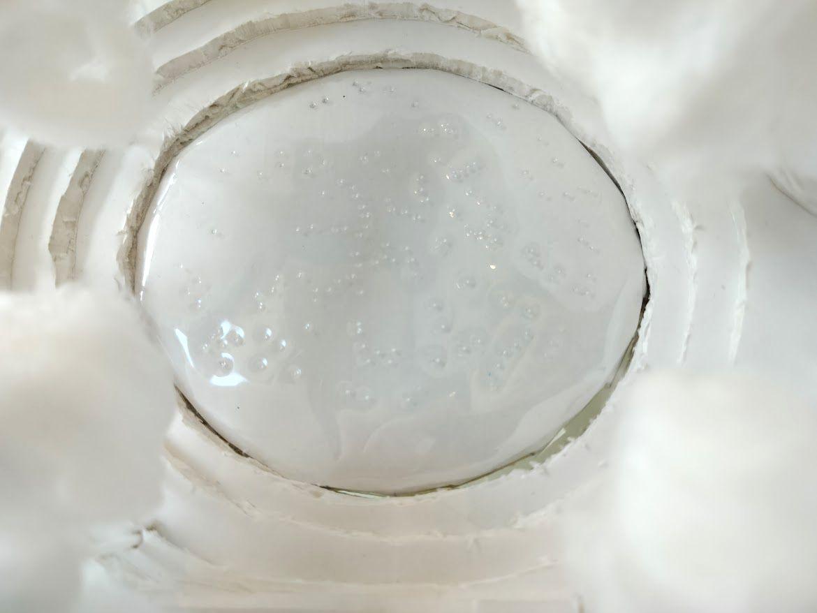
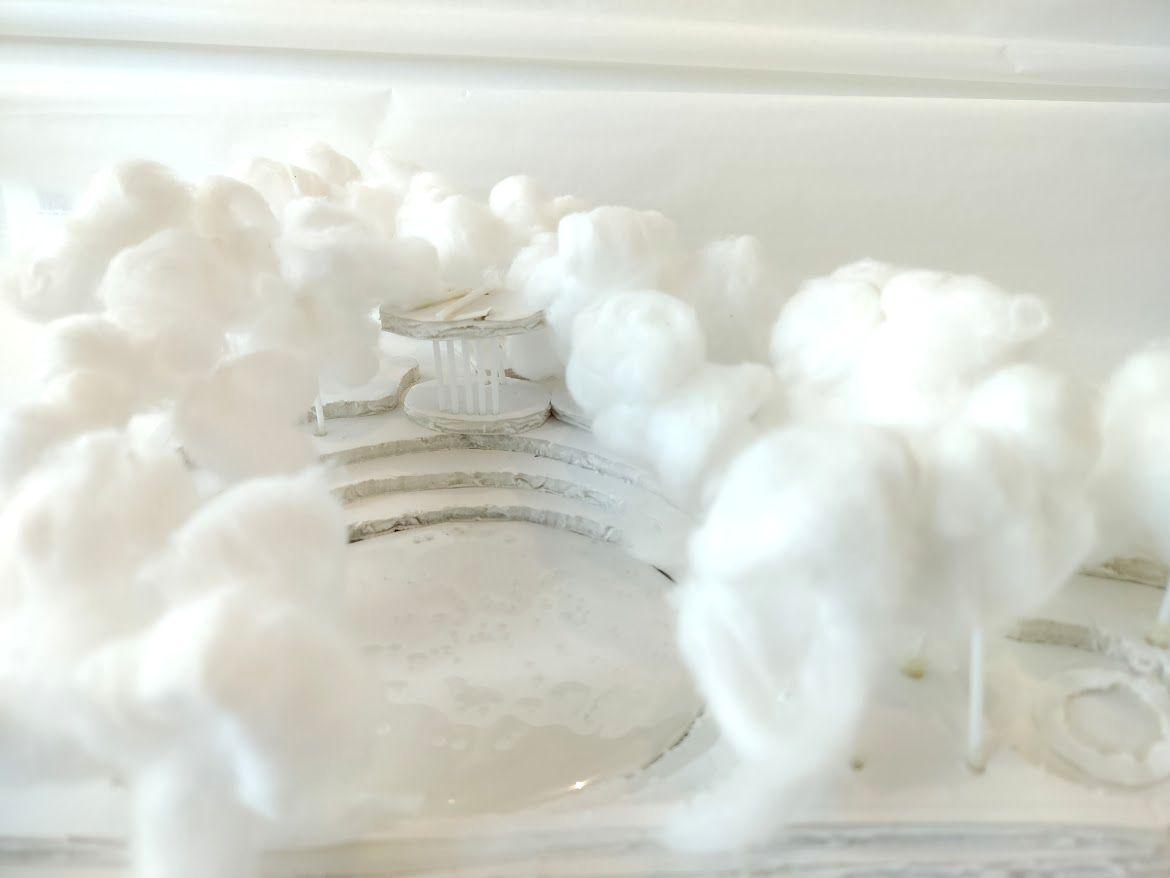
Eye-Level Scenes from Models #1
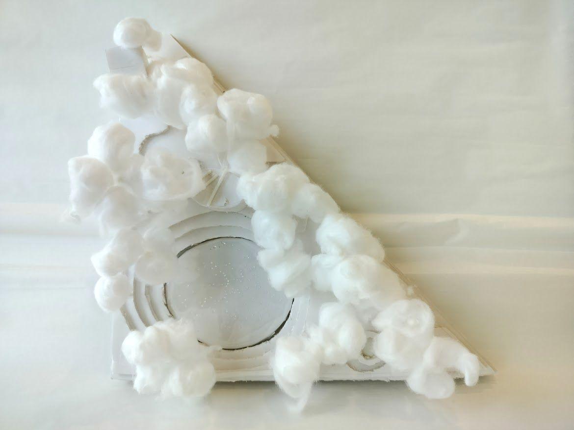
I constructed a 1:100 model to depict my overall intervention, using white and green clay to represent concrete and grass mounds respectively. The mirror surfaces below are made of reflective cardboard paper. The thin marker lines show where existing grass will be mowed away, but only temporarily, as grass would revitalise itself overtime.
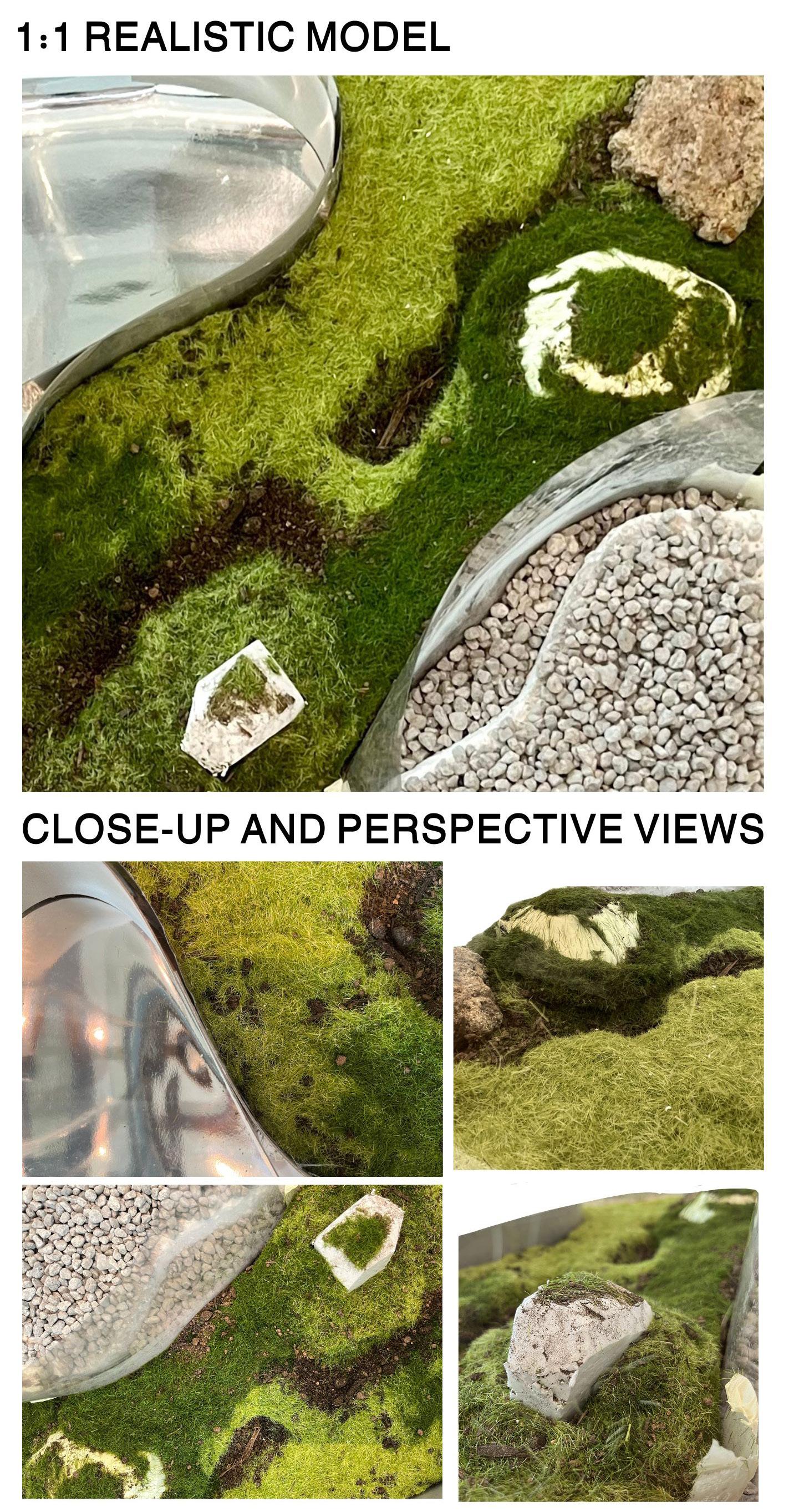
On the right is a 1:1 mock-up of my intervention, showing a 40cm x 40cm corner.
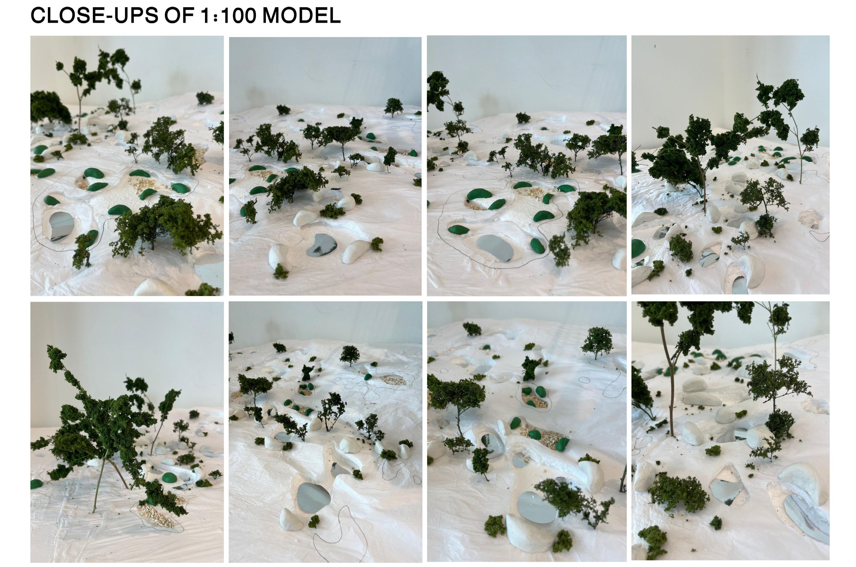
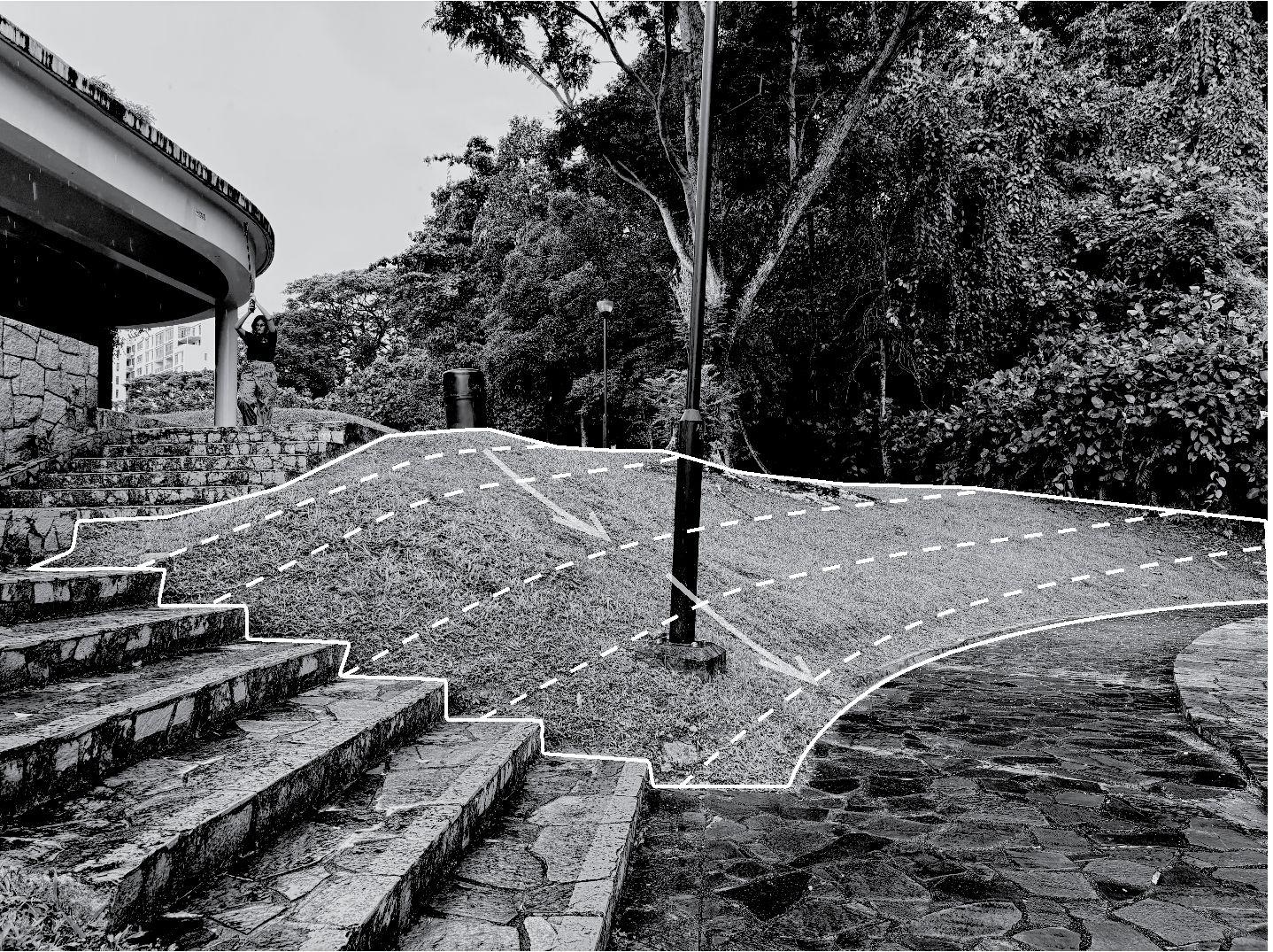
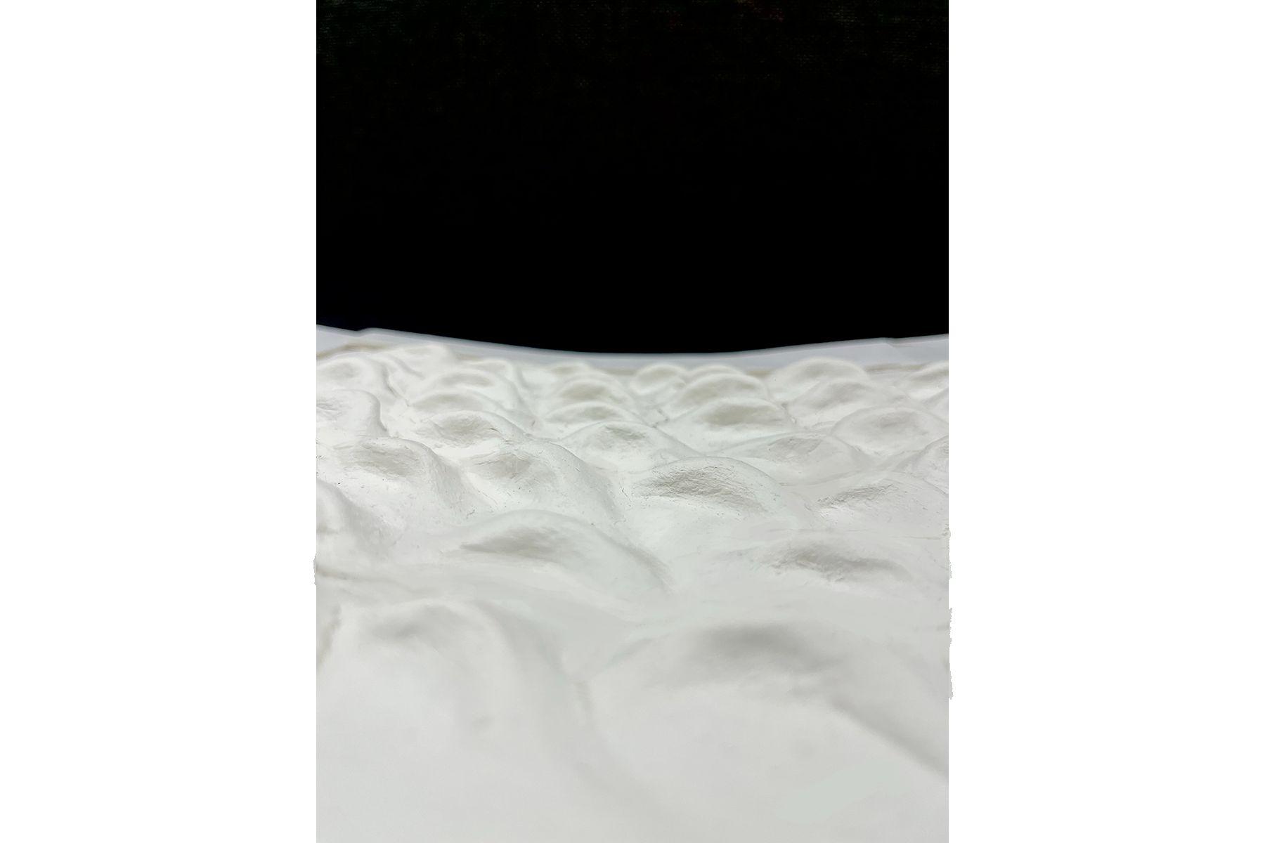
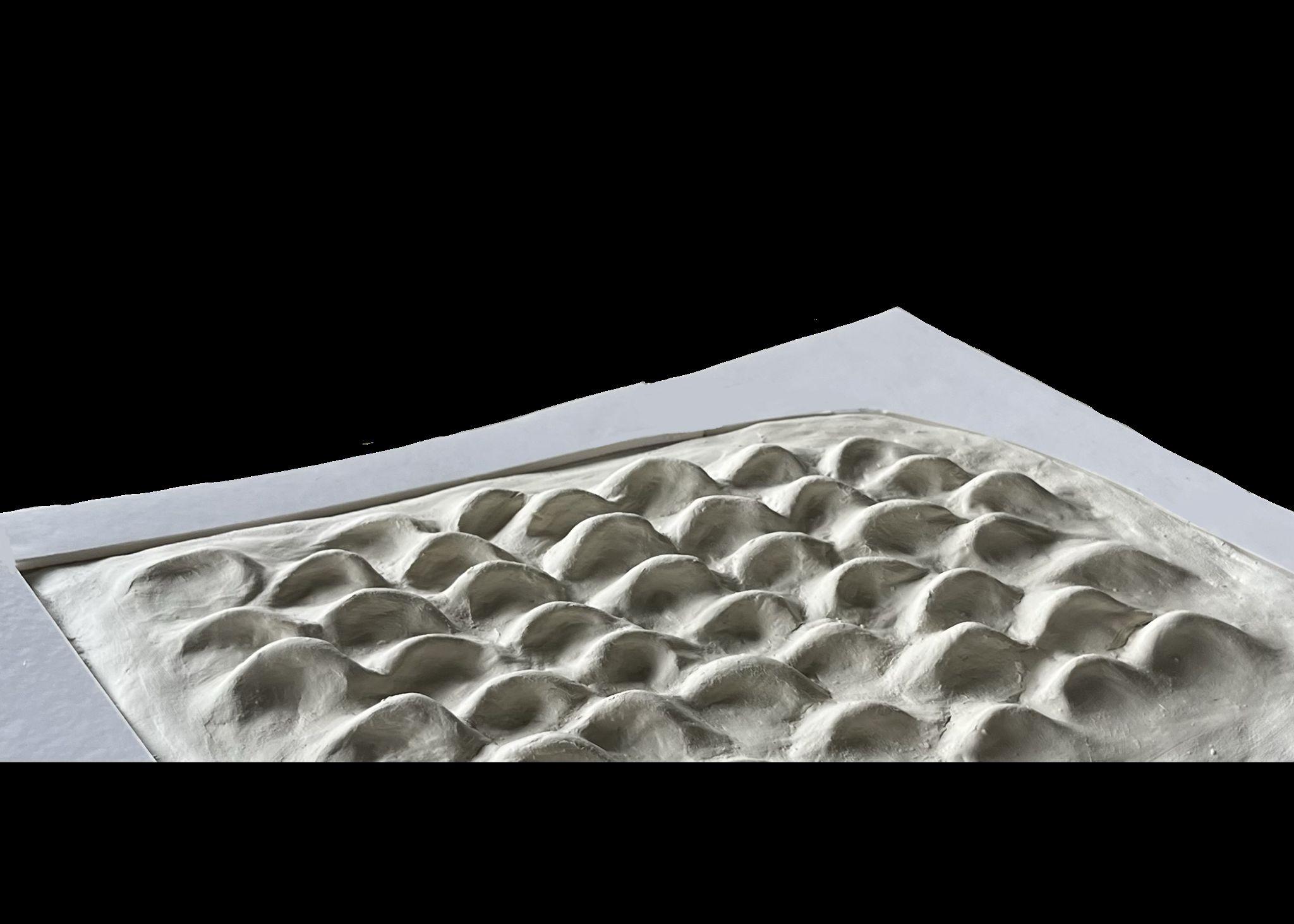
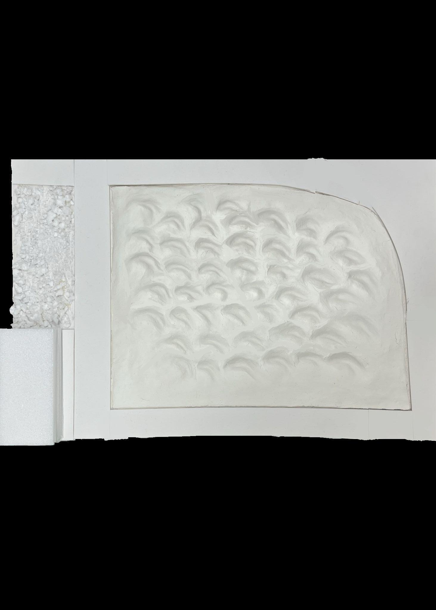
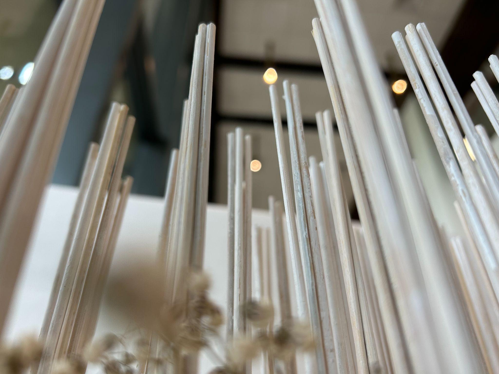
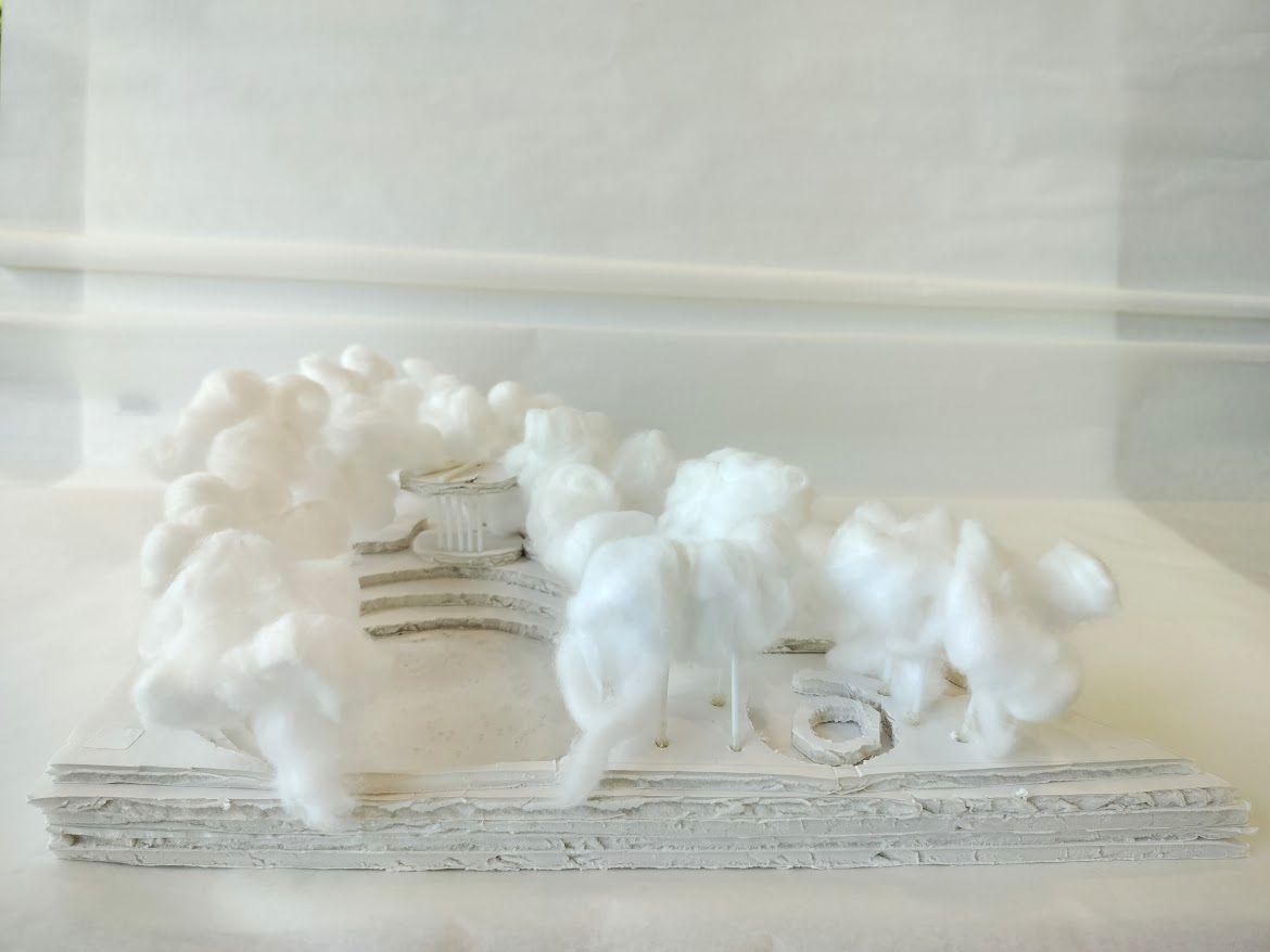
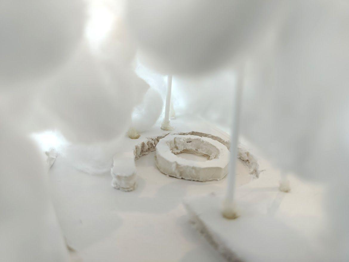
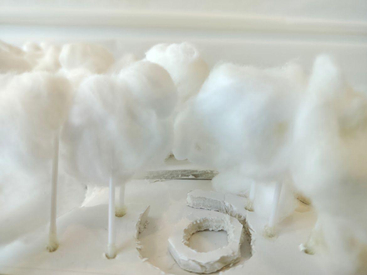
Eye-Level Scenes from Models #2
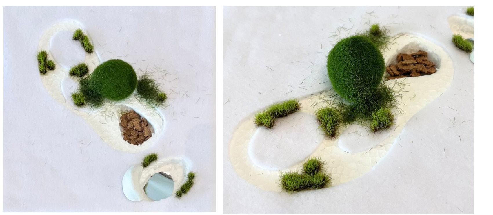
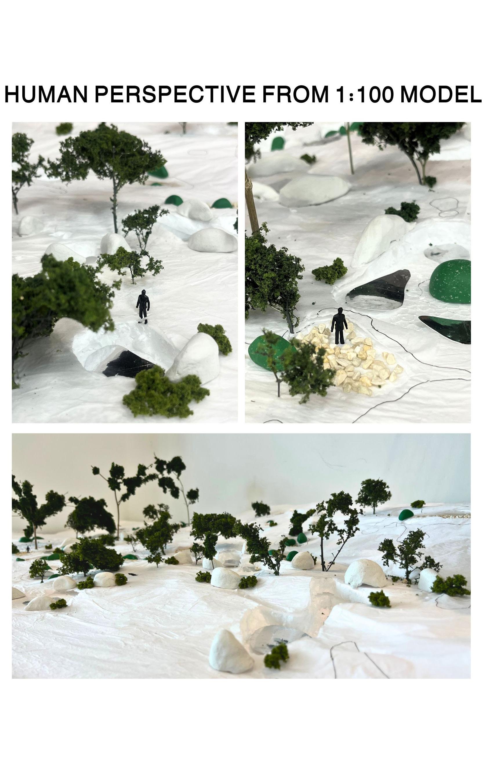
Here are more close-ups on my 1:100 model, together with photos taken from the human perspective (both within the intervention and from the Nasi Ulam sidewalk).
On the bottom left, I have included a pair of detailed models on how the vegetation in my intervention would proliferate overtime. This helps to visualise what I drew in the earlier 3 sections.
LAD2006 BLA Studio: Design 3 AY 2024-25, Semester 1
Transmutable Terrains
Fostering spontaneity in existing landscapes
Studio Tutor: Varit Charoenveingvechkit
Transmutable Terrains
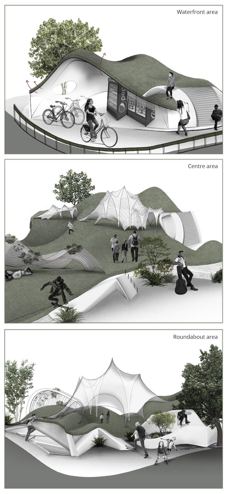
Across Clarke Quay and its surrounding districts, the elevation in landscape varies greatly. This is not only attributed to the uneven natural terrain, but also to manmade infrastructure of varying elevations. Artificial levels are juxtaposed against the natural topography of the area, facilitating its mixed land use and heavy human traffic. One cannot help but wonder if the diversity of pathways represents the intermingling needs of demographics who frequent Clarke Quay. In particular, migrant workers seem to demonstrate a very imaginative response to readily available spaces – we see them putting up makeshift hammocks and laying down picnic mats on their weekend getaways, invigorating the existing site. Often populating these carpeted clearings are weeds – quiet and unassuming, yet essential to the microclimatic formation of any landscape. On these grounds, communities converge to perform separate recreational activities.
Hence, this project is inspired to leverage on multi-levelled pathways and explore the anthropological possibilities of manipulating the ground. It considers how an altered landform could inform user programming, and what surface conditions could invite native weeds to flourish. By instilling spontaneity in both hardscape and softscape, the Transmutable Terrain manifests the lighthearted spirit of Clarke Quay and welcomes all. (194 Words)
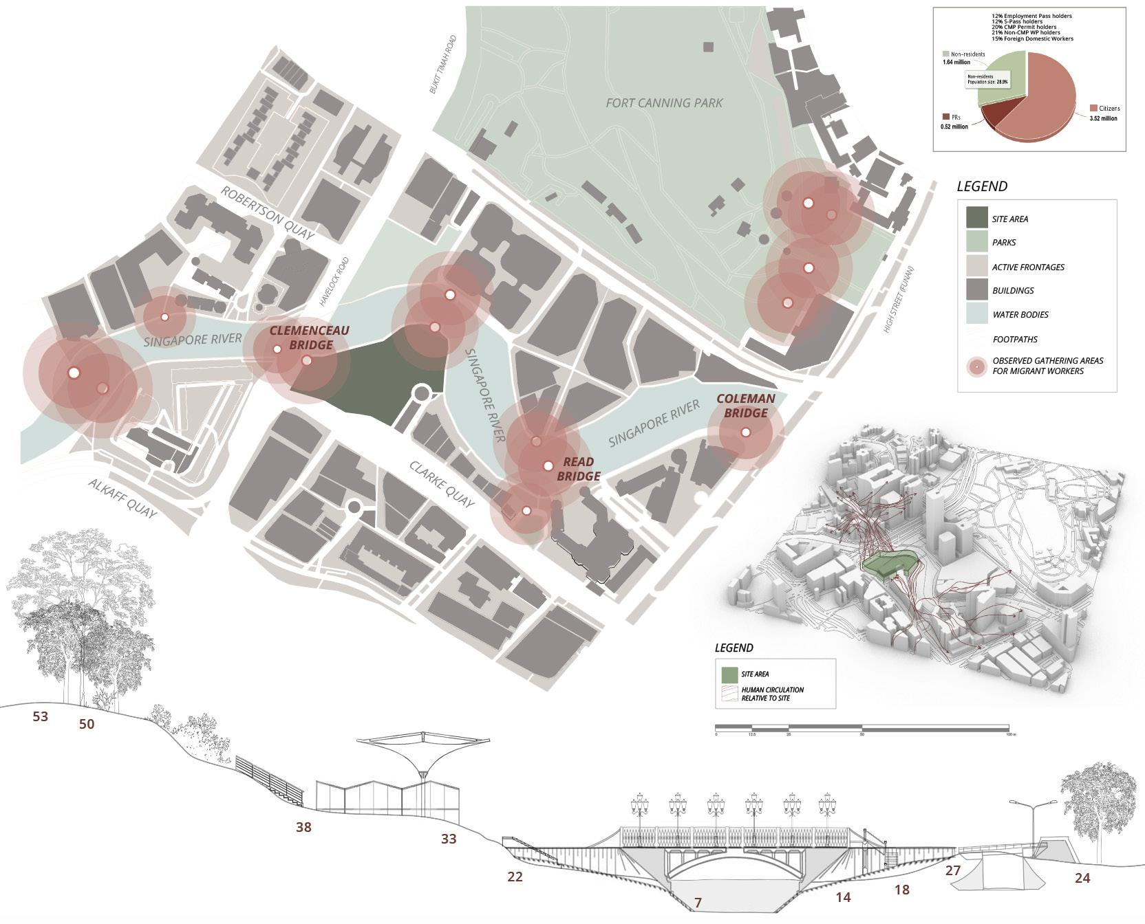
Multi-levels and Observed Recreational Behaviours
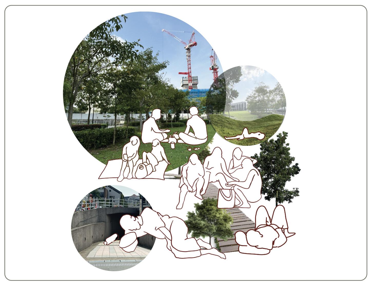
At once tranquil and liminal, the ambiguity that these multi-levelled paths create tends to encourage the user’s own imaginative use of the unclaimed space. However, more migrant workers are observed to gather at open grass patches in Fort Canning Park, as malls that cater to their consumption are far from the Clarke Quay site. Besides migrant workers, a demographic of youths and children are also commonly seen scattered around this area. How could we direct human traffic to areas in Clarke Quay where there are existing green turfs?
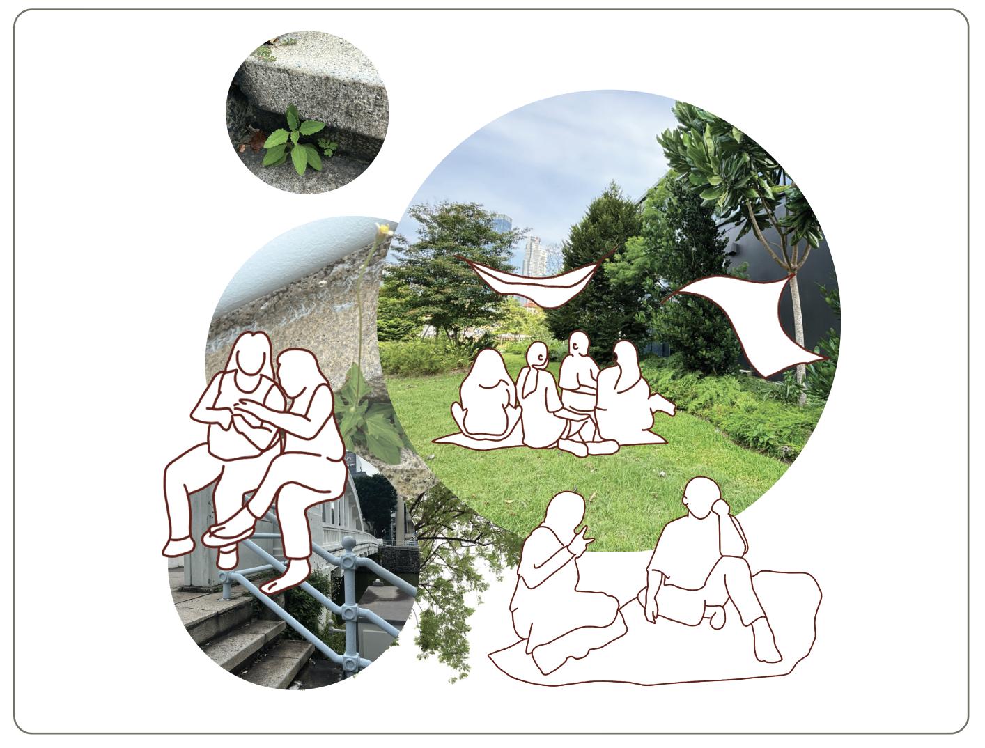
Exploration of Spontaneous Growth and Rewilding
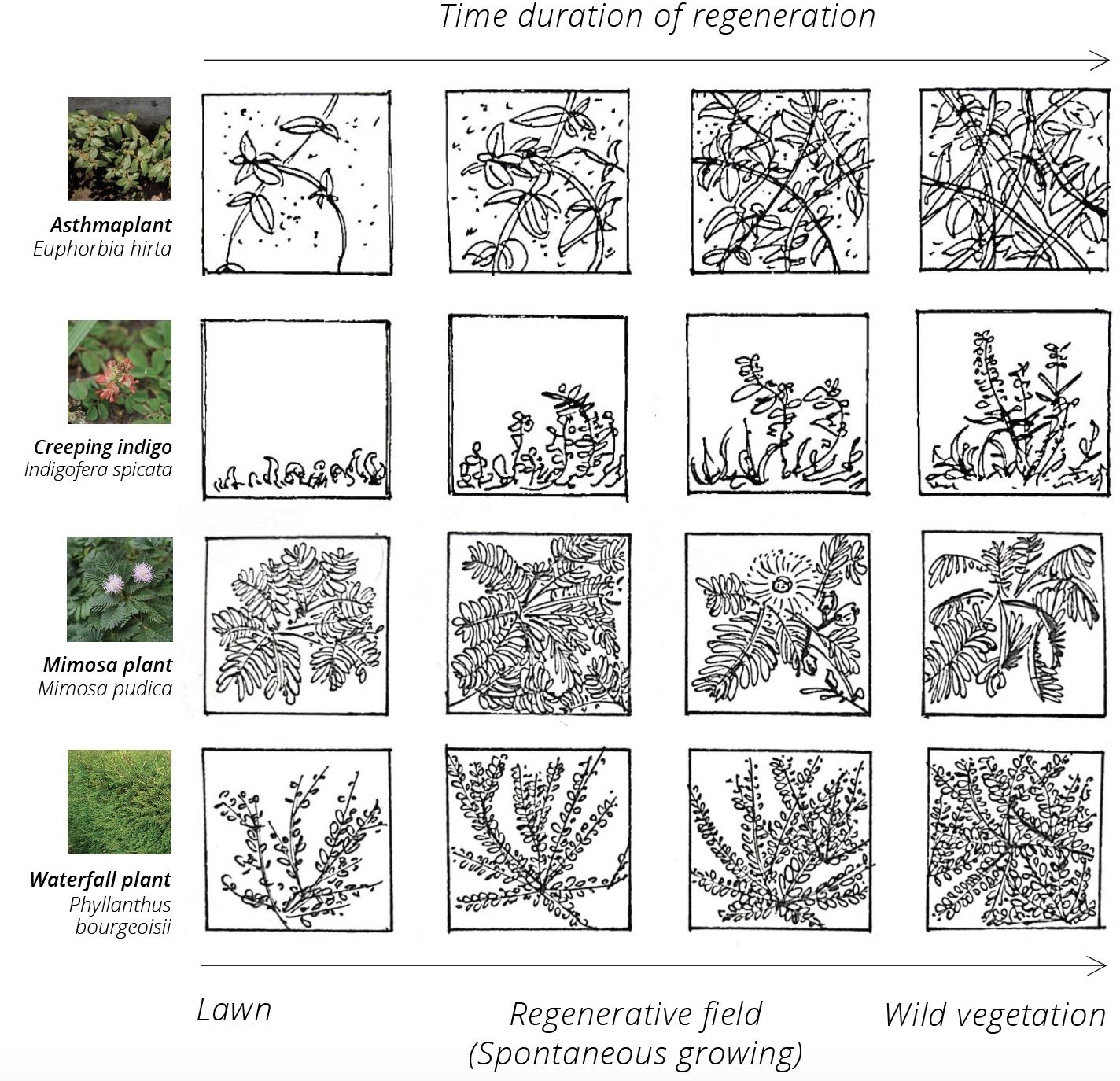
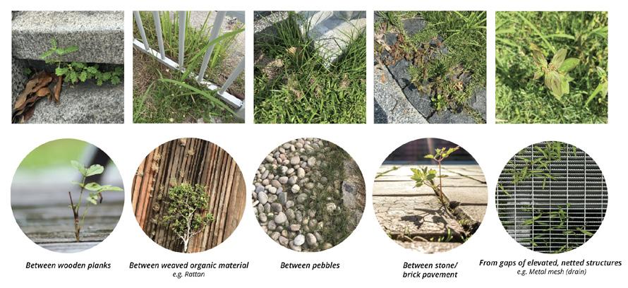
To provide better shade and cooling for users, I imagine that incorporating spontaneous growth would be helpful. From collating the plant palette on site, the weed layer seems to be underappreciated. By allowing them to proliferate without much pruning, the softscape could resonate with the spontaneous quality of my intended design. This panel details the observed growth patterns and ground materials for weeds to thrive, in addition to projected growth of four weed species over time.
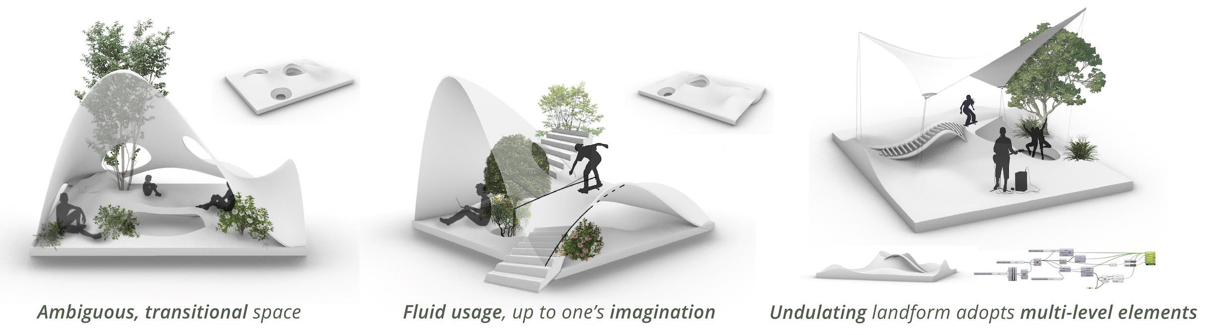

Prototyping Transitory Spaces
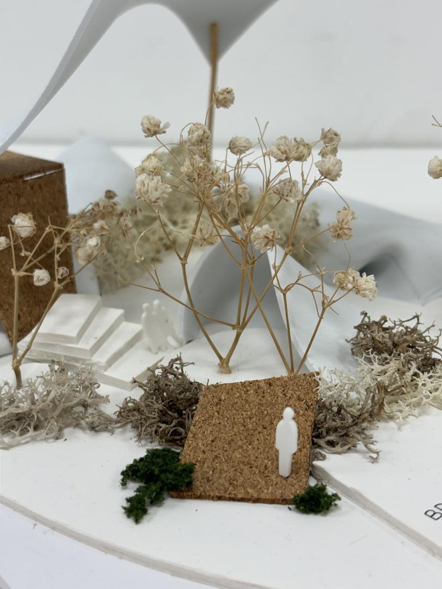
I began experimenting with possible alterations in the landform using Rhino and Grasshopper. These forms are inspired by the makeshift cloth hammocks and waterproof tarps that migrant workers would put up to shield against natural weather and make the open-air environment more comfortable for themselves. I enjoyed how malleable yet impervious this structure is – it appears simple, but serves a practical purpose that allows users to be self-sufficient. The idea of planting weeds, in order to connect the landform with the overhead shelter, is also being entertained.
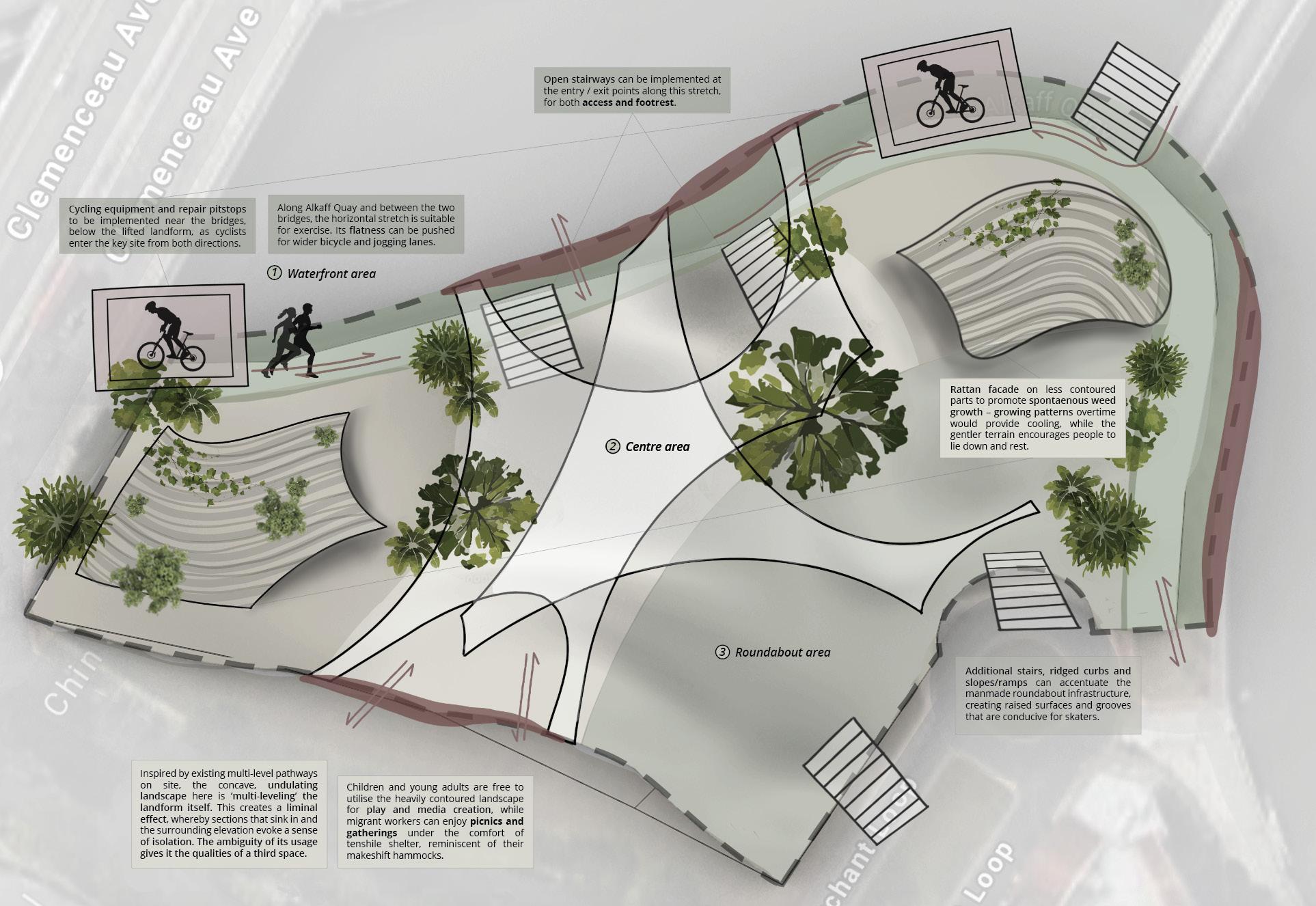
Zoning and Circulation Diagrams
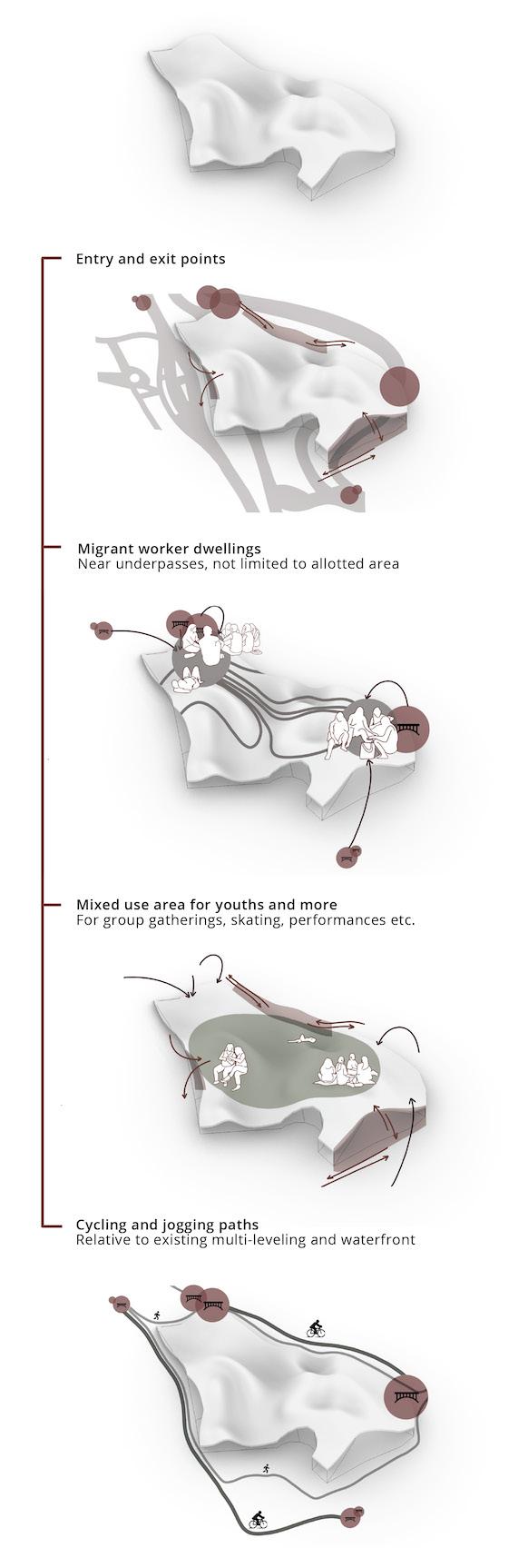
As the select site is underutilised in terms of community engagement, my primary goal is to transform the land into a multi-modal space that embraces the different user demographics. The monolithic, undulating landform is not arbitrary – people tend to congregate in lower areas (valleys), while preferring to isolate themselves in higher areas (hilltops). We arrive at a morphological landscape whereby zoning is physical surface driven. The user programme is enabled by the surface and its textures.
Perspective
Views and Material Details
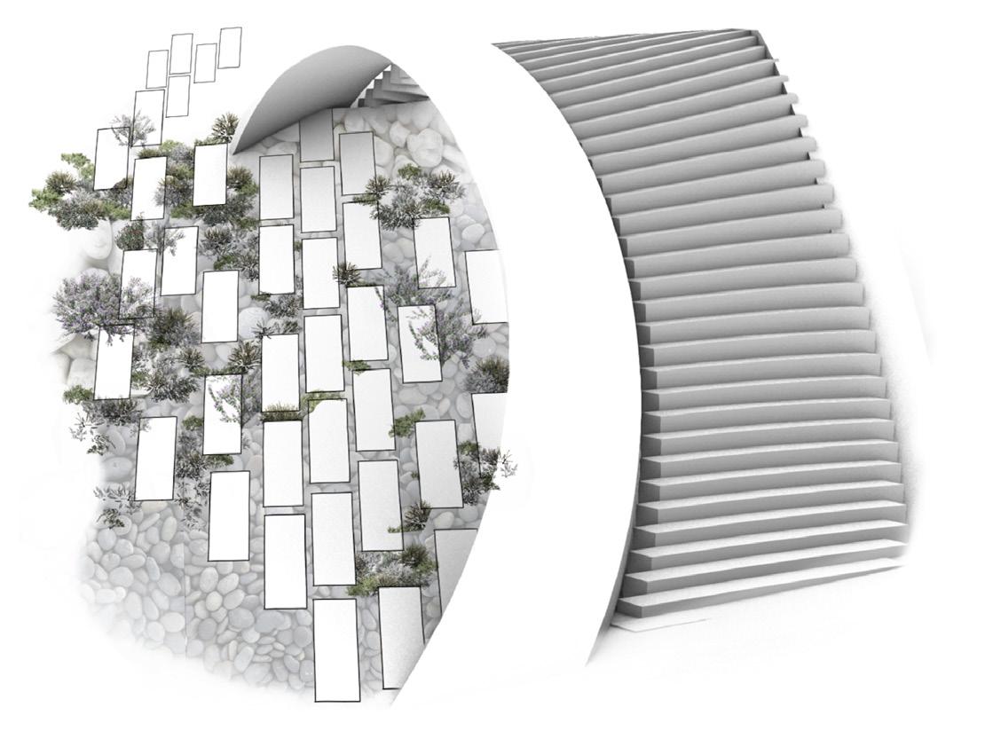
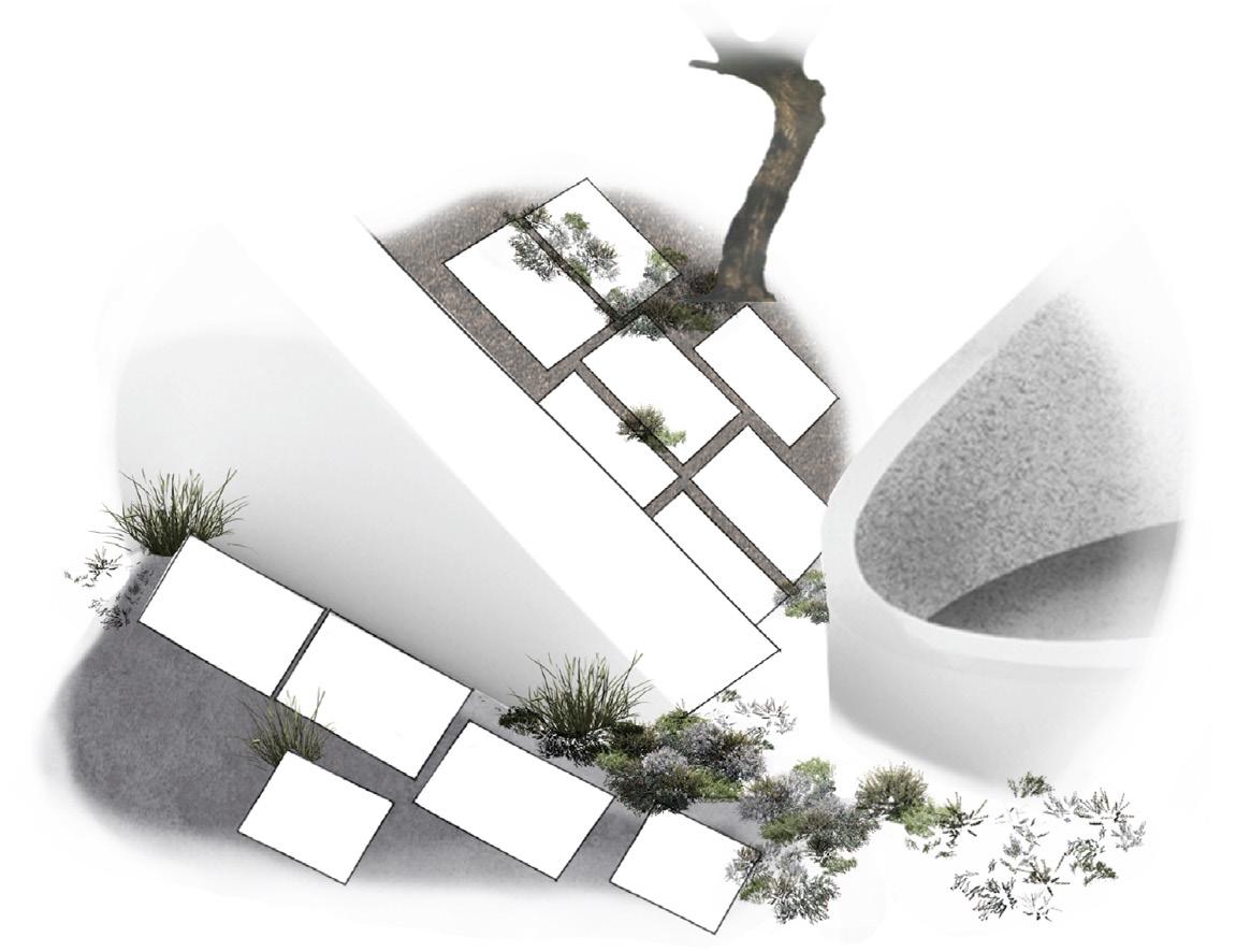
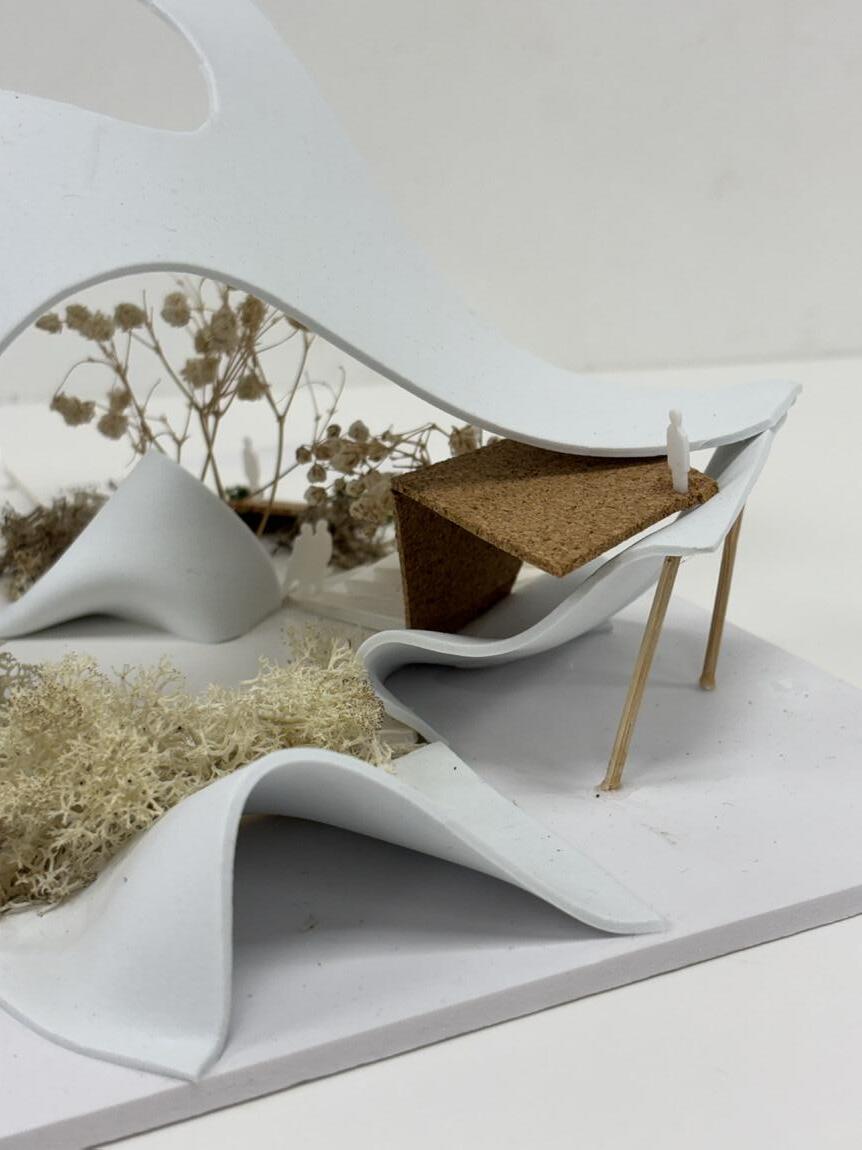
Surface materials that allow indigenous growing to take place, as previously catalogued, are now incorporated in how the hardscape transitions into the softscape. In designing the “gaps”, existing weeds in the site area will be introduced into cracks and crevices of the softscape, as enabled by pavement panes of the same material as the hardscape infrastructure beside them. Where the hard surfaces meet the soft amplifies the transitory, mutable quality of the landform itself, while also cushioning the lower areas where people tend to gather.
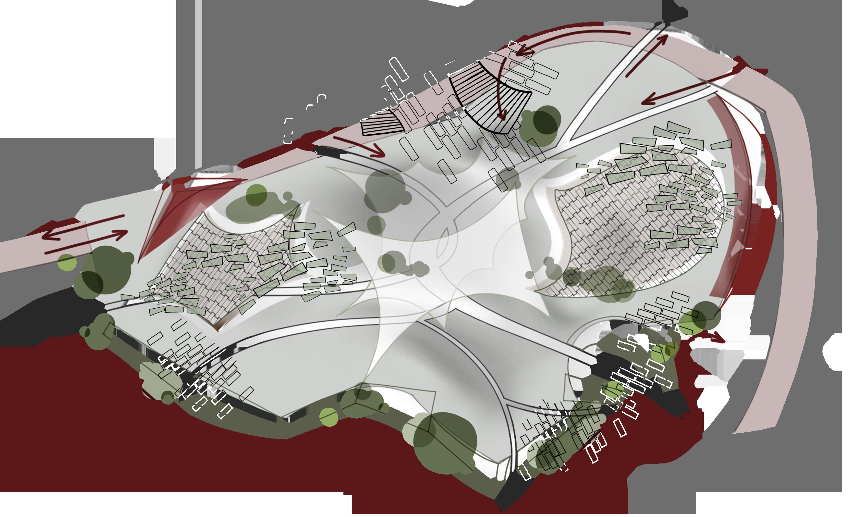
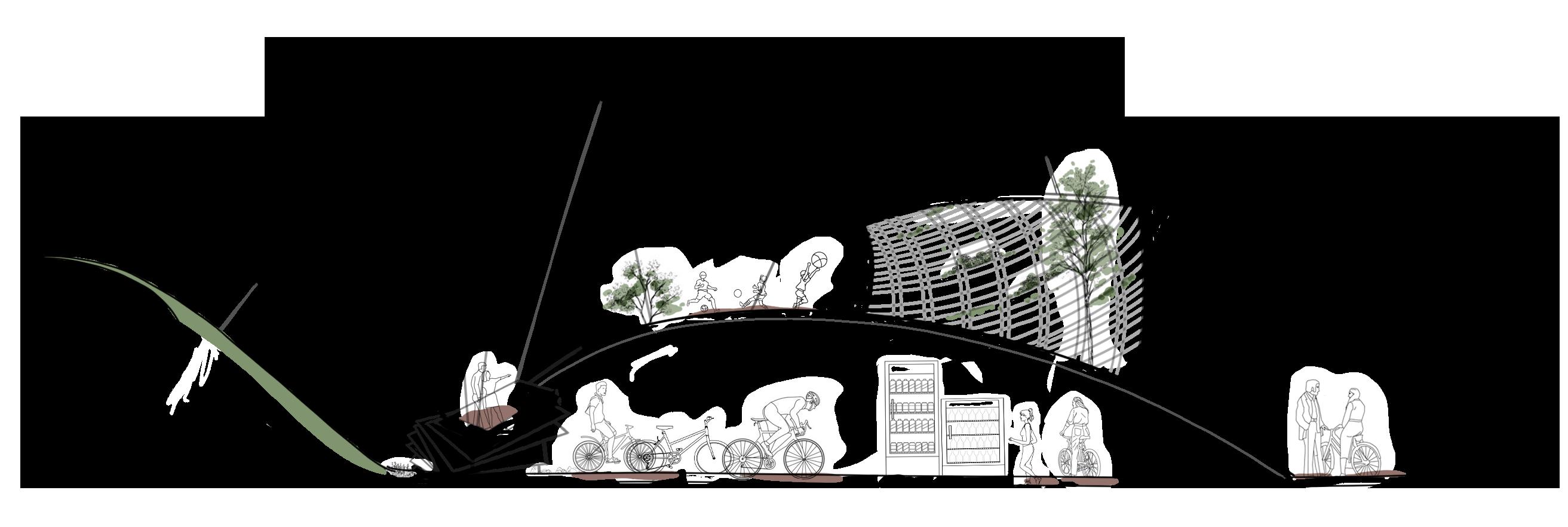
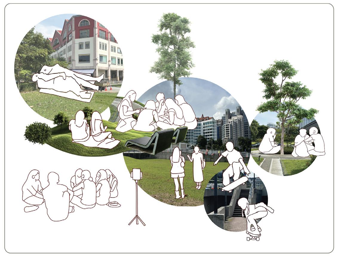
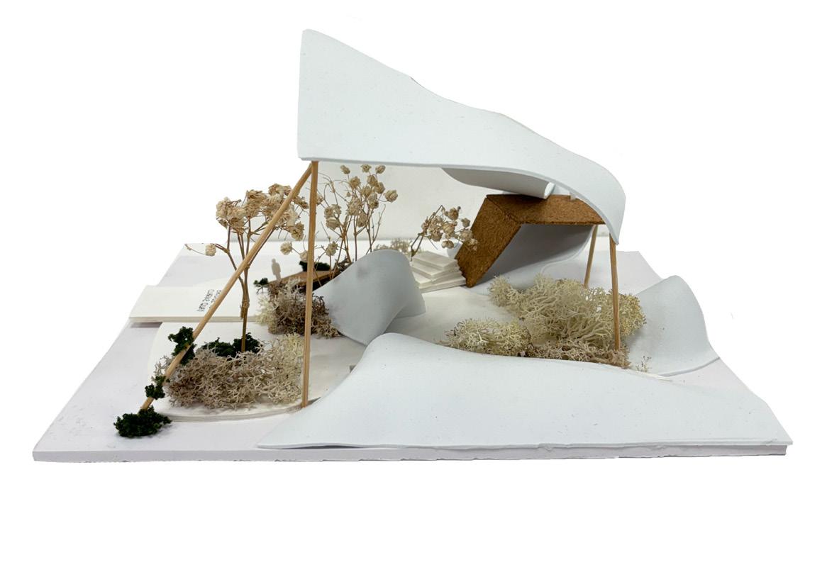
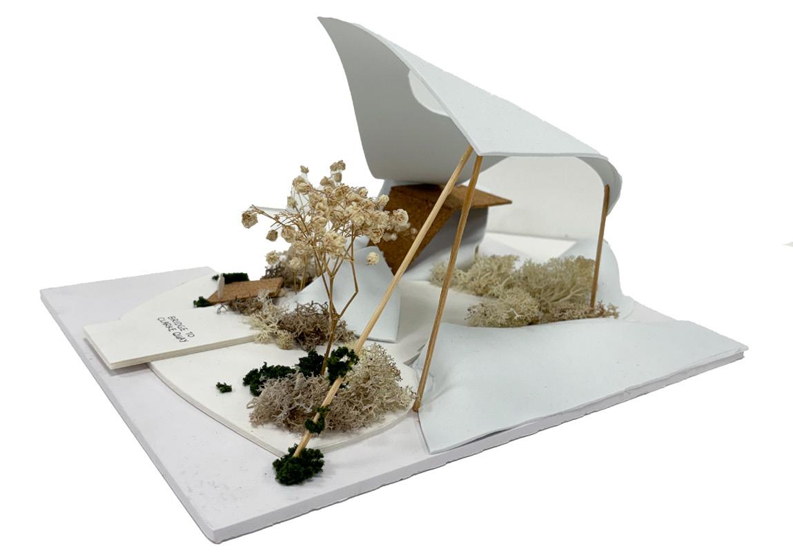
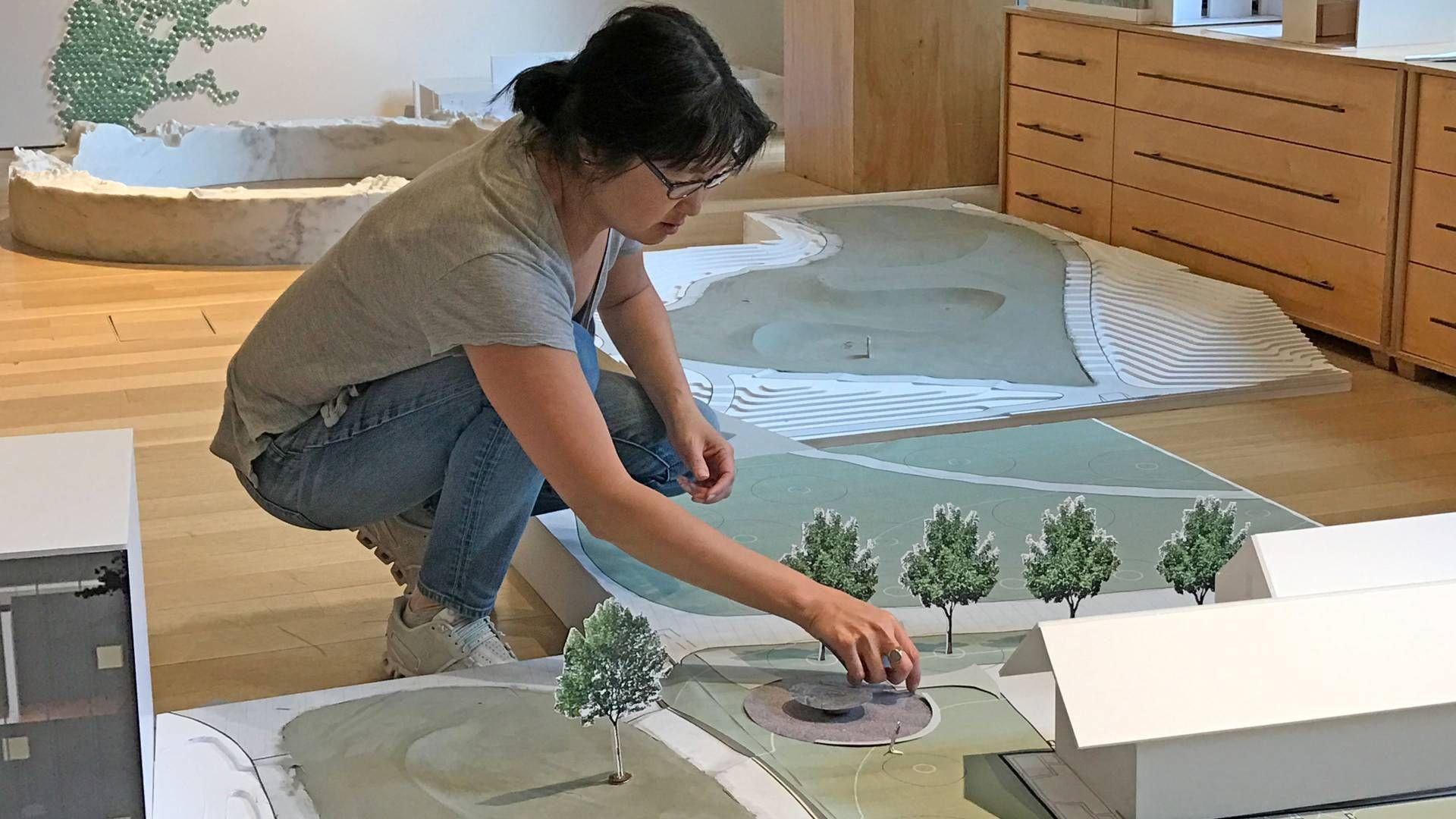
Final Plan, Section and Elevated View
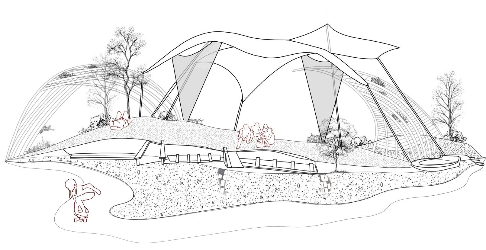
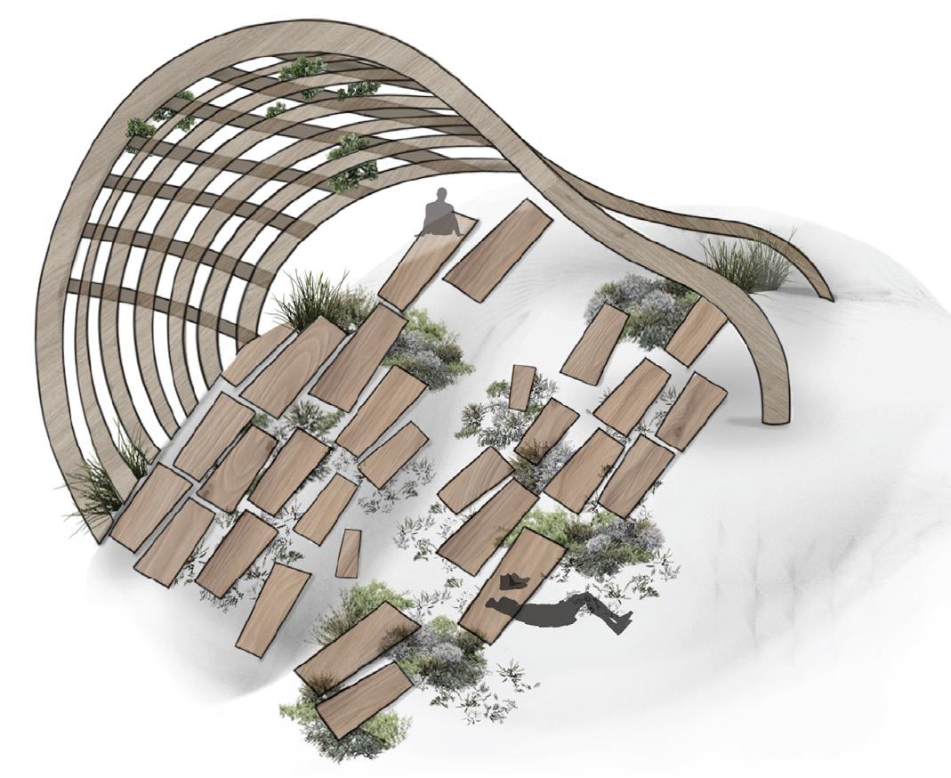
The surface programming works towards the coexistence of hardscapes and humans. For instance, the middlemost zone employs grass to create a comfortable soft surface, allowing people to lie on slopes or place mats on the open ground. As per works like Maya Lin’s Wave Field, the earth is activated for passive activities. Weaved wooden shelters are placed above the gentler mounds to encourage rest. This is in contrast with the hard concrete surfaces and and gravel in the third zone, as these are more durable materials that promote walkability, preferred by skaters.
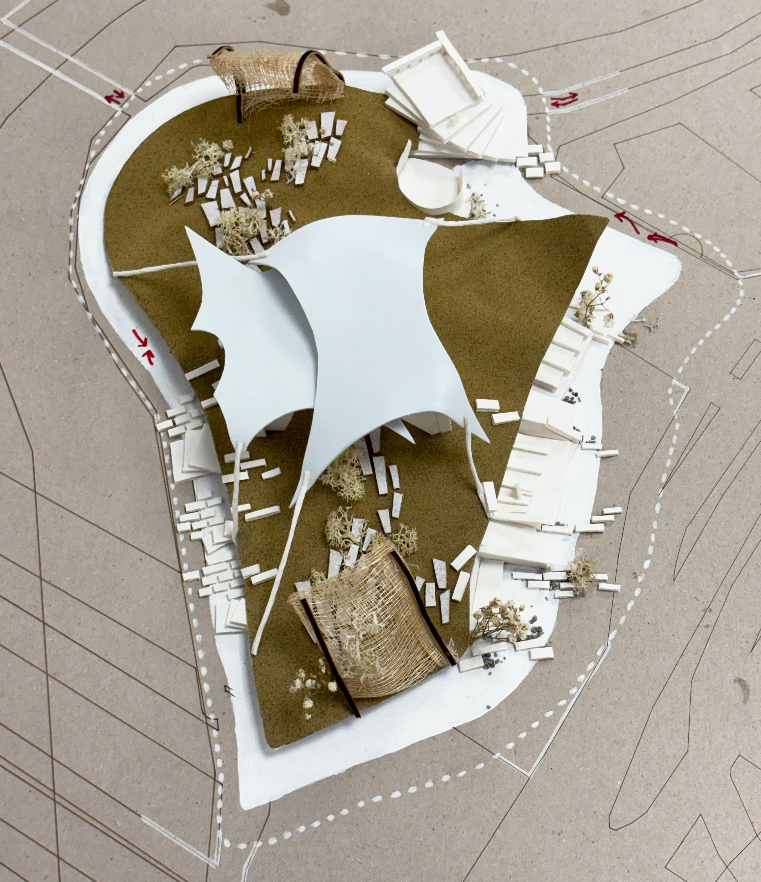
The base of this model is created via 3D printing to capture its specific undulating quality. The various zones contain different elevations and materials, all gathered from Clarke Quay but transformed into one collective singularity. Organic materials like grass and wood cater to rest and communal conversations, while harsher, artificial materials like concrete and stone urge more dynamic activities. In essence, migrant workers, youths, residing families and corporate workers are all part of the textural fabric in Clarke Quay’s landscape.
Visualisation with 1:500 Model
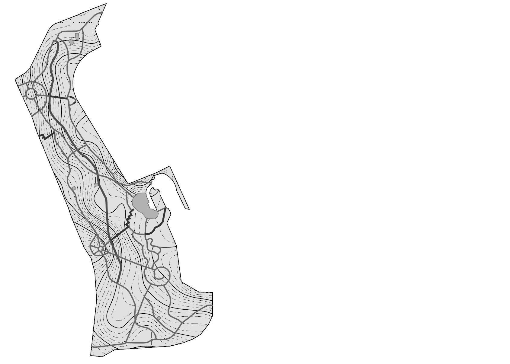
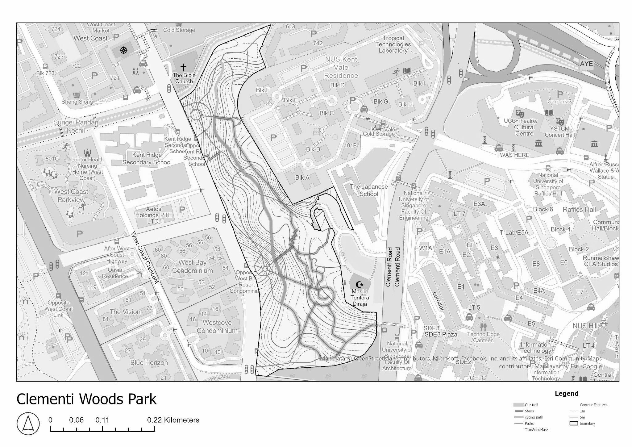
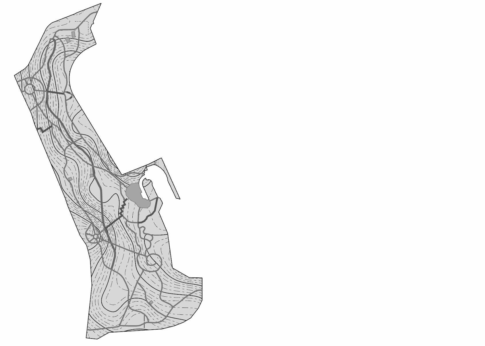
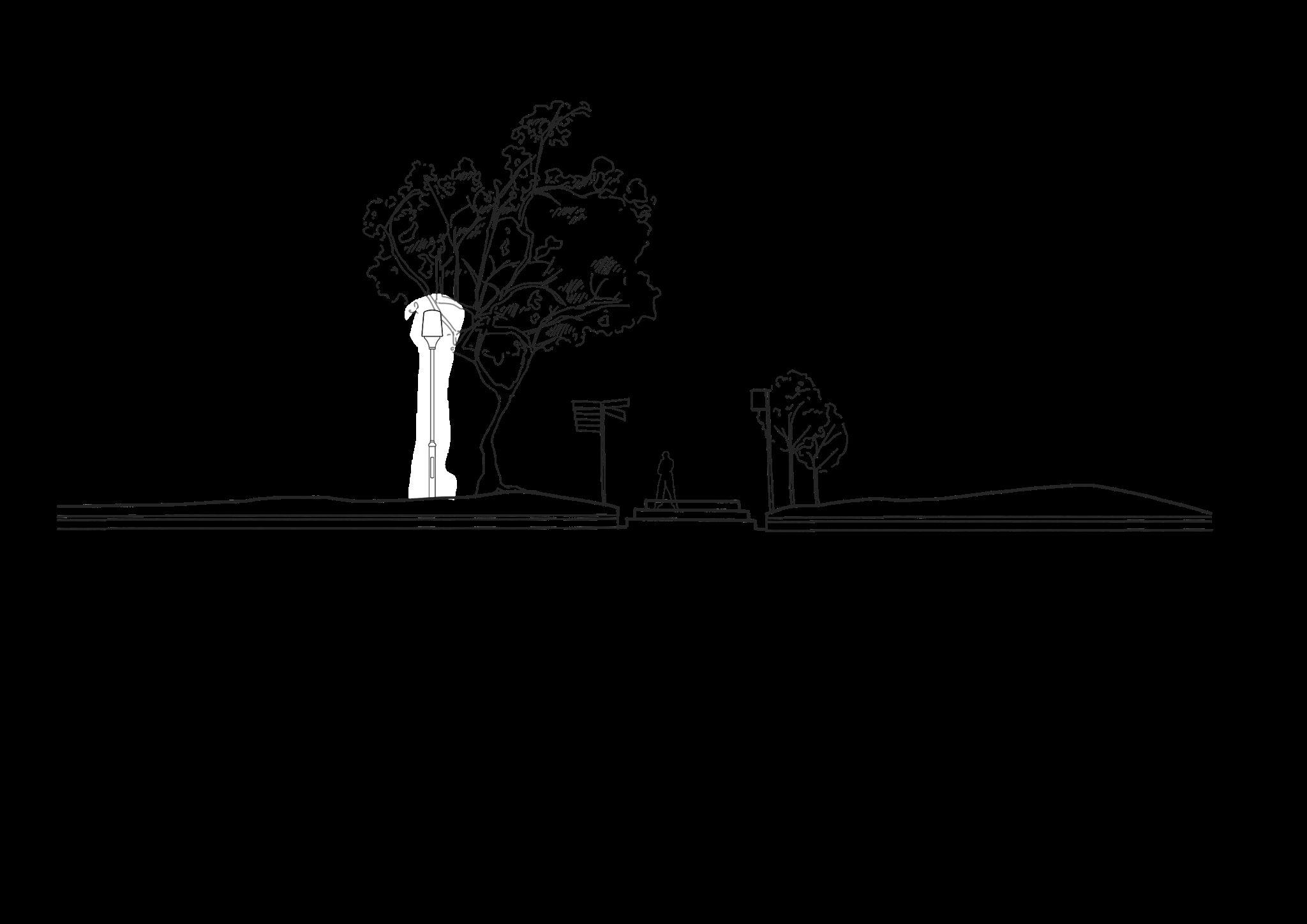
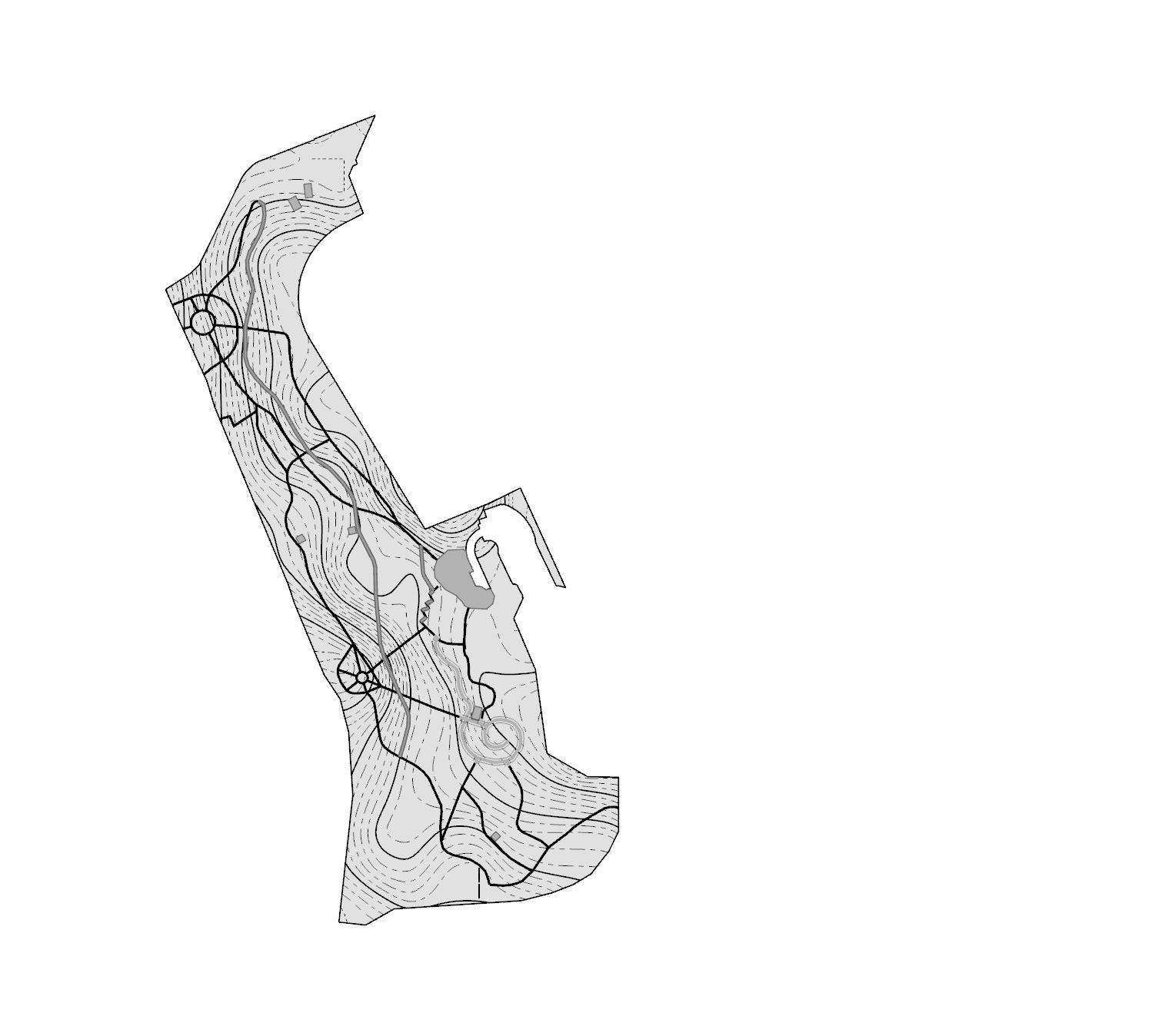
LAD2003TOPOGRAPHY EXERCISE 1
TOPOGRAPHYOBSERVATIONAND DOCUMENTATION
Group 7: Sumaiya | Wenting | Xuechun | Natasha
CONTENT
LANDFORM SYSTEM PATH SYSTEM DRAINAGE SYSTEM MATERIALITY
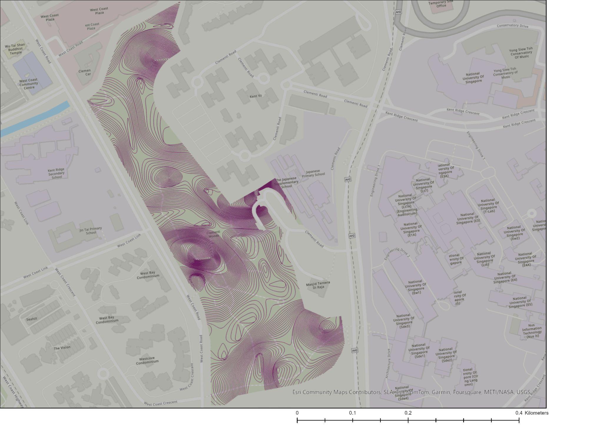
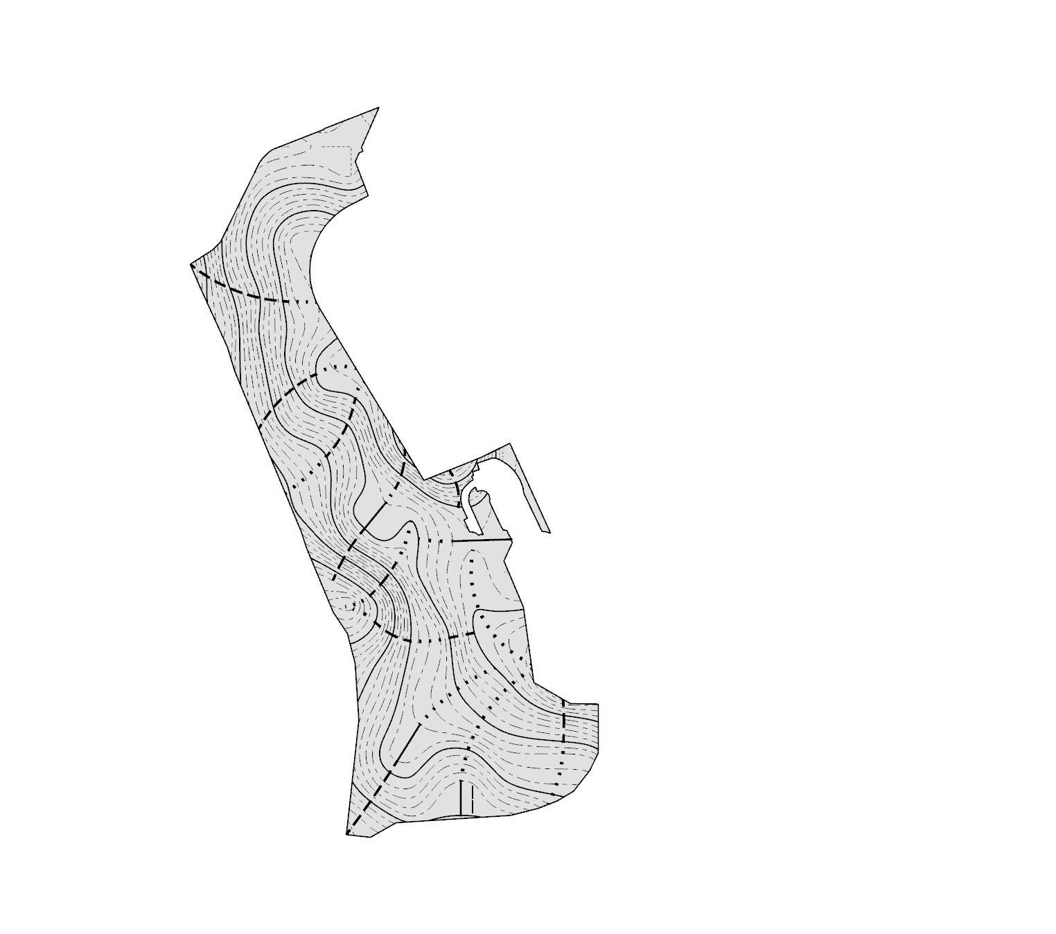
a. Landform System

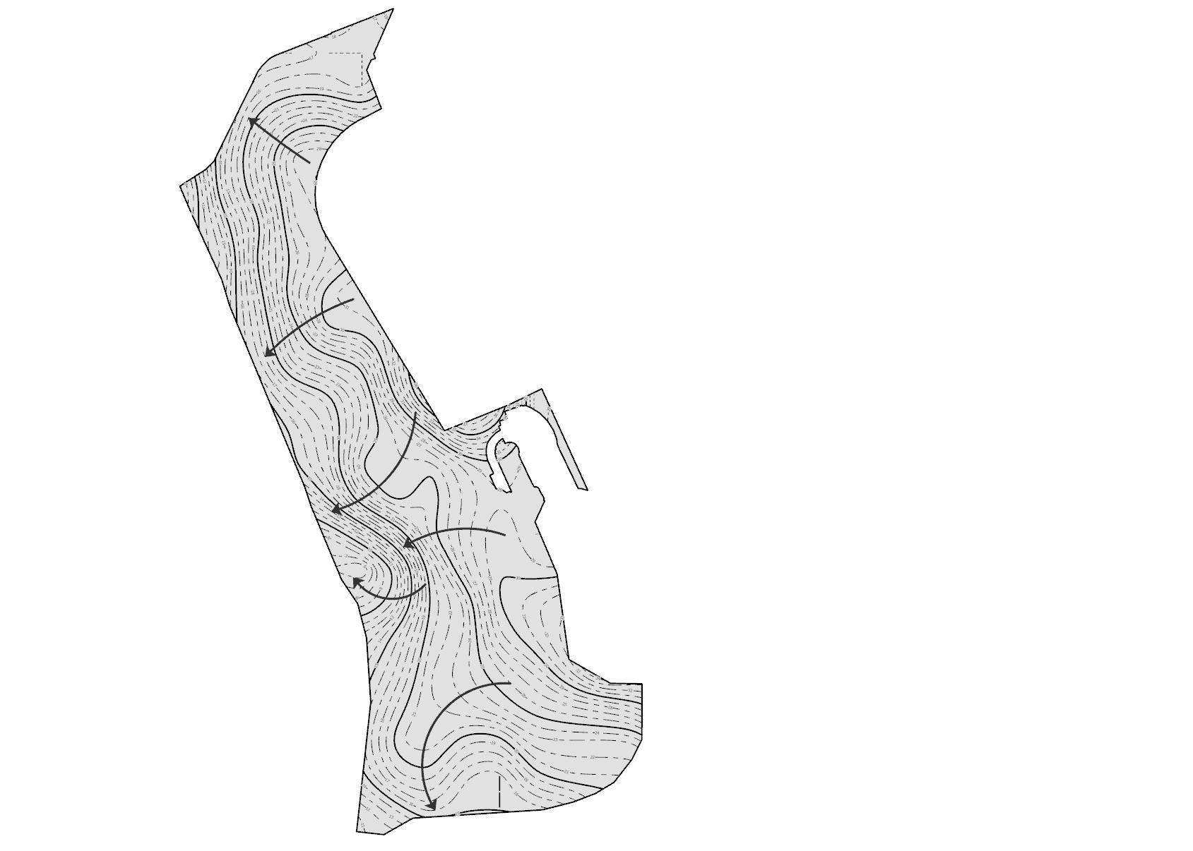


1. Concave 2. Convex 3. Depression 4. Ridge
Valley
1. Concave
2. Convex 3. Depression 4. Ridge 5. Valley
Ridge
Ridge Ridge Ridge
Ridge Valley Valley Valley Valley Depression
1. Concave Slopes


2. Convex Slopes
located near public toilet

located along the pcn walking path

earth walking path
earth walking path
keyplan
3. Ridge Slopes


4.Valleys


5.Depressions


located at amphitheatre
Located along the woodball lawn
Major depression Minor depression
keyplan
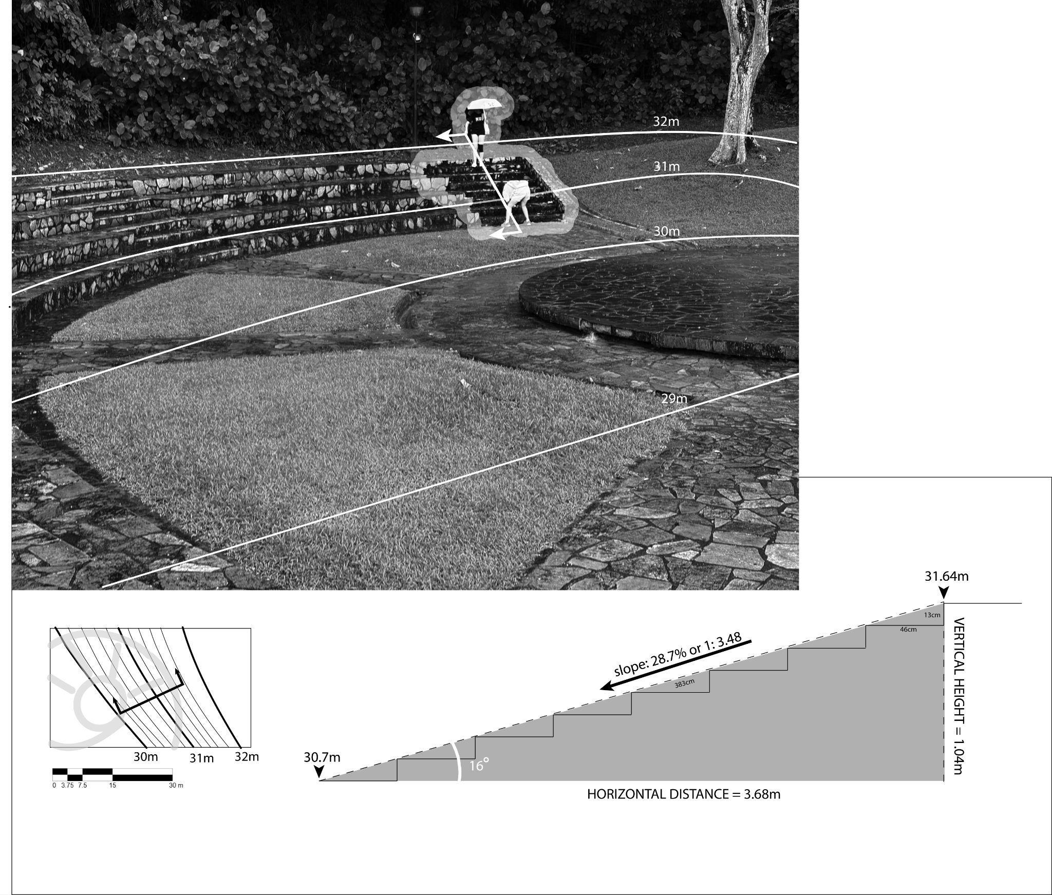
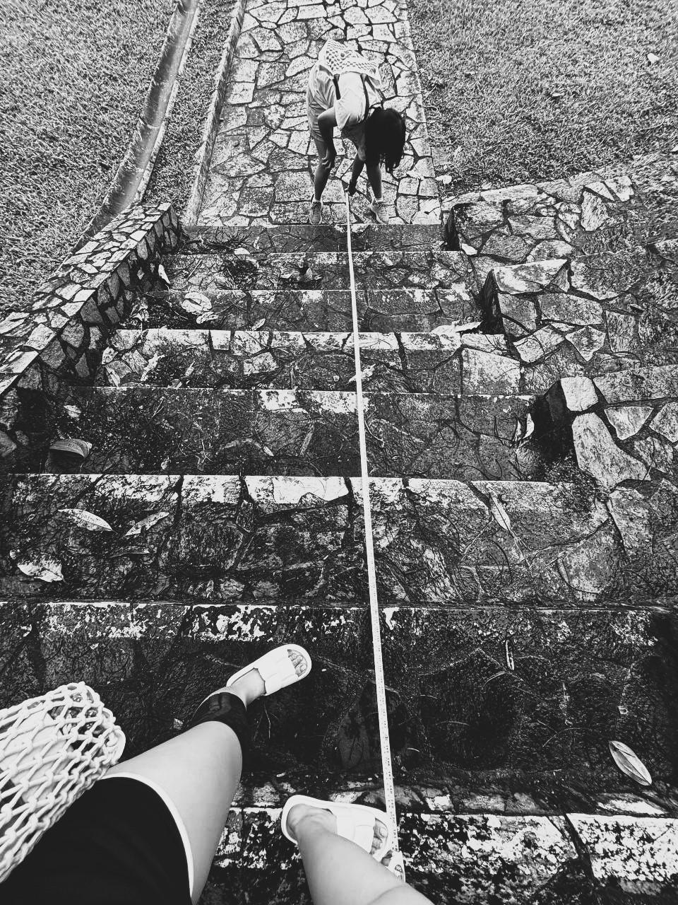
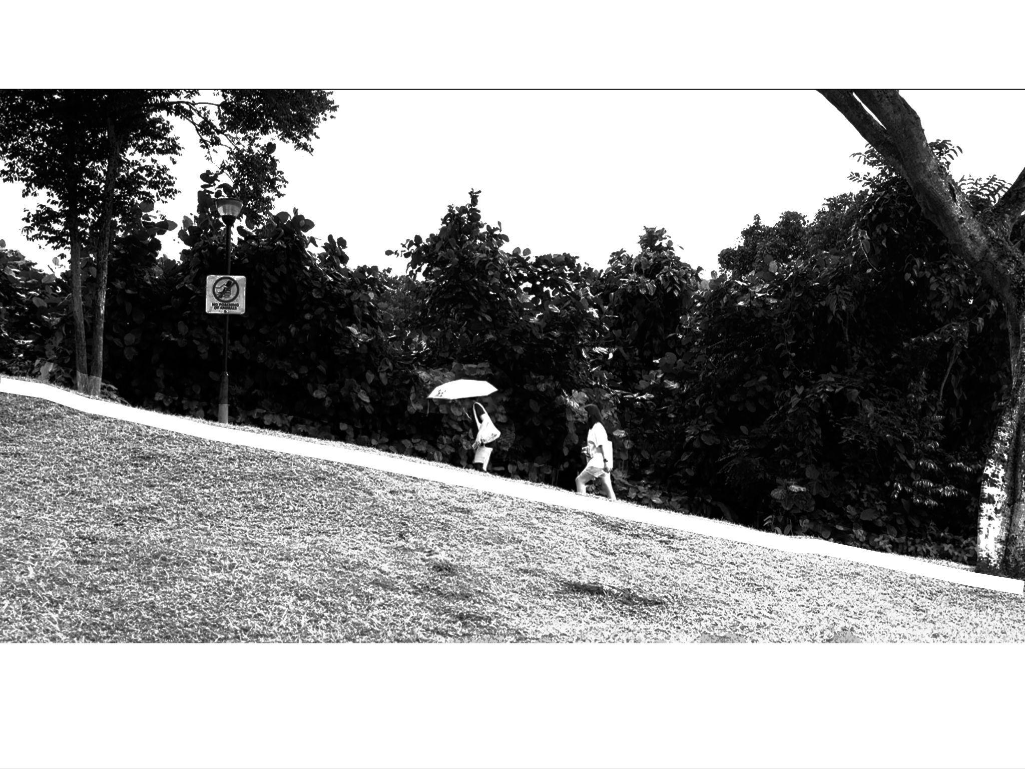
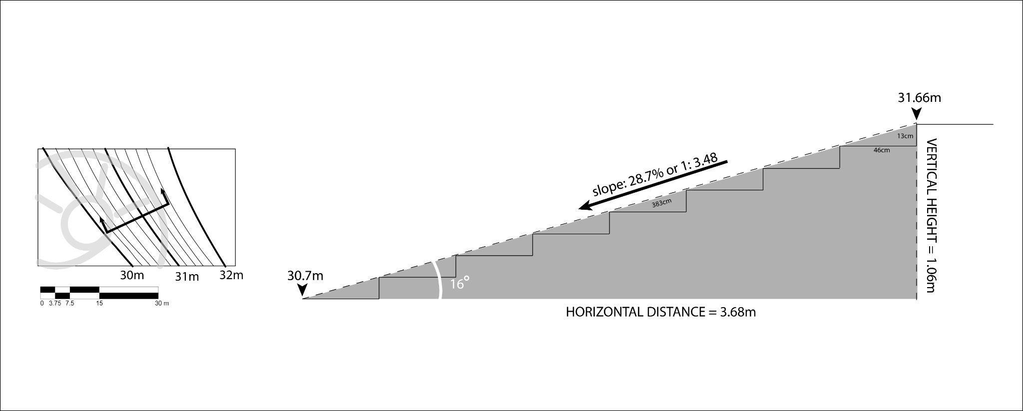
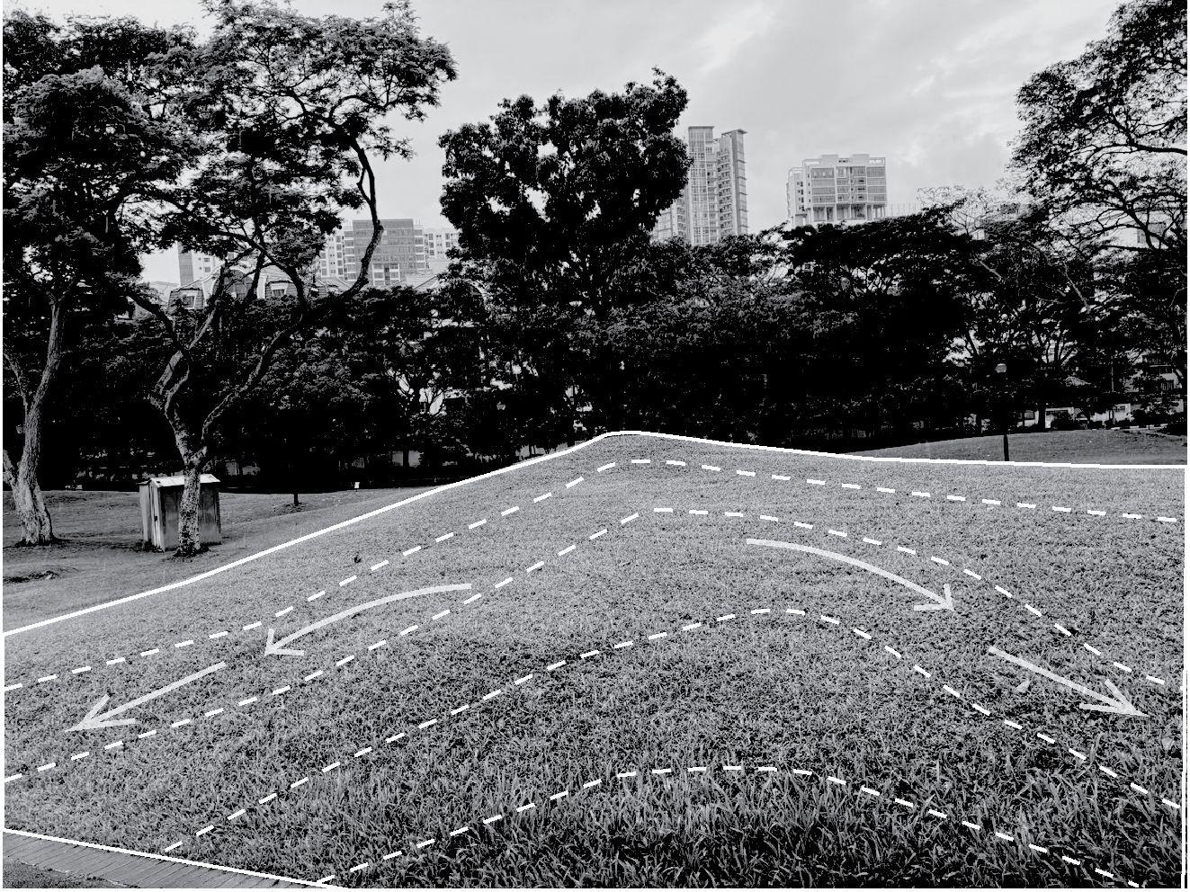
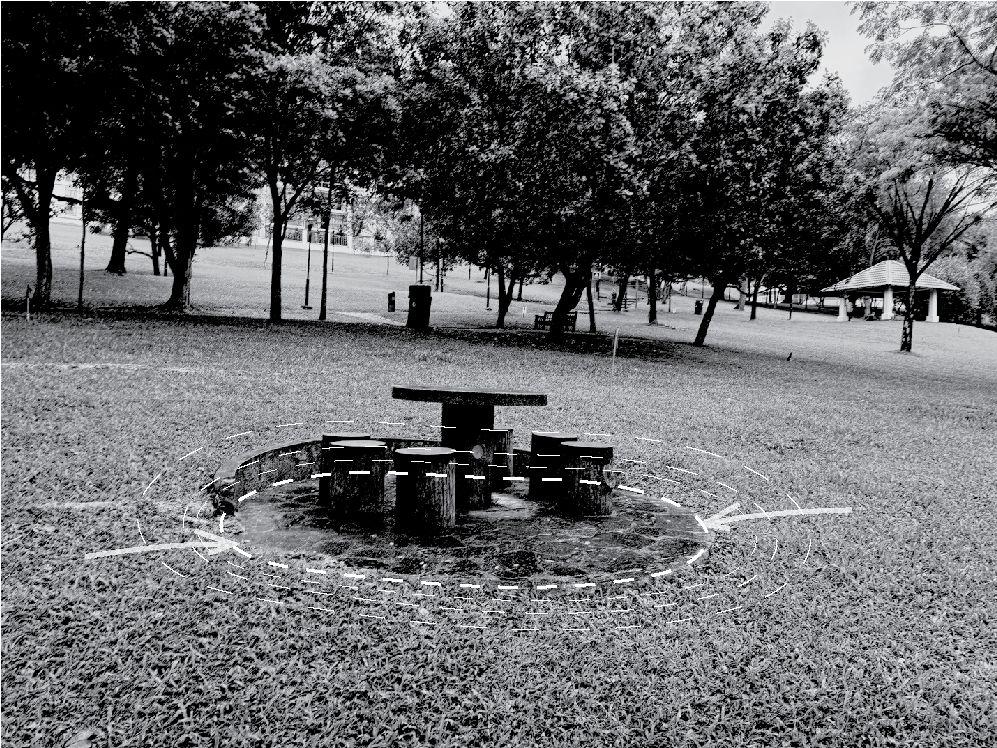
For steep slopes, hardscapes such as staircases can be utilised, especially when covering more than 1m height differences within a short horizontal distance.This steep slope is located at the depression of the ampitheatre.

keyplan
Medium scale
1.Steep
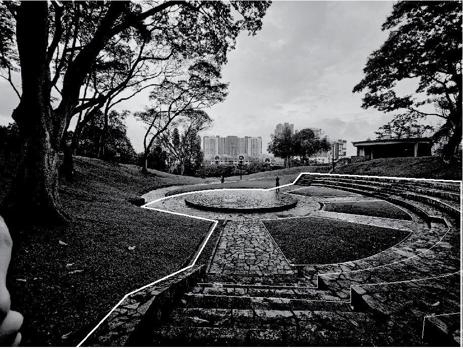
a. Steep slopes are observed closest to the amphitheatre. Stairs leading down to the amphitheatre form an irregular elliptical shape, winding downwards into the concrete centrepiece.The natural terrain helps the sound transmittance within the amphitheatre.
b. In between stairs and staircase landings, lengths of planted green turfs are observed. Alternating between hardscape and softscape provides a sense of contrast, which helps to diversify human activity around the amphitheatre and reduce the artificiality in the park.

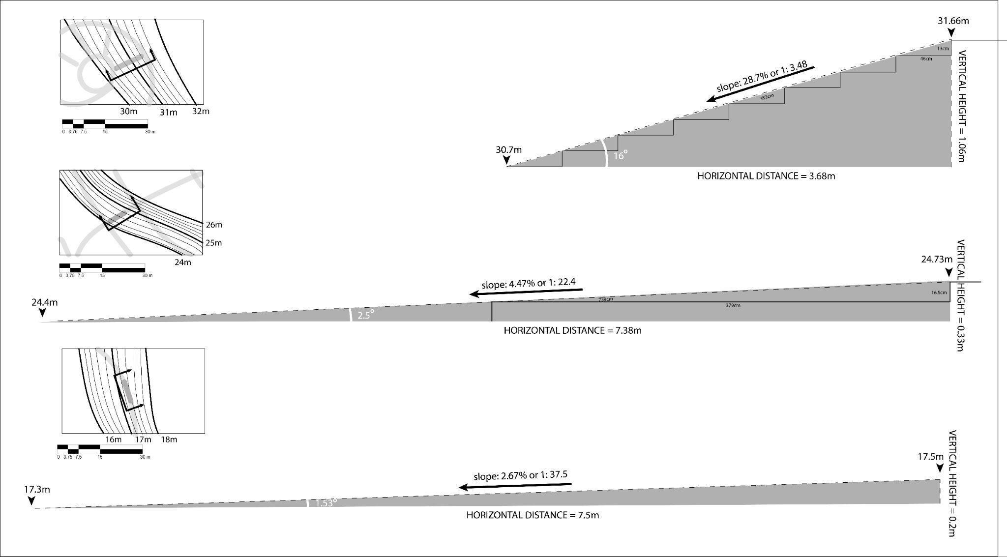
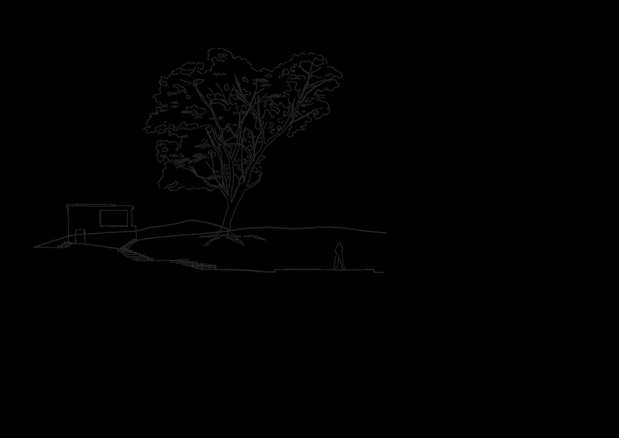
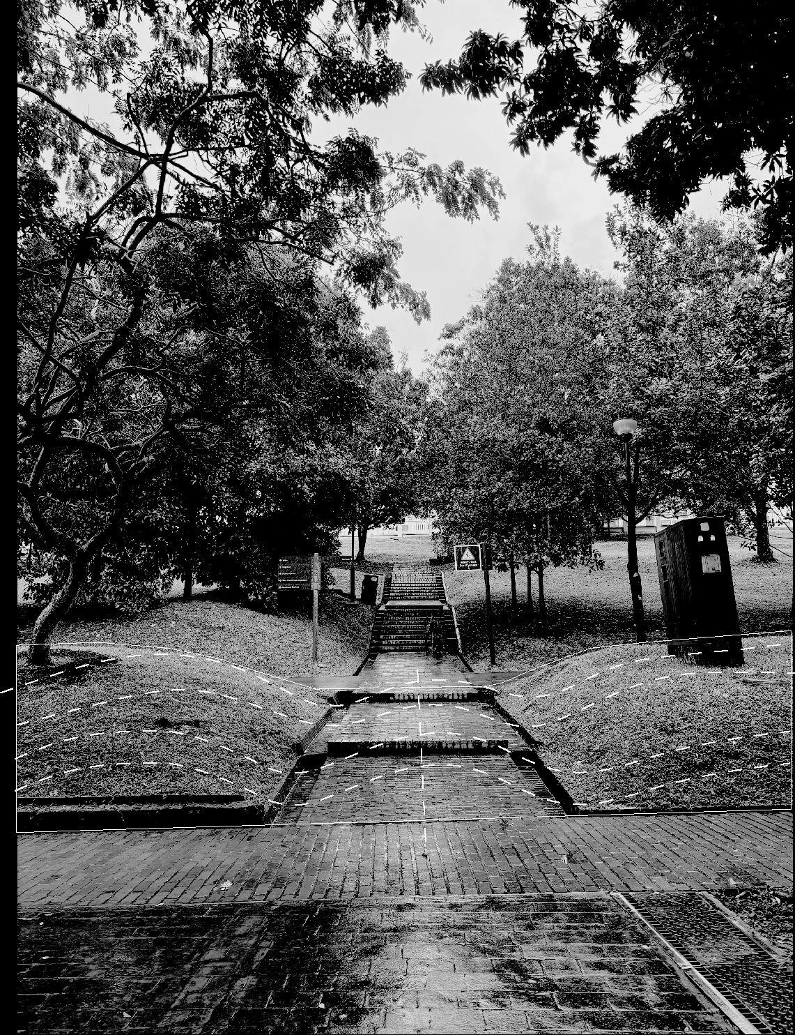
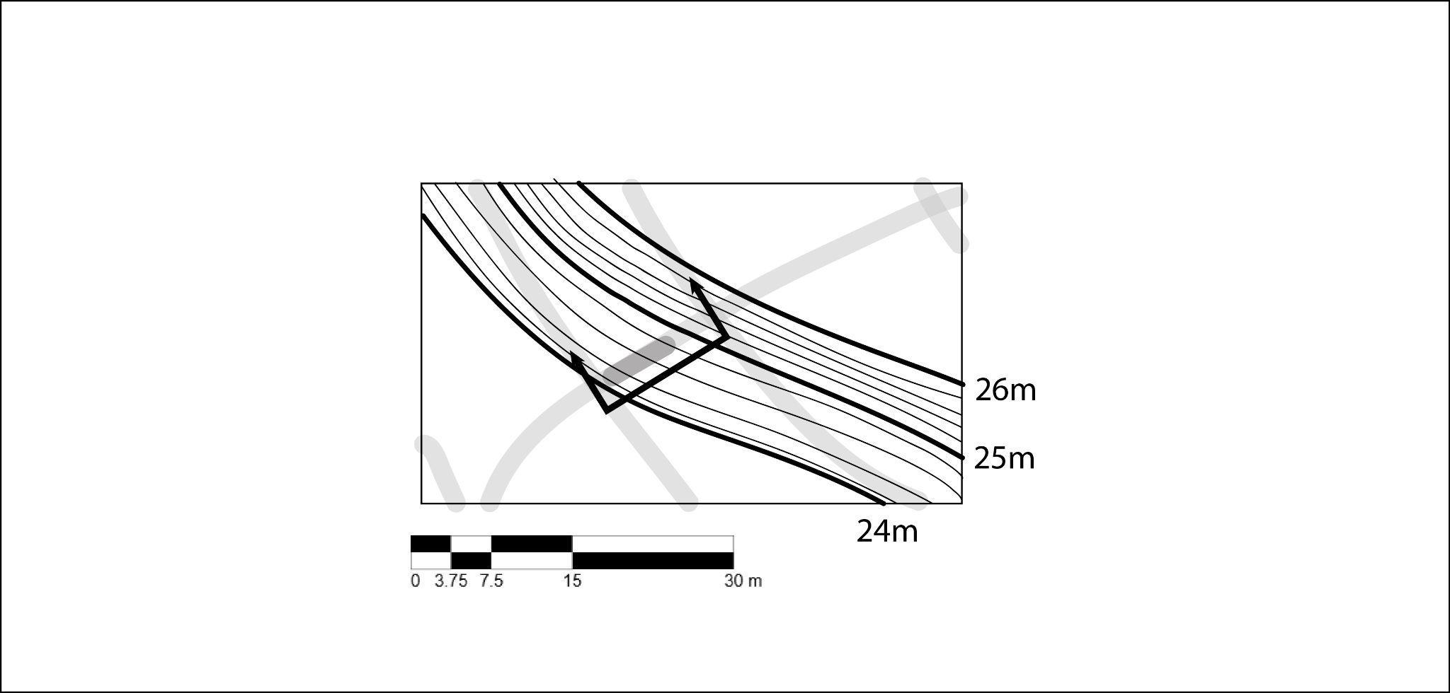
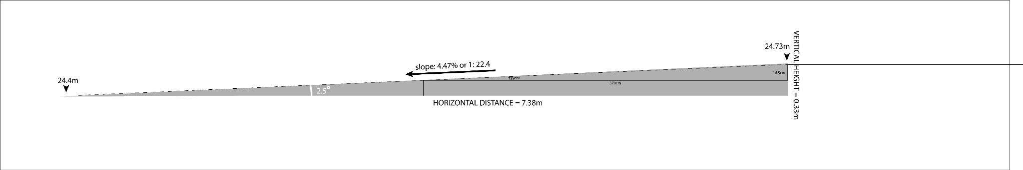
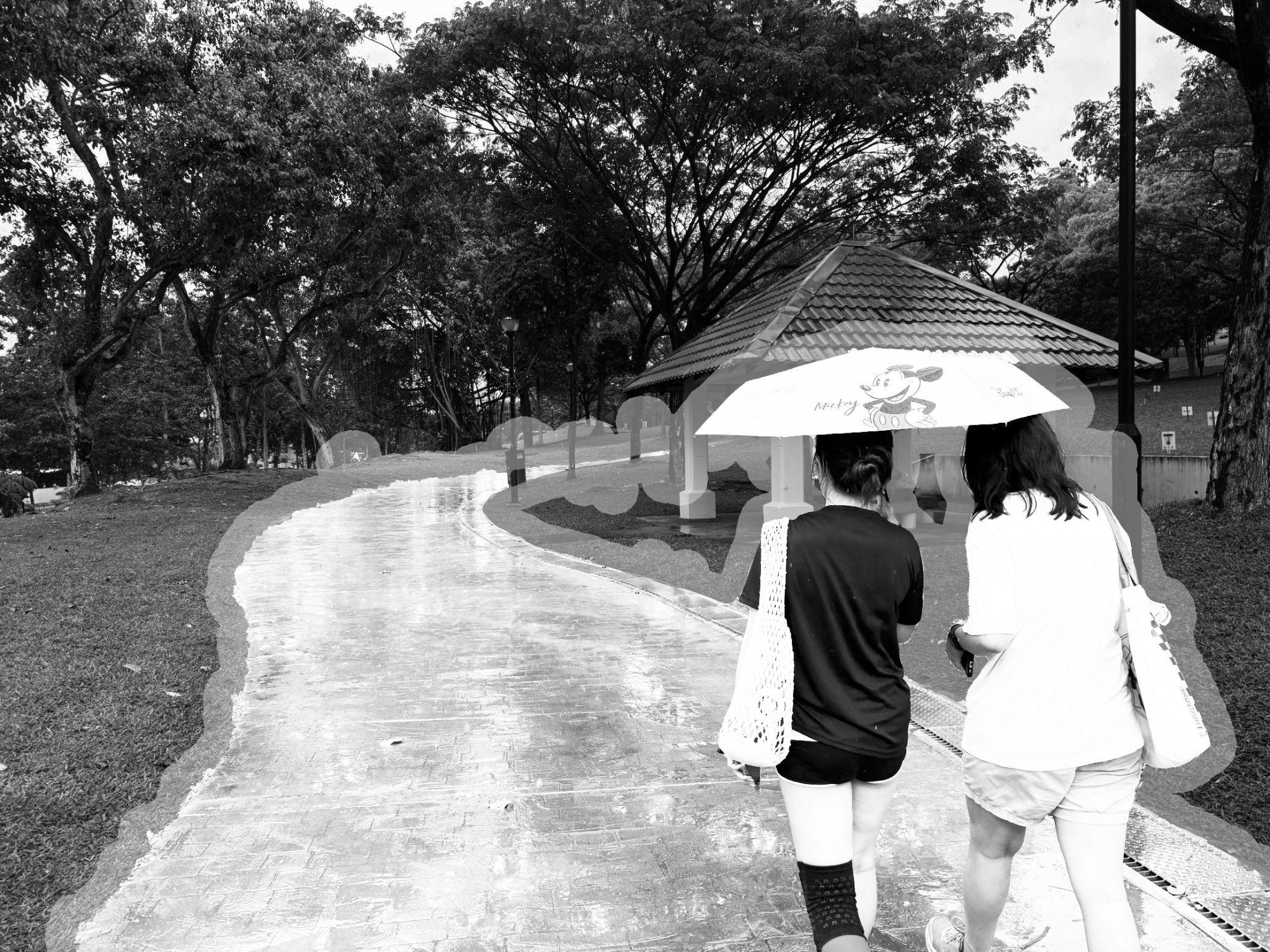
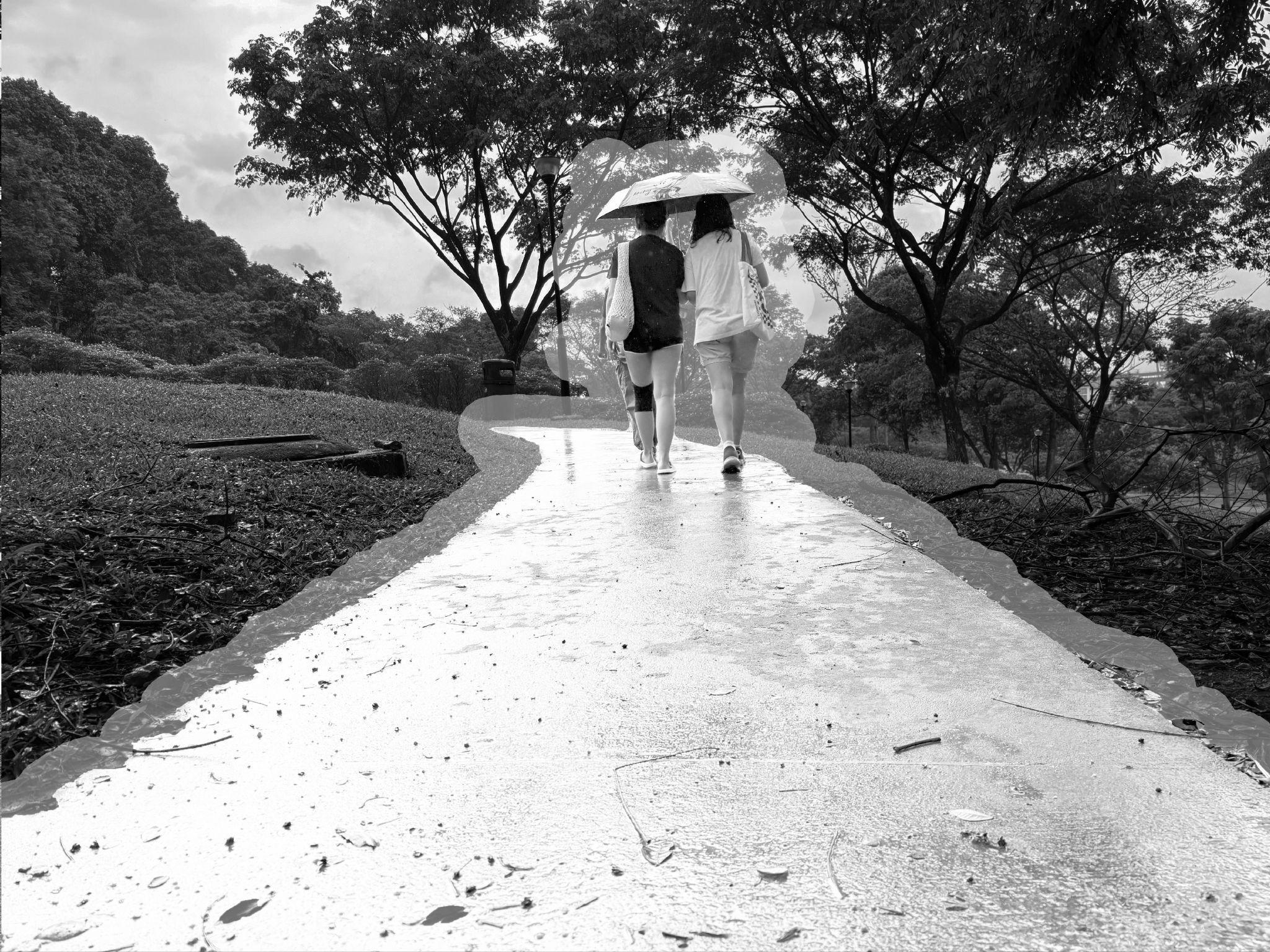
For gentle slopes, staircases with a proportionally larger step can be utilised, especially when covering less than 1m height differences within a longer horizontal distance.Achieved by hardscapes, the valley and the gentle slopes were constructed and looked vastly different from its natural topography.
2.Gentle
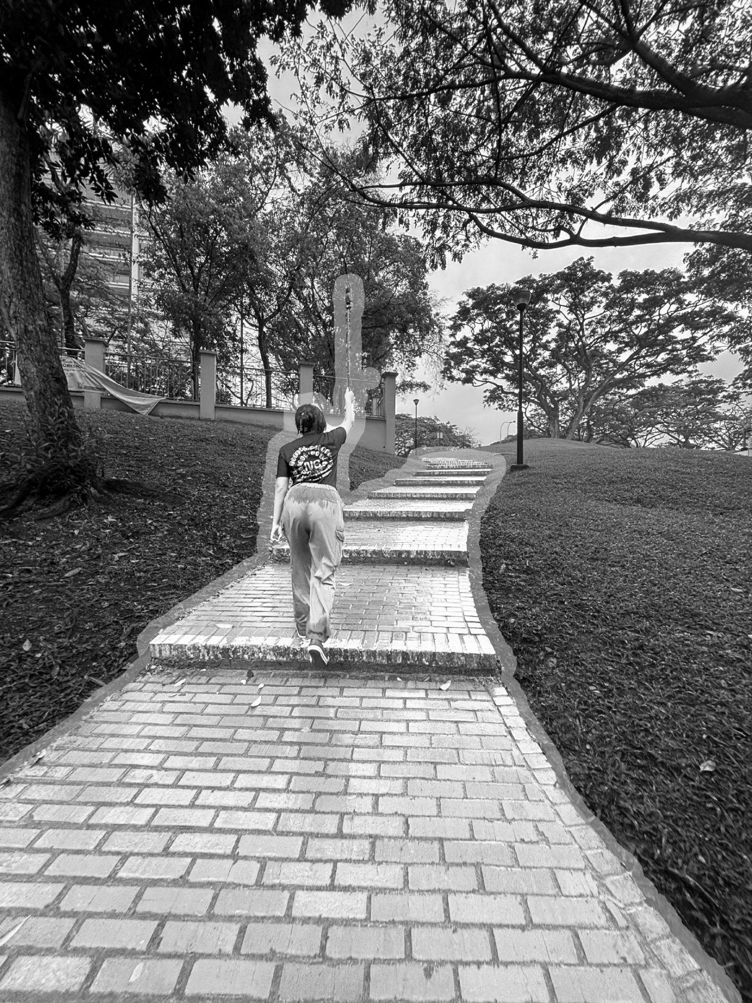
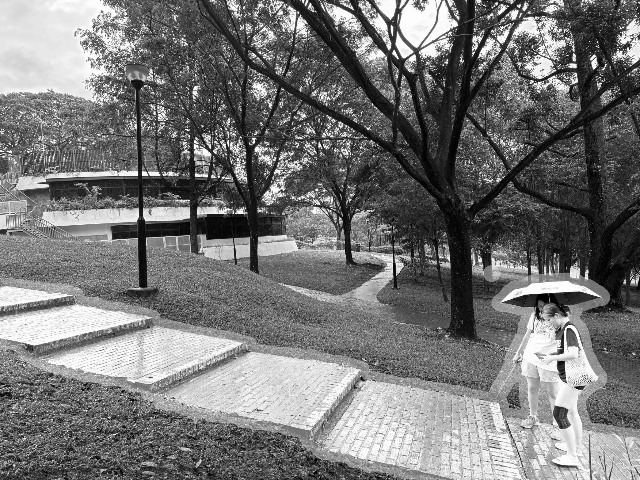
a. On gentler slopes, staircases with wider tread length are built to accommodate to the gentler gradient. There are more flights of stairs leading down from higher points. This contributes to more comfortable human engagement, allowing active user behaviour like jogging to take place even along long, drawn-out slopes that consist of uphills and downhills.
b. In between each flight of stairs, there are also wide landings that act as a resting point for users.They subtly change the direction of the pathway in correspondence with the natural terrain.
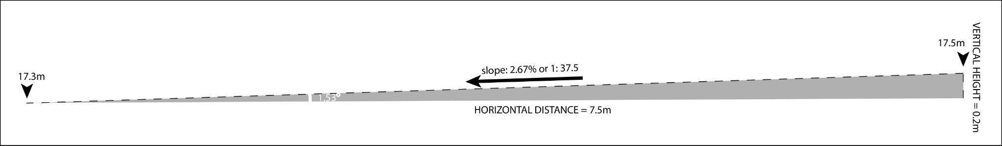
For extremely flat slopes, common hardscapes such as staircases may not be utilised. Hence, slopes designed for users to walk with ease or even cycle. Slopes hence tend to cover the longest horizontal distances to ensure a longer comfortable slope with a higher slope ratio. However, since the drainage is relatively flat, it is prone to clogging and may eventually cause flat slopes to have pooling.

keyplan
Medium scale
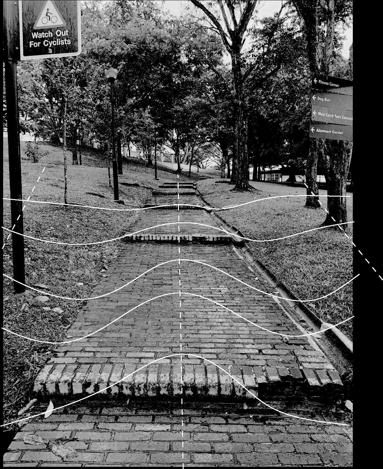
3.Flat
a. On flatter terrains, the main pathways tend to be low-rise, straight pavements. Park-goers are mainly seen walking and exercising along these pathways.
b. Wide stairs with large landing space are observed along the main pavements. These lead and connect to the steep and gentle slopes that we covered earlier on. a b
170cm
c. Drainage system
C-channel Drain
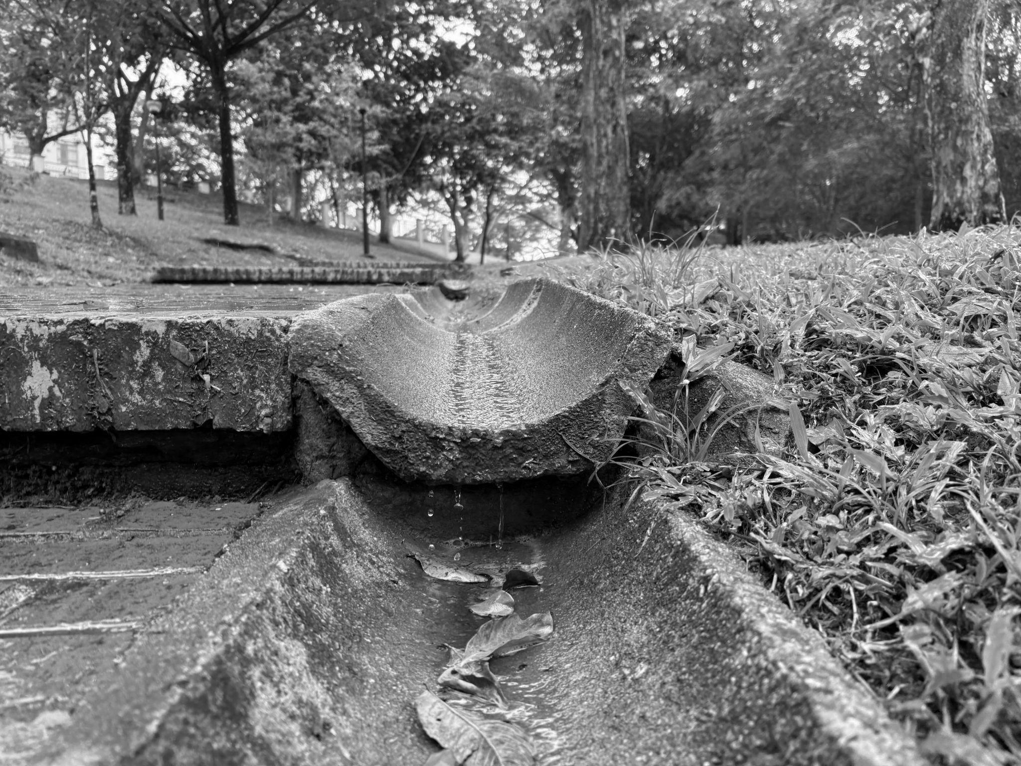
U-shaped Open Drain Sloped Drainage
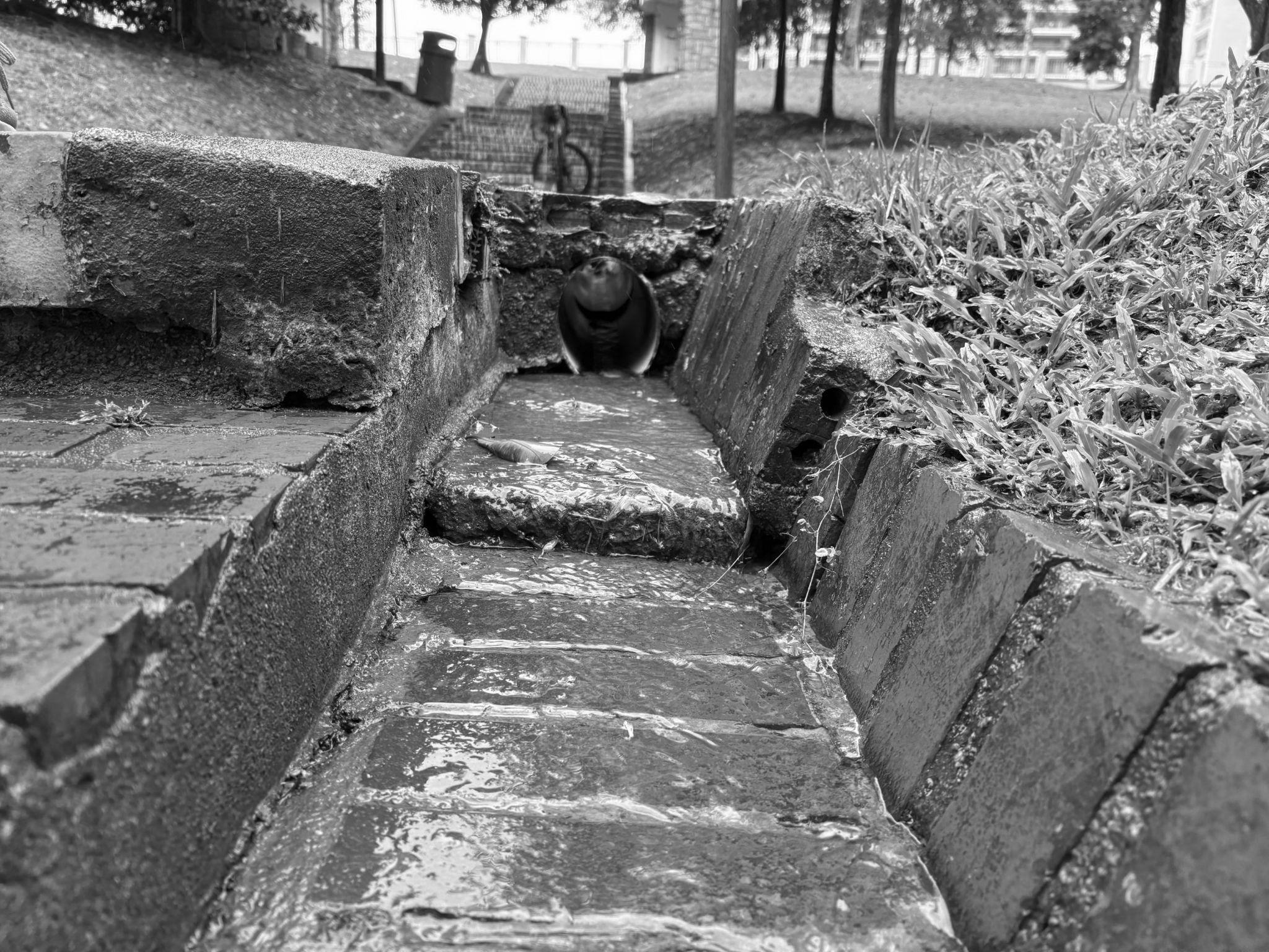
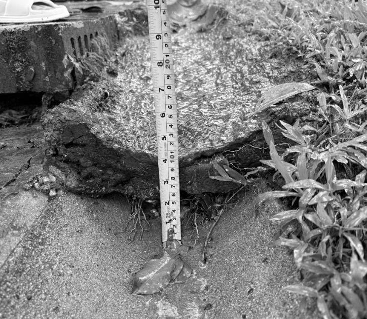
Drainage system are important especially in Singapore. Located at 1.3521° N and having a tropical climate, Singapore experiences two monsoons every year - Northeast and Southwest monsoon. Experiencing approximately 154.8 millimeters of diurnal rainfall, drainage is essential to every part of Singapore to prevent flooding.
In the case of Clementi Woods Park, different forms of drainage systems have been implemented to prevent flooding or at least retention of water (pooling). Using softscapes such as topography and the previous analysis of landforms, the water flow across the park can be deduced. The different forms of drainages being utilised were observed and hence scrutinised for its efficiency in clearing water.
Drainage system
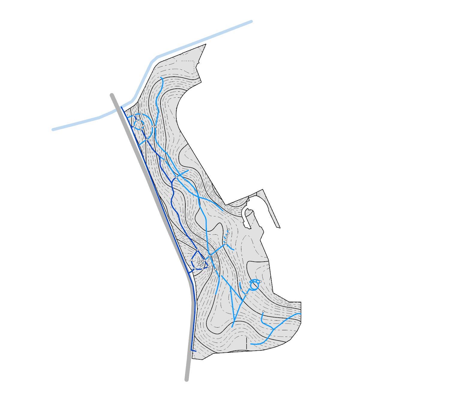

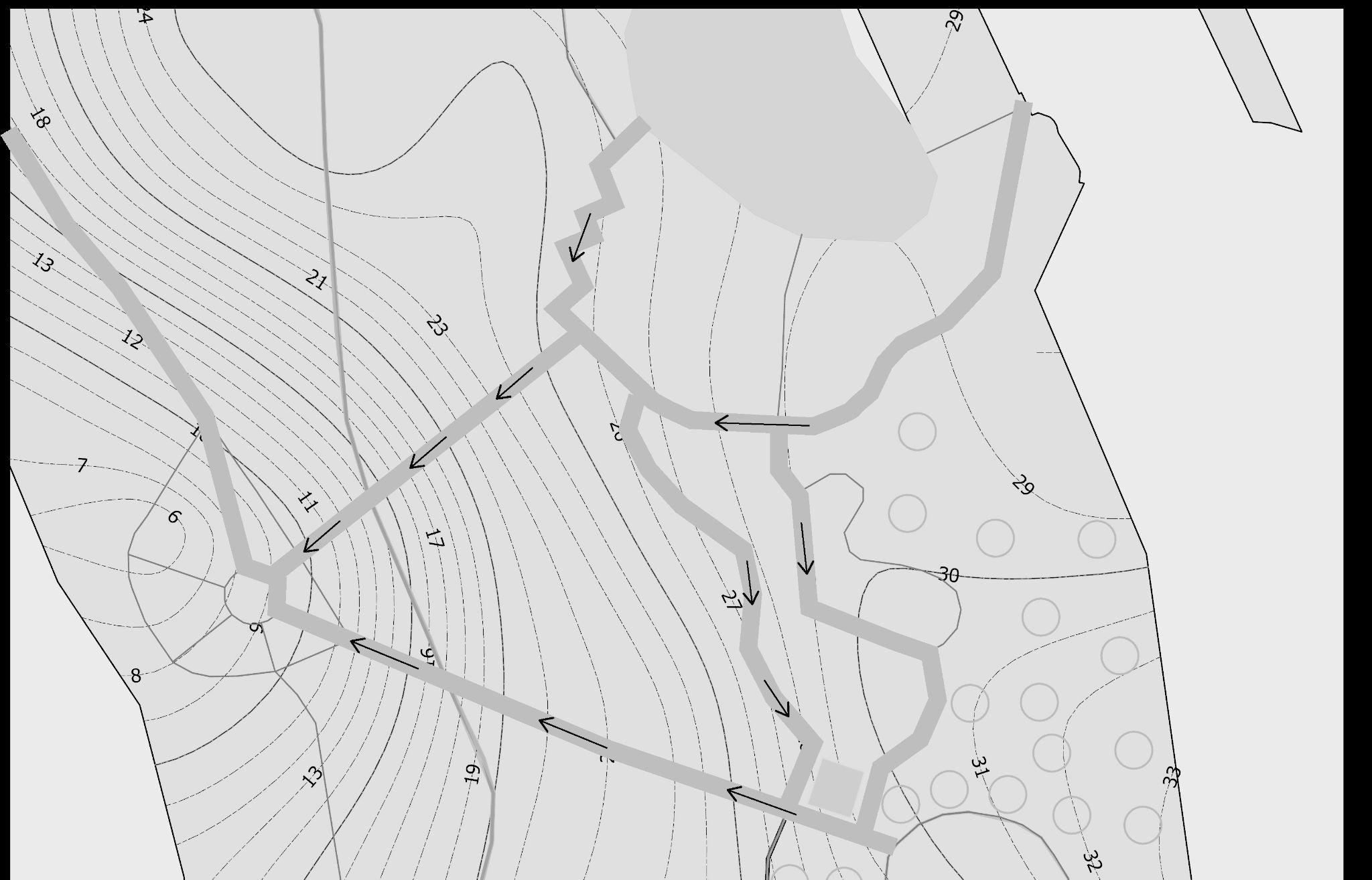
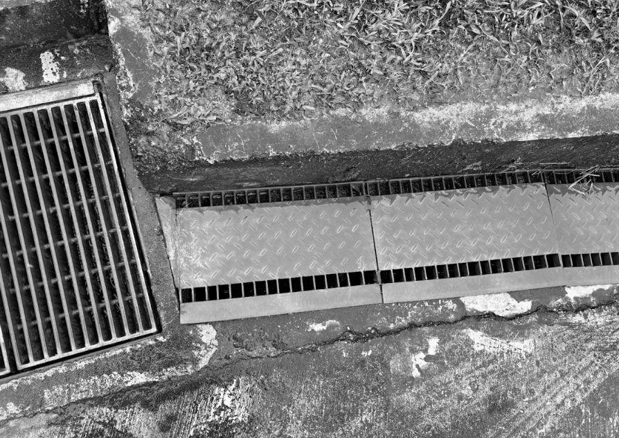
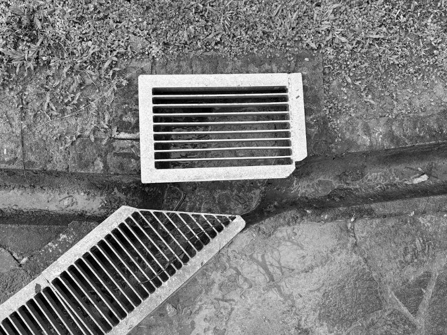
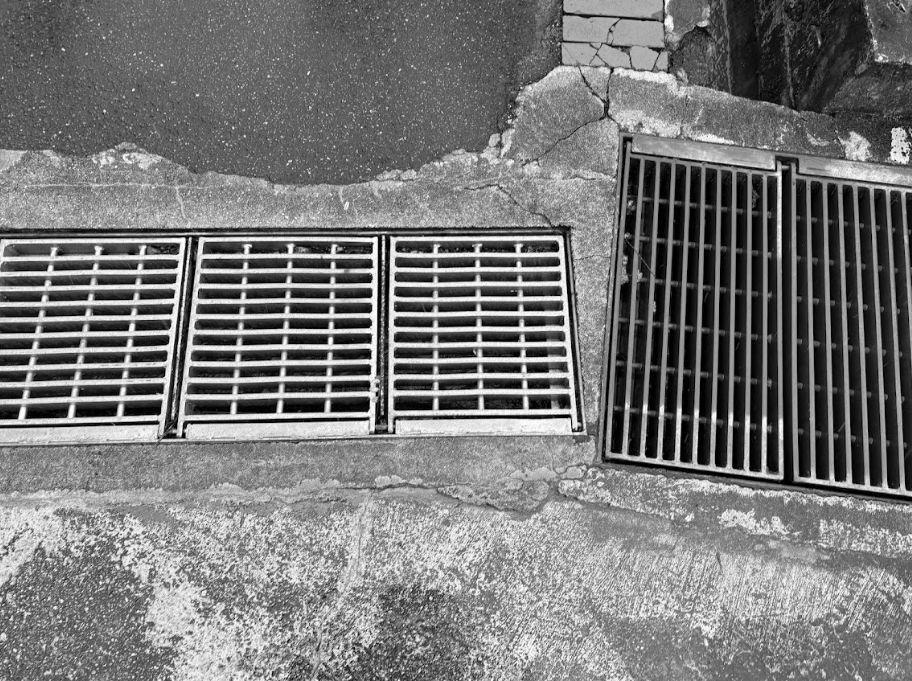
Water flow and pooling
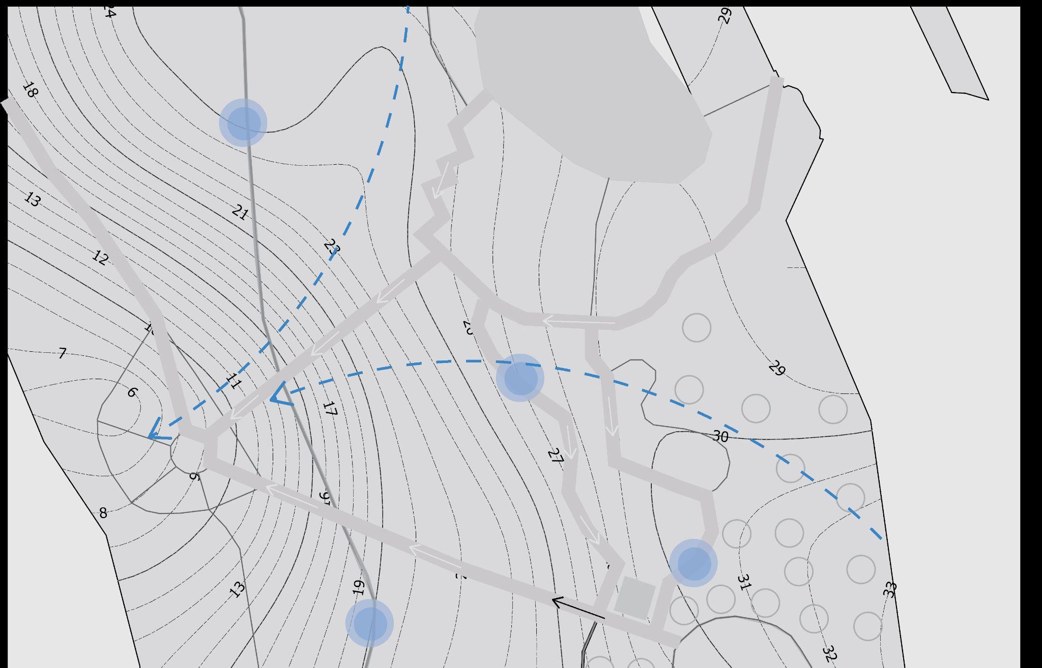
1:800 scale pooling water flowing
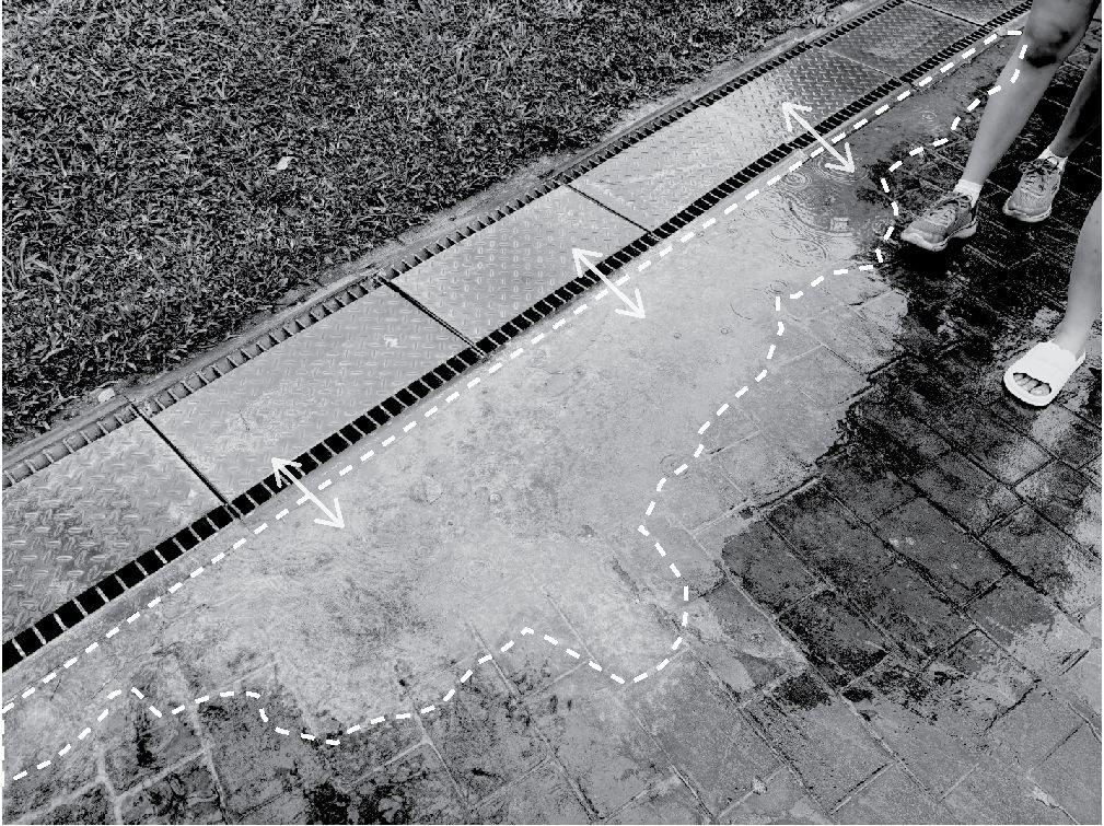

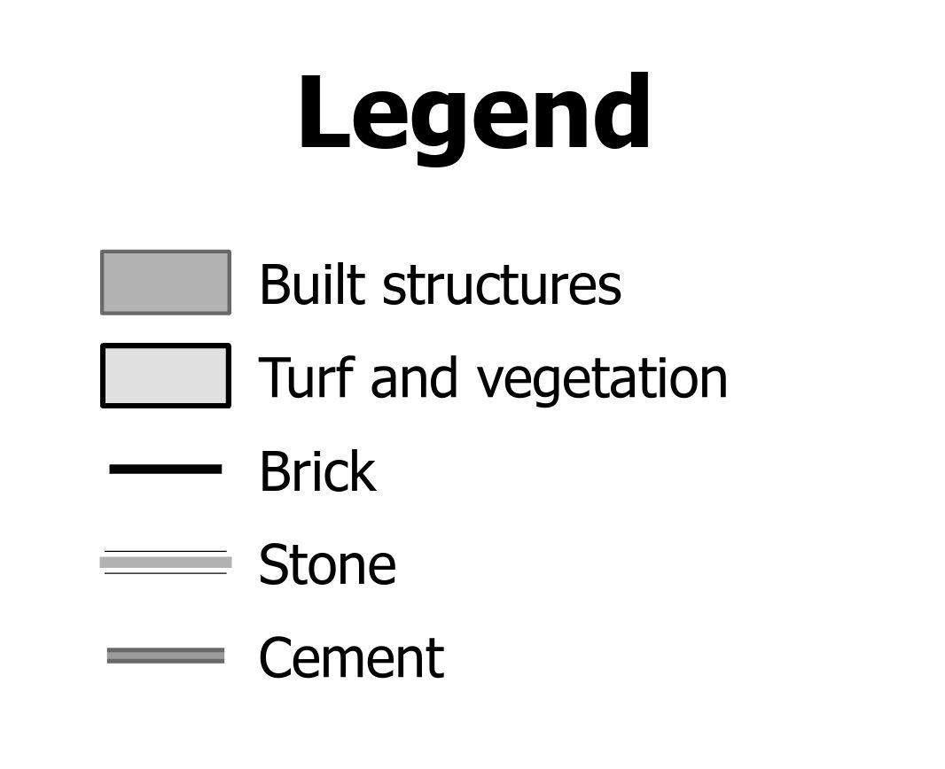
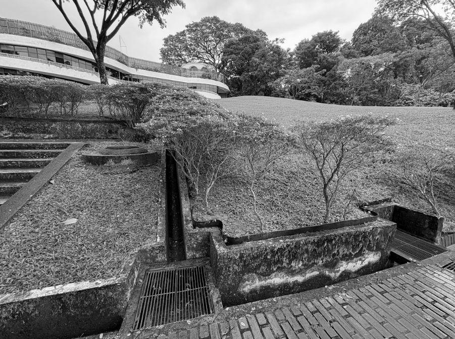
d. Materiality (Hardscape & Softscape)
Softscape
- Green turf
- Spontaneous growth (weeds)
- Leaf litter
The balance of softscapes and hardscapes is key to any design. The chosen concrete, brick and stone paths are wheelchair-friendly, allowing all sorts of users to comfortably access the park. The gaps between each stone and brick enables vegetation to grow visibly, allowing invisible process such as irrigation to take place easily and smoothly. Hence, this shows the harmony between softscapes (vegetation and irrigation) and hardscapes (stairs, ramps and steps) in terms of drainage and materiality.
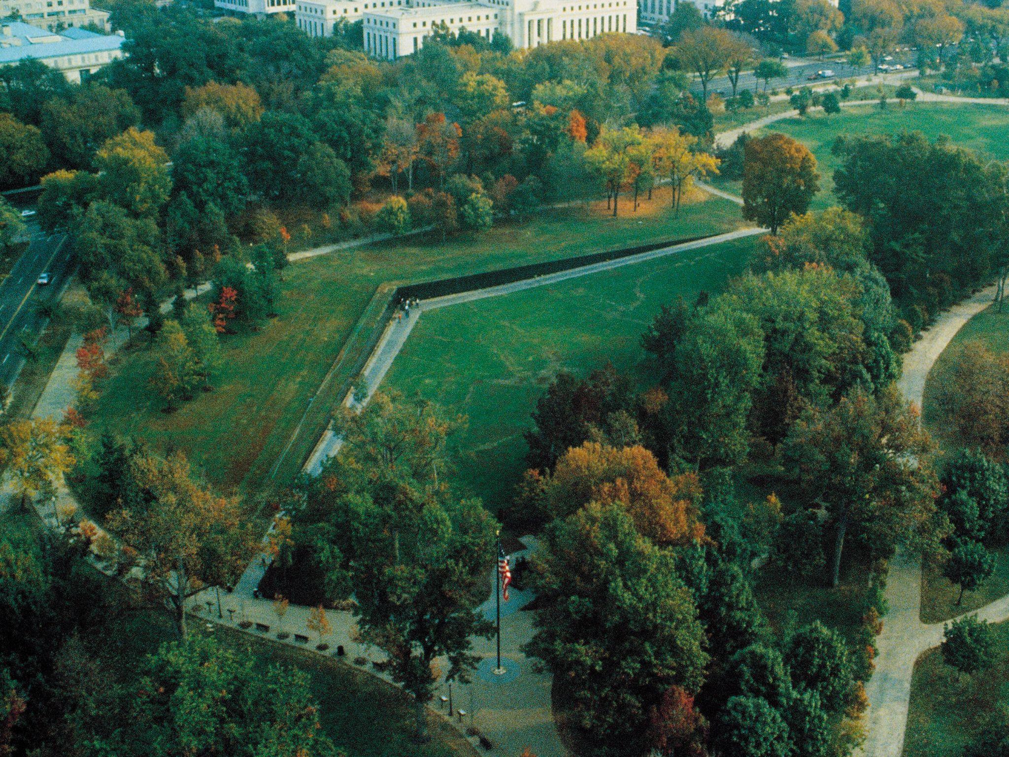
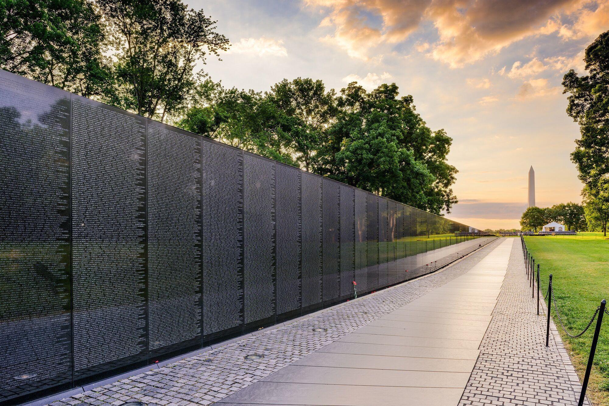
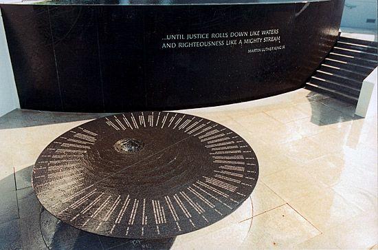
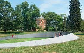
Work featured in image: Lin’s debut and magnum opus, the Vietnam Veterans Memorial


MAYALIN
American Designer and Sculptor
1959
October 5
Maya Lin was born in Athens, Ohio
1981
1982
1986
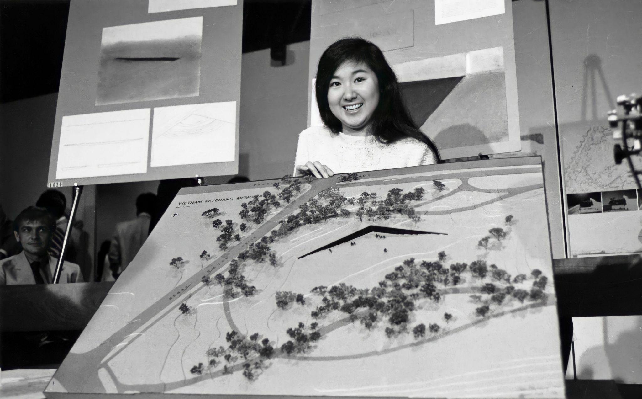
National Design Competition
Won the national competition for the design of the Vietnam Veterans Memorial in Washington, D.C.
The Vietnam Veterans Memorial
Lin's design, a black granite wall with inscribed names, becomes a significant and highly praised memorial.
Bachelor of Arts Degree
Maya Lin receives her Bachelor of Arts degree in architecture and sculpture from Yale University.
1987
1989
Masters of Architecture
She receives a Master of Architecture from the Yale School of Architecture.
The Civil Rights Memorial Designed and completed the Civil Rights Memorial in Montgomery, Alabama.
1993
The Women’s Table
A granite installation commemorating the 20th anniversary of the co-education of Yale College.
2004
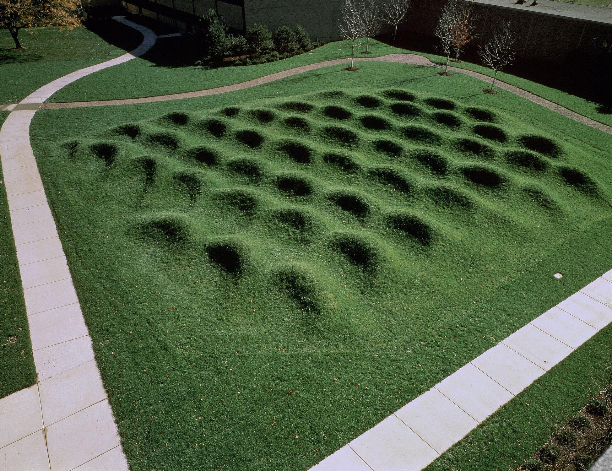
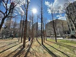
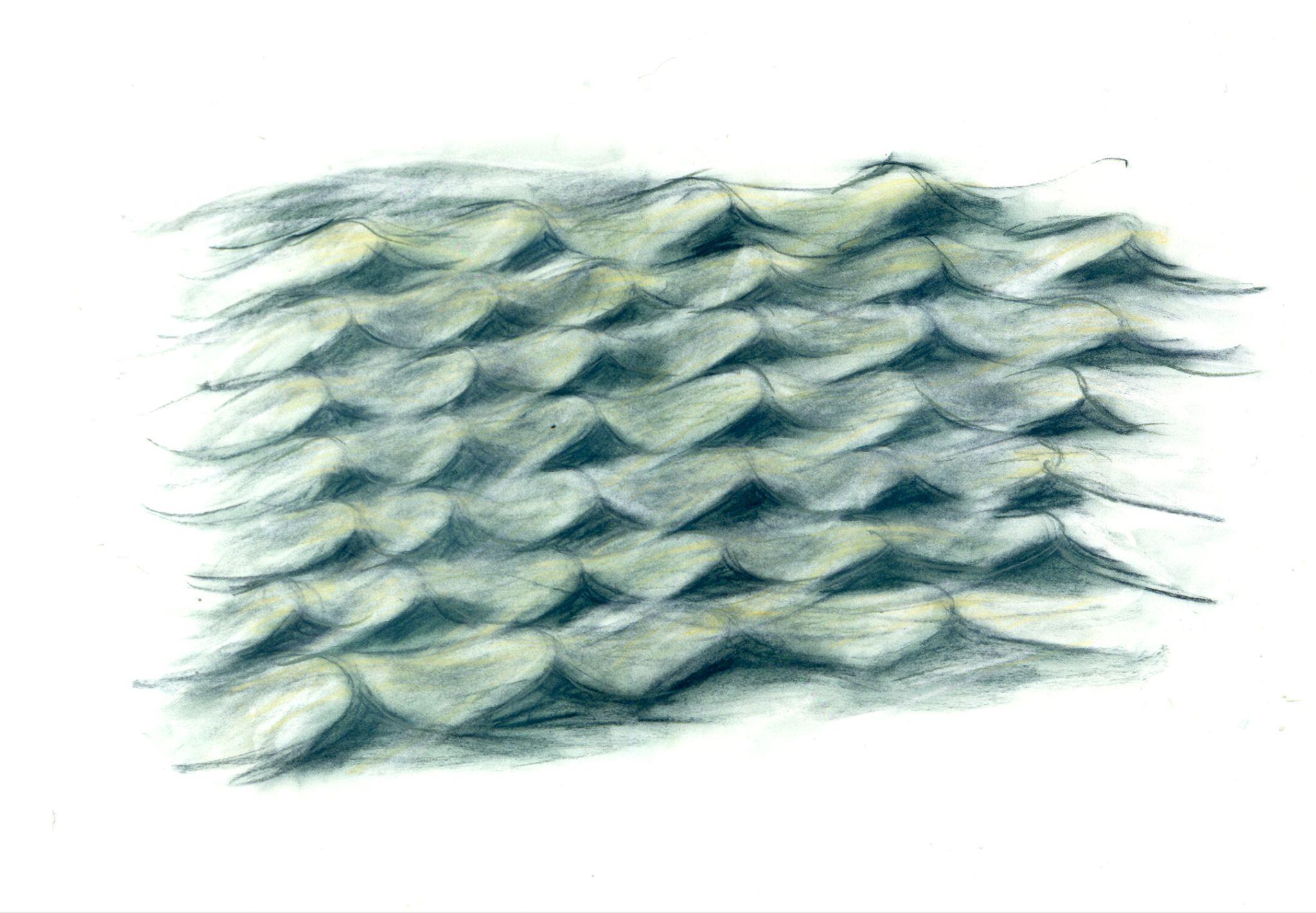
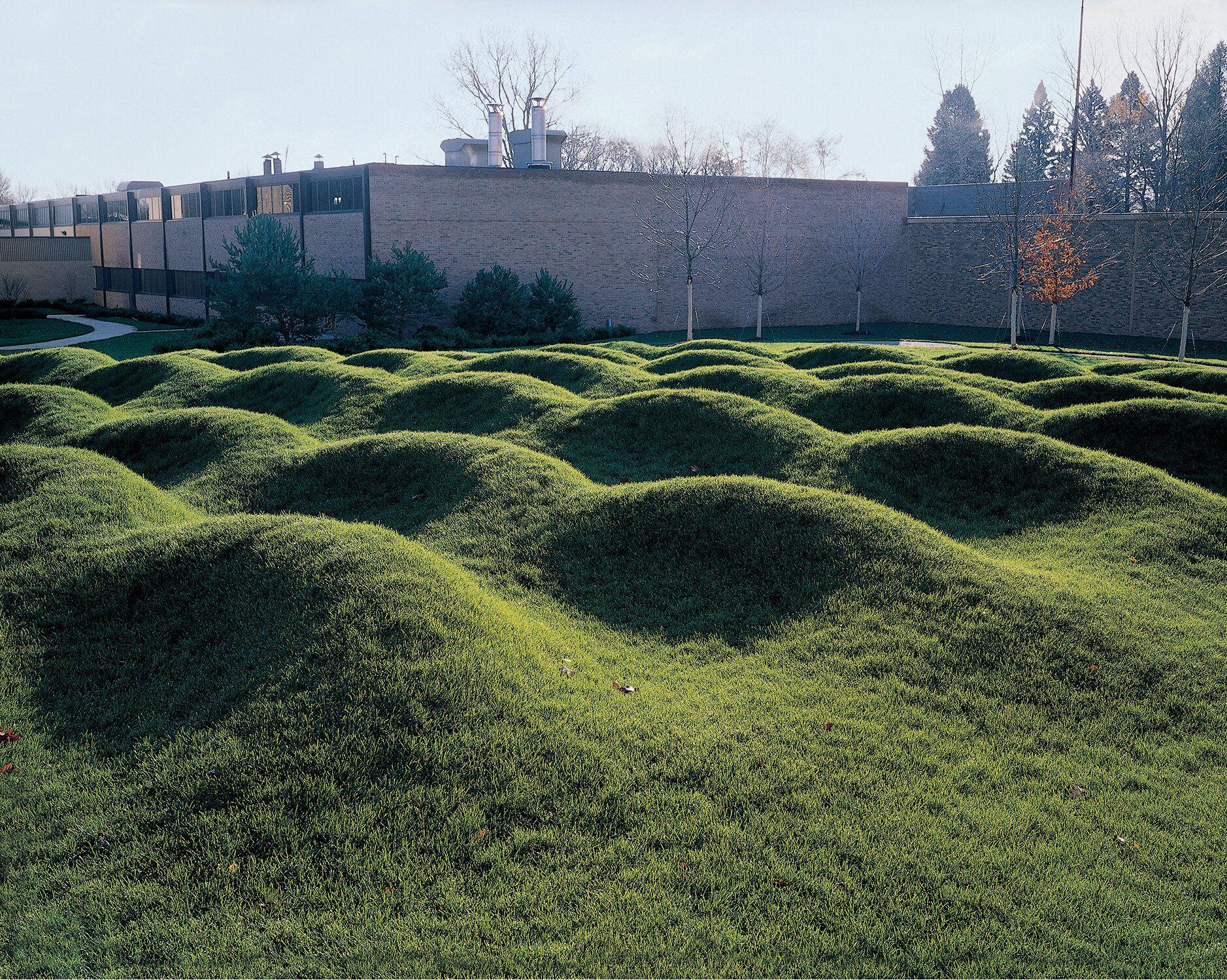
The Wave Field
She completes the Wave Field, a site-specific installation at the University of Michigan, composed of undulating rows of grassy mounds.

2011
The Presidential Medal of
Freedom Award
Maya Lin is awarded the Presidential Medal of Freedom by President Barack Obama.
2018
The "Eclipsed Time"
She creates the installation at the California Academy of Sciences, using reclaimed redwood from the museum's renovation.
2020
Memorial to Enslaved Laborers
Lin’s design is at the University of Virginia, honoring the contributions of enslaved individuals.
2021
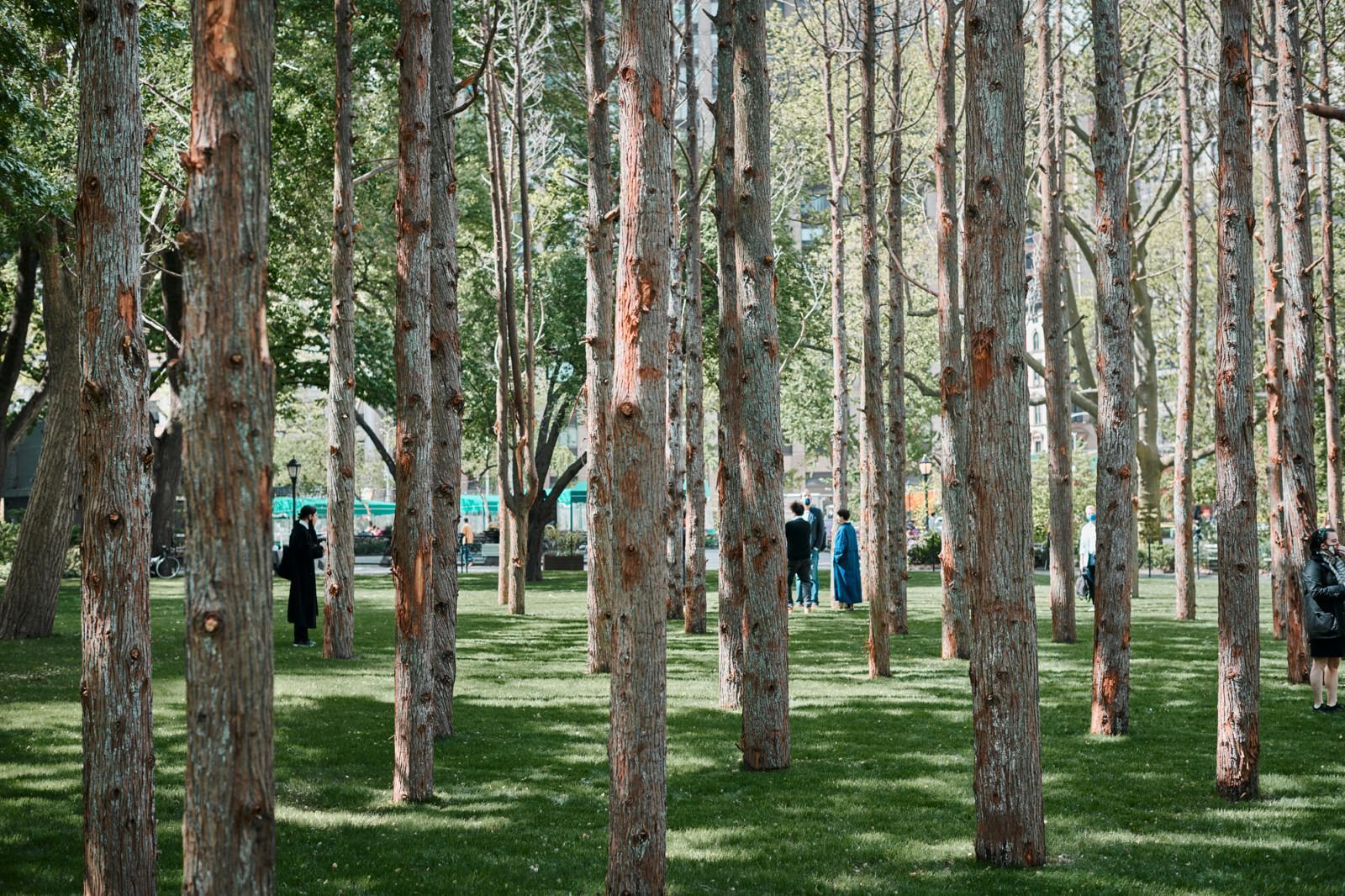
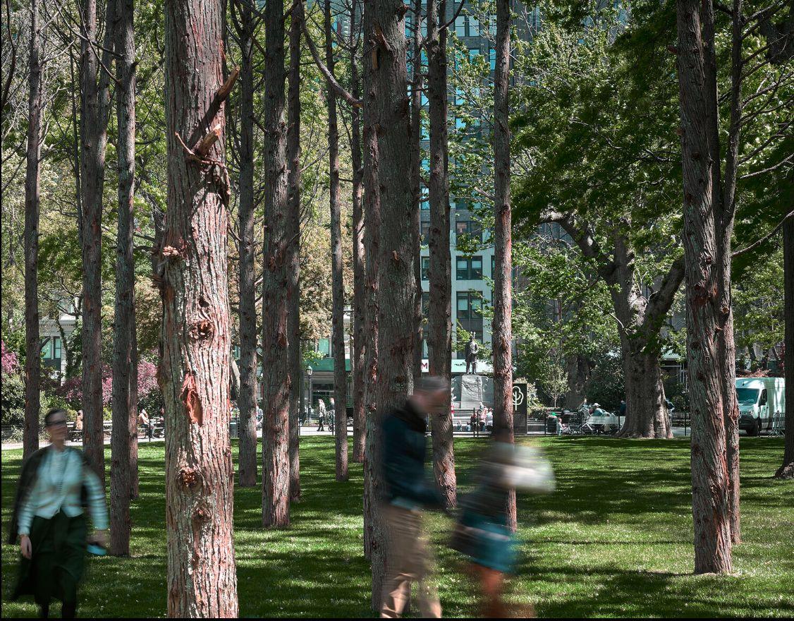
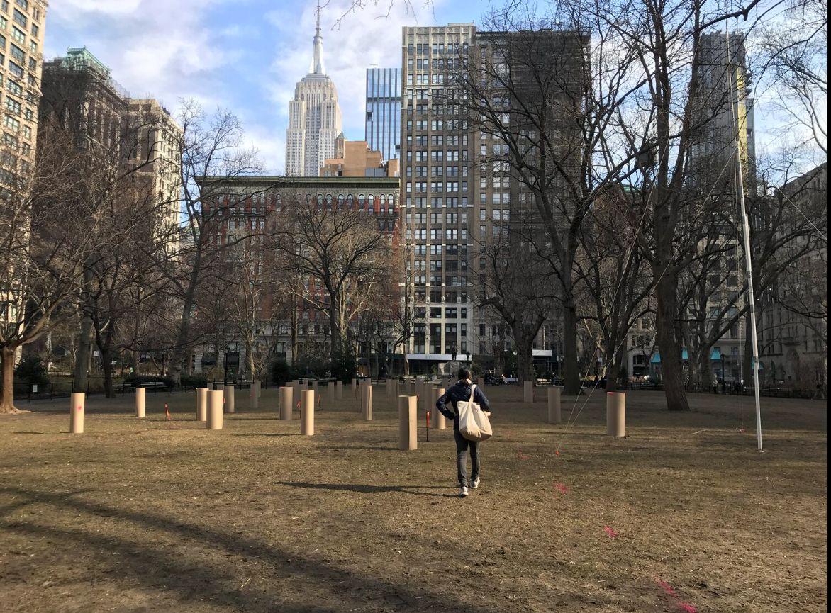
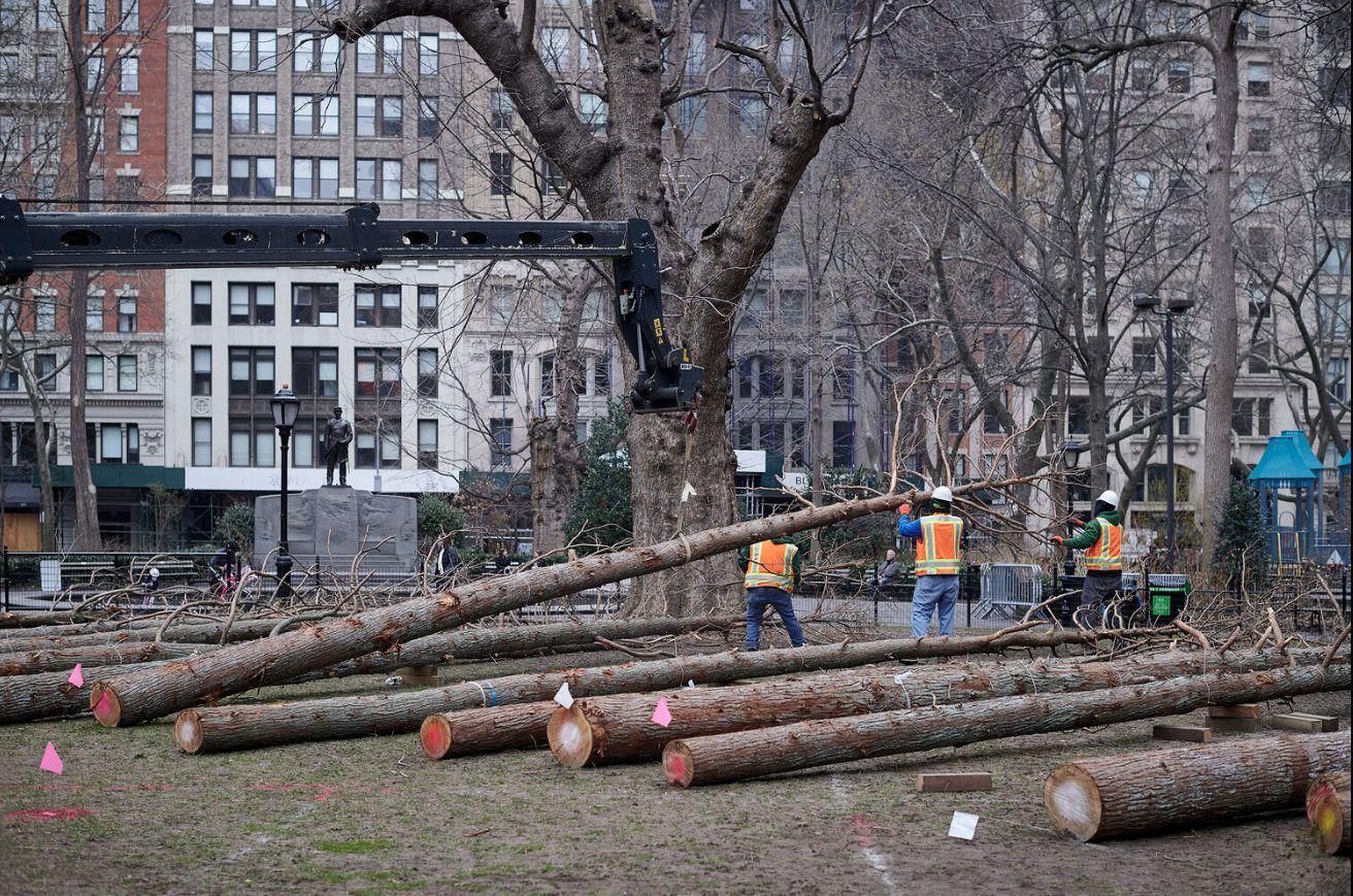
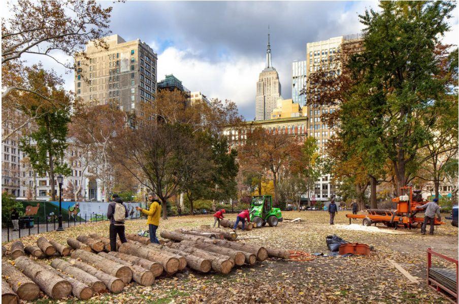
The “Ghost Forest”
Maya Lin unveils the project in Madison Square Park in New York City. The project features a grove of spectral, dead Atlantic cedar trees, aiming to raise awareness about climate change and the impact on forests.
DESIGN PHILOSOPHY
Between LandArtist andArchitect
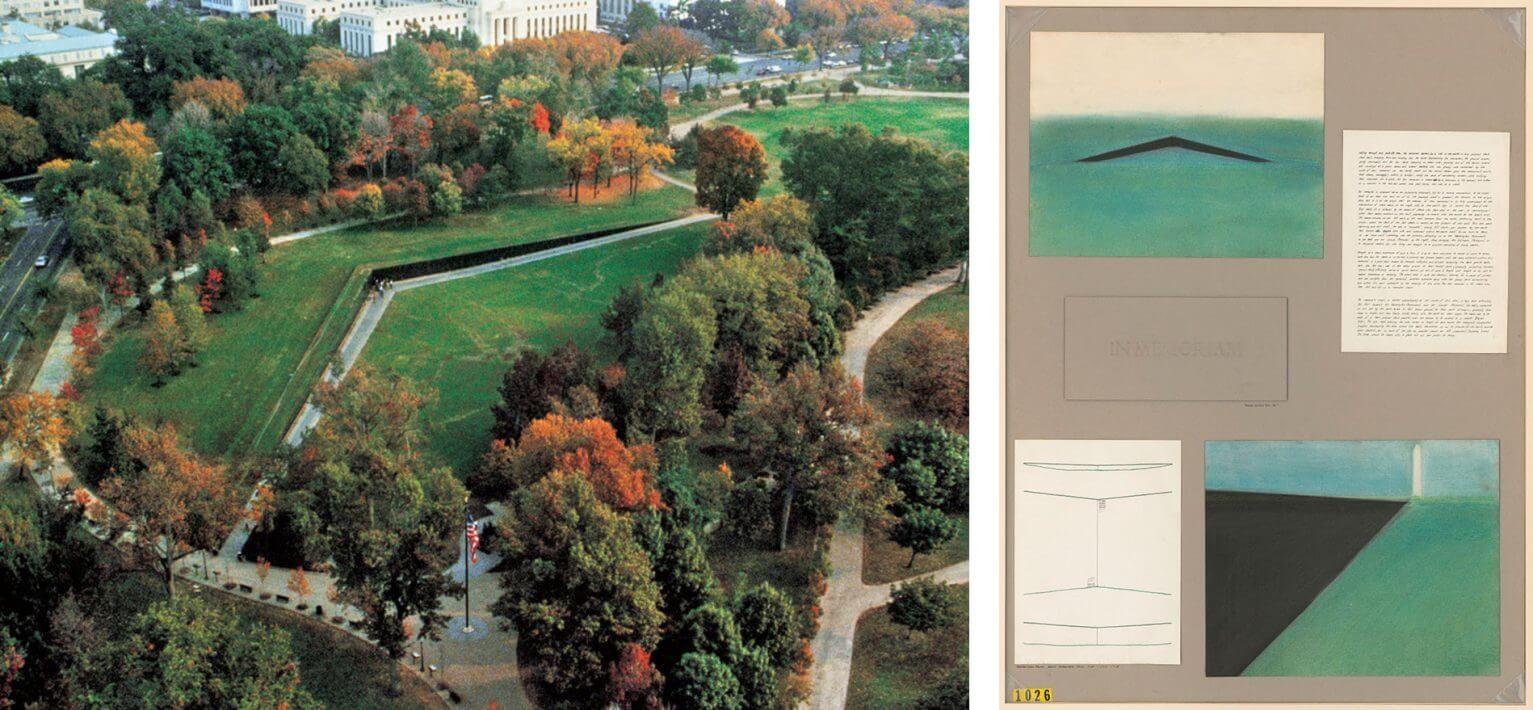
Left: Lin’s sketches for the Vietnam Veterans Memorial
Right: aerial view of aforementioned work
DESIGN PHILOSOPHY
“Land art, or earth art, is art that is made directly in the landscape, sculpting the land itself into earthworks or making structures in the landscape…”
–TheTate Modern
DESIGN PHILOSOPHY
How is Lin related to land art?
Lin’s own impression ofThe Wave Field in Michigan
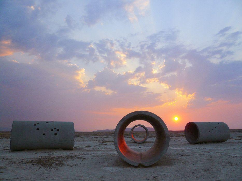
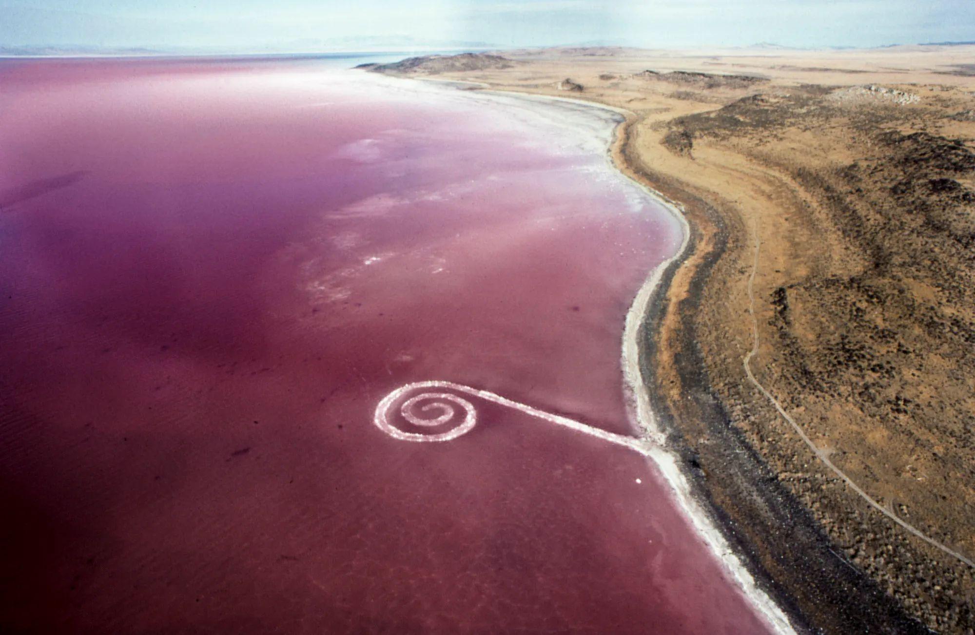
Stone Jetty
Siluetas,Ana Mendieta
Sun Tunnels, Nancy Holt
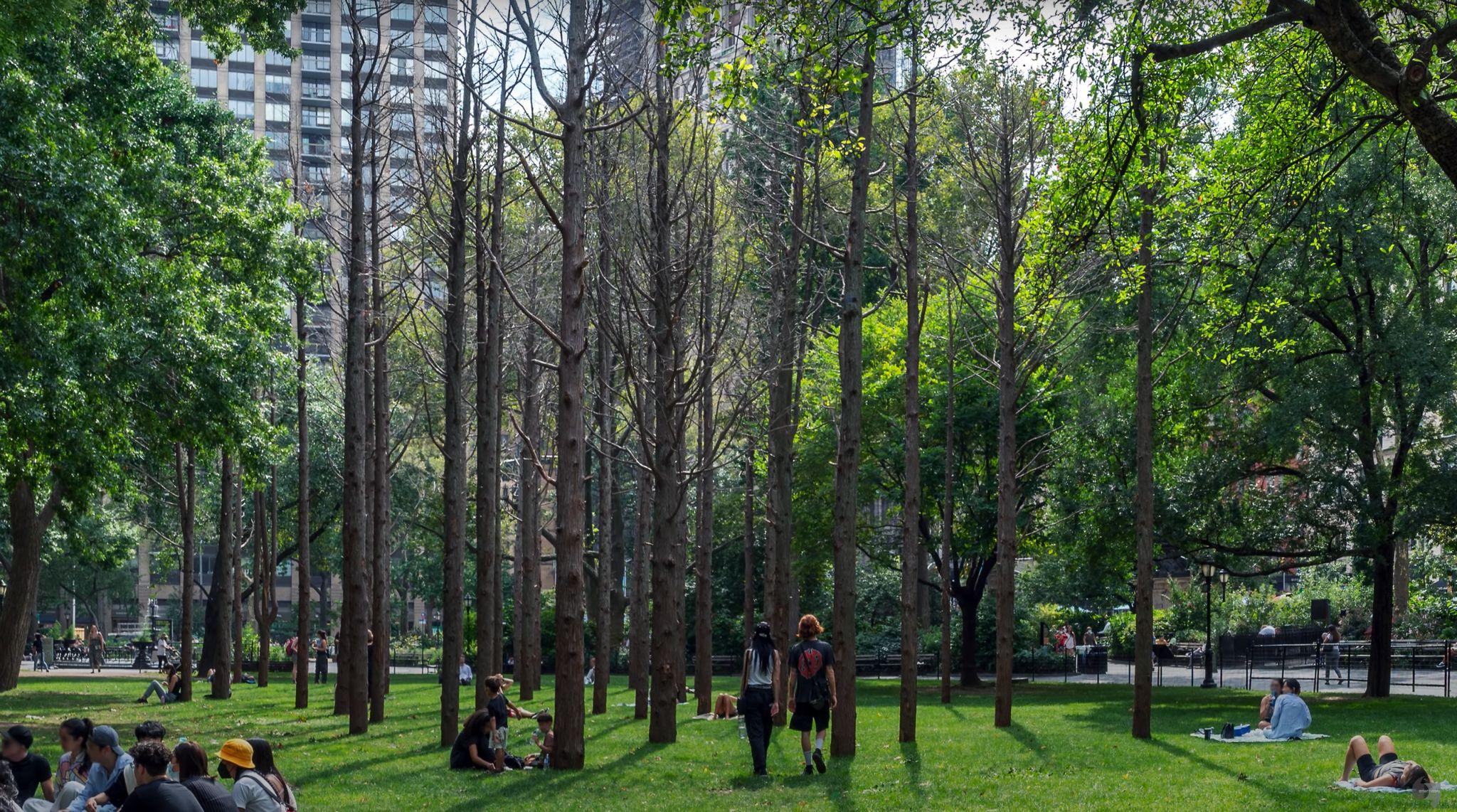
THE WAVE FIELD
Ocean waves cascading towards the shore
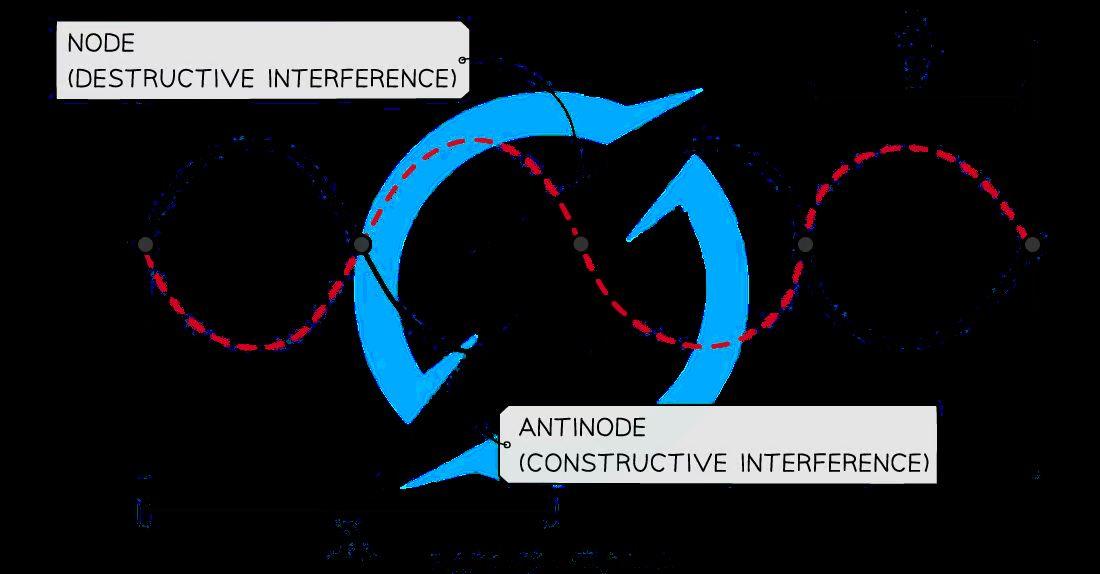
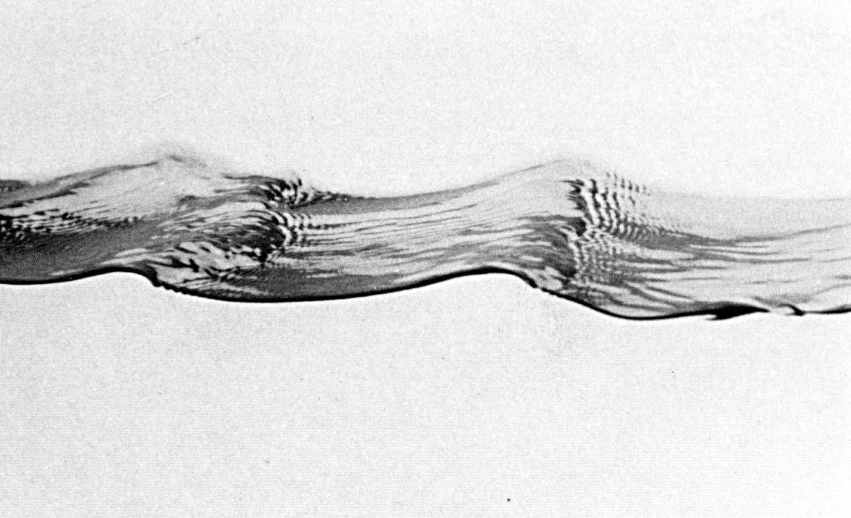
Below: oblique shock waves of a plane in flight
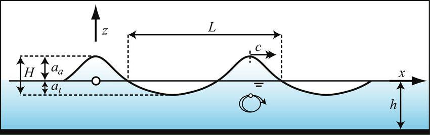
Abstract and diagrammatic representation of the Stokes wave
THE WAVE FIELD

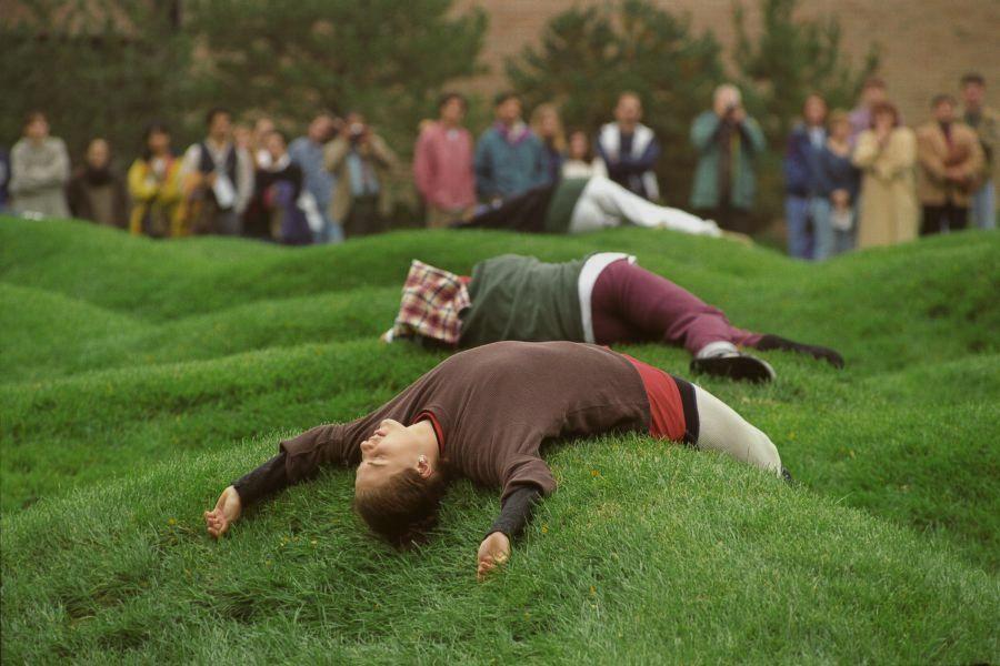
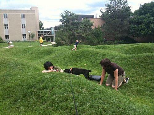
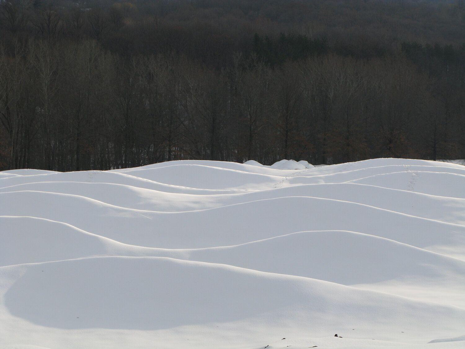

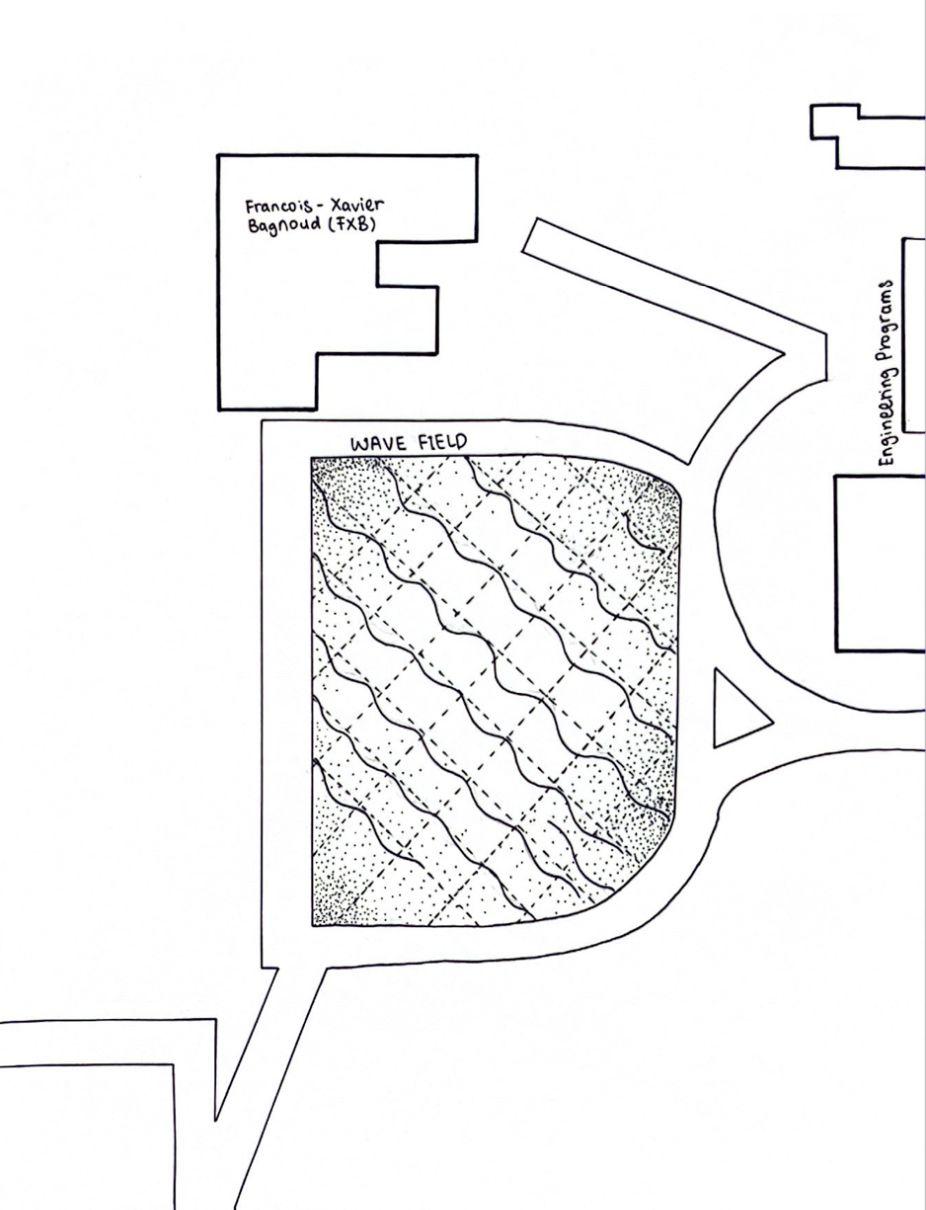
● Non-naturalistic
● FXB andAerospace Engineering buildings
● Students, staff and members of the public can gather here
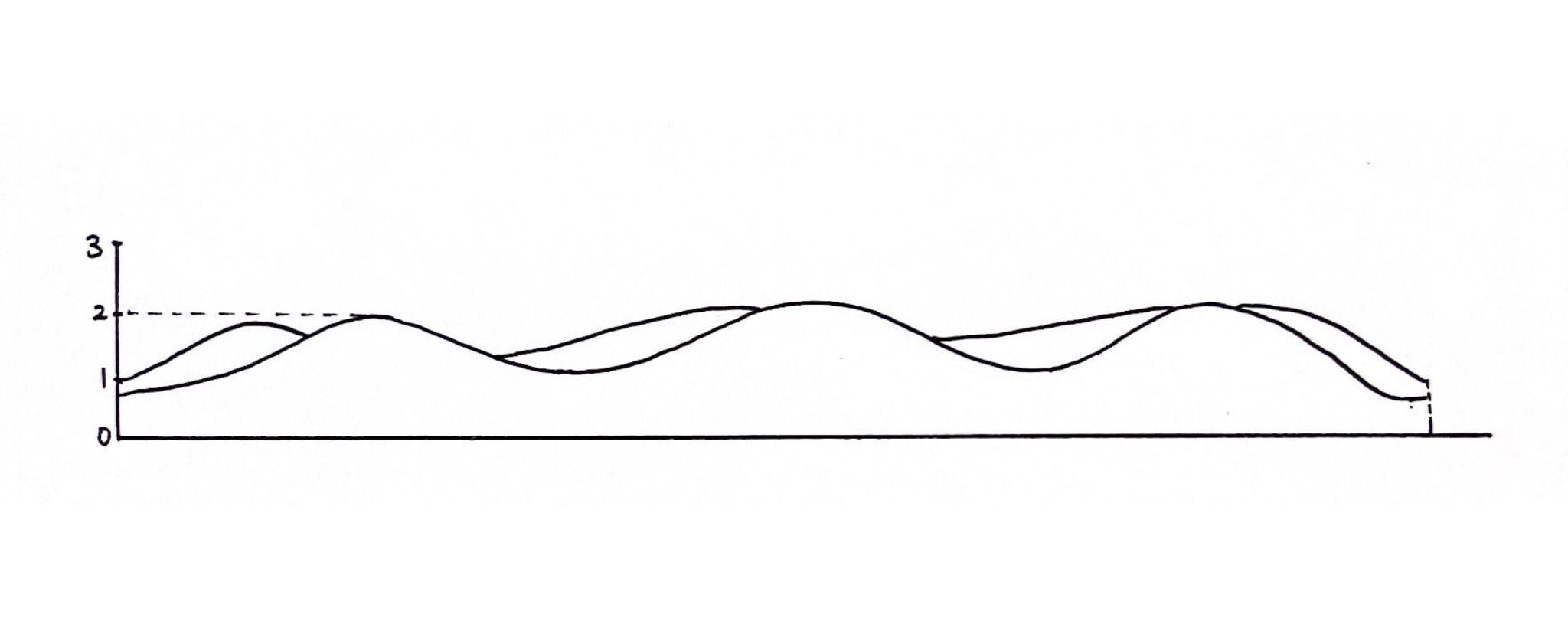
Peak Trough x x
● Peaks and troughs alternate across the rows
● Akin to actual waves – asymmetrical, non-uniform
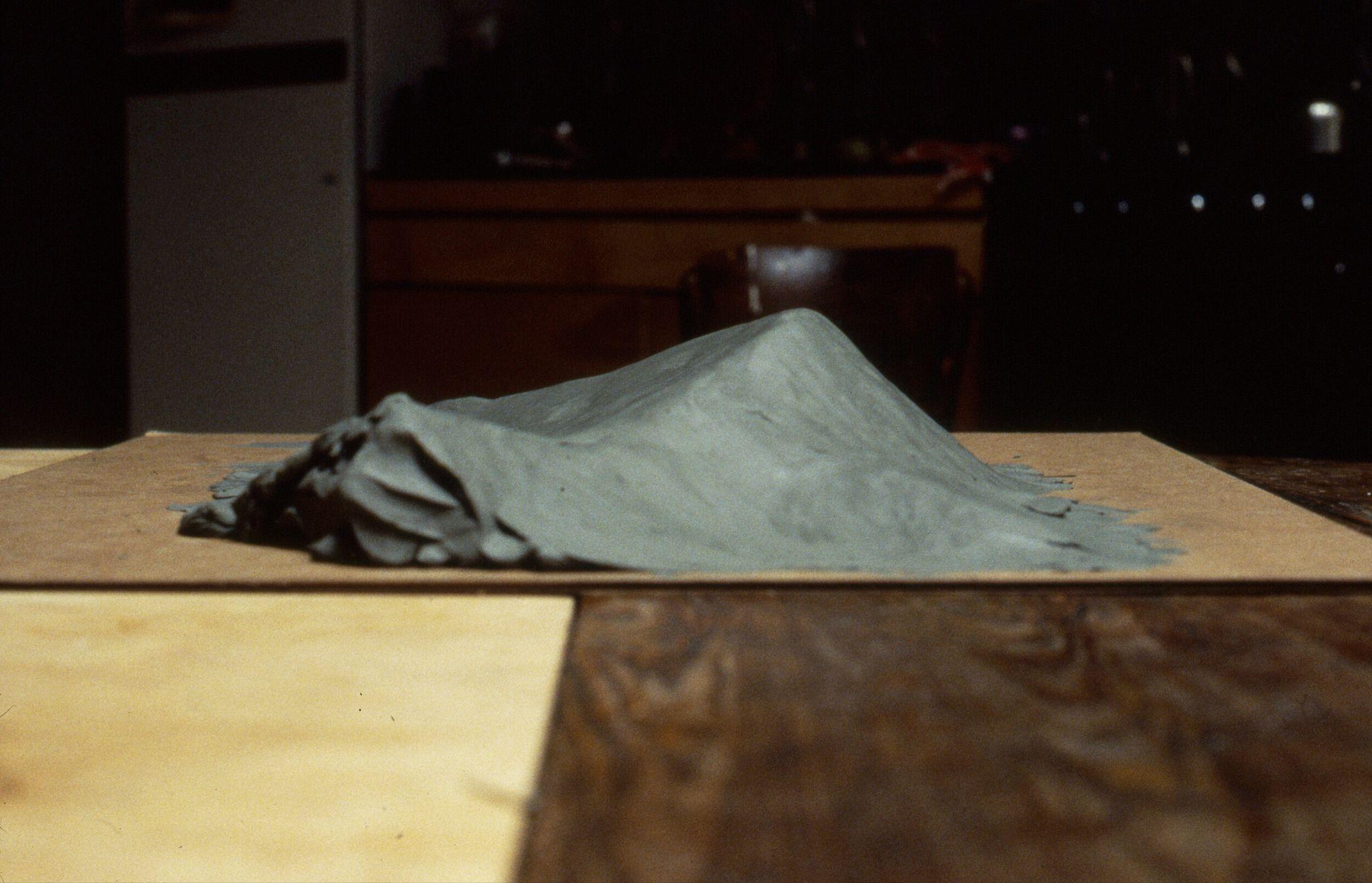
Maya Lin’s own early models
LINE DRAWINGS (THE WAVE FIELD)
WHITE MODEL(THE WAVE FIELD)
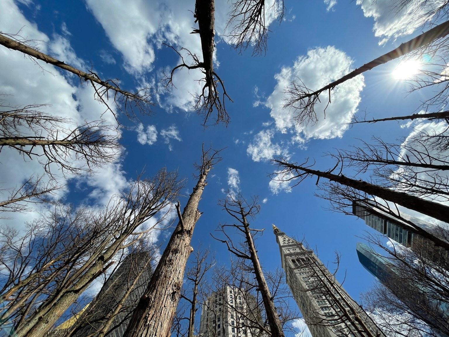
GHOST FOREST
Salt water inundated
Atlantic White Cedar
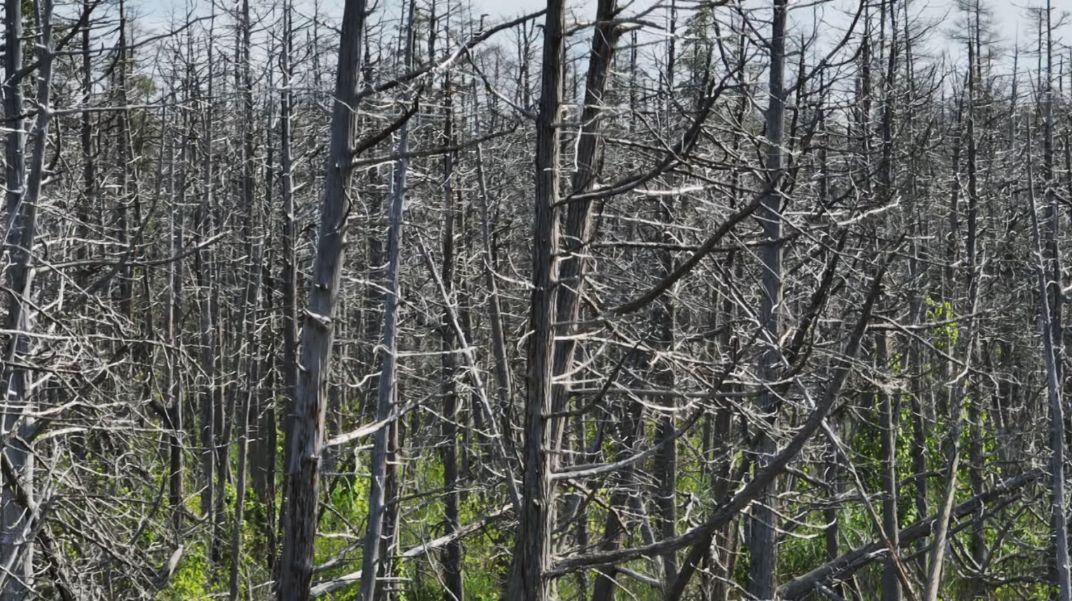

Pine Barrens of New Jersey
Madison Square Park NewYork
Pine Barrens of New Jersey Madison
Ghost forest
boats using the wood from her installation
LINE DRAWINGS (GHOST FOREST)
WHITE MODEL(GHOST FOREST)

Rosa Parks Circle, Grand Rapids, MI
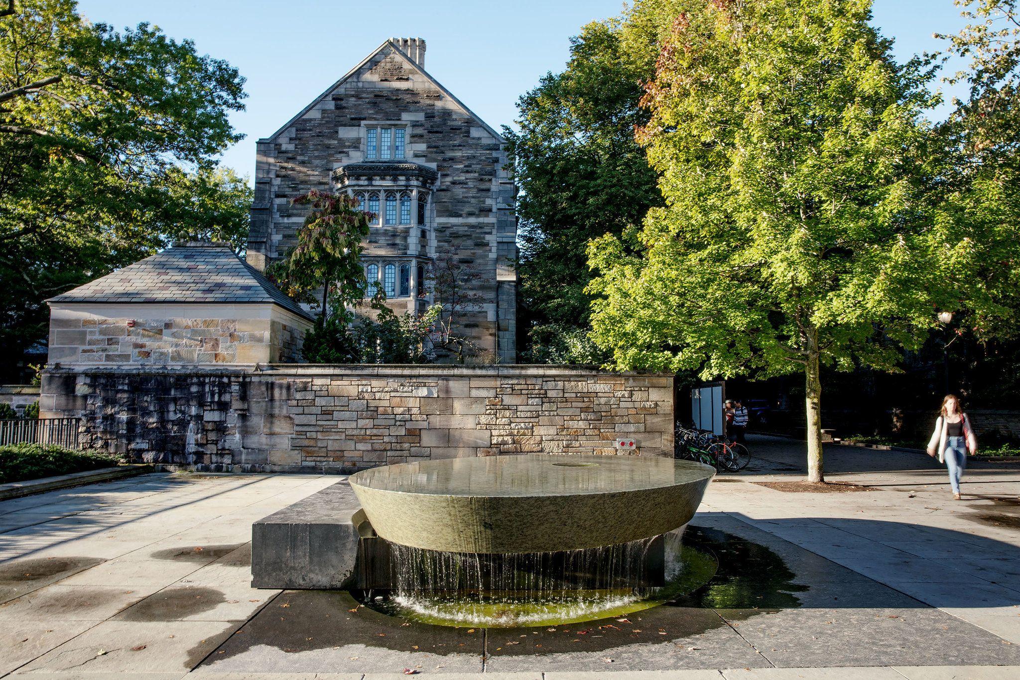
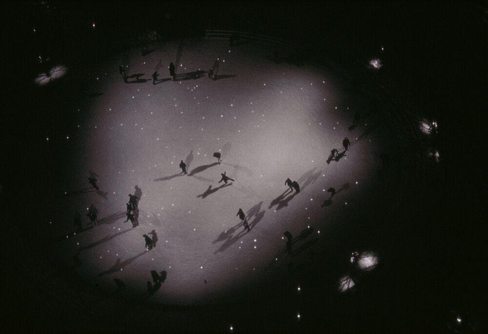
Water at its liquid, solid and vapor state
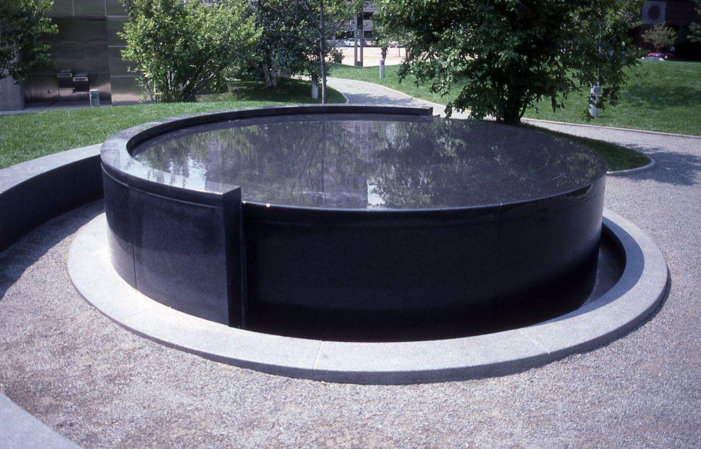
Araised granite circle with water continuously flowing from one half and gently flowing over the front half of the fountain.
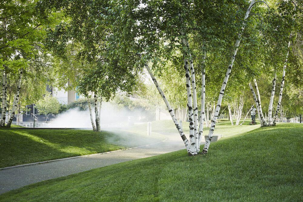
Agranite circle set into the ground with a low stone ring that has a hidden mist fountain.
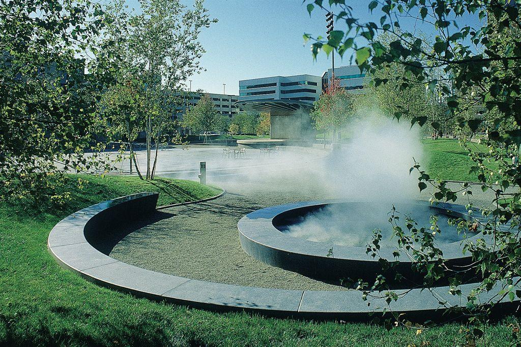
Agranite circle set into the ground with a low stone ring that has a hidden mist fountain.
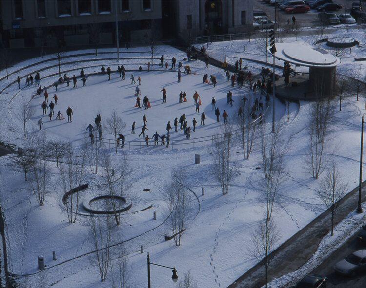
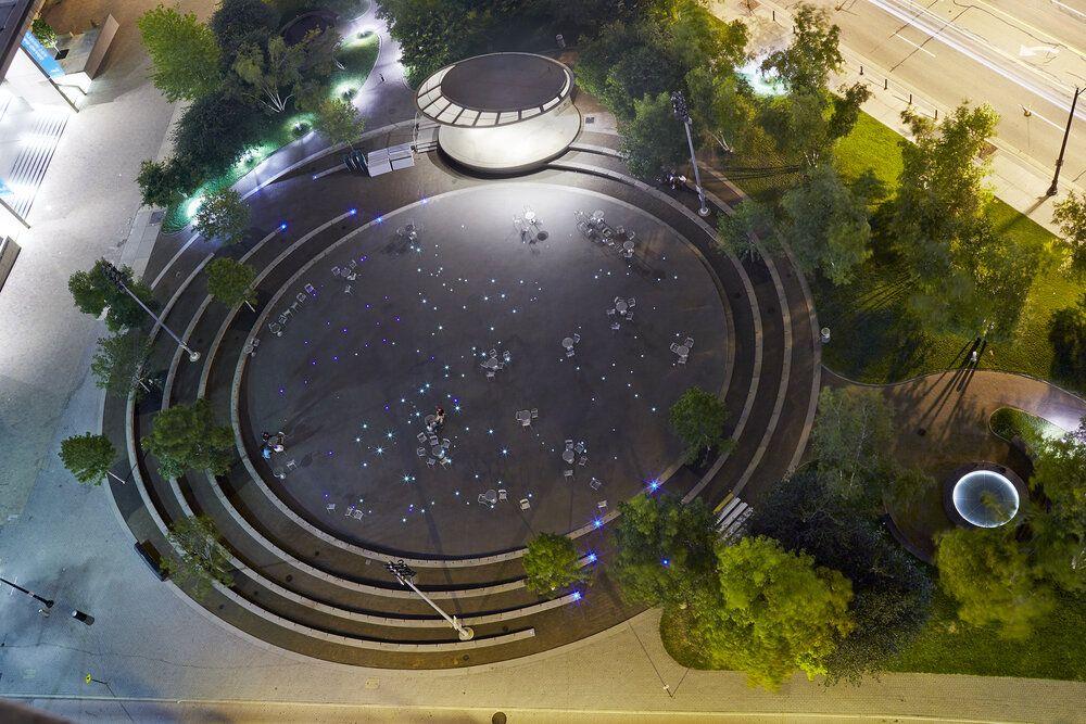
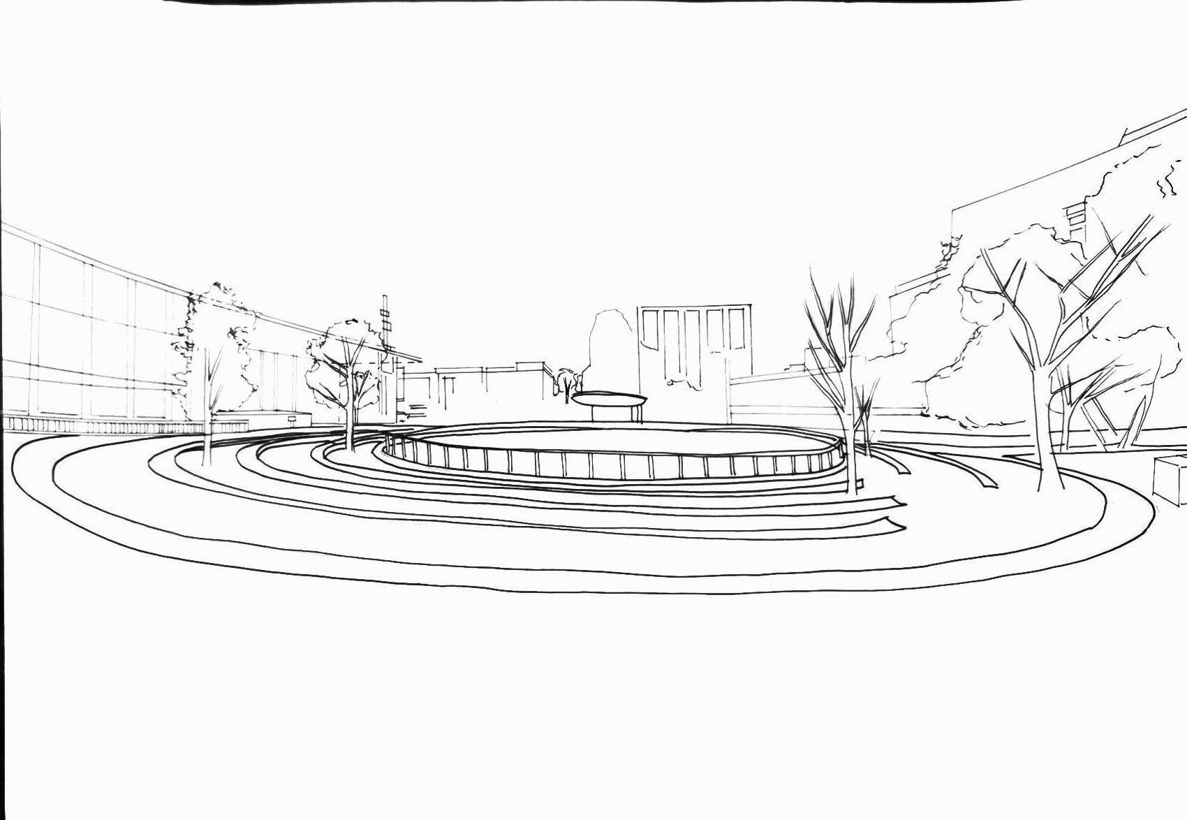
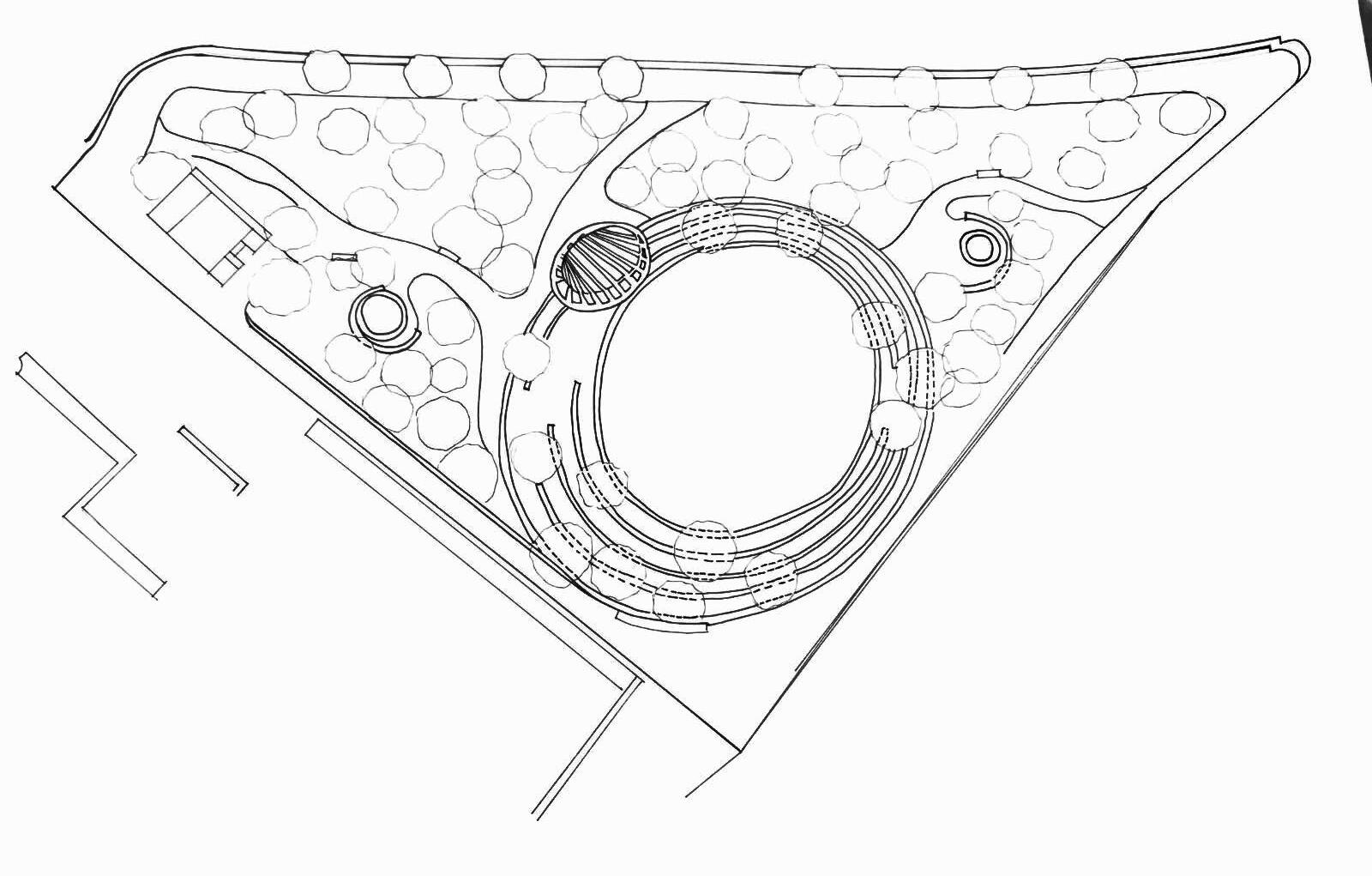
Curved seating terraces to show the concentric rings formed by a drop of water or the elliptical orbit of planets.
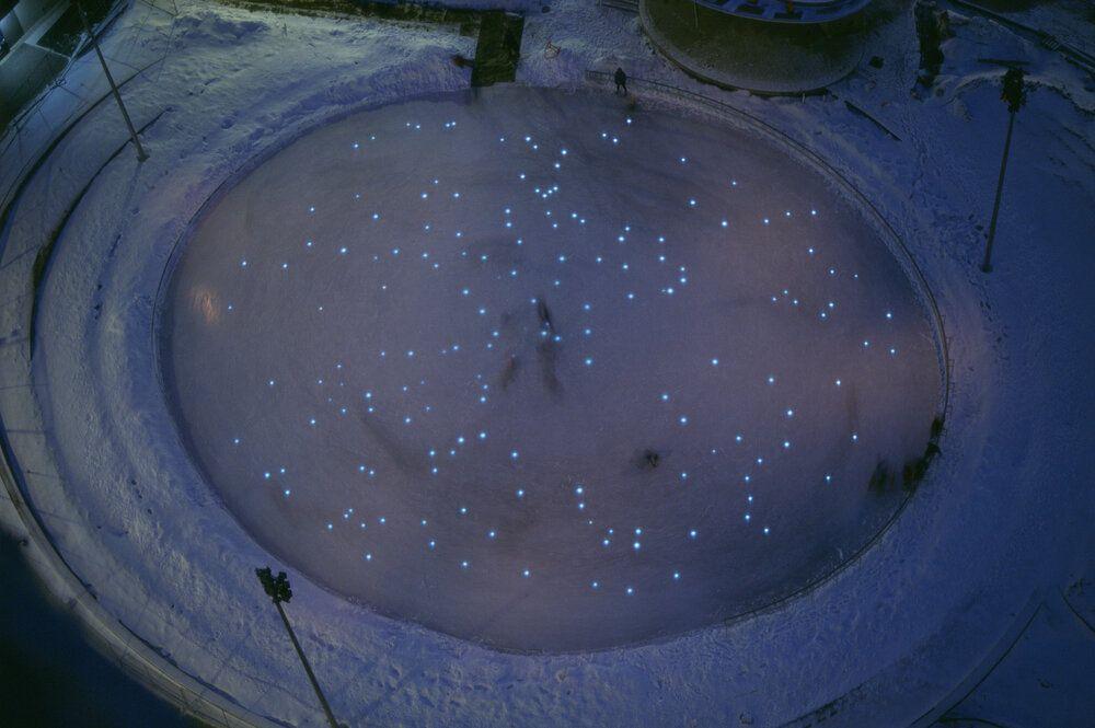
Astill pond reflecting the night sky
LINE DRAWINGS (ECLIPTIC)
WHITE MODEL(ECLIPTIC)
WHITE MODEL(ECLIPTIC)
WHITE MODEL(ECLIPTIC)

ECLIPTIC - 100 words summary
Ecliptic conveys a strong underlying concept of time, landscape and the earth and the natural states or phenomena. Inspired by water as vapor, liquid and solid embodied in a mist fountain, a tablet of flowing water and an ice rink.The path connecting the two fountain has gentle slope representing the form of water wave. Lin designs the landscape of the seats, surrounding the rink to be sloped to create a illusion that the surface is tilted.The floor of the amphitheater is embedded with light mapping the exact location of the stars overhead on January 1, 2000.
98 words
SUMMARYOF DESIGN PHILOSOPHY


Integration of Select Natural Elements
Minimalism & Simplicity in Form
Narrative on Memory Emphasis on Human Sensory Experience
WHAT WE CAN LEARN FROM HER
● Engaging with human senses and emotions through design
● Being sensitive towards form and symbolic meaning
● Innovating and experimenting with various methods of artistic expression
● Respecting nature for its existing wonders
DESCRIPTION OF DESIGNER & PROJECT SYNTHESIS
Maya Lin is an artist, landscape architect, environmental activist and a thinker. In her artistic creations she embodies and integrates nature, all while encouraging social discourse and fostering an appreciation for landscape elements. This is apparent through her 3 projects, The Wave Field, Ghost Forest and Ecliptic.
The Wave Field, comprising of undulating waves, is a site-specific landscape that blends physics theory with an open space for social interaction. Open to audience interpretation, people from all walks of life can inhabit the sculpted field in their own way. She erases the lines between nature and art, challenging the notion of how landscapes are defined. Her use of native grass for these waves also helps to prevent erosion and soil compaction. Her other wave field works respond to its site conditions in showing how it changes with sun movement. This integration of art with natural spaces is also seen in Ghost Forest, which intends to raise awareness on climate change. The project was part of her exhibition, ‘What Is Missing?’, where she constantly contests how our relationship with nature has evolved and what we overlook everyday. Through her projects, she questions the function of her chosen site and answers to that in a unique way. Similarly, Ecliptic also brings the natural phenomena of water closer to us, in the form of an installation. From the state of frozen solid to flowing, liquidated bodies of water and ephemeral mist, Lin projects stars in the night sky onto the ground. By reanimating these distant physical experiences through a more tangible medium (i.e. landforms, flora and ), Lin is an advocate for viscerality.
Although she covers many bases in her career, Maya Lin’s mastery of her craft is enough to dispel any doubts about her professionalism. Her fundamental love for the landscape traverses across history and time, introducing science, technology and progressive politics to what was a relatively conservative, male-dominated industry.Ahomage to earth, Lin’s projects leave a legacy for us to contemplate – and possibly continue on.