Sausalito Shoreline Adaptation: Love the Bay Day Community Workshop 1
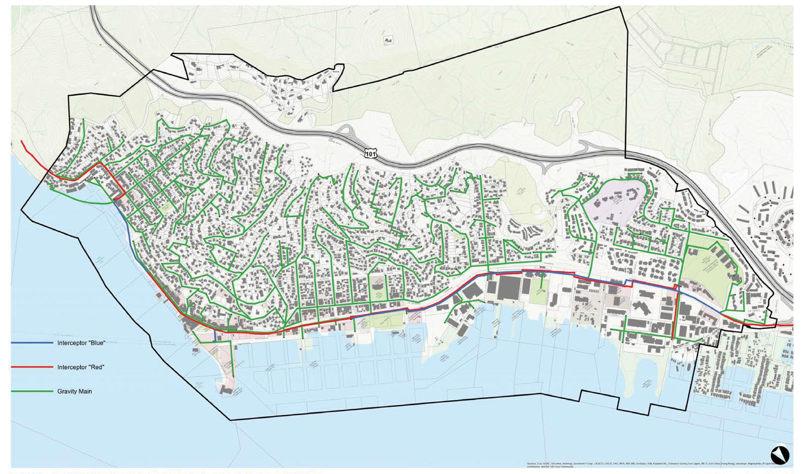
STATION 1
PROCESS OVERVIEW
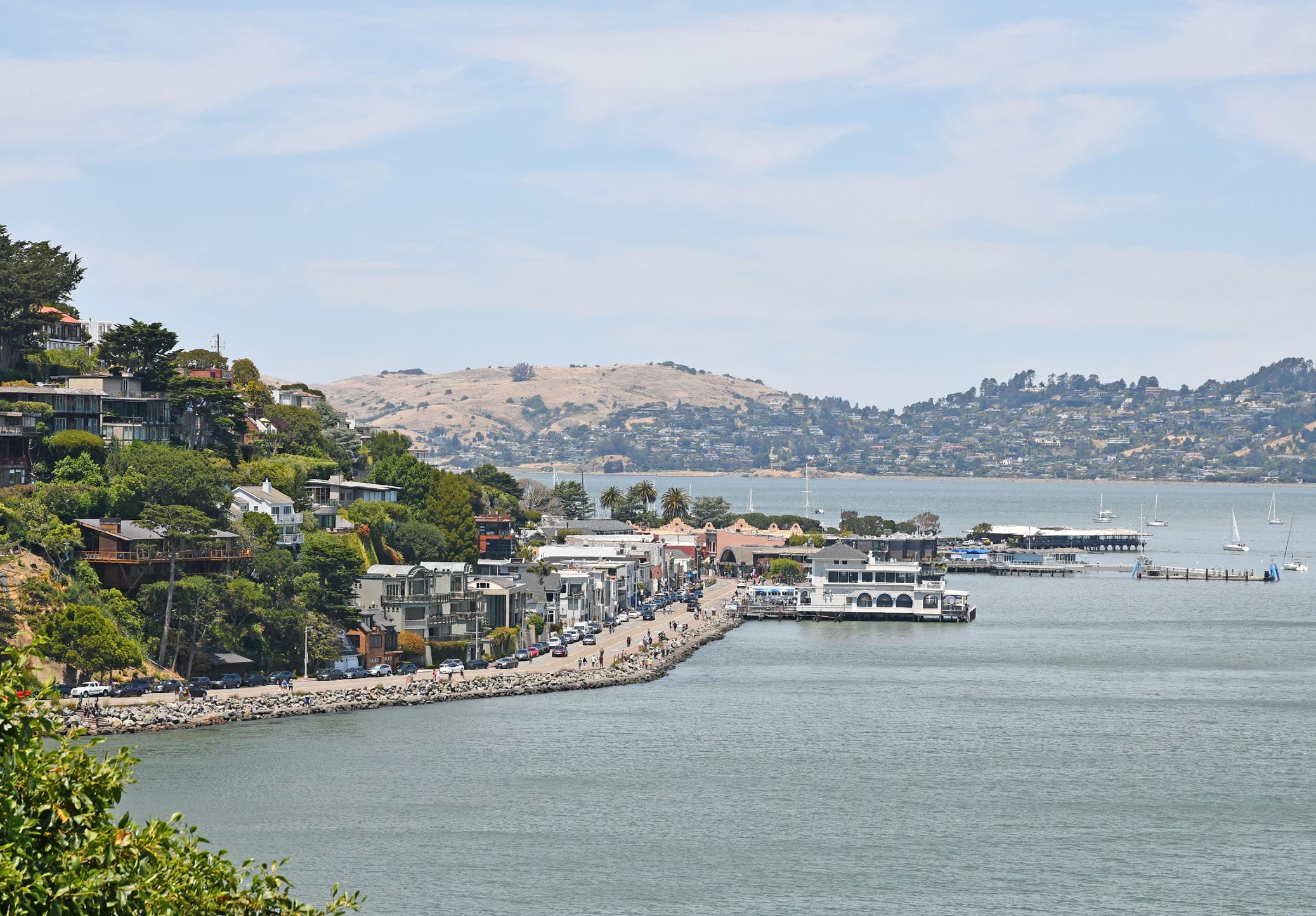
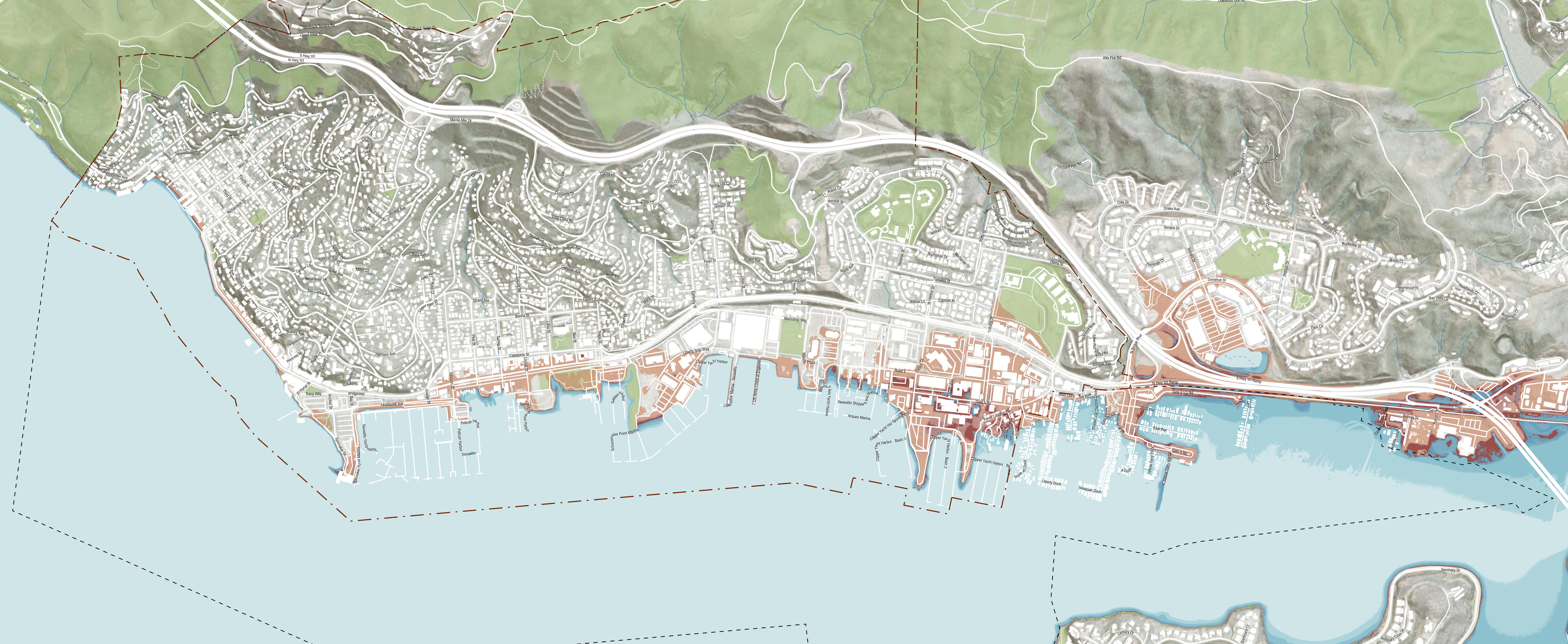
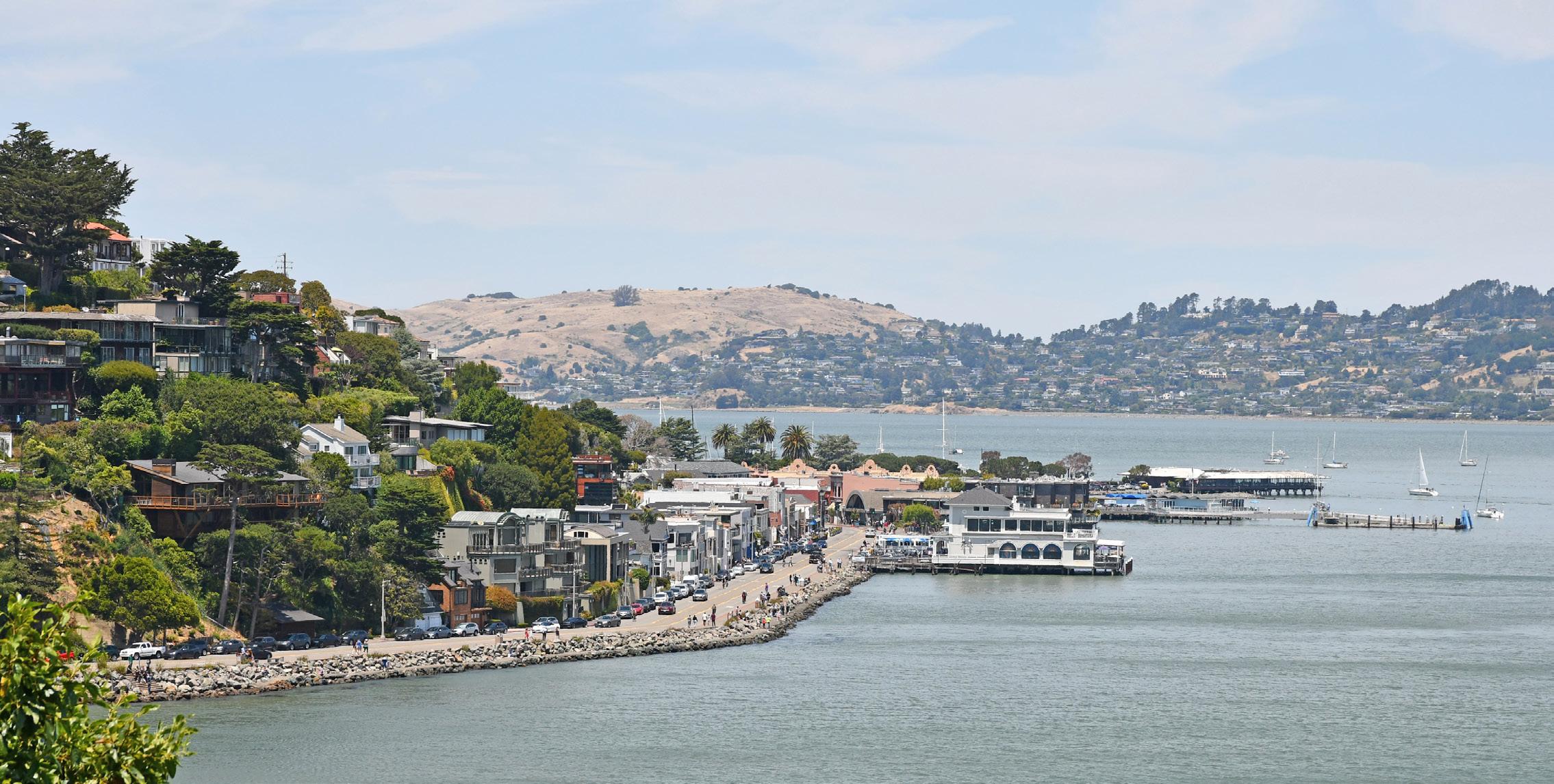
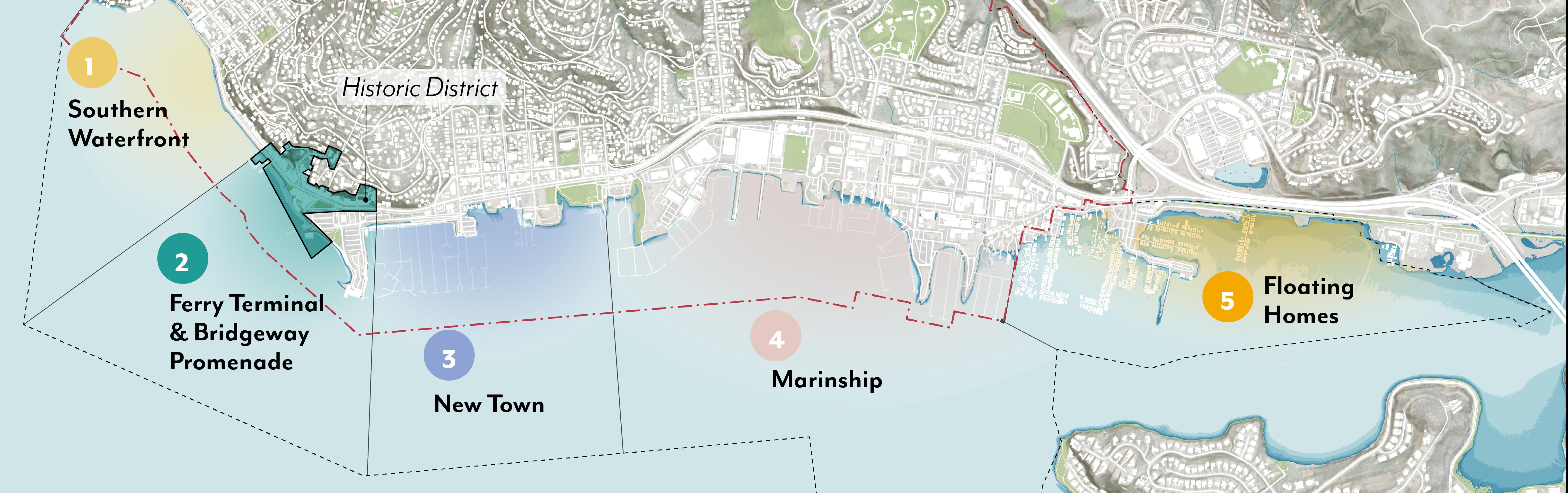
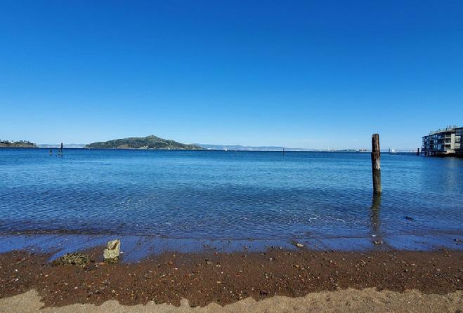
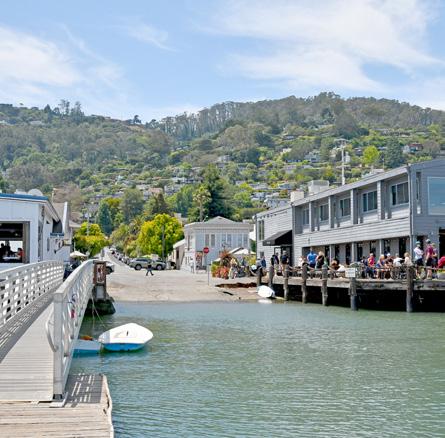
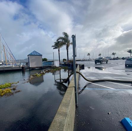
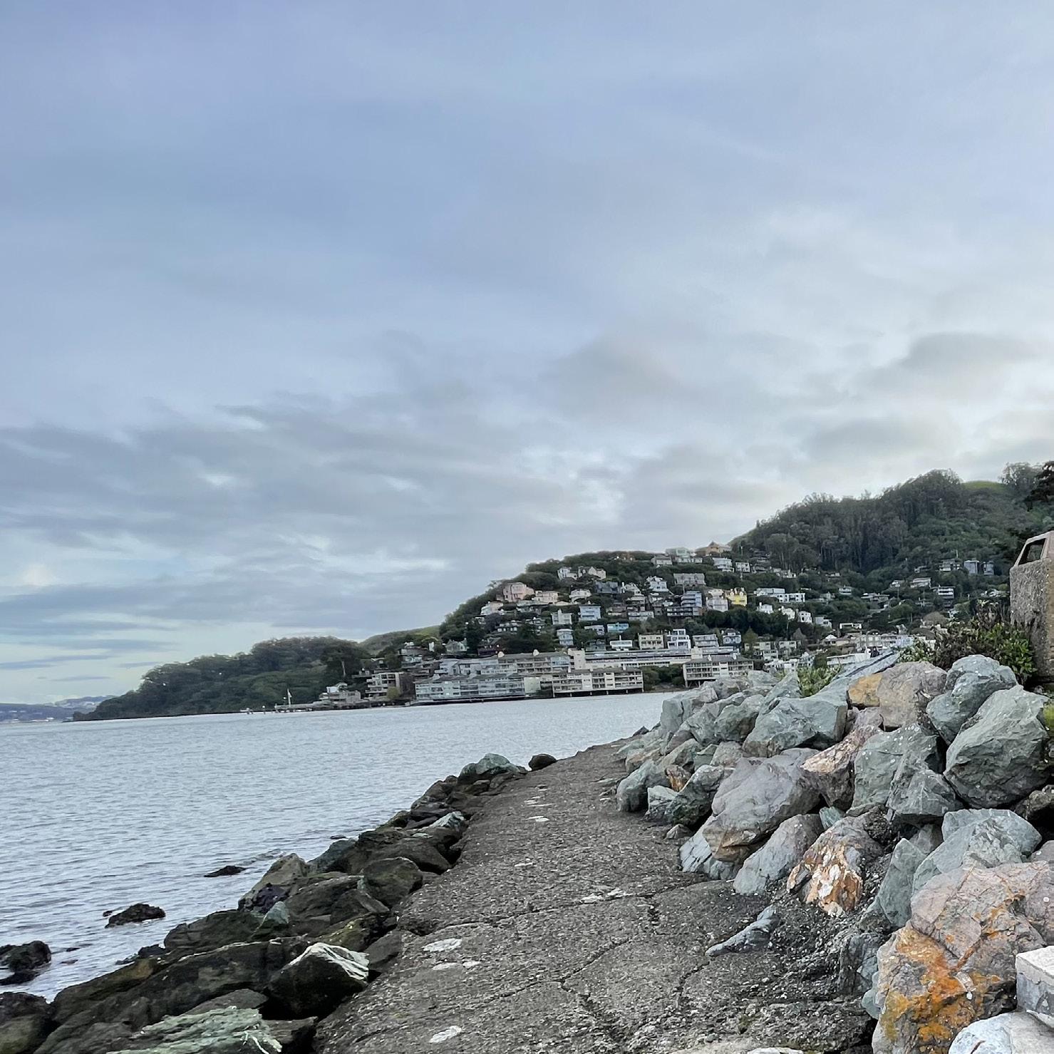
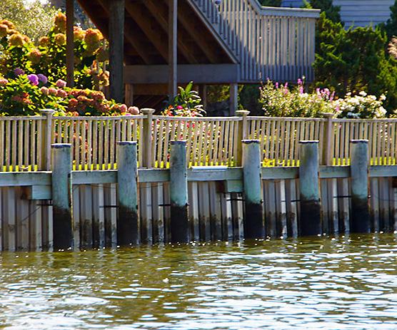
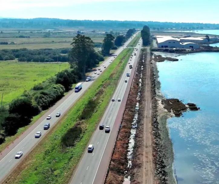
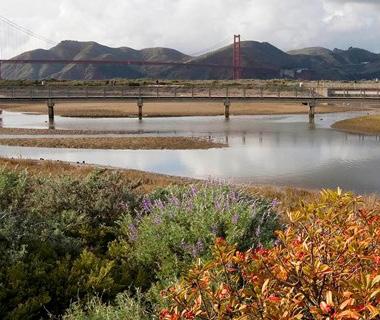
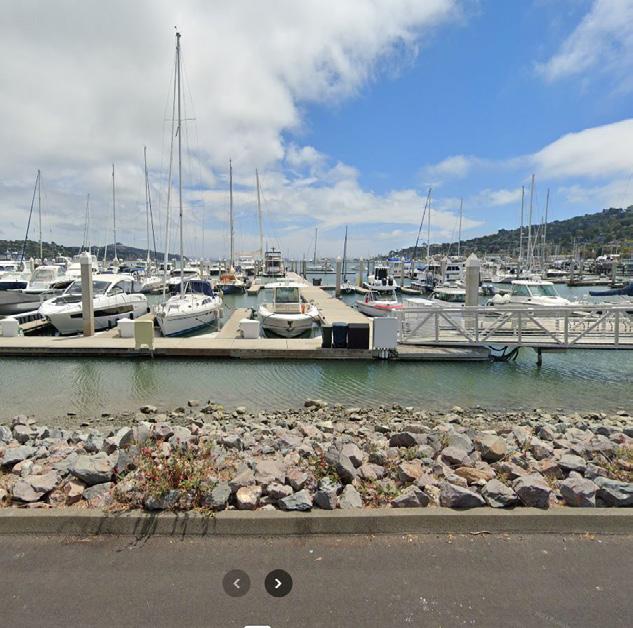
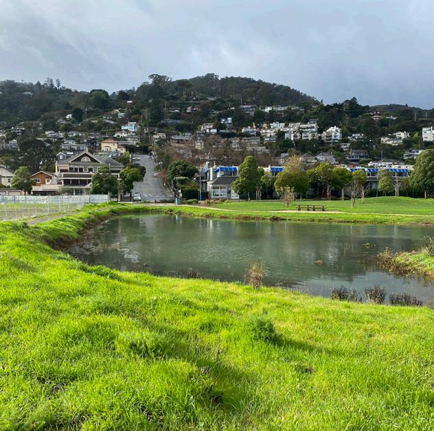
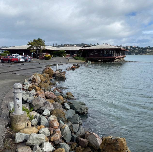
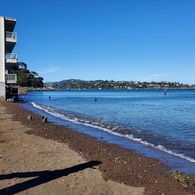
As a community of 7,000 residents situated between Richardson Bay and the coastal mountains, Sausalito is vulnerable to the impacts of sea level rise. Water rising along our 2.5 miles of shoreline will affect a wide range of our physical assets, policy decisions and programs including infrastructure, housing, circulation/transportation, land uses, and economic growth.
WE ARE HERE!
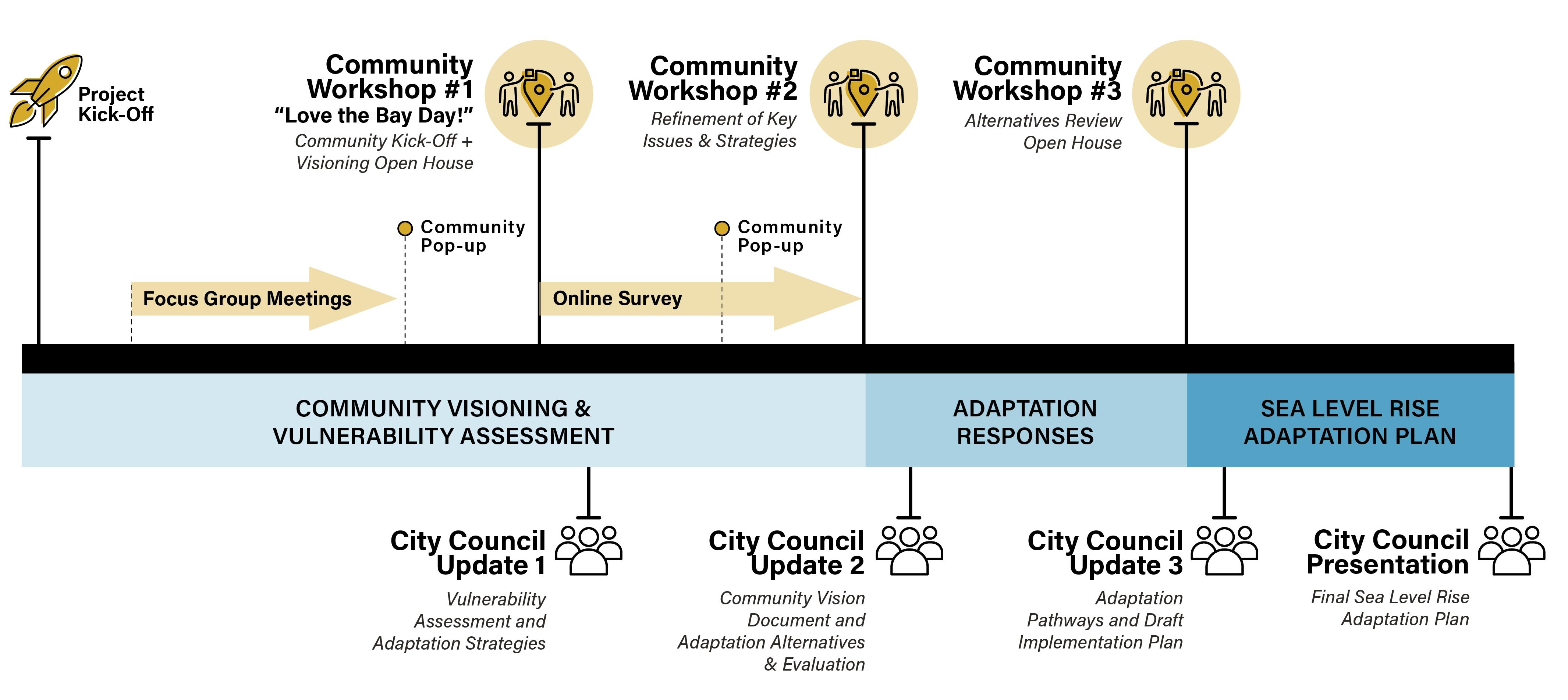
ENGAGEMENT TIMELINE
To meet these present and future challenges, the City of Sausalito is embarking on a community-informed Shoreline Adaptation Plan that aspires to protect our community from surface and groundwater flooding due to sea level rise, enhance shoreline recreation, maintain vital transportation and utility corridors, provide continued Bay access for waterrelated businesses, and enhance marshes and beaches with nature-based solutions.
www.surveymonkey.com/r/ sausalitoadaptation
What Do We Want to Accomplish Today?
OUR GOALS FOR TODAY:
Station 1. Framing and Introduction to the Project
This process is about understanding the challenges we face due to rising sea levels and planning proactively to protect our community.
Station 2. Understanding Our Vulnerability
This station will delve into the specific vulnerabilities our city faces. Understanding these vulnerabilities is crucial as it helps us grasp the urgency and scale of the issues we need to address.
Station 3. Why Everyone will be affected - City-Wide Impact
Shoreline adaptation isn’t just about protecting waterfront properties; its impacts go beyond the shoreline and affect our entire city’s infrastructure.
Station 4. Confirming Community Character and Zones
We want to ensure that our adaptation strategies respect and enhance the unique character of our community. We will review the different zones of our city and discuss what makes them special.
Station 5. Introducing Adaptation Tools and Strategies
We’ll introduce various adaptation tools and strategies that can help us mitigate these impacts. Our goal is to provide a broad overview so we can start thinking about which strategies might work best in different parts of our city.
Station 6. Next Steps: Exploring Adaptation Pathways and Solutions
We’ll discuss how we plan to explore different adaptation pathways, and work towards practical, effective solutions.
We are so glad you are here! This workshop marks the beginning of an exciting journey where we’ll work together to envision and shape the future of our city. Your insights and participation are vital as we explore how to create a more resilient and thriving community. The goal today is to learn about city-wide vulnerabilities and what adaptation strategies are possible along our shoreline.
Each station will provide you with information about vulnerabilities along our shoreline, strategies for adapting to rising water or ask you questions about your experience along the shoreline and throughout the city. We also have adaptation experts and local leaders available around the room to answer questions and chat about our world class city.
Next up we invite you to participate in the online survey via the QR code on the right and stay tuned for our next community meeting where we will report back on what we heard! TAKE SURVEY HERE!
The California Ocean Protection Council (OPC) is a state body that collaborates with government agencies, NGOs, tribes, and the public to protect California’s coastal and ocean ecosystems. OPC provides the best available science on sea level rise and coastal impacts, with guidance updated every five years, projecting sea level rise through 2150 and advising on coastal adaptation, resilience planning, and investments. The Sausalito Shoreline Adaptation Plan uses the 2024 OPC guidance to set standards for planning.
2. Building off of BayWAVE (2017)
The Marin Shoreline Sea Level Rise Vulnerability Assessment (BayWAVE 2017) was a vulnerability assessment for Marin County which documented the bay side communities and their exposure to sea level rise. BayWAVE identified specific risks and impacts along the entire bay shoreline, from Sausalito to Novato, for several sea level rise scenarios based on 10 inches, 20 inches and 60 inches. BayWAVE is used by local communities to understand and prepare for sea level rise along the Bay shoreline.
The Sausalito Shoreline Adaptation plan uses the updated 2024 OPC guidance and cross references the BayWAVE sea level rise scenarios to guide this analysis.
WHY ARE WE STUDYING SEA LEVEL RISE?
• Water is rising
• There is funding for planning
• It’s mandatory
• December 2023 City Council Direction
SB272: NEW LAW REQUIRES SEA LEVEL RISE PLANNING
• SB 272 requires cities like Sausalito to develop strategies and recommend projects to address future sea-level rise.
• Plans must be submitted to the Bay Conservation and Development Commission (BCDC) by 2034.
• The Sausalito Shoreline Adaptation plan will satisfy the requirements of SB 272.
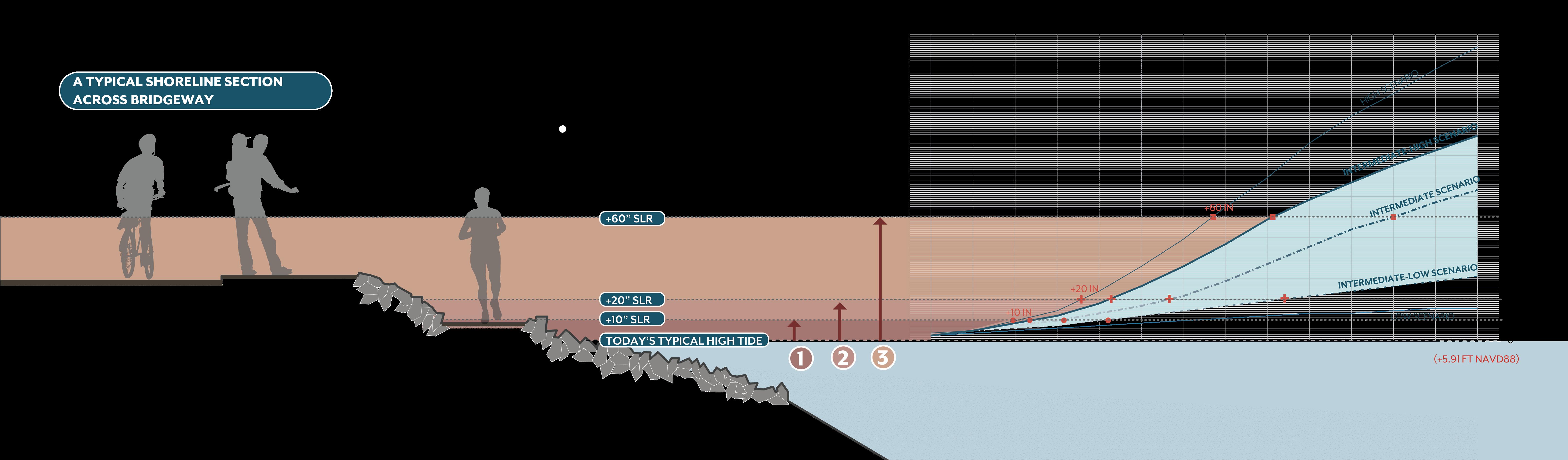
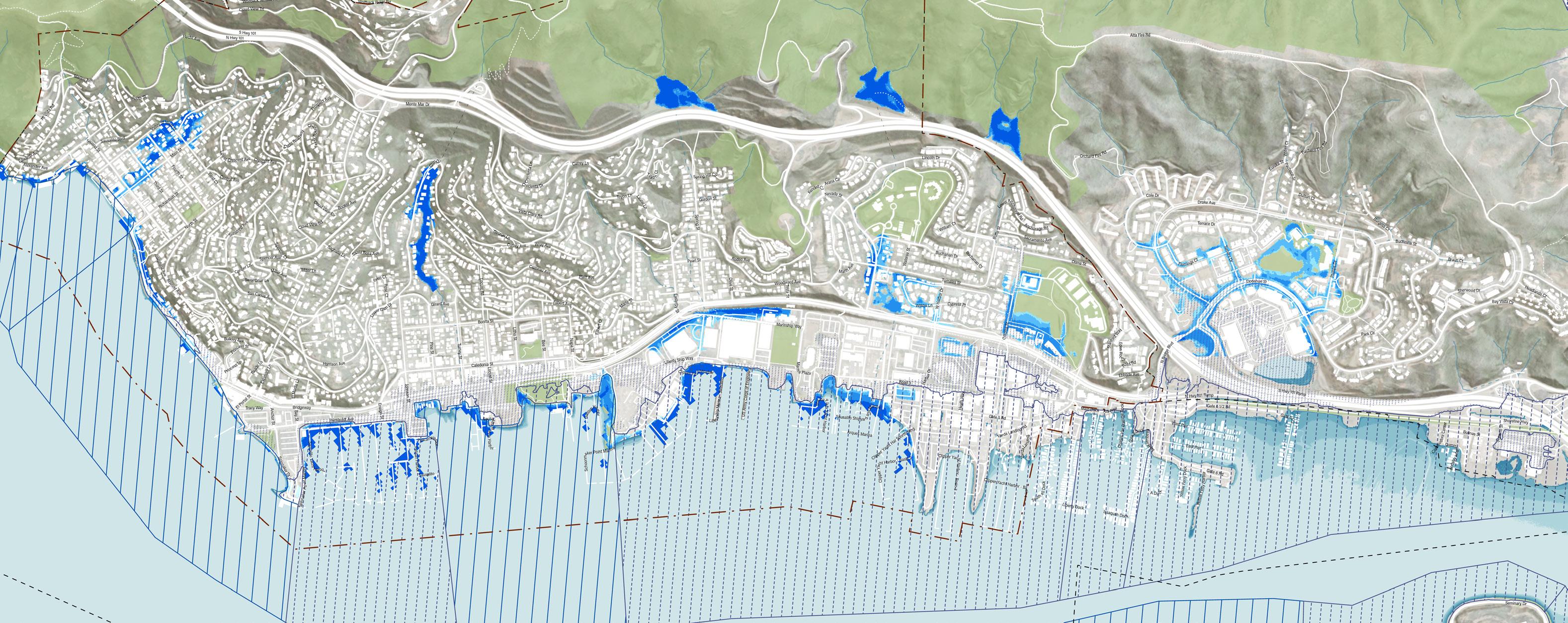
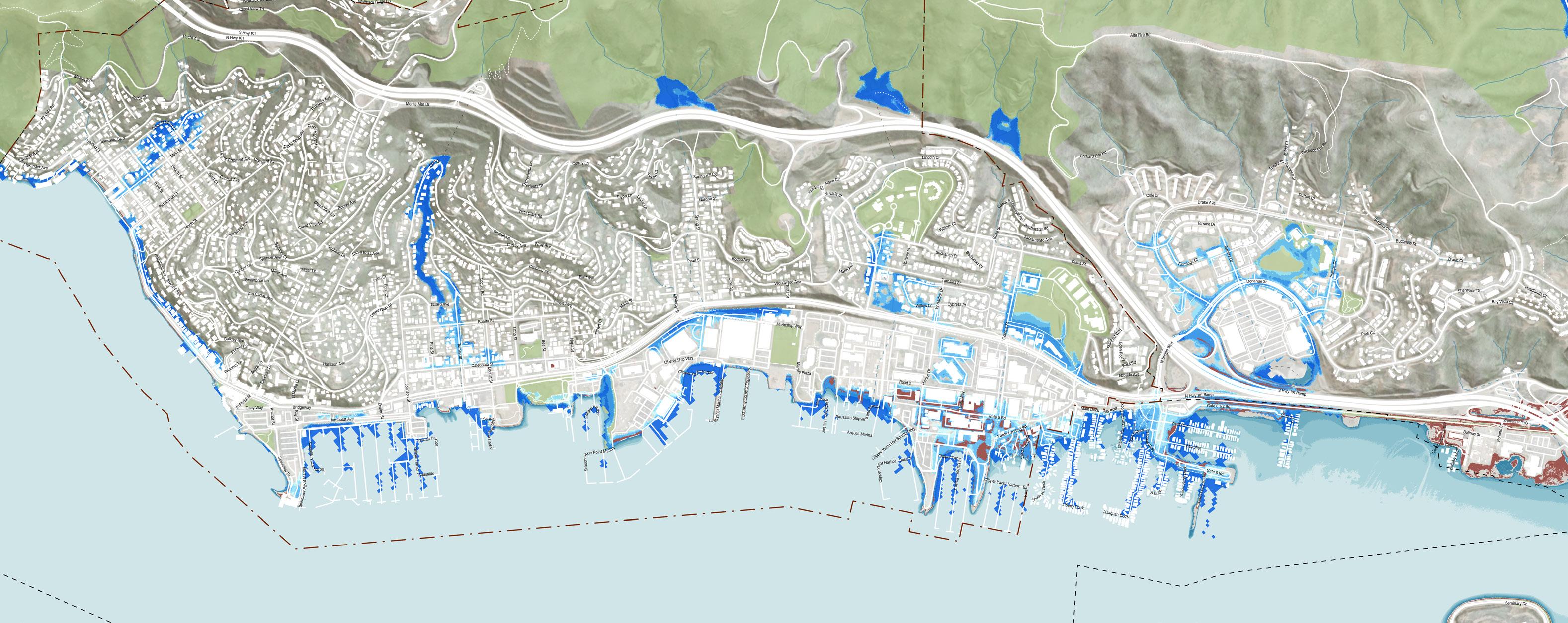
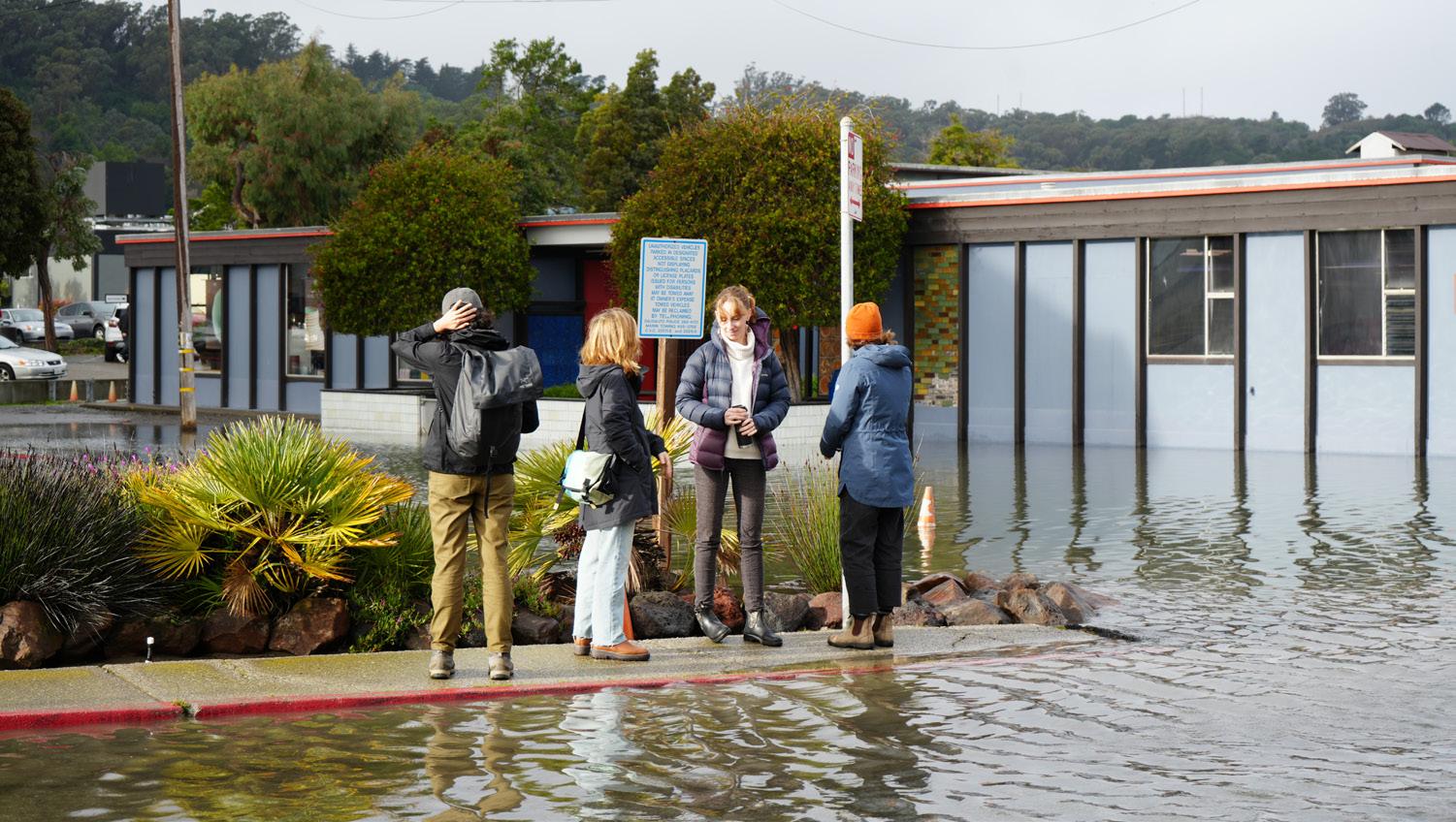
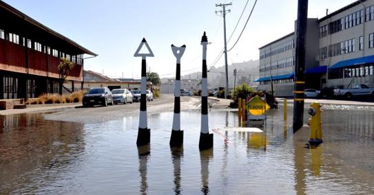
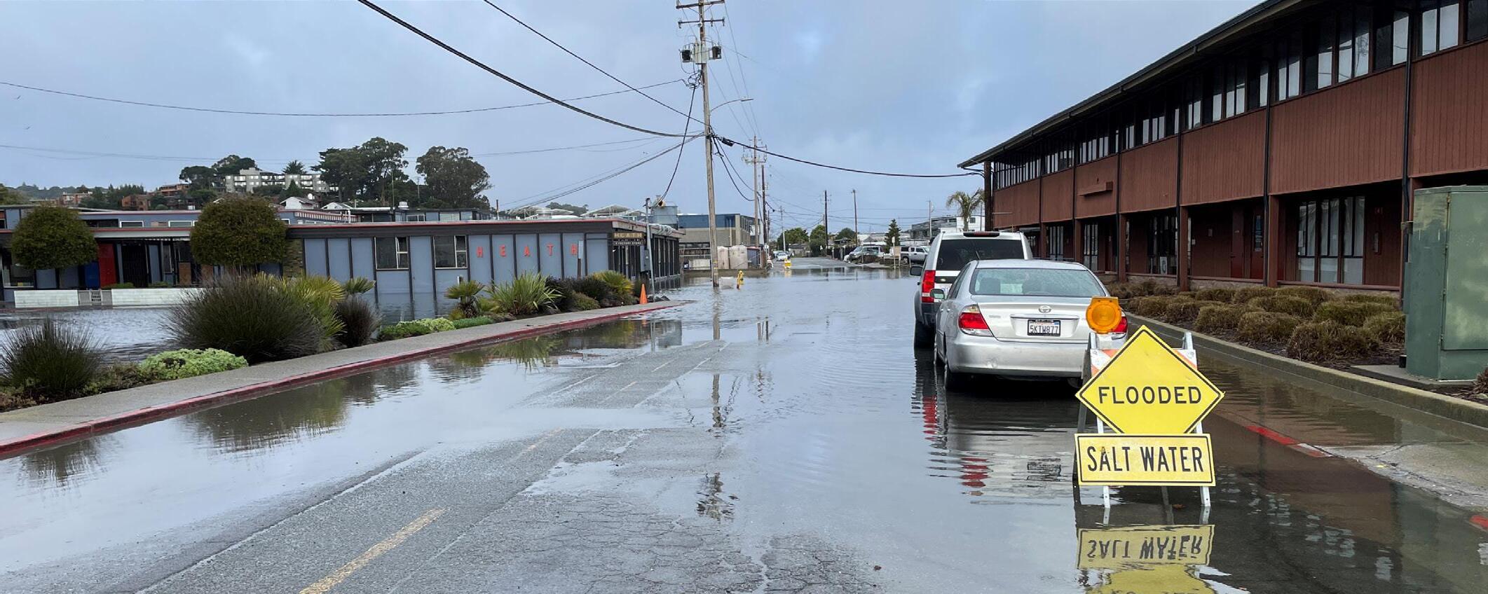
Risk of Coastal Inundation
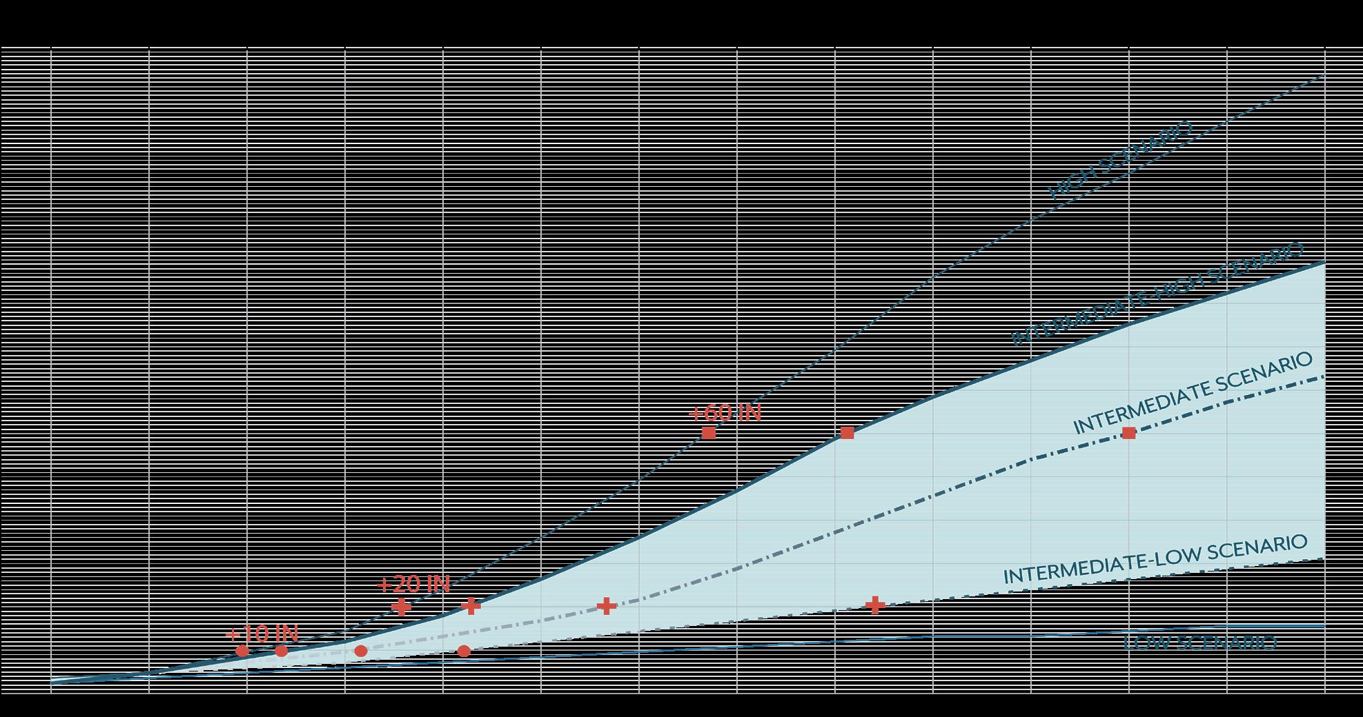
What does a 10-inch increase in water level mean?
A 10-inch increase will be an average high tide in 2045 but it also happens often today, in 2024, with Royal Tides, high tides and frequent storms.*
* Based on the Intermediate-High Sea Level Rise Scenario (OPC 2024)
What does a 20-inch increase in water level mean?
A 20-inch increase will be an average high tide in 2060, but it will also occur sooner, during a Royal Tide in 2040, and happens often today, in 2024, during a frequent storm.*
** A Royal Tide is a non-scientific term people often use to describe exceptionally high tides.
What does a 60-inch increase in water level mean?
A 60-inch increase will be an average high tide in 2100, but it will also occur sooner, during a Royal Tide in 2090, and will occur during frequent storms starting in 2080.*
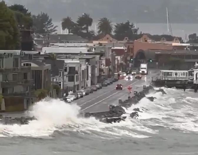
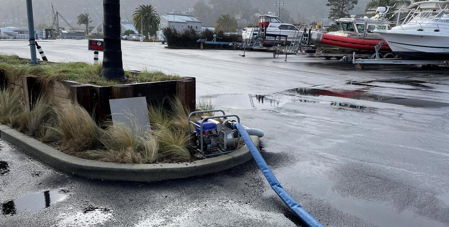
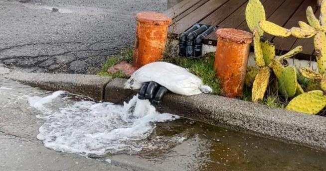
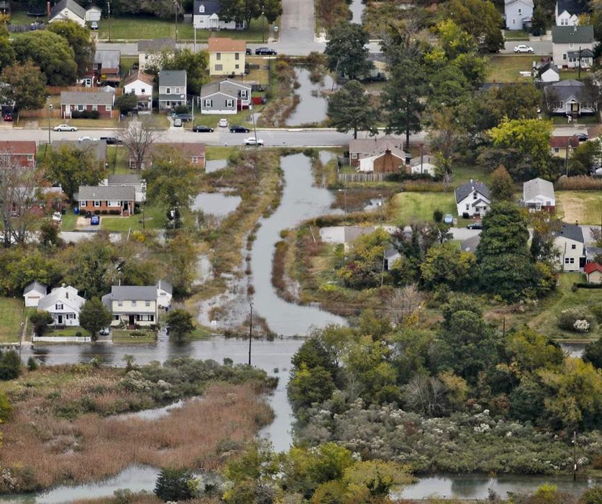
Rainy Day Flooding - Storms
Permanent
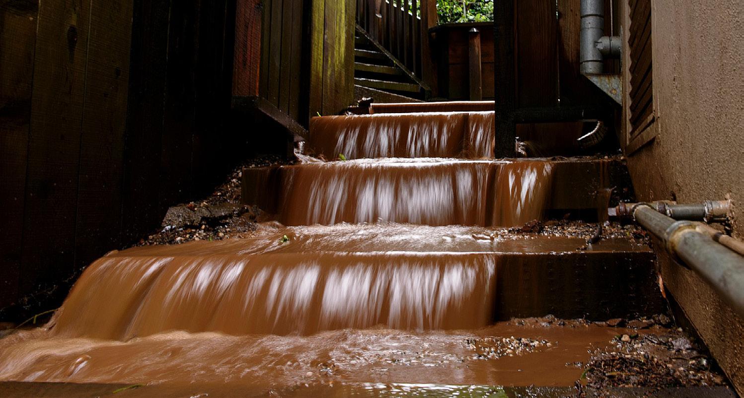
Inundation isn’t the only impact related to sea level rise.
Storm Inundation:
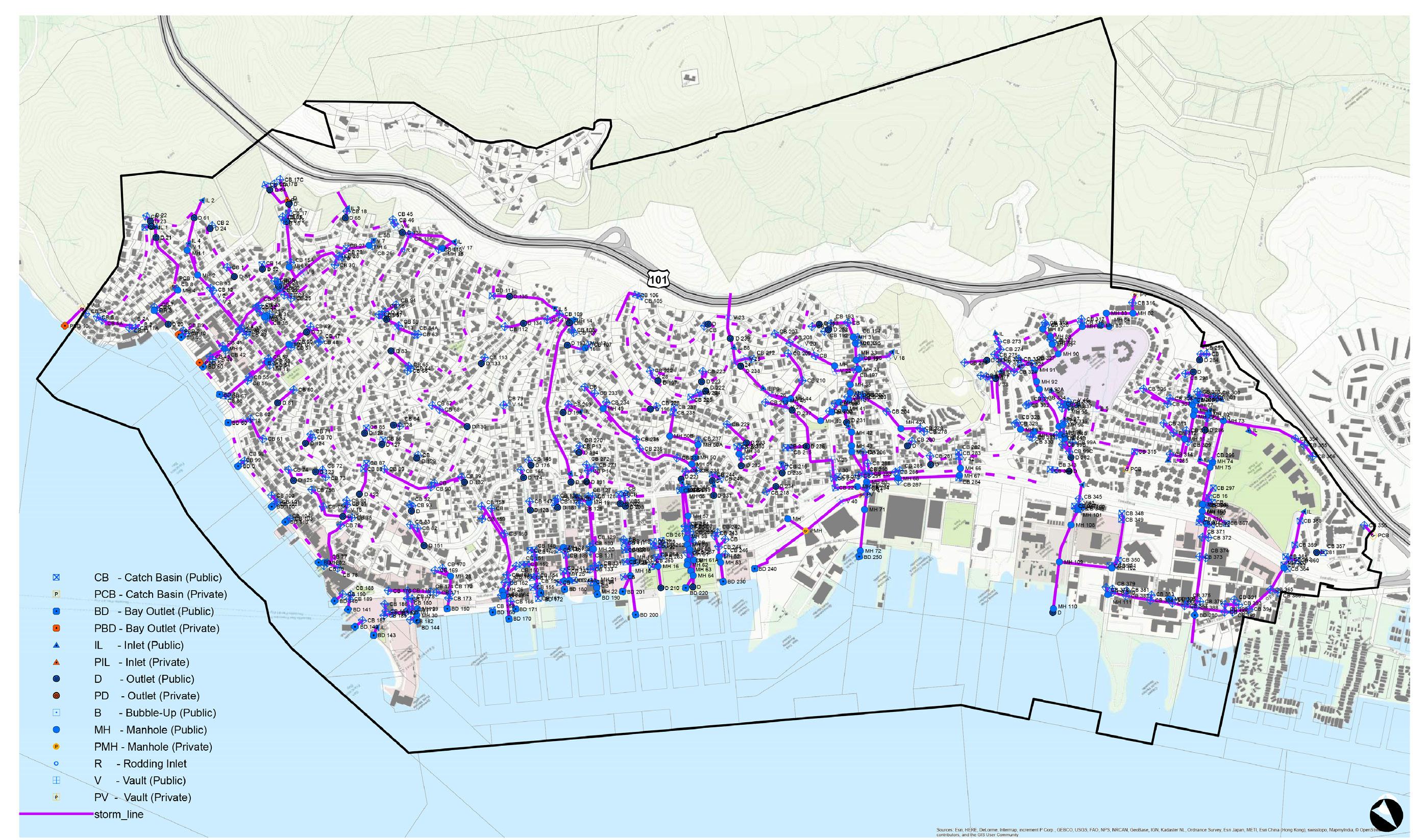
Sea level rise can lower the capacity of the existing storm infrastructure causing more flooding during events. Storm surges, which are large waves caused by storms, can also push water further inland, exacerbating the impact of floods. In addition, climate change is causing large storms to occur more frequently.
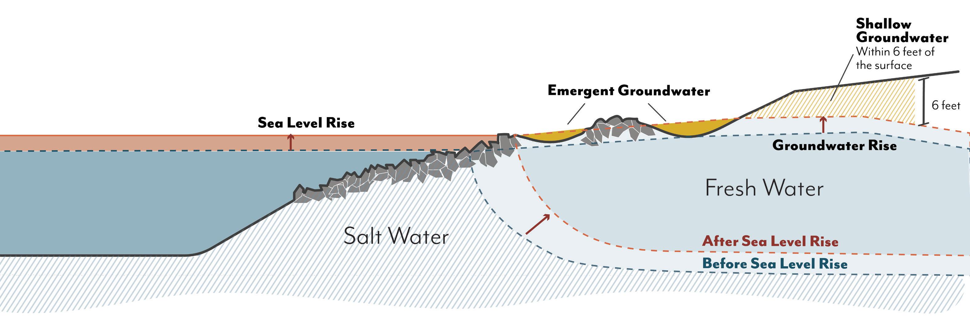
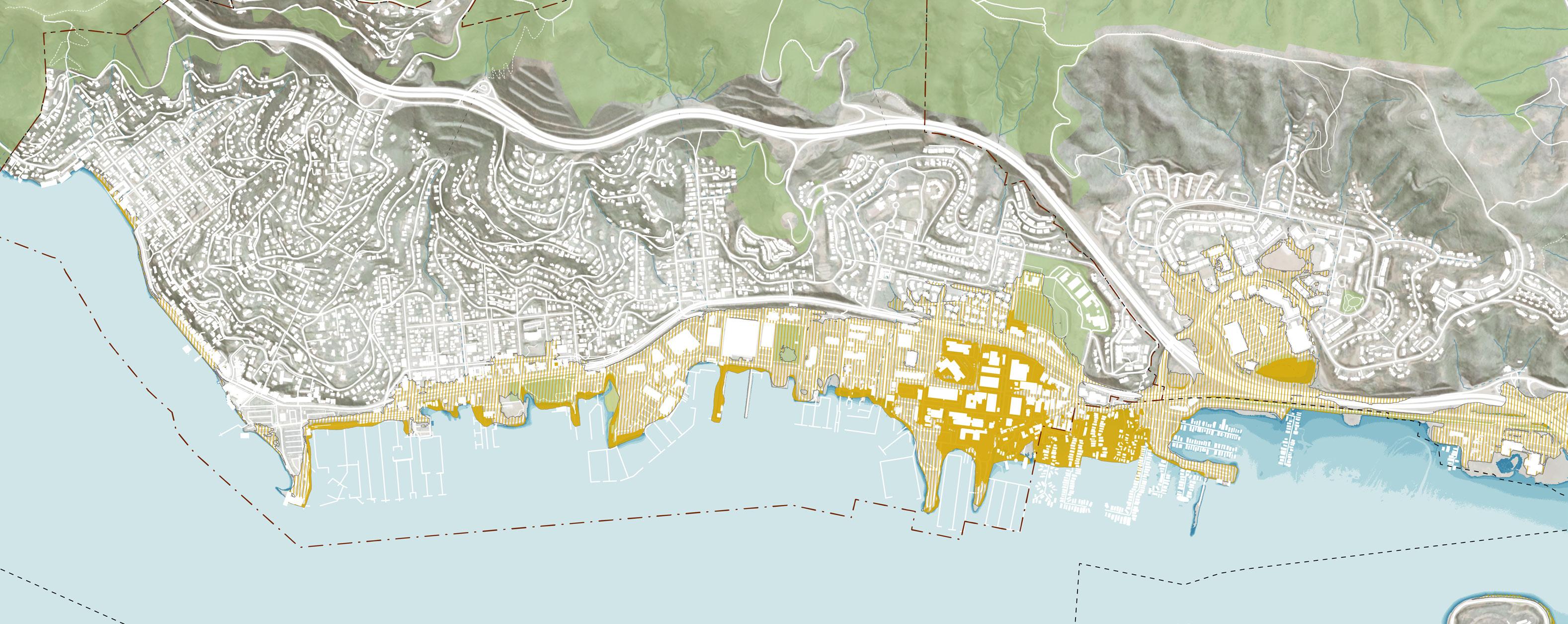
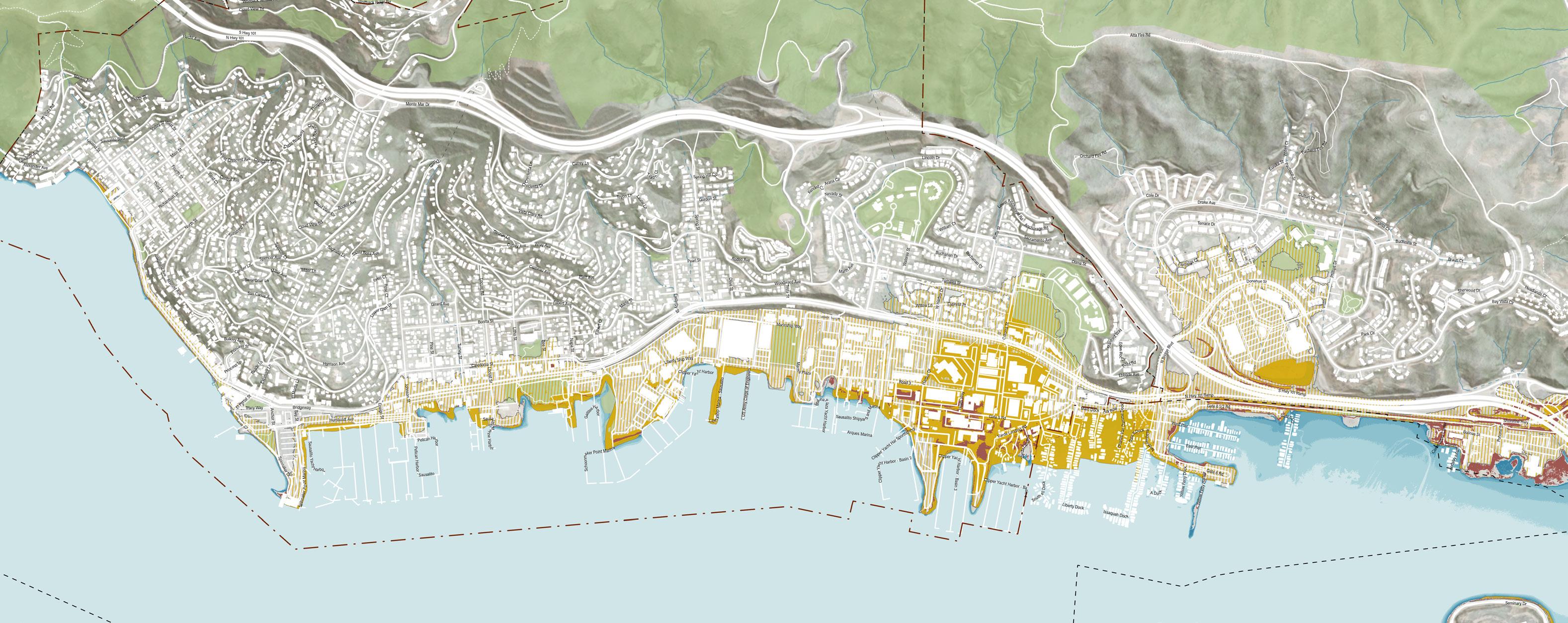
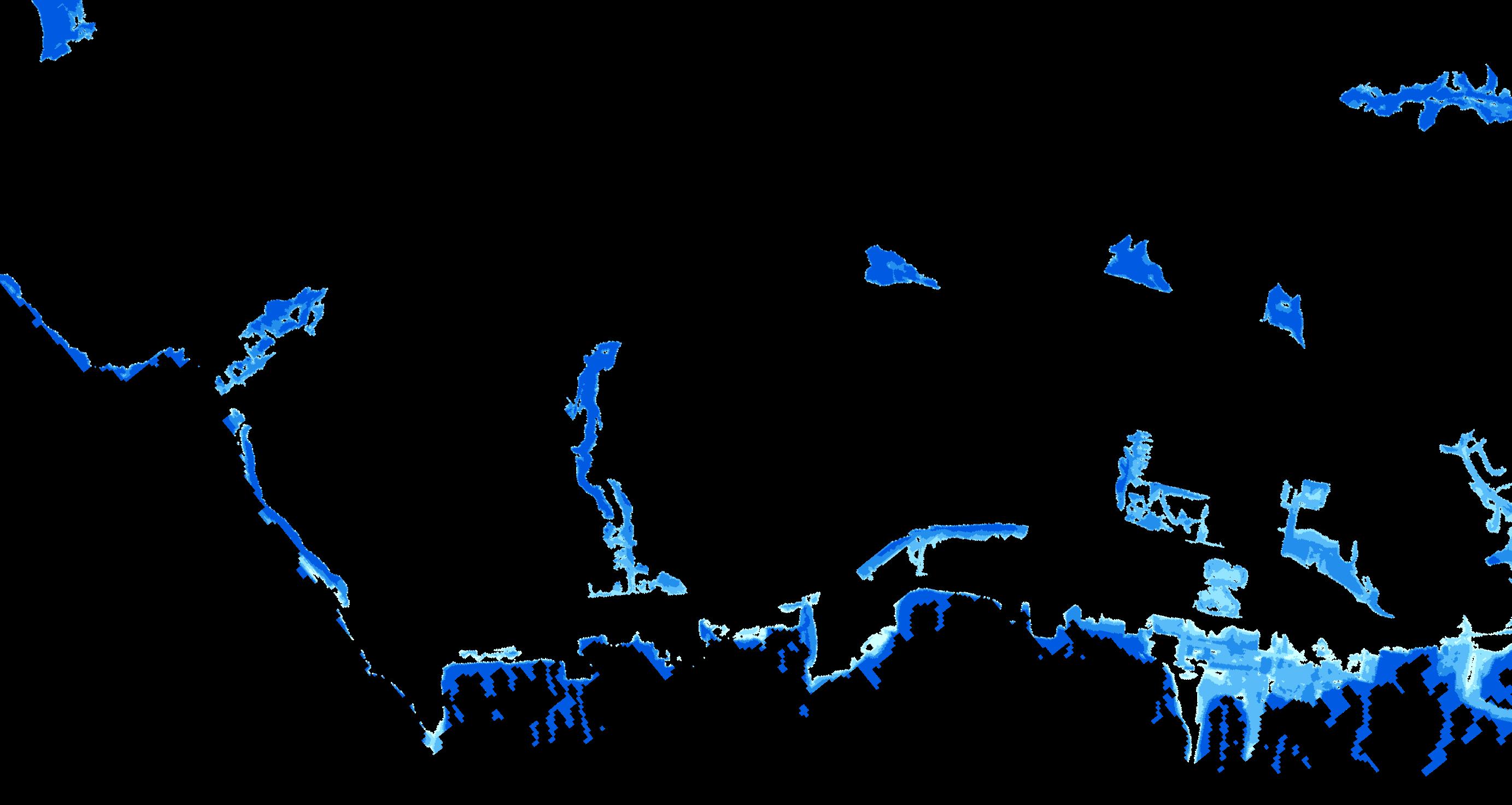
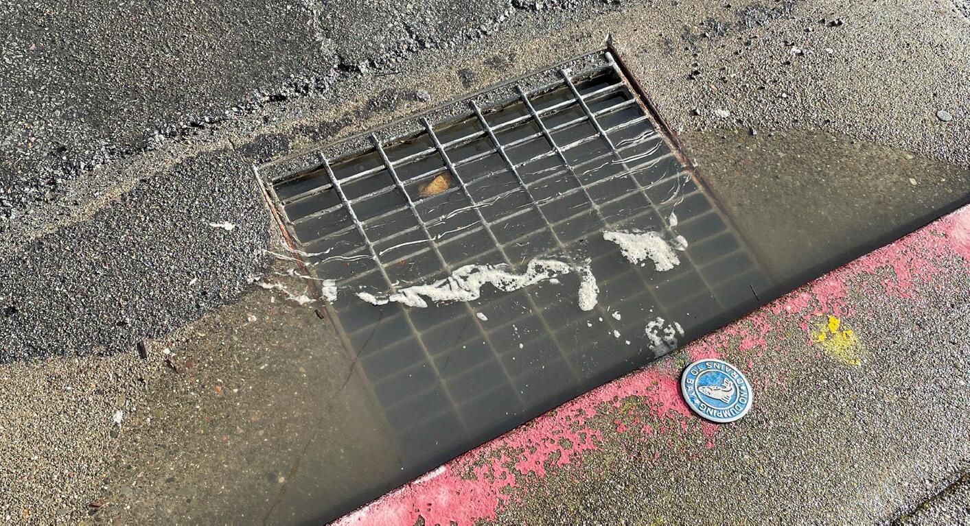
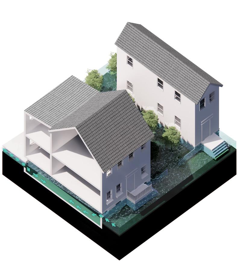
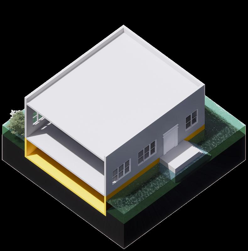
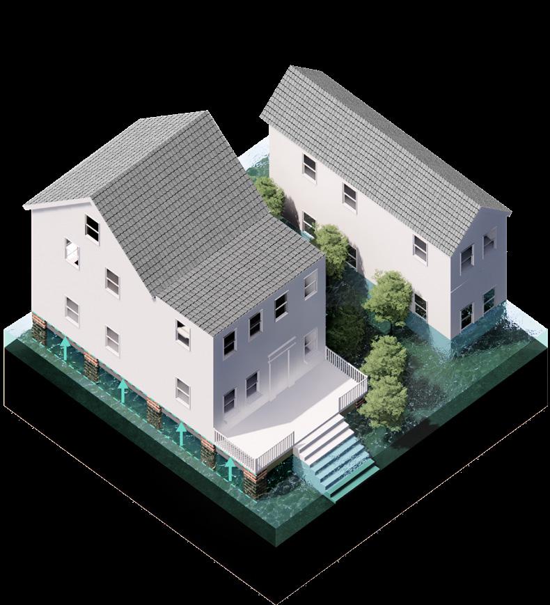
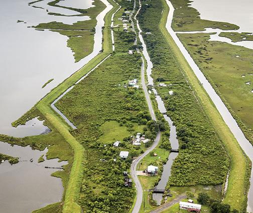
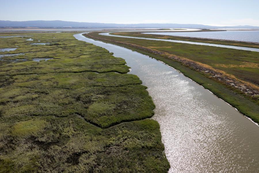
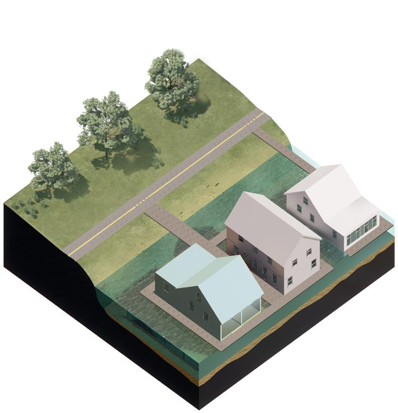
Sunny Day Flooding - Groundwater
How does sea level rise impact groundwater?
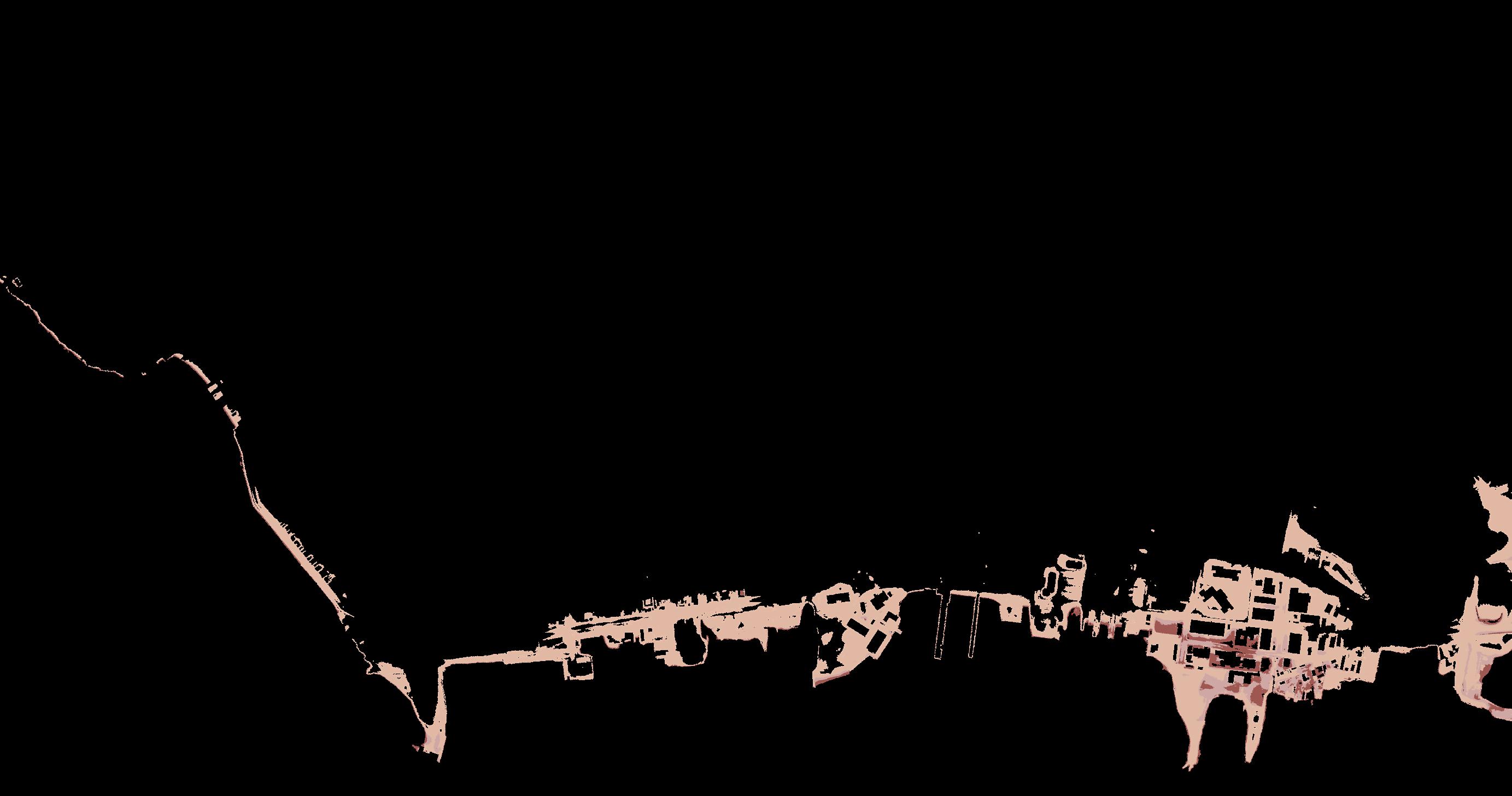
As sea levels rise, subsurface salt water pushes fresh groundwater up through the soil, causing groundwater tables to rise. This can happen because salt water is denser than fresh water. Potential consequences of groundwater rise include changes in soil conditions that can impact infrastructure and buildings.
*12” Groundwater Data
*First Street data for 2053
: G roundwater with 0” Sea Level Rise G roundwater with 10” Sea Level Rise
Hazards Beyond Shoreline
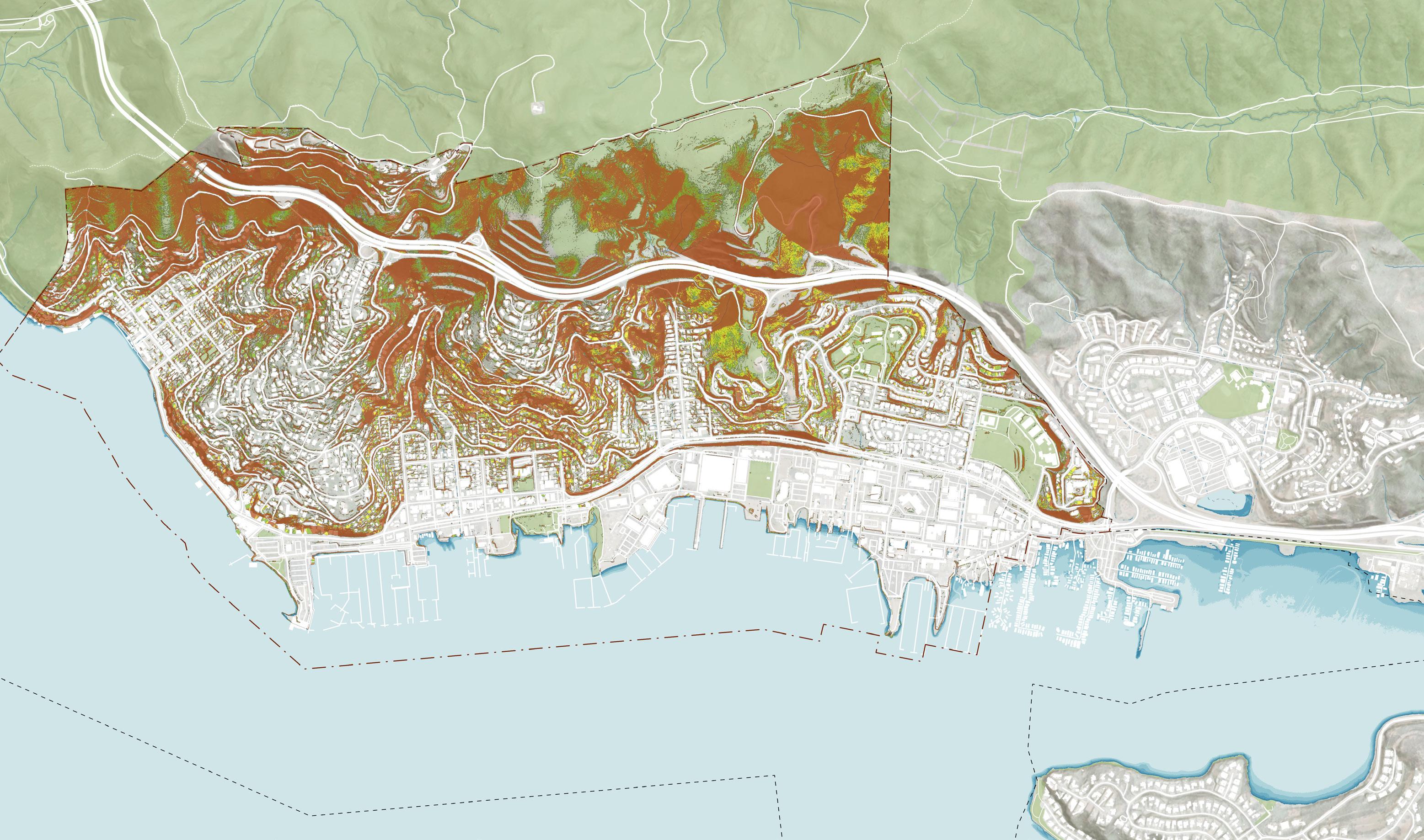
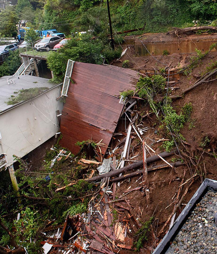
How is sea level rise related to land subsidence, landslides and liquefaction?
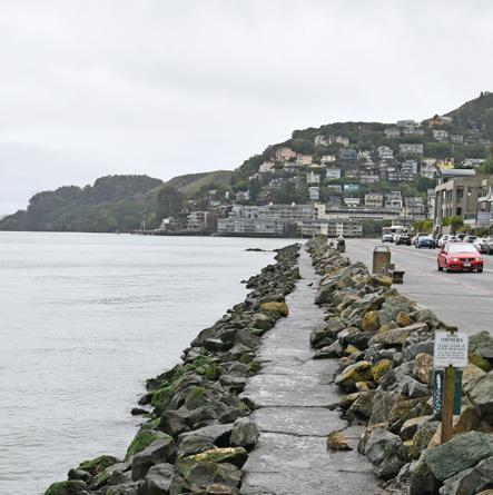
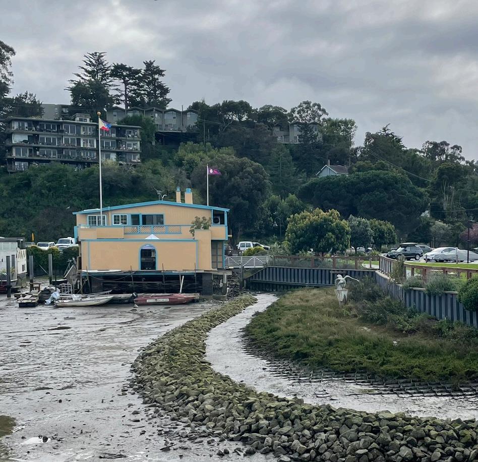
Landslides: The combination of rising sea level, groundwater changes and extreme storms can lead to increased landslide risk. In addition, Sausalito has seven culverted streams which destabilize hillsides.
Liquefaction: Sausalito is susceptible to liquefaction which occurs when loosely packed, water-logged sediments lose their strength in response to strong ground shaking. Sea level rise increases the risk of liquefaction due to the increase presence of water. Some of the shoreline is built on reclaimed land and is particularly vulnerable.
Land subsidence: Land subsidence occurs when the ground gradually sinks, often occurring in low-lying areas around the bay which were historically marsh or mudflat that have since been filled with sediment. Subsidence risk is a critical design consideration limiting the feasibility of certain adaptation strategies along the shore.
In summary, sea level rise, landslides, liquifaction, and land subsidence are interconnected issues that can amplify risks in Sausalito, especially beyond the shoreline.
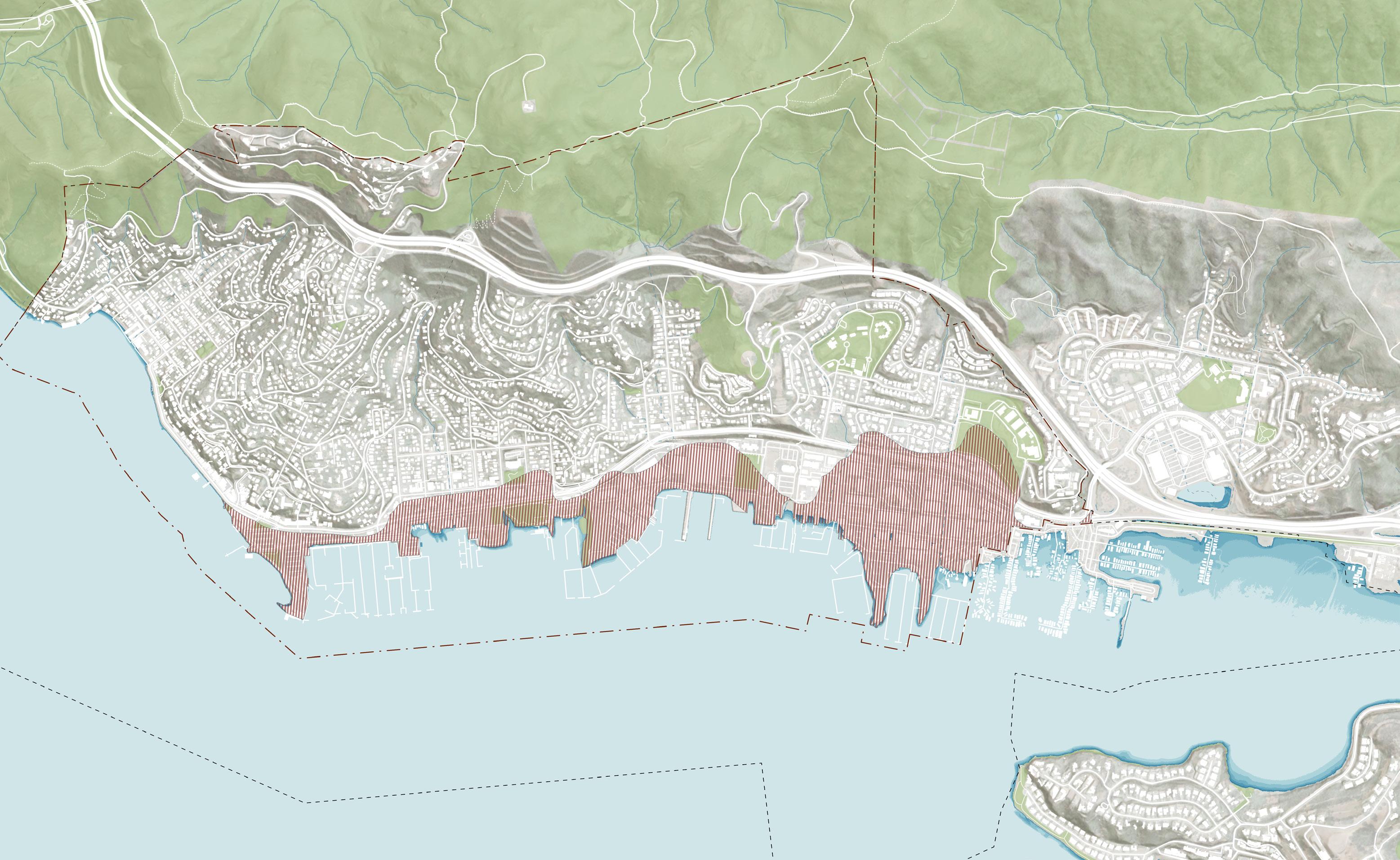
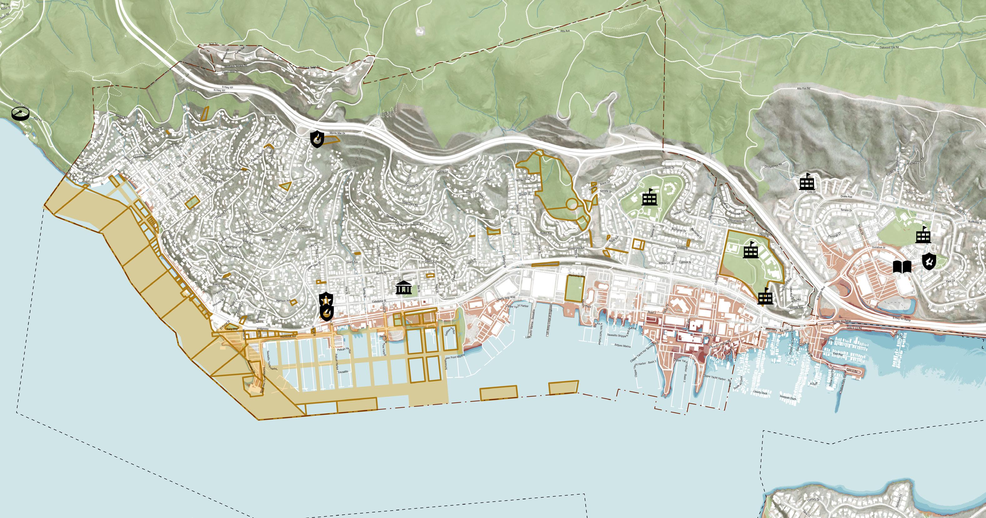
Facilities + Evacuation
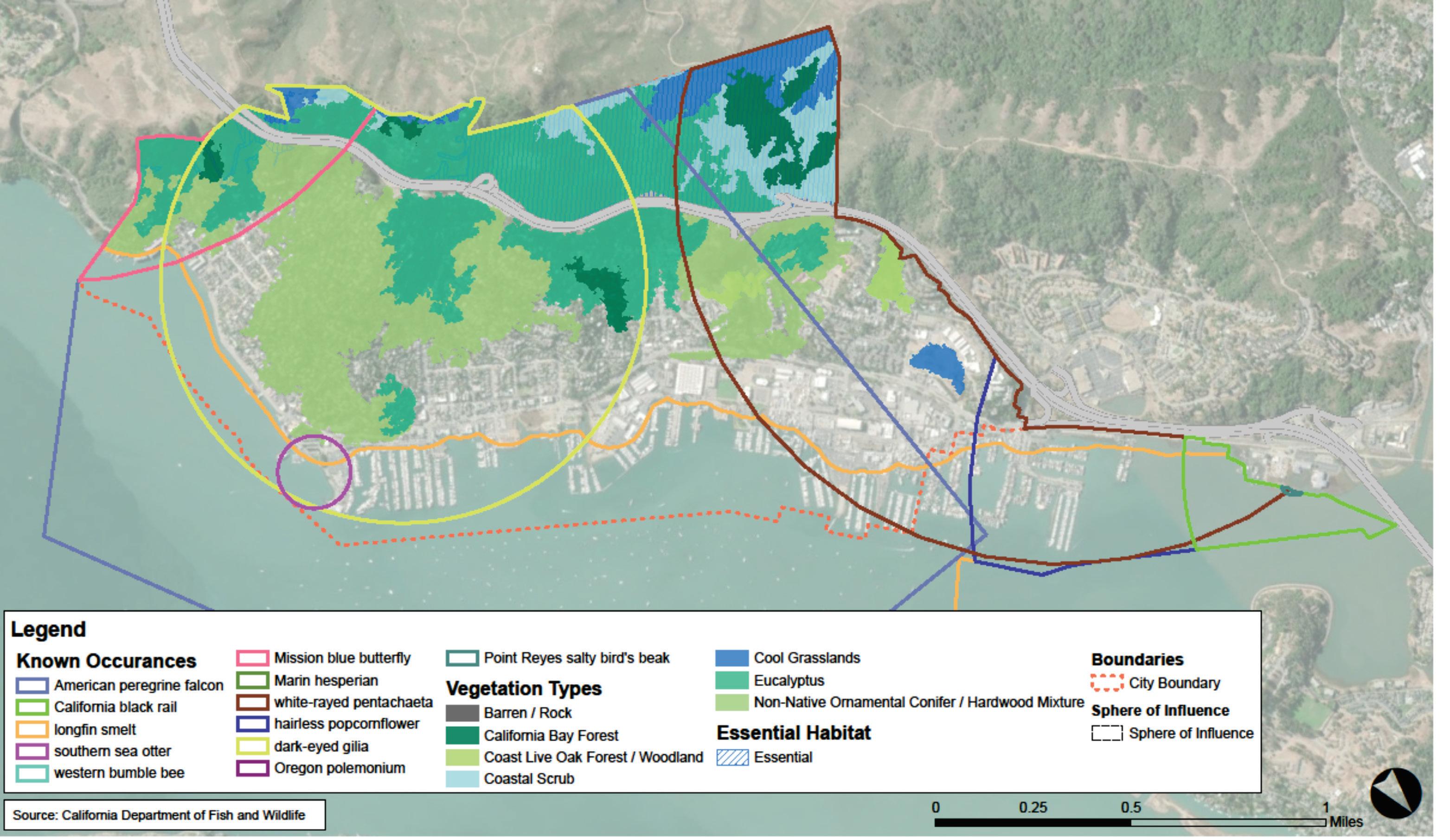
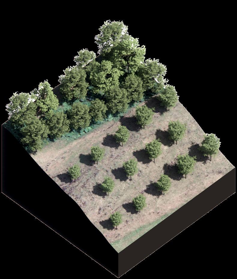
Today’s Fauna & Flora
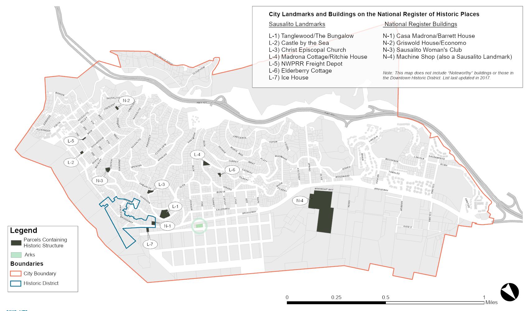
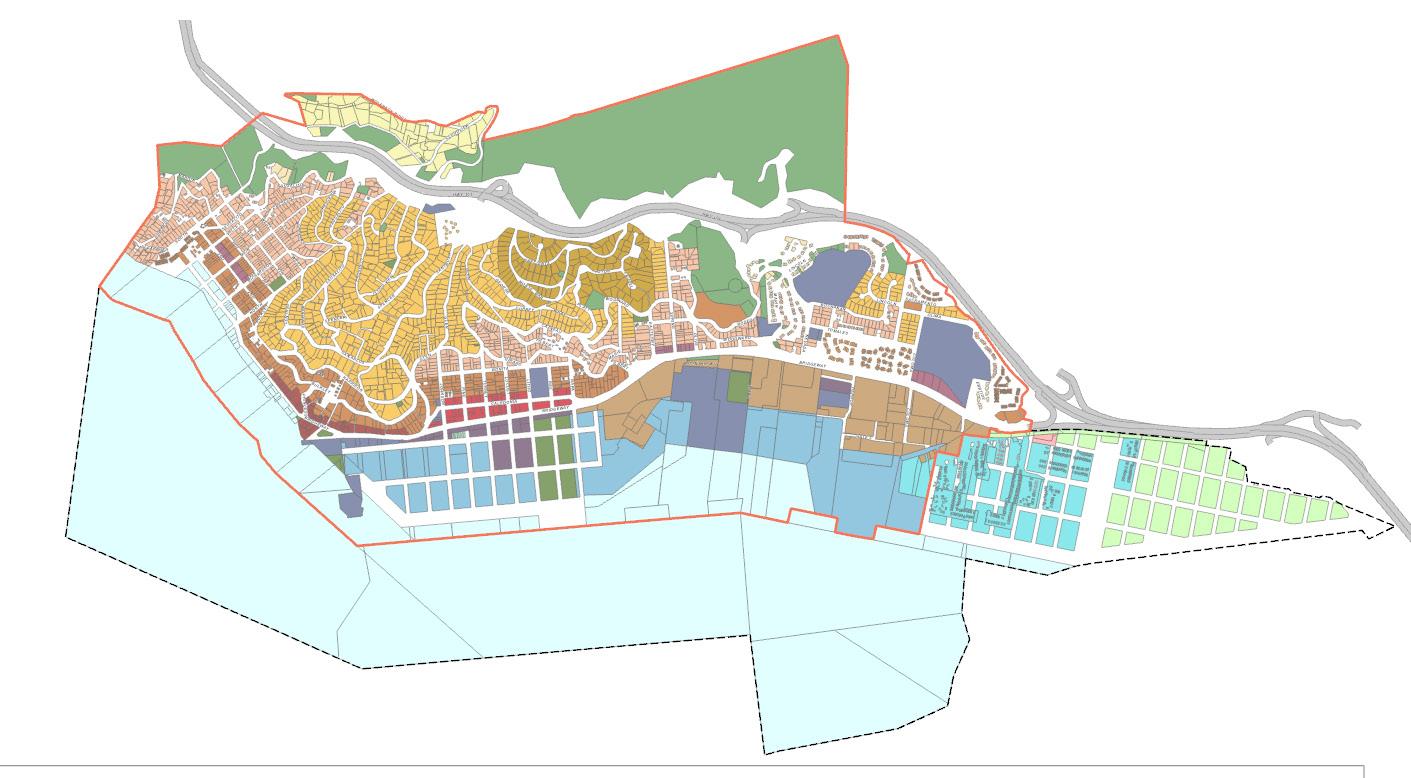
Historic Structures + Land Use
HISTORIC STRUCTURES - 2021 GENERAL PLAN
Impacts to the commercial district and related tourist destinations could result in changes to tax revenue and future ability to pay for infrastructure maintenanceand improvements that protect us from the influence of climate change.
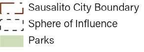
STATION 4
COMMUNITY CHARACTER
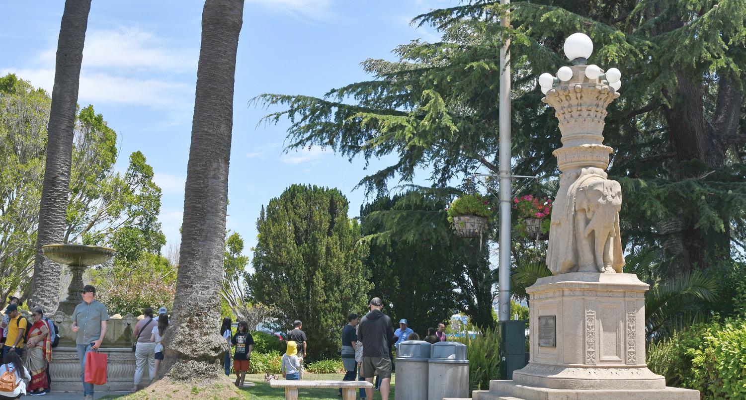
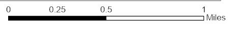
SAUSALITO HISTORY
Sausalito is one of the oldest communities in Marin with many special qualities and assets. The timeline below highlights its unique community identity as well as a series of major milestones in its history.
The future planning work will preserve Sausalito’s historic waterfront character, and strike the balance between environmental and cultural resilience. What does our history say about our future?
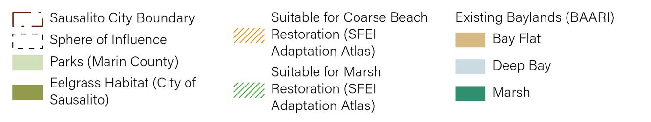
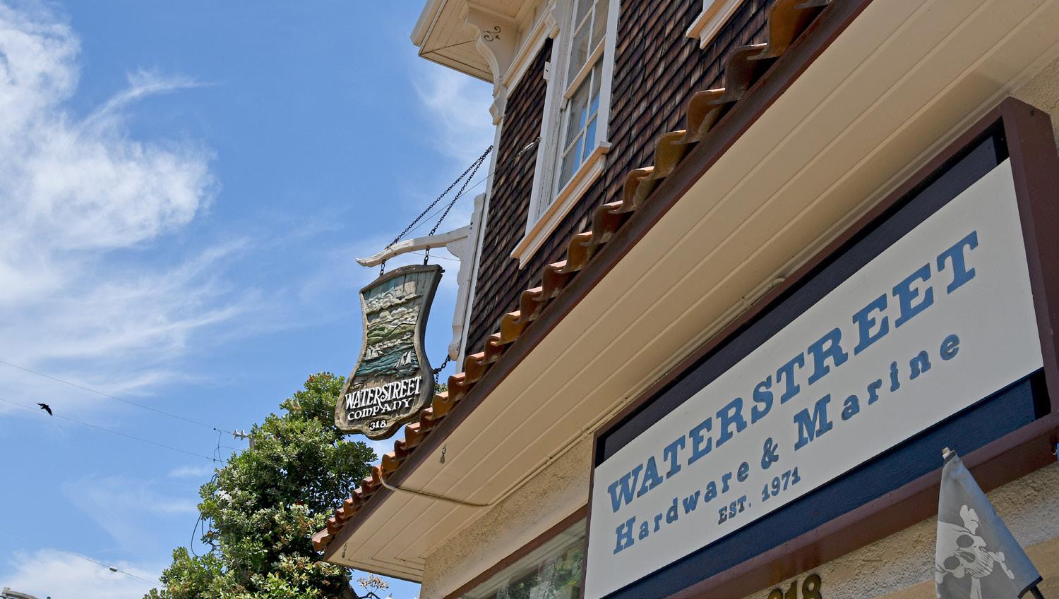
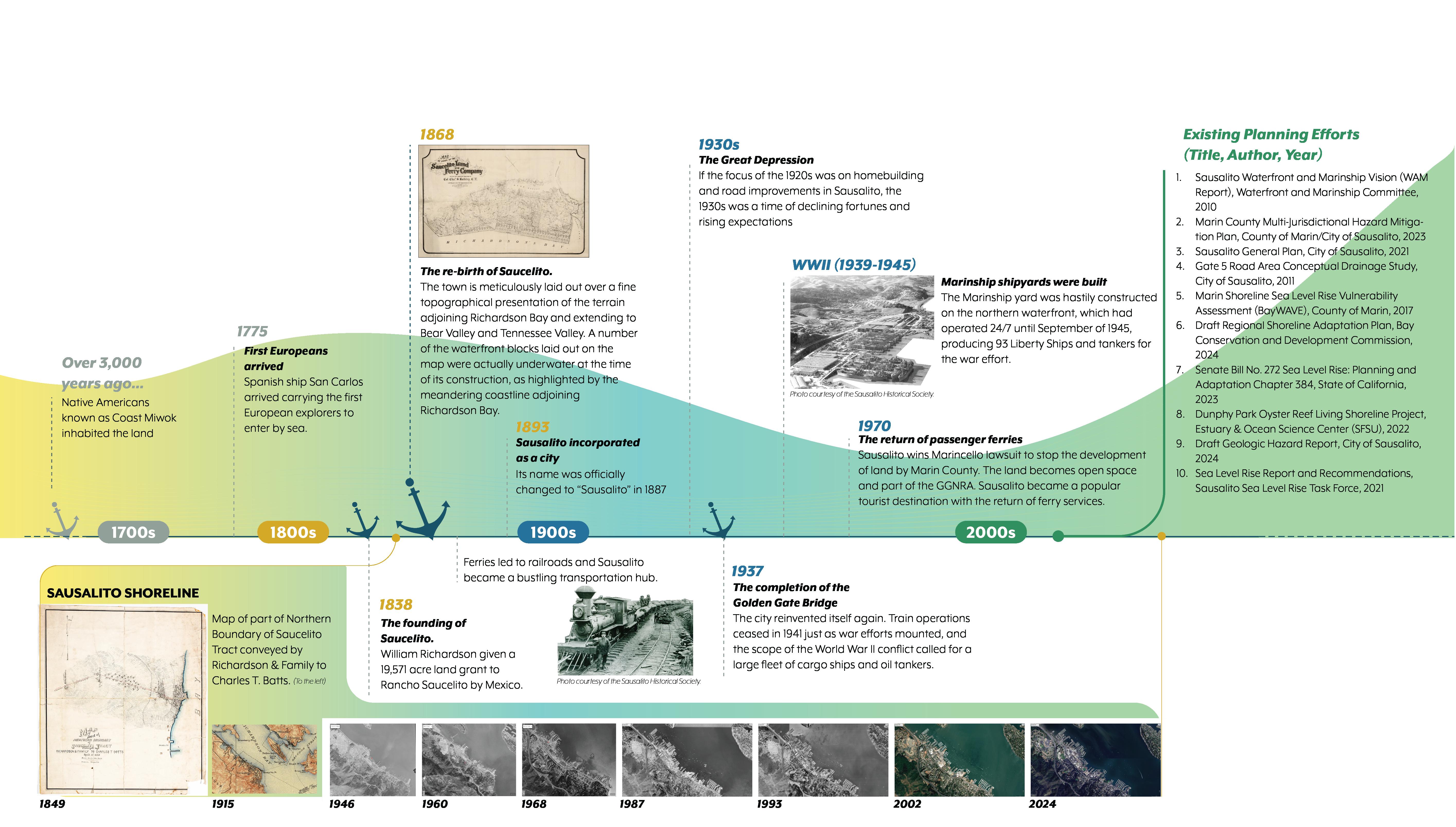
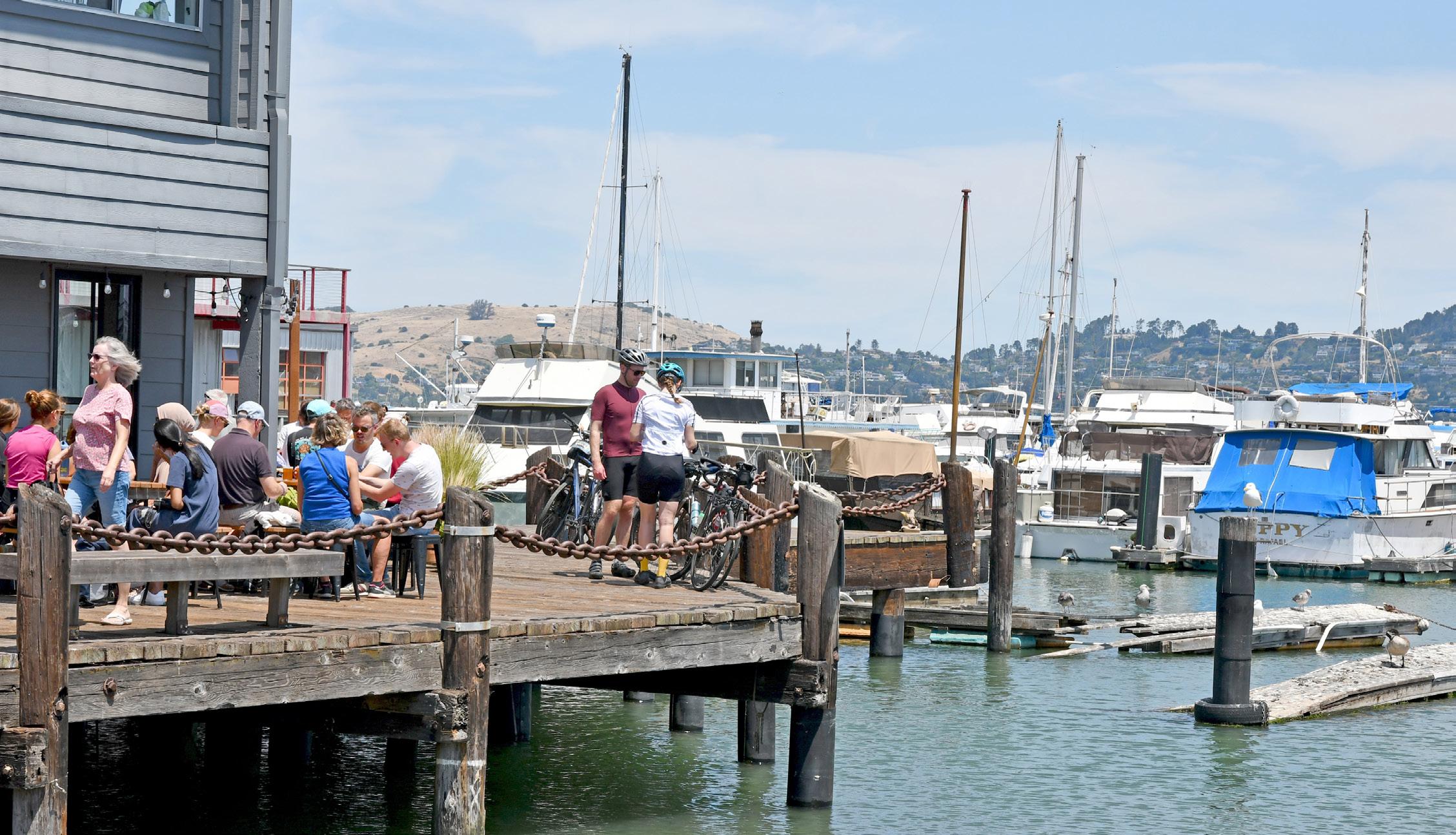
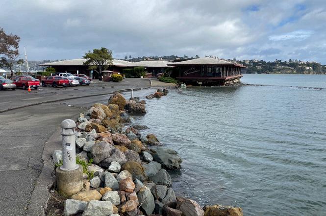
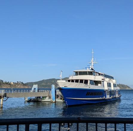
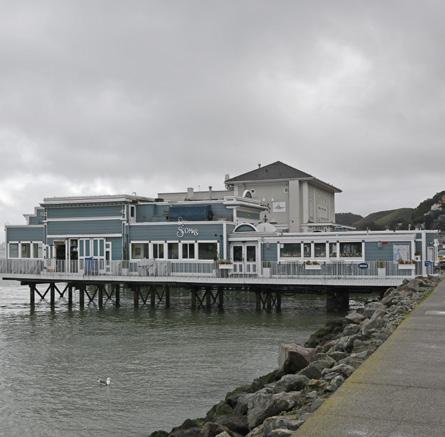
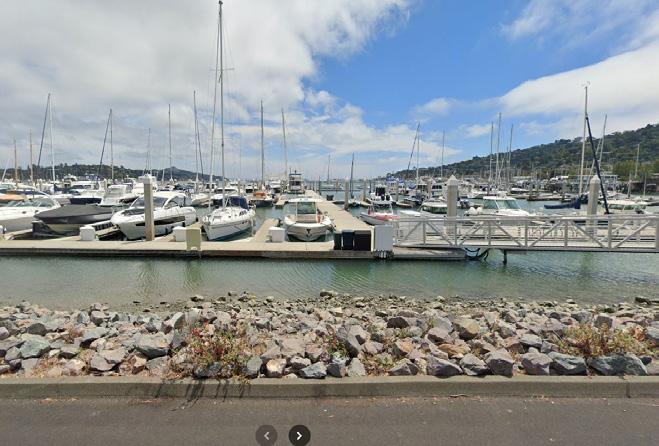
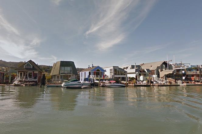
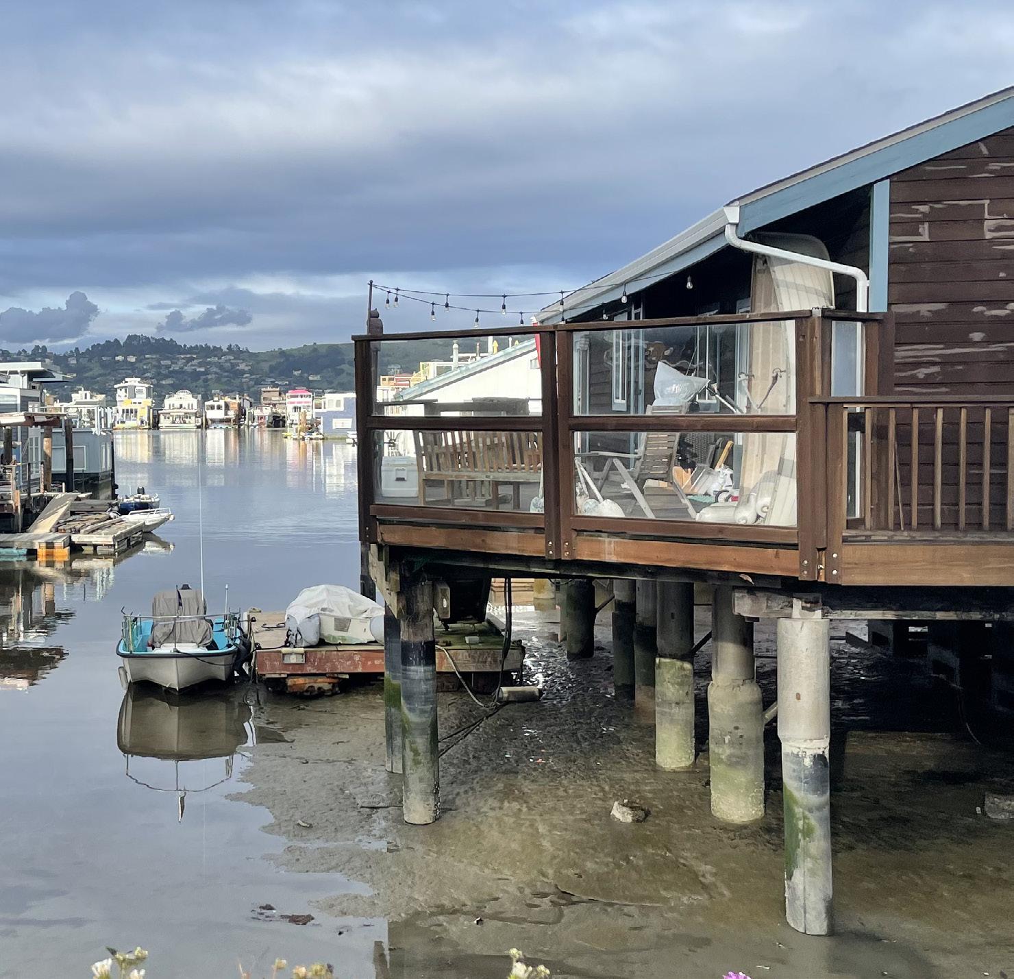
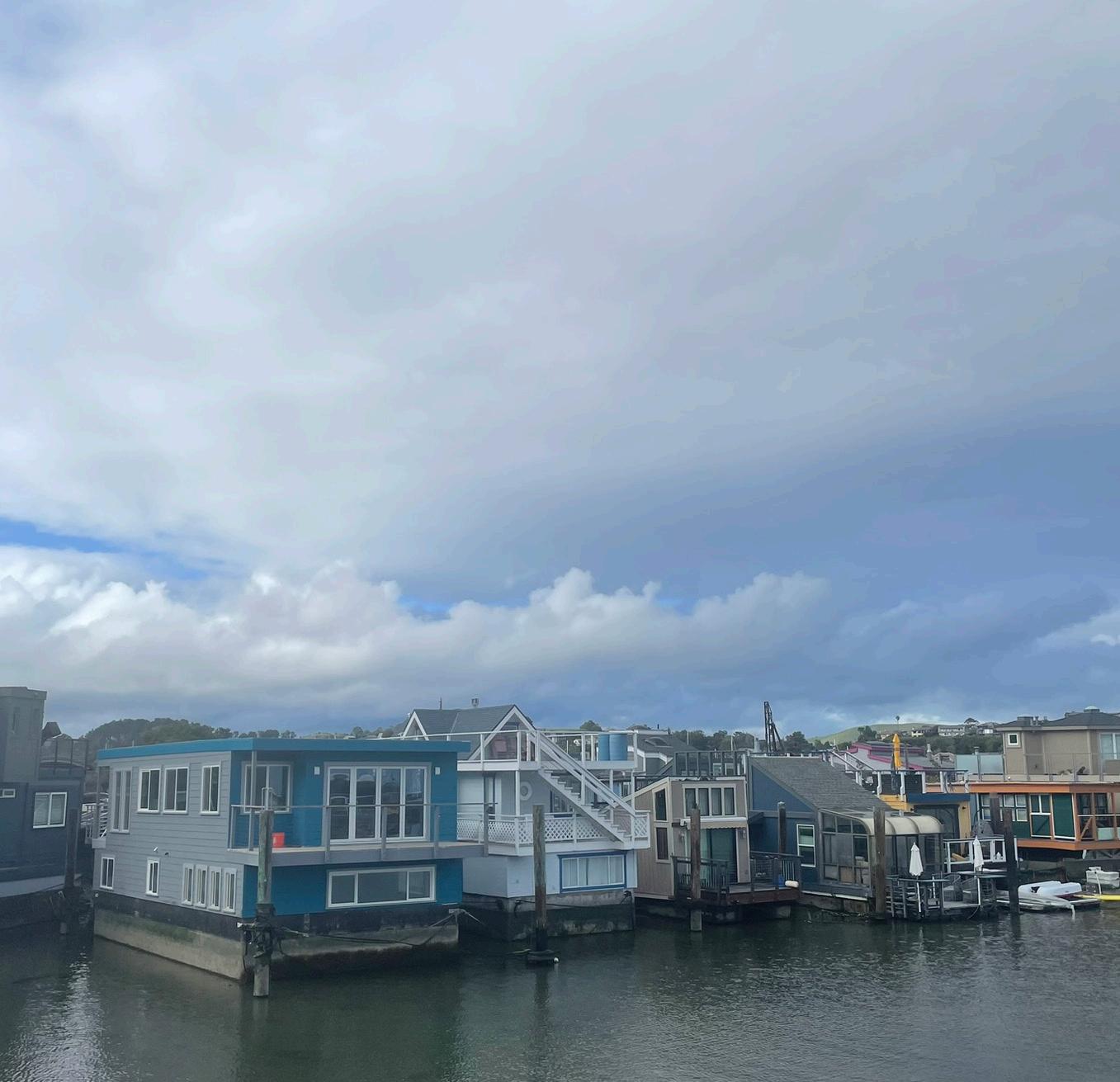
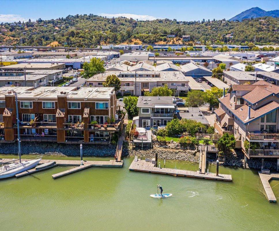
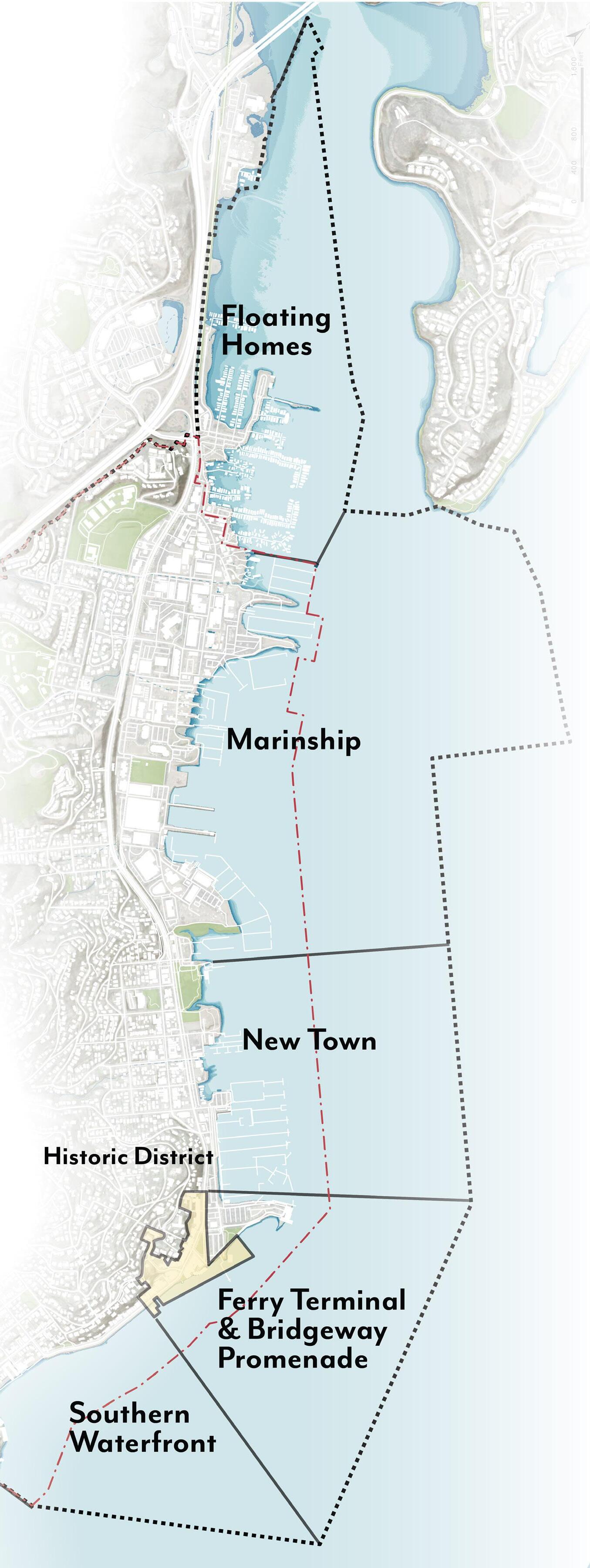
Waterfront Character
• MARINA AND WATERFRONT OWNERS & DEVELOPERS
“Economic viability is one of the objectives.”
- Focus Group Participants
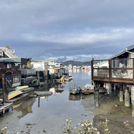
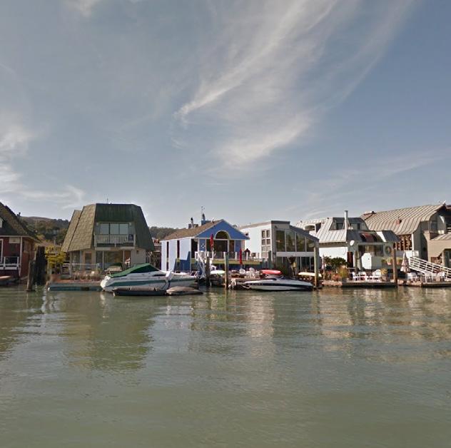
“We are unique in that we have the floating homes... We should look carefully at implications to expanding floating homes. What is the impact to floating homes and maritime businesses.”
- Focus Group Participants
“Working waterfront is an important part of our history and doesn’t want to see that go.”
- Focus Group Participants
“We have challenges due to eel grass as well as BCDC.”
“Thank you for including eel grass for monitoring in the planning process. Audubon is happy to help.”
- Focus Group Participant
WORLD-CLASS WATERFRONT
AUTHENTIC
MARITIME CHARACTER
ICONIC DESTINATION FOR TRAVEL
• MARITIME “SALTYNESS” / NATURAL BEAUTY
• WATERFRONT INDUSTRY
• MARINA BUSINESSES
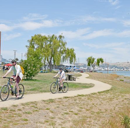
• PUBLIC ACCESS / ACCESSIBILITY
BRIDGEWAY TOWN SPINE
• BUSINESS OWNERS & COMMUNITY TENANTS
• HOUSEBOAT RESIDENTS & MARINA COMMUNITIES
• MOBILITY / TRANSPORTATION AGENCIES
• ECOLOGY / PUBLIC REALM AGENCIES
“There are a lot of people in our community that have great input. More about being inclusive (to) make sure we hear from everyone.”
- Focus Group Participant
“What
“Waterfront folks are concerned about an enforced retreat.”
“Particularly important is the workshops and getting the community interested from the beginning. We need fun ways to get people involved right from the beginning.”
-FocusGroupParticipant
• WORKING WATERFRONT USES
• MOBILITY / ACCESS
• EEL GRASS MITIGATION
• HOUSING
• ADAPTATION
“Reallywanttoseemoreclever technologiesandideas.Wants tomakeaplugforrelyingon technologytosupportthe circumstances we have that we can model into the future. ”
“Infrastructure
concerns.”
- Focus Group Participants
-FocusGroupParticipant
“Subsidence is a big problem...”
- Focus Group Participant
• INFRASTRUCTURE UPGRADES
• INVESTMENT
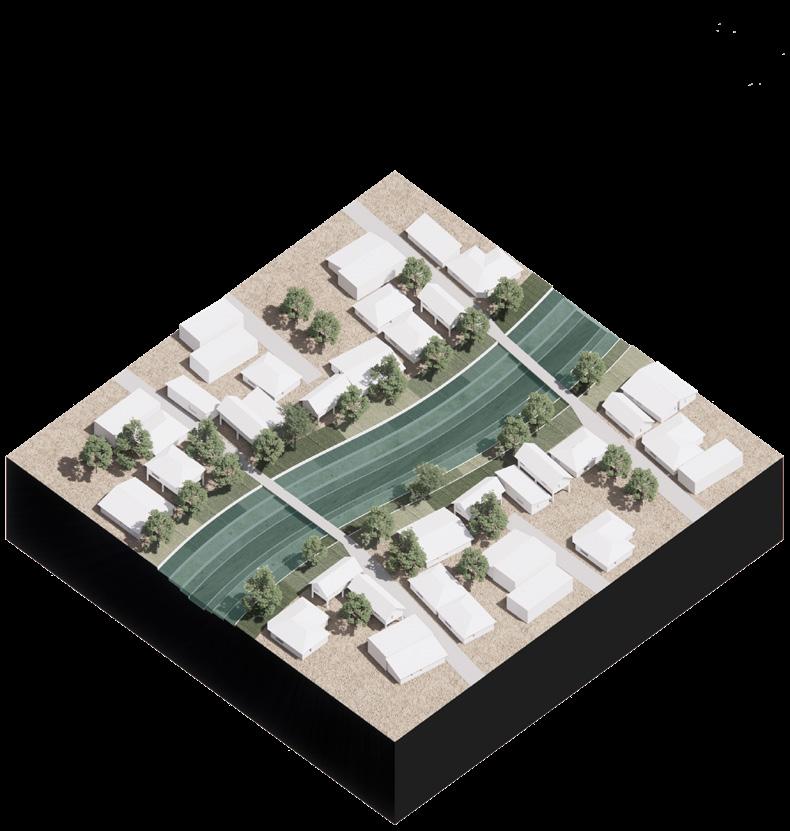
Understanding the Shoreline Character
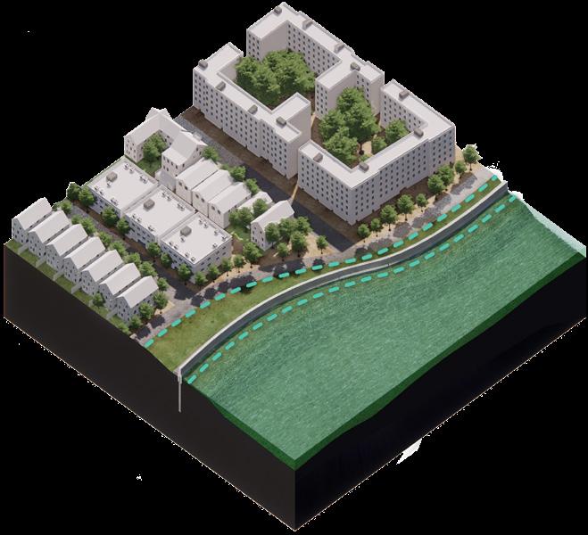
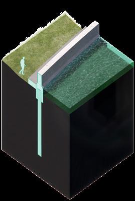
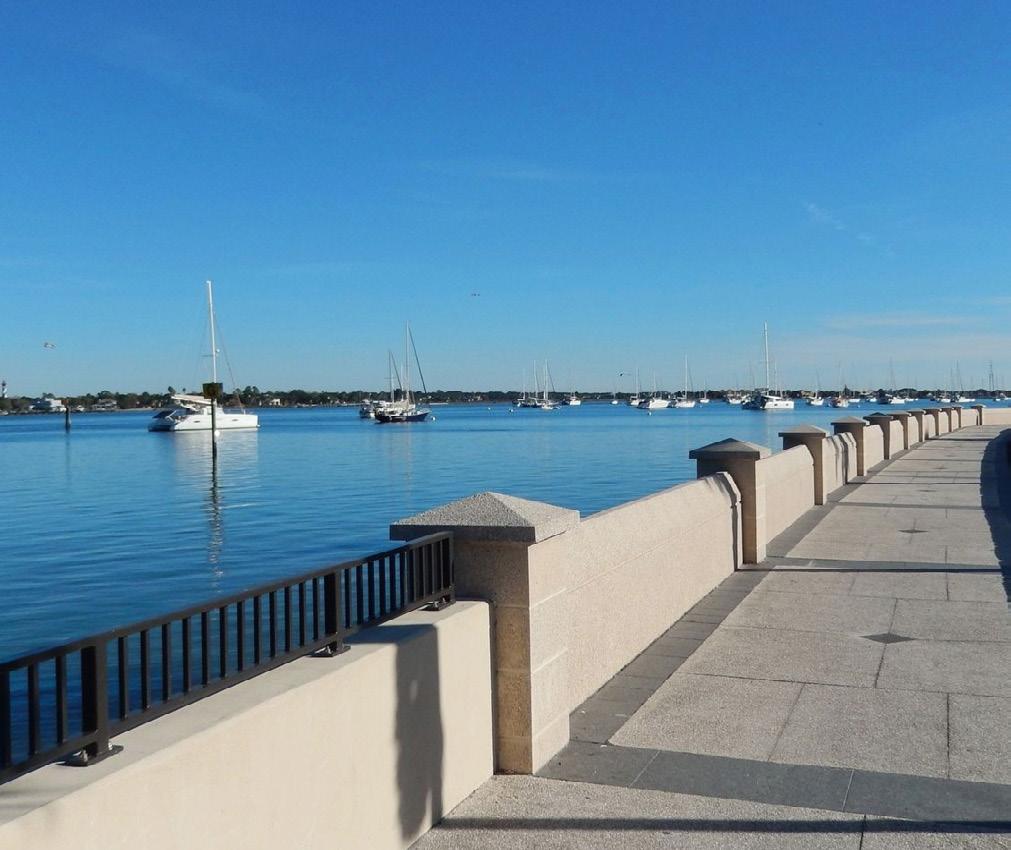
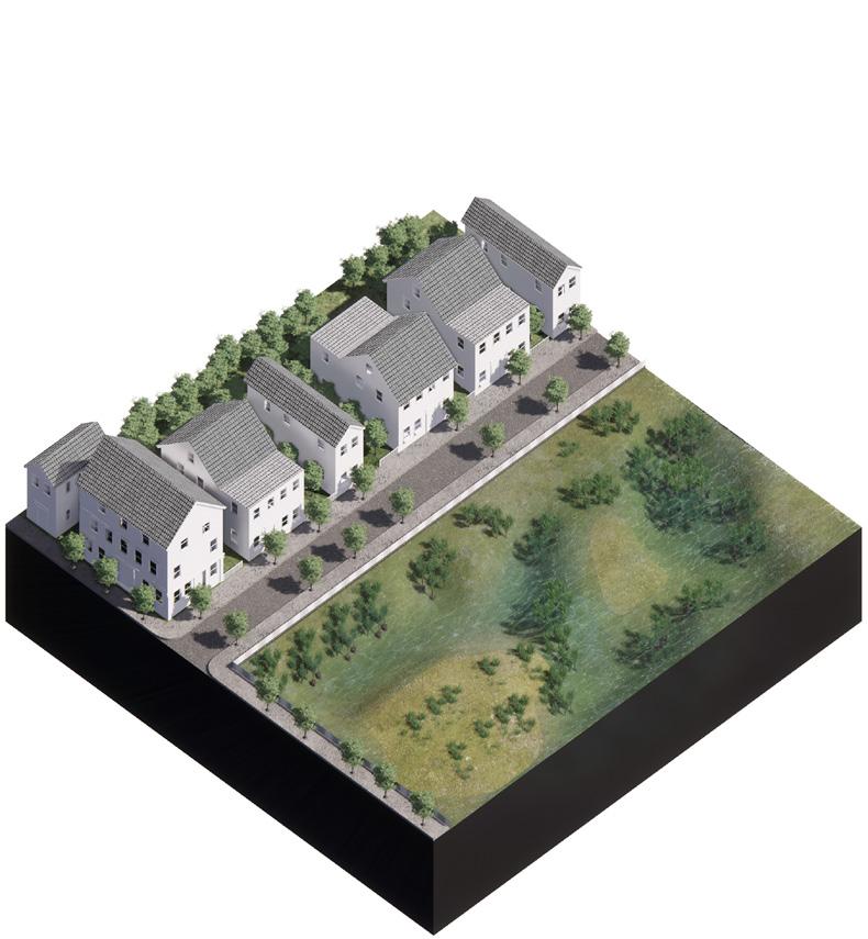
ADAPTATION TOOLS & STRATEGIES
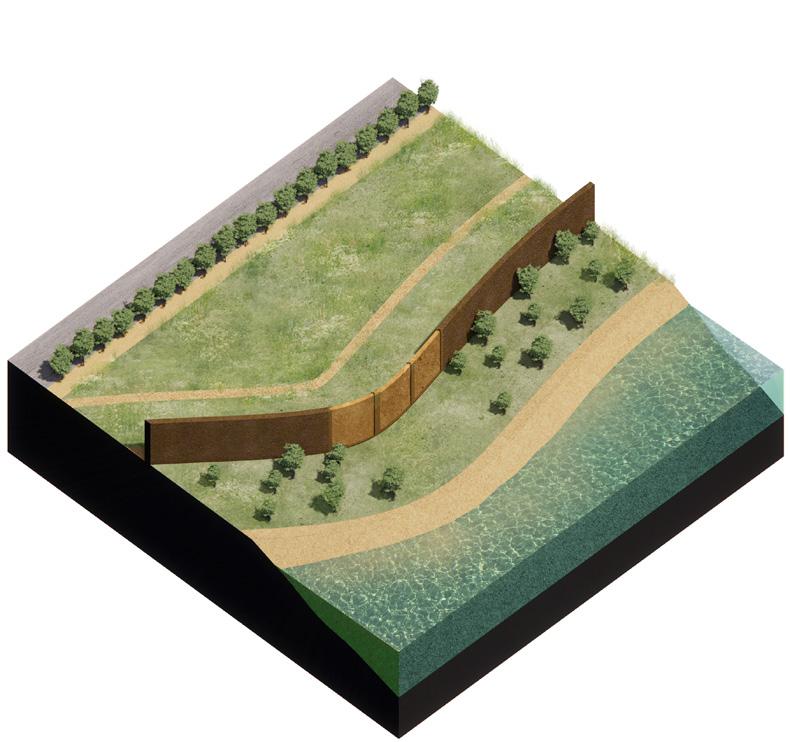
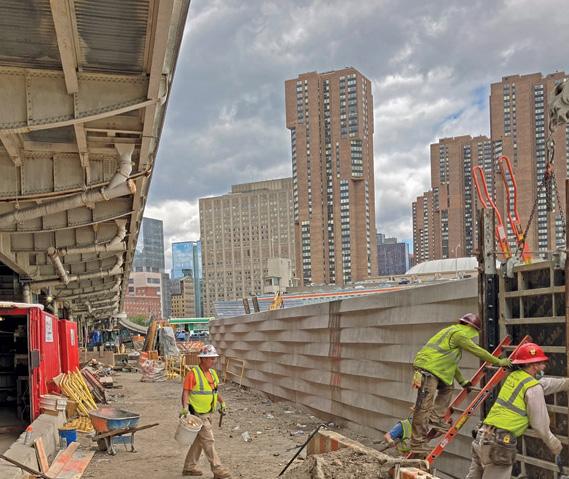
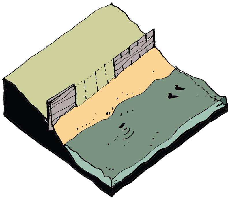
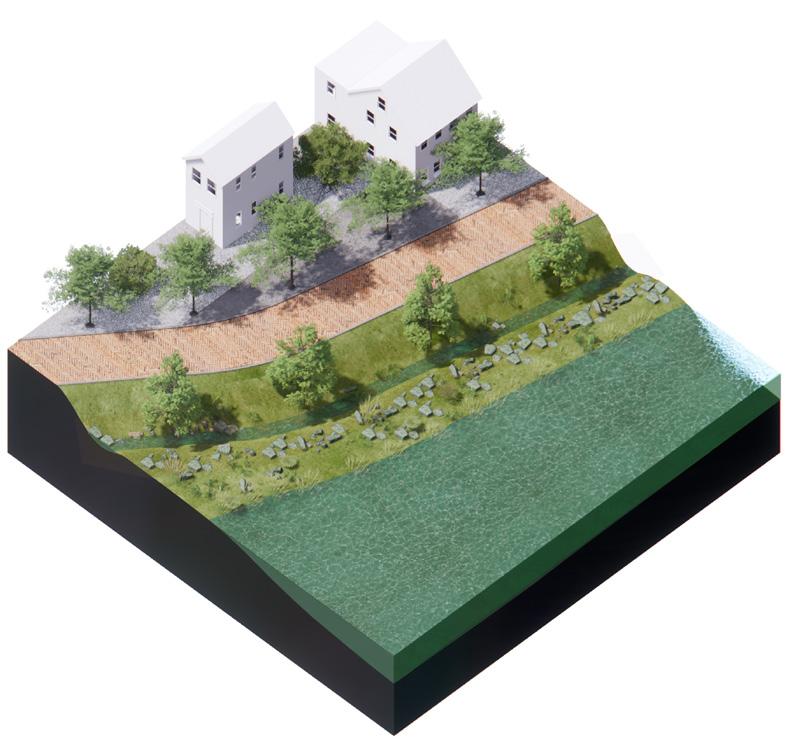
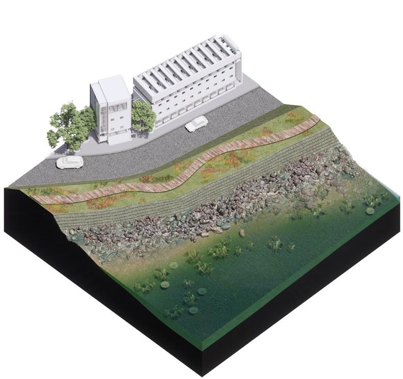
Raising + Hardening the Edge
1 2 3 4
Coastal hardening measures aim to keep water out of neighborhoods during storm events and as tides grow higher, using measures such as floodwalls, raised bulkheads, and vegetative berms.
What strategies feel appropriate to Sausalito’s maritime character?
* Nature-based solutions are embedded across all four categories of adaptation tools and strategies.
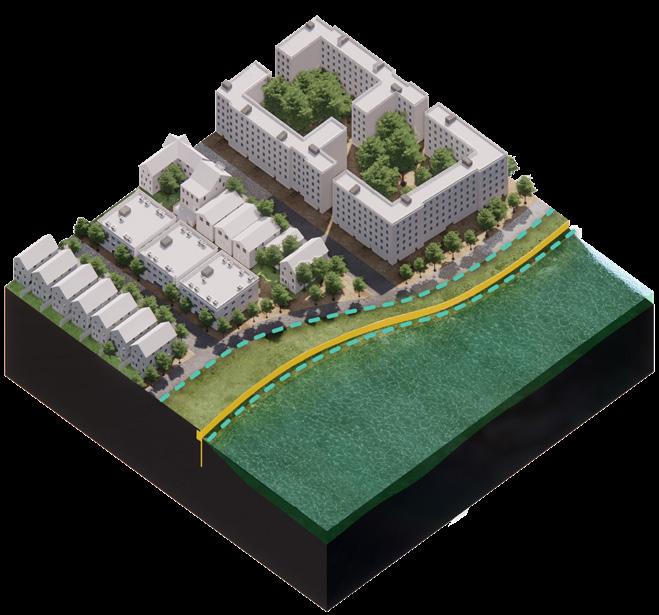
Strategies to reduce impact focus on changing the shape and materiality of the shoreline to reduce wave energy. Examples include introducing low-slope living shorelines and offshore wave attenuators like oyster reefs.
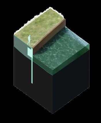
Living with water encompasses measures that make people, buildings, and infrastructure safer in anticipation of periodic flooding. Relocating building utilities and wet floodproofing structures are examples.
Shar e your comments and questions here!
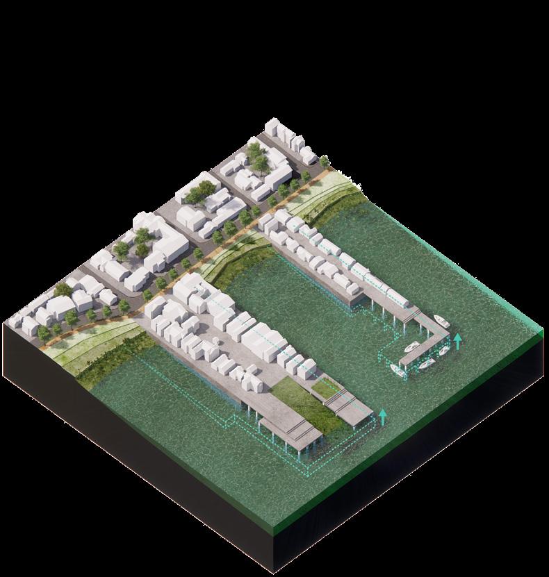
Relocation involves moving facilities out of the floodplain to other areas that are less likely to flood in the future. Floating structures are designed to be sited on the water, rising and falling with the tides.
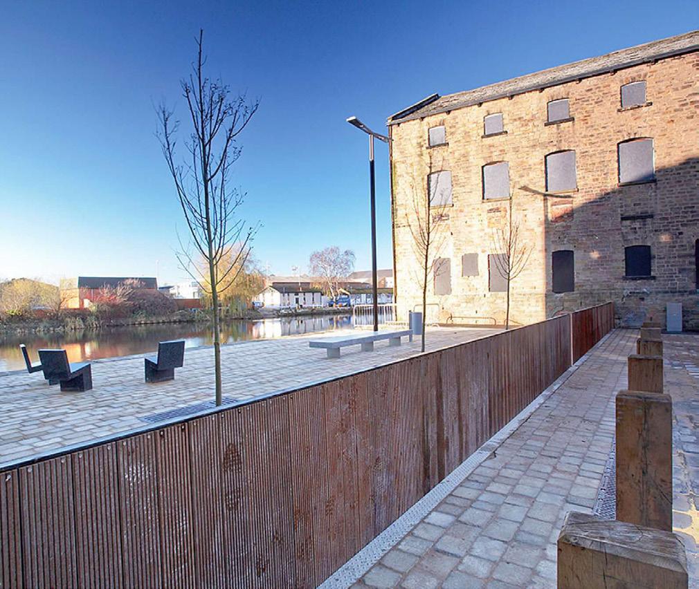
1. Raising + Hardening the Edge
Flexible Access Allows seamless public and emergency access to the waterfront when not in use.
Effective Protection Provides strong protection by closing gaps in static flood barriers.
High Construction Cost: The initial construction of can be expensive, especially in areas with challenging terrain or space constraints.
Long-Term Costs Repairs or upgrades can still be costly despite low maintenance.
Berms are well-suited for areas along rivers or coastlines where there is enough space for a raised earthen structure. They are ideal for integration with recreational coastal spaces and can support ecological features.
Space Requirement Requires significant space for their sloped sides, which may not be feasible in densely developed areas.
Operational Costs Needs regular maintenance and timely operation during floods.
Complex Installation: More complex and costly to install than permanent barriers.
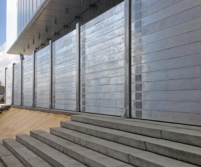
Temporary barriers are ideal for locations needing flexible flood protection, especially where permanent installations are not feasible due to space, aesthetic concerns, or budget constraints. They are particularly useful for protecting individual buildings or specific areas during forecasted flood events.
• Maintenance Regular maintenance is needed to ensure the barriers are functional
• Limited Protection: Temporary barriers might not withstand high-velocity floodwaters or prolonged inundation.
• Space-Efficient: Effective in areas with limited space.
• Lower Height Less visually intrusive than taller floodwalls.
• Waterfront Access Can retain access to the waterfront and be integrated into public spaces.
Limited Protection Provides lower height protection, which may not be sufficient in areas with extreme flood risks.
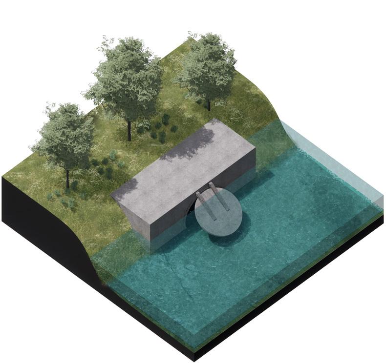
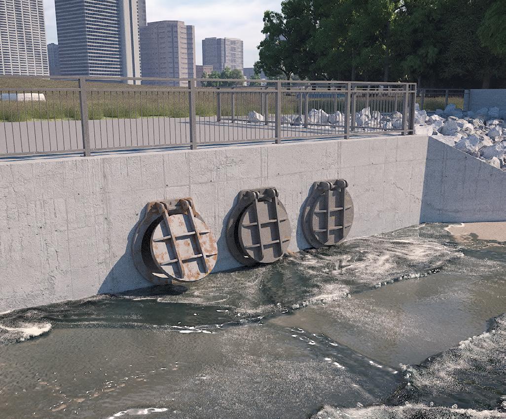
Backflow preventers are most effective in coastal areas with drainage systems and sewer lines that are at risk of tidal surges, stormwater runoff, and other sources of flooding. They are crucial for locations where water needs to flow in one direction to prevent reverse flooding into infrastructure.
Installation and Maintenance Costs Initial installation can be expensive, and regular maintenance is required to ensure the device functions correctly.
Leakage: They tend to leak, allowing some backflow.
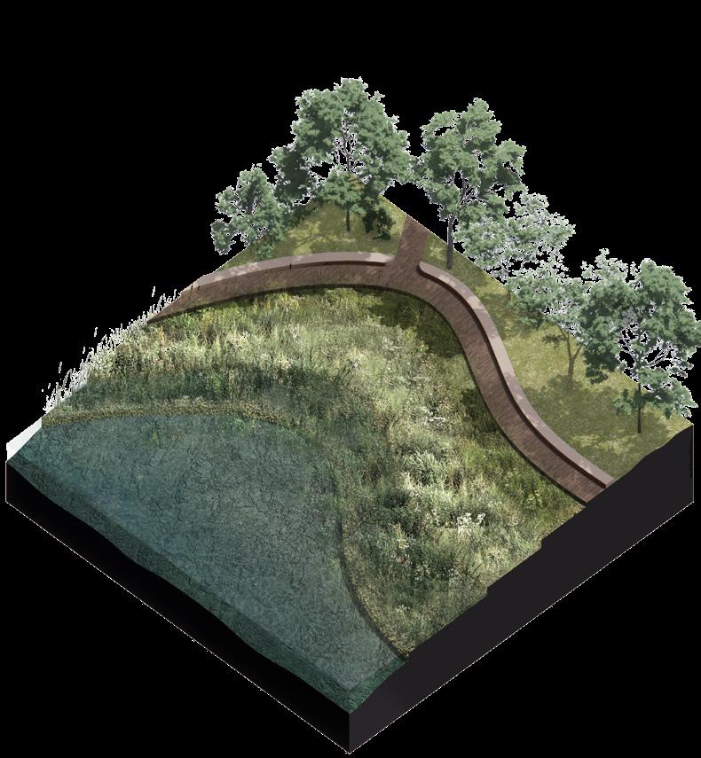
2. Reducing Impact
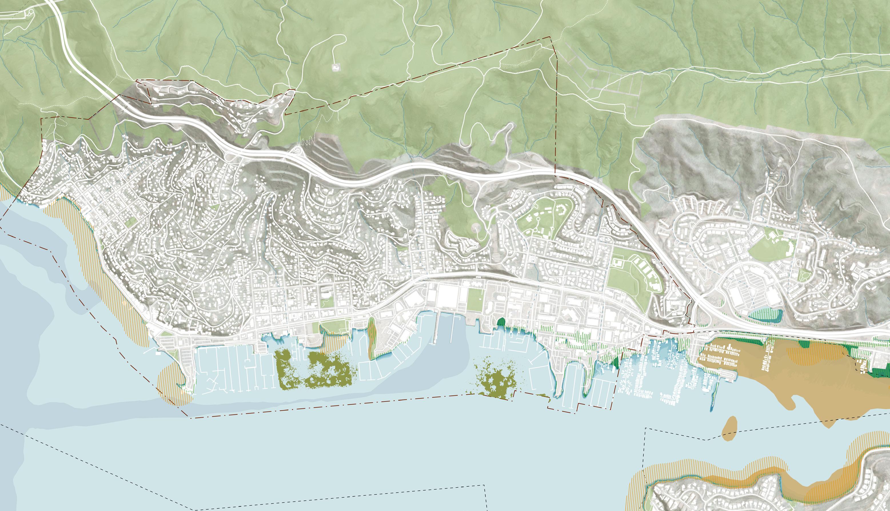
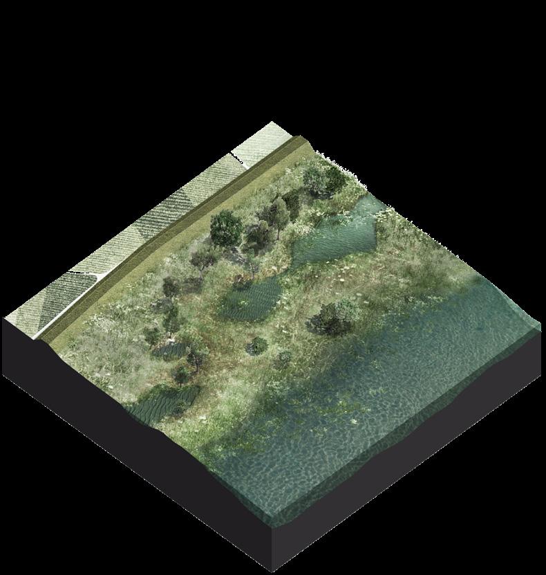
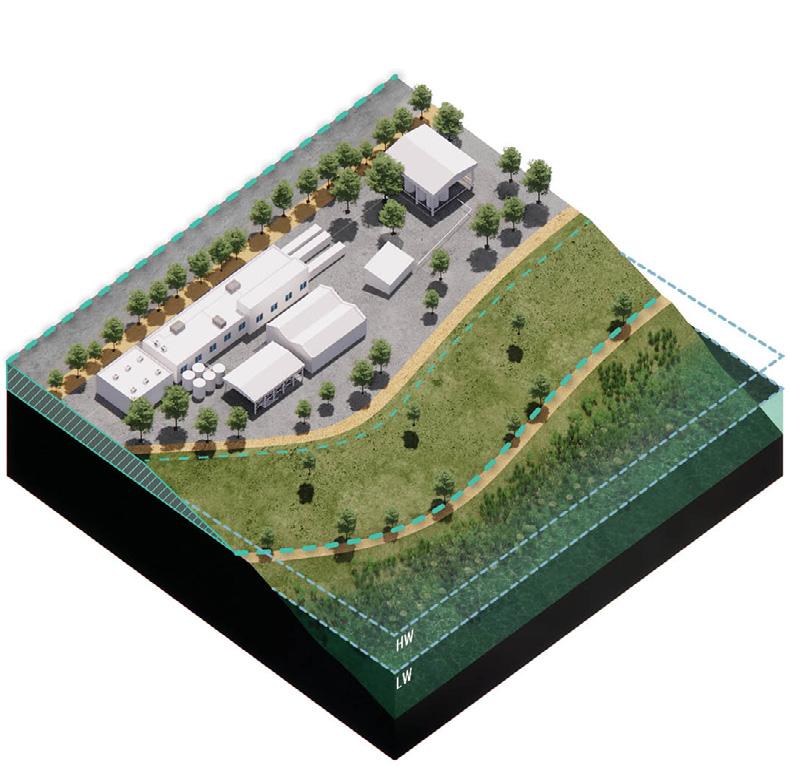
2A - ECOTONE LEVEES
shoreline erosion by absorbing wave energy.
• Ecological Enhancement Can be designed to include plantings and bio-enhancing materials for habitat creation.
Maintenance Demands Require dense planting and high maintenance to avoid weedy vegetation
Requires dense planting and high maintenance to avoid weedy vegetation
GRAIN BEACH
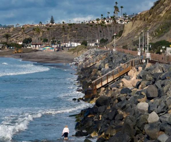
Coarse grain beaches typically include sand or gravel beaches fronting eroding shoreline habitats and backshore infrastructure and levees. Gravel beaches provide greater protection from storms and are compatible with shorebird habitat. By expanding the area in front of the shoreline with a low slopes and native vegetation, they stabilize the shoreline with added sediment, increase seepage length, and reduce wave impact and overtopping.
Levee Resilience Increases the strength and stability of levees by adding sediment mass Wave Energy Reduction
Land Use Requires significant land area.
High Initial Costs The development of tidal parks can be expensive.
Maintenance Park facilities need regular maintenance.
High Initial Costs: Construction can be expensive, especially with added ecological features.
Flood Defense Improves water quality by filtering pollutants. Erosion Control Habitat Creation
Land Use Requires significant space for the expanded foreshore area.
Maintenance Needs Vegetation and sediment may require ongoing management to maintain effectiveness.
High Initial Setup Costs
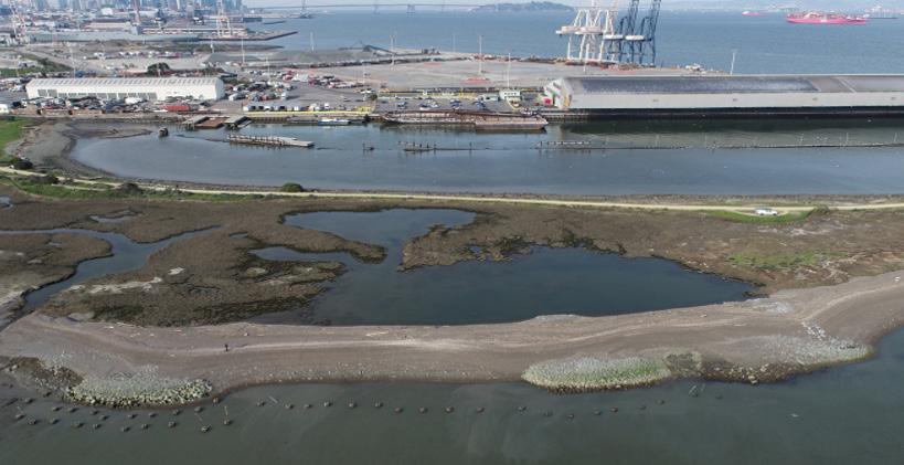
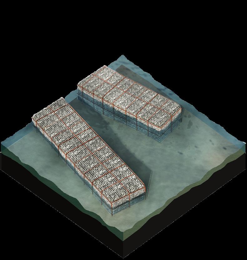
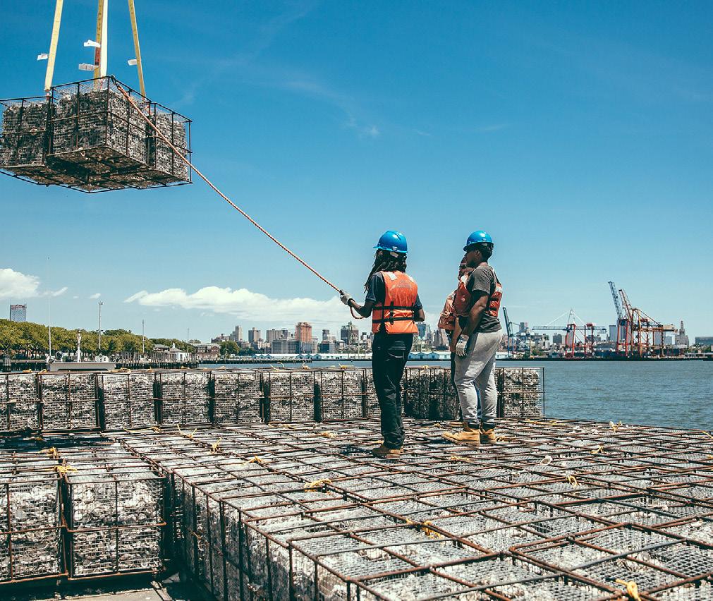
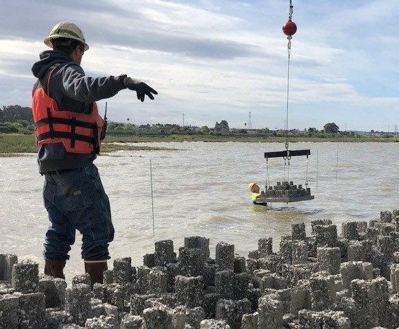
Shellfish reefs, especially oyster reefs, are best suited for coastal areas prone to erosion and storm damage. They are particularly effective in locations where enhancing water quality and providing habitat are key objectives. Living shorelines may be combined with setback levees or other barrier approaches for greater flood protection.
Community Engagement Promotes long-term community and student involvement.
High Initial Setup Costs
Maintenance Requires ongoing monitoring and management.
Limited Immediate Impact
Living shorelines are ideal for tidal coastlines needing stabilization. They stabilize tidal coastlines, incorporating vegetated shores in combination with harder shoreline structures for added stability and structures like reef balls to foster habitat growth. Living shorelines can reduce flooding from storm surge via wave attenuation and erosion reduction. Living shorelines may be combined with setback levees or other barrier approaches for greater flood protection.
Low Maintenance Provides green space with minimal upkeep.
Habitat Improvement: Enhances marine habitats and spawning areas.
Water Filtration Filters waterways, improving water quality.
Reduce Erosion Carbon Storage
• High Initial Costs
Time Benefits may take time to fully develop.
3. Living with Water
Protection: Provides a strong barrier against floodwaters, preventing interior flooding.
Regulatory Compliance Not compliant with FEMA/Building Code standards for residential structures in Portsmouth.
Adaptive wharves are ideal for coastal areas that face changing conditions such as sea level rise, storm surges, and erosion.
They may include features such as adjustable pilings, floating docks, and modular construction that can be easily modified or relocated as needed.
They are designed to protect coastal communities and infrastructure while minimizing the impact on the surrounding environment.
Interior Modifications Involves removing vulnerable materials from lower levels
Maintenance: Needs regular upkeep to ensure effectiveness and structural integrity.
Cost Installation of barriers and walls can be expensive.
• Multi-Use Space Ground level below the elevated structure can be used for temporary purposes.
Cost Elevating structures can be expensive, especially for existing buildings.
Structural Modifications Requires significant alterations to the building’s foundation.
• System Protection Allows for the elevation of critical systems alongside other home repairs or upgrades. Flexibility Features like adjustable pilings, floating docks, and modular construction allow for easy modifications and relocation.
Less Environment Impact: Designed to minimize the impact on the surrounding environment.
Complexity: Requires specialized engineering and construction techniques.
Raising roadways is effective in flood-prone areas where maintaining road usability during flooding is critical for evacuation, emergency response, and general mobility.
The slope of the roadway should be carefully designed to allow for proper drainage and to minimize the risk of erosion.
Enhanced Mobility: Maximizes the accessibility of roads in flood conditions.
Design Complexity Requires careful slope design for proper drainage and erosion prevention.
Additional Measures May need supplementary solutions like revetments to further minimize erosion and enhance stability.
Cost: Raising roadways and implementing erosion control measures can be expensive.
Raising land is effective in areas where reducing flood risk for an entire site or region is essential, particularly for protecting critical infrastructure, utilities, and public assets.
Can be implemented as part of a large-scale development plan that creates safe housing and commercial uses.
Comprehensive Protection Safeguards the entire footprint of important sites, such as utilities and public assets, from flooding.
• Adjacent Impact: May cause or worsen flooding on nearby sites if not carefully designed.
• Access Challenges Requires meticulous planning to ensure access during flood events.
• Cost Implementing land elevation can be resource-intensive and costly.
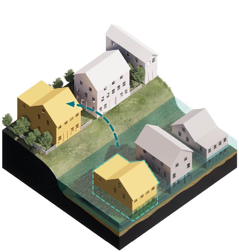
4. Relocate or Float
Community Benefits Provide ecological services that benefit the community through recreational and commercial enhancements.
for floodwater storage or resilience infrastructure
Habitat Conversion Vacated land can become natural habitat or resilience sites.
High Cost Community Disruption
Land Use Requires sufficient available land.
Conservation easements are ideal for areas where natural resources like wetlands, forests, and open spaces are highly valuable for flood protection and require strong preservation.
They ensure that natural areas critical for flood protection and ecosystem services are preserved, while supporting development and maintenance of green infrastructure to help absorb floodwaters and reduce erosion.
Green Infrastructure Support Facilitates the development and maintenance of green infrastructure.
Development Restrictions: Limits future development opportunities on the protected land.
Long-Term Commitment Requires ongoing management and legal oversight.
Administrative Complexity Establishing easements can involve a complicated administrative process.
• Flood Mitigation Naturally stores stormwater and buffers upland areas from flooding.
• Habitat Creation Supports diverse plant and animal life.
• Water Quality Improves water quality through natural filtration.
Reforestation and erosion control are ideal for riverbanks at risk of erosion, which, if left unmanaged, could threaten properties and infrastructure.
Ongoing Maintenance May need active management to maintain ecological balance
Long-Term Commitment
•
• Resilience: Designed to rise and fall with water levels, offering a resilient, adaptable solution to the challenges of coastal living.
• Versatility: The size and scale of the floating portion can be easily adjusted.
High Costs
Engineering Complexity: Requires advanced engineering and design.
Water Quality: Improves water quality by reducing sediment in the water.
Habitat Creation Provides habitats for plants and animals.
Mitigates Heat
Providing Recreational Spaces
Implementation Challenges Requires careful planning and ongoing maintenance.
Time-Consuming Benefits may take time to fully develop.
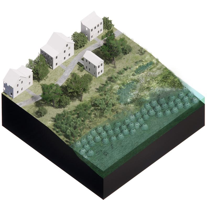
Tidal Salt marsh development is ideal in areas where existing marshes are degraded or where conditions are favorable for new marsh establishment.
Restoration projects range from debris removal and invasive species management in existing marshes to reconstruction efforts that recreate the conditions and elevations for marsh plantings to establish using the placement of sand and fine sediment along with wave attenuation techniques.
Wave Reduction: Marshes create friction that effectively reduces wave heights.
Adaptability Marshes can adapt to sea level rise, offering long-term resilience.
Ecological Benefits Supports biodiversity by restoring habitats for various species.
• Restoration Complexity
• Time-Intensive: Establishing stable marshes through reconstruction may take significant time and ongoing maintenance.
STATION 6
WHAT ARE ADAPTATION PATHWAY OPTIONS? PATHWAY EXAMPLES
In order to plan for the series of projects needed to adapt and protect Sausalito’s future shoreline, Adaptation Pathway Options illustrate potential sequences of planning, design and life cycle. Considerations to develop these options include:
• Planning and permitting of projects takes time. Each project has a lead time of several years for planning and community consensus-building, regulatory and permitting approvals, and construction mobilization. With sea levels rising over time, it’s helpful to compare those lead times with projected levels to understand when project should start, how long it will have a useful life, and when to plan for the next stages.
• Choosing between gradual implementation versus big moves can be tricky. Big moves are costly, but many small moves may require more ongoing construction and may be ultimately more costly over time. Setting up pathways can help compare costs and impacts to help inform planning decisions.
• Managing uncertainty for the long-term future requires flexible solutions. While we have clear guidance for what to expect by 2050, 2100 sea level rise projects still vary quite a bit. Using the Adaptation Pathways Options tool can help identify what triggers to look for and when to start planning longer-term projects. Ultimately this will help avoid building stranded assets.
PROCESS NEXT STEPS
During the next steps of the process, we will collect and document feedback from Community Workshop 1 and the Online Survey, then regroup and report back to the group during Workshop 2.
NEXT STEPS
BIG MOVES
GRADUAL IMPLEMENTATION
WHAT LEVEL OF DETAIL IS NEEDED TO PROGRESS ADAPTATION PLANNING IN SAUSALITO?
• Planning relies on varying levels of data fidelity to inform decision-making. At this stage of planning and visioning for a city-wide approach, we rely on information to identify programming and feasibility of solutions. As planning progresses from the city-scale to parcel-scale to identify potential projects, the level of data fidelity required increases. In the future, additional surveys and individual assessments with be needed to inform detailed design, engineering, environmental review, and permitting applications.
UPCOMING SAUSALITO ADAPTATION PLANNING EFFORTS:
• Sausalito Facility Sea Level Rise Vulnerability Assessment, City of Sausalito
• Gate 5 Road – Harbor Drive Drainage Improvement Study, City of Sausalito
Community Workshop 2 will also focus on summarizing and refining the potential impacted assets and strategies per character zone.
Finally in Community Workshop 3, we will present and collect feedback on Adaptation Pathways Options to illustrate potential paths towards implementation.
See you at Workshop 2! Make sure you signed in to get updates on the date TBA.