80 | Green Roads for Water
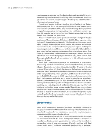
cross-drainage structures, and flood embankments is a powerful strategy for enhancing climate resilience, reducing flood-disaster risks, increasing agricultural production, and ensuring the durability and reliability of road infrastructure in coastal areas. Coastal areas account for 20 percent of the world’s land area, but they are home to more than half of the global population and an equal portion of economic activities (World Bank 2008). They offer a rich variety of ecosystems with a range of services, such as storm protection, water purification, nutrient recycling, fish spawning, and recreation (tourism). They also sustain food production through crops, fisheries, and aquaculture. Because of their location, coastal systems are among the most productive but are also one of the most threatened (Dayton et al. 2005). These regions are at the forefront of climate change and face major risks from sea-level rise, storm surges, floods, changing rainfall patterns, coastal erosion, and tsunamis. Furthermore, coastal lowlands also face pressure from changing river regimes, evolving sedimentation patterns in coastal deltas, and land subsidence (World Bank 2008). In some coastal lowland areas, these changes may have greater impacts than those caused by climate change. Land subsidence in the Ganges Delta, for instance, is estimated to be 18 millimeters per year (Brammer 2014), which is much more than expected global sea-level rise, projected to be 1–2 millimeters per year (Church et al. 2001). Roads have a significant influence on the development of coastal areas. Because they are often combined with permanent embankments, roads may influence the duration and extent of inundations and the dynamics of flooding in coastal deltas (photo 5.1). Roads also fragment the landscape and interrupt the natural flow of water and the movement of sediments and nutrients important for biological diversity, fertile agriculture, and fisheries (Douven, Goichot, and Verheij 2009). Douven et al. (2012) argue that a resilience approach rather than a resistance approach often works better in coastal areas. A resilience approach consists of managing the road infrastructure along with the surrounding landscape, adapting to the broad opportunities of the area rather than reclaiming and protecting as much land as possible, and accepting risks while building in mechanisms to deal with these risks. The resilience strategy aims to minimize the consequences of floods while maintaining natural floodplain dynamics as much as possible. In contrast, the resistance strategy aims to prevent and regulate floods and has a major impact on natural floodplain dynamics (Douven, Goichot, and Verheij 2009).
OPPORTUNITIES Roads, water management, and flood protection are strongly connected in low-lying coastal areas, but this connection is usually not systematically operationalized, which results in a major missed opportunity and, in many cases, creates substantial drainage-related problems. There is considerable scope for an integrated approach in which roads can become instruments for water management and flood resilience in coastal areas. The three main opportunities are (a) roads that contribute to improved agricultural water management, (b) roads combined with flood embankments, and (c) roads that serve more systematically as temporary


