What should you know about protecting the United States’ old forests / 02 How climate change is fueling Canada’s fires, smoke in Northeastern U.S. / 04 Robots on the rise? AI is nothing new for climate research / 05 In the news: highlights / 07
Month in Review ● June 2023 woodwellclimate.org
Notes from the Field
What you should know about protecting the United States’ old forests
On April 20, 2023, the U.S. Department of the Interior (DOI) and Department of Agriculture (USDA) released a first-of-itskind inventory of the country’s mature and old-growth forests. The assessment responded directly to a 2022 executive order aimed at fostering healthy forests.
The inventory highlights the importance of forest health in building resilience to future climate-related disturbances like drought or fire, but it omits mention of the service that all forests, but particularly mature and old growth forests, provide in directly mitigating the country’s carbon emissions—a service that Woodwell Climate’s scientists have worked to measure and monitor for over three decades.
The inventory is a critical starting point, from which agencies like the U.S. Forest Service and the Bureau of Land Management will begin to make decisions about how public forests are managed going forward. Not acknowledging the critical carbon storage contribution of mature and old-growth forests runs the risk of de-prioritizing protection for the country’s oldest, most carbon-rich, and hardest to replace ecosystems.
Why protect mature and old-growth forests?
In short: carbon. While all forests sequester carbon as they grow, older and larger trees represent an existing store of carbon in their biomass and soil. Research by Woodwell Climate scientists on carbon stocks in a sample of federally managed U.S. forests found that while larger trees in mature stands constitute a small fraction of all trees, they store between 41 and 84 percent of the total carbon stock of all trees.
An analysis of mature and old growth forests across the country found that approximately 76 percent (20.8 million hectares) of these forests are unprotected from logging. This represents an amount of carbon roughly equivalent to one quarter of the U.S.’s annual fossil fuel emissions.
Although younger forests grow faster proportionally, they are not adding as much carbon in a single year as older forests with large trees. Additionally, mature forests continue to pack away carbon year over year in their soils, which is largely protected from effects of disturbance. Cutting down a mature forest creates a “carbon debt” that can take decades—centuries in some cases—to recoup, and in the meantime those mature trees are no longer sequestering carbon each year.
“Forests are like naturally occurring factories, delivering to the planet the unique service of carbon sequestration. Trees of all sizes, but particularly large old trees, are the equivalent of warehouses where the goods produced—tons of carbon—are stored over time,” says Woodwell Climate Carbon Program Director, Dr. Wayne Walker. “Like any warehouse where valuable goods are stored, these natural carbon reserves deserve all the protection we can provide. Their loss could effectively bankrupt our efforts to avoid the worst impacts of climate change.”
Defining mature and old-growth forest
Protecting mature forests requires them to be identified and mapped, which was part of the impetus behind the government’s forest inventory. But what actually is a mature forest?
02 Monthly Newsletter
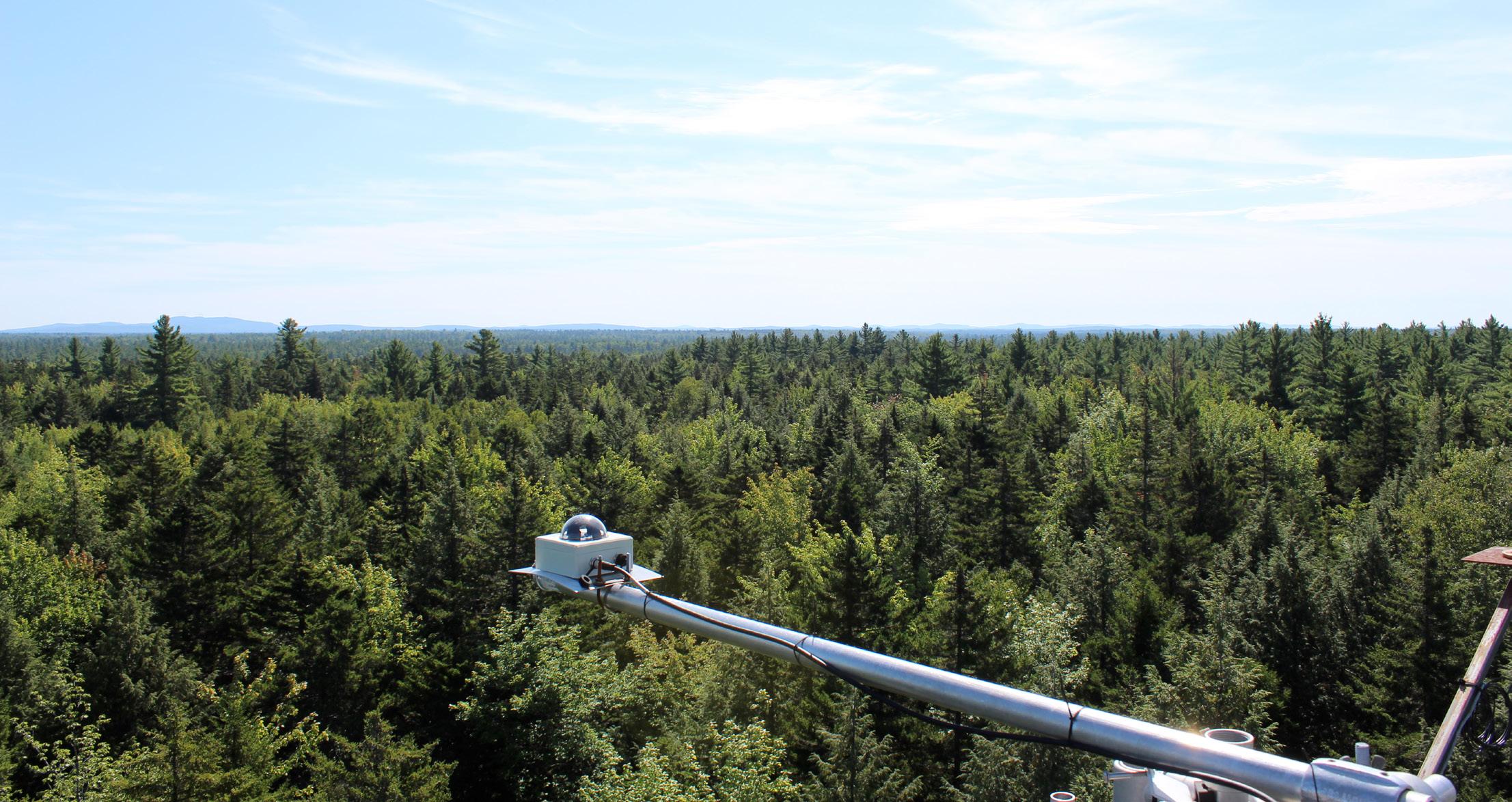
Carbon monitoring equipment over Howland Forest in Maine.
Miles Grant
/ photo by
The U.S. is at a decision point for the protection of mature and old-growth forests and the carbon they store.
Sarah Ruiz Science Writer
Definitions of “mature” and “old-growth” differ, with no one universally accepted definition. Refining scientific understanding of what constitutes a mature forest has implications for either expanding or reducing the area of forest considered for protection.
In one study of U.S. forest carbon stocks, Woodwell Climate researchers and collaborators outlined a measure of forest maturity based on both the age that the tree canopy in a forest becomes 100 percent closed, called “Culmination of Net Primary Productivity,” and tree diameter size. Across 11 U.S. forests analyzed, the age at which a forest is considered mature ranged from 35 years in Appalachian forests to 75 in Arizona. “Oldgrowth” represents a smaller subset of mature forests having older and larger trees.
The new inventory from the DOI and USDA uses a slightly narrower definition of maturity, wherein the lower bound occurs when regeneration has begun underneath the canopy. This results in a slightly smaller estimation of the amount of mature and old-growth forests in the U.S.—yet still approximately 63 percent of the total area of federally managed forests.
Other definitions can be based on models that take into account measurements of forest structure like canopy height, canopy
of these forests depend on adequately identifying them, particularly mature forests, which are much more loosely defined than old growth.
“I think the discussion is almost more about what to do with mature forests, as opposed to old-growth,” says Woodwell Climate Senior Scientist, Dr. Richard Birdsey, who worked in the U.S. Forest Service for four decades. “Mature forests are at a younger stage of growth—trees would be smaller, although they could still be substantial in size and very profitable to harvest. So the question here is whether to let those forests grow into old-growth characteristics, or to start harvesting them for wood products.”
What do we do with our mature forests?
When climate benefits are explicitly considered, the research points strongly to letting these forests grow—protecting and expanding the massive portion of sequestered carbon they represent.
According to Dr. Birdsey, the largest threat facing mature and old-growth forests in the U.S. is logging, which is a threat that humans can reduce instantly, simply by changing policy. A change that would make those forests more resilient to other threats in the long run.
“Others might argue that climate change or wildfire are more significant threats,” says Dr. Birdsey. “Older forests with larger trees are more resistant to those threats—but not more resistant to chainsaws. That’s a human decision.”
A recent paper in Nature Climate Change has laid out a “protect, manage, restore” framework for making decisions about what natural climate solutions to pursue, and the highest priority is always to protect carbon where it is already stored. U.S. policies have made some recent progress in this direction through the enforcement of the roadless rule on Alaska’s Tongass National Forest, prohibiting road-building and industrial logging on the nine million acre temperate rainforest. But there is still further to go to capitalize on the carbon storage potential of the U.S.’s mature forests.
cover, and biomass. Another study, co-authored by Woodwell Climate Associate Scientist, Dr. Brendan Rogers, used these features to determine that federal lands contain the largest concentration of the country’s mature and old-growth forests.
Differences in those definitions are important, because forest policy debates surrounding the responsible management
Federally managed forests contain more high-carbon trees than other lands, so the opportunity for increased carbon storage within them is greatest. Woodwell Climate Distinguished Visiting Scientist, Dr. William Moomaw, helped coin the term “proforestation” to refer to the strategy of letting forests continue to grow as a carbon solution. In order to achieve that, he says, mature forests have to be protected.
“The next steps should be to provide legal protection of as much of these high-carbon forests as possible,” says Dr. Moomaw. “These are public lands that should serve the public good, and reducing climate change is a public good that we should pursue as the highest priority.”
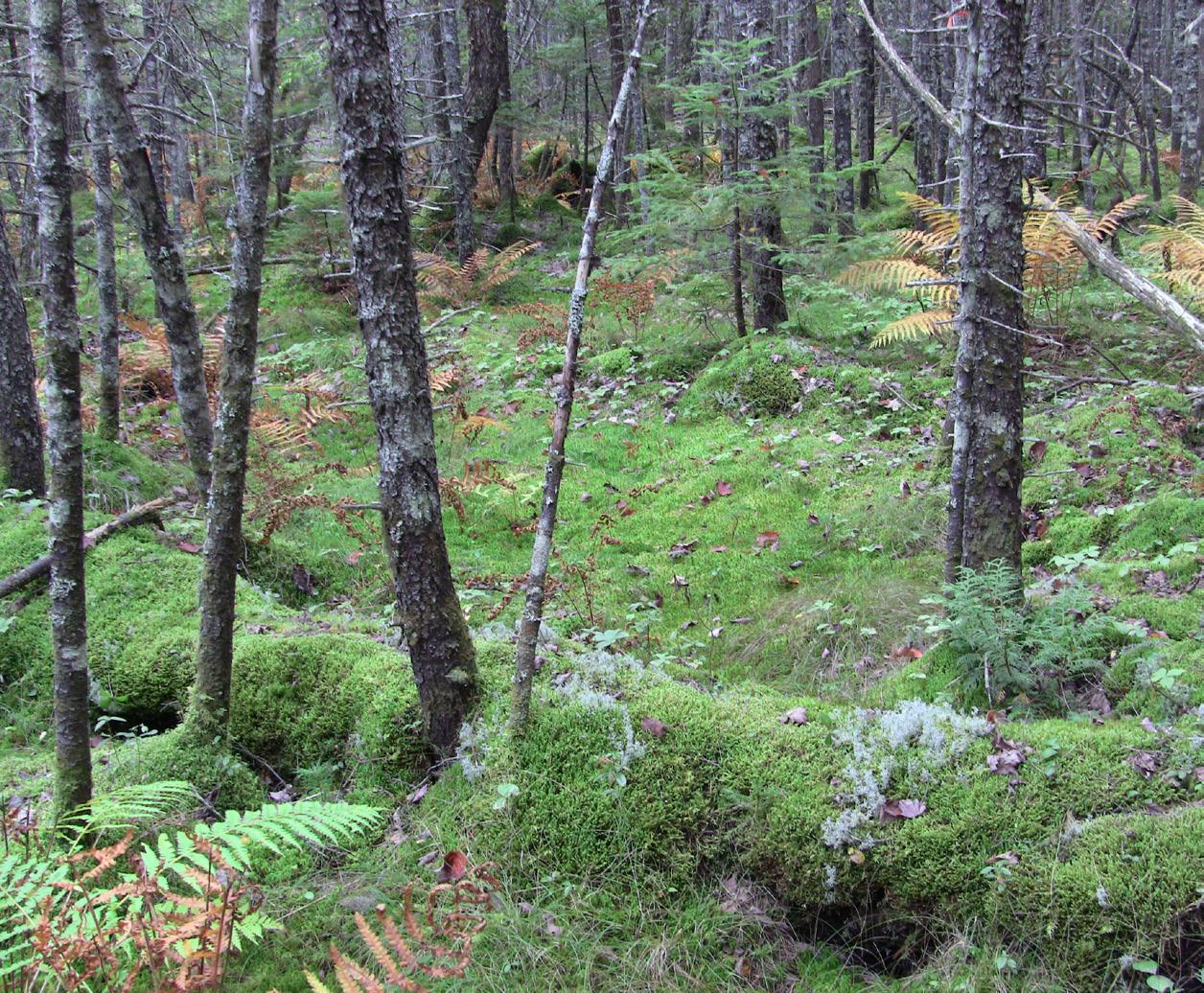
Ground-level view in Howland Forest. / photo by Kathleen Savage
03 June 2023
How climate change is fueling Canada’s fires, smoke in
Northeastern
U.S.
Increasing fire activity and altered atmospheric patterns behind Canada’s intense fire season.
Jonathan Kopeliovich Partnership Education Program (PEP) Communications intern
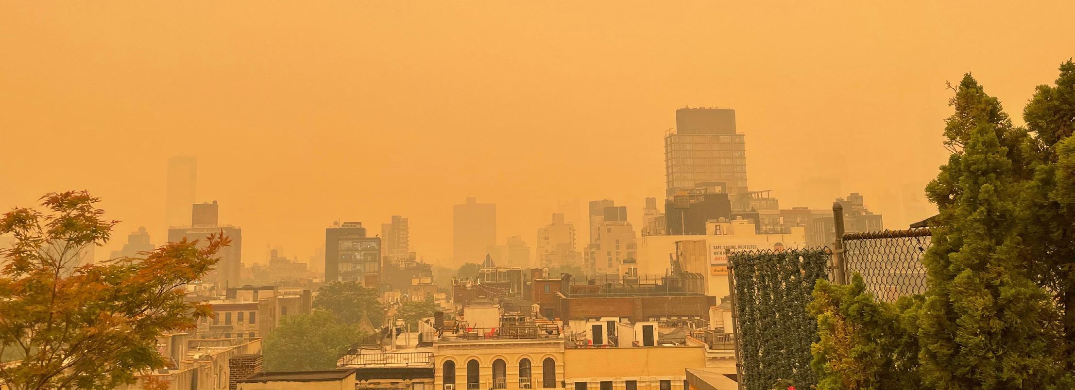
Canada’s fire season has barely started and it’s already on track to break records. So far, NOAA has documented more than 2,000 wildfires that have resulted in the forced evacuation of over 100,000 people across Canada. The most recent bout of fires burning in Ontario and Quebec has sent smoke southward into the Eastern U.S., causing record levels of air pollution in New York and warnings against outside activity as far south as Virginia.
Only a little over a month into the wildfire season, fires have already burned 13 times more land area than the 110-year average for this time of year, and they show no sign of stopping, according to Canadian publication The Star. Indigenous communities, some of whom live year-round in remote bush cabins, have been particularly harmed by the blazes.
According to Woodwell Climate Senior Scientist Dr. Jennifer Francis, the
phenomenon of winds pushing smoke down to the Northeastern U.S. has been linked to rapid Arctic warming caused by climate change.
In the upper atmosphere, a fast wind current called the jet stream flows from west to east in undulating waves, caused by the interaction of air masses with different temperatures and pressures, particularly between the Arctic and temperate latitudes.
As global temperatures have risen, the Arctic has warmed two to four times faster than the average global rate. Dr. Francis stated in an interview in the Boston Globe that the lessening of the temperature differences between the middle latitudes and the Arctic has slowed down the jet stream, which results in a more frequent occurrence of a wavy path.
Another factor contributing to the widespread smoke is an ongoing oceanic
heat wave in the North Pacific Ocean. The blob of much-above-normal sea water tends to create a northward bulge in the jet stream, which creates a pattern that sends cooler air down to California and warm air northward into central Canada— resulting in the persistent heat wave there in recent weeks. Farther east, the jet stream then bends southward and brings the wildfire smoke down to the Northeast.
“Big waves in the jet stream tend to hang around a long time, and so the weather that they create is going to be very persistent,” Dr. Francis said. “If you are in the part of the wave in the jet stream that creates heat and drought, then you can expect it to last a long time and raise the risk of wildfire.”
The wildfires are also decimating North American and Canadian boreal forests, the latter of which holds 12 percent of the “world’s land-based carbon reserves,” according to the Audubon Society. And three quarters of Canada’s woodlands and
Smoke and haze obscuring the New York City skyline on June 7, 2023. / photo
by Jonathan Friedman
04 Monthly Newsletter
forests are in the boreal zone according to the Canadian government.
“The surface vegetation and the soil can dry out pretty dramatically given the right weather conditions. For this fuel, as we call it in fire science, it often just takes one single ignition source to generate a large wildfire,” said Woodwell Climate Associate Scientist Dr. Brendan Rogers.
As the climate continues to warm, Dr. Rogers said the weather conditions that lead to fuel drying and out-of-control wildfires also increase. This creates a feedback loop. Heat waves caused by greenhouse gas emissions increase the prevalence of wildfires. The fires in turn destroy these natural carbon sinks and, in turn, speed up climate change.
While the ultimate solution to breaking this feedback loop lies in reducing emissions and curbing climate change, Dr. Rogers and other researchers at Woodwell Climate have conducted research into fire suppression strategies that could help prevent large boreal fires from spreading and help keep carbon in the ground.
A study conducted in collaboration with Woodwell and other institutions found that suppressing fires early may be a cost-effective way to carbon mitigation. Woodwell Climate’s efforts also include mapping fires, using geospatial data and models to estimate carbon emissions across large scales, and looking at the interplay between fires and logging.
“Reducing boreal forest fires to nearhistoric levels and keeping carbon in the ground will require substantial investments. Nevertheless, these funds pale in comparison to the costs countries will face to cope with the growing health consequences exacerbated by worsening air quality and more frequent and intense climate impacts expected if emissions continue to rise unabated. Increased resources, flexibility, and carbon-focused fire management can also ensure wildlife, tourism, jobs, and many other facets of our society can persevere in a warming world,” Dr. Rogers said.
Robots on the rise? AI is nothing new for climate research
“It’s been around a long time, actually,” muses Senior Scientist, Dr. Jennifer Francis. “It’s gotten more sophisticated, sure, and a lot of the applications are new. But the concept of artificial intelligence is not.”
Dr. Francis has been working with it for almost two decades, in fact. Although, back when she started working with a research tool called “neural networks,” they were less widely known in climate science and weren’t generally referred to as artificial intelligence.
But recently, AI seems to have come suddenly out of the woodwork, infusing nearly every field of research, analysis, and communication. Climate science is no exception. From mapping thawing Arctic tundra, to tracking atmospheric variation, and even transcribing audio interviews into text for use in this story, AI in varying forms is woven into the framework of how Woodwell Climate creates new knowledge.
AI helps climate scientists track trends and patterns
The umbrella term of artificial intelligence encompasses a diverse set of tools that can be trained to do tasks as diverse as imitating human language (à la ChatGPT), playing chess, categorizing images, solving puzzles, and even restoring damaged ancient texts.
Dr. Francis uses AI to study variations in atmospheric conditions, most recently weather whiplash events— when one stable weather pattern suddenly snaps to a very different one (think monthslong drought in the west disrupted by torrential rain). Her particular method is called self-organizing maps which, as the name suggests, automatically generates a matrix of maps showing atmospheric data organized so Dr. Francis can detect these sudden snapping patterns.
“This method is perfect for what we’re looking for because it removes the human biases. We can feed it daily
AI
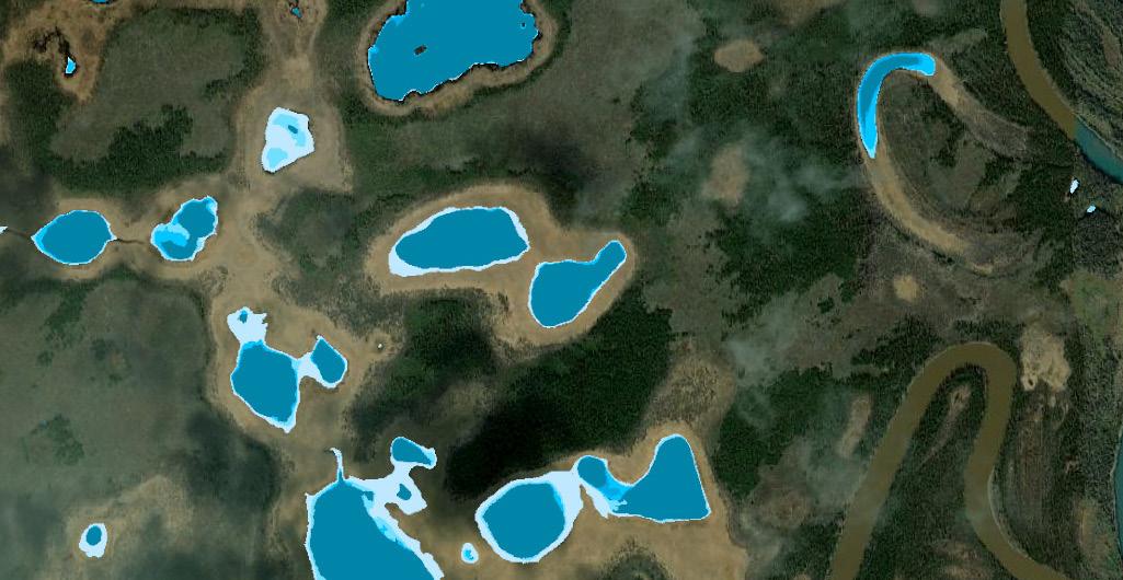
models are used to detect small water bodies in Arctic landscapes. / image by Andrew Mullen
Time is short to act on climate change. AI methods have dramatically increased the pace of climate research.
Sarah Ruiz Science Writer
June 2023 05
maps of, say, what the jetstream looks like, and then the neural network finds characteristic patterns and tells us exactly which days the atmosphere is similar to each pattern. There are no assumptions,” says Dr. Francis.
This aptitude for pattern recognition is a core function of many types of neural networks. In the Arctic program, AI is used to churn through thousands of satellite images to detect patterns that indicate specific features in the landscape using a technique originally honed for use in the medical industry to read CT scan images.
Data science specialist, Dr. Yili Yang, uses AI models trained to identify features called retrogressive thaw slumps (RTS) in permafrost-rich regions of the Arctic. Thaw slumps form in response to subsiding permafrost and can be indicators of greater thawing on the landscape, but they are hard to identify in images.
“Finding one RTS is like finding a single building in a city,” Dr. Yang says. It’s time consuming, and it really helps
other researchers could track seasonal changes in their area.
And there are opportunities to use AI not just for the data creation side of research, but trend analysis as well. Associate Scientist Dr. Anna Liljedahl leads the Permafrost Discovery Gateway project which used neural networks to create a pan-Arctic map of ice wedge polygons—another feature that indicates ice-rich permafrost in the ground below and, if altered over time, could suggest permafrost thaw.
“Our future goals for the Gateway would utilize new AI models to identify trends or patterns or relationships between ice wedge polygons and elevation, soil or climate data,” says Dr. Liljedahl.
How do neural networks work?
The projects above are examples of neural-network-based AI. But how do they actually work?
different tasks,” says Mullen.
In order to accomplish these highly specific tasks, the model has to be trained. Training involves feeding the AI input data and then telling it what the correct output should look like. The process is called supervised learning, and it’s functionally similar to teaching a student by showing it the correct answers to the quiz ahead of time, then testing them, and repeating this cycle over and over until they can reliably ace each test.
if you already know what you’re looking for. Their trained neural network can pick the features out of highresolution satellite imagery with fairly high accuracy.
Research Assistant Andrew Mullen uses a similar tool to find and map millions of small water bodies across the Arctic. A neural network generated a dataset of these lakes and ponds so that Mullen and
The comparison to human brains is apt. The networks are composed of interconnected, mathematical components called “neurons.” Also like a brain, the system is a web of billions upon billions of these neurons. Each neuron carries a fragment of information into the next, and the way those neurons are organized determines the kind of tasks the model can be trained to do.
“How AI models are built is based on a really simple structure—but a ton of these really simple structures stacked on top of each other. This makes them complex and highly capable of accomplishing
In the case of Dr. Yang’s work, the model was trained using input satellite images of the Arctic tundra with known retrogressive thaw slump features. The model outputs possible thaw slumps which are then compared to the RTS labels hand-drawn by Research Assistant Tiffany Windholz. It then assesses the similarity between the prediction and the true slump, and automatically adjusts its billions of neurons to improve the similarity. Do this a thousand times and the internal structure of the AI starts to learn what to look for in an image. Sharp change in elevation? Destroyed vegetation and no pond? Right geometry? That’s a potential thaw slump.
Just as it would be impossible to pull out any single neuron from a human brain and determine its function, the complexity of a neural network makes the internal workings of AI difficult to detail—Mullen calls it a “black box”—but with a large enough training set you can refine the output without ever having to worry about the internal workings of the machine.
Speeding up and scaling up
Despite its reputation in pop culture, and the uncannily human way these algorithms can learn, AI models are not replacing human researchers. In their present form, neural networks aren’t capable of constructing novel ideas from the information they receive—a defining characteristic of human intelligence. The information that comes out of them is
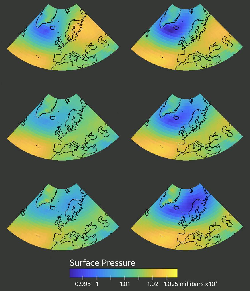
left: An interconnected web of neurons composes a neural network. / graphic by Julianne Waite right: Self organizing maps show major patterns in atmospheric pressure, organized by similarity. / graphic by Jennifer Francis, Christina Shintani
06 Monthly Newsletter
limited by the information they were trained on, in both scope and accuracy.
But once a model is trained with enough accurate data, it can perform in seconds a task that might take a human half an hour. Multiply that across a dataset of 10,000 individual images and it can condense months of image processing into a few hours. And that’s where neural networks become crucial for climate research.
“They’re able to do that tedious, somewhat simple work really fast,” Mullen says. “Which allows us to do more science and focus on the bigger picture.”
Dr. Francis adds, “they can also elucidate patterns and connections that humans
In the news: highlights
Bill Schlesigner, past director of the Cary Institute, posted on his blog about a recent publication looking at water loss in residential lawns, co-authored by Dr. Chris Neill.
The Wanderer covered Old Hammondtown School’s sixthgrade trip to Cuttyhunk, mentioning the saltmarsh exploration activity the students did with Hillary Sullivan.
Business Times covered the carbon markets panel at GenZero Climate Summit, mentioning comments by Dr. R. Max Holmes as a panelist.
Bloomberg quoted Dr. Jen Francis in an article explaining how Arctic ice melt raises the risk of far-away wildfires, widely syndicated to many outlets including phys.org, Financial Post, and Hindustan Times. Jen was also quoted in an Observer article on El Niño and climate change.
USA Today published an article with a timeline of “what humanity knew and when” about climate change that included Dr. George Woodwell’s 1988 US Senate testimony.
Curious.earth blog highlighted Woodwell Climate and Permafrost Pathways’ work on permafrost thaw in a post offering a quick guide to permafrost.
The Legislative Assembly of Acre published an article covering a recent public hearing where Dr. Foster Brown joined government officials to discuss issues with water resources in the region (Portuguese). The hearing was also covered by local news sites Ac24Horas and ContilNet.
can’t see by gazing at thousands of maps or images.”
Another superpower of these AI models is their capability for generalization. Train a model to recognize ponds or ice wedges or thaw slumps with enough representative images and you can use it to identify the water bodies across the Arctic—even in places that would be hard to reach for field data collection.
All these qualities dramatically speed up the pace of research, which is critical as the pace of climate change itself accelerates. The faster scientists can analyze and understand changes in our environment, the better we’ll be able to predict, adapt to, and maybe lessen the impacts to come.
Dr. Jen Francis was interviewed by the Boston Globe about the relationship between climate warming and the jet stream, and how that’s influencing wildfires in Canada.
Inside Climate News interviewed Dr. Rich Birdsey for a story on management disputes over Hoosier National Forest.
The New York Times, CNN and the Boston Globe quoted Dr. Brendan Rogers on how climate change creates the right conditions for fire in boreal and Siberian forests. Brendan was also interviewed by Bloomberg about Canada’s fires and climate change for an article also published by The Straits Times and Financial Post
Dr. Jen Francis was interviewed on the ClimateGenn podcast, speaking about 2023’s symptoms of climate chaos. The New York Times and the Washington Post quoted Jen from the podcast.
CNN quoted Dr. Jen Francis in an article highlighting increased harassment meteorologists have been experiencing from conspiracy theorists and climate deniers.
Drs. Alex Naegele and Christopher Schwalm co-authored an article for Tufts Now on how the war in Sudan could exacerbate impacts of the climate crisis in the Horn of Africa.
Dr. Marcia Macedo was the keynote speaker at the Felix Neck Annual Youth Climate Summit, covered in an article from MV Times
07 June 2023
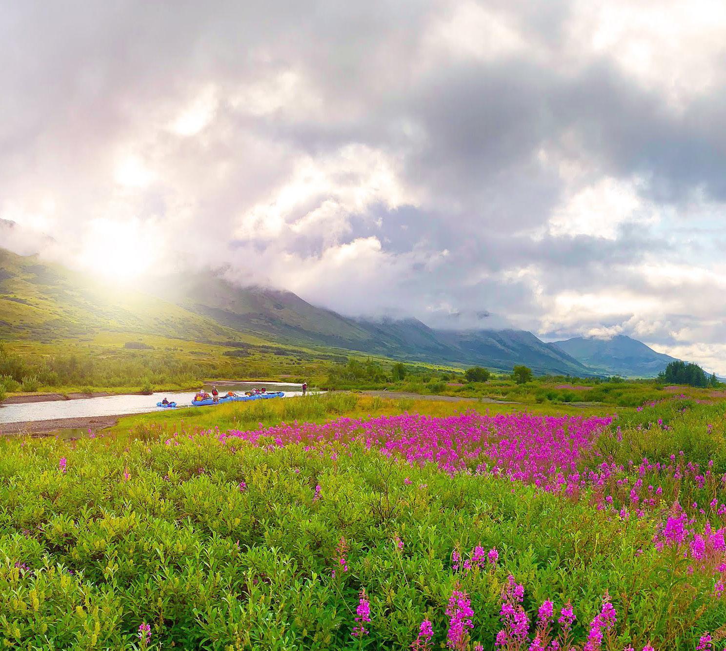
cover: This summer, Science on the Fly is visiting five Alaska rivers in the Yukon-Kuskokwim Delta region where the Yup’ik People are the traditional stewards of the land and water. / photo by Greg Fiske

Donations
Please help us to conserve paper. To receive this newsletter electronically, please send your email address to info@woodwellclimate.org.
woodwellclimate.org/give
@woodwellclimate #sciencefortheworld
149 Woods Hole Road Falmouth, MA, 02540-1644
CLIMATE SCIENCE FOR CHANGE
play an important role in securing the future of Woodwell Climate Research Center’s work—and help safeguard the health of our planet for generations to come.


