Project 11 - Bomber: Supreme Conceptual Store in Sai Wan
Page 46 - 47
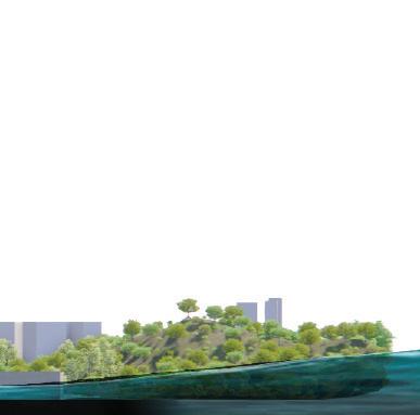
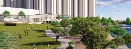
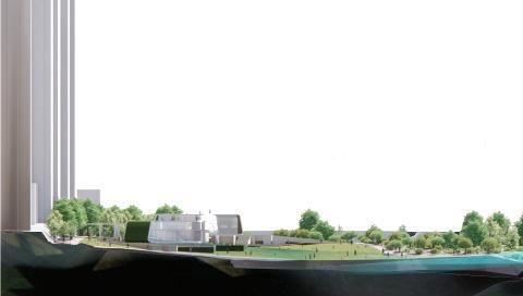
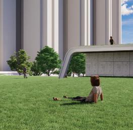
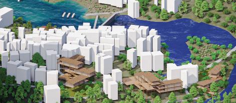
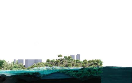
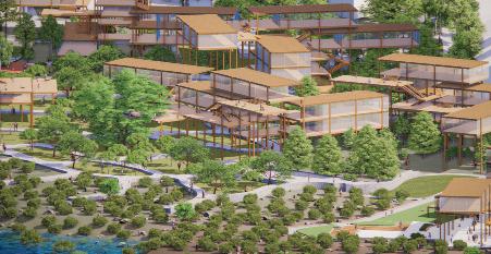
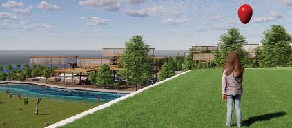
Project 12 - Wonderland: Work-lab Rooftop Garden in HKSC
Project 01
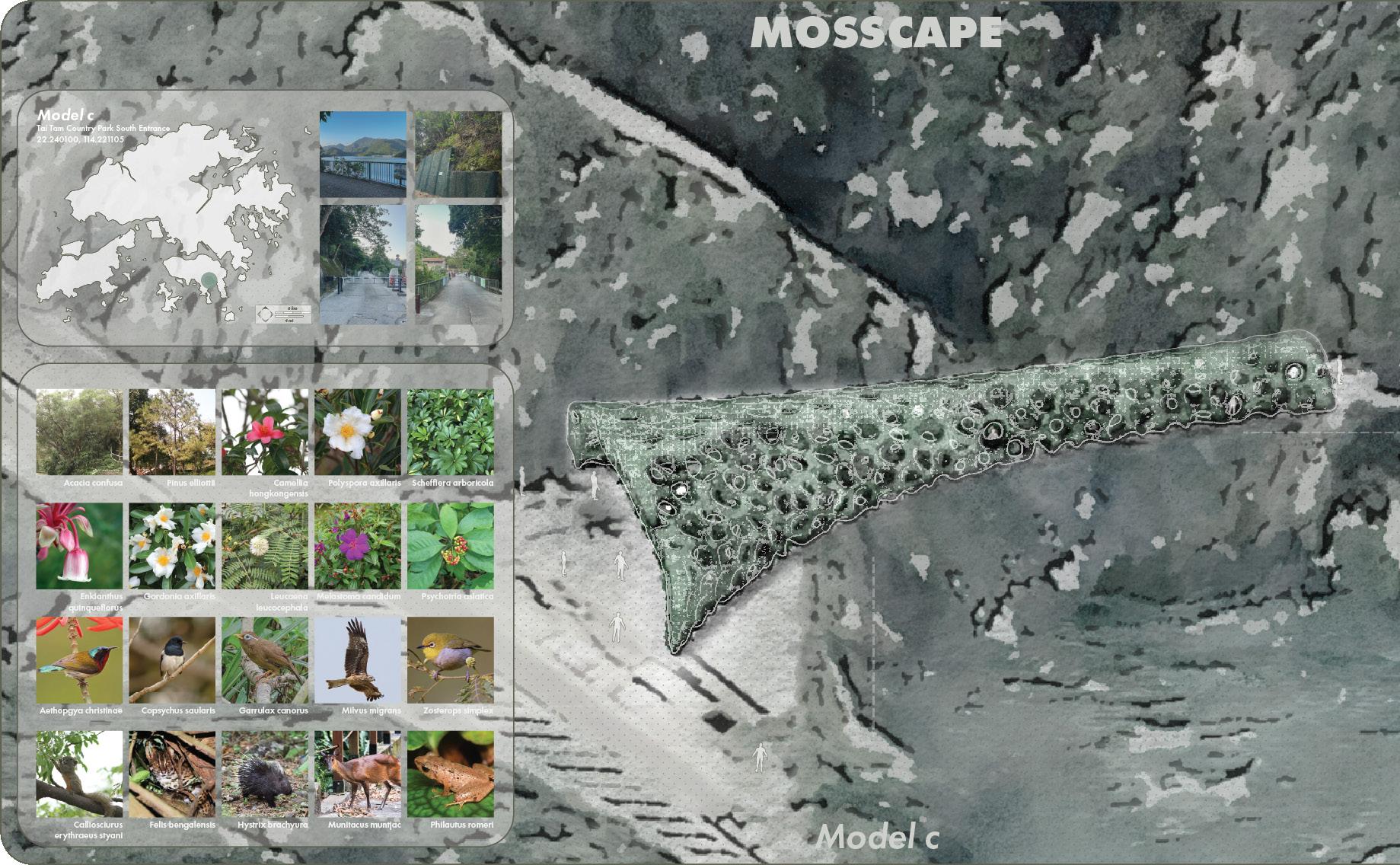
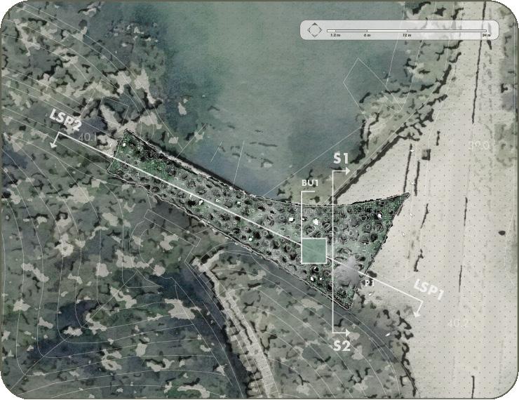
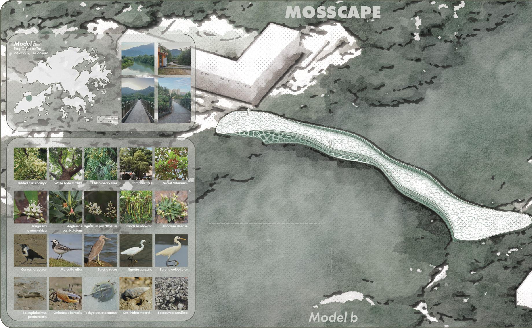
MATERIAL EXPLORATION: MOSSCAPE
Experimental Landscape Tectonics & Spatial Form
[Project Inspiration] [Why Moss]
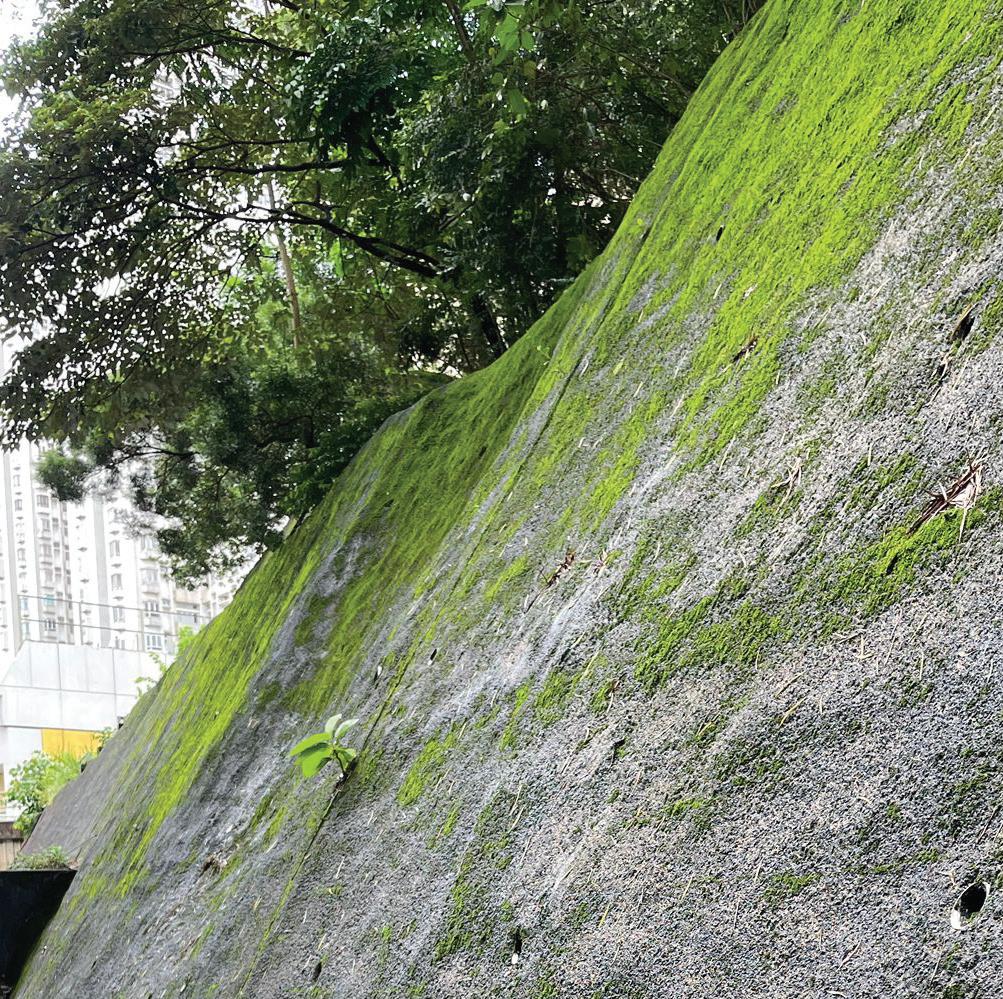
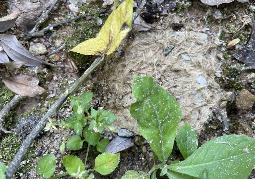
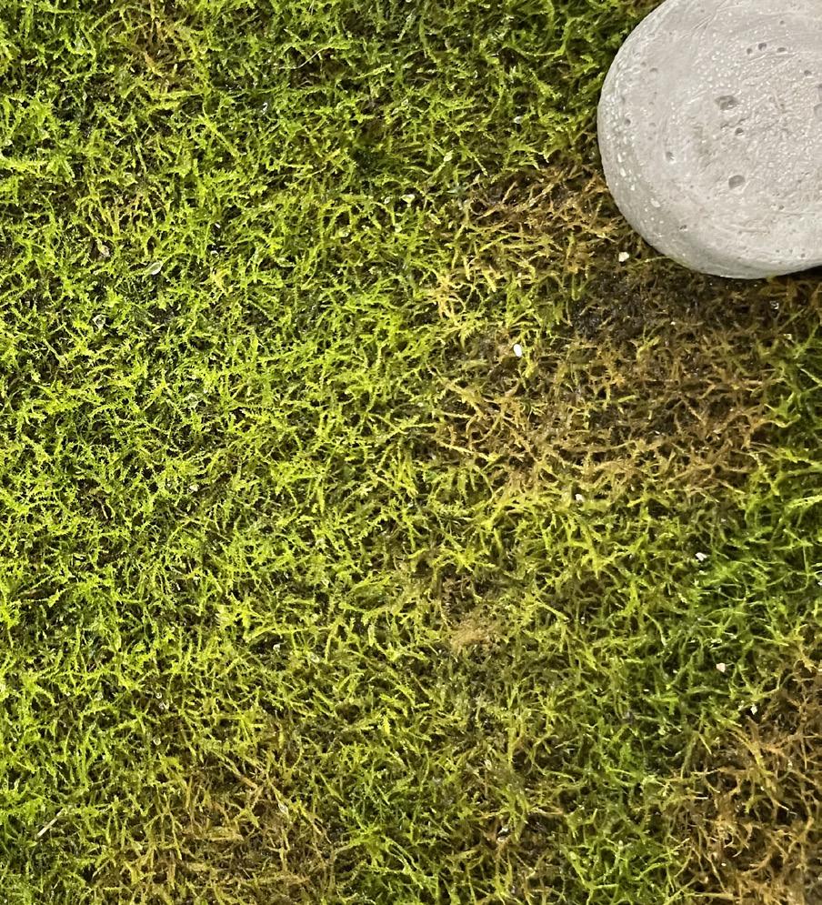
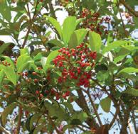
The first idea for this project came from observing moss growing naturally on concrete slopes along the street, that led me to investigate how environmental factors such as moisture and shade create conditions suitable for moss growth.
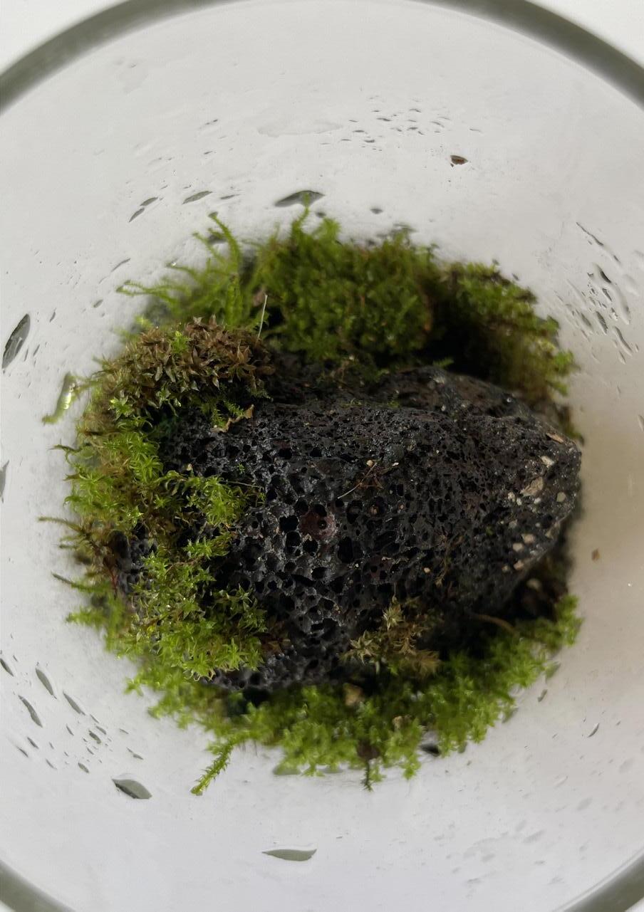
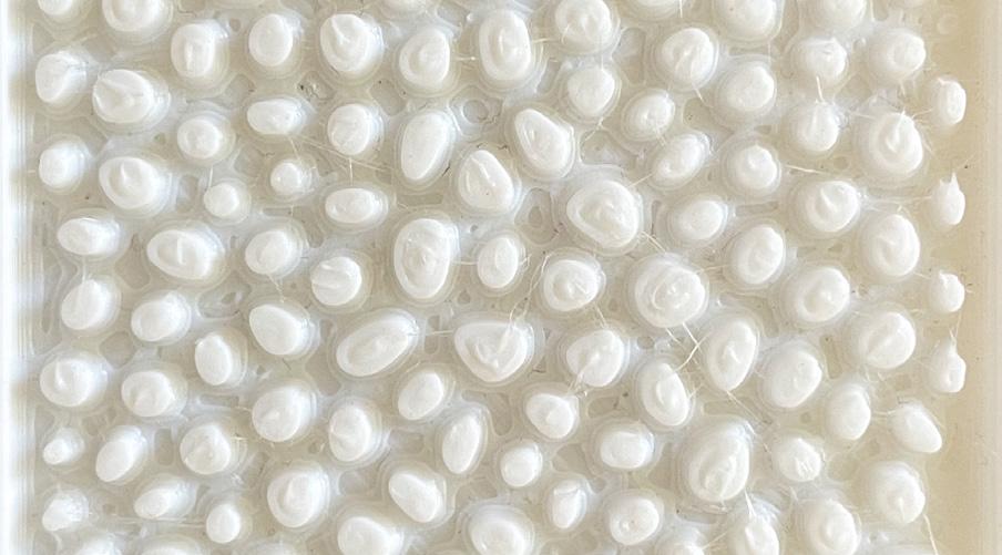
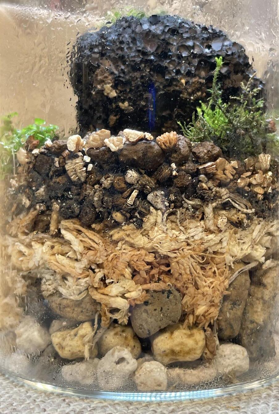
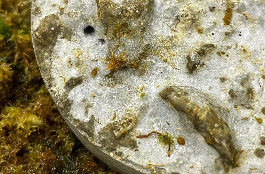
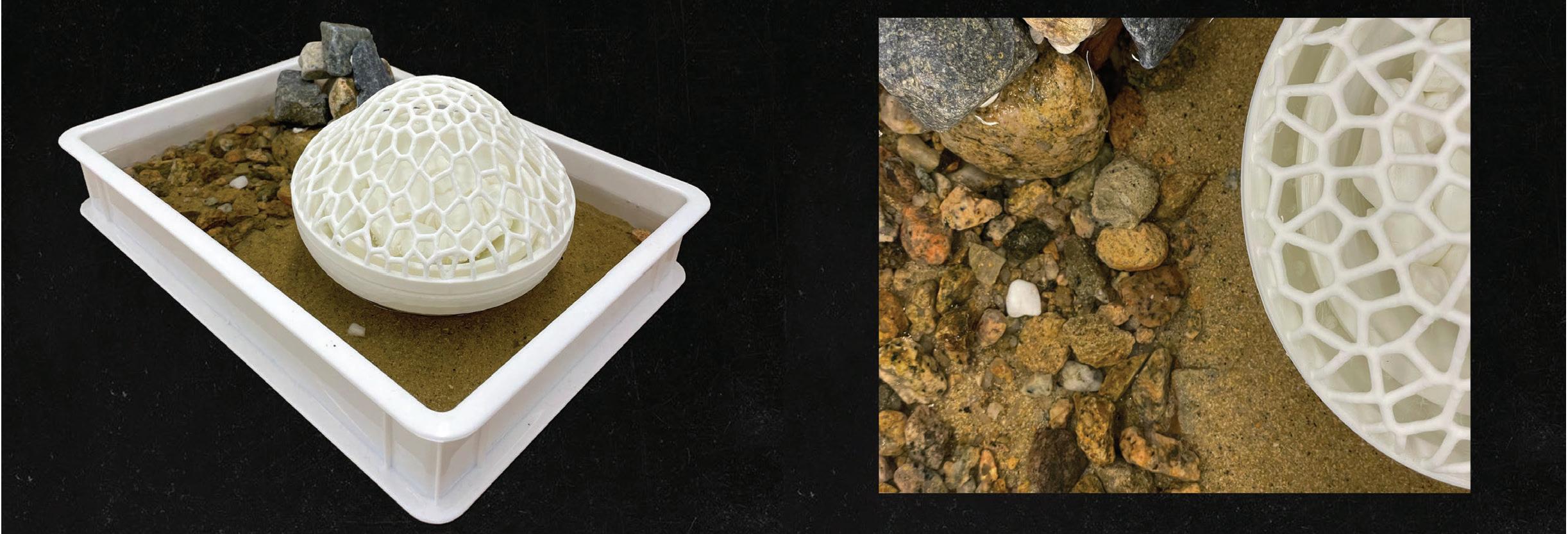
As I experimented with moss cultivation, I discovered that pumice stone—a naturally porous material—provides the perfect micro-environment for moss to thrive. Therefore, the porous and water-retentive qualities of pumice stone became the guiding tectonic strategy for my landscape element design.
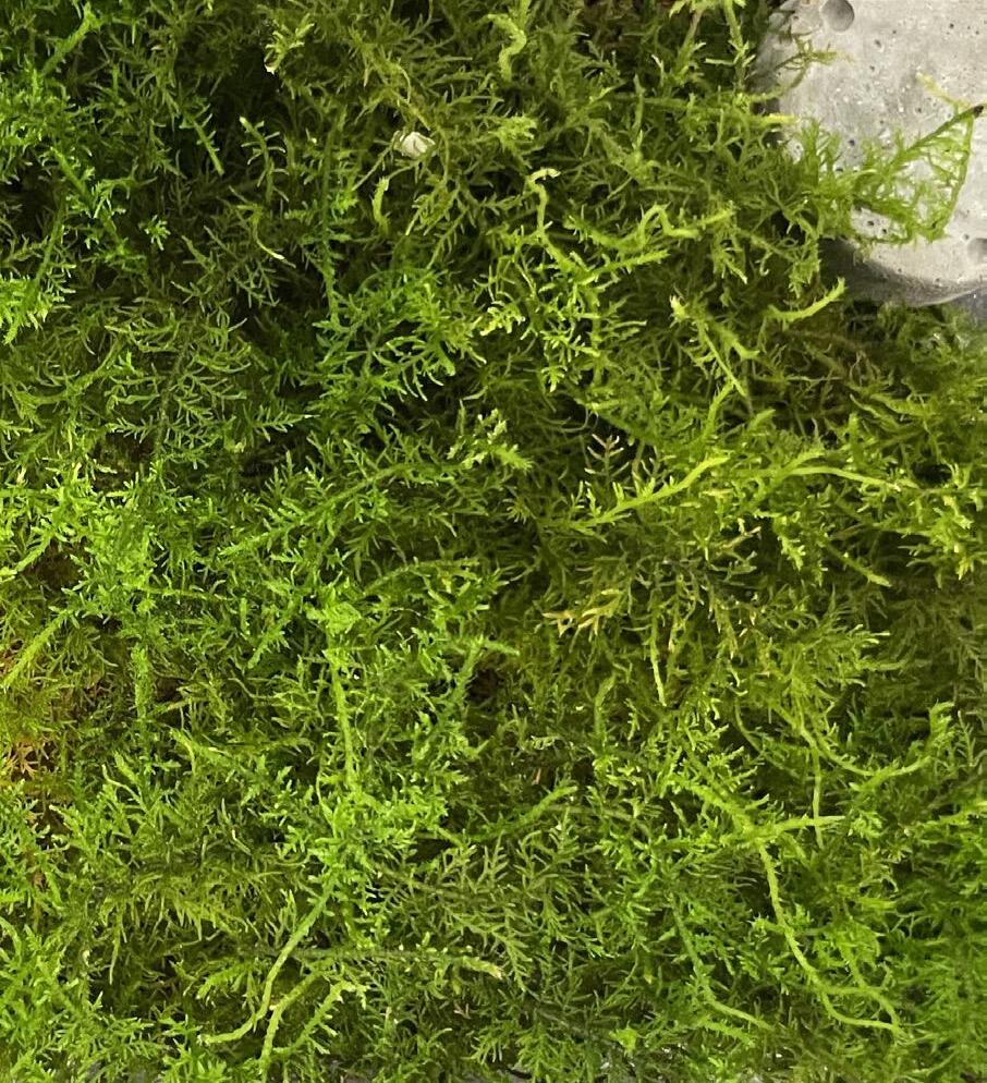
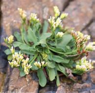
Moss is a resilient plant with exceptional adaptability, capable of thriving in various environments when the conditions are right.
It grows well in diffused light, 15-25 Celsius, 5.0-6.0 pH, air circulation and a humid environment. Unlike rooted plants, moss attaches itself to surfaces, it not only enhances the ecological performance of built environments but also supports biodiversity by creating microhabitats for small species.
This project aims to explores how moss-inspired tectonics can integrate ecological functions with coastal landscape design.
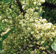
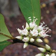
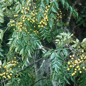
Brachythecium
Racomitrium canescens
Thuidium cymbifolium
Moss Plantation
Material Testing 01
Material Testing 02
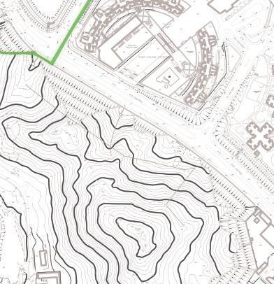
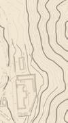
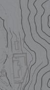
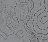
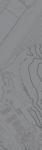
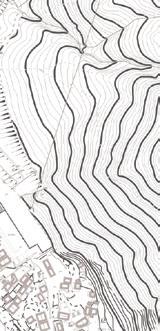
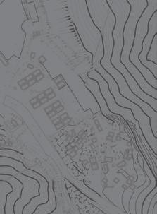
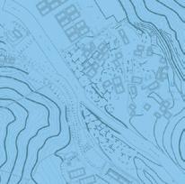
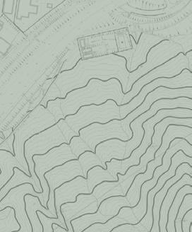
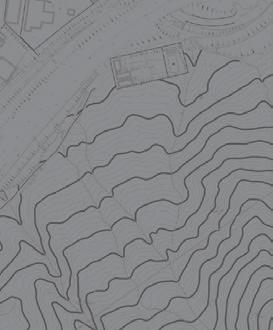
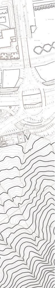
Kwai Chung - Slope overview
Kwai Chung - Slope surface
Pumice Stone with moss
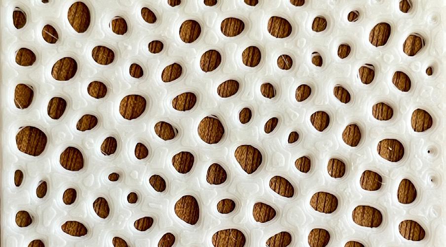
Pumice Stone surface
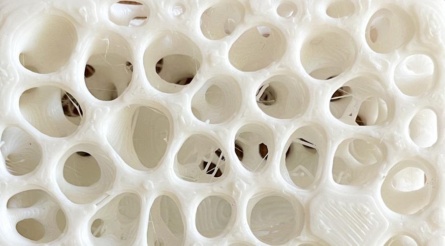
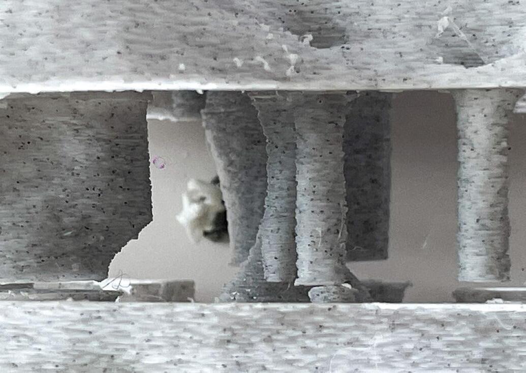
Pumice Stone structure
Pumice Stone section
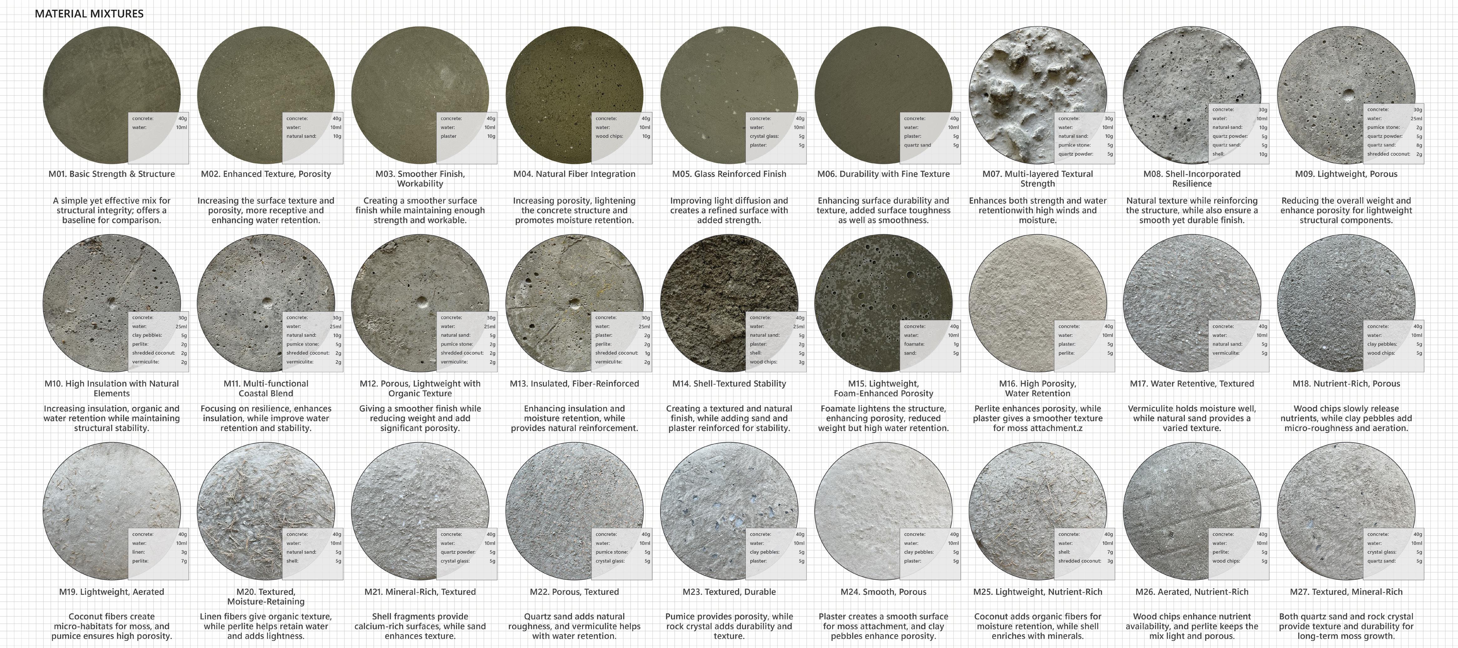
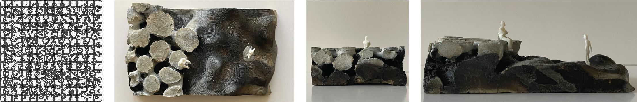
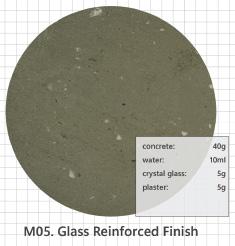
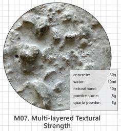
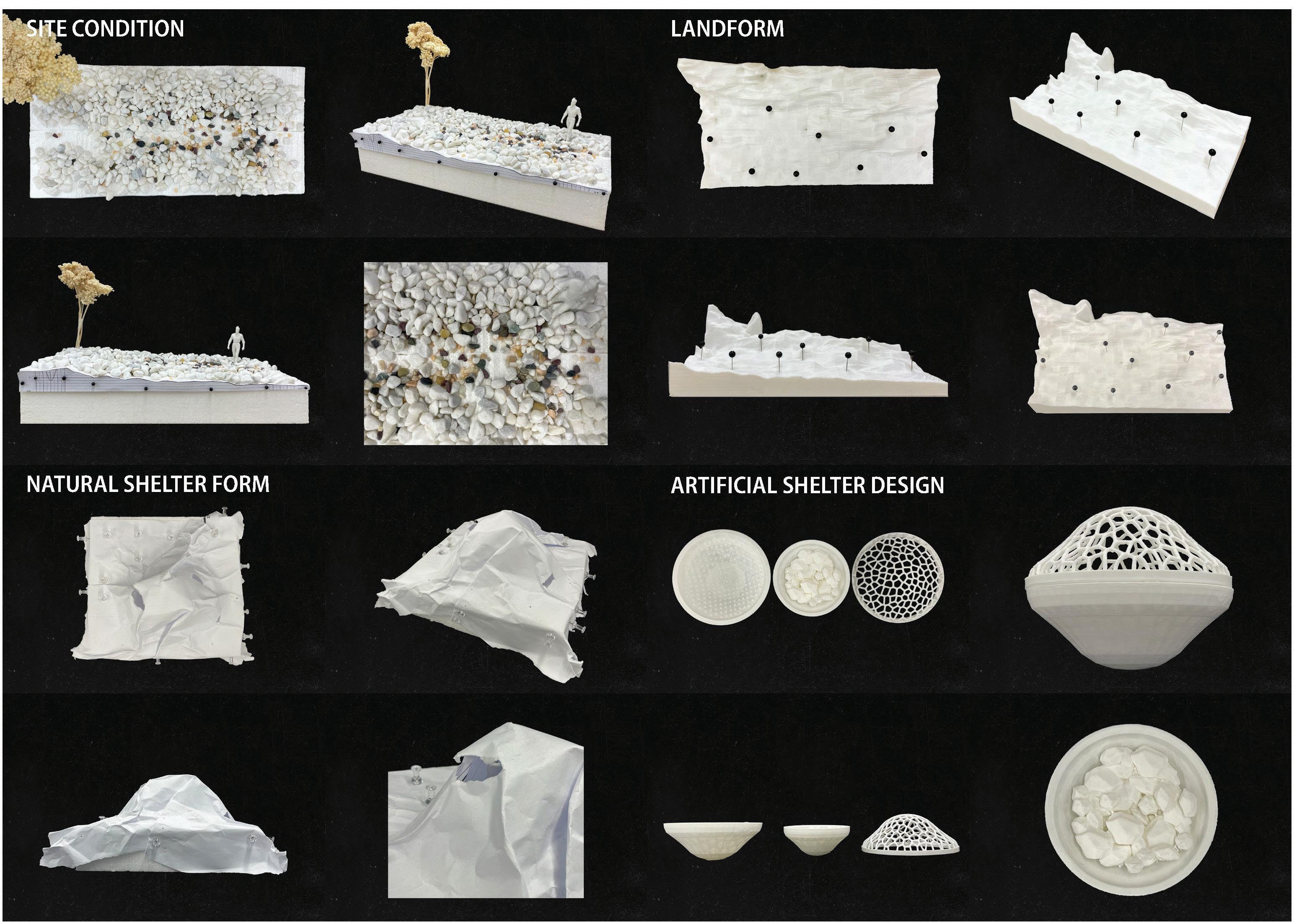
Since the core of my design is rooted in the study of pumice stone’s porous texture. I explored 27 different concrete mixtures by combining various raw materials to achieve various properties—micro-porosity, water retention, texture, and durability.
These mixtures allowed me to test different surfaces and identify the most effective combinations for moss growth, and the result is a bio-receptive concrete that mimics the texture and porosity of pumice stone. Therefore, I focused on balancing water retention with surface textures that provide micro-climates for moss attachment and growth. Moreover, I also tried to use three tectonic languages to do some testing models: surface attachment, three-dimensional form of pumice, as well as the counter version, and then tested out some landscape application like paving pattern, wall surfaces, underpass, pavilion, benches, etc.
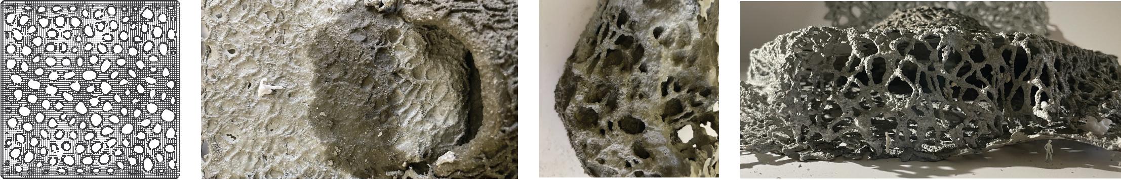
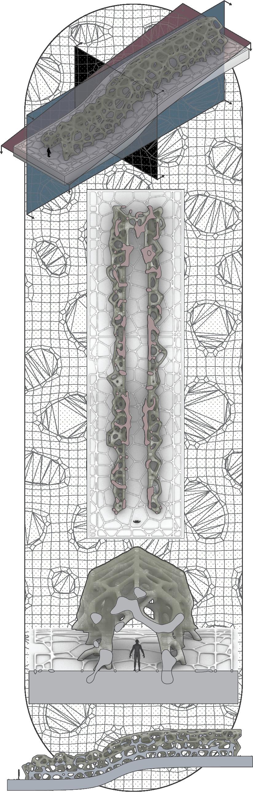
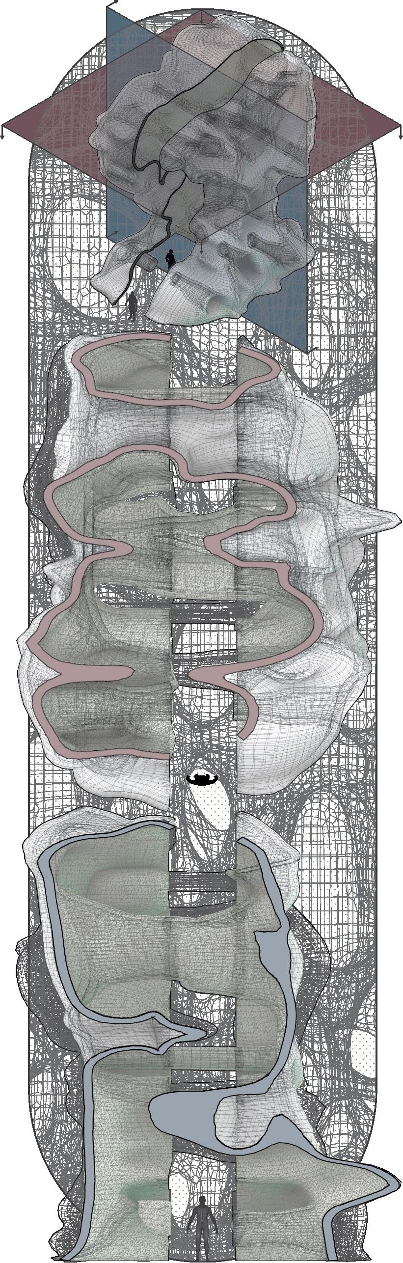
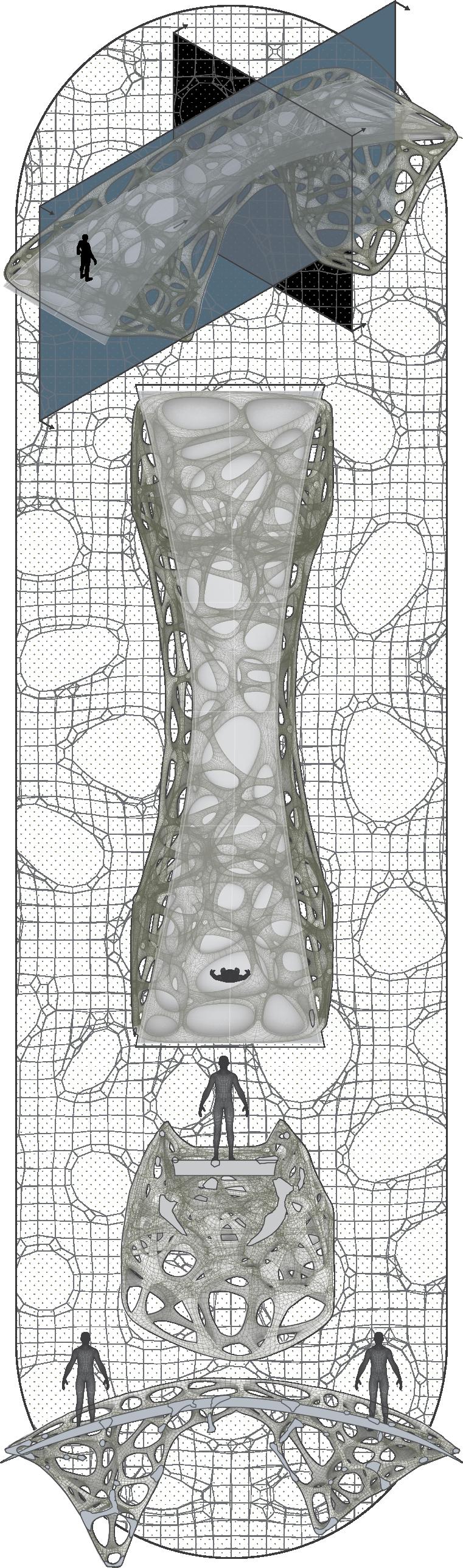
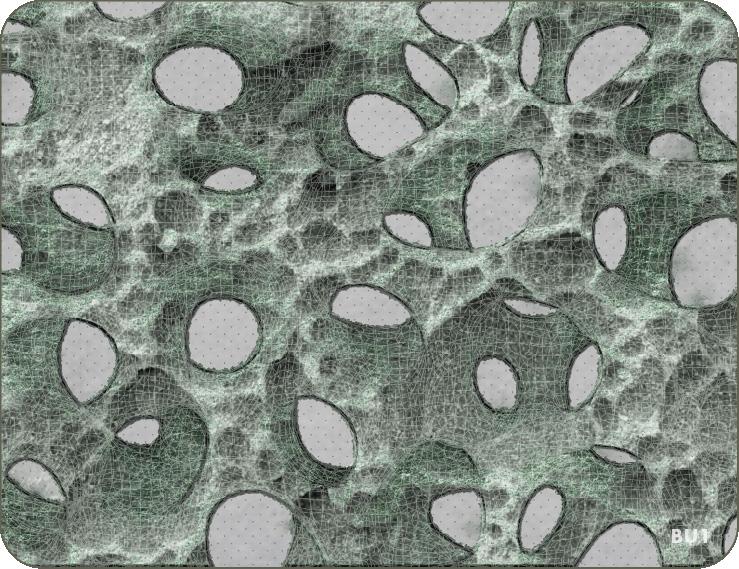
Before mid-term, I used Rhino-Grasshopper Voronoi to develop three main forms inspired by the growth and attachment patterns of moss and pumice stone.
Porous Surface Panel (Top):
> Bio-Receptive Surface Module, this pattern mimics the natural pore structures of pumice, enhancing water retention and creating attachment points to optimize moss attachment.
Structural Column Core (Middle):
> Permeable Structural Core perforated design enhances airflow and moisture distribution evenly, creating a stable micro-environment for moss growth while maintaining structural integrity.
Negative Column Form (Bot):
> Inverted Spatial Void, which represents the potential spaces for ecological interaction, functioning as sheltered areas for moss, air circulation, and light play.
[Design Exploration]
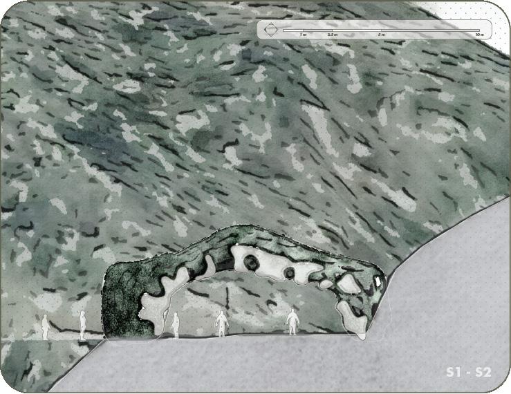
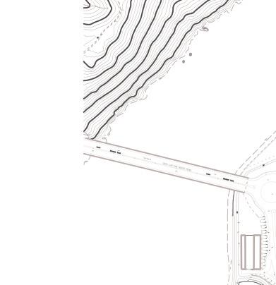
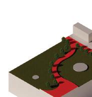
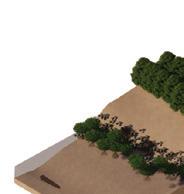
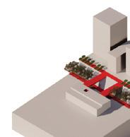
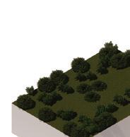
Moving from material and form experimentation to tectonic design, I adapted the pumice stone structure to create three landscape elements: Bridge, Pavilion, and Corridor. Each of these elements applies pumice-inspired tectonics to serve both aesthetic and ecological functions.
01. Corridor (LEFT)
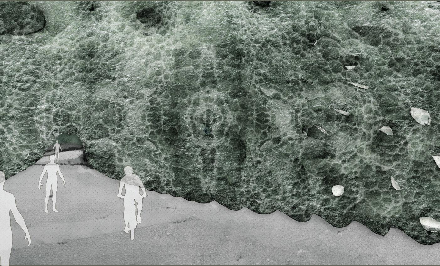
The corridor is designed to integrate with sloped areas or shaded forest edges, creating a moss-covered passageway; acts as a ‘mossy gateway’—immersing visitors in a green, shaded space.
02. Pavilion (MIDDLE)
The pavilion adopts a three-dimensional pumice form, using perforated concrete to allow airflow and moisture retention. The porous surfaces act as micro-habitats for moss, while larger perforations provide visual connections to the outside landscape.
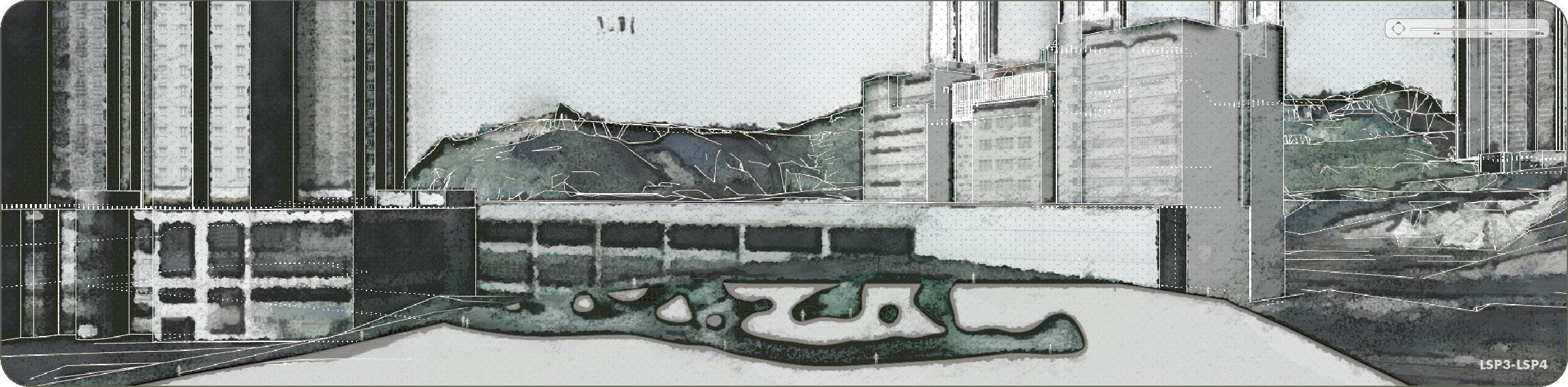
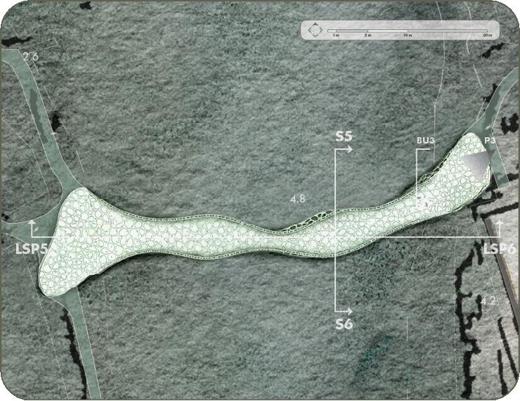
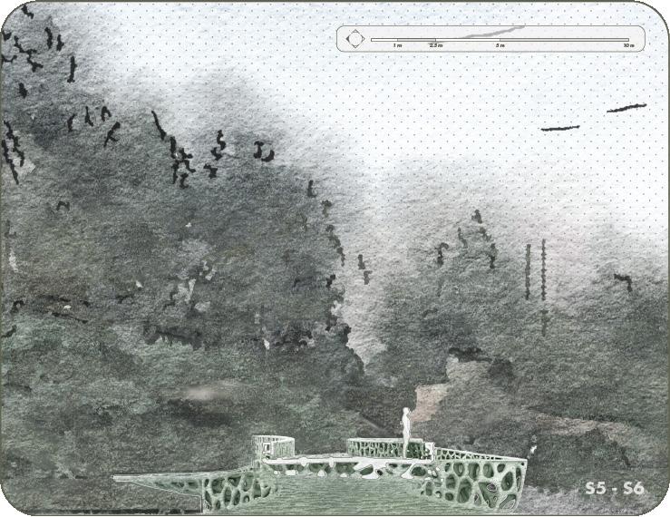
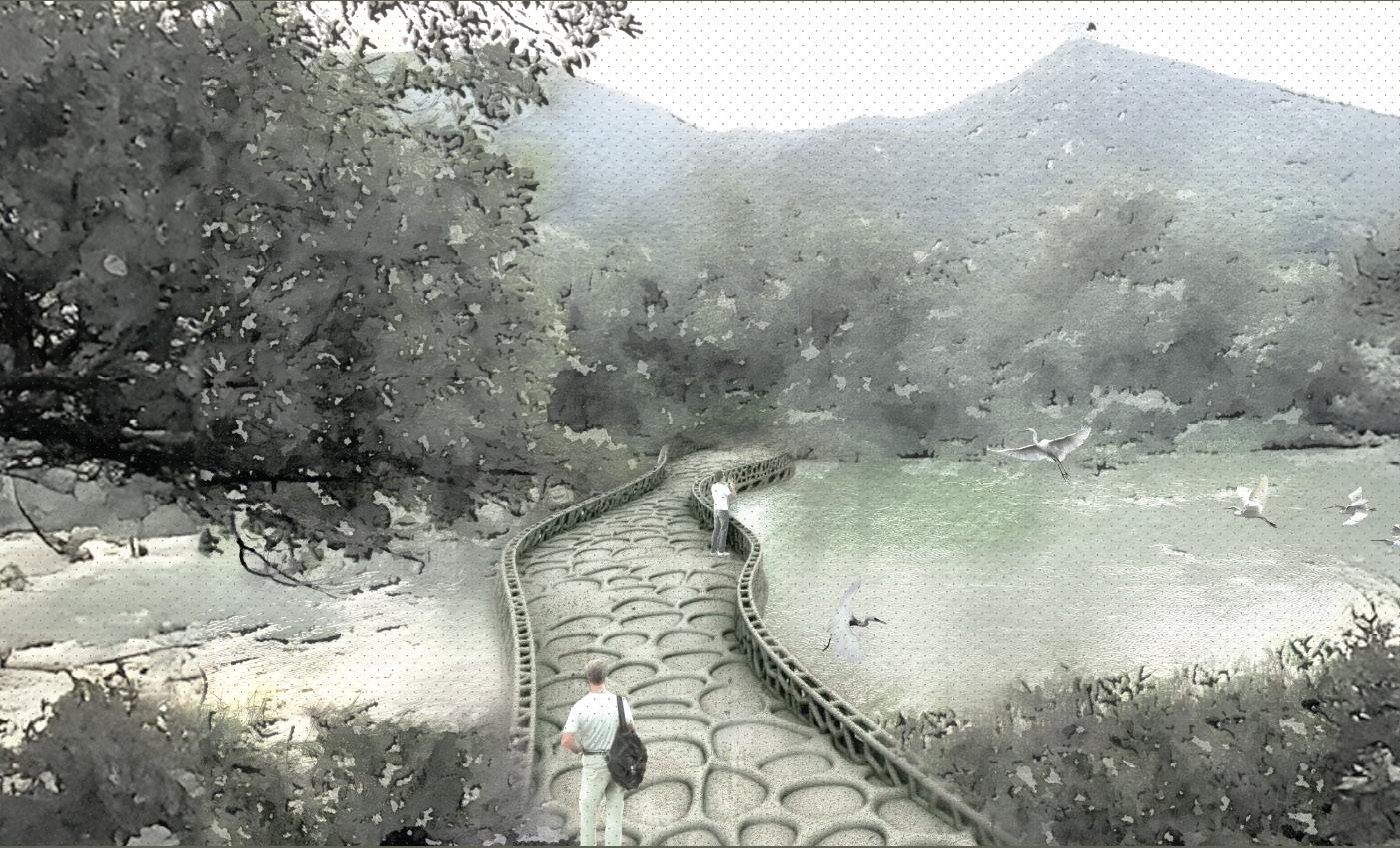
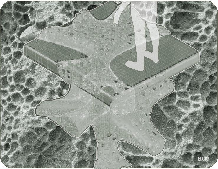
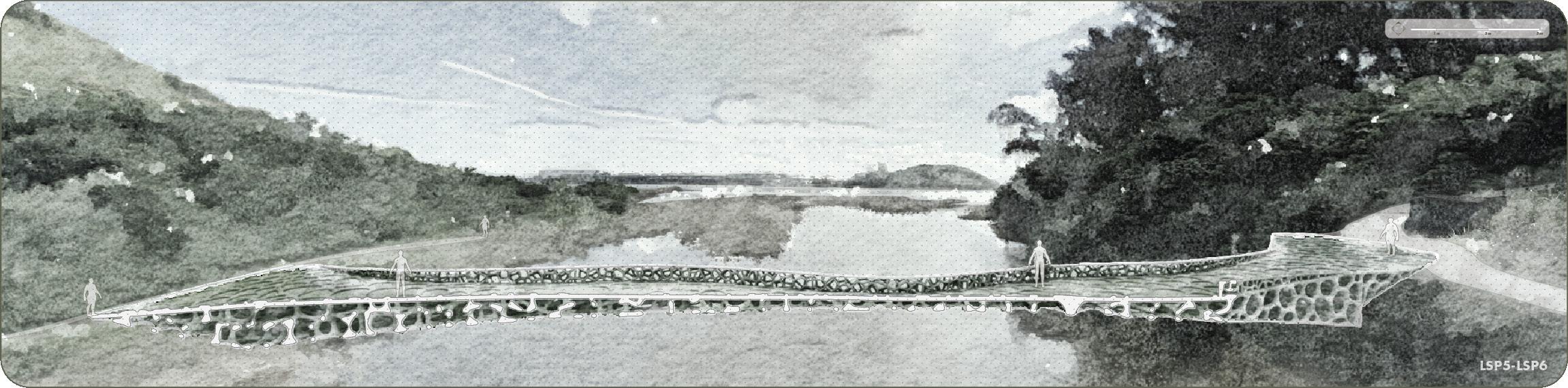
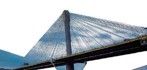
03. Bridge (RIGHT)
The bridge design uses a pumice-like structure as the supporting column. I applied a concrete mixture with strong water absorption, allowing the moss to grow better by drawing moisture from the surrounding environment, such as stream. Aims to create an organic, moss-covered bridge that blends naturally with the landscape.
[Analysis of the Corridor Design]
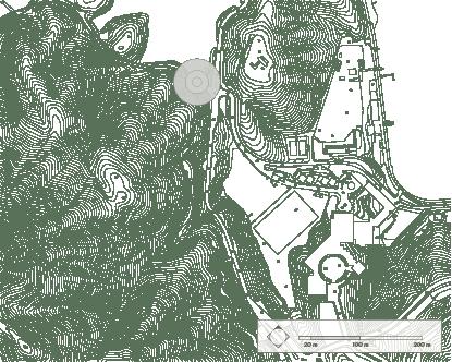
For the corridor design at Tai Tam Country Park Entrance, M05 (Glass Reinforced Finish) is the most suitable choice.
-> High Strength and Durability: The corridor will experience frequent foot traffic, requiring a material with structural integrity.
-> Smooth Finish for Comfort: M05 provides a glass-reinforced smooth finish, ideal for pathways while retaining moss-friendly micro-textures on non-walkable surfaces.
-> Water Retention: While smoother, this mixture retains adequate moisture to support moss growth in shaded areas near the forest.
The corridor design incorporates pumice-inspired forms to enhance water flow and retention. By blending bio-receptive concrete with the existing environment, it becomes an ecologically sensitive gateway to the country park, aligning with Tai Tam’s unique biodiversity and aesthetic.
Moss Growth Optimization:
-> Shaded Pathway: The corridor’s design integrates shaded areas under existing forest cover, ensuring minimal exposure to direct sunlight—ideal for moss species such as Thuidium cymbifolium and Brachythecium.
-> Moisture Retention: The nearby vegetation and humid micro-climate help maintain hydration levels for moss growth.
-> Textured Zones: Non-walkable surfaces of the corridor feature rougher textures to encourage moss attachment and growth.
Ecological Benefits:
-> Biodiversity Enhancement: Moss-covered surfaces provide microhabitats for invertebrates and small vertebrates, including Romer’s Tree Frog (Philautus romeri) and Red Squirrels (Callosciurus erythraeus styani).
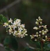
-> Support for Native Plants: The moss improves soil quality by trapping moisture and organic debris, supporting understory plants such as Camellia hongkongensis and Melastoma candidum.
-> Cooling Effect: Moss layers naturally cool the corridor, improving visitor comfort and reducing the heat impact on surrounding flora.
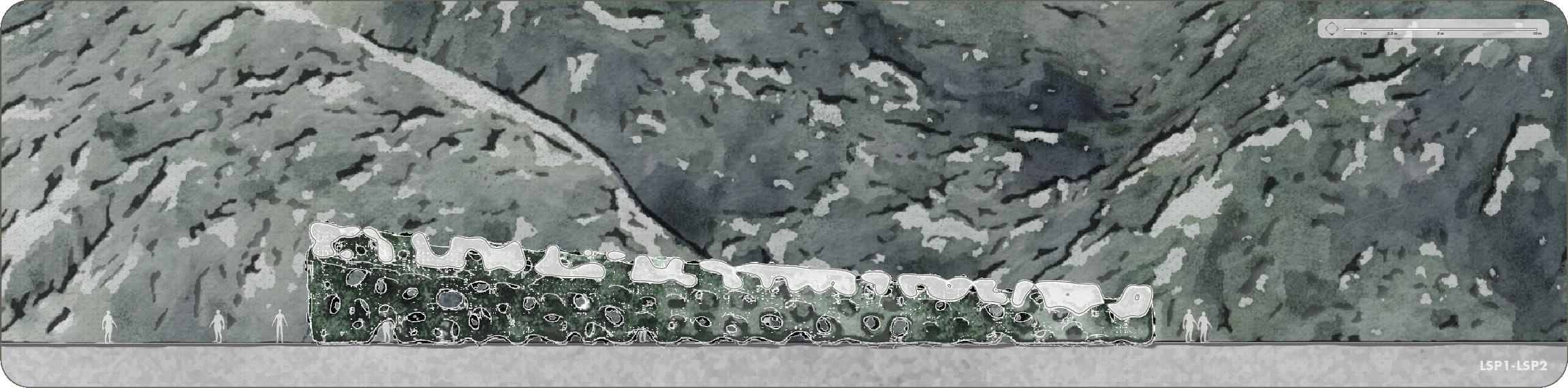
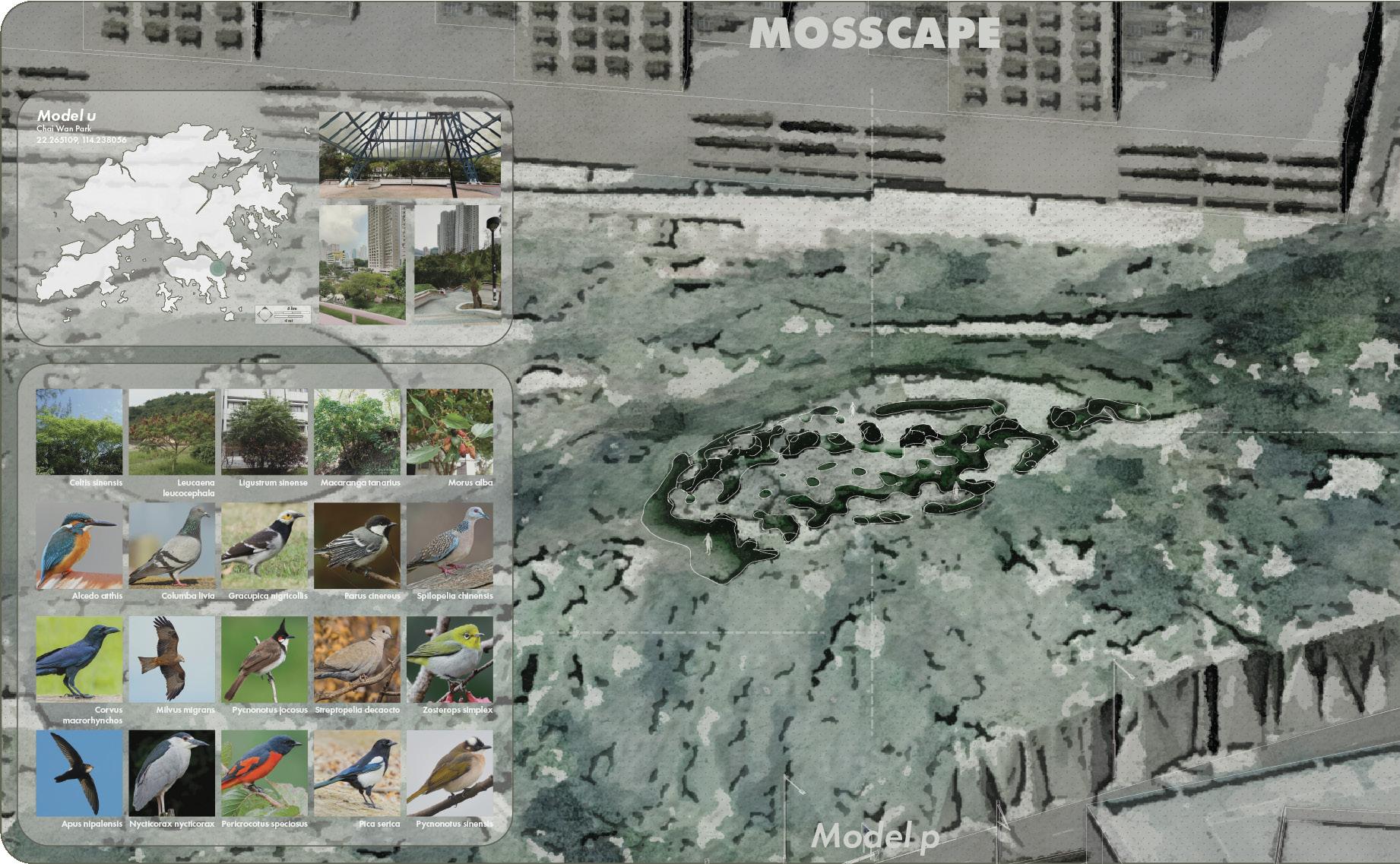
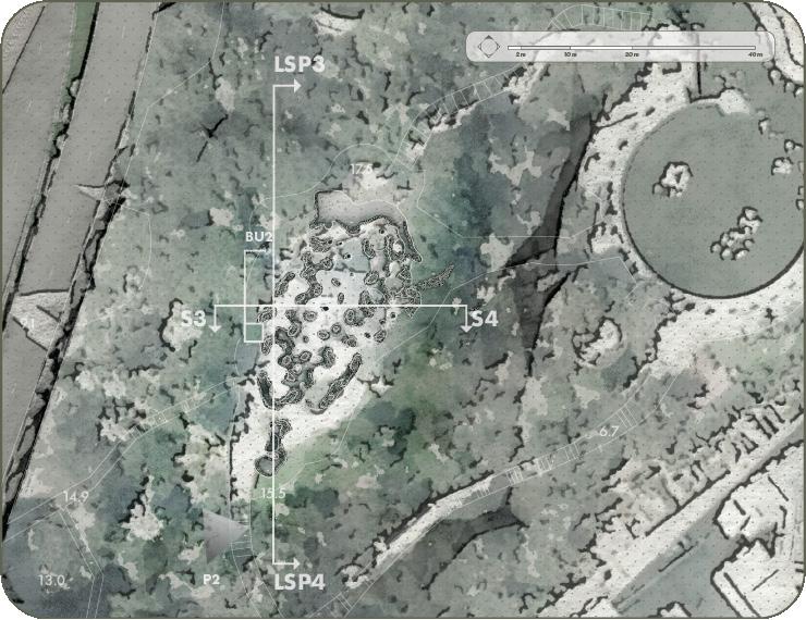
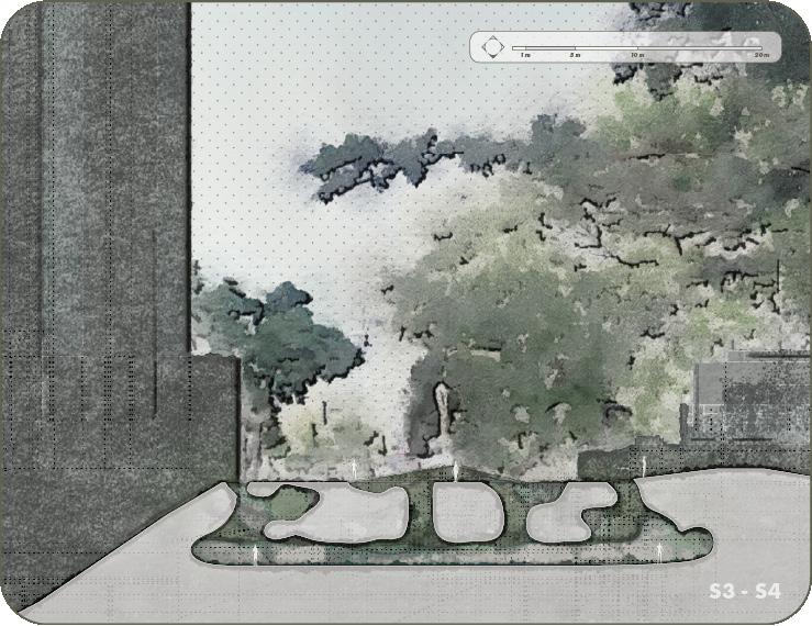
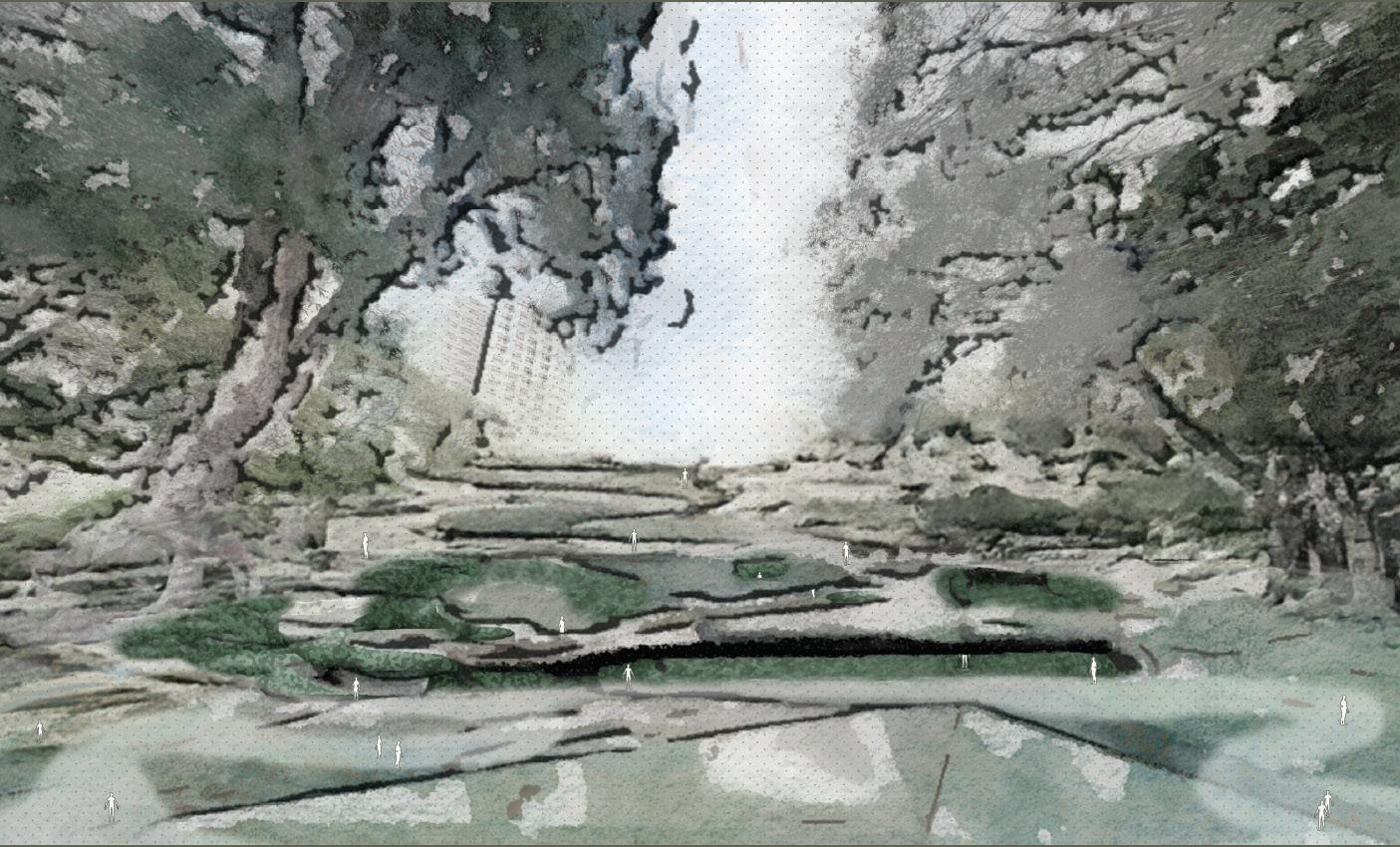
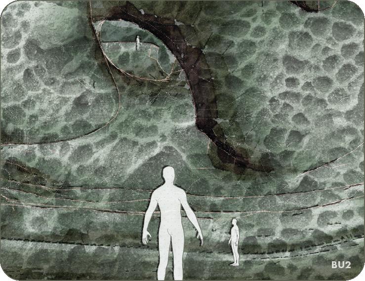
[Analysis of the Pavilion Design]
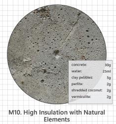
For the sunken underpass pavilion in Chai Wan Park, M10 (High Insulation with Natural Elements) is the suitable choice.
-> Moisture Retention: M10 includes materials like shredded coconut and clay pebbles, which improve moisture retention and provide a stable micro-climate for moss growth in shaded areas.
-> Structural Stability: It offers excellent strength while maintaining a porous texture, which is vital for a durable pavilion structure.
-> Compatibility with Shade: The pavilion is located in a sunken, shaded area, so moss will benefit from the material’s water retention and the ability to trap ambient moisture.
The pavilion mimics pumice stone’s porous texture and uses perforated walls to allow air circulation. The shaded, moss-covered spaces improve the ecological performance and aesthetic value of the park, creating a tranquil, immersive environment for both humans and wildlife.
Moss Growth Optimization:
-> Orientation: The sunken pavilion is naturally shaded, ideal for moss species such as Thuidium cymbifolium and Brachythecium. Its north-facing openings avoid full sun exposure.
-> Insulated Design: The material mixture’s insulation properties create a stable, humid micro-climate, promoting moss hydration and growth.
Ecological Benefits:
-> Improves Air Quality: Moss absorbs dust and pollutants, contributing to better air quality for park visitors.
-> Support for Local Species: Moss enhances habitat quality for small invertebrates and contributes to the moisture cycle, indirectly benefiting nearby plants like Macaranga tanarius and Ligustrum sinense by maintaining a humid micro-environment.
-> Urban Cooling Effect: The moss provides a natural cooling effect in the pavilion, improving comfort for visitors and reducing heat absorption.
[Analysis of the Bridge Design] [Suitable Material Mixture]
For the bridge over the coastal mudflat, M07 (Multi-layered Textural Strength) is the most appropriate choice.
-> Durability: The bridge requires structural integrity to withstand environmental stresses, including tidal movements and coastal winds.
-> Water Retention: M07 is highly effective at retaining water, ensuring the moss-covered surfaces stay hydrated, even in the humid, salty conditions of the mudflat.
-> Textural Properties: Its multi-layered texture mimics natural rock surfaces, creating micro-habitats ideal for moss attachment and growth.
The pumice-like columnar structures at the bridge’s base interact with the tidal rhythms, mimicking natural mangrove roots. This not only stabilizes the structure but also increases biodiversity by creating spaces for organisms like fiddler crabs and mudskippers.
Moss Growth Optimization:
-> The north-facing orientation of the bridge’s shaded surfaces minimizes direct sunlight exposure, a critical factor for moss health.
-> The micro-porous texture of the material holds moisture and allows moss rhizomes to attach securely.
-> The bridge’s proximity to tidal pools provides constant moisture, supporting the moss’s hydration needs.
Ecological Benefits:
-> For Wildlife: The moss acts as a microhabitat for small coastal invertebrates such as crabs, insects, and mollusks.
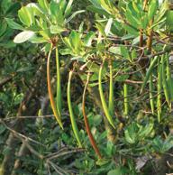
-> For Plant Life: The moss’s water retention improves soil moisture levels around the base of the bridge, supporting salt-tolerant vegetation such as Bruguiera gymnorrhiza and Aegiceras corniculatum.
-> For Water Quality: The moss enhances the surrounding water’s quality by trapping sediment and preventing erosion, contributing to the health of the coastal ecosystem.
Project 02
HMONG'S IDENTITY EMPOWERMENT IN CHIANG MAI, THAILAND
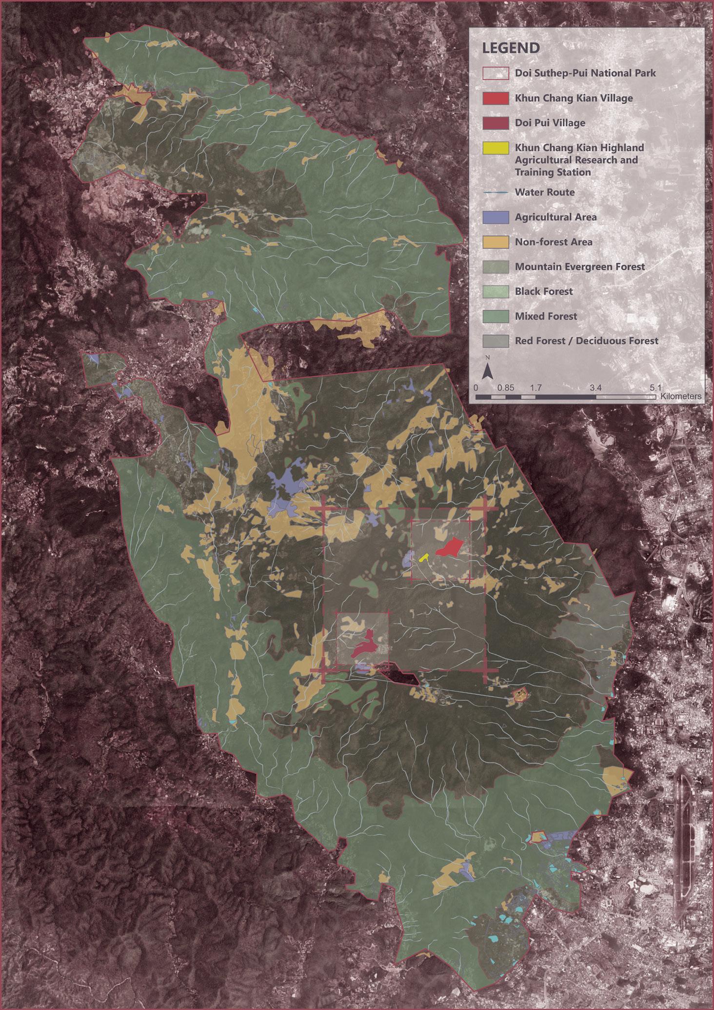
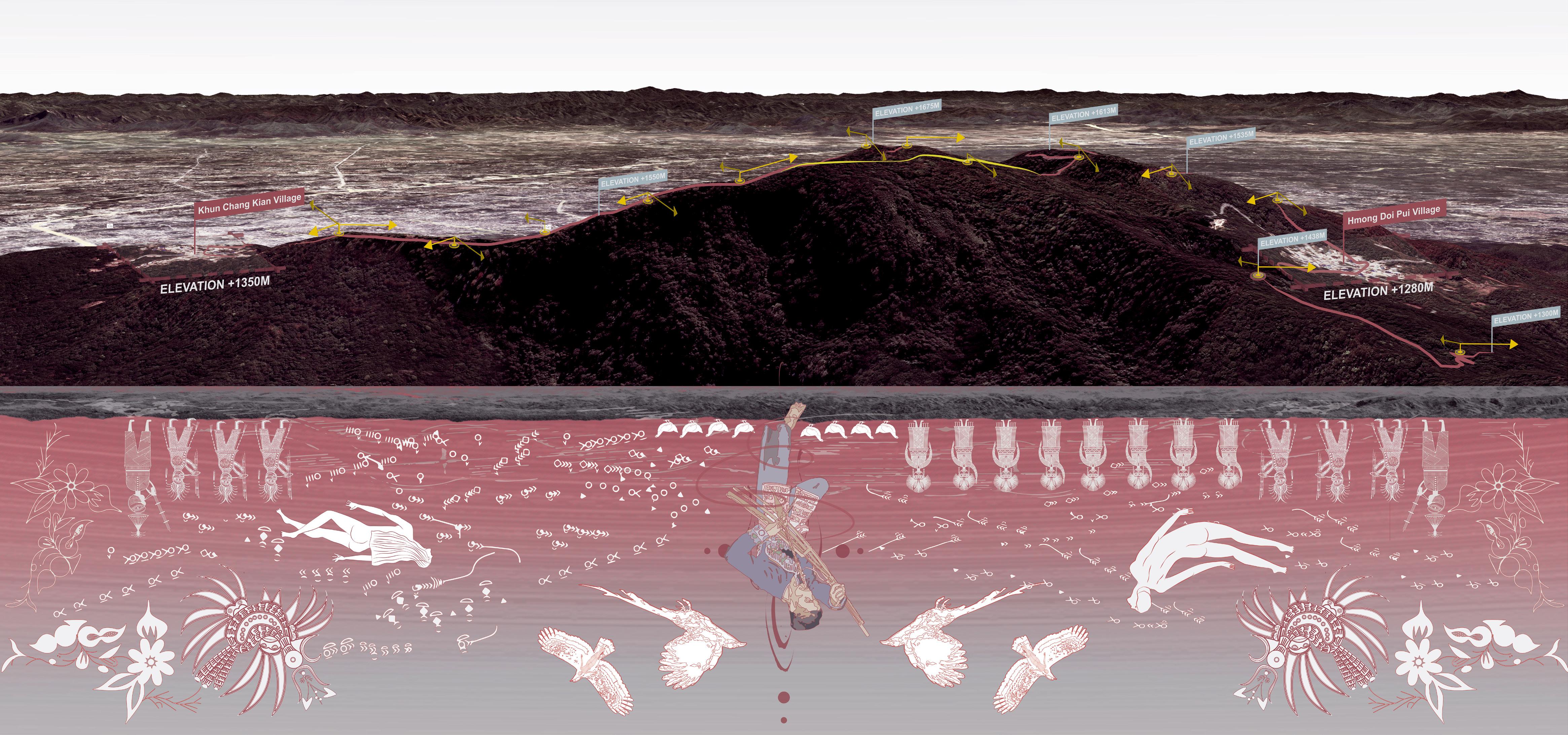
Khun Chang Kian Village Analysis of Western and Traditional Knowledge
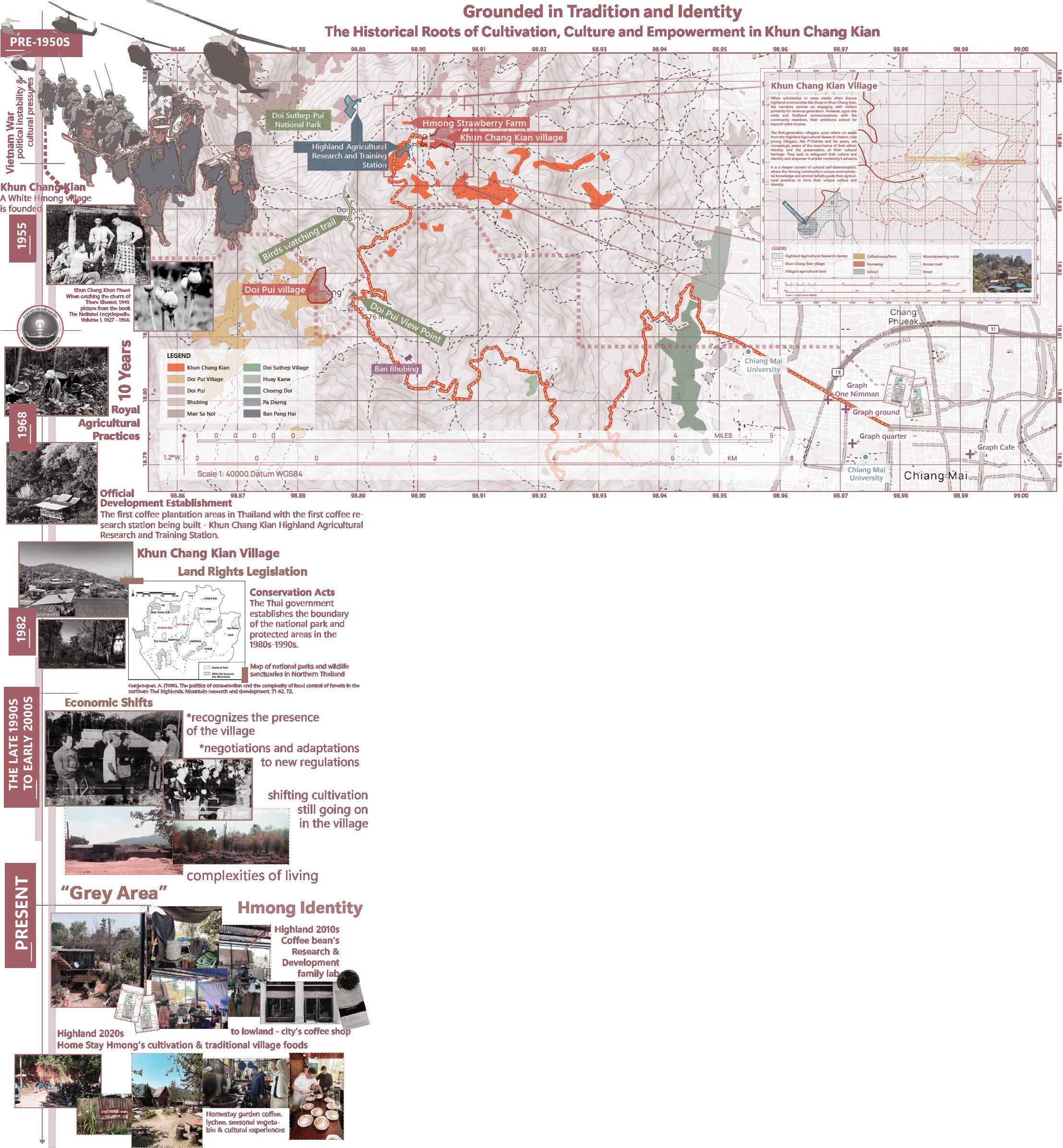
Background
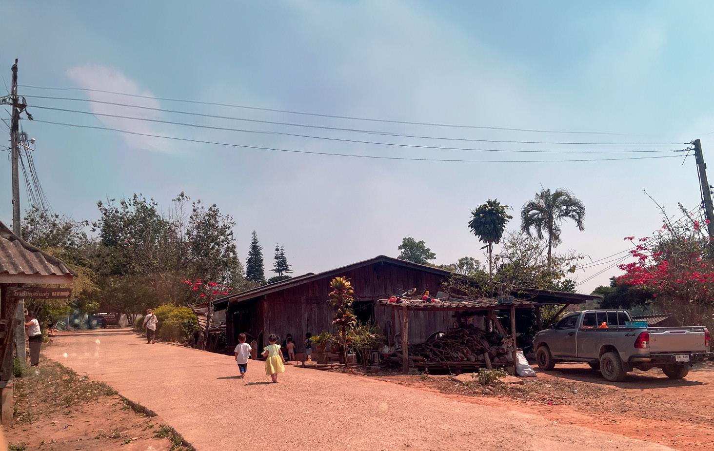
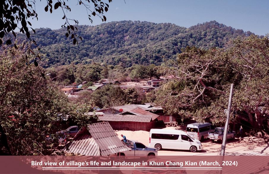
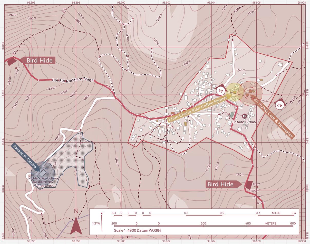
The Hmong of Khun Chang Kian in Northern Thailand is within the boundary of the Doi Suthep-Pui National Park. This is a culture group that has been actively involved in aspirational thinking for the past generation, from the Pre-1950s to the Vietnam War to the highland's land rights and conservation acts, and then 10 years of royal agricultural practices to recently so-called villagebased "Grey Area" that which is the third generation villager trying to develop and enhance their Hmong identity empowerment since the 2010s.
When scholarship or news media often discuss highland communities like those in Khun Chang Kian, the narrative centres on engaging with visitors primarily for revenue generation. However, upon the site visits and
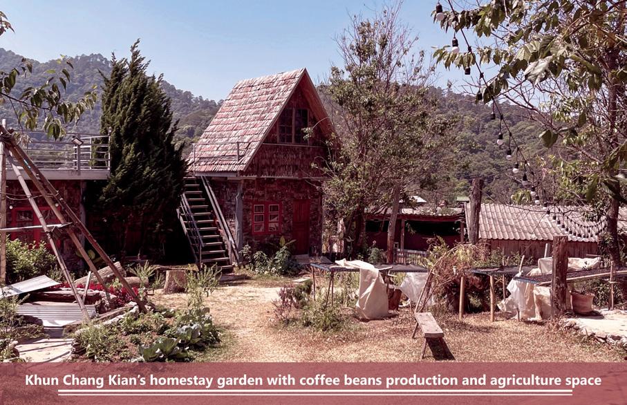
interviews with the community members, I learned that their ambitions extend far beyond mere income. The first two generation villagers, once reliant on seeds from the Highland Agricultural Research Station, now seek autonomy in cultivating their lands within the national park; young villagers are increasingly aware of the importance of their ethnic identity and the preservation of their cultural heritage, such like the coffee plantation and homestay with cultural and practical exchange.
Here, they do not need modern hotels or a series of restaurants; the villagers embrace their Hmong way of life and culture.
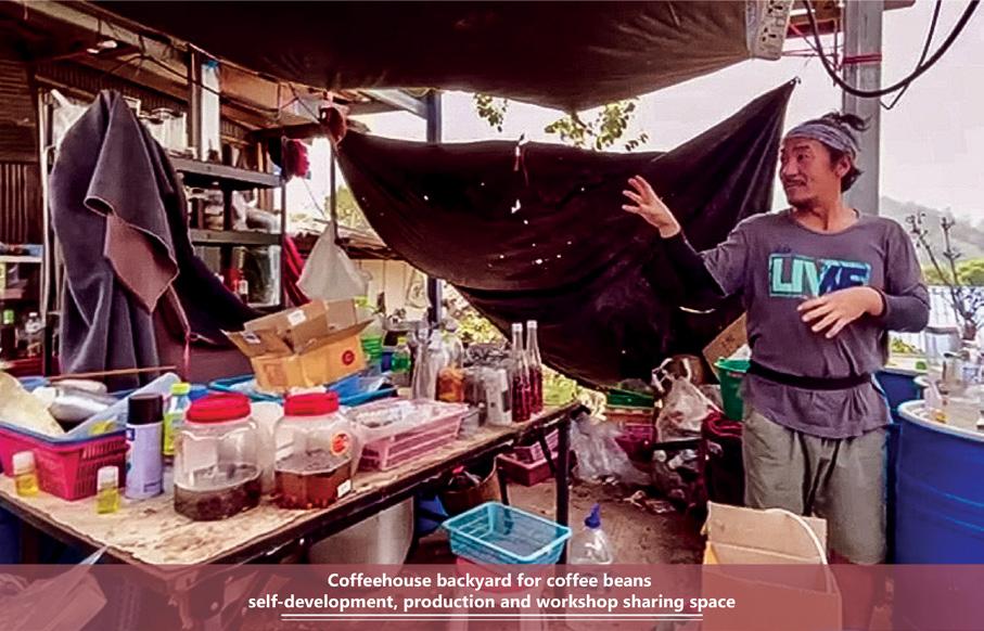
One of the quotes from a local coffeehouse owner - P'Chatree, "If you like our culture, we very much welcome you to stay and experience it."
P'Chatree's coffee shop epitomises this shift—moving beyond the research station's monoculture paradigm, he integrates a diversity of crops, weaving in fruit trees like lychee with coffee plants. This blend of cultivation is not just about economic resilience; it is a statement of environmental stewardship and a testament to the intrinsic value P'Chatree places on a more animistic and interconnected understanding of nature and transcending simple agronomy.
Since 2010, homestays and coffeehouses have been added to the villages, increasing income diversification. At the same time, they are selective in their hospitality, offering more than just accommodation—they provide an immersive cultural exchange for those genuinely interested in understanding their way of life. They're also trying to protect their culture to avoid erasing or eradicating their cultural identity through exposure to alternative development projects.
Doi Suthep-Pui
National Park
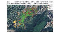
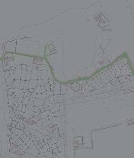
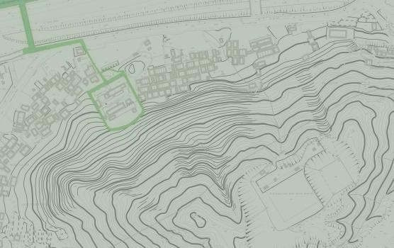
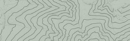
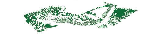
Landuse of different type of forest area on the highland area, while also highlighted the Hmong villages:
1. Khun Chang Kian village
2. Doi Pui village
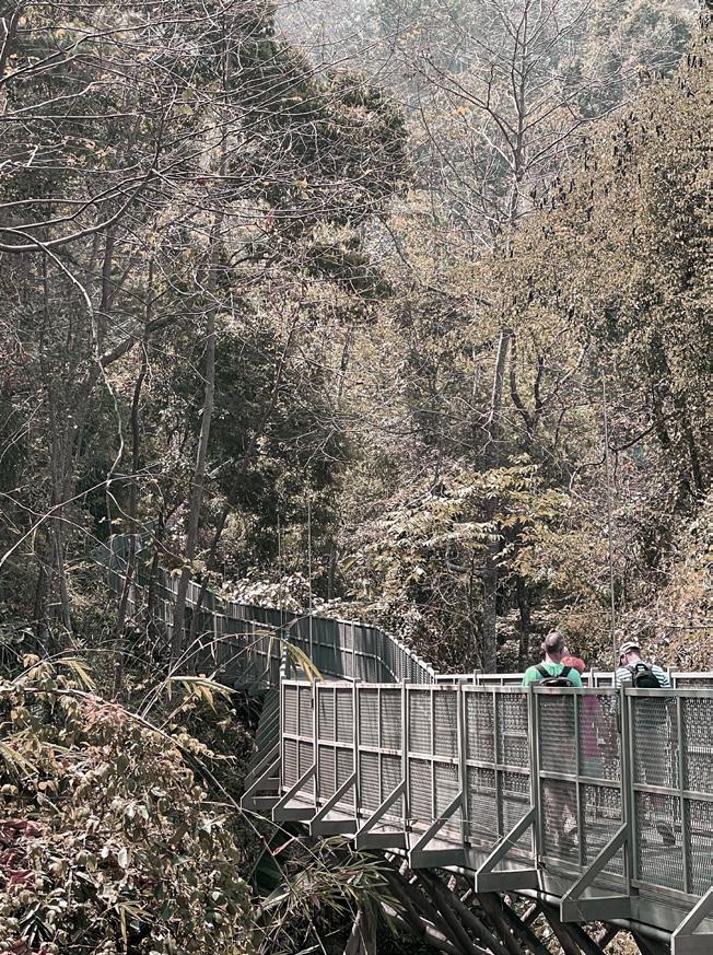
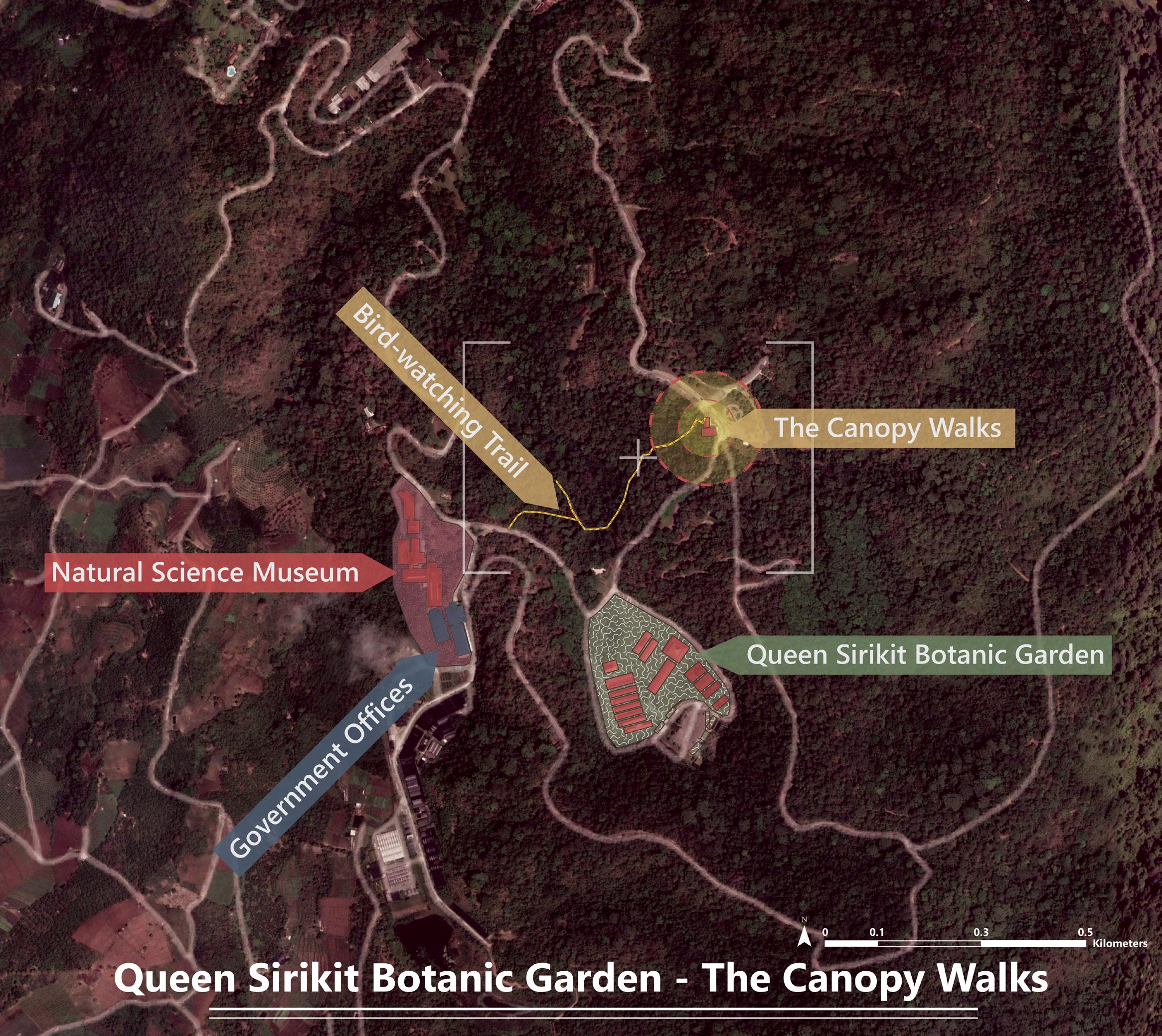
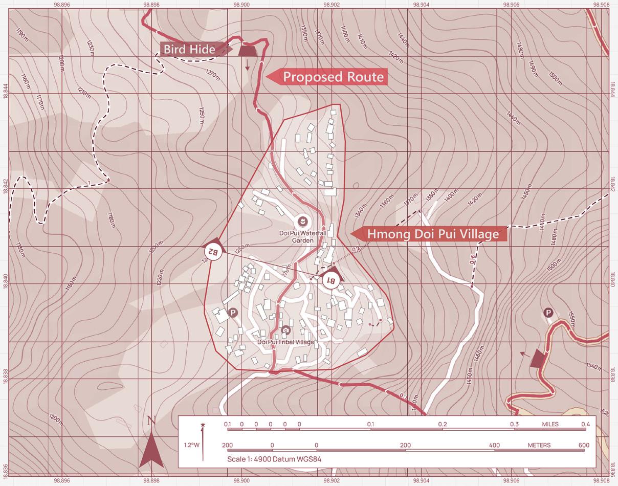
The uniqueness of the approach I'm trying to claim in this case is to understand the community's aspirations, especially when I know that the upgrading bird-watching trail that the local government is trying to duplicate the Western program, which is the Canopy Walks in Queen Sirikit Botanical Garden. The Doi Pui Nature Trail as one of the latest development projects adjacent between the Khun Chang Khan and Doi Pui village. It is symbolic of this broader community engagement.
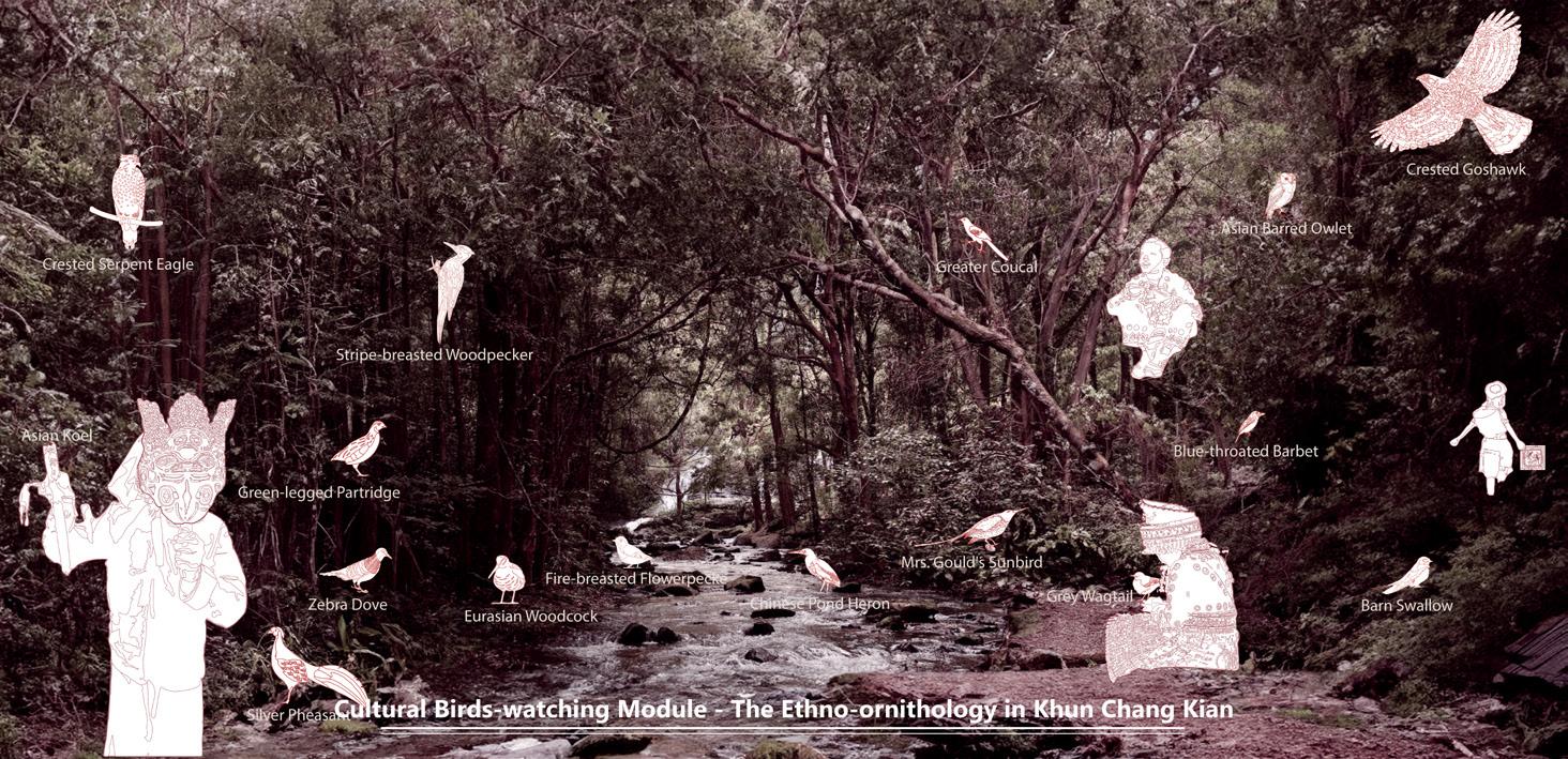
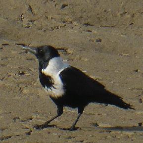
Hmong people strive to protect and perpetuate their traditions and cultures, especially the perspective that emphasises the importance of the spiritual connection between the Hmong community and its birds. Birds are seen, listened to, and respected as part of a larger story that encompasses the cosmos, forest, and human soul from an animist's point of view. The Hmong community does not require elaborate structures to feel close to these creatures, as their relationship with the birds is intimate and symbiotic.
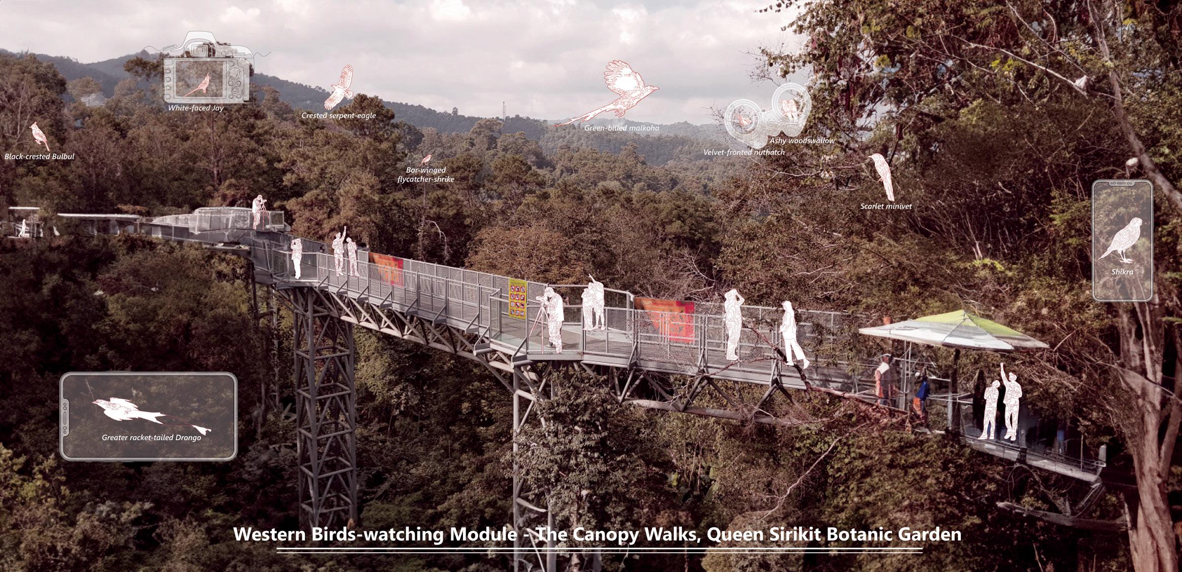
However, in QSBG's case, the birding route has ~40 types of birds along the route since it only connects inside the botanic garden, and the bird species within the range comprise only one-fourth of the DNP. In addition, the entire elevated bird-watching route causes the birds on the lower level not to be seen, so they can only be seen by using a mobile phone, like scanning the QR code from a poster.
Therefore, the design proposal of this entire studio may be designed to honour traditional beliefs, fostering an uplandlowland connection that is pivotal to the community. By placing all the Hmong groups in the national park with their identity at its core, the trail is not only a
corridor for birds but also a bridge linking the upland villagers of the forest to the lowland citizens of the downtown. It can represent an innovative blend of ethnoornithology with community development, aiming not just to draw visitors with the allure of avian wonders but to anchor the very soul of the Hmong identity into the fabric of the landscape.
It hopes to transcend pure observation, morphing into celebrating Hmong identity, heritage, and wisdom, distinguishing it from the typical Western-centric model. The belief is that when a bird sings, it is not only marking its presence but also echoing the vibrant life stories of the Hmong.
Chiang Mai. 1 March 2024.
EXPERIENCING ETHNO-ORNITHOLOGY
A bird-watching programme for Environmental Monitoring and Hmong Identity Empowerment in Doi Suthep-Pui National Park
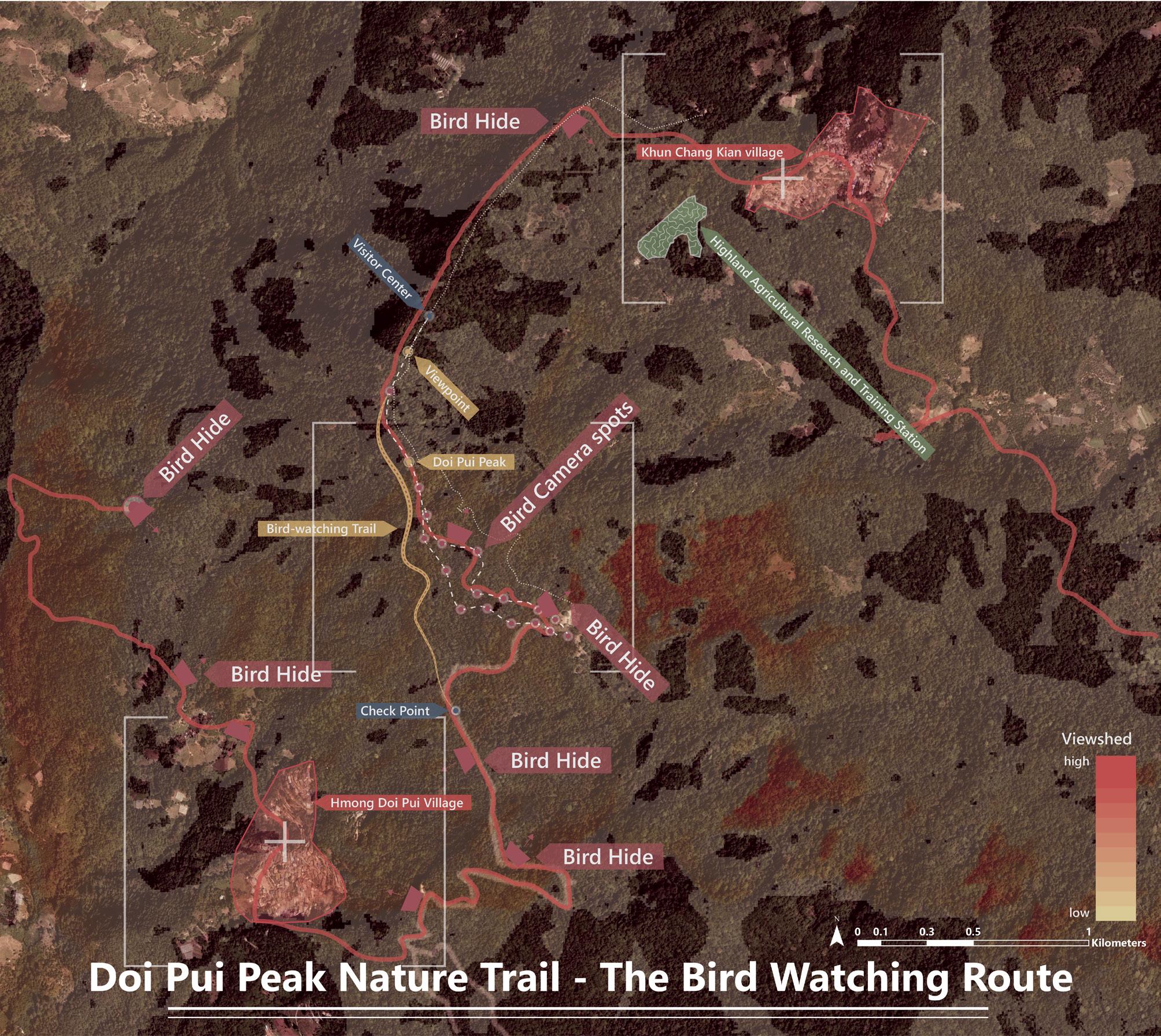
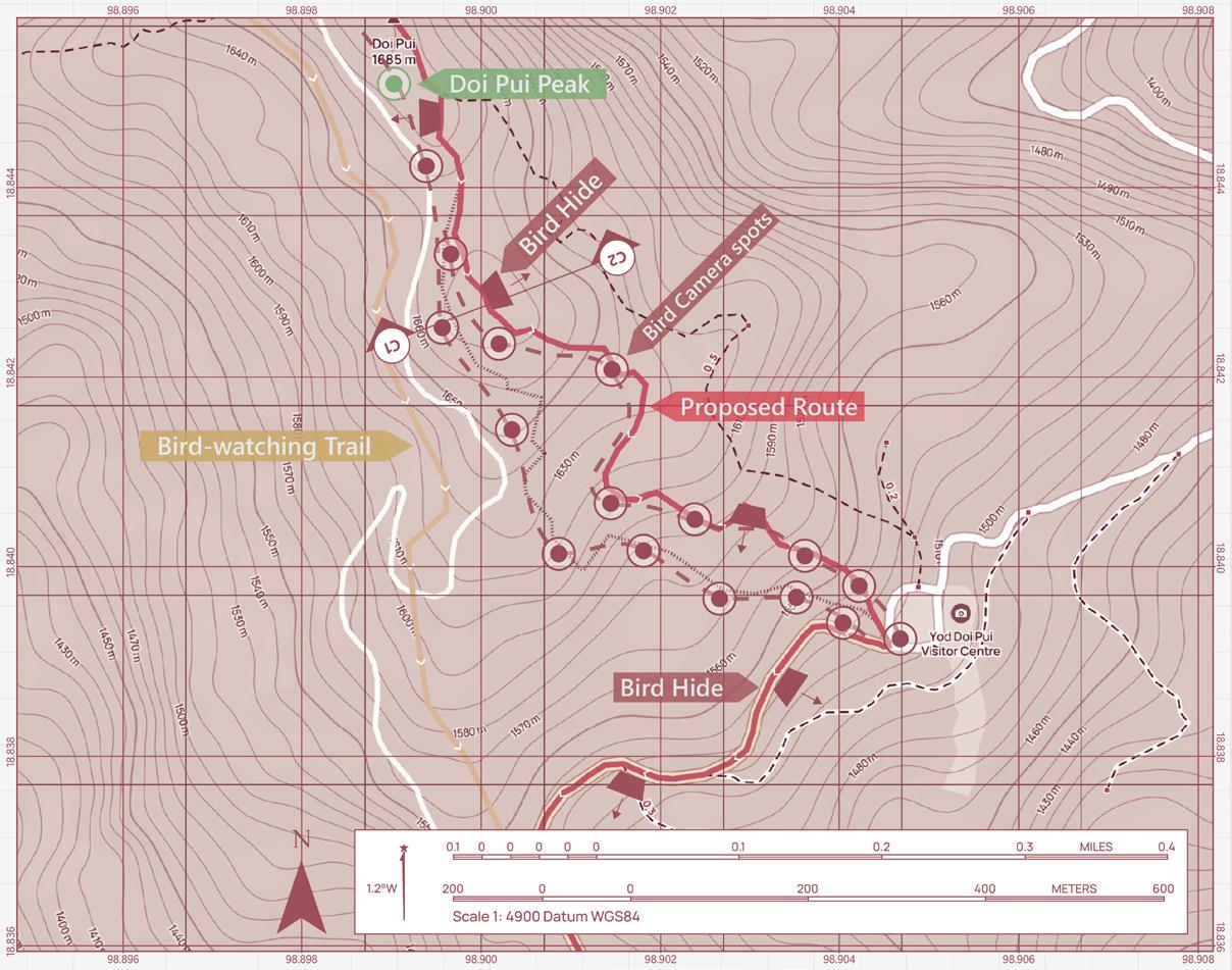
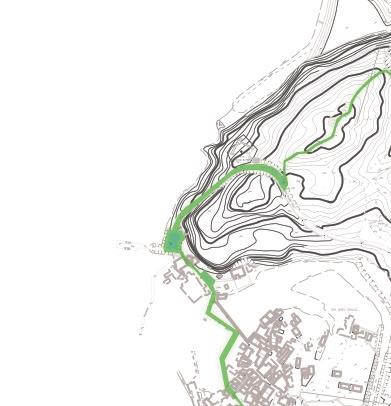
Bird-watching Trail Proposal in the Highland area of Doi Suthep-Pui National Park
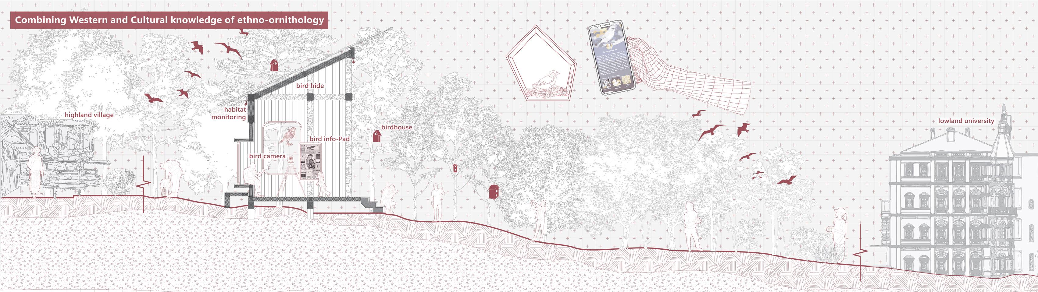
In the design propose stage, this project focuses on upgrading the bird-watching route of the Doi Pui Peak Nature Trail, one of the latest development projects within the Doi Suthep-Pui National Park. Through the lens of ethno-ornithology, which emphasises the close relationship between people and birds, this project challenges the park authority's tendency to adopt a Western bird-watching model. Instead, it proposes an alternative upgrading strategy that contributes to public environmental education and empowers the identity of Hmong communities inhabiting the landscapes along the route.
Through ethno-ornithology, which emphasises the close relationship between
people and birds, it challenges the park authority's tendency to adopt a Western bird-watching model. Instead, it proposes an alternative upgrading strategy that contributes to public environmental education and empowers the identity of Hmong communities inhabiting the landscapes along the route.
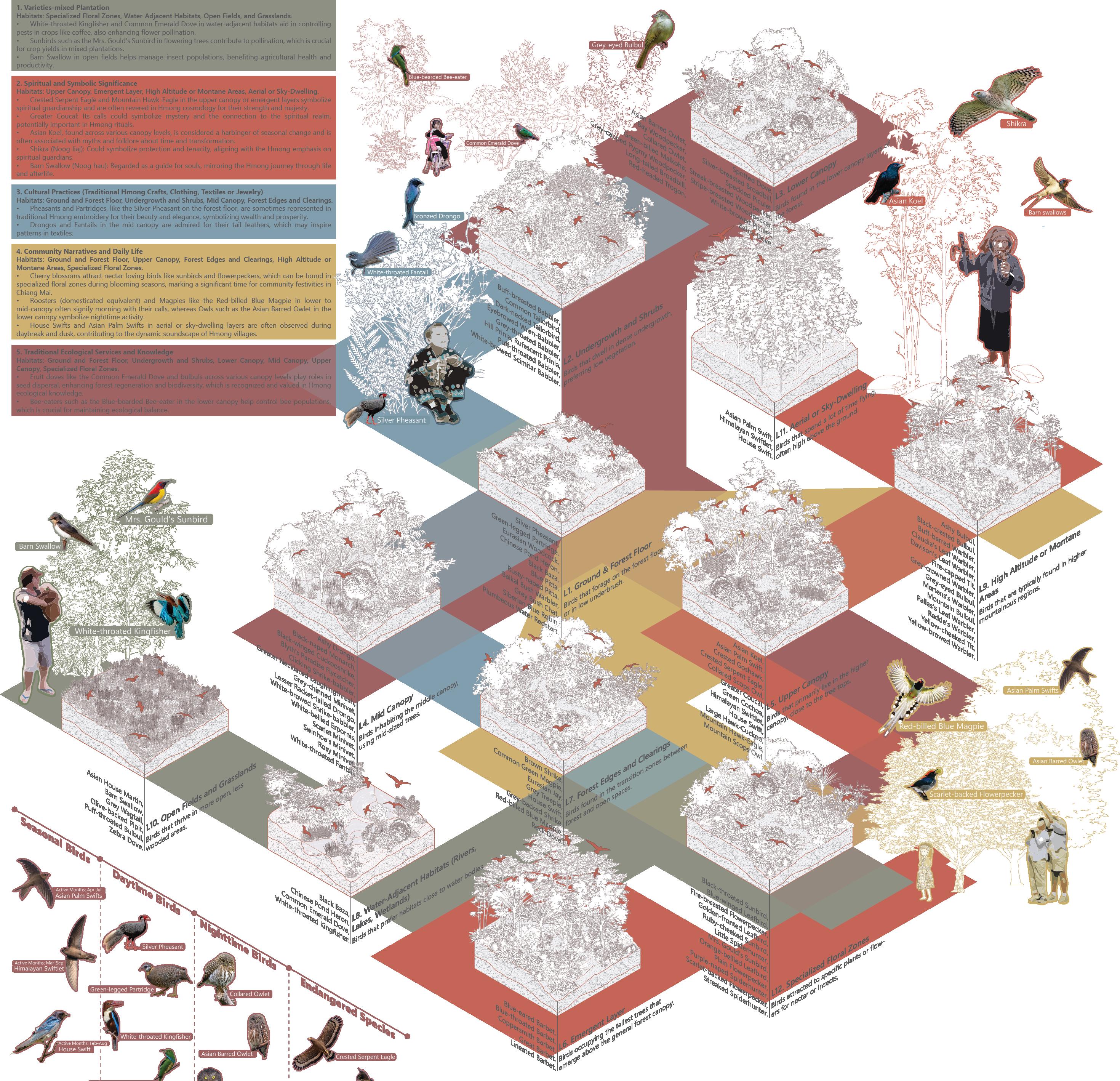
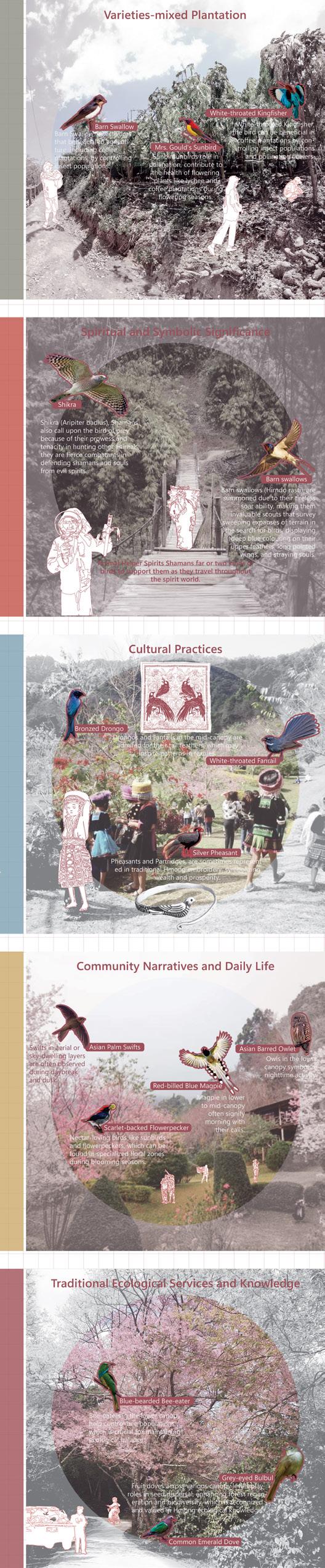
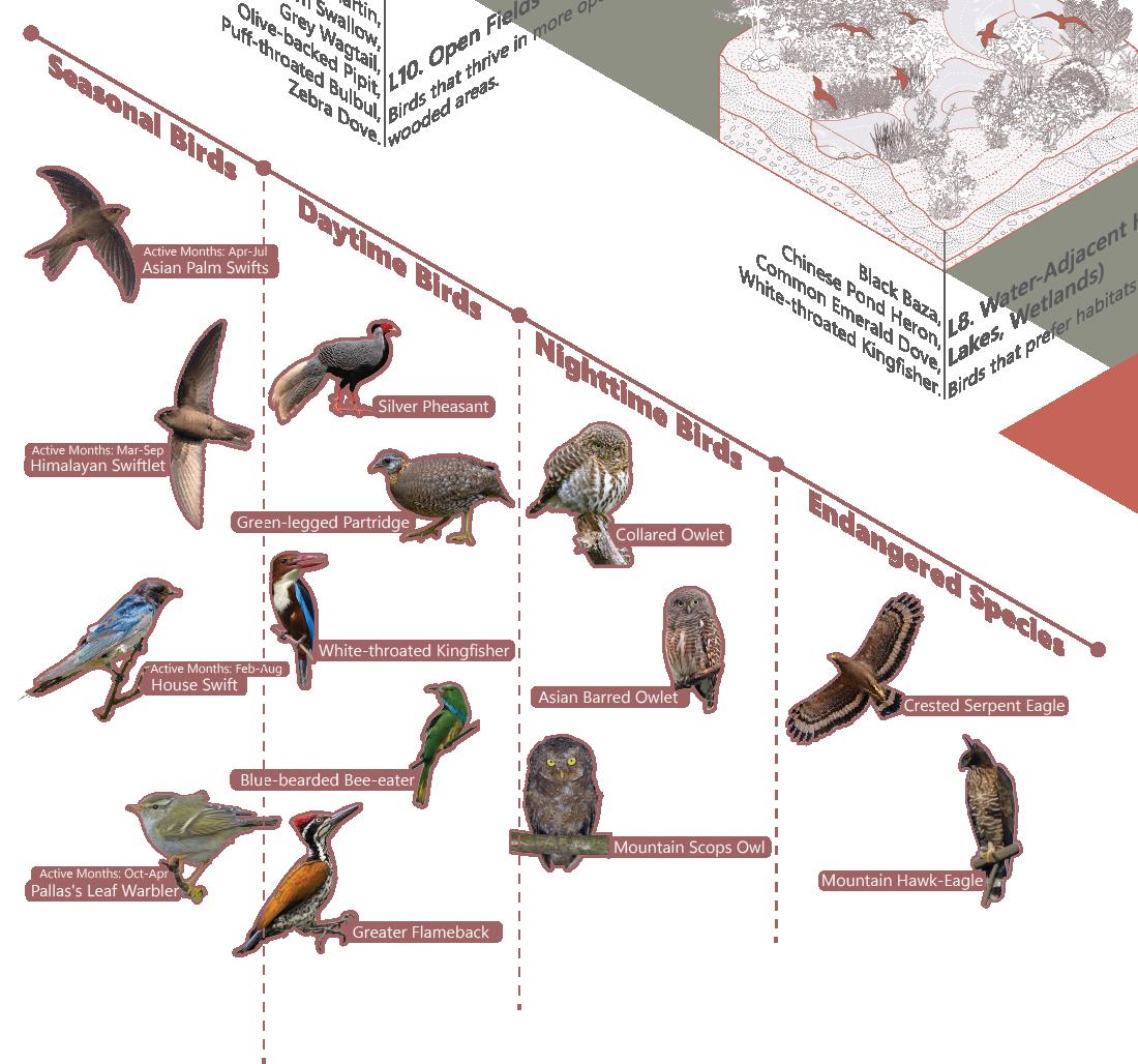
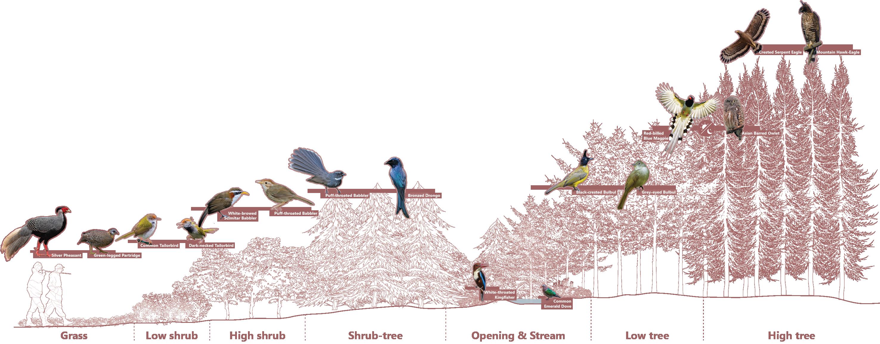
Therefore, by re-categorising the whole bird list within the DNP boundary, into a detailed breakdown of how birds from various habitats relate to Hmong cultural categories highlights interactions between bird species, their environments, and their cultural practices. During this process, the result shows that birds and the environment are closely related to Hmong culture and identity, which is also related to the ethnoornithology concept
A detailed breakdown of how birds from various habitats relate to Hmong cultural categories, highlighting interactions between bird species, their environments, and Hmong cultural practices
Chiang Mai. 3 March 2024.
When culture or modernisation crushes, the Hmong prioritise preserving their traditions and cultures, especially the spiritual connection with their birds. The Hmong do not require massive structures to feel close to these creatures. They view birds as part of a larger story, valuing their intimate and symbiotic relationship from an animist's point of view.
Overall, this bird-watching programme for Environmental Monitoring and Hmong Identity Empowerment tried to consider the existing bird-related route and scale down the highland, we can find out that the lower part also is the Hmong village – Doi Pui between the DNP's bird-watching route.
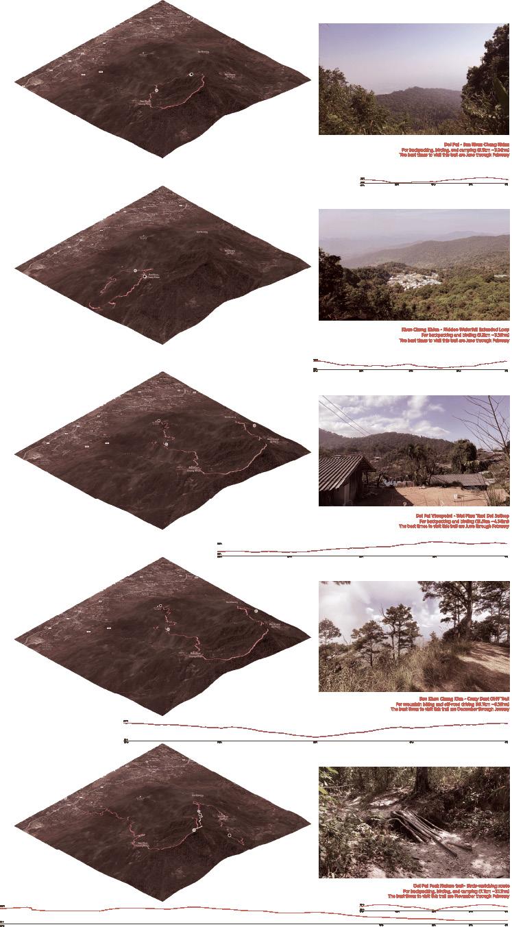
Therefore, by understanding the other four major bird-watching related route with the village and birds, included Doi Pui, Hidden Waterfall Extended Loop, Doi Pui Viewpoint, Crazy Dust OHV Trail, Doi Pui Peak Nature trail and Birds-watching route. Calculating the route viewshed area and setting up the potential viewpoint spot, as well as the Hmong cultural-related space like the spiritual world that we need our own sense to experience, those can be part of the proposed bird-watching programme.
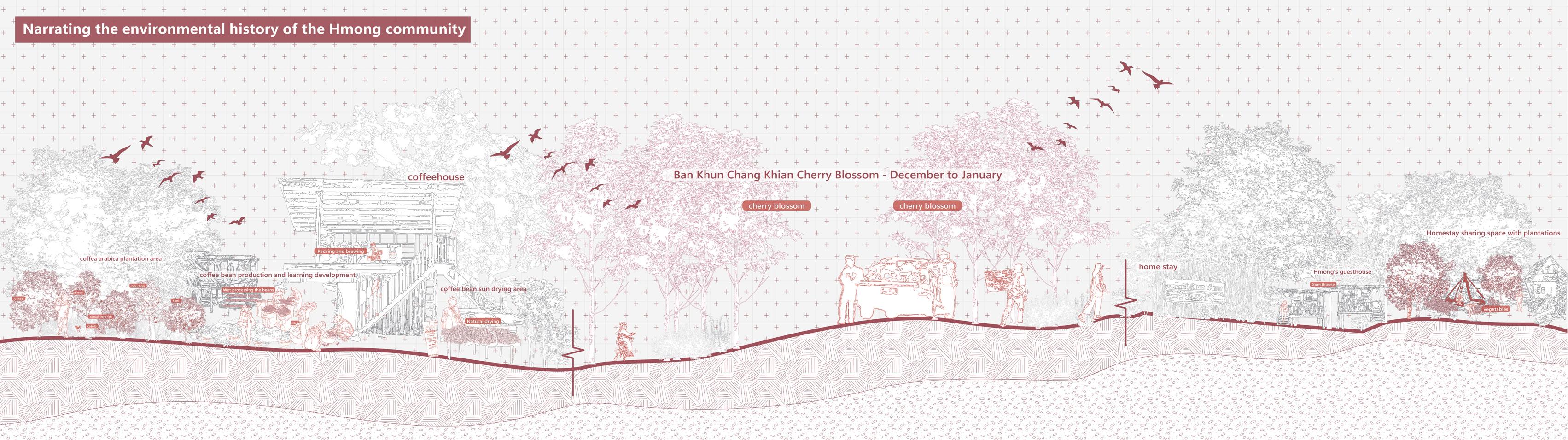
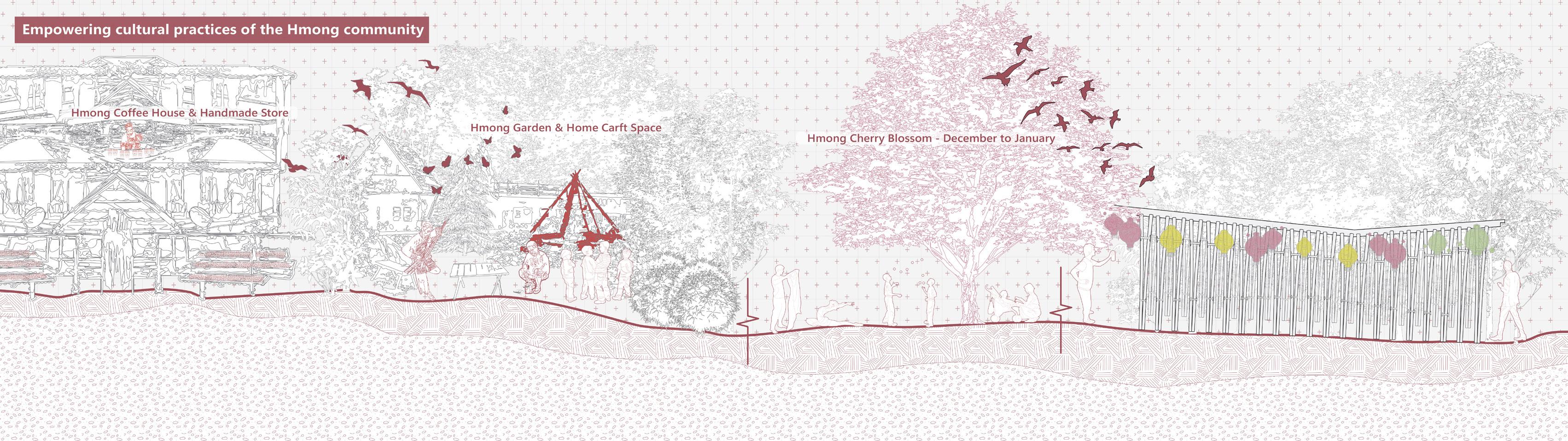
Based on cultural dissemination, the bird-watching programme allows the route to pass through the Hmong villages. The local homestay industry, such as coffeehouses and homestays, can also become a special feature to attract tourists. At the same time, tourists or outsiders can learn the village's cultural-based homestay and coffee tree planting techniques, cooking, or coffee production.
The bird-watching route passes through different levels of habitats and public areas, offering diverse cultural experiences such as Hmong music and dance during the cherry blossom season and Hmong festivals. Also, to enhance the cultural experience of the Hmong people, you can rent or buy traditional Hmong costumes to wear in the village, learn about Hmong bird beliefs to experience the spiritual world, and set up silverware-making/embroidery workshops to further spread Hmong culture to the public.
In addition to the usual walking route, small bird hide programmes are set up at specific points on the hill for walkers to rest. These huts are not only for sightseeing but are also equipped with bird cameras to observe the environment and birds in the neighbourhood. Visitors can also check the previous activity on the site through the screen in every bird hide spot. Besides, the data collected from each node can also update Agricultural Research Station with the latest information, such as accidents of hill fires, habitat loss, etc.
Project 03
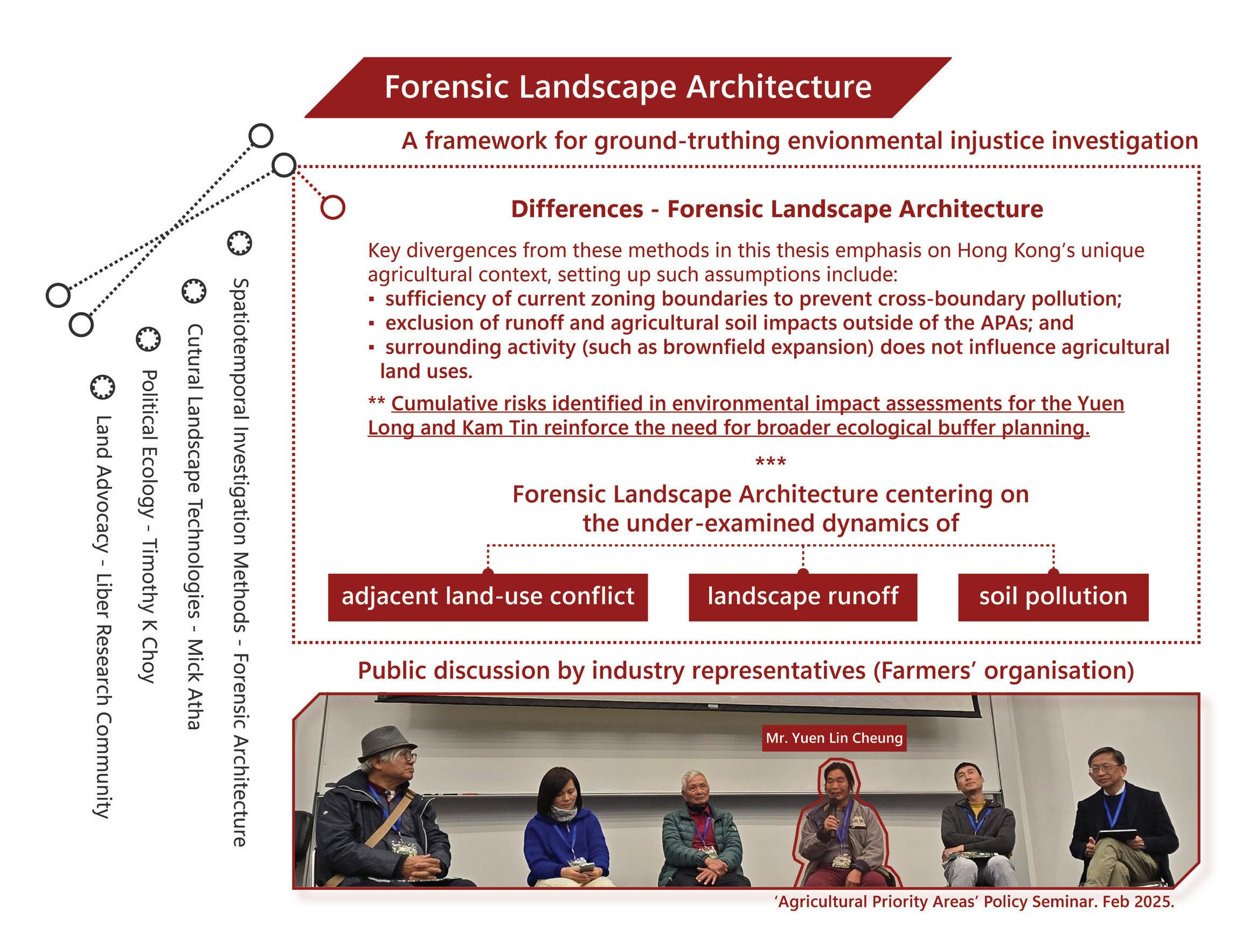
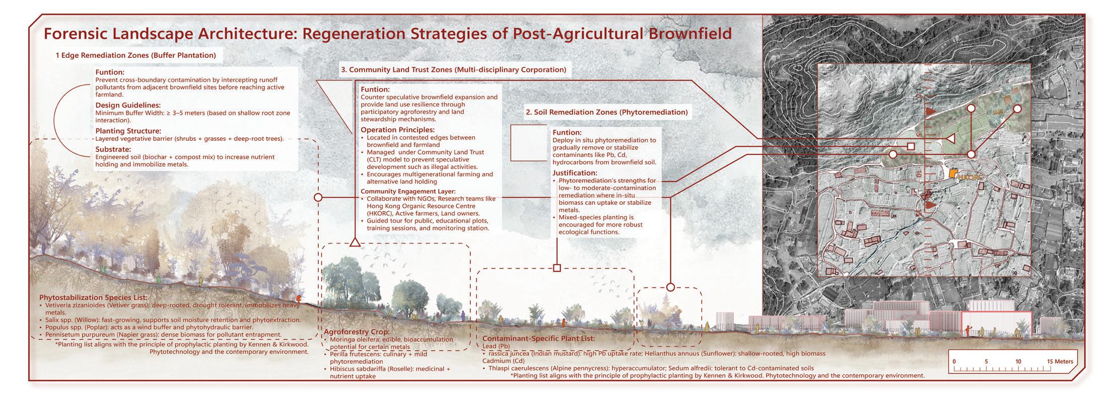
Forensic Landscape Architecture
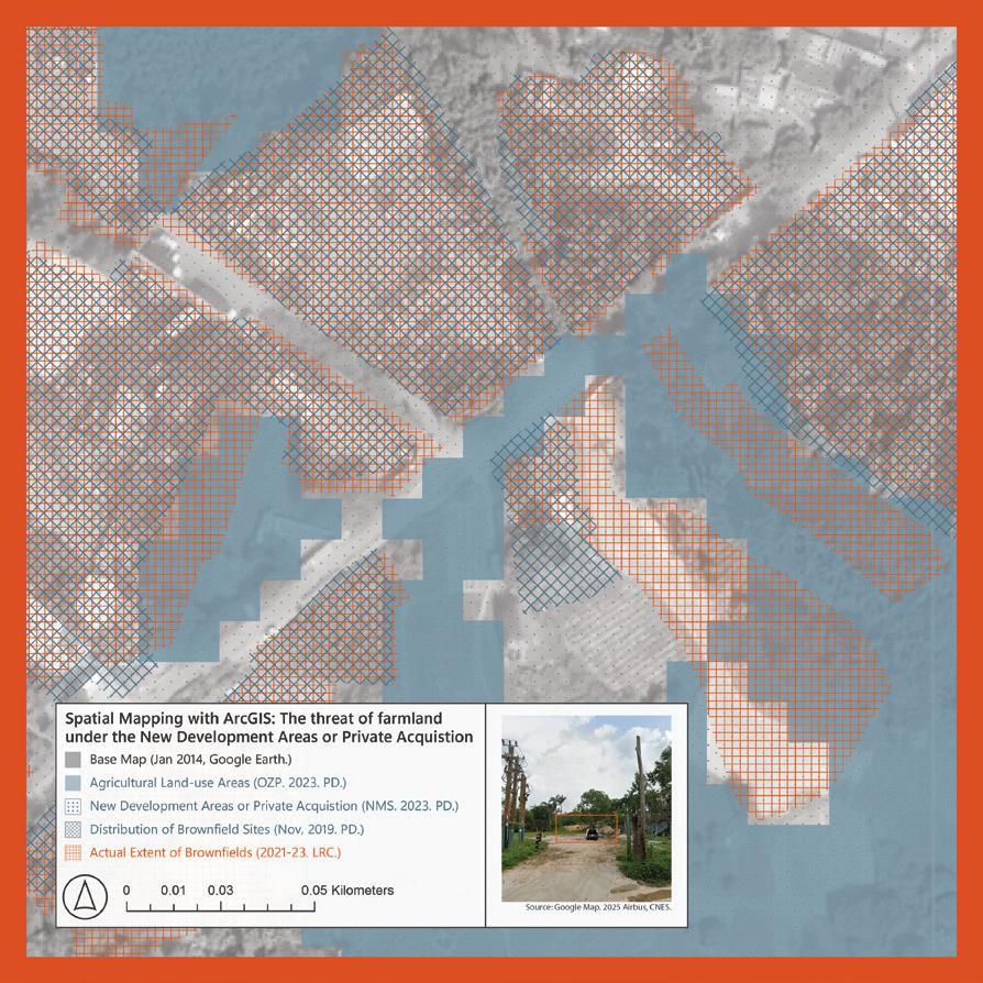
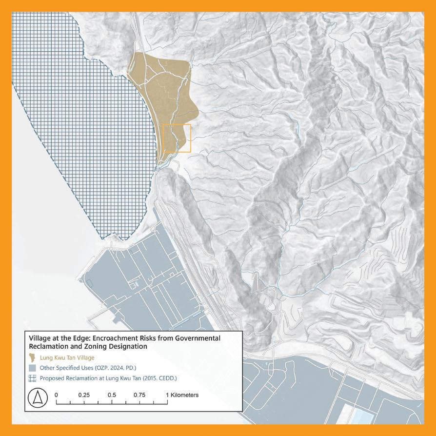
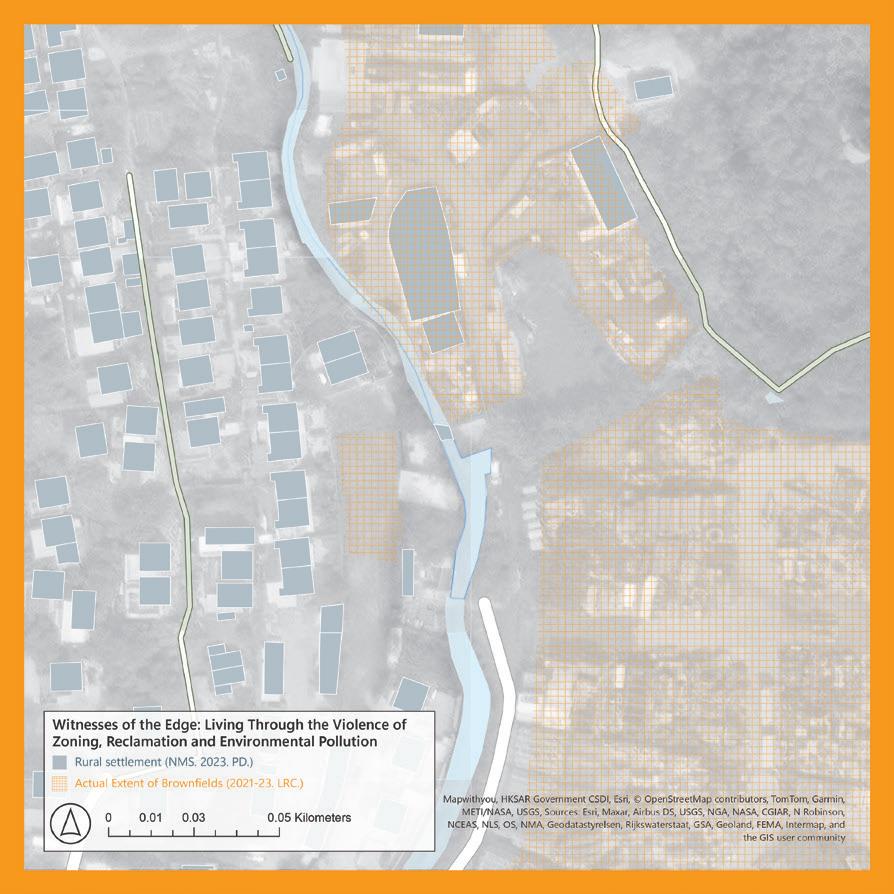
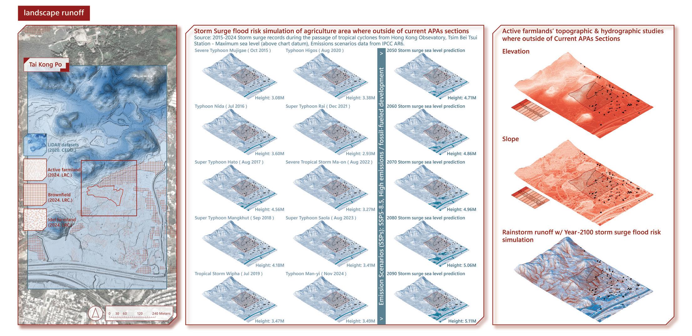
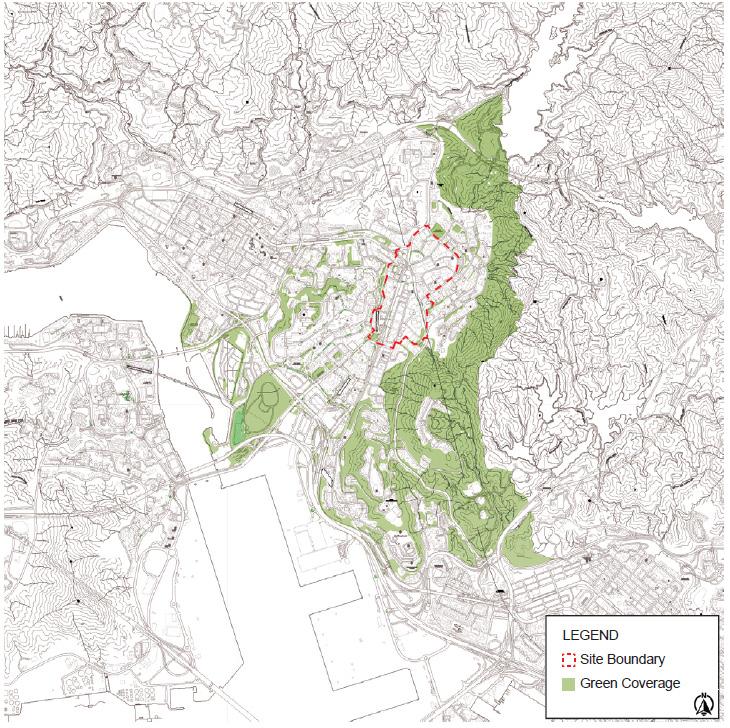
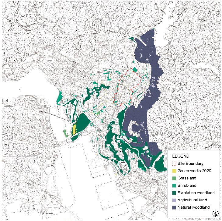
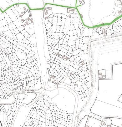
A framework for ground-truthing environmental injustice across Hong Kong’s new Agricultural Protection Areas
Background
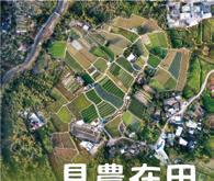
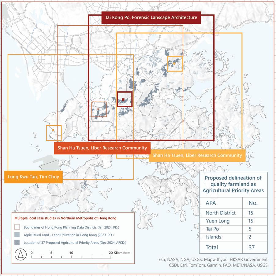
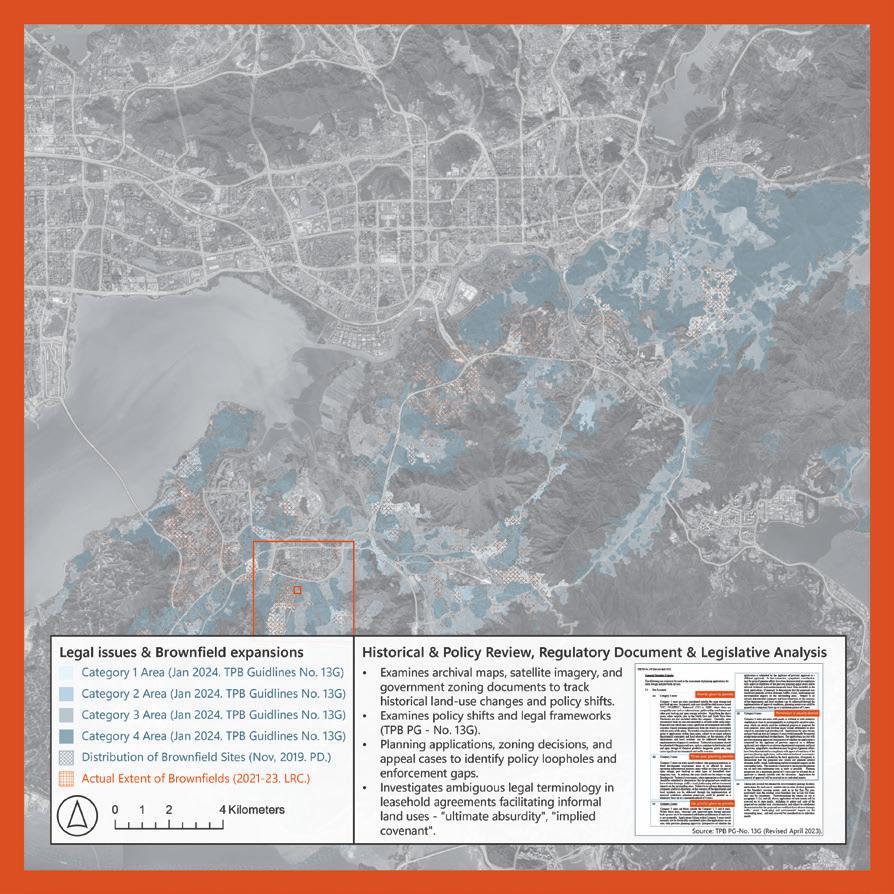
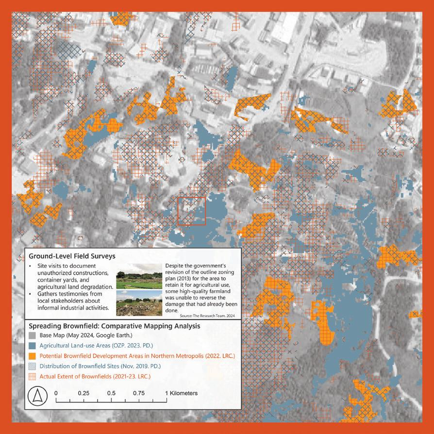
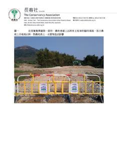
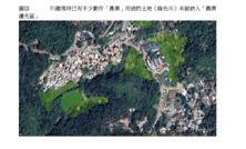
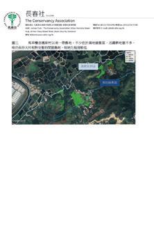
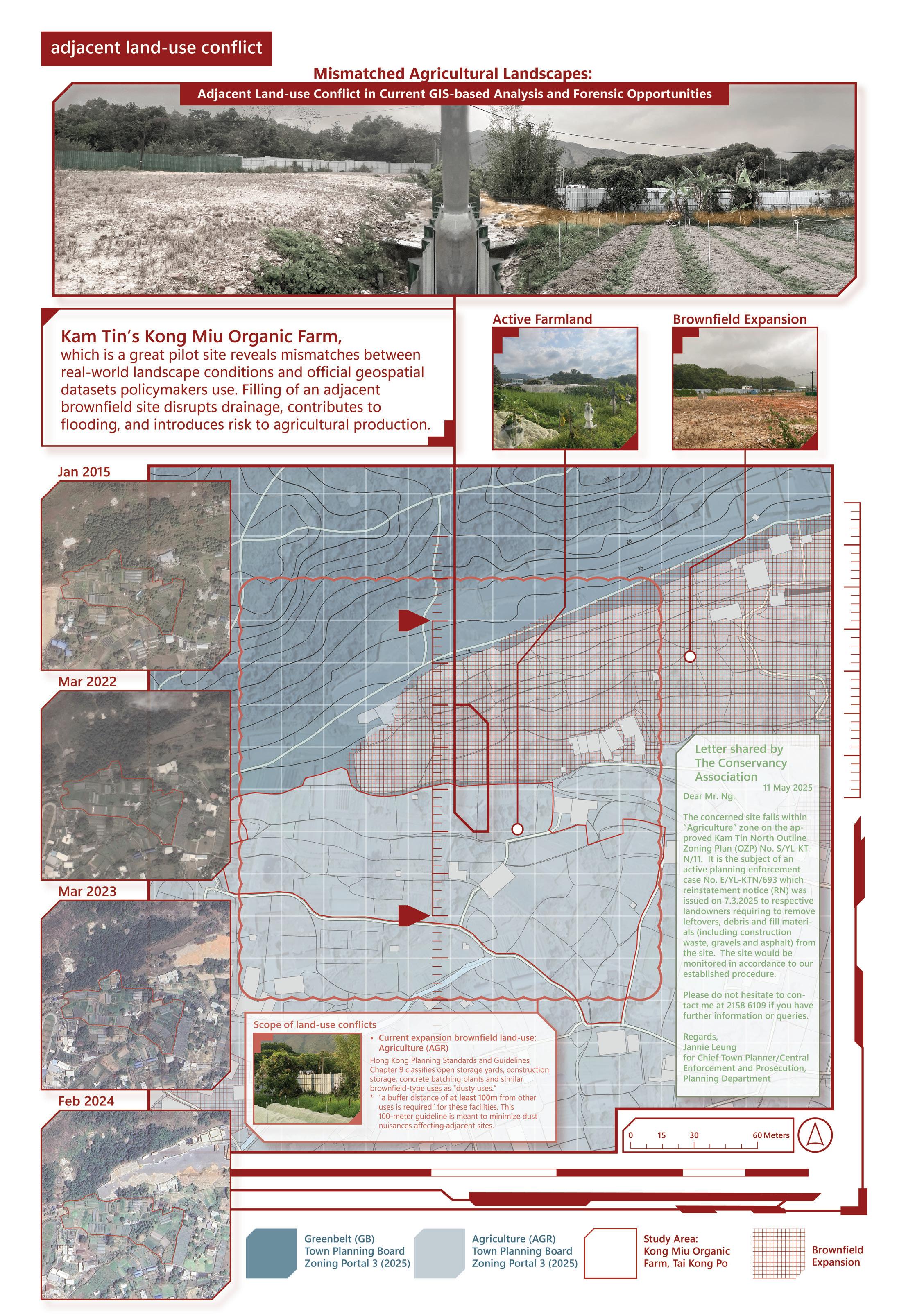
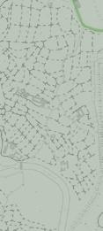
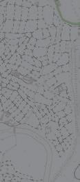
Hong Kong’s agricultural landscape has historically been marginalised by pressures from rapid urbanisation, prodevelopment outcomes in private land and land use conflicts, unchecked brownfield expansion, and largely ineffective conservation measures. These landscapes face significant ecological threats and governance challenges that endanger the livelihoods of small-scale farmers who lack land ownership. Hong Kong government proposed a framework for Agricultural Priority Areas (APA) in 2016, setting aside HK$500 million in funding, and in Dec 2023, published their APA plan to preserve nearly 4,000 hectares. A year later, AFCD designated 37 high-quality agricultural lands as a priority area. Despite support from think tanks, several grassroots organisations highlighted the non-statutory nature of APA zoning—an administrative declaration without amendments to the Town Planning Ordinance—easily overturned by future development applications under The Northern Metropolis Development Strategy. Other critiques include gaps in transparency, limited enforcement, potential devaluing of non-APAdesignated farmlands, brownfield and poor selection that avoids many agricultural sites currently designated Rural Development Areas (Village Zones) and New Development Areas (NDAs).
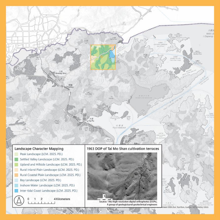
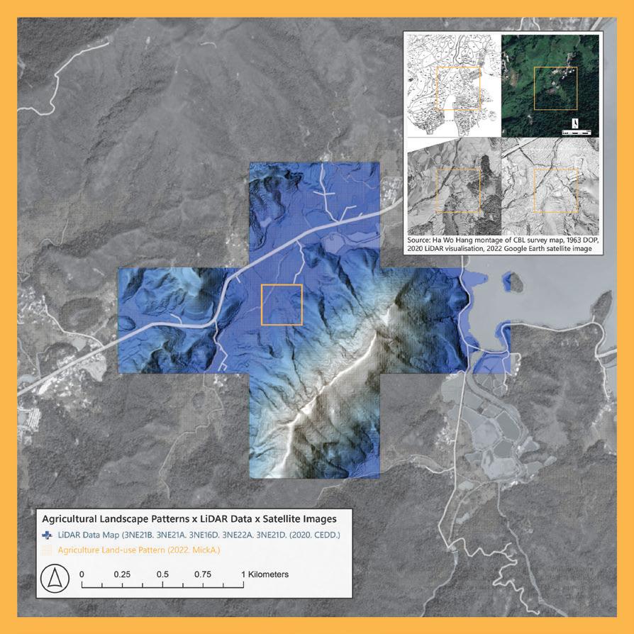
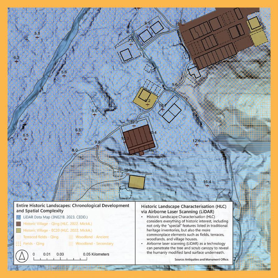
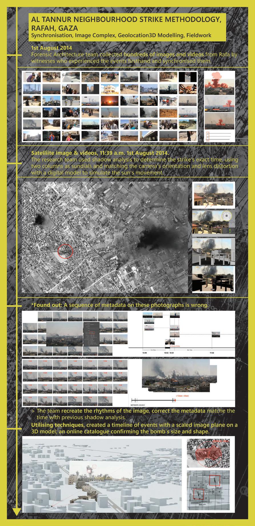
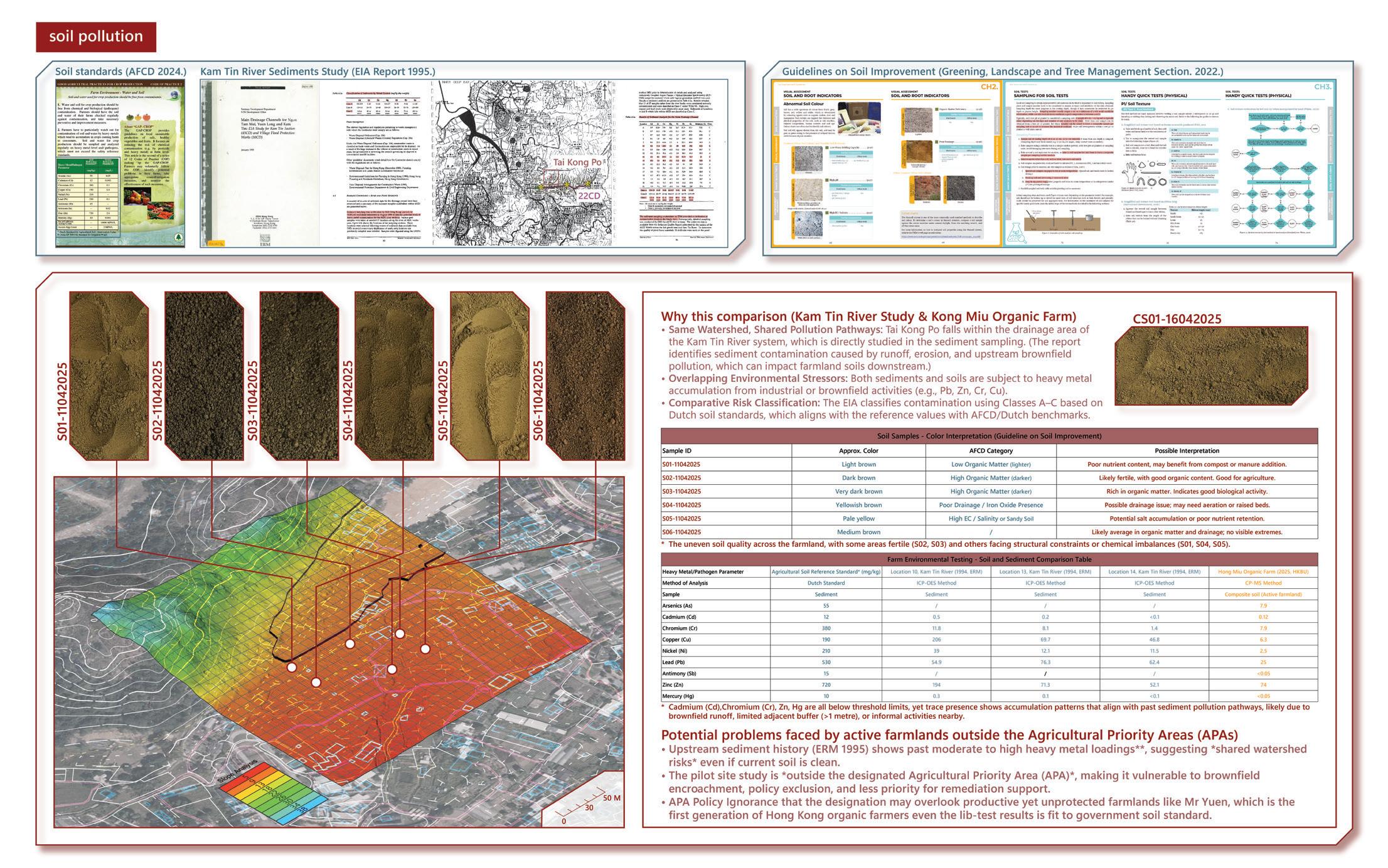
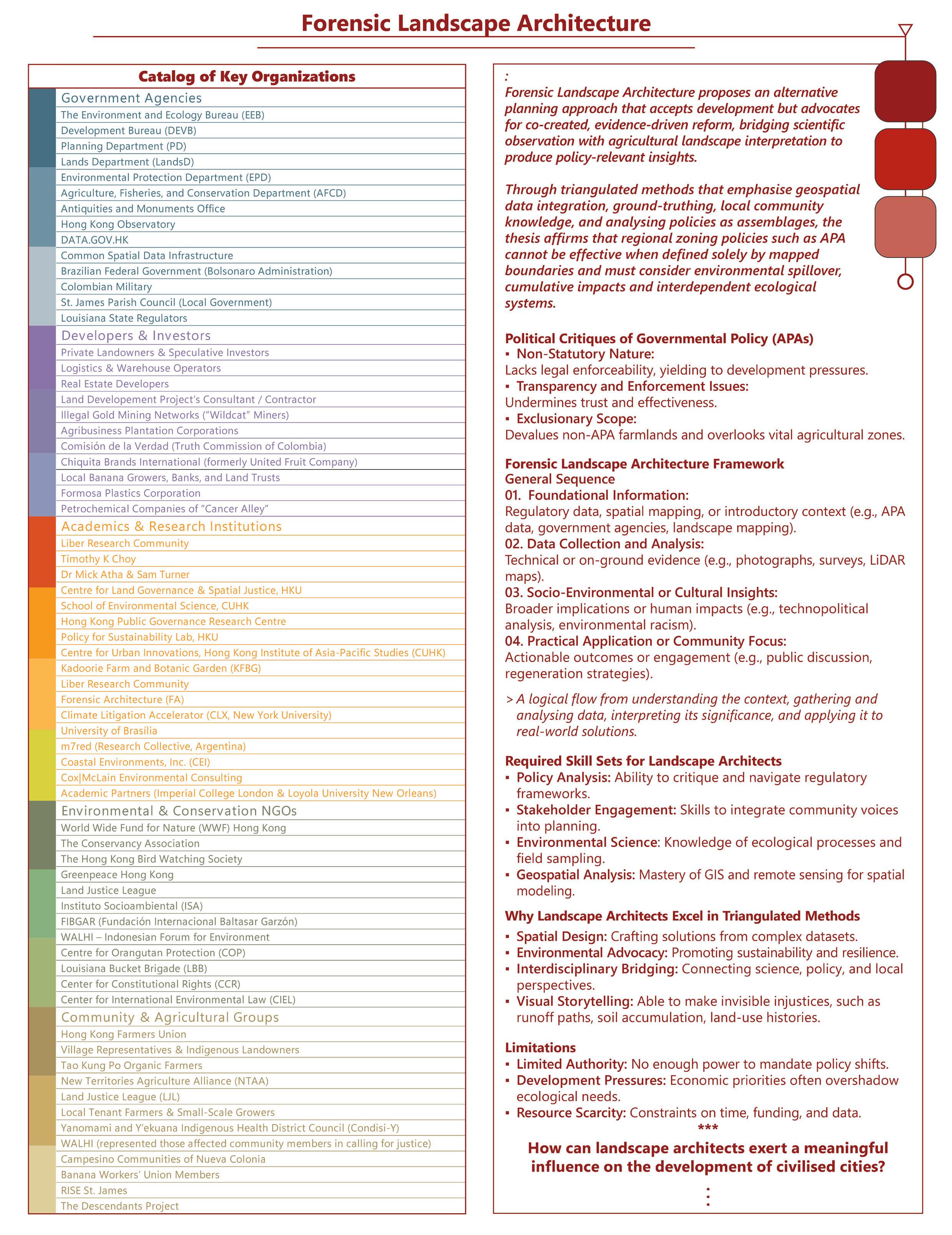
This thesis proposes a strategic framework, called “forensic landscape architecture” (after the London-based Forensic Architecture group), that triangulates environmental data, spatial analyses, and stakeholder testimony to reveal spatial injustices in Hong Kong’s agricultural land management. Share common methods for evidence collection and narrative reconstruction, including composite cartographies, multi-layered timelines, 3D reconstructions, satellite imagery analysis, andnised image-visual testimonies. Thus, multiple local and international case studies are reviewed, including brownfield investigations by Hong Kong-based land advocacy group Liber Research Community, the application of state-of-the-art technology in cultural landscape mapping in Hong Kong by a landscape archaeologist, a political ecologist’s theorization of Hong Kong’s environmental impact assessment discourse, and select works by Forensic Architecture deploying spatiotemporal analyses and evidence-based visualisations.
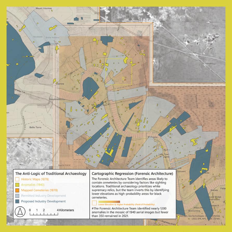
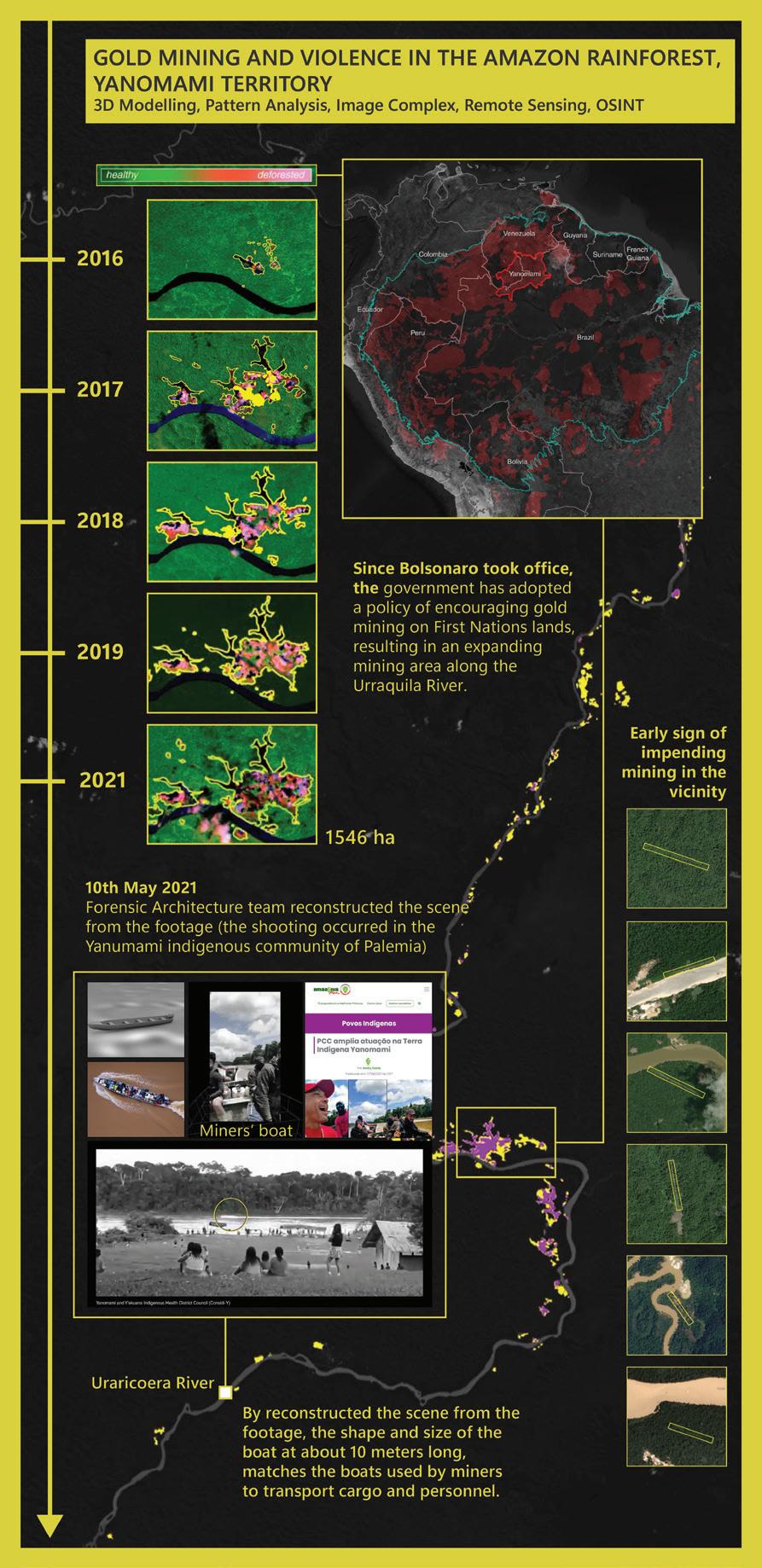
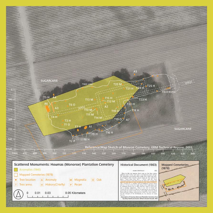
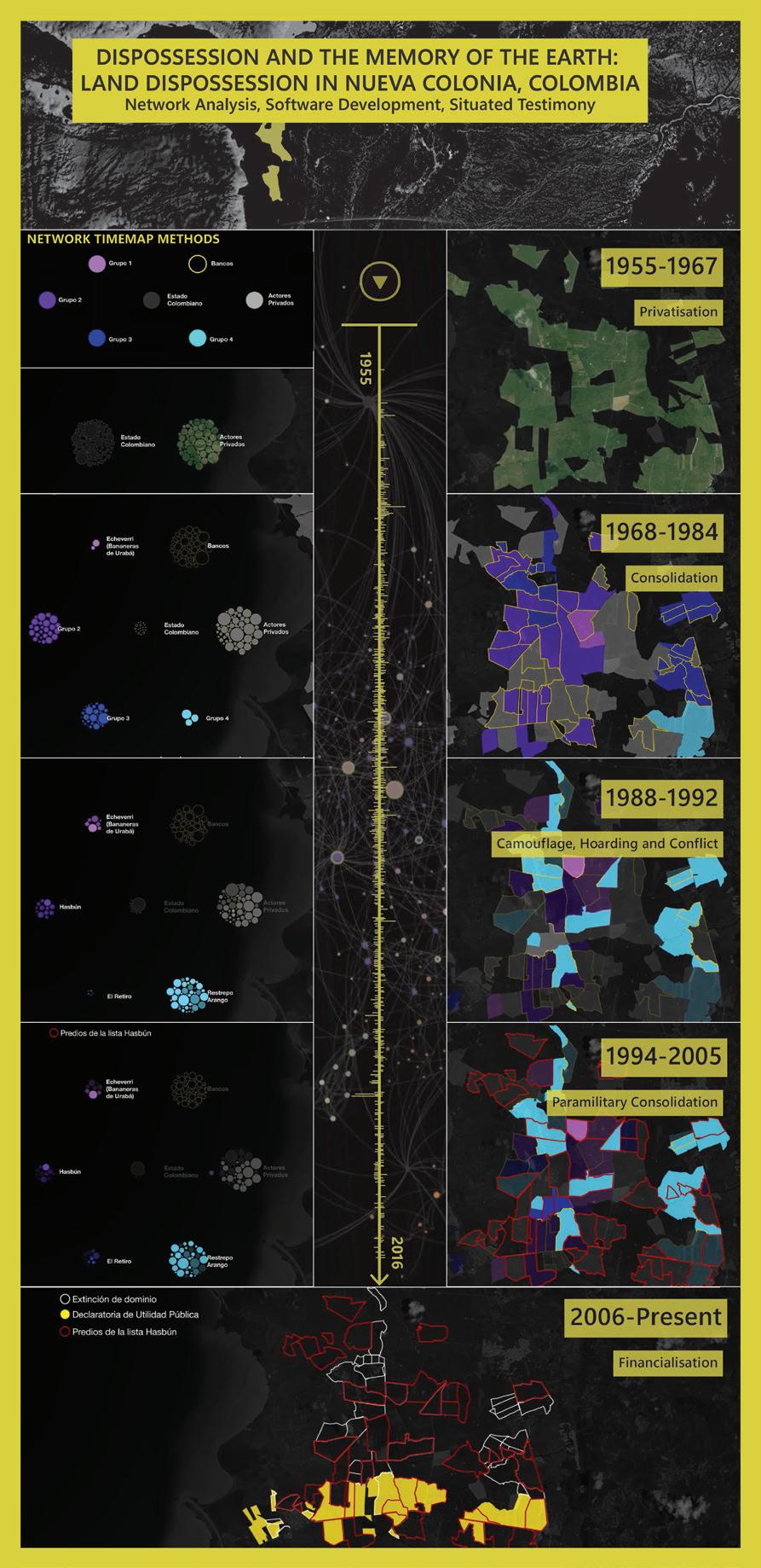
Forensic Architecture
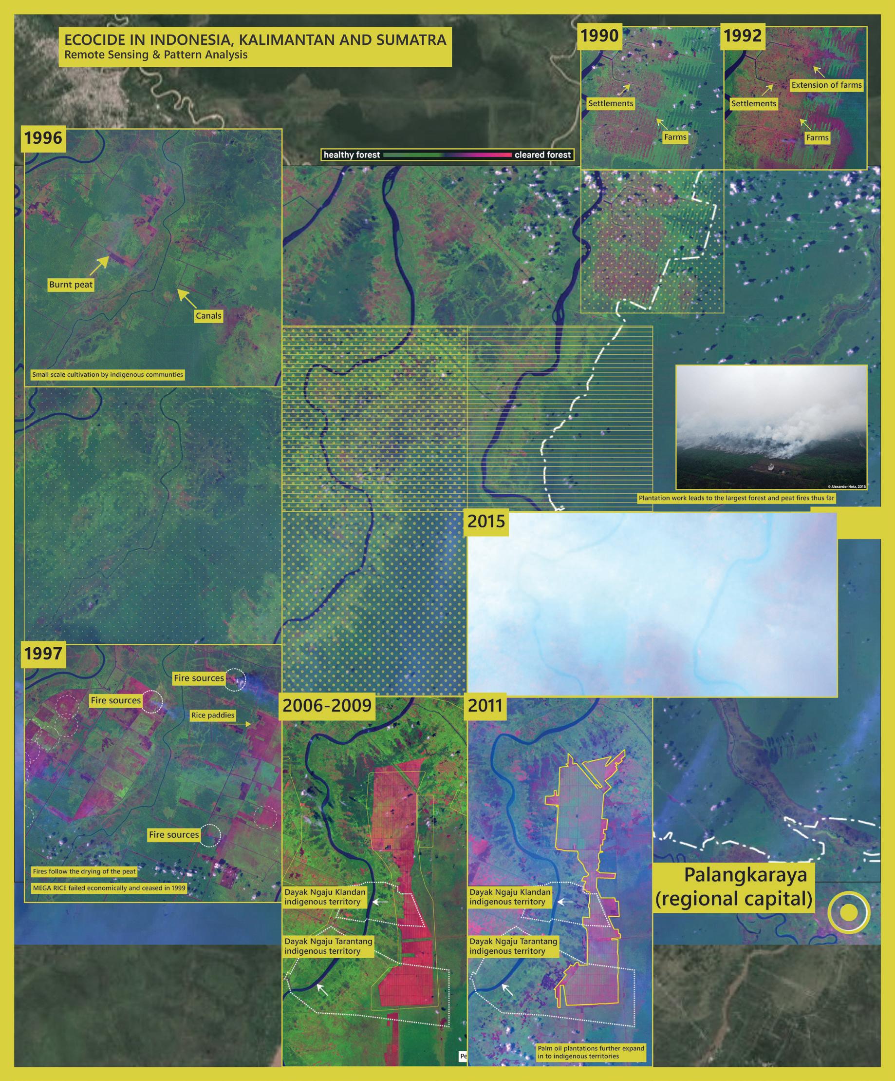
The London-based Forensic Architecture group often mobilises discourses rooted in human rights, environmental justice, colonial displacement, and institutional accountability such as environmental racism and ecocide, and their landscape-oriented works share common methods for evidence collection and narrative reconstruction including composite cartographies, multi-layered timelines, 3D reconstructions, satellite imagery analysis, and synchronized audiovisual testimonies.
Case studies arcoss Environmental Racism in Death Alley, Louisiana; Ecocide in Indonesia; Gold Mining and Violence in the Amazon Rainforest; Land Dispossession in Nueva Colonia and The Bombing of Rafah. Thoes’re all respond to environmental injustices that are spatially hidden, politically denied and temporally framented, and those investigation methods also crucial for Forensic Landscape Architecture’s framework exploration and set-up.
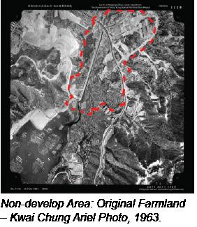
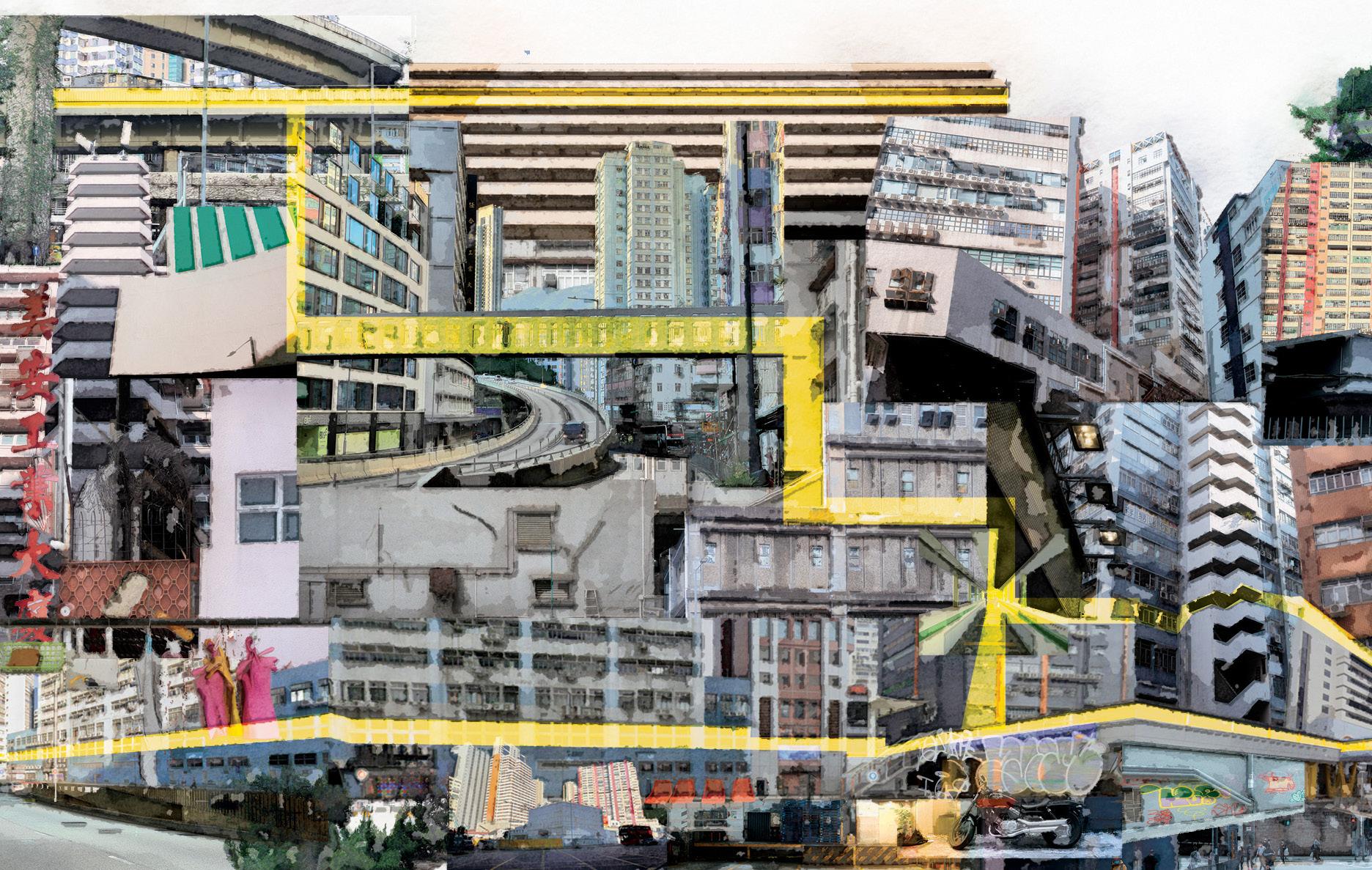
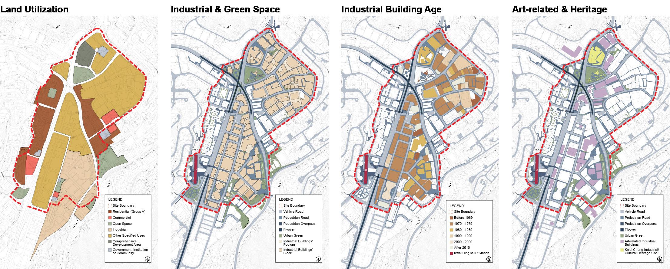
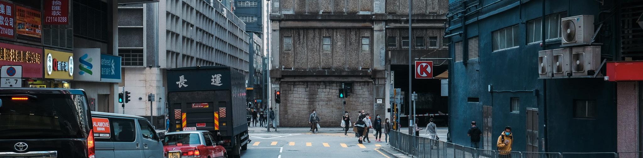
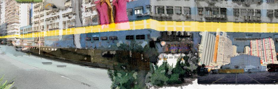
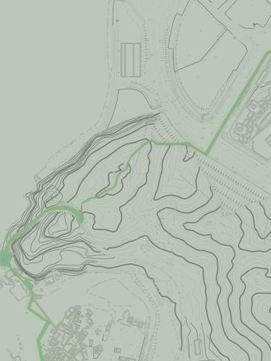
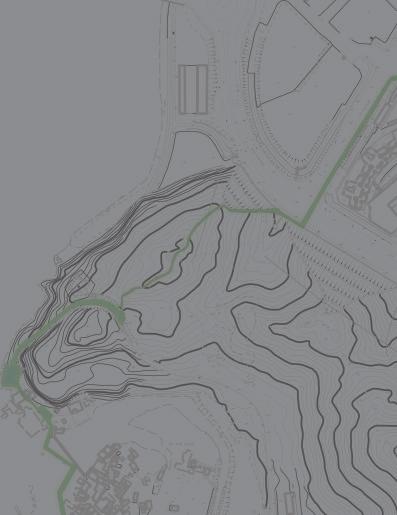
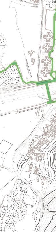
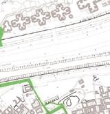
As one of the most densely populated cities globally, land development has been the focus of Hong Kong for many years due to limited land supply. With the economic restructuring during the 1980-90s, Hong Kong’s manufacturing industry gradually declined, and many industrial buildings were left unclaimed by companies heading north. At the same time, cultural preservation and sustainable development have become increasingly important in recent years. Kwai Chung’s artists took up this opportunity to move into these underutilised spaces due to the low rent and the strong industrial character of the neighbourhood. The industrial uses moved out, and the arts and cultural activities came; industrial heritage is reconceptualized as a discursive space in which intangible industrial culture and the collective memory of thousands of ‘ordinary people’ are also embedded, and it needs to be discovered and appreciated in heritage strategies.
Conditions
Statement
“Avant-garde Hub”, which is suggests a mindset of courage and exploration, embodying the val-ues of daring and uniqueness. As a conceptual framework, it highlights the importance of innovation, creativity, and pushing bound-aries while reawakening the significance of history and tradition through respect. In response to the monomodal nature of modern urban development, this ethos encourages the pursuit of the cutting edge. It represents a willingness to try out new ideas and blaze new trails in the pursuit of creativity and social progress - seeking a space that reflects the changing needs and aspirations of the community. By embracing the spirit of the avantgarde, the project hopes to create a hub that is not only aesthetically inspiring, a philosophy that embraces change and novelty while honouring the legacies of those who have come before, but also socially and environmentally responsible.
Compared with critical industrial revitalization areas such as Fo Tan and Kwun Tong, Kwai Chung’s artists, however, have taken up this opportunity to move into these un-derutilized spaces due to low rent and the strong industrial character of the neigh-bourhood. The industrial uses moved out, and the arts and cultural activities came; it became the new living space for those who spontaneously revitalized industrial buildings. Kwai Chung’s art activities are all-encom-passing, from studios to galleries, creative mediums, performing arts, dance and puppet theatre, etc. The art culture in Kwai Chung is extraordinary - New Media creations like Youtube: Trial & Error (398K subscribers), mandies kwok Fat Frog (314K subscribers), JFFT (101K subscribers); Art exhibition studios, such as Hidden Space, Hanart Square.It also in-cludes historical heritage - Kwai Chung Girls’ Home and the local culture factory – Tung Chun Soy Sauce Factory.
A network of cultural activities seems to have been organically developed, and var-ious art groups are quietly brewing under this ordinary surface. They are stationed here to experimentally revitalize the ageing industrial buildings with a unique cultural and art industry. Based on industrial buildings being the most popular project for revitalization and adaptive reuse in recent decades, compared with redevelopment, the adaptive reuse of industrial buildings may represent an era’s metamorphosis. Faced with the problem of ageing buildings, redevelopment pressures threaten to remove the place’s valuable character, gentrify the neighbourhood, and raise rent prices leading to the removal of artistic and creative activities or industries. Also, without further community orga-nization or infrastructure improvement, artists’ activities would not be able to bring more significant urban change and further develop Kwai Chung into a new cultural hub. Therefore, the ‘Industrial Character and Cultural Activities’ combination must be en-hanced to keep and enrich our history and culture passed on instead of allnew urban planning. Based on industrial buildings being the most popular project for
revitalization and adaptive reuse in recent decades, compared with redevelopment, the adaptive reuse of industrial buildings may represent an era’s metamorphosis.
Goals and Objectives
Kwai Chung is an area with great potential for revitalization. The ‘Industrial Charac-ter + Cultural Activities’ is an excellent combination for revitalizing industrial buildings that will become a model of the new century life— preserving that valuable industrial heritage and essential histor-ical local characteristics and enhancing cultural activities. Through the recognition, acceptance, re-spect and appreciation of the traditions and values of different communities, while also playing on with the local’s specialties, enhancing the special characteristic and magnifying its cultural development.
Global Context Postindustrialisation and Urban Design
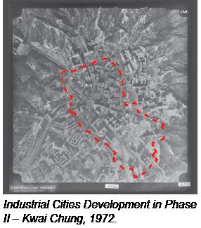
Cities are the best carriers for industrial development, and industrialisation promotes urbanisation. The industrial city originated from one of the four major urban design concepts of the nineteenth century (Garden City, 1903; Industrial City, 1904; Ribbon City, 1882; Lattice City, 1811); it is a city with industrial production as its primary function emerged from the development of the industry. Industrial workers in such cit-ies account for a high proportion of the urban population, and industrial electricity, water, and land use also account for a large proportion. After human society entered the industrial revolution era, urban landscape design incorporated machinery and electronic technology elements.
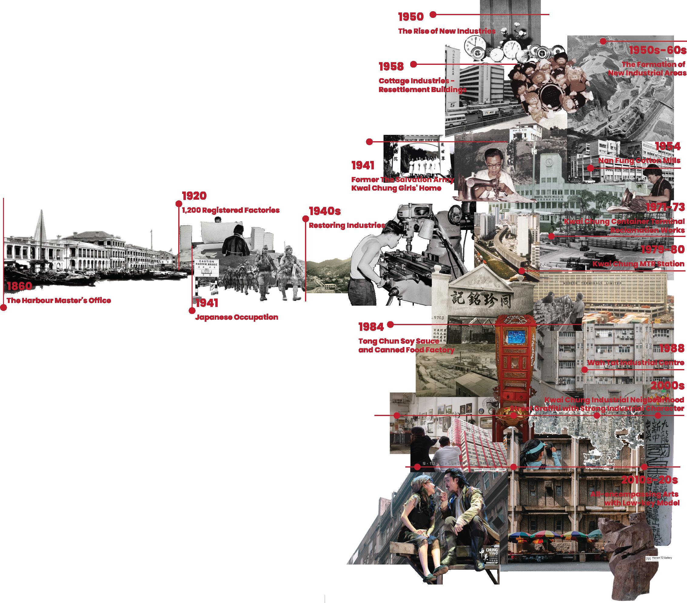
Industrial Heritage of Hong Kong
Hong Kong’s earliest industrial development began with only 1,200 registered factories and came to a halt during World War II. Due to the small size of Hong Kong’s land, it was not suitable for developing heavy industry, so Hong Kong has always followed
the path of light industry development. The manufacturing industry was the central pillar of Hong Kong’s economy during the 1950s and 1980s. In the 1960s and 1970s, light manufactur-ing was the most prominent business. Kwun Tong, Kwai Chung, Chai Wan and Tsuen Wan were all areas of concentration of critical industrial areas in the early days of Hong Kong. Hong Kong’s manufacturing industry has a long history, including cottage and planning industries. For example, the early plastic flowers, textiles, electronic products, toys, clocks, etc. Then, it mainly focused on labourintensive manufacturing processes assisted by simple machinery in the later stage and sold industrial products worldwide.
Postindustrialisation
“We shape our buildings and thereafter our buildings shape us.” (Former British Prime Minister, Sir Winston Churchill, 1943). The built environment is one of humanity’s most enduring and visible social heritage, shaping people’s habits and influencing culture, customs, health, emotions and social relationships. With the changes of
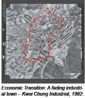
the times and the transformation of society, people will associate their values with the surrounding buildings and characteristic regional elements, which is an identity. Moreover, the shape and appearance of a historic building reflect the values of the society it is in globally. When the urban population expands, especially in Asia, the population gets denser and denser; people with rapidly changing lifestyles and expectations need to use and renew buildings. In Hong Kong, the manufacturing-based economy that represents the old era is no longer suitable. The legacy left by the industrial era is also facing obsolete, and society has begun to transform into a service-based economy. This trans-formation of social restructuring is also a must for us to face.
Conservation, Popolation and Revitalisation
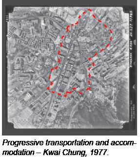
The history of Kwai Chung can be traced back to the “Kwai Chung Hoi O” established in the Ming Dynasty at least. Its east is the Guanfu Inspection Depart-ment, and the west is Tuen Mun Hoi O. Kwai Chung was rarely developed before the 1960s until the Tsuen Wan satellite city was gradually developed, and the residential cluster expanded to the Kwai Chung area. Kwai Chung has always been an important industrial and commercial city in Hong Kong; of which Kwai Chung Container Terminal is the sixth-largest container terminal in the world. Many companies have set up offices here, and there are also many public housing estates, HOS and industrial buildings.
In terms of population structure, the Hakka people dominate the indigenous villages in Kwai Chung. The government built the Kwai Chung Container Terminal in the early 1970s, which enabled the industrial development of Kwai Chung to flourish, and there were many shipping workshops. There are spinning mills and other industries in the factory area, thus pro-viding many job opportunities. At the same time, it has attracted many single men from Pakistan, India and Nepal to work and live in Hong Kong; a community slowly formed in Ping Lai Path at the junction of Kwai Chung and Shek Lei.
Nowadays, Kwai Chung is located between two main MTR stations, Kwai Fong and Kwai Hing. There is an official large-scale performance venue - Kwai Tsing Theatre; and various commercial activities in Kwai Fong. Kwai Hing is mainly a factory and a residence and has recently revitalised and reused projects such
as Luen Tai Industries Building (life@KCC). Besides, due to the low rent and convenient transportation, Kwai Chung Industrial Zone has become the base of many ‘‘Upstairs Company’’. It is full of office workers from industrial buildings during the day; many young people wearing fashionable clothes will also be there at night—shuttle between Kwai Chung districts. Here, art groups are quietly brewing under this ordinary surface. They are stationed here to experimentally revitalise the ageing industrial buildings with a unique cultural and art industry.products worldwide.
Since many production lines have been transferred to the Mainland, sustainable develop-ment is becoming more and more critical. In Hong Kong, apart from old buildings such as tenement buildings, industrial buildings are the most popular projects for revitalisation and adaptive reuse in recent decades. Those industrial zones included Kwun Tong, Kwai Chung, Chai Wan, and Tsuen Wan. The adaptive reuse of these industrial buildings that have lost their primary use into more modern buildings will have potential future uses for the environment, society and economy. While considering the conservation and revitalisation of the building, we also do our best to integrate old and new elements and establish a multi-faceted sustainable development attitude, including local conditions and neighbours, encouraging civic participation and exploring the potential economic opportunity.
Collaborative Visioning of Kwai Chung Industrial Zone
Visioning Workshop of Kwai Chung industrial area – Avant-grade Hub
The Symbolic of Avant-garde is considered ‘unorthodox’ or ‘radical.’ It describes experimental or innovative art or design or a group of people who make them and push the envelope in their field. This design project is a revolutionary journey through a new era of industrial neighbourhoods assembled with industrial heritage and historical art.
1. Creating a potential place for workshops, including many countries’ cultural activities and industrial history, while keeping the nostalgic flavour of the streets and industrial elements and ample open space to increase the flow of people.
2. Creating a public space for creators to display their results gets more people’s attention and specific business opportunities.
3. Designing a space to separate the work and exhibition areas is necessary for Kwai Chung because of its low-key working model and culture.
Objectives Urban Design Principles And Strategies
Based on a place to rent together and have a private space to do their work, such as shared spaces, shared resources, continuous dialogue between different artists, good sense of community.
1. Providing a public open space within a tight industrial building zone and 24-programming.
2. Preserving the historic buildings, such as iconic architecture structures, materials, and building styles.
Revitalising the project into an art and cultural centre with commercial uses, such as The Mills in Tsuen Wan.
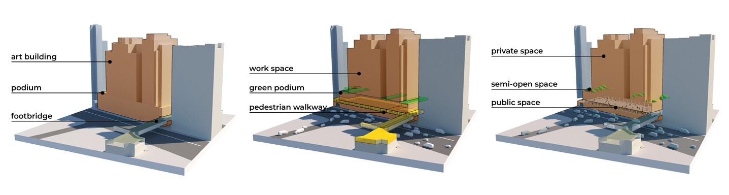
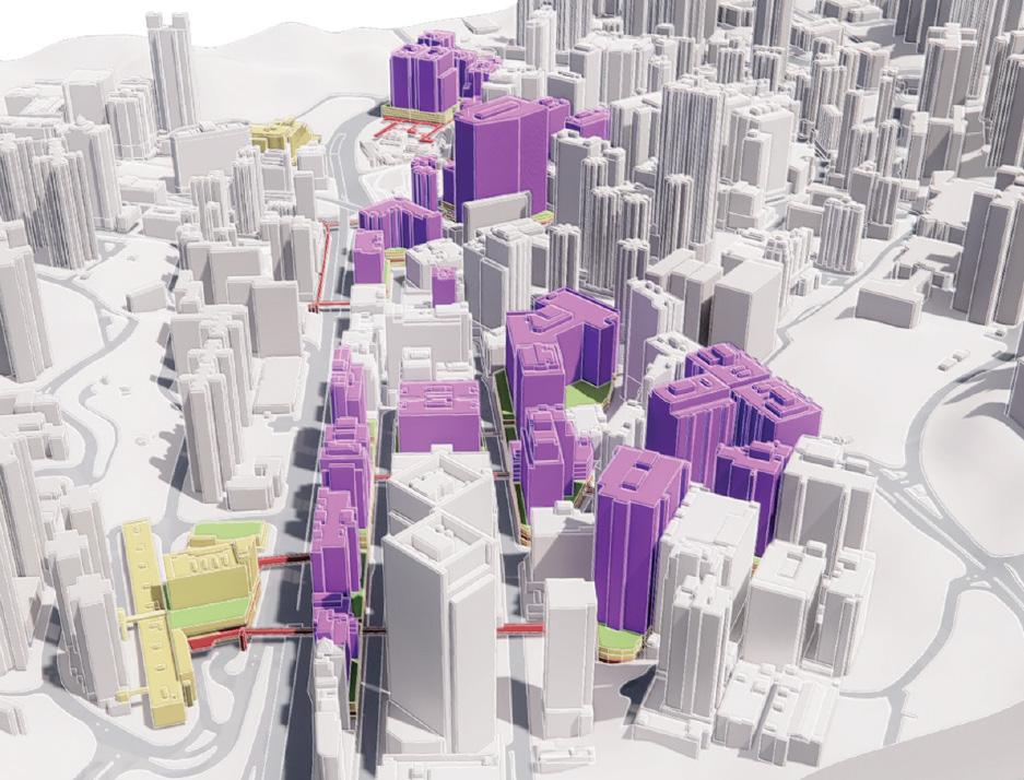
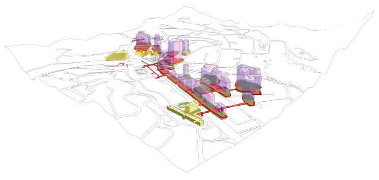
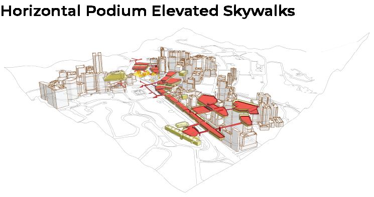
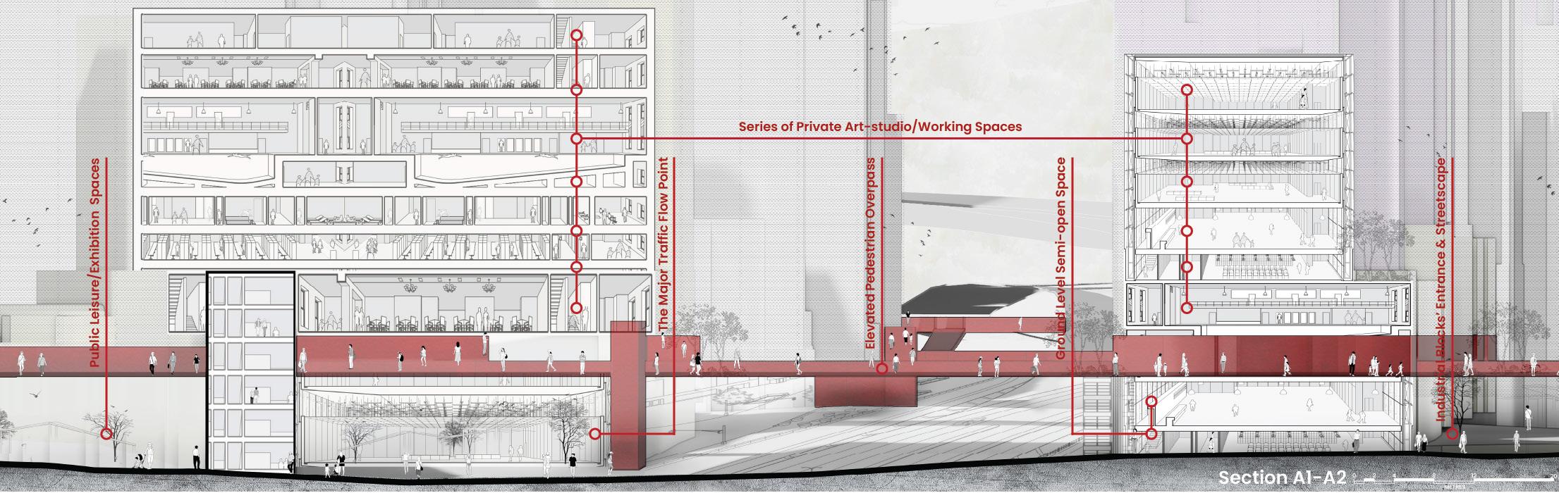
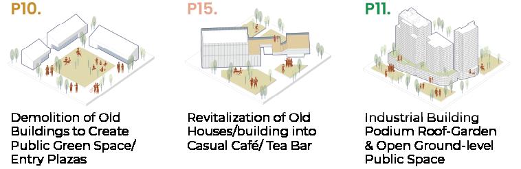
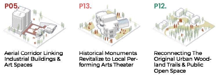
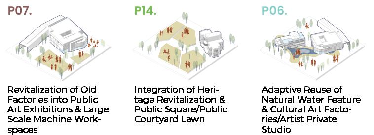
The Phase I Revitalization building group aims to improve the pedestrian walkway by turning the second floor into an open pedestrian walkway and connecting with the existing footbridge. This will share 40% of public events and art activities on the ground floor. The podium will also allow locals to walk through art-related buildings, increasing green space in the industrial area. This building module enhances the art neighborhood in Kwai Chung, allowing media creators to work in private studios and project their work in the open space. The program is divided into five usages: art gallery, media creation, studio workshop, open green platform, and phase II revitalization.
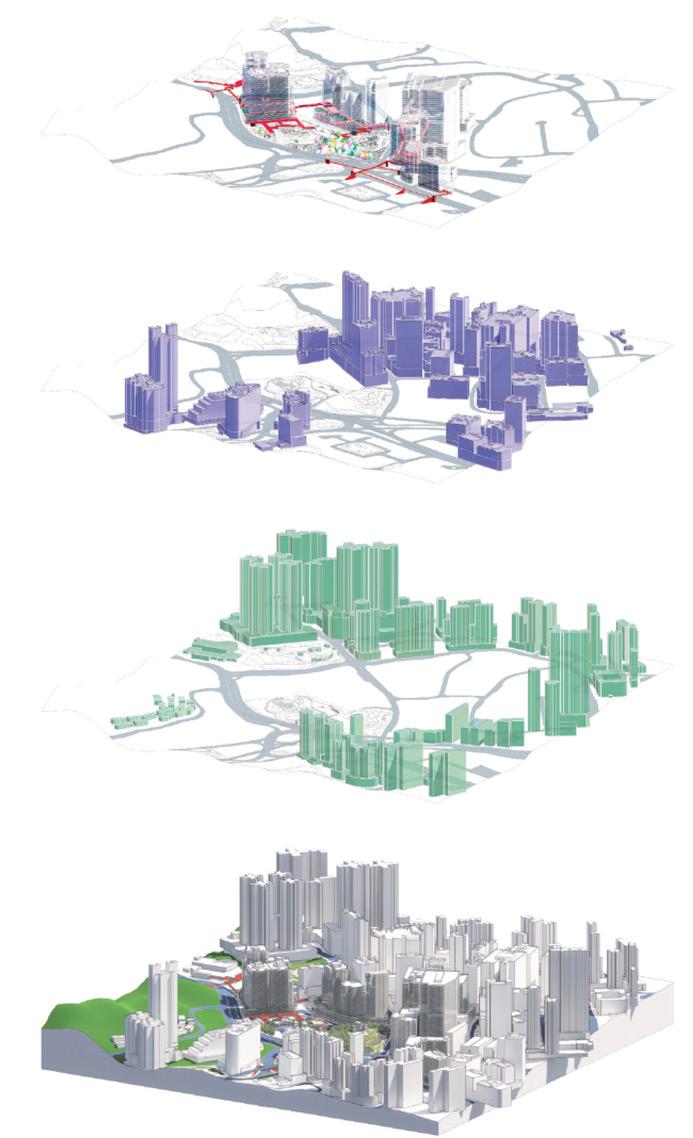
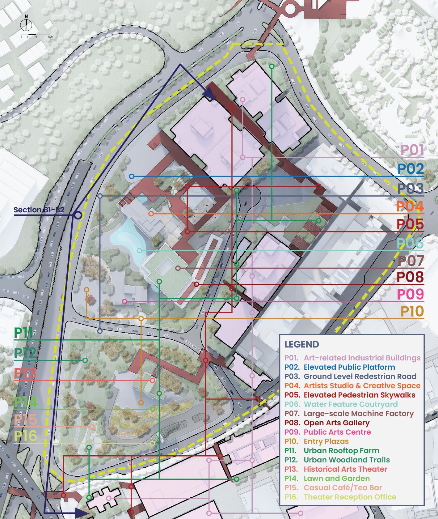
HORIZONTAL X VERTICAL PUBLIC-AND-PRIVATE SYSTEM
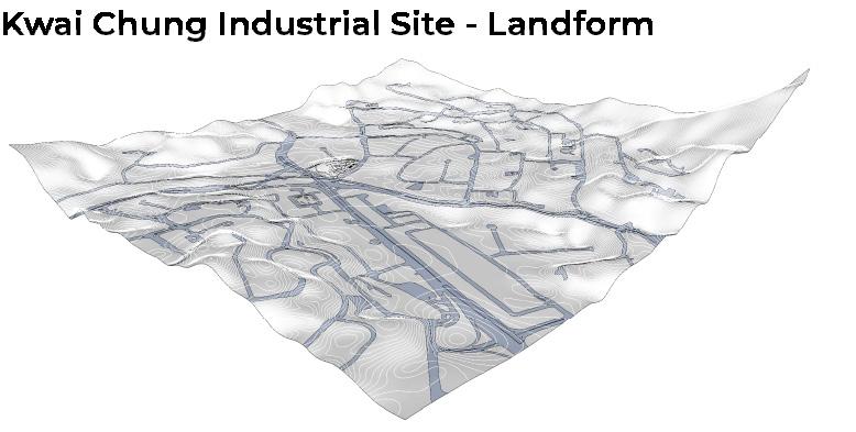
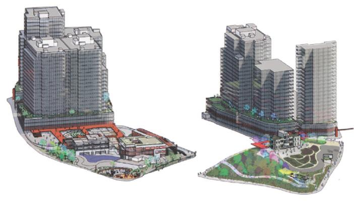
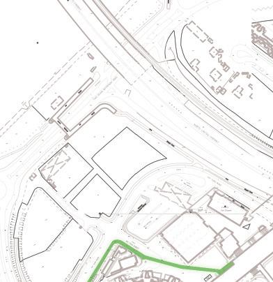
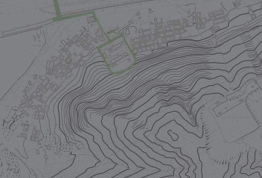
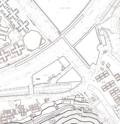
Master Plan - Urban Industrial Neigbourhood Conversation
Urban Scale: In the process of revitalizing the city of arts and culture, it is vital to preserving the historic architectural characteristics and industrial neighbourhood first, and then demolish low-value/obsolete buildings and strengthen the connection between public, private and urban green spaces, expanding the artistic and cultural atmosphere from ‘’the core’’ to the city as a whole in final.
3.
walkway.
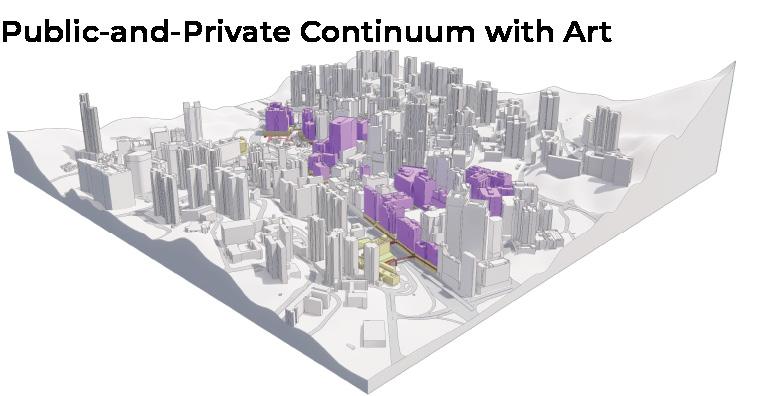
Public-and-private space continuum creation between Kwai Chung industrial buildings.
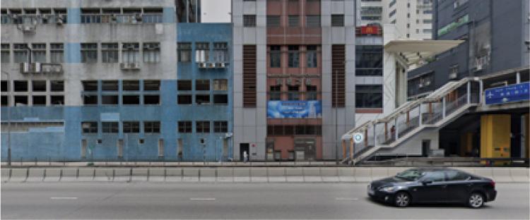
Semi-open design of industrial building’s car park level; the connection between industrial buildings and footbridge. Photo courtesy of Google Map.
Avant-garde Hub: Industrial Art Neighbourhood Community
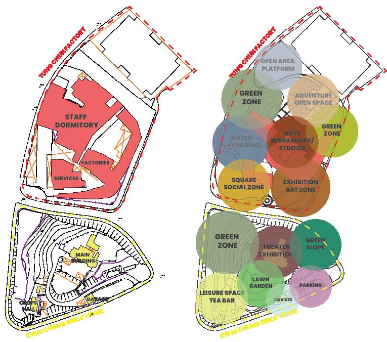
1. Tung Chun - Soy Sause and Canned Factory, 1984
Since the 19th century, “Tong Chun” has taken root in Kwai Chung. It adheres to the corporate motto of “Customer Satisfaction” and “Preserving Traditional Authentic Taste” by using high-quality raw materials and natural drying techniques to ferment and brew soy sauce by traditional natural methods and become a well-known century-old classic brand.
2. The Salvation Army - Kwai Chung Girls’ Home, 1941
It was Jewish home built in 1941 and used as a girls’ home from 1948-94. The main building is a three-storey ‘fortress-like’ with Western architectural features. It reflects the progress of the British feminist movement, the local community’s campaign against the keeping of sisters(maidservants), and the progress of human rights in Hong Kong.
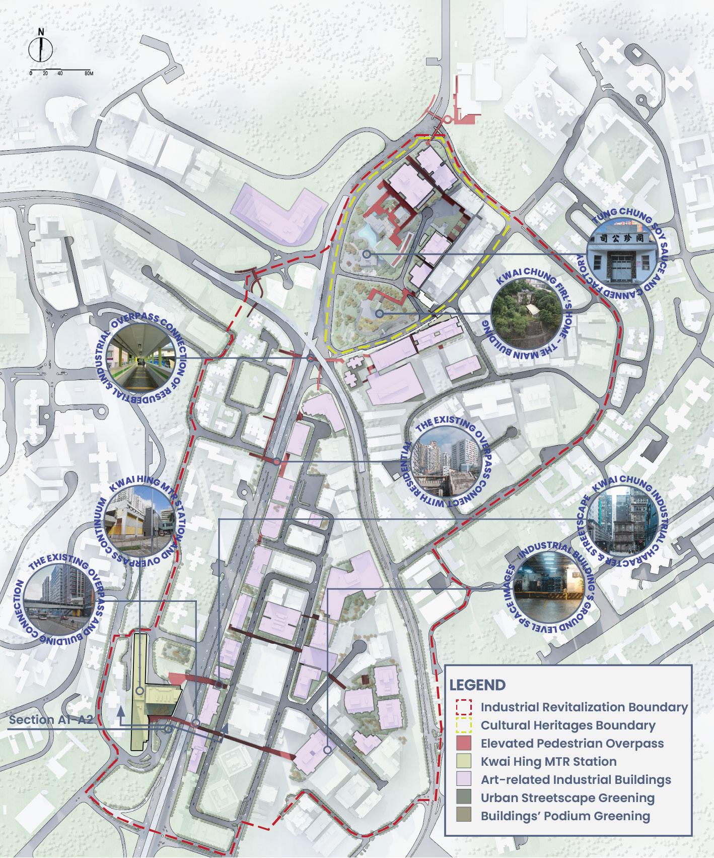
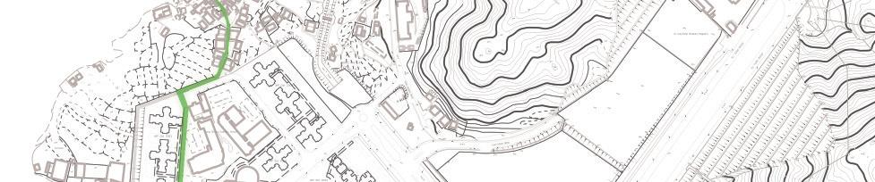
KWAI CHUNG CULTURAL HERITAGE REVITALLZATION
Enlarged Plan - Avant-garde Hub
Site Scale: It utilizes the adaptive reuse of the industrial buildings of Tong Chun Factory and Kwai Chung Girls’ Home to revitalize the project as an art and cultural centre with commercial use at the same time, under the principle of co-cultivating the arts, providing public open space within a compact industrial building area while allowing free individual creative space, and curating a series of cultural programs permitted by the continuum of public and private spaces.
Elevated Skywalks with Ar ts-building s
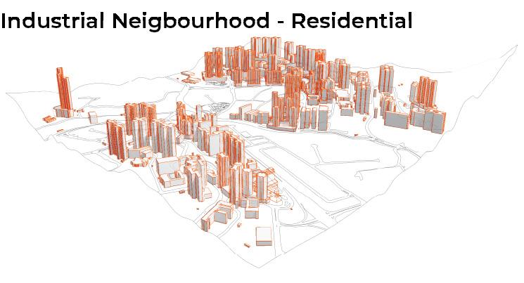
Industrial Neigbourhood - Residential
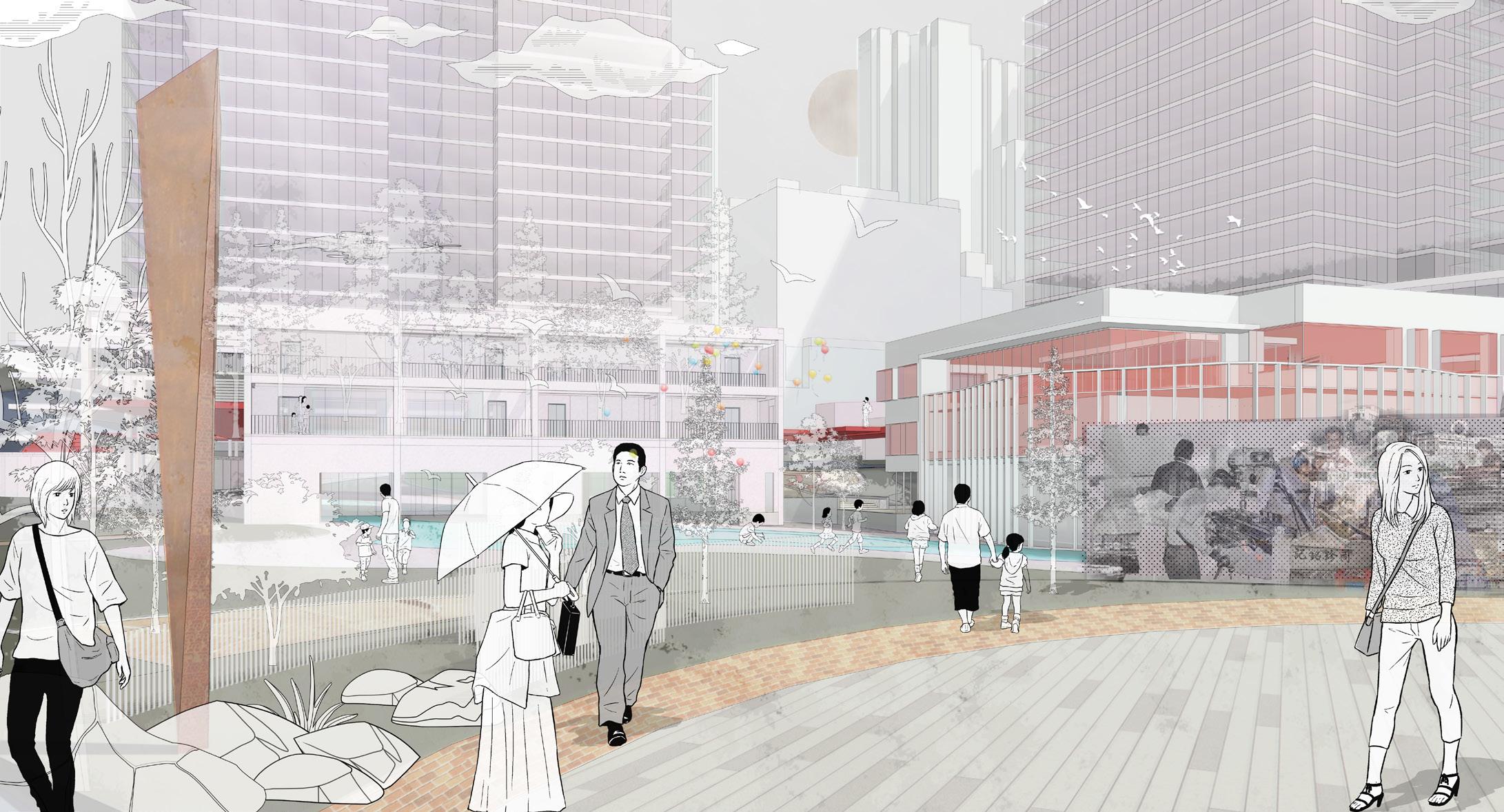
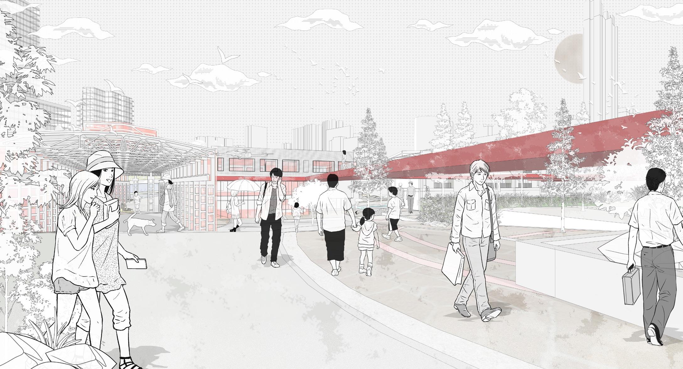
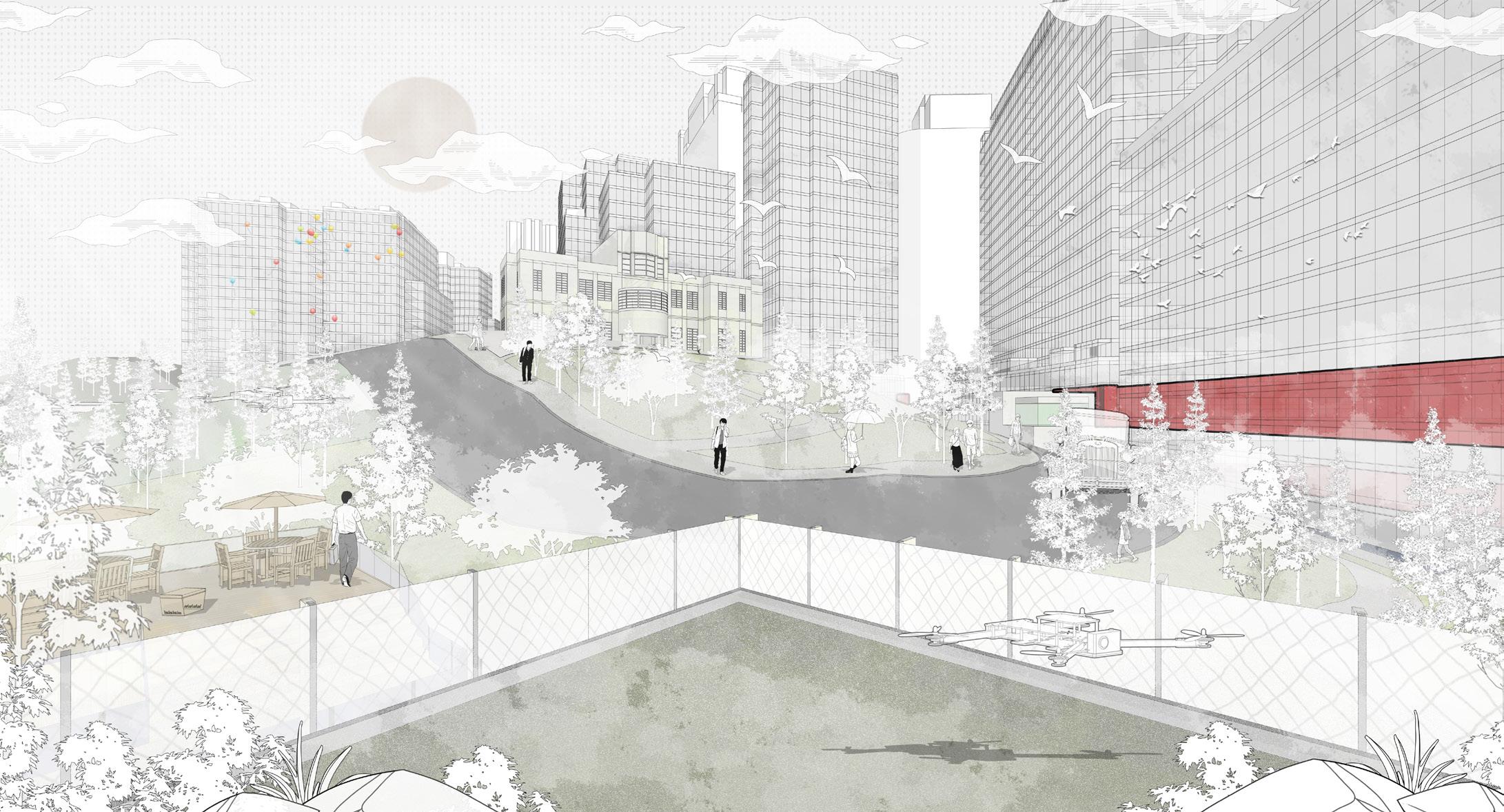
Avant-garde Hub - The He art of Ar ts
Kwai Chung Industrial Buildings
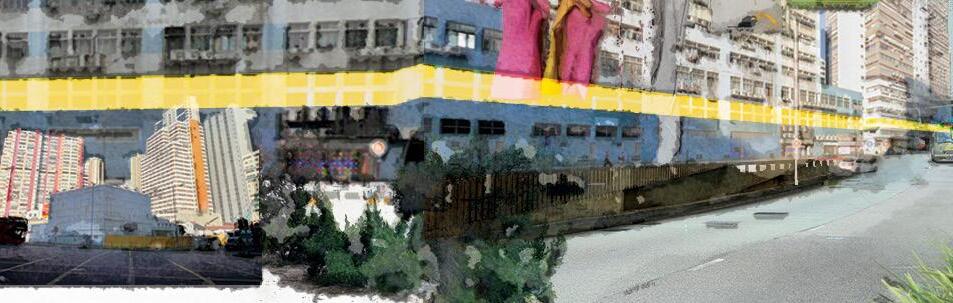
Enhancement of Industrial Neighbourhood and Urban Landscapes Connectivity
Revitalization of Traditional Factories to Artists' Studios/Workshops & Public Arts Exhibitions Continuum
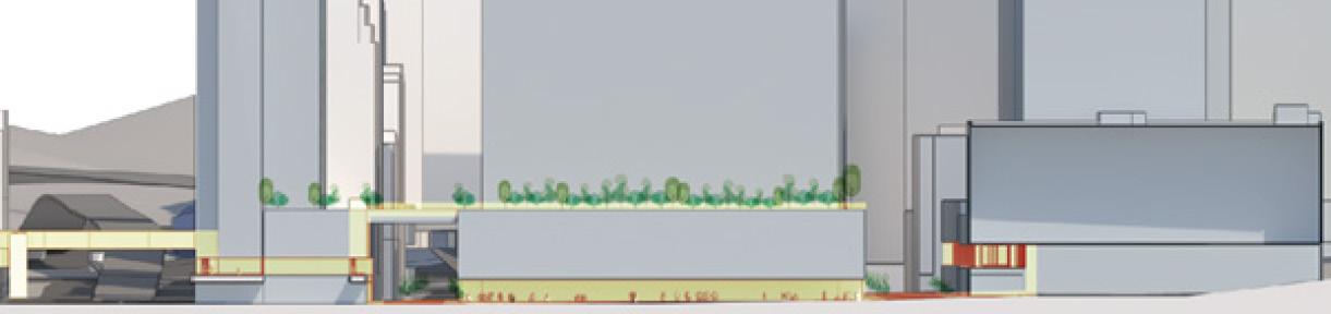
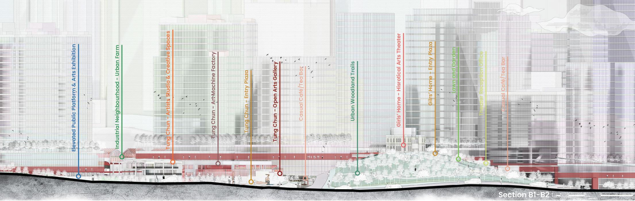
Kwai Chung Industrial Art Neighbourhood Hub - Section
Adaptive
Reuse of Historial Heitages to Art-activities: Theater & Tea-bar & Gardens
SUMMARY OF THE PROJECT
Over the past 40 years, with the transformation of Hong Kong’s economic structure, most of the manufacturing plants in Kwai Chung have been relocated, which has resulted in many existing industrial buildings needing to be updated or utilized. Fortunately, most of the industrial buildings in the Kwai Chung District are relatively young and in good condition. In addition, building conservation and renovation policies provide an efficient and sustainable solution for reusing these industrial buildings. As a result, generous building lifespans can be extended through adaptive reuse to meet growing market demands in other industries while serving as a nurturing site for the next generation of culture and art.
In the past 10–20 years, Kwai Chung’s artists have taken up this opportunity to move into these underutilized spaces due to the neighbourhood’s low rent and solid industrial character. At the same time, the Hong Kong government has implemented a series of revitalization measures to encourage large-scale renovation or reconstruction of existing industrial buildings to support this shift. By reviewing the cases, integration, and synthesis of different adaptive reuse of industrial buildings in Kwai Chung. The neighbourhood character studies, different case studies from local and foreign, while also interviewing Kwai Chung industrial building owner. Those research investigated the critical points of various successful factors, including historical, architectural and social values. The economy, society, and environment interact, and replanning considers local culture, history, and social uses.
In this city of quality of life, the heritage of culture and history is becoming increasingly important to a region. In the face of large-scale urban landscape planning, preserving and enhancing the area’s character is vital rather than overturning and rebuilding everything already there. The ‘Industrial Character + Cultural Activities’ is an excellent combination for revitalizing Kwai Chung’s industrial buildings that will become a model of the new century life—preserving that valuable industrial heritage and essential historical local characteristics and enhancing cultural activities. Through the recognition, acceptance, respect and appreciation of the traditions and values of different communities, while also playing on with the local’s specialities, enhancing the unique characteristic and magnifying its cultural development.
As a Landscape Architecture student and a student who graduated from Environment and Interior Design, I have been exploring everything from interior and exterior space, planting selection to grading differences, urban planning and design; I keep rethinking, researching and enhancing the image of future landscape architecture. This final year project will convey my vision of a neighbourhood city - Creating a Public and Private Space Continuum that breaks the boundaries between indoor and outdoor areas and integrates history, culture, art and neighbourhood community.
Kwai Chung Industrial Art Neighbourhood Hub - Overall Perspective
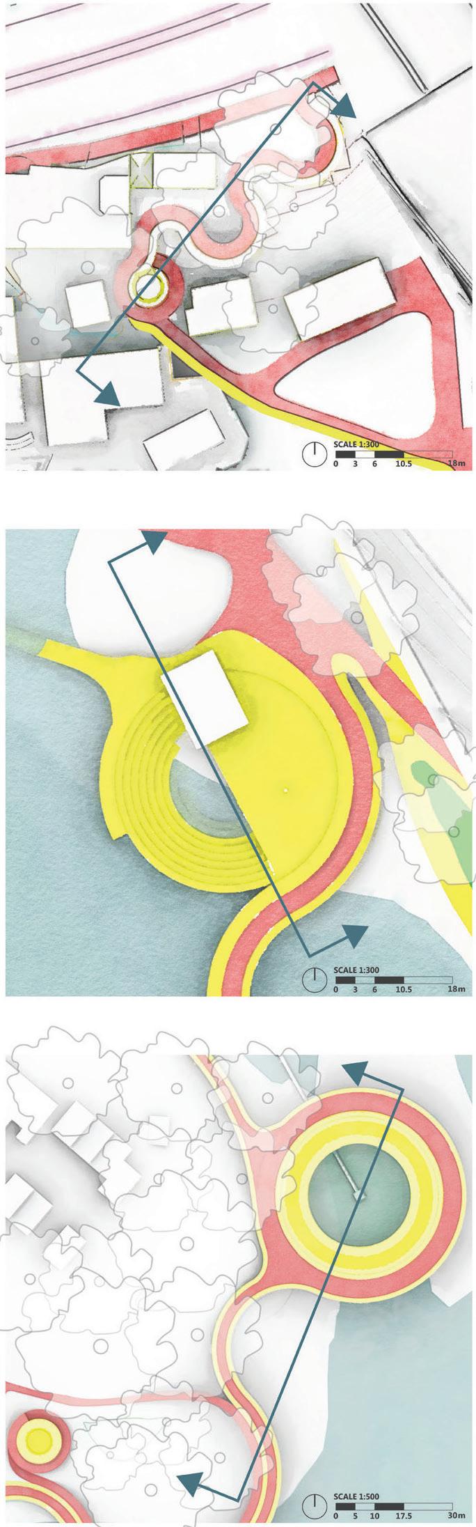
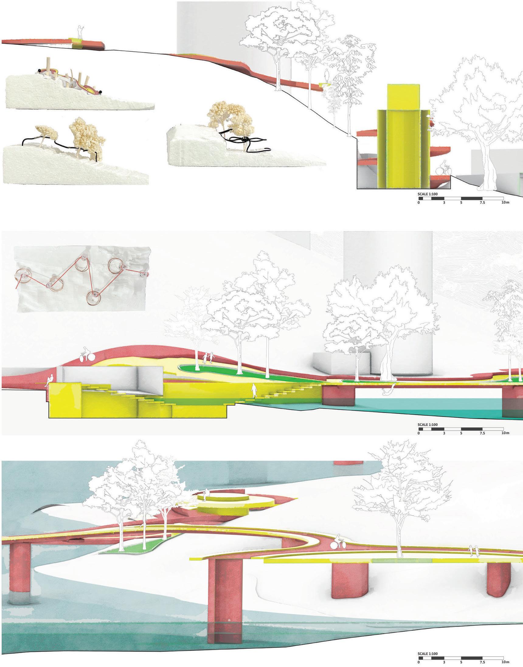
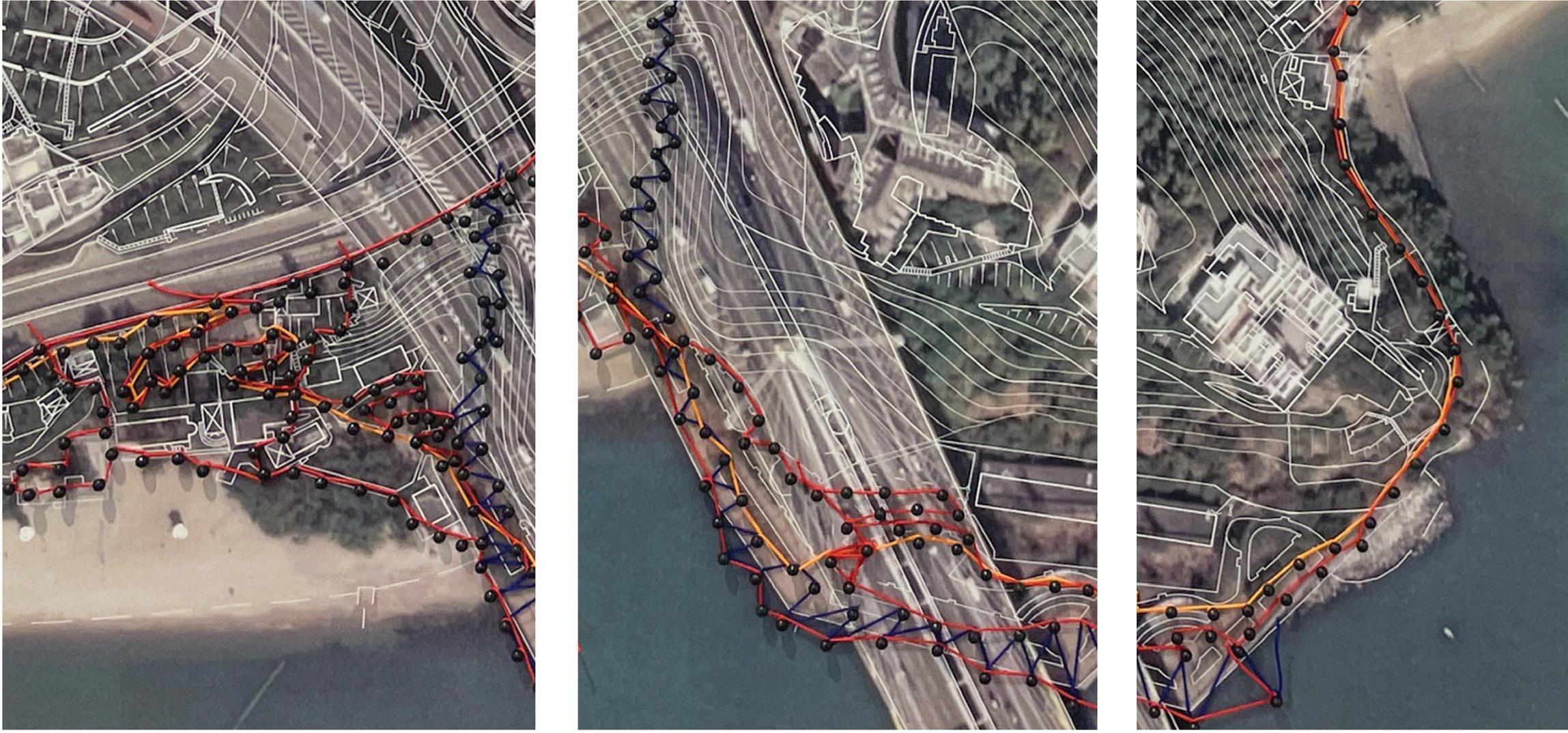
Project 05
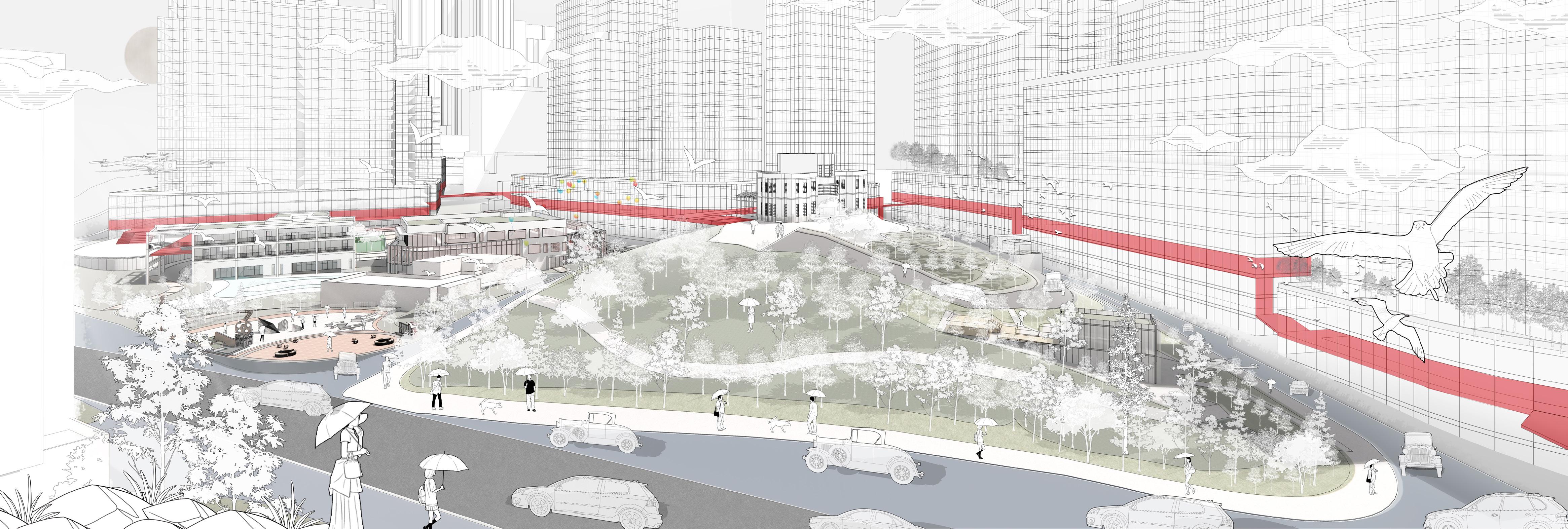
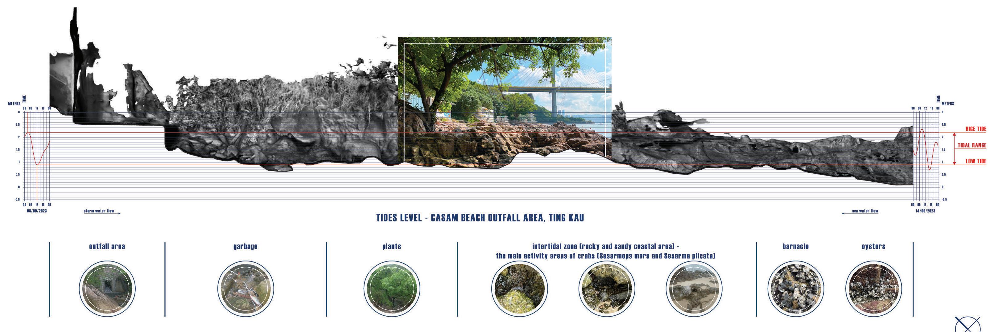
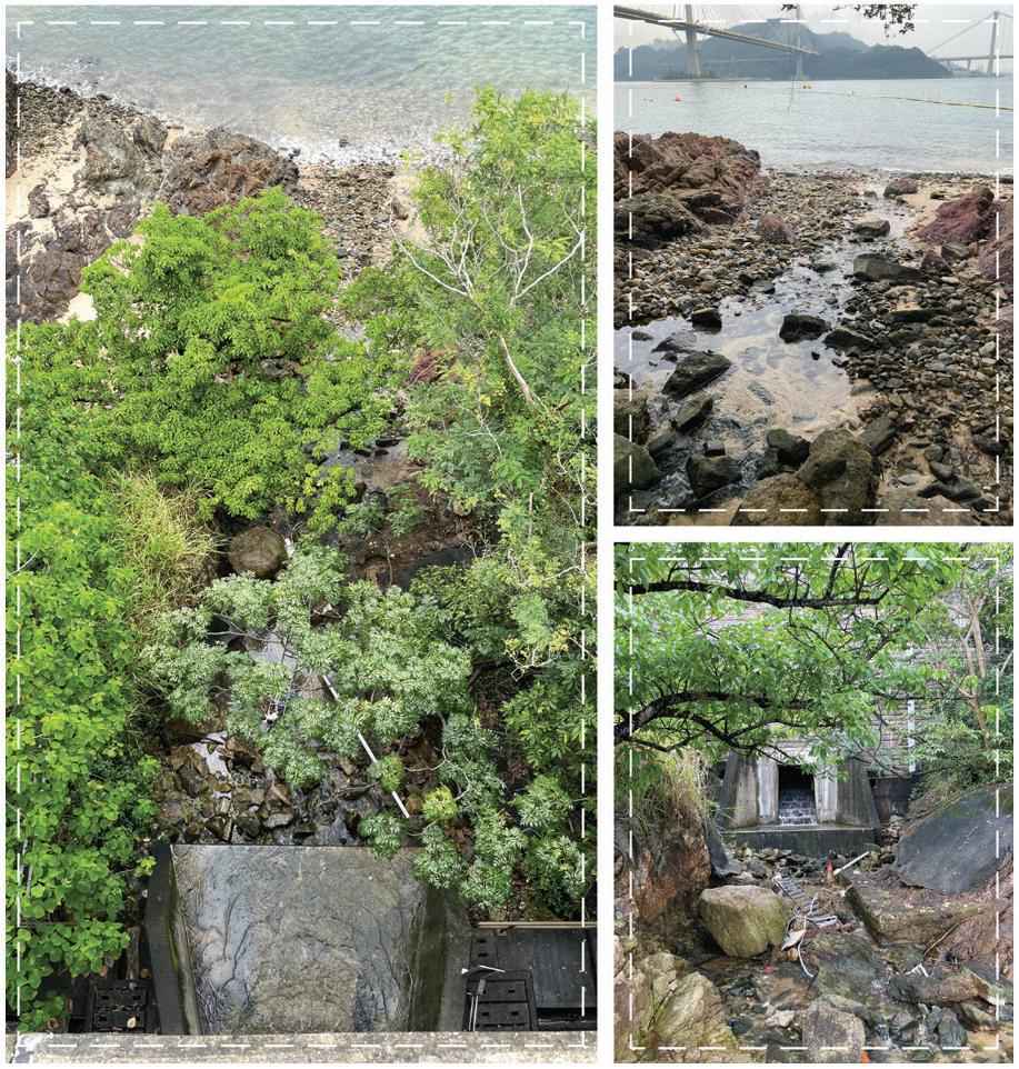
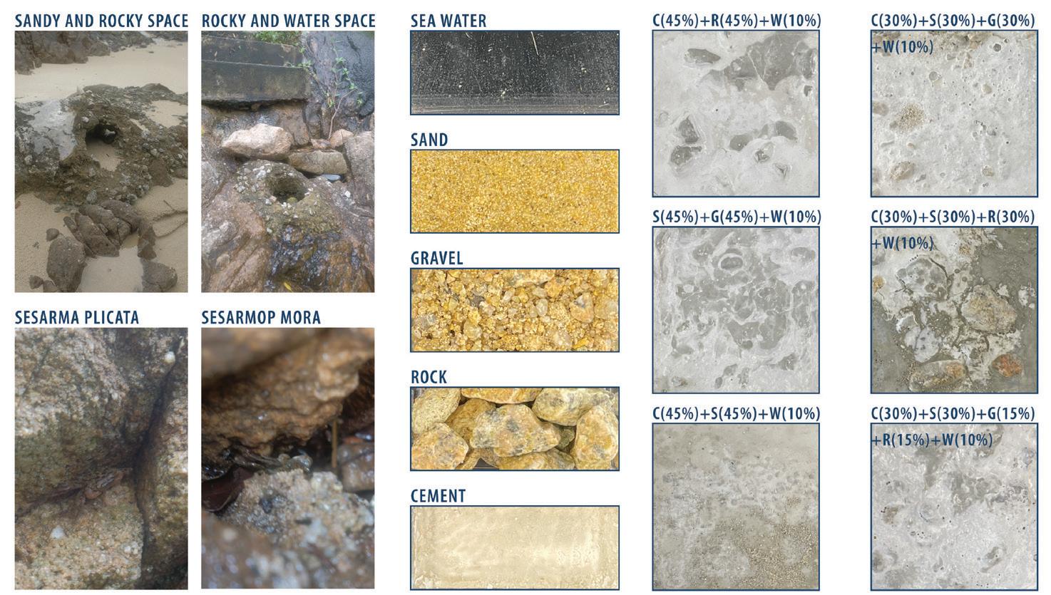
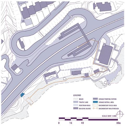
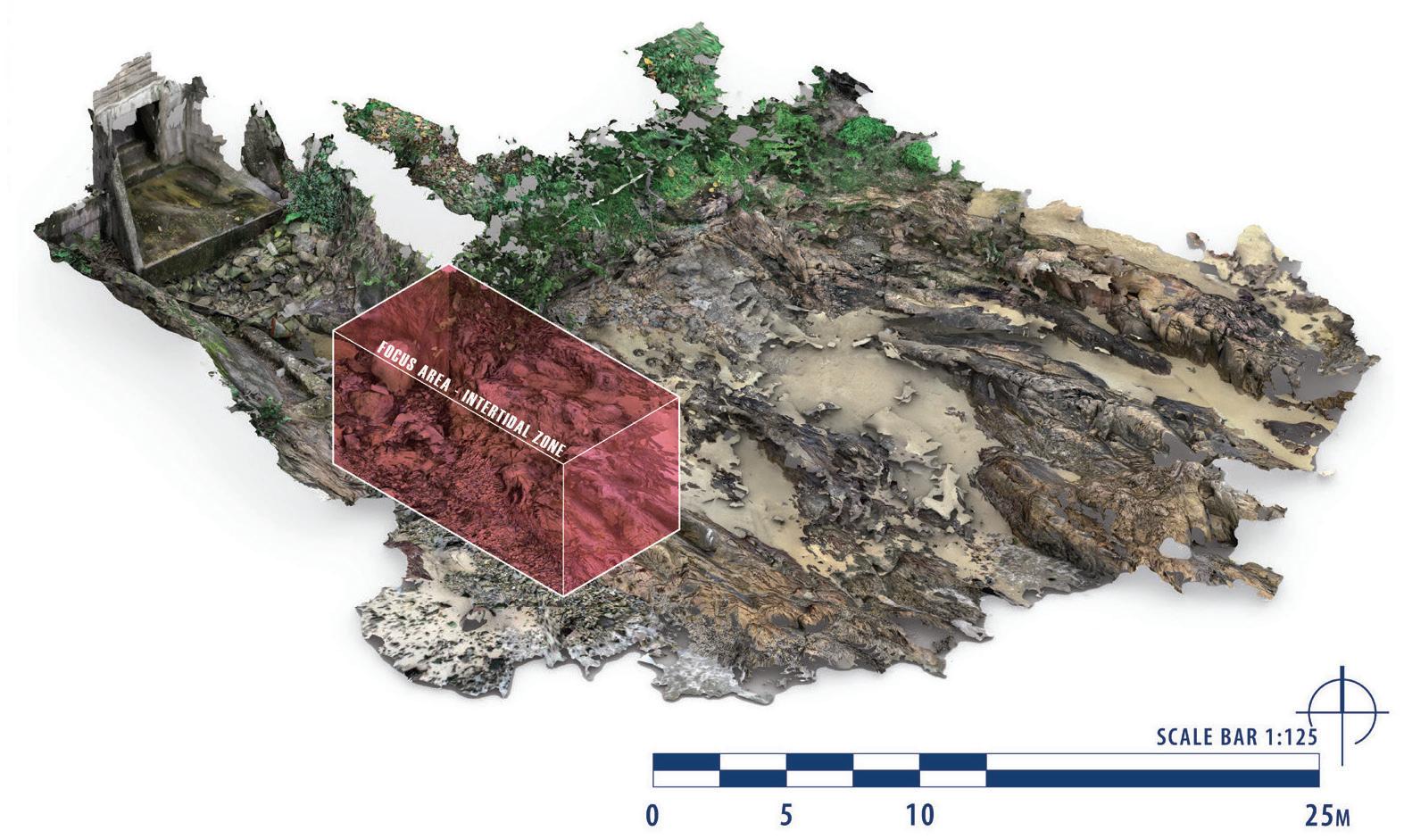
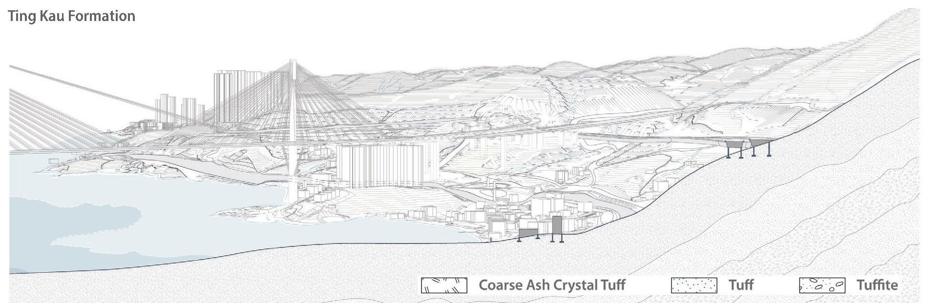
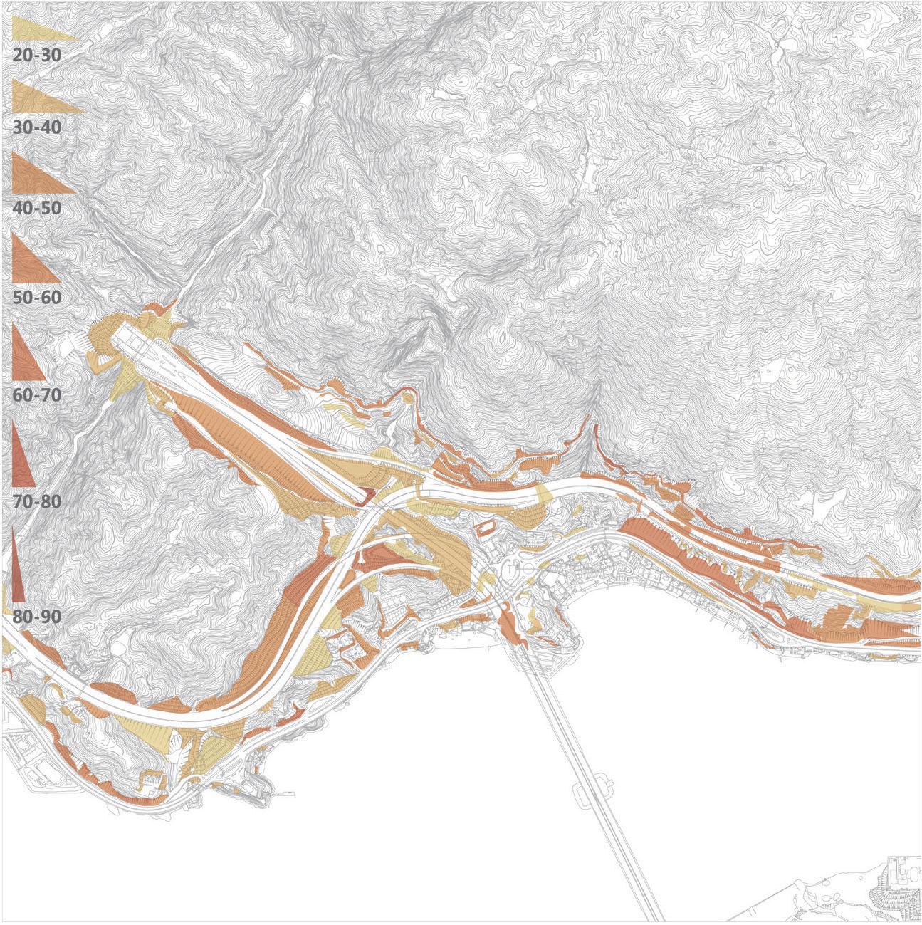
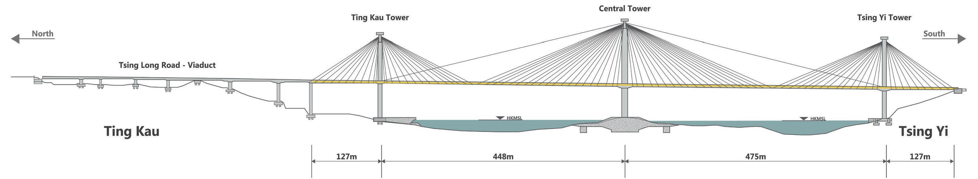
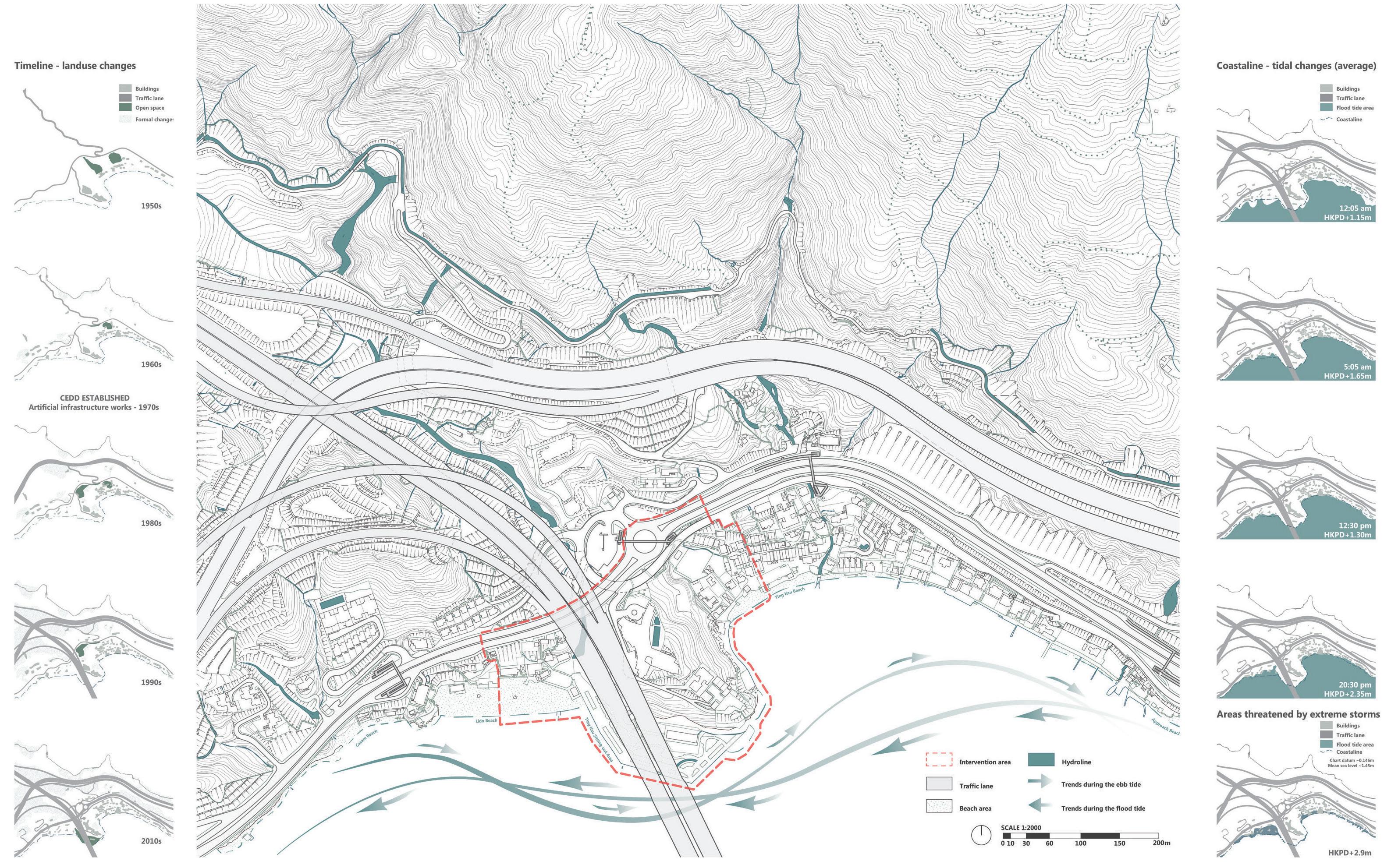
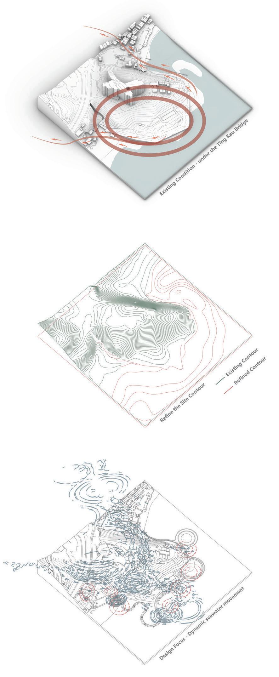
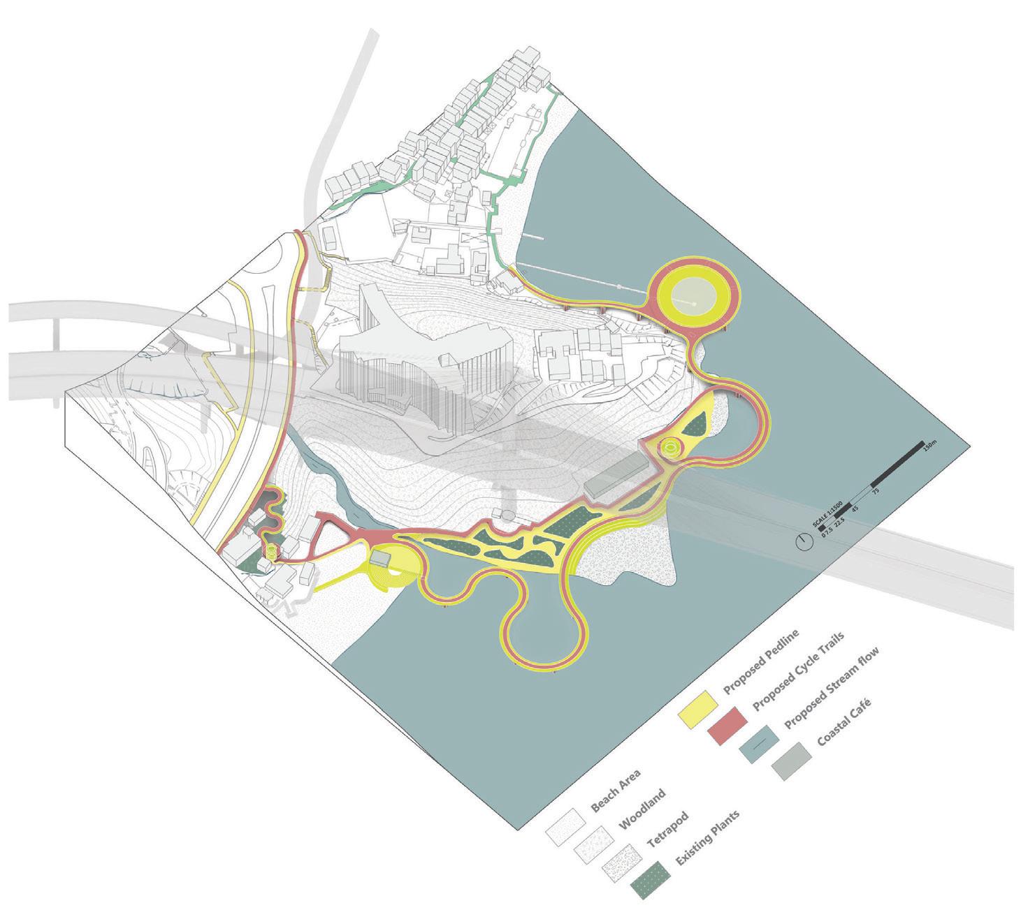
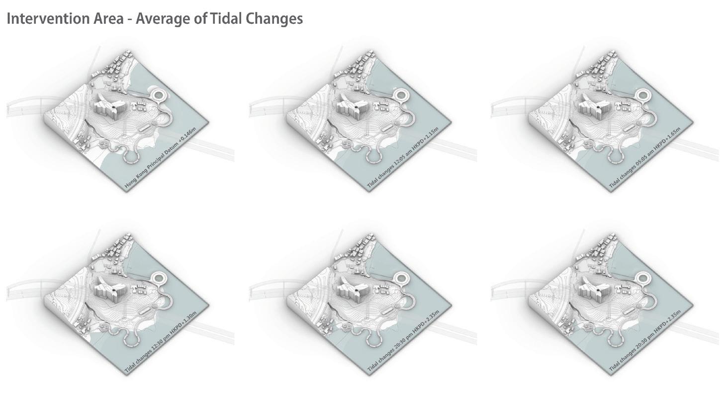
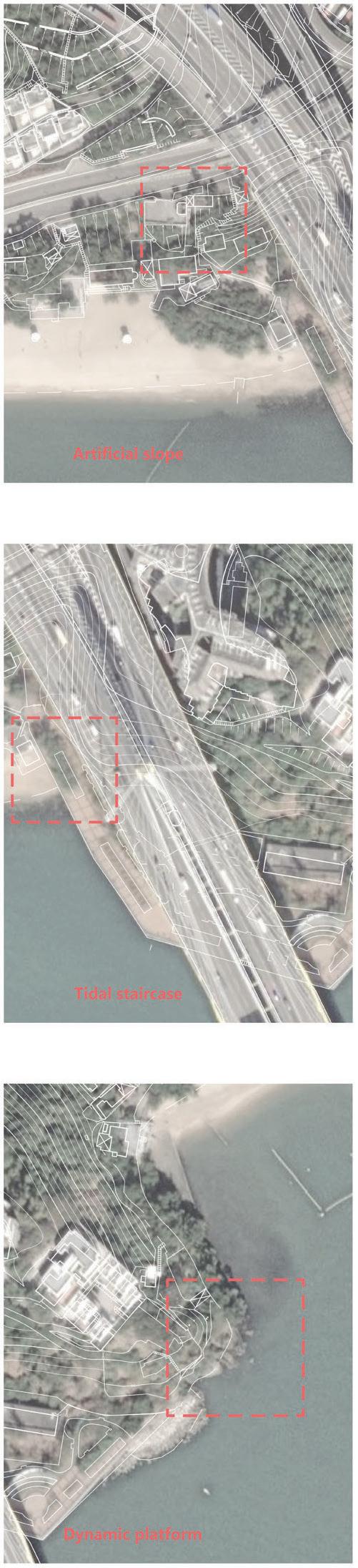
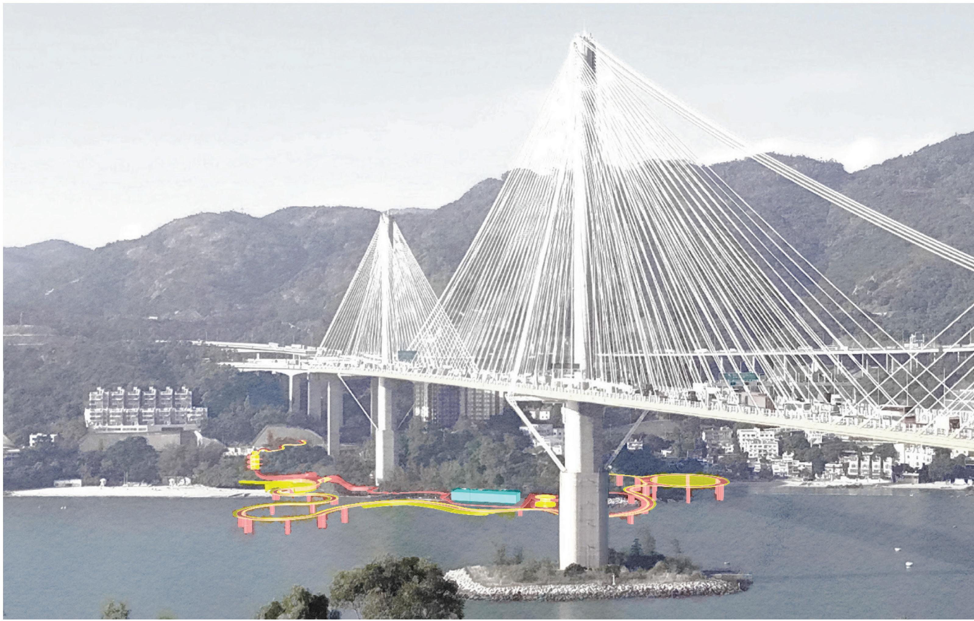
TING KAU - INTERVENTIONS
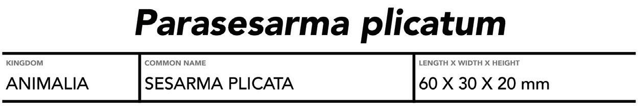
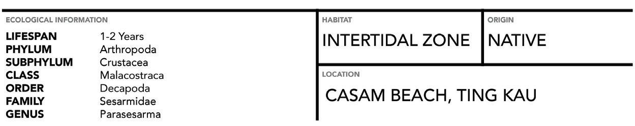
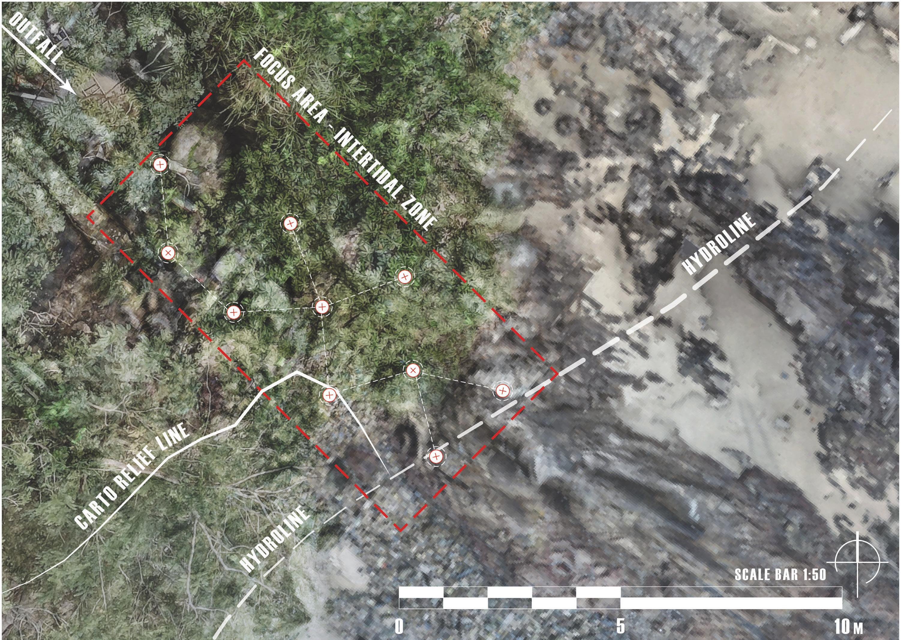
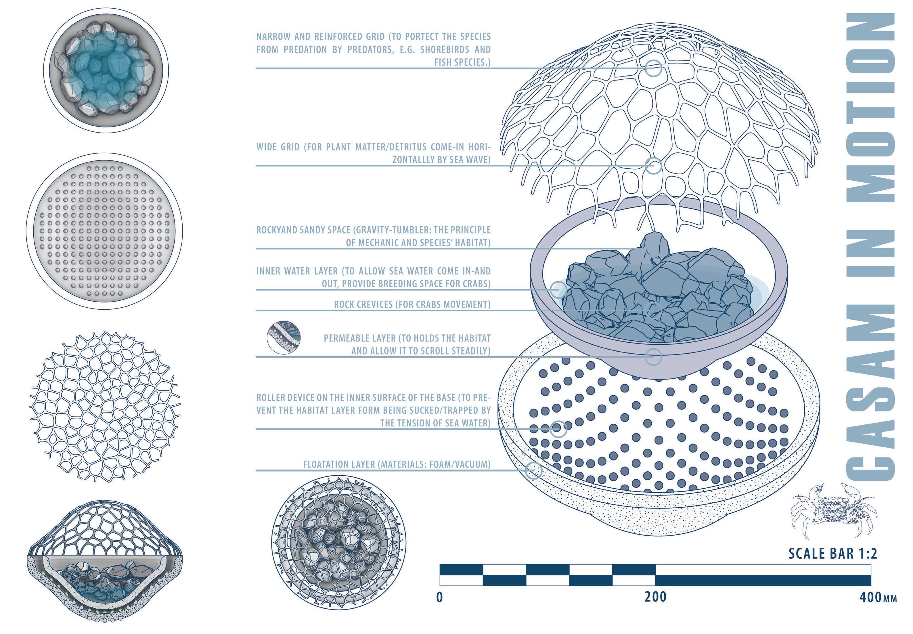
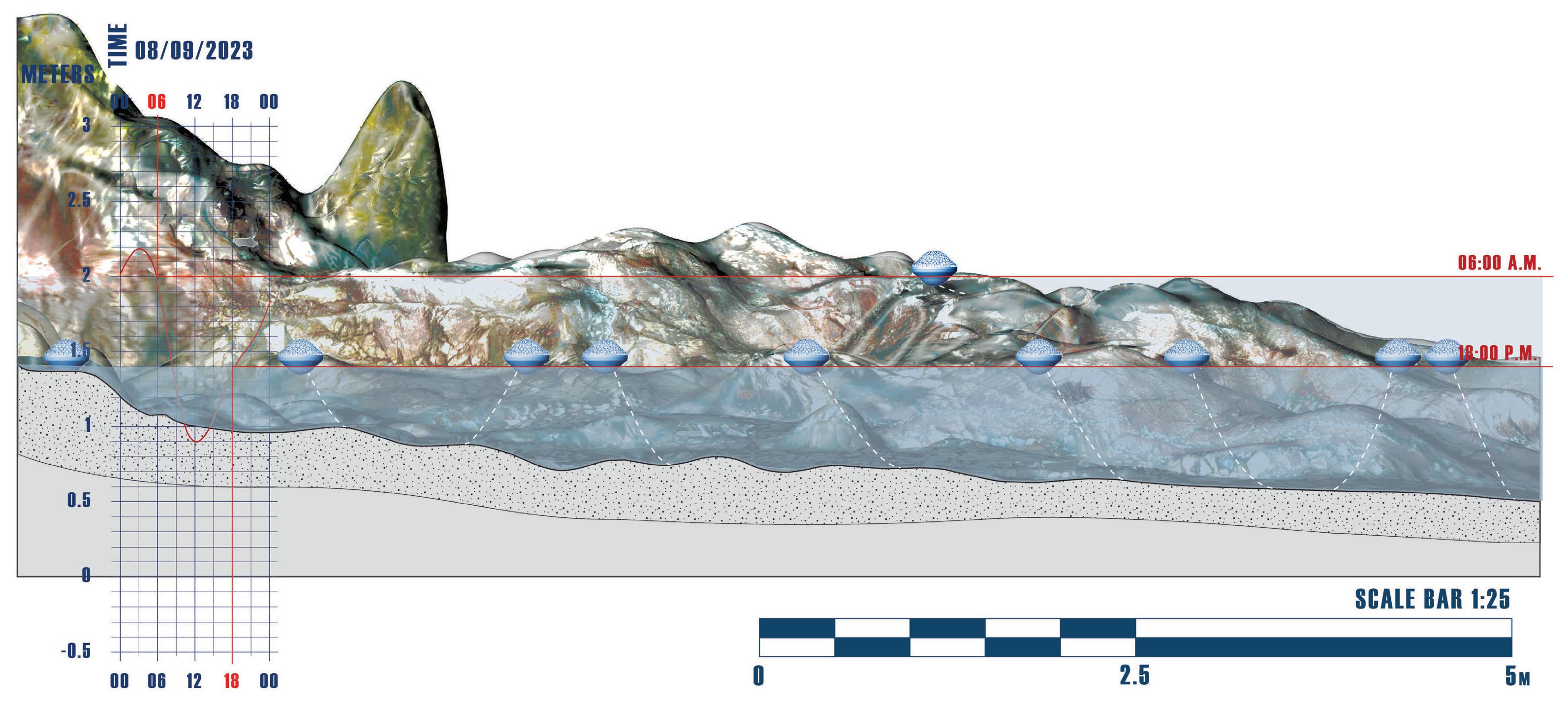
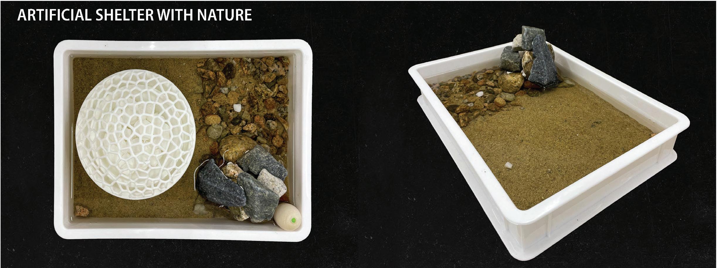
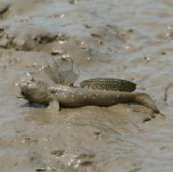
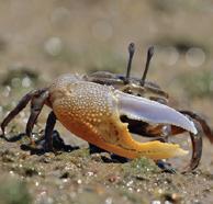
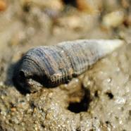
Parasesarma plicatum, commonly known as Sesarma plicata, is a remarkable crab species in Southeast Asia, including Hong Kong. It belongs to the Sesarmidae family and is well-suited to the dynamic intertidal zones that characterize their habitat, including exposure to both air and water as the tide rises and falls. Measuring just 200-300 millimetres in carapace width and boasting a relatively short lifespan of 1-2 years in the wild, it is easily recognizable by its brown, reddish-brown or olive-green colouring and distinctive mottled or speckled appear-ance. These physical traits allow them to blend seamlessly into their rocky and sandy coastal environments.
Adapted to the ever-changing conditions of the intertidal zone, these crabs exhibit tide-depen-dent behaviour. During high tide, they seek refuge in burrows or crevices, protecting themselves from exposure to air and potential predators. Conversely, during low tide, they emerge as active for-agers, engaging in their vital role as omnivorous scavengers. At the same time, reproduction in Paras-esarma plicatum is intricately linked to the tidal cycle. Mating and egg-laying predominantly occur during high tide, with females carrying their precious cargo of eggs until they hatch. Once the eggs hatch, the resulting larvae are released into the water, settling back into the intertidal area as juveniles.
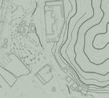
Formation Process 02: Network Investigations
Kong Formation Yim Tin
Hong
Tsai
03: Catalytic Interventions
Process
SENSORY BANQUET
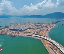
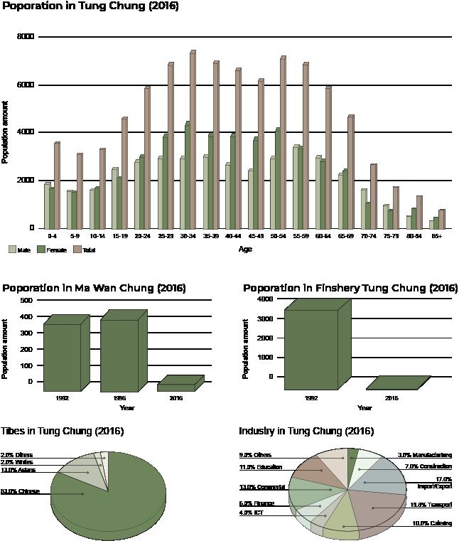
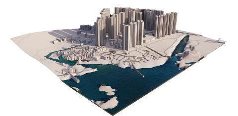
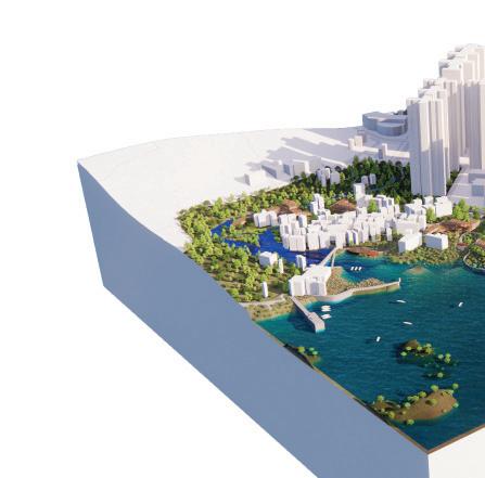
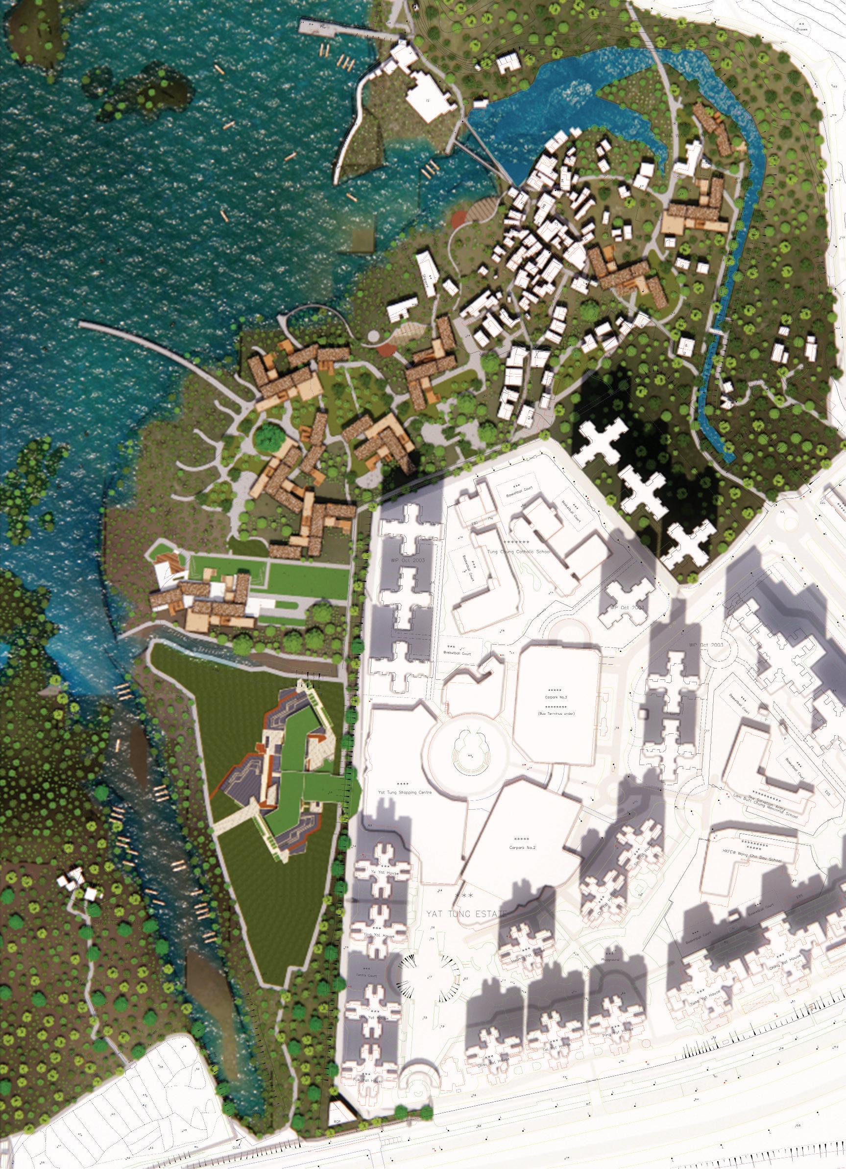
FIVE SENSES x CULTURAL HISTORY x LAND&SEA in Tung Chung - Ma Wan Chung Village
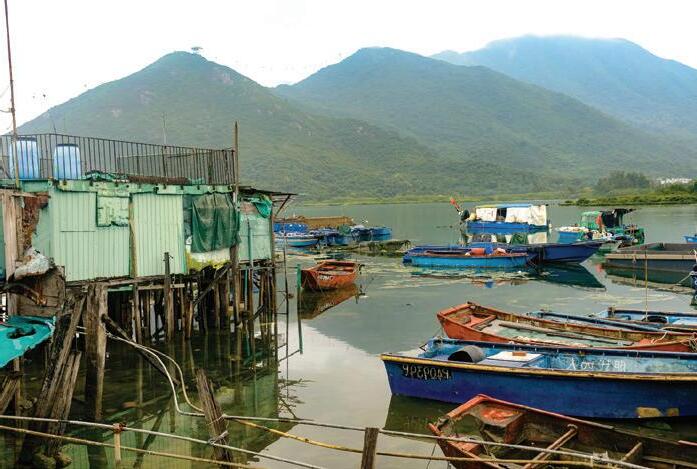
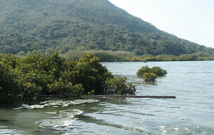
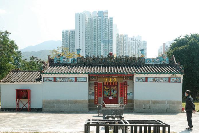
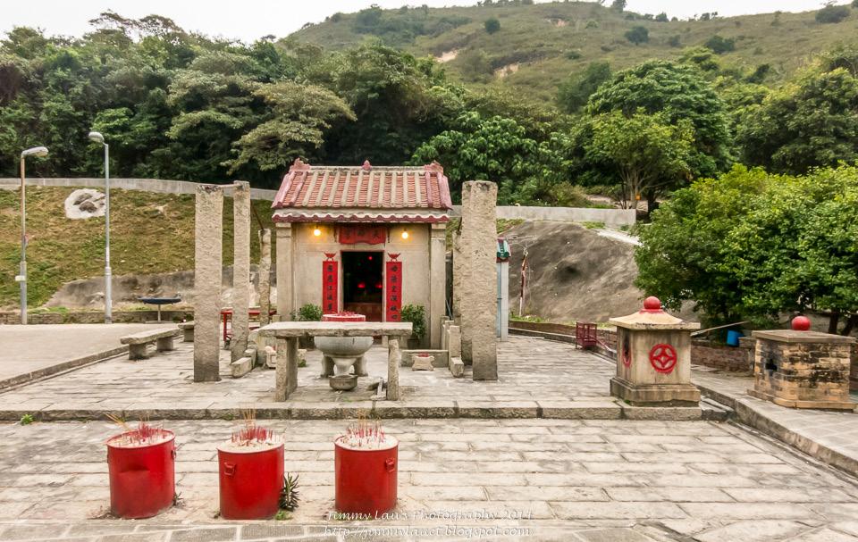
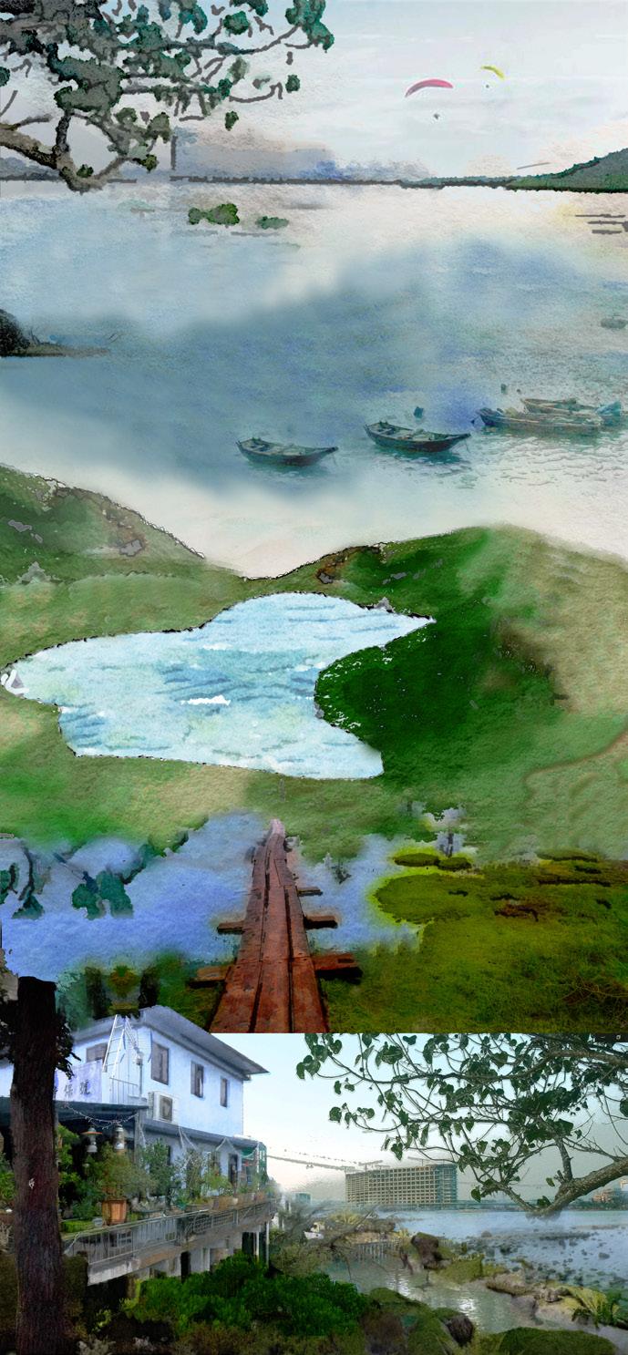
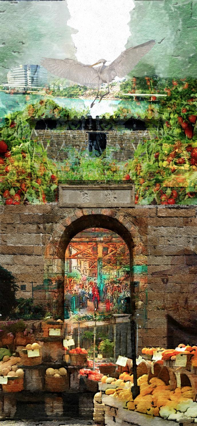
Tung Chung, the biggest of outlying islands, situated at the entrance of the Pearl River estuary, is Lantau Island. It compris -
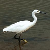
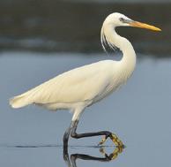
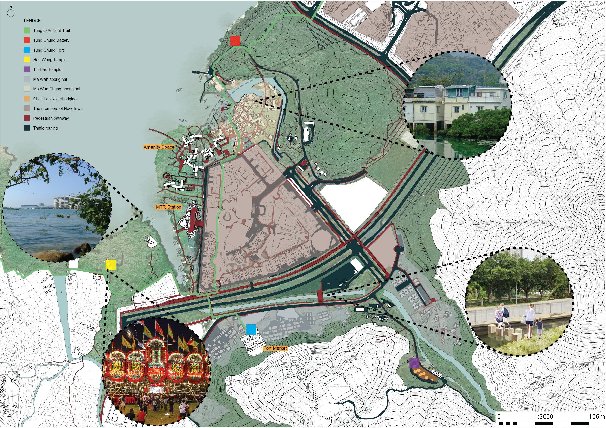
es a cluster of multi-surname villages with many different rural and new town characters: urban city, village stilt houses, fishing and farming history, well-known stone architecture like in Hau Temple, Hau Wong Temple with annual Festival; historical buildings such as Tung Chung Battery and Tung Chung Fort. Moreover, Tung Chung Bay is a place of biodiversity and plant diversity; you can see the Stile House of different generations, various species with the wetlands like Egret and Mudskippers, fishing boats and farmlands are also typical.
Photo courtesy of Frankie WONG, Date: 2022
Photo courtesy of Frankie WONG, Date: 2022
Ma Wan Chung Village
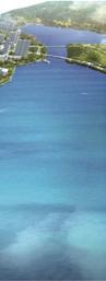
Tung Chun Bay
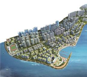
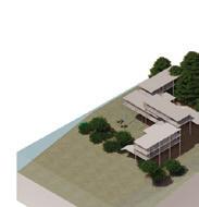
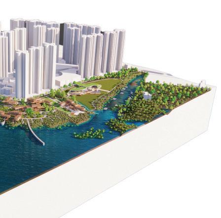
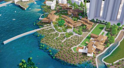
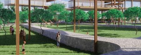
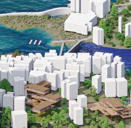
Amenity Space is a program that gets close to the sea and forest in stilt houses with a seaside area. The brown boxes are the new stilt house group, with different local materials such as Pontianak wood and granite, while also creating different levels and connections for these houses with wetland and landscaping. Also, the coast promenade is a bridge that enhances the relationship between the Wong Lung stream and Tung Chung Bay because those are outstanding water features with excellent water quality. It raises the biodiversity, human connection and urban neighbourhood between the village and the new town; it combines curved landscaping paving with forest and formal regular human living space.
Creating the ample open piazza space where people can rest, chat, picnic, and even play with the water on the grass between the land and sea, the new local restaurants like BBQ and organic vegetation farming between the forest and new stilt house group. People can sell local items like agricultural products and create a new hand-make workshop in the open space. Also, building the Village’s Exhibition Centre in the upper river to restore their historical things and collective memory, integrates into the community and promotes the forest city’s lifestyle to the public.
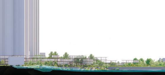
Ma Wan Chung Village Revitalization Proposal in Tung Chun – Section A-A’
New village extension: The Green Piazza with stilt house group(Exhibition / Village store / Open market / B&B), Preserve the rural character of Ma Wan Chung village.
stilt house designs replace dilapidated village houses
between the village and the New town.
Open space combined with houses and forest, people can get intouch with environment while also free human activies.
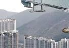
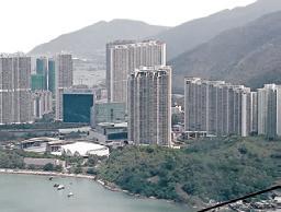
Green roof of the MTR station that the open public area creates the perfect view of Tung Chung Bay and Ma Wan Chung.
Tung Chung West Station (Left), Open Park and Wetland(Mid), Water Activities (Right).
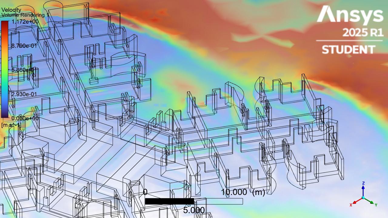
Building Wing Intervention with CFD Project 07
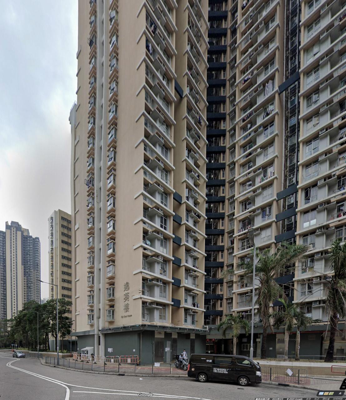
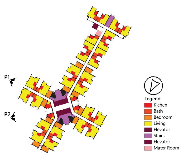
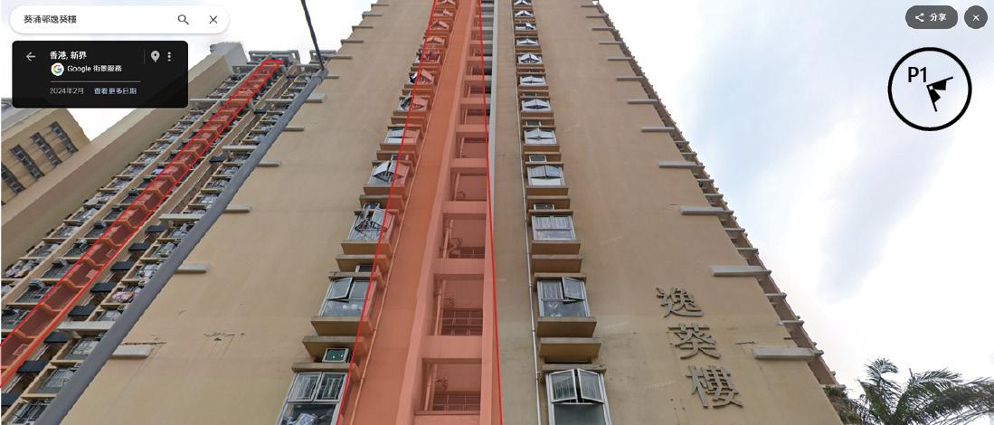
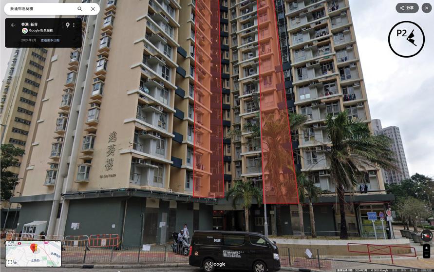
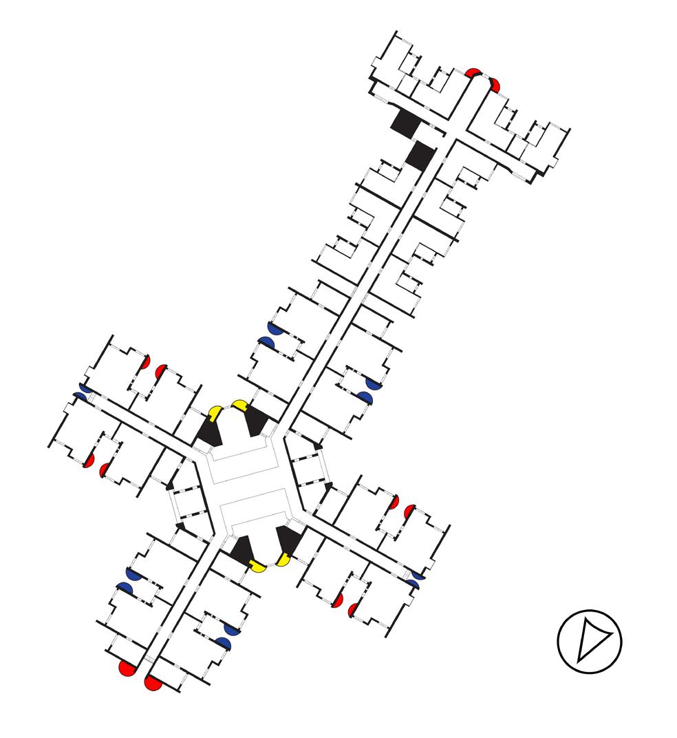
Study location: The first COVID-19 case in Hong Kong - Yay Kwai House, Kwai Chung.
Intro.
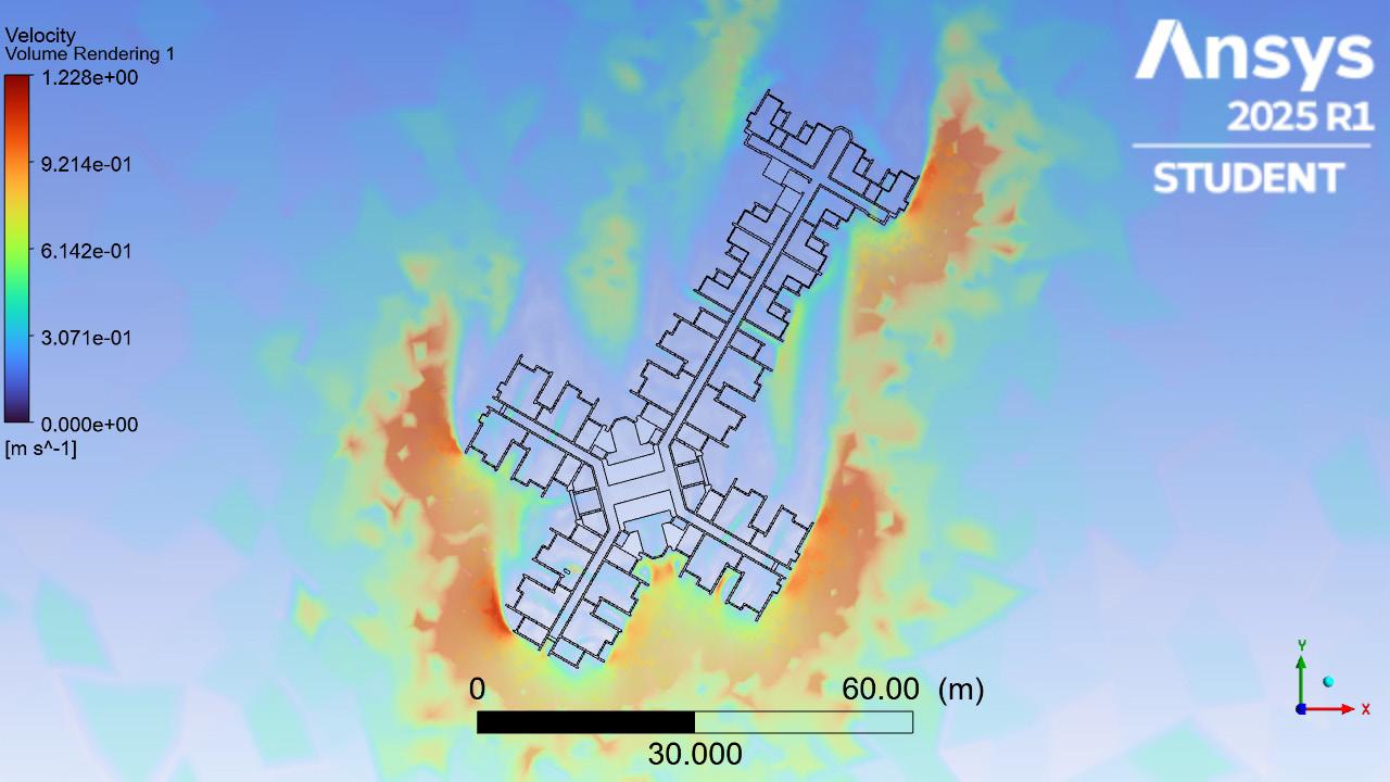
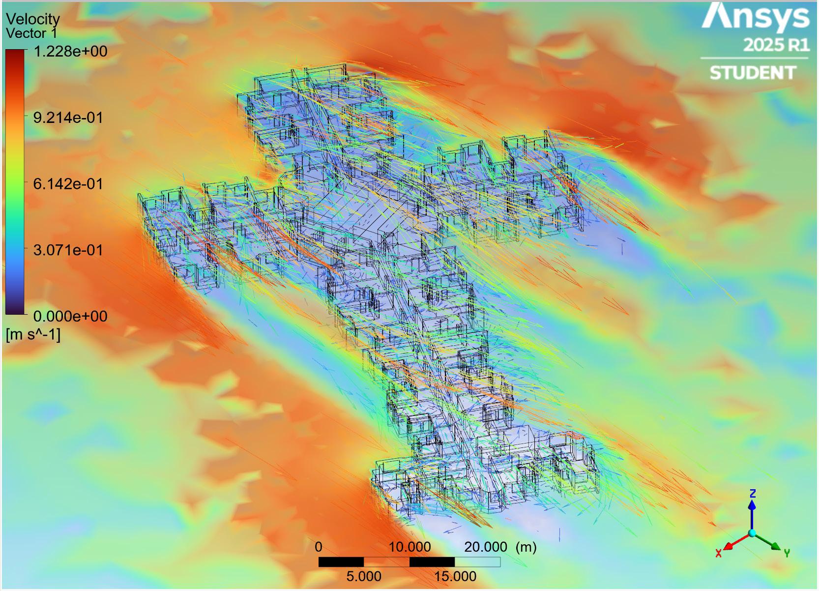
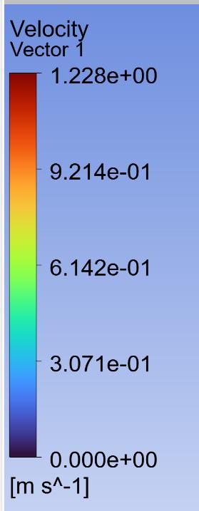
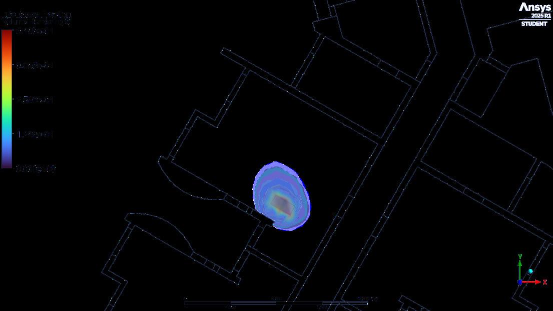
The project aims to through a series of airflow simulations (Air Arrow, Velocity, Pressure and Contamination) to identify a suitable location across the building for potential improvement* based on informed observation.
For the sake of this exercise, improvement is defined as:
- Maximising the infiltration of fresh uncontaminated air into all inhabitable units and spaces
- Maximising the expedient exfiltration of potentially contaminated air
- Minimising the flow of potentially contaminated air from one inhabitable space to another In this case, ‘fresh air’ is defined as air which has NOT yet passed through an inhabited unit. ‘Potentially contaminated air’ is defined as air which has passed through an inhabited unit.
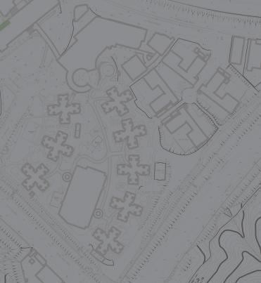
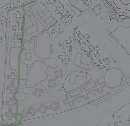
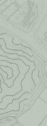
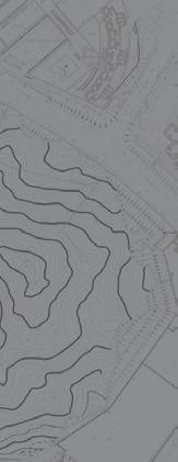
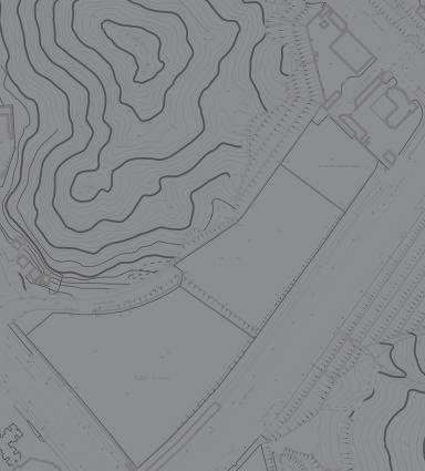
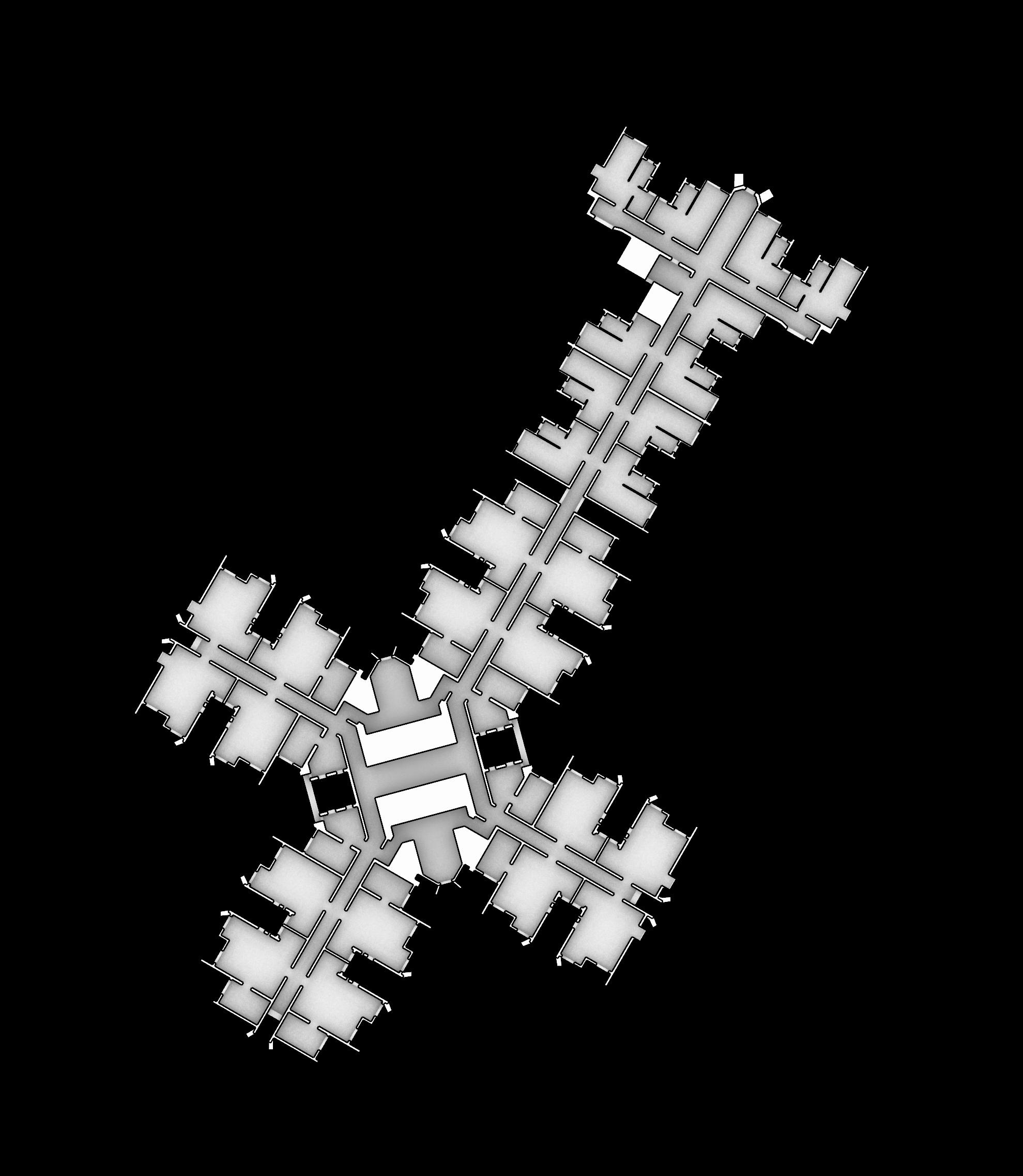
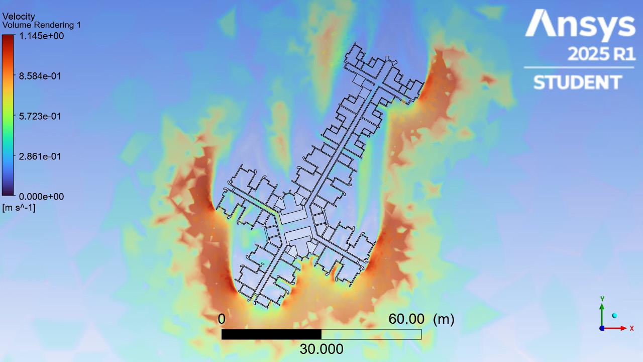
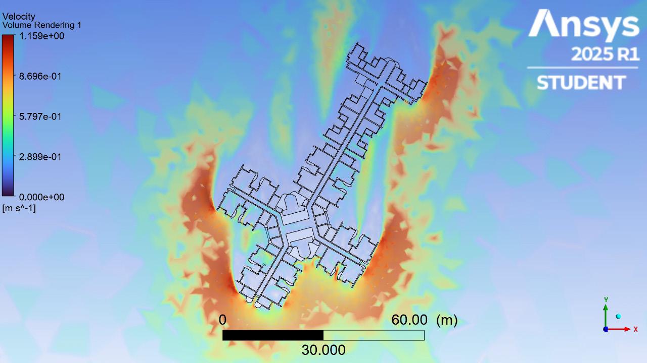
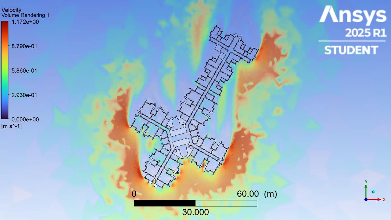
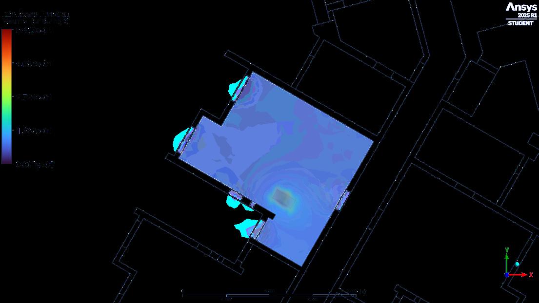
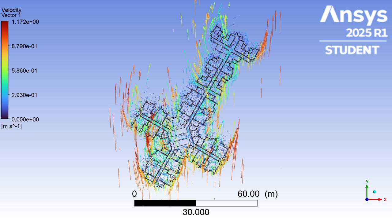
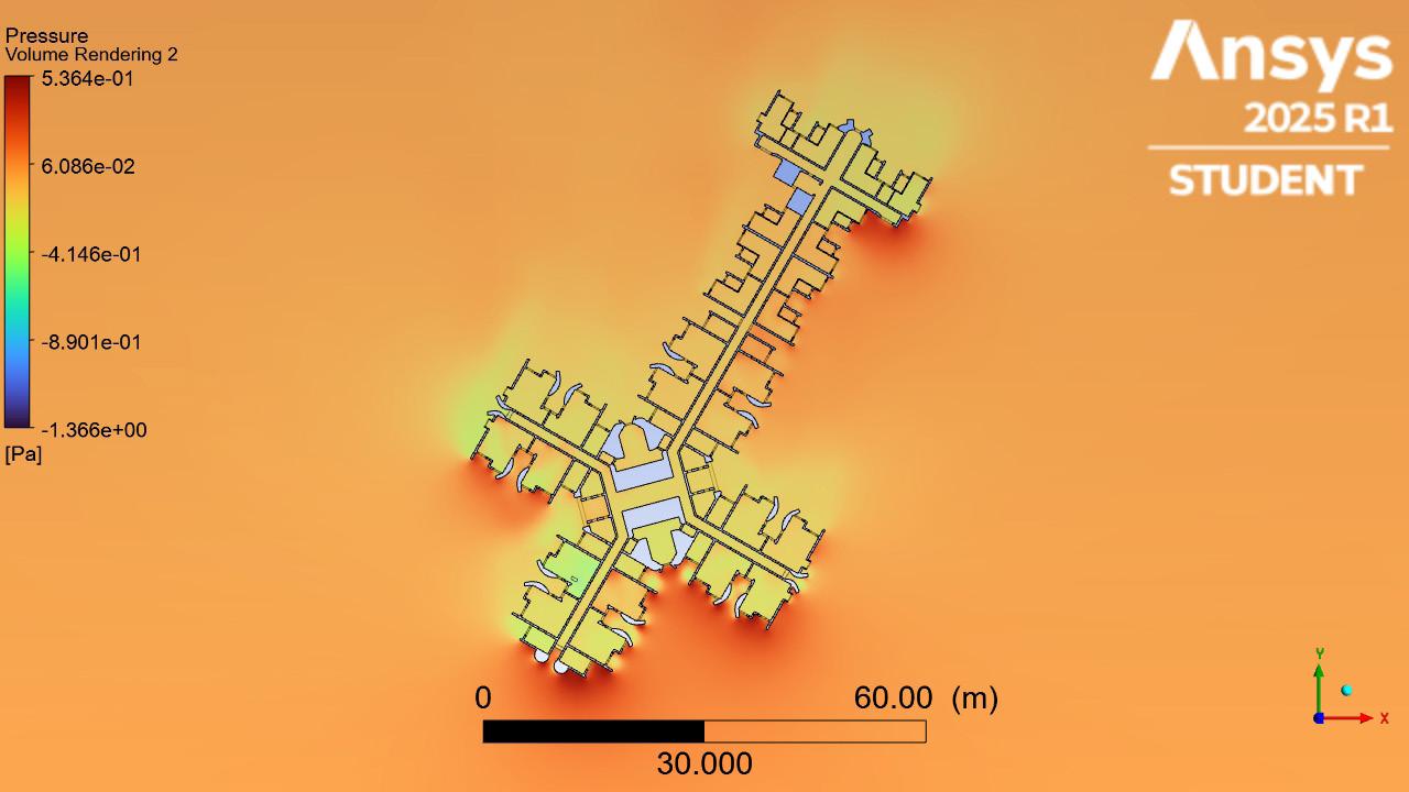
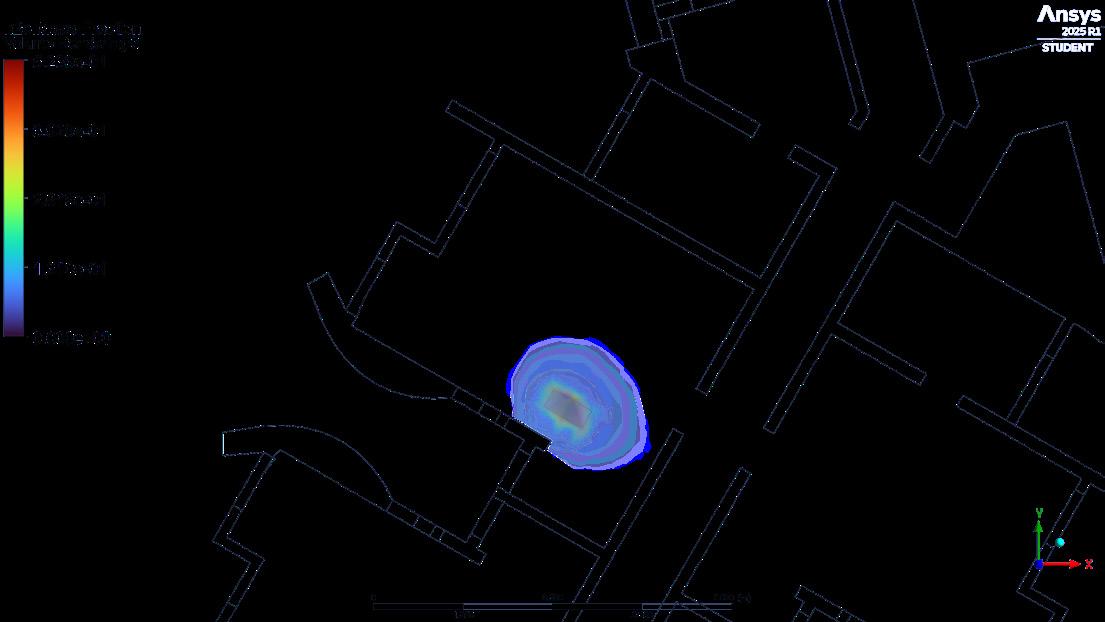
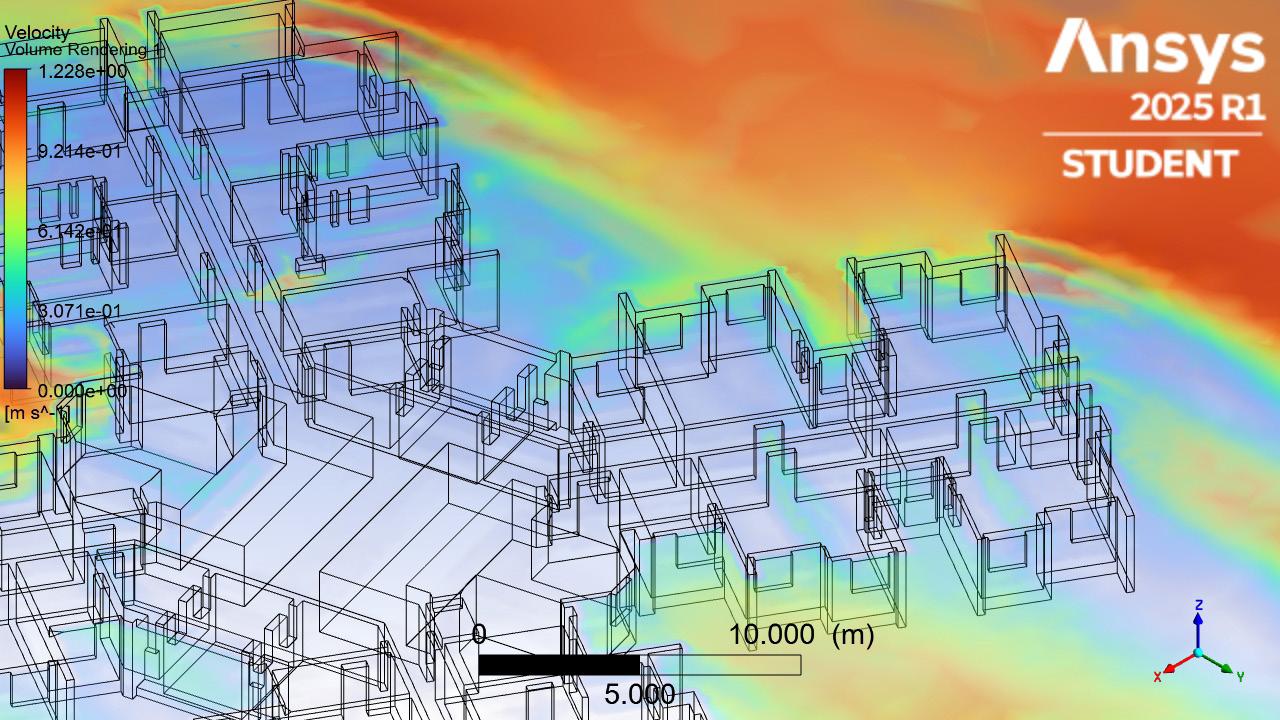
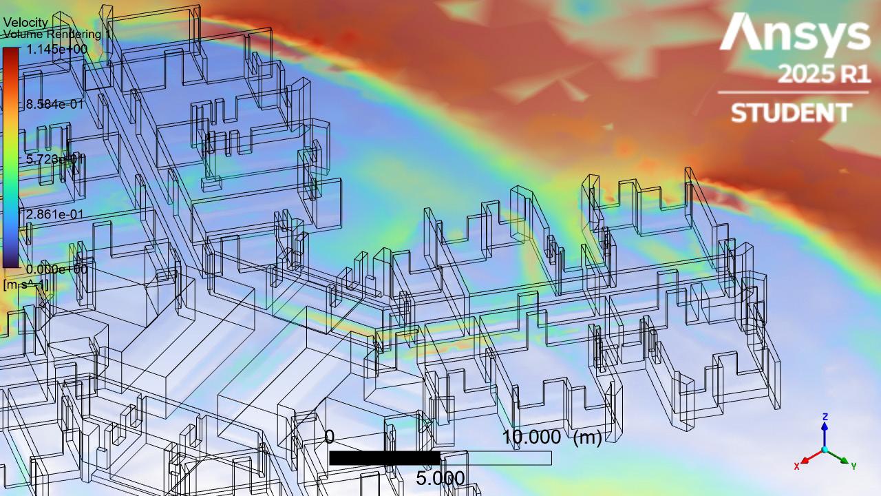
Several ventilation patterns of CFD simulation of Yat Kwai House
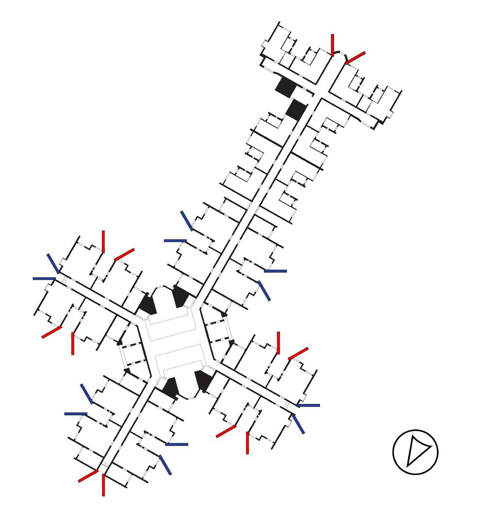
1. Strong perimeter velocity (orange/red zones) appears on the northeast and southwest edges, this airflow bypasses the building core, leaving inner corridors in a low-velocity, high-stagnation zone (light blue).
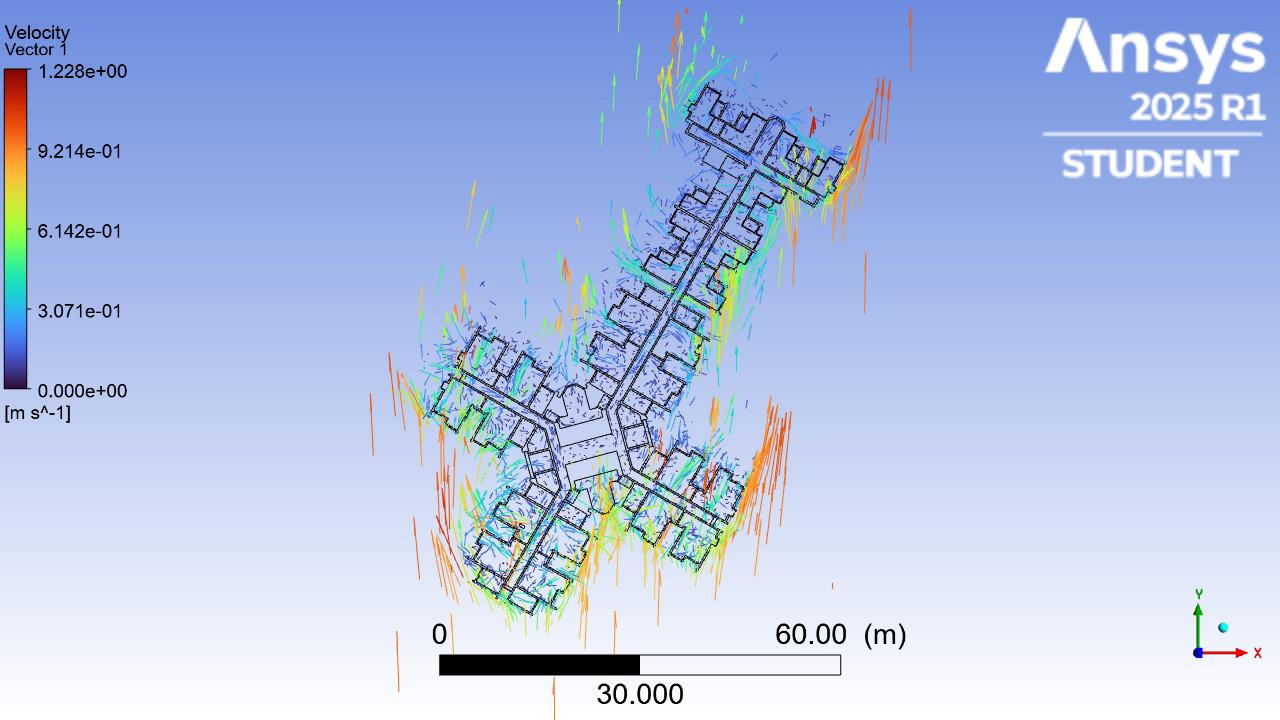
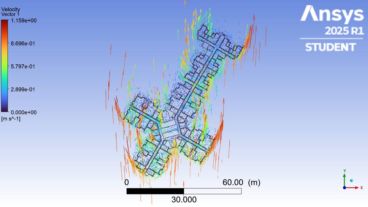
2. A weak penetration of air into the central intersections of the building, esp. at corridor junctions and unit thresholds. The air movement is diverted around the building arms rather than through them.
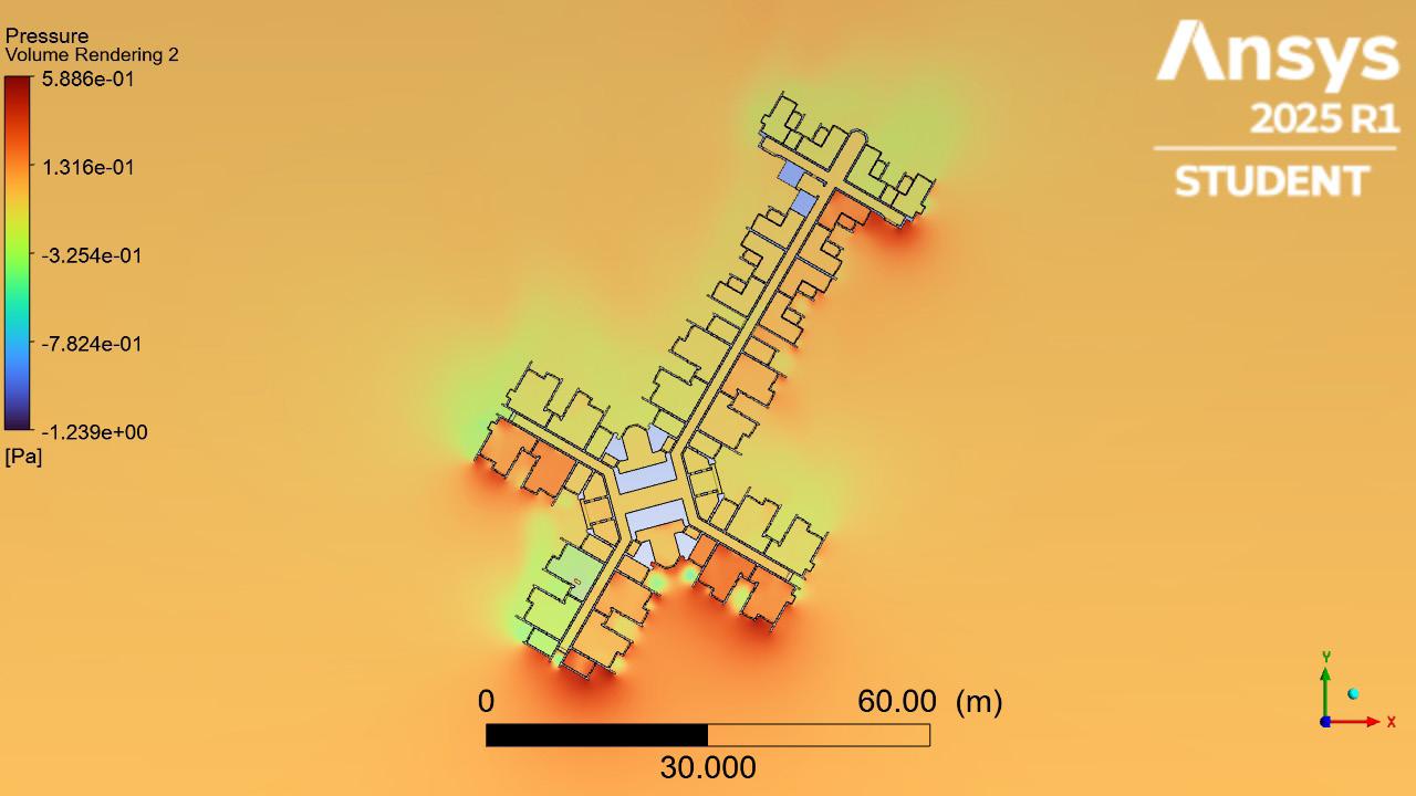
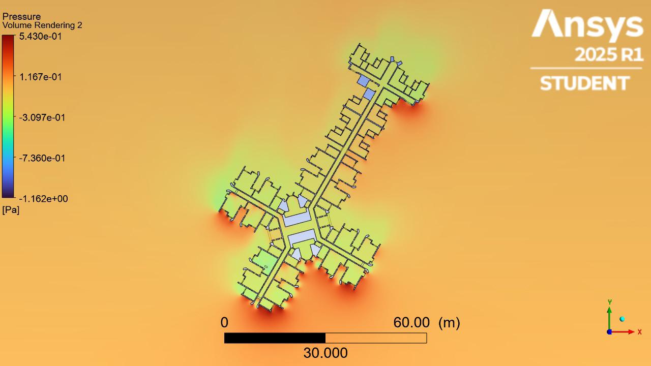
3. Pressure mapping confirms that the high-pressure builds along the outer façades, while the inner junction zones show negative or neutral pressure, limiting natural air draw into the building core.
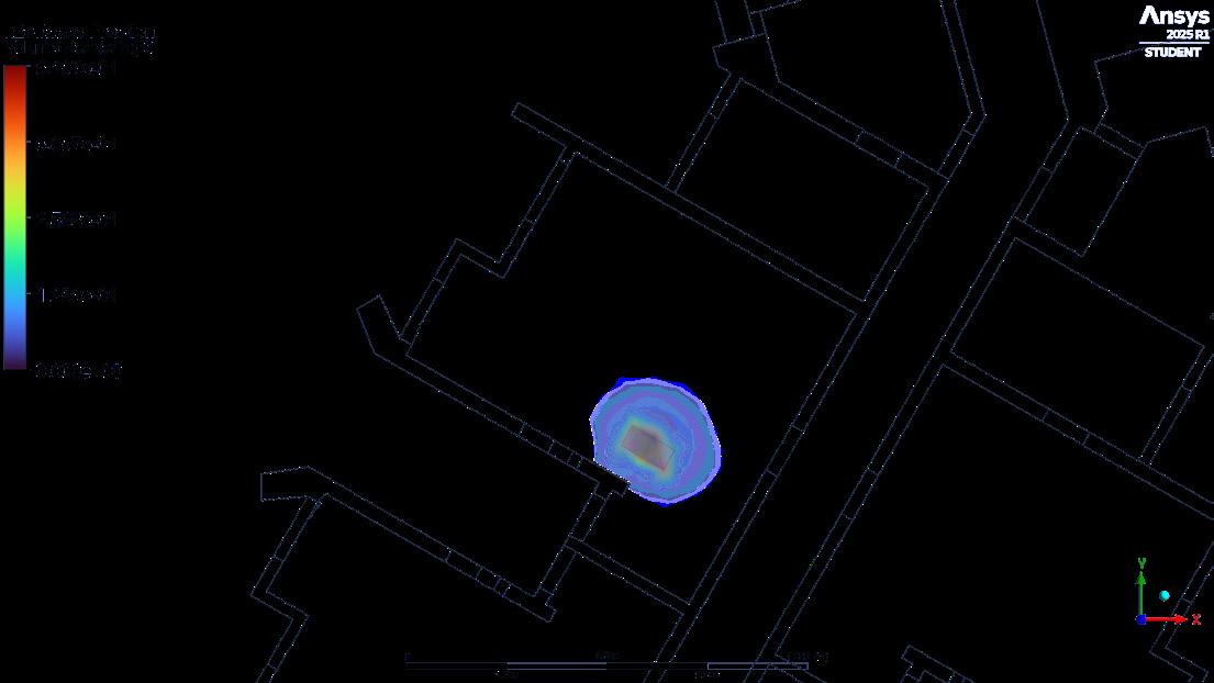
4. Contamination indicates that stagnant zones near the base and central spine have limited exfiltration; if without directed ventilation, these areas risk cross-contamination between adjacent units horizontally or vertical flow stacking.
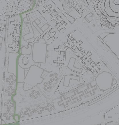
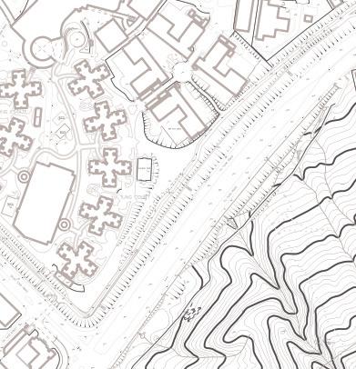
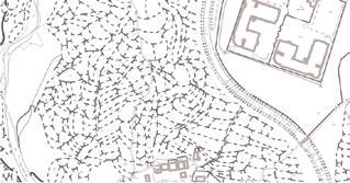
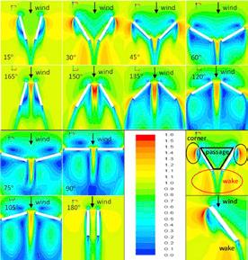
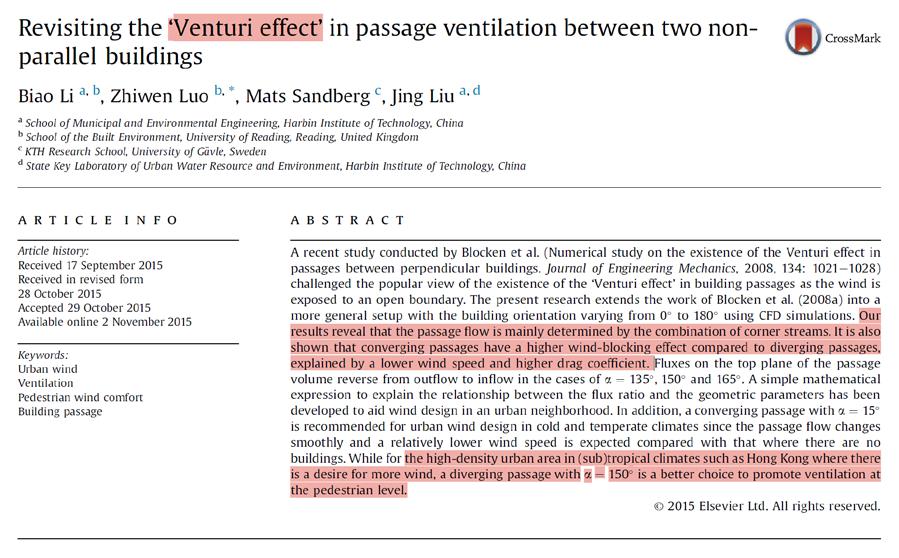
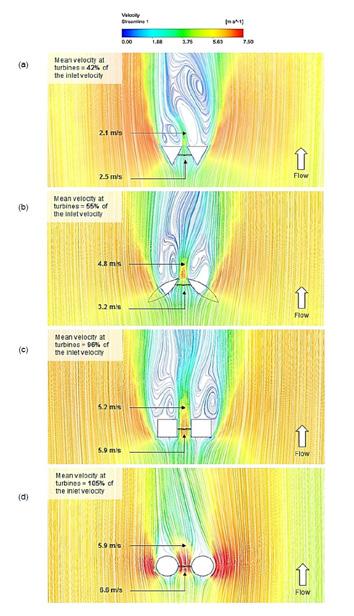
Based on the CFD velocity field analysis of Yat Kwai House, several critical airflow intervention spots have been identified, esp. around the recessed cross-shaped passages between building arms. These locations (marked in red and blue circles) exhibit potential for airflow acceleration due to converging building geometries and strong wind directionality, creating Venturi-like zones. The findings from Li et al. (2015), diverging angles between 120°–150° enhance pedestrian-level wind speeds through corner stream superposition and reduced drag. This principle will be adapted to introduce micro-architectural modifications or facade extensions that subtly constrict and direct airflow to stimulate a Venturi effect within specific cross-ventilation zones.
Besides, Chaudhry et al. (2014) demonstrates that circular morphologies or softened corners intensify wind flow through structural manipulation, providing a precedent for shaping built forms to enhance wind energy, and amplify fresh air delivery and pollutant removal, supporting healthier, passive airflow within dense housing typologies in subtropical climates like Hong Kong.
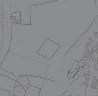
Image source: Feb2024. Google StreetMap.
Google Street Captures of relevant site details
Chaudhry, H. N., Calautit, J. K., & Hughes, B. R. (2014).
The rectangular configuration introduced angular inlet zones aligned with existing corridors, aiming to increase air draw-through using directional compression.
The circular design applied rounded, softened openings at key junctions to reduce drag and induce smoother airflow.
Combining both previous strategies, the hybrid layout introduced directional linear flow with embedded circular venting forms.
In both the Rectangular and Circular Configurations, interior pressure becomes more balanced compared to the existing setup — potentially improving passive airflow stability. In terms of velocity, all three designs improve wind penetration across the façade. However, in contamination control, none of the three alternatives show major improvement over one another — but all show clear reduction in indoor pollutant accumulation compared to the original configuration.
Performance:
• Greater Velocity Gradient: The circular configuration shows a slightly higher and more evenly distributed airflow velocity around the unit peripheries than the purely rectangular one, especially at the junction areas.
• Venturi Logic Amplification: The circular vents seem to better harness the Venturi effect at specific cruve angles, creating smoother transitions in air compression and decompression, thus enhancing airflow passage.
• Balanced Pressure Zones: The circular model creates more transitional pressure gradients across façade openings. It is subtle but helps avoid the abrupt stagnation zones present in the rectangular model.
> This suggests that while form and placement affect pressure and flow, other factors like internal layout, door gaps, and room sealing may play a stronger role in contamination dispersion — which my current simulations didn’t modify. So for now, I’m choosing the Circular Configuration as my final proposal. It balances performance with constructability, and spatially blends better into the existing structure without aggressive retrofitting.
Despite its limited performance, the design highlights the challenges of retrofitting passive ventilation in high-density housing. For tenants, the hybrid configuration module suggests a minimally invasive design that could offer improved thermal comfort. Moreover, it reveals the importance of addressing internal spatial typologies, not just façade openings, for policymakers and developers to create resilient and health-supportive buildings. Future development could include shaft retrofits, operable windows, or modular façade extensions to strengthen vertical and lateral airflow integration.
Circular Configuration
Existing Configuration
Rectangular Configuration
Hybird Configuration
Project 08
CASE STUDY: THE FORMATION OF A HETEROGENOUS ECOLOGICAL STATE
The Conflict and Friction Processes of Yunnan National Park Establishment
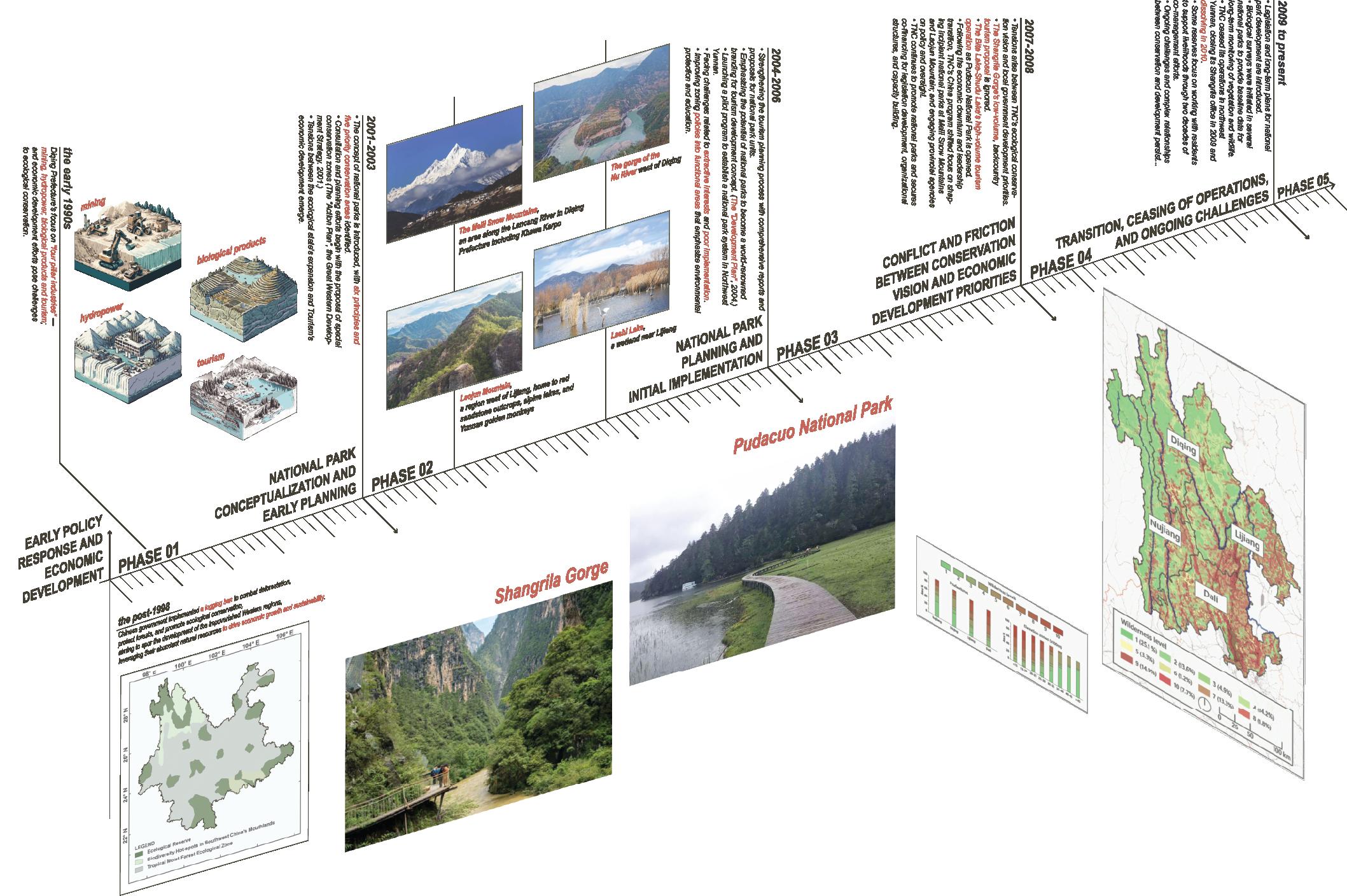
between the Nature Conservancy (TNC) and Chinese Government (PRC) Zinda, J. A. (2014). Making National Parks in Yunnan: Shift and struggles within the ecological state. In E. T. Yeh & C. R. Coggins (Eds.), Mapping Shangrila: Contested Landscapes in the Sino-Tibetan Borderlands (pp. 105–128). Seattle, WA: University of Washington Press.
Background
The reading of the research is Mapping Shangrila by John Aloysius Zinda, mainly focus on the chapter 4 - Shifts and Struggles within the Ecological State; the author explores the complexities of establishing National Parks in China, illustrates the conflicts and negotiations between the Nature Conservancy (TNC)’s conservation goals and local government’s development agenda, particularly in the context of eco-tourism and regional economic development.
The Nature Conservancy (TNC)
TNC is an environmental non-profit organization that focuses on conservation efforts worldwide. It aims to protect ecologically important lands and waters for nature and people. TNC has been active in China, promoting new models for conserving biodiverse landscapes and fostering the establishment of national
parks based on principles of effective conservation, community involvement, and sustainable tourism development.
Heterogeneous Ecological State
The concept of a heterogeneous ecological state refers to the multifaceted nature of ecological governance and management, where various stakeholders, including state agencies, non-governmental organizations (NGOs), local communities, and transnational conservation organizations, interact, sometimes contentiously. This interaction leads to the creation of protected areas that embody diverse interests, management practices, and conservation goals. The ecological state is not monolithic but consists of various actors with differing and sometimes competing visions for conservation and development.
The 1998 logging ban, a significant policy implemented by the Chinese government, was a crucial step in addressing deforestation and environmental issues. This ban led to the return of agricultural land to the forest, particularly in the Western regions characterized by poverty but rich in natural resources. This shift in land use became the foundation for the local government’s idea of developing eco-tourism and the TNC’s vision of Ecological Stage formation.
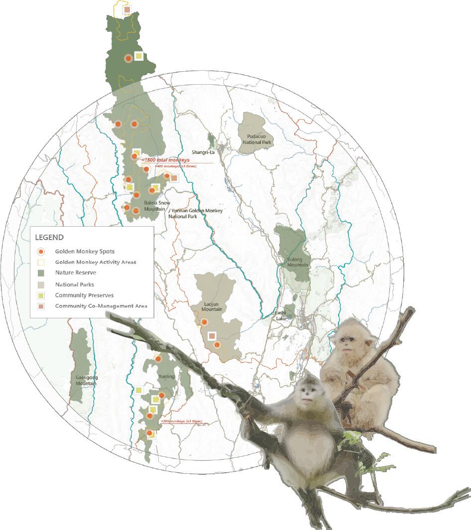
The Ecological Stage, which is part of the state-making process, uses ecology to legitimize specific actions for resource management—by framing the six principles for the national park formation from TNC, the Yunnan Golden Monkey National Park, which is a successful cooperation action that saves several endangered species like the Golden Monkey, planted 50 acres of new forest habitat for the monkey, which is tripled the number of monkeys in Yunnan. They also help the local government to enable legislation, hold the participation of multiple stakeholders, and facilitate community coordination and benefit sharing to enhance the ecological habitat and the local communities’ living and shaping of their lifestyle.
However, despite some successful cases, TNC also presents challenges and conflicts that governments must negotiate and deal with when they try to establish national parks that follow the TNC model and practice in China. Nowadays, even TNC action was end in Yunnan, the national parks establishment delicate balance demonstrates the ongoing negotiation between biodiversity and sustainable livelihoods within the evolving landscape.
// Rhinopithecus bieti
TNC's Actions
TNC planted 50 acres of new forest habitat in the monkey area by tracking monkeys with GIS technology and GPS collars, developing an innovative widerange conservation plan patrolling the forests where monkeys live to help establish the larger Mountain National Park and teaching local people about the value of the monkey and its forest habitat installed alternative energy units in homes and schools in 420 villages that caused the locals less likely to need to chop down forests or poach monkeys for living.
The Concept of Six Principles
1. IUCN Guidelines systematic management according to International Union for Conservation of Nature (IUCN) guidelines.
2. Enabling Legislation a segment detailing the legal framework that establishes and supports each national park's existence and governance.
3. Stakeholder Participation the inclusion of various groups in the park's decisionmaking process, such as local communities, conservationists, and government entities.
4. Community Coordination and Benefit Sharing coordination and benefit sharing with nearby communities, urban centres, and protected areas.
5. Operational Separation Separation of park oversight and business operations.
6. Unified Management Agency a representation of the centralised authority overseeing park operations, ensuring a cohesive management strategy.
Yunnan. 1 May 2022.
Yunnan Golden Monkey National Park
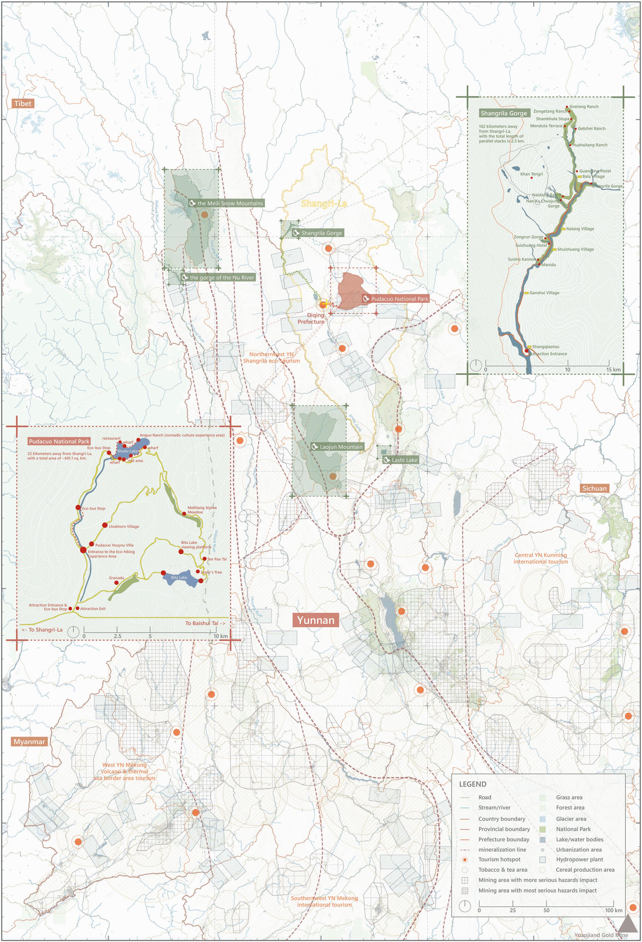
Shangrila Gorge
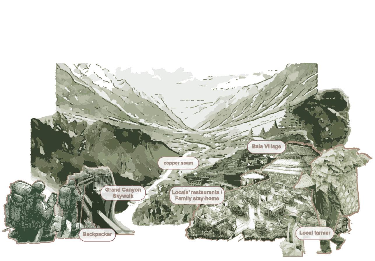
Shangrila Gorge, the TNC vision of a low-volume, backcountry tourism model for smaller backpackers seeking an immersive natural experience, focuses more on preserving the area's ecological integrity and cultural heritage. This model allows visitors to navigate the landscape and slowly engage deeply with the environment. Even though there are no exact figures or detailed financial information, based on the overall Diqing tourism statistics, it likely will be one-third of Pudacuo National Park. Also, because of the low volume case, it doesn't even need a paved road, and the visitors can walk freely. They can choose a homestay style or the local community's house, and the local community can guide them. The villagers can generate income through that and will be more like a part of the" ecological state"."
Pudacuo National Park
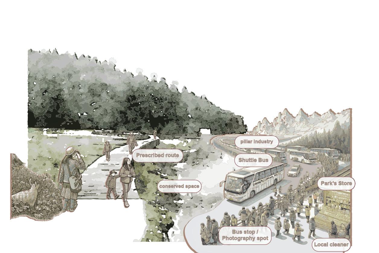
Pudacuo National Park, which the government proposed and built up with the "Shangrilzation" branding, is a commercial success. It prioritises accessibility and efficiency of the national park site selection, which relies on the existing infrastructure base. The park attracted thousands of tourists with its daily cycle route, selling 1.3 million tickets and generating ~236 million in revenue between 2006 and 2008. The government aims to put as many people as possible into a large shuttle bus, allowing tourists to navigate the park on a defined pathway. However, most of the locals have been hired as cleaners and shopkeepers to sell souvenirs or other stuff; locals are not being hired as guides and are not engaging as part of the incomegenerating mechanism because the government or other related organisations have exclusively occupied the resources.
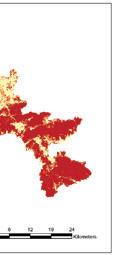
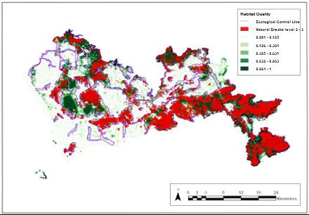
Advanced Topics in Landscape and Urban Research Methods: Natural Breaks Classification in Habitat Quality Mapping
Intro.
The project aims to evaluate Luo’s use of Natural Break Classes (2/5) as ecological sources, compare alternative class thresholds (2/4) and (2/3), integrate habitat quality and degradation outputs, and analyze the trade-offs between precision and inclusiveness in ecological source identification.
The Components of Luo’s Methodology:
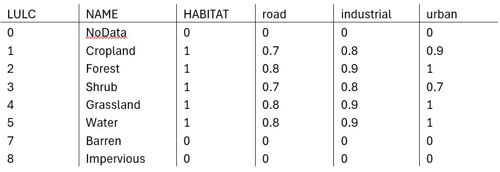
A01. Data Inputs (Land-use and ecological datasets):
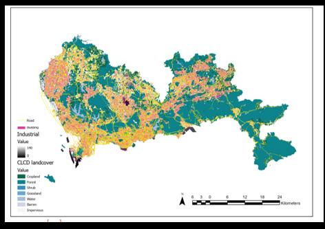
(1) Land use information: Shenzhen land-change survey data for 2015.
The land-use status classification (GB/T 21010e2007) divided the land into 9 types according to research needs: cultivated land, forest, grassland, orchards, water bodies, main roads, industrial and mining land, railways, and other construction land.
(2) The ECL boundary was downloaded from the Shenzhen Urban Planning Commission (http://www.sz.gov.cn/cn/hdjl/zjdc/201105/ t20110524_1660544.htm) and was transformed into a vector format.
(3) Digital elevation mapping (DEM) data were derived from geospatial data (http://www. gscloud.cn/) and had a 30 m resolution.
(4) Meteorological data were based on daily observation data from 54 meteorological observation points in the city and were provided by the Shenzhen Meteorological Bureau (http:// weather.sz.gov.cn/).
(5) Soil-related data were obtained from the World Soil Database (http://www.fao.org/soilsportal/soil-survey/soil-maps-and-databases/ harmonized-world-soil-database-v12/en/).
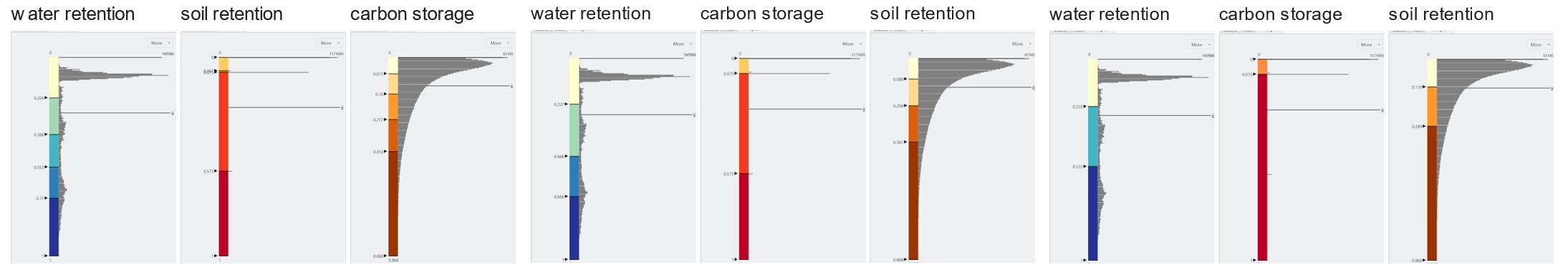
A02. Identification of Ecological Sources: Selected three key services as indicators of ecological importance:
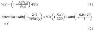
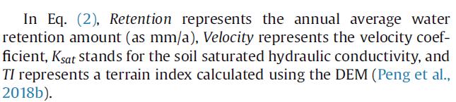
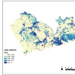
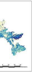
Water Retention: Areas that regulate hydrological processes.
> Quantification using the InVEST model estimates the amount of water, taking into account factors such as topography, soil and flow rate, and then adjusts it for water retention.
> Calculated using hydrological models that consider precipitation, infiltration, and surface runoff.
Identifies regions important for regulating water cycles (e.g., watersheds, forests).
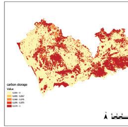
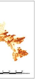
Carbon Storage: Areas with significant carbon sequestration potential.
Using the InVEST carbon storage module, Shenzhen’s carbon storage services were spatially simulated using data on land use classification, above-ground biomass, below-ground biomass, and soil and dead organic matter carbon density in the study area.
> Quantified using models like RUSLE to estimate soil erosion potential.
> Important areas: regions with high vegetation cover and steep slopes prone to erosion.
^ Sensitivity Table: Assigned habitat suitability scores to land-cover types based on their ecological importance.
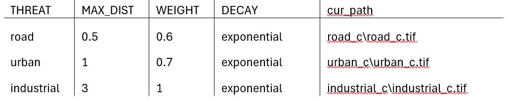
^ Threat Table: Defined spatial impacts of anthropogenic threats (e.g., roads, urban areas), including their maximum distance of influence and decay functions.
Natural Breaks Classification
The Natural Breaks method was applied to the composite ecosystem service index, categorising the values into distinct groups:
> 5 Classes (Luo et al.’s method): Classes 4–5 were selected as ecological sources, representing the top 40% of values.
> 4 Classes: Classes 3–4 were selected as ecological sources, covering the top 50% of values.
> 3 Classes: Classes 2–3 were selected as ecological sources, expanding the threshold to the top 67% values.
Each Classification was tested for its ecological representation by overlaying the selected ecological sources with Habitat Quality and Cumulative Habitat Degradation maps.
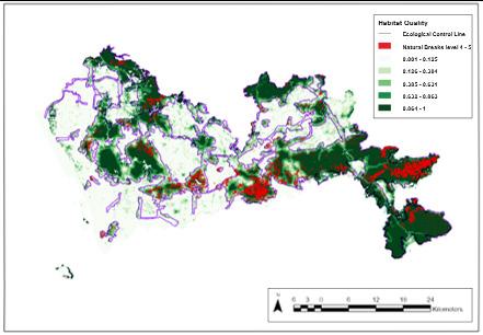
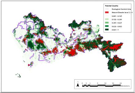
Ecological Sources and Spatial Coverage Across Classifications
5-Class Classification limited to high-value, pristine habitats, primarily concentrated in forested areas and regions with low urban influence. Overlay with Habitat Quality significantly overlapped with high-quality habitats (values > 0.8). However, this approach excluded many transitional or moderately valued areas, potentially limiting connectivity.
Evaluation
The results highlight the strengths and weaknesses of the Natural Breaks method for classifying ecological sources. While it is statistically sound and computationally straightforward, its reliance on data-driven thresholds leads to several challenges:
Sensitivity to Class Count
> Changing the number of classes alters the identified sources’ spatial extent and ecological coherence.
> The 5-class approach prioritises high-value habitats but excludes transitional zones crucial for connectivity.
> Conversely, the 3-class approach includes broader areas but risks diluting ecological priorities by incorporating degraded regions. Lack of Ecological Grounding
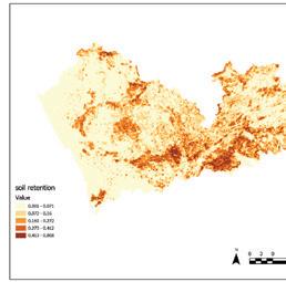
Soil Retention: Regions important for erosion control.
Using the modified soil erosion equation (4), A denotes the soil conservation service; R denotes the rainfall erosivity; K denotes the soil erodibility, based on the mass percentage of sand, silt, clay and organic carbon; and LS, C and P denote the terrain factor, crop management factor and erosion control method factor, respectively.
> Derived from vegetation and land-cover datasets (e.g., forest biomass data).
> Prioritizes areas with dense vegetation (e.g., forests, mangroves).
Result:
Summing the 3 ecosystem services and divided into 5 classes using a natural break method. *Areas in the 4 and 5 classes were considered “ecological sources”.
Overlay Analysis
Habitat Quality: To assess the alignment of ecological sources with high-quality habitats.
The overlays were analysed to compare spatial extent, ecological coherence, and connectivity across classification:
> Does expanding the classification threshold (e.g., from Class 4–5 to Class 3–4) enhance connectivity and inclusiveness?
> Do broader classifications risk including degraded or less functional areas?
4-Class Classification expanding coverage beyond pristine habitats to include areas with slightly lower ecosystem service values. Overlay with Habitat Quality showed improved inclusiveness, capturing additional patches of moderately high-quality habitats (values between 0.6 - 0.8).
3-Class Classification identified large transitional zones, buffer areas, and some degraded regions. Overlay with Cumulative Habitat Degradation revealed significant inclusion of degraded areas (values > 0.5), raising concerns about ecological functionality.
> The method assumes statistical breakpoints align with ecological processes, which may not always hold. For example, Classes 4–5 thresholds may omit areas with moderate ecosystem service values that are functionally significant.
> Field-based ecological thresholds or expert input strengthen the method’s ecological relevance.
Implications for Connectivity
> Narrow classifications (e.g., five classes) focus on pristine habitats but lead to fragmentation, limiting their effectiveness for maintaining connectivity.
> Broader classifications (e.g., three classes) improve connectivity by including stepping stones and transitional zones but risk prioritising degraded or less functional areas.
Trade-offs Across Classifications
> 5-Class Classification
Strengths: Identifies pristine, high-value habitats; aligns well with Habitat Quality outputs. Weaknesses: Excludes areas with restoration potential; limited spatial coverage.
> 4-Class Classification
Strengths: Balances inclusiveness and precision; enhances connectivity by including moderate-value habitats.
Weaknesses: Overlaps with some degraded areas; requires validation to avoid prioritising marginal habitats.
> 3-Class Classification
Strengths: Maximises inclusiveness and connectivity; captures transitional and buffer zones. Weaknesses: Risks diluting focus on high-value areas; significant inclusion of degraded habitats.
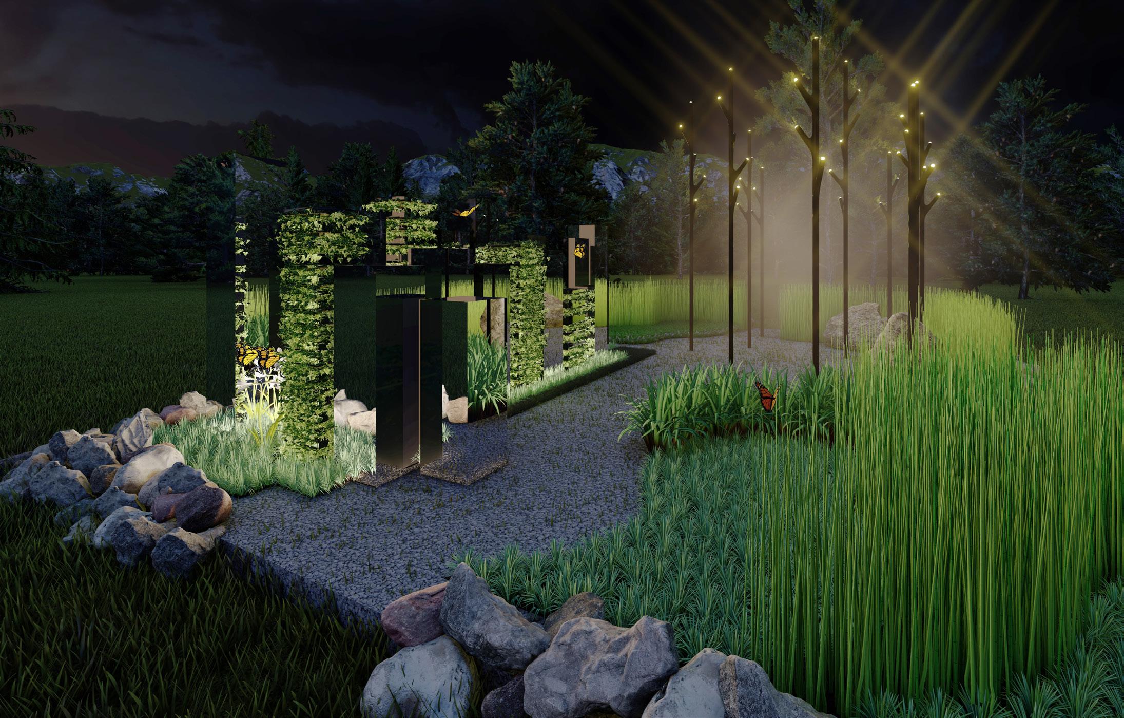
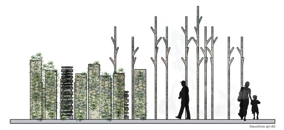
FOREST MEDITATION Project 10
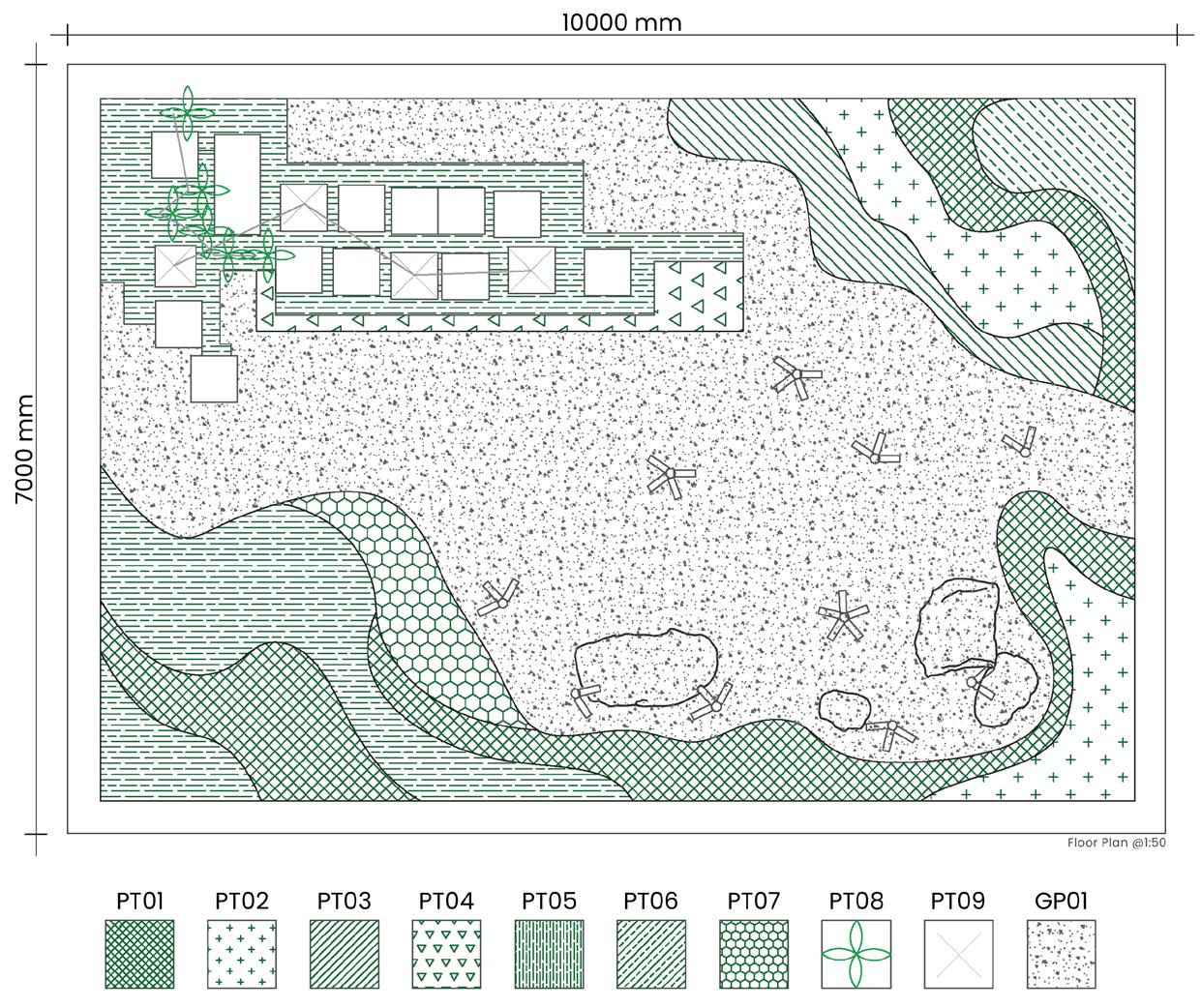
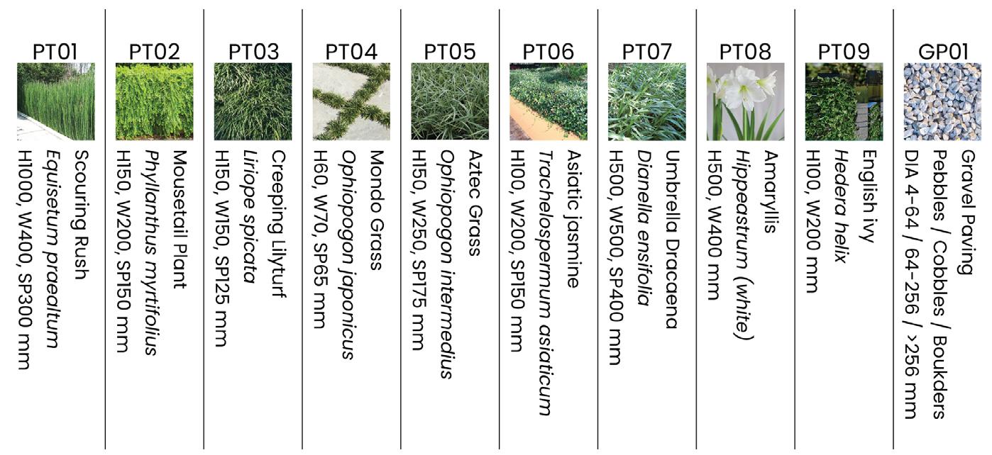
Fairy Lake Botanical Garden, Shenzhen Flower Show Competition
This project is hoped that the slender lines will be emphasized and that the interlocking groups of plants of varying thickness will be used to enhance the effect of the mirrors, highlighting the wonders of the mountains and forests. Whether you are sitting on a stone chair or watching the reflection of the plants in the mirror, these elements create a sense of privacy and provide a space for the viewer - to explore the plants through a peaceful and permeable hierarchy and a space for the mind to settle.
The planting is simple and plain to bring out a peaceful atmosphere and emphasize the effect of the building and the lamp posts. The colour palette is dominated by green, with different shades creating a soft variation.
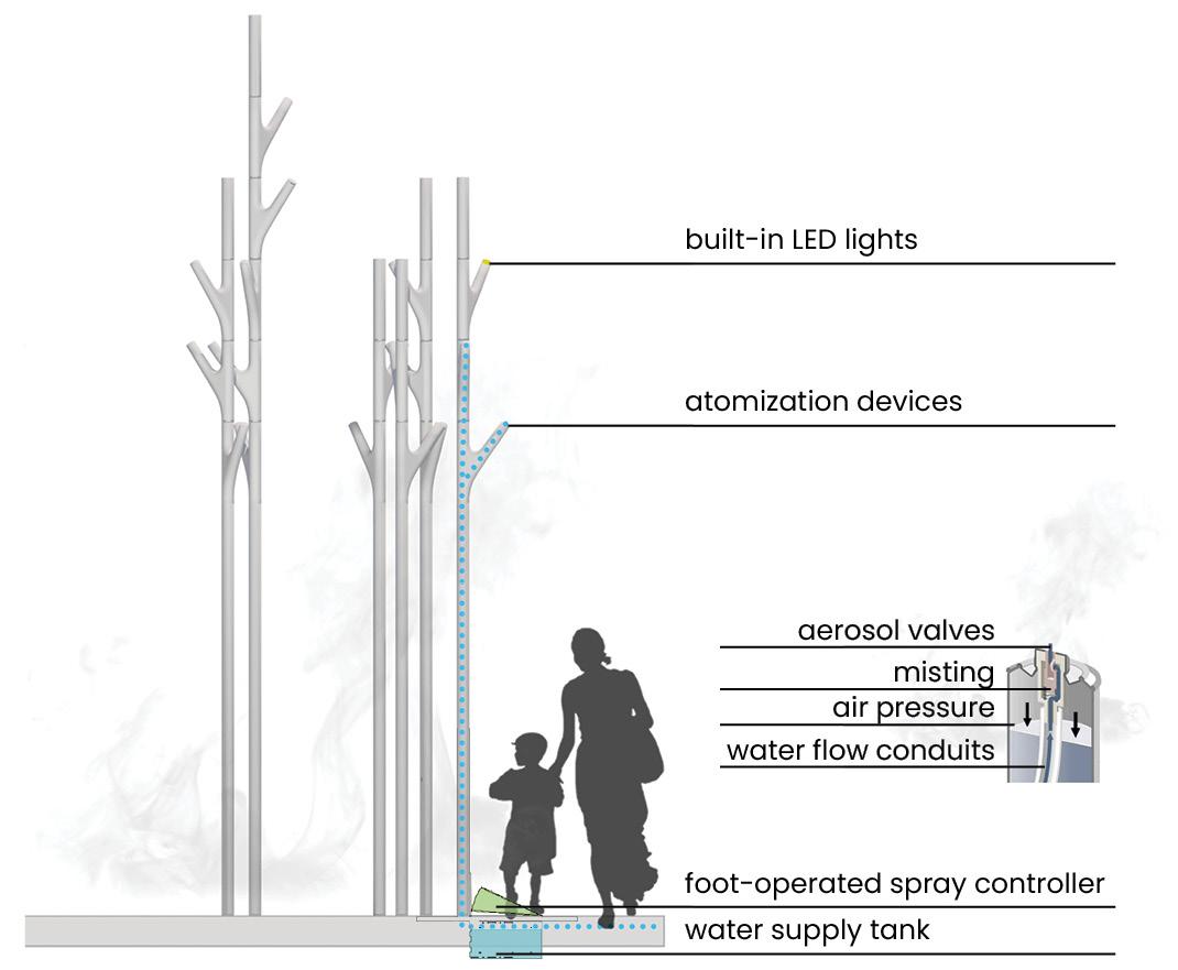
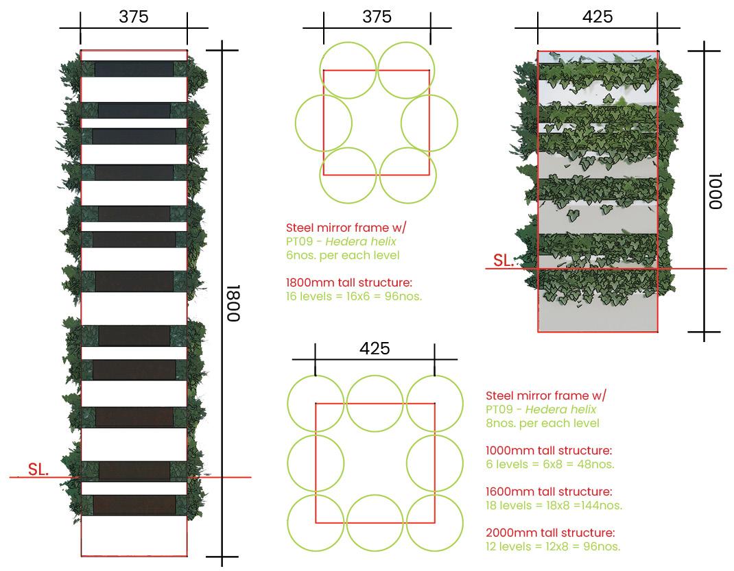
The built-in atomization principle design
“The alternation of ‘day’ and ‘night’ is the change of nature, the blending of light and shadow, and creating the flowers in a mirror and the moon reflected in the lake’s mood.
The Steel Mirror County basin frame design
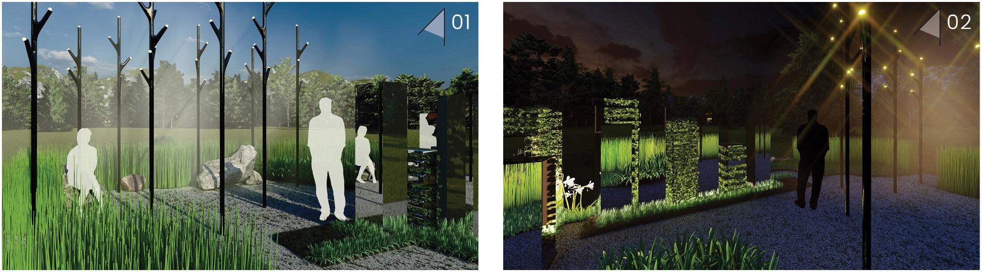
A meditation forest is a place for the soul to return, contemplate, and reflect. The mind always needs to be relaxed and irrigated when indulging in the hustle and bustle of urban life. If the mind wavers, it is vague, like a candle wavering in the wind. The purpose of the meditation forest is to allow the viewer to go deeper into the space, express themselves and relax, calm their mind and give themselves more time to appreciate the details of life.
Walking through the silent “Steel Mirror County” space, the mirror’s surface reflected the green forest behind it, which is more extensive and colourful than the one in front. People will be attracted by its imposing appearance and stay; it is another way of life, full of poetry, with the moon shining on the flowers.
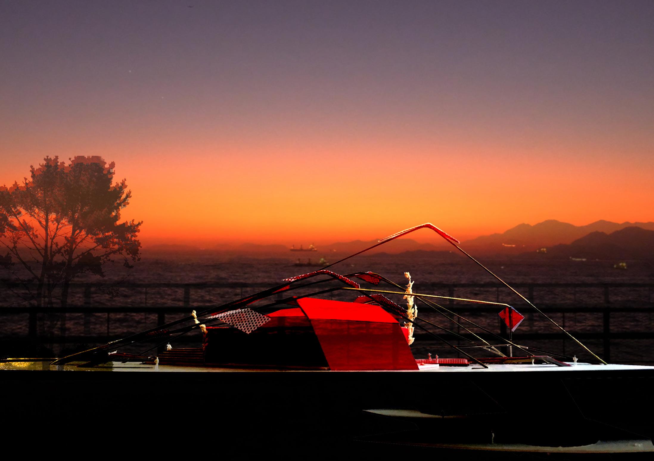
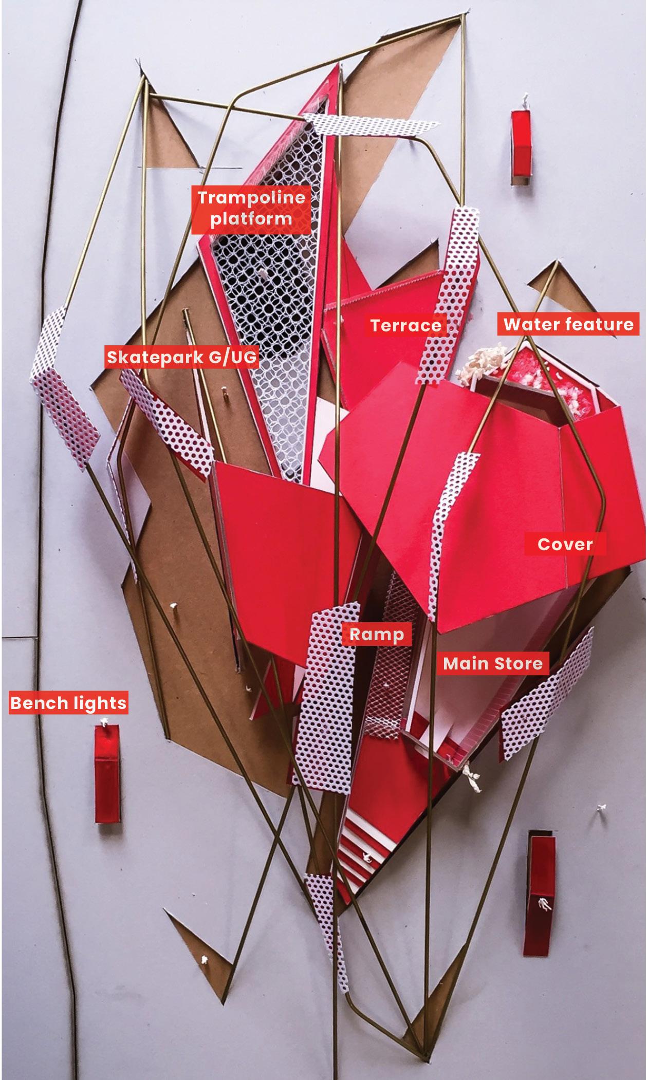
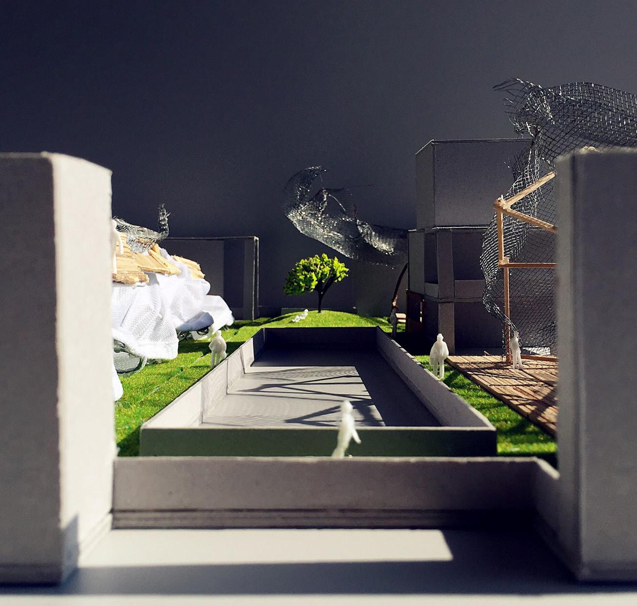
BOMBER Project 11
Supreme Store - Conceptual Landscape Architecture
Every brand has a story of its own, leading to success and identity development. Such spirit and attitude can usually be found through the design of its space. An ideal branded space is about knowing what freedoms the customers crave, what freedoms the offerings will deliver, and giving customers a measured taste up front. These are what Hong Kong’s younger generation longs for - The new development and lifestyle with new energy and collision.
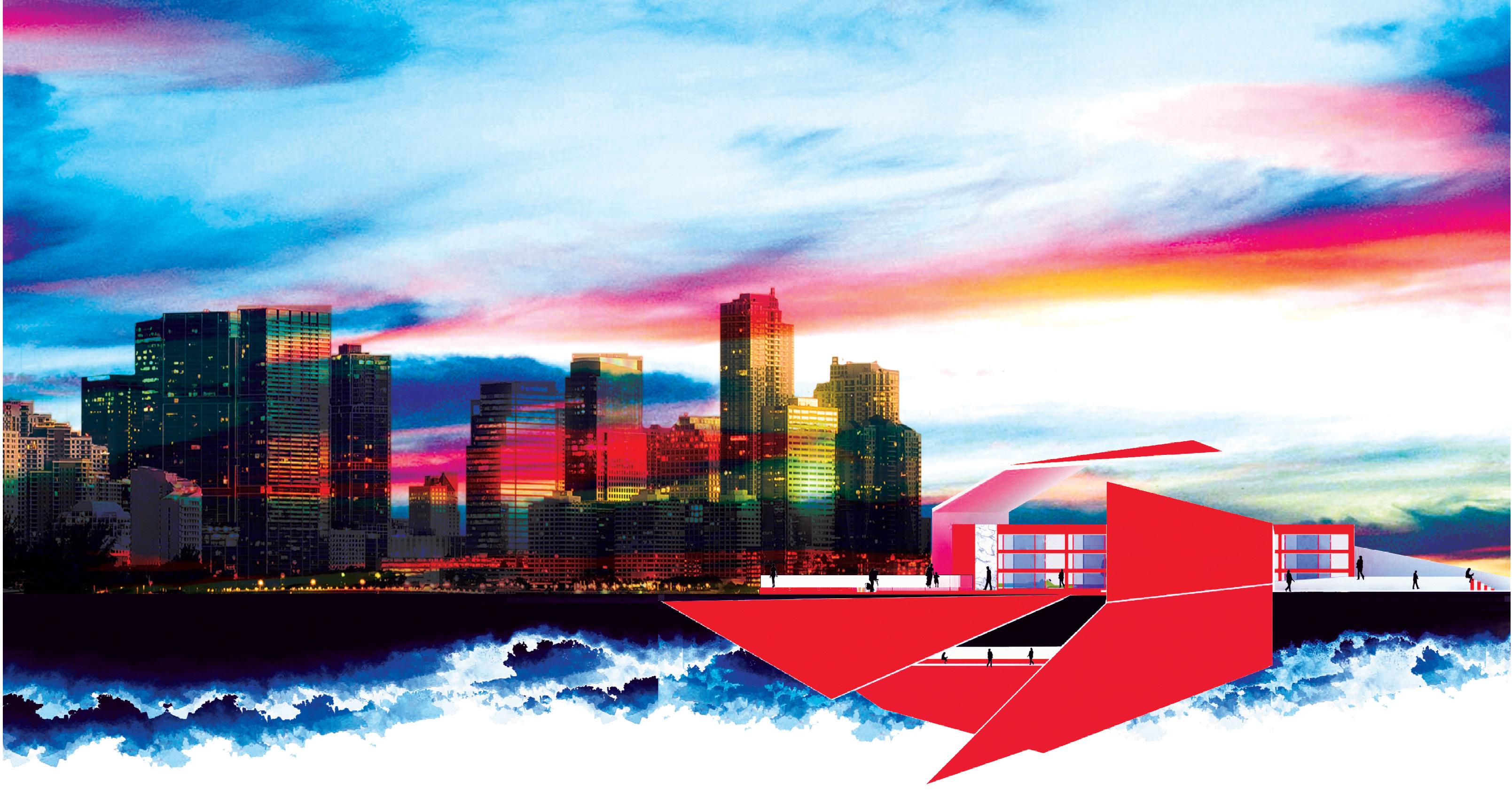
‘BOMBER’, it means exploding and melting traditional and young cultures together, creating contrasts and keeping the traditions. It looks like a big shining ruin sitting on the seaside, marking a new sea level on the canvas.
Hong Kong was a melting pot of people, places, and things that could live together in chaotic harmony. However, with the city’s rapid growth in a stable and safe environment, its culture and attitude are slowly disappearing...
A brand is abstract; like people, there is a unique personality, like friendly, cordial, trustworthy, and intelligent characteristics. It carries an assurance about the characteristics that make the product or service unique. It is an accumulation of emotional and functional associations, a promise that the product will perform as per the customer’s expectations. It shapes customers’ expectations about the product through the store to share the best things with the customer, a kind of friendship.
Supreme is a skateboarding shop/clothing brand established in New York City in April 1994. The brand caters to the skateboarding, hip-hop and punk rock cultures and the youth. They make clothes and accessories but also manufacture skateboards that are collected like modern art.
It has amassed a following of disciples, collectors, and skateboarders, even haters. One thing they all have in common is an endless thirst for anything with a box logo. Also, with that ridiculous demand comes stories, myths, legends, and rumours surrounding the brand’s history.
Design Thinking
Coping with the culture and attitude of Supreme, the store is expected to be big, shining and eye-catching at Sai Wan’s seaside. The design keywords are revolutionary, innovative, astonishing, attractive, and sporty.
“BOMBER” means exploding and melting traditional and young cultures together, creating contrasts and keeping the traditions. It looks like a big shining ruin sitting on the seaside, marking a new sea level on the canvas.
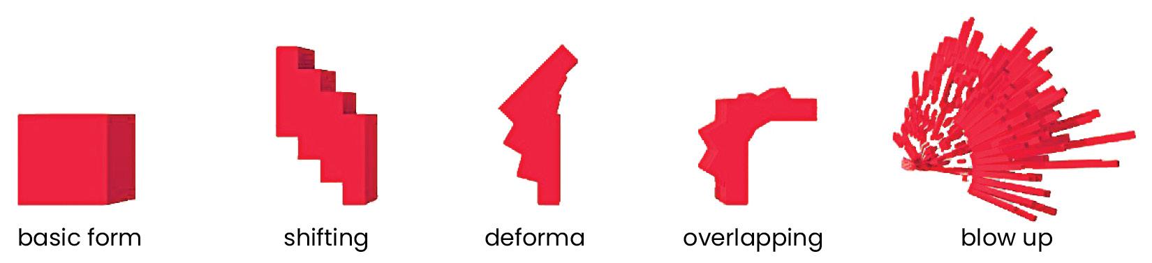
It is like a big bombing plane, bombing the seaside with its forefront attitude and culture - the origin of this space design: with all the exploded parts dispersed on one side, leaving the potholes and fragments on the other. All the explored objects become part of the store with booming to form the architecture and landscaping. All the frameworks are straight or direct, which is a vital characteristic, without any curve of the building structure.
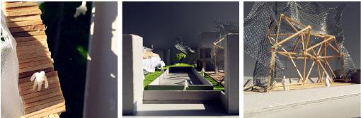
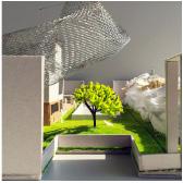
The main building shape is like an exploded box crushed on the sea level; the iron wires are the structure lines for architecture and landscaping; the fragments become the cover for the main store while blocking some of the hottest sunlight. Moreover, the white model is the main building, a semi-open building that becomes part of the outdoor landscape. Bring people the tremendous visual shock, and allow them to sit, skate in here, and explore more inside the store.
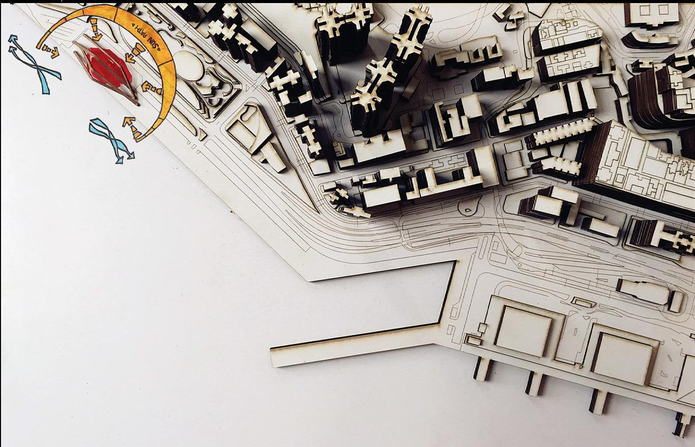
The outdoor spaces are designed as semi-spaces that according to the exploded fragments, scattered towards the beach promenade. The people’s movement will connect with the outside space since the flat exploded - it makes the site’s level have different layers, and visitors will feel strongly about the non-horizontal line. Also, all the areas are linked with various ramps, and the circulation is the circular line between different layers. It encourages the users to skate around the whole site to experience a different corner.
The indoor space - Supreme store, applies the remaining exploded container (Sai Wan used to be a container loading bay) lying on the ground forms the store space. It is positioned according to the fragment shapes of an exploded container where a part of it is embedded in the ground providing additional space at the basement level.
Conceptual model - The process and movement for the explosion & the outside fragments. Conceptual model - The main building space zoning boxes and the fragment cover.
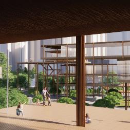
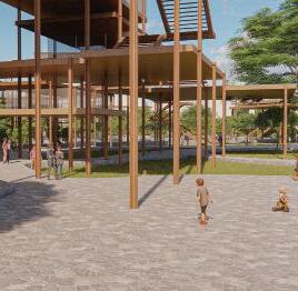
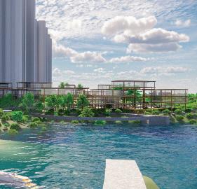
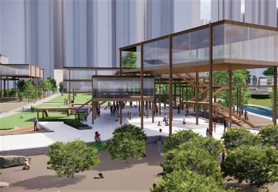
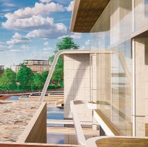
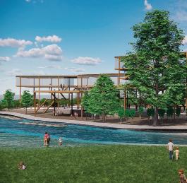
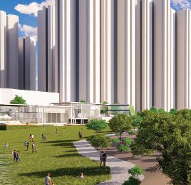
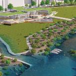
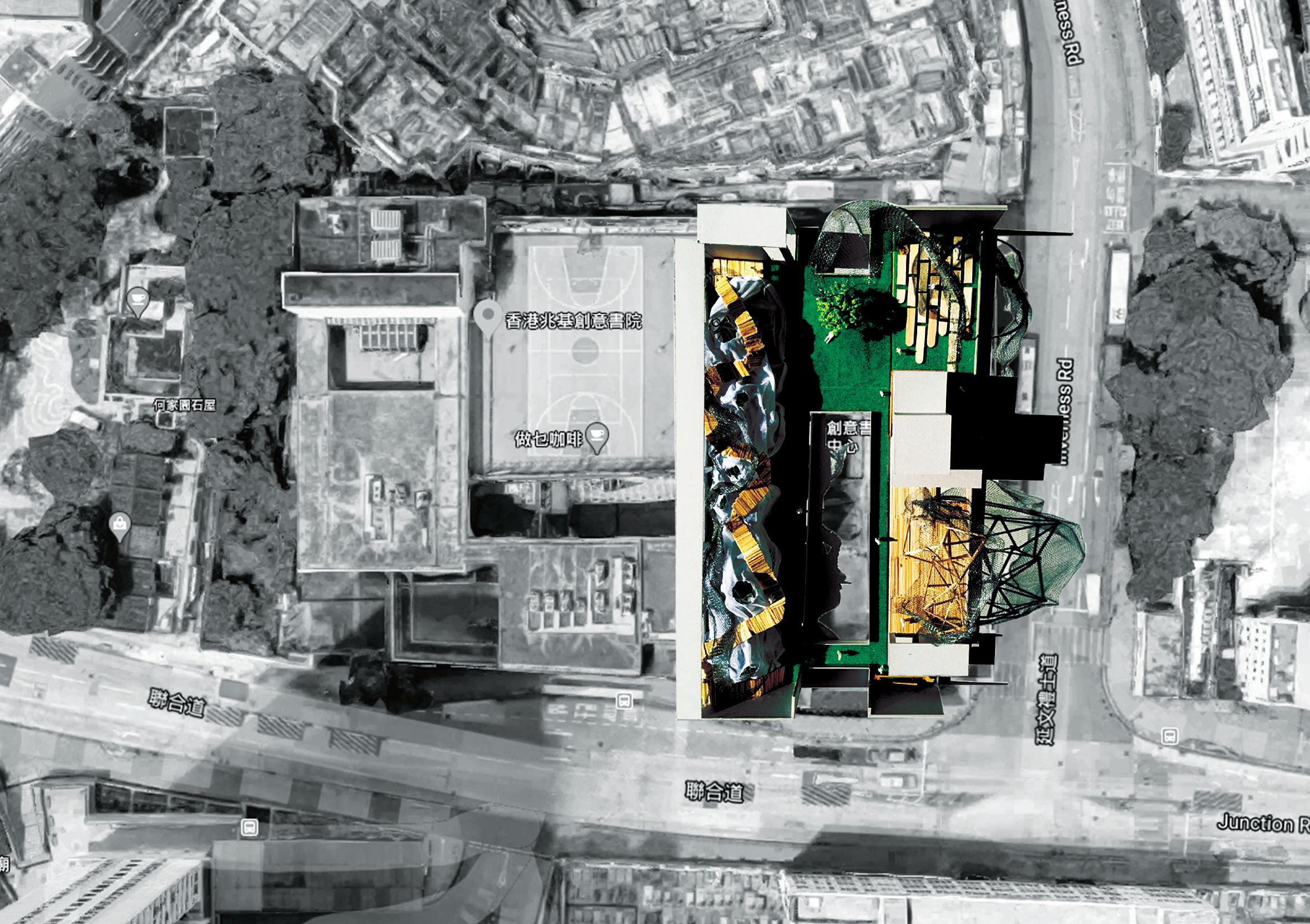
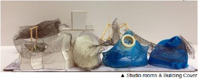
Wonderland Work-lab Project 12
Roof top programme in Lee Shau Kee School of Creativity (HKICC)
Intro.
HKICC. 135 Junction Rd, Kowloon Tsai.
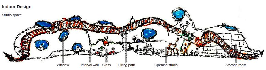
Work-Lab, which is a room or building with special equipment for doing experiments and texts.
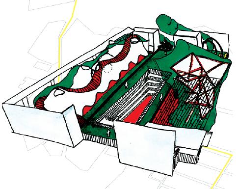
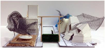
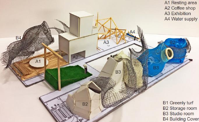
Spiritual, natural and comfortable atmosphere can be created by provid-ing privacy and freedom while keeping the connection between the teachers and schoolmates. Creating a miracle garden in a concrete jungle, which revolt to the its environment. Its an innovative castle floating at the cloud of the visual perspective.
Design Thinking
<Castle in the sky>, by using the concept as a contrast of ancient and modern, each as contact with sky or greenly.
It may give the feeling of something like living in Utopia, and provide a peaceful and natural place for HKICC. Allowing people to reflect the meaning of building as a human being.
Design Concept
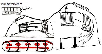
Refering Hong Kong is a mountainous city in which there are a few flat lands. The studio designed from hills shape, but also the spirit of unity to enhance the peopele’s connection and native spirit. Aslo, the moveable walls in studio rooms that interval doors between each studio, student can remove the wall to the back then become the biggest space. The shareing space also enhancing the relationship between teacher and students.
‘Work-Lab’ project, which is a plan to provide spaces and serve as alaboratory for staff and students to experiment and study, especially for those art & creative-related subjects: Multimedia Performing Arts, Film & Digital Arts, Visual Communication, and Environmental & Spatial Studies.
Goals and Objectives
Having fun is the most important part of the school life. It is basic yet crucial to every students’ learning process, not only physical part, but most importantly, the mental and social aspects of the transition process.
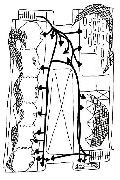
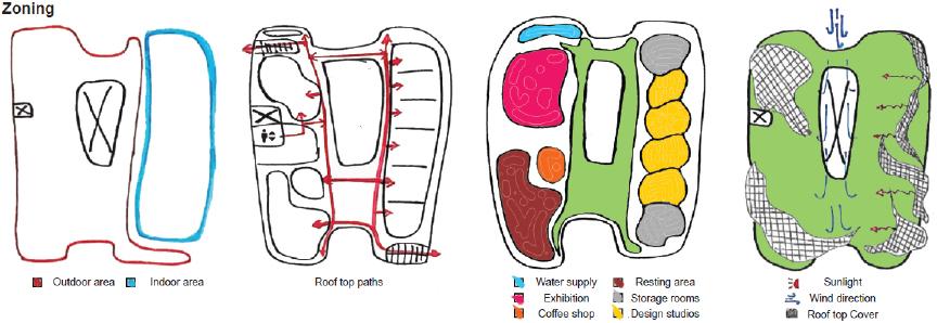
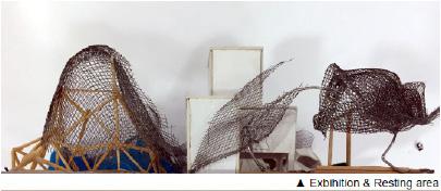
Outdoor Design
Rooftop is the best space that has a good sunshine, it is good for rest and enjoy their school life. And greenly is good for design students who need to work out long time in studio.
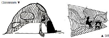
Using the cover to block out the hot sunlight, and open the windows with different angle, so that the students can enjoy the sky view.
Public exhibition create a stage for student, letting them to display their work to others and inspired by themselves. The Building Cover is designed in the shape of a cloud, which can transmit light and block the heat of the sun, while giving the classroom enough sunlight.