Whitney Elaine Otts Fall 2022 Professor H. Herrmann Design Studio 4A
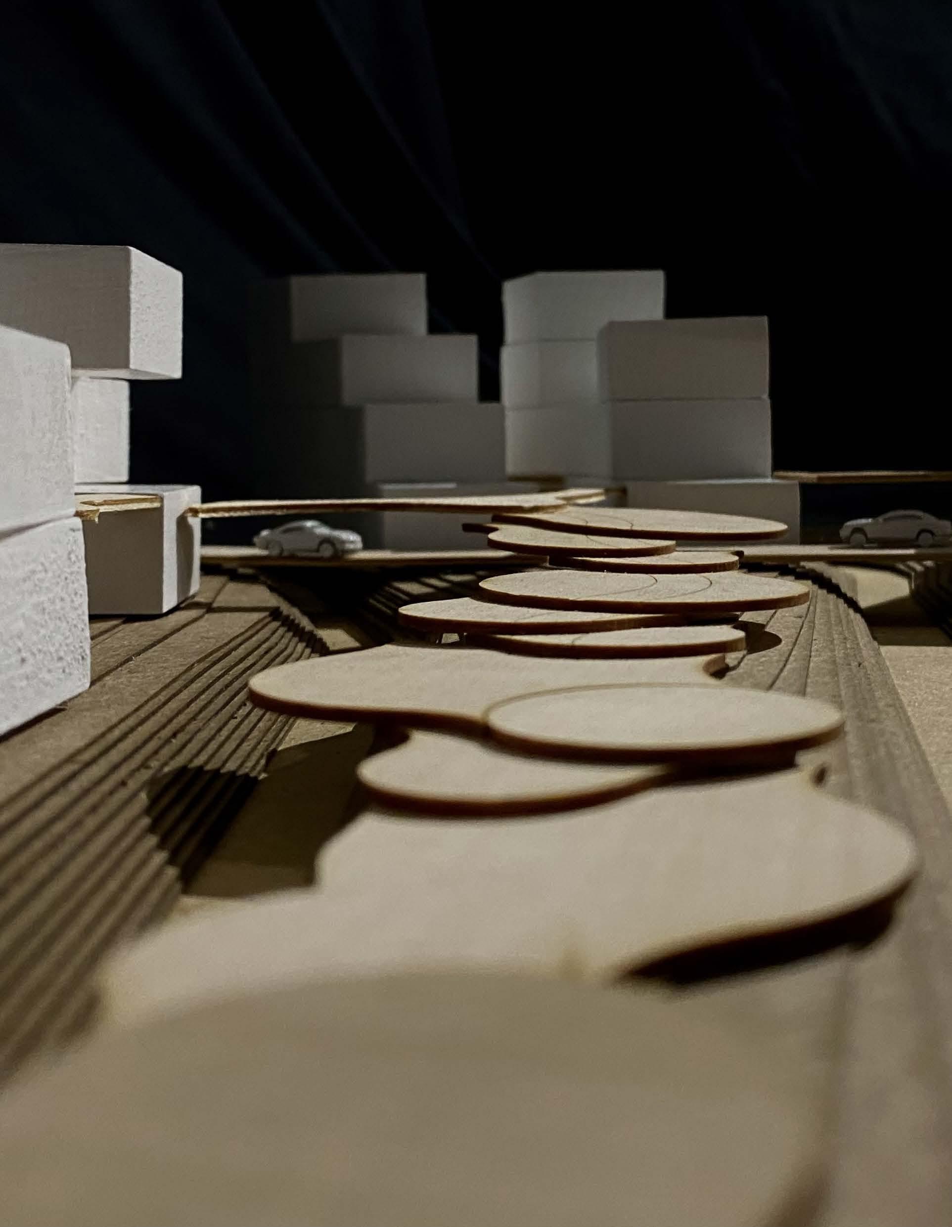
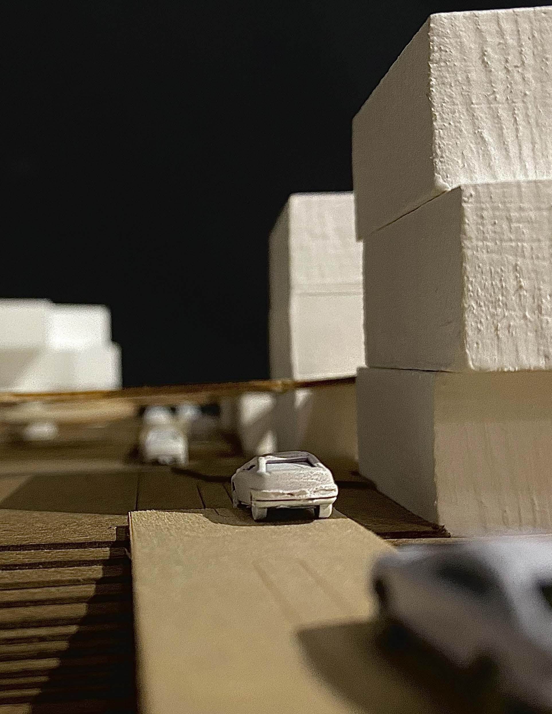
Table of Contents Project Introduction 1 Personal Final Panel Posters Introduction Poster 2 Human Circulation Poster 4 Sustainability Poster 6 Structural Poster 8 Model Pictures 30 Acre Model - 1/32 Scale 11 9 Acre Model - 1/32 Scale 14 3 Acre Model - 1/16 Scale 18 Appendix 22
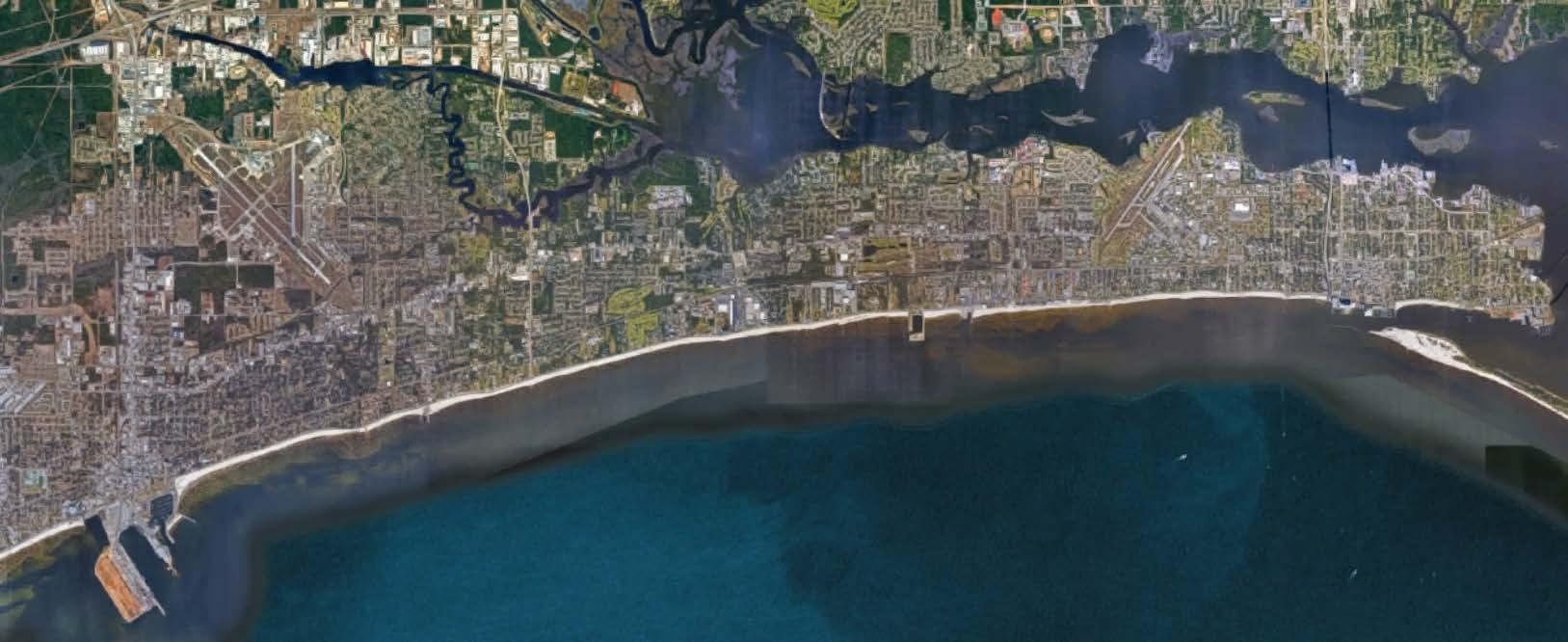
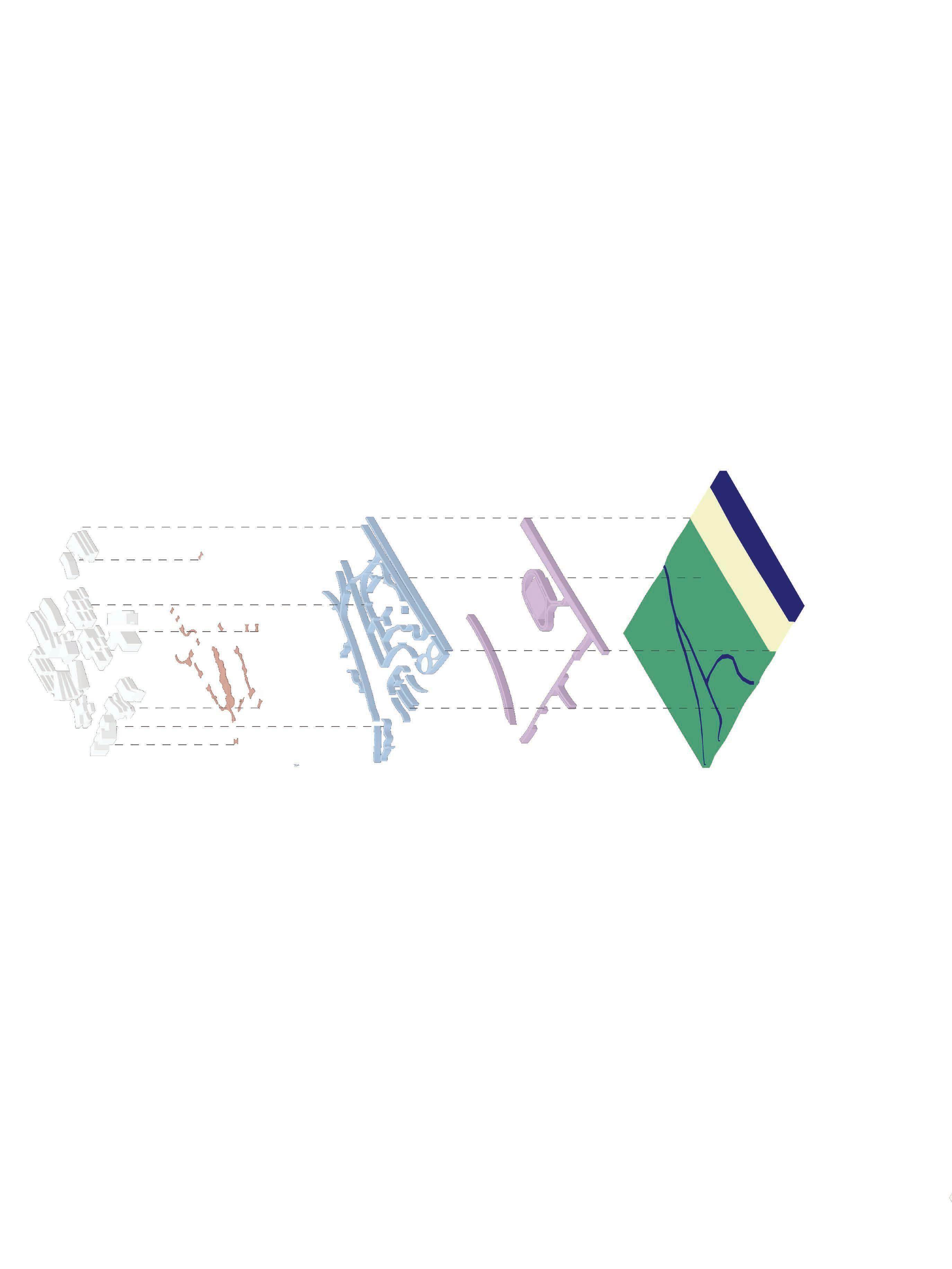
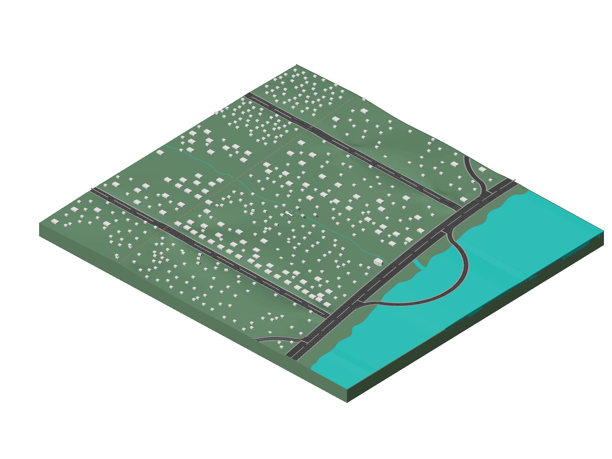
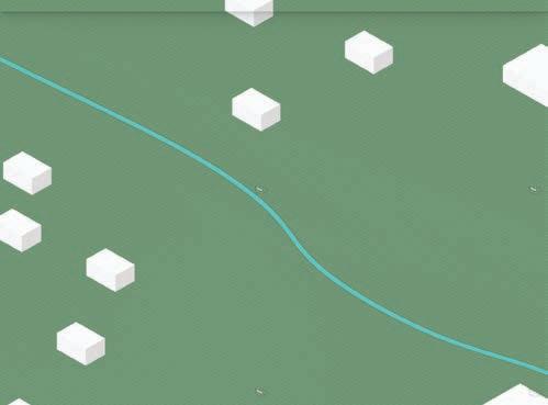
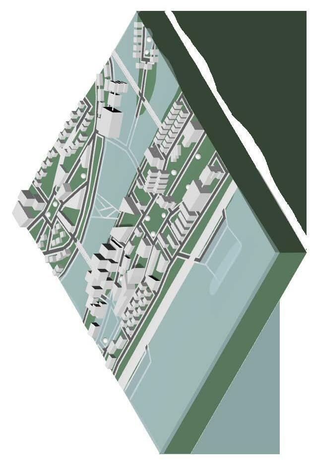
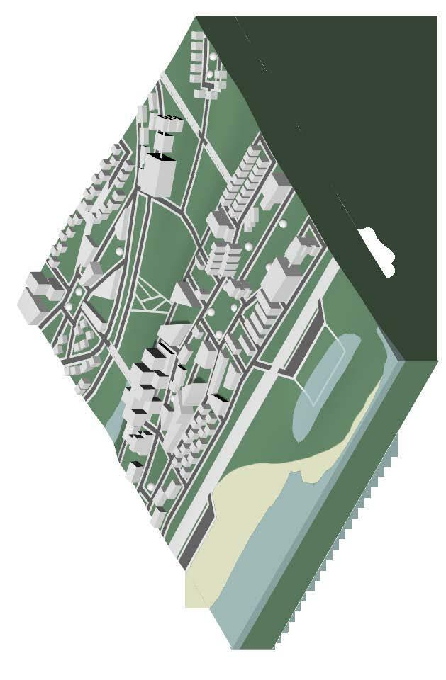
Overall Site
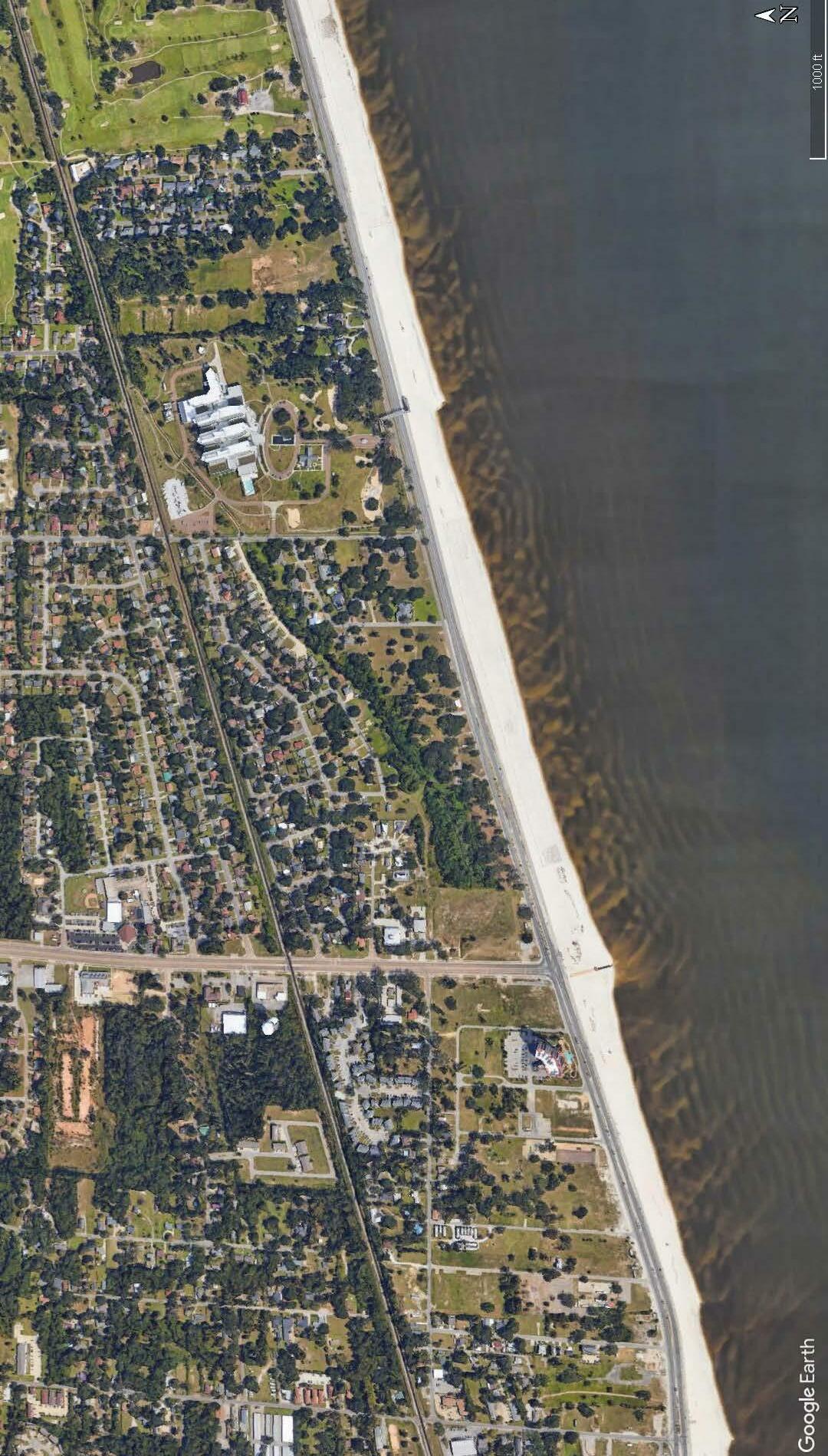
Gulfport
Project Introduction
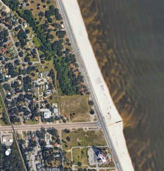
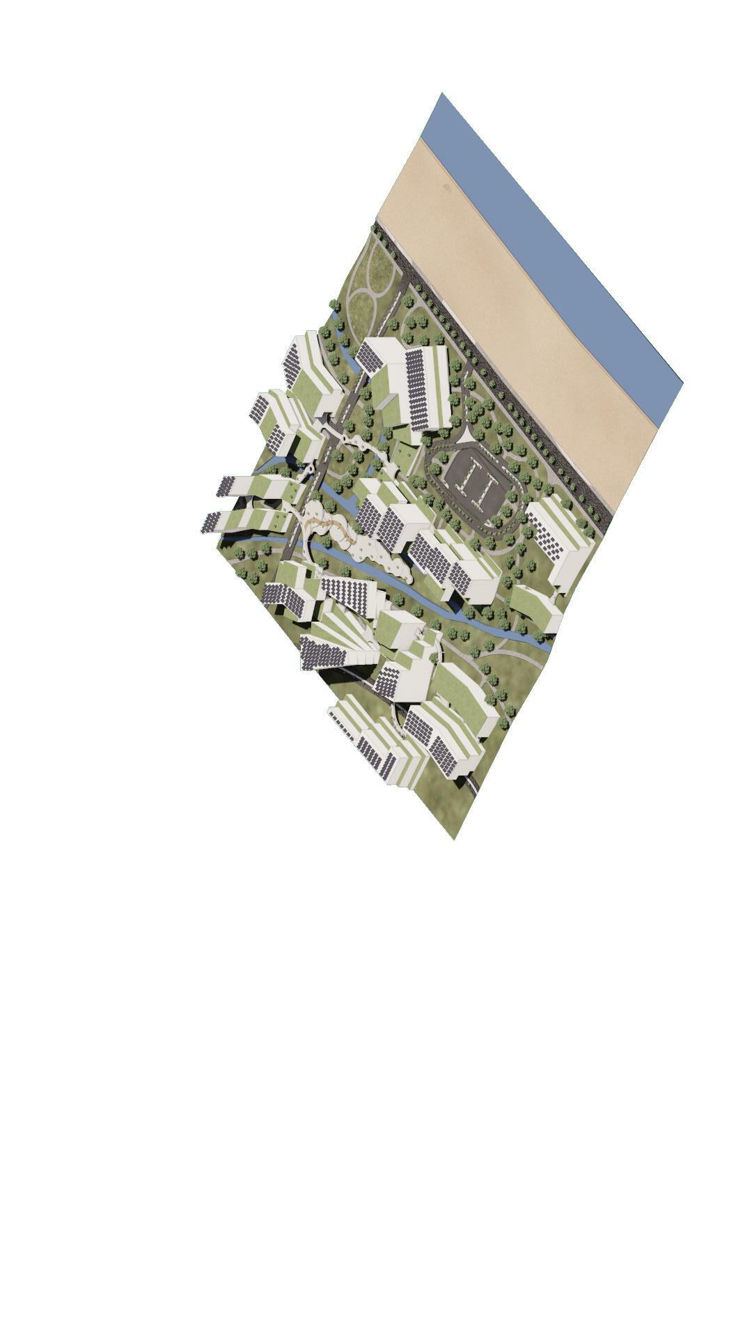
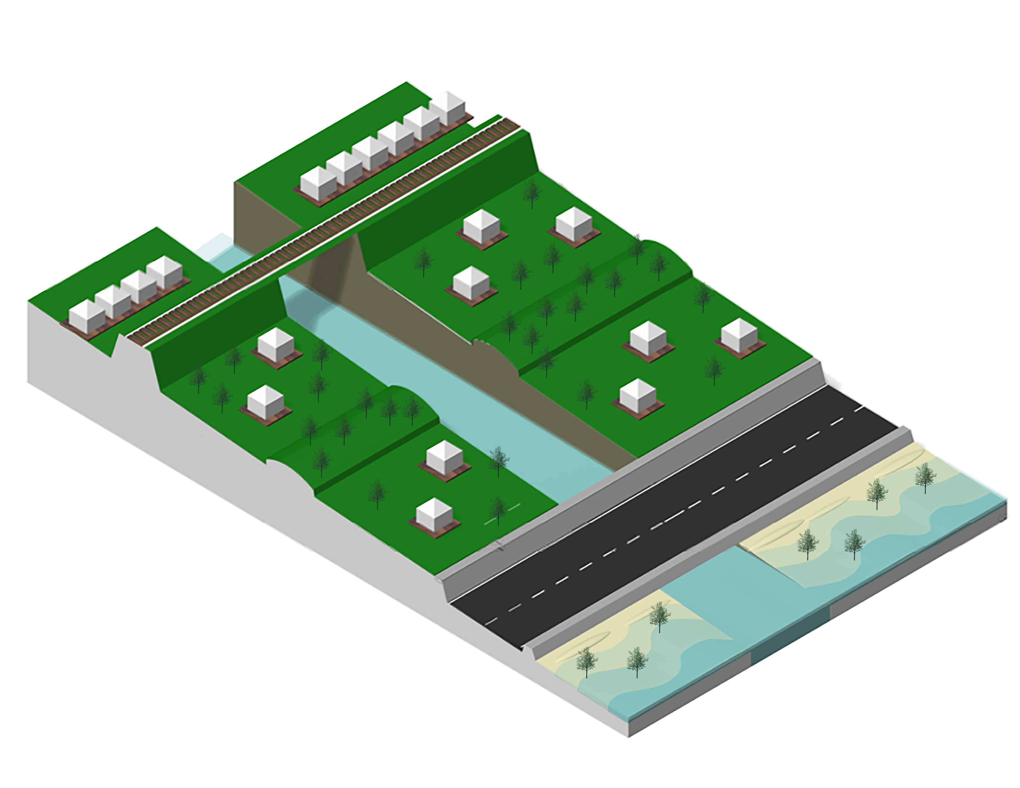
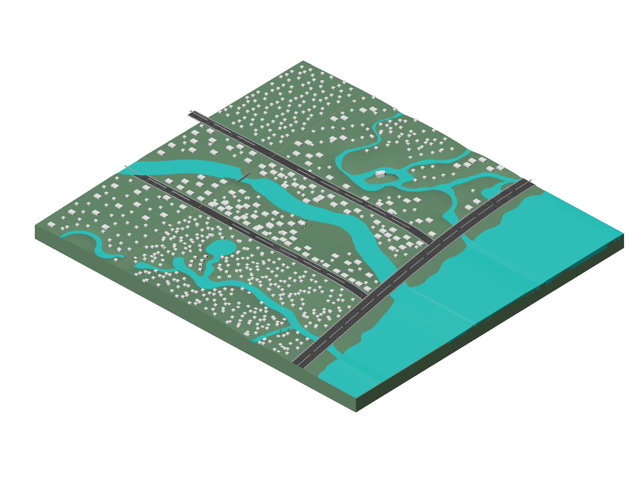
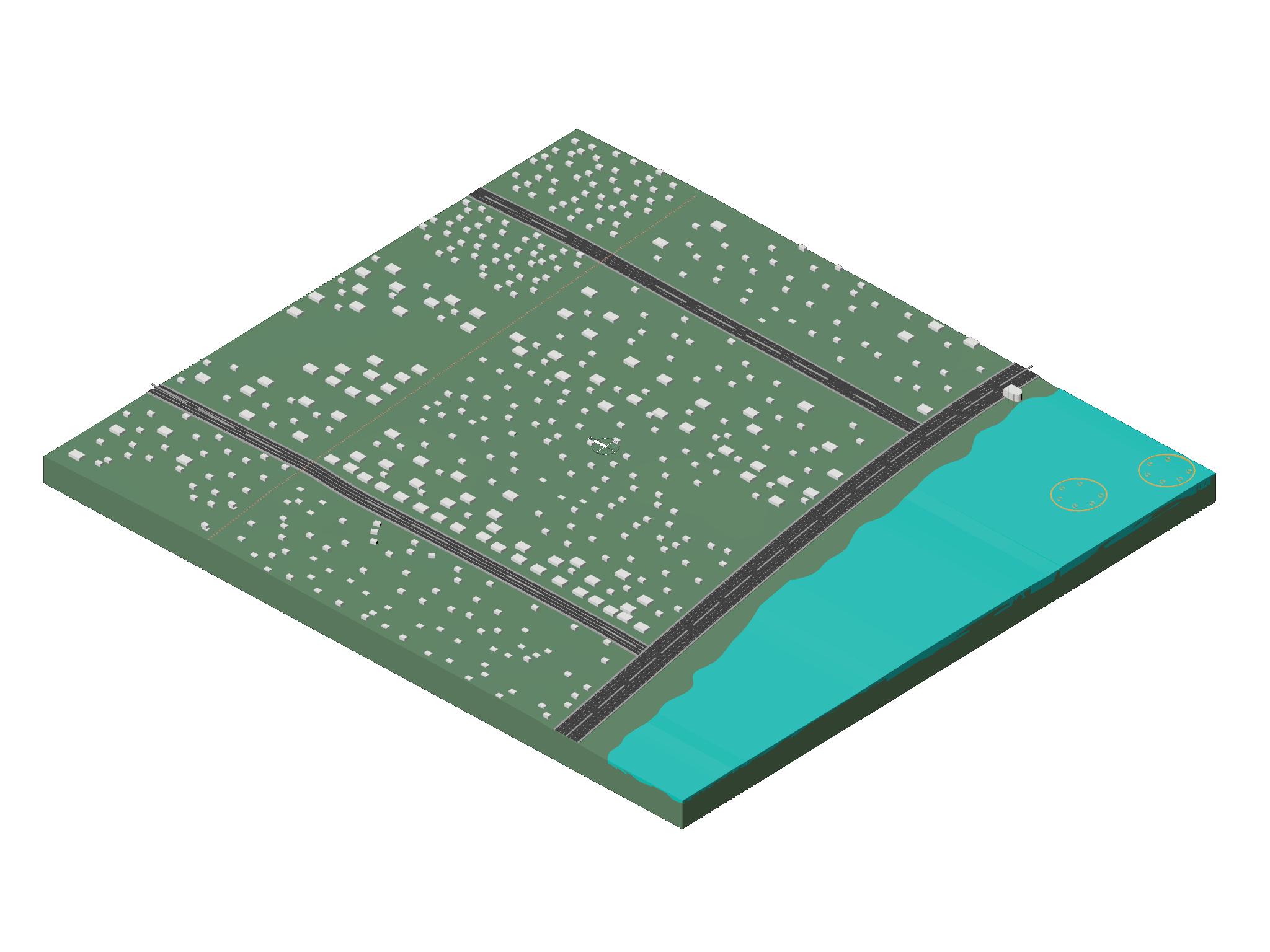
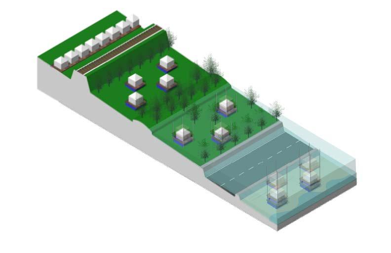
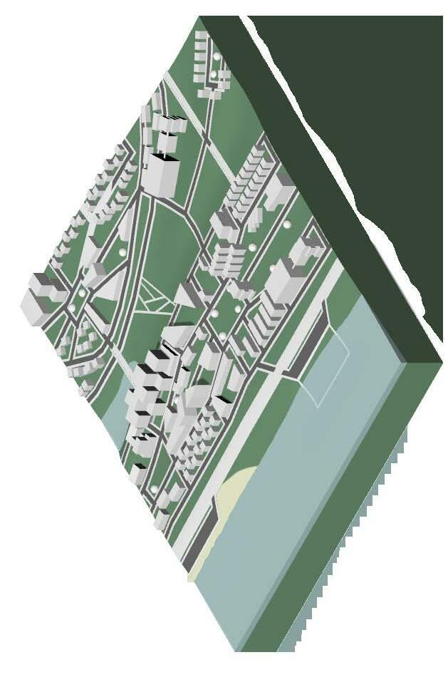
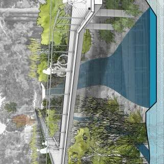
Constant rising sea and flood levels continue to degrade the Gulf Coast along with its resources and communities. Throughout the semester, students were assigned the task of generating a resilient community design that addresses coastal issues. These issues included but were not limited to flooding, ways to assist the New Blue Economy, and a degrading coastline. The students started with very general theoretical models and ideas that ranged from Rhino models of a stretch of land from the railroad line to the coastline to abstract paper models that invoked some idea of topography or systematic approach to this intricate issue. These ideas then generated into solutions that ranged in scale with an original minimum of a one mile stretch of land. After general designs were generated, students were to zoom into a particular stretch of their idea including 30 acres of land. This originally started as massing to understand community structure in relation of buildings, ways of human circulation, and water circulation. Students had to have a minimum of 6,000,000 cubic feet of building space to exemplify an increase in density in the area. This original idea was displayed in a poster form and 1/32 scale model at a mid-review in the city of Gulfport to a multitude of individuals interested in the topic of coastal resiliency.
Upon return from this review, students were tasked with updating their 30 acre spaces to take into account the 25’ flood line and generate a way for the communities to be able to sustain themselves in the case of a flood this size. Students were to elaborate on high density buildings with at least one of their building designs being waterfront, at least one building being 10-15 stories in height, a minimum of 3 acres of land that accounts for rainwater management, and includes a minimum of 3 acres of space that can be used for photo-voltaic array systems. Students then were to design the circulation system and its relation the buildings, the way the buildings’ podiums interact with the physical ground, and power security though the photo-voltaic system. Students then were to zoom into a 7-10 acre space with more detail and a 3 acre space with even greater detail to understand the human scale of the topic. The 10 acres and the 3 acres were then to be made into two separate models with the 10 acres being at 1/32 scale and the 3 acres being at 1/16 scale.
Biloxi
1
2
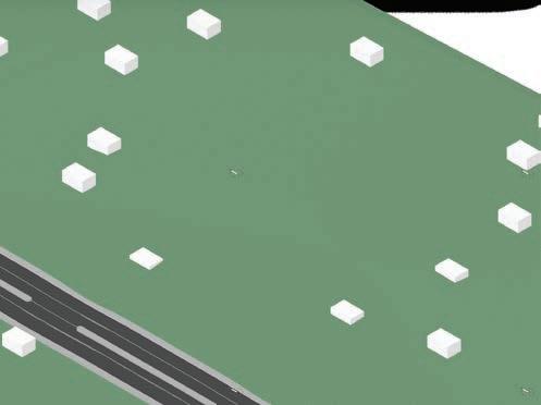
Massing
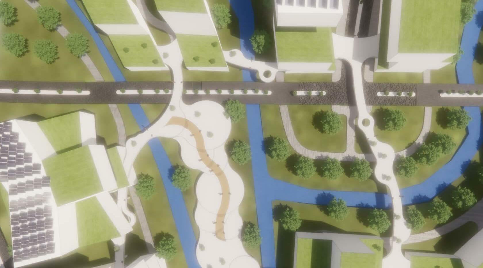
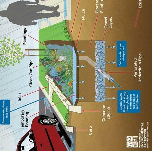
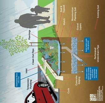
The Gulf Coast is a beautiful place, but flooding is inevitable. The constant cycle of destroy, rebuild, destroy is doing so much damage to its economy and the ecology. Lowto mid-income families cannot always afford this process. Rebuilding is always expense and takes so much time out of daily lives. The bigger factor here, is the ecology and environment. All but one of the waterways between Gulfport and Biloxi are impaired with bacteria that could cause infection and disease due to the run off from the construction sites resulting from flooding. Those that live in these communities know this but take the risks anyways because they love the beach. However, their healthcare does not always agree with this mindset. By controlling and purifying stormwater drainage and runoff, the number of pollutants and microbes in the waterways could be reduced dramatically. Natural ecology will be reintroduced to the environment to purify the water that flows in and out of the flow lines.
Restoration Through Purification
 Elaine Otts
Landscaping
Thoroughfare
Secondary Walkway
Elaine Otts
Landscaping
Thoroughfare
Secondary Walkway
3
Primary Walkway
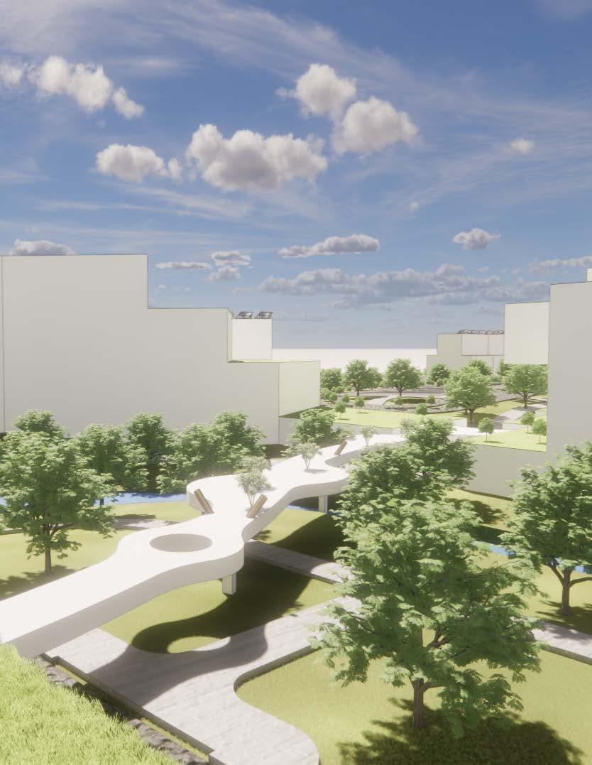
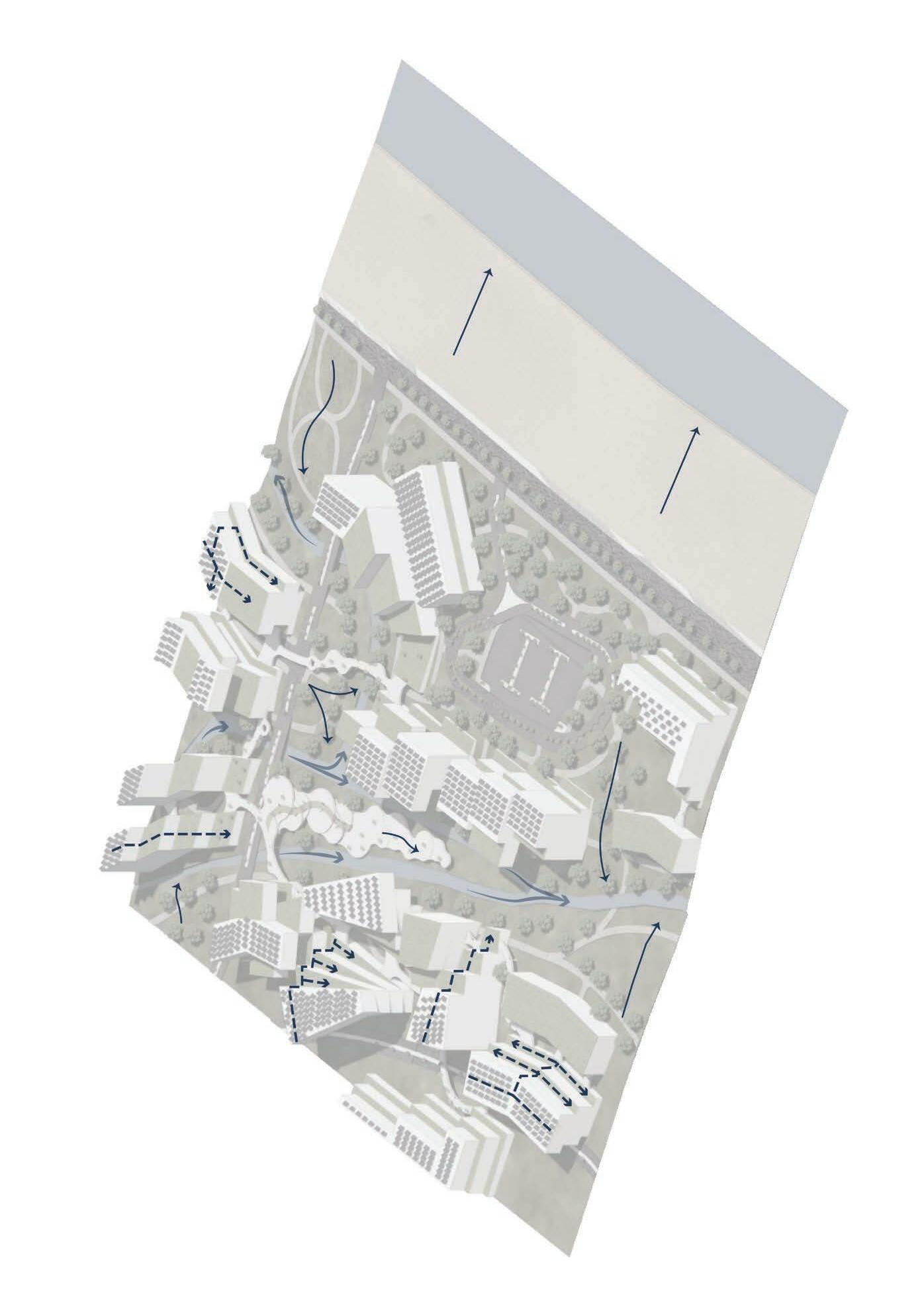
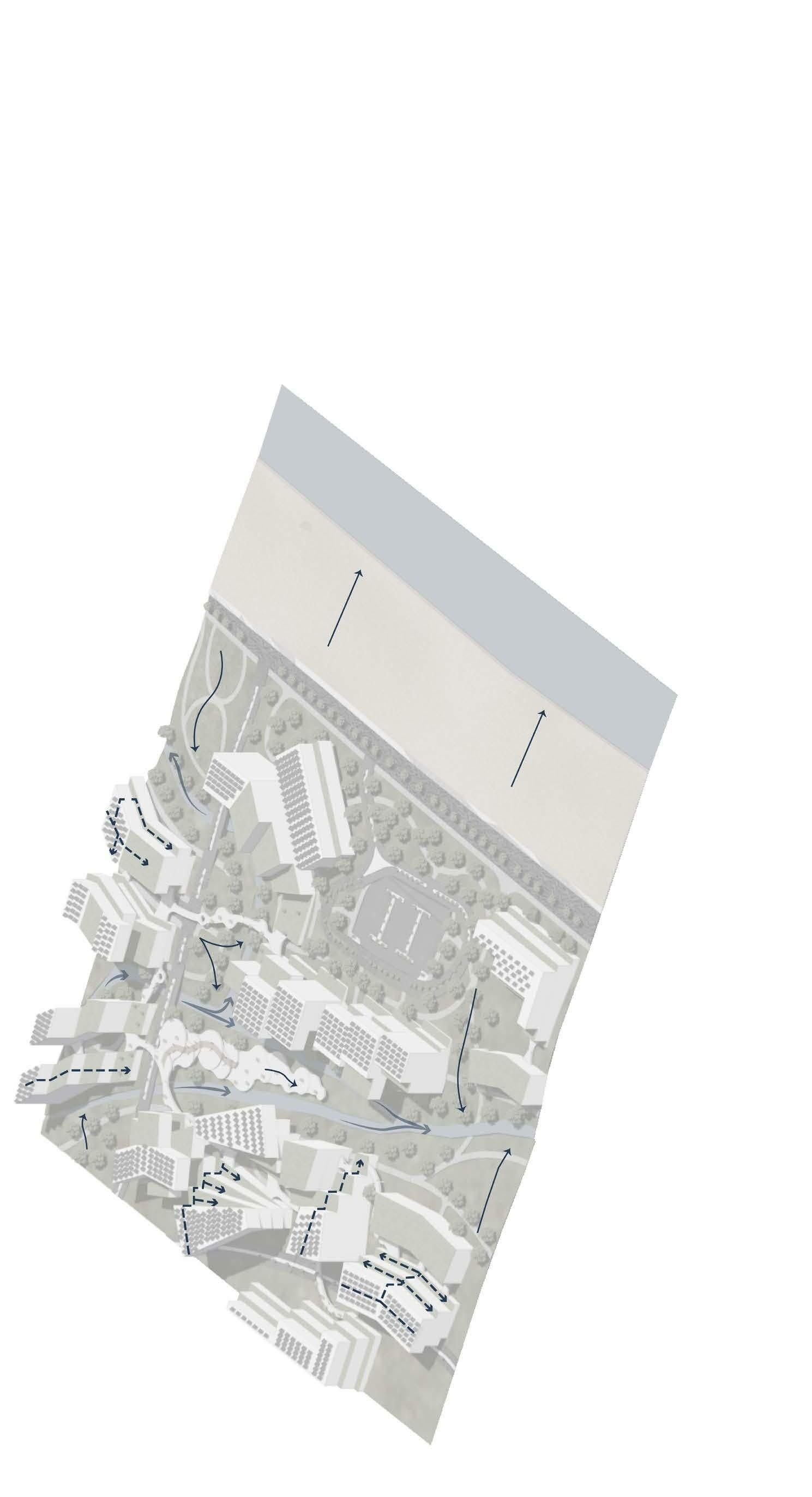
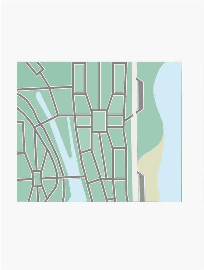
CIRCULATION
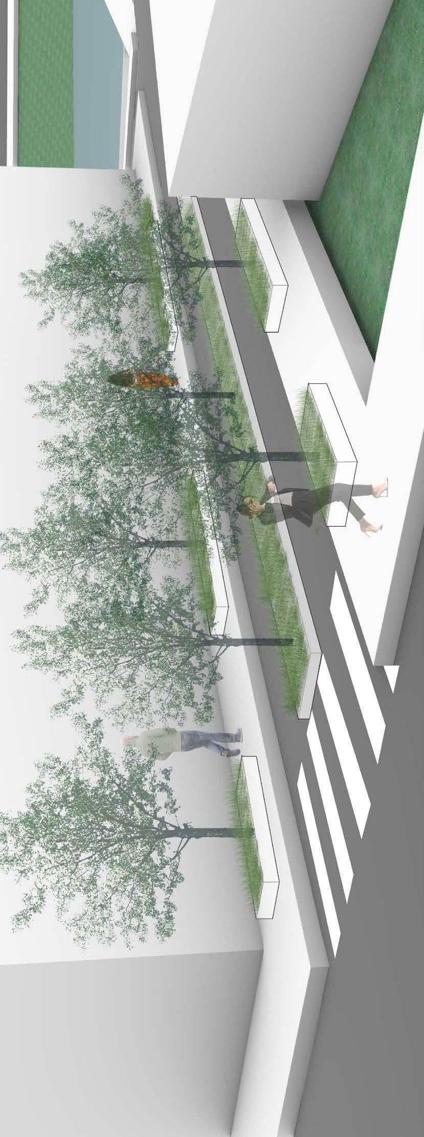
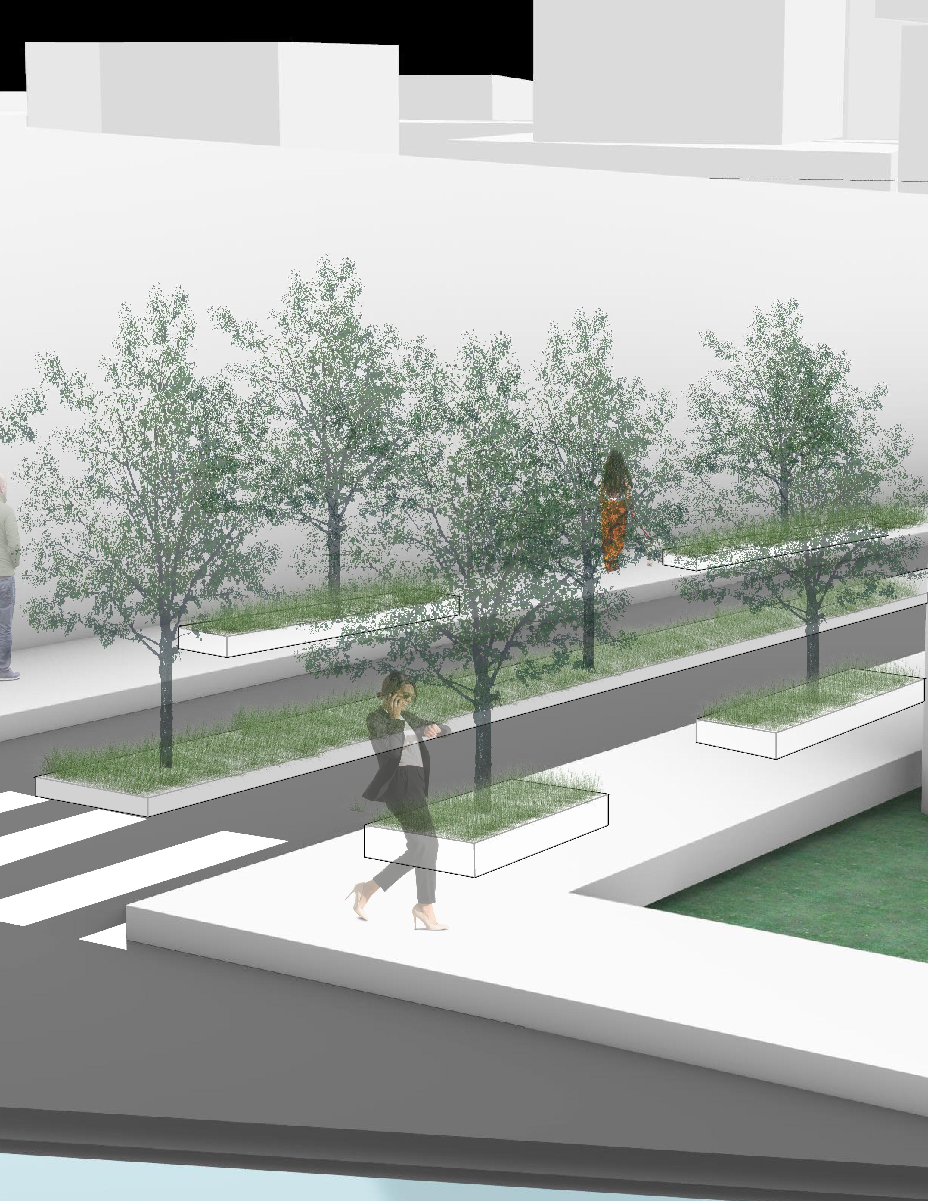
Walkable communities will be generated to encourage sustainable practice and educational opportunities. This can be achieved by generating primary walkways that encour age movement with nice views and other activities. I have designed this community to have multiple pat hs that extend for multiple distances ranging from 0.25 miles to 3 miles. These all come together at the cor e of the community where the center is filled with pop-up stores, theaters, and other joyous activities. Thes e communities will open up greater opportunities for more jobs and better health practices for lowto mid-incom e households who typically struggle with healthcare.
4

5
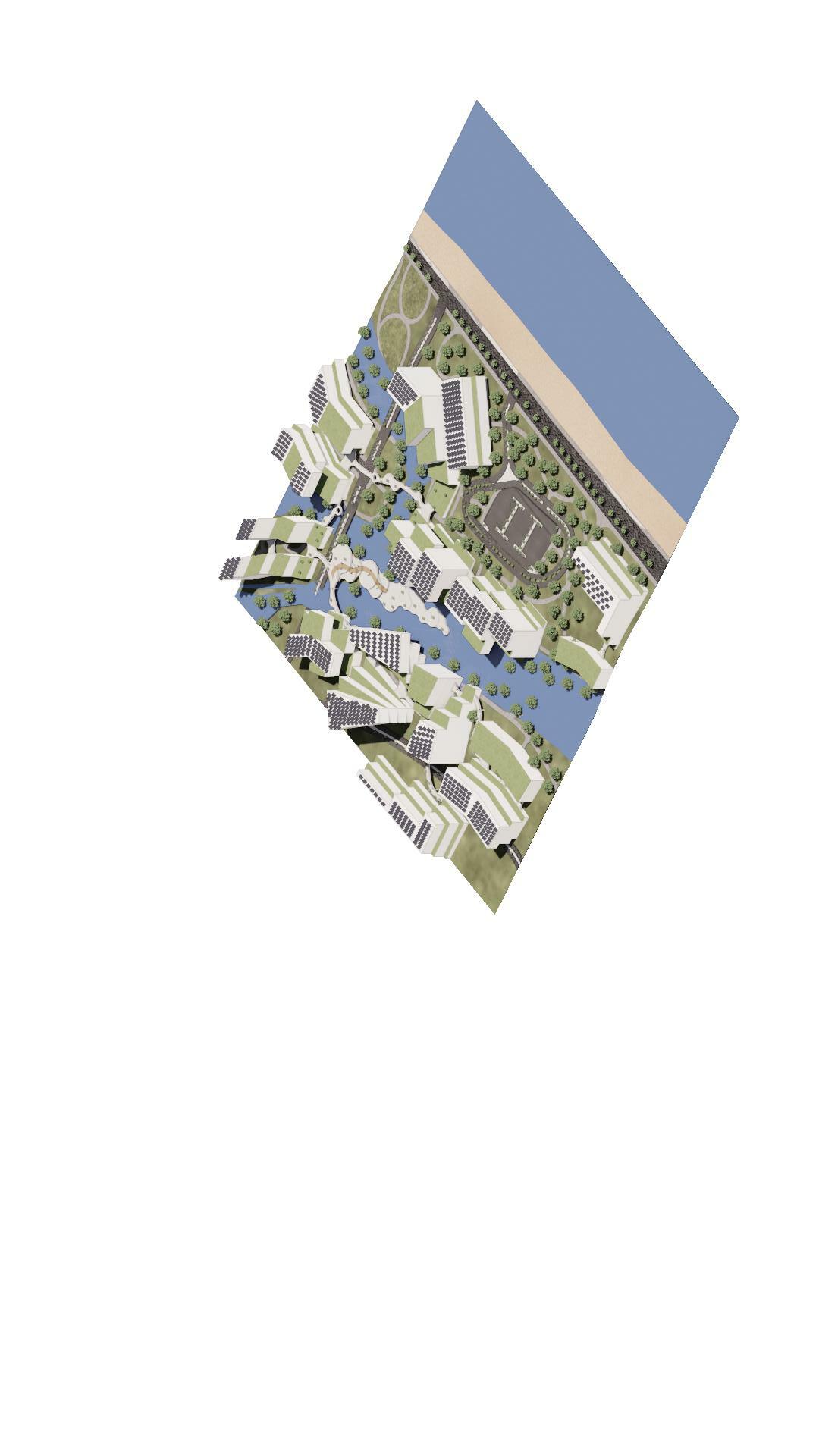
25’ Flooding 6
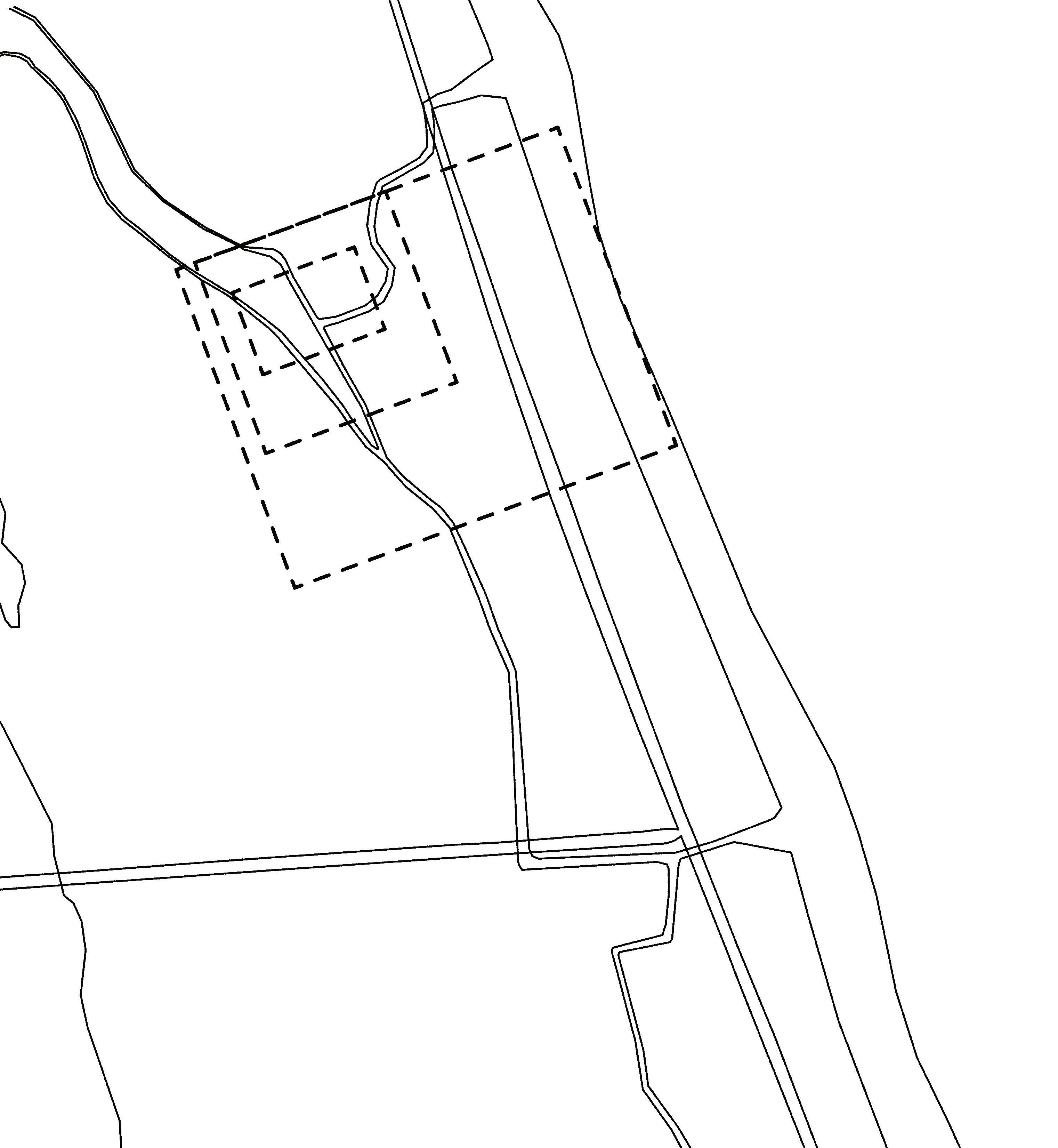
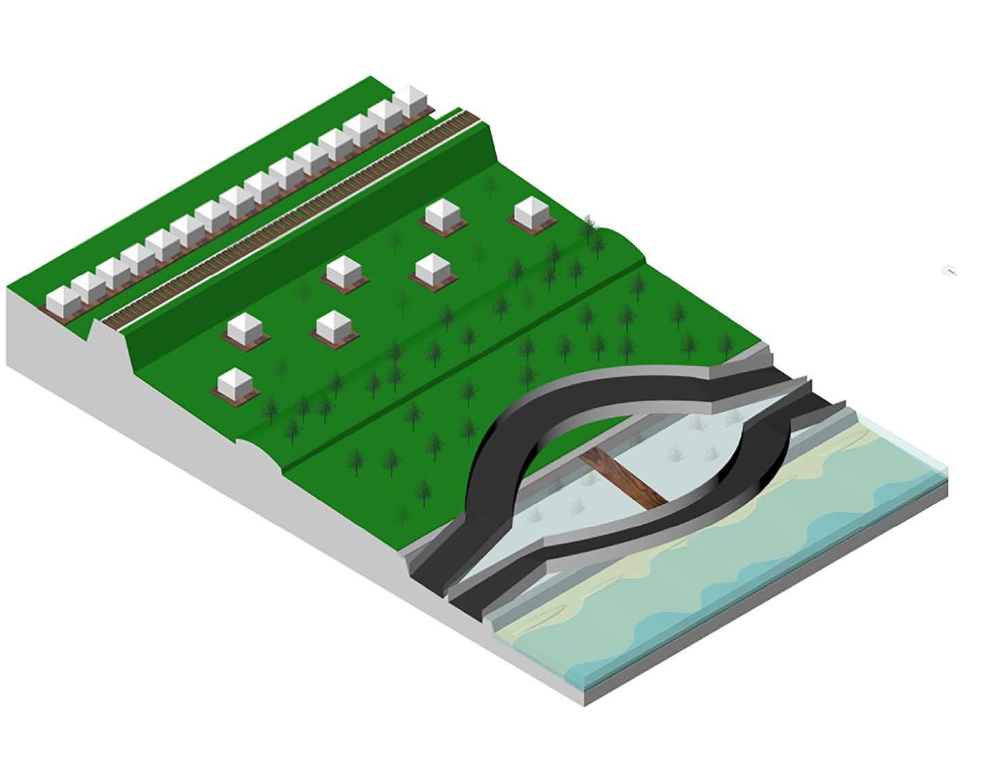
When it comes to flooding, if you cannot stop it, why not redire ct it? Through the utilization of existing outfalls, streams, and low lying land, a new redirection can be initiated to allow us to design smarter. If we know where the water is heading, we can better predict what will hap pen to the surrounding areas. How do we do this with minimal damage to the environment and existing communities? We look to the numerous v acant lots whose only job a the moment is to decrease aesthetic appeal and assist the decline of economic factors. By utilizing these lots, we can ge nerate new spaces that can survive and thrive of their own with a base of sustainable practices ranging from hydroponics to solar power. These areas will generate differentiation between communities as that does not exist righ t now.
SUSTAINABILITY
0’ Flooding 16’ Flooding
7
STRUCTURE
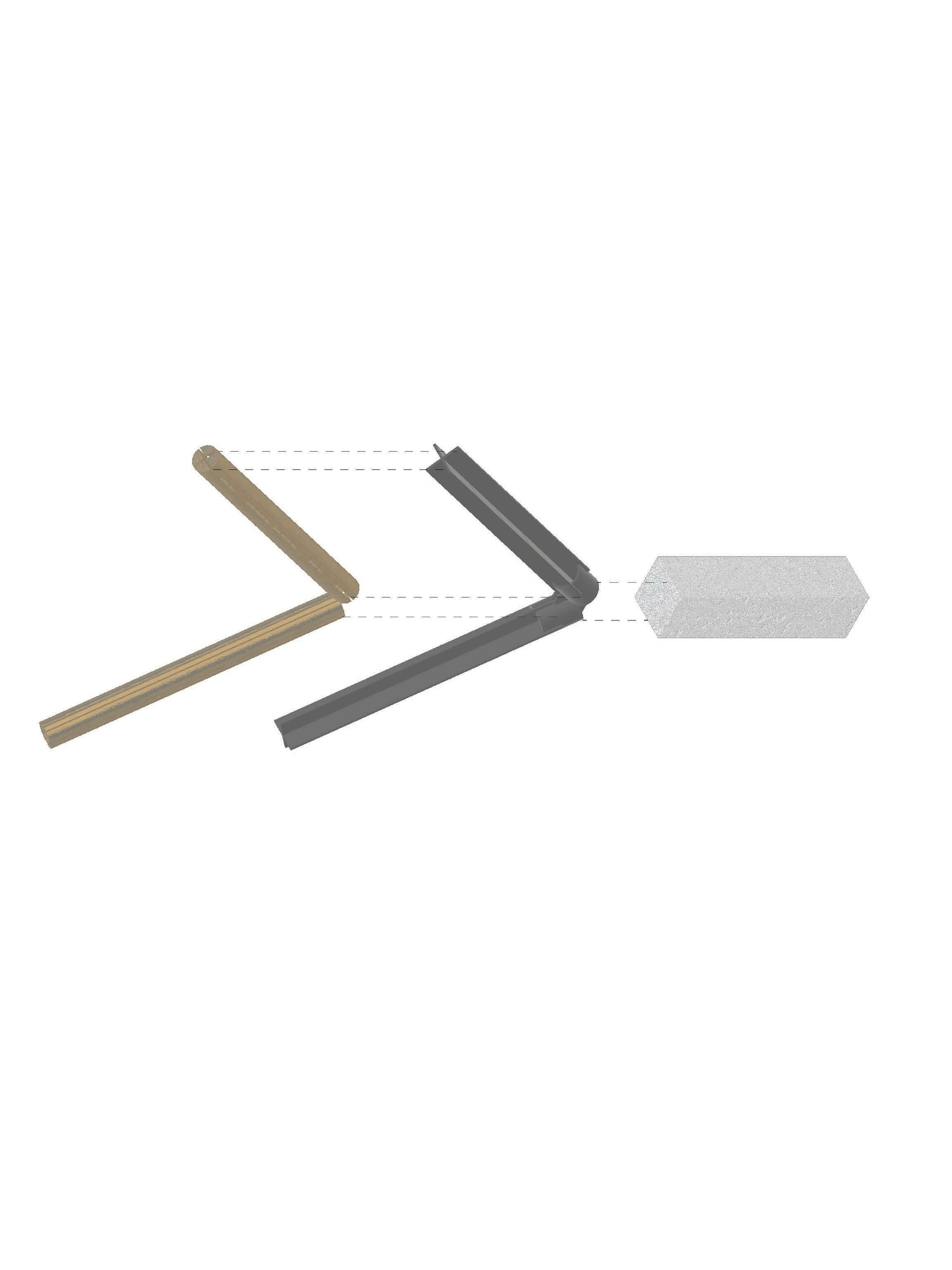
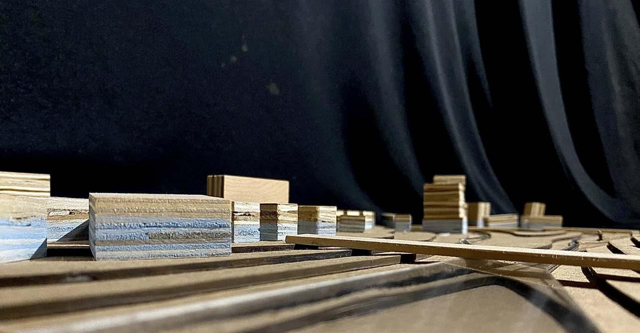
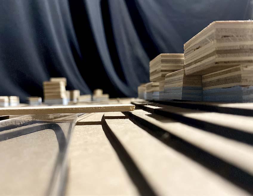
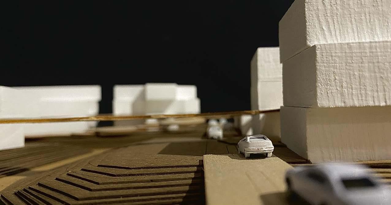
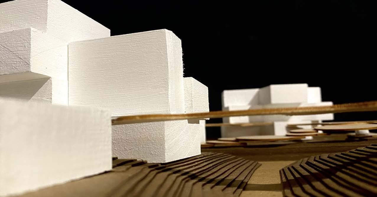
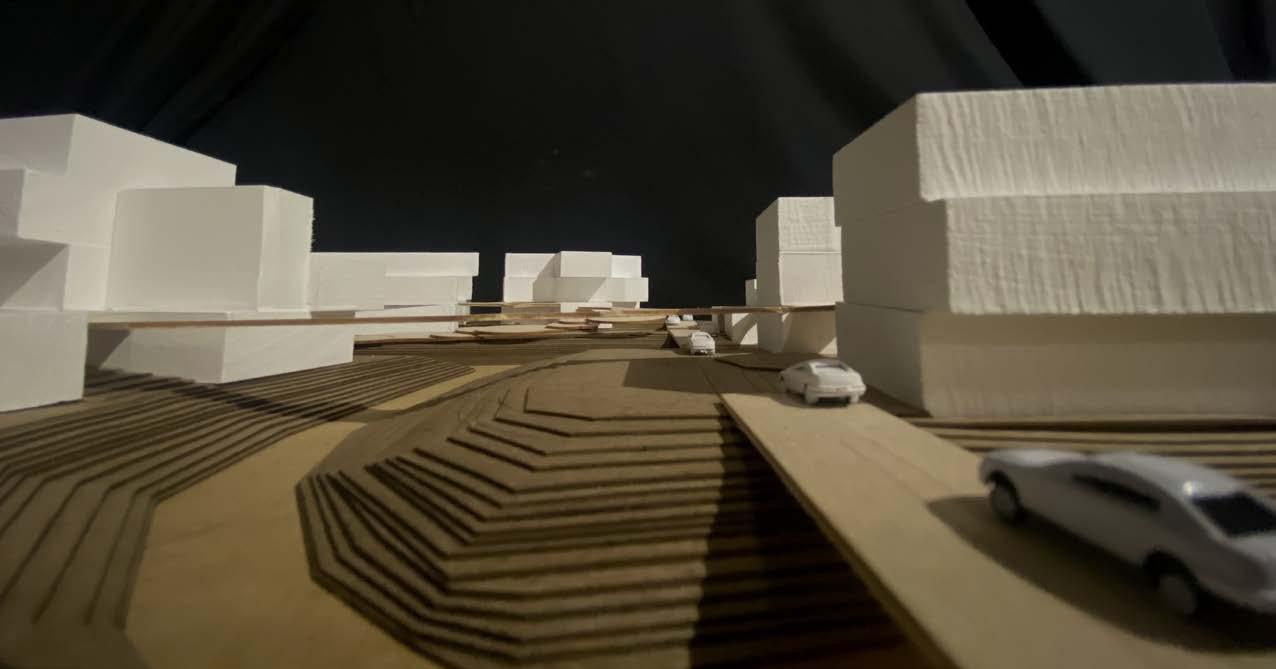
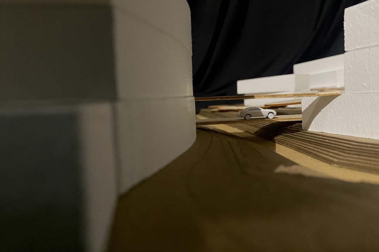
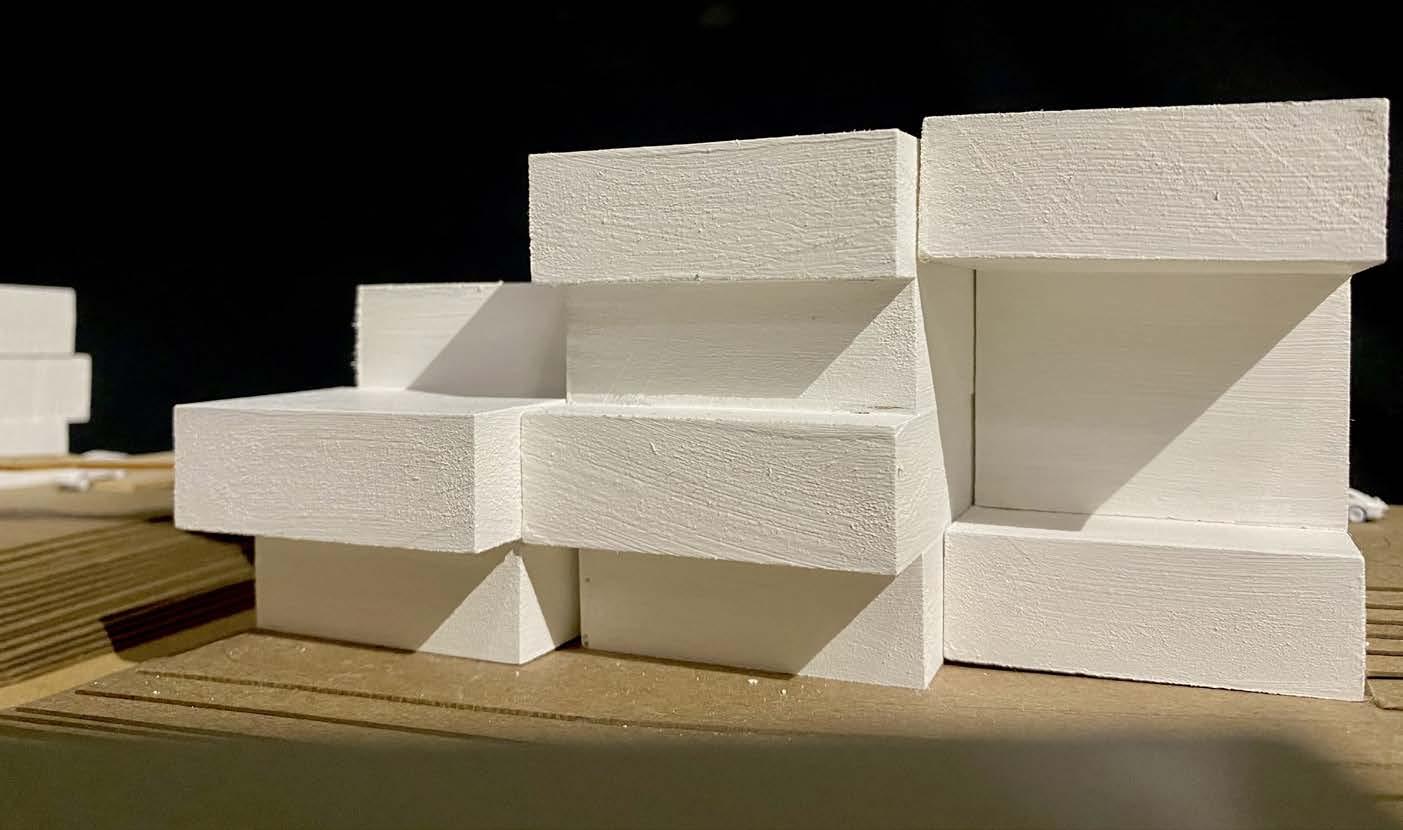
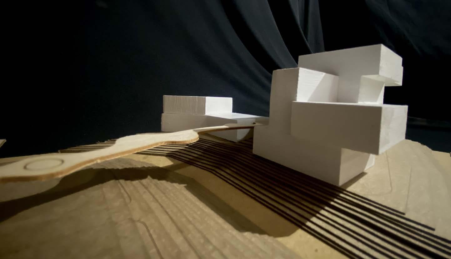
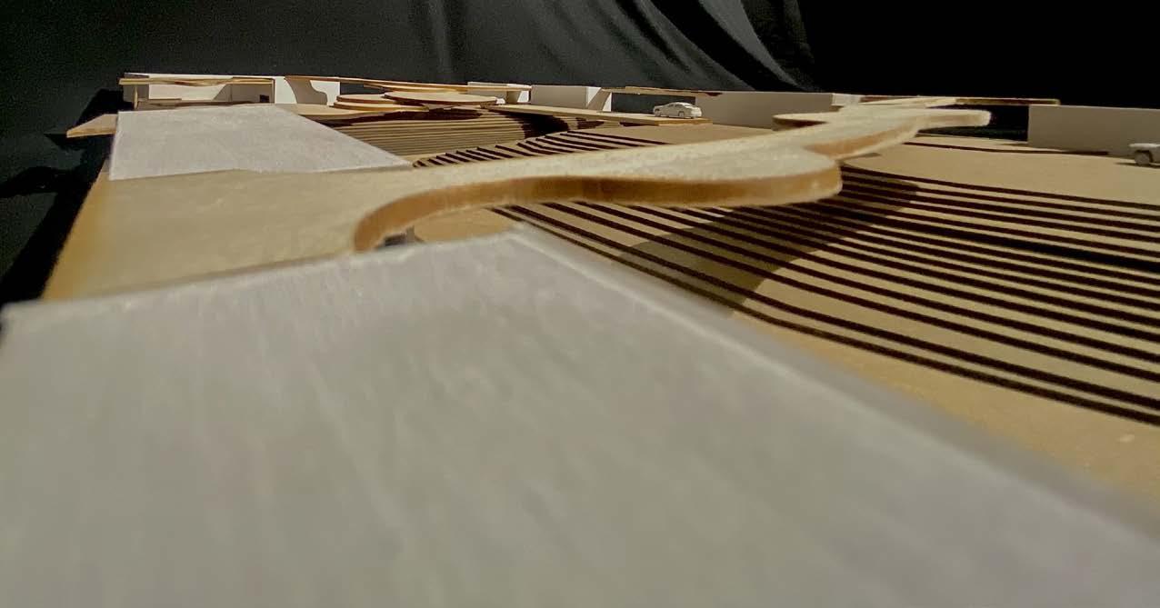
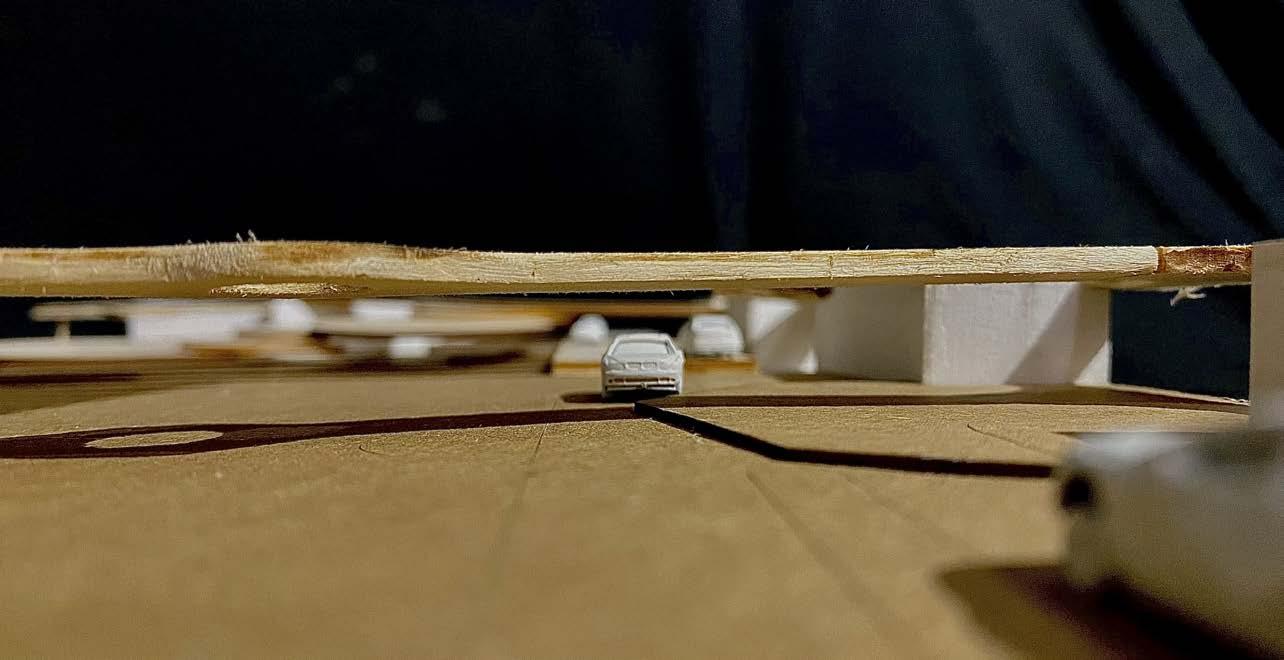
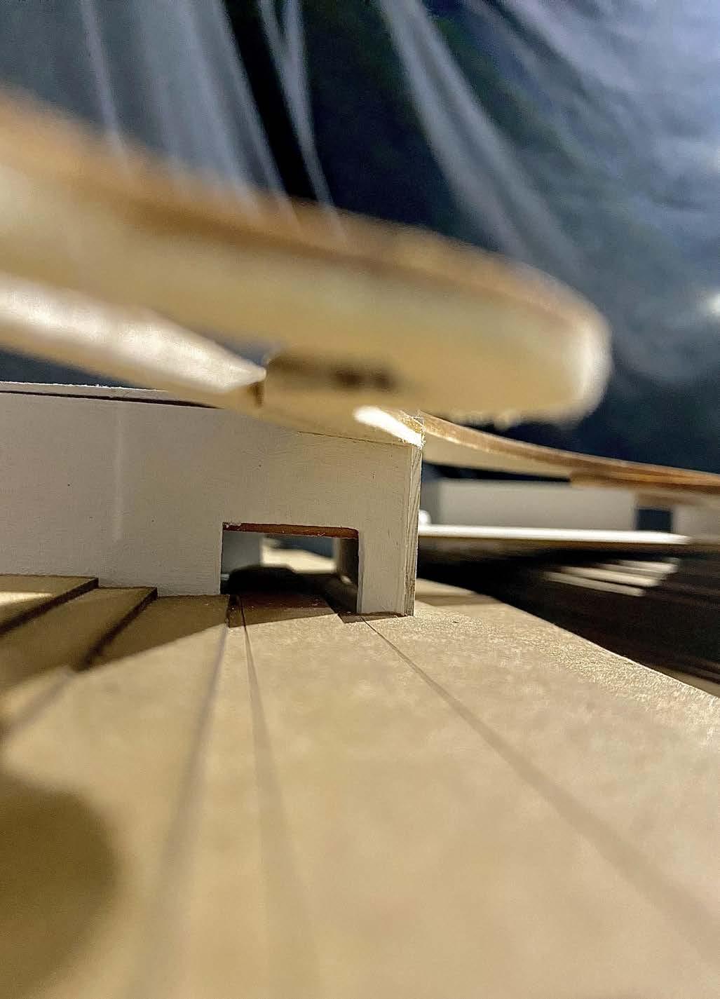
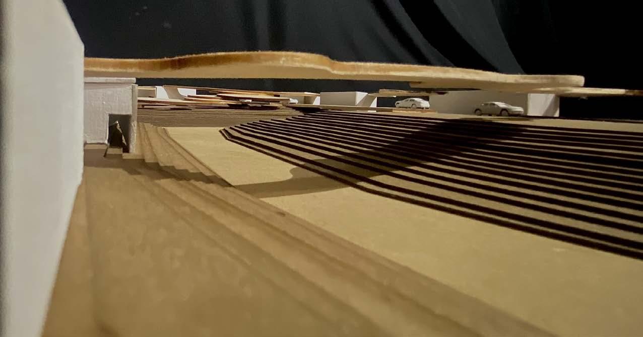
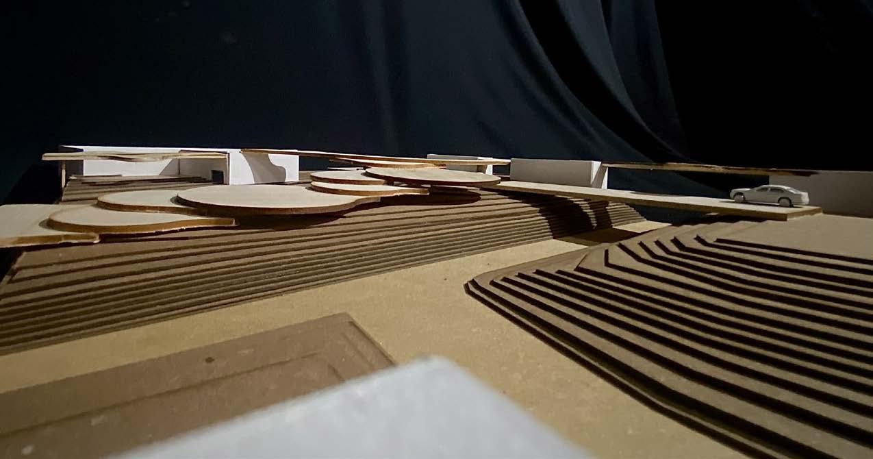
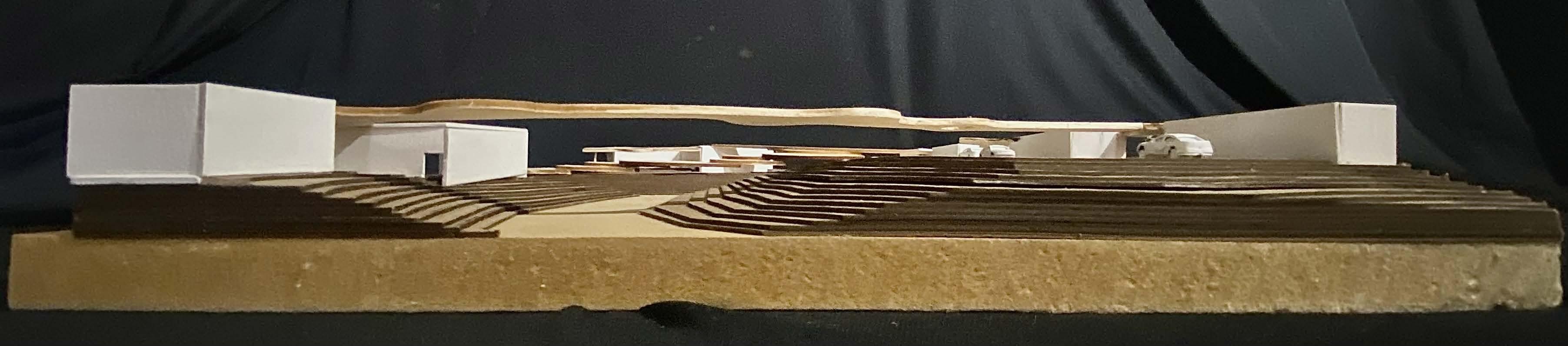
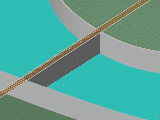
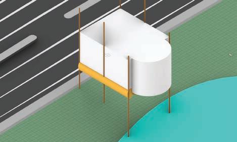
The building podiums and structural columns lift the main part of the community up to 25’ high which is the maximum flood height. The structural co lumns have a concrete base with metal and wood arms extending through the walkways. B y extending through the walkways water can be redirected to run down them in a fasc inating way from the elevated walkways. The podiums will consist of easy to take down shops, extended seating, and extended storage for restaurant, stores and busine sses above the flood elevation.
8
9
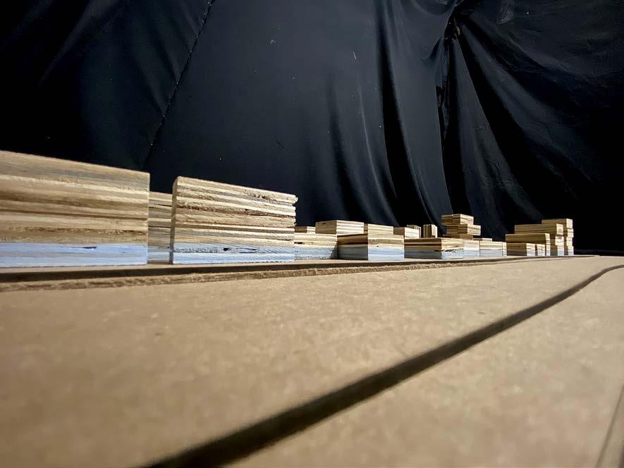
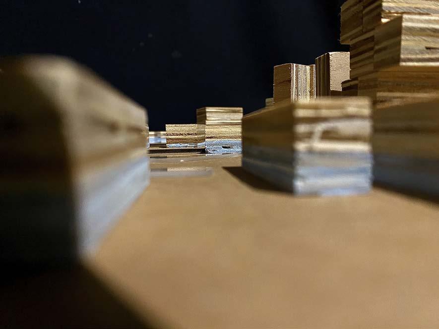
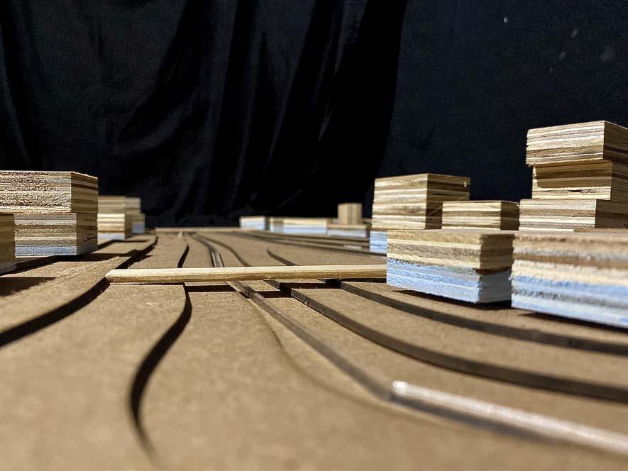
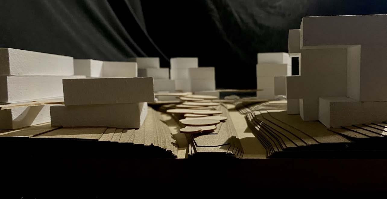
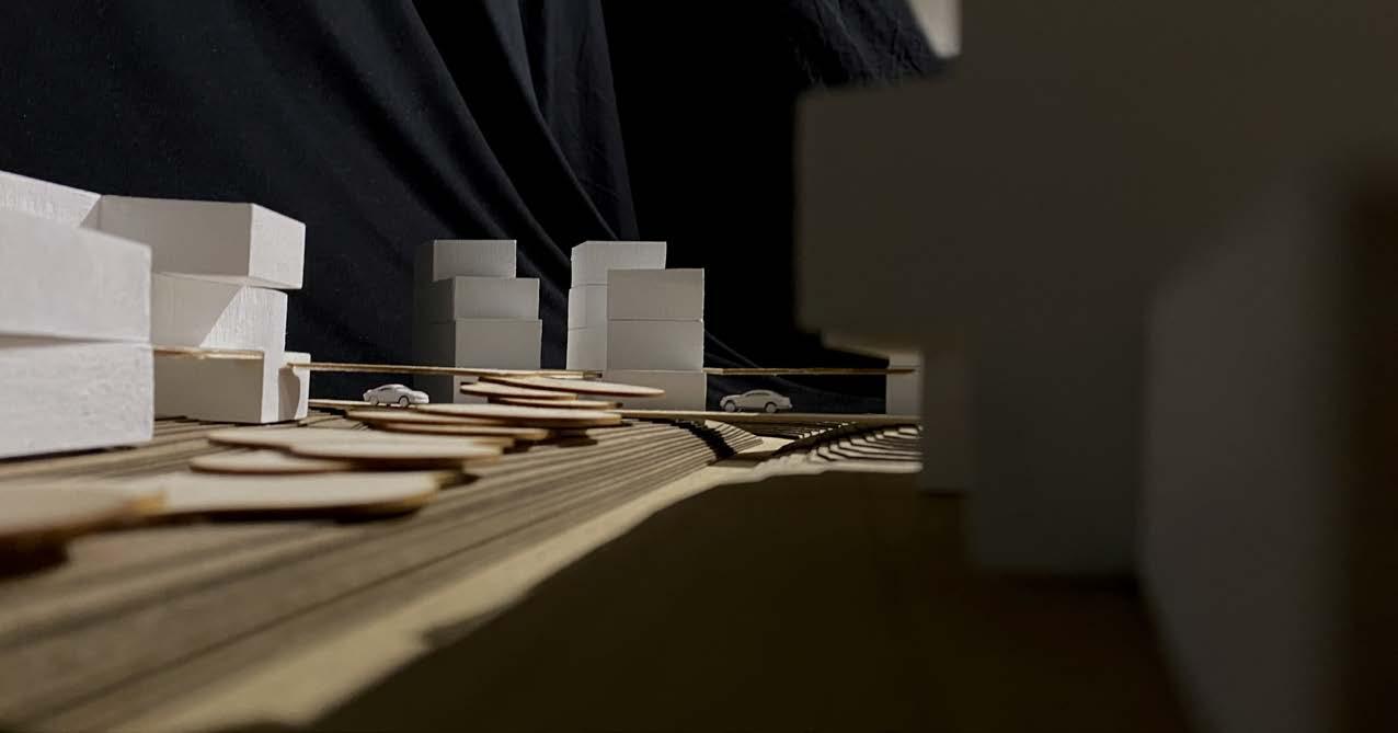
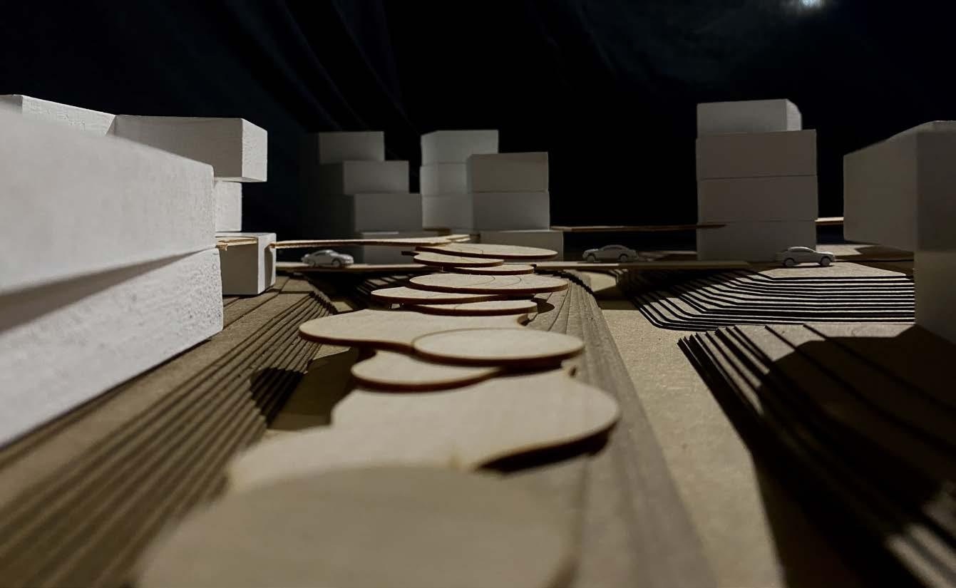
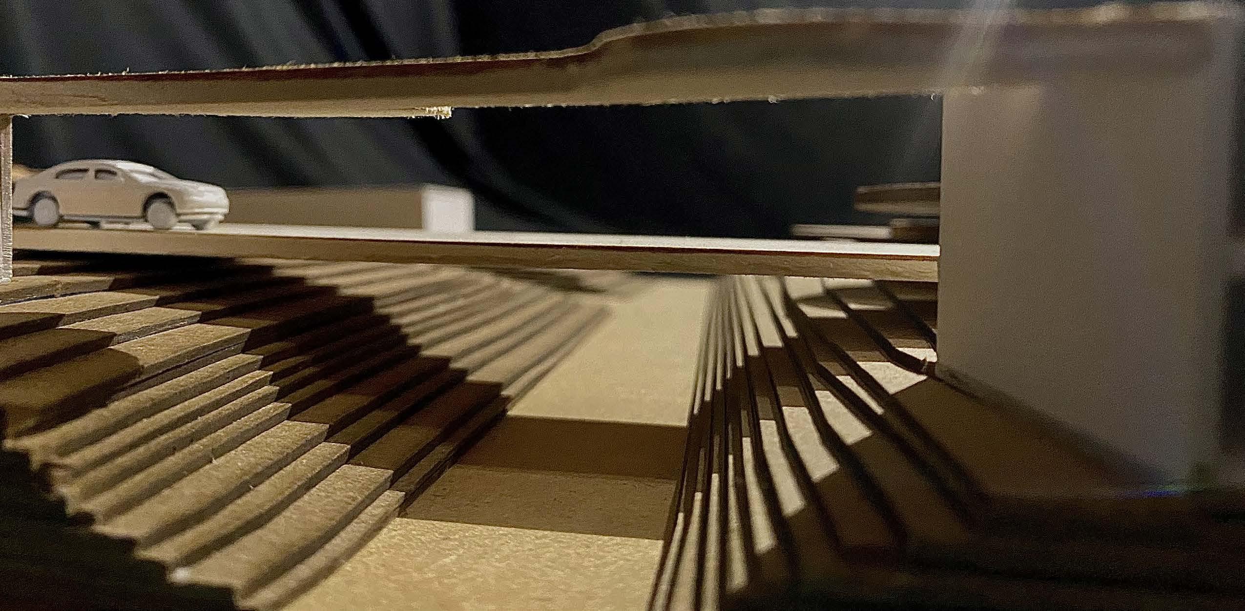
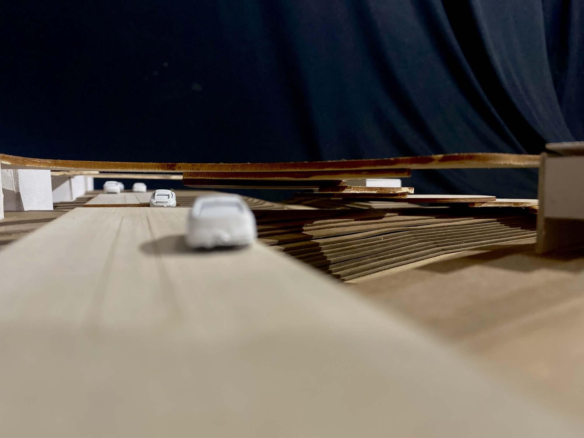
Models
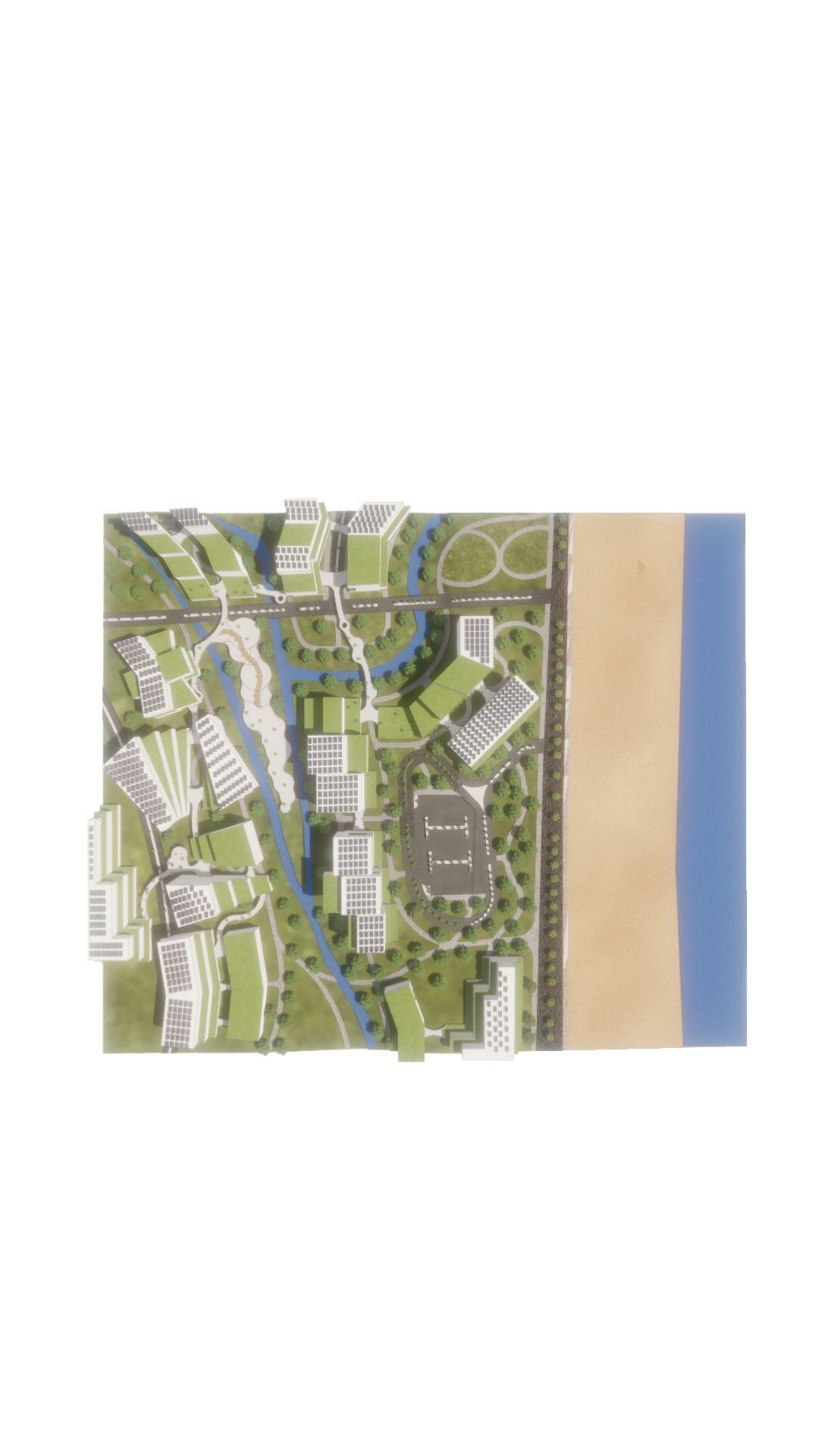
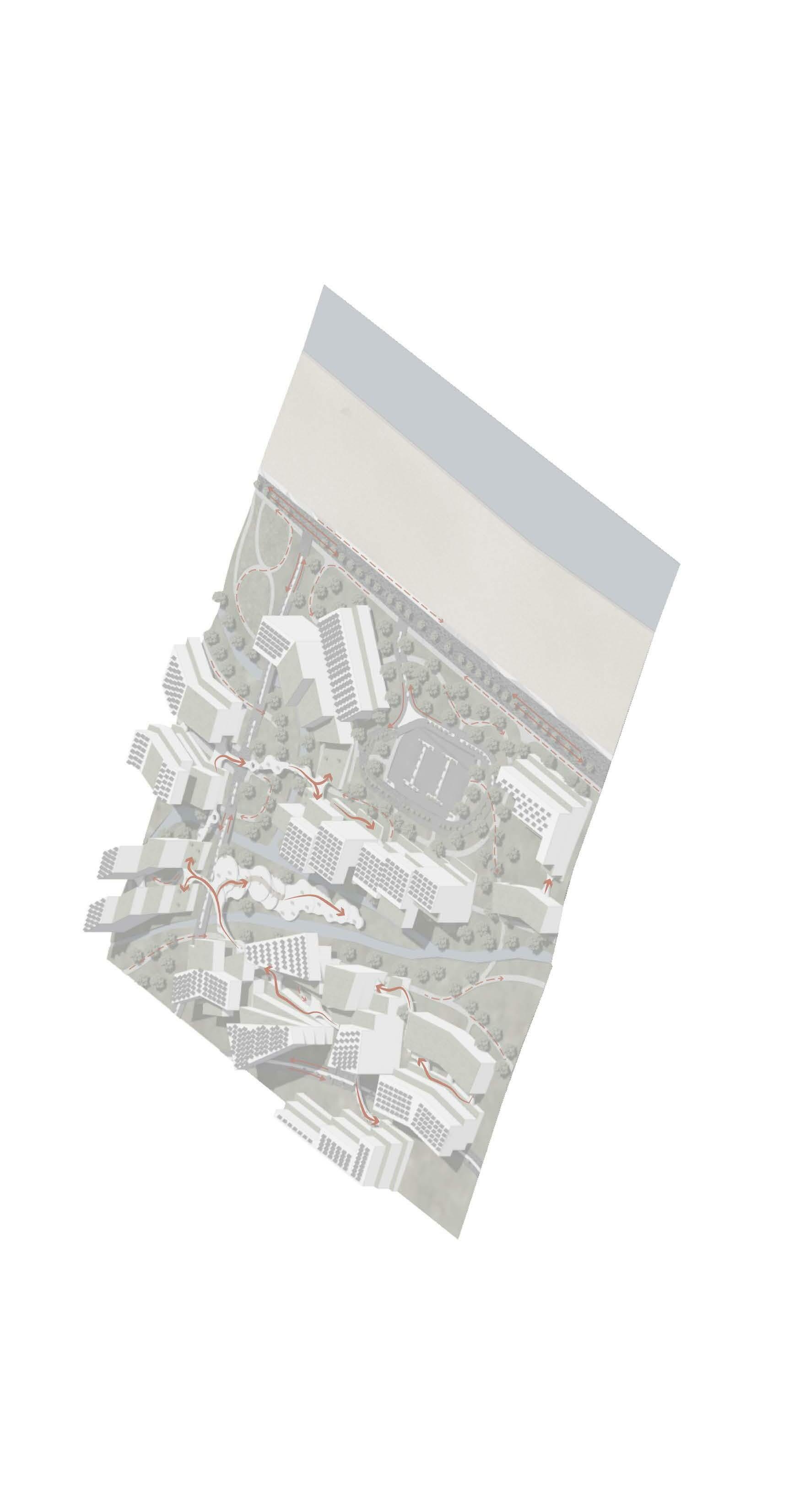
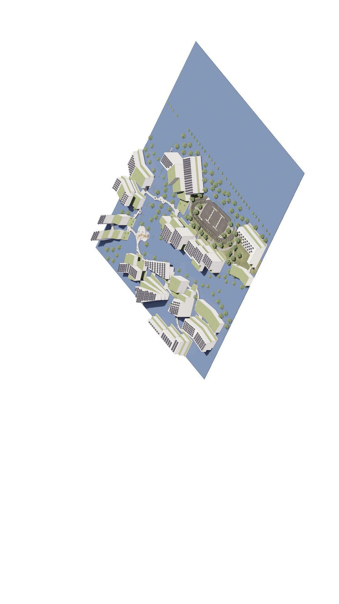
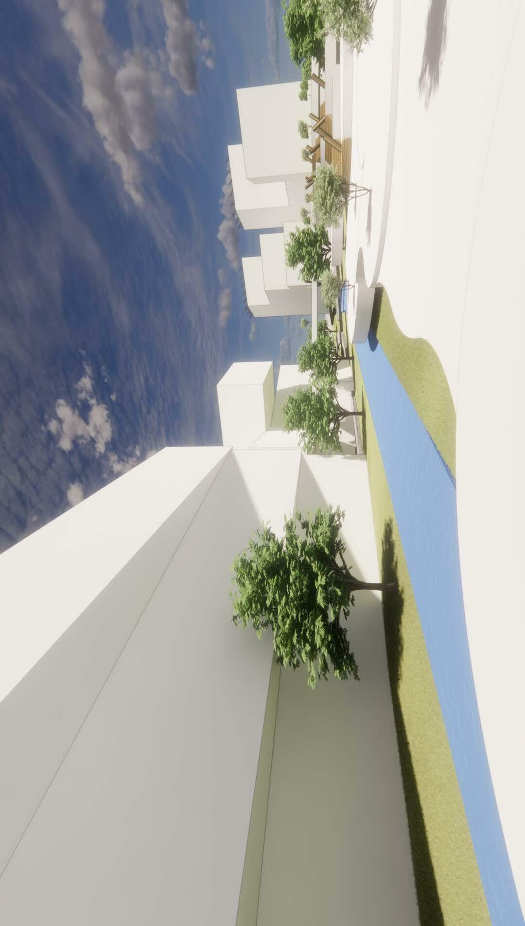
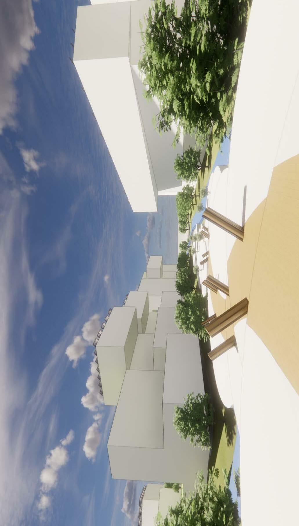
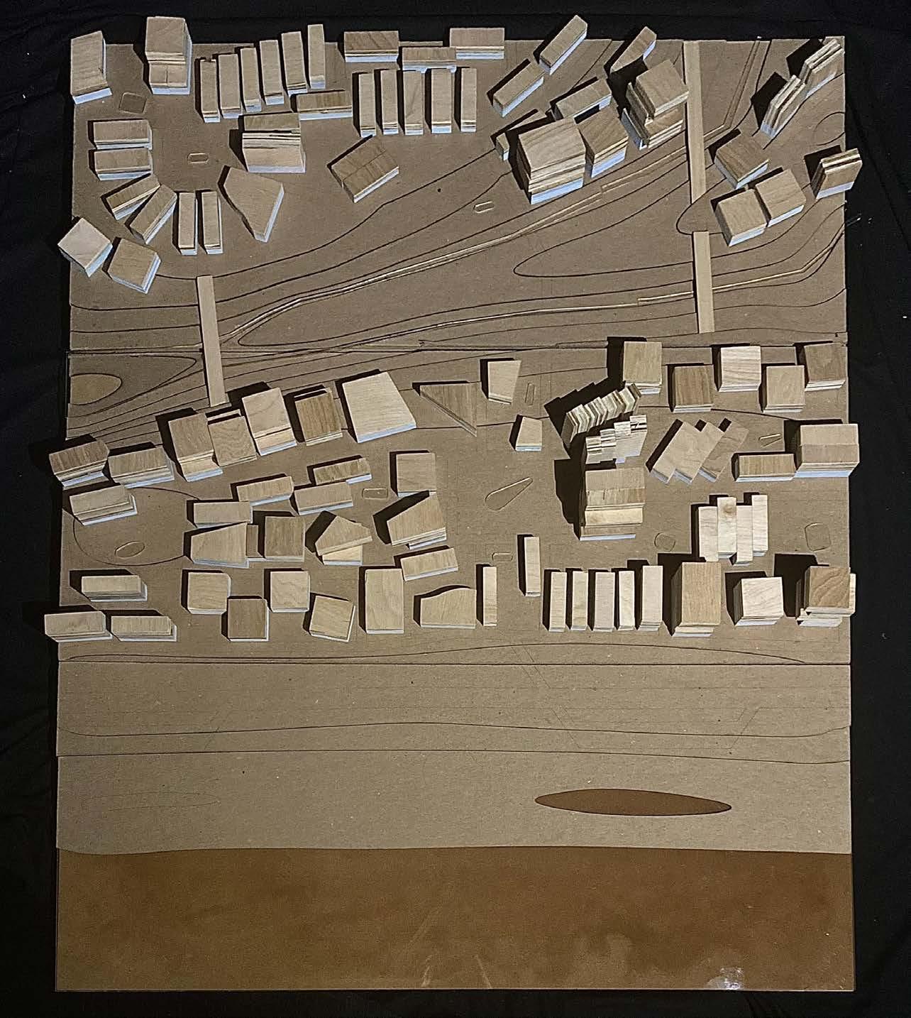
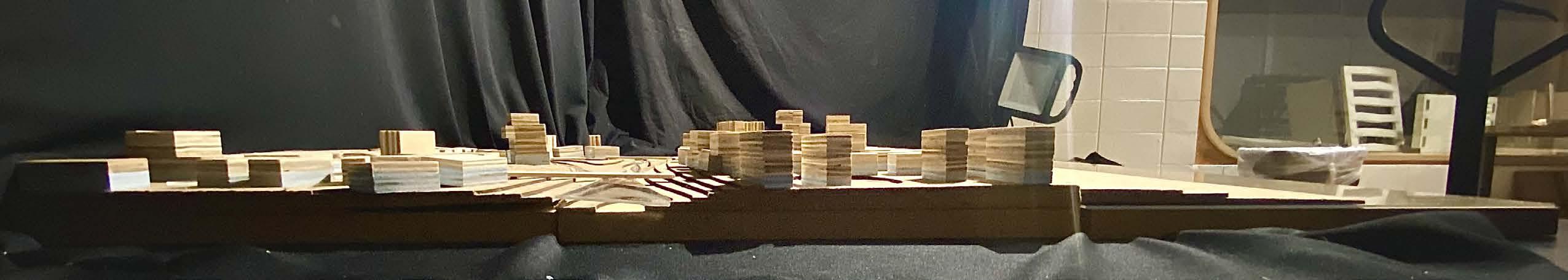
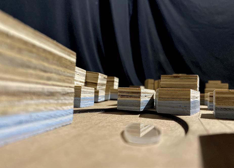
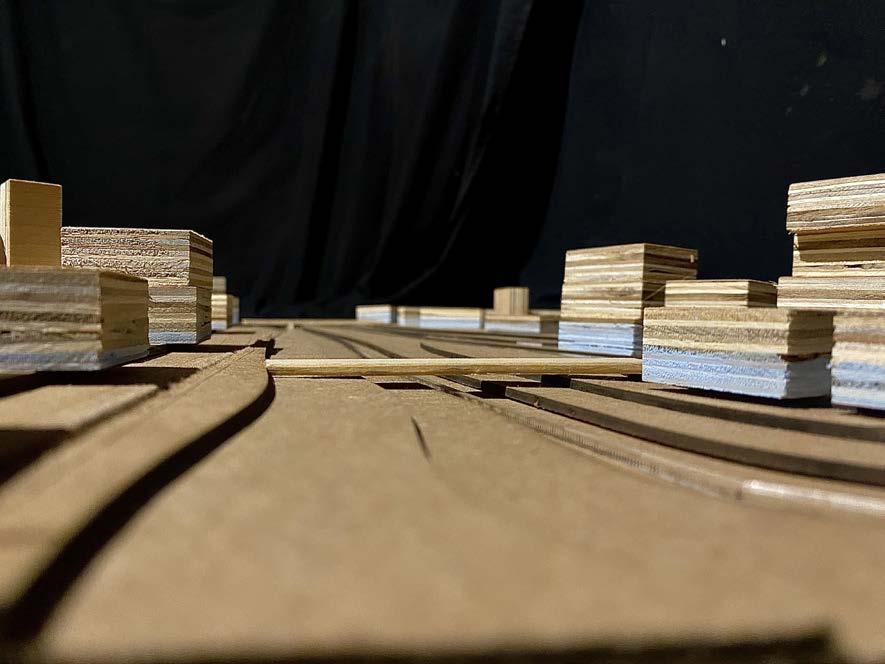
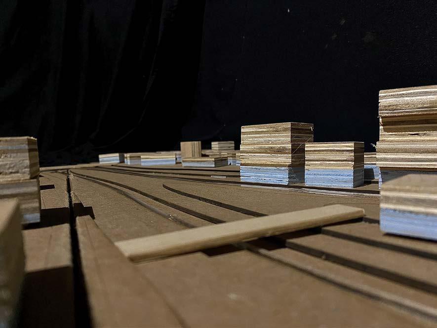
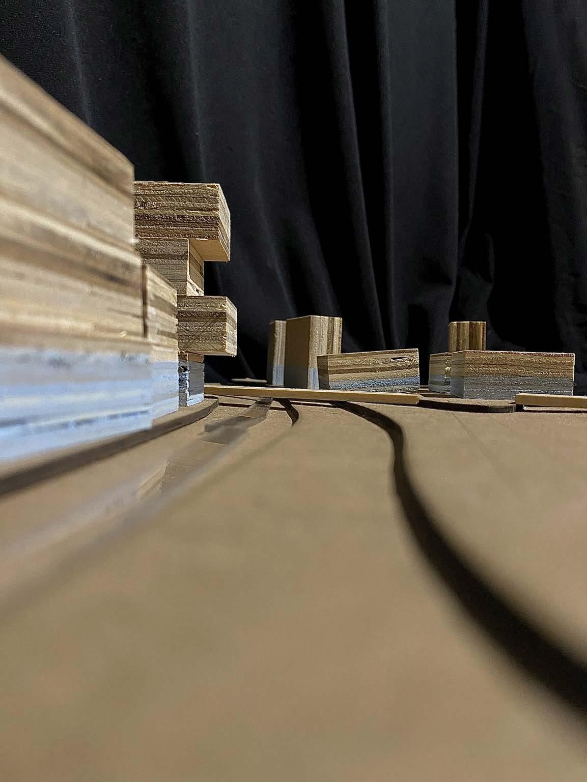
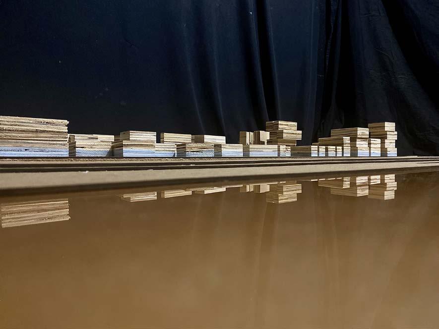
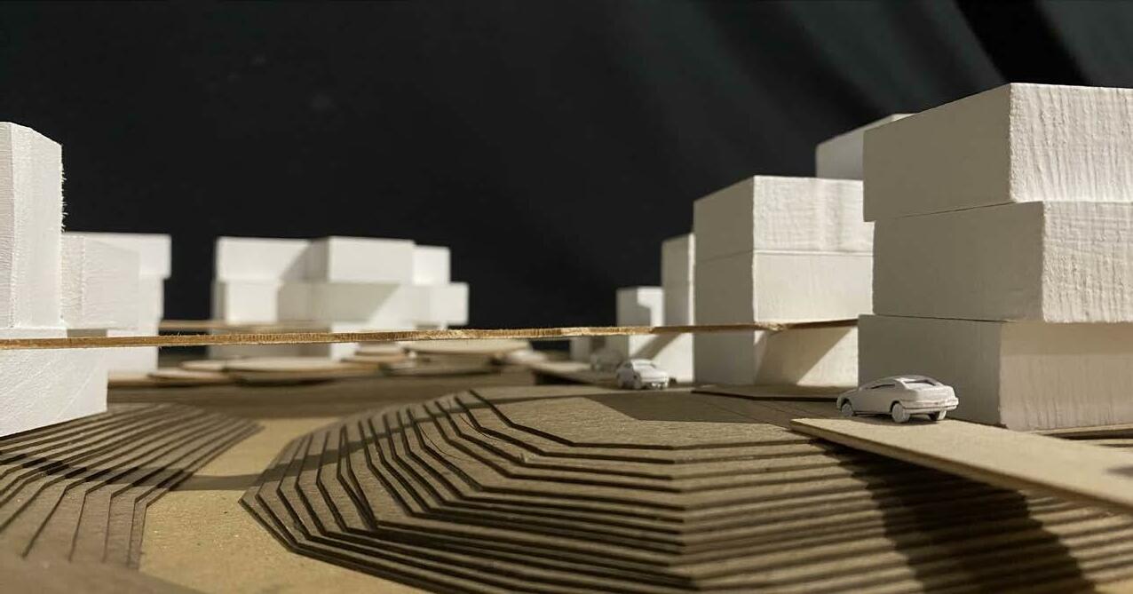
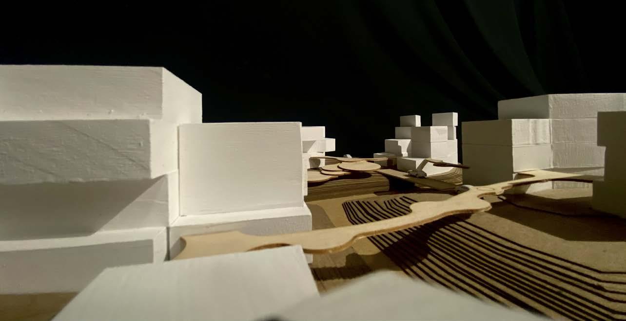
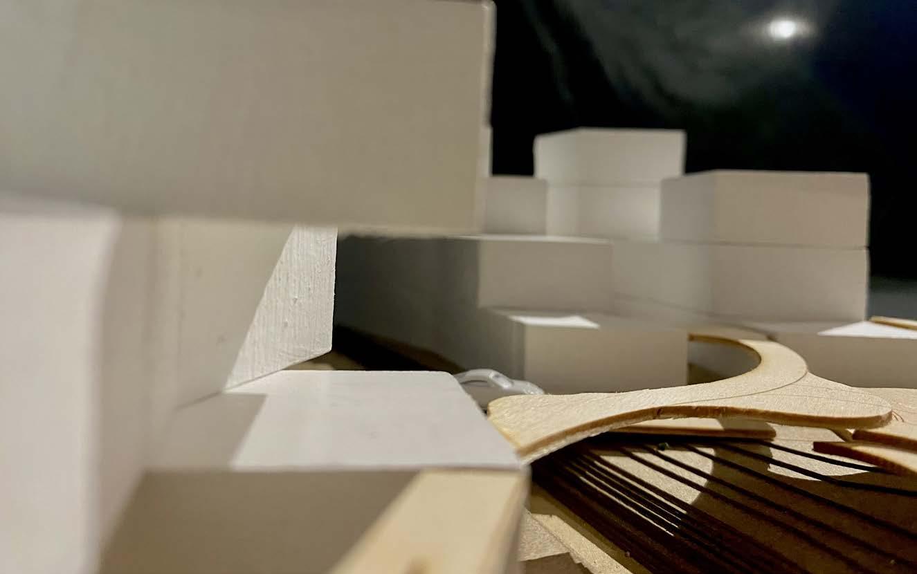
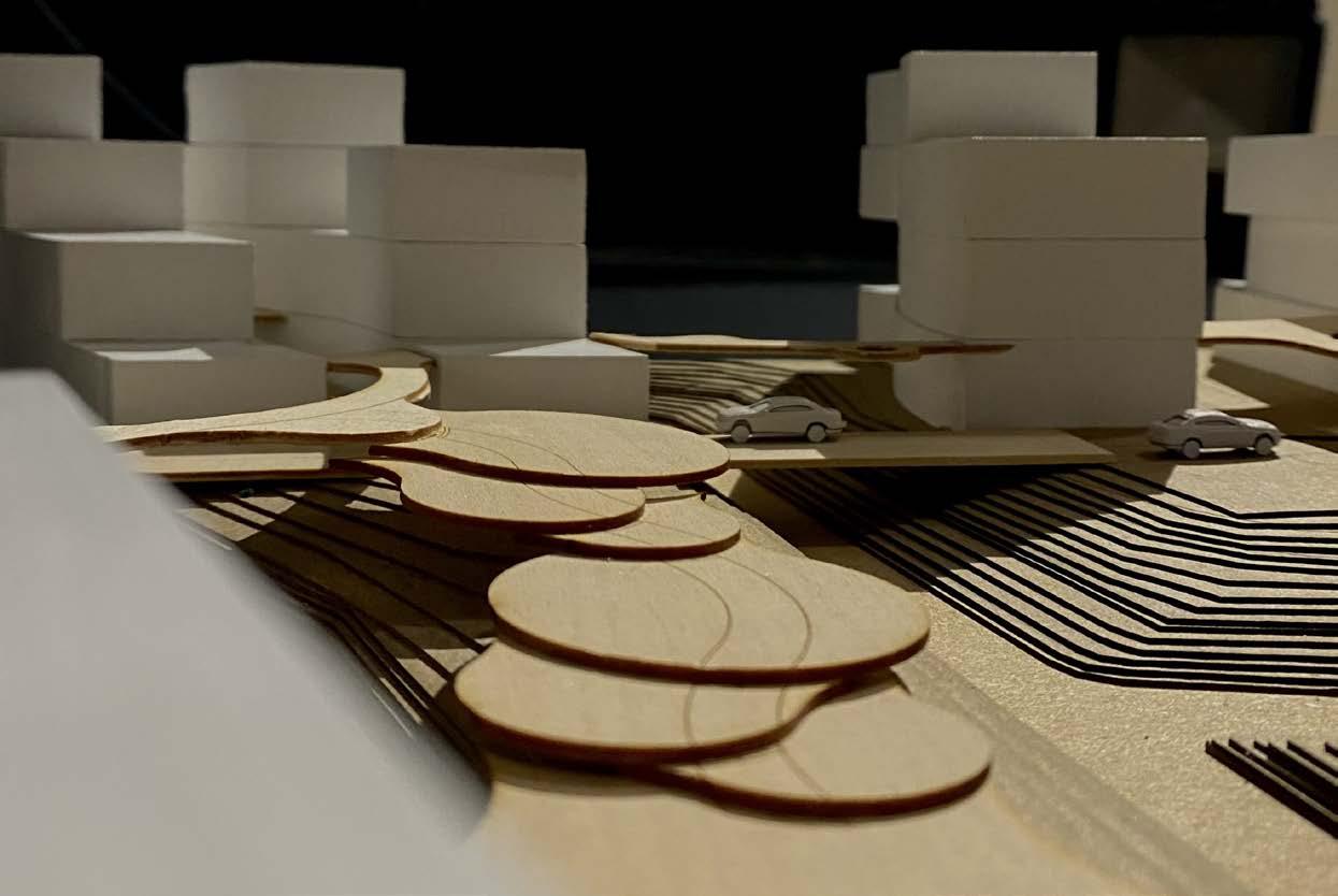
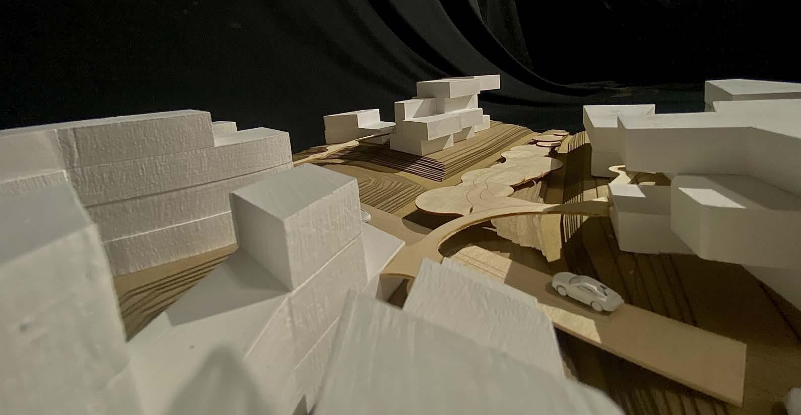
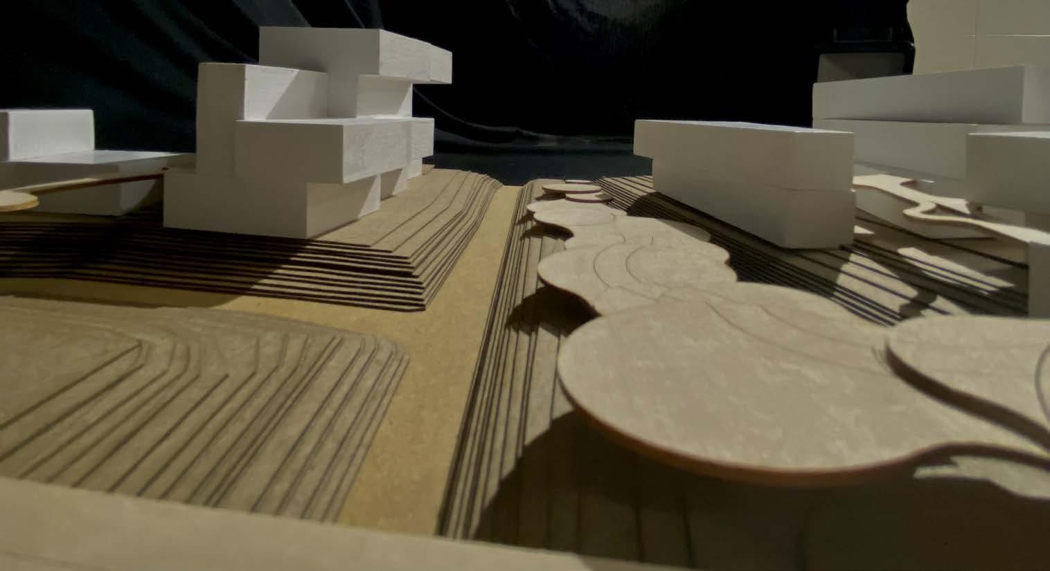
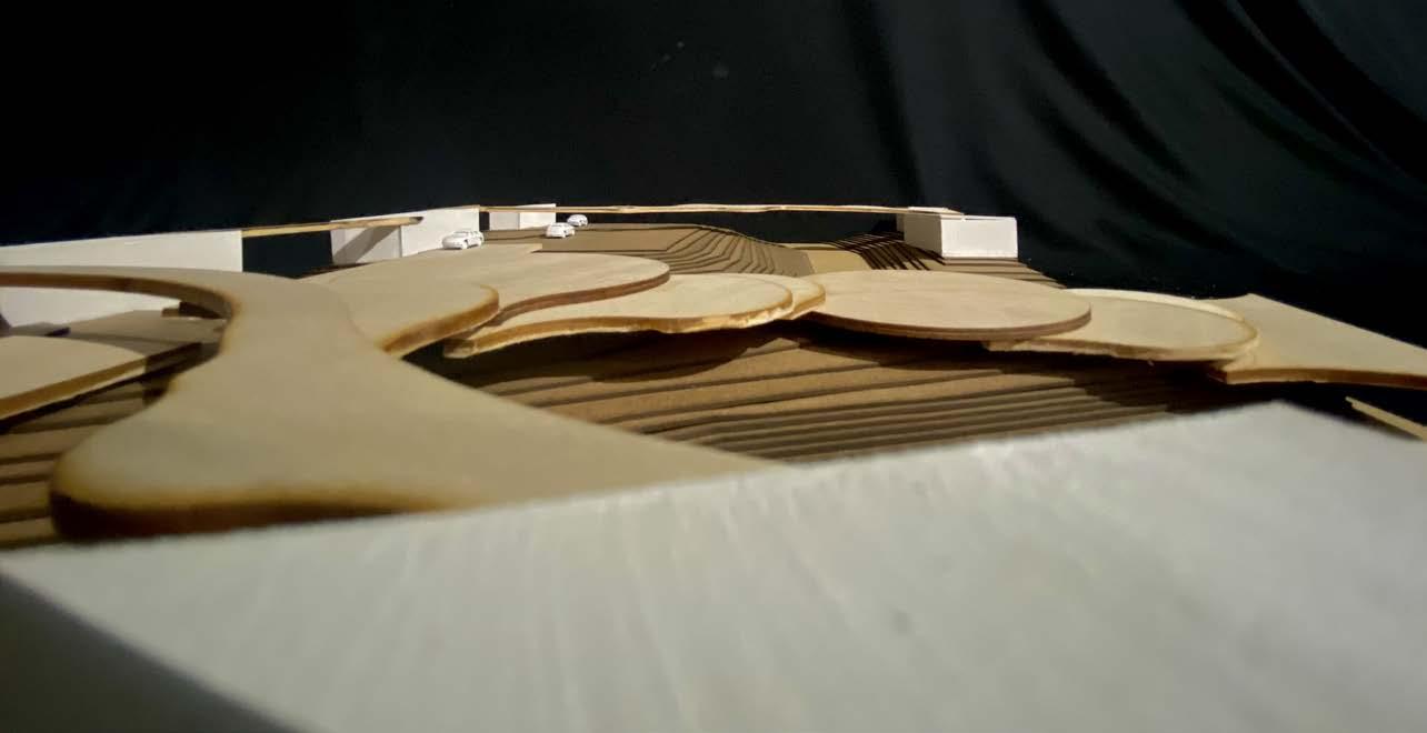
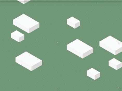
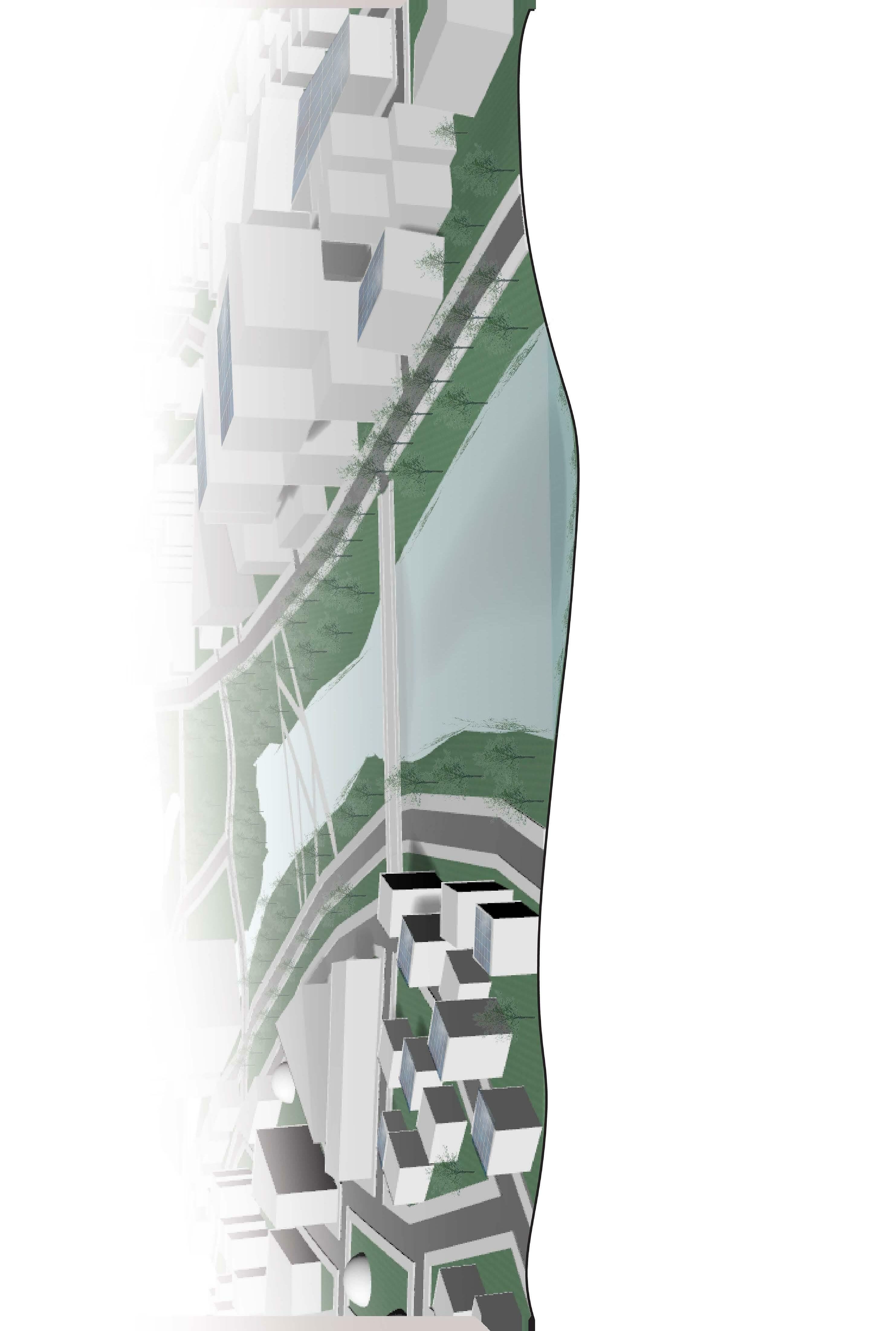
The original idea with the 30 acre model was to design spaces that revolved around a central space to encourage movement to and from one community to another. Most buildings ranged from 2 to 4 stories with a few outliers of 5-8 stories that would be for residential spaces or research and education.
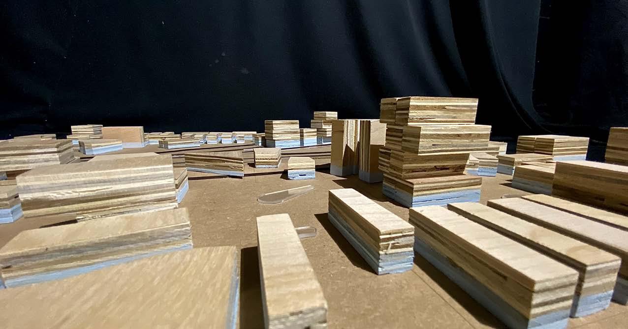
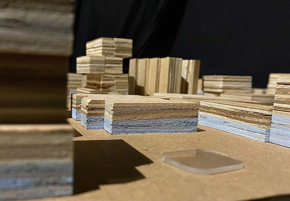
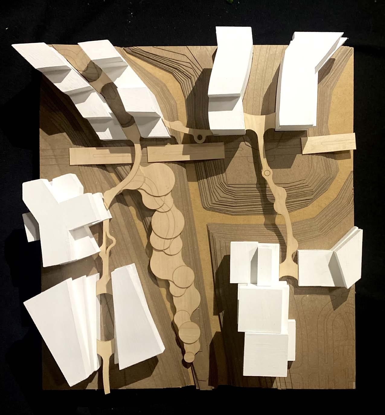
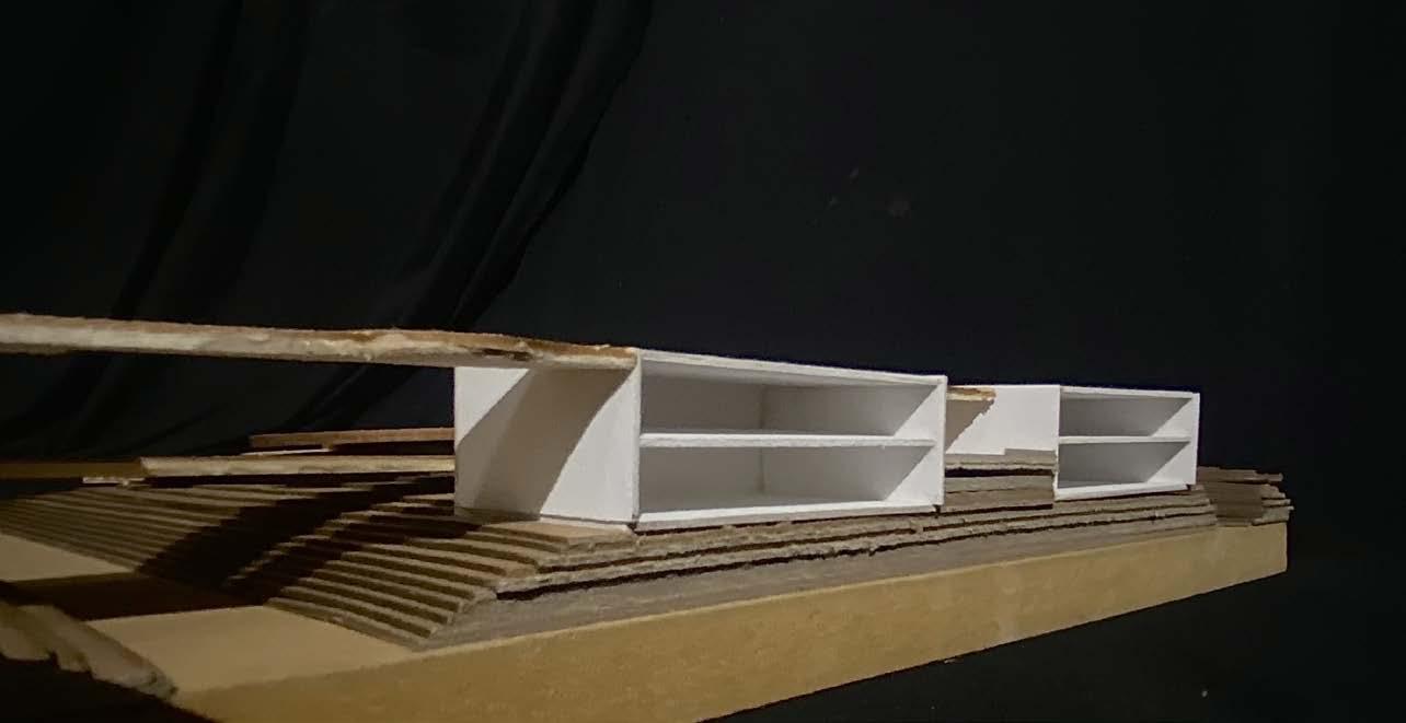
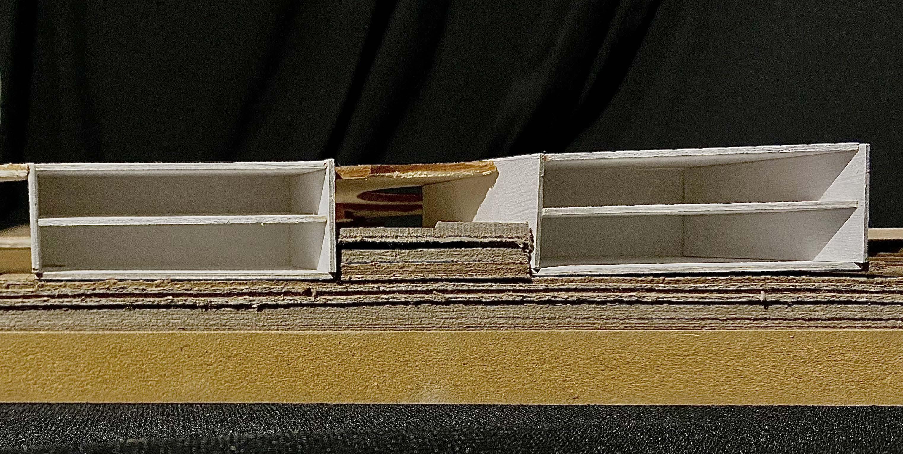
The 9 acre model went on to explore more mid-rise building possibilities. These buildings had unique shapes and level interactions. Each building was connected to another through the designed elevated pathway that is the primary source of circulation.
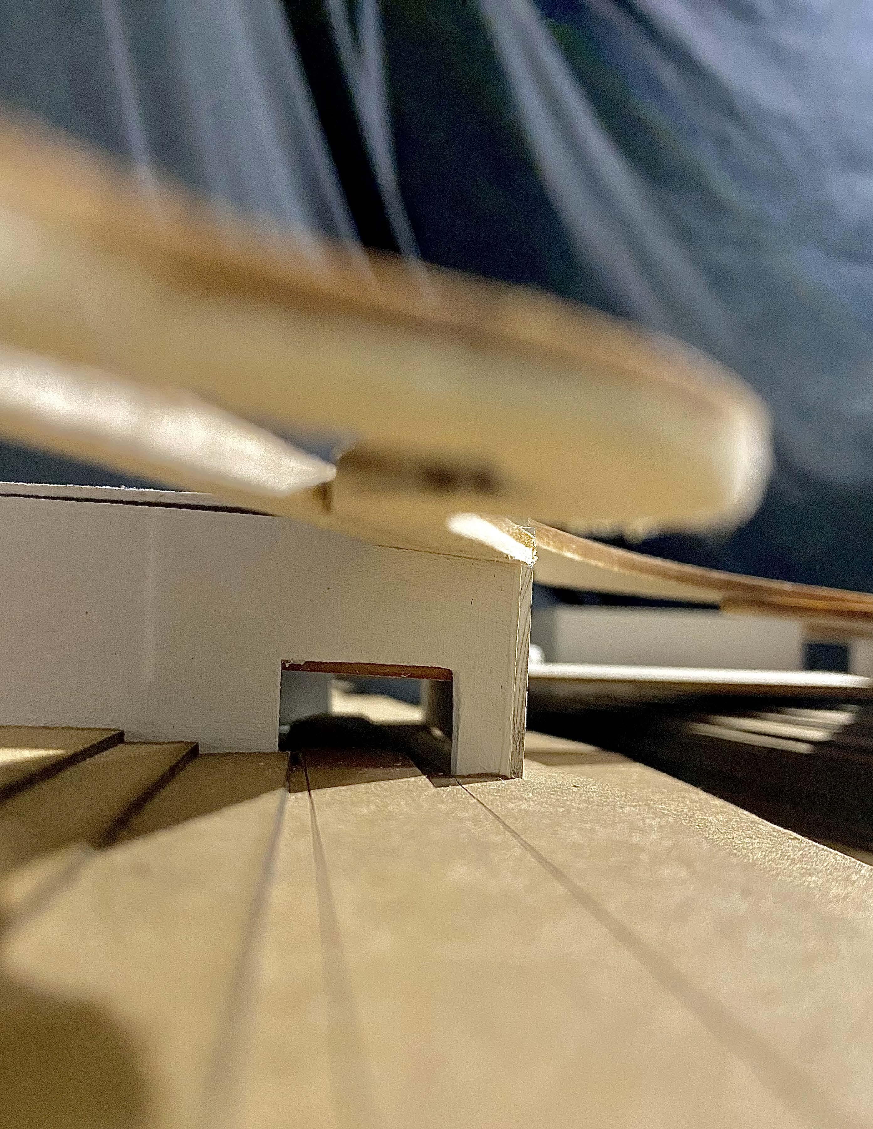
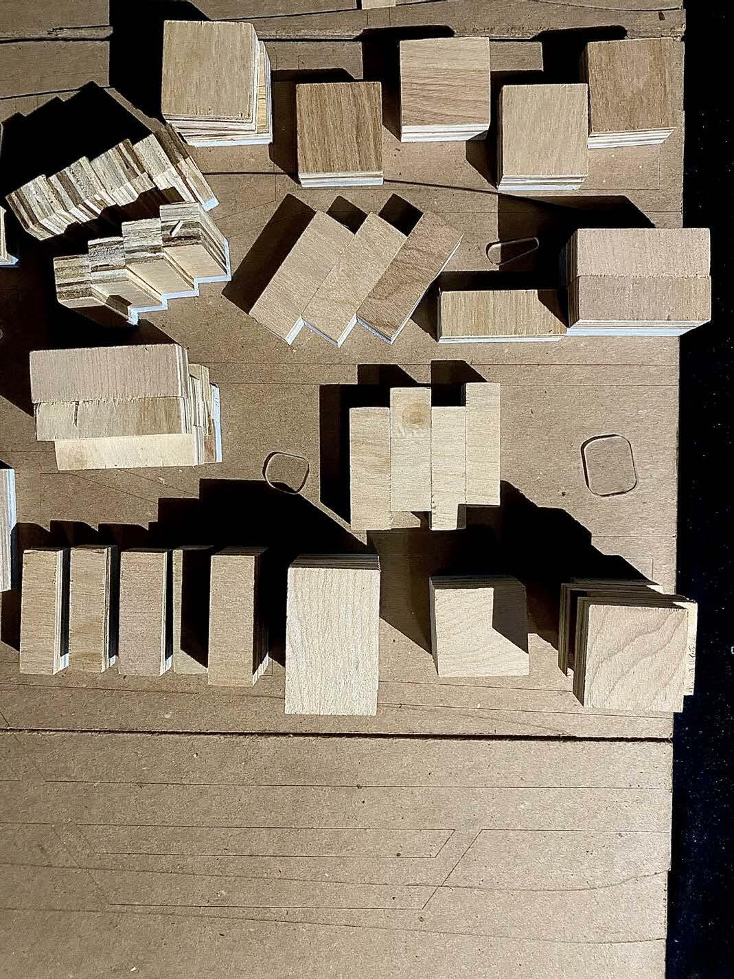
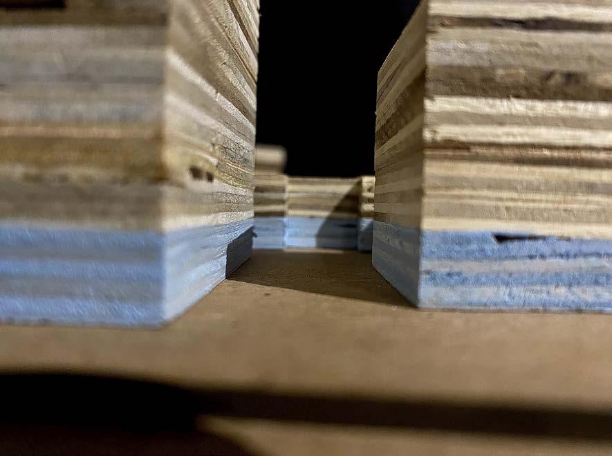
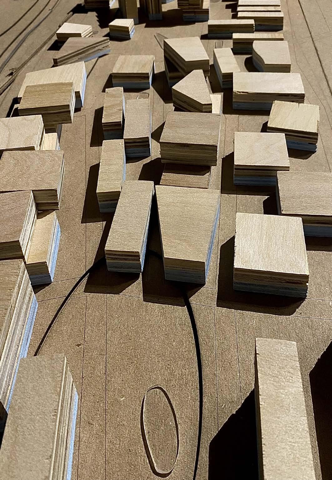
The 3 acre model primary focused on just the first one to two stories that interacted directly with the possible flood zone. This study was utilized to help me understand the scale I was designing at with the elevated walkways, topography, and building size.
10
11 30 Acre Model

12
13
14 9 Acre Model


15 9 Acre Model
16
17


18 3 Acre Model
19 3 Acre Model
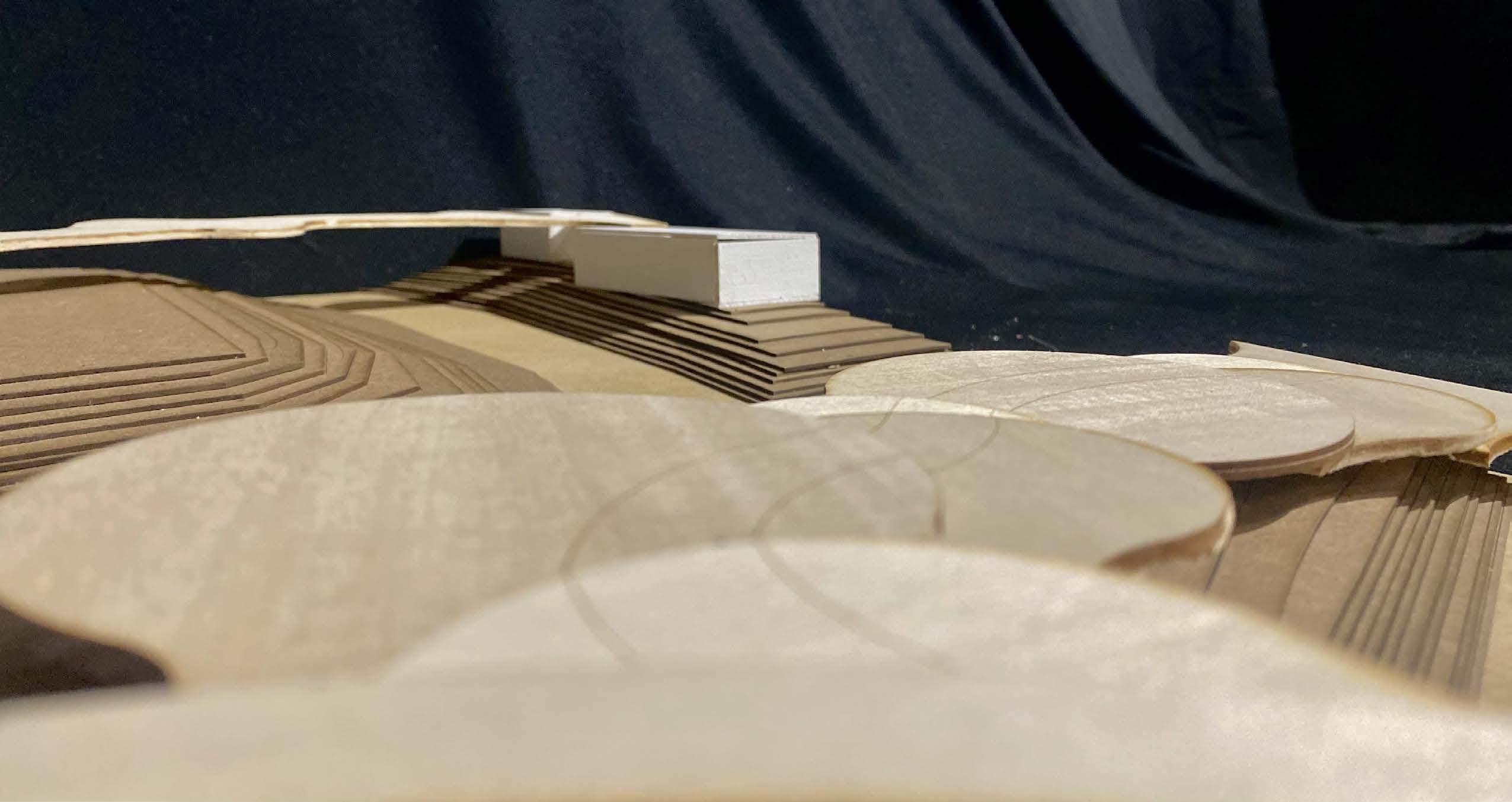
20 3 Acre Model
21 3 Acre Model
Appendix 1
Project 1 - Addressing the Tansect
At the beginning of the semester, we began by doing a mutlitude of research and then presenting it all to our studio sections. After these presentations, we were tasked with developing 3 different concepts on of how to address the transect defining any roads, vegetation, buildings, or bridges that supported their concept. These were not to scale and only had to show the space between the railroad and the ocean front.
of Waterways 1.1 Explorations of Floating Structures 1.2 Explorations of Drainage Systems
Exploration
1.3


COVE CULVERT
CANAL GATE/SLUICE GATE
SECLUDED MARSH Final Idea 1.1
Original
Idea


SPACES ALREADY
STILTS FLOATING ECOSYSTEMS POWERED BY WIND SLIGHTLY ELEVATED ALREADY NO ACTION NEEDED
Final Idea 1.2
ON
Original Idea


SWALE/FLOOD INTERCEPTING TRENCH DETENTION POND/NATURAL WETLAND/CONSTRUCTED WETLAND
WATER TREATMENT AREA AND CULVERT
Final Idea 1.3
GRASS
STORM
Original Idea
Appendix 2
Extra Explorations
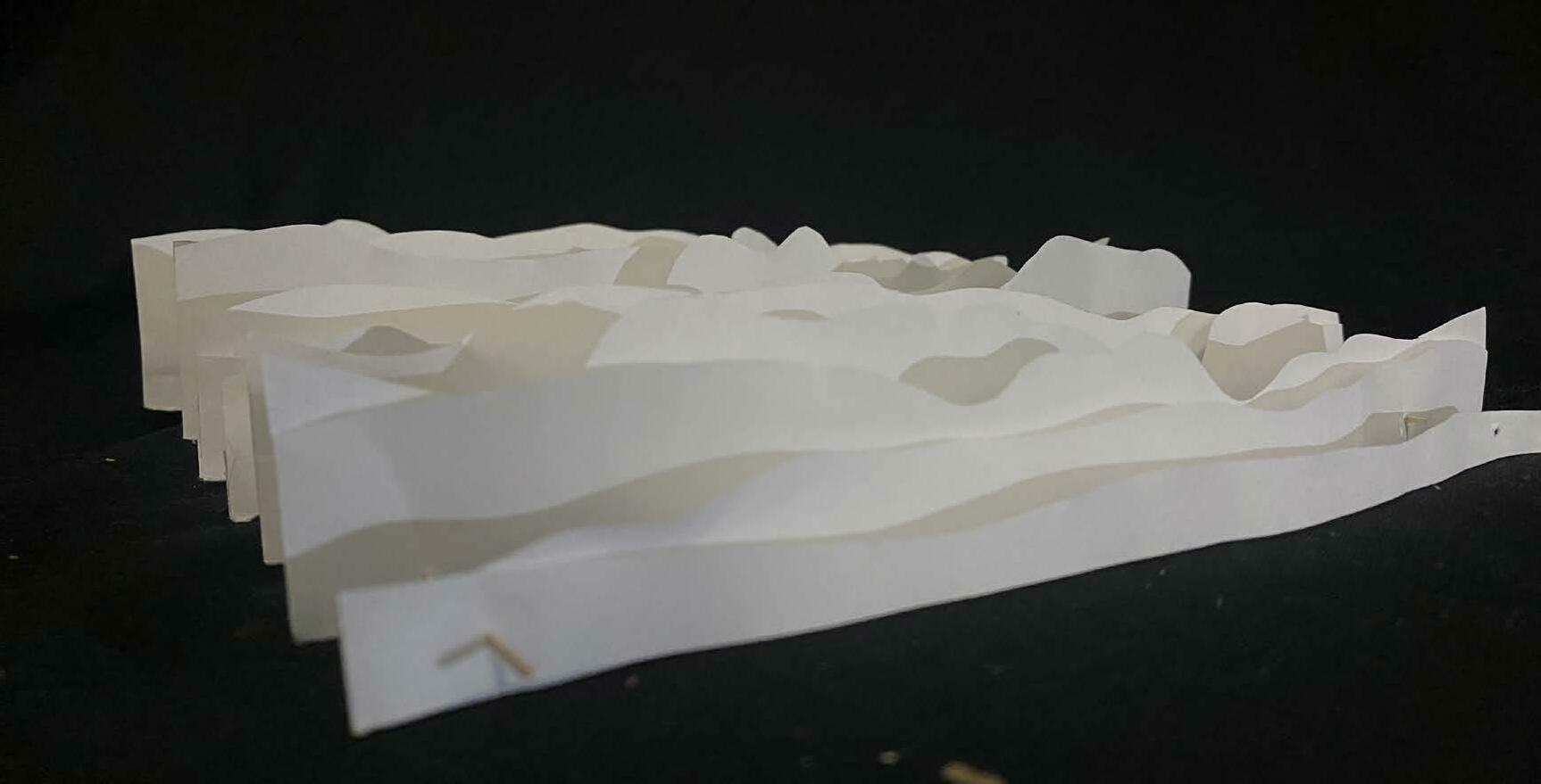
During this phase of the project, students were asked to explore certain abstract forms to generate topographic ideas, plan aspects, and overall formations. This was to be accomplishe through paper models, map collages, and other abstract forms.

Model One Exploration 2.1
Model Two Exploration 2.2

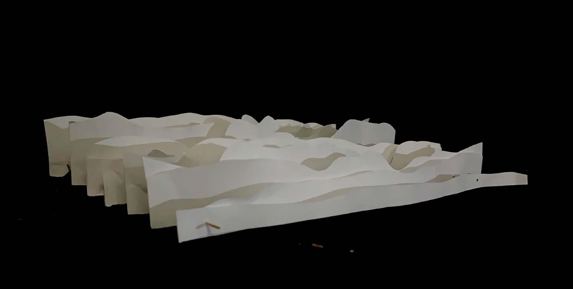
2.1
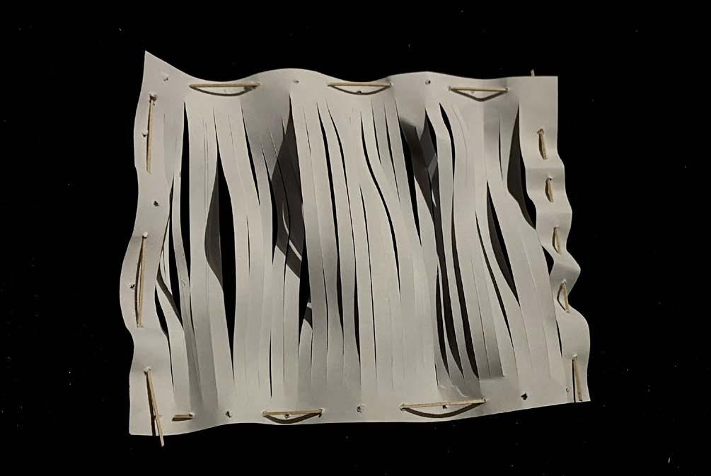


2.2
Project 2
After general designs were generated, students were to zoom into a particular stretch of their idea that was 30 acres of land. This is the original massing to understand community structure in relation of buildings, ways of human circulation, and water circulation. Students had to have a minimum of 6,000,000 cubic feet of building space to exemplify an increase in density in the area. This original idea was displayed in a poster form and 1/32 scale model at a mid-review in the city of Gulfport to a multitude of individuals interested in the topic of coastal resiliency.
Original Poster 3.1
Appendix 3
1 3.1
Restoration Through Purification
Elaine Otts
1
2
The Gulf Coast is a beautiful place, but flooding is inevitable. The constant cycle of destroy, rebuild, destroy is doing so much damage to its economy and the ecology. Lowto mid-income families cannot always afford this process.
Rebuilding is always expense and takes so much time out of daily lives. The bigger factor here, is the ecology and environment. All but one of the waterways between Gulfport and Biloxi are impaired with bacteria that could cause infection and disease due to the run off from the construction sites resulting from flooding. Those that live in these communities know this but take the risks anyways because they love the beach. However, their healthcare does not always agree with this mindset.
 Thoroughfare Walkway
Massing
Thoroughfare Walkway
Massing
By controlling and purifying stormwater drainage and runoff, the number of pollutants and microbes in the waterways could be reduced dramatically. Natural ecology will be reintroduced to the environment to purify the water that flows in and out of the flow lines. When it comes to flooding, if you cannot stop it, why not redirect it? Through the utilization of existing outfalls, streams, and low lying land, a new redirection can be initiated to allow us to design smarter. If we know where the water is heading, we can better predict what will happen to the surrounding areas. How do we do this with minimal damage to the environment and existing communities? We look to the numerous vacant lots whose only job a the moment is to decrease aesthetic appeal and assist the decline of economic factors. By utilizing these lots, we can generate new spaces that can survive and 2
thrive of their own with a base of sustainable practices ranging from hydroponics to solar power. These areas will generate differentiation between communities as that does not exist right now. Walkable communities will be generated to encourage sustainable practice and educational opportunities. These communities will open up greater opportunities for more jobs and better health practices for lowto midincome households who typically struggle with healthcare.
Terra
3.2
Aqua
Whitney Elaine Otts Fall 2022 Professor H. Herrmann Design Studio 4A Mississippi State University