UTAH GROWING WATER SMART
The Water-Land Use Integration Guidebook
Ensuring a Prosperous Future and Healthy Watersheds through the Integration of Water Resources and Land Use Planning
2023 June
ACKNOWLEDGMENTS
Contributors to the Utah Growing Water Smart Guidebook
LEAD AUTHORS: Kelly Kopp and Joanna Endter-Wada
Utah State University’s Center for Water Efficient Landscaping
CONTRIBUTING EDITORS: Chelsea Benjamin, Lindsay Rogers, and John Berggren Western Resource Advocates
Faith Sternlieb, Erin Rugland, and Kristen Keener Busby Babbitt Center for Land and Water Policy, a Center of the Lincoln Institute of Land Policy
PREVIOUS GUIDEBOOK EDITIONS: Waverly Klaw, Sonoran Institute
Marjo Curgus, Del Corazon Consulting
Utah Growing Water Smart Funders
Division of Water Resources (Utah Department of Natural Resources)
Richard K. & Shirley S. Hemingway Foundation
Lawrence T. & Janet T. Dee Foundation
Growing Water Smart Program
Growing Water Smart is a joint program between the Babbitt Center for Land and Water Policy, a Center of the Lincoln Institute of Land Policy and the Sonoran Institute. See www.growingwatersmart.org for information.
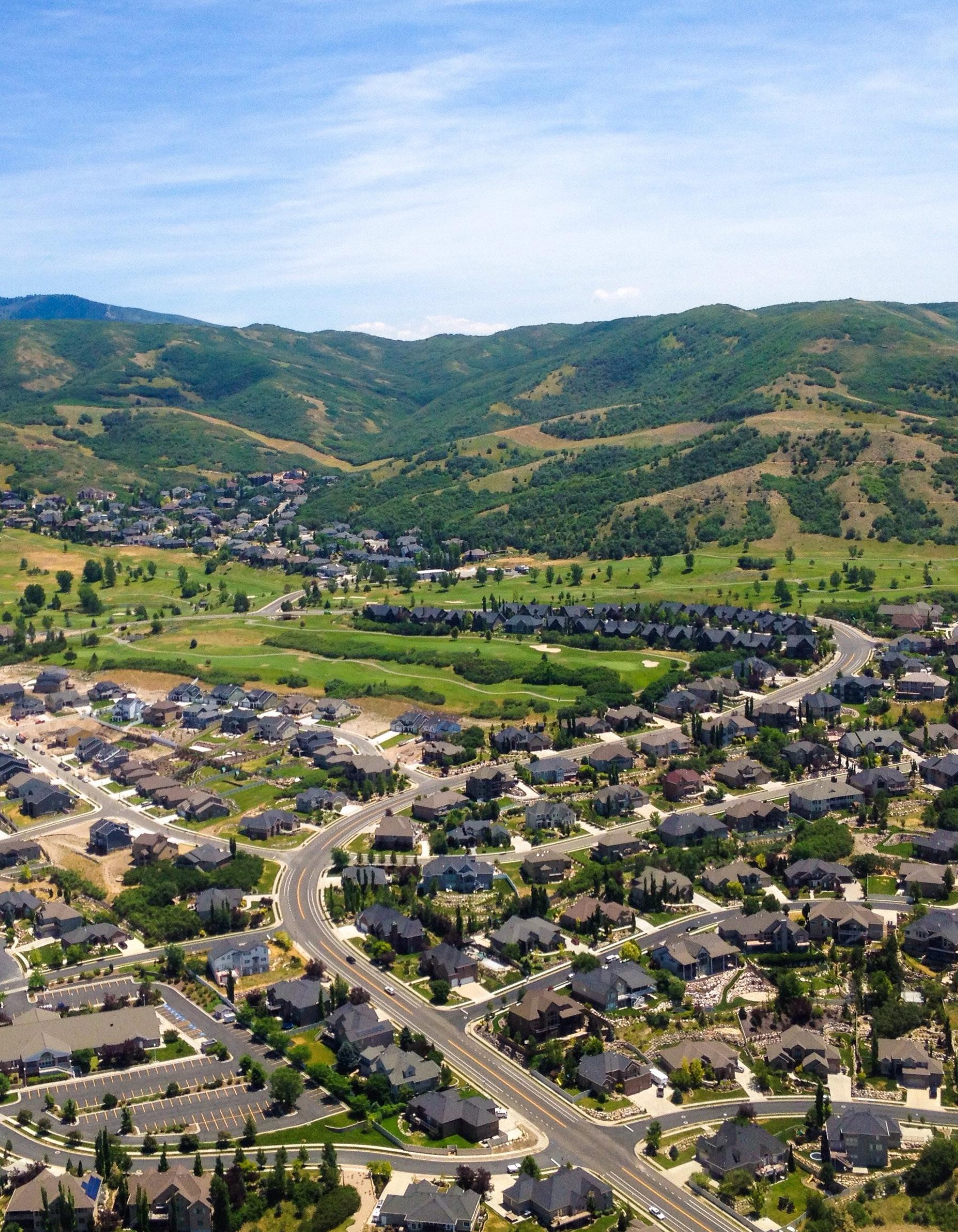
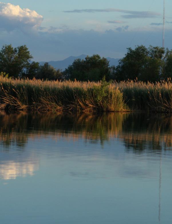
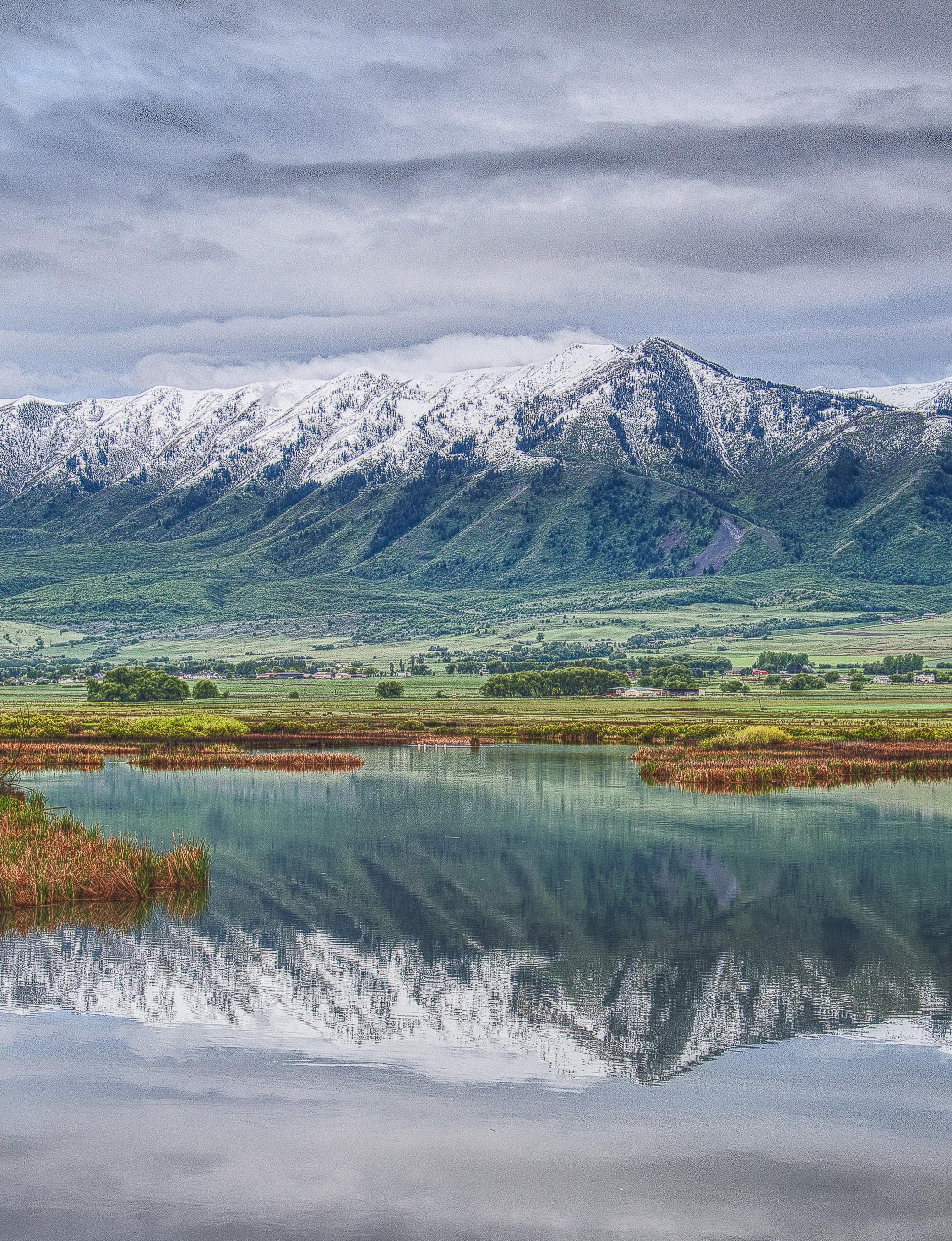
Cover and Inside Photo Credit
(Aerial View of Suburbs in North Salt Lake) is from Frank Munch and (Bountiful Lake) is from Carmen McDonald, 2020
© June 2023
3
PREFACE
Utah Growing Water Smart
The Utah Growing Water Smart workshop brings together key community staff and water and land use planning decision-makers to help build a more resilient and sustainable water future. The workshop uses a range of public engagement, planning, communication, and policy implementation tools to help community teams realize their water efficiency, smart growth, watershed health, and water resiliency goals.
About the Utah Growing Water Smart partner organizations:
Utah Division of Water Resources
The Utah Division of Water Resources is one of the seven divisions housed within the state’s Department of Natural Resources. Tasked with Planning, Conserving, Developing and Protecting Utah’s water resources, the Division earnestly strives to be Utah’s water steward. We are committed to meeting future water needs through a combination of multi-faceted solutions that include conservation, efficiency, optimization, agriculture conversion, and water development. Such an approach will help us prepare, plan, and sustain its water future.
Babbitt Center for Land and Water Policy
The Babbitt Center for Land and Water Policy, a center of the Lincoln Institute of Land Policy, seeks to advance the integration of land and water management to meet the current and future water needs of communities, economies, and the environment. The Babbitt Center develops tools and best practices to guide decisions through research, training, and partnerships for management of land and water resources. We recognize that water is the lifeblood of the American West and land use decisions are made every day that shape our water future. Coordination of these land and water use decisions is critical for ensuring resilient and sustainable communities.

4
Western Resource Advocates
Western Resource Advocates (WRA) fights climate change and its impacts in order to sustain the environment, economy, and people of the West. Our team of policy experts, scientists, economists, and attorneys has a 30-year history of working where decisions are made, sweating the details, creating evidence-based solutions, and holding decision-makers accountable. This onthe-ground work advances clean energy, protects air, land, water, and wildlife—and sustains the lives and livelihoods of the West. WRA brings a unique set of skills, knowledge, relationships, and leadership to solving conservation issues in the West.
Utah State University’s Center for Water Efficient Landscaping
The Center for Water Efficient Landscaping (CWEL) at Utah State University is a research and outreach center designed to improve and optimize the efficient use of water for landscape irrigation. Our team conducts research in the areas of irrigation technology and management, plant water use and drought, water wise and native plants, sustainable turfgrass management, and urban water conservation. The Center also delivers Utah’s Qualified Water Efficient Landscaper (QWEL) certificate training program, hosts a monthly “Water Well with CWEL” webinar, and is the home of the Water Check and WaterMAPS™ programs. The Center’s overall mission is to promote water conservation through environmentally, socially, and economically sound landscape management practices.
5
MESSAGE FROM UTAH GOVERNOR SPENCER J. COX
“Welcome, Growing Water Smart Workshop participants! Thank you for dedicating your time and energy to address such an important topic for our state. As you all know, Utah is facing immense challenges with our water resources. The extreme drought is causing us to think hard about where and how we can best use and conserve water. We also know that water conservation requires all Utahns to do their part, including all of you - who represent our growing towns, cities, and counties. Your participation in this workshop is essential to making our state more resilient by identifying ways to integrate water and land use planning–two vital and connected efforts in one of the fastest growing states in the country. These next few days will be a lot of work, but I have no doubt that the action plans you develop will put your communities on the path to a more sustainable water future.”

6
 Wayne Wurtsbaugh, Utah State University, 2013
8 TABLE OF CONTENTS INTRODUCTION 9 Focusing on Demand-Side Water Management 11 Promoting Watershed Cooperation 12 Water and Land Use Integration Opportunities 12 Guidebook Overview 14 Section 1: PLANNING AND GOAL SETTING 15 Overview 15 Setting The Foundation For Integrated Land-Water Planning 16 Toolbox: General Plans 17 Toolbox: Water Conservation Plans 18 Toolbox: Stormwater Management Plans 19 Toolbox: Hazard Mitigation, Response, & Recovery Plans 19 Toolbox: Capital Improvement Plans 19 Case Study: Salt Lake City Department of Public Utilities - Civic Engagement 20 Section 2: WATER SMART LAND USE AND DEVELOPMENT POLICIES 21 Overview 21 Toolbox: Zoning Ordinances 21 Toolbox: Water Budgets 24 Toolbox: Demand Offset Programs 25 Case Study: Water Demand Offset Program, Santa Fe, NM 26 Toolbox: Building and Design Codes 26 Toolbox: Development Review Processes 28 Toolbox: Water Efficient Landscaping 29 Case Study: Herriman City Water Efficiency Standards 33 Case Study: Cedar City Water Wise Demonstration Street 34 Case Study: Utah Department of Facilities Construction and Maintenance 35 Section 3: WATERSHED RESILIENCE & WATER SMART INFRASTRUCTURE 36 Overview 36 Toolbox: Watershed Planning For Resilience 37 Toolbox: Green Infrastructure & Low-Impact Development 38 Case Study: Green Infrastructure at Our Village Community Center in Moab 40 Case Study: Reducing Potable Demands through Graywater Reuse 41 Section 4: WATER CONSERVATION AND EFFICIENCY TOOLS 43 Overview 43 Toolbox: Conservation Rate Structuring 44 Toolbox: Post-Occupancy Incentives And Educational Programs 45 Case Study: New Water Supplies through Secondary Metering in Weber Basin 47 Toolbox: Consumer Educational Conservation Messaging 49 Case Study: Salt Lake City Turf Trade Program 49 Case Study: Slow the Flow Consumer Messaging 51 CONCLUSION 52 Measuring and Tracking Progress 52 ADDITIONAL RESOURCES 64
INTRODUCTION
Utah faces a formidable challenge. We have the distinction of being among the most arid states in the nation and one of the fastest growing. At the convergence of these two realities lies the challenge of providing a secure water supply for our growing population – projected to reach approximately 6 million by 20651 – while maintaining environmental health, economic vibrancy, and agricultural productivity.
The fragility of a secure water supply is increasingly evident. In recent years, Utah and other western states have experienced the most persistent and driest conditions in recorded history. In the summer of 2022, the U.S. Drought Monitor showed most of Utah in either the “Exceptional Drought” (most severe) category or “Extreme Drought” (second most severe) category for extended periods of time, with drought conditions persisting through the fall. The eastern and southwestern parts of Utah faced the Colorado River Basin crisis, where declining reservoir levels threatened power production, mandatory water shortages affected users in the Lower Basin states, and basin-wide water allocation and river operations were renegotiated. In the western and northern parts of Utah which lie in the Great Basin, Great Salt Lake reached historic low elevations. Its decline led to alarming fears over ecosystem, economic, and public health risks.
Other water-related insecurities are also becoming more evident. The winter of 2022/2023 broke snowpack records across Utah, leading to extensive flooding and emergency declarations in various urban areas as the snowpack melted and rivers, creeks and stormwater systems were overwhelmed. Oftentimes urban flood-related damage is the consequence of not adequately protecting riparian and coastal zones or providing for flood retention in land use planning. We are witnessing communities throughout the United States become increasingly vulnerable to extreme weather events, particularly in areas where rapid growth has occurred. While Utah’s record snowpack was a welcome relief from drought despite flood risks, analysis indicates that one good water year cannot fully alleviate the combined effects of extended drought conditions, the impacts of climate change, and the state’s underlying arid region geography and hydrology.
As we face a changing climate coupled with population and economic growth, we must build resiliency into our water and land use planning by taking immediate steps to adjust habits that contribute to growing water scarcity and an increase in water-related land use risks. We must also implement measures to support responsible and sustainable growth.
There is broad consensus that optimizing water use and reducing demand for municipal, commercial, institutional, industrial (M&I), and agricultural water is critical to ensure that Utah’s limited water supply can equitably meet the needs of people, agriculture, the economy, and the environment over the long term. However, the pathway to achieving substantial water conservation includes many challenges as well as opportunities.
9
1 Hollingshaus, M., M. Hogue, E. Harris, M. Bateman, M. Backlund, and E. Albers. 2022. Utah Long-Term Planning Projections: A Baseline Scenario of Population and Employment Change in Utah and its Counties. Kem C. Gardner Policy Institute. University of Utah.
One significant opportunity for reducing water consumption lies with integrating water use into land use planning. Too often, land use planning is undertaken independently of water use planning efforts, even though the two can and should inform one another. Traditionally, responsibilities for water resource management and land use planning have been siloed in different levels of government, departments, and management entities. The way that new development occurs, however, can have a major impact on municipal water demand, as well as the health of the communities and watersheds in which it happens. Land use planning that incorporates water use considerations can lead to a more sustainable urban design in terms of the built environment, urban ecology, and lifestyle patterns of cities and towns.
Another significant opportunity lies in integrating land use considerations into water planning. This opportunity recognizes that the earth’s water cycle is a closed loop that circulates water between oceans, the atmosphere, and land via precipitation, drainage, and evaporation. Just as the natural environment treats water as a cycle, it is important that communities view their water supply, including wastewater and stormwater, as interconnected and part of their larger watershed. Integrated Water Resource Management (IWRM) coordinates the development and management of water, land, and related resources, while maximizing economic and social benefits, and minimizing impacts on the environment. A key step in this process is to change institutional structures to strengthen the coordination and collaboration between water supply and wastewater managers, land use planners, economic development managers, and other community and regional officials.
National organizations of water and land professionals recognize the urgent need to integrate water and land use planning, policies, and management. In 2021, the American Water Resources Association along with the Babbitt Center for Land and Water Policy, the American Planning Association’s Water and Planning Network, and the American Water Works Association issued a joint Findings Statement and Call to Action resulting from the Specialty Conference on Connecting Land and Water for Healthy Communities.2 The findings synthesize observations from conference participants about the reasons for and consequences of fragmentation between water and land planning. The call to action includes a set of guiding principles to aid land-water integration efforts.
Within Utah, notable key stakeholder processes, authorities, and studies also have advocated for the integration of land use and water planning, including, but not limited to the following:
• Recommended State Water Strategy (2017)3
• Water Resources Plan (2021)4
• Utah’s Coordinated Action Plan for Water (2022)5
• Utah’s Division of Water Resources Conservation Programs6 and Integration of Water and Land Planning,7
2 “Findings Statement and Call to Action from the Specialty Conference: Connecting Land and Water for Healthy Communities,” available online: https://www.awra.org/Members/Publications/Policy_Statements/Connecting_ Land_and_Water.aspx.
3 https://envisionutah.org/utah-water-strategy-project.
4 https://water.utah.gov/2021waterplan/.
5 https://gopb.utah.gov/waterplan/.
6 http://conservewater.utah.gov/.
7 https://water.utah.gov/integrated-water-land-planning/.
10
• Utah’s Division of Water Quality Watershed Programs,8
• Great Salt Lake HCR10 Steering Group Recommendations9 to help maintain adequate flows to Great Salt Lake (2020), and
• Reports and studies10 commissioned by the Great Salt Lake Advisory Committee.
This guidebook provides background information, community case studies, and numerous additional resources to help Utah communities align their water resource management and land use planning priorities. By doing so, Utah’s communities—regardless of their size or geographic location—can shift their focus from supply-side to demand-side water management, promote cooperation to enhance watershed health, and seek opportunities to implement integrated water and land use planning.
Focusing on Demand-Side Water Management
Instead of making costly investments to increase water supply, communities are increasingly reducing demand for water by using existing supplies more efficiently. Growing populations can increase the costs of operating local utilities, accelerate the need for enhanced and expanded water infrastructure, worsen impacts on environmental water needs, and—if the water supply is constrained—increase the cost of acquiring new sources.
In the past, water resource managers and water providers turned to supply side management to meet growing demand by investing in water acquisition, treatment, and storage and distribution projects. However, these options come with a significant price tag and can be time and resource intensive. Recent and projected warming throughout the region also makes the availability and reliability of new supplies less predictable. An alternative to these costly investments is more efficient use of existing supplies. Increasingly, communities are turning to demand side management—an approach that seeks to reduce the demand for water. A demand side approach generally includes:
• Water Conservation: Encouraging water users to reduce how much water they use.
• Water Efficiency: Encouraging or requiring the use of technology, building, or site designs that use less water.
• Water Reuse: Treating or converting gray and black water to replace or augment water supply.
One particularly impactful demand side management strategy is the integration of water conservation, efficiency, and reuse into land use planning. Communities throughout the West have found that by increasing development density, utilizing technological efficiencies (e.g., fixtures, appliances, and irrigation systems), and enacting aggressive conservation programs and policies, they have been able to continue to grow without acquiring new water supplies. Watersmart land use planning can also reduce the negative financial impacts of increased water demand through efficiency and conservation measures implemented prior to, during, and after building construction. The demand side management approach to water resources is also
8 https://deq.utah.gov/water-quality/watershed-monitoring-program/watershed-management-program.
9 https://ffsl.utah.gov/wp-content/uploads/GSL_HCR10Report_final_Dec2020b.pdf.
10 https://deq.utah.gov/great-salt-lake-advisory-council/activities-great-salt-lake-advisory-council.
11
good for the triple bottom line of financial, social, and environmental outcomes. It increases the cost-benefit ratio of capital investments by using the same amount of water and infrastructure to serve more people per dollar spent, benefits the environment by balancing ecosystem and human needs, and ensures a more sustainable future for our communities through a more resilient and long-lasting water supply.
Promoting Watershed Cooperation
Every community lives within a watershed—a land area that channels rainfall and snowmelt to creeks, streams, rivers, and underlying groundwater aquifers. The amount and quality of water in rivers, streams, and groundwater aquifers depend on activities in the land areas upstream from those sources. Water and land are connected through the geography and hydrology of watersheds, as are the people who use the water and land and share in the benefits and risks that their collective actions have on watershed health. For instance, the dwindling Great Salt Lake lies at the bottom of its large watershed; cooperation within and between upstream communities is required to help secure its future.
Watersheds integrate natural terrestrial and aquatic ecosystems with human water and land uses. Tensions often exist between preserving the natural environment and developing land for residential, commercial, or industrial uses to house a growing population and promote economic growth. While degradation of land within a watershed comes with societal and environmental costs, careful management yields significant benefits. Holistically managed watersheds can store water supplies, reduce erosion and channel incision, increase infiltration into local floodplains and regional aquifers, reduce water treatment costs, and provide habitat, biodiversity, recreation, and aesthetic values. Healthy watersheds and resilient natural systems can also help communities cope with increasingly extreme weather events such as droughts, floods, high temperatures, and severe wildfires.
Fortunately, many measures can be taken to maintain and improve watershed health, both for existing and future development. Factors such as residential lot size, housing density, water conservation measures, vegetation management and habitat protection, and stormwater management all influence the health of a watershed and impact water quality and stream flows. However, to realize the benefits of such measures, communities located within the same watershed must cooperate and work together toward shared goals.
Water and Land Use Integration Opportunities
Utah communities are faced with the challenge of accommodating growing populations, supporting economic development, and maintaining or enhancing quality of life, all while managing increasingly variable and scarce water supplies, infrastructure challenges related to growth, and the impacts of land and habitat degradation.
12
Regionally shared risks of extreme weather and wildfires also make understanding the interconnectedness of water and land particularly urgent. Across Utah, communities have experienced record heat, devastating fires, dry soils, ongoing drought, and damaging floods in recent years alongside health and economic impacts associated with the COVID-19 pandemic which, in some places, were exacerbated by limited access to safe and reliable water. These conditions have highlighted the need to act now to build community, economic, and environmental resiliency and to address equity concerns associated with access to safe drinking water within communities and across regions and watersheds.
At the community level, each planning and regulatory mechanism guiding how and where a community develops provides an opportunity to consider how to better integrate water and land use in order to reduce future risks and strengthen resiliency. Potential points of intervention to enhance land-water integration are described in Table 1. Determining how and where to intervene will depend on a community’s local values and needs, political motivation and staff capacity, the demand side management initiatives that have been implemented to date, and the community’s water-saving goals. The vision and goals defined in general and master plans - and related planning efforts - will guide opportunities in other elements of a local government’s water and land use policies and programs.
Planning & Goal Setting
General Plans
Water Conservation Plans
Stormwater Management Plans
Capital Improvement Plans
Hazard Mitigation, Response, & Recovery Plans
Evaluates local water supplies, current and future demands, and related community and economic values. Establishes goals and objectives for managing the intersection of natural resources and the built environment.
Development Policies
Zoning Ordinances, Subdivision Regulations, & Planned Development Policies
Water Budgets
Demand Offset Programs
Building and Design Codes
Water Efficient Landscaping Ordinances
Links new development to water supply planning. Determines the requirements applied to new development for water resource management, conservation, and efficiency.
Watershed Resilience & Water
Smart Infrastructure
Watershed Planning for Resilience
Green Infrastructure and Low Impact Development
An integrated water resource management approach helps mitigate the factors that can degrade ground and surface water quality and quantity. Green infrastructure can support these efforts.
Water Conservation and Efficiency Tools
Conservation Rate Structuring
Post-Occupancy Incentives and Educational Programs
Consumer Educational Messaging
Empowers and incentivizes landowners and renters to reduce water consumption. Links community-wide programs to water supply planning.
13
Point of Intervention Tool Purpose
Table 1. Intervention points, tools, and their purpose for strengthening integration between water and land use.
Guidebook Overview
This workshop guidebook is intended to help your community identify the most appropriate land use related actions that will help your community achieve its water resource management goals. It has been prepared for communities participating in the Utah Growing Water Smart workshops and is available to other communities as well. Since this Guidebook is primarily aimed at community-level decision making and action, we use the more generic word “community” to refer to the municipalities, counties, or conservancy districts with legal authority to engage in planning and policy making for people and businesses within their jurisdictional boundaries.
The guidebook is divided into four sections.
Section 1: Planning and Goal Setting
Summarizes opportunities to integrate water and land use during planning processes for new and existing areas.
Section 2: Water Smart Land Use and Development Policies
Provides a review of policies and requirements that help a community develop in a water smart manner.
Section 3: Watershed Resilience and Water Smart Infrastructure
Describes water smart infrastructure approaches to protect watersheds, support vegetation and wildlife, recharge local floodplains, and provide community amenities and open space.
Section 4: Water Conservation & Efficiency Tools
Summarizes water conservation and efficiency tools to manage existing community water demands.
Each section includes:
1. An overview that provides an explanation for the utility of each approach and the water saving impacts that can be expected.
2. Toolboxes of specific policy or management actions a community can take to achieve water conservation and efficiency outcomes.
3. Case studies that illustrate how Utah communities and institutions have integrated water and land use planning efforts using the tools described in this guidebook
4. Approaches and strategies to implement the tools and model policies described.
The Growing Water Smart Resource Appendix at the end of the guidebook provides resources for more information and will be updated as more resources become available.
14
Section 1: PLANNING AND GOAL SETTING
OVERVIEW
Traditionally, water planning and land use planning processes have been conducted in separate departments or agencies with different mandates and responsibilities. Land use planners have focused on how much and what type of growth may take place in their communities, while water resource managers have focused on ensuring adequate water availability.
Comprehensive land use planning, water planning, and capital improvement planning are all interrelated, however, and integrating them requires breaking down traditional planning and operational silos. Done successfully, an integrated water resource and land use management plan can ensure the following:
• A community’s vision for the future considers water and growth together.
• Plans for water resource management, community health, capital improvement, and economic development are consistent with both the community’s vision for future land use and its goals for sustainability and resilience.
• Development occurs in a way that protects watersheds, including ecological functions, and the quality and quantity of water supplies.
Planning is a continuous process and includes developing and adopting written plans as well as a series of actions to implement, monitor and review, and update those plans. Current best practices in planning encourage collaboration among staff in various departments within a jurisdiction, partnerships with other jurisdictions, and robust engagement of all segments of a community. It is important to gather input from residents, community organizations, and private sector and nonprofit groups in order to build public support for the plans and their implementation.
Goal setting is an important purpose and component of a planning process. A community’s future goals are generally shaped by its historical context, affected by current trends and issues that need to be addressed, and guided by its shared values and aspirations. A variety of collaborative processes can be used to create a future vision, define guiding principles, and set goals that will direct and guide community actions toward integrated water and land planning. Tools such as scenario planning are particularly useful for imagining and choosing between different community futures, offering communities pathways toward more sustainable alternatives in how they use and integrate water and land.
Setting the Foundation for Integrated Land-Water Planning
Planning provides the roadmap for a community’s policies, programs, and regulations. Processes such as visioning, information sharing, data alignment, public education and engagement, and regional partnerships serve as the foundation for creating scientifically sound and communitysupported plans.
Information Sharing
Land use and water departments often use different data sets and analysis methods in their decision-making processes, such as growth rates to inform future land use or water demand projections. Identifying the discrepancies and understanding the implications of different projection methods can help communities estimate the extent of uncertainty and error in the results. Coordinating around these differences, sharing information, and looking for ways to align data sets and methods will promote consistency and mutual understanding across departments and lead to better decision-making.
Community Engagement and Education
The support of community members and organizations is critical for integrated water and land use planning and implementation. Engaging in planning and goal setting provides community residents with opportunities to provide important feedback, learn from information provided during the process, and build a common understanding of how climate change and land use patterns are impacting water availability and quality. Education or training programs for staff, elected officials, and public stakeholders strengthen support for diverse perspectives and strategies that incorporate water-saving measures into land use.
Regional Collaboration and Partnerships
Some goals are attainable within a single governmental jurisdiction while others may require collaboration between jurisdictions and partnerships with regional organizations, the private sector, and non-profit organizations. Adding partners and coordinating across jurisdictions can identify shared interests, expand resources, and result in collective action strategies with larger impact. Regional committees and partnerships can provide an opportunity for crossjurisdictional planning around shared and transboundary water resources. These processes offer a way for county, municipal, and water district staff members, as well as stakeholders, to collaboratively study local and regional issues, define desired future conditions, evaluate potential paths forward, and partner on implementation.
Approaches & Strategies for Strong Plans
The following approaches and strategies can help communities implement analytic and engagement processes for producing strong and integrated plans.
16
● Link water supply and demand to projected land use patterns in both general plans as well as water conservation plans for a more granular understanding of water demands by land use type.
● Reference general plan goals and strategies in the establishment or update of associated land use policies.
● Meaningfully address water throughout the community’s general plan elements, especially in the water resources element.
● Link water supply and demand, conservation, and recharge priorities and policies across related plans—including stormwater management plans—to address common resource concerns through a variety of approaches and authorities.
● Set aside land for water-related infrastructure, such as recharge basins and treatment and recovery wells, in future land use maps.
● Use capital improvement plans to ensure investments are made in the physical infrastructure needed for water management, such as treatment facilities and water reuse infrastructure, or in projects that manage stormwater through green infrastructure, infill development, hazard risk reduction, and watershed restoration.
● Increase the strength of community plans with consistency requirements, which require that future plans and zoning codes be consistent with the comprehensive plan.
● Look for confusing or conflicting language, goals, policies, processes, or regulations and take steps to clarify and align them.
TOOLBOX: GENERAL PLANS
General plans, sometimes referred to as master plans, are required of Utah municipalities (Utah Code § 10-9a-4) and counties (Utah Code § 17-27a-4) and guide how a community will manage future land use and its implications for a wide variety of functions, including transportation networks, parks and open space, natural resources, housing, economic development, and future infrastructure needs. One of the greatest values of a general planning process is that it provides opportunities for a communitywide dialogue about the future.
In 2022, the Utah Legislature passed Senate Bill (S.B.) 110, which amended the municipal and county Land Use, Development, and Management Acts to require municipalities (except cities of the fifth class or towns) and counties to include a water use and preservation element in their general plans by December 31, 2025. The legislation includes specific requirements on what the water use and preservation element must address. It requires general plans to account for the effect of land use on water demand and to integrate the land use element with the water use and preservation element.
S.B. 110 also directs planning commissions to consult with relevant public water systems and to consider regional water conservation goals, applicable municipal water conservation plans, and principles of sustainable landscaping. The planning commission must also make water conservation-related recommendations to the municipal or county legislative body.
Through S.B. 110, Utah joined several other states whose statutes require water as an element in comprehensive/general plans. Integrating water-related goals into one holistic plan or across
17
plan elements ensures that the complex interrelationships between water systems, human systems, and ecological processes are considered together in relation to the land. General plans also offer an excellent educational opportunity for helping a community understand:
• Projections for future population and drivers of growth.
• The type and location of development occurring in the community.
• The source, capacity, and conditions of a community’s water supply, distribution systems, and water-related infrastructure.
• Adequacy, sustainability, and vulnerability of the water supply.
• The health of a community’s watershed.
• Current community programs and projects.
• Tradeoffs that may be involved in achieving the community’s long-term goals.
A community can integrate water into traditionally land use-focused general plans by including goals for:
• Water supply and demand management.
• Wastewater treatment and disposal.
• Watershed processes and health.
• Floodplain and stormwater management.
• Interagency coordination and collaboration.
Water-related goals and policies may be incorporated in a variety of ways in different general plan elements. One way is through the inclusion of a water resources element. Water resource elements can include: (1) the known legally and physically available surface water, groundwater and effluent supplies; (2) the total demand for water that likely will result from future projected growth in addition to existing uses; and (3) an analysis of how identified water supplies will serve projected future water demand and the plans to obtain additional necessary water supplies.
Water resource elements can also address various approaches to secure and preserve community water supplies outside of the state’s regulatory roles (e.g., administering water rights and allowable uses, and permitting wells). A water resource plan element could, for example:
• Address concerns about sustainability of the water resource as part of the discussion of necessary water supplies.
• Evaluate conservation as a planning factor in demand modeling, among other things.
• Identify goals and approaches to coordinate and consult among departments and with other relevant entities to secure and preserve community water supplies through a variety of approaches and authorities.
Water-related goals and policies may also arise in other general plan elements, such as policies developed for environmental planning and cost of development, among other elements.
TOOLBOX: WATER CONSERVATION PLANS
Separate from general plans, the state requires water providers with more than 500 connections to submit a water conservation plan to the Division of Water Resources at least once every
18
5 years (Utah Code § 73-10-32). Providers with fewer than 500 connections may also submit plans for review, although they are not required. These plans describe existing and proposed water conservation measures that outline how water providers and the end users of culinary water will conserve water so that adequate supplies are available for future needs. The plans also describe measures that will enable the water provider to meet the state’s Regional Water Conservation Goals. Perhaps most relevant to the integration of water and land use planning, the state requires that these plans include information regarding statutes, ordinances, codes and/or regulations designed to encourage more efficient use of water such as water wise landscape codes or water efficiency fixture standards. Given this requirement, Water Conservation Plans also present an important opportunity for cross-department or inter-agency collaboration between water resource professionals and land use planners.
TOOLBOX: STORMWATER MANAGEMENT PLANS
Stormwater management becomes increasingly important as development intensifies and the potential for increased volume and contamination increases. The state’s Division of Water Quality requires stormwater management plans from communities to meet the requirements of the Utah Pollutant Discharge Elimination System (UPDES) permit system which is mandated by the U.S. Environmental Protection Agency’s Clean Water Act. Utah’s stormwater Program regulates stormwater discharges from municipal separate storm sewer systems (MS4s), as well as industrial and construction activities. Operators of these systems may be required to obtain a UPDES permit before they can discharge stormwater runoff that has the potential for delivering harmful pollutants into local surface waters such as streams, rivers, or lakes. This is an important water resource protection mechanism because water sources with impaired quality may no longer be available for beneficial uses, effectively reducing the quantity of available water supplies.
TOOLBOX: HAZARD MITIGATION, RESPONSE, & RECOVERY PLANS
Hazard mitigation plans identify and plan for specific hazards likely to impact a community, including acute shocks such as wildfire or flooding, as well as long-term stressors such as drought. These plans outline pre-disaster risk reduction strategies as well as post-disaster response activities. Planning should include determination of how hazards can impact water infrastructure and how to reduce vulnerability and risks.
TOOLBOX: CAPITAL IMPROVEMENT PLANS
Capital Improvement Plans (CIPs) forecast and match a community’s projected revenues and its capital needs over a multi-year period. Planning departments, parks, public works, and water and wastewater utilities often rely on grants and bonds to invest in green and gray infrastructure improvements or new construction. A CIP creates a long-term investment strategy for the infrastructure improvements identified in a general plan, water conservation plan, stormwater management plan or hazard response plan. It ensures that financial resources match community priorities, and furthers water infrastructure that builds resilience to climate change and other future scenarios.
19
Case Study: Salt Lake City Department of Public Utilities - Civic Engagement
Contributors: Laura Briefer, Director, and Stephanie Duer, Water Conservation Program Manager, Salt Lake City Department of Public Utilities
Salt Lake City is committed to and actively encourages civic engagement. Community outreach and equity and inclusion are high priorities of Mayor Erin Mendenhall. The city has a Civic Engagement Team that facilitates best practices for public participation and works with city departments to build their civic engagement capacity. The city uses a variety of means for people to get involved (e.g., community councils, community action teams, boards, commission, internships, and community programs). Its community outreach efforts include Community Office Hours where people can talk to one of Mayor Mendenhall’s Liaison team out in the community, translation of documents and communications into different languages, community outreach newsletters, and many more informal means of engagement.
This city-wide platform for Civic Engagement is utilized by departments throughout the city. The Salt Lake City Department of Public Utilities (SLCDPU) is especially active and responsive in interacting with its customers, including residential, commercial, industrial, and institutional entities in Salt Lake City, eight other municipalities, and unincorporated areas of Salt Lake County. The city provides drinking water, manages flood control and stormwater, and collects and treats wastewater. It engages with the communities and people it serves in the processes of planning, policy development, program delivery, and project implementation in all water service areas.
Laura Briefer, the Director of the Department, stresses the importance of public engagement. She establishes personal connections with mayors and key staff in the communities they serve, and coordinates with them about activities like land planning and establishing rate structures. She also coordinates with a wide range of constituencies on state-level water issues such as drought management and the Great Salt Lake. As a result of integrating public engagement into their operations and capital improvement activities, the utility was able to successfully implement an ordinance prohibiting new commercial or industrial land uses that consume more than 200,000 gallons per day, rebuild the sewer treatment plant, and reconstruct the Fourth Avenue Well in Memory Grove. Public engagement was invaluable in these processes and helped the Utility better serve its member cities.
SLCPU’s public engagement was critical during development of its 2020 Water Conservation Master Plan.11 Stephanie Duer, Salt Lake City’s Water Conservation Program Manager, organized a suite of public engagement activities that included giving presentations about the plan in various municipalities, utilizing social media, and soliciting public feedback both in person and through an online survey. After this public engagement, the utility’s plan exceeded the state’s requirements for a water conservation master plan. The plan is now a good example of issue framing, articulation of conservation goals, data analysis, and identification of conservation programs and practices to implement. It includes an ongoing public outreach and communication plan.
11 https://www.slc.gov/utilities/water-conservation-plan-2020/.
20
Section 2: WATER SMART LAND USE AND DEVELOPMENT POLICIES
OVERVIEW
Urban water demand is both a function of household size, income, and lifestyle habits, as well as how we plan, design, and maintain our communities, including their commercial, industrial and institutional sectors. When it comes to saving water, where and how we grow and build truly matters.
Efficiencies may be found in the design of buildings, sites, and infrastructure systems, especially for urban irrigation systems and landscaping. We also know that:
• Higher density and cluster developments consume less water than other development patterns.
• High-performing, water-efficient plumbing and building standards contribute to community water savings.
• Newer appliances and plumbing fixtures are more efficient than older ones.
• Water-saving and climate-appropriate plantings, landscaping standards, and maintenance practices consume less and conserve more water.
• Households that conserve water save money for themselves and their water provider, while conserving water for other people and nature.
To use less water, the best development policy is to make water smart development the easiest and most incentivized type of development to build by:
• Promoting higher density, cluster development, and infill, especially where infrastructure already exists.
• Promote high efficiency, water efficient plumbing and building standards.
• Promote water saving and climate appropriate landscaping standards and maintenance practices.
TOOLBOX: ZONING ORDINANCES
Zoning ordinances are often the cornerstone of local land-use planning and are effective tools that municipalities and counties have to conserve and promote public health, safety, convenience, and general welfare.
Overlay Districts/Zones
Overlay districts are special zoning districts that modify the regulations applicable in an underlying zoning district. Overlay districts may overlay one or more underlying zones. They
21
cannot be used to require a use permit that would otherwise be allowable in the underlying district, but they may be used to apply additional requirements for uses permitted on a conditional basis in the underlying zone.
Overlay zones add an additional “layer” that increases or modifies regulations to the existing zoning of a particular geographic area. Though typically used to guide development in specific areas like central business and historic districts, overlay zones are also effective tools for natural resource protection and the preservation of other critical areas. For example, overlay zones may be used to protect working farms and ranches, ridgelines, riparian areas, and groundwater recharge areas, to name a few.
Examples of overlay zones in Utah for protection of water-related areas:
Agricultural Protection Areas in Utah: https://ag.utah.gov/farmers/conservation-division/ag-land-preservation/
Lehi City Jordan River Protection Overlay Zone: www.lehi-ut.gov/wp-content/uploads/2013/09/ Chapter-36-B-Jordan-River-Protection-Overlay-Zone.pdf
Lehi City Utah Lake Shoreline Protection Overlay Zone: www.lehi-ut.gov/wp-content/ uploads/2018/11/Chapter-36-Utah-Lake-Shoreline-Protection.pdf
Salt Lake County Foothill and Canyons Overlay Zone: https://library.municode.com/ut/salt_lake_county/codes/code_of_ ordinances?nodeId=TIT19ZO_CH19.72FOCAOVZOFC
Salt Lake City Groundwater Source Protection Overlay District: https://codelibrary.amlegal.com/codes/saltlakecityut/latest/saltlakecity_ut/0-0-0-66854
Sandy City Floodplain Overlay Zone: https://library.municode.com/ut/sandy/codes/city_code?nodeId=COOR_TIT21LADECO_CH2116FLOVZO
West Jordan Drinking Water Source Protection Overlay Zone: https://codelibrary.amlegal.com/codes/westjordanut/latest/westjordan_ut/0-0-0-12777
Cluster/Conservation Development
While most water conservation and efficiency efforts related to land use have focused on outdoor watering and indoor plumbing fixtures, there are considerable benefits to encouraging more clustered development patterns. Cluster development groups structures together on the most buildable portion of a site, preserving remaining land for common open space uses and/or managing natural features such as drainage, stormwater, or soil erosion.
22
Water usage studies have consistently demonstrated that in urban areas, the largest consumption of water is by large-lot, single-family homes where most of the water consumed is used outdoors during spring and summer. Alternatively, higher density development can result in reduced water consumption. Research has demonstrated that developments between 3-8 units per acre achieve the most water reductions and that even small adjustments to development density can yield large water savings for cities.12
Promoting water-efficient land use patterns provides many benefits in addition to saving water. It can also support the more efficient use of existing infrastructure, protect other natural resources, promote walkability, control flooding, and enhance neighborhood or community vibrancy. Another significant benefit to clustered development is the preservation of larger tracts of agricultural lands and open space through easement, covenant, or deed restrictions.
Strategies for Promoting Cluster Development:
• At pre-development review, make rezoning, annexations, and Planned Unit Development (PUD) applications conditional on meeting water conservation standards. For PUDs, this can include requiring a meter at each connection within the development and ensuring that standards within PUDs are the same as the requirements for the public utility distribution system.
Planned unit development is a distinct category of conditional use that is intended to promote the efficient use of land and resources, promoting greater efficiency in public and utility services, preservation of open space, efficient use of alternative transportation and encouraging innovation in the planning and building of all types of development.
• Develop plans for future land use that establish designated growth areas, both infill and greenfield, where adequate infrastructure exists for accommodating growth at higher and/ or more urban densities.
Infill describes the construction of buildings in existing urban areas through redevelopment or use of vacant lots. It is generally employed as a method to reduce urban sprawl. Greenfield development occurs on land that has not been previously developed for any purpose.
• Change the zoning code to permit smaller lot sizes and higher densities by right in designated districts.
Zoning code is considered “by right” if the approvals process is simplified and projects receive approval without a discretionary review process, having met required zoning standards.
• Reduce or remove development standard barriers to cluster development, such as parking requirements, minimum lot sizes, and lot setbacks.
12 https://asu.pure.elsevier.com/en/publications/building-water-efficient-cities-a-comparative-analysis-of-how-the.
23
• Change zoning code to permit multiple types of residential development (e.g., multiplex, townhomes, apartments, accessory dwelling units) by right in designated growth areas to provide a diversity of housing options.
Accessory dwelling units are smaller, independent residential housing units located on the same size lot as single-family residences.
• In designated growth areas, change zoning code to permit cluster and mixed-use development by right.
• In exurban and rural areas, change zoning code to permit and incentivize cluster and conservation development by right.
• Provide incentives for increased densities using development or utility fee reductions/ waivers and density bonuses for developers.
TOOLBOX: WATER BUDGETS
A foundational element of water supply planning is the development of a water budget— an estimation of water flows into and out of a system. Water budgets can be applied at various scales: for a single home, for a development, for a single water provider, or for a local government with multiple water providers. At development planning stages, calculating a water budget for buildout can allow a community to carefully craft a vision within the constraints of its anticipated water supplies.
Like financial budgeting, every line item of water supply and demand should be accounted for in a water budget and tradeoffs and opportunity costs should be carefully considered. For instance, such a budget provides guidance for evaluating water demand at the development or site scale. A community that adds water budgets to development review processes and site plans optimizes site performance, conformance with the community’s vision, and stewardship of the overall water budget for buildout.
Approaches for Developing a Water Budget:
• Examine and tailor calculation methodology. The state has developed a water budget model to estimate water budgets at the state and basin level for planning purposes, and basin level budgets may be used by counties for planning purposes.13 The information is used to formulate plans for conservation, demand reduction, repurposing of water use, inter-basin transfers and other planning activities and may provide a basis for smaller-scale water budgeting.
• Align methodologies and data sources across departments and communities. Different departments or water providers may use disparate data sources or methodologies. Communities that compare and coordinate data and information build a mutual understanding, improve communication, and reduce uncertainty in their projections.
24
13 https://dwre-utahdnr.opendata.arcgis.com/pages/water-budget.
• Use GIS to connect water billing and land use data. Accurate and granular information can help inform the development of rate structures and efficiency programs. This approach helps communities better understand how a rezoning proposal could impact water demand. It also helps them understand and compare the water use patterns and trends of different land uses and densities.
• Shift units of demand measurement to account for density. Moving from a “per-acre” scale to a “per-unit” or “per-square-foot-of-building-area” scale can help account for increasing density in residential and commercial developments.
• Set maximum amounts of water allowed for use on outdoor landscaping. A landscaping allocation allows a developer to select plant materials that require watering in amounts at or below the total amount of water budgeted.
TOOLBOX: DEMAND OFFSET PROGRAMS
Water demand offset programs require new development to offset projected water demand either through water conservation in existing development or transfer of water rights. The goal is to have all new development, including the expansion of existing homes or businesses, be “water neutral” in the water supply system. Some communities provide an in-lieu fee alternative. This concept can also apply to offsetting energy, wastewater, air quality, historic preservation, or watershed health impacts.
Approaches to Manage a Water Demand Offset Program:
• Establish an authority to monitor and administer the program.
• Determine the offset ratio. A ratio of 1:1 will maintain the current water supply and demand balance, and a 2:1 mitigation ratio will reduce the ratio of demand relative to supply. Wastewater reclamation projects are more reliable and are given a 1:1 offset value, and supplies created through demand management are considered temporary and are typically given a 2:1 ratio.
• If fee-based, ensure the charge reflects the costs of implementing the offset as well as administrative costs. Costs of developing new supplies are borne by the entity needing to offset demand. Fee schedules can be a flat rate or based on a percentage.
• Require verification of sufficient water supplies and water budgets. Work completed by developers must include documentation and verification by local program administrators
• Consider the timing of the offset fee payment to allow enough time to procure supplies with those fees by the time the development creates new demand.
• Promote infill development by giving priority access for new water supplies to new demands within the existing service area boundary. Maximize development opportunities within the target area before approving development in new regions.
25
Case Study: Water Demand Offset Program, Santa Fe, NM
Case study reprinted from the Sonoran Institute’s Growing Water Smart: The Water-Land Use Guidebook for Colorado (2021).
The City of Santa Fe, New Mexico began a Water Conservation Program in 1997 that has contributed to a per capita water use reduction of more than 50% since 1995 bringing demand down to 56 gallons per capita per day (GPCD).
A 2002 drought caused the City’s demand to exceed supply. The City took aggressive action initiating a rate structure increase, a rebate program, and a water demand offset program. Their water demand offset program gained national recognition demonstrating its effectiveness as a way to meet future demand. The program set requirements for all new development to offset water demand either through conservation in existing development or transfer of water rights to the City. The requirements are:
• for residential development requiring under 10 acre feet/yr and commercial development requiring under 5 acre feet/yr, the water demand offset could be met through conservation;
• for new development requiring greater than this demand, water rights would be required to offset new demand. To help developers offset demand, the City developed a toilet retrofits program. The program connected willing homeowners who desired a retrofit to developers who could either buy credits from a qualified broker or do it themselves.
This program was so successful that the City nearly maximized its conservation potential. In response, the City updated its water demand offset program. The program includes the creation of a water bank to hold conservation credits for future development and a Water Conservation Credit Program. This program includes:
• the addition of rebates for more types of water use efficient appliances or retrofits of older ones and for outdoor watering equipment;
• a water budget program where a water user enters into an agreement to use less water and the City monitors the usage and pays the customer for the reduction in use; and,
• a “free stuff” program including low-flow faucet and shower heads.
The water demand offset program applies to commercial projects that require 5 acre-feet per year (AFY) or more, residential projects that require 10 AFY or more, and mixed use projects that require 7.5 AFY or more.
TOOLBOX: BUILDING AND DESIGN CODES
Setting water efficiency standards for indoor plumbing fixtures can reduce residential and business indoor water use. The installation of high efficiency plumbing fixtures is important for managing long-term water demand because fixtures installed today will likely last 20-30 years. A bill was passed during the 2022 legislative session (House Bill (H.B.) 39 regarding State Construction Code Amendments) which updated some of Utah’s maximum flow rates for indoor plumbing fixtures to be consistent with Environmental Protection Agency (EPA) WaterSense product standards. Toilet maximum flow rates, however, remain comparable to federal standards. Local jurisdictions are not allowed to require fixtures that are more efficient than the
26
state construction code, however, they may elect to incentivize water-efficient plumbing fixture installation through local ordinances and retrofit programs.
*pounds per square inch, unit of pressure
Strategies to Implement Plumbing Fixture and Building Efficiency Standards:
• Use green plumbing codes as a guide or adopt a green plumbing code that requires highefficiency faucets, showerheads, and toilets into the plumbing code.
Green plumbing codes encourage sustainable construction practices and supplement the Uniform Plumbing Code or the International Plumbing Code. There are currently two organizations leading the development of green plumbing codes, the International Code Council and the International Association of Plumbing and Mechanical Officials
• Adopt building code standards that permit the use of graywater recycling systems.
In response to the 2002 drought, the Utah Water Quality Board adopted a graywater rule in 2004. However, the initial rule was very restrictive and was revised in 2020 to allow simple gravity-fed systems and expanded applications to include multi-family and commercial properties. Utah Code § R317-401 defines graywater and places authority for administration with local health departments that may or may not permit graywater systems and use. Where permitted, systems must be designed by a certified professional.
• Adopt building code standards for the submetering of multifamily units.
• Incentivize the replacement of higher water use toilets and faucets with water efficient fixtures through rebates or replacement programs.
• Lower impact fees for developers who meet water efficiency standards beyond the requirements of the building code.
• Link impact fees to water budgets to guarantee that the water demands projected at the time impact fees are paid are maintained over time.
• Manage commercial demand by making water-intensive uses, such as canning and bottling
27 Utah Code 15A-3-306(3) Federal Standards E.P.A. WaterSense Products Residential Toilets 1.6 gallons/flush 1.6 gallons/flush 1.28 gallons/flush Bathroom Faucets 1.5 gallons/minute @ 60 psi* 3.0 gallons/minute 1.5 gallons/minute Showerheads 2.0 gallons/minute @ 80 psi 2.5 gallons/minute 2.0 gallons/minute Urinal 0.5 gallons/flush 1.0 gallons/flush 0.5 gallons/flush
Table 2. Water efficiency standards comparison.
plants, data centers, etc., conditional instead of by right. Issue permits based on regulations to meet water conservation and efficiency standards such as water recycling.
Salt Lake City code prohibits commercial and industrial uses of water that exceed 200,000 gallons per day (Salt Lake City § 21A.33.010). The ordinance was developed in response to ongoing drought conditions and to prevent water-intensive industries such as bottling plants and data centers relocating to the city.
TOOLBOX: DEVELOPMENT REVIEW PROCESSES
The development review process encompasses all the procedures necessary to ensure development applications meet a community’s land use regulations. Communities’ development review processes vary slightly but engaging water providers in the process is an important strategy to support water resilient outcomes.
Approaches for Integrated Development Review:
• Document the development review process. Identify opportunities to add water conservation managers and other sustainability or resilience experts to the land review process to identify and resolve water-related challenges.
• Promote collaboration and relationship building between water and land professionals. Hold regular water and land use meetings to maintain a shared understanding of the community’s strategic vision and priorities.
• Ensure that water-related compliance challenges are addressed and alternative approaches are considered early by involving water managers at pre-application and preliminary plat review meetings.
• Seek review and agreement from water resource departments on final approval of land use decisions.
• Ensure that a development is built, operated, and maintained as stated in the proposal by training site inspectors to recognize and enforce compliance on water-efficient design elements.
• Shape development agreements or planned unit developments (PUDs) to include water efficiency standards, alternative water use, and watershed protection efforts.
• Integrate low-impact development design recommendations into the site planning review.
• Use connection charges, such as impact and other fees, as incentives to guide development to areas with existing or planned infrastructure and to reduce water demand. Connection charges can reflect water budgets and allocation policies. For additional information on designing system connection charges to incentivize more efficient development, see A Guide to Design Conservation Oriented Water System Development Charges.14
• Promote voluntary, incentive-based programs to implement creative plat designs with open space, water-use offsets, and water efficient plumbing, landscaping, and rainwater harvesting systems (in new builds and/or retrofits). Such incentives can be used, for instance, to encourage developers to exceed the required water efficiency standards.
• Develop a guide to sustainable building and design code alternatives for residents and builders.
14 https://westernresourceadvocates.org/publications/a-guide-to-design-conservation-oriented-water-system-development-charges/.
28
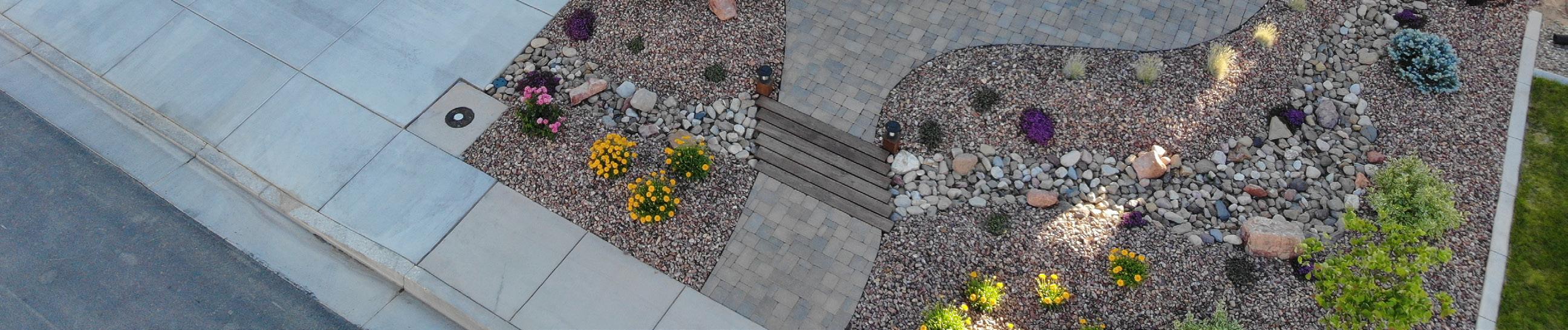
TOOLBOX: WATER EFFICIENT LANDSCAPING
In Utah, landscape irrigation accounts for 50-70% of per capita water use and represents a significant water conservation opportunity (Utah Water Resources Plan, 2021).15 In 2022, the state legislature enacted Utah Code § 10-91-536 which defined water wise landscaping.
Utah code broadly defines water wise landscapes as those suited to the microclimate and soil conditions of a given location, that have the ability to remain healthy with a minimum amount of irrigation once established, and use proper and efficient irrigation system designs. In addition, the code prohibits municipalities from enacting or enforcing “an ordinance, resolution, or policy that prohibits, or has the effect of prohibiting, a property owner from incorporating water wise landscaping on the property owner’s property.”
Municipalities may still require property owners to comply with review processes before installing water wise landscaping, to maintain plant material in a healthy condition, or to follow water wise design requirements adopted by the municipality. Importantly, the code states that a municipality may no longer require a property owner to install or maintain lawn or turfgrass in areas less than 8 feet wide (enabling property owners to change landscaping in parking strips, which are hard to water efficiently).
The legislature also enacted Utah Code § 57-8a-218(16) in 2022, which addresses water efficient landscaping in homeowner associations (HOAs). This code requires HOAs to adopt rules that support water efficient landscaping, including allowances for reduced lawn irrigation during drought conditions (making grass dormancy acceptable). It also prevents HOAs from prohibiting or restricting the conversion of a grass park strip to water-efficient landscaping.
Additionally, during the 2022 session, the legislature also enacted H.B. 121, creating the country’s first state-wide turf replacement funding program with an initial appropriation of $5 million to the Division of Water Resources (and supplemented by a $3 million annual appropriation during the 2023 legislative session). In order to qualify for the statewide rebate program, municipalities must adopt minimum water-efficient landscaping ordinances for new construction.
Communities working towards water smart landscaping should integrate tools to reduce water demand at the time of new construction. There are many options to integrate landscaping best practices into development codes to encourage water conservation and efficiency. These best practices may include requirements for:
• Plant materials that are best suited for the local climate and soil conditions.
• Grouping of plants into hydrozones.
Hydrozones are areas of the landscape that group plants with similar water requirements.
• Limited use of turfgrasses to practical and functional applications, or to a maximum percentage of a landscape.
15 https://water.utah.gov/2021waterplan/.
29
 Wayne Wurtsbaugh, Utah State University, 2018
• Low-flow and efficient irrigation technologies, including drip irrigation, smart irrigation controllers, and pressure-regulating irrigation valves and sprinkler heads.
• Rain sensors with a shutoff mechanism to prevent irrigation during natural rainfall events.
• Soil enhancements and mulching to optimize moisture holding capacity.
• Training for landscape contractors and professionals on water-efficient landscaping techniques and irrigation water budgeting, like the Qualified Water Efficient Landscaper (QWEL) training program.
• Model maintenance standards16 and agreements for HOAs and others to use in contracting landscape services.
• A total amount of landscaped area permitted based on lot size percentage or square footage.
• A water budget for outdoor water use, ideally tied to tiered water rate structuring, that sends a price signal to ratepayers.
Since mandatory requirements significantly increase water savings, the goal of a community committed to water conservation should be to require all new developments and retrofits to meet robust water efficiency standards.
Strategies for Promoting Water Efficient Landscaping:
• Adopt community water efficiency standards17 that allow residents to take advantage of rebate programs18 offered by the state.
• Change subdivision codes to include residential, commercial, and public landscaping standards that reduce the use of water for irrigation by regulating:
o irrigated system efficiency and size of irrigated area;
o plant materials;
o rain sensors and/or smart irrigation controllers that adjust irrigation in accordance with local weather conditions;
o irrigation scheduling (frequency and depth);
o soil amendments;
o water loss limits.
• Provide incentives for developers to install water-efficient landscapes through reduction of impact fees. For additional information on designing system connection charges to incentivize more efficient development, see A Guide to Design Conservation Oriented Water System Development Charges.19
16 http://www.slcdocs.com/utilities/PDF%20Files/Conservation/SLC%20Landscape%20BMPs-4.pdf.
17 https://www.nslcity.org/DocumentCenter/View/5344/ORD-2022-03-Amending-Titles-7-8-and-10-related-to-water-effcient-landscaping.
18 https://utahwatersavers.com/Program/2/flip-your-strip.
19 https://westernresourceadvocates.org/publications/a-guide-to-design-conservation-oriented-water-system-development-charges/.
Jake Powell, Utah State University, 2022
Case Study: Herriman City Water Efficiency Standards
Contributor: Justun Edwards, Director of Public Works, Herriman City
Herriman City is a fast-growing city in southwestern Salt Lake County that is projected to double in size by 2040. The city receives 65% of its water from Jordan Valley Water Conservancy District (JVWCD). Beginning in 2019, Jordan Valley Water Conservancy District developed Water Efficiency Standards20 in order to help their member agencies use water more efficiently in new development. JVWCD requires member agencies to adopt the standards when updating their water contracts. The standards include specific criteria for landscapes in new commercial and residential developments that use significantly less water than traditional landscapes. Setting water efficiency standards for landscapes is an effective tool to ensure efficient outdoor water use in new developments or redevelopments.
As part of the city’s contract renegotiation with JVWCD, Herriman became the first of JVWCD’s member agencies to adopt its new Water Efficiency Standards in December 2020. The standards limit turfgrass to a certain percentage of the landscape, and require drip irrigation and 3-4 inches of mulch in planting beds. All new development must follow the standards in order to be approved. To ensure overall consistency within its municipal code, Herriman changed part of its land use code in order to adopt the standards. They also implemented a plan review and inspection process and hired a full-time conservation staff member to ensure compliance. New landscapes are inspected by the city after installation to verify that the water efficiency standards have been followed.
To ensure landscapes for new residential and commercial developments meet the intent and requirements of the Water Efficiency Standards, Herriman’s landscape review and inspection process requires builders and developers to submit a detailed landscape plan for review. The plan must include a table that identifies lot size, impervious area, and landscape areas listing the total sod area, which cannot exceed 35% for residential lots and 20% in commercial developments. Once the landscapes are installed, an inspection verifies that the approved plan has been followed.
Developers have generally reacted positively to the standards. Herriman City initially wanted to keep their 75% living plant cover requirement, but reduced that standard to meet the Jordan Valley Water Efficiency Standards requirement of 50% living plant cover to eliminate confusion, address developer cost concerns, and further reduce water consumption. However, some issues have arisen during the implementation of the Water Efficiency Standards. Developers are finding that it is costlier to install water efficient landscapes than more traditional landscapes. There have also been concerns raised by developers that have partially built-out neighborhoods that the new standards create landscape inconsistency. The homes built before the standards were implemented have a more traditional landscaping style while the homes built after the standards were adopted must have water efficient landscaping.
Herriman City was the first of Jordan Valley Conservancy District’s member agencies to adopt the Water Efficiency Standards and has since been approached by other member agencies for advice on adopting the standards, as well as by cities in other parts of Utah that are developing their own standards. In 2022, Herriman City approved a handful of residential and commercial projects
20 https://jvwcd.org/public/wes.
33
that follow the standards. They will have more data available on the program’s progress in 2023. Beyond implementing the efficiency standards, Herriman City is considering how to implement the requirements of S.B .110, which was passed by the state legislature in 2022. The bill requires that water use and preservation elements be integrated into a city’s General Plan. Herriman City has taken an important first step on the path to a more water efficient future, and is working to do even more to achieve it.
Case Study: Cedar City Water Wise Demonstration Street
Contributors: Candace Schaible, Extension Assistant Professor of Horticulture and Water Wise Landscaping and Jake Powell, Extension Landscape Architecture and Environmental Planning Specialist, Utah State University
Cedar City is the largest city in Iron County, Utah. Located 250 miles south of the state capital, it is the home of Southern Utah University, the Utah Shakespeare Festival, and the Utah Summer Games. The city has a population of approximately 36,000 and encompasses roughly 20 square miles on the western edge of the Markagunt Plateau in the Cedar Valley. Although the Cedar Valley rests on top of a natural aquifer, the city does not have access to sufficient water supplies at current levels of use.
Rural communities are often physically distanced from the water conservation and demonstration gardens located along the Wasatch Front. However, these demonstration gardens provide tangible examples of how water wise landscapes can look and feel and provide an opportunity for homeowners to gather landscape ideas and inspiration. In 2019, Iron County Extension Assistant Professor, Candace Schaible, wanted to make access to such demonstrations easier for Cedar City residents by installing water wise landscapes in a new suburban neighborhood.
To make this goal a reality, she collaborated with USU Landscape Architecture and Environmental Planning Specialist, Jake Powell, on an Extension Water Initiative grant to help design, fund, and install a water-wise demonstration street in the city. The two brought the idea to the Iron County Home Builders Association and one builder volunteered to take on the project.
Working with local real estate developer, Alex Meisner Construction, the team created a series of front yard designs showcasing water-wise landscape design principles and techniques and then installed the designs at nine model home sites. Demonstrating water wise landscape design principles at the model homes has helped provide homebuyers with water wise landscape construction ideas and principles that they may then apply on their own properties.
The nine home landscapes are helping to change the landscape vernacular in Cedar City and more water wise landscapes continue to be installed in the neighborhood. The project includes a website21 that details the landscape designs and will also share water use data from the demonstration landscapes over time. A series of associated courses and resources teaching and reinforcing the principles displayed at the homes is also planned.
21 https://www.usudemonstrationstreet.com/.
34
Jake Powell, Utah State University, 2022
Case Study: Utah Department of Facilities Construction and Maintenance
Contributor: Andy Marr, Assistant Director of Facilities, Utah Department of Facilities Construction Management
The mission of the Utah Department of Facilities Construction and Management (DFCM) is to provide professional services to assist State entities in meeting their facility needs for the benefit of the public. The department has jurisdiction over nearly 4,000 state-owned properties and their landscapes including state agency buildings, universities, community and technical colleges, the Utah State Fair Park, and other sites.
In 2021, in response to the ongoing drought, Governor Spencer Cox issued Executive Order 2021-10 requiring state agencies to follow the Utah Division of Water Resources’ weekly lawn watering guide. All DFCM facilities complied with the executive order, but the public noticed sprinklers running and green grass on some state facilities, which presented a public relations challenge. In 2022, the state legislature passed H.B. 121, adding more robust guidance to the executive order to require turfgrass dormancy at state facilities to help conserve additional water. To meet the requirements of the new legislation, Andrew Marr, Assistant Director of Facilities, DFCM, consulted with Utah State University’s Center for Water Efficient Landscaping.
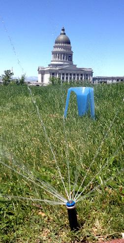
Quantitative guidelines for irrigation of state facilities were developed, including only allowing ½ inch of irrigation water applied weekly during spring and fall and 1 inch applied weekly during the hottest weeks of the summer. Slightly higher irrigation amounts were allowed in southern Utah to accommodate a longer growing season and higher temperatures. These guidelines were approved by the Governor’s cabinet, and the new requirements were issued to all facilities under DFCM jurisdiction. In addition to the new irrigation requirements, all grounds supervisory staff of DFCM were required to complete the Qualified Water Efficient Landscaper training program to learn how to install and maintain their landscapes and irrigation systems for water efficiency.

DFCM has also implemented other processes to facilitate the success of their response to the Governor’s executive order and H.B. 121. A database is now maintained for all managers to indicate their compliance with H.B. 121 as well as record any factors that may prevent that compliance (e.g., local city or water district requirements). Monthly meetings provide an opportunity for managers and stakeholders to discuss questions regarding the new irrigation practices and to request funding for water meters, smart irrigation control technologies, rezoning of irrigation systems, and water efficient landscaping to bring facilities into compliance.
Andrew Marr describes DFCM’s efforts as an ongoing progression of learning and implementation that is just beginning. “It’s time to figure out our process and in the coming seasons our managers will know what to do,” he says. “It’s more about the buy-in, the common goal and common mission. It’s hard to turn the ship around but (by) providing incentives and recognition…we’re getting there.”
Section 3: WATERSHED RESILIENCE & WATER SMART INFRASTRUCTURE OVERVIEW
How we manage all forms of water, from stormwater to wastewater, impacts both the built and natural environment. Approaches that incorporate an Integrated Water Resource Management (IWRM) methodology into building, site, subdivision, and infrastructure standards can protect ecosystems, enhance watershed resilience, and harness the utility of all forms of water. An IWRM approach can help to mitigate the factors that can degrade ground and surface water quality and quantity including:
• pollution from urban and agricultural runoff and natural disasters like floods and wildfires;
• sedimentation due to soil disturbances, vegetation loss, and erosion from road construction and new development;
• destruction of riparian areas due to development and changes in climate;
• increased amounts of stormwater due to increases in impervious surface area from development;
• decreased or lost water infiltration resulting from increases in impervious surface area and more rapid runoff; and,
• variability in water supplies caused by drought.
Municipal and county governments are also tasked with providing necessary public services within their jurisdictions, which may involve community-scale water, wastewater, sewer, and other infrastructure and improvements. Such infrastructure development usually occurs over many years and depends on local goals, development and buildout needs, and sufficient revenue and financing. Water smart approaches like green infrastructure can provide several additional benefits to traditional ‘gray’ infrastructure, such as recharging local floodplains, supporting vegetation and wildlife, providing community amenities like open space, mitigating urban heat island effects, and protecting watershed health and resilience.
Green infrastructure describes a range of measures that use permeable surfaces, plants, and soils to keep stormwater onsite, thereby reducing flows into community sewer systems or to nearby surface waters.
Gray infrastructure describes systems designed to move stormwater away from the built environment.
36
TOOLBOX: WATERSHED PLANNING FOR RESILIENCE
Landscape scale changes resulting from both human and natural forces have a significant impact on natural ecosystems and water resource availability. Safeguarding available water resources through watershed protection standards and policies is an important but often overlooked goal of communities in the western U.S. Watershed planning and protection has often been considered a function of collaboratives and nonprofits working with local, state, and federal agencies to restore ecological processes and functions. However, the way communities develop and redevelop can either escalate threats to our watersheds or nurture nature and enhance the ecosystem benefits they provide.
Watershed planning for resilience focuses on minimizing negative impacts as new development occurs. Watershed protection goals are included in a wide variety of community plans, such as comprehensive plans, emergency management plans, watershed plans, water resource management plans, and open space plans. Converting these planning goals into concrete policy implementation in development codes is essential to prevent watershed degradation and enhance community resilience.
Approaches for Enhancing Watershed Resilience:
• Map all sensitive areas including wetlands, riparian corridors, infiltration zones, water supply watersheds, groundwater basins, and natural disaster-prone areas, such as flood, drought, and wildfire areas.
• Adopt plans for wildfire mitigation, watershed management, stormwater management, and floodplain management that designate sensitive areas and goals for mitigation. These plans should reference other plans so that priorities and objectives build on and reinforce each other and the environment is viewed holistically.
• Limit development in sensitive areas by clustering homes within a smaller geographic zone, incentivizing infill development in less sensitive areas, and providing low impact design standards/guidelines.
• Create zoning districts with lower densities and/or cluster development to protect surface and groundwater sensitive areas.
• Adopt development standards for stream buffers and setbacks to protect water quality. Adopt vegetation protection standards that minimize disturbance to vegetation within the riparian corridor.
• Adopt stormwater management and site design standards that utilize best practices for low impact design reducing storm event runoff and increasing water infiltration.
• Adopt site level soil erosion mitigation standards for new development to reduce sedimentation and run-off and protect water quality from land disturbance.
• Adopt surface and/or groundwater districts with standards to minimize contamination of streams and shallow aquifers that will protect existing and potential sources of drinking water supplies.
37
• Participate in collaborative efforts to preserve hydrologic and ecological functions through watershed restoration projects.
Communities should identify the top multi-benefit and integrated strategies and projects, then implement these projects ahead of less integrated proposals (unless crucial urgency demands otherwise). Policies, plans, programs, and projects should be monitored and evaluated to determine if the expected results are achieved, and to improve future practices.
TOOLBOX: GREEN INFRASTRUCTURE & LOW-IMPACT DEVELOPMENT
Green infrastructure uses the natural ability of permeable surfaces to absorb stormwater. Low-impact development (LID) is the retention or restoration of natural hydrologic patterns by using landscape and site design to keep as much rainwater as possible from leaving the site. Instead of designing a site or streetscape to funnel stormwater off-site as fast as possible, green infrastructure and LID approaches use vegetation, porous materials, rain gardens, and detention basins to reduce stormwater runoff and encourage the onsite infiltration of stormwater.
Common Water Smart Infrastructure Techniques
Application Description
Bioretention basins, stormwater harvesting basins, and rain gardens
Small to large scale planting areas within the hardscape containing shrubs, trees, and grasses.
Bioswales Shallow and uncovered channels that induce meandering and are placed inline within a drainage channel.
Curb extensions and chichanes
Curb openings
Detention ponds
Permeable pavement, gravel, or pavers
Traffic calming measures which widen the sidewalk and/or narrow the street for a short distance and allow for additional stormwater retention area
Drainage inlets that divert stormwater into bioretention basins.
Basins that provide flow control by collecting stormwater runoff.
Methods of paving that allow infiltration and can be used in low to moderately trafficked areas like sidewalks and parking lots.
Green infrastructure provides communities with many benefits, both direct and indirect.
• Direct benefits include:
o Native and adapted plants may be used to revegetate channels and basins and survive with naturally occurring rainfall once established, thus reducing the need for outdoor irrigation.
o Stormwater that is not used by plants is cleaned as it recharges into the ground, thus reducing peak flooding, reducing pollutant loads downstream, and lowering the risk of sewer overflow.
o Additional vegetated areas in a community can help to mitigate heat impacts by providing
38
shade, sequestering carbon, and absorbing solar radiation in urban neighborhoods.
o Compared to other types of traditional or gray infrastructure for stormwater management, green infrastructure is more affordable to install and maintain.
o Particularly in shallow groundwater areas or near riparian areas, increased stormwater infiltration can improve water quality and restore watershed health and other natural hydrologic functions in urban areas.
• Indirect benefits include:
o Increased public safety due to reduced flooding, improved emergency vehicle access, and reduced property damage.
o Expanded landscaped areas that produce more oxygen, cool neighborhoods, and reduce energy consumption.
o More attractive neighborhoods that foster pedestrian and cycling activity, reduce traffic speeds, and enhance feelings of safety.
o Job creation through installation and maintenance of LID and, indirectly, landscape industry jobs (plant production and sales).
Strategies for Implementing Water Smart Infrastructure:
• Preserve regional open space by clustering development, maximizing unpaved areas for stormwater retention.
• Consider the potential to use stormwater recapture for a centralized urban natural open space. Conveying this water to a common area or neighborhood park may enhance the vision of your community or neighborhood.
• Incorporate water holding areas into the landscape, such as creek beds, recessed athletic fields, ponds, cisterns, and other features.
• Adopt development standards for stream buffers and setbacks to protect water quality.
• Design all aspects of landscaping—from the selection of plants to soil preparation and installation of irrigation systems—to reduce water demand, retain runoff, decrease flooding, and recharge groundwater.
• Use permeable surfaces for hardscapes whenever possible.
• Work with transportation and civil engineers to update development standards and to map streets and areas that have the highest flood potential, as well as the widest setbacks where there will be room for tree plantings.
• Use green infrastructure for traffic calming, beautification, and placemaking. Consider placing green infrastructure along areas where vehicle speeds need reducing or where bicycle and pedestrian traffic is more concentrated.
Placemaking is the participatory process of creating places where people want to live, work, play, and learn.
● Connect infrastructure and improvements in the capital improvement plan with relevant goals and policies adopted in the general plan.
39
Case Study: Green Infrastructure at Our Village Community Center in Moab
Contributor: Jeff Adams, Founder and Principal, TerraSophia LLC
On August 20, 2022, Moab, Utah experienced an unprecedented rainstorm that led to a 100year flood. The total amount of rainfall attributed to the storm ranged from 1 to 1.5 inches, but close to 1 inch of that amount fell within a 20-minute span. The rain fell southeast of town, draining county and Bureau of Land Management land into Mill Creek, a typically small creek that originates in the nearby La Sal Mountains and meanders through the heart of town.
Moab was unprepared for the amount of destruction and property damage that a storm of this magnitude would cause. In some cases, detention ponds that had been designed to blow out under previously approved plans and flood neighbors did so and in other cases, detention ponds that had been designed to retain stormwater blew out and flooded neighboring properties. A wall of water rushed down Main Street, flooding businesses. Desperate cleanup efforts were launched as Labor Day, the busiest tourism weekend of the year, quickly approached. A lack of integrated land and water use planning was on vivid display.
Though many neighborhoods and businesses were devastated by the flood, others not only survived the storm, but did so without any damage. One of these properties was Moab’s Our Village Community Center. The Center, a local non-profit located on a 5.5 acre farm in the heart of town, runs a pre-school and childcare center as well as many other community-focused programs.
In the spring of 2020, Annie Thomas, director of the Center, reached out to Jeff Adams, founder and principal of TerraSophia LLC, to address a legacy of stormwater runoff from an adjacent property, a tourism-related business. Drainage from that business’s roofs and parking lot had often flooded the farm buildings now occupied by the Center. The Center had recently completed an extensive remodeling project to bring its facilities up to code to be used as a daycare center and the continued flooding put its mission and goals at risk.
Annie and Jeff developed a project to intercept the sheet flow of stormwater using three basins and swales that intercepted the flow and then poured from one basin into the next. A shallow rolling dip in the Center’s access road allowed overflow from the basins to cross the road and enter another series of basins on the other side, ultimately draining to one of the farm’s fields.
TerraSophia staff led the backhoe and rock work and volunteers transplanted plants salvaged from the local middle school renovation. In all, the project required 3 or 4 days of machine work, 5 or 6 days of rock work, and hours of planting, mulching, and irrigation work. Bee-Inspired gardens and shrubs were also installed to add beauty and privacy.
The Center’s green infrastructure system has served its purpose well, even during the August 20, 2022 flood. Stormwater has been redirected to soak into the Center’s grounds, and most of the donated plants are still thriving.
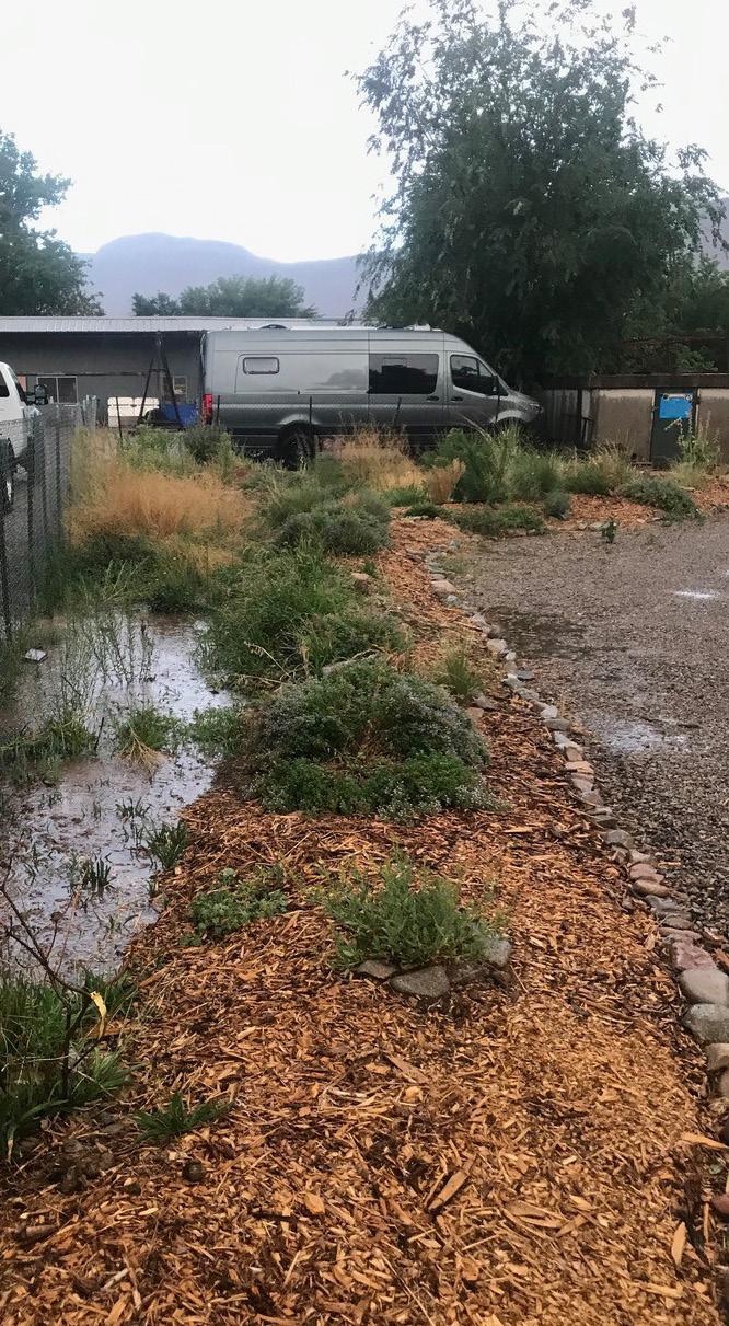
In the spring of 2022, a second phase of the project installed gentle earthworks around a new heritage tree orchard on the property. Now, when one of the city’s nearby storm ditches overflows and floods the property, the water is directed around the orchard, successfully joining with the initial green infrastructure project to move excess water offsite. Ongoing maintenance is the new focus; some puddling that has started to occur on the access road will be addressed by the addition of gravel and cobblestones.
One month after the 100-year flood shocked the Town of Moab, there were still large debris piles and layers of sand and mud in some areas. However, the Moab community rallied, and the city and state have worked effectively together to support the citizens and businesses affected by the historic event.
The storm in August 2022 highlighted weak areas in the city’s planning processes and a lack of water and land use integration. The county has since reviewed stormwater management codes, specifically maintenance practices, to ensure that gray and green stormwater infrastructure is appropriately sized, built, and maintained, and that existing code is enforced.
Case Study: Reducing Potable Demands through Graywater Reuse
Contributors: Dr. Roslyn Brain McCann, Professor and Extension Sustainability Specialist, Utah State University and Jeff Adams, Principal of Terrasophia, LLC
After attending a graywater workshop in Albuquerque, New Mexico in 2014, Dr. Roslyn Brain McCann, USU Extension Sustainability Specialist, returned to Utah excited to install a residential graywater system in the home she was building in Moab. However, she was soon frustrated by the state’s strict requirements which specified that graywater systems needed to include a holding tank, pump, filters, and engineered plans, which seemed excessive for a simple residential system.
With the help of Jeff Adams, Principal of Terrasophia, LLC, and Orion Rogers, Environmental Health Director of the Southeast Utah Health Department, she began planning for a gravity-fed graywater system in her new home. In 2016, she received the first permit in the state for the installation of a residential graywater system as a pilot program. The goals of the installation were to demonstrate to state authorities that residential graywater systems are an effective approach to reduce the use of culinary water for outdoor irrigation and that graywater is a valuable water resource that may be used safely. If successful, the pilot project would result in a revision to the state’s graywater policy to allow simple, gravity-fed residential systems.
In Utah, graywater is defined as water drained from bathtubs, showers, bathroom wash basins, and laundry washing machines. Simple, gravity-based graywater systems route this water out of the home directly into mulched landscape areas. Systems are sized according to the type and number of fixtures plumbed or the size of the home. Design considerations for these systems include: the size of the discharge area, pipe size and slope, the number of water outlets and mulch shields, and the depth of the gap between the bottom of water outlets and the top of mulch shields. In addition, best management practices for residential graywater systems include
41
prohibition of human contact with graywater, prohibition of ponding, runoff, and/or spraying of graywater, prohibition of contact with the edible portions of plants, and prohibition of biologically or chemically hazardous materials (i.e., bleach) in home fixtures prior to drainage of the water outside the home.

The site context of residential graywater systems must also be considered and include integration of the system with other landscape features and uses, elevations and grading, water sources, and plant water requirements. Differences between the plant water requirements of mature plants and the graywater supply must also be considered, although landscape plant water requirements may be fine tuned to match the graywater budget of the residence.
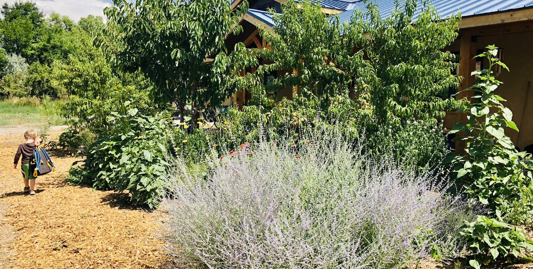
Dr. Brain’s home gray water system has been a resounding success and is still operating effectively 7 years after installation. As a result of the success of the pilot program, in 2020, the state updated Utah Administrative Code R317-401-1 regulating Graywater Systems to allow Tier 1 and Tier 2 gray water systems. Tier 1 systems are simple, gravity-fed residential systems and Tier 2 systems are anything larger than single or multi-family residential units. The code also requires that graywater installers hold an active Onsite Systems Certification and that an operations and maintenance guide be developed for the graywater system, both for the homeowner and when home ownership changes.
To permit residential graywater systems, local health departments must “opt in” to the new code. Determining whether a local health department has done so is the first step toward facilitating residential graywater systems in local jurisdictions. If a local jurisdiction has not “opted in”, Dr. McCann advises that a signature campaign can be an effective approach in support of the change.
Resources
Gray Water Webinar: https://youtu.be/WEfppCoKbLk
Gray Water Fact Sheet: https://digitalcommons.usu.edu/extension_curall/805/
Relevant Utah Code: https://www.law.cornell.edu/regulations/utah/Utah-AdminCode-R317-401-1.5
Roslynn Brain McCann, USU Extension Sustainability Specialist
Section 4: WATER CONSERVATION AND EFFICIENCY TOOLS
Overview
A community can grow water smart from the start by establishing water conservation, efficiency, and reuse in all stages of new development and redevelopment. Programs that encourage, financially incentivize, or require consumers to reduce water demand in existing developments also play an important role in achieving community water conservation goals and promoting a continued focus on water wise use.
Conservation and efficiency programs can promote efficient water use by:
• helping consumers invest in and manage efficient fixtures, appliances, and irrigation systems;
• sending a price signal to encourage water conservation;
• monitoring and communicating data about water usage to consumers;
• limiting summer outdoor water use to specific days and times or to certain quantities of use; and,
• educating community members about the importance of reducing water waste.
Conservation rate structures may be implemented to signal inefficient water use to customers. Drought water rates or use restrictions may also be implemented in times of emergency to address acute shortages.
Communities may approach rate structures and changes to those structures in many ways. Salt Lake City’s Department of Public Utilities, for example, conducts a full rate study every 6 to 8 years to assess the fairness and fiscal soundness of its water rates. A rate advisory committee composed of a diverse group of community members conducts the study, which is then evaluated and approved by the Public Utilities Advisory Board. The city’s current increasing block rate structure increases the cost per unit of water as water use increases to encourage use efficiency.
Other communities may implement drought water rates or restrictions in times of shortage. In 2022, for example, Riverdale City implemented drought water rates to both encourage water conservation and to meet the financial requirements of the city’s water system (Administrative Order No. 2022-01). In addition to an increasing block rate structure, the city restricted the number of irrigation days allowed per week, including a time of day restriction. Indoor use reductions were also implemented.
43
TOOLBOX: CONSERVATION RATE STRUCTURING
Water providers set rates to collect the revenue they need for operations, infrastructure investments, and to protect public health. Once a revenue goal is identified, providers can develop a rate structure to meet additional objectives, including water conservation and acquisition of supplies. The state code also requires water retailers to establish increasing block rates for water as use increases (Utah Code § 73-10-32.5). Prioritizing conservation and mitigating water demand can reduce water provider expenses by sizing water supply acquisition or storage to the lower level of demand.
Water rates are determined by two factors: fixed and variable costs. The fixed costs of water are determined by the costs of water acquisitions and the costs to establish, operate, and maintain the infrastructure to convey the water. The variable costs are based on the amount of water that consumers use.
The adoption of water conservation rate structures can help water retailers:
• reduce daily peak usage.
• reduce seasonal peak usage.
• reduce total system demand.
Consumer water conservation does not create financial strain for a utility if the offset demand allows new customers to be added to the system while maintaining overall water use with existing supplies. If it is possible that customer conservation may present a revenue challenge, consider engaging with the public to design solutions and rate structures that reflect the community’s values and needs. Lower demand pressure can result in considerable cost savings over time by reducing strain on water system infrastructure, delaying the need for maintenance, retrofits, or infrastructure expansion.
Conservation-oriented rate structure options include:
• Drought demand pricing: rates are higher during drought periods;
• Excess use: rates are higher for above-average water use;
• Inclining block rates: rate per block increases as water use increases;
• Different indoor and outdoor rates: indoor and outdoor water use is tracked with separate meters and rates for indoor use are lower than rates for outdoor use;
• Penalties: customers are charged for exceeding allowable water usage limits;
• Scarcity pricing: the costs of developing new supplies is added to water bills;
• Seasonal pricing: water rates are higher during the season with the most demand;
• Sliding scale: the unit price increases based on an average consumption;
• Spatial pricing: water rates are determined by the actual costs to supply water to specific locations;
• Time-of-use: water rates are higher during peak days of the week or specific hours of the day;
• Water Budget: block rate is defined for each individual customer based on water budgets calculated for that customer.
44
Approaches to Conservation Rate Structures
• Develop a utility water conservation plan to clarify water conservation goals.
• Conduct a rate assessment to determine rate structuring options.
• Develop a rate structuring plan and conduct community education and outreach to minimize opposition to potential rates increases.
• Adopt a conservation rate structuring strategy.
TOOLBOX: POST-OCCUPANCY INCENTIVES AND EDUCATIONAL PROGRAMS
Both land use entities and water providers can engage consumers and provide incentives and education on the benefits of efficient water use in their homes and businesses. Technology like advanced water meters and sub-metering can help tailor post-occupancy interventions.
Conservation Rebate Programs
Incentive programs can be a useful way to reduce current water demands for both residential and commercial properties and water users. They can serve as a complementary way to involve current residents and post-occupancy developments in implementing water smart building and design features. Providing rebates for homeowners and businesses to remove water-intensive landscaping and retrofit water-smart plumbing fixtures is a well-tested tool that can generate meaningful water savings.
Approaches for Conservation Rebate Programs:
• Offer rebates to residents to install low flow plumbing fixtures such as toilets and showerheads, appliances such as high efficiency washing machines, and “smart” home water monitors to reduce indoor water use.
• Offer rebates to residents and commercial customers for weather-based, “smart” irrigation controllers, high efficiency sprinkler heads, and to replace high water use landscapes with low water plants and efficiency irrigation systems to reduce outdoor water use.
• Use rebates or grants to incentivize HOAs to install water efficient landscapes, irrigation systems, and controllers.
• Establish a rebate program for multi-family residential buildings that have cooling towers to upgrade their conductivity controllers.
Cooling tower conductivity controllers monitor the electrical conductivity of the water in the tower. If the water’s conductivity exceeds a set point, a “blowdown” process is activated and water is released. Carefully controlling the quantity of blowdown water provides a significant opportunity for water conservation in these systems.
45
Water Metering, Audits, & Leak Detection
Water customers, including commercial, industrial, and residential users, may not be aware that water leaks and inefficient fixtures may be unnecessarily increasing their water use. While water providers may perform their own system-wide water loss audits, they can also support and incentivize customers to do the same.
Water metering is a method of measuring water consumption. Advanced metering technology, also known as “smart metering,” eases the data collection process and increases the specificity and frequency of the data. This increased granularity of information creates the opportunity for easily justifiable rate structures, rapid leak detection, and customized demand management programs. Utilities that pair metering and commodity rate structures report a 15% to 30% reduction in water consumption.
Privately purchased metering devices are also growing in popularity because they connect consumers to their water data in real time. In the absence of utility-wide advanced metering infrastructure (AMI), encouraging consumers to purchase their own water monitoring devices may achieve similar water demand reductions at individual properties.
Furthermore, sub-metering multi-family, commercial, and outdoor uses can provide data granularity to empower refinement and optimization of water policies, rates, and fees. The value of this information may be worth more than the cost of installing extra meters.
Metering and corresponding audits and interpretation can identify opportunities to modify water-consumption behaviors. They can also detect leaks in the system and signal when infrastructure updates are necessary to mitigate water loss.
Approaches for Water Metering, Audits, & Leak Detection:
• Deploy leak detection equipment, such as specialized meters temporarily attached to the main meter, in scenarios where low staff capacity limits on-site visits.
• Offer landscape audits (or Water Checks) that recommend watering schedules, infrastructure upgrades, and drought-tolerant plants.
• Offer audits at no cost to customers or pair it with an incentive, like a free fixture.
• Encourage community participation by providing water audit results of public buildings as examples that demonstrate potential water saving outcomes.
• Use the aggregated analysis of audit results to identify potential code and policy changes.
• Update codes to allow individuals to install privately purchased metering devices on the utility meter and provide guidance on how to attach them in a way that avoids disturbance to utility operations.
46
Case Study: New Water Supplies through Secondary Metering in Weber Basin
Contributors: Darren
Hess,
Assistant
General Manager for Operations,
and
Jon Parry, Assistant General Manager for Strategic Initiatives, Weber Basin Conservancy District
In 2022, the Utah Legislature passed H.B. 242 which requires water meters be installed by 2030 on all new and existing pressurized secondary water systems. They also appropriated $250 million for grants to help operators of those systems comply with the requirement. The Legislature took this action based on documented success of water savings from metering secondary water. In 2023, an additional $18 million was appropriated for the Secondary Water Meters Program.
Utah has approximately 260,000 locations statewide that use secondary, untreated (nonpotable) water for irrigation of lawns, gardens, parks, and landscapes. In many areas, this secondary water is attached to urban properties that previously were agricultural land. In the land transition process, treated culinary water was provided for indoor use, but untreated irrigation water was provided through secondary systems for use on outdoor landscapes, primarily as a cost saving measure to the providers and users. In Utah, secondary water often comes from Bureau of Reclamation storage projects. Properties receiving secondary water have water allotments for the amount they can use and property owners are assessed fees for these allotments on their property bills. Approximately 85% of all locations with access to secondary water were unmetered in 2022.
The success of secondary metering as a water conservation strategy was originally demonstrated by Weber Basin Water Conservancy District (WBWCD), which has the largest contiguous secondary water system in the United States. Many areas with secondary water had piped and pressurized delivery systems for years, but the district’s challenge was finding the right technology to meter “raw” (untreated) water. When functional secondary water meters became available in 2009, WBWCD planned and implemented their first retrofit projects, installing approximately 1,100 meters between 2011-2013 in three neighborhoods where they retail secondary water. The aim of WBWCD was to determine if water use was within the property allocations, educate users on how water they were using in relation to the needs of their landscape, and eventually charge people for water use using a tiered water rate structure to incentivize conservation. By 2022, the district had metered approximately 14,000 locations and had documented reductions in use of approximately 20-30% compared to unmetered areas and compared to use when the secondary meters were first installed, according to Jon Parry, WBWCD’s Assistant General Manager for Strategic Initiatives.
The key to WBWCD’s conservation success in metering secondary systems is its approach to sharing meter information with users through secondary water use reports and near real time access to their water usage via the District’s Customer Portal. Developed in conjunction with the WaterMAPS™ program in the Center for Water Efficient Landscaping at Utah State University, the reports use a landscape water budgeting approach to show water users how much water they are applying to their landscapes in comparison to how much water their landscapes need.
47
This information, individualized to each property, informs water users of their ability to reduce overuse or waste, which has been a powerful educational motivator for landscape water conservation. WBWCD provides these reports monthly from May-October to help users track the efficiency of their water use and conservation success.
“We learned you can’t just meter the water, you have to educate the consumer, and we are seeing some significant water savings as a result,” said Darren Hess, WBWCD’s Assistant General Manager for Operations. He noted, “This is really the largest water supply project we have. Every gallon we save is another gallon that can be stored in our existing reservoirs for the next season, which helps with future uncertainty in water supply.” Saved secondary water has also helped WBWCD delay additional water supply projects and provide water for environmental flows to Great Salt Lake.
Other cities in Utah that implemented secondary metering prior to the recent legislation and availability of grant funding showed similar success in reducing water use. Saratoga Springs implemented secondary metering to address overwatering of landscapes serious enough to cause flooded basements and damage to homes, as well as to be fiscally responsible in avoiding costs of other more expensive water supply infrastructure. Saratoga Springs, Spanish Fork, and Santaquin have seen water savings of 25-50% through metering. They provided implementation advice to other communities undertaking metering in a spring 2022 Utah League of Cities and Towns training22 session.
WBWCD is realizing additional conservation programming benefits from secondary metering. Programs for indoor and outdoor water efficiency are somewhat distinct, and metering on dual systems helps them determine an appropriate amount for each type of use and refine the delivery and assessment of their water conservation programs. The secondary meters also enable WBWCD to monitor for leaks and use of seasonal allocations and alert customers, provide flexibility in implementing watering restrictions, and open up opportunities to financially incentivize customers to use less than their full allocations. WBWCD is promoting low water landscape alternatives on new development throughout the District’s secondary retail service area, which would result in lesser allocation volumes being contracted and lower annual assessments for that water. In West Haven City, WBWCD is incentivizing developers to adopt low water landscapes by reducing the amount of water they have to turn over to be served through secondary systems.
In response to its first call for applications, the Utah Board of Water Resources on August 4, 2022 approved $190 million in grants to about 70 water conservancy districts, irrigation companies, municipalities and other water users for up to 70% of the costs of secondary metering projects.
22 https://www.youtube.com/watch?v=YwD8kcQAnyM.
48
TOOLBOX: CONSUMER EDUCATIONAL CONSERVATION MESSAGING
There are many ways for planners and water providers to reach consumers with conservation messaging. Utility bills often include an educational insert or other content to inform the reader about policy changes and to encourage water savings with tips and tricks. Some may include warnings and fear-inducing messages designed to curb water use. However, these messages often miss the mark because people tend to defend themselves from fear or negative selfimages by ignoring these messages or rationalizing why the new information does not apply to them. Instead, studies show that messaging techniques that promote a sense of control, offer social incentives, provide immediate rewards, and are framed positively are more effective in changing behavior.
Approaches for Compelling Conservation Messaging
• Help your customers feel they have control or influence. Provide tangible acts or decisions they can make to “move the needle” toward a goal.
• People generally want to be either the same or better than their peers. Offer comparisons or share high compliance figures (e.g., “Nine out of ten residents follow these irrigation best practices to save water.”).
• Near-term rewards make people feel good. This reward structure can even motivate behavior changes that relate to long-term goals or outcomes that are not immediately visible. The reward can be external or intrinsic.
• People are more likely to believe and act on positive rather than negative information. So, when given an opportunity to describe a trend, note progress toward goals.
Case Study: Salt Lake City Turf Trade Program
Contributor: Stephanie Duer, Water Conservation Manager, Salt Lake City
Salt Lake City is the largest metropolitan area within Utah and the Salt Lake Valley. The city has a population in excess of 360,000 (plus 150,000 daily commuters) and encompasses approximately 110 square miles within the lower Jordan River Basin. Commercial and industrial users in the city receive half of water deliveries and residential and institutional users receive the remainder.
Salt Lake City’s Department of Public Utilities has a variety of outdoor water conservation programs for its customers that focus on different landscape topics. These programs include best management practices for water efficiency in the landscape, landscape and park strip plant lists, irrigation and landscape evaluations/audits, planting and landscape maintenance guides, and virtual water conservation garden tours. The city also participates in the state’s Flip Your Strip program, which incentivizes the removal of lawn from park strips with a $1.25 per
49
square foot rebate. Related to turfgrass water use, the city has also developed an innovative conservation program, SLC Turf Trade.
Following a 2020 utility master plan update, which evaluated indoor and outdoor water use, the city determined the need to decrease outdoor irrigation from a city-wide average of 38” to 24” annually to meet conservation goals. Additional evaluations of the city’s landscapes and water use characteristics by the WaterMAPS™ and Water Check programs indicated that 68% of the city’s households were overwatering, presenting a significant opportunity for reducing outdoor water use. The city was already taking a multi-faceted approach to landscape water conservation but needed a program to assist those customers who wanted to reduce their water use but still needed functional and practical turfgrass areas. In 2021, SLC Turf Trade was born.
In cooperation with USU’s Center for Water Efficient Landscaping and the Turfgrass Water Conservation Alliance, a customized blend of turfgrass seed was developed for the program and packaged for sale by the city. The grasses needed to have the color and quality of standard Kentucky bluegrass lawns, good pest and disease resistance, and—most importantly—a drastically reduced water requirement (the seed mixture uses 30-40% less water than standard varieties). Educational videos demonstrating the process for transitioning an existing lawn to the low water use seed were created. The videos were filmed at the city’s Concord Lift Station, which was planted and established with the seed in the fall of 2021, and still serves as a practical demonstration of the program today.
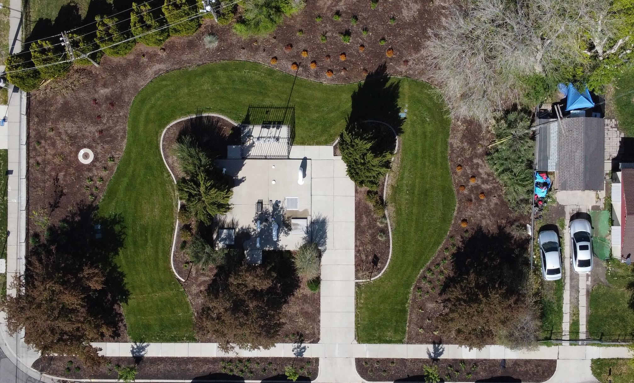 Aerial view of the landscape at Salt Lake City’s Concord Lift Station.
Dennis Hinkamp, USU Extension Multimedia Production
Aerial view of the landscape at Salt Lake City’s Concord Lift Station.
Dennis Hinkamp, USU Extension Multimedia Production
Case Study: Slow the Flow Consumer Messaging
Contributor: Shelby Ericksen, Water Conservation Manager, Utah Division of Water Resources
In the early 2000’s, Utah Governor Mike Leavitt brought together a water conservation team composed of the state’s Division of Water Resources and the five largest water conservancy districts in the state. Each member of the team contributed funding to create the state’s first water conservation consumer messaging campaign, “Slow the Flow. Save H2O”. Now commonly known as “Slow the Flow”, this consumer messaging campaign has a permanent home on the internet at slowtheflow.org and serves as a “one stop shop” for water conservation and drought resources for any community (or individual) in the state.
The Slow the Flow website displays several consumer messages that are also on billboards across the state. These messages change over time and include:

“Save for the future, water less today,”
“Utah is in a drought, use less water,”
“Rain delay, don’t water,”
“Protect tomorrow, water less today,” and “Cooler temps=less watering.”
In addition, the website provides simple water conservation tips for consumers for both indoor and outdoor use, drought actions that consumers can take, and a list of tools and resources including links to rebate programs, the Division of Water Resource’s Weekly Lawn Watering Guide, the Water Check program, water wise plant lists and gardens, and more. Printable materials are also available on the site and include fliers as well as lawn signs.
The Slow the Flow consumer messaging campaign also utilizes social media to get messages out including Facebook, Instagram (@slowtheflowutah), and YouTube and encourages communities to follow and share their water conservation messaging across the state.
If you have consumer messaging needs (infographics, educational materials), contact the Slow the Flow campaign at waterwise@utah.gov.
51
CONCLUSION
The toolboxes outlined in this workbook highlight some of the most effective strategies communities can employ to manage local water demand. By implementing these tools and strategies, Utah communities can help meet the state’s need for reliable, clean and affordable water to sustain thriving communities and businesses, robust agriculture, ample recreation, and a healthy and resilient natural environment as our population grows and we face an uncertain climate future. Measuring and tracking progress toward integrating water and land use will help to ensure your community’s success in contributing towards these goals.
Measuring and Tracking Progress
Measuring and tracking the results of water and land use integration is vital to determining whether your community’s plans and goals are being met. Growing Water Smart Metrics: Tracking the Integration of Water and Land Use Planning23 offers a set of indicators that can be assessed for year-over-year trends to demonstrate achievement of water savings through land use planning. Ten progress metrics track whether: the community’s land use plan integrates water efficiency and its water plan integrates land use strategies; conservation-oriented system development charges and pricing structures are being used; indoor and outdoor water efficiency measures are being utilized; and collaboration around development proposals is occurring. Fourteen impact metrics measure increasing or decreasing trends in water demand and use and trends in development patterns and land use.
23 https://resilientwest.org/2020/growing-water-smart-metrics-guide/.
ADDITIONAL RESOURCES
Water Supply & Demand, Planning
State Water Plan (2021)
Utah’s Regional M&I Conservation Goals
Public Water Supplier 40 Year Water Requirement Plan Standards
City of Orem Water Master Plan (2017)
Salt Lake City Water Conservation Master Plan
Salt Lake City’s Storm Water Management Plan
South Jordan Water Conservation Plan
Genoa Water Conservation Plan
Salt Lake City Water Shortage Contingency Plan
Park City’s Storm Water Management Program
City of Logan Drinking Water System Master Plan (2016)
Community Solutions for Voluntary LongTerm Storm Water Planning
Millcreek Community Wildfire Preparedness Plan
Water Supply and Demand Utah Division of Water Resources
Water Supply and Demand Utah Division of Water Resources Report
Water Supply and Demand Planning
State of Utah, Division of Water Rights Policy Document
Water Supply and Demand Planning
Water Supply and Demand Planning
Water Supply and Demand Planning
Water Supply and Demand Planning
Water Supply and Demand Planning
City of Orem Plan
Salt Lake City
Department of Public Utilities
Salt Lake City
Department of Public Utilities
South Jordan City Plan
Town of Genoa Plan
Water Supply and Demand Planning Salt Lake City Department of Public Utilities
Plan
Storm Water Planning Park City Public Utilities Plan
Water Supply and Demand Planning
City of Logan Plan
Storm Water Planning U.S. Environmental Protection Agency Guide, Toolkit, Technical Assistance
Wildfire Planning
State of Utah Plan
53
Theme Source Type of Resource
Title
Plan
Plan
Plan
WRA Water System Development Charge Guidebook
Net Blue: WaterNeutral Growth
Conservation Plan Resources
Great Salt Lake Integrated Model (2019)
Water Supply and Demand
Western Resource Advocates
Water Supply and Demand
Water Supply and Demand, Water Conservation
Water Supply and Demand, Water Conservation
Land Use-Water Integration
Integrating Water Efficiency into Land Use Planning in the Interior West: A Guidebook for Local Planners
Great Salt Lake Advisory Council
Conservation Impacts Assessment
Incorporating Water into Comprehensive Planning
Incorporating Water into General Plans in Utah
Incorporating Water into Comprehensive Plans in Utah
Guiding Principles for Equitable Management in Coordinated Planning
Salt Lake City
Sustainability Plan
City of Bluffdale
Floodplain Management Plan
Water Conservation, Land Use-Water Integration
Alliance for Water Efficiency
Utah Division of Water Resources
Great Salt Lake Advisory Council
User Guide, Model Ordinance, Offset Methodology
Water Conservation, Land Use-Water Integration
Land Use-Water Integration
Land Use-Water Integration
Land Use-Water Integration
Land Use-Water Integration
Western Resource Advocates
Land Use-Water Integration
Land Use-Water Integration
Northern Utah Study
Lincoln Institute of Land Policy
Lincoln Institute of Land Policy Recorded
Western Resource Advocates
Local Government Commission
Website - Webinars
Guiding Principles
Salt Lake City Plan
City of Bluffdale Plan
54 Title Theme Source Type of Resource
Guidebook
Website
Report
Title Theme Source Type of Resource
Guidebook
Manual
Presentation
Growing Water Smart: The Water-Land Use Nexus Guidebook (Colorado)
Land Use-Water Integration Colorado Natural Resources, Energy & Environmental Review
Land Use-Water Integration
Babbitt Center for Land and Water Policy and Sonoran Institute
Land Use-Water Integration Babbitt Center for Land and Water Policy and Sonoran Institute
Land
Utah
research
Arizona Growing Water Smart Guidebook
Colorado Growing Water Smart Guidebook
Guidebook
Land
Use-Water Integration
Land
South
- Model Code
Land
Use-Water Integration
Salt
Lake County, UT
California
City
- Code
- Model Code
City
of Utah
- Code Rule R317-401Graywater Systems
Use-Water Integration
Institute
Conservewater.utah. gov
55 Title Theme Source Type of Resource
Assured Water Supplies in Western States Legal
Growing Water Smart: The Water-Land Use Guidebook (Arizona)
A Guide to Low Impact Development within Utah
Use-Water Integration
Department of Environmental Quality, Division of Water Quality
Website
Model Landscape Ordinance
Metro Water Supply Authority, Colorado
Website
Water Efficient Landscape Design and Development Standards
Use-Water Integration
Website
Model Water Efficient Landscape Ordinance
Use-Water Integration
Department of Water Resources
Land
Sandy
Website
Land
Herriman
Website
Land
State
Website -
Land
South
Website -
Landscaping Standards
- Code Water Efficiency Standards
Use-Water Integration
Use-Water Integration
Code Ch. 13.04.260 Waste Prohibited
Use-Water Integration
Jordan City
Code
Land
Sonoran
Video
Strengthening Collaboration
Title Theme Source Type of Resource
Water
Utah Division
Website
Water Conservation
Conservation
of Water Resources
56 Title Theme Source Type of Resource
Water
Water Conservation Utah Department
Toolkit Conservation
Water Conservation Alliance
Excel-Based
Water Conservation Bureau
Federal
Program Utah Water
Water Conservation Utah Division
Website -
and
Utah
Water Conservation Central Utah Water Conservancy
Website - Programs and
Water
So Jo Water Conservation South Jordan City Website - Programs and
Into Resilience Water Conservation Spanish Fork in partnership with Water Now Alliance Website - Case Studies Slow the Flow Water Conservation Utah DWR Website - Guide, Rebates, and Monitoring Preparing for Drought in the Home Water Conservation Utah State University Extension Website - Guide
Water Works Calculator Water Conservation Alliance for Water Efficiency Home Water Use Calculator EPA WaterSense Water Budget Tool Water Conservation U.S. Environmental Protection Agency Excel-Based Tool Rain Barrels in Utah Water Conservation Utah State University Extension Factsheet Water Amendments Water Conservation State of Utah Website - Law A
Water
Water Conservation Utah State University Extension Guidebook Water Rate Structures in Utah Water Conservation Western Resource Advocates Guidebook
Drought Management Toolkit for Public
Suppliers
of Environmental Quality/Division of Drinking Water
Tracking Tool
for Water Efficiency
Model Water & Energy Efficiency Grants and Small-Scale Water Efficiency Grants
of Reclamation
Grants
Savers
of Water Resources
Programs
Rebates Central
Water Conservancy District Rebates
District
Rebates
Smart
Rebates Tap
Home
Guide to Municipal
Conservation Pricing in Utah
Financing Sustainable Water Water Conservation Alliance for Water Efficiency Handbook and Model
Sandy City Water Conservation Rate Structure
Summit County Graywater Administration and Permitting
Gray Water Use and Regulations in Utah (Webinar)
Gray Water Systems Permitting, Moab
Water Conservation Sandy City Website
Water Conservation Summit County
Website-Permitting and Information
Water Conservation Utah State University’s Center for Water Efficient Landscaping
Water Conservation Moab City
Landscape Water Conservation
Webinar
Website-City Regulations
Type of Resource Center for Water Efficient Landscaping
Landscape Water Conservation Utah State University Extension Website, Fact Sheets, Reports, Publications, Webinars
Preparing for Drought in the Landscape Landscape Water Conservation Utah State University Extension
Localscapes Landscape Water Conservation
Water Wise Plants for Utah Landscapes Landscape Water Conservation
Gardenwise SLC Landscape Water Conservation
Jordan Valley Water Conservancy District
Utah State University’s Center for Water Efficient Landscaping
Salt Lake City Department of Public Utilities
Website - Guide
Guides, Landscape Designs, Classes
Water Wise Plant List
Sego Lily Gardens Plant Guide Landscape Water Conservation
Native Plants for the Intermountain West Landscape Water Conservation
Sandy City
Utah State University’s Center for Water Efficient Landscaping
Water Wise Plant List, Management
Guidelines, Plant Watering Guidelines
Water Wise Plant List
Intermountain West Native Plant List
57
Source
Title Theme
Type of Resource
Title Theme Source
Conservation Garden Park Plant Database Landscape Water Conservation
Utah State University Tree Browser Landscape Water Conservation
Jordan Valley Water Conservancy District
of
Water Wise Plant List
Utah State University Extension Online Tool for Tree Selection
USU Botanical Garden Water Wise Plant List Landscape Water Conservation Utah State University Extension
Weber Basin’s Water Conservation Learning Garden Plant Database
Red Hills Desert Garden Plant List
Landscape Water Conservation
Weber Basin Water Conservancy District
Landscape Water Conservation Washington County Water Conservancy District, St. George City, Virgin River Project
Firewise Landscaping Landscaping for the Wildland Urban Interface
Weekly Lawn Watering Guide Landscape Water Conservation
Water Wise Plant List
Water Wise Plant List
Water Wise Plant List for Desert Landscapes
Utah State University Extension Guidebook
Utah Division of Water Resources Website - Guide
Smart Controller Project Landscape Water Conservation Spanish Fork Website
Learning Landscapes: Outdoor Water Efficiency and Conservation Lessons
Landscape Transformation: Assessment of Water Utility Programs and Market Readiness Evaluation
Landscape Water Conservation Alliance for Water Efficiency Educator Resource (Grades 3-8)
Landscape Water Conservation
Alliance for Water Efficiency
Report
Utah Public Garden Network Landscape Water Conservation
Design 4 Everyone: Advanced Landscape Design Process
Landscape Water Conservation
How to Have a Water Efficient Landscape Landscape Water Conservation
Utah State University Extension Website
Utah State University Extension Online Course
Utah State University Extension Online Course
58
Source
Title Theme
Type
Resource
Climate Resources
UT DWR Climate Change, Water Resources, and Potential Adaptation Strategies in Utah
U.S. Climate Resilience ToolkitSouthwest
Climate Change Science Essentials
59
Title Theme Source Type of Resource Salt
Climate Salt Lake City Website,
Climate State of Utah Report Utah
Utah
Website
Climate Western
Website
Lake City Climate Plan
Plan, Video
Climate Data Climate
Climate Center
Western Regional Climate Center
Regional Climate Center
Climate U.S.
Website
Climate Resilience Toolkit
Climate Science Utah State University Extension Online Course
water.utah.gov/integrated-water-land-planning

60
