Notice is hereby given, in accordance with the provisions of the Local Government Act 1993 that an ORDINARY MEETING of Wentworth Shire Council will be held in the WENTWORTH SHIRE COUNCIL CHAMBERS,
SHORT STREET,
WENTWORTH, commencing at 7:00 PM
The meeting is being livestreamed and/or recorded for on-demand viewing via Council’s website Attendance at the meeting is to be taken as consent by a person to their image and/or voice being webcast.
All speakers should refrain from making any defamatory comments or releasing personal information about another individual without their consent. Council accepts no liability for any damage that may result from defamatory comments made by persons attending meetings –all liability will rest with the individual who made the comments.
The meeting must not be recorded by others without prior written consent of the Council in accordance with the Council’s code of meeting practice.
Councillors & staff are obligated to declare Conflicts of Interest as required under the Local Government Act 1993 and Councils adopted Code of Conduct.
Councillors are reminded of their Oath of Office whereby they have declared and affirmed that they will undertake the duties of the Office of Councillor in the best interests of the people of Wentworth Shire and the Wentworth Shire Council and that they will faithfully and impartially carry out the functions, powers, authorities and discretions vested in them under the Local Government Act 1993 or any other Act to the best of their ability and judgment.
KEN ROSS GENERAL MANAGER
APRIL 2023
ORDINARY MEETING AGENDA 19
Ordinary Meeting AGENDA 19 April 2023 Page i TABLE OF CONTENTS ITEM SUBJECT PAGE NO 1 OPENING OF MEETING 1 2 PRAYER OR ACKNOWLEDGEMENT OF COUNTRY.......................................... 1 3 APOLOGIES AND APPLICATIONS FOR LEAVE OF ABSENCE........................ 1 4 DISCLOSURES OF INTERESTS 1 5 CONFIRMATION OF MINUTES............................................................................ 1 6 OUTSTANDING MATTERS FROM PREVIOUS MEETINGS .............................. 25 6.1 Outstanding Matters from Previous Meetings 25 7 MAYORAL AND COUNCILLOR REPORTS....................................................... 28 7.1 Mayoral Report 28 8 REPORTS FROM COMMITTEES ....................................................................... 29 Nil 9 REPORTS TO COUNCIL.................................................................................... 30 9.1 General Managers Report 30 9.2 Mildura Rural City Council & Wentworth Shire Council Collaborative Commitment 33 9.3 2023 National General Assembly of Local Goverment ........................... 35 9.4 2023 Murray Darling Basin Authority River Reflections Conference 39 9.5 2023 LGNSW Water Management Conference 45 9.6 Murray Darling Association Region 4 Nominations 53 9.7 Monthly Finance Report - March 2023 55 9.8 Monthly Investment Report - March 2023 59 9.9 Heritage & History Advisory Committee ................................................. 66 9.10 Reclassification of Land to Operational.................................................. 71 9.11 Part Buronga Caravan Park Reserve 63988 - Lease inclusion - Rent 76 9.12 DA2023/020 Dwelling 98 Neilpo Road Lot 1 DP 805859 Wentworth 81 9.13 DA2022/082 Second Dwelling (Dual Occupancy - Detached) Deferred Commencement 28-30 Hendy Road Lot 455 DP 756961 Buronga 118 9.14 Wentworth Local Environmental Plan 2011 – 191 Pitman Avenue rezoning Planning Proposal 152 9.15 Wentworth Local Environmental Plan 2011 – Buronga Commercial Area Rezoning Planning Proposal........................................................ 183 9.16 Delegated Authority Approvals as at end of March 2023...................... 282
Ordinary Meeting AGENDA 19 April 2023 Page ii 9.17 Project & Works Update - April 2023 286 10 NOTICES OF MOTIONS / QUESTIONS WITH NOTICE................................... 303 10.1 2026 LGNSW Destination and Visitor Economy Conference................ 303 10.2 City/Country Council Agreement 314 10.3 Letter to Water Minister seeking urgent implementation of NSW Natural Resources Commission recommedations 315 12 OPEN COUNCIL - REPORT FROM CLOSED COUNCIL 322 12.1 Pitstop Recycling 322 12.2 Water Account Reduction Request ...................................................... 323 12.3 PT2223/09 Plant Purchase - Approval of Tenders for Purchase of a Paving and Construction Pad Foot Roller 16.5 tonne........................... 324 13 CONCLUSION OF THE MEETING ................................................................... 325 NEXT MEETING 325
The Mayor requests that the General Manager makes announcements regarding the live-streaming of the meeting.
Recommendation
That the Minutes of the Ordinary Meeting held 15 March 2023 be confirmed as circulated.
Ordinary Meeting AGENDA 19 April 2023 Page 1
OPENING
MEETING
1
OF
2 PRAYER OR ACKNOWLEDGEMENT OF COUNTRY 3 APOLOGIES AND APPLICATIONS FOR LEAVE OF ABSENCE 4 DISCLOSURES OF INTERESTS 5
MINUTES
CONFIRMATION OF
ORDINARY MEETING MINUTES
15 MARCH 2023
ORDINARY MEETING MINUTES 15 MARCH 2023 Page 3 Minutes of Ordinary Meeting 15/03/2023
ORDINARY MEETING MINUTES 15 MARCH 2023 Page 4 Minutes of Ordinary Meeting 15/03/2023 TABLE OF CONTENTS ITEM SUBJECT PAGE NO 1 OPENING OF MEETING 1 2 PRAYER OR ACKNOWLEDGEMENT OF COUNTRY.......................................... 1 3 APOLOGIES AND LEAVE OF ABSENCE............................................................ 1 4 DISCLOSURES OF INTERESTS.......................................................................... 1 5 CONFIRMATION OF MINUTES............................................................................ 1 6 OUTSTANDING MATTERS FROM PREVIOUS MEETINGS ................................ 2 6.1 Outstanding Matters from Previous Meetings 2 7 MAYORAL AND COUNCILLOR REPORTS 4 7.1 Mayoral Report 4 8 REPORTS FROM COMMITTEES ......................................................................... 5 8.1 Audit, Risk and Improvement Committee 5 8.2 Willandra Lakes Region World Heritage Advisory Committee Meeting Report - January 2023 7 9 REPORTS TO COUNCIL...................................................................................... 8 9.1 General Managers Report 8 9.2 Monthly Finance Report - February 2023................................................. 9 9.3 Monthly Investment Report - February 2023 .......................................... 10 9.4 Re-Establishment of Alcohol Free Zones 11 9.5 Delegated Authority Approvals as at end of February 2023 12 9.6 Project & Works Update - March 2023 13 10 NOTICES OF MOTIONS / QUESTIONS WITH NOTICE 14 10.1 Youth Council......................................................................................... 14 11 CONFIDENTIAL BUSINESS – ADJOURNMENT INTO CLOSED SESSION...... 15 12 OPEN COUNCIL - REPORT FROM CLOSED COUNCIL................................... 16 12.1 Water Account Reduction Request 16 13 CONCLUSION OF THE MEETING ..................................................................... 17 NEXT MEETING ............................................................................................................... 17
1 OPENING OF MEETING
The Mayor opened the meeting with a prayer at 7:02pm
2 PRAYER OR ACKNOWLEDGEMENT OF COUNTRY
PRESENT:
COUNCILLORS:
Councillor Tim Elstone
Councillor Brian Beaumont
Councillor Steve Cooper
Councillor Peter Crisp
Councillor Steve Heywood
Councillor Daniel Linklater
Councillor Jane MacAllister
Councillor Susan Nichols
Councillor Jo Rodda
STAFF:
Ken Ross (General Manager)
Matthew Carlin (Director Health and Planning)
Geoff Gunn (Director Roads and Engineering)
Simon Rule (Director Finance and Policy)
Gayle Marsden (Executive Assistant to General Manager)
Tania Peel (Business Support Officer)
3 APOLOGIES AND LEAVE OF ABSENCE
Council Resolution
That Council grants the Leave of Absence requests from Cr Linklater for Wednesday 22 March 2023 and Cr Nichols for Wednesday 22 March 2023
That the Minutes of the Ordinary Meeting held 15 February 2023 be confirmed as circulated.
Council Resolution
That the Minutes of the Ordinary Meeting held 15 February 2023 be confirmed as amended.
Moved Cr. MacAllister, Seconded Cr Beaumont
ORDINARY MEETING MINUTES 15 MARCH 2023 Page 5 Minutes of Ordinary Meeting 15/03/2023
Cr Rodda, Seconded Cr Beaumont CARRIED UNANIMOUSLY 4 DISCLOSURES OF INTERESTS Nil 5 CONFIRMATION OF MINUTES
Moved
Recommendation
CARRIED UNANIMOUSLY
At the 2017 National General Assembly Resolution Number 18 from Wentworth Shire Council was resolved as follows:
That this National General Assembly call on federal government to support and prioritise the Transcontinental Rail Network, so that the potential of inland regional centres can be brought to bear, maximising efficiency in getting people, freight and produce right around the country and beyond as well as directly into the great interior, increasing access to tourist destinations and improving liveability in remote regions.
Council Resolution
That National General Assembly write to The Hon. Catherine King, Minister for Infrastructure, Transport, Regional Development and Local Government and Prime Minister Albanese seeking their position on the National General Assembly 2017 Resolution Number 18.
Moved Cr. MacAllister, Seconded Cr. Beaumont
ORDINARY MEETING MINUTES 15 MARCH 2023 Page 6 Minutes of Ordinary Meeting 15/03/2023
CARRIED UNANIMOUSLY
6
Outstanding Matters from Previous Meetings
6.1 OUTSTANDING MATTERS FROM PREVIOUS MEETINGS
File Number: RPT/23/136
Responsible Officer: Ken Ross - General Manager
Responsible Division: Office of the General Manager
Reporting Officer: Gayle Marsden - Executive Assistant
Objective: 4.0 Wentworth Shire is supported by strong and ethical civic leadership with all activities conducted in an open, transparent and inclusive manner
Strategy: 4.2 A strong, responsible and representative government
Summary
The Outstanding Actions report provides details of activities raised at previous Council meetings that remain outstanding.
Officer Recommendation
That Council receives and notes the list of outstanding matters as at 7 March 2023
Council Resolution
That Council receives and notes the list of outstanding matters as at 7 March 2023
Moved Cr. Nichols, Seconded Cr Rodda
CARRIED UNANIMOUSLY
ORDINARY MEETING MINUTES 15 MARCH 2023 Page 7 Minutes of Ordinary Meeting 15/03/2023
7 MAYORAL AND COUNCILLOR REPORTS
7.1 MAYORAL REPORT
File Number: RPT/23/107
Recommendation
That Council receives and notes the information contained in the Mayoral report.
Council Resolution
That Council receives and notes the information contained in the Mayoral report.
Moved Cr. Elstone, Seconded Cr Linklater
For the Motion : Clr.s Beaumont, Cooper, Crisp, Elstone, Heywood, Linklater, MacAllister and Nichols.
Against the Motion: Clr. Rodda.
CARRIED
ORDINARY MEETING MINUTES 15 MARCH 2023 Page 8 Minutes of Ordinary Meeting
15/03/2023
8 REPORTS FROM COMMITTEES
8.1 AUDIT, RISK AND IMPROVEMENT COMMITTEE
File Number: RPT/23/130
Responsible Officer: Simon Rule - Director Finance and Policy
Responsible Division: Finance and Policy
Reporting Officer: Simon Rule - Director Finance and Policy
Objective: 4.0 Wentworth Shire is supported by strong and ethical civic leadership with all activities conducted in an open, transparent and inclusive manner
Strategy: 4.2 A strong, responsible and representative government
Summary
A meeting of the Audit, Risk and Improvement Committee was held on 3 February 2023 and the draft Minutes of the meeting are attached to this report for the information of Councillors.
The Committee considered the following item of business:
• Good Governance Framework
• Policy Framework
• Fraud Control Framework
• Child Safety Policy and Action Plan
• Modern Slavery Requirement Update
• Management Letter and Audit Close Out
• Internal Audit Function
• Budget Update
• Quarterly Operational Plan Progress Report
• September Quarterly Budget Review – Second Quarter 2022-2023
The Committee has requested that the Reporting Officer seek a number of resolutions from Council in relation to the items considered.
Officer Recommendation
a) That Council receive and note the draft minutes of the Audit, Risk and Improvement Committee Meeting held on 3 February 2023;
b) That Council adopt the Good Governance Framework;
c) That Council adopt the revised Fraud Control Policy; and
d) That Council endorse the draft Child Protection Policy and place it on public exhibition.
ORDINARY MEETING MINUTES 15 MARCH 2023 Page 9 Minutes of Ordinary Meeting 15/03/2023
Council Resolution
That Council receive and note the draft minutes of the Audit, Risk and Improvement Committee Meeting held on 3 February 2023.
Moved Cr. MacAllister, Seconded Cr Rodda
CARRIED UNANIMOUSLY
Council Resolution
That Council reinstate the Internal Audit & Risk Management Committee and nominate Councillor representatives. Cr MacAllister, Cr Nichols, Cr Linklater, Cr Rodda and Mayor Elstone were nominated to be Council representatives on the committee.
Moved Cr. MacAllister, Seconded Cr Rodda
CARRIED UNANIMOUSLY
ORDINARY MEETING MINUTES 15 MARCH 2023 Page 10 Minutes of Ordinary Meeting 15/03/2023
8.2 WILLANDRA LAKES REGION WORLD HERITAGE ADVISORY COMMITTEE
MEETING REPORT - JANUARY 2023
File Number: RPT/23/139
Responsible Officer: Ken Ross - General Manager
Responsible Division: Office of the General Manager
Reporting Officer: Tania Peel - Business Support Officer
Objective: 3.0 Wentworth Shire is a community that works to enhance and protect its physical and natural environment
Strategy: 3.3 Minimise the impact on the natural environment
Summary
Attached is the January 2023 committee report from Willandra Lakes Region World Heritage Advisory Committee. Cr Mac Allister is the local government representative for this committee.
Recommendation
That Council receive and notes the report from The Willandra Lakes Region World Heritage Advisory Committee.
Council Resolution
That Council receive and notes the report from The Willandra Lakes Region World Heritage Advisory Committee.
Moved Cr. MacAllister, Seconded Cr Rodda
ORDINARY MEETING MINUTES 15 MARCH 2023 Page 11 Minutes of Ordinary Meeting 15/03/2023
UNANIMOUSLY
CARRIED
9 REPORTS TO COUNCIL
9.1 GENERAL MANAGERS REPORT
File Number: RPT/23/108
Responsible Officer: Ken Ross - General Manager
Responsible Division: Office of the General Manager
Reporting Officer: Gayle Marsden - Executive Assistant
Objective: 4.0 Wentworth Shire is supported by strong and ethical civic leadership with all activities conducted in an open, transparent and inclusive manner
Strategy: 4.2 A strong, responsible and representative government
Summary
The General Manager’s report details information pertaining to meetings attended and general information which are of public interest, and which have not been reported elsewhere in this agenda. Items of note in this report are:
1. OLG Circulars Nil
2. Meetings As listed
3. Upcoming meetings or events As listed
4. Other items of note
General Manager on Annual Leave 5 -12 March 2023.
Recommendation
That Council receives and notes the information contained within the report from the General Manager.
Council Resolution
That Council receives and notes the information contained within the report from the General Manager.
Moved Cr Cooper, Seconded Cr Linklater
Council Resolution
That Council appoint Cr Beaumont as the alternate Council representative for the Wentworth Shire Liquor Accord meeting.
Moved Cr. Nichols, Seconded Cr Rodda
UNANIMOUSLY
ORDINARY MEETING MINUTES 15 MARCH 2023 Page 12 Minutes of Ordinary Meeting 15/03/2023
CARRIED UNANIMOUSLY
CARRIED
9.2 MONTHLY FINANCE REPORT - FEBRUARY 2023
File Number: RPT/23/106
Responsible Officer: Simon Rule - Director Finance and Policy Responsible Division: Finance and Policy Reporting Officer: April Crouch - Finance Officer
Vanessa Lock - Finance Officer
Objective: 4.0 Wentworth is a caring , supportive and inclusive community that is informed and engaged in its future Strategy: 4.1 Provide strong and effective representation, leadership, planning, decision-making and service delivery
Summary
Rates and Charges collections for the month of February 2023 were $1,194,469.91. After allowing for pensioner subsidies, the total levies collected are now 73.76%. For comparison purposes 74.76% of the levy had been collected at the end of February 2022. Council currently has $50,020,174.16 in cash and investments.
Recommendation
That Council receives and notes the Monthly Finance Report.
Council Resolution
That Council receives and notes the Monthly Finance Report.
Moved Cr Crisp, Seconded Cr Linklater
ORDINARY MEETING MINUTES 15 MARCH 2023 Page 13 Minutes of Ordinary Meeting 15/03/2023
CARRIED UNANIMOUSLY
9.3 MONTHLY INVESTMENT REPORT - FEBRUARY 2023
File Number: RPT/23/135
Responsible Officer: Simon Rule - Director Finance and Policy
Responsible Division: Finance and Policy Reporting Officer: Bryce Watson - Accountant
Objective: 4.0 Wentworth Shire is supported by strong and ethical civic leadership with all activities conducted in an open, transparent and inclusive manner
Strategy: 4.5 Adopt practices of prudent asset, financial and human resource management across Council to ensure long-term sustainability and efficiency
Summary
As at 28 February 2023 Council had $42 million invested in term deposits and $8,020,174.16 in other cash investments. Council received $40,849.01 from its investments for the month of February 2023.
In February 2023 Council investments averaged a rate of return of 3.71% and it currently has $8,199,652.60 of internal restrictions and $33,142,798.93 of external restrictions.
Recommendation
That Council receives and notes the monthly investment report.
Council Resolution
That Council receives and notes the monthly investment report.
Moved Cr Crisp, Seconded Cr Cooper
CARRIED UNANIMOUSLY
ORDINARY MEETING MINUTES 15 MARCH 2023 Page 14 Minutes of Ordinary Meeting 15/03/2023
9.4 RE-ESTABLISHMENT OF ALCOHOL FREE ZONES
File Number: RPT/23/51
Responsible Officer: Matthew Carlin - Director Health and Planning
Responsible Division: Health and Planning
Reporting Officer: Matthew Carlin - Director Health and Planning
Objective:
2.0 Wentworth Shire is a great place to live Strategy: 2.3 To have a safe community
Summary
Following the resolution of Council on 28 September 2022 to undertake public consultation for the re-establishment of alcohol-free zones (AFZ) in Wentworth, Buronga and Dareton; this report now seeks a resolution of Council to establish these alcohol-free zones for a period of four years.
Recommendation
That Council, having undertaken the required level of public consultation and receiving no submissions, re-establishes for an additional four years, the Alcohol Free Zones at Wentworth, Dareton and the Buronga Wetlands with a commencement date of 1 March 2023 and an expiry date of 30 June 2027.
Council Resolution
That Council, having undertaken the required level of public consultation and receiving no submissions, re-establishes for an additional four years, the Alcohol Free Zones at Wentworth, Dareton and the Buronga Wetlands with a commencement date of 1 March 2023 and an expiry date of 30 June 2027.
Moved Cr Rodda, Seconded Cr. Heywood
ORDINARY MEETING MINUTES 15 MARCH 2023 Page 15 Minutes of Ordinary Meeting 15/03/2023
CARRIED UNANIMOUSLY
9.5 DELEGATED AUTHORITY APPROVALS AS AT END OF FEBRUARY 2023
File Number: RPT/23/133
Responsible Officer: Matthew Carlin - Director Health and Planning Responsible Division: Health and Planning Reporting Officer: Kerrie Copley - Planning Officer
Objective: 3.0 Wentworth Shire is a community that works to enhance and protect its physical and natural environment Strategy: 3.1 Ensure our planning decisions and controls enable the community to benefit from development
Summary
For the month of February 2023, a total of sixteen (16) Development Applications and five (5) S4.55 Modification Applications were determined under delegated authority by the Director Health and Planning.
The estimated value of the determined developments was $3,917,056.00. This brings the year to date total to nineteen (19) Development Applications and eight (8) S4.55 applications approved, with an estimated development value of $4,580,493.00.
Recommendation
That Council:
a) Receives and notes the report for the Delegated Authority Approvals for the month of February 2023.
b) Publicly notifies, for the purposes of Schedule 1 Division 4 Section 20 (2) of the Environmental Planning and Assessment Act 1979, the applications as listed in the attachment on the Wentworth Shire Council website.
c) Calls a Division in accordance with S375A of the Local Government Act 1993 (NSW).
Council Resolution
That Council:
a) Receives and notes the report for the Delegated Authority Approvals for the month of February 2023.
b) Publicly notifies, for the purposes of Schedule 1 Division 4 Section 20 (2) of the Environmental Planning and Assessment Act 1979, the applications as listed in the attachment on the Wentworth Shire Council website.
c) Calls a Division in accordance with S375A of the Local Government Act 1993 (NSW).
Moved Cr. MacAllister, Seconded Cr. Nichols
ORDINARY MEETING MINUTES 15 MARCH 2023 Page 16 Minutes of Ordinary Meeting 15/03/2023
CARRIED UNANIMOUSLY
In accordance with Section 375A of the Local Government Act the Mayor called for a division.
For the Motion : Clr.s Beaumont, Cooper, Crisp, Elstone, Heywood, Linklater, MacAllister, Nichols and Rodda.
Against the Motion: Nil.
ORDINARY MEETING MINUTES 15 MARCH 2023 Page 17
of Ordinary Meeting
Minutes
15/03/2023
9.6 PROJECT & WORKS UPDATE - MARCH 2023
File Number: RPT/23/105
Responsible Officer: Geoff Gunn - Director Roads and Engineering
Responsible Division: Roads and Engineering Reporting Officer: Jamie-Lee Kelly - Administration Officer
Objective: 3.0 Wentworth Shire is a community that works to enhance and protect its physical and natural environment Strategy: 3.2 Ensure that community assets and public infrastructure are well maintained
Summary
This report provides a summary of the projects and major works undertaken by the Roads and Engineering Department which have been completed during the months of February 2023 and the planned activities for March 2023.
Recommendation
That Council receives and notes the major works undertaken in February 2023 and the scheduled works for the following month.
Council Resolution
That Council receives and notes the major works undertaken in February 2023 and the scheduled works for the following month.
Moved Cr Cooper, Seconded Cr Crisp
ORDINARY MEETING MINUTES 15 MARCH 2023 Page 18 Minutes of Ordinary Meeting 15/03/2023
CARRIED UNANIMOUSLY
10 NOTICES OF MOTIONS / QUESTIONS WITH NOTICE
10.1 YOUTH COUNCIL
File Number: RPT/23/151
Motion
That Council reintroduce a Youth Council, in consultation with Coomealla High School.
Council Resolution
That Council reintroduce a Youth Council, in consultation with Coomealla High School and nominate Cr Linklater to work with the Youth Council.
Moved Cr. MacAllister, Seconded Cr Linklater
CARRIED UNANIMOUSLY
Council Resolution
That Council write to Health Ministers in support of a Satellite Dialysis Service being included in the new Wentworth Hospital building.
Moved Cr Beaumont, Seconded Cr. Heywood
CARRIED
For the Motion : Clr.s Beaumont, Cooper, Crisp, Elstone, Heywood, Linklater, Nichols and Rodda.
Against the Motion: Clr. MacAllister.
10.3 HARD WASTE
COLLECTION
Cr Brian Beaumont requested a hard waste collection be considered.
10.4 MCLEOD OVAL CAMPING
Cr Brian Beaumont requested with people camping at McLeod Oval could skip bins be provided.
10.5 TRAFFIC DIVERSION SIGNS
Cr Brian Beaumont requested that the traffic diversion signs be reviewed and removed if appropriate.
10.6 LITTLE MANLY BEACH
Cr Steve Cooper requested that the old bins in situ be removed and replaced with either lockable bins or skips with a lid.
ORDINARY MEETING MINUTES 15 MARCH 2023 Page 19 Minutes of Ordinary Meeting 15/03/2023
10.7 AUSTRALIAN INLAND BOTANIC GARDENS NEWSLETTER
Cr Jo Rodda requested that the Australia Inland Botanic Garden newsletter be distributed to councillors.
10.8 RZ RESOURCES
Cr Jo Rodda asked if Council has anything in place regarding road maintenance for the roads that RZ Resources will use.
The General Manager advised that Council is awaiting the traffic impact assessment and that Director Roads and Engineering is currently on a Road Maintenance Agreement.
10.9 VARIOUS PARKS AND GARDENS ISSUES
Cr Susan Nichols advised that in Adams Street there are several shrubs dead there, there are dead plants at the Shire office and the Buronga roundabout has several dead plants. Why is this happening?
10.10 WHITE POSTS FROM WENTWORTH TO WILLIAMSVILLE ROAD
Cr Susan Nichols advised that there are several white posts that have been hit and are broken. Can Council spray around guide posts so machinery does not hit the posts during slashing? Can the posts be replaced?
10.11 RFDS - POONCARIE PALLIATIVE CARE
Cr Jane MacAllister advised that with the Royal Flying Doctor service taking care of Pooncarie people, immediately all palliative care appointments were ceased without no notice. Could Council write to Far West Local Health District and ask them to ensure continuation of regular palliative care services in Pooncarie. This is not something that Royal Flying Doctor Service does. Far West Local Health District, whatever their thinking was with them all of a sudden to cancel palliative care services.
10.12 TOWN ENTRANCE TREES
Cr Jane MacAllister advised the trees along the entrance to each of our townships are an important part of Wentworth shire because they do speak to our natural environment, who we are and our unique place at the junction of two rivers. Sometime ago Council decided to invest in trees that were not appropriate for the space they have been put in. Could Council consider reintroducing endemic species so that where box tress would ordinarily grow, we plant box trees.
ORDINARY MEETING MINUTES 15 MARCH 2023 Page 20 Minutes of Ordinary Meeting 15/03/2023
11
CONFIDENTIAL BUSINESS – ADJOURNMENT INTO CLOSED SESSION
Despite the right of members of the public to attend meetings of a council, the council may choose to close to the public, parts of the meeting that involve the discussion or receipt of certain matters as prescribed under section 10A(2) of the Local Government Act.
With the exception of matters concerning particular individuals (other than councillors) (10A(2)(a)), matters involving the personal hardship of a resident or ratepayer (10A(2)(b)) or matters that would disclose a trade secret (10A(2)(d)(iii)), council must be satisfied that discussion of the matter in an open meeting would, on balance, be contrary to the public interest.
The Act requires council to close the meeting for only so much of the discussion as is necessary to preserve the relevant confidentiality, privilege or security being protected. (section 10B(1)(a))
Section 10A(4) of the Act provides that a council may allow members of the public to make representations to or at a meeting, before any part of the meeting is closed to the public, as to whether that part of the meeting should be closed.
Section 10B(4) of the Act stipulates that for the purpose of determining whether the discussion of a matter in an open meeting would be contrary to the public interest, it is irrelevant that:-
(a) a person may misinterpret or misunderstand the discussion, or
(b) the discussion of the matter may -
(i) cause embarrassment to the council or committee concerned, or to councillors or to employees of the council, or
(ii) cause a loss of confidence in the council or committee.
Recommendation
That Council adjourns into Closed Session, the recording of the meeting be suspended, and members of the press and public be excluded from the Closed Session, and that access to the correspondence and reports relating to the items considered during the course of the Closed Session be withheld unless declassified by separate resolution.
This action is taken in accordance with Section 10A(2) of the Local Government Act 1993 as the items listed come within the following provisions:-
12.1 Water Account Reduction Request. (RPT/23/131)
This item is classified CONFIDENTIAL under the provisions of Section 10A(2) of the Local Government Act 1993, which permits the meeting to be closed to the public for business relating to (b) discussion in relation to the personal hardship of a resident or ratepayer.
ORDINARY MEETING MINUTES 15 MARCH 2023 Page 21 Minutes of Ordinary Meeting 15/03/2023
Council Resolution
That Council adjourns into Closed Session, the recording of the meeting be suspended, and members of the press and public be excluded from the Closed Session, and that access to the correspondence and reports relating to the items considered during the course of the Closed Session be withheld unless declassified by separate resolution.
Moved Cr Linklater, Seconded Cr Cooper
CARRIED UNANIMOUSLY
ORDINARY MEETING MINUTES 15 MARCH 2023 Page 22 Minutes of Ordinary Meeting 15/03/2023
12
OPEN
COUNCIL - REPORT FROM CLOSED COUNCIL
12.1 WATER ACCOUNT REDUCTION REQUEST
File Number: RPT/23/131
Responsible Officer: Geoff Gunn - Director Roads and Engineering
Responsible Division: Roads and Engineering
Reporting Officer: Jamie-Lee Kelly - Administration Officer
Objective: 3.0 Wentworth is a community that works to enhance and protect its physical and natural assets
Strategy: 3.1 Promote the efficient delivery of water supply, sewer and drainage services for the long term interests of future generations
REASON FOR CONFIDENTIALITY
This item is classified CONFIDENTIAL under the provisions of Section 10A(2) of the Local Government Act 1993, which permits the meeting to be closed to the public for business relating to (b) discussion in relation to the personal hardship of a resident or ratepayer.
The General Manager advised that Council waived the amount of $7,190.40 being the additional water used due to private service line break. Leaving the owner to pay outstanding $1,270.10 (average normal water use).
ORDINARY MEETING MINUTES 15 MARCH 2023 Page 23 Minutes of Ordinary Meeting 15/03/2023
13 CONCLUSION OF THE MEETING
Meeting closed at 8:40pm
NEXT MEETING
19 April 2023
CHAIR
ORDINARY MEETING MINUTES 15 MARCH 2023 Page 24 Minutes of Ordinary Meeting 15/03/2023
6 OUTSTANDING MATTERS FROM PREVIOUS MEETINGS
6.1 OUTSTANDING MATTERS FROM PREVIOUS MEETINGS
File Number: RPT/23/175
Responsible Officer: Ken Ross - General Manager
Responsible Division: Office of the General Manager
Reporting Officer: Gayle Marsden - Executive Assistant
Objective: 4.0 Wentworth Shire is supported by strong and ethical civic leadership with all activities conducted in an open, transparent and inclusive manner
Strategy: 4.2 A strong, responsible and representative government
Summary
The Outstanding Actions report provides details of activities raised at previous Council meetings that remain outstanding.
Officer Recommendation
That Council receives and notes the list of outstanding matters as at 11 April 2023
Attachments
1. Oustanding Matters as of 11 April 2023⇩
Ordinary Meeting AGENDA 19 April 2023 Page 25
11 Apr 2023 2:29pm Kelly, JamieLee Revised designs and options report to be finalised and presented for June Council Meeting prior to seeking Tenders
Street Pavers Cr Brian Beaumont asked if Council should be focussing on the issue raised on Facebook with the pavers in Darling Street
11 Apr 2023 2:37pm Kelly, JamieLee RFQ for Kerb & Channel/Road widening out last week of April. Expected commencement mid to late May.
gutter Cr Daniel Linklater advised that the missing kerb at 7478 Wood Street hasn’t been replaced and it was advised it would be completed before the end of the year.
11 Apr 2023 2:24pm Marsden, Gayle Report to be prepared for the May meeting
Brian Beaumont requested that the future of the PS Ruby be placed back on the outstanding action list to be discussed at a future meeting.
11 Apr 2023 4:28pm Stockman, Lexi Based on Transport for NSW response, this idea requires further detail including consultation before it can be progressed to identify the approval pathway.
Jo Rodda asked if the Gol Gol water tower could be used for a mural. The General Manager advised that it wasn’t the first time a request had been made however there were some issues when it was investigated due to the tower location close to the highway and parking issues.
06 Apr 2023 9:19am Rule, Simon Investigations on potential options have commenced. A briefing will be provided to Council prior to the end of the financial year. OrdinaryCouncil 15/03/202
Cr Brian Beaumont requested a hard waste collection be considered.
11 Apr 2023 3:19p m Kelly, JamieLee Posts have been replaced spraying will be completed next week. OrdinaryCouncil 15/03/202 3
Williamsville Road Cr Susan Nichols advised that there are several white posts that have been hit and are broken. Can Council spray around guide posts so machiner y does not hit the posts during slashing? Can the posts be replaced?
11 Apr 2023 2:42pm Kelly, JamieLee Council Steet Tree Policy currently being reviewed and updated. Taking into consideration native species. Note Wentworth town entrance trees to be re -
Cr Jane MacAl lister advised the trees along the entrance to each of our townships are an important part of Wentworth shire because they do speak to our natural environment, who we are and our unique place at the junction of two rivers. Sometime ago Council decided to i nvest in trees that were not
Item 6.1 - Attachment 1 Oustanding Matters as of 11 April 2023 Page 26 Division: Committee : Ordinary Council Officer: Date From: Date To: Outstanding Action Items Report Printed: Tuesday, 11 April 2023 4:31:19 PM InfoCouncil Page 1 of 2 Meeting Item Title Item Action Record (latest first) OrdinaryCouncil 20/07/202 2 10.5 Darling
OrdinaryCouncil 26/10/202 2 10.3 Missing
OrdinaryCouncil 16/11/202 2 10.1 PS RUBY Cr
OrdinaryCouncil 16/11/202 2 10.4 GOL GOL Water Tower
Cr
OrdinaryCouncil 15/03/202
10.3 Hard Waste Collection
3
10.10 White Posts
3
10.12 Town
Entrance Trees
instated during April with Wentworth Shire Council nursery stock to match existing flame trees.
appropriate for the space they have been put in. Could Council consider reintroducing endemic species so that where box tress would ordinarily grow we plant box trees.
Item 6.1 - Attachment 1 Oustanding Matters as of 11 April 2023 Page 27 Division: Committee : Ordinary Council Officer: Date From: Date To: Outstanding Action Items Report Printed: Tuesday, 11 April 2023 4:31:19 PM InfoCouncil Page 2 of 2
7 MAYORAL AND COUNCILLOR REPORTS
7.1 MAYORAL REPORT
File Number: RPT/23/171
Summary
The purpose of this report is to advise Council of meetings, conferences and appointments undertaken by Mayor Elstone for the period of 16 March 2023 – 18 April 2023.
Recommendation
That Council receives and notes the information contained in the Mayoral report.
Report
The following table lists the meetings attended by Mayor Elstone for the period of 16 March 2023 – 11 April 2023.
17 March 2023 Pooncarie Sporting Reserve User Group Meeting Pooncarie
21 March 2023 Victoria / NSW / SA Cross Border Forum Buronga
21 March 2023 Mayoral Meeting Wentworth
28 March 2023 Mayoral Meeting Wentworth
29 March 2023 Mildura Rural City Council & Wentworth Shire Council Joint Meeting Mildura
3 April 2023 Mildura Health Icon Cancer Center Opening Mildura
4 April 2023 Mayoral Meeting
5 April 2023 Far West Joint Organisation Meeting
11 April 2023 Mayoral Meeting
Attachments
Ordinary Meeting AGENDA 19 April 2023 Page 28
Meeting Location
Date
Wentworth
Video
Conference
Wentworth
Nil
Ordinary Meeting AGENDA 19 April 2023 Page 29
REPORTS FROM COMMITTEES Nil
8
9 REPORTS TO COUNCIL
9.1 GENERAL MANAGERS REPORT
File Number: RPT/23/172
Responsible Officer: Ken Ross - General Manager
Responsible Division: Office of the General Manager
Reporting Officer: Gayle Marsden - Executive Assistant
Objective: 4.0 Wentworth Shire is supported by strong and ethical civic leadership with all activities conducted in an open, transparent and inclusive manner
Strategy: 4.2 A strong, responsible and representative government
Summary
The General Manager’s report details information pertaining to meetings attended and general information which are of public interest, and which have not been reported elsewhere in this agenda. Items of note in this report are:
1. OLG Circulars
Nil
2. Meetings As listed
3. Upcoming meetings or events As listed
4. Other items of note
Recommendation
That Council receives and notes the information contained within the report from the General Manager.
Detailed Report
1. Meetings
Following is a list of meetings or events attended by the General Manager for the period of 16 March 2023 – 11 April 2023.
17 March 2023 Marg Whyte Meeting Wentworth
21 March 2023 Victoria / NSW / SA Cross Border Social Policy Forum Buronga
21 March 2023 Mayoral Meeting Buronga
21 March 2023 NSW Reconstruction Authority Meet & Greet Wentworth
22 March 2023 Advisory Meeting – Bus Trip Wentworth
23 March 2023 Central West Far West Regional Recovery Committee Meeting Video Conference
24 March 2023 StateCover meeting Wentworth
Ordinary Meeting AGENDA 19 April 2023 Page 30
Date Meeting Location
Following is a list of upcoming events, conferences or committee meetings, including out of region meetings where the Shire has been requested to attend in an official capacity from 20 April 2023 – 16 May 2023.
Ordinary Meeting AGENDA 19 April 2023 Page 31 24 March 2023 Extraordinary Local Emergency Management Committee Meeting Video Conference 27 March 2023 Central Darling Emergency Operations Centre Briefing Meeting Video Conference 28 March 2023 Central Darling Emergency Operations Centre Briefing Meeting Video Conference 28 March 2023 Mayoral Meeting Wentworth 28 March 2023 Extraordinary Local Emergency Management Committee Meeting Video Conference 29 March 2023 Department of Community and Justice Meeting Wentworth 29 March 2023 Extraordinary Local Emergency Management Committee Meeting Video Conference 29 March 2023 Mildura Rural City Council & Wentworth Shire Council Joint Meeting Mildura 30 March 2023 Extraordinary Local Emergency Management Committee Meeting Video Conference 30 March 2023 Central West Far West Regional Recovery Committee Meeting Video Conference 4 April 2023 Mayoral Meeting Wentworth 5 April 2023 Far West Joint Organisation Meeting Video Conference 5 April 2023 Wentworth Local Emergency Operation Centre Briefing Video Conference 6 April 2023 Lower Murray Emergency Operation Centre –After Action review Midway 11 April 2023 Mayoral Meeting Wentworth 2. Events
Date Meeting Proposed Attendees Location 20 April 2023 WSIG Child & Youth Meeting Cr MacAllister, Cr Rodda Midway 25 April 2023 Anzac Day Councillors, General Manager Various 26 April 2023 Advisory Meeting Councillors, General Manager, Directors Wentworth 5 May 2023 Audit, Risk and Improvement Committee Meeting Cr Beaumont, General Manager, Director Finance & Policy Wentworth 1 May 2023 Wentworth Regional Tourism Inc Meeting Cr Rodda Coomealla Club 7 May 2023 Gol Gol Public School Fair Cr Linklater Gol Gol 9 May 2023 Australian Inland Botanic Cr Rodda Mildura
9
10 May 2023 LRC & LEMC Meeting
Manager Midway 3. Other items of note
Tourism Officers Report
Update on Events
Gol Gol Twilight Markets:
• The Gol Gol Twilight Markets at James King Park on Saturday 1 April were deemed extremely successful and were by far, the most successful markets hosted throughout the last year within the Shire.
• Over 1500 people attended over the five hours with the stallholders reporting raving reviews on how well their stalls went – many of them asking when the next one will be.
• The only downfall was that more food vans are needed next time due to the amount of people that attended – 7 food options were available however all with long lines.
• We hope to run this event at least twice a year throughout the warmer months.
Dareton Markets:
• Dareton Markets are next on the calendar on the Saturday 27 May from 9am –12pm. Advertising and stall registrations will commence this week.
• Now that the funding from the NSW Government has been exhausted, new guidelines will be introduced for all future markets including site fees and the need for public liability insurance.
The Smoke Show:
• The Smoke Show is a brand-new event which will be hosted at the Wentworth Showgrounds on Saturday 8 July from 12.00pm – 7.00pm.
• The event will include various smoked meat vendors, smoking demonstrations, live music, kids activities and a trade stall area.
General Tourism Update
• The new tourism collateral has been approved and an email has been sent out to the Visitor Information Centre database to place an order for their business. The tourism collateral includes posters, magnets, coasters, DL flyers and counter cards. This collateral is for businesses to use within their business to promote the new Experience Wentworth website. It includes a QR code linking to the website.
• An email has also been sent out to the Visitor Information database with an adapted copy of the Why Not Winter in Wentworth email regarding business participation in the events calendar. Although replies have been slow, discussions with WRTI include approaching businesses individually to participate. Design of the marketing collateral will commence this month.
Attachments
Ordinary Meeting AGENDA 19 April 2023 Page 32
Gardens Meeting
May 2023 AVL Buronga Hill Winery Visit Councillors, General Manager Buronga
General
Nil
9.2 MILDURA RURAL CITY COUNCIL & WENTWORTH SHIRE COUNCIL COLLABORATIVE COMMITMENT
File Number: RPT/23/176
Responsible Officer: Ken Ross - General Manager
Responsible Division: Office of the General Manager
Reporting Officer: Gayle Marsden - Executive Assistant
Objective: 4.0 Wentworth Shire is supported by strong and ethical civic leadership with all activities conducted in an open, transparent and inclusive manner
Strategy: 4.2 A strong, responsible and representative government
Summary
This report is to present the Collaborative Commitment as developed between the Mildura Rural City Council and the Wentworth Shire Council and seek Council’s resolution to endorse the commitment.
Recommendation
That Council endorse the Collaborative Commitment as developed between the Council and Wentworth Shire Council.
Detailed Report
Purpose
The purpose of this report is to present the Collaborative Commitment as developed between the Mildura Rural City Council and the Wentworth Shire Council and seek Council’s resolution to endorse the charter.
Background
Mildura Rural City Council and Wentworth Shire Council have committed to work collaboratively to plan, grow and develop the Sunraysia region and reduce the impacts on the community of any complexities that may arise from border issues. The two Councils have met together several times during the Council’s term to achieve this commitment. The Collaborative Commitment is formalising the intention of this initiative.
Report Detail
The purpose of these meetings is to work together to make positive change across Sunraysia by aligning the interests of the two Councils. The premise of the collaboration is the understanding that both communities are stronger together and can achieve more when working in partnership. The meetings build on the existing partnerships and shared values for the betterment of the community that extends across the Mildura Rural City Council and Wentworth Shire Council areas. This common agenda aligns our activities with the intention of accelerating success in achieving a thriving, united and sustainable community. The Commitment encompasses five objectives. (See attached Collaborative Commitment)
Conclusion
It is recommended that Council endorse the Collaborative Commitment between Mildura Rural City Council and Wentworth Shire Council.
Attachments
1. Collaborative Commiment Mildura Rural City Council - Wentworth Shire Council⇩
Ordinary Meeting AGENDA 19 April 2023 Page 33
COLLABORATIVE COMMITMENT
between Mildura Rural City Council & Wentworth Shire Council
Purpose
A
word from the Mayors
The purpose of these meetings is to work together to make positive change across Sunraysia by aligning the interests of the two Councils We understand that we are stronger together and can achieve more when working in collaboration
Collaboration is our future, especially when we as a council are able to join forces and share our knowledge of the area to further serve our community By working together with Mildura Rural City Council on key projects and events, we are able to cater for the broader community and grow the Sunraysia region for future generations
Sunraysia is a fantastic place to live, work and play and has an abundance of local industries forming a strong and prosperous local economy
With locally and internationally known attractions across the region, tourism plays a large part in attracting new visitors and opportunities for all Tim Elstone - Mayor, Wentworth Shire Council
Closer collaboration with Wentworth Shire Council is a welcome step forward which will produce better outcomes for both communities for decades to come
It’s recognition that despite living in two different states and separated by a river, the Mildura and Wentworth regions share many similarities
We often use the same services and rely on the same crops and industries to maintain our living standards and economic growth We also face some of the same challenges, particularly around cross-border anomalies
By working more closely together we can pool our collective knowledge to not only overcome future challenges but take on projects and initiatives that will continue to make our region thrive and prosper
Liam Wood - Mayor, Mildura Rural City Council
OBJECTIVES
1. RECOGNISE THE COLLECTIVE VOICE AND ASPIRATIONS OF THE COMMUNITY THAT THE TWO COUNCILS REPRESENT
2. MAXIMISE BENEFITS TO THE COMMUNITY BY ADOPTING A COOPERATIVE APPROACH TO PLANNING AND STRATEGY
3. BE OPEN TO OPPORTUNITIES TO USE OUR COMBINED FORCES TO ADVOCATE FOR AND ATTRACT INVESTMENT THAT STRENGTHENS THE LOCAL ECONOMY AND LIFESTYLE
4. RECOGNISE THE PRODUCTIVITY POTENTIAL THROUGH ANY CROSS BORDER ISSUE RESOLUTION.
5. SHARE KNOWLEDGE TO BUILD UNDERSTANDING AND INFORM STRATEGY.
Item 9.2 - Attachment 1 Collaborative Commiment Mildura Rural City Council - Wentworth Shire Council Page 34
MARCH, 2023
9.3 2023 NATIONAL GENERAL ASSEMBLY OF LOCAL GOVERMENT
File Number: RPT/23/169
Responsible Officer: Ken Ross - General Manager
Responsible Division: Office of the General Manager
Reporting Officer: Tania Peel - Business Support Officer
Objective: 4.0 Wentworth Shire is supported by strong and ethical civic leadership with all activities conducted in an open, transparent and inclusive manner
Strategy: 4.2 A strong, responsible and representative government
Summary
The 2023 National General Assembly of Local Government (NGA) is being held in Canberra from 13- 16 June 2023. The NGA provides an opportunity for Councils to identify and discuss national issues of priority for the sector.
Last year Council attended the National Assembly of Local Government virtually and the 2 years prior Council representatives did not attend due the COVID.
Recommendation
That Council endorses the attendance of delegates at the National General Assembly of Local Government “Our Communities, Our Future” 13-16 June 2023 in Canberra.
Detailed Report
Purpose
The purpose of this report is to inform Council that the 2023 National General Assembly of Local Government is taking place on 13-16 June 2023 in Canberra which provides an opportunity for Councils to identify and discuss national issues of priority for the sector and for council to identify which delegate(s) should attend.
The theme of this year’s National General Assembly “Our Communities, Our Future” where they are looking for ideas for new federal programs and policies that would support councils to build stronger communities in the future.
Council at the 15 March 2023 meeting resolved that the following motion be put forward to the National General Assembly:
That the National General Assembly write to The Hon. Catherine King, Minister for Infrastructure, Transport, Regional Development and Local Government and Prime Minister Albanese seeking their position on the National General Assembly 2017 Resolution Number 18.
At the 2017 National General Assembly Resolution Number 18 from Wentworth Shire Council was resolved as follows:
That this National General Assembly call on federal government to support and prioritise the Transcontinental Rail Network, so that the potential of inland regional centres can be brought to bear, maximising efficiency in getting people, freight and produce right around the country and beyond as well as directly into the great interior, increasing access to tourist destinations and improving liveability in remote regions.
Leader of the Opposition, and key ministers have been invited to share their vision for Australia’s future and how we can all work together for the benefit of all communities.
Ordinary Meeting AGENDA 19 April 2023 Page 35
Key opportunities by engaging in this event include:
• Exploring new ideas through keynote addresses, panels, concurrent sessions, and networking;
• Engaging with federal leaders and senior officials
• Connecting with partners and service providers in the Exhibition Space
The provisional program is attached.
Registration costs face to face:
• Early Bird $895.00 (to be paid before 19 May 2023)
• Late $995.00
• Regional Forum Sessions (one day 13 June) $425
Virtual Attendance
• Full $689.00
• One day $489.00
Accommodation
• Approximately $270 per night per person. Four (4) nights total approx. $1080 per person
Flights - Qantas
• 12 June Mildura 1:25pm – Melb 2:50pm Melb 3:50pm– Canberra 4:55pm $680 per person
• 12 June Mildura 10:25am – Melb 11:50am Melb 2:50pm – Canberaa 3:55pm $416 per person
• 16 June Canberra 4:45pm – Melb 5:45pm Melb 6;45pm – Mildura 8:10pm $680 per person
Approximately $1100 return flights per person (Prices as of 24 March 2023)
Total cost approximately $3075 per person
Attachments
1. National General Assembly Program⇩
Ordinary Meeting AGENDA 19 April 2023 Page 36
Provisional Program
TUESDAY 13 JUNE
9.00am Registrations Open
9.30am5.00pm Regional Forum (Additional registration required)
5.00pm7.00pm Welcome Reception & Exhibition Opening
WEDNESDAY 14 JUNE
8.00am Registrations Open
9.00am Opening Ceremony Welcome to Country
9.40am Minister Address
The Hon Catherine King MP, Minister for Infrastructure, Transport, Regional Development and Local Government (invited)
10.00am ALGA President’s Address Cr Linda Scott, ALGA President
10.30am MORNING TEA
11.00am Panel: Building a Stronger Workforce Panelists TBC
11.45am Keynote Address TBA
12.30pm LUNCH
1.30pm Panel: The Future of Local Government
Dr Jonathan Carr-West, CEO, Local Government Information Unit, UK
Tahlia Azaria, Director, Young Mayors Program, Foundation for Young Australians
2.15pm Panel: Local Solutions to Global ProblemsCouncils Addressing Climate Change Panelists TBC
3.00pm AFTERNOON TEA
3.30pm Debate on Motions | Concurrent Session TBC
7.00pm11.00pm General Assembly Dinner QT Hotel, Canberra
THURSDAY 15 JUNE
9.00am Panel: Indigenous Affairs Panelists TBC
9.45am Keynote: Leading Communities Through Change
Jennifer Michelmore, Chief Executive, Studio THI
10.30am MORNING TEA
11.00am Panel: Cyclones, Fires and Floods
Brendan Moon, Coordinator-General, National Emergency Management Agency Other Panelists TBC
11.45am Minister Address
The Hon Peter Dutton MP, Leader of the Opposition (invited)
12.30pm LUNCH
1.30pm Panel: Australia’s Affordable Housing Crisis
Nathan Dal Bon, CEO, National Housing Finance and Investment Corporation
Wendy Hayhurst, CEO, Community Housing Industry Association
2.15pm
Panel: Cyber Security and Local Government Clive Reeves, Deputy Chief Information Security Officer, Telstra Other Panelists TBC
3.00pm AFTERNOON TEA
3.30pm Debate on Motions | Concurrent Session TBC
FRIDAY 16 JUNE
7.30am Registrations Open
8.00am3.00pm Australian Council of Local Government (ACLG)
Item 9.3 - Attachment 1 National General Assembly Program Page 37 4
GENERAL INFORMATION
REGISTRATION FEES
Forum Only Registration
$425 NGA Delegate Discount Registration
$225
Register Online Now: regionalforum.com.au
Dress Code: Smart Casual
PROVISIONAL PROGRAM
9.00AM Registrations Open
9.30AM Welcome to Country
9.40AM ALGA President Opening Cr Linda Scott, ALGA President
9.50AM Minister Address
The Hon Kristy McBain MP, Minister for Regional Development, Local Government and Territories
10.30AM Shadow Minister Address
The Hon Darren Chester MP, Shadow Minister for Regional Development, Local Government and Territories
11.00AM MORNING TEA
11.30AM Panel: Recovering from Cyclones, Fires and Flood
12.15PM Panel: Skills Shortages in Regional and Rural Australia Susi Tegen, CEO, National Rural Health Alliance David Williams, Former CEO, Planning Institute of Australia
1.00PM LUNCH
2.00PM Panel: Regional Housing Challenges
2.45PM Panel: Connecting Our Communities
3.30PM AFTERNOON TEA
4.00PM Regional update from the Department for Infrastructure, Transport, Regional Development, Communications and the Arts
4.45PM Closing Remarks Cr Linda Scott, President, ALGA
Item 9.3 - Attachment 1 National General Assembly Program Page 38
9.4 2023 MURRAY DARLING BASIN AUTHORITY RIVER REFLECTIONS CONFERENCE
File Number: RPT/23/177
Responsible Officer: Ken Ross - General Manager
Responsible Division: Office of the General Manager
Reporting Officer: Gayle Marsden - Executive Assistant
Objective: 4.0 Wentworth Shire is supported by strong and ethical civic leadership with all activities conducted in an open, transparent and inclusive manner
Strategy: 4.2 A strong, responsible and representative government
Summary
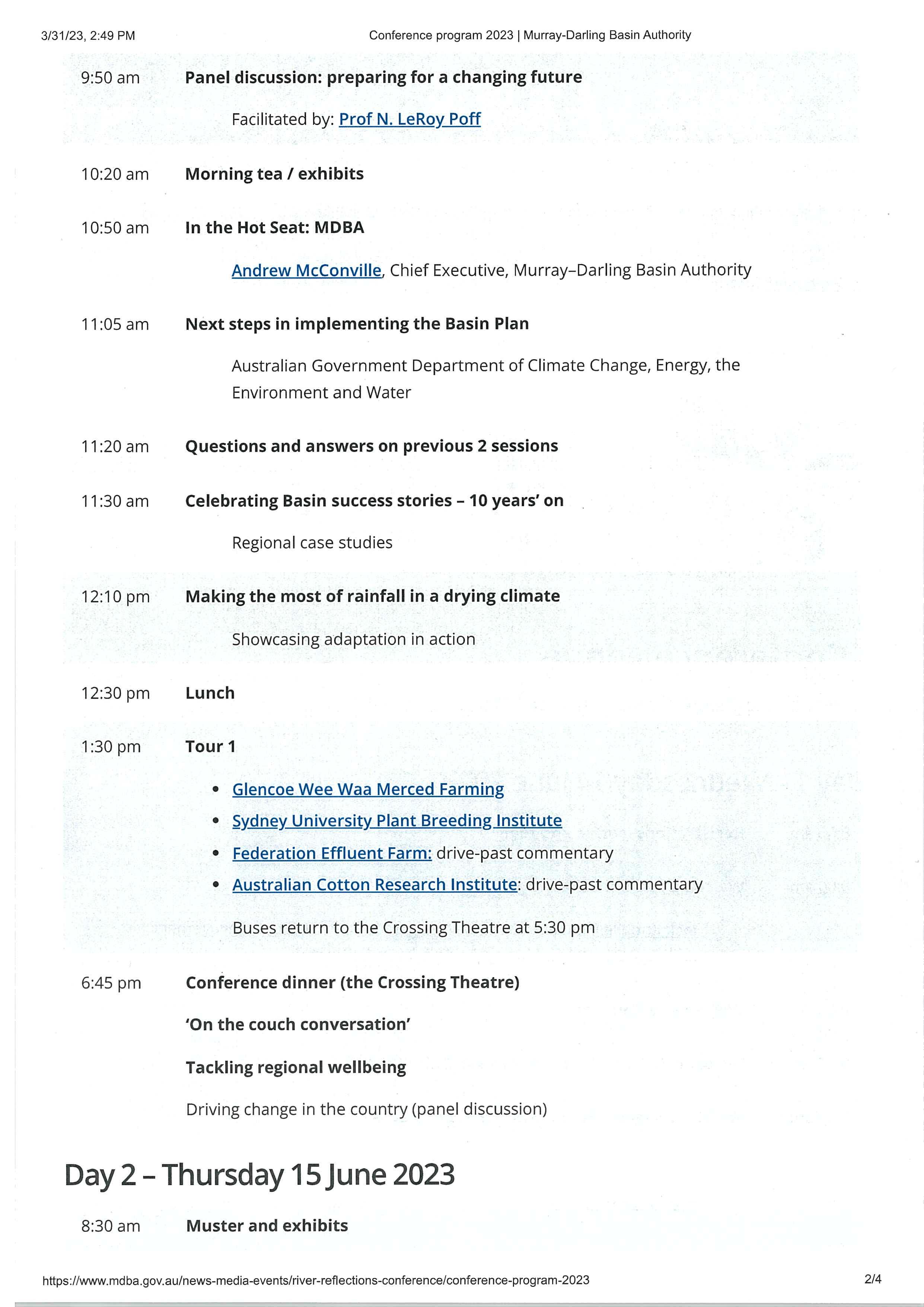
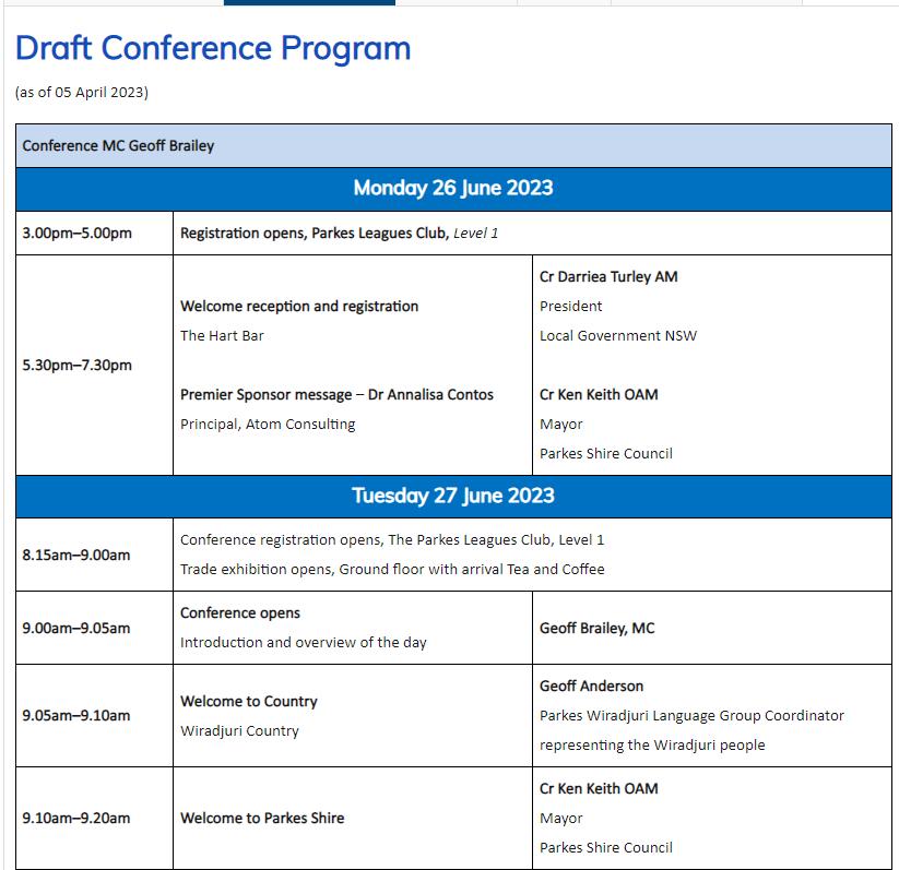
The 2023 Murray Darling Basin Authority River Reflections Conference will be held from 1415 June 2023 in Narrabri or by live streaming at no cost. River Reflections will provide the space and time for the diverse communities of the Murray Darling Basin to come together to listen and learn from one another.
Recommendation
That Council determines attendees to the 2023 Murray Darling Basin Authority River Reflections Conference or alternatively to attend via live stream at no cost.
Detailed Report
Purpose
The 3rd Annual Murray Darling Basin Authority River Reflections Conference will be held from 14-15 June 2023 in Narrabri. The purpose of this report is to bring the conference to the attention of council and to identify which if any delegate(s) should be appointed to attend or alternatively to attend to conference via live stream at no cost.
Background
The Murray Darling Basin Authority River Reflections Conference will see a wide range of speakers sharing their insights and perspectives on challenges and innovations, community resilience, and river and ecosystem health. The program is attached.
Cost for in-person attendance
Registration $160 for 2 Days
Accommodation $135 - $220 per night per person x 2 plus meals
Flights $1200 per person
Total – approximately $1800 per person
Sessions via live streaming
You can attend most sessions via live streaming at no cost
Conclusion
Having consideration to the information provided in conjunction with the attached program Council determine the level representation warranted for this conference.
Ordinary Meeting AGENDA 19 April 2023 Page 39
Attachments 1.
Ordinary Meeting AGENDA 19 April 2023 Page 40
River Reflections Conference Program⇩
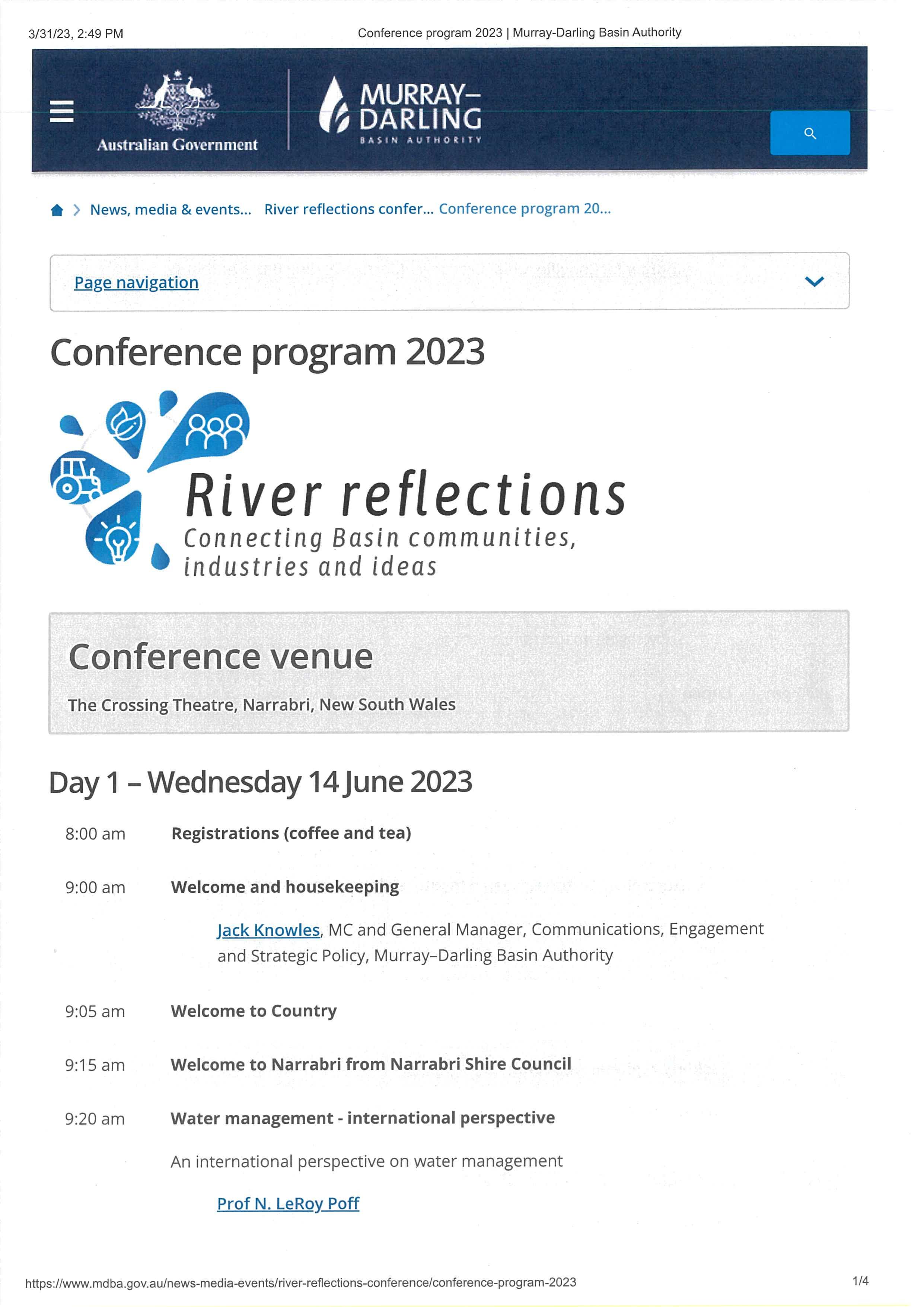
Item 9.4 Attachment 1 River Reflections Conference Program Page 41
Item 9.4 Attachment 1 River Reflections Conference Program Page 42

Item 9.4 Attachment 1 River Reflections Conference Program Page 43
Item 9.4 Attachment 1 River Reflections Conference Program Page 44
9.5 2023 LGNSW WATER MANAGEMENT CONFERENCE
File Number: RPT/23/228
Responsible Officer: Ken Ross - General Manager
Responsible Division: Office of the General Manager
Reporting Officer: Tania Peel - Business Support Officer
Objective: 3.0 Wentworth Shire is a community that works to enhance and protect its physical and natural environment Strategy: 3.4 Use and manage our resources wisely
Summary
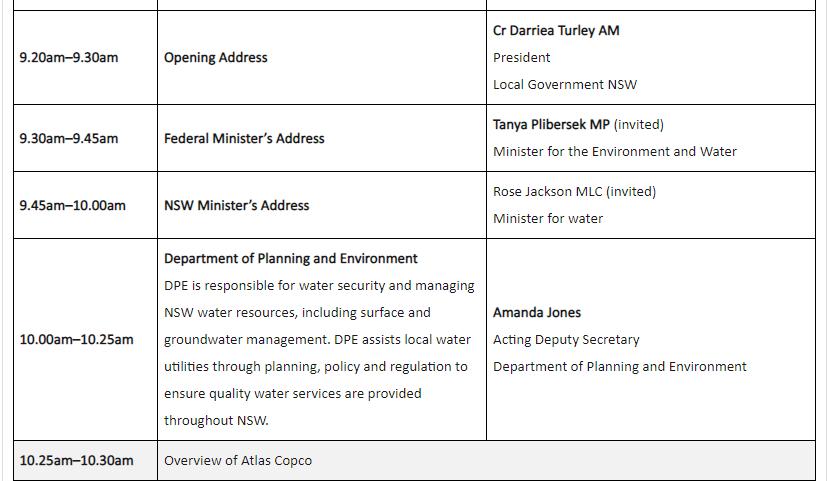
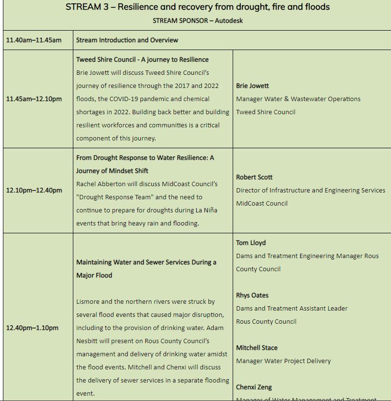
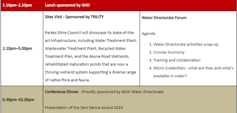
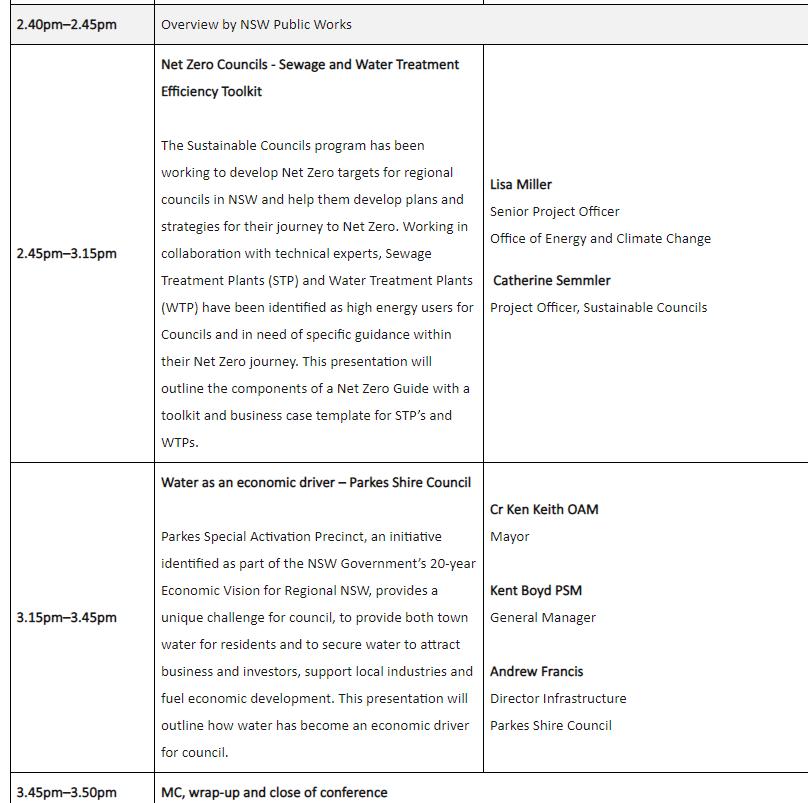
The annual Local Government NSW (LGNSW) Water Management Conference will be held from 26-28 June 2023 in Parkes. A broad range of information from a local government perspective on water management, issues associated with water supply and sewerage services provided by water utilities will be presented at the conference.
Recommendation
That Council nominates delegates to attend the 2023 LGNSW Water Management Conference to be held in Parkes from 26-28 June 2023.
Detailed Report
Purpose
The purpose of this report is advise Council of the upcoming LGNSW Water Management Conference. This conference traditionally attracts participants from NSW and interstate. These include Councillors and General Managers, water managers, professionals and policy makers from government agencies and key industry stakeholders.
Delegates will have the opportunity to find out about the latest water policy initiatives and trends, receive updates on emergent technical issues, benchmark, network and further their professional development and team building capabilities.
Matters under consideration
Council is being requested to consider whether to send delegates to the 2023 LGNSW Water Management Conference.
This year’s Conference focusses on the latest technical innovations and share best practice in water governance and management. Key Program Highlights
• Addressing the challenges of providing quality water supply to rural and remote communities
• Cybersecurity issues facing local water utilities
• Supporting councils in preparing for/responding to climate volatility
• Net zero councils - sewage and water treatment efficiency toolkit
• Water as an economic driver, and much more.
In 2020 Council resolved to send the Director of Roads and Engineering and one Councillor to the conference. This is the last time Wentworth Shire Council was represented at this conference.
Conference Costs – Early Bird special (28 April 2023) $675 standard price $820 per person
Accommodation costs - approximately $150 per night per person x 4 nights
Ordinary Meeting AGENDA 19 April 2023 Page 45
Travel – flight from Mildura to Sydney, Sydney to Dubbo 6 hours travel (this includes 3 hours lay over time in Melbourne) $602 round trip then 1.5 hours ‘drive from Dubbo to Parkes total travel time 7.5 hours
Car Rental from Dubbo to Parkes for 3 days $275 includes 600kms (Dubbo to Parkes is 120kms) or
Drive Council car to conference approximately 8 hours (710kms)
Total $1275 plus travel
Attachments
1. LGNSW Water Management Conference Draft Program⇩
Ordinary Meeting AGENDA 19 April 2023 Page 46
Item 9.5 - Attachment 1 LGNSW Water Management Conference Draft Program Page 47


Item 9.5 - Attachment 1 LGNSW Water Management Conference Draft Program Page 48


Item 9.5 - Attachment 1 LGNSW Water Management Conference Draft Program Page 49
Item 9.5 - Attachment 1 LGNSW Water Management Conference Draft Program Page 50


Item 9.5 - Attachment 1 LGNSW Water Management Conference Draft Program Page 51

Item 9.5 - Attachment 1 LGNSW Water Management Conference Draft Program Page 52
9.6 MURRAY DARLING ASSOCIATION REGION 4 NOMINATIONS
File Number: RPT/23/174
Responsible Officer: Ken Ross - General Manager
Responsible Division: Office of the General Manager
Reporting Officer: Tania Peel - Business Support Officer
Objective: 3.0 Wentworth Shire is a community that works to enhance and protect its physical and natural environment Strategy: 3.3 Minimise the impact on the natural environment
Summary
Wentworth Shire Council continues to be a member of the Murray Darling Association (MDA); a membership-based organisation representing local government and communities across the Murray-Darling Basin since 1944.
The MDA works with and for member councils, in collaboration with state based local government associations such as Local Government NSW, Joint Organisations and other local government affiliations.
Wentworth Shire Council sits within Region 4; there are 12 regions.
The MDA Region 4 Annual General Meeting is scheduled to be held on 31 May 2023 at the Mildura Rural City Council.
Nominations are now being called for the position of Chair and Executive Committee members.
Recommendation
That Council
1. Nominates delegate(s) for positions on the Executive Committee of MDA Region 4, and in doing so acknowledges its commitment to the nomination.
2. Determines if it will nominate a preferred delegate for the position of Chair of MDA Region 4, and in doing so acknowledges the obligations of the Region Chair and commits to providing the resources required to support the role of Chair.
Detailed Report
Purpose
The purpose of this report is for Council to nominate delegates for positions on the Executive Committee of MDA Region 4 and also determine if Council wishes to nominate a delegate to the position of Chair of MDA Region 4. In regard to the Chair position Council also acknowledges the obligations of the Region Chair and commits to providing the administration resources required to support the role of Chair.
Report Detail
Wentworth Shire Council continues to be a member of the Murray Darling Association (MDA), a membership-based organisation representing local government and communities across the Murray-Darling Basin.
Ordinary Meeting AGENDA 19 April 2023 Page 53
The purpose of the association is to provide effective representation of local government and communities at state and federal level in the management of Basin resources by:
• Providing information,
• Facilitating debate, and
• Seeking to influence government policy.
The MDA works with and for member councils, in collaboration with state based local government associations such as LGNSW, Joint Organisations and other local government affiliations.
The MDA Region 4 Annual General Meeting is scheduled to be held on 31 May 2023 at Mildura Rural City Council. Nominations are now being called for the position of Chair and executive committee members. Nominations must be lodged by COB Saturday 20 May 2023.
Council is requested to:
1. Nominate delegate(s) for positions on the Executive Committee of MDA Region 4, and in doing so acknowledges its commitment to the nomination.
2. Determine if it will nominate a preferred delegate for the position of Chair of MDA Region 4, and in doing so acknowledges the obligations of the Region Chair and commits to providing the resources required to support the role of Chair.
The obligations of the Region Chair under Part 5, 16 (5) of the MDA Constitution (for nominations to Regional Chair) are as follows:
The chair of the Region Executive is the chair of the Region, provided further:
(a) The chair must demonstrate both the initial and ongoing capacity to provide secretariat support for the activities of the Region;
(b) When the position of the chair becomes vacant for any reason, the Region Executive may appoint a temporary chair and a new chair must be appointed at the next Region Meeting;
(c) The chair must ensure minutes and other necessary records of Region Executive and Region Meetings are taken, kept and provided regularly to the MDA Board.
Conclusion
Considering the above detail Council is required to determine delegate(s) for positions on the Executive Committee of the Murray Darling Association (MDA) and determine whether to nominate a delegate for the position of Chair of MDA Region 4.
Attachments
Nil
Ordinary Meeting AGENDA 19 April 2023 Page 54
9.7 MONTHLY FINANCE REPORT - MARCH 2023
File Number: RPT/23/184
Responsible Officer: Simon Rule - Director Finance and Policy Responsible Division: Finance and Policy Reporting Officer: Vanessa Lock - Finance Officer
Objective: 4.0 Wentworth is a caring , supportive and inclusive community that is informed and engaged in its future Strategy: 4.1 Provide strong and effective representation, leadership, planning, decision-making and service delivery
Summary
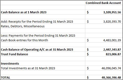
Rates and Charges collections for the month of March 2023 were $520,538.05. After allowing for pensioner subsidies, the total levies collected are now 74.95%. For comparison purposes 75.93% of the levy had been collected at the end of March 2022. Council currently has $49,366,396.48 in cash and investments.
Recommendation
That Council receives and notes the Monthly Finance Report.
Detailed Report
The purpose of this report is to indicate to Council the position in relation to the rate of collections and the balance of cash books.
Reconciliation and Balance of Funds held as at 31 March 2023
The reconciliation has been carried out between the Cash Book of each fund and the Bank Pass Sheet as at 31 March 2023.
Ordinary Meeting AGENDA 19 April 2023 Page 55
Collection of Rates and Charges
Rates and Charges collections for the month of March 2023 were $520,538.05 After allowing for pensioner subsidies, the total levies collected are now 74.95%. A summary of the Rates and Charges situation as at 31 March 2023 is as follows:
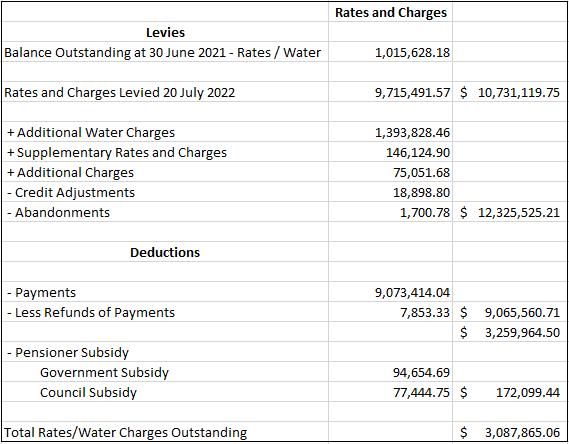
Note: For comparison purposes 75.93% of the levy had been collected at the end of March 2022.
Ordinary Meeting AGENDA 19 April 2023 Page 56
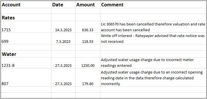
Rates/Water write offs and adjustments
Rates and charges that have been written off or adjustments made under the delegated authority of the General Manager for the month of March 2023.
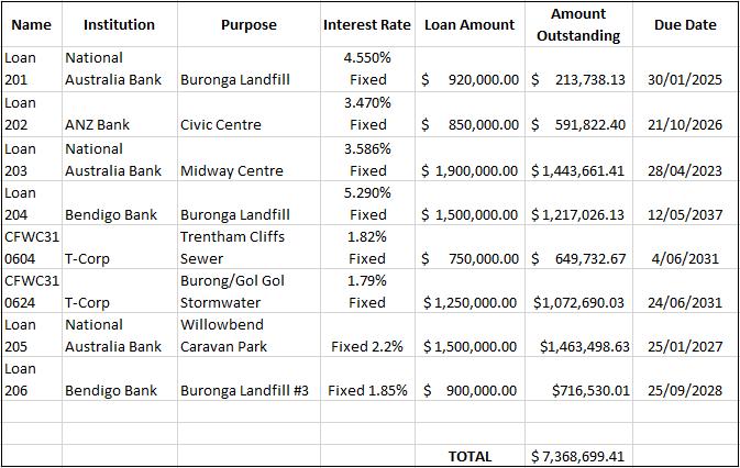
Council Loans Report
Ordinary Meeting AGENDA 19 April 2023 Page 57
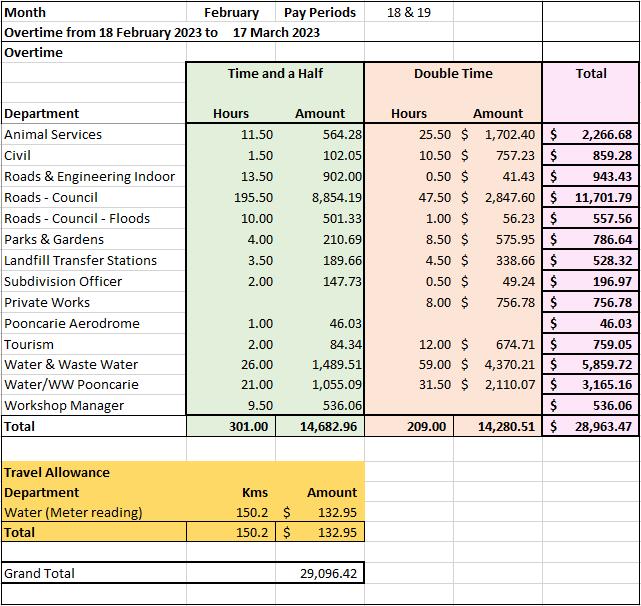
Overtime and Travelling
Conclusion
The report indicates to Council that its finances are in a favourable position.
Attachments
Nil
Ordinary Meeting AGENDA 19 April 2023 Page 58
9.8 MONTHLY INVESTMENT REPORT - MARCH 2023
File Number: RPT/23/183
Responsible Officer: Simon Rule - Director Finance and Policy
Responsible Division: Finance and Policy Reporting Officer: Bryce Watson - Accountant
Objective: 4.0 Wentworth Shire is supported by strong and ethical civic leadership with all activities conducted in an open, transparent and inclusive manner
Strategy: 4.5 Adopt practices of prudent asset, financial and human resource management across Council to ensure long-term sustainability and efficiency
Summary
As at 31 March 2023 Council had $42 million invested in term deposits and $7,366,396.48 in other cash investments. Council received $122,080.65 from its investments for the month of March 2023.
In March 2023 Council investments averaged a rate of return of 3.98% and it currently has $8,235,255.60 of internal restrictions and $34,093,222.88 of external restrictions.
Recommendation
That Council receives and notes the monthly investment report.
Detailed Report
Purpose
The purpose of this report is to update Council on the current status of its investments as required by the Local Government Act 1993 (NSW) and the associated regulation. Matters under consideration
As at 31 March 2023 Council had $49,366,396.48 invested with Nine (9) financial institutions and One (1) Treasury Corporation. This is a decrease of $653,777.68 from the previous month.
The investment of surplus funds remains in line with Council’s Investment Policy. This ensures sufficient working capital is retained and restrictions are supported by cash and investments that are easily converted into cash.
Ordinary Meeting AGENDA 19 April 2023 Page 59
Ordinary Meeting AGENDA 19 April 2023 Page 60 Breakdown of Total Funds Available Financial Institution Amount Percentage of Available Funds AMP $2,000,000.00 4.05% Bank of Queensland $2,000,000.00 4.05% Bendigo Bank $5,270,350.74 10.68% Commonwealth Bank $6,000,000.00 12.15% IMB Bank $1,000,000.00 2.03% Macquarie Bank $7,096,045.74 14.37% ING Bank $7,000,000.00 14.18% National Australia Bank $9,000,000.00 18.23% Westpac $9,000,000.00 18.23% Northern Territory T-Corp $1,000,000.00 2.03% Total $49,366,396.48 100.00%
Investments on Hand as at 31 March 2023
InvestmentsonHandasat31March2023
Note: Ratings provided are from Moody’s and Standard & Poor’s Rating Agencies
Ordinary Meeting AGENDA 19 April 2023 Page 61
Investee Date Invested Date of Maturity Effective InterestRate Investment Type Amount Invested Rating AMP 23/09/2022 25/09/2023 4.50% TermDeposit 1,000,000.00 $ BBB+ AMP 5/09/2022 5/09/2023 4.30% TermDeposit 1,000,000.00 $ BBB+ Bankof Queensland 15/03/2023 14/03/2024 4.45% TermDeposit 1,000,000.00 $ BBB+ Bankof Queensland 9/02/2023 9/02/2024 4.70% TermDeposit 1,000,000.00 $ BBB+ BendigoBank 24/02/2023 23/02/2024 4.70% TermDeposit 1,000,000.00 $ BBB+ BendigoBank 22/12/2022 22/12/2023 4.30% TermDeposit 1,000,000.00 $ BBB+ CommonwealthBank 8/04/2022 6/04/2023 1.87% TermDeposit 1,000,000.00 $ AACommonwealthBank 27/05/2022 26/05/2023 3.01% TermDeposit 1,000,000.00 $ AACommonwealthBank 15/06/2022 15/06/2023 4.16% TermDeposit 1,000,000.00 $ AACommonwealthBank 2/11/2022 2/11/2023 4.44% TermDeposit 1,000,000.00 $ AACommonwealthBank 2/11/2022 2/11/2023 4.44% TermDeposit 1,000,000.00 $ AACommonwealthBank 30/01/2023 30/01/2024 4.69% TermDeposit 1,000,000.00 $ AAIMBBank 9/03/2023 9/06/2023 4.59% FloatingRate Note 1,000,000.00 $ BBB+ Macquarie Bank 6/09/2022 6/09/2023 4.09% TermDeposit 1,000,000.00 $ A+ Macquarie Bank 4/10/2022 4/10/2023 4.50% TermDeposit 1,000,000.00 $ A+ Macquarie Bank 5/10/2022 5/10/2023 4.50% TermDeposit 1,000,000.00 $ A+ National AustraliaBank 18/10/2022 18/10/2023 4.30% TermDeposit 1,000,000.00 $ AANational AustraliaBank 11/03/2022 11/03/2024 1.85% TermDeposit 1,000,000.00 $ AANational AustraliaBank 20/02/2023 20/02/2024 4.85% TermDeposit 1,000,000.00 $ AANational AustraliaBank 15/06/2022 15/06/2023 3.70% TermDeposit 1,000,000.00 $ AANational AustraliaBank 3/01/2023 3/01/2024 4.50% TermDeposit 1,000,000.00 $ AANational AustraliaBank 15/12/2022 15/12/2023 4.35% TermDeposit 1,000,000.00 $ AANational AustraliaBank 27/02/2023 23/01/2024 4.92% TermDeposit 1,000,000.00 $ AANational AustraliaBank 27/02/2023 27/02/2024 5.00% TermDeposit 1,000,000.00 $ AANational AustraliaBank 20/02/2023 20/02/2024 4.85% TermDeposit 1,000,000.00 $ AAINGBank 23/03/2024 22/03/2024 4.60% TermDeposit 1,000,000.00 $ A+ INGBank 31/03/2023 2/04/2024 4.68% TermDeposit 1,000,000.00 $ A+ INGBank 19/04/2022 19/04/2024 3.09% TermDeposit 1,000,000.00 $ A+ INGBank 20/03/2023 19/03/2024 4.45% TermDeposit 1,000,000.00 $ A+ INGBank 19/12/2022 19/12/2023 4.50% TermDeposit 1,000,000.00 $ A+ INGBank 5/04/2022 5/04/2023 1.68% TermDeposit 1,000,000.00 $ A+ INGBank 18/05/2022 18/05/2023 3.11% TermDeposit 1,000,000.00 $ A+ NTT-Corp 15/03/2022 15/06/2023 1.35% FixedBond 1,000,000.00 $ AAWestpacBankingCorporation 3/06/2022 3/06/2023 3.19% TermDeposit 1,000,000.00 $ AAWestpacBankingCorporation 25/11/2022 27/11/2023 4.43% TermDeposit 1,000,000.00 $ AAWestpacBankingCorporation 28/12/2022 26/07/2023 4.28% TermDeposit 1,000,000.00 $ AAWestpacBankingCorporation 5/08/2022 5/04/2023 3.38% TermDeposit 1,000,000.00 $ AAWestpacBankingCorporation 24/08/2022 24/08/2023 4.12% TermDeposit 1,000,000.00 $ AAWestpacBankingCorporation 27/02/2023 27/07/2023 4.46% TermDeposit 1,000,000.00 $ AAWestpacBankingCorporation 27/02/2023 27/02/2024 4.98% TermDeposit 1,000,000.00 $ AAWestpacBankingCorporation 24/08/2022 24/08/2023 4.12% TermDeposit 1,000,000.00 $ AAWestpacBankingCorporation 11/03/2022 11/03/2024 1.92% TermDeposit 1,000,000.00 $ AATotal $42,000,000.00 OtherCashInvestments Investee Date Invested Date of Maturity Effective InterestRate Amount Invested Rating BendigoBank-OperatingA/c N/A Ongoing 3,270,350.74 $ BBB+ Macquarie Bank(4) -Ongoing 3/12/2020 Ongoing 3.35% 4,096,045.74 $ A+ TotalFundsAvailable $49,366,396.48
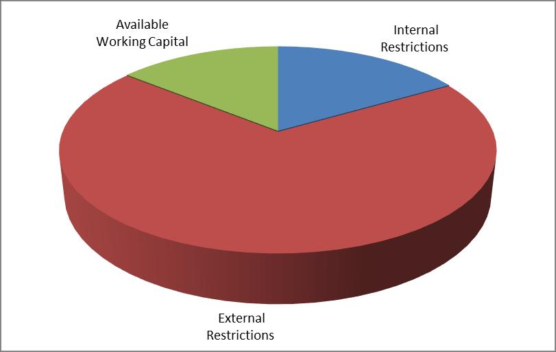
Restrictions
Internal Restrictions
- Employee Entitlements
- Doubtful Debts
- Future Development Reserve
- Trust Account
$2,294,469.28
$115,011.00
$1,076,217.20
$1,500,000.00
-Caravan Park Loan Facility $749,558.12
- Capital Projects
- Plant Replacement Reserve
External Restrictions
- Water Fund
$1,000,000.00
$1,500,000.00 $8,235,225.60
$11,446,131.27
- Sewer Fund $4,794,085.25
- T-Corp Loan Balance $579,074.19
- Developer Contributions Reserve $663,375.97
- Unexpended Grants $15,852,737.2
- Crown Reserves Reserve $213,700.14
- Loan Guarantee Reserve $3,460.91
- Prepayments Cemeteries $540,657.95 $34,093,222.88 Day to
Breakdown
$7,037,918.00
$49,366,396.48
Ordinary Meeting AGENDA 19 April 2023 Page 62
Day Liquidity
Total Funds Available
Ordinary Meeting AGENDA 19 April 2023 Page 63 Summary – Unexpended Grants as at 31 March 2023 Grant Amount Library Infrastructure Grant $436,589.77 Resources For Regions VIC Relocation $324,982.91 SCCF Wentworth Rowing Club $50,956.82 Crown Reserve Improvement Fund Astronomy Park $656,000.21 Crown Reserve Improvement Fund Pooncarie Racecourse $3,200.00 EDS Grant $65,293.00 Main Road Block Grant $366,284.20 Fixing Local Roads Grants - Stage 3 $211,529.51 Murray Darling Basin Civic Centre Upstairs Area $401,354.69 Resources for Regions Round 8 $420,042.03 Local Roads and Community Infrastructure Phase 3 $1,121,352.83 Pooncarie Menindee Road $2,525,201.98 Transport for NSW Pothole Repair Program $667,811.99 Rural Fire Service Levy $60,214.01 Resources for Regions Round 9 $2,784,520.21 Flood Recovery AGRN 1043 $841,329.29 Rural Local Road Repair Program $3,667,586.00 Department of Regional NSW (Light State) $1,248,487.75 Total
$15,852,737.20 Total Funds Invested
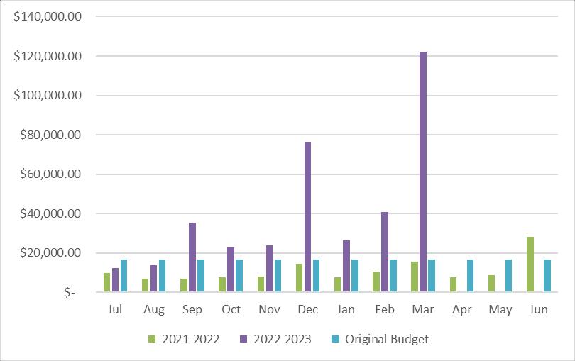
Eight (8) deposits and One (1) other account matured or provided interest in March earning Council $122,080.65 in interest. The budget for March was $16,666.67. Year to date Council has received $374,582.13 in interest. The budget for the current financial year is currently set at $200,000.00.
Investment Revenue in March 2023
Term Deposits
Other Cash Investments
$122,080.65 Investment Revenue received in March 2023
Ordinary Meeting AGENDA 19 April 2023 Page 64
Investee Date Invested Date of Maturity Effective Interest Rate Amount Invested Interest Earned
IMB Bank 9/12/2022 9/03/2023 4.08% $1,000,000.00 $10,060.27 National Australia Bank (Interest paid annually) 11/03/2022 11/03/2024 1.85% $1,000,000.00 $18,601.36 Westpac Bank (Interest paid annually) 11/03/2022 11/03/2024 1.92% $1,000,000.00 $4,786.85 NT T-Corp 15/12/2022 15/03/2023 1.35% $1,000,000.00 $3,375.00 Bank of Queensland (3) 15/06/2022 15/03/2023 3.50% $1,000,000.00 $26,178.08 ING Bank (5) 19/04/2022 20/03/2023 1.98% $1,000,000.00
ING Bank 23/03/2022 23/03/2023 1.24% $1,000,000.00 $12,500.00 ING Bank (2) 31/03/2022 31/03/2023 1.68% $1,000,000.00 $16,800.00
Macquarie Bank 3/12/2020 Ongoing 3.10% $4,063,578.23
2022
2023
$18,170.60
$11,608.49 Total
Total Interest received July
– June
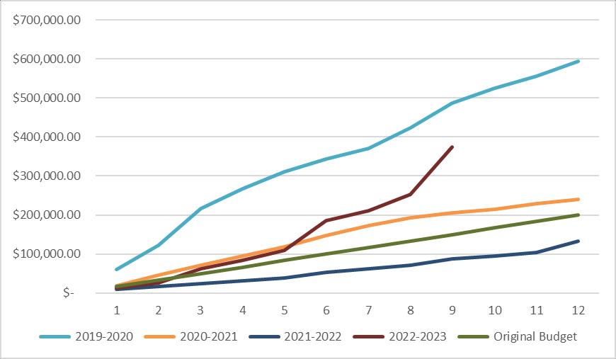
For March 2023 Council’s investments returned an effective average rate of 3.98%. Year to date the effective average rate has been 2.85%. The budget for 2022-2023 was set at 0.67%. The Reserve Bank chose to raise the cash rate in March by 0.25% bring the Cash Rate to 3.6%. Currently Council Investments are outperforming the cash rate by 0.38%.
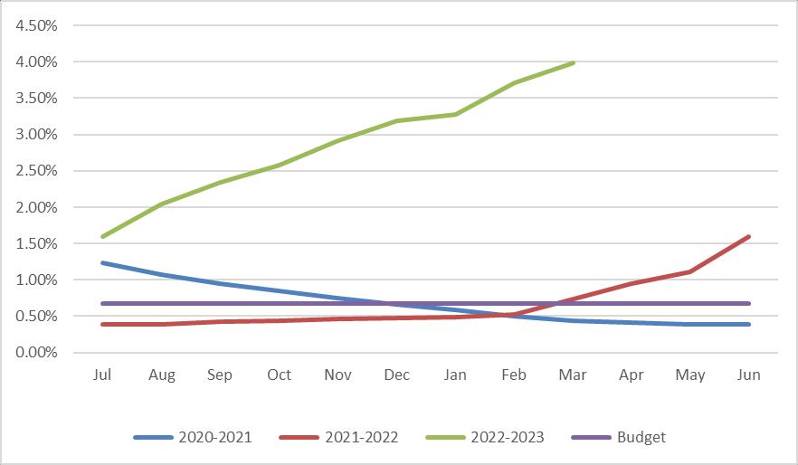
Conclusion
The Director Finance & Policy certifies that all investments have been made in accordance with the Local Government Act 1993 (NSW), Local Government (General) Regulations 2021 and Council’s Investment Policy. Council is investing its funds prudently to optimise returns and reduce exposure to risk in accordance with legislation and its own investment policy.
Attachments
Ordinary Meeting AGENDA 19 April 2023 Page 65
Nil
9.9 HERITAGE & HISTORY ADVISORY COMMITTEE
File Number: RPT/23/199
Responsible Officer: Simon Rule - Director Finance and Policy
Responsible Division: Finance and Policy
Reporting Officer: Deborah Zorzi - Governance Officer
Objective: 4.0 Wentworth Shire is supported by strong and ethical civic leadership with all activities conducted in an open, transparent and inclusive manner
Strategy: 4.2 A strong, responsible and representative government
Summary
By way of a Resolution at the 28 September 2022 Council meeting, Council approved the inclusion of a Heritage Advisory Committee in its Committee structure for the next 12 months.
A draft Heritage Advisory Committee Charter was provided to Council at the meeting of 15 February 2023 with the recommendation that Council adopts the terms of reference detailed in the draft Charter and endorses the objectives, composition of the Committee, and the membership nomination and selection process to enable establishment of the Committee.
During debate of the motion, which included debate regarding composition of the Committee, an Amendment was put forward to change the title of the Committee to ‘Heritage & History Advisory Committee,’ and to extend the list of objectives to reference ‘Indigenous and European history’.
The Council Resolution amended the title and the list of objectives accordingly however it omitted adoption of the terms of reference and the membership nomination and selection process.
Recommendation
That Council adopts the terms of reference detailed in the Heritage & History Advisory Committee draft Charter and endorses the objectives, composition of the Committee, and the membership nomination and selection process to enable establishment of the Committee.
Detailed Report
Purpose
The purpose of this report is to address the procedural omission in the previous Council Resolution
Background
By way of a Resolution at the 28 September 2022 Council meeting, Council approved the inclusion of a Heritage Advisory Committee in its Committee structure for the next 12 months.
A draft Heritage Advisory Committee Charter was provided to Council at the meeting of 15 February 2023 with the recommendation that Council adopts the terms of reference detailed in the draft Charter and endorses the objectives, composition of the Committee, and the membership nomination and selection process to enable establishment of the Committee.
During debate of the motion, which included debate regarding composition of the Committee, an Amendment was put forward to change the title of the Committee to ‘Heritage & History Advisory Committee,’ and to extend the list of objectives to reference ‘Indigenous and European history’.
Ordinary Meeting AGENDA 19 April 2023 Page 66
The Council Resolution amended the title and the list of objectives accordingly however it omitted adoption of the terms of reference and the membership nomination and selection process.
Matters under consideration
The draft Charter now incorporates the amendment to the title of the committee and includes reference to Indigenous and European history in the list of objectives.
The numbers of community membership representation in the revised draft has been left open ended, with the final number to be determined following review of Expressions of Interest.
The final terms of reference will include additional details such as the frequency of meetings, being matters to be determined in consultation with committee members.
Conclusion
The recommendation in this report will facilitate the establishment of the Heritage & History Advisory Committee.
Attachments
1. Wentworth Shire Council Heritage & History Advisory Committee Draft Charter⇩
Ordinary Meeting AGENDA 19 April 2023 Page 67
WENTWORTH SHIRE COUNCIL HERITAGE & HISTORY ADVISORY COMMITTEE
CHARTER
PURPOSE
The Wentworth Shire Council Heritage & History Advisory Committee is to act in an advisory capacity to the Council with respect to providing support and advice on cultural heritage within the Local Government Area (LGA).
Heritage is a diverse field and may include built heritage, cultural landscapes, moveable heritage, Indigenous places, local histories and documenting heritage. Through its actions and contribution, the Committee encourages increased community participation, awareness and appreciation of heritage across Wentworth Shire.
OBJECTIVES
• provide advice to Council in relation to proposed and current heritage listings, including the identification and documentation of heritage items associated with Indigenous and European history.
• promote heritage matters within the community, such as supporting Council to raise awareness and appreciation of the Shire’s cultural heritage and contributing to collective knowledge
• provide support for Council in effective heritage management, such as alerting Council to heritage issues within the community, helping to preserve heritage and supporting education, awareness and capacity building
• provide advice to Council in the development and implementation of strategies, policies and programs related to heritage conservation
• provide feedback to Council on specific applications that may impact heritage items or areas
• provide advice on requests for heritage grants from the relevant state heritage authority
MEMBERSHIP
Membership Structure
The Committee shall comprise of the following voting members:
• Councillors (2) (Councillor MacAllister with a second Councillor to be selected, and an alternate Councillor to be selected)
• Community Representatives (the final number to be determined following review of Expressions of Interest submitted)
The Committee shall comprise of the following non-voting members:
• General Manager
• Director Health & Planning
Community representatives will have a specific interest in history, heritage conservation, local community development or landscapes such as local historical society, local indigenous group(s) and may come from local organisations.
Item 9.9 - Attachment 1 Wentworth Shire Council Heritage & History Advisory Committee Draft Charter Page 68
One Councillor approved by Council will act as Chair of the Committee.
Applications
Applications for membership will take place through a publicly advertised expression of interest process, after which a recommendation will be submitted to Council for approval of membership of the Committee.
Applications from an organisation representative must be accompanied by endorsed minutes from a meeting of that organisation’s executive endorsing the representative Nomination and Selection
Expressions of interest to participate in the Committee will be called for through Council notices posted in the local paper and online media and Council’s website.
The membership criteria for the Committee include the following:
• demonstrated extensive interest in and knowledge of cultural heritage and local history of Wentworth Shire;
• demonstrated interest in and knowledge of the challenges and opportunities affecting local heritage management;
• a willingness to commit time to be actively involved in the Committee;
• resident, ratepayer or a strong association with the Wentworth LGA, including a strong interest and understanding of the local heritage and history;
• the ability to effectively listen, cooperate with community members holding similar or different points of view, and constructively participate as a member; and
• demonstrated practical experience in promoting and protecting heritage.
COMMITTEE MEETINGS
This committee meets on the following basis:
• to be determined in consultation with the committee members
• not open to the public (by invitation only)
REPORTING REQUIREMENTS
This committee will report directly to Council.
ESTABLISHMENT AND DISSOLUTION OF THE COMMITTEE
The Council, through resolution of the Council, establishes advisory committees as it considers necessary. The Council retains the right to dissolve a committee at any time by a resolution of Council.
COMMITTEE DELEGATIONS
The Committee has no formal delegations and acts only in an advisory capacity.
REVIEW OF CHARTER
This charter will be reviewed after 12 months. Any member of the Committee can request an amendment. To become effective, any amendment to the Charter must be by a resolution of Council.
Item 9.9 - Attachment 1 Wentworth Shire Council Heritage & History Advisory Committee Draft Charter Page 69
MEDIA AND COMMITTEE PUBLIC RELATIONS
The Committee as aCouncilfunctionoperates within the provision of Council’s media policy. All media representation, press contact and publications shall be directed through the Council’s Communications Officer via the Chair and as approved by the Chair. To avoid doubt, members cannot make any comment in correspondence, media representation, press contact and publications with reference to speaking as a member of the Committee or on behalf of the Committee.
Item 9.9 - Attachment 1 Wentworth Shire Council Heritage & History Advisory Committee Draft Charter Page 70
9.10 RECLASSIFICATION OF LAND TO OPERATIONAL
File Number: RPT/23/150
Responsible Officer: Matthew Carlin - Director Health and Planning
Responsible Division: Health and Planning
Reporting Officer: Hilary Dye - Property and Land Tenure Officer
Objective: 3.0 Wentworth Shire is a community that works to enhance and protect its physical and natural environment Strategy: 3.2 Ensure that community assets and public infrastructure are well maintained
Summary
Section 31(2) of the Local Government Act 1993 (the Act) notes that before Council acquires land, or within three months after it acquires land, Council may classify the subject land by resolution.
The purpose of classification is to identify Council owned land which should be kept for use by the general public (community) or for Council purposes (operational).
A resolution of Council, within the timeframe prescribed in the Act is required to finalise the classification of land as Operational. Should the classification process not be completed, the land will default to Community Land.
Recommendation
That Council classifies Lot 39 Deposited Plan 1267496 as Operational Land.
Detailed Report
Purpose
The purpose of this report is to seek approval from Council to re-confirm Council’s intention to classify the acquired land listed in this report as Operational land.
Background
At the start of the acquisition process there was a report to Council which resolved to acquire Lot 39 DP 1267496 and for it to be classified as operational once acquired.
As the previous report was done before a public hearing was conducted, section 32 of the Act provides that Council must arrange a public hearing in respect of any proposal to reclassify land as Operational land by such a resolution.
Council has a three-month statutory requirement under s34 of the Act to advertise the notice of a “proposed resolution” to classify the land as operational. A public exhibition period of not less than 28 days is required during which, submissions may be made to Council.
After the 28 day statutory period ends, Council is able to assess all the comments received before a further report is necessary to reclassify the land.
In the absence of any objections Council is now being requested to formally resolve the following parcel with the operational classification.
Ordinary Meeting AGENDA 19 April 2023 Page 71
Ref Purpose Lot / DP Gazette Date Public Exhibition Date A45 Dareton Access Access to essential stormwater infrastructure 39/1267496 2/03/2023 11/3/2023
8/4/2023
WSC
to
Matters under consideration
A resolution of Council, within the time frame prescribed in the Local Government Act 1993, is required to finalise the classification of land as Operational. Should the classification process not be completed within the statutory timeframe, the land will default to Community land restricting Councils use of the land.
The two classifications available:
1. Community Land – land in Council’s ownership which is held for and on behalf of the Community, subject to the Community Land provisions of the Local Government Act 1993. i.e. Community land would ordinarily comprise land such as a public park, and
2. Operational Land – land which Council owns for operational purposes, as a business entity or upon which it conducts Council business which may not be open to the general public,
The advantage of community land is it will restrict the use of the land, thereby protecting the public interest.
Operational land on the other hand has no special restrictions other than those that may apply to any parcel of land. The advantage of operational land is to afford Council flexibility in its use and any future dealings.
Land incorrectly classified (via resolution or by default) will require reclassification to operational land. This involves an application to amend the Local Environmental Plan under the Environmental Planning and Assessment Act 1979 which is both time and cost prohibitive.
Community Engagement
In accordance with Section 34 of the Local Government Act 1993, public notices of Council’s intention to classify the land as Operational was placed in the Sunraysia Daily’s Community Noticeboard and posted on Council’s website allowing 28 days for written submissions. No submissions were received during the advertising period.
Options
Based on the information contained in this report, the options available to address this matter are to:
a) Classify the land as Operational Land.
b) Do nothing and the land will default to Community Land.
Conclusion
After considering the information provided in this report the most appropriate course of action is for Council to classify the land identified as Operational land.
Attachments
1. Deposited Plan⇩
2. Gazettal Notice⇩
Ordinary Meeting AGENDA 19 April 2023 Page 72
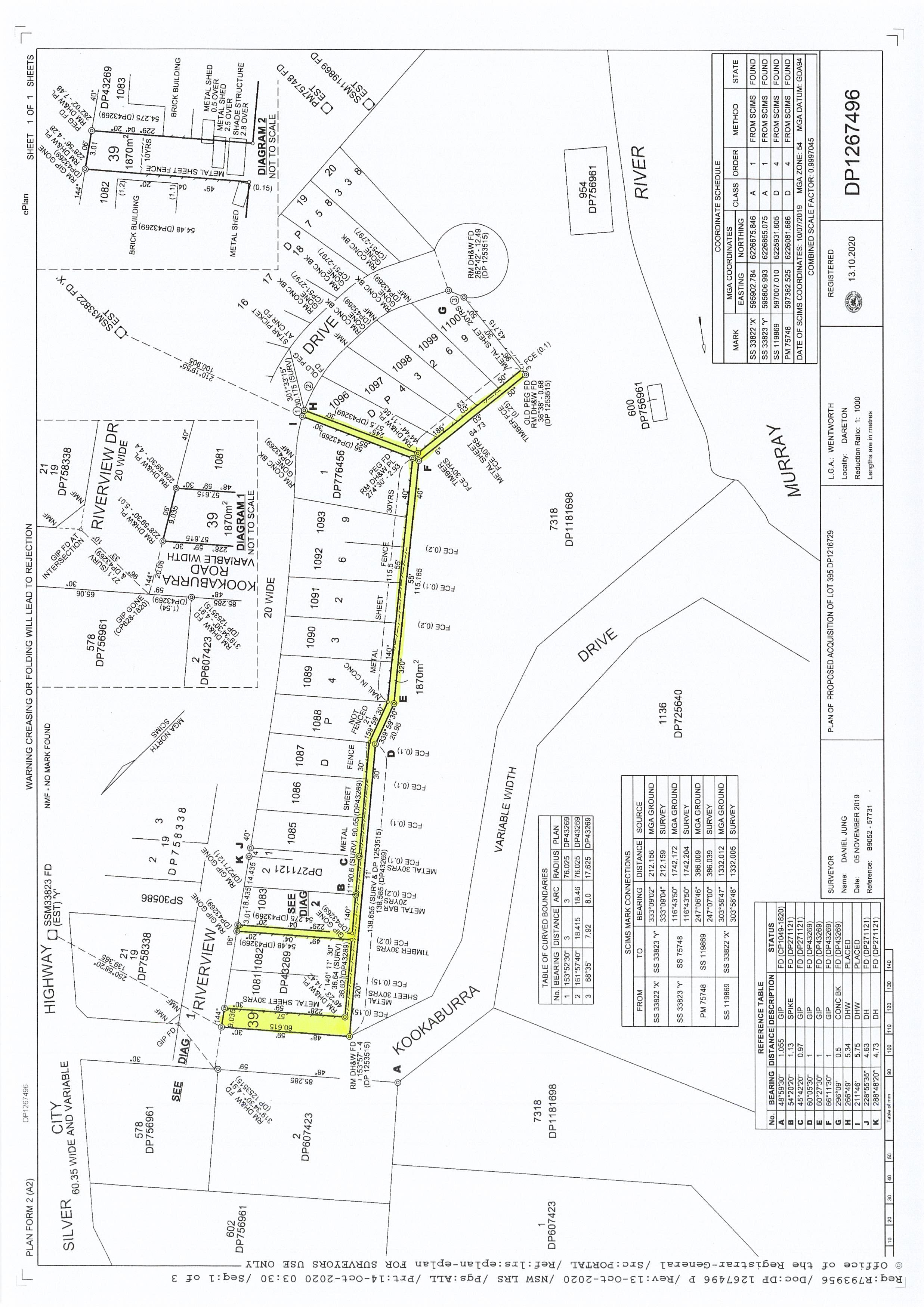
Item 9.10 - Attachment 1 Deposited Plan Page 73

Government Gazette
of the State of New South Wales
Number 111–Compulsory Acquisitions
Thursday, 2 March 2023
The New South Wales Government Gazette is the permanent public record of official NSW Government notices. It also contains local council, non-government and other notices.
Each notice in the Government Gazette has a unique reference number that appears in parentheses at the end of the notice and can be used as a reference for that notice (for example, (n2019-14)).
The Gazette is compiled by the Parliamentary Counsel’s Office and published on the NSW legislation website (www.legislation.nsw.gov.au) under the authority of the NSW Government. The website contains a permanent archive of past Gazettes.
To submit a notice for gazettal, see the Gazette page.
By Authority Government Printer ISSN 2201-7534
Item 9.10 - Attachment 2 Gazettal Notice Page 74 NSW Government Gazette No 111 of 2 March 2023
GOVERNMENT GAZETTE – 4 September 2020
LOCAL GOVERNMENT ACT 1993
LAND ACQUISITION (JUST TERMS COMPENSATION) ACT 1991
NOTICE OF COMPULSORY ACQUISITION OF LAND
Wentworth Shire Council declares with the approval of Her Excellency the Governor that the land described in the Schedule below, is acquired by compulsory process in accordance with the provisions of the Land Acquisition (Just Terms Compensation) Act 1991 for access to stormwater infrastructure
 Ken Ross General Manager
Schedule
Lot 39 DP1267496 being the land comprised in 395/1216729
Item 9.10 - Attachment 2 Gazettal Notice Page 75
[n2023-0440] NSW Government Gazette 2 March 2023
9.11 PART BURONGA CARAVAN PARK RESERVE 63988 - LEASE INCLUSIONRENT
File Number: RPT/23/173
Responsible Officer: Matthew Carlin - Director Health and Planning
Responsible Division: Health and Planning
Reporting Officer: Hilary Dye - Property and Land Tenure Officer
Objective: 1.0 Wentworth Shire is a vibrant, growing and thriving Region Strategy: 1.1 Promote the Shire as an ideal location for investment and the establishment of innovative, sustainable and diversified industries
Summary
A Council report was submitted to Council on 16 February 2022, to ratify the terms & conditions of a new lease for part of the Buronga Caravan Park Reserve 63988 being Lot 2 Deposited Plan 1032974, as the current lessee was in negotiations to sell the business to a new entity.
Although the rent conditions were discussed in the report a resolution of Council was omitted, therefore this report is to gain a resolution of Council to formalise the rent payable by the new lessees.
Recommendation
That Council:
1. Approves the rent to continue as previously set in the existing licence, with an annual increase of the Consumer Price Index, on the anniversary date of when the new lease is executed.
2. Reinstates the Consumer Price Index (CPI) rate to increase annually on the anniversary date of the executed lease agreement
Detailed Report
Purpose
The purpose of this report is to gain a Council resolution to include the rent obligations into the new lease agreement.
Background
In February 202, Council resolved to grant the preparation of a new lease for the occupation of Lot 2 Deposited Plan 1032974, part of the Buronga Caravan Park Reserve 63988. The lease will secure land tenure for a Commercial boat mooring business in Buronga for a term of ten years with an option to renewal for a further 10 years (10+10).
The reserve has been held continually under lease since 2003 as a hire boat business. The tenure has changed hand on several occasion and eventually re-developed into a commercial boat mooring business. The current owner took over the business in 2006 and has held tenure since, with two additional lease extensions of 10 years (2013 & 2023).
The site consists of 3 commercial mooring sites listed as CL3081, CL3082 and CL5615 along with two Crown issued licenses, one for a jetty & suction pipeline LI431621 and another for a jetty LI356466. Both will terminate upon transfer and or expiry of the current lease agreement on the 31 July 2023.
Ordinary Meeting AGENDA 19 April 2023 Page 76
A lease enables exclusive use over a particular piece of land or building for a specified term and purpose. It is the best form of agreement if longer-term security of tenure is an important factor to the user of the land.
The existing business is being sold with the current lease due to expire on 31 July 2023, the new partnership has requested the preparation of a new lease providing them with long-term security of the reserve for their business enterprise.
The previous Council Report can be reviewed as per the attachment to this report.
Matters under consideration
Rent
Holders of leases, licenses and permits to occupy Crown Land are required to pay rent.
Considering the tenant’s long historical affiliation with the reserve, and that they have contributed to the continuous improvement of the facility over a number of years. The current rent payable is currently $1,416.14 (including GST) per month with an increase of Consumer Price Index annually.
Previous Rebate
In 2013, Council resolved to remove the annual rental increase of 5% and apply the lesser rate of 2.3% over ten years.
As there are no capital works included within this new lease agreement, it is recommended that Council reinstates the Consumer Price Index (CPI) rate increase, not the 2.3% which was previously agreed too.
The new lessee is a commercial business conducting a boat mooring business on the reserve and has the ability to create a healthy return for the land without having to do any improvements.
Options
Based on the information contained in this report, the options available to address this matter are to offer:
• The continuation of the current rent as set in the previous existing licence, currently $1,416.14 (including GST)
• Set another rent
• Reinstates the Consumer Price Index (CPI) rate increase, to increase annually on the anniversary date of the executed lease agreement
• Agree to a lesser 5% rate increase
Conclusion
Based on the information contained in this report, the most appropriate course of action is for Council to:
Continue with the current rent as set in the previous existing licence, with an annual increase of the Consumer Price Index, due on the anniversary of when the new lease is executed.
Attachments
1. Council Report Meeting 16 February 2022⇩
Ordinary Meeting AGENDA 19 April 2023 Page 77
9.14 New Lease - Buronga Boatman File Number: RPT/22/40
Responsible Officer: Matthew Carlin - Director Health and Planning
Responsible Division: Health and Planning
Reporting Officer: Hilary Dye - Property and Land Tenure Officer
Objective:
Strategy:
Summary
2.0 Wentworth is a desireable Shire to visit, live, work and invest
2.1 Grow visitation to the Shire by developing a quality visitor experience and promoting our destination
Council has received a request for a change of partnership to be noted on an existing lease for Crown Reserve 63988, Lot 2 Deposited Plan 1032974, being part of the Buronga Caravan Park Reserve. This request requires the preparation of a new lease.
This reserve has been held continually under lease since 2003 as a hire boat business. The tenure has changed hand on several occasion and eventually re-developed into a commercial boat mooring business. The current owner took over the business in 2006 and has held tenure since, with two additional lease extensions of 10 years (2013 & 2023).
The current lease expires in 21 September 2023, and the new partnership has requested the preparation of a new lease providing them with long-term security of the reserve for their business enterprise.
The reserve is managed by the Wentworth Shire Council, pre Plan of Management. Council in its capacity as the Crown Land Manager can authorise the occupation of a twenty-one (21) year maximum tenure authorised under Clause 70(2)(c) of the Crown Land Management Regulation 2018.
This report seeks a resolution of Council to authorise the preparation of a new lease for part of the Buronga Caravan Park Reserve, securing lawful tenure of Crown Reserve 63988
Recommendation
That Council
1. Approves the preparation of a new lease agreement for the occupation of Crown Reserve 63988, part of Buronga Caravan Park, being Lot 2 Deposited Plan 1032974.
2. In its capacity of the Crown Land Manager authorises the granting of a lease, pre Plan of Management, for the term of 20 years (10+10) tenure in accordance with Section 70 Clause 70(2)(c)(i)(ii) of the Crown Land Management Regulation 2018.
3. Grants permission to progress and complete the surrender of the existing lease and the authorisation to negotiate and finalise the terms of a new lease in accordance with the existing lease
4. Engages Bartier Perry Lawyers to prepare the draft lease
5. Enters into a Deed of Agreement for the reimbursement of any of Council’s costs associated with the preparation of this Commercial Business lease.
6. Affix the Common Seal of Wentworth Shire Council to all documentation that requires to be sealed, to give effect to this resolution
7. Authorises the Mayor and General Manager be delegated to sign any related documents.
1
Item 9.11 - Attachment 1 Council Report Meeting 16 February 2022 Page 78 ORDINARY MEETING AGENDA 16 FEBRUARY 2022 Page
Detailed Report
Purpose
The purpose of this report is to provide Council with the necessary information to authorise the preparation of a new lease for the occupation of Lot 2 Deposited Plan 1032974, part of the Buronga Caravan Park Reserve 63988. The lease will secure land tenure for a Commercial boat mooring business in Buronga for a term of ten years with an option to renewal for a further 10 years (10+10).
Background
This section of the Buronga Caravan Park Reserve has been held under lease continually since 2003, starting out as a boat hire business. When the business sold in 2006, the new owner re-developed the site into a commercial boat mooring business. The current owner took over the business in 2006 and has held tenure since with two additional lease extensions of 10 years (2013 & 2023).
The site consists of 3 commercial mooring sites listed as CL3081, CL3082 and CL5615 along with two Crown issued licenses, one for a jetty & suction pipeline LI431621 and another for a jetty LI356466 Both will terminate upon transfer and or expiry of the current lease agreement on the 31 July 2023
To ensure the lease does not lapse out of tenure, the existing lease will need be surrendered and a new lease prepared before the expiration date. This will provide the new partnership with long-term security of the reserve for their business enterprise.
Matters under consideration
Lease
Leases for Crown Land, managed by Council are to be prepared in accordance with the Crown Land Management Act 2016 and Local Government Act 1993, to ensure there is legal and suitable occupation of Crown land.
A lease enables exclusive use over a particular piece of land or building for a specified term and purpose. It is the best form of agreement if longer-term security of tenure is an important factor to the user of the land
The Council Crown Land Manager must clearly demonstrate the proposal is not inconsistent; and does not interfere with, the reserve purpose/s of public recreation and conservation.
Pre Plan of Management
Council in its capacity as the Crown Land Manager can grant tenure to a maximum of Twenty-One (21) years under Clause 70(2)(c)(i)(ii) of the Crown Land Management Regulation 2018
Crown Land Management Regulation 2018
Section 70 Exemption from operation of Act, sections 3.22 and 3.23(7)
2.(c) the granting of a new lease or licence over the land for a term not exceeding the maximum term (21 years including any option for the grant of a further term) if
(i) there was a lease or licence in force over the land immediately before 1 July 2018, and
(ii) there are no additional permitted uses of the land
Under this clause, Lot 2 Deposited Plan 1032974 has been held in lease since 2003 and the new lease will be prepared in accordance of the previous lease with no additional uses of the land.
Maximum Term
Per the regulation above, Council can approve a maximum term up to 21 years, including any option for the grant of a further term (i.e.10+10+1). Addition of a holding over clause, limited to a maximum term of 12 months, can allow time at the end of their term to arrange a new contract.
2
Item 9.11 - Attachment 1 Council Report Meeting 16 February 2022 Page 79
Page
ORDINARY MEETING AGENDA 16 FEBRUARY 2022
Rent
Holders of leases, licenses and permits to occupy Crown Land are required to pay rent
Considering the tenant’s long historical affiliation with the reserve, and that they have contributed to the continuous improvement of the facility over a number of years. The current rent payable is $1334.15 (including GST) per month with an increase of Consumer Price Index annually.
In 2013, Council resolved to remove the annual rental increase of 5% and apply the lesser Consumer Price Index (CPI) rate of 2.3% over ten years
Deed of Agreement
Considering the commercial nature of the business and their ability to generate an income from the lease over a twenty-year period, Council should consider the addition of a clause requiring the lessee to bear Councils expenses involved with the preparation of the lease (e.g. Solicitor, advertising, stamp duty).
Estimate of Costs
Deed of Agreement $3,000
Lease preparation - $15,000 +GST (includes surrender of existing lease)
Disbursements $ 400.00
Options - Term
Based on the information contained in this report, the options available to address this matter are to offer:
a) 5year term
b) 10year term (5+5)
c) Maximum of 20 years (10+10) this includes an option for the grant of a further term Conclusion
Having consideration to the content of this report, the most appropriate course of action is for Council to:
• Authorise a new lease that would provide the security of tenure for the occupation of part Crown Reserve 63988 for a further period of 20 years (10+10).
• Provide the authority to progress and complete the surrender of the existing lease and set the conditions and terms in accordance with the existing lease
• Enter into a Deed of Agreement for the reimbursement of Council’s costs
• Rent will continue as previously set in the existing licence, with an annual increase of either the Consumer Price Index, when the new lease is executed.
• Engage Bartier Perry Lawyers to prepare the documents, they completed the documentation for the Buronga Caravan Park lease (Discovery Parks) and have the expertise in dealing with Crown Lands regulations.
Attachments
1. Hisotrical site sketch - Buronga Boatman
2. Location of leased area - Buronga Caravan Park
3
Item 9.11 - Attachment 1 Council Report Meeting 16 February 2022 Page 80
ORDINARY MEETING AGENDA 16 FEBRUARY 2022 Page
9.12 DA2023/020 DWELLING 98 NEILPO ROAD LOT 1 DP 805859 WENTWORTH
File Number: RPT/23/186
Responsible Officer: Matthew Carlin - Director Health and Planning Responsible Division: Health and Planning Reporting Officer: Kerrie Copley - Planning Officer
Objective: 3.0 Wentworth Shire is a community that works to enhance and protect its physical and natural environment Strategy: 3.1 Ensure our planning decisions and controls enable the community to benefit from development
Summary
A development application (DA2023/020) was received by Council for a dwelling to be located at 98 Neilpo Road Lot 1 DP 805859 Wentworth in close proximity to the river.
Under the Wentworth Local Environmental Plan 2011 (WLEP 2011), dwellings are permitted with consent if located within the RU1 Primary Production zone.
The proposed dwelling is located between 16.2m and 23.7m from the high bank of the river, while the required river setback under clause 7.6 the WLEP 2011 is 30m from the high bank. As part of the 7.6 assessment, a variation to the 30m river setback standard was required (usually referred to as a 4.6 variation).
Due to the variation being greater than 10%, the application cannot be determined under delegated authority, and must be determined by Council.
Recommendation
That Council:
1. Approve DA2023/020 being a Dwelling located at 98 Neilpo Road Lot 1 DP 805859 Wentworth.
2. Call a division in accordance with S375A of the Local Government Act 1993 (NSW)
Detailed Report
Purpose
The purpose of this report is to provide information to Council to determine Development Application DA2023/020, having consideration to the detail provided both within this report and the attachments provided.
Background
A Development Application was lodged with Council on 17 February 2023 seeking consent to construct a dwelling on the subject Lot.
The subject lot is located in the RU1 Primary Production zone under the Wentworth Local Environmental Plan (WLEP 2011). The proposal seeks to construct a dwelling between 16.2m and 23.7m from the high bank of the river. Under Clause 7.6 of the WLEP 2011, dwellings are not permitted within the river front area.
The definition of river front within the WLEP 2011 is as follows:
“river front area means the land between the river front building line and the highest bank of the Murray River or, if there is no river front building line, the land within 30 metres of the highest bank of the River.”
Ordinary Meeting AGENDA 19 April 2023 Page 81
The definition of the Murray River in the WLEP2011 is as follows:
“Murray River includes the Darling River and the Great Darling Anabranch.”
Based on the definition of river front above, the proposed dwelling did not meet the river front setback standard.
Where an application cannot achieve the development standards required by a Local Environmental Plan, the applicant may apply to vary the development standards.
An application to vary a development standard is made under clause 4.6 of the WLEP 2011. Such applications are also subject to Assumed Concurrence provisions set down by the NSW Planning Secretary.
There are specific development standards where Council cannot assume Secretary’s concurrence, however the Standard pertaining to riverfront setbacks can be assessed under assumed concurrence.
The NSW Planning Circular PS 20-002 ‘Variations to Development Standards’ states: “the Secretary’s concurrence may not be assumed by a delegate of Council if the development contravenes a numerical standard by greater than 10%”
The WLEP2011 provides a 30m riverfront setback. The application proposes a setback of between 16.2 and 27.3m thus creating a variation of 46%. As this is greater than 10% this application cannot be determined under delegated authority and is presented to Council for consideration.
Refer to attachment 1 – Development Application
Refer to attachment 2 – 4.6 Variation request
Refer to attachment 3 - Plans
Matters under consideration
In determining a development application that requires consent, the consent authority must take into consideration matters prescribed in Section 4.15 of the Environmental Planning and Assessment Act 1979 as relevant to the development.
The proposed development was assessed against and met the relevant principles of Chapter 5 of the State Environmental Planning Policy (Biodiversity and Conservation) 2021.
The proposed development for a dwelling is permitted with consent and meets the zone objectives of the RU1 Primary Production zone under the WLEP 2011.
The dwelling does not meet the setback standard under clauses 7.6, and the Clause 4.6 variation request provided by the applicant provided adequate justification for the contravening of development standards contained in Clause 7.6.
Due to the WLEP 2011 mapping impacting the land, the development application was assessed against clauses 4.2B, 4.6, 5.16, 5.21, 7.1, 7.4, 7.5, 7.6 and 7.7.
Due to the nature of the proposed development, it was assessed against Chapter 5 of the Wentworth Development Control Plan (DCP) 2011. Excluding the 30m river setback, the proposed development met all relevant provisions of the Wentworth Development Control Plan (DCP) 2011.
Based on the assessment of the application and no submissions received as part of the notification process, it is determined that the proposed development is consistent with the relevant objectives of the RU1 Primary Production Zone and with planning matters for consideration of the Wentworth Local Environmental Plan 2011. The proposal met relevant provisions of the Wentworth Development Control Plan (DCP) 2011.
Refer to attachment 4 – 4.15 Assessment report
Refer to attachment 5 – 4.6 Assessment report
Refer to attachment 6 – Conditions of consent
Ordinary Meeting AGENDA 19 April 2023 Page 82
Options
Based on the information contained in this report, the options available to address this matter are to:
Approve Development Application 2023/020 subject to conditions Legal, strategic, financial or policy implications
Should Council issue a determination to the application, the applicant has the right to submit a request for review of determination to Council under Section 8.2 of the Environmental Planning & Assessment Act 1987.
The applicant also has the right to appeal the decision made by Council to the Land and Environment Court pursuant to Section 8.7 of the Environmental Planning & Assessment Act 1987.
Conclusion
Having consideration of the consent of this report it is concluded that the appropriate course of action is to approve DA2023/020 subject to conditions.
Attachments
1. Development Application⇨ (Under Separate Cover)
2. 4.6 Variation request⇨ (Under Separate Cover)
3. Plans⇨ (Under Separate Cover)
4. 4.15 Assessment report⇩
5. 4.6 Assessment report⇩
6. Conditions of consent⇩
Ordinary Meeting AGENDA 19 April 2023 Page 83

Health & Planning Department
26-28 Adelaide Street PO Box 81
WENTWORTH NSW 2648
Tel: 03 5027 5027 council@wentworth.nsw.gov.au
DA Assessment Report
Section 4.15 Evaluation
Environmental Planning & Assessment Act 1979 as amended
File Reference: DA2023/020 & PAN-306603
Property Title & Address: Lot 1 DP 805859 & 98 Neilpo Road Wentworth
Property owner(s): Bernadette Marie James
Applicant(s): Bernadette James
Proposal: Dwelling
Previous DAs: N/A
Cost of proposed development: $285,000.00
SITE AND SURROUNDING DEVELOPMENT
The subject site comprises of Lot 1 DP 805859 located in Wentworth, NSW. The lot has an area of 4047m² access is via Neilpo Road linking it to the surrounding area.
The subject site is zoned RU1 Primary Production under the Wentworth Local Environmental Plan 2011 (WLEP 2011). The subject site is a slightly irregular shaped Lot with an existing storage shed. Adjoining lots are zoned RU1 Primary Production with associated structures supporting agriculture.
The site does not contain a heritage item or is located within the heritage conservation area. The site is not located within the bush fire mapped area, or urban release areas. This land is mapped as flood affected, terrestrial biodiversity, & wetlands areas.
DESCRIPTION OF PROPOSAL
The proposal seeks development consent to construct a dwelling on the subject site. The dwelling will consist of 4 bedrooms, 2 bathrooms, laundry, study, kitchen, dining, lounge & living room with a floor area of 279.77m² with a ceiling height of 2.740m, the overall building height will be 6.150m.
The proposed dwelling with encroach on the riverfront area under the Wentworth Local Environmental Plan 2011, Clause 7.6 and as such will require a 4.6 variation to the standard.
The new dwelling will meet the standard to the Northern aspect as it is replacing an existing dwelling located on the site with the same building footprint. This aspect will be located 23.7m from the high bank of the river at this point. The Southern aspect will be located 16.2m from the high bank of the river, site placement constrained due to a power easement. Representing a variation of 46%.
Item 9.12 - Attachment 4 4.15 Assessment report Page 84
HISTORY RELEVANT TO THE DEVELOPMENT APPLICATION
N/A
SECTION 4.15-MATTERS FOR CONSIDERATION
(1) The provisions of any environmental planning instrument and development control plan
State Environmental Planning Policy (Building Sustainability Index: BASIX) 2004
The proposed development meets the requirements of the State Environmental Planning Policy (Building Sustainability Index: BASIX) 2004 as demonstrated by the BASIX certificate.
State Environmental Planning Policy (Biodiversity and Conservation) 2021
The proposed development is located on land below 1 ha in size with no vegetation removal proposed. As such no assessment against Chapter 3 & 4 of the SEPP is required.
An assessment against Chapter 5, Clause 5.9 principles of the SEPP are as follows:
1. Access
Land is freehold with no existing public access to the river. The development will not change this access to the river.
2. Bank Disturbance
The development will be sited 16.2m from the high bank line of the river at the closest point and 23.7m at the furthest point – no bank disturbance is anticipated from the development and no vegetation is to be removed.
3. Flooding
The development is located on flood liable land. An assessment against related principles is as follows:
a). The land was previously used for agriculture with a previous dwelling on site and therefore, has already been disturbed with no change to riverine ecosystems anticipated.
b). The land is flood liable with risk of flooding during flood events. With an increase in extreme weather events caused by climate change, this clause is especially relevant.
c). The proposed dwelling is to be located on compacted earth. Conditions of consent can be put in place to protect habitable areas and to facilitate free flow of water during flood events.
d). The Lot contains flood liable land, however, placement of the dwelling is outside the flood planning area.
e). Electricity is available to the site, sewer will be managed onsite using an approved waste management system with stormwater also managed onsite. Telecommunication connection not required as mobile network will facilitate coverage.
Item 9.12 - Attachment 4 4.15 Assessment report Page 85
f). The land is expected to be used for residential purposes, minimal risk of pollution during riverine flood event, as residents have time to prepare and prevent possible issues as the access will not be compromised.
g). The dwelling will be placed on stumps and will be required to be raised above the 1 in 100 year flood event level.
h). Noted. Due to the generally slow nature of riverine flood, residents should be able to plan and prepare with adequate time for evacuation.
4. Land Degradation
The proposed development will be conditioned to minimise any detrimental effects on the land if required.
5. Landscape
As the proposed site contained a previous dwelling the site had been cleared. As such, no vegetation removal is anticipated, landscaping will be conditioned to include native species for revegetation.
6. River Related Uses
The proposed development does not demonstrate an essential relationship to the river, as such development should be located a reasonable distance from the river.
7. Settlement
The proposed development is for a single dwelling.
8. Water Quality
The proposed development and continued use will be conditioned to ensure measures are applied to reduce pollution of the waterway.
9. Wetlands
The proposed site is not located in wetland area as per WSC mapping. The location where the dwelling is be sited has been disturbed through previous development of a dwelling.
An assessment against Clause 5.13 principle of the SEPP are as follows:
- Building setback: The proposed dwelling does not meet the WLEP 2011 setback requirement as recommended 30m setback from the high bank line of the river. Therefore a 4.6 variation has been provided requesting variation to this standard. From an assessment perspective the 4.6 variation does not provide adequate justification as to why the building setback should not comply with the WLEP 2011 river setback requirements.
- Matters to be considered
o Effluent disposal: An approved sewer management system will be required for the dwelling
o Landscaping: To be conditioned recommending use of local native vegetation species.
Item 9.12 - Attachment 4 4.15 Assessment report Page 86
The proposed development does not comply with the principles within the SEPP. Notable non-compliance being that the proposed development of a dwelling is not classified as having an essential relationship and is not listed as one of the items permitted as having a river related use. The proposed setback from the high bank of the river does not meet the recommended 30m setback.
The 4.6 variation provided, details justification as to why the dwelling should be located 16.2m at the closest point, and 23.7m at the furthest point, from the high bank of the river. It is noted that the new dwelling footprint partially replaces the previously existing dwelling, and placement is constrained by an easement and existing structures.
Wentworth Local Environmental Plan (LEP) 2011
The proposed dwelling is permitted with consent within land zoned RU1 Primary Production under the Wentworth LEP 2011, meeting the land use zone objectives to which the site is located.
Clause 4.2B, Erection of dwelling houses on land in Zones RU1, RU4, E3 and C4
The objectives of this clause are met under subclause 4, as the proposed dwelling is intended to replace the existing lawfully erected dwelling house.
Standard being varied
The dwelling will be located between 16.2m and 23.7m approximately from the high river bank. Under Clause 7.6 of the WLEP 2011 only a certain list of uses, documented below are permitted within the river front area (30m from the high bank). This represents a variation of 46%.
(2) Despite any other provision of this Plan, development consent may only be granted to development on land in a river front area for the following purposes
(a) boat building and repair facilities, boat launching ramps, boat sheds, charter and tourism boating facilities or marinas,
(b) the extension or alteration of an existing building that is wholly or partly in the river front area, but only if the extension or alteration is to be located no closer to the river bank than the existing building,
(c) environmental protection works,
(d) extensive agriculture and intensive plant agriculture,
(e) walking trails, cycleways, picnic facilities, recreation facilities and recreation facilities (outdoors),
(f) water recreation structures.
Item 9.12 - Attachment 4 4.15 Assessment report Page 87
Definition of “River Front” river front area means the land between the river front building line and the highest bank of the Murray River or, if there is no river front building line, the land within 30 metres of the highest bank of the River.
Approving 4.6 variations
Under clause 55 of the Environmental Planning and Assessment Regulation 2021, a consent authority (Council) may assume concurrence if the concurrence authority has given notice to the consent authority. The notice identifies which concurrence has been given to council and can specify qualifications or conditions for the assumed concurrence.
Under the planning circular PS20-002 (notice), Councils were given assumed concurrence to approve 4.6 variation applications based on a number of conditions. These conditions can be summarised as following:
1. Council cannot assume concurrence for varying a standard regarding dwelling entitlement in regards to MLS less than 90% for lands zoned RU1 to RU4, RU6, R5, E2 (now C2) to E4 (now C4) and equivalent land uses.
2. Non-numerical standard and standard variations greater than 10% cannot be approved by a Council delegate i.e Director. These need to be approved by Council to ensure greater public scrutiny and transparency.
The proposed variation is not regarding MLS as such Council has assumed concurrence and do not need to refer the DA to the Department of Planning and Environment (DPE) for concurrence. However, the variation proposed is greater than 10%, as such, will need to be presented to Council for approval.
4.6 Exceptions to development standards
Written request for consideration has been presented by the applicant with reasons for justifying the contravention of this standard and allow a dwelling within the river front area.
a). That compliance with the development standard is unreasonable or unnecessary in the circumstances of the case.
Response: Compliance with the development standard would be unreasonable and unnecessary in the circumstances of this case.
The development achieves the objectives of the development standard and is consistent with the objectives of the RU1 – Primary Production zone.
b). That there are sufficient environmental planning grounds to justify contravening the development standard.
Response: There are sufficient environmental planning grounds to justify the contravention.
Consideration of the applicants written request – Clause 4.6(4) (a) (i) and (ii) (b)
Does the written request adequately address those issues at Clause 4.6(4)(a)(i)
Item 9.12 - Attachment 4 4.15 Assessment report Page 88
The applicants written request has adequately demonstrated that compliance with the 30m river front area restriction is unreasonable and unnecessary in this case based on the following:
A 1 metre power easement runs through the property to service vineyard infrastructure on the adjoining property to the south. The easement constricts the available development space to its west, because of the existing shedding infrastructure and established large gum tree. This also constricts the available development space to the east (towards the river), due to the natural boundary angle at the river and established native tree in place.
A small cottage previously existed on the allotment (setback 23.1 metres), which has been demolished (by others) to make way for a new dwelling. The proposed home sets it in line on the northern end with the central setback of the original cottage to on the river side.
The southern setback from the river prevents the dwelling achieving the same setback from the river due to the requirement for the home to clear the easement in place.
This application therefore calls for the Council’s standard to be varied to provide dispensation in order for the construct the proposed dwelling. If dispensation was not awarded the objective of the proposal will be thwarted.
The standard has been compromised due to the existence of a previous dwelling on the site (demolished), which established an existing setback standard which may be relied upon. Due to the houses reliance on avoiding an existing right of way power easement, this standard is achievable at the northern end, but is compromised at the southern end, where the previous setback cannot be achieved. Dispensation if sought on theses grounds to accommodate the new dwelling.
Due to the site having a previously approved dwelling (now demolished) and the new dwelling assuming some of the previous dwelling’s footprint, it is argued that variation to this 30-meter setback from the high bank of the river was not compliant with Councils standards when the original dwelling was constructed. The applicant is further restricted as mentioned by a easement through the property.
Does the written request adequately address those issues at Clause 4.6(4)(a)(ii)
The following table considers whether the objectives of the development standard are achieved notwithstanding the proposed variation (Test 1).
Objective Discussion / Comment
(a) To provide for a range of land uses, services and facilities that are associated with a rural village.
The proposal includes the erection of a dwelling and other ancillary structure on the
Item 9.12 - Attachment 4 4.15 Assessment report Page 89
(b) To promote development in existing towns and villages in a manner that is compatible with their urban function.
(c) To encourage well-serviced sustainable development.
(d) To deliver new residential and employment growth in Pomona
(e) To ensure business and retail land uses are grouped within and around existing activity centres.
land. This variation does not affect consistency with this objective.
The proposal to rebuild a family home on the allotment supports Wentworth Shire objective of retaining families and residents within the region to further support the local economy. This variation does not affect consistency with this objective.
This variation does not affect consistency with this objective.
This variation does not affect consistency with this objective.
This variation does not affect consistency with this objective.
Has the planning secretary’s concurrence been sought as per Clause 4.6(4)(b)
Under the planning circular PS20-002, the concurrence of the Planning Secretary will not be required for this variation. However, due to the size of the variation, council staff do not have the delegated authority to determine the development. As such, the development will be determined by Council.
The five part test
1. The objectives of the standard are achieved notwithstanding noncompliance with the standard; See table below.
Objective
(a) To encourage sustainable primary industry production by maintaining and enhancing the natural resource base.
(b) To encourage diversity in primary industry enterprises and systems appropriate for the area.
(c) To minimise the fragmentation and alienation of resource lands.
(d) To minimise conflict between land uses within this zone and land uses within adjoining zones.
Discussion/Comment
There is no work proposed on the land that will affect the maintenance and enhancement of the natural resource base.
There is no work proposed in this application that will affect diversity in primary industry enterprise appropriate to the area.
There is no work or land uses proposed in this application that will negatively impact resource lands.
The existing land use remains unchanged and provides no conflict with adjoining zones.
Item 9.12 - Attachment 4 4.15 Assessment report Page 90
Table 1: Achievement of Objectives of Clause of WLEP2011
(e) To ensure the protection of both mixed dryland and irrigation agricultural land uses that together form the distinctive rural character of Wentworth.
(f) To ensure land is available for intensive plant agricultural activities.
(g) To encourage diversity and promote employment opportunities related to primary industry enterprises, including those that require smaller holdings or are more intensive in nature.
The existing land use remains unchanged so maintenance of the distinctive rural character of Wentworth or Pomona remains unchanged.
The existing land use has not changed, so is not affected by the objective.
The existing land use remains the same. There is no work proposed in this application that will detract from the objective.
2. The underlying objective or purpose of the standard is not relevant to the development and therefore compliance is unnecessary; The underlying objective or purpose is relevant to the development and therefore this test is not relied upon.
3. The underlying object of purpose would be defeated or thwarted if compliance was required and therefore compliance is unreasonable; A 1 metre power easement runs through the property to service vineyard infrastructure on the adjoining property to the south. The easement constricts the available development space to its west, because of the existing shedding infrastructure and established large gum tree. This also constricts the available development space to the east (towards the river), due to the natural boundary angle at the river and established native tree in place. A small cottage previously existed on the allotment (setback 23.1 metres), which has been demolished (by others) to make way for a new dwelling. The proposed home sets it in line on the northern end with the central setback of the original cottage to on the river side. The southern setback from the river prevents the dwelling achieving the same setback from the river due to the requirement for the home to clear the easement in place. This application therefore calls for the Council’s standard to be varied to provide dispensation in order for the construct the proposed dwelling. If dispensation was not awarded the objective of the proposal will be thwarted.
4. The development standard has been virtually abandoned or destroyed by the council’s own actions in granting consents departing from the standard and hence compliance with the standard is unnecessary and unreasonable; The standard has been compromised due to the existence of a previous dwelling on the site (demolished), which established an existing setback standard which may be relied upon. Due to the houses reliance on avoiding an existing right of way power easement, this standard is achievable at the northern end, but is compromised at the southern end, where the previous setback cannot be achieved. Dispensation if sought on theses grounds to accommodate the new dwelling
5. The compliance with development standard is unreasonable or inappropriate due to existing use of land and current environmental character of the particular parcel of land. That is, the particular parcel of land should not have been included in the zone;
Item 9.12 - Attachment 4 4.15 Assessment report Page 91
The zoning of the land is reasonable and appropriate and therefore this test is not relied upon.
Assessment under Clause 5.16(4) Subdivision of, or dwellings on, land in certain rural, residential or conservation zones
a). Surrounding land uses are also for Primary Production with residential dwellings and other ancillary structures such as storage shed that support land use.
b). The proposed development will be in keeping with surrounding land uses, in line with Councils land zoning.
c). The proposed use is compatible with uses referred to in paragraph a). and b).
d). N/A
Clause 5.21 Flood Planning
The proposed development is located on a site within the flood mapped area, however, the proposed dwelling will be sited outside the flood mapped area, with the dwelling to be built on stumps above the 1 in 100 flood level. Construction of a dwelling above the prescribed flood level is not anticipated to have detrimental effects on flood behaviour. Building a dwelling on stumps will allow water flow around the dwelling, should future flood water levels exceed the prescribed flood level. Access to nearby roads are not impacted by flood planning zoning, facilitating safe evacuation if people in the event of a flood. The design of the dwelling and placement on site has been considered for minimal environmental impact.
Clause 7.1 Earthworks
Any earthworks will form part of the conditions of consent, should the application be approved as ancillary to the main approval for a dwelling. Standards will apply for any associated earthworks.
Clause 7.4 Terrestrial Biodiversity
An assessment of the proposed dwelling against clause 7.4(3) is as follows:
a). The proposed residential development is unlikely to have any detrimental effects on fauna and flora existing on the site, the residential dwelling is to be used for domestic purposes, no tree removal is expected, potential impacts will most likely be from construction. The development will be conditioned to minimise impact on existing biodiversity on the site and to encourage replanting of native species.
b). The proposed development is unlikely to have any adverse impact on the importance of vegetation on the site, nor adverse impacts on the habitat and survival of native fauna. The site has minimal vegetation with larger native trees closest to the river bank. Approval would see conditions pertaining to vegetation removal and re-planting.
Item 9.12 - Attachment 4 4.15 Assessment report Page 92
c). The proposed development is unlikely to fragment, disturb, or diminish the biodiversity structure, function and composition of the land as it has already been disturbed as part of the previous residential use.
d). The proposed development is unlikely to have any adverse impact on the habitat elements and connectivity to the land as limited vegetation currently exists facilitating this connectivity.
An assessment of the proposed dwelling against clause 7.4(4) is as follows:
a. The dwelling has been designed, sited and managed to minimise any environmental damage.
b. Noted
c. Noted
Clause 7.5 Wetlands
An assessment of the proposed dwelling against clause 7.5(3) is as follows:
a. Not affect growth and survival of flora and fauna. Measures to be put in place to protect flora and fauna on the site during construction and use of the site.
b. No vegetation to be removed as part of the construction. Tree protection measures to form part of the conditions of consent.
c. No vegetation to be removed, as such no impacts on provision and quality of habitats for indigenous and migratory species
d. Conditions of consent will put measures in place to ensure that surface and groundwater characteristics of the site, including water quality, natural water flows and salinity are protected
e. Measures must be put in place to protect any wetland in the vicinity of the development area.
An assessment of the proposed dwelling against clause 7.5(4) is as follows:
• The site plans of the dwelling adequately show that the development is sited, designed and managed to avoid potential adverse environmental impacts. Conditions of consent will provide further protection measures.
Clause 7.6 Development on the river front areas
As the proposed development is not listed as one of the acceptable river front developments, detailed below, this standard negates the 4.6 variation allowing the proposed dwelling within the river front area.
2) Despite any other provision of this Plan, development consent may only be granted to development on land in a river front area for the following purposes
Item 9.12 - Attachment 4 4.15 Assessment report Page 93
(a) boat building and repair facilities, boat launching ramps, boat sheds, charter and tourism boating facilities or marinas,
(b) the extension or alteration of an existing building that is wholly or partly in the river front area, but only if the extension or alteration is to be located no closer to the river bank than the existing building,
(c) environmental protection works,
(d) extensive agriculture and intensive plant agriculture,
(e) walking trails, cycleways, picnic facilities, recreation facilities and recreation facilities (outdoors),
(f) water recreation structures
Clause 7.7 Riparian land and Murray River and other watercourses – general principles
The proposed development is sited inside the designated distance of 40m from the top bank of a watercourse (Darling River), however, as it is a residential development impact upon the following criteria is anticipated to be minimal. Any anticipated environmental impacts will be managed through implementation of conditions.
Clause 7.7(3) assessment is as follows:
a. Adverse impact of the proposed:
I. The structure will be set enough distance from the water body and is not anticipated to impact the flow.
II. No impacts on aquatic and riparian species, habitats and ecosystem. The use of the land will be rural residential with no emissions likely to impact the environment anticipated from the development.
III. There may be potential disturbance of the of the stability of the bed, shore and banks of the watercourse. The determination will be conditioned to ensure the bed and bank is protected from any impacts from the development.
IV. No impacts to the watercourse movement of aquatic fauna anticipated.
V. Trees and any vegetation in along the bank must be protected and rehabilitated if so required to protect it from the development.
b. The dwelling may have domestic water entitlement to take water from the river but only for domestic purposes. Should water for purposes other non-domestic uses be required, the land owner will need to contact Water NSW.
An assessment of the proposed dwelling against clause 7.7(4) is as follows:
a. The dwelling will need to be designed, sited and managed to avoid any environmental damage. As such a report by a qualified person must be provided to show how the final dwelling design will prevent significant impacts to the environment.
b. If there are some impacts, a report from a qualified person must show how these impacts will be minimised.
c. If the impacts cannot be minimised, it must be proven to the council how these environmental impacts will be mitigated to a reasonable level.
Item 9.12 - Attachment 4 4.15 Assessment report Page 94
Wentworth Development Control Plan (DCP) 2011
Assessment against Chapter 5 of the Wentworth Development Control Plan (DCP) 2011 was carried out, and is acceptable, as shown below.
Wentworth DCP Chapter Acceptable Not Acceptable N/A Reason
Chapter 5
5.1
Intensive Agriculture X
Dwelling houses are permitted with consent within the RU1 zone, the proposed new dwelling will be ancillary to the primary production use and as such, support current agricultural land use. The new dwelling will be sited in a location that minimises disturbance to agriculturally productive land.
5.2 Subdivision X No subdivision proposed
5.3 Rural Dwellings a). General Controls b). Access X
The dwelling will be located more than 15m from the front boundary of the property. The dwelling will be conditioned to be sited above the 1 in 100 flood level and will utilise appropriate building materials. Access to the property is already existing – if approved development consent will be conditioned to ensure properly constructed access
5.3.1 Water X Water management including water storage will be conditioned as part of approval
5.3.2 Effluent Disposal X As reticulated sewer is not available to the site, effluent disposal will be conditioned as part of
Item 9.12 - Attachment 4 4.15 Assessment report Page 95
approval via an onsite waste water management system.
5.3.3 Fencing X Fencing not part of this application but should match that of the area and comply with relevant legislation
5.3.4 Dwelling setback from river X
5.3.5 Land Capability X
5.4 Rural Sheds
5.5 Rural industries X
5.6 – 5.6.10 Boarding and/or breeding kennels for dogs and cats in rural areas
5.7 – 5.7.3 Hazardous chemical X
5.8 Rural land use conflict X
5.8.1 Buffer distances X
The proposed site is located less than 30m form the Darling River.
Dwelling is to support existing agricultural land use
X Development consent is not for a shed
Noted – conditions to be included that mitigate and manage noise, access, landscaping, and land capability
The proposed site has area for future expansion with agricultural diversity considered
X If boarding or breeding check further conditions as listed
Noted - proposal is for a residential dwelling as such minimal hazardous chemical use or storage anticipated
Surrounding sites are used for agriculture – no conflict of land use evident
Noted – as the proposed dwelling will replace a dwelling that previously existed on the property,
Item 9.12 - Attachment 4 4.15 Assessment report Page 96
5.8.2
Variations to buffers X
5.8.3
Vegetation buffers X
due to the distance to surrounding neighbours, buffers are already in existence appropriate for the land use and associated residential development
Noted – existing vegetation and current distances between proposed site and nearest residential area should mitigate the need to impose a buffer
Noted – existing vegetation and current distances between proposed site and nearest residential area should mitigate the need to impose a vegetation buffer
(2) The provisions of any draft environmental planning instrument
There is no Division 3.4 draft environmental planning instrument that affect the proposed development. (Post 1 July 2009 LEP amendments).
(3) Any matters prescribed by regulations
There are no further matters prescribed by regulations.
(4) The likely impacts of the development
There are no likely impacts from the proposal as discussed in the table below.
Impact item
(insert an ‘x’ in the relevant section)
Context and setting X
The site is surrounded by similar land uses (rural residential/agriculture). No land will be taken away from agricultural land, and no effect on adjoining lands.
Item 9.12 - Attachment 4 4.15 Assessment report Page 97
Acceptable Not acceptable Not relevant Comment
Public domain & Streetscape X
Landscaping X
The siting of this development will facilitate adequate distance between the proposed dwelling and the nearest road.
Future landscaping to be conditioned as part of development consent with use of native species encouraged.
Stormwater X Stormwater to be managed onsite.
Heritage X
Soils & Soils Erosion X
Air and microclimate X
Water Resources X
Biodiversity (Flora & Fauna) X
Land Resources X
Utilities X
Access & Parking X
Roads & Traffic X
No heritage items or listing for this site.
None expected from the proposed development, minimal site preparation anticipated, however, conditions of consent will be applied for construction.
None anticipate from this development as there is adequate open space between the proposed dwelling and other related structures onsite. Neighbours are some distance away.
None located on land, and none expected to be impacted by proposed development. Conditions of consent if granted will mitigate and manage impact of proposed dwelling within river front development distance of 30m.
No native vegetation to be cleared for development.
None located on the site expected to impact the proposed development.
Power to be connected to dwelling. Domestic water entitlement.
Direct access to site available, space for parking available on site.
No new road proposed, traffic will not be impacted by proposal.
Solar Access and Energy Efficiency X Meets BASIX requirements
Overshadowing X Not relevant as single storey dwelling
Privacy & Overlooking X Not relevant as proposed dwelling is not near any neighbouring buildings
Flooding X
Conditions of consent, if the proposed development is approved, will include flood mitigation and management.
Bushfire Prone Area X Not in bushfire prone area.
Noise X
Technological hazards X
Possible significant noise increase expected during construction, residential noise anticipated following construction.
None anticipated from the development, only rural residential activities anticipated from the site.
Safety, Security & Crime Prevention X Development will not affect the safety of the area.
Item 9.12 - Attachment 4 4.15 Assessment report Page 98
Social and Economic Impacts X
No negative social and economic impacts anticipated from the proposed development.
(5) The suitability of the site for development
The site is suitable for the proposed dwelling as it will not have any adverse impact on the locality. The proposed development is permitted by the RU1 Primary Production zoning of the area under the Wentworth LEP 2011. The character and use of the proposed dwelling is consistent with existing developments in the surrounding area. Power is available for connection to the site. Conditions of consent will be included for inclusion of an approved onsite waste water management system. Reticulated water is not available to the site.
(6) Any submissions made in accordance with this Act or Regulation
The application was notified for 14 days as per the Wentworth Community Participation Plan. No submissions were received.
(7) The public interest
The proposed development is consistent with public interest as it will have no detrimental effect on the surrounding area. Moreover, no objections were made by the surrounding neighbours.
COMMENTS FROM COUNCIL INTERNAL DEPARTMENTS
Item 9.12 - Attachment 4 4.15 Assessment report Page 99
Department Referred Y/N Comments Building N Subdivision Engineer N Roads & Engineering N Finance & Policy N Heritage Advisor N Environmental Health N Local Laws N Floodplain Mgt Committee N
Sustainable Infrastructure N
CONCLUSIONS
1. General comments:
2. The proposal satisfies the points for consideration listed under Section 4.15 of the Environmental Planning and Assessment Act.
3. The proposal occurs on land zoned RU1 Primary Production. The proposal is not considered to have detrimental impact on the site and surrounds.
4. The proposal is consistent with the Wentworth Shire Development Control Plan (Dec 2011). The proposal is consistent with the development controls in Chapter 5 of the Wentworth Shire Development Control Plan 2011.
5. The proposed dwelling with garage and storage shed accords with the relevant objectives and provisions of the State Environmental Planning Policy (Building Sustainability Index: BASIX) 2004 and State Environmental Planning Policy (Biodiversity and Conservation) 2021.
6. There is no draft local environmental plan affecting the proposed development.
REFERRAL AGENCIES – Essential Energy provided comment 15/03/2023
Recommendation:
Support the application
Delegate report author
Signature:

Kerrie Copley
Planning Officer
Date: 28/03/2023
Delegated approval and endorsement
Signature:
Matthew Carlin
Director Health & Planning
Date:
Item 9.12 - Attachment 4 4.15 Assessment report Page 100
4.6 VARIATION ASSESSMENT
Health & Planning Department
26-28 Adelaide Street PO Box 81
WENTWORTH NSW 2648
Tel: 03 5027 5027
council@wentworth.nsw.gov.au
4.6 Exceptions to development standards
Clause 4.6 Assessment
Environmental Planning & Assessment Act 1979 as amended
Written request for consideration has been presented by the applicant with reasons for justifying the contravention of this standard and allow a dwelling within the river front area.
a). That compliance with the development standard is unreasonable or unnecessary in the circumstances of the case.
Response: Compliance with the development standard would be unreasonable and unnecessary in the circumstances of this case.
The development achieves the objectives of the development standard and is consistent with the objectives of the RU1 – Primary Production zone.
b). That there are sufficient environmental planning grounds to justify contravening the development standard.
Response: There are sufficient environmental planning grounds to justify the contravention
Consideration of the applicants written request – Clause 4.6(4) (a) (i) and (ii) (b)
Does the written request adequately address those issues at Clause 4.6(4)(a)(i)
The applicants written request has adequately demonstrated that compliance with the 30m river front area restriction is unreasonable and unnecessary in this case based on the following:
Due to the site having a previously approved dwelling (now demolished) and the new dwelling assuming some of the previous dwelling’s footprint, it is argued that variation to this 30-meter setback from the high bank of the river was not compliant with Councils standards when the original dwelling was constructed. The applicant is further restricted as mentioned by an easement through the property.
Does the written request adequately address those issues at Clause 4.6(4)(a)(ii)
The following table considers whether the objectives of the development standard are achieved notwithstanding the proposed variation (Test 1).
Item 9.12 - Attachment 5 4.6 Assessment report Page 101
Objective
(a) To provide for a range of land uses, services and facilities that are associated with a rural village.
(b) To promote development in existing towns and villages in a manner that is compatible with their urban function.
Discussion / Comment
The proposal includes the erection of a dwelling and other ancillary structure on the land. This variation does not affect consistency with this objective.
The proposal to rebuild a family home on the allotment supports Wentworth Shire objective of retaining families and residents within the region to further support the local economy. This variation does not affect consistency with this objective.
(c) To encourage well-serviced sustainable development. This variation does not affect consistency with this objective.
(d) To deliver new residential and employment growth in Pomona
(e) To ensure business and retail land uses are grouped within and around existing activity centres.
This variation does not affect consistency with this objective.
This variation does not affect consistency with this objective.
Consideration of Clause 7.6 Development on the river front areas, detailed below, outlines the provisions of the objectives, the nature of development consents that may be granted pursuant to this clause, and conditions of consent.
(1) The objectives of this clause are as follows
(a) to support natural riverine processes, including the migration of the Murray River’s channels,
(b) to protect and improve the bed and bank stability of the Murray River, (c) to maintain and improve the water quality of the Murray River,
(d) to protect the amenity, scenic landscape values and cultural heritage of the Murray River and to protect public access to its riverine corridors,
(e) to conserve and protect the riverine corridors of the Murray River, including wildlife habitat.
2) Despite any other provision of this Plan, development consent may only be granted to development on land in a river front area for the following purposes
(a) boat building and repair facilities, boat launching ramps, boat sheds, charter and tourism boating facilities or marinas,
(b) the extension or alteration of an existing building that is wholly or partly in the river front area, but only if the extension or alteration is to be located no closer to the river bank than the existing building,
(c) environmental protection works,
(d) extensive agriculture and intensive plant agriculture,
(e) walking trails, cycleways, picnic facilities, recreation facilities and recreation facilities (outdoors),
(f) water recreation structures
(3) Development consent must not be granted under subclause (2) unless the consent authority is satisfied of the following
Item 9.12 - Attachment 5 4.6 Assessment report Page 102
(a) that the appearance of the development, from both the Murray River and the river front area will be compatible with the surrounding area,
(b) that the development is not likely to cause environmental harm, including (but not limited to) any of the following
(i) pollution or siltation of the Murray River,
(ii) any adverse effect on surrounding uses, riverine habitat, wetland areas or flora or fauna habitats,
(iii) any adverse effect on drainage patterns,
(c) that the development is likely to cause only minimal visual disturbance to the existing landscape,
(d) that continuous public access, and opportunities to provide continuous public access, along the river front and to the Murray River are not likely to be compromised,
(e) that any historic, scientific, cultural, social, archaeological, architectural, natural or aesthetic significance of the land on which the development is to be carried out and of surrounding land is to be maintained.
Does the written request adequately address those issues at Clause 4.6(4)(a)(ii)
The following table considers whether the objectives of the development standard are achieved notwithstanding the proposed variation (Test 1).
Objective
(a) To provide for a range of land uses, services and facilities that are associated with a rural village.
(b) To promote development in existing towns and villages in a manner that is compatible with their urban function.
Discussion / Comment
The proposal includes the erection of a dwelling and other ancillary structure on the land. This variation does not affect consistency with this objective.
The proposal to rebuild a family home on the allotment supports Wentworth Shire objective of retaining families and residents within the region to further support the local economy. This variation does not affect consistency with this objective.
(c) To encourage well-serviced sustainable development.
(d) To deliver new residential and employment growth in Pomona
(e) To ensure business and retail land uses are grouped within and around existing activity centres.
This variation does not affect consistency with this objective.
This variation does not affect consistency with this objective.
This variation does not affect consistency with this objective.
Has the planning secretary’s concurrence been sought as per Clause 4.6(4)(b)
Under the planning circular PS20-002, the concurrence of the Planning Secretary will not be required for this variation. However, due to the size of the variation, council staff do not have
Item 9.12 - Attachment 5 4.6 Assessment report Page 103
the delegated authority to determine the development. As such, the development will be determined by Council.
The five-part test
1. The objectives of the standard are achieved notwithstanding noncompliance with the standard; See table below.
Table 1: Achievement of Objectives of Clause of WLEP2011
Objective
(a) To encourage sustainable primary industry production by maintaining and enhancing the natural resource base.
(b) To encourage diversity in primary industry enterprises and systems appropriate for the area.
(c) To minimise the fragmentation and alienation of resource lands.
(d) To minimise conflict between land uses within this zone and land uses within adjoining zones.
(e) To ensure the protection of both mixed dryland and irrigation agricultural land uses that together form the distinctive rural character of Wentworth.
(f) To ensure land is available for intensive plant agricultural activities.
(g) To encourage diversity and promote employment opportunities related to primary industry enterprises, including those that require smaller holdings or are more intensive in nature.
Discussion/Comment
There is no work proposed on the land that will affect the maintenance and enhancement of the natural resource base.
There is no work proposed in this application that will affect diversity in primary industry enterprise appropriate to the area.
There is no work or land uses proposed in this application that will negatively impact resource lands.
The existing land use remains unchanged and provides no conflict with adjoining zones.
The existing land use remains unchanged so maintenance of the distinctive rural character of Wentworth or Pomona remains unchanged.
The existing land use has not changed, so is not affected by the objective.
The existing land use remains the same. There is no work proposed in this application that will detract from the objective.
2. The underlying objective or purpose of the standard is not relevant to the development and therefore compliance is unnecessary; The underlying objective or purpose is relevant to the development and therefore this test is not relied upon.
Item 9.12 - Attachment 5 4.6 Assessment report Page 104
3. The underlying object of purpose would be defeated or thwarted if compliance was required and therefore compliance is unreasonable; A 1 metre power easement runs through the property to service vineyard infrastructure on the adjoining property to the south. The easement constricts the available development space to its west, because of the existing shedding infrastructure and established large gum tree. This also constricts the available development space to the east (towards the river), due to the natural boundary angle at the river and established native tree in place. A small cottage previously existed on the allotment (setback 23.1 metres), which has been demolished (by others) to make way for a new dwelling. The proposed home sets it in line on the northern end with the central setback of the original cottage to on the river side. The southern setback from the river prevents the dwelling achieving the same setback from the river due to the requirement for the home to clear the easement in place. This application therefore calls for the Council’s standard to be varied to provide dispensation in order for the construct the proposed dwelling. If dispensation was not awarded the objective of the proposal will be thwarted.
4. The development standard has been virtually abandoned or destroyed by the council’s own actions in granting consents departing from the standard and hence compliance with the standard is unnecessary and unreasonable; The standard has been compromised due to the existence of a previous dwelling on the site (demolished), which established an existing setback standard which may be relied upon. Due to the houses reliance on avoiding an existing right of way power easement, this standard is achievable at the northern end, but is compromised at the southern end, where the previous setback cannot be achieved. Dispensation if sought on theses grounds to accommodate the new dwelling
5. The compliance with development standard is unreasonable or inappropriate due to existing use of land and current environmental character of the particular parcel of land. That is, the particular parcel of land should not have been included in the zone; The zoning of the land is reasonable and appropriate and therefore this test is not relied upon
Assessment under Clause 5.16(4) Subdivision of, or dwellings on, land in certain rural, residential or conservation zones
a). Surrounding land uses are also for Primary Production with residential dwellings and other ancillary structures such as storage shed that support land use.
b). The proposed development will be in keeping with surrounding land uses, in line with Councils land zoning.
c). The proposed use is compatible with uses referred to in paragraph a). and b).
d). N/A
Item 9.12 - Attachment 5 4.6 Assessment report Page 105

Health & Planning Department
26-28 Adelaide Street
PO Box 81
WENTWORTH NSW 2648
Tel: 03 5027 5027 council@wentworth.nsw.gov.au
DA2023/020 DWELLING 98 NEILPO ROAD LOT 1 DP 805859 WENTWORTH
SCHEDULE 1
PRESCRIBED CONDITIONS
TEMPLATE CONDITIONS
1. The development must adhere to the prescribed conditions in Part 4, Division 2 of the Environmental Planning and Assessment Regulation 2021.
GENERAL CONDITIONS
2. Approved plans and supporting documentation
The development hereby authorised shall be carried out strictly in accordance with the conditions of this approval and stamped approved plans listed below:
• Site Plan provided by the applicant; Revision: PA2.2; Date: 1/9/22
• Floor Plan by TEAMINVEST PRIVATE RESIDENTIAL GROUP Trading as KITOME; Job No: 4015-622; Drawing No: WD4; Issue No: A; Date: 11/04/2022.
• Elevation Plan (North West & North East) by TEAMINVEST PRIVATE RESIDENTIAL GROUP Trading as KITOME; Job No: 4015-622; Drawing No: WD6; Issue No: A; Date: 11/04/2022
• Elevation Plan (South East & South West) by TEAMINVEST PRIVATE RESIDENTIAL GROUP Trading as KITOME; Job No: 4015-622; Drawing No: WD7; Issue No: A; Date: 11/04/2022.
• BASIX Certificate 1275523S_05; 14 February 2023, pages: 1 to 8.
In the event of any inconsistency between the approved plans and the supporting documentation, the approved plans prevail. In the event of any inconsistency between the approved plans and a condition of this consent, the condition prevails.
Note: an inconsistency occurs between an approved plan and supporting documentation or between an approved plan and a condition when it is not possible to comply with both at the relevant time.
Reason: To ensure all parties are aware of the approved plans and supporting documentation that applies to the development
3. Design amendments
Before the issue of a construction certificate, the certifier must ensure the approved construction certificate plans (and specifications) detail the following required amendments to the approved plans and supporting documentation stamped by Council:
Item 9.12 - Attachment 6 Conditions of consent Page 106 Page | 1
- Amended site plans with no structures (including the driveway) encroaching the 1 metre powerline easement.
Reason: To comply with Essential Energy requirements.
4. Approved development
Approval is for a dwelling
5. Lapsing of Consent
This consent shall lapse and have no force or effect unless the use or development hereby permitted is physically commenced within 5 years of the date of this consent.
BEFORE THE ISSUE OF A CONSTRUCTION CERTIFICATE
6. Payment of bonds / securities
This condition applies to all construction works $25,001 and above.
Before the commencement of any works on the site or the issue of a construction certificate, the applicant must make all of the following payments to Council and provide written evidence of these payments to the certifier:
Infrastructure Bond (Security Deposit)
Infrastructure Protection Permit Fee (includes inspections)
The payments will be used for the cost of:
$3,000.00
$210.00
• making good any damage caused to any council property (including street trees, kerb, road etc) as a consequence of carrying out the works to which the consent relates,
• completing any public work such as roadwork, kerbing and guttering, footway construction, stormwater drainage and environmental controls, required in connection with this consent, and
• any inspection carried out by Council in connection with the completion of public work or the making good any damage to council property.
The Infrastructure Bond will be returned on completion of the construction of the proposed development, subject to no damage being done to any council property (including street trees, kerb, road etc) as a consequence of carrying out the works to which the consent relates. The owner / developer is to arrange an inspection with an Officer of Wentworth Shire Council before any work commences on site. Any damage incurred to Council infrastructure will be repaired at the owner’s / developer’s expense and the balance of the Infrastructure Bond will be returned to the owner / developer on completion of the construction.
Note: The inspection fee includes Council’s fees and charges and includes the Public Road and Footpath Infrastructure Inspection Fee (under the Roads Act 1993). The amount
Item 9.12 - Attachment 6 Conditions of consent Page 107 Page | 2
payable must be in accordance with council’s fees and charges at the payment date.
Reason: To ensure any damage to public infrastructure is rectified and public works can be completed.
7. Payment of building and construction industry long service levy
Before the issue of a construction certificate, the applicant is to ensure that the person liable pays the long service levy as calculated at the operational date of this consent to the Long Service Corporation or Council under section 34 of the Building and Construction Industry Long Service Payments Act 1986 and provides proof of this payment to the certifier.
Reason: To ensure the long service levy is paid.
8. Construction site management plan
Before the issue of a construction certificate, the applicant must ensure a construction site management plan is prepared before it is provided to and approved by the certifier. The plan must include the following matters:
• location and materials for protective fencing and hoardings to the perimeter on the site
• provisions for public safety
• pedestrian and vehicular site access points and construction activity zones
• details of construction traffic management, including proposed truck movements to and from the site and estimated frequency of those movements, and measures to preserve pedestrian safety in the vicinity of the site
• protective measures for on-site tree preservation (including in accordance with AS 49702009 Protection of trees on development sites) and trees in adjoining public domain
• details of any bulk earthworks to be carried out
• location of site storage areas and sheds
• equipment used to carry out all works
• a garbage container with a tight-fitting lid
• dust, noise and vibration control measures
• location of temporary toilets.
The applicant must ensure a copy of the approved construction site management plan is kept on-site at all times during construction.
Reason: To require details of measures that will protect the public, and the surrounding environment, during site works and construction
9. Erosion and sediment control plan
Before the issue of a construction certificate, the applicant is to ensure that an erosion and sediment control plan is prepared in accordance with the following documents before it is provided to and approved by the certifier:
• the guidelines set out in the NSW Department of Housing manual ‘Managing Urban Stormwater: Soils and Construction Certificate’ (the Blue Book), and
• the ‘Do it Right On-Site, Soil and Water Management for the Construction Industry'
Item 9.12 - Attachment 6 Conditions of consent Page 108 Page | 3
(Southern Sydney Regional Organisation of Councils and the Natural Heritage Trust).
The applicant must ensure the erosion and sediment control plan is kept onsite at all times during site works and construction.
Reason: To ensure no substance other than rainwater enters the stormwater system and waterways
10. Waste management plan
Before the issue of a construction certificate, the applicant is to ensure that a waste management plan is prepared in accordance with the EPA’s Waste Classification Guidelines and the following requirements before it is provided to and approved by the certifier:
Details the following:
• the contact details of the person(s) removing the waste
• an estimate of the waste (type and quantity) and whether the waste is expected to be reused, recycled or go to landfill
• the address of the disposal location(s) where the waste is to be taken
The applicant must ensure the waste management plan is referred to in the construction site management plan and kept on-site at all times during construction.
Reason: To ensure resource recovery is promoted and local amenity protected during construction.
11. Stormwater Management Plan
Before the issue of a construction certificate the beneficiary of this consent is to design and submit to Council for approval a stormwater Management Plan for the dwelling. The design is to be approved by Council before any work takes place on this site. All work detailed by the approved design is to be constructed by the beneficiary of this consent under supervision of the Principal Certifying Authority. All work is to be carried out at the beneficiary of this consent’s expense.
The plan is to include treatment measures for the water if it is to be discharged into the waterway.
12. Landscaping Plan
Before the issue of a construction certificate, a detailed landscape plan for the subject land prepared by a suitably qualified person is to be submitted to council for approval (If any landscaping works are proposed within the river front area). The plan is to include, but not limited to the following:
• Details on weed control;
• Details of on-going maintenance requirements including irrigation; and
• Management of stormwater runoff to minimise impact on vegetated areas.
13.
Utilities and services
Reticulated water is not available at the site, as such the beneficiary of this consent must ensure that the proposed dwelling is provided access to potable water.
Reticulated sewer is not available to the site and needs to be managed through an approved wastewater disposal system
Item 9.12 - Attachment 6 Conditions of consent Page 109 Page | 4
Note: Stock and domestic water entitlement may be attached to the proposed subject land.
14. Access points
Before issuance of the Construction Certificate, the beneficiary of this consent must build a driveway crossing for the subject land (if one doesn’t exist) to Council standards.
Access during construction shall only be through the driveway crossing of the subject land.
BEFORE THE COMMENCEMENT OF BUILDING WORK
15. Construction Certificate
An application for a construction certificate is to be made under Section 4.12 of the Environmental Planning and Assessment Act 1979 and construction certificate(s) issued under Sections 6.3, 6.4(a) and 6.7 of the Environmental Planning and Assessment Act 1979 prior to any work commencing on the building. All work in relation to plans for the construction certificate(s) shall comply with the requirements of the Building Code of Australia, the Environmental Planning & Assessment Act, and regulations, SEPP (Building Sustainability Index) BASIX 2004 and the Local Government Act and Regulations thereunder.
16. Erosion and sediment controls in place
Before the commencement of any site or building work, the principal certifier must be satisfied the erosion and sediment controls in the erosion and sediment control plan, (as approved by the principal certifier) are in place until the site is rectified (at least 70% ground cover achieved over any bare ground on site).
Reason: To ensure runoff and site debris do not impact local stormwater systems and waterways
17. Toilet facilities
Toilet facilities are to be provided on or in the vicinity of the building site. The toilet must be connected to a public sewer, or if connection to a public sewer is not practicable, an approved chemical closet. The toilet facility must be installed on-site prior to the commencement of any other work.
18. Rubbish Management
Throughout the construction period, from commencement of work, a suitable rubbish containment structure is to be located on site and utilized to ensure the construction site is kept clean and safe at all times.
19. Tree protection measures
Before the commencement of any site or building work, the principal certifier must ensure the measures for tree protection detailed in the construction site management plan are in place.
Reason: To protect and retain trees
Item 9.12 - Attachment 6 Conditions of consent Page 110 Page | 5
20. Notice of Commencement of Works
Subject to approval to commence works two days before any site works, building or demolition begins, the beneficiary of this consent must:
(a) Forward to Council notice of commencement of work and appointment of Principal Certifying Authority.
(b) Notify the adjoining owners that work will commence.
21. Contractor
(a) Before the work is commenced, the Council must be informed in writing of:
• The name and contractor licence number of the licensee who has been contracted to do the work; or
• The name and permit number of the owner/builder who intends to do the work.
(b) The Council is to be immediately informed in writing of similar details required in the above if:
• A contract is entered into for the work to be undertaken by a different licensee; or
• Arrangements for the completion of the work are otherwise changed.
22. Works in Road Reserve
A Road Opening Permit is required from the Wentworth Shire Council prior to any works / excavation within the road reserve ie water tapping, sewer, driveway crossings, tree planting or removal etc. Please contact Councils Roads & Engineering Department on Tel: (03) 5027 5027 to arrange a permit.
23. Plumbing and Drainage
A Plumbing and Drainage Approval Application under Section 68 of the Local Government Act NSW 1993 is to be submitted to and approved by Council before carrying out any plumbing & drainage work (stormwater and sewerage).
Reticulated sewerage is not available to the site. Due to the proximity of the land to the Darling River, the wastewater disposal system is to be an aerated treatment type, approved by NSW Health. The wastewater disposal system is to be located a minimum of 100m from the bank of the Darling River.
Note: All plumbing and drainage work is to be carried out by a plumber and drainer, or other authorised person, licensed with the New South Wales Department of Fair Trading.
24. Works within the Electricity Easement
Before any services (sewerage, water etc) pipelines can be put within the electricity easement, the beneficiary of this consent must contact essential energy regarding the design and location of these services. It is the beneficiary of this consents responsibility to ensure all essential energy requirements have been met before any work under the electricity easement is commenced.
Item 9.12 - Attachment 6 Conditions of consent Page 111 Page | 6
WHILE BUILDING WORK IS BEING CARRIED OUT
25. Hours of work
The principal certifier must ensure that building work, demolition or vegetation removal is only carried out between:
• 7.00am to 6.00pm on Monday to Friday
• 8.00am to 1.00pm on Saturdays
The principal certifier must ensure building work, demolition or vegetation removal is not carried out on Sundays and public holidays, except where there is an emergency.
Unless otherwise approved within a construction site management plan, construction vehicles, machinery, goods or materials must not be delivered to the site outside the approved hours of site works.
Note: Any variation to the hours of work requires Council’s approval.
Reason: To protect the amenity of the surrounding area
26. Procedure for critical stage inspections
While building work is being carried out, any such work must not continue after each critical stage inspection unless the principal certifier is satisfied the work may proceed in accordance with this consent and the relevant construction certificate.
Reason: To require approval to proceed with building work following each critical stage inspection
27. Implementation of the site management plans
While vegetation removal, demolition and/or building work is being carried out, the applicant must ensure the measures required by the approved construction site management plan and the erosion and sediment control plan are implemented at all times. The applicant must ensure a copy of these approved plans is kept on site at all times and made available to Council officers upon request.
Reason: To ensure the required site management measures are implemented during construction
28. Implementation of BASIX commitments
While building work is being carried out, the applicant must undertake the development strictly in accordance with the commitments listed in the BASIX certificate(s) approved by this consent, for the development to which the consent applies.
Reason: To ensure BASIX commitments are fulfilled in accordance with the BASIX certificate (prescribed condition under clause 97A(2) EP&A Regulation)
Item 9.12 - Attachment 6 Conditions of consent Page 112 Page | 7
29. Construction noise
While building work is being carried out and where no noise and vibration management plan is approved under this consent, the applicant is to ensure that any noise caused by demolition, vegetation removal or construction does not exceed an LAeq (15 min) of 5dB(A) above background noise, when measured at any lot boundary of the property where the construction is being carried out.
Reason: To protect the amenity of the neighbourhood
30. Tree protection
While site or building work is being carried out, the applicant must maintain all required tree protection measures in good condition in accordance with the construction site management plan required under this consent, the relevant requirements of AS 4970-2009 Protection of trees on development sites and any arborist’s report approved under this consent. This includes maintaining adequate soil grades and ensuring all machinery, builders refuse, spoil and materials remain outside tree protection zones.
Reason: To protect trees during construction
31. Responsibility for changes to public infrastructure
While building work is being carried out, the applicant must pay any costs incurred as a result of the approved removal, relocation or reconstruction of infrastructure (including ramps, footpaths, kerb and gutter, light poles, kerb inlet pits, service provider pits, street trees or any other infrastructure in the street footpath area).
Reason: To ensure payment of approved changes to public infrastructure
32. Uncovering relics or Aboriginal objects
While demolition or building work is being carried out, all such works must cease immediately if a relic or Aboriginal object is unexpectedly discovered. The applicant must notify the Heritage Council of NSW in respect of a relic and notify the Secretary of the Department of Planning, Industry and Environment and the Heritage Council of NSW in respect of an Aboriginal object. Building work may recommence at a time confirmed by either the Heritage Council of NSW or the Secretary of the Department of Planning, Industry and Environment.
In this condition:
• “relic” means any deposit, artefact, object or material evidence that: (a) relates to the settlement of the area that comprises New South Wales, not being Aboriginal settlement, and (b) is of State or local heritage significance; and
• “Aboriginal object” means any deposit, object or material evidence (not being a handicraft made for sale) relating to the Aboriginal habitation of the area that comprises New South Wales, being habitation before or concurrent with (or both) the occupation of that area by persons of non-Aboriginal extraction and includes Aboriginal remains.
Reason: To ensure the protection of objects of potential significance during works
Item 9.12 - Attachment 6 Conditions of consent Page 113 Page | 8
33. Cut and fill (if applicable)
While building work is being carried out, the principal certifier must be satisfied all soil removed from or imported to the site is managed in accordance with the following requirements:
a) All excavated material removed from the site must be classified in accordance with the EPA’s Waste Classification Guidelines before it is disposed of at an approved waste management facility and the classification and the volume of material removed must be reported to the principal certifier.
b) All fill material imported to the site must be Virgin Excavated Natural Material as defined in Schedule 1 of the Protection of the Environment Operations Act 1997 or a material identified as being subject to a resource recovery exemption by the NSW EPA.
34. Waste management
While building work, demolition or vegetation removal is being carried out, the principal certifier must be satisfied all waste management is undertaken in accordance with the approved waste management plan.
Upon disposal of waste, the applicant is to compile and provide records of the disposal to the principal certifier, detailing the following:
• The contact details of the person(s) who removed the waste
• The waste carrier vehicle registration
• The date and time of waste collection
• A description of the waste (type of waste and estimated quantity) and whether the waste is expected to be reused, recycled or go to landfill
• The address of the disposal location(s) where the waste was taken
• The corresponding tip docket/receipt from the site(s) to which the waste is transferred, noting date and time of delivery, description (type and quantity) of waste.
Note: If waste has been removed from the site under an EPA Resource Recovery Order or Exemption, the applicant is to maintain all records in relation to that Order or Exemption and provide the records to the principal certifier and Council.
Reason: To require records to be provided, during construction, documenting that waste is appropriately handled
35. Encroachment of easements
No building works are to encroach over any easements.
36. Building Material
The proposed buildings shall be clad in an approved non-reflective material e.g. colorbond.
37. Building material and flooding
Any building elements below the 1% AEP flood level must be of a durable nature suitable for prolonged periods of inundation.
Item 9.12 - Attachment 6 Conditions of consent Page 114 Page | 9
38. Flood level
The lowest floor level of the dwelling house shall be 35.75 metres above the Australian Height Datum.
Reason: To comply with the Wentworth Local Environmental Plan 2011
BEFORE THE ISSUE OF AN OCCUPATION CERTIFICATE
39. Occupation Certificate
The building shall not be occupied or used until an Occupation Certificate is issued either by council or by an accredited certifier.
40. Completion of public utility services
Before the issue of the relevant occupation certificate, the principal certifier must ensure any adjustment or augmentation of any public utility services including gas, water, sewer, electricity, street lighting and telecommunications, required as a result of the development, is completed to the satisfaction of the relevant authority. Before the issue of the occupation certificate, the certifier must request written confirmation from the relevant authority that the relevant services have been completed.
Reason: To ensure required changes to public utility services are completed, in accordance with the relevant agency requirements, before occupation
41. Repair of infrastructure
Before the issue of an occupation certificate, the applicant must ensure any public infrastructure damaged as a result of the carrying out of building works (including damage caused by, but not limited to, delivery vehicles, waste collection, contractors, sub-contractors, concreting vehicles) is fully repaired to the written satisfaction of Council, and at no cost to Council.
Note: If the council is not satisfied, the whole or part of the bond submitted will be used to cover the rectification work.
Reason: To ensure any damage to public infrastructure is rectified
42. Removal of waste upon completion
Before the issue of an occupation certificate, the principal certifier must ensure all refuse, spoil and material unsuitable for use on-site is removed from the site and disposed of in accordance with the approved waste management plan. Written evidence of the removal must be supplied to the satisfaction of the principal certifier.
Before the issue of a partial occupation certificate, the applicant must ensure the temporary storage of any waste is carried out in accordance with the approved waste management plan to the principal certifier’s satisfaction.
Reason: To ensure waste material is appropriately disposed or satisfactorily stored
Item 9.12 - Attachment 6 Conditions of consent Page 115 Page | 10
43. Completion of landscape and tree works
Before the issue of an occupation certificate, the principal certifier must be satisfied that all landscape and tree-works, including pruning in accordance with AS 4373-2007 Pruning of amenity trees and the removal of all noxious weed species, have been completed in accordance with the approved plans and any relevant conditions of this consent.
Reason: To ensure the approved landscaping works have been completed before occupation, in accordance with the approved landscaping plan(s)
OCCUPATION AND ONGOING USE
44. Release of securities / bonds
When Council receives an occupation certificate from the principal certifier, the applicant may lodge an application to release the securities held. Council may use part, or all of the securities held to complete the works to its satisfaction if the works do not meet Council’s requirements.
Reason: To allow release of securities and authorise Council to use the security deposit to complete works to its satisfaction
45. Maintenance of wastewater and stormwater treatment device
During occupation and ongoing use of the building, the applicant must ensure all wastewater and stormwater treatment devices (including drainage systems, sumps and traps, and on-site detention) are regularly maintained, to remain effective.
Reason: To protect sewerage and stormwater systems
46. Amenity of the neighbourhood
The operation of this development shall not adversely affect the amenity of the neighbourhood or interfere unreasonably with the comfort or repose of a person who is outside the premises by reason of the emission or discharge of noise, fumes, vapour, odour, steam, soot, dust, waste water, waste products, grit, oil or other harmful products.
REASONS FOR CONDITIONS
a) To ensure compliance with the terms of the Environmental Planning and Assessment Act.
b) To ensure work is sustainable and that an appropriate level of provision of amenities and services occurs within the Shire and to occupants of lots.
c) To minimise environmental impact and impact on public assets, degradation of natural resources and to enhance amenity.
d) To provide for a quality environment, safe and efficient movement of people and to ensure public safety and interest.
Item 9.12 - Attachment 6 Conditions of consent Page 116 Page | 11
CONDITIONS FROM AGENCIES
• If the proposed development changes, there may be potential safety risks and it is recommended that Essential Energy is consulted for further comment;
• Any existing encumbrances in favour of Essential Energy (or its predecessors) noted on the title of the above property should be complied with;
• Any activities in proximity to electrical infrastructure must be undertaken in accordance with the latest industry guideline currently known as ISSC 20 Guideline for the Management of Activities within Electricity Easements and Close to Infrastructure;
• Prior to carrying out any works, a “Dial Before You Dig” enquiry should be undertaken in accordance with the requirements of Part 5E (Protection of Underground Electricity Power Lines) of the Electricity Supply Act 1995 (NSW); and
• It is the responsibility of the person/s completing any works around powerlines to understand their safety responsibilities. SafeWork NSW (www.safework.nsw.gov.au) has publications that provide guidance when working close to electricity infrastructure. These include the Code of Practice –Work near Overhead Power Lines and Code of Practice – Work near Underground Assets.
SCHEDULE 2
ADVISORY NOTE
• Dial before you dig
The beneficiary of this consent shall contact “Dial Before You Dig” to obtain a Service Diagram prior to the issuing of the Construction Certificate. The sequence number obtained from “Dial Before You Dig” shall be forwarded to the Principal Certifying Authority (PCA).
• Water access
As reticulated water is not available to the land, the subject land may be entitled to Stock and Domestic entitlement under the Water Management Act 2000. Please contact Water NSW regarding any water entitlements available for the land.
Item 9.12 - Attachment 6 Conditions of consent Page 117 Page | 12
9.13 DA2022/082 SECOND DWELLING (DUAL OCCUPANCY - DETACHED)
DEFERRED COMMENCEMENT 28-30 HENDY ROAD LOT 455 DP 756961 BURONGA
File Number: RPT/23/187
Responsible Officer: Matthew Carlin - Director Health and Planning
Responsible Division: Health and Planning
Reporting Officer: George Kenende - Strategic Planning Officer
Objective:
3.0 Wentworth Shire is a community that works to enhance and protect its physical and natural environment Strategy:
3.1 Ensure our planning decisions and controls enable the community to benefit from development
Summary
A development application (DA2022/082) was received by Council for a new detached dual occupancy to be located at 28-30 Hendy Road Lot 455 DP 756961 Buronga.
Under the Wentworth Local Environmental Plan 2011 (WLEP 2011), detached dual occupancy are permitted with consent if located within the RU5 Village zone.
The proposed detached dual occupancy is located 25m from the high bank of the river, while the required river setback under clause 7.6 the WLEP 2011 is 30m from the high bank. The applicant has provided a variation application, to allow the detached dual occupancy to be located closer to the river than is allowed by legislation. Due to the variation being greater than 10%, the application cannot be determined under delegated authority, and must be determined by Council.
The application was presented to Council at the 14 December 2022 ordinary Council meeting where it was recommended for refusal. At the Council meeting, the applicant presented additional information to the Councilors supporting the development application. Council decided to defer the matter until such time as the additional information has been included in the assessment. The assessment considering the additional information has been completed and the application is now being brought to Council for determination.
Recommendation
That Council:
a) Refuse to issue approval for DA2022/082 being a detached dual occupancy located at 28-30 Hendy Road Lot 455 DP 756961 Buronga.
b) Call a division in accordance with S375A of the Local Government Act 1993 (NSW)
Detailed Report
Purpose
The purpose of this report is to provide information for Council to determine Development Application DA2022/082, having consideration to the detail provided both within this report and the attachments provided.
Background
A Development Application was lodged with Council on 8 September 2022 seeking consent to construct a detached dual occupancy on the subject lot.
Ordinary Meeting AGENDA 19 April 2023 Page 118
The subject lot is located in the RU5 Village zone, and is located 25m from the high bank of the River Murray. Under clause 7.6 of the WLEP 2011, detached dual occupancy (dwelling) is not permitted within the river front area.
The definition of river front within the WLEP 2011 is as follows:
“river front area means the land between the river front building line and the highest bank of the Murray River or, if there is no river front building line, the land within 30 metres of the highest bank of the River.”
Based on the definition of river front above, the proposed detached dual occupancy did not meet the river front setback standard.
Where an application cannot achieve development standards required by a Local Environmental Plan, the applicant may apply to vary the development standards.
An application to vary a development standard is made under clause 4.6 of the WLEP 2011. Such applications are also subject to Assumed Concurrence provisions set down by the NSW Planning Secretary.
There are specific development standards where Council cannot assume Secretary’s concurrence, however the standard pertaining to riverfront setbacks can still be assessed under assumed concurrence. The NSW Planning Circular PS 20-002 ‘Variations to Development Standards’ states: “the Secretary’s concurrence may not be assumed by a delegate of Council if the development contravenes a numerical standard by greater than 10%”.
The WLEP2011 provides a 30m riverfront setback. The application proposes a setback of 25m thus creating a variation of greater than 10%. As this is greater than 10% this application cannot be determined under delegated authority and must be presented to Council for consideration.
The application was presented to Council at the 14 December 2022 Ordinary Council meeting for determination where a recommendation for refusal was put forward by the assessing officer. The applicant presented additional information to the Councilors supporting the development application at the Council meeting.
Council deferred the matter until such time as the additional information had been included in the assessment. The assessment considering the additional information has been completed and the application is now being brought to Council for determination.
Refer to attachment
1 – Development Application Refer to attachment
2 – 4.6 Variation Request Refer to attachment
3 – Plans Refer to attachment
4 - Statement of Environmental Effects
5 – Additional Supporting Information Matters under consideration
In determining a development application that requires consent, the consent authority must take into consideration matters prescribed in Section 4.15 of the Environmental Planning and Assessment Act 1979 as relevant to the development.
The proposed development in its current location was assessed against and did not meet the relevant principles of Chapter 5 of the State Environmental Planning Policy (Biodiversity and Conservation) 2021
The proposed development for a detached dual occupancy is permitted with consent and meets the zone objectives of the RU5 Villages zone under the WLEP 2011.
Ordinary Meeting AGENDA 19 April 2023 Page 119
The detached dual occupancy does not meet the setback standard under clauses 7.6, and the Clause 4.6 variation request provided by the applicant did not provided adequate justification for the contravening of development standards contained in Clause 7.6.
Due to the zoning and WLEP 2011 mapping impacting the land, the development application was assessed against clauses 5.21, 7.1, 7.2, 7.4, 7.5, 7.6 and 7.7. The development application was able to satisfy clauses 7.1, 7.2, 7.4 and 7.5 matters of consideration. However, it was unable to satisfy clause 5.21, 7.6 and 7.7, with the development contravening the development standard located under clause 7.6.
Due to the nature of the proposed development, it was assessed against Chapter 2 and 4 of the Wentworth Development Control Plan (DCP) 2011. The proposed development met chapter 4 provisions of the Wentworth Development Control Plan (DCP) 2011 but did not fully comply with Chapter 2 matters for consideration.
Based on the assessment of the application, it is determined that the proposed development is partially consistent with the relevant objectives of the RU5 Village Zone. However, it did not meet relevant provisions of the Wentworth Development Control Plan (DCP) 2011, is inconsistent with planning matters for consideration of the Wentworth Local Environmental Plan 2011 and is inconsistent with the planning principles of the State Environmental Planning Policy (Biodiversity and Conservation) 2021
The additional information provided by the applicant is considered to be not enough to support the varying of the development standard under clause 7.6 of the WLEP 2011. If a development application complies with development standards of the WLEP 2011 except a single one, and no adequate justification is provided to vary this single standard, approving such a development application will be contravening the planning legislation.
While noting the above it should also be noted that the adjoining neighbours have provided letters in support of the variation based on visual amenity, habitable room privacy and consistent approach in line with the approvals they obtained to build their individual dwellings.
Refer to attachment 6 – 4.15 Assessment Report
Options
Based on the information contained in this report, the options available to address this matter are to:
Refuse Development Application 2022/082 based on the following grounds:
• Does not comply with Chapter 5 of the State Environmental Planning Policy (Biodiversity and Conservation) 2021
• The 4.6 variation to the riverfront setback requirement did not provide enough justification to contravene clause 7.6. This means the proposed location contravenes clause 7.6 of the WLEP 2011
• The development did not fully comply with clause 5.21 of the WLEP 2011
• The dwelling will be located within a floodway which will create a risk to life and property
• The development did not fully comply with chapter 2 of the Wentworth DCP
Legal, strategic, financial or policy implications
Should Council issue a determination to the application, the applicant has the right to submit a request for review of the determination to Council under Section 8.2 of the Environmental Planning & Assessment Act 1987.
The applicant also has the right to appeal the decision made by Council to the Land and Environment Court pursuant to Section 8.7 of the Environmental Planning & Assessment Act 1987.
Conclusion
Ordinary Meeting AGENDA 19 April 2023 Page 120
Having consideration to the content of this report it is concluded that the appropriate course of action is to refuse to issue development approval for DA2022/082
Attachments
1. Development Application (Under separate cover)⇨
2. 4.6 Variation request (Under separate cover)⇨
3. Plans⇩
4. Statement of Environmental Effects⇩
5. Additional supporting information (Under separate cover)⇨
6. 4.15 Assessment report⇩
Ordinary Meeting AGENDA 19 April 2023 Page 121

Item 9.13 - Attachment 3 Plans Page 122 34·90 34·91 SSM30086
SHED
VERANDAH
SHED
DWELLING
north SITENOTES:


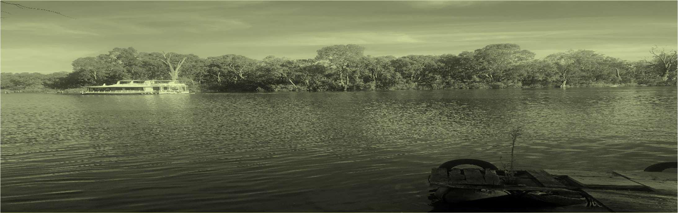
Item 9.13 - Attachment 4 Statement of Environmental Effects Page 123 StatementofEnvironmental Effects 28-30HendyRoadBuronga July2022
planning&developmentspecialists www.jgconsult.com.au


JamesGolsworthyConsulting
140PineAvenueMildura VIC 3500 POBox1650 Mildura VIC 3502 t 0350228411 e admin@jgconsult.com.au
©Copyright,JamesGolsworthyConsultingPtyLtd(2022).
Thisworkiscopyright.ApartfromanyuseaspermittedunderCopyrightAct1963, nopartmay bereproducedwithout writtenpermissionofJamesGolsworthyConsultingPtyLtd.

Disclaimer:
NeitherJamesGolsworthy ConsultingPty.Ltd.noranymemberor employeeofJamesGolsworthyConsultingPty. Ltd.takesresponsibilityinanywaywhatsoevertoanypersonororganisation(otherthanthatforwhichthisreporthas beenprepared)inrespectoftheinformationsetoutinthisreport, includinganyerrorsoromissionstherein. James GolsworthyConsultingisnotliableforerrorsinplans, specifications,documentationorotheradvicenotpreparedor designedbyJamesGolsworthyConsulting.
2StatementofEnvironmentalEffects,28-30HendyRoad,Buronga
Ref:21-142
Item 9.13 - Attachment 4 Statement of Environmental Effects Page 124
Item 9.13 - Attachment 4 Statement of Environmental Effects Page 125 Ref:21-142 3StatementofEnvironmentalEffects,28-30HendyRoad,Buronga TableofContents Introduction.............................................................4 Proposal..................................................................5 PlanningControls...................................................6 Definition..................................................................................6 Dwellinghouse...........................................................6 Dualoccupancy.........................................................6 Zoning......................................................................................6 Clause4.1A Minimumlotsizesfordual occupancies,multidwellinghousingandresidential flatbuildings...............................................................6 Clause5.21FloodPlanning.......................................6 LEPAdditionalmapping..........................................................7 Watercourse...............................................................7 Terrestrialbiodiversity................................................7 Wetlands....................................................................8 DevelopmentControlPlan......................................................8 2Biodiversity..............................................................8 4Floodaffectedland.................................................8 StateEnvironmentalPlanningPolicies..................................8 Siteandsurroundingarea.....................................9 Subjectsite..............................................................................9 Locality...................................................................................11 Planningassessment...........................................12 ZoneRU5Village..................................................................12 DevelopmentControlPlan–Chapter3General Development-........................................................................12 2.1MurrayRiveranddarlingriver...........................12 2.4VegetationProtection–Riverfront.....................12 4Floodaffectedland...............................................12 Conclusion............................................................14
Introduction
Development approval via deferred commencement is sought for a dwelling (Dual occupancy – detached) upon the land known as Lot 455 DP 756961. A dwelling and outbuildings currently exist on the land with frontage to HendyRoad.
The dwelling will consist of five bedrooms and will be of two storey construction. The built form will be respectful tothatof theimmediatelocality.
The land has an area of 1.1 hectares and direct frontage to Hendy Road and the Murray River. All services are readily availableto the site and connected to the existing dwellingupontheland.
Itisconsideredthedevelopment ofthesiteisappropriate given the contents of the LEP, DCP, State Policies and Environmental Planning and Assessment Act 1979. As a result,thedevelopmentapplicationshouldbesupported.
4StatementofEnvironmentalEffects,28-30HendyRoad,Buronga
Ref:21-142
Item 9.13 - Attachment 4 Statement of Environmental Effects Page 126
Proposal
Theapplicationseeksdevelopmentapprovalviadeferred commencement for the establishment of an additional dwelling on land known as Lot 455 DP 756961, 28 Sturt HighwayBuronga.
Thedwellingwillbesitedtohavefrontagetotheriverand between two existing dwellings on adjoining land. The dwellinglocationwillbesetbackthesamedistanceasthe adjoiningdwellings(25m).
Thedwellingwillbetwostoryindesignandconsistoffive bedrooms, two living areas, ensuite, bathroom and open plan kitchen. The first floor will consist of non-habitable rooms. thedwelling willbe built on stilts at 750mm above the flood level. The dwelling will be constructed of brick and weatherboard cladding with colourbond corrugated roofingiron.
Followingacceptanceoftheapprovalitisthelandowner’s intention to have detailed plans prepared for the establishment ofthedwelling.
Access to the proposed dwelling and the land is gained fromtheSturtHighway. Theaccesswillbeconstructedat the1in20floodlevelandlocatedontheeasternboundary ofthelot.
5StatementofEnvironmentalEffects,28-30HendyRoad,Buronga
Ref:21-142
Item 9.13 - Attachment 4 Statement of Environmental Effects Page 127

PlanningControls
Definition
The works are defined as a dwelling house and dual occupancyforwhichtheLEPprovidesthedefinitionas:
Dwellinghouse
a building containing only one dwelling
Dualoccupancy
2 detached dwellings on one lot of land but does not include a secondary dwelling.
Zoning
ThedwellingwillbewhollylocatedwithintheRU5 Village zone.
TheobjectivesofZoneRU5areasfollows:
Toprovideforarangeoflanduses,servicesand facilities that areassociated witha ruralvillage.
To promote development in existingtowns and villages in amanner that iscompatiblewith theirurban function.
Toencouragewell-serviced sustainabledevelopment.
To ensure there are opportunities for economic development.
To deliver new residential and employment growth in Buronga andGolGol.
To ensure business and retail land uses are grouped within and aroundexisting activity centres.

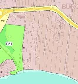


Adwelling house and dual occupancy are permitted with consentinthezone.

Clause4.1A Minimumlotsizesfordual occupancies,multidwellinghousingandresidential flatbuildings
(1) The objective of this clause is to achieve planned residentialdensity incertainzones.
(2) Development consent must not be granted to development on a lot in Zone RU5 Village for a purpose shown in Column 1 of the Table to this clause, unless the areaofthelotisequaltoorgreaterthantheareaspecified for that purposeand shown in Column 2oftheTable
Theproposeddevelopmentmeetstherequirementsofthe clauseastheland iswithingtheRU5Zoneandisgreater than400squaremetres.

6StatementofEnvironmentalEffects,28-30HendyRoad,Buronga
Clause5.21FloodPlanning
Theobjectivesoftheclauseareas below:
(a) to minimise the flood risk to life and property associated withtheuseof land,
(b) to allow development on land that is compatible with the flood function and behaviour on the land, taking into accountprojectedchanges as aresultof climatechange, (c) to avoid adverse or cumulative impacts on flood behaviour and the environment,
Ref:21-142
Item 9.13 - Attachment 4 Statement of Environmental Effects Page 128
Figure1 Zone map
(d) toenablethesafeoccupationandefficientevacuation ofpeople intheevent ofa flood.
LEPAdditionalmapping
Watercourse
Clause 7.7relatestoRiparianlandandMurray River and thewatercourses. Its objectiveisasfollows:
to protect and maintainthefollowing:
(a) water quality within the Murray River and other watercourses,
(b) the stability ofthe bed and banks ofthe Murray River and otherwatercourses,
(c) aquaticriparianhabitats,
(d)ecologicalprocesseswithintheMurrayRiverandother watercoursesandriparian areas.
Terrestrialbiodiversity
Clause 7.4 relates to Terrestrial biodiversity and its objectiveis:
to maintainterrestrialbiodiversity by:
(a) protecting nativefauna andflora, and
(b) protectingtheecologicalprocessesnecessaryfortheir continued existence,and
(c) encouraging the conservation and recovery of native faunaandflora and theirhabitats.
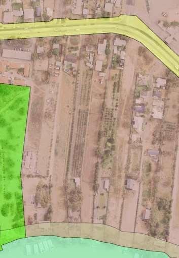


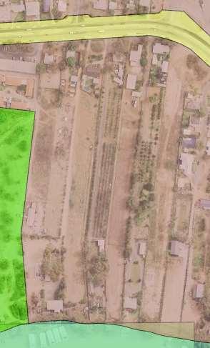


7StatementofEnvironmentalEffects,28-30HendyRoad,Buronga


Ref:21-142
Item 9.13 - Attachment 4 Statement of Environmental Effects Page 129
Figure2 Watercoursemapping
Figure3 Terrestrial biodiversitymapping
Wetlands
Clause7.5relatestoWetlandsanditsobjectiveis:
to ensure that natural wetlands are preserved and protected from the impacts ofdevelopment.


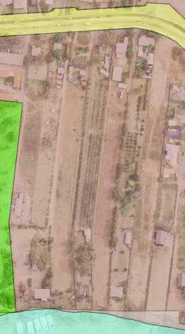


DevelopmentControlPlan
TheWentworthDevelopmentControlPlanisapplicableto thelandanddevelopment.
Chapter 3 General Development Controls is applicable and refers to development fronting the Murray River and landidentifiedwithinthefloodplanningarea. Therelevant controlsareasbelow:
2Biodiversity
2.1MurrayRiverandDarlingRiver 2.4VegetationProtection–Riverfront
4Floodaffectedland
Chapter4ResidentialDevelopmentControlsisapplicable and will be considered through the process of designing thesite,floor andelevationsplans.
StateEnvironmentalPlanningPolicies
There are no State Environmental Planning Policies (SEPP's)relevanttothisproposal.
8StatementofEnvironmentalEffects,28-30HendyRoad,Buronga
Ref:21-142
Item 9.13 - Attachment 4 Statement of Environmental Effects Page 130
Figure4 Wetlandsmapping
Siteandsurroundingarea
Subjectsite
The land known as Lot 455 DP 756961 has an area of 1.1haandisrelativelyregularinshape.Thelandcontains an existing dwelling, multiple sheds and a large area of vacantland. Thelandslopestowardstheriverwithalevel difference of 5.11m as demonstrated in the feature and levelsurvey.
Access to the land is from Hendy Road which is a constructed all weather road. The land also has frontage theMurrayRiver.
Theselectedsiteareafortheproposeddwellingislocated between the existing dwellings of adjoining land, clear of allvegetationandcontainscleanfill.


9StatementofEnvironmentalEffects,28-30HendyRoad,Buronga
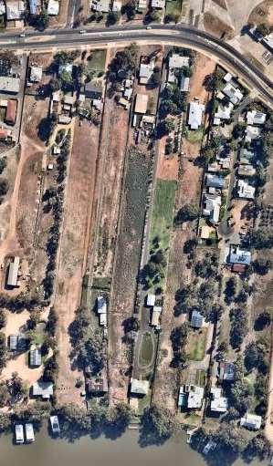
Ref:21-142
Item 9.13 - Attachment 4 Statement of Environmental Effects Page 131
Figure5Aerial image ofthe site Source http://maps.au.nearmap.com/
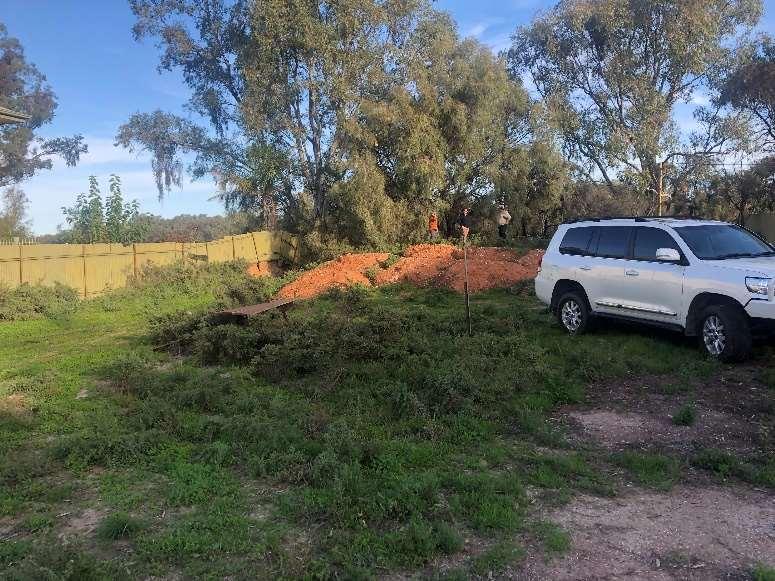
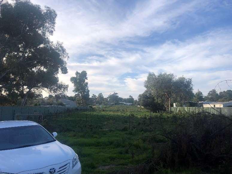
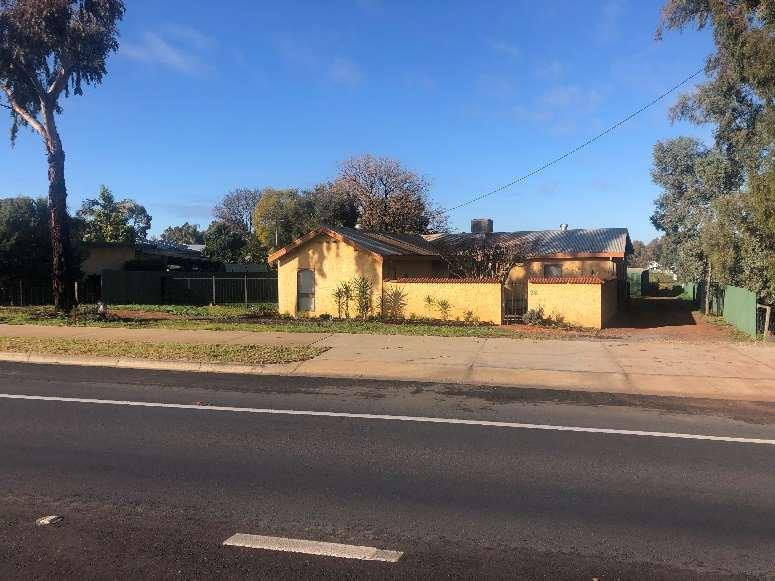
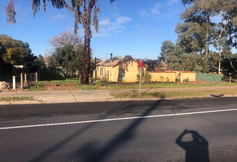
Ref:21-142
Item 9.13 - Attachment 4 Statement of Environmental Effects Page 132
10StatementofEnvironmentalEffects,28-30HendyRoad,Buronga
Figure6 Proposed site of the dwelling
Figure7 Looking north at the vacant land on the site
Figure8 Existing cross over located on the eastern boundary
Figure9 Existing crossover located on the western boundary
Locality
The land is located in an area that is used for urban purposes albeit at a low density given its characteristics. LandtothesouthoftheSturtHighway generallycontains long narrowlots that gain vehicular access from the Sturt Highway. The lots generally have frontage to the Murray Riverwhichisalmost400mfromtheSturtHighway.
The urban centre of the newly created Midway IGA in Buronga is approximately 1km east of the land and Milduraisapproximately4kmtothesouthwest.
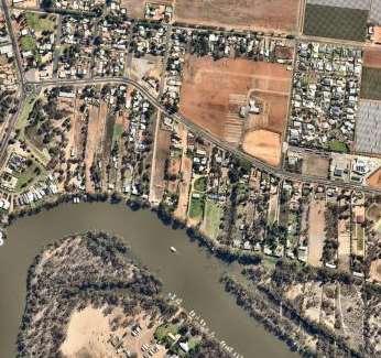

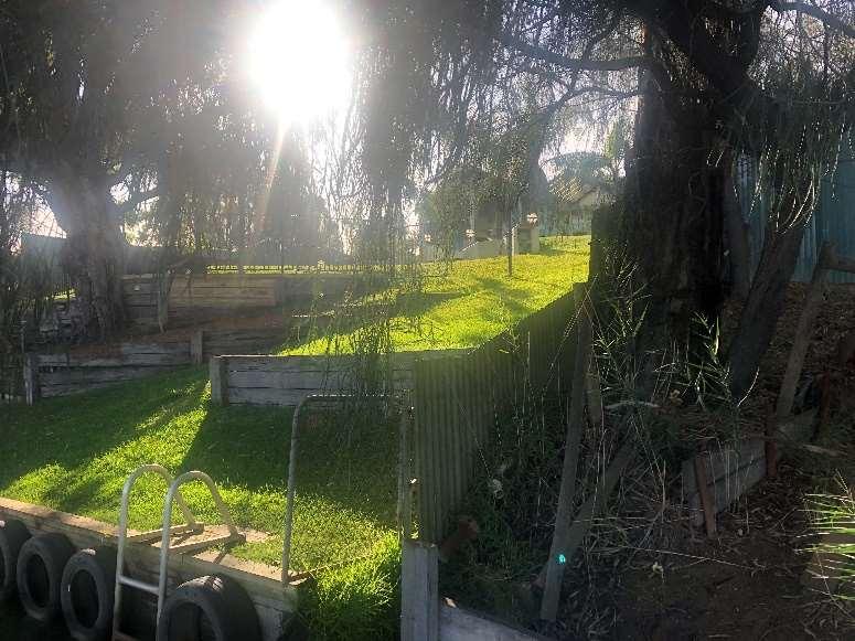
Source http://maps.au.nearmap.com/
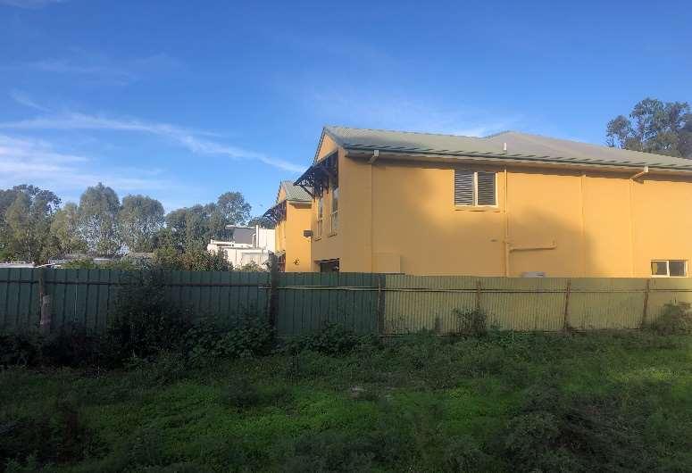
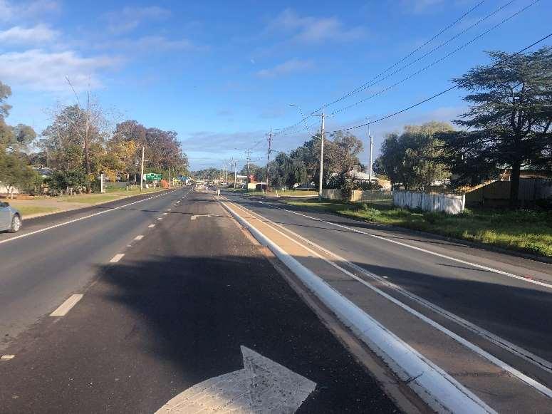
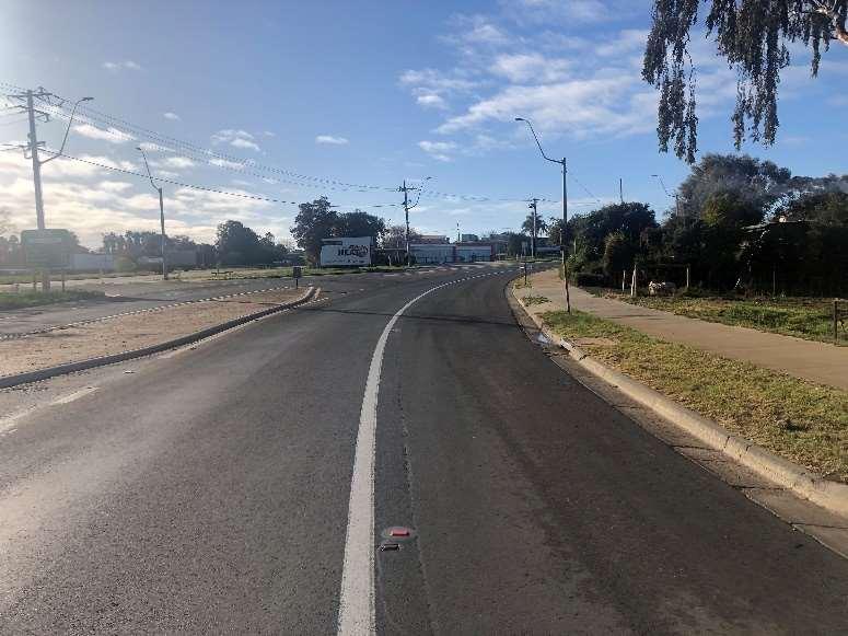
Item 9.13 - Attachment 4 Statement of Environmental Effects Page 133
Ref:21-142
11StatementofEnvironmentalEffects, 28-30HendyRoad,Buronga
Figure11 Aerial image of thelocality
Figure12 Propertyadjoining the land tothe east
Figure13 Propertyadjoiningthe landtotheeast
Figure14 Lookingweston HendyRoad
Figure15 Lookingeast on HendyRoad
Planningassessment
ZoneRU5Village
As detailed previously a Dwelling house is permitted with consent within the RU5. In response to the objectives of thezonethefollowingisoffered.
The proposed development is located on land within an existing and well-established residential neighbourhood withthe majority ofthehousessitedtotake advantage of the frontage to the Murray River and the amenity it provides. The proposal provides for the development of a dwelling on the lot that consists of 1.1ha whilst already having an existing dwelling remain. Clause 4.1 allows for thedevelopmentasthelotsizeisgreaterthan400square metres.
Thecharacterofthelocalityispredominantlylotsthat are long and narrow, have been subdivided and contain dwellings. Dwellings in the vicinity of the proposed site havebeen constructed tofront bothHendy Road andthe MurrayRivergiventheirconfiguration.Dwellingsthatfront the Murray River are predominantly two story in design andincludeconsistentsetbacks.
The development will be designed by a suitably qualified Architect. The development will be respectful of the flood planningmappingthathasbeensuppliedbyAdvisian.The Dwelling will be built on stilts to 750mm above the 1:100 floodlevel.
and milk, groceries, wholesale supplies, entertainment, andtransport.
DevelopmentControlPlan–Chapter3 GeneralDevelopment-
2.1MurrayRiveranddarlingriver
Theproposeddevelopmentistobesetback25mfrom the high bank of the Murray River. This is consistent with the existing dwellings that abut the land to the eastandwest.
The land included in the 25m setback between the development and the Murray River will not be impacted by the development. Access to the site already exists from Hendy Road and parking of vehicles will maintained to the north side of the proposed siting of the dwelling. The frontage to the MurrayRiverisalreadyexistingandcontainsretaining walls and ramps from the top of the proposed site to the bank of the Murray River.There are no proposed worksandwillbekeptinits currentenvironment. Stormwater will be captured utilising guttering and rainwater tanks outside the buffer corridor. Given the land size, storm water will be able to be retained and/ordisposedofonsite.
2.4VegetationProtection–Riverfront
Theproposeddevelopmenthasbeendesignedand sitedtonotrequireremovalofanynativevegetation.
4Floodaffectedland
Access to the site will be provided with compacted fill to accommodatevehicleaccesstothesite. Theaccessroad will be constructed at aheightof 38.5mwhich is thein fill height required for 1:20 year flood level. The infill access to the dwelling will have minimal impact on the flow and storageoffloodwatersasthishasalreadybeenobstructed by the upstream access and dwellings that adjoin the property The access provided will allow evacuation of person/sintheeventofahighriverandflooding.
Aspecific objectiveofthezoneistoprovideopportunities for population and employment growth. The dwelling house proposal will be directly attributed to the supply of land for additional residential purposes. There will be specific demand for local services when the land is developed,utilisingthenewlyestablishedMidwayMarket IGA and associated services for staples such as bread
12StatementofEnvironmentalEffects,28-30HendyRoad,Buronga
An updated Flood Study Map (Figure 12) has been provided by Advisian which shows the intended site for the development is not within the floodway corridor. The site is within the floodway storage area and the design of dwelling will be designed to incorporatethedwellingbeingbuiltonstiltsat750mm abovethe1:100floodlevel.
Asthedevelopmentisinafloodwaystoragearea,the dwellingwillbedesignedtonotdecreasethenetflood storageonsitebybeinglocatedbetweentheexisting dwellingsonadjoininglandandminimizingtheextent of fill being placed on the land for flood mitigation purposes.
Onlyonelargestructureisbeingproposedontheland whichdoesnotrequireafloodstudytobeundertaken.
Ref:21-142
Item 9.13 - Attachment 4 Statement of Environmental Effects Page 134
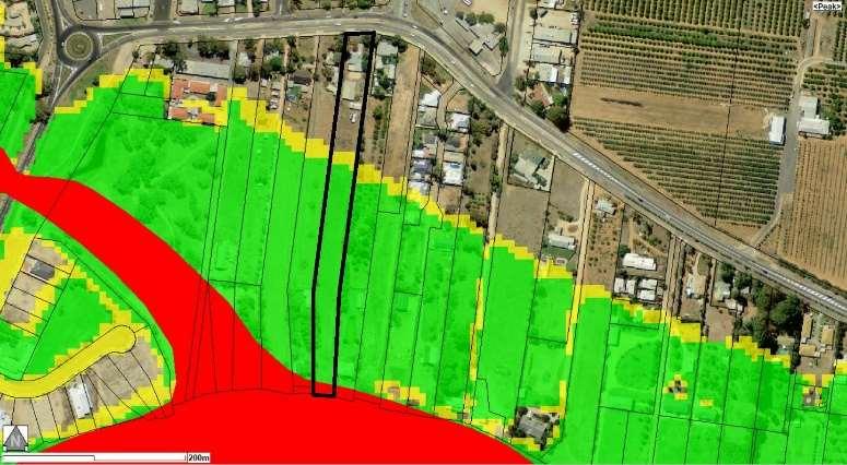
As mentioned previously, once the development has received initial consent, detailed plans will be produced that will incorporate Chapter 3 and 4 requirements of the DevelopmentControlPlan.
Ref:21-142
Item 9.13 - Attachment 4 Statement of Environmental Effects Page 135
13StatementofEnvironmentalEffects,28-30HendyRoad,Buronga
Figure16
Advisian latest Floodway Mapping
Conclusion
Inconclusion, it is considered for reasons outlined above the development responds well to the opportunities and constraintsofthesiteandisconsistentwiththeprovisions Environmental Planning and Assessment Act 1978 and the Environmental Planning and Assessment Regulation 2000. Furthermore, the proposal is considered to be generallyconsistentwiththeLEPandDCP.
Theproposalisconsideredappropriateforthesiteforthe followingreasons:
The layout responds to the site characteristics and opportunities
There will be no offsite impacts as a result of the proposal
The dwelling will be appropriately setback from the MurrayRiver
Siting of the dwelling between the existing dwellings ensureminimalimpactsonfloodstorage
Suitablefloodfreeaccesswillbeprovidedforvehicles
14StatementofEnvironmentalEffects,28-30HendyRoad,Buronga
Ref:21-142
Item 9.13 - Attachment 4 Statement of Environmental Effects Page 136
JamesGolsworthyConsulting
140PineAvenue Mildura VIC 3500
POBox1650 Mildura VIC 3502
telephone 0350228411
email admin@jgconsult.com.au
www.jgconsult.com.au


Item 9.13 - Attachment 4 Statement of Environmental Effects Page 137

File Reference:
Health & Planning Department
26-28 Adelaide Street PO Box 81
WENTWORTH NSW 2648
Tel: 03 5027 5027 council@wentworth.nsw.gov.au
DA Assessment Report Section 4.15 Evaluation
Environmental Planning & Assessment Act 1979 as amended
DA2022/022 – PAN-247900
Property Title & Address: Lot 455 DP 756961 & 28-30 Hendy Road Buronga
Property owner(s): Kellie Phillips
Applicant(s): James Golsworthy Consulting Proposal: Dual Occupancy new dwelling (Deferred commencement)
Previous DAs:
DA12/078: 3 Lot subdivision Cost of proposed development: $700 000.00
SITE AND SURROUNDING DEVELOPMENT
The subject site comprises of Lot 455 DP 756961 located in Buronga NSW. The Lot has an area of 1.121 ha and has road frontage to Hendy Road from north linking it to the surrounding area. The subject land fronts the Murray River to the north and residential blocks to the east and west
The subject site is zoned RU5 Village under the Wentworth Local Environmental Plan 2011 (WLEP 2011). The subject site is an irregular shaped Lot used for residential purposes. Adjoining Lots are also residential with associated buildings. The site does not contain a heritage item and is not located within the heritage conservation area. The site is not located within the bushfire mapped areas. However, the land is within flood planning, floodway, terrestrial biodiversity and wetlands mapped area.
DESCRIPTION OF PROPOSAL
The proposal seeks development consent to construct a second dwelling (dual occupancy) on the subject land. Only a site plan has been provided identifying the new dwelling location. As no further details for the dwelling were provided, the applicant has requested the development application be assessed as a deferred commencement.
HISTORY RELEVANT TO THE DEVELOPMENT APPLICATION
A development application (DA12/078) for a three-lot subdivision and new dwelling was approved on the land on 8 August 2013. The approval has since lapsed and no longer applicable.
Item 9.13 - Attachment 6 4.15 Assessment report Page 138
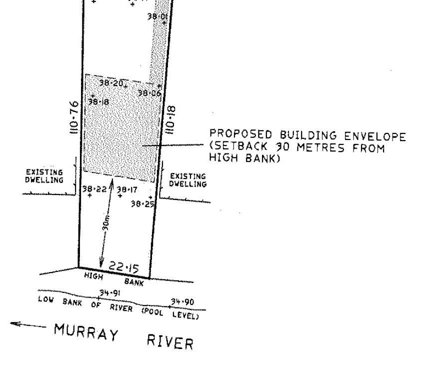
It should be noted that the approval for the dwelling was located 30m from the high bank of the river complying with clause 7.6 of the WLEP 2011. The new application has the proposed dwelling located 25m from the high bank.
SECTION 4.15-MATTERS FOR CONSIDERATION
(1) The provisions of any environmental planning instrument and development control plan
State Environmental Planning Policy (Building Sustainability Index: BASIX) 2004 No BASIX certificate was provided
State Environmental Planning Policy (Biodiversity and Conservation) 2021
The proposed development is located on land over 1 ha in size with no vegetation removal proposed. The proposed development will be located on the residential blocked already cleared with only overgrown grass needed to be removed As such, the development was not assessed against Chapter 4 of the SEPP.
An assessment against Chapter 5, clause 5.9 principles of the SEPP are as follows: 1. Access
Land is freehold with no existing public access to the river. The development will not change access to the river.
2. Bank disturbance
The development will be conducted 25m from the high bank of the river in line with adjoining dwellings Additional bank protection measures may be required to protect the bank from disturbances caused by the development
3. Flooding
The land is located on flood planning and floodway impacted land. An assessment against these principles are as follows:
a. The land is already disturbed, no disturbances or benefits to riverine ecosystems
b. The land is flood liable with risks of flooding during flood events. This is especially relevant due to the increase in extreme weather events caused by Climate change. The site where the dwelling is located is located within a floodway.
Item 9.13 - Attachment 6 4.15 Assessment report Page 139
c. The proposed dwelling will be built up on stilts above the 1 in 100 flood level. This has the potential to allow flood waters to flow beneath the dwelling as it will be in a floodway.
d. The whole Lot is flood liable, however, only a small section close to the river bank is in a floodway. There is ample space on the subject land to locate the dwelling that is not within a floodway and outside the river front area.
e. Services are available to the site, however only section of the land are in a floodway. The dwelling is proposed to be located within the floodway. This is a high risk-factor as there increased risk to the dwelling in times of flooding. The accessway for the property may be require to be built up to allow access during flood event while not impacting flood waters. The applicant has provided plans from a draft flood study showing that the dwelling will be located outside this floodway.
f. The land is expected to be used for residential purposes. Minimal risk of pollution during a flood event if dwelling built up on footings designed to withstand floodwaters. However, higher risks to dwelling if located in a floodway compared to a flood planning area. The applicant has provided plans from a draft flood study showing that the dwelling will be located outside this floodway.
g. The dwelling will potentially have significant impacts on the behaviour of floodwaters due to being located on a floodway. The applicant has provided plans from a draft flood study showing that the dwelling will be located outside this floodway.
h. Noted
4. Land Degradation
Development application does not have a high risk in causing land degradation due to its nature and future use.
5. Landscape
No tree removal is proposed as part of the development. Any tree planting on the land will need to match with the vegetation currently on the land.
6. River related use
The proposed development does not have a demonstrated essential relationship with the river, as such will need to be located a reasonable distance from the river. The proposed development is within the riverfront, contravening the WLEP 2011 standards for river setback.
7. Settlement
The proposed development is for a single residential dwelling and does not propose creating a residential settlement.
8. Water Quality
Any work and subsequent uses of the land must be managed and designed to not cause any pollution of the waterway. If approved, the determination will be conditioned to ensure water quality measures are in place before occupation of the dwelling.
9. Wetlands
The land is located in wetland area as per WSC mapping. However, the land where the dwelling will be located has already been disturbed and outside the wetland area.
Item 9.13 - Attachment 6 4.15 Assessment report Page 140
An assessment against clause 5.13 principles of the SEPP are as follows:
- Building setback: The proposed development does not meet the WLEP 2011 setback requirement, and a 4.6 variation has been provided requesting the varying of this standard.
- Matters to be considered
o Effluent disposal: There Is reticulated sewer to the property. The dwelling will require to be connected to the reticulated sewerage system.
o Landscaping: Existing landscaping, no landscaping proposed
The proposed development does not fully comply with the principles within the SEPP. The significant noncompliance is that the development is not a river related use and the setback being too close to the river. No impediments were identified onsite preventing the dwelling from being located outside the river front area.
The dwelling has no essential relationship with the river, and there is nothing on the land itself preventing the proposed dwelling from being moved 5m north to comply with the WLEP 2011 as well as this SEPP.
Wentworth Local Environmental Plan (LEP) 2011
Zone objectives and permissibility
The proposed dwelling (dual occupancy) is Permitted with consent under the RU5 Village zone under which the subject site is located.
Zone Objectives
The dwelling was assessed against the zone objectives as follows: Objectives of Zone RU5
To provide for a range of land uses, services and facilities that are associated with a rural village.
To promote development in existing towns and villages in a manner that is compatible with their urban function.
The dwelling complies with the objective
RU5 in the area is predominantly used for residential purposes. The proposed development is partially in line with this objective as it is locate within the river front area
To encourage well-serviced sustainable development. The land is serviced by essential services
To ensure there are opportunities for economic development. Noted
To deliver new residential and employment growth in Buronga and Gol Gol
Development provides new residential development in the area
To ensure business and retail land uses are grouped within and around existing activity centres. Residential development
Standard being varied
The dwelling will be located 25m from the highest bank. Under clause 7.6 of the WLEP 2011, only a certain land uses are permitted within the river front area (30m from the high bank).
Only the following land uses are permitted within the river front area as per clause 7.6:
a) boat building and repair facilities, boat launching ramps, boat sheds, charter and tourism boating facilities or marinas, b) the extension or alteration of an existing building that is wholly or partly in the river front area, but only if the extension or alteration is to be located no closer to the river bank than the existing building,
Item 9.13 - Attachment 6 4.15 Assessment report Page 141
c) environmental protection works, d) extensive agriculture and intensive plant agriculture, e) walking trails, cycleways, picnic facilities, recreation facilities and recreation facilities (outdoors), f) water recreation structures.
River front area is defined as:
“river front area means the land between the river front building line and the highest bank of the Murray River or, if there is no river front building line, the land within 30 metres of the highest bank of the River.”
A dwelling is not one of the uses permitted within the river front area. A 4.6 variation application was provided by the applicant to vary this development standard to allow a dwelling within the river front area.
Approving 4.6 variations
Under clause 55 of the Environmental Planning and Assessment Regulation 2021, a consent authority (Council) may assume concurrence if the concurrence authority has given notice to the consent authority. The notice identifies which concurrences have been given to council and can specify qualifications or conditions for the assumed concurrence.
Under the planning circular PS20-002 (notice), Councils were given assumed concurrence to approve 4.6 variation applications based on a number of conditions. These conditions can be summarised as following:
1. Council cannot assume concurrence for varying a standard regarding dwelling entitlement in regards to MLS less than 90% for lands zoned RU1 to RU4, RU6, R5, E2 (now C2) to E4 (now C4) and equivalent land uses.
2. Non-numerical standard and standard variations greater than 10% cannot be approved by a Council delegate i.e Director. These need to be approved by Council to ensure greater public scrutiny and transparency.
The proposed variation is not regarding MLS as such Council has assumed concurrence and do not need to refer the 4.6 variation application to the Department of Planning and Environment (DPE) for concurrence. However, the variation proposed is greater than 10%, as such, will need to be presented to Council for determination
4.1 Minimum lot sizes for dual occupancies, multi dwelling housing and residential flat buildings
The proposed dual occupancy dwelling is located on land with an area of 1.121 ha. This is above the Lot size of 400sqm required for dual occupancies on RU5 zoned land.
4.6 Exceptions to development standards
Application written request – clause 4.6(3)(a) and (b)
The applicant seeks to justify the contravention of the development standard on the following basis:
a) That compliance with the development standard is unreasonable or unnecessary in these circumstances because:
i. The proposed dwelling will be in line with the adjoining dwelling to the west and east which do not comply with the setback requirement
ii. The proposed setback will be in line with the surrounding area
b) That there are sufficient environmental planning grounds to justify contravening the standard:
Item 9.13 - Attachment 6 4.15 Assessment report Page 142
i. No impacts to the Murray river and riverine environment
Consideration of Applicants Written Request - Clause 4.6(4) (a) (i) and (ii) (b)
Does the written request adequately address those issues at Clause 4.6(4)(a)(i)
1. The applicant’s written request has not adequately demonstrated that compliance with the 7.6 river front area restriction is unreasonable and unnecessary in this case based on the following:
i. The adjoining lands within the building riverfront area to the south (71-73 and 67-69) were approved under a previous EPI (WLEP 1993) before the 2011 WLEP commenced. The 1993 WLEP allowed development to be built 30m from the rivers edge. The means they were approved before the clause 7.6 requirements commenced
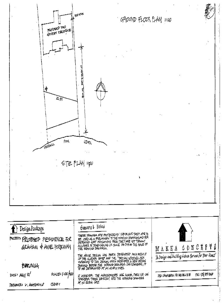
Each development application is assessed on its own merits based on the current legislation at the time and under the current WLEP 2011, dwellings must be located 30m from the high bank of the river.
ii. The subject land has enough space to allow compliance with the WLEP 2011 requirements. No impediment is in place stopping the dwelling location from being built outside the floodway and river front area. The 5m variation in the building line along the river bank is not an appropriate justification for contravening a development standard.
Does the written request adequately address those issues at Clause 4.6(4)(a)(ii)
a. The development is consistent with the zone objectives, and an assessment of the development against clause 7.6 is as follows:
Objectives of Clause 7.6
to support natural riverine processes, including the migration of the Murray River’s channels,
Not on the bed of the river. to protect and improve the bed and bank stability of the Murray River,
Works will potentially impact the bank stability of the river. Measures can be put in place but may not be required if complying with the required setback to maintain and improve the water quality of the Murray River Not applicable to protect the amenity, scenic landscape values and cultural heritage of the Murray won’t significantly impact amenity and landscape as no native vegetation removal is proposed
Item 9.13 - Attachment 6 4.15 Assessment report Page 143
River and to protect public access to its riverine corridors, to conserve and protect the riverine corridors of the Murray River, including wildlife habitat.
No wildlife impacted, as land were dwelling is proposed is disturbed.
Has the planning secretary’s concurrence been sought as per Clause 4.6(4)(b)
- Under the planning circular PS20-002, the concurrence of the Planning Secretary will not be required for this variation. However, due to the size of the variation being over 10%, council staff do not have the delegated authority to determine the development. As such, the development will be determined by Council.
5 part test
1. The objectives of the standard are achieved notwithstanding noncompliance with the standard: The assessment of the application against the objective of the 7.6 is located within the assessment report. The proposed dwelling does not completely meet the objectives of the clause.
2. The underlying objective or purpose of the standard is not relevant to the development and therefore compliance is unnecessary:
The underlying objective of this clause is to protect Murray River bank and bed. The proposed development will be located 25m from the high bank. There is potential risk to the bank of the river due to the building works. Although this can be managed by construction methods, these risks can easily be managed by moving the dwelling 5m from the river bank. There is ample land to allow this with nothing on the land preventing the relocation.
3. The underlying object of purpose would be defeated or thwarted if compliance was required and therefore compliance is unreasonable:
The underlying objective will potentially be thwarted if compliance was not required as it will create a dwelling closer to the river bank than what is required within the WLEP 2011.
4. The development standard has been virtually abandoned or destroyed by the council’s own actions in granting consents departing from the standard and hence compliance with the standard is unnecessary and unreasonable:
Council have approved dwellings within the riverfront area only after adequate justification to vary the standard had been provided. This has been done on a case by case basis. This application has not provided enough justification to support varying the standard due to the land having room to comply with the standard. No impediment on the land preventing the dwelling from complying the 30m high bank setback standard.
5. The compliance with development standard is unreasonable or inappropriate due to existing use of land and current environmental character of the particular parcel of land. That is, the particular parcel of land should not have been included in the zone:
The zoning of the land is appropriate as dwelling houses are permitted with consent under the current zoning which is supported by the rest of the WLEP 2011 clauses including clause 7.6.
The proposed variation is not supported based on the results of the five (5) part test above.
5.21 Flood Planning
The proposed dwelling is located on land within flood planning and floodway mapped area.
An assessment of the development against clause 7.6 is as follows: Objectives of Clause 5.21
Item 9.13 - Attachment 6 4.15 Assessment report Page 144
to minimise the flood risk to life and property associated with the use of land,
The dwelling will be located within a floodway, which increases the risk to life and property to allow development on land that is compatible with the flood function and behaviour on the land, taking into account projected changes as a result of climate change,
to avoid adverse or cumulative impacts on flood behaviour and the environment,
The proposed development is in a floodway, is not compatible flood function and behaviour of the land.
The proposed development and footing on a floodway will have an potential adverse impact on the flood behaviour in the area to enable the safe occupation and efficient evacuation of people in the event of a flood.
Due to the floodway and high hazard flooding of the land, the dwelling will potentially be cut of from the accessway in a flood event
An assessment against 5.21(2) is as follows:
a. The whole land is within the flood planning area and a small section within a floodway. The development proposes to construct the dwelling on stilts. As it will be located within a floodway, this will potentially negatively impact the flood water behaviour in the area. The applicant has provided plans from a draft flood study showing that the dwelling will be located outside this floodway.
b. The whole land is flood mapped with a small section in a floodway. The raised stilts of the dwelling in a floodway will impact flood water behaviour, resulting in detrimental increase in the potential flood affectation of other development and properties The applicant has provided plans from a draft flood study showing that the dwelling will be located outside this floodway.
c. The land including the accessway and public road are all within flood liable land with the accessway located in flood impacted land. This will adversely affect the safe occupation and efficient evacuation of people from the site during a flood event. However, due to the nature riverine flooding, dwelling occupiers will have adequate time to evacuate.
d. The raising of the accessway above the flood level will manage risk to life in times of a flood by providing appropriate evacuation pathways.
e. The proposed location of the building being close to the high bank can potentially lead to bank destabilisation in time of flood events. This can be addressed by use of appropriate construction techniques. However, the best cause of action is to prevent the risk by having the dwelling located 30m from the high bank of the river.
An assessment against 5.21(3) is as follows:
a. The development location on a floodway will significantly impact and be impacted by changes in flood behaviour
b. The scale of the development is adequate for the land without considering its location and potential impacts
c. The application has proposed raising the accessway from the dwelling location to allow for access in flood events.
d. The dwelling being close to the high bank increases its risk of being impacted by flood and blocking access for the building removal in times of flood.
The proposed development does meet matters for considerations under clause 5.21. Although construction methods may be used to provide additional bank protection, the closer the dwelling is to the bank the higher it will be from risk of bank destabilisation in times of flooding. (Image from recent flooding below)
Item 9.13 - Attachment 6 4.15 Assessment report Page 145
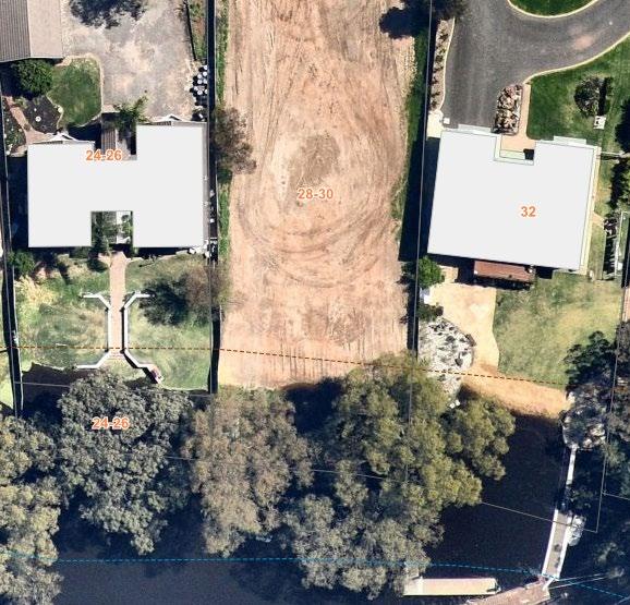
7.1 Earthworks
Any earthworks will form part of this approval and will be ancillary to the main approval for a dwelling. However, standards will still need to be followed during any earthworks.
7.2 Essential services
All necessary services can be made available to the new dwelling.
7.4 Terrestrial biodiversity
A small section of the land is mapped as terrestrial biodiversity. The proposed dwelling is located outside of this mapped area. No further assessment against this clause is required.
7.5 Wetlands
A small section of the land is mapped as wetland. The proposed dwelling is located outside of this mapped area. No further assessment against this clause is required.
7.6 Development in River Front Areas
The proposed development does not meet the permitted use in the riverfront area as identified under clause 7.6(2).
An assessment of the proposed dwelling and garage against clause 7.6(3) is as follows:
a) The development will be compatible with surrounding area as seen by surrounding dwelling design and vegetation screening
b) The development may potentially cause pollution through bank destabilisation due to the disturbance of the bank of the river. Although this may be ameliorated by using construction methods, the best cause of action is to reduce the risk of it occurring by locating the dwelling outside the river front area. Nothing on the land prevents the dwelling from being located outside the river front area.
c) No vegetation to be removed as such no impacts on existing landscape
d) The proposed dwelling will not change current access arrangement to the river as the land is currently freehold.
e) There are no historic, scientific, cultural, social, archaeological, architectural, natural or aesthetic significance of the land to be impacted by the development
Based on the above assessment, the development does not fully comply with the clause
Item 9.13 - Attachment 6 4.15 Assessment report Page 146
7.7 Riparian land and Murray River and
other watercourses general principles
An assessment of the proposed dwelling against clause 7.7(3) is as follows:
a. Adverse impact of the proposed:
i. The structure is not located within the waterway and is not anticipated to impact the flow
ii. No impacts on aquatic and riparian species, habitats and ecosystem. The use of the land will be residential with no emissions likely to impact the environment anticipated from the development
iii. Works may potentially impact the bank stability as they are located close to the high bank of the river.
iv. No impacts to the watercourse movement of aquatic fauna anticipated as no works proposed with the watercourse
v. Not impact any future rehabilitation of a watercourse and riparian areas.
b. Reticulated water is available to the site, and will need to be connected to the dwelling.
An assessment of the proposed dwelling against clause 7.7(4) is as follows:
a. The dwelling is not adequately sited to avoid any significant adverse environmental impact
b. This can be managed by managed by condition of consents which is not the best option when the movement of the dwelling by 5m can easily provide more protection.
c. noted
Based on the above assessment, the development does fully comply with the clause, with the removal of the dwelling from the river front area and measures in the design can be implemented to mitigate the impacts
Wentworth Development Control Plan (DCP) 2011
The proposed development is not fully acceptable against Chapter 2 provisions but acceptable against chapter 4 provisions of the Wentworth Development Control Plan (DCP) 2011.
Chapter 2: Section 2.2 Erosion control
The location of the proposed development and associated works have the potentially to increase erosion along the river bank. This can be addressed by moving the dwelling a further 5m from the river and mitigation measures.
Chapter 2: Section 4 Flood affected land
The development complies as it is located on stilts. The proposed dwelling will require a finished floor level to be 750 above the 1 in 100 yr flood level. The type of footing and covering of the under storey will determine impacts of the development on flood water behaviours.
Chapter 4
The proposed development seems to comply with the standards of this chapter in terms of side and rear setbacks (not considering clause 7.6 of the WLEP 2011) However, a detailed assessment cannot be conducted as the full plans (elevation, floor) have not be provided.
(2) The provisions of any draft environmental planning instrument
There is no Division 3.4 draft environmental planning instrument that affect the proposed development. (Post 1 July 2009 LEP amendments).
(3) Any matters prescribed by regulations
There are no further matters prescribed by regulations relevant to the proposed development.
Item 9.13 - Attachment 6 4.15 Assessment report Page 147
(4) The likely impacts of the development
There are no likely impacts from the proposal as discussed in the table below.
Impact item
(insert an ‘x’ in the relevant section)
Context and setting X
Public domain &
Streetscape X
The site is surrounded by similar land uses (residential).
Enough distance between the street and development. No work is expected to be done on the street.
Landscaping X Appropriate for the area
Stormwater X Will be dealt with onsite, with a stormwater plan required to ensure no impacts on the waterway
Heritage X No heritage item onsite.
Soils & Soils Erosion X Potentially erosion due to the proximity of the site to the high bank and waterway. Compliance with clause 7.6 can potentially reduce the impacts
Air and microclimate X Proposed development not anticipated to affect the air or microclimate.
Water Resources X
None located on land, with potential indirect impacts to the adjoining waterway.
Biodiversity (Flora & Fauna) X No native vegetation to be cleared for the development
Land Resources X
None located on the site expected to impact the proposed development.
Utilities X Utilities to be made available to the extension
Access & Parking X Direct access to site available, space for parking available on site
Roads & Traffic X No new road proposed, traffic will not be impacted by proposal
Solar Access and Energy Efficiency X No BASIX provided. Can be addressed with deferred conditions
Overshadowing X Cant be assessed due to missing plans (floor and elevations)
Privacy & Overlooking X Cant be assessed due to missing plans (floor and elevations)
Flooding X Flood affected and within a floodway. Assessed within this report.
Bushfire Prone Area X Not in bushfire prone area
Noise X Possible significant noise only expected during construction, residential noises anticipated after Technological hazards X None anticipated from the development, only residential activities anticipated from the site
Item 9.13 - Attachment 6 4.15 Assessment report Page 148
Acceptable Not acceptable Not relevant
Comment
Safety, Security & Crime Prevention
Social and Economic Impacts
X Development will not affect the safety of the area.
X No negative social and economic impacts anticipated from the proposed development.
(5) The suitability of the site for development
A site visit was conducted by Council staff on 30/09/2022. A very sharp drop is located from the high bank to the river.
The subject land is suitable for the proposed dwelling, however, the siting of the dwelling on the subject land is not suitable due to its proximity to the Rivers’ high bank. Nothing on the land prevents moving the dwelling a further 5m from the river to comply with the WLEP no adequate justification for contravening this development standard was provided.
The dwelling on stilts will need to be raised to be 750mm above the 1 in 100 yr flood levels, potentially impacting the floodwater movement for the area. This could lead to changed flood water behaviour and greater impacts on adjoining buildings.
The proposed development is permitted by the RU5 Village zoning of the area under the Wentworth LEP 2011. The character and use of the proposed dwelling is consistent with existing developments in the surrounding area.
(6)
Any submissions made in accordance with this Act or Regulation
The application was notified for 14 days as per the Wentworth Community Participation Plan. No submissions were received. The applicant then provided further information to Council including 2 letter of support to the development.
The main reason for the support of the dwelling in its current location was that if it was moved a further 5m from the river, it may cause overlooking into their habitable areas.
• Officer comments: The application is for a deferred commencement with no elevation or floor plans provided with the development application. As such, comments by the adjoining land owners can only be noted but cannot be used for assessment due to the deferred commencement nature of the development application.
(7) The public interest
The proposed development is partially consistent with public interest as it will have potential detrimental effect on the surrounding area due to its proximity to the high bank of the river No objections were received from the surrounding neighbours.
COMMENTS FROM COUNCIL INTERNAL DEPARTMENTS
Item 9.13 - Attachment 6 4.15 Assessment report Page 149
Department Referred Y/N Comments Building N Subdivision Engineer N Roads & Engineering N Finance & Policy N Heritage Advisor N Environmental Health N Local Laws N Floodplain Mgt Committee N
COMMENTS FROM EXTERNAL REFERRALS
n/a
CONCLUSIONS
1. General comments:
2. The proposal does not satisfy the points for consideration listed under Section 4.15 of the Environmental Planning and Assessment Act.
3. The proposal occurs on land zoned RU5 Village. The proposal has potential detrimental impact on the site and surrounds especially in terms o flood water behaviour.
4. The proposal is not consistent with the Wentworth Shire Development Control Plan (Dec 2011). The proposal is not consistent with the development controls in Chapter 2 but is consistent with Chapter 4 of the Wentworth Shire Development Control Plan (Dec 2011).
5. The proposal is not consistent with relevant matters of consideration of the State Environmental Planning Policy (Biodiversity and Conservation) 2021.
6. There is no draft local environmental plan affecting the proposed development.
RECOMMENDATION:
Refuse the application in its current form on the following grounds:
- Does not comply with Chapter 5 of the State Environmental Planning Policy (Biodiversity and Conservation) 2021
- The 4.6 variation to the riverfront setback requirement did not provide enough justification to contravene clause 7.6. This means the proposed location contravenes clause 7.6 of the WLEP 2011. There was nothing on the land stopping the applicant from having the dwelling located a further 5m north to comply with the development standard.
- The development did not fully comply with chapter 2 of the Wentworth DCP
- The development did not fully comply with relevant clauses of the WLEP 2011.
Note:
- If a development application complies with development standards of the WLEP 2011 except a single one, and no adequate justification is provided to vary this single standard, then Council must not approve the development application.
Item 9.13 - Attachment 6 4.15 Assessment report Page 150
Sustainable Infrastructure N
Delegate report author
Signature:

George Kenende Development Assessment Officer
Date:
Delegated approval and endorsement
Signature:
Date: 3/04/2023
Item 9.13 - Attachment 6 4.15 Assessment report Page 151
9.14 WENTWORTH LOCAL ENVIRONMENTAL PLAN 2011 – 191 PITMAN AVENUE REZONING PLANNING PROPOSAL
File Number: RPT/23/201
Responsible Officer: Matthew Carlin - Director Health and Planning
Responsible Division: Health and Planning
Reporting Officer: George Kenende - Strategic Planning Officer
Objective: 3.0 Wentworth Shire is a community that works to enhance and protect its physical and natural environment Strategy: 3.1 Ensure our planning decisions and controls enable the community to benefit from development
Summary
Wentworth Shire Council has received a Planning Proposal from Roy Costa Planning and Development on behalf of VF & BM Pollesel.
The Planning Proposal seeks to amend the Wentworth Local Environmental Plan 2011 (WLEP) by rezoning Lot 108 DP 756946, 191 Pitman Avenue, Buronga from RU4 Primary Production Small Lot zone with an existing minimum lot size (MLS) of 10 hectares to RU5 Village and SP2 Infrastructure zone with no MLS.
Recommendation
That Council resolves to:
a) Submit the planning proposal to the Minister for the Department of Planning and Environment for consideration of a Gateway Determination to amend the Wentworth Local Environmental Plan 2011 in accordance with Section 3.34 of the Environmental Planning and Assessment Action 1979
b) Call a division in accordance with S375A of the Local Government Act 1993 (NSW).
Detailed Report
Purpose
The purpose of this report is to provide Council with the information required to make an informed decision with respect to the planning proposal, based on the content of the planning proposal submitted by Ray Costa Planning and Development.
Background
The lot subject to the planning proposal is located at the northern end of Midway Drive within Pitman Avenue, Buronga. The single lot encompass approximately 2 hectares in total area. The site falls under the RU4 Primary Production Small Lots zone with a minimum lot size of 10 hectares. The planning proposal submitted by Roy Costa Planning and Development refers to the lot as RU1 Primary Production, while the current zoning is RU4 Primary Production Small Lots. The RU4 zoning came into effect in February of 2023, after the PP had been drafted and checked by relevant agency as part of the pre-lodgement process. No changes will be required to the PP as the Department of Planning and Environment (DPE) are aware of the matter and it will not impact the processing of the PP. The property is being used for the following:
- Partially as rural residential with outdoor buildings and a dwelling;
- Abandoned horticulture crops;
Ordinary Meeting AGENDA 19 April 2023 Page 152
The northern boundary of the subject site adjoins C2 Environmental Conservation zoned land used as a stormwater drainage basin by Council (Drainage Basin 3).
An easement in favour of Council traverses the lot for the purposes of a stormwater drainage pipeline, however the pipeline to drain stormwater to Drainage Basin 3 is not located within the easement. The rezoning will provide Council with the opportunity to acquire a portion of the site containing the storm water infrastructure.
Refer to Attachment 1 Planning Proposal
Matters under consideration
A detailed assessment of the planning proposal has been undertaken to determine if the proposed rezoning is justified in seeking the support from Council to submit to the Department of Planning for consideration of a Gateway Determination.
Refer to Attachment 2 – Planning Proposal Assessment
The Assessment Report determines that the planning proposal as submitted, with minor amendments, satisfactorily addresses the requirements of the Guide to Preparing Planning Proposals, Ministerial Directions and applicable State Environmental Planning Policies.
Part of the land will be acquired by Council and used for stormwater infrastructure connecting Drainage Basin 3 to Pitman Avenue. The Drainage Basin 3 has been identified as important stormwater drainage infrastructure to service the continued growth and development in the townships of Buronga and Gol Gol. Ongoing works and maintenance to the current pipeline will be necessary to support and service the current spate of growth in the area.
As part of the assessment, a SP2 Infrastructure zone was determined to be the most appropriate zoning for the 345 sqm area of land over the stormwater pipeline.
Options
Based on the information contained in this report, the options available to address this matter are to:
1. Submit the Planning Proposal to the Minister for the Department of Planning and Environment for consideration of a Gateway Determination, Or
2. Refuse to support the Planning Proposal.
Legal, strategic, financial or policy implications
The endorsement of the attached Planning Proposal will allow it to be submitted to the Minister for Planning and Environment for consideration of a Gateway Determination in accordance with the Environmental Planning and Assessment Act 1979.
The endorsement will provide Council the opportunity to acquire land to be used for vital drainage infrastructure.
Conclusion
The Planning Proposal prepared by Roy Costa Planning and Development requests Council’s support for the rezoning of the subject lot from RU4 Primary Production Small Lots zone to RU5 Village zone and the removal of the minimum lot size provisions applying the land. Amendment is proposed to the planning proposal to add a SP2 Infrastructure zone over the portion of land to be acquired by Council for drainage infrastructure.
The ultimate objective of this Planning Proposal is to allow for the site to be redeveloped for residential purposes, similar to the existing residential development to the east of the subject site and allow Council to acquire portion of the land with drainage infrastructure.
The assessment of the Planning Proposal determines that the proposal is justifiably supportable and adequately responds to the requirements of the Guide to Preparing Planning Proposals, Ministerial Directions and applicable State Environmental Planning Policies.
Ordinary Meeting AGENDA 19 April 2023 Page 153
Attachments 1. Planning Proposal
Planning Proposal Assessment
Ordinary Meeting AGENDA 19 April 2023 Page 154
⇩
⇩ 2.


Item 9.14 - Attachment 1 Planning Proposal Page 155 ROY COSTA PLANNING & DEVELOPMENT 164 Eighth Street Mildura PO Box 2925 Mildura 3502 Phone (03) 50210031 Email: admin@roycosta.com.au PLANNING INSTITUTE AUSTRALIA – REGISTERED PLANNER (RPIA) Rokar Pty. Ltd. ACN 087 497 685 Trading As Roy Costa Planning & Development
LOT 108 DP 756946 191 PITMAN AVENUE, BURONGA REQUEST TO REZONE TO RU5 VILLAGE
PLANNING PROPOSAL
Item 9.14 - Attachment 1 Planning Proposal Page 156 2 TABLE OF CONTENTS INTRODUCTION 3 PART 1 -OBJECTIVES OR INTENDED OUTCOMES 4 PART 2 -EXPLANATION OF PROVISIONS 4 PART 3 -JUSTIFICATION 5 SECTION A- NEED FOR THE PLANNING PROPOSAL 5 SECTION B- RELATIONSHIP TO STRATEGIC PLANNING FRAMEWORK 7 SECTION C - ENVIRONMENTAL, SOCIAL AND ECONOMIC IMPACT................................11 SECTION D - STATE AND COMMONWEALTH INTERESTS 13 PART 4 – MAPPING 14 PART 5 – COMMUNITY CONSULTATION 15 PART 6 - PROJECT TIMELINE 15 CONCLUSION 15
INTRODUCTION
This planning Proposal seeks to amend to the Wentworth Local Environmental Plan 2011 (WLEP) torezone Lot 108 DP 756946 being 191Pitman Avenue, Burongafrom RU1 Primary Production to RU5 Village.
Site location and context
The site is approximately 2.10ha in size located 3.8km north of the Murray River and the NSW/Victoria border. While the land is currently zoned RU1 Primary Production, Wentworth Shire Council has determined the dominant use of the land as being consistent with the RU5 Village context. The land is located approximately 600m north of the Silver City Highway. The land also has access to the Highway approximately 2km to the West via Pitman Avenue. The land is not being used for productive agriculture.
Table 1: Lots contained in the Subject land
1. Lot 108 DP756946 191 Pitman Avenue Freehold RU1 - Primary Production
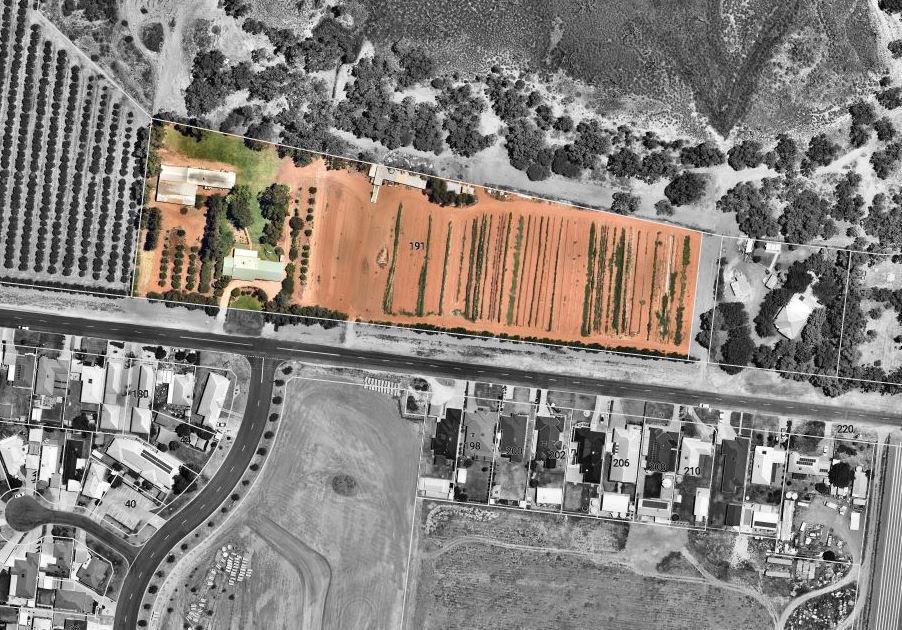
Item 9.14 - Attachment 1 Planning Proposal Page 157 3
Address
Current
Image 1: 191 Pitman Ave, Arial photo
No. Lot
Land Tenure
Zoning
PART 1 -OBJECTIVES OR INTENDED OUTCOMES
This application seeks to rezone 191 Pitman Avenue from RU1 – Primary Production Zone to RU5 Village under the WLEP
The purpose of the rezoning is:
a) to enable the subdivision of the land pursuant to Clause 4.1of the Wentworth LEP 2011 by amending the Lot Size Map to allow an unrestricted Lot size, i.e; remove the minimum lot size
b) Provide the means for Wentworth Shire Council to acquire land to maintain existing storm water infrastructure
c) Give effect to Wentworth Shire Councils local strategic documents
PART 2 -EXPLANATION OF PROVISIONS
The subject land is proposed to be rezoned to RU5 Village based on the assessed current uses and potential future uses under the Wentworth Shire Councils Community Strategic Plan Objective 1.2 and Wentworth Shire Councils Local Strategic Planning Statement (LSPS), specifically Planning Priority 6 which addresses housing growth and supply within settlement boundariesaswellasPlanningPriority7infrastructure andservicesespeciallyfortheliveability for urban areas for the Shire’s residents.
The intended outcome of the Planning Proposal will be achieved by amending the WLEP as follows:
a) Amending Land Zoning Map LZN_004F in the WLEP to show the subject land as RU5 Village
b) Create a small parcel of land for Wentworth Shire Council to acquire for SP2 Infrastructure services
c) Amending Lot Size Map LSZ_004F to reflect no MLS
Item 9.14 - Attachment 1 Planning Proposal Page 158 4
PART 3 -JUSTIFICATION
This section of the Planning Proposal sets out the justification for the intended outcomes and provisions, and the process for their implementation. The questions to which responses have been provided are taken from the Guide.
SECTION A- NEED FOR THE PLANNING PROPOSAL
1) Is the planning proposal a result of an endorsed local strategic planning statement, strategic study or report?
This planning proposal is the result of Wentworth Shire Council’s LSPS, Buronga/Gol Gol Structure (BGGSP) Plan and the Community Strategic Plan (CSP).
LSPS
The LSPS identifies a number of planning priorities. Planning Priority No.6 – ‘Sustainable Settlements’ identifies Buronga/Gol Gol is a growing urban area that has evolved from two distinct villages and aredeveloping as anewurban identity asasingletownship. TheLSPS has identified a settlement boundary for Buronga/Gol Gol which outlines sites for future development and rezoning of land to meet current and future growth needs. This proposal also aligns with Planning Priority 7 Infrastructure and Services which serves to relieve pressure on Council’s existing stormwater and water infrastructure networks and to respond to the fluctuation in climatic events and water security challenges.
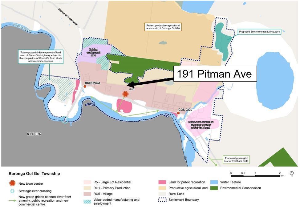
Item 9.14 - Attachment 1 Planning Proposal Page 159 5
Image 2: Settlement Boundary Buronga / Gol Gol (Source: LSPS pg. 38)
BGGSP
Wentworth Shire Council currently has existing stormwater infrastructure that originates from Pitman Ave and traverses through 191 Pitman Avenue into Lot 7311 DP 1181340 being a Crown Reserve for storm water retention, more commonly known as Basin 3. The issue with this infrastructure is the physical location of the stormwater pipe. This pipe is significantly off-set from the easement created on the land for this purpose. (See image 3 below).
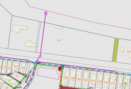
As the infrastructure is currently located in freehold land, Wentworth Shire Council can only enter land to carry out stormwater maintenance and drainage works pursuant to section 191A of the Local Government Act 1993 (LG Act). Council’s power of entry under this section is fettered by section 193 of the LG Act which stipulates that Notice of Entry is to be given in every instance maintenance work is required to be carried out.
The arrangement as permitted under the LG Act for infrastructure maintenance is not acceptabletoCouncilStafforthelandowner. Thissituationcreatesongoingaccessissues for Council, disturbance of land for the land owner which in turn creates delays in project work which then incurs additional costs to Council.
Therefore, this planning proposal will achieve the objectives of the BGGSP especially as it relates to stormwater infrastructure existing within privately owned freehold land which is necessary to ensure security of sites that contain essential infrastructure to service the growth population of Buronga/Gol Gol.
CSP
The WentworthShire Council’s CSP sets out a series of objectives andstrategies that seek to have a well-planned connected built environment that is designed to support the local community. Objective 1.2 seeks to encourage and support population growth and resident attraction.
As this parcel of land is located within the identified settlement boundary and giving consideration to the stormwater infrastructure, this planning proposal will achieve the objective of a well planned and connected built environment.
Item 9.14 - Attachment 1 Planning Proposal Page 160 6
Image 3: Stormwater asset map
2) Is the planning proposal the best means of achieving the objectives or intended outcomes, or is there a better way?
Subdivision 38 ‘Subdivision’ of the State Environmental Planning Policy (Exempt and Complying Development Codes) 2008, [Codes SEPP], has been considered, specifically 2.75(f) as an option to achieve the intended outcomes. However, this option is incongruous to the objectives of the proposed amendment as the Codes SEPP only allows land to be excised rather than sub-divided.
The excising of land will create a split title over the land, and while it would allow Council to acquire land for the infrastructure, it is not a desirable outcome for the land owner. The preferred outcome for all stakeholders is to allow the re-zoning of this land to enable subdivision which will allow Council to acquire land needed for asset control and maintenance without creating a split freehold title over the parcel via the 2.75(f) process.
Therefore, this planning proposal is the best means of achieving the objectives and intended outcomes.
SECTION B- RELATIONSHIP TO STRATEGIC PLANNING FRAMEWORK
3) Will the planning proposal give effect to the objectives and actions of the applicable regional, or district plan or strategy (including any exhibited draft plans or strategies)?
The regional plans applicable to this planning proposal are the Far West Regional Plan 2036 adopted by the NSW government in 2017 and the Draft Murray Regional Strategy 2009-2036.
Far West Regional Plan
The Far WestRegionalPlan is the NSW Government’s 20-year development blueprint for the future of this region. The goal of the plan is to help communities in the Far West adapt to meet future challenges and to ensure ongoing livability of local communities and health of the environment.
Direction 27 of this plan provides for providing greater housing choice and Action 27.1 of this direction encourages the review of planning controls to increase housing options in those locations that are close to services and jobs. Action 27.2 provides for the alignment of infrastructure planning with land release areas to support new developments with adequate infrastructure.
Direction 29 provides for the management of rural residential development and action 29.3seekstoavoidandminimisethepotentialforland useconflictswithproductivezoned agricultural land and natural resources.
This planning proposal is consistent with the Far West Regional Plan as the rezoning for the following reasons:
a) Thesubject landisnot classedas‘productiveagriculturalland’. RefertoSEED Land and Soil Capability Mapping for NSW –themapping for the siteidentifies that it falls under 5 severe limitations and 7 extremely severe limitations.
b) The subject land is currently rated as R5 rural residential land by Wentworth Shire Council
c) The subject land is currently used as ‘rural residential’
Item 9.14 - Attachment 1 Planning Proposal Page 161 7
d) Wentworth Shire Council are seeking to have the rezoning of this land to be consistent with the surrounding land use on the southern side of Pitman Avenue being RU5 – Village.
e) The subject land is in close proximity to local services and amenities.
f) This amendment will give effect to action 29.3 of the Far West Regional Plan.
Draft Murray Regional Strategy
This strategy represents the NSW Government’s position on the future of the Murray Region. It is one of a number of regional strategies prepared by the Department of Planning to complement the NSW State Plan and other State and Local Strategies. The goal of this Strategy is to create a prosperous and resilient place that can sustain livable communities. It aims to achieve this by catering to a housing demand of 13,900 new dwellings by 2036 as well as protecting and managing the riverine environment of the Region’s river system.
This planning proposal is consistent with the goals and objectives of this strategy.
4) Will the planning proposal give effect to a council's endorsed local strategic planning statement, or another endorsed local strategy or strategic plan?
Giving Effect to the LSPS
The planning proposal is supported within the Wentworth Shire Council's Local Strategic Planning Statement – A vision to 2040 (‘LSPS’) and beyond where the document specifically notes that:
‘Council will investigate and review land use pressures to ensure the Shire has a complimentary balance of residential and commercial development opportunities to encourage population growth.
Planning Priority 7 of the LSPS provides key strategic directions that discuss provision of enabling continued growth of townships by ensuring that adequate stormwater infrastructure services are provided.
TheLSPSalsoidentifiesPrimarySettlement AreasStrategies, specificallyinBuronga/Gol Gol. It states new urban development is to be located in the identified settlement boundary. The subject land falls within the identified settlement boundary and therefore this proposed amendment gives effect to Councils LSPS – See Image 1 above.
Giving Effect to the CSP
The Wentworth Community Strategic Plan was endorsed in 2017 to define the vision and priorities of the community for the next ten years to 2027. The Plan sets the direction for Council, government, business and residents and provides a guide on the opportunities to move forward.
Item 9.14 - Attachment 1 Planning Proposal Page 162 8
The table below considers key goals of the CSP:
Direction/Goal
Goal 1 - Wentworth is a vibrant, growing and thriving shire (economic)
Goal 2 - Wentworth is a desirable Shire to visit, live, work and invest
Response
The key vision for Buronga/Gol Gol is to seek new residential options close to the amenity of the Murray River and employment services available in Mildura. This planning proposal will facilitate that vision.
This planning proposal will encourage greater housing choice and development to meet our changing populations needs
The planning proposal is consistent with the objectives and strategies as identified above, with the added benefit of improved outcomes for the land owners and Council.
5) Is the planning proposal consistent with any other applicable State and Regional Studies or Strategies?
There are no other State or Regional Strategies applicable to this proposal.
6) Is the planning proposal consistent with applicable State Environmental Planning Policies?
The planning proposal is consistent with relevant State Environmental Planning Policies (SEPPs) as follows:
State Environmental Planning Policies
Transport and Infrastructure SEPP
Relevance
Provides greater flexibility in the location of infrastructure and service facilities.
Provides for infrastructure to demonstrate good design outcomes.
Biodiversity and Conservation
SEPP (Exempt and Complying Development Codes) 2008
Protect biodiversity values of tress and vegetation.
Resilience and Hazards
Primary Production
Specifies when certain considerations relevant in rezoning land.
Comments
Nothing in this planning proposal impacts upon the aims and provisions of this SEPP.
Nothing in this planning proposal impacts upon the aims and provisions of this SEPP.
The planning proposal does not recommend any amendments to Part 3, Schedule 2 or Schedule 3 of the LEP affecting exempt and complying development provisions.
Nothing in this planning proposal impacts upon the aims and provisions of this SEPP. A contamination investigation and report will be provided upon issue of a gateway determination
To reduce land use conflict Given this planning proposal is seeking to re-zone land from RU1 to RU5, which inclusion of and SP zone, this proposal meets the objectives of this SEPP.
Item 9.14 - Attachment 1 Planning Proposal Page 163 9
7) Is the planning proposal consistent and applicable Ministerial Directions (s. 9.1 directions)?
Table 3: Assessment of Lots 108 DP DP756946 against applicable Ministerial Directions Section 9.1 Direction
(Y/N)
Focus Area 1: Planning Systems
Comment/Justification
(Y/N)
1.1 Implementation of Regional Plans Y Y This proposal is consistent with Direction 27 of the Far West Regional Plan – provide greater housing choice.
1.3 Approval and Referral Requirements Y Y
1.4 Site Specific Provisions N N/A
Focus Area 2: Design and Place
The current and proposed LEP provisions will encourage the efficient and appropriate assessment of development.
This proposal is not seeking a particular development to be carried out.
This focus area was blank when the directions were made.
Focus Area 4: Resilience and Hazards
4.1 – 4.2 N N/A
These directions are not applicable to this proposal.
4.4 Remediation of Contaminated Land Y Y The subject land will be subject to a land contamination investigation and report upon issue of a gateway determination.
4.5 Acid Sulfate Soils Y Y Land is not likely to have acid sulfate soils per the SEED map.
Focus Area 5: Transport and Infrastructure
5.1 Integrating Land Use Transport Y N
Focus Area 6: Housing
6.1 Residential Zones Y Y
Focus area 9: Primary Production
9.1 Rural Zones Y N
The inconsistency of minor significance as the location of this proposal is in the far west NSW where public transport options are limited.
The planning proposal seeks to rezone land to broaden the choice of building types and locations available in the local housing
The provisions of the planning proposal that are inconsistent are justified by Councils LSPS which has considered the objectives of this direction. The LSPS is a DPIE endorsed document. Also, this is of minor significance as the land is not productive agricultural land.
9.2 Rural Lands Y Y This planning proposal seeks to rezone non-viable non-productive RU1 land to be consistent with immediate surrounding land uses. As stated above, this land is being used as a residential block of land.
Item 9.14 - Attachment 1 Planning Proposal Page 164 10
Applicable
Consistent
SECTION C - ENVIRONMENTAL, SOCIAL AND ECONOMIC IMPACT
8) Is there any likelihood that critical habitat or threatened species, populationsor ecological communities, ortheir habitats, will be adversely affected asa result of the proposal?
Thesubject siteisalreadydevelopedandislargelydevoidof vegetation. It isnot identified in the WLEP 2011 as containing environmentally sensitive land or significant environmental attributes. The rezoning of the land for to RU5 Village is unlikely to have a significant impact on flora and fauna. Stormwater infrastructure already traverses the subject site.
This planning proposal is necessary to support the growth and development of Buronga/ Gol Gol and this means that Wentworth Shire Council needs to secure land for servicing infrastructure without impediment, limitation or constraint.
Item 9.14 - Attachment 1 Planning Proposal Page 165 11
9) Are there any other likely environmental effects as a result of the planning proposal and how are they proposed to bemanaged?
Comment/Justification
1. Bushfire Hazard
Is the land subject to bushfire hazards, buffer zones or contain category 2 0r 3 vegetation?
2. Acid Sulphate Soil
Is the land subject to acid sulfate soils consisting of natural sediments that contain iron sulfides?
3. Noise Impact
Will this planning proposal create or introduce intrusive or offensive noise sources that will impact on surrounding land owners?
4. Flora and/or Fauna
Is the land encroaching on critical habitat or threatened species, populations or ecological communities or LMD priority vegetation?
land is not bushfire affected
sulphate soil mapping provided by DPIE does not show any mapped occurrence on the subject land
Given the existing residential use, noise impacts are considered to be insignificant.
subject land has access to Council storm water infrastructure services
Is the land in a floodway, flood mapping or flood building area?
Item 9.14 - Attachment 1 Planning Proposal Page 166 12
Environmental
To be Considered? (Y/N) Applicable (Y/NA)
Consideration
Y NA
subject
The
Y N/A
Acid
Y N/A
N N/A See response to Question 7 above 5. Soil stability, erosion, sediment, land slip assessment and subsidence N N/A The subject land is not impacted by these issues 6. Water Quality Y N/A The subject
has access to potable water 7.
Y Y The
land
Stormwater Management
8. Flooding
Y N/A The land
9. Land Site Contamination Y Y A land contamination report will be
upon issue of a gateway determination. 10. Resources (drinking water, minerals, oysters, agricultural lands, fisheries, mining) Y N/A See response to item 6 above re: drinking water 10. Sea level rise N N/A The land identified in table 1 is not subject to sea level rise
identified in table 1 is not subject to flooding
provided
10)Has the planning proposal adequately addressed any social and economic effects?
The residential areas of Buronga/Gol Gol have seen considerable change in recent years to the effect that these two villages are now a combined identity which has made it a popular area for urban growth. The convenience of the locations in relation to access to schools, employment, retail and commercial facilities has become prominent especially given its proximity to the Regional Centre of Mildura.
As the population expands, particularly in Buronga/Gol Gol it is imperative for the Wentworth Shire to work with local businesses and government agencies to ensure the sustainability and livability of our urban areas. While we recognise the importance of our community’s ability to access higher level services in the Mildura township, we also know that our Shire needs to be ‘Open for Business’ and that includes actively supporting local businesses and development to ensure there is a complimentary balance of residential and commercial needs.
Council anticipates that a wider mix of land use zones will make more activities and services available in one location which will promote a more engaged community while responding to the changing needs and expectations
SECTION D - STATE AND COMMONWEALTH INTERESTS
11) Is there adequate public infrastructure for the planning proposal?
Yes, adequate infrastructure existstosupport thisamendment tothe land use. Please note the services that will be accessible to the site that will support the proposed land use including: sealed road access, electricity, telecommunications, water, stormwater and sewer.
12) What are the views of State and Commonwealth public authorities consulted in accordance with the Gateway Determination?
Table 1: View of State and Commonwealth Authorities
Name of Agency Is PP supported Y/N? Comments
NSW DPIE Y In principle agreement
Item 9.14 - Attachment 1 Planning Proposal Page 167 13
PART 4 – MAPPING
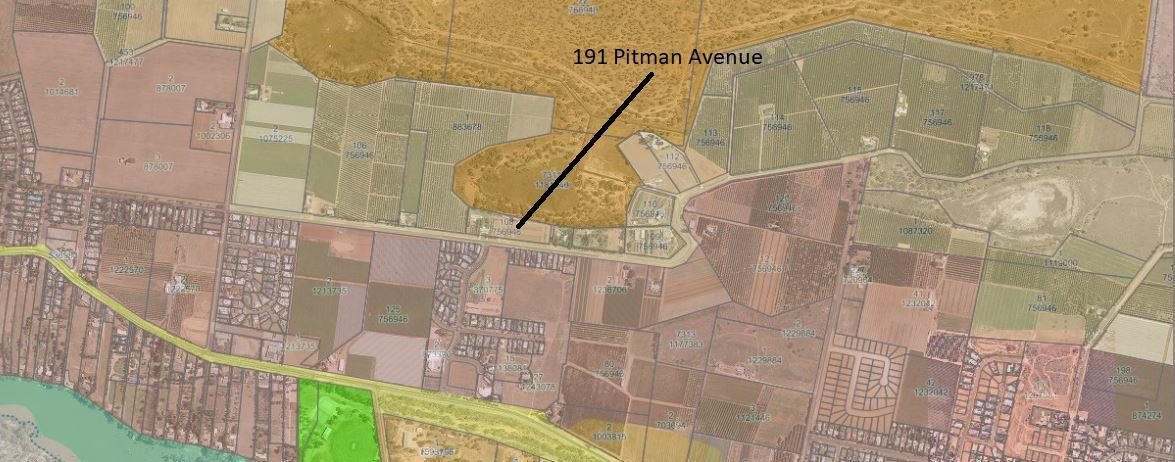
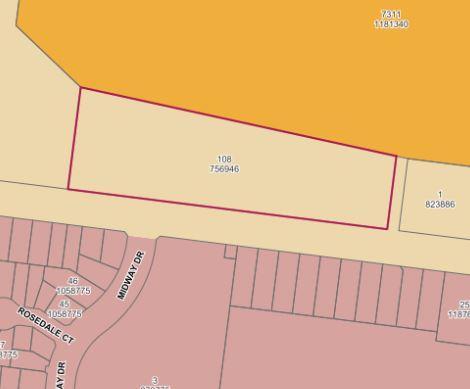
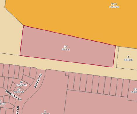
Item 9.14 - Attachment 1 Planning Proposal Page 168 14
Map 1: Aerial Image of 191 Pitman Ave and surrounding area
Map 2: Existing Land Use Zone (RU1)
Map 3: Proposed Land Use Zone (RU5)
PART 5 – COMMUNITY CONSULTATION
Community consultation was undertaken during the preparation of the Community Strategic Action Plan, the LSPS and the Buronga/Gol Gol Structure Plan which forms the basis of this planning proposal.
Public exhibition and community consultation, including neighbour notification will be undertaken by Council as part of the Gateway determination process. Given the minor scale and low impact nature of the planning proposal, it is anticipated it will be exhibited for a period of 28 days in accordance with Clause 4 of Schedule 1 of the EP&A Act 1979 and the NSW Department of Planning and Environment’s: A guide to preparing local environmental plans 2016.
PART 6 - PROJECT TIMELINE
There aremanyfactorsthat caninfluencethe timeline although it is anticipatedfor completion within 6 months.
The indicative timeframe for completing the planning proposal is presented in Table 3 below.
Table 3: Indicative Project Timeline
Stage
Consideration by Council End of March 2023
Council decision 19 April 2023
Gateway Determination End of May/June 2023
Pre-Exhibition June 2023
Commencement and completion of public exhibition period July/August 2023
Consideration of Submissions August 2023
Post-exhibition review and additional studies September/October 2023
Submission to the Department for finalisation (where applicable) November/December 2023
Gazettal of LEP Amendment January 2024
CONCLUSION
The Planning Proposal is to rezone a parcel of land at 191 Pitman AvenueBuronga from RU1 Primary Production to RU5 Village.
AnamendmenttotheWLEP isnecessary asthelandholder desiresrezonethelandtoenable the minimum lot size to permit a future subdivision of the land.
In summary, the Planning Proposal is considered to have merit because:
• the subject land is located within close proximity Buronga/Gol Gol.
• it is consistent with planning strategy and statement.
• it is consistent with the broader planning framework (e.g. Stateprovisions).
• the subject land can be provided with all services.
Item 9.14 - Attachment 1 Planning Proposal Page 169 15
Timeframe
and/or date
Our Reference: Prepared By: George Kenende Date:
PLANNING PROPOSAL ASSESSMENT REPORT
Application Details
Application No: L1/92
Applicant: Roy Costa Planning & Development
Proposal Summary: Rezone approximately 2.1 hectares of land from RU4 Primary Production Small Lots zone to RU5 Village zone and remove the 10 hectare minimum lot size
Land Owner: Victor & Betty Pollesel
Assessment Officer: George Kenende, Strategic Development Officer
Site and Locality Details
Subject Land: 191 Pitman Avenue, Buronga 2739 (Lot 108 DP 756946)
Current LEP provisions: RU4 Primary Production Small Lot zone and 10 hectare minimum lot size
Current DCP Provisions: Chapter 8 Part B Pitman Avenue is identified as a collector road
Proposed amendment controls: RU5 Village zone with no minimum lot size
Existing Character and Use: The subject land is located north of Pitman Avenue in the locality of Buronga. The site contains a dwelling and farm structures and abandoned horticultural crops. Refer to Figure 1.
An easement in favour of Wentworth Shire Council traverses the subject site for the purposes of a stormwater drainage pipeline. The location of the infrastructure pipeline to drain stormwater to Drainage Basin 3 is not located within the easement. Refer to Figure 2.
The planning proposal states that the site is not be used for productive horticulture, however, the aerial imagery shows some form of small scale cropping activity occurring on the land.
Locality: The land to the south of the subject site is zoned RU5 Village and used for residential purposes. The property to the west is currently under horticultural crop (citrus). The properties directly on the eastern boundary are currently used for residential purposes. The land to the north is zoned C2 Environmental Conservation, a natural habitat that is also known as Drainage Basin 3.
The subject site can be accessed from Pitman Avenue (east and west) and Midway Drive.
Item 9.14 - Attachment 2 Planning Proposal Assessment Page 170
T 03 5027 5027 26-28 Adelaide Street WENTWORTH NSW 2648 Page | 1 E council@wentworth.nsw.gov.au PO Box 81 WENTWORTH NSW 2648 W wentworth.nsw.gov.au ABN 96 283 886 815
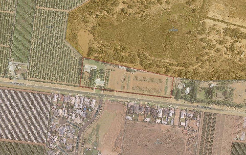
1: Site location
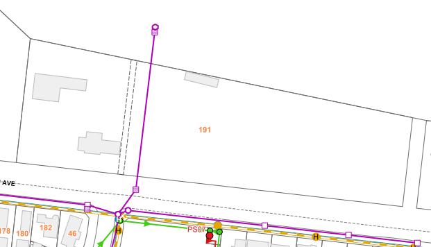
2: Drainage pipe and easement
Planning Proposal
Council is in receipt of an application to amend the Wentworth Local Environmental Plan 2011 (WLEP) to:
Item 9.14 - Attachment 2 Planning Proposal Assessment Page 171
03 5027 5027 26-28 Adelaide Street WENTWORTH NSW 2648 Page | 2
PO Box 81 WENTWORTH NSW 2648
ABN 96 283 886 815
T
E council@wentworth.nsw.gov.au
W wentworth.nsw.gov.au
Figure
Figure
Our Reference: Prepared By: George Kenende Date:
1. Rezone land from RU4 Primary Production Small Lot to RU5 Village (The change of zoning to RU4 occurred recently as such the planning proposal will still refer to RU1 zone)
2. Remove the minimum lot size of 10 hectares.
The planning proposal outlines the purpose of the proposal to:
a) Enable subdivision of the land to with unrestricted lot size
b) Provide Council with the opportunity to acquire a portion of the site containing the storm water infrastructure
c) Given effect to Council’s local strategic documents.
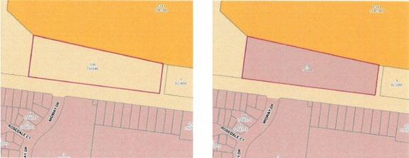
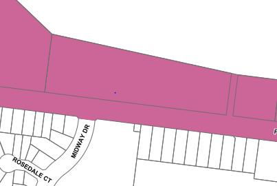
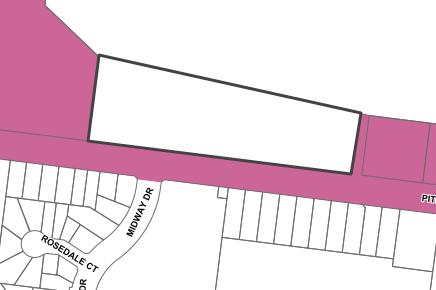
The applicant’s description of the proposal, including supporting information and conceptual plans are provided in Attachment 1 Planning Proposal.
Strategic Assessment
1. Consistency with WSC Community Strategic Plan 2017-2027
Goal 3 of the CSP aims for Wentworth to be a community that works to enhance and protect its physical and natural assets. This is to be achieved by:
3.1 Promote the efficient delivery of water supply, sewer and drainage services for the long-term interests of future generations
3.2 Plan for and develop the right assets and infrastructure
Item 9.14 - Attachment 2 Planning Proposal Assessment Page 172
T 03 5027 5027 26-28 Adelaide Street WENTWORTH NSW 2648 Page | 3 E council@wentworth.nsw.gov.au PO Box 81 WENTWORTH NSW 2648 W wentworth.nsw.gov.au ABN 96 283 886 815
Figure 3: Current and Proposed land zoning
Figure 4: Current and Proposed minimum lot size
The planning proposal seeks to rezone the subject site to allow the opportunity for the parcel to be subdivided, thereby enabling Council to acquire a portion of the land where existing stormwater infrastructure is located. As Buronga is developing rapidly, particularly to the south of the site, Council is consistently working on, improving and expanding its infrastructure to support and adequately service new development in the area.
Consistent
2. Consistency with WSC Local Strategic Planning Statement
In addition to the response to the Local Strategic Planning Statement (LSPS) outlined on Page 5 of the Planning Proposal, referring to Planning Priority 6 Sustainable Settlements, the LSPS also identifies the necessity of ensuring that utility infrastructure and services have the capacity to cope with the increase in demand in the expanding Buronga and Gol Gol townships. This will be achieved through the following strategic direction:
b. Enable continued growth of townships by ensuring that adequate, water, sewer and stormwater infrastructure is provided
Drainage Basin 3 has been identified as important stormwater drainage infrastructure to service the continued growth and development in the townships of Buronga and Gol Gol. Ongoing works and maintenance to the current pipeline will be necessary to support and service the current spate of growth in the area.
Under the current zone and minimum lot size applied to the subject site, the property cannot be subdivided to enable Council to acquire the land where the existing stormwater pipeline is located and an area of land surrounding the pipeline to allow for ongoing works and maintenance to be carried out.
Consistent
3. Consistency with any other relevant strategy/study/report
The Buronga Gol Gol Structure Plan 2020 identifies existing stormwater basins and pipelines within the study area. Page 23 also highlights the necessity for upgrades and improvements to the system due to its inadequacy to cater for stormwater runoff in minor to medium rainfall events.
Page 23 of the Plan shows the location of Drainage Basin 3 adjacent to the subject site and the location of the existing stormwater pipe that services the existing and new development south of the subject site.

Figure 5: Stormwater pipeline to Basin 3
Item 9.14 - Attachment 2 Planning Proposal Assessment Page 173 T 03 5027 5027 26-28 Adelaide Street WENTWORTH NSW 2648 Page | 4 E council@wentworth.nsw.gov.au PO Box 81 WENTWORTH NSW 2648 W wentworth.nsw.gov.au ABN 96 283 886 815
Our Reference: Prepared By: George Kenende Date:
The plan identifies the necessity to prepare and plan for the increase in demand on infrastructure and services within the study area by recommending the preparation of an Integrated Water Management Plan.
The plan also identifies that there is approximately a 21 year supply of RU5 Village zoned land at the time of preparing the Buronga Gol Gol Structure Plan. Therefore, there is no recommendation made within the plan for rezoning land to RU5 Village zone. Any justification made to support the planning proposal on the basis of providing additional residential land is not supported.
However, there is justification for supporting the planning proposal on the basis that the outcomes to be achieved will be beneficial to assist Wentworth Shire Council with managing, maintaining and improving its stormwater infrastructure to service the growing community of Buronga Gol Gol.
Consistent
4. Consistency with Far West Regional Plan 2036
The planning proposal addresses Direction 27 Provide greater housing choice and Direction 29 Manage rural residential development. However, the Buronga Gol Gol Structure Plan has identified a 21 year supply of RU5 Village zoned land and the proposal does not seek to rezone the subject site to R5 Rural Residential zone.
The Far West Regional Plan 2036 identifies goals to protect productive agricultural land and plan for land use compatibility. It also outlines directions to manage change in settlements and achieve healthy built environments.
Whilst the planning proposal seeks to rezone RU1 Primary Production land, the opportunities to pursue viable agricultural uses are severely limited due to both the character and size of the lot and its close proximity to the existing residential development on Pitman Avenue.
The planning proposal objective is to enable subdivision of the land to facilitate better management and maintenance of the existing stormwater infrastructure to service the growing population and development of the Buronga Gol Gol area.
Generally consistent
5. Consistency with applicable Section 9.1 Ministerial Directions
Refer to Table 1 below.
6. Consistency with applicable State Environmental Planning Policies
Refer to Table 2 below.
• NOTE: It should be noted that the planning proposal was received by Council prior to the effective dates for the newly consolidated State Environmental Plans on the NSW legislative website.
Besides landscape plantings the site is fairly devoid of vegetation due to its previous use for
Item 9.14 - Attachment 2 Planning Proposal Assessment Page 174
T 03 5027 5027 26-28 Adelaide Street WENTWORTH NSW 2648 Page | 5 E council@wentworth.nsw.gov.au PO Box 81 WENTWORTH NSW 2648 W wentworth.nsw.gov.au ABN 96 283 886 815
State Environmental Planning Policy (SEPP) Applicable (Y/N) Consistent (Y/N) Assessment State Environmental Planning Policy Y Y
(Biodiversity and Conservation) 2021
State Environmental Planning Policy (Building Sustainability Index: BASIX) 2004
State Environmental Planning Policy (Exempt and Complying Development Codes) 2008
State Environmental Planning Policy (Housing) 2021
State Environmental Planning Policy (Industry and Employment) 2021
State Environmental Planning Policy No 65
Design Quality of Residential Apartment Development
State Environmental Planning Policy (Planning Systems) 2021
State Environmental Planning Policy (Precincts – Central River City) 2021
State Environmental Planning Policy (Precincts – Eastern Harbour City) 2021
State Environmental Planning Policy (Regional) 2021
State Environmental Planning Policy (Western Parkland City) 2021
State Environmental Planning Policy (Primary Production) 2021
horticulture. There will be not removal of vegetation require.
Due to the lack of native vegetation on site, it is considered that the site is not potential or core koala habitat.
The site is not riverine land.
The planning proposal will result in additional RU5 Village zoned land and will therefore add to the existing stock of land available for residential development.
The site has previously been used for horticultural purposes. However, in recent times the agricultural use of the site has ceased. Due to the limitations of size and locality, the site is not considered to be significant agricultural land.
Item 9.14 - Attachment 2 Planning Proposal Assessment Page 175 T 03 5027 5027 26-28 Adelaide Street WENTWORTH NSW 2648 Page | 6
council@wentworth.nsw.gov.au PO Box 81 WENTWORTH NSW 2648
ABN 96 283 886 815
E
W wentworth.nsw.gov.au
N
N
Y Y
N
N
N
N
N
N
N
Y Y
State Environmental Planning Policy (Resilience and Hazards) 2021
State Environmental Planning Policy (Resources and Energy) 2021 N
State Environmental Planning Policy (Transport and Infrastructure) 2021 Y Y
Our Reference: Prepared By: George Kenende Date:
The site has previously been used for horticultural purposes which may have included the use and spillage of chemicals, fuels and other contaminants No preliminary assessment of the site has been undertaken and attached to the planning proposal.
The objective of the planning proposal to enable Council to acquire the land over and around the existing stormwater pipeline provides greater certainty and efficiency of the management and maintenance of this infrastructure.
• NOTE: It should be noted that the planning proposal was received by Council prior to the effective date of the revised S9.1 Ministerial Directions
Section 9.1 Direction
1. Planning Systems
Comments/Justification
1.1 Implementation of Regional Plans Y Y The Far West Regional Plan was prepared to address the far west at a regional level, therefore specific reference to local infrastructure and servicing is not addressed at a local level within the FWRP. However, based on the objective of this planning proposal the following Directions are considered to be relevant: Direction 2 Protect productive agricultural land and plan for greater land use compatibility - the opportunities to pursue viable agricultural uses are severely limited due to both the character and size of the lot and its close proximity to the existing residential development on Pitman Avenue. Direction 20 Manage change in settlements –Buronga and Gol Gol are experiencing a spike in growth and development and its imperative that Council secures land containing existing infrastructure to allow for ease of access, maintenance and improvements as required.
Direction 30 Create healthy built environments – healthy built environments include ensuring that stormwater runoff is
Item 9.14 - Attachment 2 Planning Proposal Assessment Page 176
T 03 5027 5027 26-28 Adelaide Street WENTWORTH NSW 2648 Page | 7 E council@wentworth.nsw.gov.au PO Box 81 WENTWORTH NSW 2648 W wentworth.nsw.gov.au ABN 96 283 886 815
Y N
Consistent
Applicable (Y/N)
(Y/N)
directed away from development to protect buildings from stormwater flooding in rainfall events. The existing pipeline allows stormwater to be directed away from urban development to Drainage basin 3 which provides a valuable water source to land under C2 Environmental Conservation zone.
1.2 Development of Aboriginal Land Council land
1.3 Approval and Referral Requirements Y Y The planning proposal is consistent with direction.
1.4 Site Specific Provisions
1.5 Parramatta Road Corridor Urban Transformation Strategy
1.6 Implementation of North West Priority Growth Area Land Use and Infrastructure Implementation Plan
1.7 Implementation of Greater Parramatta Priority Growth Area Interim Land Use and Infrastructure Implementation Plan
1.8 Implementation of Wilton Priority Growth Area Interim Land Use and Infrastructure Implementation Plan
1.9 Implementation of Glenfield to Macarthur Urban Renewal Corridor
1.10 Implementation of the western Sydney Aerotropolis Plan
1.11 Implementation of Bayside West Precincts 2036 Plan
1.12 Implementation of Planning Principles for the Cooks Cove Precinct
1.13 Implementation of St Leonards and Crows Nest 2036 Plan
1.14 Implementation of Greater Macarthur 2040
Item 9.14 - Attachment 2 Planning Proposal Assessment Page 177 T 03 5027 5027 26-28 Adelaide Street WENTWORTH NSW 2648 Page | 8 E council@wentworth.nsw.gov.au PO Box 81 WENTWORTH NSW 2648 W wentworth.nsw.gov.au ABN 96 283 886 815
N
N
N
N
N
N
N
N
N
N
N
N
1.15 Implementation of the Pyrmont Peninsula Place Strategy
1.16 North West Rail Link Corridor Strategy
1.17 Implementation of the Bays West Place Strategy
2. Design and Place
2.1 Not yet applied
3. Biodiversity and Conservation
3.1 Conservation Zones Y Y
Our Reference: Prepared By: George Kenende Date:
The subject site of the planning proposal abuts land under the C2 Environmental Conservation zone. The proposal is consistent with this direction as the proposal will not have a negative impact or reduce the environmental protection standards applied to the protect the adjoining site.
3.2 Heritage Conservation
3.3 Sydney Drinking Water Catchments
3.4 Application of C2 and C3 Zones and Environmental Overlays in Far North Coast LEPs
3.5 Recreation Vehicle Areas
4. Resilience and Hazards
4.1 Flooding
4.2 Coastal Management
4.3 Planning for Bushfire Protection
4.4 Remediation of Contaminated Land
The subject site is not subject to flooding.
Any application for the rezoning of land that may have been contaminated and enables the development of dwellings or other permissible sensitive uses, should be accompanied by a preliminary assessment report.
The Managing Land Contamination Planning Guidelines advises that it is necessary to investigate a site proposed to be rezoned if the site has been used for agricultural or horticultural activities. As there are existing farm buildings on the site, which may have stored agricultural chemicals, it is recommended to request either:
Item 9.14 - Attachment 2 Planning Proposal Assessment Page 178
T 03 5027 5027 26-28 Adelaide Street WENTWORTH NSW 2648 Page | 9 E council@wentworth.nsw.gov.au PO Box 81 WENTWORTH NSW 2648 W wentworth.nsw.gov.au ABN 96 283 886 815
N
N
N
N
N
N
N
N
N
N
Y
N
a) The proponent to submit a preliminary assessment report, or Request the Department of Planning & Environment to issue a Gateway Determination to proceed, including a condition requiring the submission of a preliminary assessment report prior to proceeding with consultation.
4.5 Acid Sulfate Soils N
4.6 Mine Subsidence and Unstable Land N
5.
Transport and Infrastructure
5.1 Integrating Land Use and Transport Y Y The planning proposal is considered consistent with direction as the subject site is located on a connector road, has access to services and infrastructure.
5.2 Reserving Land for Public Purposes N
5.3 Development Near Regulated Airports and Defence Airfields
5.4 Shooting Ranges N
6. Housing
6.1 Residential Zones Y Y While the RU5 Village zone is a generally flexible zone and not specifically applied for residential purposes, it does permit residential development. This planning proposal is considered consistent with this direction.
6.2 Caravan Parks and Manufactured Home Estates Y Y The planning proposal is consistent with this direction as it will not prohibit this type of development.
7.
Industry and Employment
7.1 Business and Industrial Zones
7.2 Reduction in NonHosted Short-term Rental Accommodation period
7.3 Commercial and Retail Development along the Pacific Highway North Coast
8. Resources and Energy
8.1 Mining, Petroleum Production and Extractive Industries
9. Primary Production
Item 9.14 - Attachment 2 Planning Proposal Assessment Page 179 T 03 5027 5027 26-28 Adelaide Street WENTWORTH NSW 2648 Page | 10 E council@wentworth.nsw.gov.au PO Box 81 WENTWORTH NSW 2648 W wentworth.nsw.gov.au ABN 96 283 886 815
N
N
N
N
N
9.1 Rural Zones Y N
9.2 Rural Lands Y N
Our Reference: Prepared By: George Kenende Date:
The planning proposal is inconsistent with this direction as it seeks to rezone the subject site from a rural zone to a village zone. However, the inconsistency is justified through the Community Strategic Plan, Local Strategic Planning Statement, Far West Regional Plan and Buronga Gol Gol Structure Plan.
The planning proposal does not respond to this direction. This Ministerial direction requires planning proposals to address (1)(a) to (i).
a) The proposal is consistent with regional and local strategies
b) The significance of the subject site in terms of agricultural production is considered minor due to the limitations on size and location
c) As the site has been historically used for agricultural purposes minimal native vegetation exists, and is generally located around the boundary. The proposal will not have a negative impact on the adjoining allotment where the C2 zone is applied to protect its environmental values, any heritage items or water resources
d) The subject land is suitable for development based on its close proximity to township services
e) Due to the small lot size and its location, there is very limited or restricted opportunity for rural investment opportunities
f) The proposal will not interfere with surrounding farmers’ rights to farm
g) Due to the existing size of the subject site and its proximity to rural land uses on the west boundary, it mayl be necessary for buffers to be planted to prevent land use conflict.
h) The site is not listed in Chapter 2 of the SEPP (Primary Production) 2021.
Item 9.14 - Attachment 2 Planning Proposal Assessment Page 180
T 03 5027 5027 26-28 Adelaide Street WENTWORTH NSW 2648 Page | 11 E council@wentworth.nsw.gov.au PO Box 81 WENTWORTH NSW 2648 W wentworth.nsw.gov.au ABN 96 283 886 815
i) The planning proposal has considered the social, economic and environmental interests of the community.
9.3 Oyster Aquaculture N
9.4 Farmland of State and Regional Significance on the NSW Far North Coast N
Site Assessment
Suitability of site for proposal
The site is deemed suitable for the proposal because of the issues surrounding the existing stormwater pipeline. By rezoning the subject site, the area of land that contains the existing pipeline (approximately 345 m2 ) can be subdivided and acquired by Council for management and maintenance purposes.
The site location is adjacent to existing RU5 Village land that is developed along Pitman Avenue and under development along Midway Drive. Although the BGGSP has not included a recommendation to rezone this site, at this stage, it is anticipated that growth of the township will progress north of Pitman Avenue.
Infrastructure
There is adequate infrastructure to support the outcomes of the planning proposal.
Sealed road frontage to Pitman Avenue, a collector road.
Power, sewer, filtered and raw water and stormwater infrastructure is located on the south side of Pitman Avenue.
Consultation
Internal consultation
Roads and Engineering Department
External consultation
Department of Planning & Environment
Financial Implications
Council’s 2021/2022 Fees and Charges includes a fee for planning proposals which is $6,367.00. This fee has been paid by the proponent.
Should the planning proposal proceed and an amendment to the LEP be made, the contribution and development servicing plans will apply to future development on the subject site.
Recommended Amendments
Part of the land will be acquired by Council and used for stormwater infrastructure connecting Drainage basin 3 to Pitman Avenue. The Drainage Basin 3 has been identified as important stormwater drainage infrastructure to service the continued growth and development in the townships of Buronga and Gol Gol. Ongoing works and maintenance to the current pipeline will be necessary to support and service the current spate of growth in the area.
A SP2 Infrastructure zone will be the most appropriate zoning for the 345 m2 area over the stormwater pipeline
Item 9.14 - Attachment 2 Planning Proposal Assessment Page 181 T 03 5027 5027 26-28 Adelaide Street WENTWORTH NSW 2648 Page | 12 E council@wentworth.nsw.gov.au PO Box 81 WENTWORTH NSW 2648 W wentworth.nsw.gov.au ABN 96 283 886 815
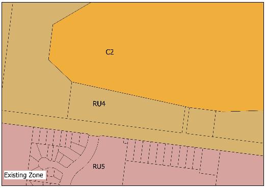
Conclusion and Recommendation
That Council:
Our Reference: Prepared By: George Kenende Date:
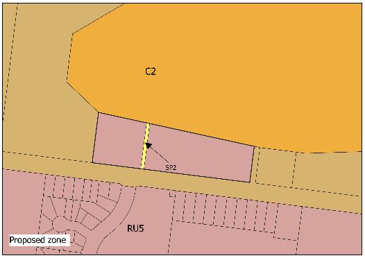
1. Support the planning proposal to amend the Wentworth LEP 2011 by rezoning the subject site from RU4 Primary Production Small Lot zone to RU5 Village and SP2 Infrastructure zones and removal of minimum lot size
2. Submit the planning proposal to the NSW Department of Planning and Environment for Gateway Determination
Item 9.14 - Attachment 2 Planning Proposal Assessment Page 182
T 03 5027 5027 26-28 Adelaide Street WENTWORTH NSW 2648 Page | 13 E council@wentworth.nsw.gov.au PO Box 81 WENTWORTH NSW 2648 W wentworth.nsw.gov.au ABN 96 283 886 815
9.15 WENTWORTH LOCAL ENVIRONMENTAL PLAN 2011 – BURONGA COMMERCIAL AREA REZONING PLANNING PROPOSAL
File Number: RPT/23/202
Responsible Officer: Matthew Carlin - Director Health and Planning
Responsible Division: Health and Planning
Reporting Officer: George Kenende - Strategic Planning Officer
Objective: 1.0 Wentworth Shire is a vibrant, growing and thriving Region Strategy: 1.1 Promote the Shire as an ideal location for investment and the establishment of innovative, sustainable and diversified industries
Summary
Council’s Health and Planning Department has prepared a Planning Proposal as an outcome of the Buronga Gol Gol Structure Plan (BGGSP).
The Planning Proposal seeks to amend the following planning provision in the Wentworth Local Environmental Plan 2011 (WLEP2011):
- Amend the Land Zoning Map – Sheet LZN_004F applied to the subject land from ‘RU5 Village’ to ‘E1 Local Centre’ and ‘SP2 Infrastructure’
This report seeks Council endorsement to submit the Planning Proposal to the Department of Planning & Environment requesting a Gateway Determination to proceed.
Recommendation
That Council resolves to:
a) Submit the Planning Proposal to amend the Wentworth Local Environmental Plan 2011 to the Minister for Planning for consideration of a Gateway Determination in accordance with Section 3.34 of the Environmental Planning and Assessment Act 1979.
b) Call a division in accordance with S375A of the Local Government Act 1993 (NSW).
Detailed Report
Purpose
The purpose of this report is to provide Council with the information required to make an informed decision with regard to the Planning Proposal.
Background
The BGGSP was undertaken by Council’s Health and Planning Department and formerly endorsed by the Department of Planning and Environment (DPE). Consultation with the following agencies was conducted as part of BGGSP drafting:
- Department of Planning and Environment (Crown lands)
- Department of Planning and Environment (Biodiversity and Conservation Division)
- Transport for NSW
- Environmental Protection Agency (EPA)
The response received from the agencies was positive regarding the recommendation of introducing the commercial precinct in Buronga.
Ordinary Meeting AGENDA 19 April 2023 Page 183
The purpose of preparing the BGGSP was to guide the future development of the Buronga & Gol Gol growth areas. The BGGSP identified the necessity to centrally locate land available for new and emerging commercial development to provide retail services to the community. This provided justification of the recommendations for amendments to the WLEP2011.
Refer to Attachment 1 Buronga Gol Gol Structure Plan
Matters under consideration
This Planning Proposal has been prepared to enact upon the recommendations made in the BGGSP.
The Planning Proposal proposes to:
- Amend the Land Zoning Map – Sheet LZN_004F applied to the subject land from ‘RU5 Village’ to ‘E1 Local Centre’ and ‘SP2 Infrastructure’ (in accordance with the proposed Land Zoning Map shown in Part 4 of the planning proposal).
Early consultation with the Department of Planning and Environment has been undertaken to gauge the agencies support or concerns for the proposed amendments to the Wentworth Local Environmental Plan 2011. The response received from the agency was positive regarding the proposed amendments to the Wentworth Local Environmental Plan 2011
Refer to Attachment 2 – Planning Proposal
Options
Based on the information contained in this report, the options available to address this matter are to:
• Submit the Planning Proposal to the Minister for Planning for consideration of a Gateway Determination, Or
• Refuse to support the Planning Proposal.
Legal, strategic, financial or policy implications
The endorsement of the attached Planning Proposal will allow it to be submitted to the Minister for Planning for consideration of a Gateway Determination in accordance with the Environmental Planning and Assessment Act 1979.
The endorsement will provide Council with the opportunity to progress the implementation of the recommendations made in the BGGSP which will provide for a range of commercial, civic, cultural and associated residential development providing social and economic benefits to the community.
Conclusion
Having consideration for the content of this report, it is concluded that the most appropriate course of action is to resolve to submit the Planning Proposal to the Minister for Planning for consideration of a Gateway Determination.
Attachments
1. Buronga Gol Gol Structure Plan BGGSP 2020⇩
2. Planning Proposal⇩
Ordinary Meeting AGENDA 19 April 2023 Page 184
BURONGA GOL GOL
STRUCTURE PLAN 2020


Item 9.15 - Attachment 1 Buronga Gol Gol Structure Plan BGGSP 2020 Page 185
Item 9.15 - Attachment 1 Buronga Gol Gol Structure Plan BGGSP 2020 Page 186
Item 9.15 - Attachment 1 Buronga Gol Gol Structure Plan BGGSP 2020 Page 187 i Buronga Gol Gol Structure Plan 2020 Document Control & Authorisation Version Purpose of Document Author Review Approval 06.12.2019 Initial draft plan for internal consultation Paul Amoateng Michele Bos Michele Bos 20.03.2020 Draft plan for council resolution Paul Amoateng Michele Bos Michele Bos 31.07.2020 Final plan for council adoption Paul Amoateng Michele Bos Michele Bos
This Plan was adopted by Wentworth Shire Council at an Ordinary Council meeting held on 16 Septemer 2020.
Disclaimer
All narrative, mapping, rendering, infographics and visualisations used in this document were produced internally by Wentworth Shire Council Health and Planning Team. This document, once adopted, becomes the sole property of Wentworth Shire Council. Under no circumstances, should this document be redistributed, reproduced or altered without Council’s permission. Cadastral boundaries depicted within this document should not be used as any form of surveying instrument nor should they be considered 100% accurate.
Buronga Gol Gol Community
Acknowledgements Study Team
A thank you is extended to the community members who have provided input into the preparation of the structure plan. Their valuable feedback and ideas have informed and shaped the development of the structure plan.
The staff of Wentworth Shire Council’s Health and Planning Division are acknowledged and thanked for their hard work and persistence in the successful delivery of this Structure Plan, including:
Paul Amoateng De velopment Services Officer
George Kenende De velopment Assessment Officer
Acknowledgement of Country Wentworth Shire Council acknowledges the Traditional Owners of the land and pay respect to Elders past, present and emerging. Wentworth Shire Council recognises and considers the wishes and desires of the indigenous community of Buronga Gol Gol within this Structure Plan.
Michele Bos Str ategic Development Officer
Matthew Carlin Dir ector Health & Planning
Buronga Gol Gol Structure Plan 2020
Item 9.15 - Attachment 1 Buronga Gol Gol Structure Plan BGGSP 2020 Page 188 ii
Item 9.15 - Attachment 1 Buronga Gol Gol Structure Plan BGGSP 2020 Page 189 iii Buronga Gol Gol Structure Plan 2020 2.8.4 Cultural and Indigenous Heritage 33 CHAPTER 3: OUTCOMES 35 3.1 Vision 36 3.2 Development Principles 36 CHAPTER 4: STRUCTURE PLAN 41 4.1 Introduction 42 4.2 Land Use Zones and Development 42 4.2.1 Residential 43 4.2.2 Commercial 46 4.2.3 Industrial 48 4.2.4 Rural Environmental Living 48 4.2.5 Rural Land 48 4.2.6 Urban Land Release Staging 48 4.3 Infrastructure 50 4.3.1 Water Supply 50 4.3.2 Sewerage Services 51 4.3.3 Drainage Infrastructure 52 4.3.4 Road Design and Upgrades 53 4.3.5 Footpaths and Sharedways 56 4.3.6 Power and Telecommunication Services 58 4.4 Community Services and Recreation Facilities 58 4.4.1 Education Facilities 58 4.4.2 Sporting and Recreation Facilities 59 4.4.3 Health and Emergency Services 59 4.4.4 Public Open Spaces (Parks) 60 4.5 Natural Environment 62 4.6 Summary of Recommendations and Implementation 62 CHAPTER 5: CONCLUSION & REVIEW 66 5.1 Conclusion 66 5.2 Review of Structure Plan 66 Contents CHAPTER 1: INTRODUCTION 1 1.1 Purpose of the Structure Plan 2 1.2 Land to Which this Structure Plan Applies 2 1.3 Structure Plan Preparation Process 2 1.4 Strategic Planning Context 2 1.5 Planning Horizon 3 1.6 Public Consultation 3 CHAPTER 2: EXISTING CONDITIONS AND LOCALITY CONTEXT 5 2.1 Location & Context 6 2.2 Land Area of Structure Plan 8 2.3 Population and Demographics 9 2.4 Built Environment 10 2.4.1 Land Use Zones 10 2.4.2 Lot Sizes and Density 13 2.4.3 Residential Land Supply and Demand 14 2.4.4 Housing Development 14 2.5 Local Economy 16 2.5.1 Employment and Income 16 2.5.2 Private Business 16 2.5.3 Agriculture 16 2.5.4 Tourism 16 2.5.5 Industrial 16 2.6 Infrastructure 18 2.6.1 Roads and Transport 18 2.6.2 Footpaths and Sharedways 20 2.6.3 Water Supply 21 2.6.4 Sewerage 22 2.6.5 Drainage/Stormwater Infrastructure 23 2.6.6 Power and Telecommunication 24 2.7 Community Services and Recreation 24 2.7.1 Community Facilities and Services 24 2.7.2 Public Transport 26 2.7.3 Public Parks and Recreation Facilities 27 2.8 Natural Environment 29 2.8.1 Topography and Landscape 29 2.8.2 Waterways and Flooding 30 2.8.3 Biodiversity 32
Item 9.15 - Attachment 1 Buronga Gol Gol Structure Plan BGGSP 2020 Page 190 iv Buronga Gol Gol Structure Plan 2020 Figure 4.12 Proposed Community Facilities, Recreation Areas and Green Spaces 58 Figure 4.13 Bridge Road Precinct Concept Plan 60 Figure 4.14 Alignment of Proposed Greenbelts and Multi-use Corridors 61 Figure 5.1 Composite Structure Plan Map 67 List of Tables Table 2.1 Summary of Existing Land Use Zones 10 Table 2.2 Summary of Existing Land Uses 11 Table 2.3 Existing Residential Land Supply Under Current Demand Rate and Average Lot Sizes 14 Table 2.4 Summary of Recreational Facilities 27 Table 4.1 Summary of Future Land Use Zones 43 Table 4.2 Future Residential Land Supply Under Anticipated Demand Rates 45 Table 4.3 Implementation Plan for Recommendations 62 List of Figures Figure 1.1 Strategic Planning Documents 2 Figure 2.1 Buronga Gol Gol in National Context 6 Figure 2.2 Buronga Gol Gol in Regional Context 7 Figure 2.3 Buronga Gol Gol Study Area 8 Figure 2.4 Population Growth Trend 9 Figure 2.5 Age Structure of the Buronga Gol Gol Residents 9 Figure 2.6 Existing Land Use Zoning 11 Figure 2.7 Existing Land Uses 12 Figure 2.8 Lot Sizes Ranges 13 Figure 2.9 Housing Development Approvals in Buronga Gol Gol 15 Figure 2.10 Proposed developments, concepts and planning proposals 15 Figure 2.11 Distribution of Commercial Activities in Buronga Gol Gol 17 Figure 2.12 Buronga Gol Gol Road Network 18 Figure 2.13 Road & Traffic Analysis 19 Figure 2.14 Active Transport Infrastructure 20 Figure 2.15 Water Supply Infrastructure 21 Figure 2.16 Sewerage Infrastructure 22 Figure 2.17 Stormwater Infrastructure 23 Figure 2.18 Community Facilities and Services 25 Figure 2.19 Transport Services 26 Figure 2.20 Recreational Areas in Buronga Gol Gol 28 Figure 2.21 Buronga Gol Gol Topography 29 Figure 2.22 Waterways and Wetlands 30 Figure 2.23 Flood Affected Land 31 Figure 2.24 Habitat/Land Cover Types 32 Figure 2.25 Heritage Areas and Items 33 Figure 4.1 Future Land Use Zones 42 Figure 4.2 Future Density Plan 44 Figure 4.3 Hendy Road Precinct Concept Plan 47 Figure 4.4 Urban Land Release Staging Plan 49 Figure 4.5 Proposed Water Supply Infrastructure 50 Figure 4.6 Proposed Sewerage Infrastructure 51 Figure 4.7 Proposed Stormwater/Drainage Infrastructure 52 Figure 4.8 Future Road Network and Indicative Subdivision 53 Figure 4.9 Future Road and Intersection Improvements 54 Figure 4.10 Pedestrian access and mobility plan: Proposed path priorities plan for Buronga Gol Gol 56 Figure 4.11 Proposed Active Transport Route/Corridor 57
Executive Summary
The Buronga Gol Gol Structure Plan provides a strategic land use framework to facilitate quality and sustainable urban development in the Buronga Gol Gol area by setting out what, when, where and how land and infrastructure development should occur.
The Buronga Gol Gol area is currently experiencing rapid housing development prompting the need for a strategic land use plan to guide, manage and monitor future growth and development in the area.
The Structure Plan draws on the community’s agreed vision for the Buronga Gol Gol area with respect to housing, population services, infrastructure, community facilities and environmental management. The plan sets out strategic short, medium and long-term land use directions for achieving sustainable urban growth and optimising land development in the area.
The Structure Plan envisions Buronga Gol Gol becoming sustainable, self-sufficient and vibrant with well-balanced urban and rural characteristics that have strong relationships to the surrounding rural landscape to adequately support the social, economic, cultural and environmental needs and aspirations of current and future residents.
A range of guiding principles have been adopted within this plan. These principles reflect the future growth and development outcomes for the various aspects of the study area.
The recommendations in this Structure Plan aim to consolidate future urban development, facilitate development of a commercial precinct, rezone to support future and emerging land use needs and expand and/or upgrade infrastructure and services in Buronga Gol Gol.
The Structure Plan provides approximately 544 hectares of residential land, 49 hectares of industrial land and 15 hectares of commercial land. The plan also includes an urban land release staging plan for ensuring coordinated land development and infrastructure delivery. Successful implementation of this plan includes commitment of resources to ensure that future development can be sustained and is supported by the level of services necessary.
Item 9.15 - Attachment 1 Buronga Gol Gol Structure Plan BGGSP 2020 Page 191 v Buronga Gol Gol Structure Plan 2020
Item 9.15 - Attachment 1 Buronga Gol Gol Structure Plan BGGSP 2020 Page 192


Item 9.15 - Attachment 1 Buronga Gol Gol Structure Plan BGGSP 2020 Page 193
Chapter 1: Introduction
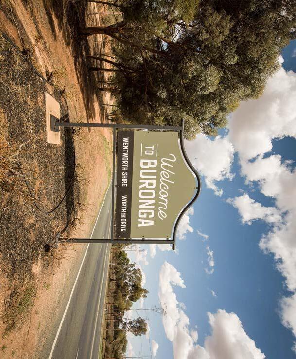

Gol Gol Structure Plan 2020
Chapter 1: Introduction
1.1 Purpose of the Structure Plan
The purpose of the Buronga Gol Gol Structure Plan (BGGSP) is to facilitate quality and sustainable urban development in the localities of Buronga and Gol Gol. With the two localities currently experiencing fast growth, it is imperative to plan and guide land use changes, infrastructure development and public and recreational spaces to support this growth. The plan sets strategic short and long-term directions for optimising land use and development, including identifying what, when, where and how development should occur in the area. Given the current high spate of development in the two townships, this plan provides certainty about the type and quality of future urban development in the area. 1.2 Land to which this Structure Plan Applies
This Structure Plan applies to Buronga and Gol Gol townships and the immediate surrounding area. This Structure Plan focuses on both the existing and newly developing areas of the townships to ensure holistic sustainability of the two localities. Throughout the plan, the entire study area will be referred to as Buronga Gol Gol. 1.3
Structure Plan Preparation Process
Preparation of the BGGSP comprised the following main steps:
a) Desktop research and analysis of relevant studies, strategies and policies relevant to planning in the area.
b) Consultation with broad ranging stakeholders including local communities and state agencies.
c) Preparation of the structure plan report and the draft structure plan 1.4
Strategic Planning Context
Buronga Gol Gol is affected by a range of state, regional and local strategic policies and studies. Many of these strategic documents have been reviewed and analysed to inform fundamental elements of the BGGSP such as the vision, development principles, land use zones and infrastructure sequencing plan.
Important strategic documents that were used for direction and guidance in the structure planning process are outlined in Figure 1.1.
Item 9.15 - Attachment 1 Buronga Gol Gol Structure Plan BGGSP 2020 Page 194 2
NSW 2021: A PLAN TO MAKE NSW NUMBER ONE Far West Regional Plan 2036 Dra� Murray Regional Strategy 2009-2036 Murray Regional Plan 2016-2019 Western Murray Regional Economic Development Strategy Regional Land Use Strategy 2017-2027 Community Strategic Plan Local Strategic Planning Statement Wentworth Local Environmental Plan 2011 Wentworth Shire Development Control Plan 2011 Wentworth Economic Development Strategy 2012-2016 Structure Plan Report for Buronga and Gol Gol and Buronga Gol Gol Structure Plan 2005 Buronga to Monak Interface Study Buronga Riverfront Master Plan Developer Charge/Contribution Plans (Section 7.12 Development Contributions Plan 2018, Section 64 Development Servicing Plan No.1-Water Supply and Sewerage Services, Section 64 Development Servicing Plan No. 2-Stormwater Infrastructure) STATE REGIONAL LOCAL Figure 1.1Strategic Planning Documents
Buronga
1.6 Public Consult ation
Extensive public consultation was undertaken to help shape this Plan and promote development that benefits the community of Buronga Gol Gol. Following consideration and resolution by Council, the draft Buronga Gol Gol Structure Plan was publicly exhibited for 32 days from 09 May to 09 June 2020. The draft structure plan was notified and made available for viewing on Council website, as well as advertised in Sunraysia Daily and Mildura Weekly newspapers and posted Council’s Facebook page for public comments and feedback. Letter mailouts were sent directly to affected landowners whose properties have been proposed for rezoning or other developments. The draft structure plan was also referred to relevant state agencies and community groups for comment and inputs. Council received eighteen (18) submissions at the end of the exhibition period. The submissions were generally in support of the draft structure plan. The issues raised in the submissions were reviewed and considered by Council to inform the final structure plan. A summary of the points made in the submissions and Council’s responses (including adjustments made to the draft structure plan) is provided in Attachment 2 of the Buronga Gol Gol Structure Plan Report.
Horizon A planning horizon is a timeframe that is selected, usually in years, to a planning-related project. The adopted planning horizon for this structure plan is 20 years (i.e. 2040). This planning horizon is considered appropriate for this structure plan as it is an achievable and sustainable benchmark for the Buronga Gol Gol community. The 20-year planning horizon allows the structure plan to explore the short, mediumand long-term goals and needs of the Buronga Gol Gol community. The adopted planning horizon for this structure plan relatively falls in line with applicable overarching New South Wales state planning policies, such as the Far West Regional Plan 2036. This timeframe also works well alongside Wentworth Shire Council’s other strategic documents, including the 2017-2027 Community Strategic Plan, the Local Strategic Planning Statement and the draft Rural Land Use and Rural Residential Strategy 2015.
1.5 Planning
Consultation with the community and relevant stakeholders enabled collection and consideration of aspirations, values and concerns of different individuals, agencies and groups in developing the Structure Plan. The purpose of the consultation was to:
a) Communicate and inform the community and stakeholders of the process and key messages of the Structure Plan;
b) Obtain feedback and input throughout the structure planning process; c) Ascertain and understand community and stakeholder views and opinions to inform the Structure Plan;
d) Identify issues and obtain community input on ways to resolve them;
e) Assist in developing a ‘vision’ for the town; and f) Encourage public ownership of the final Structure Plan.
Item 9.15 - Attachment 1 Buronga Gol Gol Structure Plan BGGSP 2020 Page 195 3 Buronga Gol Gol Structure Plan 2020
Item 9.15 - Attachment 1 Buronga Gol Gol Structure Plan BGGSP 2020 Page 196
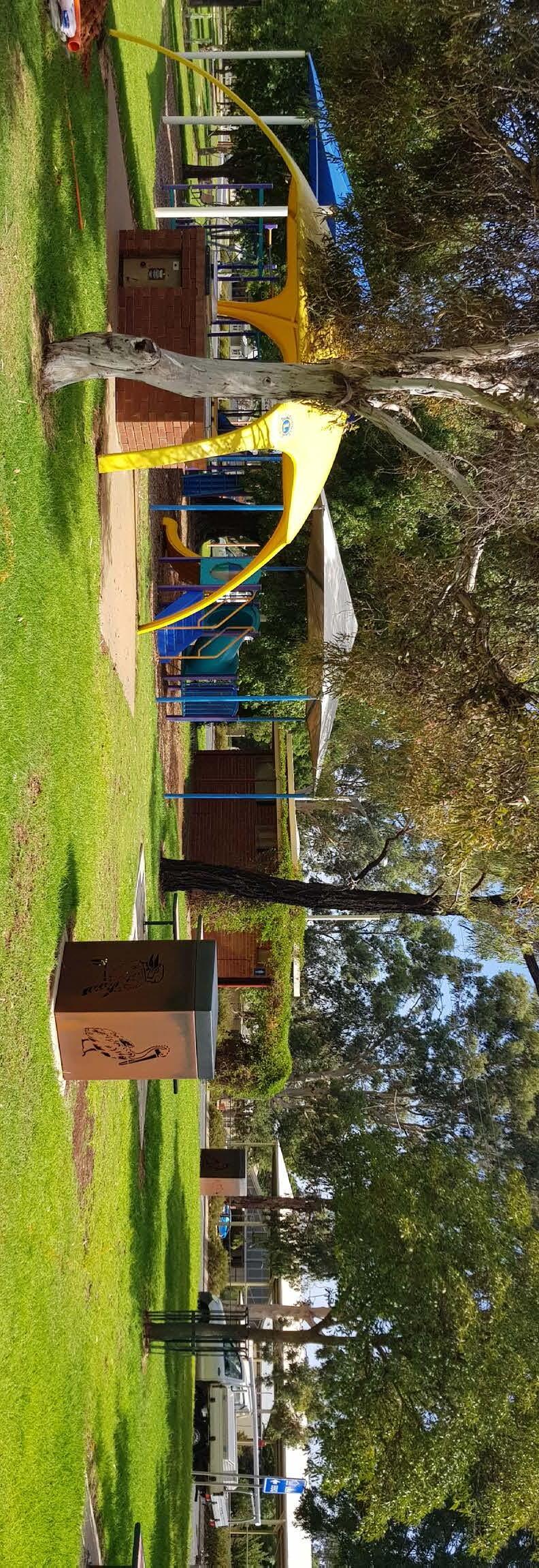

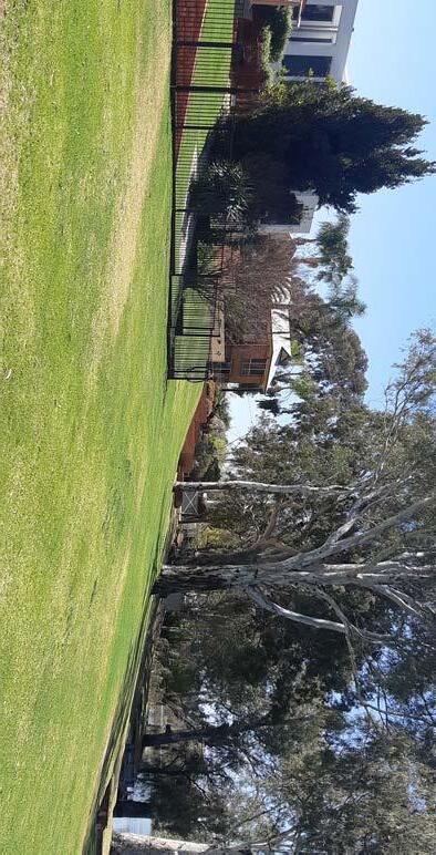
Chapter 2: Existing Conditions and Locality Context
Item 9.15 - Attachment 1 Buronga Gol Gol Structure Plan BGGSP 2020 Page 197
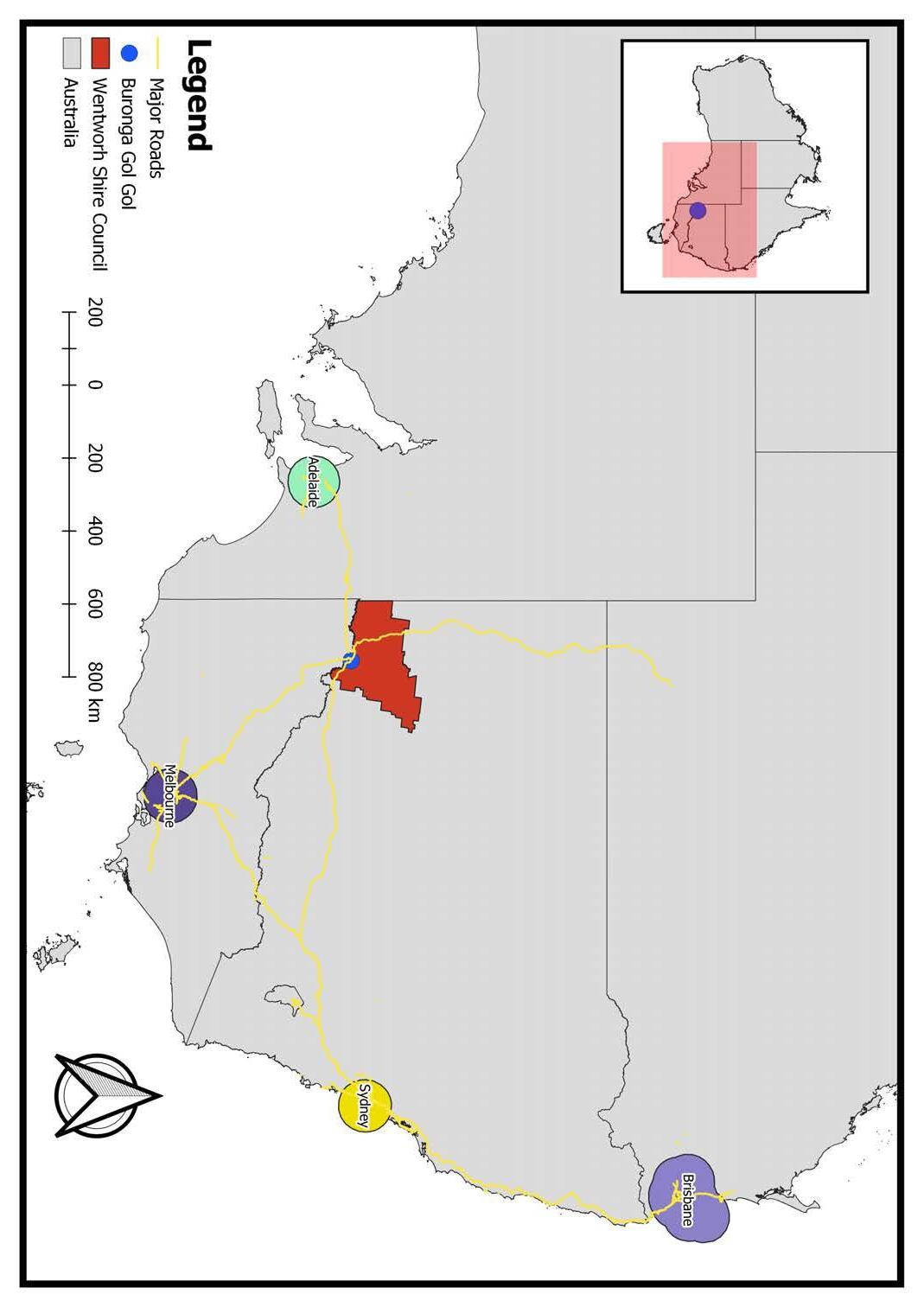
Chapter 2: Existing Conditions and Locality Context
2.1 Loc ation and Context
Buronga Gol Gol is located in the south-eastern part of the Wentworth Shire Local Government Area in far South-West NSW. Buronga Gol Gol is situated on the Murray River approximately 5 km from Mildura Rural City (in Victoria), which provides convenient access to higher order services for residents in Buronga Gol Gol. Buronga Gol Gol operates as a ‘defacto’ northern suburb of Mildura due to its strong physical and socio-economic connection to the regional centre.
Buronga Gol Gol is strategically located on the Sturt Highway and Silver City Highway, two of Australia’s significant transport corridors and freight routes. These national highways traverse the Sunraysia region and extend to Broken Hill, Adelaide, Melbourne, Sydney and Brisbane, providing the region with direct access to national and global markets.
Buronga Gol Gol is surrounded by a variety of well-established horticultural enterprises, which are typical of towns within the Sunraysia region. Maps showing the location of Buronga Gol Gol within regional and national contexts are presented in Figures 2.1 and 2.2.

Item 9.15 - Attachment 1 Buronga Gol Gol Structure Plan BGGSP 2020 Page 198 6
2020
Buronga Gol Gol Structure Plan
Figure 2.1 –Buronga Gol Gol in National Context
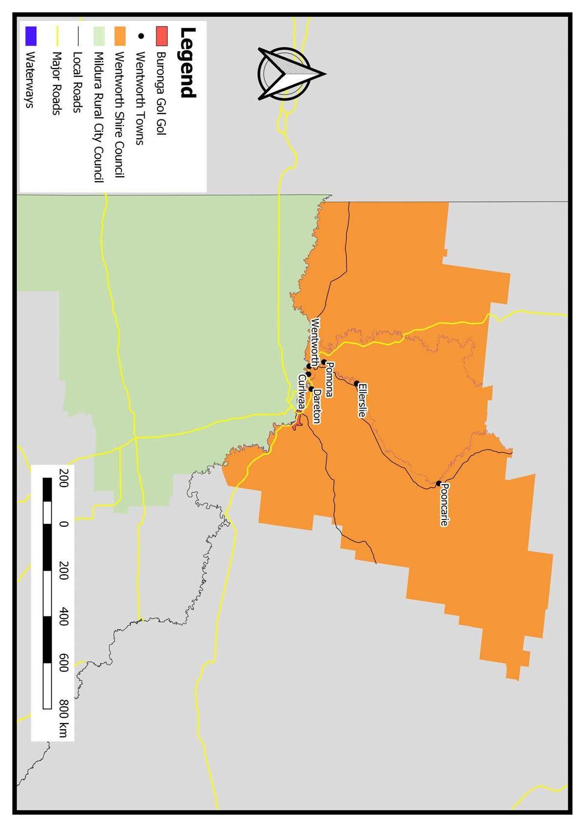
Item 9.15 - Attachment 1 Buronga Gol Gol Structure Plan BGGSP 2020 Page 199 7
Buronga Gol
Gol Structure Plan 2020
Figure 2.2 –Buronga Gol Gol in Regional Context
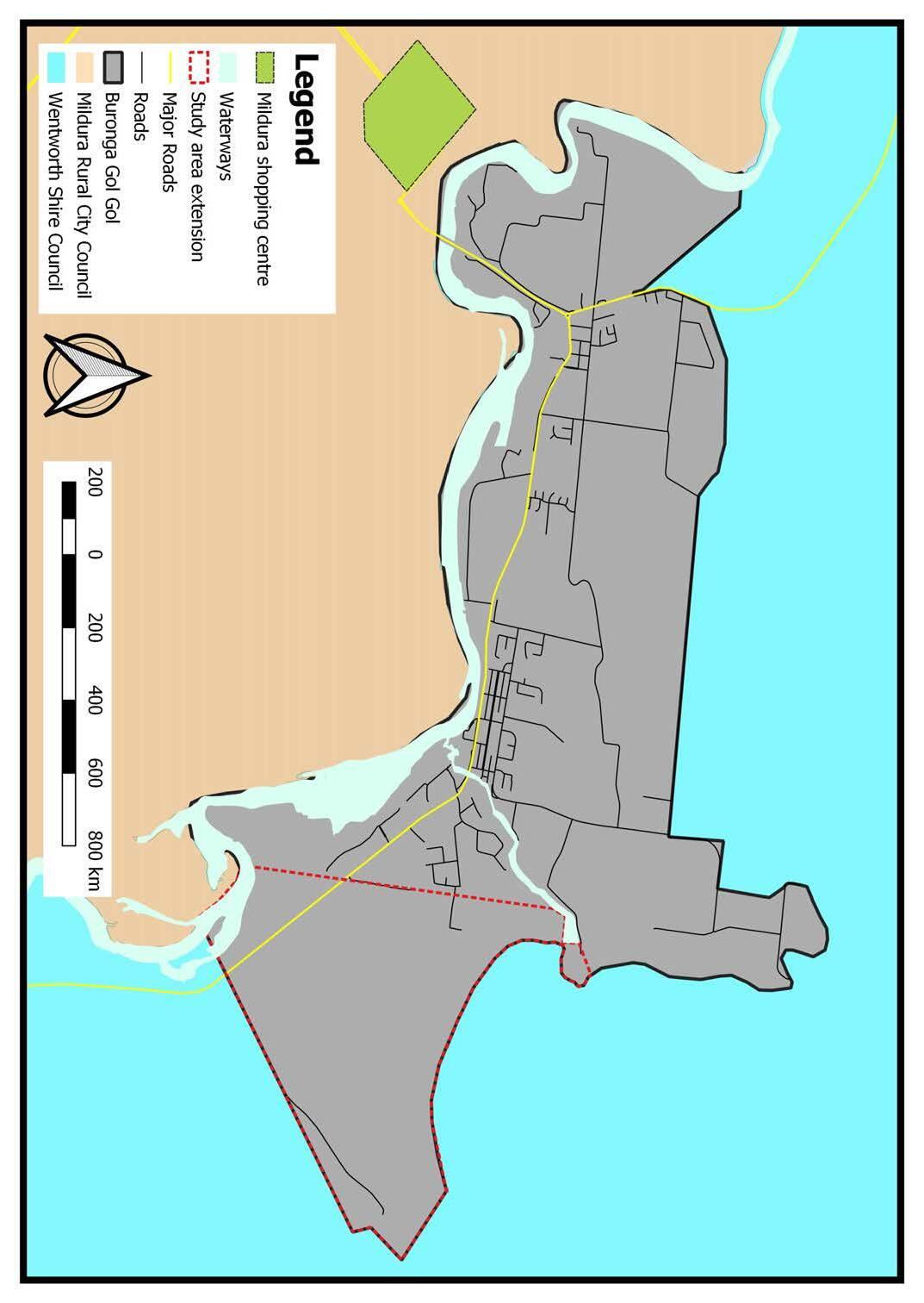
2.2 Land Ar ea of Structure Plan
The Buronga Gol Gol Study Area covers approximately 3071 ha (31 km²).
As shown in Figure 2.3, the study area for the Buronga Gol Gol Structure Plan has expanded by 6.93km² to include a large parcel of land to the east of the BGGSP 2005 boundary. This additional parcel of land is subject to a large-scale planning proposal referred to as ‘Northbank on Murray’ to develop the land for a range of accommodation options of a resort nature, cafes and restaurants, gymnasium, shopping outlets and indoor & outdoor attractions and activities. The southern, northern and western boundaries of the BGGSP study area have remained unchanged since the preparation of the BGGSP 2005.
Item 9.15 - Attachment 1 Buronga Gol Gol Structure Plan BGGSP 2020 Page 200 8
Buronga Gol Gol Structure Plan 2020
Figure 2.3 –Buronga Gol Gol Study Area
Intersection of Sturt and Silver City Highways
Gol Gol Town Centre

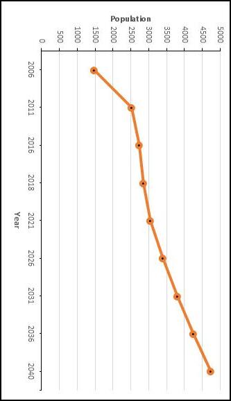
Figure 2.4 –Population Growth Trend
Figure 2.5 –Age Structure of the Buronga Gol Gol Residents
In 2016, 4.7% of the resident population of Buronga Gol Gol identi fi ed as Aboriginal and/or Torres Strait Islander, which was significantly higher than the NSW state average of 2.9%. This suggests the need for strong consideration of indigenous perspectives and interests in making land use planning decisions that affect the area.
The median age of Buronga Gol Gol residents increased from 37 in 2011 to 38 in 2016, which was on par with that of NSW and Australia, illustrating the nation-wide trend towards an ageing population. Consistent with the general trend in regional areas, nearly 50% of Buronga Gol Gol residents were in the 40 years and over cohort. Residents aged 45 years and over increased by more than 10% from 1,011 in 2011 to 1,116 in 2016, substantiating Buronga Gol Gol’s ageing population as presented in Figure 2.5.
Children aged 0-19 years made up 29.9% of the 2016 population with the proportion of families with children increasing from 46% in 2011 to 49% in 2016. In addition, an estimated 171 children were within the secondary school cohort of 15-19 years.
In 2016, Buronga Gol Gol had a total of 947 households with an average household size of 2.6, which is a decrease from the 2011 average of 2.7. Of the total households, 75% are classified as ‘family households’, while 23% are single person households, which has implications for housing and service provision. In particular, Buronga Gol Gol’s ageing population is expected to change household structure to fewer persons per household which can generate substantial demand for new dwellings. Therefore, future housing needs should be determined using a lower average household size of 2.4 given the changing age structure.
P opulation and Demographics
2.3
Buronga Gol Gol was home to 2,735 people in 2016, which was an increase of 204 persons (8.1%) from the area’s resident population of 2,531 people in 2011 (refer Figure 2.4). This indicates an annual population growth rate of 1.6% between 2011 and 2016, which is nearly three times the Wentworth Shire’s growth rate of 0.6% over the same period. The 2016 population of Buronga Gol Gol represented 40% of the total 6,794 residential population of the Wentworth Shire. ABS 2018 Population Estimate indicated Wentworth Shire had a residential population of 7042 which was an increase of 248 persons (3.7%) between 2016 and 2018. This means that the Shire recorded an annual population growth rate of 1.8% between 2016 and 2018, which is a significant increase from the 20112016 rate of 0.6%.
Since Buronga Gol Gol is the main growth area in the Wentworth Shire, it can be argued that most of the Shire’s population growth between 2016 and 2018 occurred in this area. This is supported by the fact that 61% (66) of the total 109 development approvals granted for new dwellings in the Shire over the same period were in Buronga Gol Gol.
Given the trend of residential development, it has been assumed that 61% of the population increase the Shire experienced between 2016 and 2018 occurred in Buronga Gol Gol. Based on this assumption, it has been determined that Buronga Gol Gol had a resident population of 2,859 in 2018, which indicates an increase of 124 persons (4.5%) and an annual population growth rate of 2.2% over the two-year period. As presented in Figure 2.4, the population of Buronga Gol Gol is expected to reach approximately 4,742 people in 2040 at an annual growth rate of 2.8%.
This population growth will be driven by the ongoing rapid residential development which is largely in response to housing demand overflow from Mildura. It should be noted that the regional centre is currently experiencing strong population growth and its resident population is projected to increase from 51,760 in 2018 to nearly 60,000 (59,440) in 2036 at an average annual growth rate of 0.8%.
Item 9.15 - Attachment 1 Buronga Gol Gol Structure Plan BGGSP 2020 Page 201 9 Buronga Gol Gol Structure Plan 2020
Table 2.1 –Summary of Existing Land Use Zones
Built En vironment
2.4
Zones
Land Use
2.4.1

Buronga Gol Gol has predominantly rural and rural residential land use zones. The existing land uses are a mix of residential, rural residential, agriculture (horticultural farming), industrial and community related land uses. Figures 2.6 and 2.7 show land use zonings and existing land uses respectively, while Tables 2.1 and 2.2 provide summaries of the corresponding land areas. Table 2.1 indicates that 52% of the Buronga Gol Gol study area is zoned RU1 Primary Production, re fl ecting the area’s extensive agricultural activities, particularly horticulture, which occupies an estimated land area of 851 ha (8.5 km²). However, approximately 139 ha of RU1 Primary Production land in Buronga West and on Mitchell Lane in north-east Gol Gol has progressively transitioned into rural residential development. This situation demonstrates the demand for large lot, rural and environmental lifestyle living in Buronga Gol Gol and in fact the Shire as a whole. Alternative zones should be considered for these areas to re fl ect the on-ground land use situation to meet demand for future rural residential development. RU5 Village and R5 Large Lot Residential zoned lands cover about 14% and 7%, respectively, of the total area of Buronga Gol Gol. Development has occurred on 216 ha of RU5 Village and 133 ha of R5 Large Lot Residential zoned land. Approximately 75-80% of Buronga Gol Gol’s existing residential housing is located within these zones, where residential and large lot residential land uses occupy a combined land area of 281 ha. The IN1 General Industrial zone covers 72 ha and is confined to the industrial precinct located in the northwest corner of Buronga with direct access to the Silver City Highway. Approximately 54 ha of the industrial zoned land has been released and/or subdivided for a range of industrial activities, which currently occupy an estimated land area of 33 ha. The overall average lot size for the developed or subdivided land in the IN1 General Industrial zone is 7500 m² although the lot size for recent re-subdivisions is smaller with the average lot around 3500 m². The trend towards smaller lot size is expected to continue into the future as it has resulted in an increase of the take up rate of industrial lots, which is currently estimated as 4 lots per year.
Item 9.15 - Attachment 1 Buronga Gol Gol Structure Plan BGGSP 2020 Page 202 10
Gol Gol Structure Plan 2020 Industrial warehouses
Buronga
Land use zone Zoned Developed Undeveloped Area (ha) % Area (ha) % Area (ha) % RU5 Village 443 14.43 216 48.76 227 51.24 R5 Large Lot Residential 226 7.36 133 58.85 93 41.15 1IN General Industrial 72 2.34 39 54.17 33.1 45.83 B6 Enterprise Corridor 4 0.13 4 100 0 0 SP2 Infrastructure 72 2.34 N/A N/A N/A N/A SP1 Special Activities 15 0.49 N/A N/A N/A N/A RE1 Public Recreation 80 2.61 N/A N/A N/A N/A RE2 Private Recreation 9 0.29 N/A N/A N/A N/A W1 Natural Waterways 122 3.97 N/A N/A N/A N/A W2 Recreational Waterways 162 5.28 N/A N/A N/A N/A E2 Environmental Conservation 180 5.86 N/A N/A N/A N/A E3 Environmental Management 94 3.06 N/A N/A N/A N/A RU1 Primary Production 1592 51.84 N/A N/A N/A N/A Total 3071 100 N/A N/A N/A N/A Source: Wentworth Local Environmental Plan (WLEP) 2011
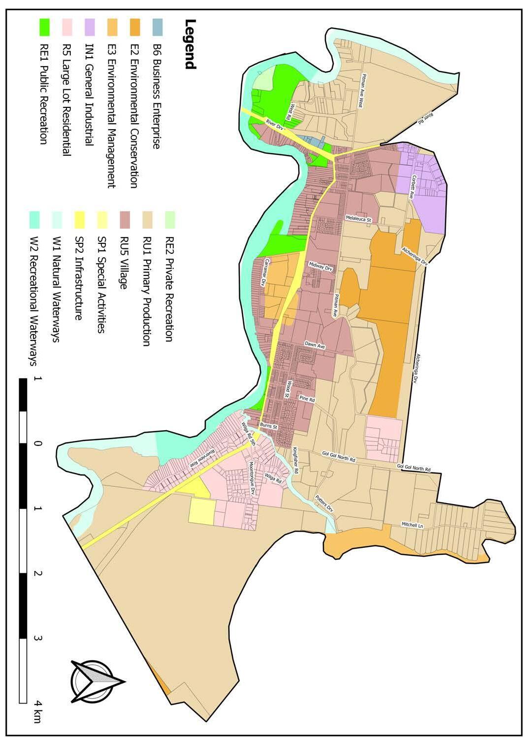
E2 Environmental Conservation and E3 Environmental Management zones cover a sizeable amount of land in Buronga Gol Gol. These zones mainly include areas that have ecological signi fi cance and/or are susceptible to flooding. The areas included in these zones should be managed to preserve their ecological values or utilised sustainably without damaging their environmental attributes. From land zoning and use analysis, it appears that some zones are unsuitable for current and emerging land uses or are considered too restrictive for certain land parcels within the zone. Examples of these parcels of land include:
• the Midway Area currently zoned RU5 Village, • West Buronga currently zoned RU1 Primary Production, and • land to the immediate east of Carramar Drive Sporting Complex currently zoned E3 Environmental Management. This inappropriate application of land use zones can erode the potential for these parcels of land to support development of emerging and future land use needs of Buronga Gol Gol.
Item 9.15 - Attachment 1 Buronga Gol Gol Structure Plan BGGSP 2020 Page 203 11
Gol Gol Structure Plan 2020 Figure 2.6 –Existing Land Use Zoning
Buronga
Table
–Summary
Existing Land Uses Land Use Area (ha) % Residential 167 6.0 Large Lot Residential 120 4.3 Commercial 36 1.3 Community Facility 8 0.3 Industrial 33 1.2 Public Recreation 24 0.9 Rural Residential 139 5.0 Agriculture 1436 51.5 Woodland 440 15.8 Reserve/Park 116 4.2 Special Activity 12 0.4 Vacant 88 3.2 Roads & Access 168 6.0 Total 2787 100
2.2
of
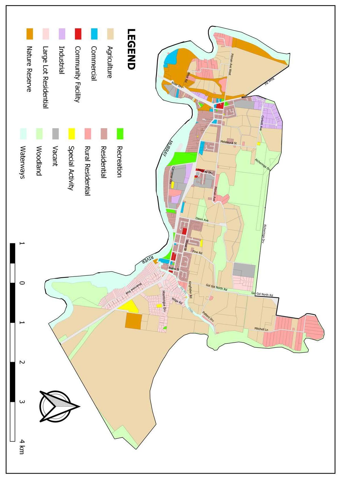
Item 9.15 - Attachment 1 Buronga Gol Gol Structure Plan BGGSP 2020 Page 204 12
2020
Buronga Gol Gol Structure Plan
Figure 2.7 –Existing Land Uses
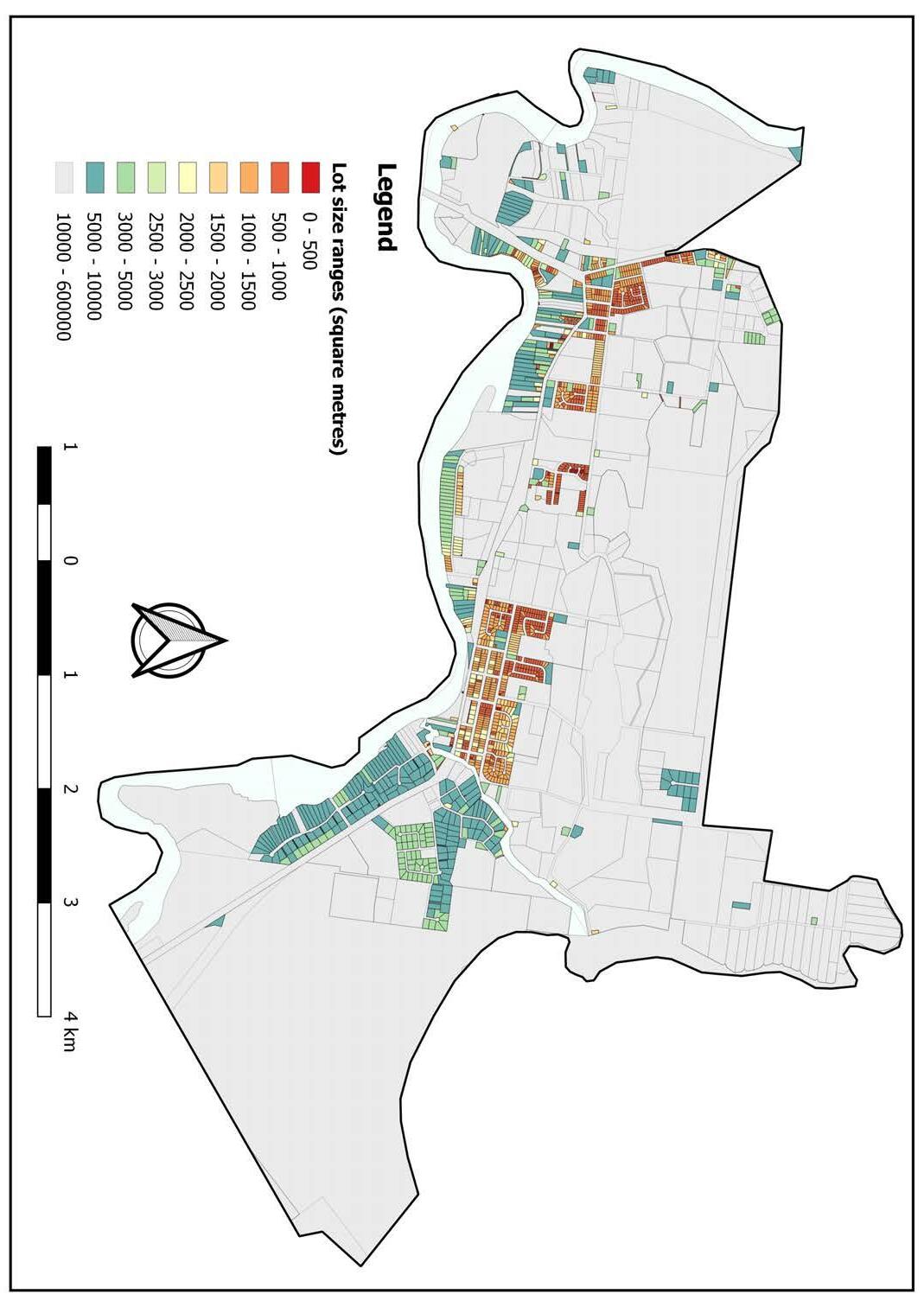
2.4.2 Lot Sizes and Density
There is no minimum lot size prescribed in the WLEP 2011 for the zone RU5 Village, which contains much of the residential area of Buronga Gol Gol. However, a clear distinction is noticeable in the lot sizes in the residential area located to the north and south of the Sturt Highways in Buronga Gol Gol (see Figure 2.8).
Land that is north of the Sturt Highway in the existing residential area is subdivided into lots ranging from less than 500 m² to around 2,500 m². The lots in the residential area to the south of the highway are larger with many ranging from 2,500 m² upwards. The di ff er ence in the lot sizes is attributable to the land in the south being riverfront, fl ood prone and as such largely suitable for large lot residential lifestyle. The overall average lot size of the developed RU5 Village zone of Buronga Gol Gol has been determined as 1603 m². This provides an average gross density of 6.2 lots per hectare for Buronga Gol Gol, which is signi fi cantly below the average of 11 to 12 lots per hectare in other residential areas within NSW. However, lot sizes of recent subdivisions in RU5 Village zone have been averaging around 850 m², which is more consistent with current trends in residential development. In relation to R5 Large Lot Residential, the WLEP prescribes a minimum lot size of 3000 m² and 5000 m² for the zone in di ff er ent parts of Buronga Gol Gol. The overall average lot size of existing developed areas of the R5 Large Lot Residential zone is estimated as 6542 m². However, the average lot size in recent large lot residential subdivisions is around 3500 m², consistent with the minimum lot size for the zone. Based on recent residential subdivision developments, it is expected that the trend toward smaller lot sizes will continue into the future in both RU5 Village and R5 Large Lot Residential zones. However, the minimum lot size applied to the R5 Large Lot Residential zone should not be reduced to less than 3000 m² to ensure residents have adequate land to undertake the type of activities commensurate with rural lifestyle living in a semi-rural setting. Also, a minimum lot size that is consistent with the current village style residential development in Bronga Gol Gol should be determined for the RU5 Village zone.
Item 9.15 - Attachment 1 Buronga Gol Gol Structure Plan BGGSP 2020 Page 205 13
Gol Gol Structure Plan 2020
Buronga
Figure 2.8 –Lot Size Ranges
plaining factors include the availability of relatively a ff or dable residential and rural residential land on the NSW side of the Murray River, encouraging people to choose Buronga Gol Gol over the regional city of Mildura, which is located less than 5 km away.
Most of the recent residential housing developments occur within the new subdivision area north and east of Gol Gol. The housing boom in Buronga Gol Gol is expected to continue into the future and will be driven and supported by currently proposed residential subdivision and commercial development in the area as presented in Figure 2.10.
2.4.3 Residential Land Supply and Demand Residential land in Buronga Gol Gol falls in the RU5 Village and R5 Large Lot Residential zones.
The average demand for RU5 Village and R5 Large Lot Residential zoned land is estimated as 74 and 19 lots per annum respectively, which equates to an annual average residential take-up rate of 93 lots in Buronga Gol Gol.
In terms of land supply, it has been determined that the total existing undeveloped residential land in Buronga Gol Gol is 320 ha comprising 227 ha of RU5 Village and 93 ha for R5 Large Lot Residential. With allowance of 30% of the land for access, open space and other non-residential uses, the net developable land for RU5 Village and R5 Large Lot Residential is 159 ha and 65 ha respectively. Based on the average lot size of recent subdivisions and current annual take-up rate for RU5 Village and R5 Large Lot Residential zoned land, a summary of existing developable residential land supply is provided in Table 2.3.
Table 2.3 indicates that Buronga Gol Gol has 25 years supply of RU5 Village land and 10 years of R5 Large Lot Residential land. This suggests that under current circumstances Buronga Gol Gol has adequate long-term RU5 Village zoned land supply, and short to medium term supply of R5 Large Lot Residential zoned land. However, an increase in the current growth rate of Buronga Gol Gol is anticipated due to factors such as recent improvements in infrastructure services, ongoing development of population services such as supermarket and commercial shops/premises, attractive rural residential lifestyle and amenity, the relatively lower price of land and housing (median=$310,000) compared to Mildura (median=$385,000), as well as residential housing demand over fl ows from Mildura due to urban expansion constraints in the Victorian regional city. These factors can potentially cause a signi fi cant residential land shortage, especially in the very popular R5 Large Lot Residential zone. Therefore, additional residential land needs to be identi fied to cater for any future increa se in current demand rates. This will prevent a potential land supply shortage and housing a ff or dability issues, such as currently being experienced in Mildura.
and
Housing Development
2.4.4
As of 2016, the housing stock of Buronga Gol Gol was estimated at 1,210 dwellings with the greater majority (93.6%) of the residents occupying a detached residential dwelling type structure. This reveals a homogenous housing typology which suggests the need for increased housing diversity to improve affordability to meet the needs of the ageing population.
Analysis of Council’s approvals records reveals an increasing trend in housing development in Buronga Gol Gol with a total of 170 development approvals granted for new dwellings between 2015 and 2019. This indicates a new dwelling approval rate of 34 per year with the total yearly approvals increasing steadily over the period as presented in Figure 2.9. The increasing trend of housing development can be attributed to a range of factors, particularly Mildura’s strong population growth, which averages around 580 persons per annum and an associated housing demand over fl ow. Other ex -
Item 9.15 - Attachment 1 Buronga Gol Gol Structure Plan BGGSP 2020 Page 206 14
Buronga Gol Gol Structure Plan 2020
Table
–Existing Residential Land Supply under current
rate
average lot size Zone Undeveloped land (ha) Developable land (ha) Net Developable land (ha) Average lot size (m 2 ) Lot Yield (Additional Lots) Average Annual Demand Years Supply RU5 Village 227 159 111 850 1306 74 25 R5 Large Lot Residential 93 65 40 3500 114 19 10 Total 320 224 151 N/A 1420 N/A N/A
2.3
demand
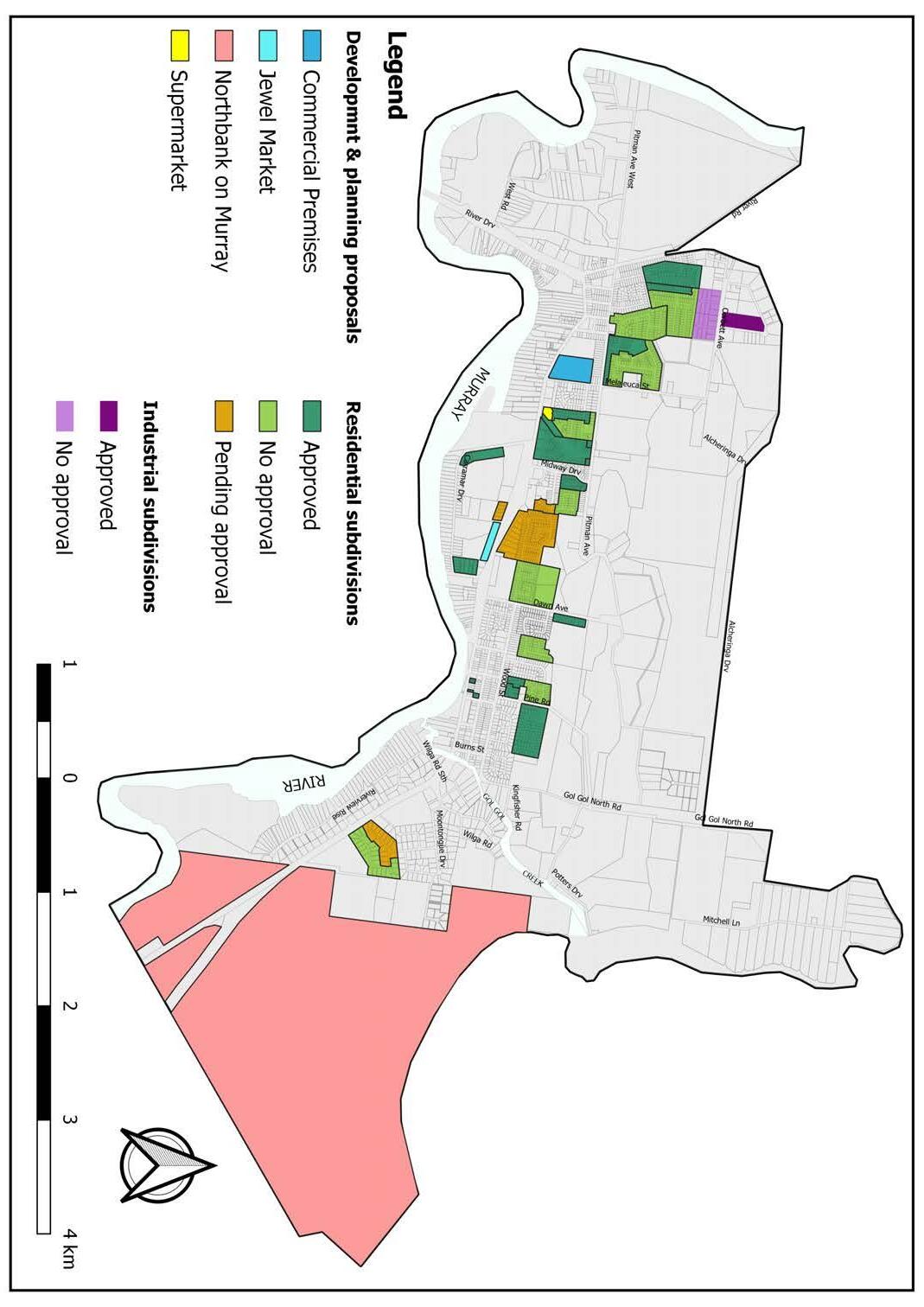
Proposed developments, concepts and planning proposals
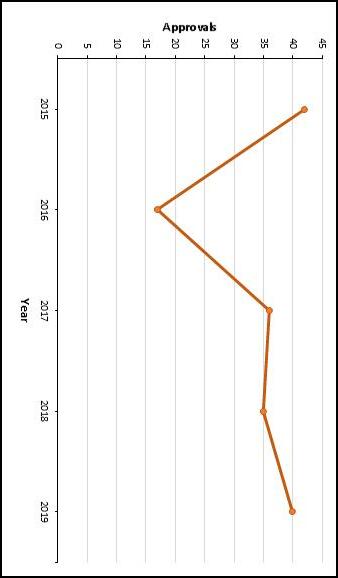
It must, however, be noted that housing development in Buronga Gol Gol is strongly linked to availability of suitable residential land. As depicted in Figure 2.8, the area experienced a sharp decline in housing development in 2016 due to a limited supply of residential land as no residential subdivisions were completed in that year. However, this trend was reversed in 2017 when major residential subdivisions were completed and more suitable residential land became available. Therefore, it is vital to ensure there is an ongoing supply of readily available residential land to satisfy the current and anticipated future demand. Figure 2.9
Item 9.15 - Attachment 1 Buronga Gol Gol Structure Plan BGGSP 2020 Page 207 15
Gol Gol
2020
Buronga
Structure Plan
Figure 2.10
–Housing Development Approvals in Buronga Gol Gol

2.5.4 T ourism Buronga Gol Gol enjoys over 130 km of river frontage to the mighty Murray River. This provides tourism opportunities to eat, sleep and play on the water or river bank. Accommodation includes a vast range of options including Bed and Breakfast cottages, apartments, homesteads, caravan parks, motels and houseboats. Whilst activities include skiing, fishing, camping and bushwalking. Tourists and locals can appreciate the river in both its natural riverine environment, such as from Bottle Bend Reserve or as a recreation hub such as at James King Park where water-skiing and house-boating share the bank with parklands a café and hotel bistro. Land based attractions include the Australian Inland Botanic Gardens, Varapodio Estate Olive Grove, Orange World, Holden Museum and Trentham Estate Winery. These destinations attract many tourists to Buronga Gol Gol and the Sunraysia region. Events including ski races, car rallies, attract tourism regularly whilst the Midway Centre boasts a 700-seat venue for conferences, exhibitions and a variety of business events.
2.5.5 Industrial Buronga Gol Gol has a number of industries, warehouses and field service centres which are predominantly situated in the industrial precinct located to the northwest of Buronga on the Silver City Highway (see Figure 2.6). Development of the industrial/manufacturing sector in Buronga Gol Gol has been historically slow as existing lots in the industrial precinct were too large for localised industrial developments. However, recent re-subdivision activity has marginally improved land take up and development in the industrial precinct.
Loc al Economy
2.5
2.5.1 Employment and income
In 2016, approximately 95% of the labour force in Buronga Gol Gol was employed, resulting in an unemployment rate of 4.7% compared to the NSW unemployment rate of 8.5% and 6% for Mildura. The main sectors of employment include agriculture, retail, education, transport, tourism, and government services.
Although there is no local data on the place of work for Buronga Gol Gol, the latest journey to work data for the Wentworth Shire from the 2016 ABS Census indicates that 44% of the working population work within the Shire while 41% work in Mildura. It is evident from this that most of the residents of Buronga Gol Gol work within the Sunraysia region.
In Buronga Gol Gol, the majority 74% of the workers travel to work by car as a driver while only 3% walk to work with none travelling to work by bicycle, bus or taxi. The significantly small proportion of the working population having active transport as the main commute to work is largely attributable to the limited active transport infrastructure in the area.
The median household weekly income in Buronga Gol Gol is $1,338, this is below the NSW and Australian median income of $1,486 and $1,438 respectively. It is also noted that approximately 20% of households are on a low weekly income of less than $650, which is on par with NSW and Australian averages.
The average weekly household goods and services expenditure in Buronga Gol Gol is approximately $1,283. The convenient proximity of the neighbouring regional city of Mildura offers the vast majority of retail, commercial and professional services to residents of Buronga Gol Gol. However, the establishment of new services including health, supermarket and retail options is expected to see more of the weekly expenditure spent within the Buronga Gol Gol community.
2.5.2 Private Business
There are approximately 295 businesses operating in the Buronga Gol Gol area. These businesses include a mix of tourism accommodation, retail trade, wineries, service stations and plant nurseries. The retail and commercial businesses are located sporadically within the study area and shopping strips as shown in Figure 2.11. Development of a new supermarket and associated specialty shops has commenced west of the Midway area, which is expected to become the main commercial precinct of Buronga Gol Gol.
2.5.3 Agriculture
Agricultural production is fundamental to the local economy of Buronga Gol Gol. The majority of agricultural activity is horticultural farming. The area has an extensive amount of horticultural land farming table and wine grapes, citrus, vegetables and nuts (refer to Figure 2.6).
Item 9.15 - Attachment 1 Buronga Gol Gol Structure Plan BGGSP 2020 Page 208 16 Buronga Gol Gol Structure Plan 2020
Buronga Town Centre
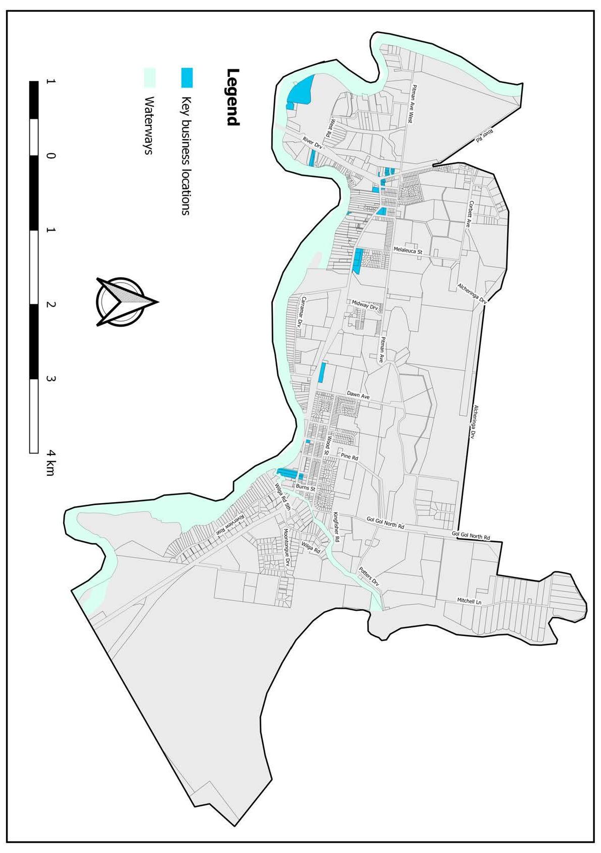
Item 9.15 - Attachment 1 Buronga Gol Gol Structure Plan BGGSP 2020 Page 209 17
Buronga Gol
Gol Structure Plan 2020
–
Figure 2.11
Distribution of Commercial Activities in Buronga Gol Gol
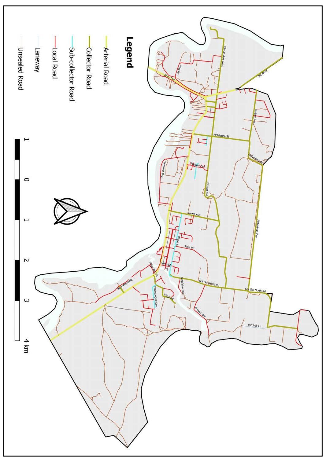
2.6 Infrastructure 2.6.1 Roads and Transport
Buronga Gol Gol is situated on the Sturt and Silver City Highways which serve as the main entry routes into the study area. The east-west alignment of the Sturt Highway passes directly through the central area of Buronga Gol Gol and meets with the Silver City Highway at the western end of Buronga. These highways clearly define the arterial road system within the area (see Figure 2.12). Sunraysia is becoming known as a ‘freight hub’ due to the tristate boundaries and intersecting highways within the region.
Upgrades to road infrastructure are continually being undertaken to meet the needs of increasing volumes of heavy and light vehicle traffic on these highways, which both opportunities and challenges to Buronga Gol Gol (see Figure 2.13). The Structure Plan aims to address pedestrian safety and amenity of the local community including the consideration of a future bypass route and/or second Murray River Crossing as long-term objective. As shown in Figure 2.11, Buronga Gol Gol is also serviced by a number of existing collector and distributor roads that facilitate local traffic distribution to the various parts of the area. Primary collector roads include Pitman Avenue, River Road, Link Road, Melaleuca Street, Corbett Avenue, Dawn Avenue, Gol Gol North Road and Moontongue Drive, among others. These roads are all sealed and routinely maintained by Council but have been experiencing increasing traffic with nominal vehicular queueing observed at the intersections with the highways during peak hours (see Figure 2.13).
There are also unsealed roads in and around Buronga Gol Gol. Most of these unsealed roads pass through road reserves and into state-owned tracts of land and reserves, boundary easements and/or onto private properties. Although most of the unsealed roads service rural lands, there are roads close to the existing urban area of Buronga Gol Gol which remain unsealed, including properties that lack formal access to the road or street frontage. Examples include Bridge Road in Buronga and the properties behind Buronga’s B6 Enterprise Corridor. There is a need to prioritise and provide sealed roads/streets and formal accesses to properties in close proximity to town centres.
Item 9.15 - Attachment 1 Buronga Gol Gol Structure Plan BGGSP 2020 Page 210 18
Gol Gol Structure
2020
Buronga
Plan
Figure 2.12 –Buronga Gol Gol Road Network
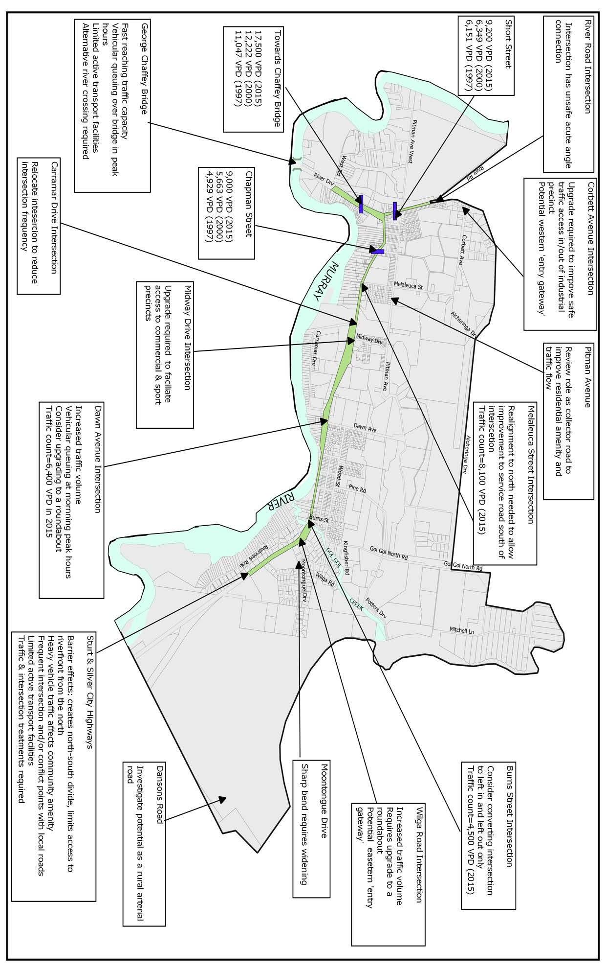
Item 9.15 - Attachment 1 Buronga Gol Gol Structure Plan BGGSP 2020 Page 211 19
Gol
Figure 2.13 Road & Traffic Analysis
Buronga Gol
Structure Plan 2020
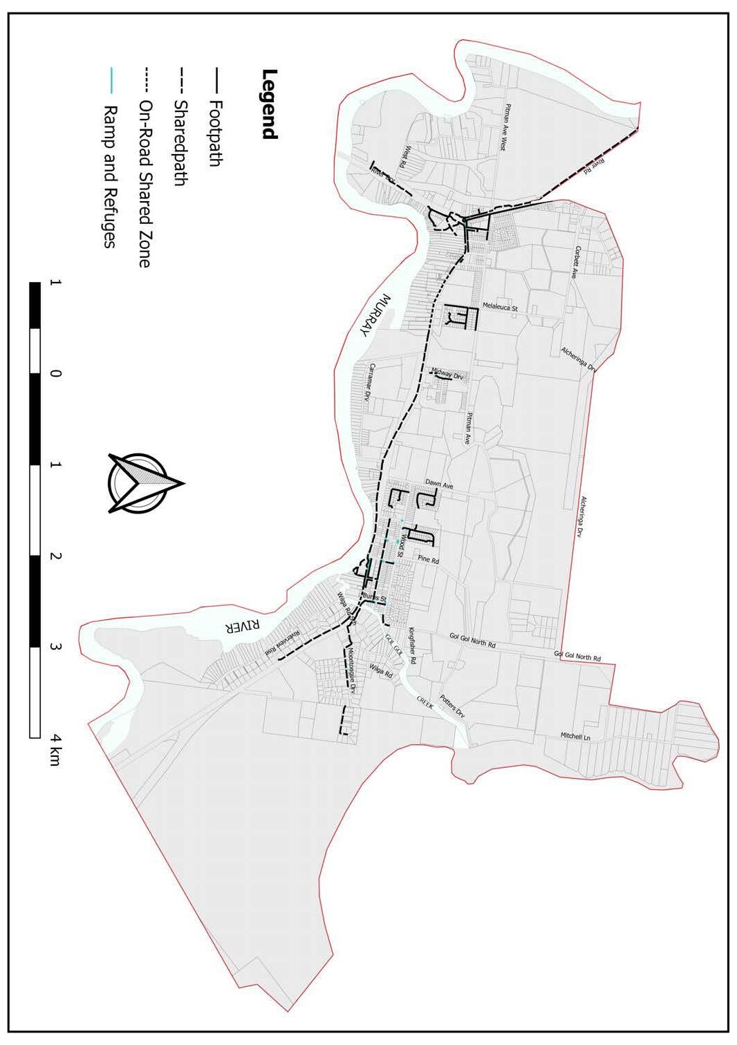
2.6.2 F ootpaths and Sharedways
Footpaths and pedestrian safety infrastructure are developed and maintained in Buronga Gol Gol by Council. Continual improvement of the connectivity of footpaths and sharedways is funded annually by the State and prioritised in stages by neighbourhood activity with highest priority to schools, shopping, medical and community activities. Newly developed estates include pedestrian access as part of their development. Connecting these subdivisions to the town centre networks is essential to increasing active transport in the area. As shown in Figure 2.14, approximately 70% of the Buronga Gol Gol established residential area is without footpaths which creates a disconnect from the pockets of well networked areas. Promoting the benefits of walking and cycling in the area, is not feasible without well networked footpaths, sharedways and pedestrian safety infrastructure. This suggests a pressing need to retrofit, upgrade and connect footpaths and pedestrian safety infrastructure to improve liveability, health and wellbeing of residents in Buronga Gol Gol.
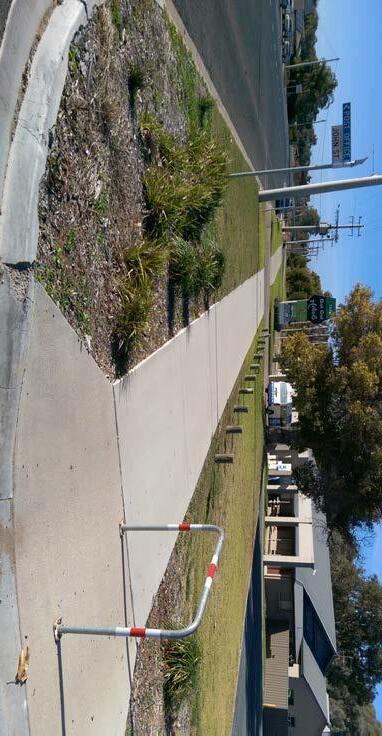
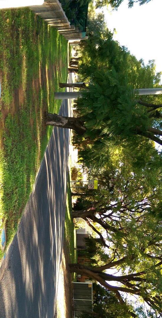
Item 9.15 - Attachment 1 Buronga Gol Gol Structure Plan BGGSP 2020 Page 212 20
2020 Figure 2.14 Active
Buronga Gol Gol Structure Plan
Transport Infrastructure
Sharedways in Gol Gol Town Centre Road reserve without footpath
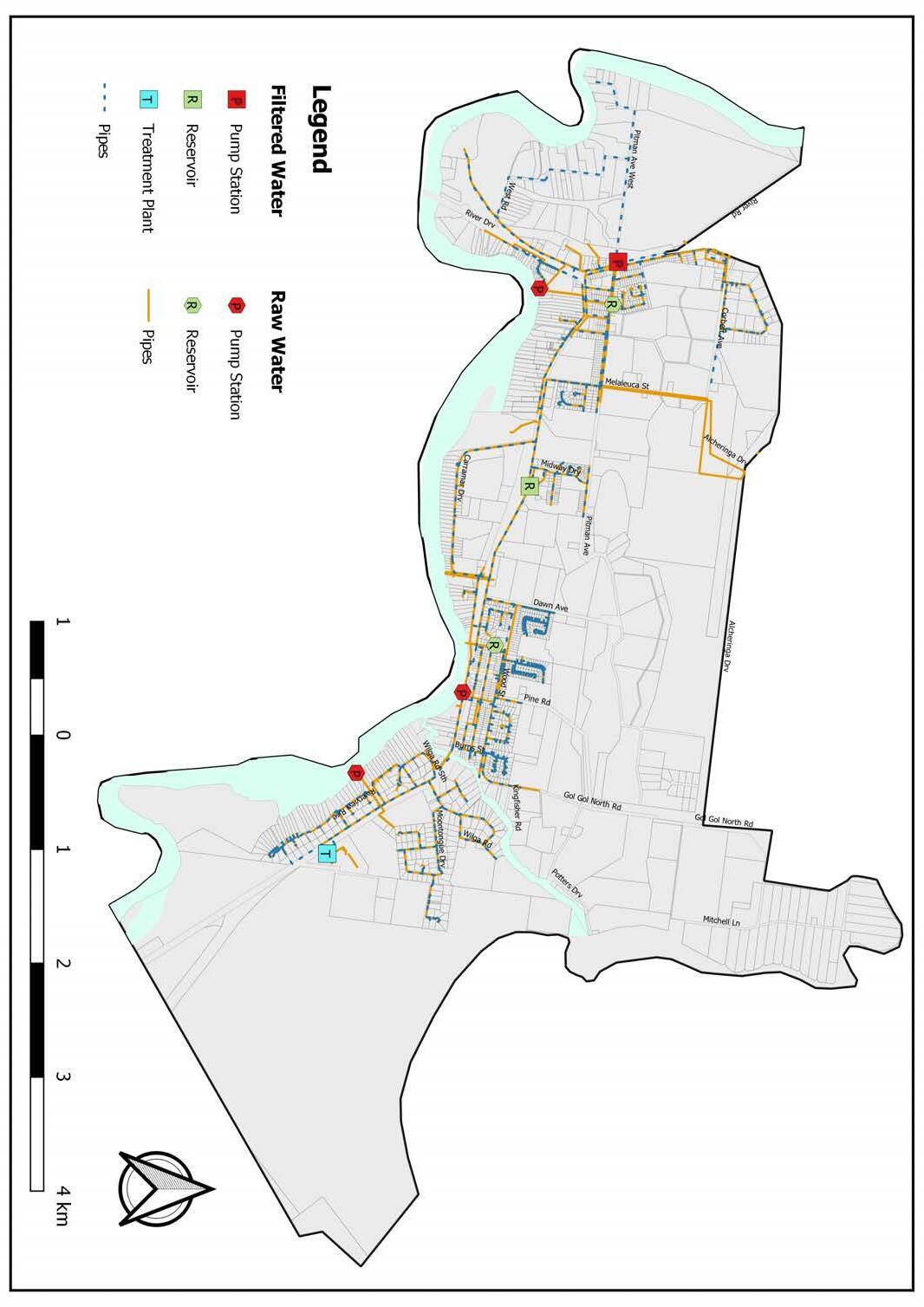
2.6.3 W ater Supply Most of Buronga Gol Gol is serviced by a dual water system providing reticulated filtered water for use as potable water and reticulated raw water for other domestic uses not requiring the same level of treatment (see Figure 2.15).
The Buronga Gol Gol water treatment plant supplies filtered water to Gol Gol, Buronga, Mourquong, Namitjira and Dareton. The filtration plant has a production capacity of 3.7 megalitres per day, which is estimated to be able to supply water to 3,000 connections (7,500 people).
The filtered water supply delivery system of pump stations, reticulation pipework and a 3 megalitre storage reservoir are adequate for existing demands in the Buronga Gol Gol area. The filtration plant currently services 1,442 connections (3,556 people), indicating excess capacity of 1,449 connections in the existing headworks. Raw water supply in Buronga Gol Gol is extracted from the Murray River and disinfected with chlorine near the pump stations. The reticulated raw water system currently has 1,421 connections (3,556 people). It is noted that the raw water system capacity is above the current number of connections. However, the reticulation system comprising pumps, pipework and storage reservoirs is ageing and major replacement and/or upgrade to the system would be required in the near future.
The average daily household water usage in Buronga Gol Gol in 2018/2019 was 2,310 litres (i.e. 678 litres of filtered water and 1,632 litres of raw water) which is about 2.5 times the Australian average daily water consumption 900 litres per household. This indicates extreme water consumption by water users and should be addressed through a holistic water supply and demand management program that promote water saving practices and technologies among the residents.
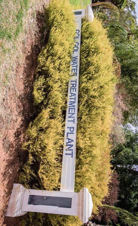
Item 9.15 - Attachment 1 Buronga Gol Gol Structure Plan BGGSP 2020 Page 213 21 Buronga Gol Gol Structure Plan 2020 Figure 2.15 –Water Supply Infrastructure
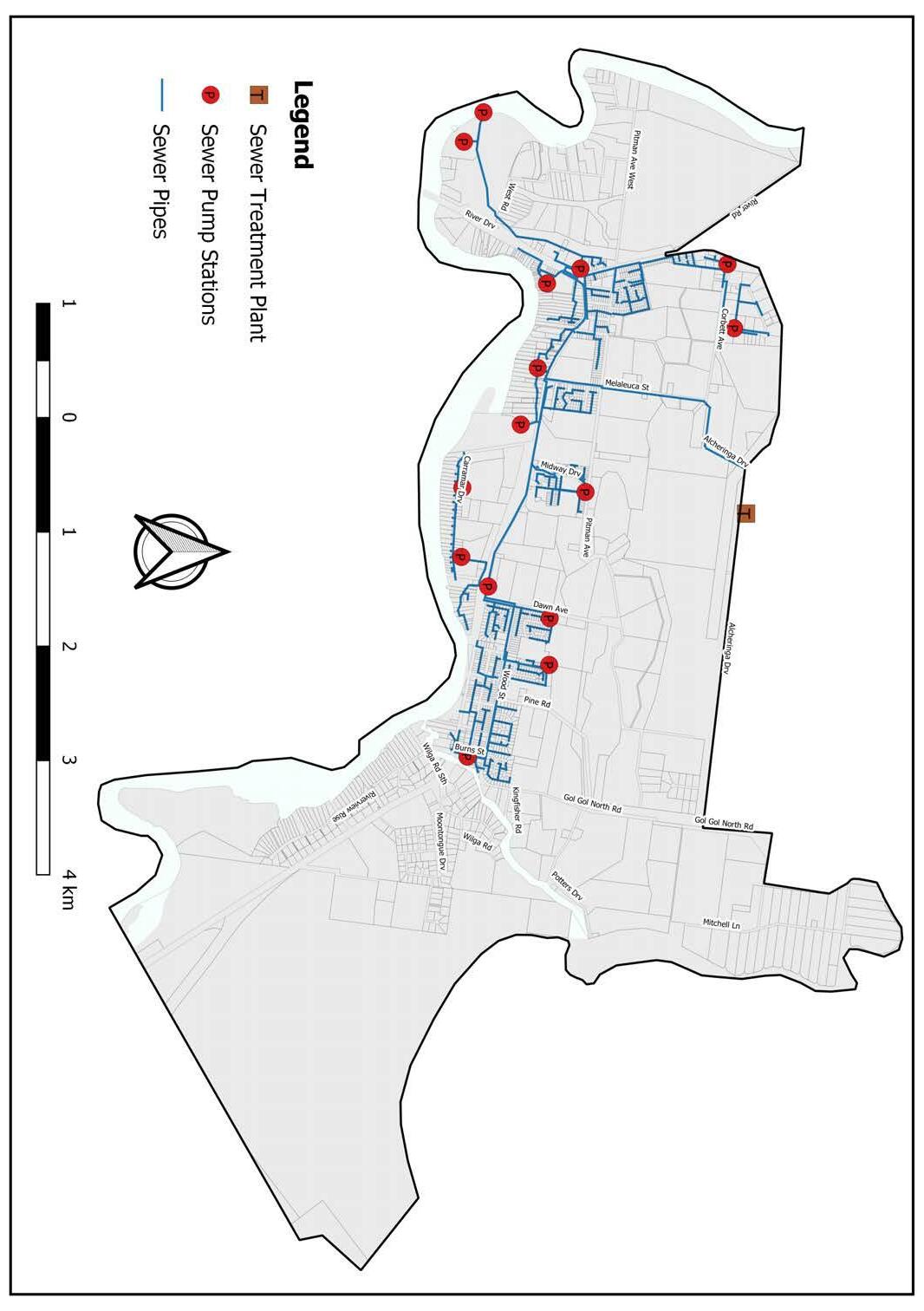
2.6.4 Sewerage Most of the Buronga Gol Gol area in the RU5 Village zone is serviced with reticulated sewerage infrastructure for collection, transportation and treatment of effluent (see Figure 2.16). The Buronga Gol Gol sewerage treatment plant currently services an estimated 2,410 people far below its designed capacity of 10, 000 people. This suggests the headworks capability and sewage pump station network of the sewerage infrastructure has ample capacity to treat current and future loads to meet environmental requirements. It should be noted that properties in the R5 Large Lot Residential zone in Gol Gol are not connected to any town sewerage system due to historical subdivision design and approval regimes and are required to install on-site wastewater management systems. Some of these on-site septic systems are situated in riparian areas and as such installation and mitigation measures are mandatory to ensure that any aquatic pollution risks are negated, especially in flood events. However, given the proximity of the R5 Large Lot Residential zone to the Murray River and Gol Gol Creek and the spare capacity of the existing sewerage infrastructure, serious consideration should be given to connecting this part to the town’s reticulated sewerage.
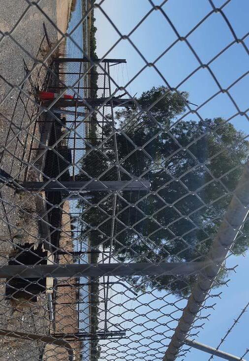
Item 9.15 - Attachment 1 Buronga Gol Gol Structure Plan BGGSP 2020 Page 214 22
2020
–
Buronga Gol Gol Structure Plan
Figure 2.16
Sewerage Infrastructure
Sewerage Treatment Plant
2.6.5 Drainage/St ormwater Infrastructure Stormwater services are available in most parts of Buronga Gol Gol including the new subdivision estates, the industrial precinct and the town centre (see Figure 2.17). The drainage systems are made up of both natural and man-made retention basins that collect excess run-off generated in storm or high rainfall events. Although the drainage system has generally worked well to prevent large scale flood incidences in Buronga Gol Gol, more recent rainfall events have revealed inefficiency to cope with stormwater runoff in a minor to medium rainfall event. For example, minor inundation affected developments in the Moontongue Drive area due to overflow of the associated retention basin.
There is a need to upgrade and extend the drainage infrastructure to effectively service both existing and newly developed areas of Buronga Gol Gol. Options being considered by Council include an area known as Pink Lake and a review of Moontongue Drive.
Item 9.15 - Attachment 1 Buronga Gol Gol Structure Plan BGGSP 2020 Page 215 23 Buronga Gol Gol Structure Plan 2020
Figure 2.17 –Stormwater Infrastructure
Retention Basin at Livingstone Drive
• Local amenities
• Public toilets are throughout the area in 6 locations, 4 of which have unisex facilities, 2 have disability access and some have received recent upgrades.
• Gol Gol Cemetery is located within the Gol Gol township servicing both towns
• Drink fountains or filtered water taps are in both of the main parklands where BBQs and Playgrounds occur In addition, both Buronga and Gol Gol have small village-style retail/business centres that feature key facilities and services such as post offices, bakeries, general stores, service stations and bus stops among others. The retail/business centres are situated in highly visible locations on the main Buronga Gol Gol thoroughfare, however, pedestrian safety infrastructure is limited on the highways. It should be noted that Buronga Gol Gol does not have a secondary school facility. Secondary school-age children access educational services in Dareton (Coomealla High School) or Mildura (both private and public options). School buses transport students to both NSW and Victorian education facilities from Buronga Gol Gol. Ambulances services are provided by the Ambulance Victoria branch based in Mildura. Given Buronga Gol Gol’s changing demographics, such as the increase in the number of families with children and the ageing population, it is considered necessary that a secondary school and ambulance services are made available locally in the future.
P ower and Telecommunication
2.5.6
Existing power infrastructure in Buronga Gol Gol includes a Substation at Corbett Avenue and a Switching Station on Arumpo Road in Buronga (refer Figure 2.18). The current power infrastructure has adequate capacity to meet existing and future demand in the Buronga Gol Gol area. However, the predominance of overhead powerlines along the highways in the main township areas undermine the aesthetic appeal of important precincts such as the James King Park. The existing telecommunications infrastructure consists of a legacy copper network, however the recent addition of fibre to the kerb NBN, high quality voice and data broadband can be achieved. This consists of two Telstra Exchanges located at Wood Street in Gol Gol and Melaleuca Street in Buronga, and an Optus Telecommunication Tower on the Sturt Highway in Buronga. It is noted that the actual quality of telecommunication services provided to the end user depends on the service provider and the plans selected by the individual user.
2.7 Community Ser vices and Recreation
2.7.1 Community Facilities and Services Buronga Gol Gol provides a range of different community facilities and services (see Figure 2.18).
include:
Item 9.15 - Attachment 1 Buronga Gol Gol Structure Plan BGGSP 2020 Page 216 24 Buronga Gol Gol Structure Plan 2020
These
• Early childhood education centres • Two Rivers Early Learning • Jack & Jill Midway Child Care
• Pre-school (Gol Gol pre-school) • Primary schools • Buronga Public School • Gol Gol Public School • Emergency services • Buronga Police Station • Buronga Rural Fire Service • Gol Gol Fire Brigade • Midway Service Centre which includes • community centre • meeting rooms • conference venue • Council library and service centre • basketball court • Community Venues • Scout Hall • Vintage Car Club • Carramar Drive Sporting Complex • St Michael the Archangel Church • Health facilities • clinic • pathology collection centre • chemist
Centre)
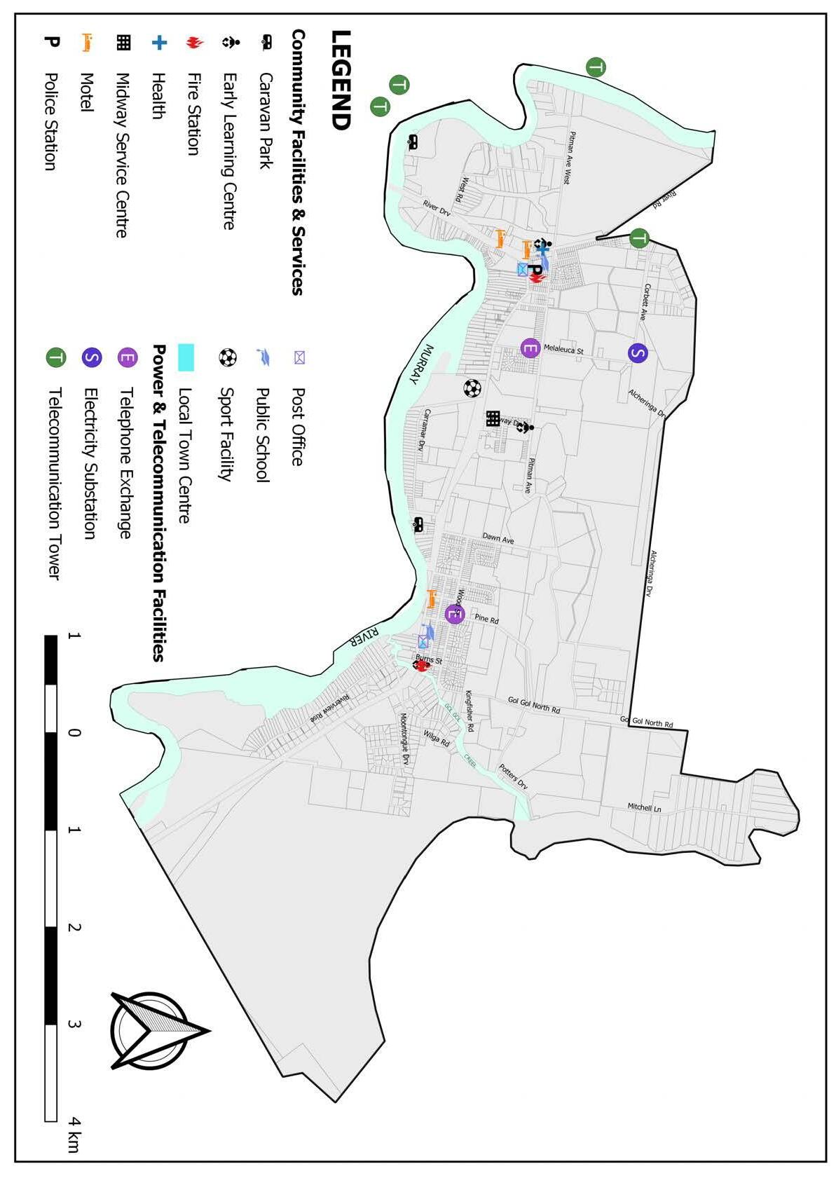
Item 9.15 - Attachment 1 Buronga Gol Gol Structure Plan BGGSP 2020 Page 217 25
Gol Gol Structure Plan 2020 Figure 2.18 –Community Facilities and Services
Buronga
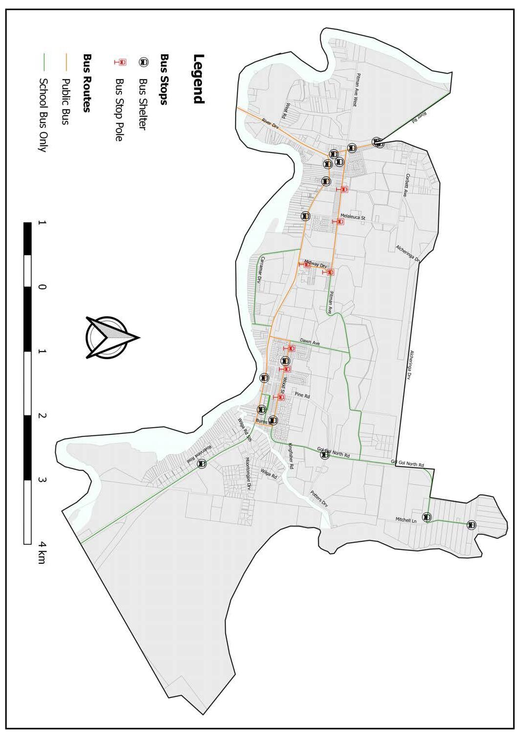
2.7.2 Public T ransport CDC Mildura provides the only public transportation in Buronga Gol Gol. One mid-morning and one mid-afternoon service per day are provided in each direction on week days only. There are approximately 22 bus stops operating in Buronga Gol Gol comprising 15 bus shelters and 7 signposted without shelters or seating (see Figure 2.19). Increased service frequency including weekend service will be required to improve patronage of public transport, to subsequently reduce car dependence. This may result in upgrade to and provision of additional bus stops. Regional and interstate bus services by VLine and Transport for NSW, and passenger air services from the Mildura airport serve as transportation options from Buronga Gol Gol to the major cities and surrounding regional centres.
Item 9.15 - Attachment 1 Buronga Gol Gol Structure Plan BGGSP 2020 Page 218 26
2020
Buronga Gol Gol Structure Plan
Figure 2.19 –Transport Services
2.7.3 Public P arks and Recreation Facilities
Buronga Gol Gol has numerous parks and recreational areas as shown in Table 2.4 and Figure 2.20. Whilst much of the public open space is made up of natural bushland areas (largely in floodplains) 7 established and maintained parks are peppered throughout the area. The public open spaces occupy approximately 151 ha.
James King Park has had a recent upgrade of infrastructure and facilities including playground, picnic tables and benches, house boat mooring, boat ramp and sandbar to enhance its serviceability to residents and visitors. The natural reserve adjacent to the Buronga Caravan Park has been enhanced through rationalisation works including formalising walking and cycling trails and consolidating vehicle access to increase safety for all users. These improvements will also support rehabilitation of vegetation and preservation of this natural floodplain area. It is noted however that the parks and recreation reserves are not well connected and exist in quite a dispersed pattern. This needs to be addressed through measures geared towards creating an accessible, integrated and adaptable network of passive and active open spaces and recreational facilities
–Summary of Recreational facilities
Table 2.4
Item 9.15 - Attachment 1 Buronga Gol Gol Structure Plan BGGSP 2020 Page 219 27 Buronga Gol Gol Structure Plan 2020
Carramar Drive Sporting Complex
James King Park
Recreational Facility Playground Exercise Equipment Toilets Disability Toilet Unisex Toilet Baby Change BBQ Drinking water Picnic Table James King Park Carramar Drive Sporting Complex Midway Park Pitman Park /Rest Stop Wilkinson Park Buronga Wetlands Buronga Children’s Playground
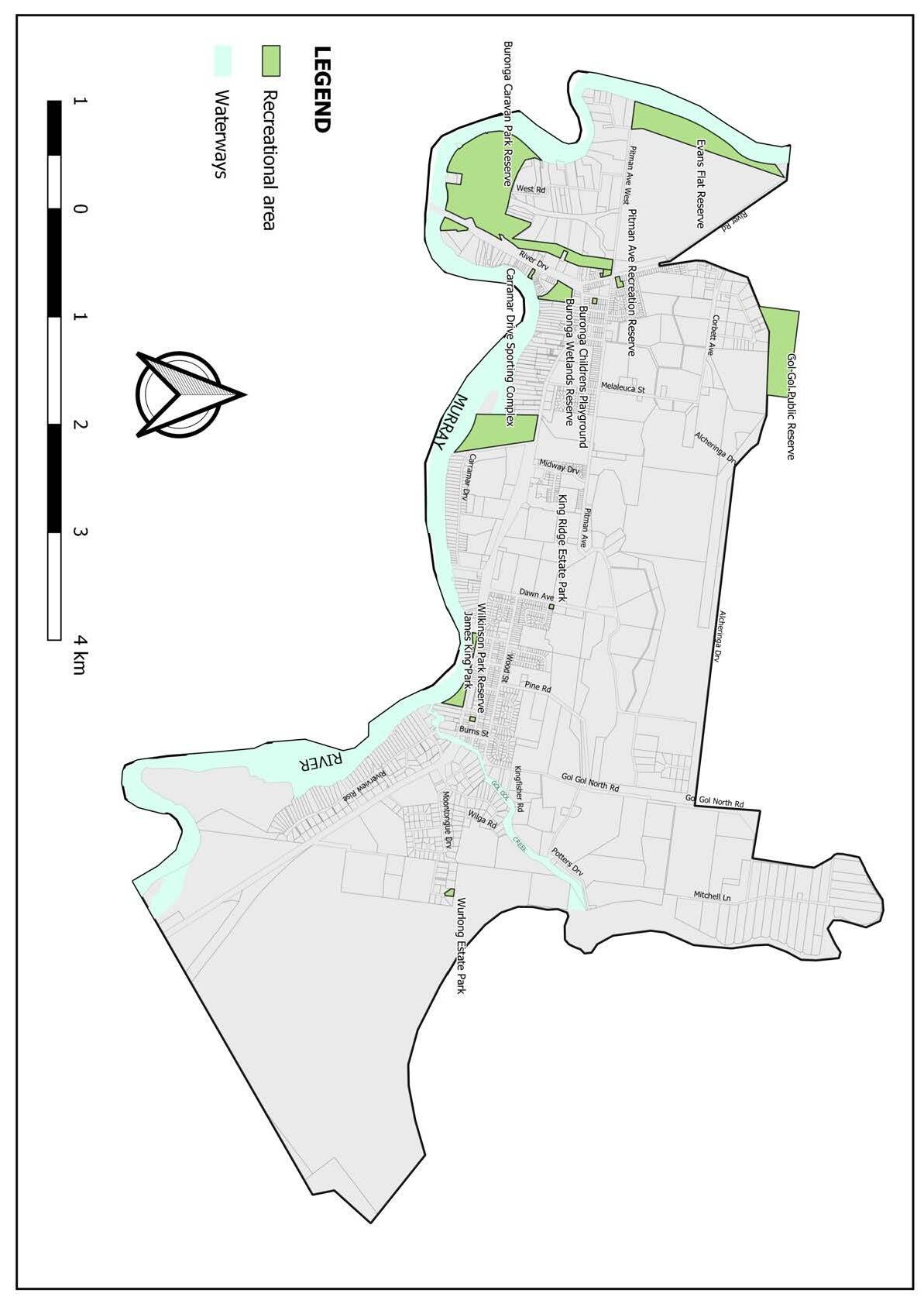
Item 9.15 - Attachment 1 Buronga Gol Gol Structure Plan BGGSP 2020 Page 220 28
2020
Buronga Gol Gol Structure Plan
Figure 2.20 –Recreational Areas in Buronga Gol Gol
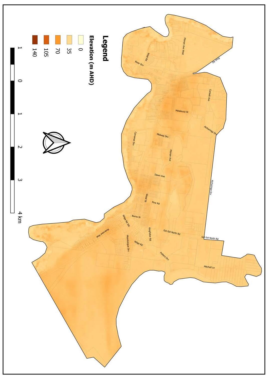
2.8 Na tural Environment
2.8.1 Topography and Landscape
The Buronga Gol Gol region is renowned for its unique picturesque topography and landscape. The landscape is marked by beautiful red cliffs which span along the Murray River. Despite the general flat terrain of the region, the majority of Buronga Gol Gol (e.g. Midway Area) is elevated high above the Murray River’s natural flow level (refer Figure 2.21). The elevations of the built-up and urban growth areas range between 34-56 m AHD. This topography makes Buronga Gol Gol reasonably safe and protected from flooding, albeit some parts of the township (e.g. West Buronga) are subject to inundation.

Item 9.15 - Attachment 1 Buronga Gol Gol Structure Plan BGGSP 2020 Page 221 29
Gol
Buronga
Gol Structure Plan 2020
Figure 2.21 –Buronga Gol Gol Topography
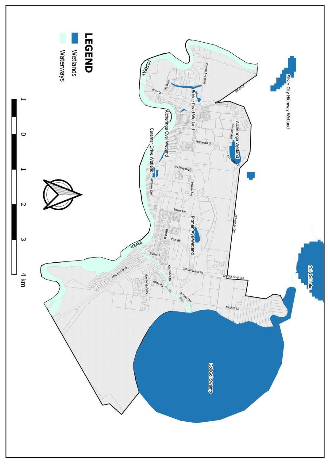
2.8.2 Waterways and Flooding
Figure 2.22 shows the main rivers and waterways in Buronga Gol Gol, namely the Murray River and Gol Gol Creek, as well as the network of wetlands (e.g., Gol Gol Lake, Buronga Constructed Wetland) within and immediately outside the study area. These rivers and waterways are valued community assets and add great amenity and appeal to the township of Buronga Gol Gol. It can be noted from Figure 2.22 the greater part of Buronga Gol Gol, especially the area north of the highways which are protected by three (3) flood regulators (radial arm gate) installed along the course of the Gol Gol Creek that control flow access from the Murray River to the Gol Gol Creek, are safe from riverine flooding. However, much of the floodplain associated with the Murray River is liable to flooding and properties will already be at risk during a 20-year ARI flood (refer Figure 2.23). These floodplain areas are generally unsuitable for intensive urban development without some form of a levee embankment or other preventative measures. Nonetheless, the river frontages are highly sought after by home buyers and developers. Historical and ongoing encroachment of these areas has already resulted in issues such as limited native vegetation on the floodplains, river bank instability and dwellings and other structures disrupting drainage corridor continuity among others. To address these problems, remnants of the floodplain areas should be considered for rezoning to E4 Environmental Living zone with minimum lot sizes ranging from 1 to 3 hectares to allow for low density development while protecting the waterways through appropriate planning controls.

Item 9.15 - Attachment 1 Buronga Gol Gol Structure Plan BGGSP 2020 Page 222 30
2020
Buronga Gol Gol Structure Plan
Figure
2.22: Waterways and wetlands
Murray River
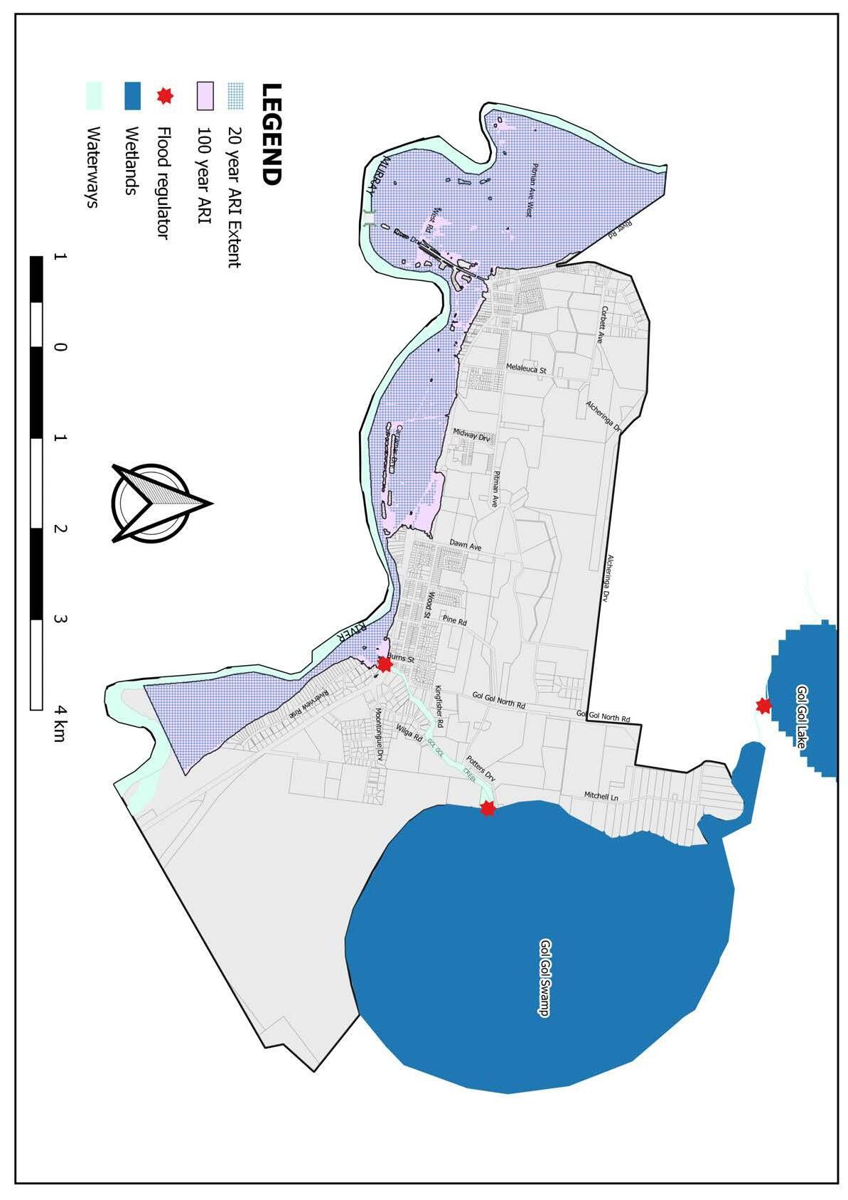
Item 9.15 - Attachment 1 Buronga Gol Gol Structure Plan BGGSP 2020 Page 223 31
Buronga Gol Gol Structure Plan 2020
Figure
2.23 –Flood affected land
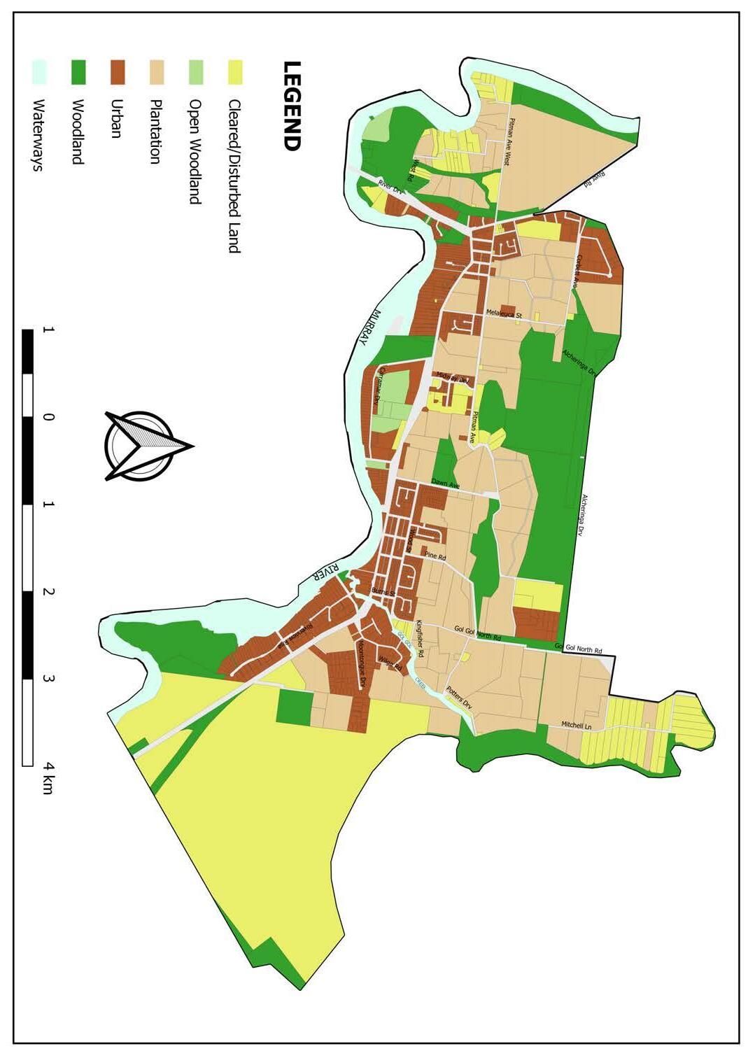
2.8.3 Biodiversity Buronga Gol Gol is home to a diverse range of flora and fauna, some of which are classified as ecologically endangered and vulnerable communities. The unique riverine and arid vegetation of Buronga Gol Gol has numerous species of eucalyptus and acacia trees which are well suited to the Murray River wetlands as well as the surrounding semi-arid, Mediterranean climate of the region. The most notable native vegetation in the area include Red Gum/Black Box Riparian Forests (Eucalyptus camaldulensis), Black Box Woodlands (Eucalyptus largiflorens), Chenopod Mallee, Chenopod Shrubland, Acacia montana (shrub wattle species) and Acacia notabilis. The semi-arid and riverine vegetation collectively serves as habitats for a wide range of species including a number of threatened fauna species such as birds, reptiles, frogs and mammals. Some known species include Little Pied Bat, Southern Bell Frog, Freckled Duck, Grey Falcon, Regent Parrot, Black-tailed Godwit Casuarina obesa, Santa/um murrayanum, Major Mitchell’s Cockatoo and Brown Treecreeper.
Expanding urban development and extensive agricultural uses have significantly modified the extent and quality of flora and fauna habitat, particularly riparian zones and connectivity to crown lands in the northern part of Buronga Gol Gol (refer Figure 2.24). The long-term protection and conservation of this rich biodiversity is crucial to the ecological and environmental values of Buronga Gol Gol and its surroundings.

Item 9.15 - Attachment 1 Buronga Gol Gol Structure Plan BGGSP 2020 Page 224 32
2020
Buronga Gol Gol Structure Plan
Figure 2.24 –Habitat/Land Cover Types
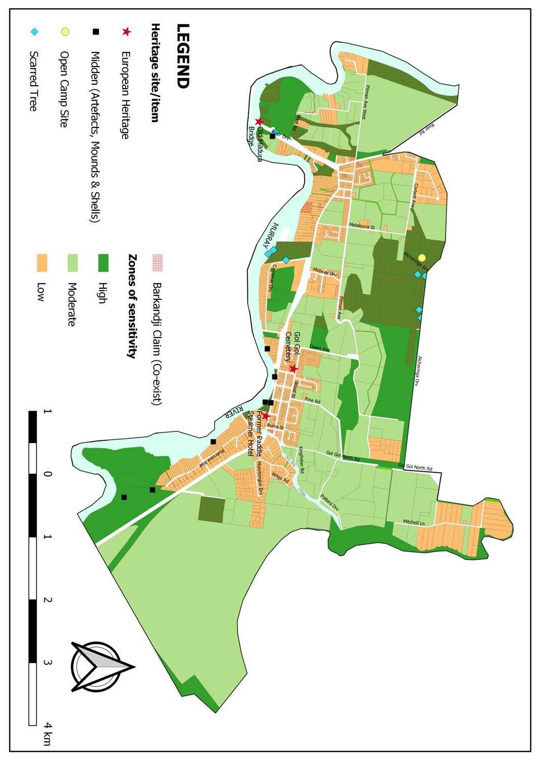
Figure 2.25 –Heritage Areas and Items
2.8.4 Cultural and Indigenous Heritage
The Buronga Gol Gol area is endowed with significant Aboriginal and European heritage and cultural values (refer Figure 2.25). The area has three levels of Aboriginal archaeological sensitivity, namely: low, low to moderate and moderate to high. Aboriginal and historical sites of significance generally occur on the less disturbed or developed margins of the creeks, rivers and swamps, as well as the remnant Black Box Woodlands. These include middens such as shells and camp site artefacts and scar trees where tree bark has been harvested to make canoes and coolamons (food and water containers or shields).
Barkindji Elders and people live on country and many work in cultural heritage roles in the community in and around Buronga Gol Gol in organisations such as Barkindji Maraura Elders Environment Team (BMEET) and Barkandji Native Title Group Aboriginal Corporation (BNTGAC).
Barkandji Nation land rights co-exist on multiple areas of land including Council reserves and crown land, as well as some private properties in the area. In terms of European heritage, Buronga Gol Gol has three locally significant heritage listed places and items. These include the Old Mildura Bridge, the Gol Gol Cemetery and the Former Paddlewheel Hotel. The heritage mix in Buronga Gol Gol provides opportunity for promoting both Aboriginal and non-Aboriginal cultural values and history as expressed via the heritage sites and assets of the area. Appropriate protection, preservation, management and mitigation measures need to be pursued to ensure long-term protection of these cultural heritage resources.
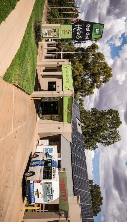
Item 9.15 - Attachment 1 Buronga Gol Gol Structure Plan BGGSP 2020 Page 225 33 Buronga Gol Gol Structure Plan 2020
Gol Gol Hotel
Item 9.15 - Attachment 1 Buronga Gol Gol Structure Plan BGGSP 2020 Page 226

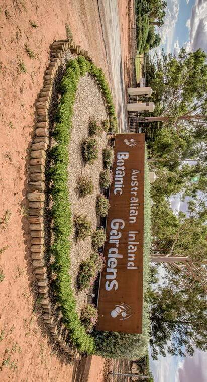
Outcomes
Item 9.15 - Attachment 1 Buronga Gol Gol Structure Plan BGGSP 2020 Page 227
3:
Chapter
and Pathways
i. Reinforce the centralised location for existing community facilities in Midway ii. Provide additional opportunities to expand those existing facilities north-west of the Midway Centre to create a local civic precinct that is focused away from the Highway iii. Encourage and facilitate the establishment of an emergency services precinct
i. Urban development shall focus on areas with current access to reticulated water, sewerage, drainage, power and communications services or where these services can be readily provided ii. New subdivisions will be required to provide all necessary infrastructure to service the development
i. Ensure Buronga Gol Gol is well-connected and highly accessible internally and externally
Chapter 3: Outcomes
3.1 Vision
Buronga Gol Gol will be sustainable, self-sufficient and vibrant townships with well-balanced urban and rural characteristics that have strong relationships to the surrounding rural landscape and adequately support the social, economic, cultural and environmental needs and aspirations of the community.
Buronga Gol Gol will achieve this through an urban development structure/ pattern that provides for housing and lifestyle choices, local businesses and employment, serviceable infrastructure and community facilities, walkable and cycle able street network, safe local and passing traffic, attractive and functional open spaces/recreational areas and protection of natural environments.
iv. Support existing educational facilities to service future needs of the community
iii. Continuation of a dual water supply system throughout the servicing district. Active enhancement of development and building standards that accommodate and encourage the use of dual water supply systems, including the installation of water efficient devices in all new and existing development
ii. Establish an integrated and hierarchical road network to encourage walking and cycling, reduce car dependency and maximise safety and connectivity iii. Retain the role of the National Highways (Sturt Highway and Silver City Highway) to ensure Buronga Gol Gol has strong and reliable external connection to the region and nation iv. Limit intersections along the Sturt Highway to collector roads wherever possible, provide traffic signal control, incorporating pedestrian crossing facilities where appropriate
In the short term, Buronga Gol Gol is envisaged to be complementary to the growth of Mildura adding to the future growth potential, yet providing opportunities for strengthening local urban amenity and community safety. The longterm plan is for Buronga Gol Gol to further develop its unique ‘sense of place and community’ to compete with the likes of urban Mildura including housing affordability, environmentally sensitive development and efficient urban design and infrastructure provision.
v. Provide recreational and sporting facilities to service and include community
iv. Assess opportunities to progressively extend reticulated water and sewerage services to existing non-serviced residential areas
v. Reduce traffic speeds through Buronga Gol Gol by the implementation of traffic management measures designed to be self-enforcing, rather than by reliance solely on speed zonings vi. Promote landscaping wherever possible within the road reserve to minimize visual clutter and enhance the streetscape. vii. Assess opportunities to retrofit and/or widen footpaths within road reserves in established areas viii. Undertake systematic safe system assessments or (if necessary) road safety audits on local roads and highways to identify road safety issues, hazardous locations and recommend remedial action.
Themes and Principles
De velopment
3.2
In order to achieve the vision for Buronga Gol Gol, a range of development themes and principles have been derived to guide the structure plan. These core themes and principles encompass the opportunities and actions to sustainably improve amenity, liveability and economy of Buronga Gol Gol.
The core themes are:
a) Infrastructure Servicing
b) Land Use
c) Environment
d) Site Development and Design
The development principles for each of the above core themes are outlined in the subsequent pages.
Item 9.15 - Attachment 1 Buronga Gol Gol Structure Plan BGGSP 2020 Page 228 36 Buronga Gol Gol Structure Plan 2020 INFRASTRUCTURE SERVICING PRINCIPLES
Roads
Water, Sewerage and Drainage Community Facilities
LAND USE PRINCIPLES
i. Protect existing uses in environmental areas including dwellings
i. Encourage a mix of industrial development
i. Retain existing structure of Buronga, Gol Gol and Midway Centre commercial areas
i. Develop an urban structure that consolidates the location of residential land and provides connection between the villages of Buronga and Gol Gol
i. Existing rural living areas are to be unchanged
i. Protect agricultural and horticultural land located to the north of the proposed residential and industrial areas
ii. Cautionary use and development of floodplain and flood prone lands
ii. Promote the design of industrial areas to provide an entry focus for Buronga along the Silver City Highway
ii. Reinforce the role of the Midway Centre as a community services hub
ii. Cluster residential areas to ensure walkable neighbourhoods in order to reduce, where possible, car dependence for access to existing and future community services and facilities
ii. Rural living areas that contain a level of horticultural and agricultural activity are to be retained as predominantly rural lands unless otherwise indicated in this plan
iii. Effectively respond to ecological and environmental constraints
iii. Establish guidelines for and encourage landscaping of new industrial development
iii. Provide well-designed and attractive Buronga Gol Gol Town Centre that showcase community character and heritage
iii. Promote a mixture of urban development that allows for flexibility to respond to changes in the community over time and cater for a diversity of land sizes and housing types
iii. Encourage connection to Council services where achievable and appropriate
ii. Agricultural and rural areas identified as flood liable land will remain as rural land subject to the outcome of the flood study and flood risk management study and plan unless otherwise indicated in this plan
iii. Minimise conflicts between agricultural land uses and other non-rural land uses
iv. Attract a range of business and retail activities that can adequately support the provision of local services
iv. Develop a strategic approach to the design and location of key environmental and open space areas and urban water management
v. Encourage built form that demonstrates environmentally sustainable design principles
v. While development along the Sturt Highway will continue to occur with a traditional ‘strip’ commercial frontage, consideration shall be given to progressive implementation of local commercial precincts that occur with focus away from the Highway
vi. Determine a Staged Development Plan to co-ordinate the roll out of development to assist with planning of road connectivity, infrastructure and services
Item 9.15 - Attachment 1 Buronga Gol Gol Structure Plan BGGSP 2020 Page 229 37 Buronga Gol Gol Structure Plan 2020
Agricultural Land Rural
Residential
Commercial
cial
Industrial
Environmental Protection Areas
Land Areas
Areas
Areas / Commer
Precinct
Areas
ENVIRONMENT PRINCIPLES
Waterways and Riparian Management Environmental Repair and Enhancement
i. Complete a strategic flood risk management plan in accordance with the NSW Government Floodplain Management Policy prior to any land use zoning changes on all land identified as being flood liable.
i. Recognise and promote places and values of cultural importance to enrich the identity of the future community and contribute to cultural diversity.
i. Establish and manage suitable buffer zones at interfaces between agricultural and industrial areas and residential areas
i. Sustainable development should seek to ensure persistence of viable and connected native vege
i. Protect multiple functions of both the Murray River and Gol Gol Creek
ii. Avoid high density development on the flood liable land in Buronga Gol Gol.
ii. Protect heritage places and landscapes and incorporate these areas into the urban environment in a manner that celebrates and interprets their significance.
iii. Review the bushfire prone mapping to effectively capture and plan for bushfire risk areas.
iii. Consider the long-term conservation of a representative sample of the Aboriginal cultural heritage resource and any significant non-Aboriginal heritage items or archaeological deposits.
ii. Buffer zones should be designed in accordance with guidelines and standards prepared and/or endorsed by the relevant state government agency to enhance visual corridors and create filtered views into adjoining land uses
iv. Ensure bushfire protection measures are considered in the layout, staging and design of development and local road network.
iv. Undertake detailed assessment of both Aboriginal and non-Aboriginal cultural heritage prior to any development occurring in the area to identify the location, nature and significance of any heritage or archaeologically sensitive sites and items which may be present and develop appropriate management and mitigation measures.
iii. For existing sensitive land uses within 500 metres of existing industrial areas, all new industrial development or modifications to existing industrial development is to demonstrate that unacceptable environmental impacts can be avoided through design, siting and modification of proposals to reduce emissions, noise, dust and odour.
v. Consult with the local Aboriginal community in undertaking all assessments made in relation to Aboriginal cultural heritage. Such assessments should aim to develop appropriate management and mitigation measures in respect of the cultural heritage resource and proposed impacts.
vi. The following landforms are to be exempt from any development impacts: source-bordering dunes (highly likely to contain Aboriginal burials); margins of all hydrological features; and intersections of major rivers or creeks with runners.
iv. In conjunction with minimising any likely emissions and off-site impacts of sewerage treatment facilities, a 500-metre buffer zone is required for the following sensitive land uses including residential areas, schools, nursing homes, childcare facilities, shopping centres, playgrounds and public facilities.
vii. There is the potential for promoting both Aboriginal and non-Aboriginal cultural values and history as expressed via heritage sites of the area. However, such a program should only be developed after consultation with both Aboriginal community and professional heritage practitioners.
viii. Incorporate Aboriginal language reflecting Aboriginal cultural heritage values in place and street names of new developments and precincts in consultation with the Aboriginal community.
Gol Gol Structure Plan 2020
tation remnants
ii. All vegetation or habitats with high conserva
tion values should be protected to avoid further decline
ii. Access to the Murray River and Gol Gol Creek are to be managed to minimise adverse impacts on stability of the bank and vegetation
iii. Remnant vegetation with lower values should be targeted for environmental repair and enhancement based on the principle of working out from areas of higher value towards areas of least value
iii. Control development within or adjacent to riparian areas to minimise pollution and nutrients entering the river and creek systems to protect water quality
iv. Existing remnant vegetation should be categorised in terms of its conservation value based on at least; size, location, extent of disturbance, species vulnerability, regeneration potential, species diversity and habitat diversity
iv. Disturbance to the bank and riparian vege
tation of the River Murray shall not be encour
aged
v. Revegetation should include use of a diversity of locally occurring species and plant forms, eg. grasses, shrubs, trees, etc
v. Enhancement of riparian corridor areas is encouraged to offset land degradation processes
vi. Maintain and enhance visual corridors with unobstructed views from major roads to key features of the study area, such as the Murray River and local native and rural landscapes, with appro
vi. Protection of riverine landscape by retaining and replacing native vegetation is critical to maintain community value of riparian areas
priate planting and management of roadsides and other public land
vii. Wetlands are to be protected and enhanced to retain and improve their ecological, recre
vii. Effectively manage urban, industrial and agricultural waste and treat salt affected lands
ational, economic, flood storage and nutrient and pollutant filtering values
viii. Progressively remove undesirable species and feral animals
ix. Stabilise unstable stream banks and control human access to areas of high sensitivity
viii. Protect the visual amenity associated with the Murray River and the riparian zone from physical and visual decline
Item 9.15 - Attachment 1 Buronga Gol Gol Structure Plan BGGSP 2020 Page 230 38
Buronga
Buffer Zones Cultural
Heritage Values Flood and Bushfire Prone Land
-
-
-
-
-
-
Subdivision and Housing Design
i. Local open space should, where practical, be provided in conjunction with the water management concepts of water sensitive urban design.
ii. Demand for local open space is to be catered for within multi-use corridors as an alternative to establishing new local open space areas.
i. Ensure all new development complies with water sensitive urban design principles to minimise drainage infrastructure costs and protect of water quality in receiving waterways. ii. Use stormwater within multiple use corridors so that it contributes to the visual and landscape amenity.
i. Ensure subdivision design incorporates a legible road hierarchy reducing dependence on cars and promoting residential safety and amenity while allowing required service and emergency vehicle access.
iii. Connection with open space and recreation areas adjoining the Murray River is to be incorporated within proposed and existing road intersection networks.
iv. Support development of a local park network to provide local amenity to each part of Buronga Gol Gol to complement the unique open space opportunities presented by greenbelts/multi use corridors.
iii. Protect the environmental health of waterways within new and existing development by implementing best practice sediment and water quality management measures.
iv. Use of porous pavements within designated staff and customer car parking areas in industrial and commercial areas is required.
v. Landscaping should enhance amenity, utilise site water and improve water quality.
vi. Promote the benefits of on-site stormwater detention. vii. Encourage reuse of grey water viii. Promote the harvesting and use of rainwater.
ii. Prioritise the provision of footpaths and shared ways.
iii. Prevent long lengths of local roads which encourage speeding while reducing residential amenity and safety.
iv. Minimise the use of dead-end roads (cul-de-sacs) in future subdivision design to ensure connectivity and permeability in the area.
v. Ensure the width of road pavements are minimised to reflect expected traffic flows.
vi. Ensure subdivision design incorporates traffic calming principles without the need for retrofitting measures at a later date.
vii. Ensure road verge widths are sufficiently wide to incorporate necessary services, pedestrian paths as well as planting of trees in accordance with a landscape master plan that, at maturity, will ensure protection from harsh summer sun.
viii. Encourage on-road visitor parking where appropriate in indented spaces to the requirements generated by the subdivision and housing development.
ix. Provide for building orientation to maximise good solar access for all housing while not compromising natural features of the site.
x. Create strong visual connections to open space and surrounding development while maximising privacy between houses.
xi. Ensure the provision of adequate private open space on lots in a location that maximises solar access.
xii. Utilise good housing design including the use of eaves, pergolas and deciduous landscaping etc. to minimise energy use.
xiii. Promote benefits of individual solar systems
Item 9.15 - Attachment 1 Buronga Gol Gol Structure Plan BGGSP 2020 Page 231 39 Buronga Gol Gol Structure Plan 2020
DEVELOPMENT AND
PRINCIPLES
SITE
DESIGN
Water
Urban
Local Open Space
Sensitive
Design
Item 9.15 - Attachment 1 Buronga Gol Gol Structure Plan BGGSP 2020 Page 232
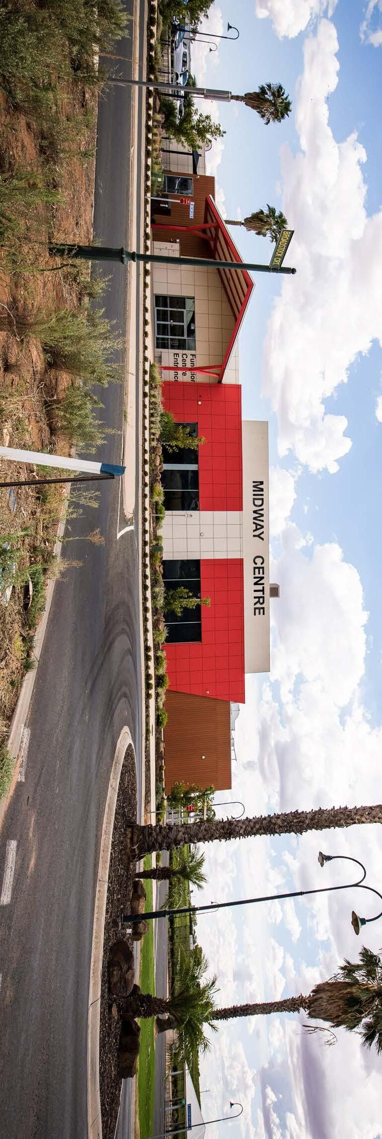
Structure Plan
Chapter
Item 9.15 - Attachment 1 Buronga Gol Gol Structure Plan BGGSP 2020 Page 233
4:
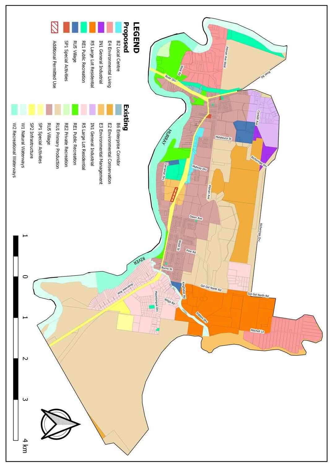
Chapter 4: Structure Plan
In troduction This township structure plan has been developed based on the issues, constraints, opportunities and principles discussed in the foregoing chapters. This structure plan chapter specifically identifies actions for addressing issues and improving liveability of Buronga Gol Gol including, where appropriate, the identification of further works or investigations that should be undertaken. The key elements of the township structure plan are:
a) Consolidation of future development to control urban expansion and ensure a sustainable and efficient built environment.
b) Facilitating development of a commercial precinct to promote self-sufficiency and connectivity in Buronga Gol Gol.
c) Rezoning of lands to support future and emerging land use needs.
d) Expanding and upgrading infrastructure and facilities to meet demands of future growth.
4.1
4.2 Land Use Zones and Development
Figure 4.1 presents the future land use zoning map of Buronga Gol Gol with the land area break-up of the land use zones summarised in Table 4.1. The proposed land use zoning for Buronga Gol Gol has been developed to reflect contempo
rary land use trends and make available parcels of land conducive to future land use needs. While the proposed land use zones are primarily intended to facilitate future growth and development of Buronga Gol Gol, a few are geared toward address
ing anomalies in the Wentworth LEP 2011 land use zoning maps. As a result, rezoning of some specific parcels of land that were not well assessed and now appear quite outdated, is required.
Item 9.15 - Attachment 1 Buronga Gol Gol Structure Plan BGGSP 2020 Page 234 42
2020
Buronga Gol Gol Structure Plan
Figure 4.1 Future Land Use Zones
-
-
4.2.1 Residential
4.2.1.1 Future Residential Development Pattern Residential growth and development are to be consolidated within existing RU5 Village and R5 Large Lot Residential zones. This consolidation is envisaged to result in an urban form/structure that is economically, socially and environmentally efficient, in addition to promoting healthy active, lifestyles.
The existing RU5 Village zoned land to the north east and east of Buronga and to the north and west of Gol Gol is expected to contain the majority of future development with growth focused around the Midway Centre area, which will form a vital centralised town centre for Buronga Gol Gol. Directing growth and development towards the Midway Centre area will enable amalgamation of the Buronga and Gol Gol townships into a contiguous sustainable built environment, while maintaining village-style growth and improving access to facilities and services in the area. The existing RU5 Village zoned land is already serviced with an appreciable level of infrastructure which means infill development will occur at no additional cost to Council, while maximising available services and facilities. In addition, consolidating development within existing RU5 Village zone land will ensure creation of a safe built environment as land within this zone is generally flood-free and elevated much higher than most parts of Buronga Gol Gol.
Higher lot density should be encouraged in the RU5 Village zone to achieve more sustainable, logical and an efficient built environment in Buronga Gol Gol (see Figure 4.2). Average gross density for residential development should be around 7 to 11 lots per ha to provide ample opportunity for a range of lot sizes and promote land and housing variety and affordability in the area. In general, the average residential lot size should be in the order of 600 to 1000 m 2 , which is deemed a more contemporary and practical lot size for residential development in small towns like Buronga Gol Gol. However, 600 m 2 lots should be mainly encouraged and located around facilities such as shops or community centres to cater for a range of market segments such as aged care accommodation and 1 or 2-person households.
The R5 Large Lot Residential zone should be confined to the east of Gol Gol North Road and guided to expand north east between the road and Gol Gol Lake. This is to keep large lot residential development away from the urban growth path but in close proximity to the urban area to ensure access to reticulated sewerage and water systems, while minimising impacts on ecological sensitivity and scenic quality of the area.
Item 9.15 - Attachment 1 Buronga Gol Gol Structure Plan BGGSP 2020 Page 235 43 Buronga Gol Gol Structure Plan 2020
Table 4.1 –Summary of Future Land Use Zones Land use zone Existing Proposed Total Existing & Proposed Developed Undeveloped Area (ha) % Area (ha) % Area (ha) % Area (ha) % Area (ha) % RU5 Village 410 93.4 29 6.6 439 14.3 211 48.1 228 51.9 R5 Large Lot Residential 226 50.3 223 49.7 449 14.6 133 29.6 316 70.4 IN1 General Industrial 72 81.8 16 18.2 88 2.9 39 44.3 49 55.7 B2 Local Centre 0.0 15 100 15 0.5 5 13.3 10 66.7 E4 Environmental Living 0.0 222 100 222 7.2-SP1 Special Activities 15 88.2 2 11.8 17 0.6-RE1 Public Recreation 80 60.6 52 39.4 132 4.3-B6 Enterprise Corridor 4 100 0 0 4 0.1 4 100 0 0 RE2 Private Recreation 9 100 0 0 9 0.3-SP2 Infrastructure 72 100 0 72 2.3-W1 Natural Waterways 122 100 0 0 122 4.0-W2 Recreational Waterways 162 100 0 0 162 5.3-E2 Environmental Conservation 180 100 0 0 180 5.9-E3 Environmental Management 72 100 0 0 72 2.3-RU1 Primary Production 1088 100 0 0 1088 35.4-Total of columns 2512 81.8 559 18.2 3071 100--
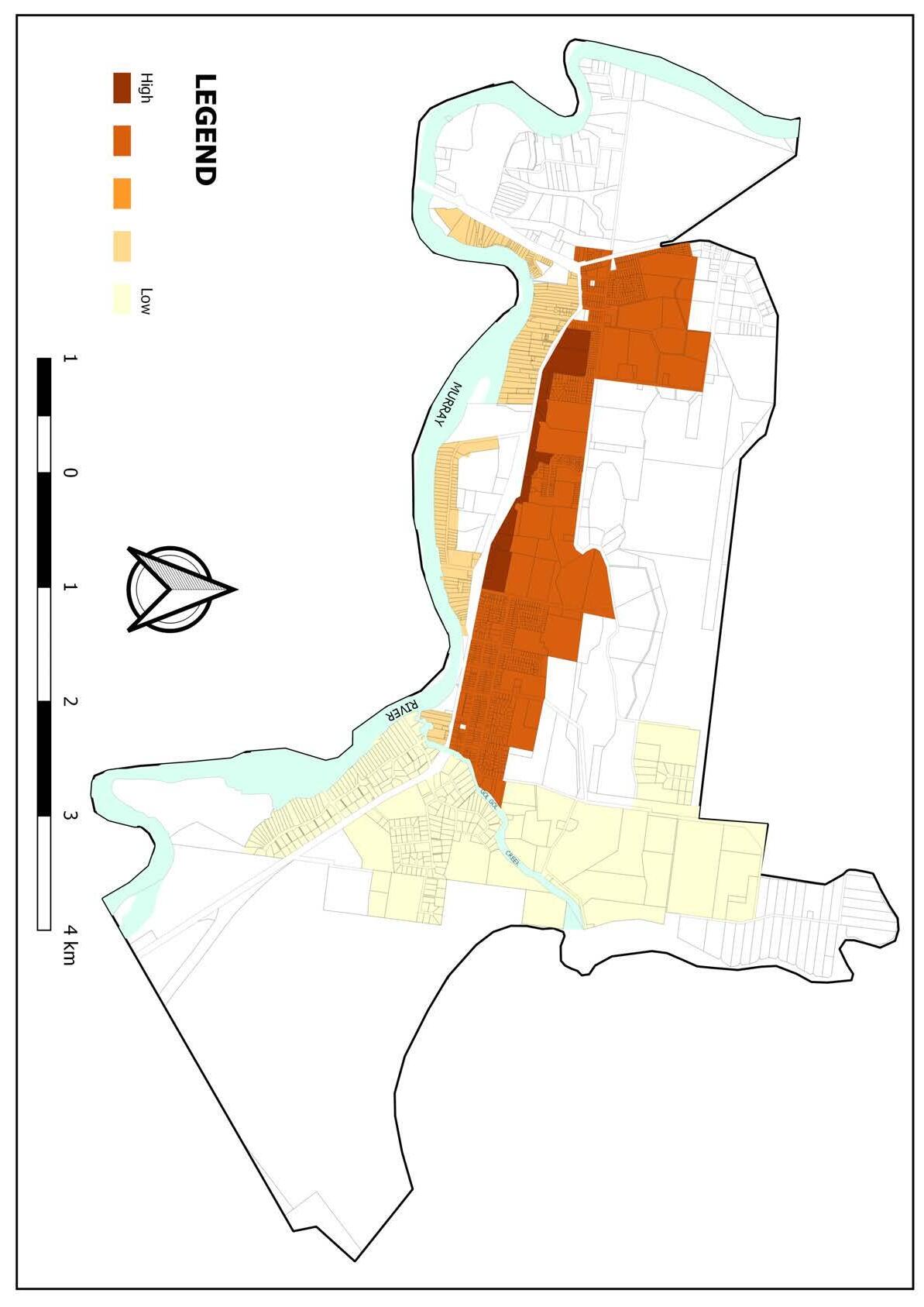
4.2 –Future Density Plan
Item 9.15 - Attachment 1 Buronga Gol Gol Structure Plan BGGSP 2020 Page 236 44
2020
Buronga Gol Gol Structure
Plan
Figure
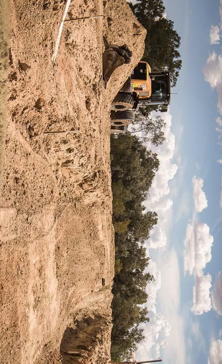
term, Lots 56 and 73 DP 756946 at the end of Wilga Road should be rezoned immediately from RU1 Rural Production to R5 Large Lot Residential. Future subdivisions in this zone should be required to adhere to the minimum lot size to ensure residents have access to adequate land to undertake activities that com
mensurate with rural lifestyle/life in rural setting. Allowing 30% for access, open space and other non-residential uses, the net existing and proposed developable land for RU5 Village is 160 ha and R5 Large Lot Residential is 221 ha. Based on the existing average lot size of 850 m 2 for RU5 Village and 3500 m 2 for R5 Large Lot Residential, the existing and proposed developable land for these zones will yield about 1882 RU5 Village lots and 631 R5 Large Lot Residential lots. This suggests that under current average take up rates, there will be approximately 21 years and 26 years supply of RU5 Village and R5 Large Lot Residential zoned land respectively. As the fast pace of development experienced in Buronga Gol Gol in recent times is expected to continue, it would be premature to conclude that this residential land supply will be sufficient for future residential land demand in the study area. It is therefore necessary that future developable residential land supply is assessed using a growth rate higher than the current rate to pre-empt a future residential land shortage. As a result, higher residential land demand rates of 91 lots per year for RU5 Village and 37 lots per year for R5 Large Lot Residential, which are the highest annual land take up rate recorded for each of these zones in the last five years, have been assumed as the future land take up rates and are used to determine future residential land supply and availability in Buronga Gol Gol as shown in Table 4.2. These higher future growth rates are deemed more realistic and highly likely considering improving, attractive local living conditions in Buronga Gol Gol, and the fact that the area has been identified by Mildura Rural City Council to take up some of the demand for housing in Mildura into the future, due to environmental and infrastructure constraints in the regional centre. In addition, the available historical residential land demand data reveals that land take up rates are generally high when subdivided land is available. Thus, high future residential land demand is not unreasonable to expect given that many of the owners of existing residential zoned land have either lodged development applications to subdivide/redevelop their land or have indicated their intention to do so in the short to medium term for residential purposes. As presented in Table 4.2, under the anticipated higher growth rate, Buronga Gol Gol will have 21 years and 17 years supply RU5 Village and R5 Large Lot Residential land respectively. This indicates that while a higher growth rate is highly likely in Buronga Gol Gol, existing and proposed residential land should be sufficient to satisfy long-term residential land and housing needs in the area. In housing terms, the residential land could yield 2,513 dwellings, which is far above the 753 new dwellings that would be required to accommodate the approximate 1883 new residents expected in Buronga Gol Gol by 2040.
4.2.1.2 Future Housing Need and Residential Land Supply
Buronga Gol Gol’s population is expected to reach 4,742 by 2040 at an annual growth rate of 2.8%. This means residential housing has to be provided for additional 1883 people over the next 20 years. However, given Buronga Gol Gol’s ageing population, the future population will have a large old and retirement age population cohort (i.e. 45 years and over) which will change the household structure to fewer persons household with consequential increase in demand for more dwellings. Therefore, an average household size of 2.4 persons which is more likely in Buronga Gol Gol in the future has been utilised to determine future residential land and housing needs in the area. Based on the expected additional population and household size, it has been determined that an estimated 785 new dwelling houses will be required in Buronga Gol Gol by 2040. These dwellings would have to comprise of diverse housing types including flats, villas, units, townhouses and detached houses to adequately meet the housing needs of the changing population and maintain housing affordability in the area. In terms of future residential land supply, there are parcels of land, totalling approximately 29 ha, recommended to be rezoned from RU1 Primary Production to RU5 Village. These include blocks of land (Lots A & B DP 402812 and Lots 216 & 217 DP 756946) located south of Gol Gol North Road between Wood Street and Kingfisher Road in Gol Gol, blocks of land (Lot 100 DP 756946 & Lot 2 DP 114910) located off the Melaleuca Drive in Buronga and a part of parcel of land (Lot 4 DP 1093795) on Carramar Drive in Buronga. This rezoning is intended to establish a continuous settlement pattern and improve connectivity between existing residential zones of RU5 Village and R5 Large Lot Residential in the area. Thus, the rezoning will augment with the available RU5 Village zone, as well as address the apparent leapfrogging of residential development and clearly define the built-up area of Buronga Gol Gol.
In addition, it is anticipated the resultant residential lots from the proposed RU5 Village south of North Gol Gol Road will be taken up and developed quickly given the high demand for lots located adjacent to or near Gol Gol Creek or a natural waterway. This will help in sustaining housing availability and affordability in the area. In addition, given limited availability of large lot residential zoned land and the fact that some landowners of R5 Large Lot Residential zone land do not intend to redevelop for residential purposes in the short to medium term, the parcels of land to the immediate north of the existing R5 zone land up to the northern end of Gol Gol North Road are recommended to be rezoned to R5 Large Lot Residential. The total area of land proposed for rezoning is 223 ha. This rezoning is intended to forestall any future shortage in the supply of large lot residential land during the timeframe of this Structure Plan. In the short
Item 9.15 - Attachment 1 Buronga Gol Gol Structure Plan BGGSP 2020 Page 237 45 Buronga Gol Gol Structure Plan 2020 Table 4.2 –Future Residential Land Supply under Anticipated Demand Rates Zone Existing Unde - veloped Land (ha) Proposed Undeveloped Land (ha) Total Unde - veloped Land (ha) Net Developable Land (ha) Average lot size (m 2 ) Lots Yield (Addi - tional Lots) Average Annual De - mand Years Supply RU5 Village 199 29 228 160 850 1882 91 21 R5 Large Lot Residential 93 223 316 221 3500 631 37 17 Total 292 252 544 381 N/A 2513 N/A
-
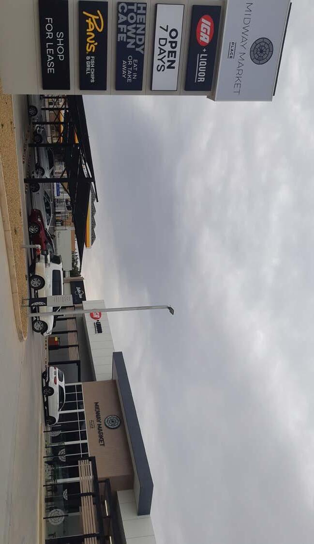
4.2.2 Commercial A ‘village style’ commercial precinct on Hendy Road around the Midway Centre is evolving which will address the absence of a well-defined business centre in Buronga Gol Gol. This is a win-win location for the commercial precinct as it is centrally located in between Buronga and Gol Gol on the Sturt Highway and will be easily accessed by walking, cycling or driving from both townships. The commercial precinct will be Buronga Gol Gol’s first formal local business centre and will provide a range of commercial, civic, cultural and residential uses. The commercial precinct should provide space for local start-up businesses and deliver essential services to local community. The commercial precinct will feature a new large-scale supermarket, a service station, Wentworth Shire Council’s upgraded Midway Centre (Council Customer Services, Library, Conference Facility, Meeting Rooms and Basketball Stadium), a well-defined shopping strip, 20 new shop frontages and the NSW State Government office building (existing) as shown in Figure 4.3. The shop frontages will boost the local economy by providing opportunity for start-up businesses such cafes, restaurants, boutique shops and miscellaneous stores. These shops would be very beneficial to the local community who will be able to walk or cycle to access daily essentials such as food and other supplies, without needing to travel by car to Mildura. It is anticipated a wide mix of uses will make more activities and services available in one location accessible by walking, cycling and public transport, and consequently promote self-reliance and an active lifestyle in Buronga Gol Gol.

Accordingly, the strip of land located to the north of Hendy Road between Melaleuca Street and Dawn Avenue should be rezoned from RU5 Village to B2 Local Centre. The area of the land proposed for B2 Local Centre is approximately 15 hectares, which represents just 0.5% of the study area. The RU5 Village zone currently applied to the land allows for business activities, however rezoning it to B2 Local Centre will ensure it is protected and reserved for commercial development and thereby centralise and consolidate commercial activities required to provide essential services to residents and boost the local economy in Buronga Gol Gol. In other words, a B2 Local Centre will better facilitate development of the proposed Hendy Road Commercial Precinct in the area. Land use interface management should be considered in the planning, design and development of the commercial precinct to ensure that appropriate interface is developed and to avoid land use conflict such as noise from traffic and loading docks. Commercial land uses should transition to minor impact uses adjacent to residential areas to protect the amenity of these areas. In addition, Crime Prevention through Environmental Design (CPTED) principles should be applied to any development, especially if shop top housing is included. It is noted that a land parcel (Lot 2 DP 733735) located on the southern side of the Sturt Highway nearly opposite the proposed commercial precinct is subject to a planning proposal to allow development for a market as an ‘Additional Permitted Use’ (see Figure 4.1). This additional permitted use is supported by this structure plan as the proposed open market will provide additional space for retail and commercial activities to complement the proposed commercial precinct.
Item 9.15 - Attachment 1 Buronga Gol Gol Structure Plan BGGSP 2020 Page 238 46
2020
Buronga Gol Gol Structure Plan
Item 9.15 - Attachment 1 Buronga Gol Gol Structure Plan BGGSP 2020 Page 239 47
Gol Gol Structure Plan 2020 Figure 4.3 –Hendy Road Precinct Plan EXPANDED CARRAMAR DRIVE SPORTING COMPLEX NSW Government
Offices A new large-scale supermarket The Midway Centre Village-style shop frontage (2025 new sites) A new service road (essential) Green space Additional car + truck parking space New footpath network interconnecting Hendy Road through to both Oval Reserves Palm-lined paths and boulevards An additional Oval Walking path network linking Oval
to the Hendy Road
NEW URBAN DESIGN Additional netball courts New pedestrian link to commercial precinct A new Swimming pool New Carramar Drive entrance Reorganised car parking spaces Reorganised Service Roads
Extended Service Roads LEGEND Open Space Roads Walking Tracks Palm Trees Football Oval Netball Courts Car Parks Building footprints Basketball Courts Swimming Pool NEW COMMERCIAL SHOPPING STRIP
Buronga
Departments
Reserves
Precinct
+
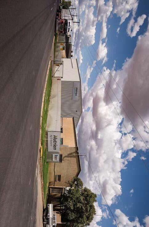
It is however suggested that a smaller and consistent minimum lot size should be considered and applied to the RU1 Primary Production land within this area after consultation with the Department of Planning, Industry and Environment. In addition, this area should be treated as a future urban growth area and any urban expansion beyond the identified development areas in this structure plan should be directed here. It is suggested that the parcels of land north of Pitman Avenue (i.e. Lot 108 & 109 DP 756946, Lot 1 & 2 823886), which are all currently used predominantly for rural residential purposes should be investigated for rezoning to RU5 Village in the first review of this structure plan.
4.2.3 Industrial Industrial land use should be concentrated to the northern end of Buronga with extension possibilities to the north of the existing IN1 General Industrial zone. This keeps the industrial area at the edge of Buronga, easily accessed by major transport routes and unlikely to impact on residential areas.
4.2.6 Urban Land Release Staging
Figure 4.4 shows the staging plan for guiding urban land release to ensure development occurs in an orderly and well-coordinated manner. The staging plan has been developed to:
• ensure transparency in land use decision making;
• enable Council and developers/landowners to identify and plan resource commitment; and
• ensure progressive delivery and availability of necessary infrastructure and services to support development
Sequencing of the urban land release was informed by a combination of factors including:
• proximity to existing development;
• ease of servicing the development area with adequate infrastructure; and
Given that 25 ha of the 33 ha available undeveloped IN1 General Industrial zoned land has only recently been planted to citrus with the landowner not intending to redevelop in the short to medium term, an additional 16 ha parcel of land immediately adjoining the existing IN1 General Industrial land to the east is recommended to be rezoned to 1IN General Industrial. This is intended to forestall any potential shortage of industrial land in the near future, which could adversely affect industrial development in the Buronga Gol Gol area. With an allowance of 15% for access and services, Buronga Gol Gol has 42 ha of developable industrial land that could yield approximately 120 industrial lots the emerging average lot size of 3500 m 2 in the zone. This total lot yield is equivalent to 30 years of industrial land supply based on the current take up rate of 4 lots per year. This means that even under a higher industrial development rate of say 6 lots per year, which is not unreasonable to expect given the recent fast take up of industrial lots following re-subdivision, the available developable industrial zoned land could provide sufficient long-term industrial land supply. Nonetheless, any excess future demand for industrial land beyond the projected supply should be accommodated by extending the IN1 General Industrial zone northward.
Rural Environmental Living
4.2.4
• preparedness of owners to develop
It is recommended that E4 Environmental Living zone be applied to an area of land located in Buronga West and the Mitchell Lane Precinct in north east Gol Gol, which are currently zoned RU1 Primary Production (see Figure 4.1). The total area of the parcels of land to be rezoned is approximately 260 ha.
It is envisaged that E4 Environmental Living will help cater for the existing mix of residential and horticultural uses in these areas, while minimising flood risks and preserving environmental values associated with the areas. This is intended to rationalise developed residential-like streetscapes and small-scale agriculture or hobby farm style uses that currently characterise these areas. Rezoning is also envisaged to reduce large minimum lot sizes that were applied to parcels of land in these areas without any formal comprehensive investigation or assessment, to more contemporary and practical lifestyle minimum lot sizes in the ranges of 1 to 3 hectares.
Rural Land Retain the RU1 Primary Production land adjoining the RU5 Village land to the north in Buronga Gol Gol. This land is not required for immediate urban development and also not serviced which would place a considerable burden on Council’s financial resources to provide and maintain services to the area.
4.2.5
Item 9.15 - Attachment 1 Buronga Gol Gol Structure Plan BGGSP 2020 Page 240 48
Gol Gol Structure Plan 2020
Buronga
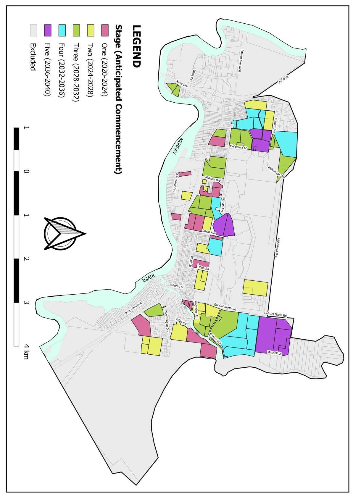
Item 9.15 - Attachment 1 Buronga Gol Gol Structure Plan BGGSP 2020 Page 241 49
Gol Gol Structure Plan 2020 Figure 4.4 –Urban Land Release Staging Plan
Buronga
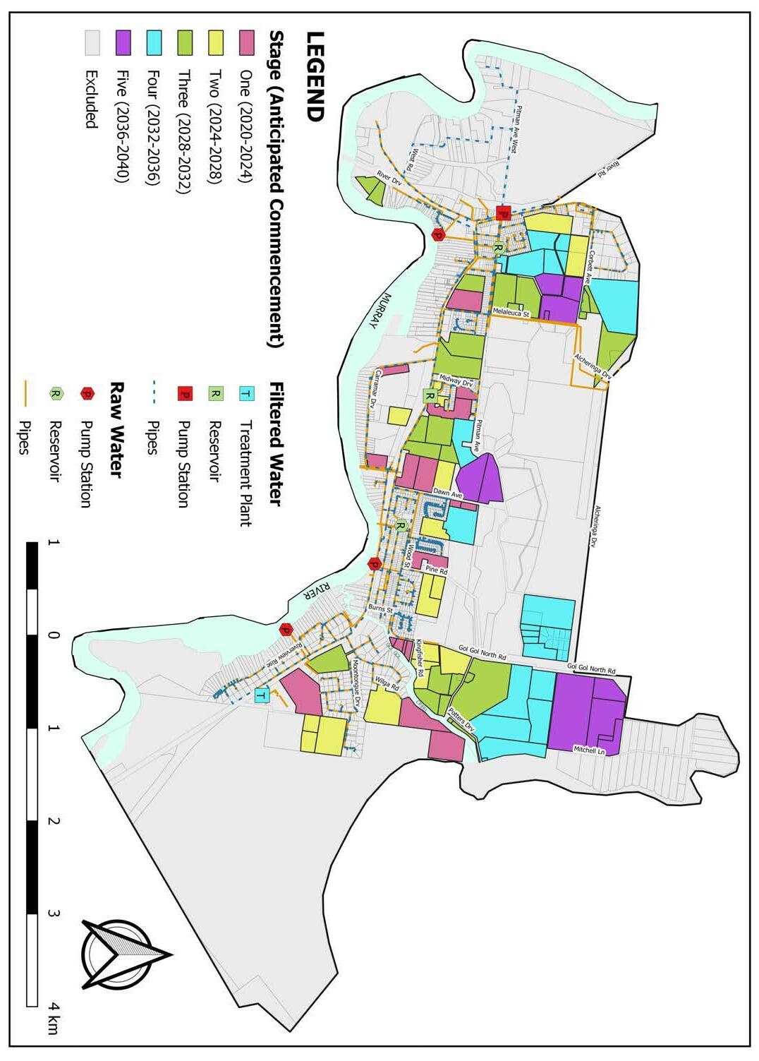
4.3 Infrastructure
4.3.1 Water Supply
It has been determined that existing reticulated filtered and raw water systems have adequate capacity to supply future developments in the area. However, augmentation of the water reticulation networks with additional reservoir storage capacity and extension of mains will be required as development proceeds. It is expected that the additional reservoir would not only enhance reliability of supply but it will also provide Council with greater flexibility in maintenance planning. As depicted in Figure 4.5, expansion and upgrade works should be undertaken progressively in conjunction with development to ensure security of a water supply in Buronga Gol Gol. Extension of the water reticulation mains to new subdivision areas would be funded by developers. Council should develop an Integrated Water Cycle Management Plan that looks at water management on a holistic basis i.e. the combination of water supply, sewer and stormwater. In relation to water supply, the plan must incorporate a Strategic Water Supply Master Plan for facilitating the extension and upgrading of the reticulated water supply system. The master plan should be used to investigate and identify the location of the additional reservoir, pumps and pipework. The integrated water management plan should also include a Water Demand Management Program aimed at reducing excessive water consumption to help defer the need for major capital works in future. The program should incorporate ongoing collection and monitoring of consumption data which constitutes essential components of water supply asset management processes. Finally, the plan should encourage onsite water capture, storage and use especially in the R5 Large Lot Residential area.
Item 9.15 - Attachment 1 Buronga Gol Gol Structure Plan BGGSP 2020 Page 242 50
Figure 4.5 –Proposed Water Supply Infrastructure
Buronga Gol Gol Structure Plan 2020
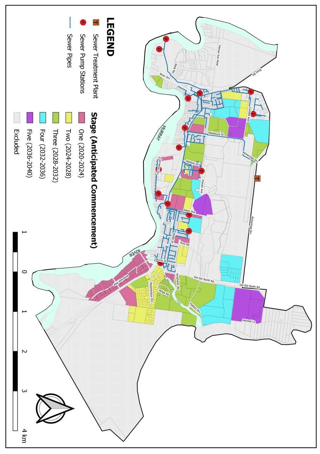
4.3.2 Sewerage Services Existing sewerage infrastructure has adequate capacity to service the area covered in the structure plan. The sewerage reticulation mains should be extended to the R5 Large Residential Lot zone east of Gol Gol within the short to medium term as shown in Figure 4.6. This extension will be supported by the proposed Trentham Cliffs pipeline. It is envisaged that connecting east Gol Gol to the sewerage system will capitilise on existing excess capacity of Gol Gol’s sewerage treatment plant and mitigate aquatic pollution risks posed by on-site septic systems in that zone. To further enhance sewerage management, it is recommended that Council prepare an Integrated Water Cycle Management Plan that looks at water management on a holistic basis i.e. the combination of water supply, sewer and stormwater. The integrated plan should include a Sewerage Infrastructure Master Plan based on the proposed staging and land development pattern to facilitate progressive extension of sewer mains to existing unserviced and future development areas of Buronga Gol Gol. Developers will be responsible for the cost of designing and constructing sewerage reticulation infrastructure within new subdivisions.
Item 9.15 - Attachment 1 Buronga Gol Gol Structure Plan BGGSP 2020 Page 243 51 Buronga Gol Gol Structure Plan 2020
Figure 4.6 –Proposed Sewerage Infrastructure
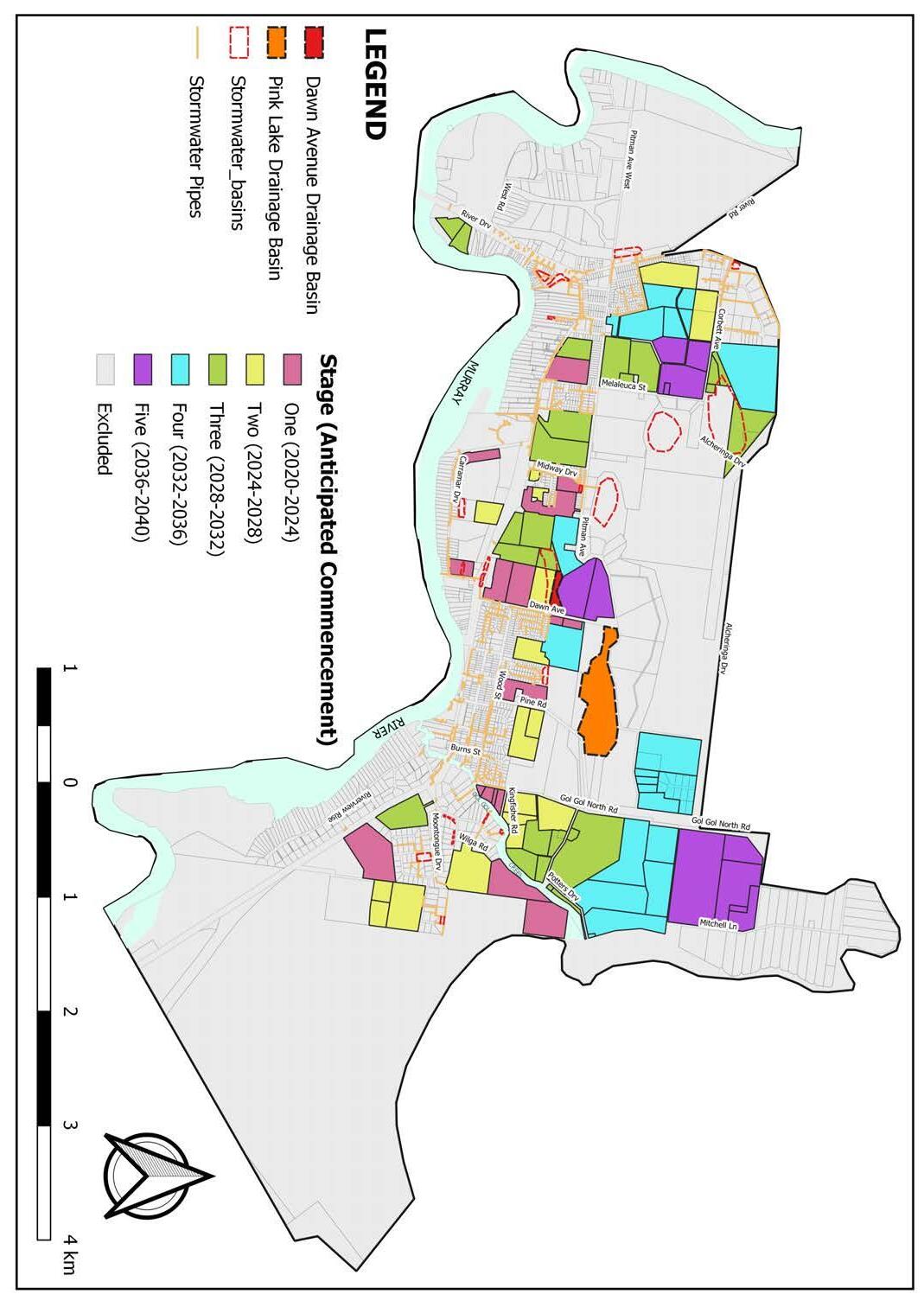
Drainage Infrastructure
4.3.3
Most of Buronga Gol Gol has adequate stormwater management systems and this can be duplicated in future development areas by the extension of the existing drainage network. Nonetheless, it is anticipated that additional drainage/ stormwater infrastructure will be required in the future as development proceeds (see Figure 4.7). It is recommended that the Dawn Avenue Depression and Pink Lake opportunities be investigated and developed as drainage/retention basins given their large water storage capacity and location in relation to the urban growth area of Buronga Gol Gol. Development of the Dawn Avenue Depression and Pink Lake drainage basins could incorporate recreational amenities such as boardwalks, cycle tracks and landscaping. In particular, the two basins should be linked with a boardwalk and cycle tracks through the proposed greenbelt along Dawn Avenue for recreational use. This approach is intended to create multi-purpose stormwater basins that also serve as open spaces and habitat for significant flora and fauna species. This proposal is however subject to further investigation and cost-benefit analysis for a holistic stormwater management program in the Buronga Gol Gol area. To further enhance stormwater management, it is recommended that Council prepare an Integrated Water Cycle Management Plan that looks at water management on a holistic basis i.e. the combination of water supply, sewer and stormwater. The integrated plan should include a Stormwater Infrastructure Master Plan to guide the progressive expansion of stormwater pipelines and drainage basins to service future development in Buronga Gol Gol. The design and construction of stormwater infrastructure within new subdivisions will be the responsibility of developers. The integrated plan should be used to explore and inform development of an On-site Stormwater Detention Policy. The policy should provide a framework for home owners requiring to install rainwater tanks, to collect and control runoff to pre-development overland flow before being released to Council’s drainage system.
Item 9.15 - Attachment 1 Buronga Gol Gol Structure Plan BGGSP 2020 Page 244 52
2020
Buronga Gol Gol Structure Plan
Figure
4.7 –Proposed Stormwater/Drainage Infrastructure
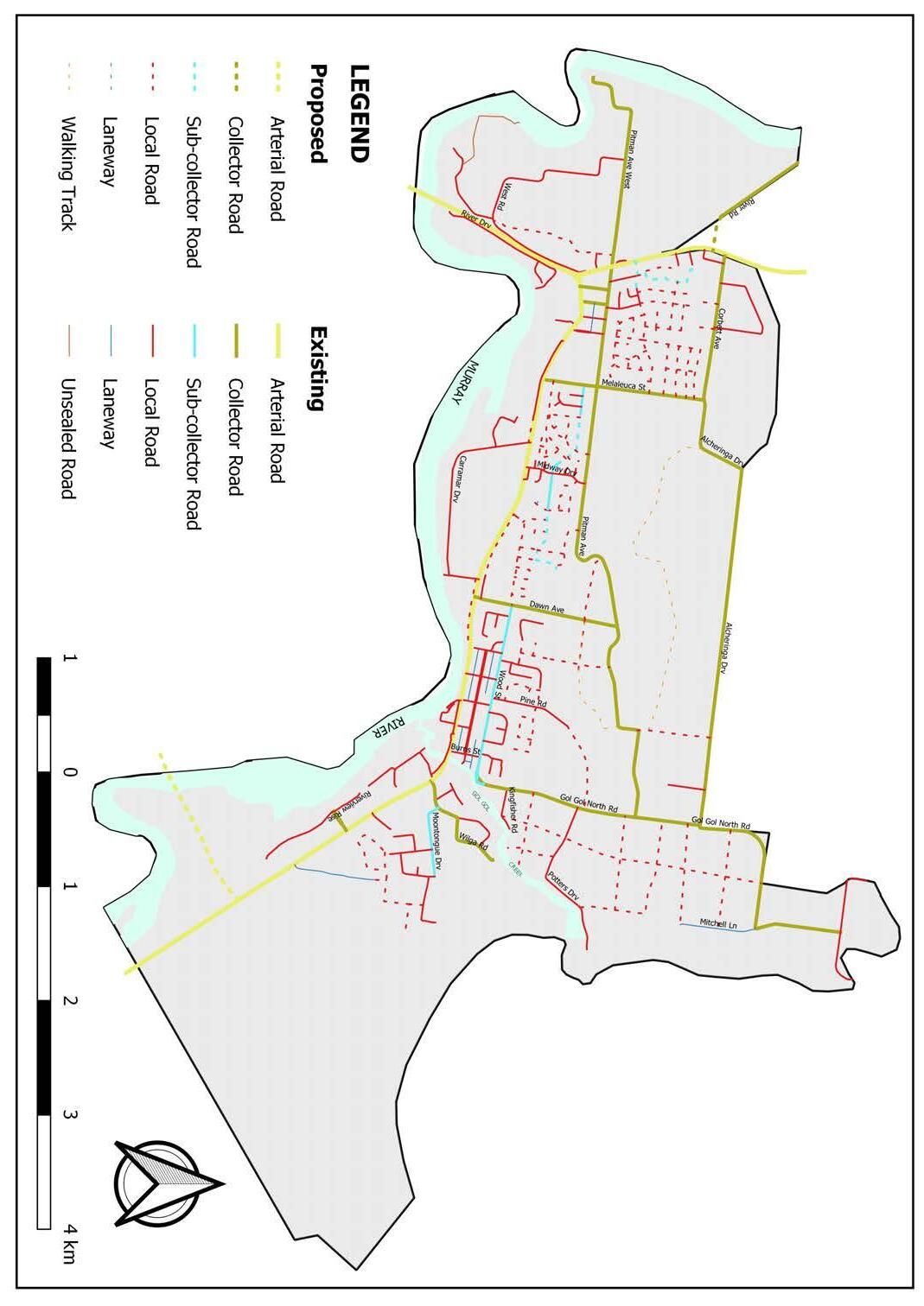
4.3.4 Road Design and Upgrades
The structure plan supports the significance of the Sturt and Silver City Highways as national transport routes, while at the same time ensuring that traffic on these highways is safe for local pedestrian, cycle and vehicular traffic.
The proposed local road network for Buronga Gol Gol has been designed to limit intersections with the highways and minimise local residents’ use of the highways (see Figure 4.8). At the same time, a number of intersection controls have been proposed to moderate traffic speed and facilitate safe pedestrian crossing over the highways. It is recommended that a detailed Traffic and Transport Infrastructure Master Plan be prepared to further examine the traffic and intersection treatments set out below.
a) Summer Drive should be extended to provide a connection from Melaleuca Street through Midway Drive to Dawn Avenue through future subdivisions (refer Figure 4.8). It is expected that Summer Drive, Wood Street and Pitman Avenue will form a direct east-west connection for Buronga Gol Gol to enable residents to access facilities and services in the Midway Area and either end of the townships without requiring use of the highways. This will reduce the number of local traffic movements on the highways and preserve the highways for through traffic and freight transportation.
b) It is proposed that a new service road be constructed behind the IGA Supermarket between Melaleuca Street and Midway Drive. The service road will provide easy and safe vehicular access to the proposed Hendy Road Commercial Precinct.
c) It is a proposed that a new service road be constructed on the northern side of the Sturt Highway between Dawn Avenue and the proposed B2 Local Centre zone. This service road will provide the required access for future development within that stretch without the need for creating new intersections with the highway. The eastern end of the proposed service road should connect to Dawn Avenue at T-junction as shown in Figure 4.8.
d) The Melaleuca Street and Sturt Highway intersection needs realignment due to the need to improve the existing service road on the southern side of the highway. The highway will need to be realigned proportionally to the north into the existing horticultural land in order to rebuild the service road and ensure proper alignment of the intersection. Provision for road widening has been identified in DP 811922. It is recommended that the eastern end of the service road be disconnected from the Sturt Highway and the road extended to link with Carramar Drive as shown in Figure 4.8. The objective of this change is to reduce the proliferation of intersections with the highway.
Item 9.15 - Attachment 1 Buronga Gol Gol Structure Plan BGGSP 2020 Page 245 53 Buronga Gol Gol Structure Plan 2020 Figure 4.8 –Future
Road Network and Indicative Subdivision
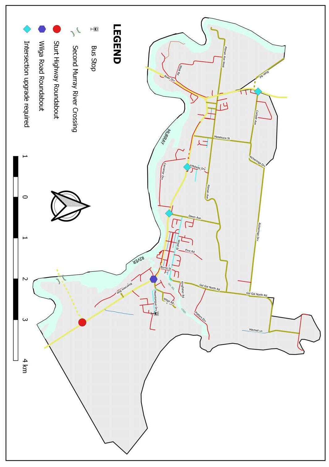
e) The various fragmented dirt tracks/semi-improved roads south of the Sturt Highway should be rationalised and upgraded into local and/or service roads to provide formalised and constructed accesses to residences and parklands in the southern part of Buronga Gol Gol. These service roads should be connected to the highway at appropriate intersections as indicated in Figure 4.8.
f) The Corbett Avenue and Silver City Highway intersection should be reviewed in consultation with Transport for NSW (TfNSW) to identify and implement suitable traffic treatments at the intersection. The review should aim towards developing the intersection as a western “entry gateway” to the urban area of Buronga. Ultimately, any implemented upgrade should help slow vehicular traffic on the highway, allow industrial traffic to enter/exit the highway safely and provide a higher level of safety to the community.
g) The intersection of the River Road with Silver City Highway should be reviewed and possibly realigned to the north to address issues associated with its current acute angle connection with the highway (refer Figure 4.8).
h) Council should collaborate with TfNSW to investigate and implement traffic treatments at the Midway Drive and Sturt Highway intersection. Traffic treatments at this intersection should focus on regulating and slowing traffic on the highway to provide safe pedestrian access to the proposed Hendy Road Commercial Precinct, the Midway Area and the Carramar Drive Sporting Complex. Options that should be considered at this location include pedestrian crossing traffic signals, pedestrian refuges and median strips.
i) It is recommended that Council collaborate with TfNSW to investigate and identify further upgrades at the intersection of the Dawn Avenue with Sturt Highway to better accommodate the increasing right turning local traffic from the fast-expanding new residential estates in Gol Gol. It is considered that an “oval” roundabout type arrangement that possibly incorporates Punt Round may be more appropriate for this intersection.
j) The Wilga Road/Wilga Road South and Sturt Highway intersection should be upgraded to a roundabout to enable it accommodate the increasing traffic from the large lot residential area in east Gol Gol. The roundabout would also form the eastern “entry gateway” to the urban area of Gol Gol which may slow vehicular traffic on the highway and provide a higher level of safety to the community.
Item 9.15 - Attachment 1 Buronga Gol Gol Structure Plan BGGSP 2020 Page 246 54
Gol Gol Structure Plan 2020 Figure
Buronga
4.9 –Future Road and Intersection Improvements
Council should seal and upgrade the intersection of Native Ridge Lane in the short term. This improvement is urgently required to provide alternative access to the fast-expanding large lot residential area, as well as disperse traffic away from Wilga Road.
It is proposed that Bridge Road is sealed and landscaped with a footpath network linking to/from the existing Buronga Wetlands. This road upgrade is would provide improved access to the existing private (residential) properties and businesses adjacent to it and the Sturt Highway, as well as improve access to Mildura and the Buronga Caravan Park for pedestrians and cyclists.
k) Council should collaborate with relevant organisations and agencies such as TfNSW, Regional Roads Victoria (RRV) and Mildura Rural City Council (MRCC) to actively explore options for a second Murray River crossing or highway bypass east of Gol Gol. A second bridge or bypass will significantly reduce freight and through traffic in the Buronga and Gol Gol townships and thus enhance the urban amenity of the area. Any investigations into the second Murray River crossing and/or the highway pass should give serious consideration to the local economic impact on the Buronga Gol Gol area and the wider region.
Council should systematically review the role of Pitman Avenue as a collector road and progressively undertake appropriate upgrades or improvements. This should be done to ensure that the road has appropriate condition and capacity to accommodate the increased traffic expected from proposed residential subdivision developments in the Buronga Gol Gol. In addition, consideration should be given to realigning the Pitman Avenue to the south (below Lots 11 DP 756946) to remove the current bends (adjacent to Lot 109 DP 756946) to allow for ease of road connection in a north-easterly direction toward the proposed E4
o)
A possible location for the second river crossing is shown on Figure 4.9, albeit this is subject to in-depth feasibility and suitability analysis. It is noted that the proposed location for the second river crossing, if found suitable, will instigate strong demand for residential and commercial development in the immediate areas as opposed to the current large lot development. This potential change in the urban development dynamic should be accommodated in future review of this structure plan as the potential for a second river crossing becomes more certain.
Environmental Living zone.
p) Council should collaborate with relevant State agencies to undertake continuous road safety audits on the Sturt and Silver City Highways to inform the need for introducing new traffic management treatments such as speed limit reductions, median strips, pedestrian refuges and pedestrian crossings at identified sections of the highways.
l) The Burns Street and Sturt Highway intersection should be converted to a left in left out intersection. The will alleviate vehicles queueing to turn right onto the highway, as well as ensure a continuous flow of local and through traffic on the highway. Local traffic seeking to travel westward can easily and safely perform a U-turn at the proposed Wilga Road Roundabout.
m) The Gol Gol Creek Bridge is an important river crossing that connects the main Gol Gol Township to the expanding large lot residential area east of the township. While the bridge is currently in good condition and functions effectively, the increasing local traffic from the ongoing residential development in east Gol Gol coupled with growing freight and passing traffic may cause the bridge to deteriorate rapidly and/or reach its capacity in the near future. Residents of east Gol Gol could face compromised accessibility to and out of the town should the bridge crossings exceed its capacity or be completely cut off from the rest of the town should the bridge develop a major fault. Therefore, it is imperative to investigate a suitable location upstream of the Gol Gol Creek for the construction of another river crossing to provide alternative access for residents of Gol Gol should the existing bridge exceed its capacity or develop a major fault in the future. The additional bridge could reduce local traffic on the existing bridge and hence make more space available for freight or through traffic.
n) Council should prioritise the provision of constructed and/or sealed roads to all developed areas throughout Buronga Gol Gol. This would involve formalising existing unsealed, dirt roads in Buronga Gol Gol. The short to medium term priority should focus on Bridge Road and Native Ridge Lane.
Item 9.15 - Attachment 1 Buronga Gol Gol Structure Plan BGGSP 2020 Page 247 55 Buronga Gol Gol Structure Plan 2020
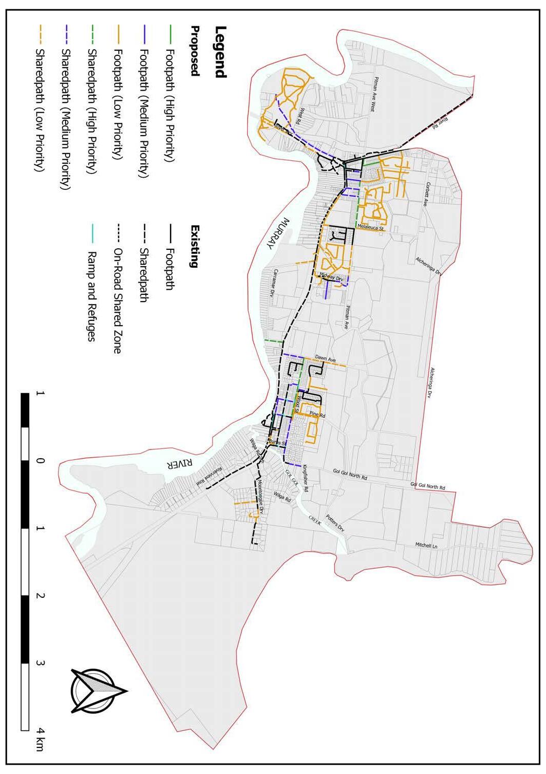
Figure 4.10: Pedestrian access and mobility plan: Proposed path priorities plan for Buronga Gol Gol
Footpaths and shared ways
4.3.5
Footpaths and shared ways should be retrofitted into existing road reserves and streetscapes throughout Buronga Gol Gol to improve walkability and pedestrian safety in area. This community access amenity should be prioritised and provided on all streets within residential and commercial areas. The provision of footpaths in the town centres and older parts of the Buronga Gol Gol should be carefully planned to link-up with the existing footpaths in the new subdivision areas to improve the overall connectivity and permeability of the township.
It is noted that the need for footpaths and shared ways has recently received attention with Council currently undertaking works to retrofit and/or extend footpaths on some streets in Buronga Gol Gol as part of the implementation of the Pedestrian Access and Mobility Plan (PAMP) (refer Figure 4.10.). It is expected that this staged plan when fully implemented, will improve path connectivity, pedestrian and cyclist movements, and safety of non-motorised travel in Buronga Gol Gol. However, the plan needs to be reviewed and updated in the short to medium-term to ensure other existing streets, especially in the large lot residential area in east Gol Gol, not initially planned for are captured and retrofitted with footpaths or shared ways as required. This is particularly important for achieving an active, healthy built environment and reducing car dependence in Buronga Gol Gol. It is proposed that a footbridge be constructed over the Murray River at Punt Road to establish a strategic and useful connectivity between Buronga Gol Gol and Mildura. This will provide a better, safer link for active transport between Mildura and Buronga Gol Gol by enabling the local people to access both sides of the river by walking or cycling and thus addressing restrictions for active transport across the Chaffey Bridge. It is envisaged that the footbridge will facilitate the creation of an active corridor around the stretch of the Murray River between the proposed footbridge on the east and Lock Island on the west for walking, hiking and cycling (see Figure 4.11). In this regard, a footbridge is proposed to be constructed/overlaid over Lock 11 to allow crossing of the Murray River at the eastern end of the corridor. The looped active transport link will mostly follow existing active transport routes and only limited new infrastructure has to be added to complete the loop. It is expected that the active corridor will improve public access to the river and its immediate environment by residents and visitors as well as promote active healthy lifestyle in the across the border. The successful implementation of these proposals will require active engagement, collaboration and lobbying with RMS, MRCC and relevant state agencies in NSW and Victoria. It is further recommended that all future subdivisions should be serviced with footpaths that connect to existing infrastructure. This can be imposed as a condition of development consent on development applications for residential subdivisions.
Item 9.15 - Attachment 1 Buronga Gol Gol Structure Plan BGGSP 2020 Page 248 56
2020
Buronga Gol Gol Structure Plan
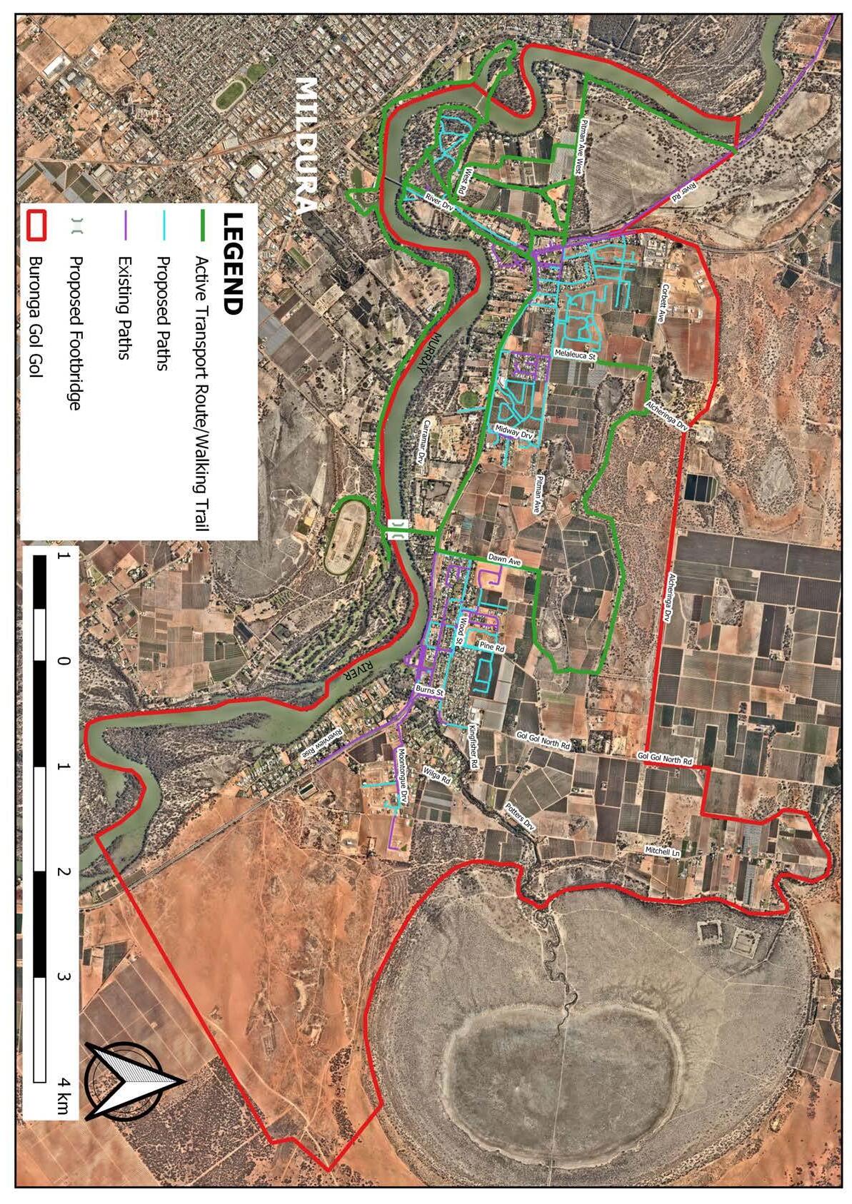
Item 9.15 - Attachment 1 Buronga Gol Gol Structure Plan BGGSP 2020 Page 249 57
2020 Figure 4.11 –Proposed Active Transport Route/Corridor
Buronga Gol Gol Structure Plan
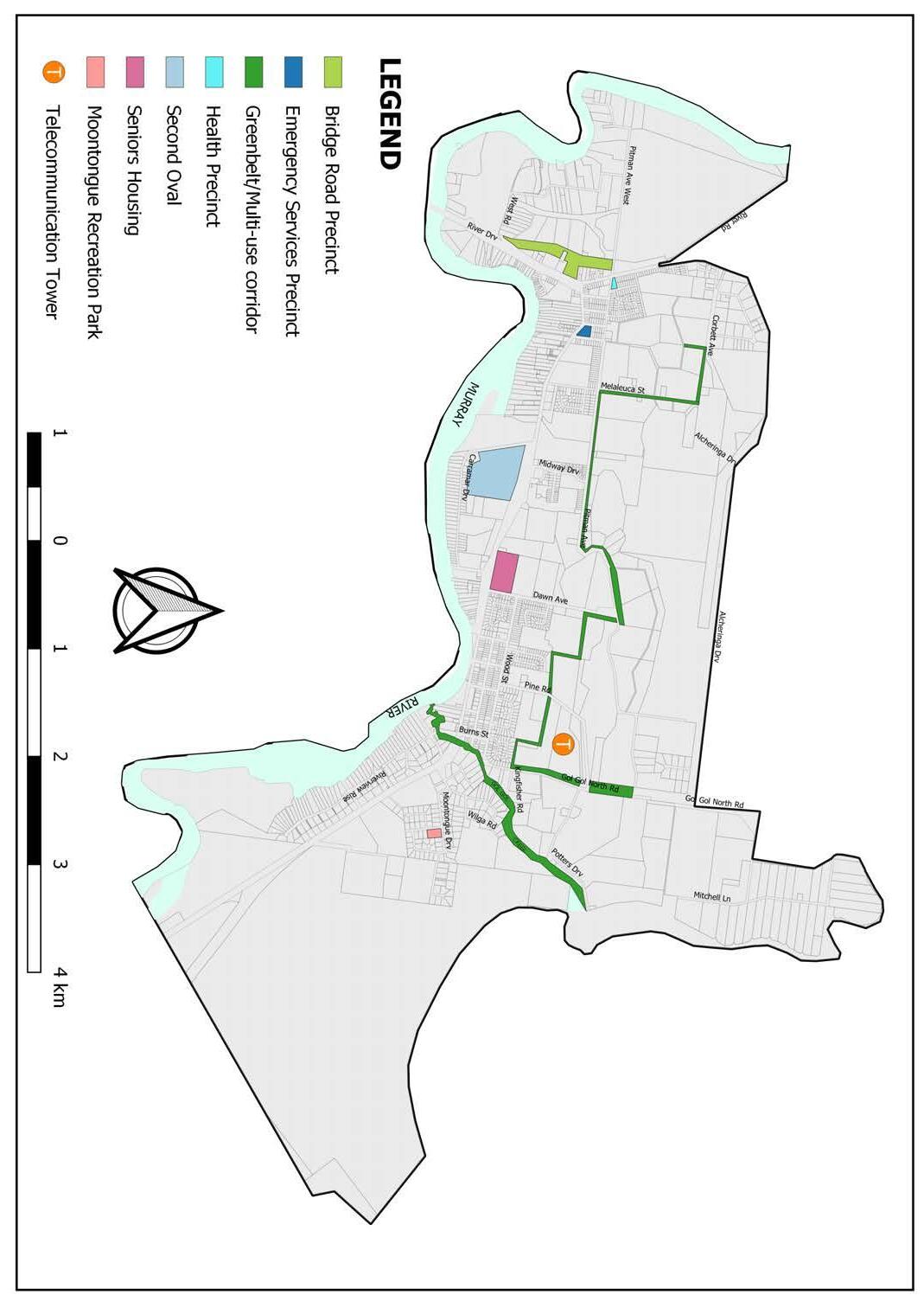
4.3.6 Power and Telecommunication Services Power and telecommunication infrastructure with the capacity to service future development already exists in Buronga Gol Gol. Further improvement to the power and telecommunication capacity and quality is expected from proposed major infrastructure projects listed below:
a) An approved $1.5 billion electricity interconnector ‘Project EnergyConnect’ between South Australia and New South Wales. The junction of the electricity interconnector is located immediately outside the Buronga Gol Gol area. b) A planning proposal for solar farm “Buronga Energy Station” on Arumpo Road in Buronga is under consideration by the Department of Planning, Industry and Environment (DPIE).
c) An approved Optus Telecommunication Tower on Gol Gol North Road in Gol Gol (refer Figure 2.18).
In addition, it is recommended that Council should:
i. actively engage with and persuade Essential Energy to eliminate overhead powerlines in the main township areas. Of priority is the overhead powerlines around the James King Park as these constitute a visual blight area; ii. ensure any future electricity and telecommunication network is constructed underground as this is conducive to enhanced urban landscape; iii. promote renewable energy options such as installation of rooftop solar panels to the community; and iv. encourage installation of at least one (1) electric vehicle charging station in the carpark of all future commercial developments and public buildings
4.4 Community Ser vices and Recreation Facilities
The community services and recreation facilities proposed to augment existing services in Buronga Gol Gol are represented in Figure 4.12. In addition, upgrades to specific amenities within some of the existing facilities are included in the implementation and development sequencing plan in Table 4.3.
4.4.1 Educational Facilities
Figure 4.12 –Proposed Community Facilities, Recreation Areas and Green Spaces
It is recommended that Council liaise with the Department of Education to investigate the possibility of consolidating and relocating the Buronga and Gol Gol public schools. This is needed to address the safety concerns and expansion constraints associated with the current location of the schools along the Sturt and Silver City Highways. It is suggested that the schools should be relocated to a site that is large enough to accommodate the establishment of an education precinct with a Year 1 to 12 institution to provide the educational needs of school aged children in Buronga Gol Gol from one location. The consolidated Buronga Gol Gol public school will also have less operational cost in the longterm.
Item 9.15 - Attachment 1 Buronga Gol Gol Structure Plan BGGSP 2020 Page 250 58
Gol Gol Structure Plan 2020
Buronga
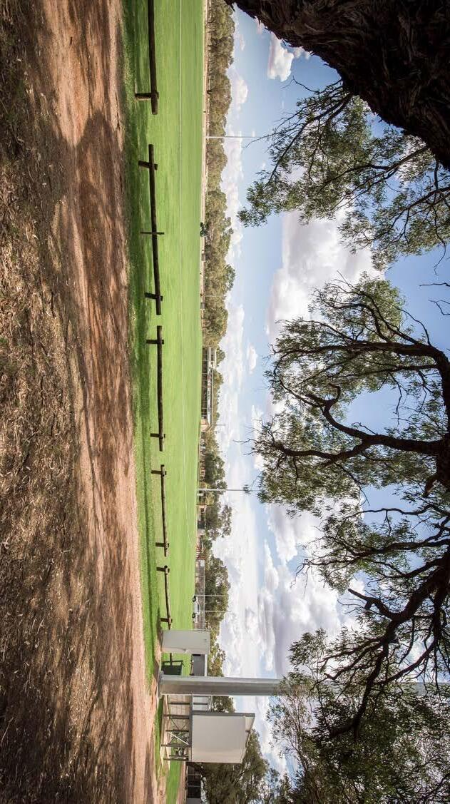
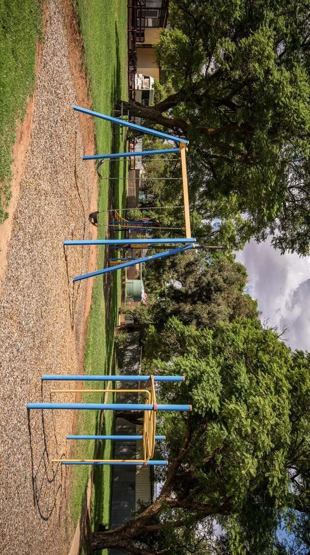
4.4.2 Sporting and Recreational Facilities
It is proposed that Carramar Drive Sporting Complex should be expanded to include a portion of the vacant E3 Environmental Management zoned land that adjoins it to the east (see Figure 4.12). The expansion will cover 22 ha of the existing E3 Environmental Management land and will allow for the provision of a second oval, for which there is strong community demand and support. It is noted that a second oval will allow juniors and seniors from the local football club to be able to train and play at the same time. Moreover, given the absence of a community swimming pool within Buronga Gol Gol, it is proposed that a swimming pool be constructed within the expanded Carramar Drive Sporting Complex, possibly located next to the new second oval and netball courts as shown in Figure 4.3.
The part of the E3 Environmental Management land to be included in the reserve should be rezoned to RE 1 Public recreation to make available the full suite of uses permissible in these areas, as well as give certainty to the community that the use will remain in the long-term.
4.4.3 Health and Emergency Services
Although residents in Buronga Gol Gol have access to health and emergency services in Mildura, it is essential that these services are provided locally in the near future. This is particularly important considering the growing population and changing demographics of the area.
Intersection in Buronga is envisaged to become the Buronga Gol Gol health care precinct. It is also noted that the NSW Government is currently in the process of developing a “superclinic” (Health for everyone) in this area. It is expected that this clinic, when developed, will provide easy access to comprehensive GP care in conjunction with Allied Health and other primary health services from one convenient location.
The area immediately north-east of the Silver City Highway and Pitman Avenue
The parcel of land situated on Hendy Road between Pooley and Rose Streets is recommended to be redeveloped as a consolidated emergency services precinct for Buronga Gol Gol. The high accessibility and visibility of the proposed site makes it an ideal location for emergency services. The consolidated emergency services precinct is expected to house key emergency service providers such as NSW Ambulance Service, NSW Police Service, Fire & Rescue NSW and Rural Fire Service to promote coordination in the delivery of emergency response services in the Buronga Gol Gol area. Relocating the Gol Gol Rural Fire Service to the proposed precinct will also make land available for potential future expansion of the Gol Gol Pre-School. Council should liaise and cooperate with relevant state health departments/agencies to facilitate establishment of these facilities. Also, the proposed sites for health and emergency precincts should be rezoned to SP1 Special Activities. This will help protect the land for intended purposes, as well as facilitate the establishment of facilities and services.
The parcel of land located at the corner of Sturt Highway and Dawn Avenue intersection has been identified as suitable for development of seniors housing to help meet the residential accommodation needs of the aging population in Buronga Gol Gol and the region. The site’s high accessibility and close proximity to future commercial and business activities makes it a suitable location for development of residential accommodation for aged persons. It is considered that the location and size of the site would be suitable for a range of seniors housing types including a residential care facility and retirement village.
Item 9.15 - Attachment 1 Buronga Gol Gol Structure Plan BGGSP 2020 Page 251 59 Buronga Gol Gol Structure Plan 2020
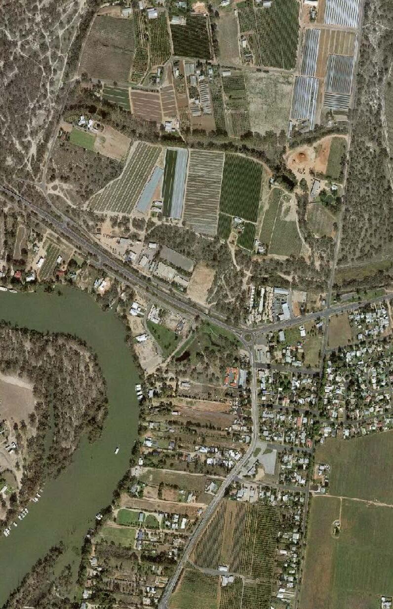
4.4.4 Public Open Spaces (Parks) Bridge Road precinct has been identified as an opportunity to expand the Buronga Wetland Reserve and improve parkland connectivity in Buronga Gol Gol. The Bridge Road precinct should be cleared of scrubby, untidy vegetation and landscaped and maintained –in a very similar fashion to the Buronga Wetlands –by planting trees that are well suited to the region’s climate as depicted in Figure 4.13. It is anticipated that the existing underpass located under the Silver City Highway will continue to provide safe, unrestricted pedestrian movement for both pedestrians and cyclists between the linked Bridge Road Precinct and Buronga Wetlands. Revamping the Bridge Road precinct is envisaged to deliver many benefits to Buronga Gol Gol including: a) oubling or even tripling the size of the Buronga Wetlands Reserve and creating additional and improved green-belt and public open space for recreational use, b) opening up and enhancing the usability of the existing pond in the area, c) creating a more visually appealing and useable entrance into Buronga Gol Gol and NSW from Mildura and Victoria, and d) removing the scrappy vegetation that has the potential to be a hazard in windy conditions and flood waters
Given that the Bridge Road land is Crown owned with Wentworth Shire Council as the Trustee, the proposed (re)development of the precinct should be seen as a strategic priority for Buronga Gol Gol.
Item 9.15 - Attachment 1 Buronga Gol Gol Structure Plan BGGSP 2020 Page 252 60
2020
Buronga Gol Gol Structure Plan
Figure
4.13 –Bridge Road Precinct Concept Plan
N 400m 200m 100m LEGEND Grass, open space Walking paths Ponds/Wetlands Bridge Road Entrances to private properties Trees Shrubs + hedging P Existing Underpass
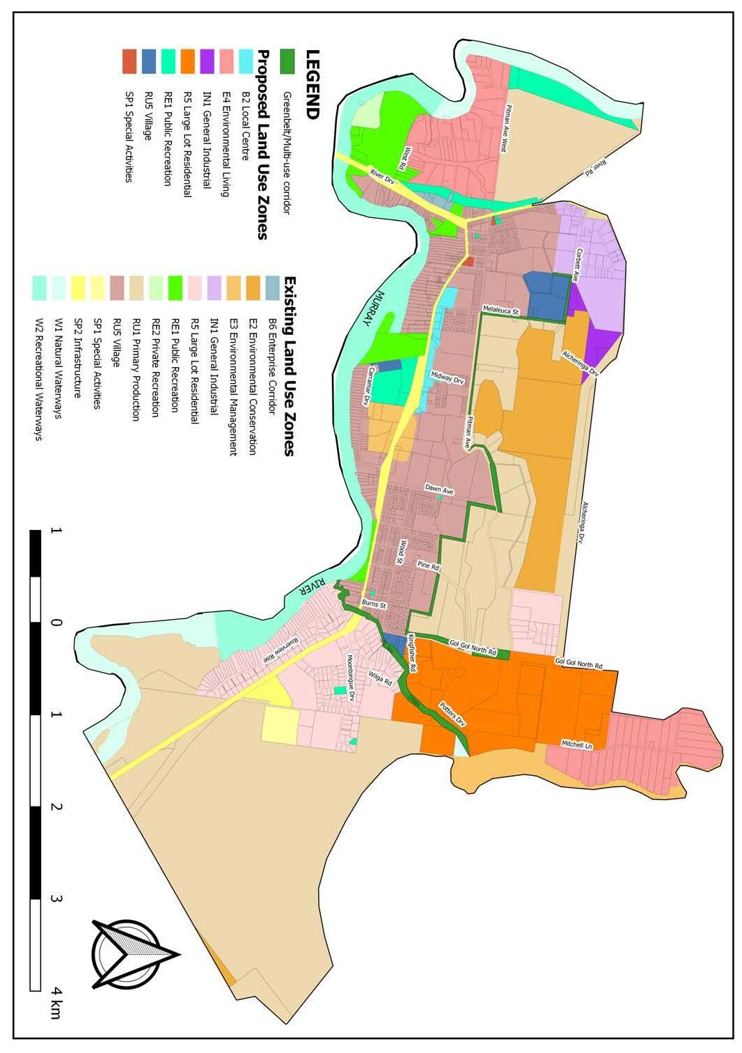
As presented in Figures 4.12 and 4.14, greenbelts have been identified to separate or screen the different main land uses, as well as improve connectivity and permeability within Buronga Gol Gol.
A greenbelt is proposed to align with the interface of industrial, residential and rural lands to the north of Buronga. The greenbelt also runs along parts of Pitman and Dawn Avenues and Gol Gol North Road interfacing rural and residential land uses east of Buronga and north of Gol Gol, as well as for possible drainage corridors between the proposed Pink Lake and Dawn Avenue Depression stormwater retention basins. The Gol Gol Creek and its riparian area is expected to serve as a multi-use corridor linking the northern rural land to the remnant and riparian vegetation along the Murray River, as well as a movement corridor for birds and other animals between the north and south. Cumulatively, the various greenbelts are envisaged to function as multi-use corridors that deliver essential values such as protecting and enhancing wildlife, filtering stormwater, protecting residential development from localised flooding and providing local recreational opportunities in Buronga Gol Gol.
The improved Bridge Road precinct and the greenbelt corridors should be considered for rezoning to RE1 Public Recreation to ensure they are protected and maintained for their intended purposes in the future. Moreover, the existing and delineated public open spaces such as Buronga Children’s Playground, King Ridge Estate Park, Wilkinson Park, Wurlong Estate Park, Moontongue Recreation Park, Evans Flat Reserve and Pitman Avenue Recreation Reserve should be rezoned to RE1 Public Recreation, to accurately reflect their actual and intended uses.
Moontongue Recreation Park should be developed and equipped with the relevant facilities and play equipment. The development of the park should be prioritised to ensure the fast-growing community in the area has access to adequate recreational facilities to foster community cohesion and active lifestyle.
Figure 4.14 –Alignment of Proposed Greenbelts and Multi-Use Corridors
The need for additional open spaces and parks in Buronga Gol Gol should be considered in assessment of residential subdivisions to ensure these community facilities are provided within walking distance of the majority of residents and linked by pedestrian and cycle networks. This assessment should consider open space and recreation planning principles such as accessibility, equity, integration, cultural relevance and adaptability. Council should ensure that the greater proportion of homes in new subdivision areas are within 10 minutes’ walk of a quality landscaped public open space. This is necessary for creating a network of walkable, connected and accessible public open spaces that promote healthier lifestyles and social cohesion. It is expected that appropriate development of the greenbelts and open spaces would help minimise the impacts of urban heat associated with climate change in Buronga Gol Gol.
Item 9.15 - Attachment 1 Buronga Gol Gol Structure Plan BGGSP 2020 Page 253 61
Gol Gol Structure Plan 2020
Buronga
4.5
Na tural Environment As highlighted in Section 2.8, the Buronga Gol Gol area is endowed with a rich ecosystem and biodiversity. There are a host of endangered and vulnerable species and significant ecological habitats in the area. The following general measures are proposed to preserve the health of the natural environment which is critical for ensur
ing healthy social and built environments in the area.
a) Consolidate urban development to reduce impact on biodiversity and ecosystem functions
b) Stabilise erosion and unstable river banks where possible
c) Treat salt-affected land
d) Remove noxious weeds (but not willows where it benefits bank stability)
e) Remove agricultural, commercial and residential waste appropriately
f) Control human access to areas of high environmental sensitivity, especially the Murray River Ecosystem
g) Revegetate riparian zones and other degraded vegetation only with native vegetation that is local to the area
h) Protect wetlands to maintain their ecological, recreational, flood storage and pollutant filtering ability
i) Ensure that key habitats for bird and marine life are not affected by planning decisions
4.6 Summar y of Recommendations and Implementation Plan
Table 4.3 presents the staged implementation of the recommendations of this structure plan. This implementation approach has been adopted to ensure coordinated land development and infrastructure while preventing undue pressure on Council resources. Council would seek to fund implementation of infrastructure and community facilities projects in this planning through internal budgetary allocations and external grants. Council would also actively advocate for implementation of infrastructure projects that are outside its jurisdiction by engaging, collaborating and liaising with the relevant agencies and authorities.
It is however noted that most of the anticipated land use development would be private sector driven, as such Council will also pursue planning strategies and practices that attract investors to invest and develop in Buronga Gol Gol. These could include fast-track development application processing, developer charges concessions and voluntary planning agreements among others.
Item 9.15 - Attachment 1 Buronga Gol Gol Structure Plan BGGSP 2020 Page 254 62
Gol Gol Structure
2020 Table 4.3 –Implementation Plan for
No . Project Title/Description Category Responsible/Co-ordinating organisation or agency L: Lead S: Support Timing (years) Short: 03 Medium: 3-5 Long: 10+ Funding Source 1 Investigate and implement traffic treatments at intersection of Midway Drive with Sturt Highway Infrastructure planning & development L: TfNSW S: WSC Short NSW Federal WSC 2 Review Moontongue Drive Infrastructure planning WSC Short WSC 3 Provision of Bus Stop at Wilga Road and Modikerr Way intersection Community facility/service L: CDC Mildura S: WSC Short CDC Mildura WSC 4 Planning proposal to rezone proposed health and emergency precincts to SP1 Special Activities Land use planning WSC Short to Medium WSC 5 Planning proposal to rezone nominated existing public open spaces to RE1 Public Recreation Land use planning WSC Short WSC 6 Planning proposal to rezone land for expansion of Carramar Drive Sporting Complex to RE1 Public Recreation Land use planning WSC Short WSC 7 Planning proposal to rezone Hendy Road Commercial Precinct Land use planning WSC Short WSC 8 Planning proposal to rezone Buronga West and the Mitchell Lane areas to E4 Environmental Living and change minimum lot size Land use planning WSC Short to Medium WSC 9 Planning proposal to rezone Bridge Road precinct to RE1 Public Recreation Land use planning WSC Short WSC 10 Planning proposal to apply minimum lot size to RU5 Village zone Land use planning WSC Short WSC 11 Planning proposal to change minimum lot size of RU1 Primary Production land adjoining the RU5 Village land to the north Land use planning WSC Medium WSC 12 Planning proposal to rezone proposed RU5 Village land Land use planning WSC Ongoing as per Urban Land Release Staging Plan WSC 13 Planning proposal to rezone proposed IN1 General Industrial land Land use planning WSC Ongoing as per Urban Land Release Staging Plan WSC
Buronga
Plan
Recommendations
-
Acquisition of land and establish
ment of greenbelt/ecological buffer at the interface of industrial, rural and residential land uses in north Buronga
Acquisition of land and establish
ment of greenbelt/ecological buffer at the interface of rural and residen
tial land uses between Melaleuca Street and Dawn Avenue in northeast Buronga
Acquisition of land and establish
ment of greenbelt/ecological buffer at the interface of rural and residen
tial land uses between Dawn Avenue and Gol
North Road in north
Acquisition of land and establish
ment of greenbelt/ecological buffer along northern part of Gol Gol North Road and between Gol Gol North Road and Mitchell Road at the in
terface of rural, rural residential and residential land uses in north east
Item 9.15 - Attachment 1 Buronga Gol Gol Structure Plan BGGSP 2020 Page 255 63 Buronga Gol Gol Structure Plan 2020 32 Improve
Community facility/service L: CDC Mildura S: WSC Medium CDC Mildura WSC 33
Bridge Road Precinct Community facility/service WSC Medium WSC
-
Asset acquisition WSC Medium WSC 35
-
-
Asset acquisition WSC Medium WSC 36
-
-
Gol Gol Asset acquisition WSC Medium WSC 37
-
-
Gol Gol Asset acquisition WSC Medium WSC 38
Basin Infrastructure development WSC Medium to Long WSC 39 Provision
Depression
Basin Infrastructure development WSC Medium to Long WSC 40
Stormwater Detention Policy Infrastructure planning WSC Medium to Long WSC 41 Improvement of dirt roads
rural arterial networks Infrastructure development WSC Medium to Long WSC 42 Footy oval, netball court and swimming pool construction at Carramar Drive Sporting Complex Community facility/service WSC Medium to Long WSC 43 Extension of sewerage services to R5 Large Residential Lot zone Infrastructure development WSC Ongoing as per Sewer Extension Staging Plan WSC 44 Construction of service road south of Sturt Highway between Punt Road and Bligh Street Infrastructure development L: WSC S: TfNSW Medium to Long WSC NSW 14 Planning proposal to rezone RU1 Primary Production land to R5 Large Lot Residential Land use planning WSC Ongoing as per Urban Land Release Staging Plan WSC 15 Encourage and promote the development of housing solutions for the Shire’s aging population Land use planning WSC Ongoing WSC 16 Development of Dawn Avenue Depression Drainage Basin Infrastructure development WSC Short WSC 17 Construction of service road between Dawn Avenue and the proposed B2 Local Centre zone Infrastructure development WSC Medium WSC 18 Construction and establishment of ‘superclinic’ Community facility/service L: NSW Health S: WSC Short NSW 19 Bridge Road Upgrade Infrastructure development WSC Short WSC 20 Acquisition and development of Pink Lake as Drainage Basin (including retention basin, boardwalk, landscaping, seats, play equipment) Asset acquisition WSC Short WSC 21 Water Demand Management Program Infrastructure planning WSC Short to Medium WSC 22 Upgrade the George Chaffey Bridge to accommodate for safe pedestrian and cyclist use or consider pedestrian & cyclist-only from Buronga Gol Gol (Buronga Riverside Caravan Park) to Mildura Infrastructure development/planning L: TfNSW S: WSC, MRCC Short to Medium NSW VIC Federal 23 Strategic Water Supply Master Plan Infrastructure planning WSC Short to Medium WSC 24 Stormwater Infrastructure Master Plan Infrastructure planning WSC Short to Medium WSC 25 Sewerage Infrastructure Master Plan Infrastructure planning WSC Short to Medium WSC 26 Integrated Water Cycle Management Plan Infrastructure planning WSC Short to Medium WSC 27 Development of residential aged care facility or retirement village Community facility/service WSC Short to Medium Private 28 Upgrade the Bus Pole at the northern end of Midway Drive to Bus Shelter Community facility/service L: CDC Mildura S: WSC Medium CDC Mildura WSC 29 Seal Pine Road Infrastructure development WSC Medium WSC 30 Traffic and Transport Infrastructure Master Plan Infrastructure planning L: WSC S: TfNSW Short to Medium WSC 31 Advocate for the relocation and consolidation of Buronga & Gol Gol Public Schools Community facility/service L: Dept of Edu S: WSC Medium WSC
public transport network and service
Development of
34
Gol
Provision of 3.5 km trail through the zone E2 Environmental Conservation land to Pink Lake Drainage
of 2.4 km trail from Pink Lake Drainage Basin to Dawn Avenue
Drainage
Prepare On-site
and
Item 9.15 - Attachment 1 Buronga Gol Gol Structure Plan BGGSP 2020 Page 256 64 Buronga Gol Gol Structure Plan 2020 61 Investigate and implement upgrades at Dawn Avenue and Sturt Highway Intersection Infrastructure planning & development L: TfNSW S: WSC Medium NSW Federal 62 Improvements at Pitman Avenue, Pitman West & Silver City Highway intersection Infrastructure development L: WSC S: TfNSW Long WSC NSW 63 Explore and implement options for construction of bridge upstream of Gol Gol Creek Infrastructure development WSC Medium to Long WSC 64 Development of active transport loop Infrastructure development L: WSC, MRCC S: TfNSW Regional Roads Victoria Medium NSW VIC Federal WSC MRCC 65 Engage with Essential Energy to eliminate overhead powerlines Land use planning Infrastructure development L: Essential Energy S: WSC Long Essential Energy 66 Development of Moontongue Recreation Park Community facility/service WSC Short WSC 67 Widen and realign Sturt Highway at intersection with Melaleuca Street Infrastructure development L: Transport for NSW S: WSC Medium NSW 68 Extend service road south of Sturt Highway between Rose Street and Carramar Drive to connect with Carramar Drive Infrastructure development L: WSC S: TfNSW Medium WSC NSW 69 Construct service road north of Sturt Highway between Midway Drive and Melaleuca Drive Infrastructure development L: WSC S: TfNSW Medium WSC NSW 45 Establishment of emergency precinct Community facility/service L: NSW Health, Police & RFS S: Ambulance VIC, WSC Medium to Long NSW 46 Construction of additional water reservoir and pumps Infrastructure development WSC Long WSC 47 Extension of stormwater services Infrastructure development Private Developers WSC Ongoing as per Stormwater Extension Staging Plan Private WSC 48 Sewerage reticulation system extension and upgrade Infrastructure development Private Developers WSC Ongoing as per Sewer Extension Staging Plan Private WSC 49 Retrofit footpaths & sharedways as per Pedestrian Access & Mobility Plan Infrastructure development L: WSC S: TfNSW Ongoing as per PAMPs WSC NSW 50 Water supply system upgrade and extension Infrastructure development Private Developers WSC Ongoing as per Water Supply Extension Staging Plan Private WSC 51 Routine maintenance of the Gol Gol Creek riparian areas Environmental management WSC Ongoing WSC 52 Road safety audit on Sturt and Silver City Highways Infrastructure planning WSC TfNSW Ongoing WSC NSW 53 Review and update Pedestrian Access & Mobility Plan Infrastructure planning WSC Ongoing WSC 54 Revamp Buronga Riverfront as per Buronga Riverfront Master Plan Community facility/service WSC Ongoing WSC 55 Provide and upgrade of bus stop facilities at vantage locations Community facility/service L: CDC Mildura S: WSC Ongoing CDC Mildura WSC 56 Explore options for a bypass or second river crossing Infrastructure planning L: TfNSW, Regional Roads Victoria S: WSC, MRCC Ongoing NSW VIC Federal 57 Amenities upgrade (Public Toilets) Community facility/service WSC Ongoing WSC 58 Wilga Road Roundabout Infrastructure development L: TfNSW S: WSC Medium NSW VIC Federal 59 Investigate and implement upgrades at Corbett Avenue and Sturt Highway Intersection Infrastructure planning & development L: TfNSW S: WSC Long NSW 60 Seal Native Ridge Lane and upgrade its intersection with Sturt Highway Infrastructure development WSC Short WSC

Item 9.15 - Attachment 1 Buronga Gol Gol Structure Plan BGGSP 2020 Page 257
Chapter 5: Conclusion and Review
R eview of the Structure Plan
5.2
Review of the structure plan is necessary for ensuring that it is achieving its objectives and responding to changing conditions in Buronga Gol Gol. The responsibility for monitoring and review of the structure plan is with Wentworth Shire Council as the primary source of information. It is recommended that the Structure Plan be reviewed every four (4) years to coincide with other budgeting and administration requirements. In the intervening period, Council must regularly monitor development within the structure plan area and if necessary, bring forward any scheduled review if there is an indication that factors affecting development which were not identified earlier, are adversely influencing the direction of implementation. Review of the structure plan must be in accordance with an agreed process developed in conjunction with community, DPIE and other relevant agencies. Inputs are to be encouraged from other sources such as Mildura Rural City Council and other relevant organisations.
Chapter 5: Conclusion and R eview
5.1 Conclusion
The Buronga Gol Gol Structure Plan sets a vision for future land development and provides a framework to guide land use planning decisions in Buronga Gol Gol for the next 20 years. The structure plan promotes long term village style growth in the area and consolidation of development to facilitate amalgamation of the villages of Buronga and Gol Gol into one contiguous unified sustainable built environment. A range of land uses and amenities including rural housing, shopping centre, recreational facilities and footpaths among others are proposed to cater for existing and emerging needs of community and enhance general quality of life in Buronga Gol Gol (see Figure 5.1).
The structure plan incorporates a staged approach to urban land release and infrastructure and service delivery to ensure high quality urban development and enhanced liveability in the area. The structure plan is intended to be a dynamic and flexible document, responsive to changing conditions and subject to regular review.
Buronga Gol Gol Structure Plan 2020
Item 9.15 - Attachment 1 Buronga Gol Gol Structure Plan BGGSP 2020 Page 258 66
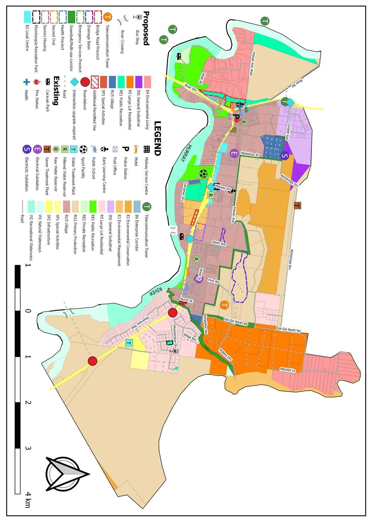
Item 9.15 - Attachment 1 Buronga Gol Gol Structure Plan BGGSP 2020 Page 259 67
–
Buronga
Gol Gol Structure Plan 2020 Figur e 5.1
Composite Structure Plan Map

Item 9.15 - Attachment 2 Planning Proposal Page 260 WENTWORTH SHIRE COUNCIL – PLANNING PROPOSAL – RU5 VILLAGE TO E1 LOCAL CENTRE ZONE 1
WENTWORTH LOCAL ENVIRONMENTAL PLAN 2011 PLANNING PROPOSAL RU5 VILLAGE ZONE TO E1 LOCAL CENTRE ZONE FROM 65 HENDY ROAD TO 7386 STURT HIGHWAY GOL GOL JUNE 2022
Document History
Version
Draft
Item 9.15 - Attachment 2 Planning Proposal Page 261 WENTWORTH SHIRE COUNCIL – PLANNING PROPOSAL – RU5 VILLAGE TO E1 LOCAL CENTRE ZONE 2
Purpose Author
1
for Agency Consultation Michele Bos
2
for Council Resolution George Kenende
Draft
Draft
Draft
Item 9.15 - Attachment 2 Planning Proposal Page 262 WENTWORTH SHIRE COUNCIL – PLANNING PROPOSAL – RU5 VILLAGE TO E1 LOCAL CENTRE ZONE 3 TABLE OF CONTENT TABLE OF CONTENT 3 INTRODUCTION ...................................................................................................................................... 5 SITE DETAILS 5 PART 1 – OBJECTIVES AND INTENDED OUTCOMES 10 PART 2 – EXPLANATION OF PROVISIONS ............................................................................................ 10 PART 3 – JUSTIFICATION OF STRATEGIC AND SITE-SPECIFIC MERIT 10 SECTION A – NEED FOR THE PLANNING PROPOSAL 10 1. Is the planning proposal a result of an endorsed LSPS, strategic study or report? ............ 10 2. Is the planning proposal the best means of achieving the objectives or intended outcomes, or is there a better way? 11 SECTION B – RELATIONSHIP TO THE STRATEGIC PLANNING FRAMEWORK 11
Will the planning proposal give effect to the objectives and actions of the applicable regional or district plan or strategy (including any exhibited draft plans or strategies)?.. 11 4. Is the planning proposal consistent with a council LSPS that has been endorsed by the Planning Secretary or GSC, or another endorsed local strategy or strategic plan? ........... 13 5. Is the planning proposal consistent with any other applicable State and regional studies or strategies? 14 6. Is the planning proposal consistent with applicable SEPPs? 15 7. Is the planning proposal consistent with applicable Ministerial Directions (Section 9.1 Directions)? ........................................................................................................................... 16 SECTION C – ENVIRONMENTAL, SOCIAL AND ECONOMIC IMPACT 19 8. Is there any likelihood that critical habitat or threatened species, populations or ecological communities, or their habitats, will be adversely affected because of the proposal? 19 9. Are there any other likely environmental effects of the planning proposal and how are they proposed to be managed? 19 10. Has the planning proposal adequately addressed any social and economic effects? ....... 19 SECTION D – INFRASTRUCTURE (LOCAL, STATE AND COMMONWEALTH) 19 11. Is there adequate public infrastructure for the planning proposal? 19 SECTION E – STATE AND COMMONWEALTH INTERESTS ................................................................ 20 12. What are the views of state and federal public authorities and government agencies consulted in order to inform the Gateway determination? 20 PART 4 – MAPS 20 PART 5 – COMMUNITY CONSULTATION .............................................................................................. 22 PART 6 – PROJECT TIMELINE 22
3.
Item 9.15 - Attachment 2 Planning Proposal Page 263 WENTWORTH SHIRE COUNCIL – PLANNING PROPOSAL – RU5 VILLAGE TO E1 LOCAL CENTRE ZONE 4
INTRODUCTION
This planning proposal has been prepared by Wentworth Shire Council as a consequence of a recommendation in the Buronga Gol Gol Structure Plan (BGGSP). The Implementation Plan of the BGGSP included Recommendation 7 – Planning proposal to rezone Hendy Road Commercial Precinct.
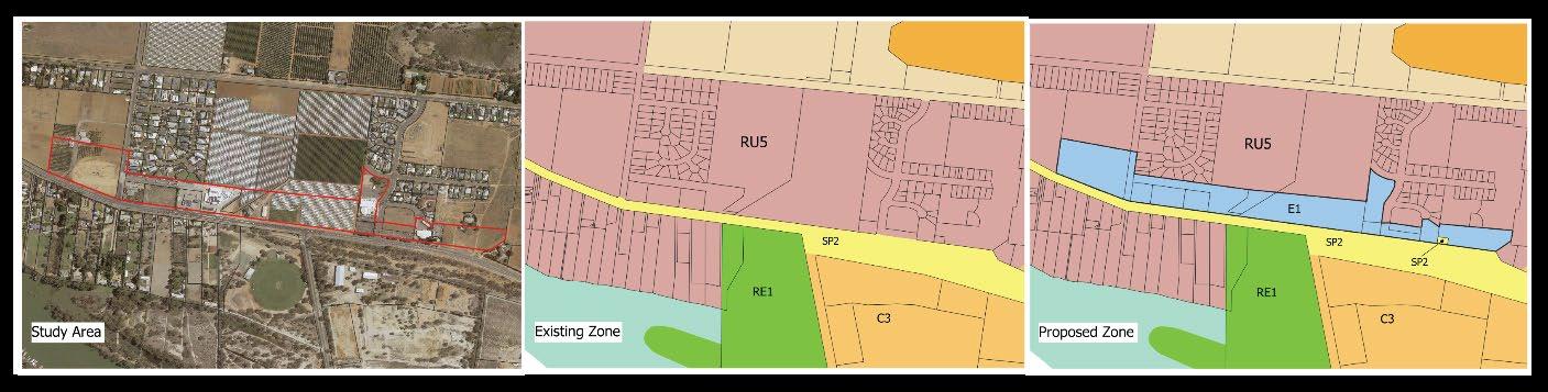
Figure 1 Study Area, Existing Zone and Proposed E1 Local Centre zone
Due to the rapid growth and development occurring in the Buronga Gol Gol area, the BGGSP identified the necessity to ensure centrally located land is available for new and emerging commercial development to provide retail services to the community. The commercial precinct will be Buronga Gol Gol’s first formalised retail and business centre and will provide for a range of commercial, civic, cultural and associated residential development providing social and economic benefits to the community.
The new E1 Local Centre zone will replace the existing RU5 Village zone over fourteen (14) (or part thereof) allotments. The area to be rezoned is approximately 15 hectares. Lot 1 DP 848480 will be rezoned to SP2, to better reflect its current and future use by Council for water infrastructure. The current RU5 land does not have a minimum lot size (MLS) and none is proposed for the new E1 zone.
The planning proposal has been prepared in accordance with Section 3.33 of the Environmental Planning and Assessment Act 1979 and the Department of Planning and Environment Local Environmental Plan Making Guideline December 2021.
The planning proposal seeks a Gateway Determination to proceed under Section 3.34 of the Environmental Planning and Assessment Act 1979.
Wentworth Shire Council is seeking delegation to make this plan as the matter contained in the planning proposal are of local significance.
SITE DETAILS
The subject land has an emerging ‘village style’ commercial precinct that has evolved during the past few years, particularly around the Wentworth Shire Council Midway Centre.
Development in the area includes a supermarket and specialty shops, service station, state agencies offices and associated car parking and two dwellings with associated buildings as shown in figure 2
Item 9.15 - Attachment 2 Planning Proposal Page 264 WENTWORTH SHIRE COUNCIL – PLANNING PROPOSAL – RU5 VILLAGE TO E1 LOCAL CENTRE ZONE 5
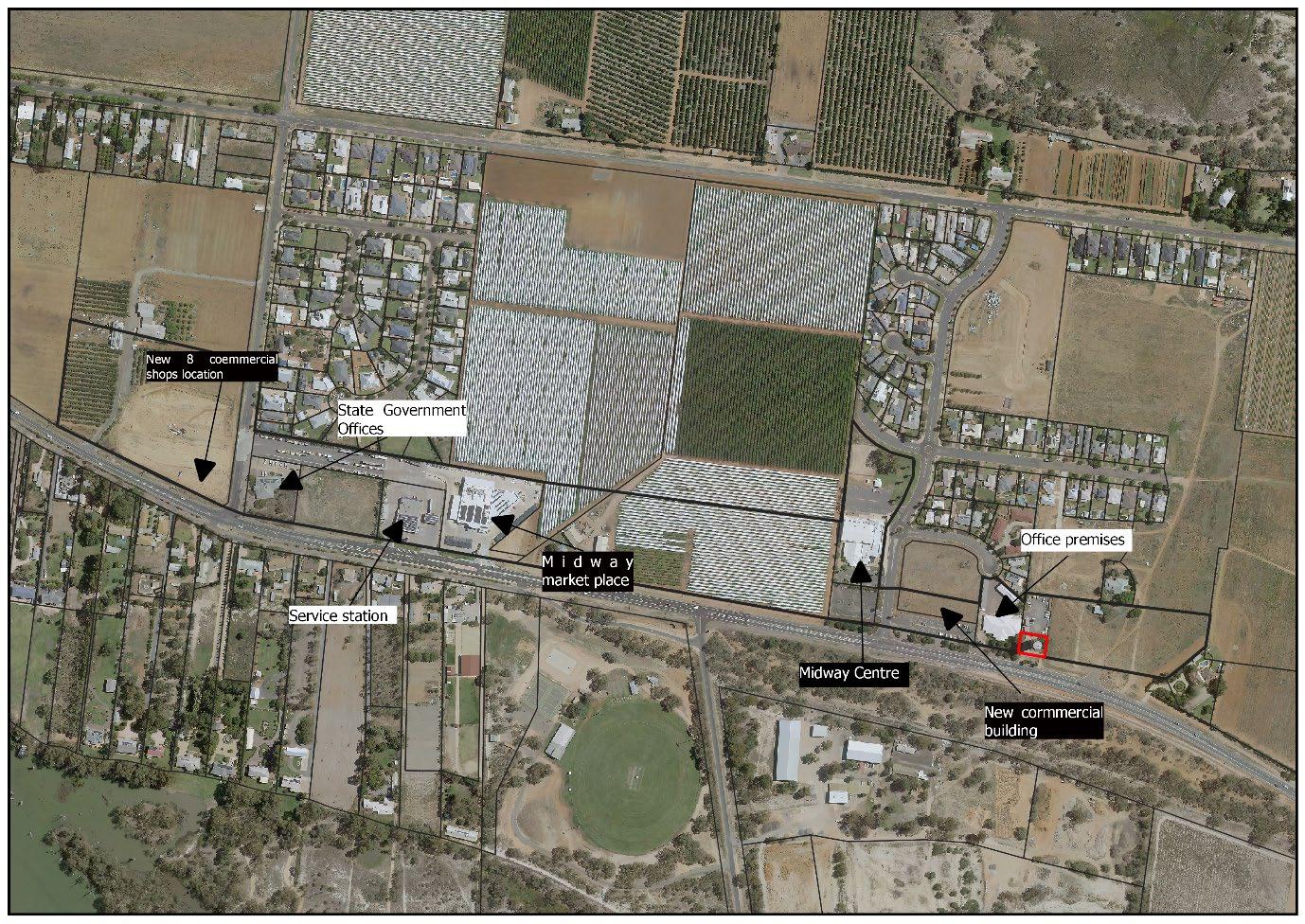
Figure 2 Existing commercial area in Study Area
Remaining land is either vacant or still under horticultural cropping.
Table 1 Allotments included in planning proposal
1 Lot 2
2 Lot
4 Lot 2
5 Lot 1
6 Lot 2
7 Lot 125
8 Lots 1
Item 9.15 - Attachment 2 Planning Proposal Page 265 WENTWORTH SHIRE COUNCIL – PLANNING PROPOSAL – RU5 VILLAGE TO E1 LOCAL CENTRE ZONE 6
No. Land Identifier Current Zone Proposed Zone Tenure Current land use
DP
RU5 Village E1 Local Centre Freehold Vacant,
buildings
1222570 (Part)
with development approval for 8 commercial
6 DP1029509 RU5 Village E1 Local Centre Freehold Commercial - Office
DP1029509 RU5 Village E1 Local Centre Freehold Vacant
3 Lot 5
RU5
Local
Freehold Service
DP870633
Village E1
Centre
Station
RU5
Local
Freehold Commercial
DP1213735
Village E1
Centre
–Supermarket & boutique shops
RU5 Village E1 Local Centre Freehold Horticulture
DP1213735 (Part)
DP756946
RU5 Village E1 Local Centre Freehold Dwelling, packing shed, horticulture crop
(Part)
DP873390 RU5 Village E1 Local Centre Freehold WSC Midway
Centre (Customer Service, Library, Conference &
meeting rooms facility, Basketball stadium)
9 Lot 2 DP873390 RU5 Village E1 Local Centre Freehold WSC Midway Centre (Customer Service, Library, Conference & meeting rooms facility, Basketball stadium)
10 Lot 1 DP1092845 RU5 Village E1 Local Centre Freehold Development approval for a commercial building with 4 leasable space
11 Lot 11 DP877693 RU5 Village E1 Local Centre Freehold Commercial - Office
12 Lot 1 DP848480 RU5 Village SP2 Infrastructure Freehold Midway Water Storage Reservoir
13 Lot 27 DP1243078 (Part) RU5 Village E1 Local Centre Freehold Subdivision approval for 2 commercial Lots with highway access in place.
The subject land has direct access to Hendy Road/Sturt Highway and is located adjacent to existing and emerging residential development to the north, west and east.
South of Hendy Road/Sturt Highway is the Carramar Drive Sporting Complex which comprises a sports oval, cricket pitches, tennis courts and associated buildings. The southern end of the sporting complex has a natural parkland with established walking/cycling tracks and is adjacent to the Murray River.
The subject site is not affected by the Flood Planning Area Map Sheet CL1_004F applicable to Buronga and Gol Gol in the Wentworth LEP 2011, as shown below:
Item 9.15 - Attachment 2 Planning Proposal Page 266 WENTWORTH SHIRE COUNCIL – PLANNING PROPOSAL – RU5 VILLAGE TO E1 LOCAL CENTRE ZONE 7
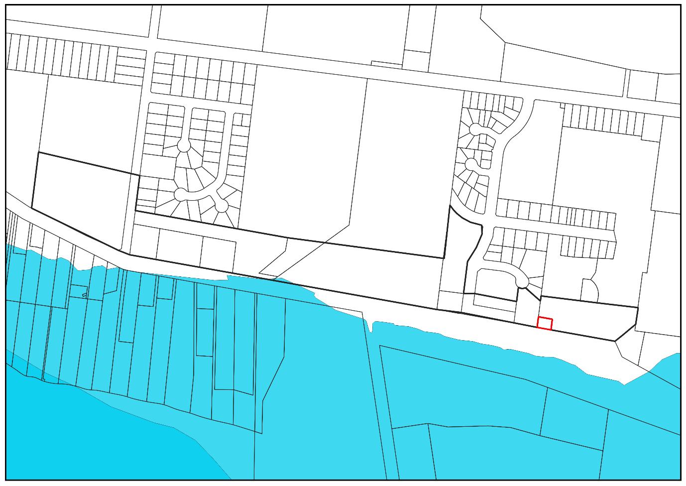
The subject site is partially affected by the Urban Release Area Map – Sheet URA_004F applicable to the Buronga and Gol Gol area in the Wentworth LEP 2011, as shown below:
Item 9.15 - Attachment 2 Planning Proposal Page 267 WENTWORTH SHIRE COUNCIL – PLANNING PROPOSAL – RU5 VILLAGE TO E1 LOCAL CENTRE ZONE 8
Figure 3 Flood Planning Area Map
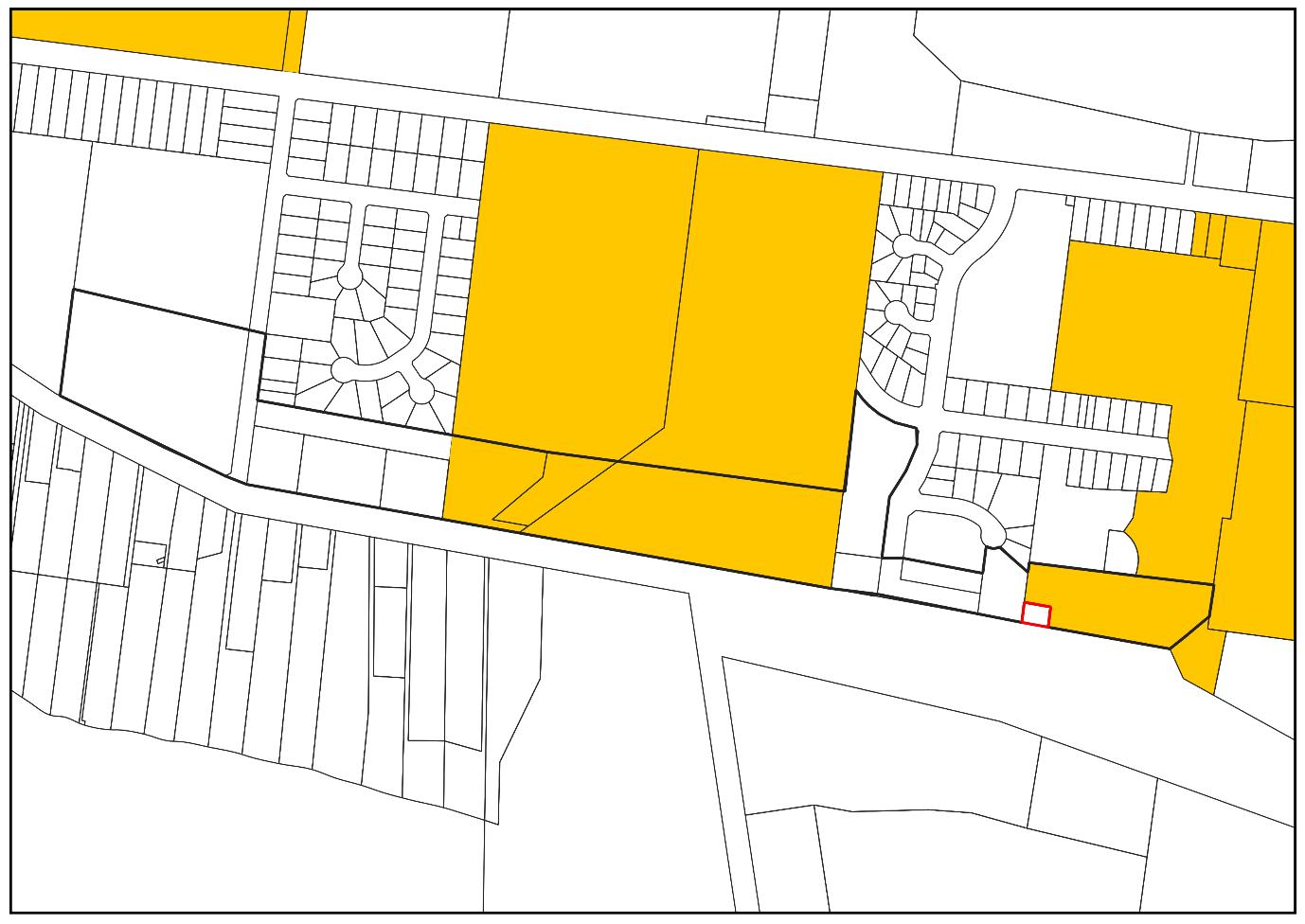
Item 9.15 - Attachment 2 Planning Proposal Page 268 WENTWORTH SHIRE COUNCIL – PLANNING PROPOSAL – RU5 VILLAGE TO E1 LOCAL CENTRE ZONE 9
Figure 4 Urban Release Area Map
PART 1 – OBJECTIVES AND INTENDED OUTCOMES
The objective of this planning proposal is to amend the Wentworth LEP 2011 to establish a centralised commercial precinct which will have the capacity to encourage and accommodate new commercial development to service the growing community of Buronga Gol Gol.
The intended outcomes include:
- Create a well-defined commercial precinct in a highly visible and accessible location
- Provide space for the establishment of new businesses
- Benefit the local and growing community through the provision of commercial services
- Facilitate connectivity between existing and new commercial and residential development
PART 2 – EXPLANATION OF PROVISIONS
The objectives and intended outcomes will be achieved by amending the Wentworth LEP 2011 as follows:
- Amend the Land Zoning Map – Sheet LZN_004F by rezoning the subject land from RU5 Village to the E1 Local Centre and SP2 Infrastructure zone
PART 3 – JUSTIFICATION OF STRATEGIC AND SITE-SPECIFIC MERIT
SECTION A – NEED FOR THE PLANNING PROPOSAL
1. Is the planning proposal a result of an endorsed LSPS, strategic study or report? The subject land was identified in the Buronga Gol Gol Structure Plan 2020. The BGGSP was endorsed by the Department of Planning 5 November 2021.
The BGGSP was prepared by Council to facilitate well planned and sustainable development in the localities of Buronga and Gol Gol, by guiding and planning for land use changes, infrastructure development and public and recreational spaces for the growing community.
To cater for additional population growth, the BGGSP proposed the introduction of a centralised commercial precinct to promote self-sufficiency and encourage connectivity for the two localities.
The creation of the commercial precinct will provide a boost the local economy by providing opportunity for start-up businesses such cafes, restaurants, boutique shops and miscellaneous stores. These shops will be very beneficial to the local community who will be able to walk or cycle to access daily essentials such as food and other supplies, without needing to travel by car to Mildura.
It is anticipated a wide mix of uses will make more activities and services available in one location accessible by walking, cycling and public transport, and consequently promote selfreliance and an active lifestyle in Buronga Gol Gol.
Accordingly, the strip of land located to the north of Hendy Road should be rezoned from RU5 Village to E1 Local Centre. The area of the land proposed for E1 Local Centre is approximately 15 hectares. The RU5 Village zone currently applied to the land allows for
Item 9.15 - Attachment 2 Planning Proposal Page 269 WENTWORTH SHIRE COUNCIL – PLANNING PROPOSAL – RU5 VILLAGE TO E1 LOCAL CENTRE ZONE 10
business activities, however rezoning it to E1 Local Centre will ensure it is protected and reserved for commercial development and thereby centralise and consolidate commercial activities required to provide essential services to residents and boost the local economy in Buronga Gol Gol. In other words, a E1 Local Centre will better facilitate development of the proposed Commercial Precinct in the area.
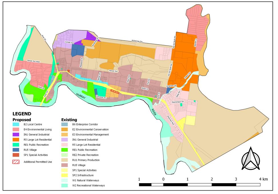
Figure 5 Extract from the Buronga Gol Gol Structure Plan showing future land use zones
This planning proposal enacts upon Recommendation 7 of the BGGSP.
2. Is the planning proposal the best means of achieving the objectives or intended outcomes, or is there a better way?
It is considered that the planning proposal is the best means of achieving the objectives and intended outcomes for the Buronga and Gol Gol communities.
By applying the E1 Local Centre zone over the subject land, it effectively protects the area to create a commercial precinct which will consolidate this type of development in a centralised location.
SECTION B – RELATIONSHIP TO THE STRATEGIC PLANNING FRAMEWORK
3. Will the planning proposal give effect to the objectives and actions of the applicable regional or district plan or strategy (including any exhibited draft plans or strategies)?
The Far West Regional Plan is the NSW Government’s 20 year development blueprint for the future of the far west region. The goal of the plan is to help communities in the regio n to adapt to meet future challenges whilst ensuring the ongoing liveability of local communities
Item 9.15 - Attachment 2 Planning Proposal Page 270 WENTWORTH SHIRE COUNCIL – PLANNING PROPOSAL – RU5 VILLAGE TO E1 LOCAL CENTRE ZONE 11
and the health of the natural environment. The planning proposal is consistent with the following directions of the Far West Regional Plan:
Table 2 Consistency with FWRP
Direction
Direction 12: Enhance the productivity of employment lands
Action - 12.6 Accommodate future commercial and retail activity in existing commercial centres, unless there is a demonstrated need and positive social and economic benefits for the community
Response
Historically, Buronga and Gol Gol residents have relied heavily on retail services over the Murray River in Mildura, Victoria. However, during recent years, as the area has experienced growth and new development, a village style commercial precinct has evolved. The precinct is suitably located centrally between both townships.
To encourage further commercial development and to consolidate this type of development, the BGGSP has recommended that an adequate area of land be rezoned to a commercial zone. This will ensure that the provision of new retail and business services are established within the precinct and not forced out by the current, rapid spate of residential development.
The flow on effects will include economic growth and prosperity for businesses and increased employment opportunities for the community.
The planning proposal is consistent with Direction 12 of the Far West Regional Plan 2036.
Direction 20: Manage change in settlements
As the population of Buronga and Gol Gol townships increase, there will also be demand on the availability of land for commercial development to service those communities. The planning proposal aims to protect a centrally located area of land for commercial purposes in order to provide services and employment to those moving in to the area. As retail services and employment opportunities grow, the reliance on travelling to and from Mildura will be decreased.
The planning proposal is consistent with Direction 20 of the Far West Regional Plan 2036.
Direction 21: Strengthen communities of An ongoing relationship between the
Item 9.15 - Attachment 2 Planning Proposal Page 271 WENTWORTH SHIRE COUNCIL – PLANNING PROPOSAL – RU5 VILLAGE TO E1 LOCAL CENTRE ZONE 12
interest and cross-regional relationships
demand and supply of land for new development, particularly in Buronga, Gol Gol and Mildura, is continuing, as both centres operate within the same housing market and have similar requirements for infrastructure and servicing. This Planning Proposal will create jobs and bring people to the area which will only serve to strengthen and enhance our cross-border settlements and the relationship with Mildura.
The planning proposal is consistent with Direction 21 of the Far West Regional Plan 2036.
4. Is the planning proposal consistent with a council LSPS that has been endorsed by the Planning Secretary or GSC, or another endorsed local strategy or strategic plan?
Wentworth Local Strategic Planning Statement 2020
Wentworth Shire Local Strategic Planning Statement 2020 (LSPS) was prepared in collaboration with the Department of Planning, Industry & Environment Chief Planner’s office and Western Region staff.
One of the Primary Settlement Strategies under Planning Priority 6 – Sustainable settlements for Buronga and Gol Gol is:
iii. Support the development of the new local centre at Midway Drive by concentrating new commercial, retail, community and other non-residential development in the vicinity.
This planning proposal is consistent with the LSPS as it aims to establish a commercial precinct for new commercial development within the Midway Drive area and protect that area of land from being developed for purposes, other than commercial.
Wentworth Community Strategic Plan 2022-2032
The community vision of the Wentworth Community Strategic Plan 2022-2032 (CSP) is:
Wentworth Shire will work together to create a thriving, attractive and welcoming community.
In order to achieve the current vision, Council has applied the Quadruple Bottom Line approach with the following categories:
• Economic – A vibrant, growing and thriving region
• Social – A great place to live
• Environmental – A community that works to enhance and protect its physical and natural environment
Item 9.15 - Attachment 2 Planning Proposal Page 272 WENTWORTH SHIRE COUNCIL – PLANNING PROPOSAL – RU5 VILLAGE TO E1 LOCAL CENTRE ZONE 13
• Civic leadership – Is supported by strong and ethical civic leadership with all activities conducted in an open, transparent and inclusive manner
The planning proposal will give effect to the CSP by ensuring that land use and development planning controls are responding to actual and anticipated growth and subsequent development by ensuring that there is suitably zoned land for the provision of services, in this case, commercial services.
5. Is the planning proposal consistent with any other applicable State and regional studies or strategies?
NSW 2040 Economic Blueprint – Investing in the state’s future
The NSW 2040 Economic Blueprint was developed to inform what the state can achieve economically over the next twenty years and to assist the NSW State Government with determining where state funds and investment should be injected, in order to achieve the overall aspirations of the document.
The two aspirations of the NSW 2040 Economic Blueprint applicable to this planning proposal include:
1. Our economy should be diversified
2. Our regions should be productive and growing
The planning proposal is consistent with the NSW 2040 Economic Blueprint – Investing in the state’s future.
20 Year Economic Vision for Regional NSW 2021
The 20 Year Economic Vision for Regional NSW (EVR) is a plan to drive sustainable, long term economic growth and development in regional NSW.
The EVR divides the state into five regional economies, of which Wentworth falls within the Western Murray region. The focus areas of the EVR for Western Murray applicable to this planning are:
• Attract domestic and international visitors by developing areas with tourism potential
• Provide pathways for upskilling and connectivity for jobs
The planning proposal is consistent with the 20 Year Economic Vision for Regional NSW.
Economic Development Strategy for Regional NSW 2015
The Economic Development Strategy for Regional NSW (EDS) was developed as a priority action from the NSW Economic Development Framework, to drive economic growth in regional NSW to rebuild and sustain the economy.
The goal of the EDS relevant to this planning proposal is:
- Goal 2 Drive regional employment and regional business growth
Item 9.15 - Attachment 2 Planning Proposal Page 273 WENTWORTH SHIRE COUNCIL – PLANNING PROPOSAL – RU5 VILLAGE TO E1 LOCAL CENTRE ZONE 14
Under Goal 2, the priorities are to promote job creation, grow retail trade jobs, support business growth, increase regional skills base and improve aboriginal employment and business outcomes.
The planning proposal is consistent with the priorities of Goal 2 of the EDS as the securing of land for future commercial development will create employment opportunities and increase business and economic activity in the localities of Buronga and Gol Gol.
6. Is the planning proposal consistent with applicable SEPPs?
The State Environmental Planning Policies relevant to this planning proposal are as follows:
Table 3 Consistency with State Environmental Planning Policies
State Environmental Planning Policy (SEPP)
SEPP (Biodiversity and Conservation) 2021
Consistency/Inconsistency
Chapter 2 Vegetation in non-rural areas of this SEPP applies to the land zoned RU5 Village and B2 Local Centre/E1 Local Centre zone.
The entire area has been previously cleared for either commercial or agricultural purposes. Should there be any remnant native vegetation on any of the allotments, clearing of such for new development will be assessed as part of the development approval process.
The planning proposal is consistent with this SEPP.
SEPP (Industry and Employment) 2021
SEPP (Resilience and Hazards) 2021
Chapter 3 Advertising and signage of this SEPP applies to the whole state.
There is nothing in the planning proposal that contravenes the provisions of Chapter 3 of this SEPP.
The planning proposal is consistent with this SEPP.
Chapter 4 Remediation of land of this SEPP applies to the whole state.
One of the allotments included in the subject site is currently used for horticulture, which is an activity listed in Table 1 of the Managing Land Contamination Planning Guidelines.
The proposed zone of E1 Local Centre includes sensitives uses such as residential, educational, recreational and childcare purposes as permitted with consent. However, under the current RU5 Village zone, all of these uses are permitted with consent as well, without the necessity to undertake an initial evaluation report for development in that zone.
Therefore, it has been the determined that an initial evaluation report for that allotment should be prepared only when it is proposed to be developed. For example at the development application stage, dependent upon the use to be applied to the site.
The planning proposal is consistent with this SEPP.
SEPP (Transport and Infrastructure) 2021
Chapter 2 Infrastructure of this SEPP applies to the whole state. WSC is the service provider for water, sewer and stormwater infrastructure. The proposal has been discussed internally and
Item 9.15 - Attachment 2 Planning Proposal Page 274 WENTWORTH SHIRE COUNCIL – PLANNING PROPOSAL – RU5 VILLAGE TO E1 LOCAL CENTRE ZONE 15
will be investigated as part of the Integrated Water Management Plan currently being prepared for Council.
Pre-lodgement consultation with Transport for NSW and Origin Energy has been conducted with both agencies providing advice and details. This is outlined in Section E below.
The planning proposal is consistent with this SEPP.
7. Is the planning proposal consistent with applicable Ministerial Directions (Section 9.1 Directions)?
Consistency with relevant S9.1 Ministerial Directions are assessed in the table below:
Table 4 Consistency with S9.1 Directions
S9.1 Direction Application Relevance to the planning proposal Consistency
1.1 Implementation of Regional Plans
1.3 Approval and Referral Requirements
This direction applies to a relevant planning authority when preparing a planning proposal for land to which a Regional Plan has been released by the Minister for Planning.
This direction applies to all relevant planning authorities when preparing a planning proposal.
Planning proposals must be consistent with a Regional Plan released by the Minister for Planning.
As outlined in Part 3 Section B 3, the planning proposal is consistent with the Far West Regional Plan 2036.
This planning proposal:
a. Does not introduce provisions that require the concurrence, consultation or referral of applications to a Minister or public authority
b. As per a. above
c. Does not identify development as designated development
Consistent
Consistent
3.1 Conservation zones
This direction applies to all relevant planning authorities when preparing a planning proposal.
The planning proposal does not include any sites that are environmentally sensitive. Land to the south east of the site that is zoned C3 Environmental Management will not be impacted by the proposed development facilitated by this planning proposal. The majority of this area is nominated for redevelopment for public recreation purposes in the Buronga Gol Gol Structure Plan.
Consistent
Item 9.15 - Attachment 2 Planning Proposal Page 275 WENTWORTH SHIRE COUNCIL – PLANNING PROPOSAL – RU5 VILLAGE TO E1 LOCAL CENTRE ZONE 16
3.2 Heritage Conservation
3.5 Recreation Vehicle Areas
4.4 Remediation of Contaminated Land
This direction applies to all relevant planning authorities when preparing a planning proposal.
This direction applies to all relevant planning authorities when preparing a planning proposal.
This direction applies when a planning proposal authority prepares a planning proposal that applies to: (b) land on which development for a purpose referred to in Table 1 to the contaminated land planning guidelines is being, or is known to have been, carried out.
There are no known items of heritage significance on the subject land. Consistent
The planning proposal does not enable the subject land to be developed for the purpose of recreation vehicle use. Consistent
One allotment within the subject land is currently being used for horticultural purposes, a use listed in Table 1 of the contaminated land planning guidelines.
The land use table for E1 Local Centre zone enables land to be developed for the purposes of a child care centre, residential and public uses. Under the current RU5 Village zone, all of these uses are permitted with consent as well, without the necessity to undertake an initial evaluation report for development in that zone.
Therefore, it has been the determined that an initial evaluation report for that allotment should be prepared only when it is proposed to be developed. For example at the development application stage, dependent upon the use to be applied to the site.
5.1 Integrating Land Use and Transport
This direction applies to all relevant planning authorities when preparing a planning proposal that will create, alter or remove a zone or a provision relating to urban land, including land zoned for residential, business, industrial, village or tourist purposes.
The Buronga Gol Gol Structure Plan carefully considered and analysed the current layout of residential development, future development and shared pathways when determining the location for a commercial precinct. The Structure Plan and this planning proposal, together, will improve access from existing and future residential development to jobs, retail/commercial services and public transport.
Council has consulted with Transport for NSW, both during
Item 9.15 - Attachment 2 Planning Proposal Page 276 WENTWORTH SHIRE COUNCIL – PLANNING PROPOSAL – RU5 VILLAGE TO E1 LOCAL CENTRE ZONE 17
Consistent
Consistent
5.2 Reserving Land for Public Purposes
6.2 Caravan Parks and Manufactured Home Estates
This direction applies to all relevant planning authorities when preparing a planning proposal.
This direction applies to all relevant planning authorities when preparing a planning proposal.
the development and exhibition stages of the Structure Plan, to ensure that the proposal for a commercial precinct was supported.
The planning proposal does not seek to rezone or remove land that is currently used or reserved for public purposes.
The current B2 Local Centre zone permits the development of a caravan park with consent. However, the translation of B2 to E1 Local Centre at the end of 2022 will result in caravan parks in the E1 zone being prohibited. The majority of the Buronga and Gol Gol area is zoned RU5 Village zone, which permits the use of land for a caravan park with consent.
Consistent
Consistent
7.1 Business and Industrial Zones
This direction applies to all relevant planning authorities when preparing a planning proposal that will affect land within an existing or proposed business or industrial zone (including the alteration of any existing business or industrial zone boundary).
The planning proposal will: a) encourage employment growth in a centralised precinct, b) protect the rezoned land for commercial purposes and development c) ensure the ongoing viability and sustainability of the identified commercial precinct.
The planning proposal will:
- not reduce the area of the existing industrial zone in Buronga - not reduce the potential floor space area for employment uses and related public services
- not reduce the total potential floor space area for industrial use in the existing industrial zone
- the proposed new employment zone is in accordance with the Buronga Gol Gol
Consistent
Item 9.15 - Attachment 2 Planning Proposal Page 277 WENTWORTH SHIRE COUNCIL – PLANNING PROPOSAL – RU5 VILLAGE TO E1 LOCAL CENTRE ZONE 18
Structure Plan that is approved by DPE.
SECTION C – ENVIRONMENTAL, SOCIAL AND ECONOMIC IMPACT
8. Is there any likelihood that critical habitat or threatened species, populations or ecological communities, or their habitats, will be adversely affected because of the proposal?
The subject site does not contain any native vegetation, critical habitat or threatened species, populations or ecological communities.
A review of the of the subject site on the NSW Biodiversity Values Map and the Transitional Native Vegetation Regulatory Map, shows no likelihood of any issues raised in this section.
9. Are there any other likely environmental effects of the planning proposal and how are they proposed to be managed?
There are no known likely environmental effects as a result of this planning proposal.
10. Has the planning proposal adequately addressed any social and economic effects?
The planning proposal will provide certainty for both Council, landholders and developers when applications are lodged with Council for consideration of new development on the subject land.
Securing this land specifically for commercial purposes, will centralise business activity between the villages of Buronga and Gol Gol, which in effect will consolidate the two villages. In the past, commercial development has established sporadically, which has resulted in the lack of a commercial centre in Buronga and Gol Gol.
It will also incentivise new development that will create ongoing employment for the local community and reduce the necessity for travel to Mildura to access retail and business services.
The subject site was identified in Buronga Gol Gol Structure Plan due to its central location, high visibility and ease of access for residents by vehicle, cycling and walking. One of the goals of the Structure Plan is to ensure that connectivity, not just by road, but by a network of shared pathways, is established to the central, commercial precinct. The attraction to the subject site is augmented by the existing Carramar Drive recreation precinct, south of the Sturt Highway, which has been recommended by the Structure Plan to be extended over Carramar Drive with an additional sport oval and associated buildings.
SECTION D – INFRASTRUCTURE (LOCAL, STATE AND COMMONWEALTH)
11. Is there adequate public infrastructure for the planning proposal?
To address and ensure adequate servicing of the growing population of Buronga Gol Gol, the Buronga Gol Gol Structure Plan recommended that Council undertake a Strategic Water Supply Master Plan, Sewerage Infrastructure Master Plan and Integrated Water Cycle Management Plan.
Item 9.15 - Attachment 2 Planning Proposal Page 278 WENTWORTH SHIRE COUNCIL – PLANNING PROPOSAL – RU5 VILLAGE TO E1 LOCAL CENTRE ZONE 19
Council, together with consultants, have commenced work on the Integrated Water Management Plan. This holistic plan will address and plan for water, sewer and stormwater services and infrastructure over the entire study area of the Buronga Gol Gol Structure Plan, including the proposed commercial development precinct. It is anticipated that this plan will be completed by the end of 2022, prior to the proposed rezoning of the subject site
SECTION E – STATE AND COMMONWEALTH INTERESTS
12. What are the views of state and federal public authorities and government agencies consulted in order to inform the Gateway determination?
During exhibition of the Buronga Gol Gol Structure Plan consultation with the following agencies was conducted:
Table 5 Agency submissions to BGGSP
Agency
Transport for NSW
DPIE - BCD
DPIE - Crown Lands
Environmental Protection Agency
Response
An extensive submission was received that focused on the interaction of proposed development and treatments on the Sturt and Silver City Highways and their potential impact on the efficiency and safety of the classified road network.
An extensive submission was received that provided advice on aboriginal cultural heritage, biodiversity, native vegetation clearing, natural hazards and climate change.
An extensive submission advised that any additional redevelopment work on recreational and reserve land may require departmental consent, licences or land acquisition.
An extensive submission advised that buffer zones are a very important component of the planning process to protect sensitive land uses from amenity impacts from agricultural and industrial uses.
Water NSW No response
DPIE Water, Fishing, Agriculture No response
NSW RFS, Fire & Rescue, Ambulance, Police No response
Discussion has commenced with regards to the proposed Emergency Services Precinct.
NSW Department of Education No response
Discussion has commenced with regards to the proposed consolidated education facility.
NSW Health No response
Consultation with Transport for NSW will be necessary for this planning proposal as the subject site abuts the Sturt Highway.
PART 4 – MAPS
A request for final LEP mapping will be made to the mapping team in the Department of Planning and Environment, once it is assured that the amendment will be finalised.
Item 9.15 - Attachment 2 Planning Proposal Page 279 WENTWORTH SHIRE COUNCIL – PLANNING PROPOSAL – RU5 VILLAGE TO E1 LOCAL CENTRE ZONE 20
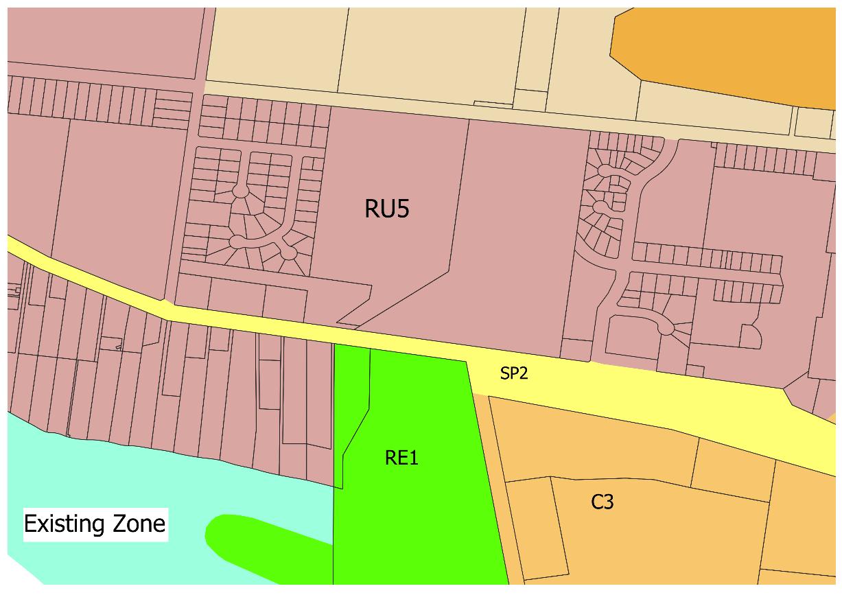
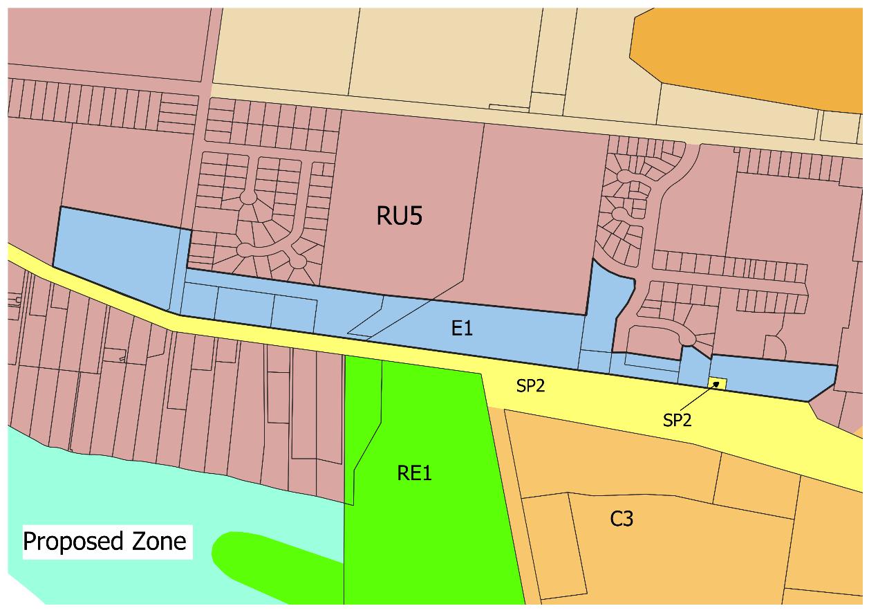
Item 9.15 - Attachment 2 Planning Proposal Page 280
SHIRE COUNCIL – PLANNING PROPOSAL – RU5
E1
21
WENTWORTH
VILLAGE TO
LOCAL CENTRE ZONE
Figure 6 Existing versus proposed zoning
PART 5 – COMMUNITY CONSULTATION
Public exhibition will be conducted for a period of 28 days in accordance with Section 3.34(2)(c) and Schedule 1 Clause 4 of the Environmental Planning & Assessment Act 1979 and as required by the Gateway Determination.
Notification of the planning proposal during the exhibition period will include:
• the Wentworth Shire Council website
• the Planning Portal
• the public notices section of the local daily newspaper
• written advice to affected landowners
PART 6 – PROJECT TIMELINE
It is proposed to seek a Council Resolution at the Ordinary Meeting held in April 2023, with notification of the LEP amendment on the legislative website by end of December 2023 and finalisation by January 2024 This determine the overall project timeframe as being ten (10) months in duration.
Table 6 Project Timeline
STAGE TIMEFRAME
Consideration by Council
Council decision
Gateway determination
Pre-exhibition
Commencement and completion of exhibition
Consideration of submissions
Resolution for finalisation
Gazettal of LEP amendment
Finalisation by Council or DPE
April 2023
April 2023
May 2023
July 2023
Mid-August 2023 to Mid-September 2023
October 2023
November 2023
December 2023
January 2024
Item 9.15 - Attachment 2 Planning Proposal Page 281 WENTWORTH SHIRE COUNCIL – PLANNING PROPOSAL – RU5 VILLAGE TO E1 LOCAL CENTRE ZONE 22
9.16 DELEGATED AUTHORITY APPROVALS AS AT END OF MARCH 2023
File Number: RPT/23/179
Responsible Officer: Matthew Carlin - Director Health and Planning Responsible Division: Health and Planning Reporting Officer: Kerrie Copley - Planning Officer
Objective: 3.0 Wentworth Shire is a community that works to enhance and protect its physical and natural environment Strategy: 3.1 Ensure our planning decisions and controls enable the community to benefit from development
Summary
For the month of March 2023, a total of thirteen (13) Development Applications and two (2) S4.55 Modification Applications were determined under delegated authority by the Director Health and Planning.
The estimated value of the determined Development Applications was $2,848,968.00. This brings the year to date total to thirty-two (32) Development Applications and ten (10) S4.55 applications approved, with an estimated development value of $7,429,461.00.
Recommendation
That Council:
a) Receives and notes the report for the Delegated Authority Approvals for the month of March 2023.
b) Publicly notifies, for the purposes of Schedule 1 Division 4 Section 20 (2) of the Environmental Planning and Assessment Act 1979, the applications as listed in the attachment on the Wentworth Shire Council website.
c) Calls a Division in accordance with S375A of the Local Government Act 1993 (NSW).
Detailed Report
Purpose
The purpose of this report is to provide Council with a list of Development Applications as tabled in the Attachment, determined under delegated authority by the Director Health and Planning for the month of March 2023, hence complying with the requirements under section 3.20 of the Office of Local Government Promoting Better Practice Program.
Conclusion
The total value of determinations was $2,848,968.00 for the month of March 2023. The average determination time was 40 days.
Attachments
1. Delegated Authority Report March 2023⇩
Ordinary Meeting AGENDA 19 April 2023 Page 282

Item 9.16 - Attachment 1 Delegated Authority Report March 2023 Page 283 DETERMINATION OF DEVELOPMENT APPLICATIONS FOR THE MONTH OF MARCH 202 3 FILE NUMBER APPLICANT LOCATION DESCRIPTION VALUE (EX GST) DETERMINATION DATE ACTIVE DAYS DA202 3/005 PAN 296583 Hatch Planning Pty Ltd Matt Jackson 300 B Downham Road Lot 2 DP 1061095 Wentworth Demolition & construction of n ew dwelling with garage $ 1024,336.00 02 /0 3 /2023 29 DA2023/006 PAN 295585 Ashlee Milverton 27 Ardrossan Court Lot 27 DP 1285900 Gol Gol Storage shed $ 90,000.00 02/0 3 /2023 48 DA2023/010 PAN 288985 BWA National Building Consultants –Donna Clode Yorke Drive Lot 10 DP 12859002 Gol Gol Dwelling with garage & shed $ 700,000.00 02/0 3 /2023 37 DA2023/008 PAN 293317 The Shed Company Mildura –Sherry Pitt 1 Thomas Street Lot 41 DP 1259103 Gol Gol Storage shed $ 48,825.00 0 3 /0 3 /2023 38 DA202 3 / 011 PAN 296575 MH2 Engineering & Architectural Services Pty Ltd –Yeshni Purchase 9294 Wood Street Lot 1 DP 1018940 Gol Gol Shed with carport $ 27,500.00 03/0 3 /2023 38 S4.55/2023/008 PAN 309617 Peter Freckleton 6525 Sturt Highway Lot 19 DP 756936 Trentham Cliffs Modify DA2021/126 –Part demolition of existing dwelling allowing dwelling alterations & extensions –changing description of original approval $0.00 03/0 3 /2023 2
Item 9.16 - Attachment 1 Delegated Authority Report March 2023 Page 284 DETERMINATION OF DEVELOPMENT APPLICATIONS FOR THE MONTH OF MARCH 202 3 DA2023/012 PAN 299170 Hatch Planning Pty Ltd Matt Jackson Ashen Court Lot 16 DP 1242927 Gol Gol Dwelling with garage $716,134.00 03/03/2023 32 DA202 3 / 014 PAN 303839 Hatch Planning Pty Ltd Matt Jackson 72 Silver City Highway Lot 1007 DP 756961 Buronga Carport & shade sail $ 22,749.00 15 /0 3 /2023 34 DA202 3 / 013 PAN 281292 James Golsworthy Consulting Pty Ltd –James Golsworthy Low Darling Road Lot 21 DP 756989 Wentworth Two (2) Demountable buildings Lunchroom with office & Office only $ 63,374.00 1 6 /0 3 /2023 37 DA2023/019 PAN 300000 The Shed Company Mildura –Sherry Pitt 15 Riverview Rise Lot 16 DP 865438 Gol Gol Storage shed $ 33, 0 30 .00 20/03 /2023 28 DA2023/017 PAN 303514 The Shed CompanySherryn Pitt 35 Melaleuca Street Lot 881 DP 756 961 Buronga Storage shed $ 75, 0 10 .00 20/03 /2023 28 DA2023/018 PAN 300637 The Shed CompanySherryn Pitt 37 Melaleuca Street Lot 880 DP 756 961 Buronga Storage shed $ 75,010 .00 22 /0 3 /2023 27 S455/2023/00 9 PAN 310 508 The Shed CompanySherryn Pitt 34 Syndicate Road Lot 1 DP 1105602 Wentworth Modify DA202 2 /1 28 Storage Shed –Change of location on site $0.00 24 /0 3 /2023 1 8 DA2023/015 PAN 30 3104 MH2 ENGINEERING & ARCHITECHTURAL SEVICES PTY LTD –Yeshni Purchase 86 Dawn Avenue Lot 227 DP 720964 & Lot 228 DP 720964 Gol Gol Thirteen (13) Lot Subdivision $0.00 2 7/0 3 /2023 42
Item 9.16 - Attachment 1 Delegated Authority Report March 2023 Page 285 DETERMINATION OF DEVELOPMENT APPLICATIONS FOR THE MONTH OF MARCH 202 3 DA2022/109 PAN 267124 James Golsworthy Consulting Pty Ltd –James Golsworthy 16 Friel Street Lot 903 DP 756961 Buronga 2 Lot Subdivision $0.00 30/03/2023 168
9.17 PROJECT & WORKS UPDATE - APRIL 2023
File Number: RPT/23/196
Responsible Officer: Geoff Gunn - Director Roads and Engineering
Responsible Division: Roads and Engineering
Reporting Officer: Jamie-Lee Kelly - Administration Officer
Objective:
3.0 Wentworth Shire is a community that works to enhance and protect its physical and natural environment Strategy: 3.2 Ensure that community assets and public infrastructure are well maintained
Summary
This report provides a summary of the projects and major works undertaken by the Roads and Engineering Department which have been completed during the months of March 2023 and the planned activities for April 2023.
Recommendation
That Council receives and notes the major works undertaken in March 2023 and the scheduled works for the following month.
Detailed Report
Refer below for updates of the works completed in March 2023, and the planned activities for April 2023.
Project and Works Update for March 2023
Pooncarie Road
• Pumping of flood waters near the intersection of Darling View Road over the sand dune is continuing, it is expected this will be required for another 2-3 weeks
Maintenance Grading
• Planned maintenance grading was undertaken on the following roads: Ivanhoe, Garnpang, Dockerty and Gol Gol
Renmark Road
• Bitumen seal completed 1 March 2023, line marking to be completed the start of May in line with the Arumpo Rd 4km section
Roads
Silver City Heavy Patching
• Segment 45 (near intersection of Arumpo Rd). Line marking completed
Sturt Highway Bridge Mulching
• Contractor carried out mulching both sides of the highway from the Buronga roundabout to the Mildura Bridge abutment
Log Bridge Road
• Rectification works on services such as raw water supply to another residential property and Telstra services in the road reserve have been completed
Ordinary Meeting AGENDA 19 April 2023 Page 286
Projects
Arumpo 4 Km Upgrade to Seal
• Spreading and compaction of sub base 75% complete.
• Gravel pits reinstated ready for closure from WSC head license
Anabranch Flooding
• Several Roads have been significantly impacted due to the Anabranch system flooding. We currently have closures on the Old Broken Hill Road, Polia Road, Windamingle Road and Roo Roo Road
Gol Gol East Raw Water System
• Start up meeting undertaken with Public Works project manager and contractors, additional geotechnical works required following flood erosion damage to platform footings.
• Preliminary electrical works to commence in May.
Junction
Island Bridge
• Continuation of tendering process
Junction
Island Footpath
• Continuation of tendering process
Pink Lake
• Council undertook additional topographical survey works along the existing easement alignment.
• Soil testing works undertaken. Report returned to Council staff late March concluding the viability of conventional trenching, horizontal boring, or micro tunneling construction methods.
Pooncarie Campground Toilets
• Fabrication of amenities block to continue
Jockey Changerooms
• Tenders closed and only one tender was received from the five that requested the tender documents and the tender received exceeded the available budget by 42%
• Alternative and more cost effective options are be considered in consultation with the user group.
Wentworth EDS
• Draft civil plans returned early March. Final technical comments back to design consultants for completion of final construction design
Wentworth Rowing Club Extension
• The successful tenderer has reviewed his prices due to the flood delays and a further increase requested.
• Flood damage to the existing Rowing Club building has required a full review of the options available. These will be discussed with the Rowing Club users once funding options are fully considered.
Ordinary Meeting AGENDA 19 April 2023 Page 287
Wentworth Showgrounds Sewer
• Works to complete.
Willow Bend Caravan Park
• Council’s roads team have re-established finish surface levels across the site.
Amenities Blocks
• Plans have been forwarded to structural engineer for footing design approval.
Wurlong Drainage Extension
• Materials placed on site in preparation for installation in May.
Pooncarie Telegraph Building
• Works are underway with the rectification following the demolition phase previously completed.
Wentworth Long Day Care Centre
• The facility has now received the required certification from the NSW Department of Education and is able to operate.
• The preschool committee will be advising an opening day and operational dates in due course.
Dareton Travellers Rest
• New in ground lighting has been vandalised, costing to replace over $14,000. Signs have also been replaced after vandalism.
• 3 x new flag poles to be installed before Anzac Day.
• Bolts on the structure that hold the red gum slabs on the memorial will be welded to prevent theft of timber, after someone loosened bolts.
Wentworth & Dareton landfills
• New cabins are operational, with power and air conditioning. Road alteration work at Wentworth landfill required
Projects and Works scheduled for April 2023
Pooncarie-Menindee Road Reconstruction
• General maintenance grade to be completed prior to Easter to cater for the higher volume of traffic
Maintenance Grading
• Planned maintenance grading is forecasted for the Karpa Kora and Wilkurra Roads
Roads
Heavy Grading
• Funded by the Regional and Local Roads Repair Program, we will commence heavy grading on Cal Lal and Rufus River Roads, with more to continue in the following months
River Road Flood Damage
• Tender documentation for the stabilisation of existing sub base to be
Ordinary Meeting AGENDA 19 April 2023 Page 288
Projects
completed and advertised. Tenders will close on Wednesday 3 May so contractor can be engaged to carry out works in June.
Boeill Creek Road
• Emergency works undertaken prior to Easter to reinstate the road back to existing height and width to enable two way traffic with out the use of traffic lights.
Arumpo 4km Upgrade to Seal
• Remainder of sub base to be installed with surface final trim. Bitumen seal booked in to be completed late April
Buronga Landfill Machinery Shed
• Mallee sheds undertaking construction – scheduled for completion late April.
• RFQ for plumbing and electrical works to be completed late April.
• All associated works will be completed by 30 June.
Pink Lake
• Preliminary construction plans to be prepared through May.
Pooncarie Campground Toilets
• Fabrication of amenities building to commence.
Wentworth EDS
• Plans to be incorporated into tender package and advertised in May
Willow Bend Caravan Park
• Service works to recommence in May.
Amenities Blocks
• Remaining materials to be ordered.
• Build to commence.
Wurlong Drainage Extension
• Works to commence in May.
James King Park
• Retaining wall design to be finalised.
• Public consultation on proposed design and works timing to be undertaken late April / May prior to tenders being sort.
Low Security Yard - Lagoon Road
• Site to be cleaned and fenced, to prevent theft & OHS concerns
• Quotes being sought for fencing
Flood Recovery Works
Wentworth Rowing Club
Flood Recovery
• Power restored.
• Building electrical assessment undertaken and passed.
• Building structurally assessed and passed.
Ordinary Meeting AGENDA 19 April 2023 Page 289
• Pressure washing internally & externally completed.
• Flood-affected components internally and externally gutted and removed.
• Discussions are currently in progress regarding directions of the rebuild.
Buronga EDS
• Switchboard has been reinstated.
• Damaged electrical components have been replaced with pump station currently operational
Junction Park
• Awaiting underground electrical repairs to be completed.
• Painting is underway of Park assets
• BBQ replaced.
• Awaiting delivery of replacement seating – no ETA available.
• Existing seating is still serviceable and remains on-site until replacement seating arrives.
• Viewing platform works identified by the Tonkin structural assessment have been completed.
• Bank erosion remedial works are in discussion
Fotherby Park
• The underground power supply to the Possum statue, some park lights, and the visitor information board has been lost. Contractor engaged to rectify.
• Contractor engaged to undertake the painting of some park assets –works completion scheduled for late April.
• Awaiting delivery of replacement seating – no ETA available.
• Power bollards being modified, will be operational by Easter.
P.S Ruby
• Power to the Ruby should be restored by 17 April.
• 2 x boat mooring poles were uprooted during the flood period. Contractor engaged to replace and undertake general clean-up of the site, PS Ruby is securely moored.
• Flooding caused bank erosion on the north side between the water and fence. Result has 4 x mooring poles exposed to further erosion.
• Access ramp to the Ruby became detached during flooding and is underwater next to the boat – contractor engaged with other site works to retrieve the ramp.
Wentworth Ski Reserve
• Pressure washing of site completed.
• Some minor painting works required – completion scheduled for after Easter.
• Replacement Boat ramp solar light on order – no ETA on delivery.
• Toilet block requires major rebuild. RFQ being compiled. 2 x Portable toilets placed on site.
Wentworth Wharf & Riverfront
• All pressure washing completed.
• Wharf power restored.
• Houseboat bilge pump is operational again.
Ordinary Meeting AGENDA 19 April 2023 Page 290
• Stage 1. Painting works of park assets completed.
• Stage 2. Painting work of park assets scheduled for completion by Easter.
• Underground power supply lost to the park lamp posts, lights under the wharf and some ground lights.
• Park lights come under Essential Energy who are rectifying the issue – no ETA provided.
• Ground lights and lights under the wharf require major works –works will be undertaken once higher priority sights are completed.
• Awaiting delivery of replacement seating – no ETA available.
• BBQ’s operational.
• Power bollards being modified, will be operational by Easter.
Wentworth Showgrounds
• Power restored.
• Main electrical switchboard installed on a metal gantry & raised just above 1956 to mitigate effects of future flooding.
Flood Affected Sign Replacement – Various Locations
• Affected signs been removed.
• Signs to be catalogued and quotes obtained to replace – no ETA.
Attachments
Ordinary Meeting AGENDA 19 April 2023 Page 291
1.
⇩ 2. Boeill Creek Road 2⇩ 3. Boeill Creek Road Reinstated 1⇩ 4. Boeill Creek Road Reinstated 2⇩ 5. Buronga Machinery Shed⇩ 6.
Shed
Rear View⇩ 7.
1⇩ 8.
2⇩ 9.
Boeill Creek Road 1
Buronga Machinery
-
Buronga Roundabout
Buronga Roundabout
Drings Hill Gol Gol⇩ 10. James King Park Hedge⇩ 11. Buronga Nature Play⇩
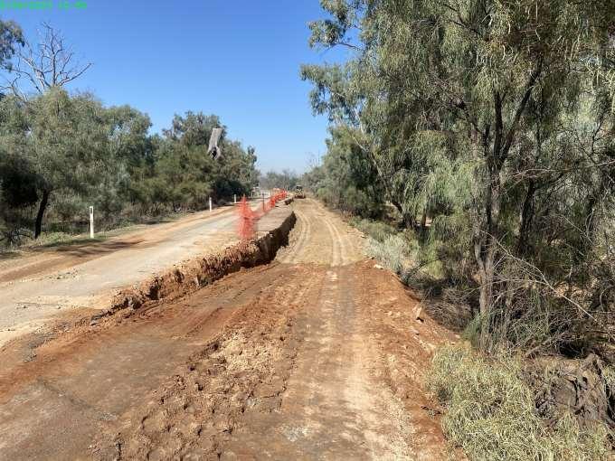
Item 9.17 - Attachment 1 Boeill Creek Road 1 Page 292
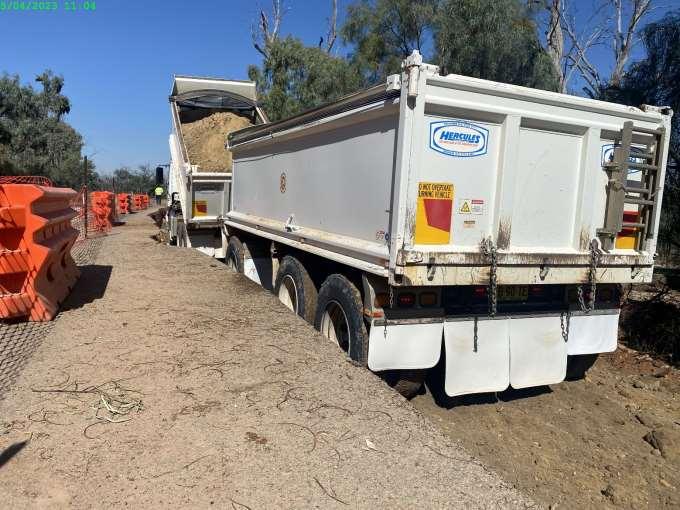
Item 9.17 - Attachment 2 Boeill Creek Road 2 Page 293
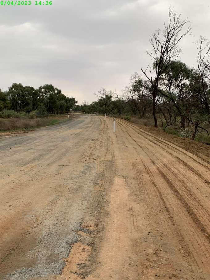
Item 9.17 - Attachment 3 Boeill Creek Road Reinstated 1 Page 294
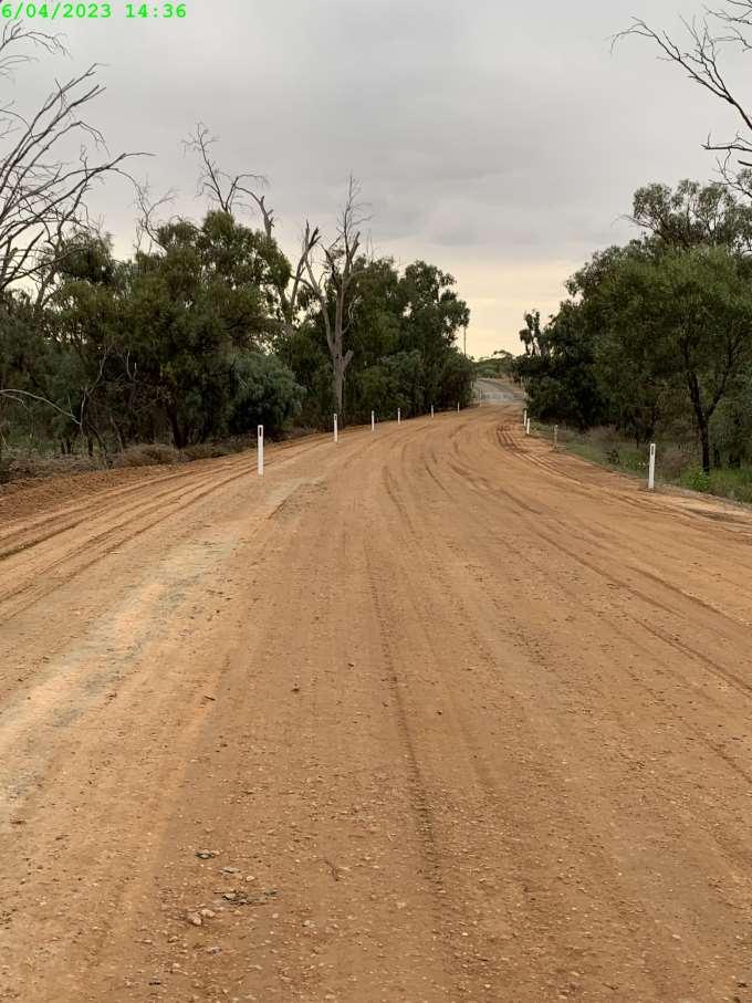
Item 9.17 - Attachment 4 Boeill Creek Road Reinstated 2 Page 295
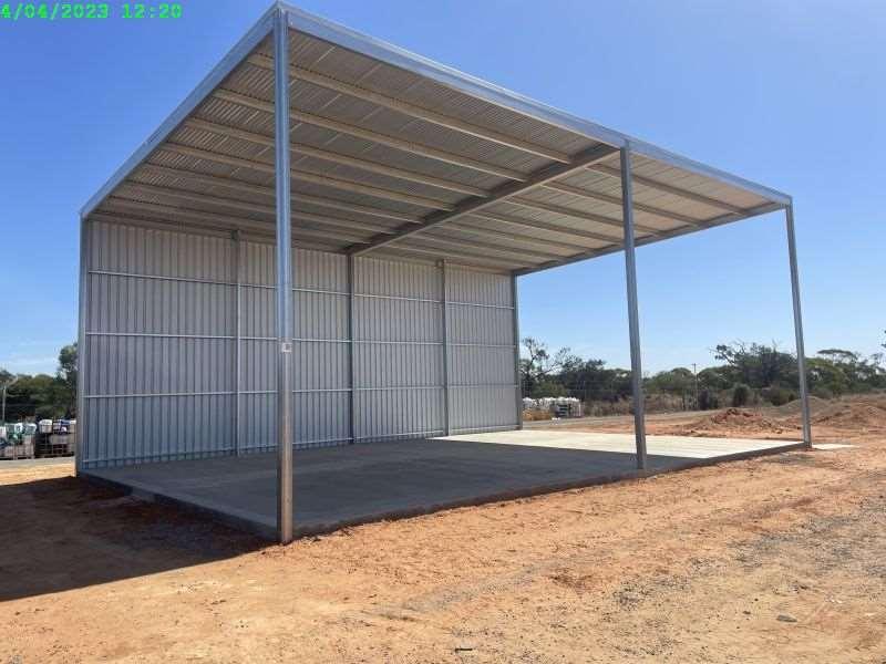
Item 9.17 - Attachment 5 Buronga Machinery Shed Page 296
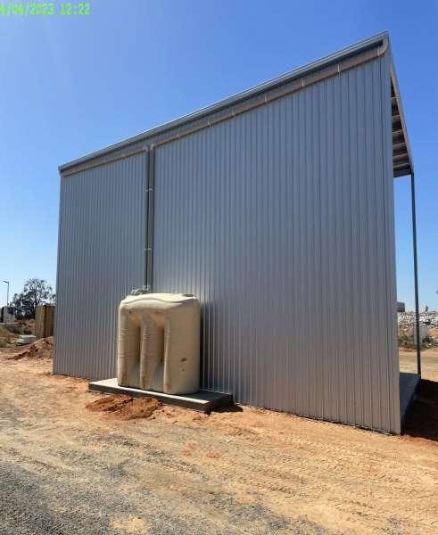
Item 9.17 - Attachment 6 Buronga Machinery Shed - Rear View Page 297
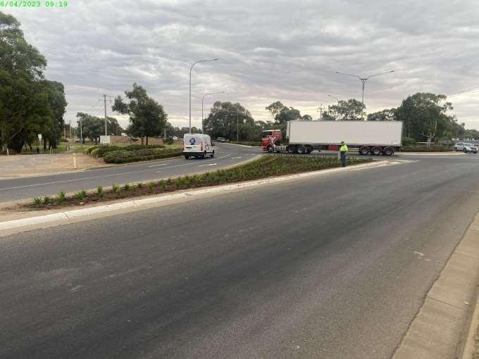
Item 9.17 - Attachment 7 Buronga Roundabout 1 Page 298
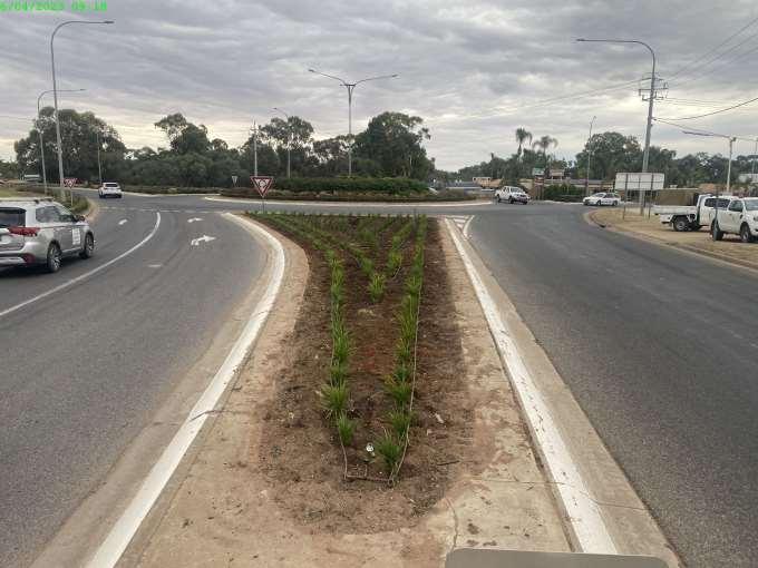
Item 9.17 - Attachment 8 Buronga Roundabout 2 Page 299
Item 9.17 - Attachment 9 Drings Hill Gol Gol Page 300
Item 9.17 - Attachment 10 James King Park Hedge Page 301
Item 9.17 - Attachment 11 Buronga Nature Play Page 302
10 NOTICES OF MOTIONS / QUESTIONS WITH NOTICE
10.1 2026 LGNSW DESTINATION AND VISITOR ECONOMY CONFERENCE
File Number: RPT/23/181
Councillor Beaumont has indicated his intention to move the following motion:
Motion
That Council form a sub-committee to consider the pros and cons of lodging an expression of interest to host the Rural/Regional 2026 Destination & Visitor Economy Conference.
Background
The following is provided by Cr Beaumont in support of the motion:
Each year Local Government NSW conducts Tourism Conferences alternating between Metropolitan/Coastal and Rural/Regional locations. 2023 is the Metropolitan/Coastal year being conducted at Manly. 2024 is Wagga Wagga and 2025 and 2026 yet to be decided following an expressions of interest process.
My view and proposal is that WSC consider expressing interest in hosting the 2026 Rural/Regional Conference.
Wentworth is advantageously located at the junction of Australia’s two greatest rivers, we are privileged to have many natural and developed attractions at our doorstep and across the Shire.
We will by 2026 have in place a fully functioning and new Civic Centre, Accredited Visitor Information Centre and Function facility. We will much to show to the rest of New South Wales in terms of tourism attractions, indigenous history / culture and environmental assets. This (to me) represents an exciting opportunity to showcase our region to the rest of NSW.
Officers Report
Purpose
The purpose of this report is to provide information to Council regarding our capacity to meet the desired criteria set by LGNSW for the LGNSW Destination and Visitor Economy Conference 2026
Expression of Interest Criteria
LGNSW Destination and Visitor Economy Conference 2026
The key hosting criteria and the reasons why Wentworth Shire Council can or cannot accommodate the LGNSW Destination and Visitor Economy Conference is below:
• Location; that our Council is a regional/rural council
Wentworth Shire Council is a rural council.
Outcome – achievable
Ordinary Meeting AGENDA 19 April 2023 Page 303
• Outline why your council should host the conference
Wentworth Shire Council should host this conference to showcase the unique region of New South Wales, where two of Australia’s biggest rivers, the Murray River and the Darling River meet.
The Wentworth Shire Council area is the gateway to the Outback, with a rich and vibrant history surrounded by natural landscape, making it a unique destination for all visitors.
Throughout 2020 - 2023, Wentworth Shire Council tourism has suffered due to COVID restrictions, border closures and flooding. By 2026, the region hopes to be out of the recovery period and visitation on the rise with many new projects newly finished including a redeveloped caravan park and the new Civic Centre, hosting various interpretive spaces relating to the region’s history and heritage.
Wentworth Shire Council has not hosted this conference within the last 10 years.
Outcome – to be determined
• Explain links to tourism and economic development of your council and region
The economic development of our region relies on tourism and visitors to the area. Situated on two rivers, most tourism and economic development comes from activities associated with the river – including fishing, boating, water sports, houseboats etc.
Although Wentworth is a lot smaller in comparison to Mildura in Victoria, located just across the river, the Wentworth Shire hosts many natural attractions including the Perry Sandhills, Mungo National Park, Lake Victoria and Thegoa Lagoon. These natural attractions encourage many visitors from Mildura to experience what the Wentworth Shire has to offer.
Wentworth is also full of rich history and heritage, with Sydney and Newcastle the only ports in New South Wales to handle more cargo than Wentworth as paddle steamers utilised the township of Wentworth as an inland port. Many buildings within Wentworth were built in the 1800’s, making Wentworth a much older region than Mildura, and therefore bringing a point of difference to the area.
Outcome – to be determined
• Outline what support would be offered from within Council and what support your Council would expect to receive from within your community to make the conference exciting. Explain how that sets the region apart from others.
Support would be offered from Council through event management and administrational tasks. Set-up and pack-down of the event would also be provided via Council.
Council would expect support from local businesses in regards to providing a calendar of events for before, during and after the conference that might interest attendees and extend their stay.
Outcome – to be determined
• Social program – what kind of social program would you plan for delegates. Include a welcome reception (200 pax) and conference dinner (up to 300 pax) to be held within a short distance (no more than 30 minutes travelling time) of the main venue and accommodation. Please specify examples not a generic capability.
The welcome reception could be hosted at the Civic Centre in the conference room with the Visitor Information Centre open below for delegates to view beforehand. This area could comfortably cater for 200 people with a cocktail style offering.
Ordinary Meeting AGENDA 19 April 2023 Page 304
The only venue in the Shire that can host 300 people within a main conference room, with multiple break-out rooms, is the Coomealla Club. If the Coomealla Club is used for the conference, the same venue wouldn’t be suitable for the conference dinner as the aim is to showcase various locations throughout the region.
Some options for the conference dinner could include using the Wentworth Showgrounds Pavilion however a marquee may need to be installed outside to comfortably seat 300 people. The conference dinner is always a sit-down meal and not cocktail style. The salt lakes or Perry Sandhills could also be utilised for the conference dinner however a marquee would also need to be used in these areas in case of inclement weather. Chairs, tables and other necessary décor would also need to be hired. Catering companies would need to be self sufficient to cater in these areas. Extra lighting and generators would need to be considered. The cost to host in one of these locations would be much more expensive and the overall success of the conference dinner would be heavily reliant on the weather at the time.
Outcome – achievable
• Proposed site visits that relate to the program as well as showcase what your council is providing in the tourism and economic development space. The site visits must fit within a 3.5-hour time frame including all travel
Past site visits at previous conferences have included a point of difference to encourage attendees to select what interests them or suits their Council’s tourism direction – for example, ecotourism, arts & culture, indigenous tourism, sustainability, health & wellness, inclusive tourism etc.
The sites which are accessible within 3.5 hours from Wentworth don’t offer a point of difference in relation to various aspects of tourism.
Mungo National Park is the only tourism destination that could be a drawcard as a site visit and unfortunately more than 3.5 hours is needed in travel time.
The only possibility would be a site visit based on history and heritage however at the moment this is also not something that is offered within our region.
Outcome – somewhat achievable but possibly not competitive with other Councils
• Suitable conference venue – the proposed conference venue meets the requirements set out below under the conference venue requirements
• The conference venue must be able to seat at least 300 people preferably in theatre or classroom style
As the Civic Centre can only host 180 people as sit-down style, it would not be a suitable venue for this conference. The only other options would be the Coomealla Club or possibly the Wentworth Showgrounds Pavilion. The Coomealla Club would be more suitable as it has appropriate break-out rooms and various catering options on-site.
• All venues must be accessible venues (including toilets, access, stage access for speakers, ramps, safety considerations) and where possible venue and conference topics should allow for hearing and sight impairment, eg. hearing loops
The above criteria can be achieved.
• Please specify venues which can accommodate at least three concurrent workshops or smaller meetings in break out rooms in addition to the main plenary area
Ordinary Meeting AGENDA 19 April 2023 Page 305
There is no option to hold three concurrent workshops or smaller meetings in break out rooms within the same venue, if hosted at the Civic Centre. If it were to be hosted at the Civic Centre, surrounding businesses such as Lock 10 Café & Crown Hotel would need to be utilised.
• Audio visual equipment must be of a professional standard acceptable to LGNSW or LGNSW may engage its own suppliers
External businesses can be contracted to provide professional standard equipment.
• Mobile telephone reception throughout the whole venue is to be reliable
Mobile telephone reception within all potential venues is reliable.
• High speed internet access and WIFI connectivity required throughout the venue
High speed internet access and WIFI connectivity is available within all potential venues
• Upload and download bandwidth options with speeds of up to 300mbps required for AV presentations
Bandwidth options would need to be tested when the venue is selected.
• Lockable office space for the LGNSW Events Team
Lockable office space can be provided within all potential venues
• A trade display area adjacent to the plenary room. Trade display areas to accommodation a minimum of 15 exhibition booths (3m x 2m) with provision for power and data cabling
If the conference were to be hosted at the Civic Centre, a trade display area could be set-up in the Visitor Information Centre for the duration of the event. The area used for set-up would have to be reviewed once the fit-out of the space is complete.
• Delegate catering for morning teas, luncheons and afternoon teas to be accommodated in the Trade Display area
As above, the area used for set-up would have to be reviewed once the fit-out of the space is complete to analyse if the space is suitable for catering requirements.
Outcome – not achievable due to capacity limits
• Accommodation of at least 300 rooms (single occupancy) of at least 3.5 star or higher standard nearby or on-site at the venue (preferably within walking distance if not on site). Caravan Parks are not considered acceptable accommodation.
The Wentworth Shire has 187 rooms in total, with Wentworth having only 133 rooms. There are no hotels within the Shire that have accredited star ratings. All ratings online are guest reviewed or self-rated.
The lack of accommodation within Wentworth nearby or within walking distance that is a suitable star rating is the main reason our location is not suitable to host this conference.
Ordinary Meeting AGENDA 19 April 2023 Page 306
To host this conference, attendees would need to stay within Mildura and it would be unfavourable for our location to be chosen as the aim is to drive economic benefits for accommodation and tourism operators within NSW LGAs.
Outcome – not achievable
• Sustainability – the conference must comply with LGNSW’s Guidelines for Event Sustainability
The conference would comply with LGNSW’s Guidelines for Event Sustainability.
The guidelines refer to reducing costs, minimising environmental impacts, promoting corporate social responsibility, supporting local suppliers and enhancing reputation and image as a sustainable organisation.
This includes avoiding single use items and unnecessary packaging, encouraging the use of reusable coffee cups, minimising the use of hand-outs (freebies, flyers), recycling all recyclable items where appropriate, reducing waste and encouraging vendors to give left over food to those in need.
Outcome – achievable
• Risk Management – the conference venue or host council should be aware of the risk management principles and have an exit or emergency plan as well as a COVID safe plan in place for the conference. LGNSW will collaborate on this with the successful destination.
Noted.
Outcome – achievable
• Transport Links – Excellent transport links with an airport in reasonable proximity. It is envisaged Councils will promote the best transport routes and liaise with airlines, coach companies, rail and car hire companies to ensure appropriate availability of transport options. On-site car parking must be available at the conference venue and accommodation options.
The closest airport is 30 minutes away from Wentworth, located in Mildura. There are options available to fly in directly from Sydney, with transfers from other destinations within NSW. Buses could be organised for flights that the attendees arrive on to drive them from the airport to Wentworth so that they don’t have to rely on car hire.
Wentworth Shire Council would liaise with the airlines, bus companies and car hire companies to ensure there is the appropriate availability of transport. On-site car parking is available at all venues.
Outcome – achievable
• Providing and managing transport – your council must have the ability to provide transport options (council to obtain bus quotes and bookings) and manage transport schedules to and from the accommodation and the conference centre and to the conference dinner return, including payment for the transfer services. Your council should be able to provide transport (council vehicle) pickup for speakers and special guests as needed.
Wentworth Shire Council has the ability to utilise CDC buses to provide transport to all necessary destinations for the duration of the conference.
Wentworth Shire Council also has the ability to provide council vehicles with drivers to pick up speakers and special guests when needed.
Ordinary Meeting AGENDA 19 April 2023 Page 307
Outcome – achievable
Conclusion
Although most of the criteria can be fulfilled, the lack of accommodation and interesting site visits with a point of difference show that our Shire doesn’t have the capacity to host an event of this size. Not having enough accommodation within the Shire, especially within walking distance and with the correct star rating, is an immediate let-down for our region.
As tourism develops in this area and points of difference can be evolved, such as emphasis on Indigenous tourism and recognising the history and heritage, interesting site visits can be developed and marketed as an interesting experience.
There is opportunity for the Wentworth Shire to host other conferences which have a smaller number of attendees. If the opportunity does arise for Wentworth Shire Council to host an event which is a suitable size for our region, with all criteria being fulfilled, an application will be submitted.
Attachments
1. LGNSW Destination & Vistor Economy Conference 2026 EOI Criteria⇩
Ordinary Meeting AGENDA 19 April 2023 Page 308

LGNSW Destination and Visitor Economy Conference 2026
Expression of Interest and Criteria to host
EOIs due: 14 July 2023
Submit EOI via: events@lgnsw.org.au
Enquiries:
events@lgnsw.org.a u
Councils interested in hosting the 22nd Local Government NSW Destination and Visitor Economy Conference in May 2026 are invited to submit a written expression of interest (EOI).
EOIs must be received by Friday 14 July 2023 and address the following criteria:
Tourism and economic development in local government
Local Government plays a major role in tourism and economic development, encouraging and creating the conditions for appealing, vibrant and sustainable communities and local economies.
Tourism and economic development creates employment, provides essential goods and services and establishes communities as attractive places to live, work, learn and visit.
All councils have an interest in driving a strong, sustainable and diverse visitor economy, promoting local businesses, providing infrastructure and services to support their growth, and also helping to manage any impacts.
Whether the local economy is based on tourism, hospitality, retail, education or other offerings, councils are actively involved in encouraging investment, place management and activation and supporting businesses of all sizes.
The Destination and Visitor Economy Conference will equip delegates with the tools, knowledge and insights to nurture and unlock the full potential of their council’s economic development strategy
Key hosting criteria
Your council must provide an expression of interest responding to the 12 criteria below. This should be no more that 5-6 pages and can include links to digital material to support your application.
1. Location - that your council is a regional/rural council. (The 2026 conference will be held in a rural or regional council area as per the resolution of the first 2005 conference which provided for the conference to alternate between metropolitan, regional and coastal locations). Joint bids from neighbouring LGAs are permitted.
2. Outline why your council should host the conference.
Item 10.1 Attachment 1 LGNSW Destination & Vistor Economy Conference 2026 EOI Criteria Page 309
3. Explain links to tourism and economic development of your council and region
4. Outline what support would be offered from within council and what support your council would expect to receive from within your community to make the conference exciting Explain how that sets the region apart from others.
5. Social program – what kind of social program would you plan for delegates Include a welcome reception (up to 200 pax) and conference dinner (for up to 300 pax) to be held within a short distance (no more than 30 minutes travelling time) of the main venue and accommodation. Please supply specific examples not a generic capability.
6. Proposed site visits: that relate to the program as well as showcase what your council is providing in the tourism and economic development space. The visits must fit within a 3.5 hour time frame including all travel.
7. Suitable conference venue – the proposed conference venue meets the requirements set out below under Conference Venue requirements.
8. Suitable accommodation – Accommodation of at least 300 rooms (single occupancy) of at least 3.5-star or higher standard nearby or on-site at the venue (preferably within walking distance if not on-site). Caravan Parks are not considered acceptable accommodation.
9. Sustainability – The conference must comply with LGNSW’s Guidelines for Event Sustainability.
10. Risk management – The conference venue or host council should be aware of risk management principles and have an exit or emergency plan as well as a Covid Safe plan in place for the conference. LGNSW will collaborate on this with the successful destination.
11. Transport links - Excellent transport links with an airport in reasonable proximity. It is envisaged councils will promote the best transport routes and links to delegates, and liaise with airlines, coach companies, rail and car hire companies to ensure appropriate availability of transport options. On-site parking must be available at both the conference venue and the accommodation options.
12. Providing and managing transport – Your council must have the ability to provide transport options (council to obtain bus quotes and bookings) and manage transport schedules to and from the accommodation and the conference centre and to the conference dinner return, including payment for the transfer services. Your council should be able to provide transport (council vehicle) pickup for speakers and special guests as needed.
Criterion 7: Conference venue requirements
• The conference venue must be able to seat at least 300 people preferably in theatre or classroom style, with air conditioning, professional sound and audiovisual facilities including an on-site audio-visual technician.
• All venues must be accessible venues (including toilets, access, stage access for speakers, ramps, safety considerations), and where possible venue and conference topics should allow for hearing and sight impairment, eg. hearing loops.
Item 10.1 - Attachment 1 LGNSW Destination & Vistor Economy Conference 2026 EOI Criteria Page 310 LGNSW Destination and Visitors Economy Conference 2026 Criteria for EOIs to be host as at 20 March 2023 2 LGNSW.ORG.AU
• Please specify venues which can accommodate at least three concurrent workshops or smaller meetings in break out rooms in addition to the main plenary area (main conference room).
• Audio visual equipment must be of a professional standard acceptable to LGNSW or LGNSW may engage its own suppliers
• Mobile telephone reception throughout the venue to be reliable.
• High speed internet access and WiFi connectivity required throughout the venue.
• Upload and download bandwidth options with speeds of up to 300mbps required for AV presentations.
• Lockable office space for the LGNSW events team.
• A trade display area adjacent to the plenary room. Trade display areas to accommodate a minimum of 15 exhibition booths (3metre x 2 metre) with provision for power and data cabling.
• Delegate catering for morning teas, luncheons and afternoon teas to be accommodated in the Trade Display area.
Further Information:
LGNSW will:
• develop the conference agenda and program with the Conference committee (of which the host Council is a member).
• finalise programming and speaker choice.
• develop and deliver the marketing plan, digital communications and a dedicated website for the conference.
• provide end to end conference management services including registration (delegates, speakers and sponsors), liaison with venues, caterers, audio visual suppliers, and budget management to deliver a successful conference.
• confirm and manage sponsors and trade exhibitors. Suggestions and/or leads pertaining to local sponsor contacts by host Council will be welcomed.
The Host Council will:
• Host a site visit for LGNSW staff if the EOI is shortlisted for selection.
• Nominate a lead staff member with expertise in tourism and/or economic development to represent the host Council on the Conference Committee which meets monthly. If necessary, additional meetings may be scheduled in the month leading up to the conference.
• Provide destination logistics and quoting for local site visits, site visit and conference transfers, quotes for venues and catering, speaker gifts
Item 10.1 - Attachment 1 LGNSW Destination & Vistor Economy Conference 2026 EOI Criteria Page 311 LGNSW Destination and Visitors Economy Conference 2026 Criteria for EOIs to be host as at 20 March 2023 3 LGNSW.ORG.AU
• Co-ordinate the site visit program.
• Provide 3-4 staff to assist with the distribution of name badges and general destination queries from delegates for the duration of the Conference.
• Pay for bus transfers to and from accommodation to venue, conference dinner and site visits.
Budget
LGNSW manages the Conference budget and will request that the host Council supply quotes pertaining to costs that fall within the realm of location and venue.
This includes current (2023) venue hire (if applicable); catering costs; audio visual costs; and accommodation costs.
Conference costs (excluding bus transfers) are paid from sponsorship and registrations. As indicated, the host Council pays for bus transportation. The host Council does not undertake any financial risk.
Deadlines
EOIs must be received by LGNSW by close of business Friday 14 July 2023.
EOIs will be evaluated by 31 August 2023 and the successful council notified shortly thereafter.
Expressions of Interest documents should be addressed to Gary O’Riordan, Director Events & Learning via events@lgnsw.org.au
Item 10.1 - Attachment 1 LGNSW Destination & Vistor Economy Conference 2026 EOI Criteria Page 312 LGNSW Destination and Visitors Economy Conference 2026 Criteria for EOIs to be host as at 20 March 2023 4 LGNSW.ORG.AU
Locations - Local Government NSW - Destination & Visitor Economy Conference
2005 Inaugural Tourism Conference
2006 Destination NSW Sustaining local tourism
2007 Tourism – An investment
2008 Partnerships – sharing risks and benefits
2009 Creating a strong foundation in Tourism
2010 The Business of Tourism
2011 Gone Fishing, Back soon
2012 Check In or Check OUT. Does your service meet your visitors’ expectations?
2013 Leadership and Innovation in Tourism
2014 Harvesting the Value of Tourism
2015 Building Community Capital: social, economic and cultural
2016 Embracing a changing tourism landscape
2017 Tourism is Everyone’s Business
2018 Tourism: it all adds up!
2019 Experience changes perception
2020 Open for Business!
2021 Creating destinations for living, learning, visiting and investing
2022 Dare to Dream!
2023 Destination & Visitor Economy Conference 2023
2024 Destination & Visitor Economy Conference 2024
2025 Destination & Visitor Economy Conference 2025
2026 Destination & Visitor Economy Conference 2026
Rural/Regional Forbes
Metropolitan Penrith
Rural/Regional Griffith
Rural/Regional Lismore
Coastal or Metropolitan Kiama
Rural/Regional Cowra
Metropolitan Engadine, Sutherland Shire
Rural/Regional Gunnedah
Coastal or Metropolitan Port Stephens
Rural/Regional Cessnock
Rural/Regional Bathurst
Coastal or Metropolitan Byron and Ballina
Rural/Regional Taree
Rural/Regional Parkes
Coastal or Metropolitan Terrigal, Central Coast
Rural/Regional Jindabyne, Snowy Mountains
Coastal or Metropolitan Port Macquarie
Rural/Regional Orange, Blayney and Cabonne
Metropolitan or Coastal Manly, Northern Beaches
Rural/Regional Wagga Wagga
Coastal or Metropolitan OPEN
Rural/Regional OPEN
G:\Events Team\Destination Visitor and Economy Conference\Host Council EOI\2005-2024 LGNSW Destination and Visitor Economy Conference locations.docx
Item 10.1 - Attachment 1 LGNSW Destination & Vistor Economy Conference 2026 EOI Criteria Page 313
10.2 CITY/COUNTRY COUNCIL AGREEMENT
File Number: RPT/23/198
Councillor MacAllister has indicated her intention to move the following motion:
Motion
That Council enter into a Memorandum of Understanding or similar Agreement with a NSW City Council, to facilitate mutual benefit to Council operations and to maximise community opportunities.
Background
Cr MacAllister submitted the following:
I am aware that Lachlan Shire Council has an MOU with Penrith City Council (developed due to a local being picked up by Penrith Rugby team) and that Willoughby City Council has an agreement with Gwydir Shire Council, which allows city kids to go camping, horse-riding, experience country life and work, and reciprocates.
Attachments
Nil
Ordinary Meeting AGENDA 19 April 2023 Page 314
10.3 LETTER TO WATER MINISTER SEEKING URGENT IMPLEMENTATION OF NSW NATURAL RESOURCES COMMISSION RECOMMEDATIONS
File Number: RPT/23/224
Councillor MacAllister has indicated her intention to move the following motion:
Motion
That Council writes to NSW Water Minister seeking urgent implementation of all recommendations from the NSW Natural Resources Commission in relation to Long Term Average Annual Extraction Limits.
Background
The following has been provided by Councillor MacAllister
The one thing that has consistently been missing in water management across New South Wales has been the setting of extraction limits, required under the Water Act 2007 (Cth) to protect the water source as well as downstream communities, stock and domestic and town water quality and availability.
In March, the Natural Resources Commission released Issue Briefs on consistent issues in water management - notably the lack of Long Term Average Annual Extraction Limits which must be set in each Water Sharing Plan and still have not been.
Unless and until, NSW introduce Long Term Average Annual Extraction Limits (beginning with areas at high risk of currently being above sustainable limits), the Darling-Baaka will continue to miss out on the low and moderate floods it used to enjoy and compounding water scarcity issues like recent fish kills, low dissolved oxygen and high nutrient levels (including nitrogen and phosphorous) will continue the demise of the "...ecosystem in crisis" as the Darling-Baaka was described by Natural Resources Commission in 2019.
Without Long Term Average Annual Extraction Limits, water management is at best a guessing game, and has thus far been one easily skewed against protection of the water source, to the detriment of many important wetlands and especially end of system regions like Wilcannia, Menindee and Wentworth Shire.
There can be no way of ensuring New South Wales is compliant under the Basin Plan without extraction limits, nor can projections be based on best available science - all water management depends on a number describing the limit of extraction which will ensure future sustainability. If that number needs to be reviewed, as it must annually, better planning and surety can be provided to industry, communities and first nations, so that the water is shared as it should, in a sustainable way into the foreseeable future.
Attachments
1. Issue Brief 1 - Numeric extraction limits⇩
2. Issue Brief 2 - Sustainable Long Term Average Annual Extraction Limits⇩
Ordinary Meeting AGENDA 19 April 2023 Page 315
Water Sharing Plan Reviews: Issue brief #1
Need to set numeric extraction limits and assess compliance
Note: This brief reflects the Commission’s recent findings in relation to inland unregulated water sharing plans.
The Commission’s review of seven inland NSW unregulated water sharing plans from 2021 to 20231 identified that:
• These plans do not include numeric long-term average annual extraction limits for the water sources they govern.
• DPE-Water has not assessed how much water is extracted from these sources each year, nor compared this actual usage to the extraction limits to assess compliance with the plans.
A water sharing plan’s ability to achieve its objectives is dependent upon compliance with its extraction limits. Therefore, these issues create a material risk that many of the inland unregulated water sharing plans are not achieving their intended outcomes.
The Commission considers that both these issues must be addressed as a matter of priority. These plans have been in place for at least 10 years. Previous audits of water sharing plan implementation and reviews have repeatedly identified these concerns and the potentially serious risks they create. The plans currently include no mechanism to ensure precautionary steps are taken to protect water sources in the event compliance assessments are not completed.
The sections below provide more information to explain why the issues matter and set out the Commission’s recommendations for addressing them.
What is an extraction limit?
The NSW Water Management Act 2000 (the Act) requires all water sharing plans to specify rules for environmental water2 Water sharing plans achieve this in part by setting long-term average annual extraction limits (LTAAELs) for each extraction management unit in the plan area.
An LTAAEL specifies the amount of water that can be taken from the extraction management units by licence holders within a specified time period. They are intended to ensure that the amount extracted or diverted from the water sources by users does not exceed a sustainable level, so enough water remains in the rivers, streams or other sources to maintain their ecological health and that of the ecosystems they support.
To be effective in doing this, an LTAAEL must specify the amount that can be taken in clear, measurable terms and must apply at a scale appropriate for managing the water source sustainably.
1: Murray Unregulated River Water Sources 2011; Intersecting Streams Unregulated River Water Sources 2011; Lower Murray-Darling Unregulated River Water Sources 2011; NSW Border Rivers Unregulated River Water Sources 2012; Castlereagh Unregulated River Water Sources 2011; North Western Unregulated and Fractured Rock Water Sources 2011; Murrumbidgee Unregulated River Water Sources 2012
2: NSW Water Management Act 2000 Sections 8 and 20.
Website: www.nrc.nsw.gov.au
Email: nrc@nrc.nsw.gov.au
ABN: 36 106 334 821

Item 10.3 - Attachment 1 Issue Brief 1 - Numeric extraction limits Page 316
This will:
• enable regular and comprehensive assessments of compliance with the plan extraction limits, and
• ensure extraction limits are clear and transparent to all water users in the region.
How were the current LTAAELs determined?
When the current unregulated water sharing plans were written, limited data were available to determine extraction limits. Therefore, descriptive LTAAELs were set in line with extraction levels at a set point in time. This was meant to ensure that water extraction was limited to existing levels until better information was available to estimate the level of extraction sustainable over the long term, and LTAAELs could be updated.
The Commission has identified that sustainable LTAAELs have not been estimated as intended, and their continued refinement has not occurred. The sustainability of long-term extraction limits is discussed separately in Issue brief #2.
What is a “numeric” LTAAEL and why is it important?
A numeric LTAAEL expresses the extraction limit as the number of megalitres (ML) that can be taken from the extraction management units annually. Typically, the plans require compliance to be assessed over a three year time period. This form of expression is necessary so that the limit is clear and measurable and can be reported against.
The absence of a numeric LTAAEL undermines the effectiveness of a water sharing plan. It means there is no concrete value to compare the current water usage level against in order to assess compliance with the extraction limit. In turn, this means that restrictions are not placed on water users if required to maintain extraction at or below the limit so that the environment, basic landholder rights and downstream users are protected.
How are LTAAELs currently expressed?
The LTAAELs included in the inland unregulated water sharing plans we have recently reviewed are not expressed in numeric form.3 Rather they are expressed as the sum of various types of actual water usage, over certain periods of time. For example, these LTAAELs typically include:
• A component that is “the annual extraction of water averaged over the period from 1 July 1993 to 30 June 1999 under entitlements issued under Part 2 of the Water Act 1912”, plus
• A component that is “the annual water requirements pursuant to basic landholder rights” for the relevant water sources.
The associated numeric value (in other words a volumetric value in ML) of this LTAAEL definition is not included in the plan.
Some LTAAEL components for unregulated water sharing plans were estimated and used to set the extraction limits in the Basin Plan 2012 (known as Sustainable Diversion Limits or SDLs) and could be used as a starting point for estimating numeric LTAAELs.
3: The Commission recognises that DPE-Water completed some analysis via modelling for the Barwon-Darling Plan.
Document No: D23/0745
Status: FINAL
Page 2 of 4
Version: 1.0
Item 10.3 - Attachment 1 Issue Brief 1 - Numeric extraction limits Page 317
How is water shared in the absence of LTAAEL compliance assessments?
The plans contain rules that allow for available water determinations (the percentage of their entitlement a water user is allowed to take) to be reduced if there is an LTAAEL exceedance. In the absence of accurate compliance assessments, DPE-Water currently allocates all licence holders 100% of their entitlement every year.
The Commission has identified that in many of the unregulated water sharing plan areas reviewed4, total entitlement (and therefore annual allocation) greatly exceeds estimates of water sharing plan LTAAELs based on data available in the Basin Plan. This creates a high risk that the current water extraction levels in these systems are higher than the current extraction limits and that water that is meant to be reserved for the environment and basic landholder rights is being extracted.
Despite this, the plans currently include no mechanism to require precautionary steps to be taken if LTAAEL compliance is not implemented, even in systems where there is a very high risk that 100% allocation may lead to LTAAEL exceedances.
The lack of numeric LTAAEL and LTAAEL compliance assessments also creates risks for licence holders. If DPE-Water were to undertake the required LTAAEL compliance assessment there is a considerable risk that water allocations would need to be reduced, in some
cases significantly, given the expected difference between entitlement and LTAAEL in many water sources. Because there is no volumetric value assigned to the LTAAEL this risk is not transparent for users, who may be anticipating continued 100% allocations into the future. The Commission has encouraged DPE-Water to begin engaging with licence holders about these risks and potential impacts to them as soon as possible.
Is data available for completing LTAAEL compliance?
The Commission notes that there are currently metering reforms and other work underway by DPE-Water. Metering is an important step towards improved understanding of overall water usage and can be used to improve the accuracy of extraction estimates over time. However, the Commission is of the view that there is sufficient information to make a reasonable estimate of usage and undertake LTAAEL compliance assessments in all unregulated systems immediately. While we acknowledge that perfect data are not available, consistent with the application of the precautionary principle – as required by the Act – if there are threats of serious or irreversible environmental damage, lack of full scientific certainty should not be used as a reason for postponing measures to prevent environmental degradation.
4: See for example the Commission’s final reports on the reviews of the Border Rivers Unregulated Water Sources and the Castlereagh Unregulated Water Sources: WSP reviews - 2021 Completed reviews (nsw.gov.au)
Document No: D23/0745
Status: FINAL
Page 3 of 4
Version: 1.0
Item 10.3 - Attachment 1 Issue Brief 1 - Numeric extraction limits Page 318
What are the Commission’s recommendations?
• DPE-Water establish accurate numeric LTAAELs to provide clarity around the amount of water that can be extracted or diverted under the water sharing plans and enable compliance assessment.
• DPE-Water undertake LTAAEL compliance assessment based on the best available information beginning with extraction management units at high risk for LTAAEL exceedance. This assessment should not be delayed until better information is available, rather it should be done immediately based on information available and continually improved over time.
• Available water determinations be set conservatively until DPEWater conducts appropriate LTAAEL compliance assessments. Once these assessments are completed, available water determinations should be made flexibly and adaptively based on a range of considerations, including (but not limited to) historic and predicted climate conditions, risks to urban water supplies, and amount of carryover.
• Where there is no better information, conservative available water determinations be based on the ratio of the LTAAEL to the entitlement to ensure planned environmental water is not extracted. This is not the Commission’s preferred outcome, but in the absence of any other estimate of LTAAEL compliance it is necessary to provide accountability and assurance that the environmental water is protected as a priority consistent with the Act requirements.
Document No: D23/0745
Status: FINAL
Page 4 of 4
Version: 1.0
Item 10.3 - Attachment 1 Issue Brief 1 - Numeric extraction limits Page 319
Recommendations
Water Sharing Plan Reviews: Issue brief #2
11 CONFIDENTIAL BUSINESS – ADJOURNMENT INTO CLOSED SESSION
Ensuring LTAAELs are sustainable
Despite the right of members of the public to attend meetings of a council, the council may choose to close to the public, parts of the meeting that involve the discussion or receipt of certain matters as prescribed under section 10A(2) of the Local Government Act.
Note: This brief reflects the Commission’s recent findings in relation to inland unregulated water sharing plans.
With the exception of matters concerning particular individuals (other than councillors) (10A(2)(a)), matters involving the personal hardship of a resident or ratepayer (10A(2)(b)) or matters that would disclose a trade secret (10A(2)(d)(iii)), council must be satisfied that discussion of the matter in an open meeting would, on balance, be contrary to the public interest.
As Issue brief #1 discussed, the Commission’s recent review of seven inland unregulated water sharing plans1 completed from 2021-2023 found that these plans do not include clear, numeric long-term average annual extraction limits (LTAAELs) (See Issue brief #1).
What are LTAAELs intended to do?
The Act requires council to close the meeting for only so much of the discussion as is necessary to preserve the relevant confidentiality, privilege or security being protected. (section 10B(1)(a))
Section 10A(4) of the Act provides that a council may allow members of the public to make representations to or at a meeting, before any part of the meeting is closed to the public, as to whether that part of the meeting should be closed.
In addition, we found that DPE-Water has not assessed the current, descriptive LTAAELs in these plans to determine if they are sustainable over the long term. As outlined in Issue brief #1, LTAAELs are intended to be the limit on the amount of water that can sustainably be taken from the system on average over the long-term.
The intent of the LTAAELs is to manage extraction to a limit that is sustainable over the long-term. If the annual average volume of water taken from an extraction management unit is exceeded by a certain percentage over a specified timeframe (typically over a period of three years), then actions to reduce extraction are triggered. The LTAAEL is intended to ensure that sufficient water remains in the system over the long term to:
Section 10B(4) of the Act stipulates that for the purpose of determining whether the discussion of a matter in an open meeting would be contrary to the public interest, it is irrelevant that:-
• protect the health of the water sources and their dependent ecosystems
(a) a person may misinterpret or misunderstand the discussion, or
The lack of assessment of sustainability of the LTAAELs creates a material risk that many of these water sharing plans are not achieving their intended outcomes and that the Act’s priorities are not being given effect. This must be addressed as a priority.
(b) the discussion of the matter may -
• meet basic landholder rights (including domestic and stock needs and native title holder rights to water) and town water supply needs
(i) cause embarrassment to the council or committee concerned, or to councillors or to employees of the council, or
(ii) cause a loss of confidence in the council or committee.
Recommendation
The sections below explain this issue in more detail including why having sustainable LTAAELs matters and sets out the Commission’s recommendation for addressing it.
• provide for sufficient flows downstream to help ensure the above goals, and the plans socio-economic objectives can be met along the length and breadth of the system.
These goals can only be realised if the extraction limits are sustainable over the long-term.
That Council adjourns into Closed Session, the recording of the meeting be suspended, and members of the press and public be excluded from the Closed Session, and that access to the correspondence and reports relating to the items considered during the course of the Closed Session be withheld unless declassified by separate resolution.
1: Murray Unregulated River Water Sources 2011; Intersecting Streams Unregulated River Water Sources 2011; Lower Murray-Darling Unregulated River Water Sources 2011; NSW Border Rivers Unregulated River Water Sources 2012; Castlereagh Unregulated River Water Sources 2011; North Western Unregulated and Fractured Rock Water Sources 2011; Murrumbidgee Unregulated River Water Sources 2012.
This action is taken in accordance with Section 10A(2) of the Local Government Act, 1993 as the items listed come within the following provisions:-:.
12.1 Pitstop Recycling (RPT/23/185)
Website: www.nrc.nsw.gov.au
Email: nrc@nrc.nsw.gov.au
ABN: 36 106 334 821
This item is classified CONFIDENTIAL under the provisions of Section 10A(2) of the Local Government Act 1993, which permits the meeting to be closed to the public for business relating to (g) advice concerning litigation, or advice that would otherwise be privileged from production in legal proceedings on the ground of legal professional privilege. On balance, the public interest in preserving the confidentiality of information about the item outweighs the public interest in maintaining openness and transparency in council decision-making.
12.2 Water Account Reduction Request (RPT/23/195)
This item is classified CONFIDENTIAL under the provisions of Section 10A(2) of the Local Government Act 1993, which permits the meeting to be closed to the public for business relating to (b) discussion in relation to the personal hardship of a resident or ratepayer.
Ordinary Meeting AGENDA 19 April 2023 Page 320
12.3 PT2223/09 Plant Purchase - Approval of Tenders for Purchase of a Paving and Construction Pad Foot Roller 16.5 tonne (RPT/23/233)
This item is classified CONFIDENTIAL under the provisions of Section 10A(2) of the Local Government Act 1993, which permits the meeting to be closed to the public for business relating to (c) information that would, if disclosed, confer a commercial advantage on a person with whom the Council is conducting (or proposes to conduct) business. On balance, the public interest in preserving the confidentiality of information about the tender outweighs the public interest in maintaining openness and transparency in council decision-making because disclosure of this information would reveal pricing and confidential information submitted via the tender process which if disclosed would prevent council from achieving its 'value for money' objectives.
Ordinary Meeting AGENDA 19 April 2023 Page 321
12 OPEN COUNCIL - REPORT FROM CLOSED COUNCIL
12.1 PITSTOP RECYCLING
File Number: RPT/23/185
Responsible Officer: Simon Rule - Director Finance and Policy
Responsible Division: Finance and Policy
Reporting Officer: Simon Rule - Director Finance and Policy
Objective:
3.0 Wentworth Shire is a community that works to enhance and protect its physical and natural environment
Strategy: 3.4 Use and manage our resources wisely
REASON FOR CONFIDENTIALITY
This item is classified CONFIDENTIAL under the provisions of Section 10A(2) of the Local Government Act 1993, which permits the meeting to be closed to the public for business relating to (g) advice concerning litigation, or advice that would otherwise be privileged from production in legal proceedings on the ground of legal professional privilege. On balance, the public interest in preserving the confidentiality of information about the item outweighs the public interest in maintaining openness and transparency in council decision-making.
Ordinary Meeting AGENDA 19 April 2023 Page 322
12.2 WATER ACCOUNT REDUCTION REQUEST
File Number: RPT/23/195
Responsible Officer: Geoff Gunn - Director Roads and Engineering
Responsible Division: Roads and Engineering
Reporting Officer: Jamie-Lee Kelly - Administration Officer
Objective: 3.0 Wentworth is a community that works to enhance and protect its physical and natural assets
Strategy: 3.1 Promote the efficient delivery of water supply, sewer and drainage services for the long term interests of future generations
REASON FOR CONFIDENTIALITY
This item is classified CONFIDENTIAL under the provisions of Section 10A(2) of the Local Government Act 1993, which permits the meeting to be closed to the public for business relating to (b) discussion in relation to the personal hardship of a resident or ratepayer.
Ordinary Meeting AGENDA 19 April 2023 Page 323
12.3 PT2223/09 PLANT PURCHASE - APPROVAL OF TENDERS FOR PURCHASE OF A PAVING AND CONSTRUCTION PAD FOOT ROLLER 16.5 TONNE
File Number: RPT/23/233
Responsible Officer: Geoff Gunn - Director Roads and Engineering
Responsible Division: Roads and Engineering Reporting Officer: Jamie-Lee Kelly - Administration Officer
Objective:
3.0 Wentworth Shire is a community that works to enhance and protect its physical and natural environment Strategy: 3.2 Ensure that community assets and public infrastructure are well maintained
REASON FOR CONFIDENTIALITY
This item is classified CONFIDENTIAL under the provisions of Section 10A(2) of the Local Government Act 1993, which permits the meeting to be closed to the public for business relating to (c) information that would, if disclosed, confer a commercial advantage on a person with whom the Council is conducting (or proposes to conduct) business. On balance, the public interest in preserving the confidentiality of information about the tender outweighs the public interest in maintaining openness and transparency in council decision-making because disclosure of this information would reveal pricing and confidential information submitted via the tender process which if disclosed would prevent council from achieving its 'value for money' objectives.
Ordinary Meeting AGENDA 19 April 2023 Page 324
17 May 2023
Ordinary Meeting AGENDA 19 April 2023 Page 325
MEETING
13 CONCLUSION OF THE
NEXT MEETING
