
Notice is hereby given, in accordance with the provisions of the Local Government Act 1993 that an ORDINARY MEETING of Wentworth Shire Council will be held in the WENTWORTH SHIRE COUNCIL CHAMBERS,
SHORT STREET,
WENTWORTH, commencing at 7:00PM
The meeting is being livestreamed and/or recorded for on-demand viewing via Council’s website Attendance at the meeting is to be taken as consent by a person to their image and/or voice being webcast.
All speakers should refrain from making any defamatory comments or releasing personal information about another individual without their consent. Council accepts no liability for any damage that may result from defamatory comments made by persons attending meetings –all liability will rest with the individual who made the comments.
The meeting must not be recorded by others without prior written consent of the Council in accordance with the Council’s code of meeting practice.
Councillors & staff are obligated to declare Conflicts of Interest as required under the Local Government Act 1993 and Councils adopted Code of Conduct.
Councillors are reminded of their Oath of Office whereby they have declared and affirmed that they will undertake the duties of the Office of Councillor in the best interests of the people of Wentworth Shire and the Wentworth Shire Council and that they will faithfully and impartially carry out the functions, powers, authorities and discretions vested in them under the Local Government Act 1993 or any other Act to the best of their ability and judgment.
KEN ROSS GENERAL MANAGER
13 DECEMBER 2023
ORDINARY MEETING AGENDA
Ordinary Meeting AGENDA 13 December 2023 Page i TABLE OF CONTENTS ITEM SUBJECT PAGE NO 1 OPENING OF MEETING 1 2 PRAYER OR ACKNOWLEDGEMENT OF COUNTRY.......................................... 1 3 APOLOGIES AND APPLICATIONS FOR LEAVE OF ABSENCE........................ 1 4 DISCLOSURES OF INTERESTS 1 5 CONFIRMATION OF MINUTES............................................................................ 1 6 OUTSTANDING MATTERS FROM PREVIOUS MEETINGS .............................. 32 6.1 Outstanding Matters from Previous Meetings 32 7 MAYORAL AND COUNCILLOR REPORTS....................................................... 34 7.1 Mayoral Report 34 7.2 Willandra Lakes Region World Heritage Advisory Committee Meeting Report October 2023.............................................................................. 35 7.3 Australia Community Achievement Awards - Bottle Bend Reserve Land Manager Finalist............................................................................ 51 8 REPORTS FROM COMMITTEES ....................................................................... 54 8.1 Audit, Risk and Improvement Committee 54 9 REPORTS TO COUNCIL 57 9.1 General Managers Report...................................................................... 57 9.2 Gol Gol Public School - Request for Financial Assistance...................... 60 9.3 Wentworth Regional Community Project Association - Request for Financial Assistance 63 9.4 WDR175 Milkengay Road closure 68 9.5 Monthly Finance Report - November 2023 82 9.6 Monthly Investment Report - November 2023 86 9.7 Code of Conduct Complaint Statistics for the period ending 31 August 2023....................................................................................................... 98 9.8 2022-2023 Annual Report.................................................................... 102 9.9 Clasification & Categorisation of Crown Land 103 9.10 DA2023/102 Two (2) aircraft hangars with an office and business signage 130A Renmark Road Lot 1 DP 870517 Wentworth 109 9.11 DA2023/097 Swimming pool with safety barrier 75-77 Wentworth Street Lot 58 DP 756994 Wentworth 177 9.12 DA2021/167 Three (3) Private Roadside Signs Adjacent to 514 Silver City Highway Lot 1131 DP 720092 Mourquong 205
9.13
Local Environmental Plan 2011 – Planning Proposal to Rezone From RU5 to E4 with 1000 sqm Minimum Lot Size Lot 94 & 95 DP 756946
9.14 Wentworth Local Environmental Plan 2011 – Planning Proposal To Reduce Minimum Lot Size From 3000 Sqm To 2000 Sqm At 18 Wilga Road Gol Gol Lot 2 DP 875018
Ordinary Meeting AGENDA 13 December 2023 Page ii
223
Wentworth
306 9.15 Project & Works Update - December 2023........................................... 347 10 NOTICES OF MOTIONS / QUESTIONS WITH NOTICE................................... 358 Nil 11 CONFIDENTIAL BUSINESS – ADJOURNMENT INTO CLOSED SESSION 359 12 OPEN COUNCIL - REPORT FROM CLOSED COUNCIL................................. 361 12.1 Panel Contract - Supply of Building Trades - Professional & Consultation Services - PC2324/01 361 12.2 Panel Contract - Supply of Road Construction Materials - PC2324/03 362 12.3 Panel Contract - Hire of Construction Plant & Equipment PC2324/02 363 12.4 Plant Replacement - Approval of Tender for new 4WD 48HP Tractor 364 12.5 Plant Replacement - Approval of Tenders for replacement of Plant 34, 39 & 51 365 12.6 PT2324/04 - Dareton to Namatjira Shared Path................................... 366 13 CONCLUSION OF THE MEETING ................................................................... 367 NEXT MEETING ............................................................................................................. 367
THE MAYOR REQUESTS THAT THE GENERAL MANAGER MAKES ANNOUNCEMENTS REGARDING THE LIVE-STREAMING OF THE MEETING.
5 CONFIRMATION OF MINUTES
Recommendation
That the Minutes of the Ordinary Meeting held 15 November 2023 be confirmed as circulated.
Ordinary Meeting AGENDA 13 December 2023 Page 1
1 OPENING OF MEETING
PRAYER OR ACKNOWLEDGEMENT OF COUNTRY 3 APOLOGIES AND APPLICATIONS FOR LEAVE OF ABSENCE 4 DISCLOSURES OF INTERESTS
2
ORDINARY MEETING MINUTES
15 NOVEMBER 2023
ORDINARY MEETING MINUTES 15 NOVEMBER 2023 Page 3 Minutes of Ordinary Meeting 15/11/2023
ORDINARY MEETING MINUTES 15 NOVEMBER 2023 Page 4 Minutes of Ordinary Meeting 15/11/2023 TABLE OF CONTENTS ITEM SUBJECT PAGE NO 1 OPENING OF MEETING 1 2 PRAYER OR ACKNOWLEDGEMENT OF COUNTRY.......................................... 1 3 APOLOGIES AND LEAVE OF ABSENCE............................................................ 1 4 DISCLOSURES OF INTERESTS.......................................................................... 1 5 CONFIRMATION OF MINUTES............................................................................ 1 6 OUTSTANDING MATTERS FROM PREVIOUS MEETINGS ................................ 2 6.1 Outstanding Matters from Previous Meetings 2 7 MAYORAL AND COUNCILLOR REPORTS 4 7.1 Mayoral Report 4 8 REPORTS FROM COMMITTEES ......................................................................... 5 Nil 9 REPORTS TO COUNCIL...................................................................................... 6 9.1 General Managers Report 6 9.2 Employee Provisions Policy Review 7 9.3 Australia Day Awards............................................................................... 8 9.4 Memorandum of Understanding - Wentworth Shire Council and Murray Regional Tourism......................................................................... 9 9.5 Monthly Finance Report - October 2023 10 9.6 Monthly Investment Report - October 2023 11 9.7 September Quarterly Budget Review 12 9.8 Quarterly Operational Plan Progress Report 13 9.9 Presentation of Annual Financial Statements 15 9.10 Data Breach Policy................................................................................. 16 9.11 AF003 Requests for Financial Assistance.............................................. 17 9.12 DA2023/097 Swimming pool with safety barrier 75-77 Wentworth Street Lot 58 DP 756994 Wentworth 18 9.13 Project & Works Update - November 2023 19 10 NOTICES OF MOTIONS / QUESTIONS WITH NOTICE 20 Nil 11 CONFIDENTIAL BUSINESS – ADJOURNMENT INTO CLOSED SESSION...... 21 12 OPEN COUNCIL - REPORT FROM CLOSED COUNCIL................................... 23
ORDINARY MEETING MINUTES 15 NOVEMBER 2023 Page 5 Minutes of Ordinary Meeting 15/11/2023 12.1 Purchase of land - 152 Logbridge Road Lot 5202 DP 725295 and Lot 5203 DP 725295 Wentworth.................................................................. 23 12.2 Renewal of General Managers Contract ................................................ 24 13 CONCLUSION OF THE MEETING ..................................................................... 25 NEXT MEETING ............................................................................................................... 25
1 OPENING OF MEETING
The Mayor opened the meeting with a prayer at 7:00PM.
2 PRAYER OR ACKNOWLEDGEMENT OF COUNTRY
PRESENT:
COUNCILLORS:
Councillor Daniel Linklater
Councillor Tim Elstone
Councillor Brian Beaumont
Councillor Steve Cooper
Councillor Peter Crisp
Councillor Jane MacAllister
Councillor Susan Nichols
Councillor Jo Rodda
STAFF:
Ken Ross (General Manager)
Matthew Carlin (Director Health and Planning)
Geoff Gunn (Director Roads and Engineering)
Simon Rule (Director Finance and Policy)
Gayle Marsden (Executive Assistant to General Manager)
Hannah Nicholas (Business Support Officer)
3 APOLOGIES AND LEAVE OF ABSENCE
Council Resolution
That Council notes the apology from Councillor Heywood.
Moved Cr. Elstone, Seconded Cr Cooper
4 DISCLOSURES OF INTERESTS
Councillor Rodda advised that she had a significant non-pecuniary interest in Item 9.3 as sit on the same committee as three nominees for Citizen if the Year.
Councillor Rodda advised that she had a significant pecuniary interest in Item 9.11 as she is the Coordinator of the Christmas Eve event.
Councillor Beaumont advised that he had a pecuniary interest in Item 9.11 as he is a member of the Board of Wentworth District Community Medical Centre.
Council Resolution
That Standing Orders be suspended for the purpose of hearing the auditors speak to Item 9.9
Moved Cr. MacAllister, Seconded Cr Rodda
CARRIED UNANIMOUSLY
ORDINARY MEETING MINUTES 15 NOVEMBER 2023 Page 6 Minutes of Ordinary Meeting 15/11/2023
CARRIED UNANIMOUSLY
Council Resolution
That Standing Orders be resumed and that the Late report Item 12.2 be admitted into the closed agenda.
Moved Cr. MacAllister, Seconded Cr Rodda
5 CONFIRMATION OF MINUTES
Recommendation
That the Minutes of the Ordinary Meeting held 18 October 2023 be confirmed as circulated.
Council Resolution
That the Minutes of the Ordinary Meeting held 18 October 2023 be confirmed as circulated and that the Minutes of the Extraordinary Meeting held 9 November 2023 be admitted into the agenda and confirmed as circulated.
Moved Cr. MacAllister, Seconded Cr Crisp
ORDINARY MEETING MINUTES 15 NOVEMBER 2023 Page 7 Minutes of Ordinary Meeting 15/11/2023
CARRIED UNANIMOUSLY
CARRIED UNANIMOUSLY
6 OUTSTANDING MATTERS FROM PREVIOUS MEETINGS
6.1 OUTSTANDING MATTERS FROM PREVIOUS MEETINGS
File Number: RPT/23/688
Responsible Officer: Ken Ross - General Manager
Responsible Division: Office of the General Manager
Reporting Officer: Gayle Marsden - Executive Assistant
Objective: 4.0 Wentworth Shire is supported by strong and ethical civic leadership with all activities conducted in an open, transparent and inclusive manner
Strategy: 4.2 A strong, responsible and representative government
Summary
The Outstanding Actions report provides details of activities raised at previous Council meetings that remain outstanding.
Officer Recommendation
That Council receives and notes the list of outstanding matters as at 6 November 2023. Council Resolution
That Council receives and notes the list of outstanding matters as at 6 November 2023. Moved Cr. Elstone, Seconded Cr Beaumont
ORDINARY MEETING MINUTES 15 NOVEMBER 2023 Page 8 Minutes of Ordinary Meeting 15/11/2023
CARRIED UNANIMOUSLY
7 MAYORAL AND COUNCILLOR REPORTS
7.1 MAYORAL REPORT
File Number: RPT/23/689
Recommendation
That Council receives and notes the information contained in the Mayoral report Council Resolution
That Council receives and notes the information contained in the Mayoral report.
Moved Cr Linklater, Seconded Cr Cooper
CARRIED UNANIMOUSLY
Mayor Linklater thanked Cr Crisp and the General Manager for attending the Local Government NSW Conference in Sydney on behalf of Council.
Cr Crisp provided a verbal update from the LGNSW Conference.
• Cr Darria Turley (Broken Hill City Council) was re-elected the Chair of LGNSW.
• Charles Sturt University spoke about micro courses which may offer the opportunity for Council staff to upskill
• Minister Jackson was part of a Housing panel and her message was “bring solutions”. Mayor and General Manager will present a proposal to her at the Country Mayors conference.
• Minister Local Government, Minister Hoenig spoke about the Code of Conduct and he would like to move Code of Conduct breaches to the court including suspension from office.
• Demographer looked at how society is changing and what the future will look like and how this will affect the workforce
• Gratton Institute has reported on rural and remote roads.
• ICAC presentation
ORDINARY MEETING MINUTES 15 NOVEMBER 2023 Page 9 Minutes of Ordinary Meeting 15/11/2023
8 REPORTS FROM COMMITTEES
Cr Rodda advised that the Australian Inland Botanic Gardens Annual General Meeting will be held 22 November 2023.
Cr Rodda advised that the Wentworth Regional Tourism Inc Annual General Meeting will be held on 4 December 2023.
Cr Rodda advised that she and Cr Beaumont attended the Euston Critical Minerals Project 14 November 2023.
Cr MacAllister advised that Bottle Bend Reserve Land Manager has been nominated for a Crown Land Manager Community Achievement Award taking place on 25 November 2023.
ORDINARY MEETING MINUTES 15 NOVEMBER 2023 Page 10 Minutes of Ordinary Meeting 15/11/2023
9 REPORTS TO COUNCIL
9.1 GENERAL MANAGERS REPORT
File Number: RPT/23/690
Responsible Officer: Ken Ross - General Manager
Responsible Division: Office of the General Manager
Reporting Officer: Gayle Marsden - Executive Assistant
Objective: 4.0 Wentworth Shire is supported by strong and ethical civic leadership with all activities conducted in an open, transparent and inclusive manner
Strategy: 4.2 A strong, responsible and representative government
Summary
The General Manager’s report details information pertaining to meetings attended and general information which are of public interest, and which have not been reported elsewhere in this agenda. Items of note in this report are:
1. OLG Circulars Circulars 23-13 to 23-14
2. Meetings As listed
3. Upcoming meetings or events As listed
4. Other items of note
Recommendation
That Council receives and notes the information contained within the report from the General Manager.
Council Resolution
That Council receives and notes the information contained within the report from the General Manager.
ORDINARY MEETING MINUTES 15 NOVEMBER 2023 Page 11 Minutes of Ordinary Meeting 15/11/2023
Moved Cr. Elstone, Seconded Cr. Nichols
UNANIMOUSLY
CARRIED
9.2 EMPLOYEE PROVISIONS POLICY REVIEW
File Number: RPT/23/739
Responsible Officer: Ken Ross - General Manager
Responsible Division: Office of the General Manager
Reporting Officer: Gayle Marsden - Executive Assistant
Objective: 4.0 Wentworth Shire is supported by strong and ethical civic leadership with all activities conducted in an open, transparent and inclusive manner
Strategy: 4.3 An effective and efficient organisation
Summary
All Council Policies were reviewed as per legislative requirements during the first six months of the new Council term. Due to Council rebranding and working with a new uniform supplier, it was considered an opportune time to review the Employee Provisions Policy, in particular section 4.10 Corporate Uniform & Personal Protective Equipment (PPE) of the Policy. It should be noted that this section and Schedule 3 of the Policy are the only items that have been changed in the draft.
Recommendation
That Council adopt the revised Employee Provisions Policy.
Council Resolution
That Council adopt the revised Employee Provisions Policy.
Moved Cr Rodda, Seconded Cr Beaumont
ORDINARY MEETING MINUTES 15 NOVEMBER 2023 Page 12 Minutes of Ordinary Meeting 15/11/2023
CARRIED UNANIMOUSLY
9.3 AUSTRALIA DAY AWARDS
File Number: RPT/23/704
Responsible Officer: Ken Ross - General Manager
Responsible Division: Office of the General Manager
Reporting Officer: Gayle Marsden - Executive Assistant
Objective:
4.0 Wentworth Shire is supported by strong and ethical civic leadership with all activities conducted in an open, transparent and inclusive manner
Strategy: 4.1 Consistently engage and consult the whole community to ensure that feedback is captured and considered as part of decision-making and advocating processes
Summary
This year Council requested nominations for the following categories:
• Citizen of the Year (must be 18 years or over on 26 January 2024)
• Young Citizen of the Year (must be under 18 years on 26 January 2024)
• Sportsperson of the Year (must be 18 years or over on 26 January 2024)
• Young Sportsperson of the Year (must be under 18 years on 26 January 2024)
• Environmental Award (individuals or groups)
Nominations were received for three categories. There were no nominations for the Sportsperson of the Year Award or the Environmental Award.
Recommendation
That Council determines the individual award recipients through a secret ballot and that the results remain confidential until announced at the official Australia Day event at the Coomealla Club.
Council Resolution
That Council determines the individual award recipients through a secret ballot and that the results remain confidential until announced at the official Australia Day event at the Coomealla Club.
Moved Cr Cooper, Seconded Cr Beaumont
ORDINARY MEETING MINUTES 15 NOVEMBER 2023 Page 13 Minutes of Ordinary Meeting 15/11/2023
CARRIED UNANIMOUSLY
9.4
MEMORANDUM OF UNDERSTANDING - WENTWORTH SHIRE COUNCIL AND MURRAY REGIONAL TOURISM
File Number: RPT/23/715
Responsible Officer: Ken Ross - General Manager
Responsible Division: Office of the General Manager
Reporting Officer: Gayle Marsden - Executive Assistant
Objective: 1.0 Wentworth Shire is a vibrant, growing and thriving Region Strategy: 1.2 Promote the Wentworth Region as a desirable visitor and tourism destination
Summary
The Murray Regional Tourism Board was formed in 2010 to establish an overarching organisation to contribute to the development and growth of tourism in the region.
The current Memorandum of Understanding (MOU) with the Murray Regional Tourism Board (MRTB) expires on 30 June 2024 and it is recommended to enter into a further three year MOU. Councils along the Murray and the States of Victoria and New South Wales are partners with the Murray Regional Tourism Board.
Recommendation
That Council authorises the Mayor and General Manager to sign the Memorandum of Understanding between Wentworth Shire Council and the Murray Regional Tourism Board for a period of three years.
Council Resolution
That Council authorises the Mayor and General Manager to sign the Memorandum of Understanding between Wentworth Shire Council and the Murray Regional Tourism Board for a period of three years.
Moved Cr Rodda, Seconded Cr Cooper
CARRIED
For the Motion : Clr.s Beaumont, Cooper, Crisp, Elstone, Linklater, Nichols and Rodda.
Against the Motion: Clr. MacAllister.
ORDINARY MEETING MINUTES 15 NOVEMBER 2023 Page 14 Minutes of Ordinary Meeting 15/11/2023
9.5 MONTHLY FINANCE REPORT - OCTOBER 2023
File Number: RPT/23/717
Responsible Officer: Simon Rule - Director Finance and Policy Responsible Division: Finance and Policy Reporting Officer: Vanessa Lock - Finance Officer
Objective: 4.0 Wentworth is a caring , supportive and inclusive community that is informed and engaged in its future Strategy: 4.1 Provide strong and effective representation, leadership, planning, decision-making and service delivery
Summary
Rates and Charges collections for the month of October 2023 were $307,475.05. After allowing for pensioner subsidies, the total levies collected are now 50.18%. For comparison purposes 46.88% of the levy had been collected at the end of October 2022. Council currently has $46,185,548.41 in cash and investments.
Recommendation
That Council receives and notes the Monthly Finance Report.
Council Resolution
That Council receives and notes the Monthly Finance Report.
ORDINARY MEETING MINUTES 15 NOVEMBER 2023 Page 15 Minutes of Ordinary Meeting 15/11/2023
Moved Cr. Nichols, Seconded Cr. Elstone CARRIED UNANIMOUSLY
9.6 MONTHLY INVESTMENT REPORT - OCTOBER 2023
File Number: RPT/23/725
Responsible Officer: Simon Rule - Director Finance and Policy Responsible Division: Finance and Policy Reporting Officer: Bryce Watson - Accountant
Objective: 4.0 Wentworth Shire is supported by strong and ethical civic leadership with all activities conducted in an open, transparent and inclusive manner
Strategy: 4.5 Adopt practices of prudent asset, financial and human resource management across Council to ensure long-term sustainability and efficiency
Summary
As at 31 October 2023 Council had $41 million invested in term deposits and $5,185,548.41 in other cash investments. Council received $166,034.69 from its investments for the month of October 2023.
In October 2023 Council investments averaged a rate of return of 4.54% and it currently has $8,517,407.91 of internal restrictions and $30,379,583.21 of external restrictions.
Recommendation
That Council receives and notes the monthly investment report.
Council Resolution
That Council receives and notes the monthly investment report.
Moved Cr Rodda, Seconded Cr Crisp
ORDINARY MEETING MINUTES 15 NOVEMBER 2023 Page 16 Minutes of Ordinary Meeting 15/11/2023
CARRIED UNANIMOUSLY
9.7 SEPTEMBER QUARTERLY BUDGET REVIEW
File Number: RPT/23/713
Responsible Officer: Simon Rule - Director Finance and Policy
Responsible Division: Finance and Policy
Reporting Officer: Bryce Watson - Accountant
Objective: 4.0 Wentworth Shire is supported by strong and ethical civic leadership with all activities conducted in an open, transparent and inclusive manner
Strategy: 4.5 Adopt practices of prudent asset, financial and human resource management across Council to ensure long-term sustainability and efficiency
Summary
A full analysis of Council’s Income, Operating Expenditure and Capital Expenditure has been undertaken. A number of variations have been identified against the original budget as outlined in this report. Council’s revenue and expenditure is reviewed on a quarterly basis to identify any potential areas requiring a variation.
Aside from carry forward variations there is no net variance to be approved for the September Quarter.
Recommendation
That Council:
a) Note the 2023/2024 First Quarter Budget Review
b) Note the proposed revised 2023/2024 Changes to Operational and Capital Expenditure.
Council Resolution
That Council:
a) Note the 2023/2024 First Quarter Budget Review
b) Note the proposed revised 2023/2024 Changes to Operational and Capital Expenditure.
ORDINARY MEETING MINUTES 15 NOVEMBER 2023 Page 17 Minutes of Ordinary Meeting 15/11/2023
Moved Cr Rodda, Seconded Cr Crisp
UNANIMOUSLY
CARRIED
9.8 QUARTERLY OPERATIONAL PLAN PROGRESS REPORT
File Number: RPT/23/714
Responsible Officer: Simon Rule - Director Finance and Policy
Responsible Division: Finance and Policy
Reporting Officer: Simon Rule - Director Finance and Policy
Objective: 4.0 Wentworth Shire is supported by strong and ethical civic leadership with all activities conducted in an open, transparent and inclusive manner
Strategy: 4.2 A strong, responsible and representative government
Summary
In accordance with the Local Government Integrated Planning and Reporting Framework, Council develops a Four Year Delivery Program and a One Year Operational Plan which details the actions to be undertaken by Council to implement the strategies established in the Community Strategic Plan.
The Local Government Act 1993 requires that progress is reported to Council with respect to the principal actions detailed in its Operational Plan at least every six months. To better align with the Quarterly Budget Review Process, the Operational Plan progress report is also complied on a quarterly basis.
6 New Actions were added in the 1st Quarter:
• Pooncarie Race Tower Upgrade
• O’Donnell Park Toilet Block Repair
• Wentworth Bowling Club Green Repair
• Wood Street Kerb & Channel
• Darling Street Sewer Main Repair
• Melaleuca Sewer – Manhole Upgrade
6 Specific Actions were completed during the quarter.
• Dareton Early Settler Museum Business Case
• Get Active NSW – Pine Road Sharedway
• Get Active NSW – Wood Street Sharedway
• Pooncarie Race Tower Upgrade
• O’Donnell Park Toilet Block Repair
• Wood Street Kerb & Channel
Other highlights for the quarter include the following:
• Commencement of the Wentworth & Balranald Drought Resilience Plan
• Commenced the development of an Economic Development Strategy
• Wentworth Smoked Meats Festival
• Wentworth Winter Arts Fest
• Wentworth Show
ORDINARY MEETING MINUTES 15 NOVEMBER 2023 Page 18 Minutes of Ordinary Meeting 15/11/2023
• The Buronga Landfill expansion consent was approved by the Department of Planning.
Recommendation
That Council notes the report.
Council Resolution
That Council notes the report.
Moved Cr. Elstone, Seconded Cr Rodda
ORDINARY MEETING MINUTES 15 NOVEMBER 2023 Page 19
of Ordinary Meeting
Minutes
15/11/2023
CARRIED UNANIMOUSLY
9.9 PRESENTATION OF ANNUAL FINANCIAL STATEMENTS
File Number: RPT/23/716
Responsible Officer: Simon Rule - Director Finance and Policy
Responsible Division: Finance and Policy
Reporting Officer: Simon Rule - Director Finance and Policy
Objective: 4.0 Wentworth Shire is supported by strong and ethical civic leadership with all activities conducted in an open, transparent and inclusive manner
Strategy: 4.5 Adopt practices of prudent asset, financial and human resource management across Council to ensure long-term sustainability and efficiency
Summary
The annual audit of Council’s Financial Statements was carried out by Nexia Australia on behalf of the Audit Office of New South Wales. Brett Hanger, Director, Audit and Assurance Services from Nexia Australia and Manuel Moncada from the Audit Office will join the meeting via video conference to assist in the presentation about the 2022/2023 audit to Council and the public.
Public notice of the presentation was given by advertising in the Sunraysia Daily, with the audited Financial Statements and the Auditor’s Report made available at the Wentworth Shire Office’s and on Council’s website as required under Section 418 of the Local Government Act 1993 (NSW) (the Act).
Recommendation
That Council notes the presentation of the Annual Financial Statements and the movements in Council’s internal and external reserves.
Council Resolution
That Council notes the presentation of the Annual Financial Statements and the movements in Council’s internal and external reserves.
Moved Cr Cooper, Seconded Cr Crisp
ORDINARY MEETING MINUTES 15 NOVEMBER 2023 Page 20 Minutes of Ordinary Meeting 15/11/2023
CARRIED UNANIMOUSLY
9.10 DATA BREACH POLICY
File Number: RPT/23/733
Responsible Officer: Simon Rule - Director Finance and Policy
Responsible Division: Finance and Policy
Reporting Officer: Deborah Zorzi - Governance Officer
Objective: 4.0 Wentworth Shire is supported by strong and ethical civic leadership with all activities conducted in an open, transparent and inclusive manner
Strategy: 4.2 A strong, responsible and representative government
Summary
The Privacy and Personal Information Protection Amendment Act 2022 (NSW) comes into effect on 28 November 2023, amending the Privacy and Personal Information Act 1998 (the PPIP Act) to introduce a mandatory notification of data breach scheme, and for other purposes. From that date Council will be required to comply with the mandatory notification provisions under Part 6A of the PPIP Act.
Under the Mandatory Notification Data Breach Scheme Council must notify the Privacy Commissioner and affected individuals of data breaches involving personal or health information that are likely to result in serious harm.
Under section 59ZD of the PPIP Act Council is required to prepare and publish a data breach policy setting out how Council will respond to a data breach, the roles and responsibilities of Council staff in relation to managing a breach, and the steps Council will follow if a breach occurs.
The scheme requires Council to satisfy other data management requirements including to maintain an internal data breach incident register and a public notification register.
Recommendation
That Council adopt the Data Breach Policy.
Council Resolution
That Council adopt the Data Breach Policy with amendments as discussed
Moved Cr. MacAllister, Seconded Cr Crisp
ORDINARY MEETING MINUTES 15 NOVEMBER 2023 Page 21 Minutes of Ordinary Meeting 15/11/2023
CARRIED UNANIMOUSLY
9.11 AF003 REQUESTS FOR FINANCIAL ASSISTANCE
File Number: RPT/23/719
Responsible Officer: Simon Rule - Director Finance and Policy Responsible Division: Finance and Policy Reporting Officer: Annette Fraser - Team Leader Customer Service
Objective:
2.0 Wentworth Shire is a great place to live Strategy: 2.4 A well informed, supported and engaged community
Summary
Council has provided an allocation of $200,000.00 for the 2023/24 financial year for consideration by Council, for the funding of requests from the community for financial assistance. In this financial year, $112,974.00 has been granted to a variety of organisations through the annual fees and charges “Exemptions from the Application” process.
The total value of requests granted so far under delegated authority is $1,553.00 and the total value of requests granted in full $33,374.80.
The total value of requests received for the 1 August – 30 October 2023 funding application period totals $13,489.62, which if granted in full would leave a balance in the financial assistance program of $39,841.58
under delegated authority since August 2023 $ 1,233.00 Available balance as at 30/10/2023 $ 53,331.20 Request applications received 1 August – 30 October 2023 $ 13,489.62 Remaining balance if all approved $ 39,841.58
Recommendation
That Council having considered the current requests for financial assistance, makes appropriate recommendations on the level of funding to be provided to each of these applications from the Financial Assistance program.
Council Resolution
That Council having considered the current requests for financial assistance approve all applications from the Financial Assistance program with report details as amended.
Moved Cr. Elstone, Seconded Cr. MacAllister
ORDINARY MEETING MINUTES 15 NOVEMBER 2023 Page 22 Minutes of Ordinary Meeting 15/11/2023
Financial Assistance Program starting balance 2023/24 $200,000.00 Annual fees & charges annual exemptions granted $112,974.00 Granted under delegated authority to August 2023 $ 320.00 Value
Meeting
of approved requests August 2023 Council
$ 33,374.80 Granted
CARRIED UNANIMOUSLY
At 07:59 pm Councillor Jo Rodda left the Council Chambers.
At 07:59 pm Councillor Brian Beaumont left the Council Chambers.
At 08:02 pm Councillor Jo Rodda returned to Council Chambers.
At 08:02 pm Councillor Brian Beaumont returned to Council Chambers.
ORDINARY MEETING MINUTES 15 NOVEMBER 2023 Page 23
of Ordinary Meeting
Minutes
15/11/2023
9.12 DA2023/097 SWIMMING POOL WITH SAFETY BARRIER 75-77 WENTWORTH
STREET LOT 58 DP 756994 WENTWORTH
File Number: RPT/23/732
Responsible Officer: Matthew Carlin - Director Health and Planning
Responsible Division: Health and Planning
Reporting Officer: Kerrie Copley - Planning Officer
Objective: 3.0 Wentworth Shire is a community that works to enhance and protect its physical and natural environment
Strategy: 3.1 Ensure our planning decisions and controls enable the community to benefit from development
ITEM HAS BEEN WITHDRAWN
Summary
A development application (DA2023/097) was received by Council for a swimming pool with safety barrier to be located at 75-77 Wentworth Street Road Lot 58 DP 756994 Wentworth in close proximity to the river.
Under the Wentworth Local Environmental Plan 2011 (WLEP 2011), this development is permitted with consent when located within the RU5 Village zone, as ancillary development.
The proposed swimming pool with safety barrier is to be located between the existing dwelling and the high bank of the Darling River. The proposed swimming pool is to be located 3.28m from the high bank of the river, while the safety barrier is 1.28m away. The required river setback under clause 7.6 the WLEP 2011 is 30m from the high bank of the river. As part of the 7.6 assessment, a variation to the 30m river setback standard was required (usually referred to as a 4.6 variation).
Due to the variation being greater than 10%, the application cannot be determined under delegated authority, and must be determined by Council.
Recommendation
That Council:
1. Refuse DA2023/097 being a swimming pool and safety barrier located at 75-77 Wentworth Street Lot 58 DP 756994 Wentworth.
2. Call a division in accordance with S375A of the Local Government Act 1993 (NSW).
ORDINARY MEETING MINUTES 15 NOVEMBER 2023 Page 24 Minutes of Ordinary Meeting 15/11/2023
9.13 PROJECT & WORKS UPDATE - NOVEMBER 2023
File Number: RPT/23/710
Responsible Officer: Geoff Gunn - Director Roads and Engineering
Responsible Division: Roads and Engineering Reporting Officer: Jamie-Lee Kelly - Administration Officer
Objective: 3.0 Wentworth Shire is a community that works to enhance and protect its physical and natural environment Strategy: 3.2 Ensure that community assets and public infrastructure are well maintained
Summary
This report provides a summary of the projects and major works undertaken by the Roads and Engineering Department which have been completed during the months of October 2023 and the planned activities for November 2023.
Recommendation
That Council receives and notes the major works undertaken in October 2023 and the scheduled works for the following month.
Council Resolution
That Council receives and notes the major works undertaken in October 2023 and the scheduled works for the following month.
ORDINARY MEETING MINUTES 15 NOVEMBER 2023 Page 25 Minutes of Ordinary Meeting 15/11/2023
Moved Cr Rodda, Seconded Cr Crisp CARRIED UNANIMOUSLY
10 NOTICES OF MOTIONS / QUESTIONS WITH NOTICE
10.1 REPORTING MECHANISM FOR FINANCIAL ASSISTANCE
Cr Brian Beaumont requested if Council can provide a reporting mechanism to show a truer value of Councils assistance to the community including loss of income through reductions in charges,
The Director of Finance and Policy advised he may be able to add this to the Quarterly Financial Assistance Report
10.2 DEBRIBRILATOR MACHINES
Cr Jane MacAllister asked if all Council buildings/Sporting facilities have Defibrillators. The General Manager advised that all Defibrillators in the Shire area are listed and mapped on the Council website. Cr Rodda also advised there is an app called Good Sam Responder which is useful.
10.3 VALUER GENERAL - CROWN LAND CURLWAA
Cr Tim Elstone advised that there are serious issues with the valuations of Crown Land Leases and in turn the cost to landholders of freeholding the land. Can Council advocate to assist with this issue?
The General Manager advised that representatives of the Valuer Generals office are visiting Wentworth this month.
10.4 REVIEW OF USER GROUP AGREEMENTS FOR CROWN RESERVES
Cr Jo Rodda requested that the reviewing of user groups agreements be placed on the outstanding action list.
ORDINARY MEETING MINUTES 15 NOVEMBER 2023 Page 26 Minutes of Ordinary Meeting 15/11/2023
11 CONFIDENTIAL BUSINESS – ADJOURNMENT INTO CLOSED SESSION
Despite the right of members of the public to attend meetings of a council, the council may choose to close to the public, parts of the meeting that involve the discussion or receipt of certain matters as prescribed under section 10A(2) of the Local Government Act.
With the exception of matters concerning particular individuals (other than councillors) (10A(2)(a)), matters involving the personal hardship of a resident or ratepayer (10A(2)(b)) or matters that would disclose a trade secret (10A(2)(d)(iii)), council must be satisfied that discussion of the matter in an open meeting would, on balance, be contrary to the public interest.
The Act requires council to close the meeting for only so much of the discussion as is necessary to preserve the relevant confidentiality, privilege or security being protected. (section 10B(1)(a))
Section 10A(4) of the Act provides that a council may allow members of the public to make representations to or at a meeting, before any part of the meeting is closed to the public, as to whether that part of the meeting should be closed.
Section 10B(4) of the Act stipulates that for the purpose of determining whether the discussion of a matter in an open meeting would be contrary to the public interest, it is irrelevant that:-
(a) a person may misinterpret or misunderstand the discussion, or
(b) the discussion of the matter may -
(i) cause embarrassment to the council or committee concerned, or to councillors or to employees of the council, or
(ii) cause a loss of confidence in the council or committee.
Recommendation
That Council adjourns into Closed Session, the recording of the meeting be suspended, and members of the press and public be excluded from the Closed Session, and that access to the correspondence and reports relating to the items considered during the course of the Closed Session be withheld unless declassified by separate resolution.
This action is taken in accordance with Section 10A(2) of the Local Government Act, 1993 as the items listed come within the following provisions:
12.1 Purchase of land - 152 Logbridge Road Lot 5202 DP 725295 and Lot 5203 DP 725295 Wentworth. (RPT/23/727)
This item is classified CONFIDENTIAL under the provisions of Section 10A(2) of the Local Government Act 1993, which permits the meeting to be closed to the public for business relating to (d) (iii) information that would, if disclosed, reveal a trade secret. On balance, the public interest in preserving the confidentiality of information about the item outweighs the public interest in maintaining openness and transparency in council decision-making.
12.2 Renewal of General Managers Contract. (RPT/23/751)
This item is classified CONFIDENTIAL under the provisions of Section 10A(2) of the Local Government Act 1993, which permits the meeting to be closed to the public for business relating to (a) personnel matters concerning particular individuals (other than
ORDINARY MEETING MINUTES 15 NOVEMBER 2023 Page 27 Minutes of Ordinary Meeting 15/11/2023
councillors).
Council Resolution
That Council adjourns into Closed Session, the recording of the meeting be suspended, and members of the press and public be excluded from the Closed Session, and that access to the correspondence and reports relating to the items considered during the course of the Closed Session be withheld unless declassified by separate resolution.
This action is taken in accordance with Section 10A(2) of the Local Government Act, 1993 as the items listed come within the following provisions:
12.1 Purchase of land - 152 Logbridge Road Lot 5202 DP 725295 and Lot 5203 DP 725295 Wentworth. (RPT/23/727)
This item is classified CONFIDENTIAL under the provisions of Section 10A(2) of the Local Government Act 1993, which permits the meeting to be closed to the public for business relating to (d) (iii) information that would, if disclosed, reveal a trade secret. On balance, the public interest in preserving the confidentiality of information about the item outweighs the public interest in maintaining openness and transparency in council decision-making.
12.2 Renewal of General Managers Contract. (RPT/23/751)
This item is classified CONFIDENTIAL under the provisions of Section 10A(2) of the Local Government Act 1993, which permits the meeting to be closed to the public for business relating to (a) personnel matters concerning particular individuals (other than councillors).
Moved Cr. MacAllister, Seconded Cr. Elstone
CARRIED UNANIMOUSLY
ORDINARY MEETING MINUTES 15 NOVEMBER 2023 Page 28 Minutes of Ordinary Meeting 15/11/2023
12 OPEN COUNCIL - REPORT FROM CLOSED COUNCIL
12.1
PURCHASE OF LAND - 152 LOGBRIDGE
ROAD LOT 5202 DP 725295 AND LOT 5203 DP 725295 WENTWORTH
File Number: RPT/23/727
Responsible Officer: Ken Ross - General Manager
Responsible Division: Office of the General Manager
Reporting Officer: Ken Ross - General Manager
Objective:
3.0 Wentworth Shire is a community that works to enhance and protect its physical and natural environment
Strategy: 3.2 Ensure that community assets and public infrastructure are well maintained
REASON FOR CONFIDENTIALITY
This item is classified CONFIDENTIAL under the provisions of Section 10A(2) of the Local Government Act 1993, which permits the meeting to be closed to the public for business relating to (d) (iii) information that would, if disclosed, reveal a trade secret. On balance, the public interest in preserving the confidentiality of information about the item outweighs the public interest in maintaining openness and transparency in council decision-making.
The Mayor advised that Council resolved to:
a) Purchase Lots 5202 and 5203 DP 725295 152 Log Bridge Road Wentworth for the purpose of hosting the Light State installation for a purchase price of $850,000
b) Categorise the property as operational land in accordance with Clause 31 of the Local Government Act 1993
c) Borrow $ 850,000 for the purchase of Lots 5202 and 5203 DP 725295 152 Log Bridge Road Wentworth from an appropriate lending authority
d) Enter into a lease or licence agreement with Mildura Regional Development for the installation and operation of the Fibre Optic Symphonic Orchestra light exhibition
e) Approve the forward payments 2 and 3 being the value of 175,000 GBP and 75,000 GBP, paid at the applicable AUD conversion rate at the date of transaction in accordance with table 1 to the Bruce Munroe Studio
f) Authorise the Mayor and General Manager to attach the council seal and sign all documentation on behalf of Council
ORDINARY MEETING MINUTES 15 NOVEMBER 2023 Page 29 Minutes of Ordinary Meeting 15/11/2023
12.2 RENEWAL OF GENERAL MANAGERS CONTRACT
File Number: RPT/23/751
Responsible Officer: Gayle Marsden - Executive Assistant
Responsible Division: Office of the General Manager
Reporting Officer: Gayle Marsden - Executive Assistant
Objective: 4.0 Wentworth Shire is supported by strong and ethical civic leadership with all activities conducted in an open, transparent and inclusive manner
Strategy: 4.4 Provide strong leadership and work in partnership to strategically plan for the future
REASON FOR CONFIDENTIALITY
This item is classified CONFIDENTIAL under the provisions of Section 10A(2) of the Local Government Act 1993, which permits the meeting to be closed to the public for business relating to (a) personnel matters concerning particular individuals (other than councillors).
The Mayor advised that Council resolved to:
a) Authorise the Mayor and Mark Anderson from Local Government Management Solutions to enter into contract negotiations to renew the General Managers contract for a term of 5 years
b) Delegate to the Mayor and Deputy Mayor the authority to sign the Employment Contract of the General Manager
ORDINARY MEETING MINUTES 15 NOVEMBER 2023 Page 30 Minutes of Ordinary Meeting 15/11/2023
CHAIR
13 December 2023
ORDINARY MEETING MINUTES 15 NOVEMBER 2023 Page 31 Minutes of Ordinary Meeting 15/11/2023
CONCLUSION
MEETING NEXT
13
OF THE
MEETING
6 OUTSTANDING MATTERS FROM PREVIOUS MEETINGS
6.1 OUTSTANDING MATTERS FROM PREVIOUS MEETINGS
File Number: RPT/23/766
Responsible Officer: Ken Ross - General Manager
Responsible Division: Office of the General Manager
Reporting Officer: Gayle Marsden - Executive Assistant
Objective: 4.0 Wentworth Shire is supported by strong and ethical civic leadership with all activities conducted in an open, transparent and inclusive manner
Strategy: 4.2 A strong, responsible and representative government
Summary
The Outstanding Actions report provides details of activities raised at previous Council meetings that remain outstanding.
Officer Recommendation
That Council receives and notes the list of outstanding matters as at 6 December 2023.
Attachments
1. Outstanding Actions as at 6 December 2023⇩
Ordinary Meeting AGENDA 13 December 2023 Page 32
04 Dec 2023 2:33pm Wall, Samantha Proposal received and reviewed, quote awarded. Design and consultation to commence December with project options presented to Council in the new year.
10.5 Darling Street Pavers Cr Brian Beaumont asked if Council should be focussing on the issue raised on Facebook with the pavers in Darling Street
Ordinary Council 20/07/2022
06 Dec 2023 2:35pm Carlin, Matthew Until the me et ing of the Heritage and History Advisory Committee, we will not know the outcome or recommendations
Ordinary Council 16/11/2022 10.1 PS RUBY Cr Brian Beaumont requested that the future of the PS Ruby be placed back on the outstanding action list to be discussed at a future meeting.
06 Dec 2023 12:50pm Marsden, Gayle Investigations co ntinuing and have recently received contact details for possible light projection advice.
Ordinary Council 16/11/2022 10.4 GOL GOL Water Tower Cr Jo Rodda asked if the Gol Gol water tower could be used for a mural. The General Manager advised that it wasn’t the first time a request had been made however there were some issues when it was investigated due to the tower location close to the highway and parking issues.
06 Dec 2023 2:34pm Carlin, Matthew
An updated report will be presented to Council on this matter in February 2024. The report will advise Council of the cost implications, time frame and community consultation that is required so a decision can be made as to proceed or not.
Ordinary Council 20/09/2023 9.15 Dog Waste Stations Cr Brain Beaumont requested that the installation of Dog Waste Stations be investigated.
06 Dec 2023 3:59pm Carlin, Matthew
An updated report will be presented to Council on this matter in February 2024. The report will advise Council of the cost implications, potential locations, time frame and community consultation that is required so a decision can be made as to proceed or not.
10.4 Off Leash Dog Park Cr Susan Nichols asked if an off leash dog park could be considered.
Ordinary Co uncil 20/09/2023
06 Dec 2023 4:06pm Wall, Samantha Draft agreement to be finalised Dec 2023 for review and comments by working group Feb 2024. Followed by feed back from User Group committees prior to Council approval May 2024 .
10.4 Review of User Agreements for Crown Reserves Cr Jo Rodda requested that the reviewing of user groups agreements be placed on the outstanding action list.
Ordinary Council 15/11/2023
Item 6.1 - Attachment 1 Outstanding Actions as at 6 December 2023 Page 33 Division: Committee : Ordinary Council Officer: Date From: Date To: Outstanding Action Items Report Printed: Wednesday, 6 December 2023 4:22:57 PM InfoCouncil Page 1 of 1 Meeting Item Title Item Action Record (latest first)
7 MAYORAL AND COUNCILLOR REPORTS
7.1 MAYORAL REPORT
File Number:
Summary
The purpose of this report is to advise Council of meetings, conferences and appointments undertaken by Mayor Linklater for the period of 16 November 2023 – 13 December 2023.
Recommendation
That Council receives and notes the information contained in the Mayoral report
Report
The following table lists the meetings attended by Mayor Linklater for the period of 16 November 2023 – 13 December 2023.
20
Ordinary Meeting AGENDA 13 December 2023 Page 34
RPT/23/767
Date Meeting Location
Nov 2023 Murray Darling Association Meeting – Region 4 Video Conference 21 Nov 2023 Mayoral Meeting Wentworth
Nov 2023 Gyndarna Pre-School’s 60th Anniversary Celebration Dareton 24 Nov 2023 Country Mayors Association of NSW Annual General Meeting Sydney 27 Nov 2023 Mayoral Meeting Wentworth 27 Nov 2023 Coomealla Club Annual Presidents Dinner Dareton
Nov 2023 Sod Turning Wentworth District Hospital Wentworth 28 Nov 2023 Wentworth Public School Presentation Evening Wentworth 30 Nov 2023 Palinyewah School Presentation Night Ellerslie 4 Dec 2023 Mildura Rural City Council Media Update Mildura 6 Dec 2023 Mildura Living Magazine Summer Issue Launch Mildura 11 Dec 2023 Cross-Border Future Industry Workforce Forum Euston 12 Dec 2023 Dareton Public School Presentation morning Dareton 12 Dec 2023 Mayoral Meeting Wentworth 12 Dec 2023 Buronga Public School Presentation Evening Buronga 13 Dec 2023 Pre Meeting Briefing Wentworth 13 Dec 2023 Ordinary Council Meeting Wentworth
Nil
23
28
Attachments
7.2
WILLANDRA LAKES REGION WORLD HERITAGE ADVISORY COMMITTEE MEETING REPORT OCTOBER
2023
File Number: RPT/23/804
Summary
The Willandra Lakes Region World Heritage Advisory Committee held their meeting on 4 and 5 October 2023. Councillor MacAllister is the Local Government representative for the committee and has provided a copy of the committee’s report.
Recommendation
That the information contained in the report provided by Councilor MacAllister be noted.
Attachments
1. Willandra Lakes Region World Heritage Advisory Committee Meeting Reports October 2023⇩
Ordinary Meeting AGENDA 13 December 2023 Page 35
Lakes Region World Heritage Advisory Committee Meeting Reports October 2023

Willandra Lakes Region World Heritage Advisory Committee Meeting Reports October 2023
What is the Advisory Committee
The Willandra Lakes Region World Heritage Advisory Committee (The Committee) is a Ministerial appointed advisory body. The Committee provides advice to the NSW Minister for Environment and the Australian Government Minister for the Environment. It also provides advice to all the relevant agencies responsible for the Willandra Lakes Region via the Intergovernmental Management
Item 7.2 - Attachment 1
Page 36
Willandra
Committee (Management Committee) - on the protection, conservation, presentation and transmission to future generations of the World Heritage values of the Willandra Lakes Region.


Item 7.2 - Attachment 1
Meeting
Page 37
Willandra Lakes Region World Heritage Advisory Committee
Reports October 2023
Meeting Report: 4-5 October 2023
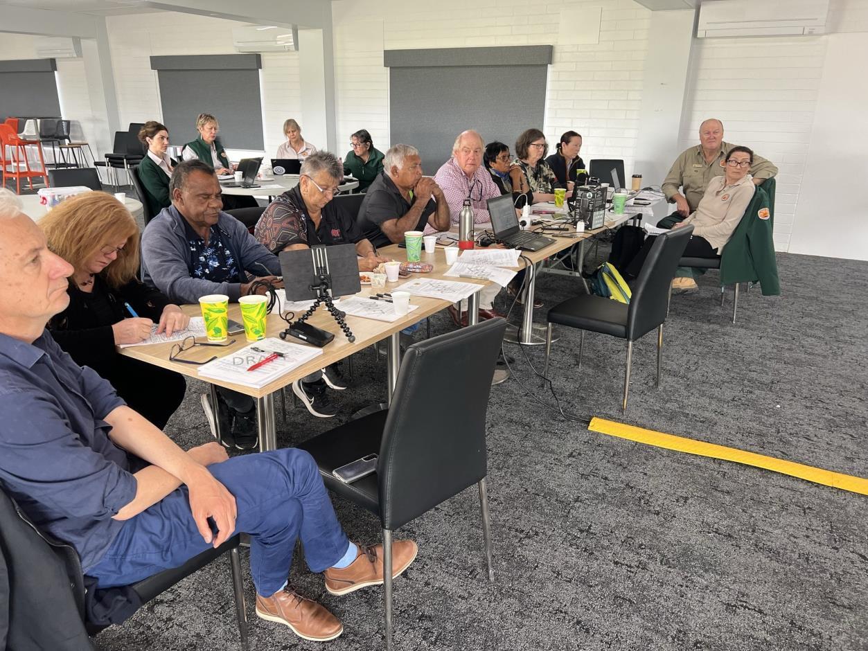
On the 4 October 2023, due to wet weather and road closures, the Advisory Committee did not meet at Mungo National Park but at the Mildura Racecourse. The Committee received verbal reports from all agencies responsible for managing the World Heritage property. The Department of Climate Change, Environment, Energy and Water (DCCEEW), NSW National Parks and Wildlife Service (NPWS), and NSW Crown Lands.
NSW Local Lands Service Western, provided a written report summarizing the completion of the Sustaining Willandra – Championing the World Heritage Values 2018-2023 rabbit control program. The Committee also spent time finalising its 3-year work plan and shortlisting some key priorities.
Item 7.2 - Attachment 1
Meeting
Page 38
Willandra Lakes Region World Heritage Advisory Committee
Reports October 2023
Item 7.2
Attachment 1 Willandra Lakes Region World Heritage Advisory Committee Meeting Reports October 2023 Page 39
-
Project Updates
Windfarm Development Proposals
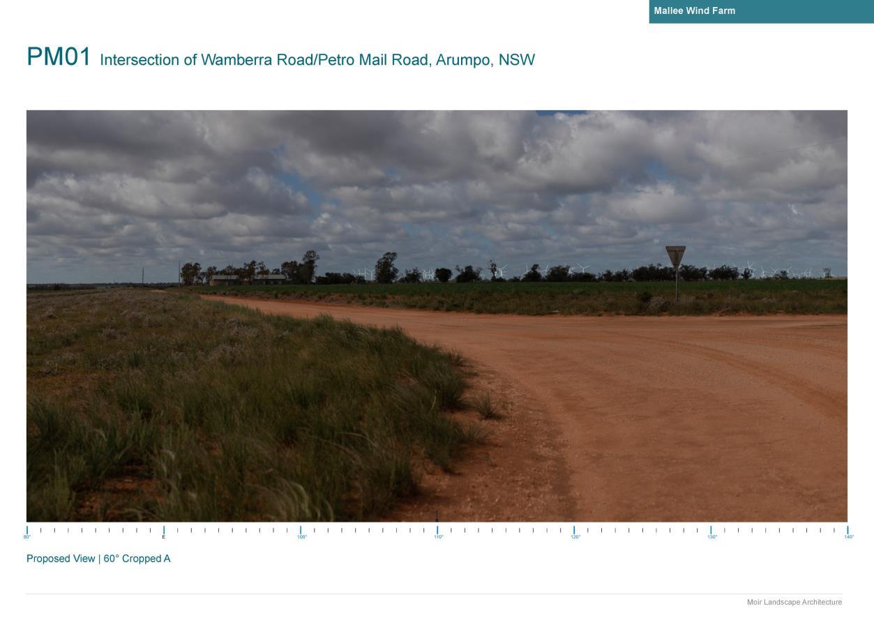
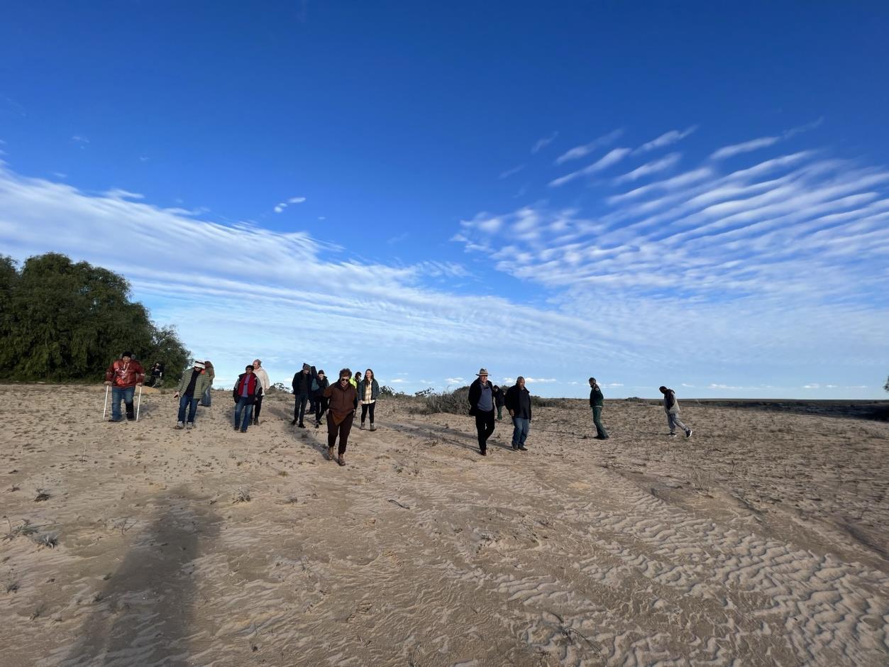
Two windfarms proponents, Squadron Energy and Spark Renewables, attended the Committee meeting to provide a briefing on their proposals. The proponents had taken 360-degree photos from specific locations within the World Heritage area and were able to juxtapose the turbines into the images to demonstrate the actual visual extend of the turbines. Both projects are proposed on the boundary of the World Heritage property and will have some visibility from within it. Both proponents thanked the Committee for the opportunity to present and the Committee will use the information provided to advise the state and federal Ministers if requested.
Item 7.2 - Attachment 1 Willandra Lakes Region World Heritage Advisory Committee Meeting Reports October 2023 Page 40
Research Prospectus

Item 7.2 - Attachment 1 Willandra Lakes Region World Heritage Advisory Committee Meeting Reports October 2023 Page 41
The Research Prospectus has now been endorsed by all managing agencies and the graphic design has been finalised. The prospectus will be sent out to key research institutions around Australia. The Key Themes of the Research Prospectus are: Changing Cultural and Natural Landscapes, Enhancing the continuity of connection to Country, Sustaining the health of Country and its cultural and natural values, Sharing and archiving information, Changing cultural and natural landscapes.
Research Summary
The Committee viewed the final draft of the Research Summary. The summary synthesises all research carried out in the Willandra, along with one-page summaries for each of the 50 research projects that have either started or finished since 2015. The Research Summary document aims to provide information in order to address gaps in public knowledge on the extent and breadth of research that occurs in the Willandra. The Research Summary, now completed, will be distributed publicly before the end of the year.
Item 7.2 - Attachment 1 Willandra Lakes Region World Heritage Advisory Committee Meeting Reports October 2023 Page 42
The Earth Above: Planetarium Film
Item 7.2
Attachment 1 Willandra
Heritage Advisory Committee Meeting Reports October 2023 Page 43
-
Lakes Region World
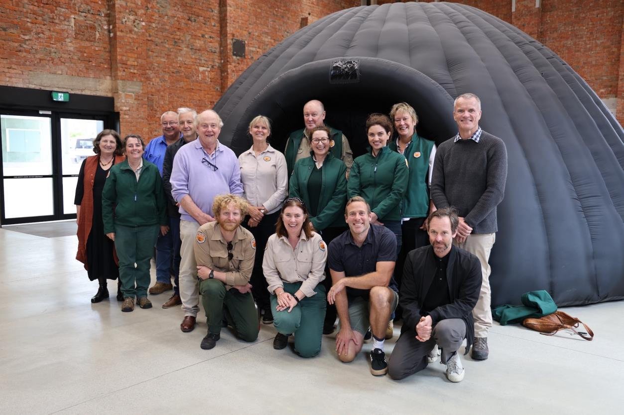
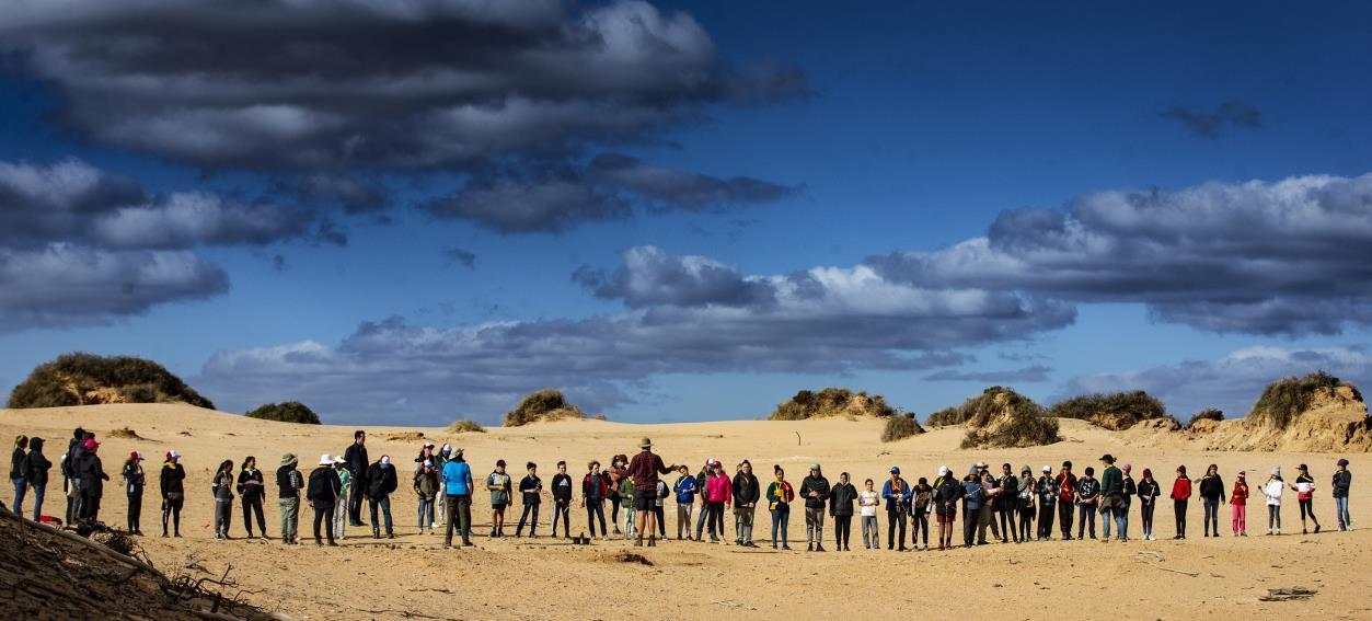
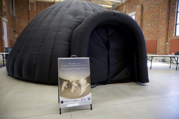
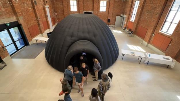
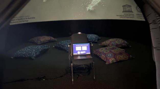
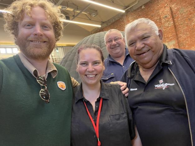
On the second day of the meeting The Australian Research Council Centre of Excellence for Australian Biodiversity and Heritage, also known as CABAH, showcased a 180 degree film they produced with the First Peoples' Consultative Group. The film shows four stories from across Australia, and their dedicated team from the University of Wollongong have been transporting an inflatable dome to launch each story in the respective Countries.
While rain prevented the team from setting up at Mungo NP, we were able to launch the Fossil Trackway film locally at Mildura, Balranald and Ivanhoe before the full launch on the 18 October 2023 in Wollongong.
You can find out more at the below links:
https://motionlab.deakin.edu.au/projects/the-earth-above/ https://epicaustralia.org.au/resource/theearthabove/
https://sway.office.com/xDvovvJT7ABgu1Ib#content=3uOq2sUnmMc9Dy
Item 7.2 - Attachment 1 Willandra Lakes
World Heritage Advisory Committee Meeting Reports October 2023 Page 44
Region
https://sway.office.com/xDvovvJT7ABgu1Ib#content=o5jzLvKDPZ884b
Item 7.2
Attachment 1 Willandra
Region World Heritage Advisory Committee Meeting Reports October 2023 Page 45
-
Lakes
Research Directions

The Research Prospectus, the Research Summary and the Research Code of Practice, now form clear pathway for the future of research in the Willandra. The Research Prospectus identifies the key agreed themes for future research, while the summary establishes the nature of research completed to date, and can inform a gap analysis to identify areas where more research is needed. The Code of
Item 7.2 - Attachment 1 Willandra
Heritage Advisory Committee Meeting Reports October 2023 Page 46
Lakes Region World
Willandra Lakes Region World Heritage Advisory Committee Meeting Reports October 2023
Practice sets the ethical framework for how research should be carried out and what level of engagement is expected.
The Advisory Committee thanked all presenters and NPWS for organising the meeting.
Contact Us

For more information contact the Willandra Lake Region World Heritage Executive Officer at: npws.willandralakes@environment.nsw.gov.au
For more information on the Willandra Lakes Region World Heritage property and Advisory Committees:
www.environment.nsw.gov.au/topics/parks-reserves-and-protected-areas/types-of-protectedareas/world-heritage-listed-areas/willandra-lakes-region www.environment.gov.au/heritage/places/world/willandra www.environment.nsw.gov.au/topics/parks-reserves-and-protected-areas/types-of-protectedareas/world-heritage-listed-areas/world-heritage-area-advisory-committees
All online meeting reports can be found here
Item 7.2 - Attachment 1
Page 47

Item 7.2 - Attachment 1 Willandra Lakes Region World Heritage Advisory Committee Meeting Reports October 2023 Page 48
1 - Ivanhoe State School


Item 7.2 - Attachment 1 Willandra Lakes Region World Heritage Advisory Committee Meeting Reports October 2023 Page 49
Item 7.2 - Attachment 1 Willandra
Heritage Advisory Committee Meeting Reports October 2023 Page 50
Lakes Region World
7.3 AUSTRALIA COMMUNITY ACHIEVEMENT AWARDS - BOTTLE BEND RESERVE LAND MANAGER FINALIST
File Number: RPT/23/806
Summary
Councillor MacAllister attended the NSW/ACT Community Achievement Awards presentation in Sydney 25 November 2023 on behalf of the Bottle Bend Land Manager Committee of which she is the Council representative.
Recommendation
That the information contained in the report from Councillor MacAllister be noted.
Additional Information
Bottle Bend Reserve Land Manager committee report
NSW/ACT Community Achievement Awards presentation Sydney 25 November
Bottle Bend Reserve Land Manager committee representatives, Drew Fincher and myself attended Community Achievement Awards Gala Presentation Dinner at the Sydney Masonic Centre on Saturday, 25 November, where Finalists were presented and Winners announced. Joining us was Lucas from OzFish Unlimited and Natalie and Deena from Crown Lands (who nominated us out of a possible 3,300 Community Land Managers across the state). We were also joined at our table by other Finalists in Small Business / Connecting Communities Award (Kirsteen Parkes + partner) and Leadership Award (Joshua Karras + partner).
Angela Cox of Channel 7NEWS was MC for the evening.
Winners can be found at this link:
https://www.awardsaustralia.com/community-achievement-awards/nsw/current-winners/ Crown Land Management Excellence Award - Tingha Recreation Reserve Land Managers of Tingha is a passionate group of retirees who've breathed new life into Tingha Recreation Reserve. Through their dedication and resourcefulness, they've secured over $200,000 in grants, resulting in vital improvements to the club's infrastructure. This includes a new floor, enhanced lighting, security cameras, and gates, effectively mitigating safety and security risks. Beyond these physical enhancements, they commitment community engagement by actively promoting the reserve through hosting various events and activities. From ANZAC Day commemorations to family fun days, their efforts have revitalised the reserve as well as fostered a strong sense of community spirit and pride in the charming town of Tingha.
Council Crown Land Management Excellence Award - Tenterfield Shire
Council manages the two-hectare Old Power House Reserve. The reserve has undergone a remarkable metamorphosis, emerging as a dynamic Youth Precinct nestled at the heart of the town. It now welcomes residents of all ages, offering a rich tapestry of recreational, social, and cultural activities. Its carefully designed infrastructure includes a skatepark, mountain bike skills track, yarning circle, and accessible pathways, fostering inclusivity and accessibility for all. Through community engagement and collaboration, the reserve has not only revitalised the town's spirit but also reinforced its sense of identity. The Council's visionary approach has truly transformed this space into a thriving community hub.
Individual Excellence in Crown Land Management - Christine Adams at Broken Hill stands at the heart of the Sulphide Street Railway & Historical Museum. Christine’s
Ordinary Meeting AGENDA 13 December 2023 Page 51
tenure since 2008 includes being a secretary, treasurer, and curator. Through her adept grant applications, the museum underwent vital preservation assessments, birthing new museum spaces such as the Migrant Museum, Transport Pavilion, and more. Christine fosters community involvement with open days, inviting locals to embrace their museum and heritage. Her dedication extends beyond the walls, supporting volunteers' initiatives, like paving and maintenance. Her induction into the 2023 Nydia Edes Volunteer Hall of Fame cements her legacy as the driving force behind the Sulphide Street Railway & Historical Museum.
-
The Crown Land Management Awards were sponsored by the NSW Government and presented by Melanie Hawyes, Deputy Secretary, Crown Lands and Public Spaces
NSW has more than 34,000 Crown Land Reserves covering an area of around 3.1 million hectares. More than 900 organisations manage Crown Land Reserves, with over 3,300 members of Crown Land manager organisations. To have been recognised as one of the top four Finalists across NSW and ACT is no insignificant matter.
More than 6,500 Crown Reserves are managed by 128 local government councils across NSW.
-
Small Business Award - Community Cafe Incorporated of Sadleir has unwavering commitment to the community. They went from serving bread on a driveway during Covid-19 to operating a thriving outreach service store. In just 40 weeks, they've provided 67,000 homemade meals to 23,600 local individuals and families. The short-term goal is to create a welcoming space for immediate relief, support, and education. Their long-term vision includes a groundbreaking social enterprise cafe, offering an 'earn while you learn' opportunity for the disadvantaged, and a free childcare centre to remove barriers for parents. Facing challenges and securing their premises, Community Cafe Incorporated's impact is profound, fostering a stronger, more supportive community.
Leadership Award - Louise Azzopardi of Londonderry embodies leadership through resilience and determination. Louise is a trailblazing tradeswoman. From her initiation into a male-dominated trade at 15, she became a certified trainer and assessor, guiding over 100 apprentices. Louise's commitment extends to coaching tradeswomen through diverse challenges, from mental health issues to workplace dynamics. Her legacy transcends barriers, inspiring women to thrive in non-traditional trades. Louise's reach has extended globally, nurturing a supportive community for tradespeople. Her podcast and Facebook group empower the next generation, ensuring they navigate their path with confidence and resilience. In the realm of trade, she's a leader and a catalyst for cultural change.
Customer Service Award – The Administration Agency of Dubbo is empowering businesses and fostering sustainable growth. The Administration Agency, formerly Performance PA, was founded by Louise Mathieson. Starting as a Virtual Assistant in 2019, Louise's journey led to the creation of a one-stop shop for small business administration. Her commitment to exceptional customer service and collaboration, from initial interaction to offboarding, sets her apart Louise and her team handle tasks efficiently, from archiving emails to raising over $80,000 for a not-for-profit. They prioritise client feedback, ensuring every interaction exceeds expectations. Beyond business success, Louise sponsors local events like the Vinnies CEO Winter Sleepout, embodying her dedication to the community.
Safety Award - William Blakeman of Griegs Flat has transitioned his maritime career into an exemplary commitment to safety and community service. As Training Officer and Unit Commander at Marine Rescue NSW - Merimbula Unit, he relentlessly focuses on professional development, operational readiness, and emergency response preparedness. Bill's dedication has directly benefited the entire boating community, volunteers, and the broader public by ensuring highly trained crews are ready for any emergency. His efforts have resulted in successful rescues and instilled a culture of safety and collaboration. Bill's
Ordinary Meeting AGENDA 13 December 2023 Page 52
.
visionary leadership extends to fundraising and campaigning for essential resources. His impact on safety and community is immeasurable and enduring.
Connecting Communities Award - Theresa Mitchell of Tweed Heads began as a small act of kindness in 2009, when she couldn't walk past those in need on the streets. Today, Agape, located in Tweed Heads, operates with the dedication of 240 volunteers and 4 employees, offering a wide range of services to vulnerable individuals. They provide over 1000 hot meals every week, shower and laundry access, food hampers, case management, and life skills classes all for free. Agape's unique model rescues edible food, minimising waste, and operates on a 98% volunteer workforce, ensuring low overheads. Theresa's vision includes reintroducing a psychology department and building tiny housing estates for the homeless a testament to her unwavering commitment to serving the community with "unconditional love" (Agape).
Awards Australia Foundation Ltd (AAF) is a registered charity aimed at advancing social and public welfare, promoting reconciliation, mutual respect, tolerance between groups and celebrating culture.
The Foundation aims to achieve its goals by providing community awareness, support to Indigenous Australians and individuals from different ethnic groups, those living with a disability or those affected by disadvantage.
AAF provides funds for specific award categories and their winners, cultural training, accessibility to awards nights for those living with a disability, and support for those experiencing disadvantage to attend an awards night, in the hope of inspiring inclusive societies that embrace and celebrate diversity and provide support to those in need.
AAF emphasises the importance of promoting opportunities for all individuals to contribute to positive change in society. -
It was incredibly humbling to hear all the great work being done by so many worthy Finalists and to have our little BBR group of 7 community members recognised for the hard work since the Reserve was handed over to community trust (as it was in the beginning, 2017), out of so many possible finalists from across the state was a well-received acknowledgement at Tuesday 5th meeting of committee. I present the Finalist certificate to Council.
Attachments Nil
Ordinary Meeting AGENDA 13 December 2023 Page 53
-
8 REPORTS FROM COMMITTEES
8.1 AUDIT, RISK AND IMPROVEMENT COMMITTEE
File Number: RPT/23/752
Responsible Officer: Simon Rule - Director Finance and Policy
Responsible Division: Finance and Policy
Reporting Officer: Simon Rule - Director Finance and Policy
Objective: 4.0 Wentworth Shire is supported by strong and ethical civic leadership with all activities conducted in an open, transparent and inclusive manner
Strategy: 4.2 A strong, responsible and representative government
Summary
A meeting of the Audit, Risk and Improvement Committee were held on 16 October 2023 and 3 November 2023 and the draft Minutes for each meeting have been separately circulated for the information of Councillors.
The Committee considered the following item of business:
• Review of Draft Annual Financial Statements
• Audit Office of NSW Update
• Quarterly Fraud Report
• Proposed Project & Contract Management Internal Audit Scope of Works
• Audit Committee Self-Assessment Review
• Procurement Review Action Plan Update
• 2023-2024 Work Plan
• Quarterly Operational Plan Progress Report
• Quarterly Budget Review – Fourth Quarter 2022-2023
• Roads & Engineering Overview.
Officer Recommendation
a) That Council receives and notes the draft minutes of the Audit, Risk and Improvement Committee Meetings held on 16 October 2023 and 3 November 2023.
b) That Council approve the request from the Committee for an additional $14,000 to be allocated so that the Project & Contract Management Internal Audit can be undertaken in 2023-2024 financial year.
Ordinary Meeting AGENDA 13 December 2023 Page 54
Additional Information
A meeting of the Audit, Risk & Improvement Committee was held on 16 October 2023 and 3 November 2023. The agenda for each meeting covered the following areas of responsibilities as defined in the Committee’s Terms of Reference:
Internal Audit
Principle
That Council has an effective internal audit function and receives maximum value from its internal audit activities.
• Council’s Internal Auditor RSD Audit presented a proposed scope of works for an additional Project & Contract Management Internal Audit that was requested by the Committee at the last meeting
• Internal Auditors also provided a status report on the progress of the IT General Controls Audit and an overview of recent reports and publications by government agencies and other sources that may impact on public sector agencies
External Audit
Principle
That Council receives maximum value from its external audit activities.
• On 16 October 2023 the Committee reviewed the draft Annual Financial Statements prior to the finalisation of the year end audit
• On 3 November 2023 the Audit Office and Nexia provided the committee with an update on the completion of the audit of the Annual Financial Statements including the Conduct of the Audit Report, the Closing Engagement Report and the Management Letter
Risk Management
Principle
That Council has an effective risk management framework that successfully identifies and manages the risks it faces.
• Council’s Internal Auditor RSD Audit presented a proposed scope of works for an additional Project & Contract Management Internal Audit that was requested by the Committee at the last meeting
• Internal Auditors also provided overview of recent reports and publications by government agencies and other sources that may impact on public sector agencies
• The General Manager provided a quarterly fraud report
• The 2023-2024 Work Plan was presented for endorsement by the committee
Financial Management
Principle
That Council has an effective financial management framework, sustainable financial position and positive financial performance.
• The Committee reviewed the procedures for management review and consideration of the financial position and performance of Council by:
Ordinary Meeting AGENDA 13 December 2023 Page 55
o Considering the quarterly budget review for the first quarter of the 20232024 Financial Year
o Reviewing the draft Annual Financial Statement prior to the finalization of the year end audit
Strategic Planning
Principle
That Council has an effective framework that ensures it achieves its strategic plans and objectives under the Integrated Planning and Reporting (IP&R) Framework.
• The Committee reviewed and advised Council on whether Council is successfully implementing and achieving its IP&R objectives and strategies by
o Considering the Quarterly Operational Plan Report for the period July 2023-September 2023.
o The Director Roads & Engineering provided the Committee with an overview of the Departments functions and a number of the major projects. that have been completed over the last couple of years.
Service Reviews and Business Improvement
Principle
That Council has an effective framework to ensure it is delivering services and conducting its businesses and functions to an expected standard.
Section 428A(2)(g) and Section 428A(3) of the Local Government Act 1993 (NSW) (the Act) now requires Council to undertake regular service reviews to ensure that it is delivering services and conducting its business and functions to an expected level, and the community is receiving value for money for the services it receives.
• The Committee reviewed the progress of implementing the recommendations of the Procurement Review.
Additional Information
As requested at the 11 August 2023 Meeting the Committee was presented with a detailed report on the annual self-assessment questionnaire. There is a feeling amongst Committee members that it is difficult for the Committee to fulfill its obligations under the guidelines on a quarterly basis and going forward, meetings may need to be held on a more frequent basis.
Attachments
1. Minutes - Audit, Risk and Improvement Committee 16 October 2023⇨ 2. Minutes - Audit, Risk and Improvement Committee 03 November 2023⇨
Ordinary Meeting AGENDA 13 December 2023 Page 56
9 REPORTS TO COUNCIL
9.1 GENERAL MANAGERS REPORT
File Number: RPT/23/765
Responsible Officer: Ken Ross - General Manager
Responsible Division: Office of the General Manager
Reporting Officer: Gayle Marsden - Executive Assistant
Objective:
4.0 Wentworth Shire is supported by strong and ethical civic leadership with all activities conducted in an open, transparent and inclusive manner
Strategy: 4.2 A strong, responsible and representative government
Summary
The General Manager’s report details information pertaining to meetings attended and general information which are of public interest, and which have not been reported elsewhere in this agenda. Items of note in this report are:
1. OLG Circulars
2. Meetings As listed
3. Upcoming meetings or events As listed
4. Other items of note
Recommendation
That Council receives and notes the information contained within the report from the General Manager.
Detailed Report
1. Circulars Nil
2. Meetings
Following is a list of meetings or events attended by the General Manager for the period of 16 November 2023 – 13 December 2023. Date
21 Nov 2023 Mayoral Meeting Wentworth
23 Nov 2023 Fibre Optic Symphonic Orchestra Project Meeting Mildura
23 Nov 2023 Wentworth Shire Council/Balranald Shire Council Drought Resilience Plan Meeting Video Conference
24 Nov 2023 Country Mayors Association of NSW Annual General Meeting Sydney
27 Nov 2023 Mayoral Meeting Wentworth
Ordinary Meeting AGENDA 13 December 2023 Page 57
Location
Meeting
3. Events
Following is a list of upcoming events, conferences or committee meetings, including out of region meetings where the Shire has been requested to attend in an official capacity from 14 December 2023 – 24 January 2023.
4. Other items of note
Update on Events
Wentworth Twilight Christmas Markets
• The Wentworth Twilight Christmas Markets were held on Darling Street from 4.00pm – 8.00pm. The event was very well attended, with positive feedback received from local businesses and attendees. It was the biggest market held so far by Wentworth Shire Council, with over 40 stallholders participating in the event.
• The event included live music, food vans, Santa photos and kids activities including free pony rides and face painting. Dareton Christmas Markets
• The Dareton Christmas Markets will be held on Saturday 9 December from 8.30am – 12.00pm, in Tapio Street, Dareton.
• The event will include a community breakfast run by Dareton Men in a Shed, stallholders, live music and kids activities.
Gol Gol Carols with a Twist
Ordinary Meeting AGENDA 13 December 2023 Page 58 28 Nov 2023 Sod Turning Wentworth District Hospital Wentworth 28 Nov 2023 Valuation NSW meeting Wentworth 30 Nov 2023 Staff Consultative/Work Health Safety Committee Meeting Wentworth
December 2023 Interview Panel Balranald Shire Council Euston 7 Dec 2023 Wentworth Shire Council/Balranald Shire Council Drought Resilience Plan Meeting Video Conference 8 Dec 2023 All Staff meeting Wentworth 11 Dec 2023 Cross Border Future Industry Workforce Forum Euston 12 Dec 2023 Mayoral Meeting Wentworth 13 Dec 2023 Pre Meeting Briefing Wentworth 13 Dec 2023 Ordinary Council Meeting Wentworth
5-6
Date Meeting Proposed Attendees Location
Public School
Pre-
Christmas Concert and Presentation Cr Tim
Australian
Gardens Meeting Cr
Cr
14 Dec 2023 Pooncarie
and
School
Elstone Pooncarie 9 Jan 2023
Inland Botanic
MacAllister and
Rodda Mildura
Tourism Officers Report
• The Gol Gol Carols with a Twist will be held on Sunday 10 December from 4.00pm – 8.00pm at Carramar Oval in Gol Gol.
• The ‘twist’ includes performances of a magician, acrobatics, fire twirlers and dance groups in between local schools and community members singing carols.
• The event will include stalls selling toys and confectionary, kids activities, a visit from Santa and food vans.
Attachments
Nil
Ordinary Meeting AGENDA 13 December 2023 Page 59
9.2 GOL GOL PUBLIC SCHOOL - REQUEST FOR FINANCIAL ASSISTANCE
File Number: RPT/23/756
Responsible Officer: Ken Ross - General Manager
Responsible Division: Office of the General Manager
Reporting Officer: Hannah Nicholas - Business Support Officer
Objective:
1.0 Wentworth Shire is a vibrant, growing and thriving Region Strategy: 1.2 Promote the Wentworth Region as a desirable visitor and tourism destination
Summary
Council is in receipt of a request to provide financial sponsorship by means of in-kind support for the 2024 Gol Gol Country Fair to be held on 5 May 2024. This event is organised by Gol Gol Public School and the School has provided a list of in-kind support they require. Preliminary calculations put the value of in-kind support at $2,744.00 inc. GST.
Recommendation
That Council provide financial sponsorship by means of in-kind support for the 2024 Gol Gol Country fair to be held on 5 May 2024.
Detailed Report
Purpose
The purpose of this report is to inform Council of a request for in-kind support towards the 2024 Gol Gol Country Fair, which is to be held on 5 May 2024. It should be noted the Gol Gol Country Fair event is a fundraiser for the Gol Gol Public School. It should also be noted that the Gol Gol Country Fair is a popular community event that occurs on an annual basis.
Report Detail
Council is in receipt of a request from Gol Gol Public School for financial sponsorship by means of in-kind support. Gol Gol Public School provided a list of the in-kind support they require to hold the event and Council has determined a preliminary calculation for the requested support. The list requests Council provide the supply and collection of bins for the event alongside traffic management assistance.
Based on Councils Fees and Charges, the following costs for in-kind support need to be considered:
• Traffic Management
o Plan Preparation Fee – $179.00
o Plan Assessment Fee – $163.00
o Hire of Signs – 14 x $34.00, totaling $476.00
o Sub Total – $818.00 inc. GST
• Bins
o Bins – 20 x $26.00, totaling $520.00
o Vehicle – 8 hours x $35.75 per hour, totaling $286.00
o Roads Staff – 4 hours x $68.00 per hour, totaling $272.00
o Two Labourers – 8 hours x $53.00 per hour, totaling $848.00
Ordinary Meeting AGENDA 13 December 2023 Page 60
o Sub Total – $1,926.00 inc. GST SUM TOTAL $2,744.00 inc. GST.
Conclusion
Council is to determine the approval of financial sponsorship by means of in-kind support for the 2024 Gol Gol Country fair to be held on 5 May 2024.
Attachments
1. Gol Gol Public School - request for support of the 2024 Country Fair⇩
Ordinary Meeting AGENDA 13 December 2023 Page 61

Gol Gol Public School
Principal: Mr Glen Walker
49-51 William St Phone: 03 5024 801 Gol Gol NSW 2738
Email: golgol-p.school@det.nsw.edu.au
Ken Ross General Manager Wentworth Shire Council
13/11/23
Dear Ken,
Website: https://golgol-p.schools.nsw.gov.au
As you are aware the Gol Gol Country Fair is a major community event that takes place every year on the first Sunday in May.
Gol Gol School is requesting an exemption from the Wentworth Shire Council with regards to ongoing costs to help run this event again in 2024.
These exemptions include:
a) Council proving 20 green rubbish bins to assist with the collection and removal of rubbish.
b) Council providing traffic management by setting up ‘Event in progress” signs and restricting the speed limit to 40kmph during the hours of the fair. (Approximately 8:00am – 3:00pm).
Thank you for considering this request on behalf of the Gol Gol Public School.
Regards
 ‘David McDonnell Assistant Principal Gol Gol Public School
Item 9.2 - Attachment 1 Gol Gol Public School - request for support of the 2024 Country Fair Page 62
Kindness - Respect - Safe Safe
9.3 WENTWORTH REGIONAL COMMUNITY PROJECT ASSOCIATION - REQUEST FOR FINANCIAL ASSISTANCE
File Number: RPT/23/764
Responsible Officer: Ken Ross - General Manager
Responsible Division: Office of the General Manager
Reporting Officer: Hannah Nicholas - Business Support Officer
Objective:
1.0 Wentworth Shire is a vibrant, growing and thriving Region Strategy: 1.2 Promote the Wentworth Region as a desirable visitor and tourism destination
Summary
Council is in receipt of a request to provide further financial sponsorship towards the 2023 Christmas Eve Street Party, held on 24 December 2023 in Wentworth. This event is organised by the Wentworth Regional Community Project Association. A grant in the amount of $5,000.00 has been provided through Council’s Financial Assistance Program to the event organisers at the 15 November 2023 Council meeting.
Wentworth Regional Community Project Association has advised that whilst they do obtain funds via a raffle held during the event, they need further support in the amount of $4,000.00 for costs associated with holding the event.
Recommendation
That Council consider providing further financial sponsorship for the 2023 Christmas Eve Street Party held in Wentworth.
Detailed Report
Purpose
The purpose of this report is to inform Council of a request for financial sponsorship in the amount of $4,000.00 for the 2023 Christmas Eve Street Party held in Wentworth. This event is organised by the Wentworth Regional Community Project Association and $5,000.00 towards the event has been previously provided through Council’s Financial Assistance Program. The event has been in existence for over thirty-five years and is a popular attraction not only for residents but also tourists visiting the Shire over the holiday season.
Report Detail
Council is in receipt of a request to provide further financial sponsorship towards the 2023 Christmas Eve Street Party, held on 24 December 2023 in Wentworth. Council has approved $5,000.00 in funding for the event through Council’s Financial Assistance Program.
Council received a further request for financial sponsorship from the event organisers advising that proceeds from the raffles run during the event would not be sufficient to cover the costs associated with holding the event (such as administration and public entertainment costs). Further to this, no admission fees are charged to attendees of the event.
Based on the event organiser’s request, the event organisers would appreciate a further $4,000.00 of financial sponsorship if available for the 2023 Christmas Eve Street Party.
Conclusion
Council are requested to consider an additional $4,000.00 in financial sponsorship for the event for the Wentworth Regional Community Project Association’s 2023 Christmas Eve Street Party.
Ordinary Meeting AGENDA 13 December 2023 Page 63
Attachments
1. Financial Assistance - Wentworth Regional Community Project Association$4,000⇩
2. Wentworth Regional Tourism Inc - Advising of support for financial assistance of Wentworth Christmas Eve Street Party / Wentworth Regional Community Project Association⇩
Ordinary Meeting AGENDA 13 December 2023 Page 64
Item 9.3 - Attachment 1 Financial Assistance - Wentworth Regional Community Project Association $4,000 Page 65 Wentworth Regional Community Project Association PC Box 211 I Wentworth NSW 2648 dA All 26'r-n ,Qt/Cr.d z ! Received 11 NOV 2023 File AWOff Wentworth Shire Council 26-28 Adelaide St Wentworth NSW 2648 HPRM Ref: DOC/23/26076
Wentworth Regional Community Project Association Inc
P0 Box 211
Wentworth NSW 2648
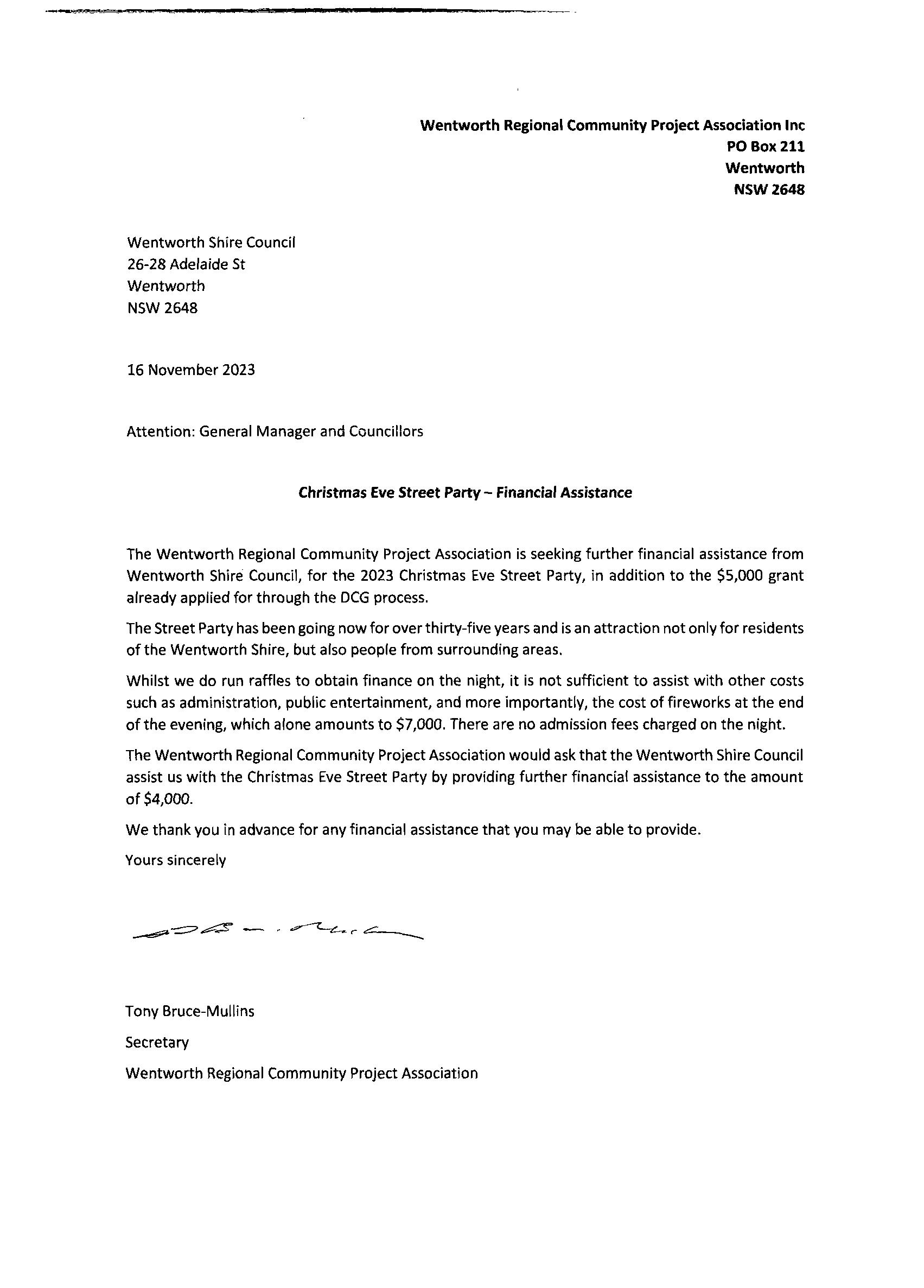
Wentworth Shire Council
26-28 Adelaide St
Wentworth NSW 2648
16 November 2023
Attention: General Manager and Councillors
Christmas Eve Street PartyFinancial Assistance
The Wentworth Regional Community Project Association is seeking further financial assistance from Wentworth Shire Council, for the 2023 Christmas Eve Street Party, in addition to the $5,000 grant already applied for through the DCG process.
The Street Party has been going now for over thirty-five years and is an attraction not only for residents of the Wentworth Shire, but also people from surrounding areas.
Whilst we do run raffles to obtain finance on the night, it is not sufficient to assist with other costs such as administration, public entertainment, and more importantly, the cost of fireworks at the end of the evening, which alone amounts to $7,000. There are no admission fees charged on the night.
The Wentworth Regional Community Project Association would ask that the Wentworth Shire Council assist us with the Christmas Eve Street Party by providing further financial assistance to the amount of $4,000.
We thank you in advance for any financial assistance that you may be able to provide.
Yours sincerely r
Tony Bruce-Mullins Secretary
Wentworth Regional Community Project Association
Item 9.3 - Attachment 1 Financial Assistance - Wentworth Regional Community Project Association Page 66
Item 9.3 Attachment 2 Wentworth Regional Tourism Inc Advising of support for financial Page 67
9.4 WDR175 MILKENGAY ROAD CLOSURE
File Number: RPT/23/785
Responsible Officer: Ken Ross - General Manager
Responsible Division: Office of the General Manager
Reporting Officer: Hannah Nicholas - Business Support Officer
Objective:
3.0 Wentworth Shire is a community that works to enhance and protect its physical and natural environment Strategy: 3.2 Ensure that community assets and public infrastructure are well maintained
Summary
Council has been approached by the Department of Planning and Environment (the Department) with regards to a proposed road closure that was identified under the Legal Road Network (LRN) Project.
The Department has become aware that the closure of WDR175, known as Milkengay Road – Para/Anabranch South, had been overlooked by the LRN Project despite notification of the proposed closure being provided to Council on 6 November 2017. The Department has now requested to proceed with the closure.
Recommendation
That Council:
a) Approves the closure of WDR175 (Milkengay Road)
b) Gives the Department of Planning and Environment authority to proceed with the closure of WDR175 under Division 3 of Part 4 of the Roads Act 1993 on behalf of Council;
c) Approves the Department of Planning and Environment publishing of a notice of closure in the Government Gazette on behalf of Council.
Detailed Report
Purpose
The purpose of this report is for Council to provide a resolution to correct an administrative error by the Department of Planning and Environment and allow the official closure of WDR175 - Milkengay Road to proceed.
Background
Part of the LRN Project’s remit is the gradual closure of the Western Division Road (WDR) network.
Due to technical limitations of the mid 1900s, plans for WDRs were at times partially or wholly outside the formation of the actual road locations. The LRN Project seeks to establish more accurately defined plans of road formations.
It should be noted that the road closures are entirely an administrative process to formalise the status of the current road system.
The LRN Project has redefined WDR175 as shown below:
Ordinary Meeting AGENDA 13 December 2023 Page 68
WDR No.
WDR Survey Plan No. WDR Name New Survey Plan 175 DP97175 Milkengay Rd DP12022301
The redefinition was dedicated as a Council Public Road on 9 March 2018; Folios 15-081509 (Lots, 37, 38, & 39).
The Department requires written approval from Council to proceed with the closure of WDR175 and to ensure adherence with Division 3 of Part 4 of the Roads Act 1993.
Further to this, the Department requests a copy of Council’s Decision to close WDR175 and permission to publish a notice of closure in the Government Gazette on behalf of Council.
Conclusion
It is concluded that the most appropriate course of action is to support the Department’s proposal to close WDR175, known as Milkengay Road – Para/Anabranch South, by undertaking the necessary steps outlined in this report.
In executing the necessary steps, Council should provide the Department of Planning and Environment with:
• specific authority to proceed with the closure of WDR175 under Division 3 of Part 4 of the Roads Act 1993 on behalf of Council;
• Council’s decision to close WDR175; and
• specific approval to publish a notice of closure in the Government Gazette on behalf of Council.
Attachments
1. LRN Plan 59 - Notification Proposed Road Dedication⇩
2. DP1202301⇩
Ordinary Meeting AGENDA 13 December 2023 Page 69

Our Ref: 14/02043; DOC17/231125; LRN Plan 59
Your Ref: DOC/14/10406/PK:BG
General Manager
Wentworth Shire Council PO Box 81
WENTWORTH NSW 2648
By email: council@wentworth.nsw.gov.au
Dear Sir/Madam,
PROPOSED CLOSURE OF WDR140 AND WDR161 AS PUBLIC ROAD PROPOSED DEDICATION OF OLD BROKEN HILL, POPIO, HAUL, ROO ROO, MILKENGAY, AND NOB ROADS AS PUBLIC ROAD
I refer to Council’s request dated 22 August 2014 that it be notified of proposed road closures and dedications within the Shire resulting from this Department’s Legal Road Network (LRN) Project.
As you may be aware the LRN Project has the task of defining legal access to all properties in the Western Division. Some of the existing public roads in the Western Division, known as Western Division Roads (WDR’s), were withdrawn from Western Lands Leases in them mid 1900’s and dedicated as public roads. Due to technical limitations at the time, the physical road formations were not accurately defined and the WDR plans were at times partially or wholly outside of the actual road formation. The project entails correctly defining the location of existing dedicated public roads i.e. the road casement reflects the actual location of the road. There will be no new works or roads created over the subject lots. This is purely an administrative process to formalise the status of the current road system.
The LRN Project has defined Old Broken Hill, Popio, Haul, Roo Roo, Milkengay, and Nob Roads on a plan of survey, DP1202301 (copy enclosed). This Department is now proposing to close WDR140 and WDR161 and dedicate the roads defined in DP1202301 as public road.
Any comment regarding the proposed road closures and road dedications should be addressed to the Area Manager – Far West, West Region, NSW Department of Industry – Crown Lands & Water, PO Box 2185 DANGAR NSW 2309 or email cl.western.region@crownland.nsw.gov.au within 28 days of the date of this letter.
If you have any questions regarding this correspondence please contact Bruce Flood on telephone (02) 6883 5435 or email: bruce.flood@crownland.nsw.gov.au.
Yours faithfully,
 Amanda Beetson Group Leader
– Property
Management
West Region | Far West Area
Email: cl.western.region@crownland.nsw.gov.au
6 November 2017
Far West Area, West Region
NSW Department of Industry – Crown Lands & Water Division PO Box 2185, Dangar NSW 2309
Tel: 02 6883 5400 - Fax: 02 6884 2067 - www.crownland.nsw.gov.au - ABN: 72 189 919 072
Item 9.4 - Attachment 1 LRN Plan 59 - Notification Proposed Road Dedication Page 70
Item 9.4 - Attachment 2 DP1202301 Page 71
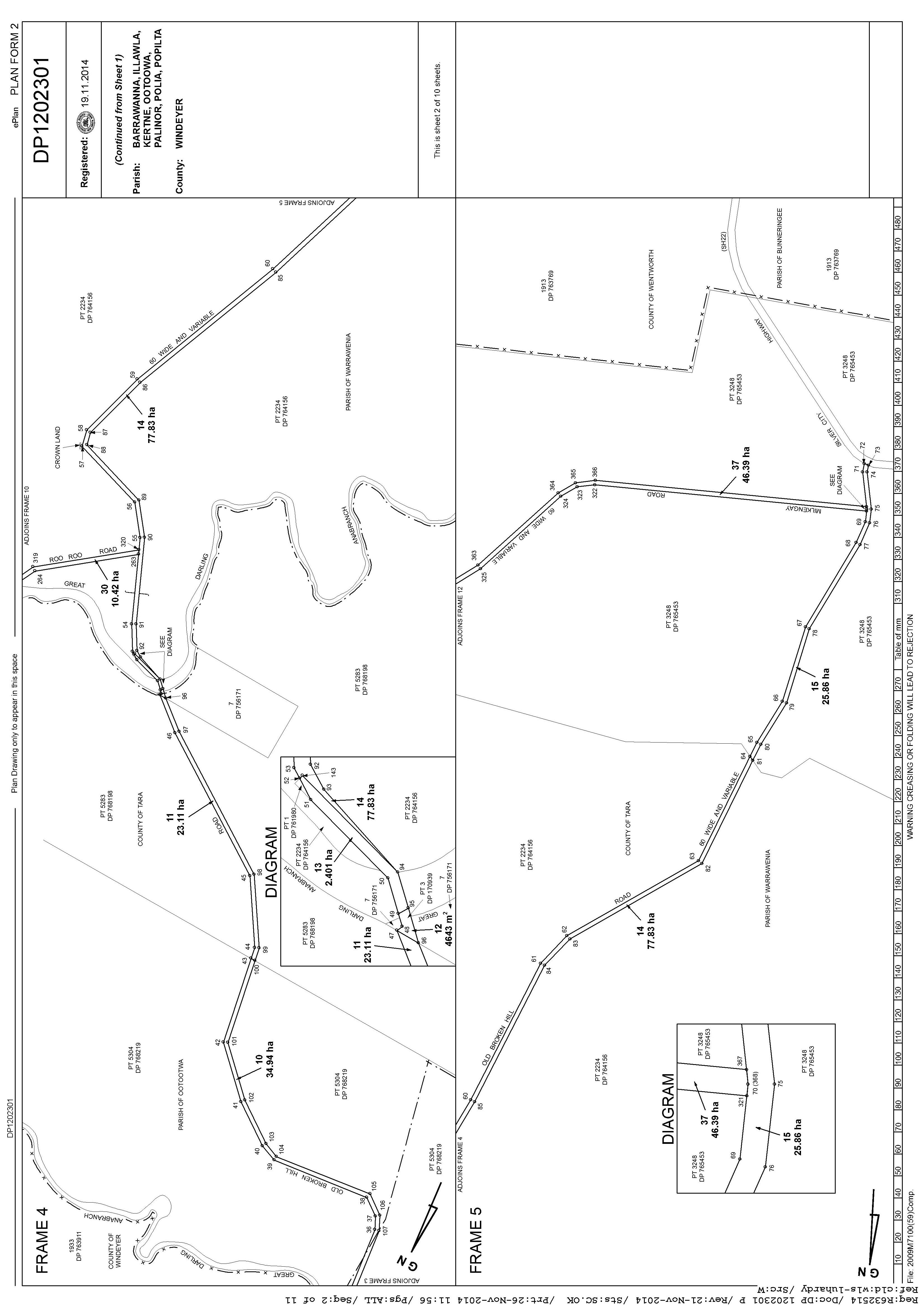
Item 9.4 - Attachment 2 DP1202301 Page 72
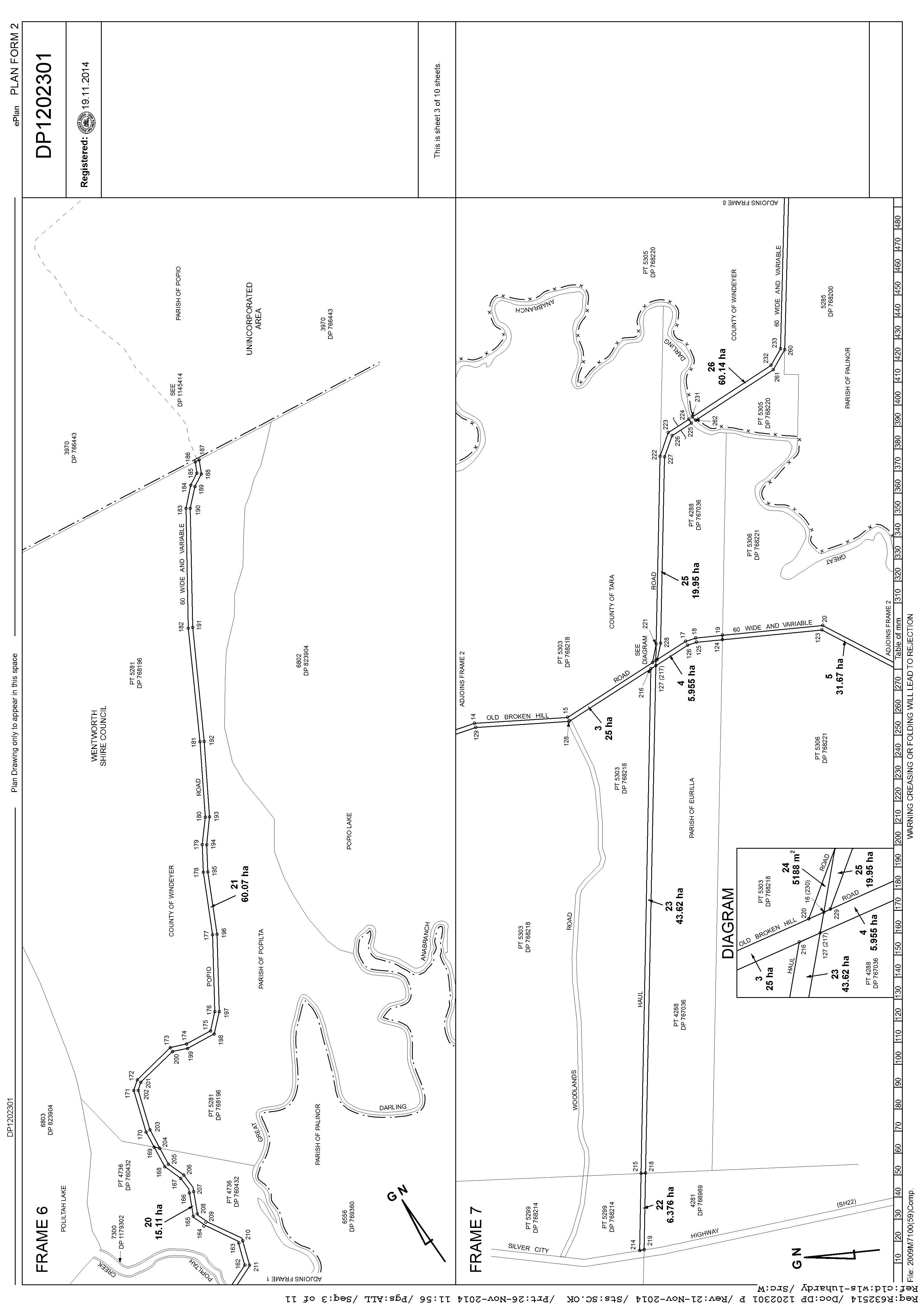
Item 9.4 - Attachment 2 DP1202301 Page 73
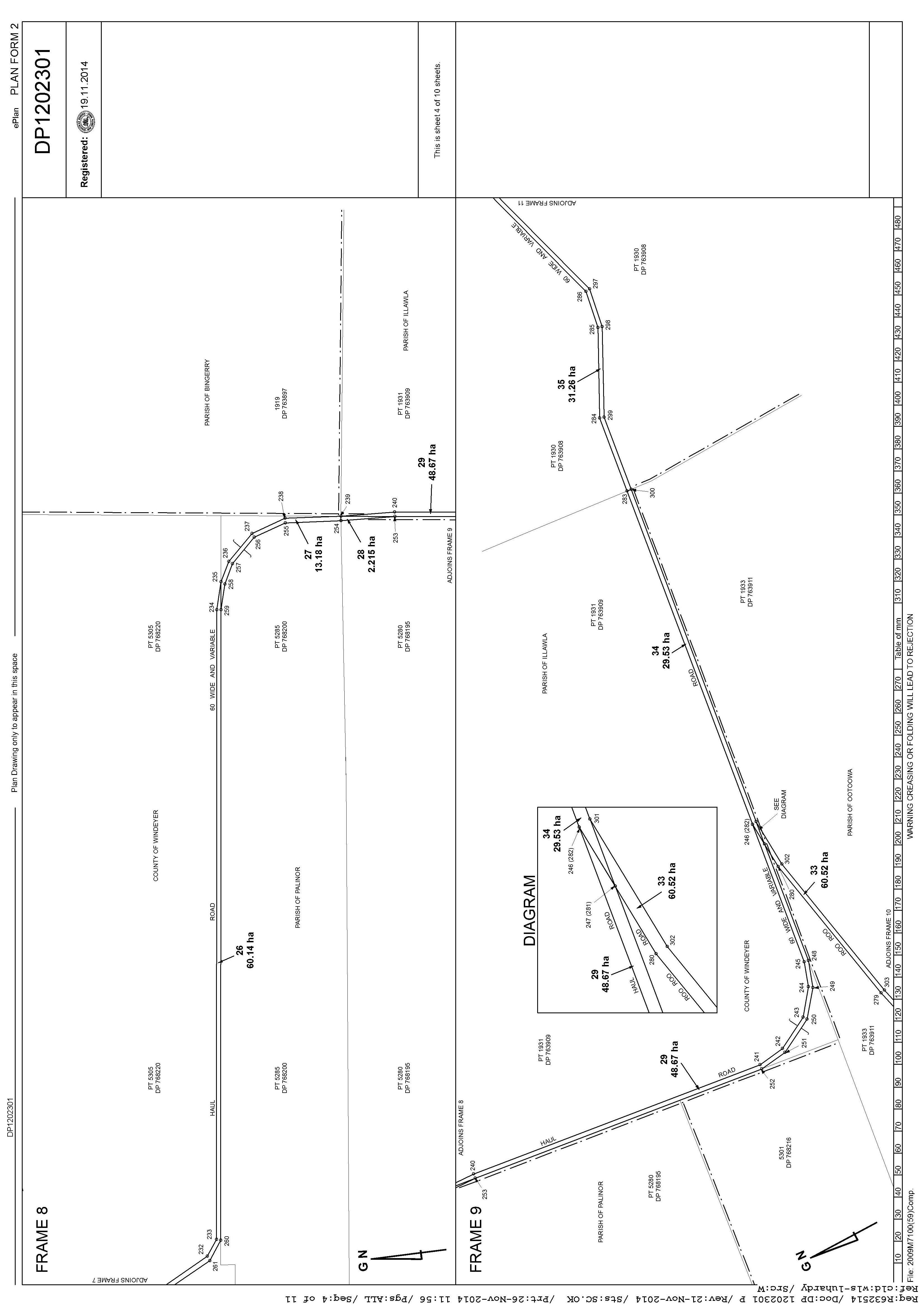
Item 9.4 - Attachment 2 DP1202301 Page 74
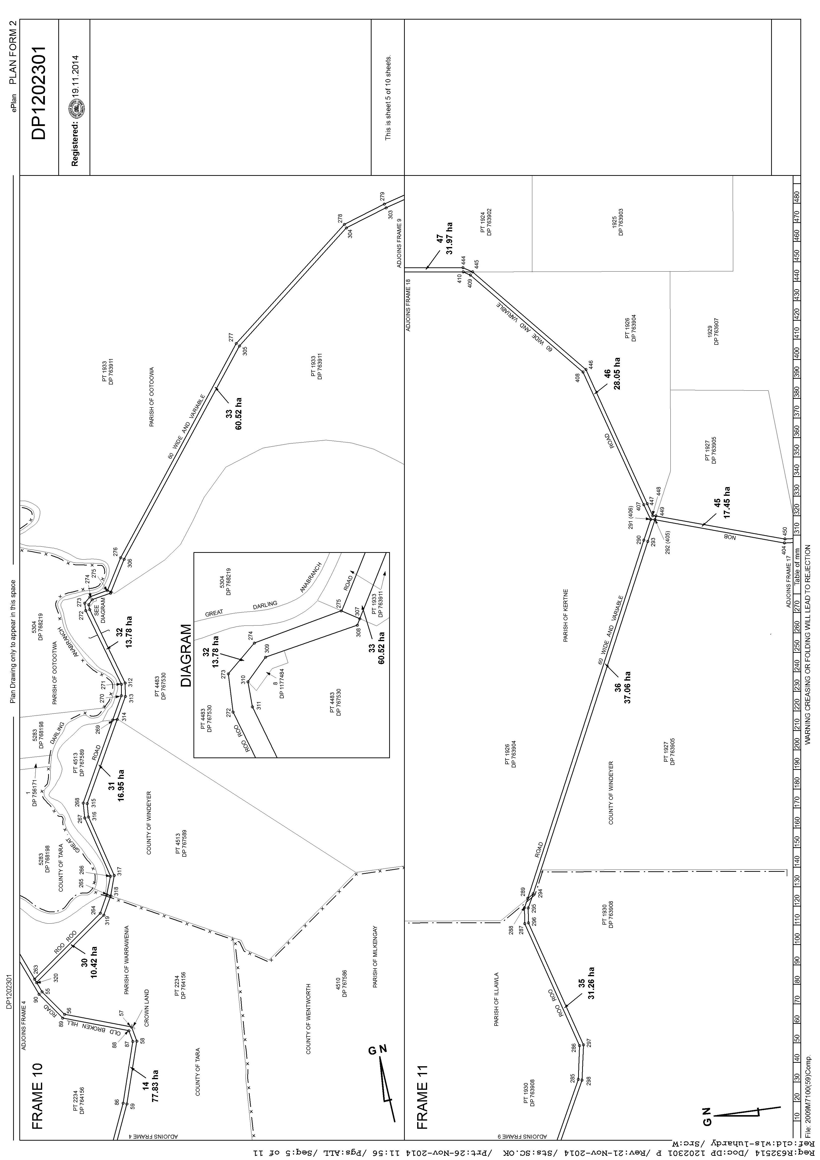
Item 9.4 - Attachment 2 DP1202301 Page 75
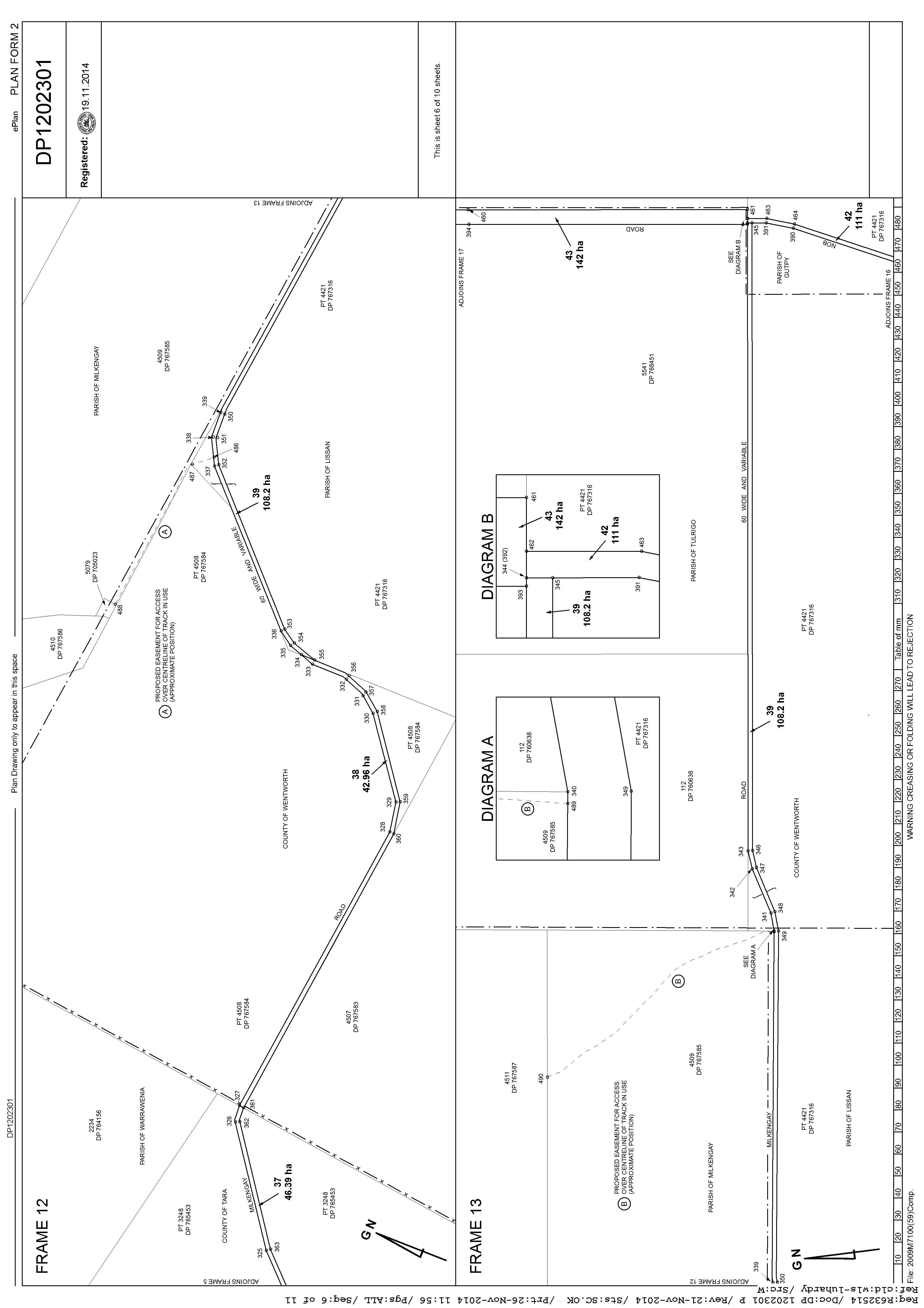
Item 9.4 - Attachment 2 DP1202301 Page 76
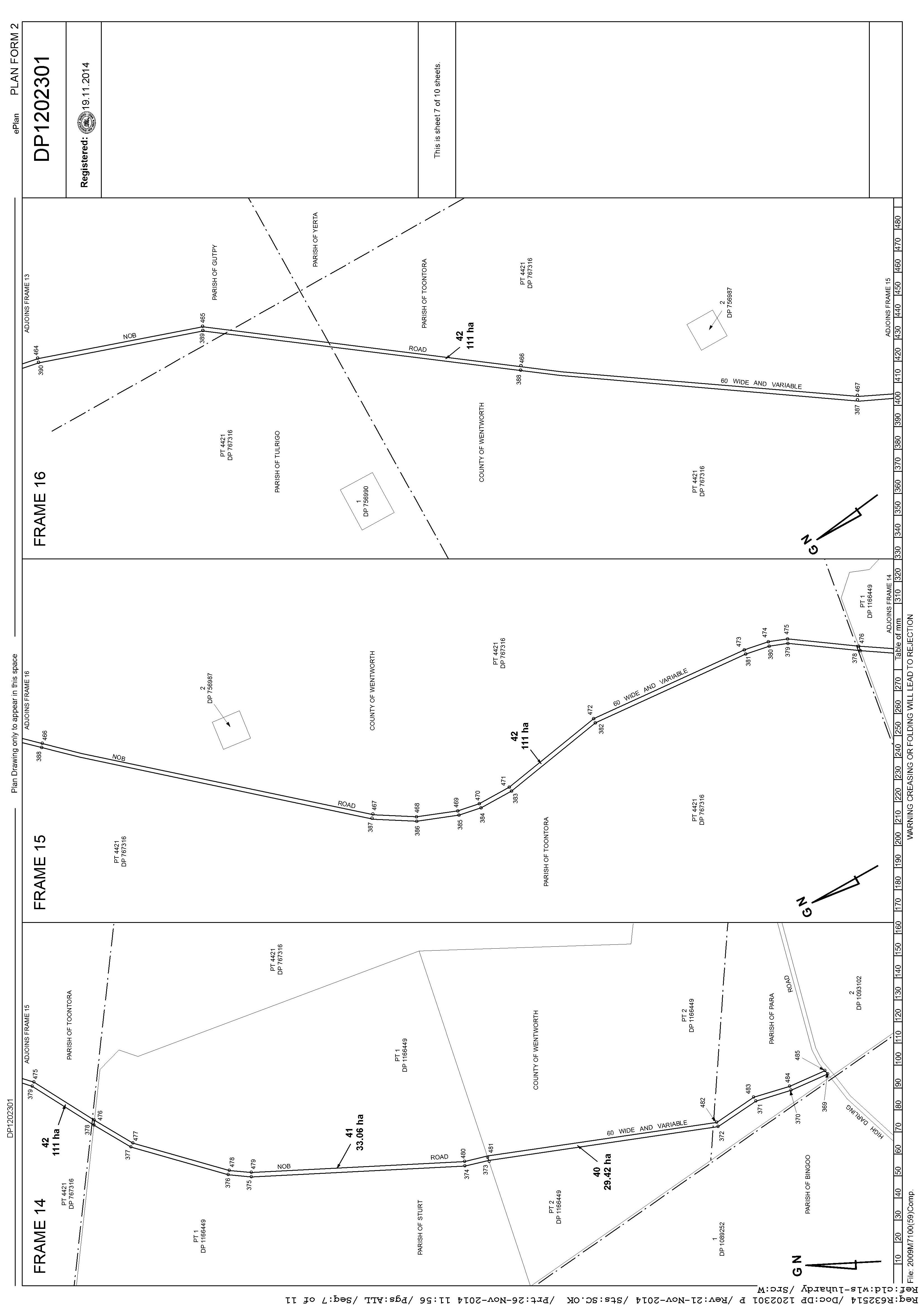
Item 9.4 - Attachment 2 DP1202301 Page 77
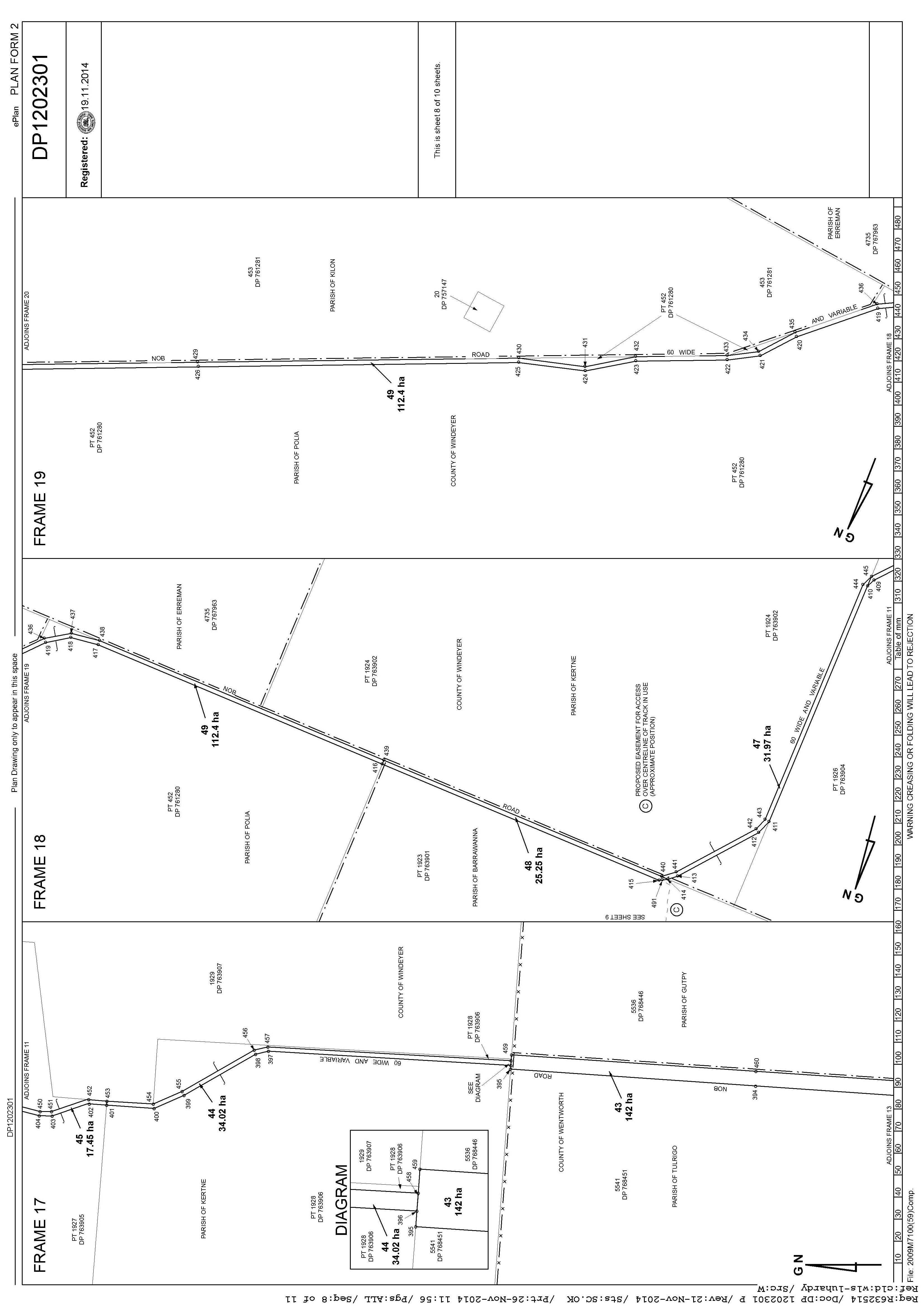
Item 9.4 - Attachment 2 DP1202301 Page 78
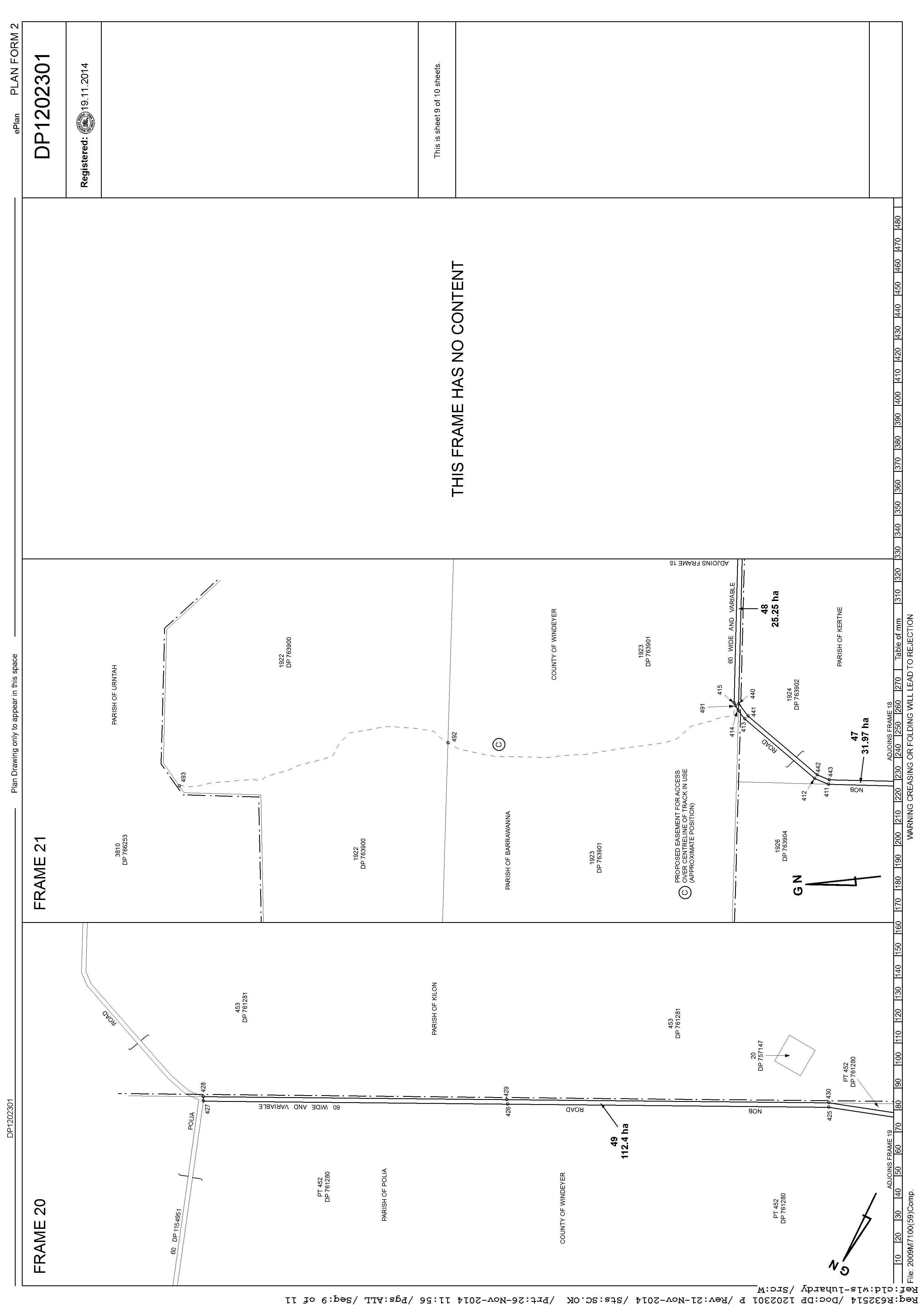
Item 9.4 - Attachment 2 DP1202301 Page 79
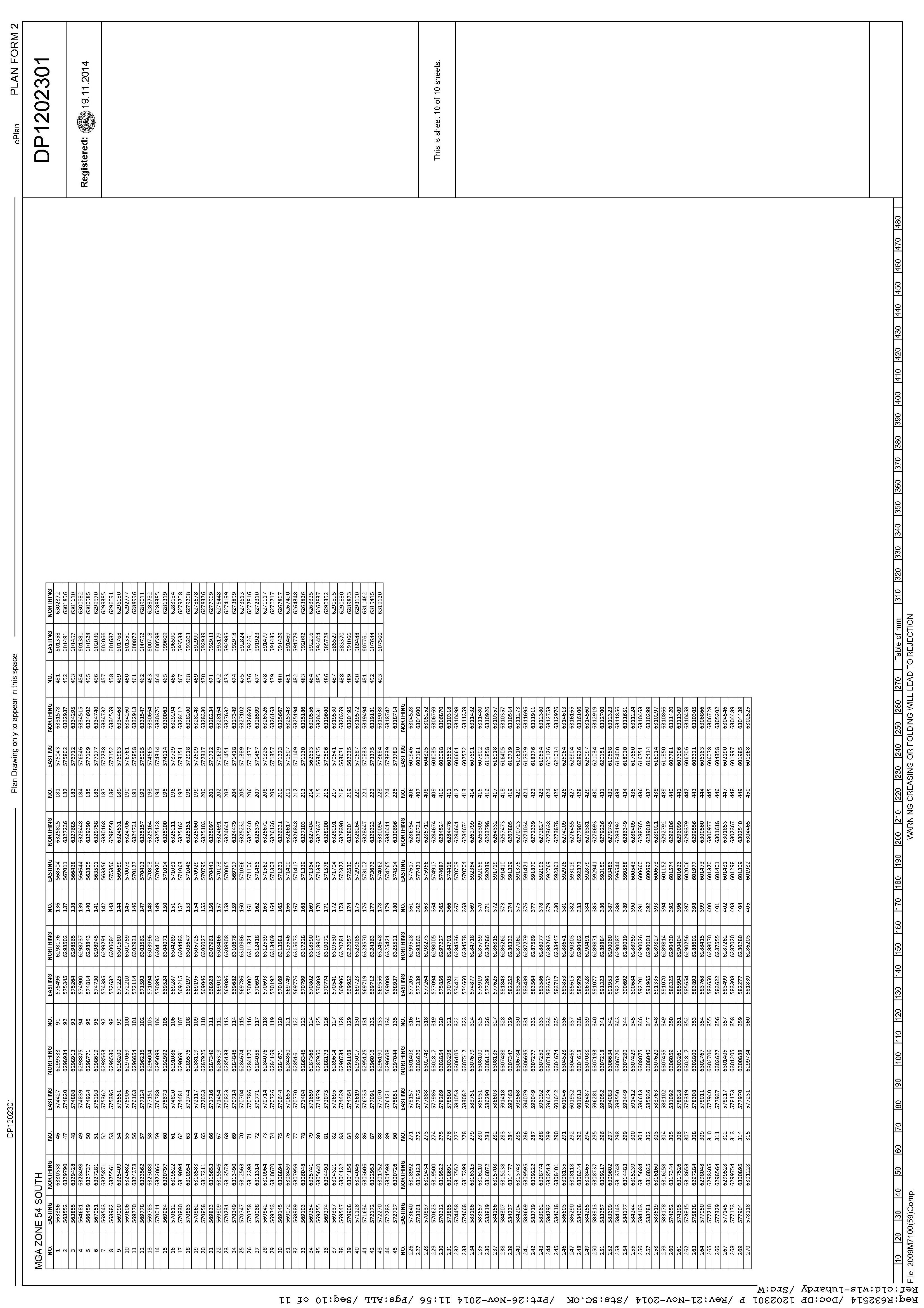
Item 9.4 - Attachment 2 DP1202301 Page 80
Item 9.4 - Attachment 2 DP1202301
9.5 MONTHLY FINANCE REPORT - NOVEMBER 2023
File Number: RPT/23/772
Responsible Officer: Ken Ross - General Manager
Responsible Division: Office of the General Manager Reporting Officer: Vanessa Lock - Finance Officer
Objective: 4.0 Wentworth is a caring , supportive and inclusive community that is informed and engaged in its future Strategy: 4.1 Provide strong and effective representation, leadership, planning, decision-making and service delivery
Summary
Rates and Charges collections for the month of November 2023 were $1,489,632.07. After allowing for pensioner subsidies, the total levies collected are now 60.68%. For comparison purposes 57.73% of the levy had been collected at the end of November 2022. Council currently has $49,790,247.56 in cash and investments.
Recommendation
That Council receives and notes the Monthly Finance Report.
Detailed Report
The purpose of this report is to indicate to Council the position in relation to the rate of collections and the balance of cash books.
Reconciliation and Balance of Funds held as at 30 November 2023
The reconciliation has been carried out between the Cash Book of each fund and the Bank Pass Sheet as at 30 November 2023.
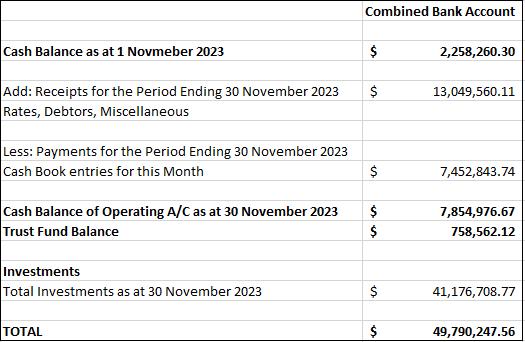
Ordinary Meeting AGENDA 13 December 2023 Page 82
Collection of Rates and Charges
Rates and Charges collections for the month of November 2023 were $307,475.05. After allowing for pensioner subsidies, the total levies collected are now 60.68%. A summary of the Rates and Charges situation as at 30 November 2023 is as follows:
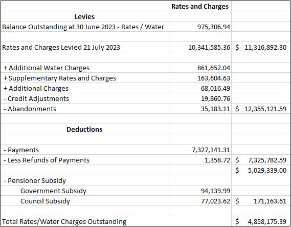
Note: For comparison purposes 57.73% of the levy had been collected at the end of November 2022.
Ordinary Meeting AGENDA 13 December 2023 Page 83
Rates/Water write offs and adjustments
Rates and charges that have been written off or adjustments made under the delegated authority of the General Manager for the month of November 2023.
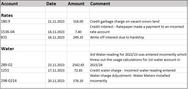
Council Loans Report
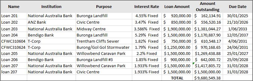
Ordinary Meeting AGENDA 13 December 2023 Page 84
Overtime and Travelling
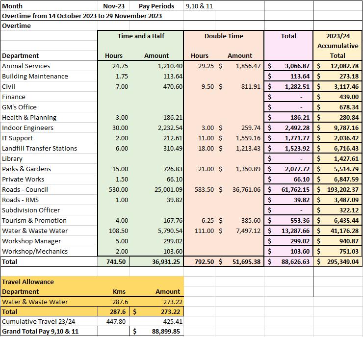
Conclusion
The report indicates to Council that its finances are in a favourable position.
Attachments
Nil
Ordinary Meeting AGENDA 13 December 2023 Page 85
9.6 MONTHLY INVESTMENT REPORT - NOVEMBER 2023
File Number: RPT/23/802
Responsible Officer: Ken Ross - General Manager
Responsible Division: Office of the General Manager
Reporting Officer: Bryce Watson - Accountant
Objective: 4.0 Wentworth Shire is supported by strong and ethical civic leadership with all activities conducted in an open, transparent and inclusive manner
Strategy: 4.5 Adopt practices of prudent asset, financial and human resource management across Council to ensure long-term sustainability and efficiency
Summary
As of 30 November 2023 Council had $39 million invested in term deposits and $10,790,247.56 in other cash investments. Council received $141,488.46 from its investments for the month of November 2023.
In November 2023 Council investments averaged a rate of return of 4.55% and it currently has $8,327,228.16 of internal restrictions and $33,464,984.38 of external restrictions.
Recommendation
That Council receives and notes the monthly investment report.
Detailed Report
Purpose
The purpose of this report is to update Council on the current status of its investments as required by the Local Government Act 1993 (NSW) and the associated regulation. Matters under consideration.
As of 30 November 2023, Council had $49,790,247.56 invested with Ten (10) financial institutions and One (1) Treasury Corporation. This is an increase of $3,604,699.15 from the previous month.
The investment of surplus funds remains in line with Council’s Investment Policy. This ensures sufficient working capital is retained and restrictions are supported by cash and investments that are easily converted into cash.
Interest Received from Cash Investments in November 2023
Three (3) deposits and One (1) other account matured or provided interest in November earning Council $141,488.46 in interest. The budget for November was $125,000. Year to date Council has received $623,889.38 in interest based on cash accounting. Expired investments are now shown in the attached report along with a summary of accrued interest. The budget for the financial year was set at $1,500,000.00. As shown in the attached report Council’s investments are on track to return $1,828,340.29 for the financial year.
*Note the difference in interest received between this report and the Yield Hub report is from Council’s at-call cash account which is paid monthly.
Ordinary Meeting AGENDA 13 December 2023 Page 86
Restrictions
Internal Restrictions
- Employee Entitlements
$2,308,162.00 - Doubtful Debts
- Future Development Reserve
- Trust Account
$47,730.00
$1,076,217.20
$1,692,071.85
-Caravan Park Loan Facility $703,047.11
- Capital Projects
$1,000,000.00
- Plant Replacement Reserve $1,500,000.00 $8,327,228.16
External Restrictions
- Water Fund
$11,183,151.39
- Sewer Fund $5,651,414.78
- T-Corp Loan Balance $509,066.93
- Developer Contributions Reserve $983,097.38
- Unexpended Grants $14,370,678.19
- Crown Reserves Reserve $208,296.22
- Loan Guarantee Reserve $187.69 - Prepayments Cemeteries $559,091.80 $33,464,984.38 Day to Day Liquidity $7,998,035.02 Total Funds Available $49,790,247.56
Total Funds Invested
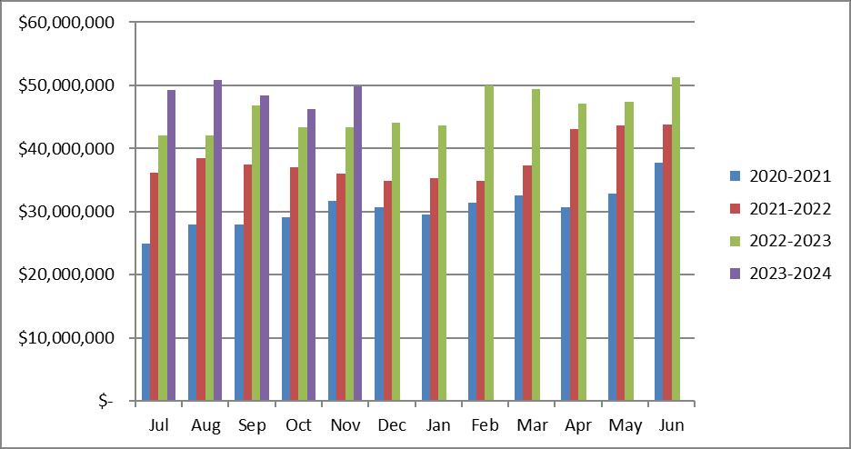
Ordinary Meeting AGENDA 13 December 2023 Page 87
Summary – Unexpended Grants as at 30 November 2023
The Director Finance & Policy has certified that all investments have been made in accordance with the Local Government Act 1993 (NSW), Local Government (General) Regulations 2021 and Council’s Investment Policy. Council is investing its funds prudently to optimise returns and reduce exposure to risk in accordance with legislation and its own investment policy.
Attachments
1. Investment Report November 2023⇩
Ordinary Meeting AGENDA 13 December 2023 Page 88
Grant Amount SCCF Wentworth Rowing Club $42,515.43 Crown Reserve Improvement Fund Astronomy Park $656,000.21 Fixing Local Roads Grants - Stage 3 $211,529.51 Fixing Local Roads Grants - Stage 4 $41,872.22 Resources for Regions Round 8 $445,357.53 Pooncarie Menindee Road $205,231.00 Main Road Block Grant $398,692.52 Transport for NSW Pothole Repair Program $597,724.61 Resources for Regions Round 9 $2,572,006.03 Rural Local Road Repair Program $7,954,219.37 NSW Office of Local Government Flood Grants $889,407.81 Strong Start Cadetship Program Grant $25,000.00 JEV Mosquito Eradication Grant $22,013.56 Stronger Country Communities Fund Round 5 $162,596.92 SCCF Female Jockey Changerooms $71,511.47 Regional Leakage Reduction Program - Local Water Utility $75,000.00 Total
$14,370,678.19 Conclusion
3 0 N o v e m b e r 2 0 2 3 W e n t w o r t h S h i r e C o u n c i lMo n t h l y R e p o r t
Item 9.6 - Attachment 1 Investment Report November 2023 Page 89
$ 3 9 9, 8 1 8, 7 7 . 5 5
V
i g h t e d A v e r a g
T e r m 1 7 7 W e i g h t e d A v e r a g e Y i e l d 4 . 5 5 % 9 0 d a y B B S W 3 . 0 4 % U n r e a l i s e d C a p i t a l G a i n / L o s s $ 0
$ 1 4 2 7, 0 9 . 0 3
T o t a l M o n t h l y A c c r u e d I n t e r e s t
T o t a l I n t e r e s t R e c e i v e d t h i s m o n t h $ 1 3 3 3, 4 2 . 7 4
T o t a l I n t e r e s t R e c e i v e d t h i s F Y $ 5 6 2 7, 6 7 . 1 4
T o t a l I n t e r e s t E x p e c t e d t h i s F Y $ 1 8, 2 8 3, 4 0 . 2 9
I n t e r e s t P a y m e n t s t h i s m o n t h 3
M a t u r e d I n v e s t m e n t s t h i s m o n t h 3
T o t a l F u n d s M a t u r e d t h i s m o n t h $ 3 0, 0 0 0, 0 0 . 0 0
I n v e s t m e n t s t h i s m o n t h 1
T o t a l F u n d s I n v e s t e d t h i s m o n t h $ 1 0, 0 0 0, 0 0 . 0 0
C o m p l i a n t P o r t f o l i o Y e s
Item 9.6 - Attachment 1 Investment Report November 2023 Page 90 W e n t w o r t h S h i r e C o u n c i lM o n t h l y R e p o r t R e p o r t D a t e
3 0 N o v e m b e r 2 0 2 3 P a g e 1 o f 8 © 2 0 2 3 Y i e l d H u b P ty L t d | A B N 6 7 6 3 4 4 2 5 7 1 9 i s a n A u t h o r i s e d R e p r e s e n t a t i v e o f C u r v e S e c u r i t i e s P ty L t d ( A F S L 4 0 5 7 5 1 ) . A l l r i g h t s r e s e r v e d .
T o
o
:
S u m m a r y T o t a l C o s t $ 3 9 0, 0 0 0, 0 0 . 0 0
t a l P o r t f o l i
a l u e
W e
e
I M B ( 2 5 6 % )
N o r t h e r n T e r r i t o r y T r e a s u r y C o r p ( 2 . 5 6 % ) I N G B a n k A u s t r a l i a N A B W e s t p a c B a n k O f Q u e e n s l a n d .
i g o A n d A d e l a i d e B a n k ( 5 . 1 3 % ) H u m e B a n k ( 2 . 5 6 % )
B e n d i g o A n d A d e l a i d e B a n k B e y o n d B a n k A u s t r a l i a
H u m e B a n k
N o r t h e r n T e r r i t o r y T r e a s u r y C o r p
C o m m o n w e a l t h B a n k
I M B
Item 9.6 - Attachment 1 Investment Report November 2023 Page 91 W e n t w o r t h S h i r e C o u n c i lM o n t h l y R e p o r t R e p o r t D a t e : 3 0 N o v e m b e r 2 0 2 3 P a g e 2 o f 8 © 2 0 2 3 Y i e l d H u b P ty L t d | A B N 6 7 6 3 4 4 2 5 7 1 9 i s a n A u t h o r i s e d R e p r e s e n t a t i v e o f C u r v e S e c u r i t i e s P ty L t d ( A F S L 4 0 5 7 5 1 ) . A l l r i g h t s r e s e r v e d . C
I N G B a n k A u s t r a l i a ( 2 8 . 2 1 % ) N A B ( 2 5 . 6 4 % ) W e s t p a c ( 2 0 . 5 1 % ) B a n k O f Q u e e
d
B
o u n t e r p a r t y
n s l a n
. ( 7 . 6 9 % )
e n d
Item 9.6 - Attachment 1 Investment Report November 2023 Page 92 W e n t w o r t h S h i r e C o u n c i lM o n t h l y R e p o r t R e p o r t D a t e : 3 0 N o v e m b e r 2 0 2 3 P a g e 3 o f 8 © 2 0 2 3 Y i e l d H u b P ty L t d | A B N 6 7 6 3 4 4 2 5 7 1 9 i s a n A u t h o r i s e d R e p r e s e n t a t i v e o f C u r v e S e c u r i t i e s P ty L t d ( A F S L 4 0 5 7 5 1 ) . A l l r i g h t s r e s e r v e d . L o n g T e r m C r e d i t R a t i n g A A( 5 1 . 2 8 % ) A ( 2 8 . 2 1 % ) B B B + ( 1 7 . 9 5 % ) B B B ( 2 . 5 6 % ) A AA B B B + B B B
T e r m D e p o s i t I N G B a n k A u s t r a l i a $ 2 , 0 0 0 , 0 0 0 0 5 / 0 4 / 2 0 2 3 0 4 / 0 4 / 2 0 2 4 3 6 5 4 . 6 8 % A1 A
T e r m D e p o s i t I N G B a n k A u s t r a l i a $ 1 , 0 0 0 , 0 0 0 1 9 / 0 4 / 2 0 2 2 1 9 / 0 4 / 2 0 2 4 7 3 1 3 . 0 9 % A1 A
T e r m D e p o s i t I N G B a n k A u s t r a l i a $ 1 , 0 0 0 , 0 0 0 1 8 / 0 5 / 2 0 2 3 1 7 / 0 5 / 2 0 2 4 3 6 5 4 . 9 0 0 % A1 A
T e r m D e p o s i t I N G B a n k A u s t r a l i a $ 1 , 0 0 0 , 0 0 0 2 6 / 0 5 / 2 0 2 3 2 7 / 0 5 / 2 0 2 4 3 6 7 4 . 9 4 % A1 A T e r m D e p o s i t W e s t p a c $ 1 , 0 0 0 , 0 0 0 0 6 / 0 6 / 2 0 2 3 0 6 / 0 6 / 2 0 2 4
T e r m D e p o s i t I N G B a n k A u s t r a l i a $ 2 , 0 0 0 , 0 0 0 2 8 / 0 6 / 2 0 2 3 2 7 / 0 6 / 2 0 2 4 3 6 5
T e r m D e p o s i t W e s t p a c $ 1 , 0 0 0 , 0 0 0 2 6 / 0 7 / 2 0 2 3 2 6 / 0 7 / 2 0 2 4
T e r m D e p o s i t W e s t p a c $ 1 , 0 0 0 , 0 0 0 2 7 / 0 7 / 2 0 2 3 2 9 / 0 7 / 2 0 2 4 3 6 8 3 . 2 7 % A1 + A A -
Item 9.6 - Attachment 1 Investment Report November 2023 Page 93 W e n t w o r t h S h i r e C o u n c i lM o n t h l y R e p o r t R e p o r t D a t e : 3 0 N o v e m b e r 2 0 2 3 P a g e 4 o f 8 © 2 0 2 3 Y i e l d H u b P ty L t d | A B N 6 7 6 3 4 4 2 5 7 1 9 i s a n A u t h o r i s e d R e p r e s e n t a t i v e o f C u r v e S e c u r i t i e s P ty L t d ( A F S L 4 0 5 7 5 1 ) . A l l r i g h t s r e s e r v e d . I n v e s t m e n t T y p e A D I / S e c u r i t y N a m e A m o u n t S e t t l e m e n t D a t e M a t u r i t y D a t e T e r m i n D a y s Y i e l d S h o r t T e r m R a t i n g L o n g T e r m R a t i n g T e r m D e p o s i t I M B $ 1 , 0 0 0 , 0 0 0 1 1 / 0 9 / 2 0 2 3 1 1 / 1 2 / 2 0 2 3 9 1 5 . 0 8 % N R N R T e r m D e p o s i t N A B $ 1 , 0 0 0 , 0 0 0 1 5 / 1 2 / 2 0 2 2 1 5 / 1 2 / 2 0 2 3 3 6 5
5 % A1 + A AT e r m D e p o s i t I N G B a n k A u s t r a l i a $ 1 , 0 0 0 , 0 0 0 1 9 / 1 2 / 2 0 2 2 1 9 / 1 2 / 2 0 2 3 3 6 5 4 . 5 0 0 % A1 A T e r m D e p o s i t B e n d i g o A n d A d e l a i d e B a n k $ 1 , 0 0 0 , 0 0 0 2 2
1
/ 2 0 2 2 2 2 / 1 2 / 2 0 2 3 3 6 5 4 . 3 0 0 % A2 B B B + T e r m D e p o s i t N A B $ 1 , 0 0 0 , 0 0 0 0 3 / 0 1 / 2
3 2 3 / 0 1 / 2 0 2 4 3 3 0 4 . 9 2 % A1 + A AT e r m D e p o s i t C o m m o n w e a l t h B a n k $ 1
0 0 0
0 0 0 3 0 / 0 1 / 2 0 2 3 3 0 / 0 1 / 2 0 2 4 3 6 5 4 . 6 9 % A1 + A AT e r m
a
k O f Q
d . $ 1 , 0 0 0 , 0 0 0 0 9 / 0 2 / 2 0 2 3 0 9 / 0 2 / 2 0 2 4 3 6 5 4 . 6 0 0 % A2 B B B + T e r m D e p o s i t N A B $ 1 , 0 0 0 , 0 0 0 0 9 / 0 2 / 2 0 2 3 0 9 / 0 2 / 2 0 2 4 3 6 5 4 . 7 0 0 % A1 + A AT e r m D e p o s i t N A B $ 1 , 0 0 0 , 0 0 0 2 0 / 0 2 / 2 0 2 3 2 0 / 0 2 / 2 0 2 4 3 6 5 4 . 8 5 % A1 + A AT e r m D e p o s i t B e n d i g o A n d A d e l a i d e B a n k $ 1 , 0 0 0 , 0 0 0 2 4 / 0 2 / 2 0 2 3 2 3 / 0 2 / 2 0 2 4 3 6 4 4 . 7 0 0 % A2 B B B + T e r m D e p o s i t N A B $ 1 , 0 0 0 , 0 0 0 2 7 / 0 2 / 2 0 2 3 2 7 / 0 2 / 2 0 2 4 3 6 5 5 . 0 % A1 + A AT e r m D e p o s i t W e s t p a c $ 1 , 0 0 0 , 0 0 0 2 7 / 0 2 / 2 0 2 3 2 7 / 0 2 / 2 0 2 4 3 6 5 4 . 9 8 % A1 + A AT e r m D e p o s i t W e s t p a c $ 1 , 0 0 0 , 0 0 0 1 1 / 0 3 / 2 0 2 2 1 1 / 0 3 / 2 0 2 4 7 3 1 1 . 9 2 % A1 + A AT e r m D e p o s i t N A B $ 1 , 0 0 0 , 0 0 0 1 1 / 0 3 / 2 0 2 2 1 1 / 0 3 / 2 0 2 4 7 3 1 1 . 8 5 % A1 + A AT e r m D e p o s i t B a n k O f Q u e e n s l a n d . $ 1 , 0 0 0 , 0 0 0 1 5 / 0 3 / 2 0 2 3 1 4 / 0 3 / 2 0 2 4 3 6 5 4 . 4 5 % A2 B B B + T e r m D e p o s i t I N G B a n k A u s t r a l i a $ 1 , 0 0 0 , 0 0 0 2 0 / 0 3 / 2 0 2 3 1 9 / 0 3 / 2 0 2 4 3 6 5 4 . 4 5 % A1 A T e r m D e p o s i t I N G B a n k A u s t r a l i a $ 1 , 0 0 0 , 0 0 0 2 3 / 0 3 / 2 0 2 3 2 2 / 0 3 / 2 0 2 4 3 6 5 4 . 6 0 0 % A1 A
A
4 . 3
/
2
0 2 3 0 3 / 0 1 / 2 0 2 4 3 6 5 4 . 5 0 0 % A1 + A AT e r m D e p o s i t N A B $ 1 , 0 0 0 , 0 0 0 2 7 / 0 2 / 2 0 2
,
,
D e p o s i t B
n
u e e n s l a n
T e r m D e p o s i t I N G B a n k A u s t r a l i a $ 1 , 0 0 0 , 0 0 0 3 1 / 0 3 / 2 0 2 3 0 2 / 0 4 / 2 0 2 4 3 6 8 4 . 6 8 % A1
A
3 6 6 5 . 0 4 % A1 +
A
5 . 6 2 % A1 A
3 6 6 5 . 2 5 % A1 + A A -
s i t
B a n k A u s t r a l i a $ 1 , 0 0 0 , 0 0 0 1 1 / 0 9 / 2 0 2 3 1 0 / 0 9 / 2 0 2 4 3 6 5 5 . 2 0 0 % A2 B B B T e r m D e p o s i t B a n k O f Q u e e n s l a n d . $ 1 , 0 0 0 , 0 0
Item 9.6 - Attachment 1 Investment Report November 2023 Page 94 W e n t w o r t h S h i r e C o u n c i lM o n t h l y R e p o r t R e p o r t D a t e : 3 0 N o v e m b e r 2 0 2 3 P a g e 5 o f 8 © 2 0 2 3 Y i e l d H u b P ty L t d | A B N 6 7 6 3 4 4 2 5 7 1 9 i s a n A u t h o r i s e d R e p r e s e n t a t i v e o f C u r v e S e c u r i t i e s P ty L t d ( A F S L 4 0 5 7 5 1 ) . A l l r i g h t s r e s e r v e d . I n v e s t m e n t T y p e A D I / S e c u r i t y N a m e A m o u n t S e t t l e m e n t D a t e M a t u r i t y D a t e T e r m i n D a y s Y i e l d S h o r t T e r m R a t i n g L o n g T e r m R a t i n g T e r m D e p o s i t W e s t p a c $ 1 , 0 0 0 , 0 0 0 2 4 / 0 8 / 2 0 2 3 2 6 / 0 8 / 2 0 2 4 3 6 8 5 . 1 0 0 % A1 + A AT e r m D e p o s i t W e s t p a c $ 1 , 0 0 0
0 0 0 2 4
0 8
0
3
0 2 4 3 6 8 5
0 0 % A1 + A AT e r m D e p o s i t N A B $ 1
0 0 0
0
0
2
4 3 6 5 5
0 % A1 + A AT e r m D e p o s i t N A B $ 1
0 0 0
0 0 0
0
3 6
A AT
N A B $
T e r
0 0 3 / 1 0 / 2 0 2 3 0 2 / 1 0 / 2 0 2 4 3 6 5 5 . 2 0 0 % A2 B B B + T e
3
N R T
p o s i t W e s t p a c $ 1 , 0 0 0
0 0 0 2 7 / 1 1 / 2 0 2 3 2 7 / 1 1 / 2 0 2 4 3 6 6 5 . 4 7 % A1 + A AT
0 0
0
,
/
/ 2
2
2 6 / 0 8 / 2
. 1
,
,
0
2 9 / 0 8 / 2 0 2 3
8 / 0 8 / 2 0 2
. 2 0
,
,
0 4 / 0 9 / 2 0 2 3
3 / 0 9 / 2 0 2 4
5 5 . 1 2 % A1 +
e r m D e p o s i t
1 , 0 0 0 , 0 0 0 0 5 / 0 9 / 2 0 2 3 0 4 / 0 9 / 2 0 2 4 3 6 5 5 . 1 7 % A1 + A A -
m D e p o
B e y o n d
r m D e p o s i t H u m e B a n k $ 1 , 0 0 0 , 0 0 0 0 5 / 1 0 / 2 0 2 3 0 4 / 1 0 / 2 0 2 4
6 5 5 . 2 5 % N R
e r m D e
,
e r m D e p o s i t N o r t h e r n T e r r i t o r y T r e a s u r y C o r p $ 1 , 0 0 0 , 0 0 0 1 6 / 0 9 / 2 0 2 1 1 5 / 1 2 / 2 0 2 6 1 , 9 1 6 1 . 3 5 % N R N R $ 3 9 , 0
, 0 0
a t
2 7 / 1 1 / 2 0 2 3 0 6 5 6 2 9 W e s t p a c I n t e r e s t $ 4 4 , 5 4 2 . 7 4 D e b i t A AU n c l a s s i fi e d 2 7 / 1 1 / 2 0 2 3
0 2 / 1 1 / 2 0 2 3 0 6 5 6 2 6 C o m m o n w e a l t h B a n k I n t e r e s t $ 4 4 , 4 0 0
U n c l a s s i fi e d
$ 4 4 , 4 0 0 D e b i t A A -
0 2 / 1 1 / 2 0 2 3 0 6 5 6 2 7 C o m m o n w e a l t h B a n k I n t e r e s t
0 2 / 1 1 / 2 0 2 3 T o t a l $ 1 3 3 , 3 4 2 . 7 4
Item 9.6 - Attachment 1 Investment Report November 2023 Page 95 W e n t w o r t h S h i r e C o u n c i lM o n t h l y R e p o r t R e p o r t D a t e : 3 0 N o v e m b e r 2 0 2 3 P a g e 6 o f 8 © 2 0 2 3 Y i e l d H u b P ty L t d | A B N 6 7 6 3 4 4 2 5 7 1 9 i s a n A u t h o r i s e d R e p r e s e n t a t i v e o f C u r v e S e c u r i t i e s P ty L t d ( A F S L 4 0 5 7 5 1 ) . A l l r i g h t s r e s e r v e d . T r a n s a c t i o n D a t e C o n t r a c t N u m b e r A D I / S e c u r i t y N a m e T y p e A m o u n t C r e d i t / D e b i t L o n g T e r m R a t i n g D e s i g n a t i
C
r
D
o n
o m m e n t s M a t u
i t y
e
D e b i t A AU n c l a s s i fi e d 0 2 / 1 1 / 2 0 2 3
Item 9.6 - Attachment 1 Investment Report November 2023 Page 96 W e n t w o r t h S h i r e C o u n c i lM o n t h l y R e p o r t R e p o r t D a t e : 3 0 N o v e m b e r 2 0 2 3 P a g e 7 o f 8 © 2 0 2 3 Y i e l d H u b P ty L t d | A B N 6 7 6 3 4 4 2 5 7 1 9 i s a n A u t h o r i s e d R e p r e s e n t a t i v e o f C u r v e S e c u r i t i e s P ty L t d ( A F S L 4 0 5 7 5 1 ) . A l l r i g h t s r e s e r v e d . A c c o u n t v s R B A C a s h v s 3 m B B S W v s B l o o m b e r g A u s B o n d B a n k B i l l I n d e x T e r m A c c o u n t R B A C a s h O u tp e r f o r m a n c e 3 m B B S W O u tp e r f o r m a n c e A u s B o n d B a n k B i l l O u tp e r f o r m a n c e 1 m 4 . 5 5 % 4 . 3 5 % 0 . 2 0 % 4 . 3 8 % 0 . 1 6 % 4 . 3 3 % 0 . 2 2 % 3 m 4 . 5 2 % 4 . 1 6 % 0 . 3 6 % 4 . 2 4 % 0 . 2 8 % 4 . 1 9 % 0 . 3 4 % 6 m 4 . 4 5 % 4 . 1 4 % 0 . 3 1 % 4 . 2 4 % 0 . 2 1 % 4 . 1 7 % 0 . 2 7 % 1 2 m 3 9 6 % 3 7 5 % 0 2 1 % 3 8 7 % 0 0 8 % 3 8 0 % 0 1 6 % D a t e % M o n t h E n d P e r f o r m a n c e 3 . 0 1 8 6 7 % 3 . 0 1 8 6 7 % 3 . 2 4 2 % 3 . 8 9 3 3 3 % 4 . 1 6 6 4 7 % 4 . 3 0 8 8 9 % 4 . 3 8 9 2 9 % 4 . 3 8 4 0 5 % 4 . 4 4 8 6 % 4 . 4 9 3 5 7 % 4 . 5 4 1 7 1 % 4 . 5 5 % 3 . 3 5 % 3 . 6 % 3 . 6 % 3 . 8 5 % 4 . 1 % 4 . 1 % 4 . 1 % 4 . 1 % 4 . 1 % 4 3 5 % 3 . 2 6 4 7 % 3 . 3 7 3 % 3 . 7 1 5 % 4 . 2 5 6 9 % 4 3 5 0 7 % 3 . 2 4 4 % 4 . 2 1 7 % 4 . 2 3 % A c c o u n t R B A C a s h 3 m B B S W A u s B o n d B a n k B i l l D e c 2 2 J a n 2 3 F e b 2 3 M a r 2 3 A p r 2 3 M a y 2 3 J u n 2 3 J u l 2 3 A u g 2 3 S e p 2 3 O c t 2 3 2 . 5 % 3 % 3 5 % 4 % 4 . 5 %
Item 9.6 - Attachment 1 Investment Report November 2023 Page 97 W e n t w o r t h S h i r e C o u n c i lM o n t h l y R e p o r t R e p o r t D a t e : 3 0 N o v e m b e r 2 0 2 3 P a g e 8 o f 8 © 2 0 2 3 Y i e l d H u b P ty L t d | A B N 6 7 6 3 4 4 2 5 7 1 9 i s a n A u t h o r i s e d R e p r e s e n t a t i v e o f C u r v e S e c u r i t i e s P ty L t d ( A F S L 4 0 5 7 5 1 ) . A l l r i g h t s r e s e r v e d . M o n t h s $ B u d g e t V e r s u s A c t u a l I n t e r e s t E a r n e d I n t e r e s t P a i d + A c c r u e d I n t e r e s t P a i d I n t e r e s t A c c r u e d B u d g e t N o v ' 2 3 J a n ' 2 4 M a r ' 2 4 M a y ' 2 4 J u l ' 2 4 S e p 2 4 D e c 2 3 F e b ' 2 4 A p r ' 2 4 J u n ' 2 4 A u g 2 4 0 1 0 0 k 2 0 0 k 3 0 0 k 5 0 k 1 5 0 k 2 5 0 k 3 5 0 k
9.7
CODE OF CONDUCT COMPLAINT STATISTICS FOR THE PERIOD ENDING 31 AUGUST 2023
File Number: RPT/23/750
Responsible Officer: Simon Rule - Director Finance and Policy
Responsible Division: Finance and Policy
Reporting Officer: Simon Rule - Director Finance and Policy
Objective:
4.0 Wentworth Shire is supported by strong and ethical civic leadership with all activities conducted in an open, transparent and inclusive manner
Strategy: 4.2 A strong, responsible and representative government
Summary
The Procedures for the Administration of the Model Code of Conduct requires a report to be presented to Council within three months of the end of September each year on Code of Conduct complaints.
The information contained in the report pertains to the period ended 31 August 2023.
Recommendation
That Council notes the reporting of the Code of Conduct complaints statistics for the period ending 31 August 2023.
Detailed Report
Purpose
The purpose of this report is to inform Council on Code of Conduct complaints received from 1 September 2022 to 31 August 2023.
Background
As required under section 11.1 of the Procedures for Administration of the Model Code of Conduct a report must be prepared and tabled with Council annually within three months of the end of September.
Report Detail
The Code of Conduct report is sent to the Office of Local Government and has been attached to this report for the information of Councilor’s and the public.
Conclusion
Council has complied with its Code of Conduct reporting obligations.
Attachments
1. Model Code of Conduct Complaint Statistics⇩
Ordinary Meeting AGENDA 13 December 2023 Page 98
Model Code of Conduct Complaints Statistics 2022‐23 Wentworth Shire Council
Number of Complaints
1The total number of complaints received in the reporting period about councillors and the General Manager (GM) under the code of conduct from the following sources:
2The total number of complaints finalised about councillors and the GM under the code of conduct in the following periods:
Overview of Complaints and Cost
3aThe number of complaints finalised at the outset by alternative means by the GM or Mayor 0
bThe number of complaints referred to the Office of Local Government (OLG) under a special complaints management arrangement 0
cThe number of code of conduct complaints referred to a conduct reviewer
dThe number of code of conduct complaints finalised at preliminary assessment by conduct reviewer 0
eThe number of code of conduct complaints referred back to GM or Mayor for resolution after preliminary assessment by conduct reviewer
fThe number of finalised code of conduct complaints investigated by a conduct reviewer
gCost of dealing with code of conduct complaints via preliminary assesment
hProgressed to full investigation by a conduct reviewer
iThe number of finalised complaints investigated where there was found to be no breach
jThe number of finalised complaints investigated where there was found to be a breach
kThe number of complaints referred by the GM or Mayor to another agency or body such as the ICAC, the NSW Ombudsman, OLG or the Police
specify)
lThe number of complaints being investigated that are not yet finalised
mThe total cost of dealing with code of conduct complaints within the period made about councillors and the GM including staff costs
Item 9.7 - Attachment 1 Model Code of Conduct Complaint Statistics Page 99 Page
1 of 3
0
Councillors 0
Manager 0
iCommunity
iiOther
iiiGeneral
0
ivOther Council Staff
i3 Months 0 ii6 Months 0 iii9 Months 0 iv12 Months 0 vOver 12 months 0
0
0
0
0
0
0
iICAC 0 iiNSW Ombudsman 0 iiiOLG 0 ivPolice 0
Agency (please
0
vOther
0
0 0
Preliminary Assessment Statistics
4
The number of complaints determined by the conduct reviewer at the preliminary assessment stage by each of the following actions:
aTo take no action (clause 6.13(a) of the 2020 Procedures)
bTo resolve the complaint by alternative and appropriate strategies (clause 6.13(b) of the 2020 Procedures)
cTo refer the matter back to the GM or the Mayor, for resolution by alternative and appropriate strategies (clause 6.13(c) of the 2020 Procedures)
dTo refer the matter to another agency or body such as the ICAC, the NSW Ombudsman, OLG or the Police (clause 6.13(d) of the 2020 Procedures)
eTo investigate the matter (clause 6.13(e) of the 2020 Procedures)
fOther action (please specify)
Investigation Statistics
5
The number of investigated complaints resulting in a determination that there was no breach, in which the following recommendations were made:
aThat the council revise its policies or procedures
bThat a person or persons undertake training or other education (clause 7.40 of the 2020 Procedures)
6
The number of investigated complaints resulting in a determination that there was a breach in which the following recommendations were made:
aThat the council revise any of its policies or procedures (clause 7.39 of the 2020 Procedures)
bIn the case of a breach by the GM, that action be taken under the GM’s contract for the breach (clause 7.37(a) of the 2020 Procedures)
cIn the case of a breach by a councillor, that the councillor be formally censured for the breach under section 440G of the Local Government Act 1993 (clause 7.37(b) of the 2020 Procedures)
dIn the case of a breach by a councillor, that the councillor be formally censured for the breach under section 440G of the Local Government Act 1993 and that the matter be referred to OLG for further action (clause 7.37(c) of the 2020 Procedures)
7Matter referred or resolved after commencement of an investigation (clause 7.20 of the 2020 Procedures)
Item 9.7 - Attachment 1 Model Code of Conduct Complaint Statistics Page 100 Page
2 of 3
0
0
0
0
0
0
0
0
0
0
0
0
0
The number of investigated complaints resulting in a determination that there was a breach with respect to each of the following categories of conduct:
Outcome of determinations
The number of investigated complaints resulting in a determination that there was a breach in which the council:
The number of investigated complaints resulting in a determination where:
11Date Code of Conduct data was presented to council
Item 9.7 - Attachment 1 Model Code of Conduct Complaint Statistics Page 101 Page 3
3 Categories of misconduct 8 aGeneral conduct
0 bNon‐pecuniary conflict of interest
0 cPersonal benefit
0 dRelationship between council officials
7) 0
to information and resources
8) 0 9
of
(Part 3)
(Part 5)
(Part 6)
(Part
eAccess
(Part
independent conduct reviewers recommendation 0
to adopt the independent conduct reviewers recommendation 0 10
by OLG 0
0
aAdopted the
bFailed
aThe external conduct reviewers decision was overturned
bCouncil's response to the external conduct reviewers reccomendation was overturned by OLG
9.8 2022-2023 ANNUAL REPORT
File Number: RPT/23/778
Responsible Officer: Ken Ross - General Manager
Responsible Division: Office of the General Manager
Reporting Officer: Deborah Zorzi - Governance Officer
Objective: 4.0 Wentworth Shire is supported by strong and ethical civic leadership with all activities conducted in an open, transparent and inclusive manner
Strategy: 4.2 A strong, responsible and representative government
Summary
Section 428 of the Local Government Act 1993 (NSW) states that within five months after the end of each financial year Council must prepare a report for that year reporting as to its achievements in implementing its delivery program and the effectiveness of the principal activities undertaken.
There is no set format for the Annual Report and Council can develop the format that best suits them and their community provided mandatory and statutory requirements are addressed. It should be easy to navigate and understand by a wide range of people.
The Annual Report must be placed on Council’s website with a link provided to the Minister for Local Government.
Recommendation
That Council notes the completion of the 2022-2023 Annual Report.
Detailed Report
Purpose
The purpose of this report is to update Council on the progress of the 2022-2023 Annual Report.
Background
Section 428 of the Local Government Act 1993 (NSW) states that within five months after the end of each financial year Council must prepare a report for that year reporting as to its achievements in implementing its delivery program and the effectiveness of the principal activities undertaken.
Report Detail
There is no set format for the Annual Report and Council can develop the format that best suits them and their community provided mandatory and statutory requirements are addressed. It should be easy to navigate and understand by a wide range of people.
The Annual report includes a financial summary highlighting key financial data for the year however, as required, the full financials are included as an appendix to the report. The full report including the full financials is available on the website.
Conclusion
The Annual Report must be placed on Council’s website with a link provided to the Minister for Local Government and any other persons or bodies as required by legislation.
Attachments
Nil
Ordinary Meeting AGENDA 13 December 2023 Page 102
9.9 CLASIFICATION & CATEGORISATION OF CROWN LAND
File Number: RPT/23/768
Responsible Officer: Matthew Carlin - Director Health and Planning Responsible Division: Health and Planning Reporting Officer: Hilary Dye - Property and Land Tenure Officer
Objective:
3.0 Wentworth Shire is a community that works to enhance and protect its physical and natural environment Strategy: 3.2 Ensure that community assets and public infrastructure are well maintained
Summary
In December 2022, Council applied to the Crown Lands Minister to seek Minister’s consent to adopt the Councils Draft Generic Plan of Management. Crown Lands conducted a review and has identified three crown reserves missing from the list of reserves Council identified.
Two parcels identified as Council’s infrastructure and the other is a park / way side stop over. Prior to seeking the Minister’s consent to assign both a classification and a categorisation to the land, concurrence by Council is sought.
Recommendation
That Council:
a) Resolves to seek the Crown Land Minister’s consent to reclassify the following land as Operational Land.
Parish of Reserve Lot(s) DP Use
Wentworth 74306
600 756961 Mourquong Water Supply
Gol Gol 86496 197 & 212 756946 Rubbish Depot
b) Resolves to seek Crown Land Minister’s consent to assign the classification of Community Land to part Reserve 32012 with a categorisation of Park.
Parish of Reserve Lot(s) DP Use
Wentworth 32012 101 1253778
Detailed Report
Purpose
Way side stopover / access to Effluent Disposal Station
The purpose of this report is to seek a resolution of Council to reclassify additional Crown Land Reserves under the care and control of Council as either Operational or Community Land under the Local Government Act 1993.
Land reclassified as Operational Land does is not required to be included in a Plan of Management. However, land that has a classification of Community Land will be included in the Plan of Management and needs to be assigned a categorisation that mostly aligns with the reserve dedication and use of the land.
Ordinary Meeting AGENDA 13 December 2023 Page 103
Background
A Crown review of Councils Draft Generic Plan of Management has identified three crown reserves missing from the list of reserves Council identified in their Plan of Management.
1. Reserve 32012 - Part Wentworth EDS – Community Land
Actual (EDS) Effluent Disposal Station (Lot 100 DP 1253778 & Lot 1 DP705886) has Ministers consent to be classified as Operational Land, however the remaining part of the reserve consisting of Lot 101 DP 1253778 was not supported and should have been listed as Community Land in the list of Crown reserves covered by Councils draft Plan of Management.
All Community Land has to then be assigned a category and provide Notice to the Minster on how the land is to be managed.
2. Reserve 74306 – Mourquong Water Supply – Operational Land
This reserve houses Council’s essential water infrastructure.
3. Reserve 86496 - Buronga Rubbish Depot – Operational Land
Crown Land Minister consent was previously granted in 2019, however the Crown advised the reserve was defaulted to the Minister and that Council was not the actual Land Manager, therefore Council is not able to manage the reserve as if it were public land.
Council questioned the reserve management when a State Significant Development was planned to expand the Buronga Landfill, it was then that a 1969 Gazette Notice was located appointing Council has the Trustee of the reserve, the Crown has now reinstated Council as the Land Manager.
Although Minister consent was previously granted to both Reserve 32012 & Reserve 86496 to ensure the validity of the classification, Council is seeking a new resolution.
Matters under consideration
Classification
Further to the commencement of the Crown Lands Management Act 2016, crown land under the care and control of Council is now managed under the Local Government Act 1993. Crown Land Reserves are classified as Community Land by default.
The purpose of classification is to identify clearly what land which should be kept for use by the general public (community) and land which is not (operational). The major consequence of classification is that it determines the ease or difficulty with which land may be alienated by sale, leasing or some other means.
Community Land would ordinarily comprise of land such as a public park, where as Operational Land would ordinarily comprise of land held as a temporary asset, land which carries out Council’s functions or land which may not be open to the general public, such as a works depot or a council garage.
Categorisation
Crown reserves classified as Community Land must be assigned a category. Under the Crown Land Management Act 2016, Council as manager of the land must assign one or more categories to Community Land as referred to in section 36 of the Local Government Act 1993.
Council staff have identified the category (Park) for which they consider to be the most closely related to the purpose for which the land is dedicated or reserved and will now seek Ministerial approval for the category chosen.
Ordinary Meeting AGENDA 13 December 2023 Page 104
Guidelines for categorisation of land as a park (s36 LG Act)
Land should be categorised as a Park if the land is, or is proposed to be, improved by landscaping, gardens or the provision of non-sporting equipment and facilities, for use mainly for passive or active recreational, social, educational and cultural pursuits that do not unduly intrude on the peaceful enjoyment of the land by others.
Options
Based on the information contained in this report, the options available to address this matter are to:
a) Classify the land as Operational Land.
b) Do nothing and the land will default to Community Land. Legal, strategic, financial or policy implications
This request is a component of preparation for the development of a Plan of Management.
Conclusion
After considering the information provided in this report the most appropriate course of action is for Council:
(a) To classify the Mourquong Water Supply Reserve 74306 & the Buronga Rubbish Depot Reserve 86496 as Operational Land
(b) To classify the part of the Wentworth EDS Reserve 32102 as Community Land and;
(c) To provide written Notice to the Minister of Crown Lands requesting consent to categorise the Wentworth EDS Reserve 32102 (Lot 101 Deposited Plan 1253778) as a Park.
Attachments
1. Reserve identification⇩
Ordinary Meeting AGENDA 13 December 2023 Page 105
Reserve Identification
Extract from DPIE - Ministers Consent Granted in 2019
Council requested to have reserve 32102 classified as Operational Land denied by the Minister.
(Lot & DP changed after acquisition of Riverboat EDS)
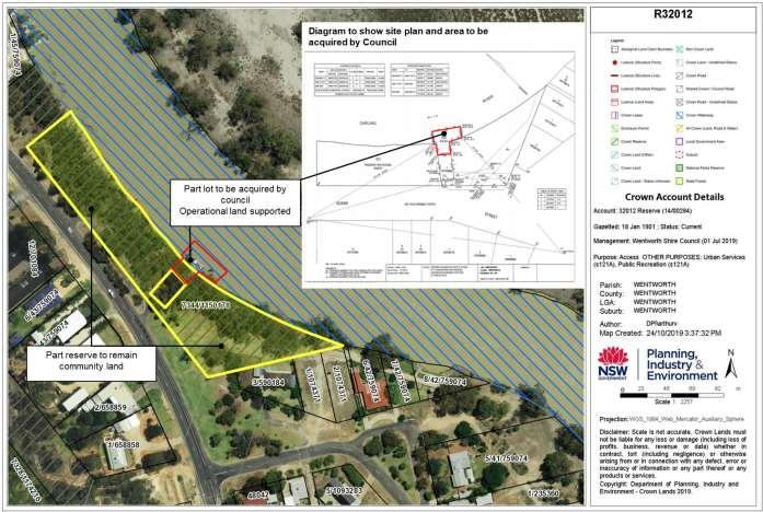
1. Figure 1: R32012 – Purpose ‘Access’ Wentworth EDS Reserve Riverboat EDS approved as Operational land -
Rest of the reserve to be assigned as Community
Item 9.9 - Attachment 1 Reserve identification Page 106
100 DP 1253778 & Lot 1 DP705886
- Lot 101 DP 1253778
Lot
Land
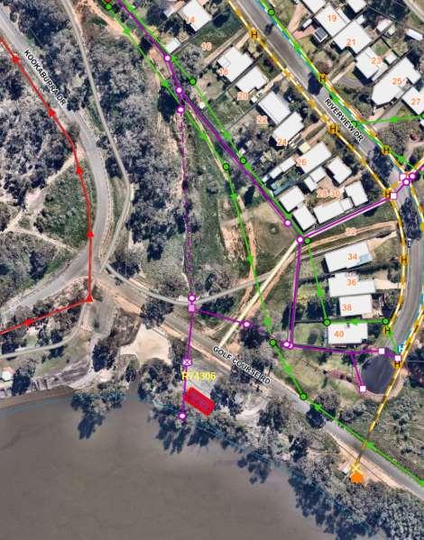
Item 9.9 - Attachment 1 Reserve identification Page 107
2. Mourquong Water Supply Reserve 74306 Operational Land
Located within the Dareton boat ramp carpark
Extract from Crown Consent Letter (DOC/21/28365)

Item 9.9 - Attachment 1 Reserve identification Page 108
3. Buronga Rubbish Depot Reserve 86496
9.10 DA2023/102 TWO (2) AIRCRAFT HANGARS WITH AN OFFICE AND BUSINESS SIGNAGE 130A RENMARK ROAD LOT 1 DP 870517 WENTWORTH
File Number: RPT/23/771
Responsible Officer: Matthew Carlin - Director Health and Planning
Responsible Division: Health and Planning
Reporting Officer: Kerrie Copley - Planning Officer
Objective:
3.0 Wentworth Shire is a community that works to enhance and protect its physical and natural environment
Strategy: 3.1 Ensure our planning decisions and controls enable the community to benefit from development
Summary
A development application (DA2023/102) was received by Council for two (2) aircraft hangars with an office and business signage to be located at 130A Renmark Road Lot 1 DP 870517 Wentworth.
Under the Wentworth Local Environmental Plan 2011 (WLEP 2011), this development is permitted with consent when located within the RU1 Primary Production zone.
The proposed development of two (2) aircraft hangars with an office and business signage is to be located on site, while retaining the existing smaller hangar.
The application was publicly notified for 14 days as per the Council Community Participation Plan. During the public notification five (5) submissions were received by Council objecting to the proposed development.
Four (4) submissions supporting the proposed development were received outside of the public notification period.
As per Council delegations, any development applications with three (3) or more submissions cannot be determined under delegated authority, and must be determined by Council.
Recommendation
That Council:
1. Approve DA2023/102 being a Two (2) aircraft hangars with an office and business signage located at 130A Renmark Road Lot 1 DP 870517 Wentworth.
2. Call a division in accordance with S375A of the Local Government Act 1993 (NSW)
Detailed Report
Purpose
The purpose of this report is to provide information to Council to determine Development Application DA2023/102, having consideration to the detail provided both within this report and the attachments provided.
Background
A Development Application was lodged with Council on 18 September 2023 seeking consent to construct Two (2) aircraft hangars with an office and business signage on the subject lot.
The subject lot is located in the RU1 Primary Production zone under the Wentworth Local Environmental Plan (WLEP 2011).
Ordinary Meeting AGENDA 13 December 2023 Page 109
DA2023/102 was publicly notified as per Council Community Participation Plan for 14 days, with a total of five (5) unique submissions, objecting to the proposal were received during this time. These submissions can be found under attached documents.
Four (4) submissions supporting the proposed development were received outside of the public notification period. These submissions can be found under attached documents.
As per Council delegations, any development applications with three (3) or more submission cannot be determined under delegated authority, and must be determined by Council
Refer to attachment 1 – Development Application
Refer to attachment 2 - Plans
Refer to attachment 3 – Statement of Environmental Effects
Matters under consideration
In determining a development application that requires consent, the consent authority must take into consideration matters prescribed in Section 4.15 of the Environmental Planning and Assessment Act 1979 as relevant to the development.
The proposed development meets the relevant provisions of Chapter 5 of the State Environmental Planning Policy (Biodiversity and Conservation) 2021.
The proposed development for two (2) aircraft hangars with an office and business signage is listed as being permitted with consent and meets the zone objectives of the RU1 Primary Production zone under the WLEP 2011.
Due to the zoning and WLEP 2011 mapping impacting the land, the development application was assessed against clauses 5.21, 7.1, 7.4, and 7.7. The development application was able to satisfy the matters for consideration under these clauses.
Due to the nature of the proposed development, it was assessed against Chapters 3, 5, 6 and 8 (2) of the Wentworth Development Control Plan (DCP) 2011. The development complies with provisions under these chapters.
The subject site is located within the RU1 Primary Production zone of the Wentworth Aerodrome Residential Development specified under Chapter 8 (2) of the DCP (2011). Surrounding sites are also zoned RU1 Primary Production with existing residential land uses including hangars and other associated structures, the area consists of a mix of both commercial and residential uses.
Four (4) submissions supporting the proposed development were received outside of the public notification period.
During public notifications five (5) unique submissions were received. The main concerns raised by the submitters and Council officer response are as follows:
• Objection to commercial enterprise on residential land
Officer Comments: The land is zoned RU1 Primary Production and there is no restriction on the land limiting the type of activities which can be conducted on that land as long as they are permissible in the zone and the correct permits are in place. The DCP also supports aircraft related hangars on the properties. As the hangar will be used for aircraft related activities, it fits with Council preferred use for the land.
• Concern of operation of business on weekends and at night
Officer Comments: As indicted above, there is no restriction on the type of activities which can be conducted on the land as long as they are permissible in the zone and any
Ordinary Meeting AGENDA 13 December 2023 Page 110
required permits are in place. Conditions of consent can be used to control operation hour and days to manage amenity of the neighbourhood.
• Concern over shared driveway and “Informal private taxiway”
Officer Comments: The easement is a ROW, which can be used to access benefited Lots. The proposed development is located on Lot 1 DP 870517, the first of the residential lots in this residential settlement, and closest to the eastern aspect, this location is closest to the airport runway via the right of way easement and should cause little disruption to other users of the carriageway. The ROW easement was created with the subdivision which created the allotments. The driveway access to each of the existing lots from Renmark Road currently appears to service two adjoining lots. The anticipated amount of traffic to be generated from the development will not cause traffic congestion.
• Rates notice identifies land as Rural Residential
Officer Comments: The identification of the land as Rural Residential has no bearing on the RU1 Primary Production land zoning of the lot and is a category used within the council rating system based on the existing use.
• Appropriate location could be on the eastern end of the airport, especially following recent upgrades
Officer Comments: The upgrades to facilities were to make the airport suitable for ventures such as what is being proposed within this application. The development is a private enterprise, for which Council cannot direct the land owner regarding the use of their freehold private property.
• Other commercial enterprises could be encouraged
Officer Comments: As noted, the upgrades to facilities were to make the airport suitable for ventures such as what is being proposed within this application.
• Change of land use to allow industrial complex
Officer Comments: The identification of the land as Rural Residential within rate notices has no bearing on the RU1 Primary Production land zoning of the lot and is a category used within the council rating system. No changes to zoning have occurred to allow development. The proposed development is be allowable within the RU1 zone.
• Reference to Pitt and Sherry Drawing number SY1922-000-SKT-C003 for future development located away from the existing residential development site.
Officer Comments: The Pitt and Sherry Drawing appears to be part of a document that was part of a draft for the Wentworth Airport and was never endorsed by council.
• Occupant of Lot 2 having view destroyed.
Officer Comments: When considering the interruption of a view from a property using case law planning principles determined by Roseth SC in Tenacity Consulting v Waringah [2004] NSWLEC 140, the rear and front boundaries or significant views (river views) are considered. As the proposed development is not located in these locations, the impact on the views is not anticipated to be adverse.
• Volume of foot traffic along boundary fence.
Ordinary Meeting AGENDA 13 December 2023 Page 111
Officer comments: The boundary defines the edge of the private property. Foot traffic is expected to be minor as most staff and clients will be using the hangars and office with 1 or 2 trips per person from the parking lot.
Based on the assessment of the application, it is determined that the proposed development is compliant with the relevant objectives of the RU1 Primary Production zone. Meets the relevant provisions of the Wentworth Development Control Plan (DCP) 2011, is consistent with planning matters for consideration of the Wentworth Local Environmental Plan 2011, and is consistent with the State Environmental Planning Policy (Biodiversity and Conservation) 2021.
Refer to attachment 4 – Submissions - Objections
Refer to attachment 5 – Submissions - Supporting
Refer to attachment 6 – Response to submission by applicant
Refer to attachment 7 – Response to additional information
Refer to attachment 8 – Conditions of consent
Refer to attachment 9 – 4.15 Assessment Report
Options
Based on the information contained in this report, the options available to address this matter are to:
Approve Development Application 2023/102 subject to conditions. Legal, strategic, financial or policy implications
Should Council issue a determination to the application, the applicant has the right to submit a request for review of determination to Council under Section 8.2 of the Environmental Planning & Assessment Act 1987.
The applicant also has the right to appeal the decision made by Council to the Land and Environment Court pursuant to Section 8.7 of the Environmental Planning & Assessment Act 1987.
Conclusion
Having consideration of the consent of this report it is concluded that the appropriate course of action is to approval DA2023/102 subject to conditions within the report.
Attachments
1. Development Application (Under separate cover)⇨
2. Plans⇩
3. Statement of Environmental Effects⇩
4. Submissions - Objections (Under separate cover)⇨
5. Submissions - Supporting (Under separate cover)⇨
6. Response to submissions by applicant (Under separate cover)⇨
7. Response to additional information (Under separate cover)⇨
8. Conditions of consent⇩
9. 4.15 Assessment report⇩
Ordinary Meeting AGENDA 13 December 2023 Page 112
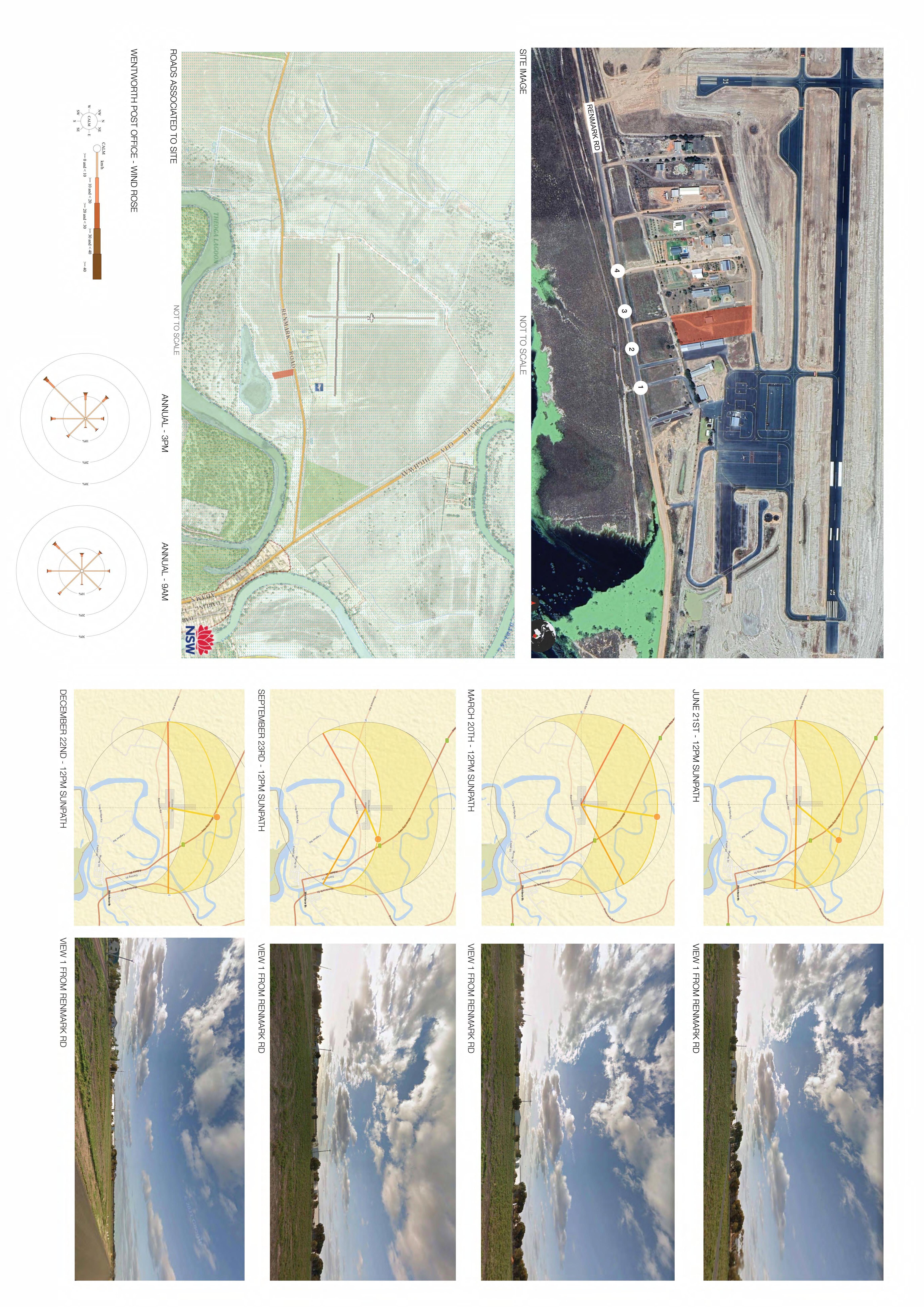
Item 9.10 - Attachment 2 Plans Page 113 PROJECT: DRAWING TITLE: REV: SHEET NUMBER: All rights reserved. This work copyright and cannot be reproduced copied by any means without the written permission Place Studio AU PTY LTD. Any license, express implied, to use this document for any purpose whatsoever restricted the terms the agreement between Place Studio AU PTY LTD and the instructing party. Verify dimensions on site before commencing work. Report discrepancies to the architect prior construction. Place Studio shall not be held responsible any variations to specifications drawings due any discrepancies without consultation. Use figured dimensions preference to scaled dimensions. Drawings made larger scales and those showing particular parts of the works take precedence over drawings made smaller scales for general purposes. All work conform relevant Australian Standards and Codes together with all Authorities' requirements and Regulations. Document Notes CLIENT: DEVELOPMENT APPLICATION DATE: LEGEND: REVISION: A 25/08/23 SITE ANALYSIS 130A OLD RENMARK RD, WENTORTH WENTWORTHDEVELOPMENT DAAR0001 #2021079 RAMAIR REV DATEDESCRIPTION A 25/08/23DA SUBMISSION
Item 9.10 - Attachment 2 Plans Page 114 SITE PLAN LEGEND EXISTING TREE TO BE RET AINED EXISTING LANDSCAPED AREA NEW ACCESSIBLE PATH SITE BOUNDARY NEW TREE REFER TO LANDSCAPE PLAN PROPOSED NEW LANDSCAPED AREA REFER TO LANDSCAPE PLAN A1 A2 A3 A4 A5 A6 A7 A8 A9 A10 A11 A12 A13 A14 A15 A16 A17 01 02 03 04 05 06 EASEMENT30MWIDE RENMARKRD LINEFENCE RIGHT OF CARRIAGE WAY EASEMENT EXISTING NEIGHBOURHOOD SHED EXISTING NEIGHBOURHOODDWELLING EXISTING NEIGHBOURHOOD SHED EXISTING NEIGHBOURHOOD SHED EXISTINGHANGAR TO BE RETAINED 486 HANGARm² 02 29361 4AR4000 1 A AR4000 A AR4000 3AR4000 SITE BOUNDARY BOUNDARYSITE SITE BOUNDARY SITEBOUNDARY 15 CARSPACESSHOWN 486 HANGARm² 01 56155 3000 3000 10373 3500 3500 GATEACCESS PEDESTRIANGATE ACCES CARSPACE FENCENEW 3000 RESERVEWASTEWATERFIELD 12000 2000 PRIMARYWASTEWATERFIELD 2000 3 x 15000 LT TANKS TO ALLOW FOR RAINWATER COLLECTION 137554 49727 EXISITING GATE SIGNAGE AS PER DOCUMENTED DETAIL SEE ATTACHED APPENDIX SEE ELEVATIONS FOR PLACEMENT SIGNAGE AS PER DOCUMENTED DETAIL SEE ATTACHED APPENDIX SEE ELEVATIONS FOR PLACEMENT D AR4001 N PROJECT: DRAWING TITLE: REV: SHEET NUMBER: SCALE: All rights reserved. This work copyright and cannot be reproduced copied by any means without the written permission Place Studio AU PTY LTD. Any license, express implied, to use this document for any purpose whatsoever restricted the terms the agreement between Place Studio AU PTY LTD and the instructing party. Verify dimensions on site before commencing work. Report discrepancies to the architect prior construction. Place Studio shall not be held responsible any variations to specifications drawings due any discrepancies without consultation. Use figured dimensions preference to scaled dimensions. Drawings made larger scales and those showing particular parts of the works take precedence over drawings made smaller scales for general purposes. All work conform relevant Australian Standards and Codes together with all Authorities' requirements and Regulations. Document Notes CLIENT: DEVELOPMENT APPLICATION DATE: LEGEND: REVISION: B 1 200 @ A0 29/08/23 SITE PLAN 130A OLD RENMARK RD, WENTORTH WENTWORTHDEVELOPMENT DAAR1000 #2021079 RAMAIR 1 200 SITE PLAN REV DATEDESCRIPTIONA25/08/23DA SUBMISSION B 29/08/23SIGNAGE ANDLANDSCAPEAMMENDMENTS
Item 9.10 - Attachment 2 Plans Page 115 EASEMENT30MWIDE RENMARKRD LINEFENCE A1 A2 A3 A4 A5 A6 A7 A8 A9 A10 A11 A12 A13 A14 A15 A16 A17 01 02 03 04 05 06 EXISTING NEIGHBOURHOOD SHED EXISTING NEIGHBOURHOOD SHED EXISTINGHANGARTOBERET AINED 486 HANGARm² 02 31030 12610 4AR4000 1 A AR4000 A AR4000 3AR4000 486 HANGARm² 01 AWNING OVER AWNING 3000 3000 AEROPLANE ACCESS AND EGRESS GATEACCESS PEDESTRIANGATE ACCES PEDESTRIAN ACCESS VEHICLE ACCESS AEROPLANESTART UP AREA D AR4001 N PROJECT: DRAWING TITLE: REV: SHEET NUMBER: SCALE: All rights reserved. This work copyright and cannot be reproduced copied by any means without the written permission Place Studio AU PTY LTD. Any license, express implied, to use this document for any purpose whatsoever restricted the terms the agreement between Place Studio AU PTY LTD and the instructing party. Verify dimensions on site before commencing work. Report discrepancies to the architect prior construction. Place Studio shall not be held responsible any variations to specifications drawings due any discrepancies without consultation. Use figured dimensions preference to scaled dimensions. Drawings made larger scales and those showing particular parts of the works take precedence over drawings made smaller scales for general purposes. All work conform relevant Australian Standards and Codes together with all Authorities' requirements and Regulations. Document Notes CLIENT: DEVELOPMENT APPLICATION DATE: LEGEND: REVISION: A 1 200 @ A0 25/08/23 GFA GROUND LEVEL 130A OLD RENMARK RD, WENTORTH WENTWORTHDEVELOPMENT DAAR2000 #2021079 RAMAIR REV DATEDESCRIPTION A 25/08/23DA SUBMISSION
Item 9.10 - Attachment 2 Plans Page 116 B A12 A13 01 02 03 61 m² COMMUNAL OPEN SPACE 7 m²WC 17 m²OFFICE 01 8 m²STORAGE 14 m²KITCHEN 6 m²OFFICE 02 6 m²OFFICE 03 BOTTOMOF RAMP MAIN ACCESS PATH 18000 5150 5150 6170 8700 SEE LANDSCAPE PLAN FOR FINISH N PROJECT: DRAWING TITLE: REV: SHEET NUMBER: SCALE: All rights reserved. This work copyright and cannot be repr oduced or copied by any means without the written permission of Place Studio AU PTY LTD. Any license, express or implied, to use this document for any purpo se whatsoever is restricted to the terms of the agreement between Place Studio A PTY LTD and the instructing party. COPYRIGHT: ARCHITECT: Verify all dimensions on site before commencing work. Report discrepancies to the architect prior to construction. Place Studio shall not be held responsible for any variations to specifications or drawings due to any discrepanci es without consultation. Use figured dimensions in preference to scaled di mensions. Drawings made to larger scales and those showing particular parts of the works take precedence over drawings made to smaller scales or for general purposes. All work is conform relevant Australian Standards and Codes togeth er with all Authorities' requirements and Regulations. Document Notes CLIENT: 1:100 4m DEVELOPMENT APPLICATION DATE: A 1 50 @ A1 31/08/2023 11:12:06 AM 25/08/23 GFA OFFICE PLAN 130A OLD RENMARK RD, WENTORTH WENTWORTHDEVELOPMENT DAAR2001 #2021079 RAMAIR REVDATEDESCRIPTION APP 25/08/23DA SUBMISSION
Item 9.10 - Attachment 2 Plans Page 117 20° PITCH 10° PITCH 20° PITCH 490 20° PITCH 20° PITCH TYPICAL COLORBOND IRON RIDGE CAPPING (TYP) COLORBOND CORRUGATED IRON 0.42 BMT ROOF SHEETING AT 20" PITCH (TYP). COLORBOND CORRUGATED IRON 0.42 BMT ROOF SHEETING AT 10" PITCH TO VERANDAH (TYP). COLORBOND CORRUGATED IRON HIRIZON WALL CLADDING (TYP) OPEN THRUVERANDAH & DECK ALUMINIUM AWNING WINDOW (TYPICAL). COLORBOND CORRUGATED IRON 0.42 BMT ROOF SHEETING AT 20 DEGREE PITCH (TYP) TYPICAL COLORBOND IRON RIDGE CAPPING (TYPE) COLORBOND METAL GUTTER ON COLORBOND FASCIA (TYP) COLORBOND CORRUGATED IRON HIRIZON WALL CLADDING (TYP) HEIGHTCIELING 2400 2400 4050 3700 172 4078 1000 N PROJECT: DRAWING TITLE: REV: SHEET NUMBER: SCALE: All rights reserved. This work copyright and cannot be repr oduced or copied by any means without the written permission of Place Studio AU PTY LTD. Any license, express or implied, to use this document for any purpo se whatsoever is restricted to the terms of the agreement between Place Studio A PTY LTD and the instructing party. COPYRIGHT: ARCHITECT: Verify all dimensions on site before commencing work. Report discrepancies to the architect prior to construction. Place Studio shall not be held responsible for any variations to specifications or drawings due to any discrepanci es without consultation. Use figured dimensions in preference to scaled di mensions. Drawings made to larger scales and those showing particular parts of the works take precedence over drawings made to smaller scales or for general purposes. All work is conform relevant Australian Standards and Codes togeth er with all Authorities' requirements and Regulations. Document Notes CLIENT: 1:100 4m
APPLICATION DATE: A 1 50 @ A1 31/08/2023 11:12:06 AM 25/08/23 OFFICE ELEVATIONS 130A OLD RENMARK RD, WENTORTH WENTWORTHDEVELOPMENT DAAR2002 #2021079 RAMAIR REVDATEDESCRIPTION APP 25/08/23DA SUBMISSION W 01 W 01 W 01
DEVELOPMENT
Item 9.10 - Attachment 2 Plans Page 118 1000 20° PITCH 10° PITCH 20° PITCH 490 ALUMINIUM AWNING WINDOW (TYPICAL) COLORBOND CORRUGATED IRON HIRIZON WALL CLADDING (TYP) COLORBOND CORRUGATED IRON HIRIZON WALL CLADDING (TYP) ALUMINIUM AWNING WINDOW (TYPICAL) HEIGHTCIELING 2400 COLORBOND CORRUGATED IRON 0.42 BMT ROOF SHEETING AT 10" PITCH TO VERANDAH (TYP). TYPICAL COLORBOND IRON RIDGE CAPPING (TYP) COLORBOND CORRUGATED IRON 0.42 BMT ROOF SHEETING AT 20" PITCH (TYP). TYPICAL COLORBOND IRON RIDGE CAPPING (TYP) COLORBOND METAL GUTTER ON COLORBOND FASCIA (TYP) COLORBOND CORRUGATED IRON 0.42 BMT ROOF SHEETING AT 20" PITCH (TYP). HEIGHTCIELING 2400 OPEN THRUVERANDAH & DECK 1000 W01 W02 W03 W04 W05 4082 4050 N PROJECT: DRAWING TITLE: REV: SHEET NUMBER: SCALE: All rights reserved. This work copyright and cannot be repr oduced or copied by any means without the written permission of Place Studio AU PTY LTD. Any license, express or implied, to use this document for any purpo se whatsoever is restricted to the terms of the agreement between Place Studio A PTY LTD and the instructing party. COPYRIGHT: ARCHITECT: Verify all dimensions on site before commencing work. Report discrepancies to the architect prior to construction. Place Studio shall not be held responsible for any variations to specifications or drawings due to any discrepanci es without consultation. Use figured dimensions in preference to scaled di mensions. Drawings made to larger scales and those showing particular parts of the works take precedence over drawings made to smaller scales or for general purposes. All work is conform relevant Australian Standards and Codes togeth er with all Authorities' requirements and Regulations. Document Notes CLIENT: 1:100 4m DEVELOPMENT APPLICATION DATE: A 1 50 @ A1 31/08/2023 11:12:07 AM 25/08/23 OFFICE ELEVATIONS 130A OLD RENMARK RD, WENTORTH WENTWORTHDEVELOPMENT DAAR2003 #2021079 RAMAIR REVDATEDESCRIPTION APP 25/08/23DA SUBMISSION
Item 9.10 - Attachment 2 Plans Page 119 20° PITCH PITCH 20° PITCH EASEMENT30M WIDE RENMARKRD LINEFENCE EXISTING NEIGHBOURHOOD SHED EXISTING NEIGHBOURHOODDWELLING EXISTING NEIGHBOURHOOD SHED EXISTING NEIGHBOURHOOD SHED EXISTINGHANGARTOBERET AINED 31030 12610 SITE BOUNDARY BOUNDARYSITE SITE BOUNDARY SITEBOUNDARY CRUSHERDUSTPARKINGAREA SILKY GUMS CASURINA TREES X 14 EXISTING TREES LANSCAPE KEY EXISTINGNEIGHBOURHOODVEGETATION CRUSHER DUST GROUND FINISH GRASS GROUND COVERAGE BRUSHED CONCRETE FINISH N PROJECT: DRAWING TITLE: REV: SHEET NUMBER: SCALE: All rights reserved. This work copyright and cannot be reproduced copied by any means without the written permission Place Studio AU PTY LTD. Any license, express implied, to use this document for any purpose whatsoever restricted the terms the agreement between Place Studio AU PTY LTD and the instructing party. Verify dimensions on site before commencing work. Report discrepancies to the architect prior construction. Place Studio shall not be held responsible any variations to specifications drawings due any discrepancies without consultation. Use figured dimensions preference to scaled dimensions. Drawings made larger scales and those showing particular parts of the works take precedence over drawings made smaller scales for general purposes. All work conform relevant Australian Standards and Codes together with all Authorities' requirements and Regulations. Document Notes CLIENT: 4m DEVELOPMENT APPLICATION DATE: LEGEND: REVISION: B 1 200 @ A0 29/08/23 LANDSCAPE PLAN 130A OLD RENMARK RD, WENTORTH WENTWORTHDEVELOPMENT DAAR3000 #2021079 RAMAIR REV DATEDESCRIPTION A 25/08/23DA SUBMISSION B 29/08/23SIGNAGE ANDLANDSCAPEAMMENDMENTS
Item 9.10 - Attachment 2 Plans Page 120 GROUND LEVEL 4170 OFFICE ROOF 7800 HANGAR ROOF A1 A2 A3 A4 A5 A6 A7 A8 A9 A10 A11 A12 A13 A14 A15 A16 A17 BOUNDARY BOUNDARY GROUND LEVEL 4170 OFFICE ROOF 7800 HANGAR ROOF 01 02 03 04 05 06 BOUNDARY GROUND LEVEL 4170 OFFICE ROOF 7800 HANGAR ROOF 01 02 03 04 05 06 BOUNDARY BOUNDARY SIGNAGE AS PER DOCUMENTED SEE ATTACHED APPENDIX GROUND LEVEL 4170 OFFICE ROOF 7800 HANGAR ROOF A1 A2 A3 A4 A5 A6 A7 A8 A9 A10 A11 A12 A13 A14 A15 A16 A17 BOUNDARY BOUNDARY SIGNAGE AS PERDOCUMENTED DETAIL SEE ATTACHED APPENDIX PROJECT: DRAWING TITLE: REV: SHEET NUMBER: SCALE: All rights reserved. This work copyright and cannot be reproduced copied by any means without the written permission Place Studio AU PTY LTD. Any license, express implied, to use this document for any purpose whatsoever restricted the terms the agreement between Place Studio AU PTY LTD and the instructing party. Verify dimensions on site before commencing work. Report discrepancies to the architect prior construction. Place Studio shall not be held responsible any variations to specifications drawings due any discrepancies without consultation. Use figured dimensions preference to scaled dimensions. Drawings made larger scales and those showing particular parts of the works take precedence over drawings made smaller scales for general purposes. All work conform relevant Australian Standards and Codes together with all Authorities' requirements and Regulations. Document Notes CLIENT: 4m DEVELOPMENT APPLICATION DATE: LEGEND: REVISION: B 1 200 @ A0 29/08/23 SITE ELEVATIONS 130A OLD RENMARK RD, WENTORTH WENTWORTHDEVELOPMENT DAAR4000 #2021079 RAMAIR DA AR1000 1 200 ELEV ATION 1 EAST DA AR1000 200 2 ElEV ATION 2 SOUTH DA AR1000 3 ELEV ATION 3 NORTH DA AR1000 1 200 ELEV ATION 4 WEST REV DATEDESCRIPTION A 25/08/23DA SUBMISSION B 29/08/23SIGNAGE ANDLANDSCAPEAMMENDMENTS

Item 9.10 - Attachment 2 Plans Page 121 0 GROUND LEVEL LEVEL2550 01 4170 OFFICE ROOF 7800 HANGAR ROOF 01 02 NEW SIGN TO BE ADDED AT FENCE LINE SEE ATTACHED APPENDIX FOR DETAILS ON FINISH AND GRAPHICS SIZE 1500 MM X 3000 MM 6000 3000 1500 ENTRY GATE N PROJECT: DRAWING TITLE: REV: SHEET NUMBER: SCALE: All rights reserved. This work copyright and cannot be reproduced or copied by any means without the written permission of Place Studio AU PTY LTD. Any license, express or implied, to use this document for any purpose whatsoever is restricted to the terms of the agreement between Place Studio AU PTY LTD and the instructing party. COPYRIGHT: 61 431 088 534 W www.PlaceStudio.com.au Studio@PlaceStudio.com.au J ALEXANDER-HATZIPLIS NSW ARB #10535 ARCHITECT: PLACE STUDIO AU PTY LTD Verify all dimensions on site before commencing work. Report all discrepancies to the architect prior to construction. Place Studio shall not be held responsible for any variations to specifications or drawings due to any discrepancies without consultation. Use figured dimensions in preference to scaled dimensions. Drawings made to larger scales and those showing particular parts of the works take precedence over drawings made to smaller scales or for general purposes. All work is to conform relevant Australian Standards and Codes together with all Authorities' requirements and Regulations. Document Notes SUITE 7, LEVEL 03, 53 GREAT BUCKINGHAM ST, REDFERN. NSW 2016. 1:100 0 4m NOT FOR CONSTRUCTION DATE: LEGEND: REVISION: A 1 50 @ A1 31/08/2023 11:12:18 AM 29/08/23 SITE ELEVATIONSIGNAGE 130A OLD RENMARK RD, WENTORTH WENTWORTHDEVELOPMENT DAAR4001 #2021079 REV DATEDESCRIPTION APP A29/08/23SIGNAGE AND LANDSCAPE AMMENDMENTS DA AR 1000 1 50 1 SIGN AGE NORTH ELEVATION


Item 9.10 - Attachment 2 Plans Page 122
Proposed hangar signage
3m length
1m height

length
Proposed business identification signage along front fence
Item 9.10 - Attachment 2 Plans Page 123
3m
1.5m height


Item 9.10 Attachment 3 Statement of Environmental Effects Page 124 Development Application 130A Renmark Road Wentworth August 2023
planning & development specialists www.jgconsult.com.au
environmental,

James Golsworthy Consulting
140 Pine Avenue Mildura VIC 3500 PO Box 1650 Mildura VIC 3502 t 03 5022 8411 e admin@jgconsult.com.au
©Copyright, James Golsworthy Consulting Pty Ltd (2023). This work is copyright. Apart from any use as permitted under Copyright Act 1963, no part may be reproduced without written permission of James Golsworthy Consulting Pty Ltd.

Disclaimer: Neither James Golsworthy Consulting Pty. Ltd. nor any member or employee of James Golsworthy Consulting Pty. Ltd. takes responsibility in any way whatsoever to any person or organisation (other than that for which this report has been prepared) in respect of the information set out in this report, including any errors or omissions therein. James Golsworthy Consulting is not liable for errors in plans, specifications, documentation or other advice not prepared or designed by James Golsworthy Consulting.
2 Statement of Environmental Effects, 130A Renmark Road, Wentworth
Ref: 23-081
Item 9.10 - Attachment 3 Statement of Environmental Effects Page 125
Item 9.10 - Attachment 3 Statement of Environmental Effects Page 126 Ref: 23-081 3 Statement of Environmental Effects, 130A Renmark Road, Wentworth Table of Contents Introduction ......................................................................4 Proposal ...........................................................................5 Ramair Flying Services ......................................................6 Planning controls ..............................................................7 Definition...........................................................................................7 Airport .............................................................................. 7 Aircraft hangar ................................................................. 7 Signage ............................................................................ 7 Zoning ...............................................................................................7 Additional mapping ............................................................................7 Miscellaneous provisions ...................................................................8 5.21 Flood planning ......................................................... 8 State Environmental Planning Policy (SEPP) (Advertising and Signage) ..........................................................................................................8 Wentworth Development Control Plan 2011 ........................................8 Chapter 2 Plan objectives ................................................ 8 Chapter 3 General Development Controls ...................... 8 Chapter 8 Site Specific Provisions ................................. 8 Additional local provisions ..................................................................9 Site and surrounding area ...............................................10 Subject site......................................................................................10 Locality ........................................................................................... 12 Planning assessment ......................................................13 Policy context.................................................................................. 13 Wentworth LEP................................................................................ 13 Clause 5.2 Flood planning ............................................. 13 Wentworth DCP............................................................................... 13 Chapter 2 Plan objectives .............................................. 13 Chapter 3, Part 4 Flood affected land ............................ 13 Design and siting ........................................................... 14 Building envelopes......................................................... 14 Floor heights and Earth mounds ................................... 14 Height limitation ............................................................. 14 Water supply .................................................................. 14 Stormwater .................................................................... 14 Sewerage ....................................................................... 14 Aircraft hangars ............................................................. 14 Aerodrome security........................................................ 14 Outdoor lighting ............................................................. 14 Landscaping .................................................................. 15 Cultural Heritage ............................................................................. 15 Car Parking Provisions ..................................................................... 15 Conclusion ...................................................................... 17 List of Figures Figure 1 Location plan of the land ........................................ 4 Figure 2 Google mapping of 2023 flood extent. ................ 5 Figure 3 Proposed business identification signage ........... 5 Figure 5 Land Zoning Map sheet ......................................... 7 Figure 6 Flood Planning Area Map ...................................... 7 Figure 7 Aerial image of the site ......................................... 10 Figure 8 Looking towards the Wentworth Aerodrome .... 10 Figure 9 Looking west towards neighbouring dwelling ... 11 Figure 10 Locality plan (source: Google maps) ................. 12 Figure 11 AHIMS basic search ............................................. 15
Introduction
Development approval is sought for two aircraft hangars, an associated office and business identification signage, at 130A Renmark Road Wentworth on land which is known as Lot 1 DP870517. The land immediately adjoins the Wentworth Aerodrome, in which the development will be intrinsically linked.
The land is zoned RU1 Primary Production and affected by the Flood Planning Area.
The development of the land for two hangar’s, associated office and business identification signage will support the owner/operators Ramair Flying Services to facilitate all facets of their business operations from the Wentworth Aerodrome.
The subject allotment is accessed by road via Renmark Road, and by aircraft via an access easement “taxiway” to the north of the property, directly onto the Wentworth Aerodrome tarmac.
It is considered the development is appropriate given the contents of the Wentworth LEP 2011, Wentworth DCP 2011, State Environmental Planning Policies and Environmental Planning and Assessment Act 1979.
As a result, the development application should be supported.

4 Statement of Environmental Effects, 130A Renmark Road, Wentworth


Ref: 23-081
Item 9.10 - Attachment 3 Statement of Environmental Effects Page 127
Figure 1 Location plan of the land
Proposal
The application seeks development approval for two aircraft hangars, an associated office building and business identification signage on the land known as 130A Renmark Road Wentworth (Lot 1 DP87051). The land has an area of approximately 7900m2 in area and is relatively flat in terrain.
The proposal includes two hangars, each 25m x 20m (486m2 in area), large enough to cater for eight aircraft in total. The hangars will be constructed of colourbond and finished in a powder coated of Surfmist.
An associated office building, also constructed of colourbond will be located to the north of the site, setback approximately 10m from the 30m wide taxiway easement. The office will include three offices, a communal open space for clients, customers and students to meet alongside a front reception desk. A kitchen, toilet and storage facilities are also proposed.
The proposed business identification signage will be 3m x 1.5m in area and advertising the business location and operations.
The development of the land will allow for Ramair Flying Services to operate their aerial agricultural services, as well as flight training and scenic flights from the newly redeveloped Wentworth Aerodrome. The development will be located alongside similar sized privately owned hangars and will be the first commercially operating business out of the recently redeveloped Wentworth Aerodrome. The business currently employs 4 full time pilots, 1 casual pilot and 2 casual office staff.
General office hours are proposed to be 8am to 6pm and flying operations to be conducted in accordance with the Enroute Supplement Australia (ERSA) regulations.
Road access exists from Renmark Road and an existing hangar will be retained on site as part of the redevelopment. The site is approximately a 2 minute drive from the Wentworth Township and aims to provide economic benefit to the community by relocating the
2 Google mapping of 2023 flood extent.
existing business operations from the Mildura Airport, as well as promoting a new stream of tourism for the town through its scenic and charter flights.
Electricity is readily available to the site, and rainwater tanks for the purpose of servicing the site are proposed as part of the development. Preliminary approval has been provided by Wentworth Shire Council to connect to the existing stormwater pit on the adjoining land (the aerodrome) to service the land.
Whilst the site is located within close proximity to Thegoa lagoon, an overflow of the Darling and Murray River when in flood, the site itself is bound by a purpose built levee to ensure the aerodrome and access is not obstructed nor isolated in the event of a flood.

5 Statement of Environmental Effects, 130A Renmark Road, Wentworth
Item 9.10 - Attachment 3 Statement of Environmental Effects Page 128
Ref: 23-081
Figure
Figure 3 Proposed business identification signage
Ramair Flying Services
Director, Andrew Mason, began his flying career in 1979. He held the position of Chief Flying Instructor at the Narrabri Aero Club until 1986. He was then employed as an agricultural pilot in Moree.
Ramair Flying Services (Banshore Pty Ltd) began operating independently in 1988, primarily conducting aerial agricultural services. In 1998 Ramair began operating from Midura providing aerial agricultural services to Tandou Pty Ltd at Menindee and later Hay.
In 2011 the business diversified to provide general aviation flying training and scenic / joy flights from Mildura Airport.
In 2013 the business again diversified, undertaking contracts for DELWP to provide aerial fire support. This has continued to expand with the awarding of short-term National Aerial Firefighting Centre (NAFC) contracts. This aspect of the business continues to grow and expand.
In 2015 the business commenced conducting high resolution aerial photography work for US company Ceres. Ceres is expanding its operations in Australia. Ramair has conducted high resolution aerial photography flights as well as assisting with training and support for the US based business to develop in Australia. It is anticipated to be capacity to further grow this part of the business.
In 2021 Ramair again diversified to include Recreational Aviation Australia (RAAus) flying training as part of its business plan. This has seen increased interest from locals as well as from other areas of NSW and Victoria. Many prospective pilots are choosing Sunraysia to train.
In 2022 Ramair Flying Services partnered with Ramair Aircraft Maintenance. Ramair Aircraft Maintenance provides maintenance to Ramair Flying Services as well as external customers. The demand for aircraft maintenance indicates that this will continue to develop and grow exponentially.
As the business has continued to grow and diversify it was evident that a new base for operations was required. The very creditable re-development of the Wentworth Aerodrome provided an ideal opportunity for the business to grow to meet the demand of the local area and other parts of Australia.
Business vision for Wentworth Aerodrome
The company’s vision for operations at the Wentworth Aerodrome is to maintain and expand the current services. With the establishment of a purpose-built facility the company will be better able to service clients. We see the Wentworth Aerodrome as the location where our business can develop to benefit both us and the broader local community.
The opportunity exists to increase the tourist potential of the region through the expansion of scenic flights to Mungo, Menindee Lakes and co-ordination with the upcoming Light Installation Development.
The facility will allow for the opportunity for increased flying training, particularly block training for students from other parts of Australia. The company already has students travelling from Melbourne, Kyneton, Ivanhoe, Darwin, Broken Hill and Adelaide. Students training with Ramair will require accommodation and services in close proximity to our facility thus providing the opportunity for local businesses to benefit.
The expansion and promotion of scenic flights will also increase economic benefits for local businesses. Ramair will look to partner with local businesses to maximise the economic potential of the area. A display of local businesses flyers in the office will assist in the promotion of these.
Ramair are affiliated with the following flying organisations, RAAUS, Antique Aircraft Association (AAAA’s), Warbirds Association, and Ramair will look to utilise these connections to promote Wentworth as a welldesigned and maintained aerodrome which is an ideal stop-over and destination point for the general aviation community.
6 Statement of Environmental Effects, 130A Renmark Road, Wentworth
Ref: 23-081
Item 9.10 - Attachment 3 Statement of Environmental Effects Page 129
Planning controls
Definition Airport
airport means a place that is used for the landing, taking off, parking, maintenance or repair of aeroplanes, and includes associated buildings, installations, facilities and movement areas and any heliport that is part of the airport.
Aircraft hangar
A large workshop or building for storing and maintaining aircraft (as per the Collins online dictionary).
Signage
signage means any sign, notice, device, representation or advertisement that advertises or promotes any goods, services or events and any structure or vessel that is principally designed for, or that is used for, the display of signage, and includes any of the following—
(a) an advertising structure,
(b) a building identification sign,
(c) a business identification sign, but does not include a traffic sign or traffic control facilities.
Zoning
In accordance with the Wentworth LEP 2011 zoning maps the land is within the Zone RU1 Primary Production.
The objectives of the zone relevant to this application are:
To encourage sustainable primary industry production by maintaining and enhancing the natural resource base.
To encourage diversity in primary industry enterprises and systems appropriate for the area.
To minimise the fragmentation and alienation of resource lands.
To minimise conflict between land uses within this zone and land uses within adjoining zones.
To encourage and promote the growth and diversification of economic and employment opportunities in agriculture, horticulture and tourism.
To enable the development of restaurants and cafes and kiosks as part of agritourism development.
Any other development not specified in item 2 or 4 is development permitted with consent.
The aircraft hangars, associated office building and business identification signage in association with the adjoining airport are therefore considered to be permitted with consent.
There are no specific requirements or conditions relating to the development, nor requirements on car parking.
Additional mapping
7 Statement of Environmental Effects, 130A Renmark Road, Wentworth
Item 9.10 - Attachment 3 Statement of Environmental Effects Page 130
Ref: 23-081
Figure 5 Land Zoning Map sheet Land Zoning Map – Sheet LZN_002B
Figure 6 Flood Planning Area Map River Front Building Line Map – Sheet CL1_002B
Miscellaneous provisions
5.21 Flood planning
(1) The objectives of this clause are as follows –
(a) to minimise the flood risk to life and property associated with the use of land,
(b) to allow development on land that is compatible with the flood function and behaviour on the land, taking into account projected changes as a result of climate change,
(c) to avoid adverse or cumulative impacts on flood behaviour and the environment,
(d) to enable the safe occupation and efficient evacuation of people in the event of a flood.
State Environmental Planning Policy (SEPP)
(Advertising and Signage)
As per Part 1 Clause 3 Aims, objectives etc of the SEPP (Advertising and Signage)
(1) This policy aims
(a) To ensure that signage (including advertising)
(i) Is compatible with the desired amenity and visual character of an area, and
(ii) Provides effective communication in suitable locations, and
(iii) Is of high quality design and finish, and
(b) To regulate signage (but not content) under Part 4 of the Act, and
(c) To provide time-limited consents for the display of certain advertisements, and
(d) To regulate the display of advertisements in transport corridors, and
(e) To ensure that public benefits may be derived from advertising in and adjacent to transport corridors.
(2) This Policy does not regulate the content of signage and does not require consent for a change in the content of signage.
Wentworth Development Control Plan 2011
The Wentworth Development Control Plan is applicable to the land and development.
Chapter 2 Plan objectives
The Locality objectives refers to the Wentworth Aerodrome / Residential which are
(a) to specifically outline the type of development which can be carried out on the land,
(b) to maintain the efficiency and safety of the Wentworth Aerodrome,
(c) to ensure that any new use and development of the site does not prejudice the operation of the Wentworth Aerodrome
(d) to ensure that the operation of the Wentworth Aerodrome is not detrimental to any use or development permitted on the site
(e) to promote the development of this land for rural living having an association with aviation and the need for access to aerodrome for private flights
(f) to ensure that the density of development is compatible with the land capability, and any natural physical constraint
(g) to ensure that the development does not interfere with the natural flow of flood waters, and occurs in locations where safe access can be maintained.
Chapter 3 General Development Controls
Part 4 Flood affected land identifies the Wentworth Shire Council local government area being bound by the Murray River to the south and Darling River and tributaries.
The Development Control Plan aims to minimise the impacts of flooding on development within the flood planning area of Buronga and Gol Gol.
Chapter 8 Site Specific Provisions
Part A Application of this clause, Wentworth Aerodrome
Residential Development (includes Lot 1, 2 and 3 DP819759).
8 Statement of Environmental Effects, 130A Renmark Road, Wentworth
Item 9.10 - Attachment 3 Statement of Environmental Effects Page 131
23-081
Ref:
Part B Site specific controls
This plan applies to Lots 1 and 2 DP819579, Parish and County of Wentworth identified on the attached maps, AND to an extent relate to the Wentworth Aerodrome land being Lot 3 DP819579.
Further assessment against the site specific controls will be detailed within the planning assessment of this report.
Additional local provisions Not applicable.
9 Statement of Environmental Effects, 130A Renmark Road, Wentworth
Ref: 23-081
Item 9.10 - Attachment 3 Statement of Environmental Effects Page 132
Site and surrounding area
Subject site
The land is situated north of the Wentworth township, approximately 3km by road, and access exists from Renmark Road. An unsealed access road/driveway connects the site to Renmark Road. The land is 1 of 8 lots that was subdivided as part of the Wentworth Aerodrome Residential plan. All lots have been developed upon, and all are approximately 0.8ha in area. The 8 lots have been developed with residential dwellings, private hangars or sheds. A taxiway exists to the north of the allotments for direct access for aircrafts to the adjoining aerodrome.
The Wentworth Aerodrome has recently undergone an upgrade of approximately $9+ million for the construction of a new sealed runway, taxiway and apron, aircraft packing areas and the installation of pilot activated lighting, to enable increased use and night time operation. The land subject to the development is relatively flat in terrain, of regular size and contains an existing hangar that will be retained. Land to the immediate west contains a residential dwelling and associated shedding with land to the north and east being the Wentworth Aerodrome.
Whilst the land is low lying and a high hazard flood risk due to the proximity of Thegoa lagoon, a purpose built levee exists to the height and extent of Renmark Road from the Silver City Highway, beyond the property boundary. No native vegetation is required to be removed as part of this application.
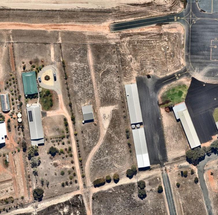


Item 9.10 - Attachment 3 Statement of Environmental Effects Page 133 Ref: 23-081 10
Statement of Environmental Effects, 130A Renmark Road, Wentworth
Figure 7 Aerial image of the site
Figure 8 Looking towards the Wentworth Aerodrome (source: James Golsworthy Consulting)
Ref: 23-081 11 Statement of Environmental Effects, 130A Renmark
Item 9.10 - Attachment 3 Statement of Environmental Effects Page 134
Road, Wentworth
Figure 9 Looking west towards neighbouring dwelling (source: James Golsworthy Consulting)
Locality
The locality is part of a rural setting abutting low intensity farming operations within reasonable proximity to the Wentworth township with intrinsic links to the Wentworth Aerodrome.
The land is situated with frontage to (Old) Renmark Road, with the Darling Barka River to the east, and Murray River and Thegoa Lagoon to the south. Mixed farming enterprises to the north west exist.
The land having been subdivided as part of an 8 lot residential subdivision subject to the Wentworth Aerodrome Residential Plan. The soil type is indicative of having previously been affected by historic floodwater, and is located within the Flood Mapping Area.
Native vegetation within the locality is generally restricted to that along the roadside, with no vegetation to be removed as part of this application. Introduced shrubbery line the boundary of the site and those distinguishable as being dead or dying will be replaced.
There is an existing settlement of rural residential allotments to the east of the Silver City Highway, and the Perry Sandhills, a great tourist attraction for the area is located to the west of the site. The Wentworth township is within reasonable proximity to offer necessary services.
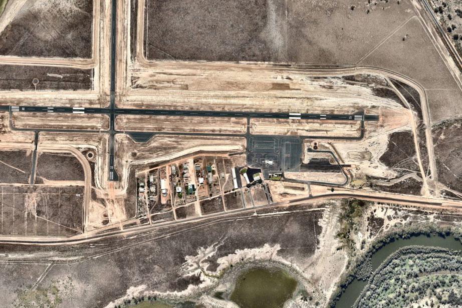


12 Statement of Environmental Effects, 130A Renmark Road, Wentworth
Ref: 23-081
Item 9.10 - Attachment 3 Statement of Environmental Effects Page 135
Figure 10 Locality plan (source: Google maps)
Planning assessment
Policy context
In identifying that the only SEPP relevant is that pertaining to Advertising and Signage, the plan (State Environmental Policy (Advertising and Signage) 2001) identifies that the consent authority must assess the signage against a number of assessment criteria at Schedule 1.
The proposed signage to be located upon the front and rear fence, will be 3m x 1.5m in area and advertising the business location and services and will not cause detriment to the amenity of the area. The land was subdivided with the intention of being developed as part of an 8 lot subdivision associated with the adjoining airport, and therefore advertising a business conducting air services is consistent with the locality.
The signage is considered proportionate to the rural setting and streetscape, primarily utilised for business identification and marketing only. The signs will not be illuminated and do not pose risk to passing traffic, pedestrians nor cyclists.
No specific criteria is provided for business identification signage within the RU1 nor is it addressed within the Wentworth DCP.
Wentworth LEP
The proposal is considered to be consistent with the policy direction of the LEP. In consideration of the objectives of Zone RU1 Primary Production within the LEP the following is noted:
The development is providing for a business relocation within reasonable proximity to Wentworth township, providing economical benefits to the local community.
The development will promote accessibility of the region to the rest of the country, for both economic and tourism benefits.
The development will utilise the upgrades to the Wentworth Aerodrome in which the State Government committed $9 million funding towards.
All services are readily available to the site, or easily connected.
Hours of operation are proposed to be 8am to 6pm and flying operations to be conducted in accordance with the Enroute Supplement Australia (ERSA) regulations.
It is anticipated that up to 7 members of staff will be onsite daily at any one time and students/customers will vary from 1 – 10 per day (pending lesson and booking times).
Clause 5.2 Flood planning
The provision requires consideration to the effect on the safe occupation and efficient evacuation of people or capacity of existing evacuation routes for the surrounding area in the event of a flood. The proposed hangars, office building and signage are intrinsically linked to the existing aerodrome on adjoining land. The land use is not such that it is used for habitation and in the maximum probable event can be abandoned without occupation and limited impact given the nature of the buildings and land use.
The 2023 floods saw the effects of the flood area, and a purpose built levee served to protect the aerodrome and immediately surrounding land from becoming inundated. It is an expectation that should a future flood event occur, the land would remain unaffected.
Wentworth DCP
Chapter 2 Plan objectives
The proposal is intrinsically linked to the Wentworth Aerodrome and intended to support the future operations and bring economic benefit to the aerodrome and Wentworth community.
Chapter 3, Part 4 Flood affected land
The land has been identified to require habitable buildings to be built at a minimum 750mm above the 1956 flood levels.
This application is not for a habitable building (dwelling) and construction of two hangars and an office building are designed so not to obstructed the flow of floodwater.
13 Statement of Environmental Effects, 130A Renmark Road, Wentworth
Item 9.10 - Attachment 3 Statement of Environmental Effects Page 136
Ref: 23-081
Whilst access to the site is considered to be vulnerable in time of flood, the behaviour of flood events within the Wentworth Shire are provided with an abundance of warning – weeks or months - as has been demonstrated with the 2022/2023 flood event where both the Murray and Darling Barka Rivers has seen significant high flows. A purpose built levee has been constructed by lifting the Renmark Road to serve as a natural barrier to Thegoa Lagoon in the instance of high flood events, to diminish the risk of the Wentworth Aerodrome from becoming inundated.
Chapter 8.2 identifies provisions for assessing the application against the Wentworth Aerodrome –Residential development. This proposal is not for residential purposes however the following comments are made.
Design and siting
The design and siting of the proposed hangars and office building have given great consideration with respect to the alignment of the property. Existing trees will be retained where possible and additional plantings are proposed to clearly delineate the differing areas of customer parking and customer access versus owner operator and pilot access. One individual access as required to the taxiway to the north of the property.
Building envelopes
The proposal respects side and front boundary setbacks. No building envelopes are included within the DCP or included on the Deposited Plan.
Floor heights and Earth mounds
No habitable building nor earth mounds are proposed as part of the application.
Height limitation
The maximum height of the hangar is 7m and not considered to project through the obstacle height limitation surface.
Water supply
3 x 15,000l rain water tanks are proposed alongside the existing hangar for rainwater collection and can be utilised for fire fighting purposes, far greater than the 20,000l required.
Stormwater
Collection from all roof areas will be captured and piped into the proposed tanks, and preliminary approval has been provided by Wentworth Shire Council to connect to the existing stormwater pit on the adjoining land (the aerodrome) to service the land.
Sewerage
All wastewater will be contained on site and a Land Capability Assessment has been prepared and provided as supporting documentation to this application.
Aircraft hangars
The proposed hangars will be in excess of 15m from the front and rear boundaries and situated either side of the existing hangar in an attempt to group the hangars together and provide for ease of manoeuvrability of aircraft. The hangars are proposed to be constructed of colourbond.
Aerodrome security
Perimeter fencing exists and will be continued to be maintained and in good order. Any personal access gates will be self closing and continually monitored. Fencing to separate the carpark from the taxiway in front of the hangars will prevent public access and as per the proposed plans there is a designated walkway to the west of the site for pedestrian access from the car park to the office.
Aircraft will be towed from the hangars using a tug to the taxiway in front of the site where they will be started.
Outdoor lighting
Outdoor lighting will be baffled so not to compromise the operation of the aerodrome.
Statement of Environmental Effects, 130A Renmark Road, Wentworth
Item 9.10 - Attachment 3 Statement of Environmental Effects Page 137
14
Ref: 23-081
Landscaping
Existing plantings will be retained where necessary and additional landscaping is proposed as per the attached plans. Consideration has been given to the local climatic conditions and airport environs.
Cultural Heritage
The AHIMS search has not identified any sites of significance.

Car Parking Provisions
The Roads and Traffic Authority (RTA) Guide to Traffic Generating Developments has been referenced in the absence of parking rates listed within the DCP.
5.2.1 Car parking
The recommended numbers of car parking spaces to be provided for each land use type are generally based on surveys and research conducted by the RTA. These recommended levels represent parking requirements needed to meet the peak parking accumulations observed. In the RTA's research, trial surveys established the peak hours and days of the week without consideration of seasonal variations. The recommended parking levels are based on these surveys. Where a proposed development is expected to have strong
seasonal variations, an assessment of the impact of these variations is desirable. Consideration of factors such as mode split and car occupancy is also desirable.
The RTA's land use / traffic generation research has concentrated on establishing empirical relationships in order to explain characteristics of traffic generation and parking. The empirical relationships involved illustrate the existing operation of the developments surveyed. However, the independent variables used in these relationships are not always suitable for predicting future traffic generating characteristics of a proposed development. For example, while the number of employees at a development can often be used to provide a good explanation of traffic and parking behaviour, this number is not always accurately known at the time that a development application is lodged. Also, specific uses of the development might change with time. In the case of factories, traffic and parking behaviour can vary substantially between different types of factories although they may be of the same size. Change in the use of developments does not always require planning consent. The parking provisions recommended in this section are based, wherever possible, on physical characteristics of the proposed development, particularly the gross floor area.
The importance of parking must be kept in perspective in the overall planning assessment. There may be situations where it may not be physically possible to provide parking, but the potential planning benefits of the proposal are significant. For example, the adaptive re-use of an historic building may not include on-site parking as it could have an adverse impact on the structure of the building or on its curtilage. Another example is the case of a change of use of a small shop that is part of a traditional strip shopping centre and cannot provide extra parking space. Alternatives, such as contributions for off-site parking provision must be explored. It is stressed that a shortage of parking (both on-site and off-site) is not necessarily detrimental to the success of a proposed development. It is but one of many issues that need to be considered in determining development proposals.
Statement of Environmental Effects, 130A Renmark Road, Wentworth
Item 9.10 - Attachment 3 Statement of Environmental Effects Page 138
15
Ref: 23-081
Figure 11 AHIMS basic search
Potential variations between local government areas must also be considered. An average parking rate for the State is not necessarily applicable in all areas of the State.
Ultimately it is the responsibility of the applicant to prove that either the proposed level of parking provision is adequate, or that the overall planning benefits of the proposed development outweigh these needs.
In considering the above, there is no specific recommendation for an Airport or Aircraft hangar from the RTA. 1 space per 40m2 gross floor area is recommended for an office. The office space provided as part of this proposal is 29 square metres in area.
It is considered that a substantial number of spaces are provided to cater for 7 staff and 10 visitors at any one time. A total of 24 car parking spaces are provided on site to cater for both customers and staff (inclusive of 2 disability parking spaces).
Statement of Environmental Effects, 130A Renmark Road, Wentworth
Ref: 23-081
Item 9.10 - Attachment 3 Statement of Environmental Effects Page 139
16
Conclusion
In conclusion, it is considered for reasons outlined above the development responds well to the opportunities and constraints of the site.
The development of two hangars and associated office with business identification signage will not have negative impacts upon the environmental values of the land or the immediate locality which cannot be managed.
The development is consistent with the Wentworth LEP and associated supporting documents, and is therefore considered to be generally consistent with the LEP and the DCP and associated planning framework and should be supported through the issue of a development approval.
17 Statement of Environmental Effects, 130A Renmark Road, Wentworth
Ref: 23-081
Item 9.10 - Attachment 3 Statement of Environmental Effects Page 140
James Golsworthy Consulting
140 Pine Avenue Mildura VIC 3500
PO Box 1650 Mildura VIC 3502
telephone 03 5022 8411
email admin@jgconsult.com.au
www.jgconsult.com.au


Item 9.10 Attachment 3 Statement of Environmental Effects Page 141

Health & Planning Department
26-28 Adelaide Street PO Box 81
WENTWORTH NSW 2648
Tel: 03 5027 5027
council@wentworth.nsw.gov.au
TEMPLATE CONDITIONS
DA20223/102 TWO (2) AIRCRAFT HANGARS WITH OFFICE AND SIGNAGE LOT 1 DP 870517 130A RENMARK ROAD WENTWORTH
SCHEDULE 1
PRESCRIBED CONDITIONS
1. The development must adhere to the prescribed conditions in Part 4, Division 2 of the Environmental Planning and Assessment Regulation 2021.
GENERAL CONDITIONS
2. Approved plans and supporting documentation
The development hereby authorised shall be carried out strictly in accordance with the conditions of this approval and stamped approved plans listed below:
• Site Plan provided by the applicant; Project Number: #2021079; Sheet Number; DA-AR1000; Date: 29-08-23; Revision: B.
• Floor Plan provided by the applicant; Project Number: #2021079; Sheet Number; DA-AR2000; Date: 25-08-23; Revision: A.
• Floor Plan (Office) provided by the applicant; Project Number: #2021079; Sheet Number; DA-AR-2001; Date: 25-08-23; Revision: A.
• Elevation Plan (Office) provided by the applicant; Project Number: #2021079; Sheet Number; DA-AR-2002; Date: 25-08-23; Revision: A.
• Elevation Plan (Office) provided by the applicant; Project Number: #2021079; Sheet Number; DA-AR-2003; Date: 25-08-23; Revision: A.
• Landscape Plan provided by the applicant; Project Number: #2021079; Sheet Number; DAAR-3000; Date: 29-08-23; Revision: B.
• Site Elevations provided by the applicant; Project Number: #2021079; Sheet Number; DAAR-4000; Date: 29-08-23; Revision: B.
• Site Elevations (Signage) by PLACE STUDIO; Project Number: #2021079; Sheet Number; DA-AR-4001; Date: 29-08-23; Revision: A.
• Hangar Signage provided by the applicant; No Date.
• Business Signage provided by the applicant; No Date
• Site Analysis provided by the applicant; Project Number: #2021079; Sheet Number; DAAR-0001; Date: 25-08-23; Revision: A.
In the event of any inconsistency between the approved plans and the supporting documentation,
Item 9.10 - Attachment 8 Conditions of consent Page 142
the approved plans prevail. In the event of any inconsistency between the approved plans and a condition of this consent, the condition prevails.
Note: an inconsistency occurs between an approved plan and supporting documentation or between an approved plan and a condition when it is not possible to comply with both at the relevant time.
Reason: To ensure all parties are aware of the approved plans and supporting documentation that applies to the development
3. Approved development
Approval is for two (2) aircraft hangars with office and signage
4. Lapsing of Consent
This consent shall lapse and have no force or effect unless the use or development hereby permitted is physically commenced within 5 years of the date of this consent.
5. Works Outside the Property Boundary
This development consent does not authorise works outside the property boundaries on adjoining lands.
BEFORE THE ISSUE OF A CONSTRUCTION CERTIFICATE
6. Payment of bonds / securities
This condition applies to all construction works $25,001 and above. Before the commencement of any works on the site or the issue of a construction certificate, the applicant must make all of the following payments to Council and provide written evidence of these payments to the certifier:
Infrastructure Bond (Security Deposit)
Infrastructure Protection Permit Fee (includes inspections)
The payments will be used for the cost of:
$3,000.00
$221.00
• making good any damage caused to any council property (including street trees, kerb, road etc) as a consequence of carrying out the works to which the consent relates,
• completing any public work such as roadwork, kerbing and guttering, footway construction, stormwater drainage and environmental controls, required in connection with this consent, and
• any inspection carried out by Council in connection with the completion of public work or the making good any damage to council property.
Item 9.10 - Attachment 8 Conditions of consent Page 143
The Infrastructure Bond will be returned on completion of the construction of the proposed development, subject to no damage being done to any council property (including street trees, kerb, road etc) as a consequence of carrying out the works to which the consent relates. The owner / developer is to arrange an inspection with an Officer of Wentworth Shire Council before any work commences on site. Any damage incurred to Council infrastructure will be repaired at the owner’s / developer’s expense and the balance of the Infrastructure Bond will be returned to the owner / developer on completion of the construction.
Note: The inspection fee includes Council’s fees and charges and includes the Public Road and Footpath Infrastructure Inspection Fee (under the Roads Act 1993). The amount payable must be in accordance with council’s fees and charges at the payment date.
Reason: To ensure any damage to public infrastructure is rectified and public works can be completed.
7. Payment of building and construction industry long service levy
Before the issue of a construction certificate, the applicant is to ensure that the person liable pays the long service levy as calculated at the operational date of this consent to the Long Service Corporation or Council under section 34 of the Building and Construction Industry Long Service Payments Act 1986 and provides proof of this payment to the certifier.
Reason: To ensure the long service levy is paid.
8. Construction site management plan
Before the issue of a construction certificate, the applicant must ensure a construction site management plan is prepared before it is provided to and approved by the certifier. The plan must include the following matters:
• location and materials for protective fencing and hoardings to the perimeter on the site
• provisions for public safety
• pedestrian and vehicular site access points and construction activity zones
• details of construction traffic management, including proposed truck movements to and from the site and estimated frequency of those movements, and measures to preserve pedestrian safety in the vicinity of the site
• protective measures for on-site tree preservation (including in accordance with AS 49702009 Protection of trees on development sites) and trees in adjoining public domain
• details of any bulk earthworks to be carried out
• location of site storage areas and sheds
• equipment used to carry out all works
• a garbage container with a tight-fitting lid
• dust, noise and vibration control measures
• location of temporary toilets.
The applicant must ensure a copy of the approved construction site management plan is kept on-site at all times during construction.
Reason: To require details of measures that will protect the public, and the surrounding
Item 9.10 - Attachment 8 Conditions of consent Page 144
environment, during site works and construction
9. Erosion and sediment control plan
Before the issue of a construction certificate, the applicant is to ensure that an erosion and sediment control plan is prepared in accordance with the following documents before it is provided to and approved by the certifier:
• the guidelines set out in the NSW Department of Housing manual ‘Managing Urban Stormwater: Soils and Construction Certificate’ (the Blue Book), and
• the ‘Do it Right On-Site, Soil and Water Management for the Construction Industry' (Southern Sydney Regional Organisation of Councils and the Natural Heritage Trust).
The applicant must ensure the erosion and sediment control plan is kept onsite at all times during site works and construction.
Reason: To ensure no substance other than rainwater enters the stormwater system and waterways
10. Waste management plan
Before the issue of a construction certificate, the applicant is to ensure that a waste management plan is prepared in accordance with the EPA’s Waste Classification Guidelines and the following requirements before it is provided to and approved by the certifier:
Details the following:
• the contact details of the person(s) removing the waste
• an estimate of the waste (type and quantity) and whether the waste is expected to be reused, recycled or go to landfill
• the address of the disposal location(s) where the waste is to be taken
The applicant must ensure the waste management plan is referred to in the construction site management plan and kept on-site at all times during construction.
Reason: To ensure resource recovery is promoted and local amenity protected during construction.
11. Stormwater Management
Plan
Before the issue of a construction certificate the beneficiary of this consent is to design and submit to Council for approval a stormwater Management Plan for the development. The design is to be approved by Council before any work takes place on this site. All work detailed by the approved design is to be constructed by the beneficiary of this consent under supervision of the Principal Certifying Authority. All work is to be carried out at the beneficiary of this consent’s expense.
12. Utilities and services
Reticulated raw water and filtered water are available in Renmark Road and are to be connected to the development. Dual water supply lines are to be provided with one line to convey filtered
Item 9.10 - Attachment 8 Conditions of consent Page 145
water to all fittings within the premises and the other line to convey unfiltered water to all fittings outside i.e. garden taps, etc.
Reason: To ensure relevant utility and service providers requirements are provided to the certifier
13. Plumbing and Drainage
Before issuance of the Construction Certificate, a Plumbing and Drainage Application under Section 68 of the Local Government Act NSW 1993 is to be submitted to and approved by Council before any plumbing and drainage works (stormwater, water and sewerage).
Note: All plumbing and drainage work is to be carried out by a plumber and drainer, or other authorised person, licensed with the New South Wales Department of Fair Trading.
14. Vehicle movement
For road safety reasons and the convenience of development users, all vehicular accesses shall be designed such that all the vehicles are to enter and exit the subject site in a forward direction and are not required to reverse into the roadway.
15. Lighting
Any lighting on the site shall be designed so as not to cause a nuisance to other residences in the area or to motorists on nearby roads and to ensure no adverse impact on the amenity of the surrounding area by light overspill. All lighting shall comply with relevant standards in this regard.
All external lighting must
a) comply with AS/NZS 4282:2019, Control of the obtrusive effects of outdoor lighting, and b) be mounted, screened and directed in a way that it does not create a nuisance or light spill on to buildings on adjoining lots or public places.
Lighting at vehicle access points to the development must be in accordance with AS/NZS 1158 Set:2010 Lighting for roads and public spaces Set
16. Disabled access
Access for people with disabilities must be provided from the building(s) as required and in accordance with relevant Australian Standard and Building Code of Australia.
Note: Additional legislation exists to promote the provision of services, which enable people with a disability to maximise their potential, further their integration in the community and achieve positive outcomes.
The following legislation may be relevant:
• The NSW Disability Inclusion Act 2014
• The Commonwealth Disability Discrimination Act 1992
NSW Anti-Discrimination Act 1977.
Item 9.10 - Attachment 8 Conditions of consent Page 146
17. Access points
Before issuance of the Construction Certificate, the beneficiary of this consent must build a driveway crossing for the subject land (if one doesn’t exist) to Council standards.
Access during construction shall only be through the driveway crossing of the subject land.
18. Works in Road Reserve
A Road Opening Permit is required from the Wentworth Shire Council prior to any works / excavation within the road reserve ie water tapping, sewer, driveway crossings, tree planting or removal etc. Please contact Councils Roads & Engineering Department on Tel: (03) 5027 5027 to arrange a permit. Section 138 Concurrence under the Roads Act 1993 will be obtained from Transport for NSW for any works proposed within the road reserve of Renmark Road.
BEFORE THE COMMENCEMENT OF BUILDING WORK
19. Construction Certificate
An application for a construction certificate is to be made under Section 4.12 of the Environmental Planning and Assessment Act 1979 and construction certificate(s) issued under Sections 6.3, 6.4(a) and 6.7 of the Environmental; Planning and Assessment Act 1979 prior to any work commencing on the building. All work in relation to plans for the construction certificate(s) shall comply with the requirements of the Building Code of Australia, the Environmental Planning & Assessment Act, and regulations, SEPP (Building Sustainability Index) BASIX 2004 and the Local Government Act and Regulations thereunder.
20. Erosion and sediment controls in place
Before the commencement of any site or building work, the principal certifier must be satisfied the erosion and sediment controls in the erosion and sediment control plan, (as approved by the principal certifier) are in place until the site is rectified (at least 70% ground cover achieved over any bare ground on site).
Reason: To ensure runoff and site debris do not impact local stormwater systems and waterways
21. Toilet facilities
Toilet facilities are to be provided on or in the vicinity of the building site. The toilet must be connected to a public sewer, or if connection to a public sewer is not practicable, an approved chemical closet. The toilet facility must be installed on-site prior to the commencement of any other work.
22. Rubbish Management
Throughout the construction period, from commencement of work, a suitable rubbish containment structure is to be located on site and utilized to ensure the construction site is kept clean and safe at all times.
Item 9.10 - Attachment 8 Conditions of consent Page 147
23. Storage of materials
Throughout the construction period, from commencement of work, the storage of materials is not permitted on footpaths, roadways or in reserves. Rubbish and building materials must be contained on the site.
24. Tree protection measures
Before the commencement of any site or building work, the principal certifier must ensure the measures for tree protection detailed in the construction site management plan are in place.
Reason: To protect and retain trees
25. Notice of Commencement of Works
Subject to approval to commence works two days before any site works, building or demolition begins, the beneficiary of this consent must:
(a) Forward to Council notice of commencement of work and appointment of Principal Certifying Authority.
(b) Notify the adjoining owners that work will commence.
26. Contractor
(a) Before the work is commenced, the Council must be informed in writing of:
• The name and contractor licence number of the licensee who has been contracted to do the work; or
• The name and permit number of the owner/builder who intends to do the work.
(b) The Council is to be immediately informed in writing of similar details required in the above if:
• A contract is entered into for the work to be undertaken by a different licensee; or
• Arrangements for the completion of the work are otherwise changed.
WHILE BUILDING WORK IS BEING CARRIED OUT
27. Hours of work
The principal certifier must ensure that building work, demolition or vegetation removal is only carried out between:
• 7.00am to 6.00pm on Monday to Friday
• 8.00am to 1.00pm on Saturdays
The principal certifier must ensure building work, demolition or vegetation removal is not carried out on Sundays and public holidays, except where there is an emergency.
Item 9.10 - Attachment 8 Conditions of consent Page 148
Unless otherwise approved within a construction site management plan, construction vehicles, machinery, goods or materials must not be delivered to the site outside the approved hours of site works.
Note: Any variation to the hours of work requires Council’s approval.
Reason: To protect the amenity of the surrounding area
28. Procedure for critical stage inspections
While building work is being carried out, any such work must not continue after each critical stage inspection unless the principal certifier is satisfied the work may proceed in accordance with this consent and the relevant construction certificate.
Reason: To require approval to proceed with building work following each critical stage inspection
29. Implementation of the site management plans
While vegetation removal, demolition and/or building work is being carried out, the applicant must ensure the measures required by the approved construction site management plan and the erosion and sediment control plan are implemented at all times. The applicant must ensure a copy of these approved plans is kept on site at all times and made available to Council officers upon request.
Reason: To ensure the required site management measures are implemented during construction
30. Construction noise
While building work is being carried out and where no noise and vibration management plan is approved under this consent, the applicant is to ensure that any noise caused by demolition, vegetation removal or construction does not exceed an LAeq (15 min) of 5dB(A) above background noise, when measured at any lot boundary of the property where the construction is being carried out.
Reason: To protect the amenity of the neighbourhood
31. Tree protection
While site or building work is being carried out, the applicant must maintain all required tree protection measures in good condition in accordance with the construction site management plan required under this consent, the relevant requirements of AS 4970-2009 Protection of trees on development sites and any arborist’s report approved under this consent. This includes maintaining adequate soil grades and ensuring all machinery, builders refuse, spoil and materials remain outside tree protection zones.
Reason: To protect trees during construction
32. Responsibility for changes to public infrastructure
Item 9.10 - Attachment 8 Conditions of consent Page 149
While building work is being carried out, the applicant must pay any costs incurred as a result of the approved removal, relocation or reconstruction of infrastructure (including ramps, footpaths, kerb and gutter, light poles, kerb inlet pits, service provider pits, street trees or any other infrastructure in the street footpath area).
Reason: To ensure payment of approved changes to public infrastructure
33. Uncovering relics or Aboriginal objects
While demolition or building work is being carried out, all such works must cease immediately if a relic or Aboriginal object is unexpectedly discovered. The applicant must notify the Heritage Council of NSW in respect of a relic and notify the Secretary of the Department of Planning, Industry and Environment and the Heritage Council of NSW in respect of an Aboriginal object. Building work may recommence at a time confirmed by either the Heritage Council of NSW or the Secretary of the Department of Planning, Industry and Environment.
In this condition:
• “relic” means any deposit, artefact, object or material evidence that: (a) relates to the settlement of the area that comprises New South Wales, not being Aboriginal settlement, and (b) is of State or local heritage significance; and
• “Aboriginal object” means any deposit, object or material evidence (not being a handicraft made for sale) relating to the Aboriginal habitation of the area that comprises New South Wales, being habitation before or concurrent with (or both) the occupation of that area by persons of non-Aboriginal extraction and includes Aboriginal remains.
Reason: To ensure the protection of objects of potential significance during works
34. Cut and fill (if applicable)
While building work is being carried out, the principal certifier must be satisfied all soil removed from or imported to the site is managed in accordance with the following requirements:
a) All excavated material removed from the site must be classified in accordance with the EPA’s Waste Classification Guidelines before it is disposed of at an approved waste management facility and the classification and the volume of material removed must be reported to the principal certifier.
b) All fill material imported to the site must be Virgin Excavated Natural Material as defined in Schedule 1 of the Protection of the Environment Operations Act 1997 or a material identified as being subject to a resource recovery exemption by the NSW EPA.
35. Security Fencing
An adequate security fence is to be erected around the perimeter of the site prior to commencement of any excavation or construction works, and this fence is to be maintained in a state of good repair and condition until completion of the building project.
36. Waste management
Item 9.10 - Attachment 8 Conditions of consent Page 150
While building work, demolition or vegetation removal is being carried out, the principal certifier must be satisfied all waste management is undertaken in accordance with the approved waste management plan.
Upon disposal of waste, the applicant is to compile and provide records of the disposal to the principal certifier, detailing the following:
• The contact details of the person(s) who removed the waste
• The waste carrier vehicle registration
• The date and time of waste collection
• A description of the waste (type of waste and estimated quantity) and whether the waste is expected to be reused, recycled or go to landfill
• The address of the disposal location(s) where the waste was taken
• The corresponding tip docket/receipt from the site(s) to which the waste is transferred, noting date and time of delivery, description (type and quantity) of waste.
Note: If waste has been removed from the site under an EPA Resource Recovery Order or Exemption, the applicant is to maintain all records in relation to that Order or Exemption and provide the records to the principal certifier and Council.
Reason: To require records to be provided, during construction, documenting that waste is appropriately handled
37. Encroachment of easements
No building works are to encroach over any easements.
38. Contamination discovered during works
1) If during works on the land comprising the lot, the land is found to be contaminated, within the meaning of the Contaminated Land Management Act 1997: a) all works must stop immediately, and b) the Environment Protection Authority and the council must be notified of the contamination.
2) Land is found to be contaminated for the purposes of this condition if the principal certifying authority knows or reasonably suspects the land is contaminated.
Note: Depending on the nature and level of the contamination, remediation of the land may be required before further work can continue.
39. Crime prevention measures
The following measures shall be implemented to mitigate against anti-social and criminal behaviour:
i. Closed Circuit Television (CCTV) shall be installed in high resolution digital colour format
Item 9.10 - Attachment 8 Conditions of consent Page 151
recorded 24 hours per day. The CCTV shall monitor the external facade of the buildings and access ways (both pedestrian and vehicular). The CCTV system shall be designed and installed to clearly identify and record faces, shapes and colours (over a target range);
40. Building Material
The proposed buildings shall be externally clad in a low-reflective material.
BEFORE THE ISSUE OF AN OCCUPATION CERTIFICATE
41. Occupation Certificate
The building shall not be occupied or used until an Occupation Certificate is issued either by council or by an accredited certifier.
42. Completion of public utility services
Before the issue of the relevant occupation certificate, the principal certifier must ensure any adjustment or augmentation of any public utility services including gas, water, sewer, electricity, street lighting and telecommunications, required as a result of the development, is completed to the satisfaction of the relevant authority. Before the issue of the occupation certificate, the certifier must request written confirmation from the relevant authority that the relevant services have been completed.
Reason: To ensure required changes to public utility services are completed, in accordance with the relevant agency requirements, before occupation
43. Repair of infrastructure
Before the issue of an occupation certificate, the applicant must ensure any public infrastructure damaged as a result of the carrying out of building works (including damage caused by, but not limited to, delivery vehicles, waste collection, contractors, sub-contractors, concreting vehicles) is fully repaired to the written satisfaction of Council, and at no cost to Council.
Reason: To ensure any damage to public infrastructure is rectified
44. Removal of waste upon completion
Before the issue of an occupation certificate, the principal certifier must ensure all refuse, spoil and material unsuitable for use on-site is removed from the site and disposed of in accordance with the approved waste management plan. Written evidence of the removal must be supplied to the satisfaction of the principal certifier.
Before the issue of a partial occupation certificate, the applicant must ensure the temporary storage of any waste is carried out in accordance with the approved waste management plan to the principal certifier’s satisfaction.
Reason: To ensure waste material is appropriately disposed or satisfactorily stored
45. Fire Safety Certificate
Item 9.10 - Attachment 8 Conditions of consent Page 152
Prior to the issue of the occupation certificate, a Fire Safety Certificate must be issued in accordance with Part 11 of the Environmental Planning and Assessment (Development Certification and Fire Safety) Regulation 2021
46. Completion of landscape and tree works
Before the issue of an occupation certificate, the principal certifier must be satisfied that all landscape and tree-works, including pruning in accordance with AS 4373-2007 Pruning of amenity trees and the removal of all noxious weed species, have been completed in accordance with the approved plans and any relevant conditions of this consent.
Reason: To ensure the approved landscaping works have been completed before occupation, in accordance with the approved landscaping plan(s)
47. Emergency Procedures
Instructions concerning procedures to be adopted in the event of an emergency are to be clearly displayed on the premises for both public and staff information prior to the issue of an Occupation Certificate and at all times during operation.
48. Site Waste Minimisation and Management Plan
Prior to the issue of the occupation certificate, a Site Waste Minimisation and Management Plan that advises the final bin configuration and servicing of the development shall be prepared and supplied to the principal certifier. The plan shall include an assessment on bin storage and security, ability for the occupant to manoeuvre the bins to and from the storage area to an agreed location for servicing, and accessibility for the collection vehicle. The plan shall comply with Better Practice Guidelines for Waste Management and Recycling in Commercial and Industrial Facilities (ISBN 978-1-74293-944-5), published by the NSW Environment Protection Authority in December 2012.
The following shall be considered:
• Bin configuration and servicing for food waste generators, smaller bins with more regular servicing may be appropriate, or use of food dehydrator systems.
• It may also be beneficial to add to the tenant’s waste management guide to consider two further options:
o donation of unsold foods where suitable to food charities; and
o food dehydrator systems.
Note: The plan should promote recycling by providing separation of recyclable and non-recyclable material.
49. Waste Storage Area
The waste storage area must a) be screened, and
Item 9.10 - Attachment 8 Conditions of consent Page 153
b) be located behind the primary road frontage building line, and c) not be located in any landscaped area.
OCCUPATION AND ONGOING USE
50. Annual Fire Safety Statement
A copy of an Annual Fire Safety Statement pursuant to Part 12 of the Environmental Planning and Assessment (Development Certification and Fire Safety) Regulation 2021 (as amended), done by an accredited person, is to be prominently displayed in the building.
51. Release of securities / bonds
When Council receives an occupation certificate from the principal certifier, the applicant may lodge an application to release the securities held. Council may use part, or all of the securities held to complete the works to its satisfaction if the works do not meet Council’s requirements.
Reason: To allow release of securities and authorise Council to use the security deposit to complete works to its satisfaction
52. Maintenance of wastewater and stormwater treatment device
During occupation and ongoing use of the building, the applicant must ensure all wastewater and stormwater treatment devices (including drainage systems, sumps and traps, and on-site detention) are regularly maintained, to remain effective.
Reason: To protect sewerage and stormwater systems
53. Amenity of the neighbourhood
The operation of this development shall not adversely affect the amenity of the neighbourhood or interfere unreasonably with the comfort or repose of a person who is outside the premises by reason of the emission or discharge of noise, fumes, vapour, odour, steam, soot, dust, waste water, waste products, grit, oil or other harmful products.
54. Operating Hours
Following commencement of occupation, the premises shall operate between the times stated as follows:
- Office Operating Hours: 9.00am to 5.00pm Sunday to Saturday
- Flying Operating Hours: 9.00am to 5.00pm Sunday to Saturday
- Emergency operations can be conducted outside the office and flying operating hours.
Trial hours for Flying Operations
- For a period of not more than 12 months from the issue of the Final Occupation Certificate for this consent, the Flying Operating Hours of the premises must not exceed the following:
o Flying Operating Hours: 24 hours
Item 9.10 - Attachment 8 Conditions of consent Page 154
- A continuation of the extended hours will require a further application under the Environmental Planning and Assessment Act 1979
Other internal operations such as cleaning, preparation, and other office administration may be undertaken outside of the above hours provided no disturbance to the amenity of the neighbourhood occurs.
55. Operation
• Complaints regarding amenity of the neighbourhood will be required to be addressed by the beneficiary of this consent.
• The operation will be restricted to 10 clients per day.
• A maximum of 11 airplanes are to be kept onsite at any one time.
• All deliveries must be conducted in a legal and safe manner on the site. No parking or delivery activities are to take place on or from the road reserve contained within Renmark Road.
• Dangerous and hazardous goods must be stored in accordance with NSW WorkCover requirements and AS1940-2004, The Storage and Handling of Flammable and Combustible Liquids.
• Hazardous and industrial waste arising from the use must be removed and / or transported in accordance with the requirements of the NSW Environment Protection Authority (EPA) and the New South Wales WorkCover Authority.
• Outdoor lighting, other than that required for reasonable security, must not be used between the hours of 9 pm and 6.00 am on any day.
56. Operational Waste Management
The beneficiary of this consent is to ensure that all users of the buildings manage their waste in line with the approved Site Waste Minimisation and Management Plan.
57. On-site management and maintenance
The owner or operator must at all times be responsible for on-going site management and maintenance in accordance with the following:
a) Loading and unloading in relation to the use of the premises must occur within the site at all times;
b) Maintenance of movement areas including driveways, pedestrian facilities, lighting, to the standard specified by this consent;
c) Maintenance of stormwater drainage pipes and systems to ensure efficient discharge of stormwater in accordance with the approved stormwater drainage plan;
d) The removal of all graffiti within a reasonable time (maximum of 14 days) of being notified.
Item 9.10 - Attachment 8 Conditions of consent Page 155
REASONS FOR CONDITIONS
a) To ensure compliance with the terms of the Environmental Planning and Assessment Act.
b) To ensure work is sustainable and that an appropriate level of provision of amenities and services occurs within the Shire and to occupants of lots.
c) To minimise environmental impact and impact on public assets, degradation of natural resources and to enhance amenity.
d) To provide for a quality environment, safe and efficient movement of people and to ensure public safety and interest.
SCHEDULE 2
ADVISORY NOTE
• Dial before you dig
The beneficiary of this consent shall contact “Dial Before You Dig” to obtain a Service Diagram prior to the issuing of the Construction Certificate. The sequence number obtained from “Dial Before You Dig” shall be forwarded to the Principal Certifying Authority (PCA).
Item 9.10 - Attachment 8 Conditions of consent Page 156

Health & Planning Department
26-28 Adelaide Street PO Box 81
WENTWORTH NSW 2648
Tel: 03 5027 5027 council@wentworth.nsw.gov.au
DA Assessment Report Section 4.15 Evaluation
Environmental Planning & Assessment Act 1979 as amended
File Reference: DA2023/102 & PAN-364488
Property Title & Address: Lot 1 DP 870517 & 130A Renmark Road Wentworth
Applicant(s): James Golsworthy Consulting – James Golsworthy
Proposal: Aircraft hangar (2), office and signage
Previous DAs: N/A
Cost of proposed development: $811,500.00
SITE AND SURROUNDING DEVELOPMENT
The subject site comprises of Lot 1 DP 870517 & 130A Renmark Road located in Wentworth, NSW. The lot has an area of 8070m² and connects to Renmark Road to the South, which links the property to the surrounding area.
The subject site is located within the RU1 Primary Production Zone under the Wentworth Local Environmental Plan 2011 (WLEP 2011). The subject site is a rectangular shaped lot currently housing an existing hangar and used in conjunction with the airstrip to the North. The proposed aircraft hangars x 2, office space and signage is to be located on the site with the existing smaller hangar to remain. Other lots nearby are mixed use life style properties with residential development and air craft hangars. The site does not contain a heritage item and is not located within the heritage conservation area. The site is not located within a wetland, area, terrestrial biodiversity, bushfire, urban release area or flood planning area. The site is located within a floodway mapped area.
DESCRIPTION OF PROPOSAL
The proposal seeks development consent to construct 2 x air craft hangars, an office building and business signage on the subject site. The components will include measurements as follows:
2 x Hangars measuring 25m x 20m and have a floor area of 486m² and a height of 7.8m. These will clad in colorbond sheeting. The hangars will accommodate 11 aircraft to be used for varying tasks throughout the calendar year.
The office building is to be located to the North of the site will measure 10m x 30m and will include 3 office spaces, a communal open area with reception, kitchen, toilet and storage facilities.
The business signage will measure 3m x 1.5m, with on sign located along the front fence line, and a second sign measuring 3m x 1m to be located on the east aspect of hangar 1.
The development of the land to support an existing business – Ramair Flying Services, a business that currently employs 4 full time pilots, 1 casual pilot and 2 casual office staff, and offer agricultural services, flight training and scenic flights.
Item 9.10 - Attachment 9 4.15 Assessment report Page 157
Currently the operations average 3 clients per day.
The proposed development will enable the established business to relocate from Mildura airport, while promoting new tourism opportunities for the Wentworth shire with scenic and charted flights.
General office hours proposed within the SEE are to be 8am to 6pm, 7 days per week, with flying operations to be conducted in accordance with Civil Aviation Safety Authority (CASA), and Enroute Supplements Australia (ERSA) and existing operations of the Wentworth Airport.
NOTE: hours of operation have been amended from that provided within in the Statement of Environmental Effects from 8am to 6pm, to 9am to 5pm.
Operations can be variable due to requirements for pilot training, charters and aerial agricultural application.
Night flying operations have been occurring from the Wentworth Airport since January 2023 and average 15 nights per year. Amenity of the neighbour hood is considered with such training occurring as soon after sunset as possible to avoid impact.
HISTORY RELEVANT TO THE DEVELOPMENT APPLICATION n/a
SECTION 4.15-MATTERS FOR CONSIDERATION
(1) The provisions of any environmental planning instrument and development control plan
State Environmental Planning Policy (Biodiversity and Conservation) 2021 The development meets the relevant requirements and principles of the State Environmental Planning Policy (Biodiversity and Conservation) 2021, the site is below 1ha in size with no native vegetation and no known koala habitat on the site.
An assessment against Chapter 5, clause 5.9 principles of the SEPP are as follows: River Murray Lands – this development is consistent with other structures supporting primary production and use of the Wentworth aerodrome complex in the Wentworth Shire. Compliance with conditions of consent will form part of this determination if approved.
1. Access: The development is located over 1.6km from the closest point of the Darling River to the east and 2.5km to the closest point of the Murray River to the South, with no existing access to the river therefore.
2. Bank Disturbance: The development will be removed from the bank and bed of the waterway as indicated above. Environmental protection measures will be conditioned to protect the bank/bed from disturbances caused by the development.
3. Flooding: The development is located on flood liable land. An assessment against related principles is as follows:
Item 9.10 - Attachment 9 4.15 Assessment report Page 158
a). The land has been disturbed through the process of establishing a residential subdivision and other associated structures on the site, no change to the riverine ecosystems is anticipated.
b). The land is flood liable with risk of flooding during flood events. With an increase in extreme weather events caused by climate change, this clause is especially relevant.
c). The proposed development requires some disturbance to the existing ground conditions. Conditions of consent will be included to facilitate free flow of water during flood events.
d). The entire Lot is within the flood planning area, therefore other suitable land in the locality is not an option
e). Filtered water, raw water and electricity connections are available to the site. An onsite sewerage management system will be required to manage waste water. Stormwater will be required to be managed onsite. As the entire lot is flood affected, access during times of flood is not guaranteed
f). The land is to be used for commercial purposes, with a office and two aircraft hangars, minimal risk of pollution during riverine flood event, as occupants have time to prepare and prevent possible issues.
g). The proposed development poses not greater threat to water flow during a flood event than that of neighbouring residents with hangars, and other associated structures The hangars can be conditioned to have removable panels during flood events.
h). Noted. Due to the generally slow nature of riverine flood, occupants should be able to plan and prepare with adequate time for evacuation.
4. Land Degradation: Conditions of consent will be included to ensure compliance with minimal impact
5. Landscape: The proposed development is sited on land already disturbed by subdivision and previous agricultural practices, removal of native vegetation for development installation is not required. Any revegetation of the site will be conditioned to encourage planting of local plant species in this area.
6. River related use: The nature of this development does not require close proximity to the river.
7. Settlement: N/A as this assessment is for infrastructure to support a commercial premises and not related to expanding or creating new settlements.
8. Water Quality: Any work and subsequent use of the land must not cause pollution of the waterway, subsequently, this mitigation and management will be conditioned should the application be approved.
9. Wetlands: N/A as this site is not in a wetland mapped area.
Clause 5.13 Building Setbacks – special provisions:
Item 9.10 - Attachment 9 4.15 Assessment report Page 159
- Building setback: The proposed development is not dependent on a location adjacent to the River Murray, therefore, complies with the 40m distance from the high bank of the river.
- Matters to be considered
o Effluent disposal: The office building is to conditioned to have a suitable waste water management system installed, following a land capability assessment.
o Landscaping: Use of local native plant species to be encouraged for landscaping.
State Environmental Planning Policy (Transport and Industry) 2021
The application was not assessed against this policy with no referral required.
Wentworth Local Environmental Plan (LEP) 2011
The proposed aircraft hangars, office building and business signage are permitted with consent as it not a prohibited land use as per the RU1 land use table. The development meets the relevant zone objectives of the RU1 Primary Production zone under which the subject site located.
The development is providing for a business relocation within reasonable proximity to Wentworth township, providing economic benefits to the local community.
The development will promote accessibility of the region to the rest of the country, for both economic and tourism benefits.
The development will utilise the upgrades to the Wentworth Aerodrome in which the State Government committed $9 million funding towards.
All services are readily available to the site, or easily connected.
Hours of operation are proposed to be 8am to 6pm, (hours of operation have been amended to 9am to 5pm) 7 days per week and flying operations to be conducted in accordance with the Enroute Supplement Australia (ERSA) regulations.
It is anticipated that up to 7 members of staff will be onsite daily at any one time and students/customers will vary from 1 – 10 per day (pending lesson and booking times).
Objectives of zone
To encourage sustainable primary industry production by maintaining and enhancing the natural resource base.
To encourage diversity in primary industry enterprises and systems appropriate for the area.
To minimise the fragmentation and alienation of resource lands.
To minimise conflict between land uses within this zone and land uses within adjoining zones.
The land has been historically earmarked for development supporting the aerodrome. With recent upgrades making facilities suitable for commercial enterprise. No rural development has or is occurring on the land.
The use as a commercial business for Ramair is appropriate for the land due to the proximity of the aerodrome. The land is not suitable for primary industry due to being part of the aerodrome and its size.
The proposed development will not cause any land fragmentation and alienation of resource lands. But put the resources available to use.
Adjoining land are all zoned RU1 and are mixed use.
Item 9.10 - Attachment 9 4.15 Assessment report Page 160
To encourage and promote the growth and diversification of economic and employment opportunities in agriculture, horticulture and tourism
The proposal will make use of the available airport facilities located on RU1 primary production land, whilst the development is not taking away agricultural land (as it is already unusable for this activity) it is encouraging tourism opportunities through scenic flights. Ramair also supports the agricultural industry through contracts for aerial spraying in the local area.
To enable the development of restaurants and cafes and kiosks as part of agritourism development. n/a.
Clause 5.21 Flood planning
The proposed development is located on land within the Wentworth Shire flood mapped area.
An assessment against 5.21(2) is as follows:
a. The site is located within the flood mapped area, the proposed development will be conditioned to allow the free flow of water through hangars in times of flooding.
b. The land is flood mapped, and although not a residential development, conditions of consent will be put in place to reduce impact on flood waters.
c. The land including the accessway and public road are all within flood liable land.
d. The recent upgrades to Renmark Road and nearby land outside the flood mapped area provide appropriate measure to manage risk of life in the event of a flood.
e. The subject land is not located near any waterways.
An assessment against 5.21(3) is as follows:
a. Minimal flood impacts on flood behaviour
b. The scale of the development is adequate for the land irrespective of the flooding
c. The application can allow safe evacuation of people due to the nearby land protected by a levee bank and not flood impacted.
d. The office building will have a floor level above the 1 in 100 year event.
Clause 7.1
Earthworks
The proposed development is unlikely to have detrimental effects or disruption to soil drainage or stability on the site. Any earthworks will form part of this approval and will be ancillary to the main approval.
Clause 7.4
Terrestrial biodiversity
The proposed development of 2 hangars to be used in conjunction with an office including signage, have been designed & sited to minimise environmental impact. Conditions of consent will be included to manage and mitigate impact.
Clause 7.7
Riparian Land and Murray River and other watercourses – general principles
The proposed development complies with this clause as the development proposes minimal impact on the environment. The nature of the structure and conditions of consent will ensure compliance with this clause.
Item 9.10 - Attachment 9 4.15 Assessment report Page 161
Wentworth Development Control Plan (DCP) 2011
The proposed development is acceptable against the relevant Chapter 3, 5, 6 and 8 (2) provisions of the Wentworth Development Control Plan (DCP) 2011 as outlined in the table below.
Wentworth DCP Chapter Acceptable Not Acceptable N/A Reason
Chapter 3 1.2 Development Plans X Plans provided BASIX Certificate X N/A
Drainage Plan
Landscape Plan X
Site Analysis Plan X
Survey Plan X
X No drainage plan included, drainage to be managed on site
Included as part of this application
Site plan provided
Site plan provided
Site Management Plan X N/A as application does not involve major site works Development Master Plan X N/A
Statement of Environmental Effects (SEE) X
Environmental Management Plan X
SEE included with application
Will form part of conditions of consent as necessary to development
Accessibility Report X N/A
Aboriginal Heritage Assessment X N/A
Contamination Report X N/A
Flood Report X
Not included, however, site is located in flood impacted area
Geotechnical Report X Not required at this point in the approval process, may be required during construction stage
Item 9.10 - Attachment 9 4.15 Assessment report Page 162
Heritage Impact Assessment
Services Assessment X
X N/A as location not identified as containing heritage items or within heritage area
Stormwater runoff to be managed onsite
Electricity exists to the site
Filtered and raw water connection available to site
No sewer connection to this property will require connection to an onsite waste water management system
Threatened Species Assessment X N/A
Traffic Report X Traffic report
unnecessary as minimal traffic increase anticipated during operating hours 7 staff vehicles per day, with provisions made for 22 carparks and 2 disabled carparks
Current operations average 3 clients per day
2. Biodiversity Management 2.1
Murray River and Darling River
2.2 Mooring
2.3 Erosion Control –Murray & Darling River
2.4
Vegetation ProtectionRiverfront X
X N/A as location not close to river
X N/A as application not for mooring
X N/A as application not for a mooring
Although no native vegetation to be removed - control measures to form part of conditions
3. X Assessed - N/A
Item 9.10 - Attachment 9 4.15 Assessment report Page 163
Koala habitat Protection
4. Flood Affected Land X
5. Vehicular access and parking X
5.1 Parking layout, servicing and manoeuvring X
5.2 Specific land use requirements
6. Crime prevention through environmental design Clauses a). –h). X
7. Disability Access Standards Clauses a). –d). X
8. Development in the Enterprise Corridor –Zone B6
9. Highway Promotional Signs Clauses a). –c).
As site is within flood mapped area conditions of consent to manage and mitigate impacts
No change to existing access from Renmark road to property. Onsite parking consisting of 22 car parking spaces have been detailed on the site plan, with 2 disabled access car parking space, however.
Adequate open space for manoeuvrability of vehicles and parking provided.
X N/A – proposed development not specified in requirements
Proposed development site is close to other existing development & associated structures, external lighting and security fencing forms part of the application.
Disabled carparking part of plans, other requirements to be conditioned for compliance during construction.
X N/A as site location not within this zone
X N/A as development not on highway.
Item 9.10 - Attachment 9 4.15 Assessment report Page 164
10. Design Assessment Criteria –SEPP 64 Clauses a). –h). X
Chapter 5 5.1 Intensive Agriculture X
a). Signage deemed appropriate for the area. While, no other signage exists in the area, so nothing to compare against.
b). Signage in this area would not detract from the area.
c). The signage would not cause obstruction to views etc
d). The signage will provide information in a colourful presentation e). the proposed signage is suitable and comparable to other signage for commercial developments within the shire
f). No devices or logos included in advertising structure
g). No illumination proposed h). No risk to passing traffic
Although the development occurs on land zoned for primary production the intended use is a commercial development – the proposed development makes use of land within this zone that due to its proximity to the airfield cannot be used for viable agricultural purposes.
5.2 Subdivision X No subdivision proposed
5.3 Rural Dwellings a). General Controls b). Access X No dwellings proposed.
Item 9.10 - Attachment 9 4.15 Assessment report Page 165
5.3.1 Water X Water management will be conditioned as part of approval as necessary
5 3 2 Effluent Disposal X
Not a dwelling, however, waste water management system to be conditioned for office amenities
5.3.3 Fencing X N/A as fencing not part of this application.
5.3.4 Dwelling setback from river X N/A as not a dwelling and development not located close to river
5.3.5 Land Capability X
5.4 Rural Sheds X
5.5 Rural industries X
Approval is not a dwelling Land capability will be required for the waste water treatment system
Conditions of consent to indicate development is not for human habitation
Noted – conditions to be included that mitigate and manage noise, access, landscaping, and land capability The development proposes diversification of rural industries
5.6 – 5.6.10 Boarding and/or breeding kennels for dogs and cats in rural areas X N/A
5.7 – 5.7.3 Hazardous chemical X
5.8 Rural land use conflict X
Storage and use of hazardous chemicals within the site a possibility and to be managed through conditions of consent
Surrounding sites are currently used for residential development,
Item 9.10 - Attachment 9 4.15 Assessment report Page 166
5.8.1 Buffer distances X
5.8.2 Variations to buffers X
5.8.3 Vegetation buffers X
residential dwellings and associated structures, as well as aircraft hangars –buffer distances not warranted in this instance
Existing residential developments are sited nearby, submissions were received during neighbourhood notification and have been addressed by the applicant.
Noted – existing development and vegetation along the boundary between proposed site and neighbouring residences should mitigate the need to impose a buffer – as the residential development was designed to accommodate aircraft enthusiasts likely impacts should be familiar
Noted – existing vegetation and current distances between proposed site and neighbouring residences should mitigate the need to impose a vegetation buffer
The proposed hangars and office will create a physical buffer between the nearest neighbour
Chapter 6 6.1 Design of commercial development X The proposed development has been designed and sited with specific use in mind.
6.1.2 Site analysis X
A site plan was included with details as
Item 9.10 - Attachment 9 4.15 Assessment report Page 167
appropriate for this stage of consent
6.1.3 Site arrangement X Meets requirements
6.1.4 Height of buildings X
6.1.5 Landscaping X
6.1.6 Car parking X
The hangars and office space will be conditioned to be clad in colorbond building materials and therefore be alike other existing shed structures in the area. There is some distance between the existing neighbouring residential property and the site
A landscaping plan has been provided with details of ground finishes and vegetation.
Adequate car parking has been provided for the commercial development of 22 carparks and 2 disabled access carparks.
6.1.7 Pedestrian paving X N/A to this development in this location
6.1.8 Advertising structures X
6.1.9 Water pollution X
Chapter 8 Wentworth aerodrome residential development X X
Advertising is part of this application one sign is to be on the fence facing Renmark Road measuring 3m x 1.5m and attached to hangar 1 on the aspect facing east measuring 3m x 1m. No illumination is proposed.
To be managed through conditions of consent as warranted for the development.
The site controls within this chapter are specific to residential development, however, from reviewing these criteria, it can be seen
Item 9.10 - Attachment 9 4.15 Assessment report Page 168
that existing development does not meet some of the requirements specified. Namely, development distance from Renmark Road, placement of hangars on lots, floor heights and earth mounds including effluent treatment systems, stormwater collection. The proposed development although not a residential dwelling, could comply with all of the site requirements applied through conditions of consent
(2) The provisions of any draft environmental planning instrument
There is no Division 3.4 draft environmental planning instrument that affect the proposed development. (Post 1 July 2009 LEP amendments).
(3) Any matters prescribed by regulations
There are no further matters prescribed by regulations.
(4) The likely impacts of the development
There are no likely impacts from the proposal as discussed in the table below.
Impact item
(insert an ‘x’ in the relevant section)
Comment
Context and setting X
The site is surrounded by similar land uses, rural residential with associated structures including hangars for personal use with access from the North side of the lots to the airfield. No land will be taken away from agricultural land, although use as agricultural land in this location is not possible, the effect on adjoining lands should be manageable through conditions of consent
Public domain & Streetscape X Enough distance between the road and development. No work is expected to be done near the street.
Landscaping X
Appropriate for the area, local native plant species to be encouraged for use, drought tolerant plantings would be recommended.
Item 9.10 - Attachment 9 4.15 Assessment report Page 169
Acceptable Not acceptable Not relevant
Stormwater X
To be managed onsite
Heritage X None on the site
Soils & Soils Erosion X
Air and microclimate X
Water Resources X
Biodiversity (Flora & Fauna) X
None expected from the proposed development, as standards will need to be followed during construction.
The proposed development is not anticipated to affect the air or microclimate of the area.
None located on land, and none expected to be impacted by proposed development as some distance to the closest water body
No native vegetation to be cleared as part of the development, the land is barren with seasonal grasses holding the soil together.
Land Resources X No known on the site.
Utilities X
Access & Parking X
Roads & Traffic X
Solar Access and Energy Efficiency X
Overshadowing X
Privacy & Overlooking X
Flooding X
Filtered and raw water are available, along with electricity. An onsite waste water management system will be required. Stormwater to be managed onsite.
Access to the lot exists, there is adequate space within the allotment for parking and manoeuvrability
No new road proposed, no major increase to traffic through the development anticipated.
No affect to surrounding neighbour anticipated by the development as distanced from existing development.
No affect to surrounding neighbour anticipated by the development as distanced from existing development.
Only single storey development proposed. No affect to surrounding neighbour anticipated by the development as distanced from existing development.
In flood affected land. Condition to be put in place to manage flooding risk
Bushfire Prone Area X Not in a bushfire mapped area
Noise X
Technological hazards X
Safety, Security & Crime Prevention X
Social and Economic Impacts X
Possible significant noise expected during construction, ongoing noises related to aircraft anticipated after.
None anticipated from the proposed development.
Development will not affect the safety of the area.
The development proposes positive economic impacts with opportunity for increases to employment, tourism, accommodation and flow on spending in the local area. No social impacts are anticipated.
(5) The suitability of the site for development
The site is suitable for the proposed aircraft hangars (x 2), office facility and business identification signs (x2) to accommodate the relocation of an existing commercial business,
Item 9.10 - Attachment 9 4.15 Assessment report Page 170
Ramair flying services, from its current location at the Mildura airport to facilitate continued operation of aerial agricultural services, as well as offering flight training and scenic flights. The proposed development is permitted by the RU1 Primary Production zoning of the area under the Wentworth LEP 2011. The proposed development meets the criteria of Chapters 3, 5, and 6 of the Wentworth Development Control Plan 2011, however, the proposed development does not meet the requirements of being a dwelling under Chapter 8.
As the character and use of the proposed hangars with office space can be conditioned to meet the requirements of Chapter 8, the development is less of a safety concern during flood events as it will not be a habitable space. The proposed development is somewhat consistent with existing developments in the surrounding area, some concern has been raised through the surrounding neighbour notification period with 5 submissions being made. These concerns have been addressed by the applicant as detailed in this assessment. The proposed development should benefit the local area.
(6) Any submissions made in accordance with this Act or Regulation
The application was notified for 14 days as per the Wentworth Community Participation Plan. 5 submissions were received. 2 letters of support to the application were received outside the notification period, as such will not be included within this assessment report.
The main concerns identified by the submitters followed by officer comment are as follows:
• Objection to commercial enterprise on residential land
Officer Comments: The land is zoned RU1 Primary Production and there is no restriction on the land limiting the type of activities which can be conducted on that land as long as they are permissible in the zone and the correct permits are in place. The DCP also supports aircraft related hangars on the properties. As the hangar will be used for aircraft related activities, it fits with Council preferred use for the land.
• Concern of operation of business on weekends and at night
Officer Comments: As indicted above, there is not restriction on the type of activities which can be conducted on the land as long as they are permissible in the zone and any required permits are in place. Conditions of consent can be used to control operation hour and days to manage amenity of the neighbourhood.
• Concern over shared driveway and “Informal private taxiway”
Officer Comments: The easement is a ROW, which can be used to access benefited Lots. The proposed development is located on Lot 1 DP 870517, the first of the residential lots in this residential settlement, and closest to the eastern aspect, this location is closest to the airport runway via the right of way easement and should cause little disruption to other users of the carriageway. The ROW easement was created with the subdivision which created the allotments. The driveway access to each of the existing lots from Renmark Road currently appears to service two adjoining lots. The anticipated amount of traffic to be generated from the development will not cause traffic congestion.
Item 9.10 - Attachment 9 4.15 Assessment report Page 171
• Rates notice identifies land as Rural Residential
Officer Comments: The identification of the land as Rural Residential has no bearing on the RU1 Primary Production land zoning of the lot and is a category used within the council rating system based on the existing use.
• Appropriate location could be on the eastern end of the airport, especially following recent upgrades
Officer Comments: The upgrades to facilities were to make the airport suitable for ventures such as what is being proposed within this application. The development is a private enterprise, for which Council cannot direct the land owner regarding the use of their freehold private property.
• Other commercial enterprises could be encouraged
Officer Comments: As noted, the upgrades to facilities were to make the airport suitable for ventures such as what is being proposed within this application.
• Change of land use to allow industrial complex
Officer Comments: The identification of the land as Rural Residential within rate notices has no bearing on the RU1 Primary Production land zoning of the lot and is a category used within the council rating system. No changes to zoning have occurred to allow development. The proposed development is be allowable within the RU1 zone.
• Reference to Pitt and Sherry Drawing number SY1922-000-SKT-C003 for future development located away from the existing residential development site.
Officer Comments: The Pitt and Sherry Drawing appears to be part of a document that was part of a draft for the Wentworth Airport and was never endorsed by council.
• Occupant of Lot 2 having view destroyed.
Officer Comments: When considering the interruption of a view from a property using case law planning principles determined by Roseth SC in Tenacity Consulting v Waringah [2004] NSWLEC 140, the rear and front boundaries or significant views (river views) are considered. As the proposed development is not located in these locations, the impact on the views is not anticipated to be adverse.
• Volume of foot traffic along boundary fence.
Officer comments: The boundary defines the edge of the private property. Foot traffic is expected to be minor as most staff and clients will be using the hangars and office with 1 or 2 trips per person from the parking lot.
The objections were sent to the applicant for an opportunity to respond to the reasons of objection. The response from the applicant was as follows:
Item 9.10 - Attachment 9 4.15 Assessment report Page 172
• It is our understanding that the Airport Masterplan and Pitt and Sherry Drawing SY1922-000-SKT-C003 as referenced amongst the submissions, are not adopted documents of Council.
• The land is zoned RU1 Primary production as detailed within the Statement of Environmental and Effects submission. The Development Control Plan states, where is the case of any inconsistency between the statutory requirements of these plans and the DCP they will prevail, unless otherwise stated in any Local Environmental Plan applying to the Wentworth Shire. It is our interpretation that allowing for the subdivision of land and Residential development at Lot 1 DP819759 as referenced within the DCP, is to support residential development in an area zoned RU1 Primary production. It does not determine that the lots are for residential development in solidarity. Further development of the land can be considered by Council as provided by the LEP and Zone RU1.
• The proposal is to allow for aircraft hangars and associated office in association with the existing Airport and is intrinsically linked with airport operations, which is permitted with consent under the RU1.
• The location of the hangar and associated office meets all aspects of the site specific controls of the DCP and is located immediately adjoining the Wentworth Airport title boundary, limiting disruption to properties west of the site as far as practicable.
• We offer that additional landscaping along the western boundary can be provided to screen the development from the neighbouring landowner to the west.
• Hours of operation have been stated within the SEE and will be in accordance with the Civil and Aviation Safety Authority Regulations
Additional information was requested from the applicant regarding to:
• Operation days & hours including weekends and nights
• Number of aircraft onsite
• Number of clients per day
The response is attached as follows:
Operating days and hours including weekend and nights
Office hours are proposed to be 9am to 5pm and flying operations are to be conducted in accordance with Civil Aviation Safety Authority (CASA) regulations, local requirements published in Enroute Supplement Australia (ERSA), and existing operations of the Wentworth Airport. Ramair Flying Services operates 7 days per week, however activity varies due to the varied nature of the operations such as theory training for the provision of pilot licenses, aircraft charters and aerial agricultural high-resolution photography. These operations generate varied numbers of people traffic and aircraft movements.
Ramair carries out night flying and has been doing so out of the Wentworth Airport since January 2023. Night flying training averages 15 nights a year. The night flying syllabus requires 10 hours of training, of which 2 hours are solo circuits. The usual student will undertake 1 hour of instruction before flying solo. The rest of the syllabus consists of navigation training which is done away from home base. Ramair strives to undertake the circuit training as soon after sunset as possible to minimise noise and impact on the local community. Additional
Item 9.10 - Attachment 9 4.15 Assessment report Page 173
night flying includes aircraft returning from or leaving on charters with minimal impact based on the type of aircraft typically used for these flight types (refer to below).
Emergency operation may also be required from time to time based upon the nature of business undertaken from the base.
Number of aircraft on site
It is proposed that 11 aircraft will be stored within the three proposed hangars. Aircraft includes:
• Two (2) Twin Engine Aero Commanders
• One (1) Cessna 210
• Two (2) Cessna 172’s
• One (1) Tecnam Mk2,
• One (1) Super Decathlon
• One (1) de Havilland Tiger Moth
• One (1) Harvard T6
• One (1) Cherokee 140
• One (1) Eurofox (cross-hired for Ramair Aircraft Maintenance).
The aircraft will be positioned in hangers on site, and when operating they will be towed from the hangars using a tug to the tarmac area where they will be started.
These aircraft are of different types and have different roles and usage.
a. The Tiger Moth is used for scenic and adventure flights - the average use of this aircraft is approximately twice a month.
b. The Harvard T6 is a restoration project which when completed, will be used for similar purpose to the Tiger Moth. Similar usage is also estimated.
c. There are 2 Twin Commander aircraft and a Cessna 210 that are used for charter work and during the summer months for air fire contract flights. Aircraft charter flights are sporadic with charter flight scheduling occurring outside of the air fire contract, and generally once a month for local businesses or government agencies only.
During the summer months when these aircraft are used for fire contracts in Victoria, the aircraft are based at other airports having little impact on the Wentworth Airport. During periods of ‘on call’ there are times when no flight departure is required, however will remain stationary at the airport.
d. There are 2 Cessna 172 aircraft that are used for scenic flights, agricultural survey work and flying training. The survey work and scenic flights involves the aircraft flying to different parts of the country.
The Flying Training program uses Cessna 172 aircraft for General Aviation Licenses and Tecnam and Eurofox aircraft for Recreation Australia Pilot Certificate training. Ramair Flying Services has been carrying out General Aviation training at Wentworth for the past twelve
Item 9.10 - Attachment 9 4.15 Assessment report Page 174
months and current operations is averaging around 10 training flights per week. It is not envisaged that the frequency will increase. Students include local pilots and those from regional areas across Australia. The Recreational Australia aircraft/training average 2 flights per day. These aircraft are two seat training aircraft that are relatively quiet based on the type of aircraft engine. Any circuit training will be undertaken in accordance with the operations of the Wentworth Airport, Air Services Australia and ESRA regulations.
e. The Super Decathlon aircraft is used for specialist flight training for aerobatics and is carried out away from the Wentworth Airport.
Number of clients per day
Whilst it is anticipated that students/customers will vary from 1 to 10 per day (pending lesson and booking times), currently across all operations, the business averages 3 clients per day. This includes charter passengers, student pilots and scenic flight passengers. Survey flights, scenic flights from other bases and Freight Charters carry no passengers, which equates to departure and arrival only.
Ramair Flying Services employ 4 full time pilots and 1 casual pilot with clientele typically being locals and tourists.
(7) The public interest
The proposed development is consistent with public interest as it will have no detrimental effect on the surrounding area.
COMMENTS FROM COUNCIL INTERNAL DEPARTMENTS
Department Referred Y/N Comments
Building Y Response added 10 October 2023:
BCA Classification: 5, 7b, 8 and 10b.
No building comments at this time.
Approval under S68 of the Local Government Act must be obtained prior to the issue of a Construction Certificate in relation to:
• Carrying out of water supply work.
• Carrying out of sewerage work.
• Install an onsite sewerage management system (eg. septic tank)
Subdivision Engineer Roads & Engineering
Item 9.10 - Attachment 9 4.15 Assessment report Page 175
Finance & Policy
Heritage Advisor
Environmental Health
Local Laws
Floodplain Mgt
Committee
Sustainable Infrastructure
EXTERNAL REFERRAL
No external referral was carried out
CONCLUSIONS
1. General comments:
2. The proposal satisfies the points for consideration listed under Section 4.15 of the Environmental Planning and Assessment Act.
3. The proposal occurs on land zoned RU1 Primary Production. The proposal is not considered to have detrimental impact on the site and surrounds.
4. The proposal is consistent with the Wentworth Shire Development Control Plan (Dec 2011). The proposal meets Chapters 3,5,6 and 8 Part 2 recommended provisions of the Wentworth Development Control Plan (DCP) 2011.
5. There is no draft local environmental plan affecting the proposed development.
Recommendation:
Approve the application subject to conditions
Delegate report author
Signature:

Kerrie Copley Planning Officer
Date:30/11/2023
Delegated approval and endorsement
Signature:
Ken Ross General Manager
Date:
Item 9.10 - Attachment 9 4.15 Assessment report Page 176
9.11 DA2023/097 SWIMMING POOL WITH SAFETY BARRIER 75-77 WENTWORTH STREET
LOT 58 DP 756994 WENTWORTH
File Number: RPT/23/732
Responsible Officer: Matthew Carlin - Director Health and Planning
Responsible Division: Health and Planning
Reporting Officer: Kerrie Copley - Planning Officer
Objective: 3.0 Wentworth Shire is a community that works to enhance and protect its physical and natural environment
Strategy: 3.1 Ensure our planning decisions and controls enable the community to benefit from development
Summary
A development application (DA2023/097) was received by Council for a swimming pool with safety barrier to be located at 75-77 Wentworth Street Road Lot 58 DP 756994 Wentworth in close proximity to the river.
Under the Wentworth Local Environmental Plan 2011 (WLEP 2011), this development is permitted with consent when located within the RU5 Village zone, as ancillary development.
The proposed swimming pool with safety barrier is to be located between the existing dwelling and the high bank of the Darling River. The proposed swimming pool is to be located 3.28m from the high bank of the river, while the safety barrier is 1.28m away. The required river setback under clause 7.6 the WLEP 2011 is 30m from the high bank of the river. As part of the 7.6 assessment, a variation to the 30m river setback standard was required (usually referred to as a 4.6 variation).
Due to the variation being greater than 10%, the application cannot be determined under delegated authority, and must be determined by Council.
Recommendation
That Council:
1. Refuse DA2023/097 being a swimming pool and safety barrier located at 75-77 Wentworth Street Lot 58 DP 756994 Wentworth.
2. Call a division in accordance with S375A of the Local Government Act 1993 (NSW)
Detailed Report
Purpose
The purpose of this report is to provide information to Council to determine Development Application DA2023/097, having consideration to the detail provided both within this report and the attachments provided.
Background
A Development Application was lodged with Council on 07 September 2023 seeking consent to construct a swimming pool with safety barrier on the subject lot.
The subject lot is located in the RU5 Village zone under the Wentworth Local Environmental Plan (WLEP 2011). The proposal seeks to construct a swimming pool with safety barrier 1.289m from the high bank of the river. Under Clause 7.6 of the WLEP 2011, swimming pools and safety barrier are not permitted within the river front area.
The definition of river front within the WLEP 2011 is as follows:
Ordinary Meeting AGENDA 13 December 2023 Page 177
“river front area means the land between the river front building line and the highest bank of the Murray River or, if there is no river front building line, the land within 30 metres of the highest bank of the River.”
The definition of the Murray River in the WLEP2011 is as follows: “Murray River includes the Darling River and the Great Darling Anabranch.”
Based on the definition of river front above, the proposed swimming pool with safety barrier did not meet the river front setback standard.
Where an application cannot achieve the development standards required by a Local Environmental Plan, the applicant may apply to vary the development standards.
An application to vary a development standard is made under clause 4.6 of the WLEP 2011. Such applications are also subject to Assumed Concurrence provisions set down by the NSW Planning Secretary.
There are specific development standards where Council cannot assume Secretary’s concurrence, however the Standard pertaining to riverfront setbacks can be assessed under assumed concurrence.
The NSW Planning Circular PS 20-002 ‘Variations to Development Standards’ states: “the Secretary’s concurrence may not be assumed by a delegate of Council if the development contravenes a numerical standard by greater than 10%”
The WLEP2011 provides a 30m riverfront setback. The application proposes a setback of 1.289m thus creating a variation of 96.3%. As this is greater than 10% this application cannot be determined under delegated authority and is presented to Council for consideration.
Refer to attachment 1 – Development Application
Refer to attachment 2 – 4.6 Variation request
Refer to attachment 3 - Plans
Matters under consideration
In determining a development application that requires consent, the consent authority must take into consideration matters prescribed in Section 4.15 of the Environmental Planning and Assessment Act 1979 as relevant to the development.
The proposed development given its location, was assessed and did not meet the relevant provisions of Chapter 5 of the State Environmental Planning Policy (Biodiversity and Conservation) 2021.
The proposed development for a swimming pool with safety barrier is permitted with consent and meets the zone objectives of the RU5 Village zone under the WLEP 2011.
The swimming pool with safety barrier does not meet the setback standard under clauses 7.6 and the clause 4.6 variation request provided by the applicant did not provide adequate justification for the contravening of development standards contained in Clause 7.6.
Due to the zoning and WLEP 2011 mapping impacting the land, the development application was assessed against clauses 5.21, 7.1, 7.4, 7.5, 7.6 and 7.7. The development application was not able to satisfy the matters for consideration under these clauses.
Due to the nature of the proposed development, it was assessed against Chapters 2 and 4 of the Wentworth Development Control Plan (DCP) 2011. The development did not fully comply with provisions under these chapters.
Based on the assessment of the application, it is determined that the proposed development is compliant with the relevant objectives of the RU5 village zone. However, it did not meet relevant provisions of the Wentworth Development Control Plan (DCP) 2011, is inconsistent with planning matters for consideration of the Wentworth Local Environmental Plan 2011, and is inconsistent with the State Environmental Planning Policy (Biodiversity and Conservation) 2021.
Ordinary Meeting AGENDA 13 December 2023 Page 178
Refer to attachment 4 – 4.15 Assessment report
Refer to attachment 5 – 4.6 Assessment report
Options
Based on the information contained in this report, the options available to address this matter are to:
Refuse Development Application 2023/097 based on the following grounds:
• Non-compliance with Chapter 5 of the State Environmental Planning Policy (Biodiversity and Conservation) 2021
• Non-compliance with clause 7.6 of the Wentworth Local Environmental Plan 2011 river front standard
• 4.6 variation application provided by applicant does not provide adequate justification to contravene the clause 7.6 development standard
• Non-compliance with clauses 5.21, 7.1, 7.4, 7.5, 7.7 of the Wentworth Local Environmental Plan 2011
• Non-compliance with chapter 2 and 4 of the Wentworth Shire Development Control Plan (Dec 2011)
Legal, strategic, financial or policy implications
Should Council issue a determination to the application, the applicant has the right to submit a request for review of determination to Council under Section 8.2 of the Environmental Planning & Assessment Act 1987.
The applicant also has the right to appeal the decision made by Council to the Land and Environment Court pursuant to Section 8.7 of the Environmental Planning & Assessment Act 1987.
Conclusion
Having consideration of the consent of this report it is concluded that the appropriate course of action is to refuse to issue development approval for DA2023/097.
Attachments
1. Development Application (Under Separate Cover)⇨
2. 4.6 Variation request (Under Separate Cover)⇨
3. Plans (Under Separate Cover)⇨
4. 4.15 Assessment report⇩
5. 4.6 Assessment report⇩
Ordinary Meeting AGENDA 13 December 2023 Page 179

Health & Planning Department
26-28 Adelaide Street PO Box 81
WENTWORTH NSW 2648
Tel: 03 5027 5027 council@wentworth.nsw.gov.au
From: Health & Planning Department
To: Kerrie Copley – Planning Officer Health & Planning
Date: 7 September 2023
DEVELOPMENT APPLICATION INTERNAL REFERRAL
Trim Ref No.: DOC/23/19792
Response Due: 28 September 2023
Subject: Health and Planning Referral – Development Services / Assessment Officer
Message:
Could you please advise of any conditions or comments your department may have in relation to the below proposal.
Application No: DA2023/097
Proposed Development: Swimming pool with safety barrier
Subject Land: 75-77 Wentworth Street Lot 58 DP 756994 Wentworth
Assessment No: P1615/4
Owner: Darren Pascoe & Debra Baillie
Applicant: Fisher Planning – Warrick Fisher
Thanks, Carmel
Attachments:
• Conditions – Please refer to template conditions DA Statement of Environmental Effect & Plans – Please refer PAN 365324
Response:
Item 9.11 - Attachment 4 4.15 Assessment report Page 180
BCA Classification N/A Reason Determination EP & A LEP DCP BCSEPP Response Received:

File Reference:
Health & Planning Department
26-28 Adelaide Street PO Box 81
WENTWORTH NSW 2648
Tel: 03 5027 5027
council@wentworth.nsw.gov.au
DA Assessment Report
Section 4.15 Evaluation
Environmental Planning & Assessment Act 1979 as amended
DA2023/097 & PAN-365324
Property Title & Address: Lot 58 DP 756994 & 75-77 Wentworth Street
Wentworth
Property owner(s): Darren William Pascoe & Debra Lee Baillie
Applicant(s): Fisher Planning – Warrick Fisher
Proposal: Swimming pool with safety barrier
Previous DAs:
DA2021/033 Storage shed
DA2022/021 Dwelling with garage
Cost of proposed development: $58,000.00
SITE AND SURROUNDING DEVELOPMENT
The subject site comprises of Lot 58 DP 756994 located in Wentworth NSW. The Lot has an area of 8821 m2 and connects to Wentworth Street from the east which links it to the surrounding area.
The subject site is zoned RU5 Village under the Wentworth Local Environmental Plan 2011 (WLEP 2011). The subject site is a slightly irregular shaped residential Lot and adjoining Lots are used for residential. The site does not contain a heritage item or is located within the heritage conservation area. The site is not located within the bushfire prone mapping. However, it is located within the flood planning, terrestrial biodiversity and wetlands mapped area.
DESCRIPTION OF PROPOSAL
The proposal seeks development consent to construct a swimming pool with safety barrier. The swimming pool will measure 8.3m x 4.6m and hold 41,000 litres, it is proposed to be sited between the existing dwelling and the Darling River. A distance of 3.289m from the high bank of the river, and 4.6m from the dwelling. The pool safety barrier is to be setback a minimum of 1.1m from the high bank in the south west corner of the development. As such a 4.6 variation is requested and due to the close proximity to the river, the variation is greater than 10%. The application will be determined by Council at a council meeting (variation of 96.3%).
HISTORY RELEVANT TO THE DEVELOPMENT APPLICATION
During the 2022 flooding of the Darling River the site of the proposed swimming pool was underwater as per photographs attached indicate
Item 9.11 - Attachment 4 4.15 Assessment report Page 181
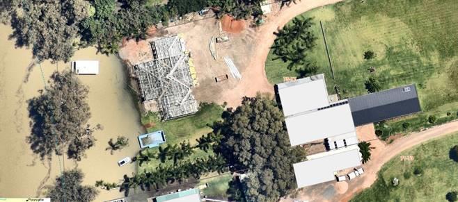
This application has a 4.6 variation application – the variation is to allow building of the swimming pool within the 30m of the river.
SECTION 4.15-MATTERS FOR CONSIDERATION
(1) The provisions of anyenvironmental planninginstrument and development control plan
State Environmental Planning Policy (Building Sustainability Index: BASIX) 2004
The proposed development meets the requirements of the State Environmental Planning Policy (Building Sustainability Index: BASIX) 2004 as demonstrated by the BASIX certificate.
State Environmental Planning Policy (Biodiversity and Conservation) 2021
The proposed development is located on land below 1 ha in size with no vegetation removal proposed. As such no assessment against Chapter 3 & 4 of the SEPP is required.
An assessment against Chapter 5, Clause 5.9 principles of the SEPP are as follows: 1. Access
Land is freehold with no existing public access to the river. The development will not change this access to the river.
2. Bank Disturbance
The swimming pool safety barrier will be sited 1.289m inside the closest point of the high bank of the river, while the swimming pool itself will be located a further 2m inside this line. Some bank disturbance is anticipated from the development as the site is sloped toward the river edge. Vegetation in this area has been cleared previously, no further vegetation removal is required in preparation for the development at this site
3. Flooding
The development is located on flood liable land. An assessment against related principles is as follows:
Item 9.11 - Attachment 4 4.15 Assessment report Page 182
a). The land has been disturbed through the process of establishing a residential dwelling and other associated structures on the site, no change to the riverine ecosystems is anticipated.
b). The land is flood liable with risk of flooding during flood events. With an increase in extreme weather events caused by climate change, this clause is especially relevant.
c). The proposed swimming pool will be dug into the ground. Conditions of consent will be included to facilitate free flow of water during flood events.
d). The entire Lot is within the flood planning area, therefore other suitable land in the locality is not an option
e). Services are available to the site. As the entire lot is flood affected, access during times of flood is not guaranteed
f). The land is to be used for residential purposes, with a residential dwelling and other associated structures, minimal risk of pollution during riverine flood event, as residents have time to prepare and prevent possible issues.
g). The swimming pool is not proposed to impact water flow during a flood event. The swimming pool safety barrier could be conditioned for removal during flood events so it does not impact the flow of flood water. However, as it is a safety barrier, any condition to remove it leaves Council potentially liable for leaving the swimming pool unprotected. This is an unnecessary risks as the land is big enough to allow facilitate another site location.
h). Noted. Due to the generally slow nature of riverine flood, residents should be able to plan and prepare with adequate time for evacuation.
4. Land Degradation
The proposed development will be conditioned to minimise any detrimental effects on the land through erosion, land degradation, pollution, etc.
5. Landscape
No vegetation removal is anticipated allowing for the proposed development to occur on the site. Landscaping will be conditioned to include native species for revegetation.
6. River Related Uses
The proposed development does not demonstrate an essential relationship to the river, as such development should be located a reasonable distance from the river.
7. Settlement
The proposed development is not a settlement.
8. Water Quality
The proposed development and continued use will be conditioned to ensure measures are applied to reduce pollution of the waterway.
9. Wetlands
The proposed site is located in wetland area as per WSC mapping. The location where the swimming pool and safety barrier are to be sited has been disturbed through previous development.
Item 9.11 - Attachment 4 4.15 Assessment report Page 183
An assessment against Clause 5.13 principle of the SEPP are as follows:
- Building setback: The proposed swimming pool and safety barrier does not meet the WLEP 2011 setback requirement as recommended 30m setback from the high bank line of the river. Therefore a 4.6 variation has been provided requesting variation to this standard.
From an assessment perspective, the 4.6 variation does not provide adequate planning justification as to why the building setback should not comply with the WLEP 2011 river setback requirements, especially in consideration of recent flood events.
- Matters to be considered
o Effluent disposal: N/A as development is not a dwelling
o Landscaping: To be conditioned recommending use of local native vegetation species
The proposed development does not fully comply with the principles within the SEPP. Notable non-compliance being that the proposed development of a swimming pool and safety barrier is not classified as having an essential relationship and is not listed as one of the items permitted in close proximity to the river. The 4.6 variation provided does not fully support this application with justification for the location, and why the application should be approved
Wentworth Local Environmental Plan (LEP) 2011
Zone objectives and permissibility
The proposed swimming pool with safety barrier is permitted with consent as ancillary development to the existing residential dwelling with garage, and meet the zone objectives of the RU5 Village zone under which the subject site is located.
Standard being varied
The swimming pool with safety barrier will be located a minimum of 1.1m (safety barrier at southwestern corner) from the river high bank, while the swimming pool will be located 3.289m from the high bank. Under clause 7.6 of the WLEP 2011, only a certain list of uses are permitted within the river front area (30m from the high bank).
Only the following land uses are permitted within the river front area as per clause 7.6:
a) boat building and repair facilities, boat launching ramps, boat sheds, charter and tourism boating facilities or marinas,
b) the extension or alteration of an existing building that is wholly or partly in the river front area, but only if the extension or alteration is to be located no closer to the river bank than the existing building,
c) environmental protection works,
d) extensive agriculture and intensive plant agriculture,
e) walking trails, cycleways, picnic facilities, recreation facilities and recreation facilities (outdoors),
f) water recreation structures.
River front area is defined as:
Item 9.11 - Attachment 4 4.15 Assessment report Page 184
“river front area means the land between the river front building line and the highest bank of the Murray River or, if there is no river front building line, the land within 30 metres of the highest bank of the River.”
A swimming pool with safety barrier as ancillary to an existing residential dwelling is not one of the listed uses permitted within the river front area. However, a 4.6 variation application was provided by the applicant seeking to vary this development standard to allow construction of the swimming pool with safety barrier within the river front area
Approving 4.6 variations
Under clause 55 of the Environmental Planning and Assessment Regulation 2021, a consent authority (Council) may assume concurrence if the concurrence authority has given notice to the consent authority. The notice identifies which concurrence has been given to council and can specify qualifications or conditions for the assumed concurrence.
Under the planning circular PS20-002 (notice), Councils were given assumed concurrence to approve 4.6 variation applications based on a number of conditions. These conditions can be summarised as following:
1. Council cannot assume concurrence for varying a standard regarding dwelling entitlement in regards to MLS less than 90% for lands zoned RU1 to RU4, RU6, R5, E2 (now C2) to E4 (now C4) and equivalent land uses.
2. Non-numerical standard and standard variations greater than 10% cannot be approved by a Council delegate i.e Director. These need to be approved by Council to ensure greater public scrutiny and transparency.
The proposed variation is not regarding MLS as such Council has assumed concurrence and do not need to refer the DA to the Department of Planning and Environment (DPE) for concurrence. However, the variation proposed is greater than 10%, as such, will need to be presented to Council for approval.
4.6 Exceptions to development standards written request
The following section of the assessment report contains the 4.6 justification provided by the applicant including comments from Council officer: Application written request – clause 4.6(3)(a) and (b)
The applicant seeks to justify the contravention of the development standard on the following basis:
a. That compliance with the development standard is unreasonable or unnecessary in these circumstances because:
i. Compliance with meeting the setback is not possible given the location of the existing dwelling.
Officer comments: Although the pool is an ancillary development to the dwelling, this does not determine the pool location. The pool location must comply with relevant planning legislation and be suitable in it proposed location.
ii. Compliance considered unreasonable due to other development along the river in Wentworth.
Officer comments: The dwelling was approved using the 4.6 variation provisions so it would be inline with adjoining development. No other similar pools or structures in
Item 9.11 - Attachment 4 4.15 Assessment report Page 185
the surrounding area are located closer than the dwelling in relation to the river front area and riverbank.
iii. The proposed swimming pool location ensures safety for users through visibility from the dwelling Officer comments: Swimming pool barriers and signs are adequate safety measure required for all swimming pools under legislation. The visibility from the dwelling is not a requirement under the Swimming Pool Act 1992 in terms of ensuring the safety of the pool users.
iv. Proposed development meets the objectives of the zone
b. That there are sufficient environmental planning grounds to justify contravening the standard:
i. The swimming pool with safety barrier will not cause any environmental impacts on the Darling River.
Officer comments: The pool barrier can potential be swept away during a flood event, polluting the river, river bank disturbances and raising safety concerns.
Consideration
of Applicants Written Request - Clause 4.6(4) (a) (i) and (ii) (b)
Does the written request adequately address those issues at Clause 4.6(4)(a)(i)
1. Compliance with meeting the setback is not possible given the location of the existing dwelling and it is considered unreasonable given the existing development along the river in Wentworth and the swimming pool location ensures the swimming pool can be seen from within the dwelling to ensure safety for all users.
Officer comments: Although the pool is an ancillary development to the dwelling, this does not determine the pool location. The pool location must comply with relevant planning legislation and be suitable in it proposed location. The dwelling was approved using the 4.6 variation provisions so it would be inline with adjoining development. No other similar pools or structures in the surrounding area are located closer than the dwelling in relation to the river front area and riverbank.
In addition to the above, the NSW Land and Environment Court in Four2Five Pty LTD v Ashfield Council [2015] NSWLEC 90, considered how this question may be answered and referred to the earlier Court decision in Wehbe v Pittwater Council [2007] NSWLEC 827. The court provided five tests as follows that can be used as prompts to answer the above question in relation to a Clause 4.6 Variation application.
Officer comments: The river bank has already been disturbed and the proposed swimming pool with safety barrier will not be visibly intrusive within the landscape as it is behind the dwelling building line. However, there is potential detriment impacts caused from the development
Does the written request adequately address those issues at Clause 4.6(4)(a)(ii)
a. Although the development is cognisant with the zone objectives, the proposal is consistent with the objectives of clause 7.6 being varied.
Objectives of Clause 7.6
Item 9.11 - Attachment 4 4.15 Assessment report Page 186
To support natural riverine processes, including the migration of the Murray River’s channels,
To protect and improve the bed and bank stability of the Murray River,
To maintain and improve the water quality of the Murray River
To protect the amenity, scenic landscape values and cultural heritage of the Murray River and to protect public access to its riverine corridors,
To conserve and protect the riverine corridors of the Murray River, including wildlife habitat.
Not on the bed of the river.
Due to the nature of the development, significant earthworks will occur near the high bank with potentially significant impacts to the bank of the river
Not applicable, however, conditions of consent will be used to mitigate and manage influence upon natural waterway
No significant impact to amenity and scenic landscape as no native vegetation removal is proposed. No heritage listings known to this site.
No wildlife impacted, as land has been previously disturbed through construction of residential dwelling and other related structures
Has the planning secretary’s concurrence been sought as per Clause 4.6(4)(b)
b. Under the planning circular PS20-002, the concurrence of the Planning Secretary will not be required for this variation. However, due to the size of the variation, council staff do not have the delegated authority to determine the development. As such, the development will be determined by Council.
5 part test
1. The objectives of the standard are achieved notwithstanding noncompliance with the standard:
As outlined in this report, the objectives and standards of the Clause are met. The proposed swimming pool will not cause detriment to the river environs and is not visually intrusive development. It is considered the objectives and standards have been demonstrated in this report.
Officer comments: Due to the nature of the development, significant earthworks will occur near the high bank with potentially significant impacts to the bank of the river. This is a non-compliance against an objective of clause 7.6.
2. The underlying objective or purpose of the standard is not relevant to the development and therefore compliance is unnecessary: Itisconsideredtheswimmingpoolshouldbediscouragedifthedevelopmentwould cause detriment to the river environs, but as demonstrated in this report, the proposed swimming pool is adequately setback from the high bank and will not cause detriment in any way. The swimming pool is also considered development that is not visually intrusive due to the development being at ground height (except thetopedgeoftheswimmingpool)andonlythepoolfencewillbeabovetheground and is transparent.
Officer comments: Due to the nature of the development, significant earthworks will occur near the high bank with potentially significant impacts to the bank of the river. The pool and safety barrier are very close to the high bank compared to other development in the area.
Item 9.11 - Attachment 4 4.15 Assessment report Page 187
3. The underlying object of purpose would be defeated or thwarted if compliance was required and therefore compliance is unreasonable:
Thepurposeoftheswimmingpoolistobeinanareathatissafe andconsistentwith the existing design of the dwelling. Should the swimming pool not be approved in the proposed location, it would be unreasonable to locate the swimming pool in another location for safety concerns.
If compliance was required, it is considered unreasonable given the location of the existing dwelling, safety and the land is used for residential purposes. In addition, the proposed swimmingpool will not causeanegativeimpact on the riverenvirons.
Officer comments: Swimming pool barriers and signs are adequate safety measure required for all swimming pools under legislation. The visibility from the dwelling is not a requirement under the Swimming Pool Act 1992 in terms of ensuring the safety of the pool users. The pool location has high potential to adversely impact the river environs. Although the pool is an ancillary development to the dwelling, this does not determine the pool location. The pool location must comply with relevant planning legislation and be suitable in it proposed location. The dwelling was approved using the 4.6 variation provisions so it would be inline with adjoining development. No other similar pools or structures in the surrounding area are located closer than the dwelling in relation to the river front area and riverbank.
4. The development standard has been virtually abandoned or destroyed by the council’s own actions in granting consents departing from the standard and hence compliance with the standard is unnecessary and unreasonable: Theproposal is in keepingwith the characteroftheareaand Council haveset many precedents of granting consents for development within the river front areas abutting the Murray and Darling rivers. The existing dwelling was also provided consent within the river front setback area.
Officer comments: Each development application is assessed on its own merits in line with the legislation at the time of lodgement. The dwelling was approved after a 4.6 variation was provided with the development application. The pool application is a separate application located closer to the high bank than other development in the surrounding area setting a potential precedence for allowing development in inappropriate locations.
5. The compliance with development standard is unreasonable or inappropriate due to existing use of land and current environmental character of the particular parcel of land. That is, the particular parcel of land should not have been included in the zone: It is considered the land should be included in the zone given the proximity to the Wentworth CAD and existing development in the area. The proposed swimming pool will be development associated with the existing residential use of the land which the zone allows for.
Officer comments: The pool and barrier area permitted under the land zoning.
The proposed variation is supported based on the results of the five (5) part test above.
Officer comments: The proposed development does not comply with 4 of the 5 tests, as such should not be supported/approved. The pool application is a separate application located closer to the high bank than other development in the surrounding area setting a potential precedence for allowing development in inappropriate locations.
5.21 Flood Planning
The proposed swimming pool with safety barrier is located on land within flood mapped area.
Item 9.11 - Attachment 4 4.15 Assessment report Page 188
An assessment against 5.21(2) is as follows:
a. The entire lot is flood mapped with the proposed development being on constructed by being dug into the ground between the existing dwelling footprint and the high bank of the river While the swimming pool will not be visually noticeable, the safety barrier will be visible from the river and the bank. The pool barrier is a solid glass fence which impede the free flow of flood water.
b. The whole land is flood mapped with the proposed development being dug into the ground The pool barrier is a solid glass fence which impede the free flow of flood water.
c. The land including the accessway and public road are all within flood liable land. However, land located approx. 50m from the site is within a levee bank and outside flood affected area. This allows access from the site to non-flood affected land during flood events.
d. As the development is a swimming pool with safety barrier and not a dwelling, managing risk of life in the event of a flood is not applicable.
e. The proposed location of the swimming pool with safety barrier in such close proximity to the high bank can potentially lead to bank destabilisation in time of flood events.
An assessment against 5.21(3) is as follows:
a. The proposed swimming pool poses minor flood impacts on flood behaviour, however, the proposed safety barrier (glass fencing) poses issues for safety and water displacement that could affect other properties downstream.
b. The scale of the development is adequate for the land irrespective but not the proposed location.
c. The application can allow safe evacuation of people due to the nearby land protected by a levee bank and not flood impacted.
d. The swimming pool with safety barrier being close to the high bank of the river puts it at risk of being impacted by flood erosion A location away from the river front area would be more suitable.
The proposed development does not comply with matters for considerations under clause 5.21. However, locating of the Swimming pool with safety barrier in another location on site would be preferred.
Clause 7.1 Earthworks
Any earthworks will form part of this approval and will be ancillary to the main approval for a pool with barrier. However, due to the development proximity to the high bank, earthworks have the potential to impact the river bank.
Clause 7.2 Essential services
All necessary services can be made available to the new swimming pool with safety barrier as required
Clause 7.4 Terrestrial biodiversity
An assessment of the proposed swimming pool with safety barrier against clause 7.4(3) is as follows:
a. The proposed development is unlikely to have adverse impacts on the condition, ecological value and significance of the fauna and flora on the land. This is because the proposed development is for a swimming pool with safety barrier for domestic uses only. Potential impacts will most likely
Item 9.11 - Attachment 4 4.15 Assessment report Page 189
be from the construction of the swimming pool with safety barrier. No vegetation clearing will be conducted as part of the construction, however a tree close to the site can be adversely impacted
b. The proposed development is unlikely to have adverse impacts on the importance of the vegetation on the land to the habitat and survival of native fauna. This is because the proposed development is for a swimming pool with safety barrier to be used in conjunction with a residential dwelling Potential impacts will most likely be from the construction of the swimming pool with safety barrier.
c. The proposed development is unlikely to have any potential to fragment, disturb or diminish the biodiversity structure, function and composition of the land. This is because the proposed development is for a swimming pool with safety barriers to be used for private use in relation to the existing residential dwelling.
d. The proposed development is unlikely to have adverse impacts on the habitat elements providing connectivity on the land.
An assessment of the proposed swimming pool with safety barrier against clause 7.4(4) is as follows:
a. The swimming pool with safety barrier has been sited between the dwelling and the high bank of the river, with potential adverse impacts to the bank of the river.
b. The risks are able to be mitigated by moving the location of the proposed pool and barrier.
c. Noted
Clause 7.5
Wetlands
An assessment of the proposed swimming pool with safety barrier against clause 7.5(3) is as follows:
a. Not affect growth and survival of flora and fauna.
b. No vegetation to be removed a part of the construction. Potential impacts to existing tree in proximity of the development site.
c. Native tree potentially impacted by the development
d. Due to the type of development, they may be potential impacts to the ground development.
e. The development location is located in a wetland mapped area. However, the land has been historically disturbed.
An assessment of the proposed swimming pool with safety barrier against clause 7.5(4) is as follows:
a) The location on site of the development is not appropriate due to the nature of the development and adverse impacts to the river bank.
b) The risks are able to be mitigated by moving the location of the proposed pool and barrier.
Clause 7.6 Development in River Front Areas
The proposed development does not meet the permitted use in the riverfront area as identified under clause 7.6(2).
An assessment of the proposed swimming pool with safety barrier against clause 7.6(3) is as follows:
a. The development will not be compatible with surrounding area
b The development may potentially cause pollution through bank destabilisation due to the close location of the development to the high bank of the river
c No vegetation to be removed as such no impacts on existing landscape
d. The proposed swimming pool with safety barrier will not change current access arrangement to the river
e There are no historic, scientific, cultural, social, archaeological, architectural, natural or aesthetic significance of the land to be impacted by the development
Item 9.11 - Attachment 4 4.15 Assessment report Page 190
Based on the above assessment, the development does not comply with the clause.
Clause 7.7 Riparian land and Murray River and other watercourses general principles
An assessment of the proposed swimming pool with safety barrier against clause 7.7(3) is as follows:
a. Adverse impact of the proposed:
i. The structure is not located within the waterway and is not anticipated to impact the flow of water when not in flood. Impact during flood events will alter water flow, cause damage to the structure and may lead to further impacts as the water recedes.
ii. No impacts on aquatic and riparian species, habitats and ecosystem.
iii. Works may potentially impact the bank stability as they are located close to the high bank of the river.
iv. No impacts to the watercourse movement of aquatic fauna anticipated as no works proposed with the watercourse
v. Not impact any future rehabilitation of a watercourse and riparian areas
b. Reticulated water is available to the site for connection
An assessment of the proposed swimming pool with safety barrier against clause 7.7(4) is as follows:
c) The location on site of the development is not appropriate due to the nature of the development and adverse impacts to the river bank.
d) The risks are able to be mitigated by moving the location of the proposed pool and barrier.
Based on the above assessment, the development does not comply with this clause.
Clause 7.8 Additional provisions – development on river bed and banks of the Murray River Assessment against this clause is not required for the proposed development.
Wentworth Development Control Plan (DCP) 2011
The proposed development is not fully acceptable against Chapter 2 provisions but acceptable against chapter 4 provisions of the Wentworth Development Control Plan (DCP) 2011.
Wentworth Development Control Plan (DCP) 2011
The proposed development is acceptable against the relevant provisions of the Wentworth Development Control Plan (DCP) 2011 Chapters 2 & 4 as outlined in the table below.
Wentworth DCP Chapter 2 & 4 Acceptable Not Acceptable N/A Reason
2.1 Murray River and Darling River X
The proposed swimming pool with safety barrier does not meet the required setback from the high bank of the river of 30m necessitating the 4.6 variation that
Item 9.11 - Attachment 4 4.15 Assessment report Page 191
accompanies the application
2.2 Mooring X N/A not a mooring application
2.3 Erosion control X
2.4 Vegetation ProtectionRiverfront X
The proposed development and associated works have the potential to lead to erosion of the river bank.
The proposed development and associated works have the potential to lead to tree damage
3 Koala Habitat Protection X N/A No known koala habitat on the site
4 Flood Affected Land X
The swimming pool with safety barrier will be constructed inground as development above the 1 in 100 yr flood level is not possible, it is probable that the development will be impacted during a flood event.
5 Vehicular access and parking X No change to access or parking
5.1 Parking layout, servicing and manoeuvring X
No changes to existing access or parking
5.2 Specific land use requirements X Parking requirements met
6 Crime prevention through environmental design X
No change anticipated from development
7 Disability Access Standards X N/A as development associated with private residential dwelling
Item 9.11 - Attachment 4 4.15 Assessment report Page 192
8 Development in the enterprise corridor – zone
B6 X N/A as not within this zone
9 Highway Promotion signs X N/A
10 Design Assessment Criteria X N/A
Chapter 4
4.1.1 Site context X
The proposed location of the swimming pool with safety barrier does not make use of available land.
4.1.2 Streetscape X The proposed swimming pool with safety barrier is located behind the building.
4.1.3 Front Setback X N/A as not a dwelling –the development is located behind the existing building line
4.1.4 Side setbacks X N/A as not a dwelling
4.1.5 Rear setback X N/A as not a dwelling
4.1.6 Walls on Boundaries X N/A as not a dwelling
4.1.7 Building heights and overshadowing X N/A as for a swimming pool with safety barrier
4.1.8 Site Coverage X Proposed development does not cover more than 60% of site
4.1.9 Private open space X Adequate private open space available
4.1.10 Energy & solar access X N/A as not for a dwelling
Item 9.11 - Attachment 4 4.15 Assessment report Page 193
4.1.11
Daylight to existing windows
4.1.12
North facing windows
4.1.13
X N/A as not for a dwelling
X N/A as not for a dwelling
Overlooking X N/A as not for a dwelling
4.1.14
Fencing and retaining walls
4.1.15
Car parking and vehicle access X
4.1.16
Cut and fill X
X N/A approval not for fencing or retaining walls
The site provides space for access and carparking
Earthworks will adversely impact the bank
(2) The provisions of any draft environmental planning instrument
There is no Division 3.4 draft environmental planning instrument that affect the proposed development. (Post 1 July 2009 LEP amendments).
(3) Any matters prescribed by regulations
There are no further matters prescribed by regulations relevant to the proposed development.
(4) The likely impacts of the development
There are no likely impacts from the proposal as discussed in the table below.
Impact item
(insert an ‘x’ in the relevant section)
Context and setting X
The site is surrounded by similar residential dwellings with ancillary developments However, the pool location is not inline with the surrounding development
Public domain & Streetscape X The proposed swimming pool is behind the building line of the existingdwelling.Noworkis expectedtobe done on the street.
Landscaping X Landscaping not part of the application
Stormwater X Can be managed onsite
Heritage X No known heritage items onsite.
Item 9.11 - Attachment 4 4.15 Assessment report Page 194
Acceptable Not acceptable Not relevant Comment
Soils & Soils Erosion X Potentially erosion due to the proximity of the site to the high bank, development requiring excavation of land to install / construct the swimming pool in ground and disturbance to the river bank.
Air and microclimate X Proposed development not anticipated to affect the air or microclimate.
Water Resources X Potentialimpactstothewaterwayduetothecloseproximity to the Darling River.
Biodiversity (Flora & Fauna) X No native vegetation to be cleared for the development
Land Resources X
None located on the site expected to impact the proposed development.
Utilities X Utilities are available to the site
Access & Parking X
Direct access to site available, space for parking available on site
Roads & Traffic X No new road proposed, traffic will not be impacted by proposal
Solar Access and Energy Efficiency X N/A as not for a dwelling
Overshadowing X Not relevant
Privacy & Overlooking X Not relevant
Flooding X The proposed development is located on flood impacted land in close proximity to the Darling River. There is potential impact downstream from debris, changing the water flow of the water and river bank erosion.
Bushfire Prone Area X Not in bushfire prone area
Noise X
Possible significant noise only expected during construction, residential noises anticipated after Technological hazards X None anticipated from the development, only residential activities anticipated from the site
Safety, Security & Crime Prevention X Development will not affect the safety of the area.
Social and Economic Impacts X No negative social and economic impacts anticipated from the proposed development.
(5) The suitability of the site for development
The subject land is suitable for the proposed swimming pool with safety barrier under the WLEP as ancillary development to the existing dwelling However, the siting of the development between the dwelling and the high bank of the Darling River, is not considered suitable in this instance.
This is due to its proximity to the high bank of the Darling River, and the potential impact this may cause with erosion, altering the path of flood water and the build-up of debris around
Item 9.11 - Attachment 4 4.15 Assessment report Page 195
the pool fencing. These matters are discussed within the memo from councils building department.
Should the applicant wish to relocate the swimming pool with safety barrier to another location outside the riverfront area, this would make the application comply with relevant planning legislation. The development is to be located between the high bank of the river and the dwelling.
Images of the site for the proposed swimming pool with safety barrier, taken from the site looking toward the river. Images taken before commencement of the existing dwelling
Item 9.11 - Attachment 4 4.15 Assessment report Page 196
Images looking up the bank from the rivers edge toward the site of the proposed swimming pool with safety barrier, and the high bank of the river. Images taken prior to the construction of the existing dwelling.
Image of dwelling under construction with impact of flood event 2022.
(6) Any submissions made in accordance with this Act or Regulation
The application was notified for 14 days as per the Wentworth Community Participation Plan. No submissions were received.
Item 9.11 - Attachment 4 4.15 Assessment report Page 197
(7) The public interest
The proposed development is consistent with public interest as it will have no detrimental effect on the surrounding area. Moreover, no objections were made by the surrounding neighbours.
COMMENTS FROM COUNCIL INTERNAL DEPARTMENTS
Department Referred Y/N Comments
Building Y BCA Class: 10b
Comments
• Swimming pool to be located in flood planning area and below the 1% AEP flood level.
• Composite pool shell and fencing (safety barrier) likely to sustain significant damage in the event of a flood event. Would Council be potentially liable for damages sustained??
• In the aftermath of a flood the swimming pool could potentially be “unprotected” as a result of damage to the safety barrier.
• Council generally place conditions around removal of fence panels etc. in the event of a flood. Any such condition should be avoided in this instant as the pool could potentially remain unprotected for a period of time.
• Swimming pool pump equipment and any other electrified components should be located above the 1% AEP flood level.
Recommendations
In considering this proposal, Council should:
• Require the applicant provide advice from the relevant design engineer as to the ability of the swimming pool shell etc. to sustain the effects of prolonged inundation and river flows eg. structural damage.
• Consider the implications of a flood event on the proposed safety barrier (damage etc.) and its continued ability to prevent access to the swimming pool by small children following a flood event.
Subdivision Engineer N
Roads & Engineering N
Finance & Policy N
Item 9.11 - Attachment 4 4.15 Assessment report Page 198
Heritage Advisor N
Environmental Health N
Local Laws N
Floodplain Mgt Committee N
Sustainable Infrastructure N
CONCLUSIONS
1. General comments:
2. The proposal does not satisfy the points for consideration listed under Section 4.15 of the Environmental Planning and Assessment Act.
3. The proposal occurs on land zoned RU5 Village. The proposal has potential detrimental impact on the site and surrounds.
4. The proposal is not consistent with the Wentworth Shire Development Control Plan (Dec 2011). The proposal is not consistent with the development controls in Chapter 2 and 4 of the Wentworth Shire Development Control Plan (Dec 2011).
5. The proposed swimming pool with safety barrier does not accord with the relevant objectives, provisions and principles of the State Environmental Planning Policy (Biodiversity and Conservation) 2021.
6. There is no draft local environmental plan affecting the proposed development.
COMMENTS FROM EXTERNAL REFERRALS
Essential Energy: No objections and provided comments 16/10/2023
Department of Planning and Environment – Water: Exempt development 19/10/2023
Department of Primary Industries – Fisheries: Rejected 28/09/2023
RECOMMENDATION:
Council refuse the application due to the following reasons:
• Non-compliance with Chapter 5 of the State Environmental Planning Policy (Biodiversity and Conservation) 2021
• Non-compliance with clause 7.6 of the Wentworth Local Environmental Plan 2011 river front standard
Item 9.11 - Attachment 4 4.15 Assessment report Page 199
• 4.6 variation application provided by applicant does not provide adequate justification to contravene the clause 7.6 development standard
• Non-compliance with clauses 5.21, 7.1, 7.4, 7.5, 7.7 of the Wentworth Local Environmental Plan 2011
• Non-compliance with chapter 2 and 4 of the Wentworth Shire Development Control Plan (Dec 2011)
Delegate report author
Signature:
 Kerrie
Copley Planning
Officer
Date: 03/11/2023
Delegated approval and endorsement
Signature:
Date:
Item 9.11 - Attachment 4 4.15 Assessment report Page 200
Approving 4.6 variations
Health & Planning Department
26-28 Adelaide Street PO Box 81
WENTWORTH NSW 2648
Tel: 03 5027 5027
council@wentworth.nsw.gov.au
4.6 Variation Assessment
Environmental Planning & Assessment Act 1979 as amended
Under clause 55 of the Environmental Planning and Assessment Regulation 2021, a consent authority (Council) may assume concurrence if the concurrence authority has given notice to the consent authority. The notice identifies which concurrence has been given to council and can specify qualifications or conditions for the assumed concurrence.
Under the planning circular PS20-002 (notice), Councils were given assumed concurrence to approve 4.6 variation applications based on a number of conditions. These conditions can be summarised as following:
1. Council cannot assume concurrence for varying a standard regarding dwelling entitlement in regards to MLS less than 90% for lands zoned RU1 to RU4, RU6, R5, E2 (now C2) to E4 (now C4) and equivalent land uses.
2. Non-numerical standard and standard variations greater than 10% cannot be approved by a Council delegate i.e Director. These need to be approved by Council to ensure greater public scrutiny and transparency.
The proposed variation is not regarding MLS as such Council has assumed concurrence and do not need to refer the DA to the Department of Planning and Environment (DPE) for concurrence. However, the variation proposed is greater than 10%, as such, will need to be presented to Council for approval.
4.6 Exceptions to development standards written request
The following section of the assessment report contains the 4.6 justification provided by the applicant including comments from Council officer: Application written request – clause 4.6(3)(a) and (b)
The applicant seeks to justify the contravention of the development standard on the following basis:
a. That compliance with the development standard is unreasonable or unnecessary in these circumstances because:
i. Compliance with meeting the setback is not possible given the location of the existing dwelling.
Officer comments: Although the pool is an ancillary development to the dwelling, this does not determine the pool location. The pool location must comply with relevant planning legislation and be suitable in it proposed location.
ii. Compliance considered unreasonable due to other development along the river in Wentworth.
Officer comments: The dwelling was approved using the 4.6 variation provisions so it would be inline with adjoining development. No other similar pools or structures in the surrounding area are located closer than the dwelling in relation to the river front area and riverbank.
Item 9.11 - Attachment 5 4.6 Assessment report Page 201
iii. The proposed swimming pool location ensures safety for users through visibility from the dwelling Officer comments: Swimming pool barriers and signs are adequate safety measure required for all swimming pools under legislation. The visibility from the dwelling is not a requirement under the Swimming Pool Act 1992 in terms of ensuring the safety of the pool users.
iv. Proposed development meets the objectives of the zone.
b. That there are sufficient environmental planning grounds to justify contravening the standard:
i. The swimming pool with safety barrier will not cause any environmental impacts on the Darling River Officer comments: The pool barrier can potential be swept away during a flood event, polluting the river, river bank disturbances and raising safety concerns.
Consideration of Applicants Written Request - Clause 4.6(4) (a) (i) and (ii) (b)
Does the written request adequately address those issues at Clause 4.6(4)(a)(i)
1. Compliance with meeting the setback is not possible given the location of the existing dwelling and it is considered unreasonable given the existing development along the river in Wentworth and the swimming pool location ensures the swimming pool can be seen from within the dwelling to ensure safety for all users.
Officer comments: Although the pool is an ancillary development to the dwelling, this does not determine the pool location. The pool location must comply with relevant planning legislation and be suitable in it proposed location. The dwelling was approved using the 4.6 variation provisions so it would be inline with adjoining development. No other similar pools or structures in the surrounding area are located closer than the dwelling in relation to the river front area and riverbank.
In addition to the above, the NSW Land and Environment Court in Four2Five Pty LTD v Ashfield Council [2015] NSWLEC 90, considered how this question may be answered and referred to the earlier Court decision in Wehbe v Pittwater Council [2007] NSWLEC 827. The court provided five tests as follows that can be used as prompts to answer the above question in relation to a Clause 4.6 Variation application.
Officer comments: The river bank has already been disturbed and the proposed swimming pool with safety barrier will not be visibly intrusive within the landscape as it is behind the dwelling building line. However, there is potential detriment impacts caused from the development.
Does the written request adequately address those issues at Clause 4.6(4)(a)(ii)
a. Although the development is cognisant with the zone objectives, the proposal is consistent with the objectives of clause 7.6 being varied.
Objectives of Clause 7.6
To support natural riverine processes, including the migration of the Murray River’s channels,
Not on the bed of the river.
Item 9.11 - Attachment 5 4.6 Assessment report Page 202
To protect and improve the bed and bank stability of the Murray River,
To maintain and improve the water quality of the Murray River
To protect the amenity, scenic landscape values and cultural heritage of the Murray River and to protect public access to its riverine corridors,
To conserve and protect the riverine corridors of the Murray River, including wildlife habitat.
Due to the nature of the development, significant earthworks will occur near the high bank with potentially significant impacts to the bank of the river
Not applicable, however, conditions of consent will be used to mitigate and manage influence upon natural waterway
No significant impact to amenity and scenic landscape as no native vegetation removal is proposed. No heritage listings known to this site.
No wildlife impacted, as land has been previously disturbed through construction of residential dwelling and other related structures.
Has the planning secretary’s concurrence been sought as per Clause 4.6(4)(b)
b. Under the planning circular PS20-002, the concurrence of the Planning Secretary will not be required for this variation. However, due to the size of the variation, council staff do not have the delegated authority to determine the development. As such, the development will be determined by Council.
5 part test
1. The objectives of the standard are achieved notwithstanding noncompliance with the standard:
As outlined in this report, the objectives and standards of the Clause are met. The proposed swimming pool will not cause detriment to the river environs and is not visually intrusive development. It is considered the objectives and standards have been demonstrated in this report.
Officer comments: Due to the nature of the development, significant earthworks will occur near the high bank with potentially significant impacts to the bank of the river. This is a non-compliance against an objective of clause 7.6.
2. The underlying objective or purpose of the standard is not relevant to the development and therefore compliance is unnecessary: Itisconsideredtheswimmingpoolshouldbediscouragedifthedevelopmentwould cause detriment to the river environs, but as demonstrated in this report, the proposed swimming pool is adequately setback from the high bank and will not cause detriment in any way. The swimming pool is also considered development that is not visually intrusive due to the development being at ground height (except thetopedgeoftheswimmingpool)andonlythepoolfencewillbeabovetheground and is transparent.
Officer comments: Due to the nature of the development, significant earthworks will occur near the high bank with potentially significant impacts to the bank of the river. The pool and safety barrier are very close to the high bank compared to other development in the area.
3. The underlying object of purpose would be defeated or thwarted if compliance was required and therefore compliance is unreasonable: Thepurposeoftheswimmingpoolistobeinanareathatissafe andconsistentwith the existing design of the dwelling. Should the swimming pool not be approved in
Item 9.11 - Attachment 5 4.6 Assessment report Page 203
the proposed location, it would be unreasonable to locate the swimming pool in another location for safety concerns.
If compliance was required, it is considered unreasonable given the location of the existing dwelling, safety and the land is used for residential purposes. In addition, the proposed swimmingpool will not causeanegativeimpact on the riverenvirons. Officer comments: Swimming pool barriers and signs are adequate safety measure required for all swimming pools under legislation. The visibility from the dwelling is not a requirement under the Swimming Pool Act 1992 in terms of ensuring the safety of the pool users. The pool location has high potential to adversely impact the river environs. Although the pool is an ancillary development to the dwelling, this does not determine the pool location. The pool location must comply with relevant planning legislation and be suitable in it proposed location. The dwelling was approved using the 4.6 variation provisions so it would be inline with adjoining development. No other similar pools or structures in the surrounding area are located closer than the dwelling in relation to the river front area and riverbank.
4. The development standard has been virtually abandoned or destroyed by the council’s own actions in granting consents departing from the standard and hence compliance with the standard is unnecessary and unreasonable:
Theproposal is in keepingwith the characteroftheareaand Council haveset many precedents of granting consents for development within the river front areas abutting the Murray and Darling rivers. The existing dwelling was also provided consent within the river front setback area.
Officer comments: Each development application is assessed on its own merits in line with the legislation at the time of lodgement. The dwelling was approved after a 4.6 variation was provided with the development application. The pool application is a separate application located closer to the high bank than other development in the surrounding area setting a potential precedence for allowing development in inappropriate locations.
5. The compliance with development standard is unreasonable or inappropriate due to existing use of land and current environmental character of the particular parcel of land. That is, the particular parcel of land should not have been included in the zone: It is considered the land should be included in the zone given the proximity to the Wentworth CAD and existing development in the area. The proposed swimming pool will be development associated with the existing residential use of the land which the zone allows for.
Officer comments: The pool and barrier area permitted under the land zoning.
The proposed variation is supported based on the results of the five (5) part test above.
Officer comments: The proposed development does not comply with 4 of the 5 tests, as such should not be supported/approved. The pool application is a separate application located closer to the high bank than other development in the surrounding area setting a potential precedence for allowing development in inappropriate locations.
Item 9.11 - Attachment 5 4.6 Assessment report Page 204
9.12 DA2021/167 THREE (3) PRIVATE ROADSIDE SIGNS ADJACENT TO 514 SILVER CITY HIGHWAY LOT 1131 DP 720092 MOURQUONG
File Number: RPT/23/786
Responsible Officer: Matthew Carlin - Director Health and Planning
Responsible Division: Health and Planning
Reporting Officer: George Kenende - Strategic Planning Officer
Objective: 3.0 Wentworth Shire is a community that works to enhance and protect its physical and natural environment
Strategy: 3.1 Ensure our planning decisions and controls enable the community to benefit from development
Summary
A development application (DA2021/167) was received by Council for three roadside signs (signs) to be located in the road reserve of Silver City Highway adjacent to 514 Silver City Highway Lot 1131 DP 720092 Mourquong.
Under the Wentworth Local Environmental Plan 2011 (WLEP 2011), only development incidental or ancillary to the purpose of the SP2 Infrastructure zone are permitted with consent on the land. In this case the SP zone is for a road and signs can be considered as ancillary development to road reserves.
The Silver City Highway is a classified road, and any works or structures to be installed in its road reserve requires the concurrence of Transport for NSW (TfNSW). This concurrence is to be sought as part of the section 138 approval under the Roads Act 1993 (NSW). In their response to the proposed signs on a classified road reserve, TfNSW have not provided support for the development and will not be providing assumed concurrence under the Roads Acts 1993 (NSW).
Due to TfNSW not supporting the development, Council cannot approve an application which cannot legally be constructed on the land. As such, the application has been recommended for refusal. Under Wentworth Shire Council delegations, development applications cannot be refused under delegated authority and must be determined by Council.
Recommendation
That Council:
a) Refuse to issue approval for DA2021/167 being 3 roadside signs in the Silver City Highway reserve adjacent to 514 Silver City Highway Lot 1131 DP 720092 Mourquong.
b) Call a division in accordance with S375A of the Local Government Act 1993 (NSW).
Detailed Report
Purpose
The purpose of this report is to provide information for Council to determine Development Application DA2021/167, having consideration to the detail provided both within this report and the attachments provided.
Ordinary Meeting AGENDA 13 December 2023 Page 205
Background
A Development Application was lodged with Council on 12 October 2021 seeking consent to construct 3 road side signs within the road reserve of Silver City Highway. The road reserve is zoned SP2 Infrastructure and characterised as a classified road.
The initial plans received with the application were referred to Essential Energy and TfNSW for comment. Essential energy provided comment identifying potential safety concerns in terms of the location of their electricity infrastructure. TfNSW raised concerns and issues with the private road signs being attached to public road signage. The applicant amended the plans, which were referred to TfNSW for a second time, who did not support private signage within a classified road and did not provide assumed concurrence.
Refer to attachment 1 – Development Application Form
Refer to attachment 2 – Plans
Refer to attachment 3 – Statement of Environmental Effects and supporting documentation Matters under consideration
In determining a development application that requires consent, the consent authority must take into consideration matters prescribed in Section 4.15 of the Environmental Planning and Assessment Act 1979 NSW (EP&A Act) as relevant to the development.
The development application was referred to TfNSW under s138 of the Rads Act 1993 NSW as works are proposed to occur within a classified road reserve. It was sent as a referral to TfNSW because under section 4.46(3) of the EP&A Act, it was not required to be integrated development. For works to occur within the road reserve of a classified road, the concurrence of TfNSW is required.
TfNSW indicated in their response to the development application, that they do not support the placement of private roadside signage for directional or wayfinding purposes within the classified road corridor and do not provide their concurrence. As concurrence will not be provided for the road works, Council should not approve development application that cannot be acted upon.
The proposed development was referred to Essential Energy under clause 45 of the State Environmental Planning Policy (Infrastructure) 2018 (repealed) due to the proximity of the development to electricity infrastructure within the road reserve of Silver City Highway. Essential energy raised potential safety risks and provide separation distances required between the proposed signs and their electricity infrastructure.
The proposed development for signage is permitted with consent within the SP2 zone as it is ancillary to the use of a road. However, based on the assessment and comments from TfNSW, the development does not meet the zone objective of the SP2 zone under the Wentworth Local Environmental Plan 2011.
Based on the assessment of the application, it is determined that the proposed development is inconsistent with the relevant objectives of the SP2 Zone, has potential safety issues in terms of electricity infrastructure and cannot be constructed within the road reserve as TfNSW will refuse to issue concurrence for the works.
Refer to attachment 4 – 4.15 Assessment Report
Refer to attachment 5 – Essential Energy response
Refer to attachment 6 – Transport for NSW response
Options
Based on the information contained in this report, the options available to address this matter are to:
Refuse Development Application 2021/167 based on the following grounds:
Ordinary Meeting AGENDA 13 December 2023 Page 206
• The signs cannot be constructed within the road reserve as TfNSW will refuse to issue concurrence for the works
• The development is inconsistent with the relevant objectives of the SP2 Zone,
• The development has potential safety issues in terms of electricity infrastructure
Legal, strategic, financial or policy implications
Should Council issue a determination to the application, the applicant has the right to submit a request for review of the determination to Council under Section 8.2 of the Environmental Planning & Assessment Act 1987.
The applicant also has the right to appeal the decision made by Council to the Land and Environment Court pursuant to Section 8.7 of the Environmental Planning & Assessment Act 1987.
Conclusion
Having consideration to the content of this report it is concluded that the appropriate course of action is to refuse to issue development approval for DA2021/167.
Attachments
1. Development Application Form (Under separate cover)⇨
2. Plans⇩
3. Statement of Environmental Efects and Supporting documents⇩ 4. 4.15 Assessment Report⇩
5. Essential Energy response (Under separate cover)⇨
6. Transport for NSW response (Under separate cover)⇨
Ordinary Meeting AGENDA 13 December 2023 Page 207
All signs 3500mm from white shoulder line
Sign 1 - Link Road Buronga Bound (Separate from existing sign and not to obstruct, single sided 1650mm X 800mm face)

GATE 2 - GRAPE INTAKE
GATE 3 - STAFF
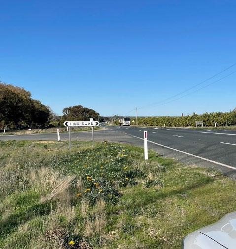
Sign 2 - Link Road Dareton Bound (Separate from existing sign and not to obstruct, single sided, single sided 1650mm X 800mm face, , total elevation 1500mm)
GATE 1 - STAFF
GATE 2 - GRAPE INTAKE
GATE 3 - STAFF
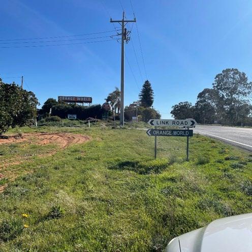
Sign 3 – Duxton Gate 1 (new sign, double sided 1650mm X 1000mm, 1500mm elevation)

GATE 1
GATE 2 & 3


GATE 1

Item 9.12 - Attachment 2 Plans Page 208
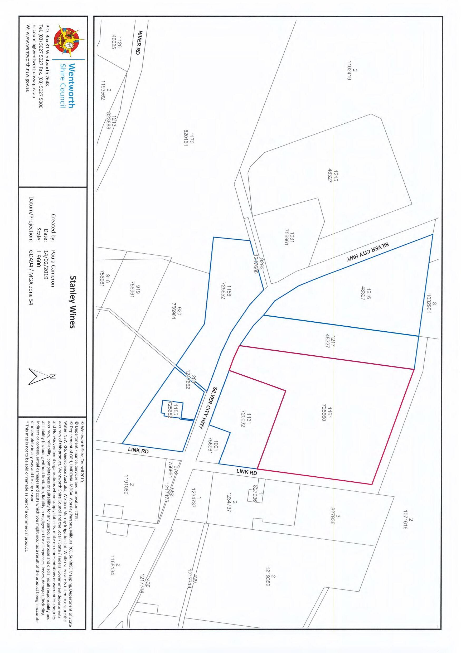
Item 9.12 - Attachment 2 Plans Page 209 X X X
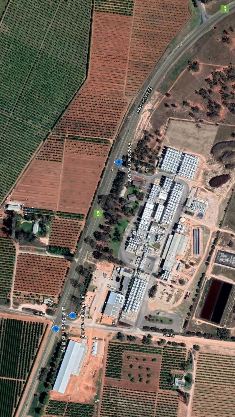
Item 9.12 - Attachment 2 Plans Page 210

INTRODUCTION
Health & Planning Department
26-28 Adelaide Street PO Box 81 WENTWORTH NSW 2648
Tel: 03 5027 5027
council@wentworth.nsw.gov.au
Statement of Environmental Effects
Attachment C to the Development Application made under the Environmental Planning & Assessment Regulation 2000
To assist Council in assessing your development application, in accordance with relevant legislative requirements, it is necessary for you to answer the following questions and provide justification of your responses. These questions relate to common matters that need to be addressed in order to mitigate potential impacts resulting from your development.
Please note: Incomplete or insufficient information may lead to your application be delayed or rejected
PERMISSIBILITY
• Is your proposal permissible in the zone?
• Is your proposal consistent with the zone objectives?
• Is your proposal in accordance with the relevant development control plan?
If you answered “No” to any of the above, you should make an appointment to discuss your proposal with a member of the Health & Planning Division before lodging a development application. Please justify your answers below:
2 proposed signs are an addition to existing signs, 1 additional sign, all signs to aid in traffic management
DESCRIPTION OF DEVELOPMENT
This needs to include where applicable a description of matters such as proposed buildings, proposed building materials, nominated colour scheme, nature of use, staging of the development details of any demolition and other works etc
Roadside signage outlining gate entrances to Duxton Winery, 514 Silver City Highway, Mourquong.
Item 9.12 - Attachment 3 Statement of Environmental Efects and Supporting documents Page 211 Page 1 of 5 Version 4 - January 2021
☐ Yes ☐ No ☐ Yes ☐ No ☐ Yes ☐ No
■
DESCRIPTION OF SITE
Roadside grasses/weeds by agricultural land
1. Describe the site including any physical features of the site such as shape, slope, vegetation, any waterways. Also describe the current use/s on the site.
2. What is the present use and previous uses of the site?
3. Is the development site subject to any of the following natural hazards: (e.g. bushfire prone, salinity, flooding or stormwater inundation etc.)
4. What other constraints exist on the site? (e.g. vegetation, easements, sloping land, drainage lines contamination, etc.)
5. What types of land use and development exist on surrounding land?
Agricultural and Industrial land use
Item 9.12 - Attachment 3 Statement of Environmental Efects and Supporting documents Page 212 Page 2 of 5 Version 4 - January 2021
N/A N/A N/A
CONTEXT AND SETTING
• Will the development be:
o Visually prominent in the surrounding area?
o Inconsistent with the existing streetscape?
o Out of character with the surrounding area?
The signs will be a visual aid to help manage traffic.
o Inconsistent with surrounding land uses?
Please justify your answers below:
PRIVACY, VIEWS AND OVERSHADOWING
• Will the development result in any privacy issues between adjoining properties as a result of the placement of windows, decks, pergolas, private open space, etc.?
• Will the development result in the overshadowing of adjoining properties resulting in an adverse impact on solar access?
• Will the development result in any acoustic issues between adjoining properties as a result of the placement of active use outdoor areas, vehicular movement areas, air conditioners and pumps, bedroom and living room windows, etc.?
• Will the development impact on views enjoyed from adjoining or nearby properties and public places such as parks roads and footpaths?
Please justify your answers below:
N/A
ACCESS, TRAFFIC AND UTILITIES
• Is legal and practical access available to the development?
• Will the development increase local traffic movements / volumes? If yes, by how much?
• Are additional access points to a road network required?
• Has vehicle manoeuvring and onsite parking been addressed in the design?
• Are power, water, sewer and telecommunication services readily available to the site?
Please justify your answers below:
N/A
Item 9.12 - Attachment 3 Statement of Environmental Efects and Supporting documents Page 213 Page 3 of 5 Version 4 - January 2021
☐ Yes ☐ No ☐ Yes ☐ No ☐ Yes ☐ No ☐ Yes ☐ No
☐ Yes ☐ No ☐ Yes ☐ No ☐ Yes ☐ No ☐ Yes ☐ No
☐ Yes ☐ No ☐ Yes ☐ No ☐ Yes ☐ No ☐ Yes ☐ No ☐ Yes ☐ No
■
ENVIRONMENTAL IMPACTS
• Is the development likely to result in any form of air pollution (smoke, dust, odour etc.)?
• Does the development have the potential to result in any form of water pollution (eg. sediment run-off)?
• Will the development have any noise impacts above background noise levels (eg. swimming pool pumps)?
• Does the development involve any significant excavation or filling?
• Could the development cause erosion or sediment run-off (including during the construction period)?
• Is there any likelihood in the development resulting in soil contamination?
• Is the development considered to be environmentally sustainable (including provision of BASIX certificate where required)?
• Is the development situated in a heritage area or likely to have an impact on any heritage item or item of cultural significance?
• Is the development likely to disturb any aboriginal artefacts or relics?
Please justify your answers below:
FLORA AND FAUNA IMPACTS
• Will the development result in the removal of any native vegetation from the site?
• Is the development likely to have any impact on threatened species or native habitat?
For further information on threatened species, visit www.threatenedspecies.environment.nsw.gov.au
Please justify your answers below:
Item 9.12 - Attachment 3 Statement of Environmental Efects and Supporting documents Page 214 Page 4 of 5 Version 4 - January 2021
☐ Yes ☐ No ☐ Yes ☐ No ☐ Yes ☐ No ☐ Yes ☐ No ☐ Yes ☐ No ☐ Yes ☐ No ☐ Yes ☐ No ☐ Yes ☐ No ☐ Yes ☐ No
☐ Yes ☐ No ☐ Yes ☐ No
N/A No
Impact
WASTE AND STORMWATER DISPOSAL
• How will effluent be disposed of?
To Sewer
Onsite
• How will stormwater (from roof and hard standing) be disposed of:
Council Drainage System
Other (please provide details)
• Will liquid trade waste be discharged to Council’s sewer?
• Will the development result in any hazardous waste or other waste disposal issue?
• Does the development propose to have rainwater tanks?
• Have all potential overland stormwater risks been considered in the design of the development?
Please justify your answers below:
SOCIAL AND ECONOMIC IMPACTS
• Will the proposal have any economic or social consequences in the area?
• Has the development addressed any safety, security or crime prevention issues?
Proposed signs with have Duxton Winery Branding
Please justify your answers below:
CONCLUSION
Cumulative effects of all factors.
Roadside signage outlining gate entrances to Duxton Winery, 514 Silver City Highway, Mourquong
Minimal impact to surrounding area.
Proposed signs to aid in traffic management and prevent confusion.
Item 9.12 - Attachment 3 Statement of Environmental Efects and Supporting documents Page 215 Page 5 of 5 Version 4 - January 2021
☐
☐
☐
☐
☐ Yes ☐ No ☐ Yes ☐ No ☐ Yes ☐ No ☐ Yes ☐ No
☐ Yes ☐ No ☐ Yes ☐ No
N/A
State Environmental Planning Policy No 64 Advertising and Signage (2001 EPI 199)
1 Character of the area
• Is the proposal compatible with the existing or desired future character of the area or locality in which it is proposed to be located?
Area is industrial/agricultural land use, signs will aid with traffic management of the area.
• Is the proposal consistent with a particular theme for outdoor advertising in the area or locality?
Sign will carry recognised site logo, though main purpose is to assist drivers navigate road area. There are few branded signs in area
2 Special areas
• Does the proposal detract from the amenity or visual quality of any environmentally sensitive areas, heritage areas, natural or other conservation areas, open space areas, waterways, rural landscapes or residential areas?
No, 2 of the three proposed signs to be fixed on existing sign posting, 3rd to maintain similar dimensions and character.
3 Views and vistas
• Does the proposal obscure or compromise important views? No
• Does the proposal dominate the skyline and reduce the quality of vistas?
No
• Does the proposal respect the viewing rights of other advertisers?
Yes , proposed sign will fix to same posted sign an ORANGE WORLD, which will remain in prominent position.
4 Streetscape, setting or landscape
• Is the scale, proportion and form of the proposal appropriate for the streetscape, setting or landscape?
Yes, aligns with current signage
• Does the proposal contribute to the visual interest of the streetscape, setting or landscape?
Sign should not distract other drivers, and serves only to aid in directing traffic to appropriate entrance
• Does the proposal reduce clutter by rationalising and simplifying existing advertising?
Sign is low profile, and will not clutter area
• Does the proposal screen unsightliness?
Sign is low profile and concise
• Does the proposal protrude above buildings, structures or tree canopies in the area or locality?
No
• Does the proposal require ongoing vegetation management?
No
Item 9.12 - Attachment 3 Statement of Environmental Efects and Supporting documents Page 216
5 Site and building
• Is the proposal compatible with the scale, proportion and other characteristics of the site or building, or both, on which the proposed signage is to be located?
Roadside signage , in line with existing dimensions
• Does the proposal respect important features of the site or building, or both?
Roadside signage, not fixed to building
• Does the proposal show innovation and imagination in its relationship to the site or building, or both?
N/A
6 Associated devices and logos with advertisements and advertising structures
• Have any safety devices, platforms, lighting devices or logos been designed as an integral part of the signage or structure on which it is to be displayed?
Existing logos to be applied, in reflective print
7 Illumination
• Would illumination result in unacceptable glare?
No fixed lights planned, reflective signage only
• Would illumination affect safety for pedestrians, vehicles or aircraft? No
• Would illumination detract from the amenity of any residence or other form of accommodation? No
• Can the intensity of the illumination be adjusted, if necessary? No illumination
• Is the illumination subject to a curfew? No illumination
8 Safety
• Would the proposal reduce the safety for any public road?
Propos ed will increase road safety
• Would the proposal reduce the safety for pedestrians or bicyclists? Proposed signs will no affect pedestrians or bicyclists
• Would the proposal reduce the safety for pedestrians, particularly children, by obscuring sightlines from public areas? No
Item 9.12 - Attachment 3 Statement of Environmental Efects and Supporting documents Page 217

File Reference:
Health & Planning Department
26-28 Adelaide Street PO Box 81
WENTWORTH NSW 2648
Tel: 03 5027 5027 council@wentworth.nsw.gov.au
DA Assessment Report
Section 4.15 Evaluation
Environmental Planning & Assessment Act 1979 as amended
DA2022/167 – PAN-153688
Property Title & Address: Road reserve adjacent to Lot 1131 DP 720092
Applicant(s): Duxton Vineyards (Brodie Lawn)
Proposal: Three road signs
Previous DAs: n/a
Cost of proposed development: $600.00
SITE AND SURROUNDING DEVELOPMENT
The subject site is the rad reserve of Silver City Highway located in Mourquong NSW. The land adjustment to the road reserve is used for industrial and agricultural activities.
The subject site is zoned SP2 Infrastructure under the Wentworth Local Environmental Plan 2011 (WLEP 2011). The site does not contain a heritage item or is located within the heritage conservation area. Part of the road reserve is in bushfire mapped areas. It is not located within flood affected mapped area.
DESCRIPTION OF PROPOSAL
The proposal seeks development consent for 3 road signs. The signs will be:
1. Link road Buronga Bound: Attached to existing road sign. 1.65m x 0.8m face. 1.5m to 2m elevation
2. Link road Dareton bound: Attached to existing road sign. 1.65m x 0.8m face. Raising sign by 500mm. 1.5m to 2m elevation
3. Duxton gate: new double sided. 1.65m x 1m face. 1.5m elevation
HISTORY RELEVANT TO THE DEVELOPMENT APPLICATION
n/a
ROADS ACT 1993
The application was referred to Transport for NSW under section 138 as the signs will be located within the road reserve of a classified road. It was sent as referral instead of concurrence due to section 4.46(3) of the EP&A Act.
Transport for NSW rejected the DA in its current form. Changes were made to the proposal by removing it from the existing road signs, and making them stand alone signs. TfNSW did not support the development application as they do not support private roadside signage for directional or wayfinding purposes within the classified road corridor.
SECTION 4.15-MATTERS
FOR CONSIDERATION
Item 9.12 - Attachment 4 4.15 Assessment Report Page 218
(1) The provisions of any environmental planning instrument and development control plan
State Environmental Planning Policy (Infrastructure) 2007 (now repealed)
The proposed signs will be located within the classified road of Silver City Highway in proximity to electricity infrastructure. Based on the proximity of the electricity infrastructure, the application was referred to Essential energy under clause 45.
Essentia energy raised potential safety risks if did not comply with provided setbacks from the electricity infrastructure.
State Environmental Planning Policy (Koala Habitat) 2020 (now repealed)
The proposed development is located in the road reserve No veg clearing proposed. SEPP not applicable for this application.
State Environmental Planning Policy No 64 Advertising and Signage (now repealed)
As part of the application, an assessment against schedule 1 of the SEPP was provided by the applicant.
Murray Regional Environmental Plan No 2—Riverine Land (now repealed)
No assessment against the MREP due to the distance of the proposed development from the river.
Wentworth Local Environmental Plan (LEP) 2011
The proposed signs are Permitted with consent under the SP2 zoned land as signage are ancillary to road reserve usage.
Based on feedback from Transport for NSW, the proposed signage location in the classified road reserve does not satisfactorily meet the SP2 zone objectives.
Zone Objective
Comment
To provide for infrastructure and related uses. Is related to road use, but not appropriate in a classified road
To prevent development that is not compatible with or that may detract from the provision of infrastructure.
The signs are not compatible with the provision of road way infrastructure as they are not public signs but private use signs.
7.1 Earthworks
Any earthworks will form part of this approval and will be ancillary to the main approval for the signs. However, standards will still need to be followed during any earthworks.
Wentworth Development Control Plan (DCP) 2011
The proposed development is acceptable against Chapter 3 provisions of the Wentworth Development Control Plan (DCP) 2011 as shown below.
Item 9.12 - Attachment 4 4.15 Assessment Report Page 219
(2) The provisions of any draft environmental planning instrument
There is no Division 3.4 draft environmental planning instrument that affect the proposed development. (Post 1 July 2009 LEP amendments).
(3) Any matters prescribed by regulations
There are no further matters prescribed by regulations relevant to the proposed development.
(4) The likely impacts of the development
There are no likely impacts from the proposal as discussed in the table below.
Impact item
(insert an ‘x’ in the relevant section)
Context and setting X
The roadway has existing public road signs. The proposed signs are for private use as such are not supported by TfNSW.
Public domain & Streetscape X Proposed signs located within the road reserve. Private signs inappropriate in a classified road
Landscaping X n/a
Stormwater X n/a
Heritage X n/a
Soils & Soils Erosion X
Air and microclimate X
Water Resources X
None expected from the proposed development, as standards will need to be followed during construction.
Proposed development not anticipated to affect the air or microclimate.
None located on land, and none expected to be impacted by proposed development. Enough distance between development and waterway
Biodiversity (Flora & Fauna) X No native vegetation to be cleared for the development
Land Resources X None located on the site expected to impact the proposed development.
Utilities X n/a
Access & Parking X
Access available as development in the road reserve. No parking
Roads & Traffic X No new road proposed, traffic will not be impacted by proposal
Solar Access and Energy Efficiency X n/a
Overshadowing X Not relevant.
Item 9.12 - Attachment 4 4.15 Assessment Report Page 220
Acceptable Not acceptable Not relevant
Comment
Privacy & Overlooking X Not relevant.
Flooding X Not on flood affected land
Bushfire Prone Area X Not in bushfire prone area
Noise X Possible significant noise only expected during construction,
Technological hazards X None anticipated from the development,
Safety, Security & Crime Prevention X Development will not affect the safety of the area.
Social and Economic Impacts X No negative social and economic impacts anticipated from the proposed development.
(5) The suitability of the site for development
The site is not suitable for the development as it is a private signage within a classified road reserve. Only public signage are supported and concurrence will not be provided by TfNSW for private signages.
The proposed development is permitted by the SP2 Infrastructure zoning of the area under the Wentworth LEP 2011. The character and use of the proposed signs is not consistent with existing signs as it is for private usage.
(6) Any submissions made in accordance with this Act or Regulation
The application was notified for 14 days as per the Wentworth Community Participation Plan. No submissions were received.
(7) The public interest
The proposed development is consistent with public interest as it will have no detrimental effect on the surrounding area. Moreover, no objections were made by the surrounding neighbours.
COMMENTS FROM COUNCIL INTERNAL DEPARTMENTS
COMMENTS FROM EXTERNAL REFERRALS
Transport for NSW: Does not support the application. Will not provide concurrence.
Item 9.12 - Attachment 4 4.15 Assessment Report Page 221
Department Referred Y/N Comments Building N Subdivision Engineer N Roads & Engineering N Finance & Policy N Heritage Advisor N Environmental Health N Local Laws N Floodplain Mgt Committee N Sustainable Infrastructure N
Essential energy: Raised potential safety concerns.
CONCLUSIONS
1. General comments:
2. The proposal satisfies the points for consideration listed under Section 4.15 of the Environmental Planning and Assessment Act.
3. The proposal occurs on land zoned SP2 Infrastructure. The proposal is not considered to have detrimental impact on the site and surrounds.
4. The proposal is consistent with the Wentworth Shire Development Control Plan (Dec 2011). The proposal is consistent with the development controls in Chapter 3 of the Wentworth Shire Development Control Plan (Dec 2011).
5. The proposal does not comply with Roads Act, as TfNSW will not provide concurrence for the development.
6. There is no draft local environmental plan affecting the proposed development.
RECOMMENDATION:
Refuse the development application for the following reasons:
- The signs cannot be constructed within the road reserve as TfNSW refused to issue concurrence for the works
- The development is inconsistent with the relevant objectives of the SP2 Zone,
- The development has potential safety issues in terms of electricity infrastructure
Delegate report author
Signature:

George Kenende
Strategic Development Officer
Date: 31/11/2023
Delegated approval and endorsement
Signature:
Date:
Item 9.12 - Attachment 4 4.15 Assessment Report Page 222
9.13 WENTWORTH LOCAL ENVIRONMENTAL PLAN 2011 – PLANNING PROPOSAL
TO REZONE FROM RU5 TO E4 WITH 1000 SQM MINIMUM LOT SIZE LOT 94 & 95 DP 756946
File Number: RPT/23/777
Responsible Officer: Matthew Carlin - Director Health and Planning
Responsible Division: Health and Planning
Reporting Officer: George Kenende - Strategic Planning Officer
Objective: 4.0 Wentworth Shire is supported by strong and ethical civic leadership with all activities conducted in an open, transparent and inclusive manner
Strategy: 4.1 Consistently engage and consult the whole community to ensure that feedback is captured and considered as part of decision-making and advocating processes
Summary
Wentworth Shire Council has received a Planning Proposal from Cadell Consulting Services on behalf of MH2 Engineering & Architectural Services and the land owner.
The Planning Proposal seeks to amend the Wentworth Local Environmental Plan 2011 (WLEP) for part of Lot 94 & 95 DP756946 (subject site) by rezoning it from RU5 Village to E4 General Industrial and a new Minimum Lot Size (MLS ) of 1000 square metres.
Recommendation
That Council resolves to:
a) Submit the Planning Proposal to the Minister for the Department of Planning and Environment for consideration of a Gateway Determination to amend the Wentworth Local Environmental Plan 2011 in accordance with Section 3.34 of the Environmental Planning and Assessment Action 1979.
b) Call a division in accordance with S375A of the Local Government Act 1993 (NSW).
Detailed Report
Purpose
The purpose of this report is to provide Council with the information required to make an informed decision with regard to the Planning Proposal, based on the content of the planning proposal submitted by Cadell Consulting Services (the proponent) and the Planning Proposal Assessment (the assessment) undertaken by the Health and Planning Division.
Background
The BGGSP was undertaken by Council’s Health and Planning Department and formerly endorsed by the Department of Planning (DPE). Consultation with the following agencies was conducted as part of drafting the BGGSP:
- Department of Planning and Environment
- Department of Planning and Environment (Crown lands)
- Department of Planning and Environment (Biodiversity and Conservation Division)
- Transport for NSW
- Environmental Protection Agency (EPA)
Ordinary Meeting AGENDA 13 December 2023 Page 223
The response received from the agencies was mainly positive with concerns raised regarding the proposed land for rezoning to industrial. The concerns were mainly in regard to cultural heritage and biodiversity. The purpose of preparing the BGGSP was to guide the future development of the Buronga & Gol Gol growth areas. The BGGSP identified the necessity to provide more industrial lands in line with demand. This provided justification and recommendations for amendments to the WLEP2011.
The subject site is located within the Buronga Industrial Estate on Corbett Avenue, 310m from the Silver City Highway and Corbett Avenue intersection. The subject land encompasses approximately 4 hectares in total area. The site falls under the RU5 Village zone with no minimum lot size (MLS). The subject site is being used for horticulture cropping and rural residential with associated outbuildings.
The overall properties are separated by a crown parcel with a width of approximately 11m. The south of the crown land is all zoned RU5 Village, while the north has a portion zoned RU5 and another zoned E4. The RU5 zoned portion of land to the north of the crown land is the land identified as the subject site.
The northern end of the site is in the Buronga Industrial Estate, while the southern end of the subject site is located adjacent to existing and proposed residential development. To the north and northwest is land containing industrial development, while to the south, is existing residential development and new proposed residential development on the south western boundary. The land on the eastern boundary is currently being used for horticultural purposes.
Based on an overall view of the surrounding area in terms of industrial land connectivity, appropriate servicing and minimal land use conflict, the subject site identified within the planning proposal is the most appropriate location for short-term provision of industrial land.
Refer to Attachment 1 Planning Proposal
Matters under consideration
This Planning Proposal has been prepared to enact upon the recommendations made in the BGGSP and any non-compliance with the structure plan staging and mapping is addressed within the planning proposal and assessment report (attachment 1 and 2).
Early consultation with the Department of Planning and Environment has been undertaken to gauge the agencies support or concerns for the proposed amendments to the Wentworth Local Environmental Plan 2011. The response received from the agency regarding the proposed amendments to the Wentworth Local Environmental Plan 2011 identified some amendments to the planning proposal which have been addressed by the applicant.
A detailed assessment of the planning proposal has been undertaken to determine if the proposed rezoning with new MLS is justified in seeking the support from Council to submit to the Department of Planning for consideration of a Gateway Determination.
Refer to Attachment 2 – Planning Proposal Assessment
The Assessment Report concludes that the planning proposal as submitted, with no amendments, satisfactorily addresses the requirements of the Guide to Preparing Planning Proposals, Ministerial Directions and applicable State Environmental Planning Policies.
The rezoning with new MLS will not negatively impact the surrounding uses as it will create complimentary land uses with reduction risk of land use conflict between residential and industrial uses. The addition of more industrial lands is inline with Councils objectives within the Buronga Structure Plan 2020 and other relevant local and state strategies and plans.
Options
Based on the information contained in this report, the options available to address this matter are to:
1. Submit the Planning Proposal to the Minister for the Department of Planning and Environment for consideration of a Gateway Determination,
Ordinary Meeting AGENDA 13 December 2023 Page 224
Or
2. Refuse to support the Planning Proposal. Legal, strategic, financial or policy implications
The endorsement of the attached Planning Proposal will allow it to be submitted to the Minister for Planning and Public Spaces for consideration of a Gateway Determination in accordance with the Environmental Planning and Assessment Act 1979. The endorsement will provide Council with the opportunity to progress the implementation of the recommendations made in the BGGSP which will provide for a range of industrial developments providing social and economic benefits to the community.
Conclusion
The Planning Proposal prepared by Cadell Consulting Services requests Council’s support for the rezoning of RU5 Village zone to E4 General Industrial with a new Minimum Lot Size of 1000 square metres.
The assessment of the Planning Proposal determines that the proposal is justifiably supportable and adequately responds to the requirements of the Guide to Preparing Planning Proposals, Ministerial Directions and applicable State Environmental Planning Policies.
Attachments
1. Planning proposal⇩
2. Planning proposal assessment report⇩
Ordinary Meeting AGENDA 13 December 2023 Page 225

PLANNING PROPOSAL
REZONE LAND FROM RU5 VILLAGE TO E4
GENERAL INDUSTRIAL & AMEND MINIMUM LOT SIZE
48 CORBETT AVENUE, BURONGA
105 CORBETT AVENUE, BURONGA
Item 9.13 - Attachment 1 Planning proposal Page 226
MicheleBos
CadellConsultingServices
0429021494
POBox26,WentworthNSW2648
michele@cadellconsulting.com.au
www.cadellconsulting.com.au

Document Control
This document has been prepared by Cadell Consulting Services for the exclusive use of the person/organisation for which it has been prepared. This document may not be reproduced, copied, electronically stored or transmitted without obtaining the written permission of Cadell Consulting Services.
Version Date Author Approved
Pre-lodgement July 2023
Lodgement November 2023
Michele Bos Cadell Consulting Services
Michele Bos Cadell Consulting Services
Item 9.13 - Attachment 1 Planning proposal Page 227 2 Cadell Consulting Services Planning Proposal – 48 & 105 Corbett Avenue, Buronga
Is the
3.3.2 Is the Planning Proposal the best means of achieving the objectives or intended outcomes, or is there a better way? 20
3.3.3 Will the Planning Proposal give effect to the objectives and actions of the applicable regional, or district plan or strategy (including any exhibited draft plans or strategies)? ...........20
3.3.4 Is the Planning Proposal consistent with a Council Local Strategic Planning Statement that has been endorsed by the Planning Secretary or Greater Sydney Commission, or another strategy or strategic plan? ............................................................................................................21
3.3.5 Is the Planning Proposal consistent with any other applicable State and regional studies or strategies?.....................................................................................................................................24
3.3.6 Is the Planning Proposal consistent with applicable State Environmental Planning Policies (SEPPs)? 24
3.3.7. Is the Planning Proposal consistent with applicable Ministerial Directions (Section 9.1 Directions)? 24
3.3.8 Is there any likelihood that critical habitat or threatened species, populations or ecological communities, or their habitats, will be adversely affected as a result of the proposal? 24
4.3.9 Are there any other likely environmental effects as a result of the planning proposal and how are they proposed to be managed?...............................................................................25
3.3.10 Has the Planning Proposal adequately addressed any social and economic effects?.......25
3.3.11 Is there adequate public infrastructure for the planning proposal? 25
3.3.12 What are the views of State and Commonwealth public authorities consulted in accordance with the Gateway Determination? 25
Item 9.13 - Attachment 1 Planning proposal Page 228 3 Cadell Consulting Services Planning Proposal – 48 & 105 Corbett Avenue, Buronga Contents 1. Introduction 5 1.1 Overview .......................................................................................................................................5 1.2 Format of the Planning Proposal 5 1.3 Supporting Documentation 5 1.4 Concurrent Development Application and Planning Proposal ...............................................5 2. Site & Locality Details 6 2.1 Site Location 6 2.2 Site Description.............................................................................................................................6 2.3 Surrounding Development 11 3. Planning Proposal 13 3.1 Objectives or Intended Outcomes..............................................................................................13 3.2 Explanation of Provisions 13 3.3 Justification 16
Planning Proposal
of
endorsed local strategic planning
study
16
3.3.1
a result
an
statement, strategic
or report?
Attachment 1 – Subdivision and Staging Concept Plan
Attachment 2 – State Environmental Planning Policy Assessment
Attachment 3 – Section 9.1 Ministerial Directions Assessment
Attachment 4 – (Separate) Preliminary Site Inspection
Item 9.13 - Attachment 1 Planning proposal Page 229 4 Cadell Consulting Services Planning Proposal – 48 & 105 Corbett Avenue, Buronga 3.4 Mapping......................................................................................................................................25 3.5 Community Consultation 25 3.6 Project Timeline 26 Table 1 Attachments to Planning Proposal 5 Table 2 Lot Identifier & Addresses 6 Table 3 WLEP Maps to be amended 13 Table 4 BGGSP Industrial Land..............................................................................................................17 Table 5 Development Approvals in Buronga Industrial Estate .............................................................17 Table 6 Planning Proposal Timeframe 26 Figure 1 Locality Map (Source: Google maps) 6 Figure 2 Overall Site Aerial Map (Source: Nearmap) 7 Figure 3 Lot 94 DP756946 Zone Map (Source: NSW Spatial viewer) 8 Figure 4 Lot 95 DP756946 Zone Map (Source: NSW Spatial viewer) 9 Figure 5 Area to be rezoned (Source Nearmap) ...................................................................................10 Figure 6 Crown Land Map (Source: Intramaps) 11 Figure 7 Surrounding Land Use Map (Source: Nearmap) 12 Figure 8 Current zone 14 Figure 9 Proposed zone 14 Figure 10 Current MLS 15 Figure 11 Proposed MLS .......................................................................................................................15 Figure 12 Buronga Gol Gol Structure Plan Future Land Use Zones (Source: BGGSP Figure 4.1)..........16 Figure 13 Buronga Gol Gol Structure Plan Urban Land Release Staging Plan (Source: BGGSP Figure 4.4) 19 Figure 14 Buronga and Gol Gol Settlement Boundary (Source: LSPS Map 5) 22
1. Introduction
1.1 Overview
This Planning Proposal has been prepared by Cadell Consulting Services on behalf of MH2 Engineering & Architectural Services and the proponent.
The Proposal seeks to amend the Wentworth Local Environmental Plan 2011 (WLEP) by rezoning part of 2 allotments from RU5 Village to E4 General Industrial zone and applying the minimum lot size of 1,000 m2 to the rezoned area. The proposed rezoning area encompasses 4 hectares.
This Planning Proposal has been prepared in accordance with Section 3.33 of the Environmental Planning and Assessment Act 1979 (EP&A Act), together with satisfying the requirements of the NSW Department of Planning, Industry and Environment Local Environmental Plan Making Guideline August 2023 (DPIE Guideline).
The Planning Proposal is categorised as a ‘Standard’ application, as it proposes to rezone part of two allotments consistently with the proposed zone objectives and applicable minimum lot size
1.2 Format of the Planning Proposal
This Planning Proposal has been structured as follows:
• Section 1 introduces the Planning Proposal and supporting documentation
• Section 2 provides a description of the subject site, its locality and the surrounding land uses
• Section 3 contains the Planning Proposal prepared in accordance with the DPIE Guideline
1.3 Supporting Documentation
The following documentation and plans have been prepared to support this Planning Proposal. These attachments are identified in Table 1 below:
Table 1 Attachments to Planning Proposal
Attachment Name Prepared by
1. Proposed Subdivision Plan MH2 Engineering & Architectural Services Pty Ltd
2. Consistency with State Environmental Planning Policies Cadell Consulting Services
3. Consistency with Section 9.1 Ministerial Directions Cadell Consulting Services
4. Preliminary Site Inspection (Separate) Green Edge Environmental Pty Ltd
1.4 Concurrent Development Application and Planning Proposal
The proponent is considering lodgement of a concurrent Development Application with the Planning Proposal, in accordance with Part 3 Division 3.5 of the Environmental Planning and Assessment Act 1979
The purpose of the concurrent application would be to streamline the amendment and development approval process by reducing the overall process timeframe. This will enable the proponent to undertake works to develop the site and to ensure that there will be an ongoing supply of industrial land ready for purchase and development.
Lodgement of the Development Application will occur following the issue of a Gateway Determination to proceed by the Department of Planning & Environment.
Consulting Services Planning Proposal – 48 & 105 Corbett Avenue, Buronga
Item 9.13 - Attachment 1 Planning proposal Page 230 5
Cadell
2. Site & Locality Details
2.1 Site Location
The site is located in Buronga in south western New South Wales.
Buronga is situated approximately 3 kilometres from the central business district of the regional city of Mildura, in north western Victoria.
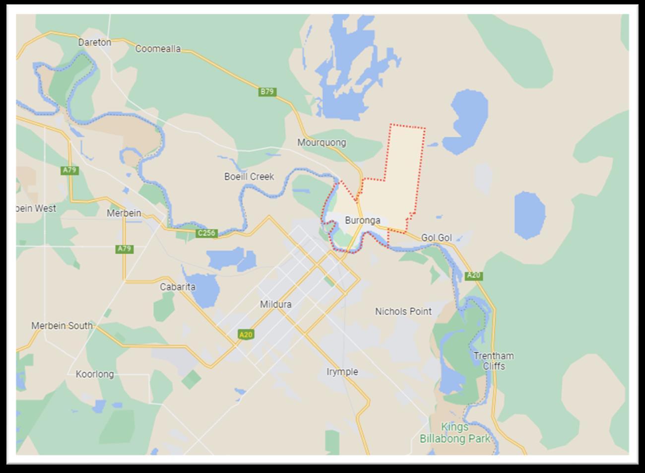
2.2 Site Description
The site is located within the Buronga Industrial Estate.
The northern boundary of the 2 allotments, being approximately 440 metres, has direct access to Corbett Avenue.
The site encompasses 2 allotments, with a total area of approximately 22.7 hectares
The list of allotments and addresses are provided below in Table 2:
Table 2 Lot Identifier & Addresses
Consulting Services Planning Proposal – 48 & 105 Corbett Avenue, Buronga
Item 9.13 - Attachment 1 Planning proposal Page 231 6
Cadell
Figure 1 Locality Map (Source: Google maps)
Lot Identifier Address Area Lot 94 DP756946 48 Corbett Avenue 11.62 hectares Lot 95 DP756946 105 Corbett Avenue 11.08 hectares
The majority of the overall site is under horticulture crop.
There are 2 dwellings and associated agricultural sheds on the overall site.
Other than the existing horticultural crops, the vegetation on the site includes some planted native species on the south western boundary and around the buildings, with the balance of vegetation being ornamental and introduced species.
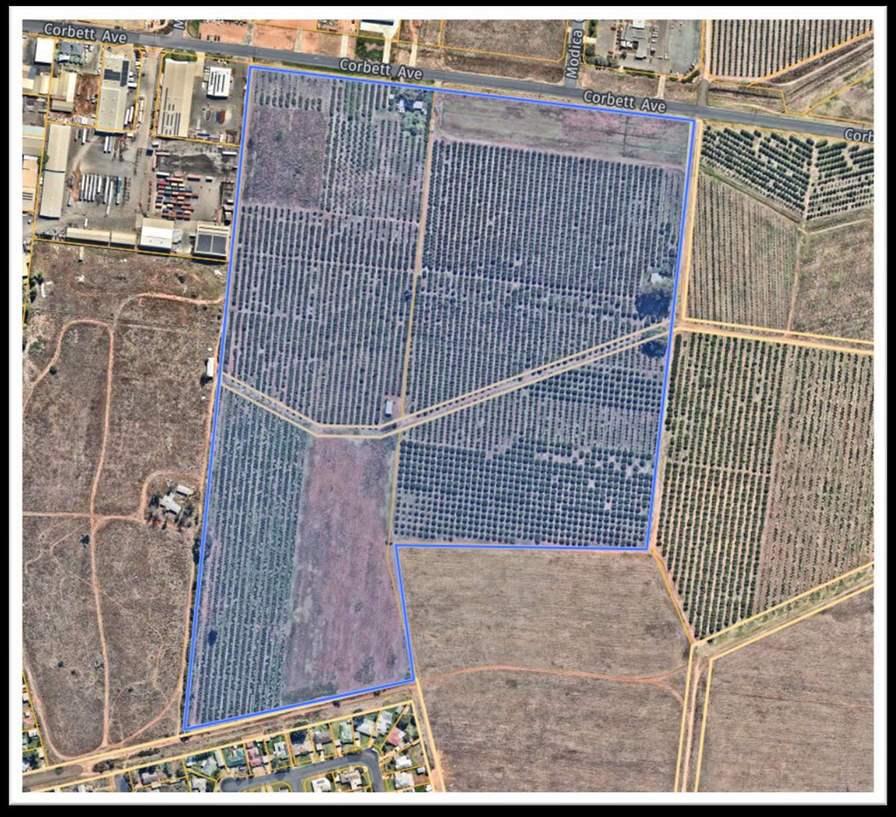
The overall site has split zones. These being E4 General Industrial zone with a minimum lot size of 1,000 square metres and RU5 Village zone with no minimum lot size applied. Refer to the figures below.
Item 9.13 - Attachment 1 Planning proposal Page 232 7
Cadell Consulting Services Planning Proposal – 48 & 105 Corbett Avenue, Buronga
Figure 2 Overall Site Aerial Map (Source: Nearmap)
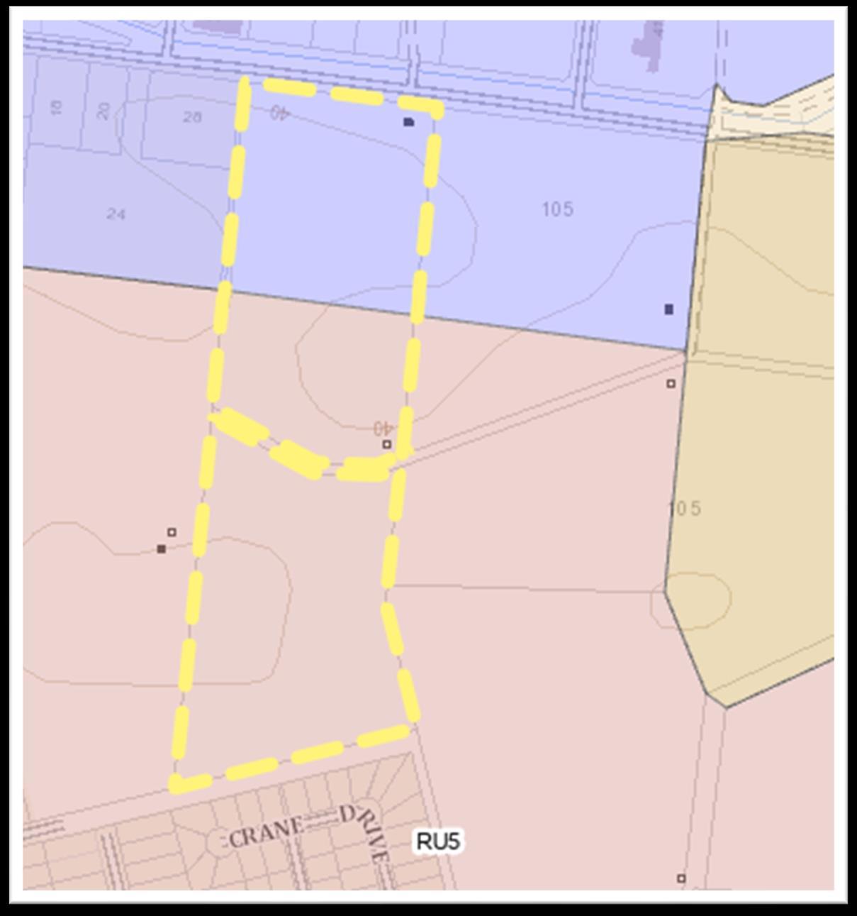
Item 9.13 - Attachment 1 Planning proposal Page 233 8
Cadell Consulting Services Planning Proposal – 48 & 105 Corbett Avenue, Buronga
Figure 3 Lot 94 DP756946 Zone Map (Source: NSW Spatial viewer)
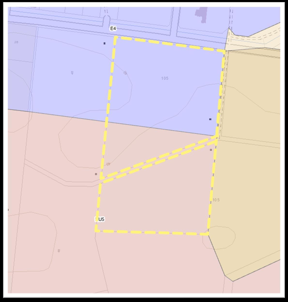
The area of the overall site of which is proposed to be rezoned is shown below in Figure 5. The Planning Proposal will refer to the area to be rezoned as the subject site.
Consulting Services Planning Proposal – 48 & 105
Item 9.13 - Attachment 1 Planning proposal Page 234 9
Cadell
Corbett Avenue, Buronga
Figure 4 Lot 95 DP756946 Zone Map (Source: NSW Spatial viewer)
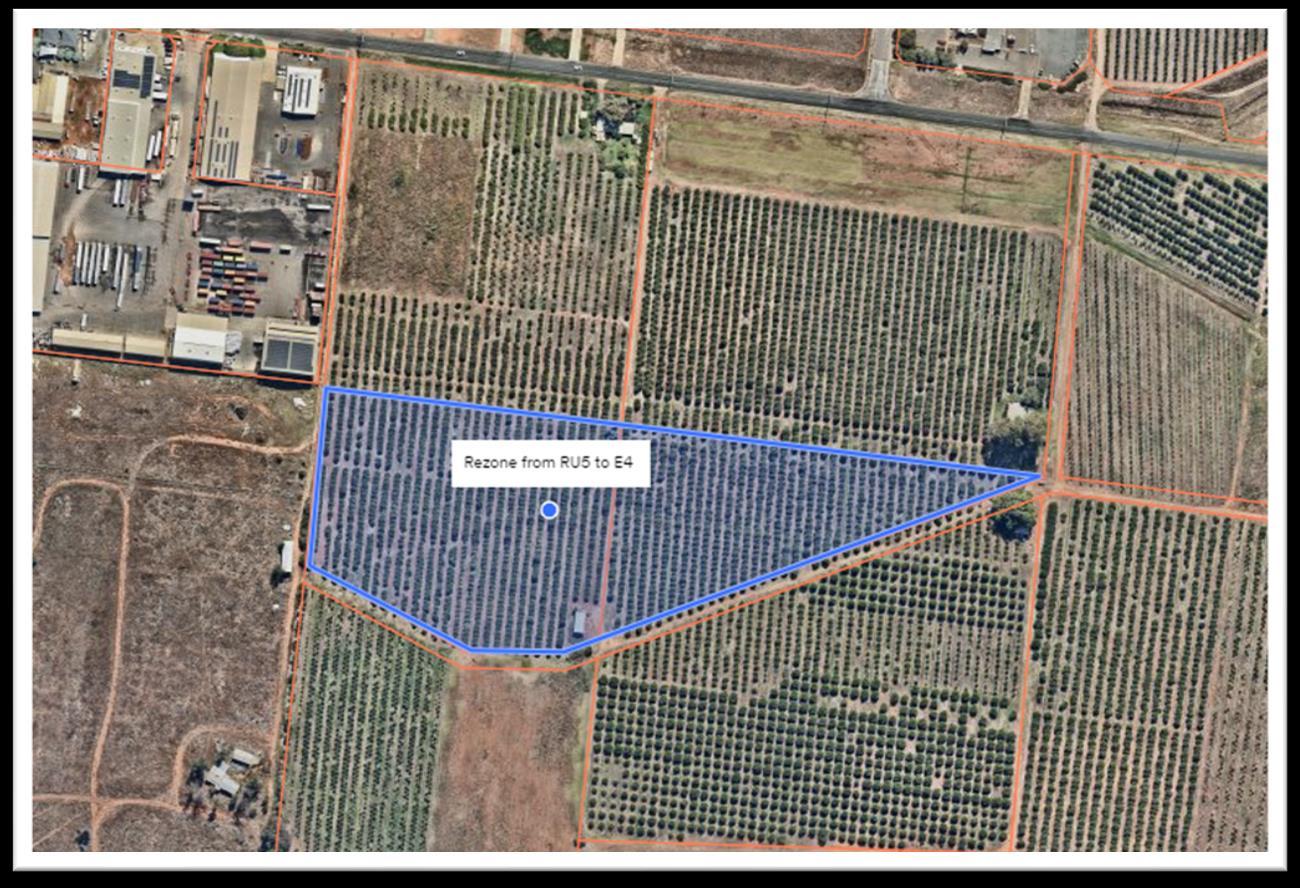
There is an existing shed and horticulture crop on the subject site. The southern boundary of the subject site is bordered by Crown Land, which was once used as an open channel system for irrigation purposes. Refer to the Figure 6 below.
Item 9.13 - Attachment 1 Planning proposal Page 235 10
Cadell Consulting Services Planning Proposal – 48 & 105 Corbett Avenue, Buronga
Figure 5 Area to be rezoned (Source Nearmap)
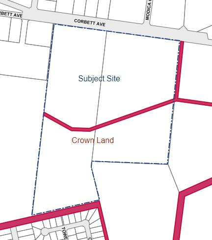
The crown land portion encompasses approximately 0.48 hectares.
The northern boundary of the crown owned land is proposed to be the southern boundary of the E4 General Industrial zone. The crown land parcel and the land to the south will remain as RU5 Village zone.
The subject site is not affected by bushfire prone land mapping or flooding.
2.3 Surrounding Development
The northern end of the site is located in the Buronga Industrial Estate, while the southern end of the subject site is located adjacent to existing and proposed residential development.
To the north and north west is land containing industrial development, while to the south, is existing residential development and new proposed residential development on the south western boundary.
The land on the eastern boundary is currently being used for horticultural purposes.
Consulting Services Planning Proposal – 48 & 105 Corbett Avenue, Buronga
Item 9.13 - Attachment 1 Planning proposal Page 236 11
Cadell
Figure 6 Crown Land Map (Source: Intramaps)
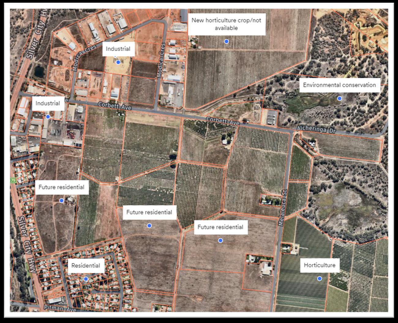
Item 9.13 - Attachment 1 Planning proposal Page 237 12
Cadell Consulting Services Planning Proposal – 48 & 105 Corbett Avenue, Buronga
Figure 7 Surrounding Land Use Map (Source: Nearmap)
3.
3.1
Planning Proposal
Objectives or Intended Outcomes
The objectives of this Planning Proposal are to amend the Wentworth Local Environmental Plan 2011 by:
- rezoning the subject site (approximately 4 hectares) from RU5 Village to E4 General Industrial zone
- applying the minimum lot size of 1,000 square metres to the proposed E4 General Industrial zoned area
The intended outcomes of the Planning Proposal are to:
- enable the provision of additional industrial land, and
- take advantage of the increase in demand for general industrial zoned land by expanding the existing industrial precinct and,
- provide an alternative and more suitable location to expand the industrial zone, other than the recommended location in the Buronga Gol Gol Structure Plan 2020, and
- provide a larger variety of lot sizes to accommodate various types of industrial development, and
- utilise the crown land parcel as a border and partial buffer zone between the industrial and residential development.
The above intended outcomes will be achieved by the proposed rezoning of the current, undeveloped RU5 Village zoned land area to E4 General Industrial zone. The total area proposed to be rezoned is approximately 4 hectares.
A subdivision concept plan is provided in Attachment 1.
3.2 Explanation of Provisions
To achieve the objectives and intended outcomes of the Planning Proposal, the table below outlines the map amendments required to the Wentworth LEP 2011:
Table 3 WLEP Maps to be amended
Consulting Services Planning Proposal – 48 & 105 Corbett Avenue, Buronga
Item 9.13 - Attachment 1 Planning proposal Page 238 13
Cadell
Lot
Map Sheet LZN_004F Sheet LSZ_004F
Land Zoning Map
Size
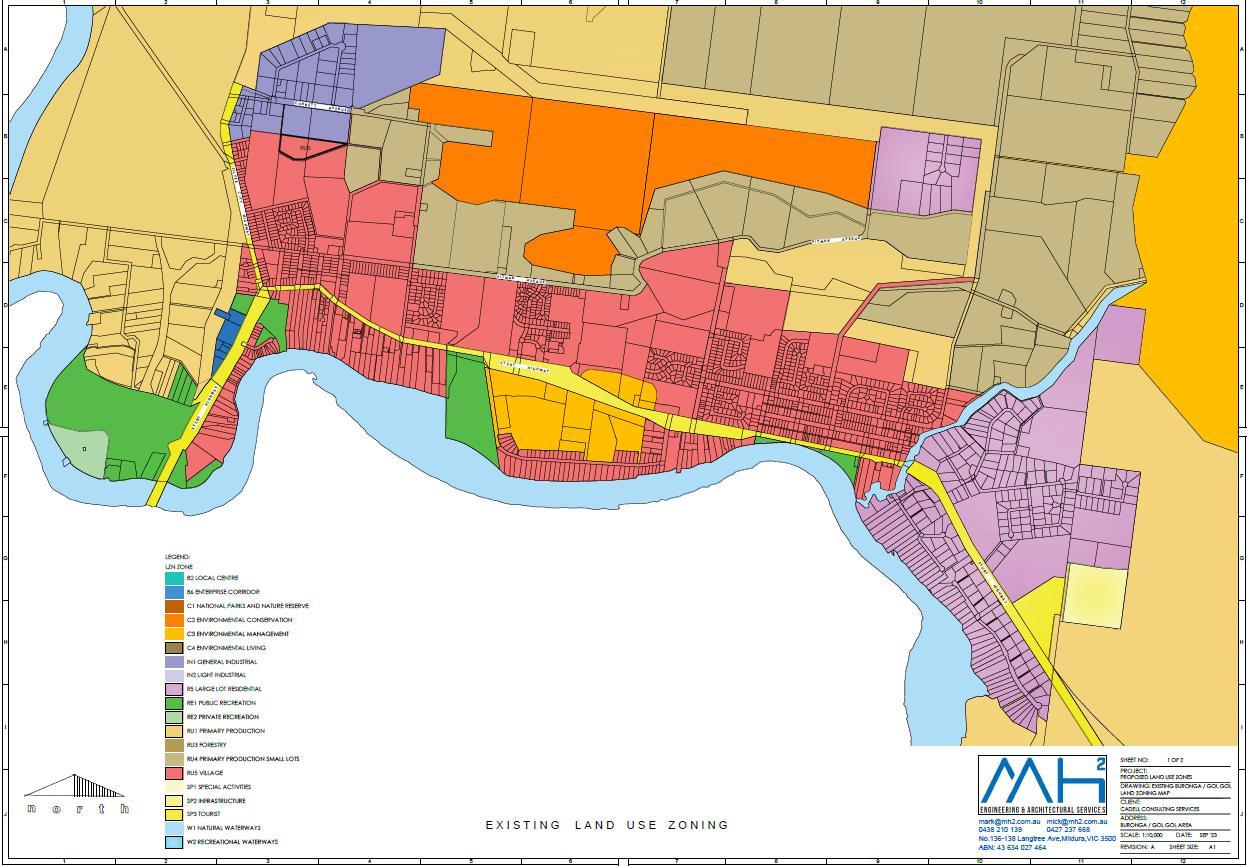

Item 9.13 - Attachment 1 Planning proposal Page 239 14
Cadell Consulting Services Planning Proposal – 48 & 105 Corbett Avenue, Buronga
Figure 8 Current zone
Figure 9 Proposed zone
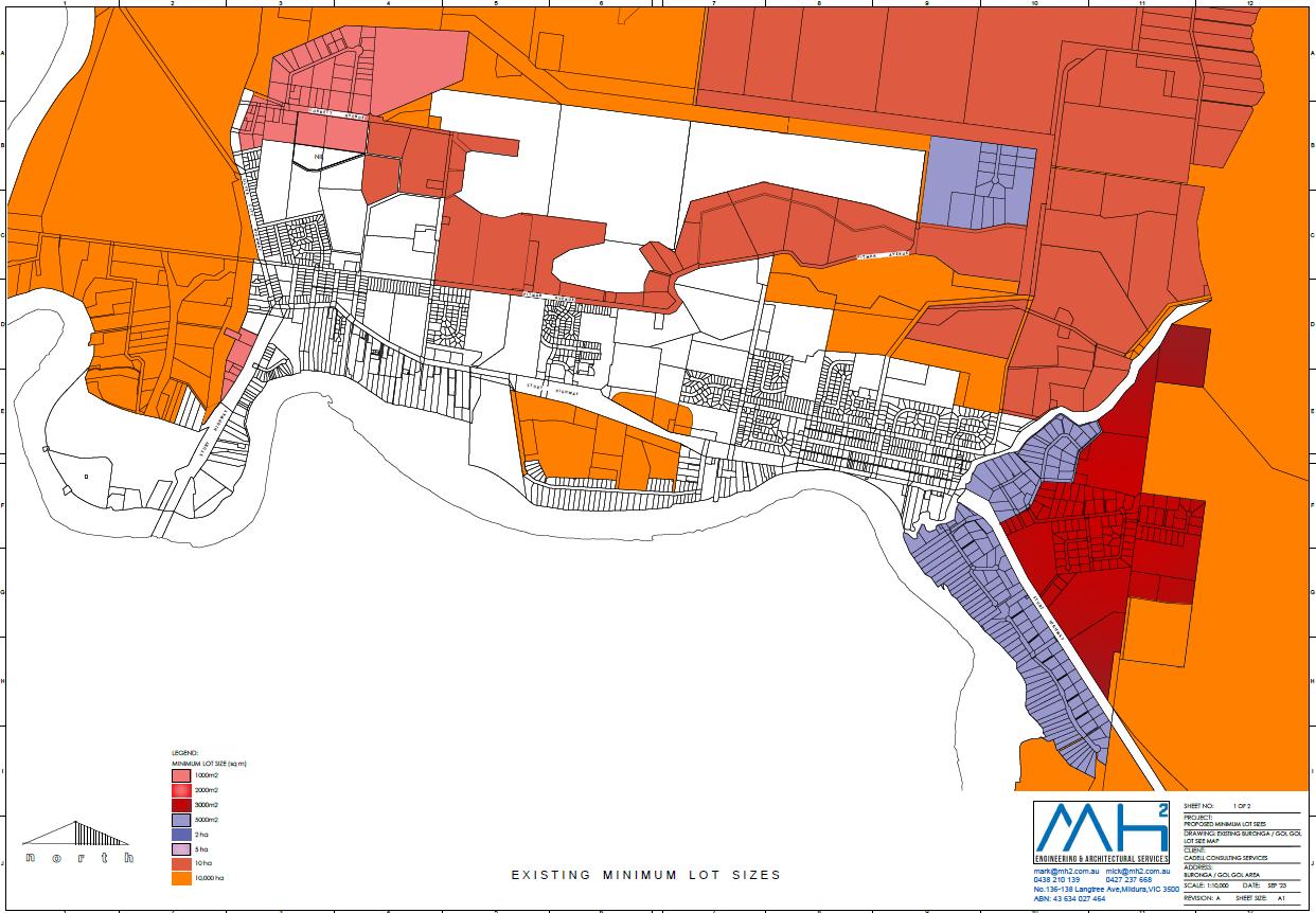
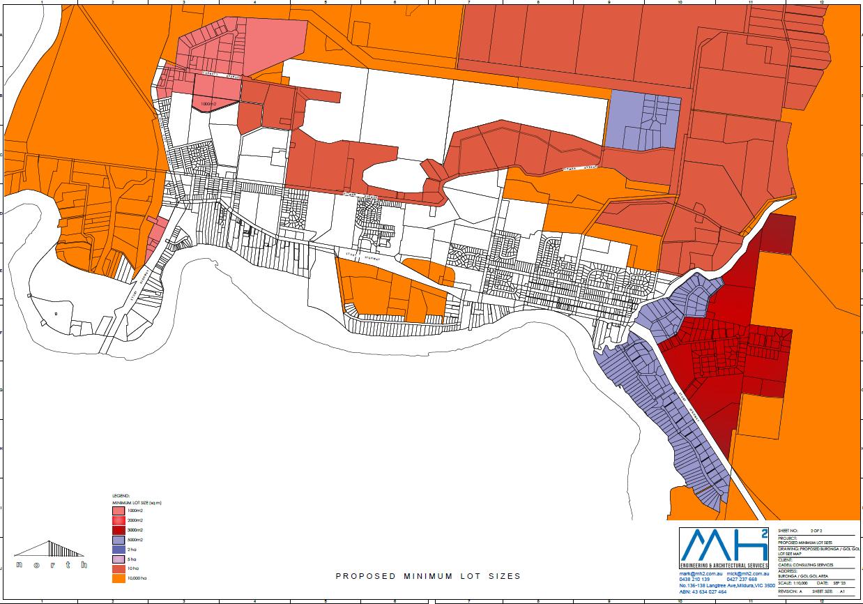
Item 9.13 - Attachment 1 Planning proposal Page 240 15
Cadell Consulting Services Planning Proposal – 48 & 105 Corbett Avenue, Buronga
Figure 10 Current MLS
Figure 11 Proposed MLS
3.3 Justification
Section A – Need for the Planning Proposal
3.3.1 Is the Planning Proposal a result of an endorsed local strategic planning statement, strategic study or report?
Local Strategic Planning Statement
The Planning Proposal satisfies and is consistent with the Strategic vision, intent and priorities and two Planning Priorities of the LSPS. Refer to Section 3.3.4.
Buronga Gol Gol Structure Plan
The Planning Proposal is, partly, a consequence of Recommendation 13 of the Buronga Gol Gol Structure Plan 2020 (BGGSP).
The BGGSP made a recommendation for an additional 16 hectare extension of the industrial zone to be located to the east of the existing industrial estate, at the eastern end of Corbett Avenue, as per the figure below.


However, following completion of the BGGSP, the Department of Planning & Environment advised of additional issues relating to biodiversity and cultural heritage constraints, applicable to the area proposed to be rezoned under Recommendation 13
Also, the BGGSP also outlined that the largest allotment within the zone has recently been re-planted with horticultural crop and therefore, will not be available for industrial development in the short to
Consulting Services Planning Proposal – 48 & 105 Corbett Avenue, Buronga
Item 9.13 - Attachment 1 Planning proposal Page 241 16
Cadell
Figure 12 Buronga Gol Gol Structure Plan Future Land Use Zones (Source: BGGSP Figure 4.1)
medium term. The area of this allotment is approximately 25 hectares. This area is shown in Figure 7 in Section 2.3.
The timeframe for Recommendation 13 to be progressed was to be in line with the Urban Land Release Staging Plan. Part of the overall site, already under E4 zone, had an estimated development commencement timeframe of 2024-2028 in the BGGSP. This is consistent with the proposed development of the site by the proponent.
The balance of the two allotments currently zoned RU5, but proposed to be rezoned to E4, have an anticipated commencement timeframe of 2032-2036 However, that timeframe is estimated for residential development due to its current zone.
The timeframe for the development of the proposed additional 16 hectares of E4 zone was estimated between 2028 and 2032.
Table 2.1 (Page 10) of the BGGSP showed the following statistics on industrial land in the study locality:
Table 4 BGGSP Industrial Land
Of the undeveloped area currently zoned E4, 25 hectares will not be available for development in the short to medium term, as mentioned above and confirmed in the BGGSP.
This leaves a balance of 8.1 hectares available for development.
The BGGSP identified that at the time, the current take-up rate of industrial lots per year was 4 However, it also estimated that the take up rate would increase due to recent land sales in the industrial estate. As predicted, the take up rate of land in the industrial zone has increased.
At the time of preparing this Planning Proposal, there were only 2 allotments available for purchase in the Buronga Industrial Estate. Both of these allotments are approximately 3,000 m2 However, it is also understood that those 2 allotments are currently ‘under offer’.
The table below shows the development approvals issued during the past 5 years, for the E4 General Industrial zone applicable only to the Buronga Industrial Estate:
Table 5 Development Approvals in Buronga Industrial Estate
A review of the availability of industrial zoned land in Mildura, has concluded that there are no vacant lots or land available for purchase and development in the Industrial 1 zone.
This indicates that the increase in development approvals from an average of 3 to 8 in 2022 in the Buronga Industrial Estate, is in fact driven by the demand for industrial land in the Sunraysia area and the current lack of supply in Mildura.
Referring to Attachment 1 Proposed Subdivision Plan:
Cadell Consulting Services Planning Proposal – 48 & 105 Corbett Avenue, Buronga
Item 9.13 - Attachment 1 Planning proposal Page 242 17
Zone Total Area Developed Undeveloped IN1 General Industrial 72 ha 39 ha 33.1 ha
2018 2019 2020 2021 2022 2023 to date 3 3 3 3 8 3
Stage 1 and 2, being the land shown in green and blue (existing E4 zone) – of the 23 lots in these two stages, 16 have been sold off the plan.
Stage 3, being the subject site – 2 lots have been held for future purchase, prior to the subject site being rezoned and subdivided.
Therefore, while there is a minor inconsistency with the BGGSP in terms of the zone location and anticipated development timeframes, that inconsistency is justified for the following reasons:
- There is an urgent demand for the availability of more industrial land, that is ready for immediate purchase and development
- The proposal to rezone 4 hectares of RU5 Village zoned land to E4 General Industrial zone will centralise and consolidate the expansion of the industrial precinct. Rather than the original proposal to extend it further east, which is within closer proximity to the C2 Environmental Conservation zoned land. That area has also been recognised as having additional constraints that could hinder the ability to rezone the area.
- The proponent has an overall subdivision concept design for the subject site. The design will cater for a mix of industrial uses and developments.
- The Planning Proposal offers a solution to cover the areas that were proposed for industrial rezoning in the BGGSP, that may now be considered as unviable
- The Planning Proposal offers a solution to cover the area currently zoned E4 but is not available for industrial development in the short to medium term.
- The proposed additional E4 zoned land is 4 hectares in area. This area, together with the current balance of industrial zoned land that is available and undeveloped, equates to 10 hectares.
- With an allowance of 15% of industrial land required for access and services and an average of 3,500 m2 allotments, the lot yield applicable to 10 hectares equates to 24 lots, a 3 year supply @ 8 lots per year. However, recent sales of industrial land off the plan indicates the demand is much higher.
Item 9.13 - Attachment 1 Planning proposal Page 243 18
Cadell Consulting Services Planning Proposal – 48 & 105 Corbett Avenue, Buronga

The Planning Proposal is consistent with the Land Use Principles for Industrial Areas and Buffer Zones as outlined on pages 37 and 38 of the BGGSP.
The Land Use Principles for industrial areas that directly apply to this Planning Proposal, include:
i. Encourage a mix of industrial development.
Response: The area proposed to be rezoned will include allotments ranging from 1,500 m2 to 3,900 m2. This is based on the proposed subdivision concept design. Such a range of allotment sizes will enable diversity in the types of industrial uses developed in the industrial estate. Additionally, allowing an extension to the E4 zone also encourages the proponent to provide for larger lots in the existing industrial zone, as shown in the proposed subdivision concept design, without compromising the number of lots that will be available for purchase and development. This also enables greater diversity in the types of industrial uses and development within the precinct.
The Land Use Principles for buffer zones that directly apply to this Planning Proposal, include:
i. Establish and manage suitable buffer zones at interfaces between agricultural and industrial areas and residential areas.
Response: The draft concept subdivision plan shows the use of the crown land parcel and an adjoining road as a buffer between the industrial and future residential areas.
Item 9.13 - Attachment 1 Planning proposal Page 244 19
Cadell Consulting Services Planning Proposal – 48 & 105 Corbett Avenue, Buronga
Figure 13 Buronga Gol Gol Structure Plan Urban Land Release Staging Plan (Source: BGGSP Figure 4.4)
ii. Buffer zones should be designed in accordance with guidelines and standards prepared and/or endorsed by the relevant state government agency to enhance visual corridors and create filtered views into adjoining land uses.
Response: The section of Crown owned land proposed to be utilised as a buffer zone forms a barrier that will separate the industrial and future residential uses of the land.
iii. For existing sensitive land uses within 500 metres of existing industrial areas, all new industrial development or modifications to existing industrial development is to demonstrate that unacceptable environmental impacts can be avoided through design, siting and modification of proposals to reduce emissions, noise, dust and odour.
Response: While the industrial zoned area is anticipated to be developed prior to the future residential area, south of the subject rezoning site, the proposed buffer zone, being the crown land reserve and adjacent proposed road, will serve as an adequate buffer to protect the amenity of the future residential development.
The BGGSP was endorsed by the Department of Planning & Environment 5 November 2021
3.3.2 Is the Planning Proposal the best means of achieving the objectives or intended outcomes, or is there a better way?
The Planning Proposal is the best means of achieving the objectives and intended outcomes for the proposed development.
The overall property currently has split zones which are incompatible, in terms of permissible uses and potential amenity issues. The proposal to extend the industrial zone will resolve any future incompatibility issues.
The Planning Proposal offers a solution to increase the availability of land in the industrial estate, whilst providing suitable space for buffer measures, to ensure the amenity of the future residential development to the south is protected
Section B – Relationship to Strategic Planning Framework
3.3.3 Will the Planning Proposal give effect to the objectives and actions of the applicable regional, or district plan or strategy (including any exhibited draft plans or strategies)? Far West Regional Plan 2036 (FWRP)
The Planning Proposal gives effect to three directions and their relevant actions under Goal 1: A diverse economy with efficient transport and infrastructure networks of the FWRP.
Direction 1: Grow the agribusiness sector, value-added manufacturing opportunities and supply chains
1.2 The Planning Proposal aims to facilitate an increase in industrial land ready for take up and development.
1.3 The Planning Proposal will provide additional investment opportunities for new industrial type businesses, suitably located within the current industrial estate.
1.4 The Planning Proposal will provide ensure there is a variety of lot sizes to accommodate varying industrial type developments.
Consulting Services Planning Proposal – 48 & 105 Corbett Avenue, Buronga
Item 9.13 - Attachment 1 Planning proposal Page 245 20
Cadell
Direction 12: Enhance productivity of employment lands
12.1 The Planning Proposal and the overarching draft concept development design, aims to expand the existing southern portion of the industrial estate to provide industrial land for immediate and future development. The increase in development within the industrial estate of Buronga will create both economic and employment opportunities.
12.2 The Planning Proposal is consistent with the land use principles of the Buronga Gol Gol Structure Plan for industrial land. Particularly as it aims to better utilise the crown land on the southern border of the subject site, for buffer purposes.
12.3 The Planning Proposal will ensure there is an ongoing, adequate supply of industrial zoned land to cater for current and future demand. It will also encourage co-location of industrial type industries to reduce supply chain costs.
12.4 The subject site is located within the existing industrial estate, where there are adequate and accessible infrastructure services available, with ease of access to the local, state and international freight networks
Draft Far West Regional Plan 2041 (DFWRP)
The Planning Proposal gives effect to two objectives of the DFWRP under Part 3 Ongoing prosperity
Objective 13: Protect and develop industry and manufacturing
The proposal is consistent with this objective as it aims to:
- locate new industrial land close to inter-regional networks
- provide for the supply of development-ready industrial land to meet the changing demands of the industry
- encourage co-location and clustering of compatible industries to improve efficiencies and productivity, reduce land use conflict, maximise infrastructure investment and capitalise on supply networks
- drive competitive advantage by leveraging strengths, assets and attributes while maintaining integrity of existing industrial precincts.
Objective 14: Protect and leverage existing and future road, rail and air transport routes and infrastructure
The proposal is consistent with this objective as it aims to:
- identify opportunities to activate and protect employment lands near freight infrastructure
3.3.4 Is the Planning Proposal consistent with a Council Local Strategic Planning Statement that has been endorsed by the Planning Secretary or Greater Sydney Commission, or another strategy or strategic plan?
Local Strategic Planning Statement (LSPS)
The Planning Proposal is consistent with Planning Priority 4 Efficient transport and connectivity networks and Planning Priority 6 Sustainable settlements.
Planning Priority 4 – Efficient transport and connectivity networks
The Planning Proposal aims to increase the area of employment lands, directly adjacent to the existing industrial zone. The Buronga Industrial Estate area is strategically located in terms of access to major
Cadell Consulting Services Planning Proposal – 48 & 105 Corbett Avenue, Buronga
Item 9.13 - Attachment 1 Planning proposal Page 246 21
transport networks, for access to domestic markets and international ports in Adelaide (via Sturt and Silver City Highways), Melbourne (via Calder Highway) and Sydney (via Sturt Highway).
Planning Priority 6 – Sustainable settlements
The Primary Settlement Areas Strategy for Buronga and Gol Gol, as identified in the Wentworth Shire Council Local Strategic Planning Statement (LSPS), aims for all new urban development to be located within the identified settlement boundary. The subject site falls within the settlement boundary.
Additionally, the Primary Settlement Areas Strategy seeks to Ensure new employment development that requires separation from urban development due to potential amenity impacts, is located in suitable areas. The Planning Proposal satisfies this intent as it aims to increase employment zoned land adjacent to existing employment land, whilst including amenity protection measures for future residential development, by proposing to use the existing crown land strip and a new road as a buffer zone, as shown in Attachment 1.
The following excerpts from the Strategic vision, intent and priorities of the LSPS which are applicable to the Planning Proposal, include:
Over the next 20 years Wentworth Shire will leverage the area’s rural, industrial and residential strengths to generate economic and social growth opportunities.
Horticulture/agriculture, industry and local businesses complimented by opportunities for tourism and residential investment will drive prosperity in the Wentworth Shire as the area capitalises on its close proximity to the Murray and Darling river systems and its favourable climate conditions.
Cadell Consulting Services Planning Proposal – 48 & 105 Corbett Avenue, Buronga
Item 9.13 - Attachment 1 Planning proposal Page 247 22
Figure 14 Buronga and Gol Gol Settlement Boundary (Source: LSPS Map 5)
Local, regional, state and national road transport and freight networks provide access to national and international locations and markets which are fundamental for the success of the economic growth of Wentworth Shire.
Wentworth Shire will be open for business and Council will actively support the development of tourism, business and industrial sectors. Council will investigate and review land use pressures to ensure the shire has a complimentary balance of residential and commercial development opportunities to encourage population growth.
Our towns and villages will capitalise on growth opportunities so that they continue to service our local communities. Our towns will offer a variety of housing choice to support a growing population and as our towns continue to support new growth, our economic base will diversify. Our townships will be vibrant active places to visit and live, providing a variety of basic economic and community services.
The Planning Proposal is consistent with the Strategic vision, intent and priorities of the LSPS, as it:
- Leverages the demand for additional industrial land, whilst providing a variety of lot sizes to cater for varying types of industrial development.
- Will provide employment opportunities and increase the economic activity in the Buronga township.
- Includes addressing potential amenity issues by providing a buffer solution between the future industrial and residential developments.
Wentworth Community Strategic Plan 2022-2032 (WCSP)
The WCSP has been developed as part of the Integrated Planning and Reporting Framework NSW requirements. The plan aims to reflect a holistic vision of the shire community and acts as a guide and reference point for decision making by elected representatives, community members and council staff.
The community vision of the CSP is ‘Wentworth Shire will work together to create a thriving, attractive and welcoming community’.
The four key strategies of the CSP include:
Economic – A vibrant, growing and thriving region
Social – A great place to live
Environmental – A community that works to enhance and protect its physical and natural environment
Civic Leadership – is supported by strong and ethical civic leadership with all activities conducted in an open, transparent and inclusive manner.
The Planning Proposal is consistent with the following objectives of the CSP:
Objective 1.1 Promote the shire as an ideal location for investment and the establishment of innovative sustainable and diversified industries
The Planning Proposal aims to increase the area of the E4 Industrial zoned land to ensure an ongoing supply of immediate developable land, which will attract new industries to the Buronga Industrial Estate. The variety of lot sizes is aimed at attracting a variety of new industries to complement the existing businesses within the estate.
Objective 1.5 Encourage and support initiatives that improve local employment opportunities
Cadell Consulting Services Planning Proposal – 48 & 105 Corbett Avenue, Buronga
Item 9.13 - Attachment 1 Planning proposal Page 248 23
The Planning Proposal will provide new and diversified employment opportunities through the provision of developable land, with varied lot sizes, to attract new industry.
3.3.5 Is the Planning Proposal consistent with any other applicable State and regional studies or strategies?
Western Murray Regional Economic Development Strategy 2018-2022 (WMREDS)
In order to support growth in agriculture and in particular, the manufacturing of agricultural products, Strategy 1 of the WMREDS prioritises zoning industrial land to encourage the development of manufacturing enterprises where there is adequate services and transport infrastructure. The Planning Proposal is consistent with this strategy, as it seeks to increase the supply of available and developable industrial zoned land, which will be fully serviced and accessible to the major freight network.
NSW 2040 Economic Blueprint (EB)
The aspirations of the EB that are applicable to the Planning Proposal include:
▪ Our economy would be diversified in favour of fast-growing industries and services and be expanding quickly enough to lift living standards
▪ Our regions should be productive and growing, serviced by world-class infrastructure and transport links
The aims of the EB for NSW regions are that they are productive and vibrant through growing populations that are supported by:
▪ employment and educational opportunities
▪ expansion of agricultural exports,
▪ efficiency in regional transport infrastructure
▪ high standard transport links
▪ improved and enhanced connectivity
It is considered that the Planning Proposal is consistent with the aspirations and aims of the EB for NSW Regions and the Wentworth Shire.
3.3.6 Is the Planning Proposal consistent with applicable State Environmental Planning Policies (SEPPs)?
An assessment of the Planning Proposal to the State Environmental Planning Policies is provided in Attachment 2.
3.3.7. Is the Planning Proposal consistent with applicable Ministerial Directions (Section 9.1 Directions)?
An assessment of the Planning Proposal to the Section 9.1 Ministerial Directions is provided in Attachment 3.
Section C – Environmental, social and economic impact
3.3.8 Is there any likelihood that critical habitat or threatened species, populations or ecological communities, or their habitats, will be adversely affected as a result of the proposal? Other than horticultural crops and ornamental or introduced vegetation, the site is otherwise devoid of vegetation.
Cadell Consulting Services Planning Proposal – 48 & 105 Corbett Avenue, Buronga
Item 9.13 - Attachment 1 Planning proposal Page 249 24
As the site has been under horticultural crops for many years, there is no likelihood of critical habitat, threatened species, ecological communities or their habitats being present on the subject site.
4.3.9 Are there any other likely environmental effects as a result of the planning proposal and how are they proposed to be managed?
There are no other known potential environmental effects as a consequence of this Planning Proposal.
3.3.10 Has the Planning Proposal adequately addressed any social and economic effects?
Social and economic benefits have been addressed in Section B in response to consistency with the LSPS and WCSP.
Section D – State and Commonwealth interests
3.3.11 Is there adequate public infrastructure for the planning proposal?
Subsequent development of the subject site will include an extension of the existing infrastructure to service the use and development of the subject site for industrial purposes
The provision of services will include:
- Water, sewer and stormwater infrastructure
- Safe and adequate access in and out of subject site
- Road width(s)
- Street lighting
- Fire hydrants
Consultation with Wentworth Shire Council, confirms that all of the above infrastructure and services can be provided to adequately support the proposed development of the subject site.
3.3.12 What are the views of State and Commonwealth public authorities consulted in accordance with the Gateway Determination?
Early consultation with DPE – Crown Lands and Western Murray Irrigation has commenced to determine their future use and requirements of the Crown Land strip, proposed to serve as part of the buffer zone between the industrial and future residential development.
Discussions include the possibility of the landholder/developer acquiring the portion of crown land or entering into an agreement/licence for the landscaping that land for buffer purposes.
As advised by DPE Crown Lands, the processes and procedures for this type of proposal will take some time.
It is anticipated that any additional relevant agencies and applicable service providers will be consulted through the community consultation process, as conditioned by the Gateway Determination.
3.4
Mapping
The Planning Proposal seeks to amend the following maps in the Wentworth LEP 2011, as they apply to the subject site:
Land Zoning Map – Sheet LZN_004F
Lot Size Map – Sheet LSZ_004F
3.5 Community Consultation
In accordance with Section 3.33(2)(e) of the Environmental Planning & Assessment Act 1979, community consultation may need to be conducted
Cadell Consulting Services Planning Proposal – 48 & 105 Corbett Avenue, Buronga
Item 9.13 - Attachment 1 Planning proposal Page 250 25
Schedule 1, Part 1, Division 1, 4 of the EP&A Act prescribes community consultation timeframes are either determined by the Gateway Determination to be issued, or 28 days. This is also consistent with the timeframe set out in Table 4 of the Wentworth Shire Council Community Participation Plan.
For this Planning Proposal, the following consultation process may include:
• Written notification to adjoining landowners
• Public notice in the local newspaper and on Council’s website
• Display of the Planning Proposal and supporting documentation made available in Council’s administrative buildings
• Planning Proposal documentation made available for public viewing on Council’s website.
During the consultation period, the following documents should be made available for public viewing:
1. Planning Proposal
2. Gateway Determination
3. All appendices and supporting documentation
4. Relevant Council reports and subsequent resolutions.
Consultation with any relevant state agencies will be determined by the Gateway Determination.
At the conclusion of the consultation period, Council will review and consider submissions received regarding the Planning Proposal, and will determine if the Planning Proposal is to be finalised.
3.6 Project Timeline
The NSW Department of Planning, Industry and Environment Local Planning Guideline August 2023 sets a benchmark timeframe for completion of the Planning Proposal process.
For a ‘Standard’ Planning Proposal, the benchmark is a total of 320 days for all stages of the process to be completed. This timeframe does not include pre-lodgement of the Planning Proposal with Council.
There are many factors that can influence the timeframe process. However, the following table provides indicative timeframes for each stage:
Table 6 Planning Proposal Timeframe
Pre-lodgement
Submission of Planning Proposal
Gateway Determination
Post Gateway
Public Exhibition & Assessment
Finalisation
September 2023
November 2023
March 2024
April 2024
May 2024
July 2024
Cadell Consulting Services Planning Proposal – 48 & 105 Corbett Avenue, Buronga
Item 9.13 - Attachment 1 Planning proposal Page 251 26
Stage Timeframe
Attachment 1 – Proposed Subdivision Plan
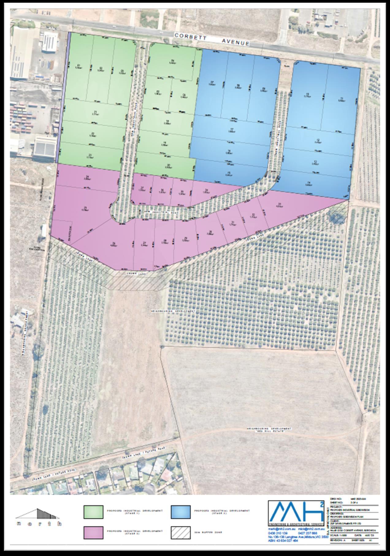
Item 9.13 - Attachment 1 Planning proposal Page 252 27
Cadell Consulting Services Planning Proposal – 48 & 105 Corbett Avenue, Buronga
Attachment 2 – State Environmental Planning Policy Assessment
State Environmental Planning Policy (SEPP) Applicable (Y/N) Consistent (Y/N)
State Environmental Planning Policy (Biodiversity and Conservation) 2021 Y Y
Comments/Justification
Chapter 2 – Vegetation in non-rural areas
The aim of this SEPP is to protect the biodiversity values of trees and other vegetation in non-rural areas and to preserve the amenity of non-rural areas through preservation of trees and other vegetation.
The Planning Proposal is consistent with this SEPP as the subject site does not contain any native vegetation, other than ornamental/introduced vegetation and horticultural crop. It is understood that any vegetation removal, other than horticultural crops, may require Council approval. However, the applicant has no intention of removing any vegetation at this stage.
Chapter 3 – Koala habitat protection 2020
The aim of this SEPP is to encourage the proper conservation and management of areas of natural vegetation that provide habitat for koalas…and reverse the current trend of koala population decline.
The Planning Proposal is consistent with this SEPP as the subject site is devoid of all native vegetation, other ornamental/introduced vegetation and horticultural crop. Therefore, the site does not contain any koala habitat.
Chapter 4 – Koala habitat protection 2021
The aim of this SEPP is to encourage the conservation and management of areas of natural vegetation that provide habitat for koalas to support a permanent free-living population over their present range…
The Planning Proposal is consistent with this SEPP as the subject site is devoid of all native vegetation, other than ornamental/introduced species and horticultural crop. Therefore, the site does not contain any natural habitat suitable for koalas.
Chapter 5 – River Murray lands
Item 9.13 - Attachment 1 Planning proposal Page 253 28
Consulting Services Planning
Cadell
Proposal – 48 & 105 Corbett Avenue, Buronga
State Environmental Planning Policy (Building Sustainability Index: BASIX) 2004
State Environmental Planning Policy (Exempt and Complying Development Codes) 2008
State Environmental Planning Policy (Housing) 2021
Y Y
The aims of this SEPP are to conserve and enhance the riverine environment of the River Murray for the benefit of all users.
The subject site is identified as being included in Map 35 of the Murray Regional Environmental Plan No. 2 – Riverine Land. It is considered that the Planning Proposal is consistent with this SEPP as the subject site is well setback from the Murray River and therefore, any impacts (if any) would be very low.
Chapter 6 – Water catchments Not applicable.
Chapter 13 Strategic conservation planning No applicable.
Applies to all land in NSW.
The Planning Proposal does not detract from the aims of this policy.
Y Y The Planning Proposal does not detract from the aims of this policy.
Y Y
State Environmental Planning Policy (Industry and Employment) 2021 Y
State Environmental Planning Policy No 65 Design Quality of
Applies to all land in NSW.
The Planning Proposal does not detract from the aims and principles of this policy.
Chapter 2 Western Sydney employment area Not applicable.
Chapter 3 Advertising and signage
The aims of this SEPP are to ensure that signage is compatible with the desired amenity and visual character of an area, provides effective communication in suitable locations and is of high quality design and finish.
Consistency with this SEPP will be adhered to when development applications are lodged in the E4 zone, to the satisfaction of the consent authority.
Consulting Services Planning Proposal – 48 & 105 Corbett Avenue, Buronga
Item 9.13 - Attachment 1 Planning proposal Page 254 29
Cadell
N
Residential Apartment Development
State Environmental Planning Policy (Planning Systems) 2021
State Environmental Planning Policy (Precincts – Central River City) 2021
State Environmental Planning Policy (Precincts – Eastern Harbour City) 2021
State Environmental Planning Policy (Regional) 2021
State Environmental Planning Policy (Western Parkland City) 2021
State Environmental Planning Policy (Primary Production) 2021
This SEPP is not applicable as the subject site is not zoned, classified or mapped as rural or state significant agricultural land.
State Environmental Planning Policy (Resilience and Hazards) 2021 Y Y Chapter 2 Coastal management Not applicable. Chapter 3 Hazardous & offensive development
The aims of this SEPP are to:
a) to amend the definitions of hazardous and offensive industries where used in environmental planning instruments, and
b) to render ineffective a provision of any environmental planning instrument that prohibits development for the purpose of a storage facility on the ground that the facility is hazardous or offensive if it is not a hazardous or offensive storage establishment as defined in this Chapter, and
c) to require development consent for hazardous or offensive development proposed to be carried out in the Western Division, and
d) to ensure that in determining whether a development is a hazardous or offensive industry, any measures proposed to be
Item 9.13 - Attachment 1 Planning proposal Page 255 30
Cadell
Consulting Services Planning Proposal – 48 & 105 Corbett Avenue, Buronga
N
N
N
N
N
N
employed to reduce the impact of the development are taken into account, and e) to ensure that in considering any application to carry out potentially hazardous or offensive development, the consent authority has sufficient information to assess whether the development is hazardous or offensive and to impose conditions to reduce or minimise any adverse impact, and f) to require the advertising of applications to carry out any such development.
The Planning Proposal will not detract from the aims of this policy.
Chapter 4 Remediation of land
A Preliminary Site Assessment has been conducted on the subject site.
The outcome of that assessment supports the rezoning of the subject from RU5 Village to E4 General Industrial zone.
State Environmental Planning Policy (Resources and Energy) 2021 N
State Environmental Planning Policy (Transport and Infrastructure) 2021
State Environmental Planning Policy (Sustainable Buildings) 2022
Chapter 2 Infrastructure
The aim of this SEPP is to ensure there is an effective delivery of infrastructure to support the development.
Consultation with Council has already commenced, to ensure that the roll out of the development of the site can and will be fully serviced.
Consultation with Transport for NSW will be conducted as a condition of the Gateway Determination. However, it is considered that current access arrangements off Silver City Highway are adequate to support the subsequent development.
This policy commences on 1 October 2023.
Item 9.13 - Attachment 1 Planning proposal Page 256 31
Cadell Consulting Services Planning Proposal – 48 & 105 Corbett Avenue, Buronga
Y Y
N
Comments/Justification
1. Planning Systems
1.1 Implementation of Regional Plans Y Y The Planning Proposal is consistent with the goals, directions and actions of the Far West Regional Plan 2036 and the draft Far West Regional Plan 2041 Further details provided in Section 3.3.3 of the Planning Proposal.
1.2 Development of Aboriginal Land Council land
1.3 Approval and Referral Requirements Y Y The Planning Proposal does not propose any referral or concurrence requirements, nor does it nominate any development as ‘designated development’.
1.4 Site Specific Provisions
1.5 Parramatta Road Corridor Urban Transformation Strategy
1.6 Implementation of North West Priority Growth Area Land Use and Infrastructure Implementation Plan
1.7 Implementation of Greater Parramatta Priority Growth Area Interim Land Use and Infrastructure Implementation Plan
1.8 Implementation of Wilton Priority Growth Area Interim Land Use and Infrastructure Implementation Plan
1.9 Implementation of Glenfield to Macarthur Urban Renewal Corridor
1.10 Implementation of the western Sydney Aerotropolis Plan
1.11 Implementation of Bayside West Precincts 2036 Plan
Item 9.13 - Attachment 1 Planning proposal Page 257 32
Consulting Services Planning Proposal – 48 & 105 Corbett
Cadell
Avenue, Buronga
Section 9.1 Direction Applicable (Y/N) Consistent (Y/N)
Attachment 3 – Section 9.1 Ministerial Directions Assessment
N
N
N
N
N
N
N
N
N
1.12 Implementation of Planning Principles for the Cooks Cove Precinct
1.13 Implementation of St Leonards and Crows Nest 2036 Plan
1.14 Implementation of Greater Macarthur 2040
1.15 Implementation of the Pyrmont Peninsula Place Strategy
1.16 North West Rail Link Corridor Strategy
1.17 Implementation of the Bays West Place Strategy
1.18 Implementation of the Macquarie Park Innovation Precinct
1.19 Implementation of the Westmead Place Strategy
1.20 Implementation of the Camellia-Rosehill Place Strategy
1.21 Implementation of South West Growth Area Structure Plan
1.22 Implementation of the Cherrybrook Station Place Strategy
2. Design and Place 2.1
3. Biodiversity and Conservation
3.1 Conservation Zones Y Y The Planning Proposal is consistent with this Direction as it does not involve land identified as environmentally sensitive and does not seek to reduce environmental protect standards.
3.2 Heritage Conservation
3.3 Sydney Drinking Water Catchments
3.4 Application of C2 and C3 Zones and Environmental Overlays in Far North Coast LEPs
There are no known or registered heritage items, relics, objects or sites applicable to the subject site.
Item 9.13 - Attachment 1 Planning proposal Page 258 33
Cadell
Consulting Services Planning Proposal – 48 & 105 Corbett Avenue, Buronga
N
N
N
N
N
N
N
N
N
N
N
Y Y
N
N
3.5 Recreation Vehicle Areas Y Y
3.6 Strategic Conservation Planning N
3.7 Public Bushland N
3.8 Willandra Lakes Region N
3.9 Sydney Harbour Foreshores and Waterways Area N
3.10 Water Catchment Protection N
4. Resilience and Hazards
4.1 Flooding N
4.2 Coastal Management N
4.3 Planning for Bushfire Protection N
4.4 Remediation of Contaminated Land Y Y
The Planning Proposal does not enable the land to be developed for the purposes of a recreation vehicle area, as defined by the Recreation Vehicles Act 1983.
The subject site is not identified as avoided land or a strategic conservation area.
The subject site is not located within the Willandra Lakes World Heritage Property.
4.5 Acid Sulfate Soils N
4.6 Mine Subsidence and Unstable Land N
5. Transport and Infrastructure
5.1 Integrating Land Use and Transport Y Y
The subject site is not identified as being flood prone.
The subject site is not identified as being bushfire prone land on the NSW Rural Fire Service map.
A Preliminary Site Assessment has been conducted on the subject site. The assessment is provided in a separate attachment.
The findings of the assessment include that there is no indication of past or present contamination above what would be reasonable for the proposed industrial land use.
The extension of the E4 zone is considered suitable for the area as it marginally increases the existing industrial estate. An extension to the estate was proposed in the Buronga Gol Gol Structure Plan 2020 at the east end of Corbett Avenue. However, cultural and biodiversity constraints could render that extension undevelopable. The Planning Proposal centralises an expansion of the industrial estate and existing access arrangements can cater for the growth in industrial activity.
Item 9.13 - Attachment 1 Planning proposal Page 259 34
Cadell
Consulting Services Planning Proposal – 48 & 105 Corbett Avenue, Buronga
5.2 Reserving Land for Public Purposes Y Y
5.3 Development Near Regulated Airports and Defence Airfields N
5.4 Shooting Ranges N
6. Housing
6.1 Residential Zones Y Y
The Planning Proposal does not propose to remove or propose any land to be dedicated for public purposes.
The subject site is not located near an airport or defence airfield.
The subject site is not located near a shooting range.
The Planning Proposal is consistent with this direction, despite its outcome which will reduce the current stock of residential land in the RU5 Village zone. Consistency can be achieved in the addressing the Buronga Gol Gol Structure Plan 2020 and its intent to continue to roll out additional residential land in accordance with its staging plan.
6.2 Caravan Parks and Manufactured Home Estates Y Y
7. Industry and Employment
7.1 Employment Zones Y Y
The Planning Proposal does not reduce the opportunities for caravan parks and manufactured homes estates.
This Direction requires the Planning Proposal to address the objectives of this direction:
a) Encourage employment growth in suitable locations
The Planning Proposal will support growth in the industrial employment sector of Buronga by increasing the footprint of the industrial precinct by approximately 4 hectares, with an additional 16 allotments.
b) Protect employment land in employment zones
The Planning Proposal does not detract or threaten the existing E4 zone from its purpose. The proposed buffer zone on the southern boundary of the E4 zone will ensure that general industrial activities can be conducted as per the zone permissibility.
c) Support the viability of identified centres
The location and viability of the existing industrial precinct in Buronga is supported by this Planning Proposal. In that, the proposal is to increase the industrial precinct to facilitate the development of a large-scale transport depot, and provide for a variety of lot
Item 9.13 - Attachment 1 Planning proposal Page 260 35
Consulting Services Planning Proposal – 48 & 105 Corbett Avenue,
Cadell
Buronga
sizes to encourage new development within the precinct.
The Planning Proposal does not reduce the potential floor space for employment purposes within the industrial precinct.
The Planning Proposal is generally in accordance with the Buronga Gol Gol Structure Plan 2020, in that the Plan recommended an increase in the industrial zone. The Plan was is an approved strategy by the Planning Secretary. Further details are provided in Section 3.3.1 of the Planning Proposal.
7.2 Reduction in NonHosted Short-term Rental Accommodation period
7.3 Commercial and Retail Development along the Pacific Highway North Coast
8. Resources and Energy
8.1 Mining, Petroleum Production and Extractive Industries N
9. Primary Production
9.1 Rural Zones
9.2 Rural Lands
9.3 Oyster Aquaculture
9.4 Farmland of State and Regional Significance on the NSW Far North Coast
Consulting Services Planning Proposal – 48 & 105 Corbett Avenue, Buronga
Item 9.13 - Attachment 1 Planning proposal Page 261 36
Cadell
N
N
N
N
N
N
Preliminary Environmental Site Assessment

48 and 78
Corbett Avenue, Buronga
Lot 94/DP756946
Lot 95/DP756946


Item 9.13 - Attachment 1 Planning proposal Page 262
TBA
Developments Pty Ltd
2UP
Preliminary Environmental Site Assessment
Business name Green Edge Environmental P/L
ABN 18 654 533 712
Postal address 60 Murray Street, Tanunda, SA, 5235
Point of contact Chris Alderton
Email and Mobile chris@geenvironmental.com.au 0438 345 109
Rev Purpose
Author Reviewer Issue Date
A Draft report for client review R. Allwright C. Alderton 10/11/2023
0 Final for submission R. Allwright R. Allwright 14/1/2023
© No part of this report may be reproduced, stored in a retrieval system or transmitted in any form by any means, electronic, mechanical, photocopying, recording or otherwise without prior permission from the author
T2303 i
Item 9.13 - Attachment 1 Planning proposal Page 263
Item 9.13 - Attachment 1 Planning proposal Page 264 Preliminary Environmental Site Assessment T2303 ii TABLE OF CONTENTS 1.0 Scope of works 1 1.1 Introduction 1 1.2 Context of investigation ............................................................................. 1 2.0 Site identification ......................................................................................... 2 3.0 Site history ................................................................................................. 3 3.1 Information sources 3 3.2 Zoning 3 3.3 Land use 3 3.4 Chronology of the site 3 3.5 Aerial photo review ................................................................................... 5 3.6 Chemicals identified .................................................................................. 5 3.7 Possible contamination sources ................................................................... 5 3.8 Complaint history 6 3.9 Integrity assessment 7 4.0 Site condition and surrounding environment 8 4.1 Site assessment ........................................................................................ 8 4.2 Surrounding environment ........................................................................ 10 5.0 Geology and hydrogeology .......................................................................... 11 5.1 Geology 11 5.2 Hydrogeology 12 6.0 Conclusion 13 7.0 References ................................................................................................ 14 TABLES Table 1: Property one details ............................................................................... 2 Table 2: Property two details ............................................................................... 2 Table 3: Chronology of the land ownership and land uses of the site ......................... 4 Table 4: Historical aerial photo review 5 Table 5: Potential contamination sources 6 Table 6: Observation bore data 12 FIGURES Figure 1: Unused storage shed 8
Figure 7: Area previously used for irrigated citrus, now a cleared paddock ............. 10
Figure 8: Irrigated citrus orchid 10
Figure 9: Simplified schematic of the major aquifers of the Mallee dryland (Mallee CMA website, 2011) ............................................................................................ 11
APPENDICES
Appendix A: Map series
Appendix B: Property search results
Item 9.13 - Attachment 1 Planning proposal Page 265 Preliminary
T2303 iii
to
unused
8 Figure
study
9
Environmental Site Assessment
Figure 2: Concrete slab next
the
shed
3: Storage shed on northeast corner of
site
Figure 4: Old PVC pipe in drums 9 Figure 5: Unused water tank .............................................................................. 9 Figure 6: Fruit pallets and scrap metal ................................................................ 9
1.0 Scope of works
1.1 Introduction
Potentially consisting of a number of stages, an Environmental Site Assessment (ESA) is defined under the National Environmental protection (Assessment of Site Contamination) Measure 1999 as a set of formal methods for determining the nature, extent and levels of existing contamination and the actual or potential risk to human health or the environment on or off-site resulting from that contamination.
2UP Developments Pty Ltd, Landowner, has engaged Green Edge Environmental Pty Ltd to undertake a phase one ESA to establish the potential for contamination of the soil at an orchard located at 48 and 78 Corbett Avenue, Buronga, NSW.
It is Important to note that while NSW state mapping identifies the eastern side of the site extent as 105 Corbett Avenue, the title is 78 Corbett Avenue. Title documents for this property are not on public registers, expected due to the inaccurate mapping.
There are two components to this proposal:
• rezoning from Village (R5) to General Industrial (IN1) at the northern extent of the site
• reassessment of Village zoning for the southern extent of the site (this area will remain Village (R5)).
1.2 Context of investigation
A stage one ESA is a preliminary site assessment with no or limited physical sampling of soils, groundwater, surface water or sediment. An ESA is a mechanism for gathering sufficient information to understand the potential for contamination at the site being investigated. This preliminary assessment will:
• identify past and present potentially contaminating activities
• identify potential contamination types
• discuss the site condition
• provide a preliminary assessment of site contamination
• assess the need for further investigations.
Item 9.13 - Attachment 1 Planning proposal Page 266
T2303 1
Preliminary Environmental Site Assessment
Preliminary Environmental Site Assessment
2.0 Site identification
Details of the properties assessed as part of this investigation are located in Table 1 and Appendix 1, map series containing the location map and site plan.
Table 1: Property one details
Site identification
Street name
Suburb
Avenue
First title 94/756946
Prior titles
Table 2: Property two details
Site identification
Street
Suburb
First title
Prior titles
Item 9.13 - Attachment 1 Planning proposal Page 267
T2303 2
Detail
48
Street number
Corbett
Buronga Lot number 94
number DP756946
DP
Crown
land
Detail Street number 78
name Corbett
Avenue
Buronga Lot number 95
number DP756946
DP
94/756946
Crown land
3.0 Site history
This site history review has been conducted in accordance with the following guidelines:
• National Environment Protection (Assessment of Site Contamination) Measure 1999, specifically Schedules B1-B4
• Consultants reporting on contaminated land, Contaminated land guidelines (NSW Environmental Protection Authority, 2020)
• Guidelines for assessing former orchards and market gardens (Department of Environment and Conservation, 2005).
3.1 Information sources
Information for this preliminary assessment has been obtained from the following sources:
• Current owners
• Former owners
• Wentworth Shire Council
• NSW Land and Property Information
o Title and site history searches
o EPA priority sites register
o Groundwater bore data
• Google satellite imagery
• Aerial photography
• Past reports
3.2
Zoning
The zoning under the Wentworth Shire Council Local Environmental Plan 2011, is RU5 –village.
3.3 Land use
The predominant land use has been for irrigated horticulture.
3.4 Chronology of the site
A number of investigations into the potential contamination of the Buronga/Gol Gol area have been previously undertaken. These include Thompson (2007), which is a historical review of the area from settlement, providing information on land use over time and Sunraysia Environmental (2008) which includes an overview of the larger Buronga/Gol Gol area as well as some limited soil sampling.
The current and immediate previous landowners were interviewed on 2 November 2023 A number of findings from these interviews have added to the chronology of the site and chemicals identified.
The following points relevant to this preliminary assessment are taken from Thompson (2007):
• European settlement commenced in the local area in the 1840’s with the arrival of the first grazing run in the region in 1846
Item 9.13 - Attachment 1 Planning proposal Page 268
T2303
Preliminary Environmental Site Assessment
3
Preliminary Environmental Site Assessment
• in 1865 the Gol Gol Township was surveyed and excised from Tapio Station and land sales commenced in 1871
• the Buronga Irrigation District was planned in 1956 and settled by 1958
• the Buronga Irrigation Scheme was refurbished, commencing in 1994
The following points relevant to this preliminary assessment are taken from Sunraysia Environmental (2008):
• the main crop types for the local irrigated areas have been horticulture, including grapes for wine, table and dried fruit, citrus, vegetables and olives
• most horticultural properties over the last 50 years have used agricultural chemicals (fungicide, herbicide or insecticide)
• some properties may also have stored fuels in drums, overhead tanks or underground tanks on the farm
• pre- 1950’s the study area was vacant land covered in light Mallee scrub, no fences were present so the land was not even used for rangeland grazing
• there may be potential contaminants in the soil from horticultural chemicals use and storage. However, testing of the soil for agricultural chemical residues screen revealed that no contamination had occurred for the parameters analysed.
As documented above, a number of searches were undertaken to develop a chronology of past ownership and land uses of the subject site (refer Appendix B). The results of the searches are summarised in Table 2.
Table 3: Chronology of the land ownership and land uses of the site
Proprietor(s) Dates
48 Corbett Avenue, Buronga
Government of NSW
Stan Dakus
Prior to 1950 Mallee Shrubland
1950 to 1974
Ballot on Crown Land. Land was clear for agricultural use and irrigated horticulture commenced.
Kevin Desmond Cock 1974 - Current Citrus irrigation.
78 Corbett Avenue, Buronga
Government of NSW Prior to 1950 Mallee Shrubland
Danny Mills
1950 to 1974
Unknown type of land ownership. Land was clear for agricultural use and irrigated horticulture commenced.
Kevin Desmond Cock 1974 - Current Converted to title in 1987.
The site history did not reveal any permits, licences, approvals or trade waste agreements.
Item 9.13 - Attachment 1 Planning proposal Page 269
T2303 4
Major land uses
Preliminary Environmental Site Assessment
3.5 Aerial photo review
As indicated on the attached site plan (Appendix A) the study area comprised approximately 10.44ha, containing two sheds. The remainder of the site consists of citrus orchids with irrigation sprinklers and cleared land from previous orchid plantings
The historical aerial photos of the site provide an insight into the site history. Table 3 provides some comments on the aerial photos; refer to Appendix A for more information.
Table 4: Historical aerial photo review
Date
Comments
1975
Entire site used for orchids/farming with irrigation sprinklers
2016 Orchids cleared to the southwest of the property. the rest of the site still used for orchids with irrigation sprinklers
2023 Some of the cleared orchids were replaced with new orchids. The rest of the site remains the same.
3.6 Chemicals identified
As identified in the Sunraysia Environmental (2008) report the following chemical types are likely to have been used:
• fungicide
• herbicide
• insecticide.
Additionally, this preliminary site investigation has identified the following:
• a range of metals
• agricultural chemicals
• pesticides
• petroleum hydrocarbons.
The above chemicals were also identified in the interview with the landowner between the years 1973 and 2023, with these chemicals being stored and mixed off site (Appendix A). The current landowner does still use chemicals and liquid fertilisers on the orchids, but not stored on site
3.7 Possible contamination sources
The onsite assessment revealed nine potential contaminant sources, five being offsite and four on site. Table 4 provides the details of these potential sources, while Appendix A identifies these locations.
Item 9.13 - Attachment 1 Planning proposal Page 270
T2303 5
1933 No development on site, potentially light Mallee scrub
Preliminary Environmental Site Assessment
Table 5: Potential contamination sources
Zone Location Comments
1 Off site The industrial area to the north has the potential to impact on this site
2 Off site The neighbouring property northwest of the site used for storage of redundant trucks and trailers, empty 44-gallon drums, rubber tyres, metal waste, fibreglass, imported gravel
3 Off site The pump machinery/shed northwest of the site has previously stored chemicals and an overhead diesel tank is still on site
4 Off site The house west of the site boundary and shedding have the potential to contain asbestos, household chemicals and other wastes, including a septic tank
5 Off site The house northeast of the site boundary and shedding have the potential to contain asbestos, household chemicals and other wastes, including a septic tank
6 On site Old fruit storage shed (out of use). Evidence of removed structures and a mechanical crane stand.
7 On site Implement shed on the northeast boundary used for machinery storage. Scrap metal, old farming equipment and a large water tank is also stored
8 On site The previously irrigated areas have the potential to contain areas of contamination through the spraying of chemicals for crop production
9 On site Underground irrigation main is asbestos.
No other sewer, site plans, discharges to land, water or air were identified as part of this preliminary assessment. Historically, neighbouring land use has been similar to the study area, until recent times when industrial development to the north and residential development to the west has occurred.
The groundwater is not used for any productive uses as it is highly saline. The Buronga Salt Interception Scheme to the west of the site protects salt from entering the River Murray by intercepting saline groundwater and diverting in to Mourquong disposal basin.
3.8 Complaint history
No known complaints have been made about the site.
Item 9.13 - Attachment 1 Planning proposal Page 271
T2303 6
3.9 Integrity assessment
The information discovered about this site through the historical review has been verified by previous owners. The information is therefore seen as accurate for the purposes of a preliminary environmental site assessment.
Item 9.13 - Attachment 1 Planning proposal Page 272
T2303 7
Preliminary Environmental Site Assessment
4.0 Site condition and surrounding environment
4.1
Site assessment
The site assessment revealed four onsite areas/land uses which have potential to contribute to soil contamination These areas include two storage sheds, an underground irrigation pipe made of asbestos and general chemical use for horticulture.
The soil at the site consists of mallee loam, which could be prone to water and wind erosion with minimal ground cover vegetation. The topography ranges from 50mAHD and slopes to the north to 45mAHD (Appendix A).
The shed in the centre of the property, through discussions with the land holder, has been identified as low risk. This shed served as a fruit storage area during harvest season During the site investigation, a concrete slab was also identified next to the shed, which was likely used for an old water tank (Figure 1-2). The shed has not been used for the storage of fuels or chemicals.
The second shed in the northeast corner of the property is currently used for storage of a boat and farming equipment. Scrap metal, drums filled with old PVC piping, a large unused water tank and various other scrap material are also stored around this shed (figure 3-4). Again, this shed has not been used for the storage of fuels or chemicals.
During the interview with the landholder, we were told that bulk storage of fuels and chemicals are not kept on the study site. Negating the risk of potential spills that may have occurred in the past. The main concern around these areas is from leaching of metals from the galvanised sheds and scrap metal storage.
Item 9.13 - Attachment 1 Planning proposal Page 273 Preliminary Environmental Site Assessment T2303 8
Figure 1: Unused storage shed
Figure 2: Concrete slab next to the unused shed
The entire site, at some stage, has been used for irrigated citrus orchids. Mostly still in use however, there is an area that has been cleared to the south of the study area (Figure 7-8).
Guidelines for assessing former orchards and market gardens (Department of Environment and Conservation, 2005), suggests that horticulture can contribute to soil contamination due to the chemicals used during irrigation. Pesticides that have been used according to manufacturers’ directions are unlikely to result in high levels of residual soil contamination in cultivated areas, as modern agricultural chemicals are generally not persistent in the environment. Soil sampling completed by Sunraysia Environmental (2008), for previous rezoning of the area, also suggests that samples tested were below the threshold criteria set by the EPA and that the EPA requirements for a clean site were satisfied.
Item 9.13 - Attachment 1 Planning proposal Page 274 Preliminary
Site
T2303 9
Environmental
Assessment
Figure 3: Storage shed on northeast corner of study site
Figure 4: Old PVC pipe in drums
Figure 5: Unused water tank
Figure 6: Fruit pallets and scrap metal
The existing irrigation system that runs through the property includes a main line made of asbestos. All pipes extending from the main system have been upgraded to PVC. The asbestos piping is in situ and will not impose any risk in its current state. It is expected to be removed as part of development as per State guided standards.
No odours were recorded at the site. All shedding on the site is in reasonable repair There are also no formal roads on the property. There is an area of crown land that runs through the middle (southeast) of the property that is currently being used as an access track. All access tracks are fit for purpose.
The site is located on a high dune and not subject to flooding. No sensitive environments exist on the site.
4.2 Surrounding environment
The immediate surrounding environment consists of an industrial area to the northwest, an abandoned house to the northeast and irrigated horticulture in all other directions.
Moving further from away from the site, these same land uses continue with the addition of some residential development in the west and southwest of the site (Appendix A).
The most sensitive environment is the Murray River (1,500m west) and associated floodplain environment.
Item 9.13 - Attachment 1 Planning proposal Page 275 Preliminary Environmental Site Assessment T2303 10
Figure 7: Area previously used for irrigated citrus, now a cleared paddock
Figure 8: Irrigated citrus orchid
5.0 Geology and hydrogeology
5.1
Geology
The Mallee lands of Victoria’s north-west and southern NSW consists of multiple layers of sands, clays, limestone and other materials that have accumulated over vast periods of geological time. Only the surface layers can be seen, but exploration of the buried substrate has enabled a greater understanding of the landscape at the surface.
This land is located in an undulating dune/swale landscape formed predominantly from quaternary aged aeolian deposits, known as the Woorinen Formation. Soils formed from this material are characterised by horizons of concentrated calcium carbonate (finely divided lime or calcrete rubble). These soils are commonly sandy at the surface, with the clay content increasing down the profile.
When the sea last retreated some two million years ago, it left behind a spread of sand as well as the strandlines (old shorelines). The materials of the sand spread are called the Parilla Sands. Materials of the same age laid down by rivers in the higher land areas not covered by the sea are known as the Shepparton Formation (refer to figure 5).
Fine textured clay sediments were laid down on top of the sand left by the retreating sea, to form an extensive thin capping, now known as the Blanchetown Clay (refer to figure 5).
The low east-west dunes were formed from materials that may not have been moved a great distance. They have considerable clay and carbonate content and are now relatively stable due to plant cover. These materials are referred to as the Woorinen Formation (refer to figure 5).
The site is typical of the Woorinen Formation with broad swales above flood level interspersed by low east-west dunes of sandier soil. The topography in the local area is generally undulating with the difference in elevation between the dune crests and swales being three to eight metres.
Item 9.13 - Attachment 1 Planning proposal Page 276 Preliminary
Site
T2303 11
Environmental
Assessment
Figure 9: Simplified schematic of the major aquifers of the Mallee dryland (Mallee CMA website, 2011)
Preliminary Environmental Site Assessment
5.2 Hydrogeology
Groundwater flow occurs in subsurface aquifers. An aquifer is a sediment or soil which will transmit water. The rate of groundwater movement is controlled by the gradient of the potentiometric surface and the aquifer characteristics. The rate of groundwater movement is generally very slow. Typical rates for sand aquifers, such as found in the Mallee are tens of centimetres per year.
Sediments in the southwest sector of the Murray Darling Basin form a series of ‘regional’ aquifers that transmit groundwater flows over great distances. The coarse-grained alluvium (Renmark Formation) located at the base of the basin forms the deepest aquifer.
Above this, and separated by layers of clay, lies a thick sequence of marine limestone (Murray-Group Limestone). This is an important aquifer, both from the perspective of groundwater resources and dryland salinity. Water quality in this aquifer is generally good, being less than 2000mg/l TDS (Hoxley, 1996).
Above the limestone, layers of sand (Parilla or Loxton-Parilla Sands) form the shallowest aquifer and part of the upper land surface in both Victoria and South Australia. These regional aquifers are conduits for groundwater movement from western Victoria to the Murray River in Victoria and South Australia. Groundwater in this aquifer is highly saline, often more saline than sea water (Hoxley, 1996).
The trench of the Murray River is the natural discharge zone or ‘drain’ for groundwater from most of the region.
Groundwater flow in all Mallee aquifers is generally toward the Murray River. The groundwater flow from all Mallee aquifers eventually discharges to the Murray River, mostly in South Australia.
Three observation bores monitoring the Parilla sands aquifer located near the study area were approximately 8.08m below ground level. Refer to table 5 which contains details of the observation bores.
Note: Data adapted from NSW Natural Resource Atlas (2012), refer to Appendix 1 for mapped locations.
Item 9.13 - Attachment 1 Planning proposal Page 277
T2303 12
Name Easting Northing Completion date Final depth (m) Observation depth (m) Standing water level (m) GW087296 6219428 608679 1973 10.6 8.6-10.5 n/a GW087288 6219084 608606 1973 13.4 8.1-9.9 n/a GW087639 6219060 608607 1995 16.5 15.7-16.2 8.08
Table 6: Observation bore data
6.0 Conclusion
The purpose of this assessment was to undertake a phase one ESA to establish the potential for soil contamination at an orchard located at 48 and 78 Corbett Avenue, Buronga, NSW. There are two components to this proposal:
• rezoning from Village (R5) to General Industrial (IN1) at the northern extent of the site
• reassessment of Village zoning for the southern extent of the site (this area will remain Village (R5)).
This preliminary ESA has:
• identified past and present potentially contaminating activities
• identified potential contamination types
• discussed the site condition.
Ultimately, there has been no land use change on this site since the Sunraysia Environmental Assessment completed in 2008, where contamination of the site was determined to comply with EPA requirements for residential zoning. This is assumed to still be relevant for the southern extent of the property, proposed to be developed for residential use.
The northern extent of the property, proposed to be rezoned General Industrial, shows no indication of past or present contamination above what would be reasonable for the proposed industrial land use.
Item 9.13 - Attachment 1 Planning proposal Page 278
T2303 13
Preliminary Environmental Site Assessment
Preliminary Environmental Site Assessment
7.0 References
Department of Environment and Conservation. (2005). Guidelines for assessing former orchards and market gardens.
Environmental Protection and Heritage Council. (1999). National Environmental Protection Measure (NEPM).
Hoxley, G (1996). The Hydrogeology and Hydrology of the Mallee. Sinclair Knight Mertz
NSW Environmental Protection Authority (2020), Consultants reporting on contaminated land
NSW Office of Environmental and Heritage. (2011). Guidelines for consultants reporting on contaminates sites.
Sunraysia Environmental. (2008). Site History of Potential Land Contamination Buronga – Gol Gol, NSW.
Thompson, P. (2007). Timelines of Wentworth Shire. Wentworth Shire Council and Coomealla Memorial Sporting Club New South Wales.
Item 9.13 - Attachment 1 Planning proposal Page 279
T2303 14
Appendix A: Map series and historical aerial photography
Item 9.13 - Attachment 1 Planning proposal Page 280 Preliminary Environmental Site Assessment T2303 15

Item 9.13 - Attachment 1 Planning proposal Page 281 S i t e E x t e n t W E N T W O R T H L G A ! ! ! ! A L B U R Y B E N D G O M L D U R A B R O K E N H L L 0 2 5 0 5 0 0 7 5 0 1, 0 0 0 m ± S c a e 1 5 0 0 0 0 @ A 4 C o o d n a e S y s e m G D A 1 9 9 4 M G A Z o n e 5 4 1 F g u r e B u r o n g a P S I L o c a t i o n M a p L E G E N D S e E x t e n t L G A B o u n d a r y
Item 9.13 - Attachment 1 Planning proposal Page 282 S i t e E x t e n t ! ! ! ! A L B U R Y B E N D G O M L D U R A B R O K E N H L L 0 5 0 1 0 0 1 5 0 2 0 0 m ± S c a e 1 6 5 0 0 @ A 4 C o o d n a e S y s e m G D A 1 9 9 4 M G A Z o n e 5 4 2 F g u r e B u r o n g a P S I S i t e M a p L E G E N D S t e E x t e n t L o t
Item 9.13 - Attachment 1 Planning proposal Page 283 S i t e E x t e n t ! ! ! ! A L B U R Y B E N D G O M L D U R A B R O K E N H L L 0 5 0 1 0 0 1 5 0 2 0 0 m ± S c a e 1 6 5 0 0 @ A 4 C o o d n a e S y s e m G D A 1 9 9 4 M G A Z o n e 5 4 3 F g u r e B u r o n g a P S I C u r r e n t Z o n i n g M a p L E G E N D S t e E x t e n t L o t
Item 9.13 - Attachment 1 Planning proposal Page 284 S i t e E x t e n t S i t e c u r r e n t l y V i l a g e ( R 5 ) a n d p r o p o s e d t o s t a y R 5 s i t e p r o p o s e d t o b e r e z o n e d G e n e r a I n d u s t r a ( I N 1 ) ! ! ! ! A L B U R Y B E N D G O M L D U R A B R O K E N H L L 0 5 0 1 0 0 1 5 0 2 0 0 m ± S c a e 1 6 5 0 0 @ A 4 C o o d n a e S y s e m G D A 1 9 9 4 M G A Z o n e 5 4 4 F g u r e B u r o n g a P S I P r o p o s e d R e z o n i n g M a p L E G E N D S e c u r r e n t l y V l a g e ( R 5 ) a n d p r o p o s e d o s t a y R 5 S e p r o p o s e d t o b e r e z o n e d G e n e r a I n d u s t r i a l ( N 1 ) L o t
Item 9.13 - Attachment 1 Planning proposal Page 285 ! ! ! ! S i t e E x t e n t G W 0 8 7 6 3 9 G W 0 8 7 2 9 6 G W 0 8 7 2 9 5 G W 0 8 7 2 8 8 40 5 0 5 0 ! ! ! ! A L B U R Y B E N D G O M L D U R A B R O K E N H L L 0 5 0 1 0 0 1 5 0 2 0 0 m ± S c a e 1 6 5 0 0 @ A 4 C o o d n a e S y s e m G D A 1 9 9 4 M G A Z o n e 5 4 5 F g u r e B u r o n g a P S I G e n e r a l T o p o g r a p h y M a p L E G E N D ! B o r e S e E x t e n t C o n t o u r ( 1 0 m ) L o t
Item 9.13 - Attachment 1 Planning proposal Page 286 1933Historical Aerial photo
Item 9.13 - Attachment 1 Planning proposal Page 287
1975
-Historicalaerialphoto
Appendix
B: Property search results
Item 9.13 - Attachment 1 Planning proposal Page 288 Preliminary Environmental Site Assessment T2303 16


Provided by CITEC Confirm
NEW SOUTH WALES LAND REGISTRY SERVICES - HISTORICAL SEARCH ----------------------------------------------------------
SEARCH DATE ----------6/11/2023 12:11PM
FOLIO: 94/756946 ------
First Title(s): 94/756946
Prior Title(s): CROWN LAND
Recorded Number Type of Instrument C.T. Issue
16/7/1987 FI600452 FOLIO INSTRUCTION FOLIO CREATED EDITION 1
10/10/2000 7126804 APPLICATION FOR RECORDING OF EDITION 2 ACTION AFFECTING CROWN HOLDING
9/2/2001 7400098 APPLICATION FOR RECORDING OF ACTION AFFECTING CROWN HOLDING
20/4/2020 AP997809 APPLICATION FOR RECORDING OF EDITION 3 ACTION AFFECTING CROWN HOLDING *** END OF SEARCH ***
Item 9.13 - Attachment 1 Planning proposal Page 289 Page
2
1 of
-------- ------ ------------------ ----------
48 Corbett Ave
Provided on 06/11/2023 11:11 AM by CITEC Confirm
PRINTED ON 6/11/2023
CITEC Confirm hereby certifies that the information contained in this document has been provided electronically by the Registrar General in accordance with section 96B(2) of the Real Property Act, 1900.
Information contained in this document is provided by CITEC Confirm, ABN 52 566 829 700, confirm.com.au, an approved NSW Land Registry Services Information Broker.
© Office of the Registrar General 2023.
Item 9.13 - Attachment 1 Planning proposal Page 290 Page 2 of 2
NEW SOUTH WALES LAND REGISTRY SERVICES - TITLE SEARCH
FOLIO: 94/756946 ------
SEARCH DATE TIME EDITION NO DATE
6/11/2023 12:21 PM 3 20/4/2020 LAND
LOT 94 IN DEPOSITED PLAN 756946 AT BURONGA
LOCAL GOVERNMENT AREA WENTWORTH
PARISH OF GOL GOL COUNTY OF WENTWORTH (FORMERLY KNOWN AS PORTION 94)
TITLE DIAGRAM CROWN PLAN 934.1820
FIRST SCHEDULE --------------
KEVIN DESMOND COCK
SECOND SCHEDULE (1 NOTIFICATION) --------------1 LAND EXCLUDES MINERALS (S.13.2 CROWN LAND MANAGEMENT ACT 2016)
NOTATIONS
UNREGISTERED DEALINGS: PP DP1300239. *** END OF SEARCH ***
Item 9.13 - Attachment 1 Planning proposal Page 291 Page
1 of 2 Provided by CITEC Confirm
-----------------------------------------------------
----------- ---- ---------- ----
----
---------
48 Corbett Ave
Provided on 06/11/2023 11:21 AM by CITEC Confirm
PRINTED ON 6/11/2023
* Any entries preceded by an asterisk do not appear on the current edition of the Certificate of Title. Warning: the information appearing under notations has not been formally recorded in the Register.
CITEC Confirm hereby certifies that the information contained in this document has been provided electronically by the Registrar General in accordance with section 96B(2) of the Real Property Act, 1900.
Information contained in this document is provided by CITEC Confirm, ABN 52 566 829 700, confirm.com.au, an approved NSW Land Registry Services Information Broker.
© Office of the Registrar General 2023.
Item 9.13 - Attachment 1 Planning proposal Page 292 Page 2 of 2
Our Reference: Prepared By: George Kenende Date:
PLANNING PROPOSAL ASSESSMENT REPORT
Application Details
Application No: L1/102: PP-2023-2559
Applicant: Cadell Consulting Services
Proposal Summary: Rezone land from RU5 Village to E4 General Industrial and new minimum lot size (MLS) of 1000 sqm
Land Owner/s: Kevin Cock
Assessment Officer: George Kenende, Strategic Development Officer
Site and Locality Details
Subject Land: Lot 94 & 95 DP 756946 (Parts), 48 and 78 Corbett Avenue Buronga (error on planning proposal identifying one of the lands as 105 Corbett Avenue instead of 78)
Current LEP provisions: Subject site is zoned RU5 Village with no Minimum Lot Size
Current DCP Provisions: Chapter 3 & 4
Proposed amendment controls: Rezone to E4 General Industrial with minimum lot size to 1000 sqm
Existing Character and Use: The properties are located within the Buronga Industrial Estate on Cobert Avenue, 310m from the Silver City Highway and Corbett Avenue intersection. The properties are mainly used for horticulture with 2 dwellings and associated outbuildings on the land. Native vegetation on the land was historically cleared for horticulture activities.
The properties are separated by a crown parcel with a width of approximately 11m. The south of the crown land is all zoned RU5 Village, while the north has a portion zoned RU5 and another zoned E4. The RU5 zoned portion of land to the north of the crown land is the one subject to the rezoning with MLS change and will be identified as the subject site (Figure 1).
Locality: The northern end of the subject site is located in the Buronga Industrial Estate, while the southern end of the subject site is located adjacent to existing and proposed residential development. To the north and north west is land containing industrial development, while to the south, is existing residential development and new proposed residential development on the south western boundary. The land on the eastern boundary is currently being used for horticultural purposes (Figure 2).
Item 9.13 - Attachment 2 Planning proposal assessment report Page 293
T 03 5027 5027 26-28 Adelaide Street WENTWORTH NSW 2648 Page | 1 E council@wentworth.nsw.gov.au PO Box 81 WENTWORTH NSW 2648 W wentworth.nsw.gov.au ABN 96 283 886 815
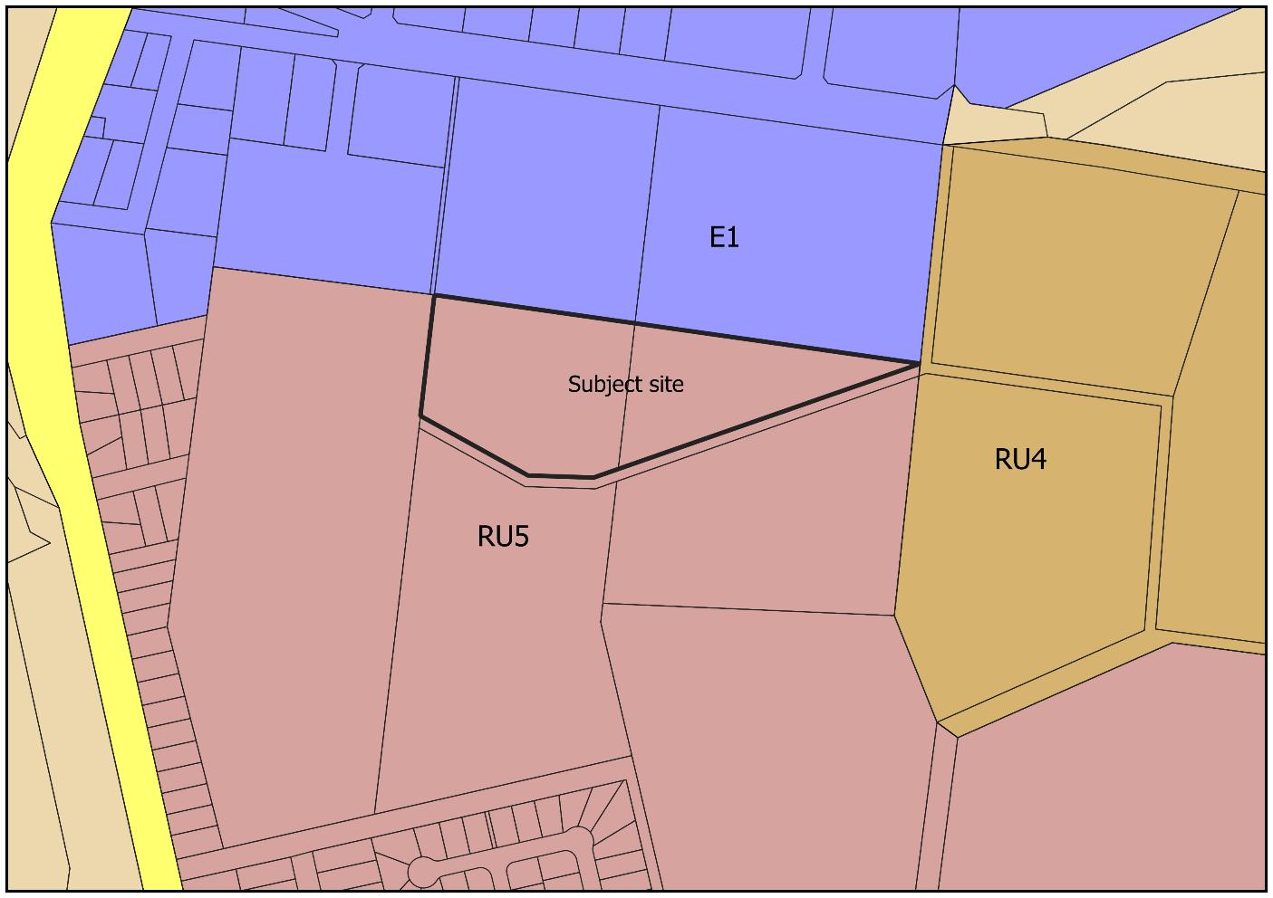
Item 9.13 - Attachment 2 Planning proposal assessment report Page 294 T 03 5027 5027 26-28 Adelaide Street WENTWORTH NSW 2648 Page | 2 E council@wentworth.nsw.gov.au PO Box 81 WENTWORTH NSW 2648 W
ABN 96 283 886 815
wentworth.nsw.gov.au
Figure 1: Subject site
Our Reference: Prepared By: George Kenende Date:

Surrounding land uses and development (Figure 7 from the planning proposal)
Planning Proposal
Council is in receipt of an application to amend the Wentworth Local Environmental Plan 2011 (WLEP) to:
1. Rezone the subject site from RU5 to E4 with a minimum lot size of 1000 sqm
The planning proposal purpose is to:
a) enable the provision of additional industrial land,
b) take advantage of the increase in demand for general industrial zoned land by expanding the existing industrial precinct,
c) provide an alternative and more suitable location to expand the industrial zone, other than the recommended location in the Buronga Gol Gol Structure Plan 2020,
d) provide a larger variety of lot sizes to accommodate various types of industrial development,
e) utilise the crown land parcel
Item 9.13 - Attachment 2 Planning proposal assessment report Page 295
T 03 5027 5027 26-28 Adelaide Street WENTWORTH NSW 2648 Page
E
PO Box 81 WENTWORTH NSW 2648
ABN 96 283 886 815
| 3
council@wentworth.nsw.gov.au
W wentworth.nsw.gov.au
Figure 2:
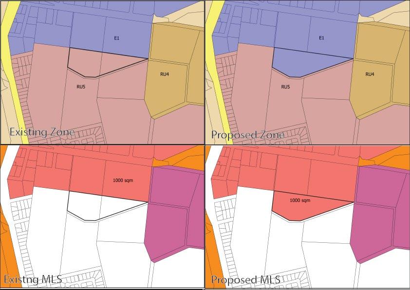
Figure 3: Current and Proposed changes
The applicant’s description of the proposal, including supporting information and conceptual plans are provided in Attachment 1 - Planning Proposal.
Strategic Assessment
1. Consistency with WSC Community Strategic Plan 2022-2032
The planning proposal seeks to rezone the subject site to an industrial zone with an MLS of 1000 sqm to provide for more industrial land that is in demand. The subject land is approximately 4 ha, with a lot yield of 34 lots (15% removed for services) for 1000 sqm allotments. However, based on the historical trend of industrial allotments having an average area of 3500 sqm or above, a lot yield of 10 lots is anticipated from the rezoning with 3500 sqm sized allotments.
This was in line with the objectives 1.1 and 1.5 as more industrial land will provide new and diversified employment opportunities through the provision of developable land, with varied lot sizes, to attract new industry.
Consistent
2. Consistency with WSC Local Strategic Planning Statement
Page 21 of the Planning Proposal addresses how the proposed amendments to the planning instrument are inline with Planning Priorities 4 & 6 of the Local Strategic Planning Statement (LSPS). In addition to the response to the Local Strategic Planning Statement (LSPS), Planning Priority 7 –Infrastructure Services is applicable to the amendment to ensure all development with the Shire are appropriately serviced. Adequate services are available to the subject land to facilitate industrial land uses.
Item 9.13 - Attachment 2 Planning proposal assessment report Page 296 T 03 5027 5027 26-28 Adelaide Street WENTWORTH NSW 2648 Page |
E council@wentworth.nsw.gov.au PO Box 81 WENTWORTH NSW 2648 W
ABN 96 283 886 815
4
wentworth.nsw.gov.au
Consistent
Our Reference: Prepared By: George Kenende
Date:
3. Consistency with any other relevant strategy/study/report
The Buronga Gol Gol Structure Plan 2020 (BGGSP) aims to facilitate quality and sustainable urban development in the localities of Buronga and Gol Gol with short, medium and long-term strategies.
Recommendation 13 of the BGGSP aims to facilitate the provision of industrial lands by rezoning identified lands into IN1 General Industrial zone (now E4). The land identified for rezoning is shown within Figure 4.4 of the BGGSP and with an anticipated commencement of 2028-2032 (Figure 4) As indicated on page 17 of the planning proposal, this anticipated commencement staging in the BGGSP no longer reflects current situation due to the increase in demand for industrial land.
Another factor impacting the proposed BGGSP staging for industrial land, is that most of the land identified for future industrial has impediments to rezoning and industrial development (Crown land with Native title implications and native vegetation). Lot 1 DP 827254 and Lot 220 DP 43259 have no such restrictions, however Lot 1 is currently used by Essential Energy with electric infrastructure covering more than 50% of the site (Figure 5). As such, its anticipated that the land will be unavailable for rezoning and industrial development in the medium to long term. Lot 220 DP 43259 has no restrictions with the land being freehold and already cleared of native vegetation by historical horticulture activities. Council will review current industrial lands with potential planning proposal to rezone Lot 220 to industrial.
Based on an overall view of the surrounding area in terms of industrial land connectivity, appropriate servicing and minimal land use conflict, the subject site is the most appropriate location for short-term provision of industrial land. This is shown by the connectivity between the subject site and subdivision approvals in place to the north (Figure 6).
The planning proposal is in line with a key element of the structure plan “Rezone of lands to support future and emerging land use needs”.
Item 9.13 - Attachment 2 Planning proposal assessment report Page 297
T 03 5027 5027 26-28 Adelaide Street WENTWORTH NSW 2648 Page | 5 E council@wentworth.nsw.gov.au PO Box 81 WENTWORTH NSW 2648 W wentworth.nsw.gov.au ABN 96 283 886 815
4: Staging of development (Source: BGGSP)
Figure 5: BGGSP Proposed industrial land rezoning restrictions.
Item 9.13 - Attachment 2 Planning proposal assessment report Page 298 T 03 5027 5027 26-28 Adelaide Street WENTWORTH NSW 2648 Page | 6 E council@wentworth.nsw.gov.au PO Box 81 WENTWORTH NSW 2648 W wentworth.nsw.gov.au ABN 96 283 886 815
Figure
Our Reference: Prepared By: George Kenende Date:
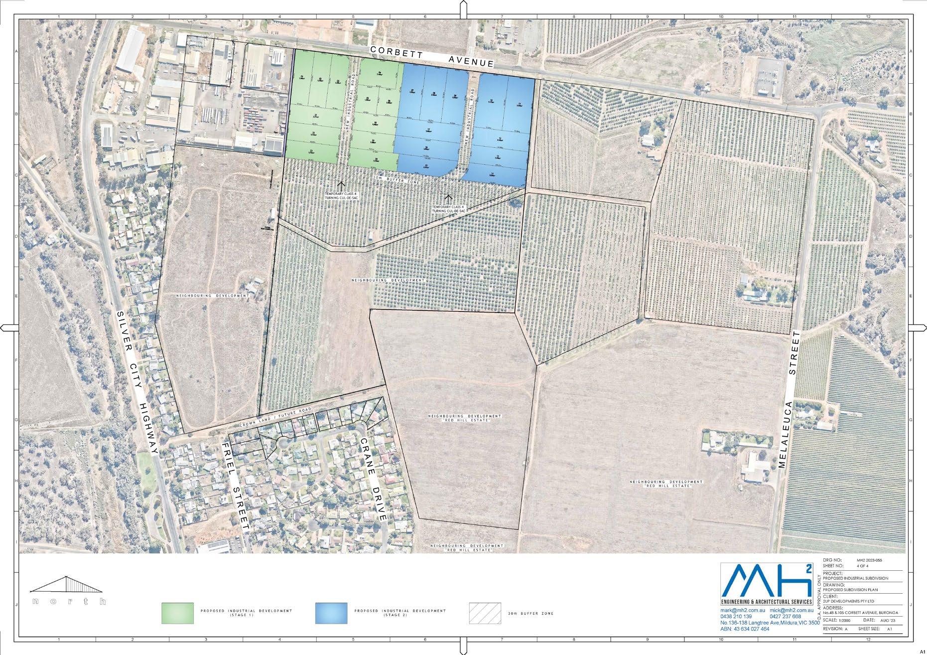
Figure 6: Approved industrial subdivision adjacent to subject site
Consistent
4. Consistency with Far West Regional Plan 2036
The planning proposal addresses and shows consistency with Direction 1 Grow the agribusiness sector, value-added manufacturing opportunities and supply chains and Direction 12 Enhance productivity of employment lands.
The planning proposal seeks to rezone village zoned land to industrial with a MLS, which will provide more industrial land in the area.
Consistent
5. Consistency with Draft Far West Regional Plan 2041
The planning proposal addresses and shows consistency with Objective 13: Protect and develop industry and manufacturing and Objective 14: Protect and leverage existing and future road, rail and air transport routes and infrastructure.
Consistent
6. Consistency with applicable State Environmental Planning Policies
Refer to Table 1 below.
7. Consistency with applicable Section 9.1 Ministerial Directions
Refer to Table 2 below.
Item 9.13 - Attachment 2 Planning proposal assessment report Page 299
T 03 5027 5027 26-28 Adelaide Street WENTWORTH NSW 2648 Page | 7 E council@wentworth.nsw.gov.au PO Box 81 WENTWORTH NSW 2648 W wentworth.nsw.gov.au ABN 96 283 886 815
Table 1: State Environmental Planning Policies consistency assessment
State Environmental Planning Policy (SEPP) Applicable (Y/N) Consistent (Y/N) Assessment
State Environmental Planning Policy (Biodiversity and Conservation) 2021
The site is devoid of native vegetation due to its previous use for horticulture. There will be no removal of vegetation required.
Due to the lack of native vegetation on site, it is considered that the site is not potential or core koala habitat.
The site is not riverine land.
State Environmental Planning Policy (Building Sustainability Index: BASIX) 2004
State Environmental Planning Policy (Exempt and Complying Development Codes) 2008
State Environmental Planning Policy (Housing) 2021
State Environmental Planning Policy (Industry and Employment) 2021
State Environmental Planning Policy No 65
Design Quality of Residential Apartment Development
State Environmental Planning Policy (Planning Systems) 2021
State Environmental Planning Policy (Precincts – Central River City) 2021
State Environmental Planning Policy (Precincts – Eastern Harbour City) 2021
State Environmental Planning Policy (Regional) 2021
State Environmental Planning Policy (Western Parkland City) 2021
The planning proposal is consistent with the SEPP.
Item 9.13 - Attachment 2 Planning proposal assessment report Page 300 T 03 5027 5027 26-28 Adelaide Street WENTWORTH NSW 2648 Page | 8 E council@wentworth.nsw.gov.au PO Box 81 WENTWORTH NSW 2648 W wentworth.nsw.gov.au ABN 96 283 886 815
Y Y
N
N
Y
Y
N
N
N
N
N
N
N
State Environmental Planning Policy (Primary Production) 2021
State Environmental Planning Policy (Resilience and Hazards) 2021
State Environmental Planning Policy (Resources and Energy) 2021
State Environmental Planning Policy (Transport and Infrastructure) 2021
Table 2: Ministerial Directions consistency assessment
1. Planning Systems
1.1 Implementation of Regional Plans Y Y
Our Reference: Prepared By: George Kenende Date:
The site does not relate to rural zoned land
The site is currently used for horticulture but zoned for residential. A PSI was provided with the planning proposal identifying any potential contamination and impacts on rezoning. Due to the results of the PSI any potentially contamination can safely be addressed during the assessment of building works
1.2 Development of Aboriginal Land Council land
1.3 Approval and Referral Requirements
The application is inline with the objectives of the SEPP. Infrastructure is accessible to all new potential industrial allotments.
Comments/Justification
Based on the objective of this planning proposal the following Directions of the Far West Regional Plan 2036 are considered to be relevant and consistent: Direction 1 Grow the agribusiness sector, value-added manufacturing opportunities and supply chains and Direction 12 Enhance productivity of employment lands
Based on the objective of this planning proposal the following Objectives of the Draft Far West Regional Plan 2041 are relevant and consistent: Objective 13: Protect and develop industry and manufacturing and Objective 14: Protect and leverage existing and future road, rail and air transport routes and infrastructure
Y The planning proposal is consistent with direction.
Item 9.13 - Attachment 2 Planning proposal assessment report Page 301
T 03 5027 5027 26-28 Adelaide Street WENTWORTH NSW 2648 Page | 9 E council@wentworth.nsw.gov.au PO Box 81 WENTWORTH NSW 2648 W wentworth.nsw.gov.au ABN 96 283 886 815
N
Y
N
Y Y
Section
Direction Applicable (Y/N) Consistent (Y/N)
9.1
N
Y
1.4 Site Specific Provisions
1.5 Parramatta Road Corridor Urban Transformation Strategy
1.6 Implementation of North West Priority Growth Area Land Use and Infrastructure Implementation Plan
1.7 Implementation of Greater Parramatta Priority Growth Area Interim Land Use and Infrastructure Implementation Plan
1.8 Implementation of Wilton Priority Growth Area Interim Land Use and Infrastructure Implementation Plan
1.9 Implementation of Glenfield to Macarthur Urban Renewal Corridor
1.10 Implementation of the western Sydney Aerotropolis Plan
1.11 Implementation of Bayside West Precincts 2036 Plan
1.12 Implementation of Planning Principles for the Cooks Cove Precinct
1.13 Implementation of St Leonards and Crows Nest 2036 Plan
1.14 Implementation of Greater Macarthur 2040
1.15 Implementation of the Pyrmont Peninsula Place Strategy
1.16 North West Rail Link Corridor Strategy
1.17 Implementation of the Bays West Place Strategy
1.18 Implementation of the Macquarie Park Innovation Precinct
1.19 Implementation of the Westmead Place Strategy
Item 9.13 - Attachment 2 Planning proposal assessment report Page 302 T 03 5027 5027 26-28 Adelaide Street WENTWORTH NSW 2648 Page | 10 E council@wentworth.nsw.gov.au PO Box 81 WENTWORTH NSW 2648 W wentworth.nsw.gov.au ABN 96 283 886 815
N
N
N
N
N
N
N
N
N
N
N
N
N
N
N
N
1.20 Implementation of the Camellia-Rosehill Place Strategy
1.21 Implementation of South West Growth Area Structure Plan
1.22 Implementation of the Cherrybrook Station Place Strategy
2. Design and Place
2.1 Not yet applied
3. Biodiversity and Conservation
Our Reference: Prepared By: George Kenende Date:
3.1 Conservation Zones Y Y The subject site is already mainly cleared for horticulture
3.2 Heritage Conservation
3.3 Sydney Drinking Water Catchments
3.4 Application of C2 and C3 Zones and Environmental Overlays in Far North Coast LEPs
3.5 Recreation Vehicle Areas
3.6 Strategic Conservation Planning
3.7 Public Bushland
3.8 Willandra Lakes Region
3.9 Sydney Harbour Foreshores and Waterways Area
3.10 Water Catchment Protection
4. Resilience and Hazards
4.1 Flooding
4.2 Coastal Management
4.3 Planning for Bushfire Protection
4.4 Remediation of Contaminated Land
4.5 Acid Sulfate Soils
4.6 Mine Subsidence and Unstable Land
5. Transport and Infrastructure
Not located within the Willandra Lakes area
The subject site is not identified as flood prone
The subject site is not bushfire mapped.
PSI provided and any contamination addressed at subdivision/building stage
5.1 Integrating Land Use and Transport Y Y The planning proposal is considered consistent with direction as the subject site is located on a connector road, has access to services and infrastructure.
Item 9.13 - Attachment 2 Planning proposal assessment report Page 303
T 03 5027 5027 26-28 Adelaide Street WENTWORTH NSW 2648 Page | 11 E council@wentworth.nsw.gov.au PO Box 81 WENTWORTH NSW 2648 W wentworth.nsw.gov.au ABN 96 283 886 815
N
N
N
N
N
N
N
N
N
N
N
N
N
N
N
N
N
N
5.2 Reserving Land for Public Purposes N
5.3 Development Near Regulated Airports and Defence Airfields
5.4 Shooting Ranges
6. Housing
6.1 Residential Zones Y Y
6.2 Caravan Parks and Manufactured Home Estates N
7. Industry and Employment
7.1 Employment zones Y Y
The subject land is zoned to allow residential purposes and the planning proposal changes this to industrial zoning. Consistency is achieved by other residential lands available and the roll out of additional residential land in the area. The rezoning will reduce potential land use conflict and need for land to create buffer areas for the conflicting land uses.
This planning proposal is considered consistent with this direction.
No reduction in opportunities for these development types by the rezoning.
The rezoning to E4 increases the land available for industrial uses in an industrial estate area
All services are available for connection to the rezoned land, with the rezoning providing a natural buffer which reduces potential land use conflict.
7.2 Reduction in NonHosted Short-term Rental Accommodation period
7.3 Commercial and Retail Development along the Pacific Highway North Coast
8. Resources and Energy
8.1 Mining, Petroleum Production and Extractive Industries
9. Primary Production
9.1 Rural Zones
9.2 Rural Lands
9.3 Oyster Aquaculture
9.4 Farmland of State and Regional Significance on the NSW Far North Coast
Item 9.13 - Attachment 2 Planning proposal assessment report Page 304 T 03 5027 5027 26-28 Adelaide Street WENTWORTH NSW 2648 Page | 12 E council@wentworth.nsw.gov.au PO Box 81 WENTWORTH NSW 2648 W wentworth.nsw.gov.au ABN 96 283 886 815
N
N
N
N
N
N
N
N
N
Site Assessment
Suitability of site for proposal
Our Reference: Prepared By: George Kenende Date:
The site is deemed suitable for the proposal because of the demand for more industrial land within the area The land around it is already industrial and the planning proposal will better utilise the existing layout of the lands.
Infrastructure
There is adequate infrastructure to support the outcomes of the planning proposal.
Power, sewer, filtered and raw water and stormwater infrastructure is located in the vicinity of the land Industrial land to the north has a subdivision approval with services being designed incorporating future industrial subdivision of the subject land.
Consultation
Internal consultation
Roads and Engineering Department
External consultation Department of Planning & Environment
Financial Implications
Council’s 2023/2024 Fees and Charges include a fee for planning proposals which is $7,885.90. This lodgement fee has been paid by the proponent.
Should the planning proposal proceed and an amendment to the LEP be made, the following will apply to future development on the subject site:
- Section 7.12 Development Contribution Plan
- Servicing Plan No 1 (water and sewerage)
- Servicing Plan No 2 (stormwater)
Recommended Amendments
No amendments proposed to the planning proposal.
Conclusion and Recommendation
That Council:
1. Support the planning proposal to amend the Wentworth LEP 2011 by rezoning the subject site from RU5 Village to E4 General Industrial with a Minimum Lot Size of 1000 square metres
2. Submit the planning proposal to the NSW Department of Planning and Environment for Gateway Determination
Item 9.13 - Attachment 2 Planning proposal assessment report Page 305
T 03 5027 5027 26-28 Adelaide Street WENTWORTH NSW 2648 Page | 13 E council@wentworth.nsw.gov.au PO Box 81 WENTWORTH NSW 2648 W wentworth.nsw.gov.au ABN 96 283 886 815
9.14 WENTWORTH LOCAL ENVIRONMENTAL PLAN
2011 – PLANNING PROPOSAL
TO REDUCE MINIMUM LOT SIZE FROM 3000 SQM TO 2000 SQM AT 18 WILGA ROAD GOL GOL LOT 2 DP 875018
File Number: RPT/23/773
Responsible Officer: Matthew Carlin - Director Health and Planning
Responsible Division: Health and Planning
Reporting Officer: George Kenende - Strategic Planning Officer
Objective:
Strategy:
Summary
4.0 Wentworth Shire is supported by strong and ethical civic leadership with all activities conducted in an open, transparent and inclusive manner
4.1 Consistently engage and consult the whole community to ensure that feedback is captured and considered as part of decision-making and advocating processes
Wentworth Shire Council has received a Planning Proposal from Cadell Consulting Services on behalf of Quad Property Investments Pty Ltd.
The Planning Proposal seeks to amend the Wentworth Local Environmental Plan 2011 (WLEP) by reducing the Minimum Lot Size of 18 Wilga Road Gol Gol Lot 2 DP 875018 (subject site) from 3000 square metres to 2000 square metres.
Recommendation
That Council:
a) Resolves to submit the planning proposal to the Minister for the Department of Planning and Environment for consideration of a Gateway Determination to amend the Wentworth Local Environmental Plan 2011 in accordance with Section 3.34 of the Environmental Planning and Assessment Action 1979
b) Call a division in accordance with S375A of the Local Government Act 1993 (NSW).
Detailed Report
Purpose
The purpose of this report is to provide Council with the information required to make an informed decision with respect to the planning proposal, based on the content of the planning proposal submitted by Cadell Consulting Services (the proponent) and the Planning Proposal Assessment (the assessment) undertaken by the Health and Planning Division.
Background
The allotment subject to the planning proposal is located approximately 90m south-east of the Wilga Rod and Sturt Highway intersection, Gol Gol. The subject land encompasses approximately 8.7 hectares in total area. The site falls under the R5 Large Lot Residential zone with a minimum lot size of 3,000 square metres. The subject site is being used for horticulture cropping and rural residential with associated outbuildings.
The subject site is located within the east Gol Gol residential area with entrance to Wilga Road via a 19m Lane from the north-west. It also has frontage to Sturt Highway from the south-west, Fayes Lane from the south-east and Moontongue Drive from the north.
Refer to Attachment 1 Planning Proposal
Ordinary Meeting AGENDA 13 December 2023 Page 306
Matters under consideration
A detailed assessment of the planning proposal has been undertaken to determine if the proposed minimum lot size reduction is justified in seeking the support from Council to submit to the Department of Planning for consideration of a Gateway Determination.
Refer to Attachment 2 – Planning Proposal Assessment Report
The Assessment Report concludes that the planning proposal as submitted, with no amendments, satisfactorily addresses the requirements of the Guide to Preparing Planning Proposals, Ministerial Directions and applicable State Environmental Planning Policies. The reduction in minimum lot size will not negatively impact the surrounding uses as it will only increase the potential lot yield of the subject lands by an additional 4 allotments. The addition of smaller rural residential allotments is in line with Councils Buronga Gol Gol Structure Plan 2020 and other relevant local and state strategies and plans.
Options
Based on the information contained in this report, the options available to address this matter are to:
1. Submit the Planning Proposal to the Minister for the Department of Planning and Environment for consideration of a Gateway Determination, Or
2. Refuse to support the Planning Proposal.
Legal, strategic, financial or policy implications
There are no implications for Council. The endorsement of the attached Planning Proposal will allow it to be submitted to the Minister for Planning and Public Spaces for consideration of a Gateway Determination in accordance with the Environmental Planning and Assessment Act 1979.
Conclusion
The Planning Proposal prepared by Cadell Consulting Services requests Council’s support for the reduction in minimum lot size of the subject lot from 3,000 square metres to 2,000 square metres.
The assessment of the Planning Proposal determines that the proposal is justifiably supportable and adequately responds to the requirements of the Guide to Preparing Planning Proposals, Ministerial Directions and applicable State Environmental Planning Policies.
Attachments
1. Planning Proposal⇩
2. Planning Proposal Assessment Report⇩
Ordinary Meeting AGENDA 13 December 2023 Page 307
LOT SIZE
Item 9.14 - Attachment 1 Planning Proposal Page 308 1
Cadell
Consulting Services - Planning Proposal – Wilga Road, Gol Gol
PLANNING PROPOSAL AMEND MINIMUM
18 WILGA ROAD, GOL GOL
MicheleBos
CadellConsultingServices
0429021494
POBox26,WentworthNSW2648
michele@cadellconsulting.com.au
www.cadellconsulting.com.au
Document Control
This document has been prepared by Cadell Consulting Services for the exclusive use of the person/organisation for which it has been prepared. This document may not be reproduced, copied, electronically stored or transmitted without obtaining the written permission of Cadell Consulting Services.
Version Date Author Approved
Pre-lodgement October 2023 Michele Bos Cadell Consulting Services
Lodgement October 2023 Michele Bos Cadell Consulting Services
Item 9.14 - Attachment 1 Planning Proposal Page 309 2
Cadell Consulting Services - Planning Proposal – Wilga Road, Gol Gol
3.3.2 Is the Planning Proposal the best means of achieving the objectives or intended outcomes, or is there a better way?
3.3.3 Will the Planning Proposal give effect to the objectives and actions of the applicable regional, or district plan or strategy (including any exhibited draft plans or strategies)? 13
3.3.4 Is the Planning Proposal consistent with a Council Local Strategic Planning Statement that has been endorsed by the
3.3.5 Is the Planning Proposal consistent with any other applicable State and regional studies or strategies? 16
3.3.6 Is the Planning Proposal consistent with applicable State Environmental Planning Policies (SEPPs)?.........................................................................................................................................16
3.3.7. Is the Planning Proposal consistent with applicable Ministerial Directions (Section 9.1 Directions)?...................................................................................................................................16
3.3.8 Is there any likelihood that critical habitat or threatened species, populations or ecological communities, or their habitats, will be adversely affected as a result of the proposal? 16
3.3.9 Are there any other likely environmental effects as a result of the planning proposal and how are they proposed to be managed? 16
3.3.10 Has the Planning Proposal adequately addressed any social and economic effects? 17
3.3.11 Is there adequate public infrastructure for the planning proposal? .................................17
Item 9.14 - Attachment 1 Planning Proposal Page 310 3 Cadell Consulting Services - Planning Proposal – Wilga Road, Gol Gol Contents 1. Introduction 5 1.1 Overview .......................................................................................................................................5 1.2 Format of the Planning Proposal 5 1.3 Supporting Documentation 5 2. Site & Locality Details......................................................................................................................6 2.1 Site Location 6 2.2 Site Description 6 2.3 Surrounding Development..........................................................................................................10 3. Planning Proposal 11 3.1 Objectives or Intended Outcomes 11 3.2 Explanation of Provisions......................................................................................................11 3.3 Justification.................................................................................................................................12
Planning Proposal a result of an endorsed local strategic planning statement, strategic study or report? 12
3.3.1 Is the
12
strategic
Planning Secretary or Greater Sydney Commission, or another strategy or
plan? 14
Item 9.14 - Attachment 1 Planning Proposal Page 311 4
Consulting Services - Planning Proposal – Wilga Road, Gol Gol 3.3.12 What are the views of State and Commonwealth public authorities consulted in accordance with the Gateway Determination?............................................................................17 3.4 Mapping 18 3.5 Community Consultation 18 3.6 Project Timeline ..........................................................................................................................18 Table 1 Attachments to Planning Proposal 5 Table 2 Lot Identifier & Addresses 6 Figure 1 Locality Map (Source: Google Maps) 6 Figure 2 Site Aerial Map (Source: Nearmap) 7 Figure 3 Zone Map (Source: WSC Intramaps).........................................................................................8 Figure 4 MLS Map (Source: WSC Intramaps)..........................................................................................9 Figure 5 Surrounding Land Use Map (Source: Nearmap) .....................................................................10 Figure 6 Existing & Proposed Minimum Lot Size Maps (Source: WSC Intramaps) 11 Figure 7 Buronga Gol Gol Settlement Boundary (Source: LSPS Map 5) 15 Attachment 1 – Subdivision Concept Plan Attachment 2 – State Environmental Planning Policy Assessment Attachment 3 – Section 9.1 Ministerial Directions Assessment
Cadell
1. Introduction
1.1 Overview
This Planning Proposal has been prepared by Cadell Consulting Services on behalf of Quad Property Investments Pty Ltd.
The Proposal seeks to amend the Wentworth Local Environmental Plan 2011 (WLEP) by amending the minimum lot size from 3,000 m2 to 2,000 m2 applied to the subject site.
This Planning Proposal has been prepared in accordance with Section 3.33 of the Environmental Planning and Assessment Act 1979 (EP&A Act), together with satisfying the requirements of the NSW Department of Planning, Industry and Environment Local Environmental Plan Making Guideline August 2023 (DPIE Guideline).
The Planning Proposal is categorised as a ‘Standard’ application, as it proposes to amend a development standard.
1.2 Format of the Planning Proposal
This Planning Proposal has been structured as follows:
• Section 1 introduces the Planning Proposal and supporting documentation
• Section 2 provides a description of the subject site, its locality and the surrounding land uses
• Section 3 contains the Planning Proposal prepared in accordance with the DPIE Guideline
1.3 Supporting Documentation
The following documentation and plans have been prepared to support this Planning Proposal. These attachments are identified in Table 1 below:
Table 1 Attachments to Planning Proposal
2. Consistency with State Environmental Planning Policies Cadell Consulting Services
3. Consistency with Section 9.1 Ministerial Directions Cadell Consulting Services
Item 9.14 - Attachment 1 Planning Proposal Page 312 5
Cadell Consulting Services - Planning Proposal – Wilga Road, Gol Gol
Attachment Name Prepared by 1. Proposed Subdivision Concept Plan MH2 Engineering & Architectural Services Pty Ltd
2. Site & Locality Details
2.1 Site Location
The site is located in Gol Gol in south western New South Wales.
Gol Gol is situated approximately 7 kilometres from the central business district of the regional city of Mildura, in north western Victoria.

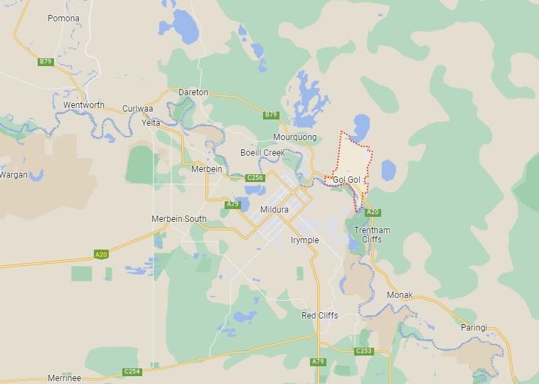
2.2 Site Description
The subject site is located on the eastern fringe of Gol Gol
The site is bounded by the Sturt Highway to the west and Fayes Lane to the south
Access to the subject site is from Wilga Road via an internal lane. The site also has frontage to Moontongue Drive to the north.
The topography of the site is flat and does not contain any significant landforms.
Table 2 Lot Identifier & Addresses
There is an existing dwelling and associated agricultural sheds on the site.
Consulting Services - Planning Proposal – Wilga Road, Gol Gol
Item 9.14 - Attachment 1 Planning Proposal Page 313 6
Cadell
Figure 1 Locality Map (Source: Google Maps)
Lot Identifier Address Area Lot 2 DP875018 18 Wilga Road, Gol Gol 2738 8.7 hectares
The site is predominantly under horticultural crop. Other than the existing horticultural crop, the vegetation on the site includes some planted ornamental trees on the south and east facades of the existing dwelling.
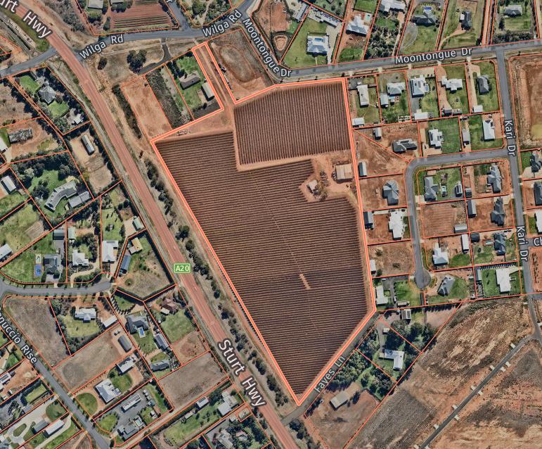

Item 9.14 - Attachment 1 Planning Proposal Page 314 7
Cadell Consulting Services - Planning Proposal – Wilga Road, Gol Gol
Figure 2 Site Aerial Map (Source: Nearmap)
The subject site, which is irregular in shape, has the R5 Large Lot Residential zone applied.

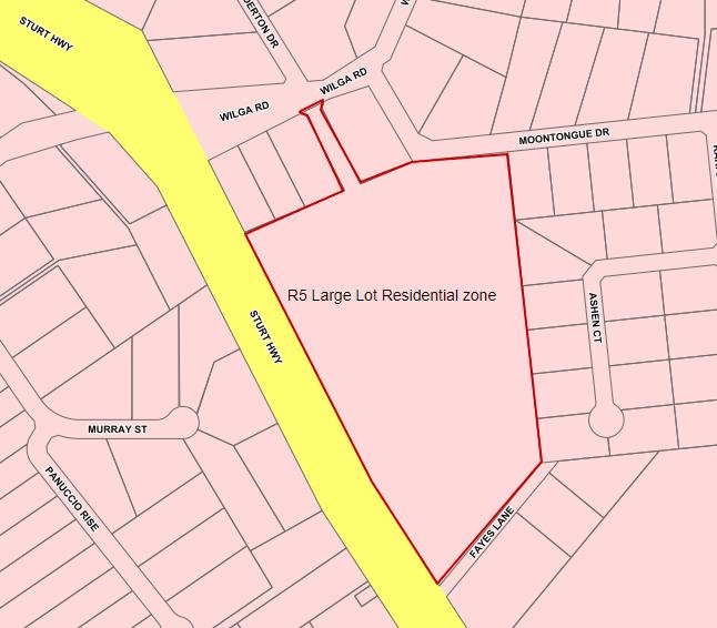
Item 9.14 - Attachment 1 Planning Proposal Page 315 8
Cadell Consulting Services - Planning Proposal – Wilga Road, Gol Gol
Figure 3 Zone Map (Source: WSC Intramaps)
The subject site has a current minimum lot size of 3,000m2 applied.

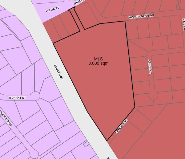
The subject site is not located within the bushfire prone land mapping and is not subject to flooding.
Item 9.14 - Attachment 1 Planning Proposal Page 316 9
Cadell Consulting Services - Planning Proposal – Wilga Road, Gol Gol
Figure 4 MLS Map (Source: WSC Intramaps)
2.3 Surrounding Development
The subject site is surrounded by land under the R5 Large Lot Residential zone. The majority of the surrounding land is developed and contains dwellings and associated buildings.
Land further to the south east has recently been subdivided in to 39 allotments.

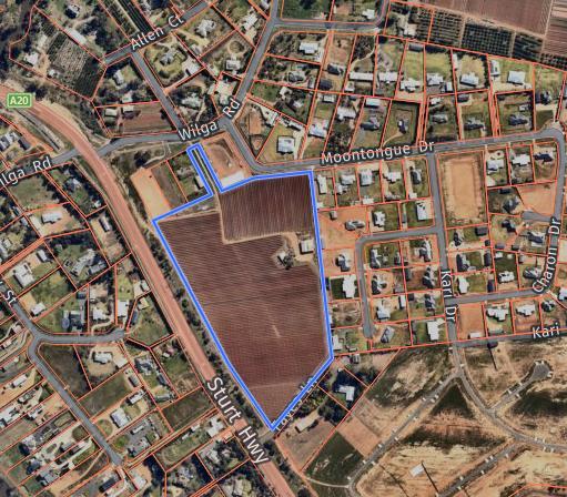
Item 9.14 - Attachment 1 Planning Proposal Page 317 10
Cadell Consulting Services - Planning Proposal – Wilga Road, Gol Gol
Figure 5 Surrounding Land Use Map (Source: Nearmap)
3. Planning Proposal
3.1
Objectives or Intended Outcomes
The objective of this Planning Proposal is to amend the Wentworth Local Environmental Plan 2011 by:
- applying the minimum lot size of 2,000 square metres to the subject site
The intended outcomes of the Planning Proposal are to:
- take advantage of the ongoing increase in demand for land in the large lot residential zone, and
- provide a greater variety of lot sizes in the R5 Large Lot Residential zone, and
- increase the potential lot yield from approximately 20 to 24 lots.
The above intended outcomes will be achieved by amending the current minimum lot size of 3,000m2 down to 2,000m2 .
A proposed subdivision concept plan is provided in Attachment 1.
3.2
Explanation of Provisions
To achieve the objectives and intended outcomes of the Planning Proposal, the proposal seeks to amend the following Minimum Lot Size map applicable to the subject site, being Lot 2 DP875018 at 18 Wilga Road, Gol Gol, from 3,000m2 to 2,000m2:
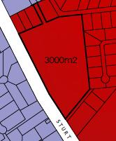
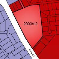
While the current minimum lot size is not considered to be inappropriate, it should be noted that the 3,000 sqm MLS was originally applied as the future servicing of the area could not include connection to Council’s reticulated waste water system.
However, now that there is waste water infrastructure adjacent to the Sturt Highway and it is obtainable, the landowners have elected to reduce the minimum lot size to provide fully serviced lots large residential lots. A higher density of development also equates to a higher profit margin which funds the connection to and provision of waste water services.
Item 9.14 - Attachment 1 Planning Proposal Page 318 11
Cadell Consulting Services - Planning Proposal – Wilga Road, Gol Gol
Wentworth Local Environmental Plan 2011 – Lot Size Map - Sheet LSZ_004G
Figure 6 Existing & Proposed Minimum Lot Size Maps (Source: WSC Intramaps)
3.3 Justification
Section A – Need for the Planning Proposal
3.3.1 Is the Planning Proposal a result of an endorsed local strategic planning statement, strategic study or report?
Local Strategic Planning Statement (LSPS)
Though not a direct result of a recommendation in the LSPS, the Planning Proposal is not inconsistent with the Primary Settlement Areas Strategies for Buronga and Gol Gol, or the Strategic vision, intent and priorities of the LSPS.
Further details are provided in Section 3.3.4.
Buronga Gol Gol Structure Plan (BGGSP)
Whilst not a direct result of a recommendation of the BGGSP, the Planning Proposal is also not inconsistent with the Plan and its recommendation to increase land supply in the R5 Large Lot Residential zone.
Page 45 of the BGGSP identified that there is limited availability of large lot residential zoned land, particularly as there are current landowners who do not intend to develop in the short to medium timeframe.
Additionally, the BGGSP also outlined how Buronga and Gol Gol were experiencing ‘fast pace’ development, and therefore, the land supply should be increased to forestall any potential shortage in the supply of large lot residential land.
It is understood that the landowner of the subject site, at the time the BGGSP was prepared, had no intention of developing the site for large lot residential purposes in the short to medium term. Hence, the BGGSP identifying the site for future development in 2028-2032. However, the ownership of the site has changed and therefore, circumstances change.
The Land Use Principles of the BGGSP also aim to:
iii. Promote a mixture of urban development that allows for flexibility to respond to changes in the community over time and cater for a diversity of land sizes and housing types
The Planning Proposal is consistent with this principle, in that it will provide a greater diversity of lot sizes in the popular R5 zone.
The BGGSP was endorsed by the Department of Planning & Environment 5 November 2021
3.3.2 Is the Planning Proposal the best means of achieving the objectives or intended outcomes, or is there a better way?
The Planning Proposal is the best means of achieving the objectives and intended outcomes for the proposed development, as the minimum lot size provisions in the Wentworth LEP 2011 determine the permissible lot size in the zone.
The current minimum lot size applied to the subject site in the Wentworth LEP 2011 sets the subdivision area for each allotment at a minimum of 3,000m2 .
This Planning Proposal seeks to reduce the minimum lot size to 2,000m2
Cadell Consulting Services - Planning Proposal – Wilga Road, Gol Gol
Item 9.14 - Attachment 1 Planning Proposal Page 319 12
Section B – Relationship to Strategic Planning Framework
3.3.3 Will the Planning Proposal give effect to the objectives and actions of the applicable regional, or district plan or strategy (including any exhibited draft plans or strategies)? Far West Regional Plan 2036 (FWRP)
Goal 3 of the FWRP aims to encourage strong and connected communities by building community resilience and capacity through focus and responding to environmental, industry, climate, economic and demographic changes in the region.
The Actions under Direction 27: Provide greater housing choice that relate to this Planning Proposal include:
27.1 Review planning controls in existing town centres to increase housing options in centres and locations close to services and jobs.
Response: The consequence of this Planning Proposal will be a reduction to the current minimum lot size to increase the variety of lot size options and increase the availability of current R5 zoned land stock, in a location that is adjacent to the township of Gol Gol and where there is access to a variety of services, including lifestyle, community, retail, health, education and employment in Gol Gol, Buronga and Mildura.
27.2 Align infrastructure planning with land release areas to support new developments with adequate infrastructure.
Response: Due to the new sewer infrastructure adjacent to the Sturt Highway, east of Gol Gol, the intensification of the proposed development of this site is supported by the accessibility to provide all services, which now also includes reticulated sewer
The Actions under Direction 29: Manage rural residential development, that relate to this Planning Proposal include:
29.1 Provide opportunities for rural residential development only where it has been identified in a local strategy prepared by council and approved by the Department of Planning and Environment.
Response: The subject site is already zoned for R5 purposes. The subject site also falls within the Buronga and Gol Gol settlement boundary as identified in the Wentworth Shire Council Local Strategic Planning Statement
29.3 Locate rural residential areas:
❖ Close to existing urban settlements….
❖ To avoid and minimise the potential for land use conflicts…
❖ To avoid areas of high environmental, cultural and heritage significance, important agricultural land or areas affected by natural hazards.
Response: The Planning Proposal is consistent with this action as it is adjacent to the urban settlement of Gol Gol; it will not create new or additional land use conflict as the surrounding land contains large lot residential development; the subject site does not contain high environmental, cultural and heritage significance, nor is it considered important agricultural land and is not identified as bushfire or flood prone land.
Consulting Services - Planning Proposal – Wilga Road, Gol Gol
Item 9.14 - Attachment 1 Planning Proposal Page 320 13
Cadell
Draft Far West Regional Plan 2041 (DFWRP)
Part 2 of the DFWRP focuses on the region’s people and communities.
Objective 6: Plan for housing supply, diversity, affordability and resilience aims to respond to anticipated future changes to demographic and household structures, the demand and housing for temporary workers.
The strategies, under Strategy 6.1, that relate to this Planning proposal, include:
❖ creating flexible and feasible planning controls and development standards that support greater housing mix
Response: The Planning Proposal will enable the provision of a greater variety of lot sizes available in the R5 zone, than what is currently available in the Wentworth LEP 2011.
❖ aligning infrastructure and service provision to housing supply needs
Response: The Planning Proposal leverages the ability to now access and utilise reticulated sewer infrastructure that is located adjacent to the Sturt Highway, in addition to all other required services that support the increase in development of the subject site
3.3.4 Is the Planning Proposal consistent with a Council Local Strategic Planning Statement that has been endorsed by the Planning Secretary or Greater Sydney Commission, or another strategy or strategic plan?
Local Strategic Planning Statement (LSPS)
The purpose of the LSPS is to guide and inform new and existing development through a strategic framework that is focused at a local level. It also identifies and aims to negate potential issues through the development of planning priorities and broad actions.
Planning Priority 6 – Sustainable settlements
The Primary Settlement Areas Strategy for Buronga and Gol Gol, as identified in the LSPS, aims for all new urban development to be located within the identified settlement boundary. The subject site falls within the settlement boundary.
Consulting Services - Planning Proposal – Wilga Road, Gol Gol
Item 9.14 - Attachment 1 Planning Proposal Page 321 14
Cadell
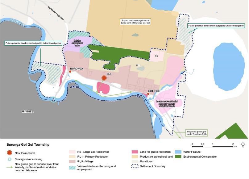

Figure 7 Buronga Gol Gol Settlement Boundary (Source: LSPS Map 5)
The Planning Proposal is also considered to be consistent with sections of the vision statement on Page 11 of the LSPS. The vision statements that relate to this Planning Proposal include:
Over the next 20 years Wentworth Shire will leverage the area’s rural, industrial and residential strengths to generate economic and social growth activities.
Council will investigate and review land use pressures to ensure the shire has a complimentary balance of residential and commercial development opportunities to encourage population growth.
Our towns and villages will capitalise on growth opportunities so that they continue to service our local communities. Our towns will offer a variety of housing choice to support a growing population and as our towns continue to support new growth, our economic base will diversify. Our townships will be vibrant active places to visit and live, providing a variety of basic economic and community services.
The Planning Proposal is also consistent with the Strategic vision, intent and priorities of the LSPS, as it:
❖ Leverages the popularity and demand for R5 zoned land to facilitate population growth by increasing the supply of land for large lot residential development, and
❖ Makes provision for an increase in the variety of lot sizes, with access to all urban services.
Wentworth Community Strategic Plan 2022-2032 (WCSP)
The WCSP aims to respond to a holistic vision of the shire community and acts as a guide and reference point for decision making by elected representatives, community members and council staff.
Cadell Consulting Services - Planning Proposal – Wilga Road, Gol Gol
Item 9.14 - Attachment 1 Planning Proposal Page 322 15
The community vision of the WCSP is ‘Wentworth Shire will work together to create a thriving, attractive and welcoming community’.
The four key strategies of the WCSP include:
Economic – A vibrant, growing and thriving region
Social – A great place to live
Environmental – A community that works to enhance and protect its physical and natural environment
Civic Leadership – is supported by strong and ethical civic leadership with all activities conducted in an open, transparent and inclusive manner.
A common theme during consultation and exhibition of the WCSP, was that the local community desired to witness ongoing and increased population growth in the Wentworth shire. To facilitate an increase in population, land must be available to accommodate and support that growth.
It is considered that the Planning Proposal is consistent with the WCSP and the community’s aspirations to see the population of the Wentworth shire increase, as it will provide additional available land in the popular R5 zone for short term development in Gol Gol.
3.3.5 Is the Planning Proposal consistent with any other applicable State and regional studies or strategies?
There are no other known state or regional strategies or studies applicable to this Planning Proposal.
3.3.6 Is the Planning Proposal consistent with applicable State Environmental Planning Policies (SEPPs)?
An assessment of consistency of the Planning Proposal with the State Environmental Planning Policies is provided in Attachment 2.
3.3.7. Is the Planning Proposal consistent with applicable Ministerial Directions (Section 9.1 Directions)?
An assessment of consistency of the Planning Proposal with the Section 9.1 Ministerial Directions is provided in Attachment 3.
Section C – Environmental, social and economic impact
3.3.8 Is there any likelihood that critical habitat or threatened species, populations or ecological communities, or their habitats, will be adversely affected as a result of the proposal? Other than horticultural crop and ornamental or introduced vegetation on the southern façade of the dwelling, the site is otherwise devoid of vegetation.
As the site has been under horticultural crops for many years, there is no likelihood of critical habitat, threatened species, ecological communities or their habitats being present on the subject site.
3.3.9 Are there any other likely environmental effects as a result of the planning proposal and how are they proposed to be managed?
There are no other known potential environmental effects as a consequence of this Planning Proposal.
Consulting Services - Planning Proposal – Wilga Road, Gol Gol
Item 9.14 - Attachment 1 Planning Proposal Page 323 16
Cadell
3.3.10 Has the Planning Proposal adequately addressed any social and economic effects?
In addition to the social and economic benefits addressed in Section B, in response to consistency with the LSPS and WCSP, there are multiple benefits for the overall communities of Gol Gol and Buronga from this Planning Proposal.
Firstly, it facilitates an increase in the number of lots that will be made available for new residential development, particularly, in the short term. This will enable and accommodate the expanding population in Gol Gol.
Where there is an increase in population, services that support the lifestyle and needs of the local community also need to expand. These services include education facilities, health services, retail, trade and commercial services.
The increase in services culminates in the increase in localised employment and economic activity and, ultimately, capacity of the community.
Growth in population also provides social advantages to both existing and new residents in local communities, through the necessity for expansion of community services and activities driven by both the community and local groups and organisations.
Section D – State and Commonwealth interests
3.3.11 Is there adequate public infrastructure for the planning proposal?
Development of the subject site will include connection to the existing and surrounding infrastructure to fully service the large lot residential development
Subject to the requirements of the consent authority, services required to be provided will include:
- Water, sewer and stormwater
- Safe and adequate access in and out of subject site
- Road width(s)
- Shared pathways
- Street lighting
- Fire hydrants
The developers have met with relevant officers of the Wentworth Shire Council Roads & Engineering department. During that meeting it was confirmed that all of the above infrastructure and services can be provided to adequately support and service the proposed development of the subject site.
Under the current MLS, there could be approximately 20 lots (this includes 30% of the land being used for roads, services etc). With a MLS of 2,000 sqm there could be a maximum of 30 lots. However, the subdivision concept plan included as attachment 1 shows 24 lots. Due to the shape of the subject site, it is anticipated that there will not be the ability to subdivide the area down to 30 lots. An additional 4 lots will not have a negative impact on the Wilga Road/Sturt Highway intersection.
3.3.12 What are the views of State and Commonwealth public authorities consulted in accordance with the Gateway Determination?
It is anticipated that any additional relevant agencies and applicable service providers will be consulted through the community consultation process, as conditioned by the Gateway Determination.
Consulting Services - Planning Proposal – Wilga Road, Gol Gol
Item 9.14 - Attachment 1 Planning Proposal Page 324 17
Cadell
3.4 Mapping
The Planning Proposal seeks to amend the following maps in the Wentworth LEP 2011, as they apply to the subject site:
Lot Size Map – Sheet LSZ_004G
3.5 Community Consultation
In accordance with Section 3.33(2)(e) of the Environmental Planning & Assessment Act 1979, community consultation may need to be conducted
Schedule 1, Part 1, Division 1, 4 of the EP&A Act prescribes community consultation timeframes are either determined by the Gateway Determination to be issued, or 28 days. This is also consistent with the timeframe set out in Table 4 of the Wentworth Shire Council Community Participation Plan.
For this Planning Proposal, the following consultation process may include:
❖ Written notification to adjoining landowners
❖ Public notice in the local newspaper and on Council’s website
❖ Display of the Planning Proposal and supporting documentation made available in Council’s administrative buildings
❖ Planning Proposal documentation made available for public viewing on Council’s website.
During the consultation period, the following documents should be made available for public viewing:
1. Planning Proposal
2. Gateway Determination
3. All appendices and supporting documentation
4. Relevant Council reports and subsequent resolutions.
Consultation with any relevant state agencies will be determined by the Gateway Determination.
At the conclusion of the consultation period, Council will review and consider submissions received regarding the Planning Proposal, and will determine if the Planning Proposal is to be finalised.
3.6 Project Timeline
The NSW Department of Planning, Industry and Environment Local Planning Guideline August 2023 sets a benchmark timeframe for completion of the Planning Proposal process.
For a ‘Standard’ Planning Proposal, the benchmark is a total of 320 days for all stages of the process to be completed. This timeframe does not include pre-lodgement of the Planning Proposal with Council for initial review.
There are many factors that can influence the timeframe process. However, the following table provides indicative timeframes for each stage:
Stage
Pre-lodgement
Submission of Planning Proposal
Gateway Determination
Post Gateway
Public Exhibition & Assessment
Finalisation
October 2023
November 2023
February 2023
March 2023
April 2023
June 2023
Cadell Consulting Services - Planning Proposal – Wilga Road, Gol Gol
Item 9.14 - Attachment 1 Planning Proposal Page 325 18
Timeframe
1 – Subdivision Concept

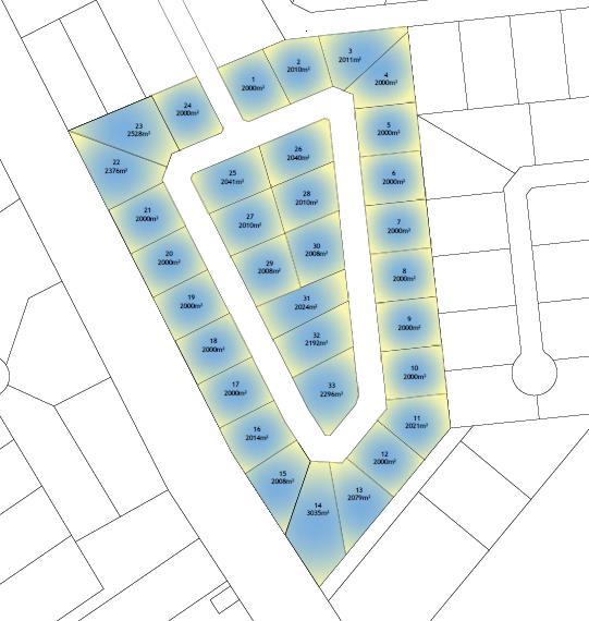
Item 9.14 - Attachment 1 Planning Proposal Page 326 19
Cadell Consulting Services - Planning Proposal – Wilga Road, Gol Gol
Attachment
Attachment 2 – State Environmental Planning Policy Assessment
State Environmental Planning Policy (SEPP) Applicable (Y/N) Consistent (Y/N)
State Environmental Planning Policy (Biodiversity and Conservation) 2021 Y Y
Comments/Justification
Chapter 2 – Vegetation in non-rural areas
The aims of this SEPP are to protect the biodiversity values of trees and other vegetation in non-rural areas and to preserve the amenity of non-rural areas through preservation of trees and other vegetation.
The Planning Proposal is consistent with this SEPP as the subject site does not contain any vegetation, other than ornamental/introduced vegetation and horticultural crop.
Chapter 3 – Koala habitat protection 2020
The aim of this SEPP is to encourage the proper conservation and management of areas of natural vegetation that provide habitat for koalas…and reverse the current trend of koala population decline.
The Planning Proposal is consistent with this SEPP as the subject site is devoid of all native vegetation, other ornamental/introduced vegetation and horticultural crop. Therefore, the site does not contain any koala habitat.
Chapter 4 – Koala habitat protection 2021
The aim of this SEPP is to encourage the conservation and management of areas of natural vegetation that provide habitat for koalas to support a permanent free-living population over their present range…
The Planning Proposal is consistent with this SEPP as the subject site is devoid of all native vegetation, other than ornamental/introduced species and horticultural crop. Therefore, the site does not contain any natural habitat suitable for koalas.
Chapter 5 – River Murray lands
The aims of this SEPP are to conserve and enhance the riverine environment of the River Murray for the benefit of all users.
Item 9.14 - Attachment 1 Planning Proposal Page 327 20
Cadell Consulting Services - Planning Proposal – Wilga Road, Gol Gol
State Environmental Planning Policy (Building Sustainability Index: BASIX) 2004
State Environmental Planning Policy (Exempt and Complying Development Codes) 2008
State Environmental Planning Policy (Housing) 2021
The subject site is identified as being included in Map 35 of the Murray Regional Environmental Plan No. 2 – Riverine Land. It is considered that the Planning Proposal is consistent with this SEPP as the subject site is well setback from the Murray River and therefore, it is unlikely there will be any impact on or near the Murray River.
Chapter 6 – Water catchments Not applicable.
Chapter 13 Strategic conservation planning No applicable.
Y Y The aims of this policy are to encourage sustainable residential development and to ensure consistency in the implementation of the BASIX scheme across the state of New South Wales.
The Planning Proposal does not detract from the aims of this policy.
Y Y The aims of this policy are to streamline the assessment process for development that complies with specified development standards.
The Planning Proposal does not detract from the aims of this policy.
Y Y The principles of this policy include enabling the provision of diverse housing that meets the needs of the community, whilst ensuring that amenity and services are adequately provided to support the development.
The Planning Proposal does not detract from the aims and principles of this policy.
State Environmental Planning Policy (Industry and Employment) 2021
Y Y
Chapter 2 Western Sydney employment area Not applicable.
Chapter 3 Advertising and signage
The aims of this SEPP are to ensure that signage is compatible with the desired amenity and visual character of an area, provides effective communication in suitable locations and is of high quality design and finish.
Item 9.14 - Attachment 1 Planning Proposal Page 328 21
Cadell Consulting Services - Planning Proposal – Wilga Road, Gol Gol
The Planning Proposal does not detract from the aims of this policy.
State Environmental Planning Policy No 65 Design Quality of Residential Apartment Development
State Environmental Planning Policy (Planning Systems) 2021
State Environmental Planning Policy (Precincts – Central River City) 2021
State Environmental Planning Policy (Precincts – Eastern Harbour City) 2021
State Environmental Planning Policy (Regional) 2021
State Environmental Planning Policy (Western Parkland City) 2021
State Environmental Planning Policy (Primary Production) 2021
State Environmental Planning Policy (Resilience and Hazards) 2021
The proposed development as a consequence of this Planning Proposal is not state or regionally significant, the site is not aboriginal land and will not require concurrence.
This SEPP is not applicable as the subject site is not zoned rural, classified or mapped as rural or state significant agricultural land.
Chapter 2 Coastal management Not applicable.
Chapter 3 Hazardous & offensive development
The aims of this SEPP are to:
a) to amend the definitions of hazardous and offensive industries where used in environmental planning instruments, and b) to render ineffective a provision of any environmental planning instrument that prohibits development for the purpose of a storage facility on the ground that the facility is hazardous or offensive if it is not a hazardous or offensive storage establishment as defined in this Chapter, and
c) to require development consent for hazardous or offensive development
Item 9.14 - Attachment 1 Planning Proposal Page 329 22
Cadell Consulting Services - Planning Proposal – Wilga Road, Gol Gol
N
N
N
N
N
N
N
N
proposed to be carried out in the Western Division, and d) to ensure that in determining whether a development is a hazardous or offensive industry, any measures proposed to be employed to reduce the impact of the development are taken into account, and e) to ensure that in considering any application to carry out potentially hazardous or offensive development, the consent authority has sufficient information to assess whether the development is hazardous or offensive and to impose conditions to reduce or minimise any adverse impact, and f) to require the advertising of applications to carry out any such development.
This SEPP does not apply as the Planning Proposal does not relate to land in a coastal environment, hazardous or offensive development and the subject site is currently zoned R5 Large Lot Residential and this will not be amended.
Therefore, the Planning Proposal will not detract from the aims of this policy.
Chapter 4 Remediation of land Not applicable.
State Environmental Planning Policy (Resources and Energy) 2021
State Environmental Planning Policy (Transport and Infrastructure) 2021
State Environmental Planning Policy N
Chapter 2 Infrastructure
The aim of this SEPP is to ensure there is an effective delivery of infrastructure to support the development.
Consultation with Council has already commenced. Council has verbally advised that the development of the site can and will need to be fully serviced. It is considered that current access arrangements off Wilga Road will be adequate to support the subsequent development.
This policy commences on 1 October 2023.
Consulting Services - Planning Proposal – Wilga Road, Gol Gol
Item 9.14 - Attachment 1 Planning Proposal Page 330 23
Cadell
N
Y Y
Item 9.14 - Attachment 1 Planning Proposal Page 331 24
Cadell Consulting Services - Planning Proposal – Wilga Road, Gol Gol
(Sustainable Buildings) 2022
Attachment 3 – Section 9.1 Ministerial Directions Assessment
Comments/Justification
1. Planning Systems
1.1 Implementation of Regional Plans Y Y The Planning Proposal is consistent with the goals, directions and actions of the Far West Regional Plan 2036 and the draft Far West Regional Plan 2041 Specific details are provided in Section 3.3.3 of the Planning Proposal.
1.2 Development of Aboriginal Land Council land
1.3 Approval and Referral Requirements Y Y The Planning Proposal does not propose any referral or concurrence requirements, nor does it nominate any development as ‘designated development’.
1.4 Site Specific Provisions
1.5 Parramatta Road Corridor Urban Transformation Strategy
1.6 Implementation of North West Priority Growth Area Land Use and Infrastructure Implementation Plan
1.7 Implementation of Greater Parramatta Priority Growth Area Interim Land Use and Infrastructure Implementation Plan
1.8 Implementation of Wilton Priority Growth Area Interim Land Use and Infrastructure Implementation Plan
1.9 Implementation of Glenfield to Macarthur Urban Renewal Corridor
1.10 Implementation of the western Sydney Aerotropolis Plan
1.11 Implementation of Bayside West Precincts 2036 Plan
Consulting Services - Planning Proposal – Wilga Road, Gol Gol
Item 9.14 - Attachment 1 Planning Proposal Page 332 25
Cadell
Section 9.1 Direction Applicable (Y/N) Consistent (Y/N)
N
N
N
N
N
N
N
N
N
1.12 Implementation of Planning Principles for the Cooks Cove Precinct
1.13 Implementation of St Leonards and Crows Nest 2036 Plan
1.14 Implementation of Greater Macarthur 2040
1.15 Implementation of the Pyrmont Peninsula Place Strategy
1.16 North West Rail Link Corridor Strategy
1.17 Implementation of the Bays West Place Strategy
1.18 Implementation of the Macquarie Park Innovation Precinct
1.19 Implementation of the Westmead Place Strategy
1.20 Implementation of the Camellia-Rosehill Place Strategy
1.21 Implementation of South West Growth Area Structure Plan
1.22 Implementation of the Cherrybrook Station Place Strategy
2. Design and Place 2.1
3. Biodiversity and Conservation
3.1 Conservation Zones Y Y The Planning Proposal is consistent with this Direction as it does not involve land identified as environmentally sensitive and does not seek to reduce environmental protect standards.
3.2 Heritage Conservation Y Y There are no known or registered heritage items, relics, objects or sites applicable to the subject site or the immediate surrounds.
3.3 Sydney Drinking Water Catchments
3.4 Application of C2 and C3 Zones and Environmental Overlays in Far North Coast LEPs
Item 9.14 - Attachment 1 Planning Proposal Page 333 26
Cadell Consulting Services - Planning Proposal – Wilga Road, Gol Gol
N
N
N
N
N
N
N
N
N
N
N
N
N
3.5 Recreation Vehicle Areas Y Y
3.6 Strategic Conservation Planning N
3.7 Public Bushland N
3.8 Willandra Lakes Region N
3.9 Sydney Harbour Foreshores and Waterways Area N
3.10 Water Catchment Protection N
4. Resilience and Hazards
4.1 Flooding N
4.2 Coastal Management N
4.3 Planning for Bushfire Protection N
4.4 Remediation of Contaminated Land N
4.5 Acid Sulfate Soils N
4.6 Mine Subsidence and Unstable Land N
5. Transport and Infrastructure
5.1 Integrating Land Use and Transport Y Y
5.2 Reserving Land for Public Purposes Y Y
5.3 Development Near Regulated Airports and Defence Airfields N
5.4 Shooting Ranges N
6. Housing
6.1 Residential Zones Y Y
The Planning Proposal does not enable the land to be developed for the purposes of a recreation vehicle area, as defined by the Recreation Vehicles Act 1983.
The subject site is not identified as avoided land or a strategic conservation area.
The subject site is not located within the Willandra Lakes World Heritage Property.
The subject site is not identified as being flood prone.
The subject site is not identified as being bushfire prone land on the NSW Rural Fire Service map.
The subject site is currently zoned R5 Large Lot Residential and the Planning Proposal does not seek to rezone the site or to alter the future use of the site.
The development of the subject site will include safe and adequate access to and from the site for vehicles, cyclists and pedestrians, including connectivity to surrounding development.
The Planning Proposal does not propose to remove or propose any land to be dedicated for public purposes.
The subject site is not located near an airport or defence airfield.
The subject site is not located near a shooting range.
The objectives of this direction are to:
(a) encourage a variety and choice of housing types to provide for existing and future housing needs, (b) make efficient use of existing infrastructure and services and ensure
Consulting Services - Planning Proposal – Wilga Road, Gol Gol
Item 9.14 - Attachment 1 Planning Proposal Page 334 27
Cadell
6.2 Caravan Parks and Manufactured Home Estates N
7. Industry and Employment
7.1 Employment Zones N
7.2 Reduction in NonHosted Short-term Rental Accommodation period N
7.3 Commercial and Retail Development along the Pacific Highway North Coast N
8. Resources and Energy
8.1 Mining, Petroleum Production and Extractive Industries N
9. Primary Production
9.1 Rural Zones N
that new housing has appropriate access to infrastructure and services, and (c) minimise the impact of residential development on the environment and resource lands.
The Planning Proposal is consistent with direction in that it will increase the variety of lot sizes in the zone; it will make more efficient use of the existing and new infrastructure and services available; enables the provision of additional lots within an established large lot residential area; and will be designed appropriately to ensure the most efficient and desirable amenity for residents.
The Planning Proposal does not alter the permissibility or prohibition of caravan parks and manufactured homes estates.
The Planning Proposal does not impact mining, petroleum or extractives industries.
The Planning Proposal is not seeking to rezone from or to a rural zone.
9.2 Rural Lands N The subject site is not in a rural or conservation zone.
9.3 Oyster Aquaculture N
9.4 Farmland of State and Regional Significance on the NSW Far North Coast N
Consulting Services - Planning Proposal – Wilga Road, Gol Gol
Item 9.14 - Attachment 1 Planning Proposal Page 335 28
Cadell
Our Reference: Prepared By: George Kenende Date:
PLANNING PROPOSAL ASSESSMENT REPORT
Application Details
Application No: L1/101
Applicant: Cadell Consulting Services
Proposal Summary: Reduce minimum lot size (MLS) from 3000 sqm to 2000 sqm
Land Owner/s: Rocco Panuccio and Gina Panuccio
Assessment Officer: George Kenende, Strategic Development Officer
Site and Locality Details
Subject Land: Lot 2 DP 875018, 18 Wilga Road Gol Gol
Current LEP provisions: Subject site is zoned R5 Large lot residential with a Minimum Lot Size of 3000 sqm
Current DCP Provisions: Chapter 3 & 4
Proposed amendment controls: Reduce MLS from 3000 sqm to 2000 sqm
Existing Character and Use: The subject site is located within the east Gol Gol residential area with entrance to Wilga Road via a 19m lane from the north-west. The subject site is mainly used for horticulture with a dwelling and associated outbuildings on the land. Native vegetation on the land as the site was historically cleared for horticulture activities. The subject site also has frontage to Sturt Highway from the south-west, Fayes Lane from the south-east and Moontongue Drive from the north. (Figure 1).
Locality: The subject site is in the east Gol Gol residential area and surrounded by R5 zoned land. R5 zoned to the north-east and south-east of the subject site has an MLS of 3000 sqm while the R5 land to the north-west and south-west has a MLS of 5000 sqm (Figure 2).
Item 9.14 - Attachment 2 Planning Proposal Assessment Report Page 336
T 03 5027 5027 26-28 Adelaide Street WENTWORTH NSW 2648 Page | 1 E council@wentworth.nsw.gov.au PO Box 81 WENTWORTH NSW 2648 W wentworth.nsw.gov.au ABN 96 283 886 815
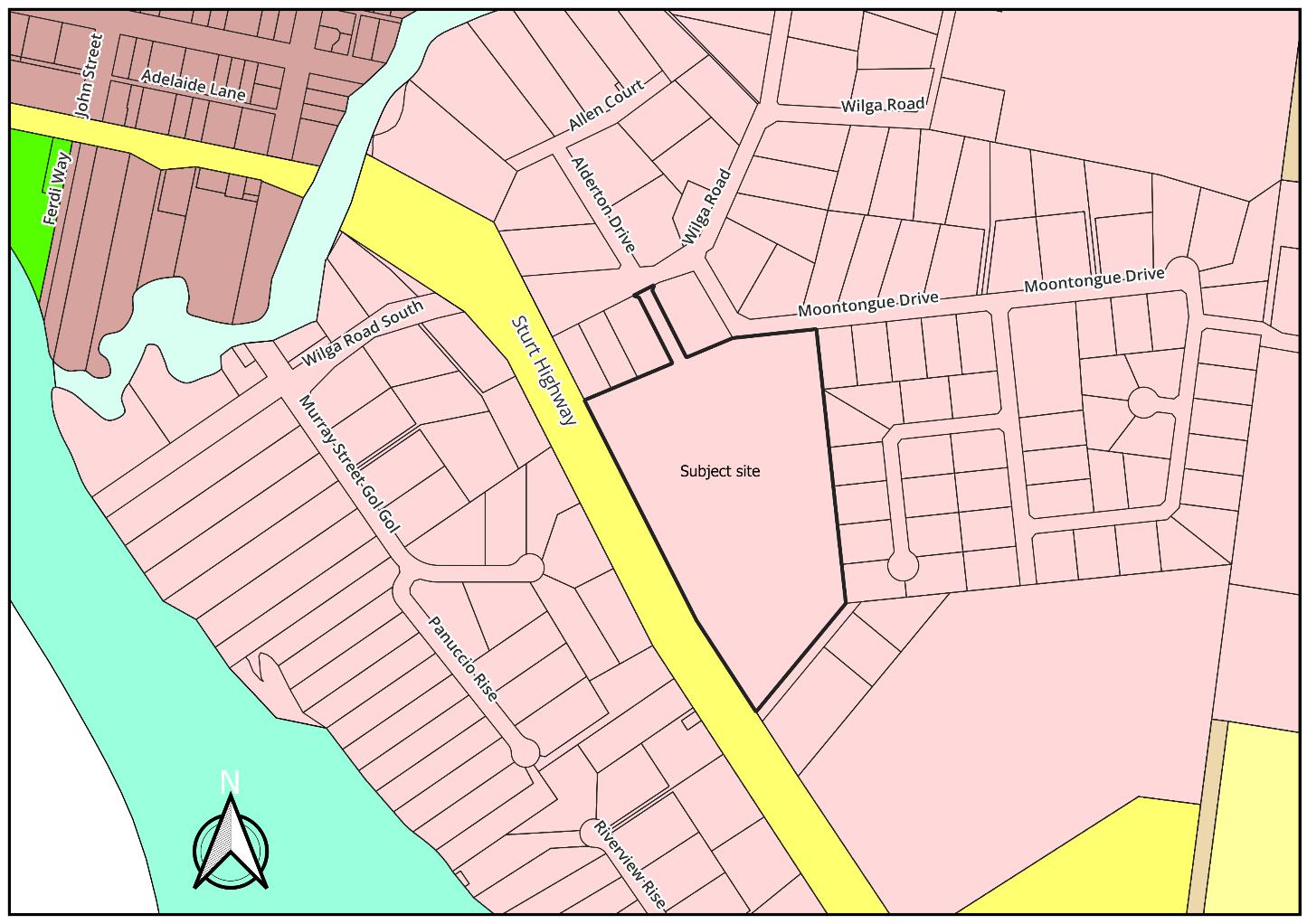
Planning Proposal
Council is in receipt of an application to amend the Wentworth Local Environmental Plan 2011 (WLEP) to:
1. Reduce the minimum lot size from 3000 sqm to 2000 sqm
The intended outcomes of the proposal identified in the planning proposal are to:
- take advantage of the ongoing increase in demand for land in the large lot residential zone, and - provide a greater variety of lot sizes in the R5 Large Lot Residential zone, and - increase the potential lot yield from approximately 20 to 24 lots.
Item 9.14 - Attachment 2 Planning Proposal Assessment Report Page 337 T 03 5027 5027 26-28 Adelaide Street WENTWORTH NSW 2648 Page | 2
council@wentworth.nsw.gov.au PO Box 81 WENTWORTH NSW 2648
ABN 96 283 886 815
E
W wentworth.nsw.gov.au
Figure 1: Subject site location and surrounding land use
Our Reference: Prepared By: George Kenende Date:
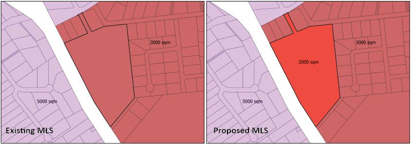
The applicant’s description of the proposal, including supporting information and conceptual plans are provided in Attachment 1 - Planning Proposal.
Strategic Assessment
1. Consistency with WSC Community Strategic Plan 2022-2032
The planning proposal seeks to reduce the MLS from 3000 sqm to 2000 sqm to provide for more residential land that is in demand. The subject land is approximately 8.7 ha, with a lot yield of 20 lots anticipated under the current MLS, and a lot yield of 24 expected from the new MLS. The unique shape of the subject site allows a limited increase in lot yield from the MLS amendment.
Consistent
2. Consistency with WSC Local Strategic Planning Statement
Page 14 of the Planning Proposal addresses how the proposed amendments to the planning instrument are inline with Planning Priority 6 of the Local Strategic Planning Statement (LSPS) In addition to the response to the Local Strategic Planning Statement (LSPS), Planning Priority 7 –Infrastructure Services is applicable to the amendment to ensure all development with the Shire are appropriately serviced. Adequate services are available to the subject site and an increase of 4 allotments will not impact them The new allotments will need to be connected to reticulated sewerage.
Consistent
3. Consistency with any other relevant strategy/study/report
The Buronga Gol Gol Structure Plan 2020 (BGGSP) aims to facilitate quality and sustainable urban development in the localities of Buronga and Gol Gol with short, medium and long-term strategies.
The land is not identified in the recommendations of the BGGSP. However, the plan does identify the need for residential land in the short to medium term.
The land was identified for development in stage three within Figure 4.4 of the BGGSP and with an anticipated commencement of 2028-2032 (Figure 3). As indicated on page 12 of the planning proposal, this anticipated commencement staging in the BGGSP no longer reflects current situation due to the sharp increase demand in diverse residential allotments.
Item 9.14 - Attachment 2 Planning Proposal Assessment Report Page 338
T 03 5027 5027 26-28 Adelaide Street WENTWORTH NSW 2648 Page | 3 E council@wentworth.nsw.gov.au PO Box 81 WENTWORTH NSW 2648 W wentworth.nsw.gov.au ABN 96 283 886 815
Figure 2: Current and Proposed MLS
R5 zoned land within Wilga Road was previous marked for short-term development. However, the owner has indicated the land will continue to be used for agricultural activities in the short to medium term (Figure 4). This creates a short fall in the land supply considering the increased demand for residential land.
Based on an overall view of the surrounding area in terms of servicing, residential land demand and development timeframe, the subject site is the most appropriate location for short-term diverse provision of residential land.
Item 9.14 - Attachment 2 Planning Proposal Assessment Report Page 339 T 03 5027 5027 26-28 Adelaide Street WENTWORTH NSW 2648 Page | 4 E council@wentworth.nsw.gov.au PO Box 81 WENTWORTH NSW 2648 W wentworth.nsw.gov.au ABN 96 283 886 815
Figure 3: Staging of development (Source: BGGSP)
Our Reference: Prepared By: George Kenende Date:
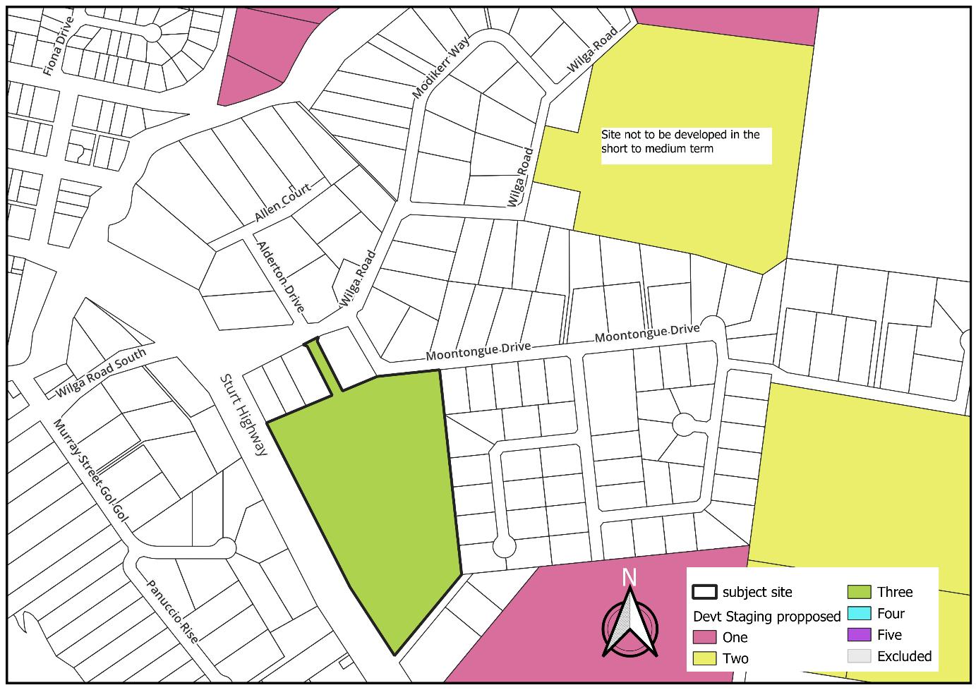
Figure 4: Staging of development changes due to current data
Consistent
4. Consistency with Far West Regional Plan 2036
The planning proposal addresses and shows consistency with Direction 27: Provide greater housing choice and Direction 29: Manage rural residential development
The planning proposal seeks to reduce the MLS of a land already zoned for residential purpose, which will provide more diverse residential lot sizes in the area.
Consistent
5. Consistency with Draft Far West Regional Plan 2041
The planning proposal addresses and shows consistency with Objective 6: Plan for housing supply, diversity, affordability and resilience
Consistent
6. Consistency with applicable State Environmental Planning Policies
Refer to Table 1 below.
7. Consistency with applicable Section 9.1 Ministerial Directions
Refer to Table 2 below.
Table 1: State Environmental Planning Policies consistency assessment
Item 9.14 - Attachment 2 Planning Proposal Assessment Report Page 340
T 03 5027 5027 26-28 Adelaide Street WENTWORTH NSW 2648 Page | 5 E council@wentworth.nsw.gov.au PO Box 81 WENTWORTH NSW 2648 W wentworth.nsw.gov.au ABN 96 283 886 815
Planning Policy (SEPP)
State Environmental Planning Policy (Biodiversity and Conservation) 2021
State Environmental Planning Policy (Building Sustainability Index: BASIX) 2004
State Environmental Planning Policy (Exempt and Complying Development Codes) 2008
State Environmental Planning Policy (Housing) 2021
State Environmental Planning Policy (Industry and Employment) 2021
State Environmental Planning Policy No 65 Design Quality of Residential Apartment Development
State Environmental Planning Policy (Planning Systems) 2021
State Environmental Planning Policy (Precincts – Central River City) 2021
State Environmental Planning Policy (Precincts – Eastern Harbour City) 2021
State Environmental Planning Policy (Regional) 2021
State Environmental Planning Policy (Western Parkland City) 2021
State Environmental Planning Policy (Primary Production) 2021
The site is devoid of native vegetation due to its previous use for horticulture. There will be no removal of vegetation required.
Due to the lack of native vegetation on site, it is considered that the site is not potential or core koala habitat.
The site is not riverine land.
The planning proposal is consistent with the SEPP.
The site does not relate to rural zoned land.
Item 9.14 - Attachment 2 Planning Proposal Assessment Report Page 341 T 03 5027 5027 26-28 Adelaide Street WENTWORTH NSW 2648 Page | 6 E council@wentworth.nsw.gov.au PO Box 81 WENTWORTH NSW 2648 W wentworth.nsw.gov.au ABN 96 283 886 815 State
Applicable (Y/N) Consistent (Y/N) Assessment
Environmental
Y Y
N
N
Y Y
N
N
N
N
N
N
N
N
State Environmental Planning Policy (Resilience and Hazards) 2021
State Environmental Planning Policy (Resources and Energy) 2021
State Environmental Planning Policy (Transport and Infrastructure) 2021
1. Planning Systems
1.1 Implementation of Regional Plans Y Y
Our Reference: Prepared By: George Kenende Date:
The site is currently used for horticulture but zoned for residential. A PSI was not provided and not required as the zoning is not being amended. Any potentially contamination can safely be addressed during the assessment of subdivision/building works
1.2 Development of Aboriginal Land Council land
1.3 Approval and Referral Requirements
1.4 Site Specific Provisions
1.5 Parramatta Road Corridor Urban Transformation Strategy
1.6 Implementation of North West Priority Growth Area Land Use and Infrastructure Implementation Plan
The application is inline with the objectives of the SEPP. Infrastructure is accessible to all new residential allotments.
Comments/Justification
Based on the objective of this planning proposal the following Directions of the Far West Regional Plan 2036 are relevant and consistent:
Direction 27: Provide greater housing choice and
Direction 29: Manage rural residential development
Based on the objective of this planning proposal the following Objectives of the Draft Far West Regional Plan 2041 are relevant and consistent:
Objective 6: Plan for housing supply, diversity, affordability and resilience
Y The planning proposal is consistent with direction.
Item 9.14 - Attachment 2 Planning Proposal Assessment Report Page 342
T 03 5027 5027 26-28 Adelaide Street WENTWORTH NSW 2648 Page | 7 E council@wentworth.nsw.gov.au PO Box 81 WENTWORTH NSW 2648 W wentworth.nsw.gov.au ABN 96 283 886 815
Y
N
Y Y
Section 9.1 Direction Applicable (Y/N) Consistent (Y/N)
Table 2: Ministerial Directions consistency assessment
N
Y
N
N
N
1.7 Implementation of Greater Parramatta Priority Growth Area Interim Land Use and Infrastructure Implementation Plan
1.8 Implementation of Wilton Priority Growth Area Interim Land Use and Infrastructure Implementation Plan
1.9 Implementation of Glenfield to Macarthur Urban Renewal Corridor
1.10 Implementation of the western Sydney Aerotropolis Plan
1.11 Implementation of Bayside West Precincts 2036 Plan
1.12 Implementation of Planning Principles for the Cooks Cove Precinct
1.13 Implementation of St Leonards and Crows Nest 2036 Plan
1.14 Implementation of Greater Macarthur 2040
1.15 Implementation of the Pyrmont Peninsula Place Strategy
1.16 North West Rail Link Corridor Strategy
1.17 Implementation of the Bays West Place Strategy
1.18 Implementation of the Macquarie Park Innovation Precinct
1.19 Implementation of the Westmead Place Strategy
1.20 Implementation of the Camellia-Rosehill Place Strategy
1.21 Implementation of South West Growth Area Structure Plan
1.22 Implementation of the Cherrybrook Station Place Strategy
2. Design and Place
Item 9.14 - Attachment 2 Planning Proposal Assessment Report Page 343 T 03 5027 5027 26-28 Adelaide Street WENTWORTH NSW 2648 Page | 8 E council@wentworth.nsw.gov.au PO Box 81 WENTWORTH NSW 2648 W wentworth.nsw.gov.au ABN 96 283 886 815
N
N
N
N
N
N
N
N
N
N
N
N
N
N
N
N
2.1 Not yet applied
3. Biodiversity and Conservation
3.1 Conservation Zones Y Y
3.2 Heritage Conservation
3.3 Sydney Drinking Water Catchments
3.4 Application of C2 and C3 Zones and Environmental Overlays in Far North Coast LEPs
3.5 Recreation Vehicle Areas
3.6 Strategic Conservation Planning
3.7 Public Bushland
3.8 Willandra Lakes Region
3.9 Sydney Harbour Foreshores and Waterways Area
3.10 Water Catchment Protection
4. Resilience and Hazards
4.1 Flooding
4.2 Coastal Management
4.3 Planning for Bushfire Protection
4.4 Remediation of Contaminated Land
4.5 Acid Sulfate Soils
4.6 Mine Subsidence and Unstable Land
5. Transport and Infrastructure
Our Reference: Prepared By: George Kenende Date:
The subject site is already cleared for horticulture
Not in a heritage area and no heritage items on the land
Not located within the Willandra Lakes area
The subject site is not identified as flood prone
The subject site is not bushfire mapped.
PSI not provided as land already zoned residential with no change to zone proposed and any contamination addressed at subdivision/building stage
5.1 Integrating Land Use and Transport Y Y The planning proposal is considered consistent with direction as the subject site has access to connector road, has access to services and infrastructure.
5.2 Reserving Land for Public Purposes
5.3 Development Near Regulated Airports and Defence Airfields
5.4 Shooting Ranges
6. Housing
Item 9.14 - Attachment 2 Planning Proposal Assessment Report Page 344
T 03 5027 5027 26-28 Adelaide Street WENTWORTH NSW 2648 Page | 9 E council@wentworth.nsw.gov.au PO Box 81 WENTWORTH NSW 2648 W wentworth.nsw.gov.au ABN 96 283 886 815
N
N
N
N
N
N
N
N
N
N
N
N
N
N
N
N
N
N
6.1 Residential Zones Y Y
6.2 Caravan Parks and Manufactured Home Estates
7. Industry and Employment
7.1 Employment zones N
7.2 Reduction in NonHosted Short-term Rental Accommodation period
7.3 Commercial and Retail Development along the Pacific Highway North Coast
8. Resources and Energy
8.1 Mining, Petroleum Production and Extractive Industries
9. Primary Production
9.1 Rural Zones
9.2 Rural Lands
9.3 Oyster Aquaculture
9.4 Farmland of State and Regional Significance on the NSW Far North Coast
Site Assessment
Suitability of site for proposal
The subject land is zoned residential. Planning proposal consistent as it well serviced, provide variety of housing and contained with a residential area.
This planning proposal is considered consistent with this direction.
No reduction in permitted uses as the land zoning is not being amended.
The site is deemed suitable for the proposal because of the demand for more diverse housing lands
The land and surrounding area is already residential and the planning proposal will better utilise the existing land with provision of reticulated sewerage.
Infrastructure
There is adequate infrastructure to support the outcomes of the planning proposal.
Power, filtered and raw water and stormwater infrastructure is located in the vicinity of the land Reticulated sewerage will be made available to the land.
Consultation
Internal consultation
Roads and Engineering Department
External consultation
Department of Planning & Environment
Item 9.14 - Attachment 2 Planning Proposal Assessment Report Page 345 T 03 5027 5027 26-28 Adelaide Street WENTWORTH NSW 2648 Page | 10 E council@wentworth.nsw.gov.au PO Box 81 WENTWORTH NSW 2648 W wentworth.nsw.gov.au ABN 96 283 886 815
N
N
N
N
N
N
N
N
Financial Implications
Our Reference: Prepared By: George Kenende Date:
Council’s 2023/2024 Fees and Charges include a fee for planning proposals which is $7,885.90. This lodgement fee has been paid by the proponent.
Should the planning proposal proceed and an amendment to the LEP be made, the following will apply to future development on the subject site:
- Section 7.12 Development Contribution Plan
- Servicing Plan No 1 (water and sewerage)
- Servicing Plan No 2 (stormwater)
Recommended Amendments No amendments proposed to the planning proposal.
Conclusion and Recommendation
That Council:
1. Support the planning proposal to amend the Wentworth LEP 2011 by reducing the Minimum Lot Size from 3000 square metres to 2000 square metres
2. Submit the planning proposal to the NSW Department of Planning and Environment for Gateway Determination
Item 9.14 - Attachment 2 Planning Proposal Assessment Report Page 346
T 03 5027 5027 26-28 Adelaide Street WENTWORTH NSW 2648 Page | 11 E council@wentworth.nsw.gov.au PO Box 81 WENTWORTH NSW 2648 W wentworth.nsw.gov.au ABN 96 283 886 815
9.15 PROJECT & WORKS UPDATE - DECEMBER 2023
File Number: RPT/23/762
Responsible Officer: Geoff Gunn - Director Roads and Engineering
Responsible Division: Roads and Engineering
Reporting Officer: Jamie-Lee Kelly - Administration Officer
Objective:
3.0 Wentworth Shire is a community that works to enhance and protect its physical and natural environment Strategy: 3.2 Ensure that community assets and public infrastructure are well maintained
Summary
This report provides a summary of the projects and major works undertaken by the Roads and Engineering Department which have been completed during the months of November 2023 and the planned activities for December 2023.
Recommendation
That Council receives and notes the major works undertaken in November 2023 and the scheduled works for the following month.
Detailed Report
Refer below for updates of the works completed in November 2023, and the planned activities for December 2023.
Project and Works Update for November 2023
Pooncarie Menindee Road
• The $9.2 million project is jointly funded on a 50:50 basis with the Australian Government and NSW Government under the Growing Local Economies Fund with Office of Regional Development.
• Line marking was completed along with signage installed and the road opened to all traffic. The project was completed on time and budget and has received positive feedback from the general public.
Heavy Grading
• Funded by the Regional and Local Roads Repair Program, heavy grading commenced on the Old Broken Hill Road starting at the northern end, through to the Popio Road intersection.
Roads
Arumpo Road
• Survey has commenced on the next 25 km section of road construction, estimated to be completed in early December.
Linemarking
• Approximately 30km of linemarking works were scheduled and completed in various locations across the Shire following bitumen reseal works.
Wakefield Lane, Curlwaa
• Survey and design complete.
Ordinary Meeting AGENDA 13 December 2023 Page 347
Projects
Murray Lane, Curlwaa
• Survey and design complete.
Gol Gol East Raw Water System Upgrade
• All remaining equipment installed and connected.
• Commissioning commenced.
Junction Island Bridge
• Concrete placement of bridge foundations on the “boat ramp” side of bridge commenced.
• Boardwalk foundations excavated and formed on the “island” side of bridge commenced.
• Yet to install screw piles due to wet ground conditions on “island” side of bridge.
• Rain delays to concrete placement for foundations.
Jockey Changerooms
• New building under design by supplier for placement in the new year.
Wentworth and Pooncarie Camp Kitchens
• Ongoing meetings with User Groups to refine the project scope and objectives.
• Procurement and design options being refined.
Pink Lake
• Preparation of technical specification and detailed design.
• Providing an additional letter of support from WMI to finalise the licence proposal process with the Department of Planning and Environment.
Wentworth Effluent Disposal System (EDS)
• Removal of the existing gangway.
• Installation of new concrete abutment.
• Delivery of pontoon and other items.
Willow Bend Caravan Park
• Sewer works completed on western half of caravan park.
• Sewer pump station installed.
• Sewer works commenced on the eastern half of caravan park.
• Filtered water and fire service works commenced on the western half of the park.
Amenities Blocks
• External cladding underway.
Rose Street Stormwater – Stage 1
• Preparation of technical specification and detailed design.
Ordinary Meeting AGENDA 13 December 2023 Page 348
Projects
Buronga Toilet Block
• Tenders closed for the Civil and Electrical Packages.
• Four civil tenders and two electrical tenders received.
Pooncarie Toilet Block
• Design complete.
• Review of Environmental Factors prepared.
Wood Street and Gol Gol North Road Sharedway
• Complete
James King Retaining Wall and Footpath
• Retaining Wall concept design complete.
Dareton Toilet Block
• Contract has been awarded.
• Awaiting a Building Permit for construction to commence.
• Expected that works will be completed in readiness for the Coomealla / Dareton Centenary Celebrations.
Wentworth Rowing Club Building
• No further action on major revamp until grant funding confirmed.
• Quote pending from building contractor for the repaint of the internal brick walls and replacement ceiling.
• Modification Development Application pending.
Dareton to Namatjira Sharedway
• Public Tender closed with two tenders received.
• Tender evaluation report issued to Council.
George Gordon Sporting Complex Netball Court Upgrade
• Planning works and mobilisation.
• Commence excavation and removal of existing courts.
Buronga Shared Path
• Construction of the shared path around Buronga Wetland complete.
Wentworth Primary Sewer Repair
• Oval irrigation system complete.
• Reconnection of Oval toilet block to sewer complete.
Wentworth Beverly Street Sewer Repair
• Excavation inspection undertaken, with groundwater issues identified.
• Scope increased from only fixing sunken location to full 50m manhole to manhole length.
• Dewatering system installed and sewer repaired.
Ordinary Meeting AGENDA 13 December 2023 Page 349
Projects and Works scheduled for December 2023
Heavy Grading
• Funded by the Regional and Local Roads Repair Program, heavy grading works will continue the Old Broken Hill and Popio Roads.
Wakefield Lane Curlwaa
Roads
Roads
• Funded by the Roads to Recovery program, the entire length of road will be upgraded with 150mm of imported Class 4 material and bitumen seal.
Murray Road, Curlwaa
• Funded by the Roads to Recovery program, the entire length of road will be upgraded with considerable earthworks to raise the height of the road and 150mm of imported Dirty Metal material suitable for all weather.
Yankabilly Road, Pomona
• Funded by the Roads to Recovery program, the entire length of road will be upgraded with 50mm of imported Dirty Metal. This will bring the road back to a safe standard following the recent flooding event.
Arumpo Road
• Survey to be completed early December.
• Design to be completed by late December.
• The applications for four new gravel pits for the project have been submitted and are awaiting approval.
Wakefield Lane, Curlwaa
• Construction to commence.
Murray Lane, Curlwaa
• Construction to commence.
Ivanhoe and Wilkurra Road Intersection
• Re-sheeting of 4km section of Ivanhoe Road, and 650m of the Wilkurra Road with 150mm imported pavement material. Job completion expected to be early mid December.
Maintenance Grading
• Works are due to commence on the Roo Roo, Old Broken Hill and Anabranch Mail Roads
Gol Gol East Raw Water System Upgrade
• Demonstration and training of upgraded system.
• As-built documentation.
Junction Island Bridge
• Foundations to be complete.
Projects
Ordinary Meeting AGENDA 13 December 2023 Page 350
• Demolition of existing bridge.
• Commence installation of new bridge.
Wentworth EDS
• Installation of new pontoon and gangway.
• Manufacture of switchboard to be complete.
Willow Bend Caravan Park
• Sewer works to be complete.
• Water services to be complete on western half and eastern half to commence.
• Electrical services to be complete on western half.
• Construction of road, retaining wall and caravan pads to commence.
Amenities Blocks
• To be completed in readiness for delivery.
Rose Street Stormwater – Stage 1
• Tendering of the works.
Projects
Buronga Toilet Block
• Review of quotations.
• Award of works.
Pooncarie Toilet Block
• Prepare tender documentation.
Gol Gol Water Treatment Plant – Drainage Works
• Practical completion to be issued.
Dareton to Namatjira Sharedway
• Award of contract.
• Commence planning and documentation.
James King Retaining Wall and Footpath
• Community consultation on design.
George Gordon Sporting Complex Netball Court Upgrade
• Concrete court surface to be poured prior to Christmas with curing over the Christmas break.
Wentworth Sewer Repairs School Oval
• Final topsoil placement and grass seeding scheduled.
Wentworth Beverly Street Sewer Repair
• Backfilling of excavation.
• Repair to filtered water main damaged by the works.
• Reinstatement of road surface and curbing.
Ordinary Meeting AGENDA 13 December 2023 Page 351
Buronga Shared Path
• Works to continue from Buronga Wetlands towards the Riverfront.
Flood Recovery Works
Junction Park
• 2 x Switchboards.
• Installation of the new playground expected to be complete by the end of November.
Flood Recovery
Wentworth Wharf & Riverfront
• No further progress regarding power restoration between park ground lights or park lamps.
Attachments
1. Wentworth EDS⇩
2. Beverley Street Sewer Repairs⇩
3. Buronga Sharedway & Willow Bend Caravan Park⇩ 4. Pooncarie Menindee Road⇩
5. Junction Island Bridge⇩
Ordinary Meeting AGENDA 13 December 2023 Page 352
17/11/2023 17:24
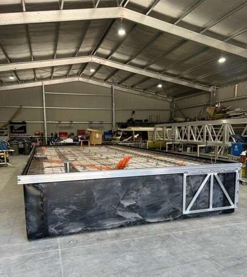
17/11/2023 17:25
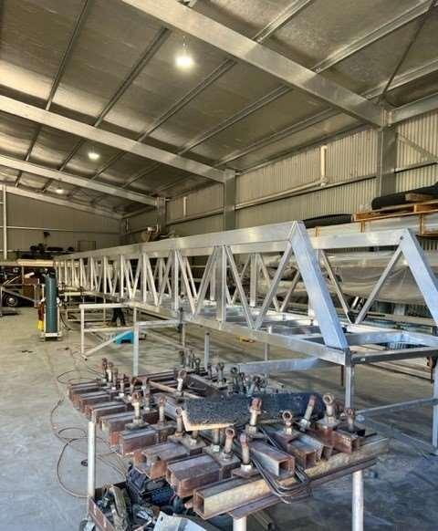
Item 9.15 - Attachment 1 Wentworth EDS Page 353
23/11/2023 08:59
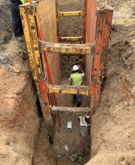
17/11/2023 14:28
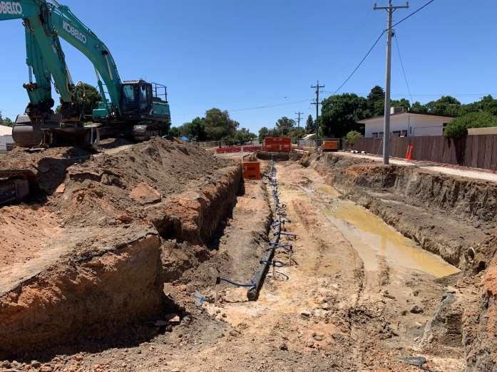
Item 9.15 - Attachment 2 Beverley Street Sewer Repairs Page 354
22/11/2023 10:23
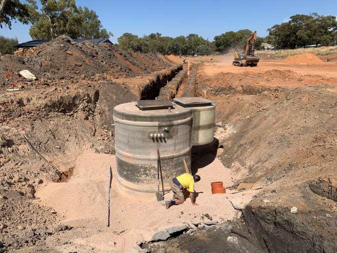
17/11/2023 07:17
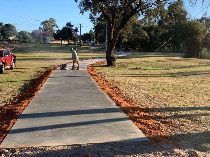
Item 9.15 - Attachment 3 Buronga Sharedway & Willow Bend Caravan Park Page 355
13/11/2023 15:08

13/11/2023 15:06
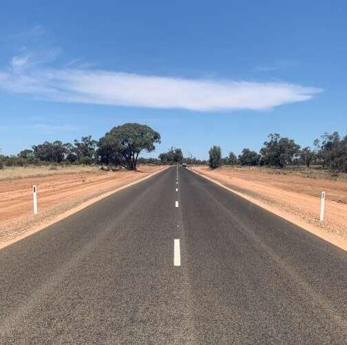
Item 9.15 - Attachment 4 Pooncarie Menindee Road Page 356
28/11/2023 817
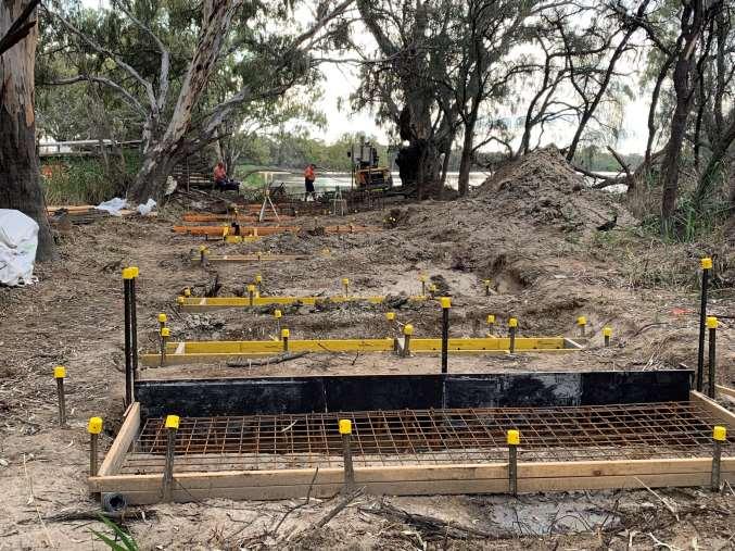
28/11/2023 9:00
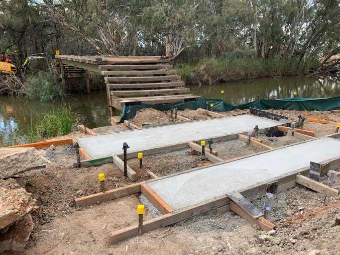
Item 9.15 - Attachment 5 Junction Island Bridge Page 357
Ordinary Meeting AGENDA 13 December 2023 Page 358 10 NOTICES
MOTIONS
QUESTIONS
Nil
OF
/
WITH NOTICE
11 CONFIDENTIAL BUSINESS – ADJOURNMENT INTO CLOSED SESSION
Despite the right of members of the public to attend meetings of a council, the council may choose to close to the public, parts of the meeting that involve the discussion or receipt of certain matters as prescribed under section 10A(2) of the Local Government Act.
With the exception of matters concerning particular individuals (other than councillors) (10A(2)(a)), matters involving the personal hardship of a resident or ratepayer (10A(2)(b)) or matters that would disclose a trade secret (10A(2)(d)(iii)), council must be satisfied that discussion of the matter in an open meeting would, on balance, be contrary to the public interest.
The Act requires council to close the meeting for only so much of the discussion as is necessary to preserve the relevant confidentiality, privilege or security being protected. (section 10B(1)(a))
Section 10A(4) of the Act provides that a council may allow members of the public to make representations to or at a meeting, before any part of the meeting is closed to the public, as to whether that part of the meeting should be closed.
Section 10B(4) of the Act stipulates that for the purpose of determining whether the discussion of a matter in an open meeting would be contrary to the public interest, it is irrelevant that:-
(a) a person may misinterpret or misunderstand the discussion, or
(b) the discussion of the matter may -
(i) cause embarrassment to the council or committee concerned, or to councillors or to employees of the council, or
(ii) cause a loss of confidence in the council or committee.
Recommendation
That Council adjourns into Closed Session, the recording of the meeting be suspended, and members of the press and public be excluded from the Closed Session, and that access to the correspondence and reports relating to the items considered during the course of the Closed Session be withheld unless declassified by separate resolution.
This action is taken in accordance with Section 10A(2) of the Local Government Act, 1993 as the items listed come within the following provisions:-
12.1 Panel Contract - Supply of Building Trades - Professional & Consultation Services - PC2324/01. (RPT/23/683)
This item is classified CONFIDENTIAL under the provisions of Section 10A(2) of the Local Government Act 1993, which permits the meeting to be closed to the public for business relating to (c) information that would, if disclosed, confer a commercial advantage on a person with whom the Council is conducting (or proposes to conduct) business. On balance, the public interest in preserving the confidentiality of information about the tender outweighs the public interest in maintaining openness and transparency in council decision-making because disclosure of this information would reveal pricing and confidential information submitted via the tender process which if disclosed would prevent council from achieving its 'value for money' objectives.
12.2 Panel Contract - Supply of Road Construction Materials - PC2324/03. (RPT/23/684)
This item is classified CONFIDENTIAL under the provisions of Section 10A(2) of the Local Government Act 1993, which permits the meeting to be closed to the public for
Ordinary Meeting AGENDA 13 December 2023 Page 359
business relating to (c) information that would, if disclosed, confer a commercial advantage on a person with whom the Council is conducting (or proposes to conduct) business. On balance, the public interest in preserving the confidentiality of information about the tender outweighs the public interest in maintaining openness and transparency in council decision-making because disclosure of this information would reveal pricing and confidential information submitted via the tender process which if disclosed would prevent council from achieving its 'value for money' objectives.
12.3 Panel Contract - Hire of Construction Plant & Equipment PC2324/02. (RPT/23/685)
This item is classified CONFIDENTIAL under the provisions of Section 10A(2) of the Local Government Act 1993, which permits the meeting to be closed to the public for business relating to (c) information that would, if disclosed, confer a commercial advantage on a person with whom the Council is conducting (or proposes to conduct) business. On balance, the public interest in preserving the confidentiality of information about the tender outweighs the public interest in maintaining openness and transparency in council decision-making because disclosure of this information would reveal pricing and confidential information submitted via the tender process which if disclosed would prevent council from achieving its 'value for money' objectives.
12.4 Plant Replacement - Approval of Tender for new 4WD 48HP Tractor. (RPT/23/745)
This item is classified CONFIDENTIAL under the provisions of Section 10A(2) of the Local Government Act 1993, which permits the meeting to be closed to the public for business relating to (c) information that would, if disclosed, confer a commercial advantage on a person with whom the Council is conducting (or proposes to conduct) business. On balance, the public interest in preserving the confidentiality of information about the tender outweighs the public interest in maintaining openness and transparency in council decision-making because disclosure of this information would reveal pricing and confidential information submitted via the tender process which if disclosed would prevent council from achieving its 'value for money' objectives.
12 5 Plant Replacement - Approval of Tenders for replacement of Plant 34, 39 & 51. (RPT/23/746)
This item is classified CONFIDENTIAL under the provisions of Section 10A(2) of the Local Government Act 1993, which permits the meeting to be closed to the public for business relating to (c) information that would, if disclosed, confer a commercial advantage on a person with whom the Council is conducting (or proposes to conduct) business. On balance, the public interest in preserving the confidentiality of information about the tender outweighs the public interest in maintaining openness and transparency in council decision-making because disclosure of this information would reveal pricing and confidential information submitted via the tender process which if disclosed would prevent council from achieving its 'value for money' objectives.
12.6 PT2324/04 - Dareton to Namatjira Shared Path. (RPT/23/770)
This item is classified CONFIDENTIAL under the provisions of Section 10A(2) of the Local Government Act 1993, which permits the meeting to be closed to the public for business relating to (c) information that would, if disclosed, confer a commercial advantage on a person with whom the Council is conducting (or proposes to conduct) business. On balance, the public interest in preserving the confidentiality of information about the tender outweighs the public interest in maintaining openness and transparency in council decision-making because disclosure of this information would reveal pricing and confidential information submitted via the tender process which if disclosed would prevent council from achieving its 'value for money' objectives.
Ordinary Meeting AGENDA 13 December 2023 Page 360
12 OPEN COUNCIL - REPORT FROM CLOSED COUNCIL
12.1 PANEL CONTRACT - SUPPLY OF BUILDING TRADES - PROFESSIONAL & CONSULTATION SERVICES - PC2324/01
File Number: RPT/23/683
Responsible Officer: Simon Rule - Director Finance and Policy
Responsible Division: Finance and Policy
Reporting Officer: Jamie-Lee Kelly - Administration Officer
Objective:
3.0 Wentworth Shire is a community that works to enhance and protect its physical and natural environment Strategy:
3.2 Ensure that community assets and public infrastructure are well maintained
REASON FOR CONFIDENTIALITY
This item is classified CONFIDENTIAL under the provisions of Section 10A(2) of the Local Government Act 1993, which permits the meeting to be closed to the public for business relating to (c) information that would, if disclosed, confer a commercial advantage on a person with whom the Council is conducting (or proposes to conduct) business. On balance, the public interest in preserving the confidentiality of information about the tender outweighs the public interest in maintaining openness and transparency in council decision-making because disclosure of this information would reveal pricing and confidential information submitted via the tender process which if disclosed would prevent council from achieving its 'value for money' objectives.
Ordinary Meeting AGENDA 13 December 2023 Page 361
12.2 PANEL CONTRACT - SUPPLY OF ROAD CONSTRUCTION MATERIALSPC2324/03
File Number: RPT/23/684
Responsible Officer: Simon Rule - Director Finance and Policy Responsible Division: Finance and Policy Reporting Officer: Jamie-Lee Kelly - Administration Officer
Objective:
3.0 Wentworth Shire is a community that works to enhance and protect its physical and natural environment Strategy: 3.2 Ensure that community assets and public infrastructure are well maintained
REASON FOR CONFIDENTIALITY
This item is classified CONFIDENTIAL under the provisions of Section 10A(2) of the Local Government Act 1993, which permits the meeting to be closed to the public for business relating to (c) information that would, if disclosed, confer a commercial advantage on a person with whom the Council is conducting (or proposes to conduct) business. On balance, the public interest in preserving the confidentiality of information about the tender outweighs the public interest in maintaining openness and transparency in council decision-making because disclosure of this information would reveal pricing and confidential information submitted via the tender process which if disclosed would prevent council from achieving its 'value for money' objectives.
Ordinary Meeting AGENDA 13 December 2023 Page 362
12.3 PANEL CONTRACT - HIRE OF CONSTRUCTION PLANT & EQUIPMENT
PC2324/02
File Number: RPT/23/685
Responsible Officer: Simon Rule - Director Finance and Policy Responsible Division: Finance and Policy Reporting Officer: Jamie-Lee Kelly - Administration Officer
Objective:
3.0 Wentworth Shire is a community that works to enhance and protect its physical and natural environment Strategy: 3.2 Ensure that community assets and public infrastructure are well maintained
REASON FOR CONFIDENTIALITY
This item is classified CONFIDENTIAL under the provisions of Section 10A(2) of the Local Government Act 1993, which permits the meeting to be closed to the public for business relating to (c) information that would, if disclosed, confer a commercial advantage on a person with whom the Council is conducting (or proposes to conduct) business. On balance, the public interest in preserving the confidentiality of information about the tender outweighs the public interest in maintaining openness and transparency in council decision-making because disclosure of this information would reveal pricing and confidential information submitted via the tender process which if disclosed would prevent council from achieving its 'value for money' objectives.
Ordinary Meeting AGENDA 13 December 2023 Page 363
12.4 PLANT REPLACEMENT - APPROVAL OF TENDER FOR NEW 4WD 48HP TRACTOR
File Number: RPT/23/745
Responsible Officer: Geoff Gunn - Director Roads and Engineering
Responsible Division: Roads and Engineering Reporting Officer: Samantha Wall - Projects Administration
Objective:
3.0 Wentworth Shire is a community that works to enhance and protect its physical and natural environment Strategy: 3.4 Use and manage our resources wisely
REASON FOR CONFIDENTIALITY
This item is classified CONFIDENTIAL under the provisions of Section 10A(2) of the Local Government Act 1993, which permits the meeting to be closed to the public for business relating to (c) information that would, if disclosed, confer a commercial advantage on a person with whom the Council is conducting (or proposes to conduct) business. On balance, the public interest in preserving the confidentiality of information about the tender outweighs the public interest in maintaining openness and transparency in council decision-making because disclosure of this information would reveal pricing and confidential information submitted via the tender process which if disclosed would prevent council from achieving its 'value for money' objectives.
Ordinary Meeting AGENDA 13 December 2023 Page 364
12.5 PLANT REPLACEMENT - APPROVAL OF TENDERS FOR REPLACEMENT OF PLANT 34, 39 & 51
File Number: RPT/23/746
Responsible Officer: Geoff Gunn - Director Roads and Engineering Responsible Division: Roads and Engineering Reporting Officer: Samantha Wall - Projects Administration
Objective:
3.0 Wentworth Shire is a community that works to enhance and protect its physical and natural environment Strategy: 3.4 Use and manage our resources wisely
REASON FOR CONFIDENTIALITY
This item is classified CONFIDENTIAL under the provisions of Section 10A(2) of the Local Government Act 1993, which permits the meeting to be closed to the public for business relating to (c) information that would, if disclosed, confer a commercial advantage on a person with whom the Council is conducting (or proposes to conduct) business. On balance, the public interest in preserving the confidentiality of information about the tender outweighs the public interest in maintaining openness and transparency in council decision-making because disclosure of this information would reveal pricing and confidential information submitted via the tender process which if disclosed would prevent council from achieving its 'value for money' objectives.
Ordinary Meeting AGENDA 13 December 2023 Page 365
12.6
PT2324/04 - DARETON TO NAMATJIRA SHARED PATH
File Number: RPT/23/770
Responsible Officer: Geoff Gunn - Director Roads and Engineering
Responsible Division: Roads and Engineering
Reporting Officer: Michael Hilliard - Project Engineer
Objective: 3.0 Wentworth Shire is a community that works to enhance and protect its physical and natural environment
Strategy: 3.5 Infrastructure meets the needs of our growing Shire
REASON FOR CONFIDENTIALITY
This item is classified CONFIDENTIAL under the provisions of Section 10A(2) of the Local Government Act 1993, which permits the meeting to be closed to the public for business relating to (c) information that would, if disclosed, confer a commercial advantage on a person with whom the Council is conducting (or proposes to conduct) business. On balance, the public interest in preserving the confidentiality of information about the tender outweighs the public interest in maintaining openness and transparency in council decision-making because disclosure of this information would reveal pricing and confidential information submitted via the tender process which if disclosed would prevent council from achieving its 'value for money' objectives.
Ordinary Meeting AGENDA 13 December 2023 Page 366
24 January 2024
Ordinary Meeting AGENDA 13 December 2023 Page 367
13 CONCLUSION OF THE MEETING NEXT MEETING
