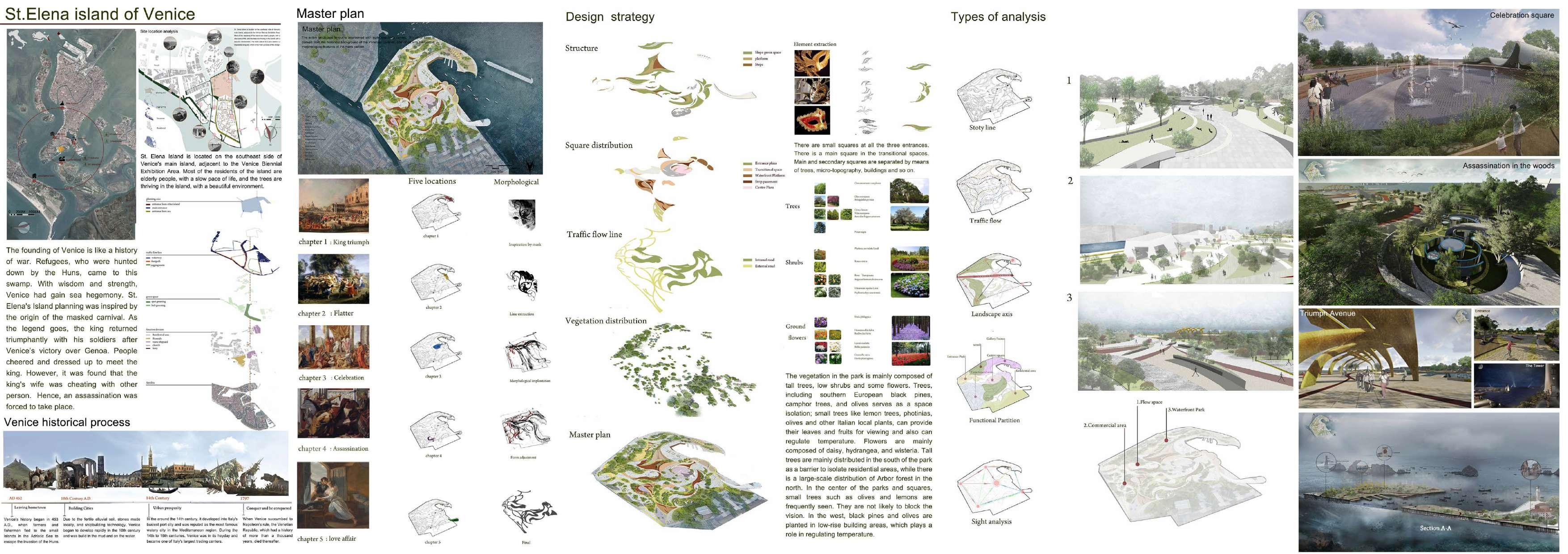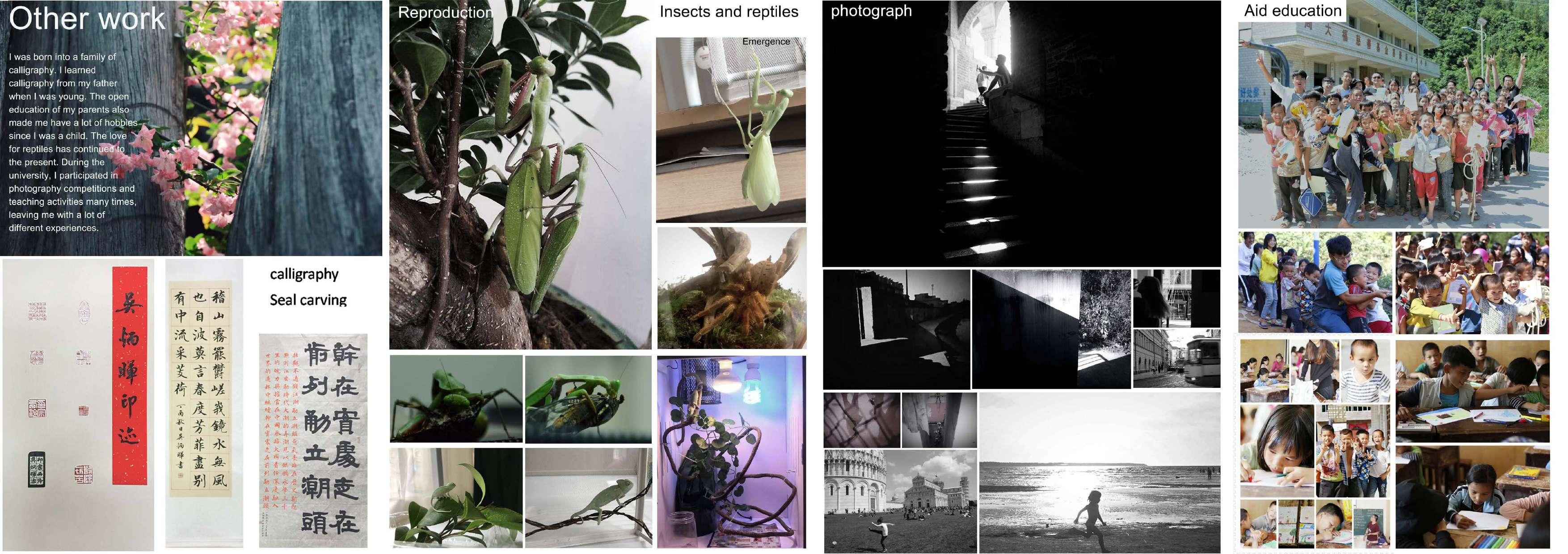
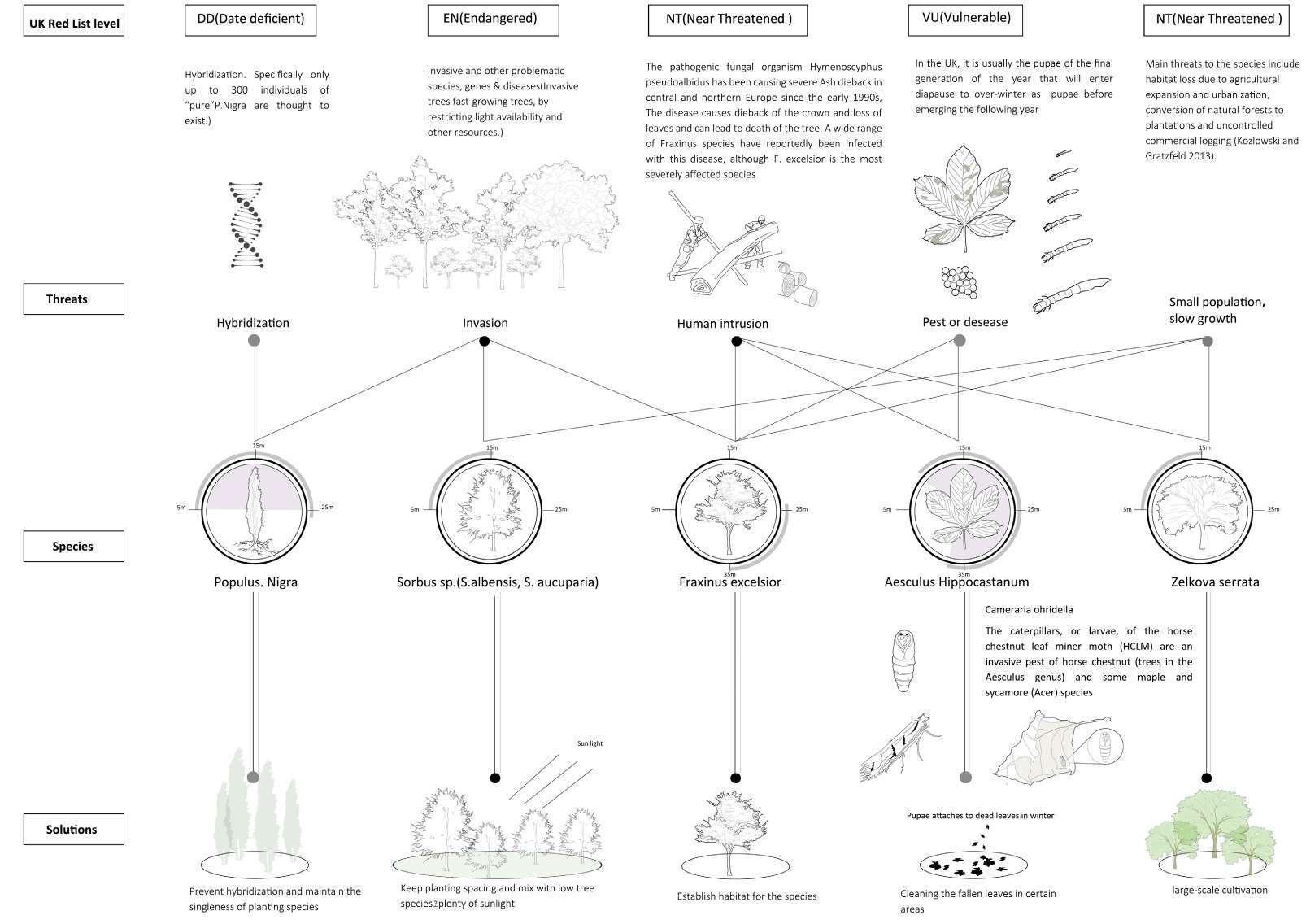
Ecological value analysis
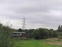
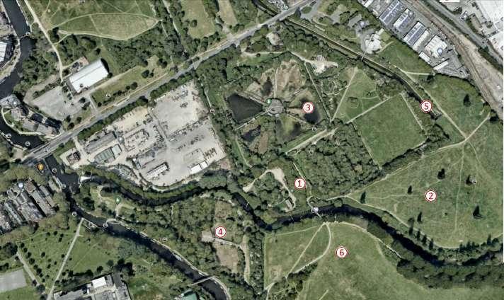
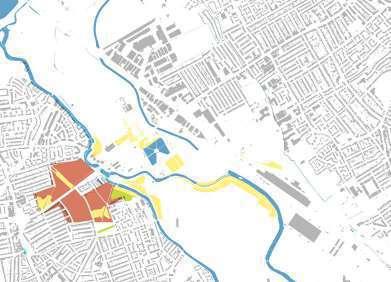
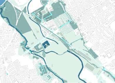
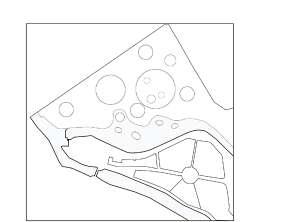
The Middlesex filter bed is located on the south side of the Walthamstow Wetland Ecosystem, in an ecologically threatened area, and the lee river connects the two sites and crosses the site. Flooding occurs during wet periods. There is snipe habitat on the south side of the site and the cricket field on the north side is considered important bird habitat. The site is of high ecological design value. Eco impact risk zone Important Bird Areas
Age structure of the site population
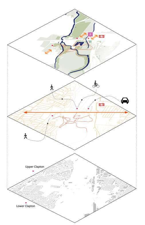
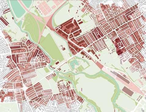
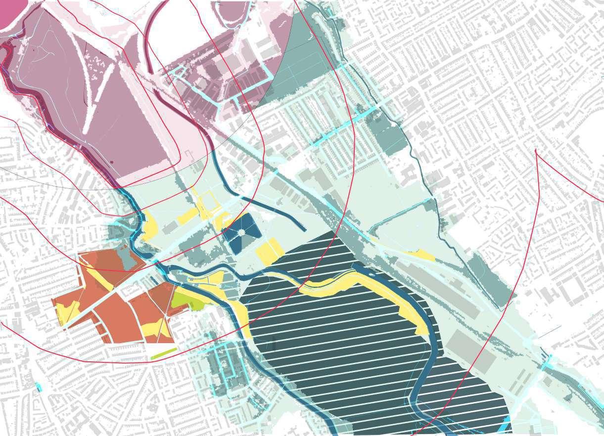
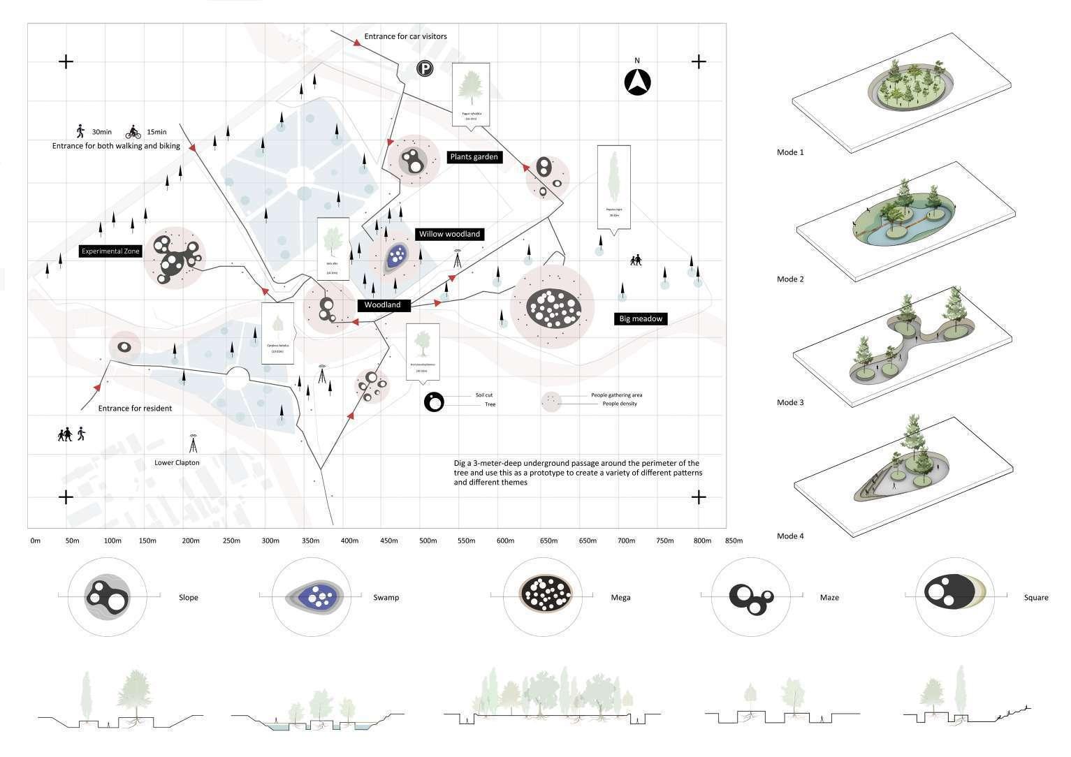
The high density of residential areas to the west and east of the site, where residents can walk to the site in 10 minutes, has led to a design strategy to transform this nature reserve into a more residential oriented site, finding a balance between harmonizing ecological and residential activities. The age structure of the site was analyzed to divide the population into mainly elderly people over 65 years old and children under 15 years old, and the distribution of age in the residential area was roughly calculated by the difference in color.
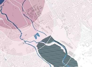

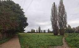
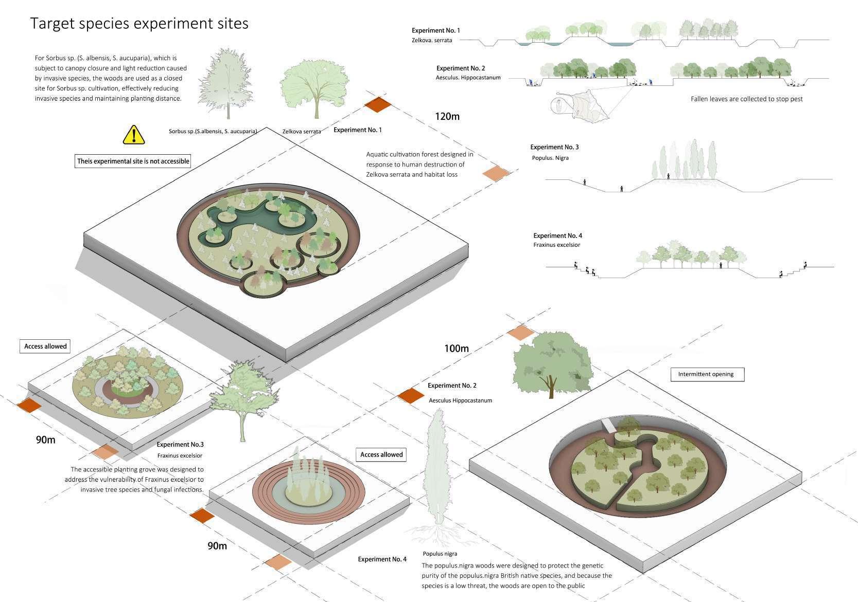
This area in the middlesex filter bed is currently left unused as an abandoned parking lot. The design strategy is to convert it into a forested green space, increasing the area and integration of the nature reserve and reflecting its ecological value. Around 7.5 hectares
Materiality of the design site
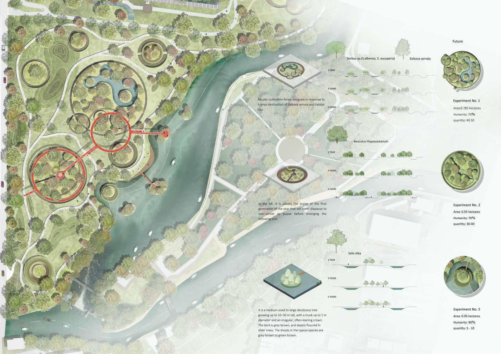
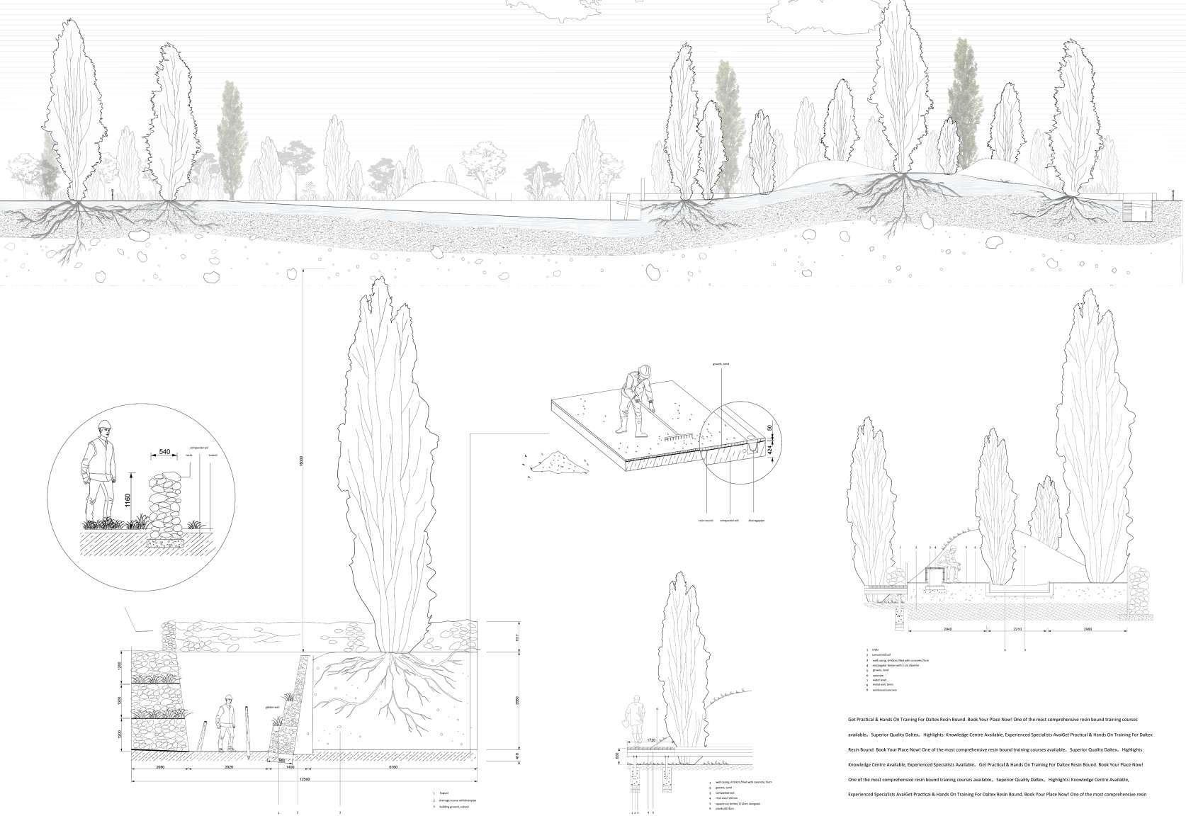
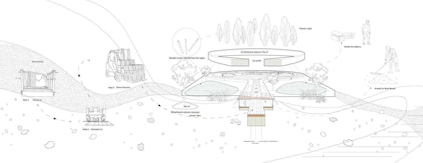
The material of the site is basically self-sufficient. The excavated soil of the site reaches about 200π cubic meters. By filling it in the surrounding area, a microtopography is created, making the space change and making full use of the soil. The slope paving mainly adopts resin bound technology to naturally fix the gravel on the ground. On the pavement, part of the masonry pavement used comes from the processing of the nearby stone company, and the dead tree trunks on the site are also collected for the decoration of the underground space.
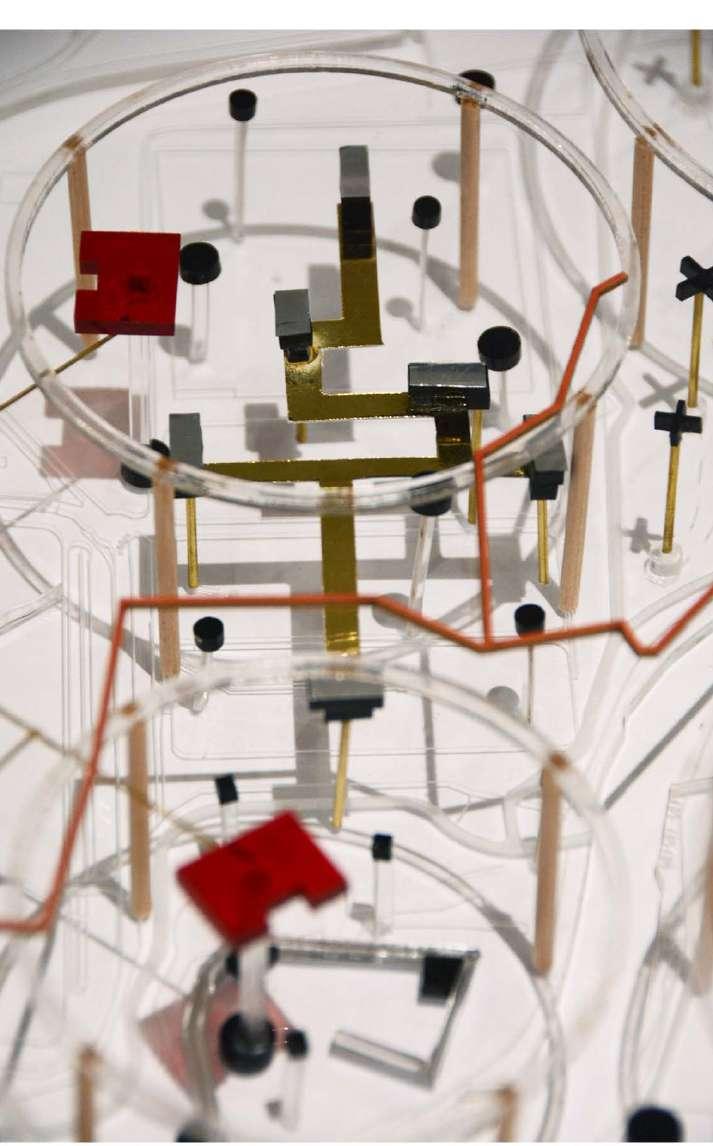
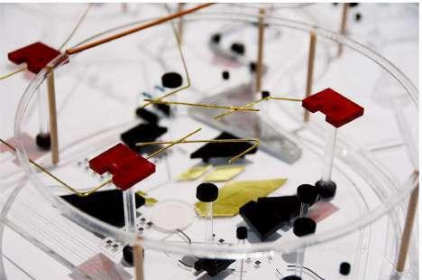


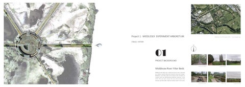
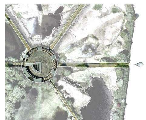
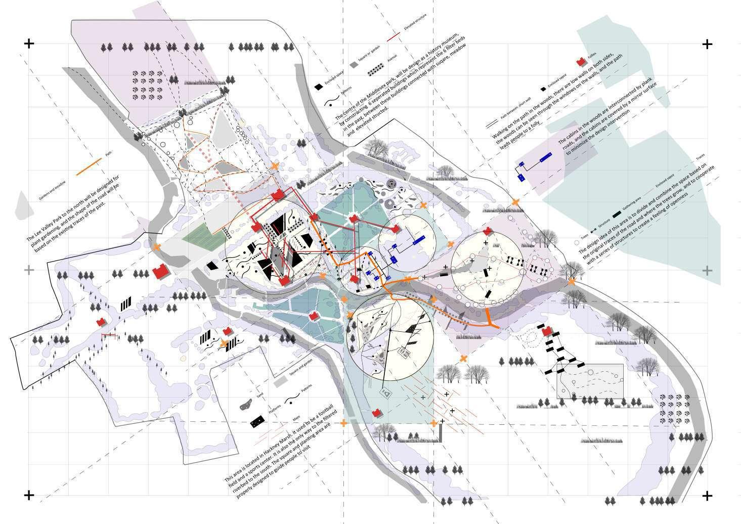
Middlesex Experiment Arboretum Masterplan
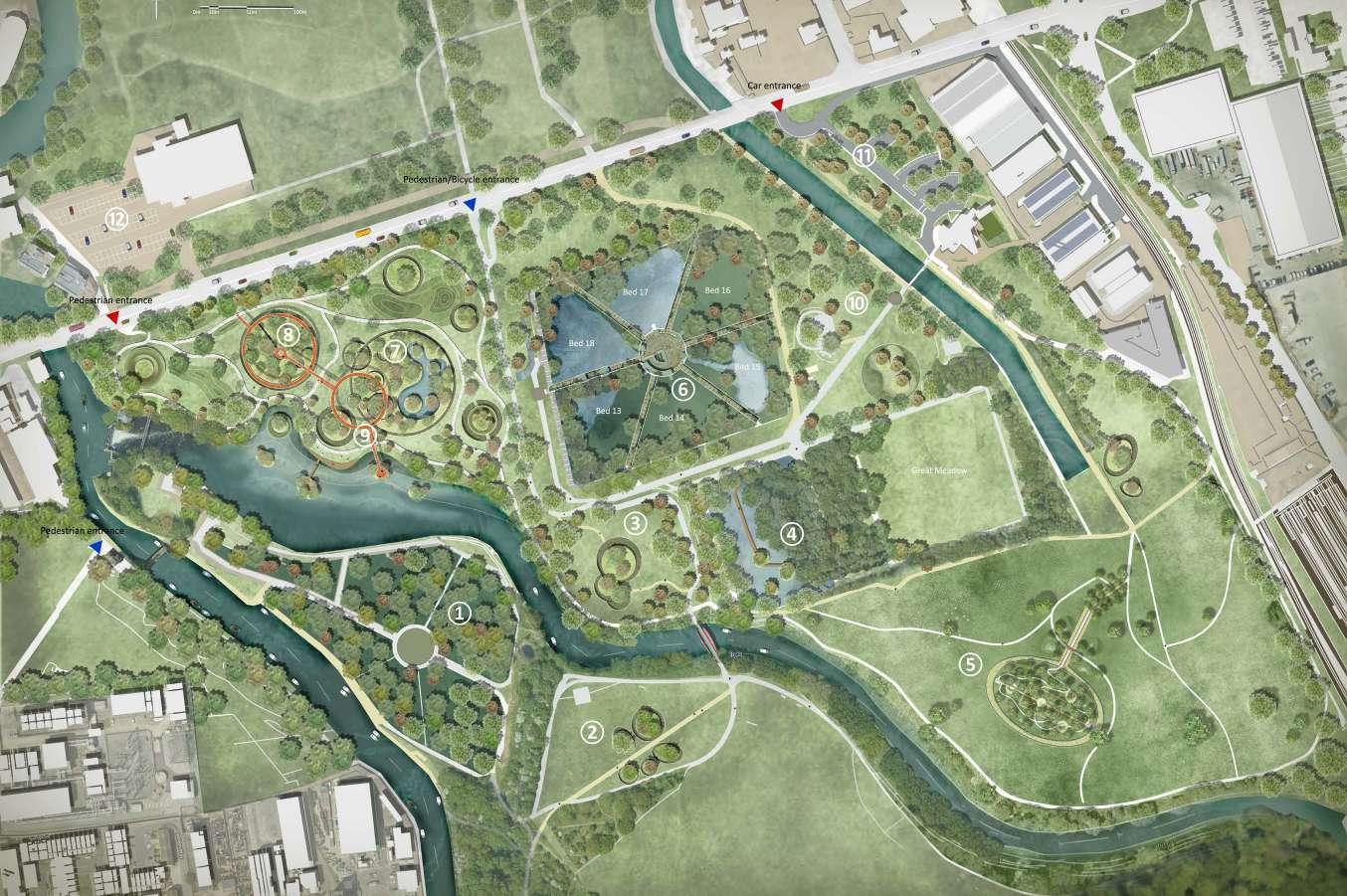
Middlesex Experiment Arboretum
WHAT IS THE PROJECT ?
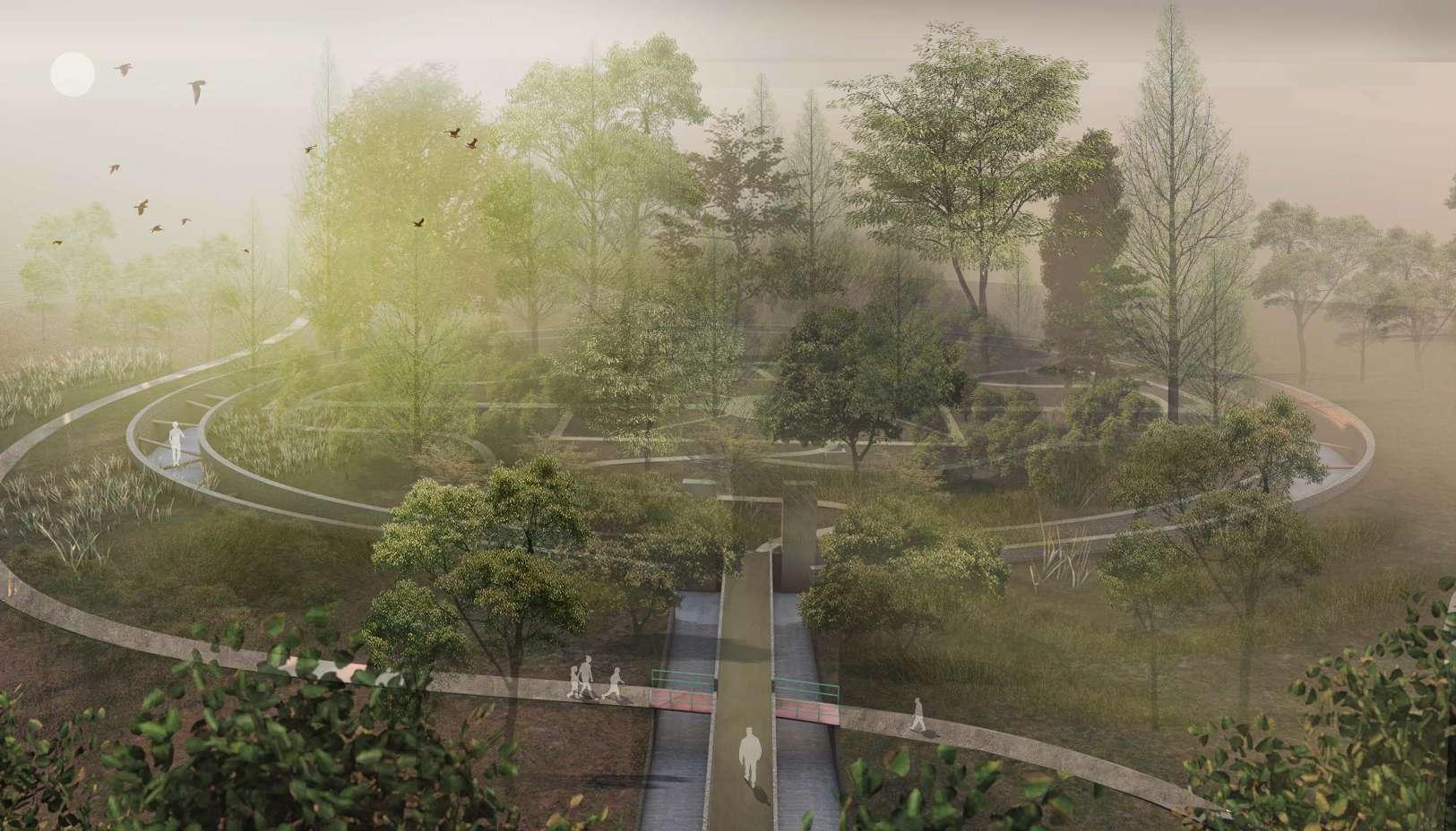
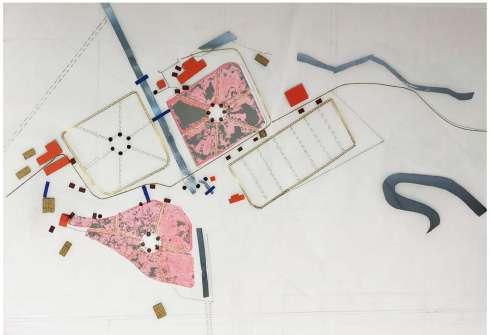
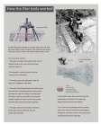
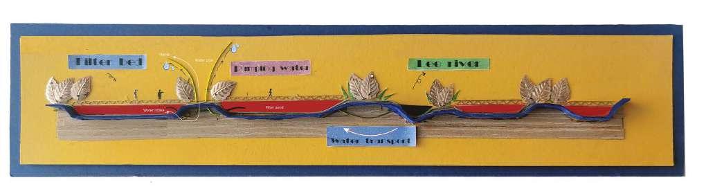
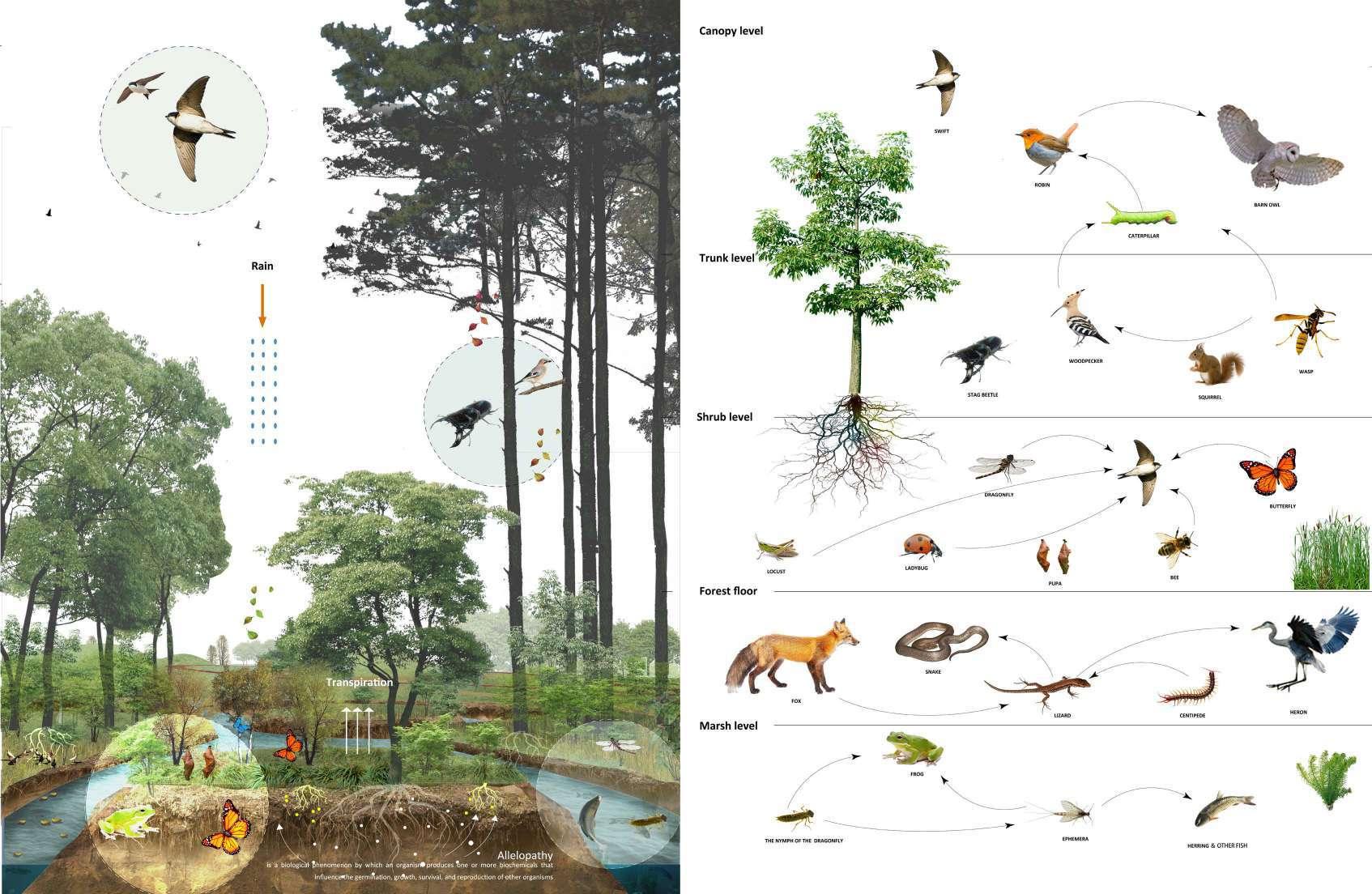
This is about a revival of a pre-industrial site, this place was famous for 19th pumping station, although with more than 100 years ecological restoration, the middlesx filter beds had successfully transformed into a natural reserve, there are still have so many empty space left, making good use of these places can be the key to activate the region, making it a place for gathering.
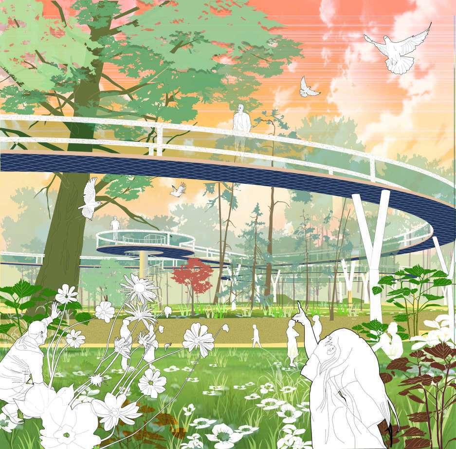
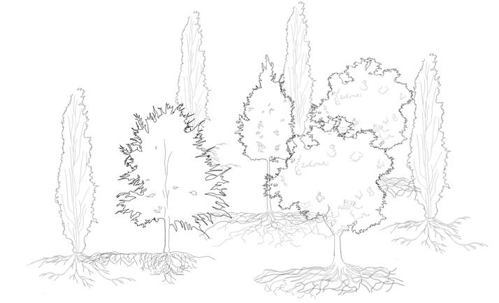
This technical report will only focus on a small part of the whole site - "big meadow" area. Design is based on its broad view and a specail trees called populus nigra, trying to create a tree memorial park, the main strategy is by creating a undergound space lead people come in exploring the roots, and an overgound woods listening the sound of trees.
HOW THE PROJECT DOING ?
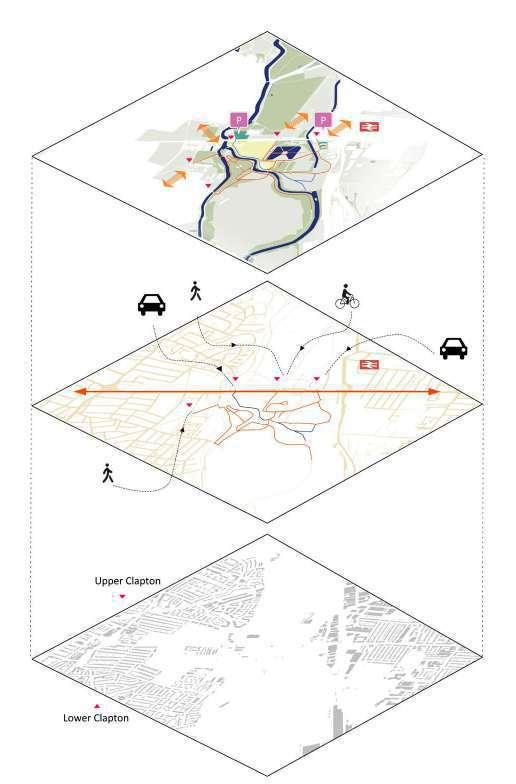
This area currently is a nature reserve but with good advantages to connect with nearby community, which requires this project more interactive with people. The main idea is to design based on a eco tourism project, make good use of the historical site and nature reserve, to attract more people, providing more chance to connect urban life and nature tourism.
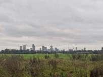
Site: The Middlesex River filter Bed London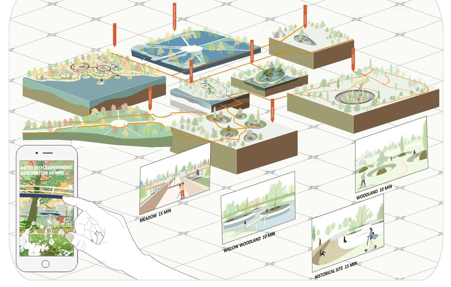
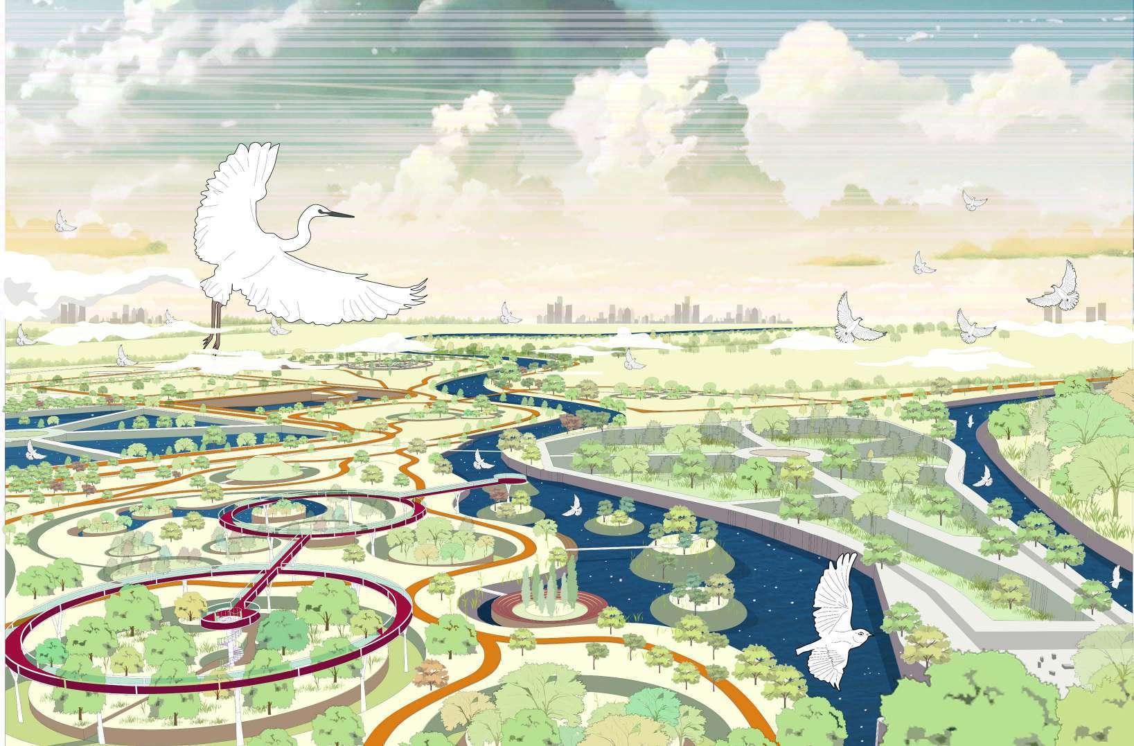
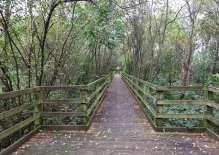
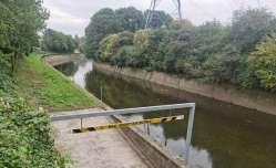
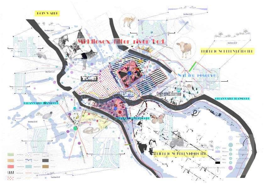
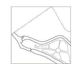
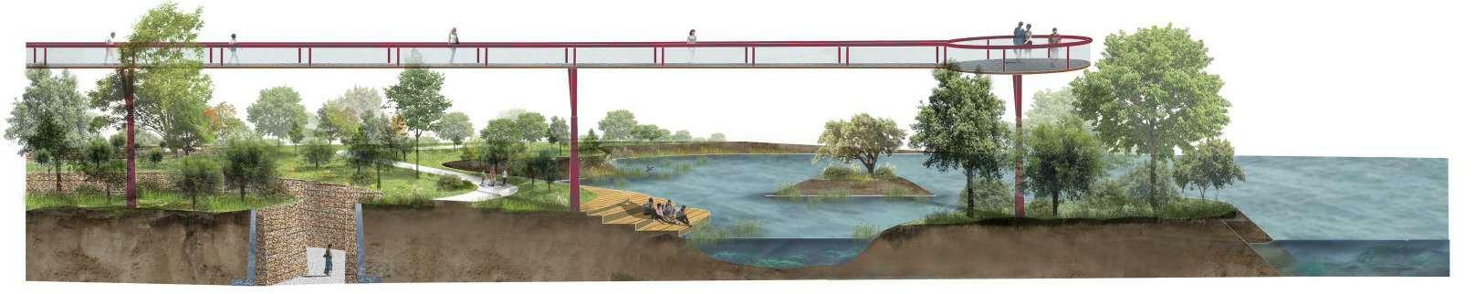
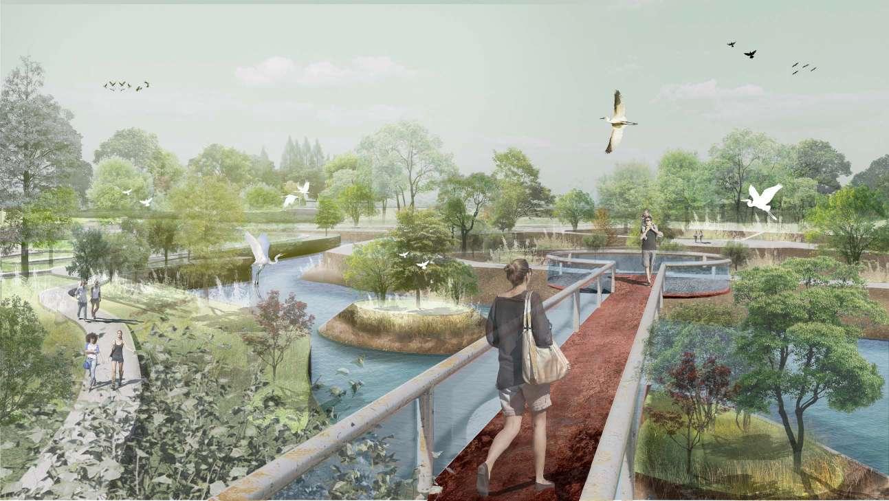
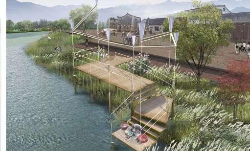
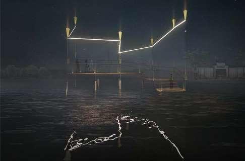
The site is a renovation of the Middlesex Filter Bed waterfront, with a number of floating islands created along the shoreline to break up the rigid shoreline and make boat trips more experiential, and ecological barges to increase the habitat for flora and fauna. The suspended walkway overlooks the entire shoreline from the forest, bridging the closed environment of the forest and the open water environment.
Five ways uphill
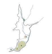
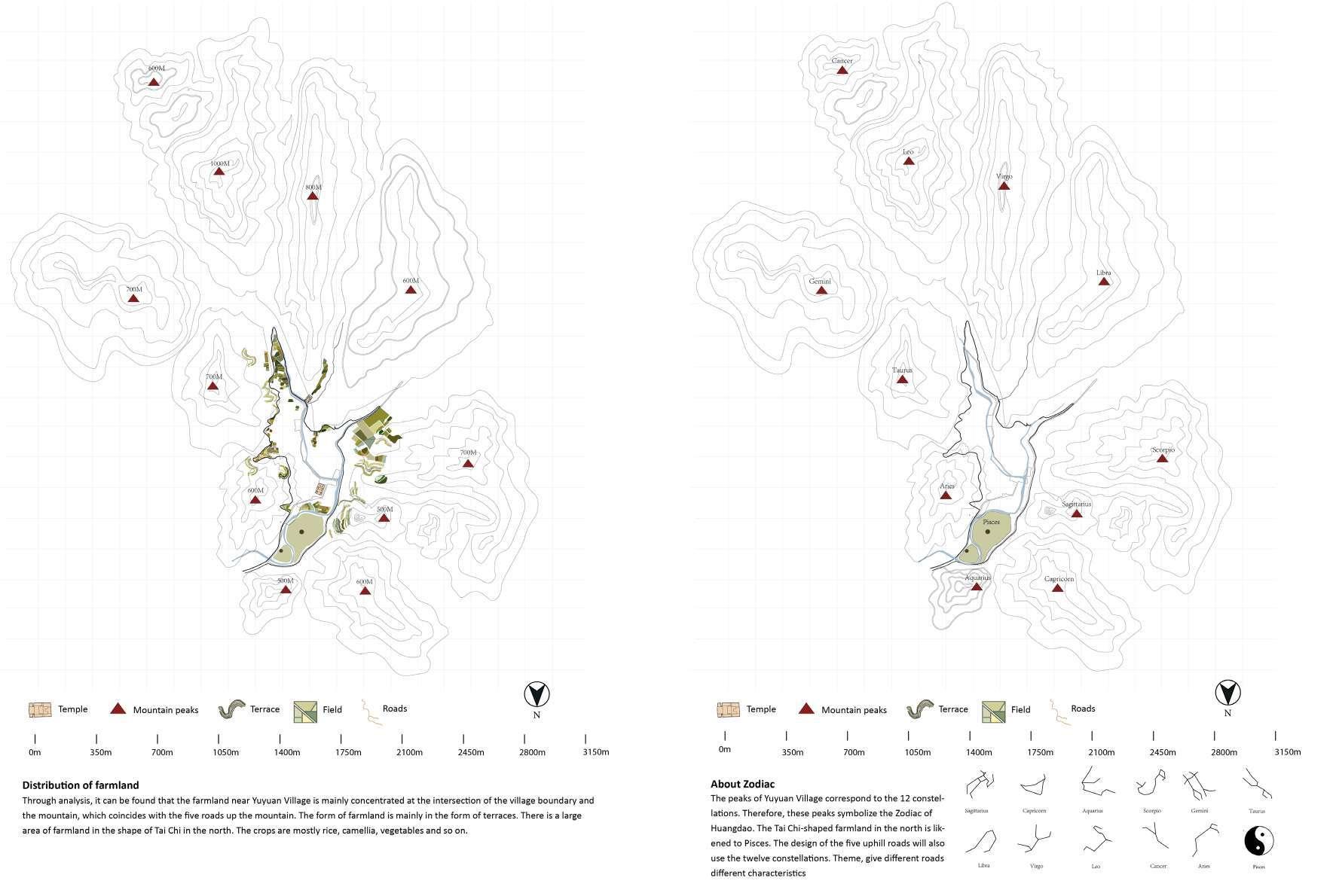
Site: Yu Yuan village, ZheJiang province, China
Key words: Ancient village, Five Mountains, Stream, Forest, Constellation
have explored and investigated the ancient villages in the southern Chinese villages, and cooperated with related books to un derstand the layout of the ancient villages and the traditional elements of the villages, such as ponds, ancient trees, temples, pavilions, etc., how they constituted the village, trying to understand the metaphors and concepts hidden under this material element. These concepts indirectly reflect the ancient people’s understanding of the natural environment and religious respect.
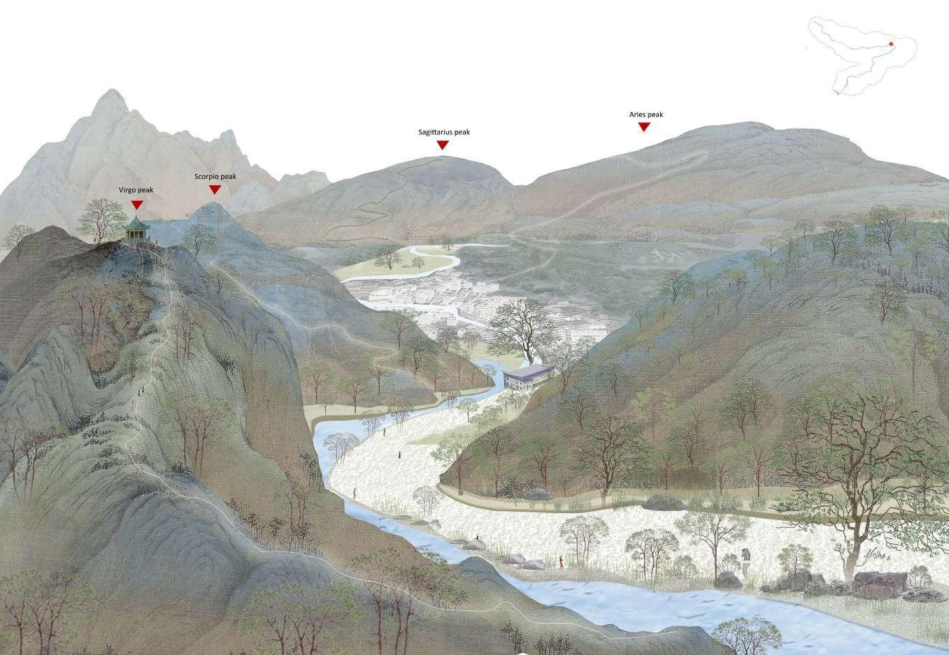
The bakc part of this project will focus on five mountains surround the Yuyuan village. Yuyuan Village was developed in ancient times by relying on good natural geographical conditions, but the village has lost its vitality in modern society,young peopel leave, aged people left So my purpose is to bring people back to discover the characteristics of this village. Looking at ancient books, the layout of Yuyuan Village is set up in imitation of the zodiac. The surrounding mountains are matched with 12 constellations. started with this feature and combined the legends of the ancient village. designed five ways uphills Each road has its own characteristics. Minimize the impact on the natural environment while designing
Project 2:
Five ways uphill
Site: Yu Yuan village, ZheJiang province, China
Key words: Ancient village, Five Mountains, Stream, Forest, Constellation
Site analysis
Yuyuan village is considered to be one of the famous ancient village in China for it used principles of Astronomy The stream across the village was built like Big Dipper, and seven old wells distrubute around the stream also forming the shape of Big Dipper. The Yu clan’s ancestral hall is located in the center of the constellation
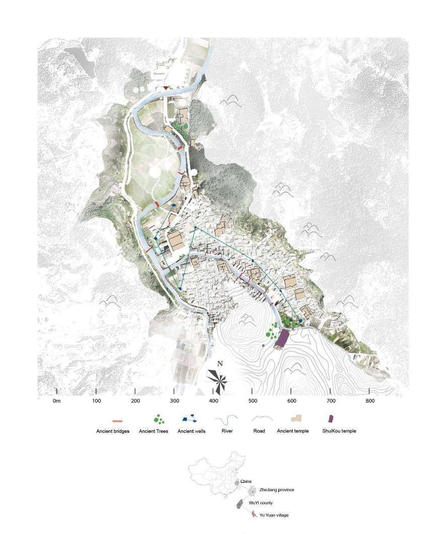
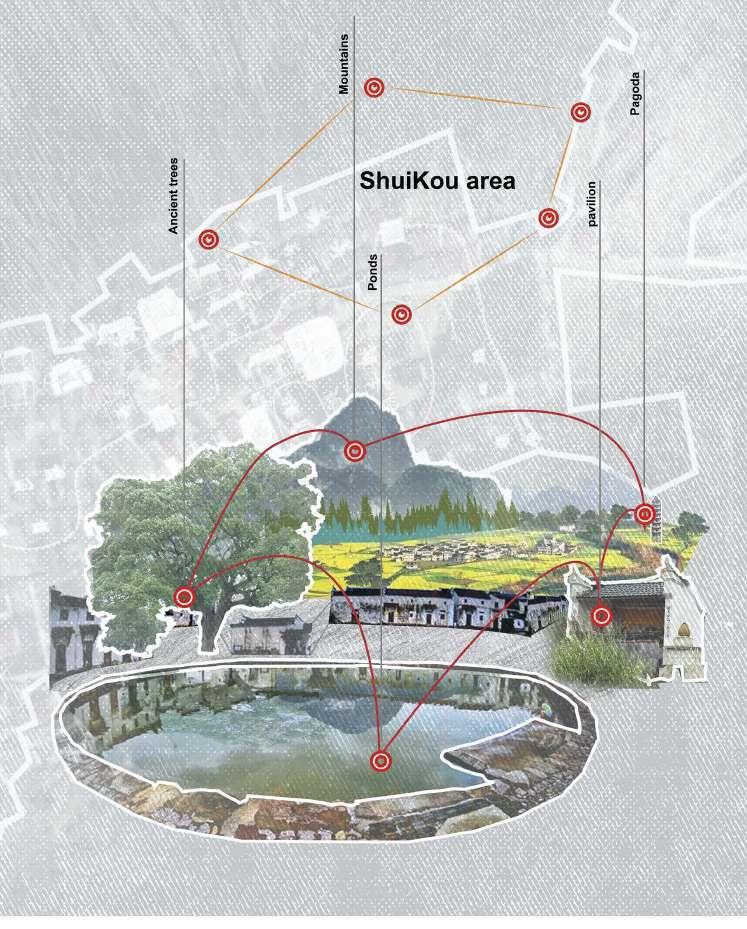
The Shikou - The most sacred region inancient village
Shuikou, as a landscape node in traditional Chinese villages, embodies the balanced relationship between people’s construction and nature.
It is composed of five basic elements (ancient trees, pagodas, ponds, pavilions, mountains). In addition the composition of the Shuikou environment is also the embodiment of the local people’s ideology.
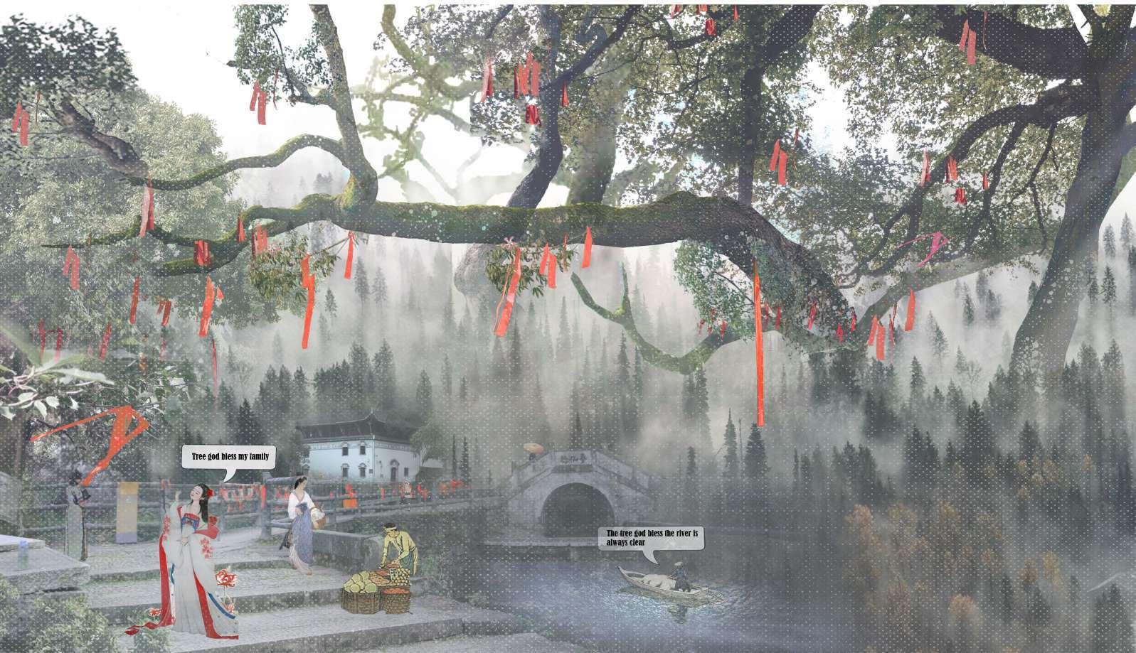
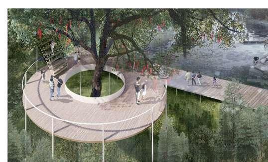
Blessing trees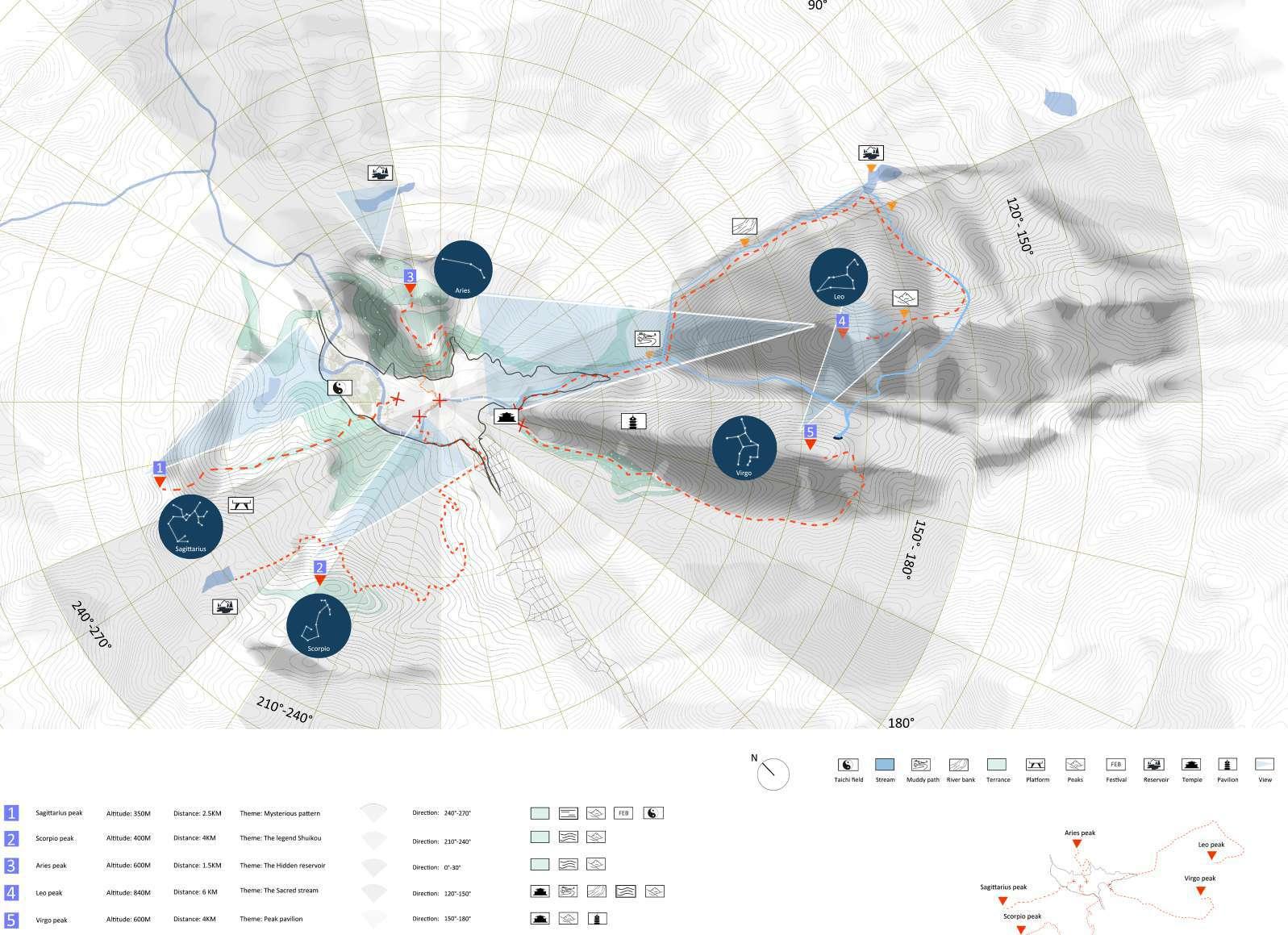
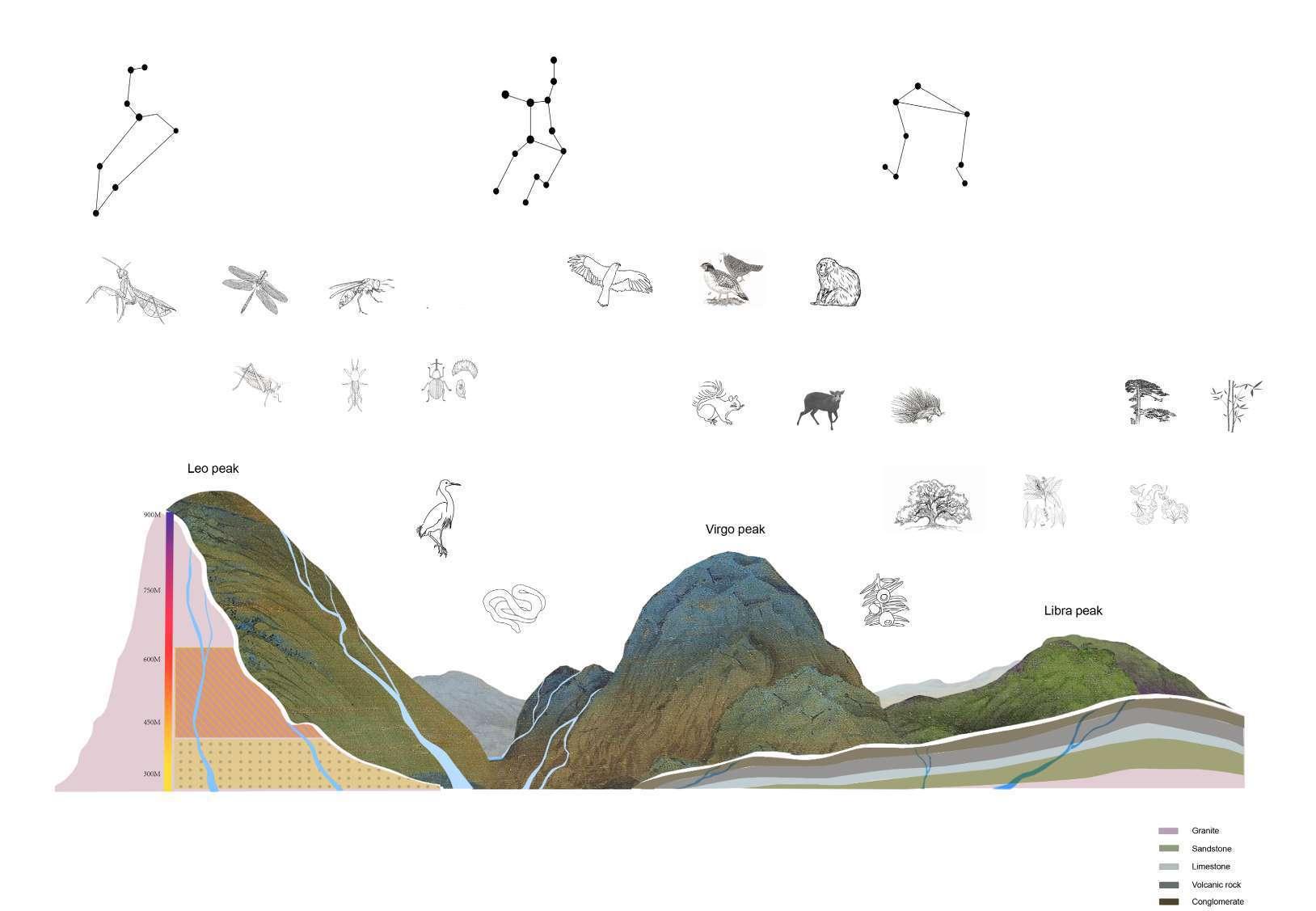
The constella�on was introduced to China by the Persians during the Sui Dynasty. Leo symbolizes bravery and jus�ce in China. Leo peak is also the highest mountain among the twelve peaks.
Virgo is the sixth house of the zodiac. The date of birth is August 23-September 22, east of Leo and west of Libra.
The seventh house of the zodiac. The yellow longitude ranges from 180 degrees to 210 degrees. The sun arrives in this house around September 24 every year. The solar term at this �me is the autumnal equinox, so the autumnal equinox (that is, the point where the yellow longitude of the eclip�c is 180°, and its right ascension is also 180°) is also called “the rst point of Libra.”
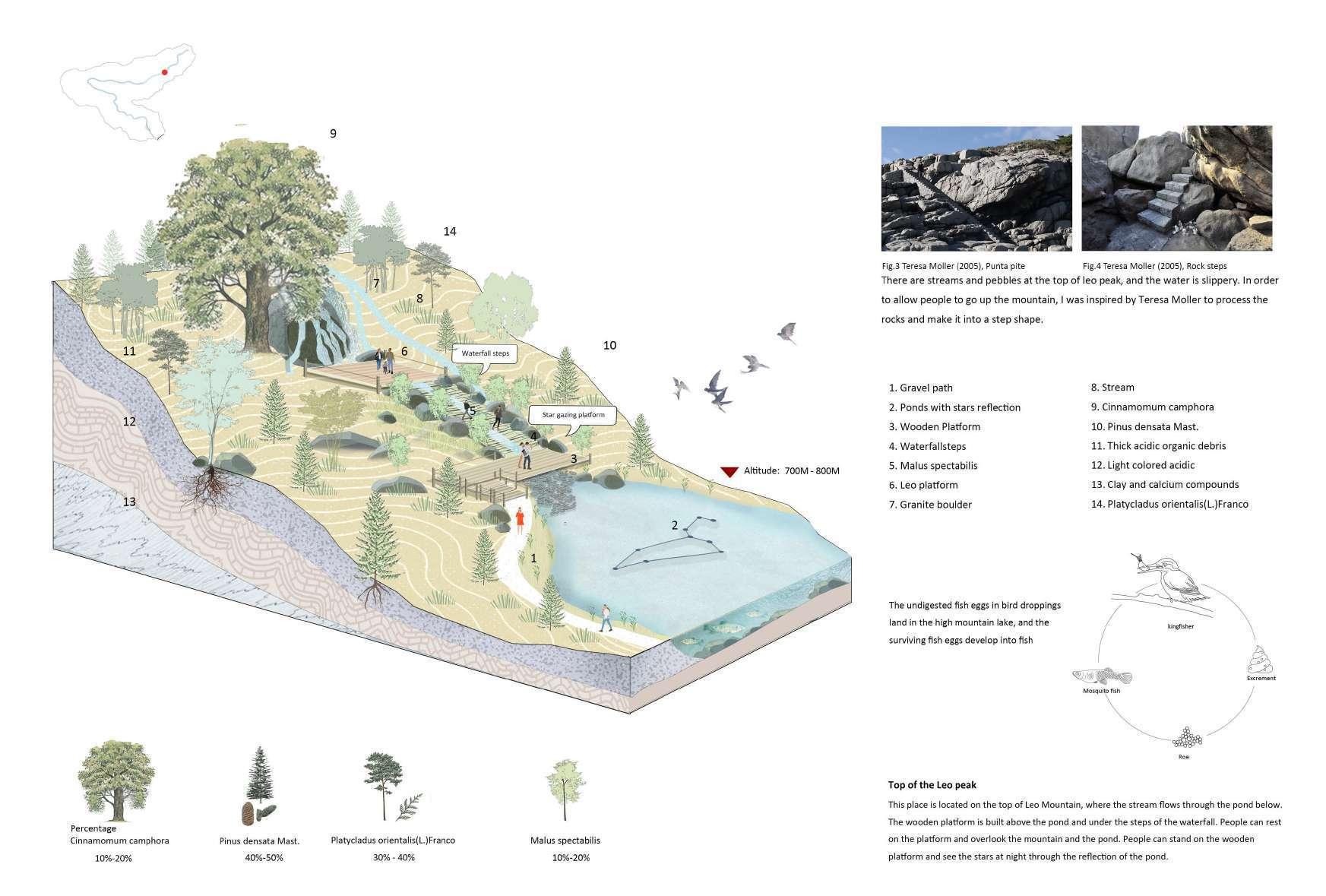
Section of Leo valley
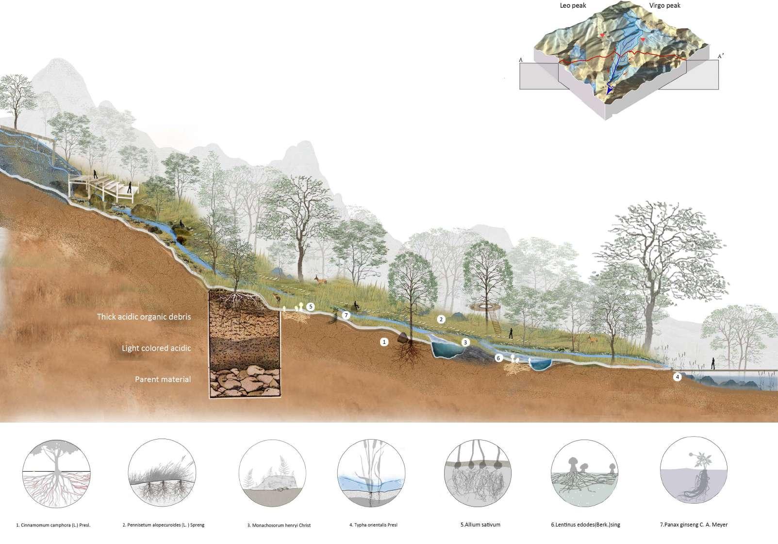
The road leading to Lion Peak is a densely wooded road that follows the stream in the valley and passes through tall trees. In front of you is a two-story landscape platform, one end of which is connected to a mountain spring, and water is led below the platform.
Natural analysis of Leo peak
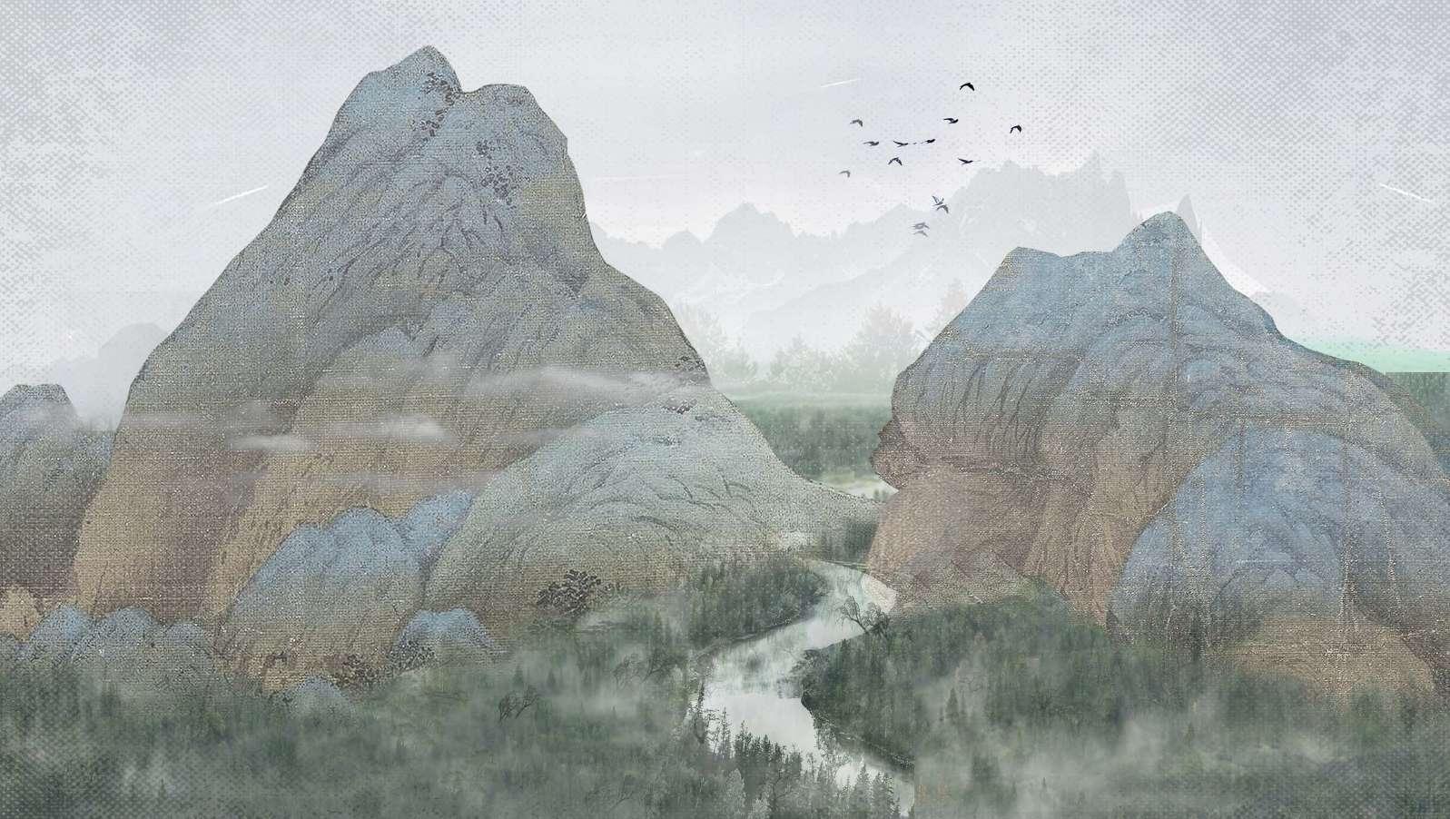
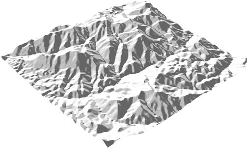
Leo Peak is located at the southernmost end of the village. The terrain is the highest in the area. There are lush vegetation and many wild ani mals. Among the more precious animals are booty falcon, black muntjac, ape, golden ring snake, egret, etc. Plants include yew and tulip tree Pine, bamboo, etc.Among them, the terrain of the canyon is low, a river passes through leo peak and Virgo peak, and the vegetation is lush on the side of the river. The mountainside of leo peak is relatively at. People tend to plant bamboo and camellia on the mountainside. The top of the mountain is about 1,000 meters above sea level, and the top of the mountain is mostly pine and cypress.
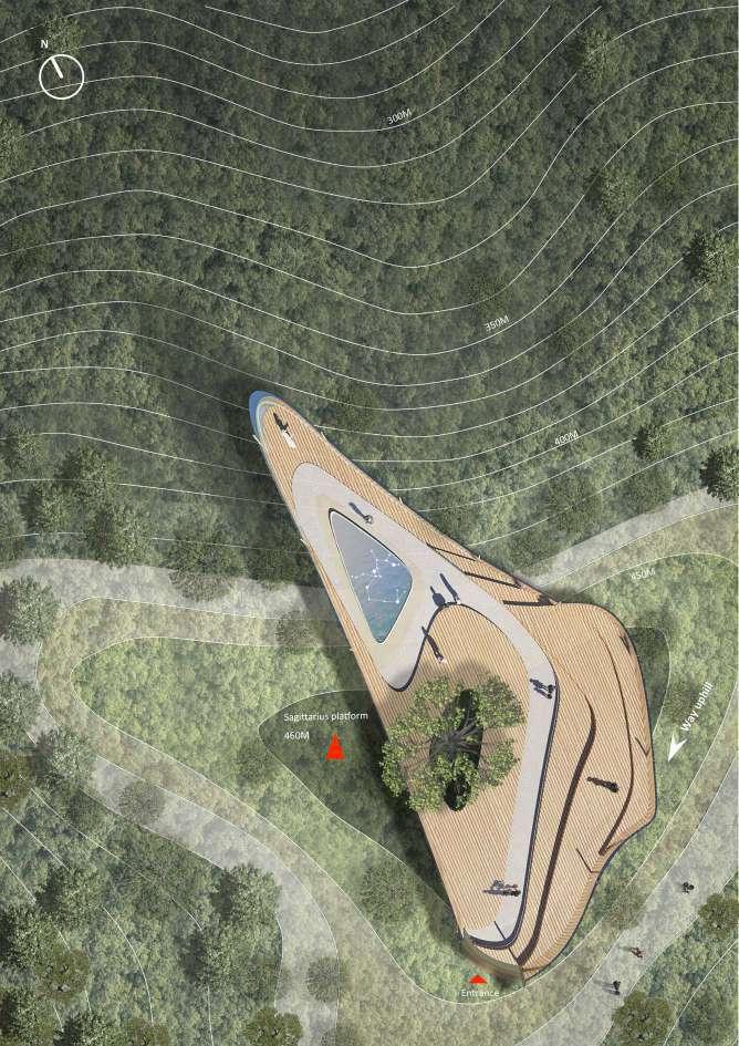
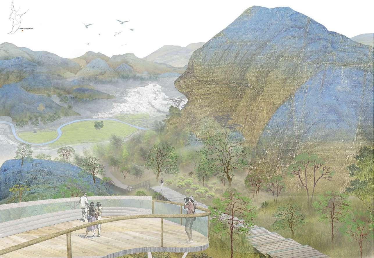
Saggitarius Peak Section
Saggitarius Peak Platform
Viewshed analysis


Through the analysis, it can be found that the best observation perspective can be obtained in the Leo peak, Aries peak and Sagittarius peak. Sagittarius peak is located in the southwest of the village, which is closest to the Taiji shaped field, so it can obtain the best over looking farmland position. The highest elevation of Leo peak is located in the southernmost end of the village, which can overlook the river form of the whole village, and the highest elevation of Aries peak is located in the sea It is located on the east side of the village. You can see all the peaks around the village.
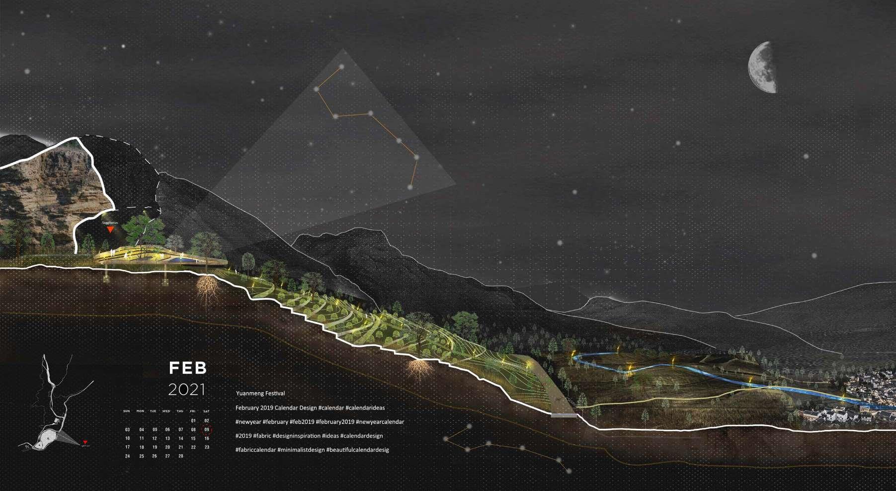
Saggitarius Peak Platform
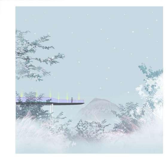
The wooden platform in the forest provides people with an opportunity to climb up the ancient trees. People tie the ancient trees with red ribbons on specific festivals, which is the inheritance of ancient rituals.
 Platform in ShuiKou forest Washing Deck, Daytime Washing Deck, Night