
Great Ouse Branch
Ouse News - Autumn 2025
Campaigning for the conservation, use, maintenance, restoration and development of the Inland Waterways.
The views expressed in this publication are not necessarily those of the Inland Waterways Association or of the Great Ouse Branch. They are, however, published as being of interest to our members and readers.
Great Ouse Branch Committee:
Chairman:
KeithAlderton
Tel : 01366 727236
Secretary:
John Hodgson
Tel : 01234 344884
Treasurer:
Enid Hodgson
Tel : 01234 344884
Ouse News Editor:
CaroleAlderton
Tel : 01366 727236
Membership Officer
Stephen Foote
Tel: 01763 838936
Member:
RobinAdams
Tel: 01223 862026


Do you have a few hours to spare? We need your help! We are a small, friendly group and desperately need more committee members to help us organise meetings and events. One committee member has just retired (Peter Webb) after 29 years! That leaves just 6 of us!!
Please contact the Chairman.
Ouse News Page 3
Branch News
WinterMeetingsareat8.00 pm at the North Lodge Pavilion, North Lodge Park, Milton, CB24 6UD.
THURSDAY 27TH NOVEMBER 2025
Paul Fuller (local wildlife photographer), will be giving us an illustrated talk on ‘Birds of the Wetlands and Waterways’.
THURSDAY 26TH FEBRUARY 2026
‘My Watery Adventures and Rescues.’ A presentation of canal photos by our new branch member Adrian Koe MBE KSG.
THURSDAY 26 TH MARCH 2026
This will be ourAGM, followed with an update by a River Manager from the EnvironmentAgency.
If anyone is reading this newsletter and would like to become a member, please contact Stephen Foote, our Membership Officer, on 01763 838936. welcome more new members soon. Welcome to our latest member and we hope to
Mrs H Grzelak & Mr D Painter
Mr Adrian Koe MBE KSG
Ouse
Chairman’s Corner
Well, here we are, heading towards winter once again! It has certainly been another interesting cruising season this year, with low water levels, excessive weed growth, fallen trees and inoperative locks all making boaters’lives more difficult. At least Mother Nature seems to be doing her best of late to rectify the past water shortage problems and begin to refill the underground aquifers. In the country at large, parts of the canal system now have enough water to enable limited navigation to resume.
Some good news at last regarding Baits Bite Lock on the River Cam! A £500K grant from Cambridgeshire and Peterborough CombinedAuthority has enabled the Cam Commissioners to start preparatory work on the stabilisation of the lock island structure (see page 17). However, there is still a lot more cash to be raised and work to be done before navigation on the river can be fully restored. Meanwhile, on the Little Ouse, there is still no sign of the Environment Agency obtaining funding to remove the silt deposited in Brandon Lock chamber and weir pool during previous flood conditions.
Our programme of evening events kicked off in October, when Imogen Radford presented a talk entitled ‘Tales from the River – Recreation and Industry along the Brecks Rivers and Fen Edge’. This talk describing the history and development of the eastern tributaries in Norfolk and Suffolk, complimented our February meeting when we explored the history of the western end of the River Great Ouse at St.Neots. In November, local ornithologist and wildlife photographer, Paul Fuller will give/gave an illustrated talk about ‘Birds of the Wetlands and Waterways’. New member, Adrian Koe, will be giving us a slide show in February.
Throughout the year, branch and regional chairs have been holding virtual meetings to discuss the future structure of the organisation at ground roots level. Unfortunately, in some areas we have a number of dormant branches and/or an absence of a working regional organisation.
The IWATrustees consider that it is beneficial for all branches to be represented by a Regional Chair or, in the absence of a Regional Chair, by a Regional Co-ordinator. The main purpose of the role would be to act as an intermediary between the Trustees and branches and to initiate activity in dormant areas. The person appointed would not necessarily be required to be an existing or past branch committee member. As we no longer have a Regional Chair we shall be actively seeking someone to represent the Eastern Region in this respect. Full details as how to express an interest in the role will be announced in due course.
Keith Alderton
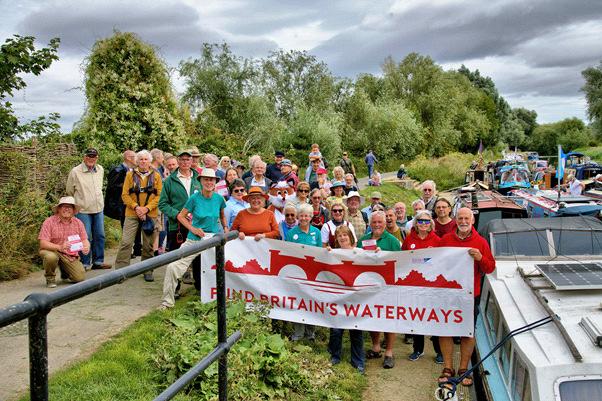
Navigation Stopped by Stranded Narrowboat
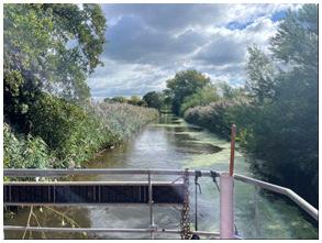
Just before August Bank Holiday this year we heard that a narrowboat was stuck on shoaling downstream of Willington Lock on the River Great Ouse. We had been planning to go off on our boat for a few days and, as we had to go through Willington Lock, we decided to go and investigate.
We had been through the lock earlier in the summer and there was a buoyed channel around the shoaling as it was at that time. The channel was not wide enough to accommodate two boats passing which meant that if there was a boat on the downstream landing stage, a boat wishing to leave the lock was not able to get through unless the other boat reversed downstream until there was enough room for the two boats to pass safely!
When we reached Willington Lock on foot we found that the narrowboat was stranded across the river on shoaling, directly in line with the exit from the lock. The owner was on board and we had a chat with him. He had been there since the Tuesday and this was now Thursday. Several attempts had been made to get him off the shoaling without success and he was waiting for a barge to come to try to tow him off on the Friday.
Ouse News Page 6
He did say that he had been told by the Environment Agency that once they had managed to free him, they were not going to do any dredging! This seemed rather surprising considering the time, not to mention the expense, of freeing one boat.
On the Friday we once again went to Willington Lock on foot, having first popped in to Priory Marina where our friends told us that the narrowboat had left earlier that morning . When we arrived at the lock the narrowboat had already been freed and sent on its way and the barge was on its way back to Priory Marina to be taken out of the water. We noticed that the shoaling was almost breaking the surface of the water in places. Needless to say, we decided to abandon our planned trip as we were not sure that we would be able to get back again, that is if we didn’t get stranded as well.
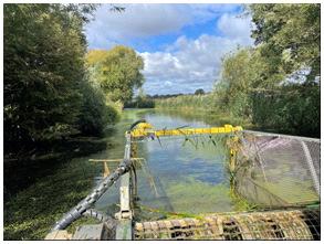
A few weeks later we learned, via the Anglian Waterways Group meeting, that the EA had dredged the shoaling - a very pleasant surprise. We then went out on our boat for a few days at the beginning of October as the navigation chanel was now wide and deep.
After dredging
Enid Hodgson
A Fistful of Dollars
We have had a fabulous summer of sunshine and good temperatures, the Great Ouse has mostly played ball, locks have operated well (with the occasional hiccup) and the rivers have remained open in the main.
River Conditions and Maintenance
The balmy weather has proved to be a perfect growing season for weeds and latterly Pennywort. Our field teams have been out since mid-June and have continued to cut all summer.
Little Ouse: Weed cut upstream of Hockwold – before river levels dropped further and our recommendation not to go beyond Hockwold.
Unfortunately, this has proven to be our “Forth Road Bridge” this year, no sooner was the cut undertaken than it was growing back. We received much commentary on this, but the teams did a great job even if the effect was short lived.
As I resume the spaghetti western theme, we head out into bandit country, namely Prolonged Dry Weather (PDW).
Thespin-offofthisspectacularsummerhasbeentheinstallationofasustained period of PDW. The Environment Agency has been focussed on staying abreast of the impact on our wildlife, habitats, water levels and water quality.
For our boaters the Great Ouse has been impacted notably by river levels on some of the tributaries (Wissey and Little Ouse particularly).Weed cutting was halted on the Wissey due to low levels at one point.
We are recommending not travelling beyond Hockwold due to the current low water levels. There is no ability to turn above Hockwold, we are reminding navigators that we do not provide a rescue service.
For those that subscribe to email notifications or follow us on Facebook or X (formerly known as Twitter) you are likely to have seen a flurry of Navigation Notices asAutumn started to kick in.
Trees in the navigation are a constant battle, so many trees, so little budget, but it has felt this year that we have been more reactive and cleared many trees. PDW and recent higher winds provided ideal conditions for trees to fall. Steph, Ian, and Tom from the Assets Team have played a key part in getting things done.
At this time of the year much of the maintenance budget is accounted for and important public safety works yet to take place. Our ability to remove fallen trees will be limited to those that effectively close navigation as we prioritise the public safety work.
If rainfall levels do not increase to at least 100% of average rainfall for the winter period we may find ourselves in drought conditions, even during the winter period.
The Waterways Workforce led by MattYallop are shifting focus back toamenitygrasscuttingandon-land vegetation control over the entire Anglian Waterways Navigation –South Ferriby in the North to Cattawade in the South. The 568km of waterways is a huge area for these Pale Rider(s) to cover.
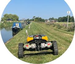
Robomower cutting at Upware
As an element of Paint your Wagon, mothballing and maintenance usually take place in the low season, the impact on our community may not be felt until Spring 26. Personally, my rain dance looks for a daily shower between 10pm and 5am rather than a series of disruptive storms – wish me luck.
Your registration fee monies pay for the maintenance of the river and are part of our revenue funding. Oh For a Few Dollars More, I hear you say.
Lock Asset Works
Capital funded winter works on the Great Ouse will focus on Bedford, Brampton and Upware Locks. Navigation Notices have been issued with closures at these locations for periods of time. For clarity they are:
Lock What3words location From To Bedford rewriting.mostly.truckload 1 November 2025 31 March 2026
Upware (River Cam) bliss.irony.gasping 3 November 2025 10 February 2026 Brampton harps.multiples.hers 3 November 2025 29 January 2026

The works represent significant investment in the infrastructure at these locations with funding provided by government allocation.
St Ives Staunch has been subject to recent discussion and Navigation Notice. We worked with our colleagues in the Flood Coastal and Risk Management (FCRM) Team following a mechanical automation breakdown on the sluice gates. Within the last week there has been a resolution, and we are now advised that 3 sluice gates are operational, the temporary measures activated have been normalised.
The latest information on St Ives and Brownshill Staunches can be found here via the QR code.
Follow the money
A little like The Outlaw Josey Wales our Enforcement Team, ably led by Stuart Garner, have been following up our River Inspector’s compliance checks. Over 3000 boats have been checked to date on Anglian Waterways – 551 of these boats are in our enforcement process. Of these 150 are unidentified boats and continue to be a challenge. £149,000 of revenue has so far been recovered by the team working with our customers for this financial year, which is great news.
The team – Ian, Callum, Lynn and Ewa alongside new recruit Emma are continuing to work with boaters to ensure fair payment amongst the boating community.
A consultation concerning liveaboard boaters, championed by theAnglian Waterways Team, has recently ended and we await the summary. More news on this next time, I hope.
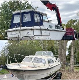
The flip side of this approach is that we are removing more boats as evidenced recently at Buckden Marina. Further boats are due for removal over the next couple of weeks or so. More marina work on the Bedford Ouse and other riverside removals. Fourteen boats in total for the year will have been removed by early November across ourAuthority.
We are gradually increasing boat removals following non-payment of registration fees. Working with partner organisations and internal teams this year has increased our reach across all our rivers.
TheenforcementprocesscontinuestogaintractionacrossallEANavigations. The recent consultation will hopefully add further ability to deal with nonpayment of registration fees. This is noAmbush at Cimarron Pass but will be the culmination of a significant amount of work and persistence to enable us to address the issue correctly.
TheAnglian Pass has generated more income than expected this year with the closure of Baits Bite Lock on the Cam, uptake has been about a third less than 2024-25, but this is more than expected and shows the want in uptake across both Middle Level Commissioners and EnvironmentAgency Navigations.
The Cam Conservators also benefit from this income which I am sure will go towards their funding target. Thank you to those that continue to support the Navigations in this way.
Anglian Water Fens Reservoir
Anglian Water (AW) has announced that the third phase of consultation on the planned Fens Reservoir is now open. The consultation will run from 15 October to 10 December and provides another opportunity for local communities, including the boating community, to get involved and help shape how the project has developed.
The new reservoir is a major investment that will secure water supplies for future generations. And AW is committed to developing it in a way that delivers lasting benefits for the region – a new destination for Fenland where water, people and nature can come together and thrive.
AW latest proposals include an updated design for the reservoir, showing potential opportunities for recreation, nature and connections to local communities.
AW have published all of the latest proposals on their website, including an interactive map, brochures, and a feedback form.
Navigation Plan 2025
Last time around I pointed out the Navigation Plan for 2025 focussing on:
• Safety for staff and customers
• Improving your experience on the water
• Making waterways sustainable in the future
• Securing more income towards a financially sustainable future. Our National Navigation Team have been working hard to quantify these points into measurable outcomes. This work continues to be on-going. Some areas to highlight are below:
* Internally our public safety risk assessment key performance indicators have been graded green on a red, amber, green (RAG) rating.
* Body Worn Camera training is being undertaken to protect our staff in potentially confrontational situations.
* Monitoring of navigation restrictions and the impact on the overall ability to navigate our waterways shows a good year, with a little time at St Ives being closed and Brandon Lock remaining closed due to shoaling and other maintenance work on the lock itself.
* Shoaling downstream of Godmanchester and Hemingford Locks raised its head at the start of the high season, but river levels and traffic have enabled the locks to be used generally throughout. Funding to re-profile these two areas may need to be prioritised elsewhere, but this remains Hang Em High on our radar.
* Emma our new Enforcement River Inspector will be focussed on enforcement and compliance on the whole of the Great Ouse. She will look to develop relationships and improve communications both withindividualboatersandmarinas.Shehasfurtherspecialisttraining to undertake and is currently acclimatising herself with the geographic extent of the Great Ouse and tributaries like a High Plains Drifter.
* Our Commercial, Partnership and Development Team, led by Nathan Arnold are exploring options for increasing income by improving services. Input from the National Team is providing impetus here.
* Sky in Nathan’s team helped publish a new edition of River Views, we hope you found it informative.
* Our volunteers continue to provide great support at weekends. Meetings are imminent to discuss what else they could help with to provide improvements to our Waterways service. Ian Bliss in partnership with CambsACRE is leading the conversation there.
* The National Navigation Team is working on the longer-term Navigation 26+ Plan (working title) which aims to provide a strategy for Navigation to broadly 2050.
This last point will tie into Environment Agency planning over the next 5 years and seek to make the most of the Water Strategy which is high on the government agenda.
We do not know yet what the impact will be of the Water Strategy – like Two Mules for Sister Sara – we hope to team up with others to make a difference.
Thank you for your attention here I hope this provides a Summary of the Year, the Good, the Bad and the Ugly.
Lee Cobbold, Waterways Operations Team Leader Great Ouse and Stour.
It would be remiss of me, and I am sure it would be Unforgiven, if I didn’t point out that like Joe Kidd, I have loosely hidden a dozen spaghetti western film titles here. There is a link to spot although that is clear if you Clint hard enough.
The Severn Trow
At Blists Hill, which forms part of the Ironbridge Gorge Museum, there is a preserved Severn Trow called The Spry. Unlike the Thames Barge, the Trow had an open hold and is not decked over. Trows were generally smaller vessels, although some examples were larger than the smallest Thames Barges.
The Severn was once more navigable than it is today, enabling Trows to travel upstream as far as Welshpool. They were also known to have travelled up the River Wye, but I am not sure how far. The fact that there is a pub in Bristol called the Llandoger Trow suggests that they once travelled far and wide. It has even been suggested that Trows actually went to Ireland. Maybe they did, but it is rather a long way for an inland waterways craft to go on the open sea. Still, some narrowboats have crossed the Wash – so why not? It is known that they did go to places in South Wales and Somerset on the other side of the Bristol Channel.
I have read that, in the more distant past, Trows had a stern structure rather like an Elizabethan Galleon, indicating that they were probably seagoing vessels. Early Trows had square sails, but in more recent times were fore and aft rigged. Original Thames Barges had tiller steering that was replaced later by wheel steering. However, as far as I know Trows were all steered by tiller.
RobinAdams
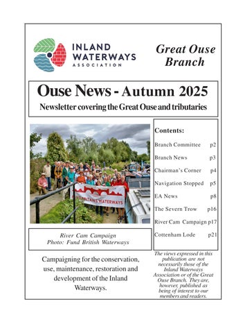
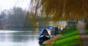
River Cam Campaign
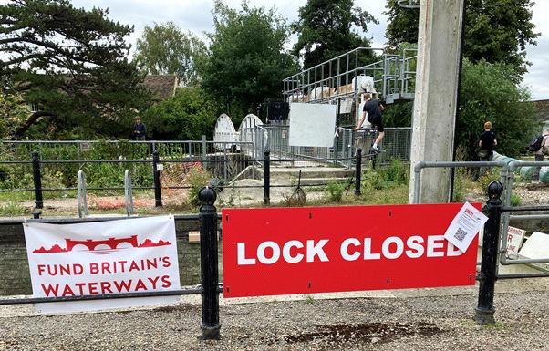
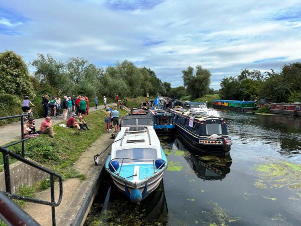
On the 3rdAugust, branch members joined representatives from GOBA, Fund Britain’s Waterway and other associated organisations at Baits Bite Lock on the River Cam to bring attention to the poor state of our waterways as a result of inadequate funding (see following press release).
I would like to thank all of those members who managed to attend the event to show their support, despite only having a few days’ notice. The publicity generated seems to have made an impact as Cambridge and Peterborough CombinedAuthority have donated £500K to the Cam Commissioners to enable them to start work on the stabilisation of Baits Bite Lock Island.
It is now some years since branch volunteers painted the mitre gates, railings and surrounding structures at Baits Bite. At that time local residential boat owners maintained the flowerbeds on the lock island, making the whole site a pleasant place to visit. What a shame to see it in its current state of dereliction!
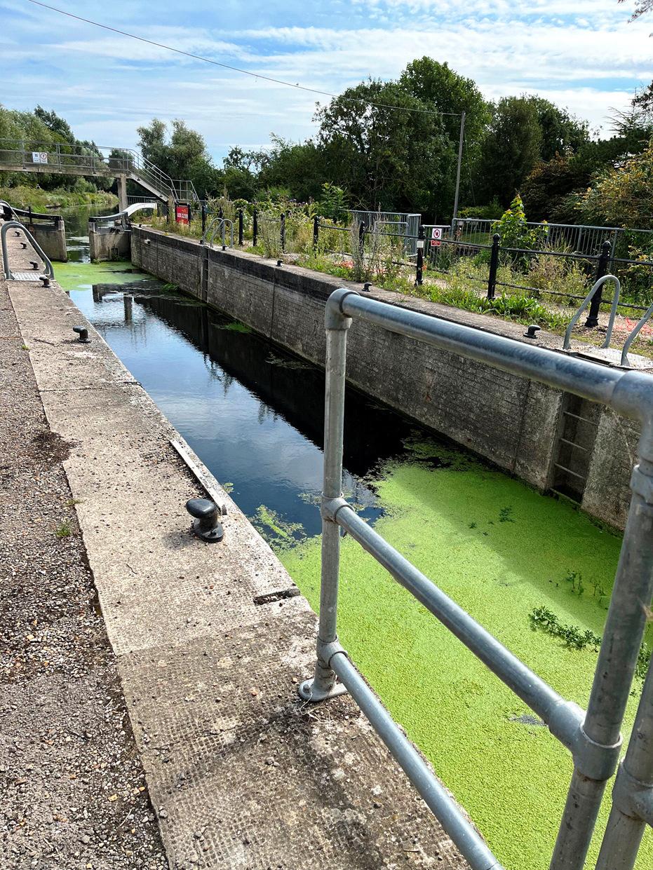
Baits Bite Lock
Flotilla of boats
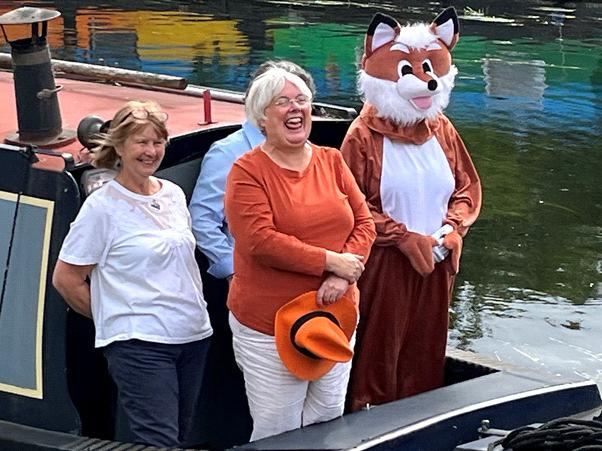
Charlotte Cain MP (in orange) with Christine Howes and representatives of Fox Narrowboats
PRESS RELEASE
Fund Britain’s Waterways campaigning on the River Cam
On Sunday 3rd August a colourful flotilla of boats travelled in convoy up the River Cam and assembled at Baits Bite Lock, to meet Charlotte Cane MP and draw attention to the threats facing Britain’s canals and navigable rivers as a result of inadequate funding.
15 narrowboats and cruisers, dressed with Fund Britain’s Waterways banners, made the journey from Bottisham Lock and were joined en route by a steam launch, a rowing boat and a kayak. They passed moored boats also dressed with banners and were applauded by supporters on the bank. A large group gathered at Baits Bite Lock including Cambridge city and county councillors and representatives of businesses and other organisations, united in their support for inland waterways and their call for investment to ensure their survival.
Baits Bite Lock is one of two locks on the River Cam which have had to be closed because of structural and safety issues.Additionally, an ageing, and failing, fleet of work vessels means that even routine operational work on maintaining the navigation, banks, and towpath is very difficult. By agreeing to liquidate their investments, the Conservators of the River Cam can just about afford to do the stabilisation work at Baits Bite, and work was scheduled to begin on 4th August.
ThereisnopossibilityofstabilisingJesusGreenLockwithoutexternalfunding or investment, and the risk of structural failure remains a threat to river users and the environment, economy, and safety of the city of Cambridge, highlighting the urgent need for meaningful investment in Britain’s waterways. The situation is a specific example of the vulnerability of the entire inland waterway network. Communities and businesses across the country are at risk as navigation authorities face mounting financial pressures and increasing impacts of climate change. This is why the Fund Britain’s Waterways (FBW) campaign was set up, to raise awareness of the value of our waterways and the challenges they face and call for government action.
The cruise to Baits Bite Lock was organised in partnership with the Great Ouse BoatingAssociation (GOBA) as part of FBW’s major campaign cruise for 2025. The journey began with an initial group of boats setting off from Strawberry Island Boat Club in Doncaster on 29th March, which grew to a 26-strong flotilla delivering a clear message to Government from the Thames in London on 7th May. Boats then took different routes north before meeting for a record-breaking mass crossing of theWash from Boston toWisbech on 25th June. Two of the original group of boats participated in the cruise to Baits Bite Lock having now covered well over 1000 miles.
Charlotte Cane, MPfor Ely and East Cambridgeshire, said: “It’s great to see the FBW campaign for the maintenance of inland waterways active in Ely and East Cambridgeshire. Our waterways support wildlife, provide vital drinking and agricultural water, and offer people space to stay active and connect with nature.As I said in my maiden speech, our chalk streams and water corridors are precious — and maintaining them is essential for our health, environment, and future.
It was a pleasure to join FBW on their campaign cruise this weekend. Being part of the flotilla offered a wonderful opportunity to take in the stunning scenery of Ely and East Cambridgeshire’s inland waterways. Now more than ever, it’s vital that we protect and preserve these important natural spaces.”
Paula Syred, British Marine Inland Committee Member and Director of Fox Narrowboats Ltd, said: “Vibrant rivers and canals are not just for boaters, they provide valuable wildlife habitat and are vital to prevent homes and businesses flooding. British Marine research shows tourist visitors on boats spend around £94.50 per person per night1. Since Baits Bite Lock was closed in May 2024 our hirers from all over the UK and abroad have taken alternative routes, missing the City of Cambridge and spending their money elsewhere on the rivers.
This is not just a local problem. The inland waterways across the UK have been chronically underfunded for years, leading to our navigation authorities fighting a constant battle just to keep the network open, with no spare funds to make a true improvement and leave our rivers and canals in a fit state for the next generation. This is why we at Fox Narrowboats support the Fund Britain’s Waterways campaign. We now sit at a crucial junction where Government can choose to properly fund our wonderful network and give it an ongoing future, or be responsible for its further decline.”
Cottenham Lode – an Enigma
Those who boat on the Great Ouse will (I think) have heard of – or know of - Cottenham Lode. Joining the Old West River near the ‘Twenty-Pence’ bridge, it roughly follows the B1049 road from the bridge into Cottenham. On the southern outskirts of the village the lode peters out; veering off toward Rampton and becoming just a part of a network of drainage ditches.
In his ‘Inland Waterways of Great Britain’(1) L.A.Edwards identifies the lode as navigable by small craft up to Cottenham; Jane Cumberlidge’s update (2) says the same. The old Nicholson ‘Guide to the Broads and Fens’ however makes no mention of Cottenham Lode (3). Sadly I no longer have my original ‘Imray’ guides.
When I cruised on the Old West in my little Shetland in the mid-80’s the lode most definitely wasn’t navigable – without a gang of helpers armed with machetes and rakes to clear away the reeds and debris……and a dredger.
But it seems that Cottenham Lode may have a significant past as a commercial waterway. My reference is an interesting volume entitled ‘Liable to Floods’ by Dr J.R.Ravensdale (4), at the time a lecturer in history at Cambridge University.
He suggests the lode was formerly a thriving transport artery but a read of his book is really essential if you want to learn of the very early history. His theory is that the lode was initially ‘Chear Fen Lode’ and the present course is of a later date. It has also been suggested by others that it might have been part of the Roman ‘Car Dyke’.
It seems possible – indeed likely - that the lode was used to deliver stone from Barnack for Cottenham church. Stone churches tended to be built on the first firm ground available at the end of a lode.
Towards the end of Cottenham Lode he reports what appears to be a dry pond - ‘The Waits’- which could have been an unloading point or hythe for stone-carrying barges. But in a short search ‘on the ground’ I failed to find ‘The Waits’or the ‘dry pond’. There is a green track between two houses near the church which leads in the direction of the lode but it is clearly private. There has been so much new building in Cottenham of recent times that traces may well have been obliterated.
Who dug the lode is unclear. Dr. Ravensdale suggests it is of Norman origin; he argues convincingly that it isn’t Roman – and if used to transport stone this was probably only possible on high spring tides. It might even have been dug specifically to transport stone to build the church. Parts of the parish church ofAll Saints in the village are said to be Norman.
Interestingly, on a map of 1887 (5) there is reference to a ‘Brick and Tile Works’in Cottenham adjacent to the lode and south of the church. It shows an obvious connection from the ‘Works’to the lode.
So – was the lode used to transport building materials into or out of Cottenham in more recent times? So far I’ve not been able to find a reference to a ‘brick and tile works’ on any other map, nor in any document. On the ground, no trace whatever remains. Where it is likely to have been is now a large housing estate.
A study of other maps clouds the issue further! On an Ordnance Survey map of 1922 (6) the lode clearly ends close to the church. A channel reappears about ¼ mile further on. The 1922 map doesn’t show any connection to the probable site of the ‘brick and tile works’.
Private land and house-building restricts access to Cottenham Lode. Although my old OS map (7) shows footpaths along both banks there seems to be no way to get on or off them! The only access I could find was from the bridge that carries a narrow road across the lode towards Smithy Fen. On my visit it was very muddy so I didn’t venture far (I suspect a local farmer lets his livestock onto the bank – a big notice ‘Please do not feed the animals’ was a clue!). There was a small amount of water in the lode here –but navigable it is not!
As ever, if any reader can shed further light on the history of Cottenham Lode, please tell us!
Stephen Foote
References:
1. Edwards, L.E. ‘Inland Waterways of Great Britain’(Imray 1985)
2. Cumberlidge, J. ‘Inland Waterways of Great Britain – 7th edition’ (Imray 1998)
3. Nicholson ‘Guide to the Broads and Fens’ (Ordnance Survey 1986)
4. Ravensdale, J.R. ‘Liable to Floods’ (Cambridge University Press 1974)
5. www.francisfrith.com/cottenham/cottenham 1887
6. Ordnance Survey IllustratedAtlas of Edwardian and Victorian Britain (AA 1986)
7. OS ‘Landranger’no. 154 – Cambridge and Newmarket (undated)
The Inland Waterways Association is a non-profit distributing company limited by guarantee. Registered in England No 612245. Registered as a charity No 212342. Registered Office: 16B Chiltern Court, Asheridge Rd, Chesham, HP5 2PX. Phone No 01494 783453.