HISTORIC DISTRICT COMMISSION OF WASHINGTON COUNTY, MARYLAND
AGENDA
November 6, 2024, 7:00 p.m.
Washington County Administration Complex, 100 West Washington Street, Room 2001, Hagerstown, MD 21740
CALL TO ORDER AND ROLL CALL
MINUTES
1. Minutes of the September 4, 2024, meeting *
NEW BUSINESS (amended)
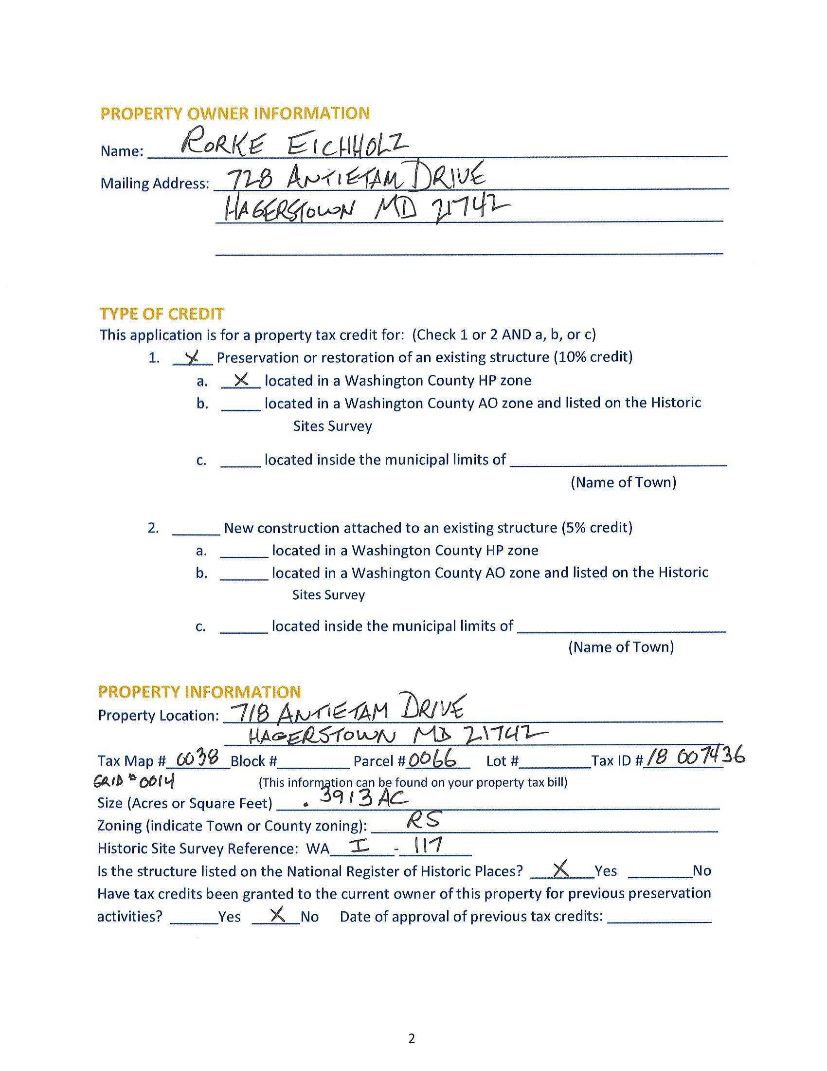
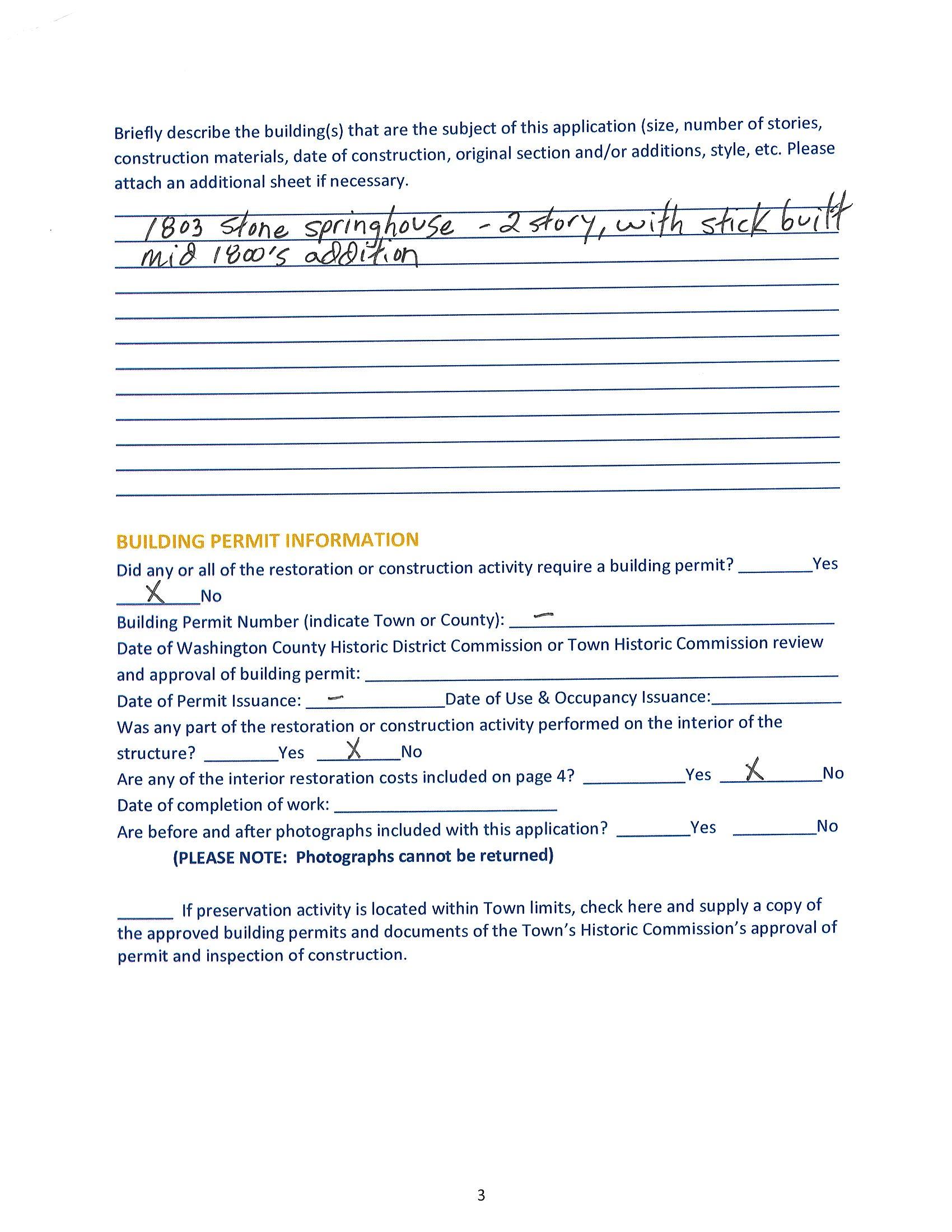
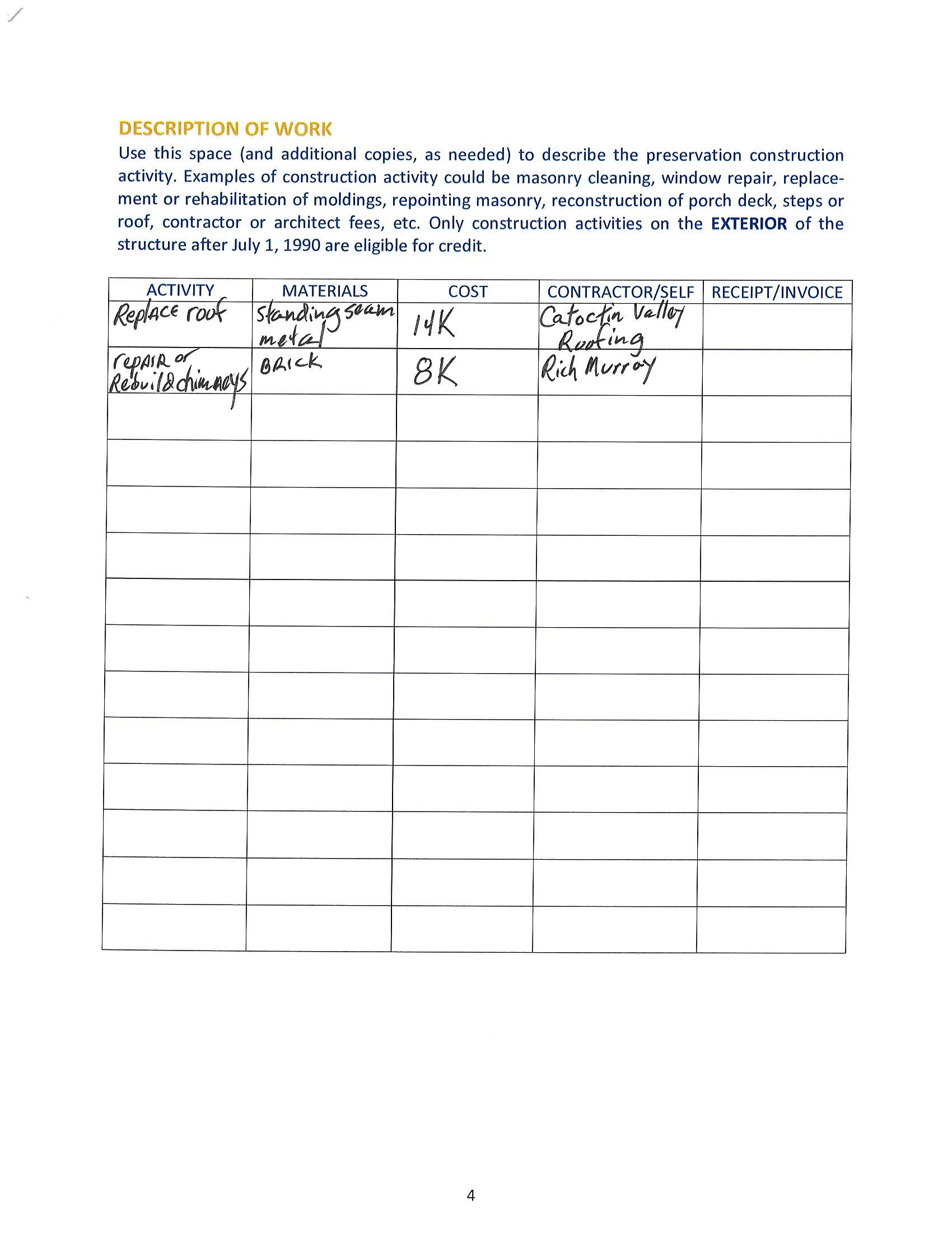
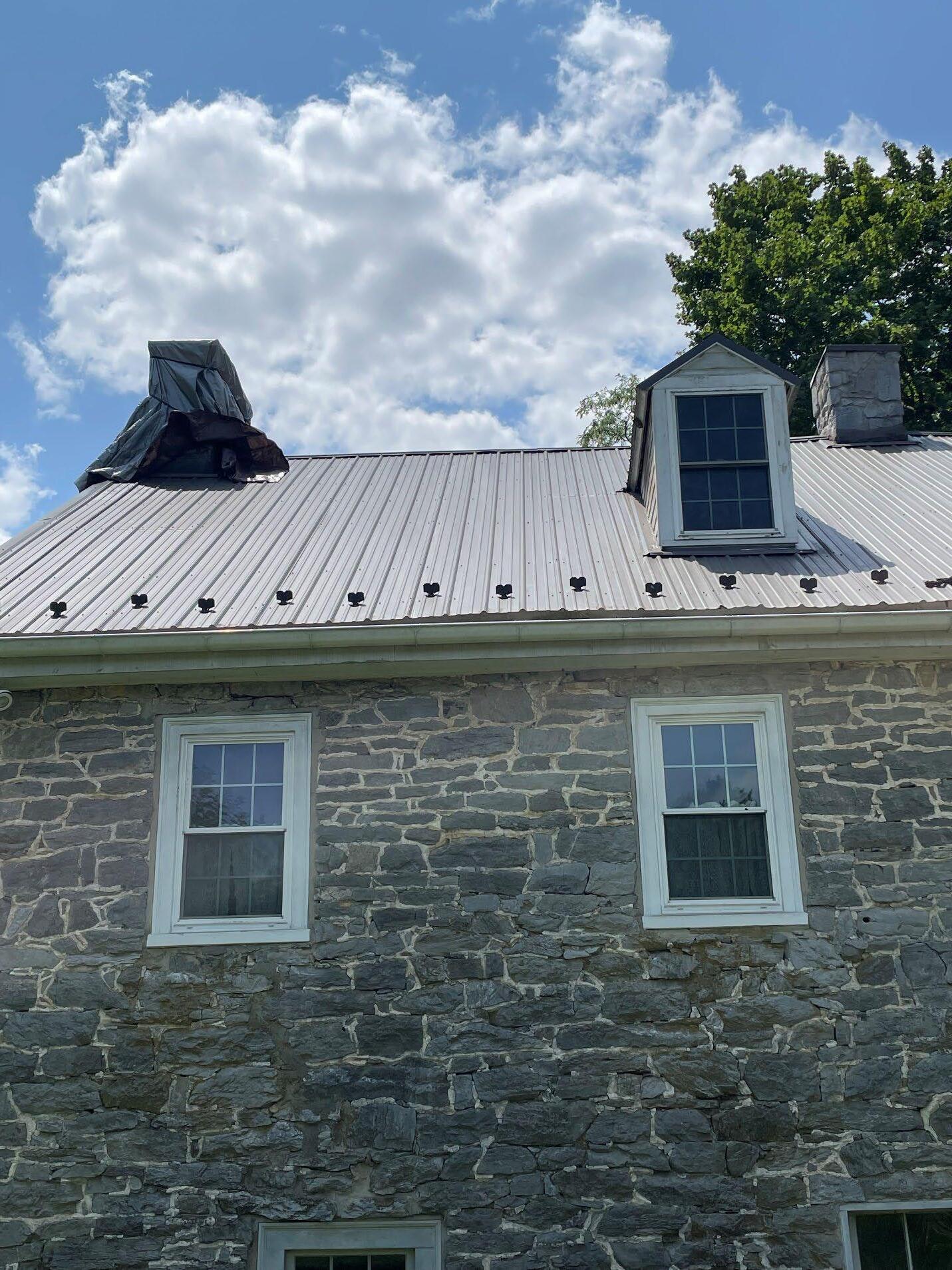
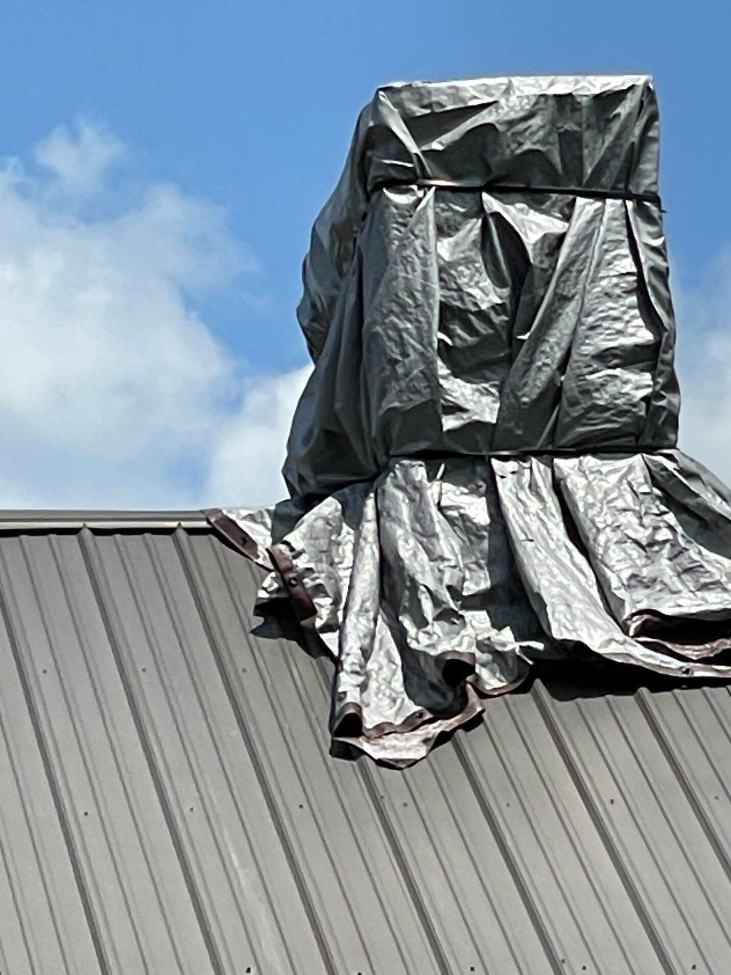
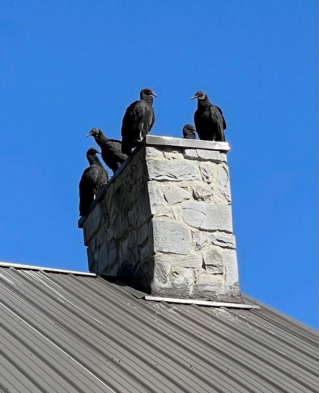
1. HTC-24-001, Eichholz – 718 Antietam Drive - (Discussion/Comment/Consensus) –Request for initial review of roof and chimney work for consistency with the SOI Standards for Rehabilitation and County Design Guidelines for potential tax credit upon completion of work. *
OLD BUSINESS
1. Tax Credit Application - (Discussion/Comment) Staff has made requested updates to the Historic Properties Tax Credit Forms and created a brief instruction guide *
OTHER BUSINESS
1. Correspondence
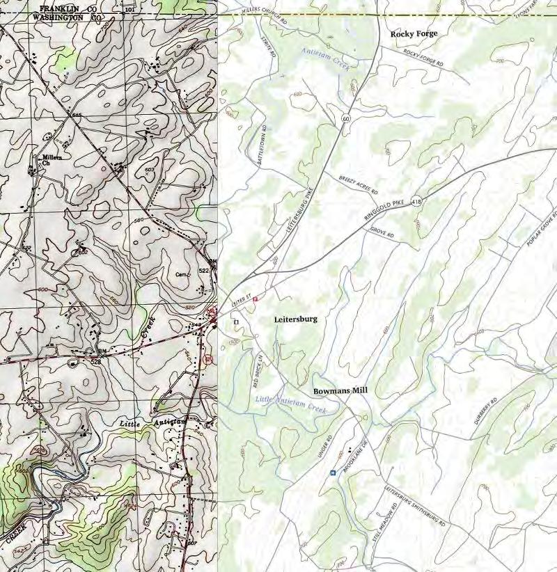
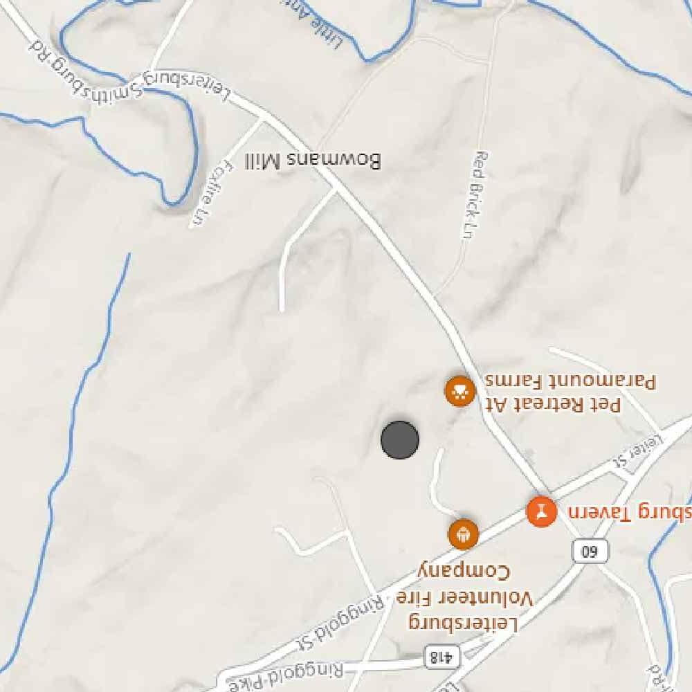
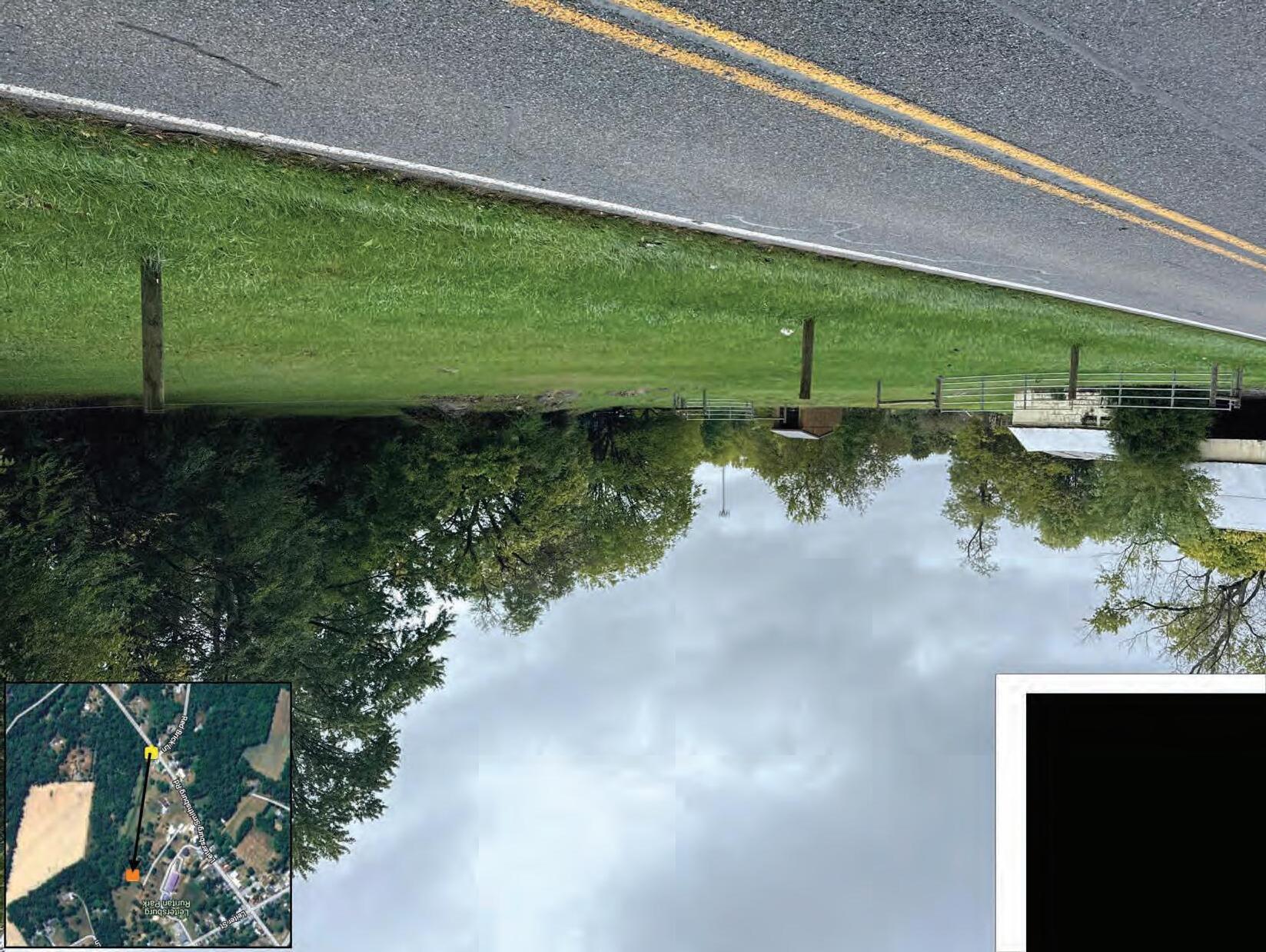
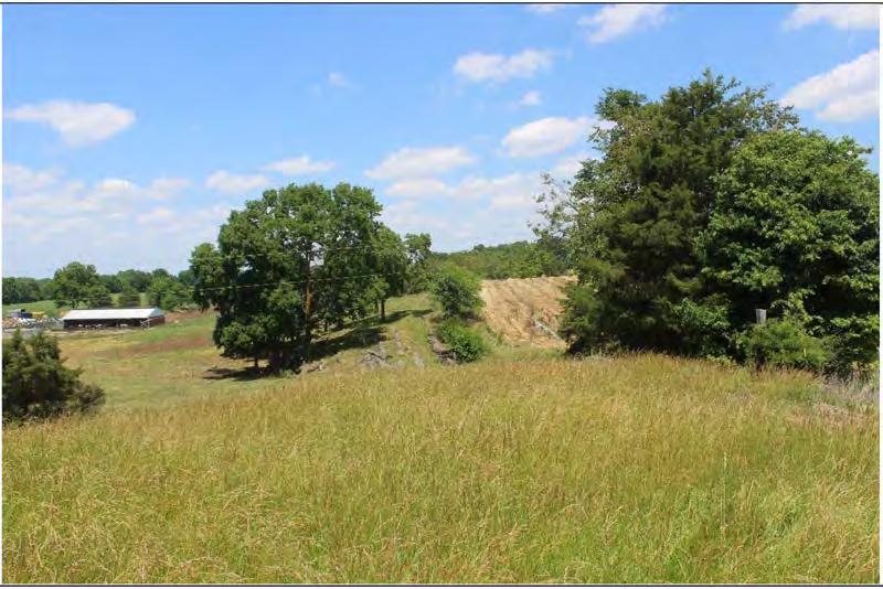
a. Milestone Towers, Leitersburg/Trileaf Project #744255, 21536 Leitersburg Smithsburg Road, Leitersburg (Discussion/Comment/Consensus) - UPDATED DOCUMENTATION - a 155-foot monopole telecommunications tower within a 50-foot by 50-foot lease area. Leitersburg, NR-1371 *
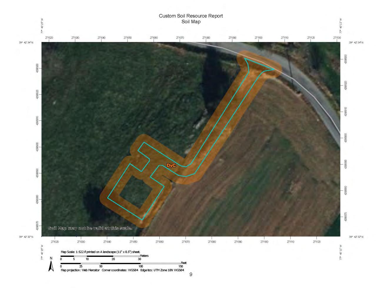
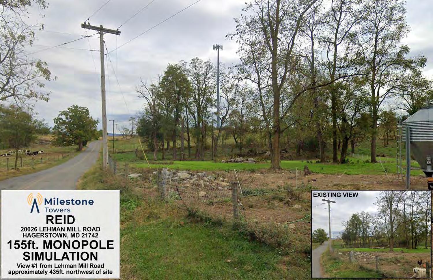
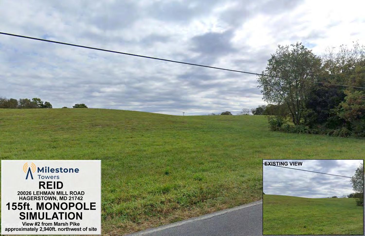
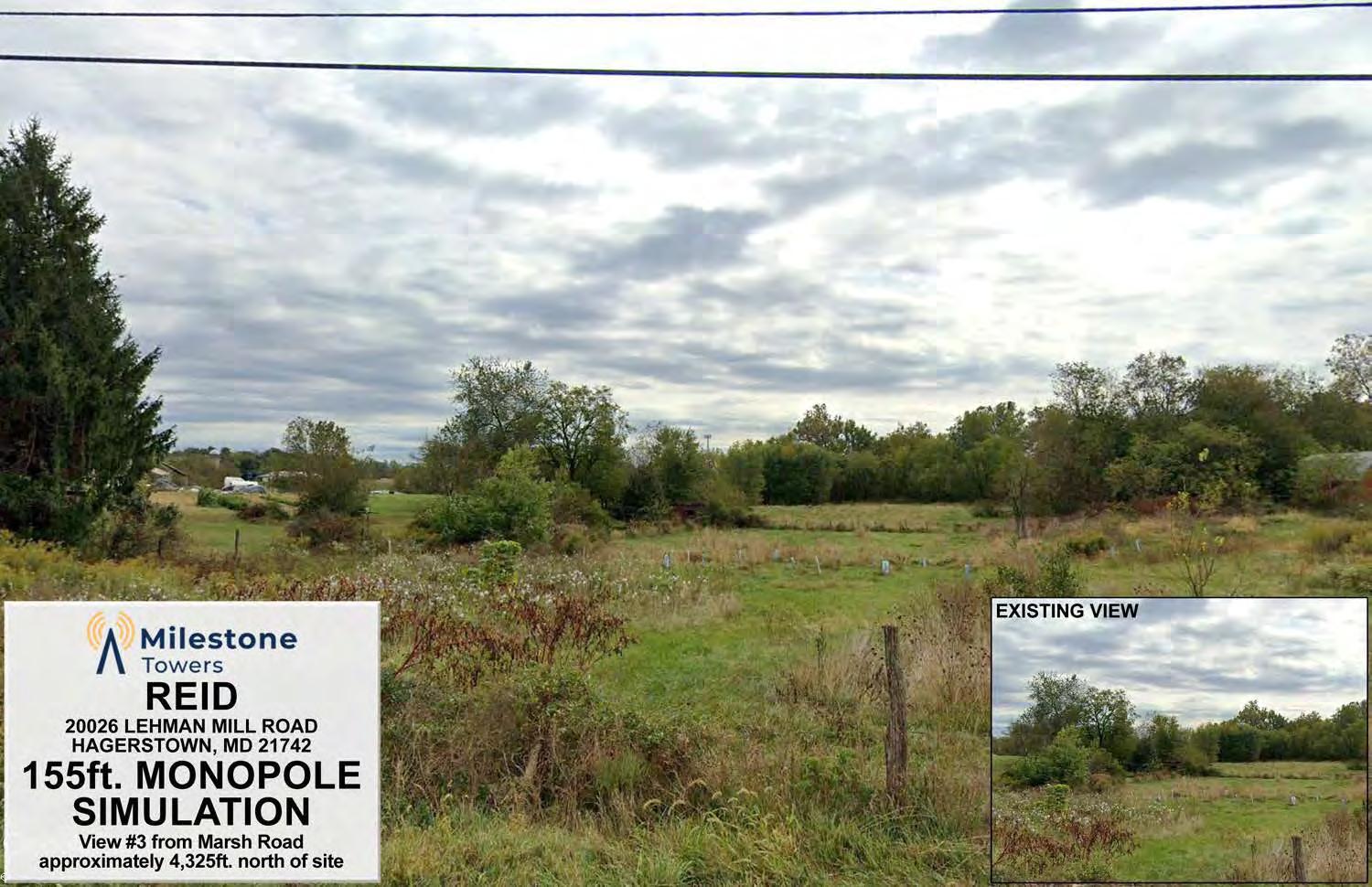
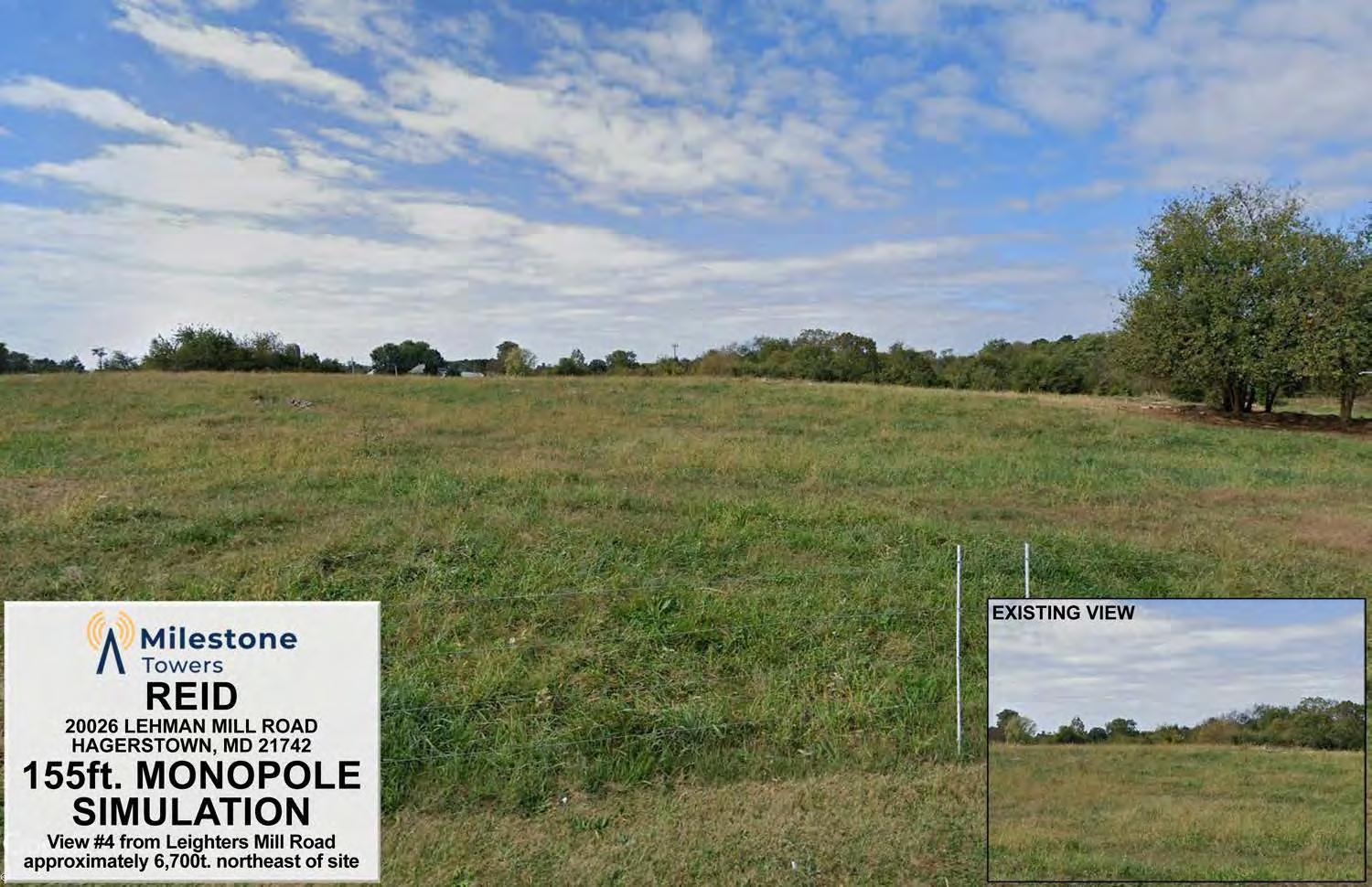
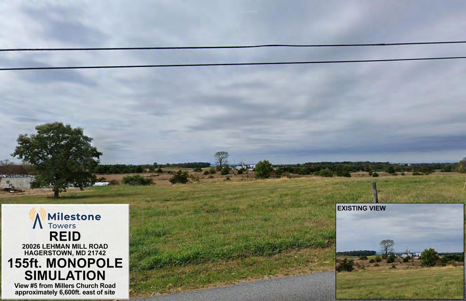
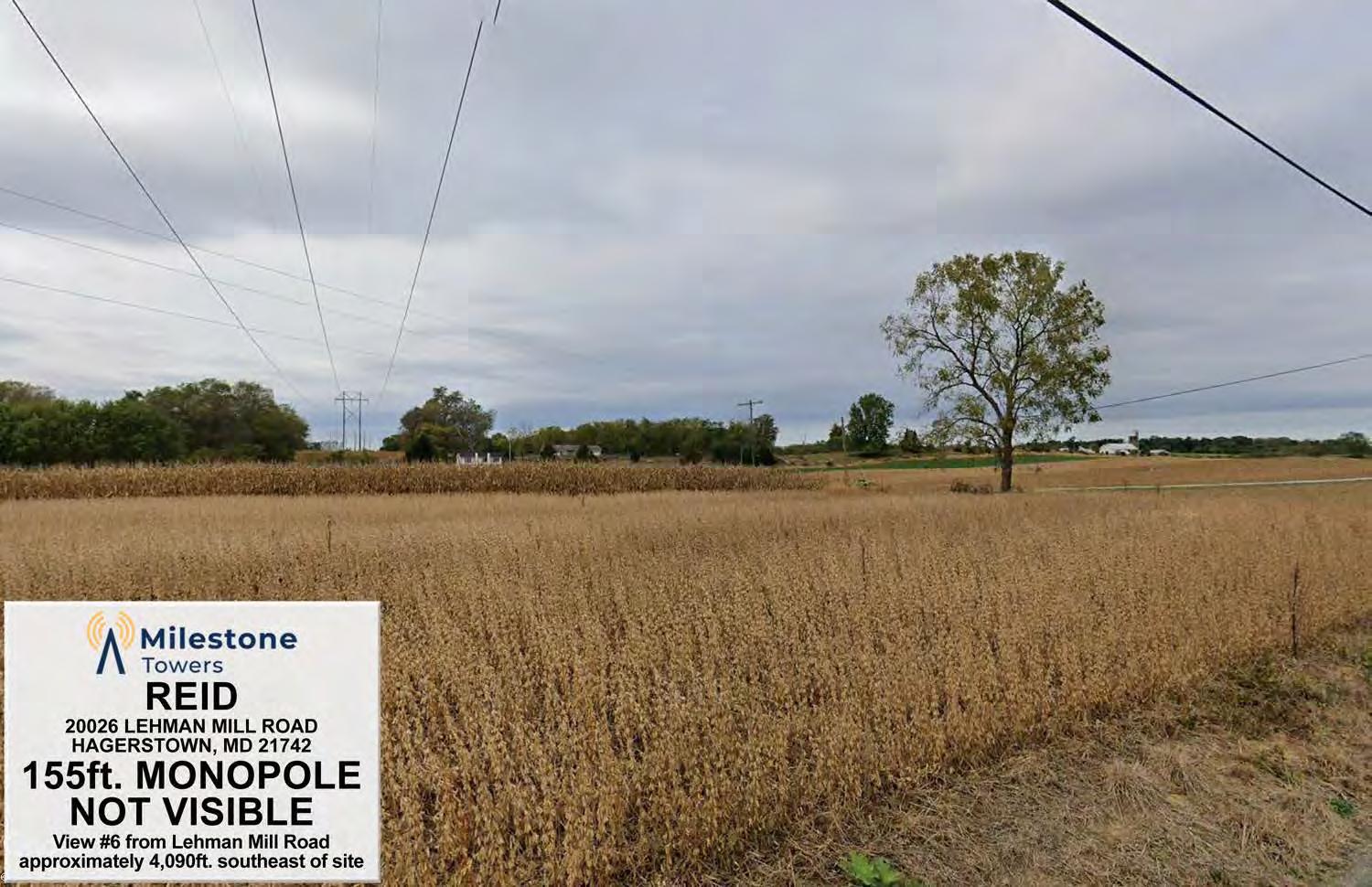
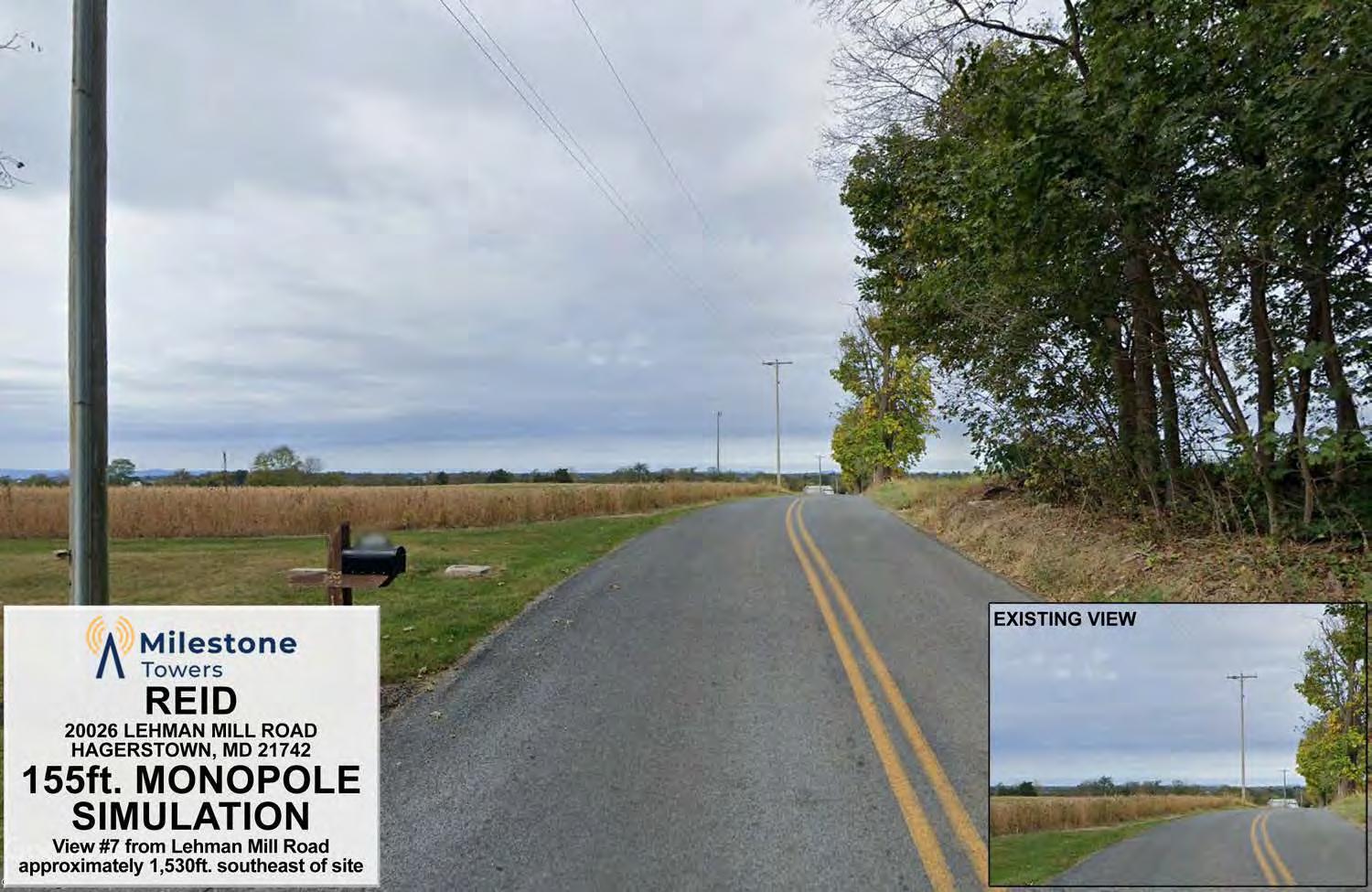
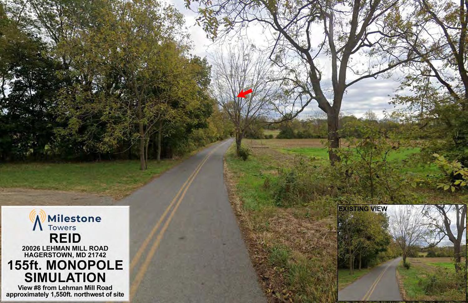
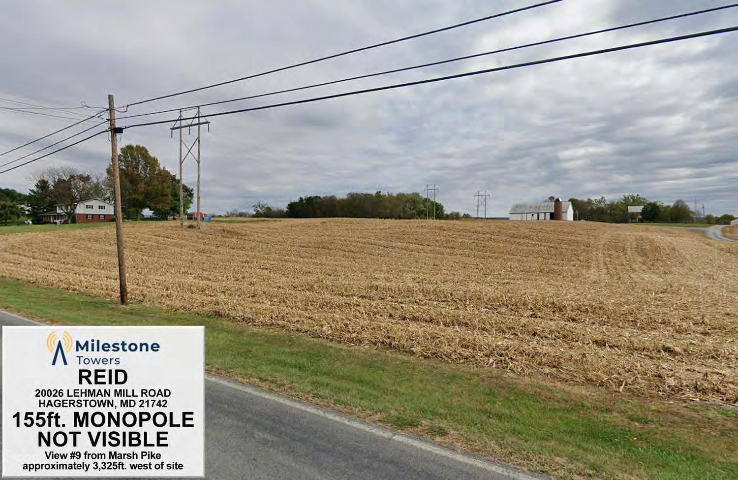
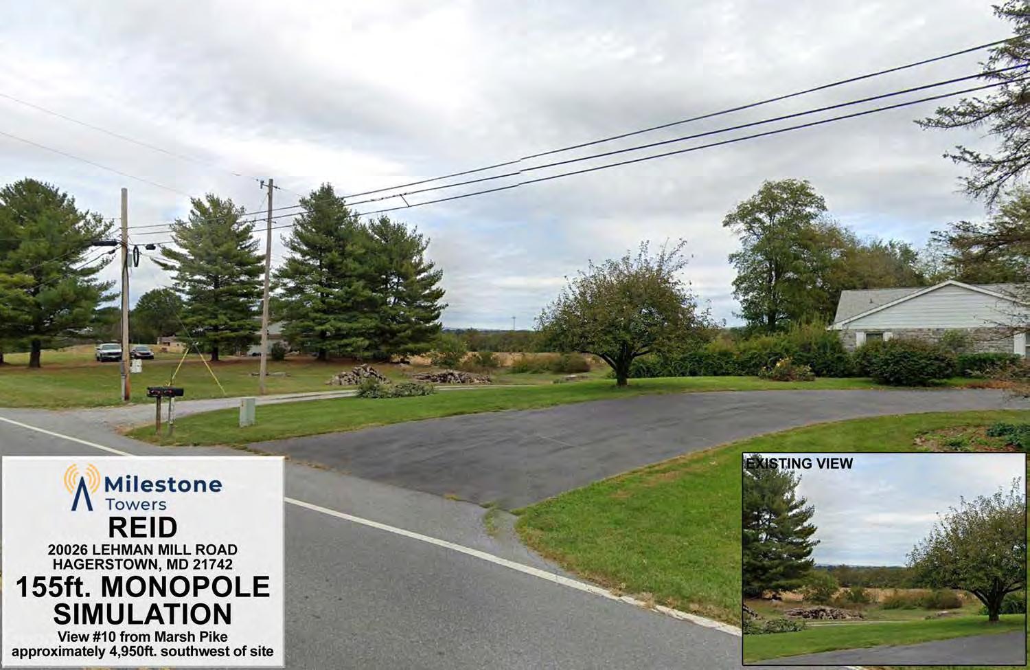
b. Milestone Towers, Reed/Trileaf Project #745580 – 20026 Lehman Mill Road (Discussion/Comment/Consensus) – UPDATED DOCUMENTATION - construction of a 150-foot monopole communications tower with an overall height of 152 feet, including attachments. Cool Brook Farm, WA-I-207 *
2. Staff Report
a. Staff Reviews *
b. 2025 Meeting Calendar – Note change in start time to 6:00 p.m. 2025 *
c. 250th updates
d. Historic Structures Grant Updates
e. Comprehensive Plan Update
f. December Meeting Reminders - Election of Officers and CLG Annual Report
ADJOURNMENT
UPCOMING MEETING
1. Wednesday, December 4, 2024, 7:00 p.m.
*attachments
The Historic District Commission reserves the right to vary the order in which the cases are called. Individuals requiring special accommodations are requested to contact the Washington County Planning Department at 240313-2430 to make arrangements no later than ten (10) days prior to the meeting. Notice is given that the agenda may be amended at any time up to and including the meeting.
| F:
| TDD: 7-1-1
MINUTES OF THE HISTORIC DISTRICT COMMISSION FOR WASHINGTON COUNTY
September 4, 2024
The Washington County Historic District Commission held its regular monthly meeting on Wednesday, September 4, 2024 at 7:00 p.m. in the Washington County Administrative Complex, 100 W Washington Street, Room 2001, Hagerstown, MD.
CALL TO ORDER AND ROLL CALL
The Chairman called the meeting to order at 7:00 p.m.
Commission members present were: Greg Smith, Chairman, Ann Aldrich, Lloyd Yavener, Michael Lushbaugh and Justin Bedard Staff members present were: Washington County Department of Planning & Zoning: Meghan Jenkins, GIS Coordinator and HDC Staff member, Debra Eckard, Office Manager; and Jill Baker, Director (arrived at 7:25 pm) Also present were John Stull, Gary Moser, Michael Hill and Ellen Gercke, the Community Center Committee representing Emerald Pointe and Tyler Milam (newly appointment HDC member not yet sworn into office).
MINUTES
Motion and Vote: Ms. Aldrich made a motion to approve the minutes of the August 7, 2024 workshop meeting as presented. The motion was seconded by Mr. Lushbaugh and unanimously approved.
Motion and Vote: Ms. Aldrich made a motion to approve the minutes of the August 7, 2024 regular meeting as presented. The motion was seconded by Mr. Lushbaugh and unanimously approved.
NEW BUSINESS
Residential Demolition Permit
– 13325 Emerald Pointe Drive
Ms. Jenkins presented a demolition permit application for a two-story farmhouse located at 13325 Emerald Pointe Drive in the Emerald Pointe subdivision, which is an approved PUD (Planned Unit Development). During the original review of the proposed development, the HDC asked the developer to retain the structure. The structure was retained; however, it was significantly modified by removing additions, replacing windows, gutting the interior, etc. The structure was turned over to the Homeowners Association (HOA) earlier this year at which time the HOA began exploring ideas for an effective re-use The HOA then contacted staff regarding the structure. At this point in time, the structure would be a financial burden to the residents and it would be difficult to find an adaptive re-use that would benefit the community The HOA reached out to the residents of the community during a community meeting and provided information and photographs of the structure in its current condition. A vote was taken with a majority of the residents not in favor of keeping the structure or expending funds to restore it.
Mr. John Stull, Chairman of the Community Center Committee, stated that there is concern regarding retention of the structure due to liability issues and the problem of getting insurance in a structure with no utilities. Mr. Hill, a member of the Community Center Committee, noted there is also concern of homeless people getting in the structure and possibly starting a fire. Mr. Moser, another member of the Committee, believes that the more the structure deteriorates it will become less of an asset and more of a liability to the community.
Ms. Jenkins presented current photographs of the structure. It was noted that the roof was replaced about two years ago, at which time all of the trim work was removed. The demolition contractor has contacted
his usual customers who repurpose and salvage materials. The only material that may be salvaged is the original stone. There were no other components deemed suitable for repurposing.
Ms. Aldrich suggested saving some of the fieldstone and erecting a sign acknowledging the Shank farm.
Motion and Vote: Mr. Yavener made a motion to support the approval of the demolition permit based on information provided and included in the Staff Report. The motion was seconded by Mr. Lushbaugh and unanimously approved.
OLD BUSINESS
Historic Chapter Revision – Comprehensive Plan
Ms. Jenkins believes the revised draft of the Comp Plan will go out in October for public comment. She has made several revisions to the historic chapter to address comments received from MHT. She briefly reviewed several of the changes that have been made and asked members for their feedback on those changes. Members suggested a few corrections and changes to the chapter.
Stone Arch Bridges
Ms. Jenkins explained that Mr. Hobbs and Mr. Eshelman would like the HDC to comment and make suggestions for the Price’s Mill Bridge project that was discussed during the workshop last month. Members discussed the liability to the County if the bridge is not repaired and made safe, the cost of the restoration of the bridge, the projected cost if the bridge collapses, etc. Ms. Aldrich expressed her opinion there are a lot of opportunities and incentives to bring the bridge into some reasonable condition as well as getting access from the neighboring property owners.
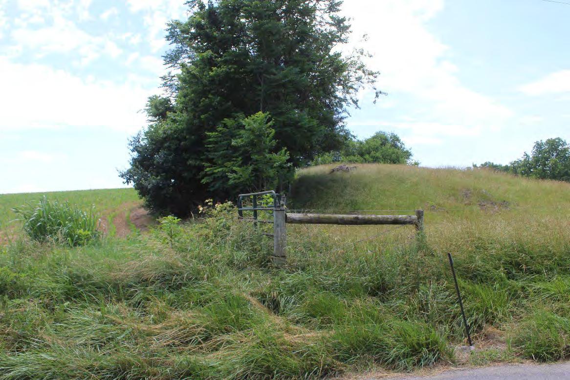
Consensus: The Historic District Commission concurs with MHT’s assessment that the bridge is eligible for listing in the National Register of Historic Places.
Ms. Jenkins noted there is a question as to who owns the right-of-way to access the bridge. Members believe this issue needs to be further explored. There were discussions regarding requirements by the US Army Corps of Engineers if the structure were demolished and where funds could potentially be obtained to help with restoration of the bridge (Program Open Space, Preservation Maryland, etc.). Fundraising or partnering with other businesses were also discussed.
Ms. Jenkins will draft a letter to Mr. Hobbs and Mr. Eshelman outlining discussions held this evening that included additional funding sources, the question of cost of demolition vs. cost of mitigation, total liability issues, right-of-way exploration, and the unique nature of this bridge.
Mr. Smith expressed his opinion that the idea of saving a portion of the structure could help mitigate some of the problems. He believes this could be a good compromise and would be appropriate for the recreational trail idea. Mr. Lushbaugh expressed his opinion that this is the second oldest bridge in the County and it is a valuable asset to the community.
Ms. Jenkins stated that information was originally sent to the City of Hagerstown; MHT requested that the information be sent to the HDC. Comments are being requested at this time. The developer claims there is no adverse effect on any historic structures; however, the cell tower is being placed on a property with a historic resource and there are several other historic resources in the area.
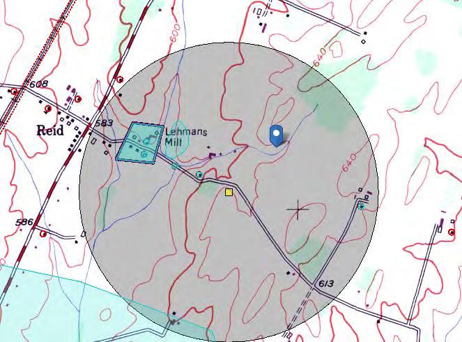
Mr. Bedard strongly recommends that the developer perform a GIS based viewshed assessment to determine if the monopole will be visible from Lehman’s Mill as well as the contributing structures on the property where the monopole will be located.
Ms. Jenkins noted that a special exception (AP2024-39) was filed with the Board of Zoning Appeals to place this tower at this location. Some viewshed information was submitted with the appeal application which Ms. Jenkins presented to the HDC. Mr. Bedard recommended that this information be shared with MHT.
Consensus: The HDC recommends a GIS-based viewshed assessment, the use of an independent contractor to study and identify other unidentified historic resources, and to include the information that was previously provided in the Zoning Appeal packet to MHT.
Ms. Jenkins noted she has sent a request for the additional information that has been requested by MHT, specifically with the views from the proposed tower location around areas of Leitersburg.
Staff Report
• A written report of staff reviews for the past month was provided to members in the agenda packets.
• 250th Update: The historic subcommittee is providing a list of at least 3 video ideas for each of the municipalities of lesser known, unique stories and history
• Ms. Jenkins continues working on the draft tax credit application.
• Ms. Jenkins noted that several of the Boards/Commissions have begun meeting at 6 instead of 7. All members were agreeable to starting the meetings at 6 pm.
ADJOURNMENT
Mr. Lushbaugh made a motion to adjourn the meeting at 8:40 pm. The motion was seconded by Ms Aldrich and so ordered by the Chairman.
Gregory Smith, Chairman
To: Jenkins, Meghan
Subject: Re: Historic district overlay
Date: Tuesday, October 29, 2024 12:17:41 PM
Attachments: image001.png
image002.png
image003.png
image004.png
image005.png
image006.png
WARNING!! This message originated from an External Source. Please use proper judgment and caution when opening attachments, clicking links, or responding to this email.
Any claims of being a County official or employee should be disregarded. Sure no problem, see below in red.
From: Jenkins, Meghan <mjenkins@washco-md.net>
Sent: Tuesday, October 29, 2024 11:20 AM
Subject: RE: Historic district overlay
Thanks, Rorke. I got both this email and the one with the pictures attached. Because I’m unfamiliar with your structure, but remember you mentioning some previous owner’s work, could you elaborate a bit on the material choices for me so I can provide this information to the HDC?
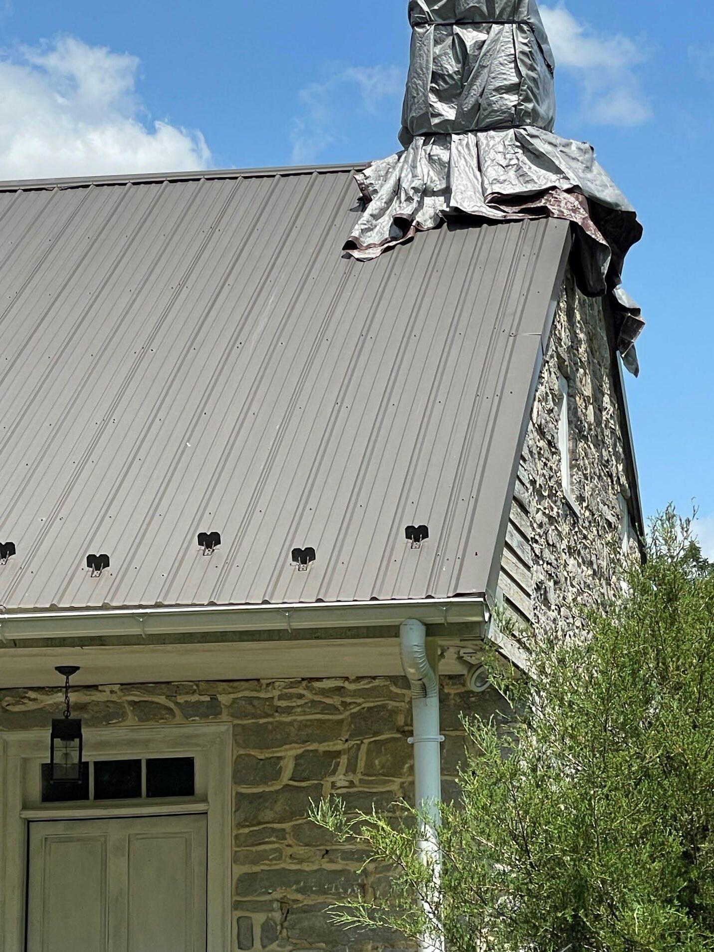
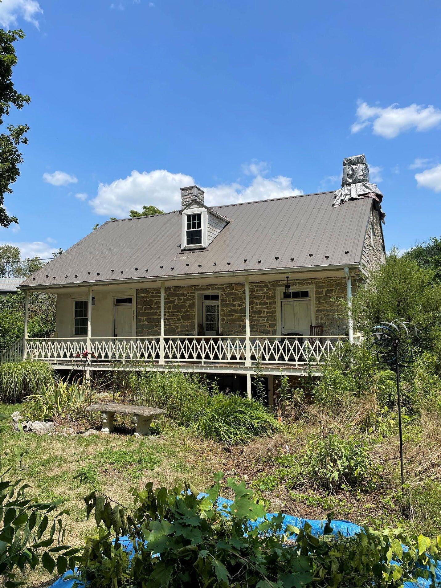
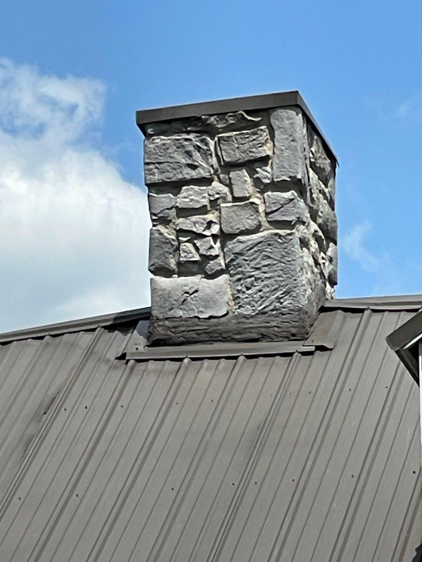
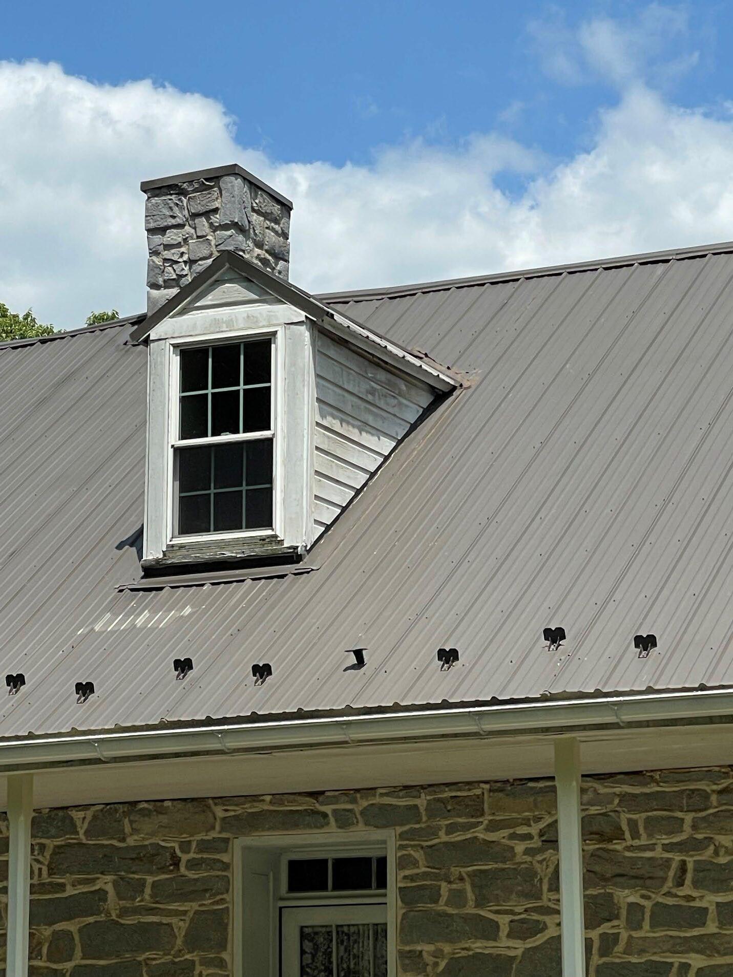
1. Are the chimneys originally brick and then refaced with stone at the roofline in the past and this proposal is to return/repair them to all brick? correct, the original chimneys are brick that someone refaced with stone. We think this is part of the issue why the roof is leaking. If you look on the inventory you can see in the pics that they were brick at that time, I might also have a pic on my phone.
2. For the standing seam roof, do you have a picture of the material you have chosen yet that I can share with the HDC? I dont, but its going to be the same roof that is on the Saylor House, I can send a pic of the Saylor house if you would like.
3. Are there any other descriptions of the work you can provide (I know the space on the current app is small) that will help illustrate the level of work being done? Ex. Roof supports are being left alone; sheeting replaced as needed; chimneys repaired from existing roofline up; liner installed/replaced in
Rorke Eichholz
chimney; stone façade on brick (added by previous owner) to be removed and brick repointed and repaired
Stone will be removed from the chimneys, if the brick is in bad shape, the chimneys will be rebuilt with brick from the roofline up. Both the mason and the roofer anticipate the brick is in bad shape. No chimney liners will be installed. The chimneys are currently capped at the top and will be recapped when completed. We have no plans to make any changes to the structure of the roof,
4. Do you have a proposed project start date and projected end date? this depends on the HDC approval and how cold it is. Its getting late in the year, so it might have to wait until spring because the mason has to do the chimneys first. Im hoping to do the masonry in November, but if it turns too cold, it will have to wait until the spring.
5. If you have a detailed quote from the contractors that answers any of the above questions that is helpful as well. I do not, I only have texts with prices. I can ask them for a quote to submit.
Happy to see you moving forward with the project and I look forward to taking it to the HDC for their review.
Sincerely, Meghan
Meghan Jenkins, GISP
Geographic Information Systems (GIS) Coordinator | Historic District Commission (HDC)
747 Northern Avenue
Hagerstown, MD 21742
P: (240) 313-2439 | F: (240) 313-2431
www.washco-md.net
(Pronouns: she/her/hers)
Get Connected and See Updates
NOTICE: This e-mail, including any attachments, is intended solely for the use of the addressee(s) and may contain confidential, proprietary and privileged information, the unauthorized disclosure or use of which is prohibited. If you are not the intended recipient of this email or if you received this e-mail in error, please immediately notify the sender by reply email and delete this e-mail and any attachments from your system. Thank you.
Book time to meet with me
Sent: Monday, October 28, 2024 3:49 PM
To: Jenkins, Meghan <mjenkins@washco-md.net>
Subject: Re: Historic district overlay
WARNING!! This message originated from an External Source. Please use proper judgment and caution when opening attachments, clicking links, or responding to this email.
Any claims of being a County official or employee should be disregarded. Here is the HDC application. I'll send the pictures over in a separate email.
Thanks Rorke
Eichholz
From: Jenkins, Meghan <mjenkins@washco-md.net>
Sent: Monday, October 28, 2024 2:38 PM
To: Rorke Eichholz <rorkee@hotmail.com>
Subject: RE: Historic district overlay
Okay!
All digital is fine. You can email it to me or if it’s too large I can send you a link to upload to.
Geographic Information Systems (GIS) Coordinator | Historic District Commission (HDC) 747 Northern Avenue
Hagerstown, MD 21742
Rorke
Meghan Jenkins, GISP
P: (240) 313-2439 | F: (240) 313-2431
www.washco-md.net
(Pronouns: she/her/hers)
Get Connected and See Updates
NOTICE: This e-mail, including any attachments, is intended solely for the use of the addressee(s) and may contain confidential, proprietary and privileged information, the unauthorized disclosure or use of which is prohibited. If you are not the intended recipient of this email or if you received this e-mail in error, please immediately notify the sender by reply email and delete this e-mail and any attachments from your system. Thank you.
Book time to meet with me
Sent: Monday, October 28, 2024 2:37 PM
To: Jenkins, Meghan <mjenkins@washco-md.net>
Subject: Re: Historic district overlay
WARNING!! This message originated from an External Source. Please use proper judgment and caution when opening attachments, clicking links, or responding to this email.
Any claims of being a County official or employee should be disregarded.
Sorry,
Just realized I never replied to you. Im not moving forward with the state application at this time. I do however have my HDC application ready to be submitted.
I have two questions, do I need to mail it in, it cannot be emailed? And do you need physical photos or can I send digital photos?
thanks
Rorke
Rorke Eichholz
WARNING!! This message originated from an External Source. Please use proper judgment and caution when opening attachments, clicking links, or responding to this email.
Any claims of being a County official or employee should be disregarded.
Meghan,
Good afternoon, can you tell me where I can find the paperwork to submit my roof and chimney repair to the HDC since I have the HD overlay on my property.
Thanks
Rorke
Rorke Eichholz
Figure 1: Back View #2
Figure 2: Back View
Figure 3: End Chimney #2
Figure 4: End Chimney (no tarp)
Figure 5: End Chimney
Figure 6: Front View #2
Figure 7: Front View
Figure 8: Middle Chimney #2
Figure 9: Middle Chimney
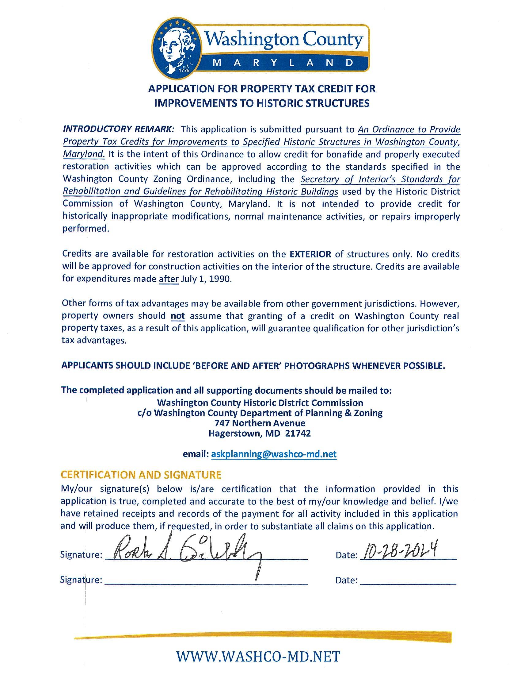
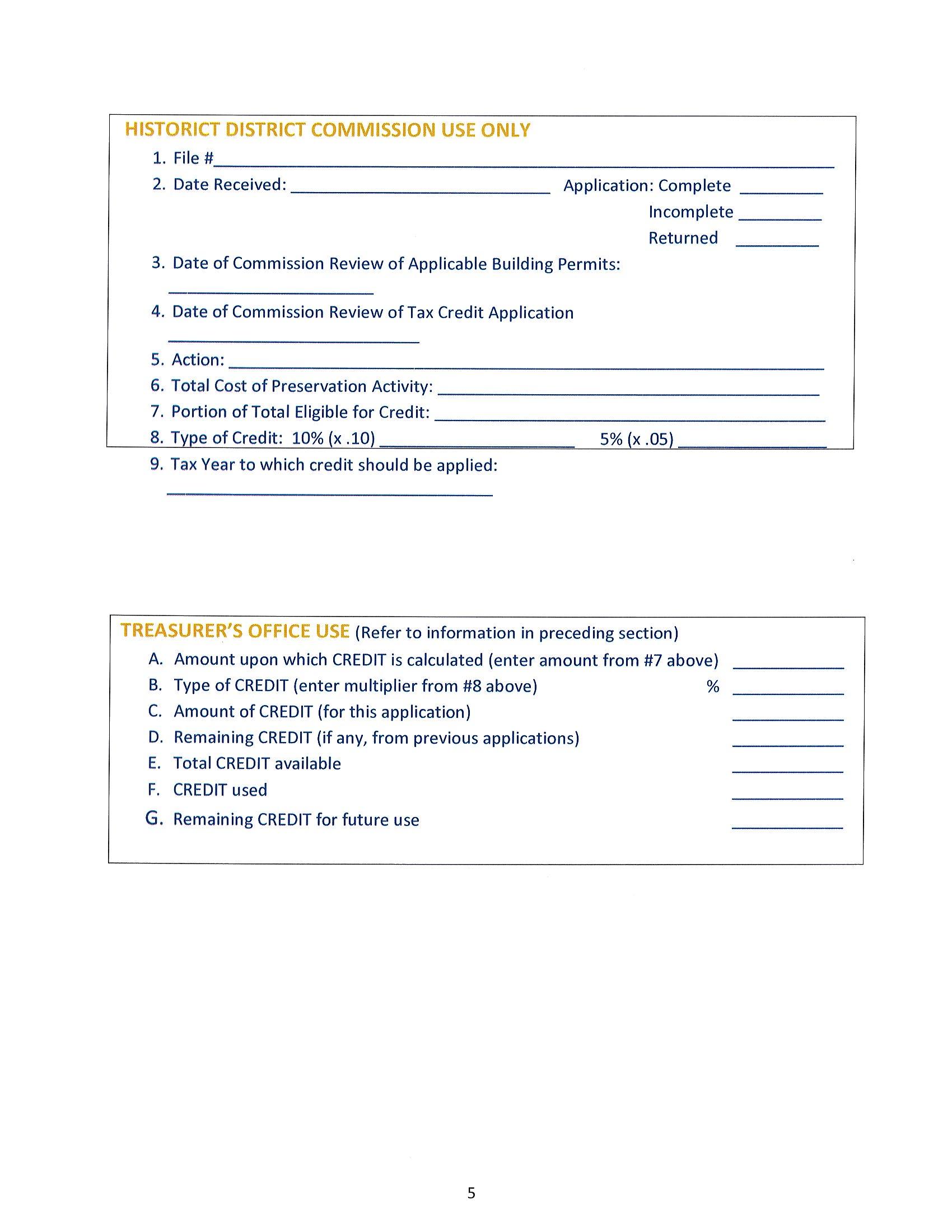
Application Instructions for Historic Properties Tax Credit ORDINANCE 2024-23
Washington County’s Historic Properties Tax Credit (ORD 2024-23) provides funds in the form of a property tax credit for repair or renovation work on historic structures The application is divided into three parts. The Washington County Historic District Commission (HDC) reviews the applications to ensure compliance with the ordinance and applicable standards and guidelines.
The applicant is responsible for complying with all Federal, State and local laws applicable to a project, including, but not limited to compliance with zoning, building, and safety codes; review by any easement holders such as MHT; compliance with applicable Federal, State and local licensing, permitting, and environmental requirements.
Completed applications and all supporting documents should be mailed to:
Washington County Historic District Commission c/o Washington County Department of Planning & Zoning 747 Northern Avenue Hagerstown, MD 21742
email: askplanning@washco-md.net
All application parts require a signature.
If the applicant is not the fee-simple owner of the property, the application must include the signed Owner’s Representative Affidavit included at the end of each application part.
Signatures must be done using a Digital ID or application printed and wet signed, or a digitized original handwritten signature affixed to the document
For any questions during the application process, please contact askplanning@wascho-md.net. Page 1 | Application Instructions
Part I
This application is reviewed to determine if a structure qualifies for the tax credit. Properties which have the Historic Preservation (HP) Overlay do NOT need to complete Part I unless there is a question of whether the Overlay includes the structure for which the credit is being requested For all other structures, Part I must be completed. Part 1 and Part 2 may be submitted together or separately, however, Part I must be submitted first (unless HP Overlay).
Physical Appearance
Statement of Significance
Use this section to describe the current conditions of the home’s major features. If you know the architectural style, exterior construction materials, roof type, number of stories, basic floor plan and any architectural features. Visit the Washington County Design Guidelines for Historic Structures (“Guidelines”) to assist in describing features.
This section should also include any changes made to the structure or property over time. A brief description of any adjacent buildings should also be included.
Reference the Guidelines and their section on Significance and integrity to describe the property.
Part II
This application evaluates whether the proposed rehabilitation work meets applicable rehabilitation standards and thus is eligible for the credit. The project is evaluated for conformance with the Secretary of the Interior’s Standards for Rehabilitation and the County’s Design Guidelines for Historic Structures. The focus should be on the retention, preservation and protection of a historic structure’s materials and features.
This portion of the application must be approved BEFORE rehabilitation work begins. Any work started and/or completed prior to approval may not be eligible for the tax credit and may jeopardize the credit for the entire project.
Qualified Rehabilitation Expenses (QRE)
Description of Rehabilitation Work
These are defined in the ordinance and an estimate should be provided for this portion of the application. The estimate should not include any ineligible expenses.
Describe the entire project; not just the work for which a tax credit will be sought. Each feature should be addressed separately on the description with associated description and photo support.
Photos Photos should be submitted showing the entire project area.
Part III
This application certifies that the rehabilitation work was completed and as approved by the Historic District Commission (HDC) in Part II and verifies the expenses claimed. Completed projects may be inspected by the HDC or a staff person
Itemized Expenses
A written accounting of ALL project expenses including those that are ineligible. This should be completed on the spreadsheet provided. A copy of the invoice/receipt and proof of payment is required. Any account numbers or sensitive informa tion must be redacted for security purposes.
Photos Photos should be submitted showing the entire project area.
Photos Photos of the property BEFORE rehabilitation
Application for Historic Properties Tax Credit ORDINANCE 2024-23
Part I – Evaluation of Significance
HTC Number (HDC office use only):
Instructions: Fill out this form for determination of whether the historic structure is located within a qualifying area. Owners of properties that have the Historic Preservation Zoning Overlay do NOT need to complete this form. For structures under MHT Easement, a copy of the easement document must be included.
PROPERTY INFORMATION
Property Name Street Address
City Zip
Check all designations that apply:
Historic Structure in the Antietam Overlay 1 or 2
Historic Structure contributing to a Historic Rural Village
Historic Structure under MHT Easement
Historic Structure in an eligible municipality (list below)
Municipality
APPLICANT INFORMATION
Name
Street Address
City State Zip
Telephone Email Address
PROJECT CONTACT (if different from applicant)
Name
Company
Street Address
City State Zip
Telephone Email Address
PROPERTY DETAIL INFORMATION
Date(s) of building(s) including source of date(s)
Construction materials (brick, wood frame, etc.)
Date(s) of exterior alteration(s)
Description of the physical appearance (size, number of stories, style, construction materials)
Statement of significance
APPLICATION CHECKLIST
Application Form – I have filled in all applicable fields. (check Equivalent Documentation below if applicable)
Signature – I signed and dated the Part 1 application
Ownership – If I am not the fee-simple owner of the property, I have provided a written statement from the fee-simple owner indicating that he or she is aware of the application and has no objection to the request for review
Significance justification – I have attached documentation to support the significance of the historic structure
Photographs – I have attached exterior photographs of all sides of the structure including areas applicable to the application
Equivalent Documentation – I am attaching an equivalent documentation packet for review.
I attest that I have read and understand the Historic Properties Tax Credit Application and that the information provided in this application is true, completed and accurate to the best of my/our knowledge and belief.
Signature of Applicant
Printed Name of Applicant
Signature of Applicant
Printed Name of Applicant
Historic District Commission Use Only
Date
Date
The Historic District Commission has reviewed the Application for Historic Properties Tax Credit – Part I for the abovenamed property and has determined that the property:
Is located in an existing qualified area and meets historic structure criteria
Appears to meet the qualifications of a historic structure pending designation through individual Historic District
Is not a historic structure because it is not in a qualifying area; does not meet criteria for local designation
Is not adequately documented in the application and therefore cannot be reviewed
Date of HDC Review
OWNER’S REPRESENTATIVE AFFIDAVIT
Instructions: Fill out this form if the applicant is NOT the fee-simple owner of the property.
This is to certify that _____________________________________is authorized to make Part IApplication for Historic Properties Tax Credit (ORDINANCE 2024-23) for property located at ________________________________________________________________________________.
The review for evaluation of significance is authorized by___________________________________________________, the owner in fee
Application for Historic Properties Tax Credit ORDINANCE 2024-23
Part II – Description of Rehabilitation
HTC Number (from Part I Application):
Instructions: Fill out this form for determination of whether the proposed work is consistent with Washington County Design Guidelines and Secretary of the Interior Standards for Rehabilitation.
Use this page to describe all exterior work and new construction.
Number Feature
Describe existing feature and its condition
Describe work and impact on feature
Photo Numbers
Number Feature
Describe existing feature and its condition
Drawing Numbers
Describe work and impact on feature
Photo Numbers
Drawing Numbers
DETAILED DESCRIPTION OF REHABILITATION WORK
Use this page to describe all exterior work and new construction.
Number Feature
Describe existing feature and its condition
Describe work and impact on feature
Photo Numbers
Number Feature
Describe existing feature and its condition
Drawing Numbers
Describe work and impact on feature
Photo Numbers
Drawing Numbers
APPLICATION CHECKLIST
Application Form – I have filled in all applicable fields.
Signature – I signed and dated the Part 2 application
Description of Rehabilitation Work – I have described ALL proposed work planned for the exterior of my property. I understand that all work must be consistent with the Washington County Design Guidelines and Secretary of the Interior’s Standards and be reviewed and approved by the Historic District Commission
Supplementary Materials – If applicable to my project, I have attached site plans, demolition plans, architectural plans, HVAC plans, replacement window/door drawings and/or product specifications.
Photographs – I have attached photographs to support the description of work.
Equivalent Documentation – I am attaching an equivalent documentation packet for review.
I attest that I have read and understand the Historic Properties Tax Credit Application and that the information provided in this application is true, completed and accurate to the best of my/our knowledge and belief.
Signature of Applicant
Printed Name of Applicant Date
Signature of Applicant
Printed Name of Applicant Date
Historic District Commission Use Only
The Historic District Commission has reviewed the Application for Historic Properties Tax Credit – Part II for the abovenamed property and has determined that the proposed rehabilitation described herein:
Is consistent with the Secretary of the Interior’s Standards for Rehabilitation and Washington County Historic Guidelines. Final certification can be issued only after the rehabilitation work is completed as herein described and a Part 3 application is submitted and approved
Is consistent with the Secretary of the Interior’s Standards for Rehabilitation if the attached conditions are met. A final certification can be issued only after the rehabilitation work is completed as herein described and a Part 3 Application is submitted and approved.
Is not consistent with the Secretary of the Interior’s Standards for Rehabilitation, eligibility requirements, and/or does not comply with program requirements and therefore certification is denied.
Is not adequately documented in the application and therefore cannot be reviewed
Date of HDC Review
OWNER’S REPRESENTATIVE AFFIDAVIT
Instructions: Fill out this form if the applicant is NOT the fee-simple owner of the property.
This is to certify that _____________________________________is authorized to make Part IIApplication for Historic Properties Tax Credit (ORDINANCE 2024-23) for property located at _________________________________________________________________________________.
The review for description of rehabilitation is authorized by
the owner in fee
PROPERTY OWNER:
AUTHORIZED REPRESENTATIVE:
Authorized Representative’s Signature
Application for Historic Properties Tax Credit ORDINANCE 2024-23
Part III – Request for Certification of Completed Work
HTC Number (from Part I Application):
Instructions: Fill out this form at project completion for review of the rehabilitation costs and determination of project results consistent with Secretary of Interior’s Standards for Rehabilitation.
PROPERTY INFORMATION
Property Name Street Address
APPLICANT
PROJECT CONTACT (if different from applicant) Name Company
PROJECT DATA
Project Start Date
Project Completion Date
Total Rehabilitation Costs
Total Ineligible Expenses -
Total Qualified Rehabilitation Expenditures (QRE) =
APPLICATION CHECKLIST
Application Form – I have filled in all applicable fields. (Check Equivalent Documentation below if applicable)
Signature – I signed and dated the Part 3 application
Itemized Expense Spreadsheet – I have included a spreadsheet of all my itemized expenses, with eligible and ineligible expenses clearly delineated. For each item on the spreadsheet, I have included supporting documentation consisting of BOTH (1) a copy of the invoice or receipt, showing which goods or services were purchased, and (2) certifiable proof of payment such as a credit card receipt or cancelled check.
Photographs – I have attached photographs to support the description of work.
Equivalent Documentation – I am attaching an equivalent documentation packet for review.
I attest that I have read and understand the Historic Properties Tax Credit Application and that the information provided in this application is true, complete and accurate to the best of my/our knowledge and belief; and that the completed rehabilitation is consistent with the work described in Part 2 of the application process. I hereby apply for certification of rehabilitation work described for the purposes of a Washington County Historic Properties Tax Credit.
Signature of Applicant
Printed Name of Applicant
Signature of Applicant
Printed Name of Applicant
Historic District Commission Use Only
Date
Date
The Historic District Commission has reviewed the Application for Historic Properties Tax Credit – Part III for the abovenamed property and has determined that:
The completed rehabilitation is consistent with the Secretary of the Interior’s Standards for Rehabilitation and is consistent with the historic character of the property and where applicable, the district in which it is located. Completed projects may be inspected by an authorized representative of the HDC to determine if the work meets the Standards for Rehabilitation. The HDC reserves the right to make inspections at any time up to five years after completion of the rehabilitation and to revoke certification, if it is determined that the rehabilitation project was not undertaken as presented by the owner in the application form and supporting documentation, or the owner, upon obtaining certification, undertook unapproved further alterations as part of the rehabilitation project inconsistent with the Secretary’s Standards for Rehabilitation.
The completed rehabilitation is not consistent with the Secretary of the Interior’s Standards for Rehabilitation, eligibility requirements, and/or does not comply with program requirements and therefore certification is denied
Date of HDC Review
OWNER’S REPRESENTATIVE AFFIDAVIT
Instructions: Fill out this form if the applicant is NOT the fee-simple owner of the property.
This is to certify that _____________________________________is authorized to make Part IIIApplication for Historic Properties Tax Credit (ORDINANCE 2024-23) for property located at
The review for request for certification of completed work is authorized by
the owner in fee.
PROPERTY OWNER:
Property Owner’s Signature
AUTHORIZED REPRESENTATIVE:
Authorized Representative’s Signature
May 15, 2024
Washington County Historic District Commission, County Planning Office
Attn: Ms. Meghan Jenkins – Senior Planner
100 West Washington Street, Suite 2600 Hagerstown Maryland 21740
Latitude: 39° 41’ 29.66” N, Longitude: 77° 37’ 7.05” W
Dear Ms. Jenkins,
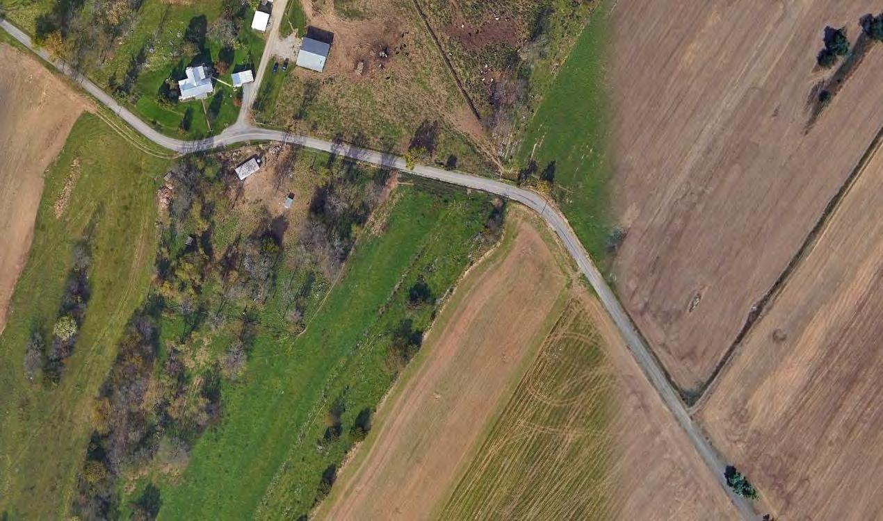
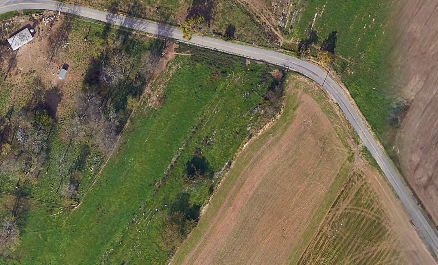
Trileaf Corporation is in the process of completing a NEPA Review at the referenced property. Our client proposes to construct a 155-foot monopole telecommunications tower with an overall height of 155 feet, including appurtenances within a 50-foot by 50-foot (2,500-square-foot) lease area. The project includes an access/utility easement, measuring 20 feet wide, containing a 12-foot gravel drive, extending approximately 785 feet generally southwest away from the lease area towards Leitersburg Smithsburg Road. The proposed tower compound lease area is located within grasscovered and wooded land. The antenna will be licensed by the Federal Communications Commission (FCC).
Our investigation includes determining if the site is contained in, on or within the viewshed of a building, site, district, structure or object, significant in American history, architecture, archaeology, engineering or culture, that is listed, or eligible for listing on the State or National Registers of Historic Places, or located in or on an Indian Religious Site.
Trileaf is requesting information regarding this tower’s potential effect on Historic Properties. All information received will be forwarded to the State Historic Preservation Office (SHPO) as part of the Section 106 review process. Additionally, this invitation to comment is separate from any local planning/zoning process that may apply to this project
If you wish to comment or be considered a consulting party, please respond within thirty (30) days of the date of this letter. If a response is not received within thirty (30) days, it will be assumed that you have no objections to this undertaking. A site topography map and aerial photograph are enclosed for your reference.
Please call me at (678) 653-8673 or email t.rahinsky@trileaf.com if you need additional information or have any questions. Thank you for your assistance in this regard.
Latitude: 39° 41’ 29.66” N, Longitude: 77° 37’ 7.05” W
Ms. Rahinsky,
The Washington County Historic District Commission received the request for comment or consulting party consideration regarding the referenced tower project. The request for comment was reviewed at the June 5, 2024 Regular Meeting. The HDC requests consulting party status due to the proximity of this project to Leitersburg Historic District (WA-I-174) which has a National Register status but has also been locally adopted as an Architectural Review Area The property is also in close proximity to locally designated properties including Rockledge (WA-I-142), Myers-Schooley (within the district), and the Leiters Mill Bridge (WA-I-176).
We look forward to further working with you through this process. Should you have any additional questions, please feel free to contact our office.
Sincerely,
Meghan Jenkins, GISP
Historic District Commission Staff
DATE: October 4, 2024
TO: Becky Roman, Maryland Historic Trust (MHT)
Meghan Jenkins, Historic District Commission (HDC)
FROM: Matt Penning, Director of Development, Milestone Towers
RE: Response to MHT and HDC Comments Received on Proposed 155’ Monopole –21536 Leitersburg Smithsburg Road
Ms. Roman, Ms. Jenkins,
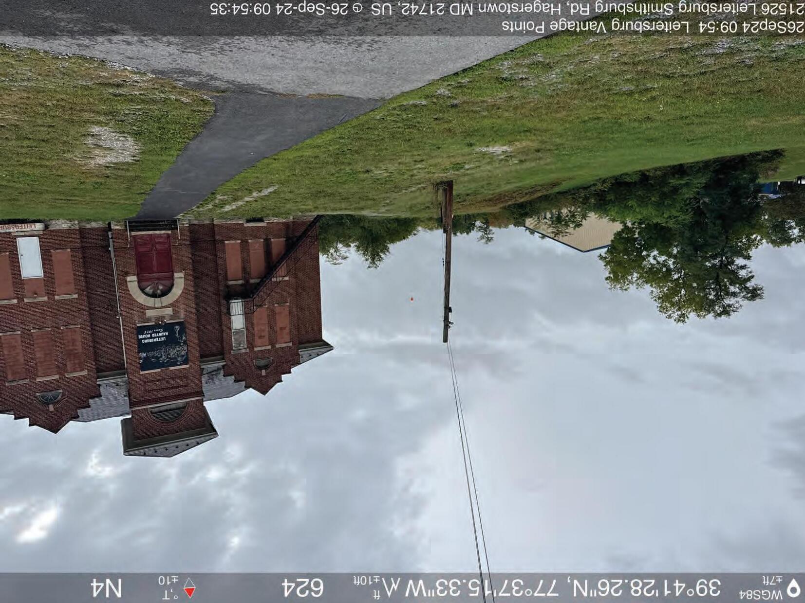
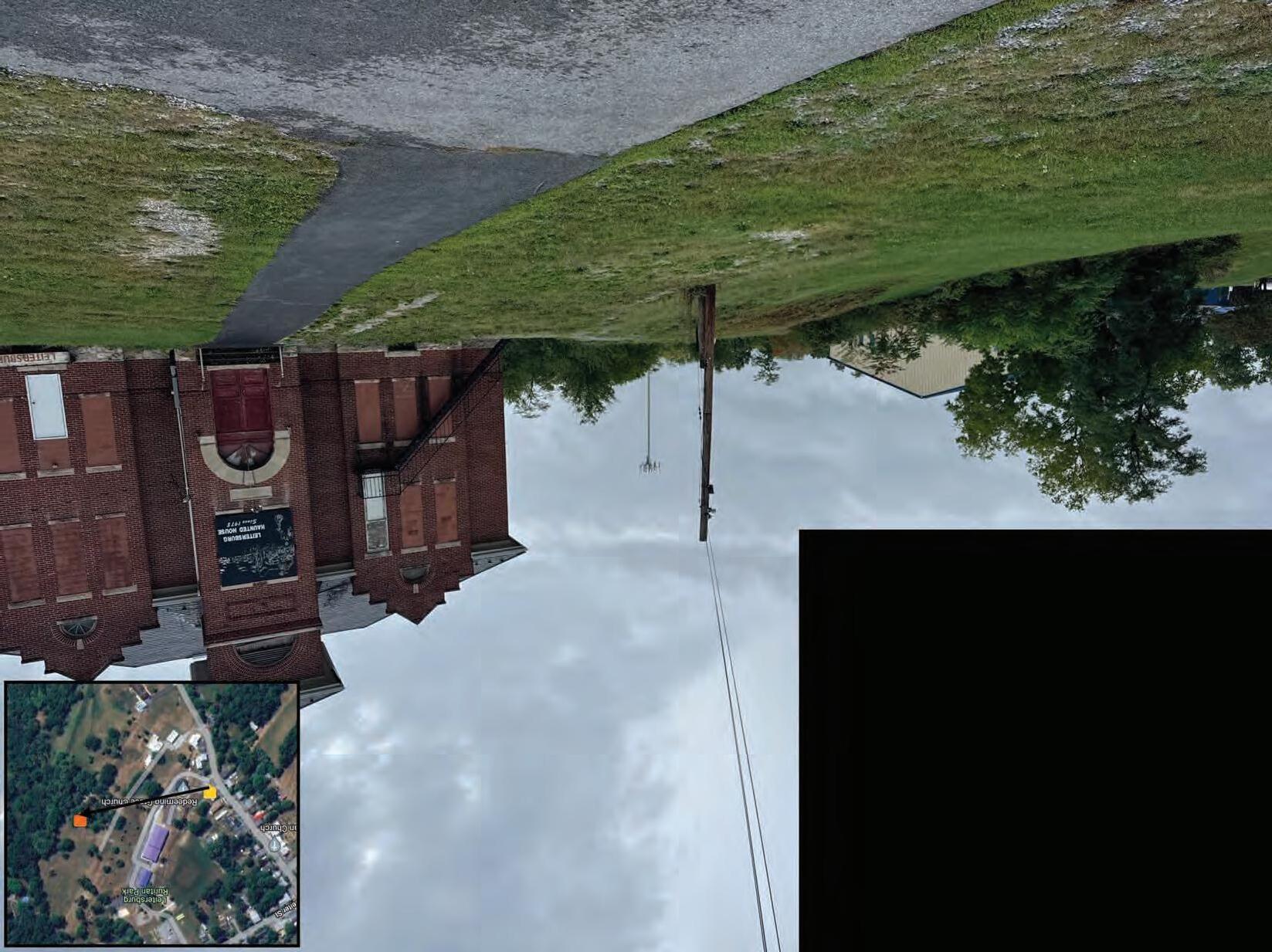
I am writing to respond to comments received by your organizations regarding our proposal for a 155’ tall monopole at 21536 Leitersburg Smithsburg Road
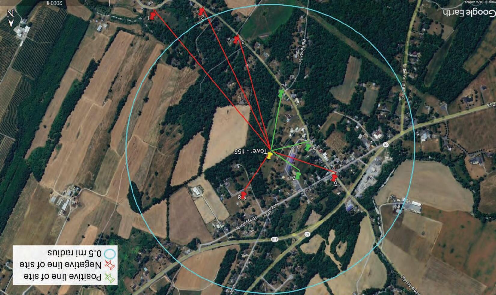
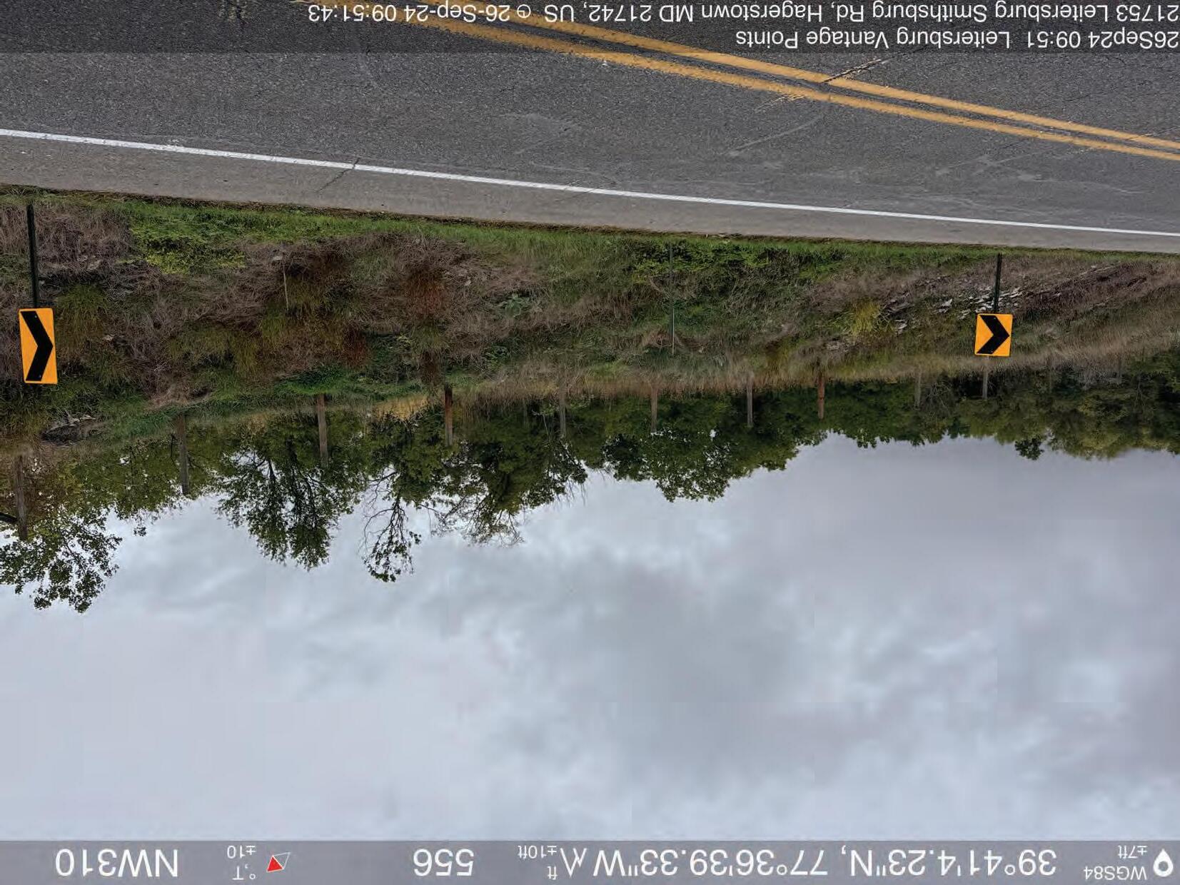
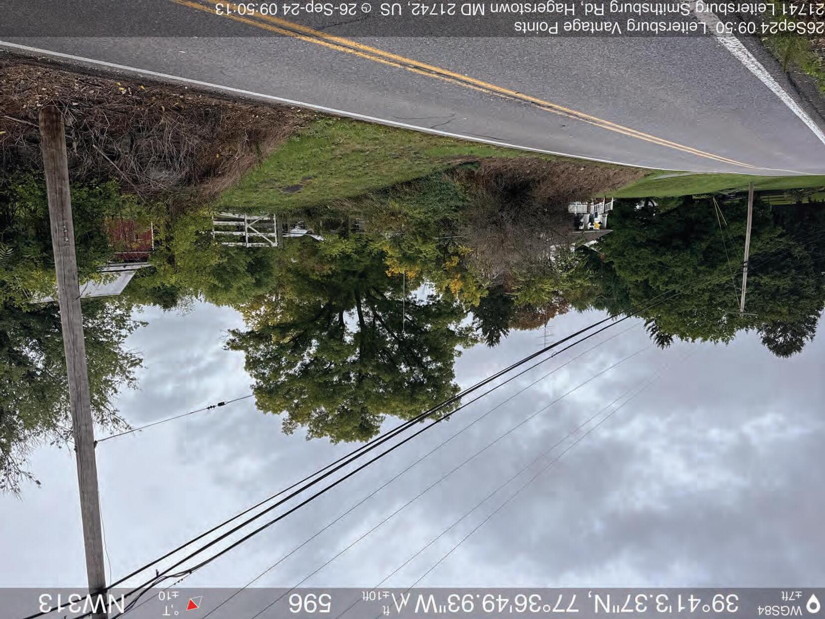
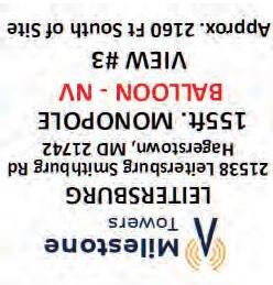
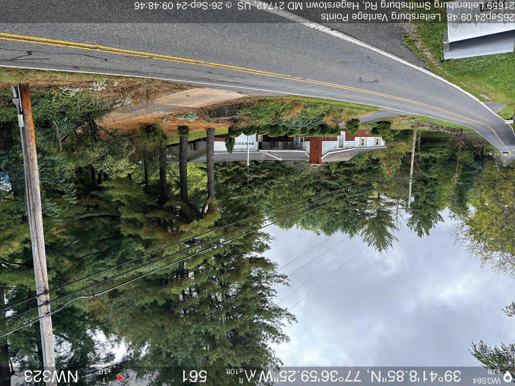
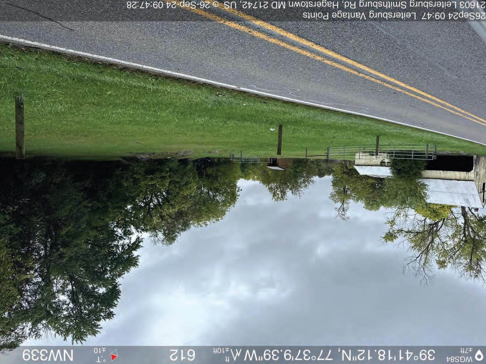
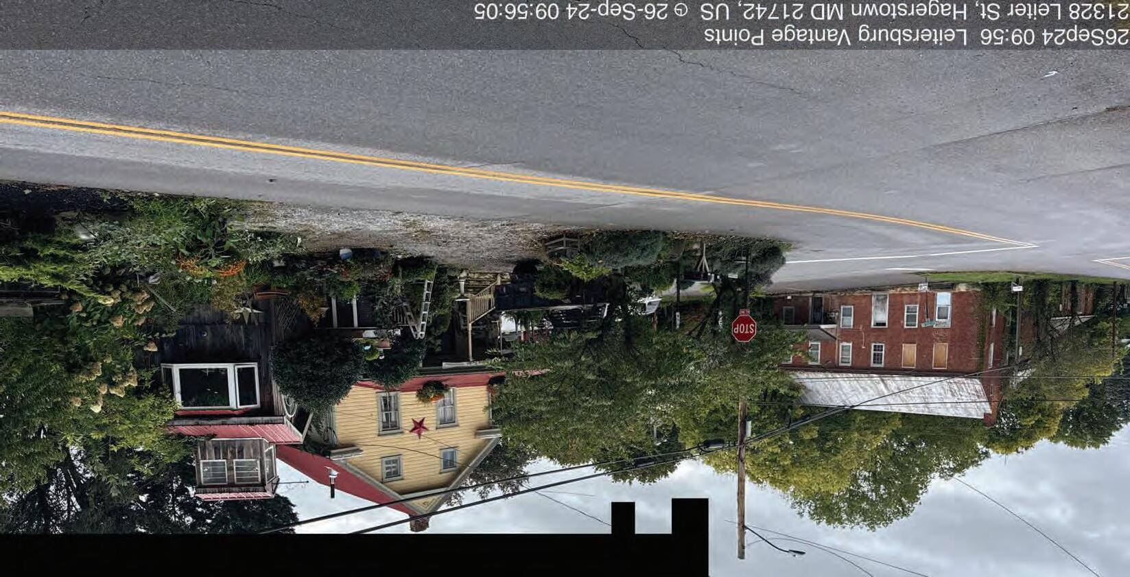
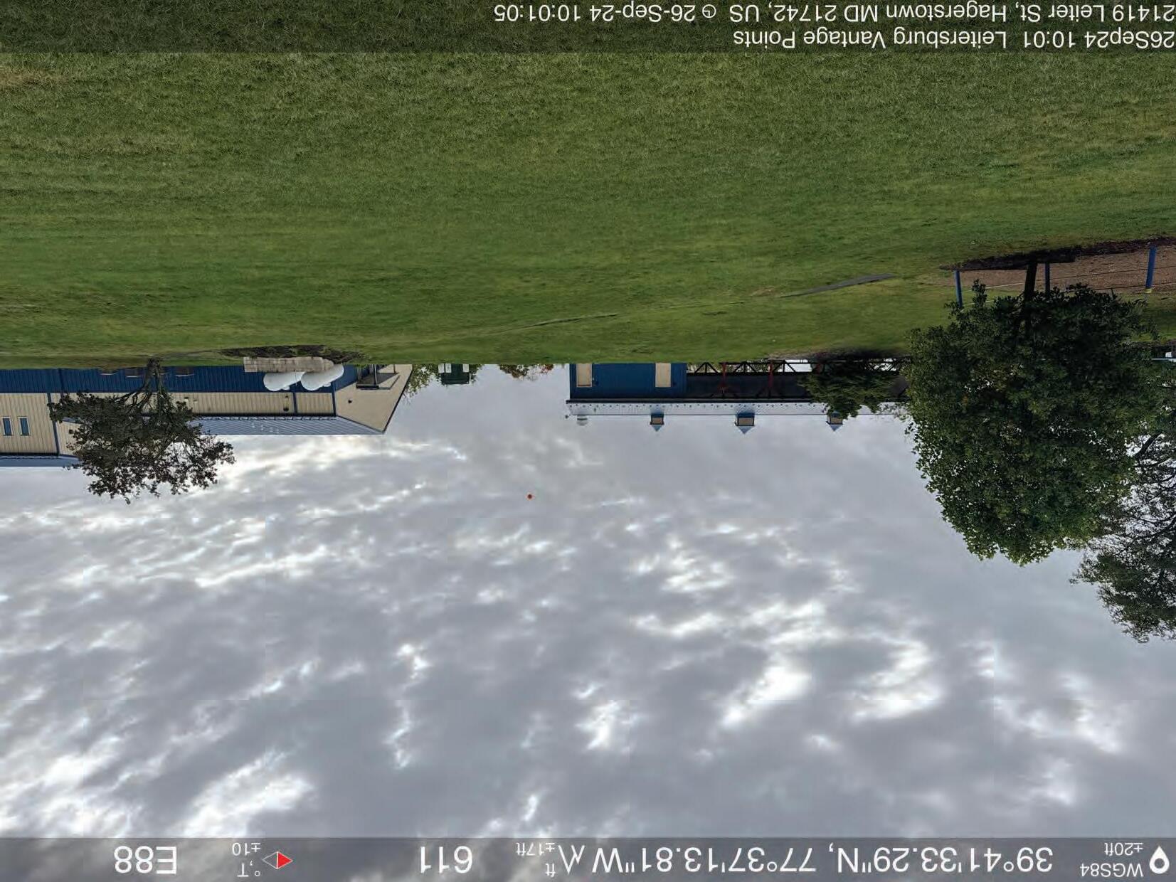
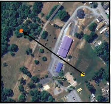
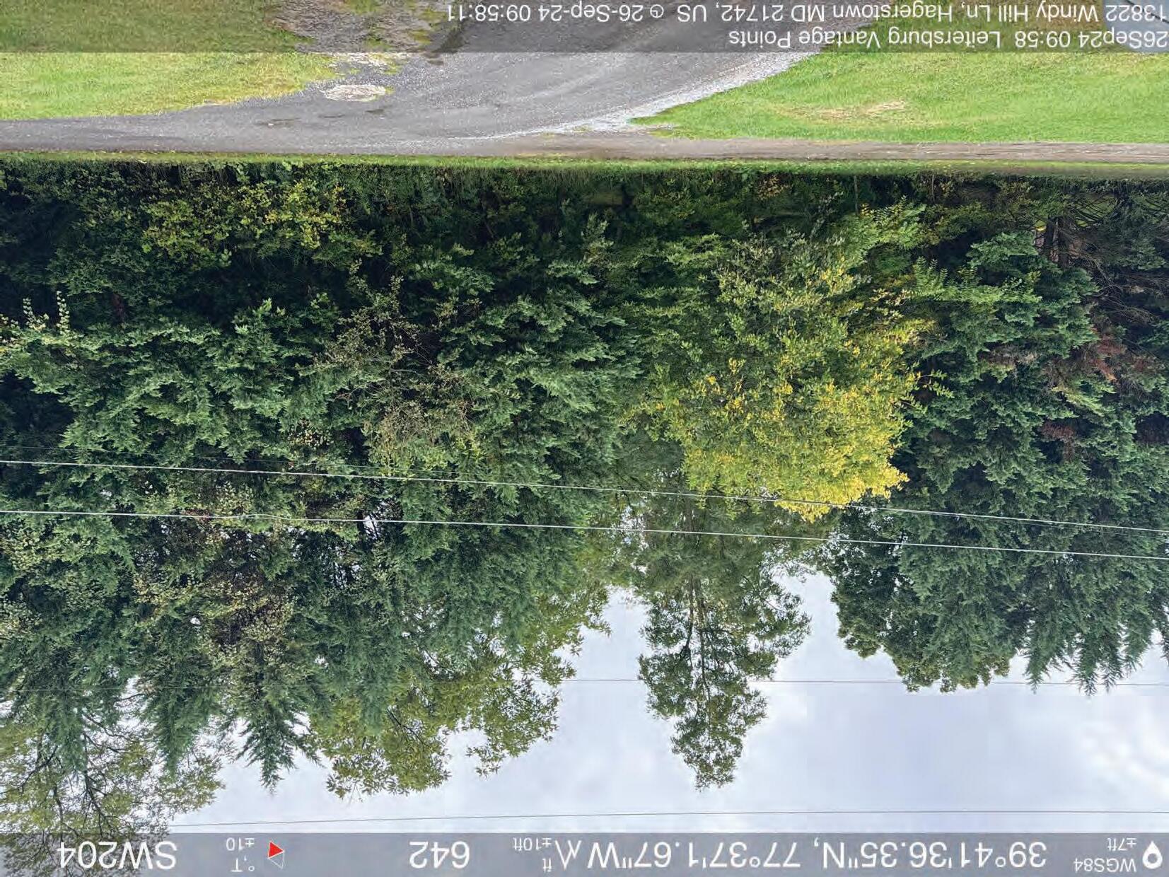
In response to the request for simulations of the monopole, a balloon was flown at the proposed location and height on September 26, 2024. Due to restricted public access, photos were taken at or near the following vantage points:
- NRHP Listed Rockledge (Photos 1, 2, 3 – all not visible);
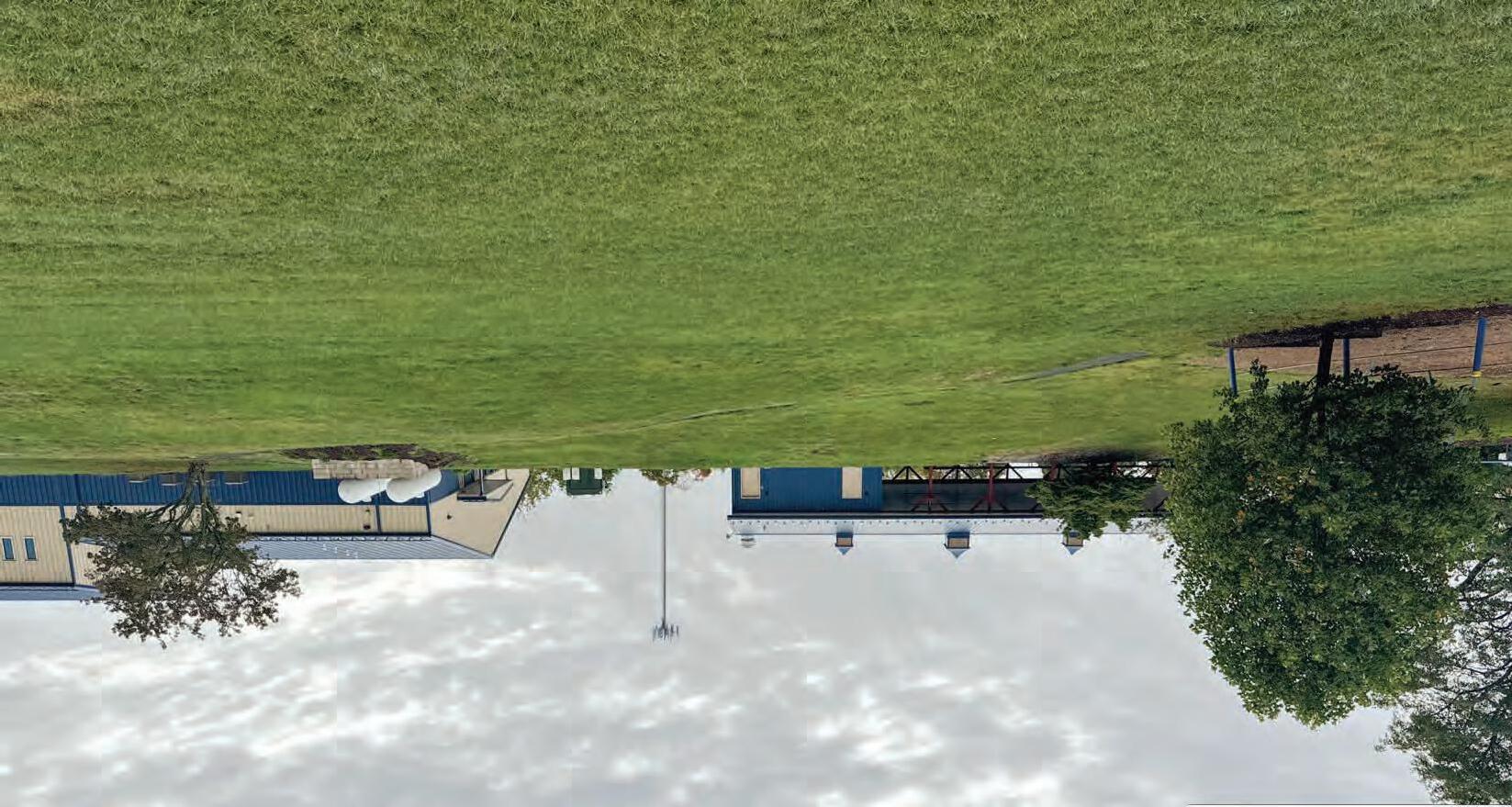
- within Historic District along Leitersburg-Smithsburg Road (Photos 4, 5, and 6); at the square in Leitersburg (Photo 6); at Leitersburg Community Park (Photo 7); and Windy Hill Lane (Photo 8)
Photos of the balloon and simulations (from visible vantage points) are included as Attachment 1.
Regarding site selection, Verizon and its representatives began the search for a site with the goal of improving wireless coverage in Leitersburg, MD and bridging the coverage gap between Reid, MD and Smithsburg, MD Specifically, their objective is to enhance wireless coverage on Leiters Mill Road, Leitersburg Smithsburg Rd, and along US Routes 60, -62, and -418.
They evaluated the following existing structures for co-location prior to searching for a rawland / new site development:
- The silo at 21120 Leiters Mill Road (located over 1 mile northeast of current location) was not feasible due to its lack of height and its location would not provide the desired coverage improvement to Leitersburg Smithsburg Road, Route 62, and the south portions of Leitersburg; and
- The existing buildings in the search area – including St Paul’s Lutheran Church at 31513 Leitersburg Smithsburg Road – were limited in height and would not provide the desired coverage improvement
In its comments, the HDC inquired about feasibility of 14175 Breezy Acres Road (located over 1.25-mile northeast of current location). While a tower does not presently exist at this location, it would also be too far northwest to provide the desired coverage improvement to Leitersburg Smithsburg Road, Route 62, and the southern portions of Leitersburg.
Verizon and its representative consulted with Washington County on appropriate options for a new monopole site as it relates to the local zoning code. The Subject Property is located in a zoning designation A(R) (Agriculture Rural) which allows for the construction of a communications tower following the special exception process. The adjacent parcels to the west, north, and south are all located in an RV zoning designation (Rural Village) which per
table 3.3 (1) of the Washington County Zoning Ordinance prohibits the construction of telecommunications towers. The Subject property allows for the site to provide coverage to an area that prohibits construction of telecommunications towers
A special exception to permit the proposed monopole was applied for by Verizon and granted by the Washington County Board of Zoning Appeals (BZA) on November 8, 2023. The proposed equipment compound and monopole will be located among existing mature trees and vegetation. As conditioned with the special exception approval, mature trees and vegetation will be retained, the monopole will not be lit, and the monopole will be constructed in a neutral color. A copy of the BZA Decision is included as Attachment 2
We respectfully submit this information and thank you for timely review. Please do not hesitate to reach out to me directly with any questions or concerns.
Sincerely,
Matt Penning, Director of Development Milestone Towers
matt@milestonetowers.com
703-865-4697
Attachment 1 – Balloon Photos and Photo simulations
Attachment 2 – BZA Decision – Issued November 8, 2023
BEFORE THE BOARD OF APPEALS FOR WASHINGTON COUNTY, MARYLAND
VERIZON * Appeal No.: AP2023-036
Appellant
OPINION
Verizon (hereinafter “Appellant”) requests a special exception to establish a commercial communication tower at the subject property. Appellant also requests a variance to reduce the minimum setback from the western boundary from 355 feet to 139 feet, 9 inches at the subject property. The subject property is located at 21536 Leitersburg Smithsburg Road, Hagerstown, Maryland and is zoned Agricultural, Rural. The Board held a public hearing in this matter on October 11, 2023.1
This appeal was heard pursuant to Article 25 of the Zoning Ordinance for Washington County and upon proper notice to the parties and general public as required.
Findings of Fact
Based upon the testimony given, all information and evidence presented, and upon a study of the specific property involved and the neighborhood in which it is located, the Board makes the following findings of fact:
1. Robert Veil, Jr. and Marvina Veil are the owners of the subject property located at 21536 Leitersburg Smithsburg Road, Hagerstown, Maryland. The subject property is zoned Agricultural, Rural
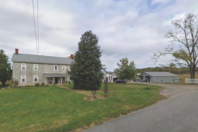
2. The subject property consists of approximately twenty-one (21) acres, improved by a home, and operated as Paramount Farm. The topography is generally
1 The Board had a quorum of four (4) members present for this hearing. Given the possibility for a split vote, Appellant was given the opportunity to postpone this matter to another hearing wherein the full board would be present.
hilly, with some level area located in the rear of the property where this project is proposed. Mr. and Mrs. Veil have owned the subject property for approximately thirtyfive (35) years.
3. Appellant is the contract lessee of the subject property and files this appeal with permission of the owners.
4. The closest cellular communications tower is located Ivy Hill Farms in Ringgold, Maryland, approximately 3.5 miles away.
5. Appellant proposes to construct a 155-foot monopole, commercial communications tower at the subject property.
6. The tower will provide opportunity for co-location by other service providers as required by law. Appellant will also reserve 10 feet for County communications use.
7. The site will have access via a crushed stone and/or compacted gravel drive. The tower and accessory equipment will be contained in a 50 by 50-foot fenced area.
8 Appellant anticipates there will be 2 to 3 visits to the site each year to perform inspections and maintenance and/or repairs.
9. Construction of the site will take between 3 and 6 months, with the heaviest activity occurring in the first 60 days.
10. The monopole is designed to meet the requirements of the 2018 International Building Code and the ANSI/TIA-222-H standards. It is designed to have a fall radius of 75 feet
11. The Ordinance requires the proposed monopole communications tower to have a setback of 355 feet from the subject property boundary lines. The subject property meets this requirement along the north, south and east boundary lines.
12. There was technical opposition to the proposed project, seeking to impose conditions on the development of the property, but not opposed to the project. Appellant agreed to all of the suggested conditions which were made part of the record.
Rationale
Special Exception
The Board has authority to grant a special exception pursuant to Section 25.2(b) of the Zoning Ordinance for Washington County, Maryland. A special exception is defined as “a grant of a specific use that would not be appropriate generally or without restriction; and shall be based upon a finding that the use conforms to the plan and is compatible with the existing neighborhood.” Article 28A. In addition, Section 25.6 sets forth the limitations, guides, and standards in exercise of the board’s duties and provides:
Where in these regulations certain powers are conferred upon the Board or the approval of the Board is required before a permit may be issued, or the Board is called upon to decide certain issues, the Board shall study the specific property involved, as well as the neighborhood, and consider all testimony and data submitted, and shall hear any person desiring to speak for or against the issuance of the permit. However, the application for a permit shall not be approved where the Board finds the proposed building, addition, extension of building or use, sign, use or change of use would adversely affect the public health, safety, security, morals or general welfare, or would result in dangerous traffic conditions, or would jeopardize the lives or property of people living in the neighborhood. In deciding such matters, the Board shall consider any other information germane to the case and shall give consideration to the following, as applicable:
(a) The number of people residing or working in the immediate area concerned.
(b) The orderly growth of a community.
(c) Traffic conditions and facilities
(d) The effect of such use upon the peaceful enjoyment of people in their homes.
(e) The conservation of property values.
(f) The effect of odors, dust, gas, smoke, fumes, vibrations, glare and noise upon the use of surrounding property values.
(g) The most appropriate use of the land and structure.
(h) Decision of the courts.
(i) The purpose of these regulations as set forth herein.
(j) Type and kind of structures in the vicinity where public gatherings may be held, such as schools, churches, and the like.
For the reasons set forth herein, the Board concludes that the special exception should be granted.
The Board heard testimony from Appellant and several witnesses, that there is a real issue with cellular service in the area of the proposed project. Multiple witnesses described an inability to make cellular calls or having calls “drop out” when entering the immediate area of the subject property. Moreover, Appellant provided cellular service coverage maps which illustrated a gap in reliable cellular service in the surrounding area. The proposed communications tower is necessary to resolve the gap in coverage and bring reliability to cellular communications, including emergency and first responder calls. Given the need demonstrated, the proposed project will benefit those living and working in the surrounding area and is part of the orderly growth of the community
The proposed project will not generate traffic, except for a few visits each year for maintenance and repair. Aside from initial construction, there is no evidence that it will produce noise, gas, dust, odors, smoke, glare, or vibrations that would affect the surrounding properties. Other than the monopole’s visibility, its daily operation is passive and will not affect nearby homes or residences. Despite concern for property values noted in opposition testimony, there was no specific evidence presented to support such a concern.
Based on the testimony and evidence presented, the Board finds that the proposed commercial communications tower is an appropriate use of the subject property. The Board further finds that the proposed use at the subject property will have no greater “adverse effects above and beyond those inherently associated with such a special exception use irrespective of its location within the zone.” Schultz v. Pritts, 291 Md. 1, 15 (1981). For all these reasons, we conclude that this appeal meets the criteria for a special exception and secures public safety and welfare, consistent with the spirit of the Ordinance
Variance
The Board has authority to grant a variance upon a showing of practical difficulty or undue hardship. §§ 25.2(c) and 25.56.2 “Practical Difficulty” may be found by the Board when: (1) strict compliance would unreasonably prevent the use of the property for a permitted purpose or render conformance unnecessarily burdensome; and (2) denying the variance would do substantial injustice to the applicant and a lesser relaxation than that applied for would not give substantial relief; and (3) granting the variance would observe the spirit of the Ordinance and secure public safety and welfare. § 25.56(A).
Practical difficulty and undue hardship are the result of a property being unique. “’Uniqueness’ of a property for zoning purposes requires that the subject property have an inherent characteristic not shared by other properties in the area, i.e., its shape, topography, subsurface condition, environmental factors, historical significance, access or non-access to navigable waters, practical restrictions imposed by abutting properties (such as obstructions) or other similar restrictions.” North v. St. Mary's Cnty., 99 Md. App. 502, 514 (1994).)
The Ordinance imposes strict setback requirements for projects with significant height as a safety measure to protect neighboring properties. In applying the setback requirements in this case, the Board must consider the evolution of design and construction for modern structures, specifically commercial communications towers. Appellant testified and submitted a Letter of Certification from its engineer that the monopole is designed to have a limited fall radius of approximately half the height of the structure. The proposed monopole will meet current design standards for wind ratings
2 “When the terms unnecessary hardship (or one of its synonyms) and practical difficulties are framed in the disjunctive (“or”), Maryland courts generally have applied the more restrictive hardship standard to use variances, while applying the less restrictive practical difficulties standard to area variances because use variances are viewed as more drastic departures from zoning requirements.” Belvoir Farms Homeowners Ass'n, Inc. v. North, 355 Md. 259, 276 n.10 (1999) (citations omitted).
and for failure to occur at the middle and upper portions of the structure. The design elements of the monopole mitigate any concern for the failure of the structure to affect neighboring properties. Appellant has requested a setback which is the maximum distance from the site to the western boundary, but still exceeds the “fall zone” for the monopole structure. Appellant is unable to create more distance and there is no other location on the property which is suitable for constructing the proposed project. The Board finds that these circumstances constitute practical difficulty, and the requested variance relief should be granted.
Accordingly, the special exception to establish a commercial communication tower at the subject property is GRANTED, by a vote of 4 to 0. The variance request to reduce the minimum setback from the western boundary from 355 feet to 139 feet, 9 inches at the subject property is also GRANTED, by a vote of 4 to 0. Both the special exception and the variance relief are granted subject to the general condition that the proposed use be consistent with the testimony and evidence presented herein and the following specific conditions:
1. That the monopole be constructed in a neutral color;
2. That there will not be any freestanding signage;
3. That the monopole will not be lit; and
4. That Appellant retain the existing mature trees and vegetation
Date Issued: November 8, 2023
BOARD OF APPEALS
By: Tracie Felker, Acting Chair
Notice of Appeal Rights
Any party aggrieved by a final order of the Authority in a contested case, whether such decision is affirmative or negative in form, is entitled to file a petition for judicial review of that order to the Circuit Court for Washington County within thirty (30) days of the date of the order.
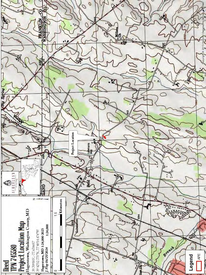
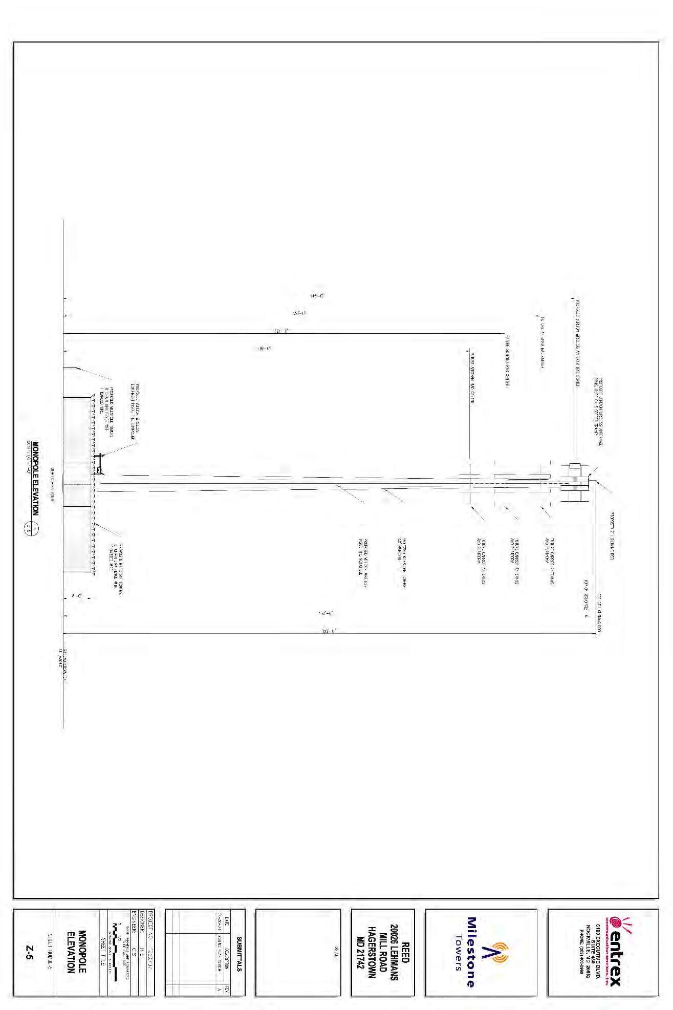
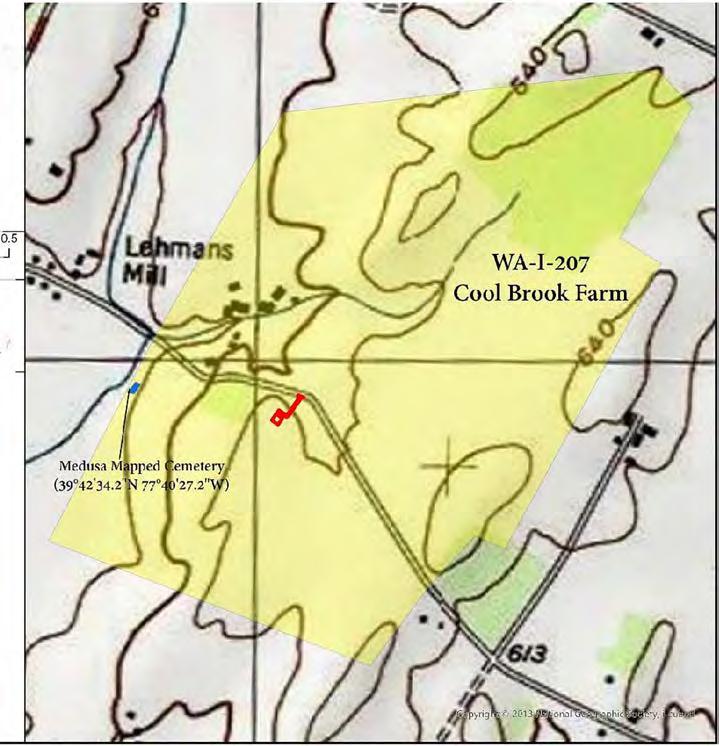
Latitude: 39° 42’ 32.77” N, Longitude: 77° 40’ 14.47” W
To whom it may concern:
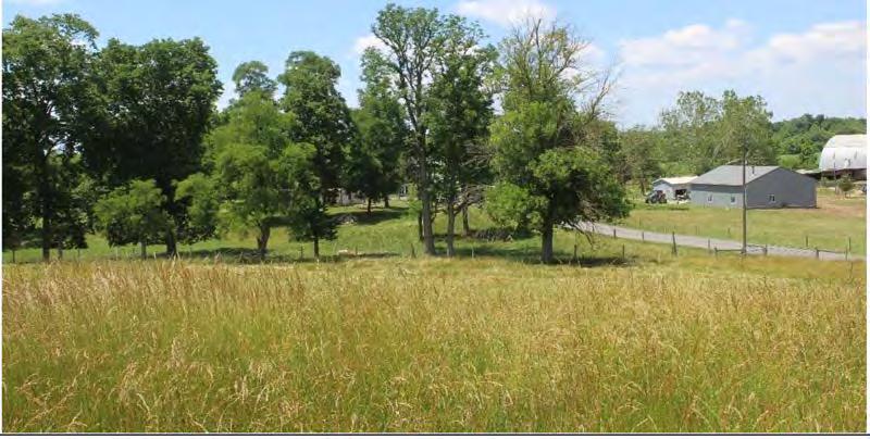
Trileaf Corporation is in the process of completing a NEPA Review at the referenced property. Our client proposes to construct a 150-foot monopole communications tower with an overall height of 152 feet, including attachments. Associated equipment will be located within a 50-foot by 50-foot (2,500 square feet) fenced compound. The project includes a 12-foot wide gravel access drive extending southeast, then northeast away from the lease area approximately 220 feet toward Lehmans Mill Road. The proposed location is currently an agricultural field. The antenna will be licensed by the Federal Communications Commission (FCC).
Our investigation includes determining if the site is contained in, on or within the viewshed of a building, site, district, structure or object, significant in American history, architecture, archaeology, engineering or culture, that is listed, or eligible for listing on the State or National Registers of Historic Places or located in or on an Indian Religious Site.
Trileaf is requesting information regarding this tower’s potential effect on Historic Properties. All information received will be forwarded to the State Historic Preservation Office (SHPO) as part of the NEPA review process. Additionally, this invitation to comment is separate from any local planning/zoning process that may apply to this project
If you wish to comment or be considered a consulting party, please respond within thirty (30) days of the date of this letter. If a response is not received within thirty (30) days, it will be assumed that you have no objections to this undertaking. A site topography map and aerial photograph are enclosed for your reference.
Please call me at (410) 853-7128 or email m.grasham@trileaf.com if you need additional information or have any questions. Thank you for your assistance in this regard.
Latitude: 39° 42’ 32.77” N, Longitude: 77° 40’ 14.47” W
To Whom It May Concern:
Trileaf Corporation is in the process of completing a NEPA review at the referenced property. Our client proposes to construct a 150-foot monopole communications tower with an overall height of 152 feet, including attachments. Associated equipment will be located within a 50-foot by 50-foot (2,500 square feet) fenced compound. The project includes a 12-foot wide gravel access drive extending southeast, then northeast away from the lease area approximately 220 feet toward Lehman Mill Road. The proposed location is currently an agricultural field. The antenna will be licensed by the Federal Communications Commission (FCC).
In accordance with the Nationwide Programmatic Agreement for Review of Effects on Historic Properties for Certain Undertakings Approved by the Federal Communications Commission, dated September 2004, a cultural resource investigation has been conducted. Our investigation includes determining if the site is contained in, on, or within the viewshed of a building, site, district, structure or object, significant in American history, architecture, archeology, engineering or culture, that is listed, or eligible for listing on the State or National Registers of Historic Places, or located in or on an Indian Religious Site.
Summary reports of this investigation, maps, photographs and other information are provided in the attached Form 620.As noted in Attachment 5, there are No Effect to Historic Resources within the APE for Direct Effects and No Adverse Effect on Historic Properties within the APE for Visual Effects. Therefore, it is recommended that the proposed undertaking proceed without further archaeological review.
We appreciate your cooperation in this regard and anticipate your concurrence with these findings. Please call me at (410) 853-7128 or email m.grasham@trileaf.com if you need any additional information or have any questions. Thank you for your assistance.
Sincerely,
McKayla Grasham Project Scientist II
33) Does the Principal Investigator satisfy the Secretary of the Interior’s Professional Qualification Standards?
34) Areas of Professional Qualification:
( ) Archaeologist
( ) Architectural Historian
( ) Historian
( ) Architect
( ) Other (Specify) __________________________________________________________________________________________
Additional Staff
35) Are there other staff involved who meet the Professional Qualification Standards of the Secretary of the Interior?
If “YES,” complete the following:
36) First Name:
40) Title:
41) Areas of Professional Qualification:
( ) Archaeologist
( ) Architectural Historian
( ) Historian
( ) Architect
( ) Other (Specify) ____________________________________________________________________________________________ Hope Hawkins X Historic Resources Director
1) TCNS Notification Number:
Site Information
2) Positive Train Control Filing Subject to Expedited Treatment Under Program Comment: ( ) Yes ( ) No
3) Site Name:
4) Site Address:
5) Detailed Description of Project:
Our client proposes to construct a 150-foot monopole communications tower with an overall height of 152 feet, including attachments. The proposed location is currently an agricultural field.
6) City: 7) State: 8) Zip Code:
9) County/Borough/Parish:
10) Nearest Crossroads:
Lehman Mill Road and Marsh Pike
11) NAD 83 Latitude (DD-MM-SS.S): ( ) N or ( ) S
12) NAD 83 Longitude (DD-MM-SS.S): ( ) E or ( ) W Tower Information
13) Tower height above ground level (include top-mounted attachments such as lightning rods): ___________________ ( ) Feet ( ) Meters
14) Tower Type (Select One):
( ) Guyed lattice tower
( ) Self-supporting lattice
( ) Monopole
( ) Other (Describe):
Project Status
15) Current Project Status (Select One):
( ) Construction has not yet commenced
( ) Construction has commenced, but is not completed
( ) Construction has been completed
commenced on: __________
commenced on: __________
14) Direct Effects (Select One):
( ) No Historic Properties in Area of Potential Effects (APE)
( ) No Effect on Historic Properties in APE
( ) No Adverse Effect on Historic Properties in APE
( ) Adverse Effect on one or more Historic Properties in APE
15) Visual Effects (Select One):
( ) No Historic Properties in Area of Potential Effects (APE)
( ) No Effect on Historic Properties in APE
( ) No Adverse Effect on Historic Properties in APE
( ) Adverse Effect on one or more Historic Properties in APE
Tribal/NHO Involvement
1) Have Indian Tribes or Native Hawaiian Organizations (NHOs) been identified that may attach religious and cultural significance to historic properties which may be affected by the undertaking within the APEs for direct and visual effects? ( ) Yes ( ) No
2a) Tribes/NHOs contacted through TCNS Notification Number: ___________________ Number of Tribes/NHOs: _________________
2b) Tribes/NHOs contacted through an alternate system: Number of Tribes/NHOs: _________________
Tribe/NHO Contacted Through TCNS
3) Tribe/NHO FRN:
4) Tribe/NHO Name:
Bad River Band of Lake Superior Tribe of Chippewa Indians
Contact Name
5) First Name: 6) MI: 7) Last Name: 8) Suffix:
9) Title:
Dates & Response
10) Date Contacted ______________ 11) Date Replied _______________
( ) No Reply
06/12/2024 X Lawrence Plucinski THPO
( ) Replied/No Interest
( ) Replied/Have Interest
( ) Replied/Other
Tribe/NHO Contacted Through TCNS
3) Tribe/NHO FRN:
4) Tribe/NHO Name:
Delaware Nation
Contact Name
5) First Name: 6) MI: 7) Last Name: 8) Suffix:
9) Title:
Dates & Response
10) Date Contacted ______________ 11) Date Replied _______________
( ) No Reply
06/12/2024 X Tiffany Martinez TCNS Coordinator
( ) Replied/No Interest
( ) Replied/Have Interest
( ) Replied/Other
Tribal/NHO Involvement
1) Have Indian Tribes or Native Hawaiian Organizations (NHOs) been identified that may attach religious and cultural significance to historic properties which may be affected by the undertaking within the APEs for direct and visual effects? ( ) Yes ( ) No
2a) Tribes/NHOs contacted through TCNS Notification Number: ___________________ Number of Tribes/NHOs: _________________
2b) Tribes/NHOs contacted through an alternate system: Number of Tribes/NHOs: _________________
Tribe/NHO Contacted Through TCNS
3) Tribe/NHO FRN:
4) Tribe/NHO Name:
Eastern Shawnee Tribe of Oklahoma
Contact Name
5) First Name: 6) MI: 7) Last Name: 8) Suffix:
9) Title:
Kelly Nelson Cell Tower Coordinator
Dates & Response
06/13/2024
07/03/2024
10) Date Contacted ______________ 11) Date Replied _______________
( ) No Reply
( ) Replied/No Interest
( ) Replied/Have Interest
( ) Replied/Other
Tribe/NHO Contacted Through TCNS
3) Tribe/NHO FRN:
4) Tribe/NHO Name:
Seneca-Cayuga Nation
Contact Name
5) First Name: 6) MI: 7) Last Name: 8) Suffix:
9) Title:
William Tarrant THPO
Dates & Response
06/13/2024
10) Date Contacted ______________ 11) Date Replied _______________
( ) No Reply
( ) Replied/No Interest
( ) Replied/Have Interest
( ) Replied/Other
Tribal/NHO Involvement
1) Have Indian Tribes or Native Hawaiian Organizations (NHOs) been identified that may attach religious and cultural significance to historic properties which may be affected by the undertaking within the APEs for direct and visual effects? ( ) Yes ( ) No
2a) Tribes/NHOs contacted through TCNS Notification Number: ___________________ Number of Tribes/NHOs: _________________
2b) Tribes/NHOs contacted through an alternate system: Number of Tribes/NHOs: _________________
Tribe/NHO Contacted Through TCNS
3) Tribe/NHO FRN:
4) Tribe/NHO Name:
Contact Name
9) Title:
Tipton THPO
Dates & Response
5) First Name: 6) MI: 7) Last Name: 8) Suffix:
10) Date Contacted ______________ 11) Date Replied _______________
( ) No Reply
Tribe 06/12/2024 X
( ) Replied/No Interest
( ) Replied/Have Interest
( ) Replied/Other
Tribe/NHO Contacted Through TCNS
3) Tribe/NHO FRN:
4) Tribe/NHO Name:
Tuscarora Nation
Contact Name
5) First Name: 6) MI: 7) Last Name: 8) Suffix:
9) Title:
Dates & Response
10) Date Contacted ______________ 11) Date Replied _______________
( ) No Reply
06/12/2024 X Bryan Printup TCNS Rep
( ) Replied/No Interest
( ) Replied/Have Interest
( ) Replied/Other
Shawnee
Tonya
Tribal/NHO Involvement
1) Have Indian Tribes or Native Hawaiian Organizations (NHOs) been identified that may attach religious and cultural significance to historic properties which may be affected by the undertaking within the APEs for direct and visual effects? ( ) Yes ( ) No
2a) Tribes/NHOs contacted through TCNS Notification Number: ___________________ Number of Tribes/NHOs: _________________
2b) Tribes/NHOs contacted through an alternate system: Number of Tribes/NHOs: _________________
Tribe/NHO Contacted Through TCNS
3) Tribe/NHO FRN:
4) Tribe/NHO Name:
Contact Name
5) First Name: 6) MI: 7) Last Name: 8) Suffix:
9) Title:
Dates & Response
10) Date Contacted ______________ 11) Date Replied _______________
( ) No Reply
( ) Replied/No Interest
( ) Replied/Have Interest
( ) Replied/Other Wyandotte Nation 06/12/2024 X
Tribe/NHO Information
1) FCC Registration Number (FRN):
2) Name:
Contact Name
3) First Name: 4) MI: 5) Last Name: 6) Suffix:
7) Title:
Contact Information
8) P.O. Box: And /Or 9) Street Address:
10) City:
13) Telephone Number:
15) E-mail Address:
16) Preferred means of communication:
( ) E-mail
( ) Letter
( ) Both
Dates & Response
Fax Number:
17) Date Contacted _______________ 18) Date Replied _______________
( ) No Reply
( ) Replied/No Interest
( ) Replied/Have Interest
( ) Replied/Other
Historic Properties Properties Identified
1) Have any historic properties been identified within the APEs for direct and visual effect?
2) Has the identification process located archaeological materials that would be directly affected, or sites that are of cultural or religious significance to Tribes/NHOs?
3) Are there more than 10 historic properties within the APEs for direct and visual effect? If “Yes”, you are required to attach a Cultural Resources Report in lieu of adding the Historic Property below.
4) Property Name: 5) SHPO Site Number:
6) Street Address: 7) City: 8) State: 9) Zip Code:
County/Borough/Parish:
& Eligibility
11) Is this property listed on the National Register? Source: _______________________________________________________________________________________
12) Is this property eligible for listing on the National Register? Source: _______________________________________________________________________________________
14) Direct Effects (Select One):
( ) No Effect on this Historic Property in APE
( ) No Adverse Effect on this Historic Property in APE
( ) Adverse Effect on this Historic Property in APE
15) Visual Effects (Select One):
( ) No Effect on this Historic Property in APE
( ) No Adverse Effect on this Historic Property in APE
( ) Adverse Effect on this Historic Property in APE
Information 8) P.O. Box: And /Or 9) Street Address:
City:
Telephone Number:
E-mail Address:
16) Preferred means of communication: ( ) E-mail
( ) Letter ( ) Both Dates & Response 17) Date Contacted _______________
( ) No Reply
( ) Replied/No Interest
( ) Replied/Have Interest
( ) Replied/Other Additional Information 19) Information on local government’s role or interest (optional): City of Hagerstown- Historic District Commission To Whom It May Concern
2) You may also designate up to three additional SHPOs/THPOs if the APEs include multiple states. If the APEs include other countries, enter the name of the National Historic Preservation Agency and any state and provincial Historic Preservation Agency.
I certify that all representations on this FCC Form 620 Submission Packet and the accompanying attachments are true, correct, and complete.
Party Authorized to Sign
First Name: MI: Last Name: Suffix:
Mckayla Grasham
Mckayla Grasham
07/14/2024
Signature: Date: _______________
FAILURE TO SIGN THIS APPLICATION MAY RESULT IN DISMISSAL OF THE APPLICATION AND FORFEITURE OF ANY FEES PAID.
WILLFUL FALSE STATEMENTS MADE ON THIS FORM OR ANY ATTACHMENTS ARE PUNISHABLE BY FINE AND/OR IMPRISONMENT (U.S. Code, Title 18, Section 1001) AND/OR REVOCATION OF ANY STATION LICENSE OR CONSTRUCTION PERMIT (U.S. Code, Title 47, Section 312(a)(1)), AND/OR FORFEITURE (U.S. Code, Title 47, Section 503).
Attachments :
Type Description
Date Entered
Other Cover Letter 07/14/2024
Resumes/Vitae Resumes 07/14/2024
Photographs Photographs 07/14/2024
Map Documents Maps 07/14/2024
Other CDs 07/14/2024
Area of Potential Effects APE 07/14/2024
Tribal/NHO Involvement Tribes 07/14/2024
Historic Properties for Direct Effects Direct APE 07/14/2024
Historic Properties for Visual Effects Visual APE 07/14/2024
Local Government Involvement Local Government 07/14/2024
Project Type Construction of a new 150’ monopole within lease parcel
Tower Height/ Type 150’ monopole/ 152’ overall
Trileaf PM Brooks Thacker
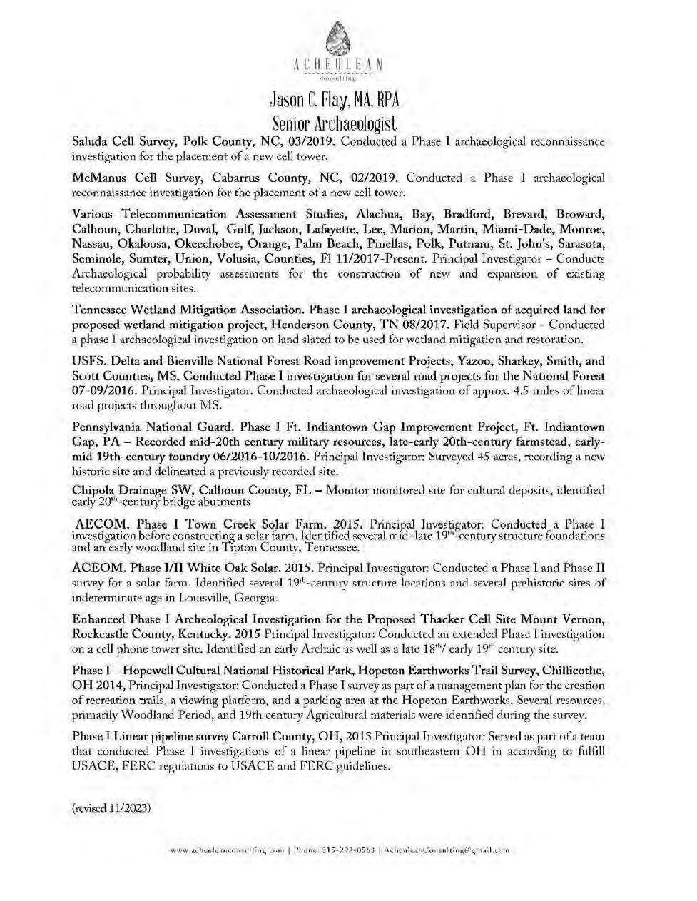
Acheulean PI Jason C. Flay, MA RPA
ATTACHMENT 1. CONSULTANT INFORMATION
Provide a current copy of the resume or curriculum vitae for the Principal Investigator and any researcher or other person who contributed to, reviewed, or provided significant input into the research, analysis, writing or conclusions presented in this filing.
A current copy of the resume for the Principal Investigator and any researcher or other person who contributed to, reviewed, or provided significant input into the research, analysis, writing, or conclusions presented in this filing.
Hope Hawkins, MA Historic Resources Director
Hope Hawkins, MA Historic Resources Director
Professional Resume
M C K AYLA G RASHAM
PROJECT SCIENTIST II
Education
Biological Sciences, B. S.
University of Virginia’s College at Wise / Wise, VA
Areas of Expertise
Ms. Grasham has experience performing National Environmental Policy Act (NEPA) reviews for wireless telecommunications projects.
You are required to provide photographs and maps as part of this filing. Additional site information can be provided in an optional attachment.
Photograph Requirements:
Except in cases where no Historic Properties were identified within the Areas of Potential Effects, submit photographs as described below. Photographs should be in color, marked so as to identify the project, keyed to the relevant map or text, and dated; the focal length of the lens and the height of the camera should be noted. The source of any photograph included but not taken by the Applicant or its consultant (including copies of historic images) should be identified on the photograph.
a. Photographs taken from the site should show views from the proposed location in all directions. The direction (e.g., north, south, etc.) should be indicated on each photograph, and, as a group, the photographs should present a complete (360 degree) view of the area around the proposed site.
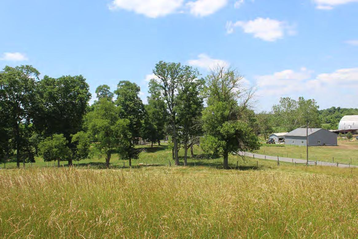
Please reference the following directional photographs of the project area, which were taken by Jason C. Flay on June 12, 2024, unless otherwise noted.
b. Photographs of all listed in and eligible properties within the Areas of Potential Effects
N/A
c. If any listed or eligible properties are visible from the proposed site, photographs looking at the site from each historic property. The approximate distance in feet (meters) between the site and the historic property should be included. If any listed or eligible properties are within the APE, photos looking at each historic property should be included.
N/A
Aerial photographs of the site were obtained via Esri, imagery is dated to 2022.
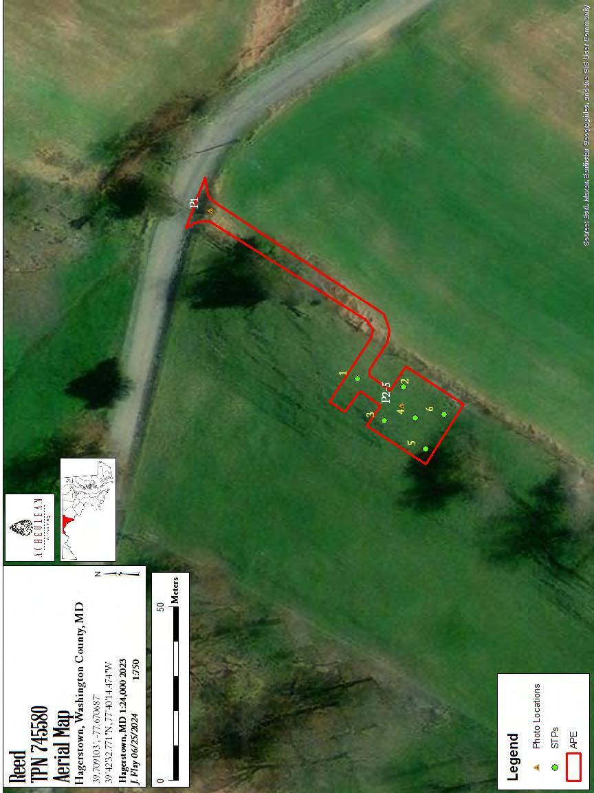
Fig. 2.1 – P1, view southwe st along access road
Fig. 2.2 – P2, View north from center point
Fig. 2.3 – P3, View east from center point
Fig. 2.4 – P4, View south from center point
Fig. 2.5 – P5, View west from center point
Site Location & Surrounding Properties
Aerial Photographs (2023)
Easement
ATTACHMENT 3. SITE INFORMATION – MAP REQUIREMENTS
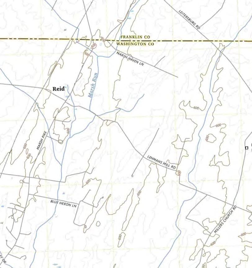
Include one or more 7.5-minute quad USGS topographical maps that:
a. Identify the Areas of Potential Effects for both Direct and Visual Effects. If a map is copied from the original, include a key with the name of quad and date.
b. Show the location of the proposed site and any access roads or other easements including excavations.
c. Show the locations of each property listed.
d. Include keys for any symbols, colors, or other identifiers.
e. Submit color maps whenever possible.
The following maps have been attached to this report:
• 7.5-min Topographic Quad Map with Project Location, 2024
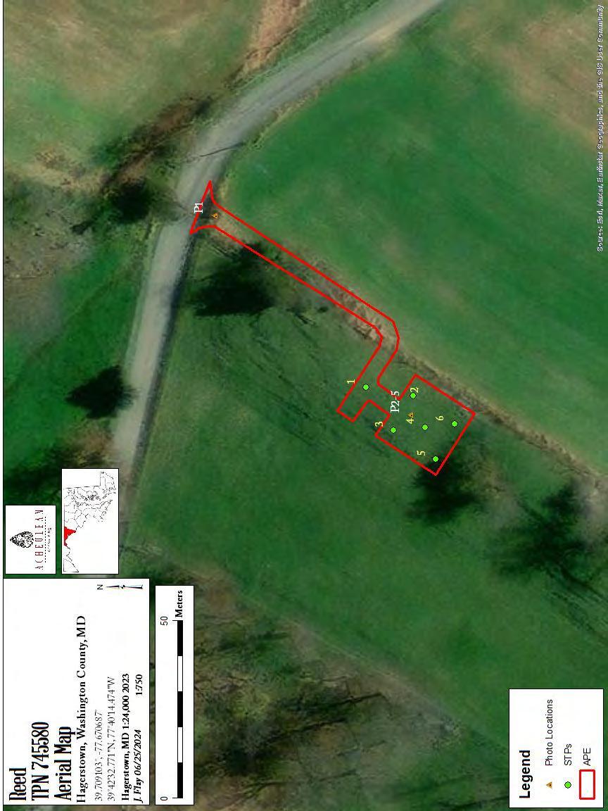
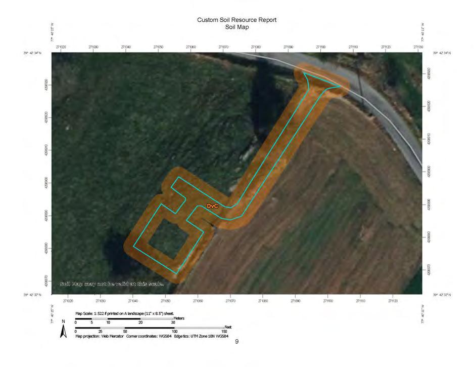
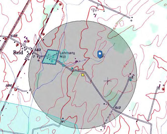
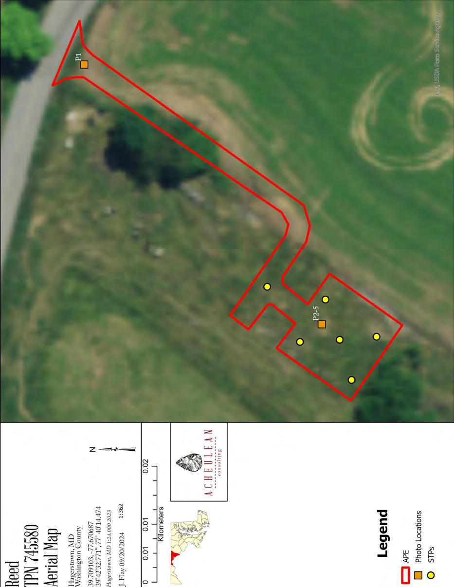
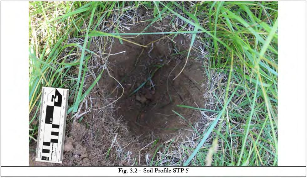
• Aerial Imagery with Shovel Test Pit Locations and Project Boundary
• Modern Soil Map with Project Location
• Map of historic resources within a 0.5-mile Buffer of APE
Fig. 3.2 – Aerial Imagery with Shovel Test Pit Locations and Project Boundary
Fig. 3.3 – •Modern Soil Map with Project Location
Fig. 3.4– Map of historic resources within a .5-mi Buffer of APE
ATTACHMENT 4. SITE INFORMATION – ADDITIONAL SITE INFORMATION
Describe any additional structures, access roads, utility lines, fences, easements, or other construction planned for the site.
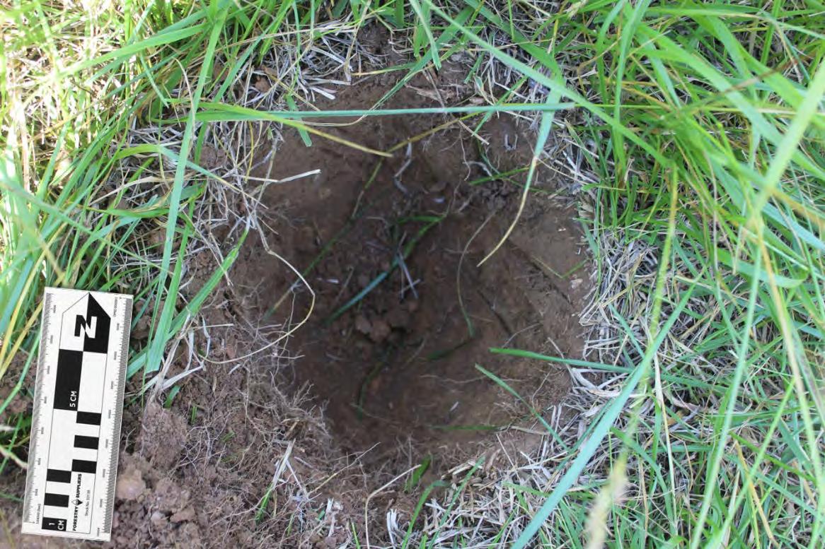
The proposed project is for the construction of a new 150-foot telecommunications monopole (with a 2-foot antenna) in a 50’ x 50’ fenced lease area and an approximately 395’ long by 12’ wide access road. The utilities will utilize the access road. The proposed access road will use an existing farm road. The project exits from the road and travels up a hill along a fence line. The access road cuts through the fence to the west to a turnaround north of the lease area. The lease area is on a ridge in an undeveloped agricultural field. Total acreage of the new construction area is approximately 0.21 acres (0.089 hectare).
The construction drawings provided by Milestone Towers are included in this attachment.
SUBJECT PARCEL
ATTACHMENT 5. AREA OF POTENTIAL EFFECTS
You are required to provide two attachments regarding the Determination of Effect: Areas of Potential Effect and Mitigation of Effect (if applicable).
AREAS OF POTENTIAL EFFECT GUIDELINES:
a. Describe the APE for direct effects and explain how this APE was determined.
Under the NPA for FCC Projects, the Direct APE (APE-DE) “is defined as the area of potential ground disturbance and any property, or any portion thereof that will be physically altered or destroyed by the undertaking” (FCC 2004). On November 24, 2008, the FCC further clarified that the APE-DE is limited to the tower or non-tower structure on which the collocation will be mounted as well as the lease area including the access route and utility corridor.
b. Describe the APE for visual effects and explain how this APE was determined.
Per the NPA, the Visual APE (APE-VE) is the “geographic area in which the project has the potential to introduce visual elements that diminish or alter the setting, including the landscape, where the setting is a character-defining feature of a historic property that makes it eligible for listing on the National Register of Historic Places (NRHP)” (FCC 2004). The presumed APE-VE for construction of new facilities is the area from where the tower will be visible: a. Within a ½ mile from the tower site if the proposed tower is 200 feet or less in height; b. Within ¾ of a mile from the tower site if the proposed tower is more than 200 but no more than 400 feet in overall height; or c. Within 1½ miles from the tower site if the proposed tower is more than 400 feet in overall height.
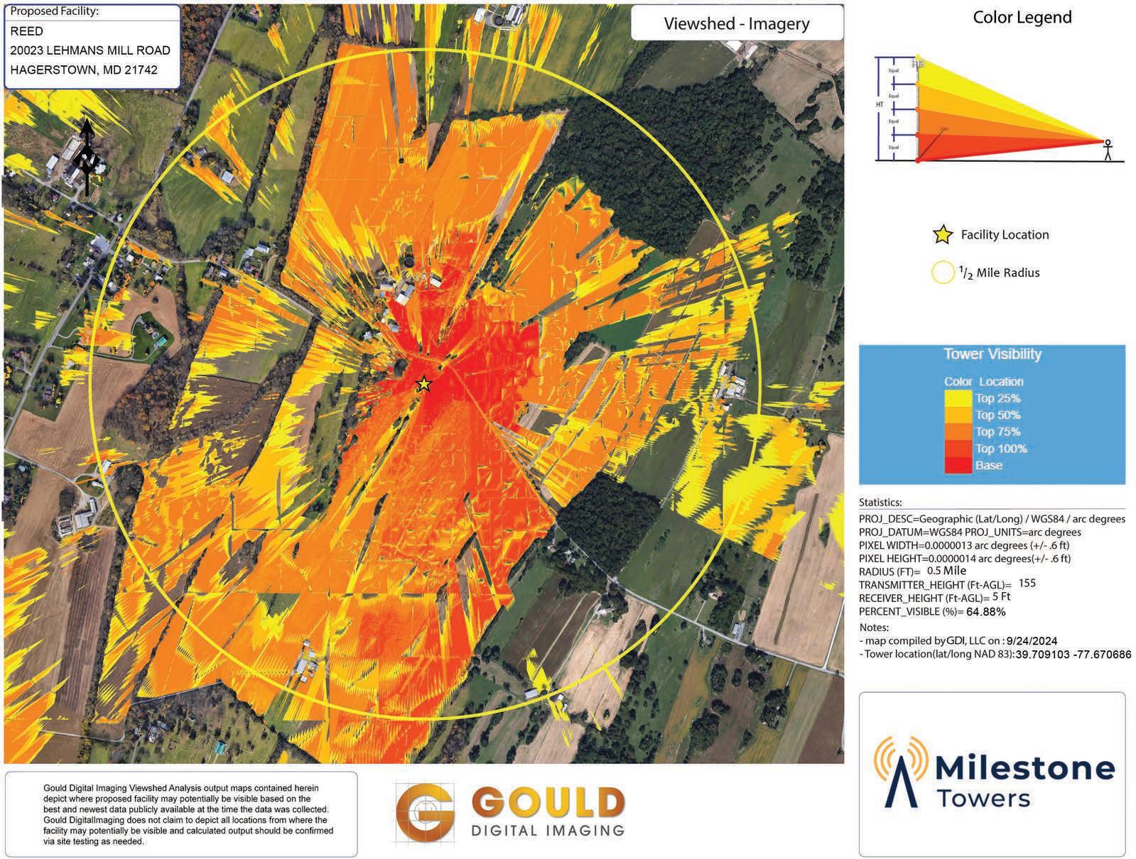
Taking into consideration the maximum height of the proposed undertaking (152 feet) and the minimal scale of the installation, Acheulean determined that the current project’s APE for visual effects will encompass a 1�2 mile radius from the subject property.
ATTACHMENT 5. CONTINUED
MITIGATION OF EFFECT GUIDELINES:
In the case of where an Adverse Visual Effect or Adverse Direct Effect has been determined you must provide the following:
a. Copies of any correspondence and summaries of any oral communication with the SHPO/THPO and any consulting parties.
N/A
b. Describe any alternatives that have been considered that might avoid, minimize, or mitigate any adverse effects. Explain the Applicant’s conclusion regarding the feasibility of each alternative.
N/A
For each property identified as a Historic Property in the online e-106 form:
a. Indicate whether the Applicant believes the proposed undertaking would have a) no effect; b) no adverse effect; or, c) an adverse effect. Explain how each such assessment was made. Provide supporting documentation where necessary.
Jason C. Flay, MA, RPA performed this survey in response to the planned use of the abovedescribed parcel and the potential impacts that such use might present to any archaeological and architectural cultural resources within the project area. Mr. Flay meets the Secretary of the Interior’s Historic Preservation Professional Qualifications Standards for Archaeology.
Background research, including a review of archival sources, was conducted for the current project location prior to the initiation of field investigations. The aim of this research was to determine the likelihood of encountering sensitive historic properties within the current project area. To assess the potential for encountering precontact archaeological resources within the project area, a review of previously recorded archaeological sites and surveys was conducted using the Maryland Master Site Files (Medusa). To assess the potential for historic period archaeological and architectural resources within the project area, various documents were reviewed, including historic maps and the databases of the NRHP. The review revealed there are no archaeological surveys in the footprint of the APE-DE, and no recorded archaeological sites were recorded within 1 mile of the project area.
ATTACHMENT 5. CONTINUED
Additionally, based on a review of the Maryland Medusa Site Files databases, and through the National Register Information System website (http://www.nr.nps.gov/) was conducted on June 21, 2024, by Jason C. Flay, MA, RPA, Principal Investigator at Acheulean.
There are One NRHP-eligible or -listed Above-Ground resources identified within the APE for Direct or Visual effects., although due to the vegetation and topography it is believed that there will be No Adverse Effects
There were Two Below-Ground resources identified in the 1-mile buffer, 0 are NRHP eligible or listed.
It is therefore recommended that project clearance be granted with no further investigation or evaluation of the project area.
Please see the attached Cultural Resources Survey Report for additional information.
ATTACHMENT 6. TRIBAL AND NHO INVOLVEMENT
At an early stage in the planning process, the Nationwide Agreement requires the Applicant to gather information from appropriate Indian Tribes or Native Hawaiian Organizations (“NHOs”) to assist in the identification of Historic Properties of religious and cultural significance to them. Describe measures taken to identify Indian tribes and NHOs that may attach religious and cultural significance to Historic Properties that may be affected by the construction within the Areas of Potential Effects (“APE”) for direct and visual effects. If such Indian tribes or NHOs were identified, list them and provide a summary of contacts by either the FCC, the Applicant, or the Applicant’s representative. Provide copies of relevant documents, including correspondence. If no such Indian tribes or NHOs were identified, please explain.
Trileaf Corporation completed the Tower Construction Notification System (TCNS) on June 10, 2024, and received the notification of interested tribes on June 14, 2024. The attached FCC Notification email lists the Tribes identified through the TCNS process. A second notice will be sent to all interested tribes/organizations, after a period of 30 days and the consultation process will continue per the FCC’s guidelines. Any relevant comments from Tribes received by Trileaf will be forwarded to your office.
From: towernotifyinfo@fcc.gov
Sent: Friday, June 14, 2024 2:03 AM
To: Tribal
Cc: tcnsweekly@fcc.gov
Subject: NOTICE OF ORGANIZATION(S) WHICH WERE SENT PROPOSED TOWER CONSTRUCTION NOTIFICATION INFORMATION - Email ID #8885222
Categories:
CAUTION: This email originated from outside of the organiza on. Do not click links or open a achments unless you recognize the sender and know the content is safe.
Dear Applicant:
Thank you for using the Federal Communica ons Commission's (FCC) Tower Construc on No fica on System (TCNS). The purpose of this electronic mail message is to in form you that the following authorized persons were sent the no fica on that you provided through TCNS, which relates to your proposed antenna structure. The informa on was forwarded by the FCC to authorized TCNS users by electronic mail and/or regular mail (le er). We note that the review period for all par es begins upon receipt of the Submission Packet pursuant to Sec on VII.A of the NPA and no fica ons that do not provide this serve as informa on only.
Persons who have received the no fica on that you provided include leaders or their designees of federallyrecognized American Indian Tribes, including Alaska Na ve Villages (collec vely "Tribal Na ons"), Na ve Hawaiian Organiza ons (NHOs), and State Historic Preserva on Officers (SHPOs). For your convenience in iden fying the referenced Tribal Na ons and NHOs and in making further contacts, the City and State of the Seat of Government for each Tribal Na on and NHO, as well as the designated contact person, is included in the lis ng below. We note that Tribal Na ons may have Sec on 106 cultural interests in ancestral homelands or other loca ons that are far removed from their current Seat of Government. Pursuant to the Commission's rules as set forth in the Na onwide Programma c Agreement for Review of Effects on Historic Proper es for Certain Undertakings Approved by the Federal Communica ons Commission (NPA), all Tribal Na ons and NHOs listed below must be afforded a reasonable opportunity to respond to this no fica on, consistent with the procedures set forth below, unless the proposed construc on falls within an exclusion designated by the Tribal Na on or NHO. (NPA, Sec on IV.F.4).
The no fica on that you provided was forwarded to the following Tribal Na ons and NHOs. A Tribal Na on or NHO may not respond un l a full Submission Packet is provided. If, upon receipt, the Tribal Na on or NHO does not respond within a reasonable me, you should make a reasonable effort at follow-up contact, unless the Tribal Na on or NHO has agreed to different procedures (NPA, Sec on IV.F.5). In the event a Tribal Na on or NHO does not respond to a follow-up inquiry, or if a substan ve or procedural disagreement arises between you and a Tribal Na on or NHO, you must seek guidance from the Commission (NPA, Sec on IV.G). These procedures are further set forth in the FCC's Second Report and Order released on March 30, 2018 (FCC 18-30).
1.TCNS Coordinator Tiffany Mar nez - Delaware Na on - 31064 State Highway 281 (PO Box: 825) Anadarko, OKtmar nez@delawarena on-nsn.gov - 405-247-2448 (ext: 1403) - electronic mail
Exclusions: The Delaware Na on of Oklahoma Historic Preserva on Office has developed the following consulta on procedures for all TCNS projects iden fied as undertakings by the Federal Communica ons Commission. In the email subject line, please specify whetherthe project is for a tower, small cell, or colloca on. Our response can be given faster with this informa on.
2. TCNS Rep Bryan Printup - Tuscarora Na on - 5226 Walmore Rd Via: Lewiston, NY - bprintup@he .org - 716-2646011 (ext: 103) - electronic mail
If the applicant/tower builder receives no response from the Tuscarora Na on within 30 days a er no fica on through TCNS, the Tuscarora Na on has no interest in par cipa ng in pre-construc on review for the proposed site. The Applicant/tower builder, however, must immediately no fy the Tuscarora Na on in the event archaeological proper es or human remains are discovered during construc on, consistent with Sec on IX of the Na onwide Programma c Agreement and applicable law.
3. THPO Lawrence Plucinski - Bad River Band of Lake Superior Tribe of Chippewa Indians - (PO Box: 39) Odanah, WIthpo@badriver-nsn.gov; deputyTHPO@badriver-nsn.gov - 715-682-7123 - electronic mail
If the applicant/tower builder receives no response from the Bad River Band of Lake Superior Tribe of Chippewa Indians within 30 days a er no fica on through TCNS, the Bad River Band of Lake Superior Tribe of Chippewa Indians has no interest in par cipa ng in pre-construc on review for the proposed site. The Applicant/tower builder, however, must immediately no fy the Bad River Band of Lake Superior Tribe of Chippewa Indians in the event archaeological proper es or human remains are discovered during construc on, consistent with Sec on IX of the Na onwide Programma c Agreement and applicable law.
4. THPO William Tarrant - Seneca-Cayuga Na on - 23701 S 655 Road (PO Box: 453220) Grove, OKwtarrant@sctribe.com - 918-787-5452 (ext: 344) - regular mail
Exclusions: Please refrain from sending review informa on via email. We request all informa on to be sent via mail to PO Box 453220, Grove, OK 74345.
5. Cell Tower Coordinator Kelly Nelson - Eastern Shawnee Tribe of Oklahoma - 70500 East 128 Road Wyando e, OKcelltower@estoo.net - 918-238-5151 (ext: 1861) - regular mail
Exclusions: DO NOT EMAIL DOCUMENTATION; it will be deleted without being opened. Submit one printed color copy by US postal mail or other parcel carrier of all documenta on to:
Eastern Shawnee Tribe
A n: CellTower Program 70500 E. 128 Rd.
Provide a 1-page cover le er with the following informa on:
a. TCNS Number
b. Company Name
c. Project Name, City, County, State
d. Project type
e. Project coordinates
f. Contact informa on
The Eastern Shawnee Procedures document is available and highly recommended for guidance; send an email to celltower@estoo.net reques ng our most current copy.
6. THPO Sherri Clemons - Wyando e Na on - 8 Turtle Drive Wyando e, OK - sclemons@wyando e-na on.org - 918678-6344 - electronic mail
Exclusions: Please refrain from sending informa on via mail. We ONLY accept informa on via email to: sclemons@wyando e-na on.org. We will advise if we require addi onal informa on.
7. THPO Tonya Tipton - Shawnee Tribe - 29 South 69A Highway Miami, OK - tcns@shawnee-tribe.com - 918-5422441 (ext: 103) - electronic mail
Exclusions: In the case of projects with NO ground disturbance such as antennae on the sides of buildings or exis ng poles, the Shawnee Tribe concurs that no known historic proper es will be nega vely impacted by the project. The Shawnee Tribe DOES NOT wish to consult on those projects with NO ground disturbance.
If the project DOES involve ground disturbance at all, the Shawnee Tribe would like to ACCEPT your invita on for consulta on and will provide a review.
If you have any ques ons, you may contac he Shawnee Tribe via email at TCNS@shawnee-tribe.com
Thank you for the opportunity to comment.
The no fica on that you provided was also forwarded to the following SHPOs in the State in which you propose to construct and neighboring States. The informa on was provided to these SHPOs as a courtesy for their informa on and planning. You need make no effort at this me to follow up with any SHPO that does not respond to this no fica on. Prior to construc on, you must provide the SHPO of the State in which you propose to construct (or the Tribal Historic Preserva on Officer, if the project will be located on certain Tribal lands), with a Submission Packet pursuant to Sec on VII.A of the NPA unless the project is excluded from SHPO review under Sec on III D or E of the NPA.
8. SHPO Elizabeth Hughes - Maryland Historical Trust - 100 Community Place Third Floor Crownsville, MDbeth.cole@maryland.gov - 410-514-7631 - electronic mail
9. Historic Preserva on Supervisor Barbara Frederick - Pennsylvania State Historic Preserva on Office - Pennsylvania Historical & Museum Commission 400 North St, 2nd Floor Harrisburg, PA - bafrederic@pa.gov - 717-772-0921electronic mail
10. Deputy SHPO Susan M Pierce - West Virginia Division of Culture & History, Historic Preserva on Office - 1900 Kanawha Boulevard East Charleston, WV - susan.pierce@wvculture.org - 304-558-0240 - electronic mail
11. Deputy SHPO Susan Pierce - West Virginia Division of Culture & History, Historic Preserva on Office - 1901 Kanawha Boulevard East Charleston, WV - susan.pierce@wvculture.org - -- - electronic mail
TCNS automa cally forwards all no fica ons to all Tribal Na ons and SHPOs that have an expressed interest in the geographic area of a proposal. However, if a proposal for PTC wayside poles falls within a designated exclusion, you need not expect any response and need not pursue any addi onal process with that Tribal Na on or SHPO. In addi on, a par cular Tribal Na on or SHPO may also set forth policies or procedures within its details box that exclude from review certain facili es (for example, a statement that it does not review colloca ons with no ground disturbance; or that indicates that no response within 30 days indicates no interest in par cipa ng in pre-construc on review).
Please be advised that the FCC cannot guarantee that the contact(s) listed above have opened and reviewed an electronic or regular mail no fica on. If you learn that any of the above contact informa on is no longer valid, please contact the FCC by emailing tcnshelp@fcc.gov. The following informa on rela ng to the proposed tower was forwarded to the person(s) listed above:
No fica on Received: 06/10/2024
No fica on ID: 280829
Excluded from SHPO Review: No
Tower Owner Individual or En ty Name: Milestone Towers
Consultant Name: Michael Romanoski
Street Address: 1515 Des Peres Rd. Ste 200 Suite 200
City: St. Louis
State: MISSOURI
Zip Code: 63131
Phone: 314-997-6111
Email: tribal@trileaf.com
Structure Type: MTOWER - Monopole
La tude: 39 deg 42 min 32.8 sec N
Longitude: 77 deg 40 min 14.5 sec W Loca on Descrip on: 20026 Lehman Mill Road
City: Hagerstown
State: MARYLAND
County: WASHINGTON
Detailed Descrip on of Project: Our client proposes to construct a 150-foot monopole communica ons tower with an overall height of 152 feet, including a achments. The proposed loca on is currently an agricultural field.
Ground Eleva on: 189.9 meters
Support Structure: 45.7 meters above ground level
Overall Structure: 46.3 meters above ground level
Overall Height AMSL: 236.2 meters above mean sea level
If you have any ques ons or comments regarding this no ce, please contact the FCC using the electronic Help Request form located on the FCC's website at:
h ps://urldefense.proofpoint.com/v2/url?u=h ps-3A__www.fcc.gov_wireless_available-2Dsupport2Dservices&d=DwIFaQ&c=euGZstcaTDllvimEN8b7jXrwqOfv5A_CdpgnVfiiMM&r=tVy9dfE6fJUkHc15_Itk39MNoGtgWe1vmeedh3_FbFk&m=wfCFJDhU-BWtv2Pe_EPDM6k9XVhWsVQ0w9IGE2SKTguu3d3J5LUG-BWDSg-Jsdo&s=fKxMX1nWlpDI59t4CZh1H0pCUVu-a6phBfCahtaok4&e=
You may also call the FCC Support Center at (877) 480-3201 (TTY 717-338-2824). Hours are from 8:00 a.m. to 6:00 p.m. Eastern Time, Monday through Friday (except Federal holidays). To provide quality service and ensure security, all telephone calls are recorded.
Thank you, Federal Communica ons Commission
This email has been scanned for spam and viruses by Proofpoint Essen als. Visit the following link to report this email as spam: h ps://us1.proofpointessen als.com/app/report_spam.php?mod_id=11&mod_op on=logitem&report=1&type=easysp am&k=k1&payload=53616c7465645f5fc633e6a66954b8f6748bfab409af6b90685292b104df2ec5f40895383df06d57dda5 f59feaeee8a329e516141a0c55bacf8df75dbccfc86cf4c02d986c096bddb0522d9b40576c34f74ab9edfda5d4e43546b1b11 5c0d348dec49388ba239dda2ba7f62a7a605adf455b40efae1319b00493d94370313f06897ccc48f366030e9d4c59df7ba39 9c2779ff6fa78745afdb37a490a58f38153
ATTACHMENT 7. HISTORIC PROPERTIES DIRECT EFFECTS
a. List all Below Ground Resources within the APE-DE.
b. Provide the name and address (including U.S. Postal Service ZIP Code) of each property in the APE for direct effects, not listed in part “a” (above), that the Applicant considers to be eligible for listing in the National Register because of the Applicant’s research. For each such property, describe how it satisfies the criteria of eligibility (36 C.F.R. Part 63). For each property that was specifically considered and determined not to be eligible, describe why it does not satisfy the criteria of eligibility.
There are no additional properties in the APE for direct effects not listed in part “a.”
ATTACHMENT 7. CONTINUED
a. Describe the techniques and the methodology, including any field survey, used to identify Historic Properties within the APE for direct effects. 1 If no archeological field survey was performed, provide a report substantiating that: i) the depth of previous disturbance exceeds the proposed construction depth (excluding footings and other anchoring mechanisms) by at least 2 feet; or, ii) geomorphological evidence indicates that cultural resource-bearing soils do not occur within the project area or may occur but at depths that exceed 2 feet below the proposed construction depth.
The field investigation at this location was conducted by Jason C. Flay on June 12, 2024. Standard archaeological field equipment included shovels, trowels, and a quarter-inch wire mesh sifting screen. Based on the Maryland Historical Trust’s Standards and Guidelines for Archeological Investigations in Maryland, the field survey techniques utilized were a combination pedestrian and visual survey at 5-meter intervals and/or shovel-testing at 15-meter intervals, with a standard shovel test unit consisting of a handexcavated hole, approximately 0.3 - 0.5 meters in diameter to a depth of 20 cm into an undisturbed soil horizon depth, unless prevented by impenetrable soil conditions. As the lease area had been previously developed to a high degree, the project area was surveyed using a strategy focused primarily on visual inspection in lieu of utilizing STP’s.
No cultural material was discovered during this archaeological survey. Total archaeological field time: 1 person, 2 hours.
Based on the findings of this survey, Acheulean determined that there are No archaeological sites in the footprint of the APE-DE As no cultural materials were identified in the project area, and no previously recorded archaeological sites are near the project area, it is recommended that project clearance be granted with no further investigation or evaluation.
Please refer to the Cultural Resources Report provided in Attachment 5 for additional information.
1 Pursuant to Section VI.D.2.a. of the Nationwide Agreement, Applicants shall make a reasonable and good faith effort to identify above ground and archeological Historic Properties, including buildings, structures, and historic districts, that lie within the APE for direct effects. Such reasonable and good faith efforts may include a field survey where appropriate.
b. Shovel Test Profiles
10YR 3/3
Silt Loam 25 cm
10YR 3/4
Fig. 7.1 - Representative Soil Profile STP 5
Fig. 7.2 - Soil Profile STP 5
ATTACHMENT 8. HISTORIC PROPERTIES VISUAL EFFECTS
Historic Properties Identified for Visual Effects Guidelines
a. Provide the name and address (including U.S. Postal Service ZIP Code) of each property in the APE for visual effects that is listed in the National Register, has been formally determined eligible for listing by the Keeper of the National Register, or is identified as considered eligible for listing in the records of the SHPO/THPO, pursuant to Section VI.D.I.a. of the Nationwide Agreement.
A review of the Maryland Medusa database of National Register Sites and Districts, Certified Local Districts and Architectural Surveys, Archaeology Viewer, National Register Information System website (http://www.nr.nps.gov/) and interactive map was conducted on June 21, 2024, by Jason C. Flay, Archaeologist at Acheulean. Based upon this review, Acheulean recommends that there are One Historic Properties in the APE-VE, with a combined total of 16 individual resources.
Provide the name and address (including U.S. Postal Service ZIP Code) of each Historic Property in the APE for visual effects, not listed in part “a”, identified through the comments of Indian Tribes, NHOs, local governments, or members of the public. Identify each individual or group whose comments led to the inclusion of a Historic Property in this attachment. For each such property, describe how it satisfies the criteria of eligibility (36 C.F.R. Part 63).
Inventor
WA-I-523 Lehman's Mill Road Hagerstown, MD Listed Lehman's Mill Historic District (16 contributin g structures)
Project Name/ Address of Subject Property
Lehman's Mill Historic District
Photograph of Subject Property
Description of Subject Property Summary of Effects on Subject Property
‘The Lehman's Mill Historic District is located along Lehman's Mill Road just west of Marsh Run, about 3. 5 miles north of Hagerstown in Washington County, Maryland. The district consists of the remaining buildings of the mill group including the brick Lehman's Mill, built in 1869, for Henry F. Lehman, the farmstead with a stuccoed stone house dated 1837 with older and newer sections, a barn, carriage house and agricultural outbuildings; another dwelling, also built by Lehman in 1877, a two story brick and frame house located immediately west of the mill; related outbuildings and a portion of the mill's head and tail race. These buildings form a cluster along both sides of Lehman's Mill Road, and together with a canopy of large old Buckeye trees retain the rural setting which conveys their use and purpose during the late 19th century. The nominated area contains approximately sixteen buildings including principal structures and secondary outbuildings. .” (abridged excerpt taken from the Medusa Site Files)
No Adverse Effect.
For any properties listed in the above Historic Properties list, that the Applicant considers no longer eligible for inclusion in the National Register, explain the basis for this recommendation.
N/A
View of resource
View from resource towards project area
Attachment 9. Local Government
a. If any local government has been contacted and invited to become a consulting party pursuant to Section V.A. of the Nationwide Programmatic Agreement, list the local government agencies contacted. Provide a summary of contacts and copies of any relevant documents (e.g., correspondence or notices).
On June 25, 2024, the City of Hagerstown- Historic District Commission was notified of the proposed project and has been invited to comment on the proposed project’s potential effect on Historic Properties as well as indicate whether they are interested in consulting further on the proposed project. A copy of Trileaf Corporation’s correspondence with the local government’s office is attached.
As of the date of this packet, Trileaf has not received any comments from any interested parties. Should any additional consulting parties be identified, or additional comments and/or responses be received from any interested parties regarding the proposed project’s potential effect on Historic Properties, copies will be forwarded to all consulting parties as an addendum to this submission packet.
b. If a local government agency will be contacted but has not been to date, explain why and when such contact will take place.
Latitude: 39° 42’ 32.77” N, Longitude: 77° 40’ 14.47” W
To whom it may concern:
Trileaf Corporation is in the process of completing a NEPA Review at the referenced property. Our client proposes to construct a 150-foot monopole communications tower with an overall height of 152 feet, including attachments. Associated equipment will be located within a 50-foot by 50-foot (2,500 square feet) fenced compound. The project includes a 12-foot wide gravel access drive extending southeast, then northeast away from the lease area approximately 220 feet toward Lehmans Mill Road. The proposed location is currently an agricultural field. The antenna will be licensed by the Federal Communications Commission (FCC).
Our investigation includes determining if the site is contained in, on or within the viewshed of a building, site, district, structure or object, significant in American history, architecture, archaeology, engineering or culture, that is listed, or eligible for listing on the State or National Registers of Historic Places or located in or on an Indian Religious Site.
Trileaf is requesting information regarding this tower’s potential effect on Historic Properties. All information received will be forwarded to the State Historic Preservation Office (SHPO) as part of the NEPA review process. Additionally, this invitation to comment is separate from any local planning/zoning process that may apply to this project
If you wish to comment or be considered a consulting party, please respond within thirty (30) days of the date of this letter. If a response is not received within thirty (30) days, it will be assumed that you have no objections to this undertaking. A site topography map and aerial photograph are enclosed for your reference.
Please call me at (410) 853-7128 or email m.grasham@trileaf.com if you need additional information or have any questions. Thank you for your assistance in this regard.
Sincerely,
McKayla Grasham Project Scientist II
ATTACHMENT 10. OTHER CONSULTING PARTIES AND PUBLIC NOTICE
List additional consulting parties that were invited to participate by the Applicant, or independently requested to participate. Provide any relevant correspondence or other documents.
On June 25, 2024, the Washington County Historical Society was notified of the proposed project and has been invited to comment on the proposed project’s potential effect on Historic Properties as well as indicate whether they are interested in consulting further on the proposed project. A copy of Trileaf Corporation’s correspondence with the historical society is attached.
As of the date of this packet, Trileaf has not received any comments from any interested parties. Should any additional consulting parties be identified, or additional comments and/or responses be received from any interested parties regarding the proposed project’s potential effect on Historic Properties, copies will be forwarded to all consulting parties as an addendum to this submission packet.
You are required to provide a Public Notice Attachment.
Attached, please find a copy of a legal notice regarding the proposed telecommunications tower construction that was posted in the Hagerstown Herald-Mail on June 27, 2024. As of the date of this submission packet, no comments regarding this notice have been received by Trileaf Corporation. Should a response be received, copies will be forwarded to all consulting parties as an addendum to this submission packet.
Latitude: 39° 42’ 32.77” N, Longitude: 77° 40’ 14.47” W
To whom it may concern:
Trileaf Corporation is in the process of completing a NEPA Review at the referenced property. Our client proposes to construct a 150-foot monopole communications tower with an overall height of 152 feet, including attachments. Associated equipment will be located within a 50-foot by 50-foot (2,500 square feet) fenced compound. The project includes a 12-foot wide gravel access drive extending southeast, then northeast away from the lease area approximately 220 feet toward Lehmans Mill Road. The proposed location is currently an agricultural field. The antenna will be licensed by the Federal Communications Commission (FCC).
Our investigation includes determining if the site is contained in, on or within the viewshed of a building, site, district, structure or object, significant in American history, architecture, archaeology, engineering or culture, that is listed, or eligible for listing on the State or National Registers of Historic Places or located in or on an Indian Religious Site.
Trileaf is requesting information regarding this tower’s potential effect on Historic Properties. All information received will be forwarded to the State Historic Preservation Office (SHPO) as part of the NEPA review process. Additionally, this invitation to comment is separate from any local planning/zoning process that may apply to this project
If you wish to comment or be considered a consulting party, please respond within thirty (30) days of the date of this letter. If a response is not received within thirty (30) days, it will be assumed that you have no objections to this undertaking. A site topography map and aerial photograph are enclosed for your reference.
Please call me at (410) 853-7128 or email m.grasham@trileaf.com if you need additional information or have any questions. Thank you for your assistance in this regard.
Sincerely,
McKayla Grasham Project Scientist II
ATTACHMENT 11. SHPO SPECIFIC FORMS
N/A
From: towernotifyinfo@fcc.gov
To: McKayla Grasham
Subject: Section 106 Notification of SHPO/THPO Request for Information- Email ID #10067327
Date: Monday, August 12, 2024 12:16:27 PM
CAUTION: This email originated from outside of the organization. Do not click links or open attachments unless you recognize the sender and know the content is safe.
This is to notify you that the Lead SHPO/THPO has requested additional information on the following filing:
Source: Maryland Historical Trust
Date of Action: 08/12/2024
Comment Text: Though this parent property has a Hagerstown address, it is not located within the City of Hagerstown and the wrong local government was contacted. In addition, the parent property is Cool Brook Farm (MIHP WA-I-207), which in MHT's opinion as the SHPO is eligible for listing on the NRHP (form uploaded for easy reference). As noted in Medusa, the mapping of each resource in the GIS may not be accurate. Each form must be uploaded and read to appropriately map each known resource. As such, this new tower is proposed for within the boundaries of a known historic property. Additional and corrected information is therefore needed for MHT to concur with the determination of effect for this new tower. 1) invite the Washington County Historic Preservation Commission, Washington County Planning Office, and the Washington County Historical Trust to consult on this undertaking and provide them copies of this complete submission (Form 620 and attachments) and our comments. 2) Update the Form 620 to include MIHP WA-I-207 Cool Brook Farm as within the APEs for both Direct and Visual Effects. 3) Provide an updated assessment of effect with a full analysis of how the construction of this new tower, compound, and access will alter any character defining elements of Cool Brook Farm, including the agricultural landscape. (Log 202403312) Becky Roman, Preservation Officer, MHT
File Number: 0011156595
TCNS Number: 280829
Purpose: New Tower Submission Packet
Notification Date: 7AM EST 07/16/2024
Applicant: Milestone Towers
Consultant: Acheulean Consulting on behalf of Trileaf Corporation
Positive Train Control Filing Subject to Expedited Treatment Under Program Comment: No
Site Name: Reed
Site Address: 20026 Lehman Mill Road
Detailed Description of Project: Our client proposes to construct a 150-foot monopole communications tower with an overall height of 152 feet, including attachments. The proposed location is currently an agricultural field.
Site Coordinates: 39-42-32.8 N, 77-40-14.5 W
City: Hagerstown
County: WASHINGTON
State:MD
Lead SHPO/THPO: Maryland Historical Trust
Gregory Smith, Chair
Lloyd Yavener, Vice Chair
Ann Aldrich
Brianna Candelaria
Vernell Doyle
Michael Lushbaugh
Justin Bedard
Wayne K. Keefer, BOCC Rep
HISTORIC DISTRICT COMMISSION OF WASHINGTON COUNTY, MARYLAND
TO: Trileaf
c/o McKayla Grasham
8600 LaSalle Road, Suite 301
Towson, MD 21286
E: m.grasham@trileaf.com
FROM: Meghan Jenkins, GISP
GIS Coordinator/Historic District Commission Staff
20026 Lehman Mill Road, Hagerstown, MD 21742 Washington County, Hagerstown Quadrangle (USGS) Latitude: 39° 42’ 32.77” N, Longitude: 77° 40’ 14.47” W
Ms. Grasham,
The Washington County Historic District Commission (HDC) received your memo indicating a proposed 150’ tower with associated equipment area and request for comments in accordance with Section 106. The HDC reviewed your provided documentation at their September 4th meeting and offers the following comments for consideration.
1. The HDC requests a GIS based viewshed for this tower. There are nearby historic resources (WA-I-216) which are locally designated but outside the buffer/APE used and the HDC would like to see the towers visibility using this method.
2. The HDC requests that application information shared in the local appeal documentation for AP2024-039 for special exception for proposed monopole-style commercial communications facility be included for this record and its potential reviewers during this process.
3. The HDC concurs with MHT’s response on August 12th that Cool Brook Farm (MIHP WA-I207) be used to update all documentation as listed in their response. Please note there is a cemetery (39.71, -77.67) on the same side of the roadway as this proposed project approximately 700’ to the west of the project area. There is a potential for additional resources of this type on the property. The existing cemetery should be identified clearly on any plans to avoid disturbance, and any additional areas discovered should also be identified.
4. The HDC also encourages a broader, more independent study of historic resources in this area as there are 20th century properties nearby that may be eligible for the National Register but have not yet been documented on the MIHP or County Inventory.
Sincerely,
Meghan Jenkins, GISP Historic District Commission Staff
Latitude: 39° 42’ 32.77” N, Longitude: 77° 40’ 14.47” W
To Whom It May Concern:
Trileaf Corporation is in the process of completing a NEPA review at the referenced property. Our client proposes to construct a 150-foot monopole communications tower with an overall height of 152 feet, including attachments. Associated equipment will be located within a 50-foot by 50-foot (2,500 square feet) fenced compound. The project includes a 12-foot wide gravel access drive extending southeast, then northeast away from the lease area approximately 220 feet toward Lehman Mill Road. The proposed location is currently an agricultural field. The antenna will be licensed by the Federal Communications Commission (FCC).
In accordance with the Nationwide Programmatic Agreement for Review of Effects on Historic Properties for Certain Undertakings Approved by the Federal Communications Commission, dated September 2004, a cultural resource investigation has been conducted. Our investigation includes determining if the site is contained in, on, or within the viewshed of a building, site, district, structure or object, significant in American history, architecture, archeology, engineering or culture, that is listed, or eligible for listing on the State or National Registers of Historic Places, or located in or on an Indian Religious Site.
Summary reports of this investigation, maps, photographs and other information are provided in the attached Form 620.As noted in Attachment 5, there are No Effect to Historic Resources within the APE for Direct Effects and No Adverse Effect on Historic Properties within the APE for Visual Effects. Therefore, it is recommended that the proposed undertaking proceed without further archaeological review.
We appreciate your cooperation in this regard and anticipate your concurrence with these findings. Please call me at (410) 853-7128 or email m.grasham@trileaf.com if you need any additional information or have any questions. Thank you for your assistance.
Sincerely,
McKayla Grasham Project Scientist II
33) Does the Principal Investigator satisfy the Secretary of the Interior’s Professional Qualification Standards?
34) Areas of Professional Qualification:
( ) Archaeologist
( ) Architectural Historian
( ) Historian
( ) Architect
( ) Other (Specify) __________________________________________________________________________________________
Additional Staff
35) Are there other staff involved who meet the Professional Qualification Standards of the Secretary of the Interior?
If “YES,” complete the following:
36) First Name:
40) Title:
41) Areas of Professional Qualification:
( ) Archaeologist
( ) Architectural Historian
( ) Historian
( ) Architect
( ) Other (Specify) ____________________________________________________________________________________________ Hope Hawkins X Historic Resources Director
1) TCNS Notification Number:
Site Information
2) Positive Train Control Filing Subject to Expedited Treatment Under Program Comment: ( ) Yes ( ) No
3) Site Name:
4) Site Address:
5) Detailed Description of Project:
6) City:
9) County/Borough/Parish:
Lehman Mill Road and Marsh Pike
10) Nearest Crossroads: 11) NAD 83 Latitude (DD-MM-SS.S): ( ) N or ( ) S
12) NAD 83 Longitude (DD-MM-SS.S): ( ) E or ( ) W Tower Information
13) Tower height above ground level (include top-mounted attachments such as lightning rods): ___________________ ( ) Feet ( ) Meters
14) Tower Type (Select One):
( ) Guyed lattice tower
( ) Self-supporting lattice
( ) Monopole
( ) Other (Describe):
Project Status
15) Current Project Status (Select One):
( ) Construction has not yet commenced
( ) Construction has commenced, but is not completed
( ) Construction has been completed
commenced on: __________
commenced on: __________
14) Direct Effects (Select One):
( ) No Historic Properties in Area of Potential Effects (APE)
( ) No Effect on Historic Properties in APE
( ) No Adverse Effect on Historic Properties in APE
( ) Adverse Effect on one or more Historic Properties in APE
15) Visual Effects (Select One):
( ) No Historic Properties in Area of Potential Effects (APE)
( ) No Effect on Historic Properties in APE
( ) No Adverse Effect on Historic Properties in APE
( ) Adverse Effect on one or more Historic Properties in APE
Tribal/NHO Involvement
1) Have Indian Tribes or Native Hawaiian Organizations (NHOs) been identified that may attach religious and cultural significance to historic properties which may be affected by the undertaking within the APEs for direct and visual effects? ( ) Yes ( ) No
2a) Tribes/NHOs contacted through TCNS Notification Number: ___________________ Number of Tribes/NHOs: _________________
2b) Tribes/NHOs contacted through an alternate system: Number of Tribes/NHOs: _________________
Tribe/NHO Contacted Through TCNS
3) Tribe/NHO FRN:
4) Tribe/NHO Name:
Bad River Band of Lake Superior Tribe of Chippewa Indians
Contact Name
5) First Name: 6) MI: 7) Last Name: 8) Suffix:
9) Title:
Dates & Response
10) Date Contacted ______________ 11) Date Replied _______________
( ) No Reply
06/12/2024 X Lawrence Plucinski THPO
( ) Replied/No Interest
( ) Replied/Have Interest
( ) Replied/Other
Tribe/NHO Contacted Through TCNS
3) Tribe/NHO FRN:
4) Tribe/NHO Name:
Delaware Nation
Contact Name
5) First Name: 6) MI: 7) Last Name: 8) Suffix:
9) Title:
Dates & Response
10) Date Contacted ______________ 11) Date Replied _______________
( ) No Reply
06/12/2024 X Tiffany Martinez TCNS Coordinator
( ) Replied/No Interest
( ) Replied/Have Interest
( ) Replied/Other
Tribal/NHO Involvement
1) Have Indian Tribes or Native Hawaiian Organizations (NHOs) been identified that may attach religious and cultural significance to historic properties which may be affected by the undertaking within the APEs for direct and visual effects? ( ) Yes ( ) No
2a) Tribes/NHOs contacted through TCNS Notification Number: ___________________ Number of Tribes/NHOs: _________________
2b) Tribes/NHOs contacted through an alternate system: Number of Tribes/NHOs: _________________
Tribe/NHO Contacted Through TCNS
3) Tribe/NHO FRN:
4) Tribe/NHO Name:
Eastern Shawnee Tribe of Oklahoma
Contact Name
5) First Name: 6) MI: 7) Last Name: 8) Suffix:
9) Title:
Kelly Nelson Cell Tower Coordinator
Dates & Response
06/13/2024
07/03/2024
10) Date Contacted ______________ 11) Date Replied _______________
( ) No Reply
( ) Replied/No Interest
( ) Replied/Have Interest
( ) Replied/Other
Tribe/NHO Contacted Through TCNS
3) Tribe/NHO FRN:
4) Tribe/NHO Name:
Seneca-Cayuga Nation
Contact Name
5) First Name: 6) MI: 7) Last Name: 8) Suffix:
9) Title:
William Tarrant THPO
Dates & Response
06/13/2024
10) Date Contacted ______________ 11) Date Replied _______________
( ) No Reply
( ) Replied/No Interest
( ) Replied/Have Interest
( ) Replied/Other
Tribal/NHO Involvement
1) Have Indian Tribes or Native Hawaiian Organizations (NHOs) been identified that may attach religious and cultural significance to historic properties which may be affected by the undertaking within the APEs for direct and visual effects? ( ) Yes ( ) No
2a) Tribes/NHOs contacted through TCNS Notification Number: ___________________ Number of Tribes/NHOs: _________________
2b) Tribes/NHOs contacted through an alternate system: Number of Tribes/NHOs: _________________
Tribe/NHO Contacted Through TCNS
3) Tribe/NHO FRN:
4) Tribe/NHO Name:
Contact Name
9) Title:
Tipton THPO
Dates & Response
5) First Name: 6) MI: 7) Last Name: 8) Suffix:
10) Date Contacted ______________ 11) Date Replied _______________
( ) No Reply
Tribe 06/12/2024 X
( ) Replied/No Interest
( ) Replied/Have Interest
( ) Replied/Other
Tribe/NHO Contacted Through TCNS
3) Tribe/NHO FRN:
4) Tribe/NHO Name:
Tuscarora Nation
Contact Name
5) First Name: 6) MI: 7) Last Name: 8) Suffix:
9) Title:
Dates & Response
10) Date Contacted ______________ 11) Date Replied _______________
( ) No Reply
06/12/2024 X Bryan Printup TCNS Rep
( ) Replied/No Interest
( ) Replied/Have Interest
( ) Replied/Other
Shawnee
Tonya
Tribal/NHO Involvement
1) Have Indian Tribes or Native Hawaiian Organizations (NHOs) been identified that may attach religious and cultural significance to historic properties which may be affected by the undertaking within the APEs for direct and visual effects? ( ) Yes ( ) No
2a) Tribes/NHOs contacted through TCNS Notification Number: ___________________ Number of Tribes/NHOs: _________________
2b) Tribes/NHOs contacted through an alternate system: Number of Tribes/NHOs: _________________
Tribe/NHO Contacted Through TCNS
3) Tribe/NHO FRN:
4) Tribe/NHO Name:
Contact Name
5) First Name: 6) MI: 7) Last Name: 8) Suffix:
9) Title:
Dates & Response
10) Date Contacted ______________ 11) Date Replied _______________
( ) No Reply
( ) Replied/No Interest
( ) Replied/Have Interest
( ) Replied/Other Wyandotte Nation 06/12/2024 X
Tribe/NHO Information
1) FCC Registration Number (FRN):
2) Name:
Contact Name
3) First Name: 4) MI: 5) Last Name: 6) Suffix:
7) Title:
Contact Information
8) P.O. Box: And /Or 9) Street Address:
10) City:
13) Telephone Number:
15) E-mail Address:
16) Preferred means of communication:
( ) E-mail
( ) Letter
( ) Both
Dates & Response
Fax Number:
State:
Zip Code:
17) Date Contacted _______________ 18) Date Replied _______________
( ) No Reply
( ) Replied/No Interest
( ) Replied/Have Interest
( ) Replied/Other
Historic Properties Properties Identified
1) Have any historic properties been identified within the APEs for direct and visual effect?
2) Has the identification process located archaeological materials that would be directly affected, or sites that are of cultural or religious significance to Tribes/NHOs?
3) Are there more than 10 historic properties within the APEs for direct and visual effect? If “Yes”, you are required to attach a Cultural Resources Report in lieu of adding the Historic Property below.
4) Property Name: 5) SHPO Site Number:
6) Street Address: 7) City: 8) State: 9) Zip Code:
County/Borough/Parish:
& Eligibility
11) Is this property listed on the National Register? Source: _______________________________________________________________________________________
12) Is this property eligible for listing on the National Register? Source: _______________________________________________________________________________________
14) Direct Effects (Select One):
( ) No Effect on this Historic Property in APE
( ) No Adverse Effect on this Historic Property in APE
( ) Adverse Effect on this Historic Property in APE
15) Visual Effects (Select One):
( ) No Effect on this Historic Property in APE
( ) No Adverse Effect on this Historic Property in APE
( ) Adverse Effect on this Historic Property in APE
Historic Properties Properties Identified
1) Have any historic properties been identified within the APEs for direct and visual effect?
2) Has the identification process located archaeological materials that would be directly affected, or sites that are of cultural or religious significance to Tribes/NHOs?
3) Are there more than 10 historic properties within the APEs for direct and visual effect? If “Yes”, you are required to attach a Cultural Resources Report in lieu of adding the Historic Property below.
4) Property Name: 5) SHPO Site Number:
Address 6) Street Address: 7) City:
County/Borough/Parish:
& Eligibility
State:
Zip Code:
11) Is this property listed on the National Register? Source: _______________________________________________________________________________________
12) Is this property eligible for listing on the National Register? Source: _______________________________________________________________________________________
Is this property a National Historic Landmark?
14) Direct Effects (Select One):
( ) No Effect on this Historic Property in APE
( ) No Adverse Effect on this Historic Property in APE
( ) Adverse Effect on this Historic Property in APE
15) Visual Effects (Select One):
( ) No Effect on this Historic Property in APE
( ) No Adverse Effect on this Historic Property in APE
( ) Adverse Effect on this Historic Property in APE
Name 3) First Name:
Information 8) P.O. Box: And /Or 9) Street Address:
City:
Telephone Number:
E-mail Address:
16) Preferred means of communication: ( ) E-mail
( ) Letter ( ) Both Dates & Response 17) Date Contacted _______________
( ) No Reply
( ) Replied/No Interest
( ) Replied/Have Interest
( ) Replied/Other Additional Information 19) Information on local government’s role or interest (optional): City of Hagerstown- Historic District Commission To Whom It May Concern
Name 3) First Name:
Title:
Information 8) P.O. Box: And /Or 9) Street Address:
City:
Telephone Number:
E-mail Address:
16) Preferred means of communication: ( ) E-mail
( ) Letter ( ) Both
Dates & Response 17) Date Contacted _______________
( ) No Reply
( ) Replied/No Interest
( ) Replied/Have Interest
( ) Replied/Other Additional Information 19) Information on local government’s role or interest (optional): Washington County Historic District Commission To Whom It May Concern
Suffix:
Title:
Information 8) P.O. Box: And /Or 9) Street Address:
City:
Telephone Number:
16) Preferred means of communication: ( ) E-mail
( ) Letter ( ) Both Dates & Response 17) Date Contacted _______________
( ) No Reply
( ) Replied/No Interest
( ) Replied/Have Interest
( ) Replied/Other Additional Information 19) Information on local government’s role or interest (optional): Washington County Planning & Zoning To Whom It May Concern
2) You may also designate up to three additional SHPOs/THPOs if the APEs include multiple states. If the APEs include other countries, enter the name of the National Historic Preservation Agency and any state and provincial Historic Preservation Agency.
I certify that all representations on this FCC Form 620 Submission Packet and the accompanying attachments are true, correct, and complete.
Party Authorized to Sign
First Name: MI: Last Name: Suffix:
08/23/2024
Signature: Date: _______________
FAILURE TO SIGN THIS APPLICATION MAY RESULT IN DISMISSAL OF THE APPLICATION AND FORFEITURE OF ANY FEES PAID.
WILLFUL FALSE STATEMENTS MADE ON THIS FORM OR ANY ATTACHMENTS ARE PUNISHABLE BY FINE AND/OR IMPRISONMENT (U.S. Code, Title 18, Section 1001) AND/OR REVOCATION OF ANY STATION LICENSE OR CONSTRUCTION PERMIT (U.S. Code, Title 47, Section 312(a)(1)), AND/OR FORFEITURE (U.S. Code, Title 47, Section 503).
McKayla Grasham
McKayla Grasham
Attachments :
Type Description
Date Entered
Other Cover Letter 07/14/2024
Resumes/Vitae Resumes 07/14/2024
Photographs Photographs 07/14/2024
Map Documents Maps 07/14/2024
Other CDs 07/14/2024
Tribal/NHO Involvement Tribes 07/14/2024
State-Specific Forms State-Specific 07/14/2024
Area of Potential Effects APE 08/23/2024
Historic Properties for Direct Effects APE DE 08/23/2024
Historic Properties for Visual Effects APE VE 08/23/2024
Local Government Involvement Local Gov 08/23/2024
Public Involvement PN 08/23/2024
ATTACHMENT 1. CONSULTANT INFORMATION
Provide a current copy of the resume or curriculum vitae for the Principal Investigator and any researcher or other person who contributed to, reviewed, or provided significant input into the research, analysis, writing or conclusions presented in this filing.
A current copy of the resume for the Principal Investigator and any researcher or other person who contributed to, reviewed, or provided significant input into the research, analysis, writing, or conclusions presented in this filing.
Hope Hawkins, MA Historic Resources Director
Hope Hawkins, MA Historic Resources Director
Professional Resume
M C K AYLA G RASHAM
PROJECT SCIENTIST II
Education
Biological Sciences, B. S.
University of Virginia’s College at Wise / Wise, VA
Areas of Expertise
Ms. Grasham has experience performing National Environmental Policy Act (NEPA) reviews for wireless telecommunications projects.
You are required to provide photographs and maps as part of this filing. Additional site information can be provided in an optional attachment.
Photograph Requirements:
Except in cases where no Historic Properties were identified within the Areas of Potential Effects, submit photographs as described below. Photographs should be in color, marked so as to identify the project, keyed to the relevant map or text, and dated; the focal length of the lens and the height of the camera should be noted. The source of any photograph included but not taken by the Applicant or its consultant (including copies of historic images) should be identified on the photograph.
a. Photographs taken from the site should show views from the proposed location in all directions. The direction (e.g., north, south, etc.) should be indicated on each photograph, and, as a group, the photographs should present a complete (360 degree) view of the area around the proposed site.
Please reference the following directional photographs of the project area, which were taken by Jason C. Flay on June 12, 2024, unless otherwise noted.
b. Photographs of all listed in and eligible properties within the Areas of Potential Effects
N/A
c. If any listed or eligible properties are visible from the proposed site, photographs looking at the site from each historic property. The approximate distance in feet (meters) between the site and the historic property should be included. If any listed or eligible properties are within the APE, photos looking at each historic property should be included.
N/A
Aerial photographs of the site were obtained via Esri, imagery is dated to 2022.
Fig. 2.1 – P1, view southwe st along access road
Fig. 2.2 – P2, View north from center point
Fig. 2.3 – P3, View east from center point
Fig. 2.4 – P4, View south from center point
Fig. 2.5 – P5, View west from center point
Site Location & Surrounding Properties
Aerial Photographs (2023)
Easement
Hagerstown Quadrangle, Maryland (2023)
Contour Interval = 20 Feet
Site Vicinity Map
Milestone Towers – Reed 20026 Lehman Mill Road
Hagerstown, MD 21742
Site Location
ATTACHMENT 3. SITE INFORMATION – MAP REQUIREMENTS
Include one or more 7.5-minute quad USGS topographical maps that:
a. Identify the Areas of Potential Effects for both Direct and Visual Effects. If a map is copied from the original, include a key with the name of quad and date.
b. Show the location of the proposed site and any access roads or other easements including excavations.
c. Show the locations of each property listed.
d. Include keys for any symbols, colors, or other identifiers.
e. Submit color maps whenever possible.
The following maps have been attached to this report:
• 7.5-min Topographic Quad Map with Project Location, 2024
• Aerial Imagery with Shovel Test Pit Locations and Project Boundary
• Modern Soil Map with Project Location
• Map of historic resources within a 0.5-mile Buffer of APE
ATTACHMENT 4. SITE INFORMATION – ADDITIONAL SITE INFORMATION
Describe any additional structures, access roads, utility lines, fences, easements, or other construction planned for the site.
The proposed project is for the construction of a new 150-foot telecommunications monopole (with a 2-foot antenna) in a 50’ x 50’ fenced lease area and an approximately 395’ long by 12’ wide access road. The utilities will utilize the access road. The proposed access road will use an existing farm road. The project exits from the road and travels up a hill along a fence line. The access road cuts through the fence to the west to a turnaround north of the lease area. The lease area is on a ridge in an undeveloped agricultural field. Total acreage of the new construction area is approximately 0.21 acres (0.089 hectare).
The construction drawings provided by Milestone Towers are included in this attachment.
SUBJECT PARCEL
ATTACHMENT 5. AREA OF POTENTIAL EFFECTS
You are required to provide two attachments regarding the Determination of Effect: Areas of Potential Effect and Mitigation of Effect (if applicable).
AREAS OF POTENTIAL EFFECT GUIDELINES:
a.Describe the APE for direct effects and explain how this APE was determined.
Under the NPA for FCC Projects, the Direct APE (APE-DE) “is defined as the area of potential ground disturbance and any property, or any portion thereof that will be physically altered or destroyed by the undertaking” (FCC 2004). On November 24, 2008, the FCC further clarified that the APE-DE is limited to the tower or non-tower structure on which the collocation will be mounted as well as the lease area including the access route and utility corridor.
b. Describe the APE for visual effects and explain how this APE was determined.
Per the NPA, the Visual APE (APE-VE) is the “geographic area in which the project has the potential to introduce visual elements that diminish or alter the setting, including the landscape, where the setting is a character-defining feature of a historic property that makes it eligible for listing on the National Register of Historic Places (NRHP)” (FCC 2004). The presumed APE-VE for construction of new facilities is the area from where the tower will be visible: a. Within a ½ mile from the tower site if the proposed tower is 200 feet or less in height; b. Within ¾ of a mile from the tower site if the proposed tower is more than 200 but no more than 400 feet in overall height; or c. Within 1½ miles from the tower site if the proposed tower is more than 400 feet in overall height.
Taking into consideration the maximum height of the proposed undertaking (152 feet) and the minimal scale of the installation, Acheulean determined that the current project’s APE for visual effects will encompass a 1�2 mile radius from the subject property.
ATTACHMENT 5. CONTINUED
MITIGATION OF EFFECT GUIDELINES:
In the case of where an Adverse Visual Effect or Adverse Direct Effect has been determined you must provide the following:
a. Copies of any correspondence and summaries of any oral communication with the SHPO/THPO and any consulting parties.
N/A
b. Describe any alternatives that have been considered that might avoid, minimize, or mitigate any adverse effects. Explain the Applicant’s conclusion regarding the feasibility of each alternative.
N/A
For each property identified as a Historic Property in the online e-106 form:
a. Indicate whether the Applicant believes the proposed undertaking would have a) no effect; b) no adverse effect; or, c) an adverse effect. Explain how each such assessment was made. Provide supporting documentation where necessary.
Jason C. Flay, MA, RPA performed this survey in response to the planned use of the abovedescribed parcel and the potential impacts that such use might present to any archaeological and architectural cultural resources within the project area. Mr. Flay meets the Secretary of the Interior’s Historic Preservation Professional Qualifications Standards for Archaeology.
Background research, including a review of archival sources, was conducted for the current project location prior to the initiation of field investigations. The aim of this research was to determine the likelihood of encountering sensitive historic properties within the current project area. To assess the potential for encountering precontact archaeological resources within the project area, a review of previously recorded archaeological sites and surveys was conducted using the Maryland Master Site Files (Medusa). To assess the potential for historic period archaeological and architectural resources within the project area, various documents were reviewed, including historic maps and the databases of the NRHP. The review revealed there are no archaeological surveys in the footprint of the APE-DE, and no recorded archaeological sites were recorded within 1 mile of the project area.
ATTACHMENT 5. CONTINUED
A review of the Maryland Medusa Site Files databases, and through the National Register Information System website (http://www.nr.nps.gov/) was conducted on June 21, 2024, by Jason C. Flay, MA, RPA, Principal Investigator at Acheulean.
There are Two NRHP-eligible or -listed Above-Ground resources identified within the APE for Direct or Visual effects One Historic District in the APE-VE, with a combined total of 16 individual resources. 1 NRHP listed or eligible property within the APE-DE. The project area is on the historic parcel (WA-I-207).
A private family cemetery most likely associated with the historic property was identified by MHT and the Washington County Heritage District Commission approximately 935 feet west of the lease area. No indication of the cemetery extending into the APE-DE was noted, and it is unlikely that any construction activity will cause harm to the cemetery.
There Two Below-Ground resources identified in the 1-mile buffer, 0 are NRHP eligible or listed.
It is therefore recommended that project clearance be granted with no further investigation or evaluation of the project area.
Please see the attached Cultural Resources Survey Report for additional information.
FieldworkwasconductedpertheguidelinesforconductingculturalresourcesurveysinMarylandbasedon theMarylandHistoricalTrust's Standards and Guidelines for Archeological Investigations in Maryland andguidelinesfromTribalHistoricPreservationOffices(THPOs)interestedintheconductedwork.(See Fig.1.1).
At an early stage in the planning process, the Nationwide Agreement requires the Applicant to gather information from appropriate Indian Tribes or Native Hawaiian Organizations (“NHOs”) to assist in the identification of Historic Properties of religious and cultural significance to them. Describe measures taken to identify Indian tribes and NHOs that may attach religious and cultural significance to Historic Properties that may be affected by the construction within the Areas of Potential Effects (“APE”) for direct and visual effects. If such Indian tribes or NHOs were identified, list them and provide a summary of contacts by either the FCC, the Applicant, or the Applicant’s representative. Provide copies of relevant documents, including correspondence. If no such Indian tribes or NHOs were identified, please explain.
Trileaf Corporation completed the Tower Construction Notification System (TCNS) on June 10, 2024, and received the notification of interested tribes on June 14, 2024. The attached FCC Notification email lists the Tribes identified through the TCNS process. A second notice will be sent to all interested tribes/organizations, after a period of 30 days and the consultation process will continue per the FCC’s guidelines. Any relevant comments from Tribes received by Trileaf will be forwarded to your office.
From: towernotifyinfo@fcc.gov
Sent: Friday, June 14, 2024 2:03 AM
To: Tribal
Cc: tcnsweekly@fcc.gov
Subject: NOTICE OF ORGANIZATION(S) WHICH WERE SENT PROPOSED TOWER CONSTRUCTION NOTIFICATION INFORMATION - Email ID #8885222
Categories:
CAUTION: This email originated from outside of the organiza on. Do not click links or open a achments unless you recognize the sender and know the content is safe.
Dear Applicant:
Thank you for using the Federal Communica ons Commission's (FCC) Tower Construc on No fica on System (TCNS). The purpose of this electronic mail message is to in form you that the following authorized persons were sent the no fica on that you provided through TCNS, which relates to your proposed antenna structure. The informa on was forwarded by the FCC to authorized TCNS users by electronic mail and/or regular mail (le er). We note that the review period for all par es begins upon receipt of the Submission Packet pursuant to Sec on VII.A of the NPA and no fica ons that do not provide this serve as informa on only.
Persons who have received the no fica on that you provided include leaders or their designees of federallyrecognized American Indian Tribes, including Alaska Na ve Villages (collec vely "Tribal Na ons"), Na ve Hawaiian Organiza ons (NHOs), and State Historic Preserva on Officers (SHPOs). For your convenience in iden fying the referenced Tribal Na ons and NHOs and in making further contacts, the City and State of the Seat of Government for each Tribal Na on and NHO, as well as the designated contact person, is included in the lis ng below. We note that Tribal Na ons may have Sec on 106 cultural interests in ancestral homelands or other loca ons that are far removed from their current Seat of Government. Pursuant to the Commission's rules as set forth in the Na onwide Programma c Agreement for Review of Effects on Historic Proper es for Certain Undertakings Approved by the Federal Communica ons Commission (NPA), all Tribal Na ons and NHOs listed below must be afforded a reasonable opportunity to respond to this no fica on, consistent with the procedures set forth below, unless the proposed construc on falls within an exclusion designated by the Tribal Na on or NHO. (NPA, Sec on IV.F.4).
The no fica on that you provided was forwarded to the following Tribal Na ons and NHOs. A Tribal Na on or NHO may not respond un l a full Submission Packet is provided. If, upon receipt, the Tribal Na on or NHO does not respond within a reasonable me, you should make a reasonable effort at follow-up contact, unless the Tribal Na on or NHO has agreed to different procedures (NPA, Sec on IV.F.5). In the event a Tribal Na on or NHO does not respond to a follow-up inquiry, or if a substan ve or procedural disagreement arises between you and a Tribal Na on or NHO, you must seek guidance from the Commission (NPA, Sec on IV.G). These procedures are further set forth in the FCC's Second Report and Order released on March 30, 2018 (FCC 18-30).
1.TCNS Coordinator Tiffany Mar nez - Delaware Na on - 31064 State Highway 281 (PO Box: 825) Anadarko, OKtmar nez@delawarena on-nsn.gov - 405-247-2448 (ext: 1403) - electronic mail
Exclusions: The Delaware Na on of Oklahoma Historic Preserva on Office has developed the following consulta on procedures for all TCNS projects iden fied as undertakings by the Federal Communica ons Commission. In the email subject line, please specify whetherthe project is for a tower, small cell, or colloca on. Our response can be given faster with this informa on.
2. TCNS Rep Bryan Printup - Tuscarora Na on - 5226 Walmore Rd Via: Lewiston, NY - bprintup@he .org - 716-2646011 (ext: 103) - electronic mail
If the applicant/tower builder receives no response from the Tuscarora Na on within 30 days a er no fica on through TCNS, the Tuscarora Na on has no interest in par cipa ng in pre-construc on review for the proposed site. The Applicant/tower builder, however, must immediately no fy the Tuscarora Na on in the event archaeological proper es or human remains are discovered during construc on, consistent with Sec on IX of the Na onwide Programma c Agreement and applicable law.
3. THPO Lawrence Plucinski - Bad River Band of Lake Superior Tribe of Chippewa Indians - (PO Box: 39) Odanah, WIthpo@badriver-nsn.gov; deputyTHPO@badriver-nsn.gov - 715-682-7123 - electronic mail
If the applicant/tower builder receives no response from the Bad River Band of Lake Superior Tribe of Chippewa Indians within 30 days a er no fica on through TCNS, the Bad River Band of Lake Superior Tribe of Chippewa Indians has no interest in par cipa ng in pre-construc on review for the proposed site. The Applicant/tower builder, however, must immediately no fy the Bad River Band of Lake Superior Tribe of Chippewa Indians in the event archaeological proper es or human remains are discovered during construc on, consistent with Sec on IX of the Na onwide Programma c Agreement and applicable law.
4. THPO William Tarrant - Seneca-Cayuga Na on - 23701 S 655 Road (PO Box: 453220) Grove, OKwtarrant@sctribe.com - 918-787-5452 (ext: 344) - regular mail
Exclusions: Please refrain from sending review informa on via email. We request all informa on to be sent via mail to PO Box 453220, Grove, OK 74345.
5. Cell Tower Coordinator Kelly Nelson - Eastern Shawnee Tribe of Oklahoma - 70500 East 128 Road Wyando e, OKcelltower@estoo.net - 918-238-5151 (ext: 1861) - regular mail
Exclusions: DO NOT EMAIL DOCUMENTATION; it will be deleted without being opened. Submit one printed color copy by US postal mail or other parcel carrier of all documenta on to:
Eastern Shawnee Tribe
A n: CellTower Program 70500 E. 128 Rd.
Provide a 1-page cover le er with the following informa on:
a. TCNS Number
b. Company Name
c. Project Name, City, County, State
d. Project type
e. Project coordinates
f. Contact informa on
The Eastern Shawnee Procedures document is available and highly recommended for guidance; send an email to celltower@estoo.net reques ng our most current copy.
6. THPO Sherri Clemons - Wyando e Na on - 8 Turtle Drive Wyando e, OK - sclemons@wyando e-na on.org - 918678-6344 - electronic mail
Exclusions: Please refrain from sending informa on via mail. We ONLY accept informa on via email to: sclemons@wyando e-na on.org. We will advise if we require addi onal informa on.
7. THPO Tonya Tipton - Shawnee Tribe - 29 South 69A Highway Miami, OK - tcns@shawnee-tribe.com - 918-5422441 (ext: 103) - electronic mail
Exclusions: In the case of projects with NO ground disturbance such as antennae on the sides of buildings or exis ng poles, the Shawnee Tribe concurs that no known historic proper es will be nega vely impacted by the project. The Shawnee Tribe DOES NOT wish to consult on those projects with NO ground disturbance.
If the project DOES involve ground disturbance at all, the Shawnee Tribe would like to ACCEPT your invita on for consulta on and will provide a review.
If you have any ques ons, you may contac he Shawnee Tribe via email at TCNS@shawnee-tribe.com
Thank you for the opportunity to comment.
The no fica on that you provided was also forwarded to the following SHPOs in the State in which you propose to construct and neighboring States. The informa on was provided to these SHPOs as a courtesy for their informa on and planning. You need make no effort at this me to follow up with any SHPO that does not respond to this no fica on. Prior to construc on, you must provide the SHPO of the State in which you propose to construct (or the Tribal Historic Preserva on Officer, if the project will be located on certain Tribal lands), with a Submission Packet pursuant to Sec on VII.A of the NPA unless the project is excluded from SHPO review under Sec on III D or E of the NPA.
8. SHPO Elizabeth Hughes - Maryland Historical Trust - 100 Community Place Third Floor Crownsville, MDbeth.cole@maryland.gov - 410-514-7631 - electronic mail
9. Historic Preserva on Supervisor Barbara Frederick - Pennsylvania State Historic Preserva on Office - Pennsylvania Historical & Museum Commission 400 North St, 2nd Floor Harrisburg, PA - bafrederic@pa.gov - 717-772-0921electronic mail
10. Deputy SHPO Susan M Pierce - West Virginia Division of Culture & History, Historic Preserva on Office - 1900 Kanawha Boulevard East Charleston, WV - susan.pierce@wvculture.org - 304-558-0240 - electronic mail
11. Deputy SHPO Susan Pierce - West Virginia Division of Culture & History, Historic Preserva on Office - 1901 Kanawha Boulevard East Charleston, WV - susan.pierce@wvculture.org - -- - electronic mail
TCNS automa cally forwards all no fica ons to all Tribal Na ons and SHPOs that have an expressed interest in the geographic area of a proposal. However, if a proposal for PTC wayside poles falls within a designated exclusion, you need not expect any response and need not pursue any addi onal process with that Tribal Na on or SHPO. In addi on, a par cular Tribal Na on or SHPO may also set forth policies or procedures within its details box that exclude from review certain facili es (for example, a statement that it does not review colloca ons with no ground disturbance; or that indicates that no response within 30 days indicates no interest in par cipa ng in pre-construc on review).
Please be advised that the FCC cannot guarantee that the contact(s) listed above have opened and reviewed an electronic or regular mail no fica on. If you learn that any of the above contact informa on is no longer valid, please contact the FCC by emailing tcnshelp@fcc.gov. The following informa on rela ng to the proposed tower was forwarded to the person(s) listed above:
No fica on Received: 06/10/2024
No fica on ID: 280829
Excluded from SHPO Review: No
Tower Owner Individual or En ty Name: Milestone Towers
Consultant Name: Michael Romanoski
Street Address: 1515 Des Peres Rd. Ste 200 Suite 200
City: St. Louis
State: MISSOURI
Zip Code: 63131
Phone: 314-997-6111
Email: tribal@trileaf.com
Structure Type: MTOWER - Monopole
La tude: 39 deg 42 min 32.8 sec N
Longitude: 77 deg 40 min 14.5 sec W Loca on Descrip on: 20026 Lehman Mill Road
City: Hagerstown
State: MARYLAND
County: WASHINGTON
Detailed Descrip on of Project: Our client proposes to construct a 150-foot monopole communica ons tower with an overall height of 152 feet, including a achments. The proposed loca on is currently an agricultural field.
Ground Eleva on: 189.9 meters
Support Structure: 45.7 meters above ground level
Overall Structure: 46.3 meters above ground level
Overall Height AMSL: 236.2 meters above mean sea level
If you have any ques ons or comments regarding this no ce, please contact the FCC using the electronic Help Request form located on the FCC's website at:
h ps://urldefense.proofpoint.com/v2/url?u=h ps-3A__www.fcc.gov_wireless_available-2Dsupport2Dservices&d=DwIFaQ&c=euGZstcaTDllvimEN8b7jXrwqOfv5A_CdpgnVfiiMM&r=tVy9dfE6fJUkHc15_Itk39MNoGtgWe1vmeedh3_FbFk&m=wfCFJDhU-BWtv2Pe_EPDM6k9XVhWsVQ0w9IGE2SKTguu3d3J5LUG-BWDSg-Jsdo&s=fKxMX1nWlpDI59t4CZh1H0pCUVu-a6phBfCahtaok4&e=
You may also call the FCC Support Center at (877) 480-3201 (TTY 717-338-2824). Hours are from 8:00 a.m. to 6:00 p.m. Eastern Time, Monday through Friday (except Federal holidays). To provide quality service and ensure security, all telephone calls are recorded.
Thank you, Federal Communica ons Commission
This email has been scanned for spam and viruses by Proofpoint Essen als. Visit the following link to report this email as spam: h ps://us1.proofpointessen als.com/app/report_spam.php?mod_id=11&mod_op on=logitem&report=1&type=easysp am&k=k1&payload=53616c7465645f5fc633e6a66954b8f6748bfab409af6b90685292b104df2ec5f40895383df06d57dda5 f59feaeee8a329e516141a0c55bacf8df75dbccfc86cf4c02d986c096bddb0522d9b40576c34f74ab9edfda5d4e43546b1b11 5c0d348dec49388ba239dda2ba7f62a7a605adf455b40efae1319b00493d94370313f06897ccc48f366030e9d4c59df7ba39 9c2779ff6fa78745afdb37a490a58f38153
ATTACHMENT 7. HISTORIC PROPERTIES DIRECT EFFECTS
a. List all Below Ground Resources within the APE-DE.
b.Provide the name and address (including U.S. Postal Service ZIP Code) of each property in the APE for direct effects, not listed in part “a” (above), that the Applicant considers to be eligible for listing in the National Register because of the Applicant’s research. For each such property, describe how it satisfies the criteria of eligibility (36 C.F.R. Part 63). For each property that was specifically considered and determined not to be eligible, describe why it does not satisfy the criteria of eligibility.
There are no additional properties in the APE for direct effects not listed in part “a.”
ATTACHMENT 7. CONTINUED
a. Describe the techniques and the methodology, including any field survey, used to identify Historic Properties within the APE for direct effects. 1 If no archeological field survey was performed, provide a report substantiating that: i) the depth of previous disturbance exceeds the proposed construction depth (excluding footings and other anchoring mechanisms) by at least 2 feet; or, ii) geomorphological evidence indicates that cultural resource-bearing soils do not occur within the project area or may occur but at depths that exceed 2 feet below the proposed construction depth.
The field investigation at this location was conducted by Jason C. Flay on June 12, 2024. Standard archaeological field equipment included shovels, trowels, and a quarter-inch wire mesh sifting screen. Based on the Maryland Historical Trust’s Standards and Guidelines for Archeological Investigations in Maryland, the field survey techniques utilized were a combination pedestrian and visual survey at 5-meter intervals and/or shovel-testing at 15-meter intervals, with a standard shovel test unit consisting of a handexcavated hole, approximately 0.3 - 0.5 meters in diameter to a depth of 20 cm into an undisturbed soil horizon depth, unless prevented by impenetrable soil conditions. As the lease area had been previously developed to a high degree, the project area was surveyed using a strategy focused primarily on visual inspection in lieu of utilizing STP’s.
No cultural material was discovered during this archaeological survey. Total archaeological field time: 1 person, 2 hours.
Based on the findings of this survey, Acheulean determined that there are No archaeological sites in the footprint of the APE-DE As no cultural materials were identified in the project area, and no previously recorded archaeological sites are near the project area, it is recommended that project clearance be granted with no further investigation or evaluation.
Please refer to the Cultural Resources Report provided in Attachment 5 for additional information.
1 Pursuant to Section VI.D.2.a. of the Nationwide Agreement, Applicants shall make a reasonable and good faith effort to identify above ground and archeological Historic Properties, including buildings, structures, and historic districts, that lie within the APE for direct effects. Such reasonable and good faith efforts may include a field survey where appropriate.
b. Shovel Test Profiles
10YR 3/3
Silt Loam 25 cm
10YR 3/4
Fig. 7.1 - Representative Soil Profile STP 5
Fig. 7.2 - Soil Profile STP 5
ATTACHMENT 8. HISTORIC PROPERTIES VISUAL EFFECTS
Historic Properties Identified for Visual Effects Guidelines
a. Provide the name and address (including U.S. Postal Service ZIP Code) of each property in the APE for visual effects that is listed in the National Register, has been formally determined eligible for listing by the Keeper of the National Register, or is identified as considered eligible for listing in the records of the SHPO/THPO, pursuant to Section VI.D.I.a. of the Nationwide Agreement.
A review of the Maryland Medusa database of National Register Sites and Districts, Certified Local Districts and Architectural Surveys, Archaeology Viewer, National Register Information System website (http://www.nr.nps.gov/) and interactive map was conducted on June 21, 2024, by Jason C. Flay, Archaeologist at Acheulean. Based upon this review, Acheulean determined that there is One Historic District in the APE-VE, with a combined total of 16 individual resources. 1 NRHP listed or eligible property within the APE-DE.
The project is currently not on the property that is potentially NRHP eligible however, the historic property, Cool Brook Farm (WA-I-207), is the parent property the proposed project will built. The tower will be visible and partially visible from the historic resource, but the visual impact will be minimal due to vegetation surrounding the historic 1790s farmhouse (a contributing factor)
The justification of the possibility of the resource to be included as NRHP eligible rests that it “is a significant example of a late 18th century through modem-day agricultural complex”. Including the tower facility does not detract from using the property in that same capacity. As with the first introduction of powerlines and telephone lines to the property in the early 20th century, this tower is just the next phase of use within the property. This project represents another example of land use in modern farming today. The tower will not drastically impact the feeling of the property and, therefore, does not remove the property from being under the consideration of Criterion C.
The tower, which arguably has a smaller visual impact than the modern barns on the property, is constructed of materials no different than the structures on the historic property. Due to the distance and the vegetation screen, the access road will not be visible to WA-I-207 Similar factors make it unlikely the fence and support utilities would be seen from the WA-I207.If that remains a concern a vegetative screen around the facility would mitigate that impact.
In a 9/10/24 letter submitted by HDC, notification was made of a small cemetery on the historic property boundary. The cemetery is noted as being approximately 700 feet west of the project area. When mapped using GIS the location appears to be closer to 935 feet west of the project. During the investigation, no evidence of a historic cemetery was identified, and the topography makes the extension of the cemetery into the project area unlikely as it appears the cemetery is located on another ridge separated by a drainage.
Acheulean still recommends the construction of the tower will pose No Adverse Effect on WA-I-207 as the structures on the resource have tree buffers, and the agricultural buildings on the property are comprised of modern materials and styles. It is not believed that the project will alter any character defining elements of Cool Brook Farm, including the agricultural landscape.
Provide the name and address (including U.S. Postal Service ZIP Code) of each Historic Property in the APE for visual effects, not listed in part “a”, identified through the comments of Indian Tribes, NHOs, local governments, or members of the public. Identify each individual or group whose comments led to the inclusion of a Historic Property in this attachment. For each such property, describe how it satisfies the criteria of eligibility (36 C.F.R. Part 63).
WA-I-523
Lehman's Mill Road Hagerstown, MD
Listed Lehman's Mill Historic District (16 contributing structures)
Description of Subject Property Summary of Effects on Subject Property
‘The Lehman's Mill Historic District is located along Lehman's Mill Road just west of Marsh Run, about 3. 5 miles north of Hagerstown in Washington County, Maryland. The district consists of the remaining buildings of the mill group including the brick Lehman's Mill, built in 1869, for Henry F. Lehman, the farmstead with a stuccoes stone house dated 1837 with older and newer sections, a barn, carriage house and agricultural outbuildings; another dwelling, also built by Lehman in 1877, a two story brick and frame house located immediately west of the mill; related outbuildings and a portion of the mill's head and tail race. These buildings form a cluster along both sides of Lehman's Mill Road, and together with a canopy of large old Buckeye trees retain the rural setting which conveys their use and purpose during the late 19th century. The nominated area contains approximately sixteen buildings including principal structures and secondary outbuildings....” (abridged excerpt taken from the Medusa Site Files)
No Adverse Effect.
View of resource
View from resource towards the project area
Project Name/ Address of Subject Property
Photograph of Subject Property
Description of Subject Property Summary of Effects on Subject Property
The Cool Brook Farm is a significant example of a late 18" century through modem-day agricultural complex. Still actively in agricultural use, its remarkable collection of buildings represents the changes in agricultural practice in the midAtlantic, particularly during the 20"^ century. The farm and building complex are significant under National Register Criterion A for its association with historical patterns of agricultural practice from the 18'*^, 19'*^, and 20"^ centuries in the mid-Atlantic region, and under Criterion C as a complex of domestic and agricultural buildings which retain distinctive design and construction techniques representative of the region (excerpt from MEDUSA site file)
For any properties listed in the above Historic Properties list, that the Applicant considers no longer eligible for inclusion in the National Register, explain the basis for this recommendation.
N/A
WA-I-207
View of WA-I-207, farmhouse
View east, WA-I-207, front of farmhouse towards priject area
ATTACHMENT 9. LOCAL GOVERNMENT
a. If any local government has been contacted and invited to become a consulting party pursuant to Section V.A. of the Nationwide Programmatic Agreement, list the local government agencies contacted. Provide a summary of contacts and copies of any relevant documents (e.g., correspondence or notices).
On June 25, 2024, the City of Hagerstown- Historic District Commission was notified of the proposed project and has been invited to comment on the proposed project’s potential effect on Historic Properties as well as indicate whether they are interested in consulting further on the proposed project. A copy of Trileaf Corporation’s correspondence with the local government’s office is attached.
On August 15, 2024, the Washington County Historic District Commission was notified of the proposed project and has been invited to comment on the proposed project’s potential effect on Historic Properties as well as indicate whether they are interested in consulting further on the proposed project. A copy of Trileaf Corporation’s correspondence with the local government’s office is attached.
On August 15, 2024, the Washington County Planning & Zoning Department was notified of the proposed project and has been invited to comment on the proposed project’s potential effect on Historic Properties as well as indicate whether they are interested in consulting further on the proposed project. A copy of Trileaf Corporation’s correspondence with the local government’s office is attached.
As of the date of this packet, Trileaf has not received any comments from any interested parties. Should any additional consulting parties be identified, or additional comments and/or responses be received from any interested parties regarding the proposed project’s potential effect on Historic Properties, copies will be forwarded to all consulting parties as an addendum to this submission packet.
b. If a local government agency will be contacted but has not been to date, explain why and when such contact will take place.
Latitude: 39° 42’ 32.77” N, Longitude: 77° 40’ 14.47” W
To whom it may concern:
Trileaf Corporation is in the process of completing a NEPA Review at the referenced property. Our client proposes to construct a 150-foot monopole communications tower with an overall height of 152 feet, including attachments. Associated equipment will be located within a 50-foot by 50-foot (2,500 square feet) fenced compound. The project includes a 12-foot wide gravel access drive extending southeast, then northeast away from the lease area approximately 220 feet toward Lehmans Mill Road. The proposed location is currently an agricultural field. The antenna will be licensed by the Federal Communications Commission (FCC).
Our investigation includes determining if the site is contained in, on or within the viewshed of a building, site, district, structure or object, significant in American history, architecture, archaeology, engineering or culture, that is listed, or eligible for listing on the State or National Registers of Historic Places or located in or on an Indian Religious Site.
Trileaf is requesting information regarding this tower’s potential effect on Historic Properties. All information received will be forwarded to the State Historic Preservation Office (SHPO) as part of the NEPA review process. Additionally, this invitation to comment is separate from any local planning/zoning process that may apply to this project
If you wish to comment or be considered a consulting party, please respond within thirty (30) days of the date of this letter. If a response is not received within thirty (30) days, it will be assumed that you have no objections to this undertaking. A site topography map and aerial photograph are enclosed for your reference.
Please call me at (410) 853-7128 or email m.grasham@trileaf.com if you need additional information or have any questions. Thank you for your assistance in this regard.
Sincerely,
McKayla Grasham Project Scientist II
ATTACHMENT 10. OTHER CONSULTING PARTIES AND PUBLIC NOTICE
List additional consulting parties that were invited to participate by the Applicant, or independently requested to participate. Provide any relevant correspondence or other documents.
On June 25, 2024, the Washington County Historical Society was notified of the proposed project and has been invited to comment on the proposed project’s potential effect on Historic Properties as well as indicate whether they are interested in consulting further on the proposed project. A copy of Trileaf Corporation’s correspondence with the historical society is attached.
On August 15, 2024, the Washington County Historical Trust was notified of the proposed project and has been invited to comment on the proposed project’s potential effect on Historic Properties as well as indicate whether they are interested in consulting further on the proposed project. A copy of Trileaf Corporation’s correspondence with the local government’s office is attached.
As of the date of this packet, Trileaf has not received any comments from any interested parties. Should any additional consulting parties be identified, or additional comments and/or responses be received from any interested parties regarding the proposed project’s potential effect on Historic Properties, copies will be forwarded to all consulting parties as an addendum to this submission packet.
You are required to provide a Public Notice Attachment.
Attached, please find a copy of a legal notice regarding the proposed telecommunications tower construction that was posted in the Hagerstown Herald-Mail on June 27, 2024. As of the date of this submission packet, no comments regarding this notice have been received by Trileaf Corporation. Should a response be received, copies will be forwarded to all consulting parties as an addendum to this submission packet.
Latitude: 39° 42’ 32.77” N, Longitude: 77° 40’ 14.47” W
To whom it may concern:
Trileaf Corporation is in the process of completing a NEPA Review at the referenced property. Our client proposes to construct a 150-foot monopole communications tower with an overall height of 152 feet, including attachments. Associated equipment will be located within a 50-foot by 50-foot (2,500 square feet) fenced compound. The project includes a 12-foot wide gravel access drive extending southeast, then northeast away from the lease area approximately 220 feet toward Lehmans Mill Road. The proposed location is currently an agricultural field. The antenna will be licensed by the Federal Communications Commission (FCC).
Our investigation includes determining if the site is contained in, on or within the viewshed of a building, site, district, structure or object, significant in American history, architecture, archaeology, engineering or culture, that is listed, or eligible for listing on the State or National Registers of Historic Places or located in or on an Indian Religious Site.
Trileaf is requesting information regarding this tower’s potential effect on Historic Properties. All information received will be forwarded to the State Historic Preservation Office (SHPO) as part of the NEPA review process. Additionally, this invitation to comment is separate from any local planning/zoning process that may apply to this project
If you wish to comment or be considered a consulting party, please respond within thirty (30) days of the date of this letter. If a response is not received within thirty (30) days, it will be assumed that you have no objections to this undertaking. A site topography map and aerial photograph are enclosed for your reference.
Please call me at (410) 853-7128 or email m.grasham@trileaf.com if you need additional information or have any questions. Thank you for your assistance in this regard.
Sincerely,
McKayla Grasham Project Scientist II
ATTACHMENT 11. SHPO SPECIFIC FORMS
N/A
30-Sep-24
LOR 24807 LINDEN AVE, LOTS 17 & 18
LOR 10818 MAPLEVILLE ROAD, PARCEL D
560 SQ. FT. FINISHED SPACE ONE STORY SINGLE FAMILY DWELLING ON CRAWL SPACE, WITH LADDER ACCESS TO 350 SQ. FT. STORAGE AREA ABOVE, FRAME CONSTRUCTION, ROOF RAFTERS
1,280 SQ. FT. TWO STORY ADDITION ON FULL UNFINISHED WELLED EXIT BASEMENT TO RIGHT OF DWELLING, FIRST FLOOR TO BE USED AS EXPANSION ON EXISTING KITCHEN, AND DINING ROOM, PARLOR, AND CLOSET, SECOND FLOOR TO BE USED AS (2) BEDROOMS, FULL BATHROOM, AND CLOSET, FRAME CONSTRUCTION
HERITAGE HILLS, PARCEL D
27-Sep-24 14362 RECKORD AVENUE
REVISION TO CHANGE THE FLOOR PLAN AND INCLUDE AND ZONING CERTIFICATION FOR "APOTHEKE DUJARDIN" A RETAIL STORE FOR THE SALE OF NATURAL OILS AND PRODUCTS, HOURS OF OPERATION: MONDAY-SATURDAY
8:00AM-5:00PM, NUMBER OF EMPLOYEES: 1 APOTHEKE DUJARDIN
INSTALLATION OF A (19 FT. X 74 FT.) GROUND MOUNTED SOLAR ARRAY CONSISTING OF (72) SOLAR PANELS, SYSTEM SIZE 29.52 KW, TO REAR LEFT OF DWELLING HOLLYDAY FARM, LLC, LOT 1
Progress 17-Oct-24 No Comments Received 21-Oct-24 In Progress 21-Oct-24
Task Name Comments
Historical Review
Historical Review Updated plans; structure remains proposed log and the number of bays is unchanged. Slightly different at the corners where overlapping log will be; however materials as reviewed by the HDC remain unchanged.
Historical Review Updated by Script from EPR.
Historical Review Updated by Script from EPR.
Task Name Comments
Historical Review
Historical Review
Historical Review Not in a review area for the HDC.
Task Name Comments
Historical Review Updated by Script from EPR.
Historical Review This is interior renovations within the MHT easement area. HDC review is not required. MHT review may be required per DOE. Owner is aware of MHT DOE obligations.
Name Comments
Historical Review Updated by Script from EPR.
Historical Review
Historical Review Updated by Script from EPR.
Historical Review
DEPARTMENT OF PLANNING & ZONING
2025 HISTORIC DISTRICT COMMISSION MEETINGS
The Historic District Commission meets at 6:00 p.m. in the Washington County Administration Building 100 West Washington Street, Room 2001
January 8, 2025
February 5, 2025
March 5, 2025
April 2, 2025
May 7, 2025
June 4, 2025
July 2, 2025
August 6, 2025
September 3, 2025
October 1, 2025
November 5, 2025
December 3, 2025
The Historic District Commission reserves the right to cancel and/or change the meeting dates and times as needed.