Yunnan University & China Academy of Building Research
RECONSTRUCTING TIDES
WATER ENVIRONMENT ANALYSIS
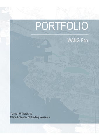
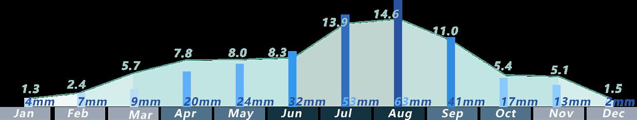
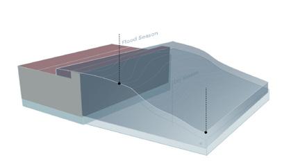
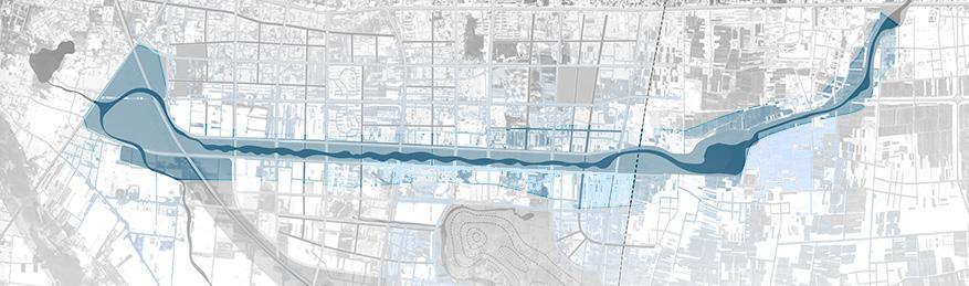
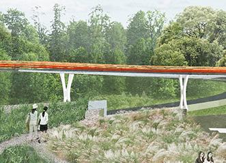
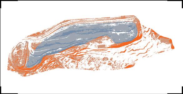
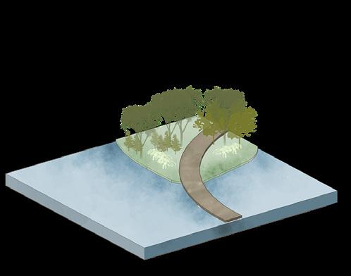
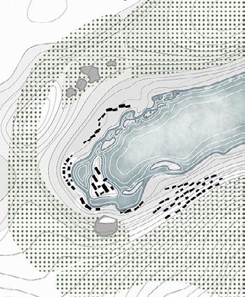
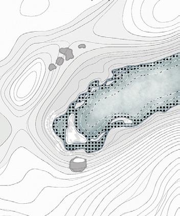
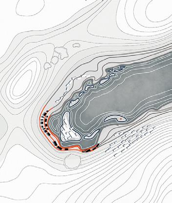
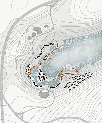
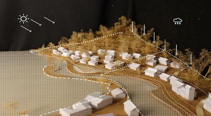
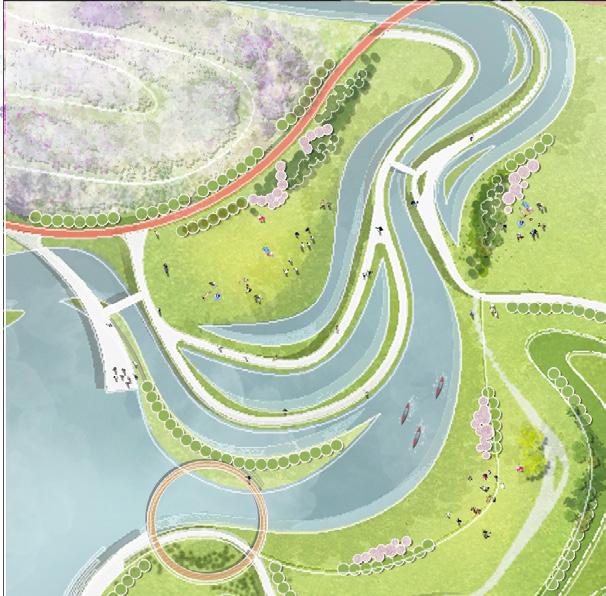
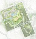
XINYUNHE is an east-west river that runs through Pingdingshan City. It was initially excavated as a man-made canal for navigation. Later, due to the development of land transportation in the city, the demand for navigation greatly decreased, and the riverbanks gradually became ecological. However, it is still not connected to the surrounding water systems, which results in poor flood reduction capacity of the river and excessive suspended solids.
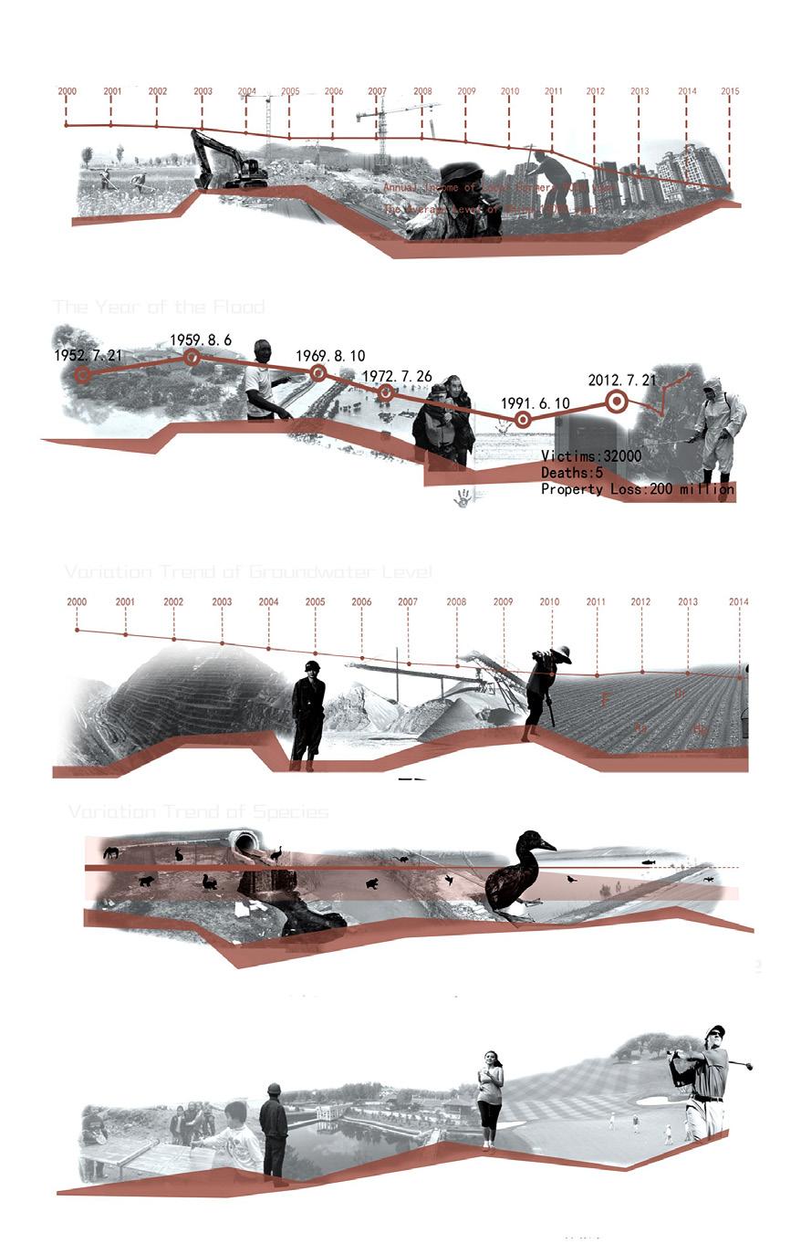
Annual rainfall-Pingdingshan, China
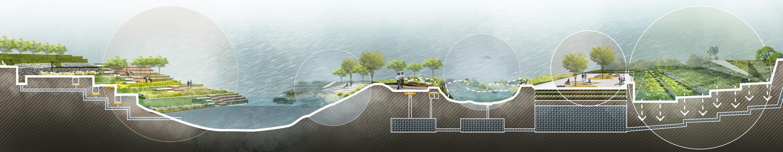
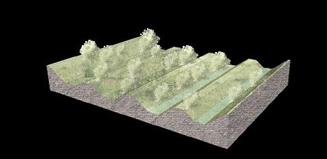
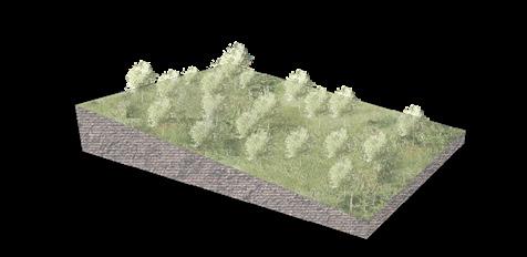
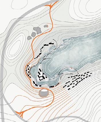
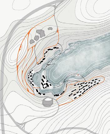
Ecological restoration of river channels based on seasonal flood prevention background
PROFESSIONAL WORK
China Academy of Building Research TEMA WORK
COLLABORATORS:
MY ROLE:
LOCATION: WORKING DATE:
Lizong background analysis,conceptual design,master plan,node design,renderings Pingdingshan , Hebei Province, China November 2022- December 2022(9weeks)
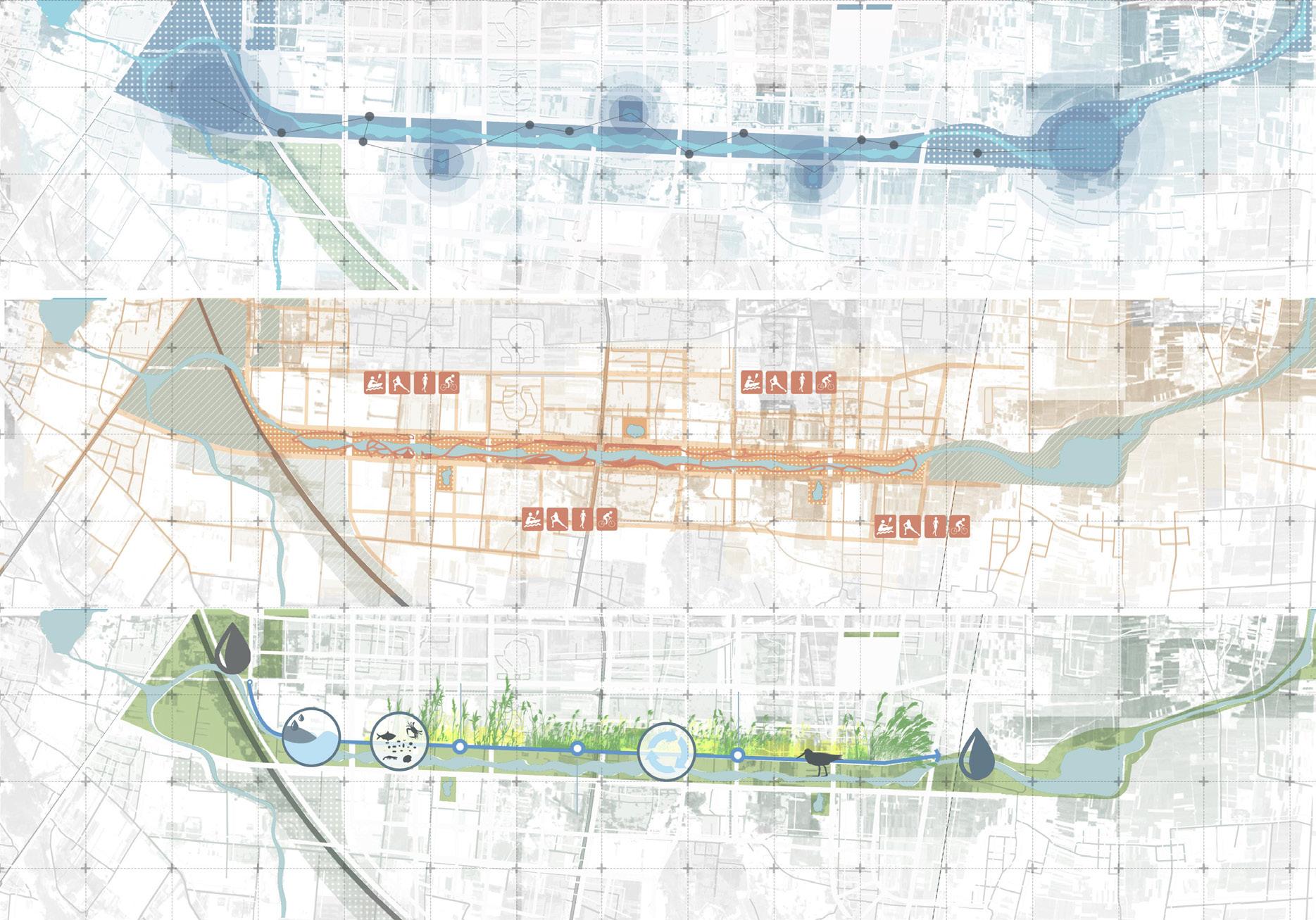
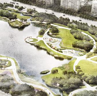
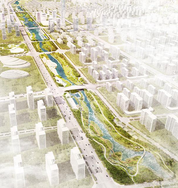
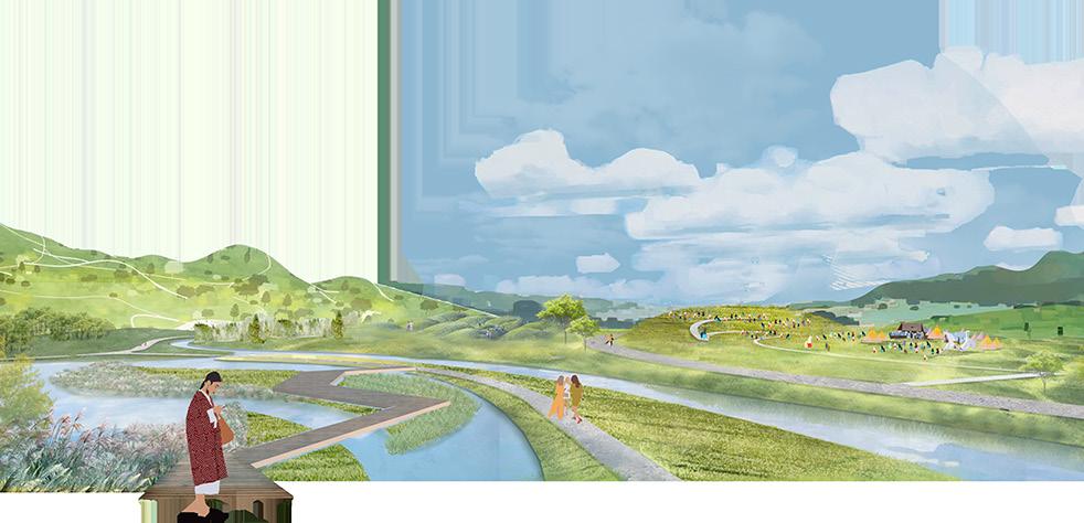
Due to heavy seasonal rains and the destruction of natural ecological substrates through urban development, local residents suffer from seasonal canal flooding and water pollution. Through the remediation of river sediment pollution and the restoration of river morphology, I aim to restore the ecological environment of the river and maximize its natural ability to regulate water. To address seasonal flooding, I propose incorporating quasi-natural sunken green spaces for water storage and establishing a slow traffic system and open spaces to reconnect urban water bodies with seasonal river landscapes. This will create a harmonious relationship between humans and nature and enhance the quality of everyone's living space.
PROBLEM ANALYSIS
Rainfall days-Pingdingsh Rainfall (mm)-Pingdings
CITY CENTE
SITE
BAIGUI RESERVOIR
SHAHE RIVER
Path
INYUNHE river
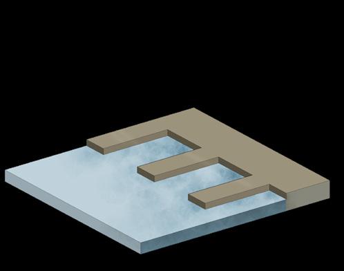
PROBLEM SOLVING
han,China shan,China of excess rainwater enters underground cisterns of rainwater is discharged into rivers of rainwater is absorbed by the park's rainwater ponds Stormwater storage
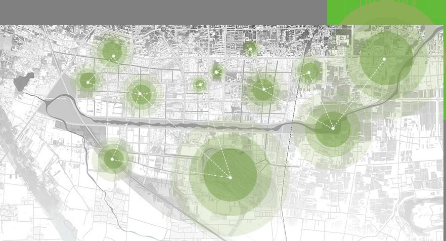
Insufficient Coverage Of Existing Green Space Services
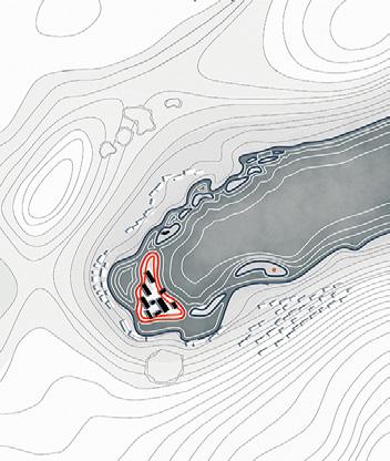
Xinyunhe Flood Zone
FARMLAND Waterbodies With Excessive Nitrogen And Oxygen Content
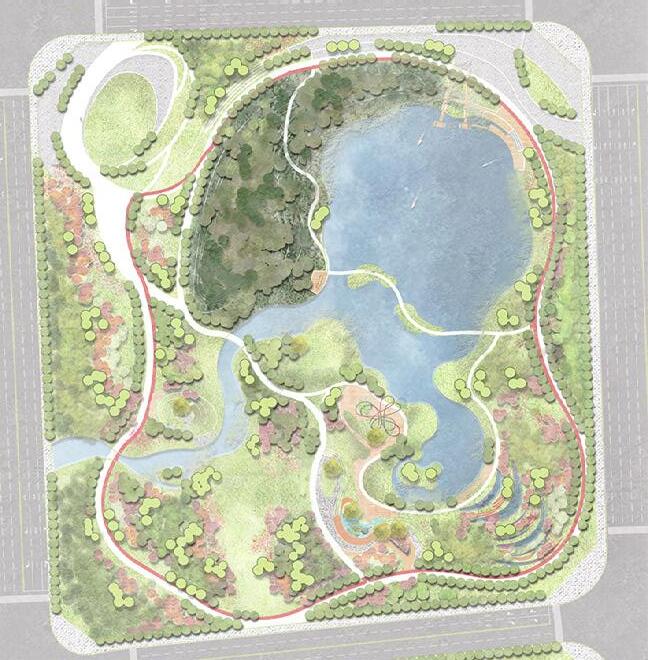
WETLAND PARK
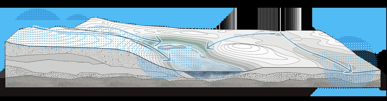
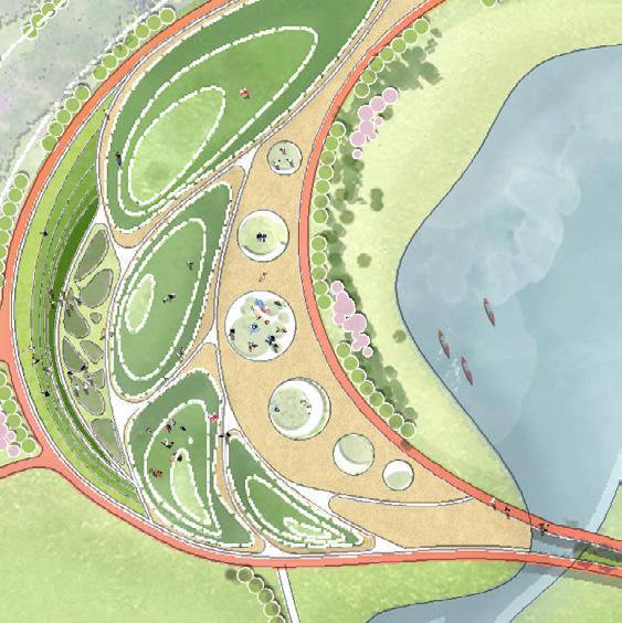
In upstream areas with low flood risk and limited hard surface pavement, rainwater is initially filtered by vegetation and pebble ditches before infiltrating directly into the soil. Excess water is drained away via drainage systems and dischargeWd into rivers.
Surface water regulated and stored by the sunken green spaces; rain garden for purification,grassed swales for drainage.
Overflow rainwater directed into underground pipes and eventually stored in water tanks
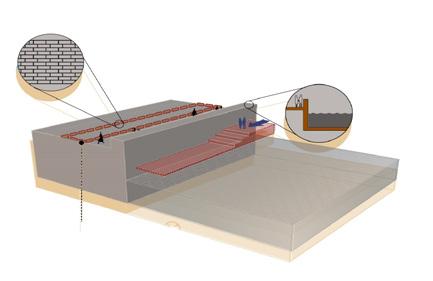
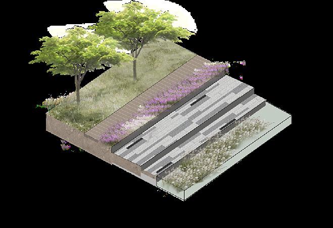
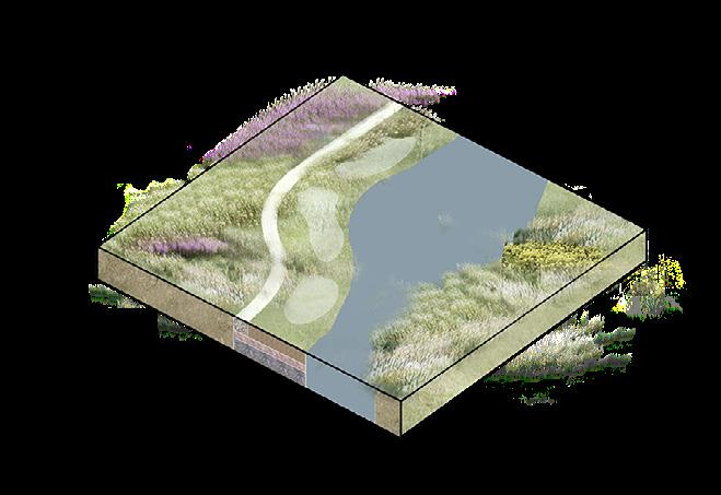
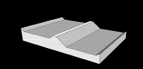
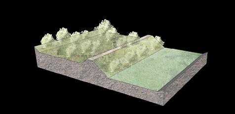
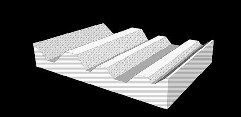
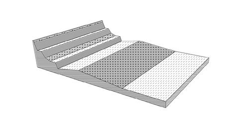
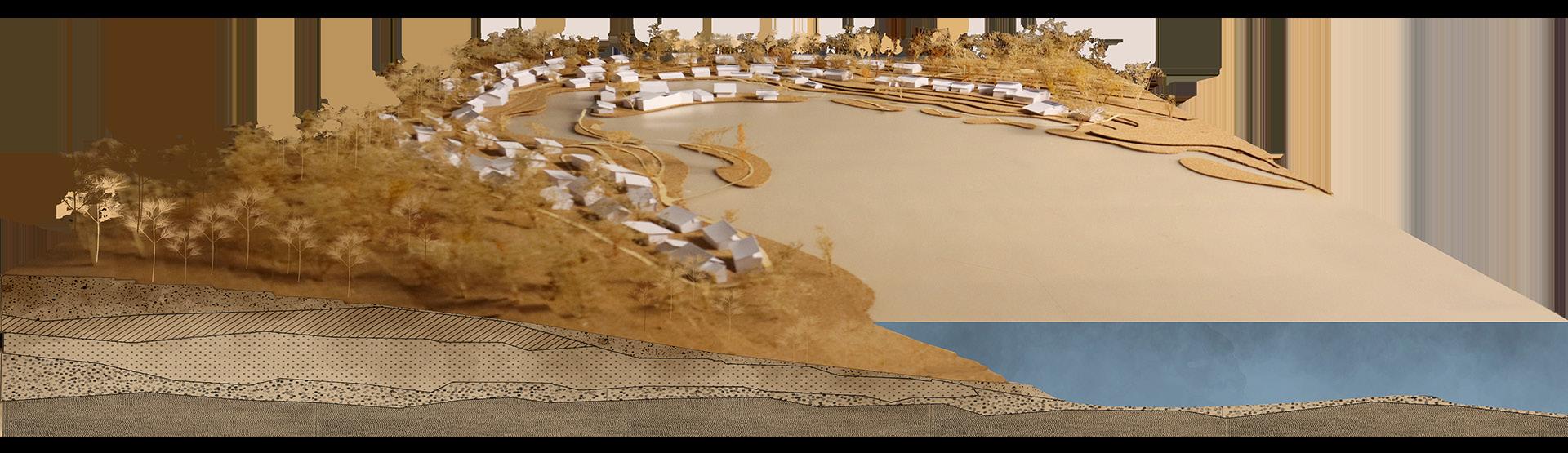
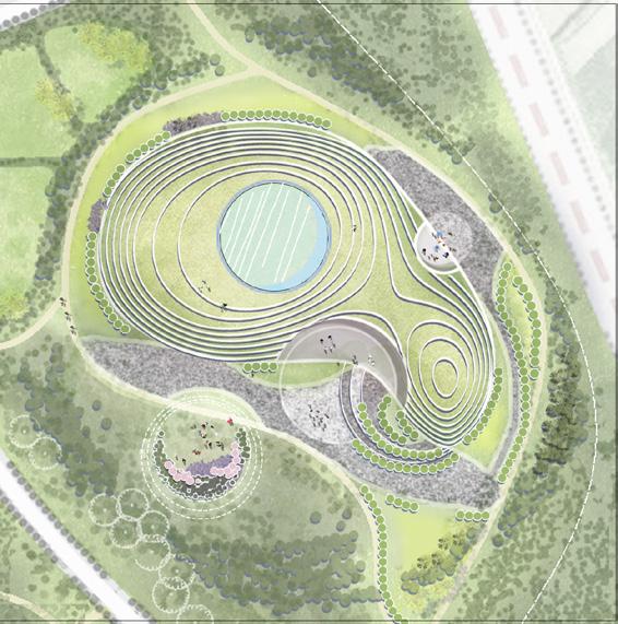
SECTIONAL DRAWING
AQUATIC CYCLE SYSTEM
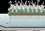
FLOATING ISLAND
PERMEABLE PAVEMENT
REUSE
RAIN GARDEN PERMEABLE PAVEMENT
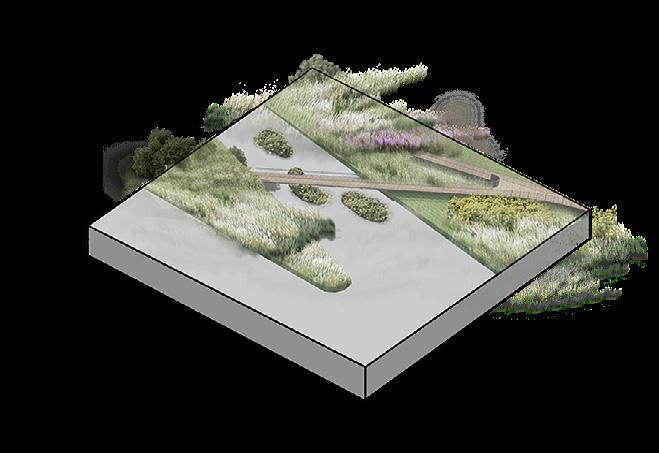
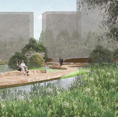
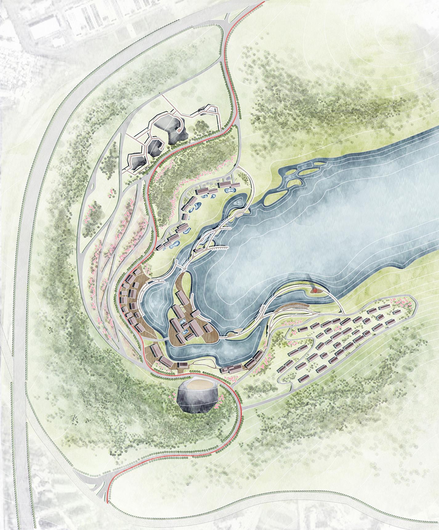
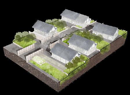
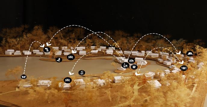
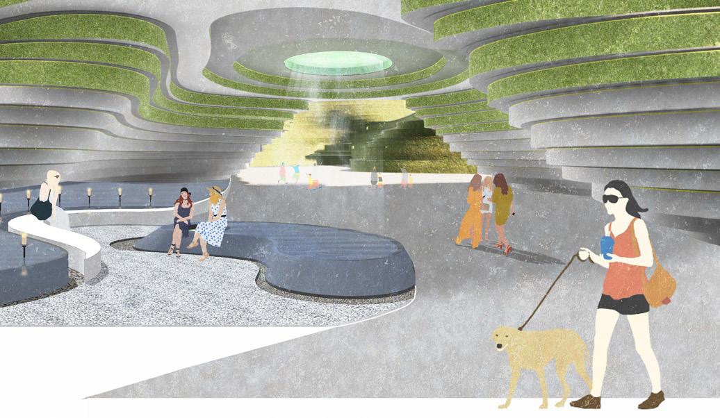
DETAIL DESIG OF COMMUNITY PARK
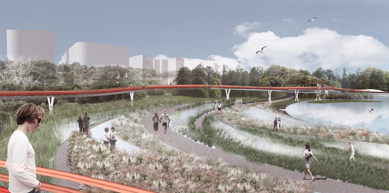
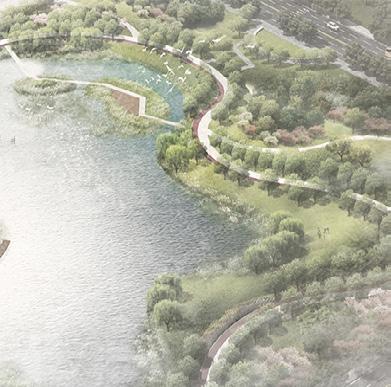
BIRD'S EYE VIEW RENDERING DIAGRAM
BIRD'S EYE VIEW
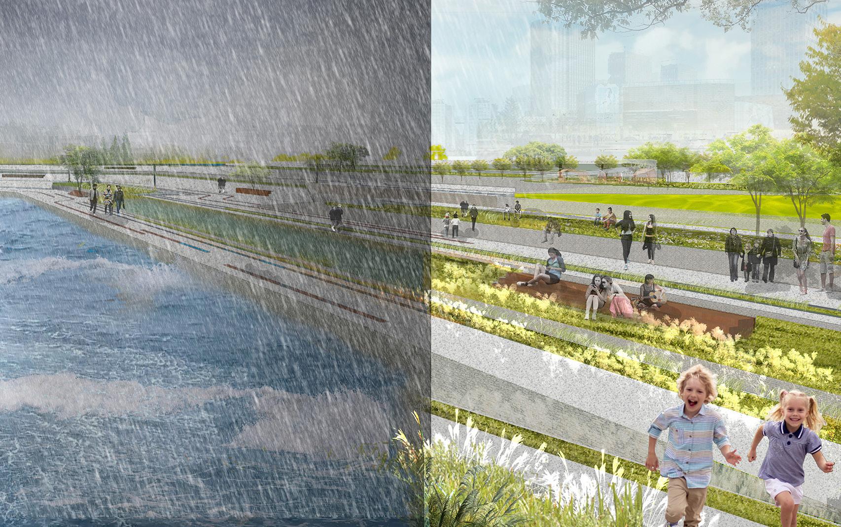
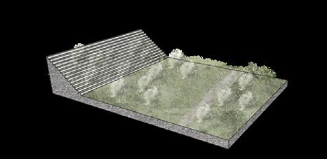
SCENE COMPARISON
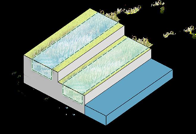
3m from the normal water level
4m fro water
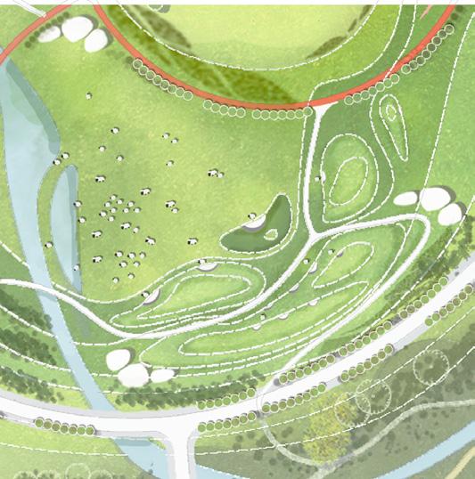
Through the multiple levels of rainwater s rainwater is gradually filtered, treated, and sto During clear weather, the lawn can provid space for visitors. When floods come, sunk spaces at higher elevations store water, w terraces may become submerged.
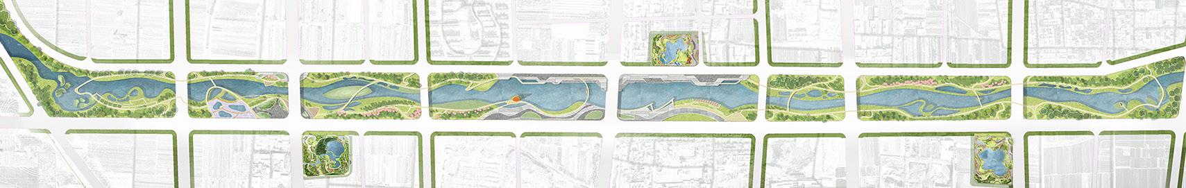
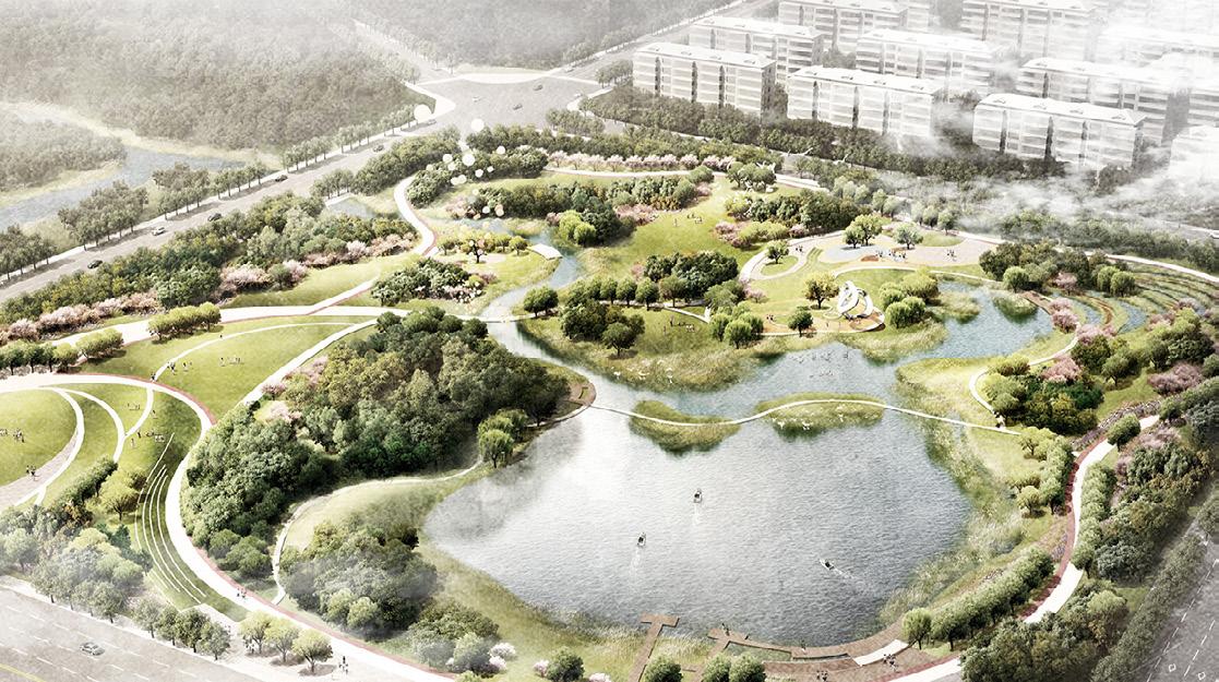
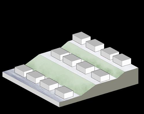
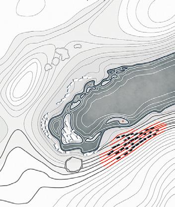
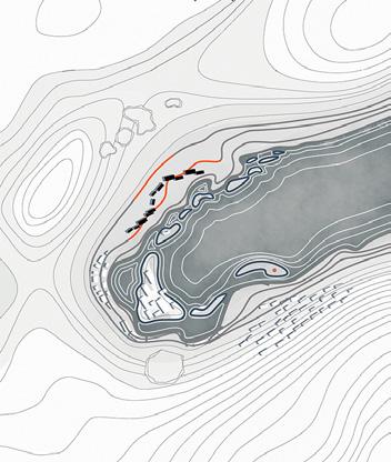
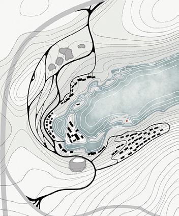
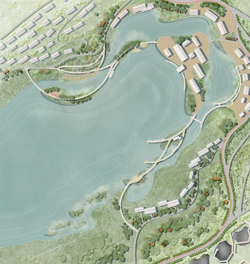
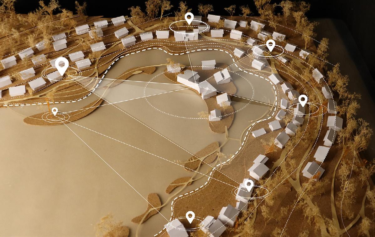
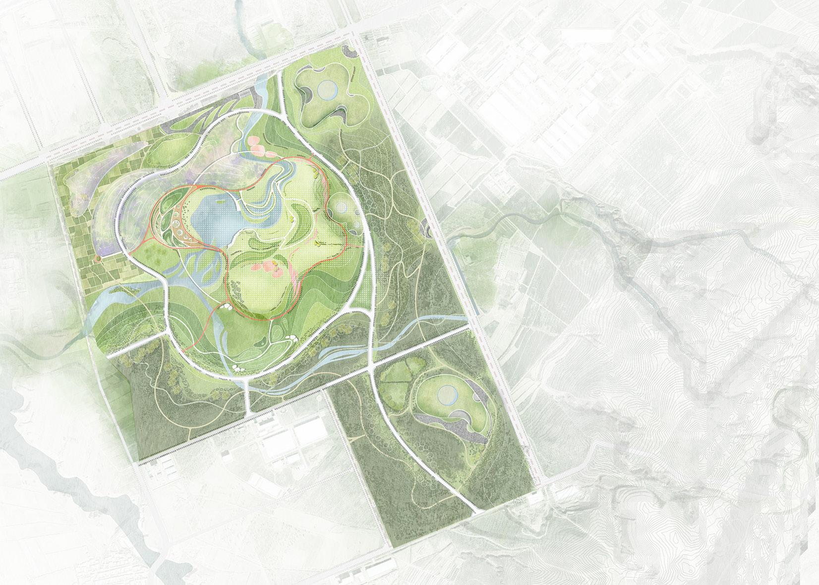
MASTER PLAN
Ecological Revetment
HEAVY RAINY DAYS CLEAR
5m from the normal water level
om the normal level
staircases, ored. de leisure
ken green while lower
7m from the normal water level
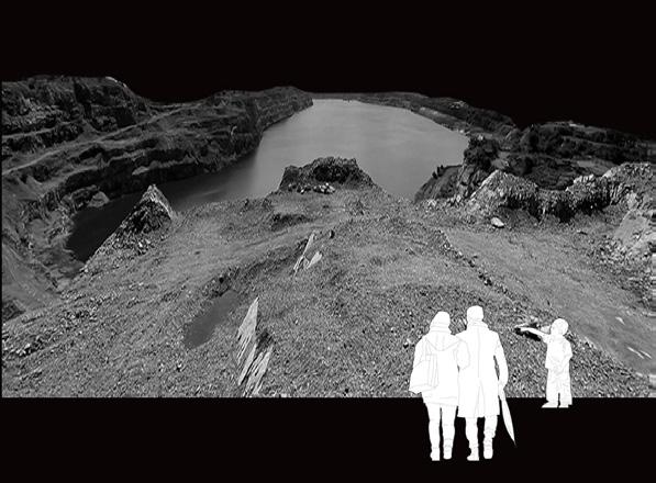
SCAR REGENERATION
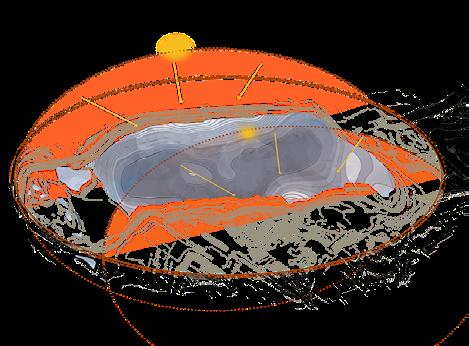
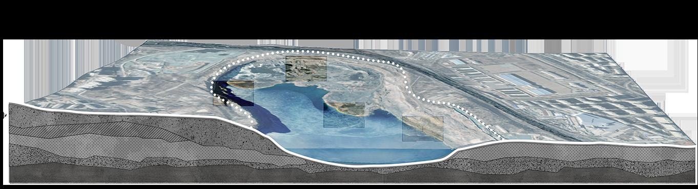
Ecological Restoration and Industrial Renewal of Abandoned Mines
ACADEMIC WORK
TEMA WORK
COLLABORATORS: MY ROLE:
LOCATION:
WORKING DATE: TUTOR:
WANG Zhaodan & LI Wenxuan background analysis,conceptual design,master plan,node design,renderings
Dalian City, Liaoning Province, China
April 2020-June 2020(8weeks)
Xu Jian, Professor of Yunnan University
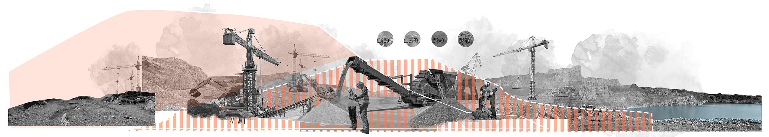
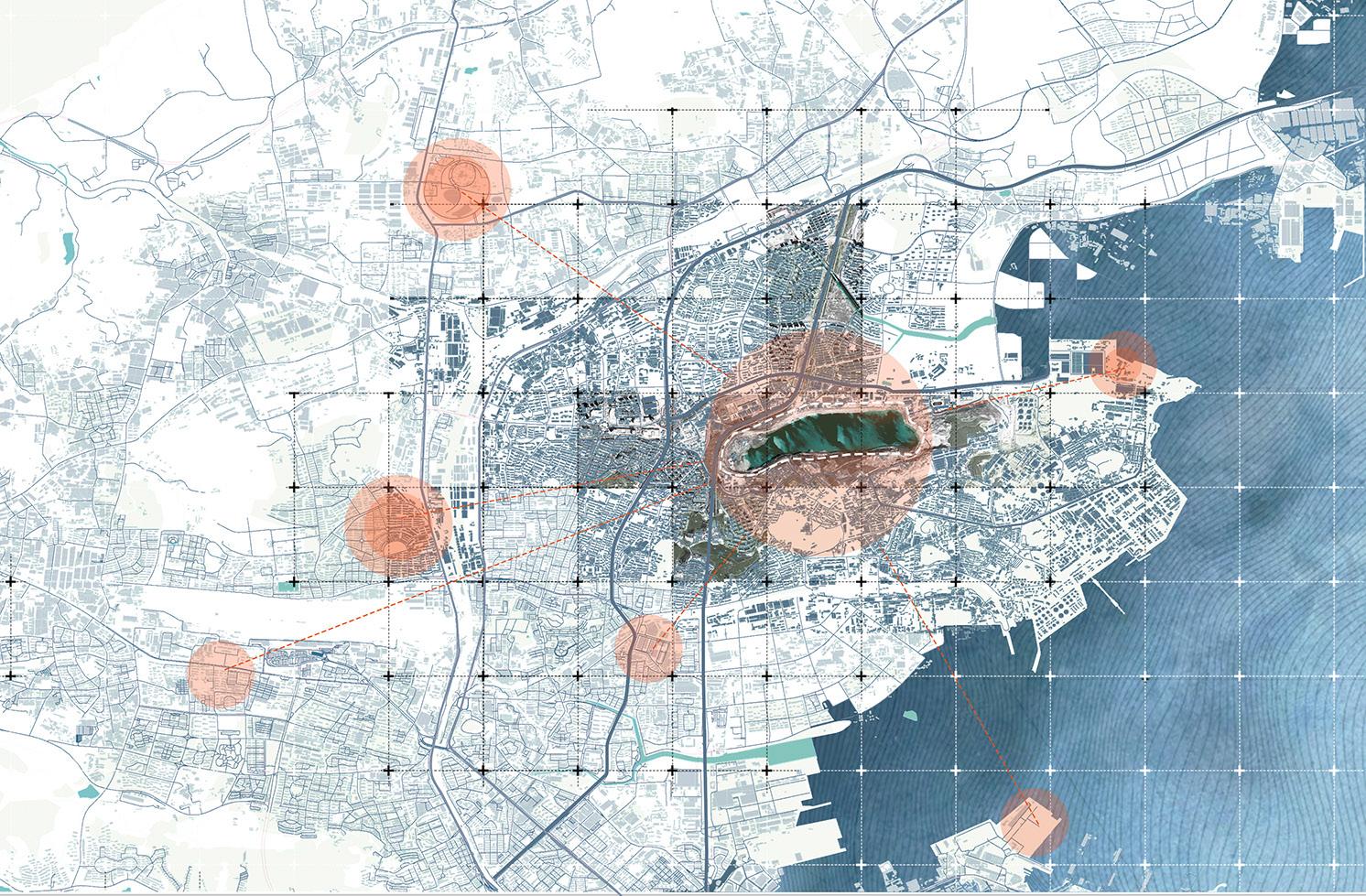
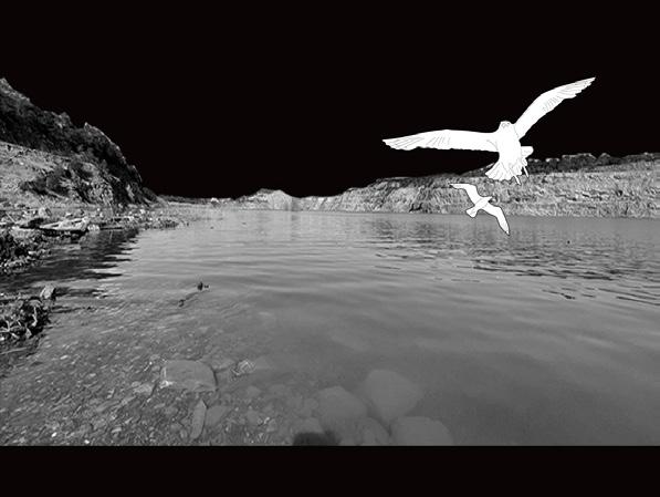
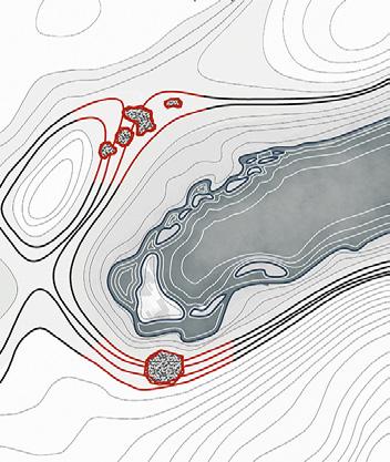
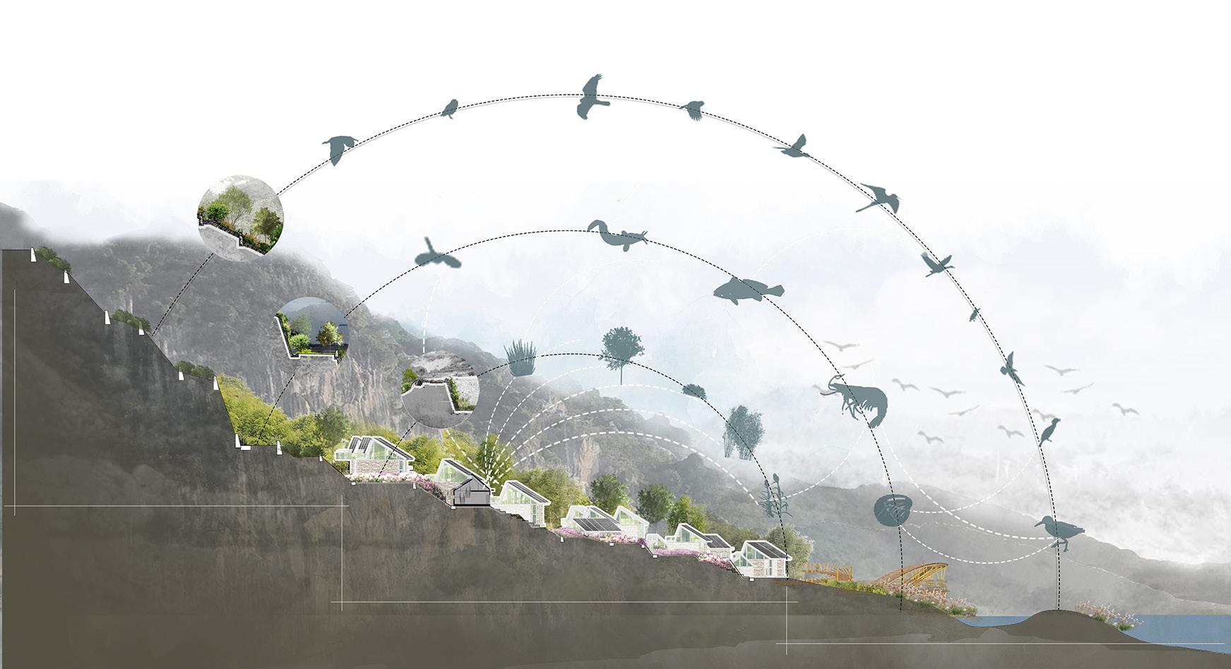
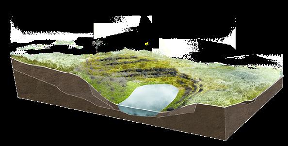
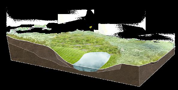
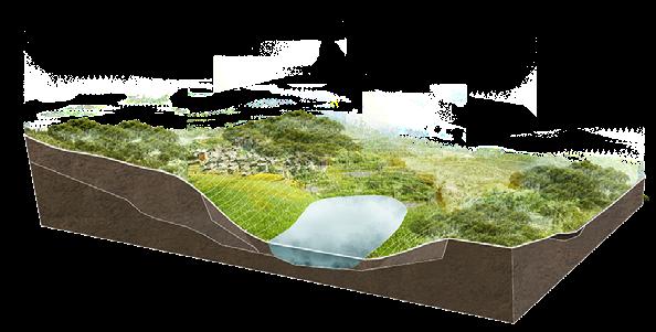
Ganjingzi Lime Mine was built in 1929 and is a large open-pit mine. Due to the decline of the mining industry, local economic development has reached a stalemate. The dust and noise pollution caused by exposed mine pits not only affects the lives of surrounding residents, but also causes damage to nearby vegetation, greatly deteriorating the ecological environment of the region.
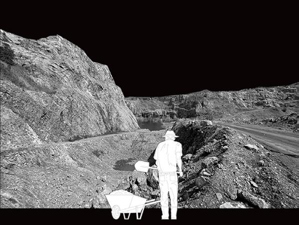
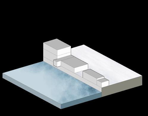
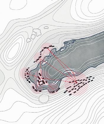
The long-term rainwater runoff and spring water in the abandoned mine pits have accumulated water at the bottom, thus forming a natural pool. In order to cope with the complex terrain, during the design process, we first established a 3D model of the terrain to assist in terrain restoration, and then made a physical model to refine the architecture and activity space.
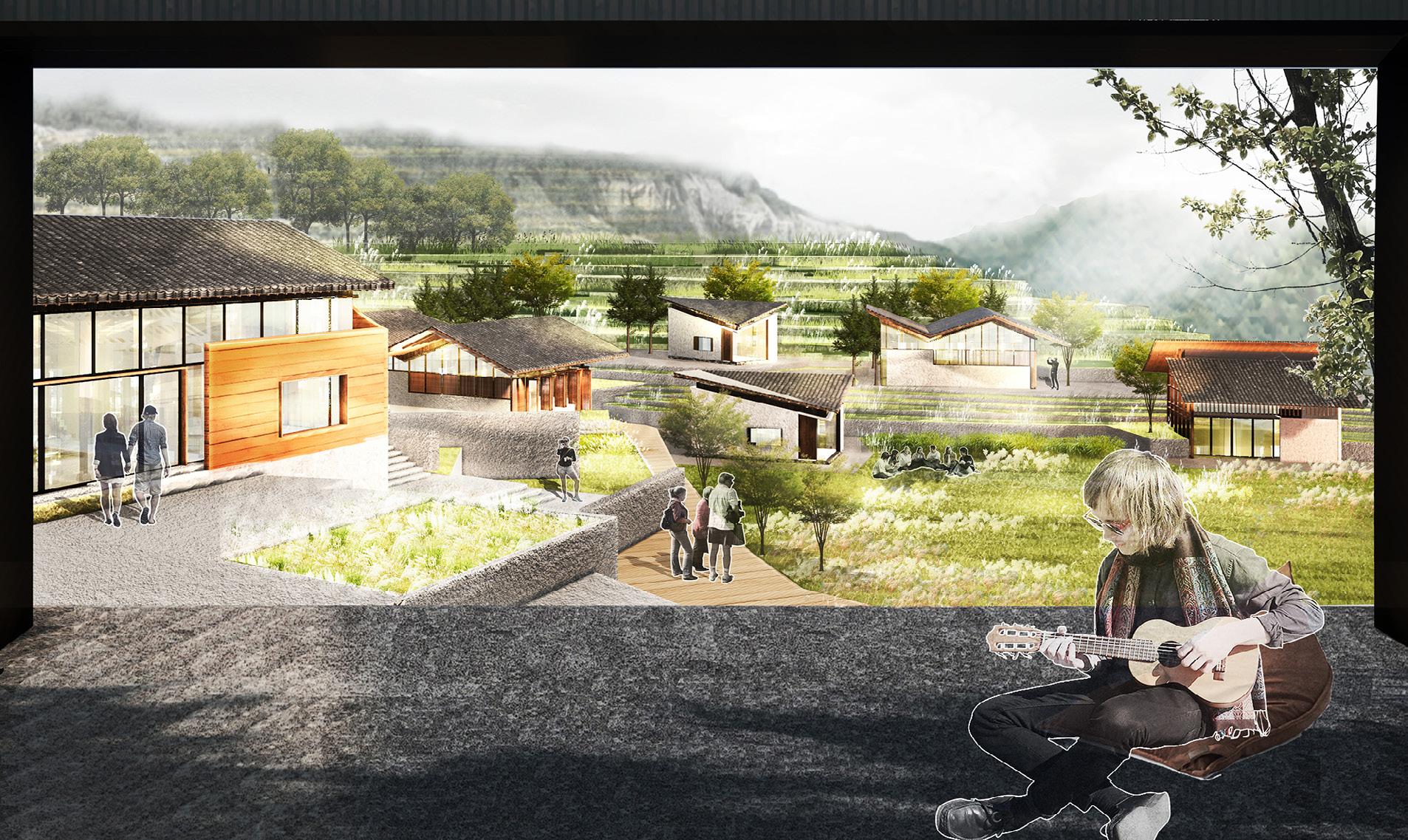
The project proposes a sustainable and effective ecological purification strategy. First, it carries out preliminary ecological restoration through artificial terrain restoration and planting pioneer plants; secondly, it completes wateroriented landscape design and architectural design to lay the foundation for the development of the tourism industry, and finally completes Upgrading of local industries.
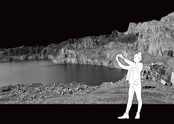
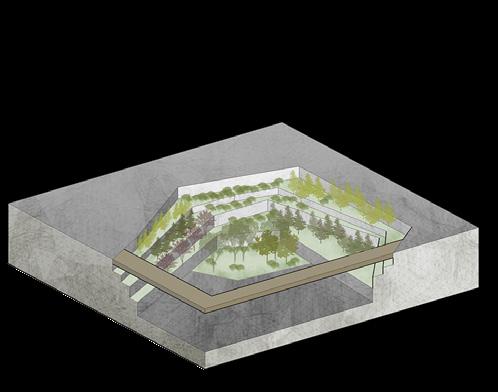
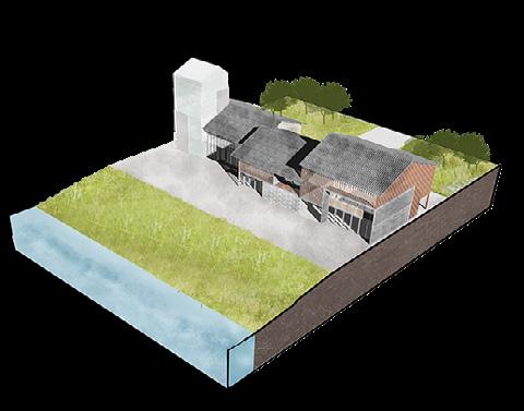
At the same time, some mining ruins are preserved on the site as a pit theater and pit garden, inspiring people to think about the harmonious development of industry and nature, as well as the possibility of development in the post-industrial era.
REGIONAL BACKGROUND: From
Ganjingzi Limestone Mine was established in 1929 and is a large open-pit mine with abundant non-metallic mineral resources, including limestone and silica, with an annual mining volume of 3 million tons. After reaching its peak economic output, the annual output has declined.
LOCATION ANALYSIS
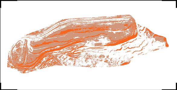
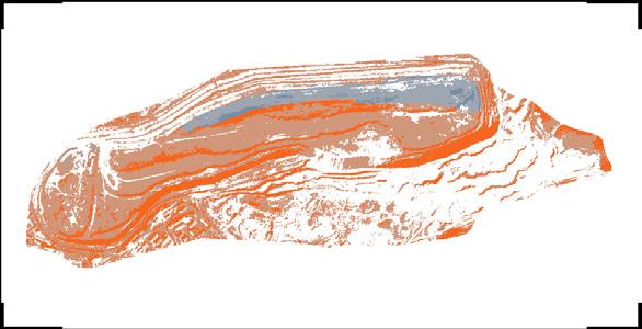
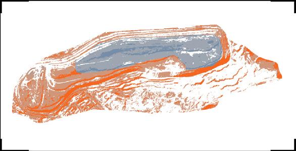
The mine pit, which is about 2,000 meters long, 800 meters wide, 100 meters high in elevation difference, and covers an area of about 140 hectares, has become the most significant source of pollution in Dalian city.
30min from the train station business area
Other industrial heritage
TERRAIN ANALYSIS
a) The southwest-facing slope is densely vegetated and can provide plenty of shade in the summer.
b) The south-facing slope is the most valuable area for development and planting. If there is a mountain or lake view, it should be maximized under the premise of protecting the ecology.
Residentia
Slope And Orientation
to Urban Scar
The lack of effective protection measures led to the deterioration of the surrounding ecological environment. It formed a giant pit with a length of about 2,600 meters from east to west, a width of about 600 meters from north to south, and a depth of nearly 50 meters. The mine was closed in 2015, and the bottom began to accumulate water.
al area
a) A slope of 15%-40% is suitable for development o ensure soil stability for planting.
b) Slopes greater than 40% are not suitable for development.
c) Slopes less than 40% should be moderately developed.
Hydrological Condition
a) Spring water: This is the largest water system and can effectively reduce pollution entering Tai Ping Lake.
b) Rainwater: Rainwater will directly enter the site, so rainwater treatment is recommended.
a) The analysis results of the developable area show that steep slopes are a constraint on the site. The development area should have a slope of less than 40% and be located at least 10 meters away from the river buffer zone.
ISSUES AND SOLUTIONS
Fragile Ecological Foundation
Geomorphology Is Destroyed
Water Accumulates At The Bottom Of The Pit
Economic Difficulties After Closing The Mine
Space
Businesses
Waterfront
Waterfront
Flower Slopes
Natural Reve
Islands
Docks
Restore the current geomorphology by using slope reduction methods to transform most steep areas into gentle slopes, as well as using existing accumulated materials to achieve excavation and filling balance while preserving some unique geomorphological features.
Based on the current water accumulation at the bottom of the pit, adopt a water-guided landscape design that can also accommodate rainwater from nearby areas.
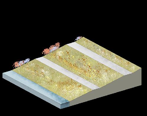
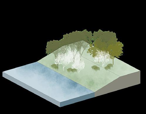
Restore the ecological foundation by utilizing the secondary succession of plants towards a positive ecological cycle mechanism, which can also ensure the stability of geomorphological restoration through plant growth.
To address economic difficulties after closing the mine, introduce related industries to promote sustainable development of the environment through economic growth.
RESTORATION METHODS
etment Platform Buildings
rainwater collection
grass planting ditch
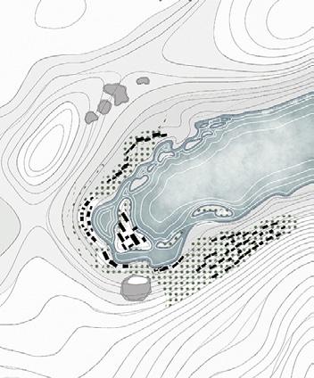
s s Mine Garden
Eco-Floating Islands
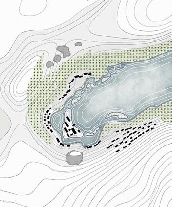
vegetation buffer zone
terrace
1. Homestays
Square
Watching Tower
Theater
Area 7.SPA
Flowe
9. Viewing Platfo
10. Mine Garden 11. Villa Area
.Walking Tra
25 75
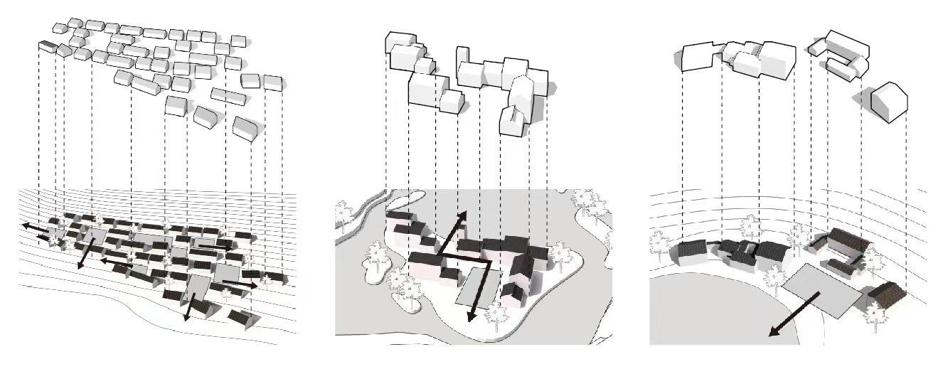
BUILDING FUNCTIONAL ANALYSIS
LAYOUT ANALYSIS
Open Space
SPACE DESIGN ANALYSIS
Dense forest - Shrubs - Fast-growing forest
The front side consists of abundant groups of plants, while the back side is a fastgrowing forest area. The two areas are divided by shrubs.
Grassland - Sparse forest
Located in areas with poor lighting, the front side is an open grassland, while the back side is a space with sparse forest. The overall density is low, leaving space for plant growth.
Shrubs - Dense forest
The front side is an open grassland, while the back side is a space with sparse forest. This area is designed for places that require focused soil stability.
Botanical Design Plan
Homestays
Terrace-style standalone buildings Located on slopes to create a more leisurely atmosphere, mainly targeting out-of-town tourists.
Commercial area buildings. In a combined form, located in the central and easily accessible area of the site, providing supporting services for homestays and villas, and attracting nearby residents to use.
Courtyard-style modern buildings Located in areas with optimal views and lighting, primarily for tourists.
ECOLOGICAL FOUNDATION RESTORATION STRATEGIES
Project 03
LOCATION ANALYSIS
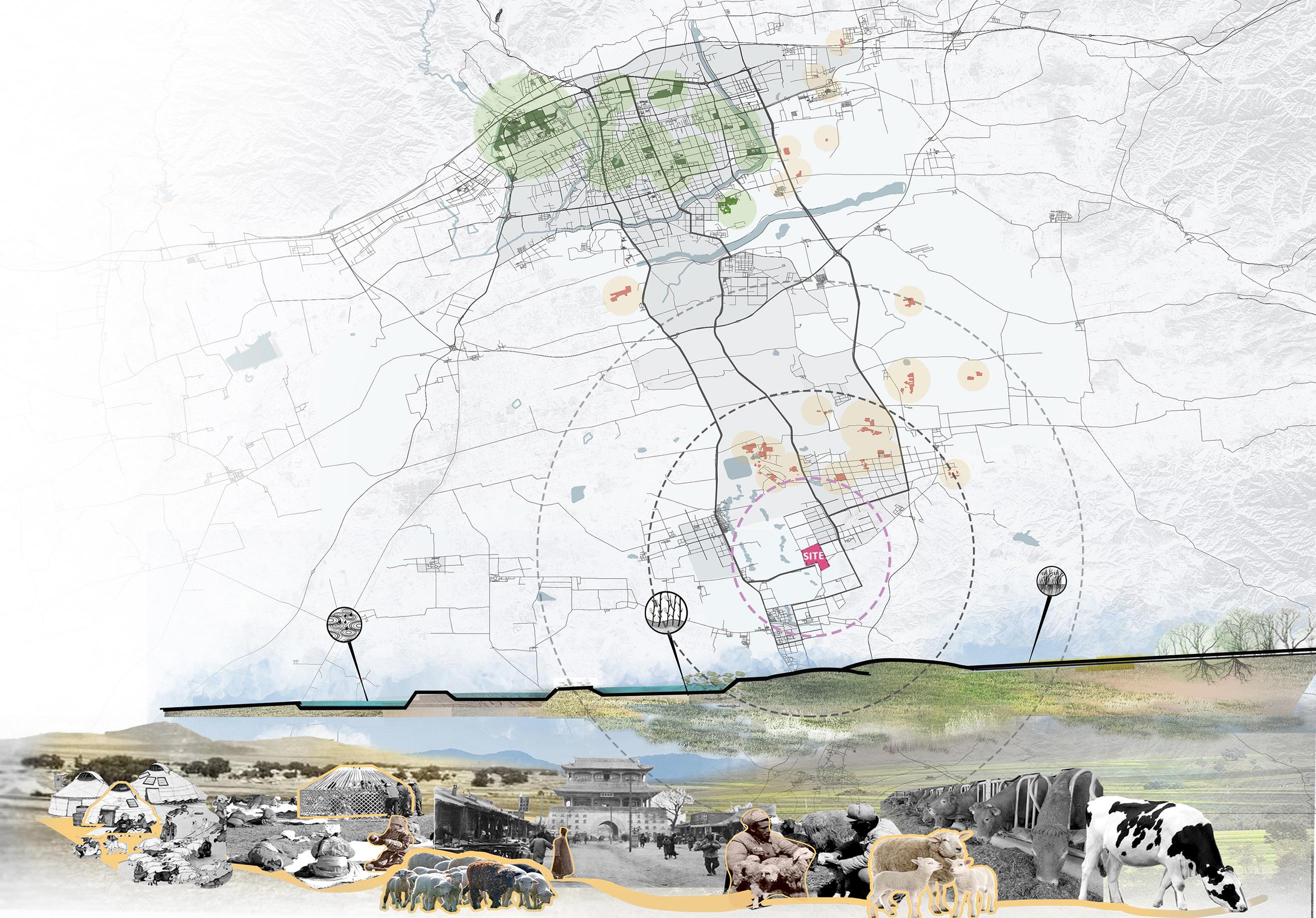
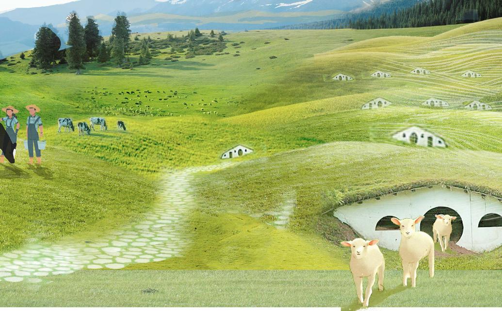
Hohhot City is surrounded by mountains to the north and plains to the south.
Animal husbandry is one of the main industries here, and a unique nomadic culture has emerged.
Park & Service Areas
Large parks (except country parks) are located in urban centers
Pasture & Service Areas
Pastures and other productive green spaces are mainly distributed in the suburbs on the south side of the city and downstream of the river. Products are transported to the urban area through three urban main roads..
Site & Service Areas
A productive park that serves the surrounding villages and is connected to the city via main roads
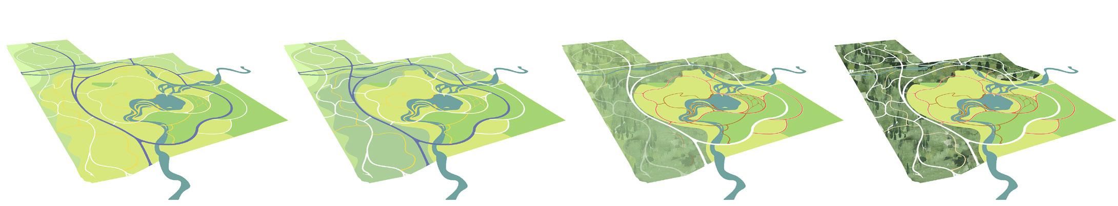
THE URBAN MEADOW
Productive and Nature-Oriented Park
ACADEMIC WORK
INDIVIDUAL WORK
LOCATION:
WORKING DATE:
TUTOR: Hohhot City, Inner Mongolia Autonomous Region, China May 2021-July 2021
Sa Ying, Associate professor,Yunnan University
SITE ANALYSIS
This project is designed to be located on the outskirts of Hohhot, a city once renowned for its livestock farming. The project site used to be a 484-hectare ranch and abandoned meadow.
My goal is to keep the original site function while creating more activity spaces so that the venue can be economically profitable and effective as a large-scale country park in providing entertainment space for local residents, ultimately turning it into a productive and exemplary landscape.
The plan focuses on readjusting the ecological system of the land parcel. I provide a detailed development strategy aimed at creating a fertile, productive, and experiential site, meanwhile establishing a sustainable production model for animal husbandry and agriculture that embodies cultural heritage and improve its ecological service mode.
Nomadic people originated from here
Between the Ming and Qing dynasties, sedentary pastoralism became the predominant lifestyle.
During the Qing dynasty, urbanization advanced.
Then, since the founding of the People's Republic of China, the government has promoted new policies for restoring farmland to forests in search of new modes of ecological ranching.
Crop
Wild Grass
Trees Bare Soil
XIAOHEIHERIVER
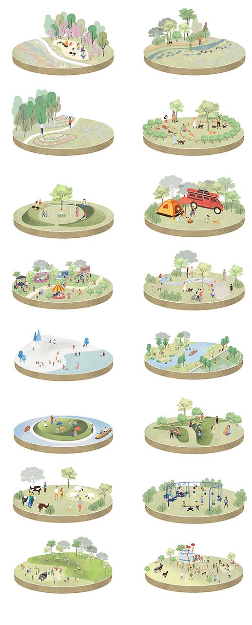
1. sheep hill
2. children's park
3. cheese factory
4. marshy lawn 5. camp
6. biking lane 7. cattle home 8. camp site
9. flower field
10. woodland 11. integrated service ha 12. showroom 13. diary factory 14. public square by entrance and exit
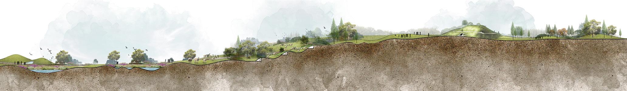
SECTIONAL DRAWING
peach blossom forest: camping
stream in the woods: fishing
open grassland: lawn party
wading pool: water splashing
woodland and floral hill: walks
meditation valley: yoga
dog park: dog walking
RV campsite: camping
hills: winter festival streams: kayaking
bowl-shaped island: sunbathing
grass hill for children: children's activities
ranching park: petting zoo
fitness equipment: exercise and fun
hills: music festival
meadows: Naadam
ORDER OF DEVELOPMENT
RENDERING DIAGRAM
INTEGRATED SERVICE HALL
LAND RECLAMATION
Phase One
Restore grasslands and develop farmland
The manure of cattle and sheep can further enrich the soil.
Phase Two Grazing livestock and building infrastructure.
POND
CHILDREN'S PARK
The economic inco of the horse farm further improve existing facilities.
The overall plan aims to create space with undulating greenery, minim paving, which allows users to enjoy a living experience that is com the urban environment while completing water source conservation through the restoration of grasslands and forest
Birds can further protect grasslands.
In winter, horses can break the ice surface and provide water sources for other animals. In spring, the running of horses can plow the land.
Phase Three
Operate a horse farm and restore forest land.
Phase Four
FOREST EXPLORATION
Forest habitat protection
ome can the
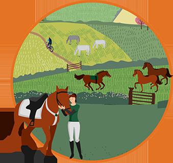
HORSE RANCH
mizing the use of hard mpletely different from and habitat protection
Birds can further protect grasslands.
The first step is to restore the ecosystem. Plow the land, sow grass seeds, develop water sources, and gradually build a basic infrastructure network.
Grazing livestock and building infrastructure.
The plan is to introduce more routes through different landscapes for tourism. Different pastures and rich natural and cultural conditions will be used to create unique experiences.