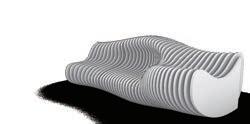
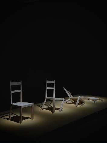
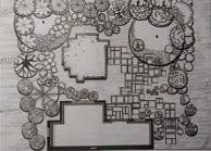
Use environmentally friendly plastic wood slices to form a modern art seats
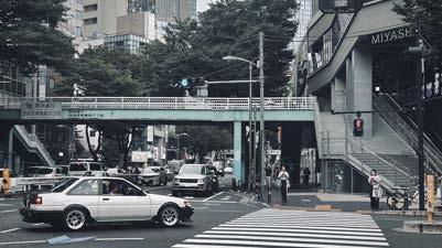
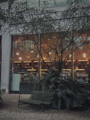
City Park
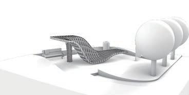
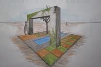
Use the steel structure as the base and tempered glass to build a lattice-shaped pavilion
SKETCHUP
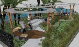
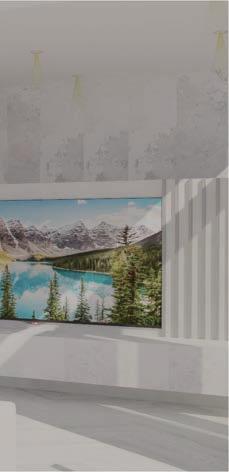
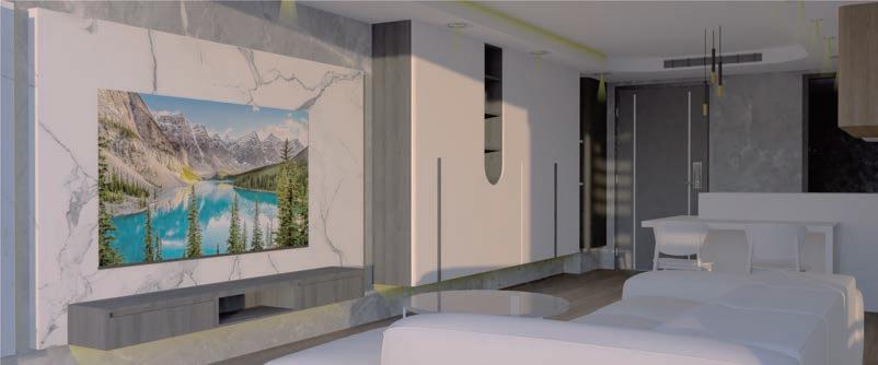
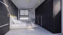
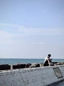
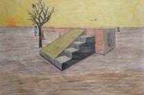
Forget everything,just Take easy and chill
Slow down and relax yourself
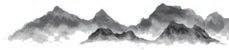
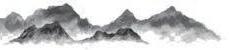
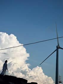
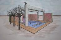
Nanyang resort
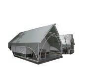
Tropical Gazebo
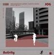
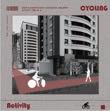
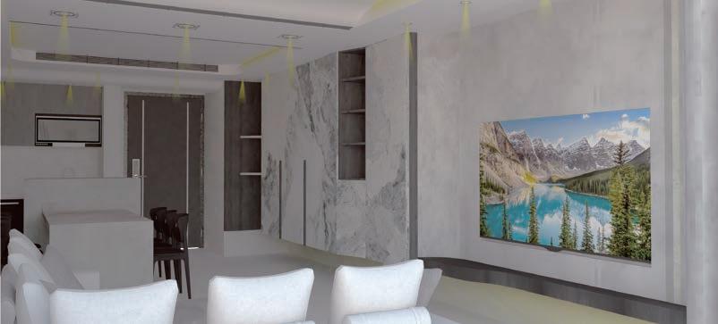
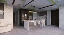
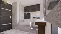
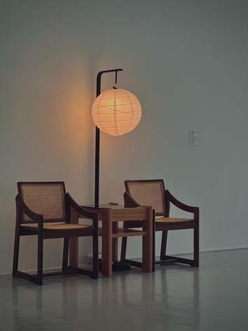
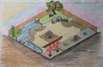
Decorating exercise
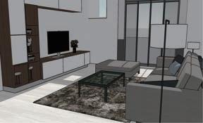
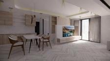
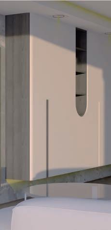
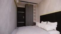
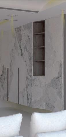
Bring warmth with simple colors
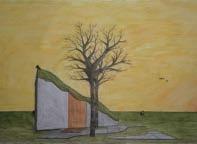
Landscape.
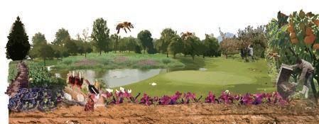
Bee your orchard
With the pleasant climate in Houli District and the extremely suitable conditions for planting crops, bees are used to connect the flowers and fruit trees in the entire park, and provide employment opportunities for the elderly to plant and maintain
There is also the fun of parent-child picking fruit to form sustainable development, which enables Houli District to achieve local creation, activate the life of the base, and drive the functionality of the surrounding area Site Location
-Facing threats from cities and seas, people seek a space to relax-
Marina Mangrove In The New Era
In 2050, rising population/urban oppression, and various types of pollution, these disturbances make people want to escape urban life
Facing the issue of sea level rise, there are rich ecology and uniquesights in Daan Seaside Paradise which located on the sea line of Taichung City. In the future, this paradise will become a place for urbanites to stay away from the troubles of Penglai.
Two islands are formed and stacked into islands 2050 Start Taichung Up
The orginal coast line follow ocean current
Affected by the groin effect
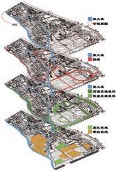
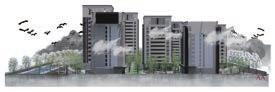
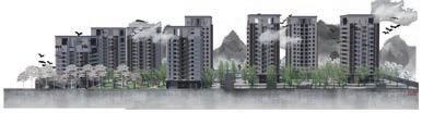
Dongda Creek and Ranch Integration Reconstruction Project
Site Location
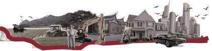
SO Provide farm & ranch experience for tourists
The establishment of the overall ecosystem
ST Develop farm and ranch recreation to differentiate it from surrounding parks
WO Cooperate with the MRT plan to open the second campus and attract traffic
Integrate streams and pastures and maintain & manage
WT Purify sewage and air pollution with plant filtration system
Through the farm & ranch integration, the flow of people from the nearby parks is brought here
Mouxi Mouxi
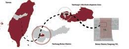
Report QR Code Using Taichung Phase 14 as an example.
Heat Reduced Strategy.
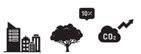
The world is currently facing increasingly severe global warming issues. In the cities we live in, intense human activities, the gradual reduction of green spaces, and the increasing proportion of hard surfaces are contributing to the urban heat island effect.
This results in rising temperatures, reducing outdoor comfort levels and affecting people's willingness to go outside.
Site Location&Change
The Taichung 14th Redevelopment Zone has been designated as a demonstration area for implementing ventilation and cooling strategies under the "Taichung Urban Heat Island Effect Spatial Strategy Plan."
This area has significant development potential and will inevitably be considerably affected by the heat island effect after development.
Additionally, no construction projects have been completed within this zone yet, providing greater flexibility, making it an ideal location for this initiative.
Taichung City Natural Basin Wind Corridor Pathway.
Located in the secondary urban wind corridor extension pathway.
After urban redevelopment, the roads are spacious, creating wind corridors.
2022年-2094hr
2021年-2296hr
2020年-2297hr
2019年-1934hr
2018年-2024hr
The negative impact of the elevated section of National Freeway 74 on ventilation.
Existing urban buildings are too densely packed, obstructing wind corridors.
The site serves as a demonstration area for ventilation and cooling.
Incentive measures include provisions for ventilated green spaces and setbacks.
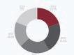
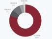
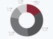
住宅用地80%
學校用地8%
商業用地6%
園道用地4%
住宅用地2%
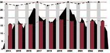
The left chart displays the total sunshine hours in Taichung City from 2018 to 2023. On average, there are approximately 2128 hours of sunshine per year, indicating a considerable duration. Particularly in summer, this abundance of sunlight brings significant radiant heat, which is retained in the city due to the presence of hard surfaces, leading to temperature increases.
The increase in human activities in the future leads to a rise in temperatures due to the heat island effect.
The left chart shows the current distribution of land use in the selected site, the Taichung 14th Redevelopment Zone. Most of the area is designated for residential use, with expectations of a significant influx of population in the future. Additionally, there are plans for commercial zones, including the Han Shin Department Store and the Taichung Dome, which will further promote development in the Beitun District.
The above chart illustrates the average monthly temperatures in winter and summer from 2014 to 2023 at the Tanzi District meteorological station over the past decade. It shows higher temperatures in both summer and winter in the years 2023 and 2024, indicating that the level of development still has a significant impact on temperatures.
With a declining birth rate, the aging population in the North District is becoming increasingly severe, and the natural population growth rate is also extremely low. However, the social growth rate is increasing due to the development potential of the Beitun District. Undoubtedly, the vibrant future scene is just around the corner.
Swot
Summer Wind Rose.
Witer Wind Rose.
Using Taichung Phase 14 as an example.
Problem
1.Urban Warming: Human activities in cities produce large amounts of heat and greenhouse gases, ultimately leading to rising temperatures and increasingly dry environments.
2. Greenery and buildings have not taken ventilation into consideration, resulting in the inability to disperse the high temperatures caused by the urban heat island effect once urban development reaches a certain level.
3. Insufficient green space: Ten percent green coverage is far from enough to cool the entire city and reduce greenhouse gases effectively.
System: There is a scarcity of water systems in the surrounding area of the site, and those present are relatively distant from the site itself. Additionally, the drainage channels along Zhouqi Road are not open for surface runoff. Therefore, the operational aspect of water for cooling and greenery is relatively challenging. Priority will be given to ventilation and heat dissipation measures.
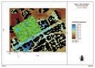
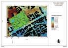
From the preliminary wind corridor distribution map on the left, it can be observed that a basin wind corridor passes through the Da-li District of Taichung City. Moreover, the transition from the old downtown area of Taichung to the Tanzi District aligns with the selected site for the Taichung 14th Redevelopment Zone (highlighted in the red dashed box), making it a key area for wind corridor regulation.
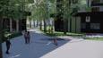
Distribution of Public Spaces: There is a severe shortage of public open spaces in the surrounding neighboring areas. Local residents have very few options for outdoor activities apart from the scarce community parks and schools. Therefore, in our site design, we will prioritize the publicization of private spaces, increasing the proportion of areas where people can engage in activities.
The adjacent Songzhu Road is designated as a secondary wind corridor by the Taichung City government. The current design aims to extend the pathway of the secondary wind corridor, creating localized wind channels to alleviate heat discomfort.
area, most of the
has not yet
so it remains very open, maintaining its original greenery. The distribution of green spaces in the surrounding existing communities is as shown in the diagram below. Compared to the distribution of buildings, there is much less green space, and not every area is open. Green spaces include parks, private farmland, school playgrounds, etc.
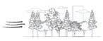
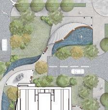
The concept of planting along the waterfront and the promenade is depicted from left to right in the image below. The planting design integrates with the original ecological environment while considering ventilation and cooling. It employs multi-layered vegetation to provide diverse visual layers.
-Graduation Project Production-
1. Connecting large open areas to form ventilation corridors, penetrating densely built urban structures.
2. Establishing setbacks for building lines and non-building use areas.
3. Main streets should be arranged parallel to the prevailing wind direction or at most at a 30-degree angle.
4. The heights of buildings within the area should gradually decrease in the direction of the prevailing wind.
5. Utilizing open-type tree species in parks and sidewalks at the main entrances of communities.
6. Adopting a tiered platform design to guide airflow from above to pedestrian walkways on the ground.
Using Taichung Phase 14 as an example.
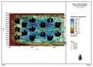
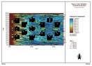
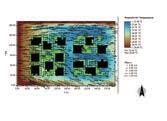
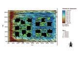
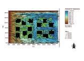
Environmental simulation analysis
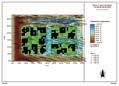
The right side of the diagram represents wind direction, wind speed, and temperature at three different times in the simulated area. The arrows indicate wind direction and speed, with longer arrows representing higher wind speeds. Colors denote temperature, with blue indicating lower temperatures and red indicating higher temperatures.
It is evident that wind speeds are significantly higher and more fluid in the open green space of Dunhua Park. However, once the wind reaches the buildings, the speed decreases markedly and almost comes to a standstill, unable to flow between the structures, resulting in higher temperatures.
In the midday period from 12:00 to 13:00 (Figure 2), considering the shading from sunlight, the densely built areas show lower temperatures.
Due to early urban planning and building regulations not considering ventilation and cooling or providing incentive measures, current well-developed communities with complete amenities and finished buildings often suffer from overly dense building distribution.
This density prevents smooth airflow between buildings and, coupled with insufficient greenery and a high proportion of hard surfaces, leads to increased temperatures that are difficult to reduce or alleviate through wind flow.
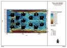
This simulation experiment aims to highlight the issues of building density and arrangement in existing urban areas concerning wind flow. The results will be presented in diagrams for analysis and comparison.
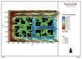
Simulate Data
Figure1
Figure2
Figure3
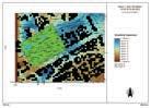
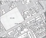
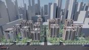
Simulation Location:
Around Dunhua Park on Section 1 of Dunhua Road, near the secondary designated wind corridor on Songzhu Road
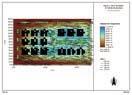
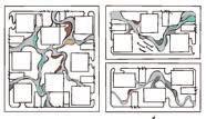
The aim of this simulation experiment is to compare the flow of wind within the site under the same building form conditions between tree group planting and matrix-style arrangement. The analysis seeks to clarify the more efficient planting pattern in the designed site and apply it to enhance the effectiveness of wind in reducing temperature.
According to the simulation experiment, it is observed that tree planting arranged in groups provides better ventilation compared to a matrix-style arrangement. This enhances outdoor comfort for individuals. Therefore, the site will adopt a group planting arrangement for the trees based on this observation.
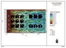
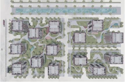
The configuration and simulation of building modules.
We applied the building model conforming to Residential 1-1 regulations to the site and attempted various arrangements for simulation analysis. We compared these with models built according to regulations, with setbacks as illustrated on the right. Among these combinations, Combination 4 exhibited the best ventilation effect and showed lower temperatures at noon compared to the model meeting the minimum requirements set by regulations. Therefore, we chose Combination 4 for the building configuration on our site and proceeded to design its public spaces.
Simulation of group planting and matrix planting
Using Taichung Phase 14 as an example.
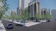
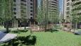
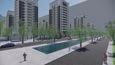
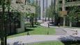
Plan
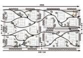
Wind Flow Trajectory Prediction
Based on the fourth combination of the layout plan, we will apply the results of the planting simulation. Using group planting as the primary planting mode, we will carry out the spatial design.
The pathways and spaces within the site will be designed according to the predicted wind flow trajectories and will integrate the necessary functions of community spaces to achieve a comfortable ventilation effect during activities. Additionally, the water bodies within the site will be used to lower the temperature of the wind flow, making the cooling effect more significant.