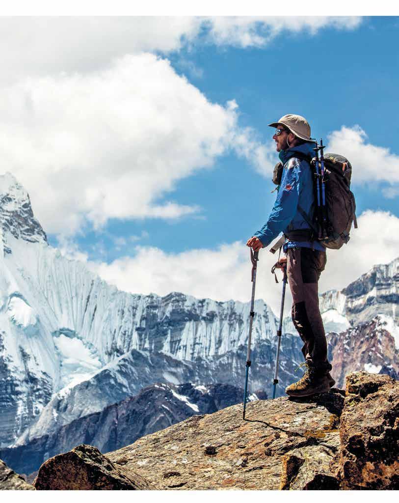
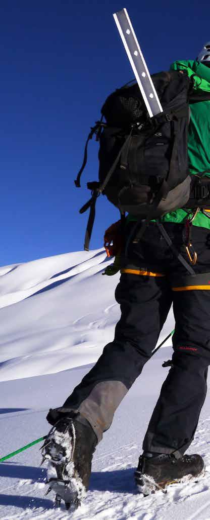
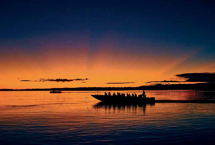
Per u adventure + tourism
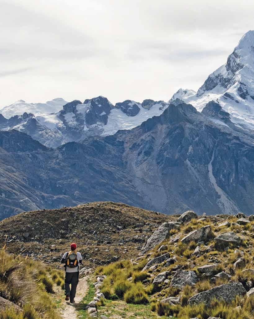
V a l l una r aju Snowy P eak © Andy M artínez
Peru adventure + tourism
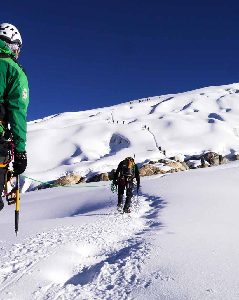
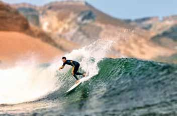
Under a warm sun or a starry nighttime sky, beside one of the 12 thousands lagoons, or before mountains peaks reaching more than six thousand meters in height, facing a snow-capped summit, or appreciating one of the planet’s deepest canyons. Imagine yourself in Peru, filled with adrenalin.
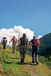
Imagine yourself reaching great heights following in the footsteps of the Incas and discovering the culture of local communities along a path that has been traversed for thousands of years.
Imagine yourself surfing waves that can reach up to ten meters in height, flying over Inca villages in the Sacred Valley, or or the coast of a modern city on the edge of the Pacific.
Peru is not a country you imagine. It is a destination that unites adventure + tourism. It is the sum of experiences that are incomparable for the spirit and a true adventure for the senses.
Peru, adventure + tourism is just a small sample of the many spaces, destinations, landscapes, and scenes that our country offers for this imagined journey: experiences that form part of a tourism offering that is responsible and sustainable. Turn the pages and discover each one.
BON VOYAGE!
 Purhuay Lagoon, Huari district© Juan Puelles / PROMPERÚ
Index 04 Experience at all levels Altitudinal index 06 Kuélap, Gocta and the lagoon of the condors 10 Choquequirao and the other Cusco 14 Inca Trail Millenary trekking 16 Aptae Association for adventure 18 Protected natural areas Photographic dossier 24 Committed to conservation Photographic dossier 28 An explorer in the jungle Amazon Expeditions 30 Between the snow and the stars Huayhuash and the Cordillera Blanca 36 Dizzying heights Colca and the valley of the volcanoes 40 Year-round destinations Surf destination 45 Pack your bags Everything the traveler needs to know
4 Elevation index
Experience at all levels
CHOQUEQUIRAO AND THE VILCABAMBA RANGE (Cusco)
THE ANDES MOUNTAIN RANGE, THE PLANET’S LONGEST CHAIN, CROSSES PERU VERTICALLY. ITS PRESENCE IS WHAT HAS STAMPED THE ECOSYSTEMS AND LANDSCAPES: A PARADISE FOR ADVENTURE LOVERS.
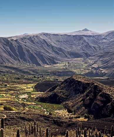
COLCA AND COTAHUASI (Arequipa)
Canoing, rafting, kayaking, horseback riding, and zip lining
3000 - 5000 meters
PARACAS (Ica and the coast)
Diving, sport fishing, kayaking, paragliding, cycling, windsurfing and sandboarding
Trekking in the Andes. Bird and 12 - 786 meters

3104 meters
Elevation
HUAYHUASH (Áncash, Huánuco, Lima)
Mountaineering, trekking, and bird and nature watching
The country’s second highest peak Yerupajá is situated in the Huayhuash range
3300 - 6634 meters
Peru’s eight altitude zones can help understand its eight different ecosystems: from the 3000 kilometers of coastline along the shores of the Pacific Ocean, to Huascarán, at 6769 meters, the highest snow-capped mountain in the Andes. Towards the country’s eastern flank, the highland and lowland jungles spread lushly out.
Surf Trekking Kayaking
Canoeing Mountaineering
KUÉLAP (Amazonas)
Trekking, horse riding, and flora and fauna watching
2300 - 3000 meters
AMAZONAS RIVER (Loreto) and Manu (Madre de Dios)
Hiking, kayaking, piranha fishing, paddling and zip lining, bird watching, flora and fauna
70 - 220 meters
5
index
© Marcela Delgado, Julio Angulo, Gihan Tubbeh, Alex Bryce / PROMPERÚ and Juan Puelles
AN ANCIENT STONE CONSTRUCTION ON A MOUNTAIN TOP, AN IMPOSING WATERFALL, AND A LAGOON THAT SEEMS LIKE A MIRROR MADE OF WATER.
Medium-low
December
Luya and
provinces in the department of Amazonas Elevation: Between 1800 and 3050 meters Temperature: 15 °C (min.) to 25 °C (max.) KUÉLAP Amazonas Lima
Degree of difficulty:
Rainy season:
to April Location:
Bongará
Destination Amazonas
An adventure near the clouds 6
7 Destination Amazonas
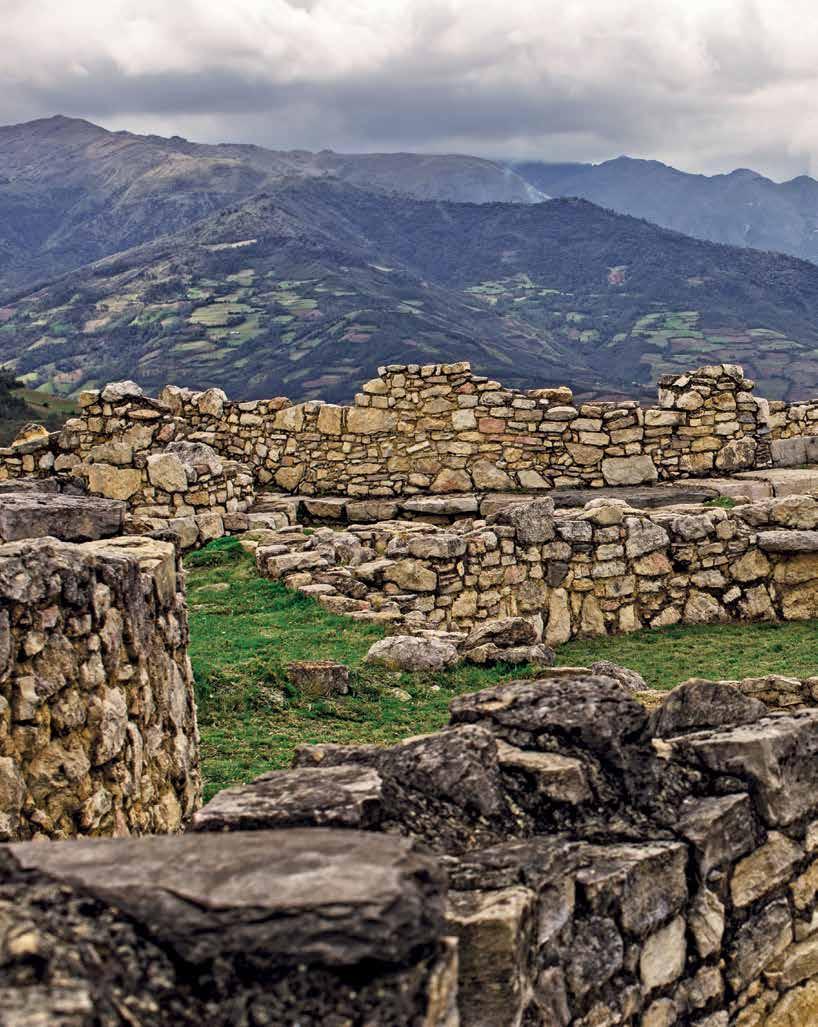
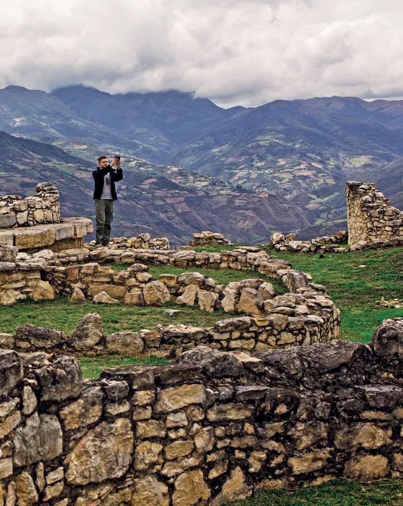
Kuélap © Daniel Silva / PROMPERÚ
Destination Amazonas
KUÉLAP AND GOCTA
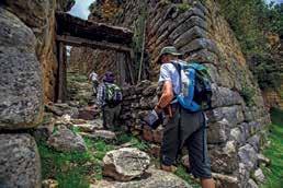
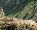
Towering stone walls that reach 20 meters in height are hidden amongst verdant mountains, as if they have been the city’s guardians since time immemorial. Built at over 3000 meters, Kuélap —the most important urban center of the Chachapoyas culture (500 – 1450 AD)— is located on top of a plateau and covers a total area of six hectares. Up to 420 circular stone houses can be distinguished in the interior with friezes in the form of zigzags and diamonds. Its construction is thought to have begun around the eleventh century. For its people, the fortified city was an administrative, religious, ceremonial, and residential center. Today it forms one of the most important archeological sites of the pre-Inca period. It is said that its name may derive from a word meaning “forest in the clouds”. There is mist and moss. There are also bromeliads, orchids, lichens, as well as constructions of limestone and clay.
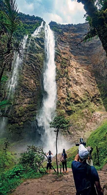
Reaching Kuélap from Nuevo Tingo—one hour from Chachapoyas, the capital city of Amazonas—until recently took an hour and a half. Now it can be traveled in just twenty minutes thanks to a modern cable car that passes over gorges and mountains. Following a 2006 upgrading of the highway that links Chachapoyas with the towns of San Martin that form part of the northern Amazon circuit, Cocachimba appeared on the map with almost the same spontaneity as the region’s Andean cock of the rock, its hummingbirds, and its wild orchids. It is here that circuits (hiking or on horseback) to view Gocta up close begin. This immense fall of water— known locally as La Chorrera—equivalent to double the height of the Empire State Building in New York. It actually drops a total of 771 meters over two falls: 231 meters and 540 meters respectively. A spectacle at altitude that rewards the five kilometers journey from Cocachimba, it was discovered during explorations for sarcophagi in 2002.
The reward for walking five kilometers from Cocachimba is reaching Gocta, one of the world’s highest waterfalls.
8
Gocta Waterfall © Jaime Chávez / PROMPERÚ
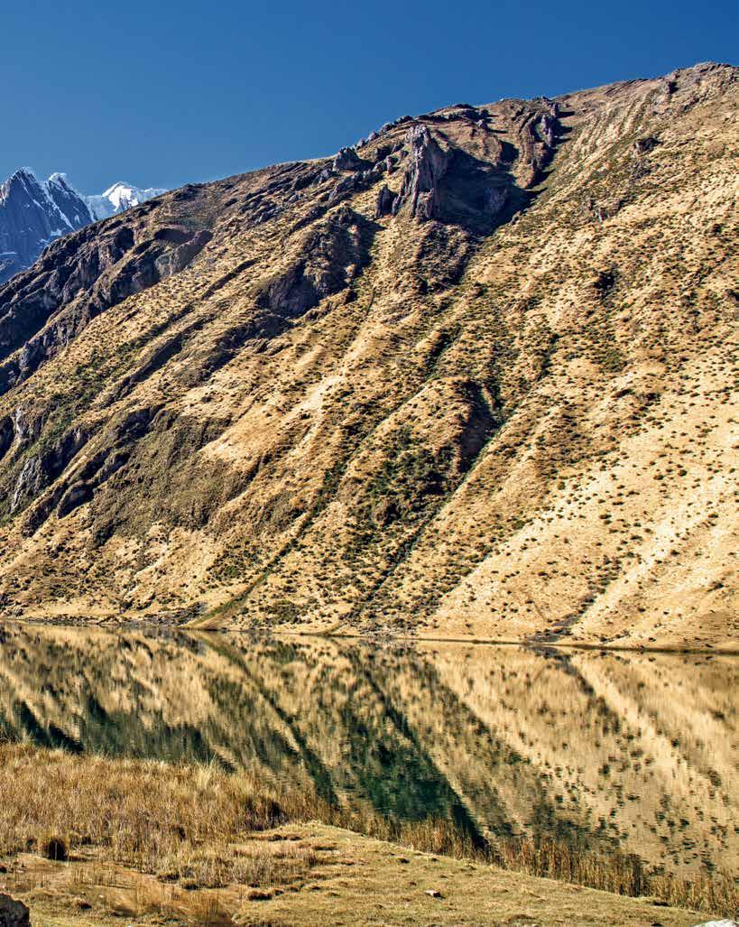
LAGOON OF THE CONDORS
Although there are no condors, people who lived here decades ago assure us that these majestic birds once circled above. It is also known as the Lagoon of the Mummies because close to its banks, on an elevated escarpment, parts of an ancient Chachapoya and Inca mausoleum were discovered: 200 mummies sheltered in six chullpas (tombs), quipus (a Pre-Hispanic counting system), and samples of rock art on the walls. These vestiges are currently exhibited in the Leymebamba Museum.
Trekking begins here and crosses marshes and steep mountains until reaching a lagoon with green and dark reflections. An almost cinematic landscape greets the visitor: a mirror of water flanked by vegetated slopes and enveloped by a curtain of mist that passes over a surface four kilometers long and two kilometers wide. It presents a real challenge to trekking lovers.
Destination Amazonas
Do not leave the region without sighting a marvelous spatuletail hummingbird and colorful butterflies over the cloud forest. Visit twometer high tombs nestled in a precipice in Karajía, an hour and a half from Chachapoyas.
Marvel at nature and reach different waterfalls, such as Chinata or Yumbilla.
Location: Chachapoyas province in the department of Amazonas
Elevation: 2600 meters
Temperature: 15 °C (on average)
Degree of difficulty: Medium
9
Lagoon of the Condors © Arturo Bullard
10 Destination Cusco
Stunning hikes
THE ANCIENT IMPERIAL CITY IS ALSO A LAND OF TRAILS. THIS IS A BRIEF GUIDE TO THE REGION’S TREKKING ALTERNATIVES.
CHOQUEQUIRAO
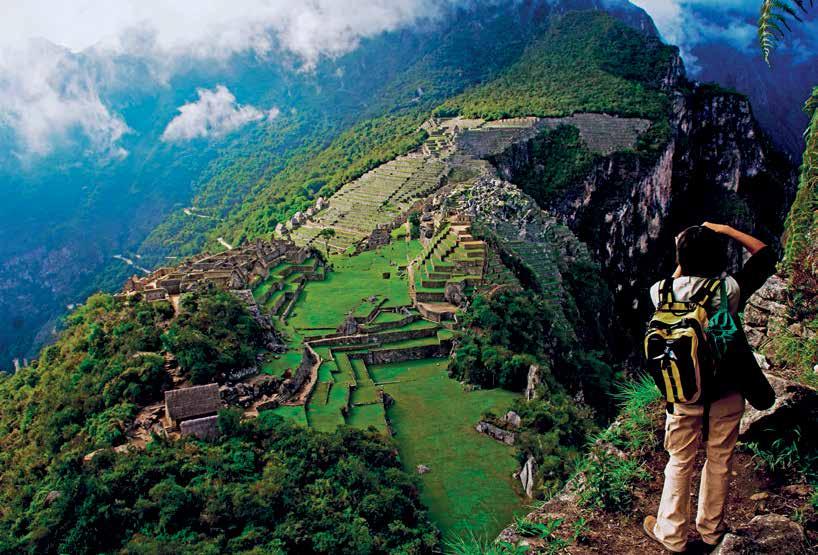
By now it is a maxim of contemporary tourism: walking to the historic sanctuary of Machupicchu is something every traveler should experience at least once. These trekking trails enclose a cultural and natural adventure. Yet the charms of the region are not restricted to its most famous Inca city.
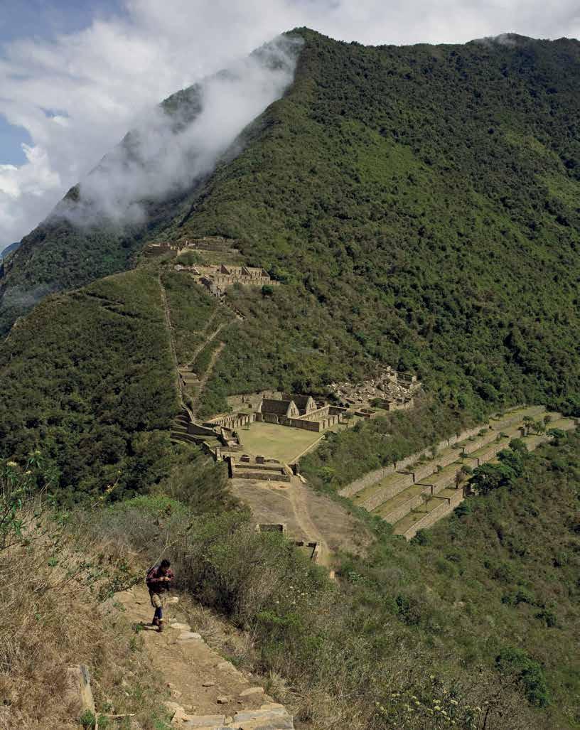
Nearby, in a hidden corner of the Vilcabamba Range, is Choquequirao. This archeological complex has begun to come to the notice of researchers and tourists because of its similarity to Machupicchu— and some have even dared to call it “her sacred sister”, although it is by no means a replica.
According to archeologists, it is the most authentic symbol of Inca resistance: the citadel where they took refuge in 1572 from the advancing Conquistadors. As if it were a paradox, its history began at the end of age of the Tahuantinsuyo—as the territory dominated by the Incas was known. It was conceived as a system of Andean settlements and cities, coordinated by a network of roads. There are competing theories about its purpose—ranging from use as a cultural and religious center, to serving a strategic transit point connecting the jungle with other centers in the empire.
Today a tour of this archeological center is organized around nine architectonic groups. A system of terraces and irrigation,
dormitories and temples, all similar to those of Machupicchu, as well as a series of stone walls with rare camelid iconography all stand out.
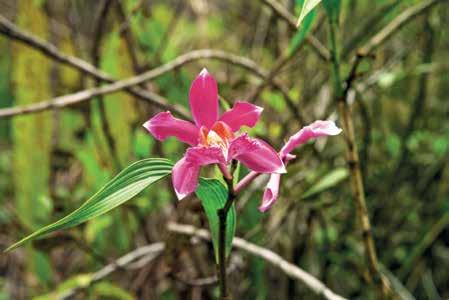
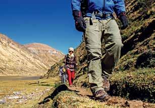
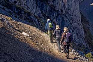
However, the experience begins well before the traveler steps out along its terraces: the trekking—of four or five days, depending on one’s physical state—normally begins at the town of San Pedro de Cachora (Apurímac department). It is here that a walk of 30 kilometers begins, crossing the Apurímac River and continuing upwards, passing through the villages of Santa Rosa and Marampata, until reaching Choquequirao. The scenery is powerful. There is also access from Mollepata, Santa Teresa and Huancacallo of varying duration. From InterAndean valleys, canyons plunging to depths of 800 meters and rural settlements, to the vitality of the jungle eyebrow and subtropical Andean vegetation. Unlike other more crowded trails, it is also possible to observe native animals, such as deers, spectacled bears, condors and medicinal plants, ferns, orchids and bromeliads.
The effort is rewarded with a journey that blends Cusco’s natural diversity with the mysteries and complexity of an ancient culture.
Choquequirao came first place winner in the Regions′ category of the Best in Travel 2017 awards from the guidebook Lonely Planet.
An orchid along the path
© Gihan Tubbeh / PROMPERÚ
Cusco Lima
Medium-high
April to August Location: District of Santa Teresa, Province of La Convención, Department of Cusco. Temperature: annual average is 16 °C. 11 Destination Cusco Choquequirao Archelogical Park © Gihan Tubbeh / PROMPERÚ
Difficulty:
Season:
 Lares
Referencial sketch map
Cusco
Ausangate
Salkantay
12 Destination Cusco
Trekking to Salkantay Snowy Peak © Iñigo Maneiro
Lares
Referencial sketch map
Cusco
Ausangate
Salkantay
12 Destination Cusco
Trekking to Salkantay Snowy Peak © Iñigo Maneiro
Alternative routes
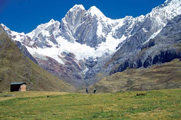
THE AUSANGATE TREK
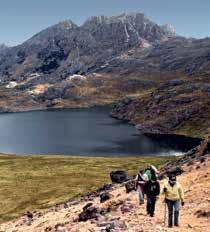
This demanding hike around the perpetual Ausangate snowy peak can take several days. The route stands out for the unique charm of its landscapes, amid lagoons, canyons, hot spring pools, snow-capped mountains, and valleys of pasture where llamas and wild vicuñas graze.
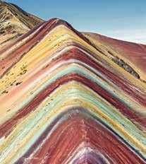
Ausangate is a sacred mountain, regarded as the source of water. Its inhabitants offer ritual ceremonies as tribute to the land. Depending on access, it is possible to also visit the mountain of “seven colors”, “rainbow mountain” or Vinicunca in the Vilcanota range. Its strange pigmentation is related to the presence of minerals and sedimentary rocks.
LARES
This is one of the lesser-known treks. It nevertheless delivers an unforgettable experience. The route—known also as the Weavers Way—begins in the district of Lares, to the north of the city of Cusco.
There is also access from the Sacred Valley of Urubamba. From the start of the hike, the Andean scenery of the Verónica, Sahuasiray, Pitusiray and Chicón peaks alternate with archeological remains and Quechua speaking villages. The route also brings visitors into contact with traditional customs, such as llama and alpaca grazing, tuber cultivation and, of course, textile production.
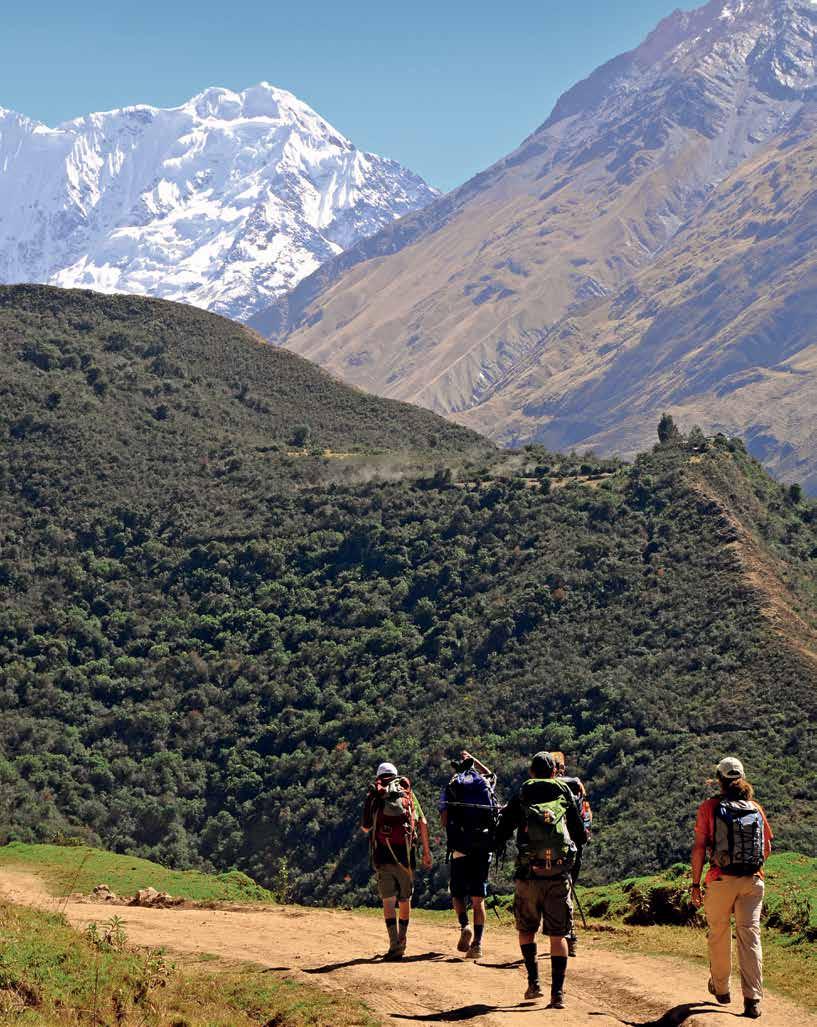
Its name means “savage mountain” in Quechua. The slopes of this snowcapped mountain are known for their technical difficulty and each year attract mountaineers from all over the world. However, a network of trekking paths can also be found nearby.
The best-known hike takes four days and can start in Limatambo, Mollepata or Soraypampa. Two imposing peaks dominate the landscape—Humantay and Salkantay. This destination also offers the possibility of discovering native wildlife, from vizcachas and alpacas, to condors. It is an alternative route for reaching the Machupicchu Historic Sanctuary, following the Inca trail.
Location: Districts of Ocongate and Pitumarca in the provinces of Canchis and Quispicanchis Season: April to October Temperature: -5 °C (min) / 22 °C (max) Location: Lares district, in the department of Calca Season: April to October Temperature: 5 °C (min) / 21 °C (max) Location: The districts of Santa Teresa and Limatambo in the provinces of La Convención y Anta. Season: June to September Temperature: -5 °C (min) / 27 °C (max) Elevation: Up to 6372 meters Elevation: Up to 4550 meters Elevation: Up to 6271 meters Difficulty: High Difficulty: Medium Difficulty: High
© Arturo Bullard
© Víctor Manuel Chávez
Destination Cusco
© Miguel Mejía / PROMPERÚ
13
Ancient Expeditions
QHAPAQ ÑAN
The Inca Trail that connects South America
This amazing network of roads connected the territory of the Inca Empire. The Incas developed a communication system that enabled them to dominate new lands, absorb cultures, and administer the resources of different ecosystems.
What was the purpose of the Inca Trail?
To transmit information. In Cusco the Inca was able to receive information coming from Quito, Ecuador, in twelve days.
To mobilize armies. The Inca expansion required deployment of large numbers of people.
To transport goods and food. People in Cusco could access fresh marine products.
To transport labor. This was necessary for the construction of the road itself and its services
Quito
Huaca Cabeza de Vaca
Tumbes
Pasto
ECUADOR
Ingapirca
Cuenca
Aypate
Cajamarca
Piura Moyobamba
Túcume
Chiclayo
Trujillo
Baños del Inca
Cochabamba
Chan Chan Marcahuamachuco
Huaraz
Pacific Ocean
Huaycán de Cieneguilla
Pachacamac
Lima
Inkawasi de Lunahuaná
Tambo Colorado
Huaytará
Vilcashuamán
Huánuco
Iquitos
COLOMBIA
How was Qhapaq Ñan built?
Many of its routes had already been built by other civilizations from 3500 years B.C. but it was only the Incas who turned them into a strategic road network defying daunting geographic conditions. The roads were needed for commercial, cultural and political expansion.
BRASIL
Pucallpa
Huanucopampa
Pumpu
Huancayo
Hatun Xauxa
Huancavelica
It joins six South American countries, with Peru hosting more than 37% of the total length declared World Heritage by UNESCO.

Machupicchu
Cusco
Abancay


Ayacucho Puerto Maldonado

Cultural exchangel Trade Conquest


BOLIVIA
Sillustani
Quebrada de la Vaca
Arequipa
Moquegua
Puno Tacna
Hatun Colla
Chucuito
La Paz
Paria
CHILE
Catarpo
The regions of the Tahuantinsuyo (the Empire of the Four Regions or “suyos”) were the Chinchaysuyo Antisuyo
Kontisuyo
Collasuyo
Tilcará
La Paya
ARGENTINA
Pucará de Andagala
Chilecito
Santiago Ranchillos
14
The Andean road network Longitudinal road Transversal axes Archeological sites Department capital City Scale: 1 : 12 500 000 Graphic scale: 0 50 150 Km Map: Redrafted by Mar Pärssinen (1992) with new data from the Qhapaq Ñan –National HQ
The trail to Machupicchu
The network’s most popular trail begins 82 kilometers along the Sacred Valley highway and ends at the entrance to Machupicchu (Inti Punku, or the Sun Gate). The journey lasts between two and four days. It climbs through several climates and formations, from exotic jungle eyebrow at 2800 meters above sea level, to fissures above 4500 meters among Pre-Hispanic structures.
Warmihuañusca 4200
Llulluchapampa 3750
Yunca Chimpa
Qoriwayrachina 2522
Chilca
Piscacucho 2750 (km 82)
Km. 0 - Inicio
Cusco
Llactapata 2740
Huayllabamba 2868
Ruinas
Runkuraqay
Runkuraqay 3800
Sayacmarca 3580
Phuyupatamarca 3640
Pacaymayo 3600
Campamento 1 Campamento 2
Llactapata
It is worth the effort to explore the Llactapata observatory temple, which was discovered by Hiram Bingham.

Travel these outstanding sections during your visit to the Inca capital.
1. TAMBOMACHAY - HUCHUYQOSQO
District-Province: Lamay-Calca
Machupicchu
Road type-use: stony, grassy and paved - tourism
Attractions: Piuray and Qoricocha lagoons, the village of Pucamarca
Journey: 15 km - 6 hours
Difficulty: medium
2. RAQCHI - SAN PEDRO
District-Province: San Pedro - Canchis
Road type-use: volcanic - agriculture and tourism
Attractions: Raqchi shrine, Kinsachata volcano, eucalyptus and capuli forests, the Church of San Pedro
Journey: 4.8 km - 2 hours and 45 minutes
Difficulty: high
3. YANAOCA - Q’ESWACHAKA
District-Province: Quehue - Canas
Road type - use: scrubland and stony - agriculture and local movement
Attractions: archeological site and Karañahui caves, Percarotambo, Apurímac River lookout, Q’eswachaka bridge
Journey: 6 km in 3 hours
Difficulty: medium
Source:
Design of maps and infographics: Km0
Warmihuañusca
Experience an ascent of over 4200 meters towards the highest peak on the trail in only four hours.
Piscacuchu
Ollantaytambo
Urubamba
Pucamarca
Laguna Piuray
Anta
Intipata 2800
Wiñay Wayna 2650
Intipunku 2720
Machupicchu 2400 (km 43)
Campamento 3 Aguas Calientes
Cusco Calca
Huchuyqosqo
Lamay
Paucartambo
Laguna Qoricocha
Tambomachay
Huaro
Urcos
Pacaymayo
Enjoy the spectacular view at 3600 meters from the second camp along the trail.
Cusipata
Acomayo
Combapata
San Pedro Raqchi
Pampamarca
Yanaoca
Q'eswachaka Quehue
15
2 3
Ancient Expeditions APURÍMAC CUSCO 1
4500 4000 3500 3000 2500 2000
(Metres Above Sea
Level)
© Iñigo Maneiro
© Iñigo Maneiro
© Heinz Plenge Pardo
Adventure Association
THE PERUVIAN ASSOCIATION OF ADVENTURE TOURISM AND SPECIALIZED ECOTOURISM (APTAE), DISSEMINATES, ENCOURAGES, AND PROMOTES SUSTAINABLE TOURISM IN THE COUNTRY.
The path towards consolidation as a new destination is the sum of a set of long term variables: infrastructure, investment, promotion and reliability. Along the way, the Aptae’ s mission is to position a new destination while ensuring it does not become saturated. “We don’ t just focus on the demand. We are concerned about the supply”, says Alfredo Ferreyros, President of the association. To deliver this, Aptae has a code of ethics that its members must follow and which reflects criteria of the World Tourism Organization (UNWTO) and the Global Sustainable Tourism Council (GSTC)
Sustainability is based on three pillars: environmental, sociocultural and socioeconomic. Aptae influences the country´s tourism companies so that these criteria are disseminated. The goal that Aptae members share is to promote the guidelines for the safe and sustainable management of adventure and nature tourism. It also focuses on the training of tourism operators across the country. Last year, for example, it undertook license renewal assessments for canoe leaders and delivered courses in bird watching, first aid and sustainable tourism. Among the strategies for committed tourism, Aptae encourages companies to undertake socially and environmentally responsible projects, fair trade and reforestation projects, promoting a sustainability philosophy: safe, real and quality experiences.
The commitment to sustainability has meant that many Aptae members have achieved international-level certifications, such as Rainforest Alliance Certified, the Travelife system and carbon neutral policies.
+ information in www.aptae.pe
16 Aptae
Rondoy Snowy Peak © Fernando López / PROMPERÚ
For Aptae, every journey and every tourist is a showcase for the country.
17 Aptae
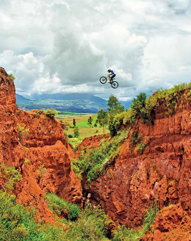
Mountain biking in Maras
© Enrique Nordt
National parks and protected natural areas
MORE THAN 19 MILLION HECTARES PROTECTED BY NATIONAL INITIATIVES FOR CONSERVATION, TOURISM, AND SUSTAINABLE USE OF ECOSYSTEMS.
17.51% of Peru’s territory is conserved through the National System of Natural Areas Protected by the State, which encourages and promotes sustainable tourism and adventure sports.
+ Information in: www.sernanp.gob.pe
Huascarán National Park (Áncash)
18 Dossier
Dossier 19
Huascarán National Park
© Julio Maguiña
20 Dossier
Paracas National Reserve (Ica)
La Catedral © Walter Wust
21 Dossier
Tambopata National Reserve (Madre de Dios)
Sandoval Lake © Inkaterra
22 Dossier
Pacaya Samiria National Reserve (Loreto)
Dusk in the jungle © Jungle Experiences
23 Dossier
Machupicchu Historic Sanctuary (Cusco)
View from Huchuy Picchu mountain © Walter Wust
Committed to conservation
MORE THAN 357 THOUSAND HECTARES OF LAND ARE PROTECTED BY THE INITIATIVES OF FAMILIES, COMMUNITIES AND DIFFERENT ORGANIZATIONS.
+ information in: www.conservamos.org
24 Dossier
Misty Route (Amazonas)
Pomacochas Lake © Walter Wust
Conservamos por Naturaleza initiative (We Conserve for Nature) is an initiative of the Peruvian Environmental Rights Society that supports and disseminates the efforts of people who are dedicated to voluntary conservation. La Ruta Natural (The Natural Way), a guide published in 2016 provides proposed itineraries, which can also be found on its website.
+ information in: www.conservamos.org
25 Dossier
Huayhuash Route (Lima, Áncash and Huánuco)
© Juan Puelles
26 Dossier
Chaparri Ecological Reserve (Lambayeque)
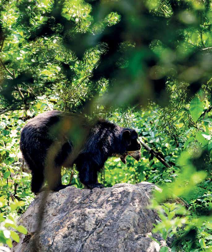
Spectacled Bear © Christopher Plunkett / PROMPERÚ
27 Dossier
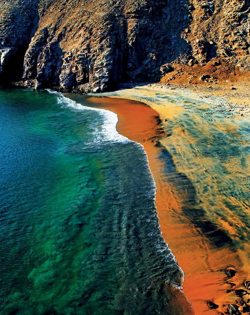
Desert Route (Ica and Arequipa)
Puyenca Beach © Walter Wust
28 Amazon expeditions
A jungle explorer
EXPEDITIONS IN SEARCH OF EXOTIC ANIMALS, NOCTURNAL JUNGLE HIKES,
AND SWIMMING WITH PINK RIVER DOLPHINS ARE EXPERIENCES OUT OF THE ORDINARY. IN THE PERUVIAN AMAZON, THIS ADVENTURE IS NO DREAM.
LORETO
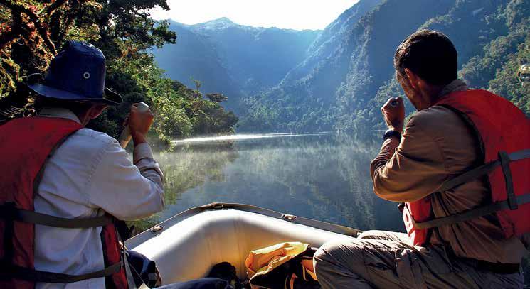
A green cloak crossed by rivers that look like snakes. The image is powerful if we see it from Google Earth. This part of the Amazon, in Loreto, combines biodiversity with the charisma of the Peruvian jungle, beyond anything a cinematographer could create. And it is still barely explored.
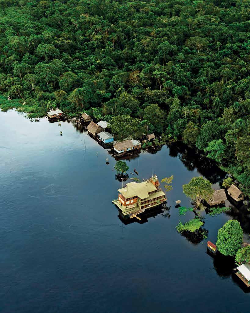
To discover the heart of the jungle, in addition to the aweinspiring sustainable lodges, there are navigation options organized by cruise companies, with nature guides and boats for navigating wide rivers. Imagine waking up to a chorus of birds in the Pacaya Samiria National Reserve and seeing how the day is already painted in fancy colors through one of the widescreen windows of your room. And if you decide to take one of the cruises that depart from the port of Nauta, in Iquitos, you can experience other natural displays like that one, as well as others the passage offers: advancing majestically over the rivers of Loreto, or the chance to enter the jungle and become thoroughly wet from the rain while you contemplate nature. The offer is varied, but it is advisable to reserve a tour several months in advance.
The journey, in this case, includes observation of native fauna such as grey and pink river dolphins—the most emblematic of the Amazon’ s mammals—caimans, sloths, birds, squirrels, monkeys, a variety of toads and bats, among a hundred other exotic species. The company also offers softer adventure activities such as jungle walks, kayaking, piranha fishing, and night expeditions accompanied by specialist guides.
MADRE DE DIOS
The Peruvian Amazon is home to approximately 20 thousand species of plants.
Declared the biodiversity capital of Peru, Madre de Dios has abundant wealth, life, and beauty wherever the human gaze points.
Within its territory are some of the country’s principal natural protected areas, including, Manu National Park and the Tambopata Natural Reserve. The basin of the Tambopata River offers one of the world’s highest biological diversity rates. Due to this great biodiversity, Madre de Dios is a privileged place for contact with nature, both flora and fauna, as well as imposing landscapes.
The Manu National Park
The park is one of the most biodiverse reserves on the planet. It is a paradise for birdwatchers who love walks and river journeys and who marvel when a feathered creature comes into view, when they distinguish the song of a hummingbird, or discover an exuberant orchid. Considered a Natural World Heritage Site by UNESCO since 1987, the park extends across almost two million hectares in the departments of Cusco and Madre de Dios. It is a unique landscape that comprises punas, woods, gorges, valleys, and cloud forests—all characteristic of the high jungle. It is an encounter with nature’s most pristine side.
Jungle lovers all share the same philosophy: real luxury is being in direct contact with nature.
Location: Northeastern Amazon jungle of Peru Elevation: 70 and 220 meters above sea level Temperature: 21 °C (min) at 38 °C (max) Season: Flooded season: November - June Dry season: July - October LORETO: MADRE DE DIOS: Location: Southeastern Amazon jungles of Peru Elevation: 183 and 500 meters above sea level Temperature: 17 °C (min) at 39 °C (max) Season: March - June
Loreto
29 Amazon expeditions
Madre de Dios Lima
Pacaya Samiria Reserve
© Delfín Amazon Cruises
30 Destination Áncash
Huallanca Polpa Pallca Matacancha
Catac
Huaraz Recuay
Chavín
Cajatambo
Pativilca Lima
Huánuco ACP Jirishanca ACP Huayllapa ACP Pacllón
Chiquián 3400 ACP Llamac Huasta 3380
sketch map
Churín Lima
Referencial
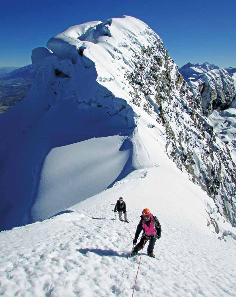
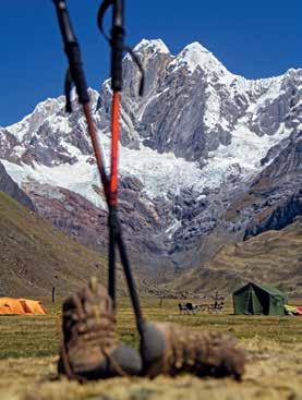
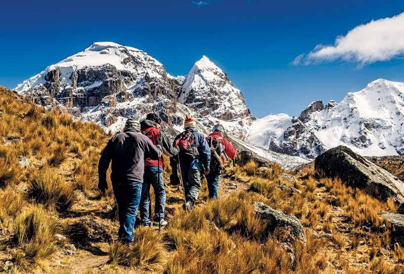
Between the snow and the stars
THE HUAYHUASH CORDILLERA IS THE SECOND HIGHEST TROPICAL MOUNTAIN RANGE ON THE PLANET. SIX OF ITS PEAKS EXCEED 6000 METERS. YERUPAJÁ (6634), PERU’S SECOND HIGHEST MOUNTAIN, AND SIULÁ GRANDE (6336) ARE THE MOST FAMOUS. IN THIS ACCOUNT, YOU WILL DISCOVER WHY THE HUAYHUASH TREKKING ROUTE IS CONSIDERED ONE OF THE BEST IN THE WORLD.
HUAYHUASH
31 Destination Áncash
A STORY BY FERNANDO LÓPEZ
Jauacocha Lagoon © Fernando López / PROMPERÚ
Destination Áncash
Living and being part of nature comes at a price. It goes beyond the purely sensory. It is something that makes us feel that the physical is transcended. It is definitely not for everyone. The price is paid through the effort we expend, the tiredness we feel, the cold we experience, and the part of ourselves that we leave behind.
These are the commitments that we have to make when we begin our tour of the Huayhuash range. Eager and excited, we leave the town of Chiquián, a few hours from the city of Huaraz. The first day’s hiking is easy, and we see some snow caps in the distance. But when we reach our first campsite, Pampa Llama, the view takes our breath away. In the background the Jirishanca mountain rises majestically and covers the horizon. Exhausted by our first day, we enjoy a meal prepared by Mateo— surely the best chef in the entire Huayhuash mountain range.
melt. The second night we camp in Matacancha. The afternoon paints the Ninashanca and Rondoy peaks in colors and at night the clear sky allows us to appreciate the stars.
By the third day we are accustomed to the routine. We get up and quickly recommence our journey. And as we climb to the Cacananpunta pass we find we are entering Huánuco department and we cross paths with visitors from all over the world.
The dusk is icy, but the sight of the starry night is unique. On the second day, we begin the hike beside the Jahuacocha and Solteracocha lagoons. Along the way our guide Oscar explains to us how he learned the trade from his father, who was a Huayhuash guide when the range first became popular. He describes the many problems that there were in the past, and the difficulties of the 1980s; however, his route has now become a favored destination for adventurers from overseas.
The most difficult section of the hike begins: the ascent from Solteracocha to the Sambunya pass—at 4750 meters. The path is steep, but the effort is worth it. We arrive at the highest point and can appreciate immense snow drifts that form turquoise-colored lagoons as they
We then begin a descent towards the Jancapampa camp. This is a long but relaxing hike in comparison to the previous days. A sign tells us that we are reaching the Mituchoca area. When we round a bend, enormous white giants appear behind the hills that obstruct our view. These are the Jirishanca, Rondoy, and Ninashanca mountains. They seem so close and impressive: it’s as if we’ve seen them before.
As the hike has been shorter this time, we are able to simply lie back on the ground, admire the snowy peaks, and take hundreds of photos. Although the beauty of the scenery makes it difficult to leave this camp, the next day we set out early. It is the fourth day of the hike. At times we listen to the AM radio belonging to Luis, one of our companions, just to be sure that the world we left behind still exists.
As we approach our final destination we again come face to face with Yerupajá in the distance, and below us we see Carhuacocha lagoon. We use the opportunity to take some more photographs, until Óscar tells us it’s time to move on. If the spectacle was impressive from up above, by the time we reach the lagoon it has become indescribable. Our camp is on the banks of Carhuacocha and the backdrop of snowy peaks that reflect in her
32
waters make us feel as if nothing else will ever impress us again. Contemplating such scenery, while lunching on the banks of the lagoon or wetting our feet, makes us feel that we are in paradise. The afternoon continues with a long conversation. And when night falls we take refuge in our tents. But not before first trying an invigorating meal prepared by Mateo.
On the last day I don’t want to miss the opportunity to photograph the dawn. I am up and out of the tent by 5 am, in complete darkness and a cold air that chills to the bone. Although there is no moon, the stars illuminate the sky. It is then that I realize the stars are also shining on Carhuacocha’s surface, as if I were floating in the midst of the cosmos, with stars above and below me. And, for a moment, my spirit is fluttering among the stars.
Soon I am at the upper end of the lagoon with a view to Yerupajá. And that’s when the show begins. The dawn is just as I had imagined... And so much more. As the minutes pass, the sky is painted blue. Slowly the sun’s rays illuminate the mountain, first from the summit covered by eternal snow. And then little by little, the light slides downwards, as if dressing the mountain in a pristine and
dazzling white. It takes many minutes, but each moment has its own charm. Finally, the day proudly discovers the snow capped mountains—masters of the landscape.
This is why we have walked so far. And why we have endured weariness, tiredness, and cold. It is for these moments that are yet eternal. For these imposing landscapes that make us feel tiny. Then we have to pack up the camp. The hike is long but is it is basically downhill. After several days walking it is not a problem. The landscape changes. We see more farms, cultivated fields, and livestock. And finally, we arrive in Queropalca, from where we begin the trip to the city of Huánuco.
We return to the city, to comfortable beds, and a la carte food. It’s all good. But nothing is as it was. More than seeing nature, we have lived her. We were part of her. And these images will stay with us forever. When we go through our photographs and when we talk about the experience with our friends. But it is not just the memories that carry us. It is that part of us that was left behind in Huayhuash, floating with the reflection of the stars above the water of Carhuacocha, with Yerupajá in the background.
33
Destination Áncash
Mount
©
López / PROMPERÚ
Rondoy
Fernando
34 Destino Áncash
95% of the Cordillera Blanca falls inside Huascarán National Park.
Location:
Department of Áncash
Difficulty: For all types of tourists. All routes must be taken with authorized guides
All destinations and circuits on offer are accessible from Huaraz
Route to
Peak © Iñigo Maneiro Áncash Lima
Chopicalque Snowy
Cordillera Blanca Routes
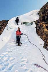
THIS IS HIGHEST TROPICAL MOUNTAIN RANGE ON THE PLANET AND THE EPICENTER OF THE ADVENTURE IN PERU. THE RELATIVE ACCESSABILITY OF ITS GLACIERS LOCATED ABOVE 4700 METERS MAKES IT A COMPELLING DESTINATION.
Along its 180 km length are more than 300 snow peaks of incomparable beauty that rise to more than five thousand meters. Huascarán (6768), Huandoy (6395), and Alpamayo (5947) are outstanding examples. In addition, it holds more than 830 lagoons, the majority of them displaying turquoise waters, such as the fantastic Laguna 69, or Llanganuco.
PERU LLAMA TREK
This trekking circuit recaptures an ancient pilgrimage route to Chavín de Huántar, one of the country’ s most important preHispanic archeological sites. And it also combines adventure with ecotourism and cultural exchange. The three-day tour begins in the town of Olleros. It is guided by community members accompanied by llamas.
35 Destination Áncash
View from Huascarán © Dickens Rondán / PROMPERÚ
Temperature: 10 °C (on average)
Season: varies according to the type of activity. Location: Caylloma, to the far north of Arequipa Elevation: between 3000 and 5000 meters Lima Arequipa 36 Destination Arequipa Colca River, Sibayo district © Julio Angulo / PROMPERÚ
Dizzying heights
VALLEYS OF PRAIRIES AND VOLCANOES, AN IMPOSSIBLE CANYON, AND KAYAK DESCENTS THROUGH RAPIDS.
THE COLCA VALLEY AND CANYON
From a dramatic canyon—its máximum depth is 4160 meters— to mountains, picturesque villages, valleys and archeological remains, and finally to vibrant rivers. But is more than just a lovely landscape. In Colca, natural riches set the stage for the most extreme adventures.
Among its attractions are the Antahuilque and Cruz del Cóndor lookouts—strategic points to observe the flight of the great Andean bird—and Chivay, a colonial town known for its Wititi dancers (the dance has been declared Intangible Cultural Heritage of Humanity), superb church and thermal baths.
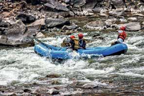
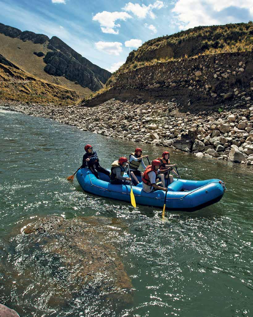
Stealing the limelight, however is the environment. The conditions here are perfect for horseback riding, mountain biking, artisanal fishing, trekking, zip lining and Andean mountaineering. The Colca River is also one of the best places to practice canoing, rafting and kayaking.
It is an experience suitable only for the more intrepid because it includes rapids of difficulty grade + V. The upper and middle sections are only navigable in kayak by experienced enthusiasts.
37 Destination Arequipa
38 Destination Arequipa
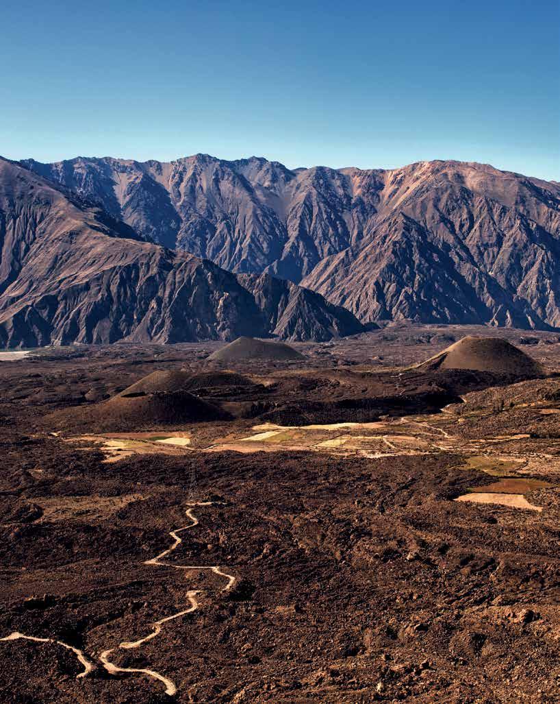
VALLEY OF THE VOLCANOS
Also known as the Andagua valley, which can be accessed via the city of Arequipa, the valley of the volcanoes is located at the foot of Coropuna, the highest volcano in Peru (6425 meters). It consists of 36 particularly beautiful volcanic cones in miniature (inactive) with heights that fluctuate between 10 and 300 meters. It has more than one hundred eruptive foci with enormous lava flows, rivers, and three beautiful lagoons: Pumajallo, Chachas and Mamacocha. In addition to native flora and fauna (115 species of birds and 269 plants), there are archeological remains of pre-Inca cultures, such as the citadel of Antaymarca.
Visit the town of Andagua, in the heart of the valley, and let yourself be amazed by its modern square adorned with cypresses pruned in the whimsical shapes of animals, as well as its baroque mestizo style church. On the outskirts you can see the characteristic Huanacaure twin volcanoes, and within a short distance the deep and narrow Paccareta gap where the river flows to the lagoon and the Pumajallo waterfall.
Three kilometers on from there, after an hour and a half walk, you will arrive at the Shanquillay waterfall. In Soporo, five kilometers away, you can enjoy an incredible landscape, the ideal place to observe the Chachas lagoon, the Chilacayoc and Jechapita volcanoes, the Chila mountain range, and the KallanaMauras volcano.
In the villages of Andagua, Ayo, Chachas, Chilcaymarca and Orcopampa, a Sustainable Tourism Program has been successfully developed over 10 years, which has managed to bring together the inhabitants of these towns with their authorities and various companies, to offer walks, horseback riding, canoeing, sport fishing, mountain climbing, and cycling between lava and small craters up to 300 meters. In addition, along your tour you will be able to discover rituals that have survived the passage of time such as offerings to the apus, tributes to the Pachamama. And you can even observe the barter practices used by local people from the most remote areas that were described by various early chroniclers as a common practice in the Andes.
Route 1:
The journey begins on the Panamericana Sur Highway in a valley 315 km from the city of Arequipa, passing through Majes, Corire and Aplao. From this point a road leads to Tipán and then reaches the town of Viraco, from where you will enjoy an incredible view of the countryside. It is there that the ascent to Andagua begins. Along the route, you can visit historic wine and pisco vineyards. Ongoro, ideal for boating, should not be missed.
Route 2:
387 km from the city of Arequipa, it is reached via Chivay, Sibayo, Caylloma as far as Orcopampa. From this point you can continue the trip to Andagua. Along the way you can stop at the Salinas and Aguada Blanca National Reserve and the Cañahuas and Toccra pampa, which are natural areas of exceptional beauty.
Route 3:
Trekking enthusiasts can access Andagua by ancient pre-Inca paths that go from Cabanaconde—in the Colca valley—to Chachas and Andagua, or from Huambo to Ayo. This journey takes about four days.
+ information in www.vallevolcanesperu.pe
 Valley of the Volcanoes, Andagua district
© Richard Hirano / PROMPERÚ
Valley of the Volcanoes, Andagua district
© Richard Hirano / PROMPERÚ
Location: Castilla Province Elevation: Between 1350 and 4000 meters Temperature: between 2 °C and 15 °C
Ayo
Soporo Chapacoco Orcopampa Andagua Chachas Jallhua
Referencial sketch map
Destination Arequipa Valley of the Volcanoes, Andagua district © Richard Hirano / PROMPERÚ
Viraco Tipán
39
/ PROMPERÚ 40 Surf
Lobitos Beach, Talara
©
Marcela Delgado

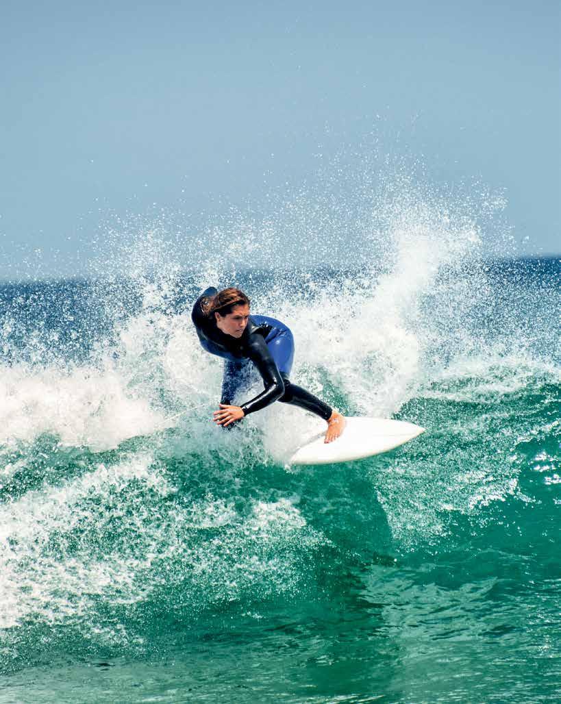
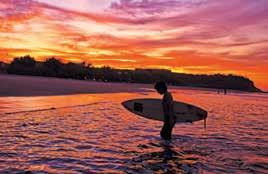
Surf Destination
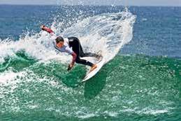
Did you know that in Peru waves were surfed since before the arrival of the Spanish? And that the waves of our country are well known and respected around the world? Peru has ideal beaches to satisfy the most demanding surfers and on the central coast—in the city of Lima itself—the swell is constant. The north of the country is famous for its tides between the months of October and March. Want to learn to surf? There are surfing academies at almost all beaches with waves.
Be one of the 150,000 people who come to surf in Peru; waves that are made for surfing all year round.
In 2014, Conservamos por Naturaleza in an alliance with the National Federation of Surf (FENTA) created DO IT For Your Wave—an initiative to promote the donation of funds and talent for the conservation of waves in Peru.
www.hazlaportuola.pe/en
41 Surf
YEAR-ROUND DESTINATIONS
PERU IS THE HOME OF LONG LEFT HANDERS, FIRST RATE RIGHT HANDERS, WAVES OF DIFFERENT SIZES, AND UNCROWDED BEACHES; A PERFECT PLACE FOR SURFERS FROM ALL OVER THE WORLD. HERE WE PROVIDE A SELECTION OF CONSERVAMOS POR NATURALEZA.
MÁNCORA
1168 km north of Lima
Máncora is ideal for surfers and kitesurfers. Its neat waves are perfect for learners and usually measure between one and one and a half meters.
ÓRGANOS
1154 km north of Lima
Órganos is a cove where you can breathe the tranquility. It has waves for beginners in front of Punta Veleros. La Vuelta is for experts, but it only breaks with northerly swells. And the reef can be quite dangerous.
LOBITOS
1115 km north of Lima
Lobitos has four world-class waves suitable for all tastes. Its strong winds also make it ideal for kitesurfing and windsurfing.
PACASMAYO
681 km north of Lima
Pacasmayo is characterized by long and continuous waves ideal for surfers. When windy, these become among the world’s best for windsurfing and kitesurfing.
PUÉMAPE
656 km north of Lima
Puémape is a beach that draws more waves than Pacasmayo and Chicama: a left-hander with two separate sections, it can exceed 2,5 meters in height.
CHICAMA
614 km north of Lima
At 2.5 kilometers in length, the wave at Chicana is one of the world’s longest left-handers. It is a fine wave, highly prized by surfers from overseas.
HUANCHACO
560 km north of Lima
Huanchaco was the first beach in Latin America and fifth in the world to be recognized as a World Surfing Reserve in 2013 by Save the Waves. It is perfect for longboarding and for learning to surf the waves.
LIBERTAD Pilar
/ PROMPERÚ 42 Surf
PIURA LA
Olivares, Daniel Silva, Carlos Ibarra, Marcela Delgado, José Barragán
PICO ALTO
40 km south of Lima
This is Peru’s best known big wave. It begins to break when it reaches three meters in height and can rise to as much as eight.
LA ISLA
41 km south of Lima
Punta Hermosa’s emblematic wave is a long and strong right hander, with sections for maneuvering.
PUNTA ROCAS
42 km south of Lima
The wave here is one of Peru’s most consistent. It starts to break from half a meter in height and can exceed three meters.
MUELLES DE SAN BARTOLO
51 km south of Lima
San Bartolo has the waves of preference for boys and girls, beginners and longboarders. They do not exceed a meter and a half and offer sections for aerial and radical moves.
PEÑASCAL
51 km south of Lima
A powerful wave that can lead you to the rocks if you are not paying attention. When big, it is ideal for 7-foot boards.
CERRO AZUL
131 km south of Lima
Cerro Azul has a saloon wave, ideal for beginners, boys and girls, long boarders and anyone who wants to enjoy perfect waves in an idyllic landscape.
Useful information
Whilst the predominant swells come from the southwest, between October and March, they also come from the north and unleash several world-class waves on our shores. Neoprene 2/2 suits or short suits are recommended for the summer months, and 3/2 for winter. Some prefer a 4/3 for the colder months and for exploring the waves of the country’s south.
If you come from another country, be respectful of local people and travel in small groups.
EL OLÓN DE ILO
1186 km south of Lima
The wave here begins to break at four meters in height so it is only recommended for big wave experts.
ZÁRATE Y PLAYÓN
Paracas National Reserve
Located inside the Paracas National Reserve, the waves here are ideal for windsurfing and kitesurfing. Playón is for experts, but only with northerly swells.
LIMA ICA


PIEDRAS NEGRAS
1186 km south
of Lima
The left-hand saloon wave here has a tube section and a shallow bottom.
MOQUEGUA
43 Surf
Before travelling
Find out everything you need to know about your destination. This is the moment to get inspired: the time when you really start to travel. Whether visiting websites or talking to other travelers, the important thing is to discover everything you need to know, especially about the weather and the altitude.
Prepare an itinerary and budget.
Remember that the important thing is to enjoy the journey; so plan the trip at your own pace. Also, remember to contact an authorized guide.
Get fit.
Remember that travel is a unique experience that often demands a lot of energy So start preparing yourself in advance
Pack your suitcase
Make a list of everything you will need for your trip taking into consideration the destination and the kind of activity you intend to do. Don’t forget to take all necessary documentation and a waterproof bag.
The Traveler ’s Backpack
Look for a nylon or polyamide backpack: they are lighter, stronger, and waterproof
If it is a day trip, take a backpack of 30 to 40 liters. Remember that what you carry should not weigh more than 25% of your own weight
For a short trip, take a sleeping bag, a blanket, a flashlight, a threeseason tent, and a basic first aid kit. In addition, a map of the area and portable chargers may be useful.
Depending on where you are going, remember to bring a first aid kit with you.
Wear lightweight garments and resistant materials with UV50 protection, moisture extraction and fluid repellency.
Remember that as it becomes colder the higher one reaches, it makes sense to dress in layers. Don’t not forget suitable headgear, gloves, and synthetic stockings.
Make sure your shoes are designed for the activity you are going to do; they must be strong, offer protection, grip, and stability.
Ready? LET’S, TRAVEL!
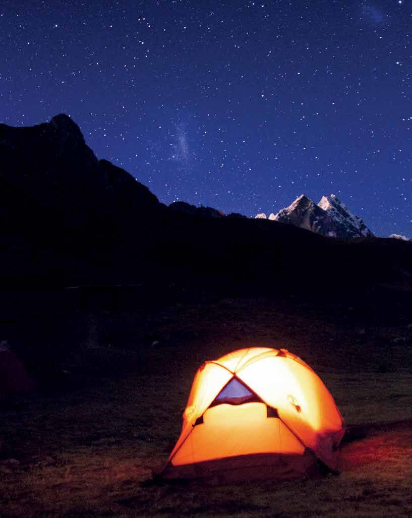
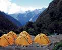
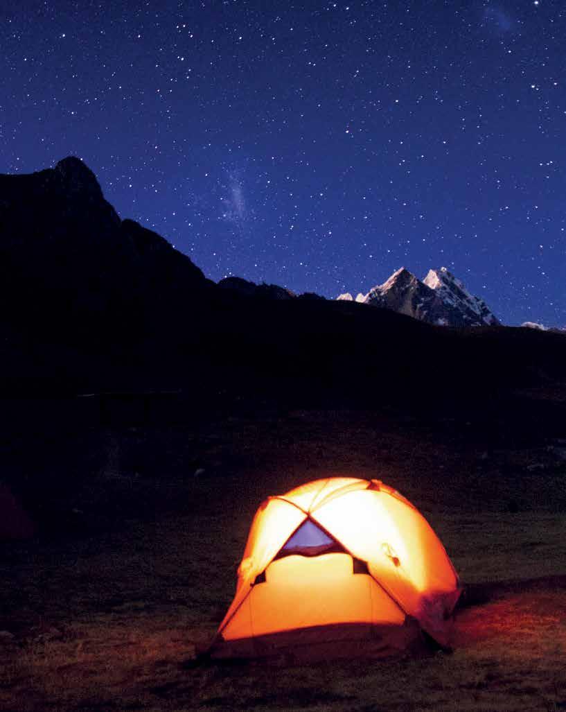 Camping in the Huayhuash Cordillera © Fernando López / PROMPERÚ
PERU - adventure + tourism
A publication by the Peru Export and Tourism Promotion Board - PROMPERU
Calle Uno Oeste N° 50, piso 14, urb. Córpac, San Isidro, Lima - Peru
Telephone: (51-1) 616-7300
www.promperu.gob.pe
© PROMPERU. All rights reserved.
FREE DISTRIBUTION. NOT FOR SALE.
Coordination and general editing: Sub Directorate of Incoming Tourism and the
Department of Graphic and Audio Visual Production - Production Sub Directorate
PROMPERU team: Pilar Rodríguez, Sandra Doig, Gabriela Trujillo, Mirna Ipanaqué, Ysabel Senosaín, Katherine Castañón, Fernando López, Cecilia Soto, Juan Carlos Taboada.
First edition text: Manolo Bonilla, Gloria Ziegler.
Design and layout: La Escuela de Edición de Lima
Translation: Alex Jefremov
Acknowledgments: Aqua Expeditions, Asociación Peruana de Turismo de Aventura y Ecoturismo Especializado (APTAE), Conservamos por Naturaleza, Delfin Amazon Cruises, DMO Valle de los Volcanes, Jungle Experiences, Sociedad Peruana de Derecho Ambiental (SPDA), Servicio Nacional de Áreas Naturales Protegidas por el Estado (SERNANP).
Hecho el Depósito Legal en la Biblioteca Nacional del Perú Nº 2019-18187
Imprenta: Lance Gráfico S.A C. (calle Mama Ocllo 1923, Lince)
Lima, diciembre 2019
Cover photo: Huayhuash Mountain Range © Dickens Rondán / PROMPERÚ
Perú Visitperu Peru Visit Peru VisitPeru @VisitPeru www.peru.travel Follow us on:
