

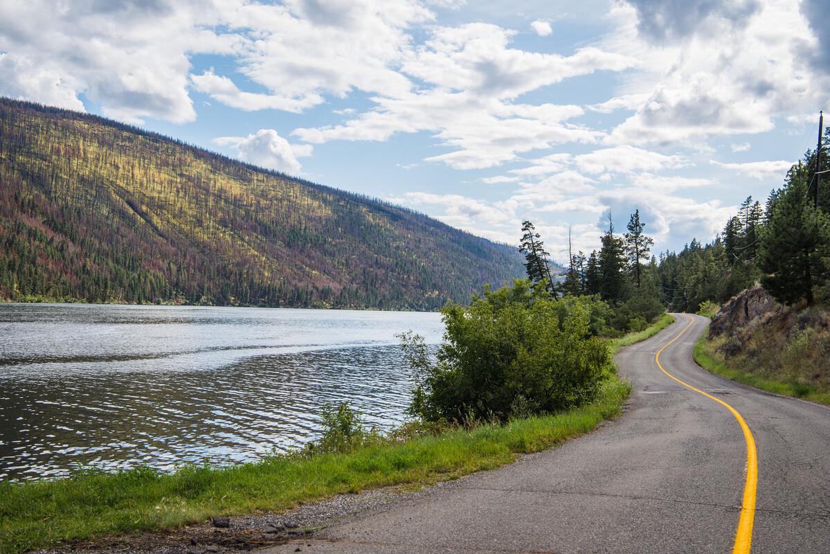
exploregoldcountry.com #exploregoldcountry geocaching.com/play
Those who participate in this program do this at their own risk.
Geocaching, like any sport, contains certain inherent risks While reasonable efforts are made to ensure caches are safely accessible, Gold Country Communities Society assumes no responsibility for any claims arising from the attempts of any individual, or group of individuals in locating any cache listed as a part of our program. This includes, but is not limited to, personal injury, property damage, or other claims of liability.
The nature of adventure travel and the sport of geocaching are such that trails, locations, and cache boxes are often at the mercy of the elements, the public and other participants including animals. All participants must understand that hiking, backpacking and other outdoor activities, as well as geocaching involve risk to both persons and property. There are many variables including, but not limited to, weather, fitness level, terrain features and outdoor experience including encounters with wild animals, that must be considered prior to adventure travel or seeking a cache Be prepared for your journey and be sure to check the current weather and conditions before heading outdoors Always exercise common sense and caution
In no way shall the Gold Country Communities Society nor any agent, officer, employee or volunteer be liable for any direct, indirect, punitive, or consequential damages arising out of, or in any way connected with the information provided for GeoTourism Program.
Information in this guide is accurate to the best of our knowledge at the time of publication Errors and omissions excepted If you have information on one of the sites that you would like to contribute, please contact the office.
Gold Country Communities Society P O Box 933 Cache Creek, B C V0K 1H0
Tel: 1-877-453-9467
Editorial & Design: Cheyenne Wiens & Kat Chatten Gold Country Dogs: Alaula River (Lola) & Josephine (Jojo)
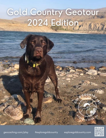
Cover Photo: Nash Wiens
Gold Country GeoTourism Program gratefully acknowledges the financial support of the following:


Uncover Hidden Treasures in Our Communities
Dear Geocaching Enthusiast,
Welcome to the Gold Country Geocache Geo Tour, an exciting adventure that will take you on a journey through our beautiful communities, uncovering hidden treasures and exploring the rich history and natural wonders that make our region special. Geocaching is a thrilling outdoor activity that combines the spirit of treasure hunting with the joy of discovery, and we are delighted to have you join us on this quest.
What is Geocaching?
Geocaching is a modern-day treasure hunt that uses GPS coordinates to guide participants to hidden containers, or "caches," located all around the world. These caches can be found in urban areas, parks, forests, and even remote wilderness locations Each cache holds a logbook for finders to sign and may contain small trinkets for trading.
Your Adventure Awaits
The Gold Country Geocache Geo Tour boasts nearly 200 carefully curated caches, each offering a unique experience and an opportunity to connect with the local culture and environment. As you embark on this journey, you'll traverse scenic landscapes, discover historical landmarks, and perhaps even learn a thing or two about the rich heritage of our communities.
Important Note: Check Geocaching.com Before You Go!
elcome to the Gold Country Geocache Geo Tour
Before setting out on your geocaching adventure, we strongly encourage you to visit Geocaching.com, the official online hub for geocachers worldwide. This website is a valuable resource that provides up-to-date information about the status of each cache, ensuring that you have the latest details on their accessibility. Caches can be disabled or archived for various reasons, such as maintenance issues, changes in land ownership, or environmental concerns. Checking Geocaching.com will help you avoid disappointment and ensure that you have the most current information about the caches on the Gold Country Geocache Geo Tour
Get Ready for an Unforgettable Experience
As you prepare to explore the Gold Country Geocache Geo Tour, remember to bring your sense of adventure, a keen eye for clues, and a spirit of curiosity Whether you're a seasoned geocacher or a first-time explorer, we hope this guidebook enhances your experience and adds an extra layer of excitement to your journey.
Happy caching, and may you uncover treasures beyond your wildest dreams!
Sincerely,
Gold Country Communities Society
to the Gold Country Geocache Geo Tour
Welcome
Type of Cache Cache Name GC # Area Page # The Ashcroft Manor GC1TWW6 Ashcroft 19 Harper’s Grist Mill GC1TWWX Ashcroft 21 Ashcroft Mesa Viewpoint GC1V220 Ashcroft 23 Barnes & Willard Lake Gravesite GC1TQ4J Ashcroft 25 St. Alban’s the Martyr Anglican Church GC1V33F Ashcroft 27 Charles Augustus Semlin GC1TWXG Cache Creek 29 The Scottie Creek Cache GC1TWYC Cache Creek 31 Boston Flats GC1V3XC Cache Creek 33 Transportation Hub GC1V3XM Cache Creek 35 The Cache Creek Mélange GC1TQDF Cache Creek 37 The Kelly Lake Roadhouse GC1XHN2 Clinton 39 The Clinton Museum GC1XHRZ Clinton 41 The Painted Chasm GC1TTW8 Clinton 43 Cache Site Index Phase 1 Settlers & Pioneers Geological & Views Rails & Trails Feature Film Agriculture Views & Vistas Geological Wonders Gravesites & Mystical Places Historic Churches B.C. History Flora & Fauna
Type of Cache Cache Name GC # Area Page # Last Chance Lake Soda Site GC1V3XX Clinton 45 Reg Conn Centennial Park GC1V3ZK Clinton 47 Clinton Pioneer Cemetery GC1VA5K Clinton 49 St Peter the Apostle Roman Catholic Church GC1VA63 Clinton 51 The Fishing Rocks at Xwisten (Bridge River) GC1TQF9 Lillooet 53 The Lower Seton Spawning Channel GC1TTRH Lillooet 55 Red Rock GC1V1V4 Lillooet 57 The Birth of Logan Lake GC1V1WP Logan Lake 59 Logan Lake Pioneers GC1VBWP Logan Lake 61 Transvaal Mine GC1TQFD Logan Lake 63 Highland Valley Copper Mine GC1TXPX Logan Lake 65 Paska Lake GC1VNQ7 Logan Lake 67 Lytton Reaction Ferry GC1TQ34 Lytton 69 Lytton Cemetery GC1TQ25 Lytton 71 Craigmont Mine GC1TQEP Merritt 73 Monck Provincial Park GC1TTW0 Merritt 75 Merritt Viewpoint GC1TTVC Merritt 77 Pineridge Cemetery GC1TTWA Merritt 79 Cache Site Index
Type of Cache Cache Name GC # Area Page # Trinity United Church GC1TTXZ Merritt 81 Jesmond GC1TTQJ 70 Mile House 83 70 Mile Roadhouse GC1TTRQ 70 Mile House 85 Big Bar Lake Guest Ranch GC1TQ4W 70 Mile House 87 Crater Lake GC1TQF0 70 Mile House 89 Big Bar Reaction Ferry GC1TQCK 70 Mile House 91 Morens’ Farm & Family Gravesite GC1VA6F Spences Bridge 93 Marble Canyon GC1TWZ3 Cache Creek 95 Hat Creek Coal GC1TT1K Cache Creek 97 Cornwall Hills Park & Lookout GC1TY1Z Ashcroft 99 Savona’s Ferry GC1TTWW Savona 101 The Hudson Bay Company Brigade Trail GC1TT1W Savona 103 Vidette Lake Gold Mines GC1TTY2 Savona 105 Deadman Valley Hoodoos GC1V315 Savona 107 Lac Le Jeune GC1TTQP Logan Lake 109 Castle Rock Hoodoos GC1TQDY Savona 111 Balancing Rock GC1VCMD Savona 113 Cache Site Index
Type of Cache Cache Name GC # Area Page # The McLean Brothers GC1TWQN Quilchena 115 Mary Lafek, Pioneer GC1TTQX Logan Lake 117 Pennask Lake and Esker GC1VCKZ Merritt 119 Promontory Lookout GC1TTWQ Lower Nicola 121 Clapperton Falls GC1TQE8 Merritt 123 Guichon Lundbom Grasslands GC1V1X7 Merritt 125 Brookmere GC1V1YV Merritt 127 Aspen Grove Mining Characters GC1TKPX Aspen Grove 129 The Smith’s GC1V1ZA Merritt 131 Aspen Grove Mining Camp GC1TQ48 Aspen Grove 133 Cache Site Index
Type of Cache Cache Name GC # Area Page # 3 Mile Lake - Jean Caux GC3P2WA Clinton 135 20 Mile House GC3P36X TNRD E 137 Baillie House GC3P8RM Merritt 139 Baits Motel GC3PD0T Spences Bridge 141 Barnes Lake Trail GC3NYWE Ashcroft 143 Battle Creek Road GC3P2VX Cache Creek 145
Phase 2
Type of Cache Cache Name GC # Area Page # Big Bar Ski Trails GC3PB8J Clinton 147 Black Canyon GC3NK88 Ashcroft 149 Blue Earth Lake GC3P37R Ashcroft 151 Bluebird Trails GC3P8K4 Logan Lake 153 Bonaparte House GC3NXDX Cache Creek 155 Botanie Rock GC3PD93 Lytton 157 Burkholder Lake Trail GC3QN6R Lillooet 159 BX Express GC3NXAJ Ashcroft 161 Cache Creek Cemetery GC3P6N9 Cache Creek 163 Cache Creek Tower Top GC3NZ68 Cache Creek 165 Camelsfoot Peak Trail GC3QN8Q Lillooet 167 Campbell Hill GC3P12N Cache Creek 169 Clemes Hall GC3P9E8 Spences Bridge 171 Clinton Hotel GC3PB80 Clinton 173 Clinton Memorial Hall GC3P0ZY Clinton 175 Cougar Point GC3PB9D TNRD E 177 Earlscourt GC3V58Q Lytton 179 Emerald Bay, Green Lake GC3PBAJ TNRD E 181 Cache Site Index
Type of Cache Cache Name GC # Area Page # Epsom - Last Spike GC3PBCN TNRD I 183 Echo Valley Ranch GC3PBB3 TNRD E 185 Frederick & Dewdrop Trail GC3P9HD Savona 187 George Dawson GC3P8N7 Logan Lake 189 Glossy Mountain GC3PCN8 Logan Lake 191 Haywood Farmer Indian Gardens Ranch GC3P3TH TNRD J 193 Henry Castillou GC3PBEG TNRD N 195 Horseshoe Bend Trail GC3QN7Z Lillooet 197 James Teit GC3PBD4 Merritt 199 Jesus Garcia GC3PBDR Merritt 201 Joseph Burr GC3P97H Logan Lake 203 The Journal and Ashcroft Museum GC3NXC7 Ashcroft 205 Kane Valley Ski Trail GC3PBDY TNRD N 207 Kentucky – Alleyne Provincial Park GC3PBE6 TNRD N 209 Logan Lake Shovel GC3PCKG Logan Lake 211 Loon Lake GC3P958 TNRD E 213 Maiden Creek Ranch GC3P2X1 Clinton 215 Merritt Subdivision GC3PCJ6 TNRD N 217 Cache Site Index
Type of Cache Cache Name GC # Area Page # Mimi Falls GC3Q6XK Logan Lake 219 Mission Ridge Trail GC3QN60 Lillooet 221 Nicola Subdivision GC3PBDF Merritt 223 Old Fire Hall GC3NXD7 Ashcroft 225 The Ovens GC3P2XG Clinton 227 Paradise Lakes GC3PAM3 TNRD M 229 Parke Ranch GC3P6RE Cache Creek 231 Pavilion Lake GC3P2XW Lillooet 233 Porcupine Creek Canyon GC3PBBW TNRD E 235 Quilchena GC3PAMG TNRD M 237 Red Lake GC3P3V8 TNRD J 239 Seton Ridge Trail GC3QN9X Lillooet 241 Stake Lake Trail GC3P9A8 Logan Lake 243 Tranquille Lake GC3P3WW TNRD J 245 Walhachin Museum Soldiers Memorial Hall GC3P38Y TNRD I 247 Watching Creek Gold Claims GC3P3XC TNRD J 249 Widow Smith GC3P39B TNRD I 251 Cache Site Index
Type of Cache Cache Name GC # Area Page # A Nomadic People GC9Z2BG Cache Creek 253 Sharing the Wealth GC9Z1C7 Cache Creek 255 Arrowleaf Balsamroot GC9YBK3 Cache Creek 257 Oh Deer GC9Z91A Cache Creek 259 Yarrow GC9YBVC Cache Creek 261 The Mighty Salmon GC9YX95 Walhachin 263 Osprey Viewing GC9Y97Y Walhachin 265 The Storytellers and Knowledge Keepers GC9YKMT Walhachin 267 Plantain GC9YKN6 Walhachin 269 Big Sagebrush GC9YAKW Skeechestn 271 The History of Logan Lake Grasslands GC9YPJZ Logan Lake 273 Logan Lake’s Wild Horses GC9YNFB Logan Lake 275 Hooshum GC9Z1C4 Logan Lake 277 Prickly Pear Cactus GC9Y99D Ashcroft 279 Bitterroot GC9YKXR Ashcroft 281 Ashcroft Indian Band GC9Z900 Ashcroft 283 Oregon Jack GC9YBNH Ashcroft 285 Those Red Hills GC9YBRE Ashcroft 287 Cache Site Index Prequel
Type of Cache Cache Name GC # Area Page # Percy Minnabarriet, The Spear Fisherman GC9Z92H Spences Bridge 289 Frog Rock GC9Y974 Nicomen 291 Lytton GC9YAGG Lytton 293 Saskatoon Berries GC9YPH0 Lillooet 295 Declaration of the Lillooet Tribe GC9YAMR Lillooet 297 The Mighty Fraser GC9Z93Q Lillooet 299 Labrador Tea GC9Z290 Fountain 301 Canada Mint GC9YPPC Pavilion 303 Historic Hat Creek GC9YAJB Bonaparte 305 The Painted Hills GC9YAB3 Bonaparte 307 Bonaparte River GC9YD4P Loon Lake 309 Loon Lake Lahal GC9Y98M Loon Lake 311 Relocation (Kelly Lake Substation) GC9Z7YF Clinton 313 A Story About the Cottonwood Canoe GC9YR29 Clinton 315 Kostering and Grinder GC9Z7YV Clinton 317 Pear Lake GC9Z7YA Clinton 319 Lake to Lake GC9Z7Y7 Clinton 321 Heartleaf Arnica GC9YXG4 Clinton 323 Cache Site Index

Type of Cache Cache Name GC # Area Page # Pavilion Mountain GC9Y992 Clinton 325 The Douglas Fir Tree GC9Z3GM 70 Mile House 327 Cattails, the Pond Super Plant GC9Z273 70 Mile House 329 Always Shady Tree: The Paper Birch GC9Z6M3 70 Mile House 331 Goldenrod GC9Z25R 70 Mile House 333 Holy Jumping Juniper GC9YPQR 70 Mile House 335 Cache Site Index
Be sure to collect a sticker from each cache box you find and place it on this page to prove your find. If there are no stickers left in the box, write the sticker code from the plastic log book bag in place of the sticker. When you have collected 24, mail this completed page to:
Gold Country Communities Society, Box 933 Cache Creek, BC V0K 1H0

1 Name: Address: City: Postal Code: Prov/State: Country: Tel: Email: GPS 2 3 4 5 6 7 8 9 10
STICKER COLLECTION PAGE Which method did you use to find the sites? Letterbox Clues
11 12 13 14 15 16 17 18 19 20 21 22 23 24 Name:
Terms & Conditions: Each cache site can only be used once per year towards each redemption. Gold Country reserves the right to limit or revoke this offer at anytime. Additional terms and conditions may apply.
The Ashcroft Manor
SITE IDENTIFICATION
Nearest Community: Ashcroft, B C
Geocache Location: N 50°43 118' W 121°19 770'
UTM: East 0617923; North 5619867 10U
Altitude: 499m/1636ft
Date Established: 1862
Ownership: Private Property
Accuracy: 4 meters
Overall Difficulty: 1
Overall Terrain: 1.5
Access Information and Restrictions:
From Ashcroft take Cornwall Rd. 5 km to Hwy #1. Turn south on Hwy #1. Park in the lot on the west side of Hwy #1, across from the Manor. Please refrain from entering the Manor property outside business hours.
For more information or to report a problem with this site please contact:
Gold Country Communities Society P O Box 933 Cache Creek, B C V0K 1H0 Tel: 1-877-453-9467
Email: info@exploregoldcountry com
For more site pages go to: www exploregoldcountry com www geocaching com
APPLY STICKER HERE

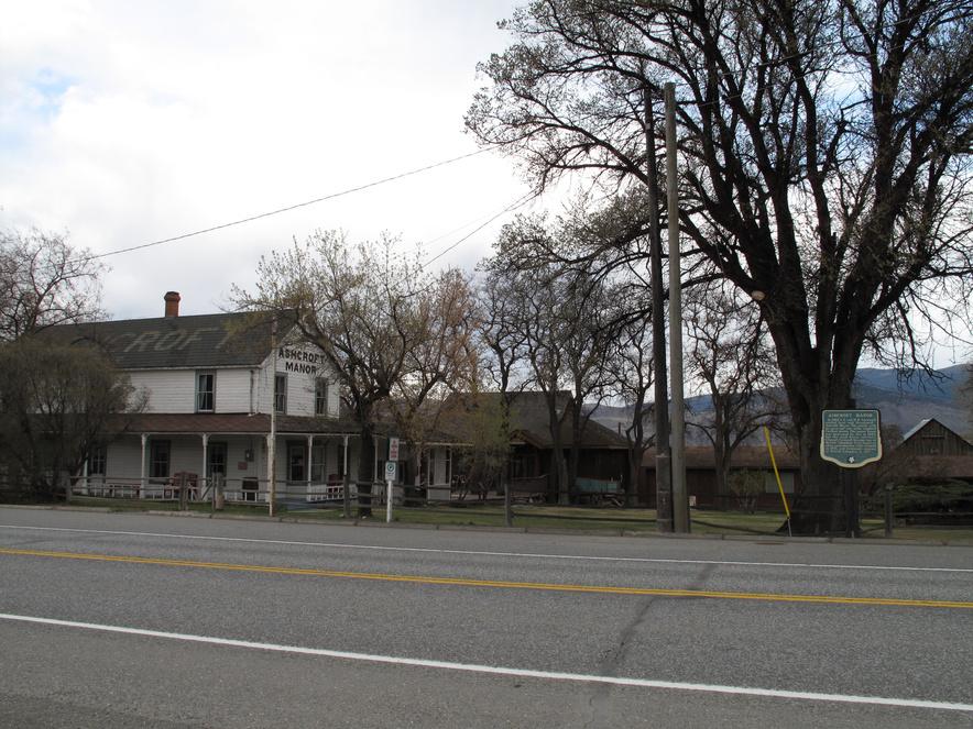
The allure of the Cariboo gold rush proved to be irresistible for two English aristocrat brothers, Clement Francis and Henry Pennant Cornwall. Struck with gold fever, the two brothers arrived in British Columbia in 1859 to pursue their fortunes. But after learning that very few claims were available, they opted to explore the grazing lands of the Thompson River Valley. There they built the Ashcroft Manor in 1862 and developed a 6,452 acre ranch
The Manor was originally named “Ashcroft,” after the family residence in Gloucestershire, England. It was later renamed “Ashcroft Manor,” after the Canadian Pacific Railway named their local railway station “Ashcroft.”
Soon, the Cariboo Road was built, passing through the middle of the ranch, adjacent to the roadhouse The Manor provided many services to the gold miners and freighters of the Cariboo The roadhouse was the district’s first courthouse, where the cellar served as the jail There was also a store and a post office that remained in business until 1972 The Manor’s sawmill provided lumber, and the flour mill, whose millstones are the oldest in British Columbia, supplied flour.
The manor became a roadhouse of excellent repute, offering a comfortable and quiet roadside stop, where fabulous meals and relaxation were available to weary travelers
The original Manor was a 20’ x 40’ single storey, built of logs and whip sawn lumber. A second storey was added in the early 1900s to accommodate Caroline Barclay (Cornwall) and her family. This addition almost doubled the Manor’s capacity.
Rattlesnakes were a common sight at the Manor Ranch hands quickly learned to exercise caution when dealing with
19
Pioneers & Early Settlers
Site # 010102 GC1TWW6
Phase l
hay, for snakes could be found hiding in, under or around the hay bales Caroline Barclay unfortunately died of a rattlesnake bite
In 1865 Cornwall Flats was developed as a horse race track and in 1868 became the site of the Cornwall’s annual “coyote” hunt. It later became the first landing strip in the Interior of B.C.
In the 1940s, Allan Parker (Henry Cornwall’s grandsonin-law) built a gas station topped with a cupola for viewing incoming airplanes His pickup truck was equipped to refuel the planes
During WWII, the Department of Transport built a radio range station with four towers and a control building on top of coyote hill. The main office housed a bomb shelter and was situated near the row of houses that accommodated the station operators and their families. After the war, the radio range station became a weather station and was later sold privately
Vashti and Travis Fisk, with their four children, were the last of the Cornwall family to reside at the Manor. They left in 1981 when the roadhouse was sold to Madeleine and Eric Saunders, who built the teahouse and restored the Manor, operating it as a museum, gift shop and art gallery until the mid 1990s.
The two 100+ year old elm trees in front of the Manor were imported from England as seedlings.
Written
and Researched by Dominique
Robillard
BIBLIOGRAPHY & SOURCES
Belton, B. second edition revised by Helen Forster (2002). Bittersweet Oasis, a History of Ashcroft and District 1988- 2002, Ashcroft, BC: Village of Ashcroft.
Fisk, Vashti (2009). Personal Interview.
Foster, P. (1999). Historic Ashcroft For the Strong Eye Only. Vancouver, BC: Plateau Press. Landels, Margot (2009). Personal Interview.
Neering, R. (1993). Traveller’s Guide to Historic British Columbia. Vancouver, BC: Whitecap Books.
Patenaude, B (1988) Golden Nuggets Heritage Publishing Co
Shewchuk, M (1985) Backroads Explorer Vol 1, Thompson Cariboo BC: Heritage House Publishing Co
Wright, R T (1986) Lower Mainland Backroads Vol 3 BC: Heritage House Publishing Co
From parking area on the west side of the highway, go 40m west along fence line to cache under wood debris.
20
Letterboxing Clues:
Please check geocaching.com before you go!
Pioneers & Early Settlers
Harper’s Grist Mill
SITE IDENTIFICATION
Nearest Community: Ashcroft, B C
Geocache Location: N 50°44 278' W 121°15 617'
UTM: East 0622758; North 5622129 10U
Altitude: 315m/1035ft
Date Established: 1878
Ownership: Private Property
Accuracy: 5 meters
Overall Difficulty: 1 5
Overall Terrain: 2
Access Information and Restrictions: From Ashcroft, follow Elm St east beyond the end of the pavement Park near the fence along the old dirt road to south east and off gravel road Please yield to farm equipment
For more information or to report a problem with this site please contact: Gold Country Communities Society P O Box 933 Cache Creek, B C V0K 1H0 Tel: 1-877-453-9467 Email: info@exploregoldcountry.com
For more site pages go to: www exploregoldcountry com www.geocaching.com
APPLY STICKER HERE
Jerome and Thaddeus, sons of Adam and Margaret Harper of Tucker County, West Virginia, arrived in British Columbia via Santa Clara County, California around 1859. Jerome began in the sawmill business in Yale and Thaddeus had entered an unsuccessful bid for construction on the new Cariboo Road.
Jerome, the elder brother, seemed to be the driving force of the Harper Empire As early as 1862 he had property west of Kamloops known as the “Harper Ranch”, a comparatively small holding It was here that he would winter his cattle drives before the final push to the gold fields.
Land holdings and cattle were instrumental in the brothers’ success and enduring reputation. Involvement in other endeavors, mining, sawmilling and grain milling also contributed, these aspects seldom recognized
Jerome began operating a sawmill at Quesnelle Mouth, which he and partner Wright purchased in 1864, intending to add a flourmill to the operation. The flourmill never materialized and the sawmill steam equipment was sold off. Milling was again in the works for Jerome in 1868, when he entered into a partnership with Jonathon H. Scott, a landowner 4 km north of Clinton. There Jerome built his first gristmill. This was to be home for Jerome until he advertised in December 1871, his intention to retire and sell his gristmill and sawmill holdings
Jerome moved to California before concluding a sale He died there in 1874 and the gristmill and balance of his estate passed to Thaddeus.
Two factors determined Thaddeus’ decision to move the Clinton mill to the mouth of the Bonaparte River in 1878 A tollbooth existed in Clinton and all the grain from the south was subject to toll Harper lobbied, unsuccessfully, to have the tollbooth moved north of his mill Also, there was the promise of the
21
Site # 010103 GC1TWWX
Phase l
Canadian Pacific Railway arrival and anticipation that the route would follow the Thompson River Thaddeus and his partner, Benjamin Van Vaulkenburg, requested and were granted permission from the mortgage holder to move the mill.
With control of Jerome’s estate, Thaddeus now proceeded to acquire the holdings that would in fact be the “Harper Legend,” adding additional land in Kamloops, the Perry Ranch in Cache Creek, the Kelly Lake Ranch in Clinton and the renowned Gang Ranch This acquisition frenzy would eventually be the downfall of Thaddeus Harper had all his credit with one agent who eventually called his notes
The Harper Empire was forced into bankruptcy in 1888 and was taken over by The Western Canadian Ranching Company. Although unwanted, the gristmill was included. Thaddeus had never legally purchased the land at the site of the mill, but had spent $20,000 on the buildings and flumes. After some years of successful operation, the small mill could no longer compete with rail shipments from much larger mills in the east.
Construction of the Canadian National Railway lines obliterated the original grist mill site and changed the landscape of the area However, you may still view the location from across the river on Evans Road or from the cache site above
Written and Researched by Don Logan
BIBLIOGRAPHY & SOURCES
Gallagher, J. Thaddeus Harper. In The Western Canadian Ranching Co. Victoria City Archives. Laing, F W (1942) Some Pioneers of the Cattle Industry B C Historical Quarterly

Letterboxing Clues:
Turn right onto dirt road before the bridge and follow for 160m east to park near the fence Then follow old road southeast up to bench, the point at the end of fence line looks down on the Grist Mill site. Follow the fence south, towards bank to cache in corner under sagebrush.
22
Please check geocaching.com before you go!
Ashcroft Mesa Viewpoint
SITE IDENTIFICATION
Nearest Community: Ashcroft, B C
Geocache Location: N 50°43 099' W 121°15 828'
UTM: East 0622561; North 5619938 10U
Altitude: 527m/1729ft
Date Established: N/A
Ownership:
Leased Crown Land
Accuracy: 4 meters
Overall Difficulty: 1 5
Overall Terrain: 3 5
Access Information and Restrictions:
From Hwy 97C, take Mesa Vista Dr to the parking coordinates Steep trail, wear appropriate footwear for hiking
Be aware of cactus, snakes and fresh cow patties
For more information or to report a problem with this site please contact: Gold Country Communities Society P O Box 933 Cache Creek, B C V0K 1H0 Tel: 1-877-453-9467
Email: info@exploregoldcountry com
For more site pages go to: www exploregoldcountry com www geocaching com
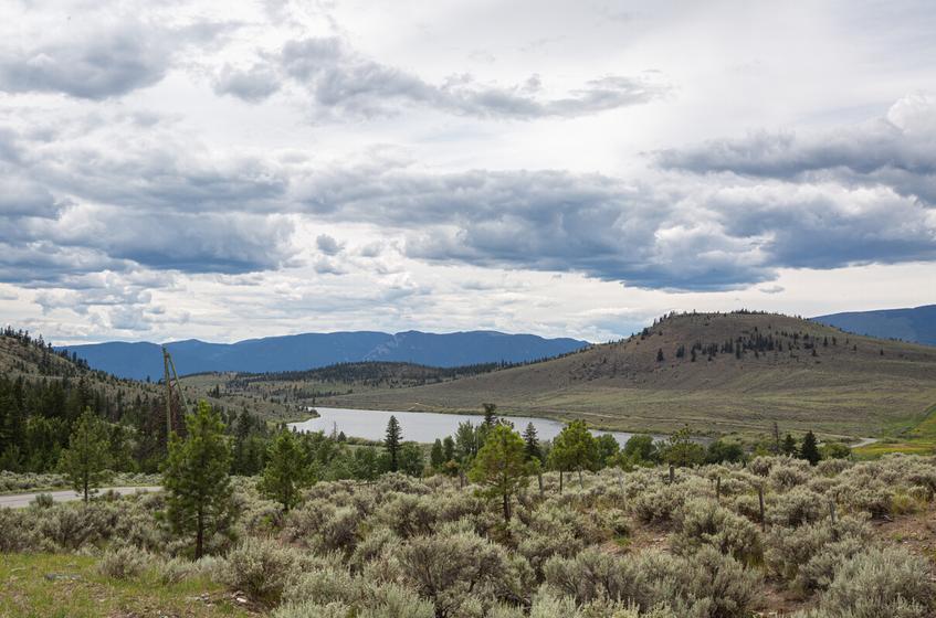
A “mesa” is a flat, elevated area of land, surrounded by cliff-like edges. The gullies that create large splits in the Ashcroft mesa are a result of water erosion over hundreds of thousands of years. Common ground-cover is prickly-pear cactus, large sage and juniper. These hills are home to Western Rattlesnakes, bull snakes, coyote and deer. The chucker, a type of quail, is a common sight in both the gullies and on the flats.
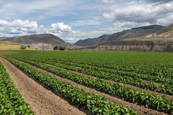
Many of the homes in “the Mesa” neighborhood of Ashcroft were built in the early 1970s, in order to house the workers who arrived in the area to build the new Lornex Mine in nearby Highland Valley. The mine became the largest copper mine in Canada, employing over six hundred men. This led to creation of the instant town of Logan Lake, 58 km from Ashcroft. Now Highland Valley Copper, the mine remains a major employer in both Ashcroft and Logan Lake.
APPLY STICKER HERE
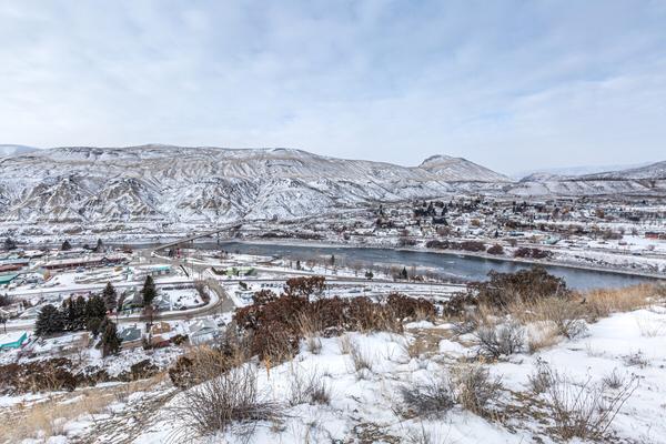
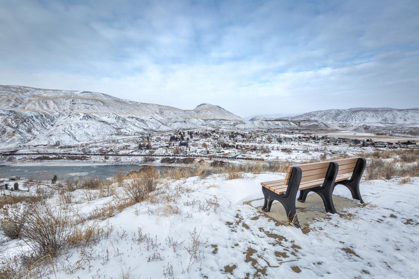
The view below the Mesa neighborhood is often likened to a “model railway town” and features the Thompson River and the Village of Ashcroft From this vantage point, you can see the Canadian Pacific Rail lines on the near side of the river and the Canadian National Rail lines on the far side of the river. Looking to the south you can steal glimpses of black canyon, a sharp bend in the Thompson River that has eroded dark, coal rich cliffs. Enjoy the tranquil view over the ranchlands below and imagine the fields of produce and hay a hundred and fifty years ago. To the north, up river, you can view spectacular sand dunes, hoodoos and the majestic ‘slough.’ A variety of hikes are available in this area, pick up a hiking trails guide or just take a casual stroll to enjoy the views.
23
Views
& Vistas
Site # 010301 GC1V220
Phase l
Once a major transportation hub serving the miners of the Gold Rush, Ashcroft is now a peaceful community of approximately sixteen hundred people With enough amenities to be convenient and a relaxed atmosphere to retain its small town status, this community is a joy to visit. The economy is based on mining, forestry, ranching, transportation and tourism.
Written and Researched by
Christine Whitehead
Please check geocaching.com before you go!
Letterboxing Clues:
Park at green space 150m past cattle guard in wide spot on right. Follow trail up steep hill through fence and across field toward hill, looking for a small path on your right. Follow path south for ~215 paces, turn 90° left and is ~20 paces to sagebrush line then another ~70 paces up the draw to cache under sagebrush covered in rocks
24
Gravesites & Mystical Places
Barnes & Willard Lake Gravesite
SITE IDENTIFICATION
Nearest Community: Ashcroft, B C
Geocache Location: N 50°41 274' W 121°14 954'
UTM: East 0623669; North 5616502 10U
Altitude: 711m/2332ft
Date Established: 1925
Ownership: Private Property
Accuracy: 4 meters
Overall Difficulty: 1
Overall Terrain: 2
Access Information and Restrictions:
From Ashcroft, follow Hwy 97C south to Barnes Lake Rd The gravesite is on private property and public access is not permitted Please respect local land owners’ privacy
For more information or to report a problem with this site please contact: Gold Country Communities Society
P O Box 933 Cache Creek, B C V0K 1H0 Tel: 1-877-453-9467
Email: info@exploregoldcountry com
For more site pages go to: www exploregoldcountry com www geocaching com
The two lakes that appear before you are called Willard and Barnes, named after two early ranching families who settled in the area. These pre-1900 manmade lakes provided local ranchers with much needed irrigation water and, in the winter, ice blocks cut from the lakes filled residents’ ice boxes.
Between the lakes and visible to the eye is a white cross marking the home of a small private, family graveyard Members of the Oppenheim and Bara family have been interred here over the years
A large wooden headstone marks the final resting place of Philip Oppenheim; a rancher who lived at the lake and died in 1925 after a lengthy illness. Born in Yale in the early 1870s, Phil was well known throughout the area since boyhood Two other names are carved along with Phil’s; those of ‘Donald Bara age 4’ and another Bara family member who passed away in 1937 The white cross and graveyard fence have recently been added, along with two additional members of the Oppenheim/Bara families
APPLY STICKER HERE
Augusta Bara, a native of Chile, arrived in British Columbia before the turn of the century and packed freight up to the miners in the gold fields. August, as he was known to the locals, packed for many years and at the end of the freight wagon era took up a homestead in the Highland Valley area. August met his wife Mary, a member of the Stolo First Nation, in Chilliwack, British Columbia and together they raised eleven children When Mary passed away in 1926 August married Philip Oppenheim’s widow, Lucy Mary and August are buried in the Ashcroft Cemetery
Barnes Lake made headlines across the province when, in 1938, it served as Ashcroft’s “winter landing field”. On January 16, 1938, dignitaries, along with 200 citizens of the town, gathered at Barnes Lake to witness the Inauguration of United Air
25
Site # 010401 GC1TQ4J
Phase l
Transport service between Ashcroft and Fort St John The ceremony concluded at 9:30 am and ten minutes later a five passenger Waco cabin plane lifted off the lake with pilots Sheldon Lucke and Ginger Coote at the controls.
The lakes continue to be an integral part of the local communities. Both lakes provide an opportunity for a relaxing day of fishing for annually stocked rainbow trout. Avid fishermen advise that the lakes are best fished in the spring right after the ice comes out; however, you will find casual fishermen enjoying a day in the sun all summer long
A small B.C. Forest Service Campground entices you to enjoy the peace of the outdoors on your next visit. Barnes Lake also hosts an exciting season of ‘Cars on Ice’ racing through the colder winter months. Whether your passion is history, scenery or recreation this site has something to offer!
Written and Researched by Kathy Paulos
Please check geocaching.com before you go!
BIBLIOGRAPHY & SOURCES
Airline Inaugurated from here to the Yukon (1938, January 21) Ashcroft Journal Bara Family History In Ashcroft Museum & Archives Ashcroft, BC
Letterboxing Clues:
Park off the road at pole #30. Follow trail along fence to above lake, turn right (SE) and go to slight draw. Follow draw left, down towards lake beyond pine tree to cache under sagebrush and covered in rocks
26
St. Alban’s the Martyr Anglican Church Historic Churches
SITE IDENTIFICATION
Nearest Community:
Ashcroft, B C
Geocache Location: N 50°43 322' W 121°16 906'
UTM:
East 0621283; North 5620323 10U
Altitude: 309m/1014ft
Date Established: 1891
Ownership: Anglican Church
Accuracy: 4 meters
Overall Difficulty: 1
Overall Terrain: 1
Access Information and Restrictions: Public road, year-round access, vehicle accessible, within Village of Ashcroft, please be respectful of neighbours privacy, high visibility area, use stealth
For more information or to report a problem with this site please contact:
Gold Country Communities Society P O Box 933 Cache Creek, B C V0K 1H0 Tel: 1-877-453-9467
Email: info@exploregoldcountry com
For more site pages go to: www exploregoldcountry com www geocaching com
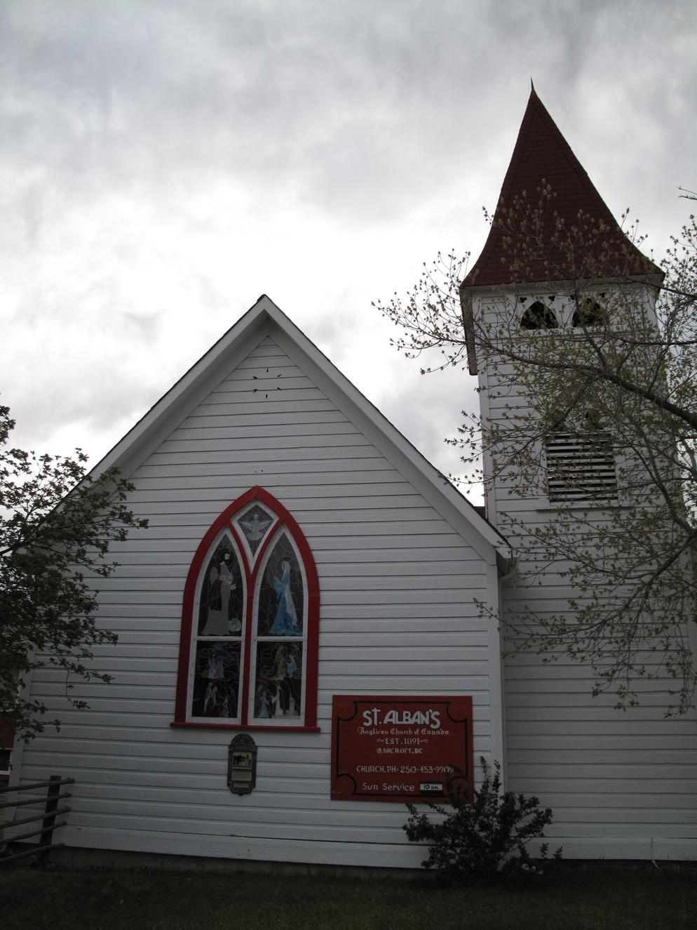
Located on the corner of 5th Street and Brink Street, St. Alban’s Church was built in 1891 and is the community of Ashcroft’s oldest church. The Church was built on the land of the Barnes Estate, at a total cost of five hundred dollars. These funds were raised, donated and collected by a committee consisting of Charles Semlin, Philip Parke, James Haddock and Walter Langley. The construction was completed in three months by carpenter William Higginbottom, who also did the interior work crafting the pews, railings and altar
APPLY STICKER HERE
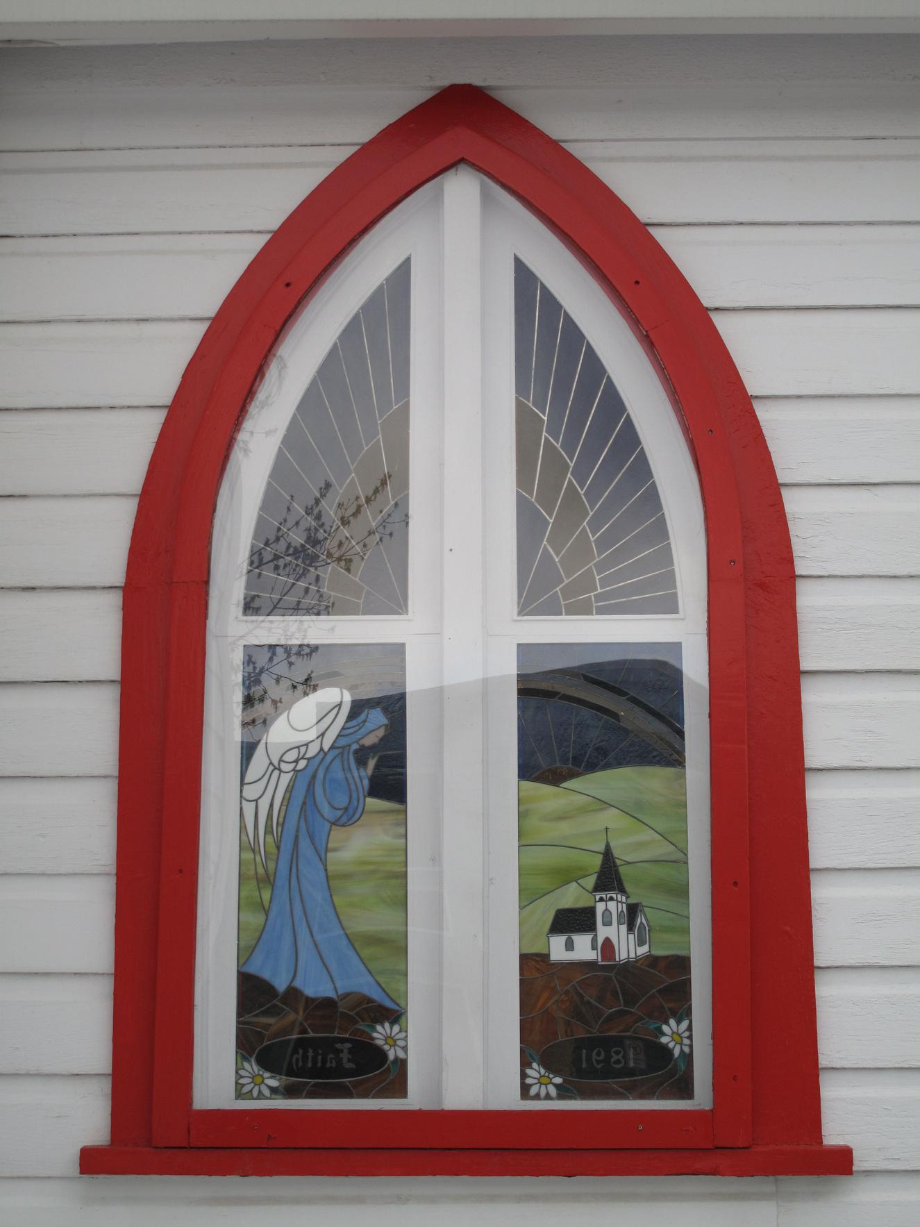
Rev. A. Ramsey McDuff from Ireland was St. Alban’s first Vicar, serving from 1892 until 1893. During the incumbency of Rev. Anstey Dorrell, from 1896 to 1910, articles were received from St. Alban’s in London, with the support of the Old Country Society. The Church bell was also purchased in England. Many of the other furnishings were donated by local community members. Funds were again collected in 1949, and the church was redecorated Mrs J L Clark, wife of the vicar, designed and hand painted windows to give the effect of stained glass Today, an original of these hand painted windows is on display in the Ashcroft Museum. In addition to the décor update, structural work began with sound absorbent Donnnaconna tiles replacing the dark brown woodwork of former years, new roofing of red duroid shingles and exterior paint completed the renovations. Ashcroft’s hot sun took its toll on the painted windows and these began to fade The windows were replaced with stained glass replicating the same theme as Mrs Clarke’s hand-painted ones In 1991, St Alban’s celebrated the 100th Anniversary of the building with the addition of yet another stained glass window, this one featuring scenes of Ashcroft’s transportation past
27
Site # 010501 GC1V33F
Phase l
Many of the original furnishings remain in St Alban’s, including the pews built by William Higginbottom
Artifacts of Ashcroft’s early churches may be viewed at the Ashcroft Museum, where you can view one of St. Alban’s earliest organs.
Written and Researched by Kathy Paulos
Please check geocaching.com before you go!
BIBLIOGRAPHY & SOURCES
Ashcroft Journal (1949) Various Articles Ashcroft, BC
Ashcroft Journal (1991) Various Articles Ashcroft, BC
Dorrell, M (1968) The Church and the Development of a Cariboo Community: Ashcroft Vancouver, BC: UBC Press
Letterboxing Clues: Park in church parking lot. locate the bench by the front door and look for cache ~5 metres to the south This cache is not an ammo can and blends in to the landscape
28
Charles Augustus Semlin Pioneers & Early Settlers
SITE IDENTIFICATION
Nearest Community: Cache Creek, B C
Geocache Location: N 50°48 394' W 121°17 417'
UTM: East 0621074; North 5629518 10U
Altitude: 560m/1837ft
Date Established: 1869
Ownership: Private Property
Accuracy: 3 meters
Overall Difficulty: 1
Overall Terrain: 1
Access Information and Restrictions: East of Cache Creek on Hwy #1. Remain on the side of the frontage road, allowing equipment to safely pass. DO NOT cross cattleguard onto residential property
For more information or to report a problem with this site please contact:
Gold Country Communities Society P.O. Box 933 Cache Creek, B.C. V0K 1H0 Tel: 1-877-453-9467
Email: info@exploregoldcountry com
For more site pages go to: www.exploregoldcountry.com www geocaching com
APPLY STICKER HERE
The Gold Rush brought a plethora of skills to the young British colony; trades people, professionals and savvy entrepreneurs Many came searching for gold, while others were looking for riches from business enterprises
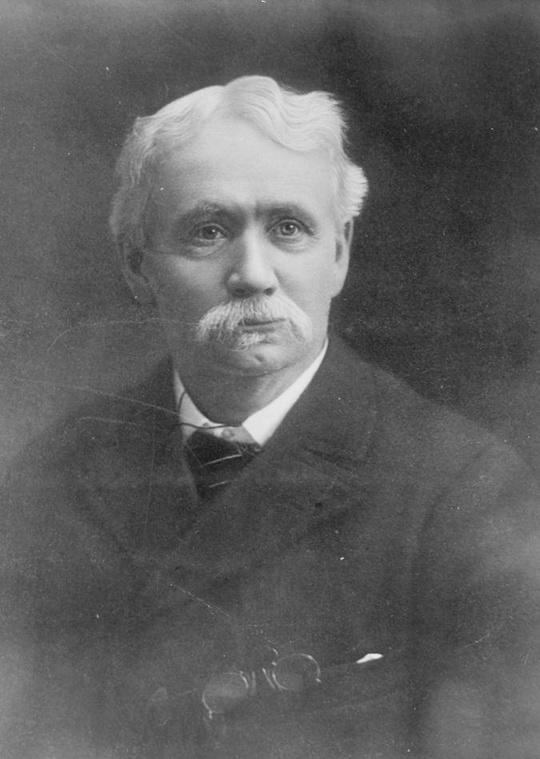
One such professional was schoolteacher Charles Semlin. Finding gold was not his forte, but finding riches and fame certainly were. Semlin saw more value in packing supplies for the gold seekers than prospecting for himself. After three years he had enough of packing in the Cariboo and in 1865 found himself in Cache Creek, where he would live out his life
Semlin was hired to manage the Cornwall brothers’ roadhouse, Ashcroft Manor, a social hub in the area. Only a few months later Charles purchased the stopping house at Rattlesnake Hill, moved it to the centre of Cache Creek and re-named it Bonaparte House. At this time he also became the first postmaster in Cache Creek. Semlin had been pre-empting and purchasing land since 1867 and in 1870 he traded the hotel for more ranch land. He grew his Dominion Ranch (now called Semlin Ranch) east of the community to 15,000 head of cattle; however, Semlin would soon begin a notable new career.
Semlin’s political career was somewhat serendipitous In 1871, when the colony joined confederation, Charles was elected to the inaugural session of the legislature of British Columbia. Well, not quite elected. After a tie, “Gentlemen, a hat please. ” The elections officer announced, “Mr. Charles Augustus Semlin, I draw your name. You are the first Member of the Legislature for
29
Site # 020101 GC1TWXG
Phase l
C r e d i t : A s h c r o f t M u s e u m
Yale in the Province of British Columbia ”
Early in his political career Semlin successfully convinced the government to establish a public boarding school in the Interior to educate the scattered population of children in the region. He introduced the legislation of 1874 that led to the establishment of the Central Boarding School in Cache Creek. It would be the only time the province would participate in a public boarding school The school existed until 1890 when it was shut down due to dwindling enrolment
It was 1882 before Semlin returned to politics and in 1894 became the leader of the opposition. Not a good position for such a gentle man. Regardless, Semlin persevered and survived his years of political chaos.
With a controversial move in 1898, Lieutenant Governor McInnes dismissed the current government and requested former Premier Robert Beaven create a political platform with ministries Beaven failed It was Semlin who succeeded when next asked by McInnes to do what Beaven could not And yet again, the gentleman rancher established himself politically
Premier Semlin was at the helm for only eighteen months and they would be some of the most tumultuous political months in history. With challenges from political rivals and party members, a yearlong mining strike, railway controversy, controversial patronage appointments, and poor political structure, the short term for the gentleman rancher was tempestuous. He would not run again in 1900, “I felt that I had done my share, and that it was time that younger shoulders were taking up the burdens of public life. ”
Semlin was instrumental in establishing the Inland Agricultural Society of B C , and the B C Cattleman’s Association, still active today after 120 years With a keen interest in history he became the president of the Yale and Lillooet Pioneer Society, not knowing he would very much be that history
In 1927, Semlin’s death was front-page news in the Vancouver Daily Province. The last surviving member of British Columbia’s first legislature, Renaissance-man Charles Semlin, 91 years old, died at his cherished Dominion Ranch in Cache Creek. He is buried in the Ashcroft Cemetery.
Written and Researched by Angela Wynton
BIBLIOGRAPHY & SOURCES
(1999) The Cariboo Gold Rush Retrieved March, 2009, from B C Heritage Digital Collections Web site: http://bcheritage ca/cariboo/ Mouat, J (2000) Semlin, Charles Augustus Retrieved March, 2009, from Dictionary of Canadian Biography Online Web site: http://www biographi ca
Letterboxing Clues:
From main entrance, at ranch sign, drive west (right) along frontage road to second large bush on right Park well off road and head ~10 paces into the middle of the bush to the covered cache.
30
Please
geocaching.com before you go!
check
The Scottie Creek Cache
SITE IDENTIFICATION
Nearest Community:
Cache Creek, B C
Geocache Location: N 50°59 369' W 121°23 602'
UTM: East 0612758; North 5649935 10U
Altitude: 808m/2652ft
Date Established: 1877
Ownership:
Leased Crown Land
Accuracy:
5 meters
Overall Difficulty: 1
Overall Terrain: 3 5
Access Information and Restrictions:
From Cache Creek, travel north on Hwy 97 an estimated 18 km Turn east onto Scottie Creek Road This is an active logging area, travel with headlights on and use caution Be alert for both wildlife and cattle on the road as this is graze lease land Park well off road
For more information or to report a problem with this site please contact:
Gold Country Communities Society
P O Box 933 Cache Creek, B C V0K 1H0 Tel: 1-877-453-9467
Email: info@exploregoldcountry com
For more site pages go to: www exploregoldcountry com www geocaching com
APPLY STICKER HERE
There is more to this tucked away back road than the lure of some excellent rock hounding, wildlife viewing and scenery. It holds an elusive piece of British Columbia’s Gold Rush history and may hide all or part of a more elusive treasure. The loot, stolen from a stagecoach in 1890, is reputed to be worth in excess of $500,000 in today’s market!
The story goes that a B X (B C Express Company) stagecoach left 100 Mile House one hot July day in 1890, with a strongbox containing $15,000 in gold nuggets and bars The treasure was on its way south to Yale for shipment down the Fraser River to New Westminster. Unfortunately, a stagecoach robber, armed with a Winchester rifle, intercepted the coach and driver at gunpoint. Stealing the strong-box, the bandit ordered the stagecoach to continue south. The stagecoach driver reported the theft upon his arrival in Ashcroft but could not clearly identify the bandit. A posse searched the rolling hills and wetlands south of 100 Mile House but could not find the robber and did not retrieve the strongbox.
Shortly after the theft, news of gold on Scottie Creek spread throughout the area. A man by the name of Sam Rowland had struck it rich on the creek! This news explained the large deposits Mr. Rowland was making at the Ashcroft Store and Bank. Prospectors flocked to the area; however, the flurry of excitement died down after only traces of gold were found on the creek.
When approached, Sam Rowland was secretive and evasive about his claim This aroused suspicion and Rowland was eventually arrested in Ashcroft and thrown in jail When interrogated, Rowland revealed that he knew absolutely nothing about gold mining! The gold on deposit was examined by experts and it was confirmed that the gold did not come from Scottie Creek at all. It had come from several Cariboo Creeks, likely
31
Pioneers & Early Settlers
Site # 020103 GC1TWYC
Phase l
in the Barkerville area Sam Rowland was tried, found guilty of armed robbery and sentenced to several years in the penitentiary in New Westminster After two years, Rowland escaped, and was never seen again The strong-box was found pried open several years later, north of Clinton by railway workers and is kept on display at the Clinton Museum.
Is the cache of gold still hidden at Scottie Creek? This is one of several versions of this event and it is probably not a good idea to spend a lot of time searching for the treasure Many report a similar version of this story in accounting for the name of the community to the south, Cache Creek Only our elusive bandit knows the truth of the missing gold
However, other treasures abound in the Scottie Creek area. A few kilometers along this logging road is an outcropping of amethyst crystals with banded agate. Visible signs of historical mines can be found throughout the Crown grazing lease, and gold was successfully mined from Scottie Creek in the early 1900s. Keep your camera handy as the area is home to a large population of deer, moose, cougar, grouse and other wildlife. An abundance of trails, meadows and even Scottie Creek Falls, provide ample opportunities for exploration or relaxation.
Written and Researched by Christine Whitehead
Please check geocaching.com before you go!
BIBLIOGRAPHY & SOURCES
Basque, G. (1983). Lost Bonanzas of Western Canada. Victoria, BC: Heritage House Publishing Co. Ltd. Stangoe, I. (1994). Cariboo-Chilcotin Pioneer People and Places. Victoria, BC: Heritage House Publishing Co. Ltd
Letterboxing Clues:
From Hwy 97N, follow Scottie Creek Rd. ~6 km, over 100m past marker ‘50-06’, and park off the road On the left follow a trail above the grey overburden pile 40m from the road to the group of trees in the rock draw. Cache is placed at the base of southern tree.
32
Pioneers & Early Settlers
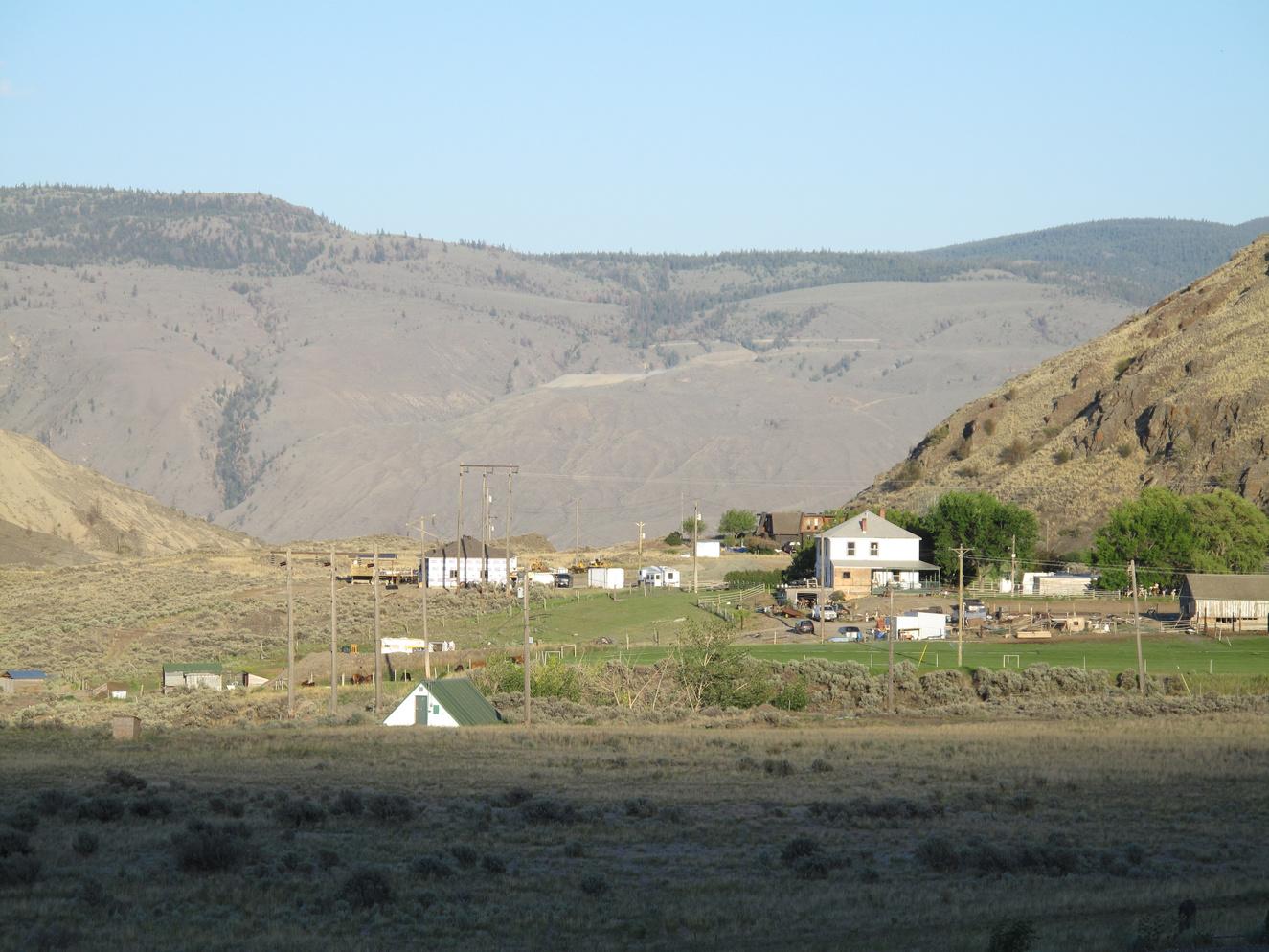
Boston Flats
SITE IDENTIFICATION
Nearest Community:
Cache Creek, B C
Geocache Location: N 50°46 364' W 121°18 652'
UTM: East 0619100; North 5625913 10U
Altitude:
489m/1603ft
Date Established: 1860
Ownership: Ministry of Transportation
Accuracy: 4 meters
Overall Difficulty: 1
Overall Terrain: 1 5
Access Information and Restrictions: At the junction of Hwy #97C & Trans Canada Hwy #1, use frontage rd. access.
• Parking available at the Route Information signage.
For more information or to report a problem with this site please contact:
Gold Country Communities Society
P O Box 933 Cache Creek, B C V0K 1H0 Tel: 1-877-453-9467
Email: info@exploregoldcountry com
For more site pages go to: www exploregoldcountry com www geocaching com
I n the early days, when Europeans were first exploring the rugged bits of the country, the first white men the natives saw were either Hudson’s Bay Company men from England or Americans. The Hudson’s Bay Company men differentiated themselves from the Americans by calling themselves “King George Men.” The men from the States came to be known as “Boston Men.”
Wilson Henry Sanford has been credited as the first white man to settle in the Cache Creek area in the early 1860s, and was the first white man many of the natives had ever seen, so he was the first “Boston Man” and the nickname stuck with him. He did not seem to have minded, notwithstanding his claim to being from eastern Canada and not actually from the States.
In an area as dry as the Ashcroft Cache Creek region, irrigation is a necessary requirement to farming “Boston” Sanford began digging the big ditch in the Bonaparte valley near Cache Creek, called Boston ditch, in the summer of 1871 to irrigate the section now known as Boston Flats The ditch began about six miles north of Cache Creek and ran about 10 miles
APPLY STICKER HERE
After having the length of the irrigation line surveyed, “Boston” then contracted out two-mile-long sections. One wonders if this was the smartest thing, a group of men from below the border were on their way to make their fortune in gold and were hired by “Boston” for one section They decided to adjust the survey pegs around a point known as Rattlesnake Hill, turning a difficult job into one considerably easier
They were paid for their work and by the time the entire irrigation line was finished and turned on, they were already long gone, and out of earshot, when the water failed to make it to its planned destination.
33
Site # 020104 GC1V3XC
Phase l
Despite this rather major setback, water was eventually brought to the Boston Flats region and the potatoes produced there developed a good reputation As one traveler wrote, “the celebrated ‘Boston’ Ranch…is one of the finest farms in the colony The proprietor keeps a hotel which receives an excellent name from those who have stopped at it. ”
When the road between Spence’s Bridge and Clinton was finally completed, Cache Creek became a stopping place for the prospectors heading north and east, and Charles Semlin (who later became the first Premier of British Columbia) and Philip Parke took a hotel built by James Orr and moved it to Cache Creek proper and renamed it Bonaparte House after the Bonaparte River In 1868, Parke sold his half to Sanford and the hotel, also known as Cache Creek House, was run by Semlin and Sanford “Boston” was an integral member of the community of Cache Creek and, as well as having run a ranch and a hotel, was a trustee at the local boarding school in Cache Creek.
Wilson Henry “Boston” Sanford gave his nickname to the flats upon which he built his ranch
Written and Researched by Maggie Meekis
Please check geocaching.com before you go!
BIBLIOGRAPHY & SOURCES
Ashcroft Museum & Archives. Many thanks to Kathy Paulos and the museum for access to archives. Cache Creek, En Route to Big Bend. (1866, May 14). B.C. Tribune. Yale, BC. Cache Creek House: Advertisement. (1866, May 14). B.C. Tribune. Yale, BC. Patenaude, B. (1998). Golden Nuggets: Roadhouse Portraits along the Cariboo’s goldrush trail. Surrey, BC: Heritage House Publishing Company Ltd.
The Boston Ditch and W.H. Sanford. (1933, November). The Ashcroft Journal Wade, M S (1921, January 29) Tales of the Cariboo Road (second series) No 2: Blazing a Trail The Daily Province
34
Letterboxing Clues: From route information sign, cache is ~12 paces northwest under sagebrush
Transportation Hub Pioneers & Early Settlers
SITE IDENTIFICATION
Nearest Community:
Cache Creek, B C
Geocache Location: N 50°48 569' W 121°19 499'
UTM: East 0618013; North 5629976 10U
Altitude:
467m/1531ft
Date Established: 1850
Ownership:
Village of Cache Creek
Accuracy: 5 meters
Overall Difficulty: 1
Overall Terrain: 1 5
Access Information and Restrictions:
Highway, year-round access, vehicle accessible, parking available at the Dairy Queen or Cache Creek Info Centre, high visibility area, use stealth For more information or to report a problem with this site please contact:
Gold Country Communities Society
P O Box 933 Cache Creek, B C V0K 1H0 Tel: 1-877-453-9467
Email: info@exploregoldcountry com
For more site pages go to: www exploregoldcountry com www geocaching com
On January 24, 1848, in Coloma, California, James Marshall discovered a pea-sized gold nugget and precipitated a tidal wave of human migration that came to be known as the California gold rush. But the wave did not stop at California. With the discovery of gold on the Thompson River at Kamloops and the rumor of gold in the Fraser River, miners flooded north and began to work the sand bars in the lower Fraser, then began moving ever farther up the rivers into the Interior Billy Barker’s strike in the Williams Creek area in 1862 was the beginning of Barkerville, where the population swelled to 10,000 people over the next year and the Cariboo gold rush was on
But getting there was half the trouble.
The first hopefuls attempted to make their way up the Fraser River but found their passage through the narrow canyons of the Fraser all but impossible at many times of the year In May of 1858 an arrangement was made to turn an old Hudson’s Bay Company trading route into a trail to the Interior Mule trains became the method of transporting goods to the prospective prospectors
But the increase in population escalated the demand for supplies. The transportation of goods from Yale up the Fraser River and the Thompson River to Barkerville had to be stepped up.
APPLY STICKER HERE
Governor Douglas, who is considered by many to be the “Father of British Columbia,” brought in a group of Royal Engineers and hired contractors to construct a road Work on the road began in Yale in 1861, and four years and 380 miles later, it was possible to drive a wagon to Barkerville The Cariboo Road brought in supplies, prospectors and ranchers and the colonization of the Interior of British Columbia began in earnest
Ashcroft, Cache Creek and Clinton became important centers of commerce as the Thompson River led many prospectors
35
Site # 020105 GC1V3XM
Phase l
and settlers to the east The two main routes to Barkerville were the Fraser Route (the Cariboo Road) and the Harrison Trail (through Lillooet Lake), which met at “the Junction,” now Clinton From Cache Creek a wagon trail to Savona was ready for use in the spring of 1866 to connect the Cariboo Road to the foot of Kamloops Lake, and this trail became one of the main routes east.
The construction of the Canadian Pacific Railway line closed the road from Spences Bridge to Ashcroft in 1891, and it was not replaced until 1927 As the lower pass from Hope to Princeton had not yet been built, the main wagon road to the Interior became the Harrison Trail, and Cache Creek with its connecting road to Savona became the southernmost wagon road into the Interior
In 1910, discussion of the TransCanada highway, then called the Canadian Highway, was focused on creating a southern route through the province. World War I intervened and work on the road from Hope to Princeton was suspended, along with many other projects. General improvements were made during the years from the end of the First World War to the Depression on many roads throughout the province, so when the TransCanada Highway Act was passed in 1949, outlining cost sharing between the federal government and provincial governments, some basic infrastructure was in place which made a northern route appealing. The official opening of the highway in July of 1962, with the completion of the Rogers Pass route, connected Cache Creek to the rest of the country with a ribbon of asphalt
In the early 1980s the last stop sign on the entire length of the Trans-Canada highway was removed at the intersection of Highway 1 and Highway 97 in Cache Creek. Although, since the building of the Coquihalla Highway, traffic along this highway has decreased, Cache Creek and the Trans-Canada highway are still destinations in themselves.
Written and Researched by Maggie
Meekis
BIBLIOGRAPHY & SOURCES
(1999, July). Cariboo Gold Rush. Retrieved June 5, 2009, from The Cariboo Gold Rush Web site: http://www.cariboogoldrush.com (1999-2008). History of the Trans-Canada Highway. Retrieved June 9, 2009, from TransCanadaHighway Web site: http://transcanadahighway.com/general/fullhistory.htm
Duclos, N.G. (1995). Packers, Pans and Paydirt: Prospecting to the Cariboo. Quesnel, BC: Arthur Duclos. Hansard, (1984, February 2). Official report of debates of the legislative assembly. Retrieved June 9, 2009, from Hansard: Thursday, February 2, 1984 Afternoon sitting Web site: http://www leg bc ca/Hansard/33rd1st/33p 01s 840202p htm
Harvey, R G (1994) The Coast Connection Lantzville, BC: Oolichan Books Kind, C (2005) Turn’em North: Gold, Whiskey, Dance Hall Girls & the Law BC: Self-Published Patenaude, B (1998) Golden Nuggets: Roadhouse Portraits along the Cariboo’s goldrush trail Surrey, BC: Heritage House Publishing Company Ltd
The Sacramento Bee, Gold Rush Sesquicentennial Retrieved June 5, 2009, from Gold Rush Web site: http://www calgoldrush com/
Letterboxing Clues:
From rear of Dairy Queen parking lot, go out the back fence and walk west on the sidewalk ~80m, then towards a pole with a hydro meter on it. Look for cache hidden in rocks and under the cover of juniper ~5m south of the pole.
36
Please check geocaching.com before you go!
The Cache Creek Mélange Geological Wonders
SITE IDENTIFICATION
Nearest Community:
Cache Creek, B C
Geocache Location: N 50°48 566' W 121°19 752'
UTM: East 0617835; North 5629846 10U
Altitude: 472m/1548ft
Date Established: N/A
Ownership: Village of Cache Creek
Accuracy: 5 meters
Overall Difficulty: 1
Overall Terrain: 1 5
Local residents have found it curious that almost all geological field trips that pass through this part of B.C. stop in town at this location – why?
At first glance this road cut looks like pretty typical rocks, there are some layers and the rock is more or less well grey But to trained eyes these rocks hold valuable insights into the geological history of British Columbia, especially the movements of continent-sized tectonic plates and the beds of very ancient oceans
Access Information and Restrictions: Public road, year-round access, vehicle accessible Turn west at the junction of Hwy 97N and Hwy 1 Follow Todd Rd across the bridge & park in gravel lot
For more information or to report a problem with this site please contact:
Gold Country Communities Society P.O. Box 933 Cache Creek, B.C. V0K 1H0 Tel: 1-877-453-9467
Email: info@exploregoldcountry com
For more site pages go to: www.exploregoldcountry.com www geocaching com
APPLY STICKER HERE
The scene before you is a jumbled mix of rock types, dominated by argillite (shale) and chert. Both are known to have formed in a deep ocean environment. Micro-fossils within the rocks tell us they were laid down primarily in the Triassic period, which spanned from 206248 million years ago If you have a pocket knife or other hardened steel instrument with you, you may try scratching these rocks and find some are quite soft (argillite) and others exceptionally hard (chert) Area First Nations would seek out rock such as chert for knapping into tools such as scrapers or arrow heads
If you look up a few meters, at the rock cut just north of the bridge you crossed to get here, you’ll see a light color block of rock that is about 2 meters high and a meter across. It stands out considerably from the darker rock that contains it and is at about the same level of the wires that pass in front of it. Once you have spotted it, you have discovered the essence and significance of this stop
The block is comprised of limestone and, unlike the rocks around it, formed in a relatively shallow marine environment. Fossils within the rock tell us it formed during the Carboniferous period and is at least 60 million years older than the rock that surrounds it. Geologists have borrowed the French word mélange to describe such scrambled collections of rock types, a word which simply means “mixture.” What you are looking at here is a small section of the Cache Creek mélange, a geological unit which
Site # 020201 GC1TQDF
37 Phase l
can be traced up and down much of the length of British Columbia Prior to understanding plate tectonic theory, the motions of the earth’s crustal plates on a plastic mantle, mélanges such as this one were very difficult to explain.
Between about 225 and 180 million years ago these oceanic rocks were on a virtual conveyor belt heading eastward, colliding with a collection of volcanic islands, ancient oceans and the westward bound North American tectonic plate at a convergent plate margin In this zone, the oceanic rocks were forced underneath the competing rocks to the east (or subducted) to be remelted as they descended back into the molten mantle: this geological feature is known as a subduction zone
The Cache Creek mélange represents the remnant scrapings that were made above this subduction zone as oceanic rocks lost their battle in a squeezing contest with the dominant rocks to the east and formed what is called an accretionary wedge.
It is this history of geological events that has given us what we see today Massive limestone blocks seemingly ripped from their origins and consumed within argillite and chert host rock, echoing the very tectonic events that shaped British Columbia’s complex geological history
Written
and Researched by Bruce Madu
BIBLIOGRAPHY & SOURCES
Mathews, B., & Monger, J. (2005). Roadside Geology of Southern British Columbia. Missoula, MT: Mountain Press Publishing.
Letterboxing Clues: Search the edge of the parking area, along the bank and under trees for cover This cache is not an ammo can and blends into the landscape.
38
Please check geocaching.com before you go!
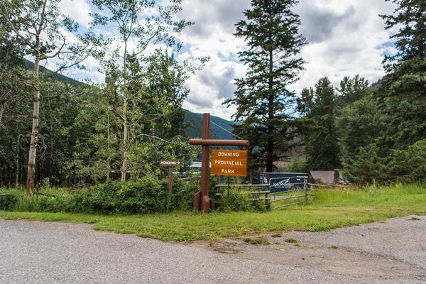
The Kelly Lake Roadhouse
SITE IDENTIFICATION
Nearest Community: Clinton, B C
Geocache Location: N 51°00 637' W 121°46 714'
UTM: East 0585686; North 5651716 10U
Altitude: 1068m/3505ft
Date Established: 1862
Ownership:
Private Property Accuracy:
5 meters
Overall Difficulty: 1 5
Overall Terrain: 1 5
Access Information and Restrictions:
From Clinton, drive 17 km west on Kelly Lake Road. This historic site is at the junction with the Jesmond Road. The cache is NOT located on the roadhouse property, please follow the coordinates. Park in Downing Park day use area.
For more information or to report a problem with this site please contact: Gold Country Communities Society P O Box 933 Cache Creek, B C V0K 1H0 Tel: 1-877-453-9467
Email: info@exploregoldcountry com
For more site pages go to: www exploregoldcountry com www geocaching com
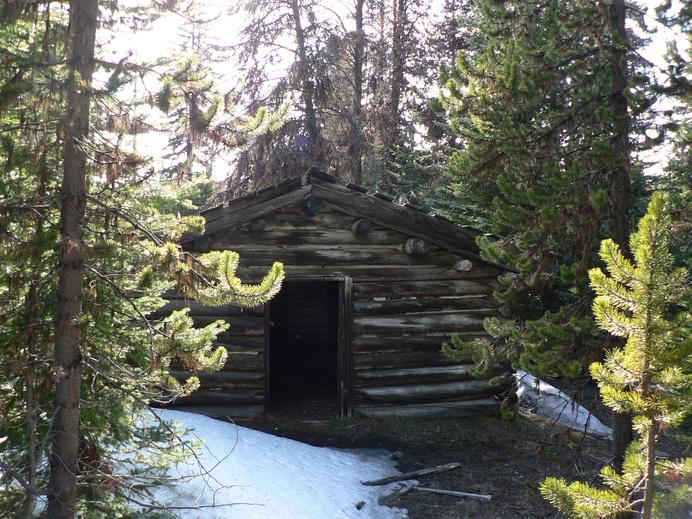
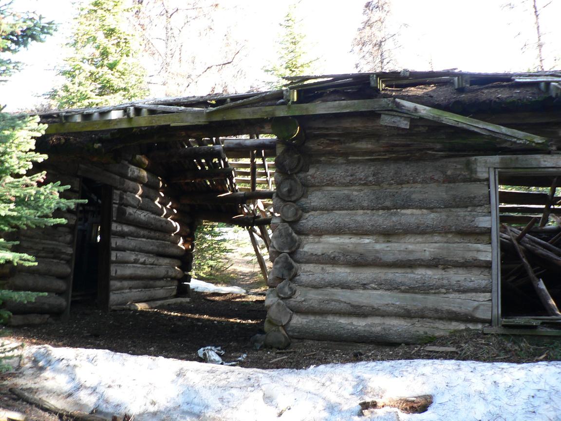
I t was in the fall of 1862 that Gustavus B. Wright completed the section of the new Cariboo Wagon trail over Pavilion Mountain and down the Snake Hill to arrive at the scenic lake, known today as Kelly Lake. Not far from the bottom of the hill he encountered a settler, David Reynolds. Reynolds had come from Pavilion Lake on the other side of the mountain. He had been growing and selling vegetables to the gold miners. On the Kelly Lake side he set himself up on a prime piece of real estate at the mouth of Porcupine Creek, establishing a roadhouse to meet the needs of the gold field travelers The “House” was known as the 38 Mile House and was listed in the Colonist newspaper, along with others, in March of 1863 as a “Good Stopping House”
The roadhouse was acquired in the mid 1860s by two brothers, George and Edward Kelly. The lake was later named after these two brothers.
Successful merchant in Clinton, F W Foster, purchased the property from the Kelly brothers giving him ownership of almost the entire Cut-Off Valley But by the mid 1880s the legendary Thaddeus Harper of “Gang Ranch” fame was adding to his land empire.
APPLY STICKER HERE
Harper purchased George and Edward Kelly’s original 397 acres as a stopping place for his cattle drives from the Cariboo to the newly constructed Canadian Pacific Railway in Ashcroft The 397 acres were also operated as a hay ranch until Thaddeus’ over extension on his credit forced his major creditor to call his note The new owner and creditor were one and the same The ranch became part of “The Western Canadian Ranching Company” holdings until 1948 when newlyweds, Joe and Doris Illingworth, purchased it from the Western Canadian Ranching Company
Joe and Doris had shipped all their worldly possessions to their new home at Kelly Lake via the Pacific Great Eastern
39
Pioneers & Early Settlers
Site # 030101 GC1XHN2
Phase l
Railway Many of the locals referred to the railway as the ‘Please Go Easy’, because it was so slow
However, Joe and Doris Illingworth had the luxury of a rail siding across the road from their new acreage and were given free demurrage for a week to unload at their convenience.
In the late 1990s, owners had decided to renovate a small cabin, at one time a ranch bunkhouse, and rent it out for a bed and breakfast. It was while removing the small wood heater that she discovered a small space beneath it, where a hired hand had stashed his whiskey flask
Later renovations revealed yet another hiding spot, while removing all the old sawdust in the icehouse (used to insulate ice cut from Kelly Lake). One more bottle was exposed, a Chinese beer. This location would have been ideal as the beer would have been kept nice and cool all year round. Both discovered bottles were circa 1900.
Today, the buildings remain at the junction of the Clinton-Pavilion and Jesmond roads Fabulous photograph opportunities abound on this short jaunt from the Village of Clinton; however, please do not access this historic property
Written and researched by Don Logan
BIBLIOGRAPHY & SOURCES
Patenaude, B. (1995). Trails to Gold. Victoria, B.C.: Horsdal & Schubart. Gallagher, J. (1975). The Western Canadian Ranching Company. In Victoria City Archives: PD212.
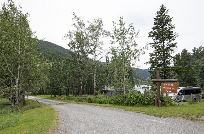
40 Letterboxing Clues: Follow the road to Downing Provincial Park day use area Go to the lake and
along
shore right for ~40m to the cache located among logs.
follow
the
Please check geocaching.com before you go!
The Clinton Museum Pioneers & Early Settlers
SITE IDENTIFICATION
Nearest Community: Clinton, B C
Geocache Location: N 51°05 492' W 121°35 222'
UTM: East 0598950; North 5660952 10U
Altitude: 898m/2945ft
Date Established: 1892
Ownership: Village of Clinton
Accuracy: 5 meters
Overall Difficulty: 1
Overall Terrain: 1
Access Information and Restrictions: Highway, year-round access, vehicle accessible, located within the Village of Clinton, high visibility area, use stealth
For more information or to report a problem with this site please contact:
Gold Country Communities Society
P O Box 933 Cache Creek, B C V0K 1H0 Tel: 1-877-453-9467
Email: info@exploregoldcountry com
For more site pages go to: www exploregoldcountry com www geocaching com
At the beginning of the Cariboo gold rush there were two paths to get into the Interior of the Province. Travelers could either brave the route along the Fraser River on the Cariboo Wagon Road or travel up the Harrison-Lillooet Trail. Either way, the road chosen went through “the Junction” at 47 Mile.
47 Mile House, later renamed the Clinton Hotel, was a favorite resting place for those heading for the gold in Barkerville But the travelers required more than just a place to rest A general store and a blacksmith were needed early on and by 1892, Clinton boasted shops, a bank, a telegraph office, a courthouse and the burgeoning town required a larger schoolhouse. Ed Norton was making bricks out of clay from the Clinton area and was given the contract to build the one-room school. He may not have been charging enough as his brick-building business closed in 1898, making the little brick schoolhouse a unique rarity for Clinton. The one and only brick house, then and now.
At one time, the school sported a bell tower complete with a brass bell donated by Sir Richard McBride, a well-known provincial politician The bell was later melted down for the “war effort” and the bell tower removed.
APPLY STICKER HERE
The brick building was used as a school and later, when the original courthouse burned down, a substitute courthouse. When a trial was in session, the children were sent outside to play When yet another larger school was built, the little brick building was used solely as a courthouse
This little courthouse/schoolhouse was the site of the trial of Betty Coward. In September of 1910, near Vanderhoof, British Columbia, Betty Coward and her daughter Rose Dell arrived at a neighbor’s house in a panic with a story about “an Indian with a grudge.” This Indian had apparently murdered the poor woman’s husband, Jim, in his sleep!
41
Site # 030102 GC1XHRZ
Phase l
W R Dunwoody, the Provincial Police District Chief, was summoned from Fort George and began the investigation He discovered that Jim and Betty Coward had only arrived from California the previous year and had later been joined by Rose, Betty’s daughter from a previous marriage. Within an hour Dunwoody determined that the vengeful Indian implicated by Betty Coward had an airtight alibi and Betty’s story seemed a little loose.
In the course of his investigation, Dunwoody traveled through thirteen states and three provinces In San Francisco he discovered that Betty Coward was actually Mrs Dell When questioned, Mr Dell said, “She’s a dangerous woman and has a hell of a temper You mark my words; she’ll commit a murder one day ”
Betty was arrested and tried for the murder of her husband; her daughter Rose Dell was arrested for conspiracy, although the case was later dropped. The evidence collected by Dunwoody, including a life insurance policy taken out by Elizabeth Dell on Coward’s life, ensured that the jury assembled at the Clinton Assize quickly came back with a guilty verdict against Betty Coward. She became the first woman in British Columbia to be sentenced to death. Forty-eight hours before the hanging her sentence was commuted to life in prison.
The little brick schoolhouse entered its next phase of usefulness by becoming a museum when, in May of 1956, the South Cariboo Museum and Historical Society opened its doors In 1999 the museum also acquired and moved the then 88-year-old Provincial Government Stable, filling it with their ample collection of historical artifacts The only building ever made out of Clinton bricks is not only historical itself, but today is filled with the history of the entire area.
Written and Researched by Maggie Meekis
BIBLIOGRAPHY & SOURCES
Brundage, M. Tales of the Cariboo. Self-published. Choate, A.L. (1972). The Clinton Story. Kamloops, BC: Self. Kind, C. (2005). Turn ‘ em North: Gold, Whiskey, Dance Hall Girls & the Law. Calgary, AB: Self. Village of Clinton. (Undated). Historical Walking Tour. Self-guided Booklet.

Start at the front gate walk to right side of building before back fence This cache is not an ammo can and blends into the landscape.
42 Letterboxing
Clues:
Please check geocaching.com before you go!
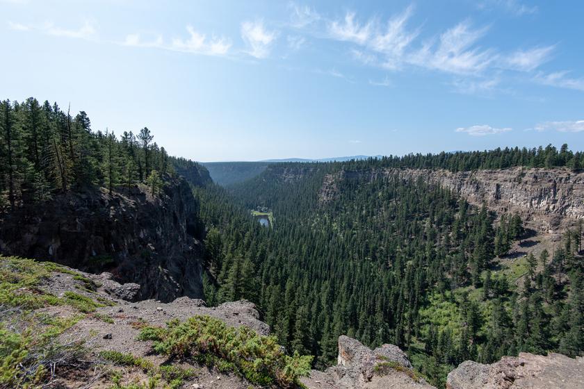
The Painted Chasm Geological Wonders
SITE IDENTIFICATION
Nearest Community: Clinton, B C
Geocache Location: N 51°13 096' W 121°28 882'
UTM: East 0606059; North 5675193 10U
Altitude: 1082m/3549ft
Date Established: 1940
Ownership:
BC Provincial Park
Accuracy: 6 meters
Overall Difficulty: 1 5
Overall Terrain: 2
Access Information and Restrictions:
Follow the signs to Chasm, north of Clinton on Hwy 97N Please park in appropriate areas, indicated by coordinates Respect all fences and other safety barriers
For more information or to report a problem with this site please contact: Gold Country Communities Society P O Box 933 Cache Creek, B C V0K 1H0 Tel: 1-877-453-9467
Email: info@exploregoldcountry com
For more site pages go to: www exploregoldcountry com www geocaching com
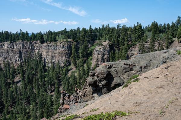
As the Gold Rush and the Cariboo Wagon Road progressed further north from Clinton to Barkerville, so did the gold seekers and adventurers. Men and women wise to the travelers’ needs for creature comfort, food, supplies and entertainment along the way, began building and providing services and supplies along the gold rush trail. Three such savvy businessmen were the Saul Brothers, Isaac & John and William Innes, who were working with G B Wright to build the Cariboo Wagon Road At 59 Mile, Saul & Company built the first roadhouse north of the Pollard Guest Ranch in Clinton
The two-story structure was erected in the 1860s on the flat land of the Fraser Plateau with breath-taking views of a scenic and colourful chasm. The location attracted many travelers who could picnic over-looking the colourful walls and gaze in amazement on the grandeur. Unfortunately, in 1948 the roadhouse burned down in a spectacular fire. It was never replaced.
The Painted Chasm, as it was soon to be known, brimmed with life Travelers looking down into the Chasm Creek valley watched and listened to an abundance of wildlife, including bighorn sheep, moose, mule deer, black bear, coyote, small mammals, songbirds and remarkable birds of prey such as osprey and eagles.
APPLY STICKER HERE
However, what our pioneers did not know at the time was the rich history and untold geology of this splendid canyon They were gazing at a colourful geological wonder, beautifully detailed bands of sediment, which had been forming for more than 16 million years The area became most active over 10 million years ago, resulting in successive basalt lava flows The ‘grand’ painted canyon itself was created over a period of 10,000 years The Painted Chasm views and layers allow the observer to look back to the Miocene and Pliocene Epochs.
43
Site # 030201 GC1TTW8
Phase l
The Painted Chasm canyon runs 8 kilometers long, 600 metres wide and is 300 metres deep from the top of the plateau As the ice age glacial melt traveled through British Columbia, the glacial waters carried much silt. This silt was deposited as a ridge of gravel, called an esker, and stretches 40 kilometers upstream from the head of the chasm. The pressures and movement of the glacial ice and the resulting melt of the massive ice fields carved out the canyon you see today. The waters and silt exposed the deep colourful walls of many lava flows. These flows created strata of columnar-jointed rope lava (pahoehoe), thick-tiered lava flows, and minor pillow lava flows (formed in water) and pillow rock fragments (breccias). Rare airborne fire fragments (pyroclasts) are also evident as layers (silicic tephra).
In 1940, the Province of British Columbia declared 141 hectares of the painted canyon as a provincial park to protect its beauty and geology In 1995 that area was expanded to 3,067 hectares to protect not only the chasm but also the sensitive ecosystem that surrounds it Just as the pioneers 150 years ago gazed upon the magnificent colours of red, orange, pink and purple, today the Painted Chasm yields up its story rich in the history, geology and wildlife of Gold Country, British Columbia.
BIBLIOGRAPHY & SOURCES
(2009). BC Parks: Chasm Provincial Park. Retrieved January, 2009, from British Columbia.com Web site: http://www.britishcolumbia.com/ParksAndTrails/Parks/details/?ID=19 (2009). Chasm Provincial Park. Retrieved January, 2009, from BC Adventure Network Web site: http://www.bcadventure.com/adventure/explore/high country/parks/chasm.htm (2009). Chasm Provincial Park. Retrieved January, 2009, from BC Parks Web site: http://www.env.gov.bc.ca/bcparks/explore/parkpgs/chasm/ (2009) Chasm Provincial Park Retrieved January, 2009, from Wikipedia Web site: http://en wikipedia org/wiki/Chasm Provincial Park Tschernich, R (1992) Painted Chasm Retrieved January, 2009, from Mindat Web site: http://www mindat org/loc php?loc=131254
Letterboxing Clues:
From parking areas follow the safety fence south to the end and then look to your right for a faint trail Follow the trail down the hill and left for ~25 paces, then before the rise in the hill turn right 90° and go ~10 paces into the forest to the cache in a stump
44
Please check geocaching.com before you go!
Last Chance Lake Soda Site Geological Wonders
SITE IDENTIFICATION
Nearest Community: Clinton, B C
Geocache Location: N 51°19 603' W 121°38 246'
UTM: East 0594936; North 5687040 10U
Altitude: 1089m/3572ft
Date Established: 1898
Ownership:
Crown Land Accuracy: 5 meters
Overall Difficulty: 1
Overall Terrain: 1.5
Access Information and Restrictions: Gravel road, year-round access, vehicle accessible, located north of Clinton, via Hwy #97N, the Cariboo Hwy Head west on Meadow Lake Road, pull well off road for stops and parking Back country road, be prepared for all events Good shoes recommended
For more information or to report a problem with this site please contact: Gold Country Communities Society P O Box 933 Cache Creek, B C V0K 1H0 Tel: 1-877-453-9467
Email: info@exploregoldcountry com
For more site pages go to: www exploregoldcountry com www geocaching com
The Clinton and 70 Mile House area is filled with alkaline lakes, easily recognizable by the ring of white soda deposits that line their shores. Once labeled as ‘useless,’ these shallow and often smelly lakes were once a beehive of activity.
Although testing of the salt was an occurrence in the late 1890s, the completion of the Pacific Great Eastern, in 1919 provided a more available means of transportation and several lakes went into production The Pacific Great Eastern was the railway that went north, many of the locals referred to it as the Please Go Easy, because it was so slow.
Some lakes were mined for their Epsom salts or magnesium sulphate, the surface was scraped, and the ore put in sacks. Other lakes produced soda carbonate, a product used in washing Analysis testing done on the soda in 1898 was inconclusive as to what it contained No two chemists could agree, except that housekeepers pronounced it to be far and away ahead of “Pearline” for washing, and blacksmiths felt that no other soap compared with the native compound
APPLY STICKER HERE
These lakes were mined in the winter, accessibility depending on a thick layer of ice. The soda was in the mud at the bottom of the lake and in the water. The cold weather would bring it up. The ice had to be eight to ten inches thick, strong enough to hold a team of horses A six to seven inch layer of soda would form under the ice The ice would be chipped away and the layer of soda broken out and placed on the ice with tongs
Production however at ‘The Last Chance’ was unique. The lake held very little water and there was a lot of mud in the soda. After several experimental trials the British Columbia Chemical Company developed a process to separate the soda from the mud.
45
Site # 030202 GC1V3XX
Phase l
According to the 1929 Report of the Minister of Mines, a well designed plant was constructed and a good camp for winter operations was provided, having cost the company approximately $50,000 Unfortunately a 1930 report states that “ no further operations were carried on at the works of this company It is reported that results were not satisfactory. ”
Today you might find a few broken bricks or boards, or further up the hill, remainders of the camp. A scant reminder of this failed scheme, once a ‘Salt Lake City’ of its own
Written
and Researched by
Kathy Paulos
BIBLIOGRAPHY & SOURCES
Lingley, N (Undated) Sodaworks never survived past 1930 In Ashcroft Museum and Archives The Soda Lakes (1898, December 10) Ashcroft Mining Journal
46
Letterboxing Clues: Travel ~15km west on Meadow Lake Road and park well off the road at pole 169 Follow the overgrown road north for ~700m toward lake. Head 40m east of the claim post. Cache is in the corner of the eastern most log building.
Please check geocaching.com before you go!
Reg Conn Centennial Park
SITE IDENTIFICATION
Nearest Community: Clinton, B C
Geocache Location: N 51°05 218' W 121°35 254'
UTM: East 0598939; North 5660454 10U
Altitude: 887m/2909ft
Date Established: 1963
Ownership:
Village of Clinton
Accuracy: 5 meters
Overall Difficulty: 1 5
Overall Terrain: 1 5
Access Information and Restrictions:
Public road, year-round access, vehicle accessible, located within the Village of Clinton, high visibility area, use stealth
For more information or to report a problem with this site please contact:
Gold Country Communities Society
P O Box 933 Cache Creek, B C V0K 1H0
Tel: 1-877-453-9467
Email: info@exploregoldcountry com
For more site pages go to: www exploregoldcountry com www geocaching com
I n the heart of Clinton lies a serene spot where one can lay quietly absorbing the golden rays and listen to the peaceful waters of the small brook while contemplating the remarkable history of this unique village.
Clinton came to life during the excitement of the Gold Rush
Originally it was merely a roadhouse at 47 Mile on the Cariboo Wagon Road As the Gold Rush grew so did Clinton, bringing many prospectors, adventurers, ranchers, entrepreneurs and the Royal Engineers Hotels were erected, stores established, as was a post office. By 1873, a court house and government agent house was built. The town kept growing and the people kept coming. With more families came the need for schooling and by 1892 a brick schoolhouse was built and soon occupied. It currently houses the Clinton Museum and Archives.
While some passed through, some chose to make Clinton home One can visit many of the original pioneers of the village while strolling through the Pioneer Cemetery established in 1861 Some headstones have stood the wrath of time, but many have not survived the sometimes inclement weather conditions
APPLY STICKER HERE
In 1963 the town was established as the Village of Clinton and from 1963 to 1970 Reg Conn was the first Chairman and Mayor of Clinton. It was shortly thereafter that the Village decided they would create their own municipal park, the heart of their quaint village
An application was made to the Ministry of Recreation and Conservation to lease nine lots formerly belonging to the School District and now owned by the Province. Additionally, the Clinton Benevolent and Protective Order of Elks offered to transfer their lease of eight adjacent lots to the Village. This was accepted gratefully.
An additional parcel of land also lay adjacent to the proposed parklands Cedric Dorrell was a well known Clinton resident
47
Views
Vistas
&
Site # 030301 GC1V3ZK
Phase l
The Lloyd West family, in honour of Dorrell’s commitment, donated the land when they purchased Dorrell’s holdings in 1965, formally conveying the Dorrell property to the Village Thus, yet another parcel of land was donated for the soon-to-be village park.
In 1964 the Clinton Centennial Committee was created and they decided to make the development of the park their centennial project. By 1967 the comfort station was established in the park and two footbridges were built. They now had the basic structure of a park in place In 2003 the Clinton and District Economic Development Society spearheaded the construction of a theatre and band shell, which is used for entertainment in the park in the summer months In 2006, with the assistance of members of the Clinton Lions Club, new playground equipment was installed
As the park was being created it had several monikers, the Dorrell Park in respect and honour of Cedric; Clinton Creek Park, although the Creek is called Cut-off Valley Creek; and Centennial Park, as it was the centennial project.
Regardless of the name, the volunteers after many years of planning and toil, had created what they had planned, a peaceful picturesque village park But it really did need an official name, and in 1971 the Village of Clinton Council passed a motion to name the park It would officially be called the Reg Conn Centennial Park for the first Mayor of the Village of Clinton who also contributed countless hours clearing land, falling trees and preparing the park
So where do you go after your long stroll through the remarkable history of Clinton, the Gold Rush and its formal establishment as a village? You mosey under the great arch of Reg Conn Centennial Park, across the expanse to Cut-Off Creek You layout your picnic under a golden sun and perhaps cool your feet in the babbling waters of the creek You may even nod off in the warmth and glow of the afternoon and dream of the Gold Rush and the history of the quaint Village of Clinton, in the heart of Gold Country
Written and Researched by Angela
Wynton
BIBLIOGRAPHY & SOURCES
Charles, P. (1990). At the 47 Mile, A History of the Village of Clinton. Victoria, BC: Orca Book Publishers. Warner, C. (2009). Personal Interview.
Letterboxing Clues:
From the parking lot follow the foot path to the south east corner of the park The cache is located near a stump ~60 paces south of the gate, towards the stop sign.
48
Please check geocaching.com before you go!
Clinton Pioneer Cemetery Gravesites & Mystical Places
SITE IDENTIFICATION
Nearest Community:
Clinton, B C
Geocache Location:
N 51°05 595' W 121°34 686'
UTM: East 0599572; North 5661157 10U
Altitude:
885m/2904ft
Date Established: 1861
Ownership: Village of Clinton
Accuracy: 5 meters
Overall Difficulty: 1
Overall Terrain: 1
Access Information and Restrictions: Public road, year-round access, vehicle accessible, located within the Village of Clinton, high visibility area, use stealth
For more information or to report a problem with this site please contact:
Gold Country Communities Society
P O Box 933 Cache Creek, B C V0K 1H0 Tel: 1-877-453-9467
Email: info@exploregoldcountry com
For more site pages go to: www exploregoldcountry com www geocaching com
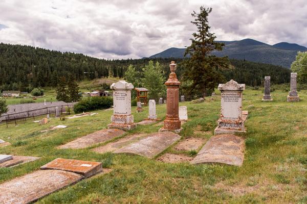
As the Gold Rush of 1858 grew, it became apparent there was a need to manage the gold, as well as the rowdiness of some gold seekers. James Douglas, Governor of the Colony of British Columbia, would establish Gold Commissioners, assigning ten commissioners and a Chief Justice to be agents throughout the corridor as the Gold Rush moved northward along the Cariboo Wagon Road. The first agent assigned in Clinton arrived in 1872. Frederick Soues was later appointed in 1877 and remained the Gold Commissioner until his retirement in 1911
Gold seekers traveled with horses, mules and camels, but not all gold seekers passed through Clinton on to Barkerville. Many decided to stay and build businesses and services in the town. In 1862, John Pollard of Cornwall tired of the gold searching and pre-empted a number of lots with three others. He soon bought them out and acquired all 640 acres. The Pollard Cornish Guest Ranch and Roadhouse was established and still exists today. Others, like the Saul brothers, also stayed becoming part of the growing Clinton community. William Saul was elected as a Member of Parliament of the new colony
APPLY STICKER HERE
The Watson brothers began building the Clinton Hotel. At the completion of the hotel in 1863, Joseph Smith, along with his wife Mary, and Tom Marshall, bought the hotel. It soon became the centre point for travelers and locals following their dreams. Unfortunately, the hotel burned down in May 1958. The Clinton Ball, which began as an annual event at the hotel in 1867, continues to this day.
The town was growing, some stayed, some left and some succumbed to the hardships and diseases of the time In 1861 Joseph Smith, the soon-to-be proprietor of the Clinton Hotel, donated several acres of land alongside the Cariboo Wagon Road to provide a cemetery for those who did not survive the challenges of the Gold Rush community. And thus, the
49
Site # 030401 GC1VA5K
Phase l
Clinton Pioneer Cemetery was established
Many who forged the history of British Columbia during the adventures and hardships of the Cariboo Gold Rush lay below the golden meadows overlooking the Clinton valley. The original wooden tombstones have disintegrated but the stone markers have survived. While there is no record of any Gold Rush camels being buried at the site, there are many graves of others who weathered the Cariboo over the past 150 years.
Much of the history of the Cariboo Gold Rush lays silent beneath the weathered tombstones There are many pioneers and many untold stories lying under the warm winds and light snows of the historical Clinton Valley Pioneer Cemetery.
John Pollard and his descendents have gravesites in the Clinton Valley and their history continues at the Pollard Ranch Frederick Soues contributed to the mining industry as we know it today Members of his family remained in the area and are buried alongside Soues William Saul was a part of the first parliament representing the Colony of British Columbia His brothers, wife and son are also interred nearby Joseph Smith, proprietor of the social hub during the gold days, lies under the golden valley amidst many of those who frequented his establishment and reveled in the Cariboo Gold Rush
The Clinton Pioneer Cemetery is rich with the told and untold stories of the Gold Country of British Columbia.
Written and Researched by Angela Wynton
Please check geocaching.com before you go!
BIBLIOGRAPHY & SOURCES
(1999, July). Cariboo Gold Rush. Retrieved January 15, 2009, from The Cariboo Gold Rush Web site: http://www.cariboogoldrush.com Barman, J. (2007). The West Beyond the West: A History of British Columbia. Toronto, ON: University of Toronto Press.
Green, J. (Undated). Clinton Pioneer Cemetery. Video Clip for Super Natural British Columbia.
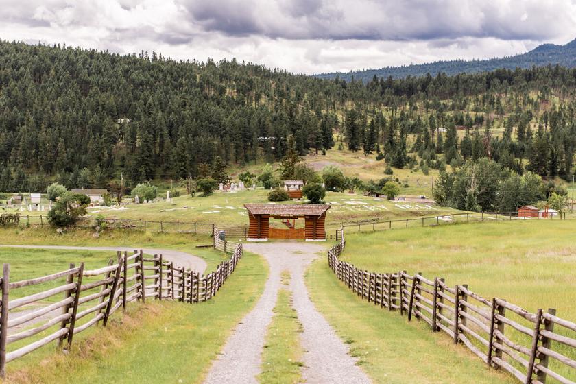
Letterboxing Clues:
This cache is not located in the cemetery, but is very near This cache is not an ammo can and blends into the landscape.
50
St. Peter the Apostle Roman Catholic Church Historic Churches
SITE IDENTIFICATION
Nearest Community: Clinton, B C
Geocache Location: N 51°05 273' W 121°35 781'
UTM: East 0598305; North 5660535 10U
Altitude: 900m/2953ft
Date Established: 1865
Ownership: Church Property
Accuracy: 4 meters
Overall Difficulty: 1
Overall Terrain: 1
Access Information and Restrictions: Public road, year-round access, vehicle accessible From Hwy 97N turn west on the Kelly Lake Road Parking available in church lot
For more information or to report a problem with this site please contact:
Gold Country Communities Society P O Box 933 Cache Creek, B C V0K 1H0 Tel: 1-877-453-9467
Email: info@exploregoldcountry com
For more site pages go to: www exploregoldcountry com www geocaching com
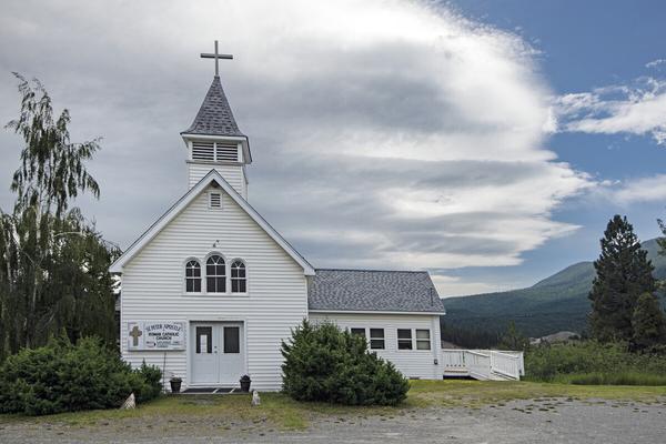
Following the Cariboo Wagon Road, along with the Gold Rush adventurers, came those in the service of God. It was 1864 when Bishop Louis-Joseph D’Herbomez and his priests became responsible for the missions of the colony and the conversion of the natives to Catholicism.
Traveling priests baptized native families throughout the colony, but it was not until about 1865 that a church was erected above the wagon road in Clinton The simple log structure soon became the holy gathering house of the newly converted
In 1892 the church was rebuilt by Father Maurice Marchal and the Pavilion villagers out of logs and materials from the first structure. The log structure was rough and the bell tower short. Although Father Thomas once claimed, “ Father Marchal was an excellent carpenter ” , the Church of St Peter the Apostle was not evidence to justify such a claim It was one of the most primitive of the mission churches
APPLY STICKER HERE
By the mid-1940s the church had become very dilapidated. In 1949 Father Gerald Dunlop wrote to Monsignor McDonagh requesting a new church for his one hundred souls. While some services were ‘enlightening, as the sun shone through the roof upon the congregation’ others were ‘disheartening, as the cold rains dampened spirits’ . Ringing out the word of God could be a dangerous endeavor, even for the most devout, as debris from the crumbling bell tower would rain upon the bell ringer
Joining Father Dunlop to rebuild, across from the original site, was Father Jackie Ryan, Father Wilfred Scott and Bill Swan, a Scottish carpenter. St. Peter the Apostle, church structure three, was completed and blessed in 1952. The original altar from the first church, the picture of The Last Supper, the first statues and other artifacts were moved to the current church and remain
51
Site # 030501 GC1VA63
Phase l
there today The church bell from England, that rang havoc of debris, now rings joyfully and crisply, echoing the toll of the Gold Rush and the First Nation Catholics of the Clinton Valley Father Marchal, Father Ryan, Father Scott and Father Dunlop are long gone but their memory lives on in the soul of St. Peter the Apostle Church in the heart of Gold Country.
This lovely little white church can be seen from the highway as you are traveling north, just as you enter Clinton
Written and Researched by
Angela Wynton
BIBLIOGRAPHY & SOURCES
Scott, W. (c1980). Handwritten Letter to Ed. In Clinton Historical Museum Archives. Veillette, J & White, G (1977) Early Indian Village Churches Vancouver, BC: UBC Press Village of Clinton (Undated) Historical Walking Tour Self-guided Booklet

52 Letterboxing
From the parking area, go ~40 paces south, the turn 90° left and go ~45 paces east to the cache camouflaged in a low growing juniper.
Clues:
Please check geocaching.com before you go!
The Fishing Rocks at Xwisten (Bridge River)
SITE IDENTIFICATION
Nearest Community: Lillooet, B C
Geocache Location:
N 50°45.046' W 121°56 012'
UTM: East 0575234; North 5622652 10U
Altitude: 224m/734ft
Date Established: N/A
Ownership:
First Nation Land Accuracy: 5 meters
Overall Difficulty: 2.5
Overall Terrain: 2.5
Access Information and Restrictions:
The Xwisten fishing rocks are 7 km north of the Mile 0 Cairn From Lillooet, follow Highway 40 (Moha Road) north There are 2 small pullouts before the bridge over Bridge River The fishing rocks are below at the junction of the Bridge & Fraser Rivers Use caution along slopes and rivers edges, slippery rocks & uneven terrain.
For more information or to report a problem with this site please contact:
Gold Country Communities Society
P.O. Box 933 Cache Creek, B.C. V0K 1H0 Tel: 1-877-453-9467
Email: info@exploregoldcountry com
For more site pages go to: www.exploregoldcountry.com www geocaching com
APPLY STICKER HERE
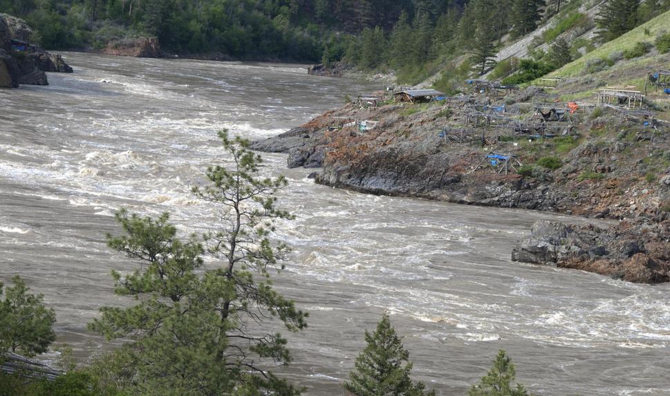
I n St’at’imc mythology, a story says that in the beginning, the people living along this section of the Fraser River were without salmon. They heard that some women living at the mouth of the Fraser had built a weir that prevented the salmon from swimming upstream. Coyote, the trickster, decided that since he was smarter than anyone else, he would go and get the salmon for the St’at’imc people.
After being assailed by flies, wasps and salmon lice, Coyote broke the fish weir and released the salmon “Follow me!” he called out to the salmon and began to run along the river. As he ran, he called out to the people, “Make your fire! The salmon are coming! The salmon are coming!” And that is how the salmon found their way here to Xwisten, the confluence of the Fraser and Bridge Rivers and the principal fishing site of the St’at’imc people.
Here, in a tumultuous surge of white water, massive ridges of bedrock burst from the river bottom, slowing the upstream migration of the salmon, making it easier to catch them and creating one of the greatest fishing sites anywhere on the Fraser
Five species of Pacific salmon are present in the Fraser River: Chinook or Spring, Coho, Chum, Pink and Sockeye. All begin their lives in fresh water, journey to the sea where they disperse, grow and then return, at ages ranging from two to eight years of age, to spawn in their home streams and die
The largest salmon runs began in July; therefore, late July and early August were traditionally devoted to catching salmon, primarily sockeye. The success of the catch during these runs determined the ability of St’at’imc families to survive the winter, as the fish were dried and stockpiled. Salmon heads, eggs and innards were used to make salmon oil, which was stored in
53
Pioneers
& Early Settlers
Site # 040102 GC1TQF9
Phase l
bottles made of salmon skin The skin was also used to make shoes Salmon was a valuable trading commodity; St’at’imc elders say this trade brought the first horses to their territory For millennia, salmon has been the primary food of the St’at’imc. The techniques currently used for aboriginal salmon fishing on the Fraser River are gill netting, set netting and dip netting. An unforgettable sight at Xwisten is the view of a St’at’imc fisher perched precariously on the fishing rocks and skillfully using a dip net on a pole to snare a silvery salmon The fish are still preserved in the traditional way by hanging the fillets from the poles of a drying rack, after making cross-grain cuts in the flesh These cuts allow the strong, hot winds along the riverbank to dry the flesh The salmon are then stored for the winter
The Xwisten (Bridge River) Band opens the fishing rocks to all members of the St’at’imc Nation. The Band also conducts tours of the fishing rocks and s7istken (pit house) sites on its land.
Written
and Researched by Wendy
Fraser
Please check geocaching.com before you go!
BIBLIOGRAPHY & SOURCES
Francis, D. (2000). The Encyclopedia of British Columbia. Madeira Park, BC: Harbour Publishing. Haig-Brown, A., & Blacklaws, R. (1996). The Fraser River. Madeira Park, BC: Harbour Publishing. Hayden, B (1992) A Complex Culture of the British Columbia Plateau: Traditional Stl’alt’imx resource use Toronto, ON: UBC Press
Pringle, H (1996) In Search of Ancient North America Hoboken, NJ: John Wiley & Sons Inc
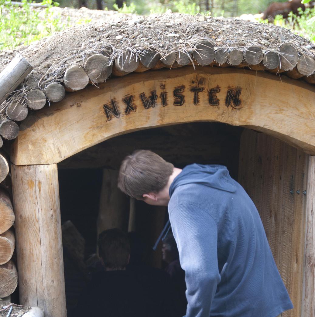
Letterboxing Clues:
From the south corner of the concession building, walk ~115 paces south along the road to a clearing on your left. The cache is disguised by a line of rocks.
54
The Lower Seton Spawning Channel Views & Vistas
SITE IDENTIFICATION
Nearest Community: Lillooet, B C
Geocache Location: N 50°40.412' W 121°56 546'
UTM: East 0574728; North 5614055 10U
Altitude: 210m/689ft
Date Established: 1999
Ownership:
First Nations Land Accuracy: 5 meters
Overall Difficulty: 2
Overall Terrain: 1 5
Access Information and Restrictions: From Lillooet, drive 2.5km south on Hwy #99, the Duffy Lake Rd Turn right onto the overgrown road immediately beyond the Lightfoot Gas Station Go down the hill for a short distance, and turn left at the first fork Follow the road to the parking area & signage
For more information or to report a problem with this site please contact: Gold Country Communities Society P O Box 933 Cache Creek, B C V0K 1H0 Tel: 1-877-453-9467 Email: info@exploregoldcountry com
For more site pages go to: www exploregoldcountry com www geocaching com
APPLY STICKER HERE
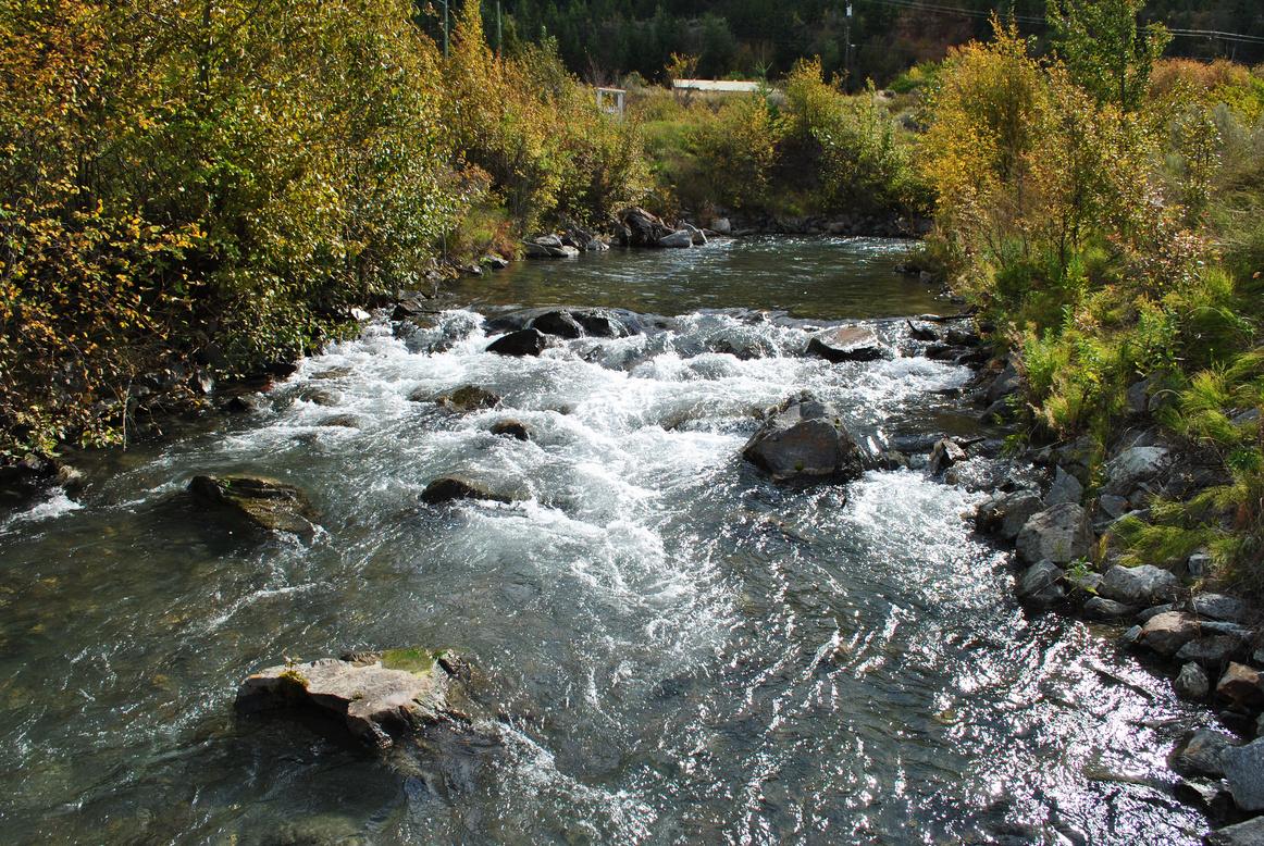
A walk along the Lower Seton River Spawning Channel is a pleasant, 1.4 kilometre loop, all on flat terrain, around the winding channel. This is a bird-watcher’s paradise, offering views of many species, including great blue herons, pelicans, loons, eagles, falcons, owls, ospreys, cranes, kingfishers, plovers, sandpipers, flycatchers and swifts.
Try to spot the three bat houses that have been placed in the trees The channel is an excellent location for seeing bats, particularly at dusk Other Seton River wildlife includes river otters, beavers, muskrats, gophers, deer, squirrels, groundhogs, marmots, coyotes and bears. Black bears are more likely to be seen in the fall when the salmon are running. If your timing is right, you may have an opportunity to see sqlaw’7ul (beaver) at work.
The Sekw’el’was (Cayoose Creek) Community oversees the area and is making ongoing trail and habitat improvements The channel was originally operated to accommodate pink salmon, who return to the Seton River in oddnumbered years to spawn Pink, or humpback salmon, have a short two-year life cycle. When the two-year-old adult Pinks return from the ocean to their home streams, the female uses her tail to dig a trough-shaped nest, called a redd, in the gravel of the streambed. As she deposits her eggs, she is approached by one or more males who fertilize the eggs as they fall into the redd
She then uses thrusts of her tail to cover the newly deposited zygotes with gravel. The female lays from 1,000 to 2,000 eggs in several clutches within the redd, often fertilized by different males. Females guard their redd until death, which comes within days of spawning. The eggs hatch from December to February, depending on water temperatures, and the juveniles emerge from the gravel during March and April and quickly migrate downstream to the ocean.
55
Site # 040301 GC1TTRH
l
Phase
To ensure fish for the future, the Lower Seton Complexing Project was initiated to enhance the rearing habitats for a wider variety of fish species; Coho, Chinook, Sockeye and Pink salmon, Steelhead trout, Rainbow trout, Bull trout, Mountain whitefish, Shiners, Sculpins and long-nosed Dace.
To re-create the natural habitat and improve the biodiversity of the area, pools and riffles were constructed, the channels were aligned, marshes were created and insects were introduced for fish and wildlife use. In-stream structures, including boulders, rocks and logs, were also installed in the 2,900 metre-long channel The Lower Seton Spawning Channel receives its water supply via 150 metre-long siphons from B C Hydro’s Seton Power Canal
Funding for the ambitious “complexing” of the spawning channel was provided by B.C. Hydro’s Bridge Coastal Restoration Program. Established in 1999, the goal of the program is to restore fish and wildlife habitats and resources that were adversely affected by the development of hydroelectric power facilities in the Bridge River Coastal generation area. These footprint impacts include negative effects on fish and wildlife as a result of reservoir creation, watercourse diversions and dam construction. B.C. Hydro provides $1.7 million in annual grant funding for eligible restoration projects.
According to signage at the entrance to the project, the Cayoose Creek Community has been developing a cooperative working relationship with B C Hydro, the federal Department of Fisheries and Oceans and the provincial Ministry of Land, Air and Water Protection
Written and Researched by Wendy Fraser
BIBLIOGRAPHY & SOURCES
(2005). Canyon to Alpine: Lillooet hiking guide. Lillooet, BC: Lillooet Naturalist Society. Bridge Coastal Restoration Program. Retrieved February 3, 2009, from BC Hydro Fish & Wildlife Web site: http://www bchydro com/bcrp/index html Francis, D (2000) The Encyclopedia of British Columbia Madeira Park, BC: Harbour Publishing
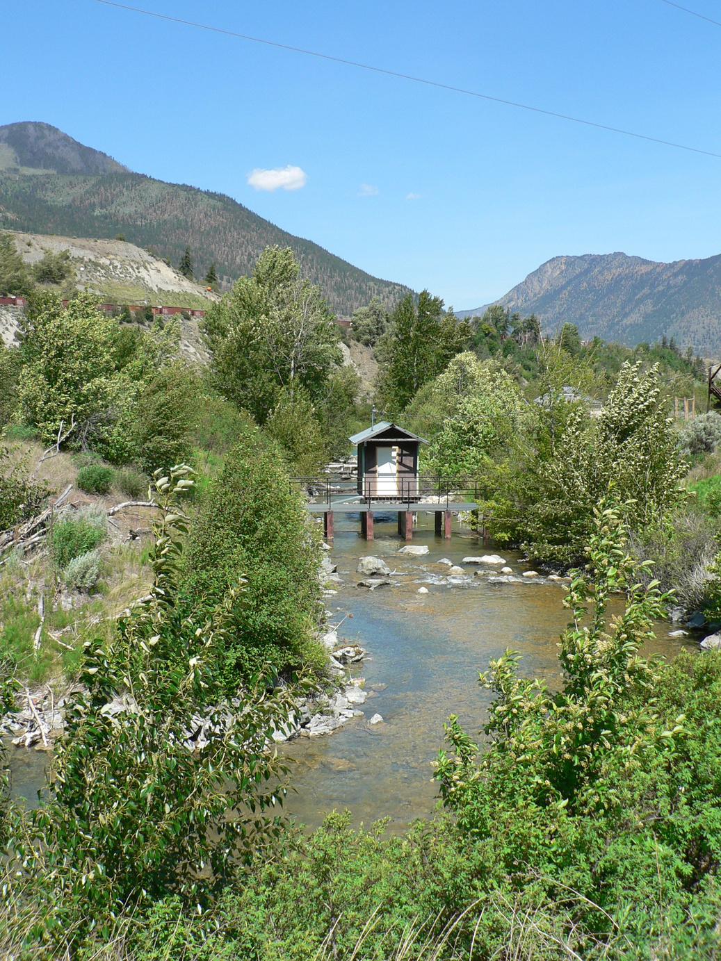
From the white gate, follow the right trail for ~275m to cache ~1m off and 90° to the right of the trail.
56
Letterboxing Clues:
Please check geocaching.com before you go!
Red Rock Views & Vistas
SITE IDENTIFICATION
Nearest Community: Lillooet, B.C.
Geocache Location:
N 50°42 112' W 121°57.217'
UTM: East 0573893; North 5617195 10U
Altitude: 828m/2717ft
Date Established: N/A
Ownership:
Crown Land & First Nations
Accuracy:
5 meters
Overall Difficulty: 1 5
Overall Terrain: 3 5
Access Information and Restrictions:
Parking is available at the paved turnaround at the south end of Victoria Street Red Rock Trail is the road straight off the end of the turnaround that follows along the bank Follow the trail and turn right at the intersecting road and follow it up the hill. Take the first right, just before the large blue water reservoir Stay left on the flat area under the power lines The proper road runs left and starts to climb again after the power lines Stay on this road all the way up to Red Rock (do not follow any of the small dirt bike or hiking trails off the road) continue your ascent on the old road to the left. The road ends at Red Rock Follow the trail down the ridge to the view point Remember this is a hike, be prepared with plenty of water and let others know where you are headed
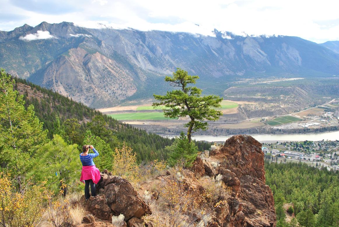
The crimson crags of Red Rock loom like a sentinel above Lillooet.
This familiar landmark provides a spectacular vantage point offering panoramic vistas of the town below; the striking confluence of the blue waters of Cayoosh Creek with the muddy brown Fraser River; and the ever-changing play of sun and shadow on the surrounding mountain peaks
The hike to Red Rock is an experience to savour. It takes you from dry hillsides dotted with Ponderosa pine and up into stands of Douglas fir. Balsam root in season, juniper, several varieties of wild berries and wild roses can be spotted along the way.
Listen for the sounds of chickadees, nut hatches and pileated woodpeckers A Lewis’s woodpecker, a red-listed (endangered) woodpecker, has been spotted near the trail. You could be rewarded with a glimpse of this rare bird, which can be identified by its dark, iridescent green-black back, rosy breast and red face rimmed with black.
APPLY STICKER HERE
Red Rock is not red sandstone Instead, it is Mariposite, a kind of nickel silicate Red Rock gets its distinctive red colour from the oxidized iron on the outside of the rock Mariposite is found in the Shulaps mountain range northwest of Lillooet and at the base of the steep slopes of Fountain Ridge, directly across the Fraser River from Lillooet and Red Rock Long before the Fraser carved its deep path through this rugged valley, a swath of Mariposite ran from Red Rock’s outcrop across to the base of Fountain Ridge.
The hike to Red Rock is rated moderate, with sturdy shoes and good general health required But there was once a more challenging way to reach the top of Red Rock
In the early decades of the 20th century, Lillooet celebrated Canada’s July 1st birthday with a community event called
57
Site # 040303 GC1V1V4
Phase l
simply, “The July ” One of the highlights of ‘The July’ was a gruelling foot race up to Red Rock Fleet-footed competitors would run up the mountainside, complete a circuit around Red Rock and then descend pell-mell to Lillooet. Chief Bill Machell’s father was one of those competitors. Chief Machell says his father never won the exhausting race, but he was justifiably proud to have finished it.
The best hiking time is in the morning. Do not try to hike this trail on a hot July afternoon. Also avoid doing this hike in the rain because you will encounter numerous muddy spots and your shoes will feel as though they each weigh fifty pounds Always bring plenty of water Black bears have been spotted in the vicinity, so be alert and stay on the road, do not veer off
On a scale of ‘Easy’, ‘Moderate’, ‘Difficult’ and ‘Most Difficult’, the Red Rock trail is rated Moderate. You can do it in running shoes, but hiking boots certainly do not hurt, and a hiking pole is helpful in navigating the slippery slopes near the top. You can estimate that this will take you one and a half to two hours for the climb to this majestic lookout, with a much quicker return trip of approximately one hour. This represents the average time a fit adult hiker takes to complete the trail, with occasional short stops for drinks, snacks and rest.
Remember, Red Rock is farther than it looks But the gorgeous scenery is well worth the effort!
Written
and researched by Wendy
Fraser
BIBLIOGRAPHY & SOURCES
(2005) Lillooet Hiking Guide: Canyon to Alpine BC: Lillooet Naturalist Society Birch-Jones, V (2009) Personal Interview Lillooet Naturalist Society Machell, B (2009) Personal Interview Chief of T’it’q’et First Nations Vanderworf, G. (2009). Personal Interview. Local prospector. Wortelboer, M. (2009). Personal Interview. Local Red Rock hiker.
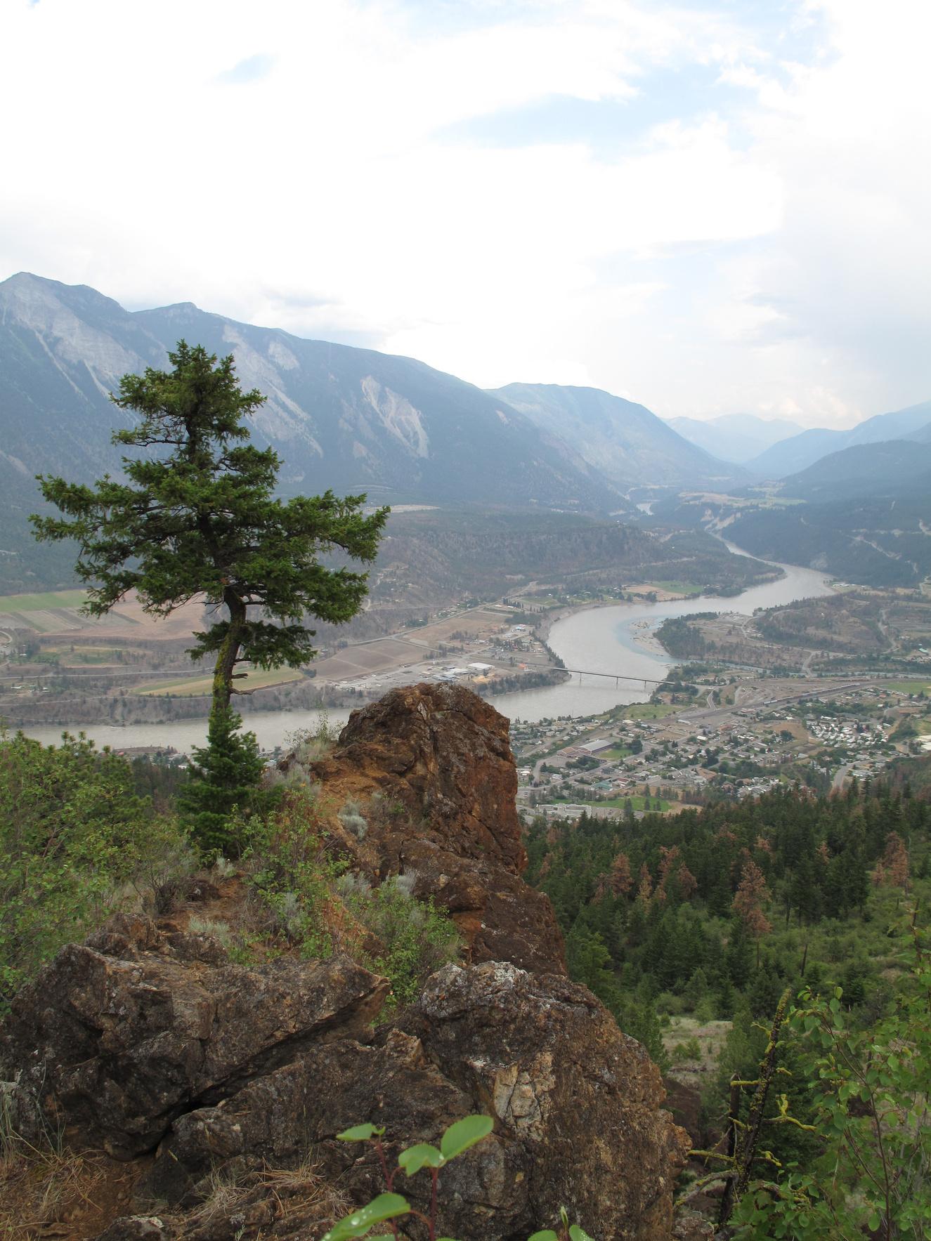
As Red Rock breaks into view on your left, the cache is ~20m towards the viewpoint on the trail Then turn right and go ~3m just down over a small ledge and it is camouflaged in rock.
58
Letterboxing Clues:
Please check geocaching.com before you go!
The Birth of Logan Lake Pioneers & Early Settlers
SITE IDENTIFICATION
Nearest Community: Logan Lake, B C
Geocache Location: N 50°29 966' W 120°48 776'
UTM: East 0655104; North 5596447 10U
Altitude: 1155m/3790ft
Date Established: 1970
Ownership: District of Logan Lake
Accuracy: 5 meters
Overall Difficulty: 1 5
Overall Terrain: 1.5
Access Information and Restrictions: Public road, year-round access, vehicle accessible. Located with the District of Logan Lake. Parking is available at the ski trail parking lot. High visibility area, use stealth.
For more information or to report a problem with this site please contact:
Gold Country Communities Society
P.O. Box 933 Cache Creek, B.C. V0K 1H0 Tel: 1-877-453-9467
Email: info@exploregoldcountry com
For more site pages go to: www.exploregoldcountry.com www geocaching com
I n the heart of Gold Country in the early 1970s there was a brand new town offering golden opportunities to those who dared to come. One of the newest and youngest towns in British Columbia, Logan Lake was built on the copper potential of the Highland Valley. And how long does it take to build a town from scratch? Not long when there is will, cooperation and, well, copper, lots and lots of copper.
Ranchers had been settling in the area since 1870 By the early nineteen hundreds it was miners who came to the valley Copper porphyry was abundant in the area Those willing to experience the trials and tribulations of mining soon staked claims. In 1910 well known surveyor Frank Cyril Swannell explored and mapped the Highland Valley.
The intense labour and great distances to take copper to a smelter did not prove as economical as they had hoped It was a long haul by horse drawn wagon on steep dirt cattle trails through the Highland Valley to Ashcroft and beyond Many dreams of wealth were dashed and claims and mine shafts soon abandoned
APPLY STICKER HERE
It was the mid-sixties before technology would be available to present the copper mining industry with a more feasible and economical approach to mining in the Highland Valley. Alongside other mining ventures, Dr. Egil Lorntzen, a geophysicist, after exploring and staking claims in the area, saw the real potential in excavating and removing the large quantities of copper
With substantial investing and mine engineering, the mining excavation would soon begin. And so would the construction of a town to provide homes and services to those few who were currently employed by Lornex and those many that soon would be.
Summertime 1970, excavation for utility services underground and surveying for housing began It was phase one of the new town Housing starts began in the early winter and hay bales were used to insulate the basement concrete and water lines to
59
Site # 050102 GC1V1WP Phase l
protect them from freezing
In the meantime while the town was being erected, literally from the ground up, Victoria appointed John Aldrich from Lornex as Mayor, and Councillors Douglas Guild, Russell Scott, James McDonald and William Gilmore. The Village of Logan Lake was incorporated and M.L.A. Phil Gaglardi presented the provincial flag.
All the town and district services were built in one area providing easy access The town hall with council chambers, town clerk’s office and Lornex housing services were all together in the municipal and district building. Next door were the Fire and Rescue services and RCMP, while public health was across the road. Retail shops and the library were all built in a pedestrian only mall. Lornex donated the eight hundred thousand dollar construction costs for sewage and wastewater services and a television repeater station. A recreation society was formed and Lornex donated money for the playground and sports fields, as well as, the construction costs for a community recreation centre.
At the beginning of August 1971 the people came Entering onto Galena Drive, the first phase of housing was completed and wound onto Beryl and Amber Drives There were eighty homes, five condos and thirty trailer lots ready for residents The school was completed by enrolment date The brand new town of Logan Lake was now populated
A little more than a year after its inception, the inaugural ceremony took place on November 13, 1971. Phil Gaglardi presented the town seal and gavel to Mayor Aldrich. The Village of Logan Lake was now official.
The copper of the Highland Valley is a valued metal More importantly, the Highland Valley copper from the Lornex mine laid the foundation for the birth and growth of a newly erected town In the seventies Logan Lake provided many golden opportunities for young families Today many families still remain Beautifully situated, Logan Lake is a still a thriving town in the heart of Gold Country
Written and Researched by Angela
Wynton
BIBLIOGRAPHY & SOURCES
Cunliffe, B. (2009). Personal Interview.
Hanson, W.M. (1984). Logan Lake B.C. First Steps. Eye West Publication. Scott, C. (2009). Personal Interview.
Scott, J. & Wiggins, B. (Undated). History of Logan Lake. Logan Lake, BC: Hand printed by Betty Wiggins.
Letterboxing Clues:
Follow Chartrand Ave , then turn left on Breccia Park in ski trail lot Southwest of ski trail signage follow road ~60 paces from yellow gate posts, then turn 90° left and go ~8 paces to fallen tree. This cache is disguised by bark approx. half way along the tree.
60
Please check geocaching.com before you go!
Logan Lake Pioneers Pioneers & Early Settlers
SITE IDENTIFICATION
Nearest Community: Logan Lake, B C
Geocache Location: N 50°29 424' W 120°49 425'
UTM:
East 0654366; North 5595420 10U
Altitude: 1044m/3425ft
Date Established: 1970
Ownership: District of Logan Lake
Accuracy: 10 meters
Overall Difficulty: 2
Overall Terrain: 1 5
Access Information and Restrictions: Public road, year-round access, vehicle accessible Located within the District of Logan Lake Parking available at Whispering Pines Cemetery
For more information or to report a problem with this site please contact:
Gold Country Communities Society
P.O. Box 933 Cache Creek, B.C. V0K 1H0
Tel: 1-877-453-9467
Email: info@exploregoldcountry com
For more site pages go to: www.exploregoldcountry.com www geocaching com Site
Up in copper country, nestled in the Highland Valley, is a small but mighty town not yet four decades old. Built by the copper mining industry and with the determination of Egil Lorntzsen and many others, Logan Lake is a village of new era pioneers. Dr. Lorntzsen discovered copper and started one of the world’s largest open pit copper mines. Logan Lake was built because of his perseverance and largesse.
Ranchers had been pre-empting and homesteading in the surrounding area since the turn of the twentieth century Ranches were long established at Mamette Lake and Meadow Creek. However, there was no central industry or town to draw families to the area. Well, not until Lornex mine established itself as one of the largest open pit mines in the world.
Logan Lake was the chosen site to build the town It is believed the lake got its name from a Savona Indian named Tslakan He had a daughter whose name had been adapted to English as Anne Logan, thus the name Logan Lake
APPLY STICKER HERE
The town took a year plus to structurally build and was open for occupancy on August 2nd, 1971. The first to arrive were Willis and Evelyn McBride. Willis was a mining engineer and arrived with his family from Asbestos, Ontario. On their heels were Glen and Johanna Scott, who had pioneered Elliot Lake in Ontario. Willis and Evelyn’s son, young Doug McBride, was the first student employee of the village, working under the supervision of Clifford Proznick Cliff came to Logan Lake in 1970 during its construction, moved his family to town in June 1971 and remained to become the first village employee
Bobby Cunliffe also arrived with his wife and family in August. Bobby, a mechanical engineer from Britain, was to be the maintenance supervisor for the Lornex mine. The following month he created a boys and girls club for the many youngsters now in Logan Lake.
61
050103 GC1VBWP Phase l
#
Postmistress Rose Naismyth also arrived in August and Canada Post was first established in the basement of her home until October Joe and Mary Moss arrived from Kamloops to open and run a Safety Mart grocery store. It was opened on September 5th and the Mosses not only carried food and the basics but also provided gardening and hardware supplies.
An RCMP detachment was established and Constable Larry Larsen and Corporal John Boh began their patrol of Logan Lake and the surrounding Highland Valley The Hitchens, Brian a principal and Vallerie a teacher, would be opening the school with an enrolment of ninety-seven elementary pupils and twenty-two kindergarteners A nurse, Marie King, arrived as did Dr Shaw Marie later went on to be mayor in 1978
In 1973, the energy of Bill Maggs came to town. He became the public works manager, the fire chief, founded the country club and started a winter polar carnival. He was also instrumental in the building of the recreation centre.
And they kept on coming By mid-November 1971 five hundred people were living, working and playing in Logan Lake Within the next few months another one hundred homes would be completed
The town continued to grow. By 1974 the population was nearly fifteen hundred people. Logan Lake became a desirable town to work, play and raise a family. Its appeal was spreading. At its peak in 1981, the population had grown to more than twenty-six hundred and currently remains steady around twenty-three hundred.
Logan Lake was a fresh town built by the hard work and perseverance of many people in the early seventies It grew from sod to a village with all the amenities for residents who thrive on what the area has to offer It may not have a museum or a long history, but what it does have is a concise history with lots of stories; stories of the people who were the first new era pioneers The very people, who today some forty years later, enjoy sharing their tales and their town with visitors, the new era pioneers and people of Logan Lake are a gold mine of information on how to successfully build and grow a town in Gold Country.
Written and Researched by Angela Wynton
BIBLIOGRAPHY & SOURCES
Cunliffe, B (2009) Personal Interview
Hanson, W.M. (1984). Logan Lake B C First Steps. Eye West Publication. Scott, C. (2009). Personal Interview.
Scott, J. & Wiggins, B. (Undated). History of Logan Lake. Logan Lake, BC: Hand printed by Betty Wiggins.
Letterboxing Clues:
Head along the east (left) side of cemetery to the rear gate, then follow the lane ~67 paces to the power line road Follow this to the right ~122 paces to the road junction on right, and then turn south (left) 90° through clearing ~58 paces Look to your right for rocks in tree line then it is ~7 paces to tree line and cache near logs
62
Please check geocaching.com before you go!
Pioneers & Early Settlers
Transvaal Mine
SITE IDENTIFICATION
Nearest Community:
Logan Lake, B C
Geocache Location: N 50°33 867' W 121°00 934'
UTM: East 0640541; North 5603273 10U
Altitude: 1771m/5811ft
Date Established: 1899
Ownership:
Crown Land Accuracy: 5 meters
Overall Difficulty: 2
Overall Terrain: 1.5
Access Information and Restrictions:
From Hwy #97C, access Cinder Hill forest service road Be prepared for all conditions, back country access There is no cellular service & vehicle with good clearance required for rain bars Up-todate maps are advised, as logging roads and cut blocks change landscapes
For more information or to report a problem with this site please contact: Gold Country Communities Society P O Box 933 Cache Creek, B C V0K 1H0 Tel: 1-877-453-9467
Email: info@exploregoldcountry com
For more site pages go to: www exploregoldcountry com www geocaching com
The ‘Novak’ cabin was built by pioneer miner George Novak while he worked at the Transvaal mine.
Northwest of the District of Logan Lake exists mountains rich with local mining history Of the late Triassic and early Jurassic period, this Nicola volcanic rock is of the Guichon batholith, with Miocene basalt
The batholith is a great irregular mass of coarse-grained igneous rock more than one hundred kilometres square. It is one of the most studied intrusions of country rock in the Canadian Cordillera. Rich in copper and molybdenum, it is the principal copper reserve for British Columbia.
Much of the area is covered by till, an unconsolidated sediment containing all sizes of rock fragments from clay to boulders This sediment with the great boulders was deposited by alpine glacial action. These massive dull green-black rocks are basaltic andesite.
The history of the Guichon batholith, in terms of mining, goes back to the turn of the twentieth century thanks to pioneers like George Novak
APPLY STICKER HERE
Born in Ontario in 1862, George was the oldest child of a large family. George left home at the age of 16 and began his mining career in Butte, Montana; a famous mining town. By 1895 George had followed other interested miners to the Kootenay region of British Columbia. He later came to Ashcroft, where he met a couple of fellows who wanted him to go north to the Cariboo after gold, but George never made the trip.
Samples of copper ore and rough sketches provided by local native Spence, beckoned George to the Highland Valley, where he spent the whole summer of 1898 Within a couple of years Novak had staked six claims, including the Transvaal, reportedly staked September 20, 1899. This group became
63
Site # 050104 GC1TQFD
Phase l
known as the Highland claims By 1902, with partners Hosking and Knight, he had opened up good sized bodies of ore on the Transvaal property
Several other miners also staked claims in the Highland Valley; the ore was there along with the dream of something big to come. The ore was first moved by pack horse and later by freight wagon, but uneven terrain and the steep grade made movement of the ore to the Canadian Pacific Railway loading docks in Ashcroft difficult at best Although testing continued at various sites and better roads were considered there was never enough investment money to fulfill the potential of the Valley’s ore
During the 1920s and 1930s many of the claims were allowed to lapse, and the partners moved on to other ventures. But not so for George Novak who was described by the department of mines as “plucky”. George continued to work the Transvaal tunnel from 1929 until 1945 out of his own pocket. It was during this time that George built his cabin; one side was used for living and the other side for his supplies.
George continued to work the mine sporadically until he retired at the age of 91 He died in Ashcroft, British Columbia in 1957 at the age of 94, just a few short years before the dreams of Highland Valley became a reality George Novak is buried in the Ashcroft cemetery
Written and Researched by Kathy Paulos
BIBLIOGRAPHY & SOURCES
Alrae Engineering Ltd. (1969). Department of Mining and Petroleum Assessment Report. Vancouver, B.C. Alrae Engineering Ltd. (1989). Department of Mining and Petroleum Assessment Report. Vancouver, B.C. George Novak passes away. (1957, August 18). The Ashcroft Journal. Hadn’t seen his brother in 52 years (1939, June 22) The Ashcroft Journal Howes, K (1980, July) George Novak, Highland Valley Copper Nicola Valley Historical Quarterly Vol 3No 2 and 3 Merritt, B C Lean, P (1980, July) Highland Valley Copper Nicola Valley Historical Quarterly Vol 3 - No 2 and 3 Merritt, B C
Meredith-Jones, S (2007) MINFILE No 092INW011 Retrieved May 5, 2009, from Ministry of Energy, Mines and Petroleum Resources Web site: http://imperial minfile gov bc ca/Summary aspx?minfilno=092INW011 Press, F., & Siever, R. (1986). Earth. W.H.Freeman & Co.
Letterboxing Clues:
Stay on main Cinder Hill FSR, past branch roads, ~6.5km to cattleguard. Continue ~1 5km and park at large flat on left
Continue on foot along the old road on left ~245 paces to Cabin From doorway on northeast side of cabin cache is ~34 paces northeast under a fallen tree.
64
Please check geocaching.com before you go!
Highland Valley Copper Mine Geological Wonders
SITE IDENTIFICATION
Nearest Community:
Logan Lake, B C
Geocache Location: N 50°30 404' W 121°01 194'
UTM: East 0640405; North 5596846 10U
Altitude: 1374m/4507ft
Date Established: 1962
Ownership:
Private Property
Accuracy: 5 meters
Overall Difficulty: 1 5
Overall Terrain: 2.5
Access Information and Restrictions:
From Logan Lake, travel west 18 km on Hwy #97C and turn onto Viewpoint Rd. From Ashcroft the mine is approx. 43 km east on Hwy #97C Follow Bose Lake Rd for about 2 km, before a left turn onto a dirt road The mine is private property with no access, view from cache site & lookout
For more information or to report a problem with this site please contact:
Gold Country Communities Society
P O Box 933 Cache Creek, B C V0K 1H0 Tel: 1-877-453-9467
Email: info@exploregoldcountry.com
For more site pages go to: www exploregoldcountry com www.geocaching.com
APPLY STICKER HERE
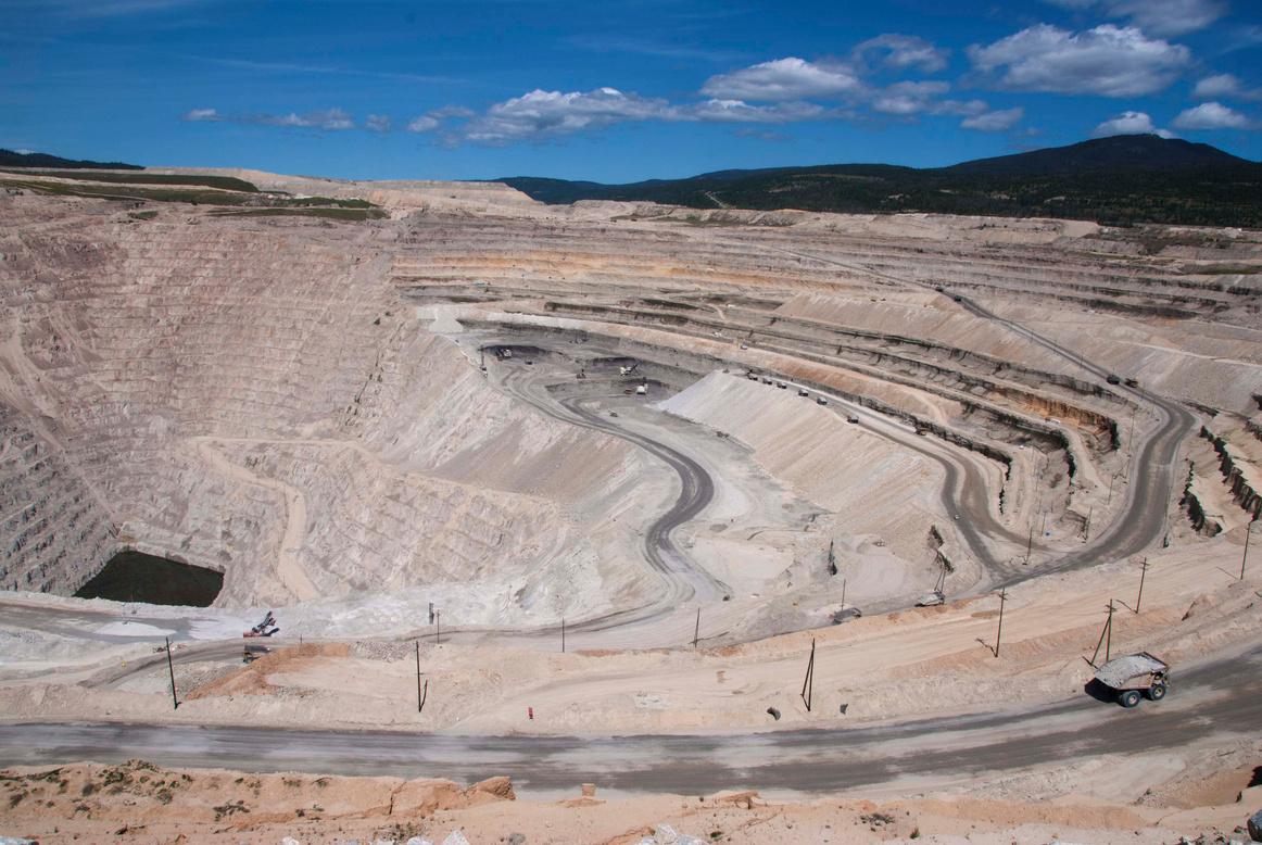
Highland Valley Copper Mine is one of the largest open pit copper mining and concentrating operations in the world. The size of the operation laid out below you is astonishing to a first time viewer; it is said that astronauts can use the Valley pit to mark their place in space, as it is one of earth’s features visible on a clear day.
The history of Highland Valley Copper dates back to 1962, with the commissioning of the Bethlehem Copper Mine (on the north side of the highway) The official opening of the Bethlehem Mine on February 1, 1963 brought new prosperity to Ashcroft, 43 km to the west, where many of the employees lived.
Japan’s Sumitomo Metal Mining Company Ltd. put up 5.5 million dollars to develop the mine, after being convinced by Herman (Spud) Heustis to invest in the project Heustis became convinced that the mine would be a viable operation after prospecting in the area and investigating abandoned claims New Brunswick born Heustis, a well-respected businessman with significant connections and vision, was a major force in the successful opening of the first low-grade high volume open pit copper mine in Canada. One of the three Bethlehem pits was named Heustis.
The Bethlehem Mine sites were followed by discovery of the Lornex ore body in 1963 Stripping of the Lornex deposit began in 1970 and the milling of the ore commenced in 1972 The Municipality of Logan Lake was constructed and incorporated in 1970 to accommodate the growing workforce at Lornex In 1964 the Valley deposit was discovered; however, stripping of waste rock was not initiated until 1982
Today, the Highland Valley Copper operation is the largest open pit copper mine in Canada, employing more than 1,000 people. Owned by Teck Cominco and Highmont Mining
65
Site # 050201 GC1TXPX
Phase l
Company, this site produces 1% of the world’s copper and 1 5% of the world’s molybdenum
In 2008, Highland Valley Copper produced 254 million pounds of copper from 334,000 tonnes of copper sulphide concentrate and 3,800 tonnes of molybdenum sulphide concentrates, containing 4.2 million pounds of molybdenum. Because the ore bodies only average 0.38% copper a total of more than 86.9 million metric tonnes of rock is mined, of which 44.9 million dry metric tonnes of ore is milled.
Copper concentrate is transported in bulk trucks 43 km to the rail yard at Ashcroft, then by rail to North Vancouver and finally by ship to overseas smelters. The molybdenum concentrate is packaged on site for shipment.
Highland Valley Copper has an active environmental management program covering waste management, land and water reclamation, as well as, site decommissioning At the end of 2007, approximately 2,292 hectares, out of a total disturbed area of 6,181 hectares, had been re-vegetated
Waste stripping for Highland Valley’s 300 million dollar mine life extension is continuing with the pushback of the east wall in the Valley Pit. The pushback of the west wall is necessary to extend the mine life to 2019.
Upon closure, the mine is committed to reclaiming the land to a sustainable state, “equal to or better than what existed prior to mining, on a property average basis ”
Written and Researched by Christine Whitehead
Please check geocaching.com before you go!
BIBLIOGRAPHY & SOURCES
(2007). Highland Valley Copper Mine, British Columbia, Canada. Retrieved February 12, 2009, from Mining Technology Web site: http://www.mining-technology.com/projects/highland/ Belton, B second edition revised by Forster, H (2002) Bittersweet Oasis, a History of Ashcroft and District 1988-2002, Ashcroft, BC: Village of Ashcroft Highland Valley Copper: Information Package 2009 (2009) Logan Lake, BC
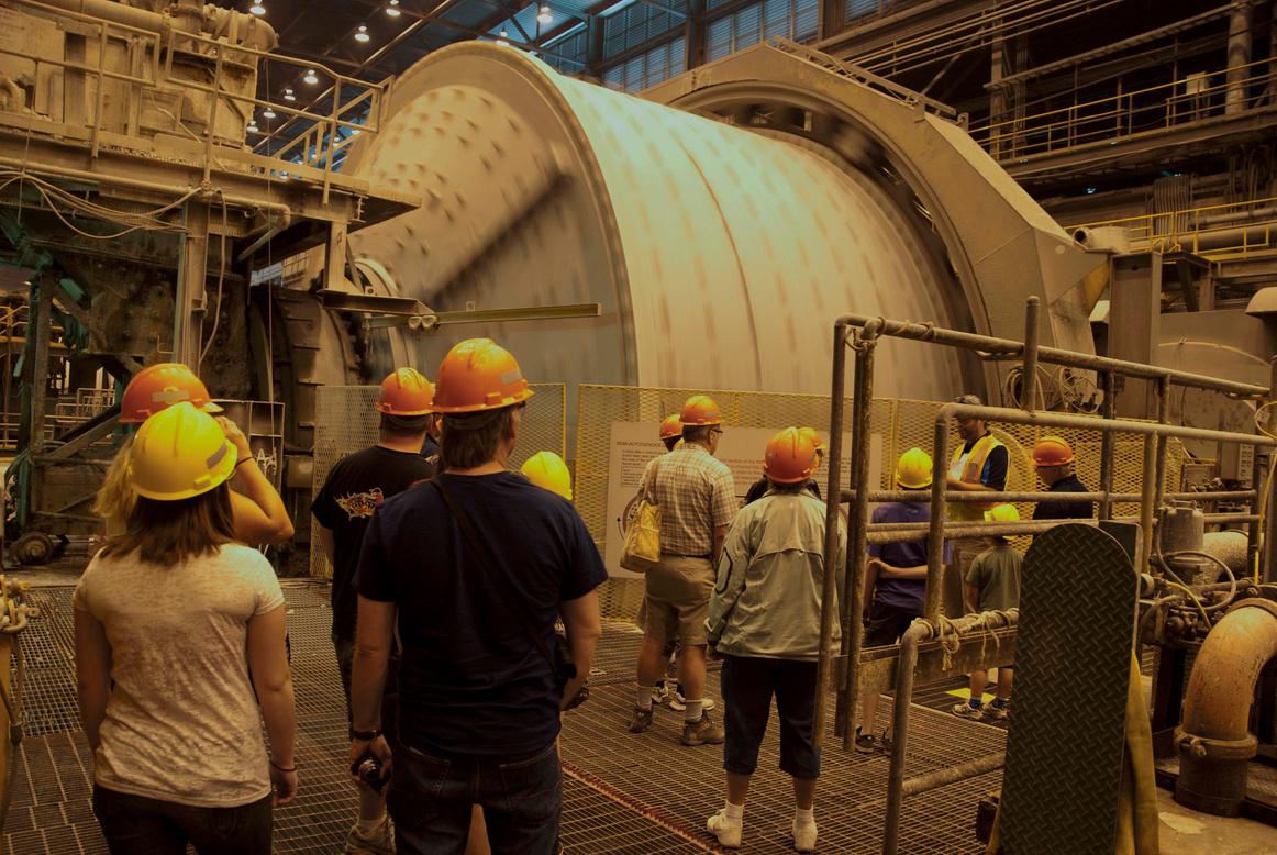
Letterboxing Clues:
Turn left off Bose Lake Road under power line and follow ~ 100 m to wide, flat area. Walk up power line road ~ 320 m, at the crest of the hill ~6 paces past a stump on your left and before pole 146, turn left 90° and walk ~ 16 paces over bank and up to pine tree. Then turn 45° right and go ~ 25 paces to next pine on crest of hill and again turn 45° right and follow trail along the crest of the hill ~20 paces At bush turn 90° left and go ~13 paces down hill before turning 90° left and finishing ~7 paces to fallen tree.
66
Paska Lake
SITE IDENTIFICATION
Nearest Community:
Logan Lake, B C
Geocache Location: N 50°31 708' W 120°39 337'
UTM: East 0666156; North 5600015 10U
Altitude: 1475m/4838ft
Date Established: N/A
Ownership:
Crown Land
Accuracy: 5 meters
Overall Difficulty: 1 5
Overall Terrain: 1 5
Access Information and Restrictions:
From Logan Lake, take Meadow Creek Rd to Paska Lake Rd Parking is available in each of the recreation sites
If stopping along the road, please pull well off in wide spots
For more information or to report a problem with this site please contact: Gold Country Communities Society P O Box 933 Cache Creek, B C V0K 1H0 Tel: 1-877-453-9467 Email: info@exploregoldcountry.com
For more site pages go to: www exploregoldcountry com www.geocaching.com
& Vistas
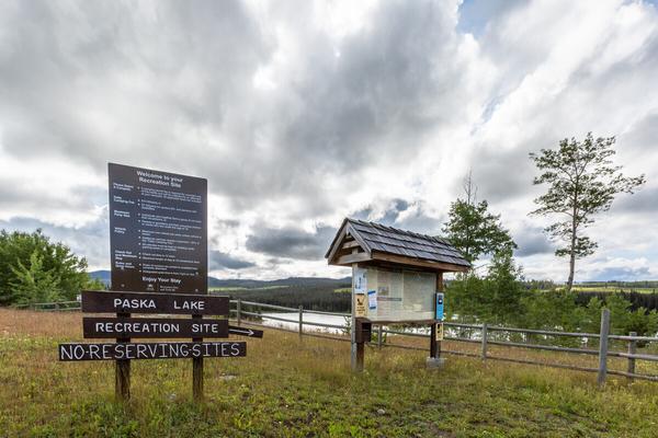
The Meadow Creek Road is the main route between Kamloops and Logan Lake. It can be accessed off the Coquihalla Highway near Lac le Jeune or by driving east from Logan Lake. The road travels through open country dotted with ranches. Part way along the road, a side route climbs north to a series of Highland Lakes.
The Paska Lake Road is a good road and suitable for two wheel drive vehicles, as it climbs up beside Morrison Creek on its way to Paska Lake Beyond, road conditions are good during summer, but will vary with the seasons. Some of the more remote lakes require a four wheel drive vehicle with good clearance.
From the turn off, Paska Lake is a 14 km drive. The route in is forested and the views are limited, but at Paska Lake, the views open up and beautiful Paska Lake lies to your right At 1,440 meters elevation (4,724 feet), it is fifty hectares in size, very accessible and well-used Paska is stocked with rainbow trout anda popular summer destination It freezes over from November right through to mid-May
APPLY STICKER HERE
An open, B.C. Forest Service Campsite lies on the west bank of the lake. There are fifty sites with picnic tables, pit toilets and a boat launch. Many campers come to Paska Lake and venture out to fish, hike, mountain bike, dirt bike, ATV, ride on horseback or explore The lake is used for canoeing, boating and swimming In the winter, the area is used for snowmobiling and cross country skiing
Centered at Paska Lake, there are trails east up the slopes of Chuwhels Mountain or north to Greenstone Mountain. Many smaller lakes, side roads and trails exist for anyone who wants to explore.
Paska Lake has excellent populations of freshwater shrimp, chironomid, caddis fly, mayfly and dragonfly larvae,
67
Views
Site # 050301 GC1VNQ7
Phase l
, providing feed for the trout that grow up to three pounds It is a very good fly fishing lake
Face Lake, sixty hectares in size, is a short drive north of Paska and is also called Mile High Lake. There is a small B.C. Forest Service Campsite on the north end of the lake with ten sites, a car top boat launch and a private resort on the lake. Trolling for trout is the best method for fishing on this highland lake.
Beyond Face Lake, the road gets rougher and in some seasons may require a four wheel drive vehicle, but the lakes beyond are worth the slow going
Dominic Lake is north of Paska, it is 36 hectares in size and sits at 5,000 feet. Ice remains on the lake until the end of May and there is a fishing camp on the lake with cabins and boats. The lake is stocked with rainbow trout and because of its elevation; the fishing is good for the whole ice-free season, although trout sizes are smaller
Beyond Dominic Lake, Dairy Lake is 26 hectares in size and lies at 1,460 meters or 4,789 feet. There is a small B.C. Forest Service Campsite and a boat launch. This lake is sometimes subject to winterkill. Further down the slopes to the north lies Duffy Lake at 23 hectares and 1,160 meters (3,800 feet). It can also be accessed from the north via the Greenstone Mountain road system. This is another B.C. Forest Service Campsite, a boat launch and excellent fishing.
On this highland plateau, there are numerous other lakes including the Wyse Lakes and Roper Lake This is an area worth exploring, staying for awhile and returning to Try out the Paska Lake Road this summer!
Written and Researched by Doug Smith
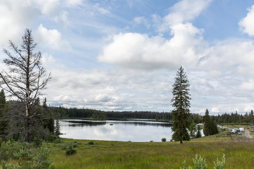
68 Letterboxing Clues: Across the road from pole 105, go ~5 paces from the road edge to a juniper covered
log.
Please check geocaching.com before you go!
Lytton Reaction Ferry
SITE IDENTIFICATION
Nearest Community: Lytton, B C
Geocache Location:
N 50°14.825' W 121°35 650'
UTM: East 0600233; North 5567049 10U
Altitude:
187m/612ft
Date Established: 1940
Ownership:
Lytton First Nations & BC Ministry of Transportation & Infrastructure
Accuracy:
6 meters
Overall Difficulty: 1
Overall Terrain: 1 5
Access Information and Restrictions: Public road, seasonal (ferry closed at high water), vehicle accessible. Located 2.5km northwest of Lytton on Hwy 12. Turn left onto the Lytton Ferry Rd.
For more information or to report a problem with this site please contact: Gold Country Communities Society P O Box 933 Cache Creek, B C V0K 1H0 Tel: 1-877-453-9467
Email: info@exploregoldcountry com
For more site pages go to: www exploregoldcountry com www geocaching com
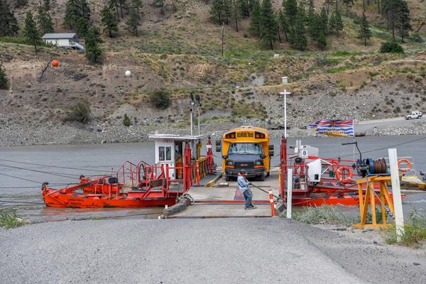
First Nations people initially travelled across the rivers at Lytton by canoe. Early European settlers built several “ferries,” which were generally row boats attached to a cable. The current form of crossing, a reaction ferry, was first built in the 1940s.
The Lytton Reaction Ferry is a traditional non-powered river ferry Consisting of two steel pontoons, a small deck and a crew house, its simple construction has withstood the test of time The ferry is attached to the cable spanning the river with a ‘traveller’ and managed with a ‘bridle’ of steel cables and sheaves A simple wooden dock on each side of the river provides a docking area for the ferry and ramps to load vehicles and passengers.
To begin crossing, a rudder at the forward end of the ferry is lowered turning the ferry at an angle to the river’s flow Since the cable over the river prevents the ferry from being pushed downstream the force of the current propels the ferry across
The ferry is lashed to the dock to allow loading and unloading then the opposite rudder is lowered into the river, allowing the ferry to return across the river. There is no engine and no electricity is required, providing a charming five minute ride on a sunny afternoon.
APPLY STICKER HERE
The Lytton Reaction Ferry provides access to the west side of the Fraser, home to approximately 300 people School buses bring children across to Lytton daily and visitors and hikers can access the front end of the Stein Valley Nlaka’pamux Provincial Park
Bearing great historical, cultural and spiritual significance, this park provides the nature purist with wonderful backcountry hiking opportunities. You may also follow a gravel road 65 km north to Lillooet or 30 km south to Boston Bar; however, neither road is recommended to occasional drivers.
Although the daily ferry ride is peaceful, there has been excitement too On May 9, 1979 cables broke loose leaving the
69
Pioneers & Early Settlers
Site # 060102 GC1TQ34
Phase l
ferry to float down the Fraser River Boats from Boston Bar rescued it, gently pulling the ferry to shore
No one was injured and even the car on board made it home safely However, tragedy had previously struck in the 1960s, when a car rolled off the ferry into the river and two local seniors drowned.
The ferry operates from 6:30 am to 10:15 pm daily, closing for lunch and dinner. No reservations are required; however, there can sometimes be a wait. Do not be late; the last crossing is at exactly 10:15 pm not approximately 10:15 pm The Lytton Reaction Ferry holds two vehicles and twelve people but does not operate yearround Due to the dangers of being struck by debris carried down the river, the ferry ceases operation each spring, during high water It has also been temporarily closed for ice flows
Visit with the ferry operators to learn more adventures and mechanics of this innovative crossing.
Written and Researched by Peter McArthur
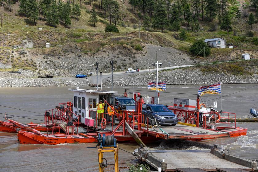
Letterboxing Clues: Ride the ferry to the west side and park. Walk up the ferry cable pillar access road to group of trees on right Look for cache in ‘unnatural’ drift wood pile under a pine tree.
70
Please check geocaching.com before you go!
Gravesites & Mystical Places
Lytton Cemetery
SITE IDENTIFICATION
Nearest Community: Lytton, B C
Geocache Location: N 50°13.252' W 121°34 477'
UTM: East 0601682; North 5564160 10U
Altitude: 289m/947ft
Date Established: 1876
Ownership: Village of Lytton
Accuracy: 5 meters
Overall Difficulty: 1
Overall Terrain: 1.5
Access Information and Restrictions: Highway, year-round access, vehicle accessible Located on Hwy 1 across from Kumsheen Secondary School
Please park in visitor parking area and stay clear of graveyard entrances Cache is not in the graveyard, please respect all interred here High visibility area, use stealth.
For more information or to report a problem with this site please contact: Gold Country Communities Society P O Box 933 Cache Creek, B C V0K 1H0 Tel: 1-877-453-9467
Email: info@exploregoldcountry com
For more site pages go to: www exploregoldcountry com www geocaching com
APPLY STICKER HERE
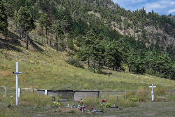
Hidden beneath tall grasses, amid the pine needles, existed a gold mine of history. It was 1986 when the Village of Lytton decided to uncover and explore one of their greatest treasures.
With little information to go by and no map of the cemetery or grave markers, it was a matter of mining history in the dark Sometimes that is what archaeologists do, they lay out their grid system to ensure accuracy of points and record an entire block to be slowly dug and explored
However, at the Lytton Cemetery no one was interested in digging up any graves. What they did want to do was reveal who was there, when they were interred and where they were placed. This would allow historians the opportunity to dig up stories and lore on local pioneers With the help of Exton Dodge Land Surveyors, a grid was created and 160 survey points were established across the cemetery, dividing it into blocks
Many volunteers helped clear the site revealing the markers. Every gravestone or marker was then examined in detail and individual photos were taken. Volunteer Marie Heaster deciphered and recorded all the information, mapping the cemetery and its residents. All the information and photographs for each gravesite was collated and filed in the Lytton Village office.
What did all this work reveal? Many interesting stories on the people who built the village of Lytton lay above today’s town What does 2nd century Rome and 19th century northern Italy have to do with Lytton? Now, that is an interesting tale.
During the reign of a rather oppressive 2nd century emperor, a group of Romans immigrated to northern Italy They were soon known as the ‘rebellious ones’ and their name, over the years of linguistic evolution, became Rebagliati
71
Site # 060402 GC1TQ25
Phase l
In 1882 Bernardo Rebagliati voyaged for the New World After his trip around Cape Horn and up the coast from San Francisco, arriving in Hastings Mill, he continued up the Fraser to Yale From Yale, by horseback through the canyon, he soon discovered his ‘new Italy’ at Lytton.
Rebagliati went to work in the local store and shortly thereafter bought it. In 1886 he sent to Italy requesting a wife, and his bride Angela soon arrived. A new store was built across the street in 1892 and another, adjacent on the south side, would be added in 1913 Unfortunately, it burned to the ground in the second Lytton fire of 1949 Angelo Rebagliati, Bernardo’s brother, arrived to Lytton in 1890 with his wife Concessa, Angela’s sister Bernardo and Angela would come to have ten children together, while Angelo and Concessa added seven children of their own This was the beginning of the ‘Little Italy of Lytton’
Who else is buried in the historic Lytton Highway cemetery? Headstones and markers have revealed the resting place of so many who were pioneers to Lytton and the surrounding area. There are Chinese families, First Nation families, church families, all pioneers and first people of the Lytton area before, during and after the Gold Rush. There is also the notable grave of Archbishop Richard Small, the ‘Archdeacon on Horseback’.
Today these pioneer families lay peacefully watching over their village, the Rebagliatis, Lorings, Gammies, Johnsons, Brophys and many others Their hard work and stories are a gold mine of the history and tales of Lytton, in the heart of the Fraser Canyon in Gold Country
Written and Researched by Angela Wynton
BIBLIOGRAPHY & SOURCES
(2008). Retrieved April 5, 2009, from The Lytton Museum and Archives Web site: http://www.lyttonmuseum.ca
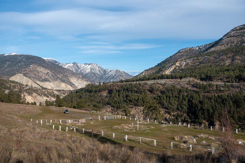
Letterboxing Clues:
This cache is ~203 meters south of graveyard gate closest to Highway 1, in between 3 trees and masked by rocks Walk up the cemetery road to pavement, then turn right and go ~160 paces along the shoulder of the road. Turn 90° right and climb bank ~16 paces to the group of trees.
72
Please check geocaching.com before you go!
Craigmont Mine Geological Wonders
SITE IDENTIFICATION
Nearest Community: Merritt, B C
Geocache Location: N 50°12 111' W 120°53 300'
UTM: East 0650696; North 5563208 10U
Altitude: 755m/2476ft
Date Established: 1962
Ownership: Private Land
Accuracy: 4 meters
Overall Difficulty: 1
Overall Terrain: 2.5
Access Information and Restrictions:
From Merritt, follow Hwy #8 west about 8.5 km to Aberdeen Rd. Pull well off at the pullout as this road has regular industrial traffic. Active mining operations are off-limits; please respect all property boundaries for your safety For more information or to report a problem with this site please contact: Gold Country Communities Society P O Box 933 Cache Creek, B C V0K 1H0 Tel: 1-877-453-9467
Email: info@exploregoldcountry com
For more site pages go to: www exploregoldcountry com www geocaching com
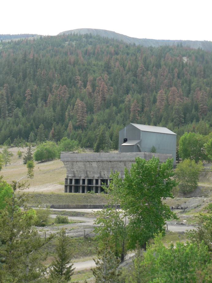
The Guichon Batholith hosts a broad belt of copper mineralization running from Lake Chelan in Washington State through the Nicola Valley and beyond to Cache Creek. It was formed as magma from deep within the earth pushed to the surface 198 million years ago, close to the end of the Triassic Period. The magma’s heat dissolved iron and copper in the surrounding rock, which reacted with limestone from ancient ocean beds to form iron and copper minerals The ore bodies in the Promontory Hills region, formed from the mineral reaction to the limestone, are known as skarn deposits, as opposed to the porphyry copper deposits in the Highland Valley region
Harry D. Merrell and prospector Martin Retan, were doing exploration work for Craigmont Mines around the eastern slopes of Promontory Hills and staking some claims in the winter of 1954. Encountering difficulties while attempting to plot a straight line, their compasses were having trouble finding north and stake lines kept veering away from straight. Something was in that mountain, but it was some time before the funding to explore further became available
The high level of magnetism indicated the presence of magnetite (Fe3 O4 ), a highly magnetic oxide of iron. Further investigation revealed the presence of chalcopyrite (CuFeS2 , Copper Iron Sulfide), and hematite (Fe2 O3 , Iron (III) Oxide) as well.
APPLY STICKER HERE
Craigmont Mines was a newly reorganized company under the leadership of Neil H McDiarmid, a lawyer who had begun his career in Likely, B C , and now began acquiring claims in the area The optimistic McDiarmid had hopes of billions of tons of copper He envisioned a copper smelter, and using the coal near Merritt, an iron smelter and steel industry He wanted to produce finished products in Canada, rather than ship raw materials off to Japan. Unfortunately, this was economically unfeasible at the time and the magnetite and hematite were relegated to the
73
Site # 070201 GC1TQEP
Phase l
tailings pile The mine itself was a financial success, quickly paying off its initial loans
Craigmont Mine was B.C.’s first modern, large-scale open-pit mine, changing to an innovative sublevel caving method of underground mining when the maximum safe depth for the open-pit method was reached. The problem of transporting thousands of pounds of ore more than a mile down the mountainside was solved with a cable belt conveyer that, when loaded with ore, produced some of the electricity needed by the mine. The mine employed as many as 660 people at one time during its peak years and over 5,000 by 1983 From 1962 to 1982 Craigmont Mine produced 36,750,000 tons of ore averaging 1.28% copper.
Today, Craigmont is recovering magnetite from the mill tailings for use in the coal mining industry, the fertilizer industry, specialty paints and as an abrasive in the sand blasting industry. Material from the old tailings pile is first mixed with water and converted to slurry The magnetite in the slurry is then extracted by use of magnetic separators, and the extracted magnetite is ground to various sizes depending on the specifications of the customer Since 1993, Craigmont Mines has produced more than 600,000 tonnes of media grade magnetite product
An examination of the copper still left in the Promontory Hills region is ongoing and looks positive. In the future, copper may flow from the Craigmont Mine yet again.
Written and Researched by Maggie Meekis
BIBLIOGRAPHY & SOURCES (2003). Craigmont Mines. Retrieved May 5, 2009, from Craigmont Mines Web site: http://www.craigmontmines.com/ Craigmont Mines Property. Retrieved June 5, 2009, from Christoper James Gold Corp Web site: http://www.christopherjamesgold.com/projects/british columbia/southern bc/craigmont/ Shewchuk, M. (1983). The Craigmont Story. Surrey, BC: Hancock House Publishers Ltd.
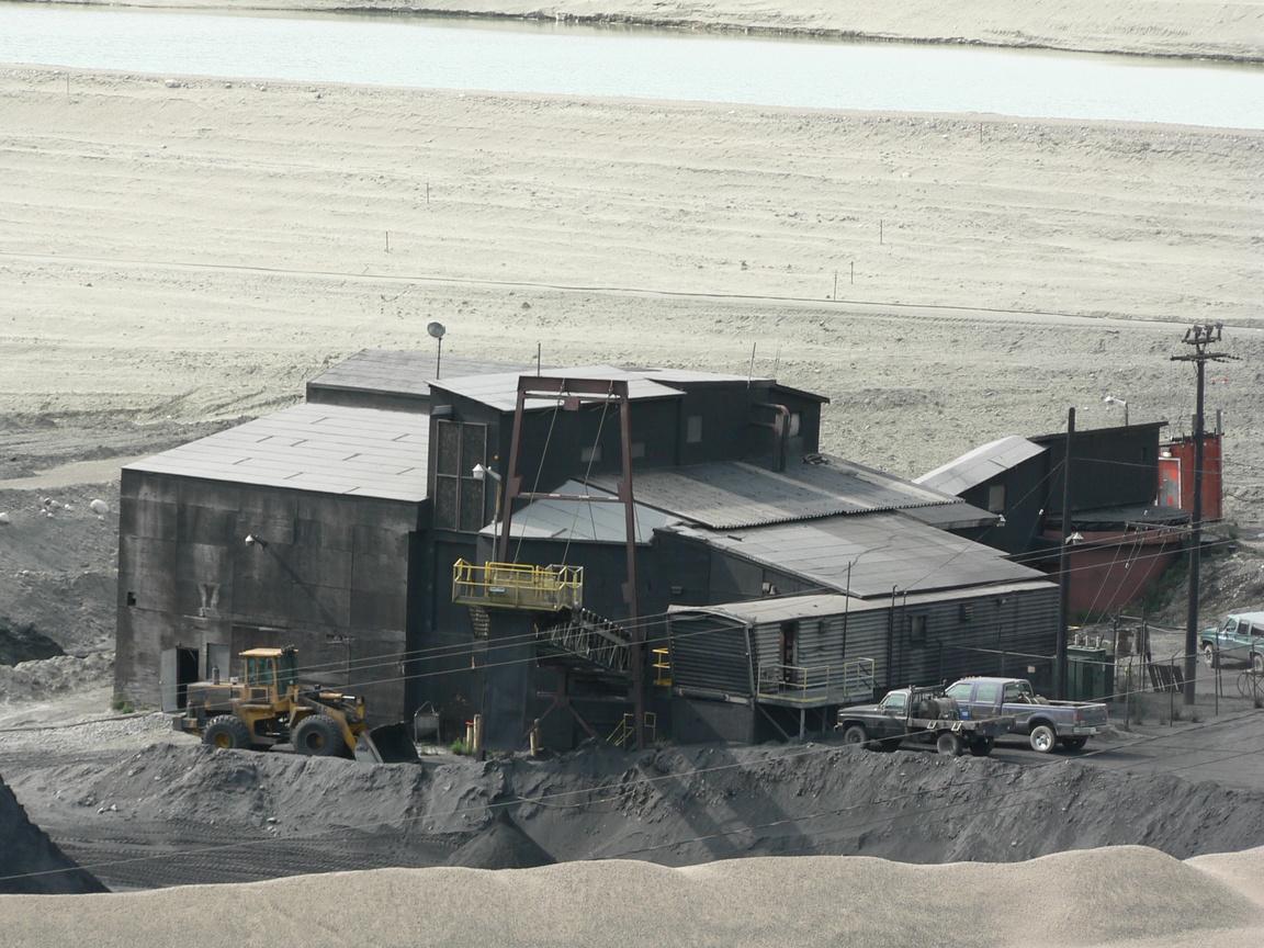
Letterboxing Clues:
Park on left hand side of road at wide corner 6 7 km from Hwy 8
From the reflector at the top of the parking area, cross the road and climb the bank, then turn left and walk along the edge ~ 23 paces. Turn 90° right and walk ~23 paces to hollow log.
74
Please check geocaching.com before you go!
Monck Provincial Park
SITE IDENTIFICATION
Nearest Community: Merritt, B C
Geocache Location: N 50°10 614' W 120°32 414
UTM: East 0675627; North 5561197 10U
Altitude: 730m/2395ft
Date Established: 1951
Ownership:
BC Provincial Park
Accuracy: 6 meters
Overall Difficulty: 1 5
Overall Terrain: 2 5
Access Information and Restrictions:
From Merritt, follow Hwy 5A north to Monck Park Rd Kikuli pits are visible near the grass playing fields within the park Private property borders the park, please be respectful and practice no trace hiking Parking is available at Monck Park entrance and within the park day use area
For more information or to report a problem with this site please contact:
Gold Country Communities Society P O Box 933 Cache Creek, B C V0K 1H0 Tel: 1-877-453-9467
Email: info@exploregoldcountry.com
For more site pages go to: www exploregoldcountry com www.geocaching.com
APPLY STICKER HERE
& Vistas
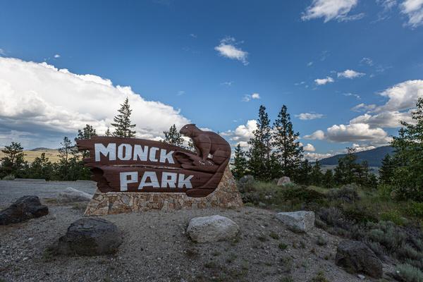
Monck Park offers an extraordinary combination of First Nations history and biodiversity. Amid the ponderosa pine, black cottonwood, douglas fir, tule and cattail, are remarkable Kikuli depressions and native petroglyphs. Originally part of one of the largest ranches of the last century, the land was bequeathed as a park and protected environment in 1919 by Charles Sydney ‘Major’ Goldman and named after his son, Commander Victor Robert Penryn Monck of the Royal Navy The provincial park was established in 1951
Monck Park is 92 hectares bordering Nicola Lake and complimented by the gentle rolling hills of the Thompson Plateau, surrounding hills rise to nearly 610 meters above the lake. While the southeast side of the lake is grasslands and meadow, the northwest area is a light forest of ponderosa pine. The shores are covered in sage brush, bunchgrass, cactus and rabbit bush, making it an ideal habitat for some of the smaller creatures.
From the lake shore one can look back at the steep uplands
These lava cliffs, and the broader area, are scattered with boulder-sized rocks, known as glacial erratics, remnants from glacial wash and landslides. The bench of the lake is a flat natural beach where both tule and cattail, once used by aboriginal people to make mats, grow in dense patches on the white sandy shores.
The varied vegetation and diverse ecosystems that make up the park are home to mammals, including wapiti and mule deer These fauna were an important part of aboriginal existence and their community economy; other key populations include beaver, hare, marmot, porcupine, muskrat and tree rodents Additionally, a variety of edible roots, berries and fruits supplement the diet of regional fauna The pristine waters of the lake reveal kokanee (land-locked salmon), carp and trout. A bird watchers’ paradise, you may find hidden in the scrub and
75
Views
Site # 070301 GC1TTW0
Phase l
underbrush families of grouse and ptarmigan A variety of migrating waterfowl decorate the lake seasonally
Artifacts found within the park unveil evidence of the unique cultural history of the Nicola Valley Salish people dating back to 1500 BC. Further evidence of Salish culture revealed with the Kikuli pit houses of Monck Park. Kikuli houses are subterranean winter dwellings with central stone hearths. The traditional Kikuli is an efficient log frame conical structure, earth sheltered and protected, and often open to the sky. There are several in the area that were originally excavated and recorded in the 1890s by anthropologist and photographer James Alexander Teit The dwellings are now covered over as pit house depressions to be preserved and protected, vestiges of ancient Salish living
Further along from the park, past the second beach, one can again travel back several thousand years. On these great glacial rocks are the legends and drawings of the Salish people. These petroglyphs, prehistoric drawings on stone, are pictographs depicting the stories, values and culture of the inhabitants of the Nicola Valley thousands of years past.
Monck Park is rich in geological history, an archaeological gold mine and a scenic glory, bearing a kingdom of wildlife With Nicola Lake it is a picture perfect landscape, a shining jewel, in the heart of Gold Country
Written and Researched by Angela Wynton
Please check geocaching.com before you go!
BIBLIOGRAPHY & SOURCES
Archer, D. (1970). Monck Park Site: EbRd3 Summary Report. In B.C. Ministry of Forests Library. Monck Park Provincial Management Plan. (1996). In B.C. Ministry of Environment, Lands & Parks. Teit, J (2006) The Salish Pit House In Canadian Encyclopedia
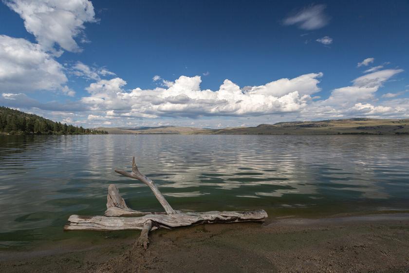
Letterboxing Clues: From the park entrance, cross the road and follow the marked trail ~300 m to the first sign and take the left trail At the next sign stay left At third sign take the right trail for ~25 m to tall tree stump.
76
Merritt Viewpoint Views & Vistas
SITE IDENTIFICATION
Nearest Community: Merritt, B C
Geocache Location: N 50°07 113' W 120°48 282'
UTM: East 0656937; North 5554119 10U
Altitude:
767m/2516ft
Date Established: 1970
Ownership: Private Property Accuracy: 4 meters
Overall Difficulty: 1.5
Overall Terrain: 3.5
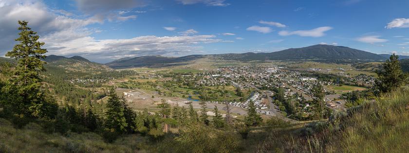
High enough above Merritt for a view of nearly every nook and cranny in the city and some aspects of the valley beyond it, the Viewpoint has for years provided lovers with solitude and introduced viewers to the geography of a rural city.
Access Information and Restrictions: From Merritt follow Nicola Ave./Hwy 8 to Juniper Dr Turn up the dirt road between the gravel pit and the cemetery, follow this 1 5 km Steep terrain, be careful of footing Restrictions: No overnight camping, no motorbikes or ATVs, no garbage
For more information or to report a problem with this site please contact:
Gold Country Communities Society P O Box 933 Cache Creek, B C V0K 1H0 Tel: 1-877-453-9467
Email: info@exploregoldcountry.com
For more site pages go to: www exploregoldcountry com www.geocaching.com
APPLY STICKER HERE
In the 1970s, it was a Merritt businessman who saw the value in creating a viewpoint Henry Norgaard had founded Norgaard Ready Mix, a concrete producer, below a rocky outcrop at the northwest corner of Merritt in 1960-61 Some fifteen years later, he gouged a mile-long road up to the viewpoint and carved out a parking area, then planted a flagpole.
Predictably, the flagpole was hit by vandals, who pulled it down with a four-wheel-drive vehicle. Henry fought back by moving the flag pole higher, out of reach of vehicles, and slung a 9-by-18foot Canadian flag off it There is no halyard attached to the pole, since that might also tempt vandals, but the pole itself is hinged, so that it can be lowered and a wind-torn flag replaced approximately every six months
Sometime in the 1980s Henry Norgaard and an assistant planted what is surely the Merritt viewpoint’s most intriguing feature: a series of sighting tubes arranged to look down on significant structures and formations in and near Merritt. The sight tubes were arranged to present a bird’s-eye, tunnel-vision view of everything important, but now, years later, some things have moved, and one or two of the sight tubes are now inaccurate
Some of the interesting views to be revealed include the community parks full of paths, recreational fun and great events. Other community recreational facilities are visible supporting both summer and winter family fun for residents and visitors alike. The Visitors Information Centres are highlighted and will not only offer a great view, but also are a veritable waterfall of information on Merritt and the Nicola Valley region. Stop in
77
Site # 070302 GC1TTVC
Phase l
to visit the great staff and ask for any assistance you may need planning your visit
Although looking through the square pipe is a little unnecessary, we dare you to resist. See that large lump in front of you? That is Iron Mountain, at 1,693 meters its peak is accessible via Coldwater Road to Comstock Road and then to Iron Mountain Road. From post three you can see all the way to the Okanagan Connector or Hwy #97C, this is the newest highway connecting Kelowna and Merritt. The old town of Middlesboro once stood where lumber yards now stand in Merritt, and several coal mines were operated throughout the early 20th century. Coal is no longer mined in Merritt, but its influence remains, as a fire that started in an underground coal seam decades ago continues to burn. In winter, the area of the old burning coal mine is usually free of snow as heat rises through the land. Also once its own village, Collettville is now part of the City of Merritt. The large grey-blue building viewed from post number five is Collettville Elementary School.
You are invited to enjoy the glorious views and tidbits of history from this unique viewpoint
Written and Researched by Steve Thornton
Please check geocaching.com before you go!
BIBLIOGRAPHY & SOURCES
Norgaard, H (2009) Personal Interview
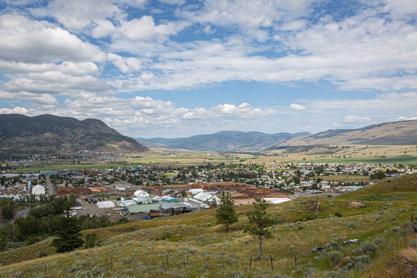
Letterboxing Clues:
This cache is ~42 m northwest of parking area Take the centre trail and climb ~90 paces, then turn left 90° and go ~12 paces to rock grouping. For a slightly longer but less strenuous route you can follow the trail the winds up the hill.
78
Gravesites & Mystical Places
Pineridge Cemetery
SITE IDENTIFICATION
Nearest Community: Merritt, B C
Geocache Location: N 50°07 188' W 120°47 687'
UTM: East 0657641; North 5554280 10U
Altitude: 622m/2040ft
Date Established: 1910
Ownership: City of Merritt
Accuracy: 5 meters
Overall Difficulty: 2
Overall Terrain: 1.5
Access Information and Restrictions:
Public road, year-round access, vehicle accessible From Merritt, follow Nicola Ave /Hwy 8 to Juniper Dr Please park at site ID coordinates, along the roadside No vehicles are permitted on the cemetery property Respect all interred here
For more information or to report a problem with this site please contact:
Gold Country Communities Society P O Box 933 Cache Creek, B C V0K 1H0 Tel: 1-877-453-9467
Email: info@exploregoldcountry.com
For more site pages go to: www exploregoldcountry com www.geocaching.com
APPLY STICKER HERE
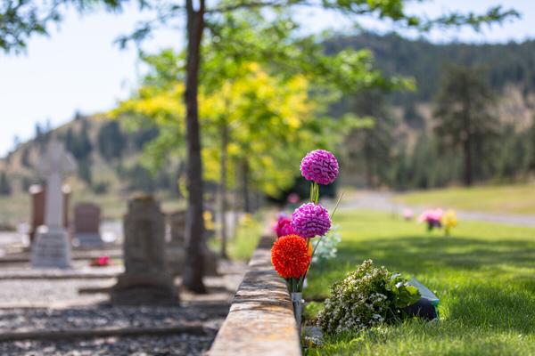
Street names say as much about a town’s history as its old buildings and museums. A trip to the Pineridge Cemetery in Merritt is much like looking at a roadmap of the area. The newer section of the cemetery is peppered with Garcias and Coutlees, Clappertons and Colletts, family names that were given to streets as well as children.
As you view the Pineridge markers, you walk through the history of Merritt and can locate nearly every street name in town The stories of these pioneers, either large or small, are more than will fill this page. Here are a few, some with streets and some without.
Emma Castillou has her monument placed at the entrance of the cemetery. Her husband, Joseph, was a packer and her son, Henry, became a County Court Judge
James Alexander Teit was born in Scotland and immigrated to Canada at the age of 19. Settling in Spences Bridge, Teit married a local Nlaka’pamux woman named Lucy Artko and became enamored with native culture. Teit was an ethnologist of note, and at a time when anthropologists and archivists were few and far between, helped to preserve the culture of the time.
George Brown Armstrong first opened a store in Lower Nicola but in 1907 moved his operation to Nicola Avenue “Armstrong’s” became Merritt’s first Post Office as well He was elected Mayor of Merritt in 1929 but his term was cut short by his untimely death later that same year
Dr. Cyril S. Williams, the superintendent of the first Nicola Valley General Hospital, married Rosella Stewart, a schoolteacher, in 1912 She unfortunately died in childbirth at the age of 36
William Henry Voght became known as “The Father of Merritt,” and his memorial grave marker expands this somewhat and proclaims him “A Father unto all.” His
79
Site # 070401 GC1TTWA
Phase l
gravestone, in the corner of the Pineridge Cemetery, is clearly visible when approaching the cemetery from the west and overlooks the city Born July 15, 1837, in the town of Holstein in what is now West Germany, Voght left at 16 to try his luck in America. He spent some time in Iowa, New Orleans and California, and then in the summer of 1858 Voght travelled by ship to Victoria, and in 1873 he moved to the Nicola Valley. Voght had five children with his native wife, Theresa Clama, from Boston Bar: Timothy (whose gravemarker is also in the Pineridge Cemetery), William H., Matilda Anne (Cleasby), Christina (Collett) and Sophie (Newkirk).
Voght, Jesus Garcia and William Charters were the owners of the three original preemptions, portions of which became the new town site that became known as Merritt Voght helped establish the first school and was a member of the first school board He was involved in the push towards incorporation and died in February 1911, mere months before Merritt incorporated on April 11, 1911
The stories associated with the headstones are many and varied and some are lost forever in time. Visiting the names etched in stone allows us to see the anchors of families and of eponymous streets.
Written and Researched by Maggie Meekis
Please check geocaching.com before you go!
BIBLIOGRAPHY & SOURCES
(1978). Commemoration: William Henry Voght, “The Father of Merritt”. Nicola Valley Historical Quarterly. Vol. 1, No. 2. (1979). Commemoration: James Alexander Teit. Nicola Valley Historical Quarterly Vol 2, No 2 (1980) Medical Doctors of the Nicola Valley Nicola Valley Historical Quarterly Vol 3, No 1 (1983) Coutlee Nicola Valley Historical Quarterly Vol 6, No 2 & 3 (2007, February 16) James Alexander Teit Retrieved May 8, 2009, from Canadian Museum of Civilization Web site: http://www civilization ca/cmc/exhibitions/tresors/ethno/etp0800e shtml
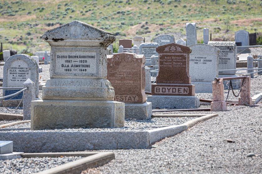
Letterboxing Clues:
Turn left off Juniper Drive, onto dirt lane and go ~ 100 m to first slight left where you can park along the road, stop in the middle of the corner
Go ~16 paces towards the cemetery from your parking location. This cache is not an ammo can and blends in to the landscape.
80
Trinity United Church
SITE IDENTIFICATION
Nearest Community: Merritt, B C
Geocache Location: N 50°06 667' W 120°47 502'
UTM: East 0657891; North 5553321 10U
Altitude: 599m/1964ft
Date Established: 1910
Ownership:
Trinity United Church
Accuracy: 5 meters
Overall Difficulty: 1 5
Overall Terrain: 1
Access Information and Restrictions:
Trinity United is located within the City of Merritt Parking is available on the street Please be respectful of neighbouring residences’ and private property Keep gate closed, visiting church dogs to remain in the yard
For more information or to report a problem with this site please contact:
Gold Country Communities Society P O Box 933 Cache Creek, B C V0K 1H0 Tel: 1-877-453-9467
Email: info@exploregoldcountry.com
For more site pages go to: www exploregoldcountry com www.geocaching.com
APPLY STICKER HERE
& Vistas
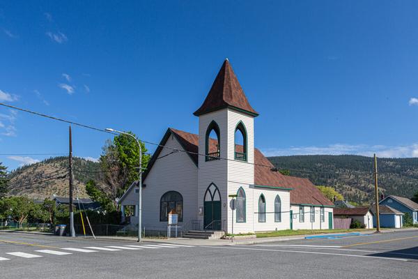
The Trinity United Church in Merritt is old enough to have its affiliation with history run back into the dramas of time.
There was a small but vigorous population of Presbyterian worshippers in Merritt at the dawn of the 20th century, but they did not have a church and so their services were conducted in a hodge-podge of locations: Hyland’s Hall, the old Merritt Herald building, the Methodist Church, the home of pioneer William Voght Rev W J Kidd and his wife had been in Merritt only a short time when he determined that a church must be built While Mrs. Kidd helped organize a Ladies’ Aid, which would supply a fund for a church organ; he began doggedly to pursue the construction of a real church, with wooden pews, for the area’s Presbyterians.
In 1908, Kidd saw that land for a church was purchased from William Voght, for the sum of $400 A deed was then made out to five gentlemen who would act as trustees: G B Armstrong, Isaac Eastwood, Alexander J Gordon, Phillip McLean, and the seller, William Voght
A contract for the building was let to Phillip McLean in 1910, and by November of that year, St. Andrew’s Presbyterian Church was erect and habitable. Opening services were held on the first Sunday of December, with the Rev. George Murray of Nicola and the resident pastor, Rev Kidd, conducting services In 1921 the last payment was made on the mortgage and the property was clear of debt
Around that time, William Voght, who has been called the father of Presbyterianism in Merritt, presented the church with a stained glass window, in memory of his wife, which was placed in the south end of the church overlooking Voght’s farm residence a block south.
81
Views
Site # 070501 GC1TTXZ
Phase l
Soon, a Sunday school room was added to the church, and then a manse on the adjoining lot The church was left with a debt of $1,500 when the manse was finished, and by 1922, that debt had grown to $1,800 Church organizations worked hard thereafter to pay off the bills, and soon they were able to paint the church and manse, and fit the church with a badly-needed furnace.
In 1925, an event occurred across Canada that would profoundly affect the Merritt Presbyterian church. Four Protestant denominations, the Presbyterian Church, the Methodist Church, the Congregational Union, and from Saskatchewan the Association of Local Union Churches, were merged and the United Church of Canada was formed
Therefore, on June 5, 1927, the former Presbyterian Church of Merritt became Trinity United Church, and some 80 years later, this historic building and congregation continues to thrive.
In 1923, Rev W R Brown published a booklet describing the earliest years of the Presbyterian Church in Merritt; fifty cents from the sale of each booklet went to pay the church’s debt Near the end of this short publication are these words about the church “Its bond of union is not organization, but sympathy, and it knows no law, but the law of love ” Today, Rev Brown’s heartfelt words continue to define the community and spiritual response of this important Merritt church
Written and Researched by Steve Thornton
BIBLIOGRAPHY & SOURCES
Brown, Rev. W.R. (1923). St. Andrews Presbyterian Church Souvenir Book, marking the thirteenth anniversary of the opening of the church. Merritt, BC: Self.
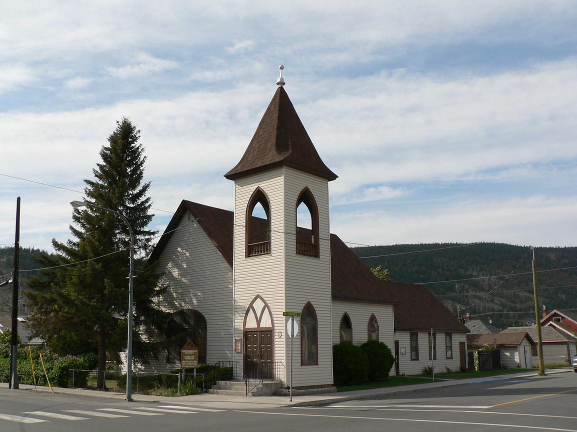
Letterboxing Clues: Trinity United is located on the corner of Chapman St and Quilchena Ave Look in the church yard, just inside gate This cache is not an ammo can and blends in to the landscape.
82
Please check geocaching.com before
go!
you
Pioneers & Early Settlers
Jesmond
SITE IDENTIFICATION
Nearest Community:
70 Mile House, B C
Geocache Location: N 51°15 457' W 121°57 227'
UTM: East 0573005; North 5678994 10U
Altitude: 1157m/3797ft
Date Established: 1870
Ownership:
Private Property
Accuracy: 5 meters
Overall Difficulty: 1.5
Overall Terrain: 1
Access Information and Restrictions:
From Clinton, follow Kelly Lake Rd 15 km to Jesmond Rd The original Jesmond town site is approx 34 km Alternate access to Jesmond Rd via Big Bar Rd Please park beside the large barn on the west Remember this is private property and be respectful
For more information or to report a problem with this site please contact:
Gold Country Communities Society P O Box 933 Cache Creek, B C V0K 1H0 Tel: 1-877-453-9467
Email: info@exploregoldcountry.com
For more site pages go to: www exploregoldcountry com www.geocaching.com
APPLY STICKER HERE
You will not find a restaurant or even a store at Jesmond, but there is something magical about the quiet of the country road, the mountains and the soft green and gold of the sun and the ranchlands. You can almost hear the echoes and smell the dust created by horses and by the old mail truck on the hot summer days of an era gone by.
The history of Jesmond dates back to 1889 when a roadhouse was established Known then as “Mountain House,” it was built on Lot 150 by Nicolas Hammond Nicolas sold to Philip Grinder, an American from Pittsburgh, Pennsylvania. Philip had settled first at Alkali Lake, then Big Bar, before settling down at Jesmond, where he preempted the land for the roadhouse.
In the early days, Phil operated a freight packing business and was away for months at a time He and his native wife, Nancy Kastalamara, had eleven children and thus began a dynasty of Grinder descendants Edward Haller, Philip and Nancy’s grandson, lived with them during 1907 and 1908, helping around their small farm Eddie gave an interview to the Vancouver City Archives in 1958 and related the following story
‘Three packers, Philip Grinder, Conrad Kostering and Alex Burnett had joined forces to make a large pack train to the Nass Country. It was springtime and the winter had been long and hard, upon arriving they encountered natives who were near starvation and desperate Unable to trade with the natives and concerned for their safety, they abandoned their supplies and headed home with their undernourished pack animals Without food, they were forced to resort to utilizing pack animals for sustenance on the return to civilization This misadventure ended the packing business for all three, each settling in the Big Bar and Jesmond region ’
Philip and Nancy’s son in law, Grant Lee, sold Mountain House in 1912 to Harry and Louise Coldwell, a newly arrived
83
Site # 080101 GC1TTQJ
Phase l
family from England There they raised three children, Pete, Elsie and Evelyn
After settling in to the original Mountain House, the family prospered. Harry farmed and did carpentry work when available. Unfortunately in 1921, the Mountain House burned down and was replaced by the current structure.
When the post office was opened in 1919 the Mountain House name was changed to Jesmond, after Harry’s hometown “Jesmond Dene” in England The Coldwell family opened a store and gas station in 1927, which they operated until 1970.
A Vancouver gentleman, now in his 70s, recalls spending childhood summers at the Circle H, a working ranch near Kelly Lake. He and his brother would embark on their annual adventure, by taking the Union Steamship from Vancouver to Squamish and then proceed by Pacific Great Eastern rail to Kelly Lake The boys would often ride horseback from the Circle H Ranch to the Jesmond General Store for ice cream Sometimes they would hitch a ride with the mail truck, which made weekly runs along Jesmond Road
Old-timers recall the excitement created in the Jesmond area in 1950 by the release of a Hollywood western, “Cariboo Trail,” starring Randolph Scott, a major leading actor of the day. The movie’s location was the Big Bar-Jesmond area; however, filming was actually done in the U.S.A.
Today, Jesmond is a private ranch, still owned and operated by the Coldwell family
Written and Researched by Don Logan
Please check geocaching.com before you go!
BIBLIOGRAPHY
& SOURCES
Haller, E (1958) Interview with Vancouver City Archives staff
Patenaude, B (1995) Trails to Gold Victoria, B C : Horsdal & Schubart
Letterboxing Clues: Across from the barn, the northern most building is the old blacksmith shop The cache is here, on the outside of the building and all fences, at the base of the wall.
84
Pioneers & Early Settlers
70 Mile Roadhouse
SITE IDENTIFICATION
Nearest Community:
70 Mile House, B C
Geocache Location: N 51°18 270' W 121°23 806'
UTM: East 0611757; North 5684907 10U
Altitude: 1094m/3588ft
Date Established: 1862
Ownership: Private Property
Accuracy: 3 meters
Overall Difficulty: 1 5
Overall Terrain: 1
Access Information and Restrictions: Highway, year-round access, vehicle accessible Located at the junction of Hwy 97 and North Bonaparte Rd
Please respect no parking signage and remain in public areas
For more information or to report a problem with this site please contact: Gold Country Communities Society
P O Box 933 Cache Creek, B C V0K 1H0 Tel: 1-877-453-9467
Email: info@exploregoldcountry com
For more site pages go to: www exploregoldcountry com www geocaching com
Gold Country is rich with the history of roadhouses and pioneers and 70 Mile House offers both. Mae McConnell knows, after all she recalls tales of the Cariboo Wagon Road from Clinton to 70 Mile and beyond.
After G B Wright and his construction crew completed the phase to 70 Mile in 1862, he and partner J C Calbreith were surprised to see partner Charles Adrian had already pre-empted land and was erecting a large log house This structure would soon serve as the local hostel for the road works crew and later be bought by Wright himself in 1869.
By 1922 Matt and Isobella Porter became the managers of the busy stopping house and 70 Mile Roadhouse would cater not only to wagons but now cars and trucks It is during their ownership that we meet Mae McConnell, the youngest of eight children
Mae’s parents, Lydia and Haveloch Bryant, arrived in the area after spending four years in Clinton. They first settled at the Dunden B.C. Rail Station at the Flying-UGuest Ranch, the oldest established working guest ranch in Canada. Three years later, after working at the ranch for rodeo rider Jack Boyd, the Bryants moved from the dirt floor cabin to their new homestead, Willow Flats at 83 Mile.
APPLY STICKER HERE
Unfortunately, Mae’s father became ill and at the young age of eight Mae was sent to Clinton to work for rancher Arte Bishop and his wife Pearl. Later, Mae would work at the well known Clinton Hotel, home of the famous Clinton Ball. By the time Mae was eighteen years old, and now a young women, she was back closer to home and working at the busy 70 Mile Roadhouse for Granny Porter.
Mae tells us “It was open 24 hours The doors were always open There was a sign at the desk that said ‘Just Holler’, and in the
85
Site # 080102 GC1TTRQ
Phase l
middle of the night Granny or ‘Ma’ Porter, would come down stairs with her oil lantern She would register the guest and then cook a meal ”
It was a very busy roadhouse. “The Porters offered a bed and breakfast for travelers all for just a $1.50. They served a buffet of porridge, bacon, eggs, potatoes, hot-cakes and whipped cream and coffee, and it was help yourself,” remembers Mae. It was at the 70 Mile Roadhouse that Mae Bryant met David McConnell, grandson of Granny Porter Later, as a young woman of twenty-three, Mae married David
David and Mae raised their six children in 70 Mile House. “I remember when there were only three people living on Green Lake We used to visit Hoofy Haines on the big island at the top of the lake We went by wagon; we could cross because there wasn’t much water. We used to ride out to Taylor Lake to visit the Japanese families, we would go everywhere by horse or wagon back in those days. It was better in those days. I loved it then. I would go back anytime, if I could.”
The Bishops, Bryants and Porters have long since been interred alongside other Cariboo Wagon Road pioneers in the Clinton Pioneer Cemetery Although there is no longer a 70 Mile Roadhouse, the history and tales, many told and untold, are still alive with local pioneer Mae McConnell
The 70 Mile Roadhouse burned in 1956, six years shy of its 100th anniversary.
Written and Researched by Angela Wynton
Please check geocaching.com before you go!
BIBLIOGRAPHY & SOURCES (1999). The Cariboo Gold Rush: Roadhouse Proprietors. Retrieved March 9, 2009, from British Columbia Heritage Web site: http://bcheritage.ca/cariboo/people/70mile.htm McConnell, M. (2009). Personal Interview.
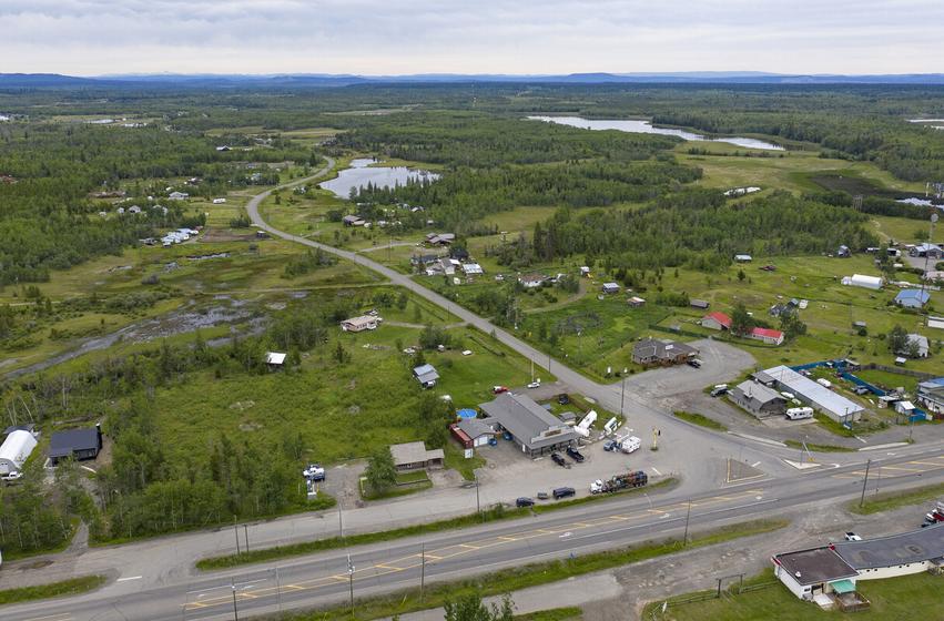
Letterboxing Clues: Park between 70 Mile House store and post office Explore fenced green space next to the store. This cache is not an ammo can and blends in to the landscape.
86
Big Bar Lake Guest Ranch
SITE IDENTIFICATION
Nearest Community: 70 Mile House, B C
Geocache Location: N 51°19 018' W 121°49 388'
UTM: East 0582015; North 5685732 10U
Altitude: 1104m/3623ft
Date Established: 1921
Ownership: Private Property Accuracy: 5 meters
Overall Difficulty: 1
Overall Terrain: 2 5
Access Information and Restrictions:
From Clinton, drive 9 km north on Hwy 97N to Big Bar Rd Marriott Rd is a no thru road, please respect private property markers Park in day use area of Big Bar Provincial Park. Park is approx 5 km beyond Marriott Rd. turn off.
For more information or to report a problem with this site please contact:
Gold Country Communities Society P O Box 933 Cache Creek, B C V0K 1H0 Tel: 1-877-453-9467
Email: info@exploregoldcountry.com
For more site pages go to: www exploregoldcountry com www.geocaching.com
APPLY STICKER HERE
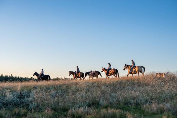
The Lady of Big Bar Lake is the title many have affectionately given Violet May (Peg) Marriott. At the age of 18, after completing high school and “Normal School” in Vancouver, she accepted a teaching position in the Cariboo. As Miss Price, she taught at Spring House School, followed by 70 Mile House, where Harry Marriott met her in 1920. Peg and Harry were married in December 1921 and moved to a log cabin to establish a homestead at Big Bar Lake
Peg’s love for Big Bar Lake will never be questioned; for it is here that she lived for almost 80 of her 107 years… and made history. This petite lady with a strong will and independent spirit faced challenges with outspoken determination. In 1931 Peg and Harry ventured to start a guest ranch and fishing camp By 1934 Peg ran Big Bar Lake Guest Ranch on her own while Harry was working the OK Ranch
In 1947 Peg felt she should buy out Harry, after some negotiation she did so, becoming sole owner of Big Bar Lake Guest Ranch. Her brochure and advertising offered accommodation, meals, horseback riding, fishing, boating, swimming and evening activities. The Ranch operated for more than 40 years with many guests coming back annually. Some of these guests’ ashes are now scattered on the knoll and hill overlooking the lake. Running the Ranch was not easy for Peg or without setbacks There was no electricity, water was brought from the lake, and the outhouse was standard In 1952 a fire destroyed the main lodge, but true to her character she rebuilt and carried on, continuing to have guests until the 1970s Husband, Harry, died in 1969 and son, Ron, the following year Peg concluded the sale of some of her lake property about 1980, retaining a 5 acre parcel where she lived full time until 1997 and in summers until 2002
87
Pioneers & Early Settlers
Site # 080103 GC1TQ4W
Phase l
Today travel into Big Bar Lake is on a hard packed, gravel road, along which you might see deer, moose and bears as you go through forest and meadows with wild flowers You may encounter cattle on the road; cross cattle guards; pass several ranches and see some flooding from beaver dams. If you meet any oncoming vehicles be sure to give a wave…this is the country way. There is a Provincial Park at the Northwest end of the Lake but before reaching it you can take a little trip into history.
Turning right off Big Bar Road onto Marriott Road you will soon come over a hill to the most spectacular view of Big Bar Lake On your left is the knoll and to your right a hill side where ashes have been scattered A little further on is a small white cottage (now slightly altered) which was home to Peg until 2002 After crossing the cattle guard under the Big Bar Lake Ranch sign you will see some remaining buildings of Peg’s Big Bar Lake Guest Ranch One cabin at the end is of particular interest as it shows how the first cabins were built In the winter men walked across the frozen lake to cut the trees for logs which were then brought back across on sleighs Notches were made in the end of the logs for a tight fit The roof consisted of cut poles, a little hay and then covered with dirt. You can see grass now grows there. Besides the Lodge, with adjoining dining room and kitchen, and single cabins, there was a common shower area and an ice house. In the winter blocks of ice were cut from the lake and covered with sawdust so fishermen in the summer could keep fish. As you drive the 5 km of Marriott Road you see the development of new homes with residents seeking the peace, beauty and freedom to be with the nature that Peg so loved.
Violet May (Peg) Marriott, truly a lady from a vanished era, died June 15, 2008 just shortly before her 108th birthday As was her wish, she is buried in The Pioneer Cemetery in Clinton, “Loved and Remembered”
Written and Researched by Leona Paxton
BIBLIOGRAPHY & SOURCES
Marriott, H. (1994). Cariboo Cowboy. Surrey, BC: Heritage House Publishing Company Ltd. Marriott, V. (2008). Personal files and Interviews.
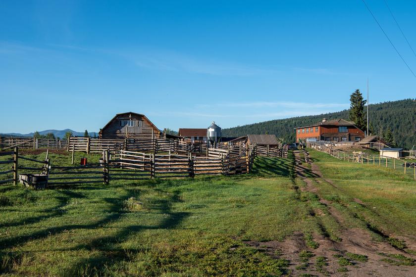
Letterboxing Clues:
Take trail towards lake and then follow first left up the hill to viewpoint, not along the marked trail at the lake’s edge. Go ~200 m up to the top for a fabulous lake view and then hunt near fallen tree opposite to the lake view.
88
Please check geocaching.com before you go!
Crater Lake
SITE IDENTIFICATION
Nearest Community: 70 Mile House, B C
Geocache Location: N 51°21 040' W 121°05 912'
UTM: East 0632412; North 5690538 10U
Altitude:
1024m/3358ft
Date Established: N/A
Ownership:
Crown Land
Accuracy: 4 meters
Overall Difficulty: 2
Overall Terrain: 3
Access Information and Restrictions:
Approximately 25 km east of Hwy 97 on North Bonaparte Rd. Use caution along steep edges and uneven trails. Continue beyond cache location to view the lake.
For more information or to report a problem with this site please contact:
Gold Country Communities Society
P O Box 933 Cache Creek, B C V0K 1H0 Tel: 1-877-453-9467
Email: info@exploregoldcountry com
For more site pages go to: www exploregoldcountry com www geocaching com
& Vistas
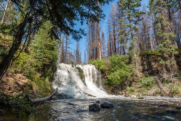
Built along the Cariboo Wagon Road in 1862, by Charles Adrian during the Gold Rush, 70 Mile Road House became a popular stopping place for travelers. After G.B. Wright and his construction crew completed the 23 miles of wagon road from Clinton to 70 Mile, he and partner J.C. Calbreith were surprised to see Adrian had already pre-empted land and was erecting a log structure. This would soon serve as the local hostel for the road works crew and later be bought by Wright himself in 1869 By 1875 Saul & Co , who established 59 Mile Road House at Painted Chasm, purchased the 70 Mile Roadhouse Until its demise by fire in 1956, the stopping house was operated by many others
As gold seekers and adventurers traveled through 70 Mile House, they explored surrounding areas, not necessarily to discover gold but to enjoy the many rich wetlands and beautiful lakes amid the forests and meadows of the South Cariboo. One uncovered gem is Crater Lake, sitting placidly juxtaposed with the evolution of the mining industry in British Columbia.
Traveling along North Bonaparte Road, Green Lake, so aptly named, is only moments away and makes an idyllic picnic spot However, higher and further away from the brilliant green lake you will find Crater Lake, at the bottom of a rushing river, below tumbling waterfalls and looking as deep down as its name might suggest.
APPLY STICKER HERE
A forested and rocky traverse, winding with the river, will take you to the top of the waterfall In the opposite direction a steep and challenging trail takes you 45 metres down to the lake, surrounded by steep embankments and tall evergreens
The Rayfield River plunges into Crater Lake, which is surrounded by basalt rock and feldspar. The geology presents itself from the Pliocene and Miocene Epochs some 10 million and 16 million years ago. These phases of concentrically zoned
89
Views
Site # 080301 GC1TQF0
Phase l
igneous rocks range from alkaline, potassium and sodium rich composition (syenite), to a more silicic granite (diorite) plutonic complex They occur as a window of alkaline plateau basalts and feldspar of the Chilcotin group which blanket the Cariboo and Fraser Plateaus.
Crater Lake is home to trout, as well as other fresh water critters. It is also a watering source for a variety of wildlife. Sit patiently and you may soon observe moose, mule deer, fox, coyote, small mammals, big horn sheep, black bear and, on occasion, cattle The skies above ring with the calls of songbirds, osprey, eagles and hawks The owls are there, but seldom heard
Sit longer and imagine the gold seekers exploring the unknown territory and creating the very history that is Gold Country, British Columbia, as we know it today. Consider the hardships and challenges they faced and you will find a new perspective for your hike back up from Crater Lake.
Written and Researched by Angela Wynton
BIBLIOGRAPHY & SOURCES
Hamilton, W R , Wooley, A R , & Bishop, A C (1985) Larousse Guide to Minerals, Rocks and Fossils 6th Edition New York, USA: Larousse & Co Press, F., & Siever, R. (1986). Earth. W.H. Freeman & Co.
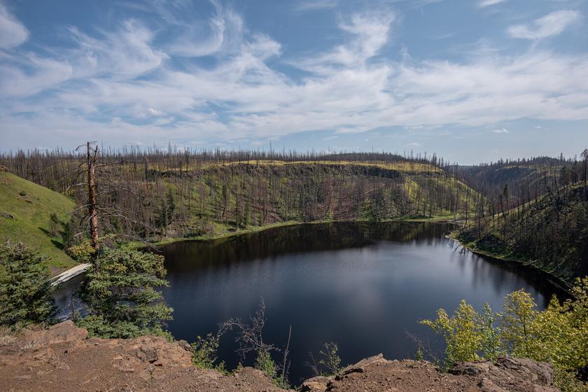
Letterboxing Clues:
Park in small pullout on your right across from pole 258 and just past marker 32-39 Follow the trail ~180 paces then turn 90° left and walk to rocks at the edge of the hill Be careful of wild flowers Cache is tucked in a hidden rock ledge, hunt here.
90
Please check geocaching.com before you go!
Big Bar Reaction Ferry
SITE IDENTIFICATION
Nearest Community:
70 Mile House, B C
Geocache Location: N 51°10 978' W 122°07 799'
UTM: East 0560808; North 5670531 10U
Altitude:
306m/1005ft
Date Established: 1894
Ownership:
BC Ministry of Transportation & Infrastructure
Accuracy:
6 meters
Overall Difficulty: 1
Overall Terrain: 2
Access Information and Restrictions:
From Clinton, drive 9 km north on Hwy #97N to Big Bar Rd Follow the signs to Big Bar Ferry, approx 72 km Do not leave gravel road with any motorized vehicles
For more information or to report a problem with this site please contact: Gold Country Communities Society P O Box 933 Cache Creek, B C V0K 1H0 Tel: 1-877-453-9467
Email: info@exploregoldcountry.com
For more site pages go to: www exploregoldcountry com www.geocaching.com
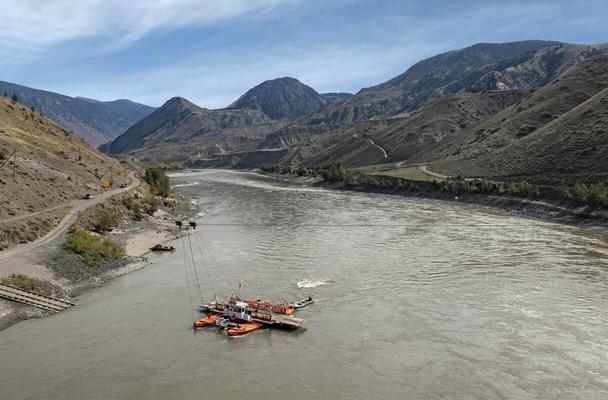
A reaction ferry is a ferry that uses the current of the river to propel the vessel across the river. The ferry consists of two steel pontoons with a wooden deck bridging them, to allow operation in rivers with strong currents. These vessels require overhead cables suspended from towers anchored on either bank of the river. A “traveler” is installed on the cable and the ferry is attached to the traveler by a bridle cable. To operate the ferry, the bridle cable is adjusted so that the pontoons are angled into the current causing the force of the current to move the ferry across the river
Big Bar is the site of British Columbia’s first aerial ferry or tramway, and a reaction ferry has been in service here since 1894. In those days there was a small population of ranchers on the west side of the river. After an accident destroyed one of the reaction ferries, a rancher hooked a chair onto the overhead cable and pulled himself across with his arms. The aerial portion was then constructed here in the early 1920s. Local storytellers say that before the aerial portion was constructed, ranchers were known to hang from the cable and traverse across using the strength of their arms Winter dances at the Big Bar (Howling Dog) Community Hall across the river were the possible incentive!
APPLY STICKER HERE
At one time there were over thirty reaction ferries in operation on the rivers of British Columbia, although mostly on the Fraser and Thompson Rivers. Today, only a few remain in operation.
The Big Bar ferry crossing time is ten minutes and its capacity is two vehicles and twelve passengers There is no crossing fee The schedule is “on demand” from 7:00 am to 7:00 pm, except for a noon to 1:00 pm lunch break and 5:00 pm to 6:00 pm supper break The ferry is closed over the winter The aerial tramway, for passengers only, operates when the river water is low or icy.
91
Views
Vistas
&
Site # 080302 GC1TQCK
l
Phase
If you choose to take the ferry across to the west side of the Fraser and travel on to Lillooet, a very slow 64 km, be sure you start out early, have food, water and a dependable four wheel drive vehicle The vistas are unique and spectacular and worth every hair-pin curve and white-knuckle minute! This route should be taken on a clear day between July and early October. Have your camera ready and bring a picnic lunch to be enjoyed at one of the many scenic picnic areas between the turn off and Lillooet. Alternatively, you could arrange with the ferry operator to bring you back across the river. The ferry operator’s post is the house you can see on the hill above the ferry slip. He will generally come down the driveway to greet you as you approach the ferry.
The original Big Bar Ferry ran directly from the mouth of Big Bar Creek, it is now a mile or so north of its original location
Written
and Researched by
Amy Thacker
BIBLIOGRAPHY & SOURCES
Brundage, M. (2009). Personal Interview. Ministry of Transportation and Highways (2002) Frontier to Freeway: a short illustrated history of roads in British Columbia Retrieved April 9, 2009 from Ministry of Transportation and Highways website: http://www th gov bc ca/publications/frontiertofreeway/frontiertofreeway pdf
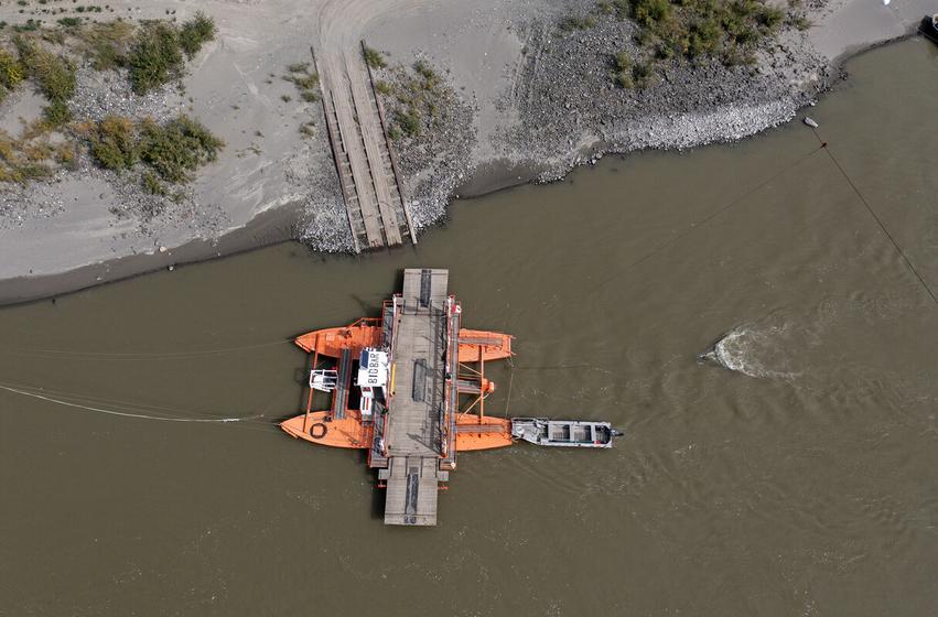
Letterboxing Clues:
From Big Bar Ferry Road, at the High Bar Road intersection stay right, the cache is ~5 km from here towards the Ferry Terminal. On your right you will see pole ‘187’, cache is hidden 10 metres north east up the hill.
92
Please check geocaching.com before you go!
Morens’ Farm & Family Gravesite Pioneers & Early Settlers
SITE IDENTIFICATION
Nearest Community:
Spences Bridge, B C
Geocache Location: N 50°27 451' W 121°18 357'
UTM: East 0620248; North 5590873 10U
Altitude:
323m/1059ft
Date Established: 1880
Ownership: Private Property
Accuracy: 4 meters
Overall Difficulty: 1 5
Overall Terrain: 3
Access Information and Restrictions:
Located at Hilltop Gardens, north of Spences Bridge on Hwy 1. Please park at the fruit stand and avoid residential areas.
For more information or to report a problem with this site please contact:
Gold Country Communities Society
P O Box 933 Cache Creek, B C V0K 1H0
Tel: 1-877-453-9467
Email: info@exploregoldcountry com
For more site pages go to: www exploregoldcountry com www geocaching com
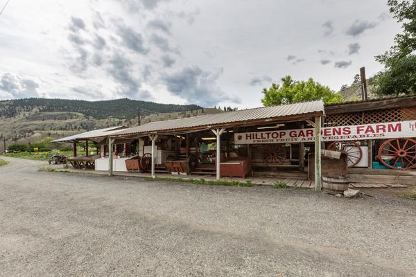
The Morens’ house, built in the 1880s was the homestead of Pierre and Françoise Morens of the Savoie District in France. They were cattle ranchers and orchardists on the new colony.
James Teit arrived in Spence’s Bridge in 1884 to work on his uncle John Murray’s orchard, though his interests soon turned to researching the culture of the Interior Salish people On September 12, 1892, he married his good friend Susanna Lucy Artko, a native from the nearby Twell Valley At 33 years of age, she died of tuberculosis, only six and a half years into their marriage.
James Teit remarried in 1904 to Leonie Josephine Morens, Pierre and Françoise’s daughter. After their honeymoon, they moved into the Morens’ family home until they relocated to a new house in Spence’s Bridge some years later James wrote many of his anthropological manuscripts while living at the Morens’ house
APPLY STICKER HERE
James Teit soon learned the languages of the Shuswap and the Lillooet people and to them became a great and trusted friend. He participated in their hunting and fishing expeditions. James recorded hundreds of songs, collected hundreds of artifacts and costumes for anthropological photographs. He recorded a great deal of information on their social customs and mythology. World renowned as the “anthropologist of the people,” he helped them in many ways, acting as an interpreter on their behalf, assisting them in legal matters and relating their many grievances to the government
James Teit’s research contributions are recognized to be the most complete and accurate description of the culture of the Interior Salish tribes of British Columbia. He passed away on October 30, 1922.
For a time, the Morens’ house was a road house on the Cariboo Road and the white and red building next to the fruit
93
Site # 090101 GC1VA6F
Phase l
stand accommodated the blacksmith and his shop When the Canadian Pacific Railway pushed through, Morens’ house was home to the station master and it later served as a bunkhouse for laborers
John Stepp purchased the property in the 1960s. Wayne Rice, whose wife Lolly was John Stepp’s sister, acquired the farm in 1971. In 1991, Wayne handed the business over to his two sons, Steve and Mike in preparation for his retirement. Mike assumed full responsibility in 1999, he and his wife Jewel operate it as Hilltop Gardens The present owners also open the house to fishermen during the Steelhead fishing season
All that remains of the Morens’ original orchards are one apricot tree and one grapevine. A couple of other trees growing at the property are from seedlings of the original trees.
In the graveyard are buried Pierre and Françoise Morens, their son Leon, Françoise’s sister Josephine and two of Leonie and James Teit’s children; Inga, their only daughter and baby Rolf who died at birth in 1912
Written
and Researched by
Dominique Robillard
BIBLIOGRAPHY & SOURCES
Norton, W & Schmidt, W (1994) Reflections: Thompson Valley Histories Plateau Press Rice, M & Rice, J (2009) Personal Interview
Ward, A & Campbell, J M (1989) Widow Smith of Spences Bridge Merritt, BC: Sonotek Publishing
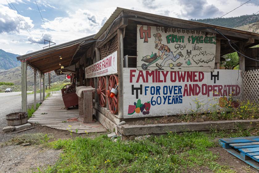
Letterboxing Clues:
From the fruit stand head ~250 m up Friesen Road to a wide spot at the second 180° corner Follow the trail up the bank to the cache ~50 m north, under a sage brush and disguised with rocks.
94
Please check geocaching.com before you go!
Marble Canyon Geological Wonders
SITE IDENTIFICATION
Nearest Community: Cache Creek, B C
Geocache Location: N 50°50 034' W 121°41 865'
UTM: East 0591702; North 5632161 10U
Altitude: 823m/2699ft
Date Established: 1956
Ownership:
BC Provincial Park
Accuracy: 10 meters
Overall Difficulty: 2
Overall Terrain: 2 5
Access Information and Restrictions:
From the east, follow Hwy 97N to the junction of Hwy 99 (at Hat Creek Ranch) Turn west and continue for 26 km From Lillooet, travel 30 km northeast on Hwy 99 Park at unmarked pullout on the west end of Crown Lake Take trail to waterfall.
For more information or to report a problem with this site please contact: Gold Country Communities Society P O Box 933 Cache Creek, B C V0K 1H0 Tel: 1-877-453-9467
Email: info@exploregoldcountry com
For more site pages go to: www exploregoldcountry com www geocaching com
APPLY STICKER HERE
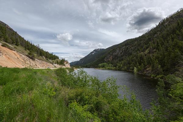
Marble Canyon’s towering cliffs of mottled limestone and dolomite create the marbled effect that gives the canyon its name. The white to grey coloured rock walls and impressive rock formations are uncommon geological features in British Columbia. These massive structures rise up to an elevation of almost one kilometre above the canyon’s three beautiful gem-like lakes, Turquoise, Crown and Pavilion.
Marble Canyon imparts a dramatic 500 million year old geological history It is a part of the Pavilion Mountain Range which includes a limestone belt extending from the Cornwall Hills to as far north as Jesmond.
The limestone of the Marble Canyon formation belonged to a pacific island chain of volcanic plateaus, which were comprised of limestone deposits about five kilometres thick The limestone was formed by single celled creatures named fusulinid foraminifera These organisms would secrete a shell composed of calcium carbonate, which accumulated over the course of millions of years
The theory is that this limestone shelf was situated to the west of the Cariboo Mountains and lay under fairly shallow water, adjacent to a deep ocean trench. Powerful earthquakes caused massive sections of the limestone shelf to fracture and fall, disappearing into the depths of the ocean trench.
The force of tectonic collisions and the gradual movements of the earth’s crust caused Marble Canyon’s section of the limestone shelf to buckle under the intense pressure, folding and rising up to its present location and altitude. Other plates collided with it, creating the remainder of British Columbia as we know it today. Marble Canyon’s folding is rather complex because it folded, refolded and faulted, creating the main canyon, a network of side canyons and many interesting rock formations. The Chimney Rock, also known as Coyote Rock by the local First Nations people, is just one of such formations.
95
Site # 090201 GC1TWZ3 Phase l
The limestone of Marble Canyon matches the limestone of other isolated pockets in the Cariboo, the southern Yukon, the Pacific Rim, and various occurrences in Southeast Asia Therefore, due to the plate movements of the continental drift, it seems that sections of the original limestone shelf traveled an incredible distance! Fossils of Marble Canyon include crinoids, which are feathery armed primitive marine invertebrates that thrived 300 million years ago. Also found are shells of fusulineds that formed the limestone and other marine evidence dating back 30 million years.
Two archaeological sites have been located in the canyon near Hat Creek Valley, where Indian pictographs can be seen These ancient sites were occupied by the Interior Salish people who used the area to collect food
Marble Canyon is a popular rock climbing destination as its beauty is relatively untouched. In winter, the waterfall at the west end of Crown Lake provides superb and easily accessed ice climbing. It can be accessed by a one kilometre trail along the lakeshore.
The colours of the canyon’s three lakes are amazing Turquoise Lake is appropriately named, Crown Lake has a more golden hue, and Pavilion is a marvelous turquoise and quite unique for its microbialite, fresh water coral formations
Written
and Researched by Dominique
Robillard
BIBLIOGRAPHY & SOURCES
BC Parks, Kamloops Area Pilot Project Team (1996, November) Management Plan for Marble Canyon Provincial Park Retrieved March 1, 2009, from Ministry of Environment, Lands and Parks Web site: http://www llbc leg bc ca/public/PubDocs/bcdocs/363181/marble cyn mp pdf
Eyer, J (2009) Echo Valley Ranch and Spa A Natural History Retrieved March 1, 2009, from Echo Valley Ranch and Spa Web site: http://www evranch com/media corner evr natural history asp Marble Range In Canadian Mountain Encyclopedia [Web] Retrieved March 1, 2009, from: http://www bivouac com/ ArxPg asp ?ArxId=1314
Mathews, B , & Monger, J (2005) Roadside Geology of Southern British Columbia Missoula, MT: Mountain Press Publishing Company
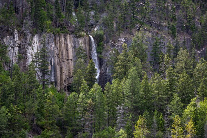
Letterboxing Clues:
From the base of the falls go ~23 paces down the trail to your left, at the Y go right ~66 paces. Now look for a faint trail on your right, if you reach the lake you have gone too far. This cache is located at the base of a large rock, covered in dead brush; follow the faint trail up the slope ~30 paces. Note: ~8 paces up the faint trail is a pile of white rocks at the base of an old fir to let you know you are on the correct trail
96
Please check geocaching.com before you go!
Hat Creek Coal
SITE IDENTIFICATION
Nearest Community: Cache Creek, B C
Geocache Location: N 50°46 261' W 121°35 765'
UTM: East 0598994; North 5625301 10U
Altitude: 916m/3005ft
Date Established: 1877
Ownership:
Private Property
Accuracy: 5 meters
Overall Difficulty: 1
Overall Terrain: 1 5
Access Information and Restrictions:
From Cache Creek, follow Hwy 97N to Hwy 99 Follow Hwy 99 west to Hat Creek Rd , on the left At Lehman Rd keep left, remaining on Hat Creek Rd Park well to the roadside to ensure adequate passing room NO trespassing on B C Hydro private property
For more information or to report a problem with this site please contact: Gold Country Communities Society P O Box 933 Cache Creek, B C V0K 1H0 Tel: 1-877-453-9467
Email: info@exploregoldcountry.com
For more site pages go to: www exploregoldcountry com www.geocaching.com
APPLY STICKER HERE
Site
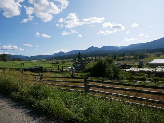
One of the thickest accumulations of coal in the world is in the Hat Creek Valley. The Hat Creek Coal deposit is 26 kilometers long, 400 metres wide and 1200 metres thick. When and how was it discovered? Well, therein lies a story.
In 1877, Dr George Mercer Dawson of the Geological Survey of Canada was surveying, mapping and discovering the geology and geography of the Gold Country region for the Dominion of Canada and the Canadian Pacific Railway As he surveyed the Hat Creek area for the potential of a railway corridor, he came upon the graben. A graben, created by a geological fault, is a low block of rock bordered by parallel fault scarps, or cliffs. Often referred to as a rift valley, visually you see a broad valley edged by broken rock formations. Little did Dawson know he had discovered one of the largest coal deposits in the world.
At Hat Creek the coal is full range from bright to dull brown, but most of it is massive, compact, fine grained, relatively solid, dull brownish-black rock Fragments of petrified wood are common in the coal Parts of the coal are also characterized by small lenses, globules and irregular shaped masses of light-yellow, semitransparent fossilized amber (retinite). Rare fossils of forest and insect specimens dating back 50 million years have been found in the amber.
The area consists of Tertiary coal and classic sedimentary and volcanic formations that rest on Cretaceous volcanic rocks and metamorphosed Palaeozoic carbonates and greenstones
In 1893, rancher George Finney sank the first shaft to supply coal to locals and the village of Ashcroft. In 1923 a Chinese syndicate began a more ambitious project to provide coal to the coast but it soon failed. The Clear Mountain Coal Company took over and was equally unsuccessful. By 1925 it was Hat Creek Coal exploring with shafts, tunnels and drill holes, but again exploration soon became dormant that same year.
97
Geological
Wonders
# 090202 GC1TT1K Phase l
Beginning in 1933 L D Leonard mined a few hundred tonnes of coal, until 1942 when all activity ceased due to World War II In 1957 the Hat Creek coal area passed to B C Electric, now known as B C Hydro, and again further exploration and drilling ceased by 1959. In 1974 B.C. Hydro resumed exploration of the site and began to mine sample quantities of coal. At this point protests began, continuing into the early 1980s and effectively preventing any further coal exploration or the development of a coal driven energy plant.
The Ashcroft Museum boasts an exceptional display diarizing and documenting the history of coal discovery and exploration in the Hat Creek area For more information or just to view the amazing stages in this story drop in for a walk through time To this day there remains controversy and opposition to any further exploration and exploitation of one of the largest coal accumulations in the world, the coal at Hat Creek in the heart of Gold Country
Some interesting minerals present throughout the area include Bocanne, Buchite, Retinite and Poitevinite.
Written and Researched by Angela Wynton
BIBLIOGRAPHY & SOURCES
Hamilton, W R , Wooley, A R , & Bishop, A C (1985) Larousse Guide to Minerals, Rocks and Fossils 6th Edition New York, USA: Larousse & Co Press, F , & Siever, R (1986) Earth W H Freeman & Co
Letterboxing Clues:
After the left at Lehman Road, you will pass the old coal camp on the right, as you climb a slight hill look for a dirt road on your left, turn off and park here. Cross Hat Creek Road and the cache is 46 m southwest down the hill in an old stump root, with a view of the camp
98
Please check geocaching.com before you go!
Cornwall Hills Park & Lookout Views & Vistas
SITE IDENTIFICATION
Nearest Community: Ashcroft, B C
Geocache Location: N 50°41 592' W 121°26 878'
UTM: East 0609620; North 5616857 10U
Altitude: 1974m/6477ft
Date Established: 1890
Ownership:
BC Provincial Park
Accuracy: 5 meters
Overall Difficulty: 2
Overall Terrain: 4
Access Information and Restrictions: Off Hwy 1, Trans Canada, 28.5 km north of Spences Bridge turn on Hat Creek Road (Look for grey feed building as turn off landmark). - OR - From Hwy 97N, take Hwy 99 west to Hat Creek Road – this route is more back country If following the Hwy 97N route, please use current maps
For more information or to report a problem with this site please contact:
Gold Country Communities Society P O Box 933 Cache Creek, B C V0K 1H0 Tel: 1-877-453-9467
Email: info@exploregoldcountry.com
For more site pages go to: www exploregoldcountry com www.geocaching.com
APPLY STICKER HERE
Cornwall Hills Provincial Park was named after Clement and Henry Cornwall, English gentlemen ranchers, who came to the area in 1862. The park covers 1,188 hectares of protected ecosystems, ranging from Engelmann Spruce-Sub-Alpine-Fir to parklands, grasslands and alpine meadows. On April 30, 1996 the Cornwall Hills attained provincial park status.
The history of Cornwall Hills is an ancient one, dating back to the late prehistoric and early historic periods Research conducted in 1987-88 revealed eleven lithic scatter sites, most of which were located on prominent knolls, ridges or above gullies where game could easily be observed. Lithic scatter is surface scatter of cultural artifacts and debris that consists of tools and chipped stone debris. Prior to these studies, while hiking on the summit, professional geoscientist Pierre Friele discovered half of an unusual basalt projectile point which later turned out to be at least 6,000 years old. Such discoveries indicate the Cornwall Hills summit served as an important location for human activities such as hunting and gathering. The presence of water at the summit permitted people to live in these hills during warmer months A fenced pond remains there to this day
If tiptoeing through ‘wildflowers’ is your cup of tea, tread carefully through these fragile alpine meadows. There can be found an array of blossoms including balsam-root, columbine, indian paintbrush, larkspur, lupine, shooting star, soopollalie and the wild rose, just to name a few!
Habitat for mule deer, cougar, blue grouse and a variety of upland mammal and bird species is also protected by the park Be aware that wildlife may be encountered at any time and act appropriately
The park is also home to a provincial hang-gliding site. What a wonderful opportunity to soar high above the Thompson River valley and marvel at the incredible views! The summit
99
Site # 090301 GC1TY1Z
l
Phase
offers a 360-degree vista which includes the Venables Valley to the southeast; Mount Baker can be seen on a clear day to the south and the Coast Range to the west Pavilion Mountain and Marble Canyon can be seen to the northwest, Cariboo Country to the north and Kamloops Lake to the northeast. To the east lies the Ashcroft Ranch in the Thompson River valley below and above is a limited view of the Highland Valley Copper Mine. Since the summit provided such an extensive view of the surrounding area, a fire lookout was established in the late 1800s and manned until the mid-1990s You will see evidence of a wildfire that raged through the park on August 19, 2003 burning nearly 500 hectares of land In some areas, a very hot burn killed all the vegetation, while other areas were only lightly burned or not burned at all
The appearance of the pine forests on Cornwall Mountain has also been significantly altered by the mountain pine beetle infestation, which hit the area in the early 2000s. Mountain pine beetle naturally occurs in B.C. forests, however, is usually kept in check by cold temperatures. Mild winters of the past several years have contributed to the current epidemic.
Written and Researched by Dominique
Robillard
BIBLIOGRAPHY & SOURCES
Nelson, E (2009) Personal Interview
Rousseau, M K , Breffitt, J , Guthrie, G , & Howe, G (1989) 1988 Results of Archaeological Investigations in Upper Oregon Jack Creek Valley and on Cornwall Hills Summit near Ashcroft, BC Shewchuk, M (1985) Backroads Explorer, Volume 1-Thompson Cariboo Surrey, BC: Hancock House Publishers Ltd
Wright, R T (1986) Backroads-The Junction Country, Boston Bar to Lytton

Letterboxing Clues:
From Hwy 1 follow Hat Creek Road 13 km and turn right on Cornwall Mtn. F.S.R. Follow this 4x4 recommended access ~9 km to the forestry lookout. From the lookout walk ~700 m southeast staying left on the road, then turn right and head ~5 m from road to the base of a pine tree and juniper bush
100
Please check geocaching.com before you go!
Savona’s Ferry Pioneers & Early Settlers
SITE IDENTIFICATION
Nearest Community: Savona, B C
Geocache Location: N 50°45 380' W 120°52 184'
UTM: East 0650245; North 5624882 10U
Altitude:
351m/1152ft
Date Established: 1858
Ownership:
BC Provincial Park
Accuracy:
4 meters
Overall Difficulty: 2
Overall Terrain: 1 5
Access Information and Restrictions: Public road, year-round access, vehicle accessible Located off Hwy 1, on Savona Access Rd Parking in Steelhead Provincial Park day use area
For more information or to report a problem with this site please contact:
Gold Country Communities Society P O Box 933 Cache Creek, B C V0K 1H0 Tel: 1-877-453-9467
Email: info@exploregoldcountry com
For more site pages go to: www exploregoldcountry com www geocaching com
The current is gentle where the First Nation people and fur traders crossed to the north side of the North Thompson River near the Hudson’s Bay Co. fort in Kamloops. However it was 1858 and the gold rush was on! Miners and settlers coming up from the south were heading for the Fraser River and North Country, and wanted the shortest and quickest route. And so, despite the fast moving current at the “Boute du Lac” where Kamloops Lake flowed out through a narrow channel, François Saveneux established a cable ferry He also operated the Hudson’s Bay Company’s wharf and warehouse on the north shore where a small community grew
The “Saveneux” name soon became anglicized to “Savona” and the community adopted the name. While living in Savona, François married the daughter of Joseph Bourke, a one-time Hudson Bay Company employee. Bourke’s daughter, Frances, brought her teenage daughter with her to Savona.
The early ferry was only large enough for saddle horse and pedestrian traffic, as there was only a trail west of Savona The Royal Engineers did not complete the Wagon Road from Cache Creek until 1866. With the road completion and wagon traffic, a vessel larger than a raft became required.
APPLY STICKER HERE
A traveler who recorded his crossing at Savona was 16 year old Andrew Jackson Splawn A J had been hired by Major John Thorpe to help drive a herd of cattle to the gold fields They arrived at the ferry in the late fall of 1861
“We crossed the Thompson River at the old landmark kept by Savanos, a French Canadian, who had come to New Caledonia-the name given to all of British Columbia- with the Hudson’s Bay Company at a very early date. He had a small ferry on which we crossed the horses, while the cattle swam. Another day found us on the Bonaparte, near the mouth of Cash Creek.”
101
Site # 100101 GC1TTWW
Phase l
It was noted in the Christmas 1862 Victoria Colonist that François Saveneux had passed away With her daughter’s help Mrs Saveneux continued to run the enterprise The H B C sent Donald McLean, son of the Chief Trader, to help with their end of the business.
In 1866 Ned Roberts was the operator; however by 1870 the provincial government had taken over the ferry and appointed James Uren.
Accidents were commonplace, the high water flood of June 1875 broke the cable and the ferry was down until the following year. In 1878 the scow broke away again and in 1879 there was another break, resulting in the drowning of Charles Fortier, a retired H.B.C. employee.
Continued requests were made for the construction of a bridge to replace the ferry but it was not until the Canadian Pacific Railway arrived in Savona in 1883 that construction started It was completed in 1884 at a cost of $15,250 00
The bridge also had its problems. In 1888, it was covered by the high water; in 1894 it was swept away by the flood. This brought the ferry back into operation until 1906. The site of the original ferry can be seen on the North side of the present day bridge.
Written and Researched by Don Logan BIBLIOGRAPHY
& SOURCES
Balf, M. (1980). Savona’s Ferry. In Kamloops Museum and Archives. Splawn, A.J. (1917). Ka-ma-akin-The Last Hero of the Yakimas.
Letterboxing Clues: From the phone booth go ~215 paces west to the trail that follows the river Follow trail down river ~140 m, cache is hidden under a sagebrush to the left of the trail.
102
Please check geocaching.com before you go!
Pioneers & Early Settlers
The Hudson Bay Company Brigade Trail
SITE IDENTIFICATION
Nearest Community: Savona, B C
Geocache Location: N 50°48 388' W 120°46 674'
UTM: East 0656564; North 5630656
Altitude: 582m/1909ft
Date Established: 1843
Ownership:
Crown Land
Accuracy:
6 meters
Overall Difficulty: 1 5
Overall Terrain: 3
Access Information and Restrictions: From Hwy 1, take Sabiston Rd for nearly 24 km At junction of Tranquille, Savona, Copper Creek & Sabiston access, find a wide spot to safely pull off road Be prepared for all conditions, back country access, no cellular service
For more information or to report a problem with this site please contact:
Gold Country Communities Society P O Box 933 Cache Creek, B C V0K 1H0 Tel: 1-877-453-9467
Email: info@exploregoldcountry.com
For more site pages go to: www exploregoldcountry com www.geocaching.com
APPLY STICKER HERE
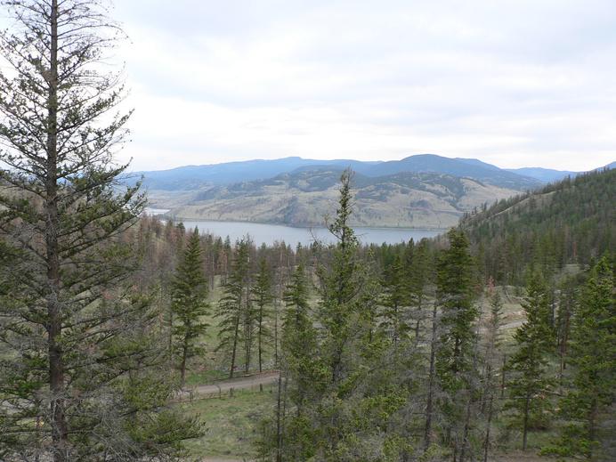
Moving goods through the Interior of B.C. was never easy. High mountains, steep canyons and raging rivers challenged every route. The Pacific Fur Company established posts at Okanagan, Spokane, and “Shewhaps” (Kamloops) at the junction of the North and South Thompson Rivers. In competition, the Northwest Company connected routes between New Caledonia and the Okanagan through “Cumcloops” in 1813. Various routes were used by both trading companies, but in 1821, Fort Alexandria was built, under the new merger of the Northwest Trading Company and the Hudson Bay Company
Overland trade routes began to take the shape of Brigade Trails using horses, a big departure from the canoe-portage system. By 1826 the route from Fort Vancouver on the Columbia to Fort Okanagan used flat bottomed boats on the rivers and lakes wherever possible. From Fort Okanagan, the route was overland to Fort Kamloops using horse brigades. The horses each carried 80 to 90 pound packs and a brigade could have up to 100 horses.
Kamloops was the stopping place, with grasslands to feed the horses, for transportation routes north and west The original route northwest was up the North Thompson to Little Fort, then along the route of Highway 24 today to 100 Mile House, then north to Fort Alexandria. Furs traveled south in the fall and supplies traveled north in the spring. It took about 20 days one way to make the journey.
In the 1840s with trade routes south of the 49th parallel cut off, the establishment of trade routes from Fort Langley to Fort Kamloops became a priority The Hudson Bay Company Fort in Kamloops was moved to the west side and a new brigade route (“the lower route”) was found from Shuswap Lake (now Kamloops Lake) to 100 Mile House
Journals from 1843 describe the route. The brigade travelled
103
Site # 100102 GC1TT1W
Phase l
along the north side of the Thompson River to Tranquille Creek, then climbed the steep hill up into what is now the Dewdrop Range The route dropped down to Kamloops Lake at Red Point, then followed the lakeshore to Copper Creek. Early routes climbed up the hills near Copper Creek, then through the Sabiston Creek Valley to Hudson Bay Springs and over the hills, descending to Deadman Creek. The brigade trail followed Tobacco Creek towards Chartrand Lake, then over the hills near Hihium Lake towards the east end of Loon Lake. From here, the brigade crossed the Bonaparte Plateau via Fly Creek to the southwest corner of Green Lake, and then on to Horse Lake. From here it connected to traditional north-south routes.
The Hudson Bay Company Brigade Trail from Kamloops to Fort Alexandria followed this route and other variations until 1858 when a ferry was established at Savona The last brigade took place in 1862 After that a route was established along approximately the same route as the Trans Canada Highway, along the south shore to Savona, then overland to the Cariboo
Wagon Road
After the Hudson Bay company route was no longer used, the old brigade trails were sometimes used by miners heading to gold fields and by cattle drivers. Over time, sections have been turned into roads, railway beds, or have become part of private lands. There are traces of the trail here and there, but it is rare today for someone to travel over this entire route by foot or on horseback.
Sections of the brigade trail can be hiked or explored by using area back roads From the Red Lake Road, the Deadman Valley Road, or the Loon Lake Road, visitors can see the same terrain as explorers and traders in the 1800s.
Written and Researched by Doug Smith
BIBLIOGRAPHY & SOURCES
Balf, M. (1981). Kamloops: A History of the District up to 1914. In Kamloops Museum Archives. Favrholdt, K. Fur Trade Trails through British Columbia. In Kamloops Museum Archives. Wilson, B. (1966). Hudson Bay Brigade Trail. In Boom Town Tales and Historic People.
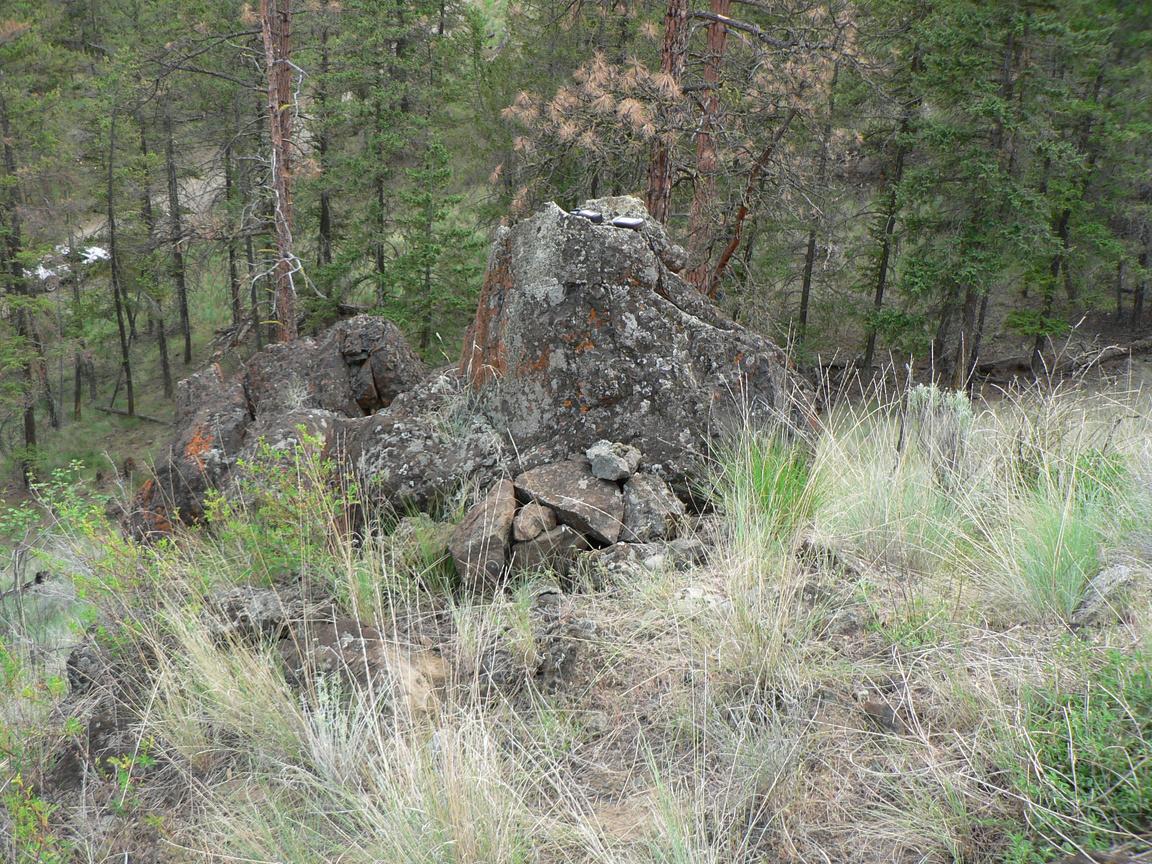
Clues:
From the cattle guard, go ~170 paces northwest, up the hill, to the cache camouflaged in rocks.
104 Letterboxing
–
Please check geocaching.com before you go!
Vidette Lake Gold Mines Pioneers & Early Settlers
SITE IDENTIFICATION
Nearest Community: Savona, B C
Geocache Location: N 51°09 887' W 120°53 929'
UTM: East 0646909; North 5670249
Altitude: 886m/2907ft
Date Established: 1931
Ownership:
BC Provincial Park Accuracy: 9 meters
Overall Difficulty: 1.5
Overall Terrain: 1.5
Access Information and Restrictions:
Located off Hwy 1, 50 km north on Deadman Vidette Rd Vidette Lake Gold Mine Resort is a privately owned resort for paid clientele Parking is available at the Forestry Rec Site or at the lake access before the resort Please pull well off the road as it is frequently travelled spring through fall
For more information or to report a problem with this site please contact: Gold Country Communities Society P O Box 933 Cache Creek, B C V0K 1H0 Tel: 1-877-453-9467
Email: info@exploregoldcountry com
For more site pages go to: www exploregoldcountry com www geocaching com
APPLY STICKER HERE
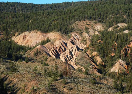
Vidette Lake lies at the northern end of the Deadman Valley, about 50 km from the Trans Canada Highway. The source of the Deadman River is high up on the Bonaparte Plateau. The river flows west for 23 kilometres before plunging over Deadman Falls and feeding into the Deadman Valley Lakes.
The valley was likely used as a transportation corridor for Aboriginal peoples for hunting, fishing and trading The Hudson Bay Company passed through this area on its Brigade Trails from Fort Kamloops to Fort Alexandria at 100 Mile House in the 1840s. The Vidette Lake area was considered as the halfway point along the route. Later, packers used the valley as a route over to the Cariboo Wagon Road from the Okanagan-Thompson areas.
Following the gold rushes in the Fraser River and in the Cariboo, there was a flurry of exploration and gold panning throughout the area, with activity at nearby Tranquille Creek starting in 1858 Hydraulic mining continued there through the 1890s
As early as 1898 gold had been found in the Deadman area, but it was not until the winter of 1931 when more extensive surveying was done by an American geologist. He employed seven men at Vidette Lake and confirmed the presence of gold-bearing quartz veins. Equipment and supplies were shipped to Vidette in 1932 and a portable sawmill was set up to provide lumber for above and below ground construction Provincial mining reports in 1932 talked about the need for further development and the need to construct a road into the valley Shares of Vidette Mines Ltd were sold on the market by 1933 with public announcements that once the road was built concentrates would be shipped Eventually the company upgraded the road to haul status and the Province maintained it
Supplies, equipment and manpower came from Savona and Kamloops and The Sentinel newspaper in 1933 reported a
105
Site # 100103 GC1TTY2
Phase l
boost in business for the area Other stakes were laid near the Vidette Mine in 1934, with the Tuleric, Savona Gold and Hamilton Creek stakes attracting investments from afar Financing for the Vidette Mine is not known now, but it was rumoured that a Canadian Senator, General McRae was a major shareholder. The Sentinel reported that he was there to see the first shipment of ore bound for the smelter at Trail.
By 1934, a town site with log huts surrounded the mine site, which consisted of a two-storey bunkhouse with electric lights, flush toilets and showers, a cookhouse and a portable sawmill. Over 125 men were employed and with their families, the town site grew quickly to a village. The payroll at the mine alone was about $75,000, in 1934 dollars and during the Great Depression, which made a significant economic impact on the region.
Nearby claims seemed to have been abandoned early but the Vidette Mine carried on for a few years At that time, workers were paid about $0 50 per hour and worked 8 hours days, for 6 days each week Workers could stay and be fed at the company-owned bunkhouse for $1 25 per day Medical plans and dentistry were available to workers The village continued to develop over the 6 years that the mine ran in full operation During those years the mine covered 5 miles of tunnels, including one under the lake The company built 17 km of roads and about 28,000 ounces of gold was extracted and shipped Mine operations reduced capacity in 1938 and with the onset of World War II in 1939 and dwindling ores, the mine closed down and the surrounding village was abandoned over time
Written and Researched by Doug
Smith
BIBLIOGRAPHY & SOURCES
French, E. Retrieved March 10, 2009, from Vidette Lake Gold Mine Resort Web site: http://www.videttelake.com/pages/1HomeHistory.html
McMillan, R. (2001). MINFILE No 092P086. Retrieved May 5, 2009, from Ministry of Energy, Mines and Petroleum Resources Web site: http://imperial.minfile.gov.bc.ca/Summary.aspx?minfilno=092P++086
Mobbs, L. (Undated). Vidette Lake Gold Mines. In Kamloops Museum and Archives.
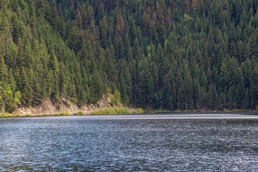
From the outhouse in the Rec Site, go ~ 14 paces northeast and look for mine shaft on the right.
106
Letterboxing Clues:
Please check geocaching.com before you go!
Deadman Valley Hoodoos Geological Wonders
SITE IDENTIFICATION
Nearest Community: Savona, B C
Geocache Location: N 50°55 537' W 120°58 822'
UTM: East 0641937; North 5643495 10U
Altitude: 611m/2006ft
Date Established: N/A
Ownership:
Private Property
Accuracy:
5 meters
Overall Difficulty: 1 5
Overall Terrain: 1
Access Information and Restrictions:
From Hwy 1, access the Deadman Vidette Rd At approx 18 km watch for pullout signage The property between the pullout and hoodoos is private, please do not cross A good camera lens or binoculars will assist you in viewing the hoodoos.
For more information or to report a problem with this site please contact: Gold Country Communities Society P O Box 933 Cache Creek, B C V0K 1H0 Tel: 1-877-453-9467
Email: info@exploregoldcountry com
For more site pages go to: www exploregoldcountry com www geocaching com
APPLY STICKER HERE
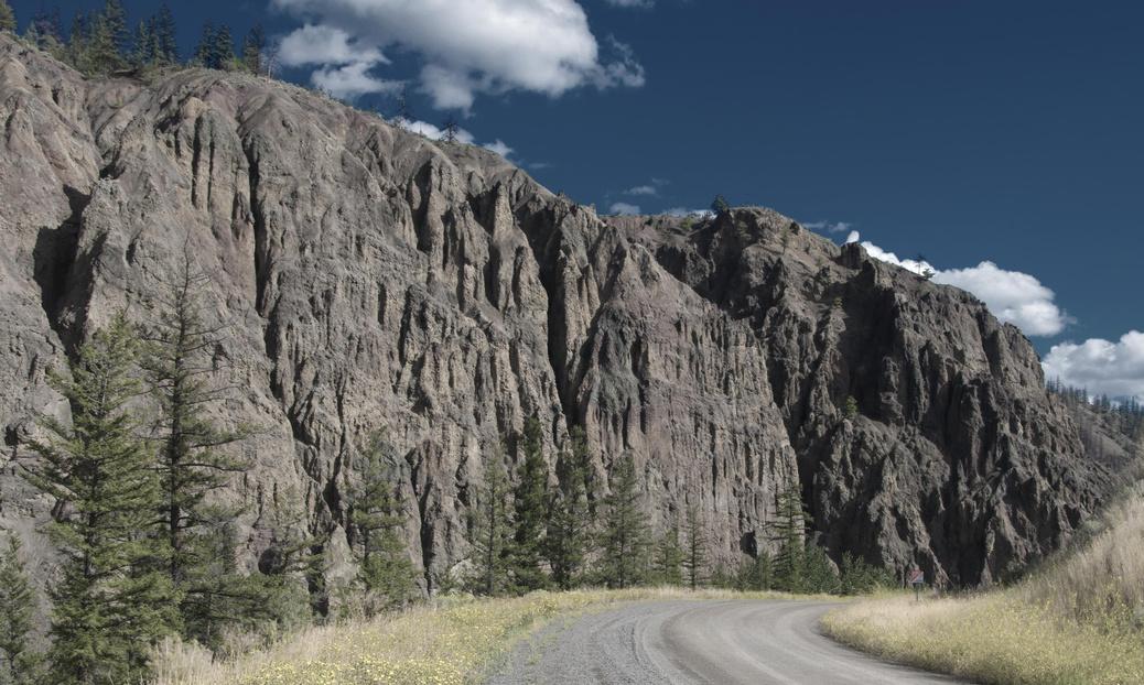
A hoodoo is a rock formation which is shaped over hundreds of years by the forces of erosion. The Deadman hoodoos are carved into banks of rock and clay conglomerate. Some parts of the hoodoos are harder than others and these hard parts last longer. The tops of the Hoodoos of the Deadman Valley are the hardest parts and they protect the soft rock below from wearing away.
This area of the Deadman Valley is a traditional gathering place of the people of the Shuswap (Sequa’pmug or Secwepemc) First Nation and the hoodoos are described in legends from the age of shamans and transformer incantations. A shaman was a person of power who would interact with both the physical world and the spiritual, usually acting as a sort of intermediary between the two. The shaman was often responsible for both the physical and spiritual health of people.
Centuries ago, when the Deadman Creek served as a passageway to and from the north, the residents of the valley were vulnerable to invading warriors from the north Elders gathered to plan a strategy of nightly patrol and it was not long before these preparations paid off Though casualties on both sides were high, four of the invading warriors were captured and taken to the elders. Shamed by their capture, the four invaders agreed to deliver a message to their home territory that the people of the valley wanted peace and would welcome all those who came in peace.
A shaman then spoke while the bonds on the young warriors were being cut loose He looked skyward and told the four warriors that if they left the valley without looking back they would return to their villages safely However, if they disobeyed the rule, they would be turned to stone The four warriors left in haste As they crossed the valley, one of them looked over his shoulder. True to the threat of the shaman, the four warriors
107
Site # 100202 GC1V315
Phase l
of yesteryear became the four hoodoos Legends such as this help to preserve the history and culture of the First Nations people and are passed through the generations Although this legend speaks of four hoodoos, there are actually five. Visible when the light touches the pinnacles and craggy rock faces from just the right angle, the Hoodoos of the Deadman Valley rise into view. These spectacular formations are one of the finest examples of hoodoos that can be seen from a public roadway in British Columbia
Written
and Researched by David
Louks
BIBLIOGRAPHY
& SOURCES
Ignace, R. (2009). Personal Interview. Please check geocaching.com before you go!
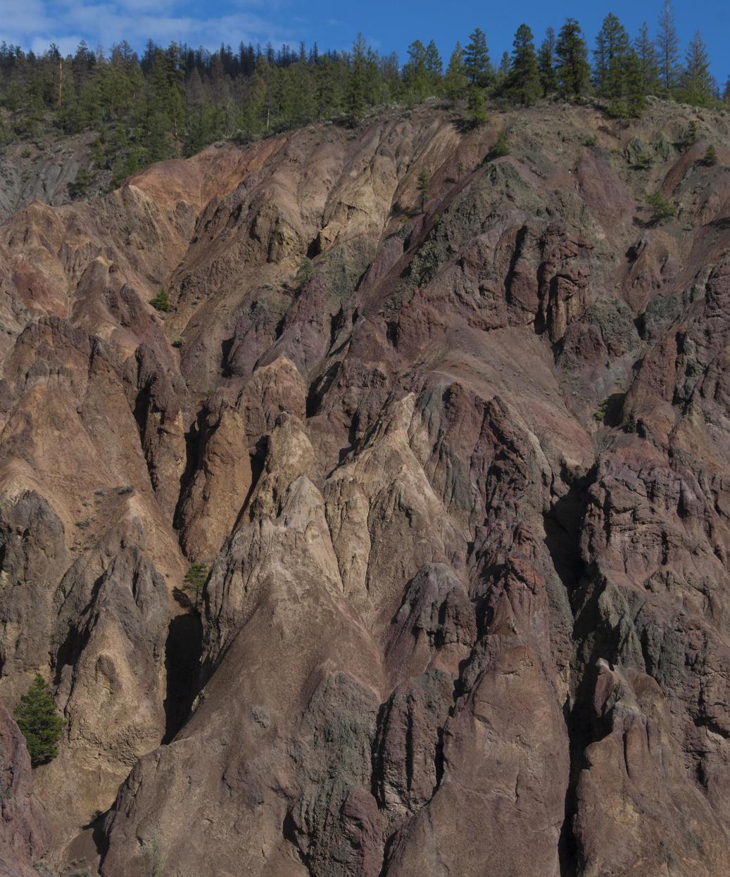
Letterboxing Clues: On the right side of the pullout are two trails, take the lower trail ~ 45 m to a juniper bush on the right side of the trail.
108
Lac Le Jeune
SITE IDENTIFICATION
Nearest Community:
Logan Lake, B C
Geocache Location:
N 50°29 045' W 120°28 896'
UTM: East 0678656; North 5595486 10U
Altitude:
1280m/4200ft
Date Established: 1956
Ownership:
BC Provincial Park
Accuracy: 6 meters
Overall Difficulty: 1
Overall Terrain: 1 5
Access Information and Restrictions:
Located 47 km north of Merritt on Hwy 5, take the Lac Le Jeune exit Follow signs to day use parking area Always wear proper footwear and carry water if exploring the Park trails
For more information or to report a problem with this site please contact: Gold Country Communities Society P O Box 933 Cache Creek, B C V0K 1H0 Tel: 1-877-453-9467
Email: info@exploregoldcountry.com
For more site pages go to: www exploregoldcountry com www.geocaching.com
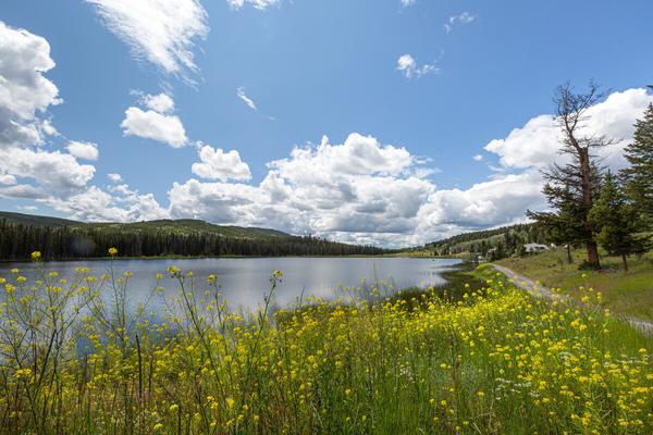
I n 1956 the original 47 hectares, around what was known as Costley’s Lake, was designated a provincial park. Also known as Fish Lake, but officially named Lac Le Jeune in 1957, the lake honours Father Jean-Marie Raphaël Le Jeune. In 1996 an additional 118 hectares of upland and 48 hectares of foreshore was added to the park with the intention for this section to remain in its natural state.
Father Le Jeune, originally from France, arrived as a missionary to St Joseph’s parish at Kamloops Indian Reserve in 1882 He became the traveling priest to the district and served fifty years in the region. He traveled by foot and pony, learned to speak many Indian dialects, and created a script based on the Chinook language using Duployé’s method of shorthand. He published books in Chinook and from 1891 to 1905 wrote a local newspaper, The Kamloops Wawa.
Father Le Jeune would most likely have traveled regularly in the park area on his way to the many villages in his parish He rode his pony alone across the Nicola Plateau on the trails passing through the hilly terrain of lodgepole pine, douglas fir and engelmann spruce. You may imagine Father Le Jeune surrounded by vast and isolated uplands dotted with ponds and small lakes as he journeyed along the shores and trails of the 5 kilometre lake that would come to be his namesake.
APPLY STICKER HERE
Ah, but was he alone as he rode the forested uplands and gentle shores? No The woods were alive with a symphony of Steller’s jays, pine siskins, juncos, finches, grey jays, chickadees, woodpeckers and brilliantly coloured rufous and calliope hummingbirds The woodland music still plays on
Trotting along the southwest side of the large lake he would have passed by the shallows of reeds, waving and dancing with dragonflies and damsels. Seeing the lake drain into a smaller
109
Views
& Vistas
Site # 100301 GC1TTQP
Phase l
pond surrounded by a peaceful, green open meadow, perhaps a lovely spot to rest, have a meditative lunch and water his faithful pony
Back on the trail, pleasantly eyeing the lake to the southeast, he would soon have reached the marshlands that too were a flutter. The songs of yellow-headed blackbirds, marsh wrens, red-winged blackbirds and loons were his choral accompaniment to the soft lilt of the hymns he sang in Chinook.
Moseying along further from the large lake, Father Le Jeune would come upon hundreds of ponds, the waters brimming with life. Barrow’s goldeneye, common loons, ring-necked ducks and the stately great blue heron greeted him on his many journeys. So like many of nature’s traditions, waterfowl continue to greet those who roam the shores today.
His journey would often take him closer to heaven at the height of the far hills above Lac Le Jeune The lookout in summer was a cool respite from the sweltering heat below, as he stood in awe at the splendor of his mission territory Not only was he taking in the magnificance and wildlife of the glorious uplands and forests, but the mule deer, moose and lynx would be quietly watching the gentle priest from the secrecy of their woods
Brook trout, mountain whitefish and lake chum still swim in the nearby glimmering lake waters and the ‘fighting rainbow trout’ continue to perform their magnificent aerial displays.
Gazing up into the deep blue heavens to see an osprey or eagle circle Lac Le Jeune eyeing the trout, you can feel Father Le Jeune watching over his parish from above, still enjoying the peace and beauty of his journeys along the shores and hills of Lac Le Jeune in Gold Country
Written and Researched by Angela Wynton
BIBLIOGRAPHY & SOURCES
Balf, M (Undated) Father Le Jeune In Kamloops Museum and Archives
BCGNIS Query Results: Lac Le Jeune Locality Retrieved March 10, 2009, from B C Geographical Names Web site: http://ilmbwww gov bc ca/bcgn-bin/bcg10?name=34744
Howie, R Birds of Kamloops Retrieved March 10, 2009, from Lac Le Jeune Resort Web site: http://www.laclejeuneresort.com/ Lac Le Jeune Park Provincial Management Plan. (2001). In B.C. Ministry of Environment, Lands & Parks.
Letterboxing Clues:
Follow the trail to the left of the covered day use eating area, east for ~40 paces to the bottom Then turn left or northeast and go ~70 paces and turn right off trail for ~7 paces by a large stump.
110
Please check
before you go!
geocaching.com
Castle Rock Hoodoos Geological Wonders
SITE IDENTIFICATION
Nearest Community: Savona, B C
Geocache Location: N 51°06 691' W 120°52 511'
UTM: East 0648733; North 5664373 10U
Altitude:
881m/2889ft
Date Established: 1997
Ownership:
BC Provincial Park
Accuracy: 6 meters
Overall Difficulty: 1
Overall Terrain: 1 5
Access Information and Restrictions:
Located 45 km north of Hwy 1 on Deadman Vidette Rd Do NOT climb or disturb the hoodoos or other park formations Sensitive area, do not pass cache spot
For more information or to report a problem with this site please contact: Gold Country Communities Society
P O Box 933 Cache Creek, B C V0K 1H0 Tel: 1-877-453-9467
Email: info@exploregoldcountry com
For more site pages go to: www exploregoldcountry com www geocaching com

A visit to the Deadman Valley, west of Savona off the Trans Canada Highway, will bring you to view the interesting Castle Rock Hoodoos. But first you get to journey up the beautiful Deadman Creek Valley, full of glorious views and rich history. The road passes through the serene Skeetchestn Indian Reserve, note the Community School providing education to the valley children above you Side roads meet the valley at various points on your drive some heading into Criss Creek, Back Valley and Scottie Creek Stop to view the noted Deadman Hoodoos a few kilometres further north, or hike a trail going northwest climbing along the historic Hudson Bay Brigade Trail up Tobacco Creek to Chartrand Lake. The route was used by the Hudson Bay Company traders to transport supplies north to Fort Alexandria in the fall and furs south to Fort Kamloops in the spring.
Further up the valley, the arid grasslands starts to give way to ponderosa pine, then douglas fir forest bordering a series of five lakes Mowich, Snohoosh, Skookum, Deadman and Vidette Lakes provide excellent opportunities for a leg stretch with Forestry Recreation sites offering lakeside access
APPLY STICKER HERE
Castle Rock Provincial Park is east of the road near the north end of Skookum Lake. Beyond the park, the road passes Deadman Lake, Outpost Lake and finally Vidette Lake. Vidette Lake has been deemed the Center of the Universe by visiting Tibetan monks Above Vidette you may discover the majestic Deadman Falls with a 200 foot drop to the steep canyon below Early spring and summer will awe you with its thundering roar and by late summer and fall a mere trickle finds its way to the edge The road beyond the falls is best explored with a 4-wheel drive
Castle Rock Hoodoos Provincial Park features white to yellow cliffs, hoodoos and eroded volcanic ash. The area is
111
Site # 100302 GC1TQDY
Phase l
fragile and B C Parks recommends low impact visits to the area as the Park was established to protect this rare geological location Stop by the side of the road, take some photos and explore the area below the hoodoos Hiking and biking on the cliffs is forbidden, please do not disturb the hoodoos.
Wood ticks are prevalent from March to June for most of the dry Interior belt. Check your clothing after visiting this area or any of the other stops along the route. The area is hot and arid in the summer, be sure to pack a full water bottle and wear a hat
The dominant flora in the area includes dryland choke cherries, saskatoon berries, wild roses and douglas fir. Each season features wildflowers adapted to the semiarid conditions including buttercups and balsam root in the spring, gaillardia, mariposa lily, yarrow, pussytoes, lupines, mullein, larkspur, prickly pear cactus and stonecrop in the summer, followed by aster and buckbrush in the fall. Coyotes, hawks and grassland birds frequent the area.
A visit up the Deadman Valley offers the visitor a chance to see rock formations, lakes and rivers, grazing lands, natural grasslands, dryland forest and wildlife It is well worth a day or two, be sure to bring your camera!
Written and Researched by Doug
Smith
Please check geocaching.com before you go!
BIBLIOGRAPHY & SOURCES
(2009) Castle Rock Hoodoos Provincial Park Retrieved February, 2009, from BC Parks Web site: http://www env gov bc ca/bcparks/explore/parkpgs/castle rock/ Parish, R , Lloyd, D , & Coupe, R (1996) Plants of the Southern Interior British Columbia Edmonton, AB: Lone Pine Publishing

Letterboxing Clues: This cache is ~45 paces northeast from the park boundary sign on the left at the base of a tall bush.
112
Balancing Rock Geological Wonders
SITE IDENTIFICATION
Nearest Community: Savona, B C
Geocache Location: N 50°45 599' W 120°44 444'
UTM: East 0659340; North 5625568 10U
Altitude: 541m/1774ft
Date Established: N/A
Ownership:
Leased Crown Land
Accuracy: 5 meters
Overall Difficulty: 1 5
Overall Terrain: 1 5
Access Information and Restrictions: From Hwy 1 pull off at parking coordinates near gate. Foot access ONLY, please be careful in this fragile ecosystem Do NOT walk to Balancing Rock, access allowed for viewing only Access beyond the cache box is forbidden, watch for cactus For more information or to report a problem with this site please contact:
Gold Country Communities Society P O Box 933 Cache Creek, B C V0K 1H0 Tel: 1-877-453-9467
Email: info@exploregoldcountry.com
For more site pages go to: www exploregoldcountry com www.geocaching.com
APPLY STICKER HERE
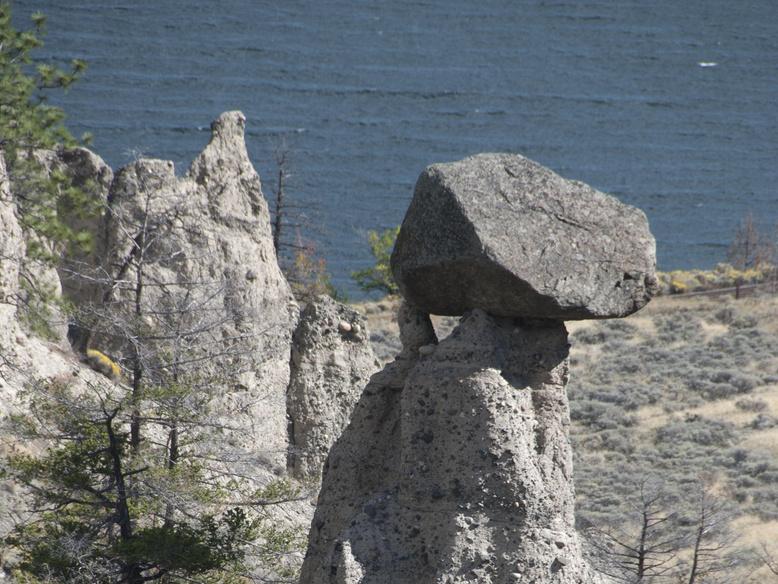
Set against the beautiful backdrop of Kamloops Lake, Savona’s magnificent balancing rock is truly a marvel of nature. Weighing in at many tonnes, this large boulder perches precariously atop a huge pyramid shaped pillar of sedimentary rock, silt and sand. Sedimentary rock is composed of mineral and organic fragments deposited and consolidated by the forces of water, wind or ice.
Twelve thousand years ago, the glacial waters of the Thompson basin drained, creating many lakes and rivers, including Kamloops Lake The process of freezing and thawing and the focus of wind and rain carved the landscape into steep cliffs and deep canyons. Hoodoos, which are rock capped pinnacles, were formed along the canyon edges and cliff-sides as the softer sedimentary rock surrounding the pinnacle eroded away. The cap rock, which is composed of harder materials, serves to protect its supportive column from erosion caused by the forces of the elements.
To the local Shuswap people, the balancing rock is considered a boundary marker for Shuswap territory and is known as “Coyote Rock” The “Old One”, who was the main creator, sent down transformers who were his helpers and had the ability to alter their physical forms. They would complete the “Old One’s” work on the earth by improving the land and giving shape to it in the forms of mountains, valleys, lakes and so on.
The foremost of these transformers was the old coyote and “Coyote Rock” is where he stepped down from the heavens to perform his duties Once Coyote finished his work, he transformed himself into “Coyote Rock”, standing as a sentry, keeping watch over the land When the natural balance was disrupted, Coyote would transform himself into whichever form he deemed necessary to correct the problem and restore balance to the land.
113
Site # 100303 GC1VCMD
Phase l
There is one such related story of two female healers who stretched a net across the river This upset Coyote for they were catching too many fish He then transformed himself into a stick and floated down river where he got himself caught up in the women’s net. They emptied their net and found the stick and tossed it onto the bank to be burned in their fire. There, coyote transformed himself into a baby and the women cared for him. He later changed himself into a man and married both women. He then asked them to remove the net and, being his wives, they obeyed his order. Thus Coyote was satisfied.
The “Coyote” had a multifaceted personality, as a creator, as a hero and as a humorous, clever and cunning trickster who could, at times be quite greedy, jealous, impulsive and reckless
The Balancing Rock can be viewed from the Trans Canada Highway one half kilometer west of the Savona hill rest stop. Pedestrian access is available to the site. Please keep your footprint at a distance for not only is the column fragile, but the site is of special significance to the local Shuswap people.
Written and Researched by Dominique Robillard
Please check geocaching.com before you go!
BIBLIOGRAPHY & SOURCES
Jules, E (2009) Personal Interview
Jules, J (2009) Personal Interview
Shewchuk, M (1975) Fur, Gold and Opals: A guide to the Thompson River Valleys BC: Heritage House Publishing Co
Teit, J A (1900) The Jesup North Pacific Expeditions: the Thompson Indians of British Columbia Vol 1 Part 4 Kamloops BC: Secwepemc Museum
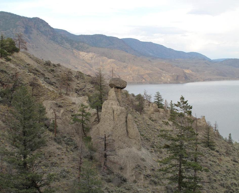
Letterboxing Clues:
Travel east on Hwy 1 ~6 km from the Savona gas station. At the east end of the passing lanes turn left and park at the gate on the north side of the highway Go ~ 320 paces northeast from the gate toward the bluff to view the Balancing Rock. The cache is at a sage brush along the edge of the ravine, under rock.
114
The McLean Brothers Pioneers & Early Settlers
SITE IDENTIFICATION
Nearest Community:
Quilchena, B C
Geocache Location: N 50°22 223' W 120°20 754'
UTM: East 0688734; North 5583180 10U
Altitude: 809m/2654ft
Date Established: 1879
Ownership:
Public Property
Accuracy: 6 meters
Overall Difficulty: 1
Overall Terrain: 2
Access Information and Restrictions:
From Merritt, follow Hwy 5A nearly 53 km north to Stump Lake At the north end of Stump Lake, turn onto Old Kamloops Rd Park in rest stop on the right at approx 4 km
For more information or to report a problem with this site please contact: Gold Country Communities Society P O Box 933 Cache Creek, B C V0K 1H0 Tel: 1-877-453-9467
Email: info@exploregoldcountry com
For more site pages go to: www exploregoldcountry com www geocaching com
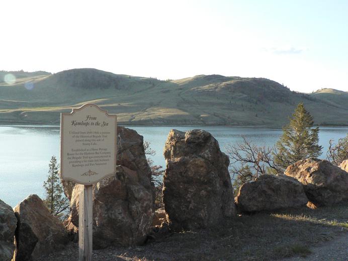
I n 1879, at the north end of Stump Lake, a sheepherder named Jim Kelly worked for Peter Fraser. While sitting at the edge of a meadow, Kelly didn’t know he was about to become a part of history. While the exact spot of his death is lost in time, the viewpoint on the Old Kamloops Road overlooks the lake of his home.
The McLean gang consisted of three of the McLean brothers, sons of the Scottish born Donald McLean, who was himself in possession of a fiery temper, and his native wife The eldest McLean boy in the gang was Allan at 25, followed by Charles, 17 and Archie, 15, who at his young age was eager to prove himself to his older brothers. Seventeen-year-old Alex Hare, Métis son of a local rancher, joined them.
The boys had always been lively but were developing worsening reputations and the violence of their crimes was escalating Charlie McLean bit off the nose of a native boy during an argument and the gang beat a Chinese man near Savona nearly to death, so their habitual demands of local ranchers for food and escalating thefts were becoming more of a real danger Doors were being locked from Kamloops all down the Nicola Valley.
In early December, local rancher William Palmer was out on the trail looking for a big black gelding that had been missing for four days Seeing riders ahead Palmer investigated, finding his gelding under Charlie McLean and surrounded by the boys’ guns
Pretending not to recognize his horse, Palmer survived the encounter, then went to seek backup in the form of Constable Ussher, the B C policeman assigned to the Kamloops district Constable Ussher had previously encountered the McLeans in his official capacity with little trouble and may have assumed that this time wouldn’t be any different. He considered these boys as little more than juvenile delinquents, so he left Kamloops to 115 APPLY STICKER HERE
Site # 110101 GC1TWQN Phase l
confront them with only Palmer and another man, Shumway, who primarily acted as guide Along the way, he also picked up John McLeod As this small posse came across the gang’s camp in a little clearing 16 miles south of Kamloops, a shot rang out. Not a warning shot; the ball grazed Palmer and lodged in McLeod’s cheek. Ussher still believed that the situation could be contained and walked towards the gang while requesting their surrender and their guns.
Alex Hare advanced on Ussher with a knife in one hand and a revolver in the other Ussher attempted to wrestle the weapons away from Hare, but was instead stabbed repeatedly Fifteen-year-old Archie ended Ussher’s life by shooting him in the head The remainder of the posse retreated to Kamloops and a much larger, wellmounted and well-armed posse gathered to catch the McLeans
The gang traveled south, intent on settling old scores, boasting and bragging of their “death list” to all they met. Near Stump Lake they found Kelly and shot him for unknown reasons, Kelly became their second murder. They accumulated arms and ammunition from all they passed. Allan McLean’s plan was to enlist the Nicola tribe and start an Indian war, but the boy whose nose had been bitten by Archie was connected to the chief of the tribe and the McLean boys’ father, Donald, had a less than stellar reputation with the natives, so although they were permitted to stay at the Indian rancherie at the head of the Nicola valley, they were not welcome.
The posse finally found the gang as they hid in the cabin at Douglas Lake After failing to parlay surrender from the gang the posse attempted to burn them out of hiding, but the hay was wet and would not ignite The boys had been without food and water for some time and were in pretty bad shape; soon, hunger and thirst drove the McLean boys out of the cabin with raised hands.
The prisoners were taken to Kamloops and then to New Westminster to stand trial It took the jury only 20 minutes to reach a guilty verdict and they were sentenced to be hanged The sentence was appealed and a retrial booked; the second jury also found them guilty and they were again sentenced to be hanged During their incarceration the gang continued to behave in vicious and scheming ways and on Monday, January 31, 1881, they were finally hanged It was the first time that three brothers were executed together in Canada
Written and Researched by Steve Thornton
BIBLIOGRAPHY & SOURCES
Lindsay, F.W. (1963). Outlaws of British Columbia. Vernon, BC: Self. Rothenburger, M. (1993). The Wild McLeans. Victoria, BC: Orca Book Publishers.
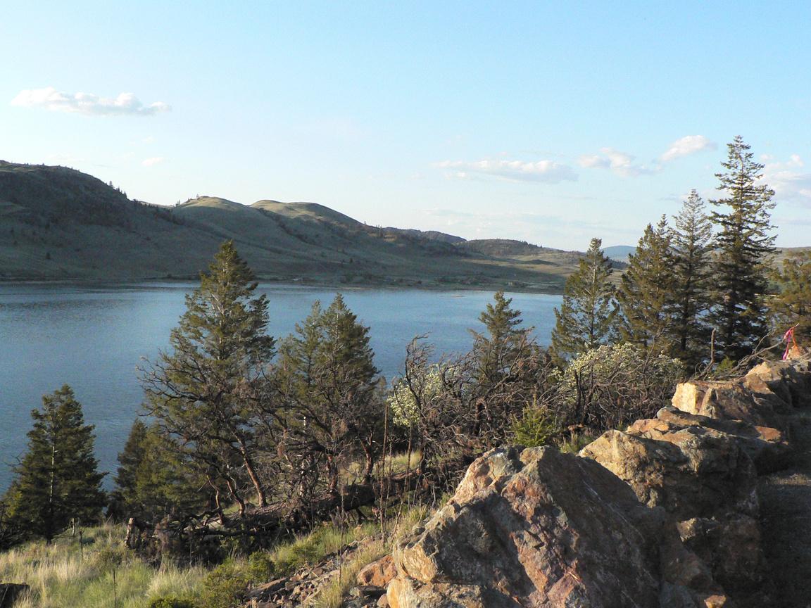
Letterboxing Clues:
From the rest area sign go ~221 paces north, turn 90° left and go ~25 paces down the hill to the only small tree.
116
Please check geocaching.com before you go!
Mary Lafek, Pioneer Pioneers & Early Settlers
SITE IDENTIFICATION
Nearest Community:
Logan Lake, B C
Geocache Location: N 50°20.904' W 120°43 364'
UTM: East 0662015; North 5579847 10U
Altitude: 1340m/4397ft
Date Established: 1900
Ownership:
Private Property
Accuracy:
7 meters
Overall Difficulty: 1 5
Overall Terrain: 1.5
Access Information and Restrictions:
Travel south of Logan Lake on Hwy 97C to Rey Lake Road Stay right at each fork on Rey Lake Road for approximately 7 km. Rey Lake Road is public access, however, is bordered by private land throughout. Do NOT leave road and please respect all property owners’ lands. Access ONLY from May through October, weather permitting, as road is not maintained.
For more information or to report a problem with this site please contact:
Gold Country Communities Society P O Box 933 Cache Creek, B C V0K 1H0 Tel: 1-877-453-9467
Email: info@exploregoldcountry.com
For more site pages go to: www exploregoldcountry com www.geocaching.com
APPLY STICKER HERE
This is the story of Mary Lafek, who exemplifies the spirit and the stoicism of the pioneer women who often found themselves isolated, in foreign territory, and living in primitive conditions with little support.
Mary was born in Czechoslovakia in May of 1897 and came to British Columbia with her parents in 1902, where her father had secured work as a coal miner While still a teenager, Mary met and married Jim Lafek
The wedding ceremony took place at the Coldwater Hotel in Merritt, conducted by a judge who was just passing through town. On their wedding day, Jim brought Mary home to the cabin where he and his mother were living and she had to walk the five mile trail in her city shoes, unprepared for the April snow at Mamette Lake The cabin had just two rooms but the young bride added a kitchen and a remarkable greenhouse, where she cultivated every kind of plant imaginable By herself, she later added a porch to the original cabin
Times were hard in those years and there was hardly much more than a trail to their property. When Jim and Mary applied for assistance to bring a road in to the property, they were paid $15.00 a month to build a road with a pick, shovel and wheelbarrow. The road is now known as Rey Lake Road.
Mary and Jim had two daughters Their youngest, Vicky, was born in the cabin with no assistance from a doctor as it was just too hard to get to their property at that time.
Mary taught the two girls with the assistance of correspondence lessons from Victoria She built a cabin beside the house to use as a schoolroom and shared this with some of the children who lived in the area She raised sheep and spun the wool, made all the clothing, rugs and quilts for her home and her family
117
Site # 110102 GC1TTQX
Phase l
During the entire 56 years the Lafeks lived on the ranch they had no indoor plumbing, no phone and no furnace An oil lamp and a wood stove provided light and warmth
One cold night in 1975 Mary walked the five miles down the hill and went to the Rey Creek Ranch with the news that her husband had gone missing. He had headed out to check on the irrigation system and he had not returned home. The area was searched and a dive team came to inspect Rey Lake. Even the hounds could not pick up the scent of Jim Jim Lafek has not been seen or heard from since that night It is possible that he may have had a run in with a bear, or slipped off the dock at Rey Lake, but no one seems to know for certain His departure remains a mystery
Mary moved shortly after Jim’s disappearance to be with her daughter Vicky in Fernie, British Columbia. She passed away shortly after that, on November 20, 1977. A true pioneer and quiet hero, it is women such as Mary who quietly established amenities and traditions in the rugged backcountry of our then young Province.
Written and
Researched
by Luanne Baker
BIBLIOGRAPHY & SOURCES
Cleasby, H.S. (1958). The Nicola Valley in Review. In Nicola Valley Museum and Archives: Merritt, BC. Early History of Logan Lake. A collection of historical documents by the Logan Lake Historical Society. In Logan Lake Library. McBride, E. (2009). Personal Interview in 1975 with Mary Lafek.
118
Clues:
Letterboxing
Park at metal gate and follow the fence line on the left for ~63 paces to the cache stashed on the right.
Please check geocaching.com before you go!
Pennask Lake and Esker Geological Wonders
SITE
IDENTIFICATION
Nearest Community: Merritt, B C
Geocache Location: N 49°59 226' W 120°05 686'
UTM:
East 0708249; North 5541242 10U
Altitude: 1425m/4676ft
Date Established: 1975
Ownership:
BC Provincial Park
Accuracy: 5 meters
Overall Difficulty: 1
Overall Terrain: 1 5
Access Information and Restrictions:
From Merritt follow Hwy 97C to the Sunset Main exit Follow signs toward Hatheume Resort until the second 12 km marker This is a seasonal road that requires caution and care Only vehicles with good clearance will be able to reach the lake. Park at the campsite signage.
For more information or to report a problem with this site please contact:
Gold Country Communities Society P O Box 933 Cache Creek, B C V0K 1H0 Tel: 1-877-453-9467
Email: info@exploregoldcountry.com
For more site pages go to: www exploregoldcountry com www.geocaching.com
APPLY STICKER HERE
What does a lake, hidden deep in Nicola country, have to do with the golden pineapples of Hawaii? And where is this golden treasure teeming with wildlife, dotted with islands and abundant in history? At the end of a very primitive, steep and rough road, passing through low forests of jack pine, alder and spruce, Pennask Lake looms large and lovely, surrounded by thick wilderness.
The 244 hectare wilderness Provincial Park was established in 1975 The east side of the park is a mix of open spruce and pine forests with soopalallie and grouse berry shrubs growing on sloping uplands and elevated benches. The south end of the park is a low-lying upland, covered in the dense growth of twinberry, white rhododendron and Labrador tea shrubbery, amid a thick spruce forest.
The lake is abundant with bays, islands and coves Stanley Read writes, “It is rich in islands, small bays and inlets - some bearing names associated with fishermen of earlier days, some, names that are descriptive - Mud Bay, Peterson’s, Prudhom Bay, Slaughter Bay, the Colonel’s Kitchen, Burnt Island, Milwaukee Point, Dole Bay, and Lone Tree Islet the description is apt because of the towering tree, with its great osprey nest, even though now it has more than one tree. ”
At the very north end of the lake the geological history is evident. Due to volcanic activity more than 10,000 years ago and the glacial melt wash, the end of the lake shows geological evidence of melt water streams flowing in tunnels along the bottom of a melting glacier Water seeping through crevasses and cracks in the ice gradually opened tunnels that ran downhill to the end of the glacier
The result was a long narrow ridge of gravel and sand, varying from metres to tens of metres thick and winding for kilometres parallel with the direction of the movement of the ice This continuous and winding ridge of glacial deposit is the Pennask esker
Pennask Lake is a great trout fishing lake going back to the 119
Site # 110201 GC1VCKZ Phase l
turn of the twentieth century Since the end of the glacial melt, rainbow trout have thrived in Pennask They are probably descendants of the ancient steelhead that would have been trapped in the large inland lakes by the receding glacial waters.
In spring, more than half of the trout swim down the creeks to spawn. About five kilometres up Pennask Creek the eggs and milt of the spawning fish are collected for the Pennask Creek fish hatchery. There are between three and five million Pennask rainbow trout eggs annually and the fry from these eggs stock lakes throughout the southern Interior
In 1927 James Dole, the Pineapple King, discovered the great rainbow trout fishing at Pennask Lake. So entranced was he, he bought 2,500 acres around Pennask, including sixteen of the twenty-five kilometres of lakeshore. By 1930 Dole created the Pennask Lake Fishing and Gaming Company. At a cost of $1000, fifty members were eligible to join and a private lodge was built.
In 1959 the lodge had the privilege of hosting and entertaining the British royal family, Queen Elizabeth and Prince Phillip And there they were, the British Royals, in the lodge of the ‘Pineapple King’ from Hawaii, deep in the mountain woods, in the heart of Gold Country! The original lodge still exists and the Pennask Fish and Game Club and its members remain active at Pennask Lake
At the lake there are also four known archaeological sites, however these are in the protected area and not accessible to the public. Additionally, there is one bluelisted variety of willow shrub known as Booth’s willow (salix boothii), which must be treated with respect and care. And there is an abundance of avian life including eagles and hawks. As Read observed at the time, “The birds are there - the swallow, the woodpecker, the occasional kingfisher, the great circling osprey, and the loon - active, noisy, entertaining, and handsome ”
Pennask Lake, with a hint of Hawaii and the golden pineapple, home of the ancient rainbow trout, and with a touch of royalty, is a treasure trove of geology, wildlife, and beauty hidden high and deep in Gold Country.
Written and Researched by Angela Wynton
BIBLIOGRAPHY & SOURCES
(2009). Pennask Lake Provincial Park. Retrieved January, 2009, from BC Parks Web site: http://www env gov bc ca/bcparks/explore/parkpgs/pennask lk/ Stewart, J (1984) Sport Fishing in the Kamloops Region In Kamloops Museum and Archives
Letterboxing Clues: Park to the right in ‘day’ area, just below outhouse Follow the campsite road north along the lake 72 m and the cache is on your right nestled amongst the rocks.
120
Please check geocaching.com before you go!
Promontory Lookout
SITE IDENTIFICATION
Nearest Community:
Lower Nicola, B C
Geocache Location:
N 50°11 650'
W 120°58 358'
UTM: East 0644704; North 5562186 10U
Altitude: 1715m/5625ft
Date Established: 1862
Ownership:
BC Forestry Rec Site
Accuracy:
5 meters
Overall Difficulty: 1
Overall Terrain: 2
Access Information and Restrictions:
From Merritt, follow Hwy 8 west to Woodward Road Turn left at the landfill sign and follow the gravel road ~ 14 km Park near the Forestry Recreation site Rough, back country road, 4x4 recommended and use caution in inclement weather.
For more information or to report a problem with this site please contact:
Gold Country Communities Society P O Box 933 Cache Creek, B C V0K 1H0 Tel: 1-877-453-9467
Email: info@exploregoldcountry.com
For more site pages go to: www exploregoldcountry com www.geocaching.com
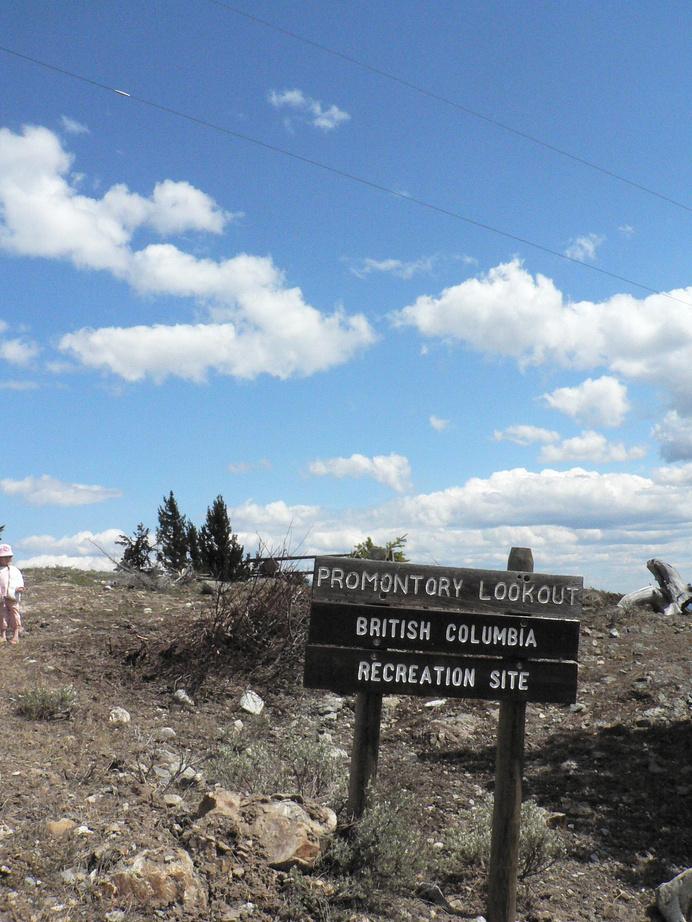
High above the town of Merritt, between Shulus and Lower Nicola, is a botanical and geological treasure, and a view worth its height in gold. Promontory Mountain, so aptly named, is a prominent mass of land 1734 metres above sea level, overlooking the Nicola Valley, in Gold Country.
Promontory Mountain is an ideal lookout One has a 360 degree view of the surrounding Promontory Hills and the exposed rock of the Upper Triassic Nicola Group These rocks are intruded by Lower Jurassic Guichon Creek batholith to the north The batholithes, are the largest of the plutons, large igneous bodies that have congealed from magma underground, and are at least 100 square kilometres in area. To the south they are Coyle stock, similar but smaller plutons. Looking west the rocks are of the Lower Cretaceous Spences Bridge Group and to the east they are of the Upper Cretaceous Kingsvale Group.
The large area leading up to and about the lookout is surrounded by a variety of minerals and rock These vary from volcanic breccias, andestic lavas and lapilli to limestone, greywacke and some marine fossils A small occurrence of galena and sphalerite also can be found at the top of Promontory Mountain.
APPLY STICKER HERE
Adding to the interesting geology of the mountain is the discovery of the washoe pine tree cluster (pinus washoensis) surviving in the broken, rocky terrain It shares the summit with Douglas fir and an herbaceous ground cover of pine grass (calamagmstis nibescens) Washoe is an atypical ponderosa pine and is not native to Promontory Mountain
Beginning in interglacial or pre-glacial time the pine originated from the seeds of the North Plateau ponderosa pine that were carried upwind from lower altitudes. There is no evidence of seed cones or pine reproduction on Promontory above 1400 metres, indicating that the pine is not an established species.
121
Views
& Vistas
Site # 110301 GC1TTWQ
l
Phase
This washoe pine has genetically adapted to the harsh, high altitude environment of the mountain The leaves, called needles, are generally shorter, stiffer and stouter than those of the ponderosa As there is sparse evidence of seed cone production at the higher altitude, the existence of pinus washoensis will probably cease after the adult trees live out their lifetime or succumb to the moods of nature.
On the trek along the pathway one also has the opportunity to observe, very carefully, the characteristic jumping cholla cacti (opuntia bigelovii) It is also called the teddy bear cactus, but cute and cuddly it is not This unusual cactus is notorious for very loose joint or spine attachment These spines easily attach themselves to unsuspecting wanderers-by, therefore giving the impression of ‘jumping’ at their prey
Some believe it is the vibration of footsteps that make them ‘jump,’ but it is more likely a slight brushing while passing in the vicinity of the cactus that causes the loose spines to so readily dislodge and attach themselves to any contacted surface. Whether or not they are actually ‘jumping cactus,’ you can decide for yourself. They are however, definitely an interesting specimen to be cautious of. Perhaps, tweezers should be taken along as a precaution.
When you have explored the natural science of the mountain, wander up to the Forestry Recreation site and enjoy the majestic view You will see the town of Merritt, the Nicola Valley and beyond the four directions of the Promontory Hills If you have chosen the clearest of days to visit Promontory, look south southeast and you will be able to see Mount Baker in Washington State
Promontory Mountain Lookout gives one the sense of being on top of the world. It is a treasure of natural science and a geological wonder. Surely you will agree Promontory Mountain lookout is ‘a view worth its height in gold’, in the heart of Gold Country, British Columbia
Written and Researched by Angela
Wynton
Please check geocaching.com before you go!
BIBLIOGRAPHY & SOURCES
Bradshaw, T.C. (1997). Washoe and Ponderosa Pines on Promontory Hill near Merritt, B C Retrieved from Natural History Museum of Vienna, Austria Web Site: http://www.biologiezentrum.at/de/bz/ Hamilton, W.R., Wooley, A.R., & Bishop, A.C. (1974). Larousse Guide to Minerals, Rocks and Fossils. Hamlyn Publishing Group.
McMillan, W.J. (1977). Promontory Hills, Promontory Nicola Project. Press, F., & Siever, R. (1986). Earth. W.H. Freeman & Co.
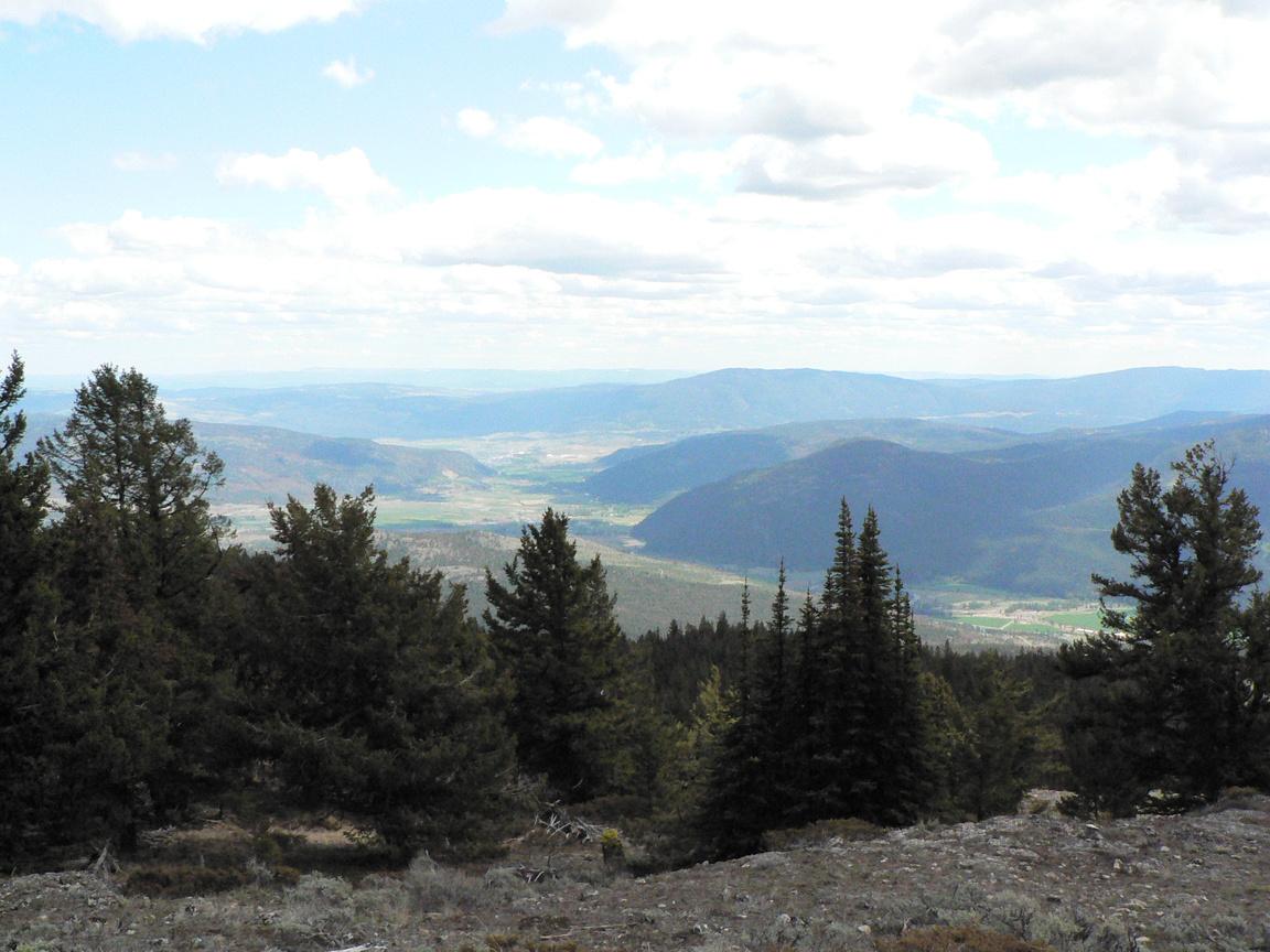
Letterboxing Clues: From the Lookout Rec Site, the cache is located ~43 paces due south under a bent fir
122
Clapperton Falls Views & Vistas
SITE IDENTIFICATION
Nearest Community:
Merritt, B C
Geocache Location:
N 50°13.885' W 120°37 473'
UTM: East 0669414; North 5567062 10U
Altitude:
1000m/3282ft
Date Established: N/A
Ownership:
Crown Land Accuracy:
7 meters
Overall Difficulty: 1
Overall Terrain: 3
Access Information and Restrictions: Located 14.5 km north of Merritt on Hwy 5, only accessible northbound. No marked exit, watch for a yellow gate at the Kirby gravel pit, make this right turn. Keep to the left at each road fork and park ~1.5 km in, at the gravel pit. This is a natural falls, with no safety barriers, please use extreme caution. Recommended to keep children and pets close at ALL times
For more information or to report a problem with this site please contact:
Gold Country Communities Society
P O Box 933 Cache Creek, B C V0K 1H0 Tel: 1-877-453-9467
Email: info@exploregoldcountry.com
For more site pages go to: www exploregoldcountry com www.geocaching.com
APPLY STICKER HERE
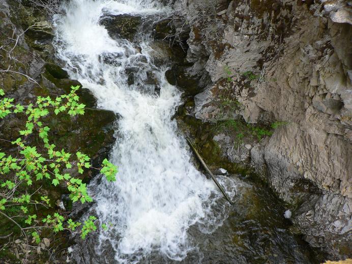
Flowing in the canyon below the Coquihalla Highway north of Merritt is Clapperton Creek. It is a major tributary to the Nicola River, draining a large portion of the area on both sides of the highway from just north of Merritt to the Surrey Lake Summit. Snowmelt does influence the rate of discharge in this creek, but it flows year round. There are dams at the outflow of both Sussex Lake and Helmer Lake along Clapperton Creek that are used to regulate flow to provide irrigation water in the summer
In addition to being important for agriculture, Clapperton Creek also provides a source of water for wildlife, as well as a band of riparian habitat along the stream shore where a variety of wildlife, birds and insects are able to take advantage of the more succulent vegetation and dense shrubs found closer to the water.
There are of course species which make the creek itself home, including several types of fish Rainbow trout, coho salmon, chinook salmon and steelhead are all species present in Clapperton Creek, though there are several barriers to fish passage that prevent the latter three species from journeying very far up the 29 km creek This means that though there are rainbow trout present along the length of Clapperton Creek, the other three species can only be found downstream of the first barrier to fish passage, since they are anadromous. They migrate to the ocean but must return to their natal stream to spawn, and cannot swim upstream of the barriers. According to the B.C. Ministry of Environment’s internet mapping program, “Habitat Wizard”, there are two natural barriers to fish passage on Clapperton Creek in addition to the two lake outflow dams. One is a set of falls 2 km upstream from the confluence with the Nicola River, and another is found 5 km further upstream
This second set of falls is known as Clapperton Falls, and is a hidden treasure that is relatively easy to access from the Coquihalla Highway’s northbound lane. There is not an
123
Site # 110302 GC1TQE8
Phase l
actual highway exit to reach the falls access road The gravel pit is a good spot to park and begin to explore The sound of the falls is enticing, and the overhanging perch from which the falls are best viewed is worth the effort to find. There are not established trails to find the falls, nor are there any guardrails to prevent a fall, so walking with caution and keeping pets and children close by is definitely recommended. One type of plant found near the viewpoint of Clapperton Falls is Fairyslipper (Calypso bulbosa). According to the “Plants of the Southern Interior of B C ” book, this beautiful purple-flowered orchid is decreasing in numbers due to its sensitivity to trampling and picking Fairyslipper is also considered a medicinal plant of importance to several Aboriginal groups, including the First Nations people of the Nicola Valley Enjoy the beauty of both the falls and the flowers, and try to leave the spot as it was when you arrived
Written and Researched by
Aline Lachapelle
Please check geocaching.com before you go!
BIBLIOGRAPHY & SOURCES
Habitat Wizard. Retrieved May 24, 2009, from B.C. Ministry of Environment Web site: http://webmaps.gov.bc.ca/imf5/imf.jsp?site=moe habwiz Mussio, R., Mussio, W., & Stainton-Mussio, P. (2008). Thompson Okanagan BC Backroad Mapbook Outdoor Recreation Guide 1st Ed. Mussio Ventures Ltd.
Pacific Salmon Species Information. Retrieved May 24, 2009, from Department of Fisheries and Oceans Canada Web site: http://www.pac.dfo-mpo.gc.ca/fm-gp/rec/species-especes/salmon-saumon-eng.htm Parish, R., Coupe, R., & Lloyd, D. (1996). Plants of Southern Interior British Columbia. Edmonton, AB: Lone Pine Publishing.
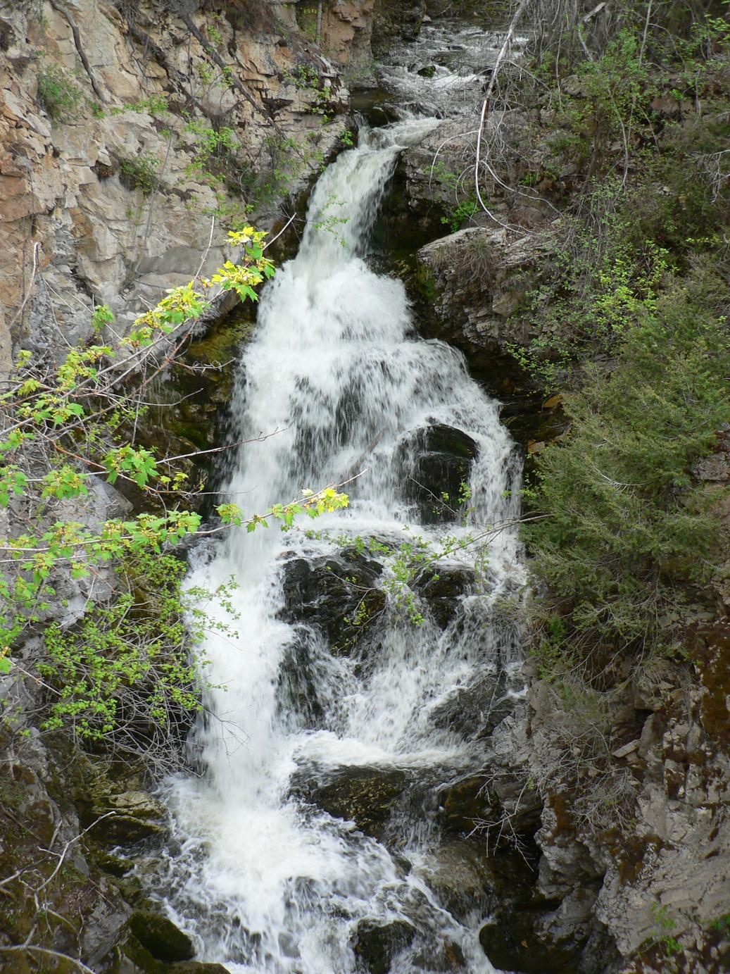
Letterboxing Clues: The road splits behind the last gravel pile, stop and listen; follow the sound of the falls About 20 feet from the gorge is a small crevasse on the right, the cache is just over this edge.
124
C r e d i t : A l i n e L a c h a p e l l e
Guichon Lundbom Grasslands Pioneers & Early Settlers
SITE IDENTIFICATION
Nearest Community: Merritt, B C
Geocache Location: N 50°04 004' W 120°39 497'
UTM: East 0667583; North 5548677 10U
Altitude: 1109m/3638ft
Date Established: N/A
Ownership: Crown Land
Accuracy: 5 meters
Overall Difficulty: 1
Overall Terrain: 1.5
Access Information and Restrictions: Follow Hwy 5A east approximately 11 km and turn left on Lundbom Rd. Park in designated areas and do not take any motorized vehicles offroad. Please stay off the grasslands where possible, this is a fragile environment.
For more information or to report a problem with this site please contact:
Gold Country Communities Society P.O. Box 933 Cache Creek, B.C. V0K 1H0 Tel: 1-877-453-9467
Email: info@exploregoldcountry com
For more site pages go to: www exploregoldcountry com www geocaching com
APPLY STICKER HERE
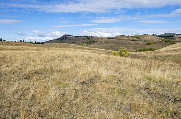
Between Nicola Lake and Aspen Grove is one of the vastest and most unique golden rolling grasslands to be found anywhere in the Nicola Valley. It is rich with fowl, songbirds, birds of prey and wildlife. It is an ecosystem to be treasured and protected forever. The grasslands have a long rich history Pioneer and rancher Joseph Guichon was originally born in Chambery, France and immigrated to British Columbia in the mid 19th century He arrived in the interior in 1865 and soon found employment in Ashcroft on the Dominion ranch owned and managed by Charles Augustus Semlin He later hired on with Jean Caux, a French horse packer, travelling the Hudson Bay Brigade trails, providing for the miners in the gold fields.
It was 1867 on those trails through the Nicola Valley that Guichon recognized the immense potential for cattle ranching By the following year he acquired land in the ‘Savonaux’ region, where his own herd grew and thrived At the same time, with his brother Laurent, he took up land at ‘Mamit’ Lake and established a farm It was here in 1877 that Dr George Mercer Dawson of the Geological Survey of Canada discovered Guichon and noted in his diaries, “He grows grain of all sorts and potatoes with success, despite the high elevation ”
By 1878, the Guichon brothers relocated their base operations to the Home Ranch at Chapperon Lake They both married sisters and continued to acquire more land growing their holdings and developing grazing property between Mamette and Chapperon Lakes
Joseph and his brother were establishing themselves as very significant figures on the ranching frontier. With a history of perpetual expansion the ranch was now growing further east on Nicola Lake. The families moved to this latest acquisition where they would remain for years to come. In the meantime, 125
Site # 120101 GC1V1X7
Phase l
the Chapperon Lake lands were sold to Douglas Lake Cattle Company and the profits divided equally between the two families Laurent himself moved to the coast and Joseph maintained the 1400 head of cattle
The ever business savvy rancher, Joseph could see great advantage in marketing his beef to the construction crews now building the great railway. By 1885 he was marketing his cattle closer to home in Kamloops. In the 1890s he was raising Percherons and Thoroughbreds selling them to the North-West Mounted Police (later the Royal Canadian Mounted Police) and the Vancouver Mounted Police
Guichon continued to increase holdings throughout the Nicola Valley. He expanded further north in the 1890s. By 1904 he acquired the Quilchena Ranch, the Quilchena Hotel and the general store. He bought the Triangle Ranch in 1911. In 1918 three years before his death he divided his worth evenly amongst his seven children. The Guichon lands included nearly 40,000 acres of deeded land and more than half a million acres of crown land leases, in ranches, rolling hills and grasslands.
Sons, grandsons and great grandsons of the Guichon family still retain land and continue to ranch in the valley Great grandson Mike Rose and his family own and manage the Quilchena Cattle Company They have carried it through every possible hardship imaginable but continue as the true cowboys they are today
Laurie Guichon, also a fourth generation rancher, was a significant figure in the ranching industry and a noted conservationist. Growing up with a history of ranching and a love for the grasslands, he would practice safe and ecological cattle grazing and hay management. He was well recognized and respected as a grassland conservationist throughout B.C. The Lundbom grasslands and marshes, as a protected habitat, was a vision he worked diligently to establish. Since his death in 1999 his wife and others have continued to carry on the legacy, and the grasslands were officially designated and dedicated as the Laurie Guichon Grasslands and Interpretive Site
The old Nicola-Aspen Grove stage road traverses the grasslands that stretch across the Lundbom Common. Dotted about this great expanse are several marshes and lakes. These are home to waterfowl in abundance. The marsh is one of the first water areas to be ice-free in the spring and attracts an assortment of birds such as mallards, pintails and teals and on the rare occasion trumpeter swans and American white pelicans.
The grasslands are home to things seen and unseen that keep this diverse ecosystem sensitive and protected Laurie Guichon knew of the value and importance of this delicately balanced system and his vision was realized As you amble along, gazing at the gold of ancient grasslands, think of the many generations of Guichon ranchers and their subsequent goal to keep the grasslands a healthy, protected golden sanctuary in the ancient heart of Gold Country
Written and Researched by Angela Wynton
Please check geocaching.com before you go!
BIBLIOGRAPHY & SOURCES
Egan, D (2008, July) Where have all the cowboys gone BC Business Magazine
The Guichon Family (Undated) In Merritt Museum and Archives (Quarterly #11), Merritt, B C University of Toronto, (2000) Joseph Guichon Retrieved May 18, 2009, from Dictionary of Canadian Biography Online Web site: http://www biographi ca/009004-119 01-e php?&id nbr=8177&interval=25& &PHPSESSID =6fu6jmg8jd9apmvt2nsaf1f335
Letterboxing Clues:
From the large rock at the entrance to the parking area, walk up the road ~43 paces. Turn 90° left and walk ~9 paces to rock camouflage.
126
Pioneers & Early Settlers
Brookmere
SITE IDENTIFICATION
Nearest Community: Merritt, B C
Geocache Location: N 49°48 964' W 120°51 947'
UTM: East 0653529; North 5520365 10U
Altitude:
986m/3235ft
Date Established: 1909
Ownership:
Crown Land
Accuracy: 7 meters
Overall Difficulty: 1
Overall Terrain: 1
Access Information and Restrictions:
Gravel road, year-round access, vehicle accessible Take Coldwater exit 256 off Hwy 5 11 km to Brookmere Please respect the privacy of local residents
For more information or to report a problem with this site please contact:
Gold Country Communities Society
P O Box 933 Cache Creek, B C V0K 1H0 Tel: 1-877-453-9467
Email: info@exploregoldcountry com
For more site pages go to: www exploregoldcountry com www geocaching com
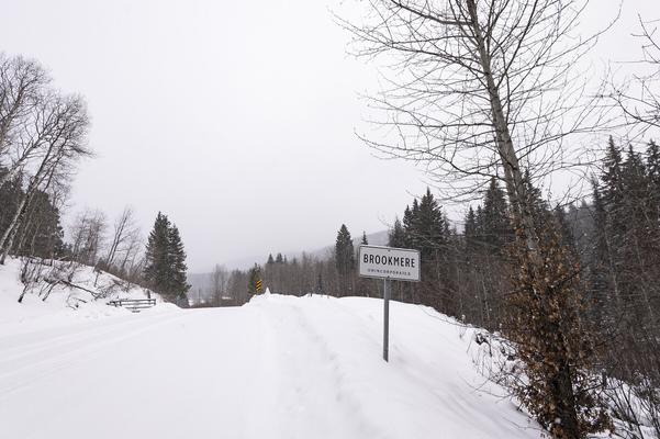
High above the Voght Valley is a barely populated sleepy little community. Brookmere’s golden years long past, its heydays and glory are now nestled between the pages of history. At nearly four thousand feet, quiet Brookmere is brimming with the stories and tales of miners and railway workers of long ago.
Originally known as Otter Summit, mining claims were staked in numerous areas following Voght Creek to the Coldwater River, up and around the mountainside and numerous creeks Small mining was prevalent in all directions from the summit Elevated gold concentrations were discovered in the stream sediments, as well as there being multi-element stream sediment anomalies.
As the Nicola Valley continued to grow with the copper, coal, gold and silver mining, so did the need for transporting the minerals and ores As well, there was greater demand to provide goods and services to the many growing small mining towns popping up all over the valley However, eventually the labour required to extract the gold became greater than the reward and the gold mining in the area dwindled Recently, the search for gold and minerals has been revived with 17,114 hectares being explored in the Brookmere Project.
APPLY STICKER HERE
The Canadian Pacific Railway had built its railway tracks into the Kootneys but there was no line connecting the railway to the far west After much competition, in 1910 the Kettle Valley Railway system began construction And it was only because of the perseverance and constant direction of Chief Engineer Andrew McCullogh, lover of all things Shakespearean, that the railway was completed by July 1916 The construction was met with high costs and a great deal of hardship and would be known as the most expensive railway in the world
But it was the need for a branch line to connect the Kettle Valley rail line with the Canadian Pacific rail line and bypass
127
Site # 120102 GC1V1YV
Phase l
the extreme winter conditions of the Coquihalla Summit that Brookmere came to be Harry Brook, originally from Illinois, had pre-empted land in the area and was well known as a happygolucky rancher and butcher. His ranch was idyllic with fresh water from the local creek feeding the small lake. The area would also prove ideal as the midway stop for a train station and engine maintenance and bypass the winter extremes.
Brookmere soon grew to be a major mountain railroad town with a water tower, turntable, three-stall roundhouse, section house and a station house. After an engine explosion in 1947 the roundhouse was replaced by a four-stall.
A hotel was erected; a post-office established and soon commercial enterprises and services arrived. Railway workers built houses, families grew and the village was alive and bustling with the activities of the railway line Brookmere was a healthy and happy railway community
Unfortunately, it would not last. With the growth of the automobile came the building of roadways and highways and the demise of train transportation. It was nearly fifty years later in 1964 that the last passenger and freight train went through Brookmere. There is no longer a hotel or station house, no roundhouse, only vestiges of what once was. The only surviving water tower from the Kettle Valley line is still standing as a towering reminder and an old caboose is being revitalized.
Brookmere may be quiet but it echoes the tales and glamour of the railroad history of the times Today some of the original houses still stand and the families and their descendants keep the stories and the memory of Brookmere alive Every August, rail fans, railroaders, and friends from all-over return to Brookmere to celebrate their railroad heritage, history and respect for the great trains and railway systems that helped build the province Yes, those golden years of trains and gold mining still live on in the historical sleepy town of Brookmere, high in the hills of Gold Country.
Written and Researched by Angela
Wynton
BIBLIOGRAPHY & SOURCES
(2006). Merit & Brookmere. Retrieved May 18, 2009, from WCX Williams Creek Exploration Ltd - Gold Web site: http://www.wcxltd.com/ Kluckner, M (2005) Vanishing British Columbia Vancouver, BC: UBC Press Matheson, G (1997) Brookmere Revisited Video production (Undated) Kettle Valley Railway: Okanagan History Vignette In Kelowna Museum and Archives, Kelowna, B C
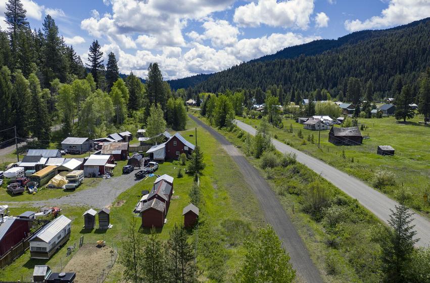
Letterboxing Clues: From junction of Brookmere Road and Kettle Valley Rail bed, walk south to stand of poplars Then ~10 paces to your left of the rail bed, cache is at the base of a tree.
128
Please check geocaching.com before you go!
Aspen Grove Mining Characters Pioneers & Early Settlers
SITE IDENTIFICATION
Nearest Community: Aspen Grove, B C
Geocache Location: N 49°55 431' W 120°37 675'
UTM: East 0670261; North 5532866 10U
Altitude: 1052m/3450ft
Date Established: 1905
Ownership:
Crown Land
Accuracy: 5 meters
Overall Difficulty: 1
Overall Terrain: 1 5
Access Information and Restrictions:
From Merritt, follow Hwy 5A south to Aspen Grove As you travel south through town, the ‘old barn’ to your right was the stagecoach stop South of the community, park at the Kidd Lake rest area
For more information or to report a problem with this site please contact:
Gold Country Communities Society P O Box 933 Cache Creek, B C V0K 1H0 Tel: 1-877-453-9467
Email: info@exploregoldcountry com
For more site pages go to: www exploregoldcountry com www geocaching com
APPLY STICKER HERE
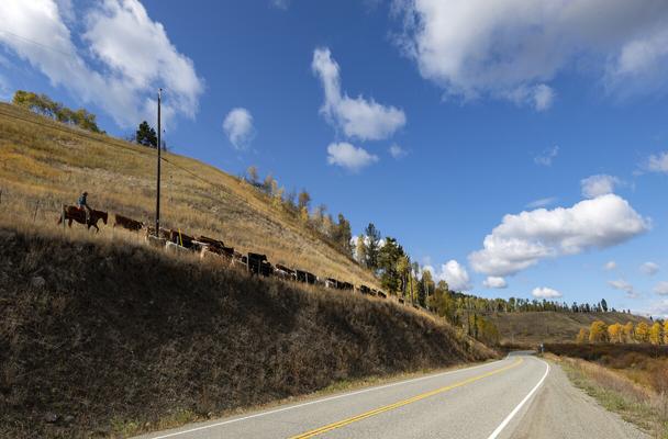
As they say, all that glitters is not gold. The Nicola Valley is rich with minerals and copper and was soon the centre of a vast mining community. Aspen Grove became the heart of the mining area. It was the central stage coach stop, post office and the social hub of the community with galas, balls and brawls.
Of the many who staked claims for the copper and minerals in the early years, a few became well known throughout the camp They attended social events, drank with the miners and rode regularly through town Perhaps though, some of their recognition was partly through association or misadventure, an association that would become legendary.
The local press, Nicola Herald, in June 1905 reported “Dad Allen and his partners are hard at work on the Pearl Group of claims, and are continuing the tunnel cross cutting the formation, and have shown up a large body of ore ” The 1906 B C Mining Report for the Yale District, Nicola Division, comments, “Efforts are now chiefly to keeping up assessment work and crown granting ” And continues, “On the group of claims owned by Dad Allen, assessment work has resulted in exposing copper Locations held by (Alonzo) Roberts and (Jack) Budd, in which prospecting has been done, afford excellent showings. ”
It is said, J. P. ‘Dad’ Allen had once owned a stable, running pack trains and horses to mines He was also said to be a partner of Wild Bill Hickok, “ he was born in the state of New York, of Scottish descent Molly and Dad packed the kids in a covered wagon, horse-trading through the old West All went well until the Sheriff of Death Valley killed Dad’s eldest son, Charlie, so Dad killed the Sheriff, and had to get out and come to B C ” wrote Maisie Campbell-Johnston
Jack Budd was from Texas and immigrated to British Columbia. He ran a ranch in Princeton with his partner
129
Site # 120103 GC1TKPX
Phase l
George Edwards They both also had interests in mineral claims Alonzo Roberts was a local Aspen Grove rancher who partnered with the three to explore similar claims “But who was George Edwards?” you ask Well, Edwards lived at the Roberts ranch for several months and Alonzo describes him as ‘ a likeable chap…a decent chap, who loved riding and hunting and rode a large black horse…’
In May 1906 Edwards and several blokes decided to avail themselves of a payroll aboard a Canadian Pacific Railway locomotive that would be coming through the Ducks station However, things went awry and the robbers took off, trying to disguise themselves as wandering prospectors The Royal Northwest Mounted Police, thanks to Constable William Fernie and others, tracked Edwards and his gang for five days and found them holed-up near Douglas Lake While two of the robbers proved not as well mannered, Edwards, who was the leader, surrendered with his usual politeness and courtesy After all, he was apparently known as ‘The Gentleman Bandit’ All three were arrested and convicted
Jack Budd was considered a likely accessory in the Ducks robbery, but how is unknown and it was never proven. The Gentleman Bandit was the legendary Bill Miner, the notorious train robber with good manners, both polite and courteous. The Gentleman Bandit later escaped prison and was never seen again in Aspen Grove or anywhere else in Canada.
Aspen Grove Camp is historic not only for its contribution to the wealth and development of Merritt and the Nicola Valley, but also for its extraordinary connection to the legendary outlaw Bill Miner As you mosey the scenic prairielands, imagine a courteous and polite miner riding about the camp on his dark horse. Imagine further, this very same gentleman mounted on a great black steed, a Gentleman Bandit, chasing down a great ‘Iron Horse’ in search of another kind of gold, the glitter of a C.P.R. payroll traveling through Gold Country.
Written and Researched by Angela Wynton
BIBLIOGRAPHY & SOURCES
Campbell-Johnston, M. (1943). A New Side of Bill Miner’s Character. In Vancouver Museum Archives. Grauer, P. (2006). Interred with their bones: Bill Miner in Canada 1903-1907. Tillicum Books.
Letterboxing Clues:
From the top of the parking area, at the beginning of the boat launch, go ~18 paces towards the lake Turn 90° right and go ~4 paces, this cache is not an ammo can and blends in to the landscape.
130
Please check geocaching.com before you go!
Pioneers & Early Settlers
The Smith’s
SITE IDENTIFICATION
Nearest Community: Merritt, B C
Geocache Location: N 49°51 555' W 120°43 553'
UTM: East 0663447; North 5525461 10U
Altitude: 1052m/3453ft
Date Established: 1887
Ownership: Crown Land Accuracy: 7 meters
Overall Difficulty: 1
Overall Terrain: 2.5
Access Information and Restrictions:
Accessible from either Hwy 5 or Hwy 5A From Hwy 5A access either Coalmont or Kane Valley Rds From Hwy 5 access via exit 256 to either Brookmere or Kane Valley Rds For an alternate scenic route via Merritt take Coldwater Rd south to either access road Parking available in Davis Lake Rec site
For more information or to report a problem with this site please contact:
Gold Country Communities Society P O Box 933 Cache Creek, B C V0K 1H0 Tel: 1-877-453-9467
Email: info@exploregoldcountry.com
For more site pages go to: www exploregoldcountry com www.geocaching.com
APPLY STICKER HERE
There is a story nestled deep amid the golden hay of the Voght Valley. A story that begins in Scotland, passes from Spences Bridge to Voght Creek, returns to Spences Bridge and celebrates Grimes Golden apples.
On February 9, 1884, a young lass from Aberdeenshire, Scotland, Jessie Anne, 30 years and newly married, set out with her husband John Smith, a novice orchardist, on an arduous journey to the far west reaches of Canada They would travel the entire trip with a Mr James Teit, who was to work at his uncle’s hotel and orchard
Travelling by steamer across the Atlantic, the three were bound for Spences Bridge. From Boston by train they journeyed across the U.S.A. They experienced snow slides, accidents and long frightening mountain passes, finally arriving at Tacoma and then onto Victoria by steamer By steamer to Port Moody, they would board a work train to the Interior, winding along precipitous curves above the mighty Fraser River Abruptly stopping at Cisco, where there were no further tracks, only the span of the railway bridge in midconstruction
Here the journey became even more harried as young Jessie Smith climbed into the great basket strung by a cable. With John, James and a Mr. Burr, sent to bring them on the rest of their journey, the cable was loosed and the basket careened toward the pile of hay on the other side of the raging river
By stagecoach they would travel the Cariboo Wagon Road, twisting high above the torrent, along rocky mountain ledges. It was now March 19, 1884 and by day’s end they arrived at their destination, Spences Bridge. Here they would remain until the spring of 1887.
The arduous journey from Scotland to B C had certainly been an experience for Jessie and had somewhat prepared her for her new life as the wife of an orchardist, farmer and rancher It was the fall of 1887 and they were to pull-up stakes and soon settle
131
Site # 120104 GC1V1ZA Phase l
on 320 acres in the Voght Valley
‘We reached our homestead high in the mountain valley in the second evening. I got out of the wagon and looked around a large field surrounded by pine trees. Voght Creek… ran through the valley…a four roomed log cabin with a steep-pitched shake roof was near the creek,’ Jessie writes. ‘Our first winter in the valley was very cold and hard.’
When spring came that first year, Jessie remarked to John, “Is this the first time a plough has been put into this land since God created the world?” But they soon worked the land successfully, growing oats, wheat, every vegetable imaginable and golden hay. They also raised cattle and dairy cows.
Tragedy struck. After their third child was born, Jessie became ill and bed-ridden for more than a month, almost losing a leg. She could remember nothing during her illness. Upon finally recognising her husband, John smiled, “Thank God The mists have rolled away ”
The life was lonely, winters severe and only Father Le Jeune visited on occasion. In the winter of 1893 the temperature dropped to -60 degrees Fahrenheit and never warming past -35 degrees Fahrenheit during the day. By the following spring they had lost more than 100 head of cattle. ‘The wind was cruel. It took all my time to keep the children from freezing to death,’ writes Jessie.
It was the following June when John went off with a group prospecting to Granite Creek The Smith family, now four children, waited anxiously for their devoted father to return home for Jessie’s birthday on July 17 When the stranger arrived, his words were less than reassuring, “ didn’t you hear He was buried up to the neck in a slide at the mine He isn’t expected to live ”
It was sometime before John recovered from the worst of his injuries, returning home to finish his convalescence. Later that summer they would add another new family member. By the fall, James Teit would send word that his uncle, Mr. John Murray, had died and his orchard was for sale. The bid from the Smith’s was accepted. By the next spring, after 10 years, inclement weather, challenges, losses and tragedies, the Smith’s and their now five children were leaving the Voght Valley and returning to their original destination.
Now following another dream, they were leaving the golden hay fields for the gold and glory of award winning apples, Grimes Goldens The golden apples would be the choice of the gold and glitter of British Royalty And there lies yet another story in the heart of Gold Country.
Written and Researched by Angela Wynton
BIBLIOGRAPHY & SOURCES
Ward, A & Campbell, J M (1989) Widow Smith of Spences Bridge Merritt, BC: Sonotek Publishing
Letterboxing Clues: From picnic table #5 go ~126 paces northeast up the hill on left hand trail Just before left corner, at a stump, go right and climb ~21 paces to a blown down tree.
132
Please check geocaching.com before you go!
Aspen Grove Mining Camp Geological Wonders
SITE IDENTIFICATION
Nearest Community: Aspen Grove, B C
Geocache Location:
N 49°48 862' W 120°32 749'
UTM: East 0676551; North 5520881 10U
Altitude: 1020m/3347ft
Date Established: 1900
Ownership:
BC Forestry Rec Site
Accuracy:
5 meters
Overall Difficulty: 1
Overall Terrain: 1.5
Access Information and Restrictions:
From Merritt, follow Hwy 5A south to Aspen Grove Continue through Aspen Grove 17 km south Take Dillard Creek Forest Service Rd to Missezula Lake Rd Follow to Missezula Lake Rec Site
Please use caution and be prepared for back country driving.
For more information or to report a problem with this site please contact: Gold Country Communities Society P O Box 933 Cache Creek, B C V0K 1H0 Tel: 1-877-453-9467
Email: info@exploregoldcountry.com
For more site pages go to: www exploregoldcountry com www.geocaching.com
APPLY STICKER HERE
At the dusk of the Gold Rush many mining ventures grew in the Nicola Valley, including iron, gypsum, coal, gold and copper. It was the copper ventures that excited many, and from the early 1900s the rolling park-like prairieland of Aspen Grove Camp was the heart of a very active mining district.
The prolific copper of the Aspen Grove area lies along the Allison Fault, suggesting an extension of the ore of Copper Mountain, southwest of Princeton Years later, the well known geologist Dr H M A Rice would write, “It is surely more than a coincidence that deposits whose mineral constituents should be so like those of Copper Mountain should occur dotted along a line of faulting extending north from Copper Mountain.”
The Aspen Grove deposit is an ideal copper formation, similar to the copper deposits of Michigan and Lake Superior The copper minerals are disseminated through volcanic rocks of the Nicola Group and are Upper Triassic volcanic and sedimentary rock A large amount of the copper is in its native state with some chalcocite, a heavy dark grey mineral that is basically cuprous sulphite It is an important ore of copper and is also referred to as copper glance
The New Empire, in its September 1911 edition, published several comments, “Some of the better known mining engineers who have studied conditions say that the Aspen Grove copper camp is one of the largest and wealthiest in the west and the results that have been accomplished by the men who have exploited the district fully confirm this theory ”
“The outside world little knows what transpires in some of these more remote camps, remote not so much in actual mileage as in the difficulty with which they are reached, but it is a matter of actual record that nearly one million dollars has already been spent in developing some of the copper properties of the Aspen Grove district. There are close onto six hundred claims in all…” 133
Site # 120201 GC1TQ48 Phase l
Between 1900 and the 1930s hundreds of claims were staked, many with interesting names such as Big Sioux, Tom Cat, Queen of Hearts, Parrot, Pearl, Snowflake and Blue Bell Some are still referred to today
The mining activities of Aspen Grove Camp and the surrounding area, Missezula, Pothole, Kentucky and Alleyne Lake regions continued for many years. Frank Bailey, a mining engineer, wrote in his booklet in the second decade of the 1900s, “The trip from Merritt through Aspen Grove is one of the most beautiful trips to be taken in an automobile in the summertime You soon start to climb the Hamilton Hill to the east This section has been for years known as the Commonage, where numbers of cattle range, sometimes the year round From the top of the hill the road leads over an excellent rolling farming district to Crowders ranch, which is the present stopping place in Aspen Grove It is here that the horse stages stop for noon, and where the passengers can see many of the Aspen Grove copper specimens ”
Unfortunately, the exploration and activity of the Aspen Grove Camp from 1900 to 1930 had rather disappointing results. It would be the 1950s before the copper was extracted more economically and less laboriously. While a great deal of tonnage was removed since that time, there still remains plenty of copper and minerals in the surrounding area. A number of claims are again current and with current technology it is expected more copper will be extracted in the future.
The once bustling Aspen Grove Camp, a geological wonder, a grassland beauty, a historic mining centre and a major contributor to the wealth and development of Merritt and the Nicola Valley, is now a peaceful and quiet sleepy haven in Gold Country.
Written and Researched by Angela Wynton
BIBLIOGRAPHY & SOURCES
(1911, September). The New Empire. Vernon, B.C. Bailey, F. (c1913). Nicola Similkameen and Tulameen Valleys: The Richest section of British Columbia. In The Library of the University of California, Los Angeles Vancouver, BC: Ward, Elwood and Pound Printers. Rice, H.M.A. (1947). Geology and Mineral Deposits of the Princeton map-area, British Columbia. Ottawa, ON: King’s Printer.
Letterboxing Clues: Approximately half way to the lake from the main road stop and park next to cut bank Turn left and walk up the hill ~15 m to cache tucked under a log.
134
Please check geocaching.com before you go!
3 Mile Lake - Jean Caux Pioneers & Early Settlers
SITE IDENTIFICATION
Nearest Community: Clinton, B C
Geocache Location:
N 51°03 725' W 121°34.287'
Altitude:
951m/3120ft
Ownership: Crown Land
Accuracy: 2 meters
Overall Difficulty: 1.5
Overall Terrain: 2
Access Information and Restrictions:
From Clinton follow Hwy 97 towards Cache Creek for 4.1 km. Turn right onto Clinton Cemetery road.
Parking Advice:
Just before the cemetery, pull off on the right side of gravel road.
For more information or to report a problem with this site please contact:
Gold Country Communities Society
P O Box 933 Cache Creek, B C V0K 1H0
Tel: 1-877-453-9467
Email: info@exploregoldcountry com
For more site pages go to: www exploregoldcountry com www geocaching com
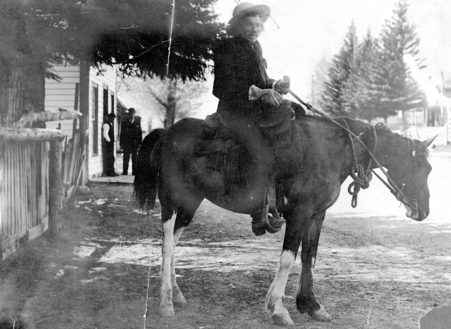
In its early days, the area in and around Gold Country attracted its share of larger-than-life personalities, many of whom went on to become legends. Few were more legendary than Jean Caux, known far and wide as “Cataline”, the king of the packers.
Little is known about his early life; there is even uncertainty about when he was born (probably 1832) and where (probably in Oloron, southwestern France) Even the origin of his nickname is disputed One story is that it derived from the Catalonia area of Spain, near where Caux was born; another is that he was fond of using “Catalonia!” as a colourful swear word He arrived in Lytton in 1858, part of a large group of packers Purchasing his own string of mules, Cataline soon began supplying the goldfields of the Cariboo, transporting goods between Yale and Barkerville
APPLY STICKER HERE
Cataline was not especially tall, but he was a powerful, barrel-chested man whose tremendous strength meant that he could handle the most difficult pack mules with ease. He spoke a curious mix of French, Spanish, English, Chinese, and Native languages, and could neither read nor write, although he had a remarkable ability to retain information. He kept detailed records in his head of money owed, fees to charge, and precisely what each of the mules in his team (some sixty animals, carrying loads of up to 300 pounds each) carried. On one occasion two packers decided to leave his team after only one trip, and Cataline reckoned up in his head what he owed each man. The first, who could neither read nor write, accepted Cataline’s sum, but the second man who had kept a sheet of notes argued hat Cataline was out by $3.00 on what was owed. When the packer added up his list of figures again, he discovered he had made a mistake and that Cataline was correct.
135
#73 GC3P2WA
Phase 2 C r e d i t : R o y a l B C M u s e u m , B C A r c h i v e s
When he was packing freight, Cataline’s days would start before dawn, and his train would average fifteen miles or more per day. During his early years in B.C. he took as a wife a woman of the Spuzzum band, and stayed with he near Yale until 1885, when the completion of the railroad meant that packing for the goldfields was moved north to Ashcroft. He continued making the arduous trip to Barkerville, hauling everything from frying pans and food to grand pianos and cook stoves, until the 1890s, when the gold rush had dwindled to the point where there was little profit in the journey. He had already moved further north, to Quesnel, by this time, and continued to supply the Omineca region. When he retired from packing in 1918 he was living in Hazelton, B.C., and his career as a packer had spanned more than half a century, during which time he never lost a load.
In 1920 he moved to Victoria, but decided that city life was not to his liking, and returned to Hazelton Two years later, however, he was back in Victoria on a visit, as reported in the Ashcroft Journal:
“[We are] in receipt of a letter from Victoria, which states that ‘a number of your readers will be interested to know that “Cateline” [sic] the well-known packer of early says on the Cariboo road, has just arrived from Hazelton. Considering his age [90] he looks well with his long white hair.”
Cataline died in October 1922, and is buried in the old Hazelton cemetery. A brass plate on his cairn bears the simple inscription “Jean Caux Cataline, the packer.”
Written and Researched by Barbara Roden
BIBLIOGRAPHY & SOURCES
(1922) Ashcroft Journal (newspaper), January 27th. In Ashcroft Museum and Archive. Duclos, Noel G and Duclos, Blanche (1984) Packers, Pans, and Paydirt: Prospecting in the Cariboo Quesnel, B C Milliken, A C (1993) “Jean Caux: The Man They Called ‘Cataline’” in Frontier Days in British Columbia (edited by Garnet Basque) Surrey, B C : Heritage House Publishing Company Ltd Temple, L.G. (1951). “Cataline: King of the Packers” in “The Shoulder Strap”, Policing the West. In Ashcroft Museum and Archive.
Letterboxing Clues:
When parked, hike up a small hill on the left side of the dirt road to the top
136
Please check geocaching.com before you go! C r e d i t : K u r t E v a n s
Pioneers & Early Settlers
20 Mile House
SITE IDENTIFICATION
Nearest Community:
Clinton, B C & 70 Mile House, B C
Geocache Location: N 50°58 203' W 121°27.608'
Altitude:
592m/1943ft
Ownership: Private Property
Accuracy: 1 meter
Overall Difficulty: 2
Overall Terrain: 2
Access Information and Restrictions:
From Clinton follow Hwy 97 towards Cache Creek for 19km. Turn left onto Loon Lake Road and park at the pull out by the post boxes.
Parking Advice: Park at the post boxes.
For more information or to report a problem with this site please contact:
Gold Country Communities Society
P O Box 933 Cache Creek, B C V0K 1H0
Tel: 1-877-453-9467
Email: info@exploregoldcountry com
For more site pages go to: www exploregoldcountry com www geocaching com

The Gold Rush attracted folks from far and abroad, and the Cariboo Wagon Road attracted entrepreneurs building roadhouses along the way in hopes of making their own fortune. And some were far more interesting and entertaining than others. One such roadhouse was established at Maiden Creek at the Bonaparte River, about twenty miles from Ashcroft.
William Fraser pre-empted 160-acres in 1863 near the HBC Fur Brigade Trail to Loon Lake and beyond 1 There he constructed a large log house on the north side of the wagon road He faired well, with both gold seekers and fur traders patronizing the Fraser’s Ranch. In 1870 he sold it.
Jacob Mundorf, who originally haled from Wurms in Germany, made his way to the gold of Barkerville in the early 1860s There he settled at Williams Creek buying mining claims in the area He also fell in love with a German hurdy-gurdy girl, Catherine Haupt 2
APPLY STICKER HERE
By 1866 Mundorf had acquired both wealth and property in nearby Camerontown. Here he built several businesses, including the Miners’ Bakery & Restaurant and the Mundorf & Company Livery Stables & Feed. The following year he converted the stables into a saloon and dance hall. Katrina, as she was called, danced for the miners and Mundorf accumulated more wealth with his latest enterprise, The Crystal Palace However, in 1868 Barkerville burned
The Mundorfs began their next enterprise with the purchase of Fraser’s Ranch in 1870. Mundorf had big plans and built a larger two story house with a saloon. At the same time, he and Catherine continued to grow their family to five children by 1875.
137
#74 GC3P36X
Phase 2
The wagon road would soon see an increase in traffic with the arrival of the Canadian Pacific Railway in Ashcroft With the movement of even more goods from the station to the north, the saloon became the place to stop. Anybody and everybody could be seen at the Mundorf saloon. The business flourished, but not so the marriage.
Of the two sons, John became a blacksmith which was ideal with all the horse and wagon traffic. The three girls helped in the road house, but sadly one of the daughters died at the early age of fourteen years The Mundorfs were industrious and ran a good business, but they were not a particularly happy family according to patrons and neighbours
And not all neighbours were happy with the Mundorfs. Edward Dougherty, of the nearby Maiden Creek Ranch, one day in 1883 happened upon Mundorf clearing trees on his land.3 Mundorf believed the land to be his, but Dougherty had been paying the taxes on it for a number of years. Letters from both parties were exchanged between Government Agent Frederick Soues in Clinton and William Smith, the Chief Commissioner of Lands and Works in Victoria.4 The land battle continued until 1885 with the decision in favour of Dougherty.
The next battle Mundorf experienced was in 1893 when Catherine applied to the courts for a judicial separation She left and moved in with her son George, who had relinquished all interest in the ranch John had recently moved, taking his blacksmith skills to Victoria and then later to Vancouver Christine and Charlotte remained with their father, helping him run the business. Mundorf continued to do well until his death in 1903 at the age of seventy-five. Christine, now thirty years old and married, kept the business going until 1910. By 1942 the property was sold to Percival Woodward, son of the well known retailer Charles Woodward. Woodward hired caretakers to manage his new acquisition Unfortunately, shortly thereafter during a fumigation process, the roof caught fire and the house and several other structures were destroyed in the flames Now the only original structure still standing is the old blacksmith shop And the property has since passed through several owners On the south side there stood a gas station and café known as Jacob’s Place
The Mundorf roadhouse at 20 Mile may be gone, but the rich history and old blacksmith shop remain to tell the story of a German entrepreneur and a hurdy-gurdy girl who lived the Cariboo life in the heart of Gold Country.
Written and Researched by Angela Wynton
BIBLIOGRAPHY & SOURCES
1 See site page "The Hudson Bay Company Brigade Trail", Gold Country GeoTourism Adventures, Field Guide Volume 1, 117.
2 See site page "Maiden Creek Ranch", Gold Country GeoTourism Adventures, Field Guide, Volume 2, 103.
3 Ibid.
4 See site page "Clinton Pioneer Cemetery", Gold Country GeoTourism Adventures, Field Guide Volume 1, 43.
Patenaude, Branwen, Trails to Gold, Horsdal & Schubart, Victoria 1995
Lands & Works Department, Government of B C , Evidence Select Committee on Public Lands, Fourth Report, 1886
Patenaude, Branwen, GOLDEN NUGGETS Roadhouse Portraits along the Cariboo’s Gold-Rush Trail, Heritage Books, Surrey 1998
Ramsey, Bruce, Ghost Towns of British Columbia, Mitchell Press, Vancouver 1963
Letterboxing Clues:
Park at the post boxes Follow the trail by the fence line up to the top of the hill by the hydro poles At pole #17 turn to the right, and walk towards the last pole with a view of 20 Mile Ranch and the Old Cariboo Wagon Road that runs along the hillside. Cache is hidden in sagebrush near the backside of pole #1755.
138
Please check geocaching.com before you go!
Pioneers & Early Settlers
Baillie House
SITE IDENTIFICATION
Nearest Community: Merritt, B C
Geocache Location:
N 50°06 769' W 120°47.210'
Altitude:
596m/1955ft
Ownership: City of Merritt/ Nicola Valley Heritage Society
Accuracy: 3 meters
Overall Difficulty: 1.5
Overall Terrain: 1.5
Access Information and Restrictions:
Located at the corner of Voght and Mamette Avenue
Parking Advice:
Parking at Civic Centre or on Mamette Avenue
For more information or to report a problem with this site please contact:
Gold Country Communities Society
P O Box 933 Cache Creek, B C V0K 1H0
Tel: 1-877-453-9467
Email: info@exploregoldcountry com
For more site pages go to: www exploregoldcountry com www geocaching com
With stained glass windows catching glints of the hot Merritt sun and Victorian architecture that offers an elegant balance to the Wild West nature of the town, the Baillie House is a proud testament to the entrepreneurial pioneers who built the area's towns and cities from the ground up
Built by Cosom A. Bigney in 1913 for his mail-order bride who was enroute from England, Bigney wanted her future home to reflect the one she had left, with romantic details that included elaborate fretwork on the vaulted gables, stained glass transoms and a decorated verandah porch.
Unfortunately, Bigney's young bride met another man while on the ship and never arrived From that point Bigney, who never married, shared the house with his business partner, Emsley Weatherby. In the 1920's Bigney's nephew, Howard Cameron, moved in. Together the three ran a pop bottling business in the basement of the store on the corner of the lot, supplying cold, alcohol-free drinks to local coal miners. They also ran a successful feed and seed business.
APPLY STICKER HERE
Bigney died in 1933 and Weatherby died in 1935 The economy was poor and Cameron couldn't pay the taxes so the property was taken over by the city In 1938 Melville Baillie, a blacksmith, bought the property His wife, Pauline, and their six children moved in and suddenly the quiet house was home to the squeals and secrets of little girls, fresh baking, and the busy details of family life. Melville and his son, Mel Jr., ran a successful blacksmith shop and, as cars took over from horses, Mel Jr. shifted the business into machining and welding.
Meanwhile, Mrs Baillie, reputed to be a notoriously bad gardener, set to work organizing her new house and planting
139
#77 GC3P8RM
Phase 2 C r e d i t : V e s t a G i l e s
the garden. The hollyhocks she planted in the 1940's still thrive along the side of the house, and her Manitoba Maple provides welcome shade for visitors.
Shortly after the family moved in, several members fell ill with typhoid fever During his illness, Mel Jr designed a hot water heating system that would spread heat evenly through the entire house After he recovered, he installed the heater and radiators, which still heat the house today
Mr. Baillie passed away in 1969 and his wife in 1972. Mel Jr. continued operating his machine shop, passing away in 1990.
In 1995, the City of Merritt purchased the property from Tom McDonagh, intending to move the house to make way for parking spaces Community members rallied, arguing that there was too little green space already and that heritage buildings needed preservation Over 1,800 people signed a petition to prevent the move and fundraising events raised money and awareness for the cause. Finally, the city acknowledged the value of heritage buildings and agreed to lease the building to the newly formed Nicola Valley Heritage Society. After years of hard and passionate work by members of the heritage society, the Baillie House remains a green oasis in the heart of Merritt, and home to the Merritt Tourism Information Centre While faded pink bloomers wave gently in the breeze, over 15,000 visitors enjoy the hospitality and nostalgia, and possibly spirits, of the Baillie House each year
In 2008 BC SPIRITS, a paranormal research organization, spent a night in the house to observe paranormal activity. Footsteps upstairs, unexplained crashes, and a doorbell that randomly changes its tune from ding dong to the Westminster Chimes have been reported for years by staff and visitors. During their night in the house, BC SPIRITS recorded some anomalies, but nothing that dramatic.
Perhaps the greatest indication of the respect and affection the people of Merritt, be they flesh or spirit, have for the Baillie House is that in all of its years it has never been vandalized - no graffiti, no broken windows, no destruction of any means
Written and Researched by Vesta Giles
BIBLIOGRAPHY & SOURCES
"Baillie House: The past with a future." Merritt Herald Community, January 10, 2001. Curnow, S. Email. June 6, 2012.
Douglas, B. Personal interview. April 19, 2012.
Douglas, B. (2006). "The Historic Baillie House Property." Nicola Valley Historical Quarterly, Vol. 21, No. 1&2, Fall / Winter 2006.
"Ghostbusters check out Baillie House". The Merritt Herald, April 16, 2008, p.13.
Letterboxing Clues:
Cache is behind a bush between parking lot and the North side of the arena building
140
Please check geocaching.com before you go!
Baits Motel
SITE IDENTIFICATION
Nearest Community: Spences Bridge, B C
Geocache Location:
N 50°25 366' W 121°20.499'
Ownership:
Private Property
Accuracy: 1 meter
Overall Difficulty: 1 5
Overall Terrain: 1
Access Information and Restrictions: From Hwy 1 heading towards Vancouver turn left onto Riverview Avenue in Spences Bridge and park near the Baits Motel.
Parking Advice: Park by motel.
For more information or to report a problem with this site please contact:
Gold Country Communities Society
P O Box 933 Cache Creek, B C V0K 1H0 Tel: 1-877-453-9467
Email: info@exploregoldcountry com
For more site pages go to: www exploregoldcountry com www geocaching com
While its name may be play on words with references to Alfred Hitchcock's film Psycho, the Baits Motel in historic Spences Bridge is a popular destination for anglers on a quest for the ultimate Steelhead fishing experience. From October through December the fishing season attracts a steady stream of fishing enthusiasts hoping to catch one of the river's famous steelhead that have been known to reach up to 30 lbs in weight. During other parts of the year, the water is teeming with trout, Chinook, and in the fall, bright red sockeye salmon making the long journey to the Adams River to spawn Ray Nigalis, owner of the Inn at Spences Bridge, recounts stories of Ernest Hemingway and other celebrities visiting the area for the outstanding fishing during the town's heyday
Although local first nation’s people have lived in the area for thousands of years, it was the Cariboo Gold Rush that brought white settlers in the mid 1860's. From 1862 – 1865 the area was known as Cook's Ferry, due to the rope ferry operated by American businessman, Mortimer Cook. Later a toll bridge was built by Thomas Spence that connected the wagon road from Yale to the gold-rich areas of the Cariboo and Barkerville The community that emerged eventually became known as Spences Bridge
APPLY STICKER HERE
Due to its rugged beauty and dry, desert vistas, Spences Bridge has caught the attention of more than one Hollywood director and several movies have been filmed in the area. One of the more high profile film shoots to take advantage of the stark beauty and western imagery found in the area was the 2005 drama An Unfinished Life, starring Robert Redford, Jennifer Lopez, Morgan Freeman and Josh Lucas Filmed in various locations in around the Gold Country area with Ashcroft standing in for the small town of Ishawooa, Wyoming, the movie is about loss and the healing power of forgiveness
141
Feature Film
#78 GC3PD0T
Phase 2 C r e d i t : M a r c i e D o w n
As Einar Gilkson (Redford) mourns the untimely death of his only son and the dissolution of his marriage, his ranch is falling to ruin around him He suffers another blow when a bear mauls his good friend and ranch hand Mitch Bradley (Freeman). As Gilkson cares for Bradley, his estranged daughter-in-law Jean, played by Jennifer Lopez, appears at his door with a granddaughter, Griff (Becca Gardner), he never knew he had. Escaping from an abusive relationship, Jean turns to Gilkson for temporary refuge while she pulls her life together. Sheriff Crane Curtis (Lucas) is Jean's love interest and Camryn Manheim plays Nina, the restaurant owner who befriends Jean while suffering from her own losses.
The Baits Motel, formerly known as the Quarter Circle J Motel, was the shooting location for a pivotal scene where Gilkson (Redford) breaks down the motel room door where Jean's (Lopez) abusive ex-boyfriend, Gary Winston (Damien Lewis), is hiding from the law Gilkson, with shotgun in hand, threatens Winston and runs him out of town and Jean’s life forever The hotel, with its classic 1950’s exterior, was purchased by John and and Laurie Kingston who changed the name to the Baits Motel in 2011
Hard Core Logo, a 1995 Canadian fictional documentary-styled account of a punk rock band's reunion tour is one of the earlier films to take advantage of the Spences Bridge location. More recent film projects that have utilized the area's desert and visual appeal include the 2010 remake of The A-Team, starring Liam Neeson and Bradley Cooper and the apocalyptic 2012, starring John Cusack and Woody Harrelson The Canadian film The Sweet Hereafter, starring Ian Holm and Sarah Polley, and directed and written by academy award nominee Atom Egoyan, was filmed in Venables Valley, a few kilometres northwest of Spences Bridge
Written and Researched by Vesta Giles
BIBLIOGRAPHY & SOURCES
“An Unfinished Life”, The Internet Movie Database. Web. 3 July, 2012. BC Adventure. Spences Bridge. Web. 2 July, 2012. British Columbia Travel and Discovery. Spences Bridge. Web. 3 July, 2012. “Hard Core Logo”, The Internet Movie Database. Web. 3 July, 2012. Kingston, John. Personal Interview. 4 July, 2012. Nigalis, Ray. Personal Interview. 4 July, 2012. Travel the Canyon. Spences Bridge. Web. 3 July, 2012. Weller, Vicci (TNRD Film Commission) Personal interviews (no date)
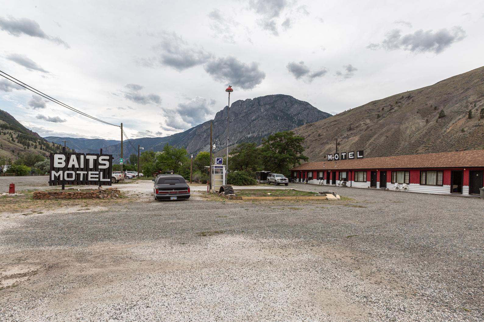
Letterboxing Clues:
Located by the apple tree at picnic area on the right side of the building. Blends in with landscape
142
Please check geocaching.com before you go!
Barnes Lake Trail
SITE IDENTIFICATION
Nearest Community: Ashcroft, B C
Geocache Location:
N 50°41 879' W 121°15.227'
Altitude:
694m/2,276ft
Ownership: Crown Land
Accuracy: 1 meter
Overall Difficulty: 1 5
Overall Terrain: 2
Access Information and Restrictions:
Shared Crown Land, close gate behind you. From Ashcroft, follow Hwy 97C south to Barnes Lake Rd. Note: Trail runs beside main road - gate is at pole #37.
Parking Advice:
Pull off main road and park well off road - heavy truck traffic Walk to trail head gate
For more information or to report a problem with this site please contact:
Gold Country Communities Society
P O Box 933 Cache Creek, B C V0K 1H0 Tel: 1-877-453-9467
Email: info@exploregoldcountry com
For more site pages go to: www exploregoldcountry com www geocaching com
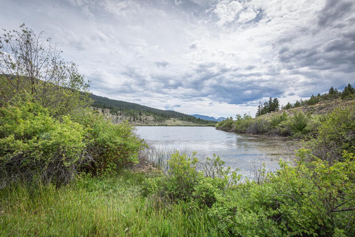
It’s a cold winter day and a school bus full of children crashes onto a frozen lake. Fourteen people are reported dead among them 12 school children…
A frozen Barnes Lake became the setting for this scene from The Sweet Hereafter The Academy Award nominee (Best Original Screenplay) Canadian Director/Screenwriter Atom Egoyan filmed the pivotal scene of the school bus sliding out of control off Barnes Lake Road and towards the ice covered lake on location
However, the sequence when the school bus stops on the ice covered lake and breaks through the ice and sinks was accomplished through the use of special effects. It was determined that as a stunt it would be too risky, and that having a bus going into the lake was environmentally unsound Also, it would be logistically too difficult to retrieve the bus
Ian Holm stars as Mitchel Stevens the lawyer who descends on the grieving community with promises of retribution. Stevens soon discovers that beneath the surface of the small town, all is not as it seems. Other cast members include; Sarah Polley and Bruce Greenwood. The school bus driver was portrayed by renowned Canadian actress Gabrielle Rose who was born and raised in Kamloops, B.C.
APPLY STICKER HERE
Other scenes from The Sweet Hereafter were filmed on Highway 8 (between Merritt and Spences Bridge), Spences Bridge and Venables Valley Flower & Garnet is a powerful story of a broken family. A father’s inability to cope with the death of his wife during childbirth affects his relationship with his children, Flower and Garnet. Jane McGregor gives a solid Performance in the role of Flower as she takes on the care of Garnet. When a teen-age Flower becomes pregnant and decides to keep her baby it creates more anguish in the family. The emergence of Ed’s girlfriend
143
Feature Film
#79 GC3NYWE
Phase 2
and a BB gun he buys for Garnet add to the plot Barnes Lake is where father Ed, portrayed by Canadian Callum Keith Rennie, gets frustrated fishing and throws the boat motor into the lake From the production stand point, it was vital that the boat motor be absolutely stripped of any fluids or residue in order to prevent pollution so they had a second motor especially prepared for the scene. In other words the boat motor had a ‘stunt double’. The boat was situated very close to the shore, although the viewer couldn’t tell, a cord was attached to the boat motor for easy retrieval. A safety diver was also present.
Flower & Garnet was written and directed by Vancouver’s Keith Behrman For this film Behrman was awarded the Claude Jutra Award for outstanding achievement by a Canadian director in a first theatrical feature Ten year old Colin Roberts as Garnet also received a Genie nomination for Best Actor Scenes from Flower & Garnet were also shot in the nearby town of Ashcroft as well as Walhachin and Savona
More information regarding the history of Barnes Lake can be found in GeoTourism Adventures Field Guide Volume 1- Barnes and Williard Lake Gravesite p. 17.
Written and Researched by Kathy Paulos
BIBLIOGRAPHY & SOURCES
Weller, Victoria (Vicci) MA Executive Director of Film, Thompson-Nicola Film Commission (notes) Flower & Garnet- reviews and ratings, awards - www.imdb.com retrieved June 14, 2012 Please
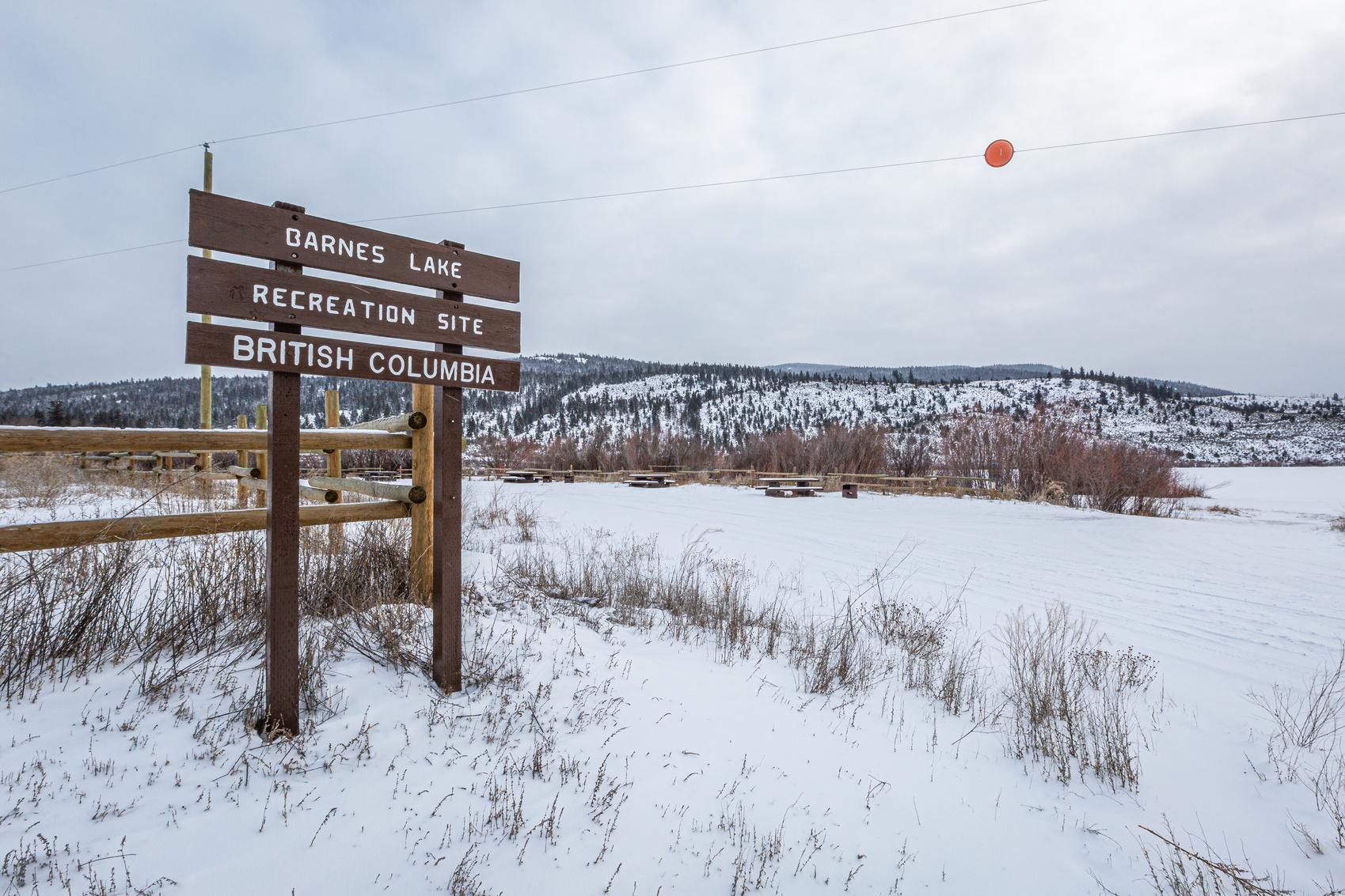
Letterboxing Clues:
From trail head follow trail 450 meters. Turn right off trail and walk 33 paces at bottom of small pine tree.
144
geocaching.com before you go!
check
Battle Creek Road
SITE IDENTIFICATION
Nearest Community:
Cache Creek, B C
Walhachin, B C
Geocache Location:
N 50°48.030' W 121°06 954
Altitude:
632m/2073ft
Ownership:
Crown Land
Accuracy: 2 meters
Overall Difficulty: 1 5
Overall Terrain: 2 5
Access Information and Restrictions:
From the junction in Cache Creek follow Hwy 1 towards Kamloops for 15.82 km. Turn left onto Battle Creek Road. Drive for 0.92 km up the road until you see a pull off on your right. Park here, and walk down 0 4 km Look for marker #2 This is the trail head McAbee Fossil Creek Area on Battle Creek Road
For more information or to report a problem with this site please contact: Gold Country Communities Society
P O Box 933 Cache Creek, B C V0K 1H0 Tel: 1-877-453-9467 Email: info@exploregoldcountry.com
For more site pages go to: www exploregoldcountry com www.geocaching.com
APPLY STICKER HERE
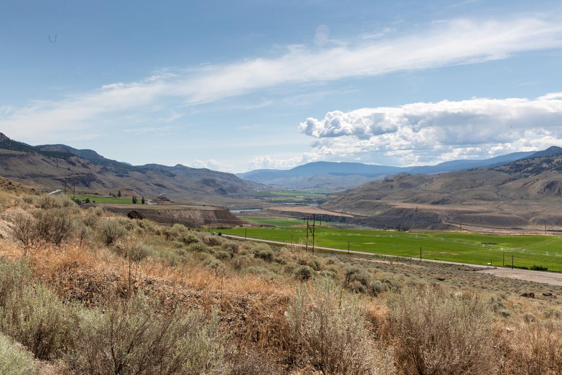
The Battle Creek area encompasses many unusual and unique characteristics in its velvet-like sage green hills and red rocky outcroppings which behold its secrets and treasures. Mule deer, black bear, and bighorn sheep are regulars here and less common are cougar, moose, dry land toads and the occasional elusive badger. Historically, this region is known to be a battle ground between the Chilcotin First Nations from the north and the Shuswap First Nation from the east The hills are littered with basalt flakes left from chipping, known as knapping, arrowheads The Arrowstone Mountain basalt quarry to the north of this region, was coveted by First Nation people for its abundant supply and superior quality basalt used for making tools and projectile points
Spearheads as old as 7000 years, have been discovered in the Battle Creek area. The bow and arrow technology reached this region about 1200 years ago and therefore, the smaller arrowheads, one half inch to one inch in size, are commonly found.
In more recent times the Christian family is the name most associated with the ranch land found on the south side of the TransCanada Highway Purchased from the McAbee (Mack-a-bee) family in the 1960’s and covering 1100 acres, it has been home to 300 cow/calf pairs per year for the last 50 years. The ranch once belonged to Savona settler John Wilson who acquired the land from 4 previous owners who pre-empted the land prior to 1860. Mr. Wilson’s daughter married a McAbee in the early 1900’s and inherited the ranch subsequently known as the McAbee (now Christian) Ranch.
The most exciting characteristic of this area is the McAbee fossil beds on the north side of the TransCanada highway This site is amongst three of the most important fossil finds in British Columbia in terms of significance and first in Canada for its diversity of well-preserved species for the Eocene era 56 to 34 million
145
Geological
& Views
#80 GC3P2VX
Phase 2
years ago It has become internationally renowned for its large quantity of mixed variety species of fish, insects and vegetation during one of earth’s warmest periods in history Many fossils discovered here are entirely new to science. The site has been open to the public under a mining claim as a pay-as-you-dig commercial enterprise. The site has seen many years of excavation by both professional and amateur fossil collectors and busloads of school children. Meanwhile, the hills behind the fossil dig were undergoing another sort of excavation. Due to the highly absorbent properties of the fossil rock it was being crushed and sold as kitty litter. Earlier this spring of 2012, the area was closed to the public temporarily, while its destiny as a provincial heritage site is under discussion.
There have been considerable changes to the Christian ranch in the last few years when it was acquired by the CN railway The hay lands are still under production by private lease and cows are overwintered here but, today its main function is as a rock quarry for railroad ballast The rock being mined and crushed on site is essential to the railway bed on which rail ties are laid The quarry area is not visible from the highway but can be seen by boat on the Thompson River below. This special rock is unique to this area and another quarry can be found for the CP railway overlooking the town of Walhachin.
Written and Researched by Colleen Bick
BIBLIOGRAPHY & SOURCES
Ministry of Forests, Lands and Natural Resource Operations
News release February 25 2012, 2012 For0017-000194
McAbee Fossil Site Assessment
Final Report July 30 2007 by Mark V H Wilson Ph D, Edmonton AB Canada
Personal communication with Ruth McAbee spring 2012
Personal communication with Charlie Christian spring 2012
Terra Archaeology Limited, 100 Mile House Forest District, HCA Permit 2005-112 Please check geocaching.com before you go!
146 Letterboxing Clues: Follow
trail until you reach power pole #394, walk between poles Under sage brush
Big Bar Ski Trails Rails & Trails
SITE IDENTIFICATION
Nearest Community: Clinton, B C
Geocache Location:
N 51°10.328' W 121°34 245'
Altitude: 1146m/3759ft
Ownership:
Crown Land
Accuracy: 5 meters
Overall Difficulty: 1.5
Overall Terrain: 1 5
Access Information and Restrictions:
15 km North from Clinton From Hwy 97 at top of hill at rest stop turn west onto Big Bar Road (hard packed dirt/gravel) for 8 km following signage; once at the trail head start out west heading between the warm-up hut and the outhouses to reach the Clinton Creek Community Watershed & Forestry Rd 3015 There is no vehicle access along these trails except by permit
Parking Advice:
Pull off Big Bar Lake Road and park near Cross Country Ski Trails’ legend sign
For more information or to report a problem with this site please contact:
Gold Country Communities Society
P O Box 933 Cache Creek, B C V0K 1H0
Tel: 1-877-453-9467
Email: info@exploregoldcountry com
For more site pages go to: www exploregoldcountry com www geocaching com
APPLY STICKER HERE
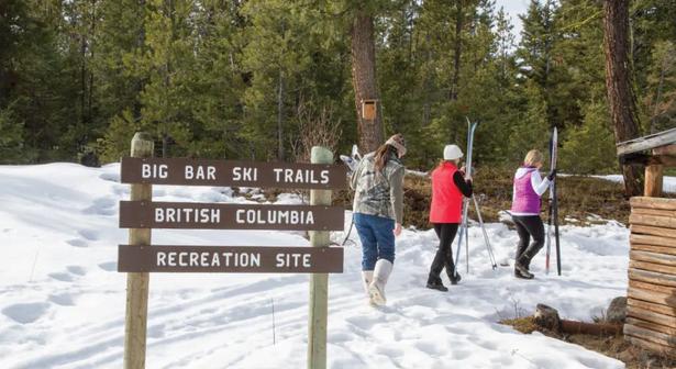
There is far more than just cattle and cowboys northwest of Clinton. High above the Fraser River, between Big Bar Canyon and Highway 97, lays one of the most amazing plateaus. A geological wonder draped with meadows and fine forests, the Big Bar region swathing the Fraser Plateau is a pristine wilderness with magnificent views. In view of the majestic Marble Mountain Range and high above the many limestone cliffs, the trails and creeks are outdoor enthusiasts’ dreams come true
With a multitude of trails for hiking, horseback riding and mountain biking crisscrossing the plateau, vistas of the area in every direction will awe everyone who chooses to venture into this unique ecological wonder. And at any time while enjoying the trails you may just meet up with a true Cariboo cowboy.
People of the Cariboo thrive in the outdoors, so it isn’t any wonder that when the snow is perfect and the sun is shining they will venture out to enjoy the marvels of meandering through a crisp winter wonderland When the soft dry snow drapes the Big Bar recreation area the enthusiasts don their cross-country skis and head out for a jaunt under clear deep blue Cariboo skies
True to their lifestyle of cattle and horses, the Clinton Snow Jockey Club ensures that the many trails are well maintained. The intertwining network of trails are cleared in the warmer summer months and groomed for skiers in the winter months Shelters have been erected to protect users from the harsher elements, whether it is wild winds, icy sheets of sleet and hail, pelting cold rains or a hot blazing sun You can picnic at the shelters or carry on to many of the wonderful spots to sit and enjoy the surrounding views or wait to experience the living nature of the Cariboo
The more than 25 kilometres of groomed trails varies from short stretches of less than half a kilometre to several kilometre stretches. However, depending on how you approach the
147
#81 GC3PB8J Phase 2
network one can travel more than the 25 kilometres, as the trails crisscross and intertwine And don’t forget you must be sure to allow yourself travel time to return to the parking area where you started out
The Big Bar trails are best approached not only with the safety and survival gear outdoor enthusiasts must travel with, but the most important piece of equipment – a camera. You will not want to return home without the opportunity to reflect and revisit your great Big Bar Trail adventure. The photos you choose to take will awe all those who view them and remind you that you will be returning at the next opportunity to absorb the bountiful beauty of the Big Bar area and the scenic trails enjoyed in all seasons
The Big Bar trails are a splendor, a natural treasure hidden high upon the Fraser Plateau in Gold Country.
Written and Researched by Angela
Wynton
Please check geocaching.com before you go!
BIBLIOGRAPHY & SOURCES
Shewchuk, Murphy. Cariboo Trips & Trails, Fitzhenry & Whiteside, Markham, Ontario 2008 Campbell, Colin. Trails of the Southern Cariboo, Rocky Mountain Books, Surrey, British Columbia 2009
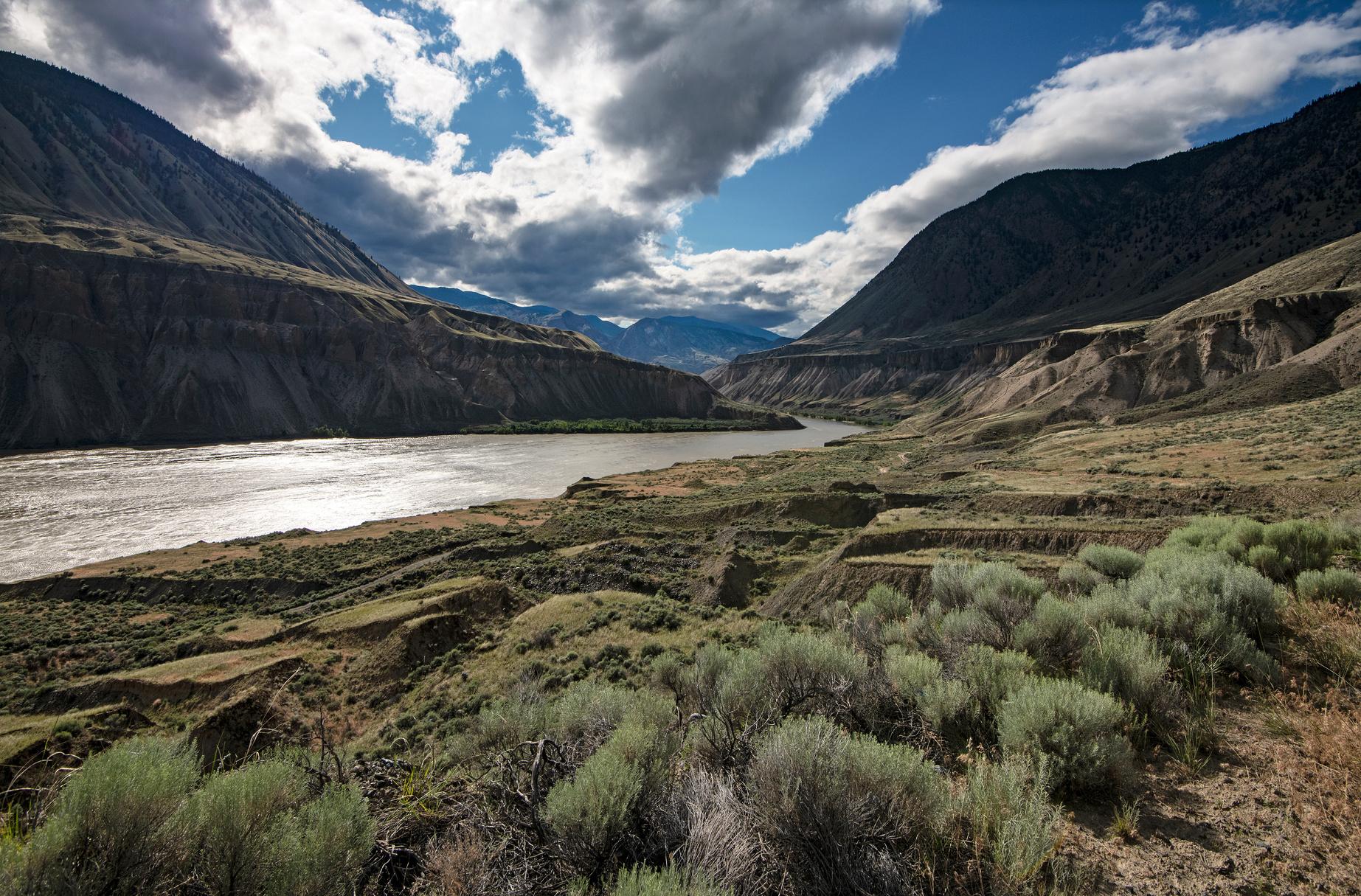
Letterboxing Clues:
From parking lot walk 30m to welcome warm up hut. Follow trail to the right of hut 40m and find 3 stumps. Look in hollow root of third stump.
148
Black Canyon
SITE IDENTIFICATION
Nearest Community: Ashcroft, B C
Geocache Location: N 50°40 624' W 121°15.859'
Altitude:
664m/2178ft
Ownership: Crown Land
Accuracy:
2 meters
Overall Difficulty: 1.5
Overall Terrain: 2.5
Access Information and Restrictions:
Shared Crown Land, keep gate closed If driving, keep to trail Road ends at crest of hill, looking over valley Watch for cactus and cattle
Parking Advice:
From Ashcroft on 97C 9km south turn left onto dirt road Look for the break between cement barriers just before the Barnes Lake turnoff. Park at gate area if walking. Ensure that the gate is closed behind you. Do not block gate.
For more information or to report a problem with this site please contact:
Gold Country Communities Society
P O Box 933 Cache Creek, B C V0K 1H0 Tel: 1-877-453-9467
Email: info@exploregoldcountry com
For more site pages go to: www exploregoldcountry com www geocaching com
APPLY STICKER HERE
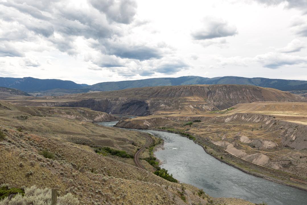
The landscape of Gold Country is marked by the signs of a violent past; events which shaped the features of the country, but which happened so long ago that there is no record of their happening at all, apart from the scars they left.
The section of the Thompson River below Ashcroft containing Black Canyon has its share of scars, and the cause of one of them was well documented On October 14th,1880 a massive landslide known as the Great, or North, slide occurred on the east side of the river, just north of Black Canyon Bishop Acton Windeyer Sillitoe, of the diocese of New Westminster, was traveling through the area with his wife, and Mrs. Sillitoe recorded the following:
“Whilst we were sitting in the drawing-room one evening during our stay in Ashcroft, an extraordinary noise was heard Some supposed it to be an earthquake
The next morning, however, we heard that the sound had been caused by a tremendous landslip three miles distant from where we were, and which had dammed up the river until it should have forced its way through this immense dam ”
The Bishop and his wife were not alone in traveling to the site, and what they saw was nothing short of incredible:
“We found that the dam was half a mile long and eighty feet high
The river above [to the north] had already risen forty feet over its usual level, and was almost dry below ”
The Colonist newspaper reported that the obstruction was as high as 120 feet in places. The river eventually rose to sixty feet on the north side of the dam, and the site where Ashcroft is now located was more than a foot deep in water. The newly erected Harper’s Mill, at the junction of the Bonaparte and Thompson Rivers north of Ashcroft, was in danger of being floated away by the backed-up water, which was rising three feet an hour Two farmsteads were covered in water, and J C Barnes lost his home and several outbuildings There was widespread fear that if the fine gravel
149
Geological & Views
#82 GC3NK88 Phase
2
and loam which made up the slide broke suddenly, the rush of water through the breach at the head of Black Canyon a deep and narrow gorge carved out of bedrock would cause massive damage as far downstream as Spences Bridge, 20 miles south. However, locals rushed to cut a channel through the top of the slide, which allowed the water through gradually, and within forty-eight hours the river was down to its usual level.
A smaller slide known (fittingly) as the South Slide occurred to the south of the Great Slide sometime prior to 1880 A ridge immediately east of Black Canyon separates the sites of the two slides, which can be seen clearly from the west side of the river Both the Canadian National (CN) and Canadian Pacific (CP) lines run through the narrow confines of Black Canyon, with the CP carving its way through a 1,366 ft tunnel in the canyon’s west side, and the CP line running along the toe of the Great Slide site It’s an ideal place for trainspotting, and for reflecting on the forces which shaped our land
Written and Researched by Barbara Roden
BIBLIOGRAPHY & SOURCES (1880). Colonist (newspaper). In Ashcroft Museum and Archives. Foster, Pat (1999). Historic Ashcroft: For the Strong Eye Only. Kamloops, B.C.: Plateau Press. Gowen, H.H. (1899). A Memoir of Acton Windeyer Sillitoe. New York and Bombay: Longmans, Green, and Co (2012) Hall, I , Porter, M , Quinn, P , and Savigny, K W Landslides along Thompson River south of Ashcroft, British Columbia (draft paper) Retrieved May 2012 from Pete’s Thoughts: Geotechnical and Mathematical Explanations: http://petequinnramblings wordpress com/2012/05/22/landslides-alongthompson-river-south-of-ashcroft-british-columbiadraft-paper/ (2002) Porter, M J , Savigny, K W , Keegan, T R , Bunce, C M , and MacKay, C "Controls on Stability of the Thompson River Landslides" Retrieved May 2012 from BGC Engineering: http://www bgcengineering ca/files/publications/MJP Ashcroft Landslides Final 0 pdf
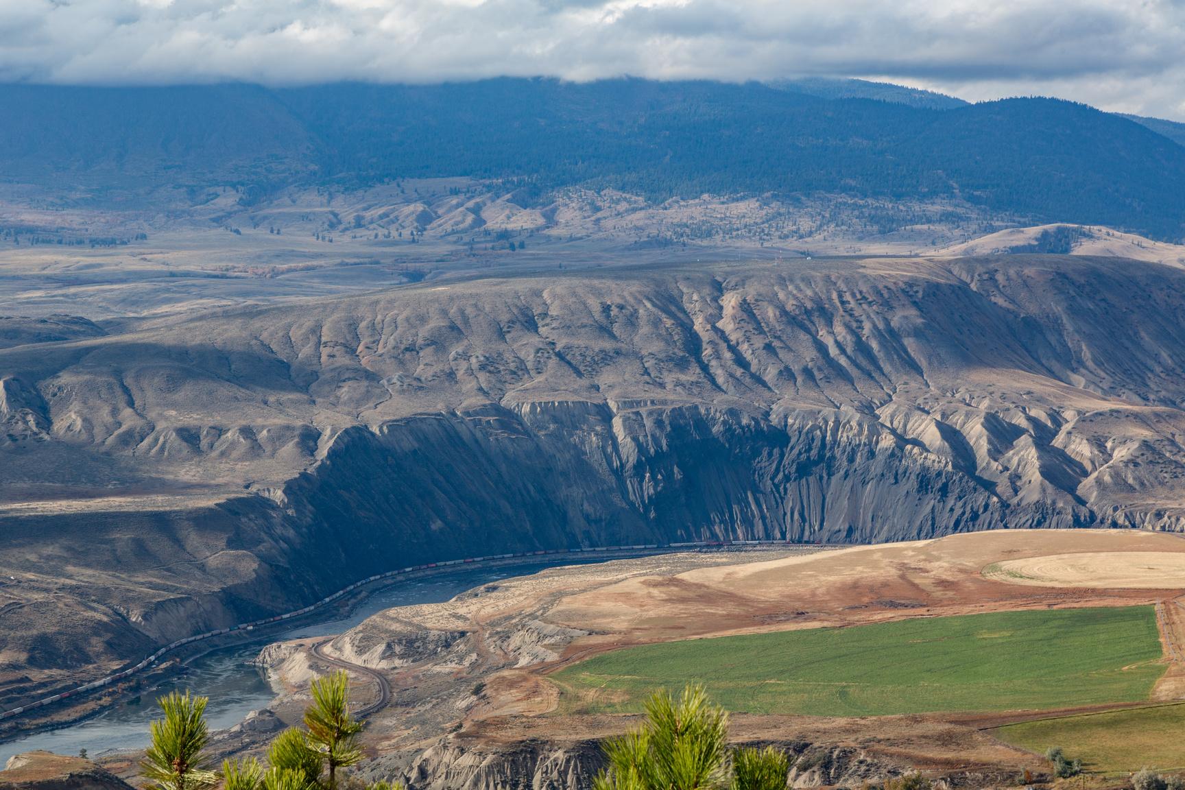
Letterboxing Clues:
Travel from downtown Ashcroft 9 km on 97C South Bound. Look for break between cement barriers. Turn left onto dirt road. Park at the gate area. Walk through the gateway making sure to close the gate behind you Follow road to the left until you reach a large tree and old flume Follow the faint cow trail up hill heading North. Cache is hidden between two large rocks, close to dead trees near by. View of Black Canyon.
150
Please check geocaching.com before you go!
Blue Earth Lake
SITE IDENTIFICATION
Nearest Community: Ashcroft, B C
Geocache Location: N 50°35 740' W 121°29.550'
Altitude: 1412m/4632ft
Ownership: Provincial Park
Accuracy: 2 meters
Overall Difficulty: 2
Overall Terrain: 3.5
Access Information and Restrictions:
From Hwy 1 turn off to Blue Earth, it is 20 km to cache. From Cache Creek to cache it is 44.7 km. From Spences Bridge to Blue Earth Lake it is 45 km. 4x4 recommended. 4x4 trail – Need good clearance Road has large bumps Be prepared for back country
Parking Advice:
Park at pull out to single campsite, do not block road.
For more information or to report a problem with this site please contact:
Gold Country Communities Society
P O Box 933 Cache Creek, B C V0K 1H0 Tel: 1-877-453-9467
Email: info@exploregoldcountry com
For more site pages go to: www exploregoldcountry com www geocaching com
Blue Earth Lake, nestled in a valley to the west of Highway 1 between Spences Bridge and Ashcroft, offers a small oasis of wetland in the midst of the semiarid conditions of the surrounding area. It forms the centerpiece of Blue Earth Lake Provincial Park, a 705 hectare park established on April 30, 1996.
The area around Blue Earth Lake contains archaeological sites linked with the Nlaka'pamux (Thompson) First Nations people, and is part of their traditional area An Nlaka'pamux legend tells of how there were no lakes or streams, and consequently no fish, in the area until a great flood covered the land. When the water receded, it left behind lakes in the hollows of the mountains, and fish in the lakes, which is why we have them today.
The many small lakes of the park contain several varieties of fish, including bullhead, bull trout, brown trout, and rainbow trout In early summer spawning trout can be seen in the shallow channels which link the various lakes Good fishing can be had by both flyfishing and trolling, either from the shore or by boat While the lakes are small, recreational canoeing and kayaking are popular on their crystal-clear waters A small, somewhat rough boat launch area is available, although it is only suitable for small boats (hand launching only).
APPLY STICKER HERE
The valley, ringed by the Pavilion Mountains, is overlooked by small areas of old-growth Douglas fir and mature aspen trees The area is of geological interest, as it is situated at the junction of the Marble Canyon limestone formations to the north, and the volcanic rock of the Spences Bridge area to the south The lakes, wetlands, and riparian areas in the valley provide shelter and sustenance for the songbirds and waterfowl which inhabit the region There are no developed hiking trails through the park, but paths follow the shorelines of the lakes, and hiking and mountain biking are allowed on the logging roads which zig-zag through the area.
151
Geological & Views
#83 GC3P37R
Phase 2
Although there are no defined camping sites, camping is allowed (space permitting; the area can accommodate up to six camping parties at a time)
The beauty and serenity of Blue Earth Lake have attracted many visitors over the years. Perhaps the most famous was British poet laureate Ted Hughes (1930–1998), considered one of the greatest poets of his generation. An avid fisherman, Hughes visited Blue Earth with Ehor Boyanowsky, a criminologist and author who had struck up a friendship with Hughes due to a shared passion for conservation and the environment While fishing on Blue Earth Lake, Hughes wondered aloud if “this was the place he dreamed about with his brother when they were boys: a land of cowboys and Indians and giant salmon ”
As of June 2012, the Forest Service road through the west end of Blue Earth Park was closed. Access is only from the east, via Venables Valley Road from Highway 1 north of Spences Bridge. The road has several very tight corners, and access with long vehicles or a vehicle with a trailer is difficult.
Detailed Access Information:
From Spences Bridge follow Hwy 1 for 25km until you come to the second turn off for Venables Valley Road
Follow road for 4 8kms Venables will go left but you will continue on staying right Follow this road for another 4 8kms Do not take any left or right turns Once you go 4 8kms you will turn right onto road Follow this road for 9kms Continue on narrow road past the Blue Earth Lake campsite along the lake until you reach pullout for a single campsite on the left Park here
Written and Researched by Barbara Roden
BIBLIOGRAPHY & SOURCES
Boyanowsky, Ehor (2010) Savage Gods, Silver Ghosts: In the Wild with Ted Hughes Toronto: Douglas & McIntyre
Teit, James (1898) Traditions of the Thompson River Indians of British Columbia Boston: For The American Folk-lore Society by Houghton, Mifflin and Company
Retrieved June 2012 from British Columbia: BC Parks (online): http://www.env.gov.bc.ca/bcparks/explore/parkpgs/blue earth lk/ Retrieved June 2012 from Fishing Adventures (online): http://www.backroadmapbooks.com/shop/images/samples/ BackroadReferenceSample.pdf
Retrieved June 2012 from hookandbullet.com (online): Hunting and Fishing for Outdoorsmen: http:// www.hookandbullet.com/fishing-blue-earth-lake-ashcroft-bc/
Letterboxing Clues: From parking spot walk towards view of lake Under fallen log, old growth
152
Please check geocaching.com before you go!
Bluebird Trails
SITE IDENTIFICATION
Nearest Community: Logan Lake, B C
Geocache Location:
N 50°29 770' W 120°47.471'
Ownership:
Village of Logan Lake
Accuracy:
0 meters
Overall Difficulty: 1.5
Overall Terrain: 1.5
Access Information and Restrictions:
From the Info centre follow Meadow Lake Road (Highway 97D) approx 2 km, past the lake and take the first right toward the campsite Turn left onto the lower road and follow till you reach the Clubhouse and park in the parking lot
Parking Advice:
There is a pullout next to the viewing area, or you can park at the golf course
For more information or to report a problem with this site please contact: Gold Country Communities Society
P O Box 933 Cache Creek, B C V0K 1H0
Tel: 1-877-453-9467
Email: info@exploregoldcountry com
For more site pages go to: www exploregoldcountry com www geocaching com
Driving through the winding country roads of Gold Country, visitors often notice bird houses hanging on fences along the roadways and wonder what they are. Here's the answer - thanks to scores of dedicated bird-loving volunteers, these are nesting boxes for bluebirds.
There are three types of bluebirds found in Canada, but in Logan Lake, mountain bluebirds (Sialia currucoides), are the only ones to make an appearance A type of thrush, mountain bluebirds are often found in mountainous areas and they like to nest at higher elevations. While their territory extends as far as Mexico, the Yukon, and Manitoba, in B.C. these delightful birds are primarily found in the south central area of the province. Currently mountain bluebirds are not a species of concern in Canada or the United States, although their numbers reached an all-time low in the 1970's. Mountain bluebirds are easily distinguished from other types of bluebirds as they have no distinct red colouration During breeding season the males are a bright cerulean blue on top with pale blue on their underside The female is grayer in colour with bright blue that is visible when they are in flight on their back end, wings and tail feathers.
APPLY STICKER HERE
In winter, the males fade to a duller tone, looking almost brownish blue in colour while the females are slightly brighter blue and occasionally show a hint of reddish brown on their breasts The males often issue a hauntingly beautiful warble song early in the mornings While some bluebirds stay around the area all year, the return of the others from migration is considered a harbinger of spring
Bluebirds are considered secondary cavity nesters, which mean they build their nest in a pre-existing hold or cavity such as a woodpecker hole, a sandstone cliff, or a human-made box. A clutch usually consists of between 4-6 eggs and if weather and 153
Geological
Views
&
#84 GC3P8K4 Phase 2 C r e d i t : H a r o l d S e l l e r s
elevation are favourable they may produce a second clutch after the first has left the nest House sparrows and European starlings, also secondary cavity nesters, are two of the species who compete with bluebirds for nesting areas Both of these species were introduced from Europe in the mid to late 1800's
The B.C. Southern Interior Bluebird Trail Society is a non-profit volunteer organization that acts as the managing body for bluebird trails in the interior of B.C. The organization was formed to help promote the recovery of mountain and western bluebirds, which were threatened at the time. Since then members have placed over 6,000 nest boxes In Logan Lake, there are 26 volunteers caring for approximately 450 boxes that contain nests between May and June These volunteers are responsible for maintaining the boxes, monitoring the development of the young birds, recording and reporting statistics, and cleaning the boxes after the birds have left The volunteers are specially trained and are very careful to avoid interfering with the birds as they are nesting For many of these dedicated volunteers the joy of watching the life cycle of the birds and seeing them return year after year is the best part of what they do
While the boxes are visible on countless roads in the Gold Country area and bluebirds are an abundant beauty in the spring, we ask that you please do not open or disturb the boxes. Human interactions with the young birds at key points in their development can be a threat to their survival.
Written and Researched by Vesta
Giles
BIBLIOGRAPHY & SOURCES
Lumgair, Charlie Personal interview 13 Jun 2012
Pearman, Myrna (2005) Mountain bluebird trail monitoring guide Red Dear River Naturalists Southern Interior Bluebird Trail Society. Web. 11 Jun. 2012. Summers, Eleanor. Email interview. 11 Jun. 2012. Towne, Ray. Personal interview. 13 Jun. 2012.
Wikipedia contributors. "Mountain Bluebird." Wikipedia, The Free Encyclopedia. Wikipedia, The Free Encyclopedia, 9 May. 2012. Web. 15 Jun. 2012.
Letterboxing Clues:
From parking area walk approx 295m up the road to the viewing area entrance across from Bird House #4 Cache is located before and to the right of the viewing area under a wood geopile leaning into the ditch by the fenceline.
154
Please
geocaching.com before you go! C r e d i t : B a i l l i e S t e w a r t
check
Bonaparte House
SITE IDENTIFICATION
Nearest Community:
Cache Creek, B C
Geocache Location:
N 50°48.230'
W 121°19 460'
Altitude:
458m/1502ft
Ownership: Private Property
Accuracy: 2 meters
Overall Difficulty: 1
Overall Terrain: 1
Access Information and Restrictions:
Park near Riverside Motel at the east end parking lot, near picnic area.
Parking Advice:
Take the Old Cariboo Road across from cache site to view the location of where the Bonaparte House was moved to.
For more information or to report a problem with this site please contact:
Gold Country Communities Society
P O Box 933 Cache Creek, B C V0K 1H0
Tel: 1-877-453-9467
Email: info@exploregoldcountry com
For more site pages go to: www exploregoldcountry com www geocaching com
The building of the Cariboo Road through the heart of Gold Country brought sweeping changes to an area which had previously been accessible only to the most determined people. When the road from Yale to Soda Creek was finished in 1863, roadside stopping houses began springing up along the route, offering welcome relief to weary travelers.
In 1862 James Orr opened an establishment called Wayside House on a flat piece of land to the south of Rattlesnake Hill, about half-amile below what is now Cache Creek (The exact location is unknown, although an early photograph shows that it appears to have been on the site now occupied by Wastech on the east side of Highway 1.) Orr continued as proprietor of the Wayside House until the fall of 1865, when he sold the land and building to local businessmen and landowners Charles Semlin and his partner Philip Parke.
APPLY STICKER HERE
When J B Leighton traveled along the Cariboo Road through the Cache Creek area in June 1865 he reported that “There was no stopping place nor sign of one at what was afterwards known as Bonaparte House” However Semlin and Parke decided, soon after purchasing the Wayside House, that a better location for it would be down in the valley at the base of Rattlesnake Hill, near the Bonaparte River, so it was moved to its new location (near where the sign for the Sage and Sands trailer park now is), and re-opened early in 1866 under the name Bonaparte House.
The venture was soon booming, with the owners charging $1 00 for meals, 50¢ for a bed, and 25¢ for a drink They soon added a general store, a blacksmith shop, stables for the B X Express, and a telegraph office to the property Not only was there a steady stream of people heading north to the gold fields of Barkerville, there was the discovery (in 1866) of gold at Big Bend, north of
155
Pioneers & Early Settlers
#85 GC3NXDX
Phase 2
Revelstoke, which brought a fresh influx of travelers The Big Bend mines proved, two short years later, to be a failure, but the pack trains and stagecoaches still making their way north to Barkerville provided more than enough traffic to make Bonaparte House a roaring success. In 1872, when Sir Sandford Fleming was making his surveying journey across the country, his party traveled from Kamloops on September 30th, intending to stay the night in Cache Creek. However, when they arrived they found that “the hotel was full, as it generally is, because [it is] at a junction of several roads.”
In 1868 Philip Parke sold his share of the business to William Henry Sanford, known locally as “Boston” In 1869 Charles Semlin sold his interest in Bonaparte House to James Campbell, and Sanford and Campbell ran it together until 1870, when Sanford left the area By 1882 the property had expanded to include a post-office, and was described by one traveler as “a location that is a land mark upon the Cariboo Road” Campbell was still the owner in 1895, when an advertisement in the Ashcroft Journal reads “Cache Creek: Bonaparte House
James Campbell, P M [Post-Master], Proprietor First Class Bar Accommodations For Man And Beast ”
At some point after this the hotel was moved yet again, and incorporated into the north end of what is now the Oasis Hotel. By 1962 it had lost its peaked roof, and subsequent renovations in the mid-1960s removed all exterior traces of Bonaparte House, although it’s thought that parts of the original building may survive within the present structure
Written and Researched by Barbara Roden
Please check geocaching.com before you go!
BIBLIOGRAPHY & SOURCES
(1882) Inland Sentinel (newspaper) “From Spences Bridge to Savona” In Ashcroft Museum and Archives (1895) Ashcroft Journal (newspaper) In Ashcroft Museum and Archives
156 Letterboxing Clues: Wagon wheel
Botanie Rock
SITE IDENTIFICATION
Nearest Community: Lytton, B C
Geocache Location:
N 50°15.553' W 121°33 661'
Altitude: 199m/652ft
Ownership: Crown Land
Accuracy: 2 meters
Overall Difficulty: 2
Overall Terrain: 3.5
Access Information and Restrictions:
Respect the land you drive through to get to this site. Leave no trace. From Lytton head north on Hwy 12, then turn right just past the bridge onto Botanie Valley Road Travel 2 7 km to pull out with view of Botanie Rock
Wildlife in area
Parking Advice: Park at pullout
For more information or to report a problem with this site please contact:
Gold Country Communities Society
P.O. Box 933 Cache Creek, B.C. V0K 1H0 Tel: 1-877-453-9467
Email: info@exploregoldcountry com
For more site pages go to: www.exploregoldcountry.com www geocaching com
At the confluence of Botanie Creek and the Thompson River stands a great natural monument to the entrance of a beautiful valley. An ancient geological creation erupting from the Early Cretaceous period, it stands alone in stark contrast to its surroundings.
The Nlaka’pamux have been passing before this geological wonder for thousands of years, as it is this monolith that guards the remarkable Botanie Valley and all that it provides A traditional healing and gathering place the valley is home to some of the rarest plants and flowers in the province Rich with a diversity of flora, the Nlaka’pamux have gathered roots, berries and flowers from the valley since their people were created. The valley is also the source of a variety of herbs used in traditional healing which grow in abundance. In addition, the Botanie area is a geological wonder.
The area is probably the youngest deglaciation region in the province, with the great ice melt happening nearly ten thousand years ago As the glaciers melted they carved through and created the plateaus, canyons, bench lands and rock formations, as we know them today As the ice moved south and southeast in waves across the Interior Plateau it also moulded and sculpted the valleys The mighty waters carved out magnificent canyons creating rivers large and small, depositing gravel and silt in abundance, as well as literally moving and depositing large boulders, called glacial erratics.
APPLY STICKER HERE
Botanie Creek flows over a bed of yellow sand and fine gravel, but flows over solid rock near the creek mouth where it meets the Thompson River The creek itself follows one of the many geological fault lines in the area The geology of the creek and the Thompson in this region is generally of the Kingsvale Group, which includes many of the rock characteristics of intrusive igneous, metamorphic and sedimentary rocks Much of the rock is volcanic shale of red arkose, red conglomerate and grandiorite There is also lots of limestone, with some known to have uranium bands deep within. The exposed colours of the steep walls and cliffs
157
Geological & Views
#86 GC3PD93 Phase 2
of the creek, river and surrounding hills vary from red, mauve, green, purple, brown, grey and white
Looking beyond into the valley past the mighty monument there are drumlins. These formations are the result of the glacial drift depositing debris in the form of a mound or hillock. In the Botanie Valley these drumlins vary from 50-feet in height and 200-feet in length to as much as 100-feet high and 300-feet long. Most are covered with verdant vegetation.
The glacial ice created an amazing geography in the Botanie region and where the creek and the valley meet stands one of its greatest achievements. The magic of the glacial waters sculpting the rock and creating the great monolith that stands there is a wonder to behold at the gateway to one of the province’s most beautiful valleys.
As you look upon the massive rock at the entrance to the Botanie Valley, you can feel a protective life force emanating from the great monolith And if you stand quietly you can hear the pulse of the rock gently beating, passing all that is great and remarkable in waves through the ground into the rich Botanie Valley The great Botanie Rock, the Botanie Valley guardian, who knows all that passes before it in the heart of Gold Country
Written and Researched by Angela Wynton
Please check geocaching.com before you go!
BIBLIOGRAPHY & SOURCES
Anderton, L. J. Quatenary Stratigraphy & Geomorphology of the Lower Thompson Valley, Masters Thesis, University of British Columbia, 1970 Pough, F.H. A Field Guide to Rocks and Minerals, Houghton Mifflin Co., 1953 www.wikipedia.com
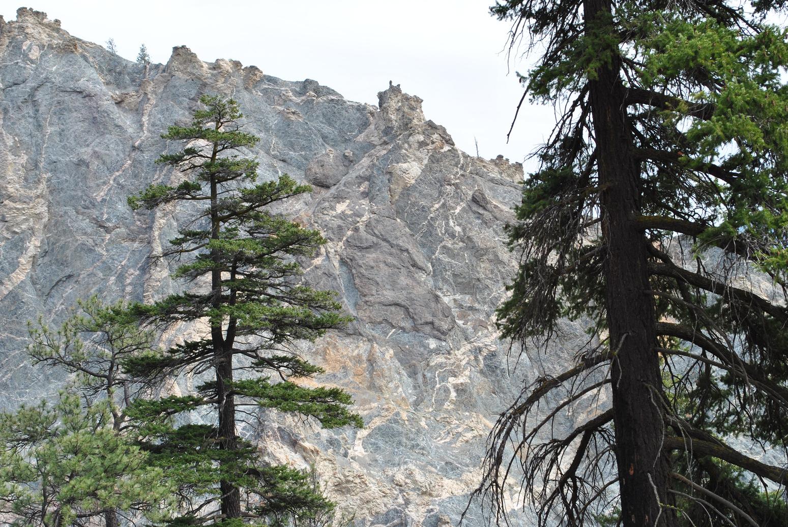
Letterboxing Clues: From pullout, hike 40m down red rock bank, onto logging road Once on this old road, walk about 25m left into grassland and bush. At the base of a big pine tree.
158
Burkholder Lake Trail
SITE IDENTIFICATION
Nearest Community:
Lillooet, B C
Geocache Location:
N 50°57.857'
W 122°21 960'
Ownership: Crown Land
Accuracy: 6 meters
Overall Difficulty: 2
Overall Terrain: 3.5
Access Information and Restrictions:
From the Mile 0 Cairn on Main Street in Lillooet drive north for 2 km and turn left onto Hwy 40 and follow for 6 km
Continue straight for 18 km Stay straight onto Bridge River Road for 6 km Turn right unto Yalakom River Forest Service Road for 10 km Take slight left for 4 km Take slight left again for 1 km and follow to Lake La Mare
Trailhead on the west end of Lake La Mare Trail can be steep and dusty
Parking Advice:
Park at Lake La Mare Rec Site
For more information or to report a problem with this site please contact:
Gold Country Communities Society
P O Box 933 Cache Creek, B C V0K 1H0 Tel: 1-877-453-9467
Email: info@exploregoldcountry com
For more site pages go to: www exploregoldcountry com www geocaching com
This is a gem of a lake, found part way up the Yalakom Valley. Yalakom means ‘ewe’ in the local Chilcotin, First Nations language. This is a fitting name, the Yalakom river winds along the valley bottom adjacent to the Shulaps Range, which means ‘ram’ in the same language. California Big Horn Sheep are traditionally common in the area.
The trail head begins at a lake with an oxymoronic name, Lake La Mare Lake La Mare offers a couple of nice camping spots and Rainbow Trout fishing Like Burkholder, the lake was stocked with fish by early miners to provide a source of food to feed their operations.
APPLY STICKER HERE
The trail begins on the western edge of Lake La Mare and immediately begins to climb through a Lodge Pole Pine (Pinus contorta) and Douglas fir (Pseudotsuga menziesii) forest Initially, the trail skirts along a cut block which allows for views down the Yalakom Valley; on a clear day, Fountain Peak and the other mountains surrounding the town of Lillooet can be easily identified As you crest the top of the first incline you will have gained nearly 200m in elevation As you walk along the trail notice the fine powder like dust that makes up the soil. This is volcanic ash from a massive volcanic explosion originating from what we now call Mount Meager, as the crow flies, 90 km to the south west. This massive explosion took place approximately 2400 years ago. The eruption is recognized as the largest volcanic eruption throughout Canada, within the last 10,000 years. Mount Meager could still erupt at anytime; it’s subterranean volcanic activity is evident due to earthquakes and the presence of hot springs that flow out of the ground in surrounding river valleys. Mount Meager is located within the Garibaldi Volcanic Belt, which is the most northern arm of the Cascade Volcanic Arc The Cascade Volcanic Arc contains the infamous Mount St Helens which erupted violently in 1980
159
Rails & Trails
#87 GC3QN6R
Phase 2 C r e d i t : W a y n e R o b i n s o n
As you continue along the relatively barren hogs back ridge, you will be rewarded with tremendous views The trail continues down the ridge and undulates up and down over the course of a few kilometers before eventually reaching a grassy slough. This would be a great place to catch a glance at a moose, if you are lucky. Almost immediately, you cross over a small bridge that spans a stream originating from Burkholder Lake. One last hill to ascend and you reach the remains of an established horse camp; within a minute you have reached the treed shores of Burkholder Lake. Notice the trees in the area, lodge pole pines of a similar size with much larger Douglas fir interspersed. This is evidence of a forest fire hot enough to open the Lodge Pole Pine cones, but not hot enough to penetrate the corky protective bark of the large Douglas Firs.
The name Burkholder comes from the original homesteaders of the Yalakom Valley The family included a husband and wife with three children, who settled in the valley sometime between 1904 and 1907
Detailed Access Information:
Detailed driving instructions to the trailhead are available in the Canyon to Alpine Lillooet Hiking Guide, written by the Lillooet Naturalist Society. This is a moderate hike and campsites are established at Burkholder Lake if you prefer to pack your gear in. Remember the rules of the trail: Horses yield for no one, hikers yield for horses, cyclists yield for everyone. This is bear country. If you are camping at the lake, be sure to store your food appropriately, hung between two trees and at least 4 meters off the ground
Written and Researched by Wayne Robinson
Please check geocaching.com before you go!
BIBLIOGRAPHY & SOURCES
Lillooet Naturalist Society (2005) Lillooet Hiking Guide - Canyon to Alpine, Second Edition Canada: Friesens Parish, Coupe, Lloyd (1996) Plants of Southern Interior British Columbia and the Inland Northwest Vancouver, BC: Lone Pine Publishing
Vanderwolf, G. ( Personal Interview) 2012. Local prospector.
Vanderwolf, K. (Personal Interview) 2012. Born in the Yalakom Valley – Operates a business in Lillooet.
“Wikipedia: Mount Meager” (Web) 2012. http://en.wikipedia.org/wiki/Mount Meager#Cascade Volcanic Arc.
Letterboxing Clues:
From Lake La Mare travel the trail signed Burkholder Lake - 2 hours (6kms) Once the lake is in sight follow trail along East side of lake for 130 meters. Cache is on the side of the lake.
160
BX Express
SITE IDENTIFICATION
Nearest Community: Ashcroft, B C
Geocache Location: N 50°43.264' W 121°16 790'
Altitude: 303m/994ft
Date Established:
BX Building, 1911
Heritage Park, 2000
Ownership:
Heritage Park, Village of Ashcroft BX Express Building, Privately Owned
Accuracy: 2 meters
Overall Difficulty: 0
Overall Terrain: 0
Access Information and Restrictions: Downtown Ashcroft. High visibility area, use stealth. Year round access.
Parking Advice:
Main parking area is to the left of the park.
For more information or to report a problem with this site please contact:
Gold Country Communities Society
P O Box 933 Cache Creek, B C V0K 1H0
Tel: 1-877-453-9467
Email: info@exploregoldcountry com
For more site pages go to: www exploregoldcountry com www geocaching com
& Trails
BX Company
In 1858 the lure of gold brought a flood of hopeful seekers into the interior of B.C. This intrusion of men up into the tributaries of the Fraser River also brought the dilemma of how to transport supplies in and carry gold out. In 1864 Francis J. Barnard, was awarded the government contract to provide this service from Yale to Barkerville. A transportation mode, which originally started by foot and packhorse, progressed to stage coaches, and sleighs and then grew into an organized transportation company in Western Canada, the renowned B C Express, or BX
Some 20 years later with the completion of the CPR, Ashcroft became the strategic spot to move goods from and it was here that new BX owner SteveTingley set up headquarters. At this time the main stage line extended from Ashcroft to Barkerville, a distance of 280 miles. Routes branched off from the main road to include the settlements of Lillooet, Alkali Lake, Alexis Creek, Harpers Camp and Keithley Creek. Stage fare from Ashcroft to Barkerville was $42.40 in the winter and $37.50 in the summer. Rain or snow, the mail was expected to be delivered on time and the BX kept a rigid schedule The way stations were about 18 miles apart along the road, with fresh horses waiting at each The Company prided itself on using the finest horses and the best of drivers
APPLY STICKER HERE
In 1897 Tingley lost the contract to haul mail to a group of Toronto Businessmen. This new company bought out the BX, including stages, harnesses and horses. The 1910 addition of two sternwheelers on the Upper Fraser Rivers and the completion of the railway to Fort George, gave the BX Company’s network of stages claim to the longest route in North America. That same year improvements made to the Cariboo road allowed for automobile traffic The B C Express Co accordingly purchased a fleet of “Winston Sixes” to adapt to the passage of the stage coach travel
161
Rails
#88 GC3NXAJ
Phase 2
This addition of vehicles called for a new headquarters to be built In 1911 a cluster of new buildings were erected on 6th and Railway; these included an office, blacksmith shop, carpenter’s shop, workshop and up to date garage. The B.C. Express Company remained in business until 1914, just three years after completion of its new buildings.
The BX Company’s history spanned over 50 years. It weathered floods and snow and the occasional hold up. It’s red and yellow coaches have provided service to dukes and princesses, judges, politicians, artists, poets, wealthy business men and the everyday people of the Cariboo
The BX office still stands on the corner of 6th and Railway. As you journey up the Cariboo road, stop in at the roadside houses and museums. It’s here you’ll find more treasures and stories of the infamous B.C. Express.
Written
and Researched by
Kathy Paulos
BIBLIOGRAPHY & SOURCES
Mill, Ted (1977) Former Provincial Government Building, 601 Railway Avenue, Ashcroft, BC, (Canadian Inventory of Historic Building) Correspondence-Ashcroft Museum Archives West, Willis J. (1937) "Old Cariboo Road." The Standard Magazine Leighton, J.B. (1938) "Pioneer Tells of Early Days Of BC Express." Kamloops Sentinel
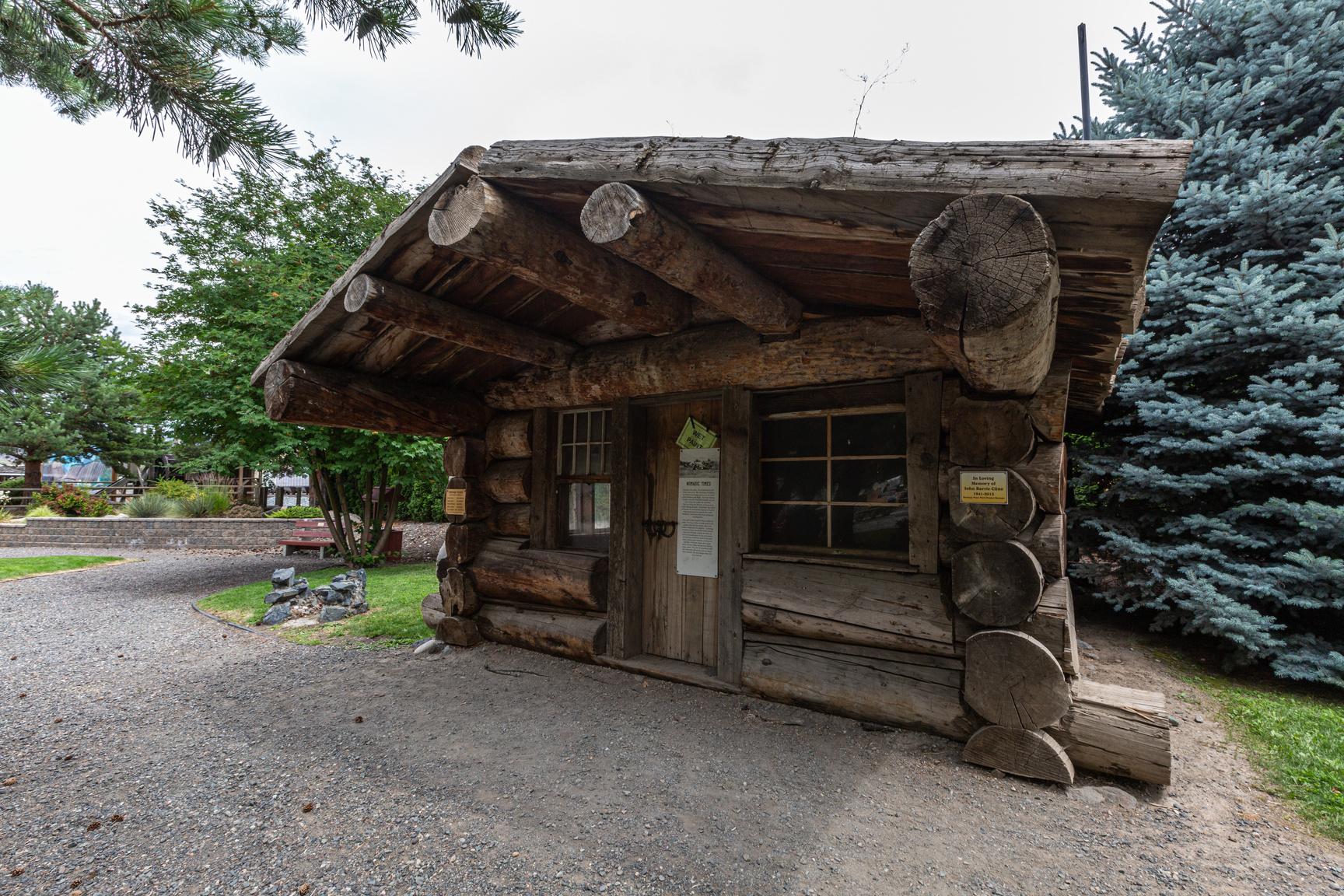
Letterboxing Clues:
From the main parking area at the Heritage Park walk along the trail heading south until you come to a bench marked Chamber of Commerce.
162
Please check geocaching.com before you go!
Cache Creek Cemetery Pioneers & Early Settlers
SITE IDENTIFICATION
Nearest Community: Cache Creek, B C
Geocache Location:
N 50°48 766' W 121°19.221'
Ownership:
Village of Cache Creek
Accuracy: 2 meters
Overall Difficulty: 1
Overall Terrain: 1
Access Information and Restrictions:
From Highway 97 in Cache Creek (near the info centre parking lot) turn onto Stage road and follow to cemetery
Parking Advice: Park at main parking lot.
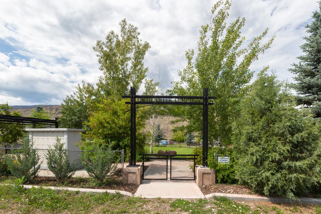
Even cemeteries can be given a new lease on life, as the Cache Creek Cemetery demonstrates. It began as the Collins Family cemetery, established by the pioneering family of the same name, now commemorated by a road in Cache Creek. John Gerome Collins was born in Nashville, Tennessee in 1851, and arrived in the Cache Creek area in 1874. He worked at a variety of occupations, and was for a time manager of Hat Creek House, after William Cargile purchased the property in 1881 In 1883 John married William’s daughter Mary, and their son Bert was born at Hat Creek in 1888 It’s likely that Collins stayed on as manager until Cargile sold the property in 1894; by 1895 he had gone into the drug and jewelry business in Ashcroft with a partner, F C Lawrence
For more information or to report a problem with this site please contact:
Gold Country Communities Society
P O Box 933 Cache Creek, B C V0K 1H0
Tel: 1-877-453-9467
Email: info@exploregoldcountry com
For more site pages go to: www exploregoldcountry com www geocaching com
APPLY STICKER HERE
In 1904 the seemingly ever-restless John Collins took his family to Tennessee, where he set up in the theatre business. When the theatre burned down in 1908 Collins returned to British Columbia, and purchased land between Boston Flats, northwest of Ashcroft, and the Bonaparte River, with his holdings encompassing much of what is now the village of Cache Creek. In 1927 John and his son Bert opened the T U Auto Camp, at the point where the road from Kamloops met the Cariboo Wagon Road (the current site of the Cache Creek post office) Auto courts were a precursor of the motor hotel or motel of the 1950s, and catered to the needs of that newfangled being, the motorist The T U Auto Camp a central building with numerous cabins around it soon became well known as a Cariboo landmark, but was sold by Bert Collins in the 1940s
John Collins had died in 1931, and was interred in what was referred to as “the family plot” half a mile to the east of the Auto Court. This was probably the extent of the Collins family holdings in Cache Creek, as it seems that postmaster James Campbell, former owner of Bonaparte House, owned land to the east of this location, and farmed there Mary Collins was buried in the cemetery in 1936, as were other family members, including Bert Collins’
163
#89 GC3P6N9 Phase 2
brother Intriguingly, Roy Collins, great-grandson of John Collins, recalls going out to the cemetery late one night when he was five or so, in the late 1930s, with his brother There they witnessed the disinterment of several Chinese people buried there; the bodies were, said Mr. Collins, disinterred by other Chinese people, and the bones repatriated to China.
The Collins family cemetery fell into disuse, and for many years lay neglected. In 2006 the Village of Cache Creek stated, in its Annual Report, the intention of establishing a cemetery in the village, either by upgrading the Collins family cemetery or purchasing another property In the 2007 Annual Report it was proposed that the Collins family be consulted, with a view to changing the name from the Collins Family Cemetery to the Cache Creek Cemetery By 2008 this permission had been obtained, and in 2009 the Village approached a firm of landscape architects to develop a plan to manage what was described as a “small but neglected pioneer cemetery” Preservation of the few graves scattered through the site was paramount, as was locating the sites of any unmarked graves in the area Construction and renovation of the site was completed in the fall of 2009, with the graves of John and Mary Collins given pride of place in the northwest corner. A stone noting the legacy of the Collins family stands beside their graves.
Written and Researched by Barbara Roden
BIBLIOGRAPHY & SOURCES
(1931) Ashcroft Journal (newspaper). In Ashcroft Museum and Archives. (1974) Ashcroft Journal (newspaper). In Ashcroft Museum and Archives. Interview with Roy Collins 2012.
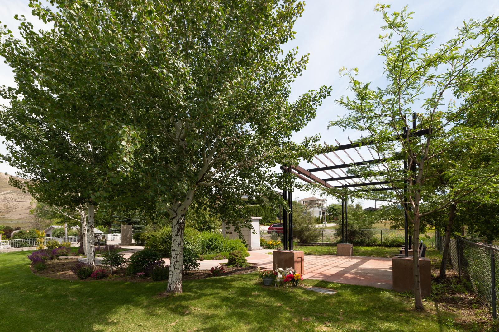
164
Letterboxing Clues: Walk along the outside of the fence line to the left. Located at barbwire corner under tree.
Please check geocaching.com before you go!
Cache Creek Tower Top Rails & Trails
SITE IDENTIFICATION
Nearest Community:
Cache Creek, B C
Geocache Location:
N 50°48.434'
W 121°19 194'
Altitude:
547m/1794ft
Ownership:
First part of driveway, Private Property Cache site, Crown Land
Accuracy: 1 meter
Overall Difficulty: 2
Overall Terrain: 3 5
Access Information and Restrictions:
Heading on Hwy 1 towards Kamloops turn right on Collins Road in Cache Creek The Cariboo Road is visible from this site location as are the sites for the former Bonaparte House
Parking Advice:
Do not block driveway or closed gate Park on side of the street
For more information or to report a problem with this site please contact:
Gold Country Communities Society
P O Box 933 Cache Creek, B C V0K 1H0 Tel: 1-877-453-9467
Email: info@exploregoldcountry com
For more site pages go to: www exploregoldcountry com www geocaching com
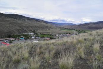
By 1895 there was a steady stream of freight leaving Ashcroft for the Cariboo. Tail to tail, up the dusty road the teamsters went providing goods to the north.
It was the pack trains that first travelled the early trails A large pack train consisted of about 45 mules or horses and called for services of four men, and a cook who rode the bell mare Pack trains would average about 16 miles a day
Freight wagons could travel about 12-14 miles a day and were pulled by teams made up of six, eight and ten horses, mules or oxen, pulling two and sometimes three wagons in tandem. There were no luxurious seats in those days, teamsters walked, rode the high wheel or the spring board at the side. The bull puncher walked in the dust all day beside his team He never used a jerk-line or any other means of guidance except maybe a stick or snap of a bull whip to encourage his team along
The “swamper” was an apprentice, usually a young fellow. His job would be to accompany the freighter, harness and unharness the mules or horses, lead them to water, and bunch grass. He would then round them up at 4 am, cook breakfast, and assist in general duties.
APPLY STICKER HERE
The “jerk-line” was used with a long string of mules or horses when it was impossible to use reins The teamster walked alongside or sat on a board at the side and “telegraphed directions” The line was connected to the leaders and directions to stop or go and which way to turn according to the number of jerks of the line.
Pack trains and oxen team were turned out at night to graze on the bunch grass Water could be found in the creeks or streams; when water sources were miles apart, shallow wells would be dug It was the roadhouses that took care of the horse teams and stage coaches; here they would be fed grain It was found that horses fed on grain had more endurance and the daily relays could be
165
#90 GC3NZ68 Phase 2 C r e d i t : K u r t E v a n s
extended a number of miles
Road side houses could be found every few miles. The mileage of the roadhouses can be a little confusing. Lillooet was originally Mile 0 and the earliest roadhouses took their mileage from Lillooet. When the Yale wagon road was built new roadhouses took their mileage from Yale. Once the CPR was completed the mileage was taken from Ashcroft. Roadhouses that had good reputations chose to keep their original mileage designations
The construction of the Pacific Grand Eastern railway began in 1912 and was completed by 1921. Its route took it from Squamish to Quesnel. The PGE provided a more economical way of shipping goods to the north. Freight teams that had once graced the Cariboo road were no longer needed. It was the end of an era.
Written and Researched by Kathy Paulos
BIBLIOGRAPHY & SOURCES
April 9, 1975 "Freighting on the Cariboo Road " (Ashcroft Journal Files) Wickstrom, Dawn (1981) "The Building of a railway as seen by a surveyor " Ashcroft Journal Please check geocaching.com before you go!
166 Letterboxing
From
hike up the
and
the
Right
Clues:
water tower
road
keep to
left
side driveway is private Pass the rock at top of the hill. Located under sage brush.
Camelsfoot Peak Trail
SITE IDENTIFICATION
Nearest Community:
Lillooet, B C
Geocache Location:
N 50°45.887'
W 121°52 320'
Ownership:
Crown Land
Accuracy: 4 meters
Overall Difficulty: 3
Overall Terrain: 4
Access Information and Restrictions:
From the Mile 0 Cairn in Lillooet drive north on Main Street and turn left onto Hwy 40 for 8 km and cross over the Bridge River and turn right onto West Pavilion Road Follow for 11 5 km and cross the cattle guard Hiking trail starts here 3 km hike from parking area A 2 wheel drive is fine Be respectful as you drive through the Bridge River Reserve
Parking Advice:
Park to the right of the cattle guard. Approximately 11.5 km from beginning of West Pavilion.
For more information or to report a problem with this site please contact:
Gold Country Communities Society
P O Box 933 Cache Creek, B C V0K 1H0
Tel: 1-877-453-9467
Email: info@exploregoldcountry com
For more site pages go to: www exploregoldcountry com www geocaching com
APPLY STICKER HERE
The hike to the summit of Camelsfoot Peak (sometimes called Camelshoof) offers amazing panoramic views of the Fraser Canyon, Clear Range, Fountain Ridge, Mission Ridge and Mount Brew. To get to the trailhead you will need to drive the rugged West Pavilion road. Another trail exists below the stretch of road where you park beside a cattle gate. This trail is the route First Nation guides used to lead Simon Fraser during his exploring of the Fraser River. You can see your trailhead from where you park, across the road The trail begins as an old road that leads to an old TV and radio transmission site – no structures still exist When you reach the summit there is an old abandoned forestry fire lookout Across the Fraser Canyon is the First Nation Reserve and community called Fountain (Xaxli’p) The name ‘Fountain’ refers to the churning white water rapids in a dramatic bend in the Fraser Canyon seen below Rapids were sometimes referred to as ‘fountains’ by some early European explorers.
Camelsfoot Peak is situated at the most southern tip of the Camelsfoot Range which spans 90 km at its longest point. The Camelsfoot Range lies between the Fraser and Yalakom Faults They are similar in composition with the Marble and Clear Ranges, but they differ greatly with the Shulaps Range which is immediately west, across the Yalakom river
The reference to camels in the name of this peak and range bears testament to an interesting experiment by a local Lillooet entrepreneur, John Calbreath, in 1862. Camels are able to carry much more weight than mules, 800 lbs versus 300 lbs. This was very desirable for transporting goods to support the gold prospecting efforts along the Cariboo road. Camels also had a reputation to require less food and water than mules or horses and could travel over double the distance in one day Twenty-three camels were bought in San Francisco for $300 apiece, quite an investment in those days Things did not go as planned as explained by
167
Rails
Trails
&
#91 GC3QN8Q Phase 2 C r e d i t : W a y n e R o b i n s o n
Leonard W Meyers in Great Stories from the Canadian Frontier:
“The camels were not only temperamental, but also vicious. And these negative characteristics finally outweighed their good points. They developed a bad habit of attacking anything they did not like. And when one of these desert creatures was driven down the gangplank, it passed a prospector’s mule and promptly bit and kicked it severely. Disturbingly, the strange animals were completely impartial as to what or whom they attacked - and this ranged all the way from oxen to mules and horses to men ”
Camels had other physical problems, their scent frightened other pack animals and their feet were not tough enough for the rugged Fraser Canyon terrain. The other packers, who used more ‘traditional’ means of moving supplies, did not like the camels at all. They had a petition circulated and the camels were banned from the Cariboo trail. The camels were set lose and succumbed to the difficult terrain and many predators. The last one is commonly believed to have died in 1905 in the Okanagan.
Written and
Researched
by Wayne Robinson
Please check geocaching.com before you go!
BIBLIOGRAPHY & SOURCES
“Bivouac.com: Camelsfoot Range History” Web 2012. http://bivouac.com/ArxPg.asp?rq=More&FldName =History&Arx Id=1348
“Bivouac.com: Camelshoof Peak” (Web) 2012. http://bivouac.com/MtnPg.asp?MtnId=7211
“GeoBC: Camelsfoot Range” (Web) 2012. http://apps.gov.bc.ca/pub/bcgnws/names/40079.html
Goforthe, K. (Personal Interview) 2012, born in Lillooet and current resident. Hume, Steven. “Simon Fraser’s Native Guides”. The Vancouver Sun. November 7, 2007. Canada.com (Web). (June 12, 2012). http://www2.canada.com vancouversunfeatures/fraser/ story.html?id= 601baa24-d77c-4293-a4 7e-b8e0df37f68e&k=82416
Meyers, Leonard W. “Getting Around In Early, Untamed British Columbia”. Great Stories from the Canadian Frontier Ed Stewart, Gordon and Antonson, Brian Richmond, BC: Antonson Publishing, 1979
“Wikipedia: Fountain, British Columbia” (Web) 2012 http://en wikipedia org/wiki/Fountain, British Columbia “Wikipedia: Camelsfoot Range” (Web) 2012 http://en wikipedia org/wiki/Camelsfoot Range
Letterboxing Clues:
Follow old road to a flat clearing from South Eastern edge of flat clearing 31 paces north. Look for old wooden box.

168
C r e d i t : W a y n e R o b i n s o n
Campbell Hill
SITE IDENTIFICATION
Nearest Community:
Cache Creek, B C
Geocache Location:
N 50°46.257'
W 121°20 562'
Altitude:
987m/3238ft
Date Established: 1985
Ownership:
Crown Land
Accuracy: 2 meters
Overall Difficulty: 1.5
Overall Terrain: 2 5
Access Information and Restrictions:
From Cache Creek follow Hwy 1 to Campbell Hill Road, turn right and follow for 2 km Take a right Follow this road for 4 2 km Total travel time
6 2 km
Parking Advice:
Pull off to left of road Follow faint trail to edge of mountain, and park
For more information or to report a problem with this site please contact:
Gold Country Communities Society
P O Box 933 Cache Creek, B C V0K 1H0
Tel: 1-877-453-9467
Email: info@exploregoldcountry com
For more site pages go to: www exploregoldcountry com www geocaching com
If it’s true that one of the reasons people go to the movies is to see foreign locations they couldn’t otherwise visit, then Gold Country residents and visitors only have to step outside and look around to achieve the same effect. Over the last few years, the area around Ashcroft and Cache Creek alone has been home to several major film and TV productions, with the local landscape standing in for a number of locations, including Afghanistan, Tibet, Texas, Wyoming, and Mexico Among the actors who’ve starred in these productions are such famous names as Robert Redford, Harrison Ford, Jack Nicholson, Morgan Freeman, Jennifer Lopez, John Cusack, Sarah Polley, Liam Neeson, Woody Harrelson, and Mark Wahlberg
One of the most popular areas in the region for film crews is the Campbell Hill Airport, just off Highway 1 between Ashcroft and Cache Creek. Originally developed in 1985, the airport is situated halfway up Campbell Hill, named after local pioneer James Campbell, one-time owner of the Bonaparte House in Cache Creek. It replaced a previous airstrip located on what is now the Eagle Motorplex site near Ashcroft Manor, and its 3300-foot paved airstrip can accommodate commercial jets and turbo prop aircraft Since 2000 the airport has hosted an annual Mother’s Day Fly-In that attracts dozens of planes, which perform aerial displays and are on view for the hundreds of people who flock to the event
APPLY STICKER HERE
Situated at an elevation of 2000 feet, the airstrip gives stunning views in several directions. The terrain, with its dry grassland edging into pine forest, also means that it can successfully double for many different places, something filmmakers have been quick to take advantage of. The movies Afghan Luke (2011) and Shooter (2007), as well as the TV mini-series The Andromeda Strain (2007), have used Campbell Hill as a location However, the 2009 film 2012 directed by Roland Emmerich and starring John Cusack, Woody Harrelson, Amanda Peet, and Danny Glover made
169
Feature Film
#92 GC3P12N Phase 2
extensive use of Campbell Hill in several scenes, with the area doubling for Yellowstone National Park in Wyoming The airstrip can be seen when John Cusack’s character desperately drives his Winnebago which is on fire, and being pelted with chunks of exploding rock to where his ex-wife, her boyfriend, and Cusack’s children are waiting for him. The group is attempting to flee from Yellowstone Park as the massive caldera there erupts, and the scene shows the group boarding a small plane and flying out of the region. The north side of the airstrip was also turned into a military station for some scenes. A little further along Campbell Hill Road, towards McLean Lake, is the site of a scene set earlier in the film, when Cusack and his children, camping in Yellowstone Park, meet a character played by Woody Harrelson. Harrelson’s character claims to have knowledge of secret government plans to ensure the survival of humanity should the predictions of the end of the world in 2012 prove to be accurate; the later Yellowstone scene comes after Cusack has returned to Yellowstone to try to get more information.
From Campbell Hill one gets a fine view across Highway 1 towards Ashcroft of Elephant Mountain, which was the setting used for an early scene in the 2010 film version of The A-Team.
Written and Researched by Barbara Roden
Please check geocaching.com before you go!
BIBLIOGRAPHY & SOURCES
Many thanks to Victoria Weller of the Thompson-Nicola Film Commission for her assistance with this article.
Letterboxing Clues: At final parking spot just below is another view point Look for moss covered old log
170
Pioneers & Early Settlers
Clemes Hall
SITE IDENTIFICATION
Nearest Community:
Spences Bridge, B C
Geocache Location:
N 50°25.011' W 121°21 138'
Ownership:
Spences Bridge Community Club
Cache Site:
Crown Land
Accuracy: 1 meter
Overall Difficulty: 1
Overall Terrain: 1
Access Information and Restrictions:
At Spences Bridge from Hwy 1 turn left on to Bridgeway St. Cross the bridge and turn right onto Hwy 8. Clemes Hall is located beside The Inn on Hwy 8.
Parking Advice:
Park on pullout on Hwy 8 near post #41.
For more information or to report a problem with this site please contact:
Gold Country Communities Society
P O Box 933 Cache Creek, B C V0K 1H0
Tel: 1-877-453-9467
Email: info@exploregoldcountry com
For more site pages go to: www exploregoldcountry com www geocaching com
APPLY STICKER HERE
Phase 2
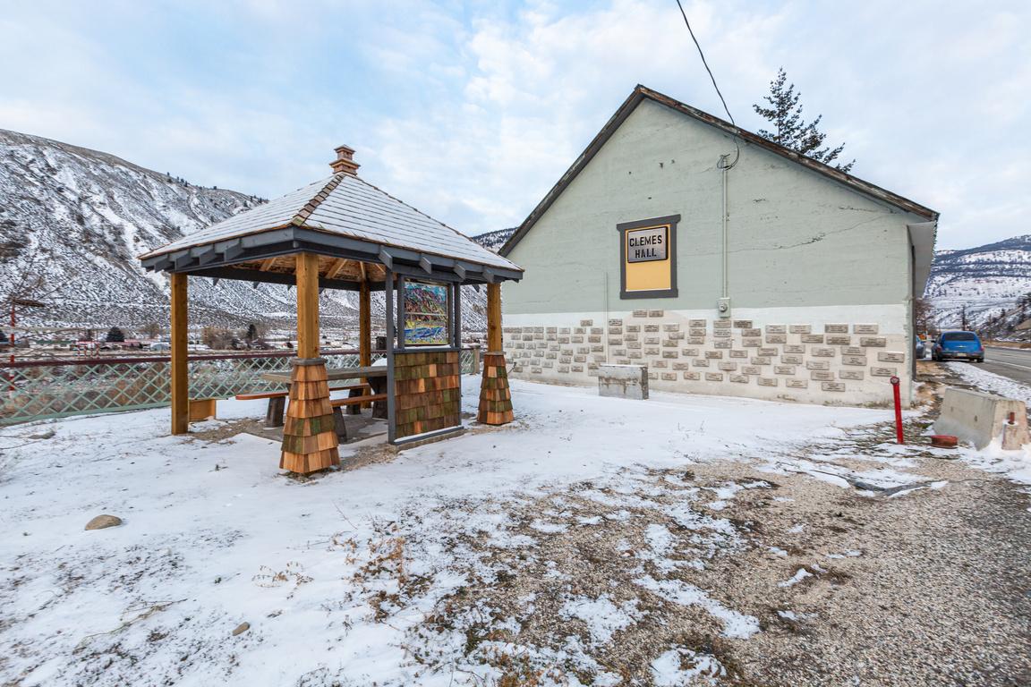
Built in 1907 by Archibald Clemes, this is the original community hall of Spences Bridge. It was built in the cement and stone architectural style that Mr. Clemes learned about on one of his many excursions to Mexico. The hall was home to many wonderful events such as dances, bazaars, Christmas celebrations, theatre and more.
The Spences Bridge Community Club, established in 1959, maintains Clemes Hall and hosts a variety of events there The Club ensures that the historical building is heated and insured, also that all renovations and repairs are carried out. Plans are in the works to make the hall more energy efficient and to build a portable stage for theatre productions.
On the back outside wall of the building is a commemorative wall of plaques honoring the departed souls of Spences Bridge There, one can find such names as Jessie Ann Smith, her husband John Smith, James Teit, Archibald Clemes and many others
Mr. Clemes was an astute business man; he purchased various properties in Vancouver and built the original Pantages Theatre there. In Spences Bridge, he bought a section of John Murray’s estate and in 1890, he bought the Nelson property which included the Nelson Hotel that Mr. Clemes and his wife operated. The Nelson Hotel, which is purported to have been built in 1862, still stands today as “The Inn at Spences Bridge” Clemes Hall is a short distance down the road from the hotel A bakery once stood between the two buildings All of Archibald Clemes’ investments were quite fruitful and thus he became a very wealthy man
Archibald Clemes was somewhat of a local celebrity. He was oneof the first fruit growers in the interior of British Columbia and he produced prize winning apples. He had one of the first automobiles in British Columbia’s interior. In 1898, when he attended the World Exhibition in Paris, he spotted a Woolsey 171
#93 GC3P9E8
and simply had to have one for his very own! He made an order to have one of these vehicles shipped to him and it finally arrived more than three years later! He used to proudly cruise down the streets of Spences Bridge in his beautiful new car. The local townspeople would line the streets to capture a glimpse of Mr. Clemes parading about in his beloved 1902 Woolsey! In 1913, he installed the first power plant in Spences Bridge at the base of Murray Creek falls. This brought power to his hotel, the railroads and to the citizens of Spences Bridge. Archibald Clemes died in 1922 and was known as “The Owner of Spences Bridge” He is buried alongside his pet horse who predeceased him and one can only imagine that his wife is buried there too The cemetery is just off the Trans Canada highway, by the south end of town The graves are mounds of piled up dirt and of course the largest mound belongs to the horse
There you have it, a historical hall more than a century old which is still in use today for similar purposes as it was intended for all those years ago. A building with an interesting history built by yet another colorful character of Gold Country.
Written
and Researched by Dominique
Robillard
Please check geocaching.com before you go!
BIBLIOGRAPHY & SOURCES
J.Meryl Campbell and Audrey Ward. Widow Smith of Spences Bridge Copyright 1989 by Murphy Shewchuk. Sonotek Publishing.
Personal interview with Steve Rice. Personal interview with Ray Nigalis. The Rattler.ca

Letterboxing Clues:
From post #41 cache is 40m towards old fence on the right. Hidden under sage brush.
172
Clinton Hotel
SITE IDENTIFICATION
Nearest Community:
Clinton, B C
Geocache Location:
N 51°05.879' W 121°34 430'
Altitude: 894m/2933ft
Ownership: Crown Land
Accuracy: 2 meters
Overall Difficulty: 1 5
Overall Terrain: 2
Access Information and Restrictions:
From Clinton go 1 4 km North to pull out at Gold Country and Clinton signs Park at pull out Walk 250m along dirt road behind pull out Entrance for dirt road is by the Downing Park mileage sign
Parking Advice: Park in gravel pullout.
Point of Interest:
To view the historic sites of the Toll Booth and Clinton Hotel proceed to Clinton Sites are marked by info signs in town.
For more information or to report a problem with this site please contact:
Gold Country Communities Society
P O Box 933 Cache Creek, B C V0K 1H0 Tel: 1-877-453-9467
Email: info@exploregoldcountry com
For more site pages go to: www exploregoldcountry com www geocaching com
APPLY STICKER HERE
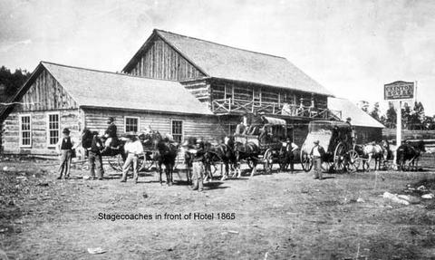
2
In 1862, the Clinton Hotel was constructed opposite the Toll Booth with the Cariboo Trail to Barkerville running between them. Gustavus Wright was the road contractor responsible for the building of the section from Lillooet to Clinton and onward 151 miles (243 km) to Alexandria. The road building was a costly undertaking. A toll booth was established in Clinton from 1863 to 1868 to recover costs from those using the road. Rates were set in Sterling, a shilling for each animal and scales weighed the freight at one cent per pound The toll booth was operated by a man named J Champness and also served as a temporary courthouse
Overlooking these proceedings sat the Clinton Hotel, a flourishing roadhouse built by another group of visionaries, Walter McKinnon and the Watson brothers. It was sold on to Joseph and Mary Smith and partner Tom Marshall in 1865 (date of sale varies) who expanded the building and developed its reputation as a fine hotel known for good food, clean accommodation, and good service. It continued in use until it burnt in 1958.
The road here was built wide with plenty of room for the wagons and teams of oxen, mules and horses to pull by each other or turn around. It was estimated that in the height of the gold rush as many as twenty thousand people and their animals would travel through this route.
It is likely that very little phased these hard working animals They had no doubt encountered all manner of wildlife, dealt with wet and muddy roads, raucous road traffic, extremes in cold and heat and clambered over rocky scree and boggy sections, until 1862 when the camels came up the gold trail The stir of excitement over these exotic visitors was pronounced Within the four legged world the response was horror and panic The shape of these Bactrian camels, with their long legs, rolling gait and two humps was striking Even more remarkable was their distinctive smell, highly Phase
173
Pioneers & Early Settlers
#94 GC3PB80
C r e d i t : C l i n t o n M u s e u m
offensive to an animal nose In an attempt to disguise this problem and encourage a more peaceful co-existence within the working animal kingdom one of the owners went so far as to try perfume as a disguise It did not work. The best behaved teams bolted in terror at these encounters. Mules were attacked by the camels and law suits were pending.
In truth, the camels were a disaster. They suffered from the rough Cariboo terrain, even wearing a boot-type covering did not protect their padded feet They went lame They ate everything in sight including pants, shirts and even a bar of soap The camels had initially served with the US Army Camel Corps rail construction in Arizona, and later as pack animals during the California gold rush It was hoped that these powerful animals, able to carry 500-600 pounds, twice the load a mule could manage, would revolutionize transportation to the gold fields By 1863, after only one year of trial, owners Frank Laumeister and associates decided to abandon their experiment, sell what they could and turn loose the remaining camels
The last identified camel was known to have died at a ranch near Kamloops in about 1905. Random sightings were reported for a number of years after that. Their presence continues in the name of the Camelsfoot Mountain Range near Lillooet.
Written and Researched by Edith McLorn
BIBLIOGRAPHY & SOURCES
Brundage, Mike. Tales of the Cariboo, self published, Clinton, BC Charles, Peters. At the “47 Mile” A history of the Village of Clinton, Orca Book Pub. Ltd., Victoria, BC,1990.
Wilson, Diana, ed. Heart of the Cariboo-Chilcotin, Stories Worth Keeping, Heritage House, Surrey, BC, 2006 Village of Clinton, Historical Walking Tour, self published by Village of Clinton and Clinton & District Economic Development Society
Wilson, Diana, ed Heart of the Cariboo-Chilcotin, More Stories Worth Keeping, Heritage House Surrey, BC, 2007 “U S Camel Corps” (http://en wikipedia org/wiki/U S Camel Corps), sourced June 20, 2012
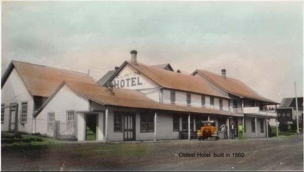
174
At
steep
Letterboxing Clues:
bottom of
hill, turn left and walk 40m to barbwire fence. Hidden in Juniper bush by rock.
Please check geocaching.com before you go! C r e d i t : C l i n t o n M u s e u m
Clinton Memorial Hall Pioneers & Early Settlers
SITE IDENTIFICATION
Nearest Community: Clinton, B C
Geocache Location:
N 51°05 499' W 121°35.063'
Altitude: 888m/2913ft
Ownership:
Village of Clinton
Accuracy: 2 meters
Overall Difficulty: 1
Overall Terrain: 1
Access Information and Restrictions:
Downtown Clinton From Hwy 97 facing North turn right on to Lebourdais Ave.
Parking Advice: Park along avenue or in the hall parking lot
For more information or to report a problem with this site please contact: Gold Country Communities Society
P O Box 933 Cache Creek, B C V0K 1H0 Tel: 1-877-453-9467
Email: info@exploregoldcountry com
For more site pages go to: www exploregoldcountry com www geocaching com

It is not necessary to wear fancy dress when you enter the Clinton Memorial Hall, although many people have chosen to do so.
The Clinton Memorial Hall was built in 1920 to provide a larger venue for the Clinton Annual Ball as well as other community activities The Ball first took place in 1868 and was held at the Clinton Hotel This event set the tone for future events, an on-going tradition of fancy dress, dignitaries, feasting, dancing and socializing People travelled from all over the area, their visits to Clinton extending over a period of days and weeks of festivities
Considering that the first few balls were held in winter and travel was by horse and carriage an extended stay made sense. Planning for this occasion started early, as it does today. Women ordered their gowns well ahead of time, some from Paris, New York and San Francisco, a cultural center during the 1860 gold rush days. Local seamstresses and tailors were in demand.
APPLY STICKER HERE
The building of the Memorial Hall was largely a volunteer effort strongly supported by the returning First World War veterans The decision was made in summer of 1920 that a larger center was needed to accommodate the crowds attending both the Annual Ball and other community events. By September that same year the lot was purchased and the Hall was built in time for the fall horse race meet and rodeo. Lumber was special milled at Botterill’s Mill, the only local operation. Botterill the owner did the mill work at no charge. Volunteers went into the forests to cut the logs and into the mill to saw and plane the wood. Purchases of nails, windows, doors, hardware and wages for the supervising carpenter came from generous money donations given by those who were unable to donate their labour. A plaque resides within the Hall to those 20 young veterans lost in the First World War The Hall has undergone several series of renovations Of note is that its famous spring floor, a suspension system designed to provide light bounce to ease dancers’ feet is still in place The current incarnation retains
175
#95 GC3P0ZY Phase
2
the fine maple flooring, probably the third resurfacing of the floor
In 1969 the Village of Clinton took ownership of the Hall and property. The Village Council held offices in this building until their September 2000 move into the Government Building on the Cariboo Hwy. In recent years renovations implemented by the Village Council have included an updated commercial kitchen, acoustic paneling to improve sound effects and a big screen television used for community events such as the recent 2010 Olympics. When the United Church closed in 2012 it donated its piano, an appreciated gift as the preceding one was worn out
After more than 90 years of use the Clinton Memorial Hall is still ready to open its doors for dances, town hall meetings, funerals, weddings, art shows, Halloween parties, community dinners, tea parties, or fundraisers. The gift of those long gone war veterans continues.
Detailed Access Information:
The Clinton Memorial Hall is located in the Village of Clinton on Lebourdais Turn off Cariboo Trail (Hwy 97 north) at the Shell Station and go south one block Park on Lebourdais or the parking lot adjacent to the Memorial Hall
Written and Researched by Edith
McLorn
BIBLIOGRAPHY & SOURCES
Clinton Museum and Archives. Many thanks to the Clinton Museum for access to archives. Don McLaughlin. (Nov 2000). article "Its the Memorial Hall." Clinton Lariat. Dorothy McLaughlin. (May 1988 ). article "Clinton Memorial Hall." The Spectator. C.E.Robertson. (August 1971). article "Memorial Hall Built with Zeal." Centennial Booklet, Clinton-Cache Cr Pioneer.
Photo of earlier Memorial Hall courtesy of Earl Cahill collection. Village of Clinton Files. Many thanks to Village of Clinton for access to their files
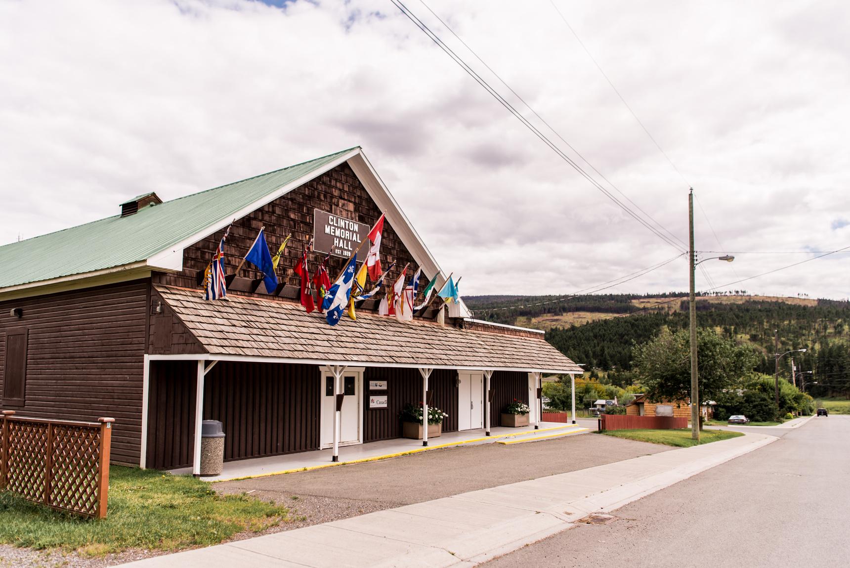
176 Letterboxing Clues: At the parking lot behind guard rail close to dirt mound. Blends in.
Please check geocaching.com before you go!
Cougar Point
SITE IDENTIFICATION
Nearest Community: Clinton, B C
Jesmond, B C
Geocache Location:
N 51°04.905' W 121°55 548
Altitude:
1260m/4133ft
Ownership:
Crown Land
Accuracy:
2 meters
Overall Difficulty: 3
Overall Terrain: 3
Access Information and Restrictions:
From Clinton follow Kelly Lake Road for 16 km and then turn onto Jesmond Road. Follow to the High Bar Road and turn left onto road. Follow for 5.5 km until pullout on the right.
Parking Advice:
Park in flat area on right before 23% Grade road sign.
For more information or to report a problem with this site please contact:
Gold Country Communities Society
P O Box 933 Cache Creek, B C V0K 1H0
Tel: 1-877-453-9467
Email: info@exploregoldcountry com
For more site pages go to: www exploregoldcountry com www geocaching com
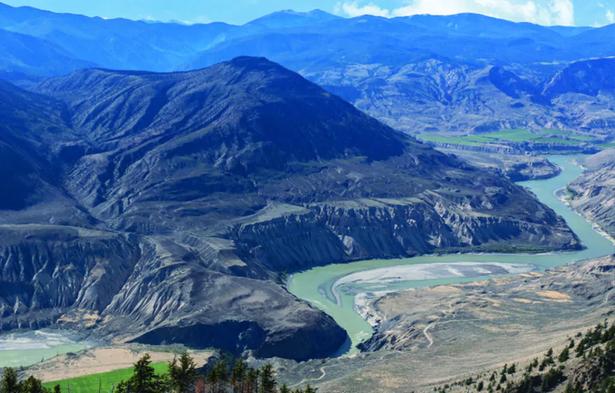
Tucked away between the Fraser River and the Coast Mountain Range, in the land of the Secwepmec people, lays an ecological gem. Edge Hills Provincial Park is a wonderland of rare grasslands, mixed-wood forests and spectacular views of the remarkable geology of the Fraser Canyon.
The park carries a strong cultural heritage, as it is within the Secwepmec traditional territory And it was here, below the hills southwest of Clinton where the Fraser River meets Kelly Creek, a young Secwepmec man in 1872 discovered gold
The Edge Hills proved to be a mining Mecca, but only temporarily. Generally referred to as the Grange Mine, near the confluence of Kelly Creek and the Fraser River, the first excavation began in 1881. Over the years gold, silver and copper were mined, but not without difficulty Numerous mining companies extracted the valuable metals, but as claims lapsed all mining excavation was shut down by 1941 Vestiges of the old shafts are all that remain However, it is at the more northern edge of the park that there is something worth far more than gold or silver At Cougar Point one realizes how rich they truly are gazing upon a geological wonder embracing the Mighty Muddy Fraser River. It is like being at the top of the world. The Coast Mountains, beyond the Camelsfoot Range, appear to be within reach and with imagination one can almost see the top of Vancouver Island and hear the roar of the surf of the Pacific Ocean.
APPLY STICKER HERE
Looking far into the northwest one can see the edge of the Churn Creek Protected Area The park is a rare and fragile grassland ecosystem To the southwest hidden beyond the wends of the river lays the magical Pavilion Lake at the foot of the magnificent Marble Range And beyond sight are the many limestone caves that provide homes and protection for the many critters in the park
This amazing canyon was created by the river cutting through the remarkable geology of the Interior Plateau during the 177
Geological & Views
#96 GC3PB9D Phase
2
Miocene period creating the vast benchlands of the Fraser Plateau The steep cliffs express the colourful evidence of volcanic activity during the Pliocene period And the sheer ruggedness of the canyon is the result of the power of water and the abrasiveness of ancient silt and sand.
While the steepness of the cliffs may pose a challenge to people, they are a mere pathway from one seasonal site to another for the sure-footed bighorn sheep of the area. The sheep winter through in the warmth of the canyon where the rugged and steep cliffs protect them from predators and food is plentiful, as very little snow falls In the spring the bighorn migrate to the rich green alpine of the Marble Range, traversing the rugged cliffs with ease
The drive to the High Bar Road passes through sagebrush grasslands. The grasslands are home to wandering cattle and horses belonging to the many active ranches in the region. They also harbour a variety of wildlife including sandhill cranes, deer and small rodents, the major sustenance for the many hawks in the area.
The drive along the narrow and steep road to the lookout passes from grasslands through Douglas fir forests and up to the alpine forest of ponderosa and lodge pole pine The ground is a dry and dusty dirt floor dotted with the many colours of wildflowers that hug the rocks and cliff edges
Cougar Point is a spectacular secret hidden deep in Edge Hills Park on top of the Fraser Plateau. A mighty muddy river, the Fraser has cut a swath through ancient geology to provide a magnificent view into the past and a sense of wonder. On top of the world the vista is an awesome treasure high above Gold Country.
Written and Researched by Angela Wynton
BIBLIOGRAPHY & SOURCES
Duffell, S. & McTaggert, K. Geological Survey of Canada, Memoir 262, Canada Department of Mines and Technical Surveys, No. 2501, Ottawa 1951
www.env.gov.bc.ca/bcparks BC Parks
www gov bc ca/ener Ministry of Energy & Mines, Mines & Mineral Sources, Geoscience, MINFILE Mineral Inventory, MINFILE No 0921NW036
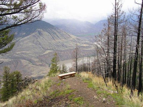
178 Letterboxing Clues: From parking area walk back up road 25
hill
right.
metres up
on
Go right 40 metres to Juniper bush, once there go left up hill 90 metres. Ground level.
check geocaching.com before you go! C r e d i t : J a c k T a y l o r
Please
Earlscourt
SITE IDENTIFICATION
Nearest Community: Lytton, B C
Geocache Location: N 50°16 090' W 121°36.919'
Ownership:
Private Property
Accuracy: 3 meters
Overall Difficulty: 1.5
Overall Terrain: 2.5
Access Information and Restrictions:
Public road. Seasonal (ferry closed at high water) Vehicle accessible Located northwest of Lytton on Hwy #12 From Highway 97 exit into Lytton following Main Street and the signs to the Lytton Ferry about 2 km; cross the river following North Spencer Road, and drive past Earlscourt Farms about 3 2 km from the ferry dock to a pullout on the right hand side Please no smoking on this site
Private property
Parking Advice: Park at pullout that is 3.2 km from Ferry exit.
For more information or to report a problem with this site please contact:
Gold Country Communities Society
P O Box 933 Cache Creek, B C V0K 1H0 Tel: 1-877-453-9467
Email: info@exploregoldcountry com
For more site pages go to: www exploregoldcountry com www geocaching com
APPLY STICKER HERE
From a small town on the Atlantic Seaboard to the bench lands of the mighty Fraser in Lytton, Thomas Gardner Earl accomplished a journey of some magnitude to find the apple of his eye – in more ways than one!
Earl was born in New Jersey in 1829 and as a young man followed the hordes to San Francisco to join the California Gold Rush in the early 1850’s Not satisfied, he headed northward in 1858 to try his hand in the Cariboo Gold Rush But Earl discovered a different kind of gold – golden and delicious apples
After hearing of the first apple tree plantings in 1862 by a Secwepmec man named Lorenzo, Thomas Earl settled in Lytton in 1864 to plant an orchard. He soon accumulated a total of 300-acres with both apple and pear trees The early maturity of the fruit, due to the remarkable heat of the Lytton Valley, guaranteed good crops Strategically located along the Cariboo Wagon Road, the orchards were an ideal place to stock up on fresh provisions By 1875 Earl was considered the largest apple grower in British Columbia
And it wouldn’t be long thereafter that Earl would marry the apple of his eye. Anna Ogden Earl was a cousin and they wed in Victoria in 1885. They settled in at Earlscourt Farms and together worked the orchards growing, selling and exporting fruit to as far away as England.
The Earls would enjoy the fruits of their labour until 1912 at which time he sold Earlscourt Farms to David Spencer It was a long way from a small Welsh Village to Lytton, but David Spencer was an enterprising young man. His journey to Lytton was not without several stops on the way, as he was destined for great things.
Lured by the glory of gold, the young Methodist preacher made his way to Victoria in 1862 only to find the excitement of the Gold Rush abating So he bought a bookstore in January and advertised "Valentines, valentines, sentimental and comic, new and
179
Agriculture
#97 GC3V58Q Phase 2 C r e d i t : M a r c i e D o w n
beautiful” – weeks before the big day He believed in the slogan start the demand – don’t follow it
In 1867 Spencer fell in love and married the apple of his eye, Emma, and started a family. By 1873 Spencer sold the bookstore and purchased a dry goods business with a partner. Five years later he went solo and grew the business. Spencers was now in Nanaimo and Vancouver, for a total of nine stores.
In 1912 the company added farms and ranches to their assets, including Earlscourt Unfortunately, David died in 1920, but the business and properties remained in the family Several years later it was noted that Earlscourt was now 700-acres with 16,000 fruit trees.
The family sold the department store business to T. Eaton in 1948, but kept the farm in Lytton until 1959 when they sold Earlscourt to rancher Norman Gregory. Gregory’s ownership was short and the property was bought by Raymond Mundall in 1962 He was no stranger to farming, as he had operated a 100-acre almond orchard while practicing medicine in California
He brought his family to Lytton where they settled in at Earlscourt. However, Mundall was soon discouraged by a fire that destroyed the equipment shop a year later. They kept the farm but moved back to California.
Fire would plague the farm, with the packinghouse burning in 1972 Mundall returned to the farm in 1991 to retire and one year later the greenhouse burned This was followed by the burning of the mansion in 1992 However, the Mundalls are a hardy lot
Today the Mundalls manage the organic orchard, run a cattle operation and a horse training facility. Earlscourt has come a long way, withstanding the ravages of time and fire.
The story of Earlscourt Farms apples weaves an interesting history – a delicious golden dream coming true in the heart of Gold Country
Written and Researched by Angela Wynton
BIBLIOGRAPHY & SOURCES
www.mundall.com, Mundall family business website inc. Earlscourt Farm www.biographi.ca, Canadian Biography On-line www.lib.uwo.ca, University of Western Ontario, "The Libraries,Business & History" www.livinglandscapes.bc.ca, Royal BC Museum, "Living Landscapes"
Letterboxing Clues:
From pullout walk 109m approximately straight up to the top of the hill on the right side of the pullout At the open viewpoint area the cache is hidden under a bush and covered with rocks and wood.
180
Please check geocaching.com before you go!
Emerald Bay, Green Lake
SITE IDENTIFICATION
Nearest Community:
70 Mile House, B C
Geocache Location:
N 51°26.514'
W 121°09 778'
Altitude:
1065m/3494ft
Date Established:
1975 - 113 hectares
2004 - total of 347 hectares
Ownership:
Provincial Park
Accuracy:
5 meters
Overall Difficulty: 1.5
Overall Terrain: 1 5
Access Information and Restrictions:
From Highway 97 at 70 Mile House, turn east at N. Bonaparte Rd; there is plenty of signage; follow N Bonaparte to the sani-station 15 km and turn northeast onto Green Lake Rd N ; follow the road, which will eventually run along the lakeshore, for approx 17 5 km to the Emerald Bay campground; you will pass several of the other Green Lake Provincial Park spots; from Highway 24 there is also good signage
Parking Advice:
Parking at site at park entrance
For more information or to report a problem with this site please contact:
Gold Country Communities Society
P O Box 933 Cache Creek, B C V0K 1H0
Tel: 1-877-453-9467
Email: info@exploregoldcountry com
For more site pages go to: www exploregoldcountry com www geocaching com
APPLY STICKER HERE
There was far more than just gold discovered during the boom days along the Cariboo Wagon Road. While many passed through the vast geography along the road to riches, others chose to explore the surrounding areas and find a different kind of wealth. With so much land in every direction, the region was beckoning for discovery and settlement. And those that dared, travelled into new and unchartered territory – or so they believed.
The Secwepemc, Shuswap people, have been travelling and living off of the forests, streams and lakes of the area for several thousands of years. They began sharing their ancestral territory in the early 1800s with the coming of the fur traders from the Hudson’s Bay Company.
Seeking a route from Fort Langley to Fort Alexandria and onto Fort George, Alexander Caulfield Anderson, with great perseverance and remarkable patience, was able to establish and map the route between the forts The Fur Brigade Trail meandered alongside creeks and streams In their canoes they fought rivers and rapids They crossed muskeg and lake They traversed plateaus and mountains, meadows and forests It was hard work and many horses met an unfortunate demise
However, one day when the voyageurs were travelling the meadows not far from the Bonaparte River, they came upon the brilliant and clear waters of a large lake dotted with islands. They were smitten. Such beauty was rarely seen So unusual was the colour the French voyageurs could only best describe it as Lac du Vert
Green Lake, as it is known today, is a treasure nestled in the heart of the Southern Cariboo. Its waters are crystal clear and a brilliant green. It is fed by two clean running creeks, Watch and Nolan, several springs within the lake itself, and the snowmelt from the surrounding uplands. It is dotted with a number of islands, large and small, and most of the bays and shores are a lovely soft black sand.
181
Geological & Views
#98 GC3PBAJ Phase
2
One of the greenest colours around the lake can be found at Emerald Bay, where the sands are black on shore and one can easily see the bottom of the lake beneath the deep emerald hue of the crystal clear water So why is this lake so green?
It is a remarkable mix of nature and chemistry that makes this lake such a beautiful green. The chemical composition of the water, the microorganisms and phytoplankton, along with the physics of light, give us the beautiful green hues It is especially effective as the lake is shallow with a clear sandy bottom
The Emerald Bay campground is considered by many, the most wonderful of all B.C. provincial parks. It offers lovely campsites in a trembling aspen forest, a great children’s play park and a large covered log shelter for reprieve from the hot sun or the cool summer rains. Of course the best feature is the exotic sandy beach at the water’s edge of the rich emerald coloured bay, making it a swimmers dream. Emerald Bay is paradise – a brilliant and sparkling green gem in the heart of Gold Country.
Written and Researched by Angela Wynton
Please check geocaching.com before you go!
BIBLIOGRAPHY & SOURCES
Anderson, Marguerite, The Pathfinder: A J Andersons’s Journeys in the West, Heritage House, Victoria, British Columbia 2011 www.env.gov.bc.ca/bcparks BC Parks, Government of British Columbia Sewchuk, Murphy, Cariboo Trips & Trails, Fitzhenry & Whiteside, Markham, Ontario 2008 www.flyingu.com The Flying U Ranch – Canada’s oldest working guest ranch
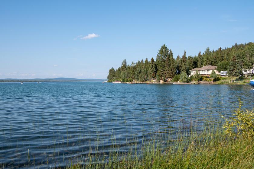
Letterboxing Clues:
After entering Emerald Bay, Green Lake campground park in the day lot to the right, walk 5 minutes to the covered picnic shelter located waterside in a grassy field below the children’s play area From the shelter walk north towards a large downed tree. Under the tree, covered with brush.
182
Epsom - Last Spike
SITE IDENTIFICATION
Nearest Community:
Ashcroft, B C
Spences Bridge, B C
Geocache Location:
N 50°34 400'
W 121°18.193'
Ownership:
Provincial Park
Accuracy:
2 meters
Overall Difficulty: 2
Overall Terrain: 3
Access Information and Restrictions:
The Canadian Northern Pacific Last Spike stop of interest plaque is located in a pull-off on the Trans-Canada Highway approximately 15 km south of Ashcroft/19 5 km north of Spences Bridge Access to Epsom Park is via an unmarked access road just to the south of the Last Spike plaque; use caution when entering and exiting Please note that the road is only passable in its lower section by 4 wheel-drive vehicles, and that the road stops short of the railway tracks; access to the other side of the tracks is by foot only Beware of posion ivy
Parking Advice:
Park at large pullout by plaque and hike down, or park on 4x4 access trail on the flat field before steep downhill descent.
For more information or to report a problem with this site please contact:
Gold Country Communities Society
P O Box 933 Cache Creek, B C V0K 1H0 Tel: 1-877-453-9467
Email: info@exploregoldcountry.com
For more site pages go to: www exploregoldcountry com www geocaching com
APPLY STICKER HERE
Rails & Trails
The most famous “last spike” in British Columbia is the one which signaled completion of the Canadian Pacific Railway in 1885, but there were two others pounded in the province. In June 1914 the Grand Trunk Railway completed its expansion to the west coast, with the last spike placed near Fort Fraser, and on January 23 1915 its rival, the Canadian Northern Pacific, hammered home its last spike between Spences Bridge and Ashcroft. A “Stop of Interest” plaque off Highway 1 near the site commemorates the event, and the railroad (The iconic green “Stop of Interest” plaques which can be seen all over the province were started in 1958, to mark the 100th anniversary of the founding of British Columbia, and are a familiar sight on B C ’s highways There are now more than 130 around the province, with the most recent batch of a dozen added to mark the province’s 150th anniversary in 2008 )
The Canadian Northern Pacific was an extension of the Canadian Northern line, run by businessmen and railway entrepreneurs Donald Mann and William Mackenzie. They wanted to expand their existing rail lines mostly in the Prairies to compete with the lucrative Canadian Pacific line, which meant moving east into Ontario and west to British Columbia Unfortunately, Charles Hays of the Grand Trunk Railway had the same idea at much the same time, and the two companies found themselves in unofficial competition to be first through the Rockies to the Pacific coast: the Grand Trunk to Prince Rupert and the Canadian Northern Pacific to Vancouver
The difficulty of building rail lines through the Rockies and the Interior, plus high labour and material costs due to World War One, meant that by the time the last spike was pounded home, the Canadian Northern Pacific was heavily in debt In 1918, unable to pay the interest on its loans, it was taken over by the Canadian government and incorporated into its national railway system, which became Canadian National The same fate
183
#99 GC3PBCN Phase 2
befell the Grand Trunk Railway in 1920
The CN line passes below the last spike plaque, following the west side of the Thompson River and cutting through Epsom Provincial Park. The 102 hectare park was created in 1997, and is one of the few places in the area giving public access to the Thompson. The road down to the park the bottom third of which is only accessible by 4-wheel-drive vehicles passes through sage and grassland benches which give way to cottonwood, willow, and underbrush closer to the river
There is also poison ivy on the far side of the CN tracks, so remember the warning “Leaves of three, let it be.” A shallow channel on the far side of the tracks separates the bank from a low sandbar, which during the spring runoff is covered by the Thompson. During the summer months river rafters can be spotted heading down the river towards Lytton.
Both the park and the viewpoint by the “Last Spike” plaque offer a stunning view north along the Thompson River, as well an opportunity to examine the silt cliffs, hoodoos, and terraces characteristic of this stretch of the Thompson These were formed after the ice age, when deep beds of silt were deposited on the bottom of temporary lakes When the ice dams which had formed the lakes melted, the water cut channels through the silt, leaving the geographic formations which we see today Just to the south of Epsom, on the opposite side of the river, is the pumping station at Spatsum which supplies water to the Highland Valley copper mine
Written and Researched by Barbara
Roden
Please check geocaching.com before you go!
BIBLIOGRAPHY & SOURCES
Lyons, C.P. (1986). Trans-Canada Highway: Vancouver to Kamloops Through Historic Fraser & Thompson River Canyons. Surrey, B.C.: Heritage House Publishing Company Ltd.
MacKay, Donald (1992): The People’s Railway: A History of Canadian National. Vancouver & Toronto: Douglas & McIntyre.
McGill, David E (1979) 126 Stops of Interest in Beautiful British Columbia Aldergrove, B C : Frontier Publishing Co Ltd
Retrieved June 2012 from British Columbia: BC Parks (online): http://www env gov bc ca/bcparks/explore/ parkpgs/epsom/#
184 Letterboxing Clues: Beside 4x4 trail to the right at the gulley Under large sage brush.
Echo Valley Ranch Feature Film
SITE IDENTIFICATION
Nearest Community:
Jesmond, B C
Clinton, B C
Geocache Location:
N 51°14 715'
W 121°59.675'
Altitude: 1132m/3713ft
Ownership:
Private Property
Accuracy:
5 meters
Overall Difficulty: 2
Overall Terrain: 2
Access Information and Restrictions: 59 kms from Clinton. From Clinton follow Kelly Lake Road for 16 km and then turn onto Jesmond Road. Follow road signs to Echo Valley Ranch. Turn right on to Echo Valley and travel 3 km to dirt road on your right. Walk along dirt road for 150m to cache location.
Parking Advice:
Park at the entrance to dirt road
For more information or to report a problem with this site please contact:
Gold Country Communities Society
P O Box 933 Cache Creek, B C V0K 1H0 Tel: 1-877-453-9467
Email: info@exploregoldcountry com
For more site pages go to: www exploregoldcountry com www geocaching com
Early settlers discovered the fertile grasslands along the Fraser River south of Williams Lake almost by accident, as they sought out a route north from Lillooet to the goldfields. Would-be prospectors, and pack trains carrying supplies, were the first to make the difficult journey, but it soon became apparent that very few people “struck it rich” in the goldfields. The newcomers all needed to eat, however, and many people realized that there was good money to be made in cattle ranching The world-famous Gang Ranch once the largest ranch in Canada, if not the world was established in the area in 1863, and was soon followed by the Empire Valley Ranch to the south, in the area around Churn Creek
By the early 1900s several families had settled in the vicinity of Churn Creek, establishing small ranches and homesteads, and turning cattle and sheep loose on the grassland. Several of the families had young children, but there weren’t enough students to meet the minimum requirement for a provincially-funded school and teacher.
That changed when the Zimmerlee family, emigrating north from California, arrived in the area in 1908 They were en route to the goldfields, but were persuaded to stay in the valley, settling initially in a small cabin near Brown’s Lake. With the addition of the Zimmerlee children, there were enough students for the establishment of a school, which was constructed in 1910.
APPLY STICKER HERE
The Zimmerlees, however, did not stay long in the cabin on Brown’s Lake, instead moving southeast to a site in the shadow of the Marble Range, where they established a cattle ranch Although members of the family still live in the area, the ranch was eventually sold, and in 1992 became the Echo Valley Ranch and Spa Today the ranch boasts a mix of traditional western and Thai architecture and decoration, but the site’s homesteading roots are still visible, as several of the original Zimmerlee buildings
185
#100 GC3PBB3 Phase 2
including a log cabin, a root cellar, and two animal shelters remain on the property
The valley has, over the years, played host to film crews: the movies The 13th Warrior (1999) and The Thaw (2009) were both shot, in part, to the north of Echo Valley Ranch. More recently, the ranch property itself played a starring role in the CBC TV series Arctic Air, which concerns a group of pilots working for a small airline in the remote regions of the Canadian north. The final episode of the first series, which aired in spring 2012, concerned a plane going down in rough, snow-covered terrain, and the efforts of various Arctic Air pilots to find the crash site and rescue the survivors The show’s producers needed a suitably remote-looking and rugged location surrounded by forests and mountains and covered in snow, but which also had an airstrip nearby, plus accommodations for the cast and crew
Echo Valley Ranch, with its own landing strip, fit the bill perfectly. However, when the time came to shoot there was just one problem: for the first time since anyone could remember, there was hardly any snow in the valley on the days scheduled for filming. Undaunted, the crew trucked in snow from other locations, and filming proceeded as planned.
Those who know Echo Valley Ranch and the area around it speak of its magic; the same magic which lured so many people to stop there on the way north, and build their lives along the Fraser People also speak of the magic of film, transporting us to places we might never otherwise see At Echo Valley Ranch, both types of magic come together
Written and Researched by Barbara
Roden
BIBLIOGRAPHY & SOURCES
(Winter 2011). Friends of Churn Creek Protected Area Society Newsletter. Retrieved September 2012 from http://www friendsofchurn ca/Friends-of-Churn-Newsletter-2a pdf
"Arctic Air and Echo Valley Celebrate the Renewal of the TV Series" Retrieved September 2012 from http:// blog evranch com/arctic-air-and-echo-valley-celebrate-the-renewal-of-the-tv-series/ "Canoe Creek Band History" Retrieved September 2012 from canoecreekband ca/history html "Echo Valley Ranch and Spa: History" Retrieved September 2012 from http://www evranch com/cms asp? wpID=428
Letterboxing Clues: Look for the giant stump on the left across from two big pieces of log on right. Look in giant stump.
186
geocaching.com
you
Please check
before
go!
Frederick & Dewdrop Trail
SITE IDENTIFICATION
Nearest Community: Savona, B C
Geocache Location:
N 50°44 972' W 120°37.319'
Ownership:
Crown Land
Accuracy:
3 meters
Overall Difficulty: 2 5
Overall Terrain: 3 5
Access Information and Restrictions:
From Hwy 1, take Sabiston Rd and follow until you reach Copper Creek Road Follow until you reach Tranquille Criss Creek Road and turn right and follow until you reach DewdropFrederick Road (74 3 km approximately) and turn onto; take the left fork at the next junction and proceed to the parking area From the parking area, follow a route through the low pass to the south; at the top of the pass, turn right up the open slopes to the top of the bluff over 0.5 km and an 80m climb.
Parking Advice:
N 50°45 168' W 120°37 319'
For more information or to report a problem with this site please contact:
Gold Country Communities Society
P O Box 933 Cache Creek, B C V0K 1H0 Tel: 1-877-453-9467
Email: info@exploregoldcountry com
For more site pages go to: www exploregoldcountry com www geocaching com
APPLY STICKER HERE
& Trails
Northwest of Kamloops, on the north side of Kamloops Lake, lies the Lac du Bois Grasslands Protected Area. The 15,000 hectare park encompasses sweeping grasslands and lush forests, cliffs and canyons, hoodoos and hidden mountain lakes, a wide variety of animals and birds, and vegetation ranging from wildflowers on the lower slopes to groves of aspens and Douglas firs.
There are hundreds of kilometers of trails throughout the park, but the Dew Drop trail, with its sweeping vista over Kamloops Lake and the Thompson Plateau, is one of the best and most accessible ways to visit the area. The trail starts off in grassland, where horses of the Hudson’s Bay Company roamed free in the 1860s. As the trail winds upward, hikers will encounter gullies, streams, forest, plateaus, and lava outcrops. Viewpoints over the lake can be accessed from the main trail, with the highest viewing point a 5.5km hike from the jumping off point on Frederick (Dewdrop Range) Road.
Almost directly across from this viewpoint, on the south side of Kamloops Lake, is the great bluff which Sir Sandford Fleming felt might be a formidable obstacle to the Canadian Pacific Railway on its proposed route along the Thompson During his 1872 surveying expedition Fleming’s party left Kamloops by boat, with the intention of traveling to Savona’s Ferry (as it was then called) and getting a close look at the great bluff as they passed. They also had the opportunity to observe the landscape on both sides of the east end of Kamloops Lake:
“The hills are diversified here in form and colouring, as they are in age; some heavy bluffs of trap and basalt jutting out into the lake, intermingled with carboniferous rocks; and beyond them elevated plateaux, composed of a silt of mingled sand and clay, retreat in more or less distinctly defined terraces on which the subsiding waters had successively rested On these broken, narrow, winding plateaux, and the hillsides that bound them, is abundant 187
Rails
#101 GC3P9HD Phase 2
grazing for ten times the number of cattle or sheep now seen on them ”
Herds of cattle may still be encountered in the grasslands surrounding the Dewdrop Trail. Another animal that can be seen is the California bighorn sheep, which was successfully introduced to the area; so successfully that animals from Lac du Bois have been used to re-populate areas in the United States where the bighorn had disappeared. The area around the Dewdrop Trail is recognized as one of the best places in the province to view the animals, with the south-facing hillsides, steep rocky terrain, and natural vegetation providing a perfect habitat From September/October until May/June the animals stay in the lower elevations, retreating to higher alpine meadows during the summer months Other wildlife that can be seen along the Dewdrop includes white tail deer, mule deer, and moose
The country around Dewdrop was never well populated, either by the Secwepemc (Shuswap) First Nations people or by early settlers. However, historical hunting and root gathering was conducted there by the Secwepemc, and the area also contains pictographs and archaeological sites indicative of First Nations presence. The remains of historic homesteading sites can also be found in the area.
Please note that grasslands areas are very sensitive to disturbance There are also some 950 hectares of privately owned land in, and adjoining, the Lac du Bois Grasslands park, which ensure the preservation of some of the most intact native grassland in the province, and numerous at-risk species This property cannot be accessed without permission
Detailed Access Instructions:
From North Kamloops, follow Tranquille Road west past the airport. Just past Tranquille, bear to the right onto Tranquille-Criss Creek Road and cross the railroad tracks Continue along this road for approximately 9 9km until the first switchback, then take the Fredrick (Dew Drop Range) Road to the left There is a parking area on the right, approximately 700 metres from the junction
Written and Researched by Barbara
Roden
BIBLIOGRAPHY & SOURCES
Grant, The Rev George M (1873) Ocean to Ocean: Sandford Fleming’s Expedition Through Canada in 1872 Toronto: Radisson Society of Canada Limited
Retrieved June 2012 from British Columbia: BC Parks (online): http://www env gov bc ca/bcparks/explore/parkpgs/lacdubois grass/Bighorn Sheep in British Columbia
Retrieved June 2012 from http://www env gov bc ca/wld/documents/bighorn pdf
Retrieved June 2012 from http://www kamloopstrails net/file php/1/Dew Drop Trail pdf
Letterboxing Clues:
At the top of the bluff, look for a niche in the rock outcrop
188
Please check geocaching.com before you go!
George Dawson Geological & Views
SITE IDENTIFICATION
Nearest Community: Logan Lake, B C
Geocache Location:
N 50°22 172' W 120°47.861'
Altitude:
964m/3162ft
Accuracy: 3 meters
Overall Difficulty: 1 5
Overall Terrain: 1 5
Access Information and Restrictions:
From Logan Lake go to the junction of Hwy 97C and Tunkwa Lake Rd, turn left onto the Mamit Lake Rd (Highway 97C) and follow for approx 14 km to Mamit Lake going towards Merritt Cache is at the edge of a steep bank that can be hard to see due to the tall grass. Go carefully.
Parking Advice:
Park at the pullout at the south side of Mamit Lake.
For more information or to report a problem with this site please contact:
Gold Country Communities Society
P O Box 933 Cache Creek, B C V0K 1H0 Tel: 1-877-453-9467
Email: info@exploregoldcountry com
For more site pages go to: www exploregoldcountry com www geocaching com
Geologist, paleontologist, amateur anthropologist, naturalist, and occasional poet, George Mercer Dawson helped map and pioneer western Canada and the Yukon in the 1870s and '80s. Working for the Government of Canada, he was charged with the task of mapping out major mountains, mountain passes, and significant rivers of the area. This would have been an enormous feat for any hardy scientist and explorer, but for Dawson, the task would have been even more difficult At 11 years of age he suffered from Pott's Disease, or spinal tuberculosis, and endured his journeys through adulthood with stunted growth and a severely hunched back as a result Estimated to stand between 4'8" and 4'10", Dawson may have been small in stature but the legacy he left behind was, and is, enormous He never complained, and was often described as a cheerful and likeable man with an insatiable passion for exploration and discovery
Dr. George, as he was affectionately known to many, was born August 1, 1845 to Sir John William Dawson, Principal of McGill University, and his wife, Lady Margaret Dawson, in Pictou, Nova Scotia Although he was homeschooled with tutors while he recovered from his illness, Dawson later attended McGill University part-time before moving to London in 1869 There, he studied geology and paleontology at the Royal School of Mines, graduating after three years with the highest marks in his class
APPLY STICKER HERE
After a stint as a chemistry professor, Dawson started surveying for the Canadian Government by contributing to the International Boundary Survey from 1872 to 1876. In 1875 he joined the staff of the Geological Survey of Canada.
From 1875 to 1878, Dawson led mapping and geological expeditions throughout British Columbia which included journeys to Stump Lake, Merritt, Highland Valley, Hat Creek, Savona, Ashcroft, and Cache Creek.
189
#102 GC3P8N7 Phase
2
As he travelled he wrote extensive journals detailing his observations Aside from geological and mapping notations, Dawson's journals demonstrate his appreciation for nature and his wry sense of humour In 1877, while in the Spences Bridge area, Dawson's notations included the following entry:
Oct. 14. Off pretty easy, track-surveyed down to the mouth of the Nicola, and then commenced pace line up the Nicola Road Got a photo of remarkable bluff of Tuff & dykes, & then told Casinto to go on & camp about 4 Pm Got into Camp just as getting too dark to see to work longer Douglas, unfortunate as usual, pitched the tent in his hurry on a bed of cactus, & gave us twenty minutes work clearing the hateful prickly pears out with the shovel, while they stuck to everything like burs
Another magnificent day, & a really splendid view of the towering mountain below Spences Bridge & across the Thompson. The great rifts about its summit full full of dark shadow, a transparent blue haze Surrounding it, & the bridge & houses looking like very pigmies below.
In 1895 George Dawson became Director of the Geological Survey of Canada His distinguished career led to many honours, including honourary doctorates from both Queen's University in 1890 and McGill in 1891
A notorious chain smoker, Dawson unexpectedly died in Ottawa in March, 1901, after a one-day bout with acute bronchitis. He was interred in the Dawson family plot in Montreal's Mount Royal Cemetery. On April 12, 1901, Frank D. Adams of McGill University published a touching obituary to Dawson in the journal Science. In it he began, "By the death of Dr. G. M. Dawson, the Dominion of Canada loses one of her ablest and most distinguished men of science and one whose loss will be felt for many years to come". Both Dawson City and Dawson Creek were named in recognition of the contributions of Dr. George.
Written and Researched by Vesta Giles
BIBLIOGRAPHY & SOURCES
Adams, Frank D. (April 12, 1901). "George M. Dawson". Science , New Series, Vol. 13, No. 328, pp. 561-563. Published by: American Association for the Advancement of Science, Retrieved June 4, 2012 from http://www.jstor.org/stable/1628827 Cole, D. And B. Lockner (ed.) (1989). "George Mercer Dawson". (March 31, 2012). In Wikipedia, The Free Encyclopedia. Retrieved June 4, 2012, from http://en.wikipedia.org/w/index.php?title=George Mercer Dawson &oldid=484806003
Life of a rock star Library and Archives Canada Retrieved June 4, 2012, from http:// www collectionscanada gc ca/rock/021018-4300-e html "George M Dawson" Peakfinder, retrieved June 4, 2012 from http://www peakfinder com/people asp? Personsname=Dawson%2C+George+M
Letterboxing Clues:
From the corner of the fence walk 10 m East towards the Hwy away from the fence. Located at the base of tree.
190
Please check geocaching.com before you go!
Glossy Mountain Pioneers & Early Settlers
SITE IDENTIFICATION
Nearest Community: Logan Lake, B C
Geocache Location:
N 50°38 353'
W 121°13.087'
Ownership:
Crown Land
Accuracy: 3 meters
Overall Difficulty: 2.5
Overall Terrain: 4
Access Information and Restrictions:
From the Old Fire Hall in Ashcroft follow Highway 97C towards Logan Lake for 13 km Take the left dirt access road. Follow trail to gate and close behind you. From gate follow 4x4 trail to the right for 1.9 km. 4x4 only and must have good clearance. Be prepared for back country. Road can be walked 2 km hike.
For more information or to report a problem with this site please contact:
Gold Country Communities Society
P O Box 933 Cache Creek, B C V0K 1H0
Tel: 1-877-453-9467
Email: info@exploregoldcountry com
For more site pages go to: www exploregoldcountry com www geocaching com
The Highland Valley is not really a valley but rather the crater of a long extinct volcano. It is located in the same chain of mountains as Mt. St. Helens, the recently reactivated volcano in Washington State.
In 1877 when Dr George Dawson surveyed the Nicola region he produced a map which included two features of the Highland Valley area, listed on this map were Mt Glossy and Mt Forge Mt Glossy and Forge Mountain are the remains of the northern side of a volcanic cone and Gnawed Mountain forms the south side Within the crater were lakes. At least two and possibly four glacial periods descended upon the whole Nicola area. The final glacial period receded about 10 thousand years ago. As the ice receded a lake in the Highland Valley formed and a natural dam was created.
Gradually the land in the Highland Valley became alive with the growth of flora and fauna. The lakes supported abundant fish life. Highland Valley is aptly named because at 3900 feet, it is high and with the peaks of Glossy and Forge on the north and Gnawed to the south every appearance is given of a valley The site from these three peaks gave the forestry department a view of the whole basin The appearance of a forest fire could be quickly located and dealt with.
In the early days access would be by horse and several trails wound their way up through the valley and to the top of each mountain.
APPLY STICKER HERE
Hawks, eagles, crows, coyotes, rabbits, blue grouse, franklin grouse, and even mountain goats could be seen in the valley in the early 1900’s By the 1930’s J N J Brown an Ashcroft miner and poet wrote of his concerns to the Ashcroft Journal about the decline of some of the species of wildlife in the Valley Mountain goats and rabbits saw a rapid decline in population and even the deer life were not so abundant However bear numbers were on the rise and grizzlies could be found around Mt Glossy Opportunities for guiding, hunting and fishing parties were not lost on the local inhabitants. 191
#103 GC3PCN8 Phase 2
To the south of Glossy mountain runs Woods Creek and it was here in 1948 that the Owens built a cabin This cabin served the family as a base camp for their guiding expeditions Glossy Mountain area was alive with vegetation, and the Mule Deer were prolific. America hunters would flock to the area and the Owens family would act as guides. The cabin was used for this purpose until 1968.
Although today the trees of Glossy Mountain have been devastated by the Pine Beetle the flowers and berries still thrive Tiger lilies, wild roses, lady slippers, and indian paint brush are just a few of the many wild flowers that can be spotted through the forest Berries such as gooseberries, raspberries, and strawberries are plentiful Shaggy mane mushrooms grow here as well The fresh water creeks are alive with frogs and the occasional salamander Grouse, deer, moose, chipmunks, bears, wolves, cougars, coyotes, lynx, bobcat, mink, and porcupine continue to inhabit Glossy Mountain
Written and Researched by Kathy Paulos
Please check geocaching.com before you go!
BIBLIOGRAPHY & SOURCES
Brown, James N J (1934) "A Story of Highland Valley;" Ashcroft Journal, Ashcroft Museum Archives Lean, P (1980, July) "Highland Valley Copper " Nicola Valley Historical Quarterly Vol 3-No 2 and 3, Merritt B C Owens, Ken; Down, Marcie, (2012) Oral history
192
Letterboxing Clues: In open meadow, under small shrub Turn right off 4x4 trail onto faint 4x4 trail.
C r e d i t : B a i l l i e S t e w a r t
Haywood Farmer Indian Gardens Ranch
SITE IDENTIFICATION
Nearest Community: Savona, B C
Geocache Location: N 50°43 434' W 120°47.186'
Altitude: 671m/2201ft
Date Established: 1885c
Ownership:
Private Property
Accuracy: 3 meters
Overall Difficulty: 2
Overall Terrain: 2
Access Information and Restrictions:
From Savona follow the Tunkwa Lake Road South for approximately 6 6 km
Parking Advice:
A small pull out just metres from the cache
For more information or to report a problem with this site please contact:
Gold Country Communities Society
P O Box 933 Cache Creek, B C V0K 1H0
Tel: 1-877-453-9467
Email: info@exploregoldcountry com
For more site pages go to: www exploregoldcountry com www geocaching com
The Indian Gardens Ranch was one of the properties built up by Johnny Wilson, the “Cattle King” who also had properties near Walhachin, Six Mile Point, Westwold, Cache Creek, and Copper Creek. He married a Lillooet Indian girl who subsequently died and by about 1885 he married a girl from the Indian Gardens Ranch and had 3 children.
Wilson became a rich and influential man in his life and was well respected He died in 1904 in a buggy accident and the Indian property was divided among his family All the Savona properties were taken over by his wife Nancy and their children. According to Peggy Haywood Farmer, an Argentinean family named Hemstock bought the Indian Gardens Ranch from the Wilson’s daughter and George Haywood Farmer bought the land from the Hemstocks.
George Haywood Farmer was born in 1915 in New Westminster and moved with his family to the Interior of B C In 1932, they moved to the present location of the Indian Gardens Ranch, south of Savona By 1935, he was a full time rancher and cowboy
APPLY STICKER HERE
Conditions were often hard in the early days George and a partner at one time moved 50 head of cattle from Taylor Lake to Savona in -45 degree F temperatures. George married Peggy Higginson in 1942 and they raised six children together over the next 60 years. George was a leader in the ranching community, serving on the BC Cattlemen’s Association, 4H, and the Savona Community Association until his death in 2003 and has since been inducted into the BC Cowboy Hall of Fame. Peggy has been involved with the community in Savona, the Girl Guides (she has her 55 year pin and a lifetime membership), Sunday School, and the Savona Elementary School PTA.
Peggy recalled some of their years at Indian Gardens
“We were snowed in every year by November. We had to get all of our supplies in by the fall. When I had my first baby, I had to 193
Agriculture
#105 GC3P3TH Phase 2
travel by sledge down to Savona and take the train to Kamloops a month early just to make sure George did manage to get the car through the snow the day was she was born and was there with me In the summer, we moved the whole family up to the summer range near Guichon Creek (3 miles west of Tunkwa Lake). We took the children, chickens, cows, ducks, horses, and cattle and whatever we needed to the high country. The travelling was hard, but our life was good Later on, this did make it easier to backpack with the kids on camping trips We have been good caretakers of the land We have preserved water
We reintroduced beavers back to the Tunkwa-Leighton Lakes area after trappers cleared them out We planted clover in the high country for forage We established water holes wherever we could We have tried to get along with all the groups who have an interest in the area. We have set up and allowed access to Balancing Rock and Six Mile Lake and have worked with Ducks Unlimited. Our family continues to work the land and we have been good neighbors.”
Not many people know that the Trans Canada Highway used to climb the hill above Savona, go right through the farm and through the hills past Six Mile (Pat) Lake and down the hill on the other side to the highway where Tobiano now sits The drive is a bit rough, but sections of paved highway still go through the hills, but dams on Six Mile Lake and the Slough have flooded the roadbed, requiring two rough detours Sport fishermen still use Six Mile Lake from the Tobiano side When you leave Six Mile Lake heading back to the Trans Canada Highway a sign states “Leaving Indian Gardens Ranch Property We hope you enjoyed your visit to Six Mile Lake.”
When you drive the Haywood Farmer Road east or west from the Tunkwa Lake Road, tip your cowboy hat to this pioneer ranching family and wish them some summer showers for their grazing ranges
Written and Researched by Doug
Smith
BIBLIOGRAPHY
& SOURCES
Peggy Haywood Farmer, telephone interview transcript, May 16th, 2012
BC Cowboy Hall of Fame website - http://www bcchs com/archives
Balf, Mary Savona’s Ferry Kamloops Museum, 1980
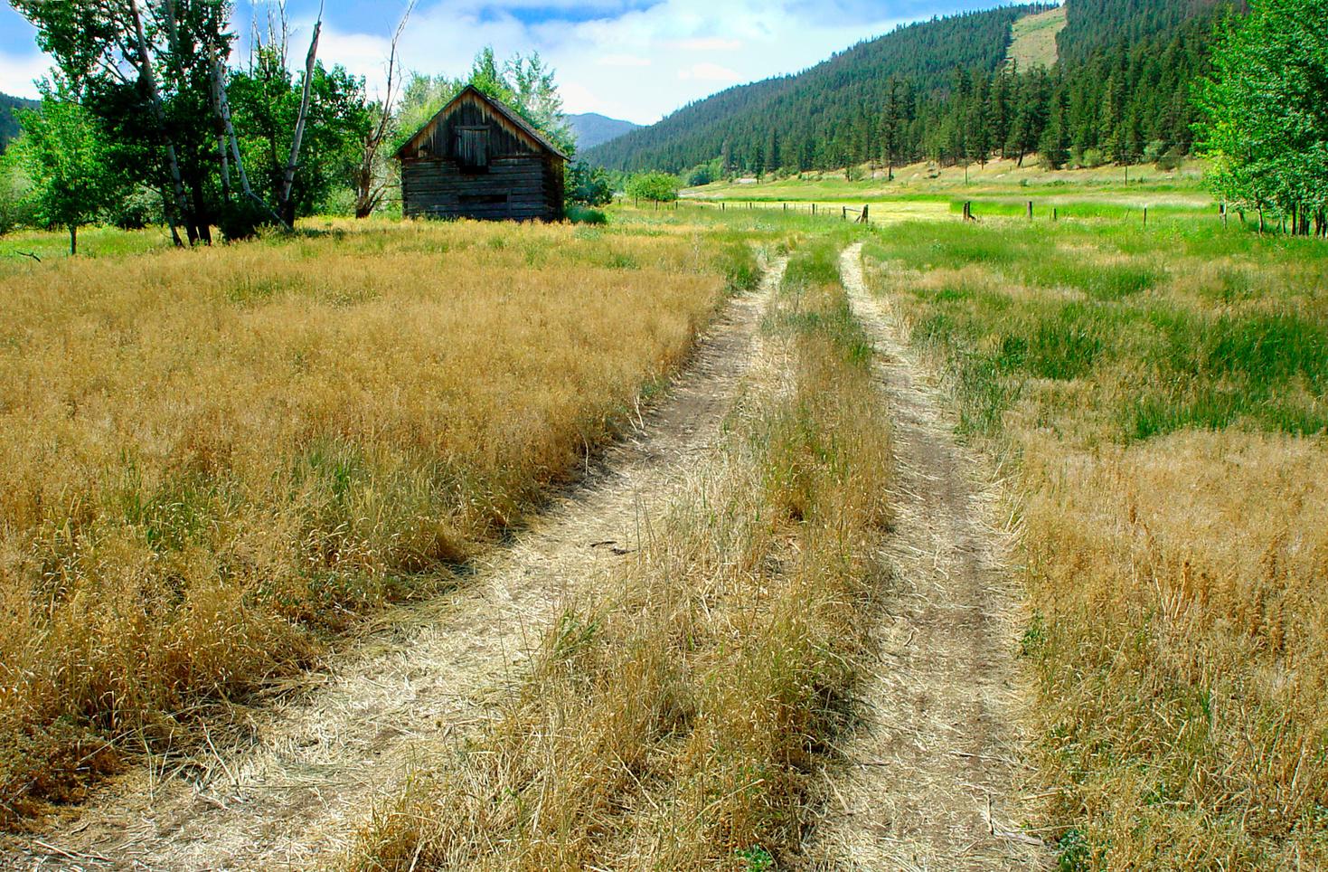
19 Letterboxing Clues: From the parking spot, look up the gully to a log.
Please check geocaching.com before you go! C r e d i t : T N F C
Henry Castillou Pioneers & Early Settlers
SITE IDENTIFICATION
Nearest Community: Merritt, B C
Geocache Location: N 49°54 931' W 120°54.745'
Altitude: 903m/2962ft
Ownership: Crown Land
Accuracy: 3 meters
Overall Difficulty: 1.5
Overall Terrain: 2
Access Information and Restrictions:
Follow the Coldwater Road from Merritt until you reach the Kane Valley Road to the left.
Parking Advice:
Park at the yellow sign right after the Kane Valley Road turn off from Coldwater Road.
For more information or to report a problem with this site please contact:
Gold Country Communities Society
P O Box 933 Cache Creek, B C V0K 1H0
Tel: 1-877-453-9467
Email: info@exploregoldcountry com
For more site pages go to: www exploregoldcountry com www geocaching com
Judge Henry Castillou, or 'The cowboy judge' as many knew him, was a pack train operator, a captain in the Royal Flying Corps, a lawyer, a Judge of the Supreme Court for the County of the Cariboo, and a one-time president of the B C Fish and Game Association An amateur anthropologist, he was also known as an expert on BC native tribes and their origins He was a big man, and he left a lasting legacy in the city of Merritt
APPLY STICKER HERE
Born May 25, 1896 in the Coldwater Valley, ten miles south of Merritt, to Joseph and Emma Castillou, Henry Castillou's early upbringing was among the pack train operators who had come from Spain, Chile, and Mexico to move supplies for the gold rush His father came from the French Pyrenees, the mountains dividing France and Spain By the time he was sixteen Henry had his own successful pack train which carried supplies to those in the gold fields and other remote areas Education was important and Henry attended highschool in New Westminster World War 1 interrupted Castillou's further education He enlisted, and eventually became a captain, in the Royal Flying corps After the war, he attended Temple Law School, graduating in 1923.
Castillou practiced law in Vancouver for a number of years where he successfully defended a number of people charged with murder, including several Indian trials In 1950 he was appointed County Court Judge for the Cariboo, and later became Judge of the Supreme Court for the County of the Cariboo During his career he was also a political and legal advisor to the North
195
#106 GC3PBEG Phase 2 C r e d i t : N i c o l a V a l l e y M u s e u m a n d A r c h i v e s
American Indian Brotherhood and represented B C native groups before the 1948 Indian Claims Commission
A hobby anthropologist and oral historian, he gathered one of the most extensive collections of native and prehistoric artifacts of the time.
In 1937 Castillou was appointed by Attorney General G.S. Wismer to go to China as a representative of the government. He was charged with the task of finding evidence in a drug ring case in which five Chinese immigrants were charged in a conspiracy to distribute opium in a case that extended from Vancouver to San Francisco and Hong Kong The case lasted 18 months and all five were found guilty While in China, Castillou was presented with a black silk dragon robe that is now displayed at the Nicola Museum and Archives The symbol of the dragon was supposed to be outlawed in China at the time and it has gold thread that were rumoured to have been dipped in real gold
Never removed from the western lifestyle, Castillou was the announcer at the very first annual rodeo in Merritt. His booming voice was so loud that he didn't require a microphone. That same weekend he was awarded the key to the city of Merritt. Castillou retired in 1960, and passed away in 1967 at the age of 71. He will always be remembered as one of B.C.'s first native rights lawyers, and as a man who embraced the cowboy lifestyle of his birth.
Written and Researched by Vesta Giles
BIBLIOGRAPHY & SOURCES
Nicola Valley Museum Archives Association, (no date). Judge Henry Castillou Exhibit and Collection. (brochure).
Nicola Valley Museum Archives Association, (no date). Misc. notes.
196 Letterboxing Clues: Walk uphill 40 m, under large overturned root.
Please check geocaching.com before you go!
Horseshoe Bend Trail
SITE IDENTIFICATION
Nearest Community: Lillooet, B C
Geocache Location: N 50°51 608' W 122°09.318'
Ownership: Crown Land
Accuracy: 4 meters
Overall Difficulty: 2.5
Overall Terrain: 3
Access Information and Restrictions:
From the Mile 0 Cairn go north 2 km and turn left on Hwy 40 and follow for 28 km approximately to Horseshoe Bend pull off Do not drive down old road
Beware of cliff edge Watch for falling rock Caution if with children and pets
Do not walk on upper rim of Horseshoe Bend
Parking Advice:
Between trees off the road at a natural view point
For more information or to report a problem with this site please contact: Gold Country Communities Society
P O Box 933 Cache Creek, B C V0K 1H0
Tel: 1-877-453-9467
Email: info@exploregoldcountry com
For more site pages go to: www exploregoldcountry com www geocaching com
Rails & Trails
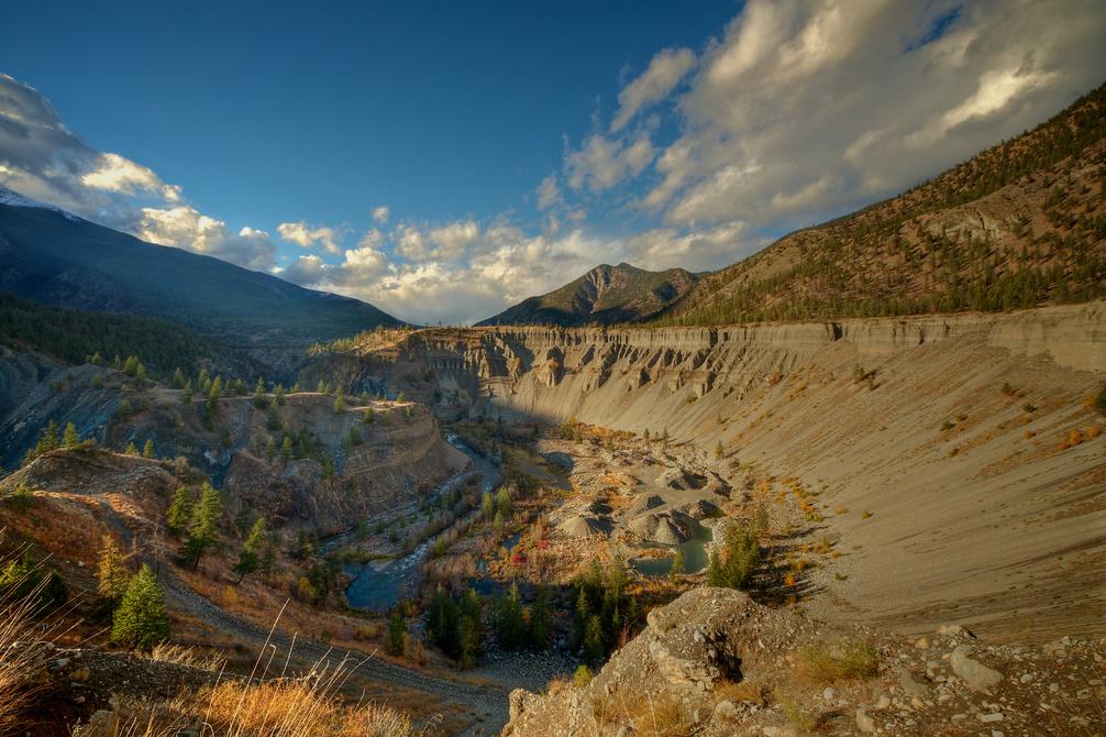
The Horseshoe Bend is located on Highway 40, along the Bridge River just south of the confluence of the Bridge and Yalakom Rivers. This is an interesting feature marked by a dramatic bend within the river. The canyon walls are laced with hoodoos and made up of deep sand and gravel deposits left behind by retreating glaciers. At first glance the Horseshoe Bend looks to be a marvel of geological forces, but it is a human made feature. This feature is sometimes called Horseshoe Wash; this helps describe the way in which the feature was created, through hydraulic mining for gold It is amazing that this is a mine Operations began here in the 1908 and continued off and on until relatively recent times Between 1908 and 1914 over a million dollars’ worth of gold was extracted from this area (using the historic gold value of $32 per ounce)
APPLY STICKER HERE
Hydraulic mining involves using high pressure jets of water that washes away sediment and rock. This creates slurry of rock, sediment and water which runs into sluice boxes to extract the gold. Hydraulic mining has been around a long time; there are examples of its practice in ancient Rome. Hydraulic mining is devastating to the riparian environment The heavy silt load that is washed into the river clogs fish gills and can ruin water quality It can also lead to the widening of waterways which can slow the flow of the water (and decrease the depth) significantly when the season is dry Hydraulic mining will never again be permitted in this area due to destruction of adjacent property and the degradation of fish habitat
The Bridge River (Xwisten in the St'át'imc language) which flows through Horseshoe bend empties into the Fraser River. It is at this confluence that the Bridge River Fishing rocks are located. This is the most important inland fishing site on the entire Fraser River. Salmon are still caught by the traditional means of using a dip-net; the fish are eaten fresh or air dried for later consumption Coho, Chinook (locally called ‘Springs’), Steelhead and Sockeye Salmon travel up the Bridge river to spawn yearly Above the
197
#107 GC3QN7Z Phase 2
confluence on the Bridge and Yalakom rivers is the Bridge River Canyon This is a spectacular, but little know canyon that divides the Shulaps Range and Mission Ridge Further along is the Terzaghi Dam named for the civil engineer, Karl von Terzaghi, who founded the science of soil mechanic. The dam retains Carpenter Lake Reservoir, a large body of water that extends 50 km along the upper Bridge River Valley to the community of Gold Bridge.
The land at the river bottom of Horseshoe bend can offer excellent pockets of riparian habitat Animals of note include bald eagles and beavers The bench lands immediately surrounding Horseshoe Bend can be very hot and dry in the summer months Ponderosa Pine (Pinus ponderosa), Douglas fir (Pseudotsuga menziesii) are the dominant trees Drought tolerant shrubs are also very common, including: Saskatoon Berry (Amelanchier alnifolia), Common Rabbit- Brush (Chrysothamnus nauseosus), and Big Sagebrush (Artemisia tridentata) Rabbit-Brush is heavily browsed by mule deer that can often be seen along highway 40 when heading to Horseshoe Bend Rabbit-Brush displays yellow flowers in the late summer This shrub was used by the St’at’imc people as an infusion to relieve sore throats.
Detailed Access Information:
The rim of Horseshoe bend is dangerous and one should take care not to get too close. Park at the south end of the canyon and descend along an old road to the river, any other location to ascend is too hazardous Beware of deer when you are driving to this spot, deer are often along Hwy 40
Written and Researched by Wayne
Robinson
BIBLIOGRAPHY & SOURCES
“BC Ministry of Environment: Ecology, Part 2 – Ecoregion Unit Descriptions” (Web) 2012. http:// www env gov bc ca/ecology/ecoregions/dryeco html
“Wikipedia: Carpenter Lake” (Web) 2012 http://en wikipedia org/wiki/Carpenter Lake
“Moha, Yalakom, Camoo and Applesprings”, (Web), 2012 http://www cayoosh net/moha html
“The Bridge River Canyon”, (Web), 2012 http://www cayoosh net/canyon html
“Wikipedia: Hydraulic Mining” (Web) 2012 http://en wikipedia org/wiki/Hydraulic mining
“Wikipedia: Terzaghi Dam” (Web) 2012 http://en wikipedia org/wiki/Terzaghi Dam
“Wikipedia: Bridge River” (Web) 2012 http://en wikipedia org/wiki/Bridge River Please check
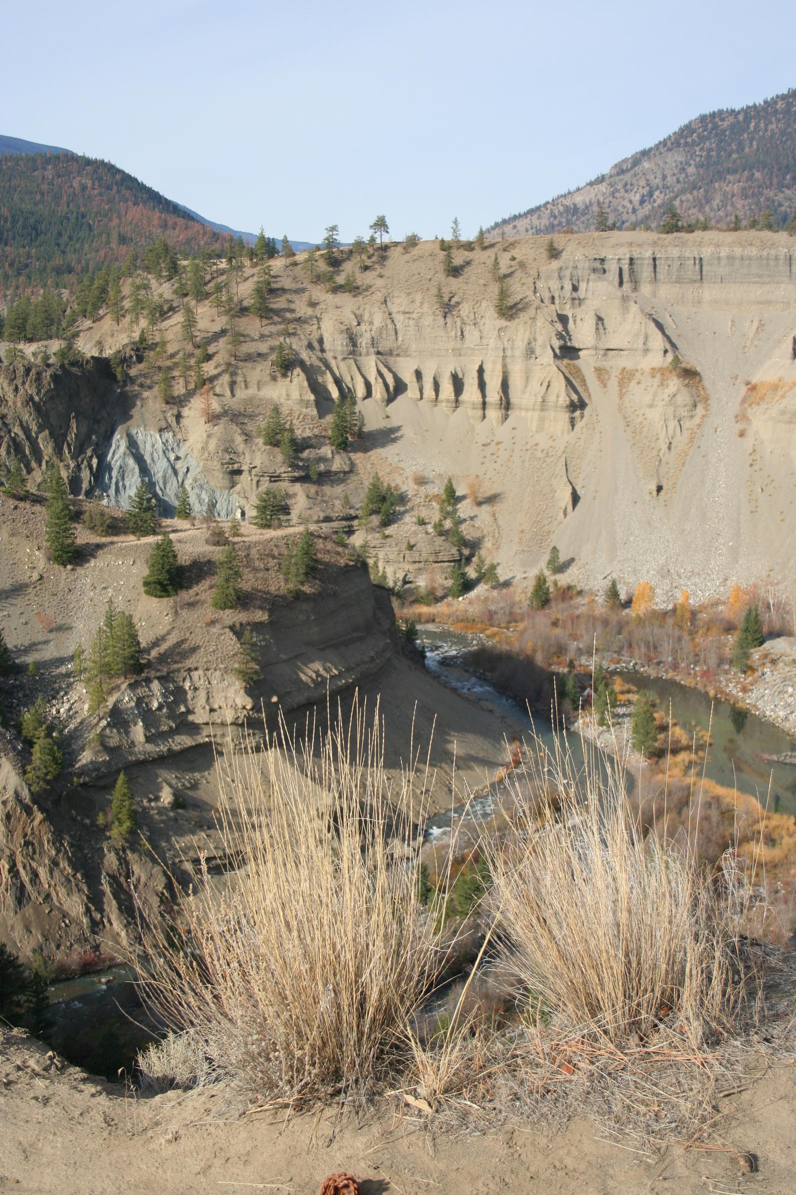
Letterboxing Clues:
Descend via old road to the West of the viewpoint Follow the road down to the bottom Follow the path across the waterway to the 2 large mounds of gravel. Cache hidden in rocks above rim of normally empty built up pond on the left.
19
geocaching.com
C r e d i t : W a y n e R o b i n s o n
before you go!
Pioneers & Early Settlers
James Teit
SITE IDENTIFICATION
Nearest Community: Merritt, B C
Geocache Location:
N 50°08 978' W 121°01.142'
Altitude:
536m/1758ft
Ownership: Crown Land
Accuracy: 3 meters
Overall Difficulty: 1.5
Overall Terrain: 2
Access Information and Restrictions:
From Merritt City Centre follow Hwy 8 West towards Spences Bridge for 18.8 km approx. until you arrive at Petit Creek Rd area. Look for an unmarked small dirt road on the right hand side and pull off to the side of the dirt road. Do not block road.
For more information or to report a problem with this site please contact: Gold Country Communities Society
P O Box 933 Cache Creek, B C V0K 1H0
Tel: 1-877-453-9467
Email: info@exploregoldcountry com
For more site pages go to: www exploregoldcountry com www geocaching com
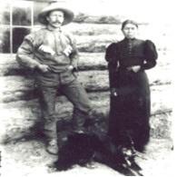
James Alexander Teit was a highly regarded anthropologist who gained his knowledge through living among, and working with the people he was studying Teit played a crucial role in our modern understanding of native cultures and their traditions and languages. A gifted linguist, Teit was fluent in English, French, Danish, and a host of native languages and dialects from across British Columbia. He was also a socialist and a powerful crusader for native rights.
APPLY STICKER HERE
Born on Scotland's Shetland Island in 1864, Teit came to Canada to work with his uncle at his store in Spences Bridge He changed the spelling of his name from the original Tait to better reflect the original spelling used by his Danish ancestors Within a few years he had met and married Lucy Antko, a local Nlaka'pamux woman from a nearby village Living with Lucy immersed Teit in the Nlaka'pamux language, culture and traditions.
In 1894, Teit met legendary anthropologist Franz Boas who was visiting British Columbia on an ethnographic field trip As a result, Teit and Boas worked together for the rest of Teit's life, and Teit was invited to participate in the Jesup North Pacific Expedition between 1897 and 1902 A program
199
#108 GC3PBD4
Phase 2 C r e d i t : N i c o l a V a l l e y M u s e u m a n d A r c h i v e s
of the American Museum of Natural History, the expedition's goal was to create an ethnological and archaeological overview of connections between indigenous people of the Pacific Rim and northeastern Asia
Some believe it was Teit's ethnographic efforts that made the project such a success. He documented not only the worlds of men, as many anthropologists did, but also the plight of women in great detail. Native elders expressed their thanks for his efforts to record the culture and traditions of their people. On March 2, 1899, in the middle of the project, however, Teit's wife Lucy died of tuberculosis. Later, Teit married Leonie Morens Morens, whose family ran Morens farm near Spences Bridge, was 17 years younger than Teit The couple moved in with Leonie's widowed mother on the farm Through the years they had 6 children together Teit continued working for Boas in the early 1900's, gathering artifacts, myths, and ethnographic data from the native people of the area Trusted and respected by aboriginal people and leaders from across the province, Teit's fluency in the native languages and his understanding and passion for the people led to his being asked to join the board of the Allied Indian Tribes of British Columbia which was formed in June, 1916 He wrote letters, positioning statements, and reports, and lobbied heavily for aboriginal rights.
At the height of his lobbying efforts, Teit died of bowel cancer in Merritt on October 30, 1922, at the age of 58. His passing was a great loss to both the aboriginal people and the anthropology community He was remembered as a prolific author, and a man who was passionate for people and human rights The Merritt museum has one of the most extensive collections of Teit items in existence
One of Teit’s sons was on the board when the museum opened.
Written and Researched by Vesta Giles
BIBLIOGRAPHY & SOURCES
Campbell, P. (1994). "Not as a white man, not as a sojourner: James A. Teit and the fight for native rights in British Columbia, 1884 – 1922", Left History. Web. 5 Jun. 2012. Wikipedia contributors. "James Teit." Wikipedia, The Free Encyclopedia. Wikipedia, The Free Encyclopedia, 23 Sep. 2011. Web. 5 Jun. 2012
Wickwire, W. (2000). "Teit, James Alexander." Dictionary of Canadian Biography online. Web. 5 Jun. 2012.
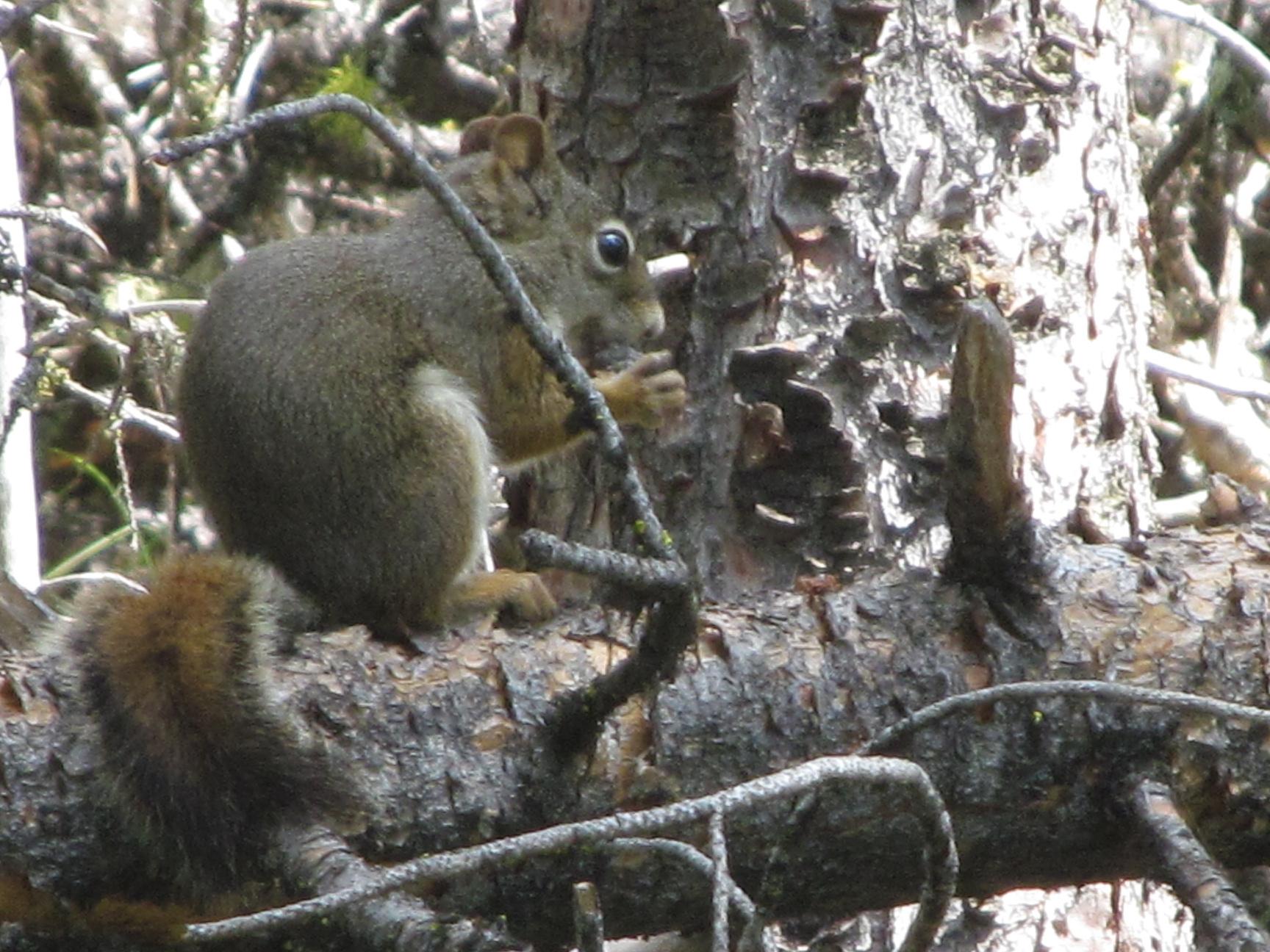
Letterboxing Clues: Climb hill, cache is under sage plant roughly 20m from corner, parallel to Hwy 8.
20
Please check geocaching.com before you go!
Pioneers & Early Settlers
Jesus Garcia
SITE IDENTIFICATION
Nearest Community: Merritt, B C
Geocache Location:
N 50°06 435' W 120°47.164'
Ownership: City of Merritt
Accuracy: 3 meters
Overall Difficulty: 1 5
Overall Terrain: 1 5
Access Information and Restrictions:
From the Nicola Hwy/97C turn right onto Blair, and right onto Coldwater Avenue and then turn right onto Tutill Court
Parking Advice:
Park in parking lot of the Nicola Valley Museum
For more information or to report a problem with this site please contact: Gold Country Communities Society
P O Box 933 Cache Creek, B C V0K 1H0 Tel: 1-877-453-9467
Email: info@exploregoldcountry com
For more site pages go to: www exploregoldcountry com www geocaching com
APPLY STICKER HERE
Born in Sonora, Mexico, in 1832, Jesus Garcia left his home at the age of 13 to pursue his fortune in California, which at the time was still part of the Republic of Mexico. He looked up a friend from home, Blais Leon, and hired him to help in his Packing work Hardworking and with a mind for business, Garcia expertly worked pack trains with up to 20 heavilyladen mules as they carried silver ore to smelters As rumours swirled of a gold rush in Canada, Garcia and Leon, as well as a number of other Spanish-speaking men from Mexico and Europe made their way north Garcia and the other packers, including the legendary Cataline, helped form the transportation system that made the gold rush possible.
Arriving in Yale, Garcia met Raphael Carranzo, a 50-year-old muleskinner who immediately hired the younger Garcia and sent him off on his first packing trip in the Cariboo a few days later Within two years, the hardworking Garcia had saved enough money to buy half of Carranzo's mule train to go into business for himself
Each fall, the packers needed to find a location to live and graze their animals during the winter. Garcia and the other Mexican packers determined that the Nicola Valley met their needs perfectly and their presence in the area played a critical part in the booming history of the area. Unlike local Indians, 201
#109 GC3PBDR Phase 2 C r e d i t : N i c o l a V a l l e y M u s e u m a n d A r c h i v e s
the Spanish-speaking packers were afforded all the rights of citizenship although they were counted as separate from the white majority, Indians, or Orientals for census purposes A devout Catholic, Garcia married a local Indian woman, Kroventko, daughter of Humsinna, a chief at Spuzzum. After marrying Garcia she became known by her English name – Mary. Garcia sold his packing outfit in Yale in 1871, deciding to focus on ranching instead. He moved his family to the Forks, which is now known as Merritt.
He pre-empted Lot 123, a very large parcel of land, which includes the area now containing Granite, Quilchena, and Coutlie Avenues, and Garcia, Charters and Blair Streets in its very centre The discovery of coal and the possibility of a rail line coming into the area led Garcia, and other local businessmen John Charters and William Henry Voght, to band together and have the future town site surveyed out of portions of their lots Aside from packing and ranching, Garcia was involved in a number of coal deals over a 20-year period leading to the disposal of his rights to the Diamond Vale Coal Company in 1905. Jesus and Mary had 14 children, although only 5 were alive at the time of his death in 1916. It is not clear how many survived infancy. Throughout their lives both Jesus and Mary had given land, money, and other donations to the Catholic Church. Still, when he died, Garcia left an estate worth over $100,000, including several thousand acres of land from as far away as Aspen Grove and Mamit Lake.
Written
and Researched by
Vesta Giles
Please check geocaching.com before you go!
BIBLIOGRAPHY
& SOURCES
Nicola Valley Archives Association, (1984). Nicola Valley Historical Quarterly: "the Garcia story." Vol 6 - No. 4, May, 1984.
Letterboxing Clues:
From the front door of the museum walk to the left to the side of the building. Look along the fence line. Blends with landscape.
202
Joseph Burr
SITE IDENTIFICATION
Nearest Community:
Logan Lake, B C
Geocache Location:
N 50°34 869'
W 121°04.848'
Ownership:
Crown Land
Accuracy:
3 meters
Overall Difficulty: 3 5
Overall Terrain: 3 5
Access Information and Restrictions:
Follow Highway 97C. Turn onto Cinder Hill Road which is between Ashcroft and Logan Lake (26 km approx. from Info Centre in Logan Lake to Cinder Hill turn off) From turn off to cache site is approx 4 km Follow Cinder Hill Road for 2 km and take 2nd left Follow road for 2 km and stay right Park at the top of the hill at wide pull off Walk back down hill approx 105m from parking 4x4 recommended Be prepared for hiking around marsh type surroundings
Parking Advice:
N 50°34.892' W 121°04.792'
For more information or to report a problem with this site please contact: Gold Country Communities Society
P O Box 933 Cache Creek, B C V0K 1H0 Tel: 1-877-453-9467
Email: info@exploregoldcountry com
For more site pages go to: www exploregoldcountry com www geocaching com
APPLY STICKER HERE
Pioneers & Early Settlers
How is this Gold Country mountain distantly connected with a famed actor who portrayed a lawyer and an iron sided police chief?
High above and northwest of the District of Logan Lake, there is a mountain with a golden view of local mining history A flat summit in the northwesternmost region of the Thompson Plateau, Glossy at its highest point is 1,936 metres above sea level The mountain proper and its surroundings are of the late Triassic and early Jurassic period This Triassic Nicola volcanic rock is of the Guichon batholith, with Miocene basalt. The batholith is a great irregular mass of coarse-grained igneous rock more than one hundred kilometers square. It is one of the most studied intrusions of country rock in the Canadian Cordillera. Rich in copper and molybdenum, it is the principal copper reserve for British Columbia.
This Guichon batholith is composed mainly of granodiorite, quartz diorite and diorite Granodiorite of uniform composition is the chief rock type The mafic minerals within the rock are biotite, hornblende and minor chlorite. Trace minerals of molybdenite and chalcopyrite can be found disseminated in the biotite granodiorite.
Much of the area is covered by till, an unconsolidated sediment containing all sizes of rock fragments from clay to boulders This sediment with the great boulders was deposited by alpine glacial action These massive dullgreen-black rocks are basaltic andesite
The history of the Guichon batholith and the Glossy occurrence, in terms of mining, goes back to the turn of the twentieth century.
203
#110 GC3P97H Phase 2
Two families of Burrs, brothers from Ireland arrived at the BC coast at the time of the Gold Rush in 1859 One family settled in New Westminster and one in Yale Joseph W Burr’s family settled at Yale where young Joe took up saddlery as a trade. He moved to Spences Bridge in 1880 and opened up a saddle, and harness shop. A few years later he succeeded Mike Curnow as Provincial police in charge of the Yale district; one of Joe’s first jobs was to transfer the McLean brothers to New Westminster for trial.
In 1904, it was Joseph W Burr, now of Ashcroft, Government Agent, Assessor and Chief Constable who first staked claims in the Glossy area The property saw little successful activity until 1915, when a 30 metre shaft produced twenty tons of ore The ore was shipped to a Tacoma smelter where it was assayed at nearly 13% copper, with evidence of silver and a hit on gold
By the end of 1915 a significant mining camp had emerged and “Glossie City” was an active mining community. However, it would not live long. By 1916 activity was diminishing and by 1920 there was very little if any, exploration done around the Glossy. No further exploration would be seen until after the late 1940’s.
Sixty years after policeman Joe roamed the surrounding country with his deputies, another Burr descendant was solving crimes on the big screen In the 1950’s Raymond Burr of the New Westminster Burrs became known as super sleuth Perry Mason, and later in the 1960’s until1975 took on the character of Ironsides’ a wheelchair bound lawyer
As you explore the Glossy area you are travelling back to a geological time when the mountains and valleys of the Canadian Cordellera were formed and created the Guichon batholith and the prolific copper reserve that extends south throughout the Highland Valley.
Written and Researched by Kathy Paulos
BIBLIOGRAPHY & SOURCES
Alrae Engineering Ltd , Department of Mining and Petroleum Assessment Report,Vancouver, 1969 & 1986 Ministry of Energy, Mines, and Petroleum Resources, Minfile No 092INW011, www empr gov bc ca, Province of British Columbia
Oliver Geoscience International Ltd, Report on Geology of the North Valley and Glossie Mineral Occurrences, Geological Survey Assessment Report, Kamloops, 2001
Ireland Genealogy Projects, www rootsweb ancestry com Press & Siever Earth, W H Freeman & Co , 4th Edition 1986
Letterboxing Clues:
You will see a cabin near cache site. Walk down slope and go east 51m approx. Cache is hidden by rocks with a view of the cabin.
204
Please check geocaching.com before you go!
The Journal and Ashcroft Museum Pioneers & Early Settlers
SITE IDENTIFICATION
Nearest Community: Ashcroft, B C
Geocache Location: N 50°43 381' W 121°16.831'
Date Established: 1895
Ownership:
Private Property
Accuracy: 2 meters
Overall Difficulty: 1
Overall Terrain: 1
Access Information and Restrictions: In between The Journal and Museum. High visibility area, use stealth. Year round access.
Parking Advice: Street parking on 4th Street, or Brink Street
For more information or to report a problem with this site please contact:
Gold Country Communities Society
P O Box 933 Cache Creek, B C V0K 1H0
Tel: 1-877-453-9467
Email: info@exploregoldcountry com
For more site pages go to: www exploregoldcountry com www geocaching com
These two buildings which sit side by side are quite different; one is a large brick box like building, the other a less imposing stucco building with Spanish like front. The smaller building is a decade older than the brick, yet the history of the two buildings share similar stories… Built in 1898 the small stucco building became home to the B.C. Mining Journal. It relocated to this site from Railway Avenue where it had been in production since 1895.
“The MINING JOURNAL force are now pleasantly located in their new office The rooms are commodious and well located If anyone wishes to pay up their subscription we are easily found”
A yearly subscription at that time cost $2.00. Early headlines of the Journal detailed mostly mining news, although it did carry other items of interest from Lillooet to Barkerville as well as town events Owner/editor FS Reynolds and partner A H S Sroufe who created the Journal carried on in the new building until 1902 Mr J E Knight became its next owner, followed by D W Rowland’s in 1908
In 1912 R D Cumming sold his general store and purchased the Journal The Cumming family owned and operated the paper until 1978, a span of 66 years, which included four generations RD was not only an editor he was a photographer, writer, historian, and a collector. By the mid 1930’s Cumming had gathered enough artifacts to set up a display in the loft above the Journal office. This display would be the cornerstone for the future museum.
APPLY STICKER HERE
Like the Cumming name is synonymous with the Journal it is the Richards family that is tantamount with the Dominion building When the brand new government structure was erected on the corner next to the Journal in 1917 it housed the Post Office, Telegraph Office, telephone office and customs office It was here that various members of the Richards family would settle for the next 60 plus years Thomas John Richards was the first Post Master in the new building and his service lasted until 1949.
T.J’s children Marjory, Gwen, and Leonard would all see
205
#112 GC3NXC7 Phase 2
service within these walls Dick Richards a grandson of T J’s was assistant Post Master in 1978 when the Post Office moved to its new location
The stucco building is still the home of the Journal, now owned by Black Press; it was their first purchase on what would become a chain of newspapers. The upstairs which once housed the museum is unsafe and the outside stairs have been removed. The original little black vault sits in the corner, too heavy to be moved. The Dominion building was bricked over in 1938, and renovated in 1957 It was acquired by the Village in 1980, and in 1982 after extensive renovations it became home to the Ashcroft Museum Mr Cummings early collection of artifacts is a stone throw away from their original home The building today is full of artifacts, stories, and photos donated by the Cummings, Richards and other Ashcroft pioneer families
In 1984 the Ashcroft Museum received an award of Merit from the BC Museums Association-for exhibits as designed by Bob Graham, which combine wit, humour, imagination and good taste.
Detailed Access Information:
A Multi-Cache ("multiple") involves two or more locations The final location is a physical container Go to the first set of coordinates listed above To write your own Journal, you must find out what year R D Cumming purchased the Journal 2 out of the 4 numbers must be placed in the following coordinates: N 50°43 4 6' W 121°16 77 ' Once you complete this it will take you to a local character that was in the Journal once or twice This will be the location of the cache
Written and Researched by Kathy Paulos
BIBLIOGRAPHY & SOURCES
(1898) Ashcroft mining Journal; Ashcroft Museum Archives
Cumming, L W First post office here in 1863, Journal Centennial Supplement 1986 March 26, 1970 Many Turn Out for Gwen Richards Testimonial; Ashcroft Journal
Letterboxing Clues:
Blends into the ground area Remember it is not at the Journal Located in a small green space named after a local character. Extra hint for the missing coordinate numbers (2,1).
206
Please check geocaching.com before you go!
Kane Valley Ski Trail
SITE IDENTIFICATION
Nearest Community: Merritt, B C
Geocache Location: N 49°58 053' W 120°42.426'
Altitude: 1118m/3667ft
Ownership: Provincial Park
Accuracy: 3 meters
Overall Difficulty: 1.5
Overall Terrain: 1.5
Access Information and Restrictions:
From Merritt, travel south along Hwy 97C towards Kelowna. Watch for "Kane Valley Ski Trails" highway signs. Exit highway onto Kane Valley Road 18 km south of Merritt.
For more information or to report a problem with this site please contact:
Gold Country Communities Society
P O Box 933 Cache Creek, B C V0K 1H0
Tel: 1-877-453-9467
Email: info@exploregoldcountry com
For more site pages go to: www exploregoldcountry com www geocaching com
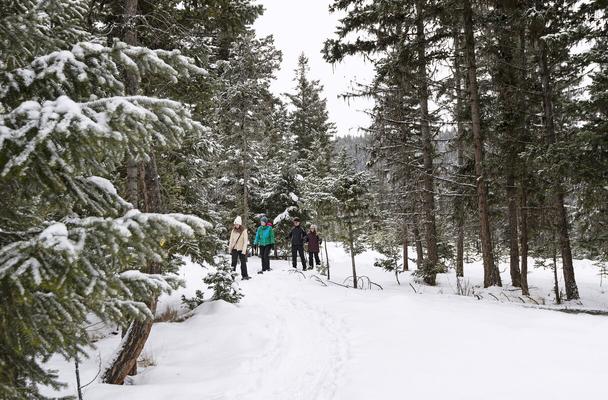
Located on the Thompson Plateau, the Kane Valley features picturesque rolling hills, Ponderosa and Lodgepole pine, Douglas fir, Engelman spruce, grassy meadows and plenty of opportunities to get out and enjoy nature in every season.
Historic ranches and logging operations share this vast space with cross country skiers, hikers, mountain bikers, and nature lovers Actively ranched since the 1890's, the area was once home to John Smith, who settled in the area with his wife in the 1880's before later moving to Spences Bridge She documented the hardships and details of their lives as homesteaders in “Widow Smith of Spence's Bridge” (Sonotek Publishing, 1989). An old log house that is believed to have been theirs can still be seen in a field about 8 km north from the junction between the Coldwater Road and the Kane Valley Road. With a microclimate that is perfectly suited to cross country skiing (dry snow, about 1-1.5 m deep, temperatures between 0 C and -15 C), the Kane Valley is home to the Nicola Nordic Ski Club, who have been operating the trails, which now extend 50 km, since 1991. In keeping with the rich natural beauty of the area, the club's vision is to "maintain a wilderness experience where skiers can enjoy nature in peace and tranquility "
APPLY STICKER HERE
As the snow disappears, hikers, mountain bikers, birdwatchers and naturalists descend on the area searching for their own wilderness experiences. Just south of the ski trails lies Harmon Lake, which is a favourite destination for people seeking easy access to outdoor activities. Located on the southeast side of the lake, within easy walking distance from camping spots at Harmon Lake West, Harmon Lake East, and Kane Lake, is a 2.7 km interpretive trail that is suitable for most ages and skill levels and can even be easily accessed on snowshoes Interpretive signs highlight the natural beauty of the area, explaining how the forest works and how all the elements that make up a forest interact The trail winds around the small Secret Lake hidden south of Harmon Lake
207
Rails
& Trails
#114 GC3PBDY Phase 2
before winding back to the starting point
The Nicola Valley Naturalists, who make regular visits to the interpretive area, routinely report seeing mountain bluebirds, rednapped sapsuckers, ring-necked ducks, western terrestrial garter snakes, and the Pacific chorus frog (formerly called the Pacific tree frog) in the area. Plant life also abounds with the sagebrush buttercup, fairyslipper orchids, and the arrowroot balsamroot (sometimes referred to as a sunflower) catching the eye at every turn Whatever the season, the Kane Valley offers visitors an abundance of opportunities to play and enjoy the natural world around us
Written and Researched by Vesta Giles
Please check geocaching.com before you go!
BIBLIOGRAPHY & SOURCES
BC Adventure Network, (2012). Harmon Lake, British Columbia. Web. 15 Jun. 2012. Burger, Alan. Email interview. 18 Jun. 2012. Nicola Nordic Ski Club. Web. 15 Jun. 2012. Recreation sites and trails BC, Harmon Lake Forest Interpretive Trail (Merritt). Web. 15 Jun. 2012. Shewchuk, Murphy. (2007). Coquihalla trips and trails. Fitzhenry and Whiteside, Markham,On.
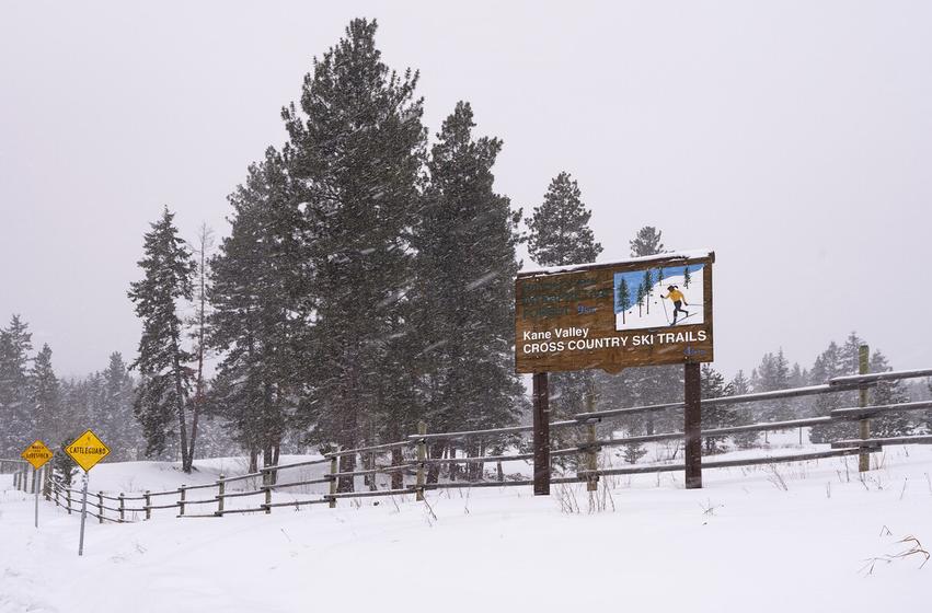
Letterboxing Clues: At Harmon Lake Recreation Site, on the Southern end of the campsite, 27m South from picnic table 36. Cache is located in end of log.
208
Kentucky – Alleyne Provincial Park Rails & Trails
SITE IDENTIFICATION
Nearest Community: Merritt, B C
Geocache Location: N 49°54 330' W 120°34.039'
Altitude: 1024m/3359ft
Ownership: Provincial Park
Accuracy: 3 meters
Overall Difficulty: 1.5
Overall Terrain: 3
Access Information and Restrictions: Take Hwy 5 A, Merritt-Princeton to Bates Road. Follow Provincial Park signs. Approximately 39 km from Merritt, B.C.
Parking Advice: Park in designated spaces.
For more information or to report a problem with this site please contact:
Gold Country Communities Society
P O Box 933 Cache Creek, B C V0K 1H0
Tel: 1-877-453-9467
Email: info@exploregoldcountry com
For more site pages go to: www exploregoldcountry com www geocaching com
The bright turquoise lakes of Kentucky Alleyne Provincial Park are situated deep in the cattle country off the Princeton-Kamloops Highway (5A) south of Merritt near Aspen Grove. The park, which was established on March 5, 1981, features several kettle lakes, gentle rolling grasslands, and open forests of large Douglas fir and Ponderosa pine. Once the secret of locals, this 144-hectare park has become a very popular area for fishing, and for those wanting to get closer to nature thanks to easier access to the southern interior once the Coquihalla Highway and the Highway 97C Connector to the Okanagan were built
Surrounded by land owned by the historic Douglas Lake Ranch, the largest ranch in Canada with a rich and colourful history spanning back to the 1880's, Kentucky-Alleyne Provincial Park, is known for its outstanding wildlife viewing opportunities, particularly from the well-marked 4 km walking trail that circles Kentucky Lake. The trail, which starts near the campground on the northeast side of the lake, is an easy hike with few elevation changes. The Nicola Naturalist Society makes regular visits to the area to record and observe the plant and wildlife activity in the area
Alleyne Lake, the larger of the two, sits in an ecological transition zone between the drier grasslands above, located on the northern and eastern slopes, and the lush pine forests on the south and west edges of the lake.
APPLY STICKER HERE
Birdwatching is a popular activity on the trail and there are plenty of species to see Waterfowl such as mallards, teal, grebe, and goldeneye are plentiful, attracted to the marshy edges of the lakes and ponds Hawks and falcons can be seen above the grasslands, and the blue-listed sharptail grouse, whose population is declining across North America, is known to frequent the area as well Down on the ground jack rabbits, ground squirrels and deer are often seen around the lakeshore or among the aspens.
209
#115 GC3PBE6 Phase 2
The small lakes in the area are known to be breeding sites for the Western toad In the summer it is not uncommon to see thousands of black tadpoles and, later, emerging toadlets, around the shores of the lakes The lakes in the park, including Kentucky Lake, Alleyne Lake, and smaller lakes and ponds, are also very popular for fishing. The larger lakes are stocked with rainbow trout and the area even features a 'children only' fishery, designed to inspire enthusiasm for fishing among teens and younger children. These ponds, located between Kentucky and Alleyne Lakes, are open only to those under the age of 16
Written and
Researched
by Vesta Giles
BIBLIOGRAPHY & SOURCES
BC Parks, (2011) Kentucky Alleyne Provincial Park Web 20 Jun 2012
Burger, Alan Email interview 18 Jun 2012
Douglas Lake Ranch, (2008) History Web 20 Jun 2012
Nicola Valley Museum Archives Association (no date) Notes
Shewchuk, Murphy, (2007) Coquihalla trips and trails Fitzhenry and Whiteside, Markham, On
210
Letterboxing Clues: From boat launch parking area 124m uphill, cache is located in small clearing under stump
Please check geocaching.com before you go!
Logan Lake Shovel
SITE IDENTIFICATION
Nearest Community: Logan Lake, B C
Geocache Location: N 50°29 512' W 120°48.537'
Altitude: 1106m/3628ft
Ownership: District of Logan Lake
Accuracy: 3 meters
Overall Difficulty: 1.5
Overall Terrain: 1
Access Information and Restrictions: Public area, open year round Located within the District of Logan Lake.
Parking Advice: Park at the Info Centre
For more information or to report a problem with this site please contact:
Gold Country Communities Society
P O Box 933 Cache Creek, B C V0K 1H0
Tel: 1-877-453-9467
Email: info@exploregoldcountry com
For more site pages go to: www exploregoldcountry com www geocaching com
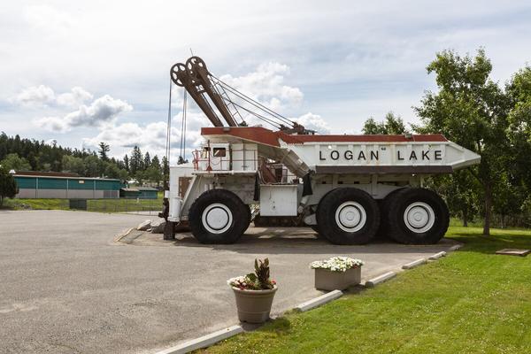
At the hub of Logan Lake's active recreation lifestyle sits a monument to its history and economic livelihood. The shovel, as locals refer to it, is a 195B Bucyrus Erie mining shovel with a 13metre bucket, parked next to a 235 ton ore haulage truck. It's pretty hard to miss!
Located in the parking lot for the recreation centre, this monument doubles as the visitor information centre, and offers kids, and kids at heart, the chance to get an up close look at machinery that was designed to move massive amounts of rock in the mining industry Venture up the stairs and you'll learn about all that the Logan Lake area has to offer visitor and guests. It's hard to resist the temptation to keep climbing and sit in the cab and imagine operating this massive machine. For any child, or adult, who has owned a toy truck, visiting the shovel is the ultimate thrill.
The shovel and the Wabco # 50 truck were a gift to the District of Logan Lake by the Highland Valley Copper Mine in February 1990 They were placed on the site on February 2nd of that year and have been a popular tourist attraction, as well as the local visitor centre, ever since
The stairs on the shovel take visitors to what was once the operator's cab. Below, on the landing, a door leads to a 3 meter (10 ft) by 3.7 meter (12 ft) room that was once the engine and winch room. Now it functions as the visitor information centre
The shovel can easily be seen as visitors drive into town from either Ashcroft or the Coquihalla Highway It sits in the heart 211 APPLY STICKER HERE
Standing approximately 6 1 meters (19 ft 11 in) tall, the shovel is 7 3 meters (24 ft 1 in) wide, and 16.5 meters (54 ft 3 in) long. It weighs 187.3 short tons (374,600 pounds) and is made of steel. When it was operational, the shovel boasted an impressive 2500 horsepower GM Electromotive engine. The total payload capacity of the truck was 235 short tons (470,000 pounds).
Geological & Views
#116 GC3PCKG Phase 2
of Logan Lake's recreation area where visitors and locals enjoy fishing, camping, golf, walking around the lake, mountain biking, hiking, and crosscountry skiing Archery and a world-class disc golf course are also nearby, and the area is dotted with fun and interesting geocaches. The western pond hockey championships and the annual polar carnival take place every January when the frozen lake is groomed for multiple pond hockey rinks and a skating loop. Hockey players and curlers from other communities regularly descend on the recreation centre for tournaments and bonspiels as well.
Each year nearly 6,500 visitors learn about all of these opportunities for fun and recreation when they visit the helpful staff at the shovel Of course, they can get their picture taken while sitting at the controls in the cab!
Written and Researched by Vesta
Giles
Please check geocaching.com before you go!
BIBLIOGRAPHY & SOURCES
District of Logan Lake. Web. 10 Jun. 2012. Molyneux, Berniece. Personal interview. 15 Jun. 2012.
Letterboxing Clues: Beside the Recreation Centre, in the picnic area. Near a stump.
212
Loon Lake
SITE IDENTIFICATION
Nearest Community: Clinton, B C
Geocache Location: N 51°06 627' W 121°14.749'
Ownership: Crown Land
Accuracy: 2 meters
Overall Difficulty: 1.5
Overall Terrain: 1 5
Access Information and Restrictions: 45 kms from Clinton to site From Highway 97 turn onto Loon Lake Road and follow for 26 km to pull out
Parking Advice: Park at pull out
For more information or to report a problem with this site please contact: Gold Country Communities Society
P O Box 933 Cache Creek, B C V0K 1H0
Tel: 1-877-453-9467
Email: info@exploregoldcountry com
For more site pages go to: www exploregoldcountry com www geocaching com
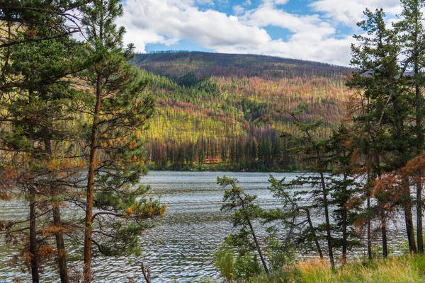
From Secwepmec hunters to fur traders and gold seekers, Loon Lake, on the edge of the Bonaparte Plateau, has a rich history. Nestled in a pristine wilderness surrounded by ponderosa pines and Douglas fir, the lake is home to fighting rainbow trout. Fed by the brisk waters of Thunder and Loon creeks, as well as other streams, Loon Lake is nearly 65 metres deep and almost 12 kilometres long.
Long before recreational enthusiasts arrived in the region, the Secwepmec were forging trails for hunting and fishing And it was these trails that many fur traders followed However, it was Alexander Caulfield Anderson in the mid-1800s who saw the significance in joining trails and forging new ones to bring furs from Fort Alexandria to Fort Langley for the Hudson’s Bay Company. Anderson crossed and forged new trails through field and mountain and along rivers and lakes In doing so he enjoyed the stark beauty of following and creating trails through one of the most beautiful areas in the province The Bonaparte Plateau, named for the Secwepmec chief who admired Napoleon Bonaparte so much he adopted his name, is home to many lakes, streams and natural areas
To the east of Loon Lake lay the canyons and hoodoos of the Arrowstone Hills through which Anderson hiked, while a multitude of lakes lay more northerly. Beyond to the northeast, one can glimpse the mountains of Wells Grey Park. From the north 213 APPLY STICKER HERE
Heading north from Kamloops, Anderson trekked across the plateau continuing his journey through the rugged landscape, arriving at the north end of Loon Lake. It was here, camped on the shores of Loon Lake, that Anderson was witness to the rare beauty of a lake haunted by the bewitching sounds of the great northern loon At Loon Lake one can experience not only trekking part of the New Fur Brigade Trail, but a lake rich with waterfowl and the bounties of nature Loon Lake is developed only on the west side, leaving most of the surrounding area in serene wilderness
Geological & Views
#117 GC3P958
Phase 2
end of the lake the Fur Brigade Trail leaving Loon Lake travels further north traversing the hills and valleys to finally reach Green Lake and then onto Drowned Horse Lake
Not only rich with nature another lure attracting folks to Loon Lake is the excellent fishing. Avid fly fishers come from around the world to wrestle the mighty fighting rainbow trout. Naturally stocked, with several spawning creeks feeding the lake, the trout are plentiful.
Not only is Loon Lake a wonderful place to absorb the joys of summer, it offers lots of winter recreation Ice fishing is one of the favourite activities of outdoor enthusiasts and the lake is as busy in winter as it is the rest of the year. Skating is enjoyed under the bright clear moons of the season and the Winter Carnival is the highlight during the snowy frozen months.
From fur traders trekking the pristine landscape, to fishers fighting the great rainbow trout, Loon Lake is a lake to be discovered and enjoyed any time of year Loon Lake is a year-round recreational enthusiasts dream come true in the heart of Gold Country
Written and Researched by Angela Wynton
Please check geocaching.com before you go!
BIBLIOGRAPHY & SOURCES
Anderson, Nancy The Pathfinder A C Anderson’s Journeys in the West, Heritage House, Victoria 2011 www furtradefamilyhistory ca Nancy Anderson web page & blog Google – Loon Lake, BC
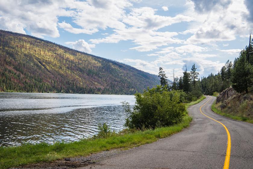
Letterboxing Clues: Behind cement barrier.
214
Maiden Creek Ranch Pioneers & Early Settlers
SITE IDENTIFICATION
Nearest Community: Clinton, B C
Geocache Location:
N 50°58.767' W 121°30 063'
Altitude: 699m/2293ft
Ownership: Private Property
Date Established: 1862
Accuracy: 1 meter
Overall Difficulty: 1.5
Overall Terrain: 1.5
Access Information and Restrictions: 15 km from Clinton on Hwy 97 From Cache Creek it is 22 km on Hwy 97 Look for Maiden Creek Ranch Sign on the side of the Hwy
Parking Advice: Pullout by cattle guard – Do not block
For more information or to report a problem with this site please contact: Gold Country Communities Society
P O Box 933 Cache Creek, B C V0K 1H0 Tel: 1-877-453-9467
Email: info@exploregoldcountry com
For more site pages go to: www exploregoldcountry com www geocaching com
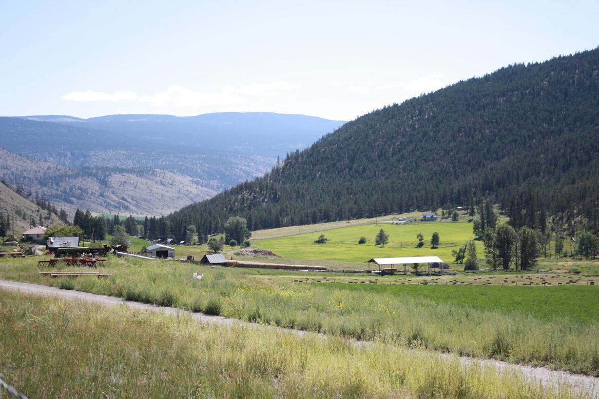
There are several stories as to how Maiden Creek, between Cache Creek and Clinton, got its name. One tale tells of a beautiful Secwepmec (Shuswap) maiden who was betrothed to a handsome warrior Chief. He left one autumn on a hunting trip, and when he did not return by early winter the maiden was heartbroken, and sat awaiting her husband-to-be by the creek. When she at last saw him, he was with a new wife from another tribe So overwhelming was her grief, she died of a broken heart, and was buried where she had waited
A variation of this tale tells of a Secwepmec maiden whose warrior lover went away to fight, and never returned; the maiden jumped off a cliff in her sorrow. A third story recounts how a Secwepmec maiden went up the creek picking strawberries, and was never seen again.
However, another young maiden a Pennsylvanian Dutch girl named Elizabeth Ebert was more fortunate Trained as a midwife, young Elizabeth had traveled north from San Francisco to the goldfields of British Columbia Perhaps finding that there was not much call for midwifery in the area, Elizabeth became one of Barkerville’s “hurdy-gurdy girls”, dancing with the miners to uproarious music played by musicians on hurdy-fiddles.
APPLY STICKER HERE
While in Barkerville, Elizabeth caught the eye of Edward Dougherty, a handsome and hard-working immigrant from Britain’s Isle of Man He had traveled north via the Bonaparte Valley, and was so taken by the area on his way through that he later came down from Barkerville probably in 1862 and obtained land on what was then a nameless creek, later called Maiden (sometimes Grave) Creek, before returning north The devastating fire that swept through Barkerville in 1868 might have spurred the couple to leave the town, for in 1869 the pair
215
#118 GC3P2X1
Phase 2
had arrived in the Bonaparte Valley, where Edward began working the ranch in earnest The Cariboo Wagon Road passed through the property, so the decision was made to open a roadhouse as well, to cater to the travelers along the busy road.
Elizabeth stayed at the Clinton Hotel during this time, and she and Edward were married in 1871, at the 4th Annual Clinton Ball. They were subsequently kept busy by the demands of ranch, roadhouse, and family. They had nine children in all, four girls and five boys, the youngest of whom Charles was born in 1887, with the birth commemorated by the planting of a crabapple tree The family was well-known and much respected: Eliza and her four daughters were never short of partners at the annual Clinton Ball, while the meals at the Roadhouse were famous for their splendour Willis West, manager of the BX Express Co for many years, traveled the Cariboo road often and knew every roadhouse on it He wrote that meals at the Dougherty’s roadhouse “always included three kinds of hot meat for a mid-day meal, with vegetables and at least three kinds of pie and pudding, two kinds of cake, relish, cookies, and stewed fruit ” And all this for only 50¢!
Sadly, at the age of only 57 Edward Dougherty contracted pneumonia, and died at Maiden Creek in January 1897. The Victoria Daily Colonist reported the death on January 23, 1897, noting that “Mr. Dougherty was one of the first settlers . . . and was very highly esteemed . . . ”
Edward and Elizabeth’s oldest son, Edward II, ran the ranch until his marriage, whereupon his younger brother Thomas took over When Thomas went overseas to serve during WW I, the youngest brother, Charles, took over. It was at about this time that Elizabeth, who had stayed on at the ranch retired to Vancouver, returning to the area regularly to visit her family. She died in 1944.
Charles, along with his wife Mary Jane, continued running the ranch until his death in 1968 His only son, Charles II, took over, but within five years he too had died His widow, Helene, continued to manage the ranch, assisted by her sons Charles III, Raymond, and Ken, and her daughter Linda Today Raymond, along with his son Tyler and partner Jody, manage the ranch, making five generations of the family at Maiden Creek The ranch itself has been designated a “Century Ranch” by the provincial government, and inducted into the B C Cowboy Hall of Fame as the oldest known operating ranch in the province still in the same family
Much has changed over the years at Maiden Creek Ranch. A full-sized indoor arena, for practicing roping, penning, and barrel racing, has been added, while the roadhouse has long since closed. Gone, too, is the crabapple tree that was planted to mark Charles Dougherty’s birth in 1887, and which survived until 2010. However, saplings are sprouting around the tree’s site, a tribute to the indomitable spirit of Maiden Creek Ranch: a piece of living history in the heart of Gold Country.
Written and researched by Barbara Roden
Please check geocaching.com before you go!
BIBLIOGRAPHY & SOURCES
Many thanks to Virginia Ambler, daughter of Charles and Mary Jane Dougherty, for her assistance in the writing of this article.
Patenaude, Branwen Christine (1995). Trails to Gold. Victoria: Horsdal & Schubart Publishers Ltd.
Researched by Angela Wynton
Letterboxing Clues: Along fence, under rock – pole #153.
216
Merritt Subdivision
SITE
IDENTIFICATION
Nearest Community:
Merritt, B C
Geocache Location:
N 49°53.383' W 120°54 171'
Altitude:
849m/2785ft
Ownership:
Crown Land
Accuracy:
3 meters
Overall Difficulty: 2 5
Overall Terrain: 3
Access Information and Restrictions:
From Merritt take Hwy 5 to Coldwater Road approximately 31 km from the British Columbia Visitor Centre Take Exit 256 onto Coldwater Road and follow for approx 500m At pullout walk across the road to the ATV trail
Parking Advice:
Pull off the Coldwater Road at N 49° 53.373' W 120°54.228'
For more information or to report a problem with this site please contact: Gold Country Communities Society
P O Box 933 Cache Creek, B C V0K 1H0
Tel: 1-877-453-9467
Email: info@exploregoldcountry com
For more site pages go to: www exploregoldcountry com www geocaching com
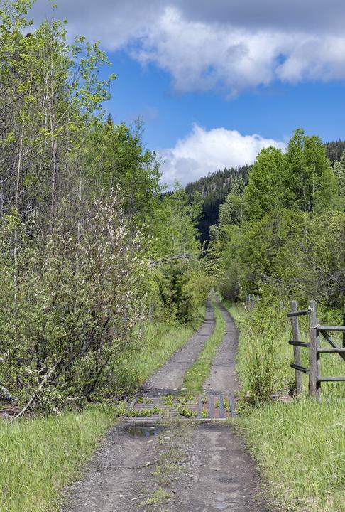
Rails & Trails
APPLY STICKER HERE
Although the Trans Canada Trail follows the Kettle Valley Railway (KVR) line from Princeton to Hope, a connecting railbed also connects Merritt to this trail network. The section of the KVR between Merritt and Brookmere was called the Merritt Subdivision and was a branch connector to the CPR. Work on the KVR began in 1910, with the goal of connecting Midway to Hope through the interior mountains. The entire line, including the Merritt Branch line was completed in 1915
The Coquihalla line was frequently closed in winter and the Merritt Subdivision was sometimes utilized to allow trains to reroute through the CPR. This was a minor branch line for the overall business of the KVR until the Coquihalla Subdivision was closed by the CPR in 1959. Eighty percent of the rail traffic was rerouted to the main CPR line by 1961. By 1973 all trains west of Beaverdell had stopped running and by 1978 most of the rail lines were removed. The last train left Merritt in 1989 and in 1990 the tracks were being removed.
The 600 km of the KVR has become a destination for backcountry cycling The rail-to-trail conversion has become a project of many groups, including the Trans Canada Trail Corporation, the B.C. Ministry of Forests, the Kettle Valley Corridor Project, the Canadian Rails to Greenways Network, the Rails to Trails Council of B.C., the Myra Canyon Trails Restoration Society, the B.C. Ministry of Parks, the Kettle Valley Heritage Society, and the communities, cycling clubs, and not-for-profit support groups along the route.
Although the Merritt Branch is less used, it is nevertheless a pleasant day of cycling, a journey of 47 3 km from Brookmere to Merritt
Most cyclists start at Brookmere (962m) to enjoy the net elevation loss heading north to Merritt (562m) Brookmere was once a busy railway town, the junction of 3 lines. Now it is a quiet community with a few KVR building and some equipment.
217
#119 GC3PCJ6 Phase 2
From Brookmere the track crosses three bridges on its way down to Brodie, sometimes known as the Loop Brodie Station sat at the junction of the two lines Visitors can visit Brodie by taking the Larson Hill exit The track switches back and forth across the Coldwater River 7 times before going under the Coquihalla Highway avoiding the steep and narrow canyon walls. Beyond, the valley opens up.
At 18.6 km, the track arrives at Kingsvale Station. The old station is now a private residence, but there are still a few reminders of railway days to be seen Beyond Kingsvale, the rail line sometimes crosses private property and gates and fences may be an issue, but cyclists can exit at road crossings to the Coldwater Road at numerous points At 28 4 km, a station called Pine was the intersection of a small logging spur line to serve the Nicola Pine Mill, starting in the 1920’s At 32 2 km, the Glenwalker Station is now in the middle of farm land At 32 6km the track enters the Coldwater Indian Reserve and exits at km 39 2 Cyclists can detour to the Coldwater Road
The last few kilometres cross on two more trusses, and then emerges onto Douglas Road at km 45 8 Another spur line connecting the Middlesboro Collieries came in at km 46 3
The Merritt Subdivision line ends at Merritt Station. This was an important station connecting the coal supplies of the Nicola Valley to the KVR and the CPR through Kamloops.
Geocaching visitors can visit the train station display downtown or drive the Coldwater Road to see sections of the line Dedicated geocachers may even wish to cycle the Merritt Subdivision from Brookmere to Merritt for a full day of history, exercise, and geocaching
Written and Researched by Doug Smith
BIBLIOGRAPHY & SOURCES
Langford, Dan and Sandra Cycling the Kettle Valley Railway, Rocky Mountain Books, Calgary, 1994 Obee, Bruce. Trans Canada Trail – British Columbia, Whitecap Books, North Vancouver, 2008 Shewchuk, Murphy. Coquihalla Country, Sonotek, Merritt, 1990
Coordinates:
Brookmere at 0 0 km: N 49°49 05' W 120°52 30'
Merritt Station at 47 3 km: N 50°06 506' W 120°47 363'
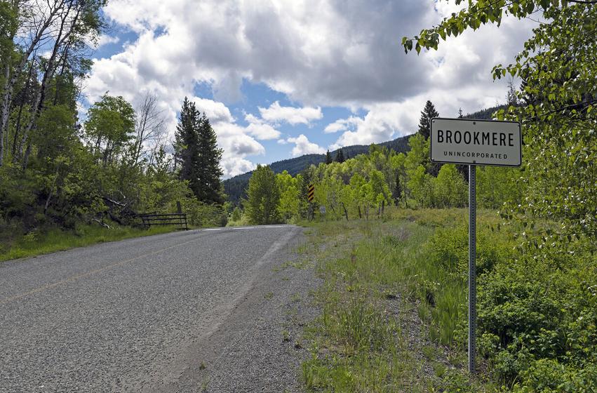
Letterboxing Clues:
Follow the ATV track up the hill to the rail bed; look under a tree
218
Please check geocaching.com before you go!
Mimi Falls
SITE IDENTIFICATION
Nearest Community: Logan Lake, B C
Geocache Location:
N 50°28 988' W 120°46.967'
Ownership:
Crown Land
Accuracy: 3 meters
Overall Difficulty: 2.5
Overall Terrain: 2
Access Information and Restrictions:
Read site page for further directions Go through yellow fence and barbwire fence Trail is marked by ribbon There are many blown down trees on the way through. 1 hr walk from parking. Follow the path as the GPS will want you to go straight down bank.
Parking Advice:
Park on Jasper Drive just beyond the church on the hill.
For more information or to report a problem with this site please contact:
Gold Country Communities Society
P O Box 933 Cache Creek, B C V0K 1H0
Tel: 1-877-453-9467
Email: info@exploregoldcountry com
For more site pages go to: www exploregoldcountry com www geocaching com
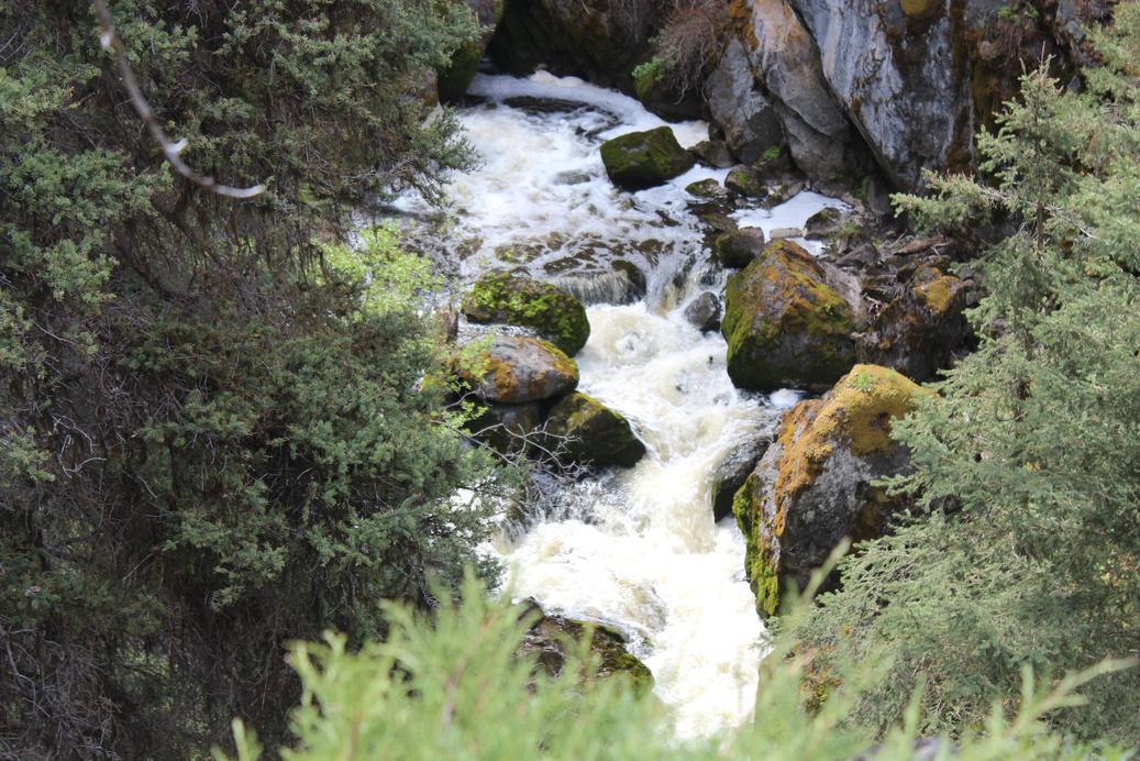
The short half-hour hike to Mimi Falls is a peaceful journey through a variety of landscapes. Full of surprise vistas, the Mimi Falls trail meanders through a forested area where cows graze among the trees, along the edge of a canyon, and across peaceful grasslands before delivering hikers to their final destination – Mimi Falls. In the spring, when the water is running high, the sound of the falls fills the valley all around the trail area Nobody seems to know why they are called Mimi Falls, but whatever the reason the falls are a lovely place to escape to without having to travel too far away from town
Meadow Creek, the source of the falls, runs from east to west, starting around the Walloper Lake area. It winds lazily past the ranches in the Highland Valley, parallel to the Meadow Creek Road (Highway 97D). Running along the ridge high above the golf course, Meadow Creek joins Guichon Creek near the Mamit Lake Road (Highway 97C) and the Logan Lake Ranch and Country Club.
APPLY STICKER HERE
Whether you start up high on the path near the church on Linden Road, or from a lower trail by the lake, you will pass gigantic Ponderosa pine trees, spruce trees, and even young juniper. Aside from cattle, and depending on the season, it is not unheard of to encounter black bears, wild horses, lynx, deer, owls and numerous species of birds, and possibly even a cougar. As with any wilderness experience, being aware of your surroundings is imperative, even though it is so close to town. These creatures all make their way into Logan Lake from time to time.
Upon leaving the forested area, a grassy clearing opens up and the roar of the falls becomes louder With few visible signs of humans, it's not hard to imagine someone like George Dawson, from the Geological Survey of Canada, travelling
219
Geological & Views
#120 GC3Q6XK Phase 2 C r e d i t V e s t a G i l e s
some of these same game trails by pack train as he mapped the area in the 1870's Dawson, and others on similar journeys, would travel and map the areas searching for potential railway routes, taking side journeys to gather geological samples and assess different sites for their mining and agricultural potential. Along the way, they may have met trappers, homesteaders, and groups of local natives. Or, perhaps they may have been alone for days at a time.
In those days, before GPS units, navigation routes were charted using a compass and the stars Maps were minimal, improving each time Dawson, or someone like him, carefully surveyed the area The treasures they sought were trade routes, geological formations that could possibly lead to ore deposits, plant and animal surveys, and observations of local cultures
Walking along the quiet path towards Mimi Falls, it is important to recognize, and be grateful for, the legacy the early explorers like Dawson left for us.
Written and Researched by Vesta
Giles
BIBLIOGRAPHY & SOURCES
Cole, D. And B. Lockner (ed.) (1989). The journals of George M Dawson: British Columbia, 1875 – 1878. University of British Columbia Press. Vancouver. District of Logan Lake (2012). "District of Logan Lake". Retrieved from http://www.loganlake.ca/, 23 Jun. 2012.
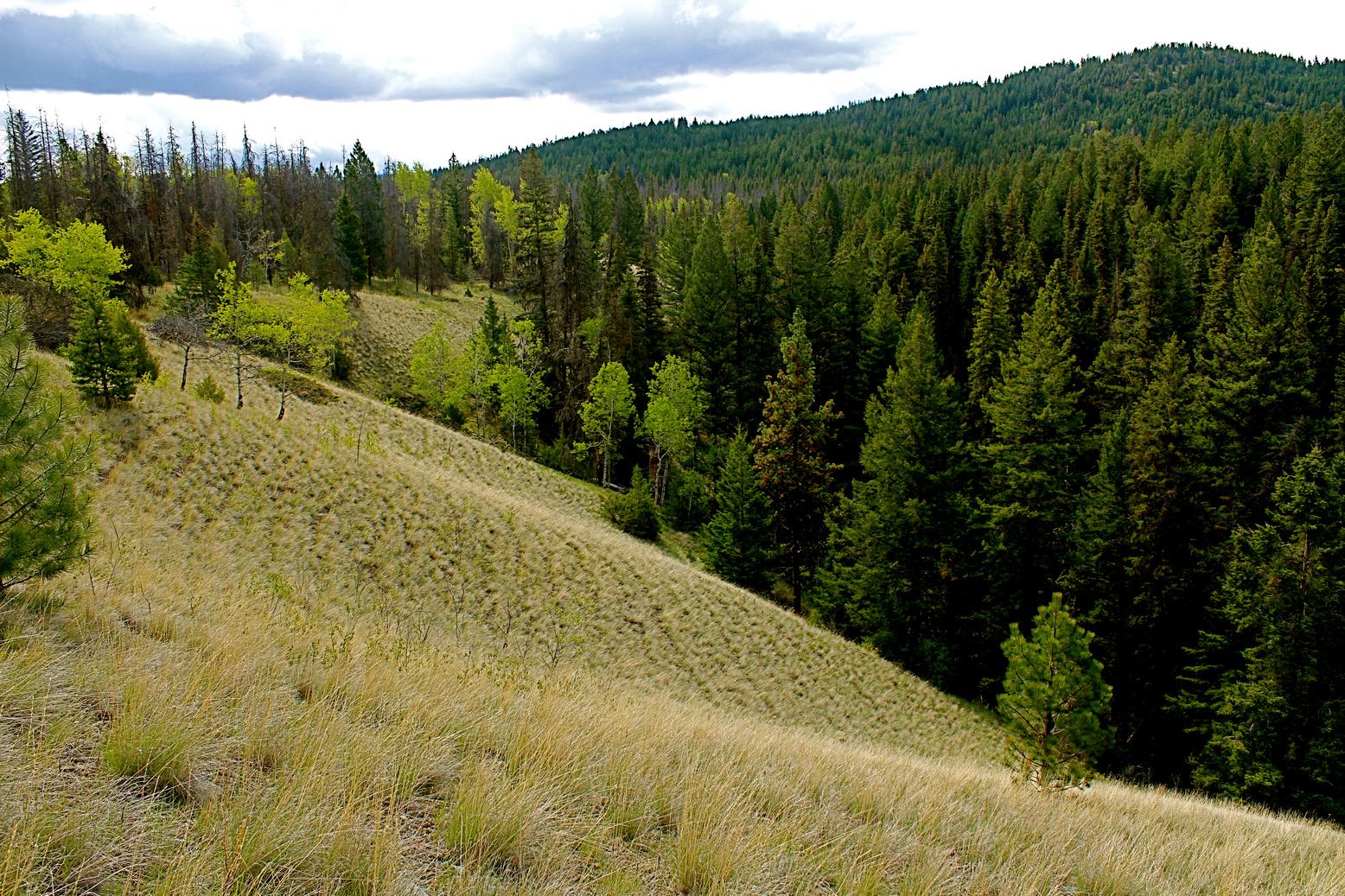
220 Letterboxing
bare puzzle tree buried in huge pile of juniper.
Clues: 2m from
Please check geocaching.com before you go! C r e d i t : M a r c i e D o w n
Mission Ridge Trail
SITE IDENTIFICATION
Nearest Community:
Lillooet, B C
Geocache Location:
N 50°45.787'
W 122°10 185'
Altitude: 2177m/7142ft
Ownership:
Crown Land
Accuracy: 4 meters
Overall Difficulty: 5
Overall Terrain: 5
Access Information and Restrictions:
4x4 only From Mile 0 Cairn drive north on Main Street and turn left onto Hwy 40 At the junction at the east end of Carpenter Reservoir (48 km from Cairn) turn left on to Mission Mountain Road, cross the dam and go through tunnel At Mission Pass summit turn on to road marked ‘No through Road/Dead End’ Go 5 km to junction of roads. Take road on the right. Approximately 3 km to trail head. Very challenging hike – long and steep Wear appropriate footwear and hiking gear Takes about 2 hours to reach cache
For more information or to report a problem with this site please contact: Gold Country Communities Society
P O Box 933 Cache Creek, B C V0K 1H0 Tel: 1-877-453-9467
Email: info@exploregoldcountry com
For more site pages go to: www exploregoldcountry com www geocaching com
APPLY STICKER HERE
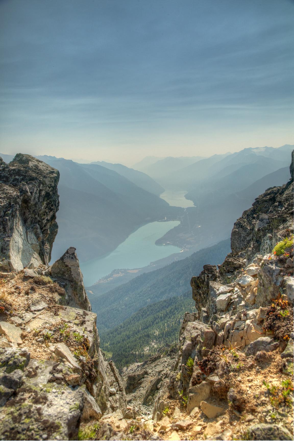
Mission Ridge is named for an Oblate Mission that was founded in 1880 in the community of Shalath. Mission Mountain was the first ‘official’ name given in 1918 and the ridge was later described in a geological survey as overlooking Shalath and above Seton Lake. This vague description is thought to include three prominent peaks in the centre of the entire ridge. The name was then changed from ‘Mountain’ to ‘Ridge’ and now describes the approximately 13 km long ridge that begins with Mission Pass to the north and ends with Mount McLean to the south The trail to the geocache on Mission Ridge is relatively short; it begins just below tree line and ends in the alpine At the summit there are two geodesic domes The domes are remnants of television and radio transmission units from the 1960’s
The drive to the trailhead is an adventure in itself. After navigating the narrow Bridge River Canyon, the driver must cross the Terzaghi dam, pass through a tunnel and ascend the steep, winding Mission pass road. The Terzaghi dam is the main diversion dam for the Bridge River Power Complex. The Bridge River has been dammed to create Carpenter Lake (Reservoir) Water enters two tunnels that have been bored through Mission Ridge The water drops 410m into two power generating plants that empty into Seton Lake; this generates 480 megawatts of electrical power
From the summit you can spot the communities of Seton Portage and Shalath. ‘Shalath’ is the St’at’imc name for Seton Lake which means, ‘the lake’. You will notice that there are two lakes on either side, Seton to the south and Anderson to the north. Prior to the creation of the Bridge River power project, Seton Lake was said to be the clearer of the two lakes. Anderson is now the clearer of the twodue to the high concentration of glacial silt in the Bridge River water that now enters the lake Both Seton and Anderson lakes are freshwater fjords and were once a singular body of water
Approximately 10,000 years ago a large landslide, originating
221
Rails
Trails
&
#121 GC3QN60 Phase 2
from Cayoosh Range, traveled down and separated the lake into two parts It is thought that this slide created a large tsunami that breached the glacial moraine at the east end of Seton Lake, allowing the water of both lakes to flow into the Fraser river, via Cayoosh Creek.
During the gold rush, Seton and Anderson lakes were important steam boat routes used to transport people and goods. The section of land that separates the two bodies of water (the Portage) presented a barrier for boats and required people to portage from one lake to the other This small 2 km section of land resulted in the creation of the first railway in British Columbia Rail cars were pulled by mules along the tracks from Seton to Anderson lakes The return trip from Anderson to Seton was powered by gravity
Detailed Access Information:
The geodesic domes are in poor repair and contain hazards including sharp metal, nails and broken glass – it is not advised to enter them. The road from Mission Pass to the trailhead is extremely rough and steep. 4x4 and high clearance is absolutely necessary.
Written and Researched by Wayne Robinson
BIBLIOGRAPHY & SOURCES
“GeoBC: Mission Ridge” (Web) 2012 http://apps gov bc ca/pub/bcgnws/names/24303 html
“Wikipedia: Mission Ridge, British Columbia” (Web) 2012. http://en.wikipedia.org/wiki Mission Ridge % 28British Columbia%29
“Wikipedia: Seton Portage, British Columbia” (Web) 2012. http://en.wikipedia.org/wiki/ Seton Portage, British Columbia
“Wikipedia: Shalath, British Columbia” (Web) 2012. http://en.wikipedia.org/wiki/Shalalth, British Columbia
“Wikipedia: Terzaghi Dam” (Web) 2012. http://en.wikipedia.org/wiki/Terzaghi Dam Please check geocaching.com before you go!
Letterboxing Clues: From parking area walk up gravel ‘road’ due east 250m angle south east Follow height of land to first geodome Move to second geodome and travel 24 metres. Search the crevice.
222
Nicola Subdivision Pioneers & Early Settlers
SITE IDENTIFICATION
Nearest Community: Merritt, B C
Geocache Location:
N 50°15.889'
W 121°06 912'
Altitude: 547m/1794ft
Ownership: Crown Land
Accuracy: 3 meters
Overall Difficulty: 1 5
Overall Terrain: 2
Access Information and Restrictions:
From Merritt City Centre follow Hwy 8 west, towards Spences Bridge for approx 34 5 km until you reach FX Ranch Road Turn left unto this road and follow for approx. 0.4 km to the pull out on the left. Site is approximately 29 km from Spences Bridge.
Parking Advice: Park well off the road.
For more information or to report a problem with this site please contact:
Gold Country Communities Society
P O Box 933 Cache Creek, B C V0K 1H0
Tel: 1-877-453-9467
Email: info@exploregoldcountry com
For more site pages go to: www exploregoldcountry com www geocaching com
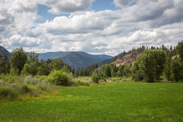
The Nicola Subdivision was a rail line extending from Merritt to Spences Bridge as part of the once powerful Kettle Valley Railway.
When British Columbia entered Confederation and joined Canada in 1871, the new province was promised a railway that would run from sea to sea It took another fourteen years for the Canadian Pacific Railway to arrive and it was quickly realized it didn't include any track that could take valuable ores being mined in the southern part of the province The booming industry in the area required a means to get those materials, as well as fruit, grains, and cattle to the coast.
The Merritt area, with an abundance of cattle and newly discovered coal, was a prime location for a new line and in 1891, two railways received charters to build into the area Backed by the CPR, the Nicola Valley Railway was to be built from the CPR mainline at Spences Bridge to Nicola, just north of Merritt The Nicola, Kamloops & Similkameen Coal & Railway Company (NK&S) was founded to build from Kamloops, to Nicola, south to Princeton and then on to Osooyos Neither railway took hold and both charters lapsed
In the early 1900s, William Hamilton Merritt revived the charter for the NK&S and started construction on the rail line. The CPR boosted the construction by leasing the charter in 1905.
APPLY STICKER HERE
Survey work on the new Kettle Valley Railway (KVR) began in 1910 from Midway to Penticton (Carmi division) and Penticton to Merritt (Princeton division). In 1916, the Kettle Valley Railway opened on the Coquihalla Pass between Brodie and Hope meaning trains going through from the Kootenays would bypass Merritt by going through Brookmere. The Coquihalla line, however, proved unworkable with steep grades and enormous quantities of snow leading to frequent closures and detours of trains through Merritt and Spences Bridge to the CPR's mainline. The 223
#122 GC3PBDF Phase 2
Coquihalla line was finally closed in 1959 and abandoned in 1961, meaning Merritt was finally on the southern mainline With passenger traffic declining and competition from the major highways, the need for more rail lines diminished. The Merritt train station was abandoned in 1988 and in 1991 the rails between Spences Bridge and Penticton were pulled up.
At its prime the Nicola subdivision route from Merritt to Spences Bridge featured a 363 meter elevation change over a total distance of 61 8 km Stations on this section include, Merritt, Coutlee, Coyle, Canford, Dot, Agate, Clapperton, and Spences Bridge
Now part of a popular cycling and hiking trail, the Kettle Valley Railway's Nicola subdivision route passes through wide-open ranch lands, thick forests, and rocky terrain as it approaches Spences Bridge. Once the rail beds were removed rights reverted to the landowners so trail users must contact the various First Nation’s bands and other landowners for permission to pass through.
Written
and Researched
by Vesta Giles
BIBLIOGRAPHY & SOURCES
Critchley, Darren (2012). Touring the Kettle Valley Railway. Retrieved 22 Jun. 2012 from http://www.thekvr.com/nicola-subdivision.php Macek, Alan. (2005). The early years of the CPR in BC. Retrieved 22, Jun. 2012 from http:// canyon.alanmacek.com/index.php/Nicola, Kamloops %26 Similkameen Railway
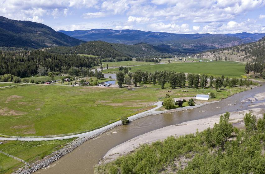
224 Letterboxing Clues: Under pile of sagebrush, next to barbed wire fence.
Please check geocaching.com before you go!
Old Fire Hall
SITE IDENTIFICATION
Nearest Community: Ashcroft, B C
Geocache Location:
N 50°43 563' W 121°16.753'
Altitude:
300m/984ft
Date Established: 1993
Ownership:
Village of Ashcroft
Accuracy:
3 meters
Overall Difficulty: 1
Overall Terrain: 1
Access Information and Restrictions:
Near the Ashcroft Bridge High visibility area, use stealth Year round access
Parking Advice:
Parking lot located across from the Fire Hall.
For more information or to report a problem with this site please contact: Gold Country Communities Society
P O Box 933 Cache Creek, B C V0K 1H0
Tel: 1-877-453-9467
Email: info@exploregoldcountry com
For more site pages go to: www exploregoldcountry com www geocaching com
APPLY STICKER HERE
Pioneers & Early Settlers
Will build firehall were the headlines in the February 22, 1919 edition of The Ashcroft Journal. Robert Stoddart, a local contractor predicted the cost would be about $360.00 which included a 12 by 20 foot building with a 10 foot ceiling and 25 foot tower for the drying of the hoses after use. The money was raised by public subscription and on April 3rd the building was complete. This structure replaced the first fire hall which perished in the 1916 blaze.
The little red fire hall was originally located on Railway Avenue; it was moved to its present site in 1993 The view from this site includes the spectacular Thompson River, and Ashcroft’s fifth bridge.
The first bridge was built in 1886, by the San Francisco Bridge Co. It washed away in the high water of 1894 A ferry that was used prior to the bridge was once more put into action A second bridge was completed in 1895, a duplicate of the first and built in the same spot and by the same company This bridge had a distinct wobble and a “walk your horses” sign greeted travelers at either end By 1905 it was labeled unfit and a new bridge was built up stream and completed by 1907 This bridge lasted for 26 years until 1932 when a new bridge was constructed downstream from the first three. Several tons of dirt were brought in and built up to accommodate the new steel bridge. In 1991 a fifth bridge was constructed, this would be wider and capable of holding heavier loads. During low water the piers of the first two bridges are visible. Today this bridge is part of the number one highway; in early years the bridges connected Ashcroft with the Cariboo Wagon Road. The first road in the interior went via Harrison Lake, to Lillooet over Pavilion Mountain, down to Kelly Lake through the Junction of Clinton and on to Barkerville Although it was considered an engineering fete, Sir James Douglas, second governor of Vancouver Island and first Governor of the crown colony of British Columbia did not consider it good enough for British Columbia
225
#124 GC3NXD7 Phase 2
C r e d i t : K u r t E v a n s
In 1863 an alternate route was built, beginning in Yale passing though Cache Creek and on to Clinton to hook up with the Lillooet road In 1886 this path would connect to the Ashcroft Bridge The Cariboo roads saw a steady stream of Mule trains, ox teams and freight wagons, and for a brief period the occasional camel. Road houses sprung up in strategic spots to provide travelers and teams with grub and bed. In 1907 the first automobile navigated up the road, the beginning of the end to the horse and wagon.
Written and Researched by Kathy Paulos
BIBLIOGRAPHY & SOURCES
February 22, April 3, 1919, Ashcroft Journal, Ashcroft Museum and Archives "Brief History of Ashcroft Bridges", July 2
1932, Ashcroft Journal, Ashcroft Museum and Archives "Building of the Old Cariboo Road", May 8, 1958, Ashcroft Journal, Ashcroft Museum and Archives
226 Letterboxing Clues: Facing the Front of the Fire hall, walk to the back right corner Walk a few steps
Please check geocaching.com before you go!
The Ovens Rails & Trails
SITE IDENTIFICATION
Nearest Community: Clinton, B C
Geocache Location:
N 51°05.939'
W 121°35 316'
Altitude: 979m/3211ft
Ownership:
Crown Land
Accuracy: 2 meters
Overall Difficulty: 1 5
Overall Terrain: 2
Access Information and Restrictions:
In downtown Clinton turn off of Highway 97 travel west on McDonald Rd winding onto Clinton Station Rd ; follow the road up and across the tracks, take the left at the fork in the road and follow this for approx 130 meters. Park well off the road and walk to the left onto old, very faint, trail. Do not drive into this area due to ecosystem concerns
Parking Advice:
Pull well off dirt road, and walk to cache location.
For more information or to report a problem with this site please contact:
Gold Country Communities Society
P O Box 933 Cache Creek, B C V0K 1H0 Tel: 1-877-453-9467
Email: info@exploregoldcountry com
For more site pages go to: www exploregoldcountry com www geocaching com
While the sappers of the Royal Engineers were successful in building and completing the Cariboo Wagon Road, the planners for the Pacific Great Eastern railway were far from following in their tracks.
The PGE, incorporated in 1912, was named for the Great Eastern Railway of Great Britain It would travel from the north shore of Burrard inlet through the interior to Prince George and provide freight and passenger service Wood products, cattle, minerals and sundry goods would be moved expediently Such was the plan
The PGE was plagued with problems. Track was laid from the North Shore to Whytecliffe and service resumed in 1913. The next leg, Squamish through to Clinton, started service in 1916. However, progress stopped as the company ran into serious financial difficulties and by 1918 was reluctantly purchased by the provincial government 1
The route was scenic, but apparently avoided major hubs, thus requiring additional travel to carry goods and cattle to be loaded. Neither did it cross with other rail lines to transfer passengers or freight. It was referred to as the train that goes “from nowhere to nowhere”.
APPLY STICKER HERE
Perhaps for many it seemed purposeless, but for those around Clinton it was an economic engine 2 With the need to move cattle to market, the railway was a boost, shortening distance and time By the 1930’s, with completed tracks to Quesnel, all manner of goods were able to travel north and south
With the soda works around the lakes in the area, the train proved a great way to freight the cargo to the modern homemaker of the 30’s and 40’s 3 Used in laundry and for cleaning, the soda removed grease and oil
Area lakes also produced Epsom salts, a welcome relief for the tired and weary.
227
#125 GC3P2XG Phase 2
Not only were ranchers and soda companies happy with the railway, so too were forestry workers With an increase in millworks, during the ‘50s and 60’s there being more than twenty saw mills, the timber and lumber became easier and faster to ship to market. Clinton prospered. However, there is another bit of history that goes along with this often controversial railway. Small construction camps were required to house and feed the rail workers. These hardy men were often of foreign extraction, haling from China, Italy, Greece and Eastern Europe. They had come west at the invitation of the Canadian government.4 What they brought with them to the west was an ancient cooking method – stone ovens. Since their discovery, a great deal of interest has arisen as to the ethnic origin of these earthen ovens. What is known for certain is they have been used by rail construction crews throughout North America and Australia.
Some claim they were built by the Chinese, but the Chinese seldom baked, as their cooking methods were generally by steam or flame While many cultures, including Moors, Greeks and other Europeans, used these Neolithic stone ovens, it is most likely the ovens at railway camps were built by Italians and possibly Greeks They were constructed by using rocks and stones of the immediate area. The dome shaped cooker would generally be about a meter high and two meters wide. First, a fire is built inside. After it burns down, the coals are raked out. The oven floor is swept clean and then sprinkled with corn meal or flour. Next the loaves are placed inside after closing the flue hole in the rear of the oven’s roof; the door is sealed with a piece of metal or a damp cloth.5 The process took two to three hours to prepare the oven. The actual baking required a mere fifteen to twenty minutes, due to the remarkable heat maintained within the dome. Voila, pane fresco!
It is here, above the tracks near Clinton Creek, such an archaeological gem lays hidden in history Imagine more than 100 years ago, railway crews enjoying hot golden-crusted bread baked in a stone oven in the heart of Gold Country 5
Written and Researched by Angela
Wynton
BIBLIOGRAPHY & SOURCES
1 See www.llbc.leg.bc.ca Legislative Report, March 12 to 17, 1919 (9 Geo. 5)
2 Clinton served as the hub for the surrounding area inc. Big Bar, Kelly Lake, Pavilion Lake, etc.
3 See site page "Last Chance Lake Soda Site", Gold Country GeoTourism Adventures Field Guide Volume 1, 39.
4 Wynton, A., "Field Guide Agriculture in Alberta: Hoes to High Tech", site page First Farmers: Encouraging Emigration, Inviting Immigration, 2011 at www.geotourismcanada.com
5 Costello, J., "Gold Rush Archaeology: Excavating the Mother Lode", Archaeology 34 (1981) Wegars, Priscilla. "Who’s Been Workin’ on the Railroad: An examination of the Construction, Distribution and Ethnic Origins of Domed Rock Ovens on Railroad-Related Sites", Historical Archaeology, Volume 25
Harvey, R G Carving the Western Path, Heritage House By River, Rail and Road Through Central and Northern B C , Surrey 1999
www en wikipedia org "BC Rail History"
MacArthur, Peter "Chinese Ovens Are Everywhere", Lytton Museum & Archives, Nov 2008
www wcra org West Coast Railway Association
Barman, Jean The West Beyond The West A History of British Columbia, University of Toronto Press, 1991
Letterboxing Clues:
Follow old trail, apprx 90 meters Cache is by an old fallen tree View of the creek
228
Please check geocaching.com before you go!
Paradise Lakes
SITE IDENTIFICATION
Nearest Community: Merritt, B C
Geocache Location:
N 49°55 393' W 120°17.052'
Altitude: 1501m/4924ft
Ownership:
Crown Land
Accuracy: 4 meters
Overall Difficulty: 2.5
Overall Terrain: 2
Access Information and Restrictions:
From Hwy 97C (the Okanagan Connector), take the Elkhart turnoff and follow the Bobs Lake-Paradise Lake Road.
Parking Advice:
Adjacent to the cache location.
For more information or to report a problem with this site please contact:
Gold Country Communities Society
P O Box 933 Cache Creek, B C V0K 1H0
Tel: 1-877-453-9467
Email: info@exploregoldcountry com
For more site pages go to: www exploregoldcountry com www geocaching com
The high plateau lakes in the Paradise Lakes area were a long backcountry drive on marginal roads from either Peachland or Quilchena Once the snows cleared, the lakes attracted fishermen ready to travel for 2 hours on bumpy, muddy roads That all changed with the construction of the Okanagan Connector Now visitors can drive from Merritt (45km) or from the Okanagan (50km) over Highway 97C and turn off at the Elkhart Lakes interchange
Six lakes, five camping areas, one resort, and several trails can be found by following the Elkhart Road. The paved route crosses Elkhart Creek, then at two and a half kilometres a side road can be followed into Elkhart Lake The route into Elkhart Lake requires a short hike There is a B C Forest Service Campsite there, large enough for 3 tents, situated above the lake Outhouses, tables, and boat launch are found at the site The whole area was logged in 2010, providing more-open sites to camp Elkhart Lake is about 1km long and is of interest to fishermen, hunters, and campers
APPLY STICKER HERE
Continuing north to the 6km mark (from the Connector) is a short road down to Bob’s Lake. There is another B.C. Forest Service Campsite there with 3 sites. The main road turns to gravel beyond this turn-off and the fork going right (east) continues to Paradise Lake
A rustic fishing camp was established at Paradise Lake in 1949 by Gordon Mountfort, a resident of Summerland. Various owners ran the camp until 1992 when it was upgraded to a modern fishing resort. At an altitude of about 5000 feet, the dark lake is known for its large trout and year-round fishing. There is also a small B.C. Forest Service Campsite on the north side of the lake.
229
Geological
Views
&
#126 GC3PAM3 Phase 2
The road continues on past the resort to Island Lake There is a larger campsite at the lake with the usual facilities, including a boat launch From either Paradise Lake or Island Lake, numerous side trails lead to small lakes, including Johns Lake, Another Lake, and And Another Lake. (No typos, here – these are the names of the lakes.)
Back at the Elkhart Road junction, a rough road (4WD recommended) leads west to Boot Lake. There are four campsites on the side of the lake, mostly used by fishermen, hunters, and snowmobilers Following the highway 12km west to the Sunset Interchange, another set of high-country lakes offer more opportunities by taking the rough 4WD Reservoir Lake Road From the recreations campsite (4 sites), access to Skunk Lake and Walker Lake are walk-in, making these lakes secluded and quiet Whichever lake, resort, or campsite is chosen in the Paradise Lakes area, the lakes, trails, and routes offer opportunities for fishing, outdoor activities, geocaching and exploring
Written and Researched by
Doug Smith
Please check geocaching.com before you go!
BIBLIOGRAPHY & SOURCES
http://www.paradiselakeresort.ca/,website http://www.sitesandtrailsbc.ca/, website Mussio, Russell and Wesley. Thompson Okanagan Backroad Mapbook, Mussio Ventures, Coquitlam, 2010 Shewchuk, Murphy. Coquihala Trips and Trails, Fitzhenry Whiteside, Markham Ontario, 2007
Coordinates:
Elkhart Interchange: N 49°52 572' W 120°18 655'
Elkhart Lake: N 49°53.690' W 120°18.718'
Paradise Lake : N 49°55.247' W 120°16.927'
Island Lake : N 49°55.495' W 120°17.160'
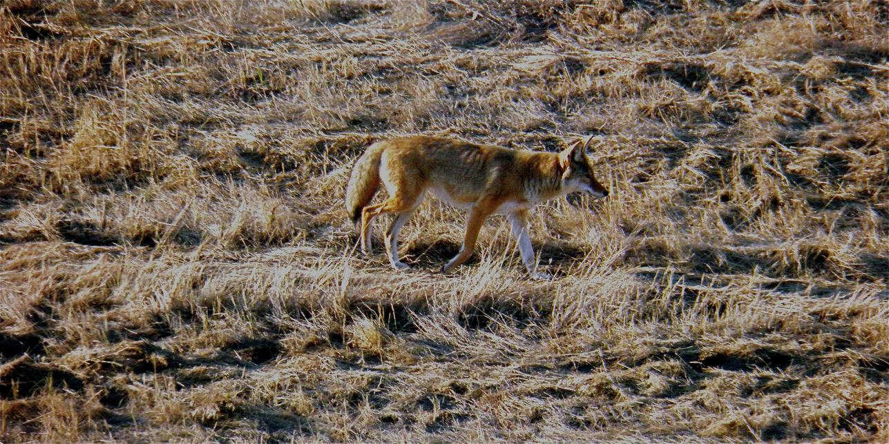
230 Letterboxing Clues: Behind a rock, behind the Paradise Lake Forest Service Site sign
C r e d i t : K u r t E v a n s
Parke Ranch
SITE IDENTIFICATION
Nearest Community: Cache Creek, B C
Geocache Location: N 50°49 333' W 121°20.440'
Ownership: Privately Owned
Accuracy:
2 meters
Overall Difficulty: 1 5
Overall Terrain: 2 5
Access Information and Restrictions:
Heading towards Cache Creek from the North, look for Gold Country information sign and pullout on the right
Parking Advice: Park at the pullout for the info sign.
When he emigrated to Canada from County Sligo in western Ireland, Philip Parke probably dreamt of striking it rich in the goldfields of northern British Columbia. The ambitious young man must have soon realized, however, that there was vast potential in the rich land around Cache Creek, and that more money could be made by ranching than by moiling for gold.
For a number of years Parke took various jobs around the area, working for a time for Clement Cornwall and running Cornwall’s roadhouse at Ashcroft Manor In 1865 he partnered with Charles Semlin to purchase Bonaparte House in Cache Creek, and three years later sold his share in the business.
For more information or to report a problem with this site please contact:
Gold Country Communities Society
P O Box 933 Cache Creek, B C V0K 1H0
Tel: 1-877-453-9467
Email: info@exploregoldcountry com
For more site pages go to: www exploregoldcountry com www geocaching com
APPLY STICKER HERE
The proceeds from the sale almost certainly helped him to buy land northwest of Cache Creek, and before long the Buonaparte Ranch (as it was then called; the “ u ” was later dropped from the name) had been cleared, irrigation ditches built, hay planted, and a cattle herd started
As the Bonaparte Ranch became more developed, Philip Parke turned his attention to an adjoining valley to the south. Hat Creek Valley, running from north to south roughly halfway between the Thompson and Fraser Rivers, boasted fertile valley bottom fields, abundant timber, and lush open grasslands where the grass grew as high as a horse’s belly. It was already owned, by Parke’s former employer Clement Cornwall, but Parke owned something Cornwall wanted: water rights for Cornwall’s Hibernia Ranch, near Ashcroft Manor In 1900 the two men did a swap, and Philip Parke set about establishing the ranch which was originally called The Meadows
Philip Parke never built a permanent dwelling at The Meadows; he and his wife lived at the Bonaparte, with Philip making the arduous journey (three days herding cattle; two days in a wagon; several hours on a horse using a mountain shortcut) between the two properties as necessary. The Parkes had no children, but in 231
Agriculture
#127 GC3P6RE Phase 2
the late nineteenth century Philip’s nephew Henry arrived from Ireland, and eventually joined his uncle at the Bonaparte Soon after that he purchased land in Hat Creek Valley adjoining The Meadows, and moved there with his family. The two properties were known jointly as the Parke Ranch, Upper Hat Creek.
Henry, his wife Isobella, and their four children lived on the Parke Ranch, first in a small log cabin with a sod roof and then in a spacious two-storey frame house built around 1910. Although they have been modernized since, the two buildings are still extant, and still recognizable as the houses seen in early photographs When Philip Parke died in 1927, Henry took over the running of both the Bonaparte and Parke Ranches until his death in 1941 Henry’s only son, Arthur, carried on the tradition, although he and his family lived at Bonaparte, with Arthur making the still-difficult trip between the two properties many dozens of times over the next forty years
When Arthur Parke died in 1967 his two sons Alan and Gordon took over the properties and ran them together until 1970, when the land, machinery, and livestock were split. Alan took over the Bonaparte, while Gordon and his family settled in Upper Hat Creek at what became the Gordon Parke Ranch. Before retiring to Vancouver, Gordon Parke served as President of both the B.C. Cattlemen’s Association and the Canadian Cattlemen’s Association. A fifth generation of the Parke family, Gordon’s son Brian, now lives in Upper Hat Creek, overseeing much of the ranching property in the valley In March 2012 Gordon Parke was inducted into the B C Cowboy Hall of Fame, in the category “Pioneer Rancher”
Written and Researched by Barbara
Roden
BIBLIOGRAPHY & SOURCES
Parke, Gordon (1993) The Parke Ranch, Upper Hat Creek: Four Generations Cache Creek, B C Kamloops, B C : Plateau Press (2012) Sagebrush, Steers and Saddlesores: The Parke Family Five Generations at Upper Hat Creek Retrieved June 2012 from “Community Memories” at virtualmuseum ca: http://www musee virtuel-virtualmuseum ca/sgccms/histoires de chez nous-community memories/pm v2 php?id=story line&lg=English&fl=0&ex= 379&sl=2852&pos=1
Letterboxing Clues: Looking at the Gold Country Information sign hike up short hill. Located at top under sagebrush.
232
Please check geocaching.com before you go!
Pavilion Lake
SITE IDENTIFICATION
Nearest Community: Cache Creek, B C (Southeast) & Clinton, B C (Northeast)
Geocache Location:
N 50°50 962' W 121°42.734'
Altitude:
810m/2657ft
Date Established:
1956 adding Pavilion Lake in 2001; 355 hectares
Ownership:
Provincial Park
Accuracy:
2 meters
Overall Difficulty: 2
Overall Terrain: 3.5
Access Information and Restrictions:
From Highway 97 turn west onto the scenic route Highway 99 South at the Hat Creek Heritage Ranch; follow the road for about 30 kilometers to Marble Canyon Provincial Park at the easternmost wetlands of the lake and continue a few kilometers to Pavilion Lake.
Parking Advice: Park at pull off
For more information or to report a problem with this site please contact:
Gold Country Communities Society
P O Box 933 Cache Creek, B C V0K 1H0 Tel: 1-877-453-9467
Email: info@exploregoldcountry com
For more site pages go to: www exploregoldcountry com www geocaching com
APPLY STICKER HERE
The history of Pavilion Lake stretches beyond another world and is a magical treasure.1 Some 10,000 years ago, beneath the watchful guard of the statuesque Chimney Rock, carbonate structures were developing along the floor of the lake with the help of microorganisms – and a spectacular underwater garden was slowly been sculpted.2 The formations, known as microbialites, were common between 2.5 billion and 540 million years ago, but have seldom formed since that time Although there are a few world lakes that have these more recent spectacular formations, including nearby Kelly Lake, they remain rare
First discovered by scuba divers in the 1990’s, the magnificence of these ancient microbialites has been a constant source of interest and observation. So unique is the underwater garden in Pavilion Lake, since 2004 the North American Space Agency (NASA), the Canadian Space Agency (CSA), the Vancouver Aquarium, Donnie Reid and Darlene Lim, the principle investigator, have joined together as the Pavilion Lake Research Project to explore, map and study these marvellous freshwater structures.
The microbialites are complex and the diversity of these structures is great, although they fall into basically four morphological characteristics – cauliflower or bulbous, chimney, artichoke and coral. Formed underwater in layers by the trapping of sediment grains by prokaryotic cyanobacteria and simple eukaryotes such as green algae, the microbialites create carpet-like-reefs of varying densities and sizes along the lake bed –somewhat like an underwater garden of beautiful carbonate shrubbery.
What ideal conditions were created in the lake to produce these unusual structures? What were the contributing environmental factors required to established these diverse life forms scattered around the lake bottom? There are many questions being asked and a great deal of research being gathered by a number of professionals from a variety of disciplines. Is it possible that
233
Geological & Views
#128 GC3P2XW Phase 2
C r e d i t : K u r t E v a n s
these microbialites may provide some answers to help scientists better know what to look for when exploring other planets for life?
Canadian astronaut Chris Hadfield has been working on the team with Reid and Lim voyaging deep into the 65-metre depths and along the lake floor in a small one-person submarine shooting videos, snapping photos and removing small rock samples with a robotic arm. To date over 70,000 photos of the microbialites in the six kilometer lake are being catalogued, and the samples are being studied for ancient and mutated bacteria and other microorganisms 3
What tales these microbialites will tell the experts. Whether exploring deep into outer space or the deep waters of Pavilion Lake; Lim, Reid, Hadfield, NASA and CSA, have been travelling and charting the mysteries and magnificence of magical unknown spaces – whether above or below the earth. What’s truly amazing is that one of the greatest voyages and discoveries is right here at Pavilion Lake in the heart of Gold Country. Now that’s a treasure!
Written
and Researched by Angela
Wynton
BIBLIOGRAPHY & SOURCES
1 The name Pavilion comes from the French word for flag It is believed the French Canadian fur traders noticed a white flag at the gravesite of Shuswap Chief Te-empt near the foot of the Marble Range near the lake Pavilion Mountain is at N 50°58.24' W 121°41.05'
2 Chimney Rock, a limestone formation in Marble Canyon, was named K’lpalekw by the Secwepmec
3 To participate in the Pavilion Mapper Project visit www.pavilionlake.com and scroll down to Mapper www.astrobio.net Astrobiology Magazine, A NASA sponsored online astrobiology magazine – a study of life in the universe http://geobc.gov.bc.ca/index.html GeoBC – Government of BC Geographic Services www.pavilionlake.com Pavilion Lake Research Project Payton, Bryan. "Lake of Ages," British Columbia Magazine, Spring 2012
Letterboxing Clues: From pullout follow trail to lake. Hang a right before trail ends, about 15 ft in bush, base of shrub tree.
234
Please
geocaching.com
check
before you go!
Artist: Carol D. King, Photographer: Kelly Touhey
Porcupine Creek Canyon Rails & Trails
SITE IDENTIFICATION
Nearest Community: Clinton, B C
Site Location:
N 51°02.057'
W 121°48 811'
Geocache Location:
N 51°05.057'
W 121°48 811'
Altitude: 1520m/4986ft
Date Established: 1995
Ownership: Provincial Park
Accuracy: 3 meters
Overall Difficulty: 1.5
Overall Terrain: 1 5
Access Information and Restrictions:
High clearance vehicle i e 4x4 recommended Steep rocky road. Approximately 40 minutes from Hwy 97 to trailhead From Highway 97 turn west on Kelly Lake Rd at the south end of Clinton; continue for about 16 km to Jesmond Rd ; continue for another 5 5 km to the signpost Porcupine Creek Trail at the unmarked road on the right; travel another 5 3 km to the trail head – the trail begins about 800m past the corral & on the other side of Porcupine Creek
For more information or to report a problem with this site please contact: Gold Country Communities Society
P O Box 933 Cache Creek, B C V0K 1H0 Tel: 1-877-453-9467
Email: info@exploregoldcountry com
For more site pages go to: www exploregoldcountry com www geocaching com
High in the Cariboo is one of the most spectacular views of ancient geological formations in British Columbia The Marble Range was created some 500 million years ago and lies atop the southwest edge of the Cariboo Plateau 1 The geology is generally a mix of dolomite and limestone. The range runs a length of approximately 65 kilometers and is about 20 kilometers in width covering an area of more than 1200 kilometers.
The unusual looking limestone is known as karst topography First recognized by renowned geographer, and the “father of karst geomorphology”, Jovan Cvijic named the formations for the Kras region of Slovenia where his scientific research of the unique geology first took place 2 The formations and landscape are the result of water action dissolving limestone, dolomite or marble The geological process occurs over thousands of years creating unusual surfaces both above and below ground including caves, sinkholes, gorges, springs, disappearing and underground streams, and vertical shafts.
A magnificent view of the ancient geomorphology can be reached by traversing the trail that runs along Porcupine Creek through the canyon and up to Lime Ridge The journey to the trail takes a scenic route along the border of Edge Hills Provincial Park and the trail proper follows the creek into Marble Range Provincial Park
APPLY STICKER HERE
Once at the trailhead, the hike is a pleasant jaunt through the pine and mixed forest following the sweet sound of the creek below. Porcupine Creek flows south from the range and into Kelly Lake in Downing Provincial Park at the southern end of Edge Hills. The trail is rich with colourful wild flowers and a variety of wild berries. Much of the flora once provided the Secwepmec people with an abundance of food, dyes and herbal medicines Keep alert to the many animals that may be watching from the cover of the woods Deer are plentiful When the trail crosses the creek the path
235
#129 GC3PBBW
Phase
2
leads through a gully and eventually winds to the right to follow a steeper climb up to the ridge The ridge exposes the hiker to the magnificent view of the range against a deep blue sky and the thick forest carpeting the valley. While many may choose to sit and absorb the remarkable geology, others may want to stroll the ridge in search of other views of the range and the valley below.
Be sure to take along binoculars, they will give you the opportunity to possibly sight a small herd of bighorn sheep The range is a major migration path for these amazingly sure-footed creatures, as they navigate the steep cliffs and alpine landscape, moving from the Fraser River canyons into the nearby provincial parklands
Be alert, as the alpine ridge is exposed to the elements and subject to changing weather conditions, often with strong winds. Also, there is little reprieve from the heat of the mid-day sun, so be sure to take along a hat and plenty of sunscreen and water. Regardless of the caveat, the hike and the views are well worth the trip to what feels like the top of the world. The Porcupine Creek Canyon trail takes one to a world where the scenic landscape is unparalleled. This magnificent ridge, with a splendid view of a unique and ancient geological wonder, reigns high above the Cariboo Plateau in the heart of Gold Country.
Written and Researched by Angela
Wynton
BIBLIOGRAPHY & SOURCES
1 See also "Marble Canyon", Gold Country GeoTourism Adventures, Field Guide Volume 1, 105.
2 Jovan Cvijic b. 1865 d. 1927; karst is the German term for the Kras region Campbell, Colin. Trails of the Southern Cariboo, Rocky Mountain Books, Surrey, British Columbia 2009 www.for.gov.bc.ca, "Karst in British Columbia", Forests, Lands and Natural Resources Operations, Victoria 1997
www env gov bc ca/bcparks BC Parks
www env gov bc ca/wld/documents/bighorn pdf "Bighorn sheep of British Columbia", Government of British Columbia 2000
236 Letterboxing Clues: Travel to trailhead parking lot. Walk up trail approximately 15 metres. Look right to juniper bush.
Please check geocaching.com before you go!
Quilchena
SITE IDENTIFICATION
Nearest Community:
Quilchena, B C , Merritt, B C
Geocache Location: N 50°10 250' W 120°29.111'
Altitude: 941m/3087ft
Ownership: Private Property
Accuracy: 3 meters
Overall Difficulty: 2
Overall Terrain: 2
Access Information and Restrictions:
From Merritt take Hwy 5A approx 25 km to Quilchena. Continue to follow Highway 5A to Pennask Lake Road and turn right.
Parking Advice: Adjacent to cache site
For more information or to report a problem with this site please contact:
Gold Country Communities Society
P O Box 933 Cache Creek, B C V0K 1H0
Tel: 1-877-453-9467
Email: info@exploregoldcountry com
For more site pages go to: www exploregoldcountry com www geocaching com
The Quilchena Ranch stands at the side of the Highway across from Nicola Lake after more than one hundred years. Today the Quilchena Ranch is 28,000 acres of deeded property and has about 4000 head of cattle each year. The Hotel, built in 1908, is still open for business, now next to an RV Park, a golf course, a general store, and a restaurant. Nearby development includes the Sagebrush Golf and Sporting Club, a sailing center on Nicola Lake and housing developments
The start of this goes back to the 1870’s when the Guichon brothers left France for the gold fields of California and the Cariboo. They turned successfully to pack train and supplying beef for the Gold Rush. With 10 years of experience and profit from managing cattle, the brothers turned to ranching and acquiring land in the Nicola Valley area. They settled at Mamit Lake, Chapperon Lake, and at Nicola Lake. Joseph Guichon settled at Quilchena in 1882, which was then called the Home Ranch, and by 1890 it was the largest cattle ranch of the area with 2000 head.
APPLY STICKER HERE
Joseph continued to add more land holdings to the ranch, including the property which the hotel now sits on in 1908 He built the Quilchena Hotel and it opened in July 1908, advertising “European elegance in a western setting.” The hotel was an overnight stopover for stagecoaches and was a popular spot due to its location on the shores of Nicola Lake. It was considered one of the finest hotels of the Interior. Polo, rodeo, and horse racing were popular on nearby meadows.
The hotel’s business declined during World War 1 and was further damaged by prohibition and the rise of the automobile The hotel closed in 1917 It was lived in by Guichon’s relatives but had no electricity until 1958 It was reopened by Joseph’s (Old Joe) grandson, Guy Rose He turned the polo ground into a golf course and renovated the hotel. Guy and his wife have built the hotel up over the last 50+ years using the profits from the
237
Agriculture
#130 GC3PAMG Phase 2
cattle operation to support the hotel business It is now billed as a “boutique hotel” with 15 rooms and fine dining Visitors come to the hotel for the ambience, not modern facilities It is open from April to October for general reservations and during the winter for special group bookings. The bar features an 1884 Heintzmann Grand Piano and furnishings reflect the heritage nature of the hotel. Ask the hotel staff about the 3 bullet holes in the door.
Nearby points of interest include the junction to Pennask Lake, the road to Douglas Lake and the Douglas Lake Cattle Company, the community of Nicola, and Monck Provincial Park Nicola Lake is known for its fine sailing with the winds picking up most afternoons Fisherman can launch their boats at multiple stops along the lake Rainbow trout and Kokanee are fished from April to November The whole area has a beautiful setting of rolling hills of sagebrush and grass with treed slopes at higher elevations Quilchena sits in the middle of this valley inviting us to explore
Written
and Researched by
Doug Smith
BIBLIOGRAPHY & SOURCES
www quilchena com
Shewchuk, Murphy Exploring the Nicola Valley, Douglas and McIntyre, Vancouver, 1981 http://www canada com/vancouversun/news/westcoastnews/story html?id=9109a6ad-a4c8-4080-a8e605729819ffd3 News story on Guy Rose
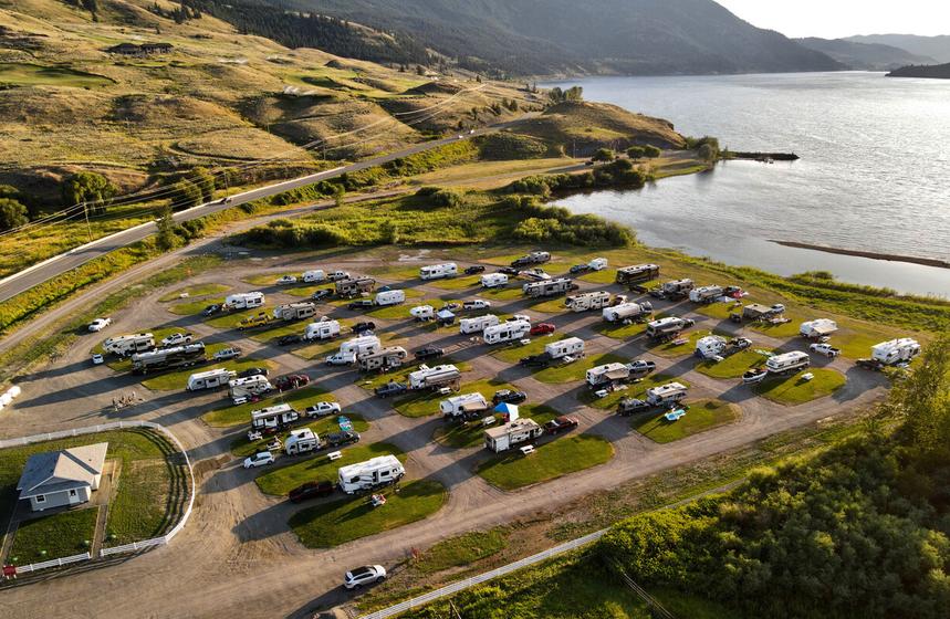
Letterboxing Clues:
From the Hwy 5A junction onto Pennask Lake Road look for a large boulder that is on the right just after the second corner. Cache is behind boulder.
238
Please check geocaching.com before you go!
Red Lake
SITE IDENTIFICATION
Nearest Community:
Savona, B C
Geocache Location:
N 50°52.580' W 120°46 476'
Altitude:
952m/3123ft
Ownership:
Crown Land
Accuracy: 3 meters
Overall Difficulty: 2
Overall Terrain: 2
Access Information and Restrictions:
Follow the Red Lake Road from Kamloops or the Sabiston Creek Road from Savona. From Hwy 1, take Sabiston Rd and follow for approx 24 km until you reach Copper Creek Road. Follow Copper Creek Road until you reach Red Lake Approximately 36 km from Hwy 1
Parking Advice:
A small parking area at the south side of the lake, right at the boat launch
For more information or to report a problem with this site please contact: Gold Country Communities Society
P O Box 933 Cache Creek, B C V0K 1H0 Tel: 1-877-453-9467 Email: info@exploregoldcountry com
For more site pages go to: www exploregoldcountry com www geocaching com
The Red Lake Road follows a route through the hills to the north of Kamloops Lake, connecting Tranquille to Savona. This 75 kilometre route follows the Tranquille River for over half its route, then winds through valleys to a high viewpoint over the lake, and down the dry hills to the west end of Savona.
Starting at the west end of Kamloops, the Red Lake Road veers around Tranquille, a tuberculosis sanatorium established in 1907 which later became a sanatorium for the mentally handicapped until it closed in 1984 The road crosses the Tranquille River that was the site of a minor gold rush starting in 1858 and continuing into the next century. The road climbs the hills through Lac du Bois Provincial Park past the Dewdrop Range. The red cliffs above the Dewdrop range are the result of a 50 million year old lava flow. The Dewdrop Trail starts from the plateau and climbs the escarpment to the rim and then follows the ridges overlooking Kamloops Lake.
Past the Dewdrop Range, the road passes the Pimple, a lookout over the spectacular Tranquille River Canyon For the next 15 km, the road winds through the canyon, before crossing the Tranquille River and into the bottom of the valley The road continues northwest past a few Backcountry ranches, two B.C. Forest Service recreational sites, a small waterfall, and some old buildings before emerging into a more open, grassland and forest environment.
APPLY STICKER HERE
Near the Km 33 sign, the Heller Creek Forest Service Road heads north toward Truda Lake and beyond to Tranquille Lake About 3km beyond is an important intersection The right fork goes to Criss Creek, a small community established in the early 1900’s Backroad explorers can opt to follow side roads to the Seven Lakes Road back onto the Sabiston-Red Lake Road or beyond towards the Deadman’s Valley In dry conditions, these routes are interesting, but good maps/GPS basemaps, good clearance, and a full gas tank is recommended. This is the highest point
239
Geological & Views
#131 GC3P3V8
Phase 2
on the road and if we follow the road to the left it leads down to Red Lake There is a small community here surrounding the long narrow At 950m elevation the lake is a favorite from mid-Spring through November, featuring both brook trout and rainbow trout. There is an undeveloped boat launch and a small rustic campsite on the lake.
The road descends the Carabine Creek Valley with a number of photo opportunities in a picturesque setting. At the Copper Creek junction a road leads down to Copper Creek, formerly a stop on the Hudson’s Bay Brigade Trail and later was a CNR settlement It was also an area where the First Nations people obtained copper near the surface East of Copper Creek is Painted Bluffs Provincial Park The clay and rock formations are rich in copper, iron, and cinnabar, providing a display of greens, orange, and red hues on eroded ridges The park is not easily accessible by land B C Parks recommends the area should be approached by boat on Kamloops Lake
The road continues along the dry hills over Kamloops Lake on the Sabiston Creek Road with many fine views to the south before starting a descent down the hills to the Trans Canada Highway west of Savona. The entire route is a slow drive, best taken in dry conditions. There are many scenic spots along the way to take photos, to geocache, and to explore Gold Country.
Written and Researched by Doug Smith
BIBLIOGRAPHY & SOURCES
Saemerow, Mona Then and Now, The Road to Red Lake Minimona Publishing, Kamloops, B C 2008
Shewchuk, Murray Cariboo Trips and Trails, Fitzhenry Whiteside, Markham, Ontario, 2008
Shewchuk, Murray. Backroads Explorer, Volume 1 McLean Hunter, Vancouver, B.C., 1985
Mussio, Russell and Wesley. Thompson Okanagan BC Backroad Mapbook, Mussio Ventures Ltd., Coquitlam, BC 2010
Favrholdt, Ken Curator, Kamloops Museum and Archives “Gold at Tranquille” From the Archives Coordinates:
Start of the Red Lake Road: N 50°43 550' W 120°30 441'
Sabiston Creek Road/Highway #1: N 50°45 430' W 120°53 319'
Heller Creek Road Junction: N 50°54 933' W 120°44 027'
Red Lake-Criss Creek Junction: N 50°54 452' W 120°46 354'
Copper Creek Junction: N 50°48 352' W 120°46 604'
Letterboxing Clues: In the rocks near the parking area.
240
Please check geocaching.com before you go!
Seton Ridge Trail Rails & Trails
SITE IDENTIFICATION
Nearest Community: Lillooet, B C
Geocache Location:
N 50°38 913' W 122°07.020'
Ownership:
Crown Land
Accuracy: 5 meters
Overall Difficulty: 3
Overall Terrain: 4.5
Access Information and Restrictions:
From the Mile 0 cairn on Main Street follow Hwy 99 South on the Duffey Lake Road for 19 5 km and turn right on Seton Ridge Forstery Service Road
Cross the bridge over Cayoosh Creek, and continue on about 6 km to flat area on the left Trail is adequately marked with flagging tape 4x4 with high clearance
Parking Advice:
Park in pull out. Trail starts to your left.
For more information or to report a problem with this site please contact:
Gold Country Communities Society
P O Box 933 Cache Creek, B C V0K 1H0
Tel: 1-877-453-9467
Email: info@exploregoldcountry com
For more site pages go to: www exploregoldcountry com www geocaching com
Seton Ridge follows the height of the land with dizzyingly steep drops of nearly 1600 meters to either side. Seton Ridge is the eastern terminus of the Cayoosh Ranges of the Coast Mountains of British Columbia. To the north of the trail is Seton Lake and to the south, the Cayoosh Creek valley. Cayoosh Creek originates just west of Duffy Lake in Cayoosh Pass, close to Lillooet Lake. Seton Lake is classified as a freshwater fjord that drains to the east into Cayoosh Creek which is referred to as the Seton River in the BC Freshwater Fishing Regulations Seton Lake’s actual depth is not entirely known but is known to exceed 500 meters Although it is called a lake, Seton is a reservoir; the eastern end was dammed as a part of the Bridge River Power complex that was completed in 1960 Where the Seton Lake gorge joins the Cayoosh Canyon, it creates an area known by the local St’at’imic people as Nkoopmtch (meaning: water crossing over); this large gap punches a hole into the Fraser Canyon wall, easily visible from Seton Ridge.
APPLY STICKER HERE
As you ascend the trail take the time to pause for a breath and to take in the view. This is the sub-alpine forest, rich in plant life not found in the dry valleys below In fact, the vegetation you find here will be similar to what you can expect to find on the eastern ranges of the Coast Mountains, along the Cayoosh Creek, up to Duffy Lake; beyond the lake the plant life changes significantly as you enter the temperate rainforest of the Pacific Coast Expect to see: the yellow Round-Leaved Violet (Viola orbiculata), Prince’s- Pine (Chimaphiila umbellata) and Falsebox (Pachistima mirsinites)
In June you may spot an exception of the above statement, the delicate orchid named the Fairy Slipper (Calypso bulbosa). If you are familiar with this flower, you will notice that the local population found on Seton Ridge displays numerous magenta spots over its lower petal or ‘lip’ with white hairs; these characteristics are found in populations located within the Coastal Temperate Rainforest This is very different from the populations found
241
#134 GC3QN9X Phase 2
east of the Fraser River and Carpenter Lake which are usually a softer pink, are missing any spots on the ‘lip’ and displays a cluster of yellow hairs Please resist the urge to pick this flower It is disappearing at an alarming rate; once picked, the Fairy Slipper will die and not return the following year. The presence of this ‘costal’ variation of this orchid is a testament to the transitional climate that Seton Ridge is located in.
Seton Ridge was named by A.C. Anderson, a Hudson Bay Company explorer and surveyor that was commissioned in 1858 by Governor Douglas to find a route from Harrison Lake through Lillooet to the Upper Fraser River The route he proposed included navigating Seton Lake which lies directly north, adjacent to Seton Ridge Colonel Alexander Seton was a relative and childhood friend of A C Anderson Seton served the British Empire during the Kaffir War and was killed on February 26, 1852 while commanding the HMS Birkenhead which sank, destined for the Cape of Good Hope Colonel Seton was killed during the tragedy, 445 of the 634 passengers perished
Detailed Access Information:
The forestry road leading to the trailhead is rough, has loose gravel, rocks and many switch backs. It is possible to continue along the ridge an additional 3 km past the Geocache and reach an alpine summit. The trail to the summit is vague at times and requires additional elevation gain. This should only be attempted by strong hikers with good mountain sense and the ability to navigate with a map
Written and Researched by Wayne Robinson
BIBLIOGRAPHY & SOURCES
Akrigg, G P V & Helen (1973) 1001 British Columbia Place Names Vancouver: Discovery Press Parish, Coupe, Lloyd (1996) Plants of Southern Interior British Columbia and the Inland Northwest Vancouver, BC: Lone Pine Publishing
“Shalath & Seton Lake” (2012) http://www cayoosh net/seton html
“Wikipedia: Seton Lake” (2012) http://en wikipedia org/wiki/Seton Lake
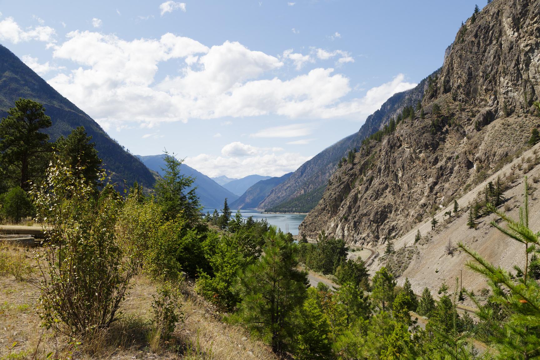
From trail head hike up trail for 2 3 km to the first look out of Seton Lake where the trail is not as steep. Hidden just off the trail.
242
Letterboxing Clues:
Please check geocaching.com before you go!
Stake Lake Trail Rails & Trails
SITE IDENTIFICATION
Nearest Community:
Logan Lake, B C
Geocache Location:
N 50°30.917'
W 120°28 531'
Altitude: 1333m/4373ft
Ownership:
Crown Land
Accuracy: 4 meters
Overall Difficulty: 1 5
Overall Terrain: 2
Access Information and Restrictions:
Approx 29 km from Logan Lake Travel northeast from Logan Lake on Meadow Creek Road Continue along the road as it crosses Hwy 5 and becomes Lac Le Jeune Road Turn right at the B C Forest Service Stake Lake sign In winter stay off the cross country ski trails and take the Marsh Snowshoe Trail. Caution, snow can be very deep.
Parking Advice:
Park at the Stake Lake parking lot at the North end of the lake.
For more information or to report a problem with this site please contact:
Gold Country Communities Society
P O Box 933 Cache Creek, B C V0K 1H0 Tel: 1-877-453-9467
Email: info@exploregoldcountry.com
For more site pages go to: www exploregoldcountry com www.geocaching.com

Just five minutes north of Lac Le Jeune is a year-round paradise for anyone who loves to be outdoors. Stake Lake is a place where people come for the snow, the sun, and the stars!
Nestled on the Nicola Plateau, part of the Interior Plateau region, the Stake Lake trails are awash with Englemann spruce, Douglas fir, and lodgepole pine trees with stands of waterbirch among the bulrushes in the marshier areas Plenty of wildlife is attracted to the area as well Moose, lynx, mule deer, beaver, and plenty of bird species including osprey, waterfowl and songbirds are often seen throughout the year.
When the snow flies, local cross-country skiers know all about Stake Lake thanks to the hard work of volunteers from the Overlander Ski Club who have operated and maintained the trails since 1991 On a sunny and cold winter weekend the parking lot is often full to overflowing with those who love to hit the trails The Lake and trails area is uniquely situated to hold snow and colder temperatures while surrounding regions can often go without With a heated day lodge and 60 km of expertly groomed and well-marked trails, including lit trails for night skiing, 8 km of snowshoe trails and 5 km of dog-friendly ski trails, Stake Lake makes being active in the winter a lot more fun. For those who crave motors with their snow, motorcycle ice racing on the lake is also popular.
APPLY STICKER HERE
In the summer, the Stake Lake landscape is dotted with hikers, mountain bikers, and many happy people wielding fishing rods trying to reel in some rainbow trout The lake is stocked and is a popular destination for fishing enthusiasts As many skiers at Stake Lake know, skiing at night can be a thrill It's not uncommon for skiers to have to stop and look up on a clear night because the view of the stars is so spectacular Recognizing the value of this area for nighttime viewing, the Kamloops Astronomical Society moved an observatory dome to the cleared area at the lake where the
243
#136 GC3P9A8
Phase 2
ski club stages its events Situated in a large pile of boulders, the observatory is used for night time viewing events by society members Originally built by Gerry Bernard for friend Murray Foubister, from a pattern in Sky and Telescope magazine, the observatory sat in Foubister's yard for a few years before it was eventually taken apart and reconstructed at its current home by Kamloops Astronomical Society members in 2010.
Easy to access from Kamloops, Logan Lake, and Merritt, Stake Lake is a perfect destination for people who love to spend time outdoors all year round The Kamloops Astronomical Society's website offers excellent tips on how to get started as a skywatcher, and the Overlander Ski Club website includes excellent maps of all the trails
Written and Researched by
Vesta Giles
Please check geocaching.com before you go!
BIBLIOGRAPHY & SOURCES
BC Adventure Network. (2012). Stake Lake, British Columbia. Web. 5 Jun. 2012.
Kamloops Astronomical Society (2012). Web. 5 Jun. 2012. Overlander Ski Club (2012). Web. 5 Jun. 2012.
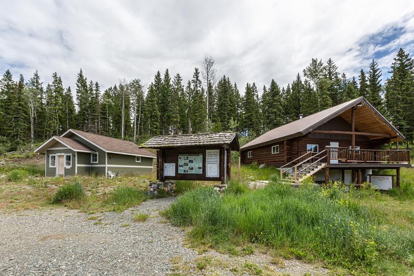
Letterboxing Clues:
See the trail map at the lodge. In summer make your way to the Little Joe Trail Walk until you see a yellow snowshoe sign on each side of the trail Cache is 7 metres up the hill, approx. 1 metre south of the trail under a log.
244
Tranquille Lake
SITE IDENTIFICATION
Nearest Community:
Savona, B C
Geocache Location:
N 50°56.168' W 120°33 572'
Altitude: 1409m/4622ft
Ownership: Private Property
Accuracy: 3 meters
Overall Difficulty: 2.5
Overall Terrain: 2 5
Access Information and Restrictions:
This remote spot can be accessed off the Red Lake Road or the Sawmill Lake Road From Hwy 1, take the Sabiston Rd for nearly 24 km to the junction Tranquille, Savona, Copper Creek and Sabistion access. Follow Copper Creek Road to Tranquille Criss Creek Road and follow to Heller Creek FSR and turn left. Turn at the Wendego Lodge signs and follow the signs to the end of the road. Approximately 59.2 km from Hwy 1.
Parking Advice: Park at Wendego Lodge
For more information or to report a problem with this site please contact:
Gold Country Communities Society
P O Box 933 Cache Creek, B C V0K 1H0 Tel: 1-877-453-9467
Email: info@exploregoldcountry com
For more site pages go to: www exploregoldcountry com www geocaching com
APPLY STICKER HERE
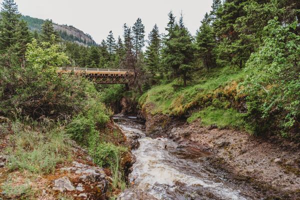
The road to Tranquille Lake will take about one and a half hours from either Kamloops or Savona. From Kamloops, take the Red Lake Road and turn at the Heller Creek Forest Service Road at Km 33. Follow the road following the Tranquille River up through the hills to the north. After about 10.5 kilometres, take the right fork to Truda Lake. This is a dammed lake, but there is fishing at Truda Lake, best accessed from the west end. The road into Tranquille Lake is a rough road best suited to high clearance vehicles
Another route to Tranquille Lake is to take the Lac du Bois Road north from Kamloops and turn towards Pass Lake onto the Sawmill Lake Forest Service Road, following it all the way to the Heller Creek Forest Service Road. Along the way, Saul Lake is a popular 25 hectare lake with a recreation site on the south side. In the icefree season, small rainbow are fished with flies or lake trolling. The approach from Savona starts a short distance west of Savona by taking the Sabiston Creek Forest Service Road to Red Lake, then beyond to the Heller Creek FSR At the end of the road on the northeast corner of Tranquille Lake is a fishing destination for Kokanee and Kamloops trout This higher elevation lake is suitable for fly fishing, spin casting (small lures) or trolling. There are facilities for fishermen, families, or anyone just looking for a “Tranquille retreat.” In winter the road is kept open, but four wheel drive will probably be required. It is also used as a base for snowmobiling to the high country to the north of Tranquille Lake.
Tranquille Lake is also the starting point for the Masters Sub-Alpine Trek, a four to five day backpack up over Porcupine Ridge and beyond to Tsintsunko Provincial Park, and Bonaparte Provincial Park and ends at the Jamieson Creek Road above Bonaparte Lake It is a remote and isolated area and anyone attempting the route will need route-finding skills, maps, a good GPS and all the right equipment for the adventure.
245
Geological & Views
#139 GC3P3WW
Phase
2
Porcupine Ridge Provincial Park sits above Tranquille Lake The old pack trail leads up to sub-alpine meadows, wetlands, and some old-growth forest It is a protected area with limited recreational access (no vehicles). Snowmobile use is permitted in winter and the Kamloops Snowmobile Club maintains the trail routes.
Tranquille Lake is a destination for fishermen, snowmobilers, and a few explorers, but it is also a good stop on a tour of the high country points of interest of the area Take the circle route and stop in Tranquille Canyon, Red Lake, the Carbine Creek Valley, Saul Lake, the Seven Lakes Road, Criss Creek, and Sabiston Creek While you tour the backroads, bring your GPS and find the geocaches of the area too
Written and Researched by Doug
Smith
Please check geocaching.com before you go!
BIBLIOGRAPHY & SOURCES
Mussio, Russell and Wesley. Thompson Okanagan Backroad Mapbook, Mussio Ventures, Coquitlam, 2010
Shewchuk, Murphy. Cariboo Trips and Trails, Fitzhenry Whiteside, Markham Ontario, 2008
Youds, Richard The Bonaprte Plateau, Sonotek, Merritt, 1993 http://www wendegolodge com/ (website), 2012
Coordinates:
Tranquille Lake: N 50°56 346' W 120°34 807'
Truda Lake: N 50°51 125' W 120°39 252'
Wendego Lodge: N 50°56 204' W 120°34 807'
Saul lake: N 50°54 880' W 120°38 563'
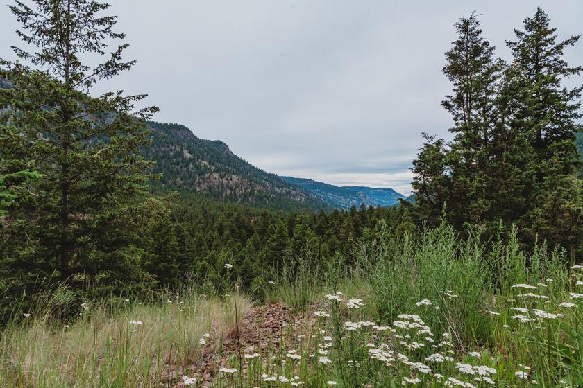
Letterboxing Clues:
Go past the last cabin (#1) and look for a small path going into the forest on the north side of the cabin; hidden by two large rocks.
246
Pioneers & Early Settlers
Walhachin Museum Soldiers Memorial Hall
SITE IDENTIFICATION
Nearest Community:
Walhachin, B C
Geocache Location:
N 50°45.216' W 120°58 785'
Altitude:
385m/1263ft
Ownership:
Privately Owned
Accuracy: 1 meter
Overall Difficulty: 1
Overall Terrain: 1
Access Information and Restrictions:
From Cache Creek to the Walhachin turn off it is 22 5 km From Trans Canada Hwy 1 turn onto Walhachin Road Follow the signs to the museum for 5 km until you reach the fork at Thompson Crescent Go left and follow Walhachin Road downhill to the flat area for 0 7 km
Parking Advice:
Park at pull off at the bottom of Walhachin Road at the base of the hill at the flat area
For more information or to report a problem with this site please contact:
Gold Country Communities Society
P O Box 933 Cache Creek, B C V0K 1H0 Tel: 1-877-453-9467
Email: info@exploregoldcountry com
For more site pages go to: www exploregoldcountry com www geocaching com
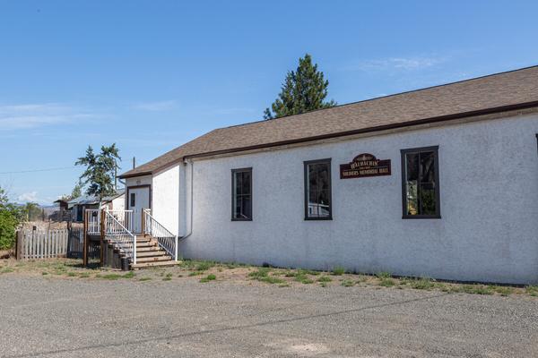
2012 marks the 100th anniversary of the building of the Walhachin (WALL- ha-sheen) Soldiers Memorial Hall. Its construction, in 1912, added to this thriving community’s list of already many services. The new hall facility served not only as a fruit packing house at one time, but proved vital to the social health of the town as well. The spruce plank floating dance floor set on springs for extra bounce was the delight of the well-heeled community’s mainly British upper class citizens setting down their roots as prospective business men and gentlemen farmers The hall’s neighbor, the Walhachin Hotel, was no longer suitable to hold the large gatherings for which Walhachin was gaining a reputation
The population at that time was about 300 people. The community hosted gala balls where top hat and tails, ball gowns and gloves would be considered appropriate attire. The full width stage held the orchestra usually headed by Fanny Faucault, a Victoria B.C. born and raised local, trained as a classical pianist. It was under Fanny’s guidance that a group of Walhachin citizens went to Vancouver B.C. and purchased, at auction, a Weber concert sized grand piano once owned by Iganz Jan Paderewski This world renowned Polish pianist had finished his North American tour in Vancouver and was returning to Poland to become their Prime Minister His piano remained in Walhachin’s hall for almost 50 years when, in 1961, the community donated it to the University of British Columbia‘s School of Music
APPLY STICKER HERE
The 1960’s brought about some drastic changes to the Hall. The full width stage was cut in half and the actors’ dressing rooms were turned into men’s and ladies washrooms (until then, there had only been an out-house to service the patrons). Further renovations included removing the springs from the dance floor and completion of the upper walls and ceiling
Over the years folks from the small outlying communities
247
#141 GC3P38Y
Phase 2
such as Ashcroft, Cache Creek, Savona and Clinton still reminisce about the boisterous dances, dinner theaters, and plays held at the community hall in Walhachin Sadly, Walhachin’s heyday amounted to a mere five or six short years from 1908 to 1914. The start of World War 1 was its death knell. Out of 117 men living in Walhachin 97 of them enlisted. Walhachin had the highest enlistment rate per capita of any other city in Canada. Many men simply locked up their houses, leaving behind all their possessions, and returned to England with their wives. They fully intended to return and pick up where they left off. One of the many to leave was a young officer named Gordon Muriel Flowerdew, Walhachin’s butcher. As a bachelor of 29 years of age, he received one of only six Victoria Crosses given to the Lord Strathcona’s Horse. He perished of his wounds after the battle of Mereuil Wood in France and received his medal posthumously. Thus the name of The Walhachin Soldiers Memorial Hall was conceived in honor and remembrance.
There are fourteen original buildings left in Walhachin, twelve of these are homes The store and school house have been turned into private residences The last of the remaining foundation fruit trees can be found on the north side of the Thompson River where they co-exist with rattlesnakes, sagebrush and Prickley Pear cactus. Walhachin is a ghost of its former self and its unusual story of hopes unfulfilled, attest to a community spirit rich in dreams.
Written
and Researched by Colleen
Bick
BIBLIOGRAPHY & SOURCES
Val Carey, personal communication, long time Walhachin resident Nelson Riis, Settlement Abandonment UBC master’s thesis 1967 Joan Weir, Walhachin Catastrophe or Camelot? 1984
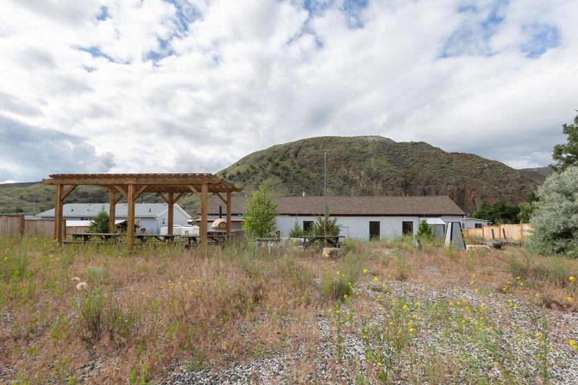
Letterboxing Clues: From parking spot follow faint dirt trail towards base of the hill, near a pile of rocks approx 18m. Hidden in sage brush. Blends in with landscape.
248
Please check geocaching.com before you go!
Watching Creek Gold Claims Rails & Trails
SITE IDENTIFICATION
Nearest Community:
Savona, B C
Geocache Location:
N 50°48.307' W 120°33 113'
Altitude: 671m/2201ft
Ownership:
Private Property
Accuracy:
4 meters
Overall Difficulty: 2.5
Overall Terrain: 2 5
Access Information and Restrictions:
From Hwy 1, take Sabiston Rd and follow until you reach Copper Creek Road. Follow until you reach Tranquille Criss Creek Road and turn right Follow until you reach the Watching Creek Forest Service site at N 50°47 964' W 120°33 154' Approximately 61.1 km from the Criss-Creek and Copper Creek Junction. Park anywhere in the flat area and walk north along the old road The road down to the Forest Service site N 50°48 223' W 120°33 051' can be rough and muddy after rain
Parking Advice:
Anywhere in the Watching Creek Forest Service site; closest is N 50°48.223' W 120°33.051'
For more information or to report a problem with this site please contact:
Gold Country Communities Society
P.O. Box 933 Cache Creek, B.C. V0K 1H0 Tel: 1-877-453-9467
Email: info@exploregoldcountry com
For more site pages go to: www.exploregoldcountry.com www geocaching com
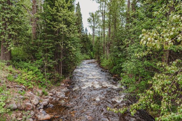
In the Interior of B.C. the fur trade had declined somewhat when gold was found on the Fraser River in 1858. In that same year, 25 000 people ventured inland to search for gold. Panning sites sprung up on all tributaries of the Fraser. Hudson Bay Company employees and Native people turned to prospecting. Settlements grew up quickly and fur trading forts started to supply miners as well as trappers.
Fort Kamloops was moved to the North Shore to support routes for the gold rush and the movement of cattle The Hudsons Bay Company’s Brigade Trail crossed the north shore and then the Tranquille River, climbed the hills across the Dewdrop Range, down to Copper creek, then up over the hills to Deadmans Valley and beyond to the Cariboo. The present site of Tranquille was on the route and a small settlement and some gold panning started at the mouth of the river, mostly by Natives from the area, including Jean Baptiste Lolo “St. Paul”, who went on to become a chief of the Shuswap people.
APPLY STICKER HERE
Some minor trade in gold started in 1859, and a minor rush started soon thereafter By 1861, hundreds of miners were working the creek. Production dropped by 1870 and many miners moved on to the construction of the CPR. Chinese miners continued on the Tranquille River until the 1890’s. At that time, hydraulic mining started with a company from the Coast building a 25 foot dam and a 1200 foot flume. A new mining boom started and continued until the 1930’s. Some platinum was found in the river and a number of miners continued to live off mining until the 1950’s. The Tranquille River is now known as one of three “18-carat rivers” in B.C. Today, we can still see evidence of the hydraulic mining along the river.
Watching Creek is a tributary of the Tranquille River From the mouth of the river, the canyons narrow down to a gorge with lava flows, hoodoos, slot canyons, and cliffs for 15 km. At that point two gorges meet at the confluence. Watching Creek
249
#142 GC3P3XC Phase 2
flows down from the south end of the Bonaparte Plateau through Porcupine Meadows Provincial Park Miners staked claims on Watching Creek too and worked the gorge There are still two claims on the north side of the creek and recreational gold panners can still be seen from time to time. Rock hounds also access the canyon for green opal nodules and agate geodes. A rustic B.C. Forest Service Recreation sits on the west side of the river and the south side of Watching Creek is now part of Lac du Bois Provincial Park. This was the site of a homesteader named Paddy Docksteader. He was a horse trader who had worked for the Buffalo Bill Wild West Show. He had many stories to tell his neighbors.
Drive the short road down to a grassy bench where camping is permitted Another trail leads down to the creek and along the edge of the bluffs Hoodoos and lava flows can be seen at various points Trails once led from the recreation site across the river on two bridges, but both are washed out now Instead, a narrow road from Tranquille Crossing (at the 15km sign) follows the river back to Watching Creek over 2 5km A trail network is used by hikers, gold panners, and rock hounds to explore the Watching Creek Valley or south along the east side of the Tranquille River.
On your next trip up the Red Lake Road, stop at Watching Creek for a quiet spot to explore, gold pan, rock hound, hike, or geocache.
Written and Researched by Doug Smith
BIBLIOGRAPHY & SOURCES
“Gold at Tranquille” Ken Favrholdt, Archives, Kamloops Museum Mussio, Russell and Wesley Thompson Okanagan Mapbook, Mussio Ventures ltd , 2010 Saemerow, Mona Then and Now – The Road to Red Lake, Minimona Publishing, Kamloops, 2010 http://www kamloopstrails net Shewchuk, Murphy Backwoods Explorer, Thompson Cariboo, McLean Hunter, Vancouver, 1985
Coordinates:
Tranquille River crossing near Tranquille: N 50°43.603' W 120°31.550'
Side road to the Watching Creek Forest Service Site: N 50°47.965' W 120°33.155'
Confluence of Watching Creek and the Tranquille River: N 50°48.329' W 120°33.125'
Tranquille Crossing Forest Service Site: N 50°49 236' W 120°34 840'
Route to Watching Creek trails: N 50°49 320' W 120°34 959'
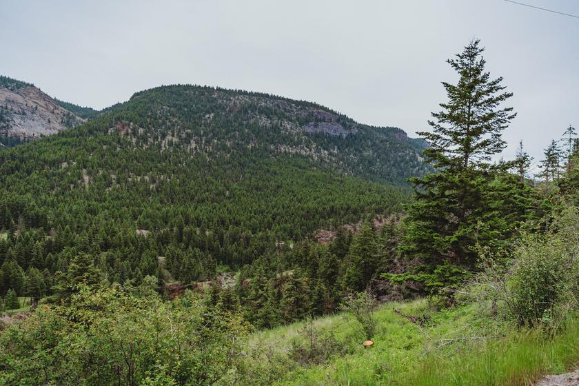
Letterboxing Clues:
From the flat area, follow the double track north to the viewpoint and then look for a log in the forest; the cache is hidden between a tree and a log.
250
Please check geocaching.com before you go!
Pioneers & Early Settlers
Widow Smith
SITE IDENTIFICATION
Nearest Community:
Spences Bridge, B C
Geocache Location:
N 50°25 470'
W 121°20.438'
Altitude:
243m/797ft
Ownership:
Private Property
Accuracy: 1 meter
Overall Difficulty: 1
Overall Terrain: 1
Access Information and Restrictions: Off the Trans-Canada Highway near the center of Spences Bridge turn onto Chucker Crescent at the top of Log Cabin Pub property Do not climb fence or enter cemetery! Do not wander onto private property left of the gravesite.
Parking Advice: Park in parking lot by log cabin
For more information or to report a problem with this site please contact: Gold Country Communities Society
P O Box 933 Cache Creek, B C V0K 1H0
Tel: 1-877-453-9467
Email: info@exploregoldcountry com
For more site pages go to: www exploregoldcountry com www geocaching com
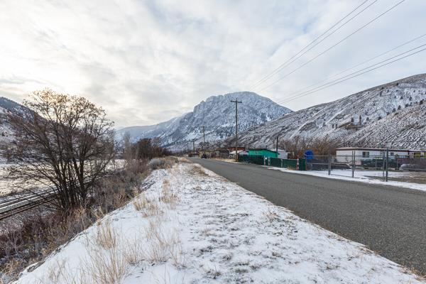
Just off the Trans-Canada Highway, near the center of Spences Bridge lays the gravesite of a remarkable pioneer woman, Jessie Ann Smith, otherwise known as Widow Smith of Spences Bridge. Her story begins when Jessie Ann, her husband John and their good friend James Teit arrived in Spences Bridge after an arduous journey through the Fraser and Thompson River Canyons The Smiths lived in Spences Bridge until their move to the wilderness of the Voght Valley in 1887 1
In the summer of 1894, John Smith joined a party of prospectors in search of gold at Granite Creek. There John got buried up to his neck in a mining slide where he suffered some serious injuries from which he never fully recovered. John’s health slowly improved and in 1897 the Smiths returned to Spences Bridge where they purchased John Murray’s estate The neglected orchard needed a lot of work to bring it back to bearing fruit Eventually, the heavy labor became more than John Smith’s declining health could bear as his heart had been damaged due to his mining accident John Smith died on April 21st 1905, at 52 years old, much to the dismay of his dear wife Jessie Ann
APPLY STICKER HERE
After the death of her husband, the management of the 3000 tree orchard and the marketing of the fruit seemed a daunting task for Jessie Ann. Yet she was determined to maintain her husband’s high standards As stated by Jessie Ann herself: “John’s name on a box of apples was a guarantee of top quality ” The Smith’s hard work paid off Thirty-seven varieties of apples flourished in their orchard, the most famous of which were the Macintosh red, the delicious and the award winning Grimes Golden (which were originally from cuttings taken from Jessie Ann’s father’s orchard in Scotland) Each of the apple varieties were prized for their particular characteristics Some were excellent eating apples; others were suitable for pies and sauces. Certain apples ripened early, others late and some varieties were good keepers for export.
251
#143 GC3P39B Phase 2
Jessie Ann entered her apples in many international exhibitions between 1905 and 1914 where she won many top honors On one particular occasion in1909, at the London Horticultural Society exhibition, King Edward the VII requested to be shown the Golden Grimes apples of the “Widow Smith of Spences Bridge, B.C.”
In 1939, Jessie Ann received a friendly wave from Queen Elizabeth as she and her husband King George the VI travelled through Spences Bridge by train. Jessie Ann and her two sons managed the ranch and the orchard until her 93rd year She passed away on the 7th of February 1946
There remains little of the Smith’s original orchard; the Trans-Canada Highway passes through the middle of the Smith’s property. Their ranch house, built in 1910-11, can be seen adjacent to the Chief Whitsemnitsa Community complex. “The Packing House” coffee shop and its adjoining “Country Pantry” store is the original fruit packing house of Widow Smith of Spences Bridge. After a long life of hard work and dedication, Jessie Ann Smith’s gravestone reads that she is “Safe in the arms of Jesus.”
Written and Researched by Dominique Robillard
BIBLIOGRAPHY & SOURCES
1 See site page “The Smiths” Gold Country GeoTourism Adventures Field Guide Volume 1, 147. Ward, A. & Campbell, J.M. (1989) Widow Smith of Spences Bridge. Merritt, BC; Sonotek Publishing
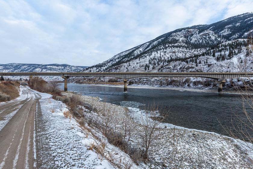
252 Letterboxing Clues: From parking lot walk towards memorial site Blends in
Please check geocaching.com before you go!
A Nomadic People
SITE
IDENTIFICATION
Nearest Community:
Cache Creek, B C
Geocache Location: N 50°46 797' W 121°25.018'
UTM: East 611602; North 5626549 10U
Altitude:
1111m/3645ft
Ownership: Private Property
Accuracy: 4 meters
Overall Difficulty: 2
Overall Terrain: 2
Access Information and Restrictions:
Coming from Cache Creek, head 3 km South on Hwy 1 and take a right at Patterson/Airport Road Cache will be regular size, stay off private property
Parking Advice: Park at pull off on Patterson Rd.
For more information or to report a problem with this site please contact:
Gold Country Communities Society
P O Box 933 Cache Creek, B C V0K 1H0
Tel: 1-877-453-9467
Email: info@exploregoldcountry com
For more site pages go to: www exploregoldcountry com www geocaching com
APPLY STICKER HERE
Indigenous Peoples of Canada were largely nomadic. They would set up camp where there was the greatest number of resources, either by season or harvest time, and relied upon dogs, horses, dugout canoes, and themselves, to carry their belongings to and from their seasonal homesites.
Many Indigenous groups lived in Teepees, large tent shaped housing constructed with long skinned wooden poles and animal hide Inside of the teepee, spaces were separated into areas for sleeping, cooking, and storage It also featured an opening in the top to allow for smoke to escape from interior fires used to cook and heat the home. These homes were easily packed away and leased onto horses or dogs for travel.
In the mid-summer to early fall the people would gather up their belongings and temporary homes and travel back to their wintering grounds Traditionally, the Secwépemc, Nlaka’pamux, and Scw’exmx people wintered in permanent pit houses
There are many pithouse sites in the interior of British Columbia including around Kamloops, Lillooet, Lytton, and in the Cariboo Chilcotin areas with Keatly Creek being one of the largest and well-studied pithouse village sites in Canada. This site dates from the Middle Prehistoric period 7,000 to 4,800 years before present day! Over 115 house sized depressions are at the site, with some being the largest constructions known from the British Columbia Interior and Western Canada. Pithouses were very large with multiple hearths and additional pole holes for room divisions. The largest probably housed 45 or more residents living within the home in a basic hierarchy, a house chief, and the lowerranking families.
Food was hunted and gathered with weapons and tools fashioned from stone, wood, and bone The people followed the herds of Bison, Elk, Moose, and other ungulates through their territories following the resources season to season.
253
B.C. History
#01 GC9Z2BG
Prequel
Fishing and hunting took place along the Fraser River in the summer and fall The women harvested plants for food and medicine in the montane regions around the river Food was preserved by placing it on drying racks in the sun and this would help it keep for several years if future harvests were poor. Within the pithouses there were often large storage pits used to store or cache their dried foods.Some groups propagated and cultivated plants such as the Bitterroot agriculturally by replanting the ‘heart’ or core of the plant the spring after harvest and before moving to a winter home.
Sometimes traditional hunting and gathering territories were shared and overlapped with other tribes and community groups; for example, the Secwépemc, Nsyilxcən, Státmic, and Nlaka’pamux share overlapping territories for hunting, fishing and gathering of plants for food and medicines During times of the salmon run, different traditional groups would gather in their ‘respective’ fishing areas around the Fraser River There are many archeological pithouse sites in the Downing, Marble Range, and Edge Hills Provincial Parks that clearly show this gathering of different tribes into one territory or region for the purpose of food gathering
Being primarily hunters and gatherers, these nomadic people had sustenance lifestyles, a deep respect for nature, egalitarian social values, and deep spiritual beliefs. Indigenous Peoples have rich cultures with distinctive traditions in art, fashion, dance, and song. They created their own ceramics and pottery, weapons and tools, some of which have been found during archeological studies of BC’s interior pithouses
Written and Researched by Lana
Rae Brooks
BIBLIOGRAPHY & SOURCES
Chandler, A. (2015). The northern plains: Nomads of the grasslands. Canada’s History. https://www.canadashistory.ca/explore/historic-sites/the-northern-plains-nomads-of-the-grasslands Joseph, B. (2012). All aboriginal people were nomadic. Indigenous Corporate Training. https://www.ictinc.ca/blog/all-aboriginal-peoples-were-nomadic Hayden, B. (1996). Occupation at Keatly Creek. SFU Museum of Archaeology & Ethnology. https://www.sfu.ca/archaeology/museum/exhibits/past-exhibits/keatley-creek/occupation-at-keatley-creek.html
254
Please check geocaching.com before you go!
Sharing the Wealth
SITE IDENTIFICATION
Nearest Community:
Cache Creek, B C
Geocache Location: N 50°46 503' W 121°18.987'
UTM: East 618700; North 5626161 10U
Altitude: 611m/2004ft
Ownership: Ministry of Transportation
Accuracy: 2 meters
Overall Difficulty: 1.5
Overall Terrain: 1.5
Access Information and Restrictions: South of Cache Creek on Hwy 1, approximately 5km, turn onto Airport Rd Park in pull out area on right hand side of road
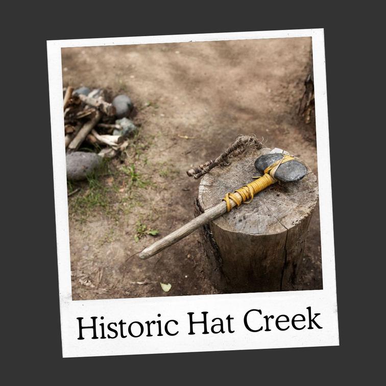
For more information or to report a problem with this site please contact:
Gold Country Communities Society
P O Box 933 Cache Creek, B C V0K 1H0 Tel: 1-877-453-9467
Email: info@exploregoldcountry com
For more site pages go to: www exploregoldcountry com www geocaching com
APPLY STICKER HERE
Today, traditional Indigenous values emphasize sharing, retaining, and returning to cultural practices and language. Historically, Indigenous Peoples had a moderated standard of living which allowed a degree of equality within the community; having enough to get by was ideal, and allowed excess resources to be shared.
Sharing among people often took place at Potlatch ceremonies They were important culturally, spiritually, and also for the governing structure of the community Primarily used to redistribute and share wealth, Potlatches were also used to bestow status and rank for individuals, groups, and clans, and they were also used to establish claims and rights to hunting and fishing territories.
The Potlatch ceremony was held for important social events and could last for several days For example, transferring of rights and chieftainships, births, marriages, naming of children, coming of age for young people and funerals were all means for a Potlatch The people would feast, dance, and sing during this time At the Potlatch valuable items such as blankets, clothing, food, canoes, and tools would be redistributed from high-ranking individuals as gifts that were bestowed on the invited guests by the host. Above the economic benefits of redistributing wealth, a Potlatch also ensured community solidarity and maintained hierarchical relations within the community and territories.
In 1884 the federal government of Canada banned Potlatches under Section 141 of the Indian Act This ban lasted from 1884-1951 and included not only Potlatches but also other ceremonies such as the sun dance and sweat lodges Potlatch ceremonies were some of the most culturally important ceremonies for Indigenous people. Colonists and missionaries
255
B.C. History
#02 GC9Z1C7
Prequel
did not understand the sharing of wealth and food and considered them excessive and wasteful However, they understood how important they were to sustain Indigenous culture As long as the potlatch existed, Indigenous people would continue their economic system of redistribution of wealth, food, and oral traditions, and not ‘assimilate’ to colonial ways.
Judge Alfred Scow describes some of the impacts of the Potlatch Law in a web article named the Indian Act located on the Indigenous Foundations Art website at UBC Here he states: “This provision of the Indian Act was in place for close to 75 years and what that did was it prevented the passing down of our oral history It prevented the passing down of our values It meant an interruption of the respected forms of government that we used to have, and we did have forms of government be they oral and not in writing before any of the Europeans came to this country We had a system that worked for us We respected each other We had ways of dealing with disputes ”
Indigenous author and activist from Big River, Saskatchewan, Sylvia McAdam, stated that “the 1885 to 1951 ban led to a patriarchal culture where women are excluded from leadership.” She went on to say the potlatch ban effects are still lingering and are seen in the exclusion of many Indigenous women from leadership positions in communities. "Prior to [the] treaty, women were the ones that held the ceremonies. They were the doctors and the healers All of that has been flipped now "
Indigenous worldviews focus on a nonmaterial vision of the world, emphasizing connections to family, language, identity, the environment, and a general sense of belonging. Prior to colonialism this was practiced through equality and sharing in community. By balancing the ‘economy’ everyone would have a moderate standard of living with no one living to extravagance or excess, and no one “not having”. These values focused on community rather than individuals, unlike mainstream society’s materialistic worldviews, they ensured equal access to resources for the community members, and the sharing of food and wealth among each other.
Written
and Researched
by Lana Rae Brooks
BIBLIOGRAPHY & SOURCES
Gadacz, R (2006) Potlatch The Canadian Encyclopedia https://www thecanadianencyclopedia ca/en/article/potlatch
Monkman, L (2017) Historical ban on potlatch ceremony has lingering effects for indigenous women, author says CBC News https://www cbc ca/news/indigenous/historical-ban-spirituality-felt-indigenous-women-today1 4036528
Hanson, E (2009) The indian act First Nations and Indigenous Studies UBC http://indigenousfoundations.arts.ubc.ca/the indian act/ Native Governance Center. (n.d.). Indigenous wealth guide. Native Governance Center. https://nativegov.org/resources/indigenous-wealth-guide/
256
Please check geocaching.com before you go!
Arrowleaf Balsamroot
SITE IDENTIFICATION
Nearest Community:
Cache Creek, B C
Geocache Location: N 50°45 859' W 121°22.744'
UTM: East 614312; North 5624868 10U
Altitude: 1195m/3920ft
Ownership:
Crown Land Accuracy: 1 meter
Overall Difficulty: 2
Overall Terrain: 2
Access Information and Restrictions:
From Cache Creek head south on the 1 Hwy for about 1 km and take a right at Campbell Hill Dr W Follow this dirt road, stay right at the Cache Creek Transfer station, follow about 10km Summer access only pending snow fall and road maintenance.
For more information or to report a problem with this site please contact:
Gold Country Communities Society
P O Box 933 Cache Creek, B C V0K 1H0 Tel: 1-877-453-9467
Email: info@exploregoldcountry com
For more site pages go to: www exploregoldcountry com www geocaching com
APPLY STICKER HERE
Flora & Fauna
Arrowleaf balsamroot is common in cold, dry areas, is a relative of the sunflower, and can grow up to 2.5 feet tall with one or many stems bearing blooms on a single plant. The floral heads are bright sunny yellow with ray and disk flowers atop. The arrowshaped leaves can be up to 50 cm long and 20 cm wide and are silvery-green with fine felt-like hairs. As its name states, the Arrowleaf balsamroot grows on a large, thick taproot that can be the width of a hand and grow to a depth of 8 feet into the hillsides it takes residence on The balsam portion of this plant’s name comes from its taproot, which contains a sappy resin within
The Arrowleaf balsamroot is a long-lived perennial herb native to North America’s Western hillsides and prairies, growing at low to mid elevations on dry, rocky slopes, in grasslands, and in open forests throughout the interior of British Columbia.
Arrowleaf balsamroot provided an important food for Interior Indigenous peoples It was high in fiber and energy content, and local Indigenous groups ate various parts of it throughout the year with almost every part being edible Young shoots and leaves were harvested in the early spring before they turned green and were eaten raw, baked, or steamed. The flower stems themselves could be peeled and eaten as well. Traditional digging sticks made of wood or antlers were used to harvest the long taproots in the rocky, arid soil and were sometimes steamed or roasted for eating but could also be dried and pounded into meal or used as a coffee substitute. Seeds of the Arrowleaf balsamroot were collected in the summer months of June through August and could be roasted and eaten, or ground into a flour that would later be mixed with other berries to make cakes. Root vegetables such as balsamroot were important sources of carbohydrates and Indigenous peoples managed the crop by never harvesting the “mother” roots which could be several decades old
257
#03 GC9YBK3
Prequel
C r e d i t : H e a t h e r A i e
Many tribes used Arrowleaf balsamroot medicinally The root could be boiled to produce a resin that was used for fevers, headaches, stomachaches and more A poultice made of leaves and roots was used to treat sores, insect bites, blisters, bruises and other wounds. Arrowleaf balsamroot has antibacterial properties and helps relieve the pain of burns. The root is supportive for the respiratory system and acts as an expectorant, made into a tea it was used to treat tuberculosis and whooping cough by some Indigenous groups. An infusion of leaves was used as a wash for poison ivy and running sores by the Secwepemc. The smoke from the roots was used to relieve body aches and pains.
Arrowleaf balsamroot is an important food source for deer, elk, and sheep It is tolerant of fire due to its deep taproot Following fires and drought, the plants will often regenerate from the basal rootstock The flower blossoms smell like chocolate and the plants are often found in open, full sun, but can also tolerate partial shade and occur from 1,000 to 9,000 ft in elevation
Medicinal plant information is for historical information only. Gold Country Communities Society is not encouraging harvesting of native plants for food and/or medicine.
Written and
Researched
by Lana Rae Brooks
BIBLIOGRAPHY & SOURCES
Christensen, S. (2013). Arrowleaf balsamroot: Sunflower of the west. Nature’s Seed. https://www.naturesseed.com/blog/arrowleaf-balsamroot-sunflower-of-the-west/ DeZwart, M. (2017). Cariboo sunflowers. BC Food History. https://bcfoodhistory.ca/cariboo-sunflowers/ Native Foods Nursery. (n.d.). Balsamroot. Native Foods Nursery. https://nativefoodsnursery.com/balsamroot/ TIlley, D., St. John, L., and N. Shaw. 2012. Plant Guide for arrowleaf balsamroot (Balsamorhiza sagittata). USDA-Natural Resources Conservation Service, Aberdeen Plant Materials Center Aberdeen, Idaho 83210 Turner, N (2013) Names of native plant species in Indigenous languages of Northwestern North America University of Victoria http://hdl handle net/1828/5091 Okanagan College (2021) Indigenous Garden Plant Guide https://www okanagan bc ca/sites/default/files/202103/indigenous garden plant guide full pdf pdf

258
Please check geocaching.com before you go! Credit: Heather Aie
Oh Deer Flora & Fauna
SITE IDENTIFICATION
Nearest Community:
Cache Creek, B C
Geocache Location: N 50°46 711' W 121°24.459'
UTM: East 612271; North 5626404 10U
Altitude: 1088m/3569ft
Ownership:
Crown Land
Accuracy: 5 meters
Overall Difficulty: 1.5
Overall Terrain: 1.5
Access Information and Restrictions:
From Cache Creek head south on the 1 Hwy for about 1 km and take a right at Campbell Hill Dr W Follow this dirt road, stay right at the Cache Creek Transfer station, follow about 12km Summer access only pending snow fall and road maintenance.
For more information or to report a problem with this site please contact:
Gold Country Communities Society
P O Box 933 Cache Creek, B C V0K 1H0
Tel: 1-877-453-9467
Email: info@exploregoldcountry com
For more site pages go to: www exploregoldcountry com www geocaching com
APPLY STICKER HERE
The area now known as McLean's Lake has been a vital part of the local Indigenous Culture. McLean's Lake is located in British Columbia, approximately 7km to the south of Grassland 7 Indian Reserve, on Hat Creek #3 Indian Reserve. Historically, the Indigenous people of the area used McLean’s Lake for hunting, fishing, and gathering fauna that was used for cooking and medicines. It also provided an escape from the heat of lower elevations The lake is also home to a variety of plants and animals, making it an important part of the local ecosystem
Indigenous men would herd deer into tight areas using enclosures, fences, water, nets, and canyons before ambushing them. Deer were hunted by nets that entangled deer antlers, allowing hunters to club or spear them. Dogs were frequently used to run animals down, keep them at bay until men arrived, and herd them into designated areas where hunters waited with arrows and spears.
After collecting their kill, no part of the deer was wasted The brain was kept to create a solution to break down the hide into a soft and supple buckskin Once the deer was harvested, the hide was scraped of any extra flesh and fats, then soaked in water for three days. This allowed for the hair to soften and then the hair removal could be done. This was usually accomplished with sharp bone or rock. It was important at this time to make sure the membrane was fully scraped off from the flesh side, so the brain solution could penetrate the skin, and obtain the soft texture of buckskin. The water had to be wrung out, and this was usually accomplished by attaching the buckskin to an anchor point and then wringing it out, to a point where there is still enough moisture in the skin to maintain maximum flexibility The brain was heated with water and then it is massaged into the hide by hand Most hides reach a good point for suppleness by two massages, but some can take up to five!
259
#04 GC9Z91A
Prequel
The hide is then cut into workable strips and stretched on a frame or rack to dry After the hide has dried, it can be smoked over a fire to give it more stability in storage, as well as a darker colour Once it is smoked, the buckskin is ready for use. It can be used for clothing, teepee covering, or for storage.
Today, McLean's Lake is still an important part of the local Indigenous Culture. The First Nations of the area continue to use the lake for hunting, fishing, gathering, and now have grazing pastures there. They also still use the lake as a place to relax and enjoy the beauty of nature Currently Ashcroft Indian Band and Bonaparte First Nations own land rights to these lands So, it is important to observe the signage and stay within public territory
Written and Researched by Misty Antoine and Brandy Cooper-Chardon
Please check geocaching.com before you go!
BIBLIOGRAPHY & SOURCES
Ashcroft Indian Band. (2023). McLean’s lake land claim. Negotiation & Claim. http://www.ashcroftband.ca/content/negotiation--claim
Kuhnlein, H. & Humphries, M. (n.d.). Traditional animal food of Indigenous Peoples of Northern North America: Deer. McGill University. http://traditionalanimalfoods.org/mammals/hoofed/page.aspx?id=6133
260
Yarrow
SITE IDENTIFICATION
Nearest Community:
Cache Creek, B C
Geocache Location: N 50°45 462' W 121°21.519'
UTM: East 615768; North 5624165 10U
Altitude: 1237m/4058ft
Ownership: Crown Land
Accuracy: 2 meters
Overall Difficulty: 2
Overall Terrain: 2.5
Access Information and Restrictions: From Cache Creek head south on Hwy 1 for about 1 km and take a right at Campbell Hill Dr. W. Follow this dirt road, take a right at the Cache Creek Transfer station. Follow Patterson Road about 8km. Here you will find a rustic camp site with no amenities. Please pack out what you pack in and verify boundaries for ORV guidelines and wildfire impacts before using the crown land.
For more information or to report a problem with this site please contact:
Gold Country Communities Society P O Box 933 Cache Creek, B C V0K 1H0 Tel: 1-877-453-9467
Email: info@exploregoldcountry com
For more site pages go to: www exploregoldcountry com www geocaching com
APPLY STICKER HERE
Flora & Fauna
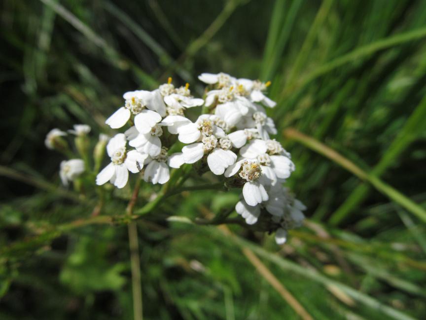
Yarrow is a widespread and common flowering plant in the Southern Interior of British Columbia growing from low to high elevations in a range of moist to dry environments, especially in forests and open sites with plenty of sun exposure. Yarrow can be found throughout British Columbia and over much of North America. It also occurs across northern and central Europe and Asia. It is a common plant growing in many places all over the world, in many climates and habitats
Yarrow can have one or more stems growing up to 75 cm tall. The feathery, fern-like leaves sprout out alternately along the stems. Its tiny white flowers are grouped into small clusters of heads that are flat-topped, with each small flower head consisting of 3 to 8 tiny ray flowers. Disc florets make up the central part of each, which is surrounded by 5 petal-shaped ray florets.
Yarrow has been used to stop blood flow throughout the ages Indigenous people used this white flowering plant for medicinal purposes An infusion of warm water and roots would be consumed for headaches, stomachaches, colds, and diarrhea. Bathing in an infusion made from the whole plant helped ease the pain and stiffness from rheumatism and arthritis and was also an effective wash for burns and rashes. Leaves and stems were mixed with white clematis and branches from dense clusters of shoots found on Douglas fir trees, called the “witch’s broom,” to make a shampoo. The smoke created from placing the feather-like leaves and stems on hot coals kept mosquitoes at bay. Yarrow was also used for smudging and was known as women’s medicine
261
#05 GC9YBVC
Prequel
Common starlings and other bird species use the dried leaves of yarrow to build their nests and is a deer resistant garden perennial Yarrow gets its name from the Greek hero Achilles, who is said to have used the plant to treat his wounds.
Medicinal plant information is for historical information only. Gold Country Communities Society is not encouraging harvesting of native plants for food and/or medicine.
Written and Researched by Lana Rae Brooks
Please check geocaching.com before you go!
BIBLIOGRAPHY & SOURCES
TWC Staff. (2022). Achillea millefolium. Plant Database. https://www.wildflower.org/plants/result.php? id plant=acmi2
Hallworth, B. (2006). Yarrow. The Canadian Encyclopedia. https://www.thecanadianencyclopedia.ca/en/article/yarrow Kidadl Team. (2021). 93 Yarrow plant facts you probably didn't know about. Kidadl. https://kidadl com/facts/93-yarrow-plant-facts-you-probably-didn-t-know-about Okanagan College (2021) Indigenous Garden Plant Guide https://www okanagan bc ca/sites/default/files/202103/indigenous garden plant guide full pdf pdf
Turner, N (2013) Names of native plant species in Indigenous languages of Northwestern North America University of Victoria http://hdl handle net/1828/5091
Celtic Roots Farm (2021) 5 Fun facts about yarrow that will make you want to grow it Celtic Roots Farm https://celticrootsfarm com/18/5-fun-facts-about-yarrow-that-will-make-you-want-to-grow-it/ Hebda, R (2017) Yarrow Royal BC Museum https://staff royalbcmuseum bc ca/2017/01/17/yarrow/
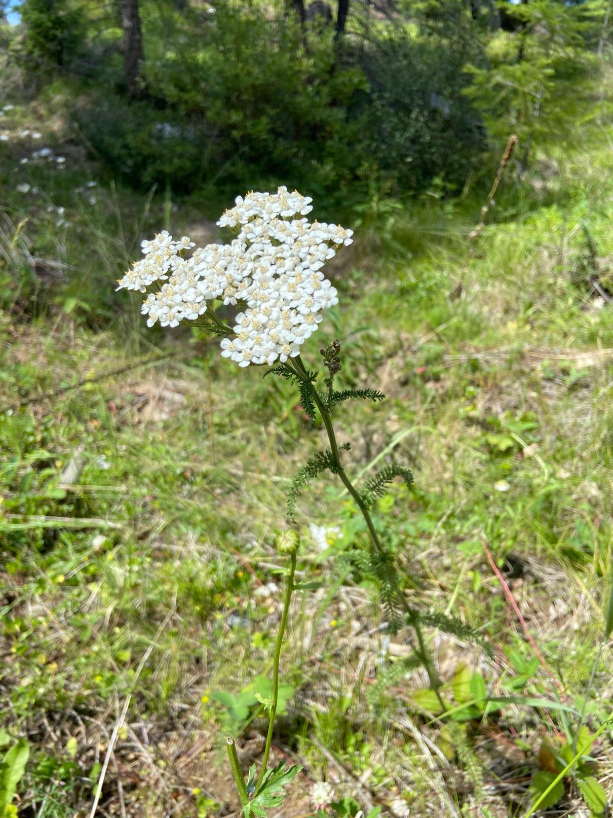
Credit: Lana Rae Brooks
262
The Mighty Salmon Flora & Fauna
SITE IDENTIFICATION
Nearest Community: Walhachin, B C
Geocache Location: N 50°46 755' W 121°01.716'
UTM: East 635457; North 5627037 10U
Altitude: 376m/1233ft
Ownership:
Ministry of Transportation
Accuracy: 2 meters
Overall Difficulty: 1
Overall Terrain: 1.5
Access Information and Restrictions:
From Cache Creek travel east on Hwy 1 about 23 km to Walhachin Station Road Follow to coordinates Park in designated pullover area
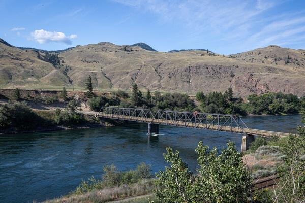
Since the beginning of memories, salmon has been a staple in the Secwepemc diet. The migration of these fish brought the people to different areas along the river systems and created temporary camps. In the spring and fall, when the fish were plentiful, they would establish larger camps, fish, and feast. Salmon was (and still is) highly regarded and thought to bring wisdom to those who respect it.
For more information or to report a problem with this site please contact:
Gold Country Communities Society
P O Box 933 Cache Creek, B C V0K 1H0 Tel: 1-877-453-9467
Email: info@exploregoldcountry com
For more site pages go to: www exploregoldcountry com www geocaching com
APPLY STICKER HERE
Dip netting is the most common way that Secwépemc people fish for salmon Long ago, before the use of steel nets, the Secwépemc used cedar boughs to make dip nets. The nets were placed in strategic areas along the rocks and when salmon swam into it, the weight of the fish would pull the cedar net under water, trapping the fish. The salmon could then be pulled out by hand.
Salmon was (and still is) a key part of their diet and was often hung to dry or smoked to preserve it. However, dip netting is not only for food. It is also a time for social interactions and storytelling. It is a time to connect with the salmon - to show them our respect
Today, salmon are still an important part of Secwépemc culture. Many Indigenous people continue to fish for salmon using traditional dip nets and teach their children the importance of respecting these fish. However, salmon populations are declining across North America due to a variety of factors including overfishing, habitat loss and degradation, and climate change. It is more important than ever that we protect salmon so that they can continue to be a part of the Indigenous culture and way of life. The salmon are native to tributaries of the North Atlantic (genus Salmo) and Pacific Ocean (genus Oncorhynchus)
The Thompson River has historically been a producer of large
263
#07 GC9YX95
Prequel
salmon runs This river is an important producer of Chinook, Coho, and Pink Salmon In recent years however, the salmon returns have been greatly reduced and, in some years, no salmon have returned at all to spawn This is devastating to the Secwépemc people who have relied on salmon for centuries.
There are many things we can do to help protect salmon. We can support organizations that are working to restore salmon habitat. We can be careful about the products we use, as some chemicals can pollute the water and harm salmon And, we can teach others about the importance of salmon in Indigenous culture and why we need to protect them Salmon are an important part of Secwépemc culture and way of life We must work together to protect the salmon so that they can continue with their time-honored traditions
Written and
Researched
by Brandy Cooper-Chardon
Please check geocaching.com before you go!
BIBLIOGRAPHY & SOURCES
Indigenous Tourism British Columbia (2019) Living Legends: The teachings of the salmon Indigenous Tourism BC https://www indigenousbc com/stories/the-teachings-of-the-salmon
Laiwan (n d ) Return to the water: First nations relations with salmon The Hydrologic Blog http://www2 laiwanette net/fountain/return-to-the-water-first-nations-relations-with-salmon/
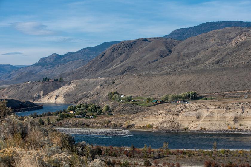
264
Osprey Viewing Flora & Fauna
SITE IDENTIFICATION
Nearest Community: Walhachin, B C
Geocache Location: N 50°45 832' W 121°01.862'
UTM: East 638855; North 5625414 10U
Altitude: 393m/1289ft
Ownership:
Ministry of Transportation
Accuracy: 2 meters
Overall Difficulty: 2
Overall Terrain: 1
Access Information and Restrictions:
From Cache Creek travel east on Hwy 1 about 23 km to Walhachin Station Road Follow to coordinates Park in designated pullover area
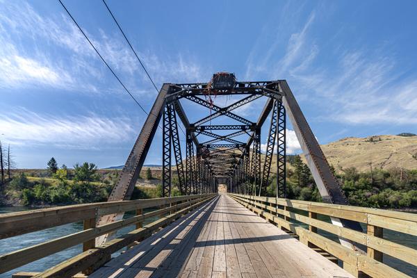
Ospreys are birds of prey that are known by many names, some of which are fish hawk, river hawk, sea hawk, or even fish eagle. Scientists use the Latin name to describe the species so as not to have confusion. It is not clear where the term Osprey is derived from however the scientific name comes from Greek mythology and the Greek term for “fishing eagle”.
Ospreys have dark feathers on their upper bodies and their underbellies are covered with white plumage They have small white heads with a dark ‘crown’ and very distinct eye stripping A close-up view would reveal that they have a faint and speckled band in the breast plumage.
For more information or to report a problem with this site please contact:
Gold Country Communities Society
P O Box 933 Cache Creek, B C V0K 1H0 Tel: 1-877-453-9467
Email: info@exploregoldcountry com
For more site pages go to: www exploregoldcountry com www geocaching com
APPLY STICKER HERE
Ospreys almost always make their homes near bodies of water, raising their hatchlings where there is ample fish to be caught As with many bird species, the female osprey is considerably larger than the male (up to 20%) and usually has darker markings on its breast and head
They can spot their prey from heights of up to 40 meters above before plunging into the water to catch their prey with their sharp talons. Ospreys cannot dive very deep, only down about a meter, and therefore prefer to hunt in shallower waters. It closes its wing halfway and stretches its claws forward then disappears under the water's surface only to emerge moments later with a fish snared tightly in its talons
On the bottom of their feet, they have special sharp spines that aid them in holding on to the slippery and wiggling prey, the outer toe is also opposable allowing for the bird to have two talons facing forward and two talons facing backwards that aid in retaining their catch.
The only main threat to the adult Osprey species are people and the toxins we create Currently the osprey species is thriving,
265
#08 GC9Y97Y
Prequel
but it had a close call when in the 1950’s and 1960’s the use of DDT, a pesticide, was causing the shells of their eggs to be thin and their food sources to be contaminated Thanks to the work of conservation, the population has made a strong comeback and is currently no longer at threat of extinction.
The Osprey is named for the basic sound it makes, e.g. cíixʷcíixʷ ... the cry of the Osprey.
The American football team, The Seattle Seahawks” and its logo was inspired by Kwakwaka’wakw Indigenous tribe’s transformation mask, that shows an eagle changing into a human when the mask is opened How fabulous is it that the original Seahawks logo designers referenced books about the Northwest Coast Indigenous art for their design inspiration!
While Canada supports 1/3 of the world’s Osprey population, Osprey’s can and do live everywhere in the world except Antarctica, often migrating from cooler to warmer climates in winter months Most ospreys nesting in Canada will migrate to the Latin and Northern South Americas returning in the spring, however, one-year-old birds remain in their wintering grounds for the full summer In their 2nd or 3rd year, 30 to 50 percent will return to the area where they hatched in the spring, however, are not yet mature enough to nest, once sexually mature they will return to their nesting sites every spring Ospreys are typically monogamous returning to court and reaffirm their bonds year after year
Written and Researched by Lana Rae
Brooks
BIBLIOGRAPHY & SOURCES
Compton, B., Michel, J. Gardiner, D., & Arnouse, W. (2018). An idiolectal Secwepmctsin ethnozoological database. University of British Columbia. https://lingpapers sites olt ubc ca/files/2018/03/1993 Compton Michel Gardiner pdf National Geographic (n d ) Osprey National Geographic https://www nationalgeographic com/animals/birds/facts/osprey Spence, S (2021) Osprey: A bird of many names Science Connected https://magazine scienceconnected org/2021/04/osprey-bird-of-many-names/ Wright, R/ (2014) The mask that inspired the seahawks logo Burke Museum https://www burkemuseum org/news/mask-inspired-seahawks-logo Beach, A (2018) Osprey Northwest Wildlife Preservation Society https://northwestwildlife.com/wp-content/uploads/2018/11/Osprey.pdf
Dunrovin, S. (2019). Ospreys 101: Nesting, mating, and chicks. Days At Dunrovin. https://www.daysatdunrovin.com/ospreys-101-nesting-mating-chicks/ Sierra Club BC. (n.d.). Osprey. Sierra Club BC. https://sierraclub.bc.ca/osprey/
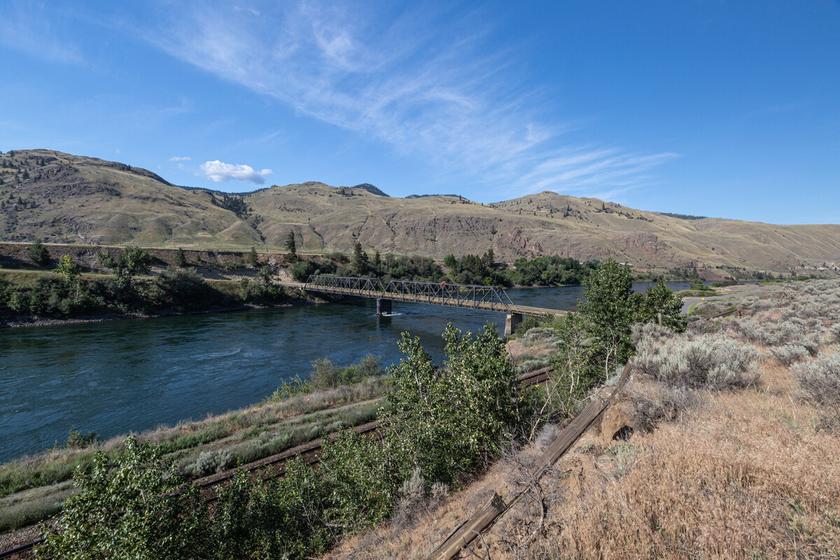
266
Please check geocaching.com before you go!
The Storytellers and Knowledge Keepers B.C.
SITE IDENTIFICATION
Nearest Community:
Walhachin, B C
Geocache Location: N 50°45 337' W 121°59.927'
UTM: East 641155; North 5624558 10U
Altitude: 433m/1420ft
Ownership:
Ministry of Transportation
Accuracy: 2 meters
Overall Difficulty: 1
Overall Terrain: 1
Access Information and Restrictions:
From Cache Creek travel east on Hwy 1 about 23 km to Walhachin Station Road Follow to coordinates Park in pull out access of Hawk Road
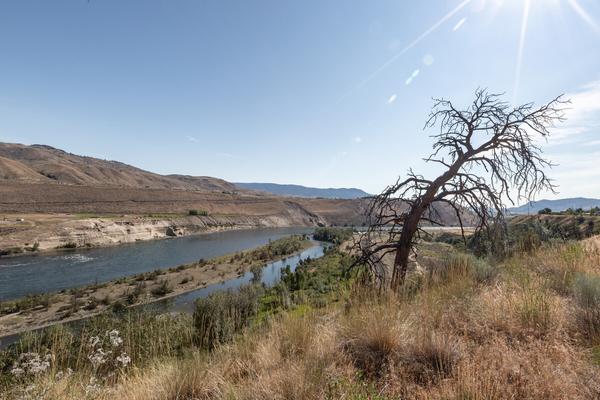
For more information or to report a problem with this site please contact:
Gold Country Communities Society
P O Box 933 Cache Creek, B C V0K 1H0 Tel: 1-877-453-9467
Email: info@exploregoldcountry com
For more site pages go to: www exploregoldcountry com www geocaching com
APPLY STICKER HERE
As you stand here overlooking the valley and see the railway lines running above the banks of the river and the highway just behind you, imagine transcending time to when they were not a part of this landscape. A time when the Secwépemc families along with the St’at’imc, Nlaka’pamux and Sylix nations were the only people in this region of BC. A time preceding David Thompson and Simon Fraser, the gold rush and the Overlanders. A time when the only sounds were the cries of the eagles overhead, the beating of the drums, and songs of the people that carried across the valley and hills The sweet scent of sage drifting on the breeze, and the silver glint of groups of Salmon (Chinook, Sockeye, Coho, and Pink) making their way to their home waters to continue the cycle that generations before them also did The long swim from the ocean to their home streams where another generation would hatch and make the journey back to the ocean creating a continuous cycle. The families who lived along the riverbanks, and hills in lodges made of reeds and boughs would come down familiar paths to catch these fish and prepare them to be stored for meals in the winter months when they moved their families into the under-ground pit-houses (Kekuli) for the colder weather. The fish were caught with nets, lines or speared. They were smoked or air-dried on racks. Salmon would be flaked and ground between stones, then packed into woven baskets and lined with smoked salmon skins. They could be kept for years this way.
Deer and bears that ventured along the grass hills would be hunted, and then skillfully turned into food, clothing, drums, and tools. Thanks to the deer, the salmon, and bears would be given through ancestral songs. These songs passed down from generation to generation. Children could be heard laughing and playing alongside their mothers as they gathered berries to dry and make nutritious meals from. The children were taught
267
History
#09 GC9YKMT
Prequel
these life skills of gathering, hunting, weaving, fishing, and building protective homes from their Elders Specific traditional designs in jewelry made with fish bones and quills, basket weaving designs, and tattooing designs of the family were also shown and taught to the youth. Elder story keepers shared the tales and songs of past elders with the young who would memorize them and then eventually share them to their own descendants. Time marked by the sun setting and rising and moon going from full to cresting completing a cycle and marking the passing of seasons. The songs and stories existing from time immemorial shared under a canopy of stars with the watchful eyes of the coyotes whose own songs could be heard echoing off the mountains upon them.
As you look across the land you can see the layers from the passing of centuries and movement of water, ice, and sand had encapsulated creatures, flora, and fauna that were here thousands of years ago Fossilized reminders and markers of where the ice moved around 11,000 BCE (before the common era) Migration of the Nlaka'pamux and Secwépemc by the ancestors is thought to have begun then Their territory was vast from what is now known as the Columbia River to the Fraser River and Arrow Lakes Approximately 145, 000 square km in size. The people moved along the river, and shores throughout the land gathering for celebrations and for trading items needed. They looked after the land, the animals, plants and all in it, and understood the importance of taking care of these precious resources for themselves and future generations. This knowledge is shared through storytelling and song.
As you carry on your journey, be mindful to also protect and cherish this beautiful life-giving land Remember to always pack out what you pack in, leave no trace of your visit and be respectful to nurture these surroundings Safe travels
Written and Researched by GrizzlyGran70
BIBLIOGRAPHY & SOURCES
Teit Times ISSN No 1198-4309 Summer, 1995 Vol 1 https://web.archive.org/web/19990127231059/http://www.secwepemc.org/secwho.html TRousseau, Mike (Autumn 1993). "Early Prehistoric Occupation of South-Central British Columbia". BC Studies. University of British Columbia. 99. ISSN 0005-2949.
Pg 6 The Simpcw of the North Thompson – British Coloumbia Historical News Volume 35, N0 3 Summer 2002
Pg 8 British Columbia History – Volume 52 N01 Spring 2019 Secwepemc People, Land and Laws: Yeri7 re Stsq’ey’s – kucw Marianne Ignace and Chief Ronald Ignace Traditions of the Thompson River Indians of British Columbia by James Teit 1898
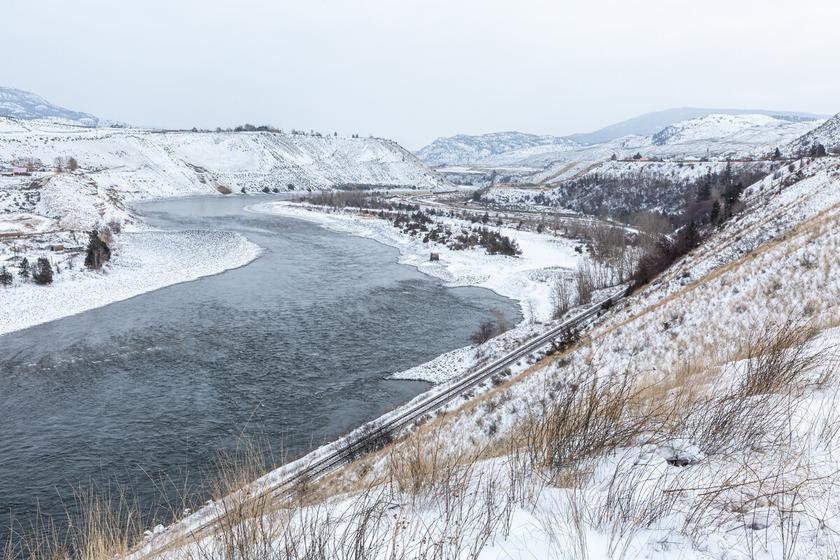
268
Please check geocaching.com before you go!
Plantain
SITE IDENTIFICATION
Nearest Community:
Walhachin, B C
Geocache Location: N 50°45 903' W 121°02.183'
UTM: East 638475; North 5625535 10U
Altitude: 388m/1272ft
Ownership: Ministry of Transportation
Accuracy: 2 meters
Overall Difficulty: 2
Overall Terrain: 1.5
Access Information and Restrictions:
From Cache Creek travel east on Hwy 1 about 23 km to Walhachin Station Road Follow to coordinates Park in pullover access
For more information or to report a problem with this site please contact:
Gold Country Communities Society
P O Box 933 Cache Creek, B C V0K 1H0 Tel: 1-877-453-9467
Email: info@exploregoldcountry com
For more site pages go to: www exploregoldcountry com www geocaching com
APPLY STICKER HERE
Flora & Fauna
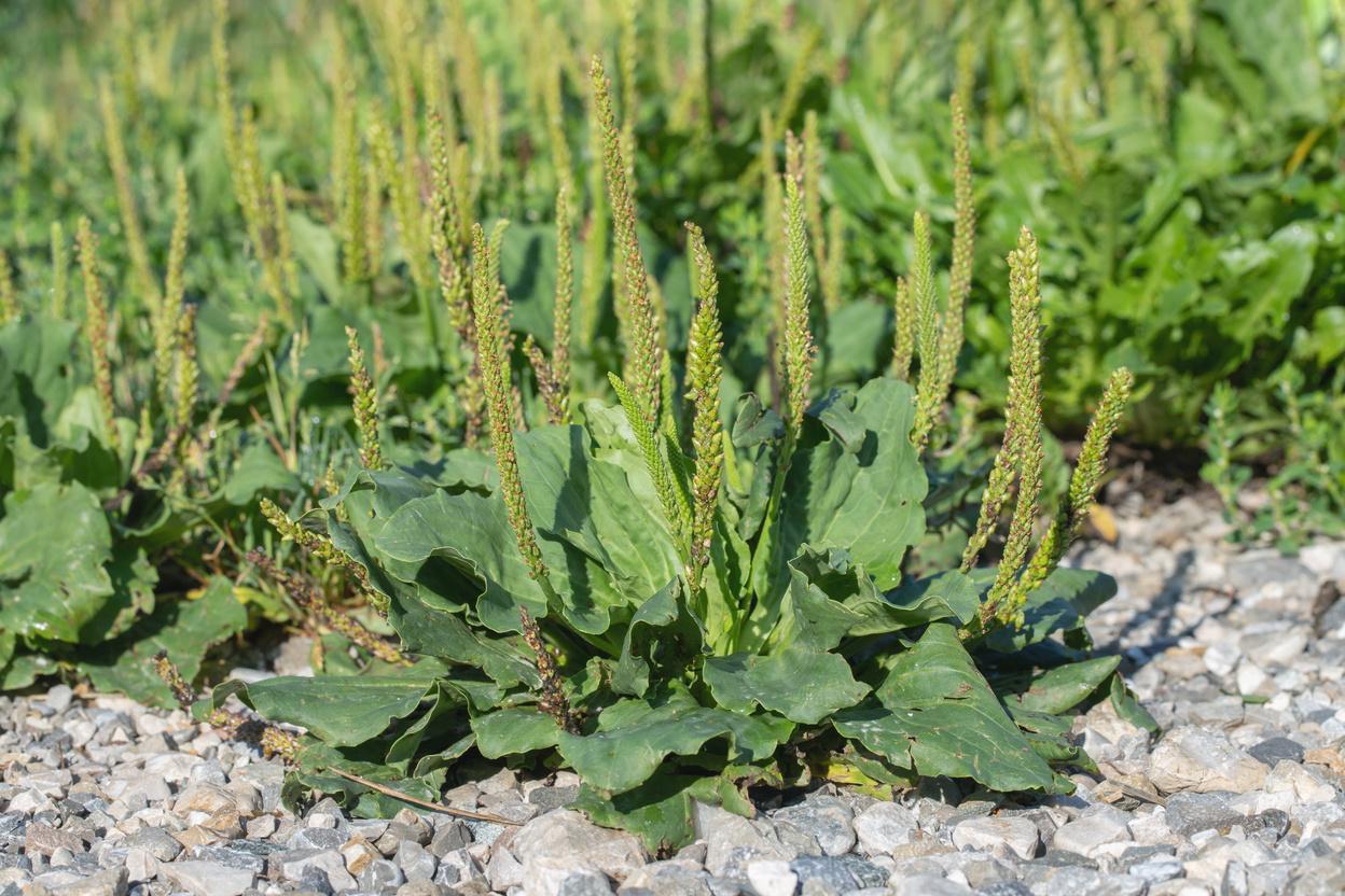
Plantain in British Columbia is usually one of two species, the most common being, Broadleaf of Lance Plantain. Plantain has over 200 species! Plantain can be identified by its broad and lance shaped leaves. The bright green and basal leaves have strong strands of strings in the main veins that run through them. The smooth or finely toothed leaves can be very large, reaching up to 7 inches long and more than 4 inches wide.
Plantain plants typically lay close to the ground with somewhat of a flattened appearance but may reach heights of 5 inches The blooms of the Plantain are spikes upon the long stems growing erect from the plant's center rosette. These tiny 3 mm florets are yellow to green in colour running the length of the stalk and tightly clustered together.
Plantain has a very wide habitat and range, and in many urban areas is considered a weed growing commonly among dandelions It prefers soils that have been disturbed such as roadsides, lawns, fields, flower and vegetable gardens, trails, forestry cut blocks, and can usually be found, today, anywhere that people have disturbed the land
Thought to be introduced with explorers to North America in the 1600’s, Plantain was called White Man’s Footprint. The young, tender leaves are edible and could be eaten raw. The older leaves were stringy and would be cut up and boiled in stews and soups The seeds were harvested and ground into flour to be used in cakes
The roots of this multi purpose plant were used to help with toothaches and headaches simply by chewing a piece of it. The Plantain leaves and juices can be used as a poultice in the same manner to treat many skin ailments such as rashes, cuts, burns, blisters, bruises, snake and insect bites, poison ivy or oak rashes, and sunburns.
269
#10 GC9YKN6
Prequel
C r e d i t : A d o b e S t o c k
Plantain was also used to treat sores of the mouth, sore throats, bronchitis, tuberculosis, ulcers, and aching muscles and joints It was made into poultices and ointments for open sores and wounds Plantain is one of the most useful plants on the planet, providing food and medicinal properties through tannins and astringents contained within it!
Plantain seeds can last up to 60 years in the ground making it hard to eradicate from lawns and gardens. Plantain is a nutrient dense food being entirely edible and contains the vitamins A, C, and K, zinc, potassium, and silica The seeds are also high in carbohydrates, omega 3 fatty acids and proteins
Medicinal plant information is for historical information only. Gold Country Communities Society is not encouraging harvesting of native plants for food and/or medicine.
Written
and Researched
by Lana Rae Brooks
BIBLIOGRAPHY & SOURCES
Juras, M (2014) Little weed and one of the most useful medicines on the planet Canadian Off The Grid https://www canadianoffthegrid com/little-weed-one-of-the-most-useful-medicines-plantain/
British Columbia Adventure Network (n d ) Common plantain British Columbia Wilderness Guide http://www bcadventure com/adventure/wilderness/wildflowers/common htm
Northern Bushcraft. (n.d.). Plantain. Northern Bushcraft https://northernbushcraft.com/topic.php?name=plantain®ion=bc&ctgy=edible plants
Fretwell, K., Cruickshank, I., & Starzomski, B. (2015). Common plantain, greater plantain. Biodiversity of the Central Coast. https://www.centralcoastbiodiversity.org/common-plantain-bull-plantago-major.html
Turner, N. (2013). Names of native plant species in Indigenous languages of Northwestern North America. University of Victoria. http://hdl.handle.net/1828/5091
Edible Wild Food. (n.d.). Broadleaf plantain. Edible Wild Food. https://www.ediblewildfood.com/broadleafplantain.aspx
Neverman, L. (2019). Broadleaf plantain: The “weed” you won’t want to be without. Common Sense Home. https://commonsensehome com/broadleaf-plantain/
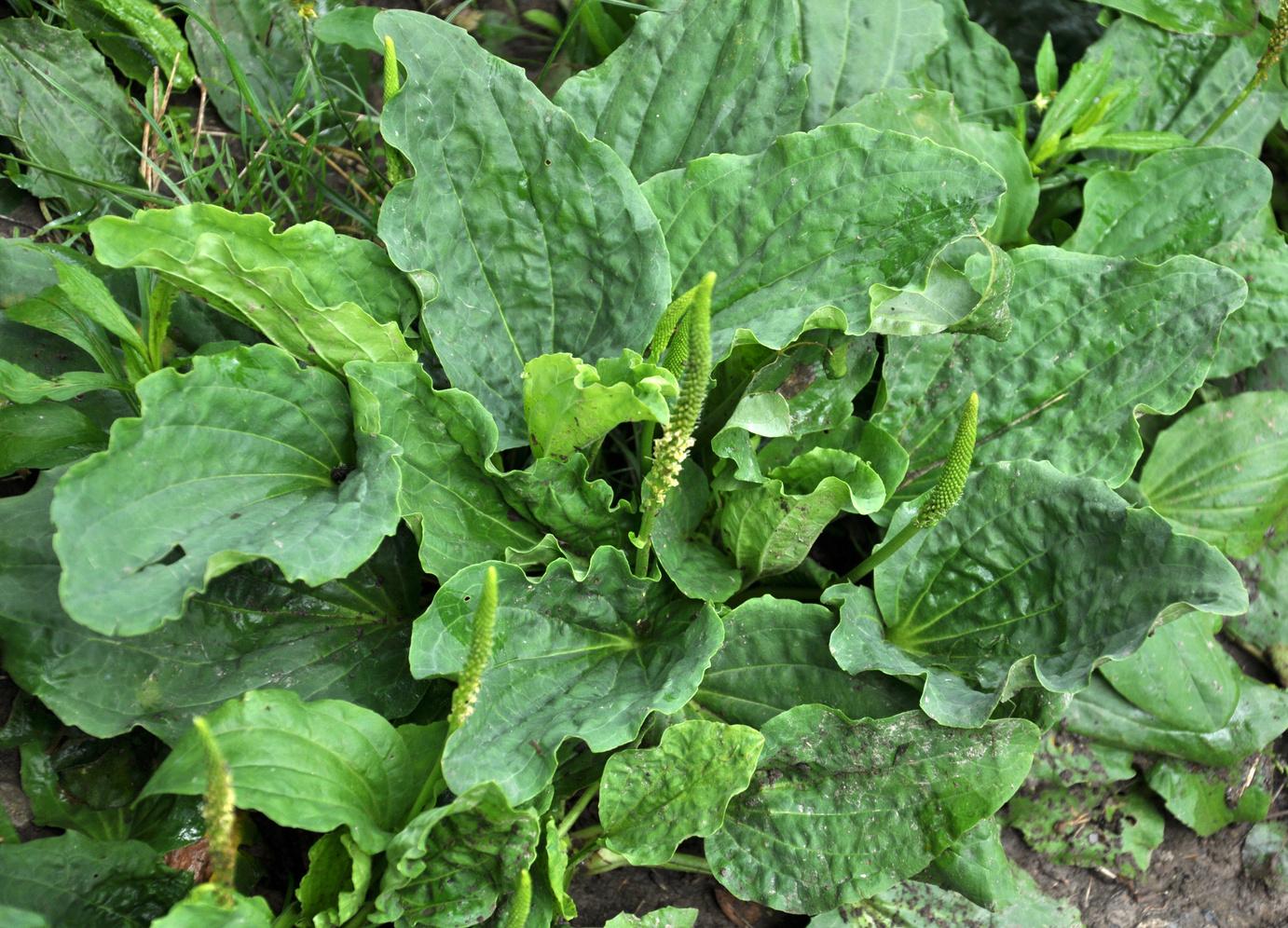
270
Please
geocaching.com
you go! Credit: Adobe Stock
check
before
Big Sagebrush
SITE IDENTIFICATION
Nearest Community:
Skeechestn, B C
Geocache Location: N 50°46 278' W 121°57.297'
UTM: East 644199; North 5626387 10U
Altitude:
490m/1607ft
Ownership: Private Property
Accuracy: 2 meters
Overall Difficulty: 1.5
Overall Terrain: 1.5
Access Information and Restrictions: From Cache Creek travel east on Hwy 1 to coordinates Please use designated parking When gate is closed please park outside Year-round access Watch for Western Rattle Snakes
For more information or to report a problem with this site please contact:
Gold Country Communities Society
P O Box 933 Cache Creek, B C V0K 1H0 Tel: 1-877-453-9467
Email: info@exploregoldcountry com
For more site pages go to: www exploregoldcountry com www geocaching com
APPLY STICKER HERE
& Fauna
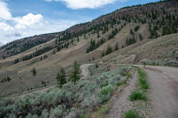
Sagebrush! Either loved or hated, its sight is ubiquitous in the semi-arid climate that makes up most Gold Country. Its Latin name, Artemisia Tridentata, means Big Sagebrush, which is a distinctive greyish-green shrub that blooms with a distinct yellow flower in the late summer. Big Sagebrush usually grows up to 2m tall, though it can occasionally grow taller, and will also have a 2m spread. The shrub is highly aromatic and is widespread throughout the southern interior of British Columbia It is one of the area’s most distinctive plants and has a long history of cultural importance amongst the Indigenous Peoples dating back far beyond the pre-colonial days
This confusingly named plant is oftentimes thought of as a member of the sage, or salvia family, which is an herb used both medicinally and as a spice and is a member of the mint family. Sagebrush is in another plant family altogether, the sunflower family. It may look nothing like the sunflower, they are even pollinated differently, sagebrush is wind pollinated as opposed to insect pollinated like the sunflower, but family members they are! There are more than 350 species in the Artemisia family, some of which are called wormwoods Popular uses of wormwood include the making of both Absinth and Vermouth
Did you know that plants can talk to each other? Well, technically they release signals that other plants exploit, but it serves the same purpose. Sagebrush are one of the plants that can do this, an example of how this works would be if an attack happened on one sagebrush, it would emit volatile organic compounds that the surrounding plants would sense and then react by producing their own defensive chemicals to make them unattractive, even poisonous, to the attackers Other species of plants, such as wild tobacco, can hear this and raise their defenses, which lowers the damage from feeding animals
271
Flora
#12 GC9YAKW
Prequel
Sagebrush has long been used by the Indigenous Peoples of the Southern Interior of BC in many different ways Its leaves and branches have been steeped into tea as a treatment for colds The bark was woven into mats, bags, and clothing. The most widely known use, and most appropriated use, is the burning of sagebrush as fumigant and for smudging. Smudging is a practice that generally involves prayer and the burning of sacred medicines such as sweetgrass, cedar, sagebrush, and tobacco. Since colonization, many traditions of the Indigenous Peoples have been repressed, however the practice of smudging has survived to the present day. Smudging involves the burning of these sacred medicines and then the smoke is wafted, ideally by an eagle feather, over the face and body of the person being smudged The person waves the smoke towards their body, inhaling as it comes their way When a room or place is being smudged, the smoke is directed around the room while the person doing the smudging prays for negative energy to leave and positive energy to remain The ashes of the medicinal herbs are always put outside, onto the earth, to signify the negative energy is placed outside of our lives
Written
and Researched
by Leah Berkey
BIBLIOGRAPHY & SOURCES
Institute for Applied Ecology. (n.d.). Five things you didn’t know about sagebrush. Institute for Applied Ecology. https://appliedeco.org/five-things-you-didnt-know-about-sagebrush/ Cayoose Creek Development Corporation. (n.d.). Big sagebrush. Splitrock Environmental. https://splitrockenvironmental.ca/products/big-sagebrush-kawkwu?variant=40347062927526
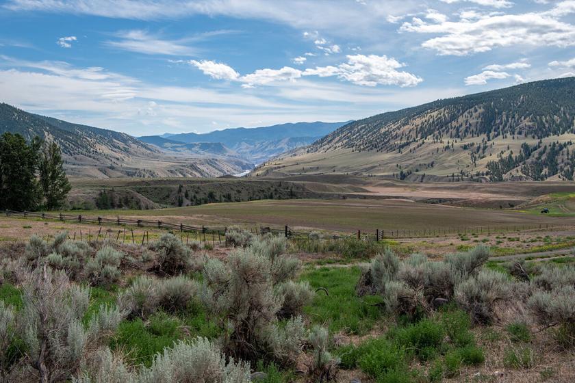
272
Please check geocaching.com before you go!
The History of Logan Lake Grasslands
SITE IDENTIFICATION
Nearest Community: Logan Lake, B C
Geocache Location: N 50°28 358' W 121°57.562'
UTM: East 644802; North 5593170 10U
Altitude: 1193m/3914ft
Ownership:
Ministry of Transportation
Accuracy: 2 meters
Overall Difficulty: 1.5
Overall Terrain: 1.5
Access Information and Restrictions: Park in pullout access Busy highway Year-round access
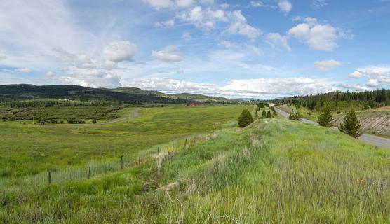
The word Secwépemc means ‘to spread out’ or ‘the spread-out people’. It is estimated that the pre-contact population was anywhere from 8,000 to 40,000 people (Ignace, 1995).
For more information or to report a problem with this site please contact: Gold Country Communities Society
P O Box 933 Cache Creek, B C V0K 1H0
Tel: 1-877-453-9467
Email: info@exploregoldcountry com
For more site pages go to: www exploregoldcountry com www geocaching com
APPLY STICKER HERE
These lands are the Traditional Territory of the Nlaka’pamux, the Secwépemc people Tk’emlúps te Secwépemc (TteS) and Skeetchestn Indian Band (SIB), jointly are known as the Stk’emlupsecme te Secwépemc Nation (SSN) The Lower Nicola Indian Band and Ashcroft Indian Band are part of the Nlaka’pamux Nation Europeans were recorded in the area as representatives of the fur trade between the 1820’s and the 1860’s to establish the Thompson’s River Post. There the Secwépemc people could trade hides, fish, roots, nuts, and berries. The fur traders were reliant on Secwépemc people to supply important food sources such as wild game and salmon, necessary to maintain the Thompson’s River Post
The SSN had a Cultural Heritage Study drafted in 2014 by Marianne Ignace and in this report she identifies five major harvesting seasons or rounds observed by the local Indigenous people; early spring (snow melting), mid-to-late spring (root gathering), summer (berry and high elevation root and medicinal plant gathering), late summer to early fall (salmon season) and mid to late fall (hunting season). The Secwépemc people relied on an intimate connection to the land, an understanding of how animals and plants behaved in correlation to seasons and locations (National Energy Board: Oral Presentation from Chief Ignace, 2014)
The Chiefs of the Interior wrote to Sir Wilfrid Laurier on August 25, 1910, describing how the people of each tribe were supreme in their own territories, and tribal boundaries were known and recognized by all. Each tribe’s ‘country’ was just like a massive farm or ranch belonging to all the people of that tribe. The Chiefs explained how they would gather their food, clothing, and technology
273
B.C. History
#13 GC9YPJZ Prequel
resources within it, each in their own ‘season’ This maintained the sustainable harvesting practices and they were handed down from generation to generation by the oral tradition of elders
In Ronald Ignace’s thesis from 2008 titled Our Oral Histories are Our Iron Posts: Secwepemc Stories and Historical Consciousness touched upon the Secwepemc notions of governance, stating that the people looked after the land, the animals and plants. That was why there was always plenty. They had to learn about nature’s systems for a long time and practice, then they knew how to look after everything It was crucial for the elders to share this knowledge to the younger generation
Historical maps from 1872 and 1884 published by Fullerton, A. & Co. and the Alaskan Tribunal Boundary show little to no colonization to the area we now know as Logan Lake, BC. This area is shown on both maps as a pristine grassland area with some mountains and rolling hills that the Southern Interior of BC is well known for. The Fullerton, A. & Co. map simply has the outlines of the mountain ranges and grasslands, while the 1884 map produced by the Alaskan Tribunal Boundary, has the area labeled as “Bench Grass Country”. In 1903, Rand McNally and Company produced another map of the region, again only showing the mountains and bench grasslands of the area with no specific names to be had.
Joseph Guichon, a miner with few lucrative strikes, recognized the grasslands potential while wintering pack horses in the area in 1866-67 working for Jean Caux as a packer In 1868, before the Indian Act of 1876, he obtained a homestead in the area of Savona’s Ferry (Savona) and eventually took up land at Mamit Lake Joseph Guichon had previously worked in the Basque area close to 89 Mile with a rancher by the name of Minnabarriet (Antoine Globe Victor Joseph Minnabarriet and Mary Jijiatko Minnabarriet).
Along with ranchers came the Land Surveyors, notably Frank Cyril Swannell He surveyed much of the Interior of BC and remote Northern BC Swannell is not only remembered by his work as a surveyor in the early 1900’s, but as a photographer, but he took over 5,000 photos while on his expeditions also keeping a journal Of his photos, most notably were those of the people he met along the way, including a photo of Chief David Basil of Bonaparte in 1908 with an Indigenous surveying crew He surveyed regions of the province that were so remote and difficult to reach, including the area of Highland Valley, now known as the District of Logan Lake
Written and Researched by Lana Rae
Brooks
Please check geocaching.com before you go!
BIBLIOGRAPHY & SOURCES
Belshaw, J (2005) Guichon, Joseph Dictionary of Canadian Biography, vol 15 http://www biographi ca/en/bio/guichon joseph 15E html My Heritage (n d ) Percy Minnabarriet My Heritage myheritage com/names/percy minnabarriet Wonders, K. (2010). Secwepemc. First Nations: Land Rights and Environmentalism in British Columbia http://www.firstnations.de/development/secwepemc.htm Sherwood, J. (2015). A photo journal of Frank Swannell, 1901-1907. Surveying Southern British Columbia. http://www.surveyingbc.ca/ssbc.htm
https://www.ceaa-acee.gc.ca/050/documents/p62225/104503E.pdf
274
Logan Lake’s Wild Horses
SITE
IDENTIFICATION
Nearest Community: Logan Lake, B C
Geocache Location: N 50°34 243' W 121°11.768'
UTM: East 627736; North 5603642 10U
Altitude: 1309m/4294ft
Ownership: Ministry of Transportation
Accuracy: 2 meters
Overall Difficulty: 2
Overall Terrain: 2.5
Access Information and Restrictions:
From Logan Lake, follow Hwy 97C south Park in pullout access Busy highway Seasonal access
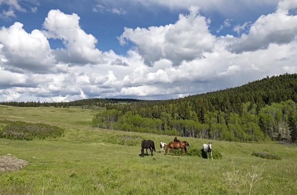
Traveling on Highway 97C, close to Logan Lake, B.C., you may get to spot one or many of the majestic wild horses that roam the hills and valleys surrounding this peaceful community. The horses here are considered Indigenous heritage breeds and are truly wild by the definition but are likely descendants from Canadian Horse stock. Just like the wild horses from the Brittany Triangle southwest of William Lake, the Logan Lake horses choose to live at a high elevation where climates are harsh
For more information or to report a problem with this site please contact: Gold Country Communities Society
P O Box 933 Cache Creek, B C V0K 1H0
Tel: 1-877-453-9467
Email: info@exploregoldcountry com
For more site pages go to: www exploregoldcountry com www geocaching com
APPLY STICKER HERE
There are several herds of wild horses living and roaming around Logan Lake, BC and often can be seen while driving past the dam for the Teck copper mine. These herds will be out grazing and enjoying themselves in the sun on a pinnacle of land that juts out towards the west just before the Dam. Evidence of their vast travels can be seen as piles of “fertilizer” at the edge and even on the highway that winds down the steep mountain side.
Yvette Running Horse Collins, PhD Dissertation “The Relationship Between the Indigenous People of the Americas and the Horse: Deconstructing a Eurocentric Myth” is ground-breaking, and she is essentially rewriting the history books about historical and oral history of the horse in North America. Collins' work disproves Spanish introduction of the horse to the Indigenous people. In her dissertation she has compiled a list of fossil and DNA evidence which dates after the supposed “extinction” period narrative. There is a lot of compelling data.
Every Indigenous community that was interviewed by Collins reported having horses before the arrival of Europeans As well, each community had a creation story of the horse These communities did not speak the same language or have the same cultures or geographical areas, but the oral histories told all were aligned, each sharing when the horse was gifted by the Creator to the people. Indigenous people have always had a relationship with the horse.
275
Flora & Fauna
#14 GC9YNFB Prequel
In the 1830’s paleontology pioneer Joseph Leidy unearthed horse skeletons in America They were dated to be the oldest found in the world With growing genetic evidence, it is becoming more and more clear to the scientific community that modern horses are native and descendants of ice-age grandsires. The modern genus Equus horse had evolved and adapted to semiarid grasslands as the climate cooled 4 million years ago. Equus ferus, today’s horses, have probably descended from a population that had likely taken advantage of land bridges spreading throughout Eurasia and North America.
Studies available to read and review on the Cloud Foundation’s website indicate that the DNA analysis of the horse found in 2009 in the permafrost in the Yukon showed variation that was within that of modern horses (as recently as 7,600 years ago) – both of the Ice Age horses of the Americas were the same species as the horses the Spanish introduced to North America in the 1500’s Instead of Spanish horses repopulating North America, they simply added new blood to the herds already here As time marches on, new scientific discoveries keep pushing the wild horses supposed extinction date closer to the present time, making it clear that there was probably no extinction at all.
In 1642 the French explorer, La Verendrye, went to find the People of the Horse. He thought his quest would take him to the Western (Chine) Sea, but his trail led to a Lakota tribe in Wyoming. Here Lakota tribal elders were interviewed According to these Elders, the aboriginal pony was small, about 13 hands high and had a 'strait' back requiring a different saddle from that used on European horses They had wider nostrils and larger lungs so that its endurance was well-known They stated that “One breed had a long mane, and shaggy (curly) hair, while another had a 'singed mane' "
The Curly horse was very well adapted to the cold North American winters that killed previous other breeds of horses. A quote from a Lakota man on the Bad Warrior Curly Horse web page states: “These horses (Curlies) were raised by the Indians as far back as anyone can remember," said Young Eagle. "Most of them were dark in color with hair ‘singed.’ Hence their name, which is Sung-gu-gu-la, literally translating to ’horses with burnt hair.’”
Regardless of when these fantastic animals arrived in North America, they were and still are very much an important part of Indigenous culture and heritage So, while you’re driving through the area of Gold Country, BC you may get to see some of the wild horses that roam the hills of the Logan Lake area
Written and Researched by Lana Rae
Brooks
Please check geocaching.com before you go!
BIBLIOGRAPHY & SOURCES
McNamee, T. (2013). The survival of horses in pre-columbian america. Wizzley https://wizzley.com/the-survival-of-horses-in-pre-columbian-america/ Kitchener, N. (2017). Status update: The wild horses of Canada. Horse Canada https://horse-canada.com/magazine/miscellaneous/wild-horses-of-canada-update/ Johnston, L. (2019). Yes world, there were horses in Native culture before the settlers came. ICT News. https://indiancountrytoday.com/news/yes-world-there-were-horses-in-native-culture-before-the-settlers-came Gill, J. (2014). Can we please stop calling wild horses invasive? The Contemplative Mammoth. https://contemplativemammoth.com/2014/05/02/can-we-please-stop-calling-wild-horses-invasive/ Dzombak, R. (2021). Domestic horses’ mysterious origins may finally be revealed. National Geographic https://www nationalgeographic com/animals/article/do-we-finally-know-where-horses-evolved https://wildhorsescanada ca/learn
276
Hooshum
SITE IDENTIFICATION
Nearest Community:
Logan Lake, B C
Geocache Location:
N 50°38 848' W 121°14.056'
UTM: East 624833; North 5612110 10U
Altitude: 970m/3182ft
Ownership:
The Ministry of Forests, Lands, Natural Resource Operations, and Rural Development
Accuracy:
2 meters
Overall Difficulty: 2
Overall Terrain: 2
Access Information and Restrictions:
From Logan Lake follow Hwy 97C south, take a right on Goldstream Forest Service Road, follow to Barnard Creek May require 4x4 Seasonal access
For more information or to report a problem with this site please contact:
Gold Country Communities Society
P O Box 933 Cache Creek, B C V0K 1H0
Tel: 1-877-453-9467
Email: info@exploregoldcountry com
For more site pages go to: www exploregoldcountry com www geocaching com
APPLY STICKER HERE
In British Columbia Soopolallie is the most common name of the Sxúsem (pronounced hooshum) plant. The word Soopolallie historically comes from the trading language spoken in the Pacific Northwest and is derived from the Chinook words “soop” meaning soap, and “olallie” meaning berry.
Sxúsem (Hooshum) are deciduous shrubs that grow 1 to 4 metres high in open and forested areas at mid to high elevations preferring well draining rocky soils and slopes that are east facing They have slim shiny green leaves 1 to 2 inches long that have grey-silver undersides with a coating of tiny hairs. The leaves are oval shaped growing opposite each other on brown branches and have rusty coloured spots on their backsides. The yellow inconspicuous flowers arrive early in spring before the first leaves even open.
The Nlaka’pamux, St’at’imc, and Secwépemc people of the Interior extensively harvested the bitter berries to turn them in to "sxúsem", also spelled "sxushem" and "xoosum" or "hooshum” and is sometimes referred to as “Indian ice cream” Only the ripest berries were collected by beating the branches of the bush with a stick so that the fruit would drop onto mats placed underneath to catch the falling fruits. Once harvested the berries would be cleaned, crushed, and whipped into a foam. Sometimes other sweeter berries were added to the hooshum before crushing such as wild mountain raspberries, thimble berries, or wild strawberries.
Sxúsem (Hooshum) was known for its health properties and benefits by the Indigenous tribes of the interior The tiny red berries are rich in lycopene Lycopene is an antioxidant that seems to lessen the risk of some cancer types, gaining the berry “superfruit” status these days The bitter berries also carry saponin, which is where they get their superior foaming ability
277
Flora & Fauna
#15 GC9Z1C4
Prequel
C r e d i t : L a n a R a e B r o o k s
from Saponin may cause gastrointestinal irritation if large amounts are ingested Hooshum also contains large amounts of vitamin C and iron
Sxúsem (Hooshum) berries are harvested in August. “ xʷús” has a root meaning of ‘foam’. The Nlaka’pamux boiled twigs and when this had cooled, they used the decoction for treating dandruff. The berries were used to treat different ailments such as the flu and indigestion, and used as a tea, for relieving constipation. A tea made from the bark was used to treat issues with the eyes The juice was said to be good for acne, boils, digestive problems and even gallstones
Sxúsem (Hooshum) is a super fruit growing in all of Canada except for Prince Edward Island (PEI). Its range also carries to the western and northern United States. Sxúsem (Hooshum) has male and female bushes with only the female bushes producing fruits, and only if there is a male plant close by. The Sxúsem (Hooshum) is a main part of the bear’s diet.
Medicinal plant information is for historical information only Gold Country Communities Society is not encouraging harvesting of native plants for food and/or medicine
Written and Researched by Lana
Rae Brooks
Please check geocaching.com before you go!
BIBLIOGRAPHY & SOURCES
DeZwart, M. (2016). Buffaloberry: A super fruit. BC Food History. https://bcfoodhistory.ca/buffaloberrycanada-super-fruit/ Sierra Club BC (n d ) Soopolallie (buffaloberry) Sierra Club BC https://sierraclub bc ca/soopolalliebuffaloberry/
Kuhnlein, H & Turner, N (1991) Traditional plant foods of Canadian Indigenous peoples Food and Nutrition in History and Anthropology https://www fao org/3/ai215e/ai215e pdf
Kokx, C (2014) Buffaloberry: Funny name, but nothing to laugh at Nutrition Rendition: The Greatest Wealth is Health https://nutritionrendition wordpress com/2014/02/10/buffaloberry-funny-name-but-nothing-to-laughat/
Turner, Nancy J., Laurence C. Thompson, M. Terry Thompson, and Annie Z. York. 1990. Thompson Ethnobotany Royal British Columbia Museum: Victoria. Pp. 209-11. Parish, Roberta, Ray Coupe and Dennis Lloyd (eds). 1996. Plants of Southern Interior British Columbia. Lone Pine Publishing: Vancouver. P 71
Credit: Lana Rae Brooks
278
Prickly Pear Cactus
SITE IDENTIFICATION
Nearest Community:
Ashcroft, B C
Geocache Location: N 50°43 565' W 121°16.405'
UTM: East 621861; North 5620786 10U
Altitude: 410m/1345ft
Ownership:
Village of Ashcroft
Accuracy: 2 meters
Overall Difficulty: 2
Overall Terrain: 2
Access Information and Restrictions:
From Ashcroft follow Hwy 97C south, take a left on Mesa Vista Drive, follow to Evangelical Church Park in church parking lot, access dunes trail from the north side of the fence Short hike Watch for cactus!
For more information or to report a problem with this site please contact:
Gold Country Communities Society
P O Box 933 Cache Creek, B C V0K 1H0
Tel: 1-877-453-9467
Email: info@exploregoldcountry com
For more site pages go to: www exploregoldcountry com www geocaching com
APPLY STICKER HERE
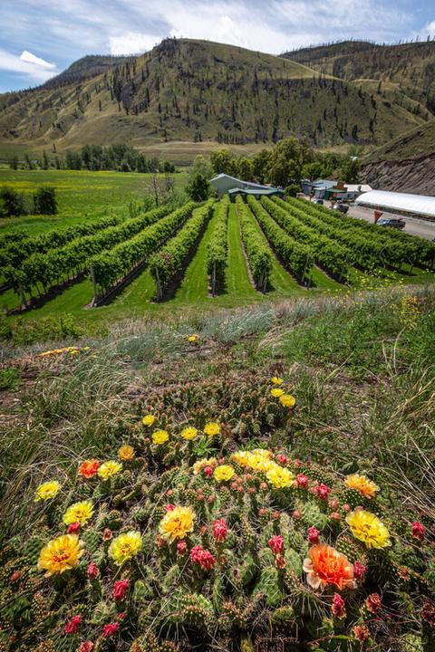
& Fauna
The prickly pear cactus is the only cactus native to several provinces of Canada, with an isolated species in Ontario. The brittle prickly pear cactus can grow farther north than any other cactus. It can be found as far north as Fort Saint John! They prefer to grow in sandy and rocky, or gravelly soils with arid conditions showing up on dry plateaus, in open forests, and on the sloping hillsides and plains of the British Columbia Interior
The brittle prickly pear cactus stems swell with water they absorb from their arid environments and are edible after removing the spines and seeds. They can be eaten raw or cooked and their flavor can be bland but may also be sweet or sour. The flesh from this cactus can be dehydrated for long term storage and the seeds were often dried and then pounded into a flour to be used in cakes by Interior Indigenous peoples. The cactus reproduces when stems detach from the parent plant root and clone themselves. Animals and people help disperse the plant when brushing up against the spines of the cactus, pads break off the parent plant and will catch a ride with their host to a new location where it will root
The brittle prickly pear cactus was eaten long ago by Indigenous people of the Interior. The cactus would be singed over an open fire to remove the spines, then the pads would be stewed, roasted, or pit cooked. Cactus soup was made from boiling fats and prepared cactus pads together. Juice from the cactus was sometimes used as an eye medicine or as a diuretic. The inside of the cactus pads would be mashed up and then mixed with pine pitch to produce a poultice used on skin infections and sores The prickly pear cactus spines were sometimes used as needles for piercing ears, or as fish hooks when 2 spines were bound together with pine pitch and Indian Hemp
279
Flora
#16 GC9Y99D
Prequel
Brittle prickly pear cactus is known as good famine food An Okanagan narrative tells how the Salmon threw cactus onto the prairie and stated they would be food for the coming people It is an extremely cold tolerant plant, growing almost to the arctic circle, hibernating through the winter. The prickly pear cactus is also fire tolerant, and can sprout from the root crown, and from the pads, that are buried and protected from the fire. The spines of the cactus help prevent moisture loss. Mice could be prevented from accessing food caches by placing a ring of brittle prickly pear cactus around the poles. It is said that when the cactus blooms, it’s time to pick the Saskatoon berries.
Medicinal plant information is for historical information only Gold Country Communities Society is not encouraging harvesting of native plants for food and/or medicine
Written and Researched by Lana Rae Brooks
BIBLIOGRAPHY & SOURCES
Northern Bushcraft. (n.d.). Prickly-pear cactus. Northern Bushcraft https://northernbushcraft com/topic php?name=prickly-pear+cactus®ion=bc&ctgy=edible plants
OS Stewardship Staff (2021) Brittle prickly pear cactus Okanagan Similkameen Stewardship https://www osstewardship ca/post/brittle-prickly-pear-cactus
Cayoose Creek Development Corporation (n d ) Prickly pear cactus, brittle (skez’k) Splitrock Environmental https://splitrockenvironmental ca/products/prickly-pear-cactus-brittle-skez-k?variant=40368088055974
B C Conservation Data Centre Species summary: Opuntia fragilis B C Ministry of Environment https://a100 gov bc ca/pub/eswp/speciesSummary do;jsessionid=058e554485ed62ff2e7e9e6d79bac242a944bd381 24adca7dc6f20371e18f74f.e3uMah8KbhmLe34Tb3aOa3uOaN90n6jAmljGr5XDqQLvpAe?id=18423
Sierra Club BC. (n.d.). Prickly pear cactus. Sierra Club BC https://sierraclub.bc.ca/prickly-pear-cactus/ Grant, B. (2019). Prickly pear historical uses: Learn about prickly pear cactus. Gardening Know How. https://blog.gardeningknowhow.com/tbt/history-of-prickly-pear-use/
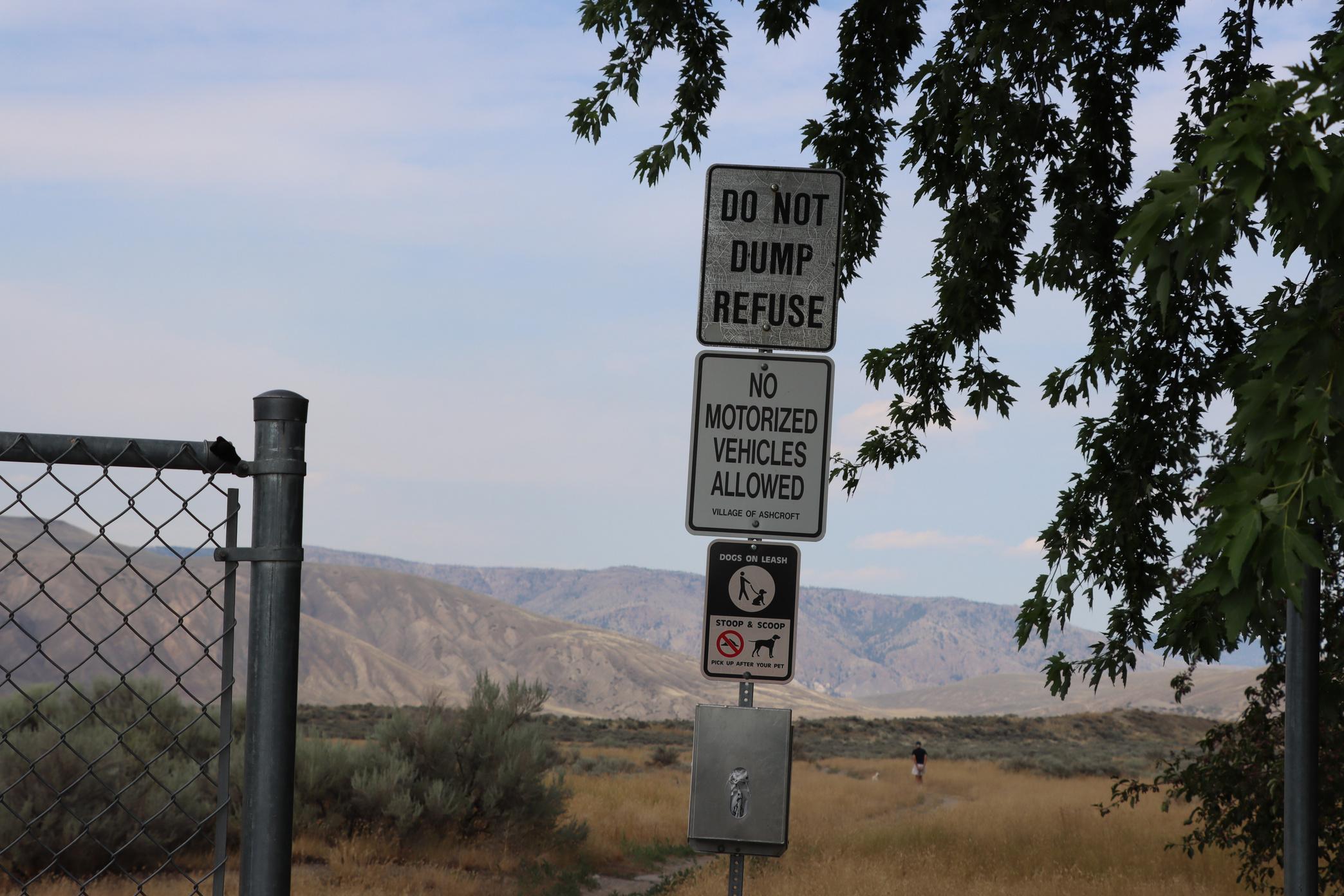
280
Please check geocaching.com before you go!
Bitterroot
SITE IDENTIFICATION
Nearest Community:
Ashcroft, B C
Geocache Location:
N 50°45 159' W 121°17.697'
UTM:
East 620274; North 5623705 10U
Altitude:
736m/2414ft
Ownership:
BC Provincial Park
Accuracy: 2 meters
Overall Difficulty: 4
Overall Terrain: 4
Access Information and Restrictions:
Pack plenty of water and get an early start in the summer months This is a 4km hike with no shade Seasonal access
Parking Advice:
N 50°44.202' W 121°16.961' Park at the Hydro Substation across from Government St.
For more information or to report a problem with this site please contact: Gold Country Communities Society
P O Box 933 Cache Creek, B C V0K 1H0 Tel: 1-877-453-9467
Email: info@exploregoldcountry com
For more site pages go to: www exploregoldcountry com www geocaching com
APPLY STICKER HERE
& Fauna
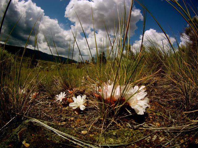
Bitterroot is a fleshy, succulent plant from the Montiaceae family, but formerly was a part of the Portulacaceae family. The genus Lewisia was moved from the purslane family in 2009 with the newly adopted APGIII system of flowering plants classification. It is low growing and has a reddish and woody rootstock that leads down to its branching taproot. Bitterroot grows 1cm to 3cm tall and the flowers are between 3cm and 6cm across. The plant produces a single bright pink to almost white flower on each rootstock having 9-15 petals, and resembles the bloom from a water lily, opening only in sun Bitterroot often grows in pairs
Bitterroot grows at low to moderate elevations in rocky, sandy, and well-draining soils in open grassland mesas, sagebrush plains, and open dry forests. Bitterroot is native to western North America and has a wide and varied range from southern British Columbia down through Washington and Oregon on the west side of the Cascade Mountain Range to California and east to the western sides of Montana, Wyoming, northern Colorado and into northern Arizona.
Bitterroot is still a culturally significant plant to many Interior Indigenous groups Okanagan families from the Vernon area would travel as far south as Penticton during the spring to dig the bitterroot plant. A curved type of wooden hoe was used as a digging tool for harvesting. These digging hoes were made from hard wood like that of the Saskatoon tree. The roots were traditionally gathered and dried as a food source or traded to neighbouring tribes and was a highly prized item.
As the name states, the root is bitter, and was often cooked or mixed with meats or berries The roots are best picked before the plant flowers in May before the root becomes woody and hard to peel Once removed from the ground, Indigenous people would remove the red heart to reduce the bitterness The roots were dried, but also, they were steamed, pit cooked, boiled, and eaten fresh, but almost always mixed with other foods such as saskatoon
281
Flora
#18 GC9YKXR Prequel
berries and deer fat, black tree lichen, fresh salmon eggs, tiger lily bulbs, ripened salmon eggs, or dried gooseberries Dried, the bitterroot will expand in the stomach, and thus it should not be overeaten
The bitterroot was a sacred plant to the Nlaka’pamux people, and they believed the plants were at one time human. Before marrying, Nlaka’pamux couples would place a bitterroot pair under their pillow as a guiding spirit for the intimacy of their relationship. The Okanagan classified bitterroot as the “chief” of all roots. The Nlaka’pamux women from the Ashcroft and Spences Bridge area harvested the bitterroots selectively, replanting the “heart” of the root, ensuring their propagation They would also cultivate and transplant it in other areas increasing the region it would grow in Nancy Turner writes in her book, The Earth’s Blanket
Bitterroot was also used medicinally by Indigenous cultures and was prepared into a tea that was used to treat heart trouble, increase breast milk production after childbirth, to purify the blood, and to relieve skin problems and diseases. In the south, the Lakota people used it as a remedy for toothache, sore throats, and was used by singers to keep their voices strong by chewing it. It was also used as a decongestant when placed on hot rocks in a sweat lodge. While still widely used by Indigenous people, its unique organic compounds have caught the eye of other practitioners and users of traditional medicines.
Bitterroot grew in vast quantities in the past An observer who visited the Fraser Canyon region 100 years ago estimated that there were millions of plants, at least 100 per square meter in places Since colonization the bitterroot species has become rare and endangered during the last 100 years in many regions of British Columbia due to soil compaction, industrial use of the land, and overgrazing by cattle. Please do not add to the peril of this beautiful and delicate flower by harvesting this plant.
Medicinal plant information is for historical information only Gold Country Communities Society is not encouraging harvesting of native plants for food and/or medicine
Written and Researched by Lana Rae Brooks
BIBLIOGRAPHY & SOURCES
Kratz, A. (n.d.). Bitterroot (lewisia rediviva). United States Department of Agriculture. https://www.fs.usda.gov/wildflowers/plant-of-the-week/lewisia rediviva.shtml FNESC/FNSA. (n.d.). Blackline master 5-3: Bitterroot and Indigenous knowledge. Secondary Science First Peoples http://www fnesc ca/wp/wp-content/uploads/2020/11/5-3-Sec-Science pdf Peterat, L (2017) Okanagan bitterroot BC Food History https://bcfoodhistory ca/okanagan-bitterroot/ Northern Bushcraft (n d ) Bitterroot Northern Bushcraft https://northernbushcraft com/topic php?name=bitterroot®ion=bc&ctgy=edible plants Prairie Edge (n d ) Bitterroot (sinkpe) Prairie Edge & Sioux Trading Post https://prairieedge com/bitterroot/ Turner, Nancy J (2005) The Earth’s Blanket Vancouver: Douglas & McIntyre Clark, Lewis J (1973) Wild flowers of British Columbia Sidney, BC: Gray’s Publishing
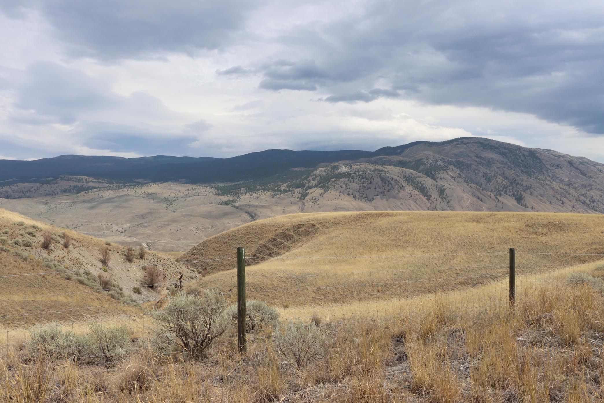
282
Please check geocaching.com before you go!
Ashcroft Indian Band
SITE IDENTIFICATION
Nearest Community:
Ashcroft, B C
Geocache Location: N 50°43 328' W 121°19.607'
UTM: East 618105; North 5620260 10U
Altitude: 489m/1604ft
Ownership: Private Property Accuracy: 2 meters
Overall Difficulty: 1.5
Overall Terrain: 1.5
Access Information and Restrictions:
From Ashcroft take Cornwall Road for 5 km west Park in designated parking
This may be seasonal access only
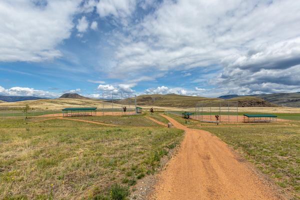
The Ashcroft Indian Band is a small First Nations band located in the Southern Interior of British Columbia, Canada. The band is made up of approximately 200 members, many of whom still live on the band's reserve.
For more information or to report a problem with this site please contact: Gold Country Communities Society
P O Box 933 Cache Creek, B C V0K 1H0 Tel: 1-877-453-9467
Email: info@exploregoldcountry com
For more site pages go to: www exploregoldcountry com www geocaching com
APPLY STICKER HERE
The Ashcroft Indian Band has a long and rich history dating back to before contact with Europeans According to oral tradition, the band's ancestors were some of the first people to inhabit the Southern Interior of British Columbia The Ashcroft Indian Band was traditionally known as the Nlaka’pamux The people of the AIB have lived in this area, along the shores of the Thompson River in the British Columbia Interior for 6000 years. The Nlaka'pamux primarily survived on venison and salmon, although roots and berries were collected by the women. They dressed in deerskins, and wore moccasins made of buckskins over socks made from sagebrush. Presently many members of the Ashcroft Indian Band still fish from the same areas as their ancestors. The Ashcroft Indian Band was created in 1881 when the government set aside land for a reserve near Ashcroft, British Columbia Prior to this, the Nlaka'pamux people had no legal title to their traditional lands
One of the traditional areas of the Ashcroft Indian Band is McLean's Lake. The Band still farms and hunts in the surrounding area of McLean's Lake. Historically, the Ashcroft Indian Band used to flee the summer heat at McLean's Lake. The Ashcroft Indian Band received legal title to the property, but some time during the 1920s, authorities arbitrarily revoked it, giving half of McLean's Lake to a neighboring First Nations group, resulting in a lengthy ownership dispute.
In recent years, the Ashcroft Indian Band has been working hard to improve its economic and social situation The band has successfully created a travel centre, employing their own
283
B.C. History
#19 GC9Z900
Prequel
members as well as non-Indigenous peoples from their neighboring communities of Ashcroft and Cache Creek
Also recently completed, is The Chief Scotty Campground which employs a maintenance crew and has wonderful, new updated amenities situated by a new playground and two perfectly groomed ball diamonds. The beautiful desert vistas, proximity, and the Travel Centre's services make it an ideal location for filming companies that contribute a significant amount of money to the region For 15 years, a string of movies, TV shows, and commercials have filmed on the Ashcroft Reserve, with members of the Band being frequent extra help.
The Ashcroft Indian Band is a true testament of the Nlaka'pamux people’s ability to persevere through trying times. The Elephant Hill Wildfire of 2017 destroyed much of their community and displaced several people. Despite this tragedy, the Ashcroft Indian Band has bounced back and is now thriving more than ever before The Ashcroft Indian Band is a proud community that is steeped in rich culture and history and is definitely worth a visit
Written
and Researched by
Brandy Cooper-Chardon
BIBLIOGRAPHY & SOURCES
BC Assembly of First Nations. (2023). Ashcroft indian band. BC Assembly of First Nations. https://www.bcafn.ca/first-nations-bc/thompson-okanagan/ashcroft-indian-band Ashcroft Indian Band. (n.d.). Our history & culture. Ashcroft Indian Band http://www ashcroftband ca/content/our-history-amp-culture
Teit, J (1898) Traditions of the thompson river indians of British Columbia The American Folklore Society https://wcln ca/ LOR/course files/SS11-FP/Idea1/1-2/traditionsnorththompson pdf Please check geocaching.com before you go!
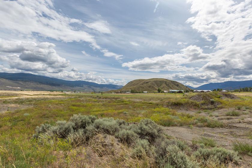
284
Oregon Jack
SITE IDENTIFICATION
Nearest Community:
Ashcroft, B C
Geocache Location: N 50°38 704' W 121°29.101'
UTM: East 607112; North 5611451 10U
Altitude: 1228m/4028ft
Ownership:
BC Provincial Park
Accuracy: 2 meters
Overall Difficulty: 2
Overall Terrain: 3
Access Information and Restrictions:
From Ashcroft take Hwy 1 South about 13km taking a right on Hat Creek Road
Follow for about 13 km Follow past The Three Sisters site, follow the narrow road past the Cornwall Hills turn off keeping left Just before the end of the park there is a very small pullout area to the right which allows you to pull off the single track dirt road enough for other travelers to pass by For cars with little to no clearance, park at Three Sisters Rec site and follow the dirt road 2 km to the cache site by foot Seasonal access
For more information or to report a problem with this site please contact:
Gold Country Communities Society
P O Box 933 Cache Creek, B C V0K 1H0 Tel: 1-877-453-9467
Email: info@exploregoldcountry com
For more site pages go to: www exploregoldcountry com www geocaching com
APPLY STICKER HERE
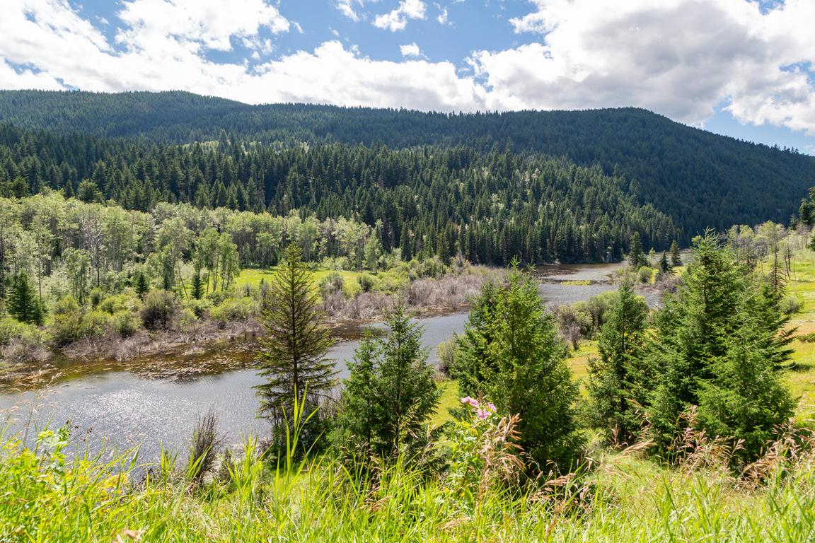
The Nlaka'pamux used to reside in the Oregon Jack Creek region long before Europeans arrived. They were part of the larger Shuswap Nation and had a vast territory. Nlaka'pamux Interior Salish, which covers much of the British Columbia plateau into Washington State's southwestern corner. The confluence of the Thompson and Fraser rivers, where LTLKumchEEn is located (Lytton) at the junction of the Thompson and Fraser Rivers is considered by many to be the spiritual, physical, and political center of Nlaka'pamux culture (Hanna and Henry 1996; Teit 1900,1912) This grand land includes a diverse topography from the wet forests on the northeast shore of Harrison Lake, along the Coastal Mountains from Spuzzum north along the Fraser River to the dry country of Texas Creek south of Lillooet East from the center, TLKumcheen, the dry Plateau portion of the territory follows the Thompson River to nlKumcheen (Spences Bridge) and on to the open country and of Ashcroft and the karst country of Oregon Jack Valley.
Located in the interior of British Columbia, 25 km southwest of Cache Creek is an ancient place known as Oregon Provincial Park Access is from TransCanada Hwy 1, 17 km south of Cache Creek, turn onto Hat Creek Rd Follow this road, which bisects the park, for approximately 12 km A wonderous place to explore full of trees like the Douglas Fir variety and Ponderosa Pine, and rock structures to climb The fallen trees along the moss-covered rocks are a photographer’s dream come true. The Oregon Jack Creek area is also home to a variety of wildlife such as mule deer, bighorn sheep, and many bird species.
Oregon Jack Provincial Park is home to some of the most spectacular and well-preserved rock art in North America In
285
B.C. History
#20 GC9YBNH
Prequel
1989, the first archeologically controlled excavations of an Nlaka'pamux rock painting site were done at two rock shelters (EdRi-2 and EdRi-10) located along the base of the northernmost of three limestone promontories in a general area known as Three Sisters. These excavations yielded a number of radiocarbon dates that provided the first firm chronological framework for Oregon Jack rock art (Lock and Taylor 1990, 1992).
The Oregon Jack petroglyph site consists of three main elements: the main panel, a series of smaller panels, and a large natural shelter This site was said to be a place where pubescent youth would come on their spirit quests to obtain knowledge or a spirit animal Once a person enters Oregon Jack Creek Provincial Park you can feel the coolness of the higher elevation, the calming nature of the wilderness, and the overwhelming feeling of being in a very majestic place
Written and Researched by Misty Antione and Brandy Cooper-Chardon
BIBLIOGRAPHY & SOURCES
Arnett, C. (2016). Rock art of nlaka’pamux: Indigenous theory and practice on the British Columbia plateau. University of British Columbia. https://open.library.ubc.ca/soa/cIRcle/collections/ubctheses/24/items/1.0300422 BC Parks. (n.d.). Oregon jack park. Government of British Columbia. https://bcparks.ca/explore/parkpgs/oregon jack/
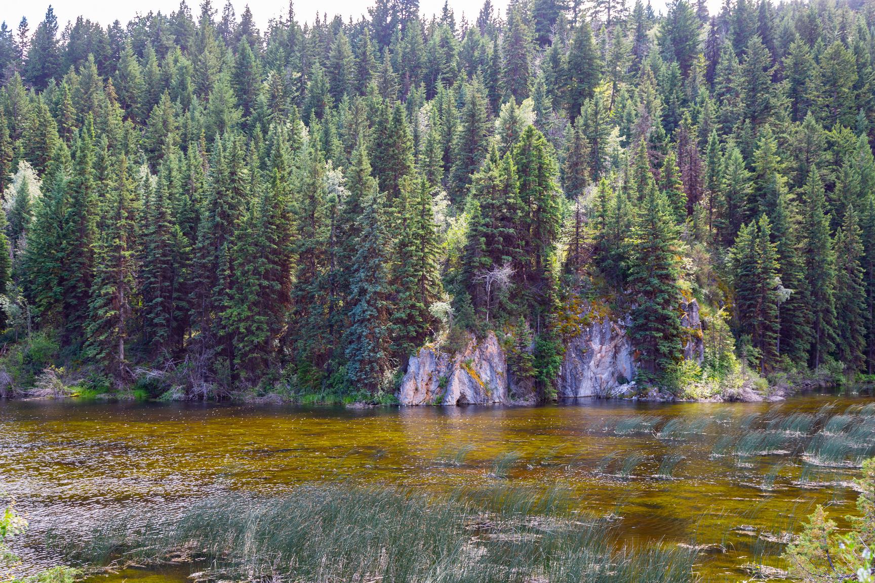
286
Please check geocaching.com before you go!
Those Red Hills
SITE IDENTIFICATION
Nearest Community:
Ashcroft, B C
Geocache Location: N 50°38 249' W 121°20.641'
UTM: East 617099; North 5610821 10U
Altitude: 507m/1663ft
Ownership:
Ministry of Transportation
Accuracy: 1 meter
Overall Difficulty: 2
Overall Terrain: 2
Access Information and Restrictions:
From Ashcroft take Hwy 1 South about 15km taking a left at the Red Hills Rest Area Park in designated parking
Seasonal access
For more information or to report a problem with this site please contact:
Gold Country Communities Society
P O Box 933 Cache Creek, B C V0K 1H0 Tel: 1-877-453-9467
Email: info@exploregoldcountry com
For more site pages go to: www exploregoldcountry com www geocaching com
APPLY STICKER HERE
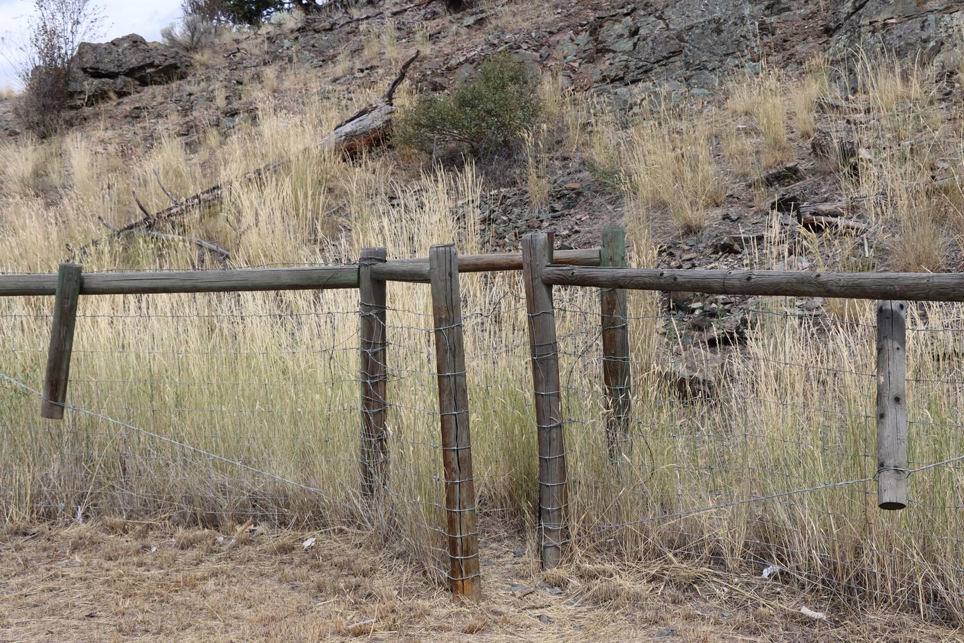
Current day Red Hill Rest stop is a convenient pull off for travelers along the Fraser Canyon. It boasts several car charging options, space for picnicking, well maintained public washrooms, and a display of local cultural history. This rest stop is located at the base of Red Hill Peak. In 1974, Bethlehem Copper Corporations explored Red Hill including soil surveys.
However, long before the days of cars, or even wagons of the Gold Rush Era, this land was occupied by first peoples known as Nlaka'pamux. Their precontact name means (we are the people who are living along the pure river). It wasn't until colonization that the Nlaka'pamux were referred to as the "Thompson Indians" as David Thompson was credited for "Discovering" this nation of peoples.
This Indigenous group has a long and storied history in the Fraser Canyon The Nlaka'pamux, also known as the Thompson people, have lived in the Fraser Canyon for millennia The canyon was an important travel corridor for the Nlaka'pamux It was a place where different Indigenous groups could come together and trade. Along the way various flora was gathered for preservation for medicines and foods.
On the South and West side slope of the Red Hill Peak, the Bitter Root grows, and one can see the Clear Mountain Range to the left. Here we can only imagine what plateau would have been like as much of early written accounts on traditional ways of life were in the late 1800's and early 1900's. Many of these works by Teit, or Boaz were carefully written, however much of the traditional Indigenous ways had already been tremendously impacted by early fur traders
The Plateau communities transmitted traditional information in an oral tradition. The narrative of a community's past was
287
Geological & Views
#21 GC9YBRE
Prequel
passed on from generation to generation, with intricate details of events and people included The language and context of the tale were essential elements of its meaning and significance Coyote, the trickster-creator persona, is involved in a complex cycle of tales that frequently include humorous and bawdy episodes. Oral traditions are naturally connected, therefore contemporary language revitalization efforts among Plateau peoples also tend to emphasize the significance of oral traditions.
Songs were essential in Plateau society, and they were used to summon religious and magical powers Wooden flutes, deer rattles, and hide-covered wooden-frame drums were all played at times The stick-game song, which was typically sung while playing a gambling game, is still well known, and often performed today So, the next time you are stopping at Red Hill rest stop to recharge during your travels, let your mind wander back to the times of the first peoples
Written and Researched by Misty Antione and Brandy
Cooper-Chardon
BIBLIOGRAPHY & SOURCES
Belshaw, J. (n.d.). The millennia before contact. Canadian History: Pre-Confederation. https://opentextbc.ca/preconfederation/chapter/2-4-the-millennia-before-contact/ Kennedy, D & Bouchard, R (2015) Plateau Indigenous peoples in Canada The Canadian Encyclopedia https://www thecanadianencyclopedia ca/en/article/aboriginal-people-plateau
288
Please check geocaching.com before you go!
Percy Minnabarriet, The Spear Fisherman
SITE IDENTIFICATION
Nearest Community:
Spences Bridge, B C
Geocache Location: N 50°25 307' W 121°20.602'
UTM: East 617681; North 5586839 10U
Altitude: 266m/872ft
Ownership:
Ministry of Transportation
Accuracy: 1 meter
Overall Difficulty: 1.5
Overall Terrain: 1.5
Access Information and Restrictions:
In Spences Bridge Park in designated parking Seasonal access
This geocache is dedicated to one of my childhood neighbours, Percy Minnabarriet. When thinking of Indigenous people to reach out to help complete this GeoTour, I had wished that my dear neighbour was still walking the Earth so I could ask for his assistance. I had always known Percy to be generous with his knowledge of his culture and eager to share with the people who would listen. While I was researching Indigenous and other topics, I came across a YouTube video of Percy teaching the ways of life called Ts'akw'm, which is the knowledge of the elders passed down the generations while spearing the Steelhead
For more information or to report a problem with this site please contact: Gold Country Communities Society
P O Box 933 Cache Creek, B C V0K 1H0 Tel: 1-877-453-9467
Email: info@exploregoldcountry com
For more site pages go to: www exploregoldcountry com www geocaching com
APPLY STICKER HERE
Traditionally the people spear fished for Steelhead (cóʕʷłeʔ) in the Thompson River. The Thompson River is located in British Columbia and a traditional spot for fishing would be at the present day town now called Spence’s Bridge. It was a main food source for the Indigenous people, who would fish all year round. Mid - winter was the best time to spear fish as the water would be crystal clear and the fish would be close to the surface because they were sluggish. I listened as Percy demonstrated how to use his hand, fingers, and arms to make the measurements to construct the perfect fishing spear, which had three prongs at the end Juniper, cedar roots, cedar bark, and Indian - hemp were traditionally used to hold the barbs and the prongs to the handle The handle was constructed of two year old dried Juniper, and the pitch from the Ponderosa Pine
Fishing was a community family event. About 8 families would go out and each would have a representative, and divvy up the catch. The fishing occurred when it was dark, so you could see the fish by the fire basket. The crew of the boat was made of experienced fishermen as they were taught as children by their grandparents and parents They would construct fire baskets that would stay lit by using the pitch of the Ponderosa Pine The
289
B.C. History
#23 GC9Z92H
Prequel
person at the back of the boat was called the fireman and it was his job to keep the basket fire burning
While out fishing they would go down stream in drifts. The first drift was about 1 boat length off the shore line. Once they reached their destination some of the crew would stay in their boat and the rest would pull it back upstream to their camp. The crew members that stayed in the boat would use their poles to keep the boat from getting hung up on any rocks close to the shoreline. Once back they would unload the haul for the rest of the families to start processing and get ready for a second drift
On this second drift they would be about two boat lengths away from the shore line. The captain of the crew was usually the most experienced and respected. He would make sure that they never ventured too far into the river. The water flowed too fast there for fishing and the reward wasn't worth the risk. By the time the fishermen got back from the second drift there would be fresh fish to eat from their first drift, prepared by the families. It was then time to gather and tell stories. It was nice to see Percy memorialized forever on the Cooks Ferry Indian Band production about spearfishing. They certainly captured how I knew him as a neighbor, approachable, knowledgeable, kind, generous, and as a provider for his community.
Written and
Researched
by Brandy Cooper-Chardon
Please check geocaching.com before you go!
BIBLIOGRAPHY & SOURCES
Cooks Ferry Indian Band (n d ) Traditional nlaka’pamux fishing Fraser Basin Library https://www fraserbasin bc ca/ Library/TR/steelhead nlakapamux fishing cfib brochure pdf YouTube (2016) Cooks Ferry Indian Band YouTube Retrieved October 18, 2023, from https://www.youtube.com/watch?v=Eq8V81sWx-k&list=PL6WSBX5-2NeMXXoSk3CV6j1aCZ0g1HH0s.
290
Frog Rock
SITE IDENTIFICATION
Nearest Community:
Nicomen, B C
Geocache Location: N 50°15 813' W 121°24.375'
UTM: East 613591; North 5569149 10U
Altitude:
182m/597ft
Ownership: Ministry of Transportation Accuracy: 1 meter
Overall Difficulty: 1.5
Overall Terrain: 1.5
Access Information and Restrictions: From Spences Bridge, B C head south on Hwy 1 about 19 km Park in designated parking Seasonal access Busy highway
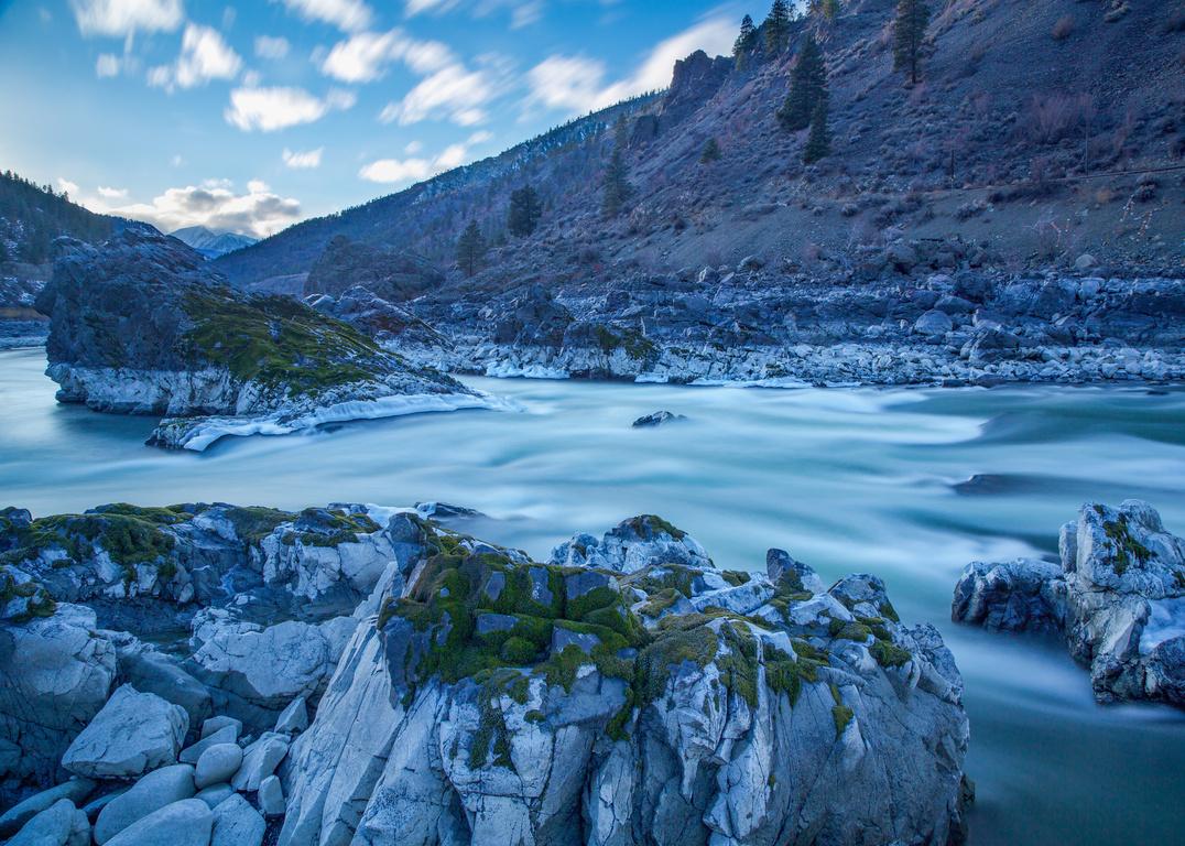
At Nicomen in the Thompson River sits a large boulder out in the middle of the rapids. From just the right angles, this rock looks like a crouched frog. Frog Rock, as it is now known, is about halfway between Spences Bridge and Lytton. It was close to here where gold was first “discovered” in British Columbia.
For more information or to report a problem with this site please contact: Gold Country Communities Society P O Box 933 Cache Creek, B C V0K 1H0 Tel: 1-877-453-9467
Email: info@exploregoldcountry com
For more site pages go to: www exploregoldcountry com www geocaching com
APPLY STICKER HERE
For the Nlaka’pamux, first contact with explorers occurred in 1808, and the first 50 years saw Indigenous residents living in relative harmony with the initial explorers, with resident Indigenous people providing shelter, trading food, clothing, and other wares with these first visitors. This harmony continued until gold was discovered and the Fraser Canyon War began and was fought until August of 1858. This War was also known as the Canyon War, and the Fraser River War. Nlaka'pamux were also known as the Couteau or "Knife" Indians, due to Europeans inability to pronounce or spell Nlaka'pamux.
Daniel Marshall writes in his book Claiming the Land: British Columbia and the Making of a New El Dorado “The year 1858 was a year of chaos unlike any other in Pacific Northwest history It produced not only violence but the formal inauguration of colonialism, Native reserves, and, ultimately, the expansion of Canada to the Pacific Slope ” Marshall goes on to show “how foreign miner-militias crossed the 49th parallel, taking the law into their own hands and conducted extermination campaigns against Indigenous peoples” leaving Indigenous sovereignty still waiting for a full resolution today.
Former Chief of the Kanaka Bar Indian Band, Patrick Michell, once said on a phone call that the finding of gold at Nicomen was not a chance find, rather it was in response to visitors asking “do you know where we can find gold” and once the find was confirmed, an influx of Miners occurred and two were eventually decapitated after they assaulted a young Nlaka’pamux.
291
Geological & Views
#24 GC9Y974
Prequel
Nlaka’pamux woman, and the bodies of these men catapulted into the river in hopes to send a message to others to not come back this way
Patrick went on to state that by their people doing this, “it must have seeded the water, as more and more people came after that, their numbers multiplying vastly. ” Patrick articulated that the “finding of gold” introduced to the Nlaka’pamux a new word, greed, and the rest as they say is history.
Historically the giant boulder sitting in the middle of the Thompson River at Nicomen, BC had/has spiritual significance to the Secwépemc, Sto:lo, and Nlaka’pamux people of the region. The Secwépemc, Sto:lo, and Nlaka’pamux people would have traveled from far and wide to these sites.
Our understanding of these sites of spiritual significance is limited. Elders have been reluctant to disclose information about these sites, which has much to do with the past attitudes and activities of colonial society
Historically Indigenous beliefs and practices were discouraged and even outlawed Many important spiritual places have been defaced and destroyed
Highway and Railway development have had an immense impact on the spiritual sites of Canada’s Indigenous people, including the site of the Frog Rock. In British Columbia alone, approximately 60 percent of these sites have been destroyed, and between 30 to 40 percent of sites have been disturbed, many of which are in the area of the Nlaka’pamux Traditional Territories
Written and Researched by Lana
Rae Brooks
BIBLIOGRAPHY & SOURCES
Phone interviews with former Chief of Kanaka Bar Indian Band, Patrick Michell April 2022 & July 2022 Kanaka Bar Band. (2023). Our history. Kanaka Bar Indian Band. https://www.kanakabarband.ca/about-us/ourhistory
Mohs, B. (1976). Spiritual sites, ethnic significance and native spirituality: The heritage and heritage sites of the Sto:lo indians of British Columbia University of British Columbia https://core ac uk/download/pdf/56370107 pdf
Indian Residential School History & Dialogue Centre Collections (n d ) Nicomen indian band University of British Columbia https://collections irshdc ubc ca/index php/Detail/communities/1408
Dally, Frederick 1867 (1838-1914) Thompson R Indians - Nincumshin Tribe 1866-1870 Fredrick Dally
Dally, Frederick 1867 (1838-1914) Nicomen on the Thompson river; one day's drive from Yale 1866-1870 Fredrick Dally
Dally, Frederick 1866-1870 (1838-1914) Nicomin Thompson River, the place where gold was first discovered in British Columbia, by an Indian who stooping down to drink, and saw a three oz nugget at the bottom of the water 1866-1870 Fredrick Dally
Facing History & Ourselves. (2019). They have stolen our lands. Facing History & Ourselves Canada. https://www.facinghistory.org/stolen-lives-indigenous-peoples-canada-and-indian-residential-schools/chapter2/they-have-stolen-our-lands
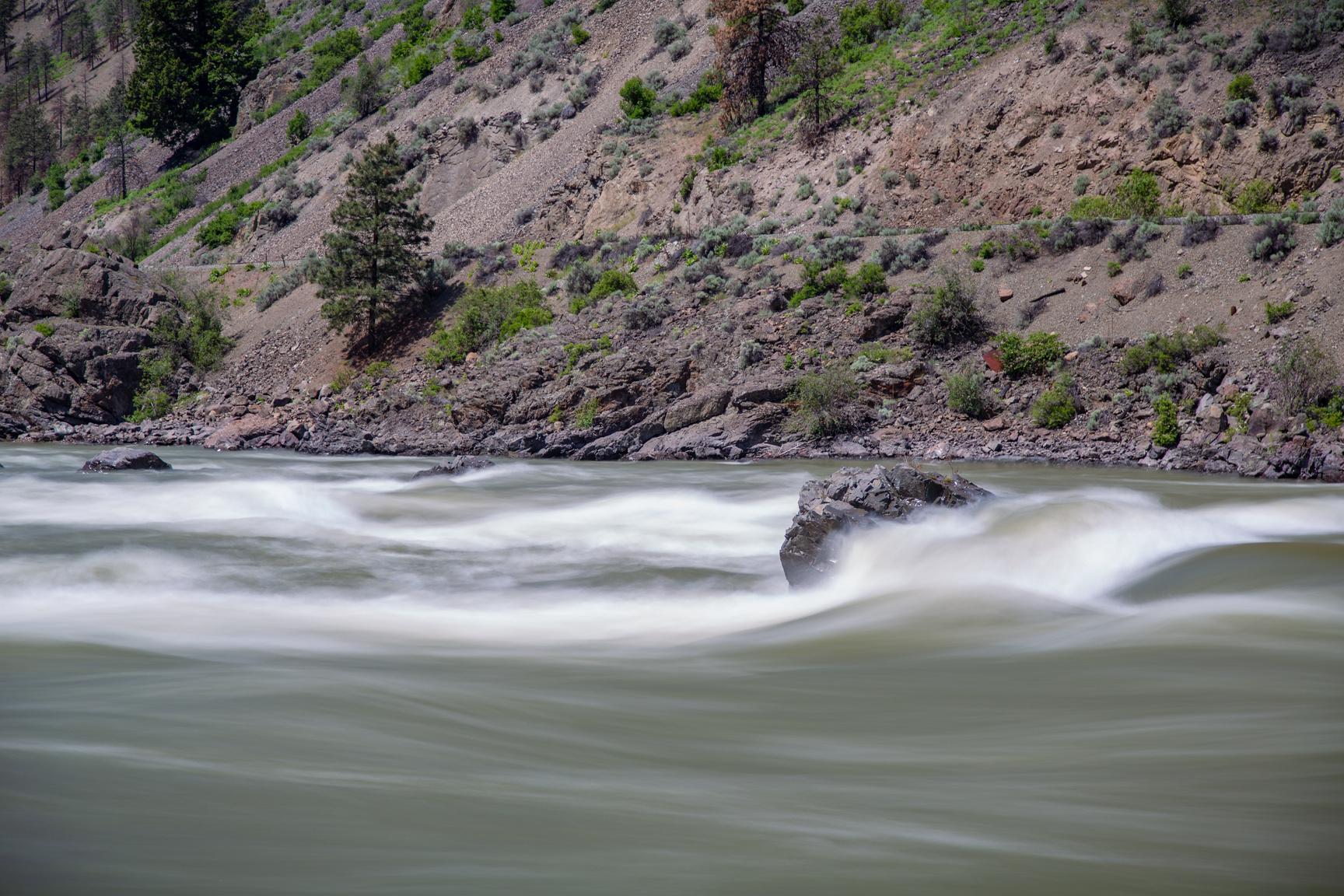
292
Please
geocaching.com before you go!
check
Lytton
SITE IDENTIFICATION
Nearest Community:
Lytton, B C
Geocache Location: N 50°15 600' W 121°32.465'
UTM: East 603989; North 5568557 10U
Altitude:
276m/905ft
Ownership:
Ministry of Transportation
Accuracy: 1 meter
Overall Difficulty: 2
Overall Terrain: 1
Access Information and Restrictions: From Spences Bridge, BC head south on Hwy 1 about 34 km Park in designated parking Seasonal access Busy highway
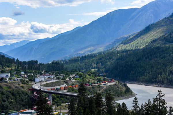
Lytton is located on Hwy 1 at the north end of the Fraser Canyon, where the Fraser and Thompson Rivers meet. It is one of the oldest continuously-inhabited areas in North America, with a First Nations history stretching back thousands of years. Bruce Hutchison wrote that it is “ an ancient town, more ancient than any built by white men in America. Here … [was] found a thriving Indian community, centuries old. The confluence of two great rivers and the natural trails of men ’ s travel made this one of the crossways of the continent ”
For more information or to report a problem with this site please contact: Gold Country Communities Society
P O Box 933 Cache Creek, B C V0K 1H0 Tel: 1-877-453-9467
Email: info@exploregoldcountry com
For more site pages go to: www exploregoldcountry com www geocaching com
APPLY STICKER HERE
The site at the confluence of the mighty Thompson and Fraser Rivers has long been considered the heart of the Nlaka’pamux territory. In 1858, celebrated Indigenous leader and peace-maker Chief Cexpe’nthlEm said “At Lytton is my centre-post. It is the middle of my house and I sit there.” The Nlaka’pamux name for the site has been transcribed phonetically into English in a number of ways, and variously spelled Camchin, Shilkumcheen, Thlikumcheen, Tl’cumjane, Clicumchin, and Kumsheen. The word has been translated in different ways: it could mean “ cross mouth” or “shelf that crosses over ” , although today it is often translated as “where the rivers meet”
The first settlers to visit the site were Simon Fraser and a small band of explorers, on June 19, 1808. In his journal, Fraser spoke of the hospitality he and his party received: “The principal chief invited us over the river. We crossed, and he received us on the water side, where, assisted by several others he took me by the arms and conducted me in a moment up the hill to the camp where his people were sitting in rows, to the number of twelve hundred… We had every reason to be thankful for our reception at this place; the Indians shewed us every possible attention and supplied our wants as much as they could ”
Various people who followed called the site the Great Forks, the Grand Forks, or simply The Forks, referencing the
293
B.C. History
#25 GC9YAGG
Prequel
meeting of the two rivers In 1857, a Hudson’s Bay Company depot was established about three miles downstream from where the rivers met, and the site was called Fort Dallas During the Gold Rush that began in 1858, the site became an important spot along the road north. When the Crown Colony of British Columbia was established in August 1858 Fort Dallas was abandoned, and the buildings were moved upstream to the present site of the town. James Douglas, the Crown Colony’s governor, decided that the settlement would be named Lytton, as a “merited compliment and mark of respect” for Sir Edward Bulwer-Lytton, who was Secretary of State for the Colonies.
There had been a significant Chinese presence in Lytton for many years, starting with the building of the Canadian Pacific Railway through British Columbia in the early 1880s The CP ran through the town, and was joined by what is now the Canadian National Railway in 1914 The Chinese community built a joss house, a place within a communal house where deities are set up on an altar for Chinese people to go and give thanks to, or pray to for good health and peace, at the south end of town in 1881 Although the building was torn down in 1928, in 2016 the site was recognized as a historic place with provincial significance, and included in the B.C. Register of Historic Places.
On June 29, 2021 Lytton recorded the highest temperature ever seen in Canada: 49.6° C (121° F). The following day, on June 30, 90 percent of the village, along with structures and properties in surrounding First Nations and the regional district, was destroyed by wildfire
In 2018 the Historic Sites and Monuments Board of Canada, part of Parks Canada, recognized the traditional basket-making skills of the Nlaka’pamux women with a plaque noting the long history of the Nlaka’pamux woven baskets and their intricate designs. The plaque was located near the parish hall overlooking the confluence of the Thompson and Fraser Rivers, and both the plaque and the hall survived the June 30, 2021 fire.
Near the parish hall is the Chief Cexpe’nthlEm Memorial Precinct, which honours Chief Cexpe’nthlEm (known to non-Indigenous people as David Spintlum), a celebrated Indigenous leader and peace-maker who played a key role in ending the potentially catastrophic Canyon War in 1858 The memorial was erected in 1887, when Cexpe’nthlEm died, and although no one knows if he is buried at the site, an archaeological survey conducted there in 2020 using ground-penetrating radar confirmed the presence of human remains The memorial also survived the June 30th fire.
Written and Researched by Barbara Roden
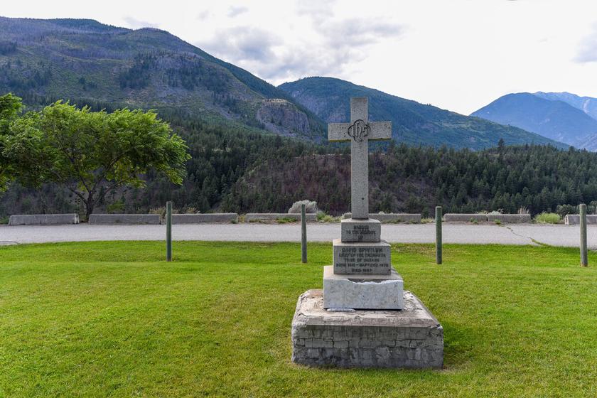
294
Please check geocaching.com before you go!
Saskatoon Berries Flora & Fauna
SITE IDENTIFICATION
Nearest Community:
Lillooet, B C
Geocache Location: N 50°45 067' W 121°55.538'
UTM: East 575789; North 5622699 10U
Altitude: 428m/1404ft
Ownership:
Ministry of Transportation
Accuracy: 1 meter
Overall Difficulty: 1
Overall Terrain: 1
Access Information and Restrictions:
From Lillooet, BC take Hwy 99 north about 11 km The Rest Area is on the South side of the Hwy Park in designated parking Busy highway
Saskatoons are shrubs and sometimes trees. They are deciduous with slender grey branches that grow reaching upwards and can be up to 6 meters in height. The sweeping branches hang so that they topple over, having twiggy branches with finely toothed oval shaped leaves. The vein covered leaves are about 1 to 2 inches in length and taper lance-like to a point.
The dark green and smooth leaves of the Saskatoon turn to bright yellows, oranges, and reds in the fall making for fantastic fall landscapes in the Interior In the spring the bushes produce red to purple leaf buds with their bright showy flowers arriving in early April to June depending on the elevation. The flowers of the Saskatoon are white, with bright anthers forming in the centers of the 1 cm long 5 petal blooms and are produced in clusters.
For more information or to report a problem with this site please contact: Gold Country Communities Society
P O Box 933 Cache Creek, B C V0K 1H0 Tel: 1-877-453-9467
Email: info@exploregoldcountry com
For more site pages go to: www exploregoldcountry com www geocaching com
APPLY STICKER HERE
The seedy fruits of the Saskatoon look similar to wild blueberries in shape and size having 2 -5 meaty seeds in the center The 1 5 cm berries are red to deep dark purples when ripe and may have a white powdery substance known as a “bloom” covering them Depending on the location and elevation of the Saskatoon bush, the fruit will be ripe any time from late June through August
The Saskatoon prefers sandy soils and does not do particularly well in clay or poorly drained ground. They grow along streams, in crevices along the hillsides, in open forests, and along the roadsides. They prefer the warm sunny slopes of low to middle elevation growing all over the Interior of British Columbia The Saskatoon has incredible root systems that easily propagate and help them withstand fires The new saplings grow up out of the ashes and scarred earth from their extensive root systems underground The bush is native to North America being a favorite food supply for people and animals
295
#27 GC9YPH0
Prequel
C r e d i t : A d o b e S t o c k
Misâskwatômina, (pronounced Mis-sak-qua-too-mina) is Cree for “the tree of many branches”. The word Saskatoon is an anglicization of this Cree word. In British Columbia the Nsyilxcən people recognize 8 different varieties of this species, and each has a name describing its characteristics. The term ‘síyaʔ’ is a general term used to describe the bushes
These reddish-purple berries were, and still are harvested in the early summer to be dried. Today many people can and freeze the berries for later use as syrups, pies, jams, and jellies. The Nlaka’pamux used the Saskatoon berries with meats and in soups and stews. It was a main additive to pemmican. Saskatoon berries would be pressed with other berries like wild strawberries, Red-osier dogwood berries and made into cakes with the dried and pounded flours made of Arrowleaf Balsamroot seeds and pine nuts. The cakes would then be dried for storage. Sometimes the dried berries were added to bitterroot in storage to keep it from becoming too bitter!
The Saskatoon bush and fruits were also used medicinally The berries juice was used to cure stomach ailments, to make eye drops and ear drops, and was also used as a mild laxative Saskatoon branches were easily hollowed out and arrows and pipes would be made from them
The Saskatoon was considered the most important of the 20 different berries the Secwépemc harvest due to its many uses, sweet flavor, and ability to keep well dried. Breaking off the branches and beating the branches and stems with a stick would knock the berries off easily for harvest while also serving to encourage new growth through the pruning while harvesting method referred to as “speming”.
Saskatoon bushes can survive temperatures of -50 to -60 degrees Celsius and can live 30 to 50 years! Saskatoons are full of vitamins and minerals and are cultivated in Canada, the United States, and even Europe for the antioxidant fruits.
Saskatoon berries were very important to early settlers as well as the Indigenous nations of the land and the Saskatchewan city of Saskatoon gets its name from the Cree word for these plentiful and sweet berries present on the prairies
Written and Researched by
Lana Rae Brooks
BIBLIOGRAPHY & SOURCES
Turner, N. (2013). Names of native plant species in Indigenous languages of Northwestern North America. University of Victoria. http://hdl.handle.net/1828/5091 Okanagan College (2021). Indigenous Garden Plant Guide. Okanagan College. https://www.okanagan.bc.ca/sites/default/files/2021-03/indigenous garden plant guide full pdf.pdf Cooperman, J. (n.d.). The secwepemc use of wild plants. Shuswap Passion. https://shuswappassion.ca/history/the-secwepemc-use-of-wild-plants/ Mintenko, A (2015) Saskatoon berry The Canadian Encyclopedia https://www thecanadianencyclopedia ca/en/article/saskatoon-berry Edible Wild Food (n d ) Saskatoon: Amelanchier alnifolia Edible Wild Food https://www ediblewildfood com/saskatoon aspx Sierra Club BC (n d ) Saskatoon berry Sierra Club BC https://sierraclub bc ca/saskatoon-berry/ Please
296
geocaching.com
you go!
check
before
Declaration of the Lillooet Tribe
SITE IDENTIFICATION
Nearest Community:
Lillooet, B C
Geocache Location: N 50°40 120' W 121°58.464'
UTM: East 572476; North 5613482 10U
Altitude: 355m/1164ft
Ownership: Ministry of Transportation Accuracy: 1 meter
Overall Difficulty: 1.5
Overall Terrain: 1.5
Access Information and Restrictions:
From Lillooet, BC take Hwy 99 South about 6 km Turn left into the BC Hydro Seton Lake Campground Park in designated parking
The history of the declaration of the Lillooet Tribe is a long and complicated one. Indigenous people have lived in the area for thousands of years, and the first contact with Europeans was made in the early 1800s. By 1860, Indigenous peoples were prohibited from owning land and were moved by the government onto increasingly restricted reserves to improve agricultural production, railway expansion, and other public uses. This led to a long fight for the Lillooet Tribe to keep their land and their way of life It was not until the late 1800s that the Lillooet Tribe was finally able to declare themselves as a separate nation
For more information or to report a problem with this site please contact: Gold Country Communities Society
P O Box 933 Cache Creek, B C V0K 1H0 Tel: 1-877-453-9467
Email: info@exploregoldcountry com
For more site pages go to: www exploregoldcountry com www geocaching com
APPLY STICKER HERE
Even though it has been over a hundred years, the Lillooet Tribe is still working hard to keep their culture and their land. The Lillooet Tribe was made up of many different Indigenous groups who all had their own culture and language. The government did not recognize the Lillooet Tribe as a separate nation, but this did not stop the Lillooet people from fighting for their rights. In the late 1800s, the Lillooet Tribe was finally able to declare themselves as a separate nation. This is the message they had to send to Victoria:
To Whom It May Concern:
We the underwritten chiefs of the Lillooet tribe (being all the chiefs of said tribe) declare as follows:
We speak the truth, and we speak for our whole tribe, numbering about 1400 people at the present time We claim that we are the rightful owners of our tribal territory, and everything pertaining thereto We have always lived in our country; at no time have we ever deserted it, or left it to others We have retained it from the invasion of other tribes at the cost of our blood Our ancestors were in possession of our country centuries before the whites ever came It is the same as yesterday when the latter came, and like the day before when the first fur trader came We are aware the B C government claims our country, like all other Indian territories in B C ; but we deny their right to it. We never gave it nor sold it to them.
297
B.C. History
#28 GC9YAMR Prequel
They certainly never got the title to the country from us, neither by agreement nor conquest, and none other than us could have any right to give them title In early days we considered the white chiefs like a superior race that never lied nor stole, and always acted wisely, and honourably We expected they would lay claim to what belonged to themselves only. In these considerations we have been mistaken and gradually have learned how cunning, cruel, untruthful, and thieving some of them can be. We have felt keenly the stealing of our lands by the B.C. government, but we could never learn how to get redress. We felt helpless and dejected; but lately we begin to hope. We think that perhaps after all we may get redress from the greater white chiefs away in the King's country, or in Ottawa. It seemed to us all white chiefs and governments were against us, but now we commence to think we may get a measure of justice. We have been informed of the stand taken by the Thompson River, Shuswap, and Okanagan tribes, as per their declaration of July 16th, 1910 We have learned of the Indian Rights Association of B C , and have also heard the glad news that the Ottawa government will help us to obtain our rights As we are in the same position in regard to our lands, etc , and labor under the same disadvantages as the other tribes of B C , we resolved to join them in their movement for our mutual rights With this object, several of our chiefs attended the Indian meeting at Lytton on Feb 13th, 1910, and again the meeting at Kamloops on the 6th of Feb last Thereafter we held a meeting ourselves at Lillooet on the 24th of Feb last, when the chiefs of all Lillooet bands resolved as follows: First – That we join the other interior tribes affiliated with the Indian Rights Association of the Coast Second – That we stand with them in the demand for their rights, and the settlement of the Indian land question Third – That we agree unanimously with them in all the eight articles of their Declaration, as made at Spences Bridge, July, 1910 In conclusion, we wish to protest against the recent seizing of certain of our lands at "The Short Portage," by white settlers on authority of the B.C. government. These lands have been continually occupied by us from the time out of mind, and have been cultivated by us unmolested for over thirty years. We also wish to protest against the building of railway depots and sidings on any of our reservations, as we hear is projected. We agree that a copy of this Declaration be sent each to the Hon. Mr. Oliver, the Superintendent of Indian Affairs, the Secretary of the Indian Rights Association, Mr. Clark, K.C., and Mr. McDonald, Inspector of Indian Agencies.
Written and Researched by Brandy Cooper-Chardon
BIBLIOGRAPHY & SOURCES
Hollis, S. (2011). Lillooet declaration turns 100. Pique News Magazine. https://www.piquenewsmagazine.com/whistler-news/lillooet-declaration-turns-100-2488369 Canadian Museum of History. James Alexander Teit. Gateway to Aboriginal Heritage. https://www.historymuseum.ca/cmc/exhibitions/tresors/ethno/etp0800e.html Lillooet Staff. (n.d.). Declaration of the Lillooet tribe. Lillooet Guaranteed Rugged. https://lillooet.ca/Recreation-Activities/Golden-Miles-of-History/Declaration-of-the-Lillooet-Tribe-(May10,-1911).aspx
298
Please check geocaching.com before you go!
The Mighty Fraser
SITE IDENTIFICATION
Nearest Community:
Lillooet, B C
Geocache Location: N 50°42 714' W 121°54.778'
UTM: East 576747; North 5618351 10U
Altitude: 210m/688ft
Ownership:
Ministry of Transportation
Accuracy: 1 meter
Overall Difficulty: 3
Overall Terrain: 2
Access Information and Restrictions:
In Lillooet, B C follow Main Street north taking a right on Old Bridge Road Park in designated parking
The longest river in British Columbia is the Fraser river, which meanders for 1,375 kilometers from Rocky Mountains to the Georgia Straight off the coast of Vancouver. The Fraser River and its scenery were formed by meltwater and glacial runoff. This occurred about 10 thousand years ago.
The river was a transportation route and source of food for Indigenous people living along its banks long before Simon Fraser journeyed down its shores Many Fraser River canoe routes were used for trading purposes Fraser River canoe routes were also used to reach the Pacific Ocean, where First Nations people traded with coastal communities.
For more information or to report a problem with this site please contact:
Gold Country Communities Society
P O Box 933 Cache Creek, B C V0K 1H0 Tel: 1-877-453-9467
Email: info@exploregoldcountry com
For more site pages go to: www exploregoldcountry com www geocaching com
APPLY STICKER HERE
Salmon was especially significant for the diets and cultural traditions of First Nations along the Fraser River There are three primary cultural areas: the Coast Salish near the mouth of the Fraser; the Plateau, including Nlaka’pamux, Okanagan (also known as the Syilx), Secwepemc, St’át’imc and Tsilhqot’in in the central Fraser In addition to salmon, Indigenous communities also caught sturgeon, cod, trout, and eulachon using advanced fishing tools such as spears, nets, hooks, and traps. The Fraser River's salmon are among the most well-known creatures that call it home. Every year, millions of salmon migrate up and down the river in order to reproduce. The Fraser River contains all five species of North American Pacific salmon, including sockeye, coho, chum, Chinook, and pink. There are also two types of trout that are closely related to salmon cutthroat and rainbow (or steelhead), which reside in the river.
The first salmon runs begin in July, thus late July and early August were traditionally used to fish for salmon, particularly sockeye The quantity of the catch during these migrations determined whether families could endure the winter by drying and preserving the fish. Salmon heads, eggs, and
299
Geological & Views
#30 GC9Z93Q
Prequel
intestines were processed to produce salmon oil, which was kept in bottles constructed of salmon skin Salmon skins were also utilized to make shoes After cutting cross-grain cuts in the flesh, the fish were hung from poles of a drying rack and preserved by hanging them from the branches of a tree. The strong, hot winds along the riverbank help to dry the flesh. In the autumn, salmon are kept for the winter.
The Fraser River is still an important part of life for many Indigenous people living in British Columbia. It is a place where families can gather and tell stories to continue on with oral traditions Along the Rivershore, the passing knowledge on to the next generation to learn and use happens It is a place for fond memories and bonding of the family generations
Written and Researched by
Brandy Cooper-Chardon
Please check geocaching.com before you go!
BIBLIOGRAPHY & SOURCES
The Fraser Basin Council. (2013). Bridge between nations: A history of first nations in the fraser river basin. Fraser Basin. https://www.fraserbasin.bc.ca/ Library/Ab NonAb Relations/bridge between nations.pdf Robinson, J. & Newton, B. (2017). Fraser river. The Canadian Encyclopedia. https://www.thecanadianencyclopedia.ca/en/article/fraser-river
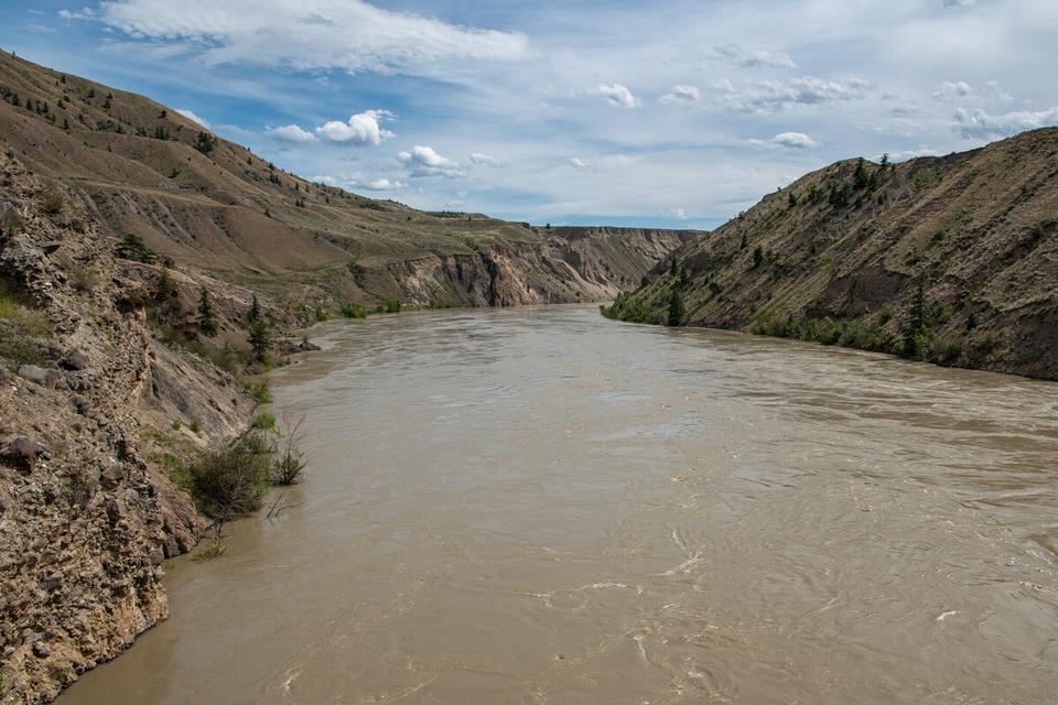
300
Labrador Tea
SITE IDENTIFICATION
Nearest Community:
Fountain, B C
Geocache Location: N 50°40 149' W 121°48.201'
UTM: East 584563; North 5613717 10U
Altitude: 914m/2998ft
Ownership:
Ministry of Transportation
Accuracy: 3 meters
Overall Difficulty: 2
Overall Terrain: 1
Access Information and Restrictions: From Lillooet, BC follow Hwy 99 north east towards Cache Creek for 17 km taking a right on Fountain Valley/Creek Road Travel 12km to Fountain Lake, also known as Kwotlenemo Lake Park in designated day use parking
For more information or to report a problem with this site please contact:
Gold Country Communities Society
P O Box 933 Cache Creek, B C V0K 1H0
Tel: 1-877-453-9467
Email: info@exploregoldcountry com
For more site pages go to: www exploregoldcountry com www geocaching com
APPLY STICKER HERE
The slow growing shrubs used to make Labrador tea come from three species of the Rhododendron genus of plants and in the Ericaceae family, otherwise known as the health or heather family of flowering plants. These plants are a group that grow particularly well in boggy, wet, acidic infertile soils, and require partial shade. Rhododendron tomentosum, Rhododendron groenlandicum, and Rhododendron neoglandulosum are evergreen shrubs that can grow up to 5 feet tall in wet environments The leathery leaves of these three plants are fragrant and are 2 5 cm – 7 cm long with white to red fuzzy hairs on its dark orange underside
Labrador Tea is a bush tea that is found all over Canada and in many other countries worldwide preferring moist montane climates. The plant is particularly beautiful with long, oval shaped bright green leaves that have smooth topsides with under curling edges. When in bloom, tiny, white to yellow, showy and fragrant flowers appear as clusters at the end of the branches. Each tiny flower has five rounded petals with 8 to 10 stamens protruding from their centers
Labrador Tea has been recognized for its many uses and benefits including as a natural insecticide. Labrador Tea contains many flavonoids that have benefits such as anti-inflammatory, anticarcinogenic, and antioxidant properties. Tannin, gallic acid, and vitexin give this plant its medicinal and pharmacological importance. Along with its medicinal properties, Labrador tea is also high in vitamin C and was used to prevent scurvy along with a host of other illnesses many years ago and is still used today by many people.
Labrador Tea has been used by Indigenous people historically to treat headaches, coughs, and lung infections A tea could be made from the dried leaves of any of the three species. This
301
Flora
& Fauna
#31 GC9Z290
Prequel
C r e d i t : T e e m u T r e t j a k o v
tea would be then used as a blood purifier, analgesic, general tonic, and diuretic It was used to treat stings and burns, colds, stomach issues, and asthma Indigenous people also used the Labrador Tea for rheumatism, arthritis, and for itchy skin recognizing its anti-inflammatory benefits. Labrador Tea was also used to braise meats and other root vegetables eaten by Indigenous people.
Labrador Tea is in the same plant family as the cranberry, blueberry, and the huckleberry all which prefer to grow in moist montane acidic soils It can withstand low-intensity fires and will resprout from stems remaining, even its growth and health being stimulated by fire Rhododendron tomentosum was known as northern Labrador Tea, Rhododendron groenlandicum was known as bog Labrador Tea, and Rhododendron neoglandulosum was known as western Labrador Tea or Trapper’s Tea It is such a slow growing plant ethical harvesting practices, only taking a few leaves from each plant, should be practiced if gathering this wild wonder
Drying the leaves out in the sun and then storing in an airtight container will keep the Labrador Tea fresh It is important to note that concentrated doses or incorrect preparation can be toxic as well It should be avoided if you are pregnant as further research is needed to have a full understanding of its effects on the body.
Medicinal plant information is for historical information only. Gold Country Communities Society is not encouraging harvesting of native plants for food and/or medicine.
Written
and Researched
by Lana Rae Brooks
BIBLIOGRAPHY & SOURCES
Wild Adirondacks. (2019). Shrubs of the adirondacks: Labrador tea (rhododendron groenlandicum). Adirondacks Forever Wild.
https://wildadirondacks.org/adirondack-shrubs-labrador-tea-rhododendron-groenlandicum.html Stewart, J. (2018). Native plant of the month: Labrador tea. Shadow Habitat. https://shadowhabitat.org/native-plant-of-the-month-labrador-tea/ Anderson, H , Miron, K , & Morris, K (2020) Labrador tea is an arctic wonder Spiritual Botany https://www spiritualbotany com/emerging-researchers/labrador-tea-is-an-arctic-wonder/ Floem (2020) Labrador tea: The top 5 greatest benefits Floem https://pilki ca/en/blogs/blogue/the-du-labrador-5-bienfaits-sur-la-sante Staughton, J (2021) 6 amazing benefits of labrador tea Organic Facts https://www organicfacts net/health-benefits/herbs-and-spices/labrador-tea html Turner, N (2013) Names of native plant species in Indigenous languages of Northwestern North America University of Victoria http://hdl handle net/1828/5091
302
Please check geocaching.com before you go! Credit: Siberianlena
Canada Mint Flora & Fauna
SITE IDENTIFICATION
Nearest Community:
Pavilion, B C
Geocache Location:
N 50°50 332' W 121°42.062'
UTM: East 591461; North 5632710 10U
Altitude: 1081m/3579ft
Ownership:
BC Provincial Park
Accuracy: 2 meters
Overall Difficulty: 2
Overall Terrain: 1.5
Access Information and Restrictions:
From Cache Creek BC head north on Hwy 97 N for about 11km Take a left on Hwy 99 S for about 28km just past Crown Lake Park in pull out access at the end of the lake
Many plants from the mint family originated in Europe and were brought over with the migration of settlers, Canada Mint, however, is surprisingly the only native mint here in British Columbia. Wild Mint or Canada Mint as it is commonly known can grow from 1 to 4 feet tall on erect stalks. It has a rhizome root system that creeps just above or below the soil’s surface.
For more information or to report a problem with this site please contact:
Gold Country Communities Society
P O Box 933 Cache Creek, B C V0K 1H0
Tel: 1-877-453-9467
Email: info@exploregoldcountry com
For more site pages go to: www exploregoldcountry com www geocaching com
APPLY STICKER HERE
It is easily identified with its aromatic smell when rustled or bruised The leaves of this perennial herb grow in pairs across from each other, with each pair alternating at right angles across from each other, one pair above and one below. The leaves are lance or oval shaped growing on short stalks with toothy margins and a hairy surface coming to a point at their tips. This aromatic herb has glands containing essential oils.
The flowers of the Canada Mint form clusters where the leaves meet the hairy stem axils The small flowers range from an attractive full-pink hue or pale purple to white and grow almost symmetrically in 4 clusters along the stem The flowers’ fruit is that of small nut-like seeds that do not open Canada Mint grows in low to moderate elevations preferring moist locations at the edges of streams, marshes, and lakes. It occurs from the west coast of British Columbia, east to Newfoundland, north to the Yukon and Alaska, and south all the way to New Mexico It is also found all over East Asia, Siberia, Russia, and Malaysia
Wild Mint was one of several species of the mint family that was widely used in food preparation of the Nlaka’pamux, Tsilhqot’in, Stl’atl’imx, and Secwépemc people. This herb was used in soups and stews, as flavoring for meat and fish, as well for teas, drinks, or tonics. Teas made from this herb and others such as wild bergamot and wild rose hips were used as
303
#32 GC9YPPC
Prequel
C r e d i t : A d o b e S t o c k
medicines as well as regular beverages The Nlaka’pamux people used tea made from Canada Mint to treat those with stomach troubles, colds, fevers, coughs, and influenza
Greek mythology tells a story about the naming of the mint species, Mentha. Hades, the god of the underworld, fell in love with a water nymph named Minthe. His wife, Persephone, was jealous, so she turned Minthe into a ground plant to be trampled on. Hades did not have the ability to return Minthe to her true form, so he gave her leaves a beautiful, fresh scent, that made her horrible fate more tolerable Hades willed that the more the plant was trampled, the sweeter it would smell
Mint is a deterrent. Many species of animals and insects including deer, rodents such as mice, mosquitoes, flies, wasps, ants, and moths prefer to stay clear of this smelly herb. Just crush and place fresh or dried mint leaves where you want to deter insects, replacing the leaves every few days.
Medicinal plant information is for historical information only Gold Country Communities Society is not encouraging harvesting of native plants for food and/or medicine
Written and Researched by Lana
Rae Brooks
BIBLIOGRAPHY & SOURCES
Hebda, R. (2004). Wild mint. BC Living. https://www.bcliving.ca/wild-mint Kuhnlein, H. & Turner, N. (1991). Traditional plant foods of Canadian Indigenous peoples: Nutrition, botany, and use. Food and Nutrition in History and Anthropology. https://www.fao.org/3/ai215e/ai215e.pdf
Turner, N. (2013). Names of native plant species in Indigenous languages of Northwestern North America. University of Victoria. http://hdl.handle.net/1828/5091
Edmonton & Area Land Trust. (2018). Wild mint. Edmonton & Area Land Trust. https://www.ealt.ca/speciesspotlight-list/wild-mint
TWC Staff (2023) Mentha arvensis Lady Bird Johnson Wildflower Center https://www wildflower org/plants/result php?id plant=mear4
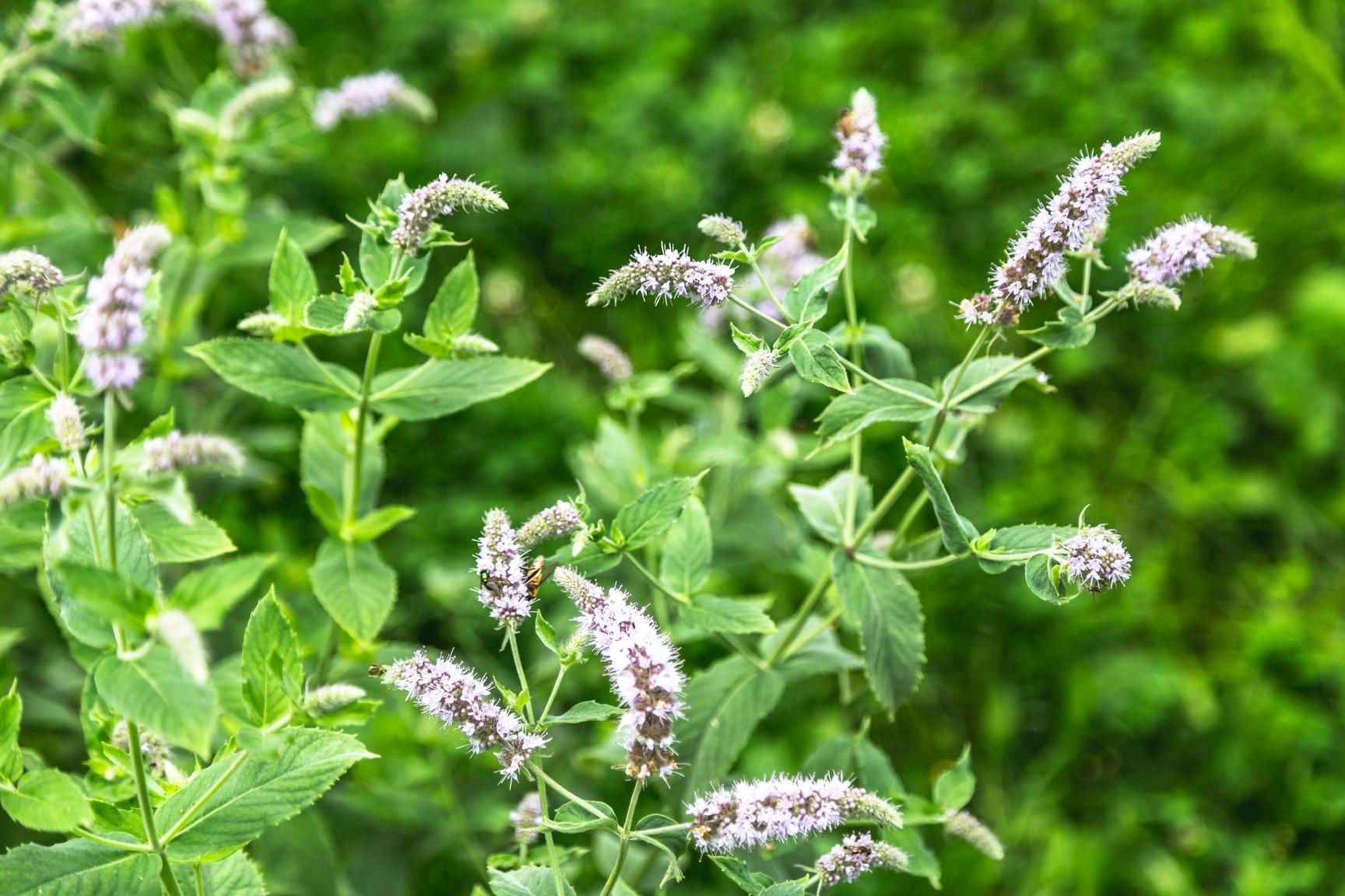
304
geocaching.com before
go! Credit: Adobe Stock
Please check
you
Historic Hat Creek Settlers & Pioneers
SITE IDENTIFICATION
Nearest Community:
Bonaparte Indian Band, B C
Geocache Location: N 50°53 235' W 121°24.439'
UTM: East 612025; North 5638495 10U
Altitude: 509m/1669ft
Ownership: Private Property
Accuracy: 2 meters
Overall Difficulty: 1.5
Overall Terrain: 1.5
Access Information and Restrictions:
From Cache Creek, BC take Hwy 97 North for 11 km Take a left at the Junction onto Hwy 99 follow for 0 5 km Park in designated parking area
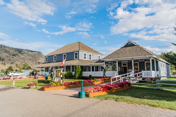
Hat Creek has been a central gathering place for the Bonaparte First Nations. Hat Creek is a tributary of the Bonaparte River in British Columbia, Canada, joining that stream at Carquile, which is also known as Lower Hat Creek.
The Hat Creek basin is located in the Clear Range and Cornwall Hills, which are surrounded by a broad upper plateau region encircled by the mild but towering peaks of the Clear Range to its east and the Cornwall Hills to its west Upper Hat Creek serves as a gateway to Marble Canyon for St'at'imc and Secwepemc peoples.
For more information or to report a problem with this site please contact:
Gold Country Communities Society
P O Box 933 Cache Creek, B C V0K 1H0 Tel: 1-877-453-9467
Email: info@exploregoldcountry com
For more site pages go to: www exploregoldcountry com www geocaching com
APPLY STICKER HERE
Hat Creek is important to First Nations people for many reasons. It is a place where they can access food and medicine, and it is also a place of great spiritual importance The lands now known as Hat Creek, British Columbia, have a long and complex history First inhabited by Indigenous people, the area was originally a part of the Shuswap Nation However, in the early 1800s, the nation was divided into two parts: the northernmost section became the Nlaka'pamux Nation, while the southern portion became the Secwepemc Nation Traditionally Indigenous people summered in pit houses on Hat Creek.
It is also a place of great natural beauty, with hiking and camping opportunities abound If you are looking to experience a taste of Canada's Indigenous history, Hat Creek is the perfect place to start In the 1800s, Chief Trader Donald McLean and his family moved to the Kamloops area and began employing members of the First Nations community The area changed hands several times over the next few decades, before finally being settled by European settlers in the 1840s
305
#34 GC9YAJB
gold was discovered in the area in 1852, it was not Prequel
Although
until 1858 that significant amounts of gold were mined The first Europeans to arrive in the Hat Creek area were members of the Hudson's Bay Company, who established a trading post there in the 1860s The Hudson's Bay Company employed many of the Bonaparte First Nations people, and there was a strong relationship between the two groups. However, this relationship began to change in the late 1800s when gold was discovered in Hat Creek. Thousands of prospectors descended on the area, causing great upheaval for the Bonaparte First Nations people.
The land is rich in resources that have provided the people with food and medicine Hat Creek is a place of great historical importance and has been designated as a National Historic Site To this day, there is still a strong relationship between the Bonaparte First Nations and Historic Hat Creek Ranch Hat Creek is a key part of Indigenous history and reconciliation efforts in British Columbia Visitors to Hat Creek can learn about the rich culture and history of the First Nations people The resulting Gold Rush led to a boom in population and economic growth Today, Hat Creek is a popular tourist destination, known for its scenic beauty and rich history.
Written and
Researched
by Misty Antione and Brandy Cooper-Chardon
BIBLIOGRAPHY & SOURCES
Parks Canada (n d ) Hat creek ranch Canada’s Historic Places
https://www historicplaces ca/en/rep-reg/place-lieu aspx?id=2856
Historic Hat Creek (2022) Indigenous interpretation site Hat Creek Ranch https://www historichatcreek ca/indigenous-interpret-site/
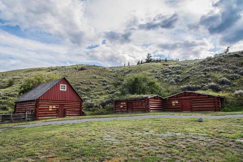
306
Please check geocaching.com before you go!
The Painted Hills
SITE IDENTIFICATION
Nearest Community:
Bonaparte, B C
Geocache Location: N 50°55 472' W 121°24.924'
UTM: East 611368; North 5642628 10U
Altitude: 536m/1758ft
Ownership: Ministry of Transportation
Accuracy: 2 meters
Overall Difficulty: 1.5
Overall Terrain: 1.5
Access Information and Restrictions:
From Cache Creek, BC take Hwy 97 North for 16 km Rest Area is on the south side of Hwy 97
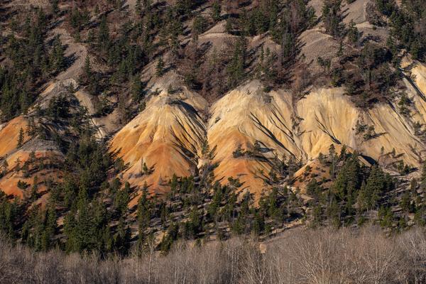
Making your way north from Cache Creek on Highway 97
watch out on the left for the Painted Hills. So uniquely coloured, the hills are dubbed Mother Nature’s Painted hills and the Ochre Hills. The Painted Hills are one of many geological wonders around this region of the province, neighboured by a volcanic marble canyon to the west and chasm provincial park to the northeast.
For more information or to report a problem with this site please contact:
Gold Country Communities Society
P O Box 933 Cache Creek, B C V0K 1H0 Tel: 1-877-453-9467
Email: info@exploregoldcountry com
For more site pages go to: www exploregoldcountry com www geocaching com
APPLY STICKER HERE
The Painted Hills are part of the Marble Range of Mountains which includes the Marble Canyon The languages of the region were Secwepemctsín (Shuswap) and St’át’mic (Lillooet) with the boundaries of the peoples overlapping through the Marble Range. The closest two Indigenous communities to the Painted Hills are St’uxwtéws (Bonaparte) and Tsk’wéylecw (Pavilion).
The hills get their sunny yellow and orange colours from the large amounts of iron and quartz in the serpentinite and dolomite outcroppings of this end of the Marble Mountain Range Their striking beauty surely has been and will be appreciated by mankind throughout the ages
On site you will find a provincial commemorative plaque that was conceived as part of the celebration of the centennial of British Columbia in 1958 with the B.X. plaque being added in 1966 to mark the 100th anniversary of the amalgamation of British Columbia and Vancouver Island. The stagecoach of the historic Cariboo Wagon Road also passed by this beautiful scenery in the 1860s
Written and Researched By Lana Rae Brooks
307
Geological & Views
#35 GC9YAB3 Prequel
Please check geocaching.com before you go!
BIBLIOGRAPHY & SOURCES
Roden, B (2020) Missing stop of interest sign returns, five years after going AWOL The Ashcroft-Cache Creek Journal https://www ashcroftcachecreekjournal com/community/missing-stop-of-interest-sign-returns-fiveyears-after-going-awol/ Shannon, K. (1982). Cache Creek group and contiguous rocks, near Cache Creek, B.C. University of British Columbia https://open.library.ubc.ca/media/stream/pdf/831/1.0052599/2 Leaming, S. (1973). Rock and mineral collecting in British Columbia. Geological Survey of Canada. https://publications.gc.ca/collections/collection 2016/rncan-nrcan/M44-72-53-eng.pdf
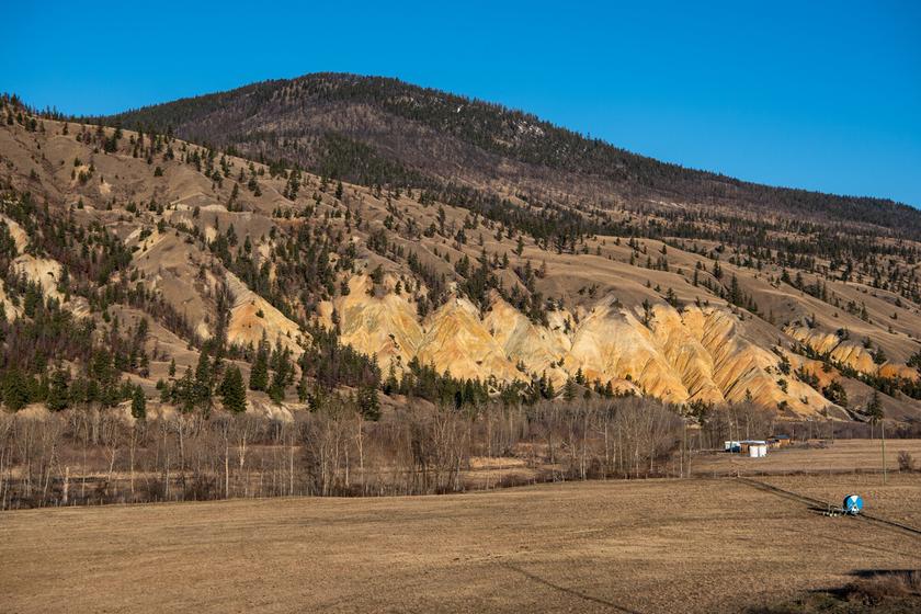
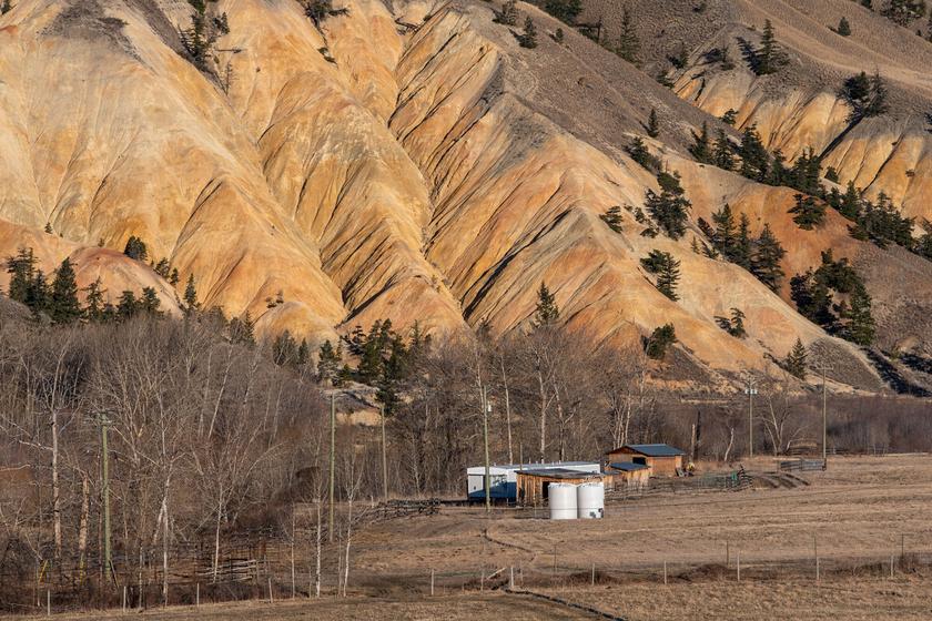
308
Bonaparte River
SITE IDENTIFICATION
Nearest Community:
Loon Lake, B C
Geocache Location: N 50°58 302' W 121°27.552'
UTM: East 608180; North 5647807 10U
Altitude:
487m/1597ft
Ownership: Ministry of Transportation
Accuracy: 2 meters
Overall Difficulty: 1.5
Overall Terrain: 2
Access Information and Restrictions:
From Cache Creek, BC take Hwy 97 North for 22 km Take a right on Loon Lake Road Park in pullover area
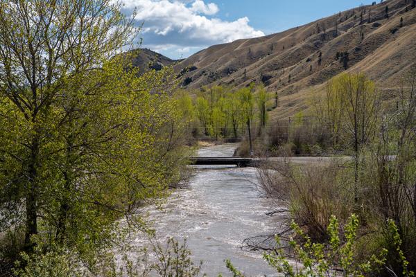
The Bonaparte River is a tributary of the Thompson River, joining it at the community of Ashcroft, British Columbia. The river is about 150km long, including the 17km length of Bonaparte Lake. Rising on the Silwhoiakun Plateau to the northwest of Kamloops, the Bonaparte River flows west and south to join the Thompson River. The river's name first appears on a map made in 1827 by Archibald McDonald of the Hudson's Bay Company The name probably honors Napoleon Bonaparte, who died in 1821
For more information or to report a problem with this site please contact:
Gold Country Communities Society
P O Box 933 Cache Creek, B C V0K 1H0 Tel: 1-877-453-9467
Email: info@exploregoldcountry com
For more site pages go to: www exploregoldcountry com www geocaching com
APPLY STICKER HERE
The Bonaparte River has played an important role in the indigenous communities for many years. It has been the provider of food, fresh water, and transportation. The Secwepemc name for this river is “Kluhtows”, meaning “gravelly river”. The Bonaparte River watershed lies within the traditional territory of the Bonaparte Indian Band to non natives, also known as the Bonaparte First Nation. The community is part of the Shuswap Nation Tribal Council of the Secwepemc (Shuswap) people and community members are referred to as Stuctwesecm in the Secwepemctsin language, which means “People of Stuctuws” The Secwepemc were the first people to live in the Bonaparte River region They used the Bonaparte River for fishing, transportation, and as a source of water for their crops
The fish that came out of the Bonaparte was rainbow trout, or steelhead, and in the summer months the Secwepemc people would erect "Mat houses" along the river. This temporary home, as the people were nomadic, was made from reeds, bark, and supports made from trees. In the winter they moved into pit style houses The Secwepemc caught salmon and other fish in rivers and lakes using nets, spears, gaffs, and lines with hooks They fished from rocks and from canoes They also fished from platforms built at places where the fish hugged
309
Geological & Views
#36 GC9YD4P
Prequel
the shore while traveling upstream In winter, fish were caught through holes in the ice Lines were made of fine material like deer sinew Hooks were made of stone or bone with bait used to lure the fish When the fish reached the hole, they were speared. To see the fish better, sometimes the people wore eyeshades. At other times, they covered their head and shoulders with a mat. These are just some of the ingenious methods used by the Secwepemc to catch fish.
In 1808, Simon Fraser explored the Bonaparte River and built a trading post near where the Bonaparte River joins the Thompson River The Hudson's Bay Company established a trading post in the same area in 1821
The Bonaparte River was an important part of the Cariboo Wagon Road, which was built in the 1860s to bring gold miners and supplies to the Cariboo Gold Rush and caused much displacement to the Secwepemc peoples.
Written and Researched by
Brandy Cooper-Chardon
BIBLIOGRAPHY & SOURCES
Ecoscape Environmental Consultants. (2020). Bonaparte river: Sensitive habitat inventory and mapping and aquatic habitat index. Ecoscape Environmental Consultants Ltd https://cmnbc.ca/wp-content/uploads/2020/06/Bonaparte-River.pdf Kamloops Trails. (2016). Bonaparte river. Kamloops Trails. https://kamloopstrails.net/bonaparte-river/ Morris, A. (2002). Summary of the 2002 bonaparte river fishway operation and enumeration of anadromous and non-anadromous oncorhynchus mykiss. Habitat Conservation Trust Fund. https://a100.gov.bc.ca/pub/acat/documents/r353/Morris,A.2002 1064876138280 e69140d4d60d42519b53ad702 5890052.pdf
Secwepemc Strong. (2018). Secwepemc history. Secwepemc Strong https://secwepemcstrong com/example-resource-post-2/
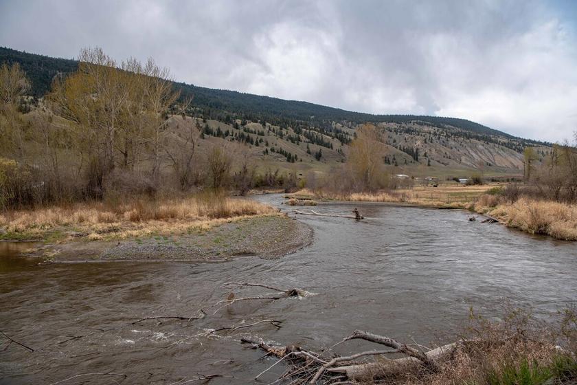
310
Please check geocaching.com before you go!
Loon Lake Lahal
SITE IDENTIFICATION
Nearest Community:
Loon Lake, B C
Geocache Location: N 50°07 733' W 121°11.427'
UTM: East 626618; North 5665714 10U
Altitude: 788m/2585ft
Ownership: Ministry of Transportation
Accuracy: 2 meters
Overall Difficulty: 2
Overall Terrain: 1.5
Access Information and Restrictions:
From Cache Creek, BC take Hwy 97 North for 22 km Take a right on Loon Lake Road Continue and take a right on Stevens Road Do not block street or driveway access when parking
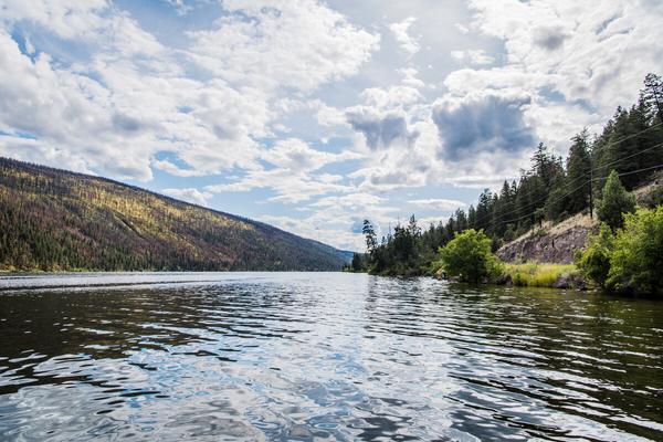
The Bonaparte Indian Band a.k.a. Bonaparte First Nation, is a member band of the Shuswap Nation Tribal Council of the Secwepemc (Shuswap) people. The Bonaparte Indian Band are also known as the Stuctwesemc in Secwepemctsín, which translates to "people of the valley" (also spelt St'uxwtews).
Located west of Cache Creek on about 1,878 hectares of land
The band is separated into nine (9) sections, and has a membership of about 900 Currently their Band Office Is Located approximately 7 km out of Cache Creek, they also have a traditional territory at present day Loon Lake. When Emile Becker applied for water rights on an as yet officially unnamed lake, he referred to it as Loon Lake (translating its Shuswap Indian name, 'iswelh').
For more information or to report a problem with this site please contact:
Gold Country Communities Society
P O Box 933 Cache Creek, B C V0K 1H0
Tel: 1-877-453-9467
Email: info@exploregoldcountry com
For more site pages go to: www exploregoldcountry com www geocaching com
APPLY STICKER HERE
The Stuctwesemc hunted birds and deer that wandered the forest The people gathered the lush flora such as wild raspberries and strawberries, harvesting the roots, and fished along shores of Iswleh or Iswell A place for gathering, perhaps the precontact game of lahal, or Sllekméw'es was played by the shores of the water where the loon cries out Sllekméw'es a guessing or a gambling game that involved two teams seated across from one another. Lahal is a game for two teams of six or more players. The object of the game is to get all the sticks from the opposing team. There are six sticks on each side to start off the game.
There is a Doctor on each team He makes the decisions For example, he picks the "shooter," who guesses where the white bones are, for each side The two teams' Doctors compete for possession of the Kick Stick (Extra Stick)
In the game, there are four bones. They're typically small enough to fit in your palm and aren't particularly distinct from one another save for color. The bones are either white or
311
B.C. History
#37 GC9Y98M
Prequel
striped The two pairs of bones begin with Team A The "Shooter" for Team B then uses hand signals and guesses where the bones are
The winner is determined by the shooter's guess whether or not the bones may be held. When one team has stolen all of the sticks from the other, the game is over.
Rules for Sllekméw'es:
When you are ready to display the bones, you can't alter it; otherwise, you give them away to the opposing team. You cannot switch teams between games.
There are no restrictions on the length of the game; many can last for more than an hour. In these critical games, a judge was sometimes employed to maintain fairness. Some teams have their own bones, which they believe are lucky If, when the pointer points, one of the opposing team's members is holding two bones in one hand, the game will be forfeited
The team that has control of the bones is the team that sings their stick game song(s). So, it is up to the players to stay focused on the game.
Written and Researched by Brandy Cooper-Chardon
BIBLIOGRAPHY & SOURCES
Cariboo Chilcotin Coast. (2023). Loon lake. Land Without Limits. https://landwithoutlimits.com/places/land-of-hidden-waters/loon-lake/ Jolly, D. (2000). First nations water rights in British Columbia: A historical summary of the rights of the bonaparte first nation Ministry of Environment, Lands, and Parks https://www for gov bc ca/hfd/library/documents/bib88420 pdf Rural Routes British Columbia (2023) Deka lake (cariboo chilcotin coast) British Columbia Rural Routes https://bc ruralroutes com/orr city page cfm?city=Deka%20Lake Michel, C & Seymour, C (n d ) Games: Sllekmew’es the bone game Connecting Traditions: Secwepemc Precontact Village Life http://secwepemc sd73 bc ca/sec village/sec gamefs html

312
check geocaching.com before you go!
Please
Relocation (Kelly Lake Substation)
SITE IDENTIFICATION
Nearest Community:
Clinton, B C
Geocache Location: N 50°01 337' W 121°44.906'
UTM: East 587778; North 5653048 10U
Altitude: 1038m/3405ft
Ownership:
Ministry of Transportation
Accuracy: 2 meters
Overall Difficulty: 1.5
Overall Terrain: 1.5
Access Information and Restrictions:
From Clinton, B C take Kelly Lake Road for 15 km Pull over at wide shoulder for parking

Clinton, B.C. is rich with family history and many branches of these family trees that span across Secwepemcúl’ecw (territory of the Secwepemc people) are intertwined with this specific geographical area. Big Bar Creek and Kelly Lake are located west of the Village of Clinton and hold many traditional stories of the Pellti’qt which means People of the White Earth (Kelly Lake) and Steke’7us which means People of the Little Hanging Bridge (Big Bar Creek)
At a location known as 8-mile, approximately 15 km west of the Village of Clinton, the valley and meadows are abundant with history and memories for those people from Pellti’qt.
For more information or to report a problem with this site please contact:
Gold Country Communities Society
P O Box 933 Cache Creek, B C V0K 1H0 Tel: 1-877-453-9467
Email: info@exploregoldcountry com
For more site pages go to: www exploregoldcountry com www geocaching com
APPLY STICKER HERE
During the 1800s when the Federal Government implemented the reservation system across the country, First Nations people from Pellti’qt and Steke’7us residing in the area lived on Clinton Indian Reservation 1, 2 and 2A of which IR 2A is an area known as 8-mile During the mid 1900’s BC Hydro commenced further work on their hydro towers in the vicinity of Clinton and obtained an easement through the Clinton Indian Reservation Jerry LeBourdais tells stories of how his late father, Joe LeBourdais, was hired as part of the blasting crew run by Bill Tresierra and would bury the dynamite in order to blast the holes for the hydro towers seen in the area today.
During the 1970’s, the Federal Government and BC Hydro expropriated the Clinton Indian Reserve 2A in order to build what is seen today as the Kelly Lake Substation located on Kelly Lake Road, west of Clinton This expropriation of land required the population of the Clinton Indian Band to relocate The land obtained during that time became what is now known as Whispering Pines/Clinton Indian Band Reserve No. 4 which is located on the North Thompson River, north of Kamloops, BC.
313
B.C. History
#38 GC9Z7YF
Prequel
The Kelly Lake Substation sits on 8-mile where many families originated from The area originally held houses, corals for horses, rodeo grounds, cow pastures, and hay shacks The generation of people from Pellti’qt who were raised at 8-mile and currently reside in Whispering Pines/Clinton Indian Band are Knowledge Keepers and continue to pass on stories, traditions and memories of what life was like in the Clinton area. Despite an entire generation being born and raised on the current IR No. 4 (Whispering Pines) the people from Pellti’qt hold Clinton, Kelly Lake, Pear Lake, and Big Bar Creek dear to their hearts and spend a significant amount of time up in the mountains hunting, gathering, and on the waters to fish throughout the year and are Yucwmenúl’ecw (caretakers of the land).
Researched and written by Krystal McKay
Please
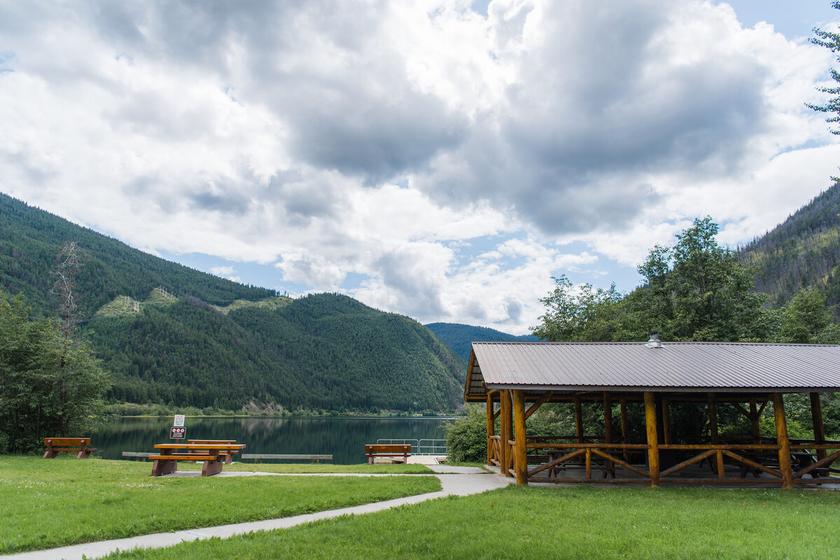
314
check geocaching.com before you go!
A Story About the Cottonwood Canoe
SITE IDENTIFICATION
Nearest Community: Clinton, B C
Geocache Location: N 50°00 364' W 121°46.953'
UTM: East 585415; North 5651204 10U
Altitude: 1029m/3375ft
Ownership:
BC Provincial Park
Accuracy: 2 meters
Overall Difficulty: 1
Overall Terrain: 1
Access Information and Restrictions:
From Clinton, B C take Kelly Lake Road for 18 km Pull over at wide shoulder for parking
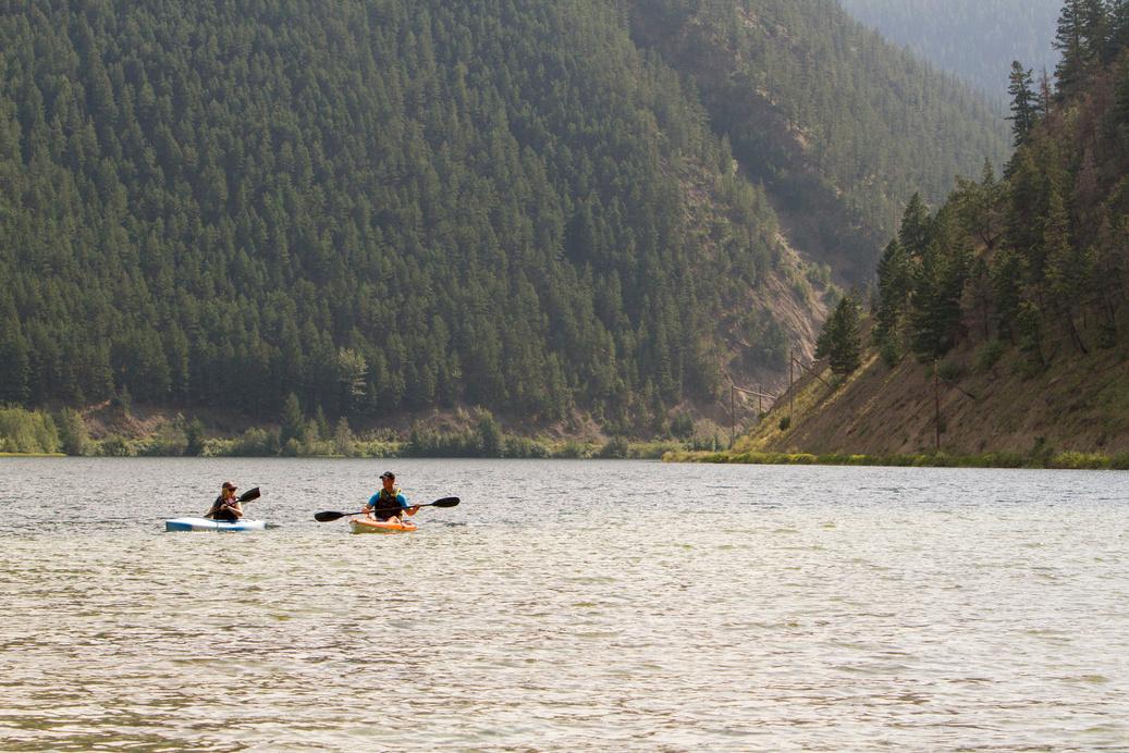
The day was long as the group of Secwepemc people traversed from the area non-Indigenous people now know as Bonaparte First Nations to the area we now call Downing Provincial Park. The men were on a mission to hunt for the elk and deer, and the women had their keen eyes open for the plants that would provide nourishment and medicines. The women came prepared with their strongest digging stick, called a pétse. The strong saskatoon wood was adorned with an antler handle and was tied together with sinew The point of the stick was sharp and made hard with fire
For more information or to report a problem with this site please contact: Gold Country Communities Society
P O Box 933 Cache Creek, B C V0K 1H0 Tel: 1-877-453-9467
Email: info@exploregoldcountry com
For more site pages go to: www exploregoldcountry com www geocaching com
APPLY STICKER HERE
The group had walked upon an expansive body of water, and it was decided that they should make camp. A quick scan of the land resulted in the groups' agreement, the area they were in was rich with resources and it would be wise to replenish their resources. The obstacle of water was not of concern as they had packed with them a dug-out canoe made of the black cottonwood.
During the late fall months, the young men fell a black cotton wood by stripping a ring of bark off to stunt the tree's growth then burning that area of the tree and finally bringing it down with a wedge and a maul. The Secwepemc would then collect the cottony seed fluff and use it to comfort their heads with a pillow. Every part of the tree can be used, and the inner bark was kept making soap, and to be turned into a medicinal tea. The buds in the springtime would provide a sticky resin that was a fragrant ointment for small cuts and a superglue. They let the black cottonwood dry, and as fall turned into winter they began using the hot coals of the fire to burn out the centre of the tree Then they would scrape out the inside with sharp stones or an adze (ctskéklltsʼe7ten) To get the finer details, smaller tools like a chisel would be used. To push out
315
B.C. History
#39 GC9YR29
Prequel
or help shape the canoe, red hot rocks and steam were carefully applied to form the curvatures The canoe was filled with water and the red-hot rocks were added to the water, as the water would begin to boil and hiss, wood spreaders were added to keep the sides spread apart.
Everyone then settled into their matt lodges, constructed of reeds, that were easy to transport, and made for the spring and summer months. The productive day had everyone ready for sleep and the paddle the next day.
As they canoed across the lake, everyone knew their role and worked together to paddle in unison The black cottonwood canoe is long and narrow, with enough room for all the supplies they need for their journey. It is steered by the most experienced paddler at the back, while the others use their strength to propel. Everyone is excited to hunt, gather, and share the rewards on the other side of the water.
Written and Researched by Misty Antione and Brandy Cooper-Chardon
BIBLIOGRAPHY & SOURCES
Cooperman, J. (2023). The secwepemc use of wild plants. Shuswap Passion https://shuswappassion.ca/history/the-secwepemc-use-of-wild-plants/ Museum of Archaeology & Ethnology. (n.d.). Occupation at keatley creek. Simon Fraser University. https://www.sfu.ca/archaeology/museum/exhibits/past-exhibits/keatley-creek/occupation-at-keatley-creek.html
Michel, C. & Seymour, C. (n.d.). Transportation: Summer and winter. Connecting Traditions: Secwepmec PreContact Village Life. http://secwepemc.sd73.bc.ca/sec village/sec transfs.html
J. Antos, R. Coupé, G. Douglas, R. Evans, T. Goward, M. Ignace, D. Lloyd, R. Perish, R. Pojar, A. RobertsPlants of Southern Interior British Columbia and the Inland Northwest – edited by Parish, Coupe, Lloyd -– 5 -2910 Commercial Drive Vancouver, BC V5N 6C9 -Lone Pine Publishing – 1996 - Page 28
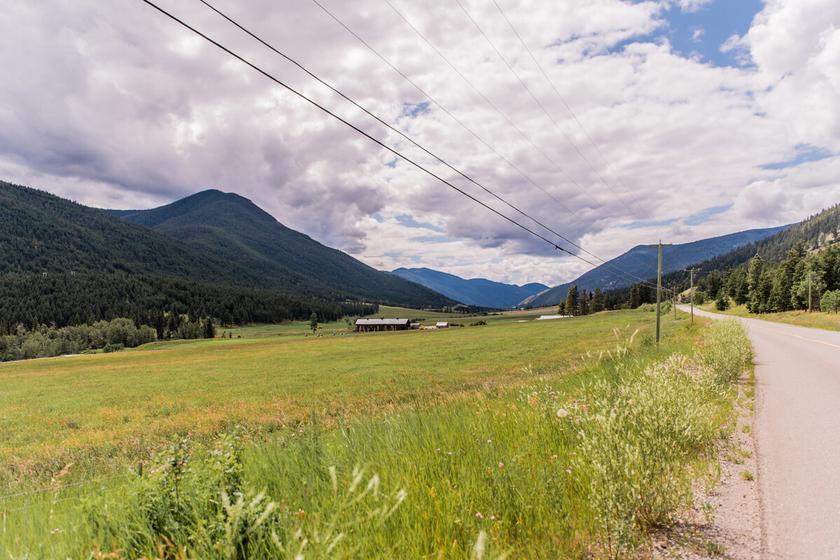
316
geocaching.com before you go!
Please check
Kostering and Grinder
SITE IDENTIFICATION
Nearest Community:
Clinton, B C
Geocache Location:
N 50°59 324' W 121°48.963'
UTM: East 583096; North 5649239 10U
Altitude: 977m/3205ft
Ownership:
BC Provincial Park
Accuracy: 2 meters
Overall Difficulty: 2
Overall Terrain: 2
Access Information and Restrictions:
From Clinton, B C take Kelly Lake Road for 21 km 4x4 not required but high clearance suggested Walk 2 5 km to Pear Lake Rec Site Be aware of wildlife Seasonal access
Clinton, B.C. is rich with family history and many branches of these family trees that span across Secwepemcúl’ecw (territory of the Secwepemc people) are intertwined with this specific geographical area. Big Bar Creek and Kelly Lake are located west of the Village of Clinton and hold many traditional stories of the Pellti’qt which means People of the White Earth (Kelly Lake) and Steke’7us which means People of the Little Hanging Bridge (Big Bar Creek)
For more information or to report a problem with this site please contact:
Gold Country Communities Society
P O Box 933 Cache Creek, B C V0K 1H0
Tel: 1-877-453-9467
Email: info@exploregoldcountry com
For more site pages go to: www exploregoldcountry com www geocaching com
APPLY STICKER HERE
The First Nations who are descendants from Big Bar Creek, Kelly Lake, and Clinton are now predominantly located at the current Reserve No. 4 Whispering Pines/Clinton Indian Band north of Kamloops, B.C.. Despite the historic forced relocation to the current Reserve No. 4, they uphold their ancestral responsibility as Yucwmenúl’ecw (caretakers of the land) for the Clinton and surrounding area and continue to access for traditional land use purposes.

In 1888, Jenny Cemmetlenack from Big Bar Creek, married Conrad Frederick Kostering Conrad was born in Germany and immigrated to Canada from Pennsylvania during the gold rush. He was a packer in the early days and did some gold mining and ranching. Jenny and Conrad had many children, the eldest being Louisa born in 1875, (married Alonzo Tresierra, whose mother is Josephine from Nuu-chah-nulth), Minnie (married William Grinder, whose mother is Marguerite Nancy Kastamalarx from Alkali Lake/Esketemc), Elizabeth Kostering (married Alexander Haller), and Charles (married Annie Haller).
Kostering Creek and Kostering Mountain were named after Conrad Kostering
In 1859 Marguerite “Nancy” Kastamalarx from Alkali Lake/Esketemc, married Phillip Grinder. Phillip was born in
317
B.C.
History
#40 GC9Z7YV
Prequel
P h o t o : R o y a l B C M u s e u m A r c h i v e s C / O W h i s p e r i n g P i n e s I n d i a n B a n d
Pennsylvania and immigrated to Canada during the gold rush He was well known as a packer and driver and owned and operated the stage-line between Dog Creek and Clinton Phillip and Nancy had many children, the eldest being Julia Ann (married Thomas Pocock), Marrianne Evaline (married Joe Haller Sr.), Maggie (married Albert Hartman), Johnny (married Angelina Tresierra, whose mother is Josephine from Nuu-chah-nulth), Susan (married Frank Gottfriedson) Sarah (married Joseph Heid), Bill (married Minnie Kostering, whose mother is Jenny Cemmetlenack from Big Bar Creek), Mary Irene (married Joseph Rosaire Pigeon), Louis Agnes (married Joe Bishop), Bella (married Gabrielle Tresierra, whose mother is Louise Kostering from Big Bar Creek) as well as Nora, Emma, and Jim.
Grinder Creek is named after Phillip Grinder who was one of the first settlers in the Big Bar Creek area
Members of these families were laid to rest in private family burial grounds, but several were laid to rest in the Clinton Pioneer Cemetery.
The ancestors of Pellti’qt and Steke’7us have left evidence of their existence in the Clinton area, through their winter pit homes near Pear Lake, their hunting tools found throughout the mountain ranges surrounding Clinton, their involvement in the gold rush and sharing of knowledge of their food sources, waterways used for travel, and trading of animal furs and skins to pioneers traveling north during the gold rush The stories that are passed down from generation to generation are acknowledged and visited by members of the current Whispering Pines/Clinton Indian Band and hold significant meaning and importance that will never be forgotten or lost.
Researched and written by Krystal McKay
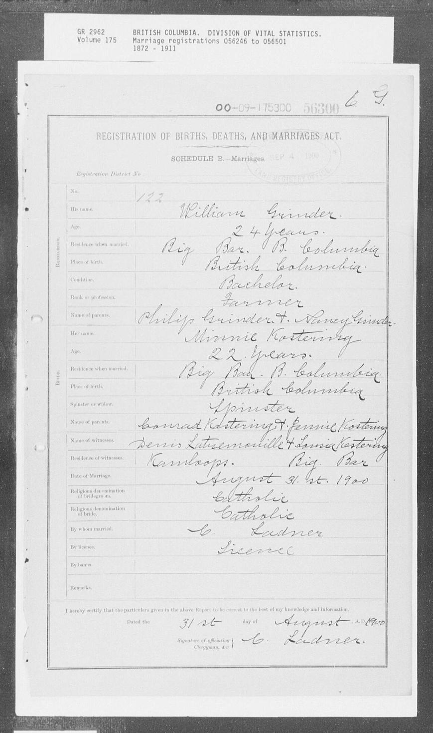
318
Please check geocaching.com before you go!
Pear Lake
SITE IDENTIFICATION
Nearest Community:
Clinton, B C
Geocache Location: N 50°59 327' W 121°49.743'
UTM: East 582183; North 5649230 10U
Altitude: 946m/3106ft
Ownership:
BC Provincial Park
Accuracy: 2 meters
Overall Difficulty: 2
Overall Terrain: 2
Access Information and Restrictions:
From Clinton, B C take Kelly Lake Road for 21 km 4x4 not required but high clearance suggested Walk 2 5 km to Pear Lake Rec Site Be aware of wildlife Seasonal access
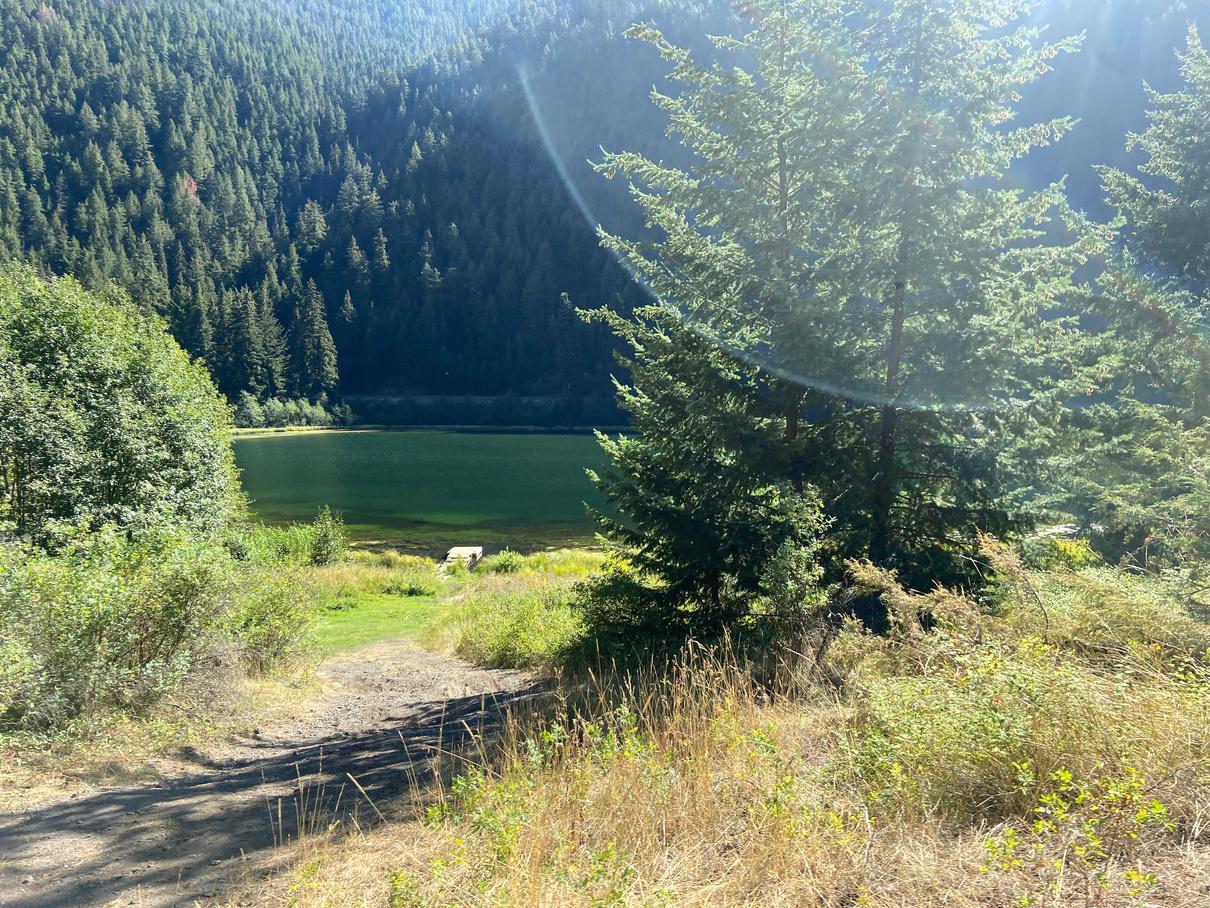
Clinton, B.C. is rich with family history and many branches of these family trees that span across Secwepemcúl’ecw (territory of the Secwepemc people) are intertwined with this specific geographical area. Big Bar Creek and Kelly Lake are located west of the Village of Clinton and hold many traditional slexéyem (stories) of the Pellti’qt which means People of the White Earth (Kelly Lake) and Steke’7us which means People of the Little Hanging Bridge (Big Bar Creek)
For more information or to report a problem with this site please contact:
Gold Country Communities Society
P O Box 933 Cache Creek, B C V0K 1H0 Tel: 1-877-453-9467
Email: info@exploregoldcountry com
For more site pages go to: www exploregoldcountry com www geocaching com
APPLY STICKER HERE
The ancestors of Pellti’qt have much evidence of their existence in the Clinton area, including their winter pit homes west of Pear Lake and above the Fraser River. A pit house is a dwelling built by Indigenous people for use in the winter season and have been widely used in this region for at least 3,500 years. Circular in footprint, they housed between 15 and 30 people, were partially built into the ground, usually dug to a depth of 1 meter. The roof was upheld by four logs placed at an angle with a layer of poles and topped with pine needles and grass with a center smoke hole and a ladder placed in the center smoke hole to access the interior of the pit house The Hut-tsat-tsl or “Cold Spring” site is the largest recorded pit house village site in the Secwepemc Nation with an estimated population of 17,000 at the time
Present day, Pear Lake remains of particular importance to descendants of both Pellti’qt and Steke’7us and is actively used as camping spots throughout the year. During the summer months families gather at Pear Lake in ceremony and to access their traditional fishing rock on the Fraser River when the salmon run. It is during this time that families gather, share knowledge with their children and grandchildren, pass on stories of their ancestors, collect medicine, pick berries and dry and or preserve their salmon
319
Geological & Views
#41 GC9Z7YA
Prequel
C r e d i t : L a n a R a e B r o o k s
The salmon is a part of both food security as well as a traditional food to feed their families and share with Elders
During the fall and winter months, hunters meet at traditional landmarks all throughout the mountain ranges in the area to hunt and feed their families. As part of a long-standing tradition, horses are used to navigate the rugged mountain terrain and feed on the unique and nutrient dense grass found in the meadows around Pear Lake in order to prepare for the hunting season
Written and Researched by Krystal
McKay
Please check geocaching.com before you go!
320
Credit: Lana Rae Brooks
Lake to Lake
SITE IDENTIFICATION
Nearest Community:
Clinton, B C
Geocache Location: N 50°59 352' W 121°48.716'
UTM: East 583384; North 5649295 10U
Altitude: 976m/3202ft
Ownership:
BC Provincial Park
Accuracy: 2 meters
Overall Difficulty: 2
Overall Terrain: 2
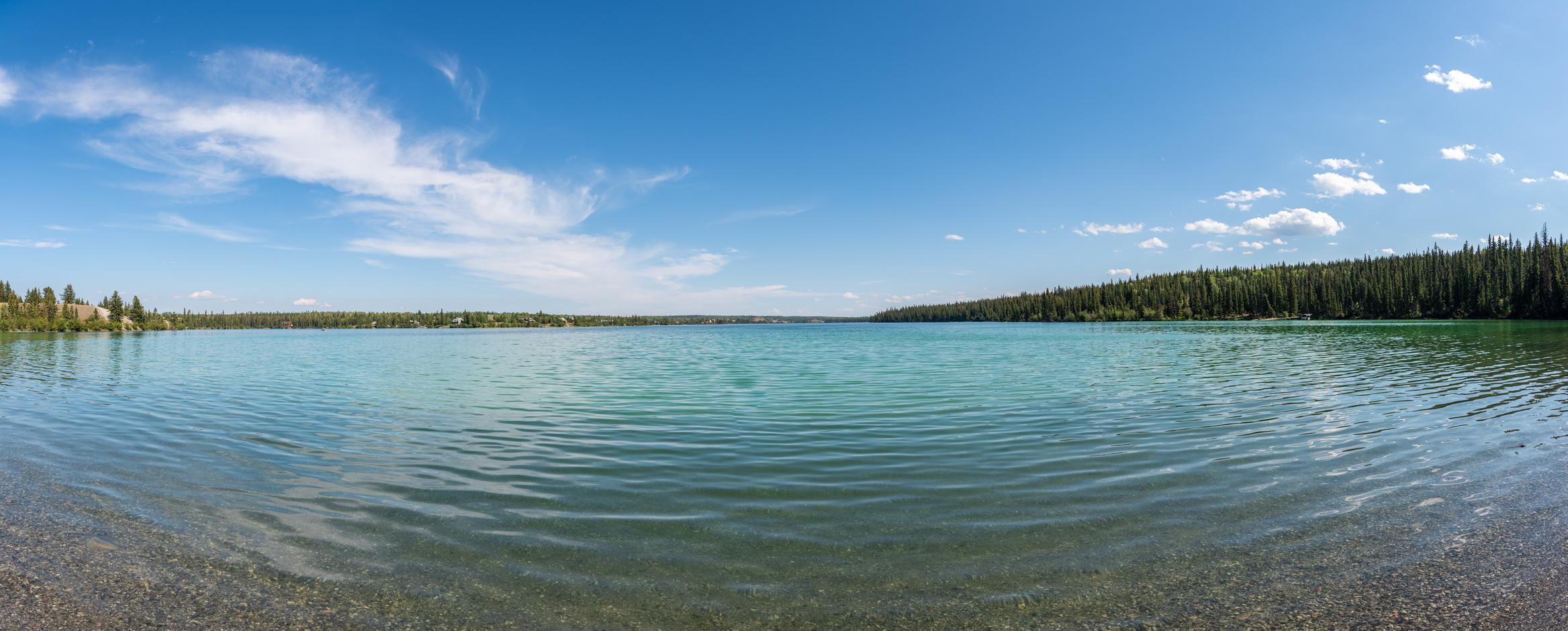
Access Information and Restrictions:
From Clinton, BC take Kelly Lake Road for 21km 4x4 not required but high clearance suggested Walk 2 5km to Pear Lake Rec Site Be aware of wildlife Seasonal access
For more information or to report a problem with this site please contact:
Gold Country Communities Society
P O Box 933 Cache Creek, B C V0K 1H0 Tel: 1-877-453-9467
Email: info@exploregoldcountry com
For more site pages go to: www exploregoldcountry com www geocaching com
APPLY STICKER HERE
Clinton, BC is rich with family history and many branches of these family trees that span across Secwepemcúl’ecw (territory of the Secwepemc people) are intertwined with this specific geographical area Big Bar Creek and Kelly Lake are located west of the Village of Clinton and hold many traditional stories of the Pellti’qt which means People of the White Earth (Kelly Lake) and Steke’7us which means People of the Little Hanging Bridge (Big Bar Creek).
During the 1970’s, the Federal Government and BC Hydro expropriated the Clinton Indian Reserve 2A in order to build what is seen today as the Kelly Lake Substation located on Kelly Lake Road, west of Clinton This expropriation of land required the population of the Clinton Indian Band to relocate The land obtained during that time became what is now known as Whispering Pines/Clinton Indian Band Reserve No. 4 which is located on the North Thompson River, north of Kamloops, BC.
Despite the complete upheaval of livelihood, connection to culture and land, division of families and friends residing on different Indian Reservation land, and deep-rooted memories and oral history, the people from Pellti’qt and Steke’7us make great efforts to share the traditions of their ancestors with future generations Traditions that continue include such things as hunting large wildlife for food and their hides (for such things as making drums); salmon fishing at the Fraser River; picking berries in the mountain ranges; gathering medicine from areas of exclusive growth for use and preservation; and practicing ceremony and cleansing on the shores of Kelly Lake.
321
Geological & Views
#42 GC9Z7Y7
Prequel
Stories from those who were once children growing up in the area share how Kelly Lake used to be colder than it was now and was always well respected for its beauty and unknown depth Parents warned their children to respect the lake and its power. Many traditional stories revolve around Kelly Lake and continues to hold special significance to the people of Pellti’qt and Steke’7us. As part of their nomadic lifestyle, Kelly Lake was one of the many locations where families would set up camp during their travels and feast on the fish they caught from Kelly Lake as they travelled from lake to lake, mountain range to mountain range and finishing their travels close to the Fraser River during the fall salmon run and settling into their winter pit homes west of Pear Lake.
Written and Researched by Krystal Mckay
Please check geocaching.com before you go!
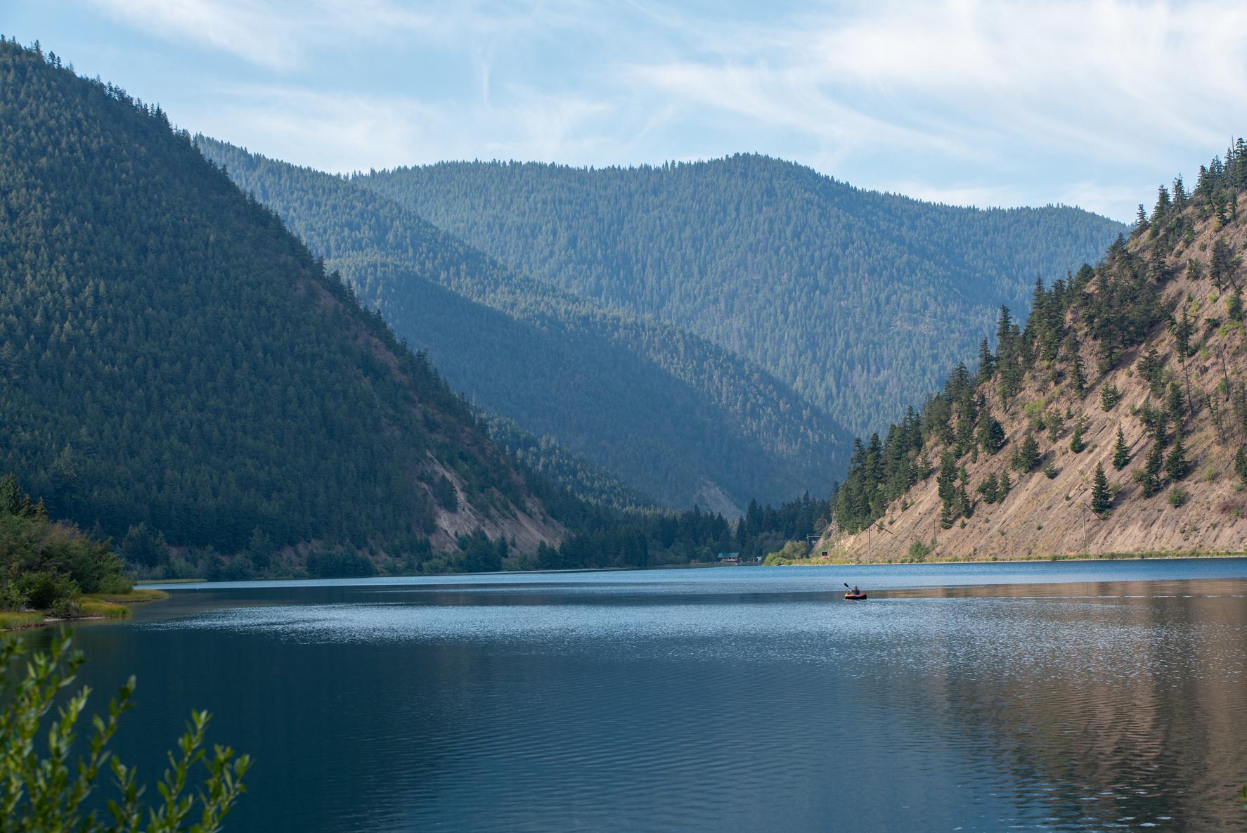
322
Heartleaf Arnica
SITE IDENTIFICATION
Nearest Community:
Clinton, B C
Geocache Location: N 51°03 536' W 121°49.212'
UTM: East 582680; North 5657040 10U
Altitude:
1303m/4274ft
Ownership:
BC Provincial Park
Accuracy: 2 meters
Overall Difficulty: 2
Overall Terrain: 2.5
Access Information and Restrictions:
From Clinton, B C take Kelly Lake Road for 17 km to Jesmond Road 4x4 not required but road can be rough
Travel 15 km Take a right on the secondary dirt road and travel about 1 km Be aware of wildlife Seasonal access.
For more information or to report a problem with this site please contact:
Gold Country Communities Society
P O Box 933 Cache Creek, B C V0K 1H0
Tel: 1-877-453-9467
Email: info@exploregoldcountry com
For more site pages go to: www exploregoldcountry com www geocaching com
APPLY STICKER HERE
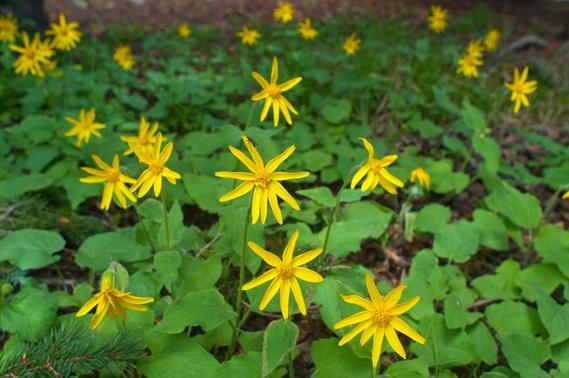
Heartleaf arnica is exactly that, heart leafed! They are a rhizome plant with branching roots producing one or more stems reaching up to a half a meter in height. The basal leaves on this perennial herb are finely toothed and grow offshoots that are opposite of each other on the stalk, with as many as 4 pairs of hairy glandular leaves. The stalks of the heartleaf arnica grow in groups and clusters upright with ray and disk flower heads The flowers are the showy yellow characteristically known from the sunflower family of plants The flowers bear a daisy-like appearance and are lined with white-haired phyllaries sometimes studded with resin glands with up to 5 heads per plant The pappus is whitish, hairy, and barbed These seeds are carried to their destinations by the wind
Heartleaf arnica is widespread in North America, growing in forests, on hillsides, and beside streams. It enjoys boreal and cool temperate climates and is often found in Lodgepole pine and Douglas fir forests of the mountains growing in a variety of types of soil Hardy to trampling and tolerant of both shade and sun, Heartleaf arnica is a dominant ground cover in many forests An individual plant can live up to twelve years and plants may even survive a wildfire by resprouting from its rhizome afterward!
Arnica has been used as medicine since the 1500’s in European cultures and is still popular as medicine today. It was applied to the skin as ointments, creams, liniments, tinctures, and salves to soothe muscle aches, reduce inflammation, and heal wounds. Even now it is used for injuries like sprains and bruises Arnica can cause serious side effects when taken by mouth, and is usually used externally only
Traditionally, the plant was mashed and applied externally to cuts and bruises. It was used to prevent infection, reduce
323
Flora & Fauna
#43 GC9YXG4
Prequel
swelling and for pain relief All parts of the plant were used; however, the flowers are known to have the most potency
Heartleaf arnica is an important part of the summer diets of mule deer and elk. The Greek word for lambskin is “arnica”, referring to the hairy leaves and stems of this plant. Cordifolia, the species name, means heart-shaped leaves.
Medicinal plant information is for historical information only Gold Country Communities Society is not encouraging harvesting of native plants for food and/or medicine.
Written and Researched by
Lana Rae Brooks
BIBLIOGRAPHY & SOURCES
iNaturalist Network. (2019). Heartleaf arnica. iNaturalist. https://inaturalist.ca/taxa/75569-Arnica-cordifolia
Utah State University. (n.d.). Heartleaf arnica. Range Plants of Utah. https://extension.usu.edu/rangeplants/forbsherbaceous/heartleaf-arnica
California Native Plant Society (n d ) Heartleaf arnica Calscape https://calscape org/Arnica-cordifolia-()
USDA (n d ) Wildflowers - heartleaf arnica U S Forest Service
https://www fs usda gov/detail/boise/learning/nature-science/?cid=fsed 009691
Turner, N (2013) Names of native plant species in Indigenous languages of Northwestern North America University of Victoria http://hdl handle net/1828/5091
Icahn School of Medicine at Mount Sinai (2023) Arnica Mount Sinai https://www mountsinai org/health-library/herb/arnica
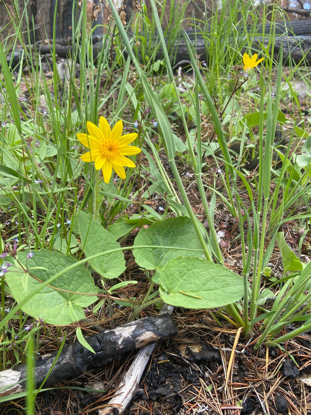
324
Please check geocaching.com before you go!
Credit: Lana Rae Brooks
Pavilion Mountain
SITE IDENTIFICATION
Nearest Community:
Clinton, B C
Geocache Location: N 50°59 053' W 121°46.621'
UTM: East 585843; North 5648781 10U
Altitude: 1461m/4793ft
Ownership:
Crown Land Accuracy: 2 meters
Overall Difficulty: 1.5
Overall Terrain: 1.5
Access Information and Restrictions:
From Clinton, B C take Kelly Lake Road for 23 km climbing the switch backs of the Pavilion Clinton Road
Take left on Forest Service Road access and follow to powerlines Be aware of wildlife High Mountain Road (23% grade). 4x4 not required but road can be rough. Seasonal access only.
For more information or to report a problem with this site please contact: Gold Country Communities Society
P O Box 933 Cache Creek, B C V0K 1H0
Tel: 1-877-453-9467
Email: info@exploregoldcountry com
For more site pages go to: www exploregoldcountry com www geocaching com
APPLY STICKER HERE
East of the Fraser River between Lillooet and Clinton lies Pavilion Mountain. It is the highest mountain in the Marble Canyon Range. The mountain has two summits; the north summit is 975 meters (3,199 ft), and the south summit is 940 meters (3,084 ft). Many Indigenous groups traveled long ways from various directions to the mountain, where gradual slopes provided easy access. Marble Canyon was one such route used for traveling Hunting, especially deer, was a popular activity here At the subalpine elevations, visitors gathered plants for food Indigenous people never felt an ownership of the land but referred to themselves as guests Present day, the Tsk’wéylecw First Nations reside to the southwest at Pavilion, the French word for tent or flag
The population of the Tsk’wéylecw First Nations in 1850 was estimated at 150 people by James Teit. The people lived on the north side of Pavilion Creek, east of Fraser River, about 23 miles northeast of Lillooet, some on the west side of Fraser River, and a few families living south. Formerly some of this band would winter along the east side of Fraser River close to what is now known as the community of Fountain
Band elders traditionally used basalt sourced locally to hunt on Pavilion Mountain. The Interior Salish used 5 different types of stone for tool crafting including jasperoid, pisolite, tuff, chalcedony and quartzite. Traditionally hunting and quarrying were synchronous activities here and possibly dating back to prehistoric times. Current information from studies suggests that Pavilion Mountain had larger assemblages due to the importance and abundance of food resources in proximity. Pavilion Mountain had good lookout areas, hunting sites, gathering and processing sites, and base camps could be made as needed in the subalpine Cooking, crafting, butchering, tanning, and woodworking were just a few of the activities that took place
325
Geological & Views
#44 GC9Y992
Prequel
A peak in the Gold Rush Divide area of the Cariboo Mountains in British Columbia’s Interior Plateau region, Pavilion Mountain is a part of a complex group of peaks known collectively as the Seven Sisters and is visible from most of the Fraser Canyon. The Seven Sisters were an important landmark for early explorers and travelers coming up the river valley and for Indigenous families traveling to the area to assemble for hunting and gathering
"Wright's Road" from Pavilion Mountain to Kelly Lake, as it was once called, is now known as the PavilionClinton Road. Originally established in 1862, it had eight 'switch backs' to the top and was a very treacherous road. Old timers working for the Diamond S Ranch, originally established as the Carson Ranch, talk about how the descent down the north side of the mountain would be brutal on the primitive brake systems of wagons and early trucks.
A note from Marilyn Allison in 2008 states “For the first few weeks of traveling up and down the mountain, my mother walked the road, frightened to death to go by car ” Her family had lived and worked on the ranch when it was known as the Carson Ranch and were still there at the change to Diamond S Ranch And, Mrs B T Roger’s wrote on July 7, 1899 “The road to Clinton goes over the mountain We ascended to 4,850 feet, and then in 3 miles dropped to 3,500 – it was awful, the sharp turns terrible We had two trees behind us to save the wheels and brakes ”
It has been mulled over by many as to why G.B. Wright chose such a difficult route for the building of this road. Easier routes with easier grades would have been possible. The 33 km gravel road winds its way up the mountain and climbs over its back side with some 12 and 18 percent grades This scenic, well maintained, gravel route can easily be traveled in summer and early fall without a 4x4 providing your brakes are in check!
Pavilion Mountain offers beautiful views in all directions. To the east, one can see the Cariboo Plateau. The mountain was named by explorer and surveyor, Joseph Curtis who, in 1860, noted its resemblance to a pavilion. It is a popular destination for snowmobiling and backcountry skiing and offers several different trails for hikers of all levels; the most popular being the 5.5 km hike to the summit. From the top of the mountain, hikers are treated to stunning views of the Fraser Valley far below.
Written and Researched by Lana Rae Brooks and Brandy Cooper-Chardon
Please check geocaching.com before you go!
BIBLIOGRAPHY & SOURCES
Teit, J. (1909). The shuswap. Memoir of the American Museum of Natural History https://docs2.cer-rec.gc.ca/lleng/llisapi.dll/fetch/2000/90464/90552/548311/956726/2392873/3614457/3615225/3635142/3718931/A964445 Appendix 2a - James Tait%2C The Shuswap %28part1of2%29 - A6L6C9.pdf? nodeid=3718519&vernum=-2
Rousseau, M. (1989). Results of the keatley creek archaeological project lithic source study. Simon Fraser University. http://archpress.lib.sfu.ca/index.php/archpress/catalog/download/62/32/1330-1?inline=1 Robinson, G. & Mogus, D. (1997). First nations water rights in British Columbia: A historical summary of the rights of the pavilion first nation. Ministry of Environment, Lands, and Parks: Water Management Branch. https://www for gov bc ca/hfd/library/documents/bib77242-1 pdf
Branwen Patenaude, in Trails to Gold (Horsdal & Schubart, 1995, page 78)
Mrs B T Rogers' diary from July, 1899 (privately published in 1985 as M I Rogers 1869-1965, edited by Michael Kluckner)
326 in
a base camp
The Douglas Fir Tree Flora & Fauna
SITE IDENTIFICATION
Nearest Community:
70 Mile House, B C
Geocache Location: N 51°16 899' W 121°36.694'
UTM: East 596832; North 5682061 10U
Altitude: 1143m/3750ft
Ownership:
BC Provincial Park
Accuracy: 2 meters
Overall Difficulty: 1.5
Overall Terrain: 1.5
Access Information and Restrictions:
From Clinton, B C take Hwy 97 North for 16 km Take a left onto Meadow Lake Road Travel 10 km to Beaver Dam Lake Rec Site Be aware of wildlife Seasonal access
Despite its name, the Interior Douglas-fir is not a fir tree. It is a Pseudotsuga (fake hemlock), a genus of evergreen coniferous trees with only 4-6 commonly recognized species, with Douglasfir (Pseudotsuga menziesii) itself being the most well-known. Throughout history, it has been documented as pine, spruce, fir, hemlock, and even sequoia, but it is none of these. Douglas-fir trees are widespread in the forests of Gold Country mainly due to their drought resistance, which is second only to that of the ponderosa pine within this region
For more information or to report a problem with this site please contact:
Gold Country Communities Society
P O Box 933 Cache Creek, B C V0K 1H0
Tel: 1-877-453-9467
Email: info@exploregoldcountry com
For more site pages go to: www exploregoldcountry com www geocaching com
APPLY STICKER HERE
Coast Douglas-firs can live up to 1300 years and large specimens in the past have been found up to 5 meters (16 Ft.) in diameter with heights of 120+ meters (390+ Ft.), which if still standing today, would be taller than any living tree in the world. However, many notably large specimens such as the Nooksack giant in Washington and the Lynn Valley Giant in the Vancouver area were cut down several decades ago, which makes coast Douglas fir only the 4th tallest living species of tree in the world, with the largest living individual standing 99.7 meters (327 Ft.) tall in Brummit Creek, Oregon
Douglas fir trees and forests are the primary habitats for many animals including spotted owls, red tree voles, and some moths, and their seeds, needles, and inner bark are the primary food source of the titular Douglas squirrel, blue grouse during spring, and North American porcupine during winter respectively.
Douglas-fir is a historically popular choice as the floor and beams of Indigenous lodges and sweat lodges, it was also used as fuel for pit cooking, fishing hooks, snowshoes, and handles The seeds were used for food and the branches were used for bedding
A tea from the bark of young Douglas Fir was used to treat colds, ulcers, stomach problems, and tuberculosis A poultice was used to treat rheumatic joints. Infusing red alder, western hemlock and Douglas-fir bark would be used to treat internal
327
#46 GC9Z3GM
Prequel
injuries Liquid pitch was used to make a salve to treat cuts, bruises, and other skin problems The spring green fir tips would be used to make a herbal tea with Nootka rose petals and brown dye could even be made from the bark.
“A Pacific Northwest Indigenous legend tells that there was once a great fire in the forest. All the animals began to flee to escape the fire; the birds flew away and the deer and other animals were able to run away However, the mice with their tiny legs were not quick enough to outrun the fire
They asked the maple tree, the western hemlock and the western red cedar for help, but they were unable to offer help Then they reached a Douglas-fir who encouraged the mice to climb up its thick, fire-resistant trunk and hide in its fir cones. The mice took shelter inside the cones and survived the devastating fire. Even to this day, if you look at the cones of a Douglas-fir closeup, you can see the little hind feet and tails of the mice sticking out from beneath the scales of the fir cones. ” – Naturekidsbc.ca
Douglas-fir is the most fire-resistant tree native to the pacific northwest Douglas-fir was named after David Douglas, who was a Scottish botanist David Douglas was responsible for introducing many of British Columbia's native conifers to Europe Fossil records have traced this species back to about 50 million years ago Douglas-fir trees were also used to create a crystalline sugar, often called Douglas-fir sugar or wild sugar Indigenous Peoples gathered it from branches on specific trees in the interior of B C and it was used as a candy and sweetener It was traded to upper B C and among other nearby groups, was extremely rare and valued, yet it has rarely been seen as of recent.
Written and Researched by Leith
McLean
and Lana Rae
Brooks
BIBLIOGRAPHY & SOURCES
Nature Kids BC (2018) Douglas-fir and the mice Nature Kids BC https://naturekidsbc.ca/douglas-fir-and-the-mice/ Sierra Club BC. (n.d.). Douglas-fir. Sierra Club BC. https://sierraclub.bc.ca/douglas-fir/ ES 421. (2016). Douglas fir (pseudotsuga menziesii). UVic Map Shop. https://mapping.uvic.ca/section/douglas-fir
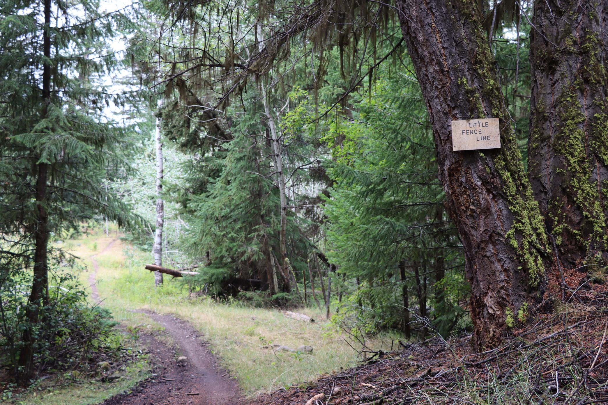
328
Please check geocaching.com before you go!
Cattails, the Pond Super Plant Flora & Fauna
SITE IDENTIFICATION
Nearest Community:
70 Mile House, B C
Geocache Location: N 51°15 821' W 121°36.126'
UTM: East 597530; North 5680076 10U
Altitude: 1117m/3664ft
Ownership:
Ministry of Transportation
Accuracy: 2 meters
Overall Difficulty: 1.5
Overall Terrain: 1
Access Information and Restrictions:
From Clinton, B C take Hwy 97 North for 16 km Take a left onto Meadow Lake Road Park in pull-over area
Be aware of wildlife Seasonal access
Family: Typhaceae
Origin: Native plant species in North and South America, Eurasia, and Africa
Duration: Perennial
Color: Brown cigar-shaped head with leaves that are basal, erect, linear, flat, D-shaped, ribbon-like structures and are pale grayish green in colour
For more information or to report a problem with this site please contact:
Gold Country Communities Society
P O Box 933 Cache Creek, B C V0K 1H0
Tel: 1-877-453-9467
Email: info@exploregoldcountry com
For more site pages go to: www exploregoldcountry com www geocaching com
APPLY STICKER HERE
Typical Bloom: The female cattail flower consists of two parts: a cigar-shaped brown formation near the top of the stem made up of tiny, densely packed pistillate (female) flowers, and a thin yellow spike extending above it. The staminate (male) flowers are hidden by the thickly flowered tube that extends above them. In May through July, both male and female flowers may be seen on these brown headlets. In early fall, the fluffy seeds inside these brown flower heads open.
While traveling in the interior of BC, if the everdistinguishable cigar shaped head pops up amongst a tall stalk of ribbon-like pale gray leaves you can be sure to find a pond or marsh nearby. There are at least 8 species worldwide, 2 of which exist in Canada. These include the narrow-leaved cattail and the common cattail. Clusters of stiff leaves that resemble ribbons grow from a thick, horizontal rootstock and can reach up to 3 m (or more) in height. The Cattail is a versatile plant with many uses as well as being edible. Inside the stalks of fresh shoots is tasty food that can be eaten as is, sautéed or tossed into a stir fry.
Indigenous peoples used the roots to make flour (high in protein and carbohydrates) and the fluffy wool of the head was used as diapers because of its softness and absorbency. The fluffy wool is like down and can be used as insulation in
329
#47 GC9Z273
Prequel
clothing, pillows, mattresses, and quilts A common use of the leaves by the Nlaka'pamux people was to use them for matt making The matts were then used to prepare foods such as drying berries, roots and then used as a serving dish. Some people also fabricated summer tents from the cattails leaves that were easy for transportation. The clear, sticky, substances found between the leaves were rubbed on the gum to help relieve toothache pain.
These “cigar-heads” are also excellent fire starters The tight heads are often dry inside even after a heavy rain, making this essential survival tinder
Written
and Researched by
Brandy Cooper Chardon
BIBLIOGRAPHY & SOURCES
Turner, N (2015) Cattail The Canadian Encyclopedia https://www thecanadianencyclopedia ca/en/article/cattail
Edible Wild Food (n d ) Cattail: Typha latifolia Edible Wild Food https://www ediblewildfood com/cattail aspx
Kuhnlein, H & Turner, N (1991) Traditional plant foods of Canadian Indigenous peoples: Nutrition, botany, and use Food and Nutrition in History and Anthropology https://www fao org/3/ai215e/ai215e pdf
Turner, N (2013) Names of native plant species in Indigenous languages of Northwestern North America University of Victoria http://hdl.handle.net/1828/5091
330
Credit: Adolf Češka via E-Flora BC Please check geocaching.com before you go!
Always Shady Tree: The Paper Birch Flora &
SITE IDENTIFICATION
Nearest Community: 70 Mile House, B C
Geocache Location: N 51°24 684' W 121°11.950'
UTM:
East 625238; North 5697114 10U
Altitude: 1081m/3546ft
Ownership:
BC Provincial Park
Accuracy: 2 meters
Overall Difficulty: 1.5
Overall Terrain: 1.5
Access Information and Restrictions:
From 70 Mile House, B C follow North Bonaparte Road east 11 km Take a left onto South Green Lake Road Travel 9 km turning right into Green Lake Provincial Park Park in designated day use parking Be aware of wildlife Seasonal access.
For more information or to report a problem with this site please contact:
Gold Country Communities Society
P O Box 933 Cache Creek, B C V0K 1H0
Tel: 1-877-453-9467
Email: info@exploregoldcountry com
For more site pages go to: www exploregoldcountry com www geocaching com
APPLY STICKER HERE
The Paper birch has six recognized varieties and hybridizes often with almost every other native species in the genus. It is truly a Canadian species and loves to flourish in our northern climate. Distributed across Canada, Paper birch is unable to handle long periods of drought or overly wet soils. It seeks out sites of full sun and its demand for water is greater than the average tree. Growing in a variety of locations including plateaus, forests, and mid elevation mountain slopes, the Paper birch will even grow in floodplains and drainage ditches seeking moisture in the arid climate of the southern interior of B C
The Paper birch has a growing hardiness making it a nice addition to landscapes wild and urban with its showy bark and shade producing leaf cover. As the bark of this deciduous tree does not decompose quickly, it was useful to the Indigenous Peoples of Canada for technology. This special bark will peel off in strips, making it easy to harvest and use. Bark was harvested from dead, fallen, and downed trees. Do not remove bark from a live Paper birch tree, this will cause permanent black scars and can even kill the tree
Chaga, or cinder conk fungus, grows mainly on the bark of the Paper birch tree in northern climates and is parasitic in nature. This fungus, now gaining popularity in the Western world, has been well known and sought after for centuries in Siberia and other Asian and European countries for its immunity boosting and overall health benefits. Called the ‘King of Herbs’ or the ‘Gift from God’ by Siberians, the Chaga mushroom (Inonotus obliquus) has been used since the 16th century in folk medicine throughout eastern Europe. Chaga boasts health benefits such as a treatment for diabetes, lowering cholesterol, heart disease, and even preventing and slowing cancer, but it may react with certain medications and has possible risks As with most natural supplements, more research is needed to understand all the risks and rewards of Chaga
331
Fauna
#48 GC9Z6M3 Prequel
C r e d i t : a l e x u g a l e k
Cinder conk fungus, or Chaga, was also known to the Indigenous Peoples of BC, however, for an entirely different purpose, fire making
Indigenous Peoples in British Columbia used the bark of this tree to make cradles, canoes, baskets, and as a medicine for colds. Bowls and baskets were used for cooking, transporting, and storing food. It could be worked into a twine, ropes, or mats. Portable cradles, known as cradleboards, are made of wood and bark, and are used to carry small children while keeping the mothers’ hands free The wood was also used to make utensils, dishes, cups, bowls, and even toboggans The Secwépemc people used the leaves to make soap and shampoo The bark was a versatile material and was also used to make writing paper
Paper birch is a very fast-growing tree but rarely grows more than 140 years. Birch wood is easy to work with and it has become widely used for pulpwood and veneers. Seeds of the Paper birch require 1-3 months of cold temperatures to germinate! However handy birch was for crafting and fabricating, the lumber of the birch tree makes lousy firewood.
Birch trees can be tapped for their sap Similar to making maple syrup, in early spring sap flows from the tapped Paper birch trees, dripping as temperatures warm The collected sap is then cooked down to produce a dark and rich caramel flavored syrup that is high in fructose Birch syrup is a unique flavor and blends well to sweet and savory dishes Harvesting this syrup takes considerably more syrup than that of maple syrup, taking about 80 liters of sap to make a single liter of Birch syrup! Proteins, amino acids, as well as other various vitamins and minerals can be found in Birch syrup.
Medicinal plant information is for historical information only. Gold Country Communities Society is not encouraging harvesting of native plants for food and/or medicine
Written and Researched by Lana
Rae Brooks
BIBLIOGRAPHY & SOURCES
Wye Marsh. (2016). Traditional uses of birch bark in Canada. Wye Marsh. https://www.wyemarsh.com/traditional-uses-of-birch-bark-in-canada DeGroot, J. (2019). Birch among the most Canadian of trees. The Observer https://www theobserver ca/opinion/columnists/birch-among-the-most-canadian-of-trees Sierra Club BC (n d ) Paper birch Sierra Club BC https://sierraclub bc ca/paper-birch/ Philip, L (2018) Maple vs birch syrup Soil Advocates https://www soiladvocates ca/maple-vs-birch-syrup/ Turner, N (2013) Names of native plant species in Indigenous languages of Northwestern North America University of Victoria http://hdl handle net/1828/5091
332
Please check geocaching.com before you go!
Goldenrod
SITE IDENTIFICATION
Nearest Community:
70 Mile House, B C
Geocache Location: N 51°00 861' W 121°30.104'
UTM: East 604796; North 5667315 10U
Altitude: 1054m/3458ft
Ownership: Ministry of Transportation
Accuracy: 2 meters
Overall Difficulty: 2
Overall Terrain: 1.5
Access Information and Restrictions: From Clinton, B C follow Hwy 97 North for 9 km to the Big Bar Rest Area on the north side of the Hwy Park in designated parking Use stealth
For more information or to report a problem with this site please contact: Gold Country Communities Society
P O Box 933 Cache Creek, B C V0K 1H0 Tel: 1-877-453-9467
Email: info@exploregoldcountry com
For more site pages go to: www exploregoldcountry com www geocaching com
APPLY STICKER HERE
Flora & Fauna
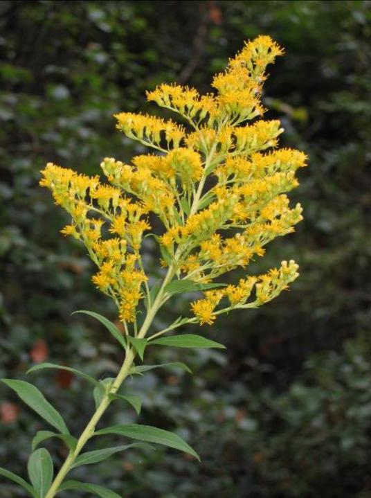
This herbaceous plant grows all over the world with over 100 different species, most coming from North America. There are 32 species that are recognized in Canada, with 6 of them being found in different continents where it has become an invasive species There are 17 species of Goldenrod that are specific to eastern Canada, the remaining 15 species growing across the country This plant likes to grow in a variety of conditions, from dry and arid conditions to moist and rich soils making its home from seashore to the mountains as its needs are undemanding Although Goldenrod can grow in fertile soil, it is healthiest in sand, clay, and gravel soils
Goldenrod can grow up to 5 feet tall with leaves that alternate and thin, up to 3 cm wide and up to almost 20 cm in length. The bright green leaves are lance shaped being widest near the middle and tapering to a point The leaves grow on upright and rigid stems This plant produces cluster galls (growths created from damage caused by insects, specifically the Goldenrod midge fly) and this is a species identifier for Canada Goldenrod The leaves have sharply toothed margins except near the leaf base, however leaves may be toothless below the blooms Goldenrod may grow as a single stem that has soft, fine hairs, or have up to as many as 20 of these stems in a group growing from underground rhizomes. The flowers of this plant are numerous and small growing in bright golden yellow clusters of branches from the top of the
333
#49 GC9Z25R
Prequel
Credit: Brian Klinkenberg via E-Flora BC
plant These tiny ray and disk blooms have 8 to 15 petals that are merely an 1/8 inch in diameter, and blooms may be as numerous as 100 to 1300 flowers
For many years the benefits of this plant have been utilized by Indigenous Peoples of the interior of British Columbia. Every part of the Goldenrod plant was useful. The Nsyilxcən, and Nlaka’pamux used the stems and flowers to make a tea for easing diarrhea that was often used for babies. The leaves and flowers were harvested to make a tea that would be used for intestinal and urinary disorders. This tea was also used to treat fever, snakebites, colic, measles, headaches, and asthma. A lotion made from the flowers was used to soothe bee stings and reduce localized swelling. They chewed the flowers to ease sore throats and toothaches and ate the seeds as survival food when needed A tea made from the roots was used to treat burns and ulcers The flowers could also be used to produce a bold yellow dye
To this day the benefits of Goldenrod are acknowledged by medical physicians, recommending it for treating and preventing gallstones, kidney stones, yeast infections, and urinary tract infections. Canada Goldenrod has also been recognized for its use as an anti-inflammatory, sedative, antiseptic, astringent, and as a blood pressure reducer. Today Goldenrod is sometimes prescribed for UTIs, pain reduction, muscle spasms, joint pain, eczema, hay fever, tuberculosis, enlarged liver, hemorrhoids, internal bleeding, diabetes, enlarged prostate and topically to help with skin lesions and bruises.
Canadian Goldenrod was introduced in Central Europe as a garden plant and is now growing wild throughout most of Europe, with it being considered an invasive species in Germany Thomas Edison made tires for his Model T Ford using rubber from the Goldenrod plant! Its scientific name “Solidago” means to make whole, heal, or cure
Medicinal plant information is for historical information only. Gold Country Communities Society is not encouraging harvesting of native plants for food and/or medicine.
Written and Researched by
Lana Rae Brooks
BIBLIOGRAPHY & SOURCES
Turner, N. (2013). Names of native plant species in Indigenous languages of Northwestern North America. University of Victoria. http://hdl.handle.net/1828/5091
Chayka, K. & Dziuk, P. (2011). Solidago canadensis (Canada goldenrod). Minnesota Wildflowers. https://www.minnesotawildflowers.info/flower/canada-goldenrod
The Canadian Encyclopedia. (2015). Goldenrod. The Canadian Encyclopedia. https://www.thecanadianencyclopedia.ca/en/article/goldenrod
Prindle, T. (1994). Goldenrod. NativeTech: Native American Technology and Art http://www nativetech org/plantgath/goldenro htm
Montreal Space for Life (n d ) Canada goldenrod Espace pour la vie Montréal https://espacepourlavie ca/en/biodome-flora/canada-goldenrod RxList (n d ) Goldenrod RxList https://www rxlist com/goldenrod/supplements htm Elkhart County Parks (n d ) 8 Goldenrod fun facts Elkhart County Parks https://www wnit org/outdoorelements/pdf/goldenrodfacts pdf Please
334
you
check geocaching.com before
go!
Holy Jumping Juniper
SITE IDENTIFICATION
Nearest Community:
70 Mile House, B C
Geocache Location: N 51°13 300' W 121°28.815'
UTM: East 606128; North 5675572 10U
Altitude: 1080m/3543ft
Ownership:
Ministry of Transportation
Accuracy: 2 meters
Overall Difficulty: 2
Overall Terrain: 1
Access Information and Restrictions: From Clinton, B C follow Hwy 97 North for 15 km to Chasm Road Take a Right on Chasm and follow for 15 km, road will change to gravel Park in designated parking Use stealth
For more information or to report a problem with this site please contact:
Gold Country Communities Society
P O Box 933 Cache Creek, B C V0K 1H0
Tel: 1-877-453-9467
Email: info@exploregoldcountry com
For more site pages go to: www exploregoldcountry com www geocaching com
APPLY STICKER HERE
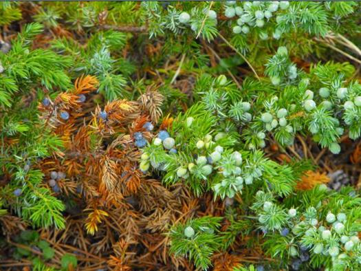
Credit: Ashley Churchill via E-Flora BC
This member of the evergreen family can be found throughout Canada, although the type will vary from region to region. Two types, known as J communis and J horizontals (creeping juniper), are shrub varieties with a wide range including the boreal rain forest Three other varieties, J maritima from the west coast, J scopulorum found in the western interior, and J virginiana, also known as Eastern Juniper, from all over southeastern Canada, are all small trees
The tree or shrub will have needle-like leaves 7-12mm long and male and female cones that are produced on separate plants. The female cones take two full seasons to mature, are hard and pungent, and are usually covered with a whitish, wax coating that gives them a very distinct gray colour Juniper is a very hardy conifer, they grow in a variety of areas including dry, rocky soil, pastures, fields, meadows, and open woods, from near sea level to subalpine or alpine areas, and are widespread throughout Canada, reaching from the Arctic south, extending all the way into the United States
The small, fleshy, berry-like fruits were eaten at any time of year by Fisherman Lake Slave of the Northwest Territories and were used by them as well for “brew” in historic times. To make this brew, the fruit was boiled, sugar and yeast were added, then the mixture was fermented for three days before being imbibed This action is considered to have been introduced by the French traders as they were using fruits fermented with barley to make beer back in France Of course, the most well-known use for juniper in the production of alcohol is in the distilling of gin, it’s what gives the most popular type of gin its very distinct flavour
Alcohol was not the only use for this fragrant shrub! The boughs were also used, with or without the fruit, to make tea
335
Flora
Fauna
&
#50 GC9YPQR
Prequel
by some groups, such as the Nlaka’pamux (Thompson) and Lillooet Nations of B C , as well as the Micmac of the Maritimes The Nlaka’pamux and others believed that the tea had medicinal qualities and would use it to treat a range of ailments. The James Bay Cree apparently ate juniper “buds” but only 3-4 a day, in the early summer. Juniper berries are often used in the preparation of game meats to help remove that “gamey” flavour. Medicinally, infusions or decoctions have been taken to treat cough, lung disease, tuberculosis, stomach pain, indigestion, vomiting, and kidney troubles amongst many others It was also used as a bathing solution, an inhalant, or for sweat bathing to obtain relief from arthritis, rheumatic pain, chest pain, headache, wounds, and sprains It was also used as a shampoo
Written and Researched by Leah
Berkey
BIBLIOGRAPHY & SOURCES
Petruzzello, M. (2023). Juniper. Britannica. https://www.britannica.com/plant/juniper Turner, N. (2019). Indigenous peoples’ medicine in Canada. The Canadian Encyclopedia. https://www.thecanadianencyclopedia.ca/en/article/native-medicines
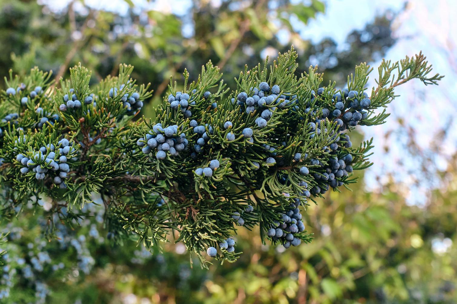
336
check geocaching.com before you go! Credit: Adobe Stock
Please
Thank you to our sponsers!


Advertisments


Advertisments


108 Main Street, Lillooet BC We have one goal: To Provide The Highest Quality Products and Services. 250 256-0419 - littlegreennuggets.com