An experimental data visualization, and political project, which aims for the reconciliation of the relationship between an area and its history. Between 2018 and 2019 the C.river suffered an abrupt diversion caused by the construction of a dam. This was undoubtedly an environmental mistake, which led to irreparable damage to the area and the communities living along its banks. To tell the story of the C. River from a new perspective, I reconstructed the environmental impacts of the construction of the dam, using satellite information, and data from geographical remote sensing tools. A Normalized Difference Vegetation Index (NDVI) was used to translate this information into an installation that represents the changes the C.river has suffered. This project will consider the social context under a decolonized post humanist perspective, challenging geopolitical processes through assuming a new ecological perspective by accounting for non-human actors as political, and by shifting the scope to a decolonizing one. This project aims for a plastic space that will allow the re-signification, visualization and reconciliation between the territory and its story.
Keywords: Non-Human, Rivers, Decolonized, Agency.
RECONCILIATION
This booklet addresses the lack of recognition outside the ontological euro-western scope towards other ontologies, therefore the inability of agency for non-human actors as subjects of rights or personhood, and the dangers this entails. For instance, the risk of a normalized colonialist discourse that traverses and transgresses the understanding of non-human actors diminishes the view on non-human actors to subordinated objects that fulfil human purposes. This normalized colonialist perseption is commonly used to justify a third party making unlimited exploitation of non-human actors. The absence of questioning matters like hyper-relationships between agents; their importance, role and even their existence as part of a constant interaction and effort to reach an equilibrium within the ecosystem. The colonialist mindset encourages, promotes and pledges development on social and economic welfare by means of exploitation of natural resources.
This indeed is highly problematic. The way of proceeding under an anthropocentric perspective can become very violent towards non-human actors. If there is no recognition for them as agents, this leaves them in danger, unprotected and bare of power. This detrimentally affects their rights, as well as the visibility of their existence and the recognition of their innate purposes. Action which promotes hierarchical categorization is grounded in utilitarianism. The colonialist mindset is based upon this logic, a vertical hierarchical system. Those social groups that are on the higher ranks are also the ones with more authority, privilege, and power, decreasing proportionally for each group until it reaches the bottom, groups without power, authority or privilege whatsoever. In this case, non-human actors are not even considered to be inside the hierarchy, because they are not recognized as part of a social group with a capacity of agency. This invalidates any possibility of legal power, autonomy and decision making for them, leading to the perpetuation of a utilitarian view towards non-human actors, and entailing the support of discourses on savage capitalism.
ONTOLOGIES
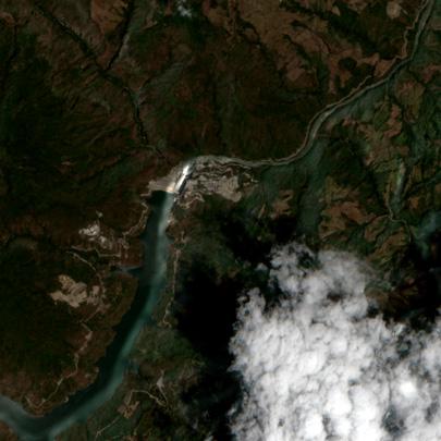
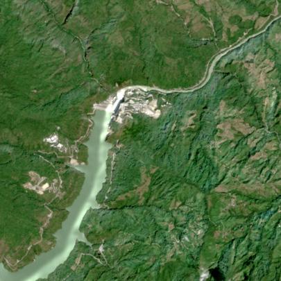
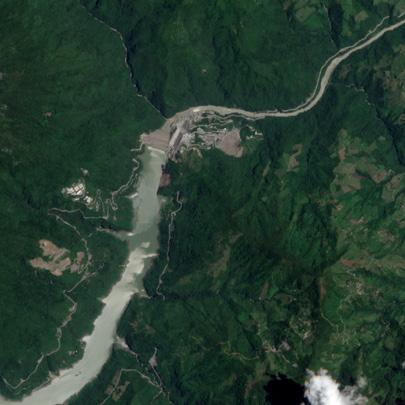
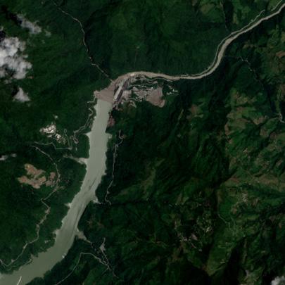
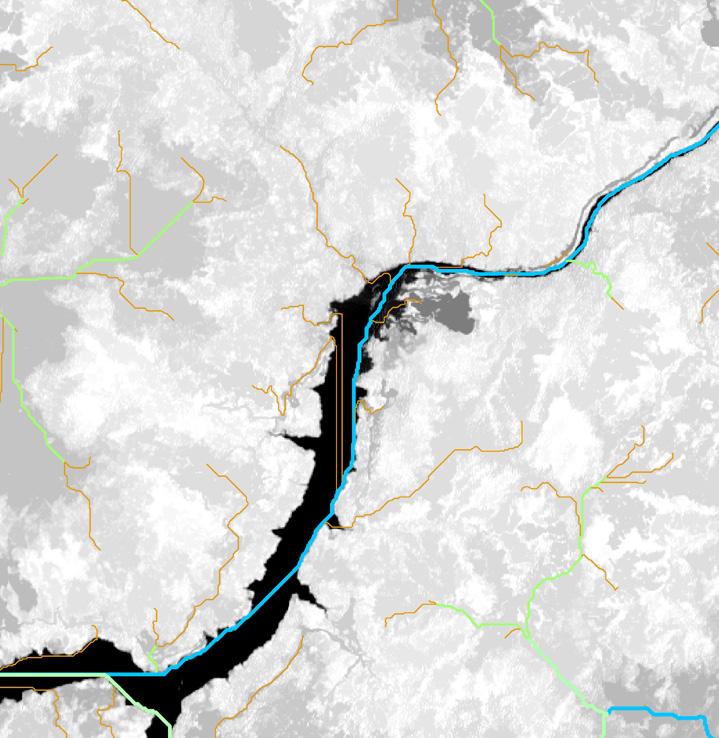
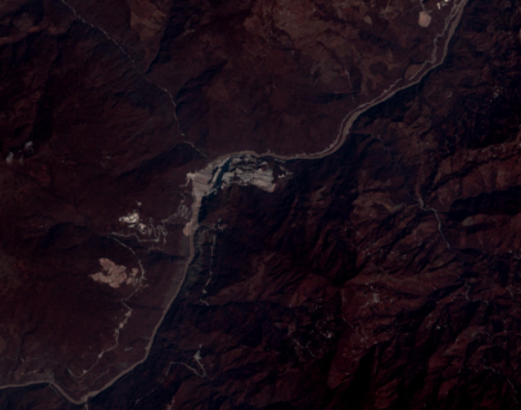
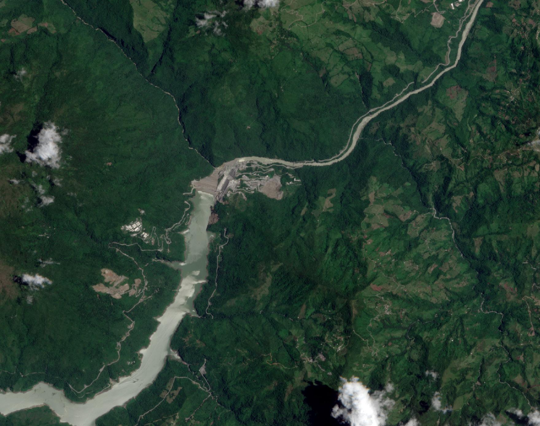
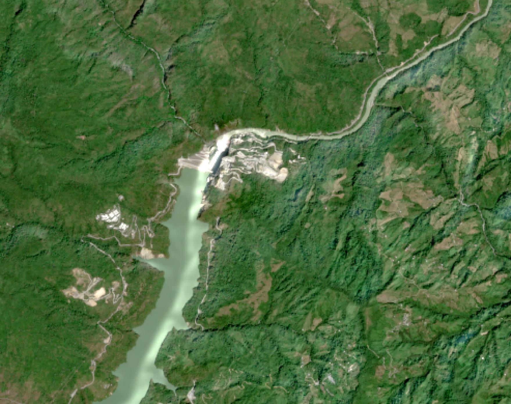
Moving towards a practical level, an example of this colonialist mindset can be found in the diversion of the C. River. Between 2008 and 2017 there was high interest from the government in building what would be called: “the biggest dam ever made in Colombia”. The dam promised new and better employment opportunities, elevation of quality of life, a more stable and secure development for the region and supplying 17% of the domestic energy demand. Under these appealing pledges the project was approved in 2017. Parallel to this event and since 2008, the communities near the mega project did not consent to it, and continued protesting. They have been claiming their right to know the details of the construction, mainly because the implementation of an economic and social plan was not sustainable or fair for the actors involved.
To understand the complex history of this region and the context in which it is embedded, it is necessary to add that it has never had an easy path. The territory had survived, struggled, suffered and burdened unhuman levels of violence, displacement and trafficking; caused mainly by the past war and the complex social-economic circumstances Colombia finds itself in. This situation was not favorable for the activists interested in the stability of the ecosystem, and their main goals were polarized. To diminish the importance of environmental precaution during the intervention within the river, activists were defamed as criminals.
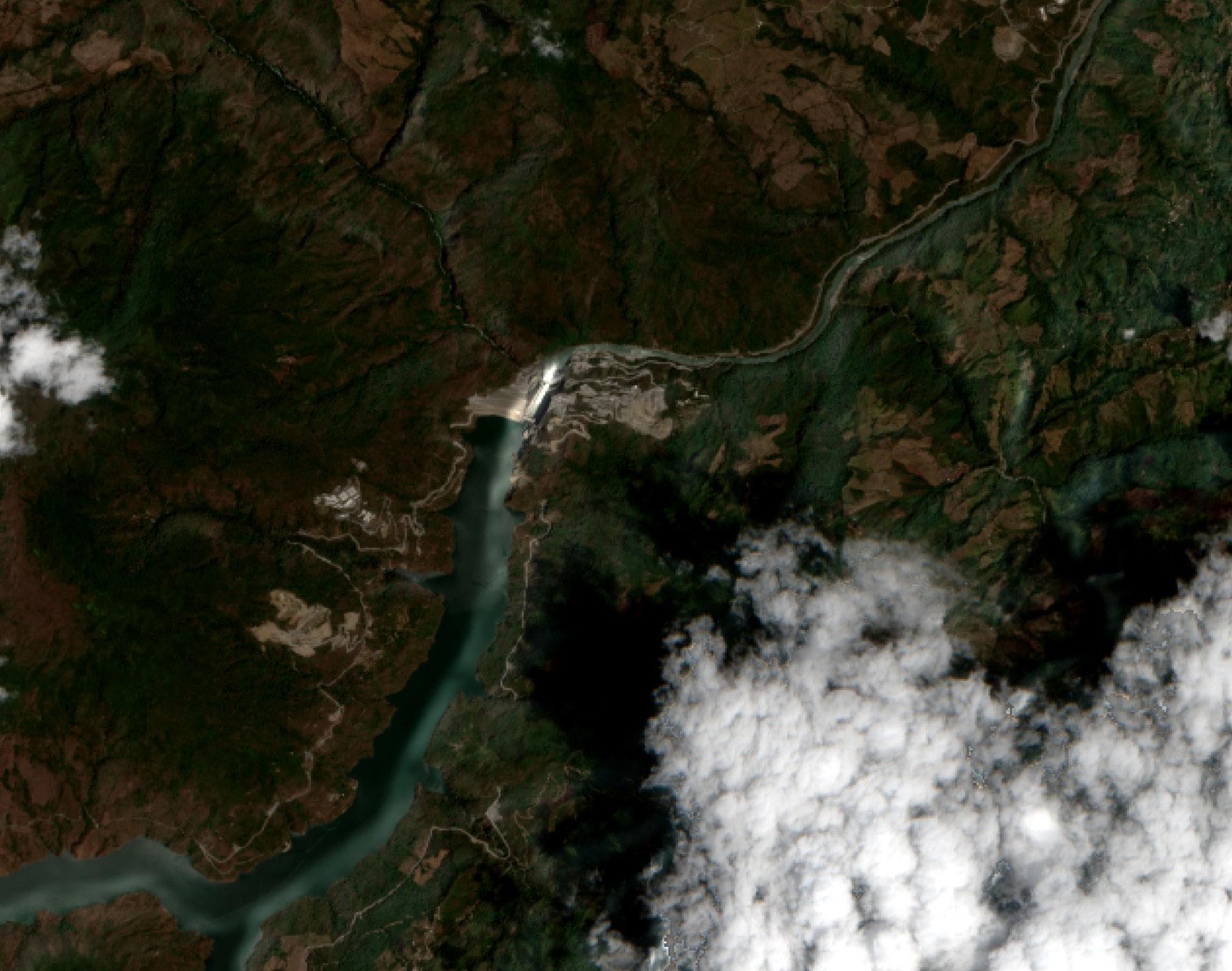
A second aspect to be considered is the environmental impact this would cause. Over the course of the last years, a couple of geological analyses were made to evaluate the feasibility of the project. These analyses emphasized the complex features of the soil in this region and the dangers this could entail. For instance, the soil analysis made in the 1980s found out its special attributes are making the terrain prone to landslides in the event of earthquakes. Despite this, the construction company did not take this analysis as a priority which was reflected by the purchase of the building material, project management and the lack of an emergency contingency program. It is worth adding that the impact of this mega-project meant the deforestation of 4.500 hectares in the tropical dry forest, the destruction of the fauna and flora in the region, the decrease of nutrients in the water and with it the possible extinction of several species.
The companies’ determination in the face of these dangers and their unwillingness to build a partnership with the actors affected made it clear that the concern of the project was neither the impact on the terrain, nor the social repercussions this could mean for the local communities, but to take advantage of the economic rent the project will generate in the future. The bidding process for the project began in 2010 as it was offered by the comptroller´s office as a public project. The requirements were changed frequently during the selection process, the inconsistencies in the pre-contractual phase, the execution of contracts and the design studies for the execution of the project present questionable anomalies. This leaves not only the selection process but the whole construction process under great skepticism. In 2018, the rain season began as expected for the region, and with it the floods. Since the project was already taking place, and apparently the precaution towards rains and floods had not been taken, the core part of the project, the House of Machines was flooded, and one of the main tunnels that diverged the water of the river was blocked with branches and mud. These results that lead to the collapse of the whole construction site, meaning a loss of almost 2.4 Billion Colombian pesos (600.000 USD), without calculating the social and environmental impact this would induce in the future months. These events bear more resemblance to a dystopia than to a territorial and governmental development agenda.
In this point, I would like to apply the first approach into this topic under an ontological question, which seeks to show the way of approaching towards non-human actors and their agencies under a euro-western colonialist ontology. By doing so, it may point towards the core issues that promote ideas and motivate actions as the following:
- The understanding of non-human actors as objects bares of agency
- The permissive, territorially unlimited exploitation of limited resources,
- And the necessity of classification of actors and agents based on a hierarchical structure.
The aim is to open the discussion towards other ontologies that approach these concepts and issues in another manner.
But first and foremost, the possibilities that counterbalance the above colonizing propositions. The current existence of cases in which political recognition was given to non-human actors, especially in cases of hydrological bodies. The legal personhood for non-human actors, and with it the recognition of their agency has been conducted in countries like Bolivia, Ecuador, New Zealand, India and equally but oddly Colombia. In some of the cases the extension of personhood as a legal tool has helped to protect the areas and territories from extinction, contamination, and damage. The determination in these cases shows a positive impact on the equilibrium of the protected areas. In each case the main motivation was rooted in different reasons, ranging from cultural, social, ecological to even economic improvement. All these initiatives were able to show that the acknowledgement of non-human actors could be beneficial for the society. This does not only underline the importance of recognition for non-human actors, but also of acknowledging of their innates qualities of change, interrelationship and agency.
Following the leads of modern reasoning on detaching nature from culture, and in opposition to it, Bruno Latour argues for the necessity of an ontological turn. He analyzes the concept that draws the modern dichotomy between nature and culture, and presents the changes these concepts face under a post-modern view. He claims that the alienation and distance between nature and society should not be
LEGAL
reinforced, even if this alienation looks unidentifiable from the original form of nature.
PERSONHOOD
The ontological turn in post-modern framework confronts the problem of normalizing the dichotomy between nature and culture, allowing to observe the great role this dichotomy plays in the perception of reality. Even if this approach is quite successful in engaging with one of the core issues non-human actors face, this proposal is somewhat problematic itself. The ontological turn that Latour proposes in the post-modern frame lacks recognition of indigenous ontologies, that have been known under the modern constitution as pre-modern. This is problematic, because it is not only necessary to recognize the impacts this dichotomy generates in the frame of mind, but also to recognize the lack of reflexivity post-modern scholars have. By not presenting the personal bias and by not recognizing the researcher’s presence as a euro-western person, he fails to seek a decolonizing method.
In addition, by not featuring other ontologies beyond the euro-western frame this is echoing the method of silence of the colonial agenda. The recognition of the ontologies outside the euro-western scope need to be acknowledged at this stage. In case of omission this could be read as of a colonialist tool.
In this manner, emphasizing the importance of a decolonized ontology would be essential, as well as the recognition of agency for non-human actors. If there have always been different views on understanding the “other” (understood very broadly as the exception to what is considered human), Why can we not openly and easily identify with them?, Where do the silence, invisibility and invalidation of other ontologies outside the euro-western scope begin and why are they so effective?
By holding hands with indigenous theorists such as Vanessa Watts, Juanita Sundberg and Zoe Todd who introduced ideas like decolonized agency, placethought, silence of indigenous epistemes, and epistemic violence, I will point out the inherited roots of the colonizing mindset which still are an ongoing reality, and recognize the application and motivation of these tools to avoid reproducing them.
The colonialist tools aim for a universal, uniform, lineal episteme which is intended to promote the modern development, yet proving to be more detrimental than helpful. To support this argument, I present a practicable decolonization process that took place under the ‘Declaration on the Granting of Independence to Colonial Countries and Peoples’, a declaration supported by the United Nations that sets tools and achievable goals for decolonizing processes. A vivid example is that self-determining governmental procedures are of high relevance in these changes. To ensure durability and guarantee of these changes, the social commitment as well as the political infrastructures that this requires has to be taken into account. Decolonizing processes should recognize all the affected actors and open the discussion between them. This should not only include humans, but also to non-human actors, allowing to include the struggles for agency and legal recognition of non-human actors in decolonizing processes.
The challenges to be faced now are the resistance of anthropocentrism towards the non-human actor form that Deleuze proposes. The concept of the Rhizome invites to understand the interconnectivity in between non-human actors and humans,
a concept that indigenous people had also formulated. In this concept every actor can be connected to any other, sharing non lineal but multidimensional connections. In a similar manner the term non-human actor challenges the human privilege normalized by anthropocentrism, that believes humans belong in a higher categorization above other beings. The problem with this hierarchy is that it promotes the alienation from any other form that does not fit in the category of humans thus leaving it open for violent use towards other beings. What Deleuze proposes with the use of non-human is the deconstruction of human privilege, and relocation of the human in the same constellation as the other beings, without hierarchical or lineal intention, but again multidimensional.
A theorist who helps decolonize ontology is Juanita Sundberg. She suggests in her paper “Decolonizing the Posthuman Geographies” that there are three steps in order to fulfil this goal. The first step is called “Self-location”, meaning making a self-reflective analysis of the ontological and epistemological perception of our and other worlds. The second step, “Walking with” is an invitation based on respect to engage in communication with other communities, and finally “learn to learn” as a process to learn about multiplicity, pointing to the perception, reception, and engagement of indigenous scholars.
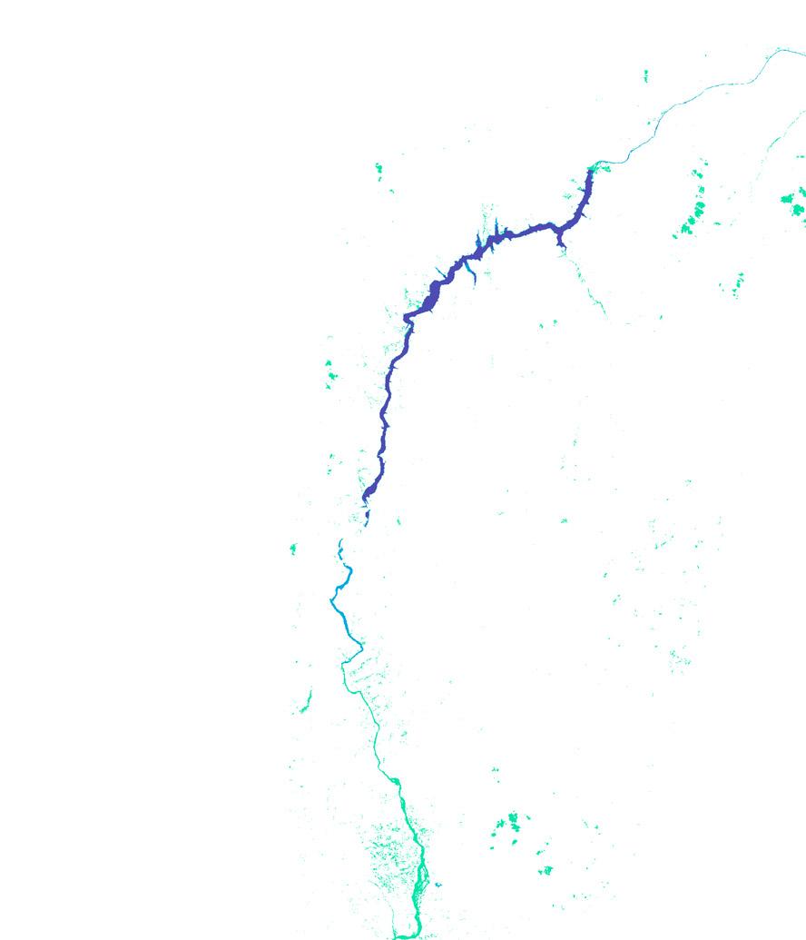
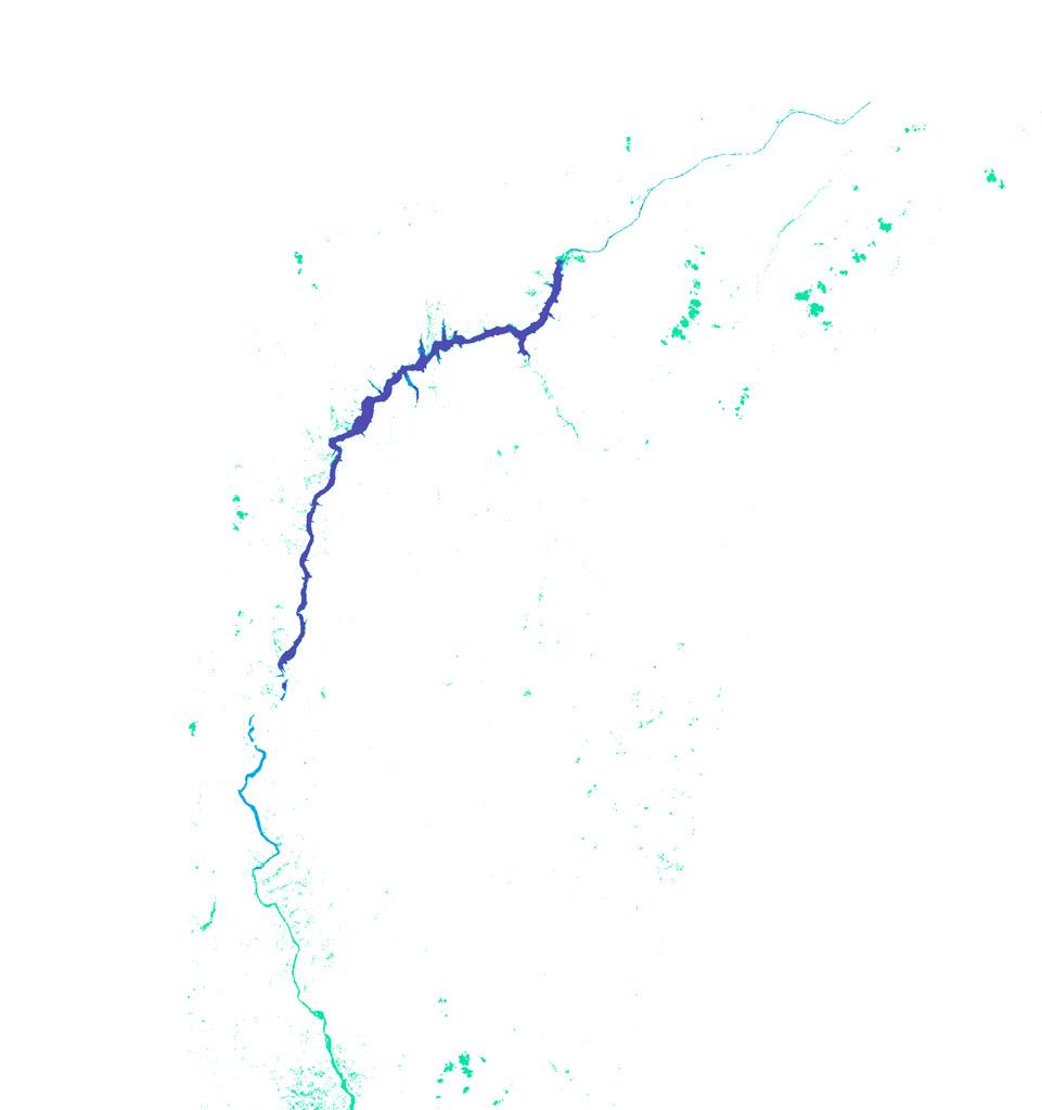
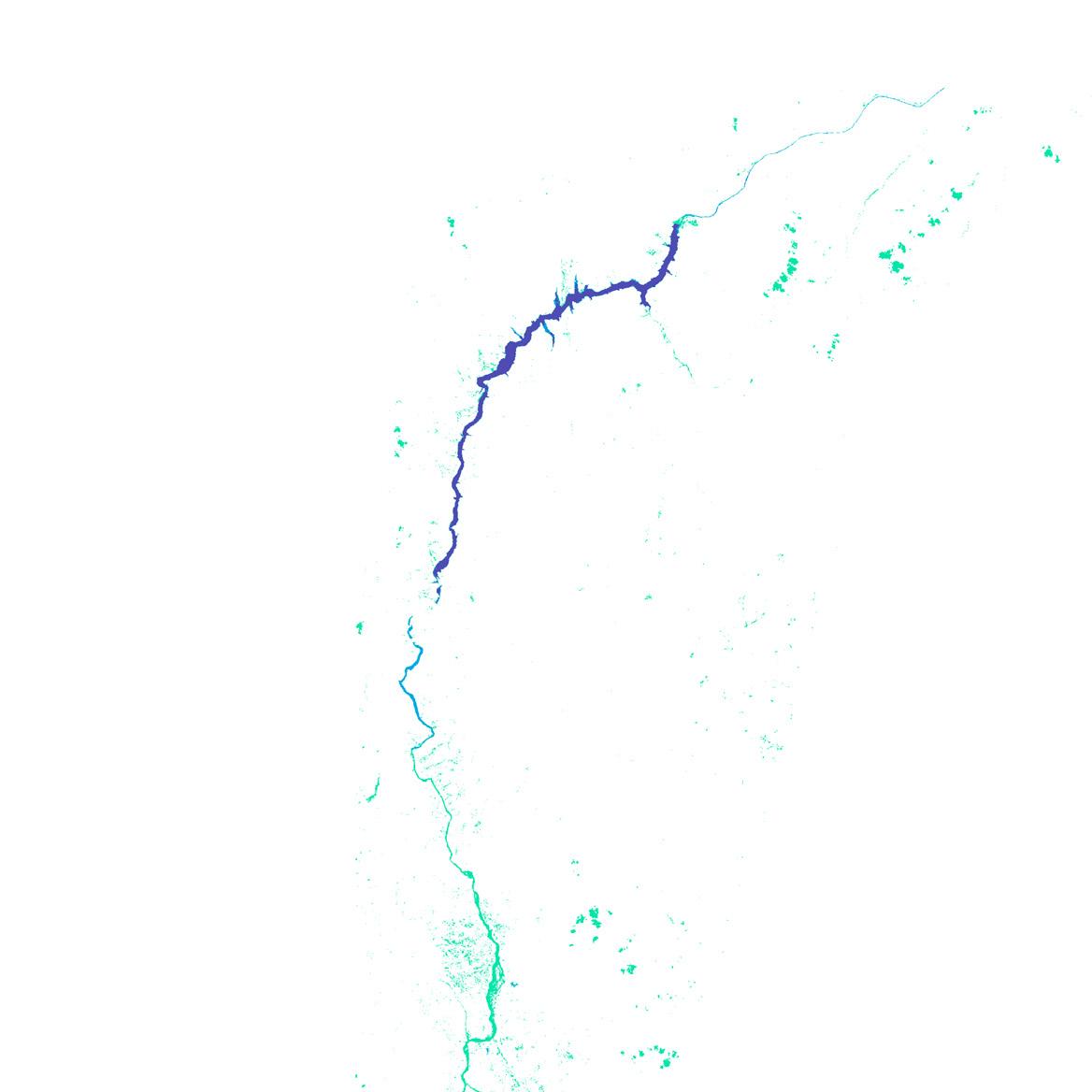
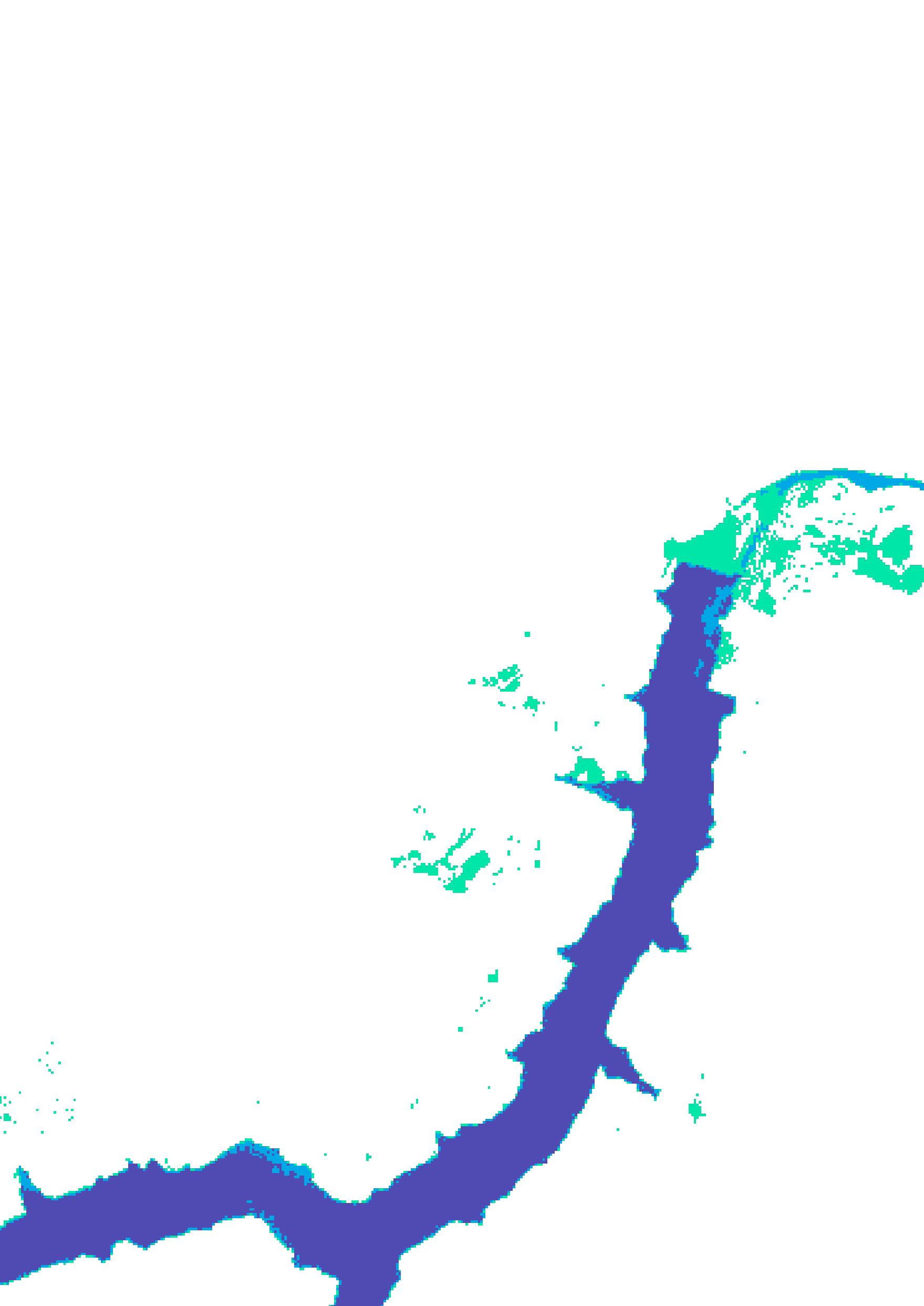
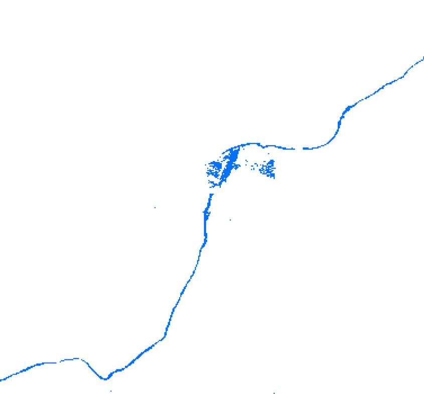
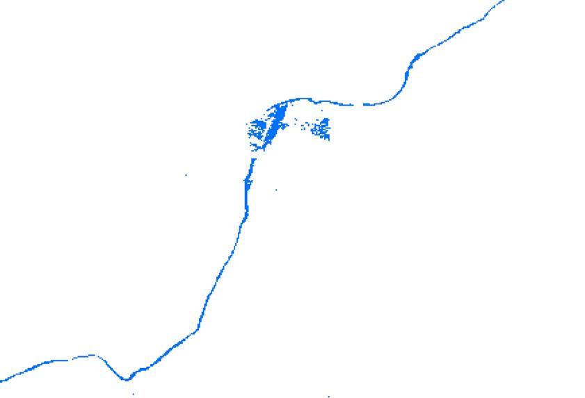
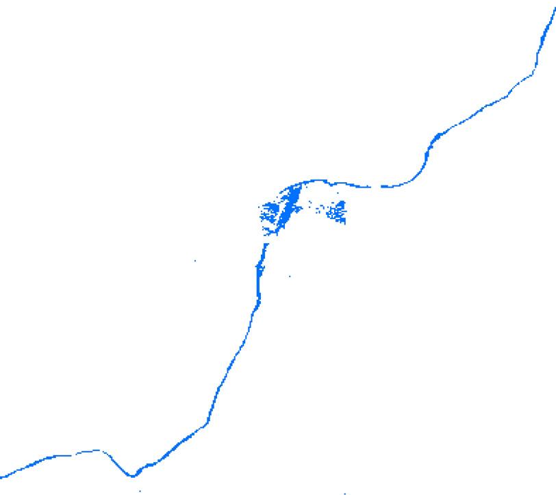
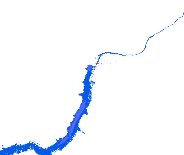
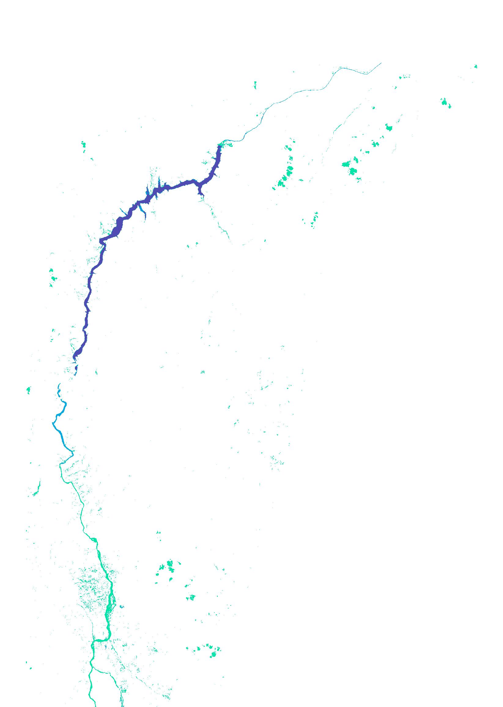
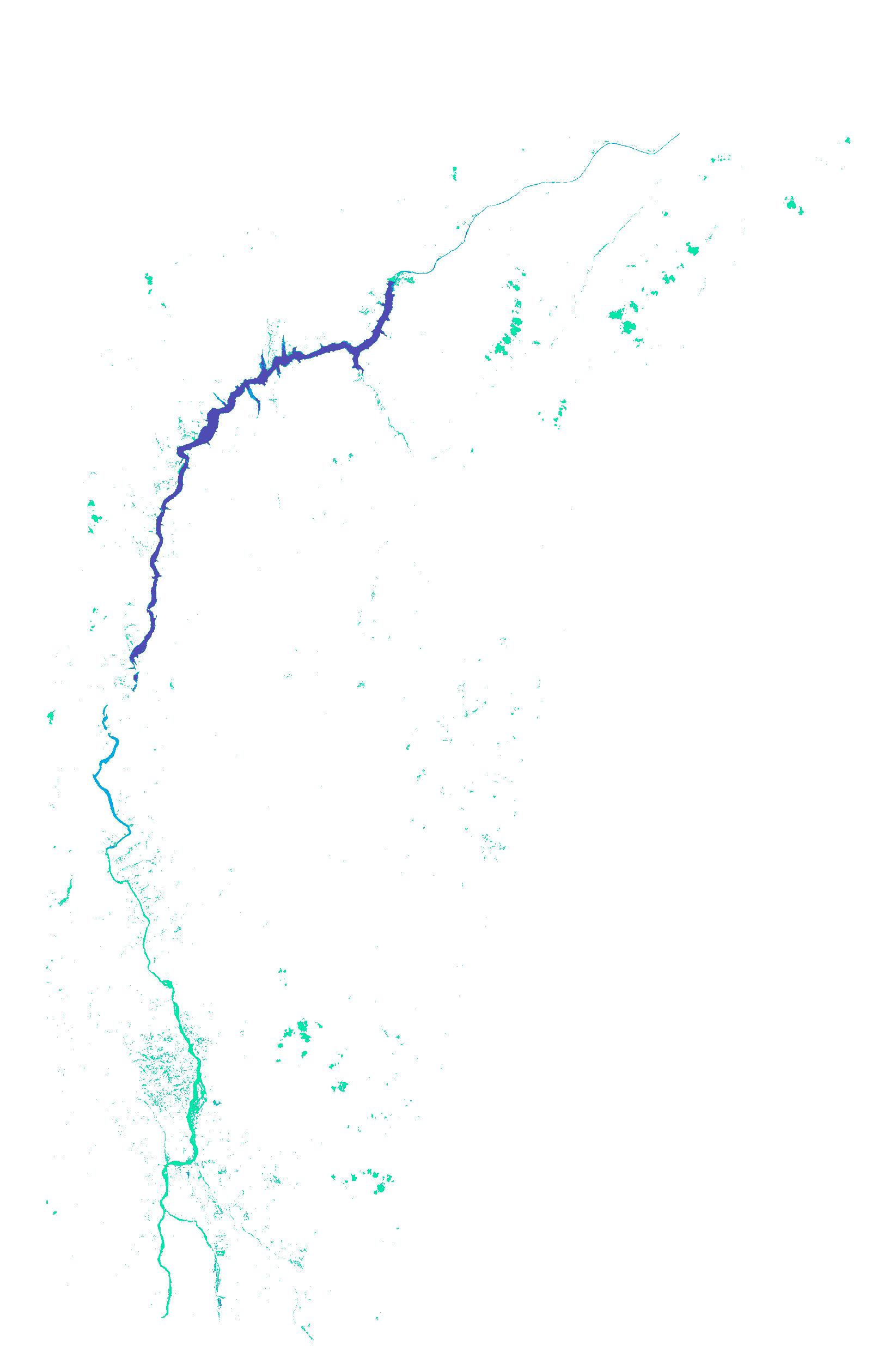
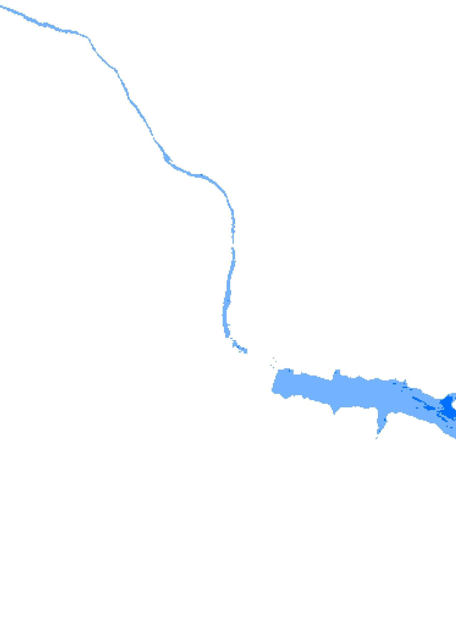
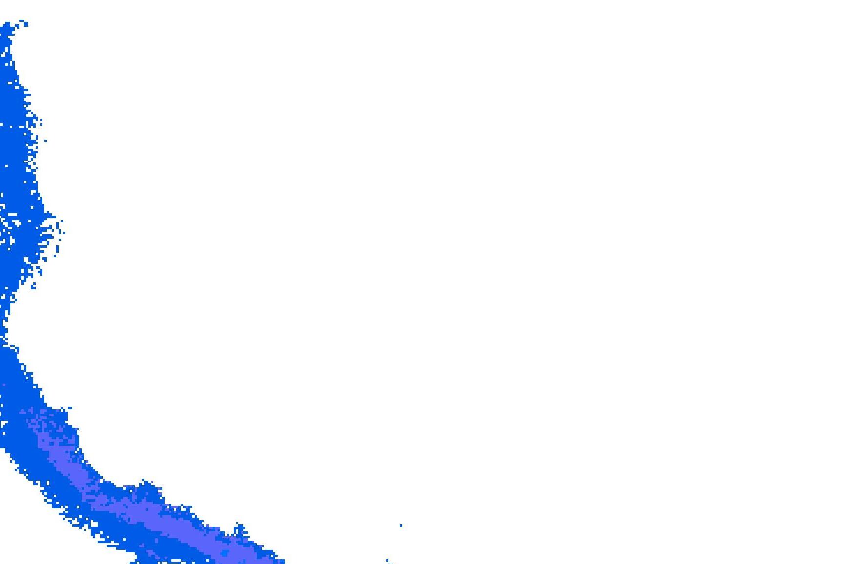
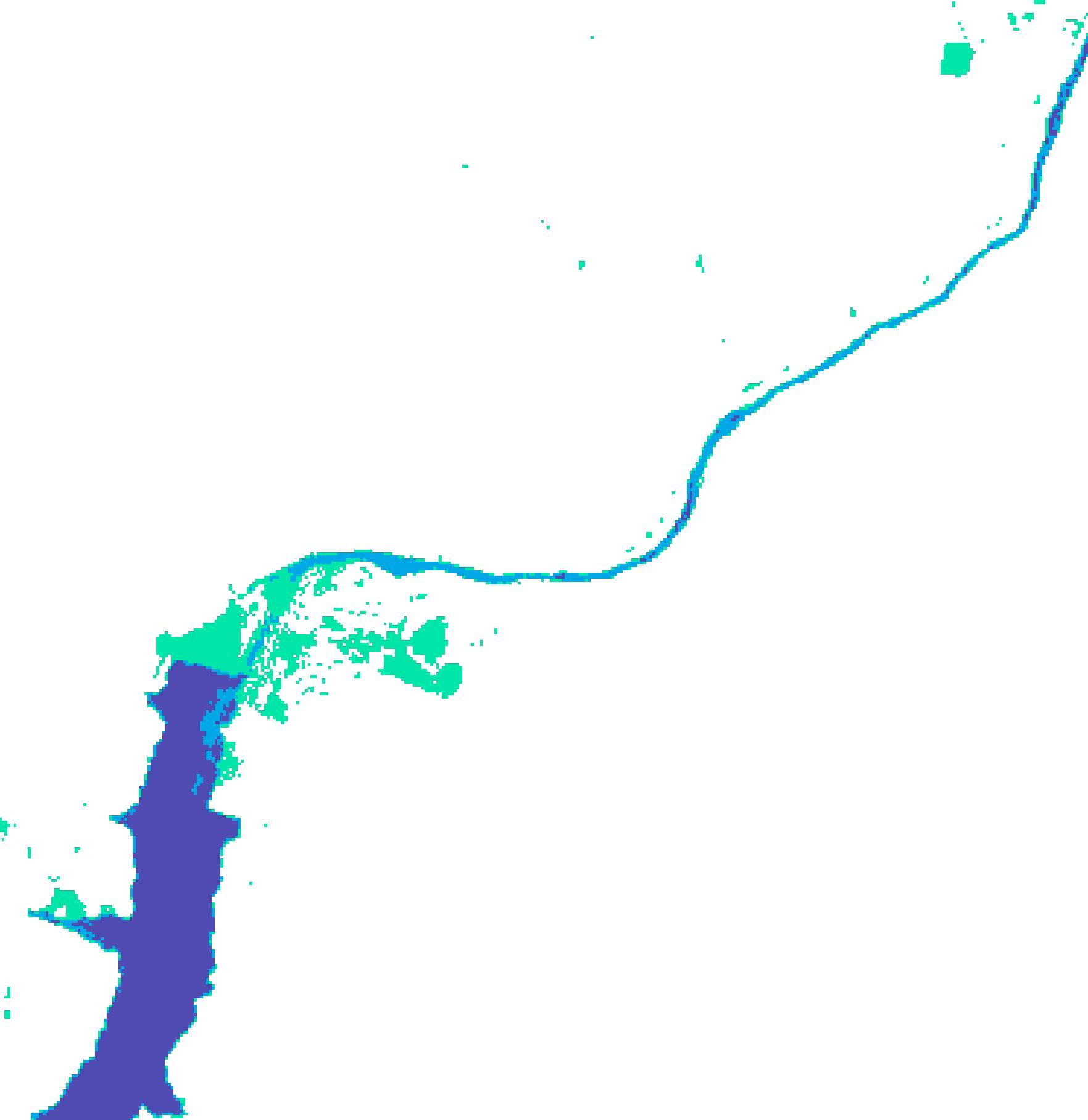
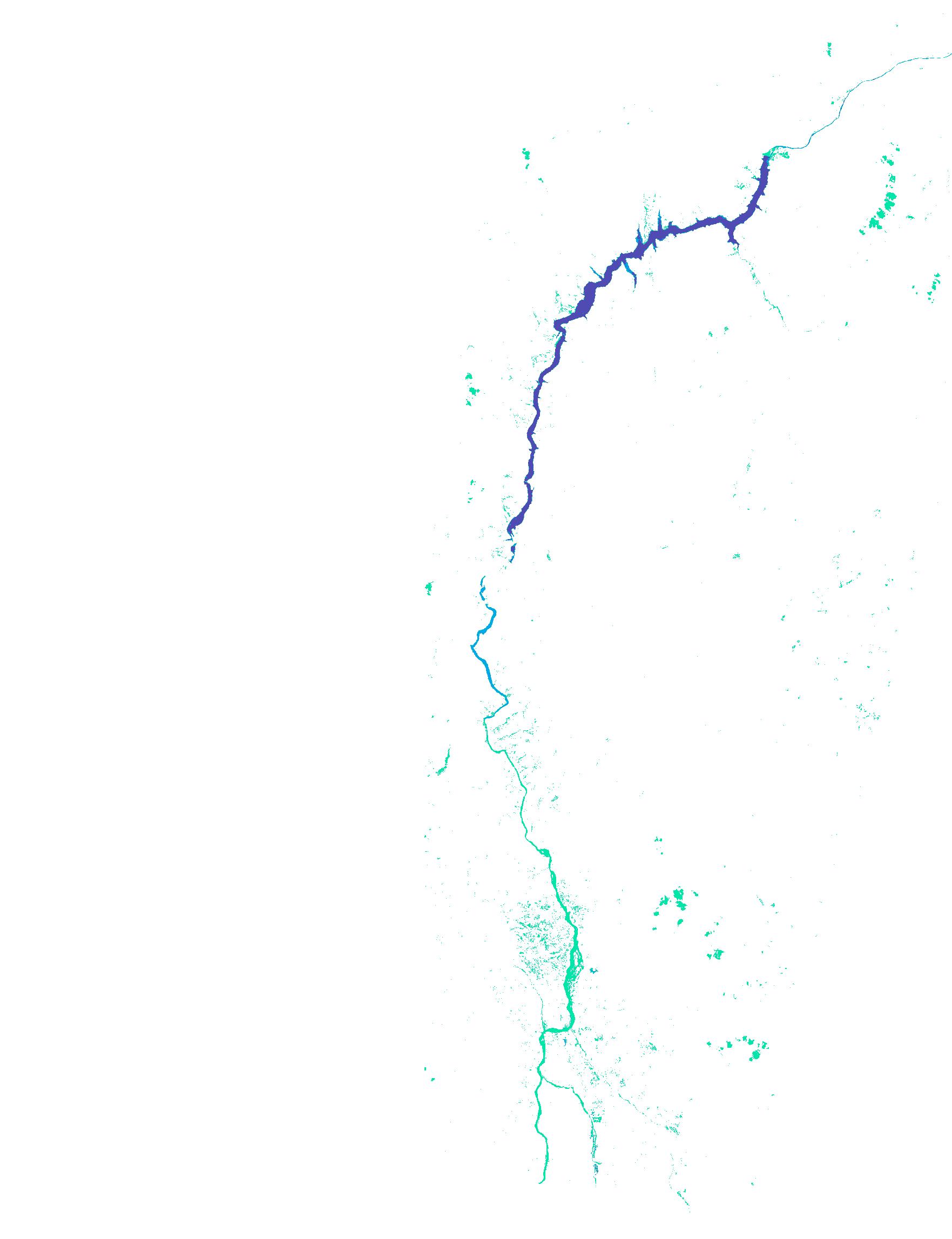
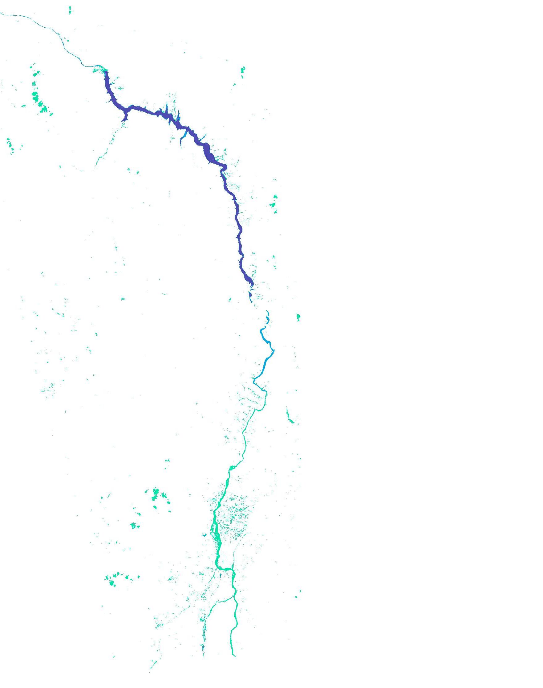
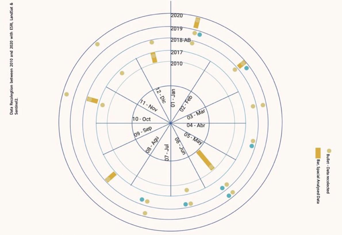
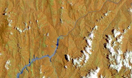
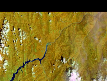
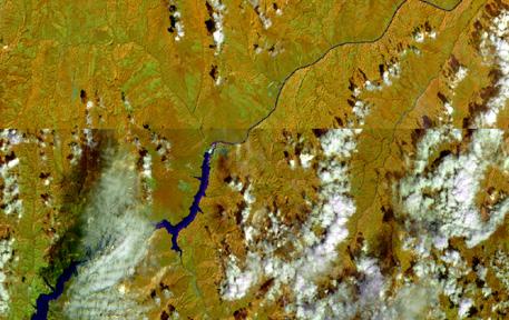
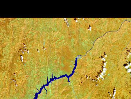
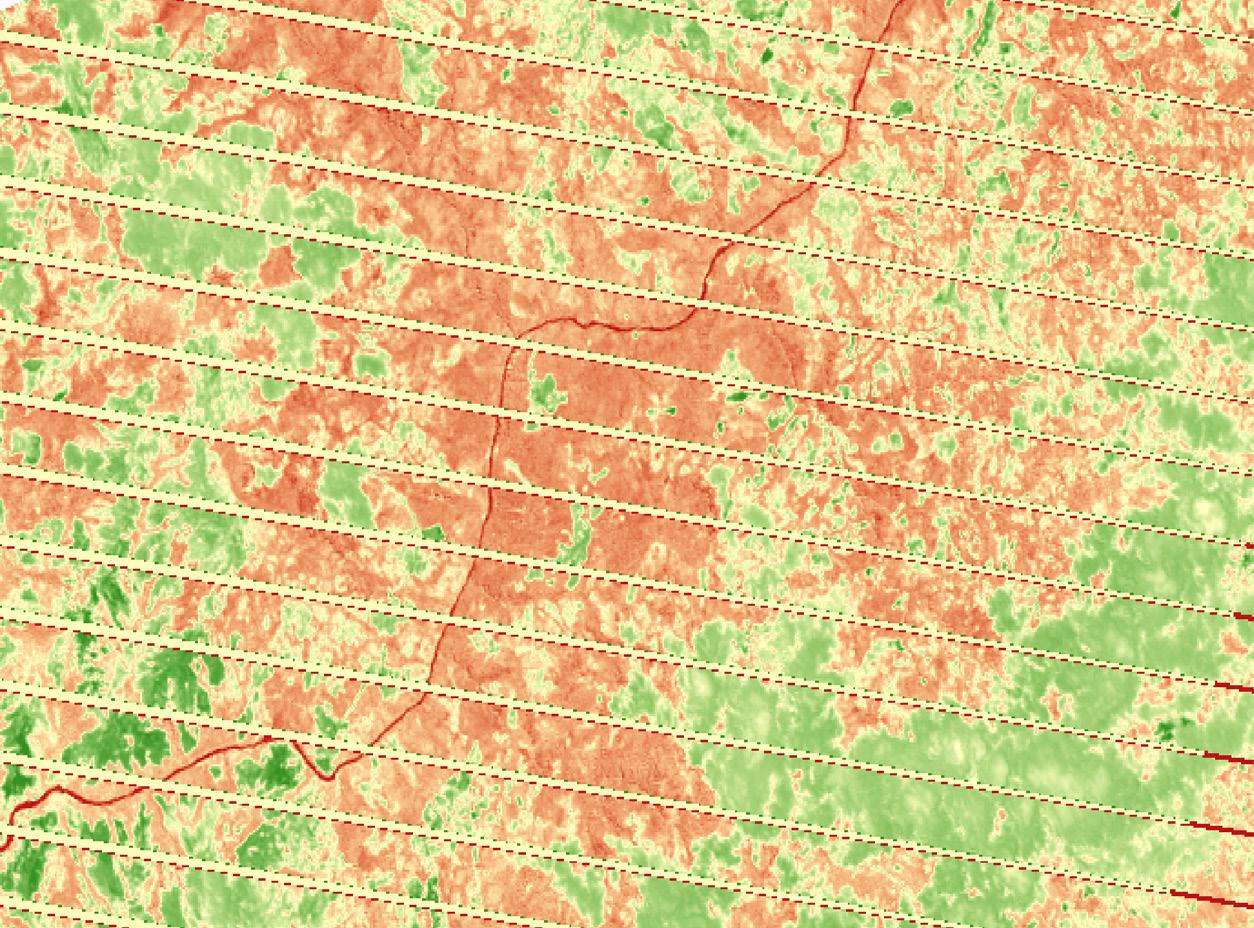
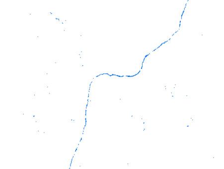
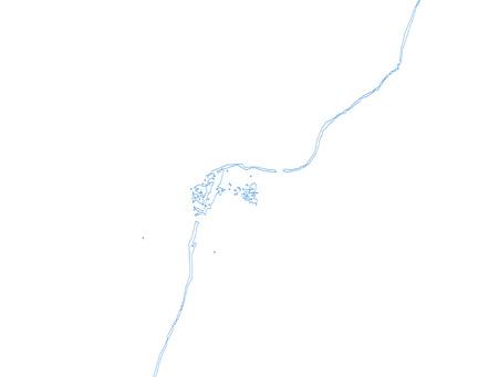
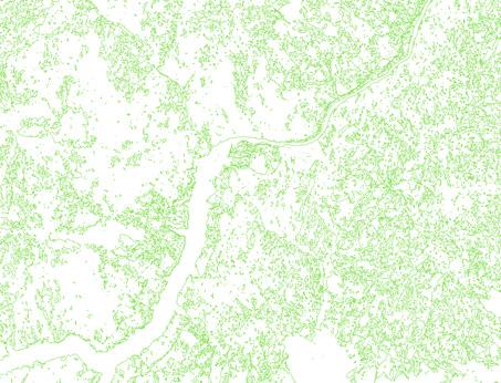
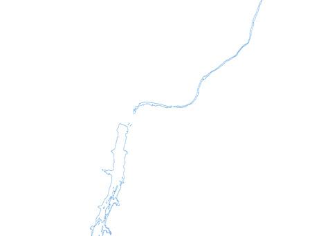
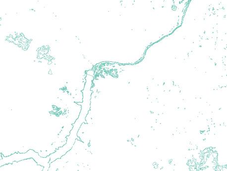
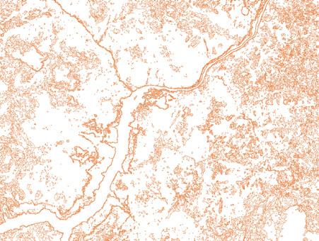
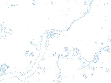
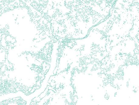
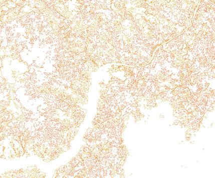
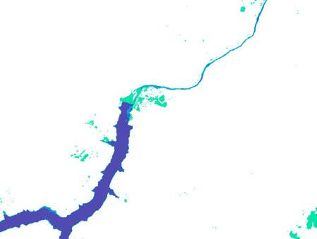
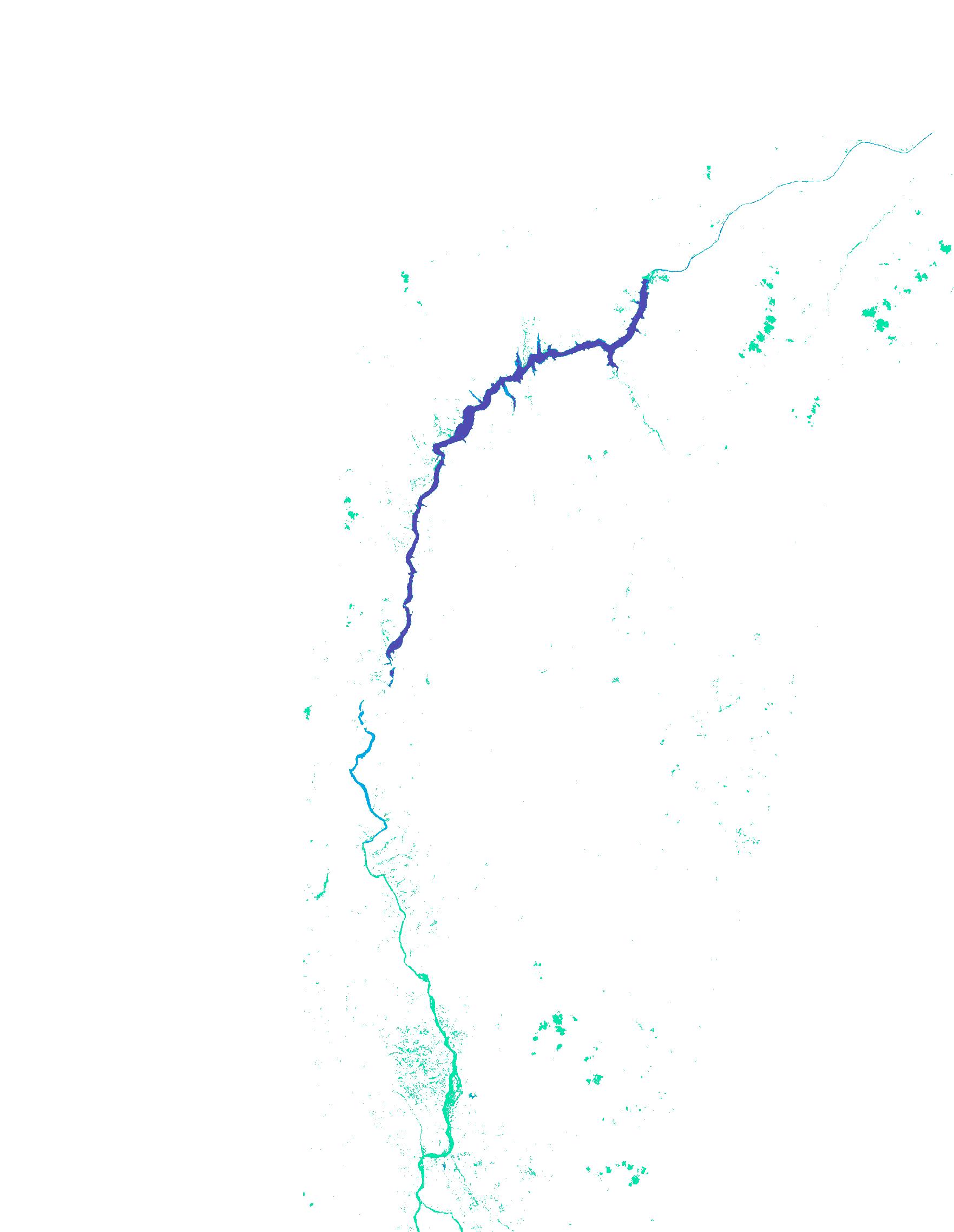
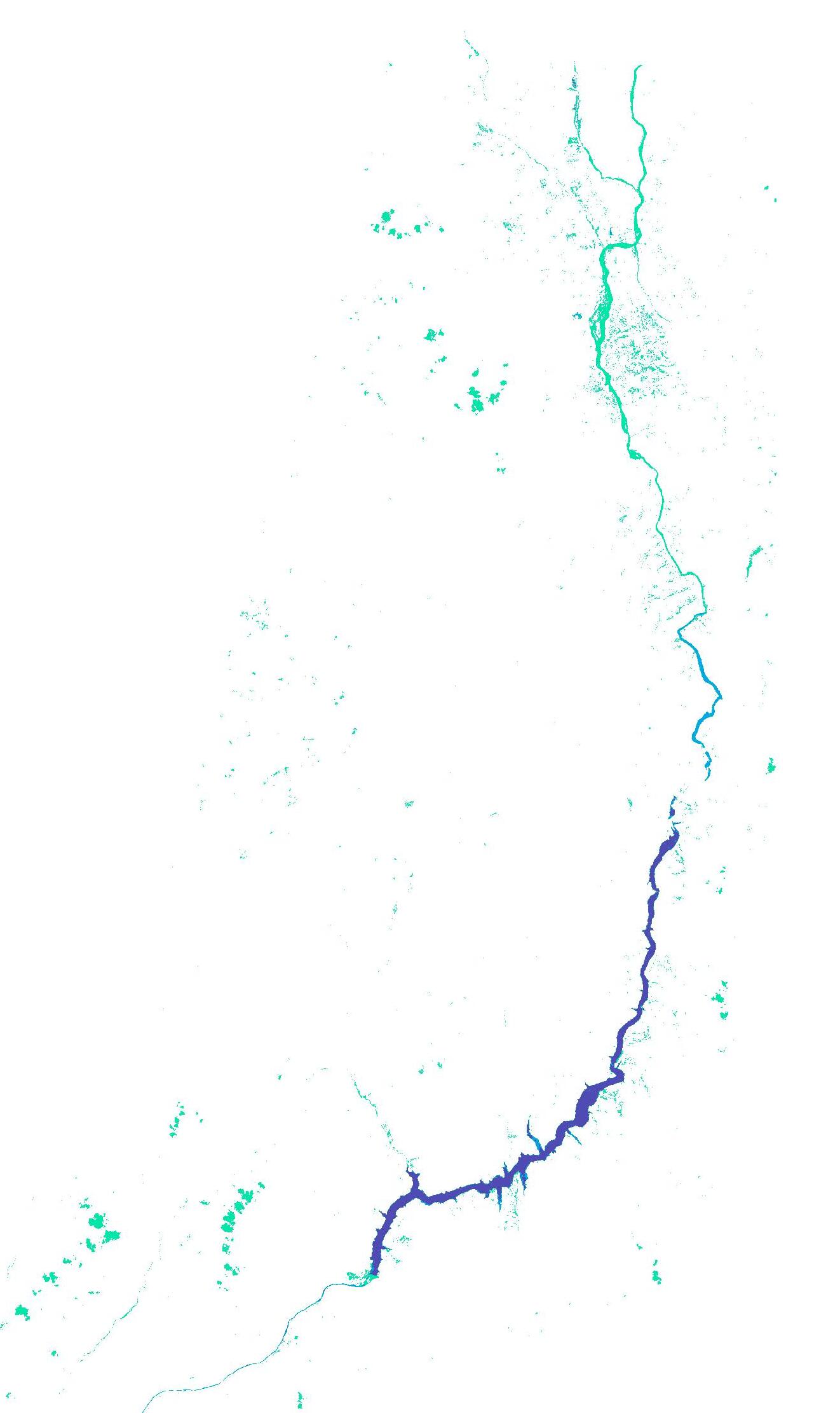
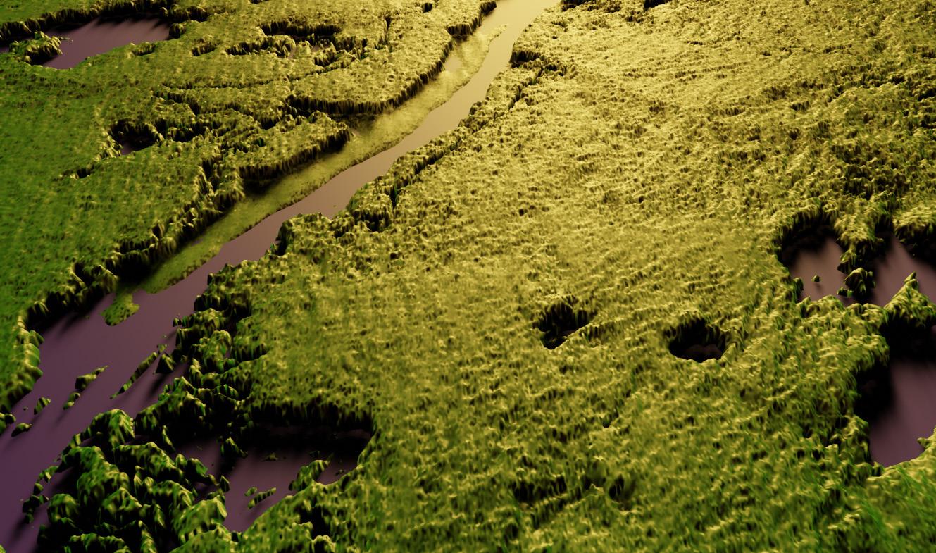
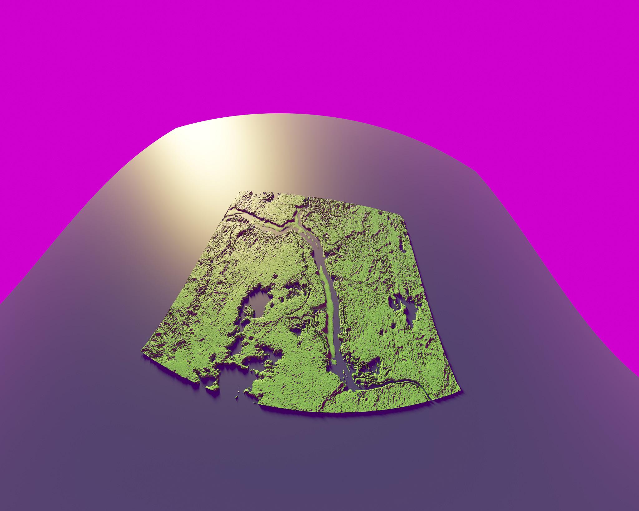
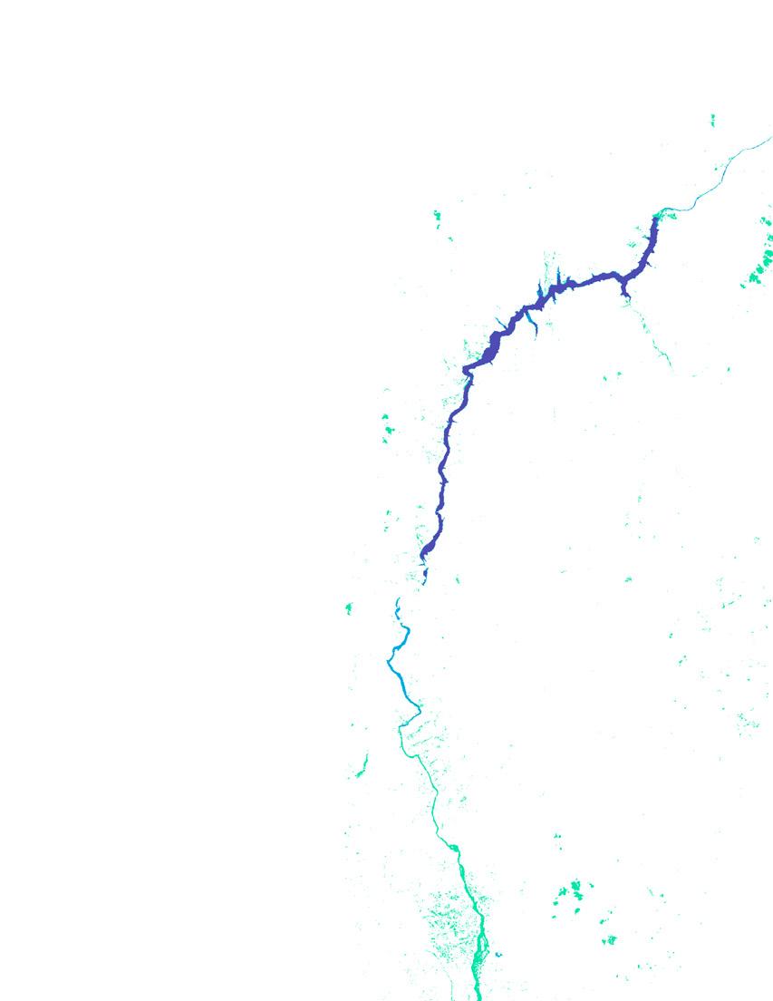
After coping with this methodology, I began a journey to walk with the traces of the C. River between 2010 and 2020. I analyzed the results of satellite information in this period using the Normalized Difference Vegetation Index (NDVI), that classifies the information into three main categories (water, soil, and vegetation). This index allows the classification of material based on their infrared reflective qualities. The results let me expose the traces of the river in its forced diversion in the last decade. In doing so, I could visualize the implication of an extractive frame of mind, and a reconciliation with this wounded territory - not with the intention to solve this, but to present the traces this event has left behind.
DECOLONIZE POSTHUMAN
By giving this territory a space to claim its past, it avoids not only to fall into epistemological silence but into silence about location. Both concepts developed by Juanita Sundberg, fight against the notion of eurocentrism as universal knowledge. The visualization of the impact generated by the diversion processes that a dam caused on the C. River, and the lack of accountability for reconciliation and reparation processes for victims. Plead shifting the scope outside the hegemonic power structures; and with it, shed light on minority groups and the agency of non-human actors that have been affected by this mega-project.
In order to fulfill this main goal, I will start by acknowledging the complexity of the socio-political situation embedded in this territory, running through the general social context of the river between 2010 and 2019. The purpose is to raise awareness of those who have not encountered this problem.
Considering the ecological catastrophe caused by the dam project, I use remote sensing data as a tool to approach the social context of this region and the challenges non-human agency faces. In this manner, I propose a possibility to reconcile this particular story that happened to the C. River under a decolonizing perspective. Throughout the years not only violence and injustice seem to characterize the reality of this region, but oblivion and disinterest. That is the reason why there is a need for change, and a need to approach this territory under another scope
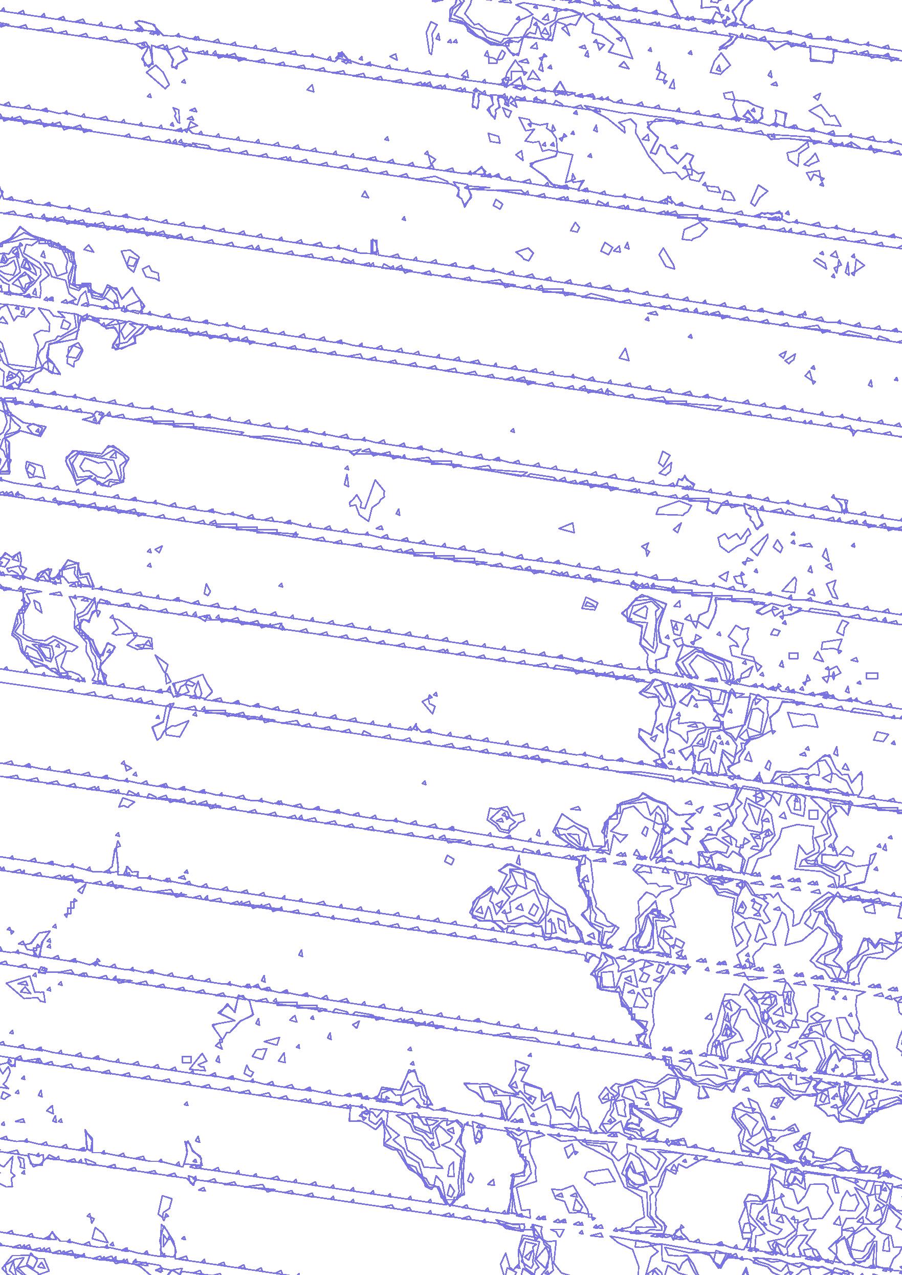
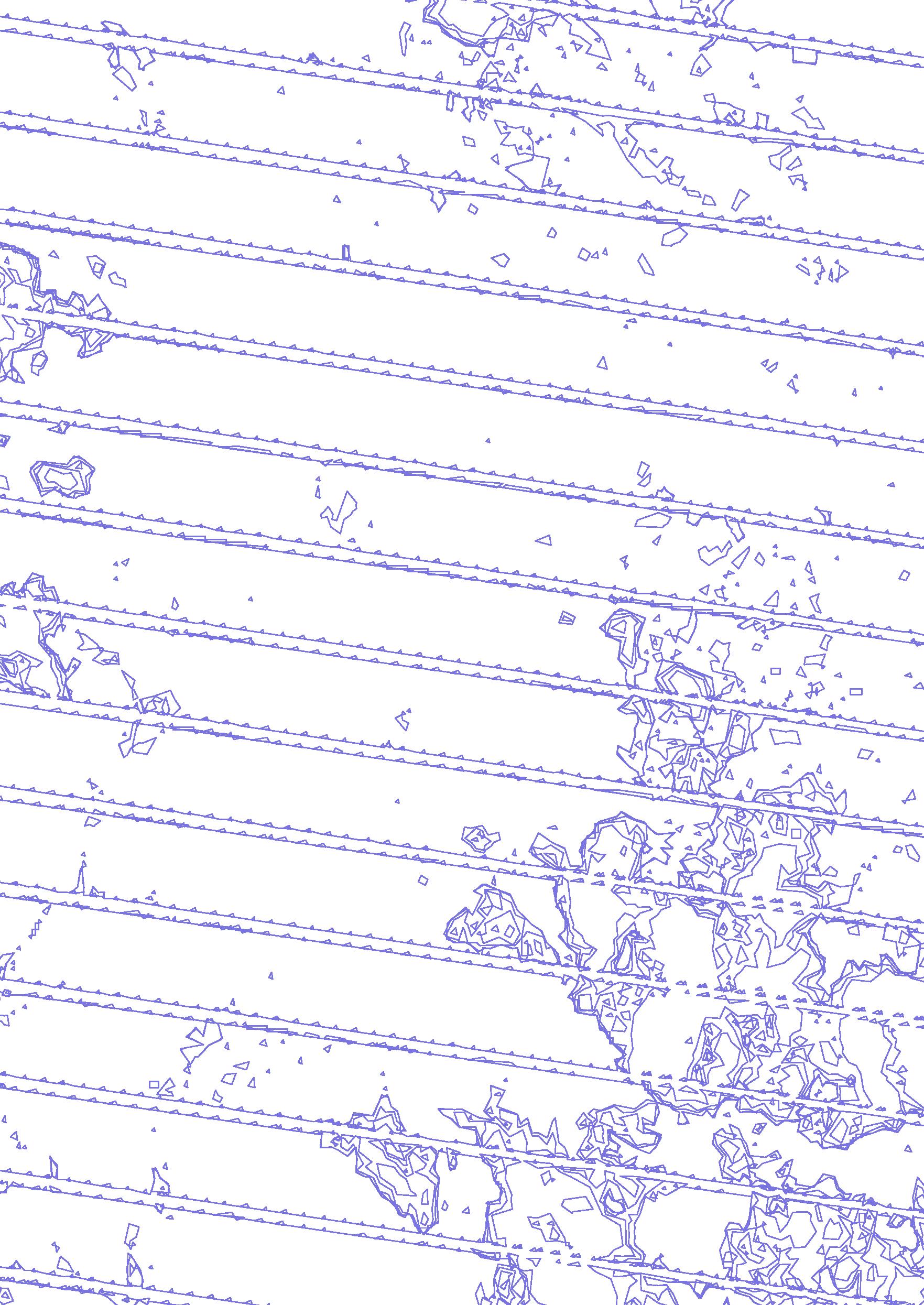
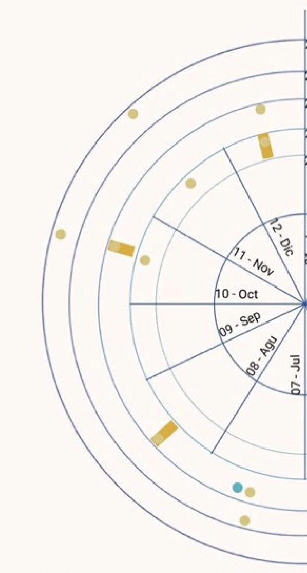
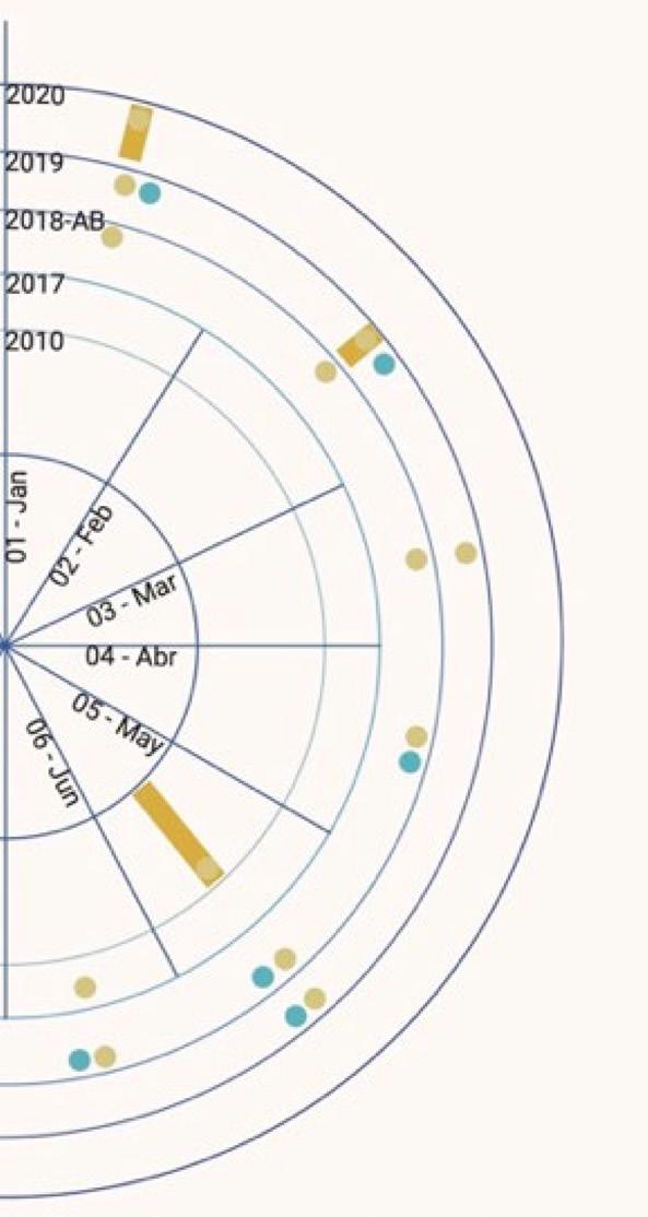
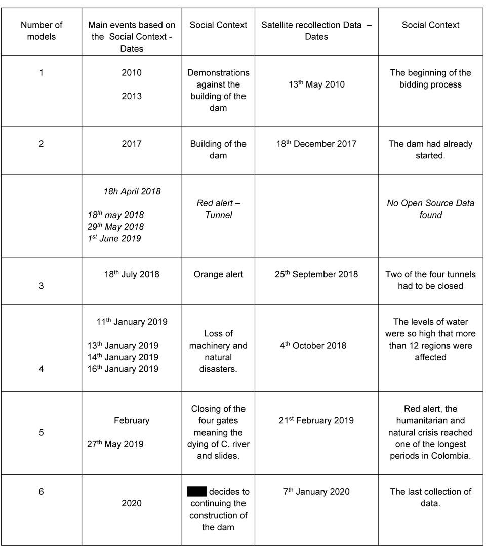
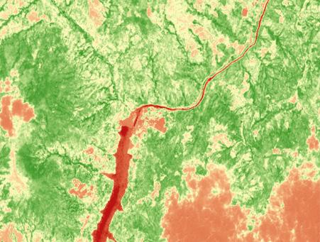
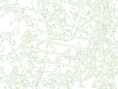
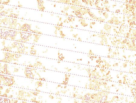
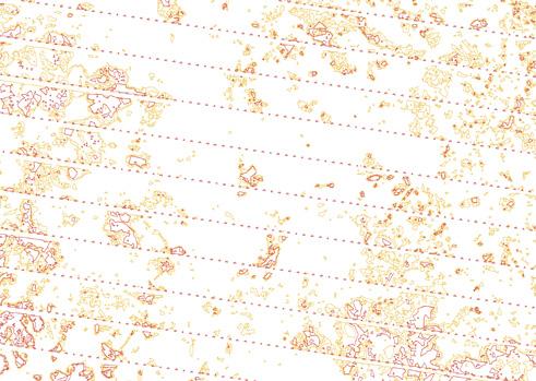
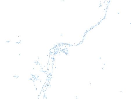
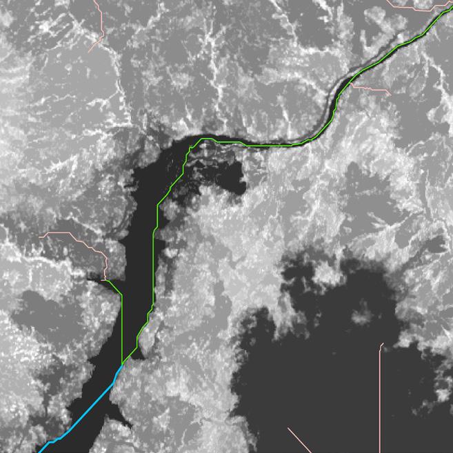
The figure above helps to understand the three types of data classification the project used. The first type of data marked with yellow dots are 20 satellite files collected23 between 2010 and 2020, for potential use of NDVI24 analysis (technical topics will be further developed in chapter 5). After that, a reclassification of the 20 files mentioned above had to be carried out, leaving six main files which are represented by yellow stripes. This data went through different processes to conclude the NDVI-based classification, a tool that distinguishes vegetation from water and soil, thereby making the changes visible that this territory has suffered over a decade, as the Figure 4 shows below. Parallel to this, the classification marked with blue dots shows the key events narrated under a social concern on the emergencies between 2018 and 2019
By doing this data comparison, it was possible to establish key points and highlight them, and from this point on not only to point out specific social events but to show the physical changes of the territory generating a much more solid information base.
This does not only provide a clear starting point but also raises a couple of questions to be addressed in the following chapters. Such as: Why do we struggle to understand and accept the relationship we have with a territory? What is the root of these problems that lead to the alienation from and classification of ‘nature’?, Where does this view come from and is there a solution to it?, and How can we feel related to a concept of ‘nature’ that we have separated from our understanding? This paper sails through the turbulent waters that flow towards concepts like decolonization, non-human actors, colonial mindset, place-thought, and agency, forcing them to establish a dialog.
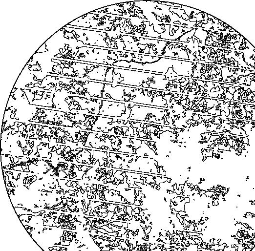
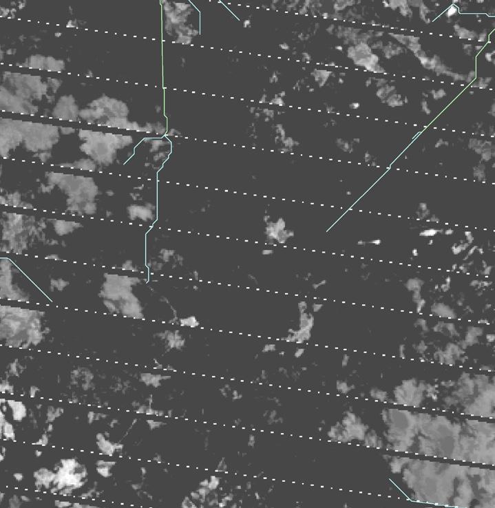
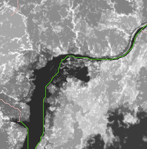
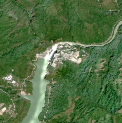
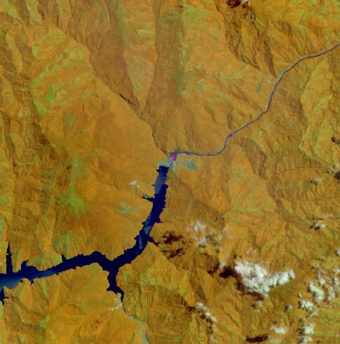
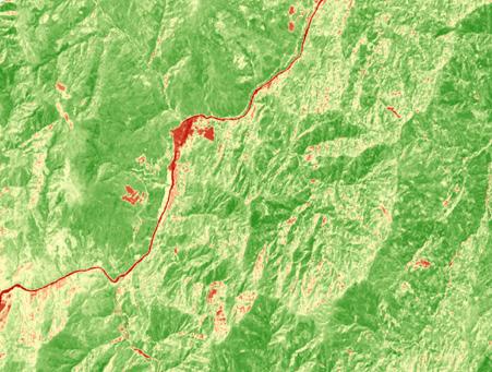
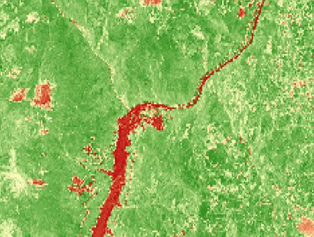
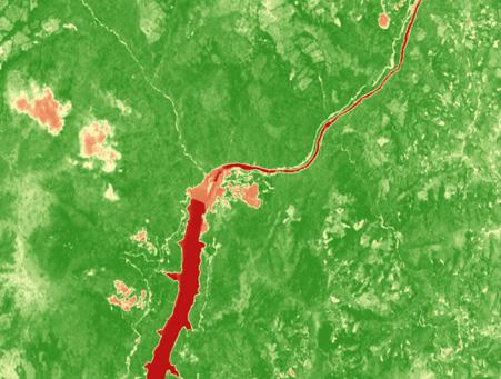
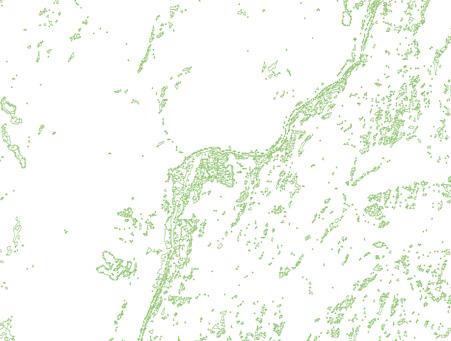
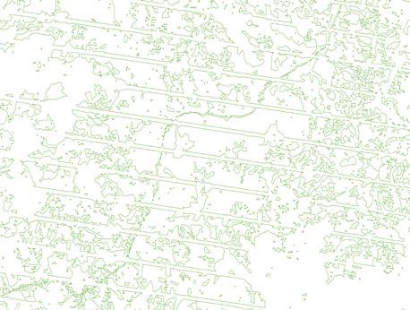
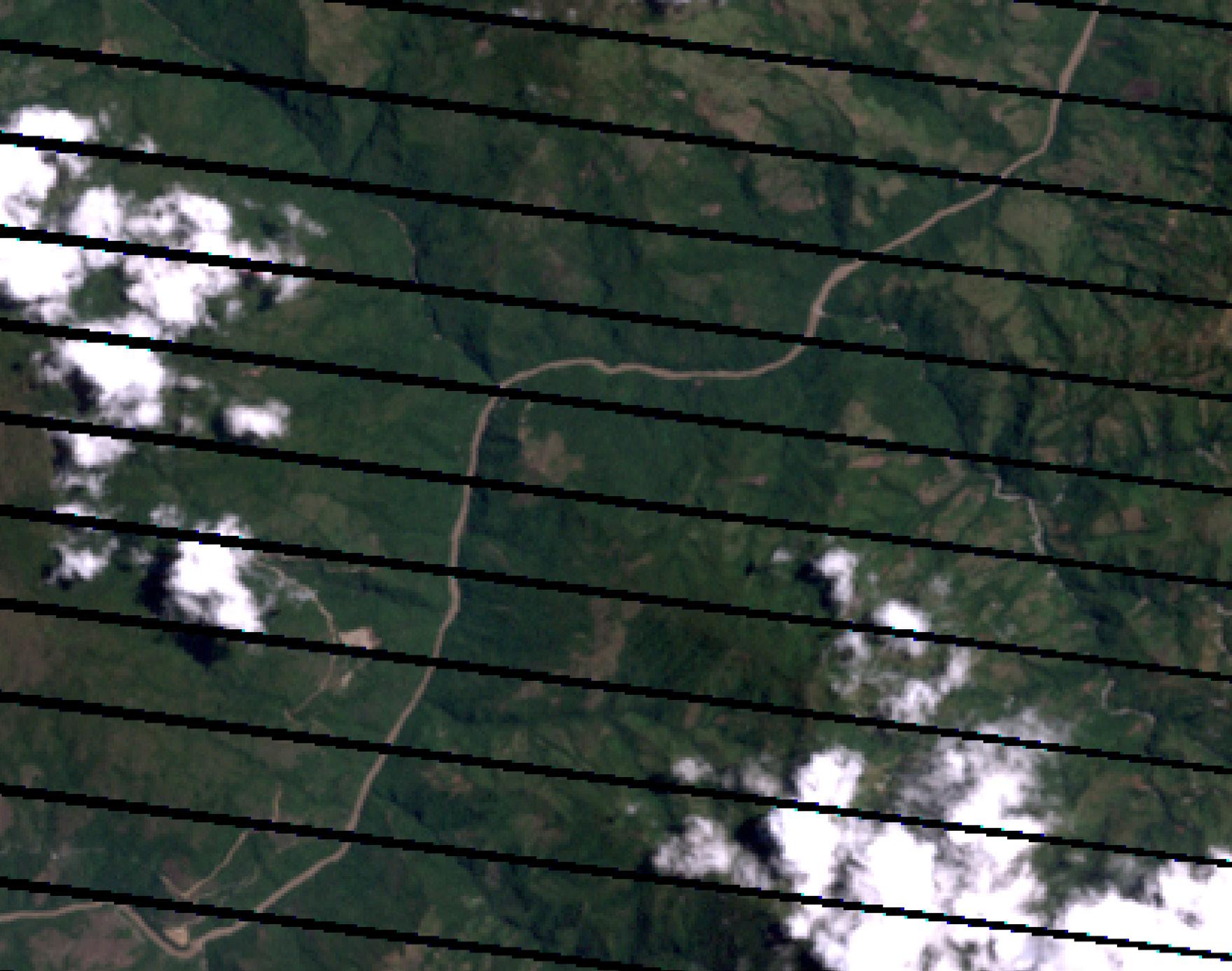
Remote sensing is an effective acquisition of land surveying data, based on spectral resolution, divided in visible and infrared electromagnetic wavelength intervals, such as NIR or SWIR. Each wavelength collection is classified into a band. For example, Sentinel2 uses a classification of 12 bands, and Landsat uses an eight-bands classification process. This combination of bands enables the visualization of simple graphical indicators that are convenient to process in Geographical Information Systems programs (GIS), like QGIS or ArcGIS. Using Remote Sensing allows to comprehend the different fluctuation in any kind of territory. Using two types of satellites, the Sentinel-2 and the Landsat, I scouted six different dates beginning with the 13th of May 2010 which marks the beginning of the bidding process in the C. River. On 18th December 2017, the contract process was close to an end and the construction of the dam had already started. Two of the four tunnels had to be closed on 25th September 2018 in order to control the high levels of water caused by the tropical rains. On 4th October 2018, the levels of water were so high that more than 12 regions were highly affected by it. Until 21st February 2019 the river was on 45 Image Satellite Corporation, ‘Sentinel-2A Satellite Sensor (10m)’, n.d., https://www.satimagingcorp.com/satellite-sensors/other-satellite-sensors/sentinel-2a/.
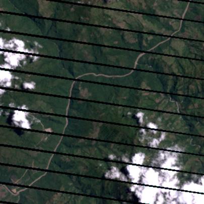
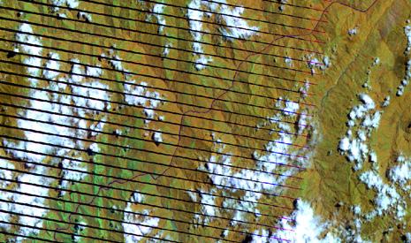
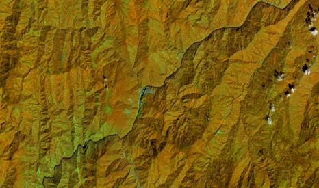
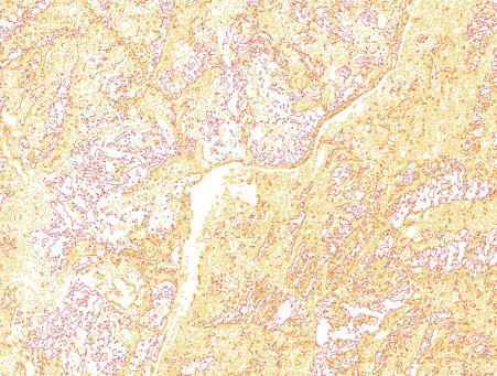
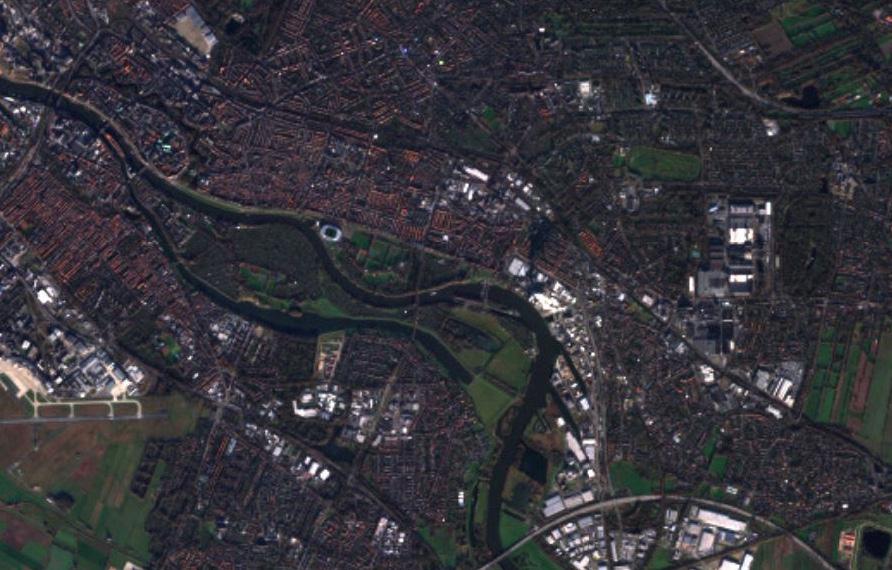
Satellite images need to be processed in order to look like figure 2, which is also known as ‘Natural Color’ after the combination of bands (Figure 1). This is due to the fact that infrared information captured by satellites is outside the human ocular perception. In order to make this spectrum visible it is necessary to use a software like ArcGIS, to combine the different bands and translate the images on an RGB combination to finally conduct the desired analysis. This image shows in a simple way how the images look and how the combination of bands can be applied to present a Natural Color image of the data.
DATA DATA DATA
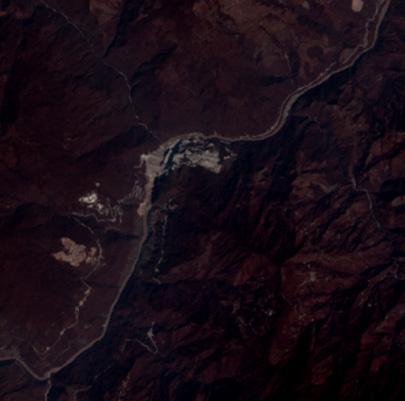
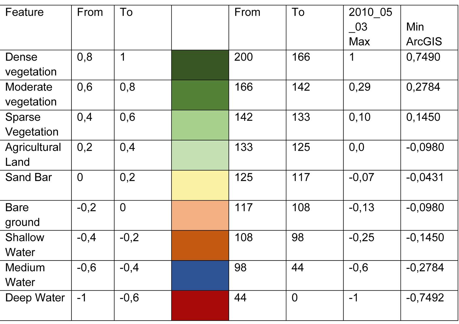
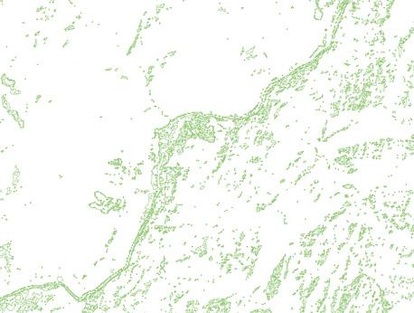
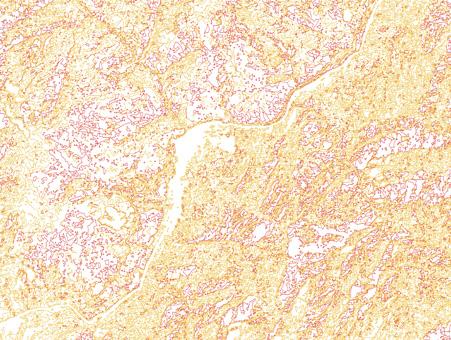
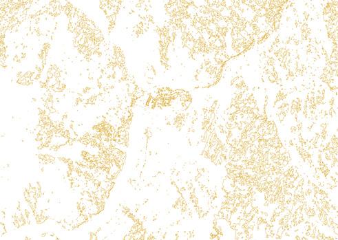
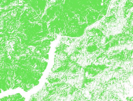
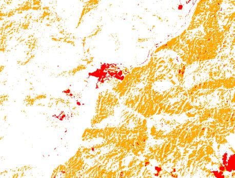
The process of combining bands allows a territorial analysis that could span a vast range between Natural Color, False Infrared Color and atmospheric penetration or healthy vegetation, based on the standard spectral reflection. Through the RGB color model it is possible to define a band for each color and thus visualize the changes that occur and analyze the state of the territory. For example, in order to analyze Healthy Vegetation (Figure 3) in a territory the combination in sentinel should be: 8,11,2 for RGB, meaning, Near Infrared Band (NIR) on Red; Shortwave Infrared Band (SWIR) on green; and Red Band on Blue.
The visual result of the band combination for a Healthy Vegetation requires a legend that clarifies the meaning of the colors. Healthy vegetation spectrum appears in shades of red, brown, orange and yellow. Soils may be in green and brown, urban features are white, cyan and gray, bright blue areas represent recently clear-cut areas and reddish areas show new vegetation growth, usually sparse grasslands. Clear, deep water will be very dark in this combination, if the water is shallow or contains sediments it would appear as shades of lighter blue. For vegetation studies, the addition of the Mid-IR band increases the sensitivity for detecting various stages of plant growth or stress. However, care must be taken in interpretation if acquisition closely follows precipitation.
Figure 1
Figure 2
Figure 3
The use of TM 4 and TM 5 shows high reflection in healthy vegetated areas. It is helpful to compare flooded areas and red vegetated areas with the corresponding colors in the 3 2 1 combination to assure correct interpretation. This is not a good band combination for studying cultural features such as roads and runways. After the preparation of the images by combining the bands, I was particularly interested in this combination of bands also known as ‘Healthy Vegetation’ to analyze the changes in the vegetation with the purpose of exposing the damages and changes made in the territory. These are the results of the combination of bands for ‘Natural Color’ and ‘Healthy Vegetation’, and a table that facilitates the orientation of the facts in relation to the data taken for the field analysis.
After seeing the visible results shown by the healthy vegetation band combination and comparing the events with the data collected, I decided to apply another index to show the changes in greater detail, and to stay with the six dates I had first taken as a reference. The Normalized Difference Vegetation Index (NDVI) is a simple graphical indicator, that measures in most commonly cases space platforms like LandSAT or Sensinel2 Data,
assessing whether the target being observed contains live green vegetation. This allows a classification of three main categories (hydrological bodies, soils and vegetation), based on the reflection of the infrared bands (NIR) (RED). NDVI as an index helps to calculate the biomass and classify it into different categories based on the reflection of near infrared bands. The index normalizes the value range making a classification based on color.
Band Combination:
Natural Color (NC) & Healthy Vegetation (HV)
In order to make a general remote sensing procedure for land surveillance applying an NDVI index certain spatial analysis tools should be applied. First, a study area must be established, as this will help not only to keep the computer’s processor at a good performance, but also to focus the analysis on a specific territory. Then, the general process of raster data has to be carried out in order to visualize the band combination. This allows to correctly classify the type of wave with its respective band, and visualize correctly the desired combination of bands. Afterwards, the NDVI index is applied, and subsequently a multivariate toolset named ‘ISO cluster’ that will cluster the information in nine unsupervised classes and after that classify these nine channels in three main channels based on the normalization values into water, vegetation, and soil. Finally, the raster is converted into a polygon an exported as a multilayer SVG file.
2018 - B
The installation that would tell this story is an experimental data visualization of the results. The transparency of the layers, their fractal behavior and their intertwine interaction with other layers is the metaphor for the multi-connectivity that I aim to acknowledge.
On this journey, I had the intention of moving the scope from a colonial to a decolonizing perspective. I was longing for a new frame to fit this matter in. The frame of mind, the classification and the distance were the same for me as the fragmentation, blockades, and barriers were for the river in order to move freely.
From this point on, I was able to demonstrate the changes the river had suffer, but most importantly I was able to exercise the ‘walking with’ the territory. I had acknowledged my self-location, as an academic immigrant student immerged in a European academic context, provided with technical and scientific tools that enable the walking with this territory, and also oneself drunk with territorial nostalgia. When I was preparing this story, I noticed what the C. river meant to me. This river is distant from myself in both directions as I am physically and geographically distant from it, and as I am epistemologically distance from the deep understanding of it. Because as the Colombia Historian Diana Uribe ones said: “Nosotros nos independizamos del imperio español, y surgimos como continente. pero no nos descolonizamos. Es decir, nos seguimos mirando con los ojos que ellos nos miraron. Nos seguimos clasificando con
los ojos que ellos nos clasificaron.” (We gained independence from the Spanish empire, and emerged as a continent, but we did not decolonize. We continue to look at ourselves with the eyes they looked at us with. We continue to classify ourselves with the eyes that they classified us with.) Nonetheless, I dare to take the loan, and recognize this river as part of myself, and respect the reasoning by becoming part of it, even if I am totally dislocated from it.
Once I had applied the indexes and classified each of the 3 layers for each corresponding date. I made six models that could represent the changes and damage the river had suffered. In the hope of creating a space on the other side of the Atlantic to ‘talk to’, ‘understand’ and ‘walk with’.
INSTALLATION
Companion. C2. WATERBODY
A Walkshop with Water
Vivian Hernandez Ramirez, in entanglement with GTP 3 and colab research S2
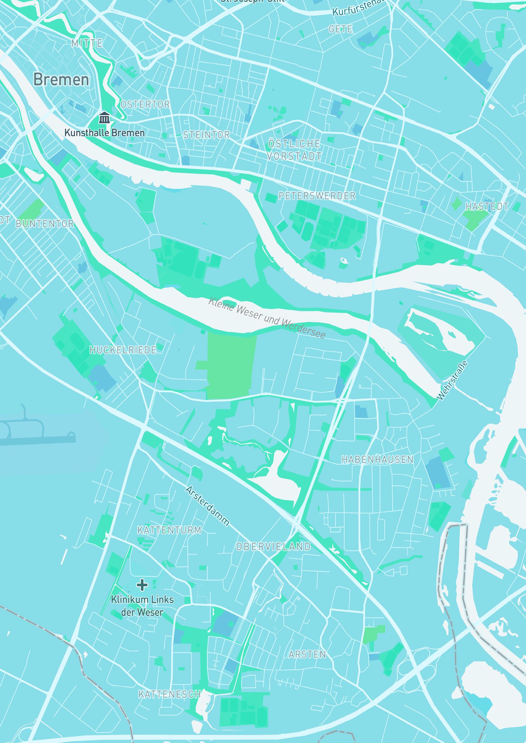
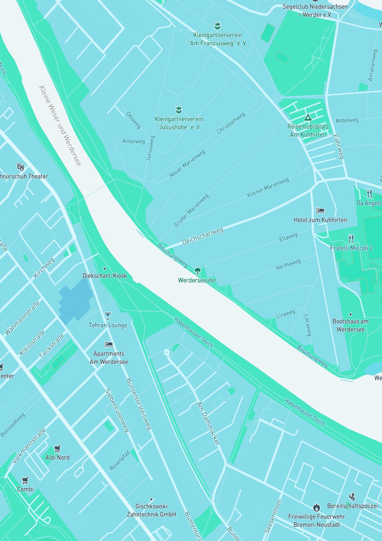
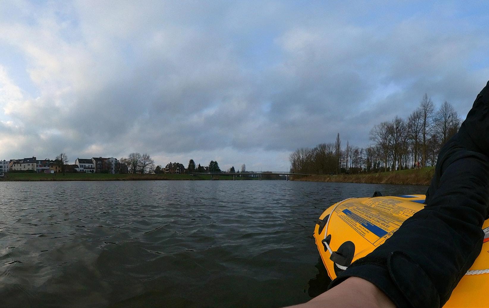
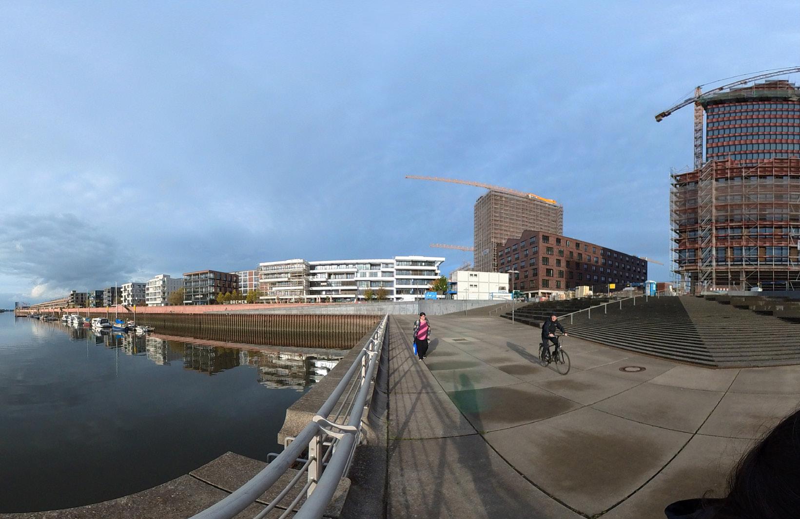
My interest in being part of the Wetland project was rooted from my online participation in the S4 seminar “Bringing Water to Venice” in the Anthropocene Campus Venice 2021 where my understanding and territorial exploration was circumscribed under two main concepts: online participation and digital tools. This allowed me to understand and explore the concept of interconnection between the Anthropocene and two different waterbodies in a different way. It is clear that for me and because of the restrictions that remote participation implied, the wetlands in Venice had a different perspective and interacted with me in a different way. Whereas I could see how my reality and geographical context in Bremen was a possibility to reflect on these points discussed in the seminar. Reason why I was motivated to interconnect and rescue both spaces Bremen and Venice with the help of my expertise as a digital artist.
Through this game of structures, tools and different questions that highlighted the Seminar 4. I decided to ask myself “what was carrying the water to Bremen”. From there the idea of generating a conversation or a walk-workshop with a water agent was “born”. I thought of a non-human companion that could establish a discourse about their problems, highlight their agency and be a means of public visibility. This idea is also inspired by public policies that grant personhood to rivers. Examples include the Magpie River in Canada or the Whanganui River in New Zealand 2017. By means of these examples we can start thinking about
the possibility and pausability of accepting the agency of the non-human as a political and structural end and not only understand it as fictional one. I would like to think that this is the beginning of an ontological exercise that we should begin to promote. The agency of the non-human as an inherent characteristic.
BREMEN START
In this project several technologies are discussed in order to weave a multidimensional discourse where the body of water is given a voice through artificial intelligence technologies such as a GTP3 and thus create utopian agency that allows to reflect upon its interconnectivity, visibility and guide users into a walkshop with in the space.
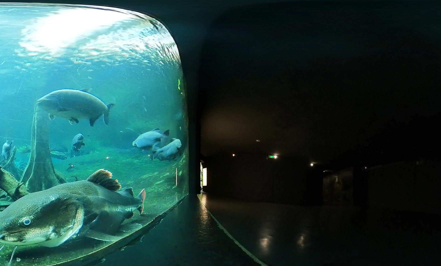
For this purpose, the starting point of the walk can be carried out digitally and/or physically. In the digital simulation, 360° photographs will be used for immersion during the experience to simulate the interaction between the waterbody and the user as he/she explores spaces that in “reality” would not be easy for him/her to read and hear about waterbodies stories as long he/ she walk beside the banks of a river.
Physically interaction will carry on with the support of augmented reality tools that will allow him/her to see the waterbody chatting in a unidirectional way. This with the purpose of reactivating the veracity and the agency of the non-humans in our daily lives.
This project is intended to be a prototype that can be applied in different water bodies in different territories. In order to support and help raise the voices of those who have lost it or find it difficult to be heard.
WATERBODY
POINT 1. Find the nearest Waterbody 2. Go to the website
3. Scan the image. (page 42) 4. Point to the water
SCAN & BEGIN THE AI
WALKSHOP
SCAN! SCAN! SCAN!
This project was inspired by the protest, resistance and environmental activists who have given and lost their lives throughout the Colombian territory to protect the environment, flora and fauna.