Skokie Main Street Commercial Corridor Study
PLACED ON FILE | December 2024

Prepared for:
Prepared by:


Village of Skokie

Prepared for:
Prepared by:
A Planning Study creates a collective vision for a specific physical area, called the Study Area. The Planning Study is shaped by design and policy professionals, Village staff and officials, and members of the local community. It considers the physical elements that shape the space (buildings, streets, trees); the people who use the space (business owners, patrons, neighbors); patterns, tendencies, and trends (circulation, active hours, types of businesses); and the economic drivers impacting activity within the space. Together, the planning professionals, Village Staff, and community members examine the existing conditions, imagine the potential, determine what is possible, and create action steps to bring the vision to life.
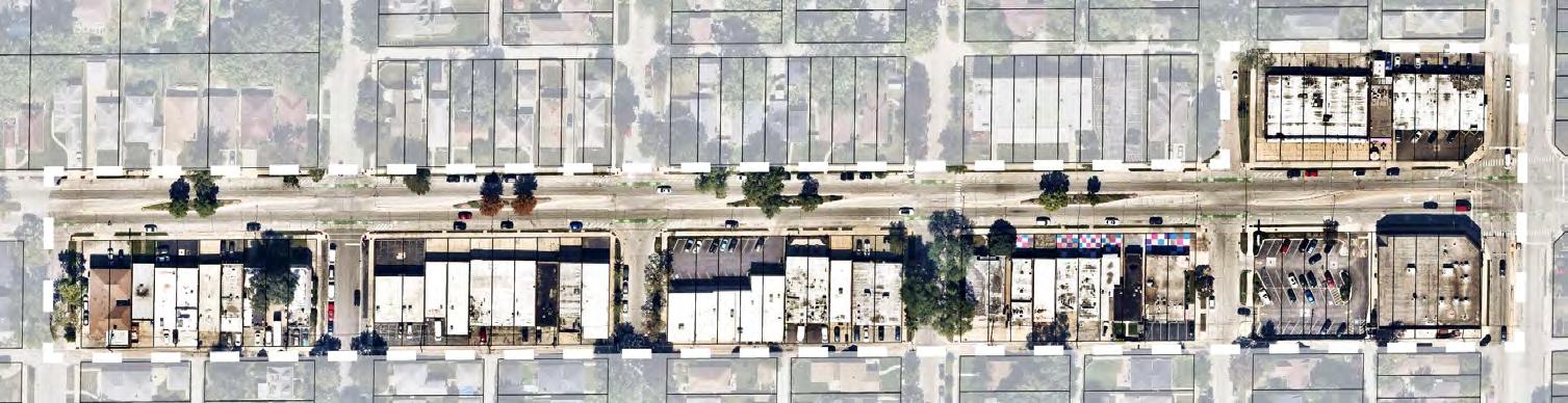
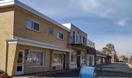
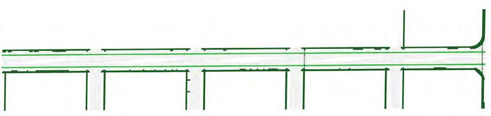
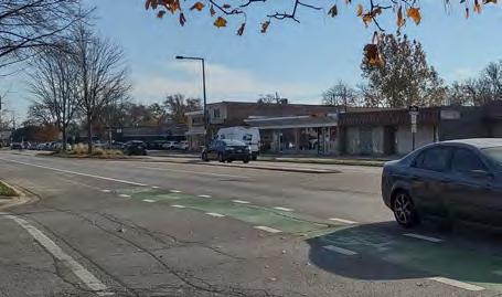
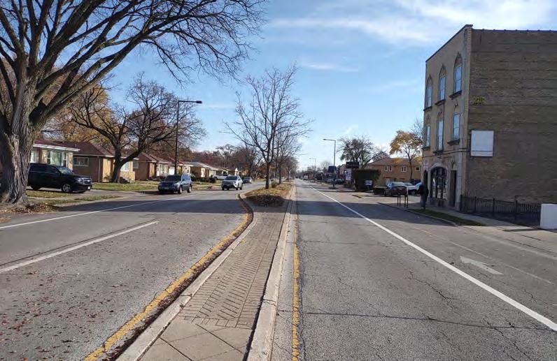
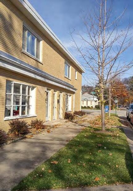
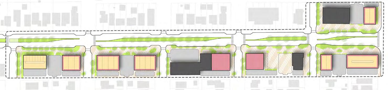
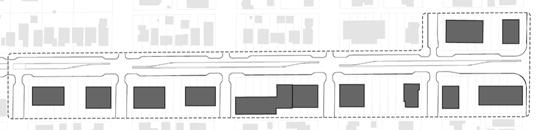
The Study Area for the Main Street Commercial Corridor Planning Study is five blocks of Main Street, from Crawford Avenue to Tripp Avenue as shown in Figure 1. The Study Area includes properties fronting the south side of Main Street and the properties from Crawford Avenue to Karlov Avenue on the north side of Main Street.
Despite a well-shaped public way and flourishing neighborhoods surrounding the Main Street Commercial Corridor, properties in the Study Area have declined in value, increased in vacancies, and aging buildings have continued to deteriorate. This Planning Study is built upon the following objectives:
IDENTITY: Create a unique identity and unified long-term vision for the corridor.
DEVELOP: Identify potential private development, mixing businesses, residences, and public spaces.
ACTIVATE: Develop public realm improvements to support a widerange of activities and uses.
ENGAGE: Create an experience that draws neighbors and visitors to the corridor.
SAFETY: Enhance safety and comfort of pedestrians and bicyclists within the corridor.
The Village of Skokie is built on the unceded lands of Indigenous peoples. Before colonization and settlement by Europeans, the place we know as Skokie was home to the Council of Three Firesthe Ojibwe, Odawa, and Potawatomi – and many other tribes resided on, gathered in, or migrated through this land for generations. Acknowledging this history, we strive to inform our present work in pursuit of equity for all peoples and responsible stewardship of this land.
Complete the analysis of the existing physical conditions, patterns and trends, and economic influences.
Gather input from local businesses, organizations, and neighbors.
Identify and prioritize opportunities for change.
In 2022 the Village secured a grant from the Department of Commerce and Economic Opportunity (DCEO) to continue efforts for community vitality along the Main Street Commercial Corridor. Combined with the renewed desire for walkable, neighborhood-based spaces accelerated by the COVID-19 pandemic, the Village initiated this planning study. Project Kickoff & Site Tour
Figure 2: Planning process timeline.
Test concepts for public space and private properties to determine what’s possible.
Review with the Advisory Committee to select preferred concepts that best reflect community priorities.
Refine the concepts into a cohesive plan.
The Main Street Commercial Corridor Study process was conducted in four phases completed in late 2024. The completed Study establishes a vision and an actionable “to-do” list for the Village and property owners to take incremental steps towards bringing the vision to life. Ideas from this study are anticipated to come to life quickly using grant and Village funds to implement change.
Provide a list of recommendations and steps to bring the vision to life.
Verify with Advisory Committee that the steps are achievable tasks.
Deliver a completed plan document illustrating the vision for the future of the corridor.
Share the vision of the plan with the stakeholders to collect refinements and empower next steps.
Share the plan vision with the broader community to generate excitement and ownership.
Take the plan before Village Board to review and place on record.
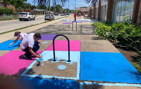
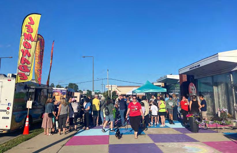
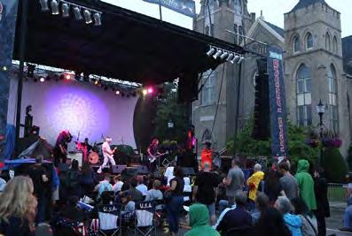
The Main Street Commercial Corridor Study reflects input from local businesses, property owners, and neighbors. This Study builds on on-going Village investments and recent private development on Main Street, and community interest in revitalizing the corridor to take a closer look at the future of the Main Street Commercial Corridor. Village investments include native landscaping and irrigation in the medians (2003), and bike lanes (2014), and traffic calming. Grass roots programming events, called Meetup On Main, have demonstrated the potential and desire for vibrancy in the corridor, and the organization created a planning document “A Walk Down Main Street” identifies ideas to add vibrancy to the corridor.
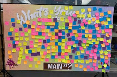
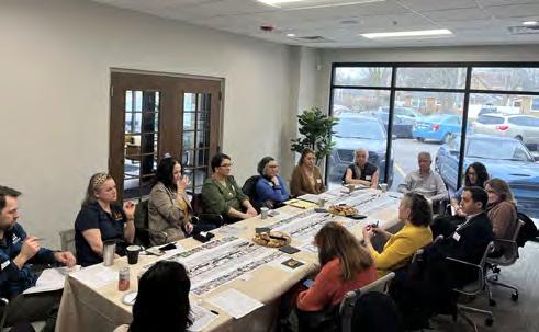
Building on the evolution of the corridor, the Planning Team conducted stakeholder workshops to collect input from a variety of perspectives present on Main Street. An Advisory Committee, comprised of Village Staff representing different departments, provided additional guidance and insights throughout the course of the planning process.
The Planning Team conducted two stakeholder workshops during the Discovery phase of the Planning Study. Stakeholders included representatives from local businesses along the corridor and the neighboring downtown business district; property owners; Skokie Park District; Skokie School District 73.5; North Shore Visitors and Convention Bureau; Skokie Village Staff, and Go Green Skokie.
Following the development of the draft plan report, Village Staff and the Planning Team reconvened the stakeholders to share the plan document.
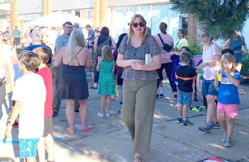
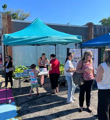
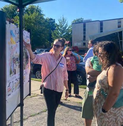
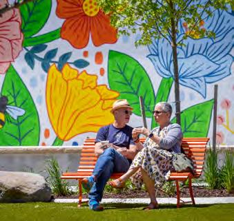
The plan’s vision was shared with the community as a pop-up table at a Friday night Meetup on Main event. Over the course of several hours, the Planning Team shared the plan with families and neighbors who turned out for the evening gathering.
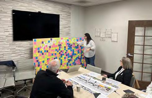
The workshops brought together stakeholders to discuss the challenges and opportunities for the future of the Study Area. The following insights emerged from the feedback collected in these workshops. The insights are grouped by the various perspectives included in the engagement.
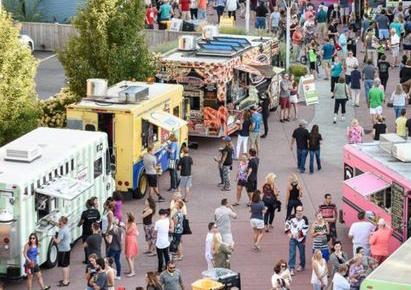
Community members strongly desire food and beverage and experiential retail for the corridor, walkable from adjacent homes.
Community members like the small scale of the buildings, suited to small, local businesses and a sense of undiscovered finds.
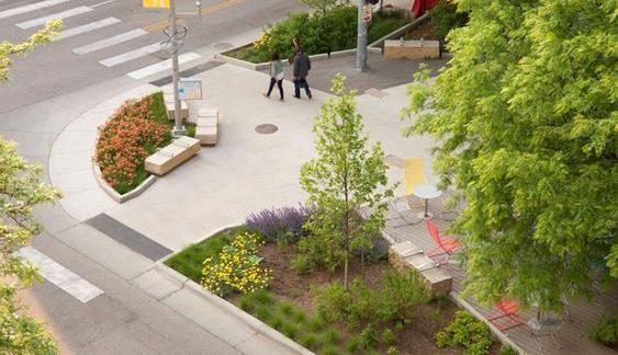
The wide building setback and resulting plaza spaces are inconsistently used for parking, unprogrammed, and uncomfortable to walk along due to lack of definition.
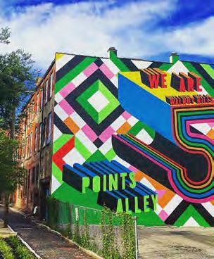
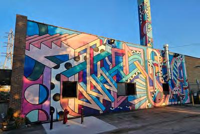
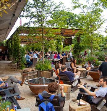
Skokie has a strong culture of arts, particularly visual arts (Sculpture Park and murals).
There is a desire for interactive art installations- murals or rotating art that can generate a buzz, attract visitors, and provide sensory experiences for children.
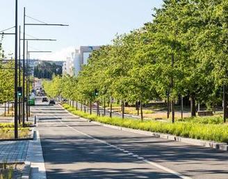
Landscaped and irrigated medians create cohesion along the corridor.
The sidewalks and setbacks have minimal landscaping and tree cover making it too hot in the summer. Minimal parkway discourages walking. The irrigated, landscaped medians help to offset a lack of other perimeter or parkway landscaping.
The existing street lights are designed for vehicular traffic and do not support the multi-modal corridor this area has become.
School representatives highlighted, there is a need for greater variety of housing types within the school district which encompasses the Study Area.
Residents express a desire to have opportunities affordable to all members of the Skokie community.
There is a great enthusiasm for the proposed changes and desire to see them realized as soon as possible.
Property owners feel the burden of local commercial taxes which make it very hard to turn a profit in a low-margin business, such as a restaurant.
Tenants are attracted by the low rents.
Investments to improve the properties are very costly due to the age of the building and requirements to bring older buildings into code compliance.
The neighbors want very locally serving establishments, but realistically, a business cannot survive without attracting a much wider range of patrons. This creates a need for accommodating parking which is constricted in the Study Area.
Many existing businesses are destination or distribution driven. Examples of destination retailers include the clock repair store and music store. The florist, two bakeries, and catering enterprise are examples of businesses who are not driven by foot traffic.
The narrow parkways are challenging to maintain while not contributing to comfort of pedestrians or ease of access to/from parallel parking.
Skokie has a strong culture of arts. The neighboring downtown business district embraces this culture by continuing to bring arts to the district. Main Street could be a complementary district.
Business patrons’ vehicles remain parked for longer than allowed on the corridor.
The ideas presented in the Main Street Commercial Corridor Study are rooted in the existing conditions and context of the Study Area. The Planning Team reviewed existing Village planning studies, analyzed the residential and commercial markets, and inventoried the physical elements of the corridor. The spatial analysis quantifies the physical elements contributing to the qualitative feel of the space and develops a measurable baseline against which design concepts can be evaluated. The following pages highlight the findings of this review, analysis, and inventory.
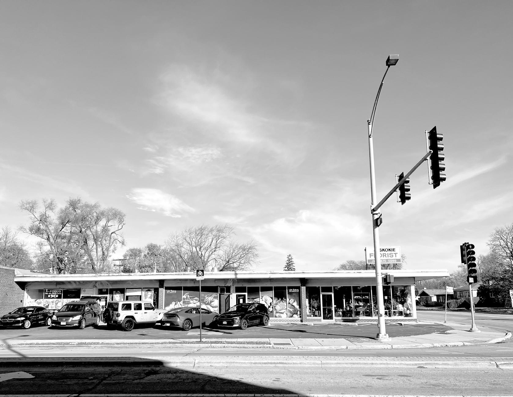
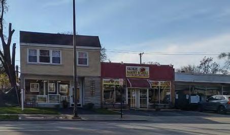
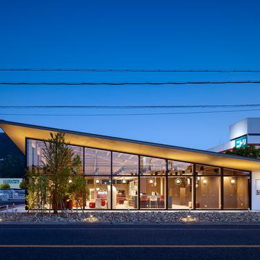
As a neighborhood commercial center built predominantly in the mid-20th century, the corridor represents a unique moment in time when modernism was influencing everyday architecture, but individual automobile ownership was not yet shaping parking demands or suburbanization of retail centers. Post-war housing grew rapidly around the edges of the Village and close-in suburbs, such as Skokie, where the commute to downtown jobs was manageable on transit or less-robust automobile infrastructure.
The housing boom bolstered the need for local retail, serving every-day needs and visited by foot or local transit service. Large department stores and shopping destinations were still located in urban downtown districts anchored by commuter rail stations.
As personal automobile use became more widely adopted, residential construction and shopping centers shifted to the suburbs. This commercial corridor along Main Street is a vestige of a moment in time when households still relied on walkable local retailers to meet everyday needs, cars had not yet changed land use forms, but modern ideas were creeping into the vernacular architecture.
From review of several existing plans and studies, the following three plans were identified for their applicability to the Main Street Commercial Corridor Study. The Planning Team extracted from each of the applicable plans the goals or objectives with which this Planning Study can align so that recommendations further not only the purpose of this study but the objectives of other existing plans as well.
“Sector D” served as a base for the market analysis, expanding north to Dempster Road to center Main Street in the analysis area.
Future Planning Direction for Land use identifies “Mixing uses” in pedestrianoriented areas.
The Main Street Commercial Corridor has the potential to contribute to diverse housing stock for Skokie.
Generally, the Comprehensive Plan recommends actions that continue to elevate safe and convenient mobility by bike or by foot.
Reduce greenhouse gas emissions by 35% in the next 8 years.
Decrease community-wide VMT through increased biking, walking, shared mobility, and eMobility.
Increase average population per developed acre by 10% by 2030.
Increase on-site renewable energy.
Increase tree cover from 25.5%.
Replace 8% of turf community-wide with alternative natives or other plants.
Reduce heat island effect through “dark” impervious surface coverage reduction.
Go Green Skokie: A Walk Down Main Street (2022) )
The themes of exploration for this planning study are very closely aligned to those of the “A Walk Down Main Street” Vision.
A clear, branded identity.
Areas for casual, spontaneous gathering.
Family friendly with a variety of options for all ages.
Complementary businesses.
Mixed uses: residential/ commercial.
Walkable/ bikeable, human scale.
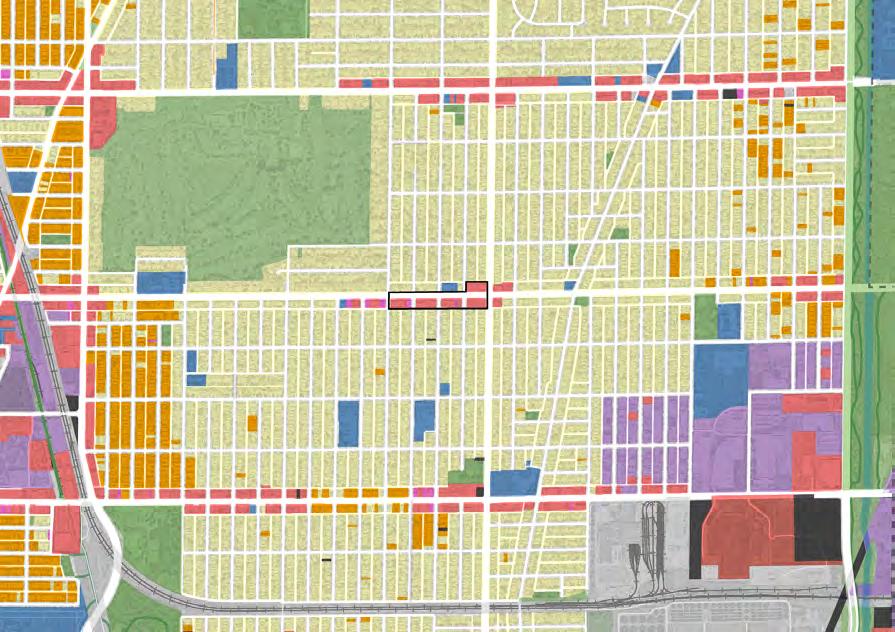
Land use and zoning districts are very closely aligned in this area of Skokie.
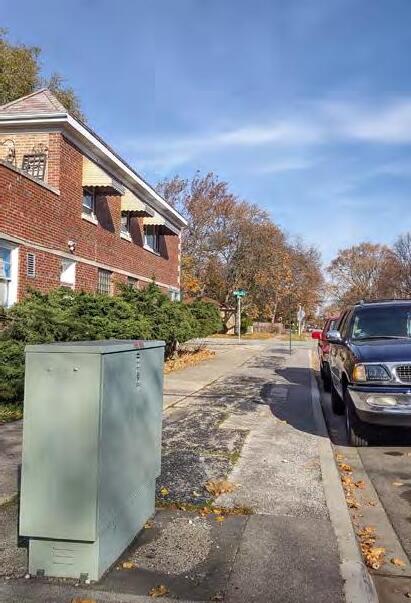
The study area is surrounded by residential fabric and contrasts the downtown and shopping corridors, indicating its origins as a neighborhood commercial center.
The character of the Main Street Commercial Corridor is unique from Dempster and Oakton commercial corridors that are more autocentric and a mix of architectural ages and styles.
Downtown Skokie is less than a 1/2 mile (20 minute walk) from the Study Area.
Overall, the small blocks, existing pedestrian facilities, and nearby destinations make the study area very walkable.
Both Skokie CTA yellow Line stations are reachable from the study area. The Oakton Station is slightly over a mile and a 25 minute walk. The Dempster Station is closer to 1.5 miles and 30 minutes to walk from the Main Street Commercial Corridor.
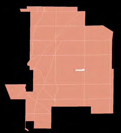
To ensure recommendations in the visioning study are reasonable and feasible, the Planning Team conducted a market study to better understand market potential on Main Street by providing insights on demographics, and commercial and residential markets.
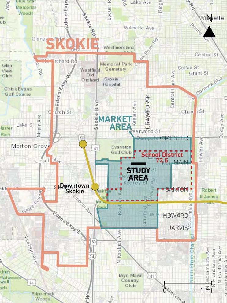
The Planning Team established a market area for the study, which correlates with the “Central Sector” boundary set forth in the Skokie Comprehensive Plan adopted in 2005. The market area, as seen in the corresponding map, is positioned between uS-41 (Skokie Boulevard) and the eastern boundary of the Village and extends from Dempster Avenue to the north and Jarvis Avenue to the south. The market area is east of Downtown Skokie and the CTA yellow line stations, and south of Westfield Old Orchard mall. Land use in the market area is primarily single-family detached residential, and commercial uses along the main thoroughfares of Dempster Street, Main Street, and Oakton Street.
The market analysis identifies trends occurring in the study area along Main Street, the market area, and throughout the Village. using data and trend analysis, this document describes the strengths, weaknesses, and opportunities for commercial and residential land uses in the study area.
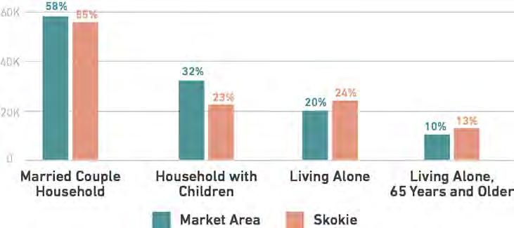
Households by Type, 2023
Source: 2023 Esri Business Analyst Estimtates
The market area is a popular location for households comprised of spouses or significant others, both with and without children.
Residents in the market area skew younger than Village-wide, with many young professionals, and young families with children.
Older residents are increasing in both the market area and Village as residents aging in place.
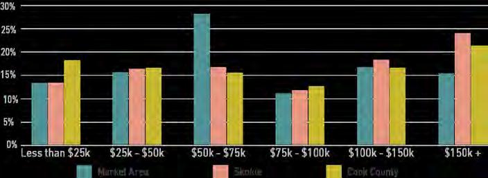
Median household income in market area and Village is above $82,000, though more than 57% of households in the market area earn less than $75,000 yearly. The most common income range is $50,000 to $74,999.
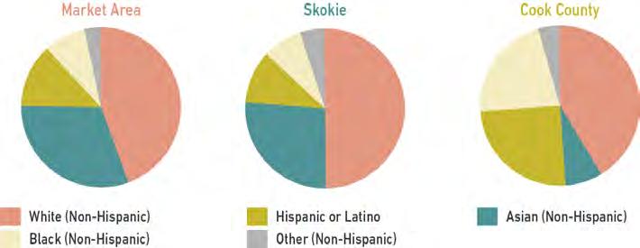
In 2023, half of the population in the Village identified as White, 25% identified as Asian and the remaining 25% identified as Black, Hispanic or Latino, or other.
Households by Median Income, 2023
Source: 2023 Esri Business Analyst Estimtates
Race & Ethnicity, 2023
Source: 2023 Esri Business Analyst Estimtates
are non-conforming to the current zoning.
Consistent 30’ deep setback shapes plazas and continuous street wall.

Low density, 1-story buildings.
Mid-century buildings emphasize horizontality and angled features.
Parking setbacks appeared in the1970’s. Older structures have smaller footrpints.
Strengths
Vacancy rates remain low, while rents and forsale prices rise, indicating demand for rental and for-sale properties.
New development is building the local population in Skokie, around Downtown, Main Street, and Old Orchard sub-market. Such added residential growth can benefit Main Street businesses.
Weaknesses
Few new residential units have been delivered in the market area over the last two decades.
Rising costs of labor and materials make new residential developments less financially feasible, and tend to require density or financial incentives.
Residents and neighbors have expressed concern for density and building heights, which may be needed for new developments in the market area.
Cook County property taxes are high for commercial.
Opportunities
Residential redevelopment at key sites in the market area could be successful, but likely would need to be multiple stories for a developer to be interested.
Redevelopments at key sites could accomodate ground-floor retail, bringing needed updated commercial space for neighborhood serving retail.
Some financial incentives or lower land costs could improve developer interest.
Housing Occupancy Trends
Source: 2000 and 2021 US Census, 2023 Esri Business Analyst Estimtates
Skokie For-Sale Housing Trends
Source: Multiple Listing Service (MLS), 2024
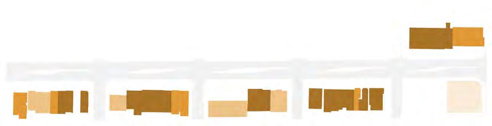
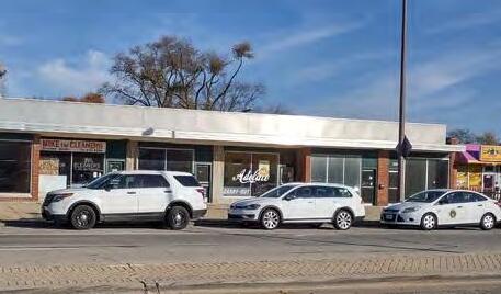
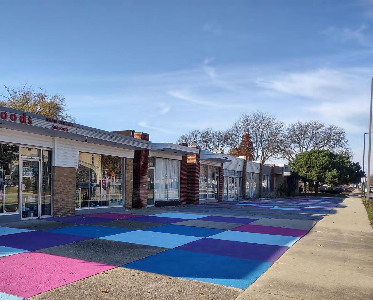
A business inventory was conducted in the study area that identified 44 total ground floor commercial units- also referred to as storefronts- amounting to 102,773 square feet of commercial space. At the time of the inventory, 82,743 square feet (81%) of the total commercial space was occupied within 31 storefronts.
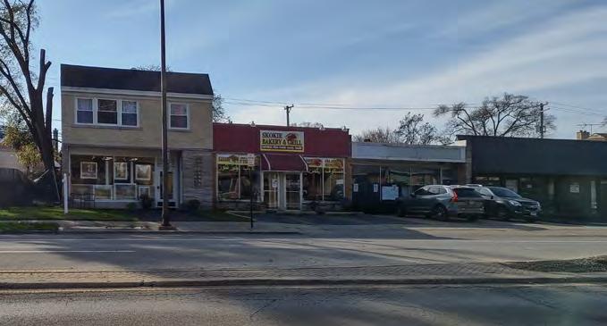
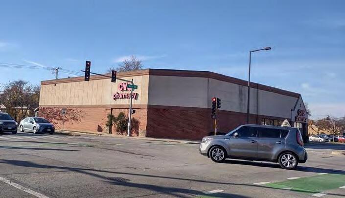
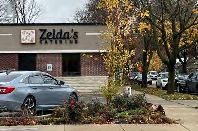
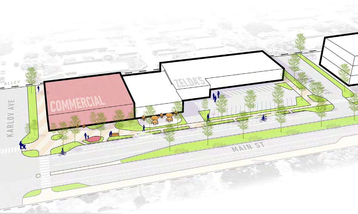
Notable anchors in the five-block Main Street study area include the Skokie Montessori School, Zelda’s Catering, a leading catering company, and CVS on the corner of Crawford Ave.

Of the 102,773 square feet of commercial space, 43% was professional services and 30% was retail. Education, eating or drinking, and personal services each made up 9%.
Strengths
Low rents support new businesses.
Recent deals generate momentum for reinvestment.
Midcentury character creates a distinct quality.
Small businesses offer a diverse range of products and services.
Participants of neighborhood engagement foster collaboration and community along Main Street.
Weaknesses
Aged buildings require renovations.
Lack of parking poses an inconvenience.
Non-public facing businesses detract from activation along the corridor.
Building scale limits the potential for businesses to expand or diversify.
Corridor lacks a clear branding or identity. Businesses lack signage, activity, and hours.
Lower traffic volume than competing corridors.
Small commercial spaces can promote niche, intimate shopping experiences.
Redevelopment potential opens the door to mixed-uses.
The Village’s ability to purchase and redevelop buildings adds a strategic dimension, allowing for thoughtful transformations that align with community needs.
Reimagining plaza spaces more effectively, creating spaces for outdoor seating, or events and programming.
Establishing a clear branding and marketing strategy to define and promote the unique identity of the corridor
Collaborating with local business allies can amplify investment in the area.
Shared parking lots can address the business needs.
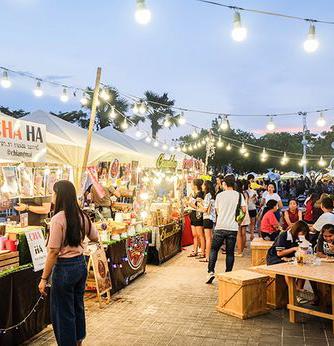
Organizing more events and programming to further enhance the overall experience.
Nearby townhouse development presents the prospect of new patrons and increased foot traffic.
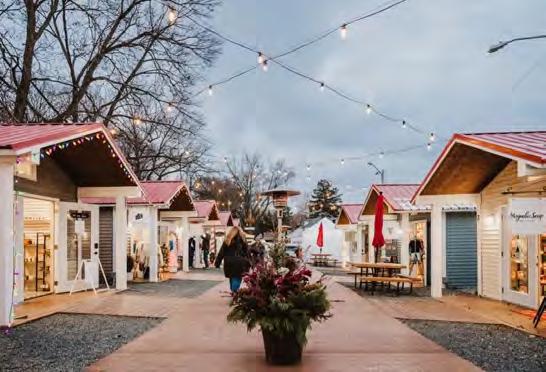
“Meet Up on Main”
demonstrated tactical design and programming potential.

Semi-public plazas: hardscaped, unprogrammed, and underutilized.
& Tree Canopy
Narrow turf grass parkways, too small for canopy trees.
Limited benches or street furniture in the corridor, recently added to by the Village; little private outdoor seating.
Lack of private landscaping.
Median plants struggle from salting.

Side streets are greener.
Mid-century development provides minimal off-street parking by today’s standards, a challenge to businesses owners.
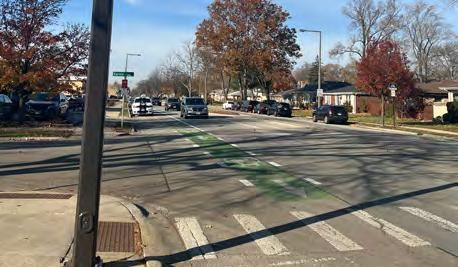
Safe crossings needed to maximize use of on-street parking on the north side.

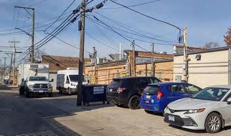
Parking from the alley accommodates residents and employees; not visible enough for patrons.
Non-vehicular Mobility
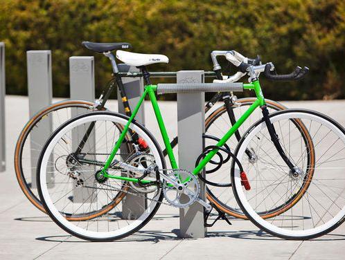
Main Street is the central east-west bike lane connection across Skokie. New bicycle lanes on Crawford will connect to a north-south spine, and the North Channel Trail further east.
Bike Racks is insufficient.
Curb cuts at every intersection, but only 2 striped crossings.
Opportunity for curb extensions.

The identity sets the tone for the activities, personality, and spirit of the corridor.
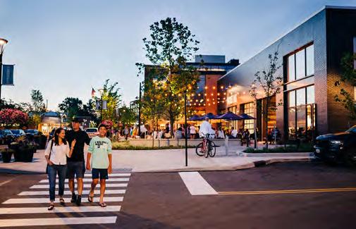
“Make it on Main” envisions a colorful and vibrant corridor that supports small businesses in addition to a diverse and engaged community. This theme and associated character showcases a hyperlocal, small-scale, and rich streetscape experience that will serve as a neighborhood hub for Skokie residents and a destination for the region.
“Make it On Main” is defined by:
making CRAFT & ARTISANAL GOODS, reflected in the existing bakery, florist, coffee, and catering industries.
making ART in complement to complement other existing cultural arts resources across Skokie.
“making it” as a SMALL BUSINESS entrepreneur, with the support of attainable tenant spaces for incubation.
making CONNECTIONS with neighbors in a range of activities supported by the corridor’s vibrant public realm.
making a LOCAL HUB to serve adjacent residents, while fostering a community that embodies Skokie’s unique qualities.
Welcome to the Makerhood!
Six principles shape the vision for Main Street. These design drivers establish guidelines to build on the existing assets unique to the Main Street corridor while framing design ideas in response to the plan objectives.
1
Leverage Investments
Retain select existing properties demonstrating catalytic investments.
Reflect Neighborhood Diversity
2
Embrace Local Character
Preserve select existing properties for building character, quality, and scale.
4 5
Reflect the multi-cultural diversity of Skokie.
Celebrate Arts and Music
Complement the arts and music identity of Skokie.
3
Activate Open Space
Harness the potential of the existing 30’ setback for public space.
6
Support Entrepreneurs
Foster the local, small business character of Main Street.
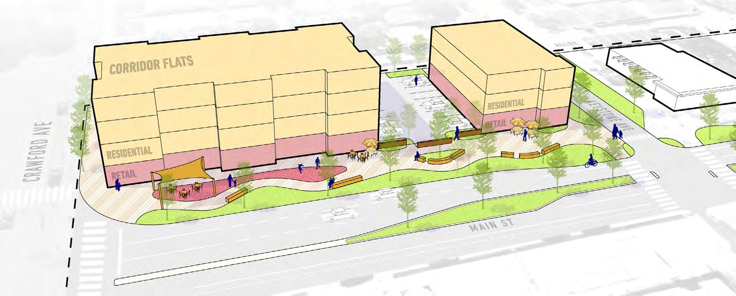
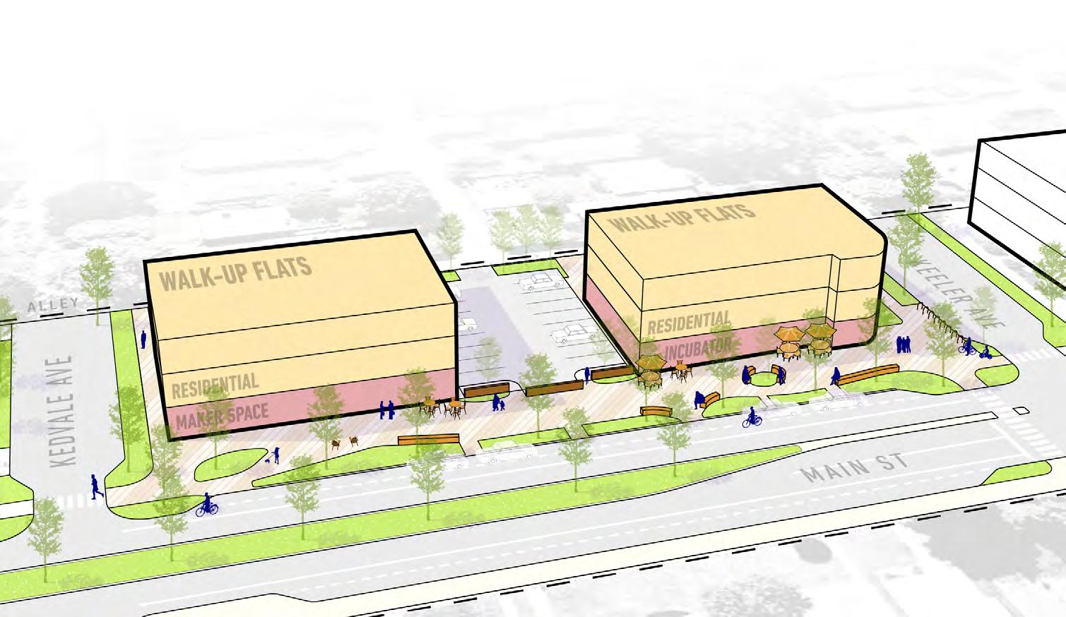
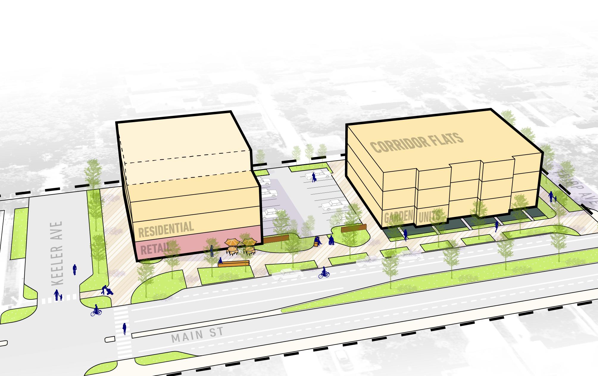
The vision for Main Street is made up of three categories of improvements: private development, public realm improvements, and connectivity improvements. Each category is specifically located within certain constraints, or parameters. In combination, these building blocks help to support a diverse and engaging corridor.
Private Redevelopment is made up of the buildings and open space supporting activities on private property. This includes buildings, private-public open space, and off-street parking.
Public Realm Improvements happen in the space between the buildings and the street edge. unique to this corridor, public realm improvements include the privately-owned front setbacks, perceived to be a public space.
Connectivity Improvements are changes to make the roads, sidewalks, and crossings safer and more comfortable for all people moving to or through the corridor.
Within each improvement parameter category for change are different building blocks. The master plan below identifies these buildings blocks and arranged the blocks to best deliver on the plan’s objectives and design drivers. However, over the course of redevelopment, there is flexibility in the plan for the building blocks to be rearranged based upon changing demands but towards the overall spirit and intent of this plan’s vision.
Read more on the following pages about the considerations for each typology and their elements.
Plan Objectives:
Future private development along the Main Street Corridor should strongly support the concepts of integrated public-private open space and activated street-fronts to shape a strong relationship between public and private space.
Smaller ground floor footprints ideal for small businesses.
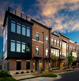
Feasible as individual buildings or aggregated.
Common Chicagoland vernacular, often with 2-bedroom units.
No elevator access keeps pricepoint lower.
Moderate price point to construct and lease.
Requires a larger development site and accommodates a mix of residential unit types/ sizes.
Ground floor may be garden units or commercial.
Elevator access.
Higher construction price point, resulting in higher rents/leases.
Intermediate scale, front doors on the street transitions to surrounding residential character.
Live/work units with commercial space can support local artisan makers.
Fee simple or condo ownership; or rental units with ground floor maker/ retail spaces.
Street facing live/work units can be combined with corridor flats.
DEVELOP: Identify potential private development, mixing businesses, residences, and public spaces.
Architectural statement building, potential to reflect mid-century history.
Anchor tenant needed to finance and attract visitors as a local destination.
Flexible and iconic space for community gathering on the interior of the block.
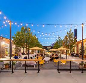
Large hub for seating, outdoor dining, public art, flexible activation, events, and business incubation/ support.
Private ownership or public-private partnership.
Plan Objectives:
Public Realm Improvements occur in the space between the buildings and the street edge. unique to this corridor, public realm improvements include the privately-owned front setbacks, perceived to be a public space. Each building block is described with benefits and considerations below. The following page dives deeper into the different elements that are used to design each building block.
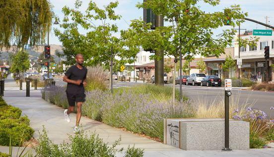
Circulatory spaces of movement for pedestrians of all ages and abilities.
Adjacent to roadway or on-street parking with access to businesses, ground-floor residential, and surface parking lots.
Large landscape buffer provides screening and safety from the roadway while improving comfort and aesthetics.
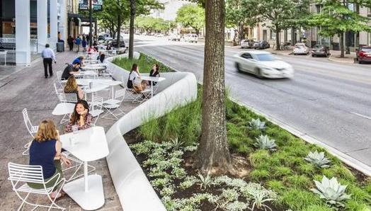
Playful and iconic experiences for sitting and gathering along the streetscape in locations with widened right-of-way.
Seating and outdoor dining nodes with ample landscape and shade tree buffer from street.
ACTIVATE: Develop public realm improvements to support a widerange of activities and uses.
ENGAGE: Create an experience that draws neighbors and visitors to the corridor.
Streetscape opens into plaza moments defined by hardscape and landscape at key intersections.
Opportunity for public art, branding, wayfinding, community gathering space, and outdoor seating.
The following components make up a standard ‘kit of parts’ as improvements to the Main Street Corridor to better shape a positive public realm experience. Each ‘part’ shown below represents specific components for future inplementation and enhancement. Improvements (or ‘parts’) may be phased in over time, ultimately contributing to a wholistically improved Main Street.

Integrate consistent and iconic paving pattern along the entire streetscape to unify the corridor.
Hardscape may include colored concrete, pavers, or a combination of both.
Changes in hardscape subtly define spaces.
Select light-colored materials to reflect sunlight and reduce heat island affects.
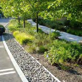
Integrate native landscape buffer areas can to filter and detain stormwater.
Increase canopy and ornamental tree coverage for shade protection and habitat area.
Street trees increase comfort for all users and bolster property values.
Increase native biodiversity for year-round visual interest and climate resilience.
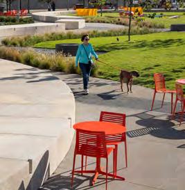
Colorful mix of seating types to invite and accommodate a range of users.
Movable elements like cafe tables and chairs can be arranged by each user to suit their needs.
Seatwalls and fixed benches provide yearround seating options and while shaping outdoor spaces.
Plan Objectives:
IDENTITY: Create a unique identity and unified long-term vision for the corridor.
ACTIVATE: Develop public realm improvements to support a widerange of activities and uses.
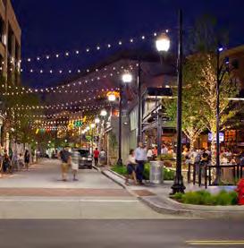
Install new light poles and fixtures to adequately light for comfort and safety whether in a car, on a bike, or on foot.
Consider a blend of modern post lighting along the streetscape with catenary string lighting at plazas. A mix of lighting types can create inviting ambiance.
Consider the style, height, color temperature, and color index when selecting fixtures.
A diverse array of artistic expressions can be integrated into a variety of streetscape elements, including shade structures, pavement, seating, and more.
Dynamic, interactive art may include must-see photo moments, climbable structures, or kinetic features.
Art installations can be rotating to showcase different local artists.
Plan Objectives:
Connectivity improvements ensure that all residents and visitors heading to or through the corridor can move about safely and comfortably. These improvements consider people moving by car, by bike, on foot, or in other forms of mobility.
Provides stormwater capture, traffic calming, and pedestrian safety benefits.
Enhances visibility around parked vehicles.
Provides shorter crossing distances.
Expands area for landscape and streetscape amenities.
Zebra striped pavement paint, located along higher speed or volume roadways where visibility is critical.
May be paired with traffic signal, flashing beacons, stop sign, and/or crosswalk signage.
Includes ADA tactile paving and flush curb ramp.
Double-striped crossing, notable at side streets.
May be paired with stop sign or crosswalk signage.
Includes ADA tactile paving and flush curb ramp.
SAFETY: Enhance safety and comfort of pedestrians and bicyclists within the corridor.
Planted median with minimum 9” raised roadway curb edges.
Select native and salt tolerant understory plant material.
Locate urban tolerant shade trees spaced 30’ on center to provide roadway cooling benefits.
Irrigate where possible to extend plant longevity during periods of drought.
Plan Objectives:
As a component of the built environment, parking overlaps the building blocks of private development, public realm, and connectivity. Benefits and considerations for the different parking typologies applied in the Main Street Corridor are outlined below.
SAFETY: Enhance safety and comfort of pedestrians and bicyclists within the corridor.
DEVELOP: Identify potential private development, mixing businesses, residences, and public spaces.
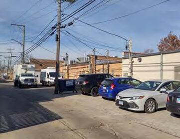
Business district parking lots accessed from the alley.
Landscape walls and planting buffers to visually screen vehicles and blend with the public realm aesthetic.
Wayfinding signage directs vehicles to parking lots from Main Street.
Potential for EV charging infrastructure.
Lots can flex as gathering spaces for events.
Parking directly behind buildings in alley for residents and employees.
Highly efficient parking utilizes existing shared circulation infrastructure to access spaces.
Evaluate if alleys should become one-way with increased volumes of traffic to access alley parking and lots.
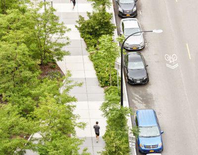
Improved on-street parallel parking bounded by curb extensions.
Painted lines to identify spaces and facilitate enforcement. Clearly delineated spaces can support enforcement of parking duration limits.
A carriage walk between landscaping and the curb provides easy access to parallel parking.
Distributed bike racks throughout corridor in high commercial areas and near gathering plazas.
Consider adding bike amenities within the corridors, such as repair stations or bike-route maps.
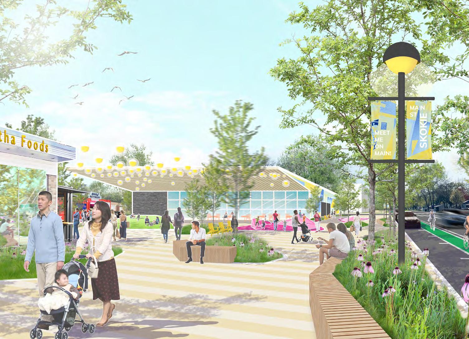
The “Make it On Main” vision imagines a dynamic neighborhood hub at the heart of the Main Street Commercial Corridor. Let’s explore life in the fully realized vision.
June 2050 on Main Street...
Small businesses flourish, breathing new life into existing buildings. Thriving institutions like Zelda’s and the new signature development anchor the corridor.
Thoughtfully crafted outdoor spaces connect the blocks and provide a place for everyone:
where families can run errands and children can play in the streetscape plazas.
where young adults making can meet up over a locally made drink or meal and connect with friends.
where older adults can age in place, among the community they’ve fostered.
The Main Street Corridor bustles with activity on a regular day, and explodes with excitement for the special events held here throughout the year.
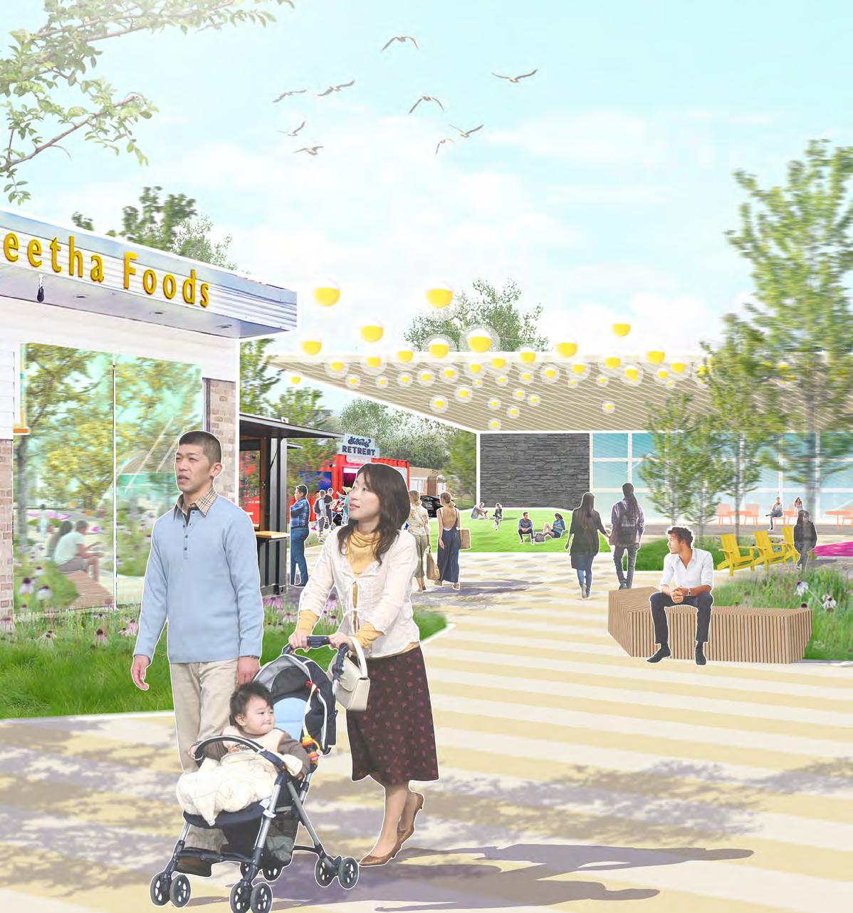
Repositioned buildings reflect local character and foster entrepreneurs
Vendors & Food Trucks
A destination to attract visitors from neighboring communities
Gathering plaza for special events and day-to-day activities
Streetscape plazas to connect with neighbors and build community
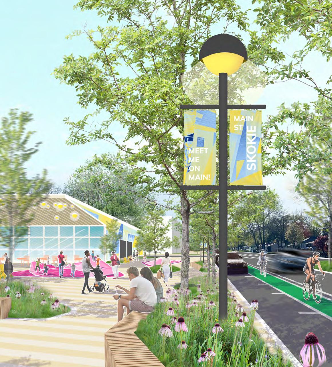
cont. from previous page...
Main Street’s unique identity reflected in banners and design
Interactive artwork engage all ages to explore
On-street parking supports local businesses
Expanded tree canopy and native landscaping
It didn’t happen all at once; this vision came together over time, going back to when the Village beautified the median and installed bike lanes. After 2020, the local community organized gatherings in the corridor. Then, the Village secured grant funds and commissioned the master plan.
The changes picked up pace from there. Public improvements started to bring the vision to reality. Policy changes helped spur and smooth the process for redevelopment. bringing this vision to life.
Local investors who bought into the vision for Main Street started to redevelop properties, and capital improvement projects from the Village made changes like the new curb extensions and crosswalks. The Village maintains the landscaping to ensure its cohesive appearance.
The new trees and streetlights make walking down Main Street a highlight of daily routine. It is lit up and cozy in the winter and shady in the summer... and you’ll often run into someone you know!
Best of all, the corridor has maintained its authentic identity. The maker spaces and incubator support our craft artisans and entrepreneurs from all backgrounds who call Skokie home.
Different seating options shape the space and invite neighbors to linger
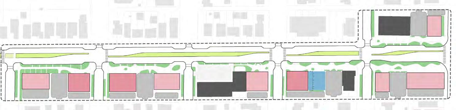
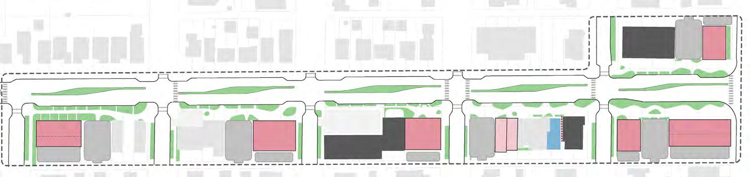
The vision plan is broken into five zones. While the identity and character of the vision permeates the entire corridor, each zone provides a unique experience based upon its context, location, and existing land uses.
The transition from a commercial district back to a predominantly residential corridor to the west.
A business incubation center with coworking and live/work options.
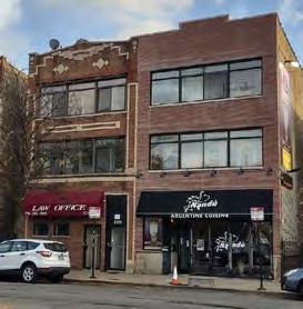
A block anchored by a legacy business and public realm that blends old and new.
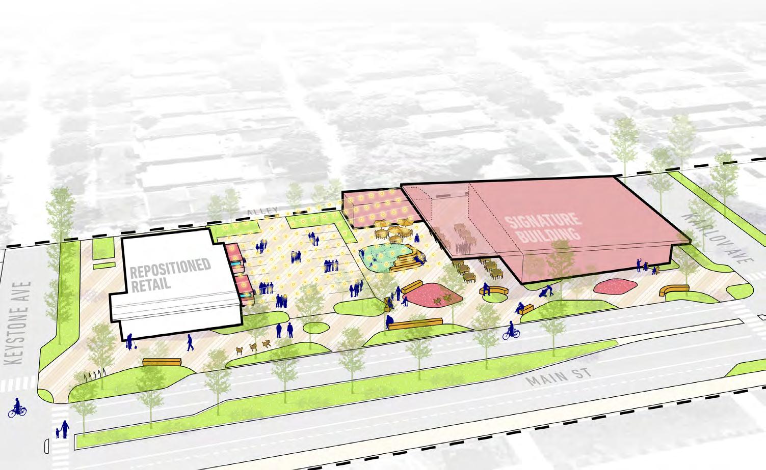
The destination hub with gathering space and an architectural landmark.
The primary entry into the corridor with placemaking, wayfinding, and branding.
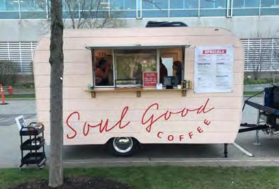
Harness the catalytic investments underway for Zelda’s Catering expansion and Soul Good Coffee.
Existing building reflects historic character and scale.
Gathering Plaza with dynamic lighting, flexible seating, and art opportunities.
Residential parking behind building provided from the alley.
Streetscape plaza provides flexible outdoor dining for new tenants.
Vertical streetscape elements reflect branding and signify the entry into the corridor.
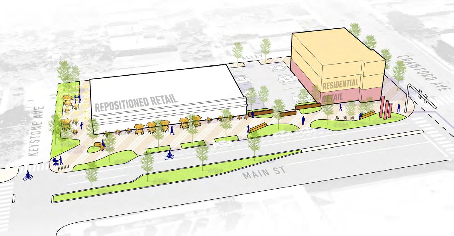
This is the only block on the north side of the street included in the plan. A new building on the corner sets the tone for a vibrant, mixed use corridor. The existing building anchors the block with nostalgic architecture and recent investments in local vendors. A new improved crossing connects the block across Main Street to the rest of the active corridor.
Opinion of Probable Cost
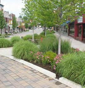
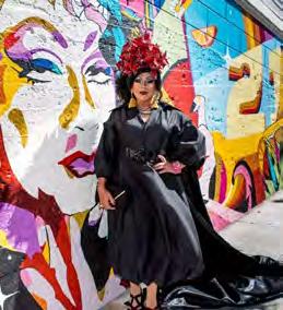
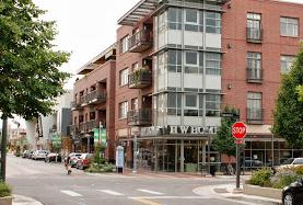
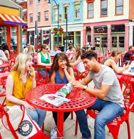
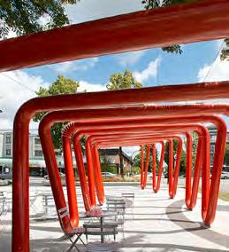
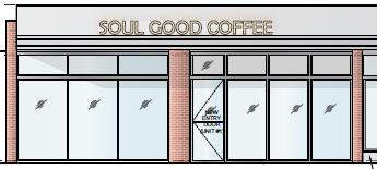
Table 1: Preliminary Opinion of Probable Costs reflect 2024 Pricing. Projects shall be formally priced and evaluated during subsequent phases of design. Costs assume single mobilization.
Interactive artwork and streetscape elements energize the gateway.
Opportunity for a larger retailer at more
Seating and landscaping pull people into the corridor and invite lingering.
The southern block at Crawford and Main is an entry point to Main Street. A taller building anchors the corner and establishes a gateway into the reimagined corridor. The continuous streetscape plaza announces that this is a special place and entices neighbors and visitors to linger and connect.
Opinion of Probable Cost
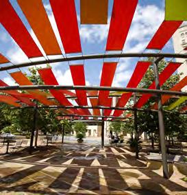
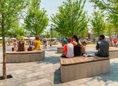
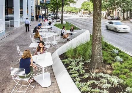
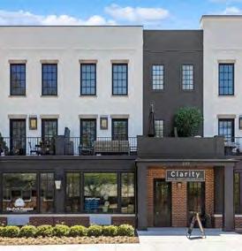
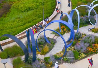
Table 2: Preliminary Opinion of Probable Costs reflect 2024 Pricing. Projects shall be formally priced and evaluated during subsequent phases of design. Costs assume single mobilization.
Gathering space and destination use require higher parking ratio.
Parking lot designed for flex use as plaza for larger events.
Existing building reflects historic character and scale.
Potential for small pop-up building or feature wall to screen alley parking.
Mix of light fixtures creates inviting ambiance.
Signature architecture can play off the mid-century context of the corridor.
Mix of fixed and movable seating supports different activities.
Streetscape plaza extends into the gathering plaza, using landscaping, hardscaping, and interactive art to define spaces.
The central location is envisioned for a gathering plaza and signature redevelopment. The plaza can host pop-up markets supporting local makers or be a meeting place for neighbors to connect on weeknights or weekends year round.
Opinion of Probable Cost
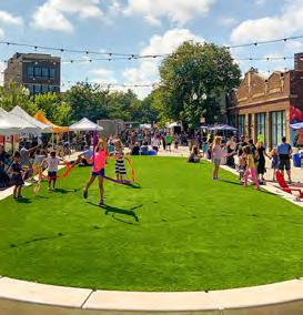
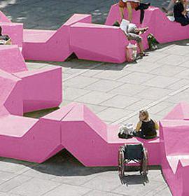
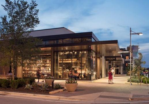
Table 3: Preliminary Opinion of Probable Costs reflect 2024 Pricing. Projects shall be formally priced and evaluated during subsequent phases of design. Costs assume single mobilization.
Public Art Opportunities
New Benches
linear feet of seatwall
Potential expansion of Zelda’s Catering or incubation of food uses.
space.
Streetscape plaza blending together outdoor dining, seating, lighting, and interactive art.
Retain existing property demonstrating catalytic investment.
Streetscaping to improve separation between vehicles and pedestrians.
This block leans into the existing success of Zelda’s Catering, a thriving business anchoring the Main Street neighborhood. Public realm improvements build upon recent private investments. Redevelopment opportunities could expand successful businesses or generate like-minded food service business incubation.
Opinion of Probable Cost
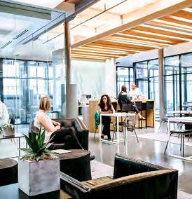

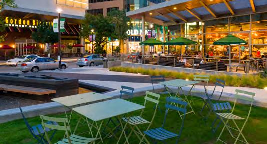
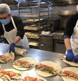

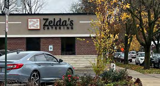
Table 4: Preliminary Opinion of Probable Costs reflect 2024 Pricing. Projects shall be formally priced and evaluated during subsequent phases of design. Costs assume single mobilization.
High Visibility Crosswalks
28 Bike Racks 4 per block, min.
Ground floor spaces can be subdivided into small retail spaces to support local makers or business incubation.
Shared parking lots can incorporate permeable pavers and EV charging.
Residential parking provided from the alley.
Ability to develop as live/ work townhomes.
Bike racks makes it easy to arrive by bike.
Streetscape plaza provides an extension of interior maker or collaboration space.
Low walls and landscaping screen the parking lots, accessed from the alley.
The Hive
Envisioned for full long-term redevelopment, this block fully embraces the “Make It On Main” vision. New development brings energy with a mix of residential and ground floor commercial space which can be subdivided into small business incubators or maker spaces for local artisans. There’s always energy humming at The Hive.
Opinion of Probable Cost
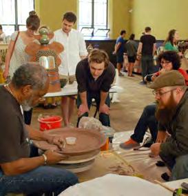
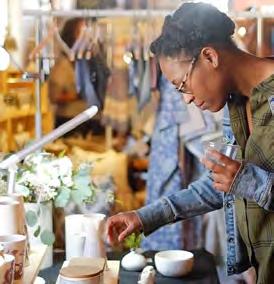
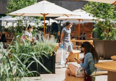
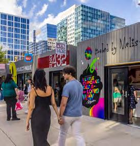
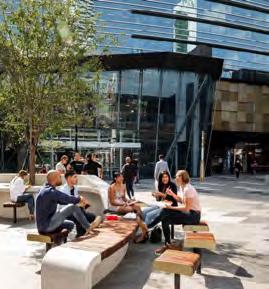
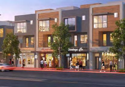
Table 5: Preliminary Opinion of Probable Costs reflect 2024 Pricing. Projects shall be formally priced and evaluated during subsequent phases of design. Costs assume single mobilization.
Increase in public realm Tree Canopy
& screening
If additional height is needed for a viable development, upper floors should step back to appear lower from the street.
Shared parking lot supports retail uses and residential visitors.
Reduced curb cuts improve safety and increase parallel parking.
Alternative for townhomes or mix of street-fronting townhome units and rear flats.
Private front gardens transition corridor from commercial to residential.
As the commercial corridor transitions to its residential surroundings the streetscape plaza gives way to more landscaping, buffering garden units from passersby. Connectivity improvements at Tripp facilitate safe access to the nearby elementary school.

Opinion of Probable Cost
Table 6: Preliminary Opinion of Probable Costs reflect 2024 Pricing. Projects shall be formally priced and evaluated during subsequent phases of design. Costs assume single mobilization.
32,000 sq. ft. of Native Planting
The holistic vision for “Make it on Main” provides a vision that may be realized incrementally over time as parcels become available candidates for redevelopment. Strategies for facilitating this incremental change are broken into three sequenced phases: short-term, mid-term, and long-term.
The diagram below provides a vision for an anticipated redevelopment timeline. It is expected that this vision continues to evolve over time to respond to opportunities as they arise.
While not every parcel will be developed as depicted in the plan, this envisions the potential, helps grow interest in Main Street reinvestment, and injects new ideas and energy to the corridor.
Short-Term (0-5 years): Vacant, lack of recent investment.
Mid-Term (6-15 years): Existing businesses operating, unknown duration.
Long-Term (16-20 years): Recent/current/pending investment or newly established business.
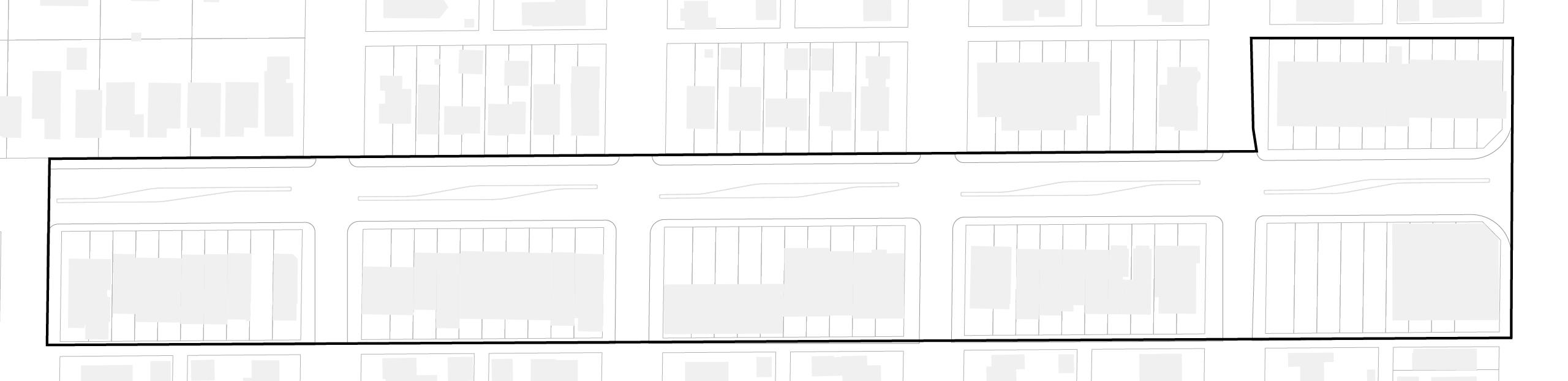
Figure 29: Diagram of potential redevelopment sequencing.
Before diving into redevelopment, the Village should take enabling actions to pave the way for a smooth and successful implementation. The following list provides an overview of enabling actions to take place before the phased actions can occur.
Organizing & Activating
Working Group
Establish a Village led working group to review and complete zoning and administrative changes.
Operational Changes
Consider operational changes needed to support redevelopment.
Activation Strategy
Create a strategy for activating and programming 30’ setback as public space, maintained by the Village.
Standards & Guidelines
Explore the viability of rezoning commercial corridor as Nx Neighborhood Mixeduse.
Development Standard
Establish a development standard to maintain the existing 30’ building setback.
Design Guidelines
Develop Architectural Design Guidelines specific to the Main Street Commercial Corridor.
Landscape Plan + Guide
Develop a Landscape Master Plan and style guide for a cohesive, incremental implementation of public realm spaces.
Funding & Support
Evaluate the potential of creating a Tax Increment Financing (TIF) District to funnel property tax increment towards public improvements or private development incentives.
Special Service Area
Consider the development of a SSA to support maintenance and other on-going costs.
Explore subsidies for artist/ gallery/coworking/incubator spaces to foster a community of artists and entrepreneurs.
Business Expansion
Work with compatible existing local businesses to facilitate expanding to new locations within the corridor.
Consider expanding existing storefront enhancement programs to include interior tenant fit-out/enhancement funds.
Entrepreneur Support
Explore programs to subsidize rent for small businesses.
Identify and connect with local institutional partners who may support the efforts to realize the plan’s vision.
Short-term opportunities build upon the current momentum along the corridor. These investments demonstrate commitment to this exciting vision and build energy to spur further investment.
In addition to capital investments, the Village should partner with existing property owners to pilot improvements that merge the public/private realm.
Existing Building to Retain
Existing Building, New Activation
Meetup on Main Plaza
Permanent Improvements
New Parking
New Landscaping
Work with property owners to obtain easements for landscaping and non-vehicular access within the setback.
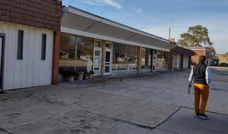
Work with property owners for modest improvements to facades, signage, and landscaping to bolster businesses in existing storefronts (4000- 4010 Main).
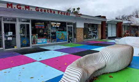
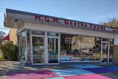
Acquire property at 4039 Main Street. Activate vacant storefront as an art gallery/ space. (This property has residential units at the rear.)
Acquire vacant properties at 4049 and 4051 Main Street. Activate as small business incubator.
Acquire property at 4141Main and 4143-4149 Main Street .
Remove structures. Construct a permanent shared parking lot and adjacent interim plaza space.
Commission wall-mounted art, designed for long term relocation.
Install public realm landscaping in front of properties to remain and in coordination with redevelopment.
Construct new curb extensions. Reconstruct side street curbs.
Purchase and deploy street furnishings.
Benches, receptacles, bike racks that can be removed/ replaced in future phases.
Develop a program for movable furniture managed by businesses each season.
Refresh median plantings with new or additional native, drought-resistant and salttolerant plants.
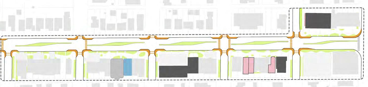
Figure 30: Diagram of short-term implementation.
The mid-term sequence looks to redevelop lots currently housing existing businesses looking to turn over or relocate.
Private redevelopment will include implementation of the public realm streetscaping vision. Some redevelopment, such as shared parking lots, might be in partnership with the Village. This sequence also looks to implement permanent public infrastructure changes to enhance connectivity improvements, piloted in the previous phase.
Redevelop 4000- 4010 Main Street.
Redevelop 4001 Main Street (CVS) block.
Acquire 4041 Main Street.
Remove structure with 4039 Main Street.
Relocate and expand interim plaza.
Commission mural for west wall at 4035 Main Street.
Continue small business incubator at 4049 - 4051 Main Street.
Acquire 4055 Main Street. Remove structure and create interim parking lot.
Zelda’s Catering expands at 4101- 4107 Main Street.
Redevelop 4131- 4143 Main Street.
Redevelop 4213- 4225 Main Street.
Existing Building to Retain
Existing Building, New Activation
New Building
Meetup on Main Plaza
New Parking
Previous Phase Landscaping
Long-term opportunities bring the complete “Make it on Main” vision to life. Sequencing includes redevelopment of properties currently seeing new businesses established; properties that may take longer to aggregate for redevelopment; or redevelopment that might take longer to find the right anchor tenant.
Private redevelopment will include full and complete implementation of the public realm streetscaping vision. Some redevelopment, such as shared parking lots, might be in partnership with the Village.
Replace interim plaza with permanent shared parking lot.
Develop signature building and gathering plaza space.
Redevelop 4151- 4159 Main Street.
Redevelop 4201- 4207 Main Street.
Reconfigure medians with long term water/sewer main work.
Existing Building to Retain
Previous Phase New Building
New Building
Meetup on Main Plaza
New Parking
New Median/Landscaping
Previous Phase Landscaping