

Yijun Zeng
Ph.D. student, Landscape Architecture
Associate director, LEAM Modeling Systems Laboratory
yijunz4@illinois.edu
Dr. Brian Deal
Professor, Landscape Architecture
Director, LEAM Modeling Systems Laboratory deal@illinois.edu
Aguada Jessica
Landscape Architecture
Alonso Alex
Landscape Architecture
Burkard Grace
Landscape Architecture
Deng Feng
Landscape Architecture
Forman Kylie
Landscape Architecture
Hernandez Jose
Landscape Architecture
Emma Quiroa-Crowell
Landscape Architecture
Ruiz Julian Matthew
Landscape Architecture
Kang Sean
Landscape Architecture
Lin Long
Landscape Architecture
Miller Kevin Landscape Architecture
Omori Momoko
Landscape Architecture
Perez Erik
Landscape Architecture
Phillips Rabang
Landscape Architecture
Salcedo Eneyda
Landscape Architecture
Slater Levi
Landscape Architecture
Tong Anne
Landscape Architecture
Austin Schiff
Landscape Architecture
Dynamic interactions between the patterns of human and natural/urban landscapes require ever more sophisticated solutions from both scientists and designers. This class explores such solutions through the lens of landscape architecture by integrating analytic (scientific) approaches with design and calls for ‘Evidence-based Design.’
This studio explores complex urban systems that are nonlinear, uncertain, and unpredictable and how landscape designers might deal with these progressively more complex problems.
This studio pursues a variety of approaches (environmental resilience, sustainable development goals, ecological design, etc.) to facilitate cross-scaled and cross-disciplinary design processes in support of contemporary landscape architecture. This studio aims to integrate both scale (larger scale to smaller) and evidenced base design (scientific analyses with design creations) in to studio design outcomes.
This studio will roughly follow the process and approaches of Geodesign. Geodesign is an emerging concept to facilitate the negotiation/collaboration between geospatial analysts and designers and to develop advanced decisions by forecasting possible futures (designs) and assessing real-time impacts.
This studio looks for beyond-areas of Geodesign. Your learning will not be limited to Geodesign’s negotiation process but be extended to theories, methods, and techniques for urban system science though lectures, discussions of readings, lab sessions, analyses, and design practices. Through systemic analysis and collaborative design, the essence of the studio is to rethink creative design processes and how to “remake” our world through evidence-based design within the context of a rapidly changing urban environment.
Module 1 and Module 2
Developing Design Philosophy: Learn theories of urban resilience and equip the related geospatial techniques
Module 3
Comprehensive Regional Analysis and Assessment: Apply the techniques to regional explorations. Assess and model contextual resilience scientifically.
Module 4
Scaling Down to the Local: Find specific goals and issues based on analytic results and objective evidence. Develop design schematics with scenario-based approaches.
Module 5
Performing Systemic Design: Develop “evidence-based” master plan reflecting the systemic findings (philosophies, evidence, and methods).
MODULE 1 + MODULE 2


Date: Aug 22 - Sep 28




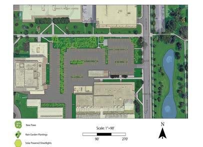
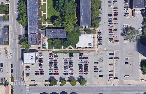
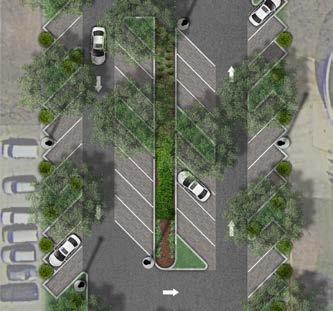
Based heavily on the analysis of existing conditions and systems, this renovated parking lot master plan proposes solution-based design decisions that focuses on correcting existing issues. Some of the issues addressed include water runoff, high-temperature surfacing, and impervious pavement. Solution capacities were calculated to confirm that goals were met.



Alex Alonso
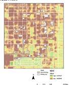
The focus of this redesign sketch problem was to increase the runoff management, lowering the heat island effect of the site, and increasing the overall natural components of the site. Analysis such as surface water runoff and NDVI were a main driving force of this design.


Feng Deng


From the light analysis graph in the parking lot area, I knew that there were missing lights in those places, so I added more than 30 solar lights in the parking lot. Solar lights can also save a lot of energy.

Kylie Forman

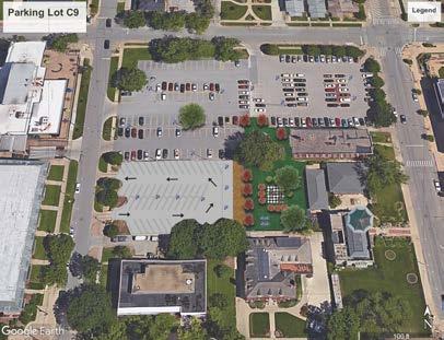
Evidence-based design gives designers a greater understanding of how their design will function. The design for the Temple Hoyne Buell Hall parking lot extends the South Quad while providing a greater amount of ecosystem services to the surrounding area. The site is currently situated in an area with ample parking to the deficit of the environment.
 Grace Burkard
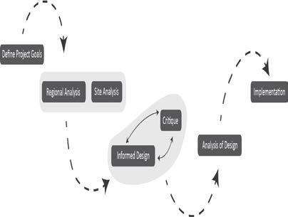
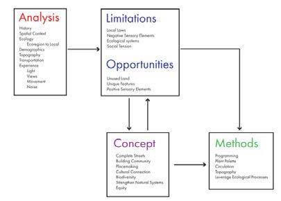
My design approach involves first defining the goals of the project. It is important to decide what the priorities are, so there can be a clear focus for the design. Next, analysis provides context and exposes conditions and problems that the design can adress. Next, the creation of an informed design is followed by critique and this cycle continues. Next, the design needs to be analysied to determine if meets the goals.

Jose Hernandez

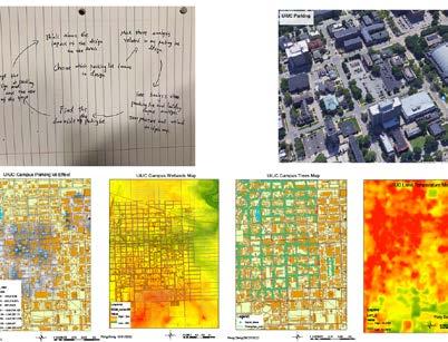
This design was meant to solve multiple issues in a parking lot at UIUC. The issues were targeted from data maps that were produced about the site. Issues were the lack of green, the area was impermeable, and there was a heat island. To solve those issues a lot of vegetation was added, including large shade trees, and permeable pavers were added to the site.





 Kevin Miller
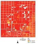
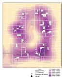
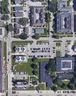
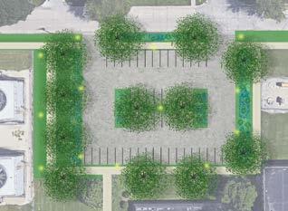
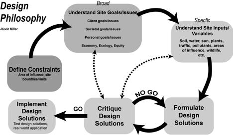
This design was aimed at solving multiple issues with the site. Impermeable pavements make the site flood prone. I propose permeable pavements on parking spots and a stormwater bioswale. Another issue with the site is a low NDVI value. To aid this issue I propose parking lot islands with large shade trees. All of these decisions were guided by my design philosophy.

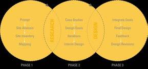
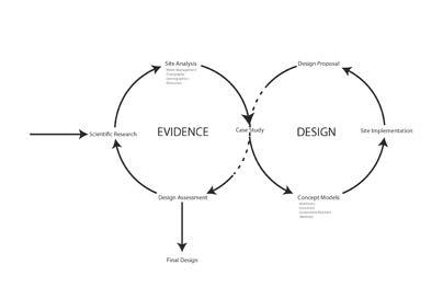
My philosophy diagram begins by gathering data and evidence. There, I carry out qualitative and quantitative research while analyzing the historical, environmental, and social requirements of the place. After the design is finished, I monitor users, gather input from knowledgeable practitioners, and assess the design’s impact. In order to further enhance the design, it then circles back to the evidence-gathering stage.
 v Erik Perez
This design is meant to mitigate stormwater runoff to prevent flooding while creating an aesthetically pleasing rest area. The area was surrounded by a lot of residential and commercial area and therefore decided to incorporate seating for the people in the surrounding area. The parking lot now contains permeable pavers and a lot more vegetation to lower sotrmwater runoff.
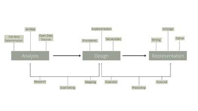
Emma QuiroaMy design approach involves three major steps: analysis, design, and representation. All three of these steps are intertwined by different elements such as modeling and design softwares, research, etc. However, there are also elements that are specific to each step which makes them distinct and definable. This diagram shows how design is not just a straightforward path, but one that has loops and repeats.
 Eneyda Salcedo
The sketch design proposal is the E-2 parking lot between the Education Building and Temple Hoyne Buell Hall on campus. The design works towards reducing the surface runoff and temperature with the use of vegetation by implementing rain gardens as well as transforming the surface to be pervious.
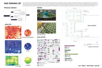


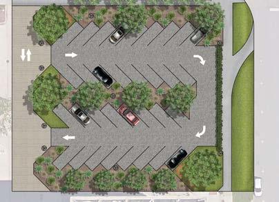
 Anne Tong


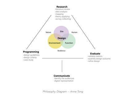
The design philosophy diagram framed a triangle with the design being placed in the center. The successful design, in my opinion, should be able to balance the need of humans and nature, be site-specific, as well as has its ecological function. Research, programming, evaluate empowered the design with more scientific approaches. Being able to quantify the impact could help to refine our design.
MODULE 5
Performing Systemic Design
Date: Nov 4 - Dec 9
MODULE 3
Regional Analysis and Assessment
Date: Oct 03 - Oct 17
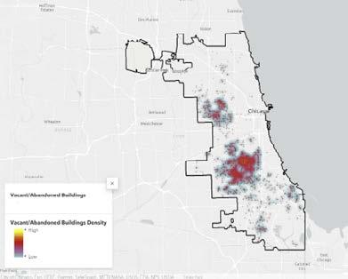
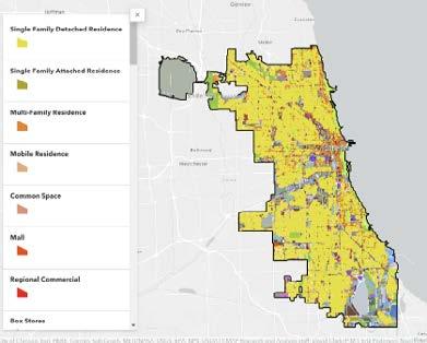
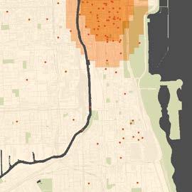
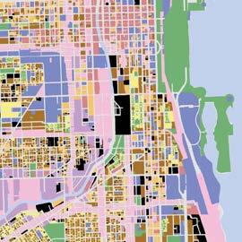
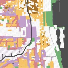
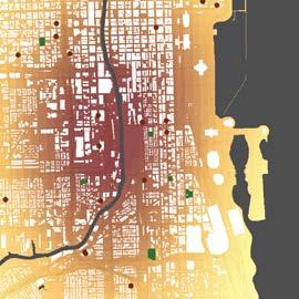
To better understand the development of the 78th Neighborhood project, we analyzed the surrounding environment’s land use and different factors affecting climate change. By studying the surrounding area, we can get a better understanding of how to coexist with and better the existing built environment. This analysis focuses on a variety of factors such as zoning, land use inventory, landmark availability, pollution, NDVI, LandSAT, as well as vacant and abandoned buildings. These subjects better our understanding of Chicago as whole in order to properly plan and design an additional development to one of the world’s most popular cities.
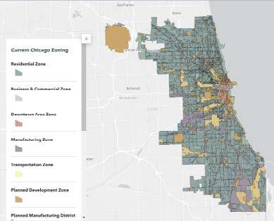
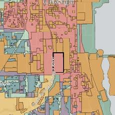
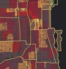
Current Chicago Zoning
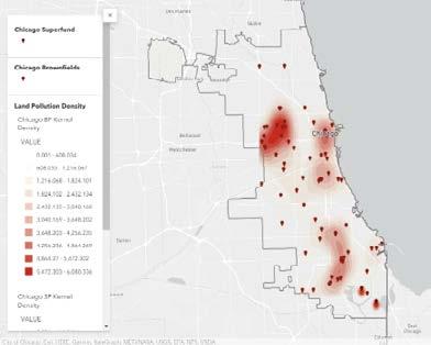
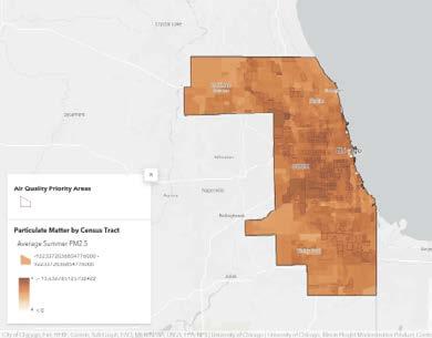
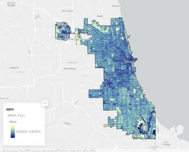
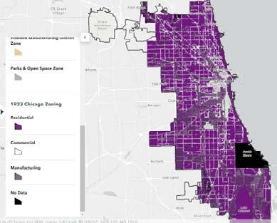
The City of Chicago is one of the world’s most popular cities with so many things to see and do. However when doing further research and analysis into land uses and the climate, it is obvious that there are many things that we as designers need to consider when making plans for renovating or creating additions to this city. All of the factors shown in these maps are important to consider when continuing on in this design process for the 78th Neighborhood project.
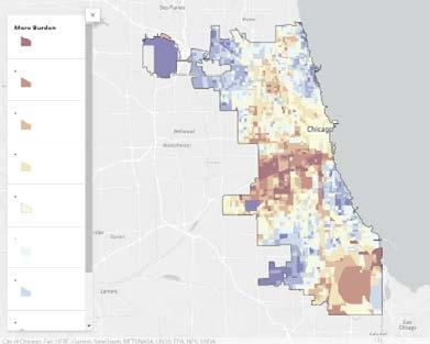
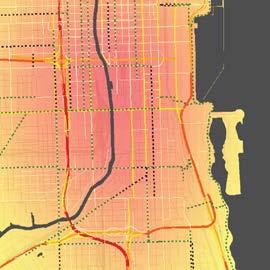
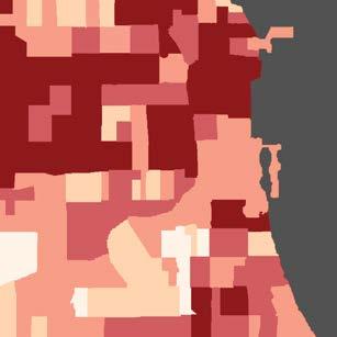
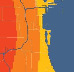
Areas in the dark blue experience the least burden while areas in the dark red experience the most. This map not only shows how high levels of different pollutants create different levels of burden for different neighborhoods, but it also shows just how drastically different the environmental burden is for areas such as South Chicago and Brighton Park when compared to areas such as Lincoln Park. This map shows the lack of environmental justice not just for lower-income communities, but also minority communities in the City of Chicago.



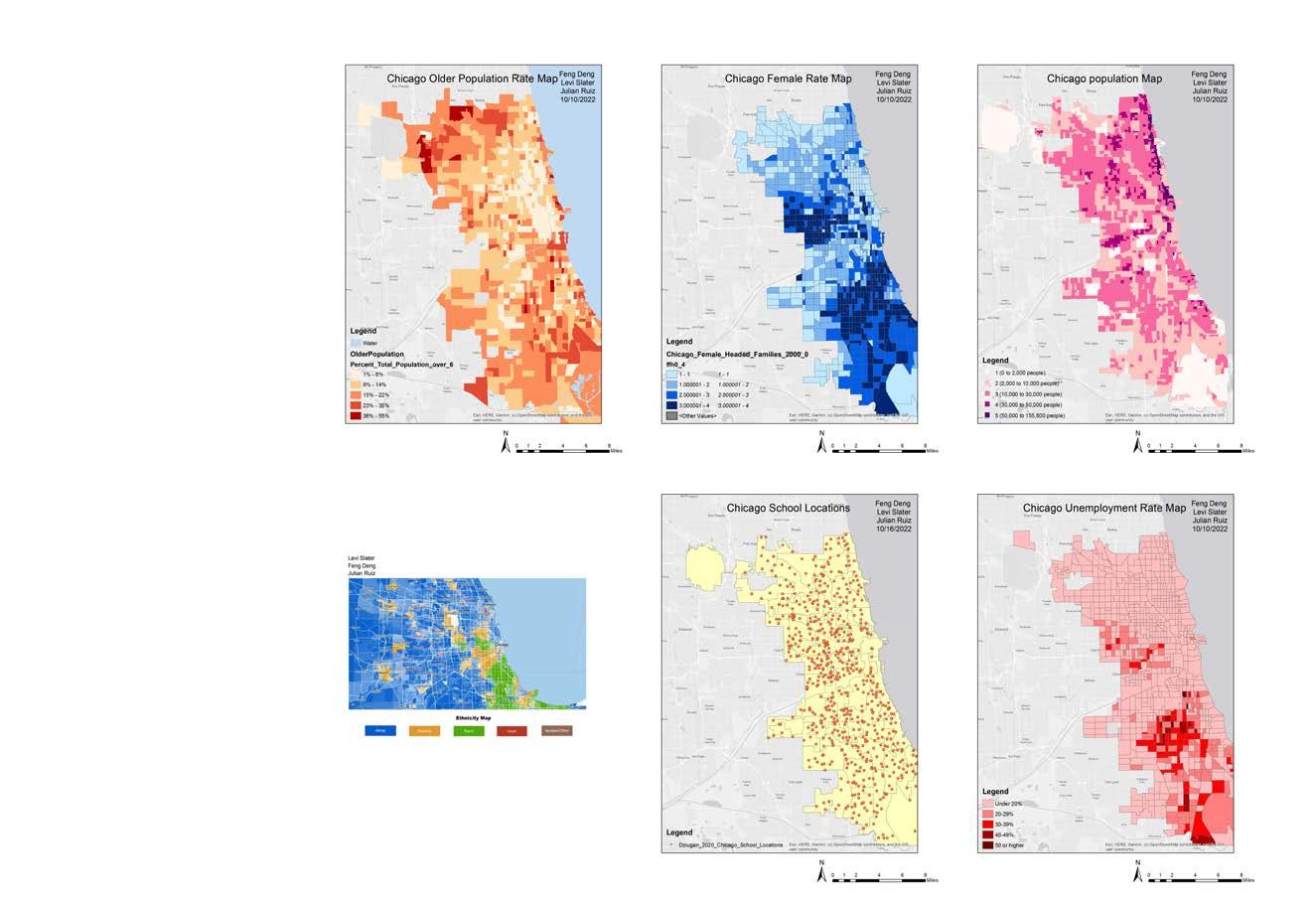
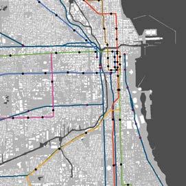
The city of Chicago has developed its transportation over the years in its attempt to make it accessible for those who reside within the city as well as those on the outskirts of the city. Several modes of transportation that the city offers includes walking, biking, driving, or taking public transportation such as the CTA buses and trains. Through this analysis, we hope to extract information for each mode of transportation in the city to help further our understanding on the transportation accessibility.
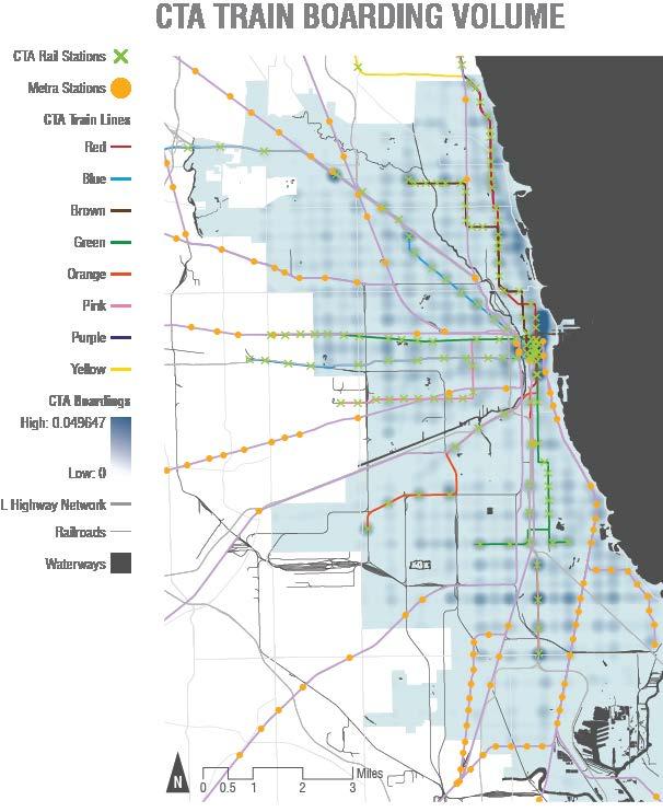
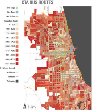

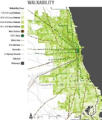

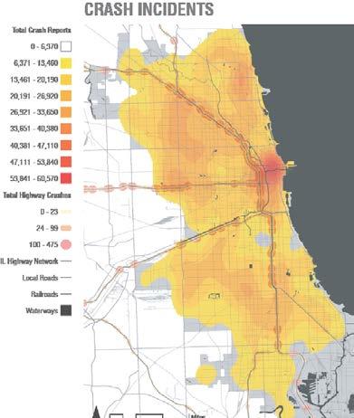
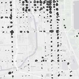
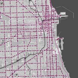
The City of Chicago walkway system provides the most walkable areas within the downtown area, where a multitude of transit stations are provided, employment diversity is high, and households are nearing capacity. The Divvy bicycle system is more frequently used in the downtown Chicagoland area, as well as the Northern Part of Chicago. The traffic congestion is primarily located along the highway infrastructure heading towards the center of the city. Additionally, the crash incidents reported are dense along the highway and the Loop where the heart of downtown is located and filled with high traffic congestion.
Crash Incidents, Source: Illinois Department of Transportation
There are few areas missing bus stops with the most located in downtown. Also, many area are missing bus shelters in the city of Chicago but the bus routes do travel fairly throughout the city. Creating new public train lines would be too much even though they do not seem to be fairly distributed. However, providing more CTA and Metra stations in areas that lack train transit would help people access the train faster in certain areas. The heat map shows where people board the train often and the downtown area is where the trains are boarded the most.
Our group worked on the geography and water conditions of Chicago. These are two conditions that are critical in the design process. With the results of this study, we may utilize the analysis results, particularly in terms of sustainability, to further explore creative techniques for water conservation; we can also use the elevation and land cover information to identify high floodrisk locations and figure out how to establish a more resilient environment in Chicago. From what we know about permeability and runoff we can help reinforce designs focused on ecological stormwater management to help reduce downstream impacts and maintain healthy rivers for public use.


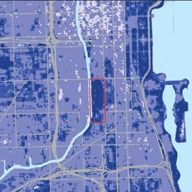
Both the Runoff map and the Watershed map are generated using digital elevation map (DEM) data. Using the raster calculator tool to apply formulas to calculate the curve number and average precipitation in June, the darker blue to lighter blue in the runoff map indicates higher runoff to lower one. The watershed in the Chicago region is represented by the magenta lines on the watershed map.
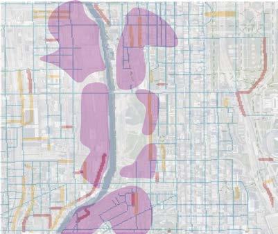
The Flood Susceptibility Map is developed based on multiple criteria decision analysis: topographic wetness index, elevation, slope, land use and cover, NDVI, distance from water and roads, and drainage density. By rating importance by giving 0-100 points to those criteria(Analytic Hierarchy process), the red on the map represents zones that are most susceptible to flooding. On the other hand, green represents the low food risk area.
a. AVERAGE JUNE RUNOFF; Source: USDA Natural Resources Conservation Service
b. FLOOD SUSCEPTIBILITY MAP; Analytic Hierarchy process
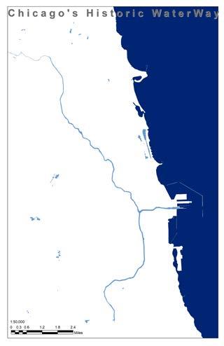
d. HISTORIC WATERWAY; Source: Chicago Data Portal


Both the historic and current waterways were sourced from the Chicago Data Portal. The historic waterway shows how the flow was naturally towards the lake and the basin was quite small. But in 1900 the river was connected through a channel to the Des Plaines River and the flow was reversed this was aimed at tackling the sewage issue of the lake and rivers. But this caused a number of issues over the next century when flooding occured. To fix these issues Chicago has spent billions of dollars in infustructure projects.
b. CURRENT WATERWAYS; Source: Chicago Data Portal
c. WATERSHED; Source: ISGS, 2003
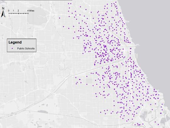
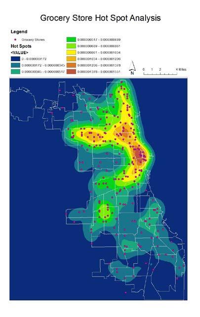
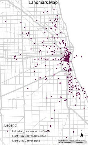
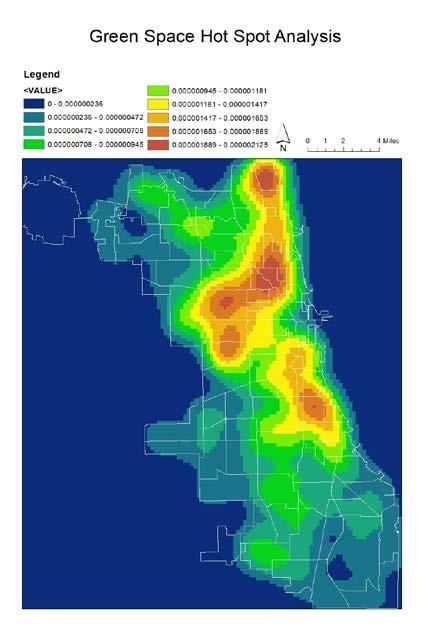
In this module we set out to map the cultural ecosystems of Chicago. To do this, Grace analyzed the grocery store hot spots and green space hot spots. Ashley mapped out the popular Chicago landmarks. Rabang mapped out the sports stadiums, public schools, museums, and art galleries. Each of these topics reflects specific aspects of Chicago’s cultural ecosystem, and helps paint a picture of the vibe of Chicago.
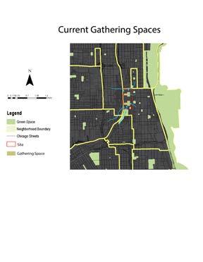
On the map you can see that most of the landmarks tend to cluster along the river and reach a peak near the Loop. So we can assume that this is the place where people tend to gather.
The green space hot spot analysis map shows the areas in Chicago that have high amounts of green spaces. Green spaces have established links to mental health, so the presence or absense of green space influences the city’s culture.
The grocery store hot spot analysis map shows where grocery stores are found throughout Chicago. The purpose of the hot spot analysis is to expose areas that can be considered food deserts, through their lack of accessibility to grocery stores. A neighborhood’s food culture has health implications for its people, and is very important to recognize, and remediate any disparities.

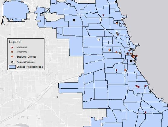
The concentration of Sports stadium and potential venues were mostly in the inner city. This is important because the different communities get to come together to experience events and there can be a diverse range of people participating in one common shared Chicago cultural experience.
There is a fair spread of public schools spread across the different neighborhoods in Chicago. These schools have resources, facilities, sports teams, and events that bring the smaller local communities together and it is a rite of passage for the urban city children.
Art and History of Chicago are staple of this city, and this can be confirmed by the various art galleries, and museums. They can mostly be found in the inner downtown neighborhoods, and some in north side Chicago. But there is not the desired spread of art galleries and museums.
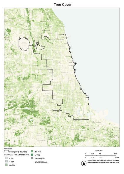
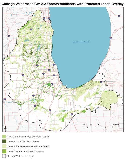
In order to get a better understanding of the ecology in the Chicago area we had to identify important elements such as tree cover, natural areas, and other forms of greenspace such as green roofs. By knowing where all the natural and green space is in the city of Chicago, we were able to identify areas with potential ecosystems. We discovered that it ranged from prairies to wetlands and even some forests. After analyzing all the maps we created or found through research, we came to the conclusion that the city of Chicago was lacking green space. Just looking at the NDVI map we created we could see the lack of green space the closer you got to the heart of the city and we wanted to make sure to change that. We wanted to ensure that our future designs have diverse ecosystems and the first step is to introduce more vegetation.
The very small amout of greenspace in Chicago seems disconnected from each other. There are a few protected land spaces such as forests and woodlands near Chicago but none exists within the city. We want to invite those existing ecosystems into the Chicago area to create a more biodiverse city that can sustain various ecosystems.

Chicago Wilderness (retrieved from https://hub.chicagowilderness.org/documents/giv-2-2-forest-woodlands-and-protected-lands-2013Ch/explore)
MODULE 4
Specifying Desgin Methods
Date: Oct 17 - Nov 07


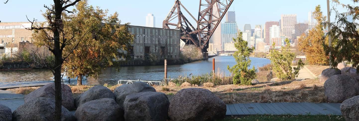
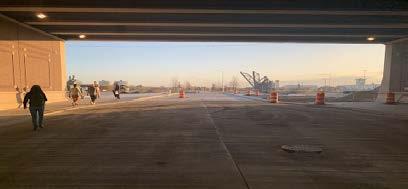
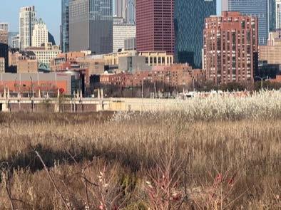
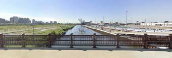
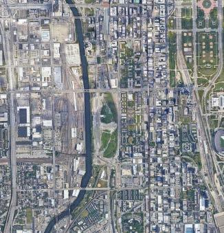
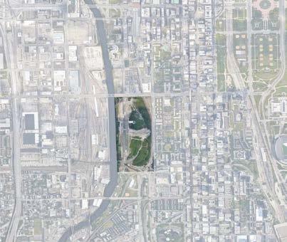
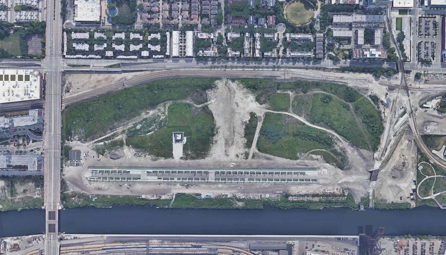
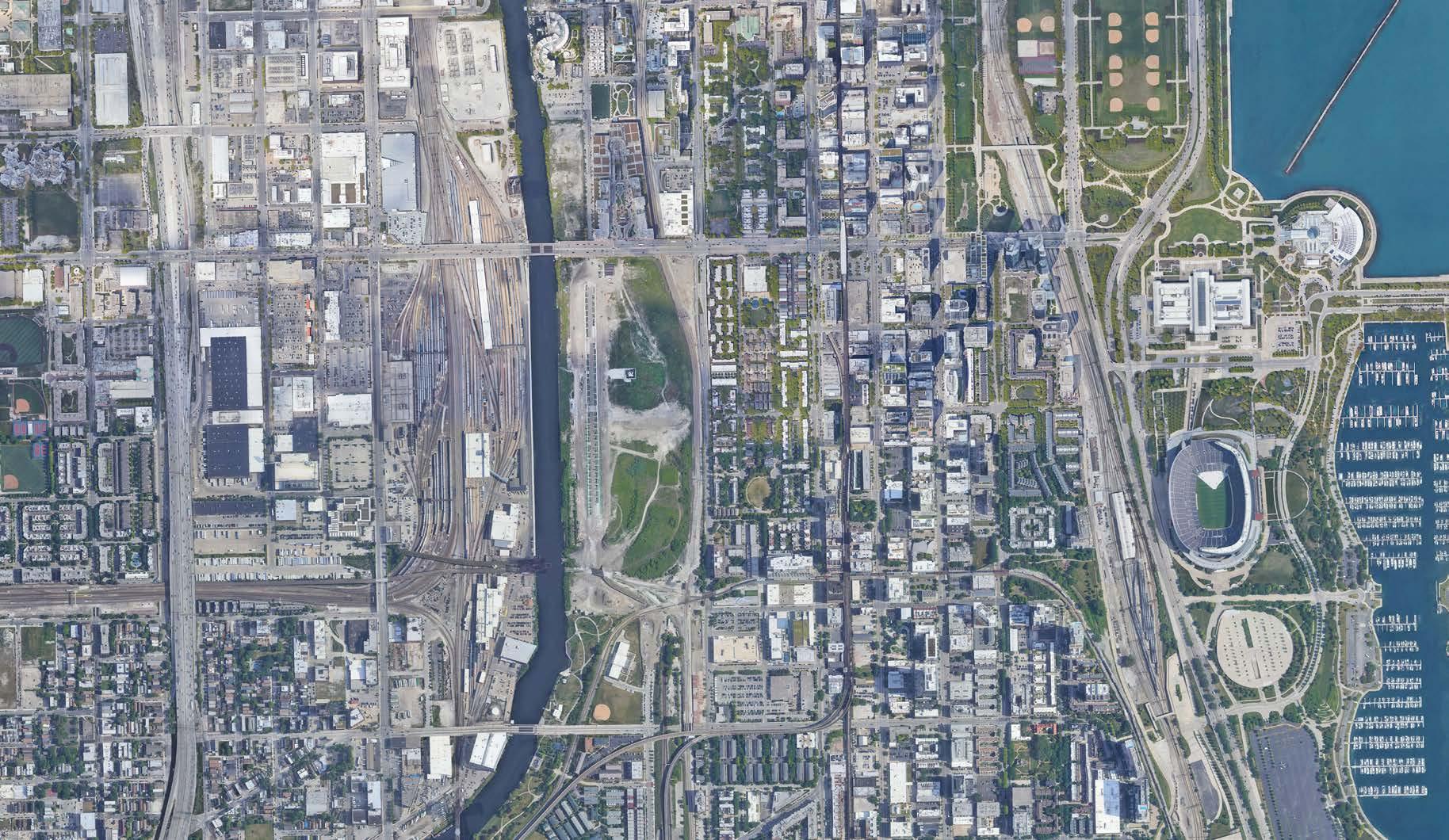
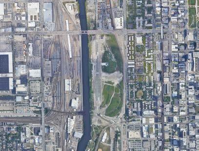
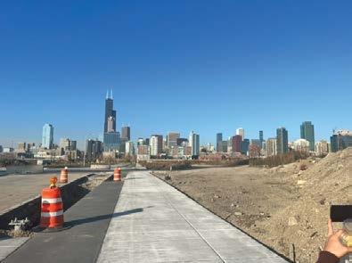
The City of Chicago is constantly changing, evolving and comes with a rich architectural and environmental history. The 78th Neighborhood is a portion of Chicago that is not yet developed in the heart of the city, a few minutes from Chinatown. This area is currently physically inaccessible to Chicago residents, with a large area of gravel and weeds surrounded by large walls, Ping Tom Park, and the river. This space has a lot of potential as an addition to the city and could solve many of the different issues currently threatening the health and wellbeing of Chicago residents. The four major problems our group identified that this area faces the most are connectivity, land use, ecology, and pollution. With this design, the 78th neighborhood of Chicago could help solve and mitigate many of these issues.
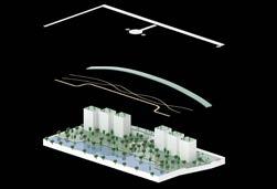
The schematic model of this site seen to the left shows the conceptual design of this space in response to the different problems highlighted. As seen, this plan shows a river expansion as well as the incorporation of different green islands. These islands serve a few different purposes. To begin, they add an additional site interest for residents of Chicago and create pocket parks for people to explore and walk through. In addition to this, these pocket parks will be planted with different species of plants that help to filter and clean polluted water. These island parks will help to improve the overall quality of the Chicago river while creating a beautiful space. The river walk will also be expanded through this site to provide a beautiful walking path that passes through the site as well as parallel to the floating island parks. In addition to this river walk, the majority of the site consists of a open green space with different paths throughout. This will help to eliminate the heavy impermeable surface ration in the city and bring better access to green space for different residents. For access to this site, our plan eliminates the large walls that currently enclose the space and instead incorporate a plaza that provides direct access from the street above to our site below. Across our entire site is a large continuous green roof that connects eight buildings as well as creates an overpass to the additional street providing car access to our site. This continuous green roof will act as a large pedestrian pathway and create a large landmark interest in the city. It also provides a lot of ecological benefits with different planting beds and tree species. An additional 6 high-rise buildings will also be incorporate into the site with full green roofs on top. These will help to provide affordable housing to the residents of Chicago, further bridging the gap between poverty classes in the city as well as create green spaces on areas of impermeable surfaces. These buildings will also house vertical gardens that will help to “greenify” this space and create a visually appealing addition to the city of Chicago.
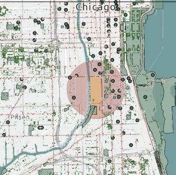
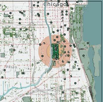
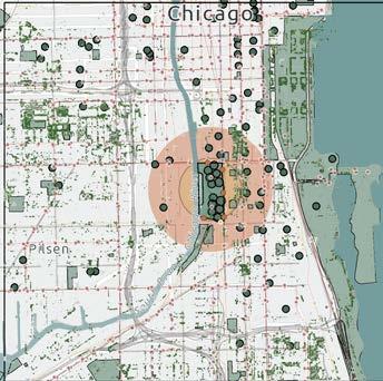
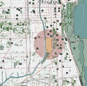
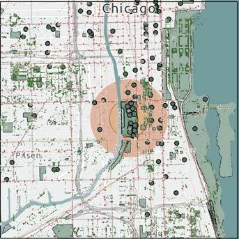
Overall this design will be further developed to show different key elements we plan on incorporating into this site. This development will help to solve many issues present in the city of Chicago today and create a better city for tomorrow.


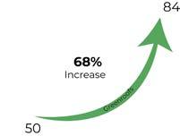
Our adapter scenarios show how the site and it’s surroundings will change over the years as our design is implemented. The first set of early adapters considers these changes if they are implemented now while the second set of late adapter sets consider these changes if they are implemented by 2035. A major change that occurs over the years includes the pollution and water quality in the Chicago river that runs by the site. Our plan is to implement small floating islands with plants that help to filter our pollutants. In total the roots of these plants will help to filter roughly 90% of the pollutants (heavy metals) found in storm water runoff. Another major change in the site is the number of trees. In our plan, we increased the number of trees by roughly 1000%. Currently there are roughly 20 small plants and trees on the site and our design incorporates over 200 different trees throughout. For the early adapter scenarios, if the trees are planted in 2022, the canopy will be relatively sparse in 2035 and will grow significantly by 2055, creating a dense canopy throughout our park area. This will help to reduce overall land temperature as this green space and tree coverage will reduce paved surfaces which attract and hold more heat than permeable surfaces. The walkability of this area is very poor as it is surrounded by large walls and creates a hard to reach area for Chicago residents. Our design shows how the walkability increases significantly with the addition of our entry plaza. We also incorporated bus and train stops on the site as well as many access points to help improve this walkability index. Every one of our buildings will have a large green roof. We also plan on incorporating a continuous greenroof over 8 buildings that not only holds the value of a traditional greenroof, but also creates a pedestrian pathway while showcasing different planting beds and trees. The addition of these greenroofs will increase those in the area from 74 to approximately 89 with the addition of our continuous greenroof.


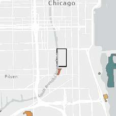
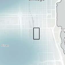
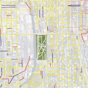
The City of Chicago has an intricate network of transportation throughout the central downtown area, however when it comes to the 78th neighborhood, there is a lack of train lines and bus stops on the site. The nearest CTA train stops are the Roosevelt and Cermak stations. A ground rail line intersects our site, and another to the south, where Amtrak and Metra trains cross in Ping Tom Park. The buses running near our site are the 24 on the east side, and the 12, 18, and 62 on the north.
• Additional bus routes and stops
• Additional train routes and stops
• Increase street network
• Increase pedestrian and bike routes
• Increase walkability
• Additional water travel (water taxi)
• Accessible entrances/exits
• Melting pot
• Buffer zone connecting monteary and racial zones
Chicago is a city renowned for its infrastructure, historical sites, and beautified architecture. Though the downtown area is highly overdeveloped, devoid of many large-scale greenspaces. The natural aspect suffers from low wildlife diversity, low plant life diversity, lack of native plant presence and lack of tree canopy. Maintaining the green spaces created is also an issue, see the condition of Terminus Park to the northwest.
• Increase tree canopy in area
• Green roofs for wildlife expansion
• Vertical gardens
• Diverse plantings
• Focus on native plantings
• Riverwalk expansion - create aquatic and land habitats
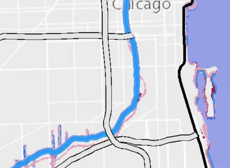
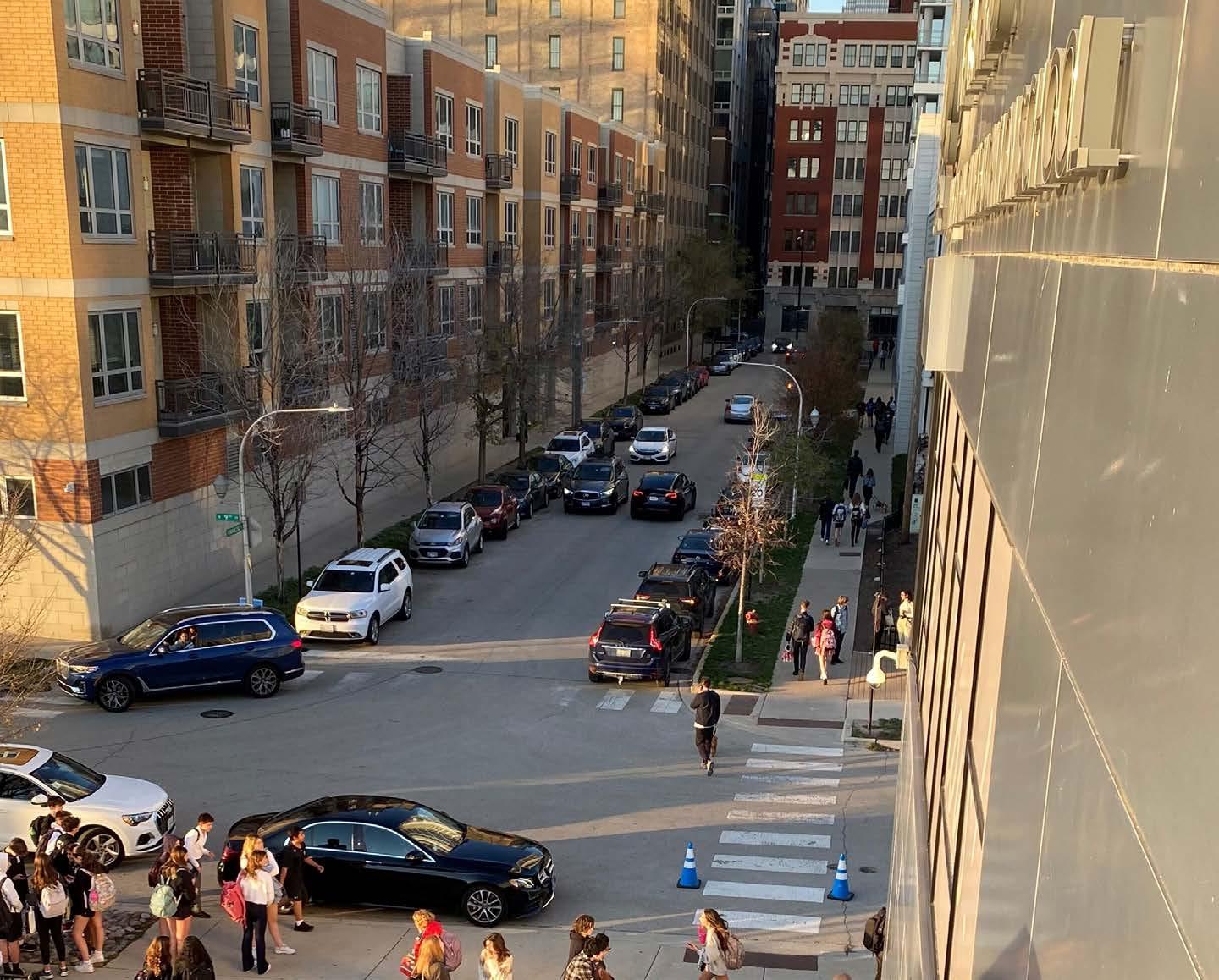
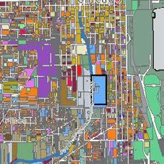
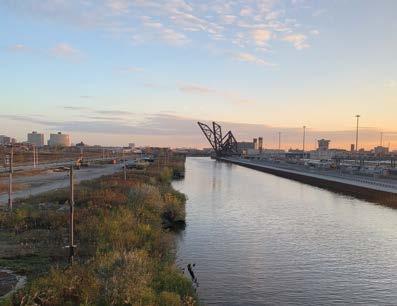
The area around our site includes several different applications. The site itself is a field of grass and unmaintained shrubbery. North of our site is a mall complex with a parking lot and storefronts. West is the river, and a rail car yard full of rail lines. East is a residential area with apartment complexes and an elementary school. The rest of the surrounding area is mostly commercial. There are four small parks within the vicinity as well directly south is Ping Tom.
• Net zero buildings
• Green roofs
• Vetical gardens
• Riverwalk expansion
• Pocket parks
• Keep part of existing greenery
• Create city attractions
• Permeable surfaces
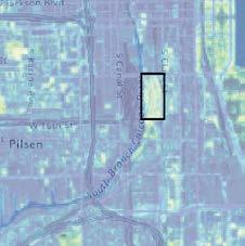
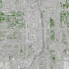
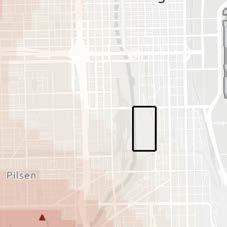
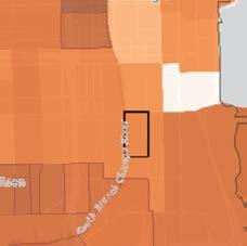
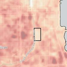
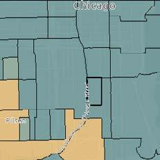
Our area is in the central downtown area which has developed into large skyscrapers, highways, and manufacturing plants. As seen in most major cities, pollution levels in this area are high. However, in comparison to areas all around, our site sees less generally pollution, lower land temperatures, and less water pollution. For the development of this site, we need to ensure to keep these levels lower than the surrounding areas. As well as deveop in a way that helps mitigate pollution rather than contribute to it. There is still substantial pollution present, and we hope to contribute to lowering it.


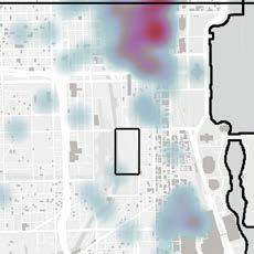
• Net zero buildings

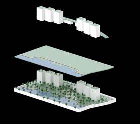
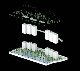
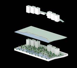
• Solar energy
• Green roofs
• Public transportation options
• (less common traffic)
• Pedestrian and bike focused travel
• Smaller streets
• Increased greenspace
• Permeable surfaces
The 78th Ward is a proposal to create a new neighborhood in Chicago, bordering the Chicago central business district, the Loop, as well as the Roosevelt Expressway and the Chicago River. Analysis using various methods in ArcMap reveals that the site is situated between different cultural areas and income levels, and suffers from pollution and lack of accessibility. Developments are underway to transform this area into a functional neighborhood with businesses, residental areas, green spaces, and transportation systems.
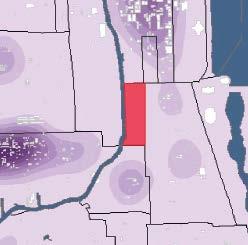
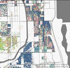
1. Situated between neighborhoods with distinct cultural identities
2. Possible gentrification from residents of North Chicago
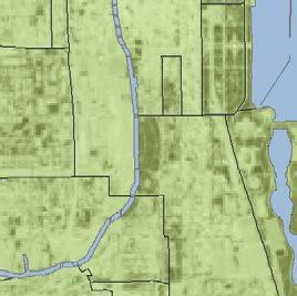


3. Lack of accessibility for pedestrians within multi-modal transportation
4. Exposure to pollution and lack of green space creates poor environmental health
1. Represent local culture through small business opportunities
2. Include affordable housing to prevent gentrification
3. Create pedestrian walkway system to increase connectivity
4. Utilize bioremediation and diverse planting to improve environmental health
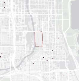
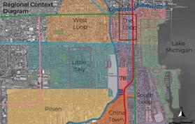
The site is bordered by neighborhoods known for their cultural identities. Chinatown has a high population of Asian immigrants. Pilsen is known for Latino culture. Little Italy is home to the University of Illinois at Chicago.
Income
CTA Buses and Stops

Land Pollution and GHGs " ) " ) Affordable Housing Average Gross Rent CTA Bus Stop Popularity Walkability NVDI Urban Runoff Leg nd A-----------Legend Hot_Spots_BOARDINGS_smt1 BOARDINGS- 203.5 203.5 - 474.5 474.5 - 1022.7 1022.7 - 2595.3 Legend busstop_Clip2 busroutes_Clip2 <all other values> NAME 16TH/18TH ARCHER BLUE ISLAND/26TH BROADWAY BRONZEVILLE/UNION STATION CERMAK CLARENDON/LASALLE EXPRESS CLARENDON/MICHIGAN EXPRESS CLARK COTTAGE GROVE COTTAGE GROVE EXPRESS HALSTED HARRISON HYDE PARK EXPRESS INNER LAKE SHORE/MICHIGAN EXPRESS JACKSON JACKSON PARK EXPRESS JEFFERY JUMP KING DRIVE LASALLE MADISON MUSEUM CAMPUS MUSEUM OF SCIENCE INDUSTRY NAVY PIER OUTER DUSABLE LAKE SHORE EXPRESS ROOSEVELT SEDGWICK SHERIDAN SHERIDAN/LASALLE EXPRESS SOLDIER FIELD EXPRESS SOUTH SHORE EXPRESS STATE STOCKTON/LASALLE EXPRESS STOCKTON/MICHIGAN EXPRESS STONY ISLAND STREETERVILLE/TAYLOR OF CHICAGO HOSPITALS EXPRESS UNION/STREETERVILLE EXPRESS WALLACE/RACINE WATER TOWER EXPRESS WENTWORTH w78
The area continues to suffer from the effects of pollution and the surrounding area does not experience any business growth


Pedestrian pathways in the proposal are built, expanding access to surrounding businesses.
In order to assess the strength of our solution, we used four indicators, one for each goal, to prove how well we addressed the main issues within our site. Business demographics describe the businesses with cultural affilations in the area. Through this, we can evaluate if and how a certain cultural group participates In the surrounding area. Average rent by census tract shows how expensive rent at a granular level, and a dramatic rent increase can indicate gentrification. Walkability depicts the state of the pedestrian walkway system in the area, and what connections are prioritized and which are not. Urban runoff measures both the flood risk of the area as well as the amount of pollution that area comes in contact with. Runoff carries pollution, and the more runoff that is captured the less contaminants are in the site.

Existing
site existing vegetation communities destination/usage
• Existing Transit Stops serve large existing population
Median Household Income Map
• Proposed CTA/Metra Stop to serve local community
Proposed CTA/Metra Stop to serve local community
NDVI Map
Bus Transportation Map ! ! ! ! ! ! ! ! ! ! e end S M S o s e o d n s - 4 6! 3! 1 - 0 C A a e C A L o S a on v Mo R d h p - 5 0! 8 - 9 ! 4 - 4 ! 1 - 4 R L e A h D s b o----
Flood Susceptibility Map
Chicago
VEGETATION
Module 4: Scaling Down to the Local | Synthetic Analysis
Racial Distribution Map
Racial Distribution Map
Module 4: Scaling Down to the Local | Synthetic Analysis
Flood Susceptibility Map
Average Rent Map






Rain gardens in high flooding susceptible areas. Street side buildings for attractive greens roofs and to mitigate runoff from streets and river.
through site connection surrounding community Transit Stops serve large existing population
Average Rent Map
Impervious Surface Map
Racial Distribution Map
Module 4: Scaling Down to the Local | Synthetic Analysis
Racial Distribution Map Racial Distribution Map
DESIGN INTERVENTION
Proposed
Average Rent Map
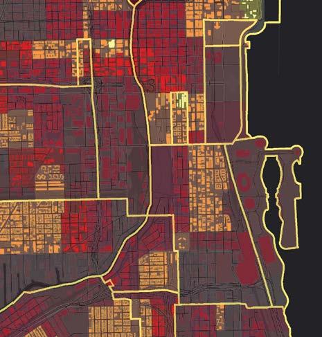
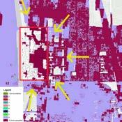
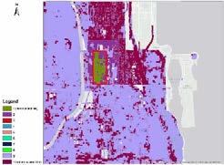
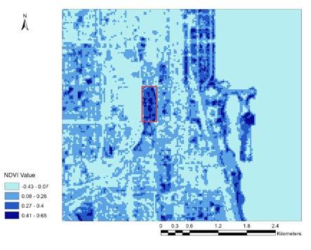
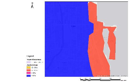
The site is shown to have high susceptibility for flooding to occur. The maps also suggest that there are high amounts of impervious surfacing on the site, thus leading to the high amounts of water runoff that occur, which can lead to contaminated water systems, as well as flooding damage. Adressing this issue would be in the best interest of the community.




• Existing Transit Stops serve large existing population
Inclusion of garden space along with gathering space for the communities. Create green connection between existing, adjacent parks.
• Proposed CTA/Metra Stop to serve local community


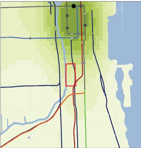
Module 4: Scaling Down to the Local | Synthetic Analysis
• Create Spaces to Integrate Local Communities to Prevent Monocultures
• Spaces to be Inclusive for All
Alex Alonso, Jessica Aguada, Erik Perez, Julian Ruiz
Issues: • Lack of accessibility for pedestrians in/out and through site • Absence of green space and connectivity between existing vegetation • Need for spacial integration for the surrounding, existing communities • Excess of stormwater runoff with lack of suitable destination/usage Existing Transit Stops serve large existing population Proposed CTA/Metra Stop to serve local community NDVI Map Flood Susceptibility Map Median Household Income Map Average Rent Map Proposed Rail Stations Map Incorporated Bus Station Map Proposed Green Space Map Flood Susceptibility Proposition Map Impervious Surface Map Racial Distribution Map Racial Distribution Map Green Space Centralized within Design to connect Roosevelt Park and Ping Tom Park Inclusion of Transit Stations for Railways, Transit, and Waterways Proposed Retention Pond Within Center of Proposed Intervention Incorporation of Housing Opportunities Tailored to Surrounding Community Goals: • Providing accessible routes for pedestrians in/out and through site • Incorporation of green space while improving vegetation connection • Inclusion of gathering space and housing for surrounding community • Decrease stormwater runoff • Within walking distance to existing local transit stop • Stop incorporated onto Wentworth Line Rain Gardens in High Flooding Suscetible Areas Street Side Buildings for Attractive Green Roofs and Mitigate Runoff off Streets Green Roofs along Riverside to Prevent Runoff into River • Create Spaces to Integrate Local Communities to Prevent Monocultures • Spaces to be Inclusive for All Create Green Connectivity Between Existing Parks (Rooosevelt Park to Ping Tom Park)


Main Issues and Goals Addressed: Proposed Design Intervention: LEGEND
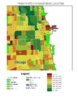
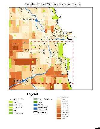
When compared against each other, there is a correlation between poverty rate vs. green space, as well as property value vs. green space. Areas with very little poverty rates contained more green spaces than higher rates. Like wise, areas with higher property values contained larger portions of green space. This suggests that areas with more monetary value contain more fuller vegetated areas. Thus, creating an area that is not inaccessible to lower income households would be beneficial to the inclusion of all people.
Monocultures
Create Spaces to Integrate Local Communities to Prevent Monocultures Spaces to be Inclusive for All
Poverty Rate vs. Green Space; Data source: US Census Property Value vs. Green Space; Data source: US Census Proposed Retention Pond Road Road Bus Stop Chicago River
• Create Green Connectivity Between Existing Parks (Rooosevelt Park to Ping Tom Park)

Proposed CTA/Metra stop in site to serve local communities. Provide easy, accessible entry/exit points. Utilize existing bus stop on Clark St.
As a result of local analyses and determined goals, this design intervention conceptual plan proposes a series of implementations that addresses the main issues of the site. Incorporated green space is centralized within the design in order to connect the existing vegetation of the area, specifically Roosevelt Park and Ping Tom Park. There is an inclusion of a transit station, bus stop, and water taxi stop to increase the entry points of the site. Roads run through the site for easier vehicular access. A proposed retention pond is centered within the design to help mitigate water runoff along with green roof buildings. An incorporation of housing opportunitites is tailored to the surrounding community, even those with lower monetary incomes. The resulting proposal would serve as an asset to the communities of Chicago.


Issues: • Lack of accessibility for pedestrians in/out and through site • Absence of green space and connectivity between existing vegetation • Need for spacial integration for the surrounding, existing communities • Excess of stormwater runoff with lack of suitable destination/usage • Existing Transit Stops serve large existing population • Proposed CTA/Metra Stop to serve local community NDVI Map Flood Susceptibility Map Median Household Income Map Average Rent Map Proposed Rail Stations Map Incorporated Bus Station Map Proposed Green Space Map Flood Susceptibility Proposition Map Impervious Surface Map Racial Distribution Map Racial Distribution Map Railroad Transportation Map Bus Transportation Map Impermeable Surface Map Green Space Centralized within Design to connect Roosevelt Park and Ping Tom Park Inclusion of Transit Stations for Railways, Transit, and Waterways Proposed Retention Pond Within Center of Proposed Intervention Incorporation of Housing Opportunities Tailored to Surrounding Community Developed Green Space Vegetation Proposed Transit Stations Goals: Providing accessible routes for pedestrians in/out and through site Incorporation of green space while improving vegetation connection Inclusion of gathering space and housing for surrounding community Decrease stormwater runoff Chicago Population Density Chicago Green Space Within walking distance to existing local transit stop • Stop incorporated onto Wentworth Line Rain Gardens in High Flooding Suscetible Areas Street Side Buildings for Attractive Green Roofs and Mitigate Runoff off Streets Green Roofs along Riverside to Prevent Runoff into River Minimizse Impermeable Surface THrough Green Space and Retention • Create Spaces to Integrate Local Communities to Prevent Monocultures • Spaces to be Inclusive for All Create Green Connectivity Between Existing Parks (Rooosevelt Park to Ping Tom Park) Bus Stop
Racial Distribution Map Green Space Centralized within Design to connect Roosevelt Park and Ping Tom Park
Create Green Connectivity Between Existing Parks (Rooosevelt Park to Ping Tom Park)
Create Spaces to Integrate Local Communities to Prevent Monocultures
Create Green Connectivity Between
Proposed Design Intervention:
In this module, our group collaborated and analyzed our main goals for our future vision of the neighborhood. Several issues were narrowed down with their own goal. For each goal, we produced analysis maps to help guide us in strengthening our argument for design goals. After thorough analysis, we developed a schematic plan on the effects of our design at a site scale and regional scale. The plan was then formatted into three potential scenarios on the future impact of our design.


- To preserve and enrich the existing ecosystem of the vacancy
- To reduce the site’s susceptibility to flooding
- To reduce rate of pollutants going into the river

- To increase route safety for pedestrians and bikers
- To create access points from different directions for multimodal transportation
- To increase access to fresh food resources
- To create a ribbon between cultural landmarks
- To build with context of surrounding land uses

- To reconnect disrupted strips of zoning

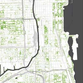


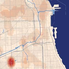

- Issue of nearby pollution sources from industrial areas as well as overall lack of tree canopy and vegetation
- Implementation of permeable pavements increases amount of water infiltration and reduces urban flooding caused by runoff
- Implementation of bioswales, pollutant filtering plants, and a robust native planting plan
- Improvement of tree canopy, NDVI values, flooding susceptibility, and pollutant concentrations in both the air and water
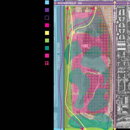
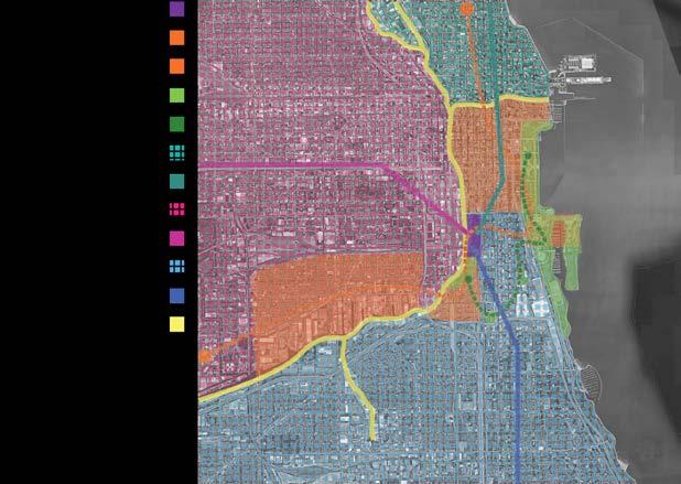

- Encourage more diverse wildlife to enter the site.
- Implement both green roofs and water harvesting devices to reduce the water load for buildings
- Reduce runoff from buildings and add additional greenery
- Issue of site not connecting to its surroundings and serves no current purpose
- Provide a convenient and safe place to live or work
- Connect to historic and well-established neighborhoods, historic landmarks, and an array of greenspaces

- Development of green infrastructure reduces ecological impact and provides adequate access to maintain a healthy neighborhood for everyone
- Addition public transit stops provides quick access to downtown
- Development of riverwalk extension
- Prioritize pedestrian and bike paths with routes to grocery stores and pharmacies to provide access to affordable means of living
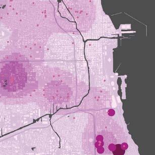
- Connection of bike lanes to the city’s bike lane system
- To design an inclusive space for surrounding communities
- To reverse the role of gentrification to avoid displacement
- To reduce the crime rate within the surrounding communities


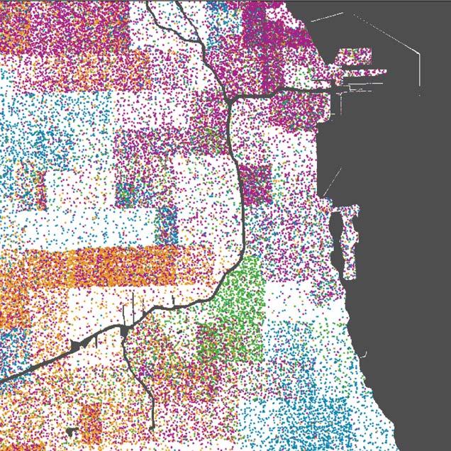
Our site for the new neighborhood is surrounded by a multitiude of different culture and races. South of the site is Chinatown with most of the race population being Asian. West of of the site contains neighborhoods such as Little Italy and Pilsen where the population is predominantly made up of Hispanics. As you continue to move further south and west, the population is mainly Black. The North side is predominantly White population.
- Successful neighborhood needs to be safe and fair to its residents
- Balanced multi-use buildings can provide both affordable housing and a variety of different job opportunities for different levels of income
- Development of flexible outdoor spaces to be conscious of how different cultures use outdoor spaces and have them be more welcoming
- More eyes means more safety by maintaining sight lines
- Activate the spaces with programming and events to encourage higher rates of use
Chicago has been facing many environmental issues such as air/water pollution, heat island effect, habitat loss, extreme weather, due to on-going urban developments, human activities and climate change.
- Strengthen the habitat through sustainable development and appropriate management of natural resources and enhance biodiversity


- Improve water quality by cutting down the amount of nutrients from human activities and resources to flow into the waterways


-Minimize the flooding issue and establish sustainable stormwater management
- Mitigate the heat island effect and improve the community’s resilience to heat waves
- Reduce greenhouse gas emissions from city


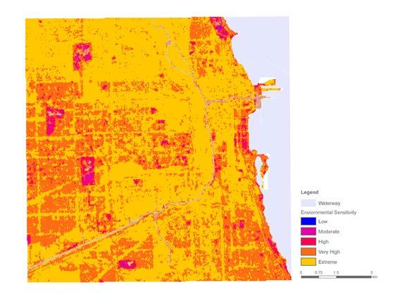
This environmental sensitivity map illustrates the overlay result of five InVEST model outcomes. Each index is given a different weight value: Habitat Quality--25%, Nutrient Delivery--15%, Urban Flood--30%, Urban Cooling--10%, and Carbon Storage--20%, . Based on the result, we develop our design ideas based on two major topics within the City of Chicago, water and green spaces. By proposing blue and green corridors, the design is aimed to improve natural and ecosystem services as well as human health and wellness.
Performing Systemic Design
Date: Nov 7 - Dec 16
Our concept for this design was based on many different factors, but mainly was focused on ways to solve the four major issues we highlighted earlier: connectivity, land use, ecology, and pollution. We created a hybrid site that incorperated both skyscrapers as well as large areas of greenspace. Based on the surrounding context of the site, we wanted to be able to connect the 78th Neighborhood with the rest of Chicago as a whole, focuing mainly on transportation lines (CTA), green cooridors, and the riverwalk. By ensuring we have connections through all three of these facilities, we can ensure that we help increase the overall connectivity of the city and the site.


Another aspect we wanted to focus on was walkability.
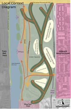
Currently, these is a 30 foot difference in height between our site and the major road nearby (Roosevelt Road). This causes major problems with Chicago residents as they are forced to walk great distances to get to the site or the surrounding areas. There is currently no direct route to the site. To fix this, our site incorperates many different ways to travel between these heigh differences including a new road network running through the site, a portion of the green walkway acting as a street-level entrance, and a building that will allow for direct entrance at street level and at site level. These measures will help to increase the walkability of our site and overall make a better user experience.
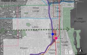
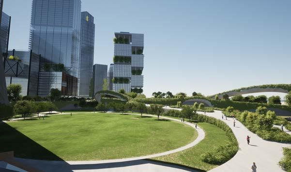
Through this conceptual design, we included widespread greenroofs as well as a continuous green walk connecting different shorter buildings via connecting greenroofs. This inclusion of greenroofs will help to balance out the use of hardscape with permeable and green surfaces, increasing the greenery and land use of our site.
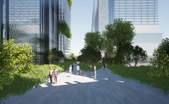
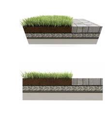
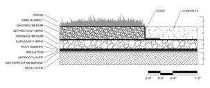

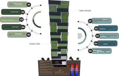
Our site also island cutouts from the river. These islands are planted with different species that are known for their phytoremediation qualities and will help to filter different toxins out of the water as it passes through the different garden beds and slopes. This will help to decrease water pollution in the river, a problem that is in dire need of attention. To further mitigate pollution and the 78th Neightborhood’s carbon footprint, we create a geothermal system for heating and cooling of our buildings. Not only will this decrease the overall carbon footprint of the site, but will also save 30-70% of the cost of heating and 20-50% of the cost of cooling.
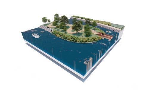
Overall, our design focuses on a few of the major problems Chicago faces today and would be a innovative, irreplaceble addition to the every growing city of Chicago.
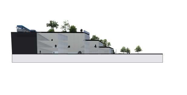

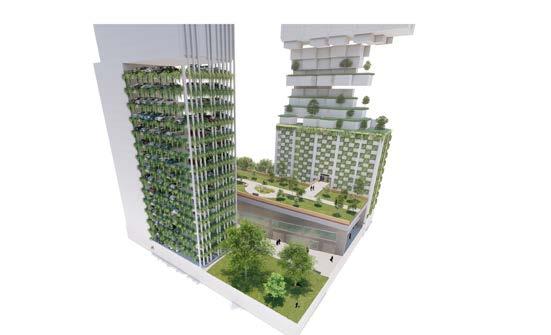


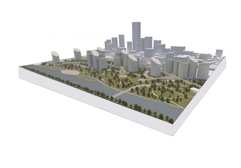
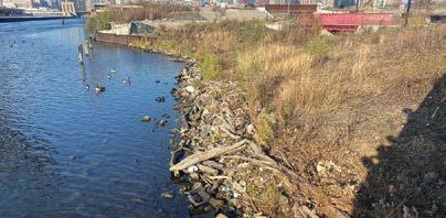
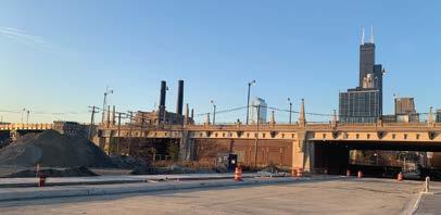
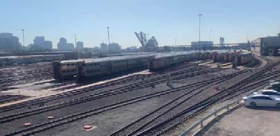

The New 78th proposes to create a new neighborhood in Chicago that acts as an extension of the Loop with an ecological focus. Prarie, wetland and forests provide ecological benefits to the area as well as a backdrop for new business and retail opportunities. Buildings on the site are mixed use and generate wind and solar energy to offset the carbon footprint generated by the neighborhood. The neighborhood is fully integrated into Chicago’s public transportation system and expands it with new bus and water taxi stops, as well as a being a fully walkable and bikeable community.
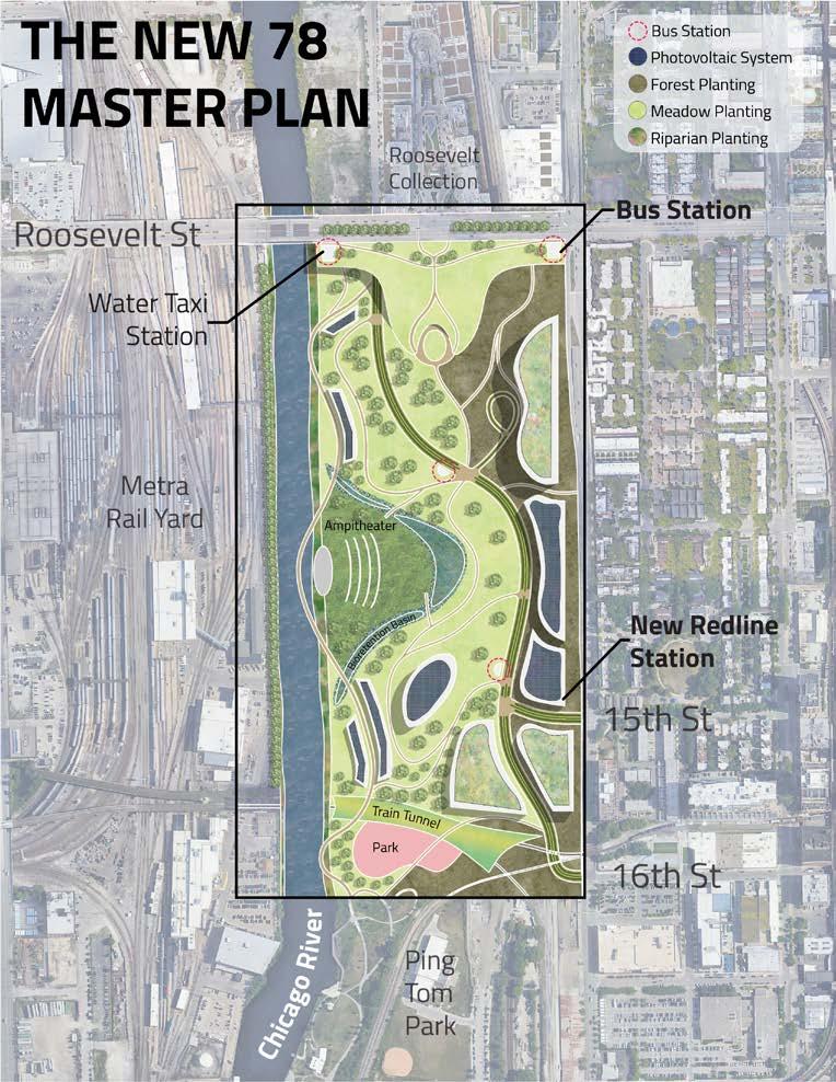

To amplify the vegetation of the surrounding streets by increasing tree canopy.
87 trees added to roadways
101,471.1 lbs of carbon per year
To decrease air pollution from the railyard across the river by sequestering carbon.

Trees -102,600 lb carbon/year
Wetland - 325,000 lb carbon/year
Meadow- 8,300 lb/year
To connect the site to surrounding areas by way of multi-modal transportation.
New redline station
2 new bus stops
Expanded bike and pedestrian pathways
To make the waterfront accessible by creating an interactive riverwalk.
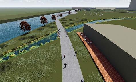
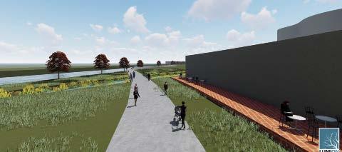
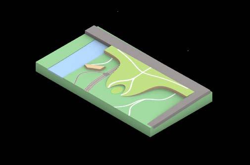
River Walk= 40,475 sq ft
West Side= 94,675 sq ft
Retention Ponds= 135,170 sq ft
To improve the quality of green space by planting biologically diverse plants.
Wetland -1,623 total ha - $5.1 million ESV
Meadow - 1,967 total ha - $4.1 million ESV
Forest - 1,623 total ha - $4.8 million ESV
Turf Grass - 1 total ha - $1 million ESV
Total - $18 million ESV
According to the Chicago GHG Inventory, buildings make up a large portion of greenhouse gas emissions within the city of Chicago. In order to offset the carbon cost of buildings on our site, they are outfitted with solar panels, internal wind turbines, and green roofs/walls. On road transportation contributes a large amount to emissions, so the design limits car accessibility.
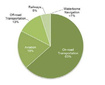
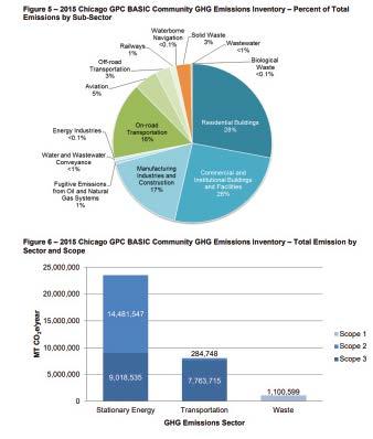
89,675 sqft total building
Wind=1,580,000 lb/year
Solar=1,300,000 lb/year
Green roofs =150 lb/year =2,880,150 lb per year saved
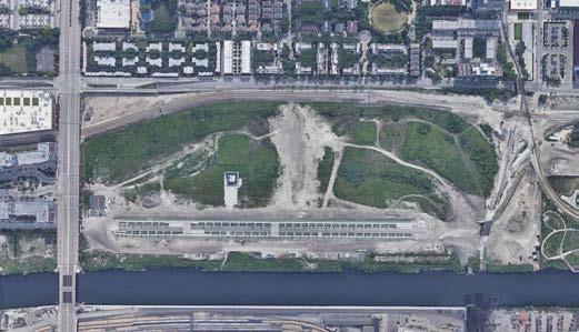
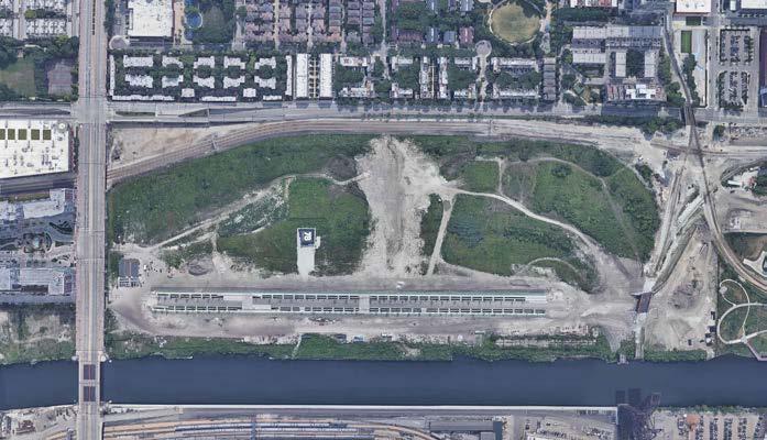
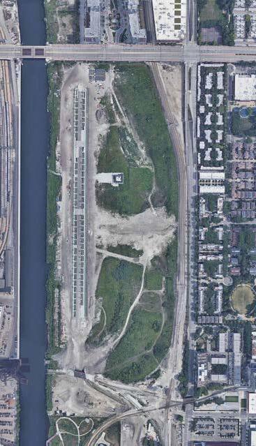
The current site is an unutilized open plot that only has one currently constructed street running along the western side of the site. The entirety of the site consists of roughly 2,578,407 sq ft. The site is very flat and has little to no topographic changes.

Module #5: Proposed Site Concept Map
Provide accessible routes for pedestrians in/out and throughout site. Allow acces for vehicles, but focus on a pedestrian centric design
Our design places a priority on increasing the usable green space in the area while also increasing the connectivity to the surounding area. By increasing greenspace we hope to add new methods of mitigation the stormwater runoff created by the site. In addition to this new connections to the site will be created to allow easier access to the area. These will be focused on both pedestrians and vehicles. However, the design will primarily aim to create a pedestrian focused site that aims to eliminate the reliance on vehicles to navigate the area.
Incorporation of green space while improving vegetation connection Include gathering spaces and housing for surrounding communities. Ensure every individual can utilize the space
Decrease stormwater runoff, by creating greenspaces that focus on generating pervious pavement and raingardens

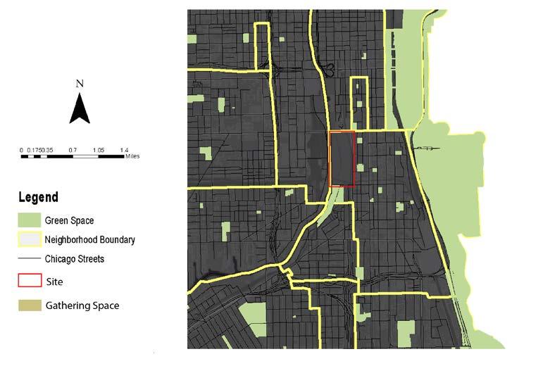
The 78th Neighborhood development is located in between three completely different type of areas. To the north there is a mixed use development that is a popular shopping area. To the East there is a relitively wealthy residential area. To south is Ping Tom Park and Chinatown.
The original concept of our design had the greenspace be the central driving force behind the entire design. However, as this is an urban development it is important that it can generate profit. Therefore, most of the site will be mixed use. Commercial, residential, and office spaces will be available in the new neighborhood. and it will also serve as a center for transportation.
The site is located south of downtown and directly north of Chinatown. This makes the site an important middle ground between two important cultural areas in Chicago. Additionally it is also an intersection for several rail lines. This means that our site must not interfere with the flow that already exists.

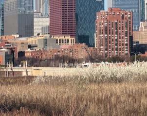
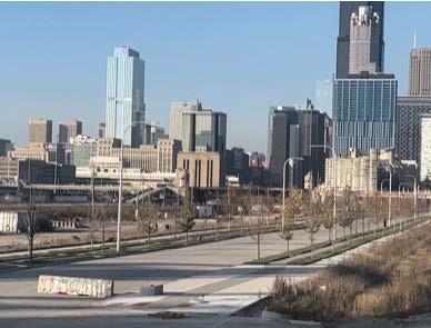
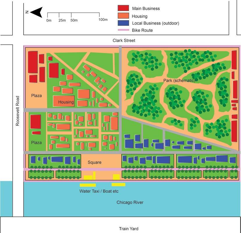
The design focuses on enhancing the experience for pedestrians rather than vehicles. Drivers will find few roads that go through the site.This creates pedestrian priority. Increasing the green spaces in the site help reinforce this. Areas like the river walk, retention pond, and elevated nature walk create a new experience for pedestrians. In addition to this, 11,742,608 square feet of new buildings will be constructed to support living in the site. Around 650,000 square feet of these buildings will serve as green roofs to assist in the mediation of stormwater runoff. Solar panels will also be place on these roofs tho help push the area towards using clean renewable energyThe site will serve as a mixed use development with residential, commercial, and business use in addition to the environmental purpose.



Our analysis foucused on connection, green space, and rain water. The goal of these analysis were to determine the effect that our designs could have on the site. Using a variety of different green space method we wanted to increase green space connections and storm water runoff. The design creates a few different acces points to the site and decreases stormwater runoff by 20 percent.



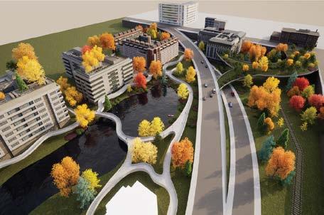
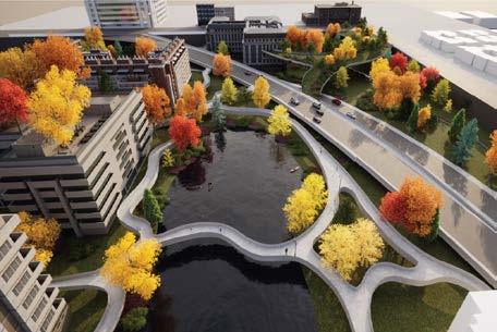
Our perspectives were vital to give viewers context as to what our design is meant to look like. In perspectives one and three we can see an overview of what the north central area of the neighborhood is meant to look like. You can also see the way that we have connected our site to Roosevelt Rd. Perspective two shows us how pedestrians can navigate around the retention pond by using any of the paths that are readily available for use. We also see the potential for recreational activities in the site. Finally perspecte four shows us more detail on the green ramp that connects our site to Roosevelt Rd. Pedestrians can be seen easily navigating the area alongside vehicular traffic.


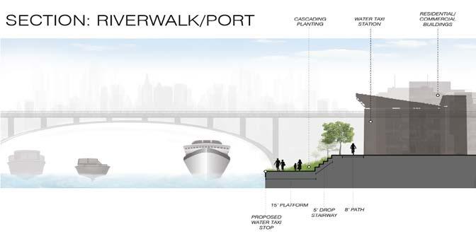
This section is meant to showcase the experience of visiting the port on our site. the port would serve as a water taxi stop and it would allow visitors to travel along the river into downtown or further south. The stop is also directly connected to the new riverwalk. the riverwalk itself would be at a slightly higher elevation and steps and rams would be rquired to reach the dock.
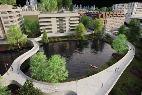
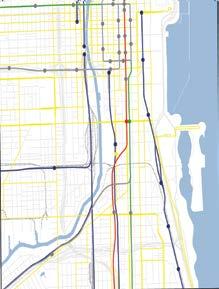


Our previous thorough analysis on the site as well as the surrounding context of it helped guide us in our design strategies. Greening the 78 serves as a model for new development of neighborhoods to be inclusive of communities and allow them to equally have access to green spaces. Nonetheless, this new development will expand towards becoming a green ribbon for more green spaces in Chicago. It will be accessible to several communities of different income and cultural backgrounds to unify a once segregated city. The implementation of green infrastructure in this development will allow for a sustainable future.

- 630,000 sq. ft or around 15 acres of greenspace drain through bioremediation bioswales which slow down water and filter pollutants
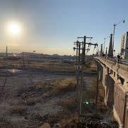
- ½” rain event collects 20,000 gallons of water
- 20% tree canopy density well above existing amount
- 530,700 sq. ft tree canopy or around 1000 large trees planted
- 11,420,600 lbs. C02 sequestrated over 40 years
- 3 Acres of green roof reduce heating and cooling cost as well as emissions
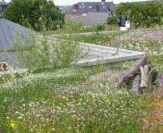
- 4 new vehicular entrances

- 11 Pedestrian entrances
- 3 dedicated bike lane entrances
- 2 pedestrian paths directly connected to outside food and sustenance
- 3200 linear feet of store front for new restaurants, grocery stores, pharmacies, etc.
- 6000 linear feet of waterfront access that will eventually connected to the downtown riverwalk
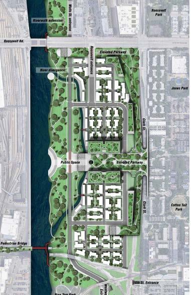
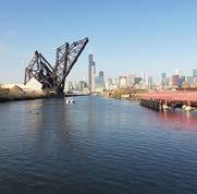
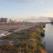
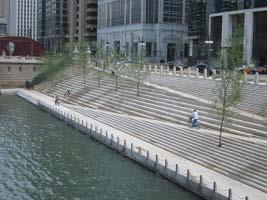
- Almost 30 acres of public green space
- 5 large multiuse Highrise complexes with varying levels of affordability
- 1,440 affordable housing units at 1000 sq. Ft each
- 630 medium income units at 1500 sq. Ft each
- 96 upper income units at 2000 sq. Ft each
- Equal access to green roof and building amenities
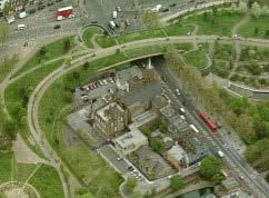
- 54 residential Multifamily housing units
- Each unit has access to greenspace that is more private compared to surrounding public space
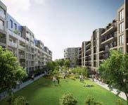
- 30 Acres of flexible green space can be used for multiple purposes by multiple cultures
- Designs inspired by neighboring cultural parks
- Connected by greenways and pedestrian bridges


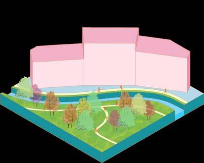
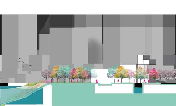
In section A-A, the conditions for the smaller river channel are shown as well as the treatment of the river front. On the left side where the park will be located, the river front edge will be vegetated to allow for filtering of pollutants. The commercial strip will be able to have a small version of a river walk.
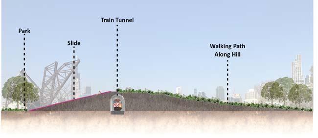
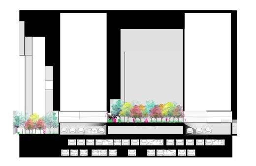
This section shows the conditions for the design of the elevated park. It also shows the way that the underground parking garage will function as a way to reduce vehicles on site. The park itself will be visible to the surrounding high-rises.
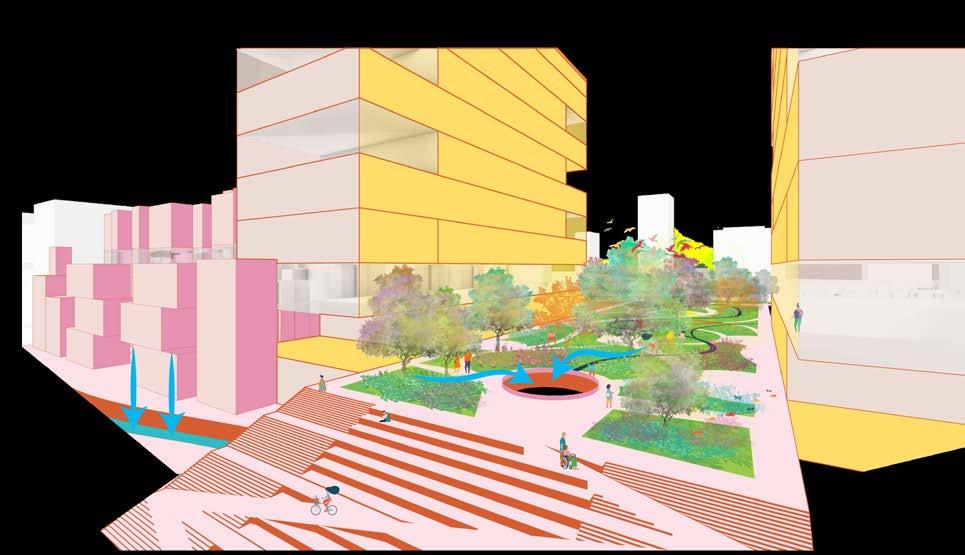
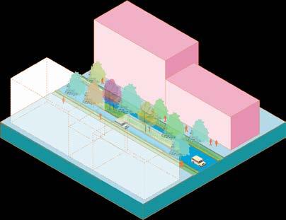
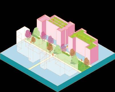
In this second perspective, a view of the elevated park is shown. This park will be accessible to all with the implementation of an ADA stair and ramp combination. Additionally, this park will provide additional green space to the neighborhood and function as a way of stormwater management.
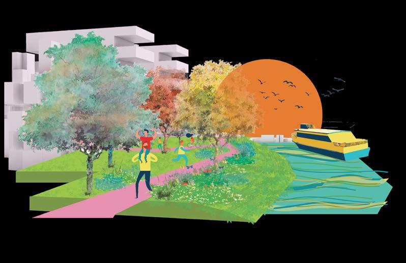
This perspective provides a view of the river front edge towards the site. The vegetated conditions for the river edge are shown as well as the function of the park itself. Residents and visitors will have the opportunity to enjoy the scenery along this river walk along with the addition of a water taxi stop.
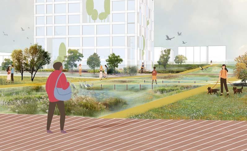
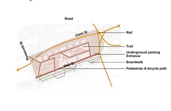
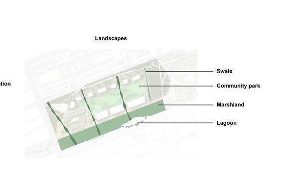
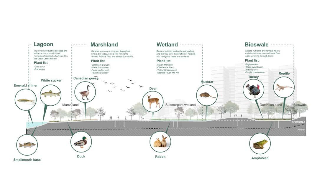
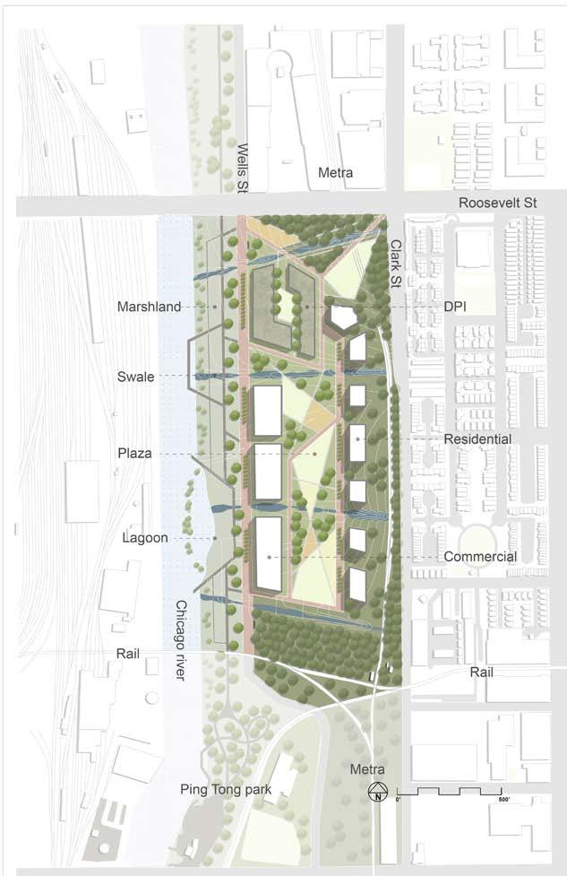
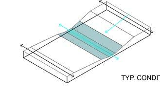
With today’s dramatic rise in urbanization, the development of urban hydrological systems and natural geomorphology is often decoupled. This condition is presently one of the main causes driving the fact of increasing storm intensity and extended drought periods. The proposed 78 Flux Chicago project aims to address these concerns by researching how landscape infrastructures, ecological systems, and urban fabric respond to extreme circumstances. In order to accomplish the goal, the 78 Chicago community is identified as an opportunity to slow down surface runoff and storm surge influx into the Chicago River and to create a variety of wildlife habitats. The landform is generated by existing elevation changes along Roosevelt Road and the Metra line. Four wetland strips, a marshland, and a lagoon form a network that distributes and filters runoff from the city while also channeling and enhancing water-holding capacity. This urban form creates a variety of programs for human engagement with the environment. Also, it has great potential to be incorporated with local and educational programs and to be flexibly adapted by real estate developers.
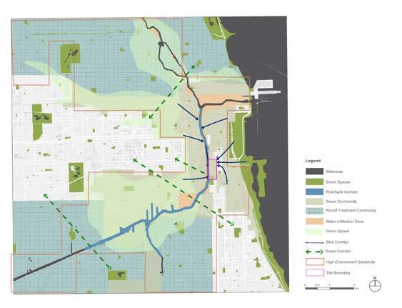
This environmental sensitivity map illustrates the overlay result of five InVEST model outcomes. Each index is given a different weight value: Urban Flood--30%, Carbon Storage--20%, Habitat Quality--25%, Urban Cooling--10%, and Nutrient Delivery--15%.
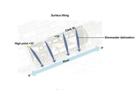
The Schematic design plan is represented in a 10x10km large neighborhood scale. Two runoff treatment communities and a comprehensive riverbank corridor are proposed. Water infiltration zones are placed along the river. The green community is proposed on the urban community that is highly sensitive to ecological issues. A blue-green corridor was developed to create a network of healthy neighborhoods, green infrastructure, public trails, open spaces, recreational areas, and animal habitats.
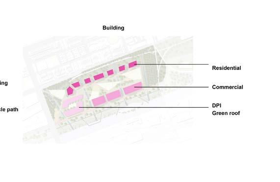
MASTER PLAN
SECTION A -- ECOLOGICAL RESTORATION
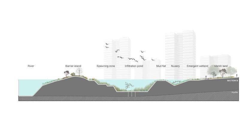
SECTION B -- LAGOON
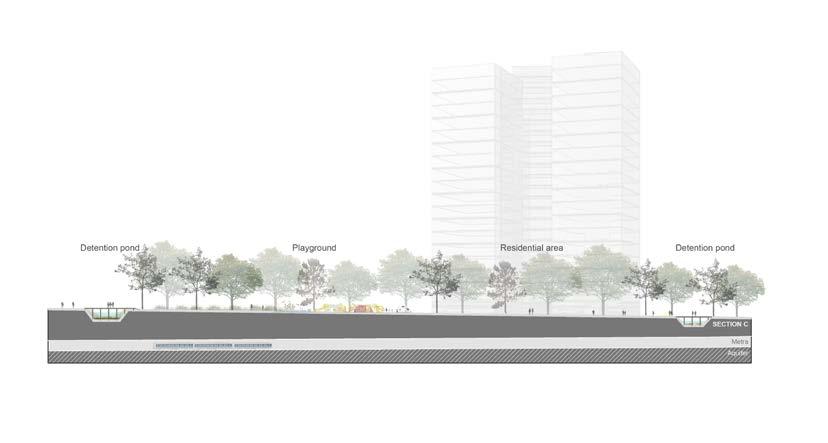
SECTION C -- SWALE
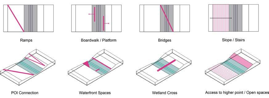

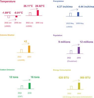

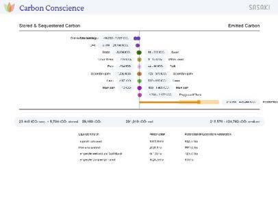
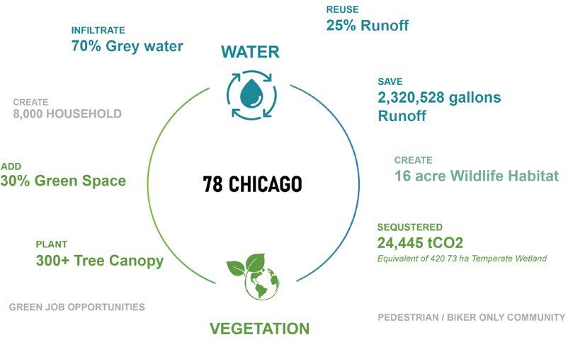
Through the 78 Flux Chicago design proposal, we are able to store 2 million gallons of runoff, increase infiltration capacity by 70%, and reuse 25% of the runoff. We also created 16-acre wildlife habitats, add 30% green spaces, as well as plant more than 300 tree canopies. Together, the new 78 Flux Chicago community is able to sequester CO2 equivalent of 420 ha of temperate wetland. Besides that, the community creates 8000 households, thousands of job opportunities, etc. Overall, this urban form creates a variety of programs for human engagement with the environment. Also, it has great potential to be incorporated with local and educational programs and to be flexibly adapted by real estate developers.
