Rio x Barcelona: Urban and Housing Challenges and Solutions
Apr. • Aug. 2020
Pontifical Catholic University of Rio de Janeiro (PUC-Rio)
Supervision: Marcelo Bezerra
Professor: Marcela Abla
Agile Methods in Architecture: TIP Project Management Model
Aug. • Oct. 2020
Pontifical Catholic University of Rio de Janeiro (PUC-Rio)
Academic Education
Master in Architecture
2022 • Haute école specialisée bernoise (BFH)
Bachelor’s Degree in Architecture and Urbanism
2015-2019 • Pontifical Catholic
University of Rio de Janeiro (PUC-Rio)
Member of the Academic Center for Architecture and Urbanism
2017 • Pontifical Catholic University of Rio de Janeiro (PUC-Rio)
Academic Experience
Graphic Representation in Studio 4
Aug. • Oct. 2017
Pontifical Catholic University of Rio de Janeiro (PUC-Rio)
Professor: Silvio Dias
Graphic Representation in Studio 1
Mar. • Jul. – Aug. • Dec 2016
Pontifical Catholic University of Rio de Janeiro (PUC-Rio)
Professors: Fernado Espósito and Silvio Dias
Coordination: Marcelo Bezerra
Professor: Sonia Lopes
Rhinoceros Course
Feb. 2017 • Lab.Ideas
Revit 2017 BR Course
Jan. 2017
Actech Training Center
LevUp 3D - 2.0
Mar. 2020 • LevDesign
Vray 3.6 and Vray Next
Languages
English
Intermediary
French
Intermediary
German
Developing
Spanish
Basic
Portuguese
Native
3D models
Modelling and rendering
Janeiro, Brazil
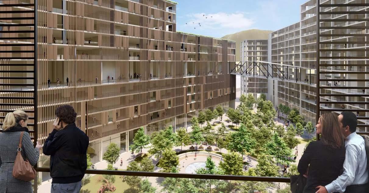
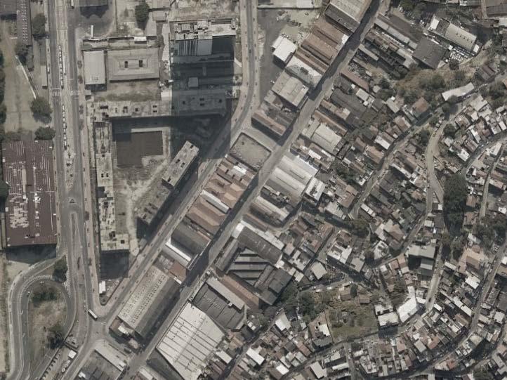
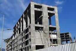
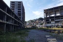
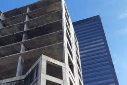
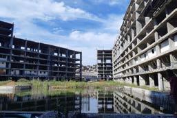
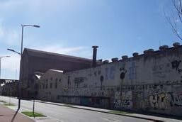
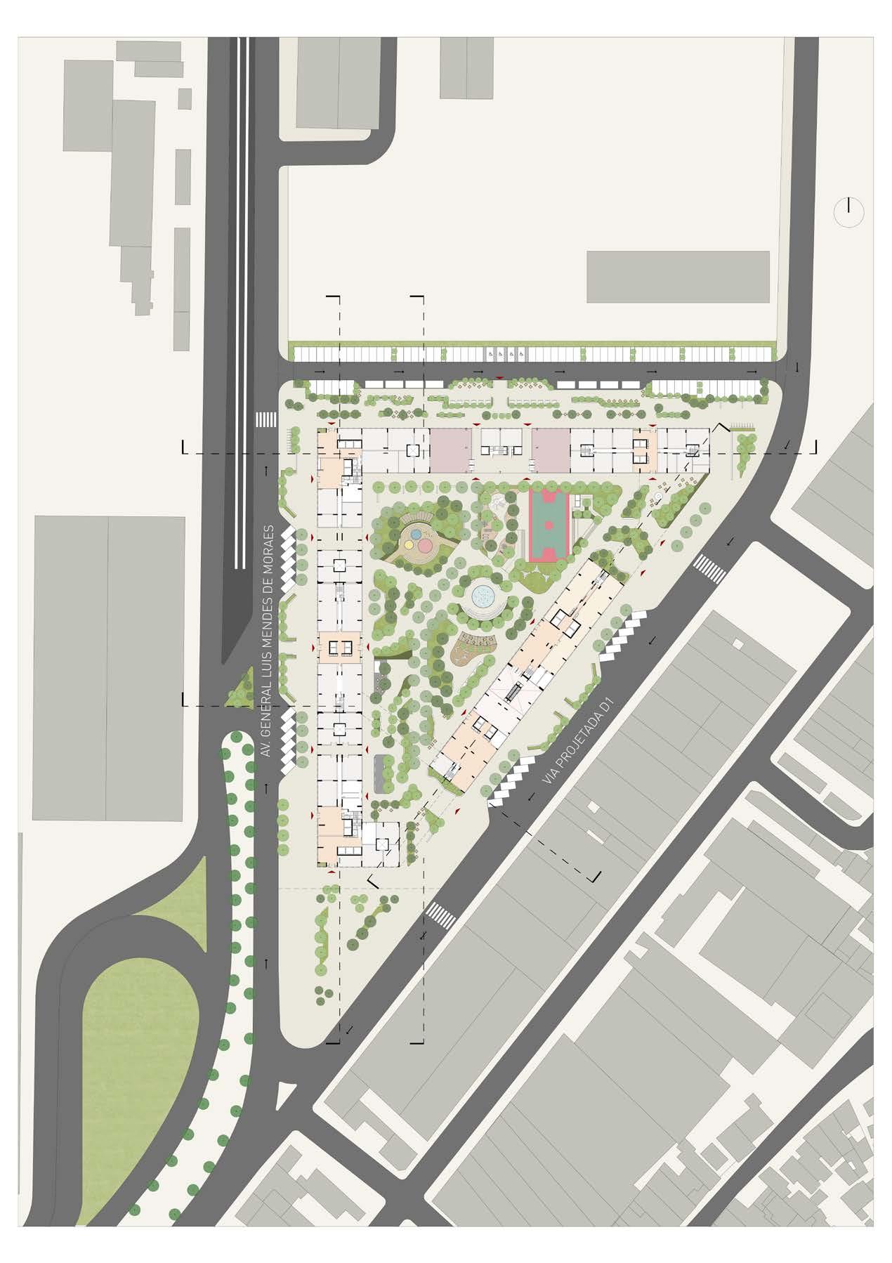
A new look at the Porto Vida Complex
year • 2019
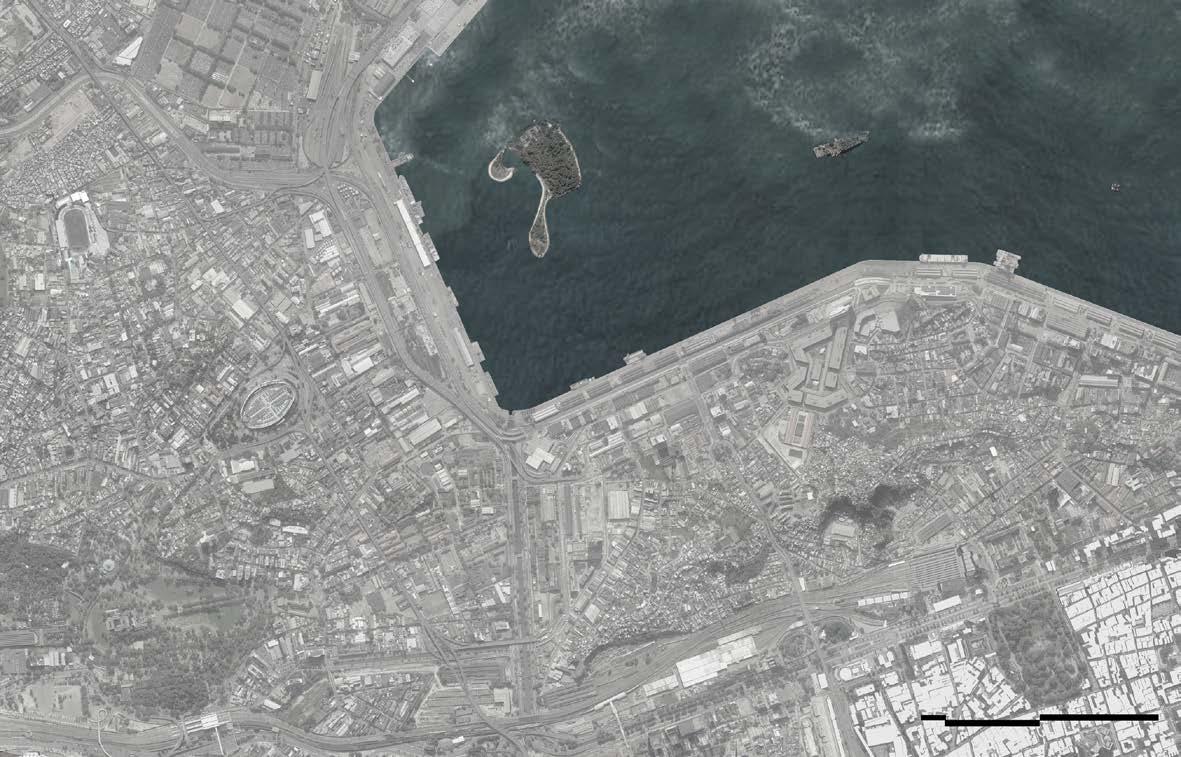
location • Santo Cristo, Rio de Janeiro, Brazil
area • 19.607 m2
program • mixed use, hybrid
tutor • Vera Hazan
Bachelor's Thesis • Puc - Rio
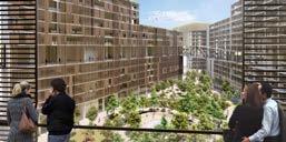
The project aims to reflect an emblematic architectural skeleton, the result of a scenario that was not achieved with the Porto Maravilha Revitalization Plan when Rio de Janeiro was the host city for the 2019 Olympics.
Aim of housing the media and referees village, hotel and convention center for this important moment, later becoming the first residential in the port region.
In the Santo Cristo region, the skeleton is at a strategic point of departures and arrivals of mobility points that connect with the rest of the city.
In the current scenario, the inactive and deteriorated residual space is empty in the immediate surroundings, which exposes how the skeletal square is implanted as an island and disconnected from its surroundings. Understanding the pre-existence, the project recognizes the need to transform the architectural object before it becomes a ruin.
Through a program with anchor equipment, based on three pillars: housing, cultural,commerce and service, the project proposes it to activate a placewith the potential to give life to a part of the city that had been ignored until then.
Through a hybrid concept, which mixes the programs and uses in the same building, it is understood that it is possible to keep this place active, triggering a greater number of people living in the space, rescuing the skeleton and being reborn as a public space for the city
The current morphology of the block proposes two streets as major tests and segregates a corner that should be understood as a transitional space within the surroundings. Being between walls, we understand the importance of understanding the terrain as an open court, since with greater permeability it is possible to experience new experiences and paths. The planned project established the towers between walls, classifying itself as a built-in project with watertight activities, which would not allow the active and collective use by all users.
From the open court concept, the possibility of new walks and pedestrian routes through the terrain arises, guaranteeing the activation of the place.
new experiences and appropriations
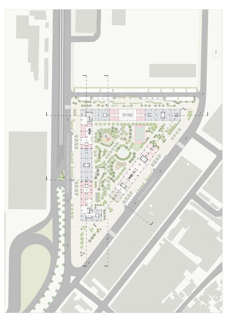
The hybrid, the fundamental concept of the project, in multifunctional buildings relates to the existing mix between the layers and various uses that allow the user to transition between spaces, defining their character in public, semi-public and private spaces. In the skeleton's case, near Guanabara Bay, the user’s displacement allows establishing new views of the region.
Understanding the advantage of a building so conceptualized, it is understood that experimenting with the mixture of uses that attracts new looks, actions, experiments and experiences, can play a fundamental role in reconfiguring this skeleton in the urban fabric. Hybrid buildings generate a new urban logic, bringing different aspects of the city into its layers.
NEW DESIGN CONCEPT
TRANSITION OF USERS IN LAYERS
HYBRID OCCUPATION TO JOIN SPACES FOR THE PUBLIC
The spaces created aim to promote the diversity of activities and people at various times of the day, with greater permeability on the ground floor and favoring interaction between the sectors that comprise it, allowing to experience, occupy, produce and use, ensuring the vitality of the environment.
The project’s new perspective contemplates the diversification and connection between people and spaces, thinking about the concept of sharing, developing itself as an integrative project.
This project based on the proposal, on implementing three anchor equipment that connect to other activities that are not fixed, thus forming a connecting project between spaces, people and occupations. Anchor equipment comprises housing, commerce and services, and a training space. the activation the intentions
It related the first design intention to the removal of the walls in order to allow greater permeability of the court.
The removal of the walls allows the movements, flows and permanence of the individual in the building. In this sense, naturally, new radial meeting points forms within the terrain.
It set up the skeleton ground floor as a public space. As a result, the city’s expansion movement relates to its extension within this center, featuring a collective and permeable environment.
The result of such action generates a free area, which is understood as a place that can house various sports activities, with neighborhood commerce, and where interpersonal exchanges can take place effectively.
The ground floor is now an active space, which can house a dense range of movement.
The characterization of this environment may rise in some moments, following the hybrid concept, to set other places with different uses.
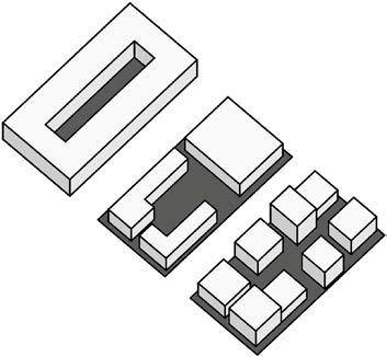
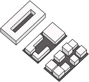
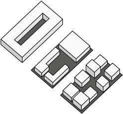
demolish and build
ESTRUTURA EXISTENTE EXISTING STRUCTURE
DEMOLITION OF SECTOR D CONSTRUCTION OF A NEW STRUCTURE FOR A MORE FREE PROGRAM
CONSTRUCTION OF MEZZANINES ON EXISTING LEVELS
structure intention
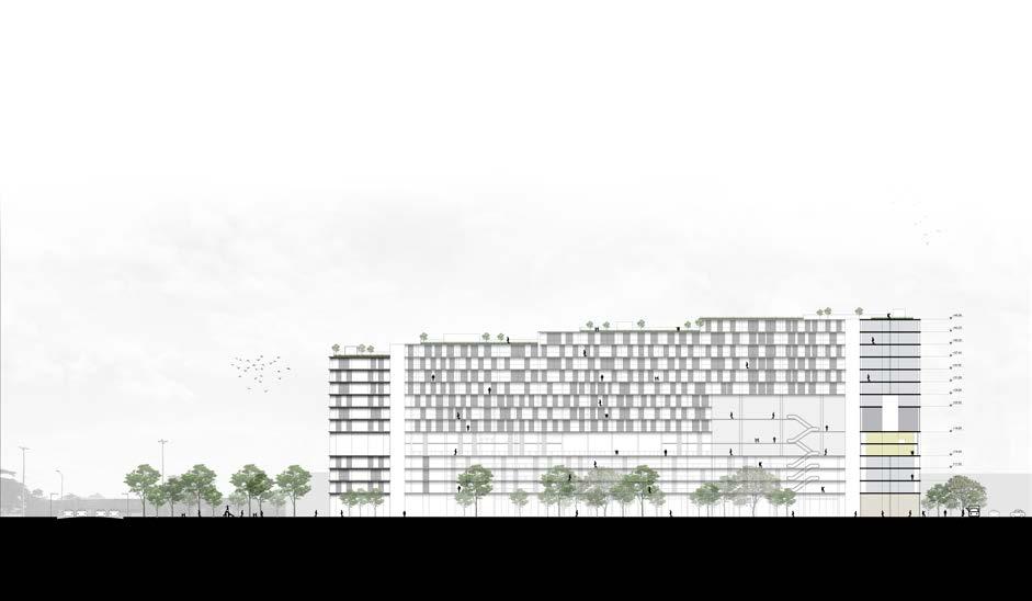
It also implemented the hybrid concept in the structure's conceptualization. The existing, one included a plaster cast because of the residential use designed for that skeleton in pre-stressed concrete. To stabilize and create a new structure, it was necessary to have a transition floor with transition beams that would make this new structure possible.
Bringing the dynamic between the old and the new, the floors in metallic structure raised. Finally, the fundamental element to create a space that is completely connectable from one point of the building to another is through vectors, in a lattice structure.
available spaces x scheduded
Following the hybrid concept with greater flexibility of spaces, in the “L” block of the implementation, it divided the program into available and programmed spaces, leaving free the way to occupy.
I thought of a division by layers with activities possible to happen at different levels, always thinking about the mix of audiences and the interaction between them.
With the flexibility, it proposes shared work and living spaces, besides maintaining a central public use through a library, an integrating space.
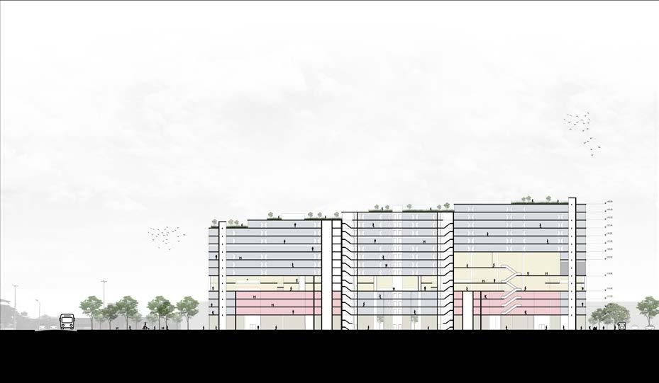
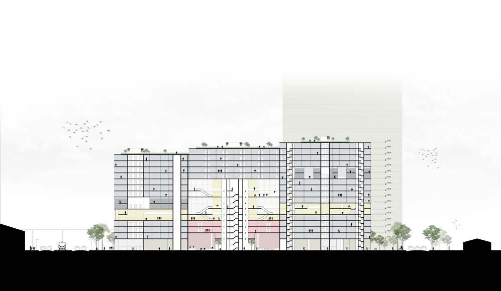
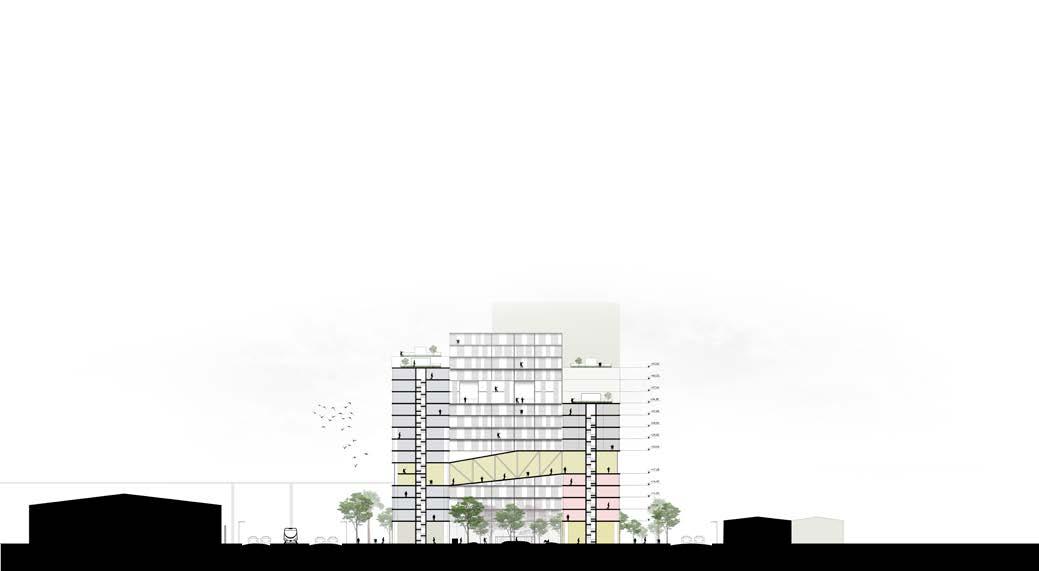
The type 02 floor characterizes by being the floor for collective use, made possible by creating the lattice structure that connects the entire building. The cuts below show the total connection between the spaces and how it is possible to move between them.
On the other block, which is in visual and physical contact directly with the Morro de Santo Cristo and the projected road D1, we imagine spaces that are programmed and available for cultural, educational and business purposes.
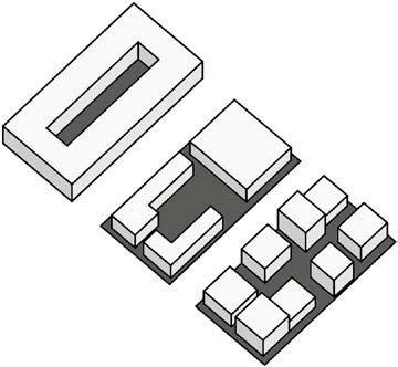
Created by Mr Balind from the Noun Project
Certainty
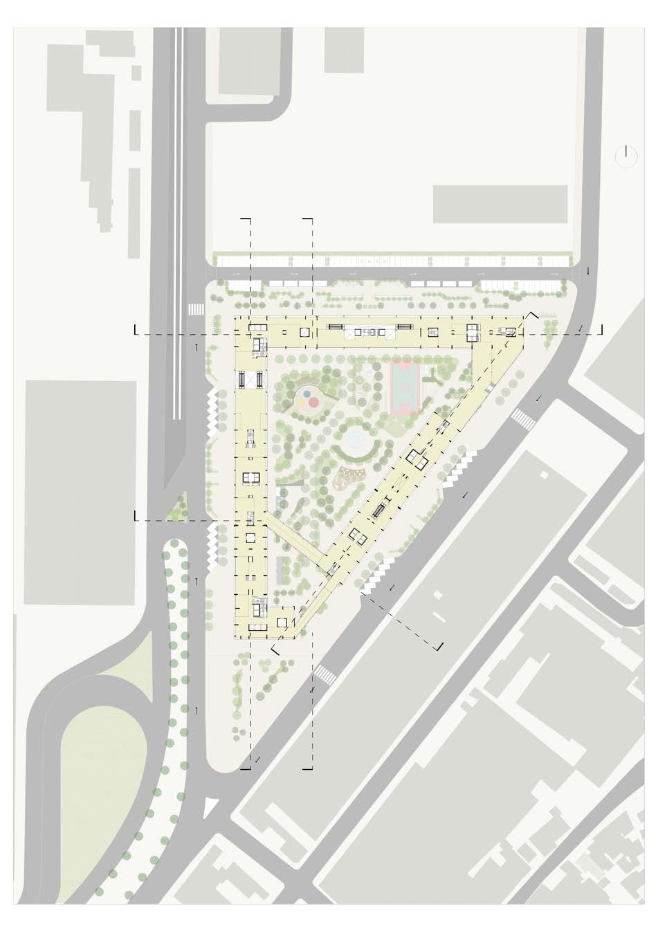
In a scenario of certainties, believing that there would be an investment in a project for this door, it could be possible based on the next drawings.
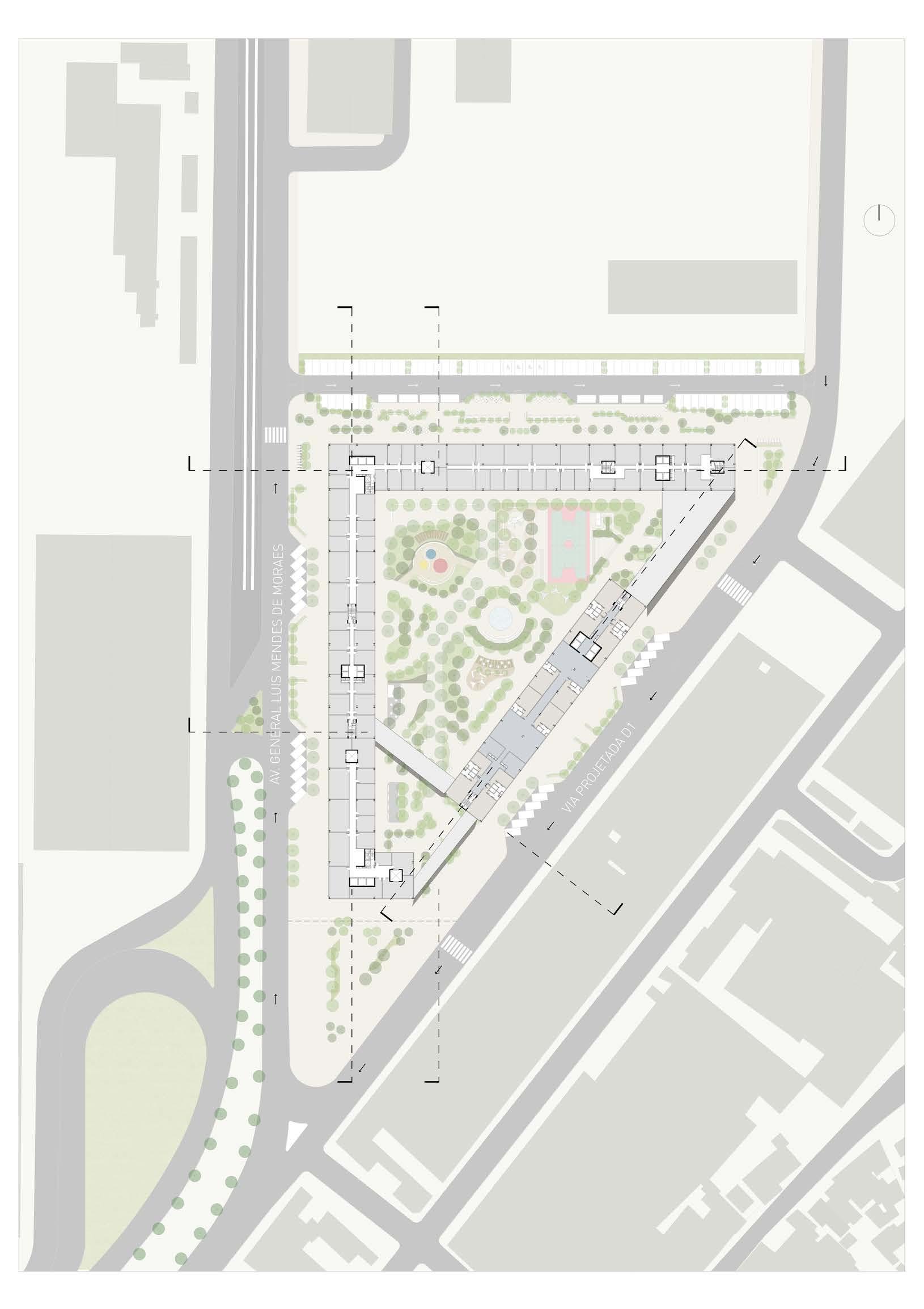
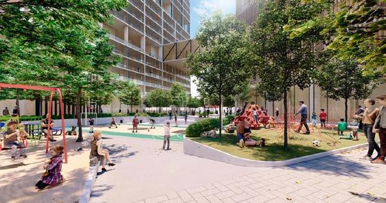
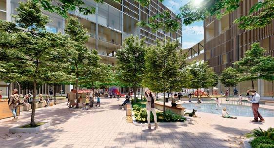
With the first intention of tearing down the walls, it created a large central square on the ground floor, providing a public space for the entire city, not just for the project’s users. The concept of the square took place through the creation of spaces with the same aspect as the neighborhood commerce.
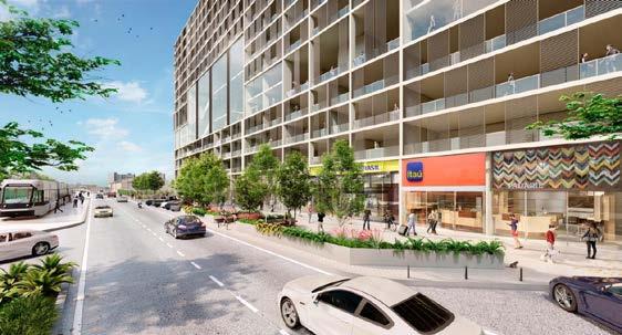
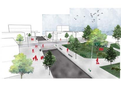
The project includes newsstands, local fairs, recreational spaces, a sports court, a wet area, rest areas, and an outdoor bookstore. In addition, at the rear, it proposed to open a connection road between Avenida General Luis Mendes de Moraes and Via Projected D1. In this part, we have a street level with the sidewalk, in traffic calm, with parking for loading and unloading and spaces for visitors.
It related the setting of the back to outdoor fairs with potential places for food trucks, featuring a place for walking. On the ground floor of the building, we have spaces available for commercial purposes and spaces programmed for cultural areas such as a library and children’s media library, besides a mini-theater.
On the floor type one we have, in the L-shaped part, space available for commercial and service purposes, a training area (university), coworking and permanent housing with three size options.
In the cultural block, we have a space programmed for an extensive library, which connects to the ground floor and floor type two.
On the floor type two, we have the great connection of the building showing the permeability that was so sought after on the ground floor.
The project aimed to establish this concept also in this integrated pavement.
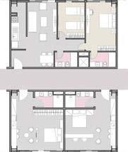
On floor type three, have housing programs implemented. It divided into spaces available for co-living temporary housing in the Cultural Block, and spaces available for permanent and co-living housing in the “L” Block, with some of the appropriations exemplified in the two options on the right.
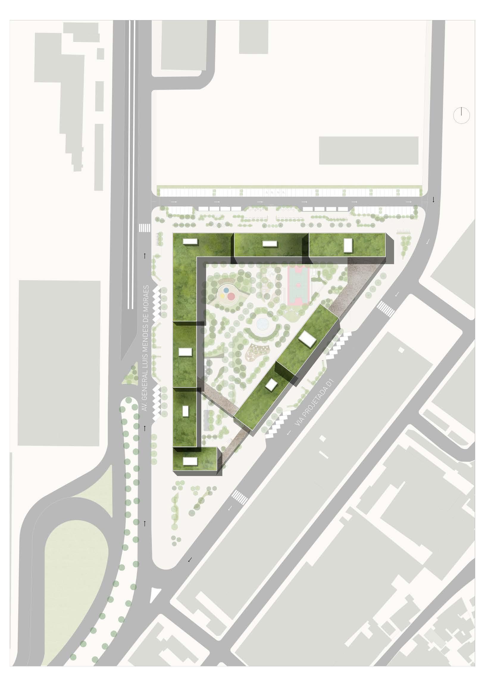
The roof is habitable by eighty elevators that take the user directly to this location, providing views of Morro de Santo Cristo and the view of Guanabara Bay.
It covered the roofs with vegetation in order to bring the green of the central square to the top of the building as well.
It stands out in the landscape of Santo Cristo with an abundance of vegetation, so non-existent
sports area
the square the avenue
Uncertainty
For a scenario of uncertainties, it believed that it is necessary to propose a phasing for the evolution of this project. At first, in 2019, the scenario is the expectation of demolition. We speculated much about this skeleton. The project sought to study a situation that many believe is unfeasible, especially for the real estate market.
The first phase begins in 2020, through an anchor block called Cultural, with the intention of broadly projecting, with spaces available for service support, such as the opening of commercial stores.
I understand that through cultural and training spaces it is possible to have a greater number of people who come and go every day, keeping the space and interpersonal relationships active daily. With this, the opening of services to help the first active individuals is proposed. In addition, in this phase, there is a forecast for the demolition of Sector D, to make viable the new housing structure that takes place in the second phase, and the export area of the central square.
In 2021, the second phase proposes the housing survey, which will take place in sub-phases.
SECOND PHASE • subphase 01
In subphase 01, we have the activation of Sectors B and C, which have different accesses and are more promised with the VLT, facilitating the arrival and departure of residents.
SECOND PHASE • subphase 02
In subphase 02, sectors A and E, besides the new housing tower, are erected, activating the most extreme spaces, far from the VLT.
THIRD PHASE
Finally, in 2023, the project proposes to create a new lattice structure, which compose the vectors, to connect the blocks and create the space for collective use. In addition, it also contemplated the areas of the square that have not completed. With this scenario, we have a phase that seeks to activate the area in 4 years, positively reaching around 7,500 inhabitants, with new experiences. I believe that with the maintenance phase it is possible to notice the change; I hope that this way, they can reintegrate the block into the urban space of the city.
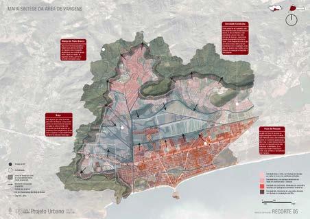
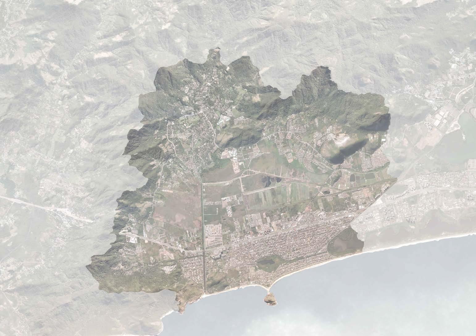
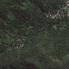
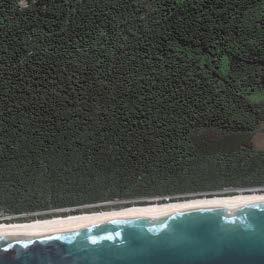
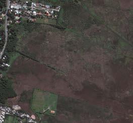
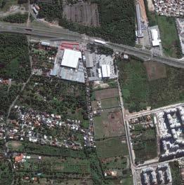
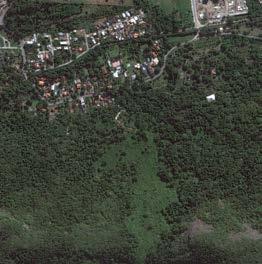
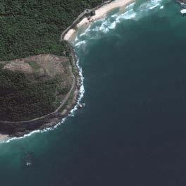
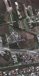
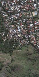
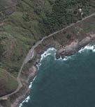
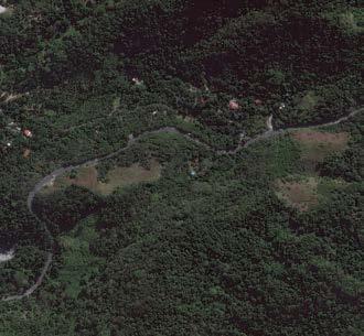
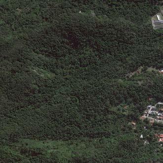
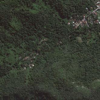
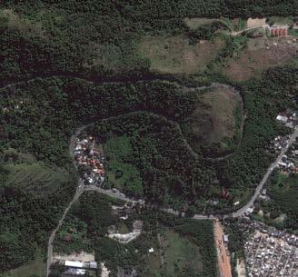
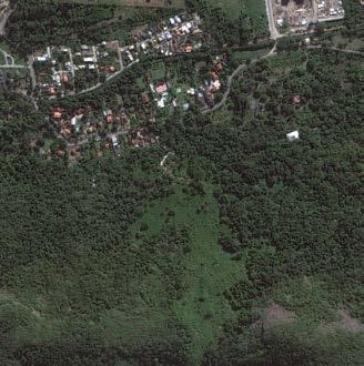
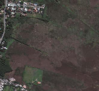
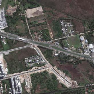
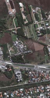
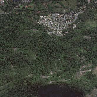
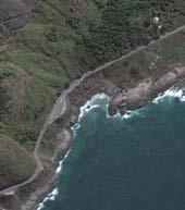
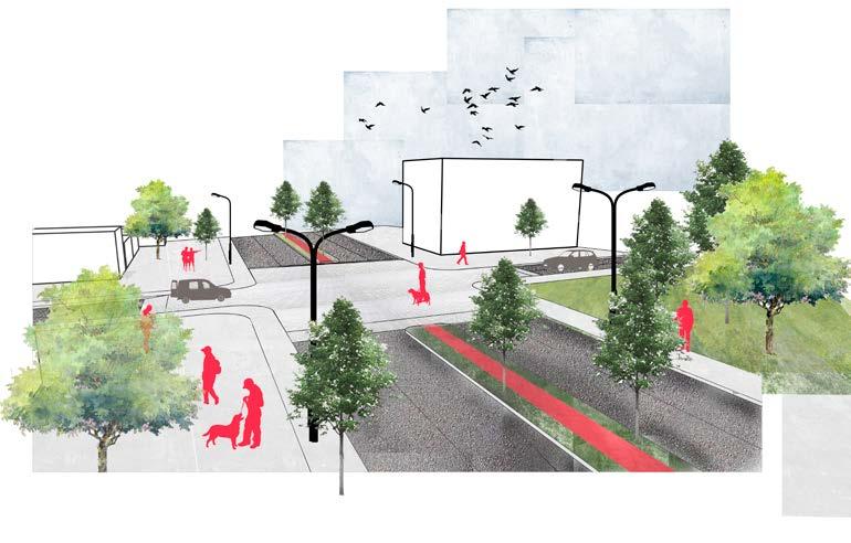
Analysis and Urbanization Proposal for Vargem Grande, Rio de Janeiro, Brazil
year • 2017
location • Vargem Grande , Rio de Janeiro, Brazil program • urbanism
Academic Work • Puc - Rio
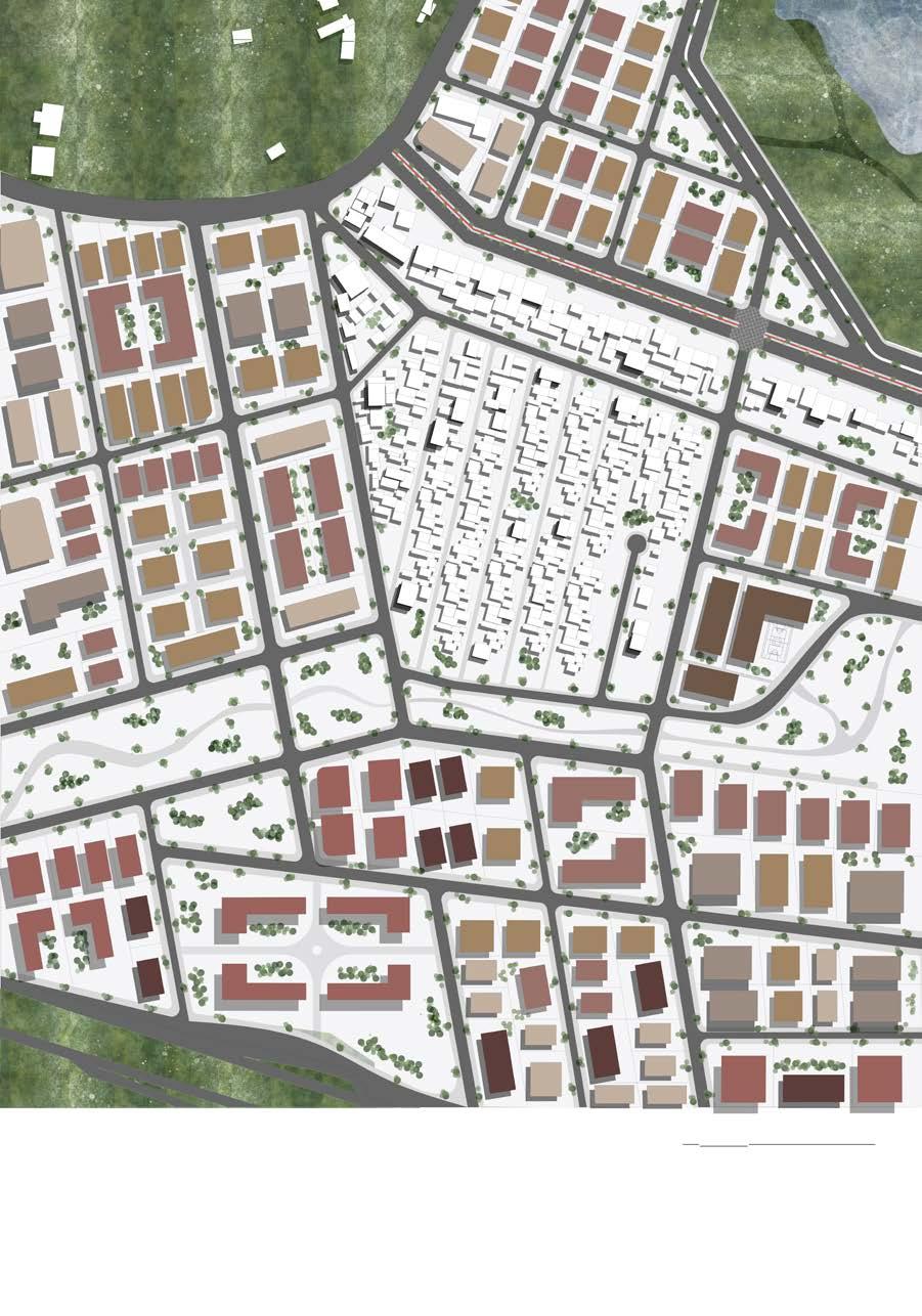
It developed the analysis and design of urban planning during the bachelor’s degree in the urban design studio. The design process took place through modules, which went from a city scale to a street scale, to analyze and creating a critical sense of the area of Janeiro, Brazil, besides proposing the urbanization of a cutout of the map.
From the interpretation and group discussions during the modules, it was possible to create a memory of this area that is growing and with a great intensification of the real estate market. With this, it proposed an urban development of the area capable of respecting the environmental, mobility and residential environments under the current legislation of PEU Vargens.
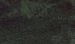
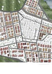
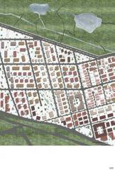
With ecological intentions, and hierarchical as to the distribution of houses and green areas, the work highlights the intended division, through diagrams and maps. Approaching a real scale, the details of the two cuts chosen for development approach the reality of those who live in the region.
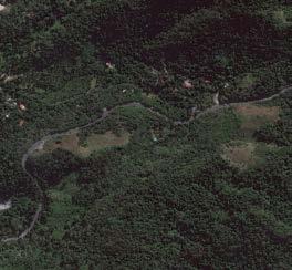
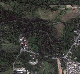
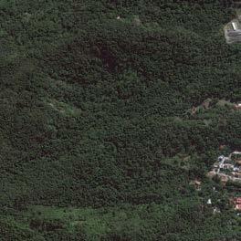
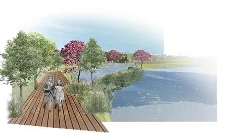
Green corridors that create a pedestrian-friendly public space, tree-lined throughout its lane, and connect the green matrixes of preservation and conservation.
Zones
MAPA DE INFRAESTRUTURA VERDE DO RECORTE 05
MAPA DE INFRAESTRUTURA VERDE DO RECORTE 05
MAPA DE INFRAESTRUTURA VERDE DO RECORTE 05
MAPA DE INFRAESTRUTURA VERDE DO RECORTE 05
MAPA DE INFRAESTRUTURA VERDE DO RECORTE 05
MAPA DE INFRAESTRUTURA VERDE
MAPA DE INFRAESTRUTURA VERDE DO RECORTE 05
Preservation Belts that limit the spraiamaneto to conservation zones and areas to be maintained with an
Preservation Belts that limit the spraiamaneto to conservation zones and areas to be maintained with an active ecosystem.
Gardens on the limits of the course of the natural channels, in order to drain and requalify the local water.
Green streets with trees that connect the green infrastructure with dense areas, and interconnect the green lots.
Green streets with trees that connect the green infrastructure with dense areas, and interconnect the green lots.
Ponds that avoid flooding in the area.
on the limits of the course of the natural channels, in order to drain and requalify the local water.
on the limits of the course of the natural channels, in order to drain and requalify the local water.
areas, and interconnect the
Green corridors that create a pedestrian-friendly public space, tree-lined throughout its lane, and connect the green matrixes of preservation and conservation.
Green streets with trees that connect the green infrastructure with dense areas, and interconnect the green lots.
Green corridors that create a pedestrian-friendly public space, tree-lined throughout its lane, and connect the green matrixes of preservation and conservation.
Green corridors that create a pedestrian-friendly public space, tree-lined throughout its lane, and connect the green matrixes of preservation and conservation.
Green corridors that create a pedestrian-friendly public space, tree-lined throughout its lane, and connect the green matrixes of preservation and conservation.
Green corridors that create a pedestrian-friendly public space, tree-lined throughout its lane, and connect the green matrixes of preservation and conservation.
on the limits of the course of the natural channels, in order to drain and requalify the local
Gardens on the limits of the course of the natural channels, in order to drain and requalify the local
Preservation Belts that limit the spraiamaneto to conservation zones and areas to be maintained with an
Preservation Belts that limit the spraiamaneto to conservation zones and areas to be maintained with an active ecosystem.
that avoid flooding in the area.
that avoid flooding in the area.
Green streets with trees that connect the green infrastructure with dense areas, and interconnect the green lots.
Green streets with trees that connect the green infrastructure with dense areas, and interconnect the green lots.
Green corridors that create a pedestrian-friendly public space, tree-lined throughout its lane, and connect the green matrixes of preservation and conservation.
Green corridors that create a pedestrian-friendly public space, tree-lined throughout its lane, and connect the green matrixes of preservation and conservation.
on the limits of the course of the natural channels, in
to
and requalify the local water.
Gardens on the limits of the course of the natural channels, in order to drain and requalify the local water. Ponds that avoid flooding in the area.
3
and Parks Proposals for
Zones
Bandeirantes Road
Zones
Wetlands
Bandeirantes Road
Bandeirantes
New Proposals
Meeting Points
MAPA SÍNTESE DO RECORTE 05
Novas centralidades e portanto, pontos de encontro, criados a partir da implantação das novas vias locais, ciclovias e do corredor verde, que acabam por gerar a integração física entre as zonas e valorizam as áreas próximas.
Bike Paths
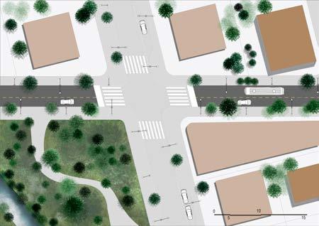
A rearrangement of arterial roads is proposed, with the implementation of bicycle paths, aimed at improving the spatial quality of the environment, which is often geared towards the vehicle. In addition, it allows travel to the BRT points, where there are bicycle racks.
Connections through bridges that assume a public character and that connect natural channels to local roads and condominiums, creating greater permeability between spaces.
Green Corridor
Criação de corredores verdes propondo um ambiente de mais conforto para os pedestres e ciclistas, e fazendo com que haja a interação com o meio em que está inserido. Localizados em áreas limites de parques verdes e ecológicos, que foram propostos.
Green Streets
Integra os parques criados e funciona como um prolongamento do corredor verde para a zona 2. Funciona como uma área verde próximo à condomínios residenciais.
New Local Roads
They interconnect Zone 1 and Zone 2, using the back of empty lots, creating new meeting points and connecting Zone 2 with Zone 3, integrating sectors, social groups and parks. In addition, the proposed pathways structure the densification mesh connecting with the current system. The new local roads created have the presence of feeders that make the areas to be connected, and thus bring about an improvement in the quality of life of those who need to move inland to meet their needs.
Rehabilitation of Estrada do Pontal New Meeting Point
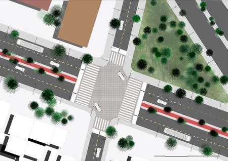
Due to the analysis made on the hierarchy of the roads present in the cut, it is proposed a requalification of Estrada do Pontal, which aims to improve the public lighting equipment, bringing safety to those who pass through the site. In addition, cycle lanes are implemented that provide access to pedestrians and cyclists. The implementation of the bike path also ends up generating cores in the cut with different needs.
From a point analyzed and understood as a center of importance, an urban gateway, the meeting of these roads helped to propose a permeability between Zones 2 and 3, through the connection with the green corridor in addition to ecological parks that preserve the pockets and keep the ecosystem active. Aiming to have the pedestrian as the primary agent, lanes are created that make walking in comfortable and safe environments, establishing the humanization of some areas on Avenida das Américas.
Via with feeders
Bike Racks
MAPA SÍNTESE DO RECORTE 05
Commercial
Limit and contain urban sprawl to areas intended for the preservation of the ecosystem and the soil.
Interconnect areas without communication between them, through feeders, in order to value the exchange between social groups and their identities.
Connect the Estrada do Pontal channel (Zone 1) with the local roads and backs of the residential condominiums in Zone 2.
Integrate arterial route with local route under canals through bridges, enabling walking and permanence in these areas.
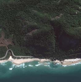
Preserve and conserve natural areas, ecological refuges, and reserves, in addition to the Pedra do Maciço.
Generate new centralities and generating points of travel and meeting, in areas connected with commerce, and in preservation areas, which function as ecological parks and green squares.
Link the green areas in order to preserve these environments.
Dense the lots with homes, social centers, and services, bringing a new dynamic to the cut.
2 • professional
Swiss Brazilian School
year • 2018-2021
location • Barra da Tijuca, Rio de Janeiro, Brazil
program • educational
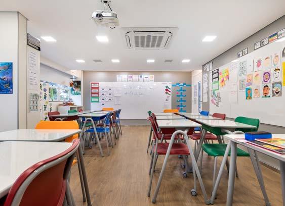
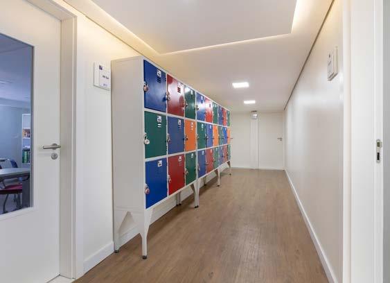
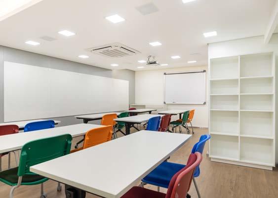
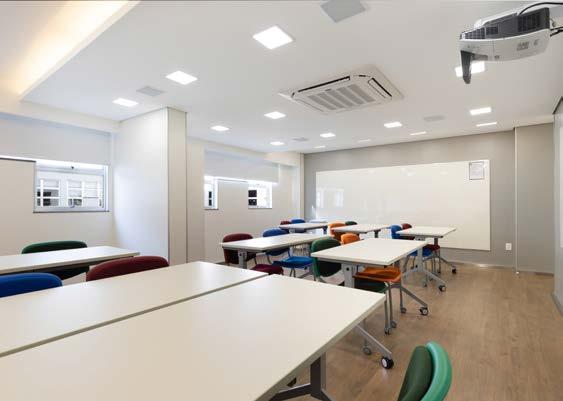
Professional Work at Feu Arquitetura
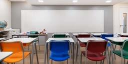
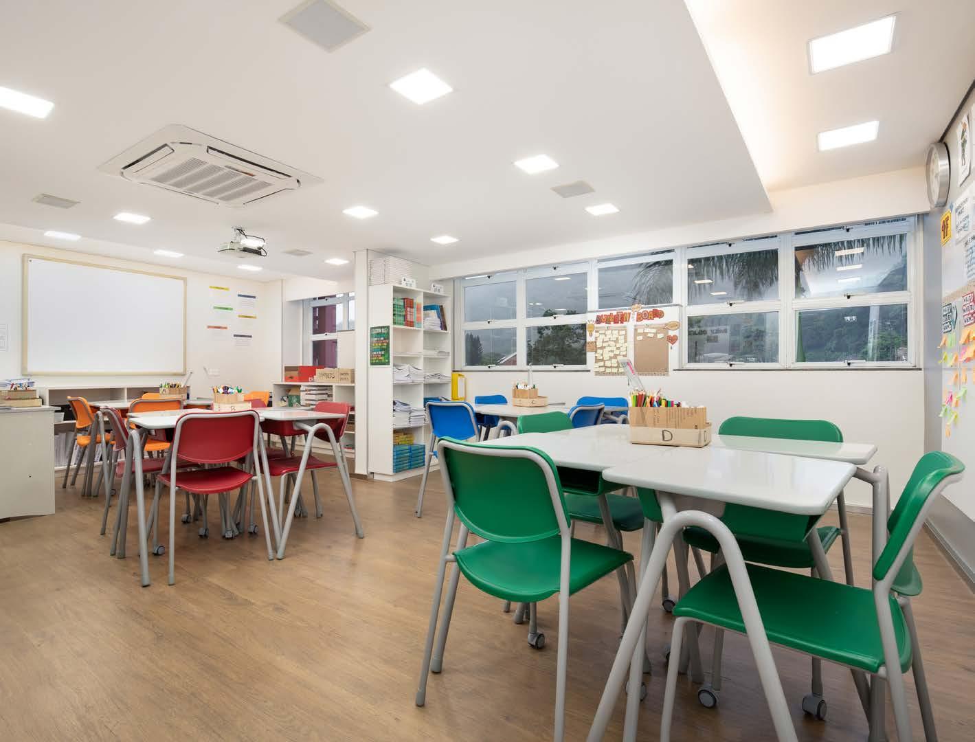
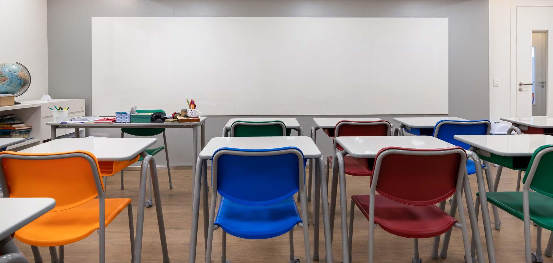
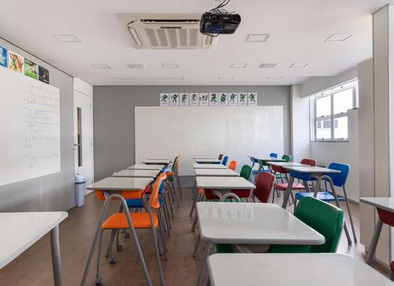
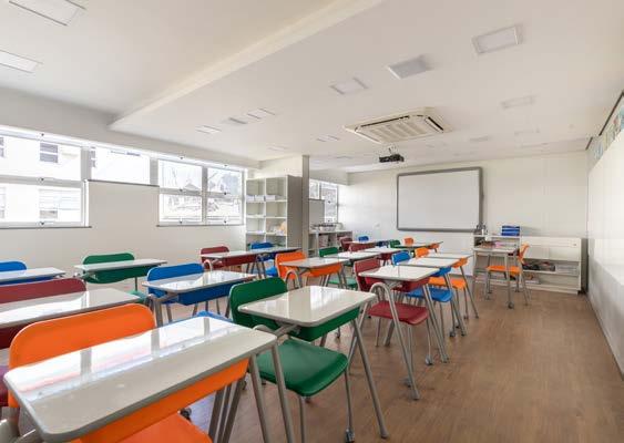
The first job I did at Feu Arquiteura, during my experience as an intern, was the design of the new classrooms at the Escola Suiça Brasileira, in Rio de Janeiro.
The fundamental concept of the project was to maintain the flexibility of the layout with furniture that could provide this. The colors of the tables and chairs follow the school standards, making them look more colorful.
Paintings occupied all the walls, in order to maintain the concept of being able to appropriate different forms within the room. The chosen materials, such as formica and vinyl flooring, allow for greater conservation, durability and cleaning.
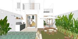
3D Modeling for Morolli
Architecture + Ana Montenegro
year • 2021
location • Jardim Botânico, Rio de Janeiro, Brazil program • housing
Professional Work as freelancer
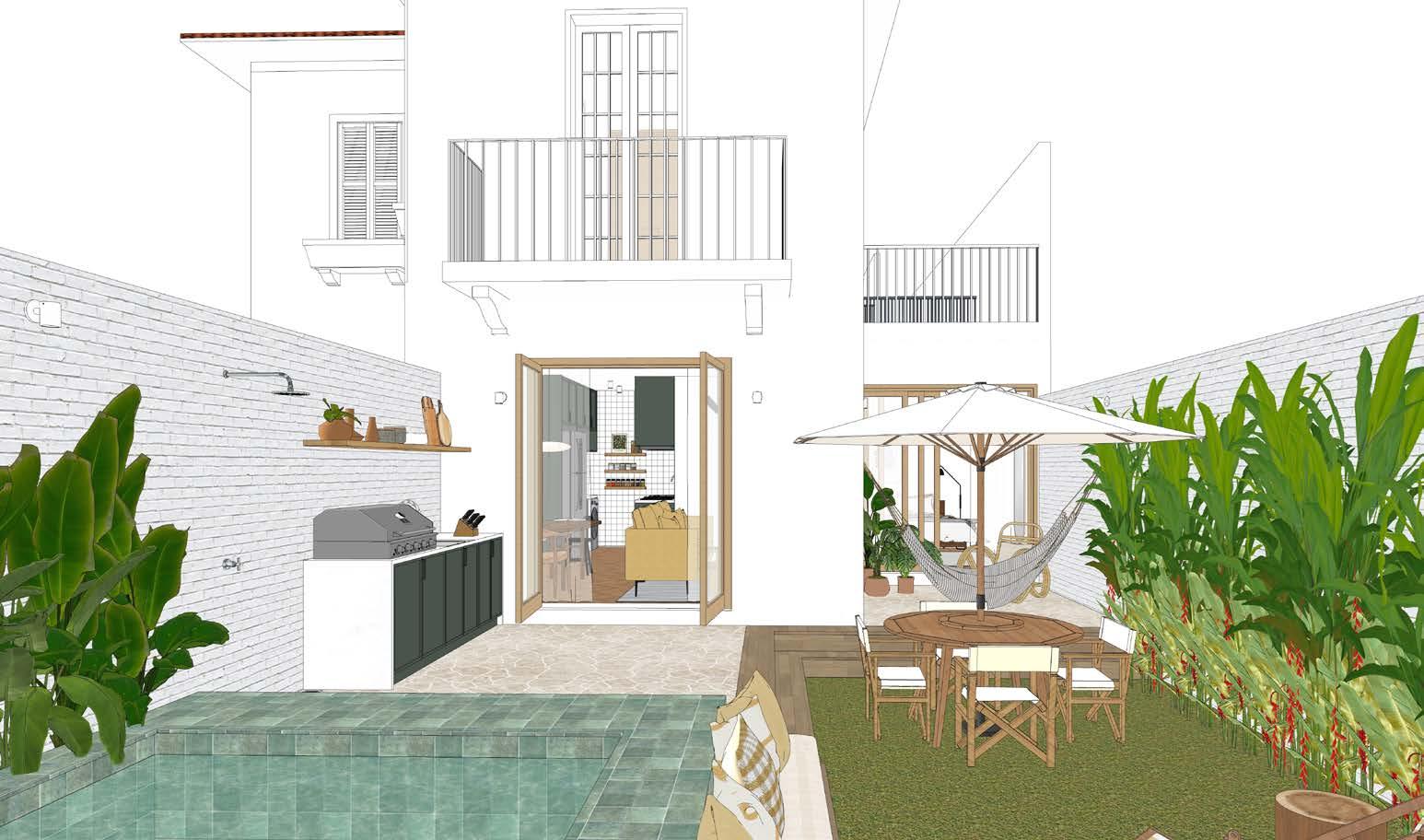
This work comprised the elaboration of 3D modeling in partnership with Paula Morolli to elaborate on the interior design of the new residential in Jardim Botânico, Rio de Janeiro.
The architecture project is by A+ Projects with the real estate developer Briix, in partnership with the architects. They presented the concept images of the project as follows, like in the sequence below.
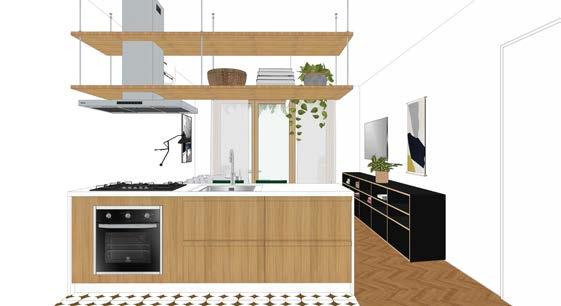
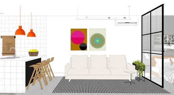
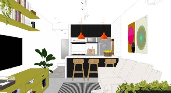
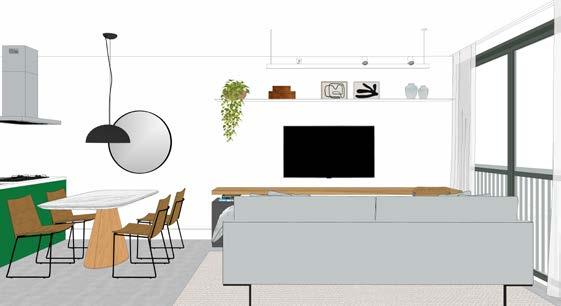
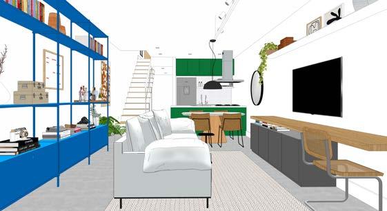
The house, currently degraded, will give life to 6 apartments with integrated kitchens and living rooms, as well as gardens. The common areas will integrate with the new annex that will build, comprising another 6 apartment units.
integrated rooms and kitchens
integrated rooms and kitchens
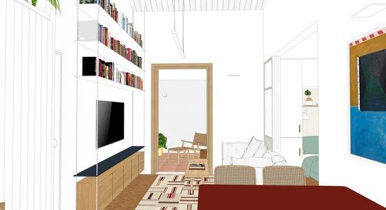
3D Modelling and Rendering
year • 2022
Professional Work as Freelancer
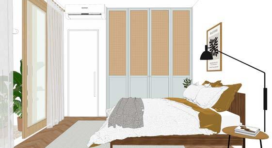
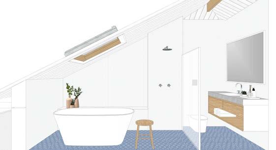
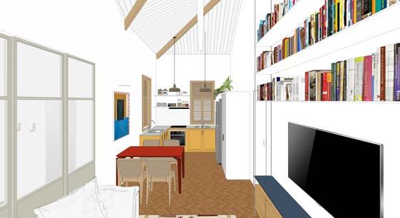
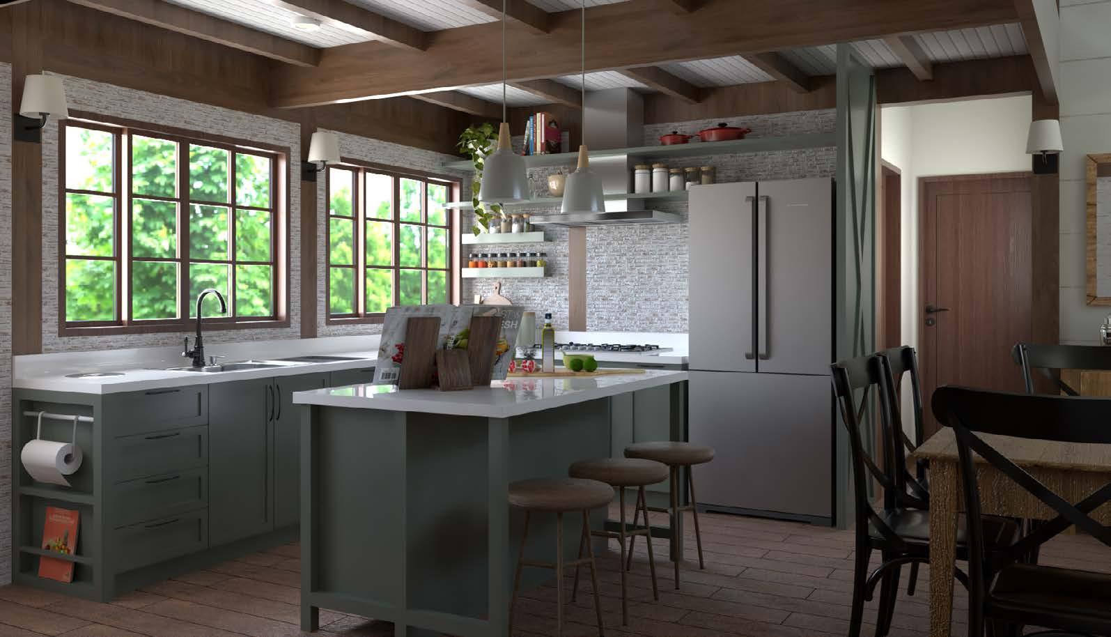
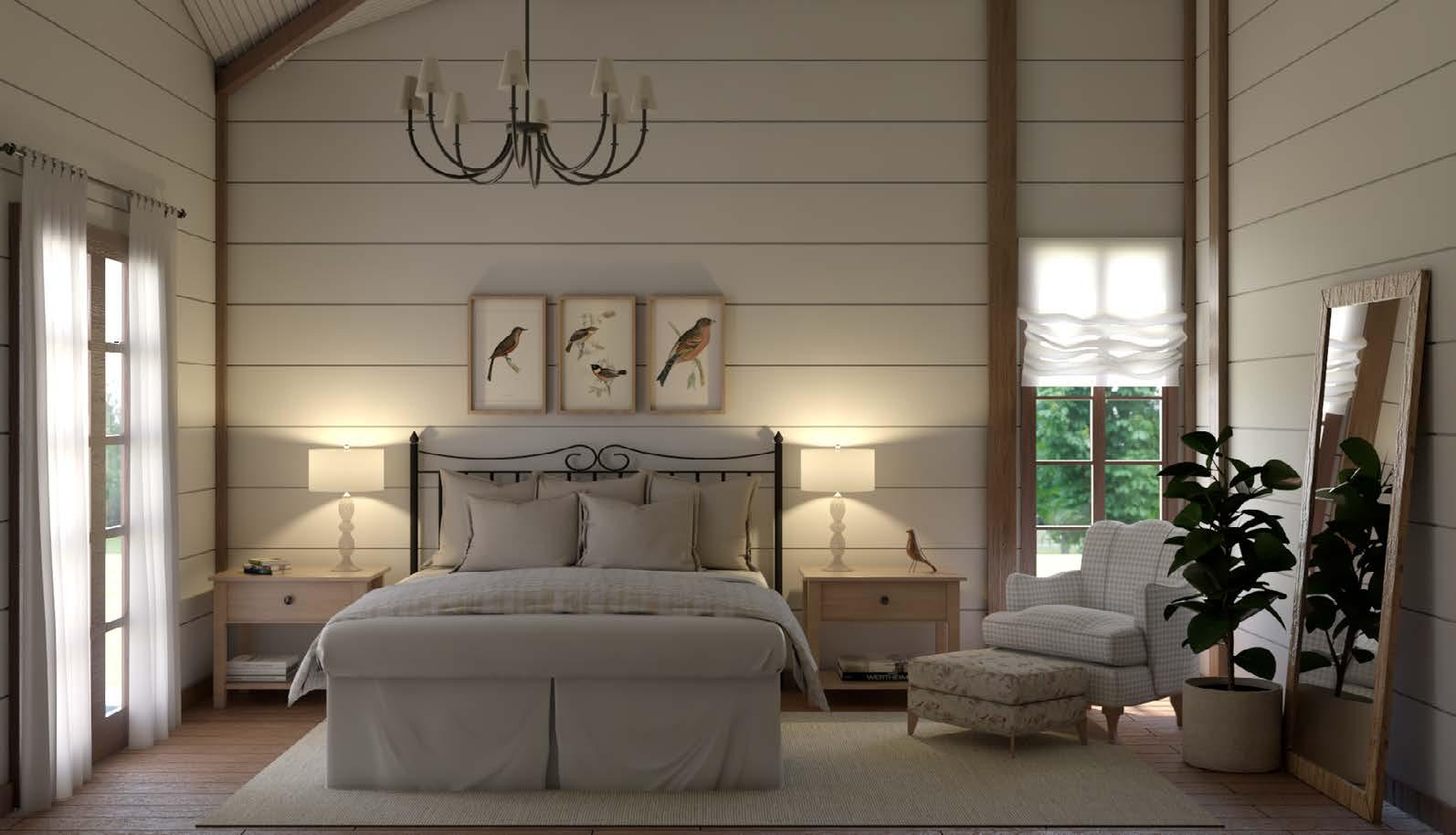
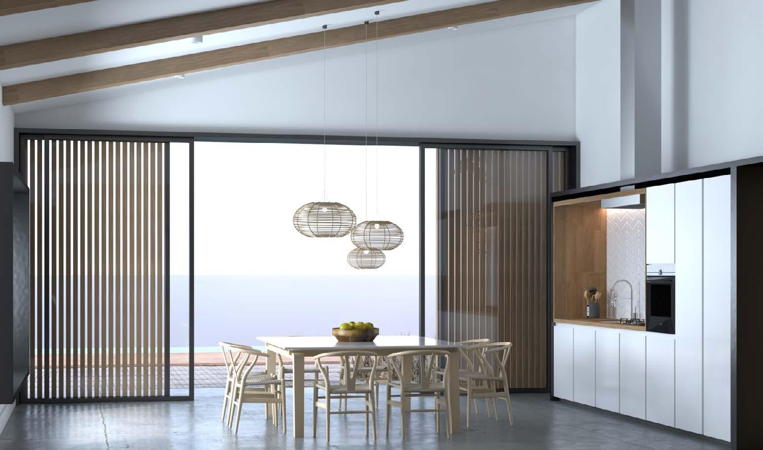
Residential Project, Itaipava, Rio de Janeiro, Brazil
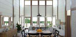
Images for an interior design, made from the 3D model, with Sketchup Pro software and rendering with Vray 3.6 and Vray Next.
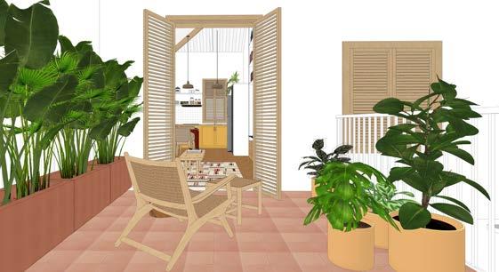
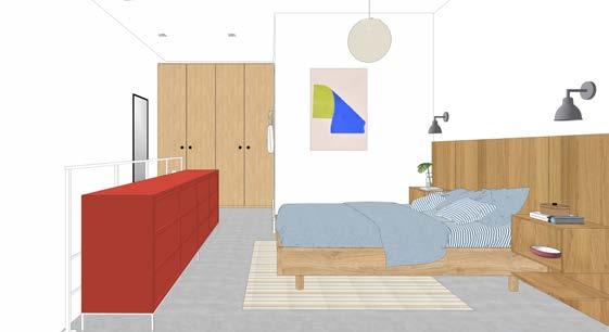
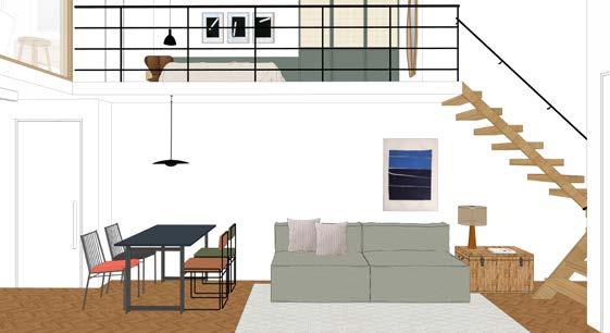
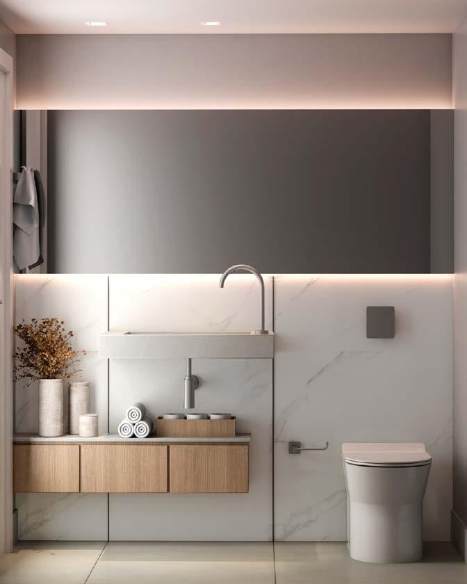
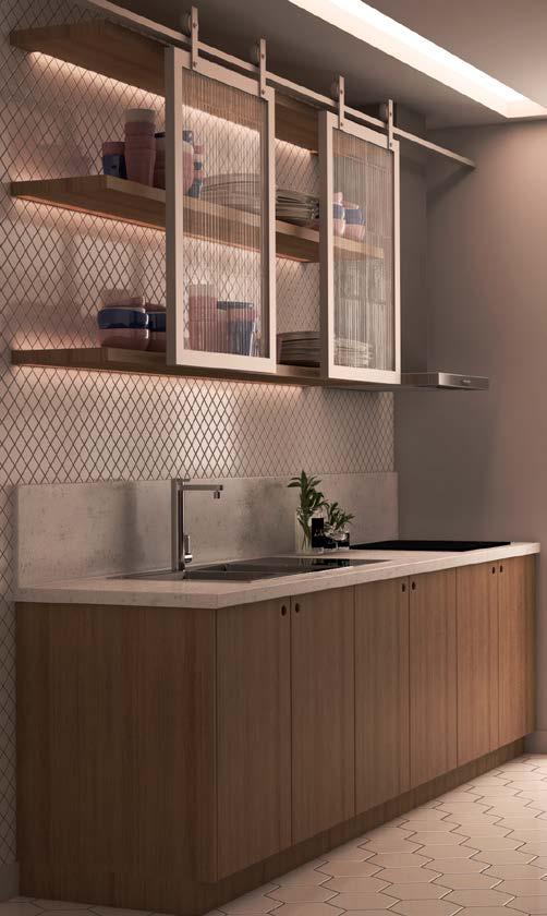
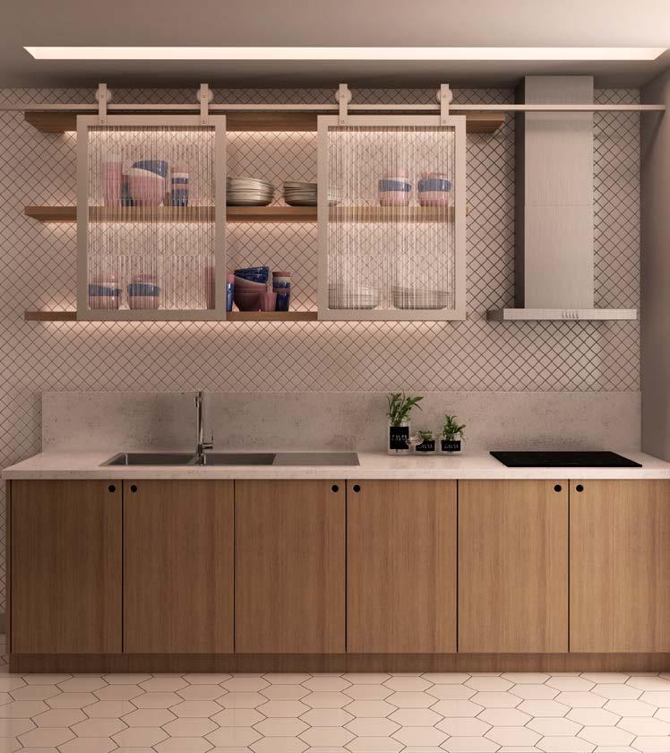
year • 2022
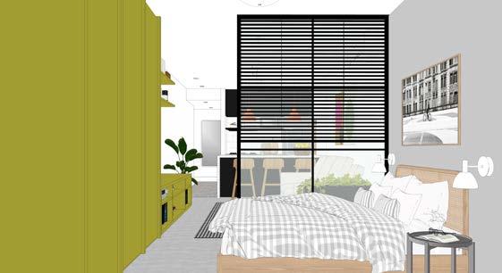
Professional Work as Freelancer
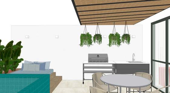
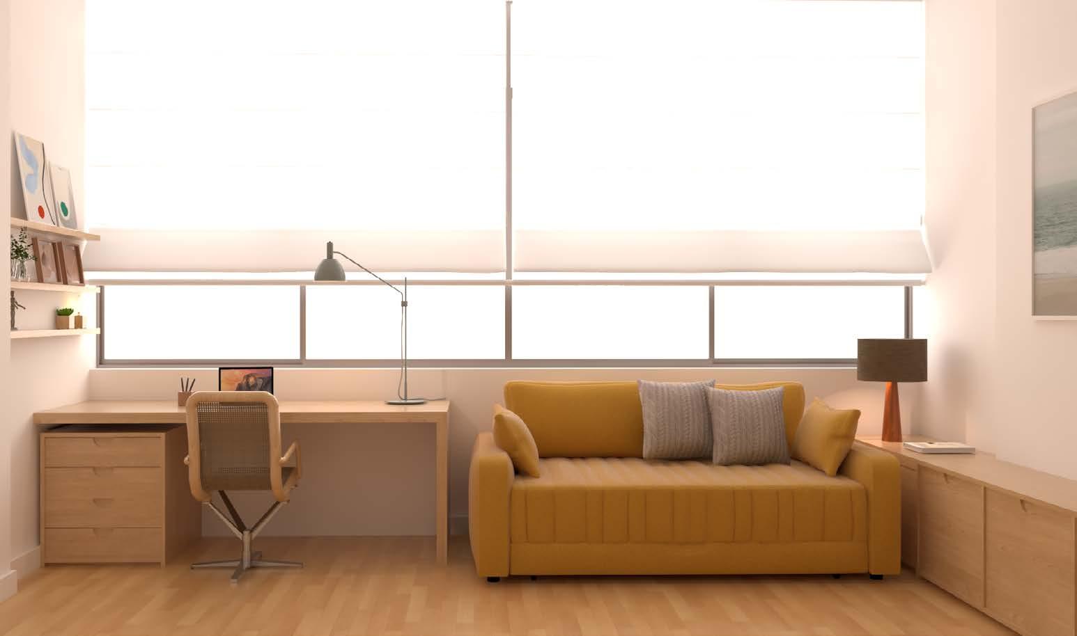
Residential Project, Rio de Janeiro, Brazil
Partnership with Estúdio Villa
Images for an interior design, made from the 3D model, with Sketchup Pro software and rendering with Vray 3.6 and Vray Next.
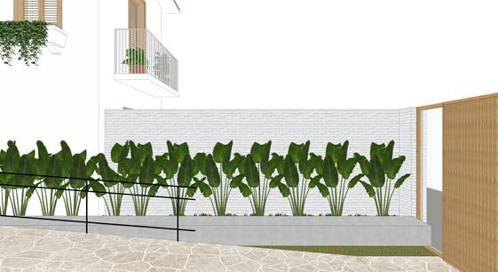
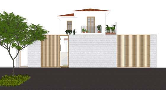
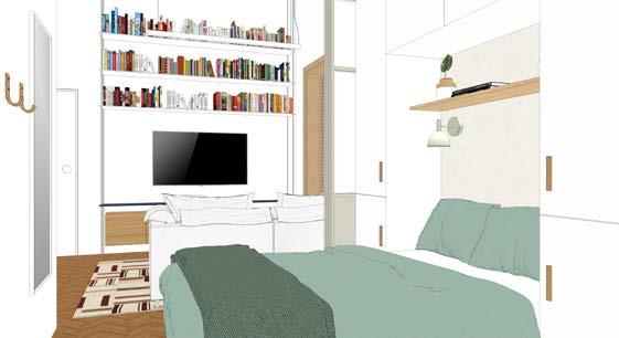
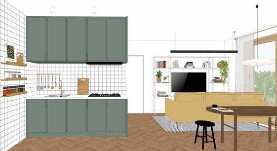
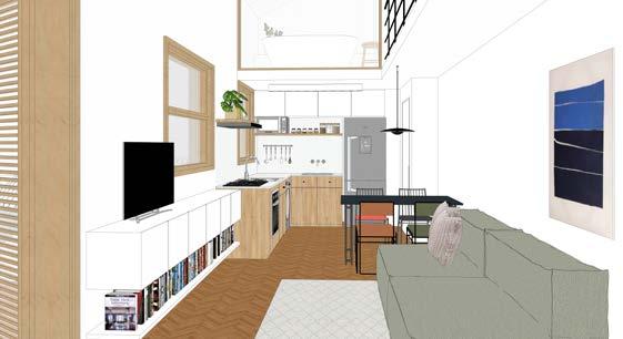
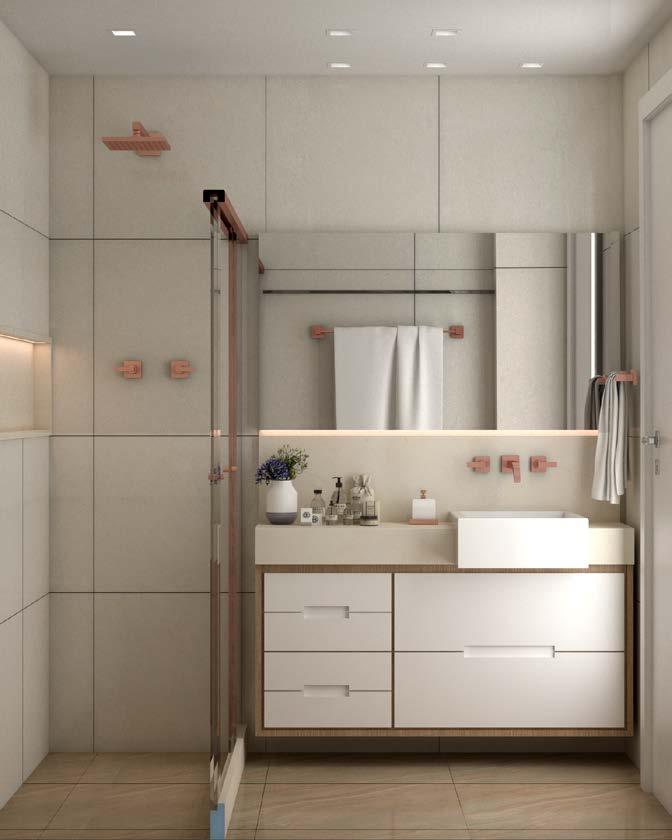
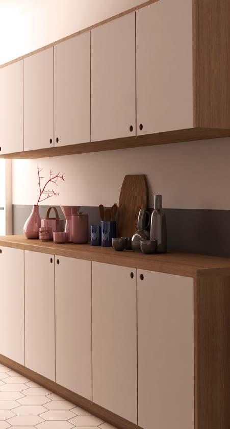
• 2022
Professional Work as Freelancer
Images for an interior design, made from the 3D model, with Sketchup Pro software and rendering with Vray 3.6 and Vray Next.
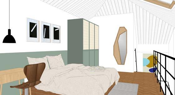
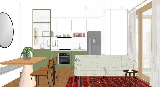
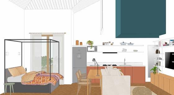
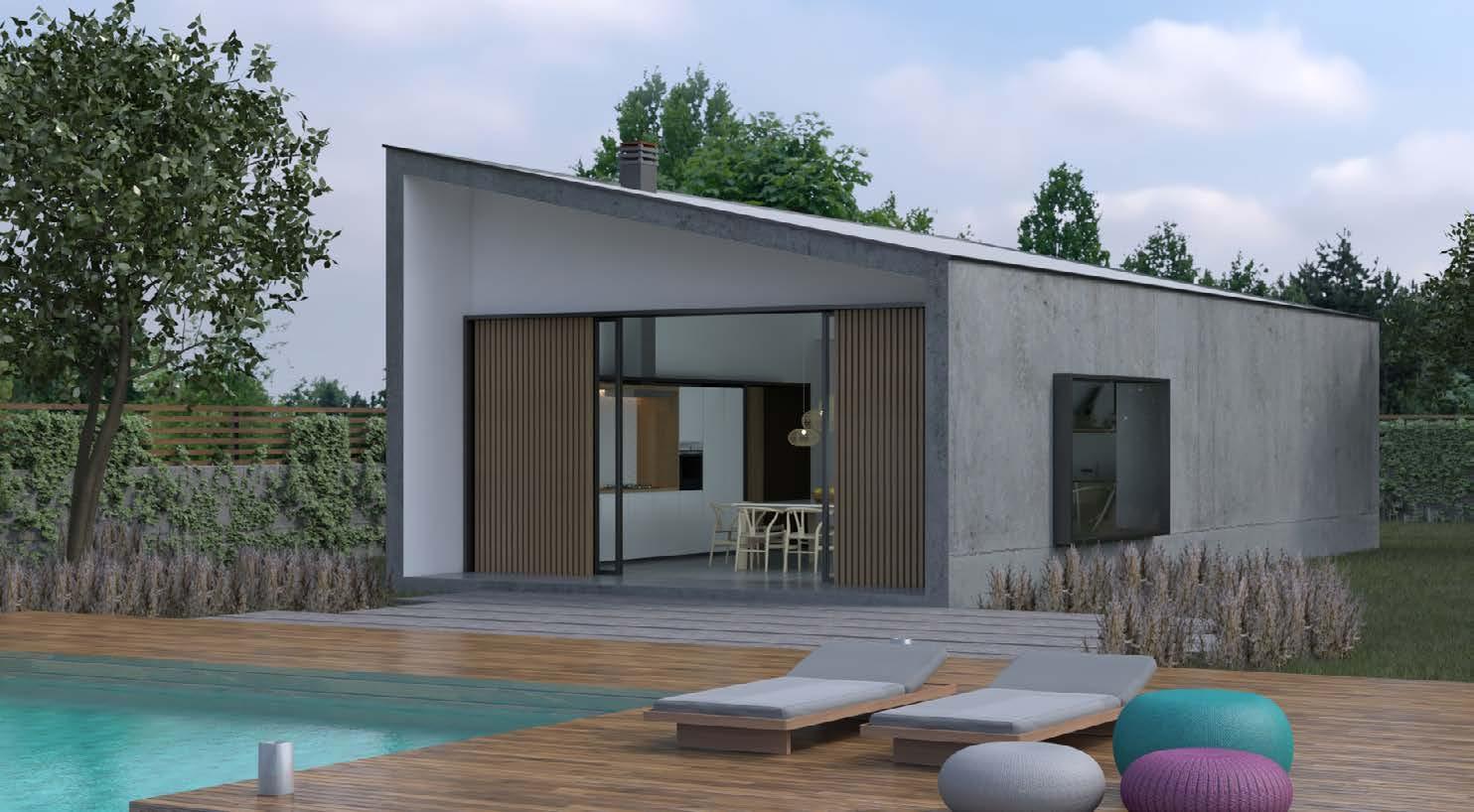
External images taken during the Lev Design Course, LevUp 3D 2.0, taken from the 3D model, with Sketchup Pro software and rendered with Vray 3.6 and Vray Next.
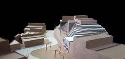
3d Models, Studio V
year • 2017
location • Center, Rio de Janeiro, Brazil
program • cultural center
partnership: Gabriela Basilio e Larissa Lima
Academic Work • Puc - Rio
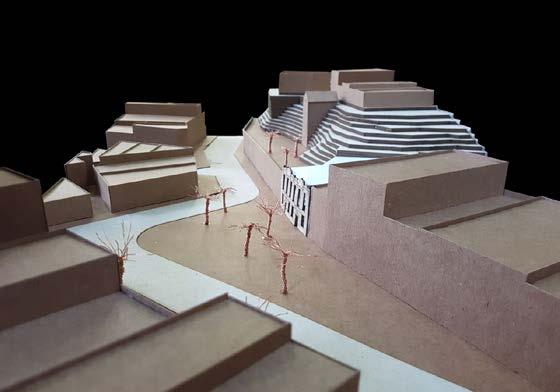
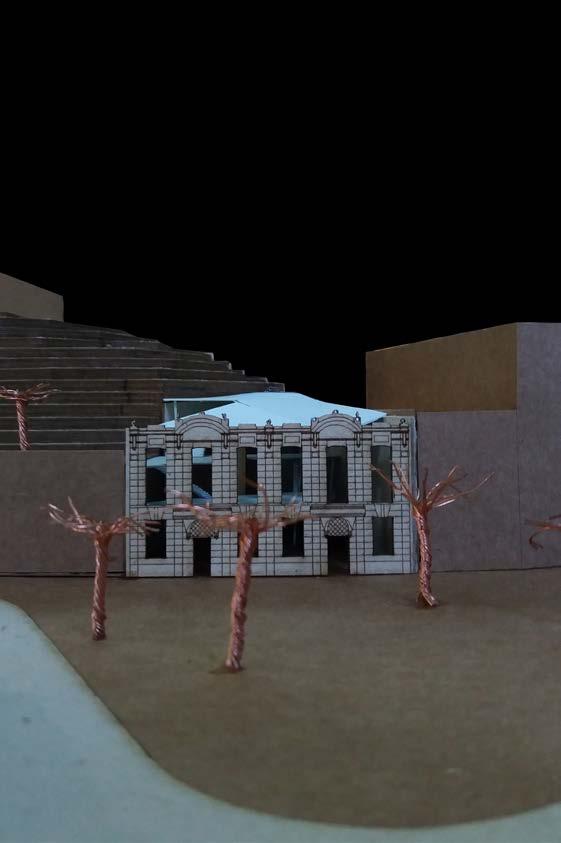
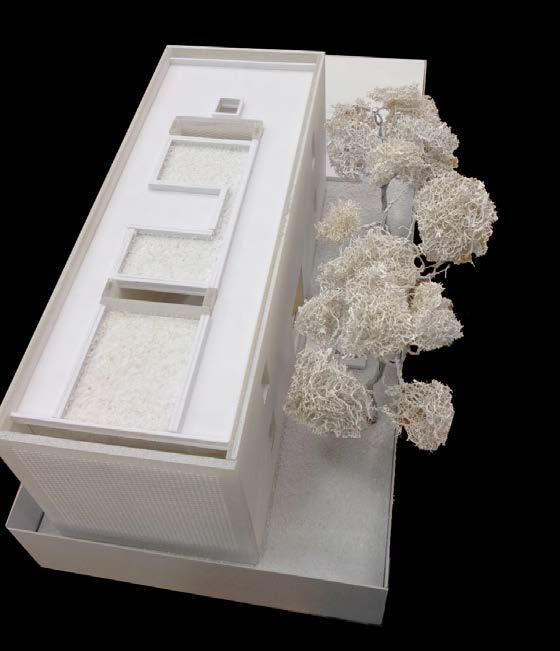
Model of the project at studio V, which comprised the revitalization of a ruin in Gamboa, in downtown Rio de Janeiro, in a cultural center in memory of African culture.
3d Models, Studio III
year • 2016
partnership • Bruno Bins, Giulia
Academic Work • Puc - Rio
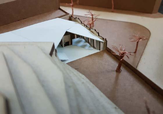
Mockup made during project workshop III, for group analysis, of Termitary House, at Tropical Space office, in Vietnam.