
Gender Female
Nationality Egyptian
Date of Birth 31/03/1995
Gender Female
Nationality Egyptian
Date of Birth 31/03/1995

Motivated urban planner and designer, passionate about crafting sustainable livable spaces with a focus on innovative and user-centred solutions. I approach challenges with a collaborative and multidisciplinary mindset. Known for fast learning, adaptability, and unwavering commitment to tackling complex tasks with persistence, creativity, and finding the most efficient solutions.

Present
+393516276564
Piazza S.Giovanni
Bosco 12, Belluno - Italy
verna.aziz@gmail.com
www.linkedin.com/in/ verna-aziz
L A N G U A G E S
Italian B2 - Intermediate
English C1 - Advanced
Arabic Native
Mar. 2024
Urban Planner
Studio planning - Italy.
Experienced working on PAT , PI , CDU (statisticstutorial videos), updating CTRN, calculations of built areas, mapping services and public buildings.
Junior Urban Designer
Parcianello & Partners Engineering S.R.L- Italy.
Jul. 2023 May 2023
Competition collaborator (Urban Planner)
CoPE - Italy.
Participated in mobility and land-use analysis, masterplan design, and graphics of Regensburg case for Europan competition 17.
Experienced designing bike lanes, public spaces, and sportive fields throughout Italy from the preliminary to the executive phase.
Graphics
& Analysis
Design & Modeling
Gender Female
Nationality Egyptian
Date of Birth 31/03/1995
Competition collaborator (Urban Planner) CoPE - Italy. Sep.2021
Participated in analysis, masterplan design, and graphics of Fagerstrand case for Europan competition 16. Jul.2021
May 2021 Intern Researcher
Politecnico di Milano university - Italy.
Worked on analyzing Abu-Dhabi as a case study in terms of spatial planning and architectural responses at the time of emergency under the supervision of Prof. Alessandro Coppola. Feb. 2021
Aug. 2017 Intern Urban Designer
+393516276564
Piazza S.Giovanni
Engineering Consultants Group S.A. - Egypt.
Transit Service Design course
Planetizen courses | Jan. 2024
Urbanism Cloud Platform course
Planetizen courses | Jan. 2024
Career Service award
Career service - Politecnico di Milano university | May 2022
KECTIL Leadership Youth program
Malmar Knowles Family Foundation | Dec. 2019
verna.aziz@gmail.com
www.linkedin.com/in/ verna-aziz
L A N G U A G E S
Italian B2 - Intermediate
English C1 - Advanced
Bosco 12, Belluno - Italy Arabic Native
Jul. 2017
Participated in designing the masterplan of a touristic village in Saudi Arabia.

Apr. 2022
MSc. Urban Planning and Policy Design
Politecnico di Milano University, Italy
Sep. 2019
Jul. 2018
Sep. 2013
Overall grade: 107/110
BSc. Architecture & Urban Design
Graduation project grade: Very Good Ain-Shams University, Egypt
Overall grade: Very Good
M2GATE Leadership program
W.D. Institute-Michigan University | Mar. 2018
I hereby authorise the use of my personal data in accordance to the GDPR 679/16 - "European regulation on the protection of personal data"

Europan 16 competition 2021- Intern at CoPE
Teamwork
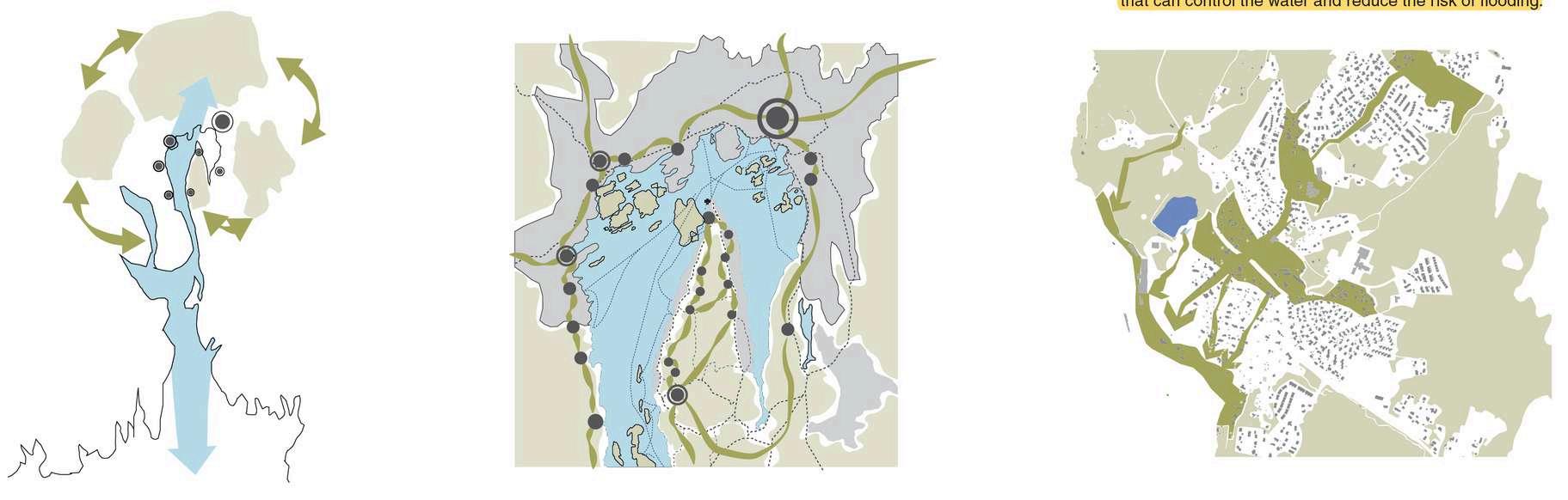
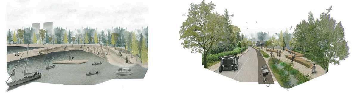
The project site is located in Fagerstrand - Norway that is characterised by having fragmented zones: abandoned polluted industrial zone, underused waterfront zone, settlement expanding and threat the ecological environment.
ALong with CoPE team, the analysis was carried out by layering the context: built area, environment, and social activities. The main aim is to connect and enhance ecological networks on different scales, in addition, to promoting human connection by creating various waterfront public spaces, a network of pedestrian and cycle paths.


The first approach is to support the ecological system focusing on the creation of a green network on different scales that allows the natural permeability through the urban tissue. Identifying five corridors that run north-south linking the existing natural system and allowing a wildlife passage for animal migration, helping to maintain a high degree of biodiversity.
The corridors system is supported by a layer of water management system for rainwater.
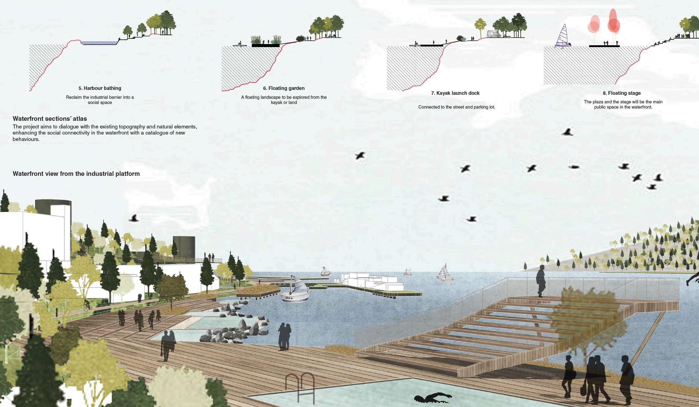
The second approach is to create spaces for socialization. The project will bring people back to the waterfront by redesigning open and public spaces.
From the current beach zone, passing by the Fagerstrand ferry terminal until the hiking route on the further north, a series of new public spaces are designed. In addition to long pedestrian and bicycle promenade network connects different social ambiances.

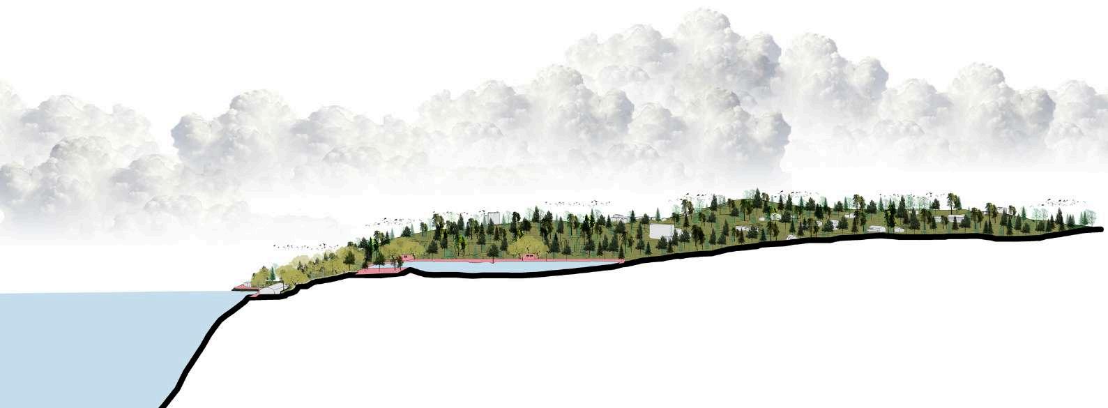
A r o u n d O s l o ,
a s e r i e s o f p a r k s
p r o m o t e a
f u n d a m e n t a l n a t u r a l
r e s o u r c e . T h e p r o j e c t
a r e a i s a p a r t t h a t
h a s t h e o p p o r t u n i t y
t o c o n t i n u e t h e
e c o l o g i c a l n e t w o r k o n
a t e r r i t o r i a l s c a l e
T h e e c o l o g i c a l
n e t w o r k w i l l g o
t h r o u g h t h e u r b a n i t y
o f t h e m e t r o p o l i t a n
r e g i o n t h r o u g h t h e
p r o j e c t a r e a
T h e e c o l o g i c a l n e t w o r k
i n t e r s e c t s t h e p r o j e c t a r e a b y
p r o m o t i n g f i v e e c o l o g i c a l
c o r r i d o r s t h a t c o n n e c t t h e t w o
s i d e s o f t h e l a n d s c a p e o f t h e
t o w n . A c o l l e c t i o n o f b i o s w a l e
b u i l t p e r p e n d i c u l a r l y t o t h e s e
f i v e l i n k s w i l l b e a n a d d i t i o n a l
s e t o f n a t u r a l d e v i c e s t h a t c a n
c o n t r o l t h e w a t e r a n d r e d u c e
t h e r i s k o f f l o o d i n g .
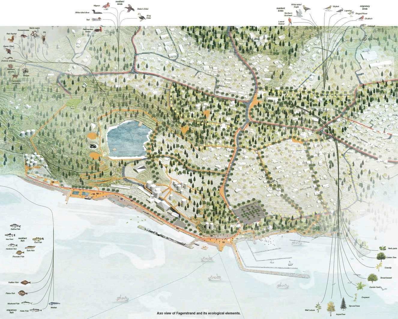
Ecological corridors, landscape, and animals species.
P l a y k n o t
S p o r t s k n o t
E v e n t k n o t
B e a c h k n o t
The master plan shows the pedestrian and bike networks, social spaces, and activities
P e d e s t r i a n n e t w o r k
B i k e l a n e
N o r d i c s k i i n g
H i k i n g
w a t e r n e t w o r k
E x i s t i n g t r e e s
E x i s t i n g F o r e s t
N e w t r e e s

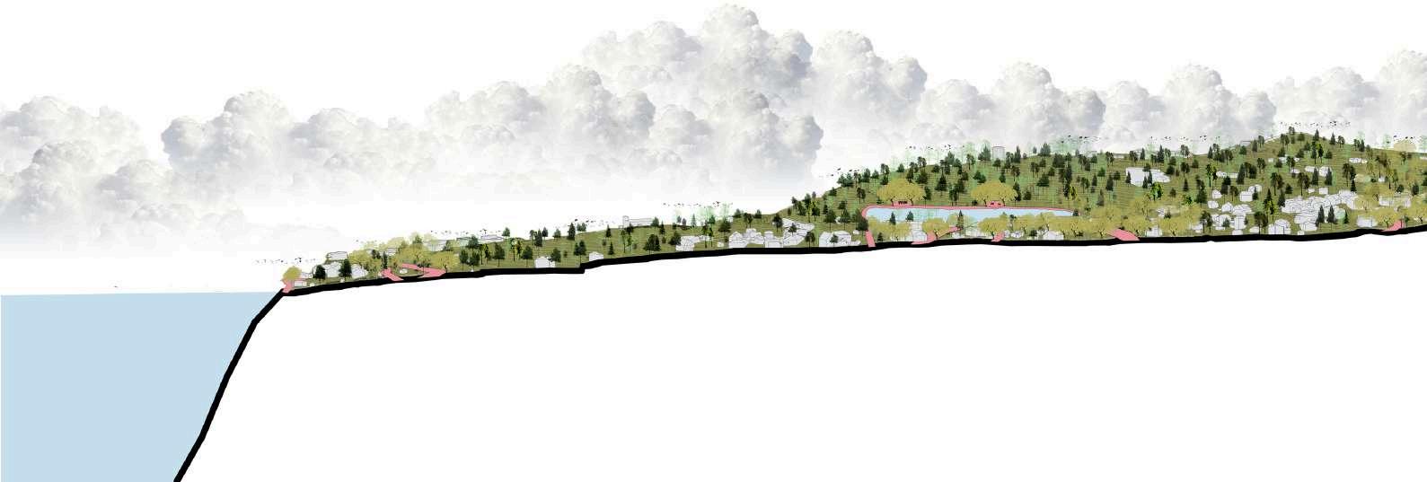
S e c t i o n A - A
S t r e e t w i t h t h e p r o p o s e d s l o w
m o b i l i t y s y s t e m a n d a g a r d e n
w i t h w a t e r m a n a g e m e n t s y s t e m
W a t e r f r o n t p u b l i c h u b w i t h a
f l o a t i n g s t a g e e n c l o s e d b y t h e
g r e e n c o r r i d o r
S e c t i o n B - B
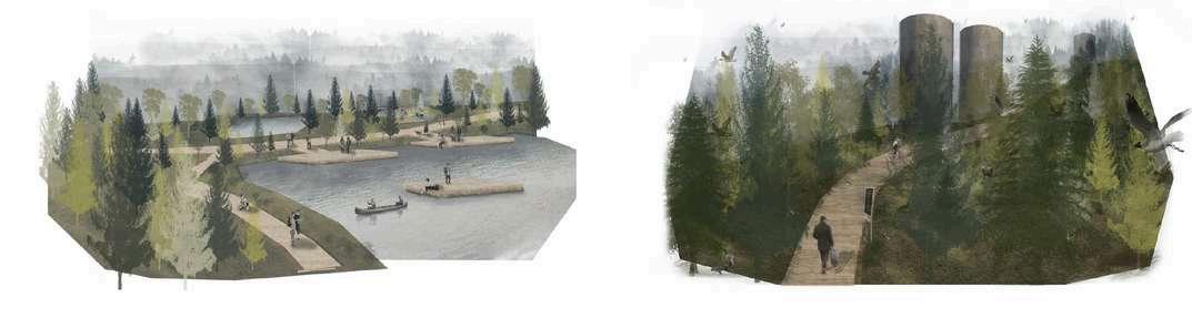
N e w w a t e r a c t i v i t i e s a n d
p e d e s t r i a n p a t h s a r o u n d
t h e l a k e
E c o l o g i c a l c o r r i d o r s
c o n n e c t t h e i n d u s t r i a l
h e r i t a g e
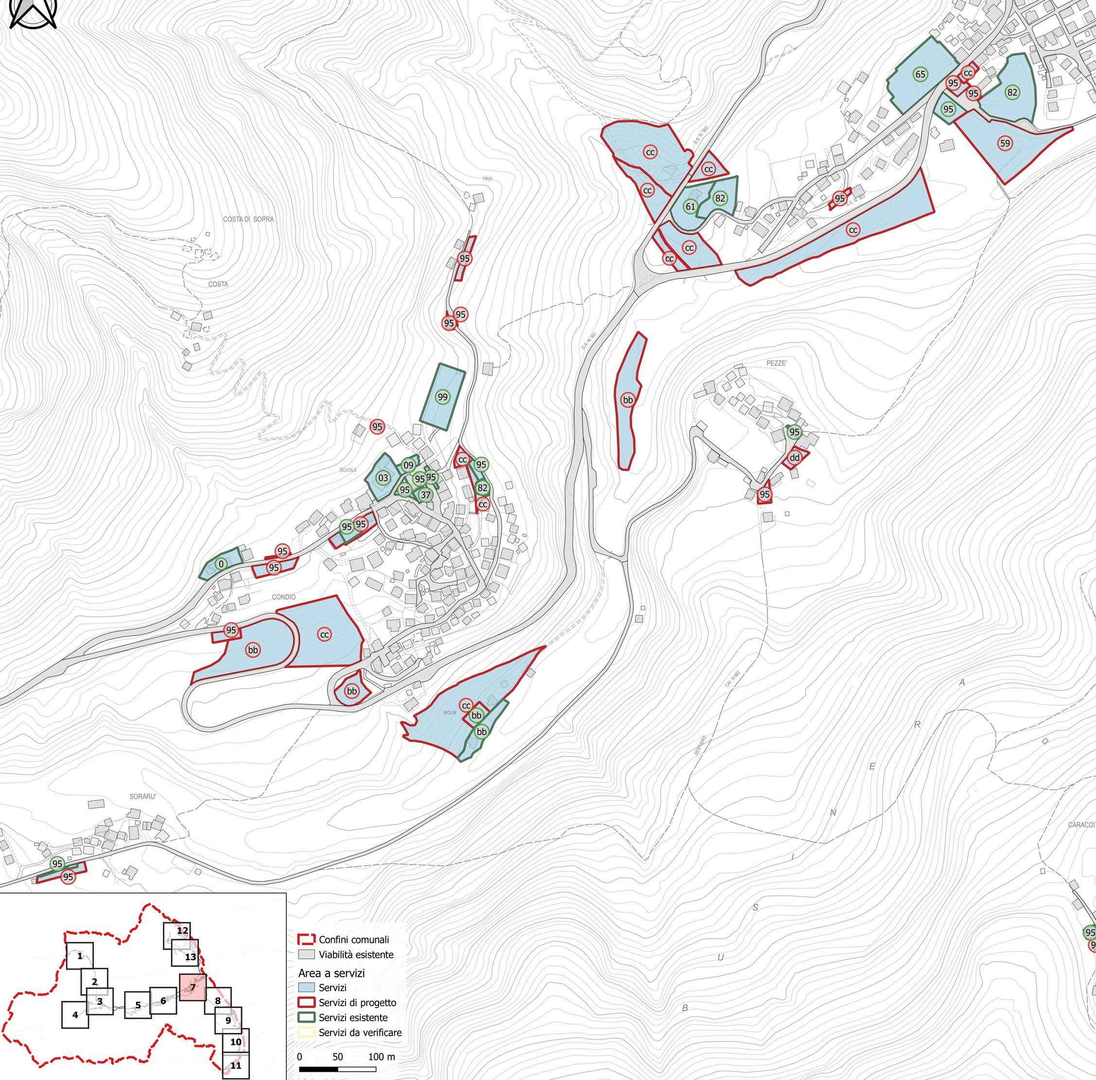
Studio Planning 2024
Self-Produced
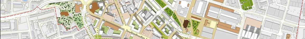
My role was mapping and classifying local services within various municipalities, such as Rivamonte Agordino, Comelico Superiore, and Rocca Pietore. My contributions involved identifying and mapping the available services in these municipalities, categorizing them based on their current status in addition to printing the layout using ATLAS. Specifically, I worked on classifying services into three categories: those that have been confirmed through validation with local authorities, those that are part of ongoing or planned projects, and those that require further verification with the respective municipalities.
P Y T H O N C O N S O L E Q G I S
3
Studio Planning 2024 - Self-Produced
I have extensive experience in developping scripts using the Python console and configuring actions within QGIS such as developing scripts for automating updates to the attribute table whenever geometries are modified. Additionally, I have found solutions for automatically modifying linked Excel tables based on changes in the attribute table, streamlining data management across platforms. I have also used custom actions that enable automatic navigation to open specific files or pages when interacting with particular features, such as clicking on a building. Moreover, I have developed scripts to copy styles from one set of shapefiles to another by matching their names, facilitating consistent styling across different datasets.
Spatial Planning and Infrastructure Design Studio 2019/2020- Politecnico di Milano
Teamwork: Amruta- Paola- Santiago- Verna
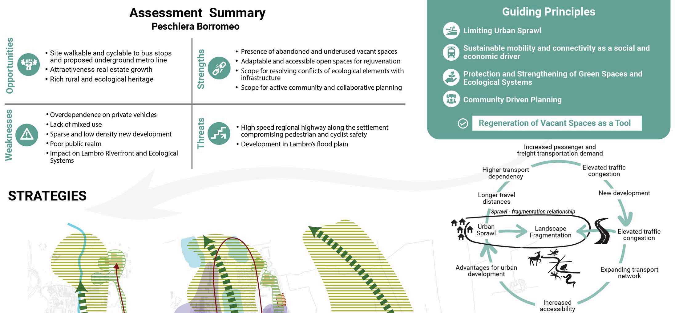
Study area located in the eastern edge of Milano contains significant parts of Segrate, San Donato Milanese, Rodano, Pioltello, Mediglia, and minor parts of Mediglia, Settala and Tribiano. It is characterized by Complexity that comes from sensitive ecological systems, agricultural lands, historical- rural settlements, and new urban upsurge.
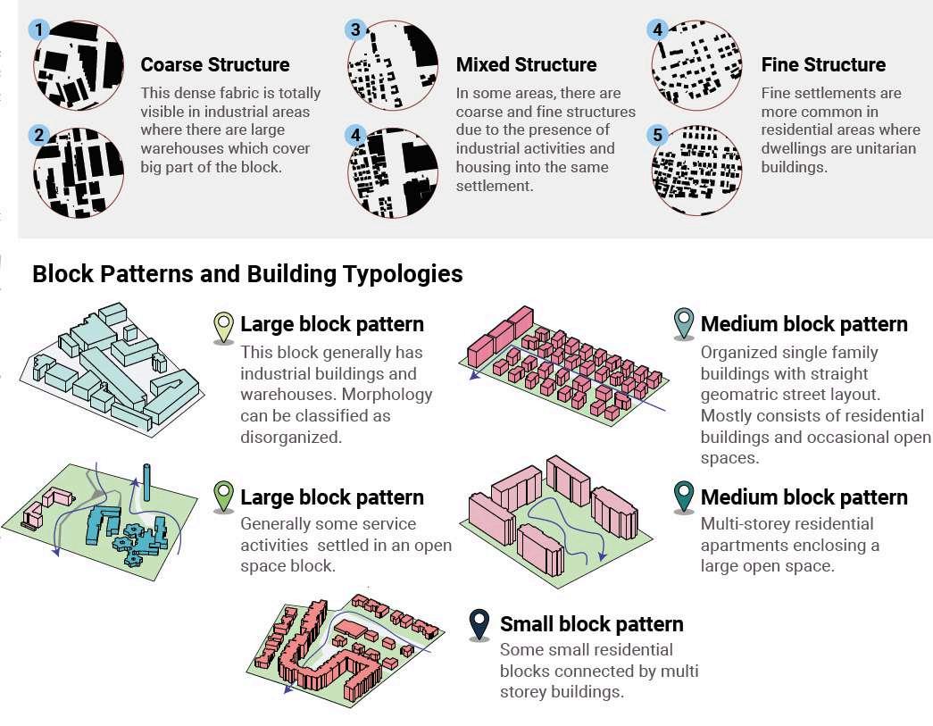
Analysis was carried out through three layers: mobility, land use, and the environment with consideration of state proposals to define the most complex zone for the project location. Attention was mainly devoted to analysis of vacant spaces to understand their taxonomy and to be positioned for the best use in the project.
Project Annexure (analysis of vacant lands):
https://tinyurl.com/2p92jcac

10 mins walk and cycle pedshed analysis from existing and future public transit stations
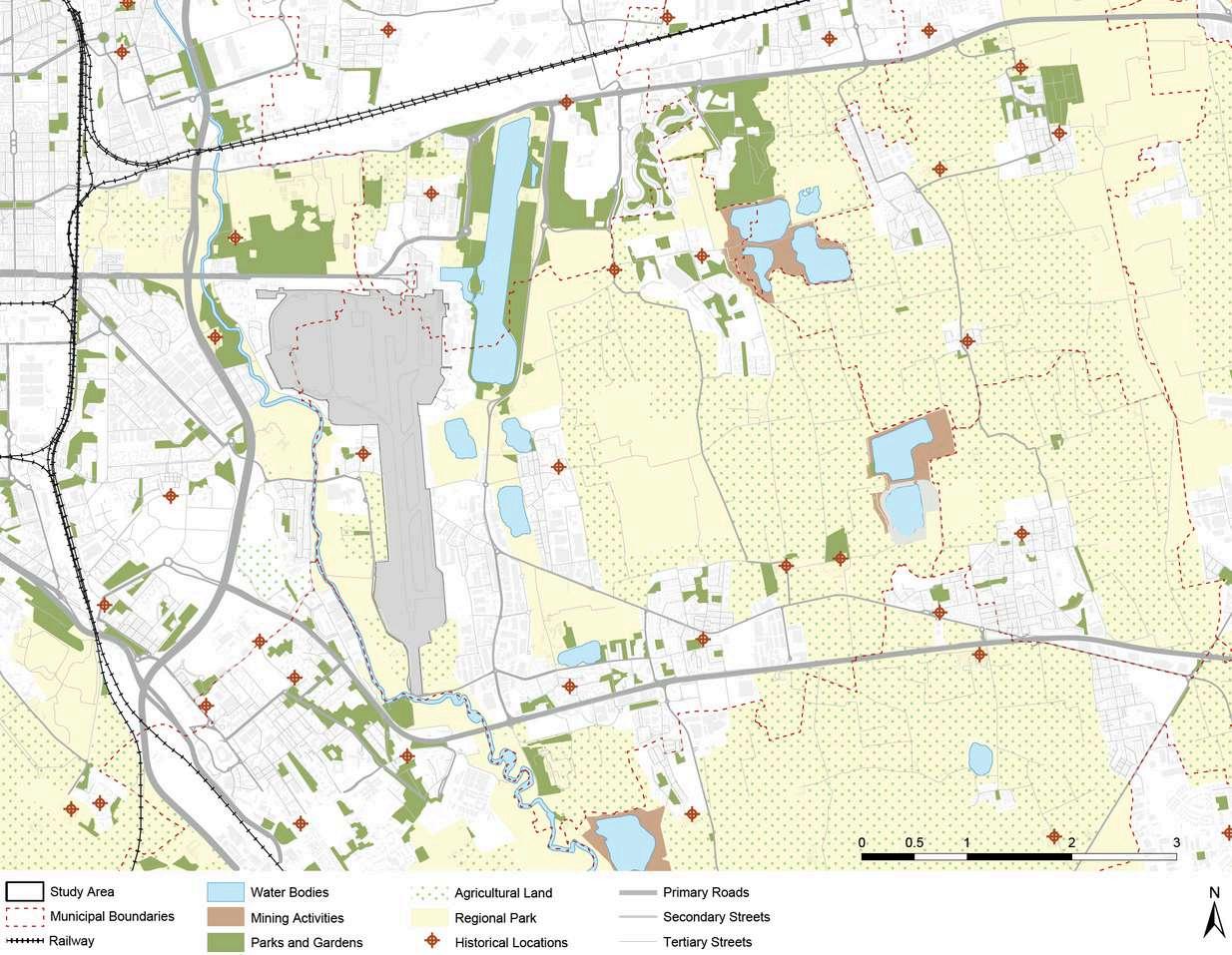
Urban open green spaces, agricultural lands and heritage sites
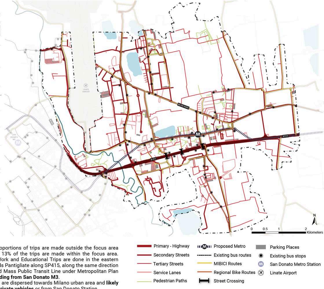
Existing and proposed infrastructure and stations
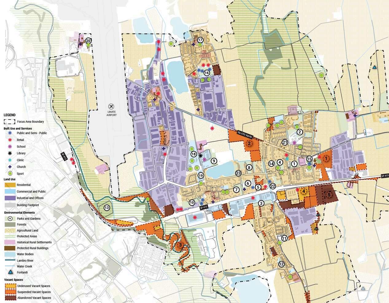
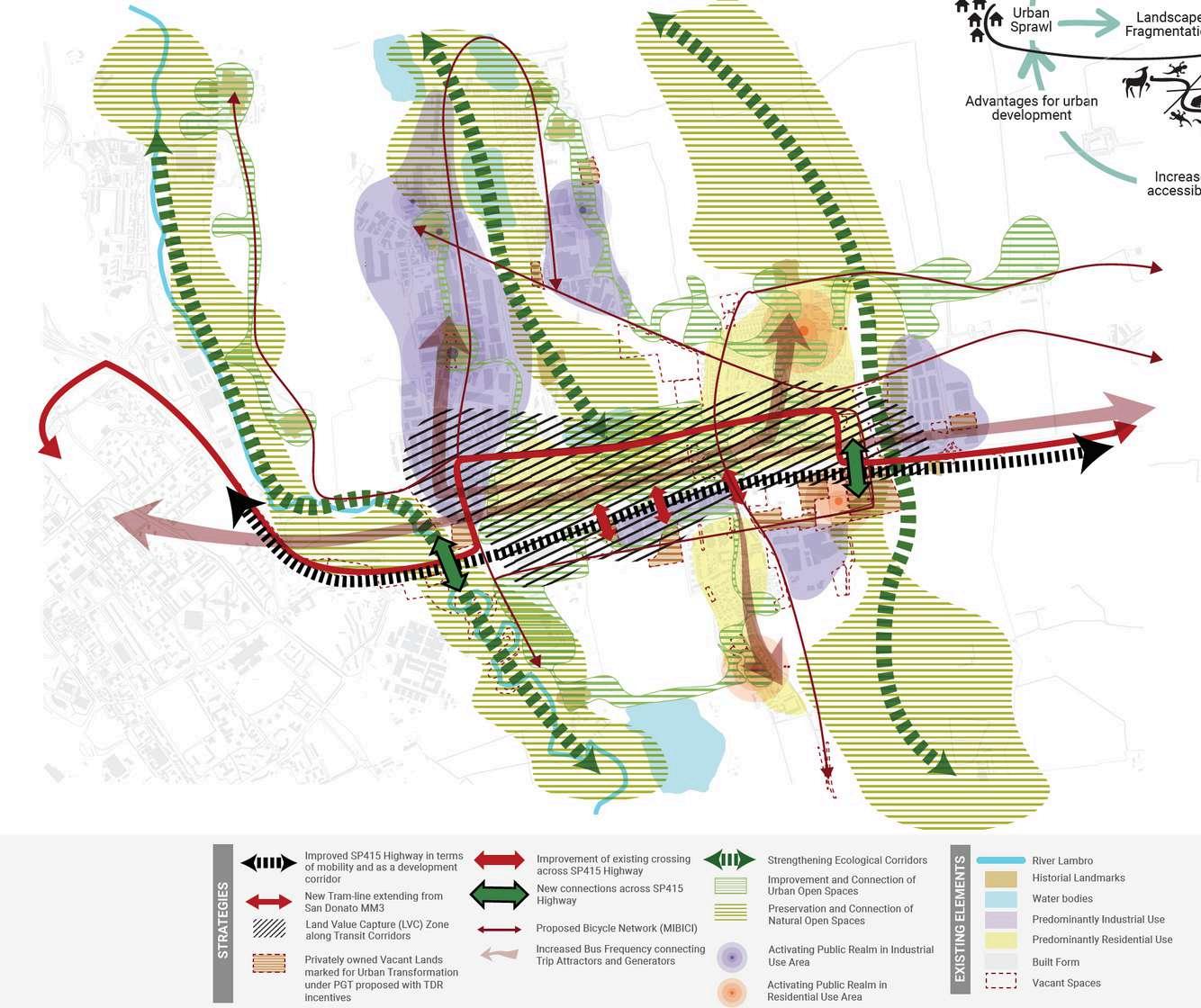
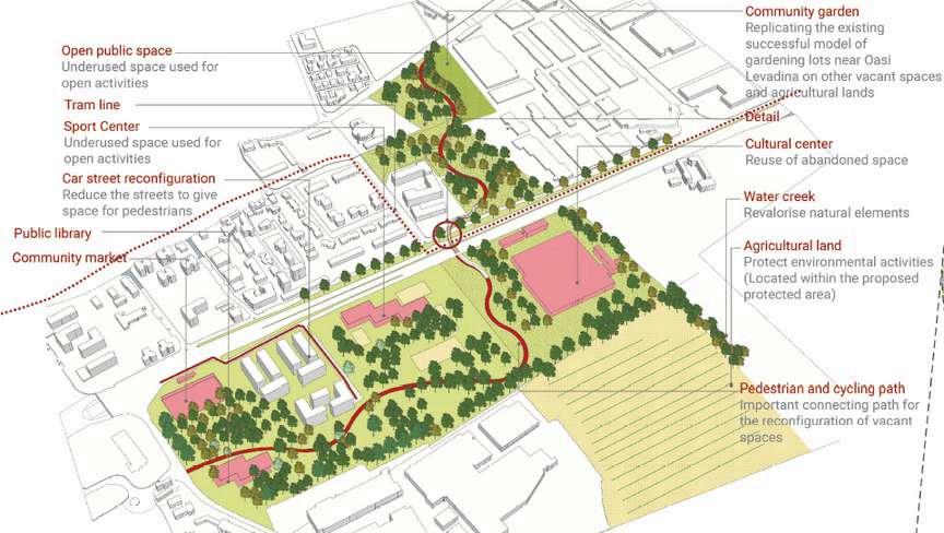
The proposal is to connect sides isolated by the highway with a green pedestrian bridge that connects vacant lands on both sides. Proposed uses for lands are lacking ones such as local markets and libraries with reusing abandoned buildings.
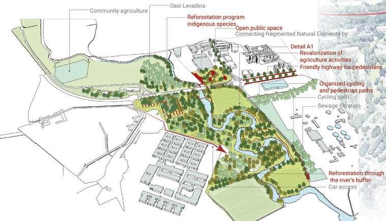
2nd Project:
It demonstrates the conflict between mobility and Lambro river through pedestrian and cycle lanes with restoration of surrounding green and vacant spaces to bring people back to Lambro.
Parcianello & Partners Studio 2023
Parcianello studio team
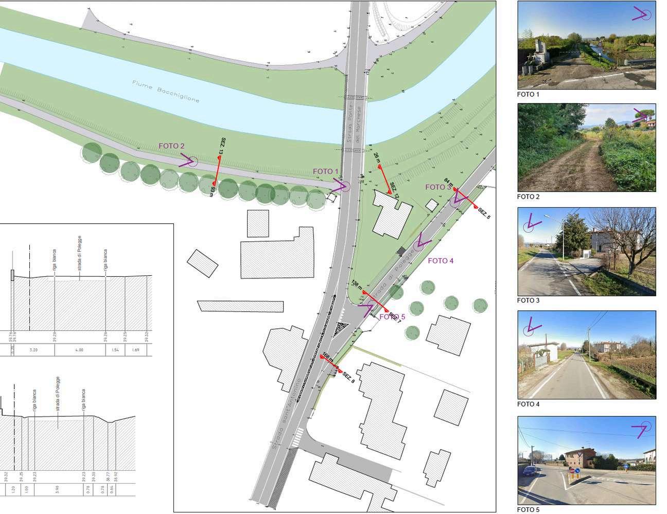
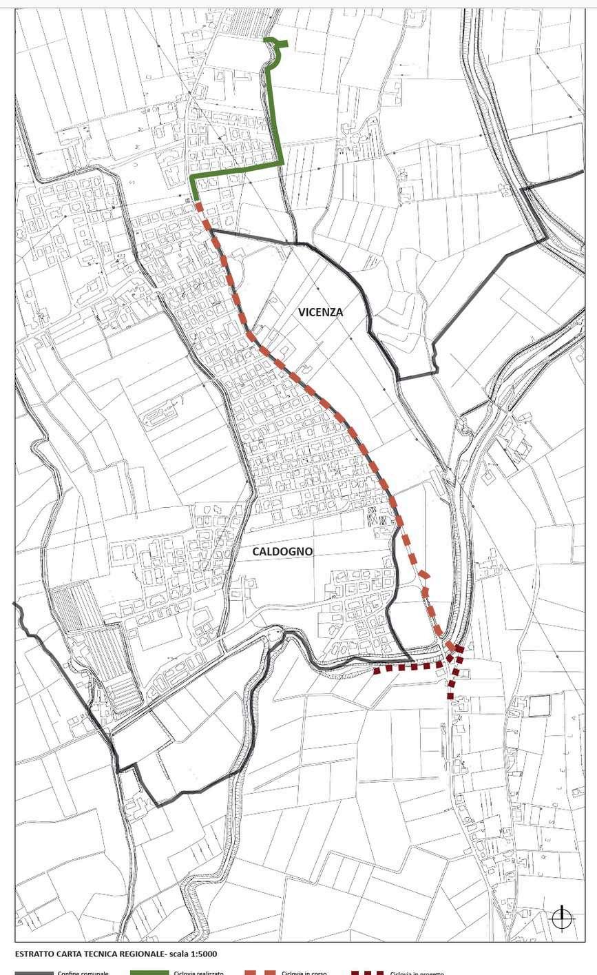
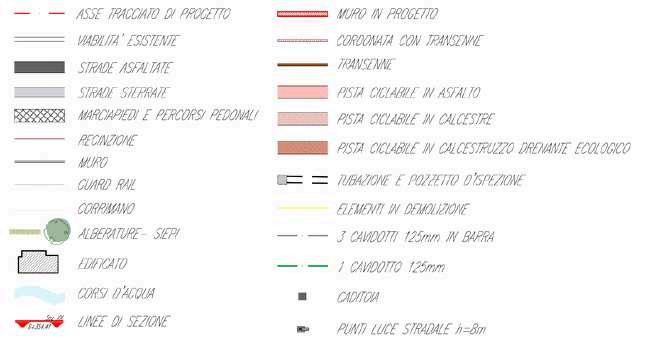
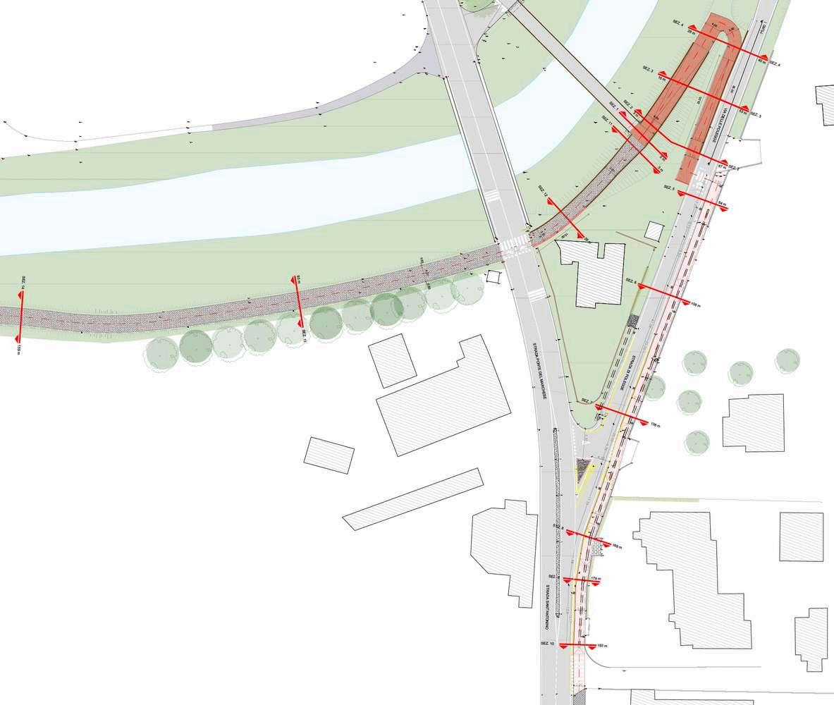
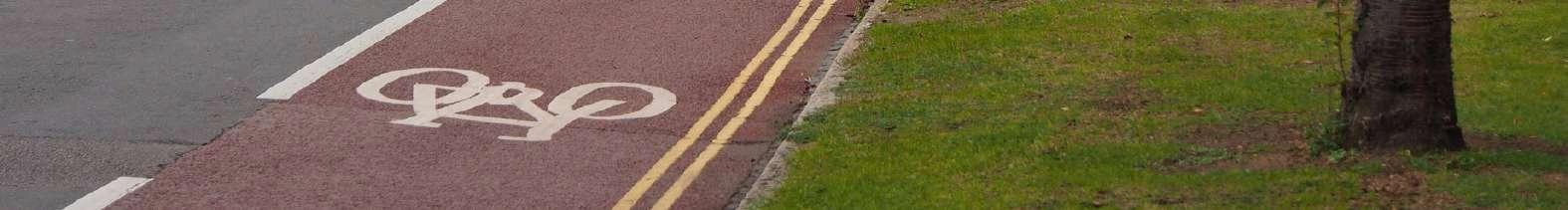
I was responsible for designing the comprehensive bike lane project, utilizing a range of tools. This involved analyzing the current situation and designing a detailed project master plan using AUTOCAD, considering urban design principles and safety standards. Additionally, I developed visualizations using Photoshop, creating realistic renderings that illustrated the project's impact on the urban landscape, which helped stakeholders better understand the proposed changes and envision the enhanced environment for cyclists. The project is part of a larger plan to establish a continuous cycling path across Vicenza and Caldogno. It begins on Ponte del Marchese street, whence another cycle lane is currently being constructed, and continues along Polegge and Sant'Antonino streets, from where it will be extended.
The layout
Thesis 2022- Politecnico di Milano
Self-Produced
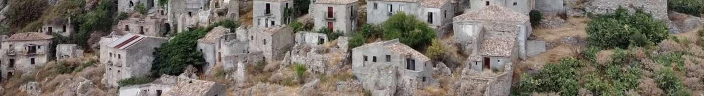
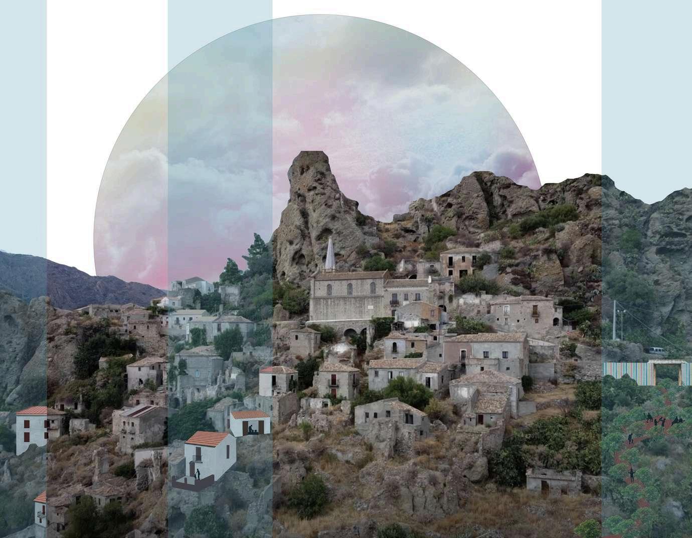
The proposal of Pentedattilo is part of the Master thesis under the topic of elimination of refugees' informal settlements through bottom-up communities. It's an abandoned village in Calabria chosen to show the spatial effect of the proposed reception system policy for refugees. Since the current reception system policy shows some flaws that result in informal camps and based on analyzing some innovative bottom-up integrative communities for immigrants, Pentedattilo and other abandoned small communities are included in a proposed network of bottom-up communities that inhabit refugees and so to be revived. The spatial effect shows an imagination of how the current structures will be used for the needed new facilities and how the village will be refurbished.
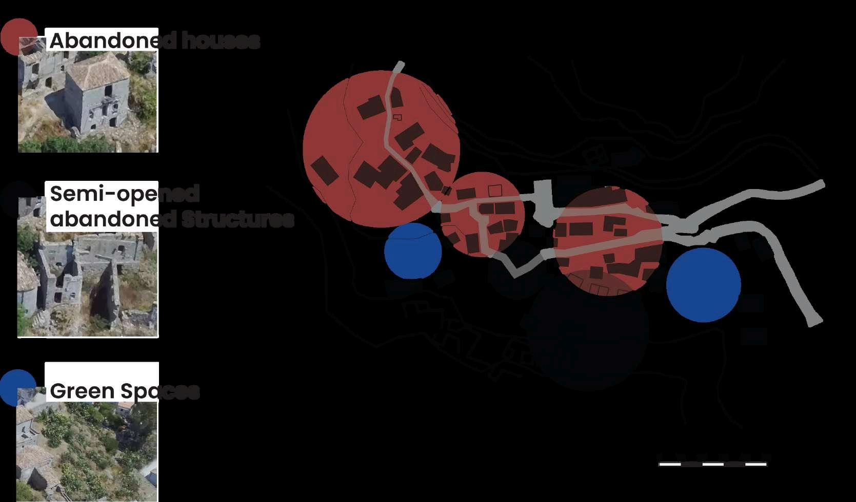
Abandoned old village layout and spaces classification
Parcianello & Partners Studio 2023
Self-Produced
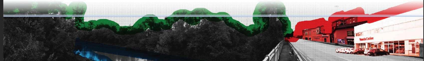
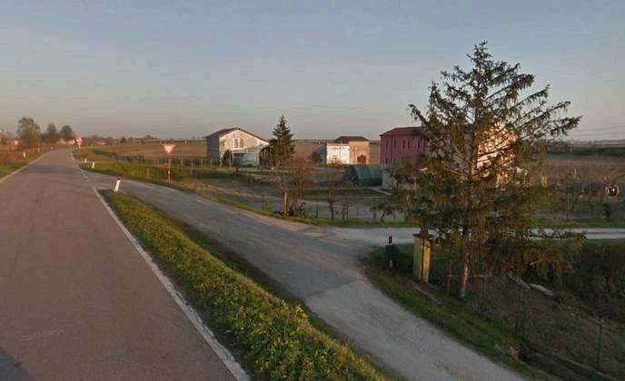
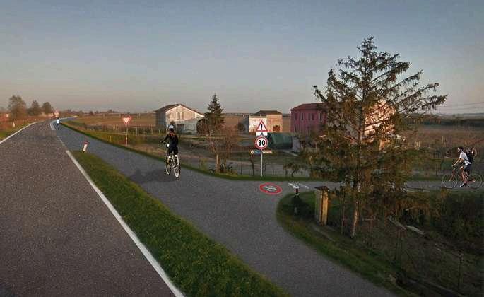
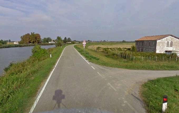
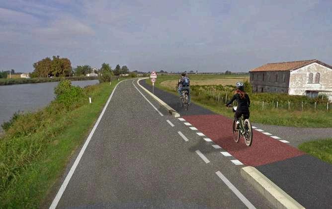
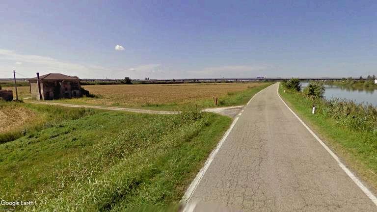
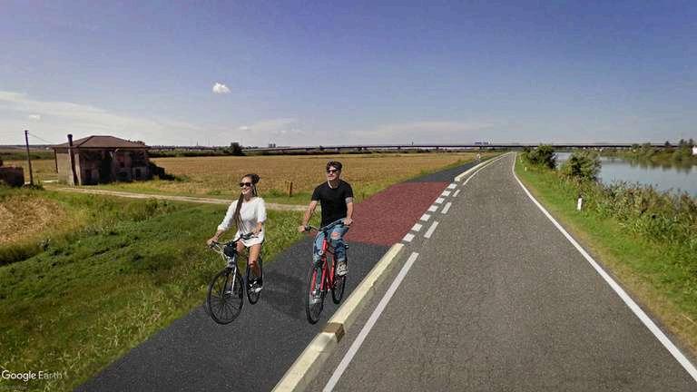
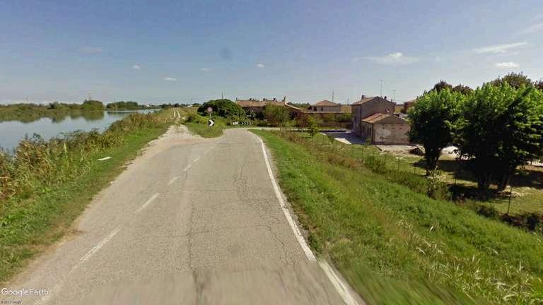
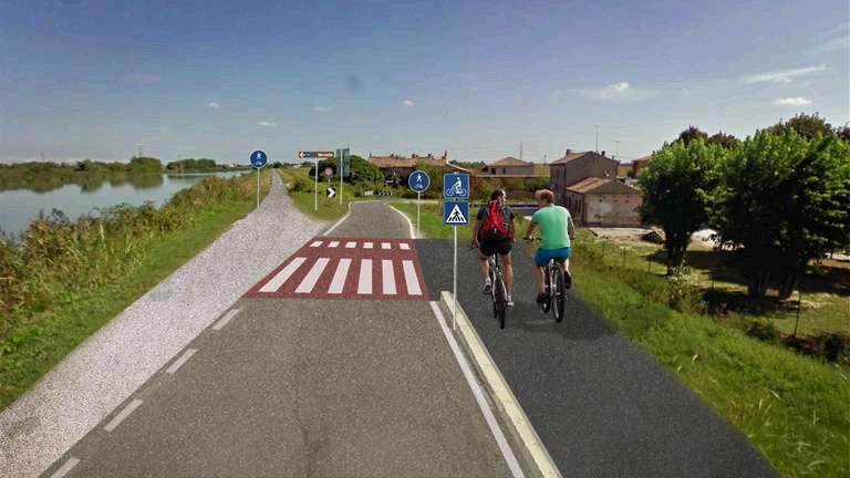
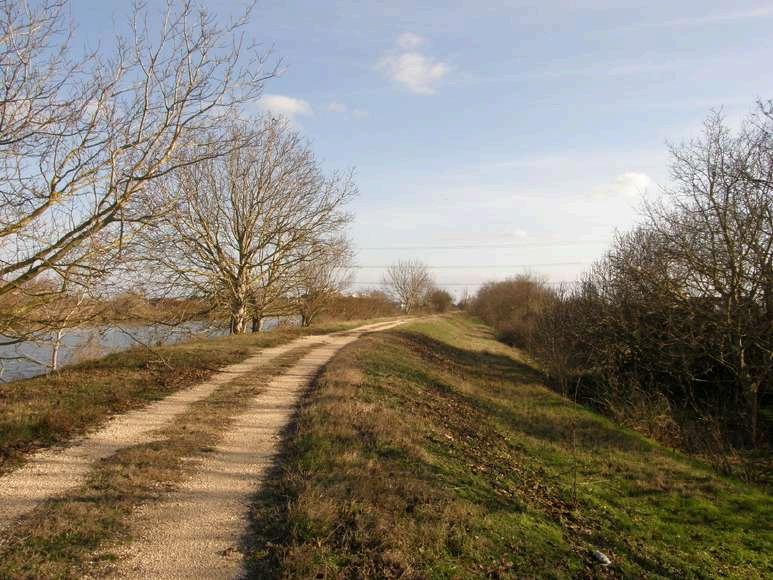
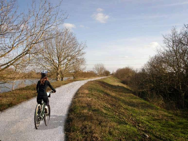
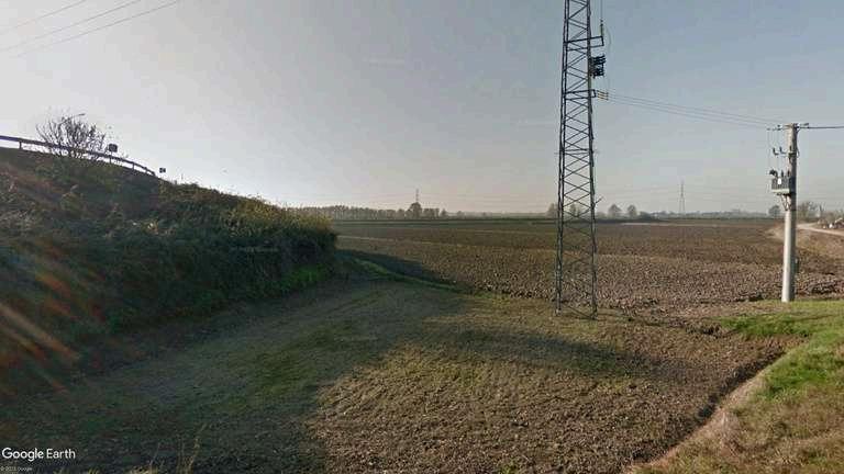
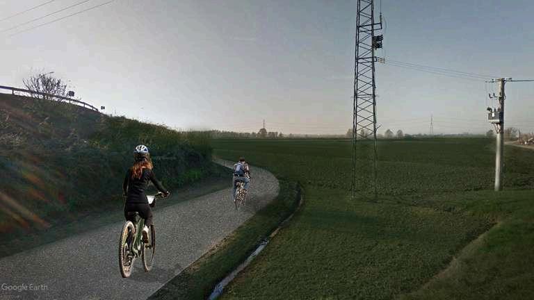
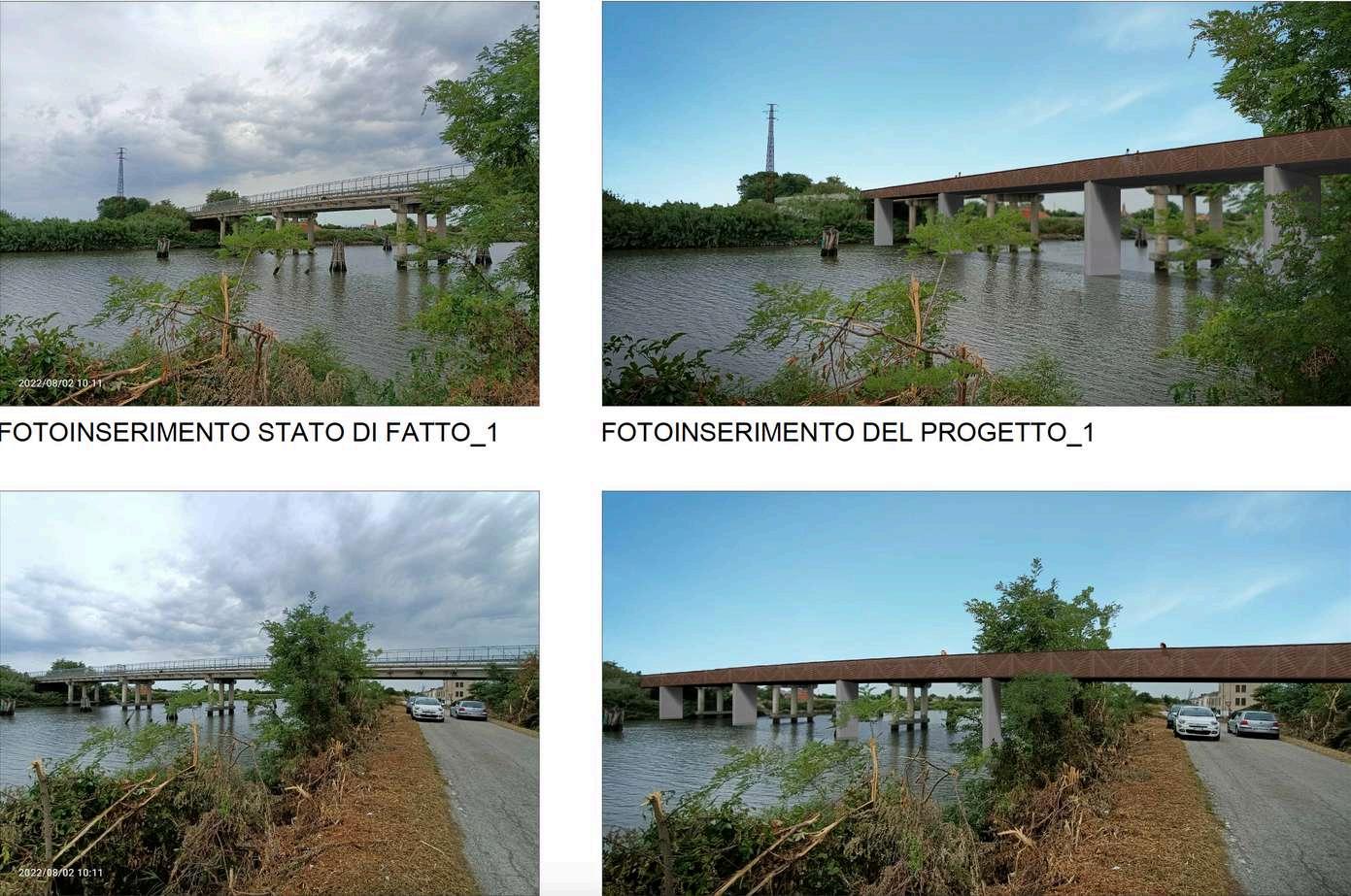
This section showcases post-production images illustrating the transformation of select roads before and after the implementation of cycle lanes that I experienced designing in Italy.

Parcianello & Partners Studio 2022
Parcianello studio team
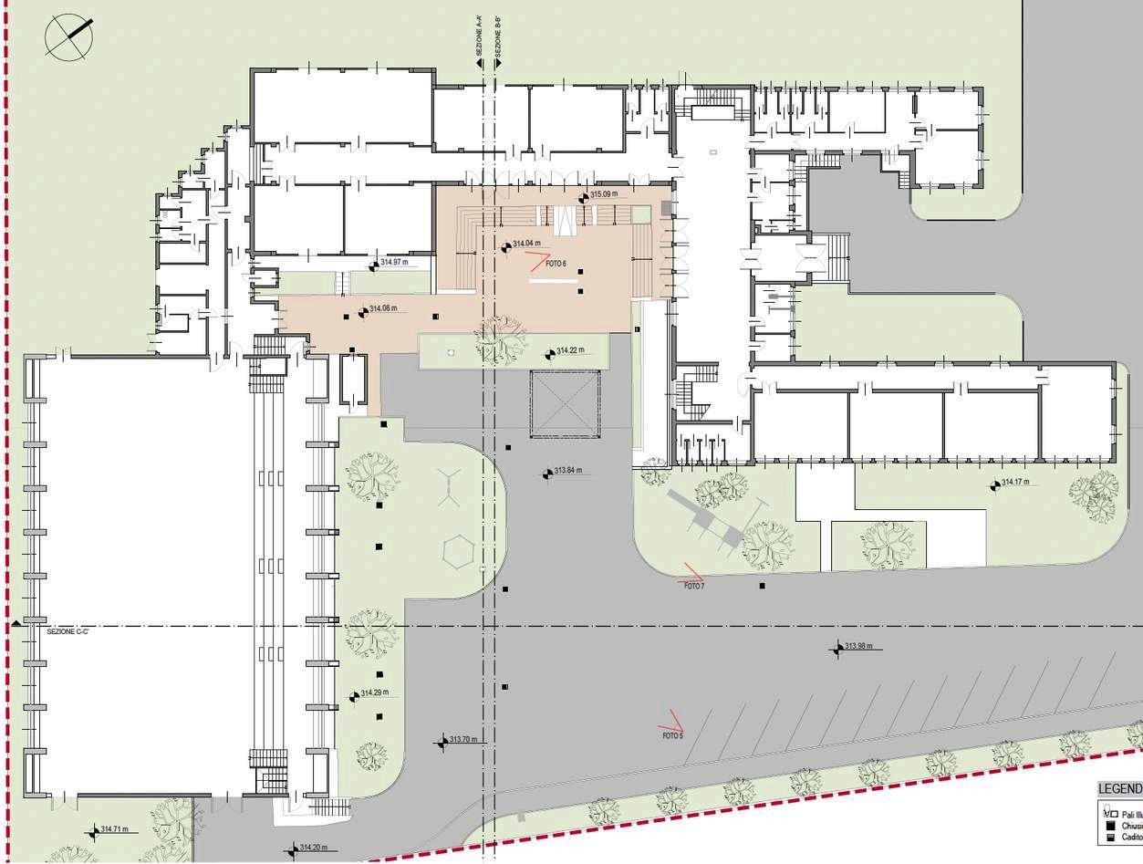
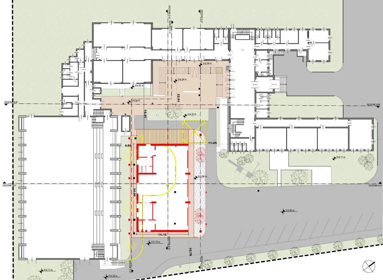
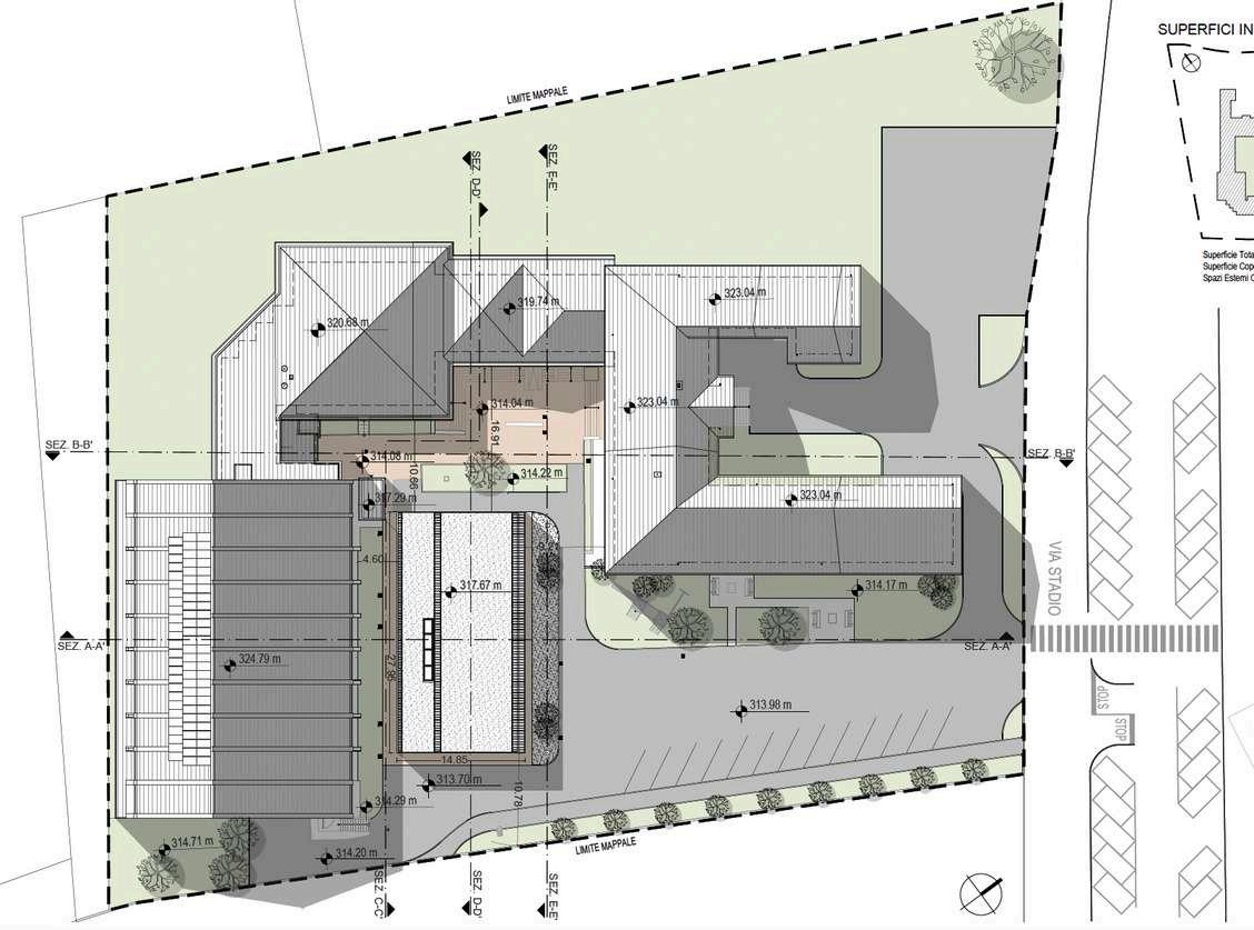
I was involved in the project of designing the cafeteria into the courtyard of the primary school of Sedico, where my role centered on creating visualizations of the master plan, illustrating the site before and after the proposed changes. This included redesigning the surrounding landscape to ensure access and integration with the new building, while respecting the existing environment. Additionally, I was responsible for drawing detailed sections and elevations, capturing the transformation of the site before and after the implementation of the design. Although the project had already been delivered, I further developed the visualizations for these sections and elevations to enhance the clarity and presentation of the design changes.
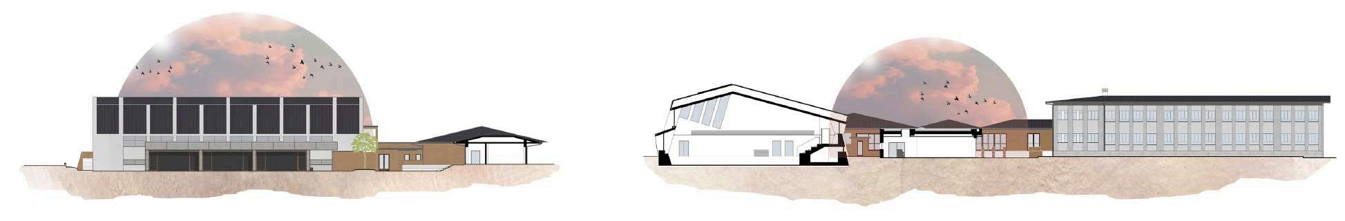
South East elevation with section A-A
North East elevation with section E-E