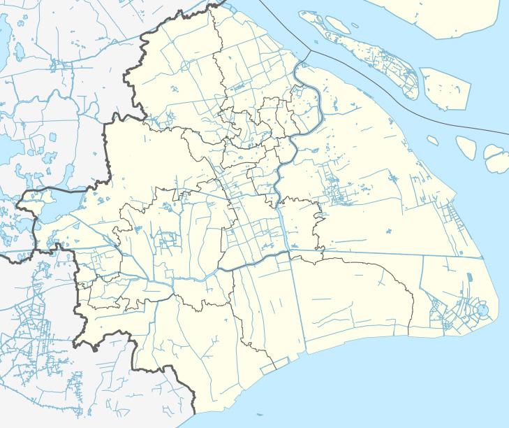
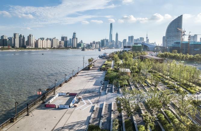
Hungpu river is the biggest river in central Shanghai being the lifeline of several districts, it is 400 m wide and 9 m deep. The project reserves the original industrial remains, at the same time imbeds new activity spaces. Thus the flow meets the command of both daily and festival activities. In the context of ecology, this is made with great research
HISTORY
Legend has it that Huang led his men to control water and prevent floods in Songjiang during his reign.
The Huangpu River was once a tributary of the Wusong River, which was a large waterway that was as big as the Yangtze and Yellow rivers. In 1403, the Wusong River was blocked and flooded, which changed the two rivers, and the Huangpu River eventually became Shanghai’s main waterway.
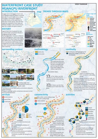
surrounding context
map
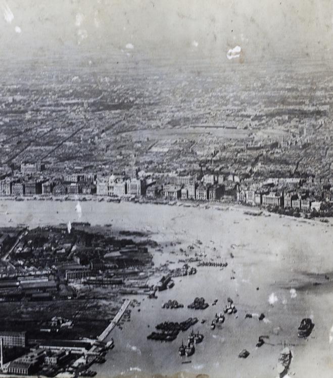
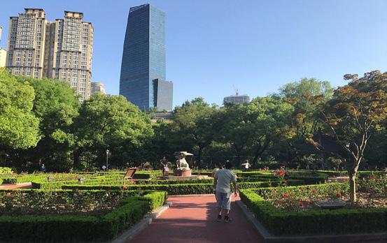
zhongshan park huazheng park
TRENDS THROUGH MAPS
methodology
continuity
continuous walking/jogging trial
pedestrian bridges connecting prominades
THE STUDY AREA
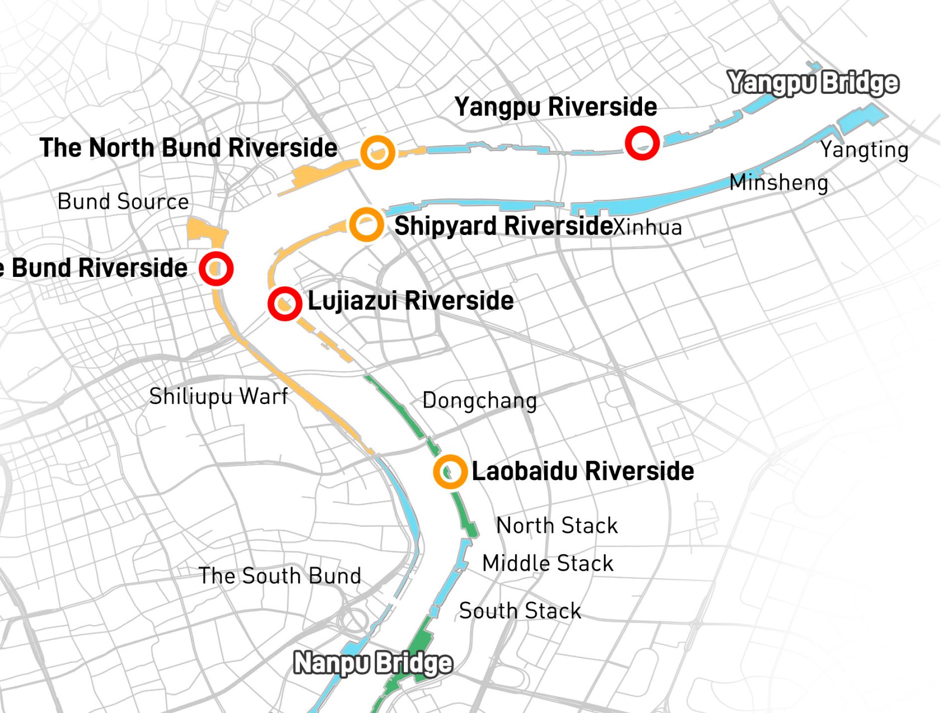
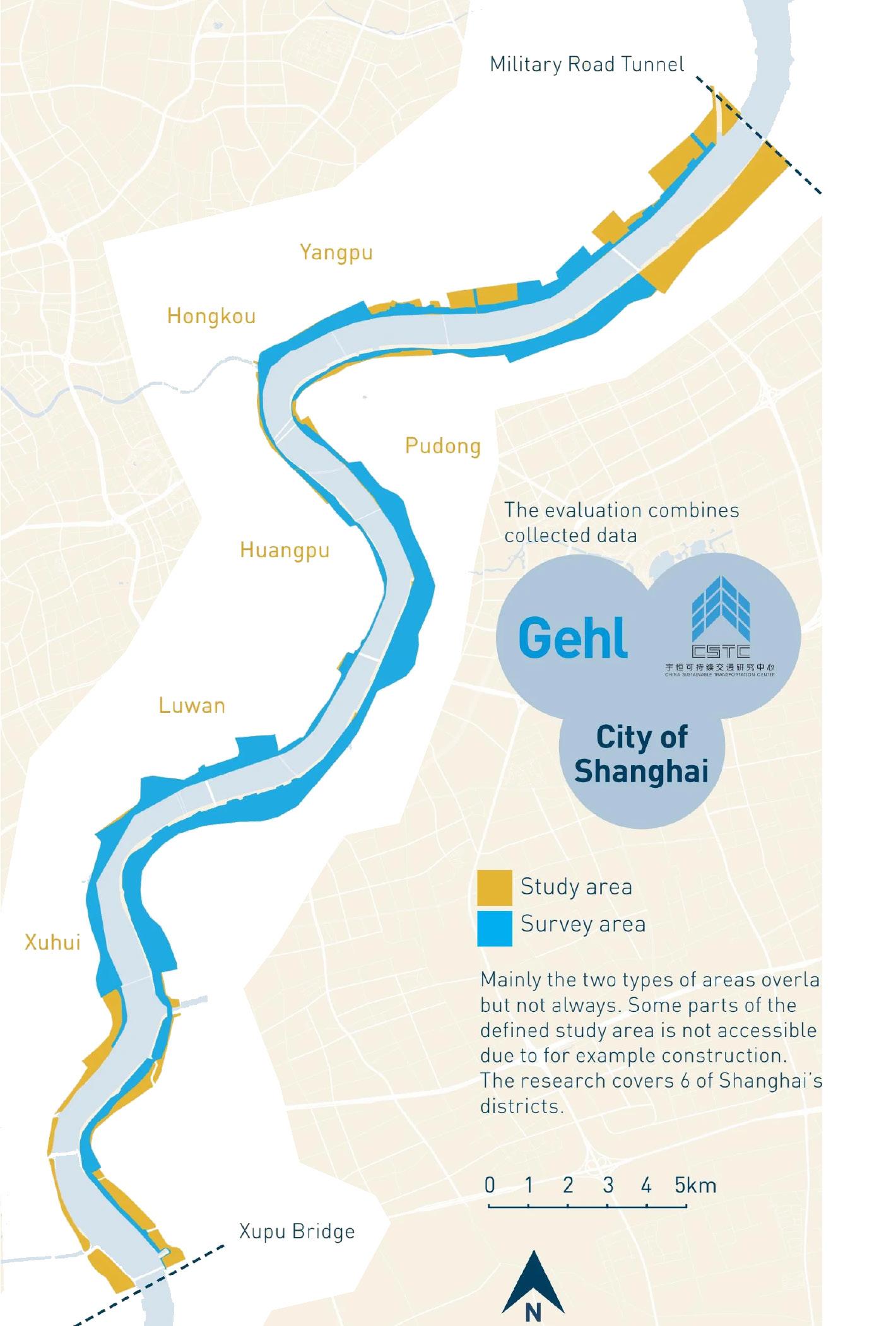
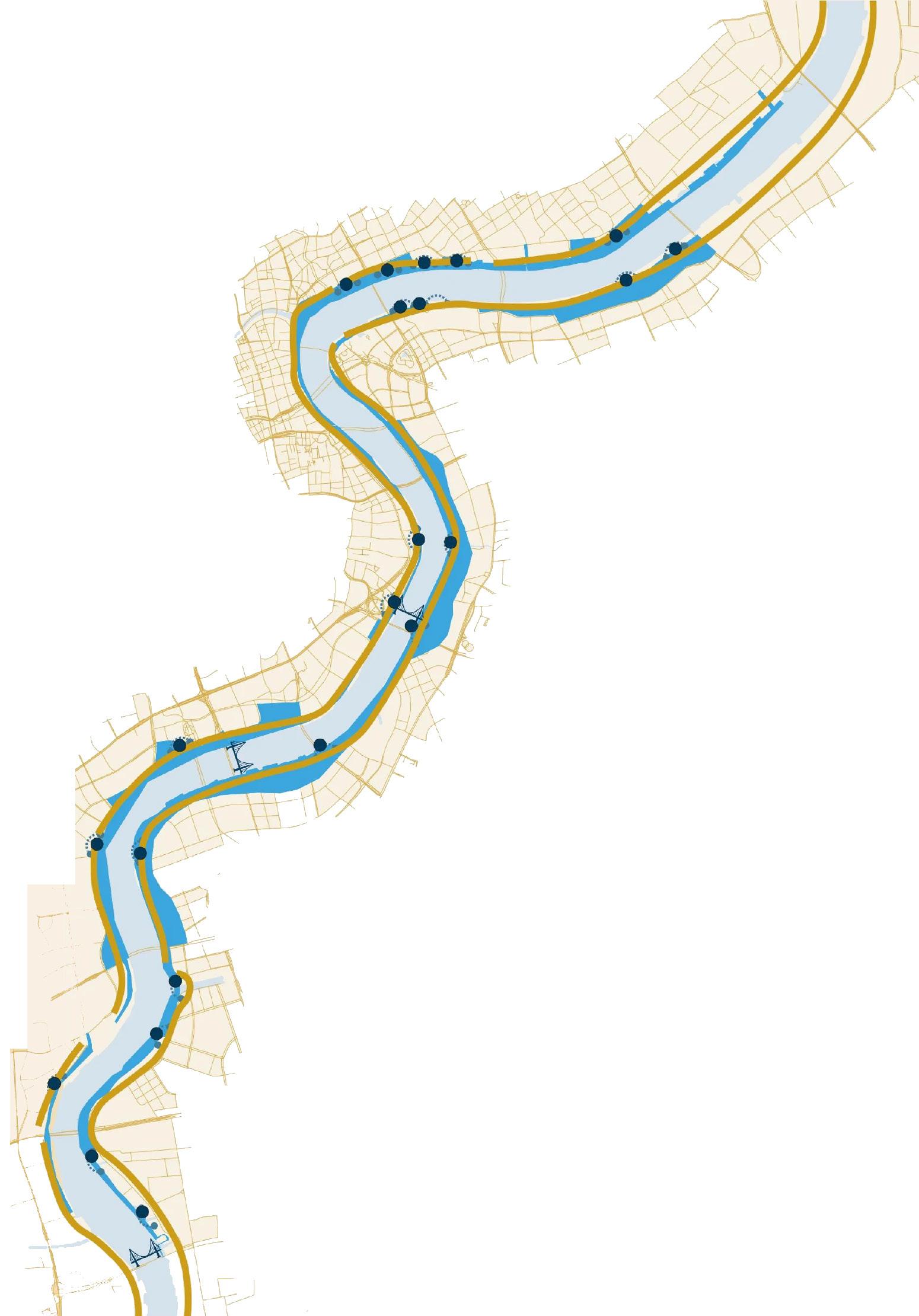
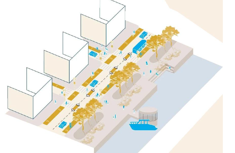
The study area stretches 8ha from the riverbank to the first municipal road, 90 km along the banks from Xupu bridge to the military road tunnel.
THE SURVEY AREA
1/3 of the visitors say that they come to the riverfront because its activities are richer and more attractive.
*ensuring access and high quality environment along the whole riverfront.
*frequent and high quality connections between te riverfront and the hinterland. *building edges that contribute to enliven the public realm.
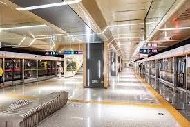
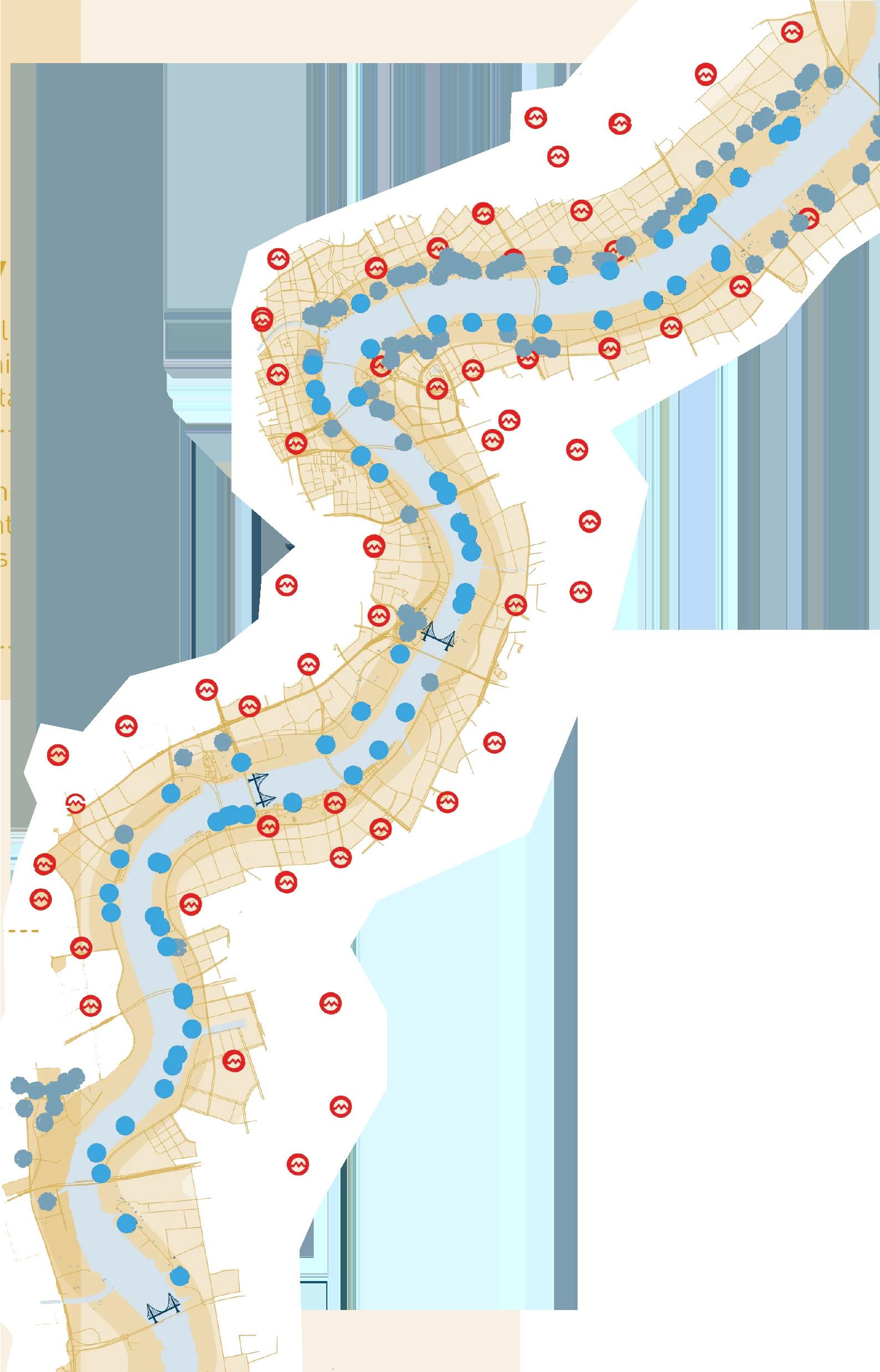
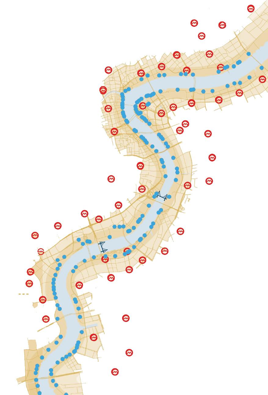
metro stations
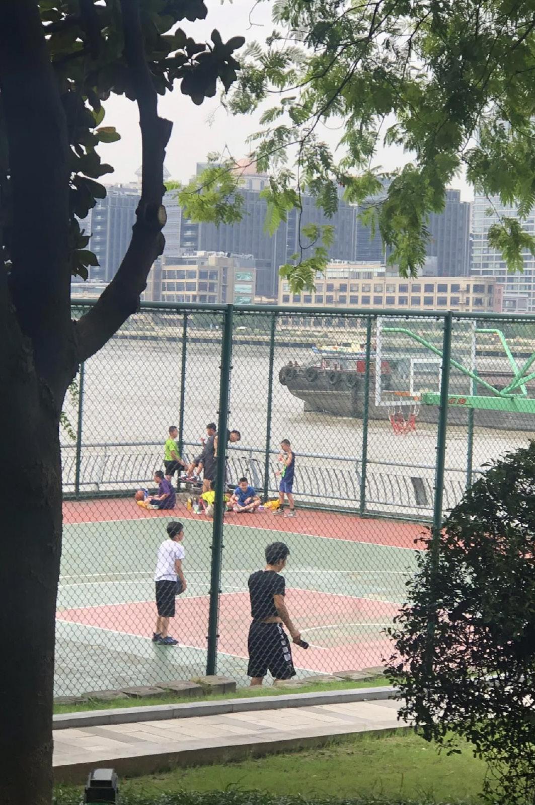
sports field washroom
SUMMARY
*increased access to functions and services.
*increased safety by presence of functions.
*increase in the amount of activities around the riverfront.
*urbanretrofit(making use of existing structures for functions).
*emphasis on public life along the riverfront.
SUMMARY
*45km of continuous riverfront connection with public spaces.
*Inviting a variety of users to walk, run and cycle along the water by providing different marked routes.
2/3 of visitors say that they come because it make them feel good.
connnectivity
area within 15 min walking range or 5 min cycling range metro stations entrance points
*Initially large part of the riverfront was inaccessible industrial sites cutting off the river from the city.By opening up and developing these areas, both a continuous connection and large areas of public spaces are achieved.
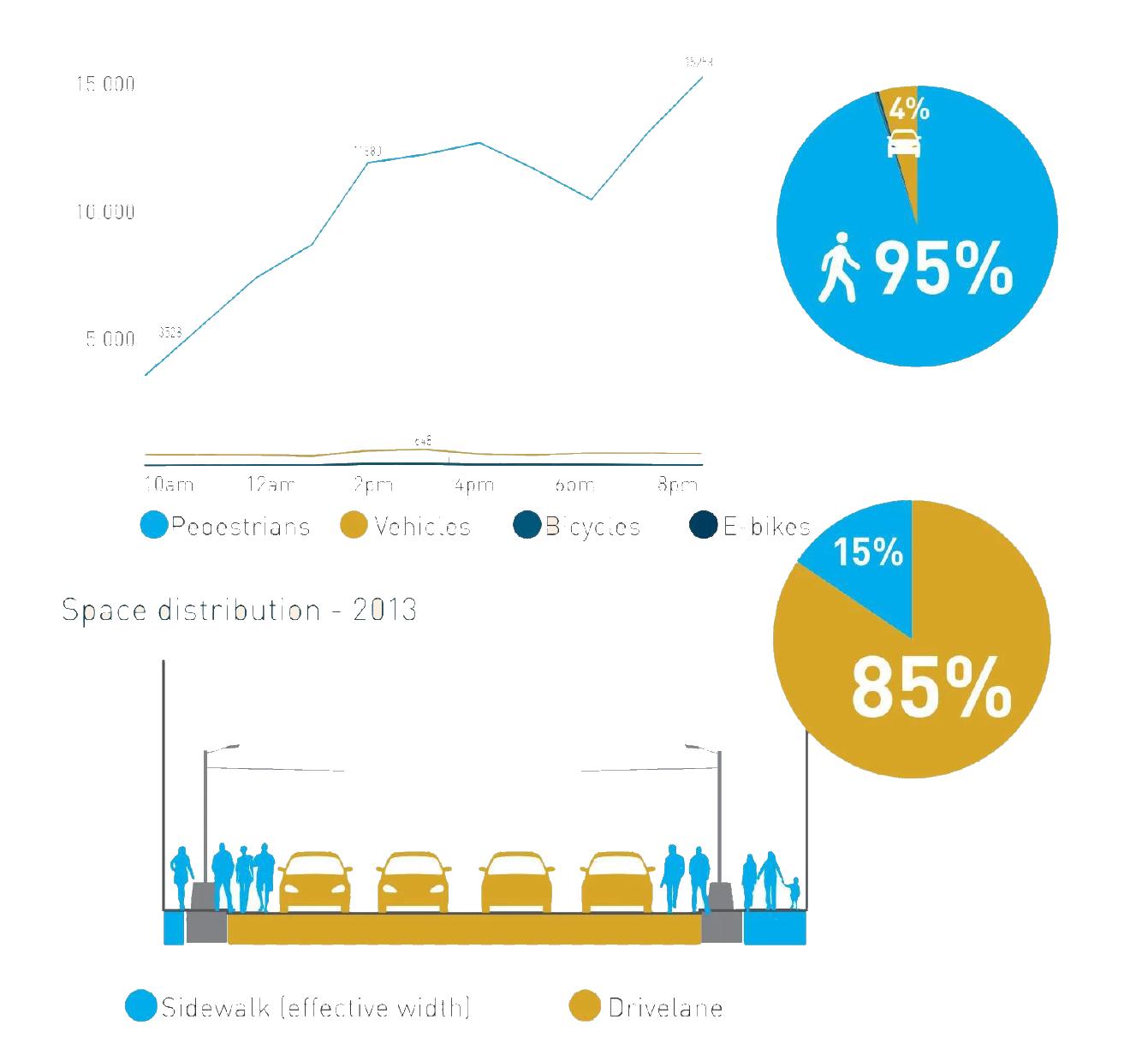
*83% arrived by foot, bicycle or public transport this makes frequent high quality connections hugely important.
*riverfront entrances are only 2 min walk away from each other.
*92% of flood barriers are now integrated into the design of the public sapces
SUMMARY
*better access to recreational spaces.
*increased access to functions and services.
*increased health and wellbeing
*a socila place to hang out with friends and family.
*increased social sustainability.
*inclusive space for all age groups.
I
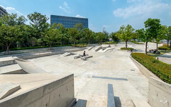
linkong park skate board park fengling park rock park
tianyuan park hongqiao park doho park school station
VEER THAWKAR
WATERFRONT CASE STUDY
HUANGPU RIVERFRONT
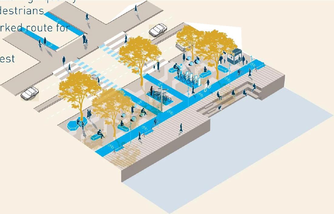
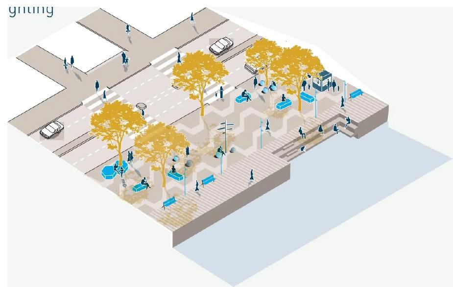
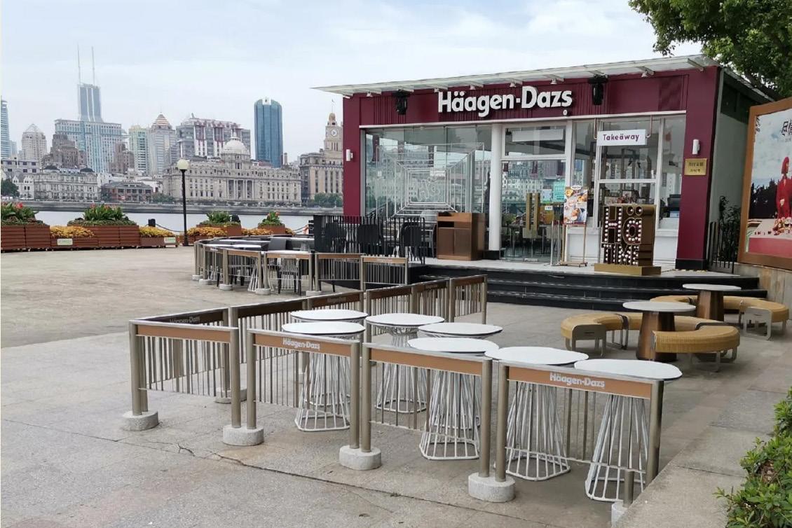
a more continuous riverfront
*generous and high quality space for pedestrian.
*clearly marked routes for cyclist.
*several places provided for rest.
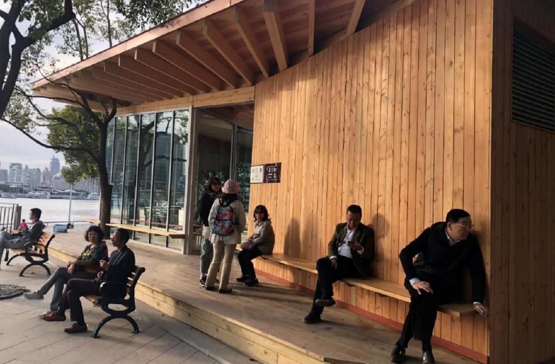
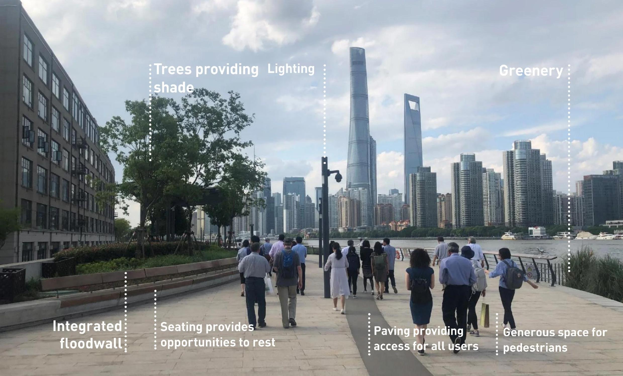
*comfortable and inviting integrated floodwalls.
*trees and greenery.
*accessible seating and extensive lighting.
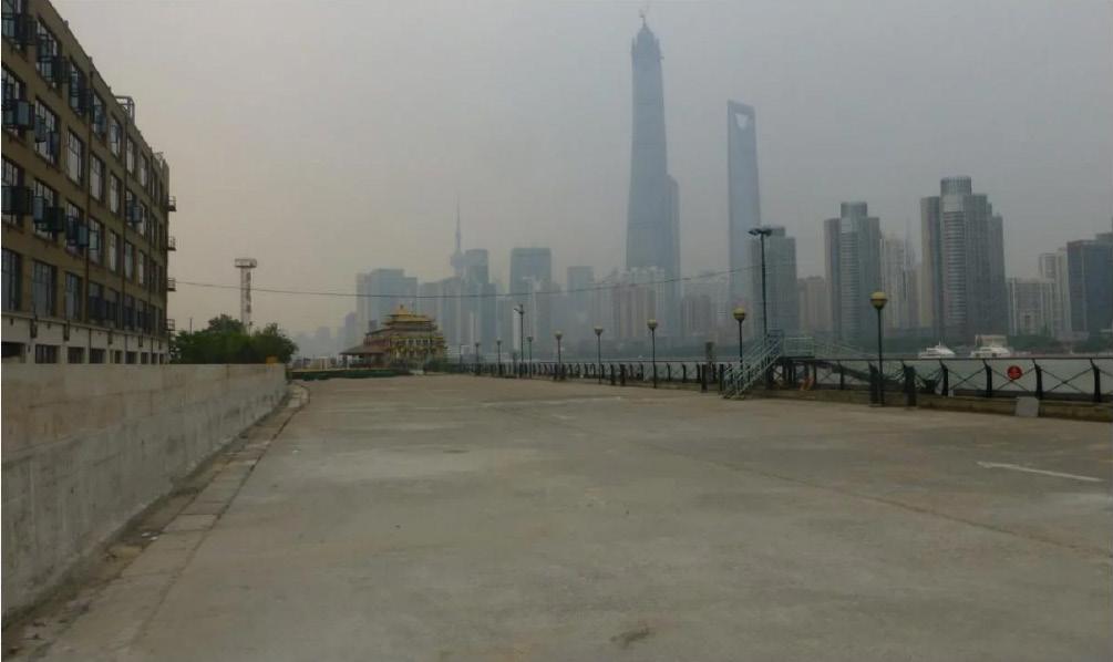
*The area was accessible but poor quality
*Vission collage 2014 stratergy was implemented the aim being one connected river
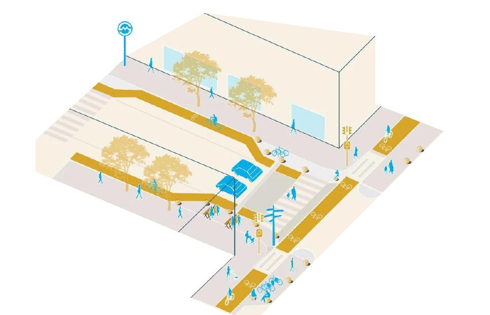
a more connected riverfront
*fine grain and high quality connections.
*the riverfront stratergy suggests high quality connecting streets with strong focus on public transportation.
*the riverfront stratergy recommends access every 200m, with an average of 248m between entrances.
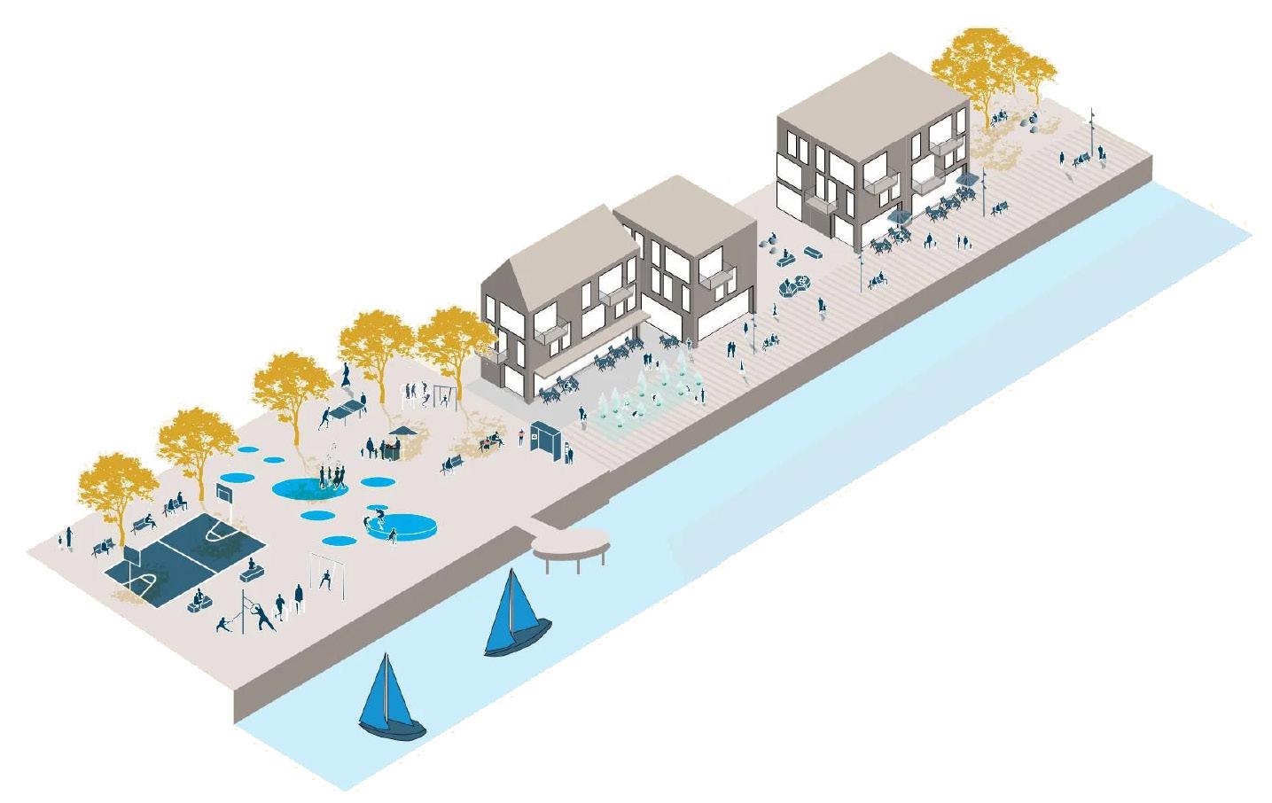
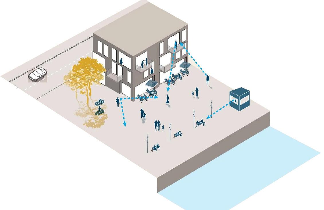
a more inclusive riverfront
*providing a variety of spaces.
*active ground floors interacting with outside spaces.
*housing close to the riverfront offering ‘eyes on the street’ at night.
*pavilions contributing with activities and breaking down the scale.
*taking advantage of building gaps.
*light at night adds to a welcoming atmosphere.
*using plots to enter and exit (meaning integrate within building complexes wherever suitable.)
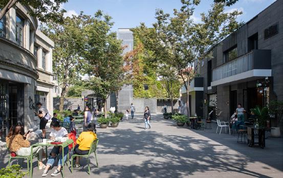
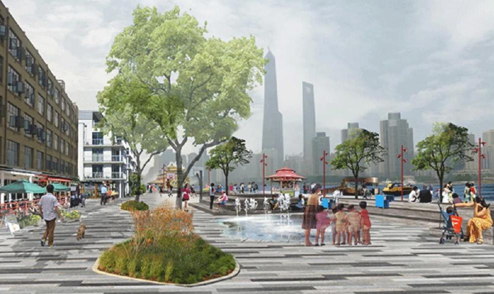
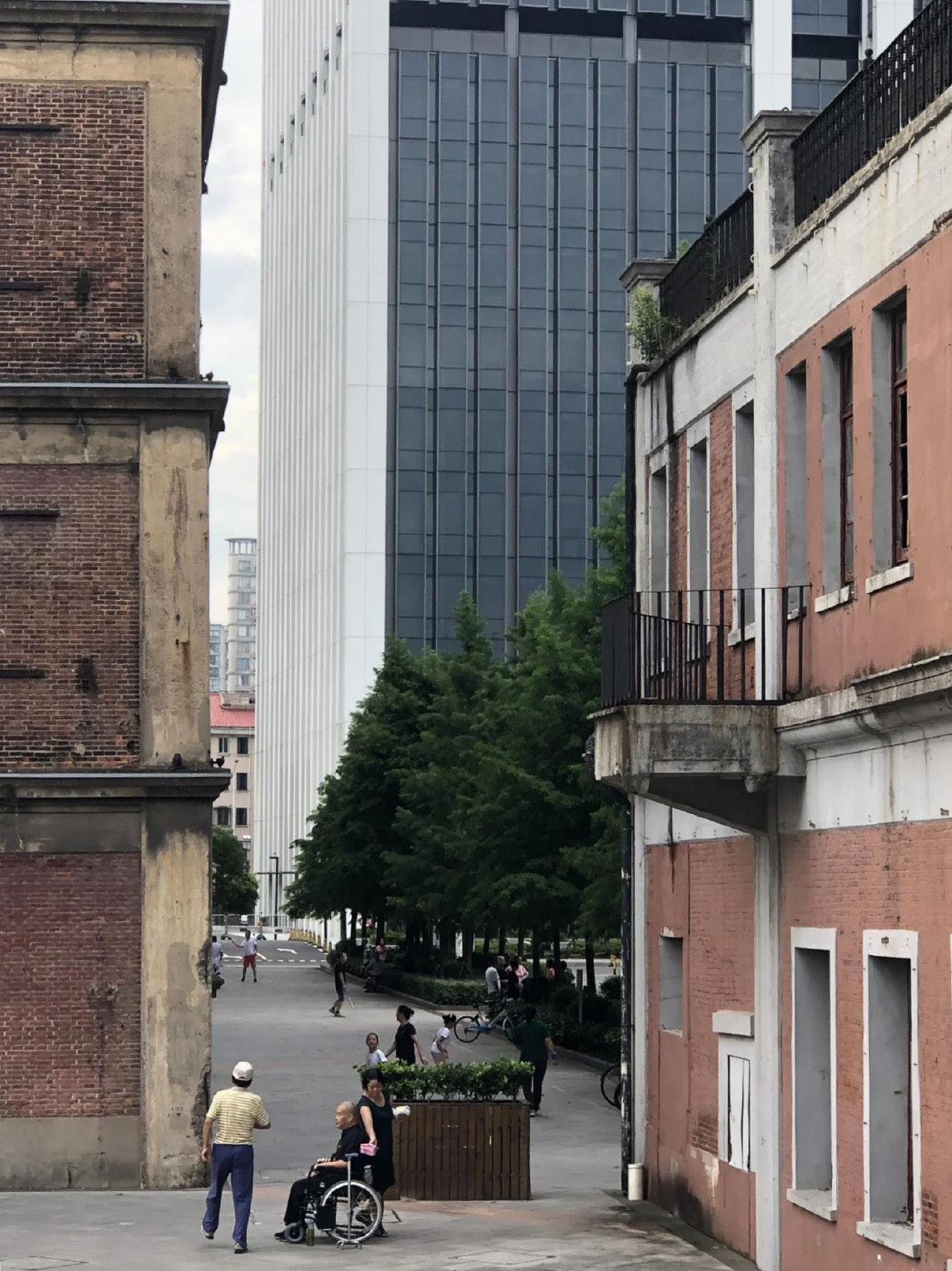
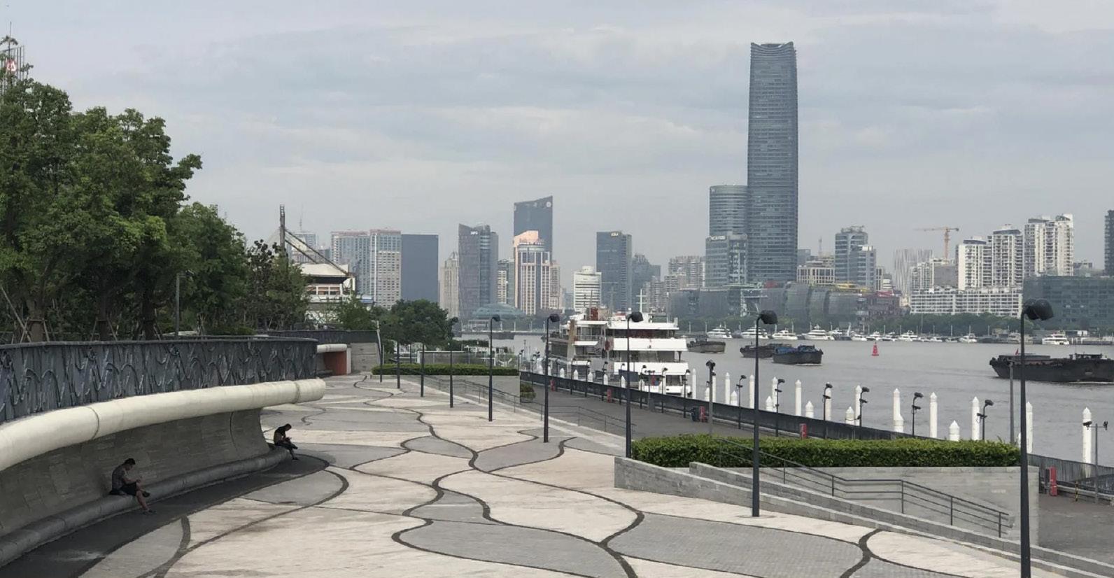
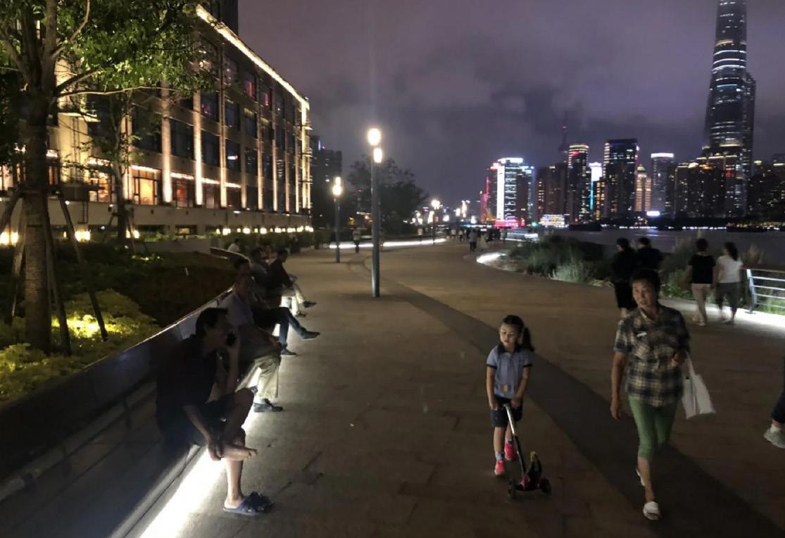
The area has been transformed with public seating, trees, lighting and the important floodwall has been incorporated into the design. There are links connecting to the creative area behind called the cool docks, and there is a natural pedestrian flow down to the bund’s scenic spot. It’s easy to catch one of the ferries crossing over to podong.
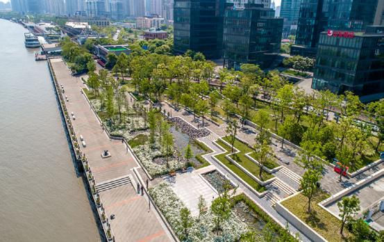
SHANGHAI HOUTAN PARK
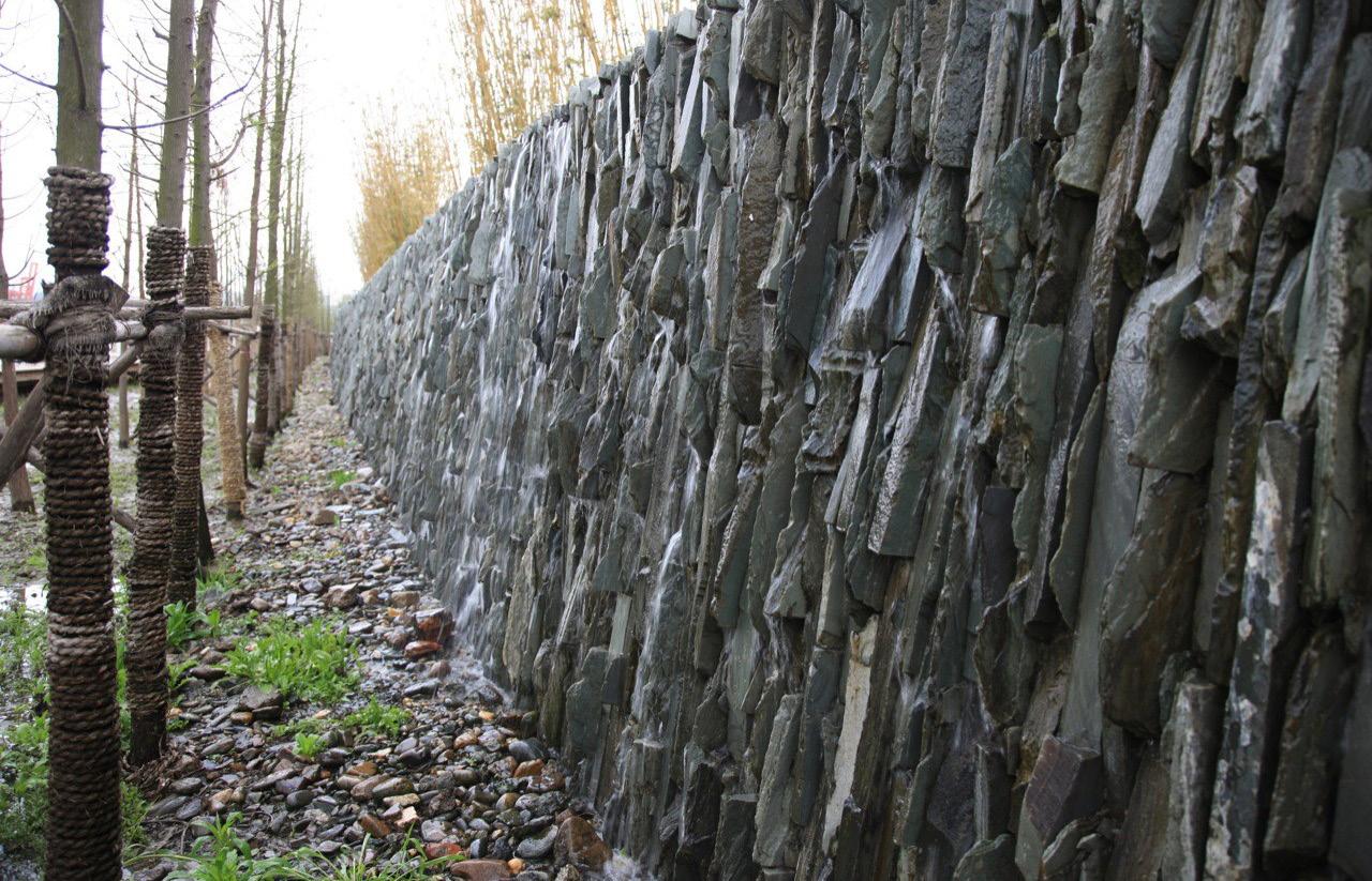
*floodwalls integrated with landscape
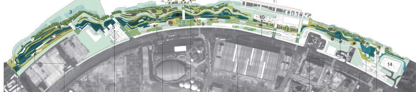
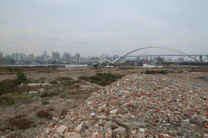
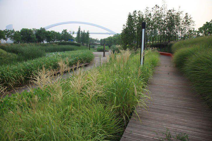
Shanghai Houtan Park, a central green space of the Shanghai 2010 Expo, spans 140,000 square meters on the southern boundary of the Expo site between the east bank of the Huangpu River and Puming Road. This project transformed a former industrial site into an ecological waterfront park designed to showcase sustainable technologies and provide lasting public green space.
Design concept
Houtan Park was conceived as a living system, integrating ecological services with urban needs. The design included a constructed wetland for water purification, flood control, and habitat creation, along with recreational and educational spaces. The park was designed to accommodate Expo visitors and transition smoothly into a public park post-Expo.
*50% people present at night are women.
*28% come here because the waterfront provides a place for children to play.
The riverfront used to be challenged by a lack of support for public life along the river. One of the bigger challege were regulations that did’nt allow for structures to be built closer than 50m to the water.
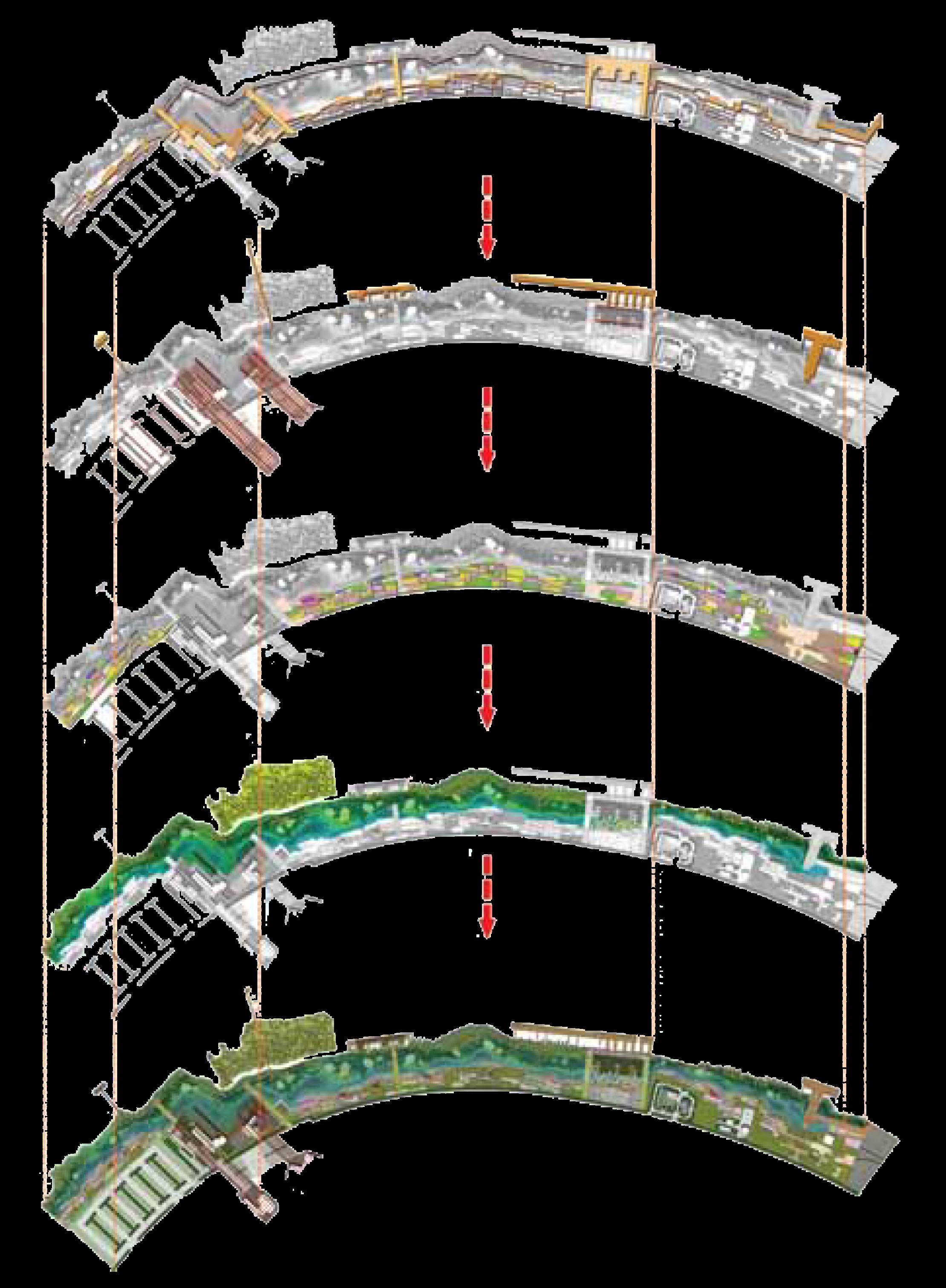
Site zoning
and ecosystem
are layered and integrated.
The park’s multiple functions
services
WATERFRONT CASE STUDY
HUANGPU RIVERFRONT
Summary
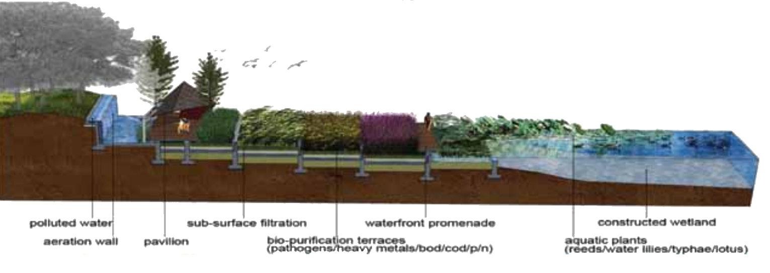
Built of a former industrial site, houtan park is a regenerative living landscape on Huangpu riverfront. It comprises of a constructed wteland that cleanses polluted water and provides an ecological flood control stratergy.
The aqueduct and cascade wall conduct and aerate the water from the river
*Visitors can walk along the terraced wetland. The Hanging Garden and a folded steel pergola structure are seen in the background
SOUTH SECTION (PHASE II)
Summary
Summary Design Stratergies
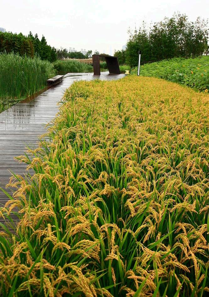
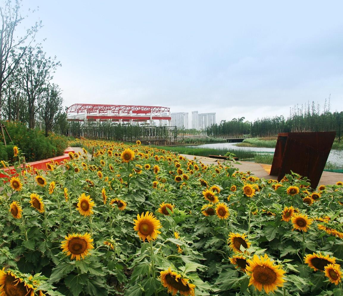
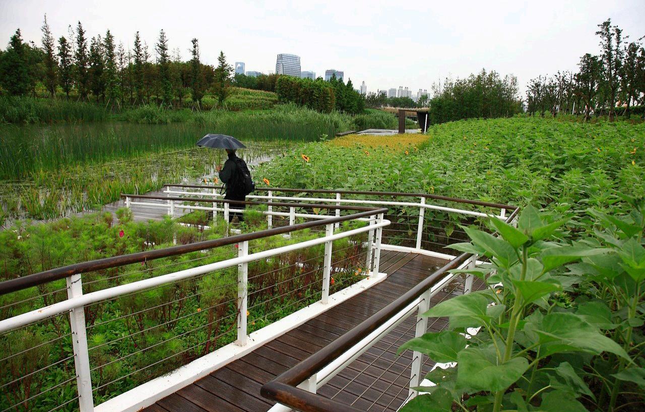
*Crops are grown in the terraces every season to absorb nutrients from the Huangpu River. The landscape is filled with rapeseed flowers in spring, sunflowers and rice in summer and fall, and buckwheat in winter.
*Some 13 mainly native plant species were planted on the wetland, and spontaneous vegetation is welcome. After one year, 17 new bird species were found to have inhabited this park.
Ecological Landscape
Natural Wetland Preservation: Preserved a 400-square-meter wetland along the Huangpu River.
Vegetation: Utilizes willows and reeds to remove pollutants, prevent erosion, and create habitats.
Levee Reconfiguration: Transformed the concrete levee into a tidal river wetland with native species for flood control.
Purification Wetland
Water Quality Improvement: Diverts Grade V water from the Huangpu River into constructed wetlands, improving it to Grade III through biological treatment.
Water Treatment Capacity: Can treat over 2,400 tons of water per day.
Benefits: Provides irrigation, new habitats, and recreational and educational opportunities.
Resilient Flood Control
Pedestrian System
Organized Circulation: A main loop with intersecting roads and footpaths ensures safe, convenient, and flexible pedestrian movement, connecting the city to the park.
Platforms: Gathering spaces like the Hanging Garden and Floating Garden plazas.
Masses: Trees and bamboo create dynamic spatial experiences.
Containers: Exhibition or resting spaces, featuring modern art and reclaimed industrial elements.
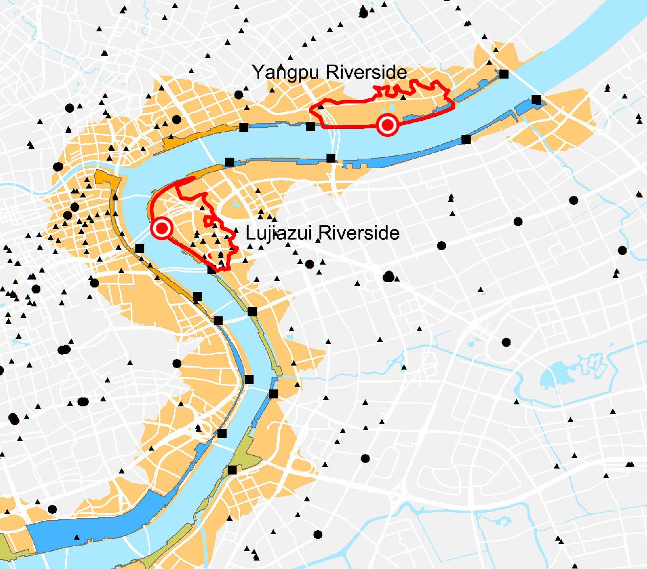
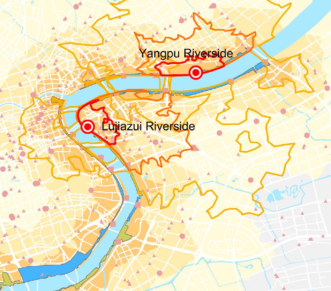
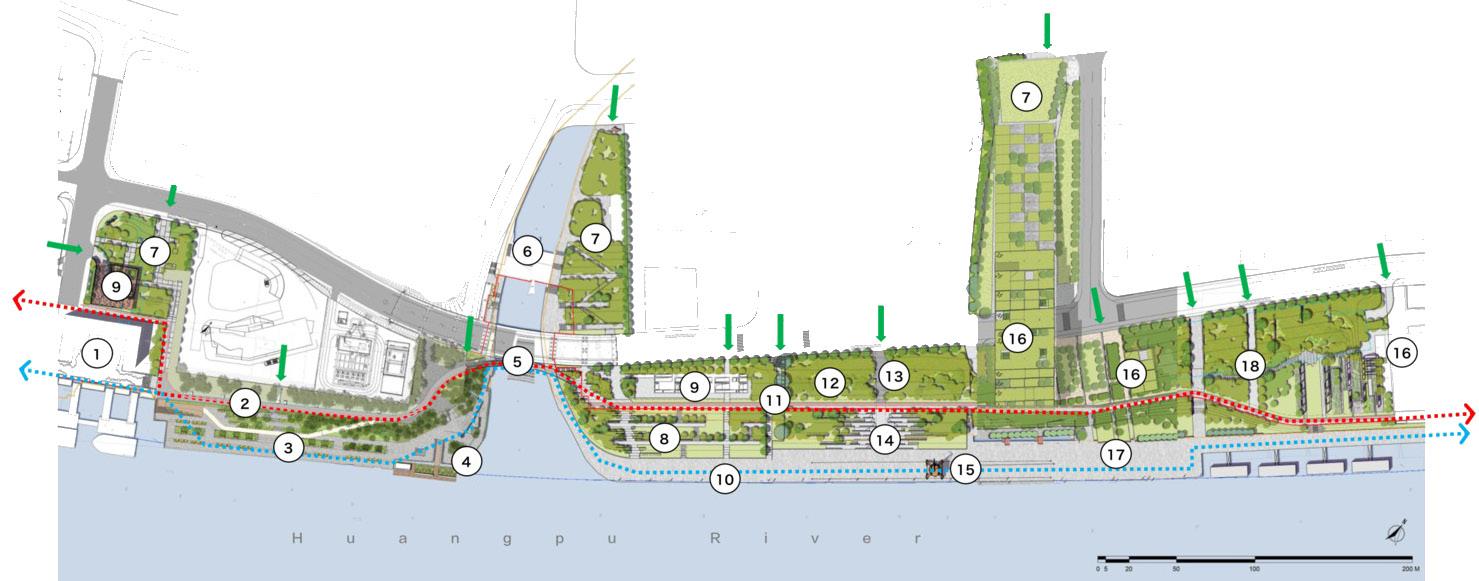
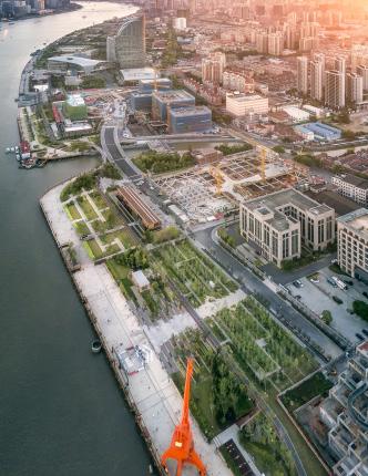
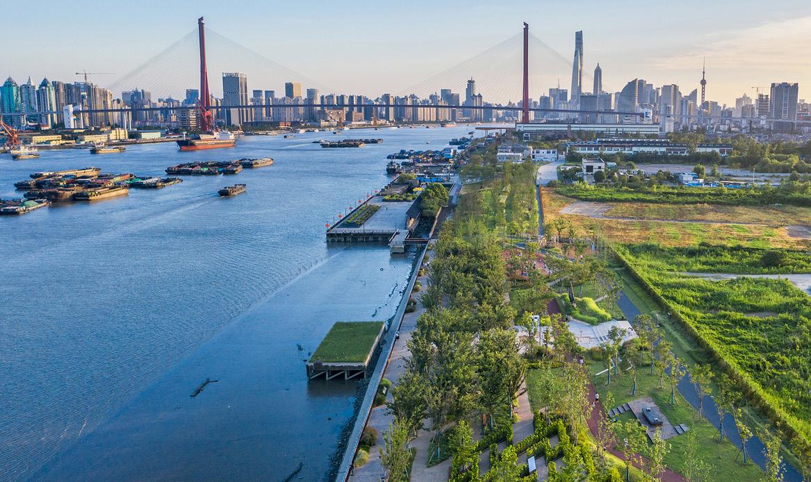
Yangpu Riverfront South Section Phase II is located between two ferry stations with a 1.2-km shoreline of Huangpu River, Shanghai China. Compared with other Riverfront landmarks such as the Bund and the Lujiazui CBD, the Yangpu Riverfront section is well known as the birthplace of China’s modern industry. A large number of factories related to textiles and manufacturing have brought a long-term prosperity. Now the population density of Yangpu District has exceeded 20,000/km2, which makes the lack of public space of the aging communities.
open entrances
walking way
cycling/jogging way
legends
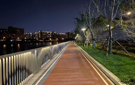
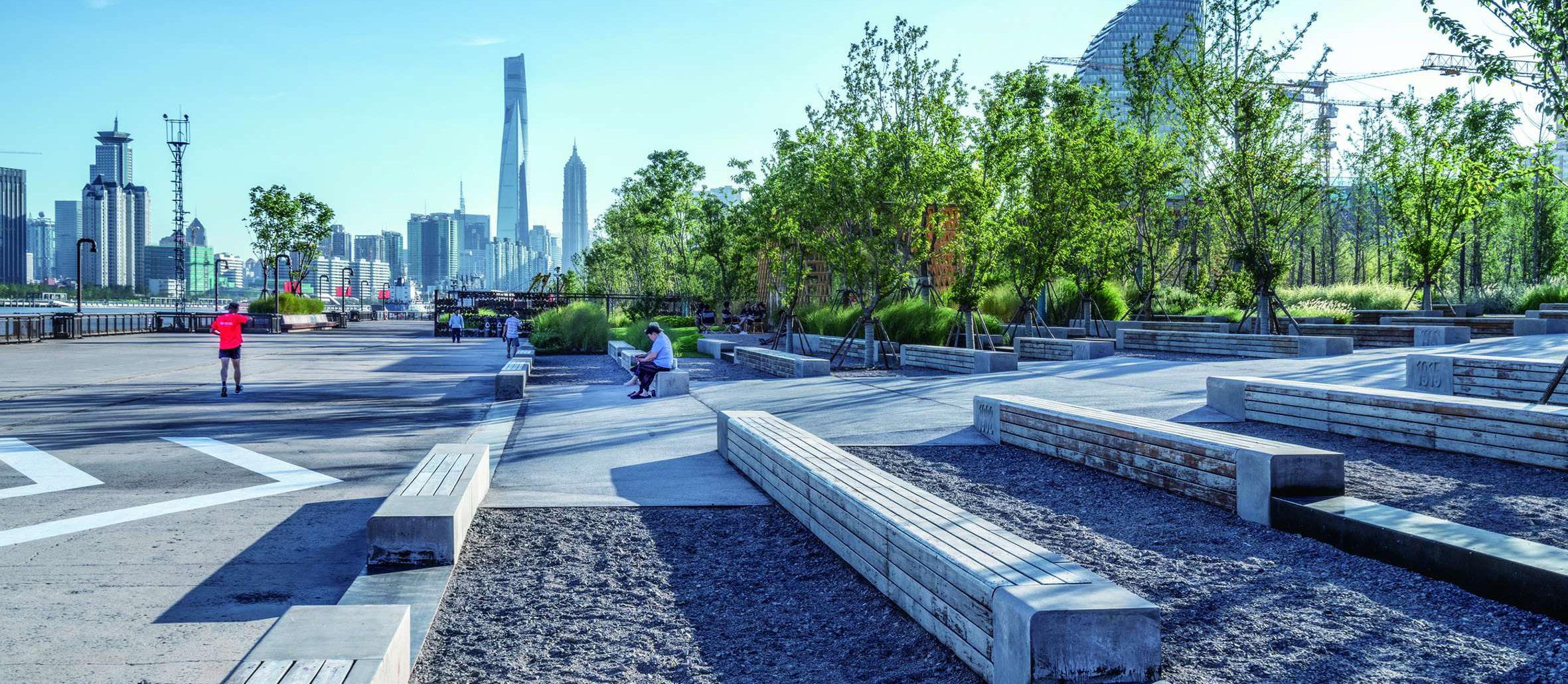
Riverside Walkway
Factory Wall (Ruins)
Rain Garden
13. Accessible Emergency Way
14. Stepped Amphitheater
15. Crane and Rails
16. Preserved buildings
17. Docks for events
18. Recrational Park
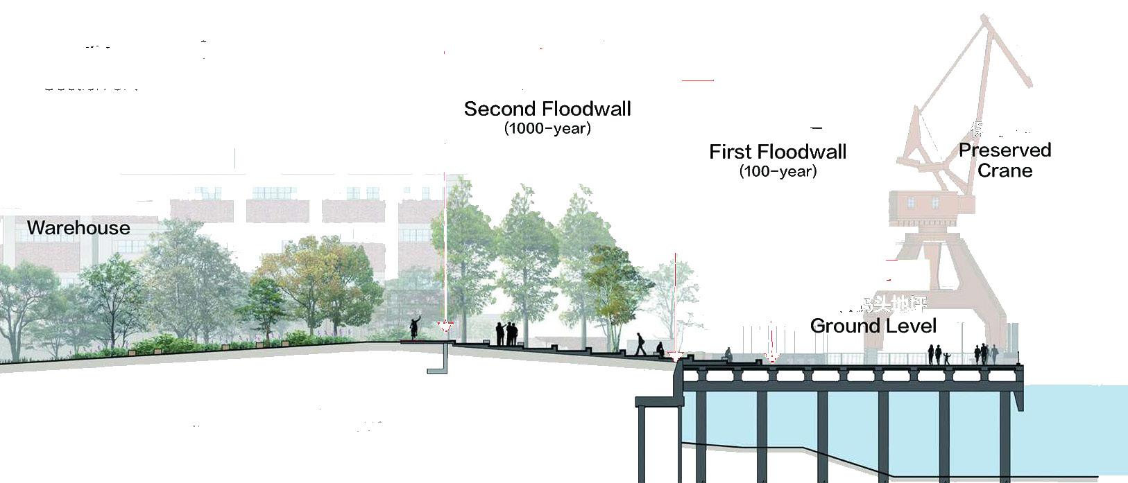
flood wall icorporation
riverfront section references
The original single floodwall is transformed into a two-level system. The top of the first wall is same as the preserved high-pile dock ground elevation, forming a continuous open space. The second wall is raised a 1000-year standard, which position is 20~30 meters back and completely hidden under soil and planting. The new flood control system enriches the landscape topography in a flexible way while reducing the threat of typhoons and rainstorms. A multi-level greenway for users of all ages was established and extended to the surrounding communities via a pedestrian network.