

The Georgetown BEND
ARTFUL, AFFORDABLE, SUSTAINABLE,

KARENS MINDE AKSEN, COPENHAGEN
Photo by Sarah Whitney
The Georgetown BEND
ARTFUL, AFFORDABLE, SUSTAINABLE,
SHARED Transformational Neighborhoods
2024 S can D e S ign i nter D i S ciplinary M a S ter S tu D io c ollege of B uilt e nviron M ent S , u niver S ity of W a S hington
in S t ructor S
Nancy Rottle, Professor Emeritus of Landscape Architecture, University of Washington
Louise Grassov, Master Teacher, Schulze + Grassov
Katherine Magee, Teaching Assistant, MLA/MUP
S t u D i o participant S
Joanna Chen, MLA
Lela Cooper, MUP
Russell Corbin, MUP
Siska Florensia Dewanti, MUP
Liz Forelle, MLA
Davien Graham, MArch/MLA
ac K n o W l e D g M e nt S
Scan Design Foundation
Matt Jernigan, MLA
Chih-Ting Lee, MLA
Hunter Ottman, MLA/MUP
Jaxon Roller, MLA
Ellee Ruder, MLA
Kaylie Treskin, MLA
Sarah Whitney, MUP Jingyao Wu, MLA
Peiyao Xiao, MLA
Rebecca Zaragoza, MUP
SIGNAL Architecture | Mark Johnson, Lorine Moellentine, Joseph Sadoski
MxM Landscape Architecture | Brice Maryman, Tim Spenser
Watershed Community Development | Ben Rankin, Richard Conlin, T. Frick, Erika Bell, Tamar Benzikry Land Art Generator Initiative | Elizabeth Monoian, Robert Ferry and the many professionals who provided valuable perspectives and expert knowledge in tours, workshops and reviews | Vincent Javet, Cath Brunner, Jonathan Morely, Siena Ezekiel, Constantine Chrisafis, Gregg Colburn, Neha Chinwalla, Clelie Fielding, Katey Bean, Lyle Bicknell, Ann-Marie Stillion, Elizabeth Umbanhowar, Julie Kriegh, Jake Woland, Jake Minden, David Goldberg, Kay Morrison, Megan Adams
Cover image by Peiyao Xiao | Back cover image by Matt Jernigan
LAND ACKNOWLEDGMENT
We respectfully acknowledge the Coast Salish peoples, the historic and ongoing stewards of the land on which we study and work, the land which touches the shared waters of all tribes and bands within the Duwamish, Puyallup, Suquamish, Tulalip, and Muckleshoot nations. This acknowledgment is not intended to replace efforts in building authentic relationships with these communities, but rather to serve as a first step in honoring the Coast Salish peoples and their lands, where we have studied and which have inspired the design work in this book. As future designers, we strive to continue learning about the cultural past and present of the lands on which we work and to support and honor the Coast Salish peoples.

OASIS COURTYARD, GEORGETOWN
Photo by Katherine Magee

TABLE OF CONTENTS
BaneGaarden
CPH Village
Democracy Garage
Dortheavej Residences
Freetown Christiania
Grønningen-Bispeparken
IKEA + Kaktus Towers
Karens Minde Aksen
Watershed + Topography
Existing Site
Mobility + Transport
Health, Safety, Hazards, + Resilience
People, Neighborhood, + Culture Public Space, Ecology, + Biodiversity Planning Contexts
Orienten at Nordhavn
ØsterGRO
Sege Park
Social Spine
SPOR10
Strædet
Tårnlegepladsen
Venligbolig Plus
River Power: Energy and Circular Systems — Kaylie Treskin
Movement and Flow — Lela Cooper + Joanna Chen
Safe Passage: Structural Solutions for Noise Pollution — Hunter Ottman
A New 4th Ave — Jaxon Roller
Pedestrian Path: A Climate-Friendly Connection Beyond The Bend — Sarah Whitney
Livable Streets: Brandon & Bennett St. — Peiyao Xiao
Preserving Oasis: Embracing the Canyon — Russell Corbin
The Grotto Under Oasis — Davien Graham
Findlay Art Lane — Rebecca Zaragoza
Vertical Landscape: Findlay North — Chih-Ting Lee + Jingyao Wu
Steelhead: The Bend’s S Findlay Pedestrian Street — Matt Jernigan
Playful Passage: Connecting to downtown Georgetown through art and play — Liz Forelle
Canon Park — Ellee Ruder
(Re)Generate Georgetown: S Findlay St. — Siska Florensia Dewanti
Photo by Russell Corbin

FOREWORD
Visionaries for The Bend, a new live/work affordable artist housing district planned for Seattle’s Georgetown neighborhood, have conceived farsighted ethical design concepts and initiated achievable processes that will underpin a model for urban density that responds to city and neighborhood needs for both industry and housing. Our interdisciplinary studio has had the propitious opportunity to build on the promising foundational visions and designs established so far for The Bend, which center and integrate principles that will guide development of a community that is diverse and inclusive, affordable, livable, sustainable, and artful.
Our charge has been to imagine and develop designs for a public/private realm that embraces these values, integrating public space, ground floor and rooftop uses in the 9-block district, and plans for local streets that will transform the harsh industrial conditions into inviting spaces for walking and biking. Overlaying all were considerations for honoring and reclaiming local environmental health, and for how the design of the built environment can help protect our precious but threatened global climate.
Our group was inspired and informed by the successful and innovative urban design examples that we experienced together during our September Scan Design Study Tour to Copenhagen and Malmö. Through their individual research into specific projects experienced in our travels, students further deeply investigated specific examples that could enlighten The Bend’s future; these illustrated “precedent” studies are documented in this book. With the benefit of prior student and professional research, documentation of community engagement desires, and the rich visioning completed by Watershed, Signal Architecture and M x M Landscape Architecture, small teams of our planning and design students distilled and augmented research on local conditions, and undertook visioning for the potential Georgetown site. A workshop with the Land Art Generator Initiative helped

us to imagine how the project could creatively generate its own power through integration of energy-generating art in the buildings, site elements and materials. Individuals and pairs then selected projects at both district and site scales to develop in detail, which they then refined through input in several rounds of reviews by visiting professionals and Georgetown stakeholders. We sincerely hope that these informed, creative and beautifully illustrated design explorations presented in this book will illuminate what might be possible for The Bend’s and Georgetown’s inspired future development.
This year marks the seventeenth Scan Design Interdisciplinary Master Studio and we would like to give special thanks to the Scan Design Foundation for their continued support of this extraordinary opportunity that benefits both our students and Seattle/Pacific Northwest communities. The immersive relationship between life in Seattle and Copenhagen would not be possible without the talented guidance of our Scan Design Master Teacher, Louise Grassov. Our stellar teaching assistant Katherine Magee has been vital in corralling and organizing the complexities of our travel, studio processes, and project communications and outcomes, including this book, and UWLA colleague Vincent Javet not only co-led the study tour but also provided design insights at several points during the studio.
We are deeply grateful to Mark Johnson, Lorine Moellentine and Joseph Sadoski of SIGNAL Architecture; Brice Maryman and Tim Spenser of M x M Landscape Architecture; Ben Rankin, Richard Conlin, T. Frick and Erika Bell of Watershed Community Development; and Robert Ferry and Elizabeth Monoian of the Land Art Generator Initiative, for their informative and inspiring support and feedback throughout the term – we could certainly not have learned or achieved the depth of design without their background on the complexity of the project and insights into its possible future. We also benefited from many generous professionals and academics who participated in reviewing the students’ final proposals. We profoundly thank you all!
Nancy Rottle, PLA, FASLA Professor Emeritus
Director,
UW Green Futures Lab
Photo by Vincent Javet

STUDY TOUR RECAP
In early September, our studio traveled together to Copenhagen, Denmark and Malmö Sweden. The study tour was sixteen days of packed activities from bike tours to site exploration to office tours, studying urban design and public space through the lenses of climate mitigation and adaptation. Through this unique opportunity made possible by the Scan Design Foundation, we learned about how these cities are breaking down silos, working together toward climate goals, and designing spaces for vibrant public life.
We learned directly from experts across the public and private sectors - visiting projects like Karens Minde Aksen and the new landscapes at the Kaktus Towers and firms including Schulze + Grassov, Gehl Architects, SLA, Cobe, and Bjarke Ingels Group. We learned about Scandinavian housing models in visits to the CPH Villages and BIG’s project Dortheavej Residences and a lecture and design exercise with activists at the Democracy Garage. Other themes of the study tour included placebased human-scale design, integration of social and built infrastructure, creative urban stormwater solutions, and frameworks of circularity and energy generation. Students analyzed and mapped neighborhoods and public space through sketching and experienced CPH’s vibrant public space on bikes and through play. All of these themes, activities, and explorations inspired students throughout their studio work in Autumn quarter.


CPH VILLAGES, NORDHAVN
BIKE TOUR WITH JAMES THOEM FROM GEHL ARCHITECTS
HIKING UP COPENHILL
BIKE


IKEA ROOFTOP LANDSCAPE, DESIGNED BY SLA SHARING SKETCHBOOKS
STUDIO OVERVIEW
Each year, the Scan Design Interdisciplinary Studio engages with different questions and themes based on the specific needs of the project and site. This year, our theme was “Transformational Neighborhoods,” as we sought to investigate planning and design considerations for creating neighborhoods that center healthy, sustainable, affordable and artful living, for all. Taking the inspirational Georgetown community project of The Bend as our applied test case, students listened and learned from professionals who have been working on the Bend, then developed their own design and planning proposals envisioning how Georgetown, an industrial site, could be reimagined and rebuilt into a vibrant, people-centered neighborhood; and simultaneously, how the Bend and its goals toward artfulness, inclusivity, affordability, sustainability, and livability, could be the spark towards larger transformation in Georgetown, Seattle, and beyond to more healthy, connected, inspired neighborhoods for all.
Select questions and goals we explored, posed by proponents and designers of The Bend, are:
» More than object buildings, advance thoughts of community systems, real belonging, and spaces and structures that grow and change over time.
» Design by, with, and for a community that will double in population over the next 10 years. What are the highest priorities for resilient development? How do we design a neighborhood for future residents who are not yet part of the community?
» How can The Bend create a health-giving environment for its residents?
» Impart learnings from CPH into the Seattle development paradigm – what is a path that breaks the norm and charts a path for resilient, regenerative placemaking?
» How can the process of deconstruction and material reuse on-site help tell the story of a community through new construction? How far can we extend the concept of reuse and equitable sourcing of materials?
» Given that this valley is prone to extreme weather conditions like flooding, power outages, poor air quality, and heat waves, how can multifamily housing be designed to ensure disaster resilience? What specific green stormwater infrastructure can we build here?
» The aspirations of The Bend and the realities of the Duwamish basin highlight and ask us to live into the tension inherent in a fecund indigenous landscape that has been remade for economic productivity. How does The Bend take in all of this place-based history and define a new eco-industrial future that draws on that past?
» As this place is disturbed, how does it – like a forest – become stronger? How does the construction and maintenance of The Bend continue to lift up people and the planet for decades to come?
Many of these are challenging questions that need answering to inform not only the specific aims of The Bend, but to help answer the question that is central to all of our planning and design endeavors: How shall we live?
ABOUT THE BEND
The Bend is the vision of Watershed Community Development alongside the community of Georgetown, Equinox Studios, SIGNAL Architecture, MxM Landscape Architecture, and many others. According to Watershed, the Bend is an arts-centered Live/Work District that bends towards justice – a once-in-a-generation project that, over the next decade and with $550 million in planned investment, will transform this nineblock area of Georgetown – offering affordable housing, nurturing inclusive community, bringing much-needed services, and supporting and sharing the arts. To achieve this, The Bend‘s District Plan is built around 5 Key Values:
» Art as Convener
» Diverse and Inclusive
» Affordable Spaces
» Environment & Stewardship
» A Livable Neighborhood
Since its inception, the Bend has prioritized vibrant, human-scale streets and spaces that inspire and connect people. The ‘meander and mews’ plan of Fall 2022 envisioned creating a pathway of pedestrian experiences throughout the district that blur the lines between public and private, art and business, communities and cultures. The Street Concept Plan, developed by MxM in Fall 2023, follows the key tenets put forth by Watershed. These concepts respect the importance of freight traffic on 4th while suggesting modifications to improve safety along 4th and transforming 5th Ave and cross streets into more human-scale streetscapes, including the Findlay ‘Festival Street.’
The Bend will consist of five mixed-use buildings. SIGNAL Architecture configured ground-floor uses to integrate services, art, and social spaces. Currently in development by SIGNAL, the ‘Cookbook of the Street’ documents design intent for key gestural aspects of the Bend… and offers guidance for form, function, and overall experience of streets and other public spaces.


DISTRICT GROUND-FLOOR USES SIGNAL Architecture + Research
IMAGINING THE BEND IN 2029
The Bend District Plan / Watershed Community Development
Where are these sites located?


PRECEDENT STUDIES
On the study tour, students visited precedent sites including parks, neighborhoods, streetscapes, housing development, and community organizations. Sites were chosen for their specific relevance to The Bend and its goals. Each case study pays particular attention to context and purpose, program including social and environmental amenities, and lessons that could be applied to The Bend.
Working in pairs, students visited and observed sites, guided by the Gehl Quality Criteria for public life and documented through sketching and photography. Students additionally consulted archival sources to learn the background of each project including their planning and design concepts, goals, and roles in the natural environment and city contexts; identified structural, material, social, and functional qualities; and evaluated performance over time.
BANEGAARDEN
CPH VILLAGE
DEMOCRACY GARAGE
DORTHEAVEJ RESIDENCES
FREETOWN CHRISTIANIA
GRØNNINGEN-BISPEPARKEN
IKEA + KAKTUS TOWERS
KARENS MINDE AKSEN
ORIENTEN AT NORDHAVN ØSTERGRO
SEGE PARK
SOCIAL SPINE SPOR10
STRÆDET
TÅRNLEGEPLADSEN
VENLIGBOLIG PLUS
BaneGaarden
MATT JERNIGAN
l ocation :
y ear :
D e S igner ( S ):
c lient :
Otto Busses Vej 45, Jernbanebyen, CPH
2019
Aarstiderne, Rønnow
Architects
Danish State Railways
Wooden barns once used for the Danish railway have been converted into a community and culinary hub. Through thoughtful renovation, the structures now hold space for community events, food stalls, and working spaces. The founders envisioned a place that could inspire people to live sustainably through more beauty, food, and excitement. Their goal was to contribute to the green transition with enthusiasm and positivity rather than finger-wagging.
BaneGaarden exemplifies a commitment to sustainability through principles that guide each action. Each barn was restored through traditional building practices and sustainable materials. Everything offered on site s 100% organic. BaneGaarden cohosts community dinners with local chefs, featuring seasonal ingredients. Flea markets, farmers markets, educational evens, and youth programming are offered throughout the year.

Source: Venuu they ;
BANEGAARDEN

THE CENTRAL GATHERING AREA
Source: AFAR Media
BARN CONDITION BEFORE RENOVATION
Source: BaneGaarden
Source: BaneGaarden sustainably ;
“ covered with wood chips that serves as

A GREEN OASIS WITHIN THE CITY
Source: BaneGaarden
. This includes regularly activate the space daily, even when there
BANEGAARDEN’S FOREST GREENHOUSE
“While it would have been easier to build something from scratch, [this] result is more meaningful.”
- Mikkel Bøgh (Architect, Forma Studio)

A SOURCE FOR LOCAL SUSTAINABLE FOOD
Source: BaneGaarden
Source: Peter Vari Bend
BUILDING COMMUNITY THROUGH FOOD
CPH Village
REBECCA ZARAGOZA + SISKA DEWANTI
l ocation :
Refshalevej 159-161
Amagerfælledvej 52
Otto Busses Vej 101
Banevingen 20
y ear :
D e S igner ( S ):
c lient :
2015 - Present Arcgency, Vandkunsten, and others
CPH Village
CPH Village creates affordable, sustainable housing with minimal environmental impact by utilizing idle urban land. Since 2014, they’ve influenced Danish zoning laws to support resource-efficient student housing. Now operating four villages in Copenhagen—Refshaleøen, Vesterbro, Amagerbro, and Nørrebro—the villages focus on sustainability, emitting 60% less carbon dioxide than national limits, with plans for zero-emission projects including ‘Generation 5.’ Using upcycled materials, such as shipping containers, they activate underused spaces and foster strong communities. Village Nørrebro, the largest, stands out for its vibrant design that promotes social interaction and community-building.

VILLAGE REFSHALEØEN
Source: CPH Village
VIEW OF VILLAGE NØRREBRO
Source: CPH Village Village -
cafes, ,

VILLAGE REFSHALEØEN
Source: CPH Village
MAP OF CPH VILLAGE LOCATIONS
Source: Rebecca Zaragoza

CONTAINER LIVING SPACES IN VILLAGE NØRREBRO
Source: Rebecca Zaragoza cafes, cafes
AERIAL VIEW OF VILLAGE VESTERBRO
Source: CPH Village
SHARED WALKWAY IN VILLAGE AMAGERBRO
Source: CPH Village

bursting atmosphere.
SKETCH LAYOUT OF VILLAGE NØRREBRO
Source: Rebecca Zaragoza
SELF-MADE OUTDOOR GATHERING SPACE
Source: Rebecca Zaragoza
Democracy Garage
JINGYAO WU + TINA LEE
l ocation :
y ear :
D e S igner ( S ):
c lient :
Rentemestervej 57, Nordvest 2020-2024
We Do Democracy
We Do Democracy
Democracy Garage is a space in Copenhagen’s Northwest neighborhood dedicated to fostering democratic participation and innovation. Once a blacksmith and auto repair shop, the building has been transformed into a community hub where citizens, activists, and organizations collaborate to strengthen democracy through dialogue and experimentation. The Garage reimagines the traditional community center, focusing on democratic engagement by developing and testing new formats of participation. It brings together diverse actors—public, civil society, and entrepreneurs—to work on solutions that address society’s shared challenges. It offers a platform for cross-sector collaboration, encouraging collective intelligence and cooperation. Through innovative programming and partnerships, the space helps shape and revitalize democratic practices for the future.


Source: We Do Democracy

GENERAL MEMBER MEETING
Source: We Do Democracy
RUDERSDAL CITIZENS’ ASSEMBLY
HOW DO WE GET MORE PEOPLE INVOLVED IN THE TRANSFORMATION OF OUR SOCIETY?

ZAKIA ELVAN, PARTNER AND DEMOCRACY ADVISOR
Source: We Do Democracy

We Do Democracy specializes in facilitating difficult conversations and navigating dilemmas, of-
Source: We Do Democracy

Source: We Do Democracy
FOLKESTUEN, NORDVEST’S NEW DAILY LIVING ROOM BUILDING RUN BY VOLUNTEERS
FOLKESTUEN OFFER COMMUNAL DINING AND EVENTS

BOOK AUTHOR READING AT DEMOCRACY GARAGE
Source: We Do Democracy
A MEETING AT DEMOCRACY GARAGE
Source: We Do Democracy
GROUP PHOTO OF EMPLOYEES
Source: Arthur Cammelbeeck/Altinget
Dortheavej Residences
SARAH WHITNEY + LELA COOPER
l ocation :
y ear :
D e S igner ( S ):
c lient :
Dortheavej 2c, 2400
Copenhagen 2018
Bjarke Ingels Group
Lejerbo
The Bjarke Ingels Group (BIG) was hired by Lejerbo, a nonprofit affordable housing association, to fulfill her ‘homes for all’ mission in the Nordvest neighborhood. In the 1930s through 1950s, Nordvest was populated by industry, storage facilities, and car repair shops. It is now one of Copenhagen’s most ethnically diverse neighborhoods that is primarily residential. The Dortheavej residences, named after its address, is a 5-story structure that includes 66 affordable homes for low-income citizens. The building has a footprint of 6,800 square meters, and apartments range from 60-115 square meters in size.
In 2018, the project won the Lille Arne Award from the Danish Association of Architects, celebrating the exceptional design qualities that were achieved on a strict budget. The Dortheavej residences illustrate how innovative and sustainable design can create a higher quality of living, even at a modest price point.


MODULAR DESIGN CONCEPTS
Source: Bjarke Ingels Group

DORTHEAVEJ ENTRANCE
Source: Sarah Whitney
CURVED DESIGN AND EXTERIOR CLADDING
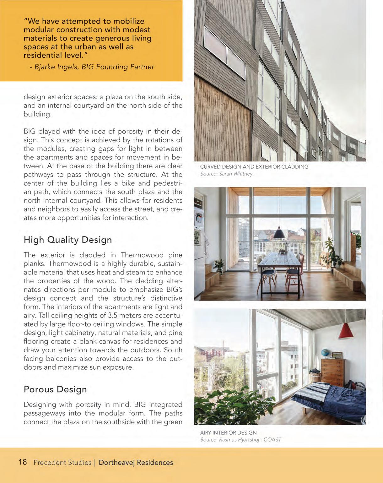
CURVED DESIGN AND EXTERIOR CLADDING
Source: Sarah Whitney
Source: Rasmus Hjortshøj - COAST

POROUS PATH AND COURTYARD
Source: Sarah Whitney
PLAY STRUCTURE
Source: Sarah Whitney
Freetown Christiania
DAVIEN GRAHAM
l ocation :
y ear :
D e S igner ( S ):
c lient :
Christianshavn, CPH
1971
Multiple Residents of Christiania
Freetown Christiania is a sovereign district in the city of Copenhagen. The existing context s made up of the remnants of old military barracks and infrastructure. In 1971, a group consisting of those lying on the fringes of society came together and turned an abandoned city district into a thriving free space for self expression and community organization.
History
Christiania’s military origins can be traced back to medieval Europe. The initial construction of the characterdefining bastions and ramparts were constructed in the early 1600s. Over the course of the mid-20th century, the military phased out use of the site; by 1971, the area was abandoned. Starting in May 1971, people broke down infrastructure on site, using portions as playscapes and, over the coming months, taking control of more and more abandoned buildings. On September 26, 1971, Freetown Christiania was formerly established.


REUSE OF MILITARY INFRASTRUCTURE FOR COMMUNITY USES SUCH AS HOUSING
Source: Davien Graham

A NEIGHBORHOOD MEANT FOR PEDESTRIAN USE
Source: Vincent Javet
Arguably buildings,

This site is home to a bathhouse, a public market with bars and restaurants, art spaces and facilities, meditation spaces, urban gardens, a brewery, and much more. A common thread in all of these places in Christiania is sustainability and recycling, which are at the forefront of their building methodology. The neighborhood has its own recycling facility as well as a large market hall that residents use to fabricate anything they wish. In this way, adaptive reuse is the primary building language stepping through the gates of Christiania, and 50+ years later, the district still stands strong.
ANARCHY AS ARCHITECTURE AND DESIGN
Source: Christiania Guide Map
Source: Davien Graham
THE EXTENTS OF FREETOWN CHRISTIANIA
GrønningenBispeparken
HUNTER OTTMAN
l ocation :
y ear :
D e S igner ( S ):
c lient : Nordvest, Copenhagen
2020- 31 August 2024
SLA, HOFOR, Niras, Bergendal
City of Copenhagen
Grønningen-Bispeparken is a 20,000 square meter urban park in the Nordvest district of Copenhagen, designed by SLA as a cutting-edge example of nature-based climate adaptation. Constructed between 2020 and 2024, the park serves as a key element of Copenhagen’s Cloudburst Management Plan, designed to address the city’s increasing vulnerability to intense rainfall events known as cloudbursts.
The park features 18 ‘social basins,’ which can collectively retain up to 3,000 cubic meters of rainwater. As their name indicates, these social basins also function as spaces for community to gather in dry weather. Grønningen-Bispeparken integrates environmental, social, and recreational features, fostering biodiversity and offering a vibrant public space for all ages.

THE PARK, FACING NORTH, WITH GRØNNINGEN (FRONT) AND BISPEPARKEN (BEHIND, ACROSS THE STREET)
Source: SLA
PRE-CONSTRUCTION VIEW FROM THE SOUTH
Source: Apropos en eng, 2019
COLOR RENDERING WITH TOPOGRAPHY
Source: @NIRASConsulting on YouTube

WATERFLOW THROUGH BASINS DIAGRAM
Source: @NIRASConsulting on YouTube
SITE PLAN
Source: Copenhagen Municipality

VIEWING DECK
Source: Hunter Ottman
PLAY SPACE IN BISPEPARKEN
Source: Hunter Ottman
SOCIAL BASIN FLOODED
Source: SLA via Instagram

PLAY SPACE CONCEPT MODELS TO AS-BUILT PHOTOS
Source:
K. Bergendal (above), Hunter Ottman (below)
PUBLIC ENGAGEMENT AFTER PARK OPENING
Source: SLA
IKEA + Kaktus Towers
PEIYAO XIAO
l ocation :
y ear :
D e S igner ( S ):
c lient : Vesterbro/Kongens
2023
1:1 Landskab, Dorte
Mandrup, BIG
IKEA, Kaktus 1, Catella, Høpfner Projects
As cities reimagine commercial infrastructure for ecological and public use, the new IKEA in downtown Copenhagen offers a compelling model of adaptive landscape design. Far more than a furniture store, the building integrates a three-story public landscape that culminates in a lush rooftop garden. This elevated space provides both infrastructure (for bikes, pedestrians, and urban wildlife) and a unique encounter with wild urban nature.
This landscape connects to the larger planning effort, Det Grønne Strøg, or the “green strip,” a network of public green roofs and pedestrian routes that stretch from Copenhagen’s City Center, across the IKEA rooftop, and down past the Kaktus Towers, continuing southwest.
CONTEXT:
Located at the edge of Vesterbro, Copenhagen’s ‘Western Neighborhood,’ the IKEA rooftop and Kaktus Towers sit at the intersection of the city’s historic center and newer urban districts. Positioned within the palm area of the city’s historic ‘Finger Plan’ strategy, the site is both central and significant, particularly in its potential to offer public open space, part of a layered strategy to support diverse land uses including housing, retail, and green space.
This area has seen rapid transformation, spurred in part by new transit investments that have reactivated former industrial and infrastructural zones. Proximity to central stations and bike networks has supported mixed-use development, blending housing, retail, and public green space.

AREA OUTSIDE WEST GATE IN 18TH CENTURY
Image Source: Danish Architecture and Design Review


IKEA COPENHAGEN MASTER PLAN
Source: 1:1 Landskab
SITE LOCATION
Source: Google Maps
GREEN WALKWAY THROUGH IKEA CPH
Source: 1:1 Landskab
KALVEBOD BRYGGE VIEW FROM IKEA CPH
IKEA ROOFTOP PARK
Source: Peiyao Xiao


COMMUNITY EVENTS:
The rooftop provides gathering space for the local community, visitors and employees of IKEA, as well as intimate resting places and opportunities for spontaneous meetings. Looking out from the roof, there is a beautiful view over Vesterbro, the canal, and the inner city.
Source: Peiyao Xiao

Source: Peiyao Xiao
IKEA CPH BIKE PARKING
CAFE ON IKEA CPH ROOFTOP
IKEA ROOFTOP: NATIVE PLANTS
Planting zones are inspired by Danish cultural landscapes: beach meadows, pastures, and hedgerows, with swaths of native species. Given the challenges of a third-floor rooftop, careful attention was paid to soil composition, plant orientation, rooting depths, and wind tolerance. An impressive 18,000+ plants and trees now cover 60% of the rooftop.

Source: Peiyao Xiao
IKEA ROOFTOP BIRDVIEW
Source: 1:1 Landskab
‘THE HEDGEROWS’
‘THE PASTURE’
‘THE BEACH MEADOW’

IKEA ROOFTOP: MATERIALS + ENERGY
The rooftop integrates shrubs, grasses, repurposed native woods, and bug hotels, strategically placed to create comfortable microclimates, attract diverse fauna, and manage rainwater, which is collected and reused for cooling the store. The material palette emphasizes circularity, featuring recycled cobblestones and 1,450 square meters of solar panels that contribute to the building’s renewable energy supply.
IKEA ROOFTOP PAVING
Source: Peiyao Xiao
IKEA ROOFTOP BUG HOTEL
Source: 1:1 Landskab
KAKTUS TOWERS
Public spaces respond to steep grade changes with a network of ramps and slides that offer playful circulation and visual continuity. These elements connect the more private residential areas of the Kaktus Towers to the public IKEA rooftop, supporting the flow of the Green Strip. Plantings draw from biodiverse, meadow-like landscapes, extending the ecological character of the adjacent rooftop while offering a quieter, more granular scale suited to the residential context

Source: Peiyao Xiao
KAKTUS TOWERS
Source: BIG
SLIDE IN KAKTUS TOWERS PUBLIC SPACE

Source: BIG
KAKTUS TOWERS
Karens Minde Aksen
JAXON ROLLER
l ocation :
y ear :
D e S igner ( S ):
c lient :
Wagnersvej 19, Sydhavn, Copenhagen 2023
Schønherr
City of Copenhagen, HOFOR
“To add as much and subtract as little as possible”
This is the motto that the project was designed to follow. In an area that was previously perceived as very divided, a meandering brick ‘river bed’ and a central Circle Bridge now connect the community as central features.
Faced with flooding challenges, particularly from cloudburst events, this adaptation’s primary function is to handle 15,000 cubic meters of stormwater. Instead of hiding the problem, Karens Minde Aksen celebrates it by making the flow and treatment highly visible and engaging for visitors.


RIVERBED, CIRCLE BRIDGE, AND MATURE TREES
Source: Schønherr - Thomas Vesterbæk and Jens Juel Thiis Knudsen

AERIAL PERSPECTIVE VIEW
Source: Schønherr

Source: Schønherr
A MULTITUDE OF USES AT KARENS MINDE AKSEN
Orienten at Nordhavn
RUSSELL CORBIN + KAYLIE TRESKIN
l ocation :
y ear :
D e S igner ( S ):
c lient :
g ro SS
f loor
a rea :
Århusgade, Nordhavn, Copenhagen 2017-2021
Dorte Mandrup, BOGL
Domea
150,000 sf total
114,000 sf residential
32,000 sf retail, incl. 11,000 sf daycare
98 social housing units
9 youth housing units
24 supportive housing units
2 buildings (2-6 floors)
c o S t to con S truct :
$31.1 million USD
As a central part of the burgeoning Nordhavn district, the Orienten mixed-use project seeks to bring diversity and inclusivity to the neighborhood through sustainable design, affordable housing, and an active public realm.

All unlabeled photographs by Russell Corbin

SECTION AND MASSING RENDERINGS
Source: Norconsult Arkitektur throughout the


STREETVIEW BEFORE AND AFTER
Source: Google Maps
ØsterGRO
JOANNA CHEN + ELLEE RUDER
l ocation :
y ear :
D e S igner ( S ):
c lient :
Æbeløgade, Østerbro 2014
Kristian Skaarup + Sofie
Brincker N/A
Founded in 2014 by Kristian Skaarup and Sofie Brincker, ØsterGRO has flourished atop an old car auction facility. The principle goal of the garden is to connect citizens with organic food-growing systems. In the limited space they have, the farm will produce around 750 kilos of produce in a year. The produce supplies the farm’s CSA program, providing healthy, organic vegetables to residents of the neighborhood. Volunteers are the central, driving force of ØsterGRO; garden maintenance is done largely in volunteer events. The character of the space has also been shaped by citizen involvement.
In a reality where climate change and rising populations spark debate about the future of urban living, ØsterGRO is a model for climate adaptive design. Their community-centric mode of operation, as well as their clever reuse of space, make this farm more than just a place where vegetables grow.


A STAFF MEMBER TENDING TO THE VEGETABLE BEDS
Source: ØsterGRO
A COMMUNITY MURAL WATCHES OVER THE FARM
Source: Vincent Javet

HELLCATS MOTORCYCLES, LOCATED BELOW THE ROOFTOP GARDEN
Source: Vincent Javet
GRO SPISERI
Source: ØsterGRO
Sege Park
LELA COOPER + SARAH WHITNEY
l ocation :
y ear :
D e S igner ( S ):
c lient :
Östra sjukhusgaan, Malmö, Sweden
2016-present
Kjellander Sjöberg
City of Malmö
Sege Park serves as a showcase of what sustainable residential development may look like in Malmö.
The park was initially developed in he 1930s as a mental health hospital, Östra sjukhus. Since closing operations in 1955, Sege Park gained its current name and has seen a variety of uses including other medical operations and education.
Today, the City of Malmö envisions
Sege Park as a community in which green living is at the center. The site is expected to have approximately 800 residential units built within a decade. By implementing both sustainable design solutions and emphasizing community through the site’s programming, Sege Park serves as a vision for climate-smart, socially rich living.

‘IT TAKES A BLOCK’ RESIDENTIAL TYPOLOGIES
Source: Kjellander Sjöberg
ÖSTRA SJUKHUSET
Source: Kollektivhuset Röda Oasen

PRESERVING CULTURAL HERITAGE WHILE PLANNING FOR THE FUTURE
Source: Kjellander Sjöberg
NAVET COMMUNITY WORKSPACE
Source: Vincent Javet

SHARED LIVING MODEL
Source: Lela Cooper
KOLLEKTIVHUSET
residents representative
A LANDSCAPE SHAPED BY RESIDENTS
Source: Kjellander Sjöberg

AMENITIES FOR ALL AGES
Source: Vincent Javet
BUILDING COMMUNITY
“Here, residents and businesses create a community around sustainable solutions”
- Navet, Sege Park
Social Spine
TINA LEE + JINGYAO WU
l ocation :
y ear :
D e S igner ( S ):
c lient :
Dalslandsgade 8, Øresund, Copenhagen
2021-2022 SLA
Øresundskollegiet
The Social Spine project revitalizes Øresundskollegiet, Scandinavia’s largest student housing complex in Copenhagen. Once a worn-down, concrete-heavy space, the complex is now being transformed into a green social hub.
With Copenhagen losing green spaces and facing high real estate prices, fostering social and ecological spaces has become crucial. In 2021, the City of Copenhagen allocated some housing in the complex to marginalized youth, spurring a redesign to promote inclusivity.
The project’s first phase revamped a 1,470 square meter rooftop terrace, adding greenhouses, study areas, a lawn, and over 350 trees and shrubs.

Source: SLA
Source:

PERSPECTIVE ON THE ROOFTOP
Source: SLA

PERSPECTIVES ON THE ROOFTOP BEFORE AND AFTER ROOFTOP CHANGE
Source: SLA

ISOMETRIC DRAWING OF SITE DESIGN
Source: SLA
SPOR10
ELLEE RUDER + JOANNA CHEN
l ocation :
y ear :
D e S igner ( S ):
Jernbanebyen, CPH
2023-present
Nrep, Archival Studies,
Gehl Studio, Cobe,
Studio Atlant
DSB and FREJA
c lient :
Ejendomme
SPOR10 is a dynamic 365,000 square meter community space located within the evolving Jernbanebyen district. The space is multifunctional both in and outside, hosting a range of activities daily. The main attractions are sporting events, though the space provides opportunities for other forms of connection too.
The space is part of a larger project to transform the district from a defunct rail yard into a neighborhood that can satisfy the increasing need for housing and sustainable living in the city. SPOR10 acts as a tool for initial community-building within the area, able to evolve into a central community hub once the district becomes more established. Part of this vision is showcasing the plans for the new district within the facility, showing visitors a hopeful future and igniting more interest from surrounding communities.

OUTSIDE OF THE FACILITY
Source: Joanna Chen
CENTRAL OUTDOOR SEATING AREA
Source: Joanna Chen

EXHIBITION INSIDE SPOR10
Source: Archival Studies
LARGE GATHERING INSIDE SPOR10
Source: SPOR10
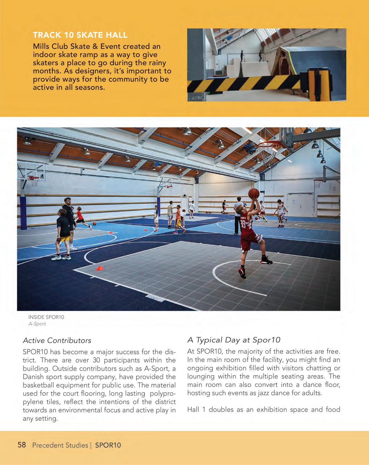
INSIDE SPOR10
Source: A-Sport
SKATE PARK CREATION INSIDE OF SPOR10
Source:

Rullesport Danmark
Strædet
SISKA DEWANTI + REBECCA ZARAGOZA
l ocation :
y ear :
D e S igner ( S ):
c lient : Læderstræde, CPH 1397-present varies varies
Strædet, commonly referred to as ‘the Alley,’ is a vibrant shopping strip in downtown Copenhagen.
The official name for Strædet is Læderstræde, which connects to Kompagnistræde and Farvergade. This corridor is filled with numerous antique shops, galleries, bars, restaurants, and cafes. Strædet plays a crucial role in enhancing the dynamic atmosphere of Copenhagen through street activation, which attracts foot traffic. This influx of visitors promotes economic growth, supports local businesses, and builds public spaces, all while fostering a sense of community for both residents and visitors.

Source: tripadvisor.com
SHOP EDGES AT STRÆDET
STRÆDET STREET VIEW
Source: tripadvisor.com

STRÆDET STREET VIEW
Source: Siska Dewanti

STRÆDET AND URBAN CONTEXT
Source: Google Maps, graphics by Siska Dewanti
HØJBRO PLADS
Source: Siska Dewanti
STORKESPRINGVANDET STRØGET

STRÆDET STREET VIEW
Source: Siska Dewanti
Tårnlegepladsen
LIZ FORELLE
l ocation :
y ear :
D e S igner ( S ):
c lient : Frederik V’s Vej 4, Østerbro, CPH
2012
Morten Weeke Borup
Copenhagen Municipality
Located in Fælledparken in Østerbro, the Tower Playground was built in 2012. While the construction of the playground came later, the park itself began in 1909 when the first trees were planted. Designed by landscape architect Edvard Glæsel, the park was completed in 1914. The park was designed in cooperation with the Copenhagen Municipality on a large space known to locals as ‘the commons,’ or ‘fælled’ in Danish.
Today, the park is used for major outdoor events from political rallies to sports to children’s festivals. The formalized pathways through the park allow for promenading and picnicking. In 2011, money was invested into remodeling and improving the park with a number of play area. This includes a large skate park and an area known as Trafiklegepladsen (Traffic House) where children can learn to ride bikes through roads and junctions.

SITE DESIGN
Source: LYYT Urban and Landscape Architecture
FIRST PLAYGROUND AT FÆLLEDPARKEN
Source: Copenhagen Municipal Archives
FIRST STRUCTURE AT FÆLLEDPARKEN
Source: Copenhagen Municipal Archives

THE TOWER PLAYGROUND
Source: Liz Forelle
MULTI-USE PLAY SPACE FOR CHILDREN
Source: Danish Architecture Center

OVERLAY OF ICONIC TOWERS AND PLAY STRUCTURES
Source: LYYT Urban and Landscape Architecture
CHILDREN PLAYING WITH ARCHITECTURAL STRUCTURES
Source: Danish Architecture Center
Source: Danish Architecture Center

CHILDREN ENJOYING THE SUSPENDED BRIDGE
Source: Danish Architecture Center
PLAYING AT THE MIRROR HOUSE
THE MIRROR HOUSE
Source: Red Dot Design Award
Venligbolig Plus
RUSSELL CORBIN + KAYLIE TRESKIN
l ocation :
y ear :
D e S igner ( S ):
c lient :
Roskildevej 54B, Frederiksberg
2019
ONV Architects
We Do Democracy
Venligbolig Plus, or Friendly Housing Plus, is a microliving community in Frederiksberg, where refugees and students who cannot afford to live in Copenhagen can live together. The project meets several of the UN’s global goals, with sustainable architecture and promoting sustainable development through democratic action. The project was created as a public-private partnership between Frederiksberg Municipality, Frederiksberg United Housing Companies, FFB/KAB, Friendly Housing, ONV Architects, and We Do Democracy.
The project includes three four-story buildings, for a total of 41 apartments located on 50 square meters. The buildings are located on the border of the Solbjerg Park Cemetery, connected to Frederiksberg’s largest park and located off one of its main streets, Roskildevej.

SPATIAL COMPOSITION OF BUILDINGS
Source: ONV Architects, We Do Democracy

VIEW FROM COURTYARD
Source: Russell Corbin

ENTRANCE TO VENLIGBOLIG PLUS
Source: Russell Corbin
RESIDENTS OF VENLIGBOLIG PLUS
Source: ONV Architects, We Do Democracy

PRINCIPAL SECTION
Source: ONV Architects, We Do Democracy
COURTYARD WITH VIEW INTO COMMON ROOMS
Source: Russell Corbin

PLAN VIEW
Source: ONV Architects, We Do Democracy
Context of The Bend

THE BEND
SEATTLE
GEORGETOWN
DISTRICT + SITE ANALYSES
Prior to developing design proposals, it was essential that we understand current conditions and potential futures of the Georgetown/Bend/Seattle/Duwamish watershed contexts – environmentally, socially, culturally and economically. Working together, students conducted comprehensive analyses of the many systems that impact the site, seeking to understand existing and potential conditions, challenges, opportunities and pathways within the various nested scales of the project – from the site, to its adjacent industrial and Georgetown contexts, to the city and watershed, and to the site’s global relationships and impacts to planetary health.
The following pages combine on-the-ground reconnaissance and documentation, archival investigation, discussions with local stakeholders and authorities, and students’ own analytical thinking to uncover the essential qualities of the site and neighborhood districts, including their current forms and functions as well as predicted future conditions and needs.
WATERSHED + TOPOGRAPHY
EXISTING SITE
MOBILITY + TRANSPORT
HEALTH, SAFETY, HAZARDS, AND RESILIENCE
PEOPLE, NEIGHBORHOOD, AND CULTURE
PUBLIC SPACE, ECOLOGY, AND BIODIVERSITY
PLANNING CONTEXTS
Watershed + Topography
Site Topography, Drainage, and Major Form
K ey t a K eaWay S :
» Georgetown is located in the Duwamish Estuary Subwatershed, an area heavily industrialized for flood control, navigation, and commercial interests
» The channelization of the Duwamish River has resulted in significant pollution, loss of natural habitat, and threat to Indigenous cultural heritage
» Alluvial soils on site raise concerns about flooding and floodplain erosion, and artificial fill is associated with potential instability and industrial pollution
» The site’s location on the Seattle Fault Zone creates seismic risks, including possible soil liquefaction during earthquakes
» The main topographical observation is that the site is incredibly flat. Drainage will thus be dictated by the grading of individual parcels and streets

PEIYAO XIAO + JAXON ROLLER

GREEN/DUWAMISH RIVER WATERSHED
Source: King County
GREEN RIVER GORGE NEAR ENUMCLAW, ND
Source: Chapin Bowen, UW Special Collections
DUWAMISH RIVER
Source: Mid Sound Fisheries Enhancement Group
CONSTRUCTION OF THE DUWAMISH RIVER IN THE EARLY 20TH CENTURY was largely undertaken for flood control efforts, navigation, and commercial interests.


MID-1800S TODAY
Source: Waterlines Project, Burke Museum
DUWAMISH RIVER VALLEY
DUWAMISH ESTUARY FILL SERIES
Source: Waterlines Project, Burke Museum

Source: Hansrad Collection
Source: Early Advertising of the West Collection
HARBOR ISLAND
SEATTLE TIDELANDS REAL ESTATE (1907)
GILBERT KING GEORGE SPEAR FISHES ON THE WHITE RIVER DURING THE “FISH-INS” OF THE 1970S
Source: Burke Museum

Source: Elmer
SALMON WEIR, WHITE RIVER NEAR AUBURN, CA 1903
E. Patten, White River Valley Museum
THE DUWAMISH REVEALED INSTALLATION
Source: Burke Museum

DUWAMISH REVEALED PROJECT MATERIALS
Source: Burke Museum
GEOLOGIC MAP OF SEATTLE
Source: USGS

Source: Google Maps

Source: Washington State Department of Natural Resources

SIMPLIFIED SLOPES
Source: Jaxon Roller
Alluvium soil is highly permeable. If the impervious surface on the site can be broken, it is likely that water can be infiltrated and wetland plants established.
POINT CLOUD DATA FROM AERIAL LIDAR SCAN

ILLUSTRATIVE SUBSURFACE SECTION
Source: Jaxon Roller
1:1 MODEL (RHINO)
Source: Jaxon Roller
Existing Site
Site Conditions and Uses
JOANNA CHEN + SARAH WHITNEY
K ey t a K eaWay S :
These diagrams illustrate the current conditions and land use of The Bend site. We documented the qualities of the streets through film and notetaking. Longitudinal collages of the streets were constructed using frames of the footage. Uses of each building were determined by investigating on foot and with King County Parcel Viewer and Google Maps.
» 4th Avenue South is loud, exposed to the elements, and generally was unpleasant to walk
» 5th Avenue South is quieter than 4h but has no sidewalks. There was a poor stench due to the landfill transfer station nearby
» South Lucile Street is the main east-to-west travel corridor, and there are more cars traveling at faster speeds. As such, this street felt noisier than the other east-towest streets: South Bennett, South Brandon, South Findlay, South Mead, and South Fidalgo


Source: Sarah Whitney and Joanna Chen, King County Parcel Viewer

4TH AVENUE
Source: Sarah Whitney

5TH AVENUE
Source:
Joanna Chen

BENNETT - LUCILE STREETS
Source: Sarah Whitney

FINDLAY - FIDALGO STREETS
Source: Joanna Chen
Mobility + Transport
Pathways and Challenges
LELA COOPER + REBECCA ZARAGOZA
Source: Lela Cooper
» Georgetown prioritizes vehicle transportation over other modes
» Industrial activity leads to high traffic volumes and reduced safety for non-motorized transportation users
» Mobility data reflects a neighborhood of commuters, with few residents working in the area and most workers commuting in
» The transit network does not support user needs, and last mile connections to the light rail remain an opportunity area
» The bike and pedestrian network has limited connectivity and needs improved safety conditions
» Freight planning remains a challenge as Georgetown represents 84% of Seattle’s industrial area
» Investments in safety, wayfinding, and connectivity remain crucial
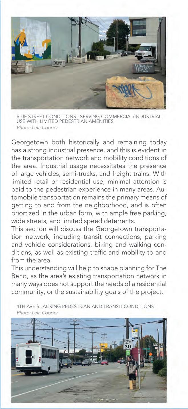
Source: Lela Cooper
K ey t a K eaWay S :
SIDE STREET CONDITIONS: SERVING COMMERCIAL/INDUSTRIAL USE WITH LIMITED PEDESTRIAN AMENITIES
4TH AVE S, LACKING PEDESTRIAN AND TRANSIT CONDITIONS

Photo: Rebecca Zaragoza

Source: LEHD Data (2021), Lela Cooper
A NEIGHBORHOOD OF COMMUTERS
Georgetown has more jobs than residents, and few residents work in the area. With limited transit connectivity, SOV rates remain high.
GEORGETOWN COMMUTE FLOWS
GEORGETOWN (98108) COMMUTE INFLOW/OUTFLOWS
Source: U.S. Census, LEHD Data (2021)

SINGLE OCCUPANCY VEHICLE (SOV) COMMUTING RATES AMONG GEORGETOWN RESIDENTS
Source: ACS Data (2022), Lela Cooper
GEORGETOWN CURRENT TRANSIT NETWORK
Source: Oran Viriyincy via Seattle Transit Map

THE BEND PARKING ACCESS ALLOCATION
Source: Seattle Department of Transportation (SDOT)
SEMI-TRUCK PARKED IN SIDEWALK ALONG 4TH AVE S (NB)
Source: Lela Cooper
‘METRO FLEX’ ON-DEMAND LAST-MILE SERVICE: EXISTING ZONES
Source: KCM MetroFlex (2024)
LAST MILE CONNECTIVITY
Investments in the nearby Link light rail offer an opportunity to explore last mile solutions, such as micromobility and on-demand connections like KCM Metro Flex.

Source: KCM MetroFlex (2024)
KING COUNTY METRO - ‘METRO FLEX’ ON-DEMAND VAN
“THERE IS A GROWING NUMBER OF FAMILIES WHO ARE CHOOSING TO LIVE IN GEORGETOWN. SAFE ACCESS TO SCHOOLS, PARKS, AND PLAY AREAS IS VERY IMPORTANT.”
Georgetown Mobility Study, 2017

SIDEWALK CONDITIONS ON S BRANDON ST
Source: Rebecca Zaragoza
EXISTING BIKE FACILITIES NEAR THE BEND
Source: Seattle Geodata
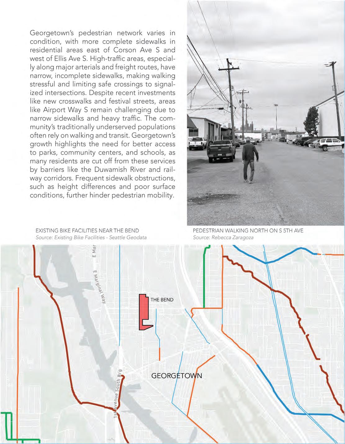
Source: Rebecca Zaragoza
PEDESTRIAN WALKING NORTH ON S 5TH AVE

Source: Rebecca Zaragoza
Existing Proposals for Bike and Pedestrian Projects

EXISTING AND RECOMMENDED CITYWIDE NETWORK
Source: Bike Master Plan


BIKE AND PEDESTRIAN SAFETY ANALYSIS (BPSA)
The BPSA (2016) is used to prioritize safety projects and inform data-driven strategies to reduce collisions.
The BPSA examined collisions involving pedestrians and cyclists from 2007 to 2014 to identify crash patterns and factors contributing to accidents. A model was developed to predict highrisk locations, guiding future safety improvements.
Key findings include a strong link between cyclist presence and lower injury rates, improved safety for all road users with better walking and biking infrastructure, and that severe pedestrian crashes are more likely at non-signalized intersections.
FREIGHT TRUCK PARKED ON S LUCILE ST
Source: Rebecca Zaragoza
BPSA PRIORITY LOCATIONS
Source: Bike and Pedestrian Safety Analysis, Rebecca Zaragoza

CURRENT FREIGHT NETWORK
Source: Georgetown Mobility Study


Photo: Rebecca Zaragoza
OPPORTUNITIES FOR MOBILITY IN THE BEND
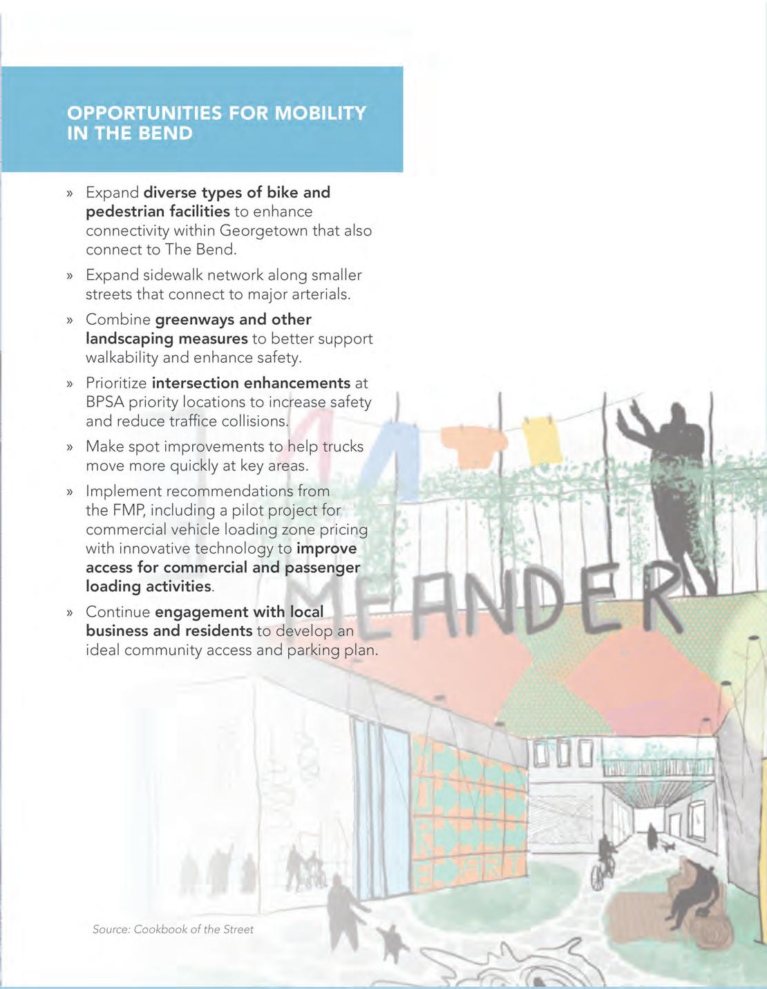
Source: Cookbook of the Street
Health, Safety, Hazards + Resilience
LIZ FORELLE + HUNTER OTTMAN
Source: Seattle Parks Foundation, Georgetown Open Space Vision Framework
K ey t a K eaWay S :
» Georgetown is afflicted by numerous types of air pollution, which can result in health problems including bronchial irritation, lightheadedness, and cancer
» Georgetown sees the impacts of urban heat island effect during summer months, with temperatures staying high through the evening
» In the effect of an earthquake, Georgetown will experience high physical impacts
» Georgetown is subjected to a significant amount of noise pollution from freight, commuter traffic, rail, and aviation
» While not at immediate risk to sea level rise, the site may be affected by reverberating hydrological and climatological impacts
» Topography and soil conditions make on-site water detention a challenge

Source: Seattle Parks Foundation, Georgetown Open Space Vision Framework
GEORGETOWN, SEATTLE’S OLDEST NEIGHBORHOOD
HEALTH INDICATOR CHART

SEATTLE MORNING AND EVENING HEAT INDEX MAPS Source: ArcGIS Online
Those living in Georgetown will live 8 years less than the average Seattle resident.

Source: Sound Seismic
Safety, Hazards, and Resilience
THE BEND MORNING AND EVENING HEAT INDEX MAPS
Source: ArcGIS Online
SEISMIC HAZARDS MAP OF SEATTLE

GUIDE TO RECOMMENDED MAXIMUM EXPOSURE TIMES
Source: Know Your Noise / Shout Hearing Healthcare

ROAD NOISE POLLUTION
RAIL NOISE POLLUTION

ABOUT THE DATA:
The national transportation noise map was developed using a 24-hr equivalent A-weighted sound level noise metric, denoted by LAeq. The results represent the approximate average noise due to multi-modal transportation sources over a 24hour period at the receptor locations. The map is intended to facilitate the tracking of trends in transportation-related noise, by mode and collectively.
NATIONAL TRANSPORTATION NOISE MAP 2020
NATIONAL TRANSPORTATION NOISE MAP 2020
Bureau of Transportation Statistics
Source: Bureau of Transportation Statistics


DECIBEL METER READINGS
Source: Hunter Ottman, Field Data using the National Institute for Occupational Safety and Health (NIOSH) Sound Level Meter App

ESTIMATED SURFACE WATERFLOW
Source: ArcGIS, with DNR Lidar DEM data

ELEVATION RANGES
Source: ArcGIS, with DNR Lidar DEM data

100-YEAR FLOOD EVENT PROJECTION
Source: King County Flood Risk iMap Viewer

SEA LEVEL RISE AT 10-FT PROJECTIONS
Source: NOAA Sea Level Rise Viewer
People, Neighborhood, and Culture


THE BEND
Source: Google Earth


GEORGETOWN NEIGHBORHOOD DOWNTOWN
Source: Google Earth
HISTORICAL DUWAMISH ROUTE AND NATIVE SETTLEMENTS
(19TH CENTURY) VS. GEORGETOWN TODAY
Source: Hidden Hydrology

NEIGHBORHOOD NUMBERS + RACIAL BREAKDOWN
Source: City of Seattle Department of Neighborhoods 2009-2013 American Community Survey
Neighborhood, and Culture
Source:

Source: Google Maps
PLACES THAT CAPTURE GEORGETOWN’S ESSENCE:
From streets like Airport Way S, to community art spaces like Equinox Studios, these are essential to Georgetown
Source: Google Maps
Source:
GEORGETOWN PLAYFIELD
Seattle Parks and Recreation
SEATTLE ARTIST LEAGUE ART SCHOOL
SLIM’S LAST CHANCE
LA HACIENDA MOTEL
Google Maps
EQUINOX STUDIOS
Source: Wikimedia Commons
DOWNTOWN GEORGETOWN ON AIRPORT WAY S.
Source: SDOT Blog


Climate, Energy, + Utilities
TINA LEE + SISKA FLORENSIA DEWANTI
K ey t a K eaWay S :
» Seattle has three sewer types: Combined, Separated, and Partially Separated. The Bend is dominated by SPU Combined Mainlines for waste and stormwater
» The Cedar River Watershed provides 70% of the city’s drinking water, including for Georgetown
» Two transfer stations (the North Station in Wallingford and the South Station in South Park) process trash, recycling, and compost for Seattle
» Recology’s Artist in Residence (AIR) Program allows artists to create using materials from recycling facilities, promoting reuse
» Large demolition projects must assess and salvage reusable materials
» For the Bend, reusable materials from existing buildings are being salvaged, with the aim to minimize waste
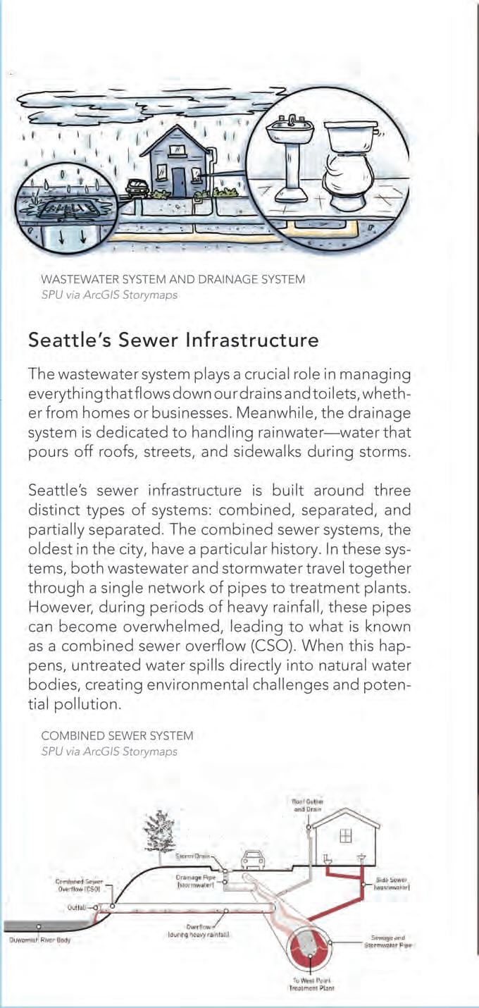
WASTEWATER SYSTEM AND DRAINAGE SYSTEM
Source: SPU via ArcGIS Storymaps
COMBINED SEWER SYSTEM
Source: SPU via ArcGIS Storymaps

SEWER CLASSIFICATION AREA
Source: SPU via ArcGIS Storymaps
“There used to be little flows of water, all these tiny flow paths that gather together, and we took it and put it into pipes and controlled it so we can build.”
- Eric Autry, Seattle Public Utilities Spill Response Program Lead

Source: SPU
Source: SPU
MAP OF CEDAR RIVER WATERSHED
MAP OF COMBINED SEWER MAINLINE UNDER THE BEND
Source: Tina Lee
CEDAR RIVER WATERSHED
SOLID WASTE SYSTEM DIAGRAM
Source: SPU
Source:

RECOLOGY’S ARTIST IN RESIDENCE (AIR) PROGRAM GIVES ARTISTS IN KING COUNTY ACCESS TO MATERIALS FROM RECYCLING FACILITIES TO PROMOTE THE IMPORTANCE OF REPURPOSING MATERIALS
Source: Recology

DECONSTRUCTION FOR MATERIAL SALVAGE
Second Use Seattle
HEAT PATTERNS IN GEORGETOWN
Source: First Street Technology, Inc.

AIR QUALITY IN GEORGETOWN
Source: First Street Technology, Inc.
Source: First Street Technology, Inc.

Source: First Street Technology, Inc.
FIRE RISK IN GEORGETOWN
FLOOD RISK IN GEORGETOWN
WIND FACTOR IN GEORGETOWN
Source: First Sreet Technology, Inc.

FCC NATIONAL BROADBAND MAP NATIONWIDE
Source: Federal Communications Commission
POWER RESOURCES IN SEATTLE
Source: Seattle City Light

POWER VENDORS IN SEATTLE
Source: Seattle City Light
POWER RESOURCES MIX IN SEATTLE
Source: Seattle City Light

FUTURE PROJECTION OF POWER RESOURCES IN SEATTLE - GREEN UP OPPORTUNITIES
Source: Seattle City Light
CONSUMPTION-BASED EMISSIONS INVENTORY
Source: Seattle Office of Sustainability & Environment
TOTAL EMISSIONS PER HOUSEHOLD IN GEORGETOWN
Source: Seattle Office of Sustainability & Environment

CARBON CONSUMPTION CATEGORIES IN SEATTLE
Source: Seattle Office of Sustainability & Environment
Public Space, Ecology, + Biodiversity
MATTHEW JERNIGAN + JINGYAO WU
K ey t a K eaWay S :
» Georgetown currently has few connections to greenspace and wildlife corridors and is dominated by hardscape, but there are some planned park and trail connections
» While there is little urban agriculture immediately surrounding the site, there is a P-Patch in the nearby Oxbow Park and several other community gardening organizations based nearby
» Georgetown has less than 5% tree canopy and is on SDOT’s priority list for future planting
» The majority of trees on site are monoculture Purpleleaf Plum street trees. There are opportunities to plant more diverse species that grow well in harsh urban environments
» There are opportunities to highlight views of downtown, optimize sun and shade access, and implement green stormwater infrastructure on site

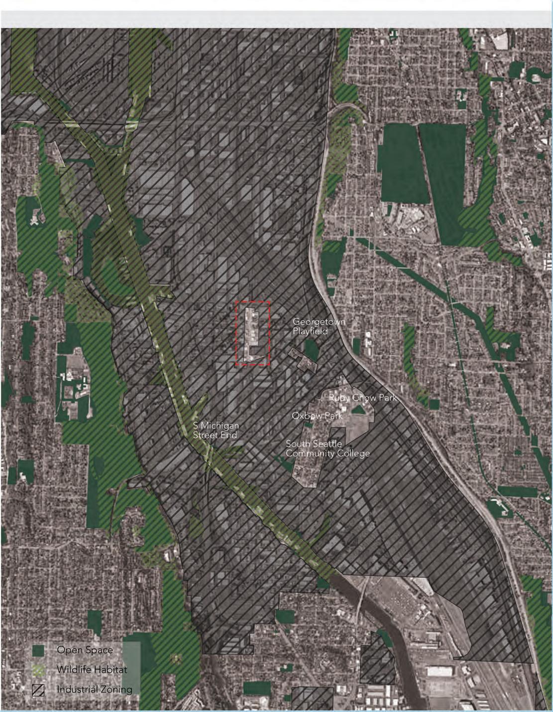

PUBLIC SPACE IMPROVEMENT PRIORITY AREAS
Source: Seattle GIS
NEAREST EXISTING PUBLIC SPACES
Source: Seattle Parks and Recreation, Foursquare, Everout
RUBY CHOW PARK
OXBOW PARK
GEORGETOWN PLAYFIELD

NEAREST AGRICULTURAL PROJECTS
Source: Seattle GIS
Sources: Beacon Food Forest, Solid Ground, Nurturing Roots Farm
MARRA FARMS
NURTURING ROOTS FARM
BEACON HILL FOOD FOREST
HISTORIC AND MODERN LANDSCAPE CONDITIONS OF THE DUWAMISH RIVER
Source: Historical Aquatic Habitats in the Green and Duwamish River Valleys and the Elliot Bay Nearshore, King County, WA

District + Site Analyses
Public Space, Ecology, and Biodiversity

WATERLINES PROJECT MAP
Source: Waterlines Project, Burke Museum
WESTERN HEMLOCK, DOUGLAS FIR, WESTERN RED CEDAR, RED HUCKLEBERRY, BLACKCAP RASPBERRY, TRAILING BLACKBERRY
Source: Waterlines Project

Source: Waterlines Project
Source: Waterlines Project
Source: Waterlines Project
GARRY OAK, CAMAS, BRACKEN FERN, STRAWBERRY, SALAL, BALSAMROOT, SERVICEBERRY
WAPATO, BULRUSH, CATTAIL, SKUNK CABBAGE, DEVIL’S CLUB, CRANBERRY, SPHAGNUM MOSS, CRAB APPLE
RED ALDER, BIGLEAF MAPLE, BLACK COTTONWOOD, STINGING NETTLE, RED ELDERBERRY, OREGON ASH, BITTER CHERRY, BEAKED HAZELNUT

% TREE CANOPY IN SEATTLE BY HECTARE
Source: City of Seattle


PNW NATIVE PLANT LISTS
Source: Native Plants for Urban Areas
VIEWSHED ANALYSIS
Source: Google Maps

SUN/SHADE ANALYSIS
Source: ShadeMap.app
SECTION OF TREATMENT STATION
Source: Berger Partnership

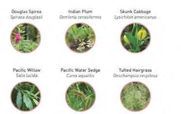


PLANTS AND SOIL FOR POLLUTION PREVENTION
Source: Kat Golladay, Meredith Grupe, Meaghan O’ConnorLenth, “Preventing Pollution: A Toolkit of Urban Stormwater Design Strategies that Prevent Pollution from Entering the Duwamish River” (Spring 2024 UW MLA Capstone)

Planning Contexts
RUSSELL CORBIN + ELLEE RUDER
K ey t a K eaWay S :
» There are existing organizations and efforts in Georgetown that designers could and should collaborate with
» Though the city allows for and is excited about affordable housing development in Georgetown, few major infrastructure investments are planned to make the neighborhood more liveable and better connected
» Classified an “urban neighborhood” in the One Seattle Plan, the Bend site is not planned for major growth
» The City of Seattle recognizes the importance of industry and freight mobility but is now balancing those interests with pedestrian safety
» The Seattle, Georgetown, and Duwamish climate adaptation plans have goals to increase tree canopy, alleviate traffic accidents, retain and clean stormwater, and restore the Duwamish Valley

Source: Georgetown Neighborhood Plan
PROPOSED NEIGHBORHOOD ANCHOR

ONE SEATTLE PLAN - FUTURE LAND USE MAP
Source: Seattle Office of Planning & Community Development

“As Georgetown plans its future, we will work to maintain what we always have been: a strong, valuable manufacturing and industrial center that also includes affordable, ‘in-city’ residential community.”
SEATTLE
TRANSPORTATION PLAN VISION:
“Seattle is an equitable, vibrant, and diverse city where moving around is safe, fair, and sustainable. All people and businesses can access their daily needs and feel connected to their community.”

TRANSPORTATION PLAN GOALS
Source: Seattle Department of Transportation
FREIGHT IN SEATTLE
Source: Seattle Department of Transportation
SEATTLE
“The greatness of a community is most accurately measured by the compassionate actions of its members.”
- Coretta Scott King

WORKING TOGETHER FOR CHANGE:
The Duwamish Valley Action Team has gathered over 18 city departments and more than 20 active members to achieve their goals.
FLYER FOR A COMMUNITY MEETING
Source: Georgetown Community Council

PLAN FOR THE GEORGETOWN COMMUNITY CENTER
Source: MAKERS, Georgetown Community Council


VALLEY ACTION PLAN GOALS
Source: Seattle Office of Sustainability & Environment
DUWAMISH

A PRECEDENT OF ART AND COMMUNITY
The Mini Mart City Park is a place for the locals to express their artistic ideas while showcasing ecological restoration in action.
PLAN VIEW OF MINI MART CITY PARK
Source: GO’C Studio

Source: GO’C Studio
MINI MART CITY PARK

DESIGN PROPOSALS
Neighborhood is a state of being in a relationship. More than anything, the human environment is about relationships: relationships between people and planet, relationships between people and place, and relationships between people and people.
–
David Sim, Soft City - Building Density for Everyday Life
Based on their district analyses and site understandings, students identified specific sites and concepts to explore further. Through a series of design exercises and workshops with one another as well as with Master Teacher Louise Grassov and the Land Art Generator, students developed their concepts into schematic proposals, iterating on and testing their ideas through drawing and modeling. Students explored a range of sites and scales, from site and streetscape design to larger network planning to kit-of-parts ideas that can apply more widely.
No matter the size and scope of their projects, all students were challenged to tell clear and succinct narratives, while still tackling the complex network of values, activity, and interactions that may occur at The Bend.
POWER: Energy and Circular Systems — Kaylie Treskin
MOVEMENT AND FLOW — Lela Cooper + Joanna Chen
SAFE PASSAGE: Structural Solutions for Noise Pollution — Hunter Ottman A NEW 4TH AVE — Jaxon Roller
PEDESTRIAN PATH: A Climate-Friendly Connection Beyond The Bend — Sarah Whitney
LIVABLE STREETS: Brandon & Bennett St. — Peiyao Xiao PRESERVING OASIS: Embracing the
FINDLAY ART LANE — Rebecca Zaragoza
VERTICAL LANDSCAPE: Findlay North — Chih-Ting Lee + Jingyao Wu
STEELHEAD: The Bend’s S Findlay Pedestrian Street — Matt Jernigan
PLAYFUL PASSAGE: Connecting to Downtown Georgetown through Art and Play — Liz Forelle
CANON PARK — Ellee Ruder
(RE)GENERATE GEORGETOWN: S Findlay St. — Siska Florensia Dewanti
River Power
Energy and Circular Systems
KAYLIE TRESKIN
Watershed’s Live/Work District Plan states the goal of making all buildings carbon neutral, in part through solar energy. How can we achieve this while making these energy-producing systems embody the Georgetown character? Solar panels could incorporate local artists’ work and The Bend could introduce an artist-in-residency program for energy-producing art. Water features could simultaneously nod to the history of the natural, snaking Duwamish river and generate power. Combined, these alternative energy methods could make The Bend more sustainable and add vibrancy.


Concept: Water Cycle / Clean Energy Cycle
carbon footprint reduction healthier environment mutually reinforcing and strengthening, like a river ecysostem condensation precipitation evaporation
energy generation
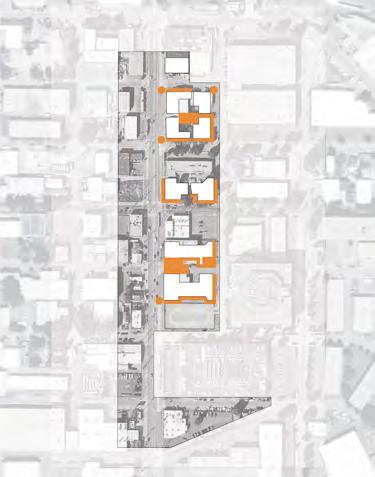


Concept: Unchannelized Duwamish River

Current Gorgetown border
RIVER SCULPTURE
Source: Allison Sky
BIOSWALE
Source: Waterborne Environmental
HYDROPOWER
A water channel could provide power by spinning underwater wheels which are connected to a central battery that feeds into The Bend’s energy grid. At the same time, it harkens back to the unchannelized Duwamish river pre-industralization.

WATER CHANNEL
Source: getimg.ai
SOLAR ENERGY
Solar energy is one of the most effective clean energy sources. If solar panels were incorporated strategically throughout The Bend, ~2 buildings could be taken off the grid, reducing energy use.


There are many forms that solar panels can take to combine aesthetics with utility, including solar awnings, solar art, and art-laminated solar panels. They can also serve as the backing for neon signs, which are iconic to the neighborhood. Below are examples.
Precedents


CONCEPT: SOLAR PANEL SIGN WITH NEON ART
Source: getimg.ai
CONCEPT: ART LAMINATED SOLAR PANELS
Source: getimg.ai
NEON SIGN
Source: Axios
ART-LAMINATED SOLAR PANEL
Source: Land Art Generator
SOLAR AWNING
Source: Lumos Solar
SOLAR ART
Source: Science Photo Gallery
PERSPECTIVE VIEW OF FINDLAY BLOCK (SOUTHEAST)


ART-LAMINATED SOLAR PANELS COULD ALSO INCORPORATE SOLAR TRACKING SYSTEMS SO THAT PANELS FOLLOW SUN PATTERNS
CONCEPT: SOLAR AWNING WITH RIVER ART
Source: getimg.ai


SOLAR AWNINGS OVER BOTTOM TWO FLOORS

PERSPECTIVE VIEW OF OASIS BLOCK (SOUTHEAST)


SOLAR AWNING OVER 3RD FLOOR PATIO AND ON ROOF





ART-LAMINATED SOLAR PANELS
PERSPECTIVE VIEW OF ELEMENTS BLOCK (SOUTHEAST)


SOLAR AWNING
SOLAR ART
SOLAR AWNING
ART-LAMINATED SOLAR PANELS
Movement and Flow
LELA COOPER AND JOANNA CHEN
As The Bend creates a new community within Georgetown’s industrial fabric, resident mobility considerations are key. Creating safe and easy connections, walkable, bikeable, and multifunctional streets, and staying focused on health and environmental considerations inform the future of the site. This section discusses existing mobility considerations, programming strategies to foster sustainable transportation choices, as well as the potential 5th Avenue has for serving as a sanctuary and key connector to the surrounding neighborhood.

SAFE + EASY CONNECTIONS

WALKABLE + BIKEABLE
VIEW FROM GEORGETOWN PLAYFIELD NORTH TOWARD LUCILE ST AND AIRPORT WAY
MULTIFUNCTIONAL STREETSCAPE

HEALTH + ENVIRONMENT MINDED
Georgetown to Downtown Connections at S Findlay St:
Safety improvements have begun for the Georgetown to Downtown bike connection, with the start of the route at Lucile St and Airport Way. By improving bicycle and pedestrian access north of the Georgetown Playfield, direct pedestrian-friendly connections can be made with the Georgetown to Downtown bike route as well as to The Bend along South Findlay Street.
Current Mobility Context
The Bend is located at the northern end of the Georgetown neighborhood, and is currently served primarily by the 131/132 bus service north-south, but with limited transit options going east-west. Bike connections in Georgetown are also currently limited, but planned investments will connect to Downtown as well as South Park. Key amenities such as grocery stores, schools, and medical facilities lie primarily east and west of the neighborhood, furthering the need for bike, walk, and transit connections for The Bend’s future residents. Additional considerations include bike and walk access to artist studios at Equinox Studios, Georgetown Playfield, and the commercial core of Airport Way S.


Source: King County Metro, City of Seattle GeoData

Where Can You Go in 30 Minutes from The Bend?
Currently, Georgetown is an automobile oriented neighborhood, with historically low emphasis on resident’s transportation needs, as Georgetown’s employment far exceeds its resident count.
Within thirty minutes, residents can walk throughout the immediate neighborhood, but face poor sidewalk conditions and high vehicle traffic adjacent to the neighborhood’s freight routes. By transit, connections north-south are strongest, extending from Downtown Seattle to the outskirts of Tukwila.
With the area’s flat topography, biking has the greatest potential reach for residents, and is the only efficient way to travel east-west without a car. With expansions in Georgetown’s bike network, The Bend has an opportunity to solidify and build these bicycle connections and provide residents with more affordable, sustainable transportation options.

ACCESSIBLE FROM THE BEND: BASED ON 8:00 AM WEEKDAY TRAVEL TIMES.
Source: GIS TravelTime API, Seattle GeoData, King County
THE BEND’S KEY CONNECTORS BY BUS, BIKE, AND FOOT
Source: City of Seattle, King County Metro
Flow Through The Bend
Based on both planned and existing transportation plans, traffic flows, and site needs, the following streets were identified as key modal connectors. 4th Avenue S serves as the primary transit corridor, Lucile as the east-west vehicular connector, 6th Avenue S as the primary bicycle route, and 5th Avenue S and S Findlay Street as pedestrian sanctuaries.
Envisioning a Georgetown Cycling Loop
By exploring a continuation of the existing bike lanes along 6th Ave S, and into River Street, a bicycle connection can be made from The Bend to Equinox Studios, supporting the needs of makers, and community members alike. This includes replacements of existing sharrows with formal bike lanes, as well as implementation of new sidewalks and improved crossings. Additional opportunities to connect the Georgetown to South Park, and Georgetown to Downtown bike routes within the neighborhood can be achieved by building connections through existing residential blocks adjacent to Oxbow Park and Mini Mart Park, potentially through a Neighborhood Greenway designation.
Potential expansions along Airport Way S can also be explored for long-term connectivity, by utilizing unused or infrequently used rail tracks west of Airport Way S, in commercial alleyways. By formalizing a connection, improved access to the future Georgetown to South Park bike route could be realized, and open opportunities for east-west connection to destinations including the Mini Mart Park, Oxbow Park, and Equinox Studios.
LEGEND
GEORGETOWN TO DOWNTOWN
SUGGESTED BIKE INVESTMENTS
PLANNED OR EXISTING BIKE INVESTMENTS
TRANSIT ROUTE
VEHICULAR ROUTE
PEDESTRIAN FRIENDLY ROUTE
KEY LANDMARK
THE BEND BOUNDARY
GEORGETOWN CYCLING LOOP CONCEPTUAL DIAGRAM, WITH EXISTING AND PLANNED INVESTMENTS, ALONGSIDE KEY COMMUNITY OPPORTUNITY AREAS TO EXPLORE.
6TH AVENUE S BIKE LANE

RAIL TO TRAIL CONNECTOR

POTENTIAL CONNECTION REPLACING UNUSED RAILROAD TRACKS BEHIND AIRPORT WAY SOUTH, AND ADJACENT TO SOUTH CARSTENS PLACE WITH A MULTI-USE TRAIL.
Last-Mile Transit Connections
Within The Bend there remain gaps in transit service, and particularly limited access to light rail.
King County Metro Flex is a last-mile, on-demand service allowing riders to call rides for the same fare as a bus within their service area. Currently, Georgetown is surrounded by service areas, but is excluded from the program. By expanding this service with King County Metro, residents would benefit from easier connections to essential needs, as well as bringing new visitors to the area.
On-Site Programming
By exploring community programming and resident amenities, The Bend can augment design interventions and investments to encourage sustainable mobility. As Georgetown remains primarily automobile oriented, offering amenities such as bike and carshare, community campaigns, and on-site maintenance, help reduce the need for individual vehicle transportation.
Source: King County Metro, Sound Transit
BEHAVIOR INCENTIVES
THE BEND
GEORGETOWN OTHELLO
DELRIDGE & SOUTHPARK
RAINIER BEACH & SKYWAY
TUKWILA
6TH AVENUE SOUTH BIKE IMPROVEMENTS UTILIZING EXISTING ON-STREET PARKING SPACE FOR A TWO-WAY BIKE LANE.


SECTION AA

SECTION BB
BENNETT STREET SOUTH BRANDON STREET SOUTH
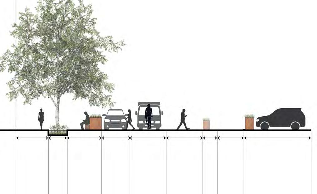
HIDDEN SEATING NOOKS AMONG STREET TREES AND GREEN STORMWATER INFRASTRUCTURE (GSI) PROVIDES SAFE HAVEN FOR RELAXATION
Patio
COMMUNITY LEVEL INTERVENTIONS
CHOSEN VIEWS THROUGH 5TH AVE SOUTH


CINEMA
South Bennett & 5th Avenue South
An outdoor cinema provides opportunities for street closures that close the space off to vehicular traffic.
WAYFINDING
South Lucile & 6th Avenue South
Signage along the 6th avenue bike lane can improve wayfinding into 5th avenue south.
DAYCARE DROP OFF & PICKUP
South Findlay Alleyway & 5th Avenue South
Re-positioning the daycare drop off to the alleyway can reduce congestion and create more pedestrian friendly spaces.

FINDLAY FESTIVAL STREET
South Findlay & 5th Avenue South
The intersection at Findlay will prioritize pedestrians and have the ability to be closed off for festivals and markets.
SAFE + EASY CONNECTIONS
SAFE + EASY CONNECTIONS
SAFE + EASY CONNECTIONS
WALKABLE + BIKEABLE
WALKABLE + BIKEABLE
WALKABLE + BIKEABLE
MULTIFUNCTIONAL STREETSCAPE
MULTIFUNCTIONAL STREETSCAPE HEALTH + ENVIRONMENT MINDED
MULTIFUNCTIONAL STREETSCAPE HEALTH + ENVIRONMENT MINDED
+ ENVIRONMENT MINDED
Safe Passage
Structural Solutions for Noise Pollution
HUNTER OTTMAN
This project is focused on transforming 4th Avenue into a more livable, pedestrian-friendly environment. Innovative noise barrier systems reduce the constant noise pollution caused by freight traffic while simultaneously providing artistic, ecological, and interactive public spaces—creating a safer, more inviting pedestrian experience while addressing unhealthy noise in the community. This project strives to reflect, not shy away from, Georgetown’s history and current state as a transportation hub while supporting the well-being of the people who live, work, and walk here.


4TH AVE STREETSCAPE: 3-5 LANE DESIGN


DIAGRAM OF NOISE POLLUTION ALONG 4TH AVE AND MITIGATION VIA WALLS

LIVING WALL AND PERGOLA


CREATIVE POTENTIAL CARBON COST VISIBILITY & SAFETY
ECOLOGICAL BENEFIT
FINANCIAL COST
SOUND REFLECTION
SOUND DIFFUSION
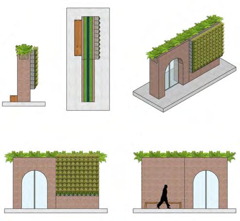
BIO-AQUEDUCT

SOUND ABSORPTION SINE WAVE SURFACE STAGGERED WALLS


RIPPLES IN THE WATER

SINUSOIDAL SLATS

Recommendations:
Multiple strategies should be employed so as to provide wide and diverse range of experiences as well as varying levels of noise pollution mitigation depending on the unique needs of the development and community members.
A New 4th Ave
JAXON ROLLER
This project is defined by two key interventions:
1. Chicanes, bike lanes, and freight & bus (FAB) lanes are implemented along 4th Ave between Orcas St. & Dawson St.
2. A plaza is proposed where Findlay St. meets 4th Ave. It serves to extend the currently stunted Findlay Festival/Pedestrian Street, and provide a strong example of the type of urbanism that is possible with a redesigned 4th Ave. EXISTING


MXM’S PROPOSED TYPICAL SECTION ON 4TH AVE (FACING NORTH)

MY PROPOSED TYPICAL SECTION ON 4TH AVE (FACING NORTH)


Orcas St
Findlay St
Lucile St
Brandon St Bennett St Dawson St
Mead St
Orcas St
Findlay St
Lucile St
Brandon St
Bennett St
Dawson St
Mead St
Proposed Findlay Plaza!
Findlay Plaza
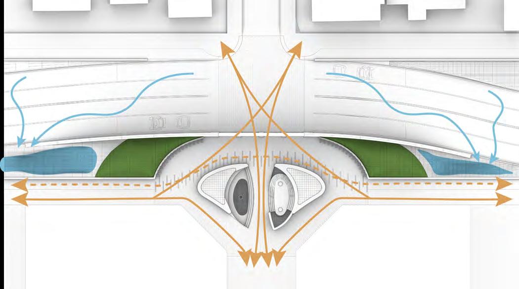
CIRCULATION, DRAINAGE, AND MAJOR TOPOGRAPHICAL FEATURES IN FINDLAY PLAZA

A raised intersection provides a statement entrance to Findlay Plaza. This added safety will be crucial for pedestrians as the Bend grows and expands across the street.
Large berms and a breathable, air-filtering wall provide enclosure and reprieve from the loud street.
The street is graded such that runoff enters bioswales.

SWALES, BERMS, AND PLAZA SPACE, FACING EAST

CIRCULATION, DRAINAGE, AND MAJOR TOPOGRAPHICAL FEATURES IN FINDLAY PLAZA

By creating varied topography, many ecological niches are formed. Wetland plantings, historic to the area, are possible in the sunken beds.
Doubling as seating, retaining beds give adequate soil room for exceptionally large trees. This provides habitat and comfort in the plaza area.
An underground cistern takes in runoff, cycling it through water features in the wetland plantings. These provide a tranquil sound and more reprieve from the nearby street.

PLAZA SECTION SHOWING RAISED AND SUNKEN PLANTINGS, AND WATER STORAGE
Findlay Plaza

PERSPECTIVE A - PLAZA CENTER, SHOWING RAISED AND SUNKEN PLANTINGS

PERSPECTIVE B - ENTERING FINDLAY PLAZA FROM SOUTH SIDE AS A PEDESTRIAN/CYCLIST

PERSPECTIVE C - RAISED CROSSING CONNECTS FINDLAY PLAZA TO WEST SIDE OF 4TH AVE

PERSPECTIVE D - AS SEEN FROM APARTMENT BALCONIES OVERLOOKING FINDLAY ST
Pedestrian Path
SARAH WHITNEY A Climate-Friendly Connection Beyond The Bend
This pedestrian path aims to connect The Bend with downtown Georgetown through a slow, safe, sustainable pathway. The design integrates The Bend District Plan’s imperatives and an “ABC” design concept. This East-West Connection moves slow travel away from busy S Lucile Street and encourages people to meander, pause, discover, and play. As safety is paramount to promote usage, this design explores the intersections between the path and north-to-south travel routes.


S FINDLAY ST
S LUCILE ST
ORCAS ST
LEGEND
LEGEND
1.4th Avenue S Intersection
1.4th Avenue S Intersection
2.S Findlay Alley
2.S Findlay Alley
3.5th Avenue S Intersection
3.5th Avenue S Intersection
4.6th Avenue S Intersection
4.6th Avenue S Intersection
5.S Homer Street Intersection
5.S Homer Street Intersection
6.7th Avenue S Intersection
6.7th Avenue S Intersection


7.Georgetown Playfield Entrance N
7.Georgetown Playfield Entrance N
8.Georgetown Playfield Entrance S
8.Georgetown Playfield Entrance S
Raised Pedestrian Pathway
Raised Pedestrian Pathway
Pedestrian Friendly Pathway
Pedestrian Friendly Pathway
Alternative Pathway
Alternative Pathway
Major Arterials
Major Arterials
Minor Streets
Minor Streets
New Buildings in The Bend
New Buildings in The Bend
Landmarks
Landmarks
Gateways
Gateways
Wayfinding Signage
Wayfinding Signage
Biotic Elements
Biotic Elements





8 Stops 6 Elements


These concept sketches explore entry points to the site, which aim to improve safety, reduce environmental stressors, increase legibility, and encourage human-scale design where possible. Within these drawings, I identified six overarching elements that could supplement The Bend’s existing “Cookbook of The Street.” These six elements weave together to improve this slow connection, enhance comfort, foster a sense of belonging, and create a vibrant environment reflective of the residents of Georgetown.


PAVEMENT: This design envisions unique yet complementary paving along the pedestrian path, increasing overall legibility, safety, and experience. The paving of the pedestrian-only path is rust-toned and organized in a swirling pattern to add visual interest, change texture, and create a sensuous experience for the user. The paving on the rest of the route will be painted in a similar shade to indicate that one is still moving along the pedestrian path.


CEILING: Design elements to lower the ceiling can create an inviting, human-scale environment. The buildings on S Findlay Street within the Bend are projected to be eight stories tall. Overhead design interventions, like lighting or flags, can make the street more attractive for users.


ART: The Bend is a hub for artists. As such, art elements extending beyond its limited boundaries can showcase the unique perspective of this community and place. While there are extensive possibilities, I am primarily focusing on large gate structures and interactive wayfinding signs to add continuity and distinction.


SAFETY: The design prioritizes infrastructure to protect and improve the experience for pedestrians within this primary slow path of travel. A colored, elevated table across all walkways, as well as other traffic calming mechanisms like stop signs, will improve safety and promote usage.


NODES: Along the path are nodes that encourage people to gather, connect, discover, and rest. Design interventions can range from a simple bench to a festival street. These nodes will make the path a destination where people want to not just move through but stay.


BIOTIC: Georgetown is rooted in industry, and as such, there are limited green elements. Biotic elements will integrate nature back into the urban fabric, overall improving the environmental conditions of the neighborhood. Examples include bioswales, rain gardens, planter beds, and street trees.







Stop 4 This intersection marks the transition from pedestrian only path to a pedestrianfriendly path. The design for Stop 4 directs pedestrian traffic to the south side of S Findlay Street to accommodate semi-trucks using the north side. The vignette, looking at the stop from the NW corner, illustrates the integration of five elements.






S FINDLAY ST


Stop 6 The design for Stop 6 features a shipping container market on a currently vacant lot. Retractable bollards on the E side of the intersection can also transform the block adjacent to Georgetown Playfield into a festival street. The vignette, looking at the stop from the NW corner, illustrates the integration of six elements.







S FINDLAY ST
Design Interventions Matrix and Precedents
1 2 3 4 5 6 7 8


Patterned pedestrianonly paving, colored sidewalk across 4th


Patterned pedestrianonly paving
Patterned pedestrianonly paving, colored sidewalks
Colored sidewalks


Colored sidewalks, colored pavement from 6th to 7th Ave
Colored pavement and crosswalk


String lighting/ flags Gateway


Overhead lighting
String lighting between buildings on E side, overhead lighting
Light installation, wayfinding signage
String lighting/ flags
Gateway, wayfinding signage, mural
Wayfinding signage
Gateway, and wayfinding signage


Raised path, crosswalk, stop light/ walk signals, change in paving type, lighting
Raised path, bollards, change in paving type, lighting

Raised path, change in paving type, raised crosswalk, colorful paving, stop signs, lighting
Raised path (S side) and crosswalk, colorful paving, stop signs, lighting
Raised path, raised crosswalk, colorful paving, stop signs, lighting


Seating
Seating, plaza closed on weekend/ select days for special events
Seating, park recreation and stage space, stores
Seating, corner parklet
Market gathering space, shipping container cafe stalls, seating


Street trees, street planting beds, rain garden, swale
Raised planting beds
Street trees, street planting beds, green wall, swale, water fountain
Street trees, street planting beds, park, p-patch, swale
Street trees, raised beds, street planting beds, swale
Street trees, street planting beds, swale


BEND)(THESTFINDLAYS
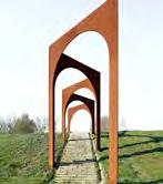





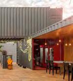


STREET TREES & BEDS
Green street at Vellinge Campus; Water feature, Bureau Koppelaar; Community Garden, Pinterest; Common Camas Plant, U.S. Forest Service; Yarrow Plant, King County Native Plant Guide
Stop Sign Image, Lorenzo and Lorenzo; Bollards, Karens Minde Aksen, Schønherr Seattle’s Swale on Yale, WaterWorld; Transpo Industries, Color-Safe Crosswalks
Studiotech Catenary Lighting, Pintertest; Frau Gerolds Garten
West Seattle Farmers Market, West Seattle Blog, Restaurante Container; Bernardo Horta Arquiteto, Meius Arquitetura, and Estúdio Zargos; Tully Artworks, Node Sculpture
Chemin des Carrières, Reiulf Ramstad, Arch Daily; Giclee Print, Railroad Bridge; Gijs Van Vaerenbergh, Arcade; Ersha ArtDist Sign Design, Liang Xiang; Shadow Signage, Pinterest; Viva Recreation Animal Labyrinth; Robert Rickard, Moon River II Sculpture
Mathilde Jonquiere, Château de Bagnolet - Cognac ; Anji Aijia Linxi Valley, MBDI; Grønnegade Square, MASU Planning; Fast Company, “Why these bike lanes in Austin are red not green”; Downtown Seattle Crosswalk
Livable Streets
Brandon & Bennett St.
PEIYAO XIAO
Brandon and Bennett Streets, located to the south and north of the Oasis block, are envisioned as primarily pedestrian streets with minimal vehicular access, serving as a contrast to and connection between 4th and 5th Ave. This proposal transforms these streets into vibrant spaces that accommodate diverse programs and activities, acting as an everyday stage for the Oasis building’s work-live community. Green elements, such as planters made from repurposed materials, stormwater infrastructure, and greenbelt buffers, enhance walkability and livability, fostering a sustainable and engaging streetscape.

Site Context

PEDESTRIAN CONNECTIONS
BUILDING ENTRANCE
Existing Conditions


Brandon and Bennett Streets are currently dominated by car lanes, with limited pedestrian space and a lack of green infrastructure. In the proposed design, these streets will prioritize pedestrians while meeting the minimum requirements for vehicular access.
BENNETT ST.
OASIS BLOCK
BRANDON ST.
Photo credits: Sarah Whitney and Joanna Chen
Bennett
Brandon Bennett
Brandon
BUILDING PROGRAMS & STREET CONNECTIONS
Bennett Street

Exhibition Place


Flowing Landform x Rain Garden
MOTEL
EXHIBITION SPACE
SHARED STREET
LINEAR PLAZA
OASIS BIORETENTION


OASIS


Circulation Program & Permeability Program & Permeability
Circulation


OASIS BLOCK
MOTEL GARAGE
OASIS BLOCK
Brandon: Outdoor Art Workspace

Bennett: Shared Street with Movable Furniture

MADE FROM RECYCLED MATERIALS
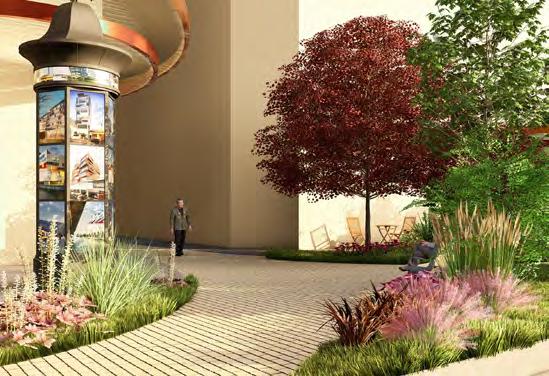
Brandon: Inviting entrance to Oasis

Bennett: Performance Stage

Repurposing Industrial Materials
DEGREE OF TRANSFORMATION
RECONTEXTUALIZATION
taking objects out of their original context and placing them in a new environment or setting
UPCYCLING
transforming discarded or unused materials into products of higher value or quality


RESHAPE RESHAPE
altering the form or structure of original objects while retaining some of their essential characteristics


disassembling original objects and using their components to create new structures or artworks. juxtaposition and layering of different textures, colors, and shapes.
MOVABLE FURNITURE FROM RECYCLED MATERIALS HIGH

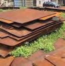


RECONTEXTUALIZATION


Tires
Preserving Oasis
Embracing the Canyon
RUSSELL CORBIN
Today, one of the few spaces of natural respite amongst Georgetown’s overstimulating concrete jungle is a small garden just off of S Brandon St. With simple elements including a koi pond, a couple of exceedingly rare mature trees and a wall of greenery separating it from the surrounding streets, the Oasis provides artists and residents a space to create, gather, and connect with nature. The current development plan is to pave this paradise for a 25-car parking lot; the following design proposes a way to preserve the Oasis.


The Case for a Courtyard
As a way of mitigating the noise pollution from the nearby airport and the heavy truck traffic on the adjacent 4th Ave S while still providing meaningful outdoor space for residents of the new Oasis apartment building, this proposal takes advantage of the 85 ft high walls that surround the courtyard and prioritizes it as a multipurpose public space. These tall buildings act as a sound barrier and recreate the feeling of embrace, safety, and relaxation that the Oasis today provides.
The parking lot in the courtyard as proposed today is a way of conforming to the zoning code that requires said spaces for the commercial ground-floor uses in the new building. In the name of creating not just housing units but a useful, comfortable, and safe place that people can call home, it is imperative that this valuable courtyard not be wasted on storing private cars for visitors to the shops but rather accessible to the residents as a welcoming semi-public space. A zoning variance or arrangements for off-site parking across the street can be pursued to address the parking requirement and an alley vacation would allow the courtyard space to be cohesively designed and planted without an arbitrary barrier.


Proposed ground-floor uses, including 34 parking stalls in the courtyard.
Source:SignalArchitecture+Research


“Don’t it always seem to go That you don’t know what you’ve got till it’s gone They paved paradise And put up a parking lot”
- Joni Mitchell
Harmonizing Uses
For a building with hundreds of residents and a community of thousands, the Oasis Courtyard must balance many uses. This design aims to pay particular attention to providing sufficient un-programmed open space that residents can shape as theirs over time. A creative flex area can be used for outdoor art-making or events; a sloped grass lawn is a natural flex area for play and relaxation; the recreational flex zone fits a regulation-sized basketball half-court and a bouldering wall.

The more semi-permanent spaces include an outdoor living area, an outdoor dining area that serves the food market, a play area with swings, a slide, and a sandbox, and a forested grove for contemplation in nature. The western portion of the current alley that opens onto 4th Ave S in this design maintains driveability for large trucks as a loading zone and access the trash rooms. Thus, these uses can serve the needs and interests of residents and visitors of all ages.
S Brandon St
S Bennett St


Design Theory
The landscape form of this design seeks to recognize the natural history of The Bend site as the former path of the Duwamish River as well as help harmonize the aforementioned uses. Three ovalshaped “islands” of planted soil provide ample space for foliage while most of the remainder of the courtyard is paved in permeable pavement to maximize the creative potential and neighbor agency for the flex spaces. The islands are arranged in a way to encourage non-linear meandering for people walking through the courtyard. Bright blue painted lines mimic a braided river and guide folks along the desire paths between entrances to the courtyard as they travel through the space.


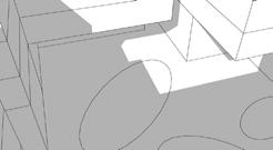
Above: perspective views of the Oasis courtyard facing northeast.
Shadow Study: Carving the Canyon
Given the tall height of the buildings and the narrow courtyard width, this design proposes modulating the interior rooflines to maximize sunlight in the courtyard. In an effort to balance getting a lot of units with making them healthy and habitable, the proposed building massing maintains the 85 ft height on the walls facing the exterior of block and has some single-loaded units on the upper floors. The tiered steps of the roofline create a canyon-like effect, where not only is there much more sun but the roofline above the courtyard at 50 ft is much closer to a human-scale design. This also creates many desirable rooftop terraces that further enhance the vertical public life and community feel of the courtyard.


Left: top-down axonometric view of the Oasis block at the summer solstice and autumn equinox.
Precedent Studies


Physical 3D Model


A Copenhagen courtyard retrofitted for enhanced nature and stormwater management. Source: Russell Corbin
Broens Gadekøkken, an outdoor food market with back to back picnic tables that are constantly packed. Source: Russell Corbin
Orienten mixed-use development in Nordhavn; this pedestrian alley features trees and bike parking, while maintaining vehicle access to half of the alley’s length. Source: Russell Corbin
Courtyard of Ohboy apartments and hotel in Malmö, featuring an abundance of dense plant life. Source: Russell Corbin
The Grotto Under Oasis
DAVIEN GRAHAM
More than two stories above ground level lies a tranquil space of mounded berms with punched openings below. Plants hang down, and trampoline nets serve as engagement spaces along the rooftop courtyard.
A meandering boardwalk path connects the courtyards of two apartment buildings separated by an alley. As users walk the path, curiosity begs them to look into one of the punched skylight openings and see what awaits below. What peers through the opening is the Grotto.


OASIS
This rooftop courtyard starkly contrasts the Grotto below. Open to residents and pedestrians, it is meant to provide refuge in this otherwise industrial neighborhood.
LEVEL 1 FLOOR PLAN
NOTABLE FEATURES:
Painted graffiti alley for vehicular and pedestrian use.
Moss pavers serving as the continuation of the neighborhood meander.
Extended exterior eating space adjacent to souk kitchen and food hall spaces.

LEVEL 2 FLOOR PLAN
NOTABLE FEATURES:
Branching columns offering structural support, ventilation, and stormwater drainage.
Multi-leveled interior mezzanine space underlay.
Acoustic wood panels on the ceiling surface. (See Section Axons)

LEVEL 3 FLOOR PLAN
NOTABLE FEATURES:
Meandering boardwalk mimicking the duwamish river.
Punched berms serving as a trampoline park and voids for hanging plants into the Grotto.
Drawbridge connecting the courtyards.

SOUK KITCHENS


Form and Function

The new development Oasis will be an 8-story tall apartment complex with food market spaces on its ground and second-floor levels. A Food Hall in the north extends out into the Grotto to provide a large space capable of hosting large gatherings. In the south, the lower 2 floors serve as a Souk kitchen (a type of Arab food market). Due to the commercial and service use of the ground spaces zoning code requires parking adjacent to the markets. Zoning also requires that residential spaces have an associated accessible greenspace. So a courtyard lid above the parking would satisfy these codes. Another zoning issue was a 35’ clear height for emergency vehicle access, to address this the connecting platform for Oasis’s courtyards is also a drawbridge that raises in emergencies.
Since Oasis is meant to be accessible to pedestrians and residents, the spaces adjacent to the courtyard can serve as live/work spaces for additional commercial use. To garner further use out of the space the 1st floor is a double-height floor rising to 17’ high. This allows for a half floor of shipping container souks to be slipped in to gain more commercial use and a dynamic interior/exterior environment.
Materials such as blue shipping containers, glazing, permeable pavement, and wood aid in crafting the allure of these spaces. Graffiti serves a dual purpose of aesthetics and vehicle control. By painting the ground cars will naturally slow in pace. Neon signs take advantage of the dark mystique of the Grotto and give instances of wayfinding. Branching columns serve as a biophilic reminder of the former Oasis that is currently in Georgetown crafting a “forest under the lid” aesthetic.
CROSS SECTION AXONOMETRIC
WEST LONGITUDINAL SECTION AXONOMETRIC
SOUTH - WEST CROSS SECTION AXONOMETRIC
The Spirit of Georgetown
As earlier chapters have addressed Georgetown is an industrial neighborhood in South Seattle. This neighborhood is characterized by brick and steel, graffiti, and neon lights, and is currently a void of biophilia. This project sought to bring design philosophies from Danish design and blend them with the grit and glamour of Georgetown. A prominent inspiration for the Grotto was the neighborhood of Christiania in Copenhagen. There, many artists and craftspeople gather, exchange ideas, and dynamically impact their environment. As for the alleyways, Detroit’s graffiti-filled and intimate alleys served as inspiration due to of the similar character it shares with Georgetown. Additionally, to address biophilia and create a beautiful and engaging landscape the California Academy of Sciences was used as a precedent.


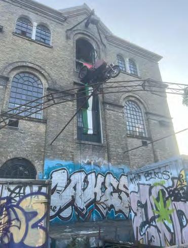


THE BELT, DETROIT, MI
Source: Nick Hagen
CHRISTIANIA, CPH, DK
Photographed by Davien Graham
(ABOVE) CPH VILLAGE NØRREBRO, CPH, DK (BELOW) AI GENERATIVE INSPIRATIONS
Photographed by Davien Graham / Generated by Davien Graham via Stable Diffusion
CALIFORNIA ACADEMY OF SCIENCES ROOFTOP, SAN FRANCISCO, CA
Source: California Academy of Sciences
CAPTURING THE SPIRIT OF GEORGETOWN:
Neon and graffiti are emblematic of the Georgetown community and in this project, the art styles are used as a means of wayfinding and exploration.


ALLEYWAY ENTRANCE INTO THE GROTTO
STAIRCASE FROM THE GROTTO TO OASIS ABOVE
Stormwater drainage from Oasis to the Grotto to a cistern

Ventilation from the Grotto to Oasis
Cistern The Grotto
Process and Progress
Development of a new apartment complex and food hall generated initial designs of the Oasis block. These designs were used as a base plan in Revit and were iterated to generate the extruded forms of the Grotto walls and the punched mounds of Oasis. Generative AI images were produced to serve as initial inspiration.
To address some of the aesthetic concerns with the space, in Revit, I designed branched columns serving as structural systems capable of performing MEP (Mechanical, Engineering, Plumbing) tasks. Trees perform similar transmissions of water and gases through their branches to their roots, the roots in this case being a cistern to contain and reuse stormwater.
After the space was designed I applied materiality to its elements and rendered the Grotto under Oasis in Enscape. Entourage, vehicles, and light made the space feel realistic especially the skylights in the Grotto. After this, I post-processed this information in Photoshop utilizing its generative AI tool to add artistic elements such as graffiti and neon lights.


THE GROTTO
Extruded shipping container souk kitchens, neon lights, and graffiti culminate to produce this dynamic and vibrant space below the Oasis lid.
Grotto Under Oasis

Findlay Art Lane
REBECCA ZARAGOZA
The Findlay Art Lane is a pedestrian-friendly street designed to blend vibrant art displays with inviting spaces for relaxation and community engagement. The goal is to create a dynamic, walkable environment where art, culture, and social interaction thrive. By incorporating permanent and rotating art installations, the space becomes a living gallery while fostering a sense of connection through places to linger.


EXPERIENCE VISION
The grounding element of the Findlay Art Lane is a painted design on the pavement that follows the original winding path of the Duwamish River to honor the history and presence of the Duwamish Peoples and the significance of the river.
Visitors enter a vibrant pedestrian street alive with color, sound, and movement. They stroll at their own pace, exploring interactive installations, stopping to rest on artful benches, or enjoying a drink in a shaded area. The air buzzes with creativity from live painting sessions or open air acoustic performances. By blending art with places to linger, the Art Lane becomes a cultural hub, a meeting place, and a canvas for expression.
5th Ave
Findlay St.
Climate Resilience & Infrastructure
The Findlay Art Lane incorporates environmentally conscious design by upcycling and reusing industrial materials from Georgetown, reducing waste and promoting sustainability. By repurposing these materials for art installations, seating, and pathways, the project minimizes its carbon footprint and showcases creative reuse. This approach not only beautifies the space but also serves as a model for reducing landfill waste, conserving resources, and fostering community awareness about climate-friendly practices. The integration of sustainable design elements enhances urban resilience while creating an engaging, eco-conscious public space.


Environmentally conscious design elements include permeable surfaces and bioswales. These features manage runoff, reduce flooding, and filter pollutants, improving local water quality. Upcycled industrial materials from The Bend are creatively used to construct water management features like decorative channeling systems or rainwater catchment structures, blending functionality with art.
CORNER OF FINDLAY AND 5TH AVE: VIEW OF THE FINDLAY NORTH BUILDING
5thAve
Findlay St.
Sustainability & Accessibility
Eco-friendly Materials: Use recycled or locally sourced materials for installations and street furniture.
Universal Accessibility: ADA-compliant pathways and seating ensure inclusivity for all visitors.
Stormwater Features: Functional designs like drains and permeable art pavements that double as stormwater management.
Eco-Art Installations: Green walls and bioswale that double as stormwater management.
Solar Energy: Sustainable energy sources for nighttime illumination and solar panels above Workspace awning.
Upcycled Materials: Art pieces and street elements made from reclaimed or recycled materials.


CLIMATE TILES GREEN WALL
SOLAR PANEL AWNING

Art & Public Space
Programming Opportunities
Seasonal Festivals: Themed art and cultural festivals like light festivals, craft fairs, or music-and-art fusion events.
Flex Space: Open and flexible space on the street that can host pop-up markets, holiday events, or special exhibitions.
Hands-On Installations: Kinetic sculptures, musical instruments, or sensory experiences that visitors can interact with.
Rotating Outdoor Galleries: Large display boards or stands showcasing works by local artists or photographers.
Art History Signage: Informational plaques about the artworks and artists, adding educational value.
Upcycled container doors for workspace units that can slide open and allow engagement between artists, vendors, and the public.

Sculptural fence enclosing the outdoor play area with some transparency. Fence can be opened during off hours for public use.

VIEW OF FINDLAY STREET
4thAve
Findlay St.

Artful Lighting: Creative uses of light, such as solar-powered LED installations or projection mapping on walls.
Functional Sculptures: Street furniture like bike racks or trash bins designed as creative, sculptural elements.
Art in Action: Scheduled workshops for visitors to try painting, sketching, or sculpture.


Kids’ Creative Corner: Dedicated art activities for children, such as DIY crafts or scavenger hunts that can be hosted along the street or at the outdoor play area during off hours.
First Friday Art Walks: Monthly evening events featuring new installations, live performances, and guided tours.


Vertical Landscape
Findlay North
WU + TINA LEE
Recognizing the current streetscape focus and the limited use of building above second floor, our group aims to activate the underutilized gray spaces of the Findlay North building. Our design extends the proposed ground-floor mixed-use concept vertically, integrating inclusive and biophilic elements to enhance the community’s unique character and create vibrant, multifunctional spaces.


“CREATE PLAYFUL CONNECTIONS, AND BRING ROOFTOPS INTO VIEWS, AND INTO OUR LIVES.”
JINGYAO

“ROOFTOPS CAN BE HUBS OF CREATIVITY, FUN, AND CONNECTION”
Design Principles

Design rooftops with inviting, semi-public spaces that welcome everyone.
Foster livable, inclusive communities where neighbors connect and interact.
Transform rooftops into vibrant, biophilic spaces filled with greenery and life.
Create playful vertical playgrounds for all ages, integrating playful elements into the architecture.

"WITHIN
A 0.5-MILE RADIUS OF THE BEND, OVER 300,000 SQUARE FEET OF ROOFTOP SPACE LIES WAITING FOR TRANSFORMATION."


Findlay N. Building Plan


Vertical Connection Concept
Access and Usage (semi-public and private)

door public semi-public green wall


original design proposed design during nighttime platform private

proposed design during daytime or events


PATIO: PLAYGROUND & SENSORY GARDEN
GROUNDFLOOR: VERTICAL PLAYGROUND


5TH FLOOR: ART GALLERY AND ENERGY GENERATORS


5TH FLOOR: COMMUNITY WORKSHOP


4TH FLOOR: ART GALLERY
Rooftop Intervention Concept:
After creating vertical connections within the Findlay North building, the design focuses on transforming the third-floor patio and rooftop into inviting, inclusive, biophilic, and playful public spaces. Features like biodiversity buffer, edible forest, native ecolawn, and solar panel meadow enhance ecological value, foster community interaction, and provide energy production. These interventions encourage residents to explore and enjoy the integrated public spaces throughout the building.


BUBBLE DIAGRAM
Rooftop Experience
We redesigned third floor patio and rooftop.

BIODIVERSITY BUFFER
HABITAT

BIODIVERSITY BUFFER


Native Eco-lawn
Select low maintenance native ground cover to enhance the central art sculpture elements.
Solar Panel Meadow
Select drought and high temperature resilient plants to adapt to the microclimate.


SOLAR PANEL MEADOW
EDIBLE FOREST
Major User Route Map
The rooftop design identifies three major user groups: pollinators, residents, and maintenance teams, each with distinct needs and movement patterns. Their routes sometimes overlap and sometimes diverge, reflecting diverse interactions with the public space.
Below, a user experience diagram illustrates potential activities and pathways for each group on the rooftop, ensuring the design accommodates ecological functions, community use, and operational efficiency.
USER EXPERIENCES DIAGRAM
WATCHING MT. RAINIER


Pollinators
- Need food, water, shelter, refuge, and connection to other members
Residents
- Need public spaces and amenities
- Avoid undesirable factors
- All age inclusive
Maintenance group
- Need quick and direct access to utilities
PLANE SPOTTING APPRECIATING LOCAL ARTWORKS FEEDING POLLINATORS

GREENHOUSE & COMMUNITY KITCHEN

COMMUNITY GARDEN
SOLAR PANEL ENERGY PRODUCTION
POLLINATORS NESTING, ROOSTING, OVERWINTERING SENSORY GARDEN

Steelhead
The Bend’s S. Findlay
Pedestrian Street
MATTHEW JERNIGAN
The pedestrian street along S. Findlay connects residents, makers, and visitors through a dynamic interplay of industrial material design and natural processes. Echoes of the neighborhood’s manufacturing history are embedded in the materials used, while elements inspired by the Duwamish River are woven through the site’s fabric.
The design prioritizes opportunities for interaction with nature, art, and community by creating spaces that naturally encourage engagement and connection through their form and function


CONCEPT
The design of S Findlay Street is guided by three core principles: connections to art, embracing the natural environment, and nurturing meaningful relationships within the neighborhood. Grounded in these principles, the design aims to create vibrant, dynamic spaces where residents and visitors can engage with the rich cultural fabric of the Bend and Equinox Studios. These spaces are thoughtfully crafted to inspire unique interactions, celebrate creativity, and deepen a sense of belonging.

REVEALING THE WATER CYCLE
CATCH, STORE, CONVEY
Rainwater is captured from the buildings’ rooftops and stored within cisterns on the balconies. It is then released, detained and treated through various routes throughout the site. Revealing this process is central to the design of the green infrastructure on site.

SITE CIRCULATION + CONTEXT
SITE PLAN

The site design is inspired by the theme of river ecology, weaving elements of river morphology into the features of the pedestrian street. The site incorporates diverse uses of space through thoughtful circulation and the inclusion of art. Informal gathering areas, designed to resemble gravel bars, are intentionally spaced along the main walkway to encourage social interaction. The site’s materials also create unique opportunities for artistic expression, allowing art to seamlessly be integrated with walls, fences, I-beams, and plantings areas, furthering the connection between art and nature.

LIFE + MATERIALS
Each space along the street conveys unique spatial and material qualities. The neighborhood’s history plays a primary role in the design of the space showing where industrial form meets natural processes. The materials serve to enhance the functioning of the space and its residents, supporting the types of programing and activities important to The Bend.

The Maker’s Crossing


The Maker’s Crossing
Serving as the entry and beginning of the green connection to the Georgetown playfields, this space creates a threshold for visitors to pass through, encouraging informal and incidental interaction with the artists and their workshops.
STUDIO
STUDIO
BIOSWALE WITH METAL GRATE
The Central Confluence

The Riverside Commons


The Central Confluence

Within the central courtyard area, many programs and pathways intersect, creating a mix of energies. This flexible space can adapt to multiple functions while allowing visitors to orient themselves within the larger space.

The Riverside Commons Close 5th Ave the pace slows and the natural landscape envelops several gathering areas. These serve as overflow for street events and encourage everyday visitors to stop and enjoy food or coffee from the grocery and cafe.
NATURAL
EARLY LEARNING CENTER
ART GALLERY
CAFE GROCERY
BIOSWALE WITH METAL GRATE PLAYGROUND
INTERACTIVE RAIN GARDEN OUTDOOR SEATING


MORNING DROP-OFF MIDDAY WORK
TIME OF DAY
TIME OF DAY
MORNING FARMERS MARKET


RESIDENTS
RESIDENTS
CHILDREN RESIDENTS


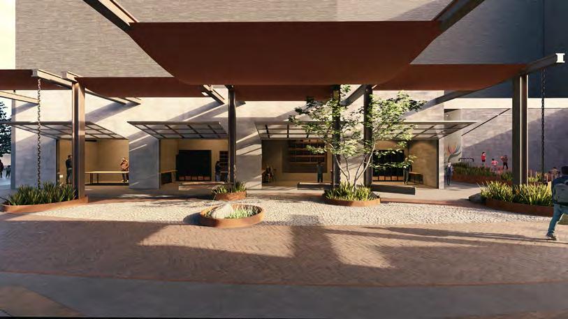


RESIDENTS


AFTERNOON
SUMMER PLAY


SHOPPERS


EVENING SHOPPERS

EVENING ART WALK


SHOULDER SEASON COMMUTE
SUMMER SUN
Playful Passage
Connecting
the Bend to downtown Georgetown through art and play
LIZ FORELLE
This site is on the stretch of S Findlay Street between 5th and 6th street in Georgetown, Seattle. The street is a fairly narrow space that aims to connect those living at The Bend to the surrounding spaces of Georgetown. Play, materiality, and art are centered in this space to create an inviting and fun passage for the residents of Georgetown. This is a space for all ages and abilities to enjoy and play throughout the day and night. Concept Diagram


24-HOUR CHANGE OVER TIME
This design is centered around three key ideas, art, biotic, and connection (A, B, C), as a meander with nodes. The design permeates these three key ideas and concept throughout the design and programming of the space. The flow and circulation of the space highlights the use of meander while the nodes are highlighted through places to rest, meet, or gather. Site use across day and night changes based on the users and activities. During the day, more kids might be active in the space, running up the meandering paths and taking the slides down the hill or playing on the metal play structures. Alternatively, at night, adults may occupy the space to pass through towards downtown Georgetown or an event in the park.


AVIEW LOOKING WEST ALONG S FINDLAY ST FROM THE INTERSECTION AT 5TH AVE TO HIGHLIGHT THE ART ELEMENTS AND CONNECTIVITY THROUGHOUT THE SPACE AS A SOURCE OF WAYFINDING AT THE BEND.


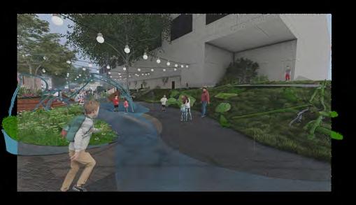
VIEW LOOKING EAST ALONG S FINDLAY ST TOWARDS 6TH AVE TO HIGHLIGHT THE INTERACTION OF ART AND BIOTIC ELEMENTS.


B
Wood
Plant Material
Rock
Corten Steel Metal

VIEW LOOKING WEST ALONG S FINDLAY ST TOWARDS 5TH AVE TO HIGHLIGHT THE CONNECTION THROUGHOUT THE SPACE AND HOW ART AND PLAY CAN BE INCORPORATED THROUGHOUT THE SPACE.


VIEW LOOKING TOWARDS THE OFFICE BUILDING TO HIGHLIGHT THE CONNECTIVITY AND BIOTIC ELEMENTS AT NIGHT.


Materiality is used throughout the design to signify a change in space and programming on the horizontal plane. On the vertical plane, materials break up the space in a sensory and textural way.


Corkeen
PLAY CONNECTION TO PLACE
CLIMATE RESILIENCE ART
Alongside the A, B, C concept, the design also emphasized four key principles: play, connection to place, climate resilience, and art. These elements were integral to shaping the overall vision. Each element incorporates at least two of these design principles in order to create a highly multi-functional space. The plants chosen are resilient species that can increase biodiversity and provide a playful texture next to the walkway for users to engage with. The string lights hanging above the space help to lower the ceiling next to the tall office building creating a better connection to place in an artful way. The stumps and logs placed throughout the sloped areas provide an alternative path for users to engage in the space in a more exploratory and playful way. These small moments can help create a positive connection to place or provide habitat for insects and small mammals. The metal play structures are an art piece alone but can also provide a space for play as well.


This design provides an intergenerational space that rich with moments of engagement and play at all levels through the use of materiality, flow, and space. This can occur across both the horizontal and vertical planes to provide a rich experience along a passage to and from The Bend.
PERSPECTIVE VIEW OF S FINDLAY ST LOOKING EAST TOWARDS 6TH AVE
Canon Park
ELLEE RUDER
Canon park was designed with the intention of fostering an artistic and sustainability-focused space.
With an attention to elevating pollinator habitat and a relationship between the visitor and nature, Canon Park acts as a space for exploration and attention to detail. Rotating public exhibitions along with eclectic and continually blooming planting spaces inspire visitors and set the intention of the space as one of creation and community.


In a big city...

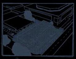
in the 1st town established... was a parking lot and a building...

THE NEW SIDEWALK PROTECTS FROM THE ROAD AND CONNECTS THE SPACE TO THE BEND
POTENTIAL GREEN ROOF AND COMMUNITY CENTER



to share with the community! and the leaves of a tree could become a work of art... It’s up to us to unearth this gem... where the brick of a building could turn into a winding path... with a hidden gem underneath...

SOUND FROM THE BUSY ROAD WILL BE DROWNED BY THE POND AND FOUNTAIN
ASPHALT ART AND POTENTIAL ACTIVITY EXPANSION
The Design Elements
The site was inspired by 5 characteristics as a response to the main goal of elevating the art and nature communities of the Bend. Through these elements, different programming and design features emerged. Canon park is rooted in the goals of fostering creativity, helping pollinators, encouraging community, access to different levels of artistic inspiration, and nature as art.

FOSTERING CREATIVITY

HELPING POLLINATORS

ENCOURAGING COMMUNITY

LEVELS OF ARTISTIC PARTICIPATION

NATURE AS ART

THE STAGE

THE PERMANENT EASEL

THE ARCHED SEATING

THE STAGE

THE CANON CUBES
The Composition
The composition of the park creates harmony between the various activities and potential interests for visitors to maximize the flow. An aerial view mimics that of an abstract painting, both inviting meanders for visitors and inspiring viewers from above in the adjacent building.

PERMANENT ART FIXTURES
FLUCTUATING ART FIXTURES
POLLINATOR HABITAT

PARK USE COMPOSITION

The Canon Cubes
The Canon Cubes act as a celebration of art and nature while expressing their harmony. As the seasons change, the bug habitat walls will be routinely replaced and curated by a local group of artists. This aids in the success of pollinator populations while allowing for another opportunity for an art -in-nature experience. The plantings will show the change in season and the beauty in growth or decay as months pass. Rotating artworks will accompany the natural processes, allowing for a more official curatorial experience and a chance for local artists to showcase their skills and connect with the community. The placement of the Canon Cubes resembles a gallery, elevating the artworks while also acting as commentary of what could be considered the official artistic ‘canon’.

A CHANGE OF SEASON:
Many of the park features are equipped to honor the change in season and the fluidity of nature. these elements similarly reflect an artist’s path
The Stage
The stage invites planned and spontaneous performance. The central placement gives a sense of spectacle to those showcasing their talents. The size allows for a multitude of activities while not overbearing the site and giving space for other points of interest to visitors. Reclaimed black locust wood and solar fabric express an interest in sustainability while hand-made metal work from local artists encourage community and a sense-ofplace. The surrounding blooms and artistic frame act as methods of inspiration and praise for the pre-existing and forthcoming artistic neighborhood.

CANON CUBES VIGNETTE
THE STAGE VIGNETTE
The Arched Seating
Arched seating placed throughout the main pathways act as a resting place and a chance for conversation. The direct line of sight between those seated gives possibility for portrait sketching exercises. Community building occurs as those seated are directly within the path of passerby, increasing the chance of conversation and connection. The lights are powered by a solar panel above, consistent with other efforts of sustainability within the park. The wooden seats are made with recycled black locust wood. The arch itself will be designed by a local artist, with light that emanates through the cut material and glows in the night to reveal more local art.

The Permanent Easel
The plantings within the park offer blooms in every season, while their variety in foliage and their response to the seasons gives a plethora of muses for artists. A permanent easel and room for personal ones in an area most closely placed to the array of plantings gives opportunity for locals to build an intimate relationship to nature and the seasons.

The Spiral
Participants will be invited to collect material from around the park as tools of expression. The natural material will be placed with in the mixture of metal and wood, a framing device, as an evolving art piece. This fixture amplifies the beauty of nature while serving as an interactive and exploratory tool within the Bend. The knee-level height of the frame along with a low-stakes barrier of entry for participation increases the variety of participants. By utilizing natural material, participants will see the change of the seasons.

THE PERMENANT EASEL VIGNETTE
ARCHWAY VIGNETTE
SPIRAL VIGNETTE
(Re)generate Georgetown
SISKA FLORENSIA DEWANTI S Findlay St
Seattle’s Georgetown neighborhood blends its rich history with modern creativity, originating as a Coast Salish settlement by the Duwamish River before white settlers established it as the city’s oldest platted area in 1851. The area evolved into an industrial hub with affordable spaces, attracting a vibrant community of artists, artisans, and makers who contribute to its lively, eclectic character.
The site is a parking lot at the intersection of S Orcas St and 4th Ave S adjacent to the Seattle Design Center.


Main Concept


Art Biotic + + Connection

Thinking Framework

Parking lot does not evokes a (+) visual stimulation

Envisioning a commercial hub as an extension to the SDC and beyond
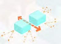
A grand gesture to split the commercial into 2 to foster a welcoming atmosphere


SITE PLAN - DESIGN PHASE 1


SITE PLAN - DESIGN PHASE 2


4thAveS


Design Phase 1
In the first phase, the design focuses on creating an interchangeable space between parking and commercial use. This temporary intervention is intended to gradually adapt to change within a reasonable budget for future development.
The commercial containers are playfully designed reflecting the artistic- diverse Georgetown community.

4thAveS

Design Phase 2


The second design phase expands the commercial area on the east side with a centralized connection while maintaining the west side as a more permeable and grounded space.
Additionally, an adequate amount of space is reserved for future residential development to promote economic growth and neighborhood sustainability.
5thAveS


SPECIAL DESIGN FEATURE
The outdoor festival decorations utilize photovoltaic film to generate energy while creating an intimate atmosphere within the space.
Site Materials


Planter box
Recycled Wood Deck
Recycled Wood Deck Stone Paving Grass Landscape /Rooftop Stone Paving
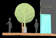

Design Phase 3


The long-term vision of the design is to create a mixed-use development for the space while maintaining its playful character. The design for phases 2-3 incorporates abundant landscaping and paving elements that add softness and foster a strong sense of place.
By shifting the focus from parking lots to spaces for non-motorized vehicles and pedestrian movement, the design invites artists and residents to engage creatively within the public space.


An initial conceptual sketch represents the transformation journey of a parking lot into a vibrant public space to foster social interaction and building dynamic communities in Georgetown.

FREETOWN CHRISTIANIA, COPENHAGEN
Photo by Vincent Javet

Design is what you are standing on. It is what holds you up. And every layer of design rests on another and another and another…You have to dig.
– Beatriz Colomina & Mark Wigley in Are We Human?
Thank you:


Photo by Vincent Javet


