
CIVIC DEFRAGMENTATION UW MLA CAPSTONE STUDIO 2016

2016 LARCH702 Capstone Studio
Department of Landscape Architecture
University of Washington, Seattle
"As cities are now the dominant human habitat, they must be a healthy human habitat. They must be planned, developed, and managed in healthy and sustainable ways—ways that minimize their ecological footprints and maximize health and well-being for their residents. It is important to ensure that the needs of current generations are not being met at the expense of future generations, and to avoid constraining future options. We need to prepare for an uncertain future—there will be shocks and surprises. This requires our environments to be resilient and readily adaptable in the face of change."
– Anthony C. Capon and Susan M. Thompson, in “Built Environments of the Future”. 2011. Dannenberg, Andrew L., Howard Frumkin, and Richard J. Jackson, eds. Making Healthy Places Designing and Building for Health, Well-being, and Sustainability, Washington, DC: Island Press. p.375.
CIVIC LANDSCAPE SYSTEMS: LEARNING + RESILIENCE BY DESIGN
DESIGNED AND DEVELOPED BY
Chih-Ping (Karen) Chen
Christel Game
Wenying (Winnie) Gu
Jiaxi (Jessie) Guo
Zhehao Huang
Will Shrader
Seongwon Song
James Wohlers
Led by Associate Professor Julie Johnson
“Children are a kind of indicator species. If we can build a successful city for children, we will have a successful city for all people.” —Enrique Penalosa1
This book represents the cumulative work of eight graduate students who undertook the University of Washington Master of Landscape Architecture (MLA) 2015-16 Capstone Studio. This talented, and collaborative group developed their designs through research and an iterative, community based process. I greatly enjoyed working with each of them and supporting the realization of design proposals three students developed and others joined in to bring to life.
The quote above by Enrique Penalosa served as a foundation for this MLA Capstone Studio, “Civic Landscape Systems: Learning + Resilience by Design”. Our Autumn Quarter seminar explored theory and precedents of civic landscape systems, and connected these to the position that if we are to create more resilient cities, we need to start with how children may learn from and experience places that define their daily lives. With four students in Rome for a Study Abroad Program, one in Copenhagen for an internship, and three in Seattle, the applications of ideas from literature to local environments afforded varied perspectives. These are revealed in “Section 1: What is Civic Landscape?”.
The seminar concluded with an introduction to Seattle’s Licton Springs-Haller Lake Neighborhood, and the students applied seminar themes to this neighborhood in the Winter and Spring Quarter studio. Students undertook a community based process to learn about neighborhood challenges and opportunities, to identify places and connections that needed attention, and to gain feedback on their evolving design proposals for areas they selected. Analysis revealed this neighborhood is poised for significant change and yet lacks a coherent civic landscape infrastructure. Three of Seattle’s designated “Urban Villages” and a potential fourth, should the North 130th Street light rail station be built, are found here. Its east/west boundaries—North Aurora Avenue North (State Highway 99) and Interstate 5—serve as stark physical and perceptual edges, offering limited opportunities for pedestrians and bicyclists to cross safely. The planned pedestrian bridge over I-5 at Northgate’s light rail station promises a key connection if extended through a network of greenways. And notably, while there are diverse civic landscapes, they are disconnected and merit improvement. Findings from neighborhood thematic analysis, an overview of the studio’s engagement with community members, and introduction of the studio’s “Civic Defragmentation” framework are presented in “Section 2: Analyzing, Engaging, and Framing the Neighborhood”.
Each student developed design that integrate civic landscapes theme (depicted as icons) across spatial scales and with an eye toward strategic development. Three students’ projects involved building and installing particular elements that engaged others in the studio and beyond; these revealed the power of simple design interventions to create opportunities for discourse and learning. Each student’s contextual findings, design, visions, and detailed proposals are described in “Section 3: Project Designs”.
The richness of all this work grows from the tremendous support and engagement of community members, representatives of agencies and institutions, planning and design professionals and faculty, and organizations who are noted in “Acknowledgments”.
I hope this book highlighting the studio’s endeavors—findings, process, design proposals, and built work—may serve as a resource for Seattle’s Licton Springs-Haller Lake Neighborhood, for these eight students who have now graduated, and for others interested in civic landscape systems as a means of enriching children’s learning and lives and of creating more resilient communities.
Julie M. Johnson, RLA, ASLA Associate Professor, Landscape Architecture University of Washington, Seattle 1 Enrique Penalosa, in Jeffries, Duncan. 2014. “Children should be at the heart of future cities.” Green Futures Magazine (April 14). http://www.forumforthefuture.org/ greenfutures/articles/children-should-be-heart-future-cities (accessed February 3, 2016).CULTURAL SYSTEMS
HEALTHY SYSTEMS OF MOVEMENT
PLAY-URBAN CHILDHOOD
ENGAGING COMMUNITIES
SAFETY
HISTORY IN DESIGN
LEARNING IN PLACE
WELL-BEING AND HABITAT
ECOLOGICAL SYSTEMS
FOOD SYSTEMS
The Civic Landscape Systems seminar addressed themes that frame these systems and supported our goal of engaging communities in the design of civic landscape systems. Most of the icons shown on the left represent the seminar themes; the themes of food systems, history in design, and safety grew from our studio explorations. In the seminar, we studied theory and precedents and reflected on how our findings may be applied. The following pages present a summary of the seminar’s eight themes through a common format. The Rationale introduces why the theme matters. Following this, Main Take Aways summarizes key points from literature we read and discussions we had with each other. The Reflection describes our graphic and written applications of these insights, often through our observations of the three places where we studied during Autumn Quarter—Copenhagen, Rome, and Seattle. And last, Relationship to Studio Site highlights important thematic considerations that our individual projects should address in the Licton Springs-Haller Lake Neighborhood.
• SEEING SYSTEMS AND EXPRESSING VALUES
• PLAY—URBAN CHILDHOOD
• LEARNING IN PLACE AND BY DESIGN
• HEALTHY SYSTEMS OF MOVEMENT
• DESIGN FOR WELL-BEING AND HABITAT
• CULTURAL SYSTEMS IN DESIGN
• ECOLOGICAL SYSTEMS IN DESIGN
• ENGAGING COMMUNITIES IN DESIGN
Seeing Systems and Expressing Values raises questions about systems and values related to landscape architecture. Design works should be considered not only for beauty, but also cultural, ecological, civic and learning systems and values. Through literature and precedents, we developed some thoughts and studies of how design works how systems and values are represented in landscape architecture.
The readings for this theme introduced concepts relating to features and qualities of systems as well as the dynamics of resilience in systems.
In Resilience Thinking, authors Walker and Salt express that resilience thinking provides a framework for viewing a social-ecological system across scales of time and space. Its focus is on how the system changes and copes with disturbance. Resilience enables and responds to change, and so is essential to sustainable systems.1
Capra presents different features of systems, including that they don’t operate in linear ways, but as networks.2

1. Walker B. and Salt D. 2006. “The System Rules: Creating a Mind Space for Resilience Thinking” in Resilience Thinking Sustaining Ecosystems and People in a Changing World.

2. Capra, F. 2005. “Speaking Nature’s Language: Principles for Sustainability” in Stone and Barlow, eds. Ecological Literacy: Educating Our Children for a Sustainable World. San Francisco, CA: Sierra Club Books.
“Systems vs. Objects”
“Systems: Nested networks as a patchwork quilt composed of interdependent fibers.”
“Objects: Singular entities acting in isolation without any relationship to its surroundings.”

This reflection focused on identifying a local example of inspiring systems. Jiaxi identified Portage Bay Grange in Seattle, which stocks supplies for veggie gardens to local honey to livestock, including chickens, ducks and geese. Kirsten Scott-Vandenberge, who is one of the owners of Portage Bay Grange, notes that through “many layers... that combine to make a working urban farm, backyard agriculturists are designing practical, beautiful opportunities to engage people of all ages in the circle of life.”1 Jiaxi’s diagram shows this quoted “circle of life” as an interconnected system.


Many good examples and methods could be applied to the Licton Springs – Haller Lake Neighborhood for developing and creating the neighborhood, but these progressive ideas should be changed and fitted to the existing site conditions. For instance, there are not enough play areas and facilities for children in the neighborhood, thus these spaces should be reconsidered and suggested near the residential areas and also protect children from dangerous conditions. Additionally, all systems of the design proposals should represent spatial functions and values including cultural, ecological, civic and learning.
“Once a year in summer, my neighborhood closes the street and holds a neighborhood party. Families in the neighborhood come out on that day. Kids play together, while their parents chat with each other, having some drinks and snacks.”

Play serves as an essential human experience across all stages of life, and thus enhances all aspects of a civic landscape system. Playful, urban environments offer learning opportunities, express aspects of local culture, contribute to safety, and enhance the physical and mental health of a community. Creating a playful city enables meaningful interactions and connections to place for all users.
source:
www.kurraltakgn.sa.edu.au/
Design for play in cities requires multiple views on how and where play may occur. With increasingly dense urban areas, planners, developers, and designers must consider not only how spaces afford multiple functions, but also how spaces afford play and accommodate children.1 Play occurs less often when confined to the few small playgrounds in a city. Instead of setting aside spaces for play, cities could integrate play into the places of everyday life--streets, sidewalks, bus stops –making play convenient and spontaneous.2 Using nature for play offers essential opportunities for children to build intimate relationships with place and the natural systems around them. Manipulable elements and multi-sensory experiences characteristic of nature facilitate creativity, and living systems add value with each passing season to teach the regenerative qualities of nature. Through this deep relationship with nature, children may develop ecoliteracy in addition to many cognitive and physical benefits.3
1 London Plan 2011 Implementation Framework “Shaping Neighbourhoods: Play and Informal Recreation”
2 Next City: “For Family-Friendly Cities, Build Play Beyond the Playground” https:// nextcity.org/daily/entry/playgrounds-public-transporttion-cities-family-friendly
Design for inclusion creates an environment accessible for children of various ages and ability levels, while also encouraging social interaction through thoughtful grouping of activities.

This reflection focused on developing guidelines for design with play integrated in civic spaces. Understandably, play often occurs spontaneously in unexpected places. With the extreme safety regulations in traditional American playgrounds, little is left for children to experiment or manipulate. From the readings, we each developed guidelines for activating play in public, urban spaces.
Guidelines for play in a civic landscape include:
1. Safety – from busy streets and crime.
2. Accessibility – for all abilities and integrated into daily routines such as bus stops.
3. Engaging Physically + Socially –invites collaboration.

4. “Loose Parts”1 – materials that can be creatively manipu lated by users such as natural materials – sticks, leaves, water.
5. Interaction with Ephemeral Elements –qualities that change over time, such as seasonally.
Even with the presence of elementary schools and children, the Licton Springs-Haller Lake Neighborhood lacks play opportunities both in quantity and quality. Through design, we hope to integrate play as an underlying feature that attracts people not only to come but also to stay. We will explore how play can be a tool for different types of learning, including cultural, ecological, social, and physical.
Christopher Jobson in “Musical Light Swings on the Streets of Montreal” at http://www.thisiscolossal.com/2012/09/musical-swings-on-the-streetsof-montreal/
Children are constantly learning, and the landscapes they inhabit offer varied potentials for learning. Robin Moore and Herb Wong provide a useful framework to view different learning contexts: “Informal education includes all learning… that results from children’s daily interactions with the social and physical environment.... Formal education is what we usually associate with schools—lessons delivered to children, in classrooms, by teachers.... Nonformal education provides the bridge between the informal and formal modes of education.”1 These kinds of learning opportunities may involve a mentor or interpreter to a place.
The readings for this theme raised several considerations for design that may support learning. Two key insights are seeking relevant learning opportunities and providing the tools for open-ended discovery. Learning happens through meaningful experiences in our local environments. Authors Mannion and Adey wrote, “Through intergenerational place-based education, all participants, places, and the relations among them are co-produced.”1

From Nicholson’s “theory of loose parts” we discovered the importance of natural objects as potential learning tools: “In any environment, both
the degree of inventiveness and creativity, and the possibility of discovery, are directly proportional to the number and kind of variables in it.”2
And he proposed an approach for how we design with this in mind:

“1. Give top priority to where the children are.
2. Let children play a part in the process.
3. Use an interdisciplinary approach.
4. Establish a clearing-house for information.”3

This reflection focused on critiquing a familiar place that is part of our daily routine, to examine how learning may occur in this place and to suggest what could be changed to improve learning opportunities. Learning opportunities are found in natural areas, artwork, gateways, seating, shade, vegetable gardens, and place-based education.
A well-designed place can engage all types of users. Open spaces are really great “classrooms” for both the children and the community to experience nature, learn about how things work more effectively, and participate in restoring and shaping the future of habitat.
“The bike and pedestrian route along the Tiber offers opportunities for learning about civic landscape systems. The embankment walls contain seasonal flooding of the Tiber. People walking along the river throughout the year cannot miss the dramatic changes in water level. These changes begin to allude to the complex hydrological processes that occur within a watershed.”

 Will Shrader
“There are a lot of campos in Italy, but none of them are for children or learning. If any of them were designed for children or even just to take children into consideration, it would be interesting to see how children learn things from daily life. I think this is the goal of edible education: instead of learning from a book, children will be inspired more by learning physical tools of daily life.”
Chih-Ping ChenWhen we design places throughout the Licton SpringsHaller Lake neighborhood, we should think about how can we provide learning opportunities for children from daily life by enabling diverse and engaging experiences and by interacting with others? As the seminar handout for this theme asked, “What might a city look like where everyone can be learning more about the ecological and cultural systems that sustain them?”


Movement seems like the simplest thing for our existence in the world. Our bodies are designed to walk, run, jump and manipulate objects. But in the city we live in, how often do we use our bodies to their full potential? And as the climate changes, forests degrade, and urban development sprawls, what kind of healthy and sustainable movement systems should we propose for our future?
Where sidewalks are missing, people experience not only safety issues but basic regard. Janine Blaeloch, who co-leads the Lake City Greenway Group notes, “It’s about dignity.... why should people who are using their feet to get from place to place have to go through such harrowing experiences, feeling they are in danger and also feeling like they’re being disrepected?” 1

Traffic and vehicle control is important to provide safety to pedestrians. This not only requires funding to build the sidewalk, and other safety features, such as crosswalks, lighting and signs, but also to promote education on safety issues.
The construction of infrastructure and the issue of related regulations are both important. When we begin to prioritze modes of transportation besides vehicles, healthy systems of movement will be promoted.

Different cities have developed their own culture about movement. Copenhagen has developed around biking, so car drivers understand the safety of cyclists, and pedestrians take precedence over their driving convenience.

Seattle and most of the other cities in the United States are car-oriented cities. Efforts to improve the public transit system and to transform the movement system to other healthy and sustainable options of biking and walking are important.
L ARCH 590 B: Seminar in Landscape Architecture
Healthy systems of movement seems train as separate not feel Buses are changing broken. It it seems of signal. transportation
This reflection focused on movement systems in our current locations (some of us were in Rome) as well as in childhood. Most of us have good memories of our childhood transportation system, enjoying the convenience and the safe feeling public transportation provided, but also most of us admit that the bikability and walkability in their hometown were not that good, because of the lack of related infrastructure.
November 2, 2015
Licton Springs-Haller Lake Neighborhood is located in North Seattle, where there is a lack of sidewalks. We find this evident through data as well as our own experiences in the neighborhood. The neighborhood lacks safe and convenient sidewalks, crossings and bikeways. With the increasing population and density in this area, we need to provide and connect efficient and safe mass transit with walkable and bikable routes for people.


As part of the civic landscape system, design for well-being and habitat refers to landscape design which can promote human health, both physically and mentally, as well as restore the habitat for wildlife. Successful designs are the ones where you can have positive emotions, such as reducing your stress, getting healthy food or socializing with others. Design for well-being and habitat is an essential part of civic landscape design.
“Outdoor spaces for reducing my pressure in my childhood was rooftop of my house. The rooftop was not a pretty garden, but I remember there are some planters and water reservoir. I liked that place because I could feel fresh air and breeze there.”
Seungwon SongThe readings for this theme provides us the evidence that show the green spaces and natural spaces are important to human beings as well as wildlife.
Urban green spaces have the potential to improve mental wellness. Evidence suggests that city trees or gardens can provide restorative benefits, reduce stress, contribute to positive emotions, and promote socializing.1 Natural spaces afford opportunities and benefits of physical exercise by people of all ages.2 And a study of children having ADHD found that they could focus more easily after taking walks in settings with nature than different kinds of contexts.3
1 Wolf, Kathleen. 2015. Urban Green Space for Mental Wellness: Reflect, Restore, and Heal. CITYGREEN, 2015, Vol.01(11), P.152-159
2 University of Washington Urban Forestry/Urban Greening Research Green Cities: Good Health “Mental Health & Function” http://depts. washington.edu/hhwb/Thm_Mental.html
3 A ‘Dose of Nature’ for Attention Problems. http://well.blogs.nytimes. com/2008/10/17/a-dose-of-nature-for-attention-problems/
“In my current neighborhood, I like the big tree which provide shelter and habitat, I like to enjoy the green there.”
Jiaxi Guo“As a kid, I like to explore the backyard in our community. It has all kinds of insects, flowers and shrubs...I feel free inside.”
Jiaxi GuoThis reflection addressed aspects of our current and childhood landscape that contribute to a sense of well being.
In the neighborhood we currently live in, the aspects that work for our own mental wellness and health are the spaces with nature inside the urban context, like the riverside in a city, the big tree in a yard between buildings, and some urban structure that can attract wildlife.

Childhood experiences we shared to reduce pressure are mainly related to nature, such as natural backyards, parks, wildlife and vegetation, as well as the space for recreation, such as rooftops or playgrounds. We all feel how dramatically life changes, and how our current fast-speed life takes away our childhood habitat places. Creating open spaces in an urban context is essential for our mental wellness and health.


“Elements exist that benefit my mental health. The sound of the starlings that have recently migrated to Rome for the Winter plus the sound of running water from neighborhood fountains is pervasive. As a kid, I would take a magnifying glass wherever I went outside so that I could observe the complexities of natural objects.”
Will ShraderThe Licton Springs-Haller Lake Neighborhood has several natural resources like wetlands and parks. However, most of them lack connections to each other or are in need of restoration. Green spaces are also needed in urban center areas. It is essential for us to create more green spaces to promote human health and improve wildlife habitat.
“My favorite place to reduce my pressure in childhood is the National park with beautiful scenery and great views looking down to Taipei City. Now, I enjoy crossing the bridge with excellent views and the sunset.
Cultural Systems in Design refers to a design approach that can produce a sense of identity and belonging through personal and cultural lenses, as well as through the lens of justice. Landscape is more than what we see. Successful designs are interpreted with our minds to attribute intangible values and memories to a certain location.
“Chinese gates at Seattle International District. This is an example of how cultural architectonic elements might inspire a sense of identity for many people, depending on their background. “

The readings for this topic explores landscape meaning through personal and cultural lenses, as well as through the lens of justice.
People are always looking for a sense of identity and belonging. We find connections in landscape and place and we find identity with different aspects of design. Design in landscapes can support dignity and wellbeing of communities. We ascribe personal and cultural values to landscapes for intangible, or spiritual reasons. 1
Significant places or landscapes reflects on people’s everyday lives, their ideologies, and
1 Taylor, Ken. 2008. “Landscape and Memory: cultural landscapes, intangible values and some thoughts on Asia.” 16th ICOMOS General Assembly and International Symposium: ‘Finding the spirit of place – between the tangible and the intangible’ 29 Sept-4 Oct 2008, Quebec, Canada. Accessed 9 November 2015 at: http://openarchive.icomos.org/139/ Press, pp 4-9.
sequence or rhythm of life over time. This landscapes speak to people, tell stories about their community, relate events and places through history, and offers a sense of continuity and time.2
There are several aspects that will guide a landscape architect to be more decisive and effective in achieving justice through their work. By viewing what we do as having both moral and value-laden dimensions, a democratic approach that engages and empowers people may provide cultural richness to landscape that establishes context, supports moral qualities and values, and calls us to be agents of democracy.3
2 Ibid.
3 Chang, Hyejung. posted September 3, 2015. “Justice Seeking Design” The Field. ASLA online blog. Accessed 9 November 2015 at: http://thefield.asla.org/2015/09/03/aguide-to-justice-seeking-design/

This reflection focused on each of us thinking about a place that gives us a sense of identity and creating a guideline for designing landscapes with cultural identity.
Designing landscapes with cultural identity requires community engagement as early as possible. Community members know the spaces within their neighborhood the best, so drawing upon their existing knowledge could prove vital to the acceptance of a newly designed space. It is also important to consider future needs of the space.
Guidelines for designing landscapes with cultural identity include:

- Public Accesibility
- Participation
- Education / Interpretation
- Care / Maintenance
“The people’s park in Nørrebro, the most diverse district in Copenhagen, shows a clear link between the space, the place, and the people. Mostly populated by the homeless population, the park lies nestled between two quieter streets and two sets of 4-5 story buildings. When I think of the people’s park I see members of the homeless community spending time there, makeshift tents have been setup underneath tree canopies while metal barrels have been converted into fire pits. The homeless depend on this space to house them and as a result have morphed the park into something that meets their needs and matches their sensibilities.”
James WohlersCultural identity can be reached in different ways, in this case, the park addresses the needs of a vulnerable community, turning this park into a unique place where they can access and enjoy their freedom.
“Getting to know the community members, who they are, what they need and what is it that they envision for the future of their neighborhood is an important step to design meaningful landscapes.”
The Licton Springs - Haller Lake Neighborhood is named after existing natural features, but these identity givers are largely hidden. The neighborhood has community groups, who we value learning from, to work with the people from the neighborhood that we choose as our site for the project proposals. Public participation is a way of practicing democracy on landscape projects. We want to address shared problems and common interests that will lead to relevant designs.

Our designed environments inherently support or interfere with ecological functions and services. In doing so, the built environment is expected to improve its ecological functioning and to be more resilient and adaptive when facing climate change or other local changes. Design for these functions focus on water, and also consider urban forests, and pollinators.
With stormwater management in Seattle, designers need to consider what Nina-Marie Lister describes as “the capacity for resilience—the ability to recover from disturbance, to accommodate change, and to function in a state of health.”1 On the other hand, pollinators and urban forest also provide more ecological services and functions for this system. Both of them will increase the adaption and resilience for ecological systems.

Humans rely on ecological systems for living, and it is important to make sure the ecological functioning and services work well because we need biodiversity to sustain us.2
1 Lister, Nina-Marie. 2007. “Sustainable Large Parks: Ecological Design or Designer Ecology?” in Czerniak, Julia and George Hargreaves, eds. Large Parks. New York, NY: Princeton Architectural Press, p. 36.
This reflection addressed good and bad examples of design with ecological systems.


Seattle offers great examples to improve the city in ecological ways, such as rain gardens, bioswales, and wetlands. These Low Impact Development approaches help the environment to be more sustainable and adaptive to future changes.
In Rome, where four of us were studying, the Tiber River Embankment presents an controversial example. Tiber River Embankment is a great place for people to gather, exercise, and walk. It is also a good habitat for many species. However, it has encountered a serious flooding issue since thousands years ago as the channelized edges do not allow for flood water to settle in ponds to infiltrate easily. With ecological design approaches, the environment would be more adaptive and sustainable in future changes.
“Instead of the tall embankment on two sides, a terraced slope creates room for vegetation and programs for humans. Vegetation will also function as stormwater filtration as well as habitat for other species.”
Will Shrader“Tiber River is an important and historical element. The embankment along the river provides recreation spaces for people. People are using the space for exercising, walking and gathering. Additionally, this embankment functions as green space and open space in the city. The length of Tiber River, and its embankment is long, therefore people could use wherever they want.”
Tiber
Huge trees, following embankment, are function as street trees for both car and pedestrians using embankment. These trees provide beautiful scenery of city. However, these are attacked by starling, especially during fall and winter season. One million of starlings are coming to Rome this season,
The Licton Spring- Haller Lake Neighborhood relates with three small lakes: Bitter Lake beyond its western edge, Green Lake to the south, and Haller Lake within. Additionally, there are wetlands in the neighborhood with Ashworth wetland and the constructed Midvale Stormwater Pond. We need to consider how ecological systems can be improved and connected. We need to look at a the whole system through the lens of Low Impact Development. There are forested areas, notably in parks, and areas that lack tree canopy. We also need to identify ways to support pollinators through our design work. Our designs should integrate ecological systems, and not conflict with these process.
River is important and historical element in this city. The embankment following river provides people space for enjoying. People are using the space for exercising, walking and gathering. Additionally, this embankment functions as green space and open space in the city. The length of Tiber River, and following embankment is long, therefore people could use wherever they want.A
bad example of landscape design: Trees (or its species) following Tiber River.


Design does not occur in isolation. It impacts many different groups of people and so should incorporate their voices. In order to fully comprehend the issues at hand, we need to engage with community members and work together to solve problems. This process empowers participants, forms relationships across different groups and builds ownership of a space.
The literature for this theme provided insights on how to successfully engage communities, including developing strategies for communicating; listening to understand the concerns, goals, and resources of the community; and identifying what changes are needed.
Randolph Hester describes the role of landscape architects in community design, writing, “We can point out landscape resources previously untapped. We can show how to use those resources in ways that benefit the community members most in need. We can strike a balance between consumption and conservation so that resources sustain the community over time.” Shaping space is one of many skills that landscape architects possess. We work with communities, educating them on how to care for a space and raising awareness of critical issues such as stormwater management.1
To better understand community engagement, we reflected on our readings and discussion by diagramming an idealized model of community engagement and re-examining a place through others’ perspectives. Some of us were studying or working abroad, so the places we examined ranged from Seattle to Copenhagen to Rome.
“From the perspective of the fruit and vegetable vendors, the crowds of tourists that I find overwhelming represent potential customers. The empty crates and trash mean the vendors have had a successful day and earned money to sustain themselves and their families. Without the ability to sell food here everyday, the vendors may not have another option for work. Therefore this place has significant value both economically but also socially in the relationships and community the vendors build with each other.”
Will Shrader“Appealing: open space, children’s playground, fresh markets, green space, responsible for pocket park.


Unattractive: homeless at night, not safe, exposed to traffic (not good for easily access). Findings: need more space for public or children’s playground around this neighborhood. Viewing the place through others’ eyes: children from playground, they might feel that staying more or coming this playground many times. This is because there are not enough playground for them. However, it is not appropriate walking from their home due to traffic, even the walking distance is not long.”
People living in the Licton Springs-Haller Lake Neighborhood come from a diversity of backgrounds and cultures and are vocal in their protest of the lack of pedestrian and bicycle infrastructure across much of North Seattle. Groups like Feet First, Aurora-Licton Urban Village (ALUV) and the Licton-Haller Greenways Group advocate for these changes to the built environment. As students and designers, we engage in a dialogue with these different groups to help us understand their neighborhood and incorporate their feedback into our designs.

1. NEIGHBORHOOD ANALYSIS
• LAND USE
• MOBILITY
• OPEN SPACE
• ECOLOGICAL SYSTEM
• DEMOGRAPHICS
• CULTURAL DIVERSITY
• EDUCATION + PLAY
• COMMUNITY
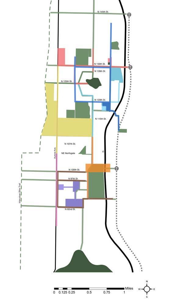
The Licton Springs-Haller Lake Neighborhood is located in North Seattle. Interstate-5, and Aurora Avenue (State Highway 99) , serve as east/west neighborhood edges. The north/south boundaries are the north City Limits at North 145th Street and North 85th Street. The studio explored the neighborhood and undertook thematic analysis. Additionally, throughout the studio, engagement with the community was prioritized in order to hear concerns about the neighborhood and receive design feedback. The combination of analysis with valuable insights from community members revealed several challenges and opportunities within the neighborhood. Moving into conceptual development, the studio proposed a neighborhood-scale framework plan branded Civic Defragmentation to re-envision transportation networks and provide a strong foundation for individual design work.
2. COMMUNITY ENGAGEMENT PROCESS
3. FRAMEWORK PLAN


Image Sources:
1. http://www.rolludaarchitects.com/?p=1751
2. https://tipspoke.com/northacres-park/t9110


3. http://cosfrontporch.wpengine.netdna-cdn.com/wp-content/uploads/2014/08/HallerLake-photo.jpg
4. http://www.tristarteamre.com/Blog/Archive?tag=Haller%20Lake%20Real%20Estate


5. https://www.seattleschools.org/directory/elementary_schools/northgate/


7. http://www.uwmedicine.org/locations/multiple-sclerosis-center
9. http://yourfuturein.it/ctc/northseattle/


12. http://bex.seattleschools.org/bex-iv/cascadia-es-and-robert-eagle-staff-ms/
14. http://frontporch.seattle.gov/2014/08/04/haller-lake-p-patch-12th-annual-opengarden-celebration/
Licton Springs – Haller Lake Neighborhood includes portions of three different urban villages: Northgate (Urban Center), Bitter Lake Village (Hub Urban Village) and Aurora-Licton Springs (Residential Urban Village). According to Seattle 2035, the city’s Draft Comprehensive Plan, Urban Centers are characterized by their high percentage of commercial and mixed-use development, which accounts for over half of the land use in each urban center. The main land use types in Hub Urban Villages are commercial / mixed-use, multi-family residential and single family residential. In the Residential Urban Villages, the main land use types are single family residential, multi-family residential and commercial / mixed-use.

Legend
Bitter
Aurora-Licton
Licton
Source: Seattle 2035, http://www.seattle.gov/dpd/cs/groups/pan/@pan/ documents/web_informational/p2273587.pdf
Types of Urban Villages
Urban Center
Hub Urban Village
Residential Urban Village
Land Use Categories
commercial mixed-use
single family multi-family industrial
major institution public facilities utilities parks, open space cemeteries
reservoirs
water bodies
vacant
unclassified
master planned community
Source: Seattle 2035, http://2035.seattle.gov/wp-content/uploads/2015/08/aurora-licton-springs-sf-zones.pdf

Source: Seattle 2035, http://www.seattle.gov/dpd/cs/groups/pan/@pan/documents/web_informational/p2273587.pdf
According to Seattle 2035, commercial and multi-family residential uses would be increased, but parks and open spaces are not except in the Hub Urban Village designation. Another urban village may be created around N. 130th Street and I-5 where a light rail station may be built.
Source: Seattle 2035, http://2035.seattle.gov/wp-content/uploads/2015/08/bitter-lake-sf-zones.pdf
Source: Seattle 2035, http://2035.seattle.gov/wp-content/uploads/2015/12/NE-130th-St-and-I-5-Residential-and-Potential-New-Urban-Village.pdf
The Licton Springs-Haller Lake Neighborhood is bounded by Interstate 5 to the east and by Aurora Avenue N. to the west. These car dominated streets foster unsafe conditions for people on foot and bike, and serve to separate the neighborhood from its surrounding context. The challenge here is to reclaim some of this space for pedestrians and bicyclists in order to create a better connected, safer, and more livable neighborhood.
I-5 and Aurora Avenue North are high traffic North-South streets for commuters and so prevent greater East-West connectivity. How can we design safe crossings for pedestrian and cyclists along these busy corridors?
The pedestrian network is not well connected from north to south, while the bicycle network is not very developed in general except along the Interurban Trail west of Aurora. Within the next 5 years, however, the city has planned to implement more bicycle lanes.
A dearth of dedicated bike lanes and safe pedestrian infrastructure discourages biking and walking. As a result, cars take up much of the roadways while physical activity and social capital are diminished.
In terms of bike and transit infrastructure, the City has much planned or being constructed. Metro’s bus lines traverse parts of the neighborhood. Metro’s RapidRide along Aurora provides frequent bus service, and a light rail station is under construction at Northgate, with a pedestran bridge planned across I-5 enabling access to and from the neighborhood. Additionally, a light rail station may be built at I-5 and NE 130th Street and another is planned at I-5 and NE 145th Street. From these hubs, a network of safe walking and biking routes are needed to connect with civic and other neighborhood destinations.
Source: Seattle Department of Transportation

Streets in orange are designated walking routes. These designated routes, however, lack overall connectivity. Some walking areas even appear as isolated patches, as if they are islands surrounded by a sea of automobiles. Yet again, busy streets like Aurora Avenue and highways like I-5 sever the walkability of this area. East-west connections across these busy routes should be increased in order to attenuate the power that cars hold over the area.

Source: Seattle Department of Transportation

Over 15,000 cars/day travel on streets marked red. The high frequency and speed of cars on these roads create unsafe conditions for those on foot or bike. Conditions on these streets should be redesigned to balance the space among all modes of transportation in addition to creation of public gathering space. In this way, we can foster an inclusive environment where all travelers can safely move and spend time in these corridors.
BICYCLE NETWORK
The Interurban Trail, running north-south, serves as an extensive bicycle route. However, such facilities don not yet exist within the neighborhood beyond the designated bike lanes along College Way North. A green way is planned for North 100th Street, to connect with the pedestrian bridge across I-5 to the Northgate Light Rail Station. North 130th Street is being planned for improvements, which will be an important resource for a light rail station at NE 130th Street and I-5.
Citywide Network
Existing
Local Connectors
Existing
Recommended Recommended
Off street
Cycle track (protected)
Neighborhood Greenway
2016 Implementation
Off street
Cycle track (protected)
In street, minor separation

Neighborhood Greenway
Shared street
Source: Seattle Department of Transportation

Licton Springs-Haller Lake Neighborhood contains different forms of open space, including Licton Springs Park, Mineral Springs Park, Northacres Park, Bartonwood Wetland, cemeteries and Haller Lake. These open spaces provide opportunities for biking, dog walking, playing frisbee golf, wandering, fishing, gardening, and being in nature.
While there is a diversity of open spaces and recreational activities in and around the neighborhood, they are not evenly dispersed, nor are they easily accessible. The “Gaps” map developed by Seattle Parks and Recreation illustrates the lack of open spaces near Aurora Avenue within the two urban villages. As these areas are designated to increase in population, there is an increased need for viable open spaces.


Source: WAGDA, https://wagda.lib.washington.edu/data/geography/wa_cities/seattle/index.html


Ecological systems of particular focus are Tree Canopy, Water and Critical Areas in the Licton Springs-Haller Lake Neighborhood. Seattle established a goal in 2007 to reach 30% tree canopy cover in 30 years.1 It is important to look at the existing conditions and try to fill the gaps. Water is also an important issue for Seattle. In Licton Springs- Haller Lake Neighborhood, the major receiving water body is Lake Union and flooding has occurred in this area before. We should consider how to treat stormwater in this area. Some critical areas like peat area and wetlands are found near North Seattle College.
1. http://www.seattle.gov/trees/docs/Tree_Canopy_Assessment_Council_EEMU.pdf


Canopy cover is the percent of the city that is covered by trees as seen in an aerial view. Seattle has about 23% canopy cover. However, many spaces lack tree canopy along Aurora Ave. We should consider how to plant more street trees in this area.
Source: http://web6.seattle.gov/DPD/Maps/dpdgis.aspx, Seattle Street tree map http://web6.seattle.gov/SDOT/StreetTrees/
STORMWATER

The major receiving water body for the Licton SpringsHaller Lake Neighborhood is Lake Union, and the majority of the stormwater system is a separated stormwater sewer. Additionally, a stormwater facility, Midvale, is located south of the cemetery.


Source: http://www.seattle.gov/util/cs/groups/public/@spu/@ drainsew/documents/webcontent/1_037857.pdf


The neighborhood is surrounded by two major creek systems in Seattle: Piper’s Creek and Thornton Creek. Seattle contains three small lakes: Green Lake, Haller Lake and Bitter Lake. All of them are located near or within our neighborhood. Regarding flooding issues, we should be mindful of wetlands, soil types and some steep slopes in the neighborhood. Wetlands are found in Licton Springs Park, cemetery, north west of Haller Lake along Ashworth Avenue North, within North Seattle College campus, and on existing police station site just northwest of the college.


Source: WAGDA, https://wagda.lib.washington.edu/
This Licton Springs-Haller Lake Neighborhood has a medium density population compared to the city, and has experienced increasing population and increasing housing during the last decade. The diversity of the neighborhood is high compared to much of North Seattle.

POPULATION CHANGE
Source: U.S. Census Bureau Decennnial Census 100% Count data 2000, 2010
HOUSING DENSITY


The Licton Springs-Haller Lake Neighborhood has a relatively lower income (darker blues indicate higher income) and higher crime rate compared to other parts of the city (lighter shades indicate higher crime). There is a high percentage of immigrants in this neighborhood compared to much of North Seattle.


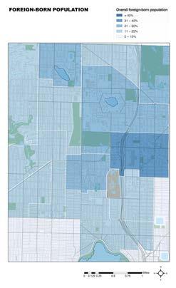
Source: http://www.weichert.com/

Source: http://www.seattletimes.com/seattle-news/data/a-spike-in-king-county-foreign-born-populations/
Source: http://www.neighborhoodscout.com/wa/seattle/crime/
Mixed: non-Hispanic mixed race people
Other: American Indian, Alaska Native, Native Hawaiian and Other Pacific Islander
HIGHLIGHTS
Image Source: Google maps
Aurora-Licton Springs population: 9.682
These graphs represent the different races that exist in the City of Seattle as a whole and the Licton Springs-Haller Lake Neighborhood. According to 2006 - 2010 US Census, we can see how all three graphs are dominated by White (depicted in orange) followed by Asians (depicted in brown), but then the group that follows changes. In Seattle the third major ethnic group is Black (depicted in purple), but in Licton Springs-Haller Lake Neighborhood is Hispanics (depicted in light blue). This means that there is a higher percentage of this population in both neighborhoods. Spanish is also represented in the percentage of languages spoken other than English. Much of the Licton Springs-Haller Lake Neighborhood has over 30% of the population as non-English speakers at home, more than the average 21.3% of Seattle overall.


Data Source: http://statisticalatlas.com/place/Washington/Seattle/Overview
Haller Lake population: 9.746
SEATTLE, WA
LICTON SPRINGS
9,682 POPULATION
Graphs Data Source:
HALLER LAKE
9,746 POPULATION
Data Source: http://seattlecitygis.maps.arcgis.com/apps/StorytellingTextLegend/index.html?appid=92ef6933d46f4c9786c8e8f09515284f http://seattlecitygis.maps.arcgis.com/apps/StorytellingTextLegend/index.html?appid=92ef6933d46f4c9786c8e8f09515284f http://statisticalatlas.com/place/Washington/Seattle/Overview
Data Source: http://statisticalatlas.com/place/Washington/Seattle/Overview
Data Source: http://statisticalatlas.com/place/Washington/Seattle/Overview
PERCENTAGE OF POPULATION SPEAKING A LANGUAGE OTHER THAN ENGLISH AT HOME RELEVANT LANGUAGES IN THE AREA
PERCENTAGE OF THE POPULATION SPEAKING A LANGUAGE OTHER
Data Source: http://statisticalatlas.com/place/Washington/Seattle/Overview
PERCENTAGE OF MOST REPRESENTATIVE LANGUAGES IN THE AREA:
Image Source: http://www.seattle.gov/dpd/cityplanning/populationdemographics/aboutseattle/raceethnicity/default.htm
Source: http://www.seattle.gov/dpd/cs/groups/pan/@pan/documents/web_informational/dpdd016861.pdf
Image Source: http://www.seattle.gov/dpd/cityplanning/populationdemographics/aboutseattle/raceethnicity/default.htm
Image Source: http://www.seattle.gov/dpd/cityplanning/populationdemographics/aboutseattle/raceethnicity/default.htm
CHINESE
CHINESE:
PERCENTAGE OF MOST REPRESENTATIVE LANGUAGES IN THE AREA:
CHINESE:
PERCENTAGE OF MOST REPRESENTATIVE LANGUAGES IN THE AREA:
CHINESE:
SPANISH:
SPANISH
SPANISH: african languages:
SPANISH: gov/dpd/cityplanning/populationdemographics/aboutseattle/raceeth-


african languages: gov/dpd/cityplanning/populationdemographics/aboutseattle/raceeth-
Image Source: http://www.seattle. gov/dpd/cityplanning/populationdemographics/aboutseattle/raceethnicity/default.htm

1. INGRAHAM INTERNATIONAL H.S.
2. BROADVIEW THOMSON K-8

3. NORTHGATE ELEMENTARY
4. CASCADIA ELEMENTARY

5. LICTON SPRINGS K-8
6. ROBERT EAGLE STAFF MIDDLE
7. GREENWOOD ELEMENTARY
8. DANIEL BAGLEY ELEMENTARY
9. NORTH SEATTLE COLLEGE
10. OLYMPIC VIEW ELEMENTARY

11. LAKESIDE HIGH SCHOOL
12. LAKESIDE MIDDLE SCHOOL
13. BISHOP BLANCHET HIGH SCHOOL
source: google earth
source: seattleschools.org
source: google earth
A range of centers for education exist in the neighborhood from elementary schools to higher education. Three new schools will open in the fall of 2017, serving over 1600 elementary and middle school students1 in close proximity to Licton Springs Park and the local community college. North Seattle College draws over 14,000 students2 and offers wonderful potential for outdoor learning in its biodiverse Barton Wood Wetland.
1. http://bex.seattleschools.org/bex-iv/cascadia-es-and-robert-eagle-staff-ms/ 2. https://northseattle.edu/about-north

There are many elementary and middle schools within and near the neighborhood; however, there is a lack of safe bike and pedestrian routes connecting to them. Northgate Elementary, a focus of our studio, is a highly under served school with 86 percent of the students receiving free or reduced lunches. The diversity at the school is quite high. Latino students comprise the highest percentage and over 20 languages are spoken by the students.
CHILDREN QUALIFYING FOR FREE & REDUCED LUNCH | 20093,4


86%
40%
Source: northgatees.seattleschools.org
NORTHGATE ELEMENTARY | 20093
39%
LICTON K-8 | 20094
Total: 259 students
Total: 189 students
Total: 53,872 students
3. “Northgate Elementary 2009 Annual Report.” online: https://www.seattleschools.org/UserFiles/Servers/Server_543/File/Migration/Schools/School%20Directory/Departmental%20 Content/siso/anrep/anrep_2009/257.pdf
4. “Alternative School #1 at Pinehurst 2009 Annual Report.” (former name for Licton K-8) online: https://www.seattleschools.org/UserFiles/Servers/Server_543/File/Migration/Schools/ School%20Directory/Departmental%20Content/siso/anrep/anrep_2009/955.pdf
Within the Licton Springs-Haller Lake Neighborhood, we discovered community groups who bring different civic focuses:
• Licton-Haller Greenways Group
• Aurora Licton Urban Village


• Aurora Commons
• Haller Lake Community Club
• Licton Springs Community Council
• Aurora Avenue Merchants Association

Licton-Haller Greenways Group has monthly meetings and is focused on improving street safety and comfort for all travelers, especially children, older people, pedestrians and bicyclists. The group’s webpage notes: “Since the spring of 2014, we have been engaged in community building, advocacy, and action-based projects to make streets safer for all people, particularly for children and elders and people who are walking and bicycling.”1
1 Seattle Neighborhood Greenways. http://seattlegreenways.org/neighborhoods/ licton-haller-greenways/

Source: http://seattlegreenways.org/neighborhoods/licton-haller-greenways/
Logo and Image Source: https://www.facebook.com/ Aurora-Licton-Urban-Village-1503087143342417/photos_stream?ref=page_internal
The mission of this group is stated on its webpage: “Build a pedestrian-safe, visually vibrant, economically sound, liveable and welcoming urban village using sustainable-growth principles.”1
1 Aurora Licton Urban Village. http://www.auroralictonuv.org/about/
“Aurora Commons, located along Aurora Avenue, provides a welcoming space for our unhoused neighbors to rest, prepare a meal, connect to resources and collectively create a healthy and vibrant community.”1
1 Aurora Commons. http://www.auroracommons.org/#about-marquee
Source: Aurora Commons. http://www.auroracommons.org/#about-marquee
The Haller Lake Community Club is a non-profit organization that serves as the neighborhood community council. It aims to support communication and foster neighborhood enhancements.1
1 Haller Lake Community Club. http://www.hallerlakecommunityclub.org/about/
The Licton Springs Community Council holds monthly meetings and communicates activities in its newsletter.1
1 Licton Springs Neighborhood. http://www.lictonsprings.org/council/council.html


Aurora Avenue Merchants Association is an organization whose multi-pronged mission include: “encourage the growth of existing business activities... promote public safety, support activities believed to be beneficial to the community... offer friendship and assistance to the surrounding residential community”1
1 Aurora Avenue Merchants Association. http://auroramerchants.org/about-us/mission/
Source: Haller Lake Community Club Photos, https://picasaweb.google.com/ hallerlakecc/EggHunt2015#6211960825496813698

Halloween Party

Source: Licton Springs Neighborhood Annual Events, http://www.lictonsprings.org/ action/events.html
Source: Aurora Avenue Merchants Association Galleries, http://auroramerchants.org/ galleries/
http://auroramerchants.org/galleries/

The Licton-Haller Greeways group hosted a community meeting for the studio to learn about the neighborhood as the studio was getting underway. Those who participated included community members involved in greenways, the Licton-Springs Community Council, Aurora Licton Urban Village group, Feet First, and Northgate Elementary. The studio met at tables with community members using maps of the neighborhood to guide discussion of five major themes. Community members also created postcards of their visions for the neighborhood. A summary of findings is presented here.
Transportation related safety
• Not enough sidewalks in the neighborhood
• Not sufficient lighting
• High speed car traffic
• Difficult for bikers and pedestrians to cross arterial streets (no infrastructure)
Crime related safety
• Car break ins
• Stolen packages from homes
• People doing drugs; needles left on the ground
Relevant places mapped by community members

• Many community members focused on Aurora because of both transportation and crime related concerns.

• The area behind Home Depot makes people feel unsafe due to drug use.
• Many intersections are unsafe because there is not sufficient infrastructure for pedestrians and bicyclists.
• Aurora Avenue is not safe and not walkable.
• Sidewalks are not enough wide for pedestrians.
• Cars and buses are running too fast.
• People get scared at night, because there are not enough street lights.
• If people want to walk in their neighborhood, they usually drive to Green Lake and walk there.
• Students ride in their parents’ car, so there will be lots of traffic given school attendance zones.
Likes:
• Quite a few participants like going to Licton Springs Park for jogging and dog walking.
• Most participants know about the Licton Springs.
• The P-Patch at North Seattle College is a favorite space.
• Green Lake is one of the most popular places in the Northwest Neighborhood District.
• Some go to the cemetery; however, few consider it an attractive open space.
• Community members wish there were more amenities like community centers, outdoor movie theaters, P-Patches, and small convenient stores. They also wish there were more activities such as block parties, cultural festivals, and farmers markets.
• Just north of our focus area, Shoreline represents a precedent for an attractive area that features many amenities.
Dislikes:
• Most participants don’t like going to Aurora Avenue because it is unsafe.
• Most adjacent streets are also unsafe for walkers and cyclists.
• Participants consider Haller Lake a private place, though there are two public access points.
• Amenities that participants noted as missing were: convenient shop / market, farmer’s market, sidewalks, and library.


• The neighborhood lacks a sense of identity. Aurora Avenue, a busy arterial, and Highway I-5 bound the neighborhood but also cause fragmentation.
• Assets exist within the community, like The Lantern, a popular bar and gathering place for people just off of Aurora Ave. on N 95th St. Other places like Larry’s Market used to provide valuable services but no longer exist. Oak Tree Village represents an opportunity for community gathering space.
• The Evergreen-Washelli Cemetery and Licton Springs Park represent part of the area’s history as the cemetery houses monuments from the late-19th century while the spring at the park is a sacred Native American site.


This early design concept presentation, attended by community members, design and planning professionals, and faculty allowed our studio to present bold ideas based on the wealth of information learned from the community meeting and thematic analysis of the neighborhood. Following an overview of the studio and analysis findings, reviewers met at tables to discuss individual design projects. Our concepts were grounded in community needs and analysis, and pushed the boundaries of convention.
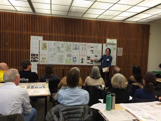

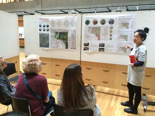
Using feedback from our concept discussions, we developed schematic design proposals. A variety of returning and new reviewers attended, including: a planning faculty member, design and planning professionals, and community members. Feedback from these presentations raised challenging questions to explore in design refinement.


Each of us further refined and represented our design proposals for the end of Winter Quarter presentations. Reviewers included: faculty, design and planning professionals, and community members, some of whom had participated in prior presentations.


The Community Open House held at Northgate Elementary offered the opportunity for community members to see and discuss our latest iterations of design from the previous quarter. We had a good turn out with several new people eager to see and discuss visions for the future of the neighborhood.


The final presentation for Spring Quarter, held in UW’s Gould Hall, revealed the culmination of the studio’s design and graphic work. A combination of faculty, design and planning professionals, and community members attended to give us feedback.


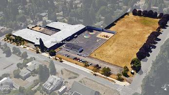
Two of us chose to focus on Northgate Elementary. We wanted to learn from the students and teachers what features they would like in an ideal schoolyard. We developed the poster below. One copy was placed out for students, one was placed for teachers to mark their preferences. The posters for students received enthusiastic support for nearly all elements. Teachers’ responses were more varied, with particular interest expressed for a stage, sculpture, and movable play parts. The two of us used this feedback to help determine the programming for the school site. We also presented schematic and refined design proposals to the school’s Principal and Administrative Secretary for feedback and to develop ideas for building elements for the school. The April 24th meeting included the Seattle Public Schools staff member who reviews proposed school projects. We developed a Seattle Public Schools Self-Help Project Application for construction of outdoor movable planters and mural installation, which was approved.
We are UW Landscape Architecture graduate students exploring outdoor play and learning opportunities for Northgate Elementary.


We would like to know what you want at your school. Please draw a check mark in the white box below the images that you would like here! If you have other ideas, feel free to write or draw them in the open space.

You can email us at: larchstudio702@gmail. com


Please provide your input by FRIDAY, FEBRUARY 26TH.
Thanks for your help!


For us, the disconnection, or fragmentation, of civic spaces in the Licton Springs-Haller Lake Neighborhood limits the resilience of vibrant community life and ecological systems. We found the concept of “habitat fragmentation” representing this condition, and thus “habitat defragmentation” serves as model for change, drawing from the characterizations by the firm Van Bommel FAUNAWERK:

“For many animals the network of roads, whether fenced or not impose a serious barrier. Habitat fragmentation due to human development is an ever-increasing threat to biodiversity. Fragmentation of species’ habitat in smaller or isolated patches increases the risk of local extinction.... Habitat defragmentation can be reached by creating habitat or wildlife corridors to reconnect isolated patches of species’ suitable habitat. This may mitigate some of the effects of habitat fragmentation.”1
http://www.vanbommel-faunawerk.nl/pages/habitatdefragmentation.php
Building from this, we define our design framework as “Civic Defragmentation”. Civic Defragmentation connects and revitalizes civic spaces with a network of safe and engaging pathways and activities for ecological and cultural learning and resilience.
COEXISTENCE OF OPPOSITES: ALONG AURORA AVENUE
NORTHGATE ELEMENTARY: CELEBRATING CULTURE AND WAYS OF LEARNING
ECO-PEDAGOGICAL LANDSCAPES
BUILDING A HABITAT CORRIDOR

COMMUNITY NETWORKS


In this studio, each of us chose particular sites to design, drawing from the themes of civic landscape systems we studied, our neighborhood analysis findings, and community feedback. These proposed designs include: streets designed for pedestrians, bicyclists, and transit while contributing to ecological systems and identity; parks serving community life, habitat, ecological learning, and green infrastructure; temporary street art installations calling attention to how space is used and what is missing and permanent installations to improve pedestrian experiences; and redesign of a schoolground to support ecological learning and celebrate cultures. The map on the left illustrates our projects spatially, and indicates the potential network of connections among the neighborhood’s diverse civic landscapes towards achieving civic defragmentation.
• 130TH SONATA | CHIH-PING (KAREN) CHEN
• ECO-PEDAGOGICAL LANDSCAPES | WILL SHRADER
• NORTHGATE ELEMENTARY: CELEBRATING CULTURE AND WAYS OF LEARNING | JAMES WOHLERS
• COEXISTENCE OF OPPOSITES: ALONG AURORA AVENUE | SEONGWON SONG
• BUILDING A HABITAT CORRIDOR | CHRISTEL GAME
• HEALING LICTON SPRINGS | JIAXI GUO
• COMMUNITY NETWORKS | WENYING GU
• MOVE, STAY, ENGAGE | ZHEHAO HUANG
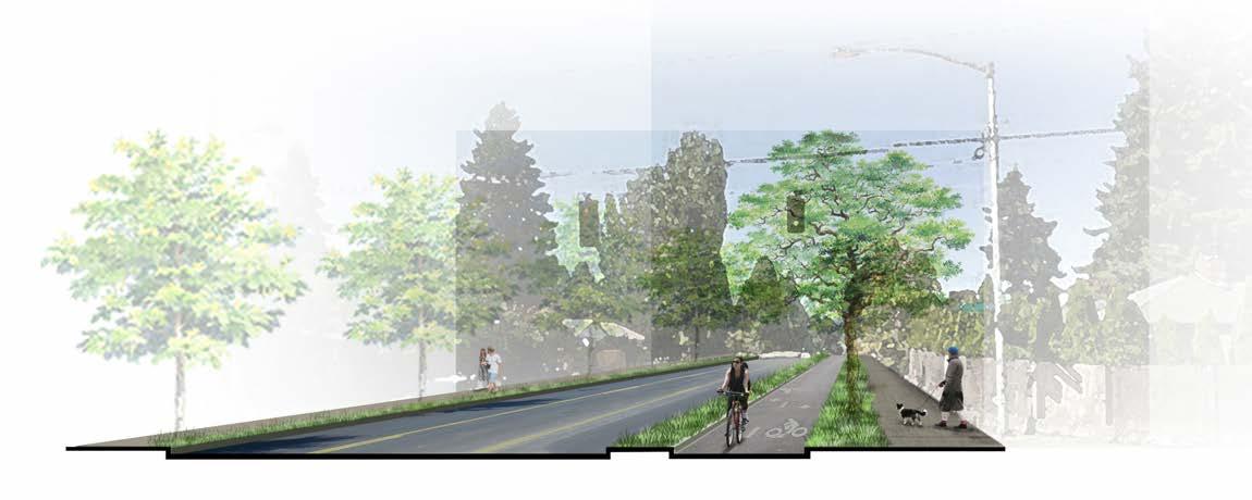
N 130th Street is an important east-west commuting route for the residents who live in the Bitter Lake/Haller Lake area. However, N 130th Street is not safe nor comfortable to walk along. The planned light rail station at NE 130th Street and I-5 will create even greater need for safe and engaging pedestrian and bicyclist movement along N 130th Street. In this design, I focus on creating a more interesting route for residents and school kids. I weave together fragmented civic activities, transit, bicyclists and pedestrians through different tempos of design qualities that relate to their immediate context.


Bitter Lake and Haller Lake are located in this area as well as Ashworth Wetland.
Data Source: https://wagda.lib.washington.edu/
Northacres Park and Bitter Lake Playground server this area.
Data Source: https://wagda.lib.washington.edu/

There is a lack of tree canopy rate along the street, especially around Aurora Avenue North, while significant tree canopy is found at Northacres Park.


Data Source: http://web6.seattle.gov/DPD/Maps/dpdgis.aspx
Many people live in the area near Aurora Avenue N, as the Bitter Lake Urban Village extends along either side of Aurora Avenue N. Most of them will rely on the public transportation to go to work and school.
Source: http://www.seattletimes.com/opinion/sound-transit-must-add-north-seattle-light-rail-station/


The concept of Sonata grows from the existing conditions and qualities of the street tempo. As I identified certain walkable destinations and features, the character of each movement emerged.
N 130th Street is a car oriented street. There are 2 traffic lanes in each direction. The sidewalks have little planted buffer to protect pedestrians from the fast moving traffic. It is not sate for people to walk. Lack of tree canopy is another reason make this street not comfortable to walk.


The future light rail station will make N 130th Street an important route for students and residents to go to work and school along. Green infrastructure can improve N 130th Street and make a safer corridor from Northacres Park to the Bitter Lake Playground and places in between for pedestrians and bicyclists.
Furthermore, the civic features that currently are fragmented along N 130th Street will influence the street’s character. It will make this street more fun, with connecting destinations for people to go easily from place to place.
The district fragments of civic spaces define different character along N 130th Street just like a sonata1, which is a continuous composition with different characters and tempos in each movement. Spatially along N 130th Street, each movement has its own theme. People can participate in different activities along this Sonata, so they will not feel bored or unsafe on N 130th Street.
1 http://home.earthlink.net/~dbratman/sonata.html
green infrastructure
bike lane
car lane
green infrastructure


sidewalk sidewalk
N 130th Street is composed of four key movements between Bitter Lake and Aurora Avenue on the west and Northacres Park and the Light Rail Station on the East. It is designed as a safe route for pedestrians and bicyclists interspersed with green infrastructure that links with particular civic features. Based on the theme and character along the street, N 130th Street shows different appearances on each movement.
huge parking lot
VISION
lack of seating area for the bus stop


steep and tall wall unmarked crosswalk beside high school
Map Source: WAGDA, https://wagda.lib.washington.edu/data/geography/wa_cities/seattle/index.html
potential entrance to Haller Lake, but currently blocked
uncomfortable bus stop
potential space for expand the P-Patch


unclear entrance to Northacres Park


Map Source: WAGDA, https://wagda.lib.washington.edu/data/geography/wa_cities/seattle/index.html


Civic fragments are woven together along N 130th Street make this route safer and more appealing to pedestrians and bicyclists, and more ecologically healthy. In addition, based on different rhythms, the street exhibits a different character for each movement. People will use this route more often and come to know their neighborhood better as well.

Rondo
1 http://home.earthlink.net/~dbratman/sonata.html

parking lot


The overpass provides a new landmark for N 130th Street which offers pedestrians and bicyclists another option to across Aurora Avenue N. In the future, the commercial center is expected to increase gathering places, with mixed use developments increasing. The new Police Station will also give N 130th Street a safer image. This greener commercial area will function as a lively, fun, and healthy community hub.


Journey
1 http://www.merriam-webster.com/dictionary/scherzo

7’ sidewalk
flowering trees raised crosswalk
Looking west on N 130th Street towards Ashworth intersection and proposed raised crosswalk


PROPOSED SECTION


Ingram High School
This design relocated bus stop along N 130th Street from the west side of the Ashworth intersection to the east side of the intersection, along the edge of Ingraham High School. The design provides a space to connect the community and school kids. People can dance and listen to the music, hang out with friends at this terrace bus stop. The raised crosswalk increases safety to start on the water journey.
44’ travel
14’
12’ sidewalk + variety green sidewalk + variety green Private Property
Ingram High School
EXISTING SECTION
raised crosswalk for school kids
Ashworth wetland education sign
Haller Lake public access
Map Source: WAGDA, https://wagda.lib.washington. edu/data/geography/wa_cities/seattle/index.html
1 http://www.merriam-webster.com/dictionary/andante


People can grow their own food in the expanded P-Patch which is considered a “slow food” concept instead of fast food idea. The P-Patch is an important habitat along the habitat corridor extending from Northgate Elementary School to Lakeside High School and extending along N 130th Street as well. Decoration on the pavement will be digitally linked signs to guide people and help them learn about their neighborhood.
Map Source: WAGDA, https://wagda.lib.washington. edu/data/geography/wa_cities/seattle/index.html
Urban Forest

ALLEGRO
Allegro is a piece of music that is a swift tempo that is animated.1
1 http://www.merriam-webster.com/dictionary/allegro
With a new Urban Village surrounding the N 130th Street Light Rail Station, more people will be living in this area. Northacres Park becomes a treasured urban forest. A new pedestrian entrance is proposed at 3rd Ave NE with a raised crosswalk across N 130th Street and pedestrian axis path connecting to the dog off leash area and children’s playground. Residents can walk to enjoy a baseball game in Northacres Park. Along N 130th Street, a meandering path takes visitors along a series of habitat rich bioswales.


Eco-pedagogical landscapes explores design solutions at Northgate Elementary, an under served school in North Seattle with a highly diverse immigrant population as well as high rates of poverty. The current national education standards create a barrier especially for EngIish language learners through its inflexible curriculum and standardized test-based model. Students at Northgate would benefit from an outdoor space that facilitates learning opportunities for all abilities and supports cultural diversity.
I propose short term and long term design solutions for a readily implementable framework for Northgate Elementary to shift the paradigm of education to a more dynamic pedagogy accessible to every child and customized to local context. This is achieved through interactive outdoor learning spaces throughout the neighborhood that highlight natural processes, facilitate cultural exchange, and invite play.


CRITICAL STANCE : SHIFTING CULTURAL PERCEPTIONS OF NATURE
UNMITIGATED RESOURCE USE
POPULATION GROWTH
CULTURAL PERCEPTIONS OF NATURE
INCREASING ENVIRONMENTAL DISTURBANCES
DEGRADATION OF NATURAL SYSTEMS
UNINHABITABLE PLANET
STANDARDIZED TEST BASED EDUCATION
FUNDAMENTAL SHIFT IN EDUCATION SYSTEM
CONTEXT ECO-PEDAGOGICAL LANDSCAPES
ACTIVATED CITIZENS
PEDAGOGY
SUPPORTING
ECOLOGICAL LITERACY


CULTURALLY RELEVANT EDUCATION

COLLABORATIVE PROBLEM SOLVING
BUILDING
RESILIENT URBAN SYSTEMS
For the last 20 years ecologically-focused, pedagogical theory has cited the importance of prioritizing human conservation of the environment for long term heath of the planet. David Orr’s seminal writing on ecological literacy in the early 1990’s emphasized the connection between the environment and education, stating: “built on the recognition that the disorder of ecosystems reflects a prior disorder of mind, making it a central concern to those institutions that purport to improve minds. In other words, the ecological crisis is in every way a crisis of education.... All education is environmental education… by what is included or excluded we teach the young that they are part of or apart from the natural world”. 1 To improve and maintain environmental health, we must have individuals and communities that intimately understand and connect with it. Ecopedagogy, a theory that emerged from Paulo Freire’s ideas of critical pedagogy, calls for “an alternative global project” concerned with making changes in economic, social, and cultural structures ultimately for the wellbeing of the environment.2
2
DESIGN GOALS :
TO SUPPORT...
CULTURAL DIVERSITY & LEARNING
ECOLITERACY
COLLABORATIVE LEARNING
+
COMMUNITY
source: http://www.seattle.gov/transportation/sidewalkrepair.htm
Sources: http://2035.seattle.gov/draft-urban-village-maps/ and Google Maps


The outdoor spaces connected to Northgate Elementary present several opportunities and constraints important to my design decisions. The grass field (blue) is shared with the community as ball fields and open space; however, the public is restricted from using the space during school hours for safety reasons. The 10’-16’ retaining wall adjacent to the field and asphalt play court aggressively fragments the space and inhibits sight lines. Unifying these spaces creates grading challenges; however, it is a great opportunity to better connect the school and the community and expand children’s everyday play and learning experiences. In terms of the spaces immediate to the school, there are also several opportunities (shown in red) to improve play spaces and provide infrastructure for learning.


Northgate Elementary acts as Seattle’s North-End Bilingual Orientation Center, where the school district sends recently immigrated children to transition into the American education system. Many of these children come as refugees from around the world to create the incredibly diverse student population at Northgate, with over 20 languages spoken. This range of ethnicity and perspective provides design opportunities to support cultural exchange and learning.
Compared to the district average, Northgate Elementary has over twice the number of students receiving free or reduced lunch. These students are considered to be from low income families. Many of these same students also participate in a monthly free grocery program called Food Lifeline in order to help supplement their families’ incomes. These challenges provide opportunities for integrating food production into design.
39%
Total: 259 students
American Indian
Asian
African American Latino
Caucasian
Total: 53,872 students
source: www.foodlifeline.org

The four open spaces (Field Labs) identified within walking distance from Northgate Elementary form a system of loosely programmed outdoor classrooms demonstrating a diverse range of ecosystem services. Students can explore these spaces through scientific learning and play. Through the interaction with these places overtime, new affordances are discovered and students become accustomed to seasonal fluctuations. This intimate relationship with the local environment supports ecological literacy. In order to safely travel among these classrooms, key streets have been redesigned to prioritize pedestrian safety. Bioretention cells planted with pollinator-friendly plants buffer pedestrian and bike travel from car traffic.
FIELD LABS
NW MEDICAL CENTER
GARDEN –This proposed therapeutic garden includes a variety of plants for pollinators.

HALLER LAKE– This limnologic system supports a complex food web and opportunities to interact with water.
NORTHACRES PARK– includes mature native canopy and understory rare to urban spaces.

ASHWORTH WETLAND–teaches natural stormwater management methods and supports diverse plant and animal life.

Source: http://science.halleyhosting.com/nature/plants/ trees/deciduous/oleaster/fraxinus/latifolia.html


Source: http://montanaflora. blogspot.com/2013_02_01_archive.html
Lonicera involucrata

Source: http://calphotos.berkeley.edu/cgi/img_query?enlarge=0000+0000+1109+0522
Cornus sericea Iris douglasiana
Source: http://nature.berkeley. edu/~oboyski67/macros/index. htm

Map Sources: Google Earth and WAGDA, https://wagda.lib.washington.edu/data/geography/wa_cities/seattle/index.html


The lighting of the trees and entrances deters unwanted activity on school grounds at night. The glow-in-the-dark entrance mosaics add a wayfinding element that appears at other parks and open space part of the pollinator network.
Fruit bearing trees and shrubs line the perimeter of the space and populate the forest garden, acting as robust pollinator habitat. Agricultural beds provide more short-term engagement with food systems. Finally, the rain garden on the southern side manages stormwater runnoff on-site.
Stormwater on site is conveyed by three drains that outfall in a playful swale in which children can study and manipulate the flow of water as it moves toward the rain garden. Water also supports quiet play in the southern courtyard where students and teachers can enjoy the sounds of falling water.
Two loop paths, one a community trail and one a playful path, facilitate circulation throughout the northern site for endless play opportunities. Main entrances at the most public parts of the site, NW and NE, invite the community to share the space outside of school hours.
Together, these systems provide infrastructure to create a safe green space supporting handson learning and play through lighting, plantings, water management, and circulation.
This diagram provides a feeling of how the holistic design of the space serves multiple stakeholders throughout a normal day. Students, community members, parents, and teachers may all take advantage of the robust programming for the site, while also feeling ownership of the space and creating an identity for the school.
Students at Northgate can take advantage of the outdoor spaces both during and outside of school hours. The versatility of the spaces allows for learning, active play, and quiet play.
Community members may tend the forest garden and harvest when available. Also the central meeting area provides a much needed space for community meetings. The existing parking lot acts a flexible space for events, like a farmers market.
Teachers use the southern courtyard as a respite from the active classroom. When watching the children during recess, strategic points allow complete viewsheds of the entire school grounds for maximum safety.
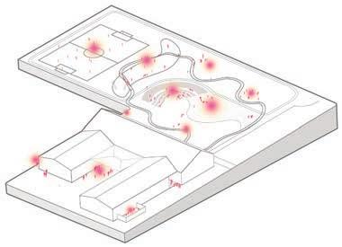
Parents safely drop off their children in the existing parking lot or stay and help with the children’s gardening curriculum. When soccer games occur, parents use the slug berm as sloped seating while apple trees atop the berm provide shade.


The terraced garden space bridging the asphalt and upper grass area performs for both the community and the school in a mutually beneficial relationship. The upper terrace contains a forest garden tended by community members outside of school hours. While the community harvests food, students use the space for learning and the garden helps establish an identity and sense of continuity for the school. The lower three terraces are exclusively for student hands-on experimentation. These smaller beds can have a short turn-around, customized to each class. Open space at the foot of the terraces provides gathering space for teaching or community events.

The Banana Slug Berm provides opportunities for active play, learning, as well as adds topography to the site. The play loop cuts through the berm and creates various spacial experiences as kids pass through, around, and over. The berm itself uses Hugelkultur to provide nutrients to fruit trees and teach kids about the process of decomposition. The process originating in Denmark involves burying large, bulky organic matter in a long ditch, covering with humus and soil, and planting on top. Over time, this ephemeral feature will sustain interest from students, while establishing a legacy of fruit trees for the school. Outside of school hours the berm also plays an important role as seating for the community soccer field.
25 yrs
5 yrs
Top soil
Humus
Bulky Organics
0 yrs
In addition to envisioning the long-term neighborhood and site interventions, I also focused on crafting a short-term design solution that would support handson ecological and cultural learning and be easily integrated into the students’ current curriculum requirements. The self watering planters met these design goals and helps Northgate Elementary to make a tangible step toward a more resilient education model.
The mobile planter facilitates experimentation with various environmental conditions and teaches kids about environmental systems through hands-on interaction.
Diverse edibles can be grown for cultural learning and used to reflect the diversity of the students. Nutrition and cooking classes extend learning to cultural values surrounding food.
The bright, playful colors and knot pattern invite students to see and use the planter as a fun tool for learning about and interacting with plants.
Planters promote sharing and team work among students to ensure a successful harvest. Also, each planter weighs a couple hundred pounds requiring a joint effort to move them.

Tagtomat, a Denmark-based company built selfirrigating planters on the roof of an unused garden shed in a multi-family apartment building. The owner’s goals included increasing accessibility to urban farming, building a sense of community, and creating a modular model for more sustainable food production.


image source:www.tagtomat.dk/
image source:www.tagtomat.dk/
One of the goals of the planter design is to make the fabrication process easily accessible to schools. With a stepped, graphic design manual, planters can be constructed with minimal tools by champions at schools and in the community. A video of the fabrication process will also accompany the graphic manual. This guide is meant to empower users passionate about environmental and cultural education to create a multi- functional learning tool, as well as learn throughout the process of building. DESIGN ELEMENTS
EFFICIENT GROWING SYSTEM
IRRIGATE 1
2 STORE
3 CAPILLARY ACTION
4 GROW
5 OVERFLOW
MEASURE – Using the Circumference Precision Jig 20” from the top and 4” from the botttom
CUT – Using the jigsaw, a friend/ clamps
CUT – 28” x 6” rectangle
CUT CUT
TOP
SOIL LID A3
1/8” hole
CLAMP – into cylinder with ends overlapping at least 2”
DRILL – 6-8 staggered 1/8” holes
RIVET – use stainless steel 1/8” pop rivets
3/8” hole
BOTTOM
CUT – a center hole 1/2” smaller than diameter of wicking basket
DRILL – 3/8” holes evenly on face
1/4” hole
DRILL – 1/4” holes in the wicking basket and bottom
FASTEN – with 4 zip ties
DRILL – Using drill press make atleast 3 rows of 3/8” holes
DRILL – hole for irrigation pipe
1 5/8” hole
3/8” hole
DRILL – using a hole saw bit drill overflow hole and holes for rope attachment
The overflow hole should end just below the height of the wicking basket
6 pairs of evenly spaced holes should be drilled for rope attachments
Measure two 2ft squares of 3/4” plywood and cut
GLUE & CLAMP – Let cure for 24 hours
Cut 23” Circle with jigsaw
PAINT – waterproof sealant
CUT – wood blocks for wheel base
GLUE– wood blocks to base
ATTACH – wheels to blocks
BASE + BARREL ASSEMBLY
DRILL– 4 3/8” holes in barrel and wood base
FASTEN– 5/16” carriage bolts to lock nuts with Lock Sealant to avoid loosening
CAULK– the heads of the carriage bolts to create a water-tight seal
See video for knot tying tutorials

The collaborative design/build process of the self irrigating planters culminated in a planting day with children at Northgate Elementary. The principal requested that the planters become the responsibility of groups of children with the hope of heightened engagement and focus at school. After we explained the self-irrigating system and the plant benefits, we encouraged the children to add soil, plants, and water to the planters.


The kids were focused and excited about all of the new edibles they planted and especially loved the drama of water pouring from the overflow holes. We hope the planters inspire teachers to form a regular garden curriculum and possibly nutrition and cooking classes.

Northgate Elementary’s 260 students speak a total of 25 languages. Global in scope, the languages range from Central and South America, to Europe, to the Middle East, to Africa, and to Southeast Asia. My redesign of the schoolyard and adjacent edges seeks to build upon this cultural diversity, extending it beyond the building through experiential and ecological systems, and providing students opportunities to express their own culture in addition to learning about others.
These cultural, experiential and ecological systems allow for multiple ways of learning as they incorporate safe and fun movement, participatory learning, and food systems, culminating in a sense of place within the greater community.
Map Sources: Google Earth and WAGDA, https://wagda.lib.washington.edu/data/geography/wa_cities/seattle/index.html
Bird’s Eye view of Northgate Elementary looking southwest. North 120th St. is redesigned according to “SEA Street” principles for stormwater management. Sections A and B are shown on following pages. N

Searching for opportunities to extend learning beyond the classroom reveals the nearby green spaces of Haller Lake and Northacres Park. Within walking distance, these destinations provide ways to learn about the natural environment. Rainwater can also contribute to outdoor learning by capturing runoff from the school roof as well as directing it from 1st Ave NE into adjacent bioswales.


EXISTING NOISE MAP OUTFALL DRAIN ACTIVITY


EXISTING HYDROLOGY


Source: https://wagda.lib.washington.edu/data/geography/wa_cities/ seattle/index.html
Source: https://wagda.lib.washington.edu/data/geography/wa_cities/ seattle/index.html
Northgate Elementary students wanting to play outside are limited to hardscaped areas with little diversity in activity or materials. A 10 foot retaining wall surrounds the north courtyard, preventing easy access to the adjacent grass field and containing play within a zone of asphalt. The smaller southern courtyard faces similar challenges as 5 foot concrete walls surround the play space with limited access to natural materials. In addition, many cars travel along 1st Ave NE at high speeds as no physical traffic calming measures exist.

Improving circulation means making safe the walking and cycling conditions along 1st Ave NE. It also means breaking down the barriers between hardscape and softscape, allowing for ADA access up to the field, and creating a variety of ways to roll down or climb up the slope separating the blacktop from the grass field.

Expression of Culture within a community garden: Danny Woo International District community garden, Seattle
Source: https://baklavabaklavabaklava.files.wordpress.com/2011/08/img_6150.jpg
Cultural Objects from home found throughout site: Superkilen, Copenhagen, Denmark
Source: http://www.e-architect.co.uk/images/ jpgs/copenhagen/superkilen_b141212_i5.jpg

Conceptual Design: extending learning beyond the classroom
Licton Springs-Haller Lake Open House
UW Master of Landscape Architecture Capstone Studio 18 April 2016
Trellis as canvas for cultural displays: Magnuson Park, Seattle

Source: http://weddingsbyjenn.com/wp-content/uploads/2014/01/seattle-documentary-wedding-photographer-at-magnuson-park-hangar-summer-2013026026.jpg
ECOLOGICAL:
Produce an ecologically balanced and culturally relevant plant community that is integrated into the local environment.


CULTURAL:
Provide space for temporary self-expression, allowing present and future generations of children to express themselves and appreciate other cultures, too.
EXPERIENTIAL:
Design for multiple senses and ways of learning, through large spaces where one can run and scream and through small spaces where one can sit and think.
IDENTITY:
Enable an artful rhythm of self-expression and playful circulation that courses through the school, indicating that children learn and grow here.
Reimagined section illustrating softer transition between play zones, providing opportunities for different types of play and rest and interaction with rainwater
Currently, the main entrance to Northgate Elementary acts solely as a threshold between indoor and outdoor environments, with little opportunity for children and teachers to gather or for parents to linger as they wait for their child. The proposed entrance shifts parking to the street, allowing for seating and gathering to happen next to the entrance in the form of benches and a set of semi-circular stairs.
Connecting to the other outdoor areas around the school, a path would lead through patches of wildflowers and edible plants, underneath the canopy of an existing spruce tree and down to the sidewalk eventually leading north to the entrance of the proposed community garden.


Providing spaces to sit outside, enjoy the smells and colorful array of sensory plants, and sounds of passing birds can not only engage students and teachers at Northgate Elementary but bring together the surrounding community. As the school gains a stronger sense of place, it sends a message to neighbors of the great work and energy happening inside the school. Why not disperse some of that indoor energy and provide students and teachers the space to spread it to the outdoor environment?


BUNCH BERRY
STELLAR’S JAY

BUSHTIT

CORCEL SPANISH PEPPER
OXALIS

LADY FERN
NATIVE GRASSES

BIOSWALE
RAINGARDEN
DAGGERLEAF RUSH
THAI BASIL

RAISED BEDS
Images Sources:
Lady Fern: http://www.fs.fed.us/wildflowers/plant-of-the-week/images/ladyfern/athyrium_filix-femina_lg.jpg

Oxalis: https://www.cals.ncsu.edu/plantbiology/ncsc/containerWeeds/images/Oxalis_stricta_habit.jpg
Dagger-Leaf Rush: http://science.halleyhosting.com/nature/cascade/mtadams/rush/juncus/ensifolius/ensifolius1a.jpg

Bunch Berry: http://images.summitpost.org/original/448863.JPG
Corcel Pepper: https://www.osborneseed.com/content/images/thumbs/0020801_pepper_corcel_f1_untreated.jpeg

Iris Versicolor: https://www.prairiemoon.com/images/D/Iris-versicolor-Northern-Blue-Flag-weland.jpg

THAI BASIL: https://upload.wikimedia.org/wikipedia/commons/c/ce/Thai_basil_with_flowers.jpg

Images Sources:
Slough Sedge: http://www.nwplants.com/images/wetlands/car_obn_jko_june08_slough%20sedgesm.jpg
Stellar’s Jay: http://www.seattle.gov/parks/environment/brochures/ELC_Programs_Spring.pdf

American Robin: http://www.seattle.gov/parks/environment/brochures/ELC_Programs_Spring.pdf

Service Berry: https://www.eskimo.com/~enumclaw/Tips/Pocket%20Gardens/Resources/Serviceberry.gif

Bushtit: http://www.seattle.gov/parks/environment/brochures/ELC_Programs_Spring.pdf
Rosemary: https://upload.wikimedia.org/wikipedia/commons/9/92/Rosemary_bush.jpg

Lavender: https://upload.wikimedia.org/wikipedia/commons/6/60/Single_lavendar_flower02.jpg

Gathering Space


How can we provide children with the opportunity to express themselves, and to also learn to appreciate other cultures? How can school landscapes promote individual student agency and celebrate a multicultural education? With so much diversity present at the school, it is important that each child knows their culture is special and that other cultures are special, too.

The redesigned southern courtyard walls seek to empower students and build appreciation of the diversity present at the school. Outdoor chalkboards, painted in geometric and notebook patterns gives students the chance to draw or write down their thoughts and for teachers to conduct outdoor lessons. Also, words saying “Hello” in the 25 different languages spoken at the school are scattered across each wall, creating a fun opportunity for students to find their own language. This outdoor area now combines play with learning and provides current and future students the chance to leave their mark upon the school.
“...in conversations are found the embryos of projects”
Ann Lewin, in:


Edwards, Carolyn, Lella Gandini, and George Forman, eds. 1998. The Hundred Languages of Children: The Reggio Emilia Approach--Advanced Reflections. Greenwich, CT: Ablex Publishing Corporation, p. 346.

Among cities growing rapidly, Seattle is achieving growth and more a sustainable future. In a sustainable city, opposite elements may coexist harmoniously. Aurora Avenue in North Seattle is a state highway that connects downtown Seattle and the focal area of this project, and there are disproportioned opposites that contribute to its character as an unsafe and neglected route. This proposal suggests allowing opposites to coexist by providing walkable paths and safe community engaging space as a short-term plan, and an underground bus way and new open space as a long-term plan. Consequently, Aurora Avenue and the adjacent neighborhood may regenerate towards sustainablity and resilience.


Aurora Avenue, an unsafe and neglected route, passes through designated urban villages in North Seattle that are Bitter Lake Village Hub Urban Village and Aurora-Licton Springs Residential Urban Village. Additionally, Evergreen Park Cemetery and Washelli Cemetery are located between two urban villages and divide these villages spatially and functionally. Although there are many potential elements and amenities for future development, they are fragmented as diagrammed below:

Two main connections, North – South Connection and East – West Connection, are suggested to weave together these fragmented areas. North – South connection is movement based and East – West connection provides space and is activity based. In the future, the two types of connections are overlapped, intertwined and interacted.


North - South Connection, movement based.
Corresponding to Slowness + Speed, Pedestrians + Vehicles, and Natural + Artificial.
East - West Connection, space and activity based.
Corresponding to Residential + Commercial, Pedestrians + Vehicles, Natural + Artificial, and Life + Death.
Civic Defragmentation.
Overlapped, Intertwined and Interacted.

North – South Connection is based on movement, thus the main focus area is Aurora Avenue. First, relationships of pedestrians and vehicles are defined and divided into two categories of horizontal and vertical movement. For creating prototypes, these programs are applied to three street types: Straight, T Intersection and Cross Intersection.


Each street type – Straight, T intersection, and Cross intersection – is found along Aurora Avenue and between 105th – 130th. Since each street type has different conditions, distinct phases of development and prototypes are required.


short-term, night time
intermediate-term
long-term
short-term, night time
intermediate-term
long-term
short-term, night time
intermediate-term
long-term

Since a left-turn lane is not always needed on Aurora Avenue and 125th, a planted median is provided as a short-term plan. Where a left-turn lane is not necessary on Aurora Avenue from 115th to the south along the cemetery, a reduced median width with low plantings allows for a widened sidewalk for pedestrians along the east side.


Sidewalk on Aurora Avenue
Unprotected sidewalk. No street lights. Property line is close the street, with narrow sidewalks.


Aurora Avenue and between 120th and 125th left-turn lane is not always needed.
Aurora Avenue and between 115th and 120th left-turn lane is not necessary.
Median (11ft)

Reduced Median (6ft), add 5ft to sidewalk.
reduced median widen sidewalk


and
looking north

An underground bus way is proposed as a long-term plan, to support the increased population of the adjoining urban villages. A Rapid Ride bus route is the fastest movement passing through Aurora Avenue, hence the underground bus way could be helpful to reduce the accident rates, and afford faster, more reliable transit.


Since there are no public properties to create an East – West Connection, the proposed involves property owner collaboration and acquisition of a parcel for a new city park.
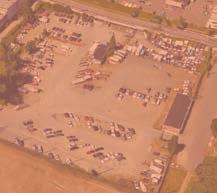


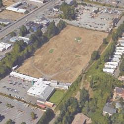

Organize parking areas and suggest vibrant path to connect Aurora Avenue and Stone Avenue.


Propose developing area as new park with active uses and wider path with lights to improve community resources and reduce crime on Stone Avenue.
Certain areas of the Evergreen Park Cemetery are proposed to have an easily accessible path from the Interurban Trail to Aurora Avenue.


Expected Future Condition
The main focus area for East – West Connection is the Golf Driving Range and Stone Avenue. According to the Seattle 2035 Comprehensive Plan, this area with in the Bitter Lake Village Hub Urban Village and the entire commercial and mixed-use and multi-family housing uses will be increased in density. This could be interpreted that the city is going to be more compact and more buildings will be built. Furthermore, a new urban village could be built around the proposed light rail station at on NE 130th ST and I-5 between Bitter Lake Urban Village and Northgate Urban Center. The potentials for an improved stormwater management system and recreation area for this densifying Bitter Lake Hub Urban Village, led to identifying the existing Golf Driving Range as a prospective area for a new park.
Bitter Lake Village Hub Urban Village
Existing Land Use Distribution
Aurora-Licton Springs
Residential Urban Village
NE 130th ST and I-5
Potential New Village
Northgate Urban Center
Comprehensive Plan Future Land Use Map (FLUM)
Urban Village boundaries and land use data: Seattle 2035, http://www.seattle.gov/dpd/cs/groups/pan/@pan/documents/web_informational/p2273587.pdf

Commercial/Mixed-Use
Single Family
Multi-Family
Industrial
Major Institutions & Public Facilities/Utilities
Parks/Open Space/Cemeteries
Vacant Unclassified
Based on feedback in meeting with community members, a playground, dog park, event / gathering space and community garden are primary program elements. A pond and wetland area to manage stormwater is proposed as well as a recreational water feature.


Organized Parking Area


Connection


Community Garden
Recreational Water Feature Dog Park
Playground Swale
Hydrology


In the future, corresponding to Seattle 2035 Comprehensive Plan, there can be significantly greater density in this area, as shown below with dashed lines. The underground bus way and new park are overlapped and connected by an open path to reduce dark space and crime. Through developing more connections and more collaborating plans among property owners, the overlapped, intertwined and interacted spaces will be increased to build a vibrant and healthy community.


Christel Game
Each year more and more species are becoming endangered and one of the most common causes for this situation is the loss of habitat. For this project, I’m seeing pedestrians as a unique species and Aurora Avenue as their habitat. Troubling crime rates, lack of infrastructure for walking, and dangerous conditions are threatening this species to the point of being endangered. This project examines the conditions contributing to habitat loss, proposes strategies to recover habitat, and provides implementation approaches using a toolkit of temporary artistic features. The short-term installations are meant to be an affordable alternative to mend the habitat by providing space, shelter, and increased movement among the species. This project defines an option that can be applied in the immediate future, positively impacting pedestrians, and serves as catalyst for future projects, initiating improved habitat conditions and setting the stage for continued and longer term improvements.
The proposed temporal installations seek to create awareness of the several problems that pedestrians faced along Aurora Avenue and the need for a better pedestrian habitat by improving different aspects such as safety, community engagement, urban play, culture, education, and movement.
SPECIES IDENTIFICATION INFORMATION:
KINGDOM
Animalia
PHYLUM Chordata
CLASS
Mammalia
ORDER
Carnivora
FAMILY
Homonidae
GENUS Homo

SPECIES
H. Sapiens
VARIATION
Seatleite Pedester
Seattle Pedestrian
(H. Sapiens var. seattleite pedester)
Based on the taxonomic rank of the human species
AREA OF INTEREST:
Seattle as a whole:
N. 105th Street
N. 100th Steet
N. 95th Street
N. 90th Street
N. 85th Street
Cemeteries
North Seattle College
New Elementary and Middle Schools
Green Lake
SPECIES IDENTIFIED ON AURORA:
Map and Data Source: WAGDA, https://wagda.lib.washington.edu/data/geography/wa_cities/seattle/index.html

Focus:
RAPID RIDE TRUCKS CARS BICYCLES PEDESTRIANS


MAIN REASONS FOR HABITAT LOSS:

There are three main reasons for habitat loss along Aurora Avenue: lack of biodiversity, unfriendly street design, and habitat fragmentation.
1. LACK OF BIODIVERSITY WITHIN THE SPECIES
ADULT RESIDENTS
GENETIC BIODIVERSITY: Is the variation in genes that exists within a species
CHILDREN RESIDENTS VISITORS LAW BREAKERS
2. DEVELOPMENT - UNFRIENDLY STREET DESIGN
DISTANCE BETWEEN EACH LIGHT POLE
The approximate distance between light poles is 125’ to 130’


HIGH LIGHT POLES
The average height of light poles on Aurora is 3 stories
NARROW SIDEWALKS
The sidewalks are about 8’ wide where they exist
HIGH VOLUME, FAST TRAFFIC
The average daily traffic is 37,950 vehicles. The average speed is 42.3 mph. The speed limit is 35mph.


FEW CROSSWALKS
The crosswalks are every 5 blocks, where traffic lights occur, e.g.: N.85th Street, N. 90th Street, N. 95th Street etc.


NO SHADE
There are few trees along Aurora between 85th and the cemeteries to give shade.
WIDE STREET
The approximate total width of Aurora Ave N. vehicle lanes is 74’


- Aurora Licton Springs Residential Urban Village
While the area outlined here is designated as a Residential Urban Village, there are limited ways for the area to function as such, especially with Aurora as a barrier that dissects the Village.
- Traffic lights and crosswalks
Painted crosswalks are provided every 5 blocks, where traffic lights occur. These become key pedestrian focal areas in need of improvement.
- Land Use
Commercial
Neighborhood Commercial School
Low-rise Multifamily
Single Family
City Owned + Open Space
Land uses along Aurora Ave. N. are commercial, with housing on either side. Key pedestrian destinations -new schools and Licton Springs Park, are located on the east of the Urban Village.
1. FULFILLING THE NEEDS OF THE SPECIES
Habitat that gets fragmented, such as by roads, may become too small and isolated to support a species’ needs.1
The “natural” habitat of the species H. Sapiens var. seattleite pedester has been cut up into fragments by Aurora Avenue N. and into focused development. This recovery startegy involves fulfilling four key need through design along Aurora Avenue.
1 National Wildlife Federation. “Habitat Loss”. http:// nwf.org/Wildlife/Threats-to-Wildlife/Habitat-Loss. aspx
2. PROVIDING HABITAT FUNCTION

The National Wildlife Federation writes, “The loss and fragmentation of habitat make it difficult for migratory species to find places to rest and feed along their migration routes.”1 Along Aurora Avenue N., the needs can be addressed by designing for pedestrian space, providing a means of shelter, and offering types of nourishment.
1 National Wildlife Federation. “Habitat Loss”. http:// nwf.org/Wildlife/Threats-to-Wildlife/Habitat-Loss. aspx

Lenore Fahrig and Merriam Gray write, “A common case of resource patchiness occurs when the habitat is divided into useable patches which are separated from one another by nonuseable habitat.”1
Along Aurora, the pedestrian patches are found primarily at the intersections where crosswalks and bus stops are located.
Lenore Fahrig and Merriam Gray write, “If a patch is isolated from other similar patches, so that immigration is minimal, and if there is a high probability of population extinction in the patch, then the probability of survival of a population in the patch will be very low.”1 The idea is to connect the habitat patches with stepping stones to constitute a HABITAT CORRIDOR in which the species can move freely.
Along Aurora, such habitat rich stepping stones can begin to extend species presence in this corridor.
This is the place where it is most likely to encounter members of the species. It is here where they gather until they are able to cross Aurora Ave N.
Highlights proximity to places, such as: schools, parks, p-patch, college, etc.

Provide a different color to identify each intersection.
Interaction is also part of the needs of this species in their habitat. This intervention allows them to have friendly conversations with people while waiting for their bus.
William Whyte uses the term “triangulation” to explain “that process by which some external stimulus provides a linkage between people and prompts strangers to talk to each other as though they were not.”1 Such features could be visual art works or interactive features, that require cooperation.

- STEPPING STONES Shelter Along the street T3
In order to mend the habitat fragmentation on Aurora Avenue N. and to connect the habitat patches, there is a need for an in-between element. The idea is to encourage the species to keep moving forward by providing micro shelter that make them feel protected and keep moving forward.
Provides visibility along the Avenue (micro shelters that lead to the intersections).
Provides a part of a story in image and text on each light pole to increase curiosity and encourage people to keep walking on the Avenue.
The following pages offer illustrative examples for short term design interventions for both habitat patches and stepping stones along Aurora Avenue North.
Playful and bright crosswalks that will help pedestrians to identify intersections and guide themselves easily around the neighborhood.

The following images were designed as artful maps of Aurora Avenue for bus stops that would provide different perspectives on existing conditions. This intervention is part of the triangulation effect in which an external stimulation provides a linkage between strangers and serves as catalyst for friendly conversations among the species. The habitat needs to provide nourishment for this species. The themes of these maps are intentional in raising questions about how the land along Aurora functions today, and who it serves.
The maps from this section are inspired by the maps in the book Everything Sings: Maps for a Narrative Atlas by Denis Wood.
Aurora Avenue was meant mainly for cars and the parking lots are proof of it. There is approximately 10.56 acres of land being used as parking lots from N. 85th to N. 105th. This amount of area is the same as 7.9 professional football fields.
What does this mean to you?
Data Source: Google Maps
A long time ago, this might have been a great dense forest. Now the tree canopy is broken almost everywhere and there are some places that there are no trees at all, like here along Aurora Avenue N. Notice the blank space that the lack of trees have left on the area.
What do you think about the amount of blank space in this map?
Data Source: Google Maps
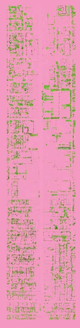
Besides the traffic being overwhelming in Aurora Avenue, here runs a river of crime. Police reports are very common in Aurora Avenue with notorious interest on the intersections. Here the two colors represent two different months in 2016. All over Aurora Avenue the most repeated crimes are 7, 17, and 27.

Why do you think there are so many police reports here?
Data Source: http://web6.seattle.gov/mnm/default.aspx?tabId=1

While it was not possible to install the artful maps within the Rapid Ride bus stops, temporary artwork is allowed on paving and utility poles under certain conditions. On May 30, 2016, the entire studio and other MLA students installed the “Parking Lots” and “Tree Canopy” artworks next to the bus stops along Aurora Avenue N. between N. 85th street and N. 105 Street, using stencils on the sidewalk with chalk and posting the artful graph on an adjacent utility pole.

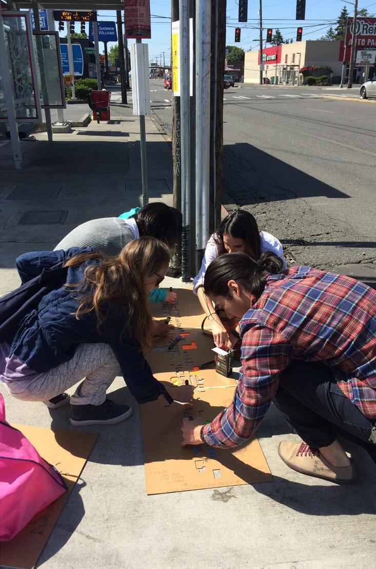
Colorful pedestrian-scaled lights mounted on white painted light poles along Aurora Avenue to increase visibility and create a playful Avenue.
Small murals and images can be integral with the lighting, and tell stories about the history of Aurora Avenue N.
Aurora Avenue N. at N. 100th, 1964

Aurora Avenue N. at N. 100th 2008
Source for 2 images above: http://blog. seattlepi.com/thebigblog/2012/01/18/auroraavenue-north-now-and-then-part-1/#photo-42712
1 http://blog.seattlepi.com/thebigblog/2012/01/18/auroraavenue-north-now-and-thenpart-1/#photo-42712


Licton Springs was once a commercial and recreational center for Native Americans. It used to be heavily forested, and filled with springs, bogs, and marshes. Small truck farms, dairies, and green houses prospered in this area. For both Native Americans and later European settlers, this area was treated as a healling center because of the springs. However, most of these are lost today. Meanwhile new opportunities are coming to this neighborhood, including three new schools which will open in 2017 and increasing population density. This design seeks to heal and revitalize the neighborhood by building a civic landscape resilient system, which merges Licton Springs’ history with future opportunities, to create a new educational, recreational, ecological and cultural center!
Historically, Licton Spring was one of several, which fed Green Lake. Today, it bypasses Green Lake in a culvert, and empties out at Lake Union
The city established Aurora-Licton Springs Neighborhood Plan, but not many changes have been seen.

1999

The city purchased the 6.3-acre property for use as a park.
1960

1893

1935

1915
1920
Pilling’s Pond has been the site of notable bird breeding feats, and has attracted people to see these birds.
1913
Genevieve
Source: Seattle Municipal Archives

AFTER 1870

1870
Native Americans (Duwamish Tribe)

Cedar, Doug-fir, Hemlock, Alder, and Willow trees abounded in the area along with ferns and salal. Every few years the Duwamish people set fires to hunt and to aid in cultivating wild plants.


Revealing the history
HEALING CENTER


Farms Forests

Recreational, Commercial Center


This site is located inside the scope of Residential Urban Village, and has experienced gentrification. However, the neighborhood lacks vitality, especially along the Aurora commercial strip.


Source: http://www.governing.com/gov-data/ seattle-gentrification-maps-demographic-data.html
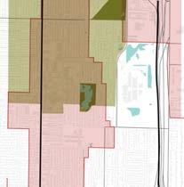
The area along Aurora lacks green spaces and tree canopy.

This neighborhood is in need for walkable streets in order to build a network that can connect to different destinations.
Source: http://web6.seattle.gov/DPD/Maps/ dpdgis.aspx
Source: Seattle Department of Transportation
The neighborhood has a valuable Native American history and several remaining cultural spots, but lacks a clear community identity.
Courtesy Seattle Municipal Archives
This master plan proposes a multifunctional path, connecting across Aurora Avenue N., through a proposed redeveloped block, and through an redesigned alley to Licton Springs Park and south on a bioswale street to new schools and Pilling’s Pond.
Map Source: WAGDA, https://wagda.lib.washington.edu/data/geography/wa_cities/seattle/index.html


In this new system, different single layers will overlay, connect and interact with each other to make this system resilient and healthy.
Diverse precedents are selected to inspire the design, including nature play, ceremony space, plaza, and street design.
Snake Lake Park, Inspiration for Stream Play
Source: http://www.erinrockery. com/detailpage.asp?ID=16368&Category=water%20features&Photo=16368b
Ika Meditation Spot, Romania. Inspiration for Ceremony Space
Source: http://landarchs.com/howika-meditation-spot-is-changing-theway-people-experience-the-naturalworld/

Roombeek The Brook, Enschede, The Netherlands, Inspiration for Stream Play
Source: http://landarchs.com/ what-makes-roombek-the-brook-aremarkable-urban-street/
Ballard’s 14th Ave NW, Seattle, Inspiration for Parking to Park
Source: http://mayflyeng.com/ projects/14th
Five Rivers MetroParks, Dayton, OH, Inspiration for Nature Play


Source: Moore, Robin C. 2014. Nature Play & Learning Places. Creating and managing places where children engage with nature. Version 1.0. Natural Learning Initiative and National Wildlife Federation. p. 91.
Maps Source: WAGDA, https://wagda.lib.washington.edu/data/geography/wa_cities/seattle/index.html
Jamison Park in Portland’s Pearl District. Inspiration for Multi-functional Plaza


Source: https://www.djc.com/news/ re/12018237.html

Through building the civic landscape resilient system, this neighborhood would become a walkable neighborhood connected by greenways and diverse attractions. And it will bring back the Healing Center history, to be a new commercial, cultural, educational and ecological center. Short term strategies are shown as vignettes here, including “Temporary Farmers Market”, “Activate the Alley”, “Add Signage for Wetland Education”, and “Parking to Park for Temporary Event”. Long term strategies are presented on the following pages.


The design uses P-Patches and green houses to recall the past farming history. Combining with the existing topography, the design also creates steps for seating, viewing, slides for play , and a splash area for kids’ activity. The interactive fountain collects the stormwater of the plaza, which can also be used as a performance space.

Multi-functional Plaza Section, looking west from central plaza
 P-Patches, Fruit Trees Steps Seatings Commercial Splash Area | Performance Space
Multi-functional Plaza, with the memory of historic people farming on site.
P-Patches, Fruit Trees Steps Seatings Commercial Splash Area | Performance Space
Multi-functional Plaza, with the memory of historic people farming on site.
Woodlawn Ave North:
Daylight the historic stream by stormwater treatment

This street used to be the route of the historic Licton Springs Creek. The design daylights the stream by installing green storm water infrastructure. Not only does it create a nice connection between the school and the park for kids, but also it helps solve the flooding issue on Woodlawn Ave N.
 Woodlawn Avenue North Plan N
The bioswale along Woodlawn Avenue North, with the memory of historic people recreating along the Licton Springs Creek.
Woodlawn Avenue North Plan N
The bioswale along Woodlawn Avenue North, with the memory of historic people recreating along the Licton Springs Creek.
This proposed pond is a core node which connects the Aurora commercial area, Licton Springs Park and the new school. Instead of directly diverting the water to the underground pipe, the design reclaims the historic springs with a pond by making use of the water on site for habitat and educational activity. Native Americans used to drink or immerse in the spring for its healing functions.

Map Source: WAGDA, https://wagda.lib.washington. edu/data/geography/wa_cities/seattle/index.html


Wenying Gu
There are a lot of open spaces in the Licton Springs Neighborhood, but they are disconnected. My goal is to connect the existing bike trails, and nearby open spaces such as parks, p-patch gardens, and schools to the Licton Springs community through street redesign of Aurrora Avenue N., N. 100th Street, Stone Avenue N., Ashworth Avenue N., North 92nd Street, North 90th Street, and the alleys along Aurora Avenue N. This will create community networks through the connections among these redesigned streets. The community networks will make the community safer, more playful and environment-friendly, as well as enhance the community identity.

N 102nd St Oak Lake School Pedestrian Bridge (past and current)
Images Source: http://seattle.curbed. com/2014/11/14/10023254/cornerspotted-102nd-and-aurora
Blue Star Memorial Highway
Markers on Aurora Ave
Image Source: http://www.waymarking. com/waymarks/WM1X26_Highway%20 _99_Aurora_Ave_Seattle_WA

In 1913, much of the road was paved with bricks. By 1928 all the bricks were replaced with concrete.
Source: http://www.liquisearch.com/licton_ springs_seattle/european_settlement
The Aurora-Licton Springs area was once heavily forested, and filled with numerous mineral springs, bogs, and marshes.
Northgate Pedestrian and Bicycle Bridge Project will connect people over I-5 to the Northgate Light Rail Station.
Source: SDOT. “Northgate Pedestrian and Bicycle Bridge”. http://www.seattle.gov/transportation/northgatepedbridge. htm

Only remaining spring in Licton Springs Park.
New schools are under construction on N 90th St.
OPEN SPACES
Schools
Seattle City Lights
Parks/P-Patches/Pilling’s Pond
Historical Places
Existing bike trails Proposed bike trail/Greenway


TRAFFIC VOLUMES
TOTAL TRAFFIC Through Intersection (Morning Peak Hour)
EXISTING 2013
PREDICTED 2017 After Schools open
Traffic Volume (vehicles) LOW HIGH
Urban Village
Map Source: WAGDA, https://wagda.lib.washington.edu/data/geography/wa_cities/seattle/index.html
DESIGN CONCEPT

* Data Source: “Transportation Technical Report for New Wilson-Pacific Elementary & Middle Schools”, March 5, 2014 Prepared by Heffron Transportation Inc. for Seattle Public Schools.
OPEN SPACES
- parks
- schools
- P-Patches
- shopping center
- ...
Map Source: WAGDA, https://wagda.lib.washington.edu/data/geography/wa_cities/seattle/index.html
STREETS
- greenways
- safe routes
- historical corridors
- water streets
- alleys
- ...
COMMUNITY NETWORKS
Aurora Ave N+Oak Tree Village Footbridge
- integrate history into the street design


- revive the underused footbridge
- create a kids play area in Oak Tree Village

N 100th St+Stone Ave N+N 92nd St+N 90th St

- add protected bike lanes
- shrink the travel lanes
- add planter buffer
- make sidewalks more playful
Alley between N 97th St & N 98th St
- activate the empty alley
- hold activities which connect to the neighborhood
Ashworth Ave N
- connect people to the Licton Springs Park
- add rain gardens along the sidewalk
Proposed Street Redesign

Map Source: WAGDA, https://wagda.lib.washington.edu/data/geography/wa_cities/seattle/index.html
Interurban Trail Source: SDOT map http://www.seattle.gov/transportation/docs/2015Bikemap.pdf
HISTORICAL CORRIDORS TYPOLOGY

AURORA AVE N + OAK TREE VILLAGE FOOTBRIDGE
OAK TREE VILLAGE FOOTBRIDGE HISTORICAL CORRIDOR PLAN


Hopscotch on the Footbridge (recalling the historical school ) Slide (connecting to the bridge)
Mound (playing area)
Resilient Play Surface

Blue star pavement (referring Blue Star Memorial Highway)
Brick Pavement (referring the history of Aurora Ave)

GREENWAY + SAFE ROUTES FOR KIDS TYPOLOGY
N 100TH ST + STONE WAY N+ N 92ND ST + N 90TH ST
N 100TH ST PLAN (SOUTH OF OAK TREE VILLAGE)


MOVABLE BENCHES
Movable Benches
Porous Concrete Grass
Benches & Tracks
Movable Benches (Recycled Materials)

Planters
Bike Lanes
Bollard (height: 2’)


EXISTING SECTION FOR N 100TH ST AT OAK TREE VILLAGE, LOOKING WEST
PROPOSED SECTION FOR N 100TH ST AT OAK TREE VILLAGE, LOOKING WEST


Bike lanes
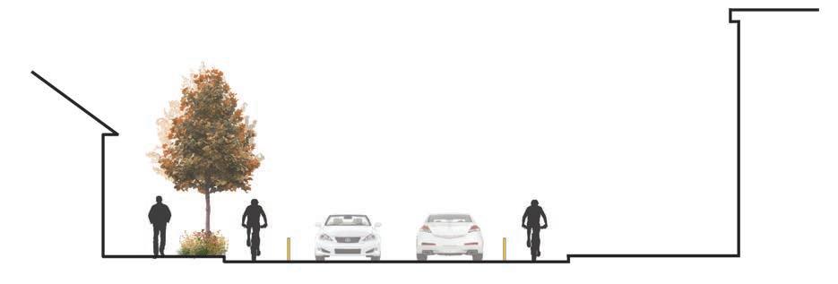
Planters & Benches
PROPOSED SECTION FOR N 100TH ST CONNECT TO I-5 PEDESTRIAN BRIDGE, LOOKING EAST
ALLEY FESTIVAL SPACES


ALLEY BETWEEN N 97TH ST & N 98TH ST
ALLEY BETWEEN N 98TH ST & N 97TH ST
Movable benches with planters (recycled materials)

Brick pavement (historical)
Food bike
Blue star pavement

PROPOSED SECTION FOR ALLEY
ART WORKS

STRING LIGHTS
MOVABLE BENCHES (WITH PLANTERS)


Trees
Amur Maple (Acer ginnala ‘Flame’)
Image Source: http://www.verderivergrowers.com/tag/ginnala/
Shrubs/Ground cover
Red Oak (Quercus rubra)


Image Source: http://plants.gertens.com/12070009/Plant/384/ Northern_Red_Oak
Grass
Blueberry (Vaccinium spp.)
Chokeberry (Photinia spp.)

Rose Bay (Rhododendron Maximum)

Image Source: http://www.naturallandscapesnursery.com/rhodo. html
Lilacs (Syringa spp.)
Trees/shrubs

Rain gardens
Blue Fescue Grass (Festuca spp.)

Image Source: https://www. shelmerdine.com/product/ blue-fescue-grass/
Fountain Grass (Pennisetum alopecuroides)

Great Blue Lobelia (lobelia siphilitica)

Snowberry (Symphoricarpos spp.)
Image Source: http://forums.steves-digicams.com/close-ups/162481-symphoricarposalbus-snowberry-waxberry.html

The project is a proposal to address the issues of physical, visual and programmatic disconnection occurring in North Seattle, especially in the Licton Springs-Haller Lake Neighborhood. As one of the areas which has the least improved sidewalks in the city, North Seattle is a pedestrian’s nightmare. The construction of the proposed pedestrian bridge across I-5, part of “Move Seattle” projects, to connect with the future Northgate Light Rail Station will improve transit access to the growing population in this area. So this project explores how to comfortably connect the community with efficient mass transit, and at the same time propose a central public space to activate and reclaim the identity of the whole community.
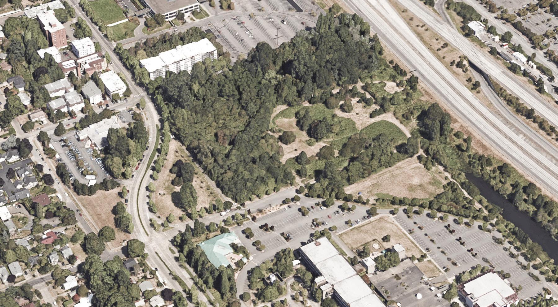
The site I examine is just west of I-5, and the Northgate Light Rail Station that under construction. Seattle Mayor Murray’s 10-year strategic vision for transportation, “Move Seattle”, proposes a pedestrian bridge across I-5 from the Northgate Light Rail Station to the Bartonwood. The bridge has been funded, and it is proposed to be built by 2018. The Seattle Urban Village map shows that it is located between the Northgate Urban Center and Aurora-Licton Springs Residential Urban Village so there is no doubt the pedestrian bridge and light rail station will support increased population and density in Licton Springs.

Source: SDOT

Source: SDOT
Source: City of Seattle
Source: City of Seattle

Source: U.S. Census Bureau

Images Source: “North Campus Parcel Characterization Report North Seattle College, Seattle Washington”. February, 2015. John Figge.


CarOriented Community

Poor Accessibility

Underutilized Resources


Lack of Connection to facilities
Lack of Community Identity

Map Source: WAGDA, https://wagda.lib.washington.edu/data/geography/wa_cities/seattle/index.html
If we zoom out and focus on the north part of Seattle, we see that this site plays a pivotal role in it’s central position relating to different open spaces and ecological corridors. The site now has several big problems. First, it is a car-oriented community, so it has poor pedestrian accessibility. Second, the existing great resources in Bartonwood wetland has been underestimated. Third, becuase of the lack of sidewalks in this area, there is a disconnection with basic facilities. Fourth, the neighborhood lacks community identity and gathering space.


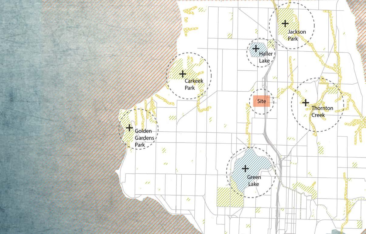
Based on the site analysis and research, I developed the three pronged strategy of Move-Stay-Engage. The first, Move, is to promote walkablity and bikability in this area with the construction of the light rail station and pedestrian bridge. Second, Stay, is undertaken through development of a community center and park on the Old Police Station site and renovation of Bartonwood Wetland to create places for people to enjoy recreational activities and a wetland habitat. Finally, Engage, occurs through the community events and activities flourishing at the proposed community center, outdoor learning areas, and pedestrian bridge plaza. Everyday activities and special events can instigate and support people’s engagement in the sustainable development of the larger community.


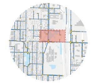


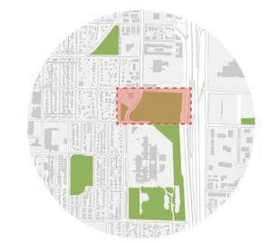
Users
Commuter Lack of sidewalks
Improve walkability
Student
Lack of recreation place
Create more recreation place
The Disabled
Lack of accessible facilities
Provide ADA path
Elders
Lack of seats Add multiple places to sit
College Student Lack of learning opportunities outside
Improve outdoor learning facilities
Community
Urban Village Boundary

Lack of place for community events Create multiuse community center
UW MLA Capstone Studio 2016 181
Aerial photo: Google EarthThis master plan shows how the light rail station and pedestrian bridge designed by consultant teams relate to the Bartonwood wetland, and my proposal for a plaza, the wetland and a new community park. At the bridge landing, there will be a plaza with some seating and flexible space that could allow food trucks to park. This plaza could promote local micro-businesses and support safety in this area through this activity. For the old police station parcel, I remove the old police station building from the low elevation and design a new community park with wetlands and a community gathering and learning center on the high elevation along N 100th Street, where a planned greenway will connect the community to the light rail. In the Bartonwood, I redesign and renovate the trail system. A raised grating mesh boardwalk could reduce the compactness of the soil, and allow the growth of the vegetation underneath it. The straight boardwalk routes create more direct views, and promote interaction with people in the Bartonwood and the surrounding uses.

Map Source: WAGDA, https://wagda.lib.washington.edu/data/geography/wa_cities/seattle/index.html
Bridge Design Source: http://www.seattle.gov/dpd/cityplanning/designcommission/cs/groups/pan/@pan/@designcommission/documents/web_informational/p2331274.pdf

DESIGN DIAGRAM

1. Existing Condition- Police Station at Low Elevation
2. New Building- Community Gathering and Learning Center
3. Connections- Paths Connect with Surrounding Streets and Park Features

4. Wetlands- Terraced Wetland


5. Places- Varied Play Spaces
Map Source: WAGDA, https://wagda.lib.washington.edu/data/geography/wa_cities/seattle/index.html


The proposed circulation system and stormwater management directly respond to the “Move” strategy, connecting the community with the city and ensuring the resiliency of the stormwater system.

The plan aims to create a diverse and livable neighborhood that is safe and supports social, cultural and ecological functions. Both humans and wildlife have their livable habitats.


The core interest of the design is to enhance the cultural identity of the community, through the creation of a series of anchor elements and the provision for outdoor learning.


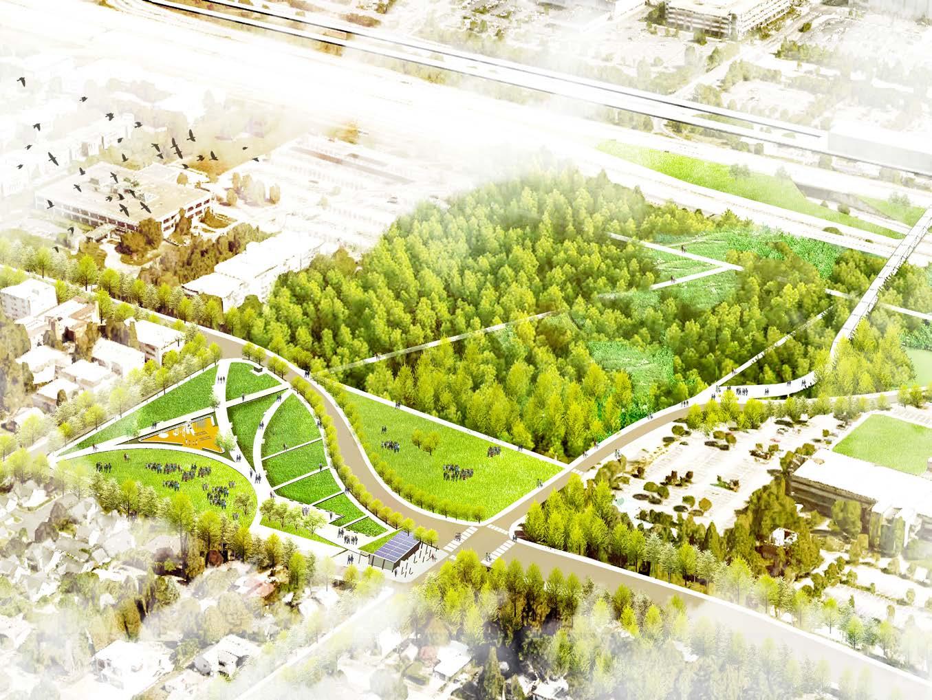
Apart from protecting some of the existing native species like Red Alder, the design also introduces some native vegetation that has the resiliency to adapt Seattle's weather, which is very dry in the summer, and rainy in the autumn and winter. This vegetation is envisioned to create a series of habitat conditions conducive to different wildlife, shown in the diagram below.

Bald Eagle
Heron
Pelican
Bewick Wren
Blue Martin
Pyrus
Osoberry
Snowberry
Willow
Dogwood
Hardhack
Sword
Rush
Salal
Rosa
Iris
Slough Sedge
Umbrella Plant
Pacific Wren
Bushtit
American Robin
Humming Bird
Little Brown
Dragonfly
Bee
Warbler Butterfly
Raccoon
Beaver
Wood Duck
Salamander
Pacific Tree Frog
Tadpole


In order to reconnect people with the natural environment, as well as improve social interactions within Licton Springs-Haller Lake Neighborhood, this activity typology study illustrates a diversity of choices for community members. There are basically two activity types that the design intentionally facilitates: one is more prescriptive as the designated place for children to play, community members to interact, and commuters to walk through, like the playground, community plaza and pedestrian bridge. The other one is more flexible and spontaneous, which engages people to create a better community, like movie night, farmer’s market and outdoor learning.


Stormwater management will benefit the community in myriad ways. The proposed system. integrates the existing topography with native vegetation, to provide resilience and a more sustainable landscape that improves wildlife habitat. Also the designs explore how to connect green infrastructure in this area to accept stormwater runoff from the community center rooftop and roads.


This MLA Capstone Studio was envisioned to engage community members throughout the design process, such that we would learn early on of the neighborhood’s challenges and potentials and gain insights on the design proposals we develop. We are grateful to all the members of the Licton Springs-Haller Lake Neighborhood who met with us and gave us feedback at community meetings and design presentations. We also appreciate the insights we received from institution and agency representatives, design and planning professionals, and faculty. Our work grew more meaningful and inspired, thanks to all of you.
Special recognition goes to Lee Bruch with the Licton-Haller Greenways group, who has been a continued resource and supporter of the studio’s endeavors. Thank you for organizing our community meeting in January, for taking part in several of the presentations, and forwarding relevant material and opportunities to us along the way. Your help and insights were tremendous!
We thank Northgate Elementary, Hazel Wolf K-8 PTSA, UW Department of Landscape Architecture, Lowes, Cedar Grove, and Nathan Hale High School Horticulture Program for their support for materials to create the planters and murals at Northgate Elementary.
Thank you to all who shared ideas with us at the community meeting, design presentations or studio sessions, including (in alphabetical order):
Leah Anderson, Aurora Licton Urban Village
Leann Andrews, UW Landscape Architecture faculty
Rachel Berney, UW Urban Design and Planning faculty
Lyle Bicknell, Seattle Office of Planning and Community Development
Phoebe Bogert, Place
Jim Brennan, J.A. Brennan Associates
Lee Bruch, Licton-Haller Greenways
Jan Brucker, Licton Springs Community Council
Dongho Chang, Seattle Department of Transportation
Sue Costa Paschke, ELM Environments
Amy Cragg, GGN
Mike Cuadra, Licton Springs Community Council
Marty Curry, UW Urban Design and Planning faculty
Melanie Davies, Licton Springs Community Council and MIG | SvR
James Davis, Feet First
Gretchen DeDecker, Seattle Public Schools
Jim Diers
Shannon Glass, Seattle Department of Transportation
David Graves, Seattle Parks and Recreation
Laure Heland, UW Landscape Architecture affiliate faculty
Joanne Ho, Haller Lake neighbor
Sharon Holt, Aurora Licton Urban Village
Brock Howell
Jeff Hou, UW Landscape Architecture Chair
Liz Kearns, Licton Springs Community Council
Kas Kinkead, Cascade Design Collaborative
Amy Lindemuth, Mithun
Justin Martin, Greenwood Phinney Greenways
Anna O’Connell, Swift Company
Deidre Palmer, Northgate Elementary
Katie Pearl, Northgate Elementary
Robin Randels, Greenwood Phinney Greenways
Ashley Rhead, Seattle Department of Transportation
Iain Robertson, UW Landscape Architecture faculty
Dave Rodgers, MIG | SvR
Chris Saleeba, Alta Planning + Design
Katy Saunders, Makers
Alex Stone, Licton-Haller Greenways + National Park Service
Lori Tang, Site Workshop
Cathy Tuttle, Seattle Neighborhood Greenways
Thomas Whittemore, Seattle Department of Neighborhoods
Fred Young, Alta Planning + Design
Suzi Zook, Licton-Haller Greenways
and all whose names we didn’t get at the Open House and other events.
Completing temporary art installations on Aurora Avenue North on May 30, 2016. Studio group [Christel Game, Jiaxi (Jessie) Guo, Chih-Ping (Karen) Chen, Zhehao Huang, Wenying (Winnie) Gu, James Wohlers, Will Shrader, and Seongwon Song] led by Julie Johnson (right last row) plus Kenna Patrick and Arisa Nakamura (center front row). Thanks to the person crossing the pedestrian bridge who kindly took photos of us!

University of Washington
Department of Landscape Architecture
