PREPARING FOR
EXTREME STORMS Sarah Sell and Dyllan Furness
Scientists at USF are a valuable resource when it comes to forecasting hurricanes and identifying climate risks in vulnerable coastal communities. Whether it’s a deep-diving ocean glider that captures key data about a storm’s intensity or a community-based web application that predicts flooding, their research and use of advanced technology is garnering attention nationwide.
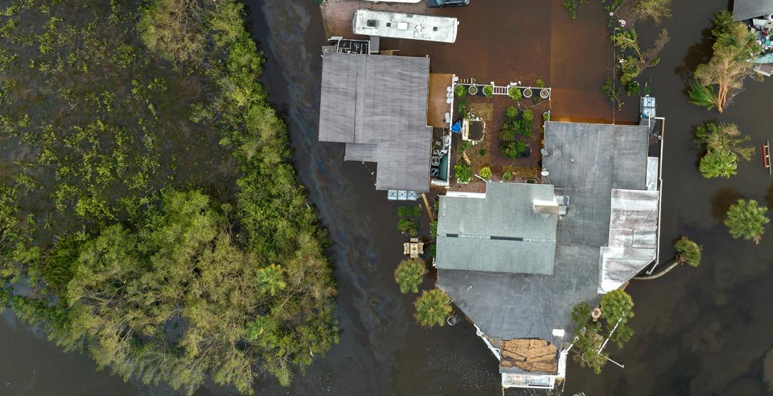
PROTECTING VULNERABLE NEIGHBORHOODS BY CROWDSOURCING DATA A $1.5 million National Science Foundation grant will allow researchers to develop a web-based application that gathers crowdsourced data in coastal communities to identify flooding risks and inform policy. Led by USF St. Petersburg GIS and Remote Sensing Professor Barnali Dixon, the research team will create the CRIS-HAZARD app. The app will combine volunteered geographic information and community crowdsourced data such as photos and videos with near real-time data on flooding. Using dynamic modeling and mapping tools, including artificial intelligence, the app will identify and extract estimated water elevation for near real-time flood models that can inform emergency managers and policymakers. “To develop a custom policy that meets the needs of each unique community, you need
14 | INNOVATIONS MAGAZINE
to know the data,” said Dixon, who is also executive director of USF’s Initiative on Coastal Adaptation and Resilience (iCAR). “The power of this system is that it allows us to see the needs of these communities on a very granular scale, so you can then put policies in place.” The new app, which will provide an interactive user experience, is based off the existing Community Resiliency Information System (CRIS), a website created in 2020 by iCAR. The CRIS platform leverages crowdsourced data to identify climate-related vulnerabilities in local communities. Residents can input information related to issues such as flooding and power outages. The information can be used by policymakers and neighborhood leaders to make decisions about policy and resource allocation. The data also allows emergency managers to identify areas with concentrations of people who need transportation assistance or are reliant on power for medical needs. Dixon has been working with community leaders in south St. Petersburg neighborhoods for several years, where residents have successfully used the system to prepare for extreme storm events. Through the CRIS website, participants can view maps and see their risk of storm surge and sea level rise. They can also share their own information and suggest ways to improve the system.
“We have used the application at all our community town halls,” said Erica Hall, executive director of the Florida Food Policy Council. “As a community leader and liaison, this will help communities tremendously to understand the connection between sea level rise, climate change, extreme heat and coastal flooding. Some coastally vulnerable neighborhoods also show food insecurity, health disparities and environmental justice concerns. Having CRIS map those concerns tells a story that will allow the community to understand.” After Hurricane Ian in 2022, Dixon and her team used GIS to map areas identified as coastally vulnerable communities that experienced inequitable access to disaster relief and assistance but also showed that the neighborhoods were food insecure. Some of them were without power and food for much longer than they should have been. As principal investigator, Dixon is developing the new application alongside co-principal investigators Yi Qiang from USF and two others from Georgia Tech, Subhrajit Guhathakurta from the College of Design and Peng Chen from the College of Computing. The research team will continue to work with community partners in St. Petersburg’s Childs Park and expand to other coastally vulnerable areas of Pinellas County, including Shore Acres, West and East Lealman and Bahama Shores.