URBAN DESIGN PORTFOLIO UROOJ
u56khan@uwaterloo.ca www.linkedin.com/in/uroojk/

KHAN
year urban planning student, with strong interests in sustainable urban design and land development. Photography has been my muse ever since I was a kid, and through it I became fascinated with cities.

Urooj Khan Urban Design Portfolio 2
Urooj Khan Urban Design Portfolio 3 PROJECT PAGE 01 EV3-REC REIMAGINING CAMPUS RECREATION 04 02 GORE PARK NEIGHBOURHOOD ANALYSIS 10 03 70 CAROLINE ST REDEVELOPMENT 16 04 URBAN MAPPING 18 05 PORTRAIT PHOTOGRAPHY 20
TABLE OF CONTENTS
01 EV3 REC: REIMAGINING CAMPUS RECREATION
Year: 2023
Location: Environment 3, University of Waterloo
Status: Complete
Software: Photoshop, Illustrator, CADMapper, SketchupPro, Enscape
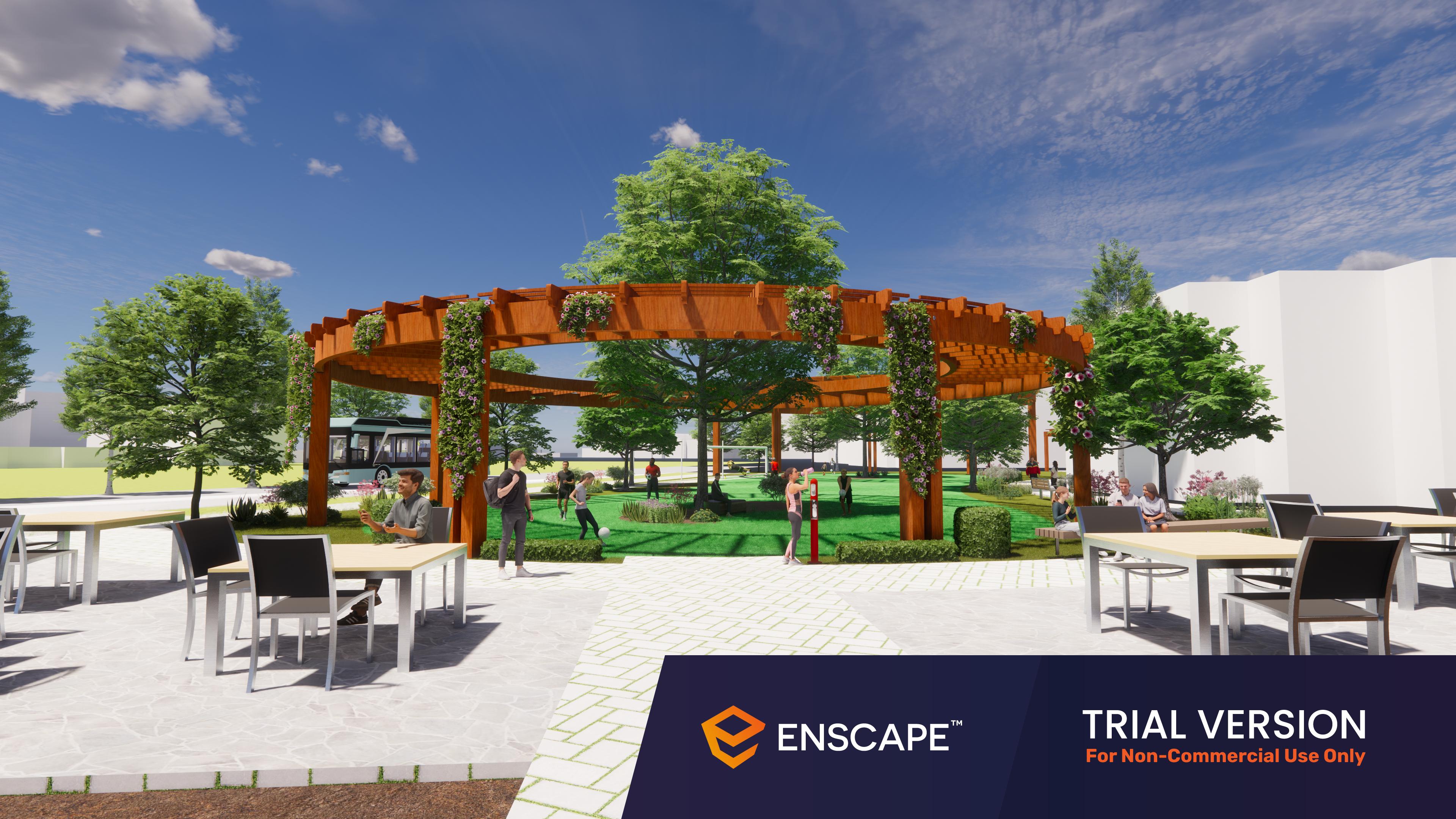
This project aimed to revitalize an empty outdoor space on campus and turn it into a purposeful greenspace. EV3-Rec is a proposed outdoor recreational space that will bring life back to outdoor spaces on campus. The focal point for the site is a turf space that can transform into an ice rink during the cold seasons, providing year-round recreational opportunities. The proposed project incorporates key design objectives to create a sustainable, active, and community-oriented environment.

Urooj Khan 4 01 EV3-REC: Reimagining Campus Recreation

5 Urooj Khan 01 EV3-REC: Reimagining Campus Recreation
Cross Section
Site Plan


Urooj Khan 6 01 EV3-REC: Reimagining Campus Recreation
Vegetation
Proposed Structures

Activity Spaces
Circulation
Site Context
7 1 EV3-REC: Reimagining Campus Recreation

Urooj Khan 8 01 EV3-REC: Reimagining Campus Recreation
Final Render

9 Urooj Khan 01 EV3-REC: Reimagining Campus Recreation
02 GORE PARK NEIGHBOURHOOD ANALYSIS
Year: 2022
Location: Hamilton, Ontario
Status: Completed
Software: CADMapper, Illustrator, SketchupPro, VRay, Chaos Cosmos
This project aimed to analyze Gore Park in Hamilton, and its surrounding neighbourhood, to understand the site’s context within the city. Data retrieved from Statistics Canada (2021 Census) and the City of Hamilton, was used to understand the residing population and the current built form. All research and process work was used to create a digital contextual appraisal and a 3D render.

Census Tract # 5370036 % of population change between 2016-2021 30.9 Population density (per square km) 8,892.8 % of single detached homes 4.1% % of apartment buildings with 5+ storeys 76.7% % of apartment buildings less than 5 storeys 11.8% % of apartments in flats/duplexes 2.7% Prevalence of low-income in 2020 (LIM-AT) 25.5% Average shelter costs for private households (cad) $1,177.0 % of households spending >30% of income on shelter costs 41.3% % of population speaking non-official language at home 33.9% % of population with indigenous identity 2.2%
Urooj Khan 10 02 Gore Park Neighbourhood Analysis

Process Work - Hand Drawings


Urooj Khan 12
02 Gore Park Neighbourhood Analysis
Figure Ground
Contextual Appraisal
Focal Area
Transit Hub

Minor Node
Major Node

Sun Path

Minor Path
Major Path
Urooj Khan 13 02 Gore Park Neighbourhood Analysis
Eye Level Render

Urooj Khan
14 02 Gore Park Neighbourhood Analysis
Analysis Findings
As per the Official Plan, Gore Park falls into the Downtown Urban Growth Centre. The Official Plan anticipates that this area will accommodate approximately 20% of the city-wide residential intensification, leading to 5,000-6,000 new dwelling units. With significant economic potential, the Official Plan suggests that this area can scale to a minimum overall density of 250 persons/jobs per hectare.
Turning to Volume 2 of the Official Plan, we can find the Land Use Plan, which designates Gore Park as a city-wide park and a key civic gathering space. The surrounding buildings are all identified as mixed use downtown buildings and range between low to medium rises. The land use plan also a high-order transit station at the north corner of the park, at the intersection of King Street and James Street. The site has its own Secondary Plan that allows for more detail on policies and guidelines for development in this neighbourhood.

15 02 Gore Park Neighbourhood Analysis
Final Render


Urooj Khan 03 70 Caroline St Redevelopment
Elevation View
Eye level 1
70 CAROLINE ST REDEVELOPMENT
Year: 2022
Location: Waterloo, Ontario
Status: Completed April 2022
Software: SketchUp Pro, V-Ray, Chaos Cosmo

This was a first year project aimed to revitalize a parking lot located in Uptown Waterloo. Gehls’s Quality Criteria were utilized to create a welcoming mixed-use space for the public, while also getting familiar with professional design tools. The site features 6 storeys of office space, 5 units of retail space, and 1 greenspace protected from vehichle traffic.

Eye level 2

03
Urooj Khan 03 70 Caroline St Redevelopment
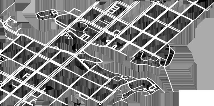
NEIGHBOURHOOD MAPPING

Year: 2022
Location: Oakville, Ontario
Status: Completed
Software: CADMapper, AutoCAD, Photoshop
04
Urooj Khan 18 0 4 Neighbourhood Mapping


Urooj Khan 19 0 4 Neighbourhood Mapping
Year: 2022
Status: Completed
Software: Lightroom

05 PORTRAIT PHOTOGRAPHY
Urooj Khan 20 05 Portrait Photography


21 Urooj Khan 05 Portrait Photography


Urooj Khan 22 05 Portrait Photography


23 Urooj Khan 05 Portrait Photography


