LOMASBOULEVARD/UNMCAMPUS
Design concepts for Lomas Boulevard in relation to the University of New Mexico and adjacent areas
Urban Design/ Planning Studio
in conjunction with Design Planning and Assitance Center
School of Architecture and Planning
University of New Mexico
March 1 to May 1, 2002
This document was developed, produced and made available by students in the School of Architecture and Planning at the Universtiy of New Mexico. You are free to copy any or all portions for use in the public interest and credit is given to the source.
For duplicate copies in color please contact Mark Childs, Director of Design Planning and Assistance Center at (505) 277-5050 or email mchilds@unm.edu
i
LOMASBOULEVARD/UNMCAMPUS
Design concepts for Lomas Boulevard in relation to the University of New Mexico and adjacent areas
Concepts for the enhancement of the portion of Lomas Boulevard through and serving the North and Central campuses of the University of New Mexico, adjacent neighborhoods and the City of Albuquerque.
StudioInstructors
Paul Lusk, Associate Professor of Architecture and Planning
Mark Childs, Director, Design Planning and Assistance Center
Urban Design/ Urban Planning Studio
StudioMembers
Urbanics: John Carriere
Christine Coonen
Christel Haught
Beate Ortley
Lomas 13: Claudia Castio
Patrick Shanahan
Keith Vlastos
J.Y.D. Jonathan Chamblin
Cory Collins
Suzanne King
Michael Safrany
Studio Mentors
Jon Messier, Senior Planner, Albuquerque Planning Department
Tom Murphy, Transit Planner, Albuquerque Transit Department
ii
Advisor and Guest List
We would like to acknowledge the following people for their advice and counsel during this eight-week urban planning and design studio.
George Anselevicius UNM faculty emeritus
Sabra Basler UNM staff
Kent Beierle Environmental Dynamics Inc.
Douglas Bell SAAP staff
Gil Berry UNM Facility Planning
Frances Blair North Campus Neighborhood Assoc.
Ed Boles City of Albuquerque Planning Dept.
Steve Borbas UNM Facility Planning Dept.
Chris Calott UNM faculty
Mark Childs UNM faculty
Katie Crawford Campus Neighborhood Planning Assoc.
Julie DeHaven UNM student
Stephen Dent UNM faculty
Alexandra Fajardo SAAP Resource Center
Randall Fleming UC Davis faculty
Lee Gamelsky Lee Gamelsky and Assoc.
Mardon Gardella Spruce Park Neighborhood Assoc.
John Hooker Mayor, Village of Los Ranchos
Joe McKinney UNM Facility Planning
Kappu Iyengar UNM faculty
Howard Kaplan Wilson and Company E/A
Pam Hurd-Knief SAAP Development Officer
Mary Kenney Health Sciences Center Facility Planning
Franz Leitner UNM Student
Jim Lewis UNM faculty emeritus
Cheryl Martin UNM staff
Shelley Maynard UNM student
David Meirtschin UNM faculty
Katie Maguire UNM student
Jon Messier City of Albuquerque Planning Dept.
Tom Murphy City of Albuquerque Transit Dept.
Malia Oren UNM student
Robert Peters Peters, Robert, FAIA
Antoine Predock Predock, Antoine FAIA
David Riley DCSW Architects
Mark Schiff DCSW Architects
Larry Schuster UNM Utilities Engineer
Douglas Shaw UNM student
Alf Simon UNM faculty
Manjeet K. Tangri City of Albuquerque Planning Dept.
John Throne John Throne, Architect
Chris Wilson UNM faculty
Tom Vliet UNM graduate student
iii
UNM was founded in 1889 on the north side of Central Avenue, about two miles east of downtown Albuquerque. At the time, the people who made the decisions thought that the University was far enough from the growing city downtown to avoid future planning problems. Now the campus area is defined and surrounded by the City of Albuquerque. In 1908 the UNM president, William George Tight, thought that the Southwest adobe style should be adopted as the official building typology for the all structures on the campus. In 1918 a Chicago architecture firm suggested that a network of buildings be constructed around plazas and courtyards consistent with the Pueblo style. This style, called Pueblo Revival, was reflected in the homes and structures in the surrounding neighborhoods and throughout the city. As the city grew Lomas Boulevard has evolved into an alternate major east-west thoroughfare connecting the downtown area of Albuquerque through the University of New Mexico.
TABLE OF CONTENTS Introduction v Urbanics 1 Lomas 13 9 J.Y.D. 17 iv page #
BACKGROUND
Introduction:
This document summarizes the work of an eight-week study of the physical setting and possible concepts for enhancement of the portion of Lomas Boulevard east from Interstate 25 to Girard Boulevard. The primary features of this section of Lomas Boulevard are the University of New Mexico North and Central campus, the University Health Sciences Center and the residential neighborhoods. The analysis and concepts proposed were developed by students in a combined graduate Urban Design studio, Arch 503, the Urban Planning studio, CRP 520, in partnership with the Design Planning and Assistance Center studio, spring semester 2002, at the University of New Mexico, School of Architecture and Planning.
Context:
Lomas Boulevard is now a six lane major arterial connecting the historic and business centers of Albuquerque. These centers include: the State Fair Grounds,downtown Albuquerque, the University of New Mexico, and the University Health Science Center. Lomas Boulevard also connects these historic and business centers with large residential areas in the northeast heights. Lomas was designated an “Enhanced Transit Corridor”, on the Centers and Corridors Plan adopted in February of 2002 by the City of Albuquerque and by Bernalillo County. In the area of the University of New Mexico, Lomas provides important gateways from both east and west but, due to its 100 feet right-of-way and its high traffic volume, creates a barrier to pedestrian activity and north-south campus connections.
Objectives:
The overall objectives of the studio were to analyze the multiple issues relating to this setting and to propose concepts for enhancement of this portion of Lomas Boulevard and adjacent areas. The goals of the study were to:
provide a better physical environment for pedestrian, bicycle, and transit users. provide for vehicular capacity consistent with existing demand improve capacity for right and left turns regulate traffic flow thru sequential traffic lights provided enhanced transit capacity by providing a designated lane for an improved bus or rail system including pay-to-enter bus waiting-shelters for rapid transit exchanges create a connection with open and green spaces between North and Central campus provide clear and compatible edges consistent with the character of the University areas.
v
Neighborhood Association Interviews and Community Context
Interviews in Neighborhood Associations
As part of the analysis and research we met with representative of the neighborhood associations called F.U.N, an acronym for the Federations of University Neighborhoods. Our interviews explored the relationship between Lomas Boulevard and the surrounding areas. The people interviewed brought to our attention some concerns that we had not considered. This allowed the opportunity for the creation of three pedestrian pathways connecting the major neighborhood areas, the elementary schools, Jefferson Middle School, and Albuquerque High school with each other and to the campus and transportation nodes.
SpruceParkNeighborhood Association
Mardon Gardella is active in the Spruce Park Neighborhood Association and is a participant on the board of the University Campus Planning Committee. She is concerned, that the existing zoning laws in place are upheld. She would also like to see pedestrian pathways in place that school age children can use that are safe and attractive.
CampusNeighborhoodAssociation
Katie Crawford, a member of the Campus neighborhood association, is a native New Mexican. She would like to see the Lomas Boulevard area designed to be more pedestrian friendly. She read about Curitiba, a city in Bazil, which has successfully planned for transportation, public spaces and pedestrian networks. She would like to see some of the same ideas from Curitiba, used in Albuquerque.
NorthCampusNeighborhood Association
Mike White has lived in his house in the north of Lomas on Girard since 1947. He is a retired Albuquerque Public School principal. He built the house himself and he and his wife raised two children there. He is very worried about the heavy traffic on Girard Boulevard. Mike believes that slowing and reducing the traffic on Girard is a major concern for the neighborhood quality of life.
Frances Blair is a pharmacist and has lived in the north campus area since moving to New Mexico from Kansas. Her major concern is the preservation and careful use of the city’s water resources. She believes that the City of Albuquerque has been slow in responding to the wasteful use of our water supply. She would like to see see a limit set statewide on per household water use and education about water usage.
vi
Related Plans and Resource Documents:
The following documents provided content basic to the development of this document
Campus Development Plan, University of New Mexico, Albuquerque, Barton Myers Associates, fall 1996
University West Concept Plan, University of New Mexico, Albuquerque, Barton Myers Associates, fall 1997
Visions for an Intergenerational Community, University Village Studio, School of Architecture and Planning, University of New Mexico, 1997
“ SoLo”, Urban Design Charette, South of Lomas, University to Interstate 25, Urban/Design Planning Studio, SAAP , UNM, February 2000.
The Solo Project, an Urban Oasis in the 21st Century, Urban Design/Urban Planning Studio, SAAP , UNM, spring semester 2000.
Energy Conserving Site Design, Greenbrier Case Study, US Department of Energy, Contract No. AC01-78CS24216, April 1080
Draft Scoping Report , Lomas Boulevard, City of Albuquerque, Public Works Department, Gannett Fleming West, Inc., November 1994.
Casas Grandes, A Fallen Trading Center of the Grand Chichimeca, Charles C. DiPeso, et al, Amerind Foundation, Dragoon, Arizona, 1974
“Porous Paving”, Kim Sorvig, Landscape Architecture, pp66-69, February1993
Start at the Source, Design Guidance Manual for Stormwater Quality Protection, Bay Area Stormwater Management Agencies Association (BASMAA), 1999
Centers and Corridors Plan, Amendment to the Albuquerque/Bernalillo County Comprehensive Plan, Albuquerque Planning Department, November 2001
High Capacity Transit Project, Study Report, City of Albuquerque Transit Department, Parson/Brinkerhoff, February 2002.
vii
DESIGN ISSUES:
- Connection between North and South Campus
- Pedestrian paths between the two campuses
- Development of Lomas Boulevard
- Development of businesses on Lomas
- Transportation
DESIGN GOALS:
- Boulevard enhancement
- Business Corridor
- Transportation nodes
- Pedestrian Paths
- North - South campus connection
Lomas Boulevard from I-25 east to Girard
1
Urbanics Vision of Lomas Boulevard
John
Carriere / Chris Coonen / Christel Haught / Beate Ortley
Left to right: Beate Ortley, Manjeet K. Tangri, Christel Haught. Mary Kenney
CityandCampusTransitRoutes
TRANSIT
There is a need to have a better transit connection between the City of Albuquerque and the students of the University of New Mexico.
The proposed solution will benefit both the students and the people of the City of Albuquerque.
CITYTRANSIT
- Connection of city transit and campus transportation system
- Provide easy access to downtown
- Extend University Blvd. transit line to Mesa del Sol
- Serve the south parking lots
ONCAMPUSTRANSIT
- Provide transportation to north parking lots
- Create a people mover system for campus
- Have stops to major facilities (public transit, hospital parking, etc.)
- Serve all of main campus and north campus
2
Lomas Blv.d.
Central Ave.
Duck Pond
UNM Health Scienes Ctr.
iii
to Yale Yale to Stanford DesignIdeasforLomasBoulevard 3
I-25 to University University
I-25toUniversity
Typical proposed section of Lomas Blvd. between I-25 and University Blvd.
Design Intentions
- We propose a commercial and institutional zone on Lomas Boulevard between I-25 and University Blvd.
- In order to break up the expansive institutional section on this boulevard we decided to design city blocks by adding in smaller sub-streets. In addition, two roads are added behind the new city blocks to connect the new frontage road and University Blvd.
- This newly designed system will give relief to congestion on Lomas Blvd.
4
Design Intentions
- We consider the section of Lomas Boulevard between University Blvd. and Yale an entertainment district in which there will be shops and and eating establishments.
- This will give both north and main campus students a central place to seek entertainment and socialize, as well as find employment which is within walking distance from the dorms.
- The sidewalk is widened in order to allow for sidewalk cafes on the north side of the street.
- A two way bike lane is also added on the north side of Lomas separated from traffic by a median and from pedestrians by hedges.
A typical proposed section of Lomas Boulevard between University Blvd. and Yale.
5
University to Yale
Yale to Stanford / Hospital
Design Intentions
- Open space / Bioengineered arroyo
Cover existing north diversion channel with concrete cap. This hides the unattractive concrete ditch from view while creating parking spaces above.
Divert a portion of the flow from the channel to bioengineered arroyo in order to create naturalized open space. The capacity of the existing (covered) channel will not be altered and will continue to handle the 10 and 100 year flood volumes of 500 and 2000 cfs respectively.
- Connection of North and Central campuses
Bridge building across Lomas. The bridge building will contain student services shared bystudents on both the North and Central campus. (e.g. Financial Aid, Bursar, Cashier etc.)
6
Site section
Lomas Boulevard is divided into three sections all with distinctly different uses:
commercial / institutional entertainment district openspace
The location of these three sections will serve the community as well as the student population of the University.
Commercial / institutional is placed near the Interstate for visibility.
The entertainment strip is nestled between the institutional and open space area. This area connects the north and main campus and eliminates the isolation between the students of both campuses.
The open area will serve to connect both north and south campus. It will also provide a benefit to the surrounding community.
7 Regulating Plan
8
L O M A S 1 3 - I n t r o d u c t i o n
to the interstate from Lomas has been cut off and University Blvd. will now become the path of access from Lomas to the interstate system.
At one time, Lomas served as the northern border of the UNM campus. This is no longer the case today. While the campus and University Hospital have developed on the north side of Lomas, the character of the street itself has failed to develop in relation to these changes. The need to establish, strengthen and maintain connections between the main and north campuses and UNMH is incompatible with the wide, barren and pedestrian unfriendly swath of asphalt that is Lomas Blvd today. The intersection of Lomas and University has been identified as an entry to campus as well as marking a transition between the downtown and university communities.
Our project concerns itself with Lomas Blvd. as it runs between I-25 on the west and Girard Blvd. on the east. Within this range, it intersects University Blvd., an “enhanced corridor” carrying traffic north-south and linking the UNM campus with the sports facilities located in the South Campus. Lomas Blvd. along with Lead Ave., Coal Ave., and Central Ave. forms the “Central Transit Corridor” linking downtown to points east and west. Recognized as an “enhanced corridor,” Lomas carries a large portion of the vehicular traffic moving across town, linking downtown, Old Town, the State Fairgrounds, and the UNM campus as well as the Northeast Heights area and the Uptown Development District. With the redevelopment of “The Big I” intersection, direct access
Our analysis of the strip of Lomas between I-25 and Girard has led us to identify three distinct “zones” within the project area, each with its own character (or lack thereof):
1) the area between I-25 and University Blvd. which can be seen more or less as a blank slate for the creation of a mixed use development scheme.
2) the “campus zone” between University Blvd. and the UNMH development, which includes Yale Blvd. serving as the major connection between the main and south campuses.
3) the area associated with UNMH linked with issues of access to the hospital facilities.

9
Claudia Castro / Patrick Shanahan / Keith Vlastos
1) Lomas near I-25
2) The campus zone
3) Lomas at UNMH
L O M A S 1
Character & Identity-
ß The six lane arterial acts as a divider between the North Campus and the Main campus at UNM.
ß Lomas mostly serves the automobile so it is a travel corridor, not a place.
Hospital Access-
ß The south entrance servers three distinct types of travelers: pedestrians, automobiles and ambulances.
ß The entrance lacks an idea of a gateway.
ß There is no distinction between the street and the hospital.
ß The current emergency drop-off gives no safe-haven qualities for patients.
ß The overall result promotes confusion and chaos.
Campus Continuity-
ß Lomas acts as a non-entity that divides the North and Central campuses.
ß Crossing through the campus becomes an unsafe and undesirable activity.
Traffic Issues-
ß Lomas is more like a major highway.
ß This East-West artery does not connect people to places.
ß Lomas street intersections are too wide.
ß The automobile is given priority over public transportation and pedestrians.
City/UNM relations-
ß The insularity of UNM does not integrate urban spaces and academic settings.
ß Lomas does not boast cafés, bookstores or other private amenities that could cater both to students and the larger general public.
Enhanced environment-
ß Lomas lacks water collection systems to promote desert vegetation.
ß The corridor is barren with more asphalt and concrete than green space
ß The street does not create a healthy environment within which to exist.
ß There are no shading structures for strollers along Lomas
10
-
n
l y s i s a n d
s s u e s
3
A
a
I
LomasBlvd. LomasBlvd. Lomas Blvd. University Blvd. University Blvd. Girard Tucker Campus Blvd. CaminoDeSalud Views Run-off Bus Stops Vehicular Traffic Pedestrian / Bike Traffic LEGEND:
Claudia Castro / Patrick Shanahan / Keith Vlastos
LEGEND:
Pedestrian / Bike Traffic
Vehicular Traffic
Bus Stops
Existing UNM Buildings
Surounding Neighbourhoods
Landscape
Arroyo
Future University Expansion
Mixed - Use Development
Areas of Focus
11
- S c h e m a t i c P l a n
L O M A S 1 3
Claudia Castro / Patrick Shanahan / Keith Vlastos
LomasBlvd. CampusBlvd.
Tucker
Mountain Lomas Blvd. University Blvd.
LomasBlvd. CaminodeSalud
L O M A S
WESTLOMAS
Mountain Rd. alignment extended to serve as north relief road
Public Open Space
Historic Cemetery Hotel
Institutional
South relief road winds through pedestrian district
Small Offices Open Space
Commercial Development Residential
UNM/ Institutional


Axonometric of Typical Street Section
0 300 feet
The section of Lomas between University Blvd and I-25 offers the opportunity for the development of a commercial/pedestrian zone on the south side of Lomas. Relief roads to the north and south of Lomas ease traffic volume at the major intersection of University and Lomas. This intersection has been realigned to advantage pedestrian crossing.
Lomas and University Intersection as Gateway to University Area
12
1 3 - I 2 5 t o U n i v e r s i t y
Claudia Castro / Patrick Shanahan / Keith Vlastos


Draw people from city
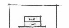


Encourage Mixed -Use
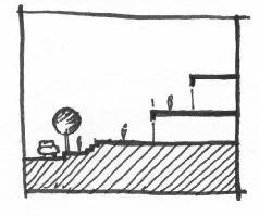
Terraced

13
1 3 - Y a l e P r o m e n a d e
L O M A S
Claudia
Castro / Patrick Shanahan / Keith Vlastos
City City UNM
Lomas looking east
Lomas Universtiy Yale Promenade NewYale
14
- H o s p i t a l A r e a
Claudia Castro / Patrick Shanahan / Keith Vlastos
L O M A S 1 3
O M A S 1 3 - H o s p i t a l A r e a
15
L
Claudia Castro / Patrick Shanahan / Keith Vlastos
16


The pedestrian flow diagram shows two major paths along Stanford and Yale. The two bridge buildings will be placed on these intersections on Lomas. They will serve to centralize the campus on Lomas and bind North and South campuses.
Main Issues
Development along Lomas Between I-25 and University.
Creating identifying landmarks on the intersections of Lomas / University and on Lomas / Girard.
Centralizing and unifying the north and south campuses.
Exploring alternatives with the water within the arroyo.
Transforming Lomas into a boulevard with safe pedestrian areas and landscaping.
ARROYO
MAIN BRIDGE BUILDING
17 J.Y.D.
Proposed Lomas Development
This portion of Lomas Boulevard would have a 2 way frontage road on the south side providing high value property access with full arterial capacity retained on Lomas. Adjacent new streets connecting from Mountain Road to University on the north, and from Medical Arts Avenue to Mesa Vista on the south, would serve new multi-use development in these areas.
entry sign future frontage road future connection w/ mountain road and university future connection w/ mesa vista and medical arts road future pedestrian mall future plaza with tower future residential development future hotel pedestrian path future multi-use development
18 J.Y.D. 1 10 9 2 5 6 3 4 4 7 8
1. 2. 3. 4. 5. 6. 7. 8. 9. 10.
A A
site plan
Section
A
plaza frontage lomas(east) lomas(west) pedestrian path arterial









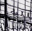
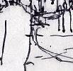


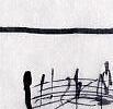

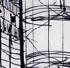
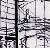


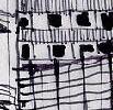










EAST ON LOMAS FROM I-25 PEDESTRIAN CONNECTION TO OLD MOUNTAIN ROAD AND ALBUQUERQUE HIGH SCHOOL






VIEW EAST TOWARD LOMAS/ UNIVERSITY GATEWAY





19 J.Y.D.
PLAZA AND TOWER ON SOUTHWEST QUADRANT OF LOMAS AND UNIVERSITY GATEWAY
IntersectionsofLomas/Girard and Lomas / University.
The boundaries of the campus should be identified at both intersections. A landmark node can provide an identifying element for the campus that is safe, practical, and attractive.
The landmarks will serve as guiding markers leading towards the suggested bridge/ student services building at Yale and Lomas.
At the intersection of Girard and University, the proposed street plan suggests a slight “tweak” of University Blvd. This will align both streets more perpendicular to one another:
1) allowing smoother turns for traffic.
2) clearer, safer views for pedestrians.
3) practical and elegant space and form for design of intersection.
Sidewalks on the north side of Lomas should be 10’ wide along the entire stretch from Univesity to Girard, 20’ wide on the south. This will prvide a safe pedestrian flow around the campus for students and the community.
Existing Site Plan
Existing Streets
Proposed Pedestrian
Proposed Streets
Proposed Site Plan
20 J.Y.D.
of Lomas and University Blvd.
Intersection
N^
The SW corner of the node consists of the suggested student housing project with residential quarters and commercial buildings. The circular courtyard is set south of the busy intersection, creating a safe plaza within the structure. The plaza also opens and connects with the node.This will be the main plaza and will offer food, drinks, school supplies and comfortable shaded seating areas.
The SE corner of the node will have two transit stops with shaded seating areas. Simple landscaping and decorative paving around an identifying landmark is sufficient for this area.
The NE corner will lie within a quasi- circular paved plaza with a handful of trees to provide shading. A water element such as a reflective pool with a fountain would be appropriate for this space. Food stands surround the plaza to offer a quick bite to eat.
The NW corner should be in the form of a continuing circle from the adjacent plaza. Currently there is a business operating on this corner, but landscaping with shaded seating allows for future expansion and design on this site.
21 J.Y.D.
N
J.Y.D.
ObjectivesforLomas/YaleIntersection: create a recognizable node for the University on Lomas
-- provide green space connect North and Central Campuses across Lomas
-- capture runoff water from site and Campus Wash
Strategies:
-- Open space along edge of North Diversion Ditch, from Hospital to Indian School.
-- Use some of the water from the channel to create naturalized arroyo, delivering water to cottonwoods and other native speices in the open space.
-- Capture Chiller Plant runoff, divert its flow into the new arroyo.
-- Cover the existing Diversion Ditch with parking, from Hospital to Tucker.
-- Create University/retail center with bridge and surrounding buildings at Lomas/Yale intersection.


22
Pedestrian Bridge Building to span over Lomas/Yale intersection
Pedestrian Diagram
View North along Yale from ROTC
N ^
ConceptofNestedSinusoids
OptionsforCampusWash/ChillerRunoff
Let some of the water flow from thebottom of the wash and the chiller, into the new arroyo, down hill, to the south and west,for water-table recharge and landscape beautification.
Campus Wash Watershed to N. Diversion Ditch
7 square miles.
Rate of Flow from Campus Wash into Diversion Channel 100 yr.=2000 cfs. 10 yr.=500 cfs.
Capture up to 10 yr. flow Flow filters into naturalized arroyo.
Chiller Plant Discharge to New Arroyo/Wetland
Several hundred gallons per minute at peak season(May through September).
Chiller water will need to be filtered before it enters the arroyo.


23 J.Y.D.
Planter box curbs that collect and cascade runoff fromthe street surface along Lomas.
Reclamation drain on bottom of Channel wall.
PedestrianPlazaatStaffordDrive


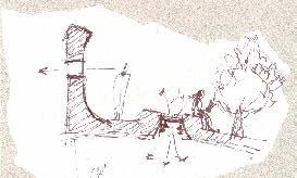
The two plans on this page show the proposed pedestrian plaza at different phases of the University hospital’s Master Plan. The proposed plaza looks at providing a crossing that is elevated rather than at street level. The Plaza starts at grade level south of Hokona Hall and stretches out across Campus Drive and Lomas. A 20’+ drop in elevation works to the advantage of this structure. In the existing phase of the University Hospital, the plaza would provide connections between the hospital entrance, the parking garage, Lomas, Campus Drive and the plazas between Anderson Hall, the Department of Education and Hokona Hall. In the final phase of the hospital, the plaza would be extended to connect the plaza behind the Cancer Center with the South Campus. This structure would provide a pleasant outdoor plaza that both campuses could utilize for studying, eating, relaxing or playing.
24 J.Y.D.
Connection at Hospital Connection at Garage
Proposed Pedestrian Plaza-Existing University Hospital
Proposed Pedestrian Plaza - Final Phase of University Hospital
Developmental Section Sketch


25 J.Y.D.
Bus Stop
Section through Plaza
Wall Detail


