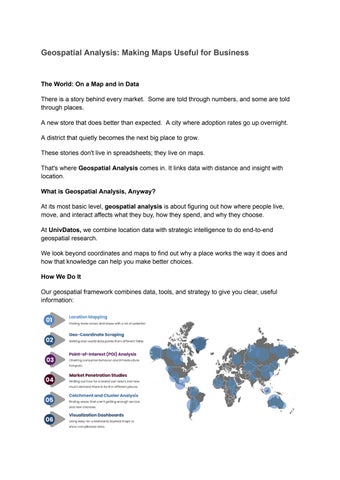
Geospatial Analysis: Making Maps Useful for Business
The World: On a Map and in Data
There is a story behind every market. Some are told through numbers, and some are told through places
A new store that does better than expected. A city where adoption rates go up overnight.
A district that quietly becomes the next big place to grow
These stories don't live in spreadsheets; they live on maps.
That's where Geospatial Analysis comes in It links data with distance and insight with location
What is Geospatial Analysis, Anyway?
At its most basic level, geospatial analysis is about figuring out how where people live, move, and interact affects what they buy, how they spend, and why they choose.
At UnivDatos, we combine location data with strategic intelligence to do end-to-end geospatial research.
We look beyond coordinates and maps to find out why a place works the way it does and how that knowledge can help you make better choices
How We Do It
Our geospatial framework combines data, tools, and strategy to give you clear, useful information:
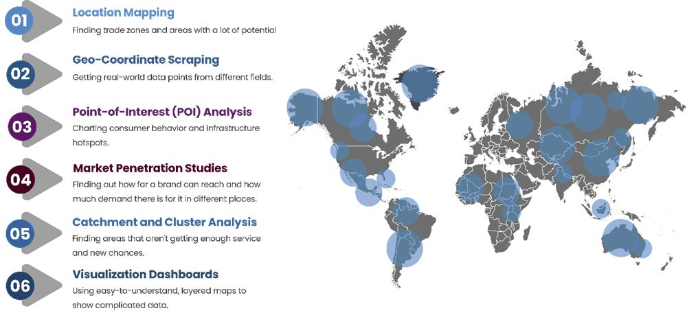
We use tools like ArcGIS, Power BI, QGIS, Google Earth, and OpenStreetMap to turn static market data into interactive, information-rich visuals like shapefiles, heatmaps, and dashboards that show you "where to go next."
REQUEST A CONSULTATION
Why Location is Important
In every choice, from expanding into new markets to deciding where to put stores to targeting customers, where is just as important as who.
Geospatial analysis can help us answer questions that plain analytics can't
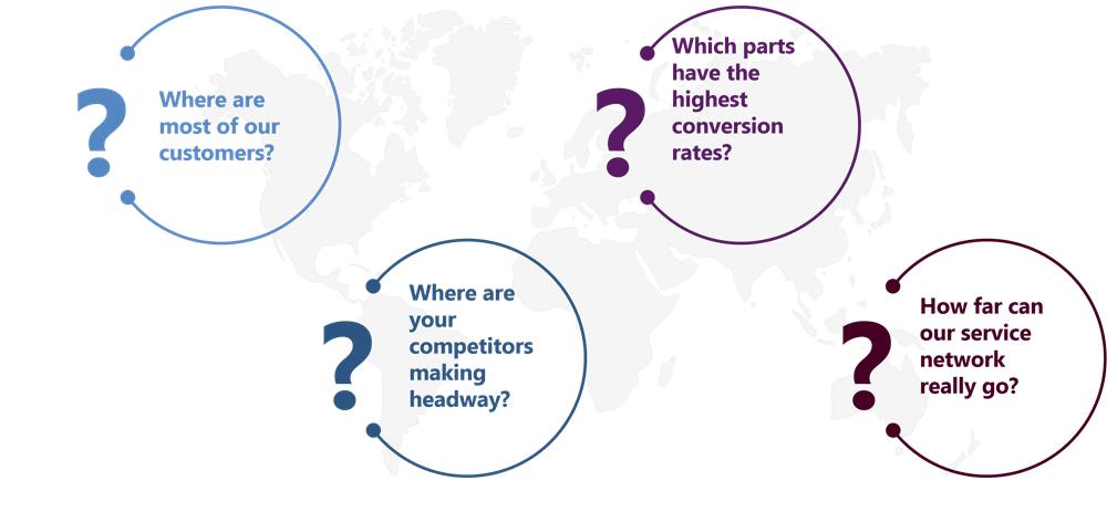
We help brands go from "maybe here" to "exactly there" by combining business intelligence with location data.
Industries That Benefit the Most
Geospatial analysis can be applied to numerous sectors, but it is particularly beneficial for:
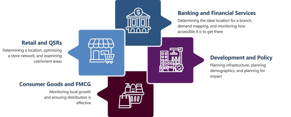
Geospatial intelligence provides context to each statistic, whether a brand attempting to expand, a policymaker planning interventions, or an investor seeking high-growth locations.
The UnivDatos Advantage
We don't simply mark points on a map at UnivDatos; we also discover what occurred at every location
Our Geospatial Analysis Services complement our Extended Research Services beautifully, providing you with qualitative and quantitative depth and spatial context.
We provide our clients with the tools to make informed, data-driven, and location-aware decisions, from mapping out their market to monitoring their brand
The Outcome: Clarity You Can See
When data and geography come together, insights become clear.
And when you use maps to plan your strategy, your decisions become clearer
With Geospatial Analysis, you're not just reading data; you're watching it happen in the real world, layer by layer
Sometimes, the best way to go about things isn't to look deeper into data, but to look more broadly at places.
Related Extended Research Support:-
Desk Research
Quantitative Research
Qualitative Research
Contact Us:
UnivDatos
Contact Number - +1 978 733 0253
Email - contact@univdatos.com
Website - wwwunivdatos com
Linkedin- https://www.linkedin.com/company/univ-datos-market-insight/mycompany/