3 minute read
Congaree National Park


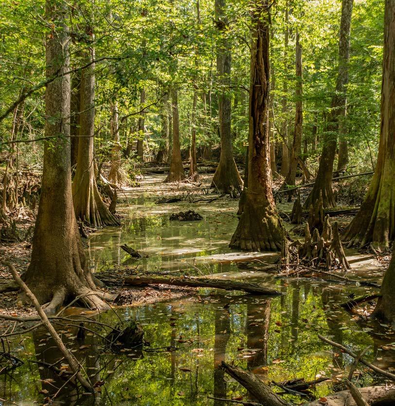
Containing the largest intact old-growth bottomland hardwood forest in the southeastern United States, Congaree National Park is a dynamic landscape where the Congaree and Wateree Rivers wash through a floodplain, bringing nutrients and sediments that nourish and replenish this ecosystem and support sustained growth.
Recognized for its exceptional biodiversity and stately stands of bald cypress, humans have used its floodplain for many reasons over 13,000 years, including prehistoric natives and Spanish explorers, as well as patriots of the Revolutionary War, escaped slaves, loggers and conservationists.
The Flora And Fauna
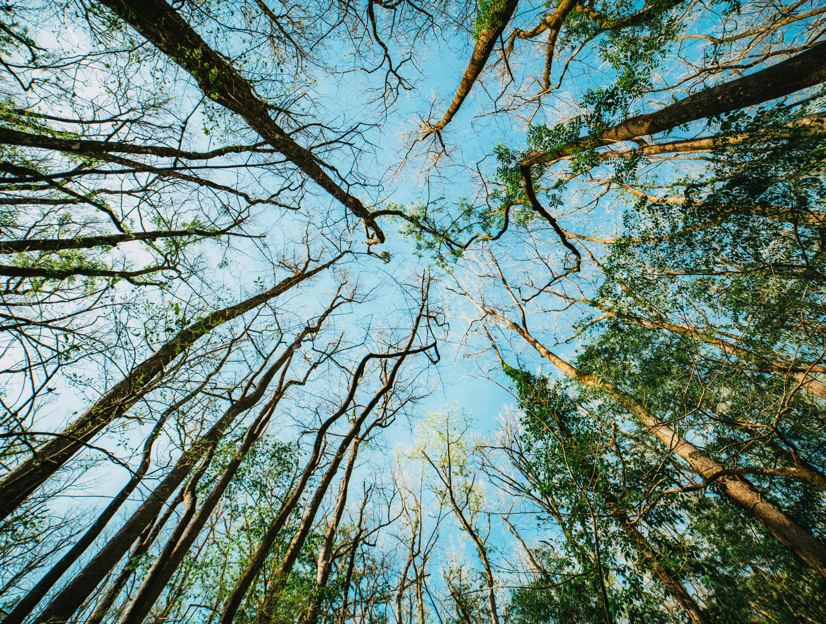
Congaree’s mysterious-looking — some might say spooky — old-growth bottomland forest is a real draw. Of particular note? The park’s many national and state champion trees.
By contrast, an upland pine forest stretches across the northern edge of the floodplain, one dominated by fireresistant loblolly pines, which depend on wildfires to eliminate competitors.
The fires also help maintain vast, grassy pine savannas populated by creatures like the indigo snake and red-cockaded woodpecker, threatened or endangered because of habitat loss.
From its biodiverse forested wetlands and oxbow lakes to its sloughs and meandering creeks, Congaree provides a rich habitat for aquatic life, including a diversity of fish and amphibians.
Bobcats, wild pigs and foxes — as well as opossums, deer and river otters — are among the other species-in-residence. While not common, alligators can be found in the park as well.
The Weather
Situated in South Carolina’s Midlands region, Congaree has a humid subtropical climate, with mild winters and hot, wet summers.
Although rain and thunderstorms are also common in spring, so too are pleasant temperatures in the 70 F range. Hottest from June to August, daily temperatures hover in the 90s F, often exceeding 100 F. Then there’s the matter of rain, which averages 4.5 inches per month at that time of year.
Peak fall colors occur between October and early November, with temperatures in the 70s F and monthly precipitation around three inches.
Snow can occur in winter, but it is not common. Mild, with average daytime temperatures in the mid 50s F, November through February can see nighttime temperatures that dip below freezing.
This is also when flooding is most frequent, with little or no warning. The prevalence of flooding is deceptive: it doesn’t have to rain at Congaree for it to occur, being that the park resides in a watershed and rain in upstate South Carolina can quickly raise water levels.
Arrive prepared for varying conditions and keep watch for weather hazards and road and trail closures on the park’s website.
The Hikes, Drives and Viewpoints
Boardwalk Loop
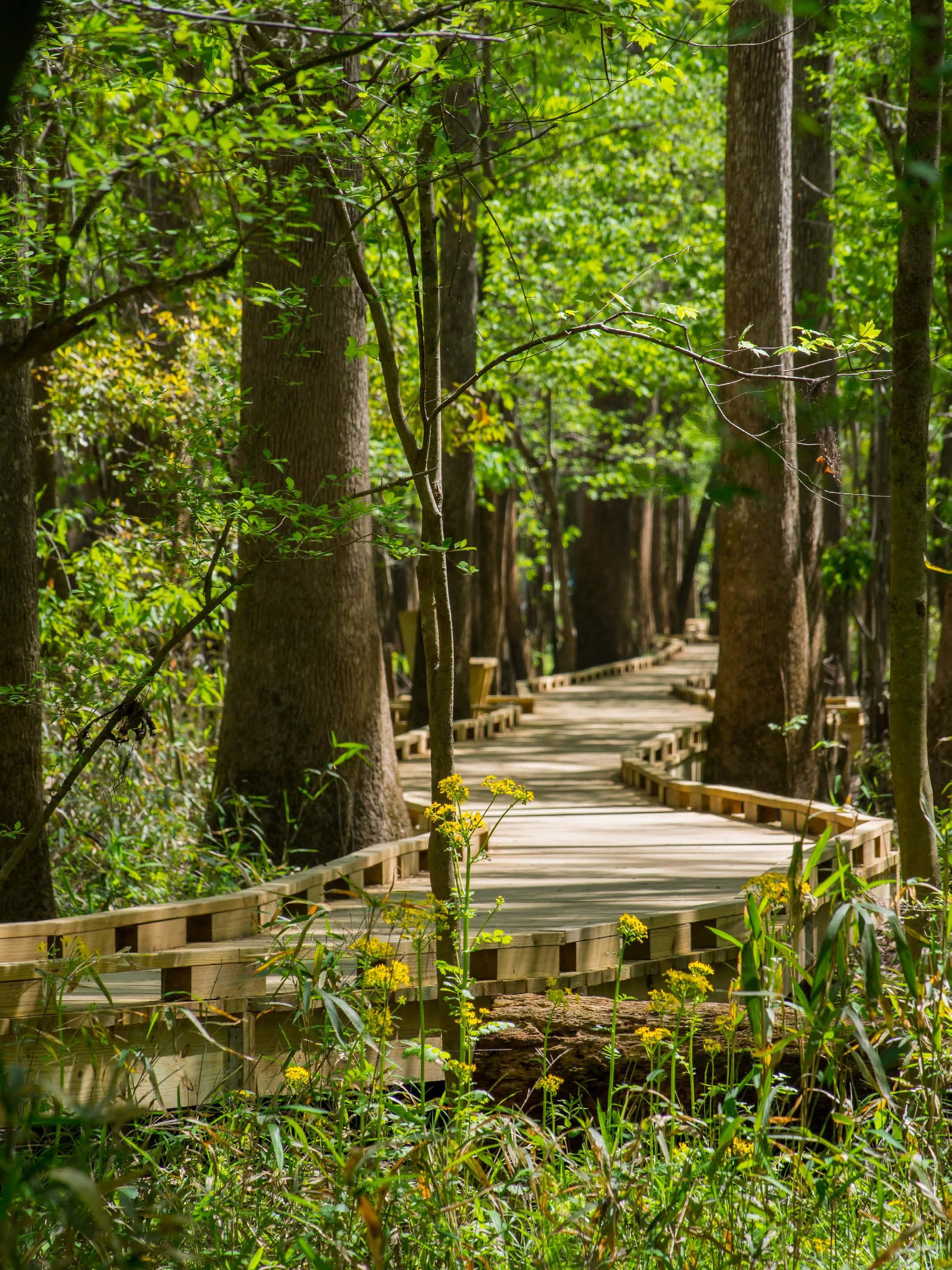
Featuring over 25 miles of hiking trails, the star of the show is the 2.4mile elevated boardwalk. Wheelchair and stroller accessible, it starts at the Harry Hampton Visitor Center, looping through the bottomland forest, where giant tupelos and bald cypress trees rise from standing water. Note, however, this can temporarily close when flooding occurs.
Bluff Trail
From the 1.7-mile Bluff Trail, which cuts through a longleaf pine forest, catch the 3-mile Sims Trail to Cedar Creek, keeping watch for otters. Alternately, hook up with the .6-mile spur trail to Longleaf Campground, or the 2.6-mile Weston Lake Loop Trail.
River Trail
Explore the lifeblood of the national park via the River Trail, a 10.4-mile loop to the Congaree River, which is among the most wildlife-rich spots in the park.
About The Park
Location - Central South Carolina, southeast Columbia
Established - November 10, 2003
Area - 26,000 acres


