
Departmentof Geographical&SustainabilitySciences Fall 2023 DEPARTMENTNEWSLETTER

Connect with us! Follow the Geographical & Sustainability Sciences Department Twitter | @HawkeyeGEOG Instagram | @uigeography Visit our website at clas.uiowa.edu/geography Department Executive Officer David Bennett Newsletter Editor & Designer Adrian Sandersfeld

Dear Alumni and Friends of the Department of Geographical and Sustainability Sciences,
I hope this newsletter finds you well!
It has certainly been an interesting ride these past several years and it is just now feeling like things are back to normal. One of my failures over this time has been keeping in touch with all of you who over the years have been such an important part of the Department. You have my sincere apology. I vow to do a better job of keeping you all up to date with the assistance of our new Undergraduate Coordinator, Adrian Sandersfeld, the author of this year’s Annual Newsletter, and our Departmental Administrator Angie Bellew.
Since we last communicated with you, new faculty have arrived, and some have move on to retirement or other universities. We welcomed Assistant Professors Matt Dannenberg, Susan Meerdink and Carly Nichols. We miss Professor Marc Armstrong who retired, and Associate Professor Eric Tate, who accepted a position at Princeton University, and will miss Assistant Professor Carly Nichols, who accepted a position at the University of Singapore. We created a new Bachelor of Science in Sustainability Science and co-lead a new interdisciplinary Master of Science in Sustainable Development.
We recently completed an external review of the department. I am very happy to report that since our last external review ten years ago, we increased the number of student credit hours we teach by more than 50%, the number of students enrolled in the majors we administer by more than 60%, the articles published per faculty by almost 90% and the grant dollars awarded per faculty by more than 270%. We have achieved this over a time-frame when college-wide enrollment has dropped.
The External Review Committee stated that: “The University of Iowa’s Geographical and Sustainability Sciences department hosts excellent programs, driven and well-rounded undergraduate and graduate students, and a superior faculty and staff.” We are proud of our accomplishments, and sincerely hope you are as well.
The following annual newsletter provides a window into the Department’s activities over the past couple of years. It will introduce you to some of our undergraduate and graduate students and the activities they are engaged in as well as showcase a couple of our newer faculty. I hope you enjoy perusing this document, reengaging with the Department, and think back fondly the times you spent with us.
I sincerely hope that whenever your time with the department was, and however you spent that time, you had a wonderful experience. Please keep in mind that we are always looking for ways to further enrich the experience of our current students. If you have the means to help, it would be greatly appreciated. This may be by, for examples, visiting the department to share your journey, by offering an internship or being a mentor, helping fund a student engaged in research or a student trip abroad, or by donating to one of the departmental funds found at givetoiowa.org/geography. Any help you can provide will be greatly appreciated.
And please let us know if we can provide any further service to you.
Letter from the DEO
Department News
Updates from Updates from the Department the Department
In the Winter 2022 issue of Iowa Magazine, Adam Skibbe (Senior GIS Administrator) was featured alongside Stratis Giannakouros (Director of the Office of Sustainability and the Environment) in “Crash Course: An Intro to Green Research at Iowa” on Solving the Grand Challenges of Sustainability.
Starting in the Fall 2022, the University of Iowa began offering an interdisciplinary graduate program in Sustainable Development. The program builds on course work, community-engaged projects, and professional development experiences that will culminate with a master's degree. Students learn what it's like to work in the field of sustainability, as public or private sector professionals. Upon leaving the program, they will be prepared to pursue careers with state and federal agencies, national laboratories, policy think tanks, and private companies.
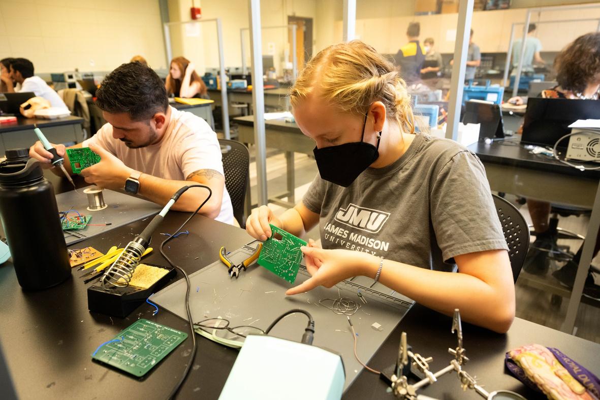
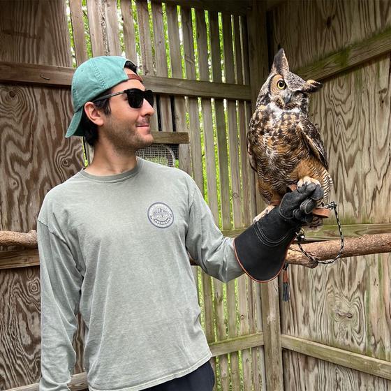
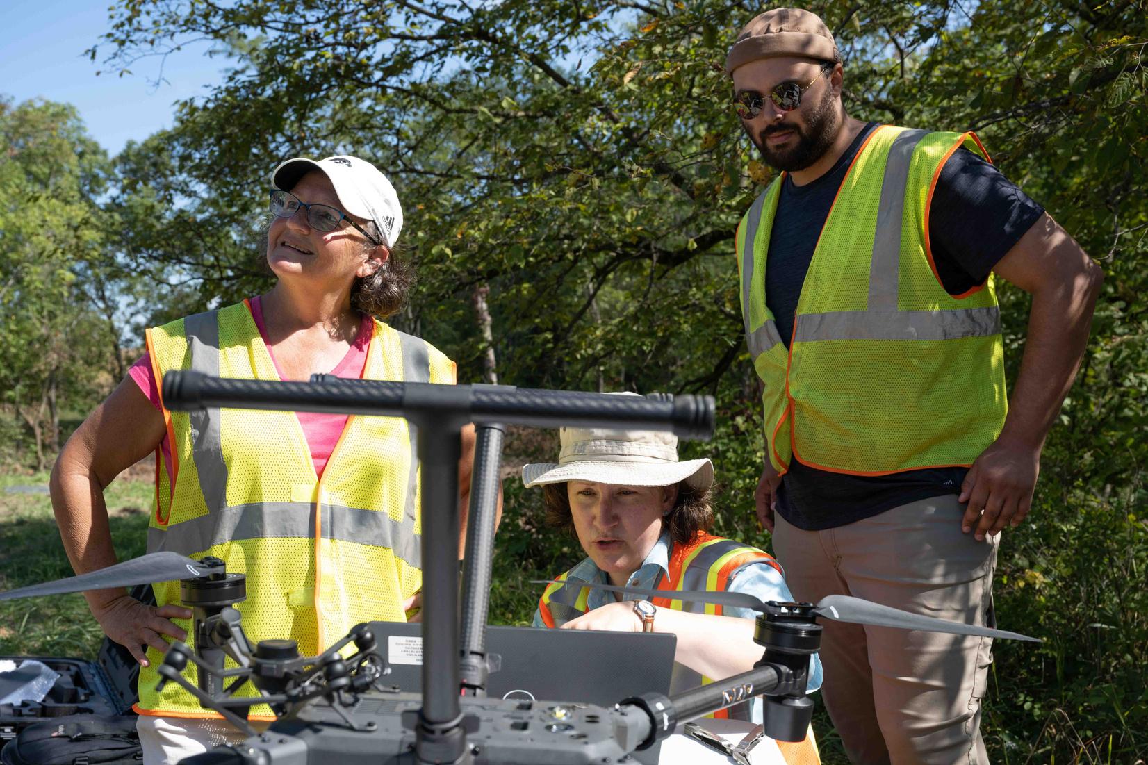
In January of 2023, the Edge of Space Academy, spearheaded by faculty and staff from the Department of Physics and Astronomy and Department of Geographical and Sustainability Sciences including Dr. Susan Meerdink and Adam Skibbe was featured in an article by Richard C. Lewis for This is UIowa. The article covered a timeline of events from the two-week academy, which recruited 12 students to plan and complete their own mission, following the same disciplines used by full-time scientists involved in NASA exploratory journeys. The students learned "how to build instruments, assemble electronics, create computer code, operate a payload, guide a drone operator or a jet pilot, collect and analyze data, and report results to decorated scientists and stalwarts in their fields."
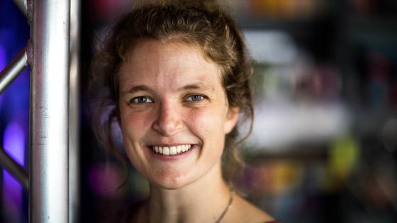
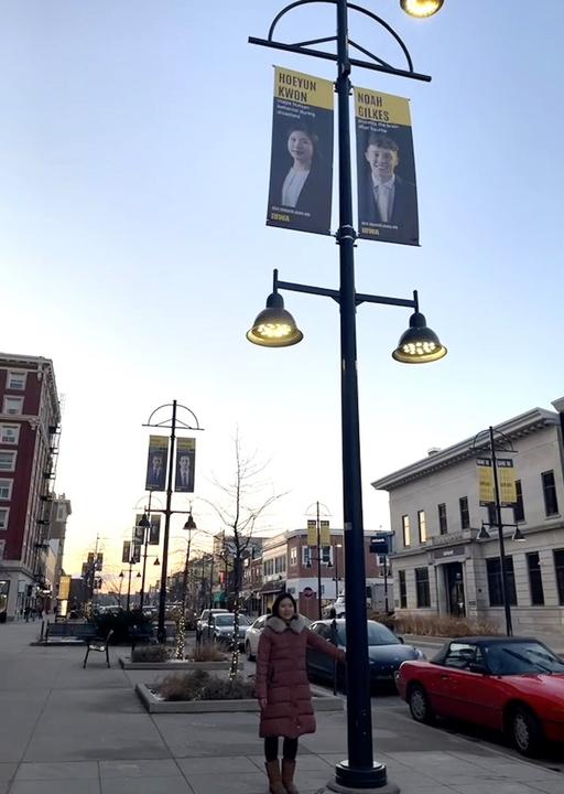
PhD candidate Hoeyun Kwon was spotlighted in the spring of 2023 by University of Iowa's 'Dare To' campaign (dare.research.uiowa.edu/kwon-hoeyun). A banner featuring Hoeyun can be found outside the Englert theater on East Washington Street, downtown!
In October of 2022, PhD candidate Falak Jalali published “The Corona Warriors? Community of health workers in the governance of India’s COVID19 response” in Political Geography.
In the spring of 2022, Oronde Drakes, won the Gilbert F. White Award for best doctoral dissertation in the Hazards, Risks & Disasters specialty group from the American Association of Geographers.
Austin Holland, a department alum who graduated with his PhD in Geography from the University of Iowa in 2022, was interviewed by the Office of Teaching, Learning & Technology about the Graduate Teaching Fellows program. Today, Dr. Holland is a tenure-track assistant professor at University of Wisconsin - Stevens Point and says that the Graduate Teaching Fellows program helped him to hone his skills as a teacher and prepare him for the job market.
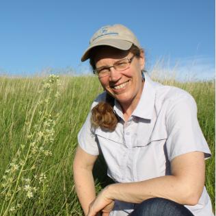
In March 2023, Dr. Susan Meerdink was awarded the ICRU Distinguished Mentor Award, awarded by the Office of Undergraduate Research to recognize the work that mentors put in to make their students' experiences successful.
In May 2023, Geographical and Sustainability Sciences was named as a Highly Engaged Academic Department by the Pomerantz Center, as part of the Pomerantz Center’s Career Impact Awards.
EdgeofSpace SummerProgram
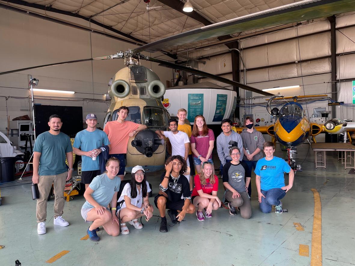
The Edge of Space Academy offers undergraduate students a paid summer research experience, which primarily focuses on instrumentation for observing Earth and outer space. This immersive program runs for two weeks during the summer, here in Iowa City. Over the course of those two weeks, students build small instrument payloads that are integrated onto drone and high-altitude aerial platforms which enable them to take measurements of the Earth below, the atmosphere, and space environment above. This hands-on experience is designed for all students who have an interest in Earth, atmospheric, solar and space science as no prior experience in hardware, instrumentation or electronics is necessary and students from historically marginalized populations in STEM are highly encouraged to apply.
New New GGraduate raduate PProgram rogram iinSustainable nSustainable
DDevelopment evelopment

Students looking to create a more sustainable tomorrow can find their place at the University of Iowa. Starting Fall 2022, the University of Iowa will began offering an interdisciplinary graduate program in Sustainable Development. The program builds on course work, community-engaged projects, and professional development experiences that will culminate with a master's degree.
Students will learn what it's like to work in the field of sustainability, as public or private sector professionals. Upon leaving the program, they'll be prepared to pursue careers with state and federal agencies, national laboratories, policy think tanks, and private companies.
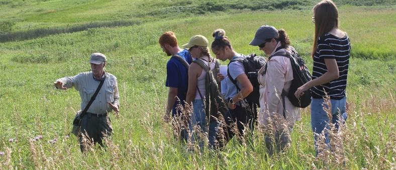
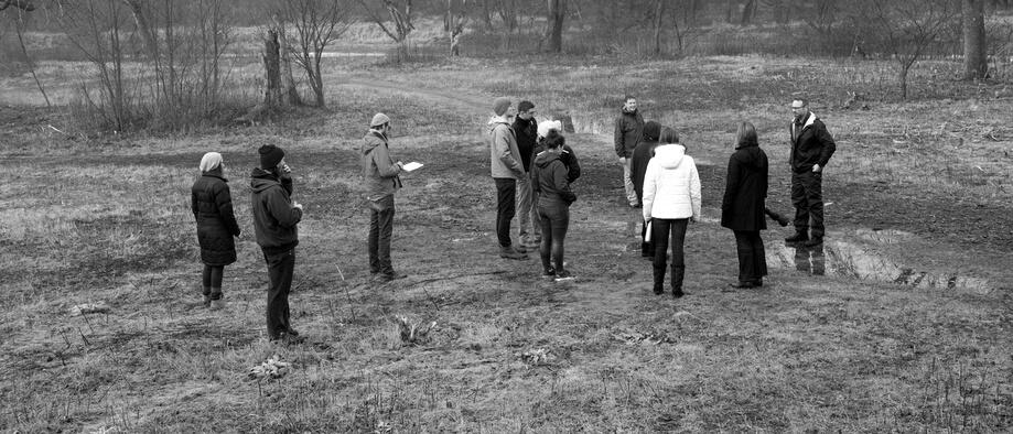
Kohn Kohn Colloquium Colloquium
Kohn Colloquium, named for the late Dr. Clyde F. Kohn, former Professor and Chairman of the Department at the University of Iowa, is a weekly seminar for graduate students, faculty, and other interested community members to hear from experts and specialists in the broad field of geographical and sustainability sciences. Participants learn about and discuss the latest research from unique perspectives and hone professional development skills.
guest book 2022-2023

 Laura Jackson Director, Tallgrass Prairie Center
Erin Wetherley Head of Research K
Andy VanLoocke Assistant Professor, Iowa State University
ssor,
Corey Markfo Associate Pro University of I
Sophie Vanwambeke Professor, UC Louvain Belgium
Patrick Bitterman Assistant Professor, University of Nebraska-Lincoln
Laura Jackson Director, Tallgrass Prairie Center
Erin Wetherley Head of Research K
Andy VanLoocke Assistant Professor, Iowa State University
ssor,
Corey Markfo Associate Pro University of I
Sophie Vanwambeke Professor, UC Louvain Belgium
Patrick Bitterman Assistant Professor, University of Nebraska-Lincoln


 Viridiana Hernández Assistant Professor, University of Iowa
Brandi Janssen Director, Iowa's Center for Agricultural Safety and Health
Steve Kannenberg Assistant Professor, West Virginia University
Bowen Raun Assistant Professor University of Iowa
Marynia Kolak Assistant Professor, University of Illinois Urbana-Champaign
Miriam Johnston Postdoctoral scholar, University of Iowa
Viridiana Hernández Assistant Professor, University of Iowa
Brandi Janssen Director, Iowa's Center for Agricultural Safety and Health
Steve Kannenberg Assistant Professor, West Virginia University
Bowen Raun Assistant Professor University of Iowa
Marynia Kolak Assistant Professor, University of Illinois Urbana-Champaign
Miriam Johnston Postdoctoral scholar, University of Iowa
SelectedFacultyPublications
Tang, Z., Carrel, M., Koylu, C., Kitchen, A. How human ecology landscapes shape the circulation of H5N1 avian influenza: A case study in Indonesia. OneHealth. Volume 16, June 2023, doi.org/10.1016/j.onehlt.2023.100537
Tang, Z. & Carrel, M. The more things change the more they stay the same: Persistent spatial inequity in pediatric lead poisoning in Chicago. Applied Geography. Volume 142, 2022, https://doi.org/10.1016/j.apgeog.2022.102686.
Carrel, M., Clore, G., Kim, S., Goto, M., Perencevich, E., & Sarrazin, M. (2022). Delays and declines in seasonal influenza vaccinations due to Hurricane Harvey narrow annual gaps in vaccination by race, income and rurality. Infection Control & Hospital Epidemiology, 1-7. DOI:10.1017/ice.2022.27
Carrel, M., Keino B.C., Ryckman KK, Radke S. Labor & delivery unit closures most impact travel times to birth locations for micropolitan residents in Iowa . Journal of Rural Health. 2022; 1-8. https://doi.org/10.1111/jrh.12643
Kontowicz, Eric, et al “Inclusion of Environmentally Themed Search Terms Improves Elastic Net Regression Nowcasts of Regional Lyme Disease Rates ” PLOS ONE, vol 17, no 3, 2022, https://doi org/10 1371/journal pone 0251165
Koylu, C., Kasakoff, A. (2022). Measuring and mapping long-term changes in migration flows using populationscale family tree data. Cartography and Geographic Information Science, 46(1), 57-71. DOI: https://doi.org/10.1080/15230406.2021.2011419 (Featured on the cover)
Koylu, C., Tian, G., & Windsor, M. (2022). FlowMapper.org: A web-based framework for designing origindestination flow maps. Journal of Maps. DOI: https://doi.org/10.1080/17445647.2021.1996479
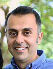
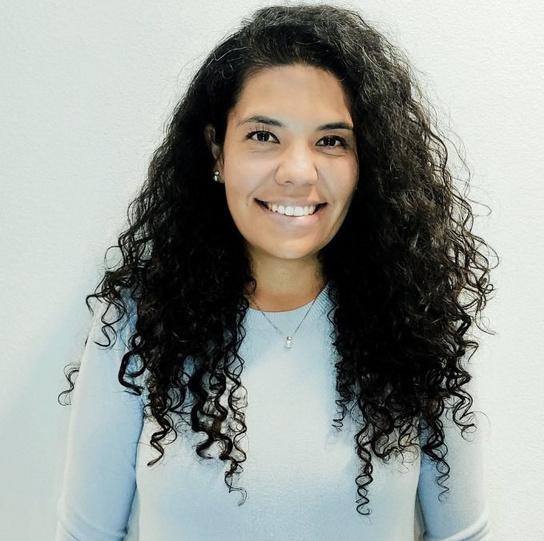
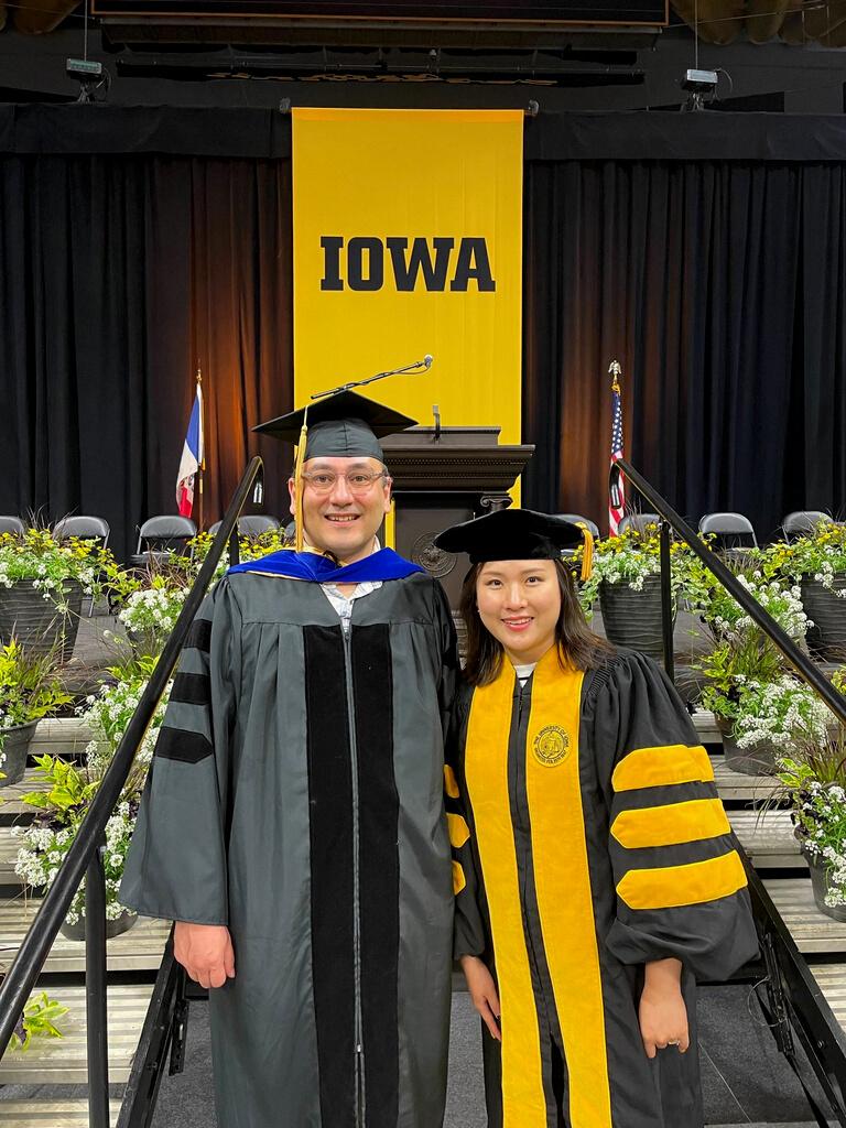
Matthew Dannenberg and Dr. Miriam Johnston
Dannenberg, M.P., D. Yan, M.L. Barnes, W.K. Smith, M.R. Johnston, R. Scott, J.A. Biederman, J.F. Knowles, X. Wang, T. Durman, M.E. Litvak, J.S. Kimball, A.P. Williams, and Y. Zhang. 2022. Exceptional heat and atmospheric dryness amplified losses of primary production during the 2020 U.S. Southwest hot drought. Global Change Biology doi:10 1111/gcb 16214
Dr. Margaret Carrel
Dr. Caglar Koylu
Dr.
Lin, Y., Meerdink, S.K., & Gader , P.D. (2022). Spectral Transformations for Multi-Temporal Hyperspectral
Classification IEEE Geoscience and Remote Sensing Letters
Miller, D L , Alonzo, M , Meerdink, S.K., Allen, M A , Tague, C L , Roberts, D A , & McFadden, J P (2022) Seasonal and interannual drought responses of vegetation in a California urbanized area measured using complementary remote sensing indices ISPRS Journal of Photogrammetry and Remote Sensing, 183, 178-195 https://doi.org/10.1016/j.isprsjprs.2021.11.002
MacDougall, B. M., Sander, H. A., Fidino, M., Ahlers, A., Angstmann, J. Anthonysamy, W., Drake, D., Hayes Hursch, S., Larson, R., Lehrer, E., Magle, S., Ryan, T. Landscape and socioeconomic factors structure mesopredator distributions in Midwestern US cities. Ecological Applications. In revision following review.
Sander, H.A., Hodson, C.B., MacDougall, B.M. 2022. Integrating human and species habitat preferences in conservation in heterogeneous urban settings. Environmental Conservation 49:234-243.
Larson, R. N., Sander, H. A. 2022. Seasonal activity patterns of sympatric eastern gray squirrels (Sciurus carolinensis) and fox squirrels (S. niger) in a Midwestern metropolitan area. Urban Ecosystems 25:1527–1539

MacDougall, B., M., Sander, H. A. 2022. Mesopredator occupancy patterns in a small city in an intensively agricultural region Urban Ecosystems 25:1231–1245
Sander, H. A 2022 Closing four remaining gaps in deploying urban vegetation to enable sustainable cities One Earth 5:482-484
Gallo, T , Fidino, M , Gerber, B , Ahlers, A , Angstman, J , Amaya, M , Concilio, A L , Drake, D , Lehrer, E W , Murray, M H , Ryan, T J , St Clair, C C , Salsbury, C M , Sander, H.A., Stankowich, T Belaire, J A , Magle, S B 2022
Mammals adjust diel activity across gradients of urbanization. eLife 11: e74756 DOI: 10.7554/eLife.74756
Alderson, J., Sander, H.A. 2022. Combining historical accounts with contemporary bird survey data identifies changes in an avian community over a period of anthropogenic change. Ibis 164(2):411-422.
Kay, C., Rohnke, A., Sander, H., Stankowich, T., Fidino, M., Murray, M., Lewis, J., Taves, I., Lehrer, E., Zellmer, A., Schell, C., Magle, S. 2022. Barriers to Building Wildlife-Inclusive Cities: Insights from a joint summit of urban ecologists, urban planners, and landscape designers. People and Nature 4:62-70.
Drakes, O., Tate, E. (2022). "Social vulnerability in a multi-hazard context: a systematic review" Environmental Research Letters, 17: 033001.
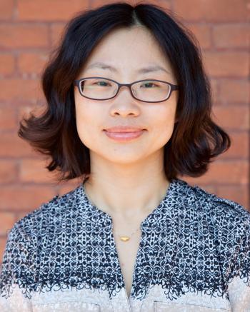
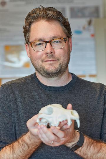
Dr. Susan Meerdink
Dr. Heather Sander
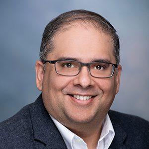
Dr. Eric Tate
Undergraduate News
StudentExcellenceAwards
Thanks to the generosity of donors, the Department of Geographical & Sustainability Sciences has several Student Excellence Funds. We award them at the end of each academic year to honor top students in our majors of Geography, Environmental Policy & Planning, and Sustainability Science.
The following lists are this year's recipients of these Student Excellence Awards:
ChadE.Smith MemorialScholarship
Supporting a promising third-year or fourth-year student in Environmental Studies
Natalie Chartier
Camryn Grawe
NicholasL.Paape MemorialScholarship
Supporting one or more students in Geographic Information Science
Angelina Evans
Grace Shipley
HaroldHMcCarty MemorialFund
Providing financial aid for promising students in Geography
Emmeline Kraus
Greta Mally
ProfessorGerryRushton AcademicExcellenceFund
Facilitating student and faculty development and build on the department’s reputation for excellence on campus and in Geography
Jayna Wanamaker
Katelyn Winkler
AndreaHauer&DavidPerret StudentSuccessFund
Supporting deserving students who demonstrate merit and are in good academic standing
Isabella Mullins
LiliAnna Scott
Senior Project Seminar
PosterSessions
On May 3rd, 2022, department seniors presented the results of their independent research projects during a poster session in the atrium of the BelinBlank Center for Gifted Education, attended by department faculty and graduate students Senior Ethan Traugh was the elected winner of a vote on Best Poster for his research on place attachment on campus and across Iowa City.
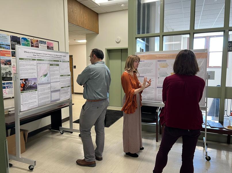
On May 2nd, 2023, seniors presented posters on their research projects to their peers and mentors in the department lobby of Jessup Hall.
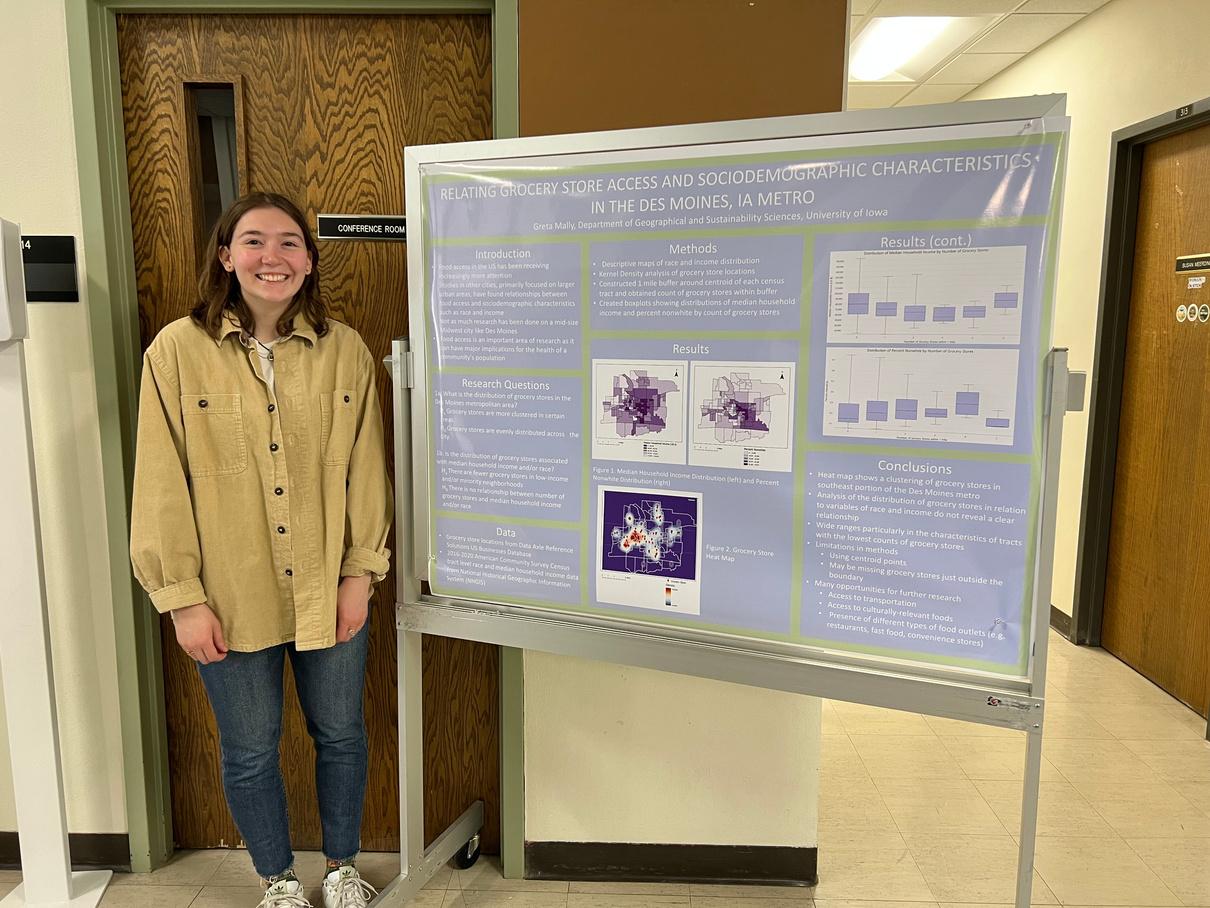
Greta Mally presented "Relating grocery store access and socioeconomic characteristics in the Des Moines, IA metro."
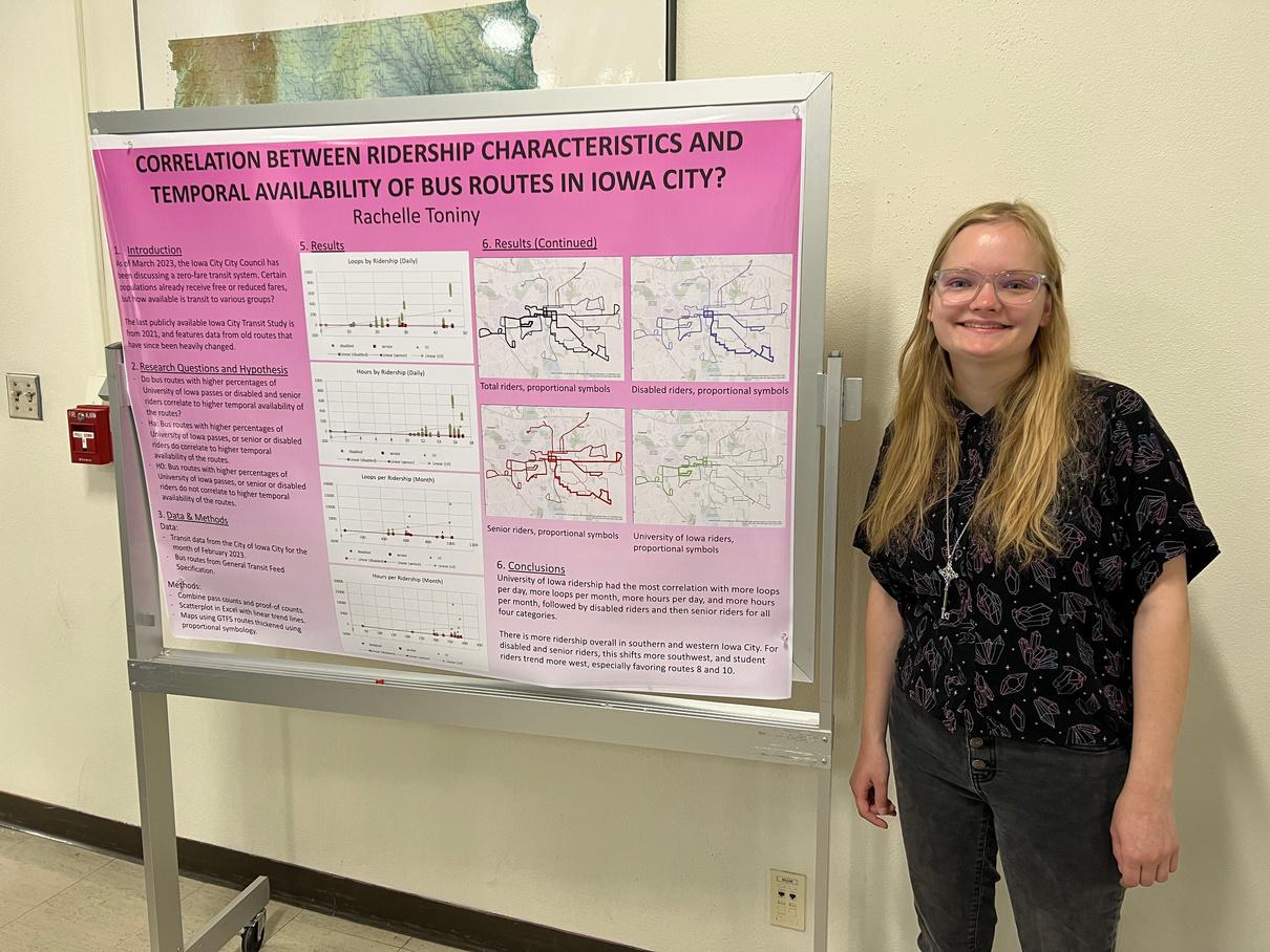
Rachel Toniny presented "Correlation between ridership characteristics and temporal availability of bus routes in Iowa City"
Undergraduate ResearchFestivals
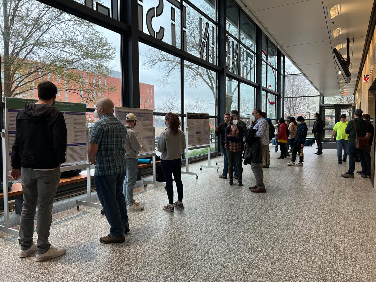
The Fall and Spring Undergraduate Research Festivals (FURF and SURF) are organized each year to share, recognize, and celebrate undergraduates' contributions to research scholarly discourse at the University of Iowa. Utilizing posters and other visual displays, students present their work in a casual setting at the Old Capitol Center and are given the opportunity to practice sharing their research
The following are undergraduate students from the department of Geographical and Sustainability Science who presented between spring 2022 to spring 2023:
Spring2022SURF
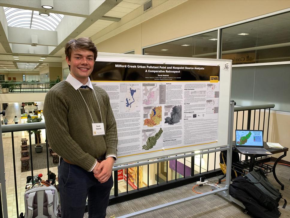
"Milford Creek Urban Pollutant Point and Nonpoint Source Analysis: A Comparative Retrospect" presented by David Hebrink, mentored by Dr. Rebecca Kauten
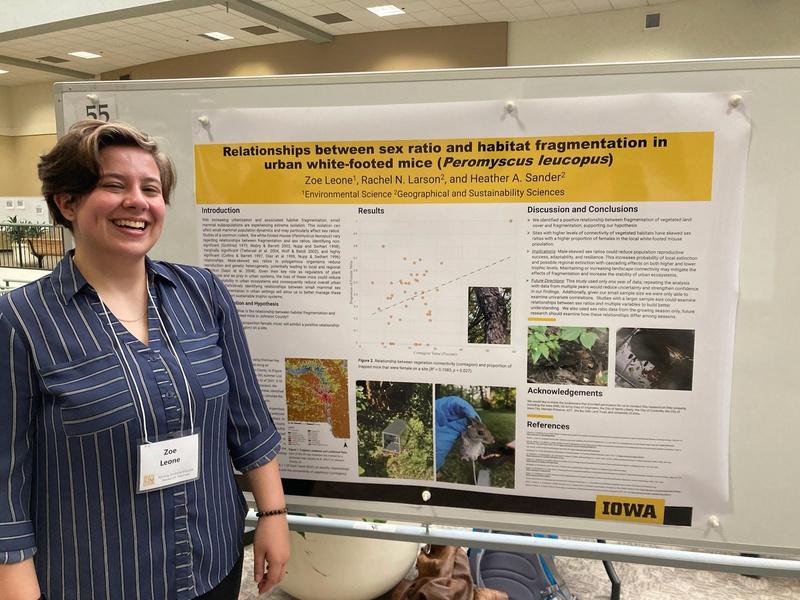
"Relationships between sex ratio and habitat fragmentation in urban whitefooted mice (Peromyscus leucopus)" presented by Zoe Leone, mentored by Dr. Heather Sander
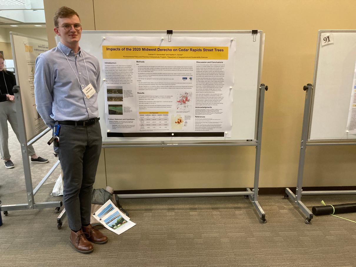
"Impacts of the 2020 Midwest Derecho on Cedar Rapids Street Trees"
presented by Graham Sandersfeld, mentored by Dr. Heather Sander
Fall&Spring
Zoe Leone (photo provided courtesy of subject)
David Hebrink (photo provided courtesy of subject)
Graham Sandersfeld (photo provided courtesy of subject)
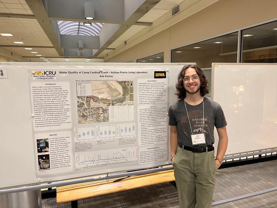
"Water Quality at Camp Cardinal Creek"
presented by Bob Pentuic, by Dr. Ben Swanson (Earth d Environmental Sciences)
sonal Effects of the Fungal n Tubika iowansis (bur oak e Photosynthetic Capacity
Quercus macrocarpa (bur oak)"
sented by Emmeline Kraus, s. Susan Meerdink and Matthew Dannenberg
Spring2023SURF
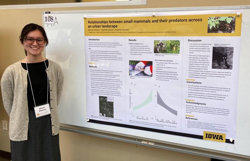
“Relationships between small mammals and their predators across an urban landscape”
presented by Mizuki Wittmer, mentored by Dr. Heather Sander
“The effects of urban and land use change on the local atmospheric pollen concentration in Eastern Iowa during ragweed season”
presented by Emma Schopen, mentored by Drs. Heather Sander (Geography) and Elizabeth Stone (Chemistry)
“Investigating Internal Colonialism in Contemporary Mexican Development and implications for Indigenous Breastfeeding Practices”
presented by Shannon Walsh, mentored by Dr. Carly Nichols
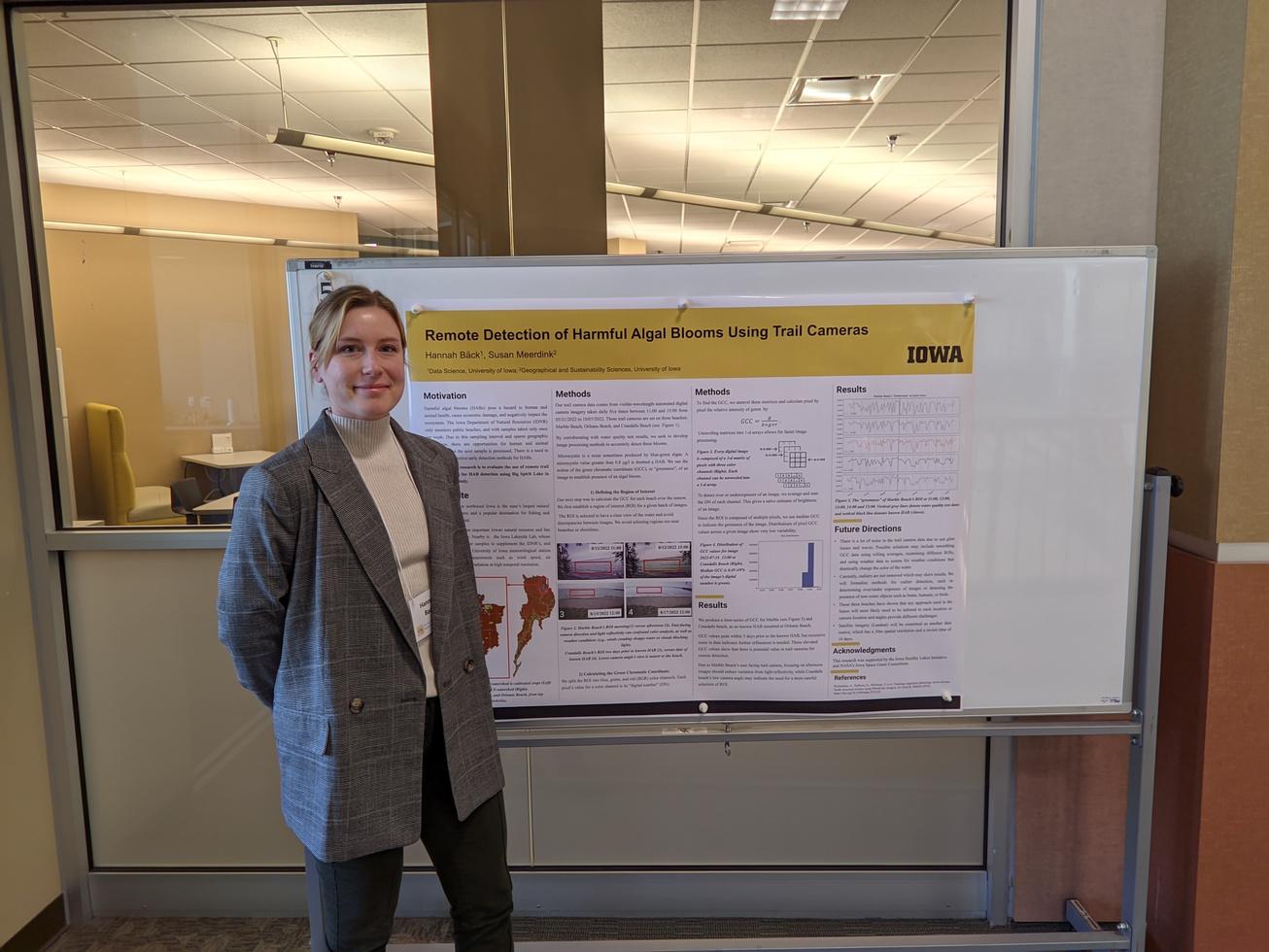
“Remote Detection of Harmful Algal Blooms”
presented by Hannah Bäck, mentored by Dr. Susan Meerdink
all2022FURF
Mizuki Wittmer (photo provided courtesy of subject)
Bob Pentuic (photo provided courtesy of subject)
Hannah Bäck (photo provided courtesy of subject)
Graduate News
Samuel Taylor joined the department as a graduate student in January 2023.
Hoeyun Kwon, Ph.D. was spotlighted in the spring of 2023 by University of Iowa's 'Dare To' campaign (dare.research.uiowa.edu/kwonhoeyun). A banner featuring Hoeyun can be found outside the Englert theater on East Washington Street, downtown!
Awards
PhD candidate Falak Jalali received the 2022 Stanley Award for International Research with her research project, "Impact of Education on the Imagined Future of Agriculture."
In May of 2022, Hoeyun Kwon, Ph.D. was awarded the Ph D Scholarship Award by the Cartography and Geographic Information Society (CaGIS)
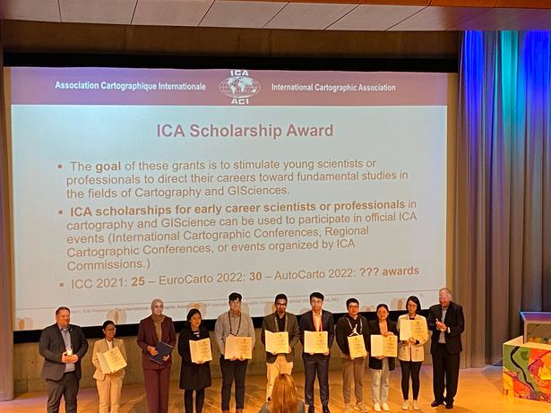
In November 2022, Hoeyun Kwon, Ph.D. presented at AutoCarto 2022, the 24th International Research Symposium on cartography and GIScience, and was awarded the International Cartographic Association (ICA) Scholarship for "Disparities in human mobility changes during the pandemic and the local associations between those mobility changes and social vulnerability"
Publications
In October of 2022, PhD student Falak Jalali published “The “Corona Warriors”? Community of health workers in the governance of India’s COVID-19 response” in Political Geography.
In February of 2022, Oronde Drakes, with Dr. Eric Tate, published "Social vulnerability in a multihazard context: a systematic review" in volume 17 of Environmental Research (doi org/10 1088/1748-9326/ac5140)
News
campaign banner outside Englert Theater
Hoeyun Kwon stands beneath her University of Iowa's 'Dare To'
Hoeyun Kwon stands on stage with other ICA recipients at AutoCarto 2022
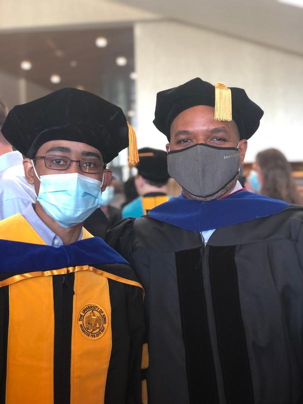
Alum Oronde Drakes, Ph D is pictured with Dr Eric Tate after his 2021 graduation
GGeo-SocialLab eo-SocialLab
The Geo-Social Lab, headed by Assistant Professor Caglar Koylu, is home to research projects aimed at developing innovative computational and visual tools to analyze massive and complex geo-social networks and geospatial processes that drive our economy, society and the environment. Their aim is to help address realworld problems in diverse areas such as human mobility and migration, hazards and disasters, city planning and transportation, spatial and historical demography, global trade, communication and information networks, public discourse, information diffusion, and more.
2022-2023
January 2022: The Geo-Social Lab's papers, "Measuring and mapping long-term changes in migration flows using population-scale family tree data" and "FlowMapper.org: A web-based framework for designing origin-destination flow maps" have been published in Cartography and Geographic Information Science and Journal of Maps.
February 2022: "Measuring and mapping longterm changes in migration flows using population-scale family tree data" was featured on the cover of Cartography and Geographic Information Science.
March 2022: Hoeyun Kwon won second place in GIS Specialty Group Student Honors Paper Competition at AAG 2022.
April 2022: Hoeyun Kwon won the Doctoral Scholarship Award of 2022 by the Cartography and Geographic Information Society (CaGIS)
May 2022: The Geo-Social lab began collaborating with Jacob Oleson (University of Iowa, Biostatistics) on a National Cancer Institute (NCI) funded project, "Development of Small Area Interactive Risk Maps for Cancer Control Efforts" A public abstract is linked on geo-social.com.
June 2022: Geo-Social lab's paper, "Recreating Human Mobility Patterns Through the Lens of Social Media: Using Twitter to Model the Social Ecology of Crime", was published in Crime & Delinquency.
July 2022: Geo-Social lab high school interns Adelina Chau and Jonathan Fan participated in the Secondary Student Training Program (SSTP) at the University of Iowa
August 2022: Ph D student Maryam Torkashvand joined the Geo-Social lab.
November 2022: Maryam presented GeoSocial lab research on mapping migration regions and their evolution from populationscale family trees at The 6th ACM SIGSPATIAL Workshop on Geospatial Humanities (GeoHumanities’22) Seattle.
November 2022: Hoeyun Kwon presented research on the unequal impact of COVID-19 by analyzing the mobility behaviors of socially vulnerable populations at the AutoCarto 2022 conference in Redlands, California
January 2023: Dr Caglar Koylu was elected as the Vice President of Cartography and Geographic Information Society (CaGIS).
Defended Defended Defended Theses and Theses and Theses and Dissertations Dissertations Dissertations
Over the course of the past year, the department bid farewell to these accomplished graduate students
Identifying drivers of barred Owl (Strix varia) occupancy along an urban gradient in a primarily agricultural matrix
Earth’s landscapes are now overwhelmingly anthropogenic, losing the ability to support a diverse array of wildlife. In regions that have been transformed into intense farmland, little habitat is left to support forest wildlife, leading to dramatic declines in these species. Urban landscapes embedded within these settings contain forested green spaces and accrue trees via planting. Such cities may thus provide key habitat to support forest species. However, few studies have investigated this potential and we currently lack an understanding of how cities in agricultural regions may support biodiversity conservation. We sought to identify habitat characteristics for urban Barred Owls in Cedar Rapids and Iowa City, IA, two metropolitan areas surrounded by extensive agricultural row crops. We compiled data to identify tree, urban, and agricultural cover in the study area from existing sources as well as Barred Owl observations from field surveys and used them to build statistical models to identify relationships for this species. We found that urban intensity and cropland cover negatively impact the probability of a Barred Owl occupying a site within our urban areas. However, based on the relatively low urban intensity of our study cities and the expansive, nearly 100% agricultural cover that surrounds them, it is likely that these urban areas provide suitable habitat for the Barred Owl, especially when compared to the highly unsuitable agricultural surroundings. These results suggest that urban areas in regions of intensive agriculture could act as sites of Barred Owl conservation.
 Nicholas Alex, advised by Dr. Heather Sander
Photo provided courtesy of Nicholas Alex
Nicholas Alex, advised by Dr. Heather Sander
Photo provided courtesy of Nicholas Alex
Analyzing the effect of moisture inputs on remotely sensed GPP estimates
Eric Mykleby, advised by Dr. Marc Linderman

During drought, low soil moisture, and vapor pressure deficit plants to tightly co-regulate water loss and CO2 assimilation impacts primary terrestrial ecosystem production, an imp indicator for numerous ecosystem functions As a measure o productivity, gross primary production (GPP) is highly relevan estimating agricultural production because it represents the c fixed through photosynthesis and is therefore the foundation fo accumulation of crop biomass. However, measuring this producti the field can be difficult and expensive. Soil moisture and pressure deficit are the primary water stress drivers that infl vegetation health, but soil moisture has traditionally been diffic measure, especially at large spatial scales.
This study uses light use efficiency (LUE) models that include vapor pressure deficit and soil moisture factors to estimate GPP and investigate how these water stress metrics influence vegetation productivity and model skill. Differences in these models are assessed and compared relative to the specific site biome and how environmental scalar factors behave. Ecosystem production data was used from the Ameriflux network of towers and satellite-based soil moisture measurements from SMAP We focused on sixteen sites in the upper midwestern United States that encompassed cropland, evergreen needleleaf, and deciduous broadleaf biomes
This study found that incorporating satellite-based soil moisture estimates into an LUE model can improve GPP estimates in some scenarios including mid to late summer period primarily at the cropland sites. Late spring also saw periods where incorporating soil moisture may be beneficial for model accuracy. These findings show that vapor pressure deficit alone may not capture the full impacts of moisture stress on vegetation productivity. Especially in agricultural ecosystems, there are times of the year when soil moisture effects are necessary to capture changes in productivity.
Spatiotemporal Trends of Cardiovascular Disease Risk Factors, Overweight, Obesity, and Tobacco Use in East Africa
All too often health and disease patterns in Sub-Saharan Africa (SSA) are studied at a regional, i.e., East Africa, or national level. Analysis at these levels mask place-specific information that is necessary to create targeted policy and public health interventions that meet community needs Cardiovascular disease (CVD), such as stroke, and heart attacks, has rapidly increased in SSA since the early 2000s Factors that contribute to the onset of CVD include overweight/obesity and tobacco use. This dissertation addresses a critical knowledge gap about the spatial and temporal patterns of factors associated with CVD in SSA. Data from five East African nations over a 10-year period is used to show that the rates of tobacco use, and overweight/obesity varies across and within nations. Although overweight/obesity is increasing in all the countries, the rate of increase differs between and within countries. A closer look within national borders, using spatial analysis methods, reveals that although overweight/obesity rates are higher in urban areas, rural areas are experiencing a significant increase in overweight/obesity The opposite is true for tobacco use, where rural populations are more likely to declining in rural areas and increasing in and erstand CVD in SSA, we must look beyond such as spatial analysis, to determine placeintervention strategies.
 Barbara Keino, advised by Dr. Margaret Carrel
Spatio-temporal dynamics of the evolution and spread of Influenza A/H1N1pdm09 virus
Recurrent influenza A pandemics have been major concerns for global public health. The H1N1 strain that emerged in Mexico in 2009 and became a global pandemic was also devastating, resulting in a heavy economic burden and human toll. Better understanding of the geographic patterns of the evolution and spread of pandemic virus will help us prevent and predict the next influenza pandemics. This work used gene sequences of pandemic influenza virus and their geographic sampling locations to investigate how the viruses interacted with humans in various physical landscapes to evolve and spread across space and time. The pandemic influenza virus that emerged in North America migrated to Asian countries via East Asia during the early phase of the pandemic, and then circulated and evolved in South Asia over the summer in temperate regions. Some seasonal climate factors, such as relative humidity and precipitations, and human populations in the regions determine the geographic characteristics favorable for viral circulation in the United States. Lastly, viral genetic data was used to elucidate how the geographic distribution of human populations and their movements are associated with the spread of the viruses across space in mainland China. Evidence suggests that periodic population movements are responsible for spreading the virus from urban to urban, and urban to local areas. The findings provide better understanding of the evolutionary mechanisms of human influenza pandemic virus, therefore contributing to our ability to limit the spread of future pandemics and lessen the impact on global public health.
 Seungwon Kim, advised by Dr. Margaret Carrel
Evaluating Natural Resource Governance and Policy in Highly Fragmented Regions
Austin Holland, advised by Dr. Silvia Secchi
Sustainable governance of natural resources requires the understanding of social-ecological systems that utilize them. However, social-ecological systems are comprised of a diverse set of stakeholders with a variety of goals and perspectives on management. This can make establishing and maintaining governance challenging in every landscape, but particularly so in highly fragmented regions, like the US Midwest This is because the remaining protected areas are separated by private land, small, and distant from one another which impairs various stakeholders’ ability to work together to accomplish regional environmental goals. The three studies of my dissertation add to our knowledge of conservation in highly fragmented regions by investigating the governance and policy of natural resources in the US Midwest.
The first study examines how conservation stakeholders work within a complex governance system to mitigate multiple environmental issues. This study highlights the difficulty of working within a polycentric governance system to protect a series of freshwater lakes from a diverse set of environmental pressures. The second study assesses the use of conservation easements across the US Midwest by analyzing their social and environmental characteristics as well as the land cover they protect. The third study examines access to public lakes that are surrounded by private land More specifically, this study examines how conservationists view access to natural resources in their area, the barriers to accessing these resources, and how they manage access in their own projects. These three studies work to advance our understanding of governance and policy in highly fragmented regions while hopefully leading to better conservation outcomes in the Midwest
Spatiotemporal analytics for uncovering human responses to social and disaster events
Hoeyun Kwon, advised by Dr. Caglar Koylu

Humans perceive, feel, and behave differently during social and disaster events depending on many factors, such as socioeconomic status, prior experience, social norms, and political polarization. These factors influence not only psychological responses, such as perception, emotions, and sentiments, and behavioral responses, such as movement and communication, which vary across different geographies and evolve over time. Therefore, it is critical to identify spatiotemporally varying societal reactions using empirical data. Social sensing, a new paradigm for collecting real-time observations from humans and their devices such as mobile phones and vehicles, provides unique opportunities to study large-scale human behaviors at high spatiotemporal resolution. This dissertation contributes to the understanding of the spatiotemporal dynamics in human responses to social and disaster events using social sensing data through three studies. Specifically, the first study contributes to identifying spatiotemporally dynamic public discourse and sentiments to social or disaster events by integrating natural language processing with spatial time series analysis and geovisualization. Using the 2016 presidential election as a case study, this study reveals how sentiment trends on social media vary across geographic and semantic spaces and how those variations change over time. Also, adjacent places do not always have si vary across different topics that evol second study examines spatiotempora shows that the pandemic severity and this relationship weakened over time incidence varied across space, highligh location and time Lastly, the third neighborhoods by evaluating how div more socially vulnerable neighborhoo especially socially vulnerable neighbor Combining these studies together, th across space, time, and the contexts o pandemic event. The methodologies address the needs of populations disp
Detecting Urban Traffic Congestion

Propagation Patterns – A Data Driven Approach and Comprehensive Evaluation
Traffic congestion on a road segment typically begins as a small-scale spatiotemporal event that can then propagate throughout a road network and produce large-scale disruptions to a transportation system. In current techniques for the analysis of network flow, data is often aggregated to relatively large (e.g. 5min) discrete time steps that obscure the small-scale spatiotemporal interactions that drive larger-scale dynamics. We propose a new method that handles fine-grained data to better capture those dynamics. Propagation patterns of traffic congestion are represented as spatiotemporally connected events. Each event is captured as a time series at the temporal resolution of the available trajectory data and at the spatial resolution of the network edge. The spatiotemporal propagation patterns of traffic congestion are captured using Dynamic Time Warping and represented as a set of directed acyclic graphs of spatiotemporal events. Results from this method are compared to an existing method using fine-grained data derived from an agent-based model of traffic simulation. Our method outperforms the existing method. Our method also successfully detects congestion propagation patterns that were reported by media news using sparse real-world data derived from taxis.
Haoyi Xiong, advised by Dr. David Bennett
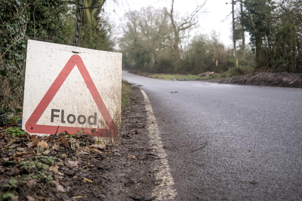
Geospatial methods for distributed flood attenuation on riverine catchments
Does a big problem need a big solution? Not necessarily. In the field of flood mitigation, engineers typically respond to the question: how large does a project need to be to prevent flooding? Instead, I ask: how many small projects do we need to prevent flooding?
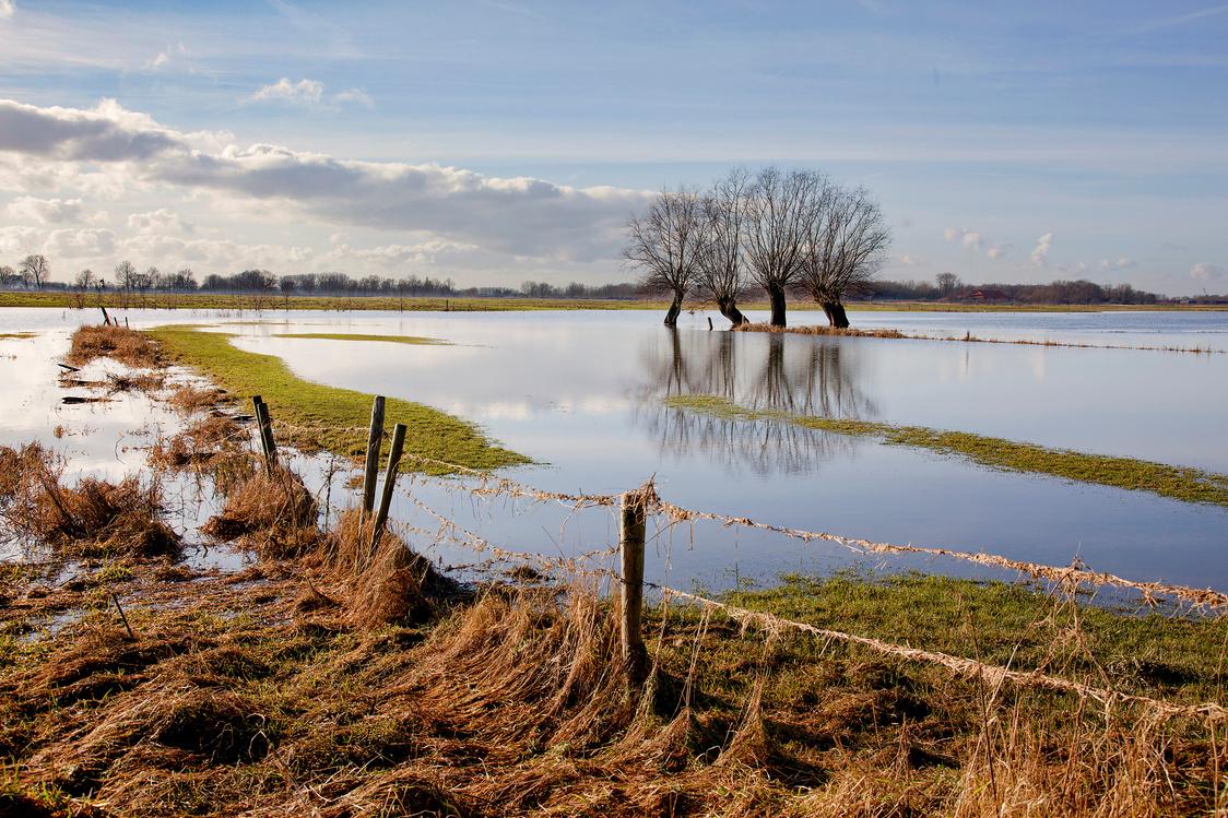
Ponds, dense vegetation, rain barrels outside of buildings and pervious pavements in parking lots and driveways are examples of such projects. They capture, infiltrate or store water in place, decrease the volume and the speed of the water draining down to sewage or channels, and reduce the risk of the next flood. They are less expensive than large structures, more environmentally friendly and take less space. Are they also effective? To be effective, they must work together, as a system, because it is the combination of their effects that eventually reduces flooding. To this end, some locations are preferable than others.
My research establishes methods for water resource managers and engineers to determine how many of these projects should be installed, where to install them and how much they would cost. I tested these methods in a rural watershed in Northeast Iowa. I found that small ponds in the upstream half of the watershed are more effective at attenuating floods and can do so more cheaply than in other locations. These methods can be applied using other projects beside ponds, in larger regions and in urban areas to design new sustainable ways to reduce flash floods and river inundations.
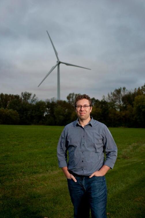
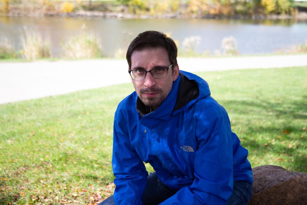
Federico Antolini, advised by Dr. Eric Tate
Federico Antolini, photographed by Cecilia Shearon (Daily Iowan)
Artificial Intelligence-Enabled Satellite Remote Sensing of Armed Conflict
Neal MacDonald, advised by Dr. Marc Linderman
Despite wishful thinking that events at the close of the 20th Century heralded the end of armed conflict as a continual threat to mankind, the events of the past two decades have demonstrated this to be overly optimistic. Armed conflict along with all its associated ills has persisted despite rapid cultural, technological, and social upheavals in the new millennium. There are now more persons forcibly displaced worldwide by armed conflict than ever before, a sobering reminder that its effects often fall most harshly on the people caught in its wake, an unchanging constant across human history.
What has changed in our time, however, are the tools and techniques available to us to observe, detect, monitor, and – hopefully – deter such events. The usage and understanding of Artificial Intelligence is at an all-time high, with groundbreaking innovations whose implications are still being debated. We are able to view our Earth from space through a variety of means and at scales far outside of what human vision alone can provide. Together, the advancements in Artificial Intelligence and Satellite Remote Sensing present an unparalleled opportunity to combine the wonders of the modern world together to challenge the most enduring self-made hazard of mankind – that of Armed Conflict.
This dissertation presents a set of analyses and experiments that explore the frontier of how these advances can best be put together in efforts to study and observe armed conflict and its
Modelling Debris-flow Risk Using Hyperspectral Remote Sensing of Wilfire Burn Severity
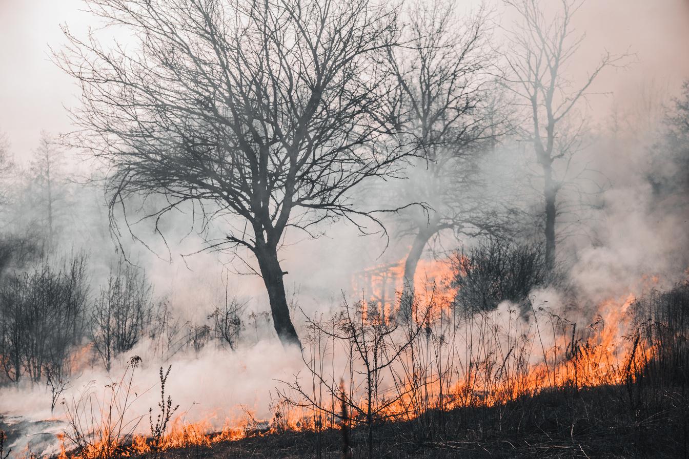
Increasing wild United States particularly in developed an (M1) model tha averaged burn assessed the m input and dete use Geo-CBI-o Fire, and Montecito, California debris flows as a case study. This study modified the M1 model to use the full di dNBR values, creating a per-pixel probability mod flow likelihood. We show the M1 mod operationalization of reducing a watershed’s dNBR tendency does not capture the variability or extre severity and resulting initiation probability within a all dNBR values, the per-pixel likelihood mod extremes lost in single-value modeling, capturing t of debris flow probability. Using spectral bands mo to Geo-CBI measurements, AVIRIS captured vegetation health, increasing the magnitude of e change and burn severity reported compared to Sen per-pixel model can be implemented into the existing USGS framework, creating new emergency management tools, and with emerging hyperspectral satellites, such as the Environmental Mapping and Analysis Program (EnMAP) and Earth Surface Mineral Dust Source Investigation (EMIT), nearly global hyperspectral data with comparable revisit times are now accessible. As wildfire and debris-flow risk increases in the future, opportunities exist to improve burn severity analysis and debris-flow probability modeling.
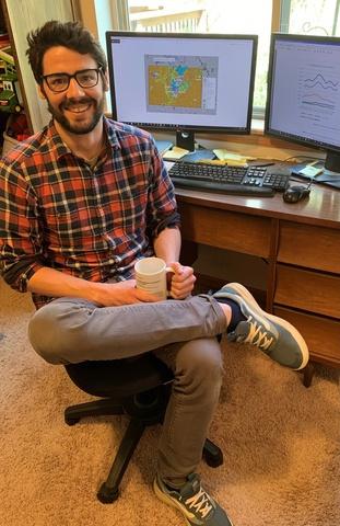
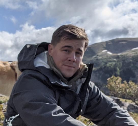
 Sam Taylor, advised by Dr. Susan Meerdink
Flood loss and social vulnerability in the US and pathways to unmet needs reduction
 Asif Rahman, advised by Dr. Eric Tate
The impact of flooding in the US has increased over the last few decades, and due to climate change, it will continue to affect more people and communities To reduce the possibility of further impact, we need to understand which assets, such as crops, and which groups of the population will suffer the most.
In my dissertation, I calculated the potential annual loss of agriculture from flood events for the contiguous US. I also outlined which areas in the country have the highest and lowest losses. Social vulnerability refers to the conditions of individuals or communities that make them more susceptible to hazard impact. In my second study, I examined how different groups of socially vulnerable populations are influenced by agricultural and building flood loss. Finally, I identified which social and economic characteristics of flood-affected households most influence the efforts to reduce unmet needs.
The results indicate that flood-related agriculture losses are concentrated primarily in the corn and soybean belt of the US Midwest and Mississippi River Basin, with an expected annual loss of approximately $546 million In areas with higher building losses, housing value, unoccupied housing units, and renter population are the most explanatory factors. For areas with higher agricultural losses, the most explanatory factors are employment in extractive industries, Asian populations, and civilian unemployment. Finally, among a group of flood-affected and socially vulnerable households, those with fewer social vulnerability attributes had the strongest causal pathways to the reduction of health and social unmet needs. In summary, the findings of this dissertation can help develop better approaches to mitigate the severity of flood impacts.
Examining Equity in USDA Conservation Funding
This study examines the U.S. Department of Agriculture’s Environmental Quality Incentives Program (EQIP) and how the funding it provides is distributed both socially and geographically. This study has a particular emphasis on investigating how the nature of EQIP contracts might vary depending on a producer's race or ethnicity. It is determined whether there are issues of inequity within the program's funding records, and the degree to which the limited data available can assess this. Agricultural producers of all kinds are facing a range of challenges as the price of farmland continues to rise, the agricultural system further consolidates, and the financial risk involved for those operating small landholdings rises.
While all farmers face impending hardship, the challenges for farmers of color and other historically underserved groups are compounded by historically having agricultural aid and resources withheld from them. Some efforts have been made to improve equity in USDA programs, but vigilance in identifying areas of potential inequity remains important, both to hold the USDA accountable and to identify where additional improvements can be made. This work contributes to that effort by investigating this under-studied program in its funding rate and conservation practices as they differ for producers of different social and racial backgrounds. It is indicated that socially underserved producers are eligible for greater funding amounts under EQIP. Results support that these producers are funded at higher rates, but results vary depending on how funding is calculated at the level of geography that is studied. More transparency from the NRCS on EQIP funding would allow for a more comprehensive assessment of equity.
Tallie Foster, advised by Dr. David Bennett
Student Graduations
Masters & Doctoral Graduates
Spring2022
Taylor Durant Billings
Master of Arts, Geography
Barbara Chebet Keino
Doctor of Philosophy, Geography
Seungwon Kim
Doctor of Philosophy, Geography
Summer2022
Federico Antolini
Doctor of Philosophy, Geography
Fall2022
Austin Lovel Holland
Doctor of Philosophy, Geography
Nicholas Alex
Master of Arts, Geography
Eric Mykleby
Master of Arts, Geography
Spring2023
Haoyi Xiong

Doctor of Philosophy, Geography
Summer2023
Hoeyun Kwon
Doctor of Philosophy, Geography
Tallie Foster
Master of Arts, Geography
Undergraduates
Ethan David Aamodt
BS, Environmental Policy and Planning
Yusef Abuissa
BA, Environmental Policy and Planning
Irvin Esau Alcaraz
BA, Environmental Policy and Planning
Jordan Nicole Banfield
BA, Environmental Policy and Planning
Steven Maxwell Barnett
BA, Environmental Policy and Planning
Ashlynn Renee Brown
BS, Geography
Alyssa Rene Comer
BA, Environmental Policy and Planning
* Melanie Nicole Comer
BA, Environmental Policy and Planning
Briar Conrey
BA, Environmental Policy and Planning
Macallister Downing
BA, Environmental Policy and Planning
Alexa Gilbert
BA, Environmental Policy and Planning
* Mitchell Griffin BA, Environmental Policy and Planning
Dylan Cameron Guss BA, Geography
Samantha Harman
BA, Environmental Policy and Planning BA, History
Hannah Katherine Hess
BA, Environmental Policy and Planning
Eleanor Grace XiuQiao Heckman
BS, Environmental Policy and Planning
George McDermott Holtz
BA, Environmental Policy and Planning
Jared Michael Johnson BA, Environmental Policy and Planning
Ayoung Kim
BS, Environmental Policy and Planning
Molly Suzann Kinney
BA, Environmental Policy and Planning
† Siau-Tong Ding
BA, Environmental Policy and Planning
Ross Michael Fix
BA, Environmental Policy and Planning
Dawson Ross Gamble
BA, Environmental Policy and Planning
BA, Enterprise Leadership
Tyson Knight
BA, Environmental Policy and Planning
Kevin Kim Larson
BA, Environmental Policy and Planning
Tabitha Lynn Kuehn
BS, Geography
* with Distinction
** with High Distinction
*** with Highest Distinction † with
Spring2022
University Honors
Sarah Elizabeth Martin
BA, Environmental Policy and Planning
Samuel John Mansfield
BS, Sustainability
Halley Marie Quinn
BS, Environmental Policy and Planning
Lydia Rose
BA, Environmental Policy and Planning
Kaeleb Royster
BS, Sustainability
†** Graham Russell Sandersfeld
BS, Environmental Policy and Planning
Emily Jane Schmitt
BS, Environmental Policy and Planning
Alyssa Christine Schnoor
BA, Environmental Policy and Planning
Nathan Michael Slusher
BA, Environmental Policy and Planning
Libbie Smith
BA, Environmental Policy and Planning
Mallory Elaine Stolt
BA, Geography
* Kaleb Michael Streepy-Wheeler
BS, Geography
Frederick John Stumbo
BS, Geography
Brady Vanlo
BA, Environmental Policy and Planning
Brady Vanlo
BA, Environmental Policy and Planning
Payton Rae Wensel
BA, Environmental Policy and Planning
** Elizabeth Kathryn Wagner
BA, Environmental Policy and Planning
Ryan Michael Wicke
BA, Geography
* with Distinction
** with High Distinction
*** with Highest Distinction
† with University Honors
Fall2022
Benjamin Claire Hoffman BS, Sustainability
Brooke Anne Sarrazin BA, Geography
Hannah Reese Teague BA, Environmental Policy and Planning
Spring2023
† Emma Jospehine Berger BS, Environmental Policy and Planning
Preston Noah Carron BA, Environmental Policy and Planning
Mae Catherine Crooks BA, Environmental Policy and Planning
Benjamin Thomas DeTaeye BA, Environmental Policy and Planning
Amy Cathryn Gaiero BS, Sustainability
Camryn Leigh Grawe BS, Sustainability
William Hanlon BA, Environmental Policy and Planning
Gabrielle Arianne Healey BA, Environmental Policy and Planning
†*** Emmeline Violet Kraus BS, Geography BS, Environmental Science
Alayna Sophia Kuntz BS, Sustainability
* Greta Rose Mally BA, Geography BA, Environmental Policy and Planning
† Cathernie Olivia Mckenna BS, Geography
Isabella Fure Mullins BS, Sustainability
Robert Donald Pentuic BA, Environmental Policy and Planning
Brady Michael Richlen BS, Sustainability
Haley Noelle Russell BA, Environmental Policy and Planning
* LilliAnna Celestine Scott BA, Environmental Policy and Planning
Paloma Lourdes Solorio BS, Sustainability
Tanner Lee Sorgenfrey BA, Environmental Policy and Planning
Caleb Steege BS, Environmental Policy and Planning
Gabriel Zachariah Jones
BA, Environmental Policy and Planning
Sydney Grace Klatt BS, Sustainability
Katherine Joy Stovold BS, Environmental Policy and Planning
Rachelle Anastasiya Toniny BA, Geography
* with Distinction
** with High Distinction
*** with Highest Distinction † with University Honors
Ethan Charles Traugh
BA, Geography
BA, Computer Science
Jayna Harris Wanamaker
BA, Geography
Katelyn Rose Winkler
BS, Sustainability
Support the Department
If you are in a position to contribute to the success of our department and students, please consider one or more of the following options for support. Visit givetoiowa.org/geography for details.
Development Fund: These funds are used to enhance the department through recruitment activities, guest speakers, events, student travel for conferences, or field research, student excellence awards, and experiential learning opportunities for students.
Gerard Rushton Academic Excellence Fund: Supports graduate students & visiting speakers
Rex Honey Speaker Series Fund: Supports bringing guests and speakers to our department
Your gift to the department will make a difference. Please visit givetoiowa.org/geography
You can also make valuable contributions to the department in ways that do not require a monetary contribution For example: host an intern at your place of employment, hire a UI GSS graduate, mentor students working on projects, or provide insightful feedback on how your GSS experience prepared you for your career Please contact David Bennett (davidbennett@uiowa.edu) if you are interested in one or more of these opportunities.
