IDAHO FORESTRY
BEST MANAGEMENT PRACTICES
FIELD GUIDE
Using BMPs to Protect Water Quality
BEST MANAGEMENT PRACTICES
FIELD GUIDE
Using BMPs to Protect Water Quality
Yvonne Barkley, Randall Brooks, Robert Keefe, Mark Kimsey, Ashley McFarland, and Chris Schnepf
This information and more is available on the Idaho Forestry Best Management Practices website: http://www.idahoforestrybmps.org
This publication was funded by the Renewable Resources Extension Act and the Idaho Department of Lands, in cooperation with the USDA Forest Service
University of Idaho Extension, Moscow, Idaho
AUTHORS—
YVONNE BARKLEY, Associate Extension Forestry Specialist, University of Idaho Extension
RANDALL BROOKS, Extension Forestry Specialist and Professor, University of Idaho Extension
ROBERT KEEFE, Assistant Professor, Forest Operations, Department of Forest, Rangeland and Fire Sciences, University of Idaho
MARK KIMSEY, Forest Research Scientist, Intermountain Forest Tree Nutrition Cooperative, University of Idaho
ASHLEY MCFARLAND, Director, Upper Peninsula Research and Extension Center, Michigan State University
CHRIS SCHNEPF, Area Extension Educator—Forestry and Professor, University of Idaho Extension
University of Idaho Extension, Moscow, ID 83844
© 2015 by the University of Idaho. All rights reserved. First edition 2015
Printed in Canada
19 18 17 16 15 1 2 3 4 5
Issued in furtherance of cooperative extension work in agriculture and home economics, Acts of May 8 and June 30, 1914, in cooperation with the U.S. Department of Agriculture, Barbara Petty, Interim Director of University of Idaho Extension, University of Idaho, Moscow, Idaho 83844. The University of Idaho provides equal opportunity in education and employment on the basis of race, color, national origin, religion, sex, sexual orientation, age, disability, or status as a disabled veteran or Vietnam-era veteran, as required by state and federal laws.
Special thanks to the following people for their review of this publication:
Paul Adams, Professor and Forest Watershed Extension Specialist, Oregon State University
Robert Barkley, Private Forestry Specialist and Forest Practices Advisor, Idaho Department of Lands
Tom Biltonen, Bennett Lumber Products, Inc.
Paul Buckland, President, Idaho Forest Owners Association, and Forest Resource Manager, Inland Empire Paper Company
Vincent P. Corrao, Manager, Northwest Management, Inc.
Terry Cundy, Manager, Silviculture, Wildlife, and Environment, Potlatch Corporation
Charles L. Graham, Idaho Master Forest Steward
Archie Gray, Forest Practices Program Manager, Idaho Department of Lands
Gary Hess, Private Forestry Specialist and Forest Practices Advisor, Idaho Department of Lands
Shawn Keough, Executive Director, Idaho Associated Logging Contractors, Inc.
Peter Kolb, Extension Forester, Montana State University
Kristin Larson, Water Quality Analyst, Idaho Department of Water Quality
Laura Laumatia, Environmental Specialist, Lake Management District, Coeur d’Alene Tribe
Mark Mahon, Logger, Tom Mahon Logging
Betty Munis, Director, Idaho Forest Products Commission
Deb Page-Dumroese, Research Soil Scientist, Rocky Mountain Research Station, USDA Forest Service
Robert Reggear, Owner, Reggear Tree Farm, and Forest Landowner
Chris Tretter, Fish Biologist, Idaho Department of Lands
Michelle Youngquist, Education Coordinator, Idaho Project Learning Tree, Idaho Forest Products Commission
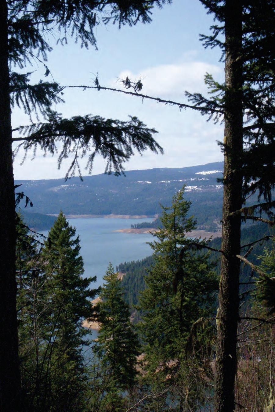
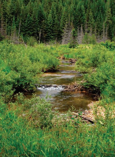
Water. Cool, clean, plentiful water. In Idaho, as in all of the western United States, water rights, water quantity, and water quality are at the center of many of our environmental challenges. Idaho’s 93,000 miles of rivers and streams deliver broad aesthetic, ecological, and economic benefits by supporting wildlife and fish habitat, recreation, hydroelectricity, irrigation, industry, and transportation.
The term “water quality” refers to the biological, chemical, and physical characteristics of water. It is used to indicate the condition of water relative to the needs of one or more living species, including humans.
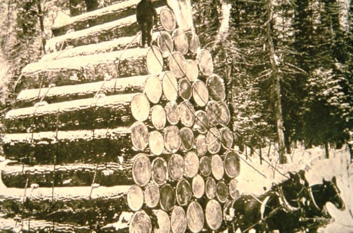
Over the past 200 years, human activities have greatly altered many of Idaho’s forest ecosystems and their water resources. In the mid-1800s, beaver were trapped to near extinction to satisfy European demand for men’s hats. Miners flooded into the area through the 1860s to mine gold and then silver. They were followed by the sheep and cattle kingdoms of the 1880s and next by widespread logging.
By the early 1900s, many people recognized that large volumes of logging slash were becoming a dangerous fire hazard, especially during dry summers. In 1904, the first landowner fire control association financed forest fire control through an assessment based on acreage owned. Within the year, landowners and timber companies had joined the State of Idaho and the newly formed USDA Forest Service in a forest fire protective cooperative known as the “Idaho Idea.” The “Idaho Idea” shaped the interagency cooperative fire protection system used today throughout the nation.
The 1970s brought a wave of change in how our nation used and viewed its natural resources. The federal Clean Water Act, enacted in 1972 and significantly amended in 1977, protects our nation’s water resources.
Section 208 of the Clean Water Act authorizes and encourages state and local management of nonpoint pollution sources, which include forest practices. The 1970s also saw passage of the federal Endangered Species Act (1973), creation of the Environmental Protection Agency (EPA), and passage of the 1974 Idaho Forestry Act (Title 38, Chapter 1, Idaho Code).
Of greatest import to Idaho forest landowners, managers, and operators today is the Idaho Forest Practices Act (Title 38, Chaper 13, Idaho Code). The Idaho Forest Practices Act (IFPA) was passed to “assure the continuous growing and harvesting of forest trees and to maintain forest soil, air, water, vegetation, wildlife, and aquatic habitat.”
The IFPA requires that rules be adopted for forest practices on federal, state, and private lands to protect, maintain, and enhance Idaho’s natural resources. The Act established an advisory board of forest landowners, operators, informed citizens, and environmental experts, and recommends rules for adoption by the Idaho State Land Board. All federal, state, and private land practices must meet or exceed the requirements of these stated rules, which are detailed in the Idaho Administrative Code (IDAPA 20.02.01) and known as the “IFPA Rules.”
Riparian vegetation captures and stabilizes stream sediment.
IFPA Rules are mandatory best management practices (BMPs) that protect, maintain, and enhance Idaho’s forests and maintain high water quality. The Idaho Department of Lands (IDL) defines best management practices as “practices, or combinations of practices, found to be the most effective and practicable means of preventing or reducing nonpoint source pollution from forest activities.”
Water quality is one of the primary emphases of the IFPA Rules. The goals of many Idaho forestry BMPs are to reduce the potential for sediment delivery into streams, stabilize sediment already in streams and riparian areas, and maintain cool water temperatures necessary to healthy aquatic habitats.
Landowners and operators share the responsibility for protecting Idaho’s water. Mandatory minimum BMPs ensure that harvesting operations, road building, reforestation, and stream protection measures maintain and enhance water quality and other valuable forest resources while supporting a vibrant economy. Other highly recommended, but voluntary, management practices are included in this field guide to further guide forest management activities, especially as they affect water quality.
Applying mandatory forestry BMPs requires practice and judgment. Idaho Forestry Best Management Practices Field Guide is designed to educate forest landowners, managers, and operators about
• the science related to forests, forest hydrology, aquatic ecology, and related biology;
• the IFPA Rules; and
• additional highly recommended voluntary management practices that guide forest management activities.
IFPA Rules boxes contain verbatim information from the Rules. How-to boxes include information, instructions, and illustrations to help landowners and operators comply with important aspects of the IFPA Rules.
Idaho Forestry Best Management Practices Field Guide is available online at http://www.idahoforestrybmps.org. The Idaho Forestry Best Management Practices website includes additional material such as IDL contact information, video clips, and resource links.
It is important to work with an IDL Forest PracticesAdvisor when conducting any forest practice activity. For more information on all aspects of forest management, as well as on how to implement IFPA Rules on a specific piece of forestland, IDL Forest Practices Advisors are available to work one-on-one with forest landowners. Contact information can be found at http://www.idl.idaho.gov/areas/index.html or by calling the IDL Coeur d’Alene office at (208) 769-1525.
Before starting any forest practice, you must file a Notification of Forest Practice and, in most cases, a Certificate of Slash Compliance/Fire Hazard Agreement at your local Idaho Department of Lands (IDL) office. The Notification of Forest Practice (Notification) is a notice to the state that a forest practice is going to be conducted, and the Certificate of Slash Compliance/Fire Hazard Agreement (Compliance) is an assurance given to the state that fire hazard reduction or management will be performed after the forest operation.
A Notification and Compliance are required except for:
• routine road maintenance, recreational uses, grazing by domestic livestock, cone picking, the culture or harvest of Christmas trees on lands used solely for the production of Christmas trees, or harvesting other minor forest products;
• noncommercial cutting and removal of trees for personal use, such as firewood; and
• clearing forestland for conversion to surface mining or dredge and placer mining operations under a reclamation plan or dredge permit.
To begin, contact and work with your local IDL Forest Practices Advisor to complete both forms.
• Forms include a signatory line for the Operator as well as the Contractor. It is important that the person taking responsibility for complying with forest practices sign on the Operator signatory line and the person taking responsibility for slash sign on the Contractor signatory line. There must be a valid signature on both signatory lines, even if one person is both the contractor and the operator. If both signatory lines are not signed, the forms will be considered invalid and held at the local IDL office until all signatory lines are completed.
• Forest practices may begin once IDL has approved the forms.
• IDL sends copies of the forms to the landowner, timber owner, and operator.
• The Notification and Compliance are valid for 1 or 2 years, depending on which operating option you have chosen.
• Upon expiration, the Notification and Compliance forms must be renewed before the practice can continue. Extensions and other changes to the forms must be made within 30 days by the person who filed the originals.
• Notification of emergency forest practices due to fire, flood, windthrow, or earthquake may be made up to 48 hours after such practices have started.
When a forest operation is found in violation of the Rules, and the operator does not take corrective measures within a requisite period of time, IDL will take enforcement action against the operator who signed the forms. The time period allowed for correction varies according to each violation of the Rules. New forms will not be accepted by IDL until all outstanding violations are resolved. Violation of the Rules is a misdemeanor, and operators with repeated violations may be required to post a bond. IDL can take civil action to recover legal and repair costs if a violation that causes resource damage is not repaired by the operator.
Please consult an IDL Forest Practices Advisor with any questions you have regarding Notification and Compliance forms.
The health and wealth of Idaho’s aquatic environments reflect the condition of the surrounding land—its watershed. A watershed is the entire area of land that delivers water, sediment, debris, and dissolved materials to a particular body of water. No matter where you are on Earth—in a forest, high desert, prairie, or urban area—you are within a watershed.
Just as small streams run into larger streams and then into rivers, lakes, or oceans, large watersheds are made up of smaller ones, with no two exactly the same. Topography, climate, soils, vegetation, groundwater, and geology all play a role in how watersheds react to natural events and human-caused pressures. Crop production, livestock grazing, mining, forestry, development, and all other land uses cumulatively affect the health and wealth of a watershed.
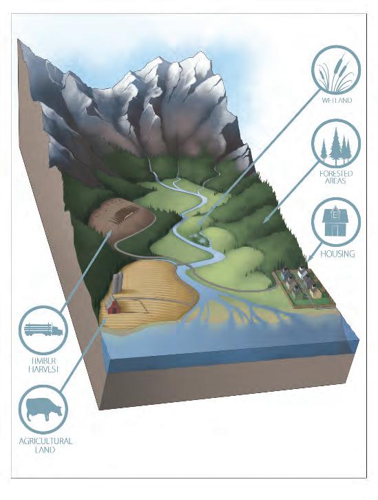
Watersheds support a multitude of uses. No matter where you are on Earth, you are within a watershed.
Many of Idaho’s watersheds are covered in forests—unique ecosystems that collect and filter vast amounts of cool, clean water. Forested watersheds are closely tied to the hydrologic cycle, a system of interrelated processes by which water moves through an ecosystem.
Several types of ecosystems play especially important roles in the hydrologic cycle within forested watersheds: riparian areas, wetlands, and streams. This section examines the components of the hydrologic cycle and discusses these three important ecosystem types. It also describes potential threats to stream quality, as well as stream protection measures that can reduce these threats.
The processes that make up the hydrologic cycle include interception of precipitation, infiltration, soil water storage, transpiration, evapotranspiration, and runoff, all of which determine the quantity and quality of water within a watershed (see illustration at right). Natural conditions, as well as forest practices, affect these processes.
Precipitation is defined as any liquid or solid water particles that fall from the atmosphere and reach the earth’s surface. It includes drizzle, fog, rain, snow, snow pellets, snow grains, ice crystals, ice pellets, and hail, and is the primary source of streamflow in forests.
Interception is the process by which a portion of precipitation is caught before it reaches the soil. Both natural and constructed surfaces intercept precipitation, each having unique characteristics that affect the amount of moisture intercepted. For example, waxy conifer needles and rough surfaces (such as tree bark and duff on the forest floor) intercept water more efficiently than broad leaves and smooth surfaces. Leafless trees intercept less precipitation than full canopies, and dense vegetation more than sparse.
Infiltration is the process by which rain or melted snow is absorbed into subsurface soil and rock. Infiltration rates depend on the amount of water delivered, soil and rock characteristics, soil moisture content, the slope of the land, and the amount of protective cover. As water infiltrates the subsurface, it passes through an unsaturated and a saturated zone. The saturated zone holds groundwater, which moves through soil and crevices in underground rock.
Transpiration is the uptake of soil water by plants and its subsequent evaporation to the atmosphere through leaves and other plant surfaces. Transpiration can be likened to breathing, with plants “inhaling” water through their roots and “exhaling” water vapor through their leaves. Evapotranspiration is the total combined loss of water to the atmosphere by evaporation of intercepted and surface water and by transpiration from vegetation.
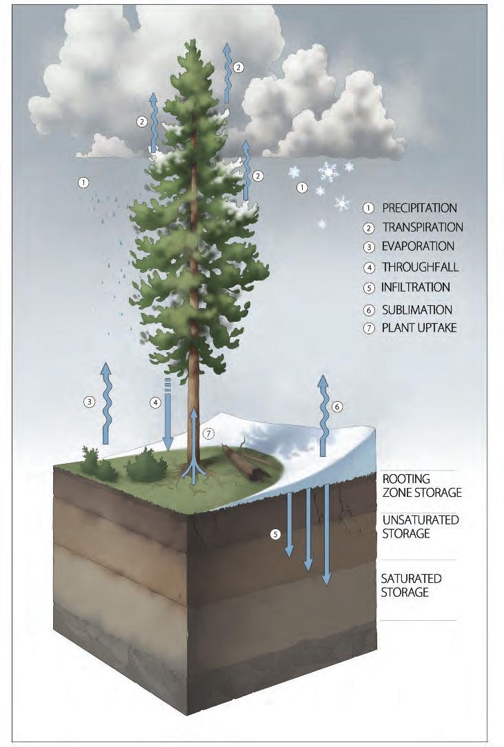
Forest hydrologic cycle. Forested watersheds are intimately tied to the hydrologic cycle— the process by which water constantly moves among oceans, air, and earth.
Overland flow, also called surface runoff, is water that moves over the top of soil surfaces. The amount of overland flow depends on soil saturation rates and permeability, as well as on the slope of the land. Permeability is the ease with which gases, liquids, or plant roots penetrate or pass through a layer of soil. Highly saturated soils and those with low permeability, as well as areas with steep slopes, can produce large amounts of surface runoff. Runoff can produce erosion when it detaches and moves soil or rock fragments. A healthy watershed typically allows a majority of precipitation to readily infiltrate soil, limiting overland flow that can cause erosion.
Transpiration, interception, and soil infiltration rates can be affected by forest practices that alter the amount or type of vegetation or compact the soil. The impact of timber harvesting is site specific and directly related to factors such as aspect, slope, soil texture and structure, vegetation types, silvicultural practices, time of year, and weather. Forest canopy removal by timber harvesting, or by natural events such as wildfire or insect outbreaks, can increase streamflows for several years due to reduced interception, transpiration, and infiltration.
Snowpacks contribute moisture to watersheds differently than rain. Snow accumulation is beneficial if snowmelt is gradual. Slowly melting snow percolates into soils and can significantly contribute to stored soil moisture and groundwater. However, if a rain-on-snow event or rapid warming occurs, the potential for flooding and catastrophic events such as mudslides and debris avalanches increases.
Snowpacks are influenced by direct warming from the sun and by air movement across surfaces. At temperatures below freezing, snowpacks shrink by a process called sublimation, in which snow changes from a solid to a gas (water vapor), bypassing the liquid phase. In spring, warm temperatures and increased solar radiation cause snow to melt to water. Melt rates vary depending on how quickly temperatures rise.
Snow accumulation is related to the amount of vegetative cover on a site. Dense tree canopies intercept snow, while widely spaced canopies and few to no trees allow wind to scour and blow snow away. Thus, more snow accumulates on the ground in smaller forest openings than in denser forests or cleared areas. The surrounding tree canopy protects snow from wind and direct sunlight and allows it to melt slowly.
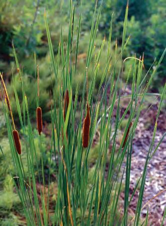
Riparian areas are the forest and plant ecosystems immediately adjacent to streams, rivers, lakes, and wetlands. They are an important part of forested watersheds because of their ability to maintain high water quality. Riparian areas often have shallow water tables, wet (hydric) soil, and dense vegetation that thrives on moist sites. Common woody plant species include alder, willow, cottonwood, cedar, and spruce. Vegetative species often include ferns, horsetail, and skunk cabbage.
Riparian areas occupy the area of land adjacent to streams called a floodplain, and the two terms are sometimes used interchangeably. Floodplains become inundated during high flows when water in the stream channel overtops the banks. A healthy relationship between stream channels
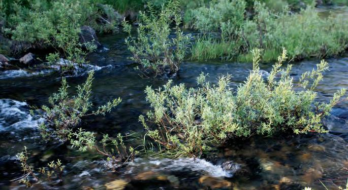
Riparian vegetation slows water velocity, replenishes soil nutrients, and filters excess nutrients and sediments from the water.
Shadefrom streamside vegetation helps maintain cool water temperatures, stabilizes stream banks, and provides habitat for wildlife.
and floodplains is critical to riparian area function. As flooding occurs, riparian vegetation slows water velocity, replenishes soil nutrients, and filters excess nutrients and sediments from the water.
The spongelike qualities of a floodplain also help control the quantity and quality of water reaching streams. Soils and decomposing organic matter absorb and store water during wet seasons, thus reducing peak runoff during high flows. As channel flow decreases during the dry season,
Most forest wildlife species make use of riparian areas for food, water, shelter, and/or travel corridors.
stored water is gradually released into streams, maintaining lower water temperatures and higher streamflows.
Riparian vegetation shades streams, helps maintain cool water temperatures and stable stream banks, and provides wildlife habitat. It supports a variety of terrestrial insects that are an important food source for fish, while leaves and litter that fall into the stream provide food for aquatic insects.
Riparian vegetation remains important even after it dies. As large trees die, they become snags with high wildlife value, providing nesting cavities for birds and habitat for insects that provide food for birds, bears, and other animal and insect species. Fallen trees, called large organic debris, continue to provide habitat for wildlife species and their prey. Those that fall across and into streams can trap sediment and create pool habitats where fish overwinter, hide from predators, rest, and reproduce.
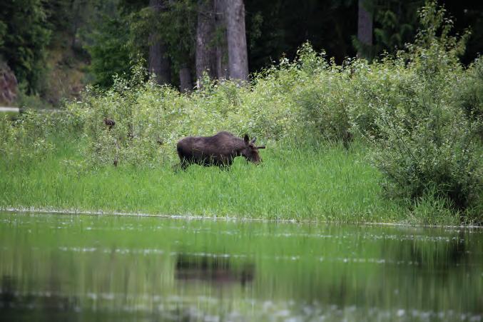
Nearly all forest wildlife species make occasional use of riparian areas for water and as travel corridors. Some species spend most of their lives in and around riparian areas. Mammals that primarily inhabit riparian areas include moose, otter, beaver, and mink. Birds include kingfishers, mergansers, harlequin ducks, dippers (sometimes called “ouzels”), and great blue herons. Amphibians such as the tailed frog and a variety of reptiles also use forest riparian habitats.
Wetlands are areas inundated or saturated by surface or groundwater at a frequency and duration sufficient to support communities of vegetation called hydrophytes or hydrophilic plants. These species are adapted to life in saturated soil conditions. In the absence of standing water, their presence, as well as the distinctive characteristics of saturated soils, is commonly used to identify wetlands. Wetlands are described by the IFPA Rules as “bogs, swamps, wet meadows, springs, seeps, wet draws, or other areas.”
Essential to the health of forested watersheds, wetlands act as natural filters and sponges and can help offset the effects of forest practices on water quality. When planning forest operations, wetlands should receive special consideration and protection. The IFPA Rules requirement is to “avoid disturbing these critical forest ecosystem components when building roads, skid trails, landings, and during harvesting and other forestry activities.”
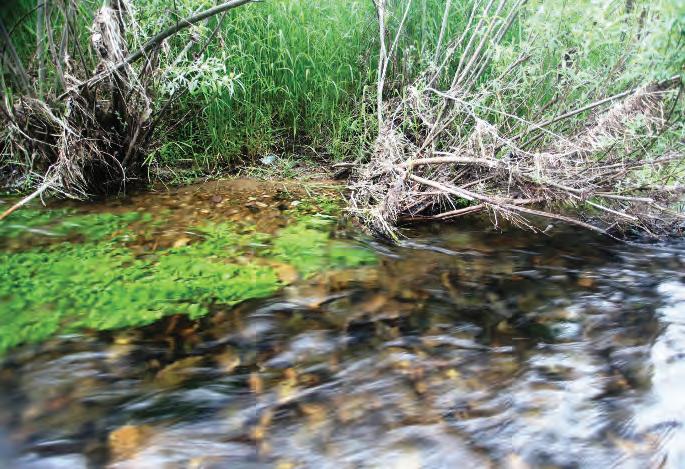
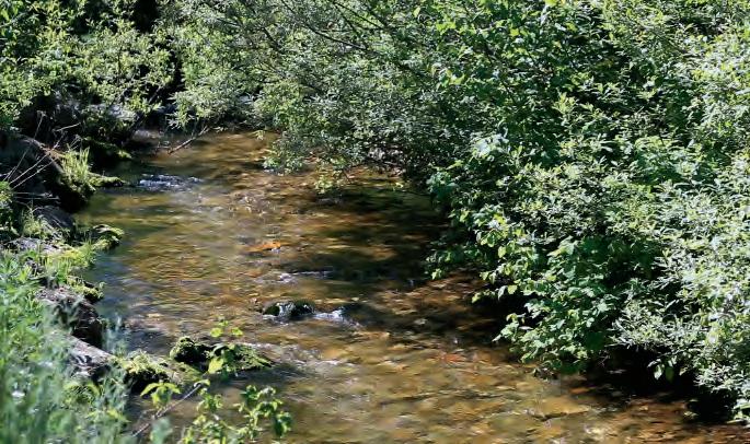
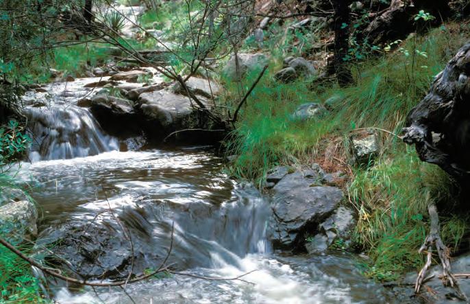
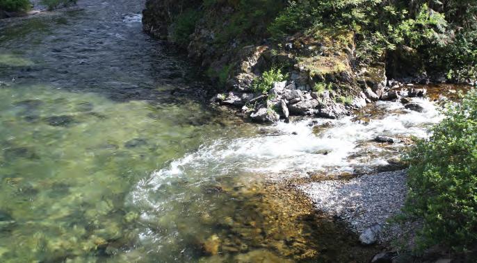
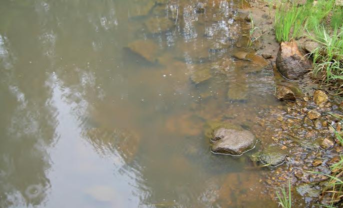
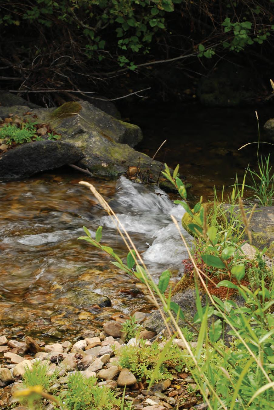
Simply stated, a stream is a body of water in a channel or watercourse. Idaho’s forest streams teem with life. They provide and support cool, clean water and serve as critical refuges for a variety of native fish species and associated organisms, all of which depend on high water quality.
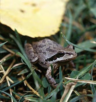
Amphibians are an important part of forest riparian habitats.
Hydrophilic plants are adapted to wet soils. In the absence of standing water, these plant species are commonly used as wetland indicators.
water.
Stream size and diversity are important to watershed function and are classified in a variety of ways. A stream that flows only in direct response to precipitation or melting snowpack, and whose channel is at all times above the water table, is classified as an ephemeral stream. Ephemeral streams often lack defined banks and usually are found in the headwaters of a watershed.
A network of ephemeral streams drain together to form an intermittent stream—any nonpermanent flowing drainage feature having a definable channel and evidence of scour or deposition, and regularly carrying more water than an ephemeral stream. Intermittent streams do not flow during the driest times of the year, limiting their ability to support aquatic habitats.
Intermittent streams typically drain into perennial streams, which are streams that flow year-round and may or may not support fish. Because of their ability to sustain cold-water aquatic habitats, perennial streams have the greatest impact on water quality, although protection of all streams is important, as all play critical roles in forest watershed health.
Hydrologists commonly use the Strahler Stream Classification System to classify streams by size. The Strahler system is based on a hierarchy of tributaries in a stream system. First-order streams are nonbranching headwaters often originating from upland seeps and bogs. Headwater ephemeral and intermittent stream channels, for example, are considered first-order streams. Second-order streams are formed when two first-order
streams meet, and third-order streams form where second-order streams meet. Fourth-order streams usually have floodplains.
The IFPA Rules have their own criteria for defining streams. See “Rule 010.60. Class I and II Streams,” page 17, for these important definitions.
Streams include many living and nonliving components, such as fish, aquatic invertebrates, and woody debris. Each plays a role in stream health.
One of the first things people associate with healthy streams is fish. In fact, a prominent beneficial use of water bodies in Idaho is support for cold-water aquatic life. Failure to meet standards designed to protect cold-water aquatic habitats can result in greater restriction of management activities adjacent to a water body and within its watershed.
Idaho streams support both migratory and resident fish. Migratory species such as bull trout, salmon, and steelhead move long distances through streams, rivers, lake systems, and oceans to complete their life cycles. A bull trout, for example, may hatch and reside in a small mountain stream until it migrates downstream to a larger river or lake where food is more abundant. At adulthood, the bull trout will return to spawn in the mountain stream where it hatched. Fish that reside in small mountain streams year-round may migrate upstream in spring and summer to access cooler, more oxygenated water, returning downstream to overwinter in deeper pool habitats.
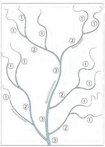
Strahler Stream
Classification System is used by hydrologists to classify streams by size. This system assigns each headwater stream an order of 1; at the confluence of two first-order streams, the stream reach is assigned an order of 2. The confluence of two second-order streams results in a downstream reach of order 3, and so on.
Tributary streams are often intermittent, but still may provide migration routes or fish spawning and rearing areas during the short time they hold water.
Even intermittent streams may support fish at critical times during their life cycles. Near larger bodies of water, intermittent streams may provide migration routes or fish spawning and rearing areas during the short time they hold water. Fish come to these streams in the spring to spawn. Eggs hatch and grow into fry, which migrate to larger water bodies before the intermittent streams dry up.
Stream. A natural water course of perceptible extent with definite beds and banks which confines and conducts continuously or intermittently flowing water. Any reference in these rules to Class I streams shall also apply to lakes.
• Class I streams are used for domestic water supply or are important for the spawning, rearing or migration of fish and are considered to be Class I upstream from the point of domestic diversion for a minimum of one thousand three hundred and twenty (l,320) feet.
• Class II streams are usually headwater streams or minor drainages that are used by only a few, if any, fish for spawning or rearing. Where fish use is unknown, consider streams as Class II where the total upstream watershed is less than two hundred and forty (240) acres in the north forest region and four hundred and sixty (460) acres in the south forest region. Their principle value lies in their influence on water quality or quantity downstream in Class I streams.
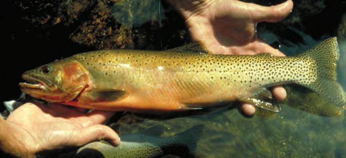
Cutthroat trout are among the native sport fish that inhabit Idaho forest streams.
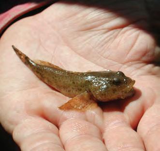
The presence of sculpin, a nongame fish species, is an indicator of excellent water quality.
Many people are aware of the native sport fish that inhabit Idaho forest streams, ranging from Idaho’s state fish, the westslope cutthroat trout, to steelhead and Chinook salmon. Idaho forest streams also harbor a number of popular introduced fish species, such as brook trout and smallmouth bass. Less well known are nongame fish species, such as suckers, pikeminnows, and sculpins. These nongame fish nonetheless play important roles in stream ecology. Sculpins, for example, serve as indicators of excellent water quality. These species also serve as food for game fish.
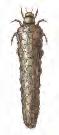
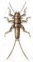
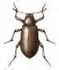
Hundreds of types of aquatic invertebrates inhabit Idaho streams. Macroinvertebrates can be seen with the unaided eye and are sedentary, meaning they spend their entire life in a very short reach of a stream. They include crayfish (which can be larger than 6 inches long) and aquatic insects such as 2- to 3-inch-long stonefly larvae. Microinvertebrates are so small that they can be identified only under a microscope.
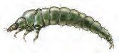
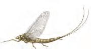
Aquatic macroinvertebrates are commonly used as indicators of stream health (see page 20). For example, stoneflies, caddisflies, and mayflies
usually indicate high water quality, while aquatic worms and black fly larvae are more common in streams with relatively low water quality. Changes in macroinvertebrate numbers usually indicate changes in water quality.
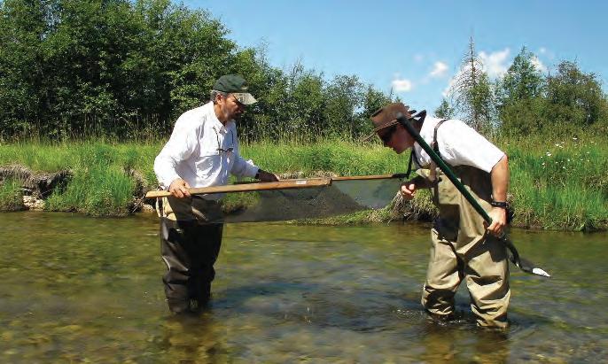
Professionals assessing stream health use formal sampling methods to measure the variety and abundance of stream insects. The healthiest streams have a variety of insects, while lower quality streams have few, if any, of the species that indicate good health.
Large organic debris (LOD), also known as large woody debris or coarse woody debris, is defined by the IFPA Rules as “live or dead trees and parts or pieces of trees large enough, long enough, or sufficiently buried in the stream bank or bed so as to be stable during high flows.”
LOD was once considered a source of logjams that could block river navigation and fish passage. Previous stream management focused on removing LOD to permit fish passage and reduce the potential for accumulated LOD to damage bridge and stream structures. We now understand that LOD plays a valuable role in creating and maintaining high-quality habitat for fish and other aquatic organisms.
Although it eventually becomes part of the food chain as it decays, the primary value of instream LOD is its influence on channel hydraulics, channel and bank stability, and pool habitat. It improves water quality and increases fish populations by creating pools, riffles, and shaded refuge areas.
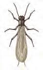
Stonefly
½to 1½ inches long; two hairlike tails; no gills on rear half of body; six legs; hooked antennae.
Caddisfly
Up to 1 inch long; three pairs of legs on upper third of body; two claws at rear end; may be found with its head sticking out of a case made of sticks, rocks, or leaves.
Mayfly
¼ to 4 inches long; gills on sides of lower body; six large, hooked legs; most often with three hairlike tails (sometimes only two).
Water penny beetle
¼ to ½ inch long; flat, saucer-shaped body; six tiny legs; fluffy gills.
Dobsonfly (Hellgrammite)
¾ to 4 inches long; six legs; short antennae; two short legs (tails) at the back end with claws.


Riffle beetle
1⁄16to ¼ inch long; very small, oval body covered with tiny hairs; six legs; two antennae; walks slowly under water.
Gilled snail
¼ to 1 inch long; opens to the right when the narrow end is pointed upward; opening covered by a thin plate (the operculum); gill breathing.
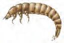

Types of insects that indicate high water quality in Idaho forest streams.
LOD-formed pools and riffles reduce streamflow velocity, trap and store sediment, and decrease the bank- and channel-cutting energy of moving water.
LOD-formed pools and riffles in turn reduce stream velocity, thereby helping to trap and store sediments and decrease the bank- and channel-cutting energy of moving water.
All surface water in Idaho has a designated beneficial use, such as recreation, wildlife habitat, cold-water aquatic habitats, or drinking water. Under the Clean Water Act, when water can no longer support its designated beneficial use, the water body is considered impaired. Your local Idaho Department of Environmental Quality (IDEQ) field office can tell you a specific water body’s designated beneficial use and whether or not it is impaired. IDEQ can also share baseline data on watershed conditions and explain how impairments are determined.
A significant threat to Idaho’s surface water is nonpoint source pollution. In contrast to a point source, such as a pipe or drain, nonpoint source pollution originates from dispersed areas within a watershed, such as streets, parking lots, agricultural land, and construction sites. In Idaho, most nonpoint source pollution is transported to surface waters by overland flows.
Designated beneficial use, such as recreation, wildlife habitat, cold-water aquatic habitats, or drinking water, is assigned to all surface water in Idaho.
Specific pollutants that threaten Idaho stream quality include sediment, temperature, and nutrients.
Sediment
Sediment is loose soil particles that are detached from the land or stream channel, transported by water, and deposited in or near floodplains and water bodies. Overland flow from rain or snowmelt causes erosion and transports sediment to streams, rivers, and lakes, resulting in sedimentation. Eroding stream and river banks may also cause sedimentation.
All Idaho streams carry a natural amount of sediment, which is determined by soils and other factors unique to each watershed. The amount of natural sediment can vary greatly, reflecting disturbances in the surrounding watershed (such as forest fires) and stream channel characteristics (such as gradient and topography).
Each stream also has an inherent ability to transport sediment, determined by the size of the sediment particles, stream gradient, and discharge volume (the amount of water a stream transports over time).
A healthy stream is one that maintains the delicate balance between erosion and sedimentation. When these processes are in equilibrium, the stream can move sediment through at its proper capacity and sustain optimum habitats for aquatic organisms. Changes in the landscape can disrupt this balance.
A stream that is eroding more sediment from its bed and banks than it is depositing is called a degrading stream. Degrading streams are characterized by excessive bank erosion and channel incision. Channel incision is the process of moving water cutting into a stream channel, leading to a decrease
in the channel bed elevation. A deeply incised stream may lose its ability to overtop its banks (flood), resulting in less water being available to recharge floodplain soils and groundwater. Less storage in the floodplain may cause a loss of riparian vegetation, reduce streamflows, and raise water temperatures during hot summer months.
A stream that is accumulating more sediment than it is eroding is called an aggrading stream. Aggrading streams are characterized by overwidened channels and excessive channel sediment.
Excess sediment in streams is the primary nonpoint source surface water pollutant in the United States and is one of the leading threats to Idaho water quality. Both suspended and bed sediment can have negative effects on aquatic communities. Many aquatic organisms cannot feed or reproduce successfully when sediment clogs gills, smothers eggs, and destroys food supplies and habitat. For example, native Idaho stream fish need relatively clean spawning gravel so that water can flow through and provide oxygen for eggs and developing fish.
Suspended sediment also contributes to turbidity, a measure of the distance light can penetrate through water. Higher turbidity slows photosynthesis and aquatic plant growth, resulting in reduced food and oxygen available for aquatic wildlife. Sediment from heavily disturbed areas may also carry chemicals and excess nutrients into water bodies, with negative consequences for both aquatic wildlife and humans.
As water temperature increases, its ability to hold dissolved oxygen is reduced. Thermal pollution occurs when water temperatures are too warm to maintain dissolved oxygen at levels necessary to support desired aquatic species.
Salmonids and many other aquatic species require dissolved oxygen levels of at least 6 mg/L (ppm) to thrive. When water becomes too warm and dissolved oxygen levels decline, these species can suffer a variety of ill effects, including decreased spawning success, increased susceptibility to disease and toxins, and even death. Idaho’s native cold-water fish (such as salmon, bull trout, westslope cutthroat trout, and steelhead), as well as some amphibians (frogs and salamanders) and macroinvertebrates, are particularly vulnerable to increasing water temperatures.
Stream temperatures increase when shade is removed from stream channel corridors, so management activities in riparian areas should emphasize the retention of riparian vegetation. Without shade from trees and shrubs, the sun and warm air increase water temperatures. Stream temperatures may also rise when groundwater storage and/or floodplain soils are not recharged during floods, thus reducing the delivery of cooler stored water during the summer. Additionally, stream channels with excess sediment often become wider and shallower, increasing the likelihood that water will warm to unacceptably high temperatures.
Nutrients such as nitrogen and phosphorus are essential to plant growth, but when excess nutrients enter waterways (nutrient enrichment), they can cause algal populations to explode—a phenomenon known as an algal bloom. Algal blooms frequently give water a green or brown hue and sometimes a foul odor. As algae die, the bacteria that decompose them deplete available dissolved oxygen. Oxygen depletion to concentrations below 6 mg/L can
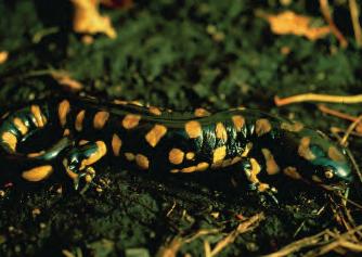
Idaho’s native cold-water fish, and some macroinvertebrates and amphibians, such as this tiger salamander, are vulnerable to increasing water temperatures.
Excess nutrients can cause algal populations to explode—a phenomenon known as an algal bloom.

Clearly mark SPZ boundaries at frequent intervals with plastic flagging, paint, or signs.
temporarily stress or, under prolonged conditions, kill fish and other aquatic organisms.
Excess nutrients are often carried into water bodies attached to sediment particles, so practices designed to minimize sediment transport to streams will also reduce delivery of excess nutrients.
In recognition of their ability to protect and maintain high water quality, the riparian areas and wetlands of Idaho’s forested watersheds have earned special protection in the IFPA Rules, called Stream Protection Zones (SPZs). See “Rule 010.60. Stream Protection Zones,” on pages 26 and 27.
The term “Stream Protection Zone” suggests that protection is required only along moving water, but IFPA Rules also protect riparian areas around perennial lakes, wetlands, and dry streambeds. An SPZ usually includes at least part of a stream’s or lake’s riparian area, although it may not encompass the entire riparian area. Some SPZs may also extend beyond the riparian area.
Some water bodies, particularly in southern Idaho, may not exhibit all of the features of a riparian area, but they must still be protected by an SPZ. Landowners are encouraged to extend riparian protection to areas larger than legally defined SPZs, particularly for streams with channels that tend to migrate over time within a floodplain.
To ensure that equipment operators are clear about protection boundaries, SPZs should be clearly marked at frequent intervals with plastic flagging, paint, or signs. Perennial streams are usually easy to locate, but intermittent and ephemeral streams and their SPZs can be more difficult to identify, especially during dry periods. Work with your local IDL Forest Practices Advisor if at all uncertain about the location of SPZ boundaries.
Class I Stream Protection Zone means the area encompassed by a slope distance of seventy-five (75) feet on each side of the ordinary high water marks.
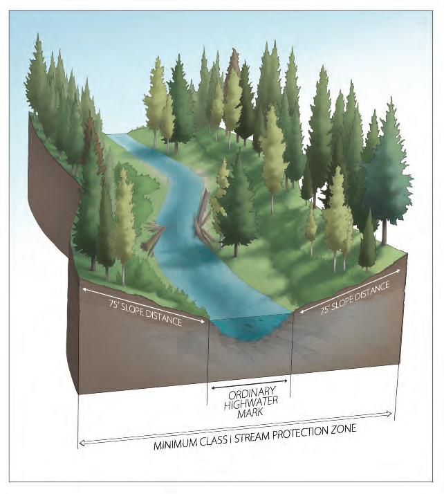
Ordinary High Water Mark. That mark on all water courses, which will be found by examining the beds and banks and ascertaining where the presence and action of waters are so common and usual, and so long continued in all ordinary years as to mark upon the soil a character distinct from that of the abutting upland, in respect to vegetation, as that condition exists on the effective date of this chapter, or as it may naturally change thereafter.
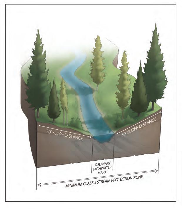
Class II Stream Protection Zone means the area encompassed by a minimum slope distance of thirty (30) feet on each side of the ordinary high water marks. For Class II streams that do not contribute surface flow into Class I streams, provide soil stabilization and water filtering effects by leaving undisturbed soils in widths sufficient to prevent washing of sediment. In no case shall this width be less than five (5) feet slope distance on each side of the ordinary high water marks.
Consult an IDL Forest Practices Advisor with any questions you have regarding Stream Protection Zones.
Forests shade streams, keeping water cool for aquatic life. They also provide food, cover, and shelter for aquatic and terrestrial species, ranging from salamanders to elk. Forests collect and distribute rain and snowmelt and provide jobs that support communities throughout Idaho. And, forests provide space in which to recreate, relax, and reflect.
Idaho has one of the largest varieties of tree species and forest types in the Rocky Mountains. A forest type reflects the characteristics (soil, moisture, slope, aspect, elevation, etc.) of the site on which a forest occurs. Professional foresters and others use ecological classification systems as a basis for developing management strategies suited to a particular site. These classification systems operate on a variety of scales.
The broadest way to categorize forests is by ecological type. Nature Serve, a nonprofit organization that coordinates scientific research to support conservation, has identified 22 broad “ecological divisions” for North America. The Rocky Mountain division contains most of Idaho’s forests.
Another broad ecological classification system is the ecoregion approach, which classifies North America into four domains (Polar, Humid Temperate, Dry, and Humid Tropical). These domains are then divided into divisions and finally into provinces. Idaho has three provinces that contain forests:
• Northern Rocky Mountain Forest-Steppe–Coniferous Forest–Alpine Meadow Province (located in northern Idaho);
• Middle Rocky Mountain Steppe–Coniferous Forest–Alpine Meadow Province (located in central Idaho); and
• Southern Rocky Mountain Steppe–Open Woodland–Coniferous Forest–Alpine Meadow Province (located in southeastern Idaho). More information on ecoregions and how they are used is available on the USDA Forest Service ecoregion website at http://www.fs.fed.us/rm/ecoregions. Maps of these provinces can be viewed on the National Atlas website at http://nationalatlas.gov/mld/ecoregp.html
Within all of these regions, forests can be typed at smaller scales. Forest cover types are named for the currently dominant tree species, although other tree species often are present.
Professional foresters and others use forest types and other ecological classification systems as a basis for developing management strategies suited to a particular site (shown: western white pine cover type).
Forest species composition changes over time in a process called succession, as well as in response to natural disturbances or forest management.
The most common forest cover types in Idaho are:
• Douglas-fir;
• Fir/Spruce/Mountain Hemlock Group (includes Engelmann spruce, Engelmann spruce/subalpine fir, grand fir, subalpine fir, and mountain hemlock);
• Lodgepole Pine;
• Ponderosa Pine;
• Hemlock/Sitka Spruce Group (includes western hemlock and western redcedar); and
• Aspen/Birch Group (includes aspen, paper birch, and balsam poplar).
Maps showing these forest cover types can be viewed on the National Atlas website at http://nationalatlas.gov/mld/foresti.html.
One of the disadvantages of forest cover types is that they refer only to what is presently growing on the site. Forest species composition changes over time in a process called succession, as well as in response to natural disturbances or forest management.
Habitat types take the long view, classifying forests according to the tree species—known as the climax species—that would dominate if the site were left undisturbed for hundreds of years. Climax species are typically the most shade-tolerant trees capable of growing on a site. They reflect key site characteristics, such as soils, topography, and precipitation. Habitat typing is built on the idea that, on a given site, the same successional pathways will repeat themselves after disturbance, and that climax forest plants and trees are a meaningful indicator of the factors affecting the growth of trees and other organisms on the site.
Using habitat types allows managers to make useful comparisons among sites and indicates what is capable of growing on a site, not what is presently on the site.
The IFPA uses a forest type classification system. Forest types are defined in the IFPA Rules as “forest land capable of producing similar plant communities at climax” and are used for refining on-the-ground administration of the IFPA Rules (see “Rule 010.24. Forest Type”).
Five forest types in Idaho are defined as follows:
• North Idaho grand fir/western red cedar (NIGF): moist to wet interior forests with western red cedar, western hemlock, and grand fir being primary climax species, found in forests north of the Clearwater/ and Lochsa Rivers.
• Central Idaho grand fir/western red cedar (CIGF): productive conifer forests found in forests between the Lochsa River Basin and the Salmon River, characterized by stands having western red cedar and grand fir as climax species, with a mixed-conifer overstory increasingly comprised of ponderosa pine, Douglas-fir, and larch in the river breaks canyon-lands. Stocking levels are generally lower than that of the NIGF stands.
• South Idaho grand fir (SIGF): mixed-conifer forests, dominated by ponderosa pine and Douglas-fir, found south of the Salmon River with grand fir and occasionally western red cedar being the stand climax species.
• Western hemlock-subalpine fir (WH): higher-elevation, moist, cool interior forests dominated by western hemlock, mountain hemlock, and/or subalpine fir.
• Douglas-fir-ponderosa pine (PP): drier forests dominated by ponderosa pine and Douglas-fir, generally found in lower-elevation, dry sites.
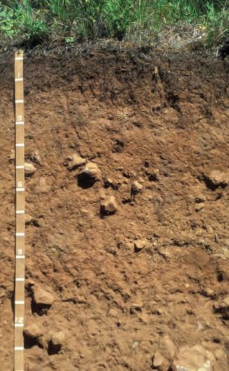
Soil is the top layer of the earth’s surface and consists of unconsolidated minerals (clay, silt, and sand particles) and organic material. It serves as a medium for plant growth. The physical and chemical characteristics of a forest soil define both its capability to support vigorous and healthy forests and how forest operations will affect long-term forest productivity.
Soil texture refers to the relative proportion of sand, silt, and clay in a soil. It can range from coarse (sandy) to fine (clay). Soil color often reflects organic matter content; it ranges from dark (high organic matter) to light (low organic matter). Dark, fine-textured soils are generally more productive than light, coarse-textured soils.
Soil strength refers to soil development into structural units called peds. A well-structured soil can resist compaction and erosion much better than a weakly structured soil.
Forest practices disturb soil. Examples include compaction, which reduces infiltration; rutting, which breaks up soil structure; and excessive surface soil disturbance. Since it can take 800 to 1,000 years for 1 inch of soil to form, it is very important to minimize soil impacts during forest operations.
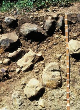
All soil minerals originate from rock. They are the product of cataclysmic events that created the landscapes of Idaho, our soils’ physical and chemical characteristics, and thus the forest communities we see today.
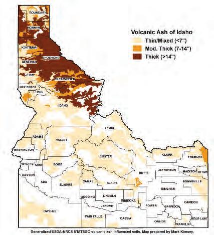
Volcanic ash, a fine-textured soil, is found throughout Idaho. It was blown here following the eruption of Mount Mazama (now known as Crater Lake) approximately 7,700 years ago. When volcanic ash is deposited over coarsergrained soil, it improves forest productivity due to its greater ability to hold plant-available water. This higher water-holding capacity also makes volcanic ash much more susceptible to compaction. Its origin as volcanic glass makes it fairly nutrient poor.
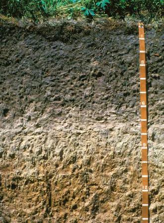
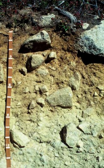
Molten lava flows from the Columbia River Basin and the Snake River Plain are found throughout northern, central, and southern Idaho in the form of basalt. Basalt rocks weather to form deep, fine-textured soils, which are rich in plant-essential nutrients. If the landscape is generally flat and has adequate precipitation, these soils are very productive. The fine texture of basalt soils makes them more susceptible to compaction when wet, and the soil particles form fine, easily windblown dust when dry.
Magmatic activity (the rise of liquid magma) from deep below the earth’s surface and subsequent surface erosion created the large Idaho
Basalt rocks weather to form deep, finetextured soils that are very productive.
Granitic soils have a sandy texture with low water-holding capacity and poor soil strength.
Batholith that underlies most of central Idaho. The Idaho Batholith is composed of coarse-grained minerals that weather to form sandy-textured soils with low water-holding capacity and poor soil strength. These soils, loosely termed granitic soils, contain fewer essential plant nutrients and are much more erodible and often less productive than basalt soils.
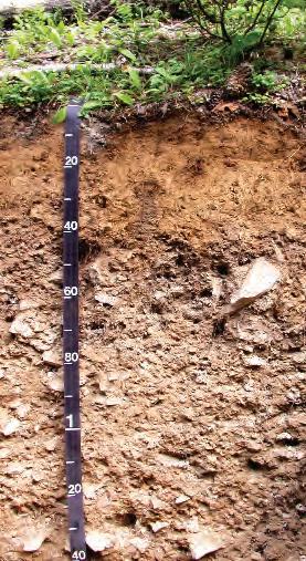
In northern Idaho, massive floods deposited large beds of sand, silt, and clay that were subsequently heated, pressurized, and uplifted by shifting tectonic plates. The rocks resulting from this metamorphic activity are quartzite (from sand), siltite (from silt), and argillite (from clay). The soils that weather from these rocks vary greatly.
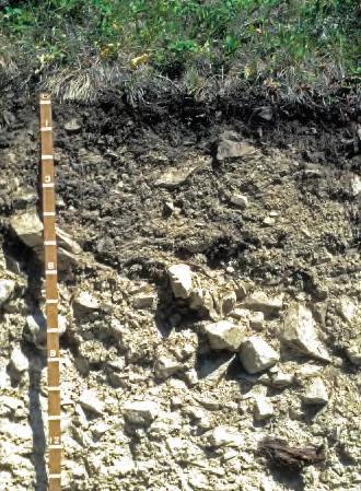
Coarser-grained quartzite forms sandy-textured soils containing large amounts of gravel and rock. Quartzite soils are extremely low in plant nutrients and have very low water-holding capacity. Consequently, forests growing on these soils have low productivity and high mortality from insect and disease infestations.
Siltite and argillite generally weather to form deeper, finer-textured soils. Rock fragment content in these soils varies depending on slope. Steep slopes
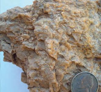
Quartzite forms sandy soils containing large amounts of gravel and rock.
have more rock fragments, as erosional forces displace the finer-grained soil particles.
Essential plant nutrients vary greatly as well, depending on the degree of weathering of the original sediment and the amount of heat and pressure it underwent. Highly weathered silt or clay that experienced intense pressure and melting will weather least and have the fewest available plant nutrients. Fine-textured sediments with minimal original weathering and metamorphic activity have the most available plant nutrients, leading to highly productive forest stands.
Glaciation
The North American ice sheet that ground its way south from Canada into Idaho was an estimated 4,000 feet thick as it reached Sandpoint, rounding mountaintops and scraping off original soils. As glaciers retreated, they left behind fine- to coarse-grained soils with many rounded rock fragments.
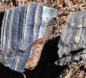
Siltiteand argillite generally weather to form deeper, finer-textured soils..
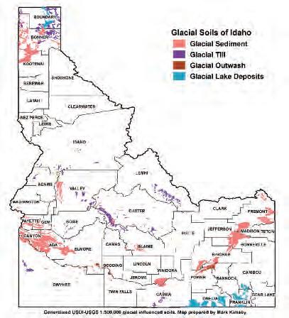
The North American ice sheet rounded mountaintops and scraped off original soils as it ground its way south from Canada into Idaho.
Coarse-grained glacial soils in areas with low annual precipitation are often the least productive.
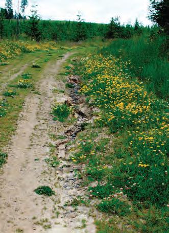
When the amountof water from precipitation and/or snowmelt exceeds soil infiltration rates, water flowing over exposed mineral soil surfaces can cause surface erosion.
Local glaciation also occurred in the central Idaho mountains, most notably around the McCall area, leaving deposits of boulders and very coarsegrained soils.
Forest productivity on glacial soils varies greatly, depending on the texture of the soil that is mixed with the rounded stones and boulders and on annual precipitation. Coarse-grained glacial soils in areas with low annual precipitation are often the least productive.
Erosion is defined as the offsite movement of individual soil particles by wind or water. It usually is described by three components: detachment, transport, and deposition. Detachment is the ease with which individual soil particles are detached (soil erodibility); it is influenced by slope gradient and length. Once detached, overland flow, gravity, and wind transport soil particles and deposit them at the bottom of slopes; behind rocks or large organic debris; and in streams, rivers, and floodplains.
Infiltration is the process by which rain or melted snow is absorbed into subsurface soil and rock. Infiltration rate is a measure of the rate at which a particular type of soil is able to absorb water. When the amount of water from precipitation and/or snowmelt exceeds soil infiltration rates, water flowing over exposed mineral soil can cause surface erosion.
avalanches.
Erosion occurs naturally on landscapes at different rates, depending on geology, topography, vegetation, soils, hydrology, and climate. Some soil types are more susceptible to erosion than others because particles are more easily detached and moved and/or because of low infiltration rates. Fine-textured soils high in clay content are more cohesive and erode less than coarsetextured soils dominated by silt or sand. In Idaho’s mountainous regions, exposed sandy soils on steep slopes have severe surface erosion potential. Ways to reduce erosion include minimizing the displacement of forest litter and seeding and mulching cut and fill banks during road building and harvesting activities.
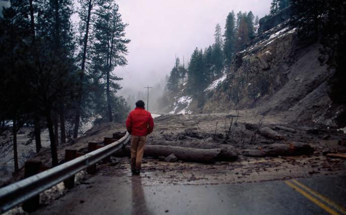
Land movement occurs naturally in forested basins and delivers essential large organic debris, sediments, and gravel to streams. Some landforms are naturally unstable, such as areas with steep slopes and those with smooth rock layers that run parallel to the soil surface. Three types of shallow landslides commonly occur on unstable landforms:
• Debris slides: aggregations of coarse soil, rock, and vegetation that lack significant water. Debris slides or rolls downslope at speeds ranging from very slow to rapid. Debris slides include the types of landslides known as shallow, rapid soil slips, and debris avalanches.
• Debris flows: slurries of sediment, water, vegetation, and other debris. Solids typically make up more than 60% of the volume. Debris flows usually occur in one of two circumstances: (1) steep channels, as debris becomes charged with soil water, or (2) upon entering a stream channel, where the debris liquefies as it breaks up. These landslides can travel thousands of feet, scouring stream channels to bedrock in steeper areas. Debris flows commonly slow where a channel makes a sharp bend. They often stop where channel slope gradient decreases to about three degrees or less, or where the valley bottom widens and allows the flow to spread out.
• Hyperconcentrated floods: flowing mixtures of water, sediment (predominantly sand-size), and organic debris. Solids range between 20 and 60% by volume. On forested mountains, these flows are commonly caused by the collapse of natural dams previously formed by landslides or debris jams. Impounded water and debris are released when the dam is breached, sending a flood wave down-channel that exceeds the magnitude of normal floods. Along relatively confined valley bottoms, hyperconcentrated floods can cause flows much higher than normal rainfall- or snowmelt-induced flows. They can drive floodwaters, sediment, and wood loads to elevations above the active channel and, if present, the active floodplain.
Deep-seated landslides are those in which the slide plane or zone of movement is well below the maximum rooting depth of forest trees (generally deeper than 10 feet); they can extend hundreds of feet in depth and often include bedrock. Deep-seated landslides can occur almost anywhere on a slope, but typically occur where permeable soil layers overlie deeper, less permeable layers of rock. Many deep-seated landslides occur on lower slopes and extend directly into stream channels. Those confined to upper slopes usually do not reach stream channels. For more information about how to recognize unstable landforms and how they may affect forest practices, see the IDL State Forester Forum, Forest Practice No.10, PotentiallyUnstable Slopes and Landforms (see “References” section) or contact your local IDL Forest Practices Advisor. Best management practices aim to prevent the unnatural or catastrophic movement of soil due to human activities. Consider remedial action when unstable landforms are identified and where sediment and excess debris would travel far enough from the unstable site to threaten watercourses, public resources, or safety. For each harvesting operation, careful selection of road and skid trail locations, logging methods, and the types of equipment used is important.
Idaho soils are unique and play an important role in maintaining forest health and vigor. It is important to be mindful of forest soils and their capacity to store water and sustain healthy forests. Soils regenerate very slowly, so it is the responsibility of forest landowners, managers, and operators to keep them productive.
Forest practices can alter the physical, chemical, and biological properties of soils. The degree and extent of disturbance is usually site specific, depending on soil texture, quantity of organic matter, type of harvesting equipment, time of year, and care taken by the operator.
Disturbance during timber harvest cannot be avoided, but it can be managed. Knowing your soils and working with their potential and limitations will keep them resilient and productive for future generations. Examples of ways to minimize disturbance include locating skid trails and landings on soils with good load-bearing capacity, avoiding sensitive soils and moist areas, and using slash mats on wet soil. Best management practices for our region’s soils are summarized in Table 1, page 40.
Please see the “Forest Roads” section of this publication for more information on how to reduce sediment associated with forest roads and skid trails.
Puddling and rutting occur under wet conditions when the weight and vibration of a machine, coupled with the force of spinning tires, cause depressions in the ground. Long-term forest productivity may decline if soils,
Table 1. Soil best management practices based on mineral soil texture and topsoil organic matter color.
Soil characteristic
Mineral soil texture
Meaning of soil attribute
Coarse feel; sandy Low water-holding capacity; high load bearing
Even mix of coarse and fine particles
Smooth feel when wet; not gritty
Moderate waterholding capacity; more susceptible to compaction
High waterholding capacity; easily compacted when wet; high load-bearing capacity when dry
Topsoil organic matter
Very dark brown to black
Reddish brown to brown
Off white to light tan soil color
Soil rich in plantessential nutrients; typically found in forests with a high component of grass understory
Typical forest soil color; indicates a moderate supply of plant-essential nutrients
Soil very low in plantessential nutrients
Best management practice
Any ground-based harvesting method is acceptable year-round. Manage forest floor disturbances and use slash mats on skid trails to reduce soil erosion.
Use slash mats on skid trails and/or plan to harvest between late July and early September to reduce soil compaction or rutting of wet soils.
Avoid any harvest operations when soils are wet. If harvesting is unavoidable, manual felling is preferred; allow soils to dry out before using forwarding equipment. Use thick slash mats if mechanical harvesting before late July.
Any ground-based harvesting method is acceptable. Fertilization is not necessary to maintain soil nutrient status. Minimize forest floor disturbance.
Bole-only harvesting is recommended; whole-tree harvesting is acceptable. Postharvest fertilization has shown positive tree-growth increases on nutrient-poor soils. Minimize forest floor disturbance.
Bole-only harvesting is recommended. Postharvest fertilization has shown positive tree-growth increases. Maintain the forest floor—minimize removal of branches, twigs, and dead wood.
Modified from: Kimsey, M., Jr., D. Page-Dumroese, and M. Coleman. 2011. “Assessing Bioenergy Harvest Risks: Geospatially Explicit Tools for Maintaining Soil Productivity in Western US Forests.” Forests 2 (3):797–813.
Excessive rutting can create vertical channels on hillsides that carry sediment to streams and should be prevented.
especially fine-textured soils, are compacted to the point of puddling during harvest operations. Soil puddling or rutting reduces soil aeration and water drainage and increases soil density—all negatives from a tree growth perspective. Reduced aeration and subsequent changes in soil temperature and moisture can also inhibit soil microbial activity, which is important for the decomposition of organic matter. Excessive rutting can create vertical channels on hillsides that may carry sediment to streams. Susceptibility to puddling and rutting is influenced by soil texture and moisture content. Dry clay, for example, may be less prone to rutting or compaction than wet loam. Finer-textured soils (e.g., volcanic ash), which can hold more moisture than coarse-textured soils, are more susceptible.
Organic matter accumulates over mineral soil when the rate of decomposition is slower than the rate of accumulation. On some sites, this layer can contain a significant proportion of total site nutrients, and it is important in regulating soil moisture and temperature. Surface organic matter and topsoil also have a high capacity to store nutrients that leach out of trees and other vegetation, thus contributing to a site’s long-term productivity. The loss of surface organic matter and surface soil can degrade forest productivity for decades, particularly on nutrient-poor soils (e.g., quartzite). It is therefore important to avoid disturbing nutrients from organic matter and topsoil, particularly if the site is on nutrient-poor soils.
Knowing the properties of your forest soil will help you predict how the soil will respond to forest operations. You can then plan operations so as to minimize soil disturbance.
A soil survey is a detailed report by the USDA Natural Resources Conservation Service (NRCS) that includes maps of soil boundaries, photos, descriptions, and tables of soil properties and features. Idaho county surveys are available online at http://www.nrcs.usda.gov/wps/portal/nrcs/surveylist /soils/survey/state/?stateId=ID and at local NRCS offices. They can be explored virtually at the online Web Soil Survey at http://websoilsurvey.sc .egov.usda.gov/App/HomePage.htm.
There are two fairly precise methods to determine your site’s soil types. You can use a Global Positioning System (GPS) device to record points across the area of interest and take this information to a local NRCS office, where staff can work with you to identify your soil types. Another method is to conduct your own field survey. Identifying the soil characteristics most important to long-term forest productivity is a useful skill and easy to do; all you need is a shovel and your fingers (see “How to Identify Soil Characteristics,” page 43).
1. Walk into your harvest unit and select three to five spots across the unit.
2. At each spot dig a small hole about 12 inches deep. This is the critical zone that trees access for nutrients and moisture. It is also the most susceptible to disturbance during harvesting.
3. Grab some soil from each hole and rub it between your fingers. Answer the following questions:
• What is the soil texture? To test, add water to a small handful of soil and mix it, trying to form a small ball (about the size of an egg).
- If you are not able to form a ball, you have sandy soil.
- If you are able to form a ball, place it between your thumb and forefinger, slowly squeeze the soil forward, and let it droop over your forefinger to form a ribbon (about 1⁄8inch thick). If you are able to form a ribbon 3 inches long without breaking, you have soil with high clay content (see below).
• Does the soil feel sandy and coarse? Does it have a lot of pebbles and small rocks? If so, puddling or rutting will have less effect on long-term forest growth than it would on other types of soils. However, erosion could be a problem if surface cover is displaced and soil exposed.
• Does the soil feel smooth and contain no more than a few rock fragments? If so, puddling or rutting very likely will affect forest productivity if equipment is used when soils are wet. When dry, however, these soils can be highly compaction resistant.
• What color is the soil? Is it dark (reddish brown to black)? Dark-colored soils have higher organic matter content, a source of essential plant nutrients. Is it a light color (off white to tan)? Lighter colored soils contain less soil organic matter and fewer plant nutrients. They also hold less water for tree growth.
Using a soil ribbon to determine soil texture.
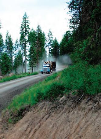
Road systems are one of the most important and costly parts of a forest operation. Carefully designed and well-maintained forest road networks can provide long-term access for timber production, recreation, and wildland fire response. In many cases, landowners can use existing forest roads, greatly decreasing forest operation expenses.
When reusing a road is not possible, a new low-volume forest road needs to be constructed. A low-volume road is designed to accommodate low volumes of traffic with extremely heavy axle loads. Such roads are used for managing or extracting resources from rural or undeveloped areas.
All ground disturbance increases the potential for erosion and hydrologic change. Because road construction causes significant disturbance and concentrates surface runoff, it often is the most visible source of forestry-related erosion. Careful design, planning, and construction of new roads, as well as routine maintenance of all roads, are important to the long-term health of forested watersheds.
Planning plays a critical role when determining the best route for a new low-volume forest road. Planning usually involves establishing control points, a preliminary line (p-line), and a location line (l-line). Control points
are geographic reference points that the road must pass through or access. The p-line is a “first-glance” route located by a landowner, forester, or contractor. The l-line is the final route chosen after all control points, obstacles, and IFPA Rules have been considered.
It is important to first determine the location of all control points. For example, to log safely and productively, a yarder may need to access a hillside from a bench with sufficient room for processing and loading logs. This area becomes a control point. A preferred access point along a highway might be another important control point, and the area where a road could cross a stream with the least amount of impact might be another.
Location of a p-line line is done by walking the site and noting obstacles and potential problem areas. Rock outcrops, seeps, springs, stream channels (including ephemeral and intermittent streams), property boundaries, excessively steep slopes, and erodible soils may affect the location of a p-line.
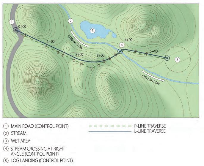
Locating a new forest road. Control points, p-line, and l-lines are used to locate a new forest road. Control points are those points through which a road must pass. A p-line is a preliminary route, while an l-line is the final location of the road, after taking into account factors such as slope, stream crossings, and soil characteristics.
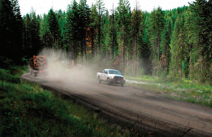
Roads used for hauling should have frequent and visible signage indicating the presence of log trucks.
The road layout now becomes a matter of connecting the dots identified by the control points and p-line in a way that least affects the topography, soils, and hydrology; guarantees safe travel; and best balances other management objectives. Evaluating several routes on the ground before choosing the l-line will help you identify the best location for the road and give you a chance to compare construction and long-term maintenance costs.
Road standards are specifications for road design. To minimize impacts on forest productivity, water quality, fish, and wildlife habitat, plan each forest road using standards adapted to the site’s terrain and soils. In general, the higher the average daily traffic and speed, the higher the required road standards, the more detailed the design and construction specifications, and the more construction will cost. Road specifications and plans must be consistent with good safety practices, and forest roads should not be wider than necessary to safely accommodate anticipated uses.
Communication among landowners, contractors, and others using forest roads is key to safety. Roads used for hauling should have frequent and visible signage indicating the presence of log trucks. Signs indicating which CB channel to use should be visible near highway entrances. Install mileage
Plan adequate vehicle turnouts. Too few, or inadequately spaced, turnouts make passing dangerous and cause costly traffic delays.
markers and maintain them regularly so that drivers can reference their locations on the radio. Drivers can help keep each other safe by regularly communicating their locations—for example, “Silver pickup coming in on the Cabin Road, mile 2 to 3, over.”
Road standards account for the types of forest products being hauled and the vehicles used to harvest and haul them. Each truck and axle configuration produces a different amount of off-tracking. Off-tracking occurs when the rear axles of a truck or trailer follow a different path than the front of the vehicle and travel farther to the inside of the curve. Thus, each type of vehicle requires a specific minimum curve radius, and different amounts of curve widening may be necessary. Curve widening is the extra width added to forest road curves to account for vehicle off-tracking. For example, lowboy trailers carrying logging equipment may need wider minimum curve radii than possum-belly chip trailers, and therefore may require special design considerations.
Know approximately how many trucks will use the road on a daily basis. Is the road intended for single-lane traffic, or will trucks frequently encounter oncoming traffic during active hauling operations? These factors determine the frequency and size of turnouts needed. Too few, or inadequately spaced, turnouts make passing dangerous and cause costly traffic delays.
Many forest roads, especially main haul roads, will be permanent and used for continuous access. Other types of forest roads are
• active roads: forest roads that are being used for hauling forest products, rock, or other road building materials;
• incidental haul roads: multi-use roads having a primary purpose other than forest practices (e.g., residential traffic), but also used for log hauling during harvests;
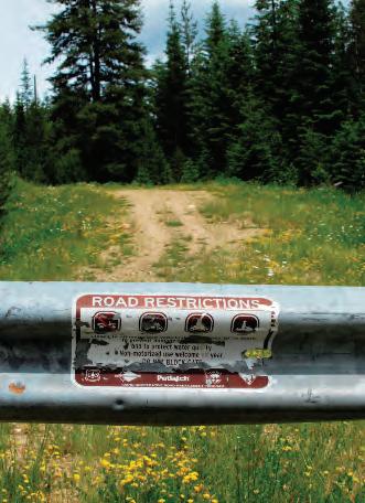
• inactive roads: forest roads whose primary purpose is for forest practices but are no longer used for commercial hauling. (Inactive roads are commonly maintained for fire control access, general forest management activities, recreational use, and/or occasional or incidental harvest of nontimber forest products.);
• long-term inactive roads: forest roads that are not intended for use in the near future, but likely will be used again sometime; and
• permanently abandoned roads: roads not intended for future use.
An important consideration in road design is the road grade (slope). Since water moves faster down a steep slope than a shallow one, locating new roads on flats or gentle slopes decreases erosion. Allowable road grades are usually specified for maximum favorable (downhill) and adverse (uphill) hauling.
Permanently abandoned roads are not intended for use again.
Once road grades are within acceptable limits for the expected vehicles and site characteristics, begin wrapping the road around the site’s contours. A consistent road grade can be planned by using a contour map and drawing a horizontal line on the map between contour lines.
At the job site, walk and flag the line using a clinometer or range finder, checking frequently to determine whether any slopes exceed allowable grades. It may be useful to hang reference tags and road right-of-way signs outside the construction area to indicate the location of the road centerline and drainage structures, such as culverts or rolling dips (see “Drainage Devices,” page 51). Reference tags could include a compass bearing and the vertical and horizontal distance to the road centerline or culvert inlet. See “Rule 040.02. Road Specifications and Plans” for more information.
It often is said that the three most important design considerations for low-volume forest roads are “drainage, drainage, and drainage.” It pays to understand natural drainage patterns and use them to your advantage. Even the most carefully constructed drainage structures, if poorly located, will give way to hydrologic forces.
Rule 040.02. Road Specifications and Plans
• Road specifications and plans shall be consistent with good safety practices. Plan each road to the minimum use standards adapted to the terrain and soil materials to minimize disturbances and damage to forest productivity, water quality, fish, and wildlife habitat.
• Plan transportation networks to avoid road construction within stream protection zones, except at approaches to stream crossings. Leave or reestablish areas of vegetation between roads and streams.
• Roads shall beno wider than necessary to safely accommodate the anticipated use. Minimize cut and fill volumes by aligning the road to fit the natural terrain features as closely as possible. Adequately compact fill material. Dispose of excess material on geologically stable sites.
• Plan roads to drain naturally by out-sloping or in-sloping with cross-drainage and by grade changes where possible. Plan dips, water bars, cross-drainage, or subsurface drainage on roads when necessary.
• Relief culverts and roadside ditches shall be planned whenever reliance upon natural drainage would not protect the running surface, cut slopes or fill slopes. Plan culvert installations to prevent erosion of the fill by properly sizing, bedding and compacting. Plan drainage structures to achieve minimum direct discharge of sediment into streams.
Carefully compare costs and site-specific limitations when choosing drainage methods, and install erosion-control devices during road construction. By paying careful attention to the type, size, and placement of drainage structures ahead of time, you can greatly increase road life and minimize costs in the long run.
The profile of a forest road is an important consideration for proper drainage. There are three types of road profiles:
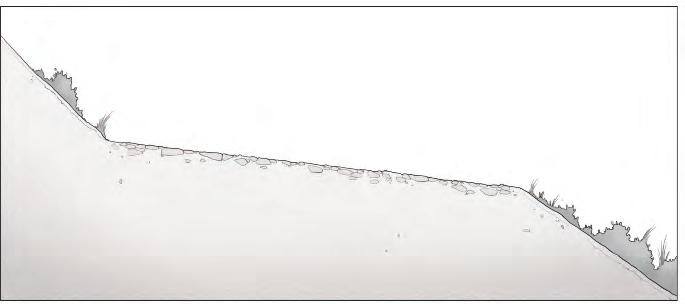
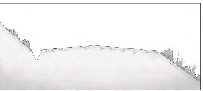
• Outsloped roads slope outward toward the fill slope. Water traveling downhill flows over the road surface and down the fill slope. These roads are more dangerous to navigate in wet or winter conditions than other types of road profiles.
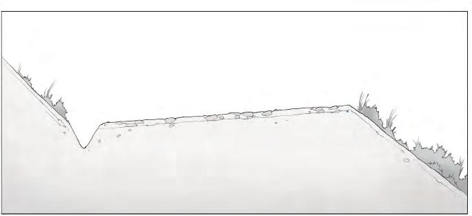
• Insloped roads slope into the uphill side of the road profile and most commonly divert water into an inside ditch. The ditch is an important part of the drainage system. Ditch relief culverts are necessary to allow water to pass through the road profile from the uphill to the downhill side as quickly as possible. The frequency and spacing of relief culverts depend on soil type and steepness of the grade. Forest roads with erodible soils and/or steeper grades require more frequent cross drainage.
• Crowned surface roads slope from the road centerline to both sides, quickly directing water off the road to either the uphill or downhill side. Because a portion of the surface water drains to the inside of the road, ditches and ditch relief culverts are necessary.
Outsloped, insloped, and crowned surface profiles all serve the same purpose—to move water off the road surface as quickly as possible in order to minimize erosion (see illustrations, page 52). Once you have determined the road’s location, select the best type of road profile for your site.
Moving water, such as water running downhill on a road surface, is one of the primary causes of erosion. Small increases in slope, as well as increases in depth and volume, can rapidly increase the erosive capacity of moving water.
Damage caused by water velocity and volume can be reduced by frequently diverting running water from forest roads into water diversion structures. Water diversion structures include rolling drain dips, cross ditches, relief culverts, and roadside ditches. Their purpose is to slow, redirect, and disperse water coming down a slope. These structures are discussed in detail below. A good plan will also anticipate the need to control overland flows where groundwater, unseen springs, or other unforeseen sources of water are exposed during road construction and use.
Outsloped roads slope outward toward the fill slope.
Insloped roads slope into the uphill side of the road profile.
Crowned surface roads slope from the road centerline to both sides.
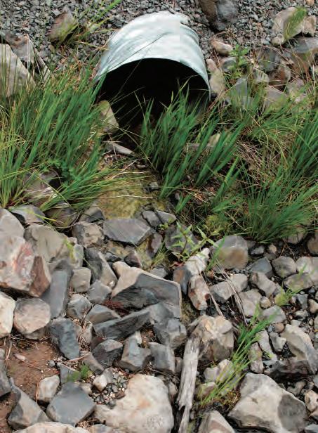
Stable areas have rocks, slash, or vegetation at drainage outlets.
Planning for an appropriate type and sufficient number of drainage structures will minimize the delivery of sediment to streams. Several types of water diversion devices may be used on the same road. Choose the device(s) best suited to the soils, terrain, and road design. For example, outsloping a road may be an appropriate strategy on highly erodible sandy soils where inside ditching might create constant soil movement.
Ensure that water and sediment drain from road surfaces into stable areas and not into surface water bodies or onto erodible surfaces. Stable areas have rocks, slash, or vegetation at drainage outlets. These materials slow the velocity of draining and dropping water, provide a place for sediment to accumulate, and allow water to adequately infiltrate into the soil.
Clear all debris generated during forest road construction and maintenance so it does not interfere with drainage or water quality. Deposit excess materials and slash on geologically stable sites outside stream protection zones.
Rolling drain dips (also called rolling dips or dips) direct water off the road rather than allowing it to run down the road. They serve as the primary drainage system on low-standard roads and may be used on both outsloped
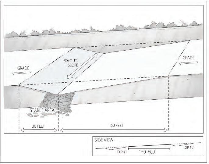
Rolling drain dips are used on roads where grades do not exceed 8%.
or insloped roads where grades do not exceed 8%. They can also be used on incidental haul roads to intercept and divert storm and seasonal runoff. Dips should not be confused with cross ditches or water bars, which are installed after temporary use and/or closure of a road. These devices are suitable only for occasional or rare vehicle use.
Crowned roads with engineered ditches, berms, culverts, or other crossdrain systems do not need rolling dips except as supplemental, protective features where runoff and erosion control are especially important.
Constructing a rolling drain dip involves reducing a 15- to 75-foot-long section of the road to an approximate 3% reverse grade that is 12 to 18 inches below the surface grade, and then raising the grade back to the original slope. The bottom of the dip should be oriented at a right angle to the road centerline and should have a 2 to 3% outslope to be self-cleaning. If not sufficiently outsloped, rolling drain dips can function poorly and soften during precipitation events, releasing unwanted water onto road surfaces.
Roads on soils at high risk of erosion generally require rock surfacing in dip structures. If soils at the planned dip location are soft, making them subject to rutting and displacement, geotextile fabric and rock surfacing may be needed to protect the entire structure. Be aware that rolling dips on soft
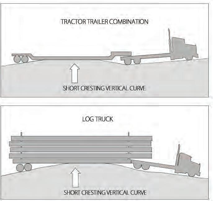
Take care to construct rolling drain dips long enough to accommodate all types of vehicles.
soils lacking a mix of hard native rock may be obliterated by maintenance blading if they become dry and dusty in summer or thaw in winter.
When properly installed, rolling drain dips should not increase wear on vehicles and should accommodate speeds of up to 10 miles per hour. If dips are too short, log trucks and lowboy trailers can bottom out or get high centered. The road above and below the dip should be flat, not outsloped, to prevent truck frames from flexing, which can cause undercarriage and frame damage.
Cross ditches, also called water bars or interceptor dips, are constructed across roads, skid trails, and landings to prevent the formation of rills and gullies.
Cross ditch placement is critical for effectiveness. Place cross ditches above sections of steep grades to prevent water from building up and increasing in velocity and volume. Also use them above road and skid trail
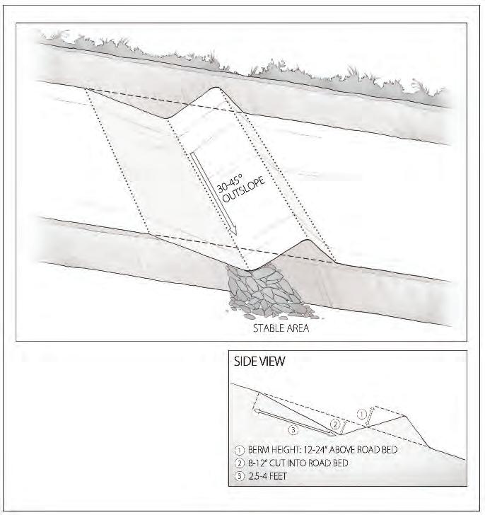
Cross ditches are also called water bars or interceptor dips. They are used to move water from the uphill side of the road to a stable location on the downhill side.
intersections and landings. Avoid placing cross ditches in swales, gullies, or low areas, where they can function as dams.
The appropriate spacing between cross ditches depends on road grade, soil erodibility, and the types and sizes of equipment that will use the road. Usually, the steeper the grade, the greater the velocity of the water and the more closely spaced cross ditches should be. Table 2 shows recommended ditch spacing, based on the percent grade of the road or trail and on soil stability/erosion hazard.
Align cross ditches at an angle of 30 to 45 degrees downhill across the road to the fill slope. Cut the cross ditch into the soil at least 8 inches. Create a berm at least 12 inches high on the downhill side, and tie it firmly into the
Table 2. Recommended cross ditch spacing for roads and skid trails (feet).
From: Idaho Department of Lands. 2009. Cross-ditches. State Forester Forum, Forest Practice No. 5. Boise, ID.
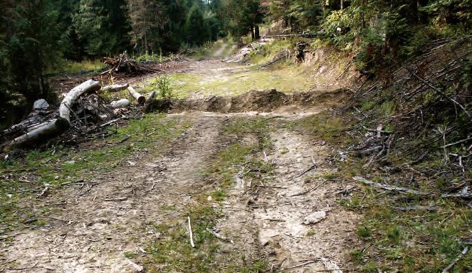
cut slope. The cross ditch outlet should be open and free flowing into a stable area, particularly on fills.
Driving over new, soft, or wet cross ditches and berms is the main cause of cross ditch failure and unwanted water delivery to road surfaces. Driving equipment over the new structure can flatten the berm before it can settle and firm up. Wherever possible, construct cross ditches by beginning at the bottom of the grade and moving up the road or skid trail.
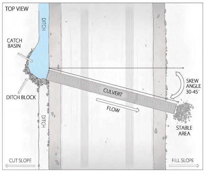
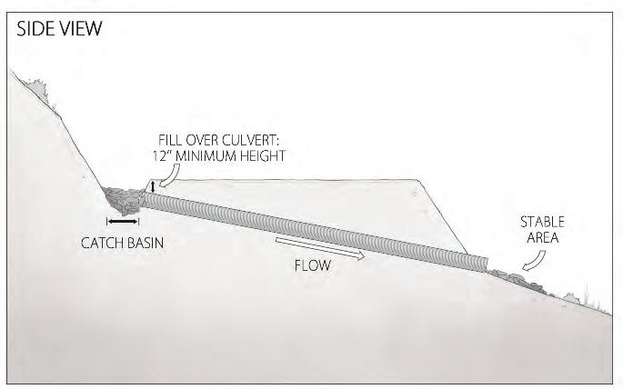
Relief culverts should be used with roadside ditches wherever natural drainage is inadequate to protect road surfaces or cut or fill slopes.
Relief culverts and roadside ditches (often simply called ditches) are an important part of a well-functioning drainage system on low-volume crowned or insloped roads. They are the most expensive type of water diversion device and require regular maintenance, but are very effective at diverting water downslope with minimal damage to road surfaces. Relief culverts move water from a ditch on the uphill side of the road, under the road grade, and onto a stable area below the road. Use relief culverts and roadside ditches wherever natural drainage is inadequate to protect either the running surface of a forest road or adjacent cut or fill slopes.
Botched relief culvert installation is one of the most common contributors of stream sediment, so getting it right is important. Construct ditches with a bulldozer or excavator. Prevent erosion of the road fill by properly sizing bedding and by compacting around culverts during installation.
Permanent relief culverts, and those used for seeps, springs, wet areas, and draws, must not be less than 12 inches in diameter. Size and spacing depend on the length of the ditch, anticipated flow, soil texture, and other factors. For example, an 18-inch culvert may serve 300 feet of ditch perfectly well in porous sandy soils, but may not be adequate in areas with clay soils where springs are present.
Place the culvert on a minimum of 1%, but recommended 2 to 4%, grade and at a 30-degree angle downgrade across the road to allow smooth entrance of water at the inlet and full passage of sediment through the pipe. Cover and compact soil at least halfway up the sides of the pipe to prevent water from seeping around the edges. An accepted general rule is to cover relief culverts to at least 1 foot, or one-third the culvert diameter, whichever is greater.
Keep the following tips in mind:
• DO keep ditches at least 1 foot deep and free of debris, such as downed logs or large rocks, that cause water to pool or be directed onto the road surface.
• DO install relief culverts with a minimum 1%, but recommended 2 to 4%, grade.
• DO place relief culverts at a 30-degree angle downgrade across the road.
• DO size the relief culvert adequately to handle the maximum water volume expected.
• DO ensure that the culvert outlet extends beyond the fill area and empties into a stable area.
• DO cover and compact soil up the sides of the pipe.
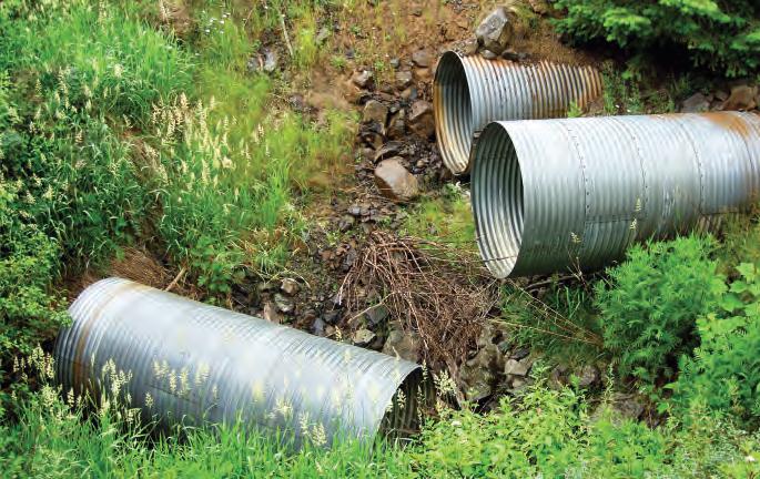
DO NOT allow “shotgun culverts,” as they can substantially contribute to erosion.
• DO NOT allow the culvert to “shotgun out” onto a road surface, as this could cause substantial erosion. Instead, match the culvert to the slope of the hill and install a pipe long enough to reach the undisturbed forest floor.
• DO NOT allow sharp rocks or debris in bedding material; they can puncture the pipe.
• DO NOT divert water from ditch relief culverts directly into streams, including ephemeral and intermittent channels.
When adequately designed, water diversion devices are a critical component of forest road construction. Properly constructed and spaced at appropriate intervals, these devices can greatly reduce road maintenance costs, erosion, and sediment delivery into streams. Appropriate diversion devices will ensure the longevity of forest road networks, save money, and protect water quality.
For help in determining the soil stability at your site, contact your local IDL Forest Practices Advisor or USDA Natural Resources Conservation Service (NRCS) district office.
Controlling erosion is an important consideration in planning forest operations and road construction. Stabilizing cut and fill slopes, culvert inlets and outlets, and stream banks prevents erosion during harvests. Properly installed erosion control measures can greatly reduce soil loss. Two options for erosion control include riprap and slash filter windrows.
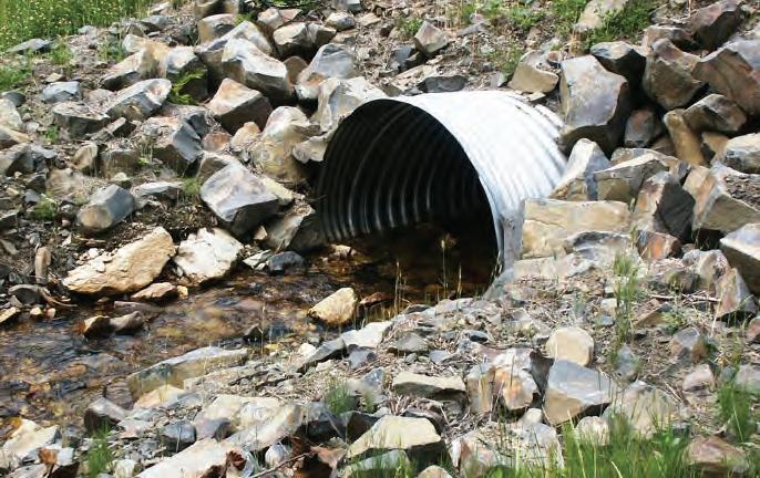
Riprap is loose stone placed below a culvert to dissipate the energy of flowing or falling water. Installing a layer of geotextile fabric between native soil and riprap helps protect soils. Where soil is exposed to frequent flowing water near permanent culvert inlets and outlets, riprap culvert armor is an excellent way to reduce erosion. When using riprap along stream banks, have the proposed design reviewed by an engineer with knowledge of hydrologic processes.
Slash filterwindrows are structures made out of waste logs and compacted slash. They protect forest streams from sediment originating on road surfaces and fill slopes, stabilize road fills, and help prevent stream sedimentation during road construction. Combining slash filter windrows with other BMPs such as seeding and mulching provides the most effective method of reducing sediment delivery to streams. Slash filter windrows should not substitute for right-of-way slash disposal; normally only a small part of right-of-way debris and slash is used in windrows. See “How to Build a Slash Filter Windrow,” pages 62 and 63.
Slash filter windrows are structures made out of waste logs and compacted slash. They protect forest streams from sediment originating on road surfaces and fill slopes, stabilize road fills, and help prevent stream sedimentation during road construction. Windrows can be constructed on both sides of a road or just on one side, depending on the type of road and surrounding topography.
Slash filter windrows should not substitute for right-of-way slash disposal; normally only a small part of right-of-way debris and slash is used in windrows.
1. As you clear the right-of-way, stockpile tree tops, limbs, brush not exceeding 6 inches in diameter, and cull logs at least 18 inches in diameter. Cull logs should be approximately 12 feet long; they will be used as anchors.
2. Stockpile material either above or below the clearing limits. Piles should be at locations that provide the best access for constructing the windrows after road grade excavation and shaping is completed.
3. Windrow length should extend no more than 300 to 400 feet each way from a stream crossing unless the road parallels the stream. If the windrow extends more than 400 feet, it is advisable to leave wildlife corridors every 200 feet.
4. After fill construction is completed, construct the windrow using an excavator. Start by placing anchor logs just at or below the toe of the fill. Anchor these logs against stumps, rocks, or trees parallel to the fill toe line.
5. Continue to use the excavator to pack slash by tamping above and along the length of the anchor logs. Embed the slash in the fill slope in quantities sufficient to make a sediment-impervious windrow 2 to 3 feet high and 6 to 10 feet wide.
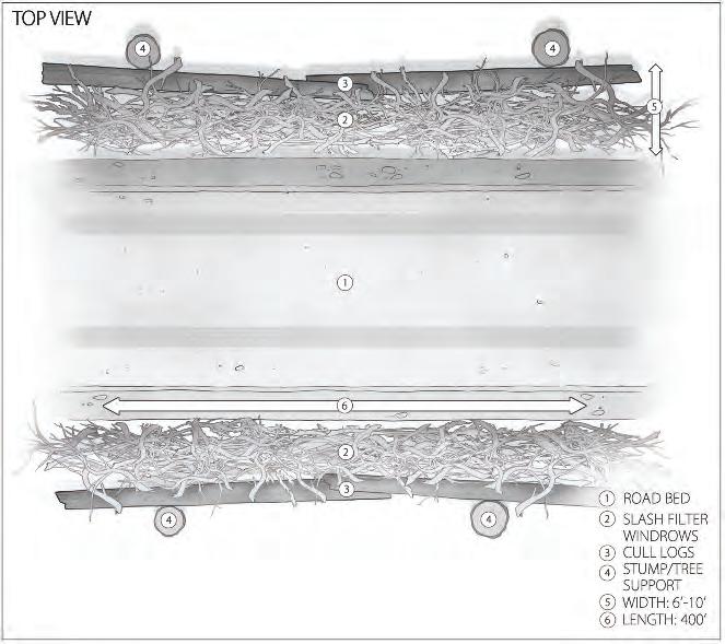
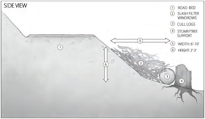
Before road construction can begin, you will need to determine the appropriate road profiles for each section of your low-volume road, as well as cut and fill slope angles. Road standards address natural terrain features and soil types. In less stable soils that tend to give way easily, for example, gentle cut and fill slope angles above and below the driving surface will decrease erosion from these slopes. On more stable soils or solid rock, less material is likely to tumble down onto the road surface or give way below it, allowing for steeper cut slope angles.
• Full-bench construction excavates the hill slope so that the entire road surface is cut into the hillside and no fill is deposited on the downhill side. Excavated material is hauled to stable disposal locations. IFPA Rules require that “roads constructed on slopes greater than 60% in unstable or erodible soils shall be full benched without fill slope disposal. Fills must be kept to a minimum at stream and draw crossings. A variance is required if a full bench is not used.”
• Balanced cut and fill construction uses materials excavated on the uphill side of a road as compacted fill material on the downslope side. In Idaho, this is the most common road construction method where full-bench methods are not required. The road design should match the soil type, generally with more moderate slope angles for less stable soils. If small dips or draws must be filled and/or small hills must be removed, try to balance cuts and fills and keep material hauling to as short a distance as possible. If material must be moved long distances from cut areas to fill locations, costs can increase rapidly.
• Through-cutconstruction is used where the ground must be cut through to avoid an overly steep road grade, such as on the crest of a steep hill.
• Through-fillconstruction is the opposite of a through cut. It is a segment of road that is entirely composed of fill material, with fill slopes on both sides of the road. Through-fill construction is often used on flat terrain where water is likely to pond and to cross draws or wet or swampy ground.
As road materials are graded and compacted, each new layer is referred to as a lift. As lifts are added and the road surface profile increases in height, the subgrade should form a trapezoid that is wider at the base and narrower at the surface. This profile distributes the weight of vehicles downward and outward toward the sides of the road and reduces breakdown at road edges. Lifts should be well compacted during construction.
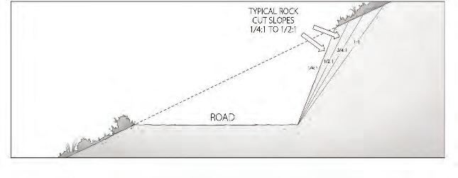
In full-bench construction, the entire road surface is cut into the hillside, without using fill materials on the downhill side.
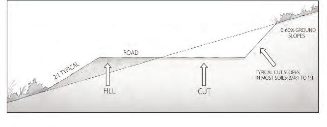
Balanced cut and fill construction uses materials excavated on the uphill side of a road as fill material on the downslope side.
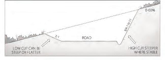
Through-cut construction is used to avoid an overly steep road grade, such as on the crest of a steep hill, or a cut through a hill slope used to minimize road curves.
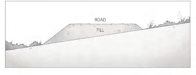
Through-fill construction creates a raised road bed on flat terrain where water is likely to pond; this method is used to cross draws or wet or swampy ground.
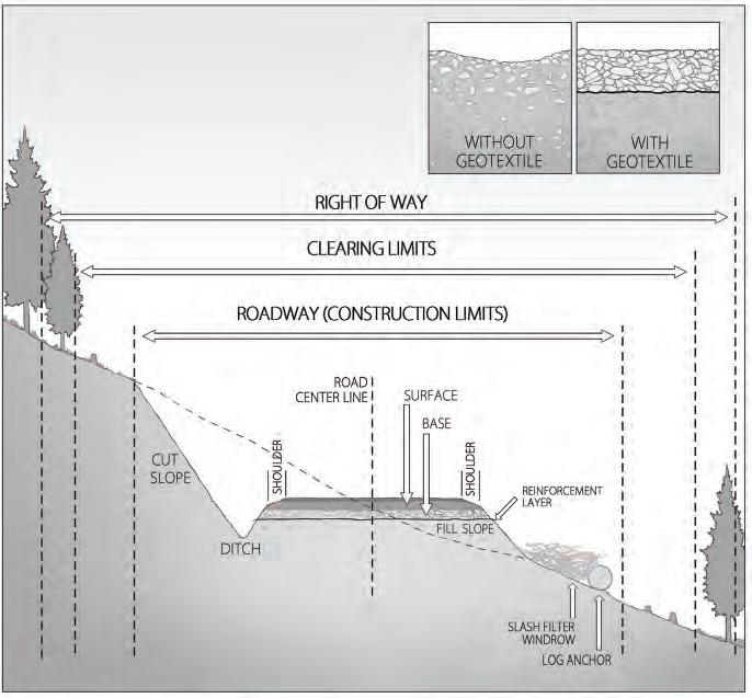
Some native Idaho soils can produce road sections with “soft bottom,” a situation in which the road surface does not compact properly. In these situations, rock surfacing may become buried in the subgrade and require reapplication. A variety of synthetic materials called geotextiles can be very effective for separating rock and soil layers. There are two general categories of geotextile products:
• Geofabrics, more commonly known as landscape fabric, come in a variety of weights, weave patterns, and strengths. When applied between soil layers over short stretches of road, geofabrics can substantially increase stability and longevity by keeping fine and coarse soil particles separated. Geofabrics are also used between armoring (rock) and native soil at the inlets of armored culverts or in other areas where stream bank stabilization is needed.
• Geogrids perform the same function as geofabrics, but are made of plastics formed in a circular, triangular, square, or other pattern. The size and shapes of the holes determine the size of rock that is able to pass through.
When construction occurs near a SPZ, vertically staked geofabric can be used to block sediment movement on the downslope side of the road.
Borrow pits are areas where native material is excavated for use in road fills. They should be located as far from streams as possible to reduce the potential for exposed, loose soil particles to migrate downhill and into streams. Provide for drainage of quarries to prevent sediment from entering streams. Slash filters, silt fences, or reseeding exposed cuts when they are not in use helps reduce sediment transport from the site.
Overburden is the excess material from constructing forest roads, either during cut and fill operations or from end hauling materials removed in full-bench construction. Place overburden where runoff will not carry sediment to streams. Overburden can be minimized by carefully considering mass haul requirements. Mass haul is the amount of excess material excavated from high areas used to fill in low areas. Minimizing mass haul reduces the amount of loose soil that can be carried away by overland flow. It also reduces construction costs.
During any road construction project, keep the following tips in mind:
• DO phase construction activities to limit the amount of time that bare soil is exposed to precipitation.
• DO postpone earthwork or material hauling during wet periods when erodible material is more likely to enter streams.
• DO minimize cut and fill volumes by aligning roads to the natural terrain as closely as possible.
• DO construct or reconstruct roads in a manner to prevent debris, overburden, and other material from entering streams.
• DO use riprap, vegetative matter, and similar devices to minimize erosion of fill.
• DO adequately compact fill material to minimize erosion.
• DO NOT incorporate significant amounts of woody material into fills.
• DO dispose of excess fill material on geologically stable sites.
• DO remove or stabilize material subject to sloughing during construction.
• DO stabilize cut surfaces prior to fall or spring runoff where soils are susceptible to erosion. Use seeding, compacting, rocking, riprapping, benching, mulching, or other suitable means to prevent sediment delivery to streams.
• DO minimize the amount of snow, ice, or frozen soil buried in embankments.
• DO use available slash and debris as a filter windrow along the toe of the fill (must meet the slash requirements of the Idaho Forestry Act (Title 38, Chapter 1, Idaho Code) and Fire Hazard Reduction Laws (Title 38, Chapter 4, Idaho Code).
• DO minimize erosion potential by limiting ground disturbance and leaving as much vegetation as possible.
• DO place piles on the uphill side of roadwork in progress or use properly installed and maintained silt fences below large piles to reduce the possibility of loose sediment washing downhill.
• DO inspect the entire construction site after storm events to ensure that sediment control structures are functioning properly and sediment is not leaving the site.
Maintenance of low-volume forest roads is of critical importance. Routinely maintaining drainage systems, as well as quick response to existing or potential problems, significantly reduces the risk of structural damage or degradation and road-caused slumps and slides. Maintenance also helps prevent development of berms that could divert and concentrate runoff and ultimately cause erosion and sedimentation. IFPA Rules require you to “conduct regular preventive maintenance operations to minimize disturbance and damage to forest productivity, water quality, and fish and wildlife habitat.” If you have properly planned and built your forest road, you should be able to accomplish all maintenance by hand with a shovel.
Conduct inspections prior to and during the winter and again before rainy and snowmelt seasons (often called breakup) when drainage systems are put to the test. Observe how drainage structures are functioning and where water travels, as well as water volumes and velocities. Schedule nonemergency maintenance activities during dry periods, when drainage structures are not carrying water and conditions are not muddy or saturated.
Forest roads remain a part of the landscape long after forest practices are completed. Consider keeping the road in condition for future use, fully or partially closing it, or abandoning it completely. Closure and rehabilitation can prevent transport of sediment to streams and other water bodies.
Active forest road surfaces must be maintained to minimize erosion of the subgrade and provide proper drainage. Keep culverts and ditches functional to prevent erosion and sediment delivery into streams. During and upon completion of seasonal operations, active forest roads must be
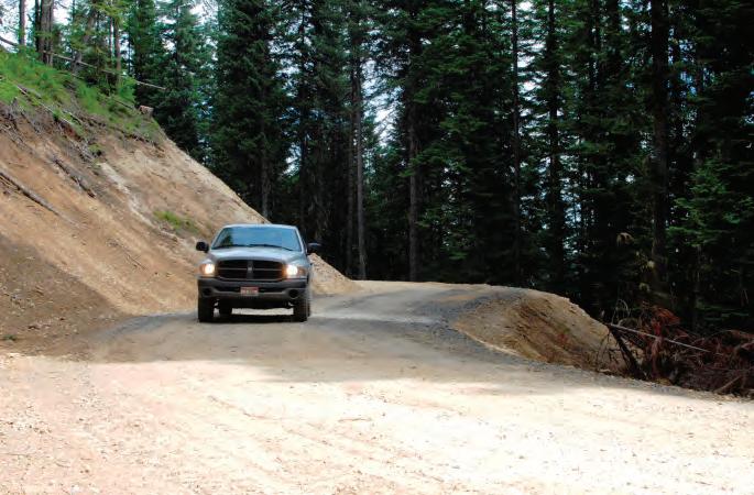
Inspect cut slope and fill areas for signs of erosion.
crowned, outsloped, insloped, or cross ditched. Remove berms from the outside edge except those intentionally constructed for protection of fills.
Maintenance should include the following:
• DO fill in ruts and holes as soon as possible to reduce the potential for erosion and further degradation. Use suitable material such as gravel and compacted fill.
• DO grade road surfaces periodically to maintain proper surface drainage and eliminate surface wheel ruts.
• DO minimize creation of berms along the edge of the road while grading. Feather graded material on road surfaces and take measures to prevent this material from entering water bodies.
• DO inspect cut slope and fill areas. Look for slumping, rilling, and cracks on the road edge or surface. It may be necessary to place gravel or rock at the toe of the cut bank slope.
• DO remove any unstable materials.
• DO install additional drainage structures if needed.
• DO repair slumps, slides, and other erosion sources causing stream sedimentation.
• DO dispose of all debris or slide material associated with road maintenance where it will be prevented from entering streams.
• DO dig drainage holes in snow berms along roads. If a rain event occurs on top of snow or ice and a berm is present, water will
DO dig drainage holes in snow berms along roads. If a rain event occurs on top of snow or ice and a berm is present, water will pond on the road or, worse yet, erode snow down to the road surface and cause rutting and drainage structure failure.
pond on the road or, worse yet, erode snow down to the road surface and cause rutting and drainage structure failure.
• DO NOT haul during wet periods to minimize sediment delivery to streams and damage to roadbeds.
• DO NOT allow road surface stabilizing materials or dust control agents to enter streams.
• DO NOT apply excess chemicals that could be transported to water bodies.
All maintenance activities required for active roads apply equally to incidental haul roads, with no other maintenance required under the IFPA Rules.
Inactive forest road surfaces must be crowned, outsloped or insloped, water barred, or otherwise left in a condition to minimize erosion. In addition, do the following:
• DO clear ditches and culverts at the end of active use.
• DO maintain drainage structures thereafter as needed.
• DO ensure that drainage structures are marked and fully functional.
• DO remove berms from the outside edge where runoff may be channeled.
• DO NOT use inactive roads during wet or thaw seasons if surface or drainage structure damage is likely to occur.
ATVs, motorcycles, and even bicycles using temporarily closed roads without authorized access can damage road drainage structures and cost landowners tens of thousands of dollars every year for unplanned road maintenance. It may be necessary to install gates, barricades, and/or signs to control road access during temporary closures. Options include the following:
• DO use gates to provide temporary closure with quick access when needed. Alternatives to gates include large berms or trenches, logs, stumps, or rocks/boulders.
• DO securely anchor gates and other barriers to prevent vandalism.
• DO place boulders or fencing at the ends of gates to prevent the creation of new access points.
A long-term inactive road should be blocked to vehicular traffic. Use outsloping, water barring, seeding, or other suitable methods to adequately control erosion. IDL may require the removal of bridges, culverts, ditches, and unstable fills. The landowner must maintain any bridges or culverts left in place.
Permanently Abandoned Roads
Permanently abandoned roads must have all drainage structures removed. Roadway sections must be treated so that erosion and landslides are minimized. Leave abandoned or vacated roads in a condition that provides adequate drainage and erosion control without need for further maintenance. In addition, do the following:
• DO restore stream gradients to their natural slope.
• DO treat the road surface to break up compacted areas.
• DO pull back fill slopes within SPZs to a stable configuration unless long-term stability has already been achieved.
• DO pull back unstable side hill fills to a stable configuration.
• DO control ditch line erosion by cross ditching, outsloping, or regrading to eliminate ditches.
• DO stabilize all bare earth areas created by regrading, ripping, and removal of drainage structures.
• DO install frequent cross ditching, vegetative stabilization, and seeding as needed.
• DO restore stream crossings and drainage swales to their natural conditions.
Inspect the inlets and outlets of all water diversion devices, making sure water is able to drain freely. Do the following:
• DO mark culvert inlets to aid in their location.
• DO use a shovel to clear any vegetation, sediment, or rock blocking water flow in roadside ditches (especially inner ditches), culverts, and other water diversion devices.
• DO upkeep or revitalize culvert headwall armoring and riprap below culvert outlets.
• DO consider armoring outlets or establishing vegetation that will not erode under high water flows.
• DO ensure that road grading has not created a berm at the road edge. If a berm exists, haul the soil or debris away from the drainage area.
• DO check to see that water caught by ditches is able to move freely off of roads.
Over time, roadside ditches tend to fill in and accumulate debris. Ditches must be kept functional and be inspected and maintained as needed, especially after the wet season. There are two methods for maintaining ditches:
• Heeling a ditch involves using the moldboard of a road grader to push materials up into the bank as it scrapes out a ditch. Cleaned out sediment is forced above the ditch (away from the road surface) and left in place.
• Pulling a ditch is the opposite process; a road grader blade is used to move material onto the road surface, and the excess material is then loaded onto a dump truck and removed.
For more information about the use and maintenance of forest roads, see Bowers and Adams, Managing Woodland Roads: A Field Guide (see the “References” section).
Many landowners and operators require stream crossings for access to manage their forestlands and efficiently transport forest products to processing sites. In the past, many stream crossings on fish-bearing streams were not properly designed and installed to allow for fish passage, so they disrupted fish migration. Fishery biologists working closely with forest hydrologists and road engineers have developed BMPs for stream crossings that allow fish passage.
Culverts, bridges, and fords on perennial streams are considered stream channel alterations when installed on logging roads and trails. They are regulated to safeguard stream crossings and protect water quality. For more information, see “How to Apply for a Stream Channel Alteration Permit (SCAP),” pages 76 and 77.
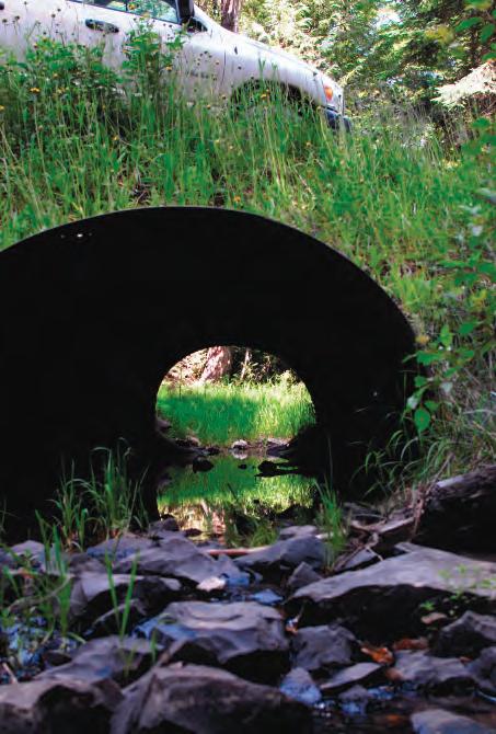
Many landowners and operators rely on stream crossings for access to manage their forestlands. Proper construction of stream crossings is critical to protecting water quality.
Culverts, bridges, and fords on perennial streams are considered stream channel alterations when used on logging roads and skid trails. They are regulated to safeguard stream crossings and protect water quality. Several state and federal agencies oversee and manage Idaho’s waterways, including the U.S. Army Corps of Engineers (Corps), Idaho Department of Water Resources (IDWR), and Idaho Department of Environmental Quality (IDEQ).
All new or reconstructed stream crossing structures in any fish-bearing stream must provide for fish passage. Any stream channel alteration project not installed or maintained to meet agency criteria must be removed.
Stream channel alterations require an approved Stream Channel Alteration Permit (SCAP). All SCAP applicants must
• provide a description of their project, including the location by stream name, quarter/quarter, section, township and range, and latitude/longitude;
• verify that the project will be installed and maintained in accordance with applicable regulations of the Stream Channel Protection Act and Idaho Forest Practices Act.
Streamlined SCAP process for certain forest practices projects
To provide better service to Idaho forest landowners and managers, IDWR and the Idaho Department of Lands (IDL) have an agreement that allows IDL to administer and regulate the permit process “for stream channel alterations which are implemented as part of a forest practice.” Under this agreement, an approved Notification of Forest Practice (Notification) and Supplemental Notification Form (SNF) serve as your SCAP.
Forest practices projects qualifying for a SCAP under this agreement are known as “approved” forest practices projects. They are
• installation of round, squash, or pipe arch culverts, or bottomless arches, with 40 square feet or less of area on the open end of the culvert;
• installation of culverts, less than 60 feet long, in non-fish-bearing perennial streams;
• construction of bridges, 75 feet or less in length, on nonpublic roads, so long as the bridge does not require the placement of piers within mean high water marks, cause an encroachment of the stream channel with fill material, or cause wetlands to be filled;
• construction or reconstruction of fords less than 75 feet in overall length and 25 feet in width; and
• removal of perennial stream crossing culverts with 40 square feet or less of area on the open end.
Applicants must verify that the project is exclusively for forest practices activities. A failure to follow all requirements may result in an Idaho Forest Practices Act violation.
IDWR is responsible for processing SCAP forms for forest practices projects that do not meet the above criteria, as well as for all projects not related to forest practices that involve stream channel or wetland alterations.
A Joint Application for Permit, with certification from the IDEQ, must be submitted to the IDWR/Corps for permitting (a SCAP/Corps 404 Permit). A Joint Application is required when
• stream banks must be armored;
• in-channel structures are required to ensure stream stability in conjunction with the installation or removal of stream crossings;
• the project will involve use of machinery equipped with a blade or operation of machinery within the stream channel for stabilization, improving fish passage, or placement of woody debris for fish habitat; and/or
• state water quality standards cannot be met.
Which process must you follow?
The following questions will help you determine which SCAP process applies to your project.
1. Will your structure cross a perennial stream?
a. YES. Go to 2.
b. NO. Go to 3.
2. Will you be conducting an approved forest practices project? (See page 76 for a list of approved forest practices projects.)
a. YES. An approved Notification and SNF from IDL serves as your SCAP.
b. NO. A SCAP/Corps 404 Permit may be needed for any stream crossing or wetland alterations. Submit a Joint Application to the IDWR/Corps.
3. Will you be conducting an approved forest practices project? (See page 76 for a list of approved forest practices projects.)
a. YES. No additional permits are needed.
b. NO. A SCAP/Corps 404 Permit may be needed for any stream crossing or wetland alterations. Submit a Joint Application to the IDWR/Corps.
If you have any doubts about which permits are necessary, consult an IDL Forest Practices Advisor.
Consider the migration and spawning habits of resident fish populations when planning stream crossings. Know the species present and their important migration and spawning times. Table 3 lists the general spawning and migration times of salmonid species in Idaho. Avoid installing stream crossings when fish are spawning or have eggs in the gravel. Spawning and migration times can vary year to year, so obtain updated information from fish biologists with local knowledge.
The importance of properly planning stream crossings cannot be overstated. Choosing an appropriate stream crossing structure involves many considerations, including stream gradient, ease and cost of installation, maintenance requirements, and the long-range plan for the site. Stream crossings have a high potential to adversely affect water quality, so keep them to a minimum. Carefully select crossing locations and determine the best approach on both banks. For information on how to design and
Table 3. Spawning times for salmonid species.
Salmonid species
Rainbow trout
Steelhead
Cutthroat trout
Chinook salmon
Bull trout
Brook trout
Brown trout
Kokanee
Lake whitefish
Mountain whitefish
Spawning migration Spawning Young emerge from gravel
Mid-February to late June
Mid-February to late June
Early March to early June
Mid-May to late September
Late May to early October
Early July to late October
Mid-July to early January
Late July to early January
Early October to late January
Early October to mid-February
From: Idaho Department of Lands. 2014.
Mid-March to late June
Mid-March to late June
Late March to early June
Early August to early October
Mid-August to late October
Early September to late November
Late September to early December
Early September to late January
Early October to late January
Mid-October to early February
Early June to late August
Early June to late August
Early June to early September
Late March to late May
Late March to late May
Mid-March to late May
Early April to late May
Early March to late May
Early April to late May
Early April to late May
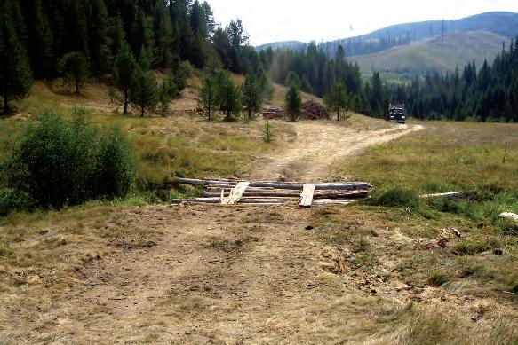
Log crossings may be used only as temporary stream crossings.
install stream crossings that allow fish passage, see IDL State Forester Forum, Forest Practice No. 12, Fish Passage Guidelines When Installing Stream Crossings.
Stream crossings can be temporary or permanent, but all must be designed to handle at least 50-year peak flows.
Temporary stream crossings
• are installed for short-term use (less than 1 year);
• must be removed immediately after use; and
• are not required to pass fish, as long as the structure is removed prior to important fish migration and spawning times.
Permanent stream crossing structures
• must allow for fish passage if constructed on Class I streams;
• are used on main haul routes and major access roads that will see years of continuous use;
• protect natural streambeds with less impact to fish; and
• are commonly used on streams more than 10 feet wide and those with steep gradients. Several types of stream crossings are discussed below.
Log Crossings
Log crossings are permitted only as temporary stream crossings and may be installed only where the stream gradient is 15% or less. If used on a Class I stream, log crossings may need to include a culvert to provide fish passage. Geotextile fabric can be installed over the top of the logs to create a road surface.
Open-bottomed Structures
Open-bottomed and arched culverts are suitable as permanent stream crossing structures in more situations and on greater slopes than other structures. However, they may not be appropriate on fine-grained alluvial soils.
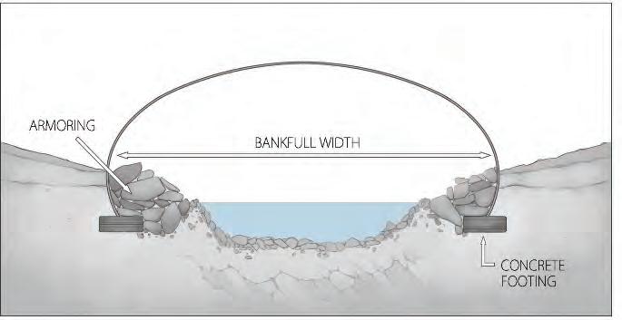
Open-bottomed and arched culverts require a greater level of hydrologic and engineering knowledge and skill to install properly.
These structures must span the bankfull width of the stream. Bankfull width is a term used to describe a stream’s highest flow level. Because a stream’s bankfull width often requires some interpretation, greater hydrologic and engineering knowledge is needed to properly install open-bottomed and arched culverts.
Fords
Fords do not have a structure or culvert. They can be used as temporary or permanent stream crossings, but are suitable only for low volumes of traffic. High water flow will restrict the use of a ford at certain times of the year, and heavy traffic may cause excessive erosion and sedimentation. Do not use a ford if it would require significant stream bank alteration. Consult your local IDL Forest Practices Advisor before considering a ford across a stream that
• has a gradient greater than 2%;
• has a bottom made up of silt, sand, fine gravel (less than 1-inch diameter), or rounded coarse material; and/or
• requires more than five vehicle crossings per day.
For more information, see “How to Construct a Ford,” pages 82 and 83.
Culverts
Culverts are the most commonly used form of stream crossing. Historically, they were steel or aluminum, but double-walled polyurethane culverts have recently been introduced. Although polyurethane culverts are limited to smaller diameters than metal culverts, they are lighter, easier to handle, and can be cut to length with a handsaw. They are easily placed, function well, can be removed when no longer needed, and can be reused.
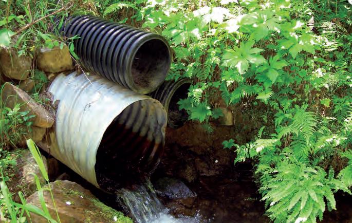
Culverts must be adequately sized to handle stream and runoff flows, as well as storm peak flows. Note that two smaller culverts (e.g., 8 inches in diameter) do not have the same capacity as one pipe twice the diameter (e.g., 16 inches). The reason is that the area of a circle is proportional to the radius squared (3.142 (pi) times the square of the radius). Thus, two 8-inch culverts have a combined 100.5 square inches of cross-sectional area, while a single 16-inch culvert has 201.1 square inches of cross-sectional area. In some specific situations, multiple smaller culverts have legitimate application versus one larger one, but these types of crossings require greater planning and skill to properly install. We recommend that you consult an IDL Forest Practices Advisor or engineer when considering this option.
Culverts installed at stream grade, also called nonembedded culverts, are the most widely used temporary stream crossing on flatter gradients (see page 84). Round culverts maintain the deepest water depths during low flows, so if water depths of less than 3 inches occur during low flows, consider another stream crossing alternative.
Nonembedded culverts may be used as permanent stream crossing structures, but only on moderate slopes and allowable stream gradients. Their use also depends on the size of the watershed.
Fords can be used as temporary or permanent stream crossings. A ford is appropriate if the stream is small, has less than a 2% gradient, has a bottom consisting of semiangular to angular rock (greater than 1 inch diameter), and will have minimal traffic (no more than five crossings per day).
Construct fords at right angles to a straight, shallow section of stream. Fords constructed on bends can result in erosion damage or ford failure due to channel movement. In addition:
• Construct a rolling dip or cross ditch at each approach to the ford to divert water that may run down the road. Dips or cross ditches should drain into stable areas to prevent sediment from entering the stream.
• Stabilize approaches and stream banks with angular gravel or pit run material along the entire width of the floodplain, or at least 75 feet on each side of the stream. Rocked approaches provide a suitable running surface, protect stream banks and floodplains, and keep soil from sticking to tracks or tires and washing off into streams.
• If the soil type at the approaches is fine grained, it is recommended to install geotextile fabric between the subgrade and the gravel surfacing for added strength and separation.
• For light vehicle traffic, add only enough material to the streambed to level it out. For heavier traffic (including log trucks), evened-out stream bottoms may need to be reinforced with additional rock. However, the added rock should not raise the streambed significantly above the existing level or fish passage problems may result.
• Minimize the removal of vegetation adjacent to the crossing. Revegetate bank cuts immediately following construction.
• During times of salmonid spawning and egg incubation, limit the use of fords to periods of low-water, dry, or frozen conditions. This measure will also protect active domestic water diversions.
• Limit hauling or equipment crossings to minimize sediment delivery to streams.
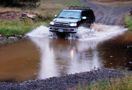
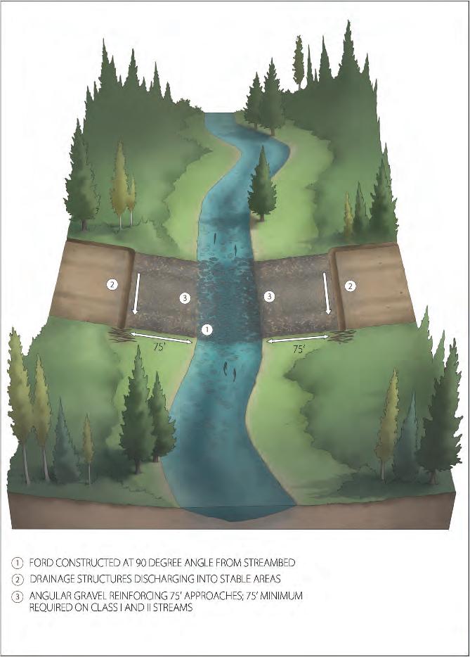
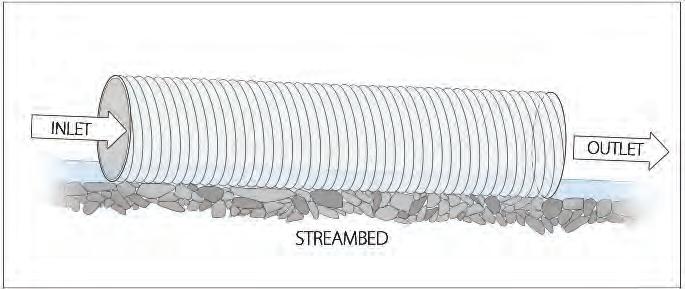
Nonembedded culverts are the most widely used temporary stream crossing. They are only suitable for flatter slopes, however (no more than 3% grade).
To determine if a nonembedded culvert may be used, do the following:
1. Determine the watershed size (in acres) and the stream gradient. Percent stream gradient is determined using survey equipment. Contact your local IDL Forest Practices Advisor for guidance.
2. If the stream gradient is greater than 3% at the proposed crossing, you must choose a different stream crossing structure.
3. If the stream gradient is less than or equal to the maximum allowable culvert gradient, you may use a nonembedded culvert installed at stream grade. Determine the maximum allowable culvert gradient for the watershed size (Table 4).
4. When installing a stream grade culvert, avoid forming inlet and/or outlet drops.
Culverts with Buried Inlets and Outlets
Culverts with buried inlets and/or outlets provide great fish passage, but they may not work in streams dominated by boulders or bedrock. Backfill culvert inlets and outlets with cobbles and boulders to fully seat the culvert in the streambed and ensure that it completely encompasses the bankfull width of the stream.
For more information, see “Rule 040.02. Culverts,” pages 86 and 87; “How to Install a Permanent Culvert,” page 88; and IDL State Forester Forum, Forest Practice No. 12, Fish Passage Guidelines When Installing Stream Crossings
Culvert Maintenance
Culverts need regular maintenance, most of which can be done by hand with a shovel. Routine cleaning and clearing can minimize clogging and prevent flooding, gullying, and washouts.
• DO use durable posts to mark culvert inlets and outlets to make them easy to locate for maintenance and to prevent damage by vehicles and maintenance machinery.
Table 4. Maximum allowable gradient of traditional nonembedded installed culverts.
Drainage area (acres)
Maximum allowable gradient of installed culvert (%)
From: Idaho Department of Lands. 2009. Fish Passage Guidelines when Installing Stream Crossings. State Forester Forum, Forest Practice No. 12. Boise, ID.
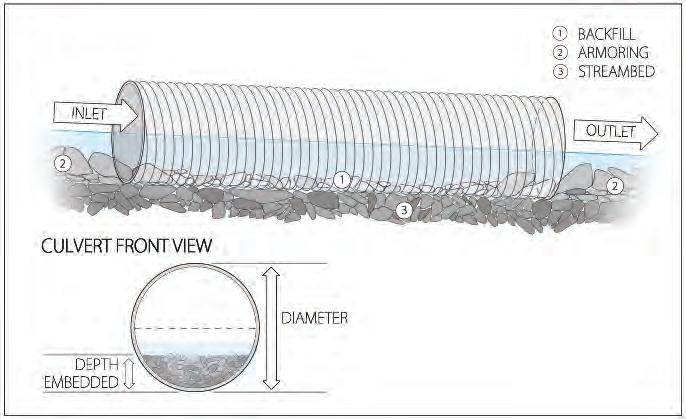
and/or outlets provide great fish passage.
• DO inspect culvert inlets by looking down the pipe and checking for obstructions. (Use a flashlight if necessary.)
• DO inspect culvert outlets and remove debris that could block water flow. A fire hose works well for flushing culverts.
•DO place armoring and/or vegetation around culvert outlets to slow water velocities and prevent erosion during times of high water flow.
• DO straighten culvert ends that are bent or damaged.
If any instream work is required, check with your permitting authority (IDL or IDWR/Corps) to be sure the activity is allowed.
The following IFPA Rule applies to installations of new culverts and re-installations during road reconstructions or reinstallations caused by flood or other catastrophic events.
• Culverts used for temporary crossings are exempt from the fifty (50) year design requirement, but they must be removed immediately after they are no longer needed and before the spring run-off period.
• Culvert installations on fish bearing streams must provide for fish passage.
• Design culverts for stream crossings to carry the fifty (50) year peak flow using engineering methods acceptable to the department or determine culvert size by using the culvert sizing tables below.
• The minimum size culvert required for stream crossings shall not be less than eighteen (18) inches in diameter, with the exception of that area of the Snake River drainage upstream from the mouth of the Malad River, including the Bear River basin, where the minimum size shall be fifteen (15) inches.#
• Relief culverts, and those used for seeps, springs, wet areas, and draws shall not be less than twelve (12) inches in diameter for permanent installations.
This culvert sizing table will be used for the area of the state north of the Salmon River and within the South Fork Salmon River drainage. It was developed to carry the fifty (50) year peak flow at a headwater-to-diameter ratio of one (1).
Strongly consider having culverts larger than sixty (60) inches designed, or consider alternative structures, such as bridges, mitered culverts, arches, etc.
CULVERT SIZING TABLE Icontinues on page 87.
Culverts larger than one hundred and twenty (120) inches must be designed; consider alternative structures.
This culvert table will be used for the area of the state south of the Salmon River and outside the South Fork Salmon River Drainage. It was developed to carry the fifty (50) year peak flow at a headwater-to-diameter ratio of one (1).
Strongly consider having culverts larger than sixty (60) inches designed, or consider alternative structures, such as bridges, mitered culverts, arches, etc.
Culverts larger than 120 inches must be designed; consider alternative structures. #See exemption for southeast Idaho.
Culverts are the most commonly used form of stream crossing. The following tips will enable you to construct a well-functioning and stable culvert.
• Provide a suitable bed for the culvert composed of compactable material.
• Compact fill around and over the culvert in 1-foot lifts.
• The fill above the culvert must be 12 inches or 0.5 times the diameter of the culvert, whichever is greater. For example, a 20-inch culvert must have 12 inches of fill above the pipe, while a 40-inch culvert will need 20 inches of fill above the pipe.
• Apply armoring or vegetation around culverts to prevent erosion, as needed. HOW TO
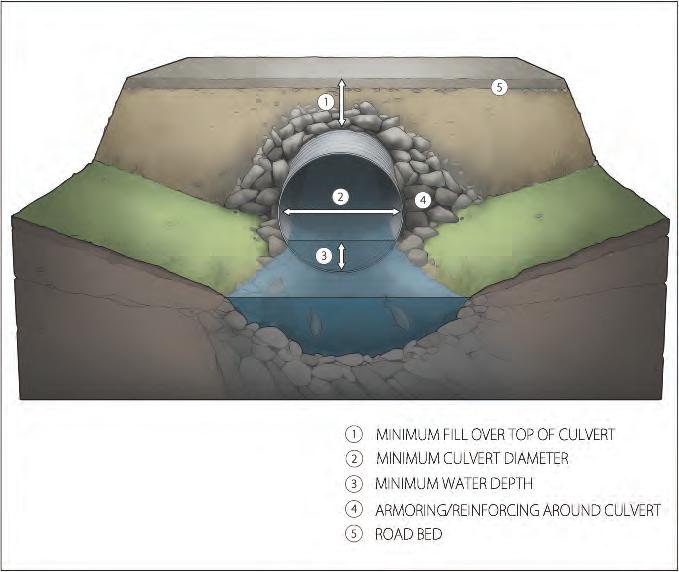
Although bridges are the most expensive structure, they provide the best fish passage, last a long time, and require minimal maintenance. Bridges are the best option for larger streams and those plagued with floating debris. Typically, permanent bridges are used for larger streams and rivers; they require a Stream Channel Alteration Permit (SCAP). For more information, see “How to Apply for a Stream Channel Alteration Permit (SCAP),” page 76.
Temporary bridges are quick to construct and economical. They are useful on smaller streams or for infrequent or one-time access, and they can be made of a variety of materials. Where available, a railroad flat car built to carry substantial weight may be used as a bridge. Temporary bridges may be removed when not in use, with footings left in place or removed.
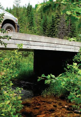
Bridges provide the best fish passage, have longevity, and require minimal maintenance.
Take care to minimize disturbance to the stream bank and approaches during bridge installation. Be sure to control road drainage to prevent sediment delivery to the stream. Apply riprap on stream banks adjacent to footings to prevent erosion, especially if the stream channel is exposed to high velocities during peak flows.
While bridges are the most forgiving and stable type of permanent water crossing, their failure during a peak flow event can cause serious damage to stream banks and the stream channel itself. Regular inspection and maintenance will help minimize this possibility. Maintenance involves the following:
• DO inspect bridges for structural damage or abutments that need repair.
• DO remove logs or branches lodged in any portion of the bridge.
• DO haul soil and debris away from the watercourse.
• DO make sure approaches are adequately surfaced and runoff is diverted away from streams.
Stream crossings are one of the most important considerations to protect water quality during forest operations. Be sure to choose the most suitable option and consult with your local IDL Forest Practices Advisor when unsure about design requirements.
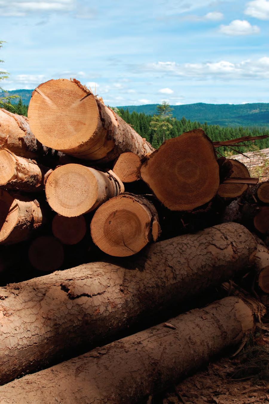
There are many reasons to harvest timber: for periodic income, to establish or enhance riparian and wildlife habitats, to treat insect or disease problems, and/or to precommercially or commercially thin to improve forest health and growth. With careful planning, each of these objectives can be realized while protecting or enhancing forest productivity, wildlife and fish habitat, and air and water quality.
Well-planned silvicultural activities maintain productive, working forests that provide clean air and cool, clean, plentiful water. Choosing appropriate silvicultural and logging systems; carefully locating skid trails, landings, and skyline corridors; and implementing adequate erosion control measures are all important for protecting water quality during timber harvest.
Silviculture is the art and science of guiding the establishment, growth, composition, health, and quality of forests to meet the needs and values of landowners on a sustainable basis. A silvicultural system is a series of planned treatments for tending, harvesting, and reestablishing a stand. A stand is a group of trees similar in age-class distribution, composition, and structure, growing on a site of uniform quality. A unit indicates a geographical or management area consisting of one or more stands.
A silvicultural system is chosen for the entire life of the stand—a decision made long before cutting any trees, especially if natural regeneration is desired. The choice of silvicultural system depends on landowner objectives, stand composition and age, site characteristics, and the presence of insect and/or disease problems. Matching a silvicultural system to a landowner’s management objectives and local site conditions is important for healthy forests. Talk to an IDL Forest Practices Advisor or consulting forester if you are at all unsure about which system will meet your goals.
Silvicultural systems are named for the type of regeneration cut used to establish new tree seedlings. Two broad types of silvicultural systems are used to manage forests: even-aged and uneven-aged.
Even-aged
Even-aged methods include clearcut, seed tree, and shelterwood systems. These systems remove the majority of a stand at one time and result in a new cohort of trees of similar diameter, height, and age.
• A clearcut system harvests all trees in a unit in one operation. The area is reforested within 1 to 3 years by planting seedlings or by natural regeneration from seed produced by trees in adjacent
In a clearcut system, all trees in the unit are harvested in one operation and the area is reforested by planting trees or through natural regeneration.
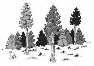
A seed tree system is an even-aged silvicultural system similar to a clearcut, except that 5 to 10 trees per acre are left evenly distributed across the site to produce tree seed.
stands. Clearcuts most closely mimic stand-replacing fires, so they often are used to regenerate shade-intolerant species such as pines, larch, and other species that historically depended on fire to regenerate.
• A seed tree system is like a clearcut, except that 5 to 10 trees per acre are left evenly distributed across the site to provide seed to establish the next generation of trees. Seed trees are normally removed after new trees are established, but many landowners retain them for their old-growth characteristics or for snag creation. Like a clearcut, a seed tree system is used to regenerate shade-intolerant species.
• A shelterwood system is similar to a seed tree system, except that more trees are left, both to provide a seed source and to “shelter” the site until new trees are established. Once regeneration is established, the overstory shelter trees are normally removed. This system has traditionally been used on hot, severe sites or where regeneration of shade-tolerant species is desired. Shelterwood systems are also used where aesthetics are a concern, such as on slopes facing densely populated areas or along well-travelled roadways.
Uneven-aged systems, also called selection systems, maintain a variety of tree ages and diameters within a stand by harvesting smaller volumes every 10 to 30 years. The goal of uneven-aged silvicultural systems is to create stands with a few large, mature trees and more younger trees.
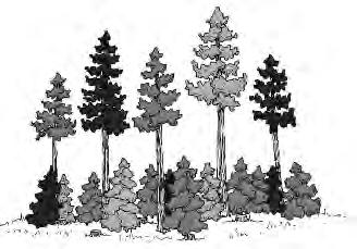
A shelterwood system is an even-aged silvicultural system similar to a seed tree system, except that more trees are left to “shelter” the site until new trees are established.
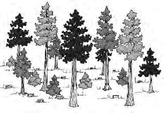
A selection system is an uneven-aged silvicultural system that attempts to maintain a range of desired tree sizes, species, and ages by harvesting individual trees or small groups of trees.
There are two types of selection silvicultural systems:
• Individual treeselection attempts to maintain a range of desired tree sizes, species, and ages by harvesting individual trees uniformly throughout the stand. Each harvest thins the stand. Individual tree selection maintains a fairly shady environment. Thus, it is best suited to moist sites that can sustain shadetolerant trees over the long term and to the driest ponderosa pine stands, where less desirable shade-tolerant species will not regenerate.
• Group selection systems remove small groups of trees, typically 3 acres or less in size.
Most Idaho forests are even-aged because they regenerated after standreplacing fires. Converting an even-aged forest to an uneven-aged forest usually takes many decades of careful management.
Thinning is a broad term applied to several different practices having different objectives. It is an intermediate treatment and occurs between regeneration harvests in even-aged and group selection systems. Thinning removes poorer quality trees, reallocating a site’s light, water, and nutrients to more desirable trees. It is used to improve species composition, reduce stand density, select for healthier and higher quality trees, and improve the remaining trees’ growth and quality. Thinning can also reduce insect and disease problems, increase understory vegetation for wildlife or livestock grazing, and/or reduce fire risk.
A thinning may be precommercial or commercial. Precommercial thinning occurs when trees are too small to sell for wood products, although they might be used for biomass energy if local markets are available. The
landowner usually incurs a net cost. Commercial thinning removes trees large enough to sell for wood products; ideally, revenues offset costs.
The type of stand regeneration planned after harvest should be considered before thinning. For example, if natural regeneration is planned, trees left after thinning should include desired species to serve as future seed sources. Other landowner goals may emphasize leaving trees with the best wood volume potential, or those with unique forms that have wildlife or aesthetic value. The space left between standing trees will vary according to site needs and management objectives.
Removing all of the largest trees is neither a thinning nor a regeneration cut. This type of logging is referred to as diameter limit cutting or high grading. Although well intentioned, selective logging of this kind has degraded forests. The residual small trees are not necessarily younger and are often genetically inferior. Cutting only large trees also tends to shift species composition to shade-tolerant species such as grand fir and Douglas-fir, which often are more susceptible to long-term insect and disease problems than pines and larch.
For more information on leaving quality trees, see Schnepf, Logging Selectively, listed in the “References” section.
Many types of harvest, or logging, systems are suitable for Idaho. The best system to use depends on average slope, soil type, density and size of timber in the stand, type of silvicultural system being used, and whether the harvest area is in a watershed with an impaired stream. Choose appropriate logging systems; carefully plan skid trails, landings, and skyline corridor locations; and use adequate erosion control measures to protect water quality during timber harvest. If slopes exceed 45%, the operator, landowner, or timber owner must notify IDL when filing a required Notification.
Cut-to-Length
Cut-to-length harvesting systems use a single-grip harvester with a processing head that has feed rollers and cutting knives parallel to the log surface. This design allows the machine to fell, limb, and cut logs to length at the harvest location. A log forwarder is then used to carry logs to designated landings, leaving limbs and tops on the ground. Because conventional ground skidding is not needed, cut-to-length systems can reduce soil disturbance and compaction.
Cut-to-length operations leave plenty of slash. Driving over this slash creates slash mats, which can buffer soil from compaction, increase traction, reduce ground disturbance, and trap sediment. They can also contribute to onsite retention of foliar nutrients.
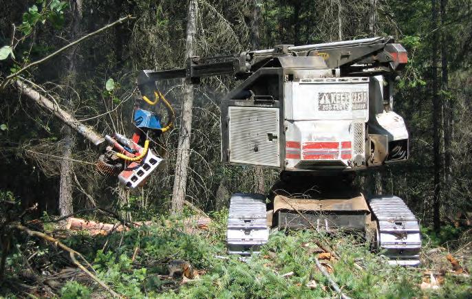
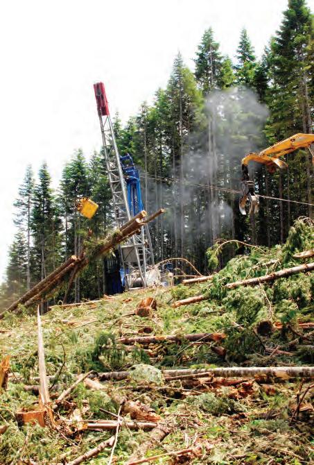
Feller-bunchers fell, limb, and cut logs to length at the harvest location.
Some forest operations leave plenty of slash onsite. Slash can be driven over by machines and left to buffer soils from compaction, increase tire traction, reduce ground disturbances, and trap sediment.
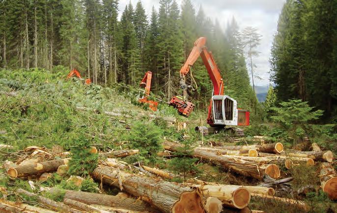
When turn distances are short, shovel logging can be more productive and cause less ground disturbance than ground skidding. This method uses loaders, also known as swing machines, to advance logs to the roadside.
Be aware that not all slash generated by logging operations may remain onsite. The Idaho Forestry Act (Title 38, Chapter 1, Idaho Code), Fire Hazard Reduction Laws (Title 38, Chapter 4, Idaho Code), Rules Pertaining to Forest Fire Protection (IDAPA 20.04.01), and Rules Pertaining to Fire Hazard Reduction Laws (IDAPA 20.04.02) cover mandatory slash compliance rules. See the “Slash Management” section of this publication for more information.
Shovel logging uses loaders, also known as swing machines, to advance logs to the roadside. When turn distances are short, this method can be more productive than ground skidding. When shovel logging requires more than two or three swings, its productivity decreases, and it becomes less cost effective.
Shovels are built on carriers with tracks, so machine weight is distributed over a larger surface area than it is with rubber-tired skidders and some forwarders. If machines travel on slash mats or small log corduroy trails, shovel logging can reduce soil compaction and rutting during wet weather.
Shovel logging is now the most common ground-based logging system used on moderate slopes on many industrial ownerships west of the Cascades. In this region, the system’s tendency to protect soil structure under wet conditions is an advantage.
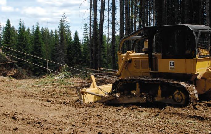
Cable yarding is more expensive than ground skidding but causes less soil compaction and can be used to access timber other systems cannot reach. There are many sizes and types of cable yarders and skyline carriages. The payload capacity, yarding distance, and lateral yarding distance of these systems help determine their suitability for different areas.
Cable systems designed with appropriate deflection (the degree of cable “sag” at its midpoint distance) maximize payloads by lifting logs off the ground. This diverts physical force from the ground to the skyline or mainline and, by doing so, protects soils. In the Inland Northwest, it is common to locate a tailhold (the downhill anchor point of the primary cable) across a stream in a draw bottom. Doing so creates a skyline profile with sufficient deflection to create lift, optimize the payload capacity of the yarder, and partially or fully suspend logs.
Cable systems can create vertical corridors on slopes, which can become channels for surface runoff and sediment transport. Hand piling or using a skyline carriage to deposit a slash mat along corridors following cable yarding can help reduce downslope sediment transport.
In sensitive areas, such as SPZs, cable yarding systems must be designed to fully suspend logs in order to prevent damage to stream banks and beds. When tailholds are not available in desired locations, an anchor cat is an alternative. An anchor cat is a bulldozer or other mobile machine that is parked below the hill or on a road, where it serves as the tailhold for
the lower end of the skyline. It must be of sufficient weight to provide a solid tailhold. An anchor cat can provide flexibility in laying out cable corridors while minimizing disturbances associated with poorly located tailholds.
Yoders
Small, guyless yarders, called yoders or excaliners, are a special type of cable system. A yoder is a relatively new technology that combines a yarder and a loader or excavator. The result is a smaller yarder that is easy to move and set up. Yoders are highly versatile machines for yarding short distances (400 to 800 feet) in Idaho’s uneven terrain. Because they can move quickly from corridor to corridor, these machines are very efficient in short, steep draws. In these areas, ground-based equipment can’t be used, and larger swing or tower yarders would require additional setup time at each landing location. Yoders with tong throwers can also be useful for productively clearing an area in front of a medium- to full-size yarder prior to cable yarding.
Tracked, off-road yoders may also be useful for “two-stage” logging. In this type of logging, short (e.g., 300 feet), steep harvest areas are yarded to a knob or ridgeline. Logs are then grapple skidded along more moderate slopes to a central landing. In some cases, this method can reduce the amount of new road construction required to bring in a larger yarder and processor.
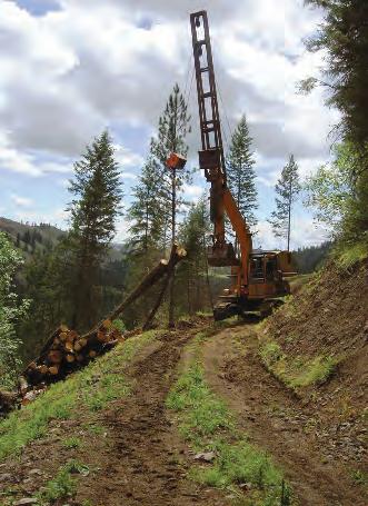
Yoders, also called excaliners, are highly versatile machines for yarding short distances (400 to 800 feet) in Idaho’s uneven terrain.
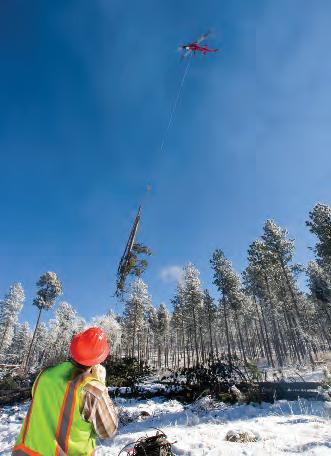
Helicopter logging is expensive but should be considered in restoration and other management activities where treatment areas are difficult to access.
Helicopter logging (heli-logging) is expensive. However, it should be considered in restoration and other management activities where treatment areas are difficult to access, or where the amount of new road construction required would be cost prohibitive or contrary to management objectives. Where it is important to minimize forest road construction, and longdistance cable logging with a large yarder or multispan system is not feasible due to distance or terrain, heli-logging may be a preferred method if the need for relatively large landings can be accommodated.
Careful planning of landings and skid trail locations is necessary to minimize soil compaction, rutting, and erosion. Constructed skid trails are those created by the deliberate cut and fill action of a dozer or skidder blade. The result is a road-type configuration. Landings are cleared areas to which logs are yarded or skidded for loading onto trucks for transport to processing sites. Fire trails are access routes located and constructed so that they are useful in fire control efforts or in deterring fire spread in hazard areas.
By designating skid trails and using directional felling, an operator minimizes the total stand area used as skid trails, thus decreasing equipment travel times and soil compaction. There are three ways to arrange skid trails for maximum performance and limited soil impacts (see illustrations, page 100):
• In parallel skid patterns, one or more main trails branches off to provide access to the harvested area. This system is commonly used on gentle slopes.
• Herringbone skid patterns utilize a combination of contourbased skidding across moderate slopes (where safety permits) and downhill skidding.
• Dendritic skid patterns attempt to follow slope contours and are used on steeper slopes.
Keep the number and width of skid trails to a minimum. The grade of a constructed skid trail is limited to a maximum of 30% on geologically unstable, saturated, highly erodible, or easily compacted soils.
Directional felling is a key technique that makes timber accessible from designated skid trails. With directional felling, sawyers cut trees so that they fall in a predetermined direction, usually toward a skid trail. This technique makes skidding efficient and prevents damage to residual trees. If the desired falling direction differs from the natural fall line, use wedges, jacks, or cables to direct the tree to its chosen lay. When shears are used, the wedge-shaped blade provides a lever that directs the tree into its lay.
Landings should be no larger than necessary to ensure safe and economical operation. To prevent landslides, fill material for landings should be free of loose stumps and excessive amounts of slash. On slopes where
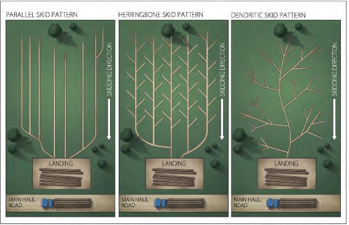
There are three ways to arrange skid trails for maximum performance and limited soil impacts. In parallel patterns (commonly used on gentle slopes), one or more main trails branches off to provide access to the harvested area. Herringbone patterns (used on moderate slopes) utilize a combination of contour-based skidding and favorable skidding on contour saddles. Dendritic patterns (used on steeper slopes) attempt to follow slope contours.
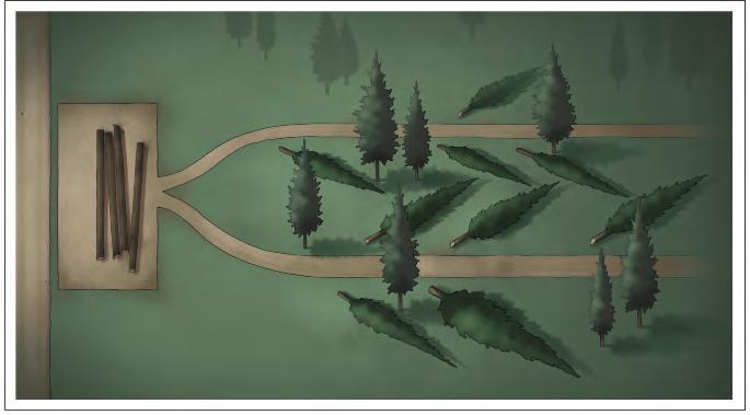
Directional felling is a key technique that makes timber accessible from designated skid trails.
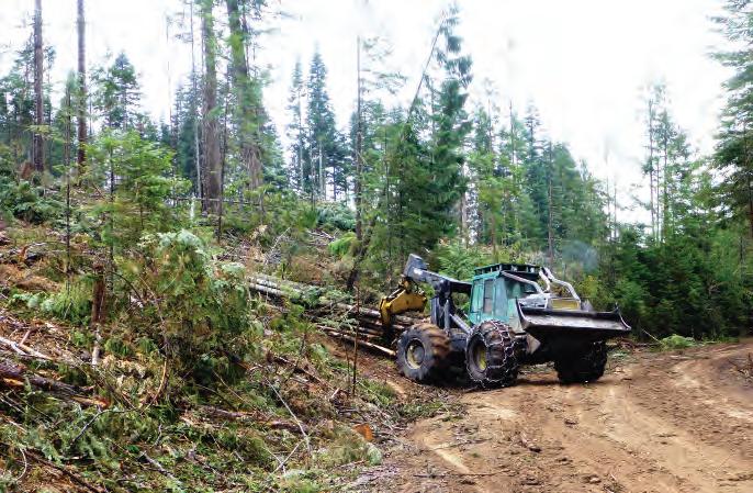
Ground-based skidding with grapple or cable skidders is common in Idaho and is appropriate on most slopes with less than a 40% gradient.
sidecasting (pushing unneeded material over the side of the hill) is necessary, stabilize landings by seeding, compacting, riprapping, benching, mulching, or other methods to limit soil movement. Ground-cover vegetation must be established on all landings within 1 year after harvesting is completed.
Each skid trail, landing, and fire trail is subject to erosion and must have a properly maintained drainage system to direct surface runoff and minimize erosion. Additional stabilization can be achieved by seeding skid trails and reshaping landings to facilitate drainage. These steps can help prevent erosion during fall and spring runoff.
Ground-based skidding with grapple or cable skidders is common in Idaho and is appropriate on most slopes of less than 40%. It should be done only when soils are dry or frozen or there is enough snow cover to prevent rutting and puddling.
The extent of soil puddling and rutting is a function of total vehicle weight, vibration, number of trips, and the amount of tire or track surface area in contact with the soil. Most soil compaction caused by ground skidding occurs during the first one or two passes. Rubber-tired skidders with doubled wheels (duallies) or overwidth tires on each axle exert half the ground pressure of those with single tires.
Tracked skidders can operate safely on somewhat steeper slopes than rubber-tired machines, and they tend to have lower ground pressure because
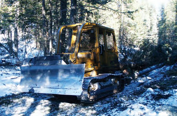
Tracked skidders can safely operate on somewhat steeper slopes than rubber-tired machines.
the weight is distributed over a larger surface area. In some situations, therefore, they provide more protection to soils.
Ground-based skidding in or through streams is not permitted in Idaho. It also is prohibited wherever it will cause rutting, deep soil disturbance, or accelerated erosion. An approved variance from the IDL is needed to conduct ground-based skidding on slopes exceeding 45% immediately adjacent to a Class I or Class II stream.
Cable skidders can yard logs without having to “drive to the stump,” causing less impact to sensitive areas such as SPZs or wet areas on hillsides. Uphill cable skidding is preferred. When downhill skidding is necessary, lift the leading end of the log to minimize slash and soil movement.
Carefully consider the pros and cons of each piece of equipment, as suitability varies greatly with site conditions.
Harvesting timber during the winter comes with its own set of benefits, problems, and rules. Because frozen soils can extend operating periods and reduce impacts from mechanical equipment, Idaho winters often provide the opportunity to conduct forest practices in areas that might be sensitive to site disturbances at other times of the year. In fact, under the right conditions, winter might be the best time to operate in many areas.
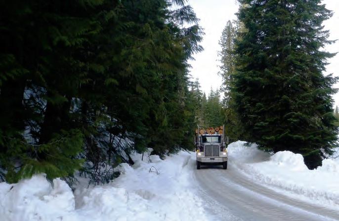
Under the right conditions, winter may be the best time to operate in many areas.
Deeply frozen road surfaces have tremendous strength. To prepare forest roads for winter operations, strengthen road bases by removing the first few snowfalls to allow for deep freezing. After roads have frozen solid, maintain packed snow on roads to insulate road bases and keep soils frozen. Haul only during frozen periods to protect road foundations. Skid trails should also be compacted with snow before skidding logs to avoid damage to soils that are wet or not completely frozen.
Prior to winter timber harvesting activities:
• DO flag the inlets and outlets of all drainage structures so that they can be easily located and maintained after snow accumulates.
• DO mark SPZ boundaries clearly before the first snowfall.
• DO install and maintain adequate surface and cross drainage.
• DO drain winter roads by installing rolling dips or drivable cross ditches, by outsloping, or by other suitable means.
During winter, it often is necessary to shut down operations on short notice as weather conditions can change quickly, rapidly increasing erosion potential. Shut down winter harvesting activities when roads become inoperable and weather conditions, such as midwinter thaws, make conditions unsuitable. Expect higher costs for winter logging as a result of fewer productive working hours, increased down time, and lower equipment utilization rates.
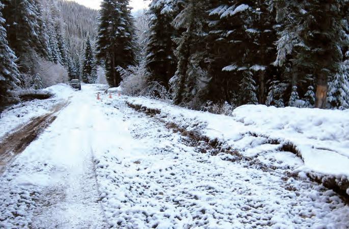
Plan to shut down winter harvesting activities when midwinter thaws increase the risk of runoff and damage to forest roads.
Winter operations have unique maintenance requirements. Check weather forecasts frequently and closely monitor how snowpack is interacting with drainage structures. Additional volumes of water resulting from intermittent melting or rain-on-snow events can cause severe erosion if culverts, drains, or other structures are blocked.
Road surfaces are especially vulnerable during thaws or breakup. Actively maintain existing drainage structures and open drainage holes in snow berms. Small fires can be used to thaw road surfaces sufficiently to install or upgrade relief culverts if necessary.
Riparian corridors, which are often entirely in or overlap SPZs, can be highly productive timber growing sites. IFPA Rules do not consider SPZs “no logging zones,” but specific BMPs must be followed when practicing forestry along streams.
• DO protect streambeds and streamside vegetation during and after forest operations, leaving them in the most natural condition possible to maintain water quality and aquatic habitat.
• DO install apppropriate stream crossing structures.
• DO cross streams at right angles to their channels if possible.
• DO remove all temporary crossings immediately after use.
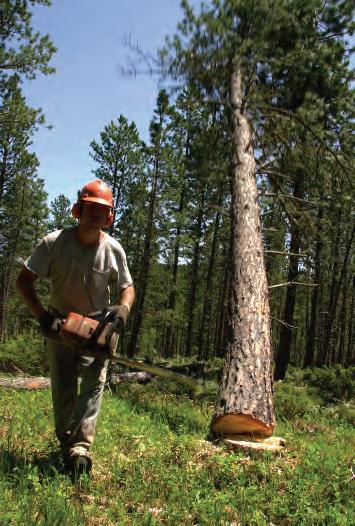
Directionally falling trees from the SPZ toward ground-based equipment outside the SPZ is an acceptable best management practice.
• DO water bar ends of skid trails where applicable.
• DO limit direct ignition of prescribed burns to hand piles. All other direct ignitions must occur outside of SPZs.
• DO NOT place hand piles closer to the stream than 5 feet above the ordinary high water mark.
• DO NOT mechanically pile slash or natural forest fuels in the SPZ (with the exception of slash filter windrows for erosion control).
For more information, see “Rule 030.07. Stream Protection,” pages 107 and 108.
The construction of hydraulic structures in stream channels is regulated by the Stream Channel Protection Act (Title 42, Chapter 38, Idaho Code). See “How to Apply for a Stream Channel Alteration Permit (SCAP),” pages 76 and 77.
As the operation of ground-based equipment is not allowed in an SPZ, operators must use alternative harvesting methods. Directionally felling trees toward ground-based equipment located outside the SPZ is a BMP. Other means of harvesting trees within an SPZ are to use feller-bunchers to reach into the SPZ or cable yarding systems to selectively remove trees. When cable yarding is used across or inside an SPZ, it must be done in a manner that minimizes disturbance of stream bank vegetation and stream channels.
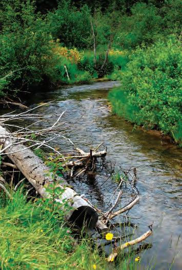
On Class I streams, leave pieces of trees longer than the channel width or longer than 20 feet to provide stable large organic debris.
There are restrictions on removing trees that fall naturally and on those that fall across streams during harvest. These BMPs are designed to maintain the multiple benefits provided by streamside vegetation, such as shading, soil stabilization, wildlife cover, and water filtering.
• On Class I streams, leave pieces of trees longer than the channel width or longer than 20 feet to provide stable LOD.
• Remove portions of felled or bucked trees not meeting LOD criteria.
• For non-fish-bearing Class II streams, entire trees can be retrieved from SPZs, as long as stream banks and streamside vegetation are not damaged in the process.
Shade is very important to the health of stream environments, and BMPs focus on retaining trees and shrubs to provide shade. Leave shrubs, grasses, and rocks wherever they shade a stream or maintain soil integrity near a stream. For more information, see “Rule 030.07. Stream Protection,” pages 107 and 108, and IDL State Forester Forum, Forest Practice No. 17, Class I Streamside Tree Retention Rules (2014).
During and after forest practice operations, stream beds and streamside vegetation shall be protected to leave them in the most natural condition as possible to maintain water quality and aquatic habitat.
• Lakes require an approved site specific riparian management prescription prior to conducting forest practices within the stream protection zone.
• Operations that utilize ground-based equipment that result in logs being skidded or forwarded in or through streams shall not be permitted. When streams must be crossed, adequate temporary structures to carry stream flow shall be installed.
• Cross the stream at right angles to its channel if at all possible. (Construction of hydraulic structures in stream channels is regulated by the Stream Channel Protection Act - Title 42, Chapter 38, Idaho Code).
• Remove all temporary crossings immediately after use and, where applicable, water bar the ends of the skid trails.
• Operation of ground based equipment shall not be allowed within the Stream Protection Zone except at approaches to stream crossings.
• When cable yarding is necessary, across or inside the Stream Protection Zones it shall be done in such a manner as to minimize stream bank vegetation and channel disturbance.
• Provide for large organic debris (LOD), shading, soil stabilization, wildlife cover and water filtering effects of vegetation along streams.
• Leave shrubs, grasses, and rocks wherever they afford shade over a stream or maintain the integrity of the soil near a stream.
Adjacent to all Class I streams, to maintain and enhance shade and large woody debris recruitment, landowners must comply with one of the two following options defining tree retention. The Relative Stocking per acre (RS) referenced in the options is calculated according to the relative-stocking-contribution table [page 108].
• Option 1: Within twenty-five (25) feet from the ordinary high water mark on each side of the stream, live conifers and hardwoods will be retained to maintain a minimum relative stocking per acre of sixty (60). A relative stocking per acre of thirty (30) must be retained in the stream protection zone between twenty-five (25) feet and seventy-five (75) feet from the ordinary high water mark on both sides of the stream.
• Option 2: Within fifty (50) feet from the ordinary high water mark on each side of a stream, live conifers and hardwoods will be retained to maintain a minimum relative stocking per acre of sixty (60). A relative stocking per acre of ten (10) must be retained in the stream protection zone between fifty (50) feet and seventy-five (75) feet from the ordinary high water mark on both sides of the stream.
continues on page 108
continued
NIGF (North Idaho Grand Fir)
CIGF (Central Idaho Grand Fir)
SIGF (Southern Idaho Grand Fir)
DFPP (Douglasfir-Ponderosa Pine)
• Only one option may be implemented within the stream protection zones of a harvesting unit covered by a single notification. Landowners are strongly encouraged to retain all trees immediately adjacent to the stream.
• To protect filtering and shade effects of streamside vegetation adjacent to all Class II streams following harvesting and hazard management activities, live trees will be retained or new trees established within thirty (30) feet on each side of the streams ordinary high water mark to comply with the minimum stocking standards expressed in “Rule 050. Residual Stocking and Reforestation” [page 112].
To obtain a variance from the standing tree and shade requirements, the operator must develop a site specific riparian management prescription and submit it to the department for approval. The prescription should consider stream characteristics and the need for large organic debris, stream shading and wildlife cover which will achieve the objective of these rules.
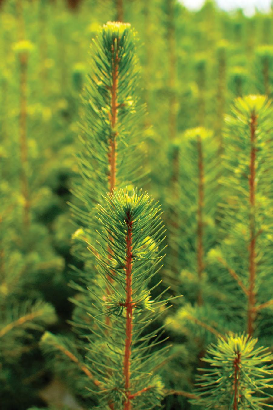
Once trees are cut and hauled away, many activities remain to be accomplished. These activities may include tree planting in harvest and riparian areas, slash management, seeding forest roads and skid trails, and controlling unwanted vegetation.
Prompt reforestation minimizes the effects of harvest on watersheds and sustains the continuous growing and harvesting of forest trees. IFPA Rules specify when reforestation is required, the minimum number of trees per acre, and the maximum period of time allowed after harvest for tree establishment.
Residual stocking refers to the trees remaining after a silvicultural treatment. Newly harvested units must retain a certain number of acceptable trees or show prompt natural regeneration in order to meet the residual stocking requirements of the IFPA. (See “Rule 050. Residual Stocking and Reforestation,” pages 112 and 113.)
If your harvested unit does not meet the IFPA Rules residual stocking requirements, you will need to establish new trees. IFPA Rules define reforestation as “the establishment of an adequately stocked stand of trees of species acceptable to IDL to replace the ones removed by a harvesting or a catastrophic event on commercial forestland.”
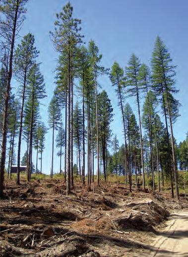
Reestablishing forest cover can be accomplished naturally from the seeds of nearby trees (natural regeneration) or by direct seeding or planting (artificial regeneration).
The acceptable trees remaining after a silvicultural treatment are known as residual stocking.
Quality of Residual Stocking. On any operation, trees left for future harvest shall be of acceptable species and adequately protected from harvest damage to enhance their survival and growth. This may be accomplished by locating roads and landings and by conducting felling, bucking, skidding, yarding, and decking operations so as to minimize damage to residual trees.
Acceptable residual trees should have a minimum live crown ratio of thirty percent (30%), minimum basal scarring, and should not have dead or broken tops. When stands have a high percentage of unacceptable trees, consider stand replacement rather than intermediate cuttings.
Sites Unpractical to Reforest. Sites unpractical to reforest, generally ponderosa pine and drier Douglas-fir habitat types, shall not be harvested below minimum stocking, unless the site is converted to some other use, or in instances of wildfire, insects, disease or other natural causes where salvage of the damaged timber is planned.
When harvesting timber on these sites, one (1) of the following actions must be taken:
• Establish a new stand by leaving seed trees on the site and inter-planting at least once within five (5) years of completing the harvest, if needed to meet minimum stocking.
• Establish a new stand of timber by planting the site with an acceptable tree species, and inter-planting at least once within five (5) years of the original planting, if needed to meet minimum stocking.
If the efforts listed above fall short of meeting the minimum stocking level, the landowner will be encouraged, but not required, to meet the minimum stocking level through additional reforestation efforts.
Stocking. Stocking will be deemed adequate immediately following harvest if the following number of acceptable trees per acre, within each specified region, for at least one (1) size class, are reasonably well distributed over the area affected by forest harvesting.
* Forest Regions. Two (2) regions of forest land: one (1) being north of the Salmon River and one (1) being south of the Salmon River.
**DBH = Average Diameter (outside of the bark) of a tree four and one half (4.5) feet above mean ground level.
If immediately following harvest, the stand consists of retained trees of mixed size classes that are reasonably well distributed over the harvested area, and none of the size classes individually equal or exceed the minimum trees per acre shown above, stocking will also be deemed adequate if the weighted total of all of the size classes of the retained trees exceeds a value of one hundred seventy (170) for a stand in the North Region and one hundred twenty-five (125) in the South Region. The weighted total is calculated by multiplying the number of retained trees per acre in each size class by the weighting factors below, and adding all of these size class totals together.
Harvested stands which are not adequately stocked, as defined above, will be subject to supplemental reforestation requirements specified in “Supplemental Reforestation” (below).
Minimum stocking requirements for Class I SPZs are specified in “Rule 030.07. Stream Protection” [pages 107-108].
Reforestation Exemptions.
• Reforestation is not required for:
- Noncommercial forest land;
- Land converted to another use. This may include land converted to roads used in a forest practice;
- A forest practice which will result in ten (10) acres or less below minimum stocking levels.
• On lands exempted under “Sites Unpractical to Reforest” (above), where reforestation is not being planned, some form of grass or planted cover shall be established within one (1) year in order to maintain soil productivity and minimize erosion.
• Seeding and/or planting may be required if after three (3) growing seasons from the date of harvest, stocking levels do not meet the standards in “Stocking” (above).
• Required seeding and/or planting shall be completed before the end of the fifth growing season following the time of harvest, except that the director shall grant an extension of time if suitable seeds or seedlings are not available or if weather or other conditions interfere.
• Reforestation practices must insure seedlings become established. This can be accomplished by adequate site preparation, utilizing acceptable seed or seedlings, following accepted planting or sowing practices, or by other suitable means.
• The party responsible for reforestation is the landowner during the harvest which reduced stand stocking below the minimum levels stated in “Stocking” [page 112].
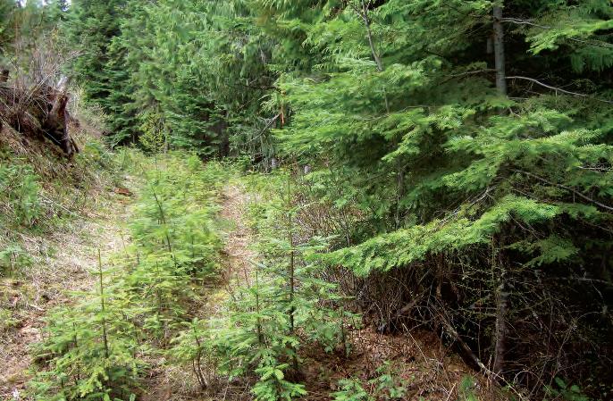
Site preparation is the practice of altering site conditions (mainly the soil surface) to favor the establishment, survival, and growth of a desired tree species. Proper site preparation can be critical to the survival of tree seedlings and can be accomplished through mechanical means, prescribed fire, herbicides, or a combination of these practices.
Crawler-tractors and other types of machines are often used to prepare forest sites for planting or to create enough bare mineral soil for successful germination of seed from nearby trees. Ideally, mechanical site preparation should expose enough mineral soil for adequate tree seedling regeneration but not remove organic matter from the site.
Mechanical site treatments can compact or rut forest soils and increase the potential for surface runoff. They also are expensive and not an option on steep slopes where cable yarding is required.
Broadcast burning with prescribed fire is a common site preparation method (especially on steeper slopes) that minimizes soil disturbance and compaction. The goal of broadcast burning is to burn the site just enough to meet management objectives. Burn professionals carefully monitor fuel moisture content, looking for that perfect window when fuels are dry enough to ignite, but moist enough to produce a “cool” burn that leaves the soil
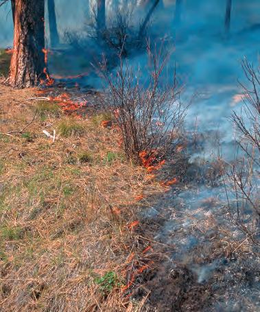
Broadcast burning with a prescribed fire is a common site preparation method that minimizes soil disturbance and compaction.
humus and large logs mostly intact. Excessively hot fires can make sites more vulnerable to soil erosion and, in some cases, sterilize the soil.
IFPA Rules for prescribed fire are addressed in the “Slash Management” section of this publication.
Herbicides can be a useful tool for site preparation and have the advantage of leaving vegetation intact. With both fire and chemical approaches to site preparation, take care to avoid riparian areas. Pay close attention to herbicide labels for important guidance on how to use products in ways that protect water quality.
For more information about pesticide use, see the “Hazardous Substances” section of this publication.
Use of herbicides and other site preparation methods within SPZs is restricted by IFPA Rules. Because prescribed burning in SPZs can cause erosion, nutrient and sediment flushing into streams, and sterilization of riparian soils, ignitions are not allowed within SPZs. Cultural methods such as scalping (scraping vegetation away) are more appropriate in these areas.
A wide variety of conifers, hardwood trees, and shrubs can be used to revegetate sparse stream banks. For example, willow, cottonwood, alder, and red-osier dogwood can be relatively easy to establish by inserting stem cuttings into stream banks in the spring. If more conifers are desired, consider planting shade-tolerant trees such as grand fir, spruce, hemlock,
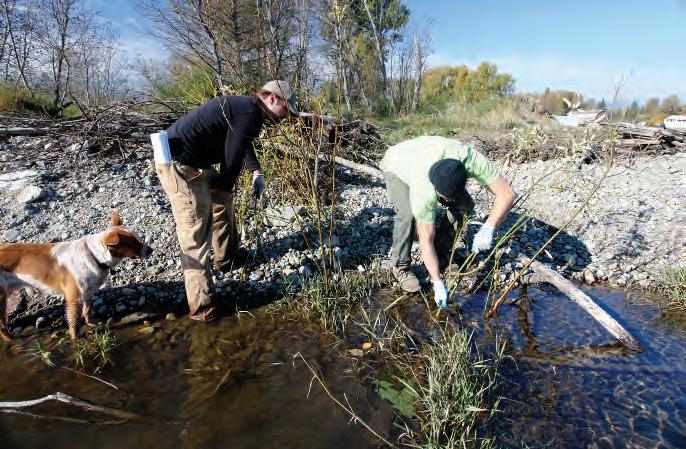
Willows can be relatively easy to establish by inserting stem cuttings into stream banks in the spring.
or western redcedar. More open sites can sustain a wider variety of vegetation, including shade-intolerant species of trees such as pine and larch.
Because riparian areas are often heavily used by wildlife, protecting seedlings from browsing by deer, elk, moose, beavers, porcupines, and pocket gophers can be critical to seedling survival. Hardwood trees and shrubs should survive browsing, as long as they keep resprouting. Otherwise, animal damage protection devices may be needed.
Livestock can degrade riparian areas if animals are not managed adequately. Fencing, offsite watering devices, and other livestock management techniques can be used to minimize livestock impact.
Forest operations usually generate large amounts of logging debris, or slash. A generally accepted definition of slash is all the brush, severed limbs, poles, tops, and/or other nonmerchantable organic material that is generated by a harvest, other types of land clearing, or storm damage. The IFPA Rules define
• slash: any vegetative residue 3 inches in diameter or less resulting from a forest practice or the clearing of land;
• commercial slash: fuels and debris resulting from a forest practice involving removal of a commercial product; and
• noncommercial slash: fuels and debris resulting from a forest practice where no commercial product is removed.
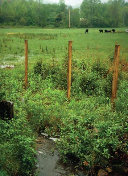
Fencing minimizes livestock impacts on riparian areas.
Throughout Idaho history, forest fires starting in or burning through untreated slash have caused more damage and been more difficult and costly to control than fires burning where slash was treated. Thus, slash management is a critical component of forest management.
The goal of slash management is to reduce slash enough to meet fire hazard rules, but not so much as to limit the benefits of fine organic material and coarse woody debris. Both are needed for forest nutrition and wildlife habitat. The majority of a forest’s aboveground nutrients are held in the tree foliage and branches, so it is imperative to maximize retention of these materials.
The type of slash treatment used has a direct bearing on soil and site productivity. Choosing the best slash disposal treatment will depend on how rapidly slash will decay on your site, how residual vegetation will respond to the chosen treatment, and requirements of slash compliance laws. Decomposition of logging slash can be relatively slow in Idaho forests because of short growing seasons and low precipitation rates. However, in wet areas (e.g., riparian areas and wet habitat types), decomposition can be rapid. Slash treatments include mechanical treatments such as crushing and leaving slash to decay, prescribed burning, or a combination of the two in which slash is mechanically piled and then burned.
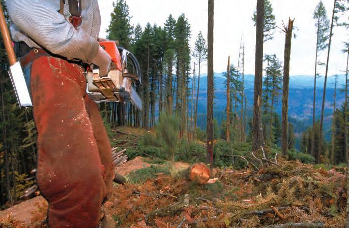
Slash is generally defined as all the brush, severed limbs, poles, tops, and/or other nonmerchantable organic material that is generated by a harvest, other type of land clearing, or storm damage.
Mechanically crushing slash often leaves a compacted layer of downed woody material that is partially integrated into the first 4 to 6 inches of soil. Complying with Idaho fire hazard laws may be more difficult with this type of slash treatment.
Prescribed burning is a common method of slash disposal. When done correctly, it can have positive effects on nutrient recycling and tree regeneration. With broadcast burning, it is important to use a low-intensity, short-duration burn. Intense heat, or long-burning fires, volatilizes nitrogen, which is primarily supplied by organic matter and is one of the most limited nutrients in forestlands. In contrast, a “cool” burn can release stored nutrients into the soil more rapidly than the natural decay process, while leaving enough organic matter to provide for good water infiltration and erosion control. Research has shown that fires typically result in a nutrient pulse into soils that persists for about 2 years, making it important to retain ash and surface soils.
A combination of mechanically piling slash and burning the piles is a commonly used method for treating slash and usually gives the best results. Mechanically piling slash with a grappler can keep some of the surface organic matter intact for nutrient recycling, but a bulldozer will not. Understanding soil texture and moisture conditions is key to preventing
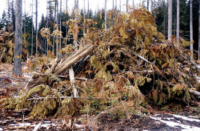
A combination of mechanically piling slash, and then burning, is a commonly used method for treating slash.
lasting damage from slash pile burning. Heat from burned slash piles may be transferred deep into moist mineral soil. Fine-textured soils hold moisture longer than coarse-textured ones, so they are at greater risk of heat damage.
Burn piles in place, leaving the remaining areas of bare mineral soil or ash. Smaller piles (less than 10 feet in diameter and 6 feet tall) may result in good seedbeds for natural regeneration. Larger piles, on the other hand, often overheat soil surfaces and create deep ash layers that are poor tree regeneration sites and often become populated by noxious weeds. Damage to soil surfaces can persist for 30 years or longer. Larger pile sites can easily be rehabilitated, however, by mixing the ash and fire-scorched surface soils with deeper, unaffected soils (often only 6 inches deep).
Prescribed burning activities require careful planning in order to ensure safe conditions, based on current and expected weather, including temperature and relative humidity. Another important factor is fuel moisture, both within the target unit and in adjacent areas.
To maintain air quality, protect public health, and reduce fire risk:
• DO compact slash and large woody debris piles and make sure they are free of stumps, soil, snow, and nonwoody material.
• DO fully cure slash piles (allow to dry at least 2 months) prior to ignition.
• DO partially or fully cover slash piles with a water-resistant material so they can be ignited after precipitation events when fire danger is lower.
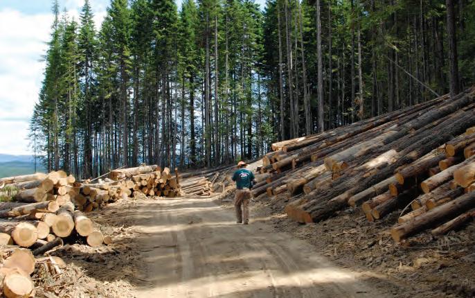
• DO conduct broadcast burns under conditions that minimize adverse effects on air quality.
• DO be a member in good standing in a recognized Airshed Group. Slash Inspections Requirements
Slash can present a fire hazard if not treated properly. IDL Fire Wardens inspect nearly 100% of forest practices on private forestlands for slash compliance. Any person cutting forest products, whether a landowner, operator, or timber owner, is required to do the following:
• Obtain from the Idaho Department of Lands a Certificate of Compliance-Fire Hazard Management Agreement/Notification of Forest Practice. This is the same set of forms everyone must file and get approved before beginning regulated forest practices.
• Provide a copy of the above agreement to all purchasers before delivering logs or other products.
• Manage commercial slash as set forth in the Idaho Forestry Act (Title 38, Chapters 1 and 4, Idaho Code) and the Rules Pertaining to Forest Fire Protection (IDAPA 20.04.01).
• Manage noncommercial slash as set forth in the Rules Pertaining to the Idaho Forest Practices Act (IDAPA 20.02.01).
• Comply with all terms of the agreement.
Slash treatments are usually part of the timber sale agreement between a landowner and logger. When the contractor signs the agreement, he/she agrees to treat the slash to the appropriate Rules standards and within the agreed time limits.
For more information, see “How to File a Notification of Forest Practice and Certificate of Slash Compliance/Fire Hazard Agreement,” page 5.
A hazard is any vegetative residue resulting from a forest practice that constitutes fuel. Fire hazard rules outline hazard rating systems based on points. The following terms apply to slash hazards:
• Hazard points are assigned to certain hazardous conditions on an operating area; to actions designed to modify such conditions; or to actions by the operator, timber owner, or landowner to offset these conditions.
• Hazard offsets are improvements or a combination of practices that reduce the risk that fire will spread and increase the ability to control fires.
• Hazard reduction is the burning or physical reduction of slash to reduce the risk from fire.
Points are added to a job based on slash quantity, site factors such as slope and aspect, unit size, and other factors such as proximity to structures. Menus of techniques and factors that constitute hazard offsets— actions that reduce slash hazards, such as fire trails, ponds, and access roads between stands—are available in the appropriate Rules booklet.
Please contact your local IDL district Fire Warden with questions about slash inspections, fire hazards, and hazard offsets.
As Idaho’s urban and suburban populations increase, the impacts of prescribed fire on air quality have become an increasingly important issue. Smoke management requires additional considerations beyond those important for fire safety. Even if conditions for slash burning are acceptable and meet the requirements of a burn plan, other conditions may create a smoke hazard and prevent prescribed burning. Factors to consider include the amount of atmospheric mixing, topography, wind speed, and wind direction in relation to nearby cities and towns.
Smoke management is a collaborative effort among landowners, fire managers, and the Idaho Department of Environmental Quality to ensure that prescribed slash burning addresses air quality concerns. Most large timberland owners in Idaho now participate in the voluntary Montana-Idaho Airshed Management System (AMS), available online at http://www.smokemu.org. In addition to monitoring weather and smoke
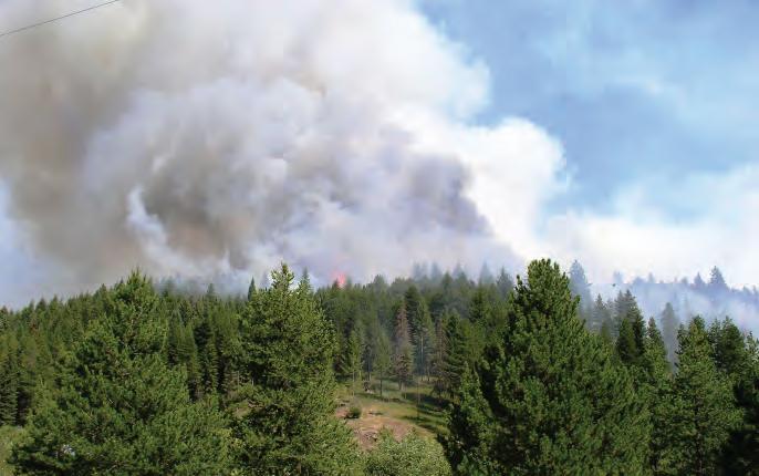
As Idaho’s urban and suburban populations increase, the impacts of prescribed fire on air quality have become an increasingly important issue for foresters and contractors. Factors such as atmospheric mixing, topography, wind speed, and wind direction determine when burning can be accomplished without creating a smoke hazard.
dispersal conditions, AMS tracks other burning activities occurring on the day an operator requests smoke approval. In this way, the system accounts not only for impacts of individual prescribed burns, but also the cumulative effects of multiple management activities occurring on the same day.
Forest roads, skid trails, and landings, especially those on steep and/or erodible soils, are the most common source of sediment from forest management activities, especially during the first few years following construction. The primary goal is to encourage the development of dense roots that bind and hold surface soils, especially during adverse weather conditions. Seeding native grasses and legumes (e.g., fescue and lupine) can also create forage for livestock and wildlife and reduce the establishment of weeds and other undesirable plants.
Because of the variety of sites usually encountered along a skid trail or forest road, seed mixtures containing two or more perennial species are desirable. Species that establish and grow rapidly quickly stabilize soils, as do long-lived, well-rooted perennials. Shade tolerance is an important trait, since most forest roads have varying degrees of shade. Successfully establishing grasses and legumes on forest roads, skid trails, and landings involves more than simply scattering seed. Before seeding, evaluate specific areas where ground cover should be
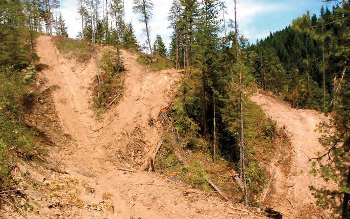
established. Evaluate soil depth, slope, and aspect to determine the effective precipitation the site receives.
Fertilization during seeding can be very beneficial, especially where topsoil has been removed. Test the soil for fertilizer needs. Always use extreme caution when using fertilizers near water, and never allow fertilizers to enter water directly. Fertilizer use must comply with all Idaho pesticide laws.
If you have a level, easily accessible site, seed can be spread by hand, broadcast mechanically (e.g., cyclone spreader), or drilled. You can also hire a professional to apply seed in a mulch slurry (hydromulch) or with forced air (air seed).
Regardless of the technique used, seed either in early fall (6 to 8 weeks before the first freeze), late fall (usually after November 1), or early spring. Late fall seeding is often best, since low temperatures prevent germination until spring. Early-fall or very early-spring seeding can be risky, as newly emerged seedlings can be exposed to killing frosts. If seeding in the spring or following wet fall weather, be careful not to compact moist soils.
Seed must have direct contact with the soil. It is best to seed just after a soil disturbance, such as road construction, when freshly exposed soil and fewer weeds are present. Try to leave a rough surface so seeds will have a place to lodge. This is especially important on steep slopes. You may want to construct “mini-terraces” using dozer cleats or tracks.
Mulching with excelsior, clean straw, slurried wood fiber, or a
similar material after seeding can improve the environment for seedling establishment and growth and help to control erosion during vegetation establishment.
Keep livestock off the site for at least 1 year after seeding to prevent trampling or overgrazing. Where livestock grazing cannot be avoided, consider delaying animal turnout until plants have matured and formed seed heads. Place salt or mineral blocks in areas away from new seedings. For more information on grass seeding, see Brooks, McFarland, and Schnepf, Grass Seeding Forest Roads, Skid Trails and Landings in the Inland Northwest, listed in “References.”
In Idaho, moisture is almost always the most limiting factor to new tree seedlings’ survival and growth. To maximize the amount of moisture available to new seedlings, manage unwanted vegetation. Unwanted vegetation can include both noxious weeds and native species. The goal of controlling unwanted vegetation is to give desired, newly established seedlings a head start over vegetative competition or to release established seedlings from overtopping brush. Once trees are 15 to 20 feet tall, additional control is rarely needed.
Noxious Weeds
Noxious weeds are a large problem in many parts of the world, greatly affecting agricultural areas, forests, nature preserves, parks, and other open spaces. Noxious weeds are plants that have been designated by a county, state, provincial, or national agricultural authority as injurious to native habitats, croplands, humans, native fauna, and/or livestock. Most noxious weeds are nonnative species that have been introduced into ecosystems by ignorance, mismanagement, or accident. Typically they grow aggressively and multiply quickly, due in part to a lack of natural control agents such as insects, disease, or herbivores.
The Idaho noxious weed law contains three categories of weeds:
• those that are thought not to be in Idaho or, if here, are recently established (statewide early detection and rapid response);
• those not widely distributed in the state—species that must be controlled or eradicated in some areas (statewide control); and
• those distributed throughout the state—species that must be contained or controlled to prevent further economic damage (statewide containment).
For a current list of Idaho’s noxious weeds, contact your county weed supervisor or visit http://plants.usda.gov/java/noxious?rptType=State &statefips=16
Noxious weeds such as this orange hawkweed are plants that have been designated by a county, state, provincial, or national agricultural authority as injurious to native habitats, croplands, humans, native fauna, or livestock.
Integrated Pest Management (IPM) is an effective and environmentally sensitive approach to vegetation management that relies on a combination of practices. IPM programs start by using information about the target pests (in this case unwanted vegetation) and their interaction with the environment. This information is used to identify effective control methods in order to manage unwanted vegetation by the most economical and least hazardous means. IPM takes advantage of all appropriate pest management options.
Biological control is the use of living natural enemies (insects, diseases, nematodes, or mites) to reduce undesirable plant populations. Biological control can be accomplished by importing exotic enemies or native pests, or by conserving or augmenting established or readily available natural enemies.
For more information about the use of biological controls in Idaho, contact the Idaho State Department of Agriculture or visit http://www.idahoag .us/Categories/PlantsInsects/NoxiousWeeds/Bio_Control.php
Cultural controls are mechanical methods of controlling unwanted vegetation. Mechanical control uses power tools, machinery, hand pulling, fire, or animals to manage vegetation.
Hand pulling unwanted vegetation aims at removing the entire weed, including the roots. This method is useful for small-scale invasions but is
Prescription grazing by goats is often part of an IPM program that includes other management techniques.
not appropriate for all weed species, such as those with underground bulbs or tuberous root systems. It is best to pull weeds after rain, when soil is moist. Wear gloves to avoid prickles, blisters, or sap burns.
Machinery is more suitable than hand tools for large infestations of noxious weeds because it reduces large weed populations with less effort.
Prescribed livestock grazing is the intentional use of livestock to achieve vegetation management goals. Grazing unwanted vegetation at a specific time, and for a specific duration and intensity, can effectively reduce vegetation. The effectiveness of grazing by goats for the management of leafy spurge, spotted knapweed, and yellow starthistle has been clearly demonstrated in several western states. It often is part of an IPM program that also includes other management techniques.
Chemical control is the use of herbicides to control unwanted vegetation. Herbicides are the most widely used form of weed control in forested environments, and they have several advantages over other methods. They cause minimal soil disturbance, thus reducing erosion and sedimentation risks while leaving organic matter and topsoil in place. They also can be more cost effective than other control methods. Herbicides can be used in combination with cultural control methods and can be an important part of an IPM program.
If misused, however, herbicides can carry a greater environmental risk than other methods. When applying herbicides it is important to
closely follow recommended application rates and other label instructions. Hand applications and spot spraying can easily result in overapplication. Every chemical has some level of persistence on a site, referred to as its half-life. Thus, a certain residual amount can remain several months or even a year or two after application, depending on the product. Frequent reapplication can result in herbicide accumulation in soils, with long-term negative consequences.
Always read and follow all label directions when using any herbicide or pesticide. For chemical control guidelines, contact your county weed superintendent.
Chemicals perform an important function in growing and harvesting forest trees. Properly applied chemicals can help achieve desired objectives without putting water, aquatic species, wildlife, soils, or humans at risk. Many chemicals are toxic and must be handled carefully. Hazardous or toxic substances are materials that are dangerous to handle or dispose of or are potential environmental contaminants. They include petroleum products, pesticides, other chemicals, and biological waste.
IFPA Rules define chemicals as “substances applied to forest lands or timber to accomplish specific purposes and includes pesticides, as defined in the Idaho Pesticide Law, Title 22, Chapter 34, Idaho Code, fertilizers, soil amendments, road dust abatement products and other materials that may present hazards to the environment.” There are two broad classes of forest chemicals:
• Pesticides include fertilizers, herbicides, insecticides, rodenticides, miticides, nematicides, and fungicides.
• Adjuvants include oils, spreaders, stickers, and surfactants mixed in pesticide solutions to control drift and serve as plant foliage wetting agents.
Improper disposal of hazardous substances is not only unsightly, but can cause environmental hazards.
IFPA Rules addressing hazardous substances exist to regulate handling, storage, and application of chemicals in such a way that public health and aquatic and terrestrial habitats will not be endangered by contamination of streams or other bodies of water. The application of chemicals is regulated by
• Idaho Pesticide Law, Title 22, Chapter 34, Idaho Code (http://www.legislature.idaho.gov/idstat/Title22/T22CH34.htm);
• Idaho Commercial Fertilizer Law, Title 22, Chapter 6, Idaho Code (http://www.legislature.idaho.gov/idstat/Title22/T22CH6.htm);
• Idaho Soil and Plant Amendment Law, Title 22, Chapter 22, Idaho Code (http://www.legislature.idaho.gov/idstat/ Title22/T22CH22.htm); and
• IDAPA 02.03.03, Rules Governing Pesticide and Chemigation Use and Application (http://adminrules.idaho.gov/rules /current/02/0303.pdf).
Owners and operators need to know and comply with Idaho regulations governing the storage, handling, application (including licensing of applicators), and disposal of hazardous substances. Any person applying, mixing, or loading pesticides must comply with the licensing requirements of Idaho Pesticide Law and IDAPA 02.03.03, Rules Governing Pesticide and Chemigation Use and Application. This requirement does not pertain to individuals applying general-use pesticides on their own property. Always read and follow the product label and follow requirements and recommendations for proper chemical storage.
See “Rule 060. Use of Chemicals and Petroleum Products” for more information.
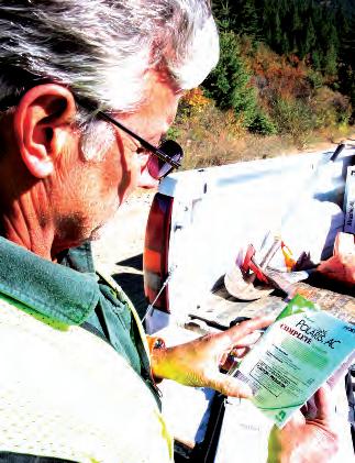
Thoroughly read and follow the instructions on all product labels.
Petroleum Products. Petroleum storage containers with capacities of more than two hundred (200) gallons, stationary or mobile, will be located no closer than one hundred (100) feet from any stream, water course, lake, or area of open water. Dikes, berms or embankments will be constructed to contain at least one hundred ten percent (110%) of the volume of petroleum products stored within the tanks. Diked areas will be sufficiently impervious and of adequate capacity to contain spilled petroleum products. In the event any leakage or spillage enters any stream, water course, lake, or area of open water, the operator will immediately notify the department.
• Transferring petroleum products. During fueling operations or petroleum product transfer to other containers, there shall be a person attending such operations at all times. Fueling operations should not take place where, if spillage occurs, the fuel will enter streams, lakes or other areas of open water.
• Equipment and containers used for transportation, storage or transfer of petroleum products shall be maintained in a leakproof condition. If the department determines there is evidence of petroleum product leakage or spillage, the use of such equipment shall be suspended until the deficiency has been corrected.
• Waste resulting from logging operations, such as crankcase oil, filters, grease, oil containers, or other nonbiodegradable waste shall be removed from the operating area and disposed of properly.
Licensing. Any person applying, mixing or loading pesticides shall comply with the licensing requirements of Idaho Pesticide Law and IDAPA 02.03.03, “Rules Governing Pesticide and Chemigation Use and Application.” This requirement does not pertain to individuals applying general use pesticides on their own property.
• Equipment used for transportation, storage or application of chemicals shall be maintained in leakproof condition. If, in the director’s judgment, there is evidence of chemical leakage, he shall have the authority to suspend the further use of such equipment until the deficiency has been corrected.
• The storage of pesticide shall also be conducted in accordance with the requirements Rules of the Idaho Pesticide Law and IDAPA 02.03.03, “Rules Governing Pesticide and Chemigation Use and Application.”
Mixing.
• When water is used in mixing chemicals:
- Provide an air gap or reservoir between the water source and the mixing tank.
- Use uncontaminated tanks, pumps, hoses and screens to handle and transfer mix water for utilization in pesticide operations. continued on page 132
Rule 060. Use of Chemicals and Petroleum Products, continued
• Mixing and landing areas:
- Mix chemicals and clean tanks and equipment only where spills will not enter any water source or streams.
- Landing areas shall be located where spilled chemicals will not enter any water source or stream.
- Rinsate and wash water should be recovered and used for make-up water, be applied to the target area, or disposed of according to state and federal laws.
Aerial Application.
• With the exception of pesticides approved for aquatic use and applied according to labeled directions, when applying pesticide leave at least one (1) swath width (minimum one hundred (100) feet) untreated on each side of all Class I streams, flowing Class II streams and other areas of open water. When applying pelletized fertilizer, leave a minimum of fifty (50) feet untreated on each side of all Class I streams, flowing Class II streams, and other areas of open water.
• Use a bucket or spray device capable of immediate shutoff.
• Shut off chemical application during turns and over open water.
• Aerial application of pesticides shall also be conducted according to the Idaho Pesticide Law and IDAPA 02.03.03, “Rules Governing Pesticide and Chemigation Use and Application.”
Ground Application with Power Equipment.
• With exception of pesticides approved for aquatic use and applied according to labeled directions, when applying pesticide, leave at least twenty-five (25) feet untreated on each side of all Class I streams, flowing Class II streams and areas of open water.
• When applying fertilizer, leave at least ten (10) feet untreated on each side of all streams and areas of open water.
Hand Application.
• Apply only to specific targets; such as, a stump, burrow, bait, or trap.
• Keep chemicals out of all water sources or streams.
Limitations on Applications.
• Chemicals shall be applied in accordance with all limitations and instructions printed on the product registration labels, supplemental labels, and others established by regulation of the director.
• Do not exceed allowable rates.
• Prevent direct entry of chemicals into any water source or stream.
Daily Records of Chemical Applications.
• When pesticides are applied on forest land, the operator shall maintain a daily record of spray operations which includes:
- Date and time of day of application.
- Name and address of owner of property treated.
- Purpose of the application (control of vegetation, control of Douglas-fir tussock moth, etc.).
- Contractor’s name and pilot’s name when applied aerially. Contractor’s name or applicator’s name for ground application.
- Location of project (section, township, range and county).
- Air temperature (hourly).
- Wind velocity and direction (hourly).
- Pesticides used including trade or brand name, EPA product registration number, mixture, application rate, carrier used and total amounts applied.
• Whenever fertilizers or soil amendments are applied, the operator shall maintain a daily record of such application which includes the above and the name of the fertilizer or soil amendment and application rate.
• The records required (above) shall be maintained in compliance with the record-keeping requirements of IDAPA 02.03.03, “Rules Governing Pesticide and Chemigation Use and Application.”
• All records (above) shall be retained for three (3) years.
Container Disposal. Chemical containers shall be: cleaned and removed from the forest and disposed of in a manner approved by the director in accordance with applicable local, state and federal regulations; or removed for reuse in a manner consistent with label directions and applicable regulations of a state or local health department. Open burning of containers is prohibited.
Spills. Spills shall be reported and appropriate cleanup action taken in accordance with applicable state and federal laws and rules and regulations.
• All chemical accidents and spills shall be reported immediately to the director.
• If chemical is spilled, appropriate procedures shall be taken immediately to control the spill source and contain the released material.
• It is the applicator’s responsibility to collect, remove, and dispose of the spilled material in accordance with applicable local, state and federal rules and regulations and in a manner approved by the director.
Misapplications. Whenever chemicals are applied to the wrong site or pesticides are applied outside of the directions on the product label, it is the responsibility of the applicator to report these misapplications immediately to the director.
Acceptable tree species. Any of the tree species normally marketable in the region and suitable to meet stocking requirements. Acceptable trees must be of sufficient health and vigor to assure growth and harvest.
Active road. A forest road being used for hauling forest products, rock, or other road building materials.
Aggrading stream. A stream reach where deposition is greater than erosion.
Algal bloom. A sudden increase in the abundance of suspended (planktonic) algae, especially at or near the water surface, producing a green or brown appearance to the water. Excess nutrients can cause an algal bloom.
Anchor cat. A bulldozer or other mobile machine of sufficient weight that, when parked below a hill or on a road, serves as the tailhold for the lower end of a skyline.
Aquatic macroinvertebrate. Animal living in or near water that is large enough to be seen and does not have a backbone.
Argillite. A fine-grained sedimentary rock composed primarily of clay particles heated under pressure.
Armoring. The placement of rocks around a culvert inlet or outlet to keep road materials around the pipe secure; also used to minimize soil erosion on unstable cut or fill slopes.
Artificial regeneration. Reestablishment of forest cover following harvest by direct seeding or planting.
Aspect. A position facing a particular direction; can be expressed as a direction (e.g., north, south, east, west), a compass direction in degrees, or a cardinal direction.
Average DBH. Average diameter in inches of a tree, measured at 4.5 feet above mean ground level on standing trees. All trees that do not have a measurable DBH will fall in the 1-inch class.
Balanced cut and fill. A construction method that uses materials excavated on the uphill side of a road as fill material on the downslope side.
Bankfull width. The maximum width a stream channel attains, typically marked by a change in vegetation, topography, or texture of sediment.
Basalt. A common extrusive igneous rock formed from the rapid cooling of basaltic lava exposed at or very near the earth’s surface.
Best management practice (BMP). A practice or combination of practices determined by the board, in consultation with the Idaho Department of Lands and the Forest Practices Advisory Committee, to be the most effective and practicable means of preventing or reducing the amount of nonpoint source pollution generated by forest practices. BMPs include, but are not limited to, those management practices included in the IFPA Rules.
Biological control. The use of living natural enemies (insects, diseases, nematodes, or mites) to reduce plant pest populations.
Borrow pit. An area where native rock material is excavated for use in road fills.
Buffer strip.(a) A protective area adjacent to an area requiring special attention or protection. (b) A vegetated area adjacent to a water body (e.g., river, stream, wetland, or lake); often protected and adjacent to an area requiring special attention or protection.
Certificate of Slash Compliance/Fire Hazard Agreement (Compliance). An assurance given to the state (Idaho Department of Lands) that fire hazard reduction or management will be performed after a forest operation.
Chemical. A substance applied to forestlands or timber to accomplish specific purposes; includes pesticides, as defined in the Idaho Pesticide Law, Title 22, Chapter 34, Idaho Code, fertilizers, soil amendments, road dust abatement products, and other materials that may present hazards to the environment.
Chemical control. The use of herbicides to control unwanted vegetation.
Class I stream. A stream that is used for domestic water supply, or is important for the spawning, rearing, or migration of fish. Such waters shall be considered to be Class I upstream for a minimum of 1,320 feet from the point of domestic diversion.
Class I Stream Protection Zone. The area encompassed by a minimum slope distance of 75 feet on each side of the ordinary high water marks.
Class II stream. Usually a headwater stream or minor drainage that is used by only a few, if any, fish for spawning or rearing. Where fish use is unknown, consider streams as Class II when the total upstream watershed is less than 240 acres in the north forest region, or less than 460 acres in the south forest region. Their principal value lies in their influence on water quality or quantity downstream in Class I streams.
Class II Stream Protection Zone. The area encompassed by a minimum slope distance of 30 feet on each side of the ordinary high water marks of a Class II stream. For Class II streams that do not contribute surface flow into Class I streams, provide soil stabilization and water filtering by leaving a sufficient width of undisturbed soil to prevent sediments from washing into streams. In no case shall this width be less than 5 feet slope distance on each side of the ordinary high water marks.
Clay. A natural, fine-grained material formed from erosion of rock fragments; particles are less than 2 micrometers in size; develops plasticity when mixed with a limited amount of water.
Clearcut system. A silvicultural treatment in which all trees in a unit are harvested in one operation and the area is reforested by planting trees or through natural regeneration.
Climax tree species. The tree species that will dominate if a site is left undisturbed; typically the most shade-tolerant trees capable of growing on a site.
Commercial products. Any saleable forest products of sufficient value to cover the cost of harvest and transportation to market.
Commercial slash.(a) A commercial product derived from fuels and debris following a forest practice such as clearcutting or thinning. (b) Fuels and debris resulting from a forest practice involving removal of a commercial product; the slash itself does not need to be a commercial product.
Commercial thinning. Thinning when trees are large enough to be sold for a product; revenue generated is potentially sufficient to offset treatment costs.
Condition of adjoining area. Fuel condition in an adjoining area that relates to spread of fire and to economic values of the adjoining area.
Constructed skid trail. A skid trail created by the deliberate cut and fill action of a dozer or skidder blade resulting in a road-type configuration.
Contaminate. To introduce into the atmosphere, soil, or water a substance of sufficient quantities so as to be injurious to public health, safety, or welfare; to domestic, commercial, industrial, agricultural, or recreational uses; or to livestock, wildlife, fish, or other aquatic life.
Contractor. The person on an IDL Notification of Forest Practice and Certificate of Slash Compliance/Fire Hazard Agreement form that is taking responsibility for the slash and who signs on the certificate holder or “Contractor” line.
Control points. The locations, or points, a forest road must reach or pass through.
Cross ditch. A diversion ditch and/or hump in a trail or road intended to carry surface water runoff into vegetation, duff, a ditch, or other dispersal area so that it does not cause soil movement and erosion.
Cull. Nonmerchantable, live, standing trees greater than 20 feet tall.
Cultural control. The deliberate manipulation of plants and their surroundings to favor optimal plant growth; includes choosing the right plant for the site, planting resistant varieties when available, using proper planting techniques, watering, fertilization, pruning, and sanitation practices.
Curve widening. The extra width added to a road curve to account for vehicle off-tracking.
Debris flow. A slurry composed of soil, water, vegetation, and other debris, with solids composing more than 60% of the volume on average.
Debris slide. An aggregation of coarse soil, rock, and vegetation that lacks significant water and moves downslope by sliding or rolling forward at speeds ranging from very slow to rapid.
Deep-seated landslide. A landslide in which the slide plane or zone of movement is well below the maximum rooting depth of forest trees (generally deeper than 10 feet), sometimes extending hundreds of feet in depth, and often including bedrock.
Definite bed. A streambed with a sandy or rocky bottom that results from the scouring action of water flow.
Deflection. The degree of cable “sag” at a cable system’s midpoint distance.
Degrading stream. A stream reach where erosion is greater than deposition.
Deposition. Accumulation of detached soil particles following overland flow, gravitational/wind erosion, or animal activities. Deposition occurs at the bottoms of slopes; in areas of vegetation and surface litter; behind rocks or large organic debris; and in streams, rivers, and their floodplains.
Detachment. The ease with which individual soil particles are detached (soil erodibility); influenced by slope gradient and length.
Deterioration rate. The rate of natural decomposition and compaction of woody debris that decreases fire hazard; varies by site.
Diameter at breast height (DBH). The diameter in inches of a tree, measured at 4.5 feet aboveground on the uphill side of the tree.
Diameter limit cutting. Harvest of the largest diameter trees in a forest stand.
Dissolved oxygen. The amount of oxygen dissolved in water. Higher amounts of oxygen can be dissolved in colder waters than in warmer waters. Dissolved oxygen is necessary to support fish and other aquatic organisms.
Emergency forest practice. A forest practice initiated during or immediately after a fire, flood, windthrow, earthquake, or other catastrophic event to minimize damage to forestlands, timber, or public resources.
End haul. Transport of excess excavated materials from a newly constructed road to a disposal area.
Ephemeral stream. A stream that flows during the wet season and is dry during the dry season; lacks defined bed or banks.
Erosion.(a) The movement of individual soil particles by wind or water, usually described by three components: detachment, transport, and deposition. (b) The wearing down and removal of soil, rock fragments, and bedrock through the action of flowing water, wind, moving ice, and gravitational creep (mass movement).
Evaporation. The process by which water not absorbed by vegetative canopies or soil changes to water vapor and is lost to the atmosphere.
Evapotranspiration. The loss of water to the atmosphere from the combined effects of interception, transpiration, and direct evaporation from vegetation, ground surfaces, and water bodies.
Even-aged silvicultural system. A silvicultural system that regenerates and maintains even-aged stands; includes clearcut, seed tree, and shelterwood systems.
Fertilizer. Any substance or combination of substances used principally as a source of plant nutrients or soil amendment.
Fire trail. An access route located and constructed in a manner to be useful in fire control efforts or to deter fire spread in a hazard area.
Flood. The flow of a large volume of water beyond its normal confines, especially over what is normally dry land.
Floodplain. The area on both sides of a stream where flood waters spread out. The surface may appear dry for most of the year, but is generally occupied by plants adapted to wet soils.
Forest practice.(a) The harvesting of forest tree species, including felling, bucking, yarding, decking, loading, and hauling; road construction, improvement, or maintenance, including installation or improvement of bridges, culverts, or structures that convey streamflows within the operating area; the clearing of forestland for conversion to nonforest use when harvest occurs. (b) Road construction, reconstruction, or maintenance of existing roads, including installation or improvement of bridges, culverts, or structures that convey streams not within the operating area associated with harvesting of forest tree species.
(c) Reforestation. (d) Use of chemicals for the purpose of managing forest tree species or forestland. (e) Management of slash resulting from harvest, management, or improvement of forest tree species or the use of prescribed fire on forestland. (f) “Forest Practice” shall not include preparatory work such as tree marking, surveying, road flagging, or removal or harvesting of incidental vegetation from forestlands, such as berries, ferns, greenery, mistletoe, herbs, mushrooms, or other products that cannot normally be expected to result in damage to forest soils, timber, or public resources.
Forest regions. Two designated regions of Idaho forestland: one is north of the Salmon River and the other is south of the Salmon River.
Forest type.(a) A category of forest usually defined by its vegetation, particularly its dominant vegetation as based on percentage cover of trees. (b) The Idaho Forest Practices Act delineates five forest types in Idaho:
• North Idaho grand fir/western redcedar (NIGF): moist to wet interior forests with western redcedar, western hemlock, and grand fir being primary climax species; found in forests north of the Clearwater and Lochsa rivers.
• Central Idaho grand fir/western redcedar (CIGF): productive conifer forests found between the Lochsa River Basin and the Salmon River, characterized by stands having western redcedar and grand fir as climax species, with a mixed conifer overstory increasingly comprised of ponderosa pine, Douglas-fir, and larch in the river breaks canyonlands. Stocking levels are generally lower than in NIGF stands.
• South Idaho grand fir (SIGF): mixed conifer forests, dominated by ponderosa pine and Douglas-fir, found south of the Salmon River, with grand fir and occasionally western redcedar being the stand climax species.
• Western hemlock/subalpine fir (WH): higher elevation, moist, cool interior forests dominated by western hemlock, mountain hemlock, and/or subalpine fir.
• Douglas-fir/ponderosa pine (PP): drier forests dominated by ponderosa pine and Douglas-fir, generally found in lower elevation, dry sites.
Forestland. Federal, state, and private land growing forest tree species that are, or could be at maturity, capable of furnishing raw material used in the manufacture of lumber or other forest products. The term includes federal, state, and private land from which forest tree species have been removed but have not yet been restocked. It does not include land affirmatively converted to uses other than the growing of forest tree species.
Fuel quantity.(a) The quantity of fuel per unit area, as determined by tree diameter, number of stems, predominant species to be cut or already cut, and the size of the continuous thinning block. (b) The amount of woody debris, measured in tons per acre, existing on a site or to be produced by a forest management activity.
Full-bench construction. The excavation of a hill slope so that the entire road surface is cut into the hillside, without using fill materials on the downhill side.
Geotextile. Synthetic fabric used to separate layers of soil and rock during road construction; particularly useful on soils that do not compact properly for effective hauling.
Ground-based equipment. Mobile equipment such as tractors, dozers, skidders, and mechanized harvesters used for harvesting, site preparation, or hazard reduction; does not include cable systems associated with stationary yarding equipment.
Groundwater. Water found beneath the earth’s surface.
Group selection system. A harvest selection system in which small groups of trees, typically no more than 3 acres, are removed.
Habitat type.(a) A forestland unit capable of producing similar plant communities at climax. (b) An aggregation of land units capable of producing similar plant communities at climax.
Harvesting. A commercial activity related to the cutting or removal of forest trees to be used as forest products; does not include the cutting or removal of forest tree species by a person for his or her personal use.
Hazard. Any vegetative residue resulting from a forest practice that constitutes fuel.
Hazard offset. Improvements or a combination of practices that reduce the spread of fire and increase the ability to control fires.
Hazard points. The number of points assigned to hazardous conditions on an operating area; to actions designed to modify conditions on the same area; or to actions by the operator, timber owner, or landowner to offset hazardous conditions on the same area.
Hazard reduction. The burning or physical reduction of slash by treatment in some manner that will reduce the risk from fire after treatment.
Hydrologic cycle. The continuous movement of water among the oceans, air, and earth in the form of precipitation, percolation, evapotranspiration, and stream discharge.
Hydromulching. A planting process that uses a slurry of seed and mulch to stabilize soil after disturbance.
Hydrophyte. A plant adapted to living in aquatic environments; also referred to as an aquatic plant.
Hyperconcentrated flood. A flowing mixture of water, sediment (predominantly sand size), and organic debris, with solids ranging between 20 and 60% by volume.
Hypoxia. A condition of low dissolved oxygen levels in a water body that can result from the decay of plants and algae.
IDL. Idaho Department of Lands.
IFPA. Idaho Forest Practices Act, Title 38, Chapter 13, Idaho Code
Inactive road. A forest road (a road whose primary purpose is for forest practices) no longer used for commercial hauling but maintained for access (e.g., for fire control, forest management activities, recreational use, and/or occasional or incidental minor forest products harvesting).
Incidental haul road. A multi-use road that has log haul during active harvest activities; however, the primary purpose of the road is other than forest practices (e.g., residential traffic).
Individual tree selection system. An uneven-aged silvicultural system in which individual trees of all sizes and age classes are removed throughout the stand to promote growth of remaining trees and to provide space for regeneration.
Infiltration. The absorption of water by soil.
Infiltration rate. The rate at which water soaks into the soil; determined by the percent of vegetative cover, vegetative cover type, soil volume-weight, moisture content, and amount of dead organic material and other protective cover.
Insloped road. A road that slopes toward the uphill side of a road profile; most commonly used to divert water into a ditch on the uphill side of the road.
Integrated Pest Management (IPM). A strategy that uses a combination of effective and environmentally sensitive controls to manage unwanted vegetation by the most economical and least hazardous means.
Interception. The process by which precipitation is caught by vegetation or other surfaces before it reaches the ground.
Intermittent stream. A stream that flows when there is adequate precipitation and is dry at other times; usually has defined bed and banks.
Lake. A body of perennial standing open water, natural or human-made, larger than 1 acre in size. Lakes include the beds, banks, or wetlands below the ordinary high water mark.
Landing. A cleared area in the forest to which logs are yarded or skidded for loading onto trucks for transport to processing sites.
Landowner. A person, partnership, corporation, or association of any type that holds an ownership interest in forestlands, including the state.
Large organic debris (LOD).(a) Live or dead trees and parts or pieces of trees that are large enough or long enough or sufficiently buried in the stream bank or streambed to be stable during high flows. Pieces longer than the channel width or longer than 20 feet are considered stable. (b) Logs left outside the SPZ for wildlife and long-term soil health. The type and size of LOD varies among classification systems and is sometimes referred to as coarse woody debris (CWD), large woody debris (LWD), or down woody debris (DWD).
Leaf litter. Plants and plant parts that have recently fallen and are partially or not at all decomposed.
Lift. A new layer of graded and compacted road material.
Location line (l-line). The final location chosen for new road construction.
Long-term inactive road. A road not intended to be used again in the near future, but likely to be used at some future time.
Lowboy trailer. A low-slung trailer designed to transport large machinery.
Low-volume road. A road typically constructed to manage or extract resources from rural or undeveloped areas and designed to accommodate low traffic volumes with potentially extreme axle loads.
Magmatic activity. The rise of liquid magma below the earth’s surface.
Mass haul. Excess material excavated from road cuts used to fill in low areas.
Mass haul requirement. The extent to which excess material from road cuts in one area must be removed and used to fill in adjacent low areas.
Merchantable material. That portion of forest trees suitable for the manufacture of commercial products that can be merchandised under normal market conditions.
Merchantable stand of timber. A stand of trees that will yield logs or fiber, suitable in size and quality for the production of lumber, plywood, pulp, or other forest products, of sufficient value at least to cover all costs of harvest and transportation to markets.
Mesic. Intermediate moisture conditions (i.e., neither decidedly wet nor dry).
Metamorphic activity. The change in existing minerals or rock structure due to heat and pressure.
Microinvertebrates. Animals that have no backbone and are too small to be seen by the unaided eye.
Montane. Relating to mountains.
Natural regeneration. Reestablishment of forest cover by seed from nearby trees following harvest activities.
Noncommercial forestland. Habitat types not capable of producing 20 cubic feet per acre per year of usable wood.
Noncommercial slash. Fuels and debris resulting from a forest practice where no commercial product is removed.
Nonpoint source pollution. Polluted runoff that is not readily identifiable as originating from any one particular point; includes pollution caused by runoff from streets, agricultural land, forest roads, construction sites, and parking lots.
Notification of Forest Practice (Notification). A notice to the state (Idaho Department of Lands) that a forest practice is going to be conducted.
Noxious weeds. Plants that have been designated by a county, state, or national agricultural authority as injurious to native habitats, croplands, humans, native fauna, and/or livestock; nonnative species that grow aggressively and multiply quickly, due in part to a lack of natural control agents such as insects, diseases, or herbivores.
Nutrient. Any element necessary for the growth of living organisms.
Nutrient enrichment. Elevated levels of nitrogen and/or phosphorus in a water body that result in undesirable growth of algae or other aquatic plants.
Off-tracking. Action by which the rear axle of a truck follows a different path than the front of the vehicle and travels farther inside on the curve.
Operating area. The area where a forest practice is taking place or will take place.
Operator.(a) A person who conducts or is required to conduct a forest practice. (b) The person on an IDL Notification of Practice and Certificate of Slash Compliance/Fire Hazard Agreement form that is taking responsibility for complying with forest practices and signs on the “Operator” signatory line.
Ordinary high water mark. The mark on a water course found by examining the beds and banks and ascertaining where the presence and action of waters are so common and usual, and so long continued in all ordinary years, as to mark upon the soil a character distinct from that of the abutting upland, in respect to vegetation; this determination is made based on conditions existing on the effective date of the IFPA.
Organic matter. Plant and animal material.
Outsloped road. A road that slopes outward, in the same direction as the slope.
Overburden. The excess material from constructing forest roads, produced by cut and fill operations or full-bench construction.
Overland flow. Water that moves over the ground surface; also called surface runoff.
Ped. A building block of soil; an aggregation of soil particles defining a soil’s structure.
Perennial stream. A continuously flowing stream.
Permanently abandoned road. A road not intended to be used again.
Point source pollution. Pollutants originating from a “point” source, such as a pipe or vent.
Pollution. An undesirable change in the environment, usually resulting from the introduction of abnormally high concentrations of hazardous or detrimental substances, such as nutrients or sediment; the presence of any substance that harms the environment.
Precipitation. Water from the atmosphere that reaches plants, the ground, or water bodies; includes rain, snow, sleet, hail, and condensation, such as dew or frost.
Precommercial thinning. A thinning practice by which trees that are too small to be sold for wood products are removed from a stand to meet forest management objectives. A net cost is incurred by the landowner.
Preliminary line (p-line). A “first glance” route that is initially planned by a landowner, forester, or contractor for a new low-volume forest road.
Prescribed fire. The controlled application of fire to wildland fuels in either their natural or modified state, under such conditions of weather, fuel moisture, and soil moisture so as to allow the fire to be confined to a predetermined area and at the same time to produce the intensity of heat and rate of spread required to meet objectives.
Prescribed livestock grazing. The intentional use of livestock to achieve vegetation management goals.
Present condition of area. The amount or degree of hazard present before a thinning operation commences.
Public resource. Water, fish, wildlife, and capital improvements of the State or its political subdivisions.
Puddling. The ponding of water on the soil surface following disturbance associated with heavy equipment; primarily occurs on fine-textured soils with high soil water content.
Quartzite. A coarse-grained sedimentary rock composed primarily of quartz-rich sandstone heated under pressure.
Reference tag. An identification tag used to identify road centerline and drainage device locations.
Reforestation. The establishment of an adequately stocked stand of trees of species acceptable to IDL to replace those removed by harvest or by a catastrophic event on commercial forestland.
Relative stocking. A measure of site occupancy calculated as a ratio comparison of actual stand density to the biological maximum density for a given forest type. This ratio, expressed as a percentage, shows the extent to which trees utilize a plot of forestland.
Relief culvert. A structure to relieve surface runoff from roadside ditches to prevent excessive buildup in water volume and velocity.
Riparian area. An area adjacent to and along a watercourse that constitutes a buffer zone between nearby lands and the watercourse; the natural plant community adjacent to a stream.
Riprap. Any material (such as concrete blocks, rocks, or log pilings) used to stabilize a watercourse and reduce erosion.
Road standards. A list of specifications for road designs.
Runoff. Water from rain, snowmelt, or irrigation that flows over the ground surface and runs into a water body.
Salmonid. A family of ray-finned fish including salmon, trout, chars, freshwater whitefishes, and graylings.
Sand. A natural, coarse-grained material formed from erosion of rock fragments; particle sizes range from greater than 0.0625 millimeters but less than 2 millimeters in diameter.
Sediment. Eroded soil particles (soil, sand, and minerals) transported by water.
Sediment trap. A temporary device installed on a construction site to capture eroded or disturbed soil that is washed off during rainstorms; designed to protect the water quality of a nearby stream, river, or lake.
Sedimentation.(a) The process by which soil particles (sediment) enter a water body, settle to the bottom, and accumulate. (b) The addition of soil to lakes or streams.
Seed tree system. An even-aged silvicultural system similar to a clearcut, except that 5 to 10 trees per acre are left evenly distributed across the site to produce tree seed.
Selection system. An uneven-aged silvicultural system that attempts to maintain a range of desired tree sizes, species, and ages by harvesting individual trees or small groups of trees.
Shelterwood system. An even-aged silvicultural system similar to the seed tree system, except that more trees are left to “shelter” the site until new trees are established.
Silt. Fine particles of soil and minerals formed from erosion of rock fragments; particle size ranges from 0.004 to 0.0625 millimeters.
Siltite. A fine-grained sedimentary rock composed primarily of silt-sized minerals heated under pressure.
Silvicultural system. A specific set of practices designed to create favorable growing conditions for desired tree species.
Silviculture. The art and science of controlling the establishment, growth, composition, health, and quality of forests and woodlands to meet the diverse needs and values of landowners and society on a sustainable basis.
Site. An area characterized by ecological factors, with reference to capacity to produce forest vegetation; the combination of biotic, climatic, and soil conditions of an area.
Site factor. A combination of percent of average ground slope and dominant aspect of the forest practice area as they affect the rate of fire spread.
Site preparation. Hand or mechanized manipulation of a site, designed to enhance the success of tree regeneration.
Size of thinning block. Acres of continuous fuel creating an additional hazard within a forest practice area. Distance between the perimeter of adjacent thinning blocks containing continuous fuel must be a minimum of six chains (396 feet) apart to qualify as more than one block.
Slash.(a) Any vegetative residue 3 inches in diameter or smaller resulting from a forest practice or the clearing of land. (b) All brush, severed limbs, poles, tops, and/or other organic waste material generated by harvest, other types of land clearing, or storm damage.
Slash mat. Harvest residue dispersed on skid trails or landings to reduce erosion and soil compaction.
Snag.(a) A dead, standing tree 20 feet or greater in height. (b) A standing, generally unmerchantable dead tree from which the leaves and most of the branches have fallen.
Soil. The mixture of minerals, organic matter, gases, liquids, and micro- and macroorganisms that supports plant life.
Soil stabilization. Efforts taken to minimize soil erosion.
Soil strength. A soil’s overall cohesion, determined by structural units called peds; larger peds increase soil strength.
Soil survey. The process of classifying soil types and other soil properties in a given area and geo-encoding such information; usually performed by the USDA Natural Resources Conservation Service.
Soil texture. A qualitative analysis of soil based on the percentage of sand, silt, and clay.
SPZ. Stream Protection Zone. See Class I and Class II definitions.
Stand. A contiguous group of trees sufficiently uniform in age-class distribution, composition, and structure, and growing on a site of sufficiently uniform quality, so as to be a distinguishable unit.
Strahler Stream Classification System. A stream order classification system that assigns each headwater stream an order of 1; at the confluence of two first-order streams, the downstream reach is assigned an order of 2. The confluence of two second-order streams results in a downstream reach of order 3, and so on.
Stream. A natural watercourse of perceptible extent with a definite bed and banks that confine and conduct continuously or intermittently flowing water.
Stream bank. The sides of a stream that contain water flow, except during floods.
Stream discharge. The amount of water moving in a stream in a given amount of time, also known as flow.
Streambed. The bottom of a stream where the substrate and sediments lie.
Sublimation. The process by which snow changes from solid to gas (water vapor), bypassing the liquid phase.
Substrate.(a) The surface upon which an organism lives or is attached. (b) The material making up the bottom of a streambed.
Substrate embeddedness. The degree to which large particles (boulders or gravel) in a stream are surrounded or covered by fine sediment.
Subsurface water.(a) Any water that flows through the soil and underground rock crevices. (b) Groundwater.
Succession. The shift in forest species composition over time.
Tailhold. The downhill anchor point of the primary cable in a skyline system.
Tectonic plate. A section of the earth’s crust and uppermost mantle.
Thermal pollution. Water temperatures that are too warm to maintain oxygen at levels necessary to support desired aquatic species.
Thinning. Removing trees from a stand to reduce stand density, select for healthier and higher quality crop trees, and improve growth and log quality of remaining trees.
Through cut. A road cut used to avoid an overly steep road grade, such as on the crest of a steep hill, or a cut through a hill slope used to minimize road curves.
Through fill. A raised road bed on flat terrain where water is likely to pond; used to cross draws or wet or swampy ground; also called a turnpike.
Timber owner. A person, partnership, corporation, or association of any type, other than the landowner, that holds an ownership interest in forest tree species on forestland.
Time of year of forest practice (relating to hazard reduction). Those combinations of months during which the forest practice is taking place. Points assigned are: October through December–2 points; August through September–4 points; January through April–7 points; May through July–10 points.
Transparency. The measure of water clarity; affected by the amount of material (sediment, algae, and plankton) suspended in water.
Transpiration. The uptake of soil water by plants and its evaporation to the atmosphere through leaves and other plant surfaces.
Transport. Movement of detached soil particles from one place to another by overland flow, gravity, wind, or animal activity.
Trial grade. A rough estimate of the slope along a planned road route.
Turbidity. The presence of sediment in water, making it unclear, murky, or opaque.
Uneven-aged silvicultural system. A harvest system designed to maintain a variety of tree ages and diameters within a stand by frequently harvesting small volumes.
Unit. One or several forest stands used to indicate a geographical or management area.
Volcanism. Volcanic eruptions and lava flows.
Water quality. The condition of water with regard to the presence or absence of pollution.
Watershed.(a) The area of land that drains water, sediment, and dissolved materials to a common outlet at some point along a stream channel. (b) A region or area of land that drains into a body of water such as a lake, river, or stream.
Wetland. A shallow body of water that may or may not have water in it year-round.
Woodland. A plant community in which, in contrast to a typical forest, the trees are characteristically small and short boled relative to their crown depth; the canopy is more open, with the intervening area being occupied by lower vegetation, commonly grass.
Yoder. A relatively new technology that combines a yarder and a loader and results in a smaller version of a yarder that is easier to move and set up.
Many of the references listed below are available online at the given URL. Please see the Idaho Forestry BMPs website at http://idahoforestrybmps.org for information on how to order copies of publications not available online.
Barbosa, P., ed. 1998. Conservation Biological Control. San Diego: Academic Press.
Barkley, Y.C. 2006. After the Burn: Assessing and Managing Your Forestland after a Wildfire. Station Bulletin No. 76. Moscow, ID: Idaho Forest, Wildlife and Range Experiment Station and University of Idaho Extension. http://www.uidaho.edu/~/media/Files/Extension/ Forestry/Fire/Fire%20Ecology/AftertheBurn2011.ashx.
Bowers, S., and P. Adams. 2006. Managing Woodland Roads: A Field Guide. Publication PNW 641. Corvallis, OR: Oregon State University Extension Service.
Brooks, R., A. McFarland, and C. Schnepf. 2011. Grass Seeding Forest Roads, Skid Trails and Landings in the Inland Northwest. Publication PNW 628. Moscow, ID: University of Idaho Extension. http://www.cals.uidaho.edu/edcomm/pdf/PNW/PNW628.pdf.
Cook, M.J., and J.G. King. 1983. Construction Cost and Erosion Control Effectiveness of Filter Windrows on Fill Slopes. Research Note INT-335. Ogden, UT: U.S. Department of Agriculture Forest Service, Intermountain Forest and Range Experiment Station.
Davidson, J.C., E. Smith, and L.M. Wilson. 2006. Livestock Grazing Guidelines for Controlling Noxious Weeds in the Western United States. Publication EB-06-05. University of NevadaReno Cooperative Extension. http://www.unce.unr.edu/publications/files/ag/2006 /eb0605.pdf.
Dumroese, R.K., R.L. Mahoney, and D.L. Wenny. 1992. Choosing Nursery Stock for Landscaping, Conservation, and Reforestation. Publication CIS 923. Moscow, ID: University of Idaho Extension.
Dumroese, R.K., D.L. Wenny, and Y.C. Barkley. 2001. Plant Your Container Grown Seedlings Right. Contribution No. 929. Moscow, ID: Idaho Forest, Wildlife and Range Experiment Station.
Eubanks, E.C., and D. Meadows. 2002. A Soil Bioengineering Guide for Streambank and Lakeshore Stabilization. Publication FS-683. U.S. Department of Agriculture Forest Service. http://www.fs.fed.us/publications/soil-bio-guide/.
Forest Guild Pacific Northwest Biomass Working Group. 2013. Forest Biomass Retention and Harvesting Guidelines for the Pacific Northwest. Santa Fe, NM: forestGUILD. http://www.forestguild.org/publications/research/2013/FG_Biomass_Guidelines_PNW.pdf
Garrison-Johnston, M.T., R. Lewis, and L. Johnson. 2007. Northern Idaho and Western Montana Nutrition Guidelines by Rock Type. IFTNC Rep. No. 200710. Moscow, ID: University of Idaho.
Grigal, D.F. 2000. “Effects of Extensive Forest Management on Soil Productivity.”
Forest Ecology and Management 138:167–185.
Han, S.K., H.S. Han, D. Page-Dumroese, and L.R. Johnson. 2009. “Soil Compaction Associated with Cut-to-length and Whole-tree Harvesting of a Coniferous Forest.”
Canadian Journal of Forest Research 39:976–989.
Idaho Department of Lands. 2008. Managing Fire on Lands Protected by the State of Idaho: A Handbook for Policy Makers, Landowners, and Idaho Citizens. Boise, ID: Idaho Department of Lands. http://www.idl.idaho.gov/fire/Idaho_Fire_Handbook_v10-7.pdf.
Idaho Department of Lands. 2009. Correctly Classifying Streams to Protect Fisheries and Domestic Water Supplies. State Forester Forum, Forest Practice No. 14. Boise, ID: Idaho Department of Lands. http://www.idl.idaho.gov/forestry/forester-forums/fpa14.pdf.
Idaho Department of Lands. 2009. Cross-ditches. State Forester Forum, Forest Practice No. 5. Boise, ID: Idaho Department of Lands. http://www.idl.idaho.gov/forestry/ forester-forums/fpa5.pdf.
Idaho Department of Lands. 2009. Fish Passage Guidelines When Installing Stream Crossings. State Forester Forum, Forest Practice No. 12. Boise, ID: Idaho Department of Lands. http://www.idl.idaho.gov/forestry/forester-forums/fpa12.pdf.
Idaho Department of Lands. 2009. Fords: When, Where, Why and How. State Forester Forum, Forest Practice No. 7. Boise, ID: Idaho Department of Lands. http://www.idl.idaho.gov/forestry/forester-forums/fpa7.pdf.
Idaho Department of Lands. 2009. Idaho’s Fire Hazard Management Laws. State Forester Forum, Fire Management No. 1. Boise, ID: Idaho Department of Lands. http://www.idl.idaho.gov/forestry/forester-forums/fire1.pdf
Idaho Department of Lands. 2009. Potentially Unstable Slopes and Landforms. State Forester Forum, Forest Practice No. 10. Boise, ID: Idaho Department of Lands. http://www.idl.idaho.gov/forestry/forester-forums/fpa10.pdf.
Idaho Department of Lands. 2009. Rolling Drain Dip. State Forester Forum, Forest Practice No. 11. Boise, ID. http://www.idl.idaho.gov/forestry/forester-forums/fpa11.pdf
Idaho Department of Lands. 2009. Slash Filter Windrows. State Forester Forum, Forest Practice No. 13. Boise, ID: Idaho Department of Lands. http://www.idl.idaho.gov/forestry/forester-forums/fpa13.pdf
Idaho Department of Lands. 2009. Slash Removal from Streams. State Forester Forum, Forest Practice No. 2. Boise, ID: Idaho Department of Lands. http://www.idl.idaho.gov /forestry/forester-forums/fpa2.pdf
Idaho Department of Lands. 2009. Stream Protection Zones (SPZ). State Forester Forum, Forest Practice No. 6. Boise, ID: Idaho Department of Lands. http://www.idl.idaho.gov /forestry/forester-forums/fpa6.pdf
Idaho Department of Lands. 2009. Take the Risk Out of Slash Burning. State Forester Forum, Fire Management No. 2. Boise, ID: Idaho Department of Lands. http://www.idl.idaho.gov /forestry/forester-forums/fire2.pdf
Idaho Department of Lands. 2014. Class I Streamside Tree Retention Rules. State Forester Forum, Forest Practice No. 17. Boise, ID: Idaho Department of Lands.
Idaho Department of Lands. 2014. Rules Pertaining to the Idaho Forest Practices Act Title 38, Chapter 13, Idaho Code. Boise, ID: Idaho Department of Lands. http://adminrules.idaho.gov/rules/current/20/0201.pdf.
Idaho Department of Water Resources. 2014. Stream Channel Protection Program. Boise, ID: Idaho Department of Water Resources. http://www.idwr.idaho.gov/WaterManagement/StreamsDams/Streams/main.htm.
Idaho Public Service Broadcasting Network. n.d. Idaho: A Portrait. http://idahoptv.org/productions/idahoportrait/index.html
Jain, T.B., M.A. Battaglia, H.S. Han, R.T. Graham, C.R. Keyes, J.S. Fried, and J.E. Sandquist. 2012. A Comprehensive Guide to Fuel Management Practices for Dry Mixed Conifer Forests in the Northwestern United States. Gen. Tech. Rep. RMRS-GTR-292. Fort Collins, CO: U.S. Department of Agriculture Forest Service, Rocky Mountain Research Station. http://www.fs.fed.us/rm/pubs/rmrs_gtr292.html
Jurgensen, M.F., A.E. Harvey, R.T. Graham, D. Page-Dumroese, J.R. Tonn, M.J. Larsen, and T.B. Jain. 1997. “Impacts of Timber Harvesting on Soil Organic Matter, Nitrogen, Productivity, and Health of Inland Northwest Forests.” Forest Science 43:234–251.
Keller, K., and J. Sherar. 2010. Low-Volume Roads Engineering: Best Management Practices Field Guide. Quincy, CA: U.S. Department of Agriculture Forest Service, Plumas National Forest. http://www.fs.fed.us/global/topic/sfm/low_resolution_roads_bmp_guide.pdf
Kimsey, M., Jr., D. Page-Dumroese, and M. Coleman. 2011. “Assessing Bioenergy Harvest Risks: Geospatially Explicit Tools for Maintaining Soil Productivity in Western U.S. Forests.” Forests 2(3):797–813.
Kramer, B.W. 2001. Forest Road Contracting, Construction, and Maintenance for Small Forest Woodland Owners. Research Contribution No. 35. Corvallis, OR: Oregon State University. http://www.woodlandowners.org/Forest_Road_Contracting_Construction_and _Maintenance_ for_Small_Forest_Woodland_Owners.pdf.
McFarland, A. 2013. IDAH2OMaster Water Stewards Handbook. Bulletin 882. Moscow, ID: University of Idaho Extension. http://www.cals.uidaho.edu/edComm/pdf/BUL/BUL882.pdf.
Moore, J.A., and P.G. Mika. 1997. “Influence of Soil Parent Material on the Nutrition and Health of Established Conifer Stands in the Inland Northwest.” In Proceedings of the Conference on Forest Seedling Nutrition from the Nursery to the Field. Edited by D.L. Haase and R. Rose. 112–17. Corvallis, OR: Nursery Technology Cooperative, Department of Forest Science, Oregon State University.
Page-Dumroese, D., M. Jurgensen, and T. Terry. 2010. “Maintaining Soil Productivity During Forest or Biomass-to-Energy Thinning Harvests in the Western United States.” Western Journal of Applied Forestry 25:5–11.
Perry, D.A., R. Oren, and S.C. Hart. 2008. Forest Ecosystems. Baltimore: The John Hopkins University Press.
Powers, R.F., D.A. Scott, F.G. Sanchez, R.A. Voldseth, D. Page-Dumroese, J.D. Elioff, and D.M. Stone. 2005. “The North American Long-term Soil Productivity Experiment: Findings from the First Decade of Research.” Forest Ecology Management 220:31–50.
Reeves, D., D. Page-Dumroese, and M. Coleman. 2011. Detrimental Soil Disturbance Associated with Timber Harvest Systems on National Forests in the Northern Region. Research Paper RMRS-RP-89. U.S. Department of Agriculture Forest Service.
Satterlund, D.R., and P.W. Adams. 1992. Wildland Watershed Management. New York: Wiley and Sons, Inc.
Schnepf, C. 2000. Logging Selectively. Publication PNW 534. Moscow, ID: University of Idaho Extension.
Society of American Foresters. 2008. Dictionary of Forestry. Bethesda, MD. http://dictionaryofforestry.org
The Federal Interagency Stream Restoration Working Group. 1998. Federal Stream Corridor Restoration Handbook. Publication NEH-653. U.S. Department of Agriculture Natural Resources Conservation Service. http://www.nrcs.usda.gov/wps/portal/nrcs/detailfull/ national/water/?cid=stelprdb1043244.
The Samuel Roberts Noble Foundation. 2014. What Does Organic Matter Do in Soil? http://www.noble.org/ag/soils/organicmatter/
Town, P., and R.L. Mahoney. 1996. Are Your Streams Healthy? Stream Quality Survey for Managing Private Forest Ecosystems. Bulletin No. 61. Moscow, ID: Idaho Forest, Wildlife and Range Experiment Station, University of Idaho.
Wegner, K.F. 1984. Forestry Handbook. New York: John Wiley and Sons. Witt, C., J.D. Shaw, M.T. Thompson, S.A. Goeking, J. Menlove, M.C. Amacher, T.A. Morgan, and C. Werstak. 2012. Idaho’s Forest Resources, 2004–2009. Resource Bulletin RMRS-RB-14. Fort Collins, CO: U.S. Department of Agriculture Forest Service, Rocky Mountain Research Station. http://www.fs.fed.us/rm/pubs/rmrs_rb014.html.
Robert Barkley, Idaho Department of Lands—Pages 6, 23, 28, 45, 57, 60, 61, 79, 81, 95 (upper), 96, 98 (left), 101, 102, 103, 111, 114, 119, 122, 123, and 129
Yvonne Barkley, University of Idaho—Pages vi, 21, 25, 30 (right), 36 (right), 43, 44, 47, 48, 49 (all), 53, 69, 74, 75, 82, 89, 90, 95 (lower), 97, 106, 110, 120, and 125
Paul Bolstad, University of Minnesota, Bugwood.org—Page 117
Amy Grey, Illustrator—Pages 92–93 (all)
George Holmes, Valent USA Corporation, Bugwood.org—Page 15
Mark Kimsey, University of Idaho—Pages 33 (left), 34 (left), 35 (left and lower right), and 41
Bruce Kinkead, Coeur d’Alene Tribe—Page 18 (lower)
Noah Kroese, Noah Kroese Illustration—Pages 7, 9, 16, 26, 27, 46, 52 (all), 54, 55 (all), 56, 58 (all), 63 (all), 65 (all), 66, 80, 83, 84, 85, 88, and 100 (all)
Reed Lewis, Idaho Geologic Survey—Page 35 (upper right)
Paul McDaniel, University of Idaho—Pages 32 (all), 33 (right), 34 (right), and 36 (left)
Ashley McFarland, Michigan State University—Page 104
Tommy Moorman, Illustrator—Page 20 (all)
Dave Powell, USDA Forest Service, Bugwood.org—Page 39
Chris Schnepf, University of Idaho—Pages 1, 3, 4, 10, 11, 12 (all), 13, 17, 18 (upper), 22, 24 (right), 30 (left), 70, 116, 128, and 130
Eric Sjoquist, Idaho Department of Lands—Page 126
Terry Spivey, USDA Forest Service, Bugwood.org—Page 14 (upper)
Beth Steinhauer, forestphoto.com—Page 98 (right)
Dave Tong, University of Idaho—Page 19
University of Idaho Extension Forestry Archives—Page 2
USDA Forest Service North Central Research Station Archive, Bugwood.org—Page 24
Karen Wattenmaker, © Karen Wattenmaker Photography—Front cover, back cover, and pages 37, 105, 115, and 118
Theodore Webster, USDA Agricultural Research Service, Bugwood.org—Page 14 (lower)
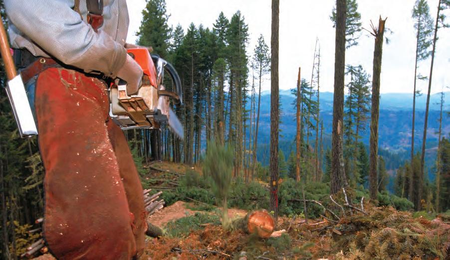
•


