Ala Wai Small Boat Harbor Vision Report

State of Hawai‘i Department of Land & Natural Resources, Division of Boating & Ocean Recreation
University of Hawai'i Community Design Center
August 2022

State of Hawai‘i Department of Land & Natural Resources, Division of Boating & Ocean Recreation
University of Hawai'i Community Design Center
We would like to thank our project sponsor:
State of Hawai‘i Department of Land & Natural Resources, Division of Boating & Ocean Recreation
We also extend our thanks to:
Scott 'Cloudwatcher' Allen
Hawai'i Yacht Club
Poya Harirchi
ARCH 415, ARCH 761, and PLAN 751
Focus Group Participants
Senator Sharon Moriwaki
Ed Underwood
Meghan Statts
The Ala Wai Small Boat Harbor Vision Report was prepared by The University of Hawai‘i Community Design Center (UHCDC):
Principal Investigators:
Phoebe White, Assistant Professor of Landscape Architecture
Priyam Das, Associate Professor and Chair of the Department of Urban and Regional Planning
Project Designer: Ariel Dungca, ASLA
Project Assistants:
Hana Fulghum
Sukhyun Hong
Sandy Jiyoon Kim
Note: This report summarizes academic proofof-concept design research and serves as a conceptual design tool intended to inform future request for proposals for the Ala Wai Small Boat Harbor. This report does not serve as a traditional planning document.
Boat Harbor
Launch Ramp
Sand Island
Maunalua Bay
 Ke`ehi Harbor/Lagoon
Ala Wai Small Boat Harbor
Launch Ramp
Launch Ramp
He`eia Kea Boat Harbor
Ke`ehi Harbor/Lagoon
Ala Wai Small Boat Harbor
Launch Ramp
Launch Ramp
He`eia Kea Boat Harbor
Launch Ramp
 Ala Wai Small Boat Harbor
He`eia Kea Boat Harbor
Ala Wai Small Boat Harbor
He`eia Kea Boat Harbor
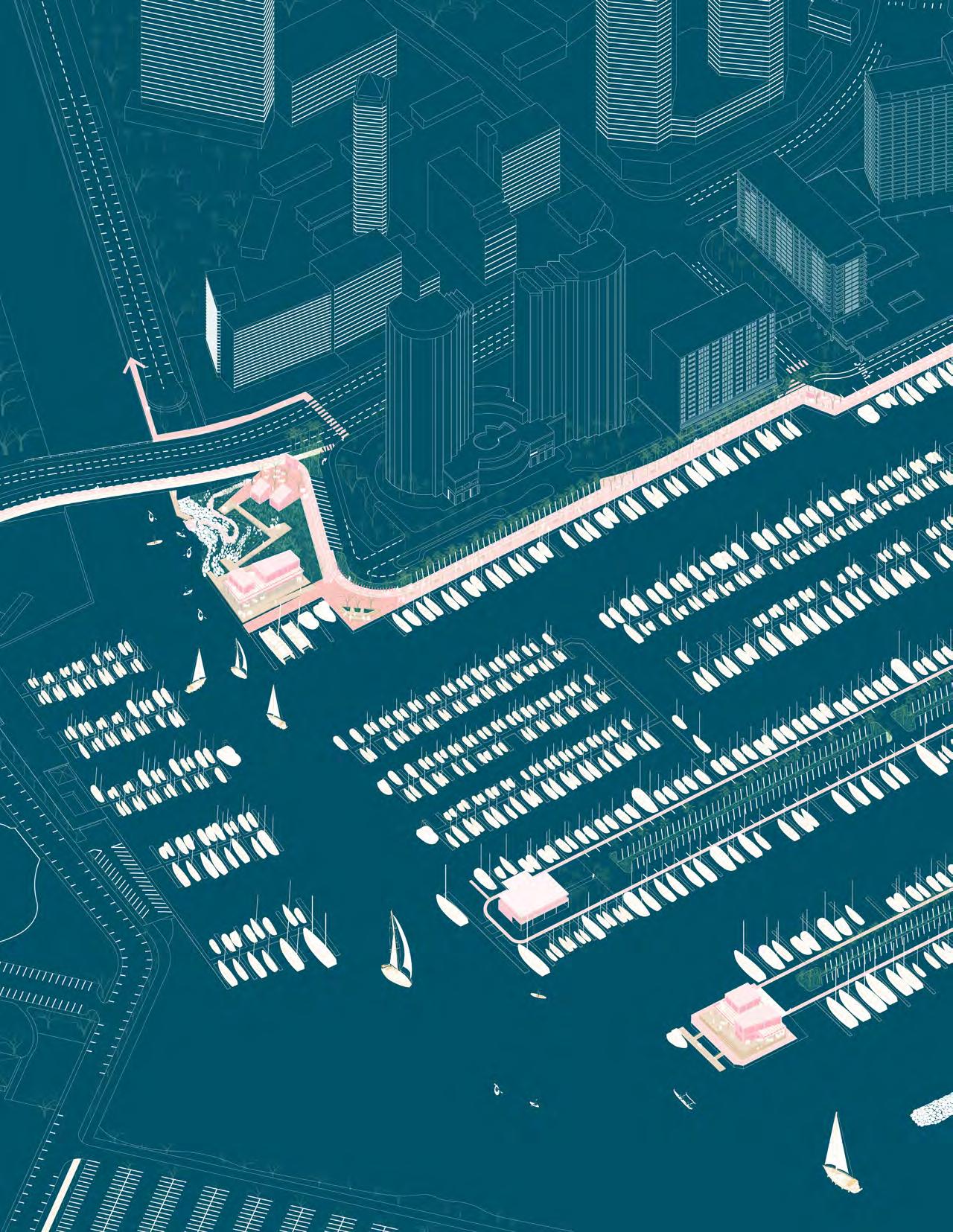
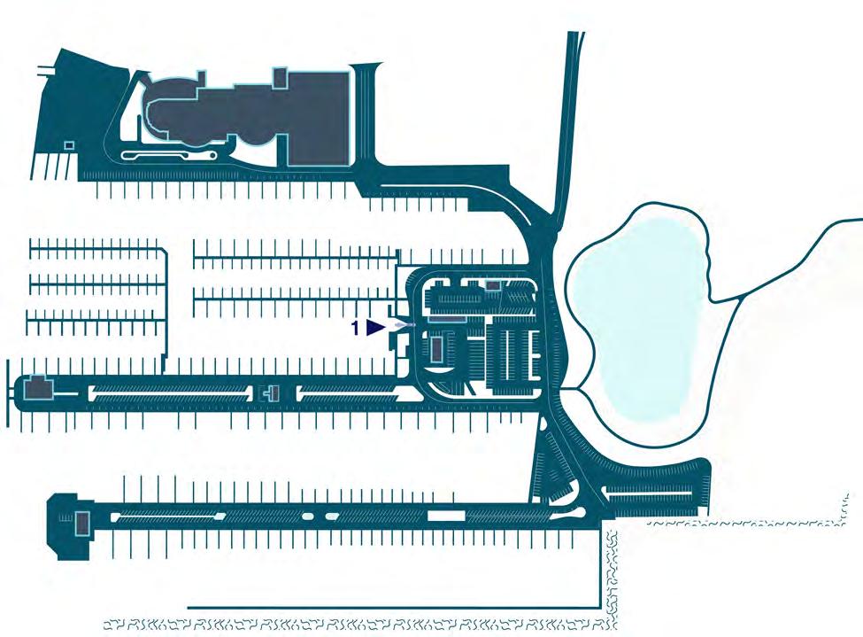
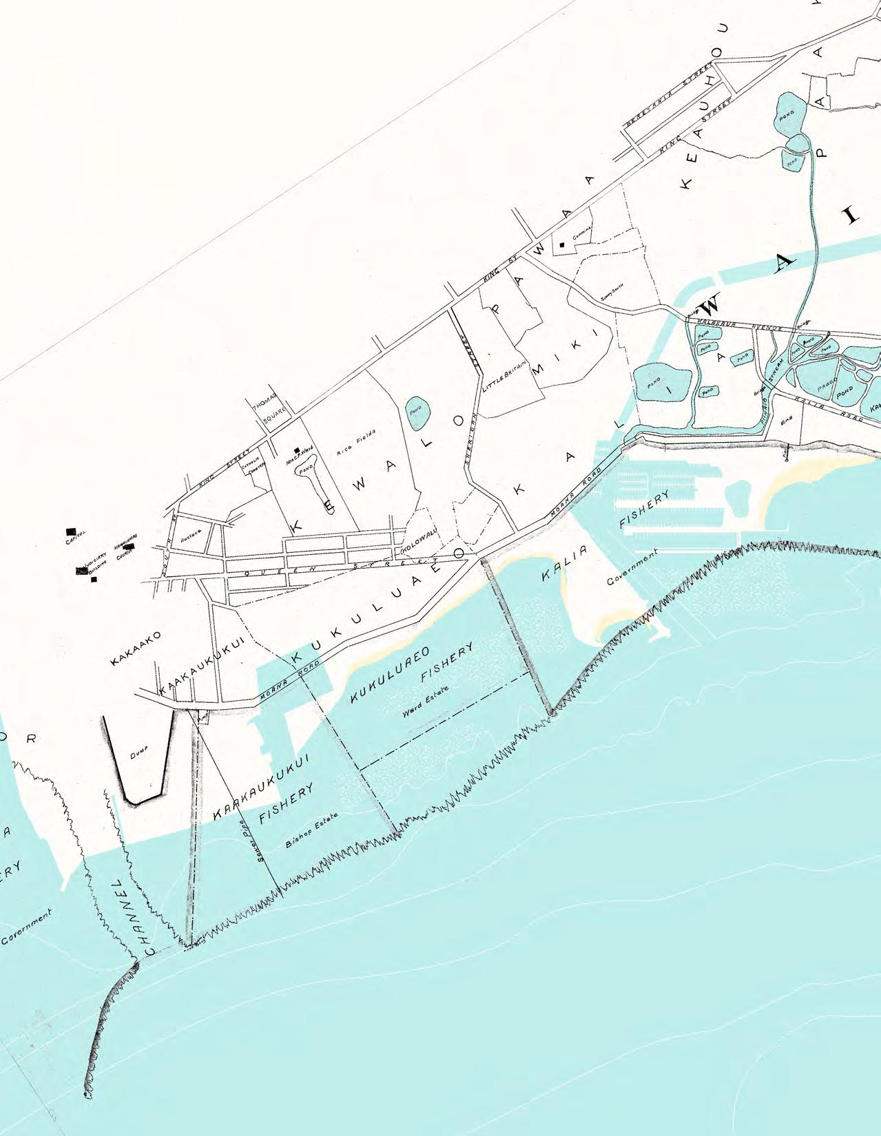
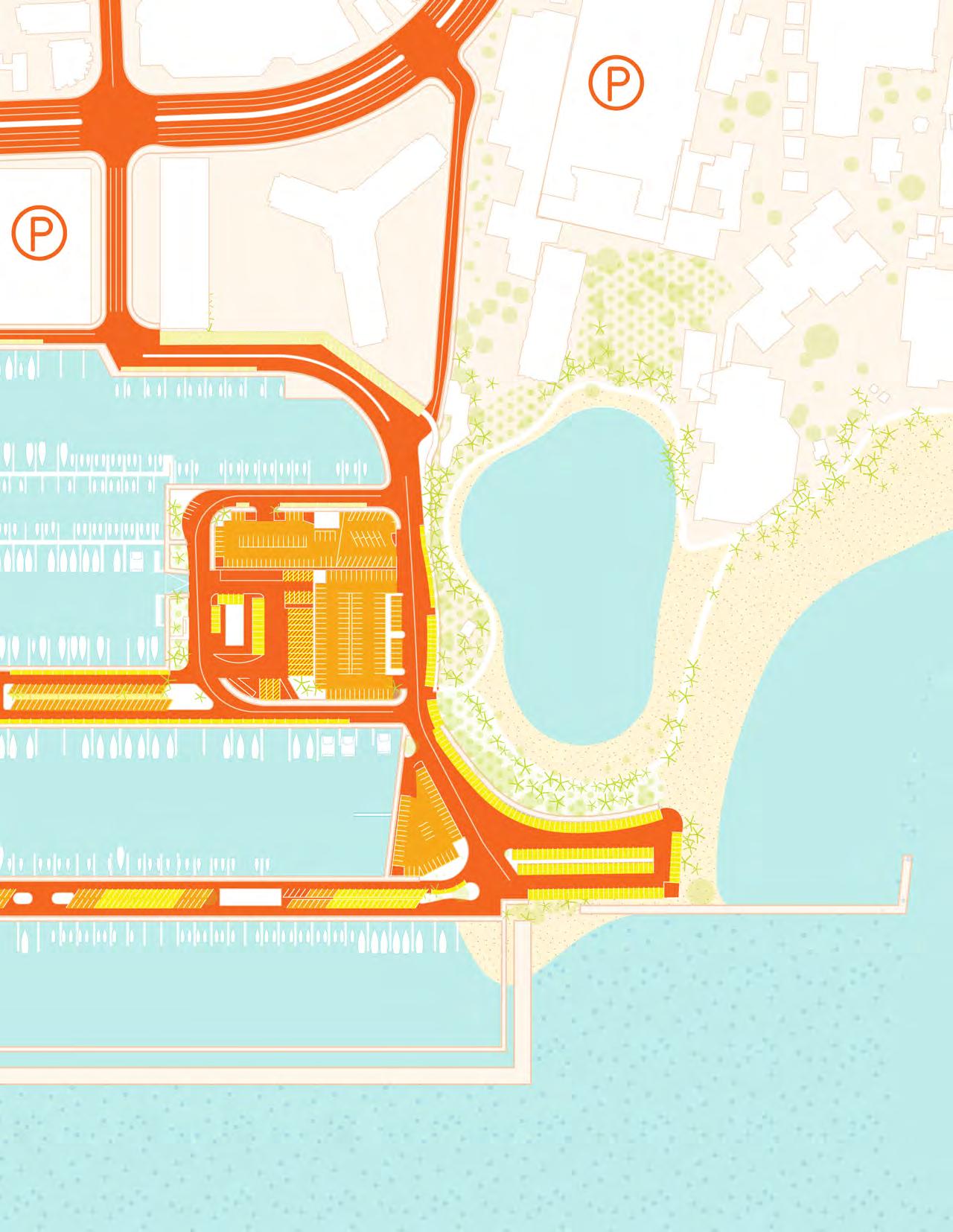
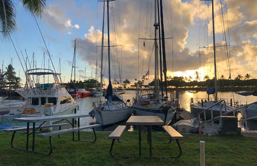
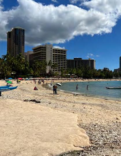
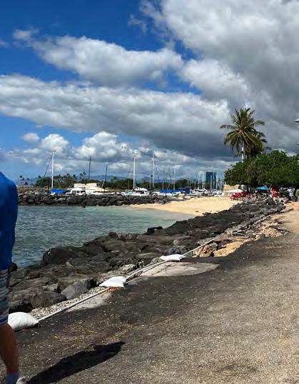
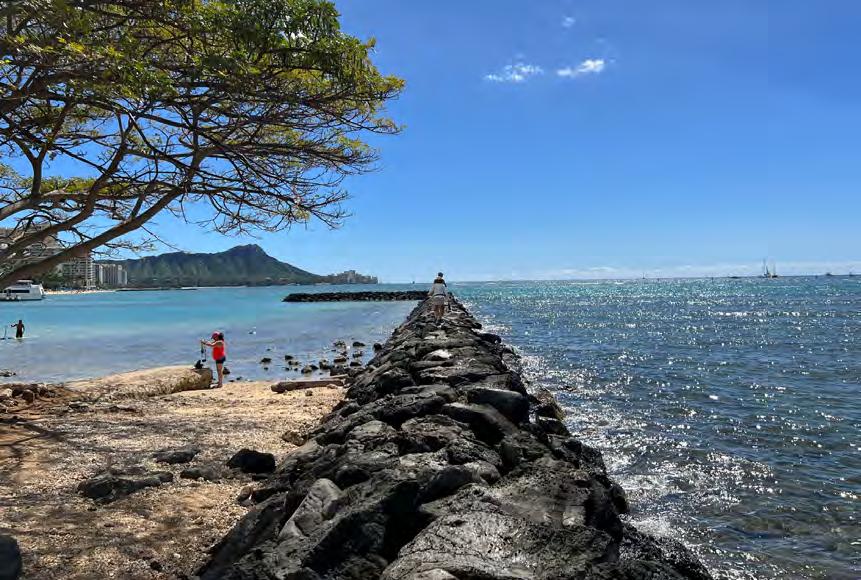
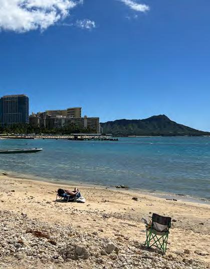
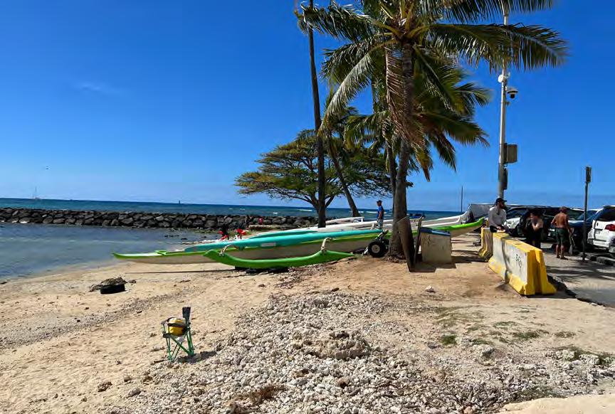
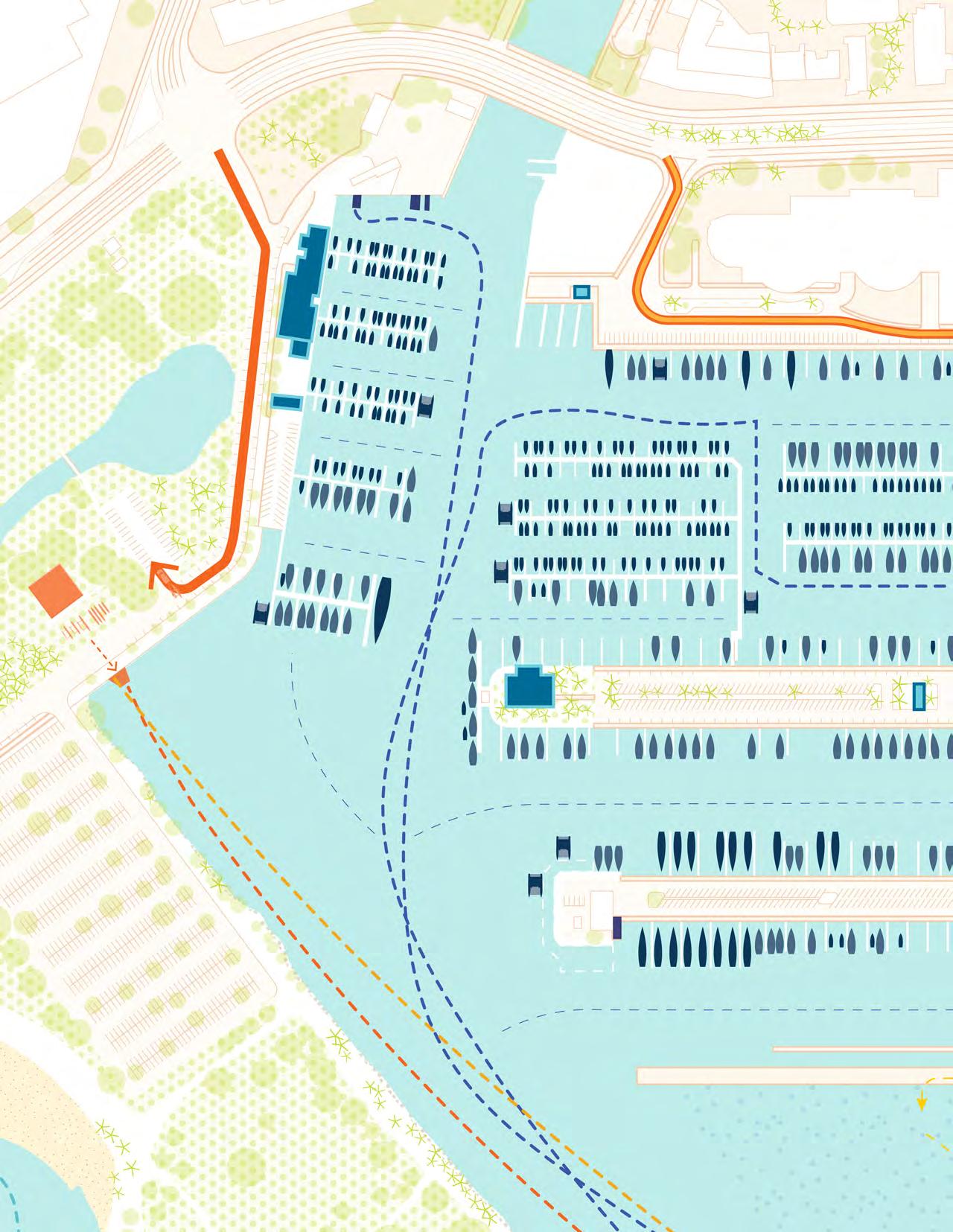
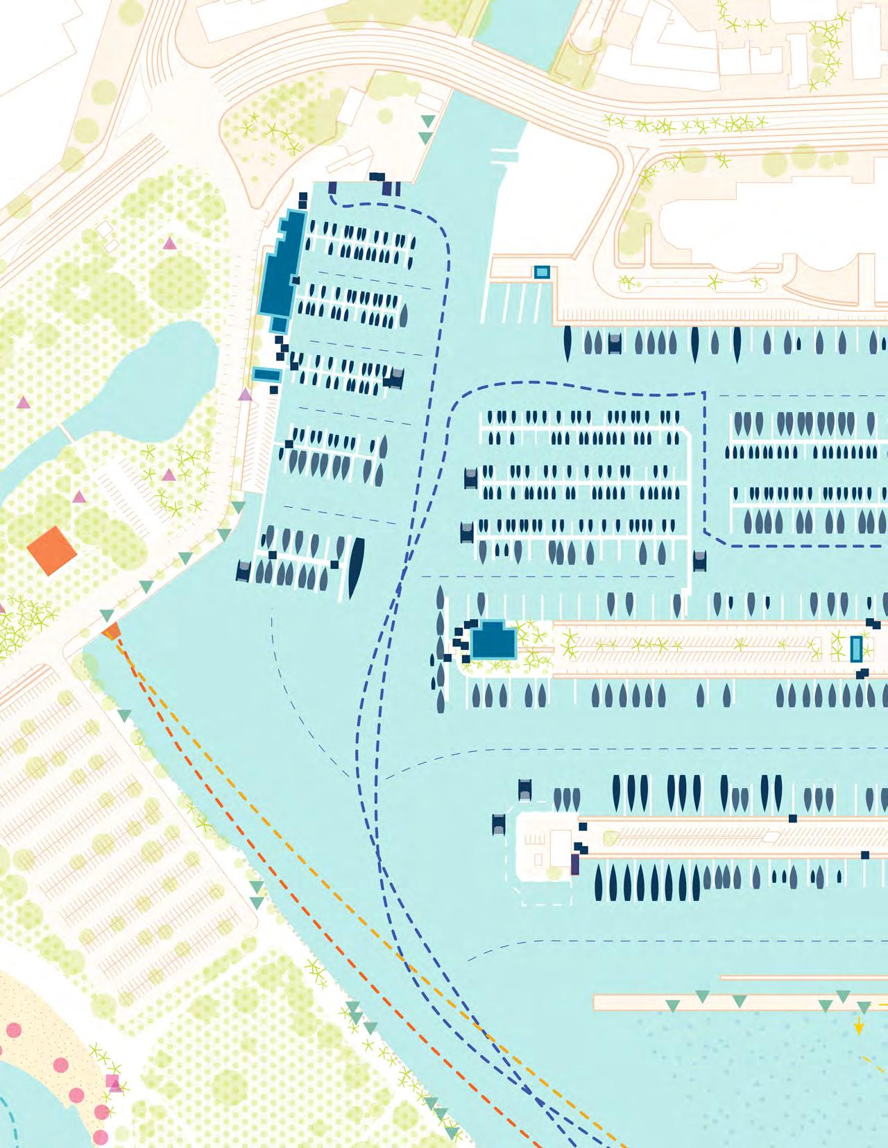
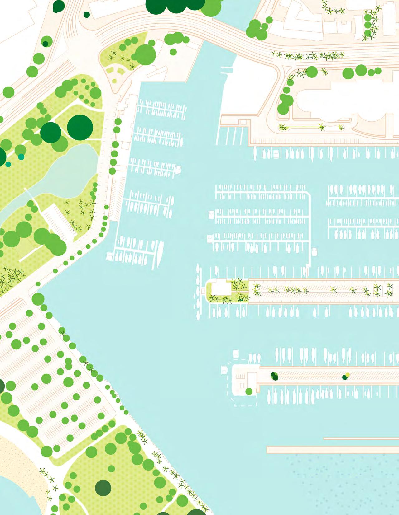
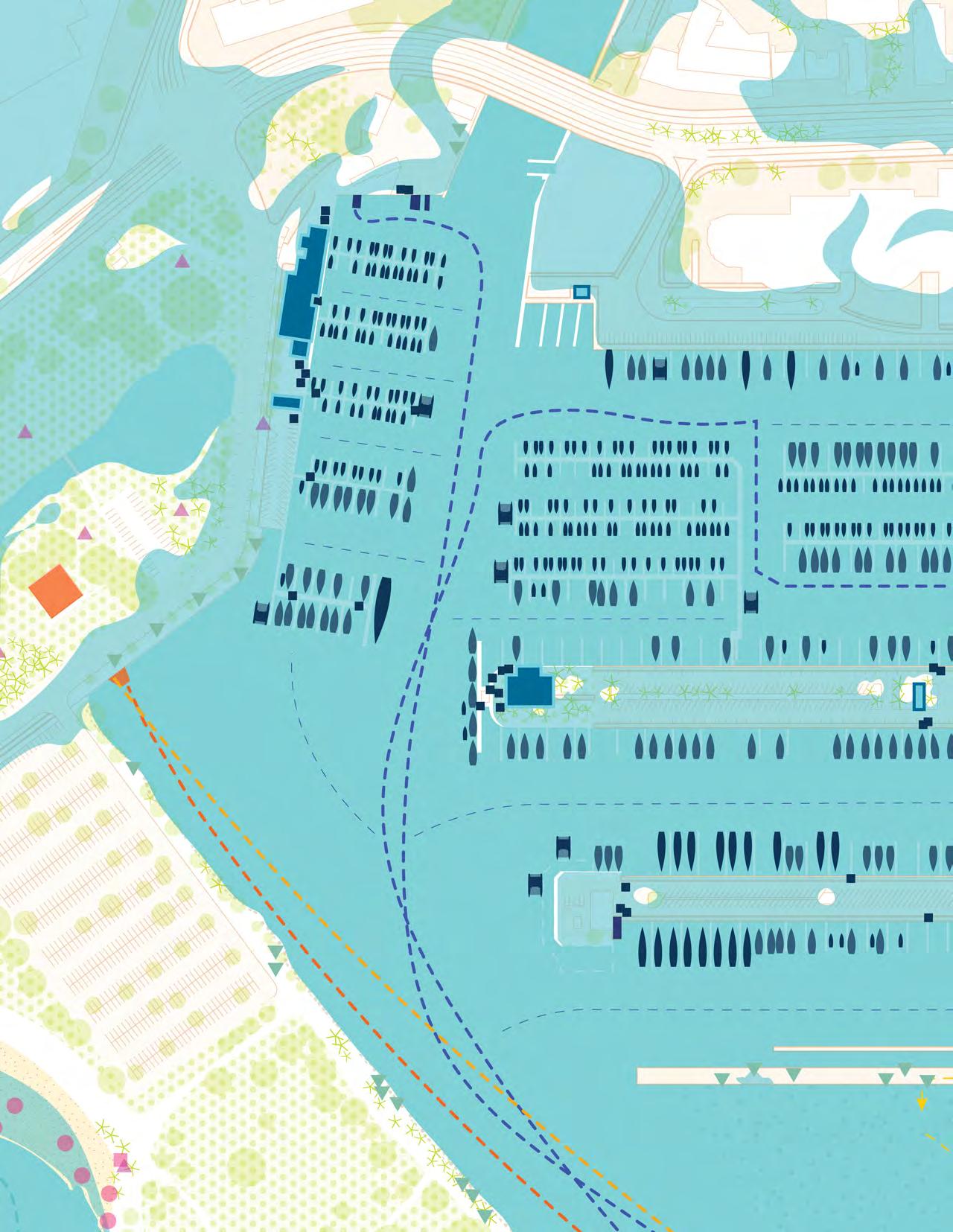
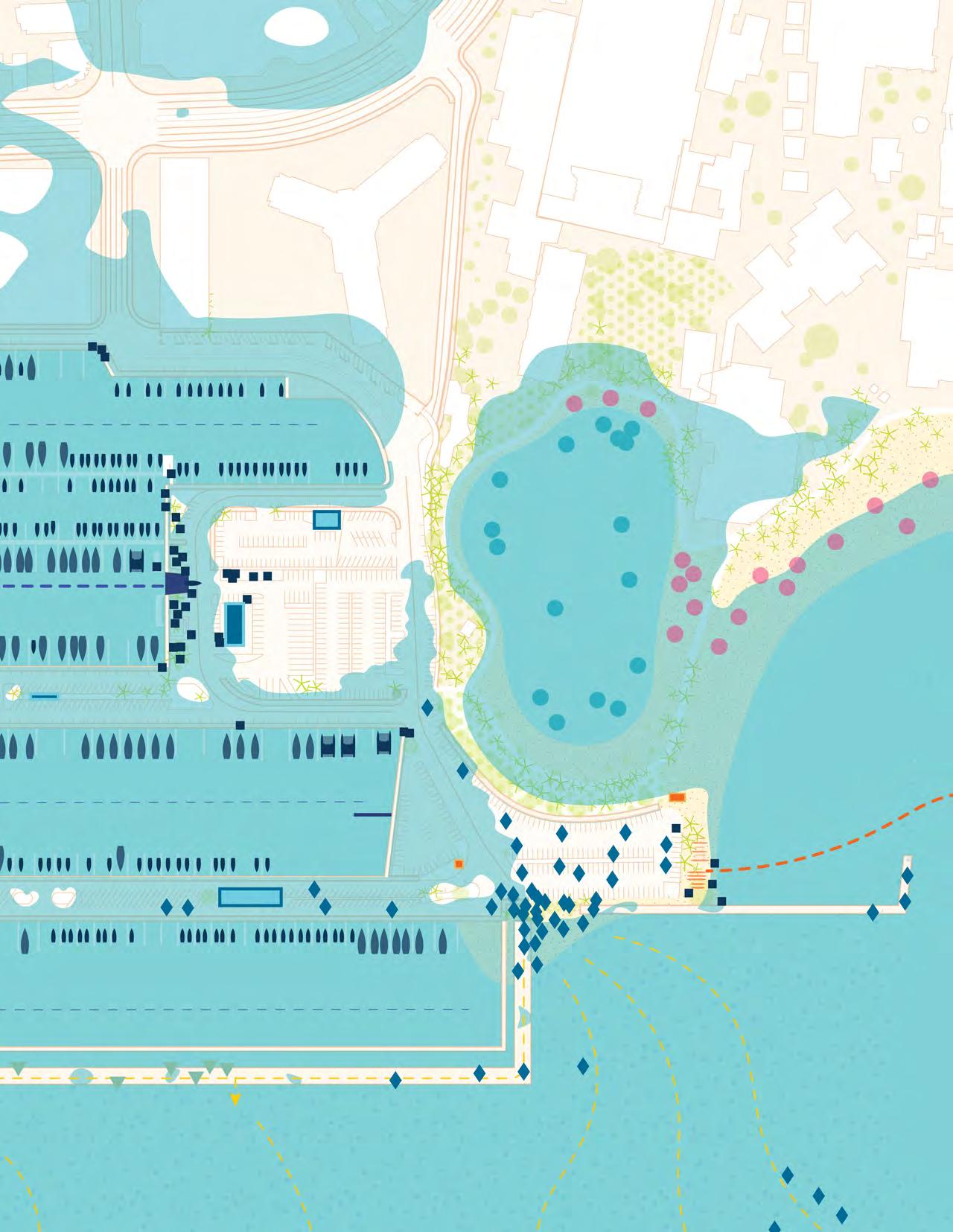
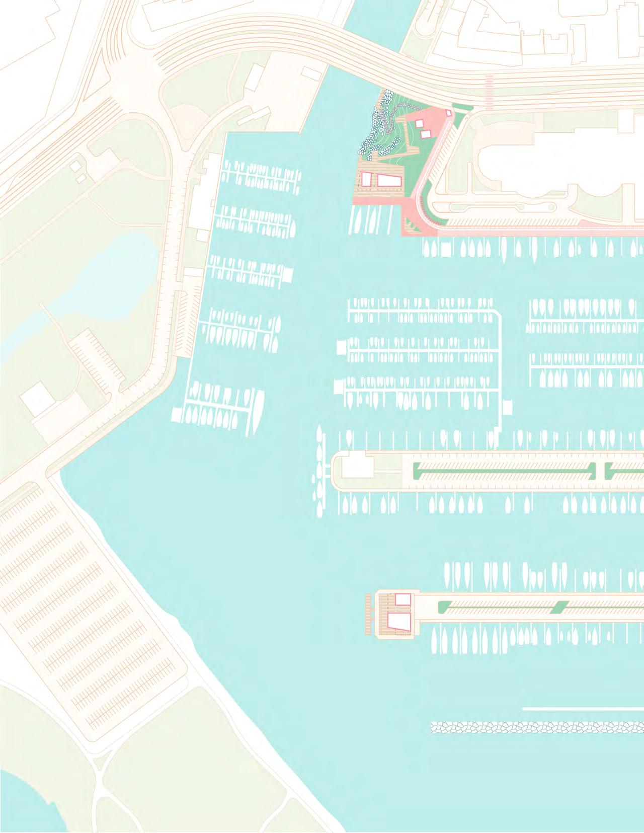
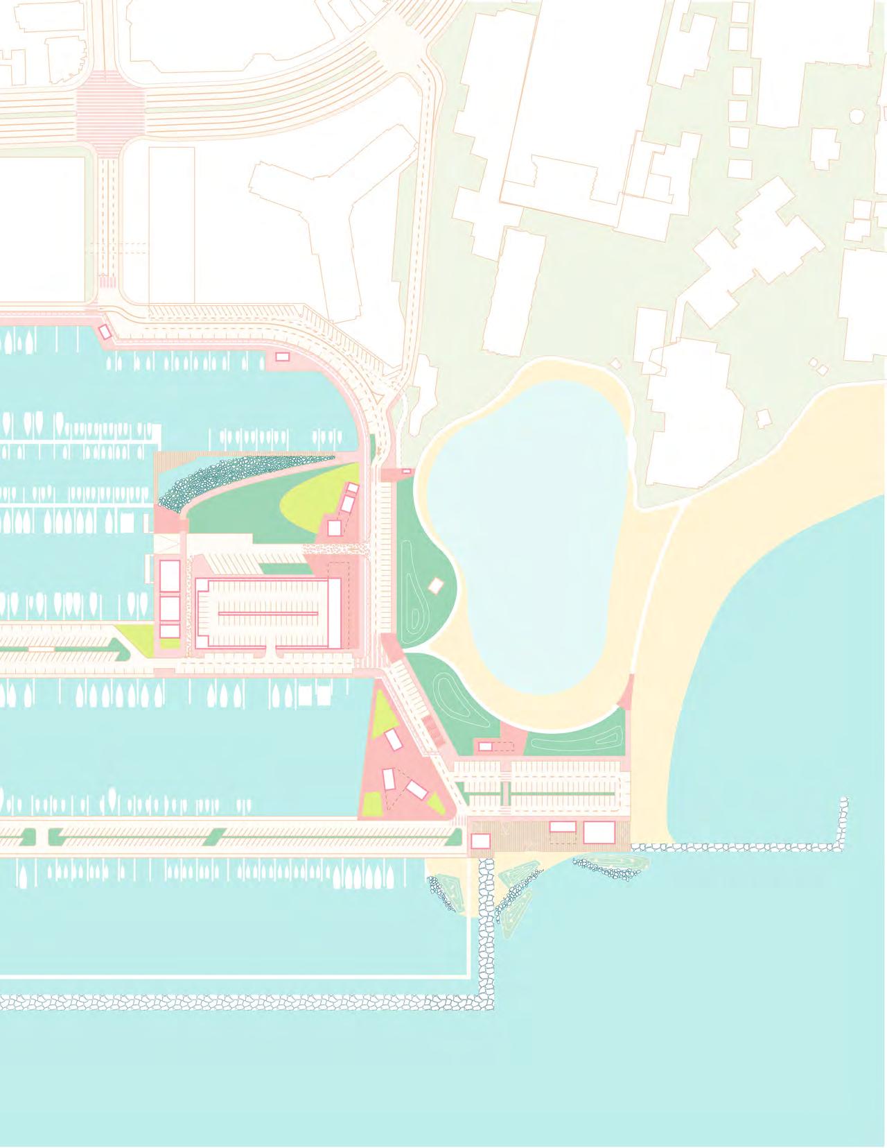
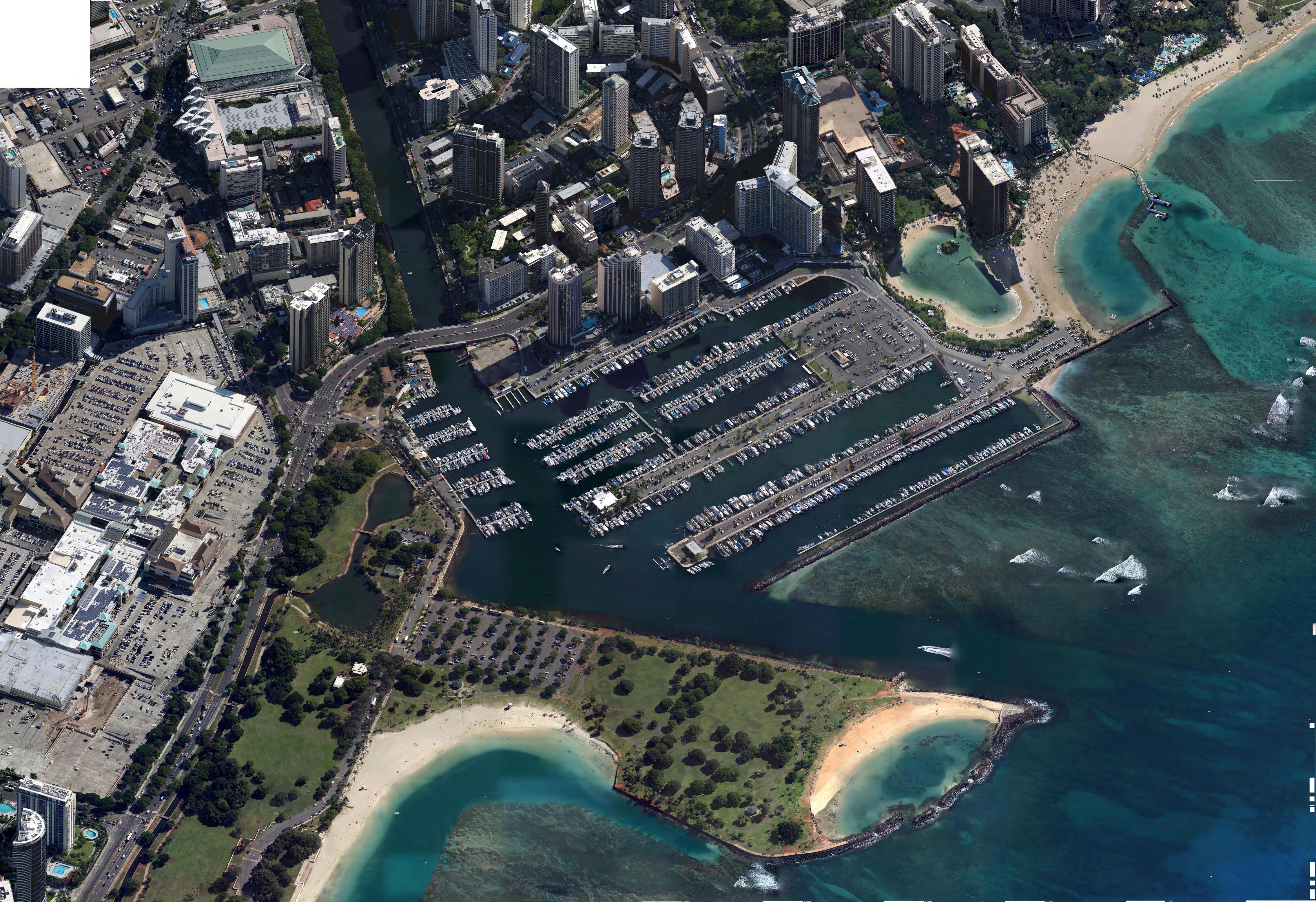
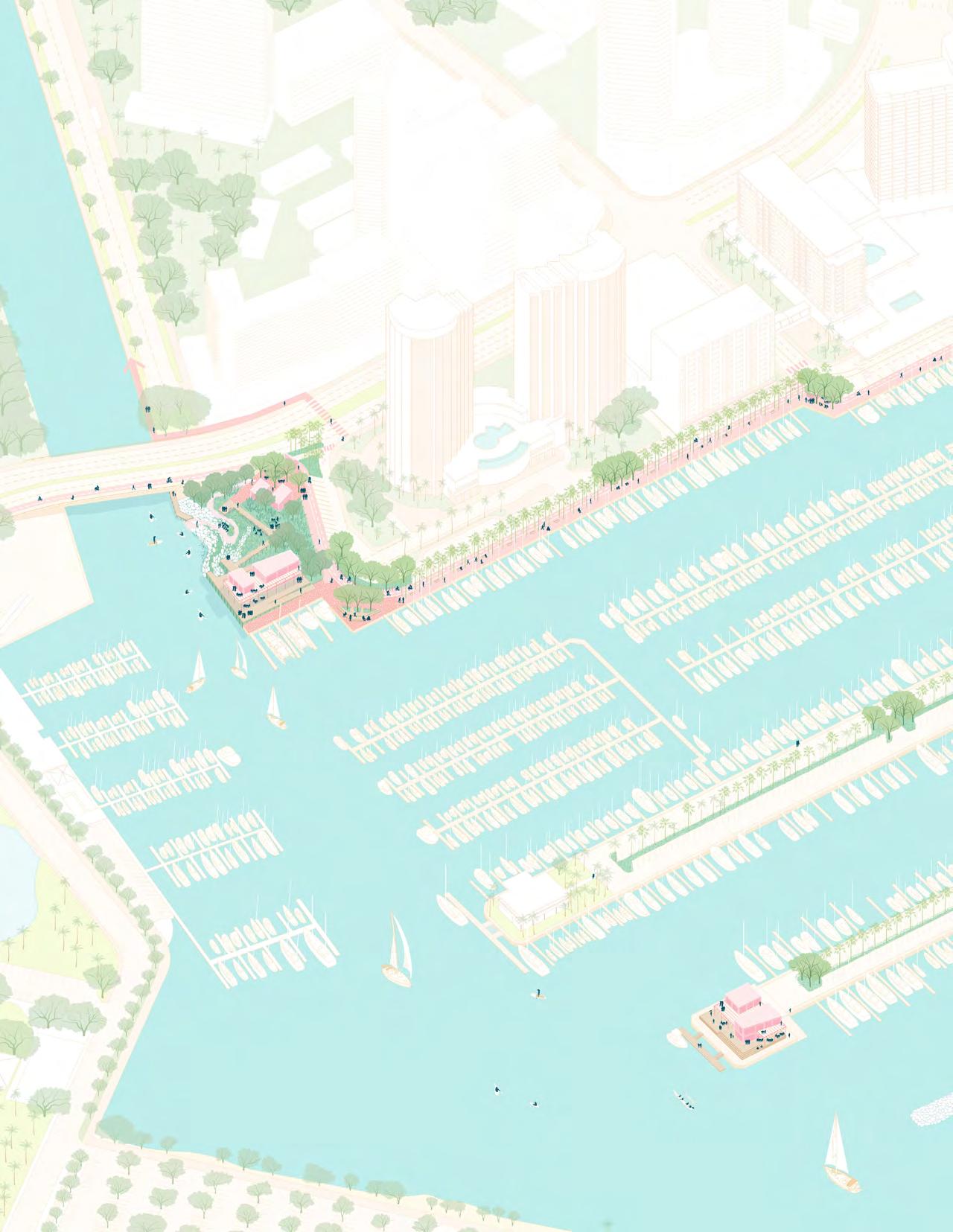
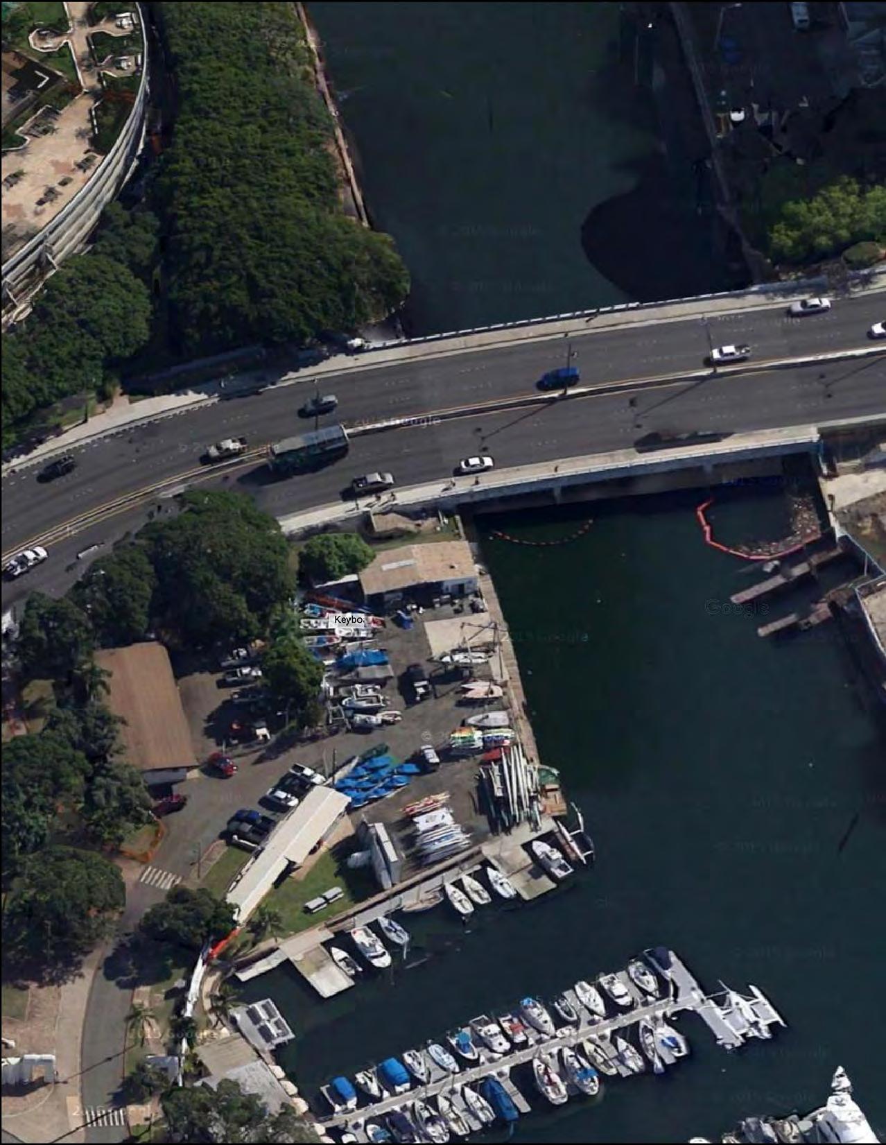
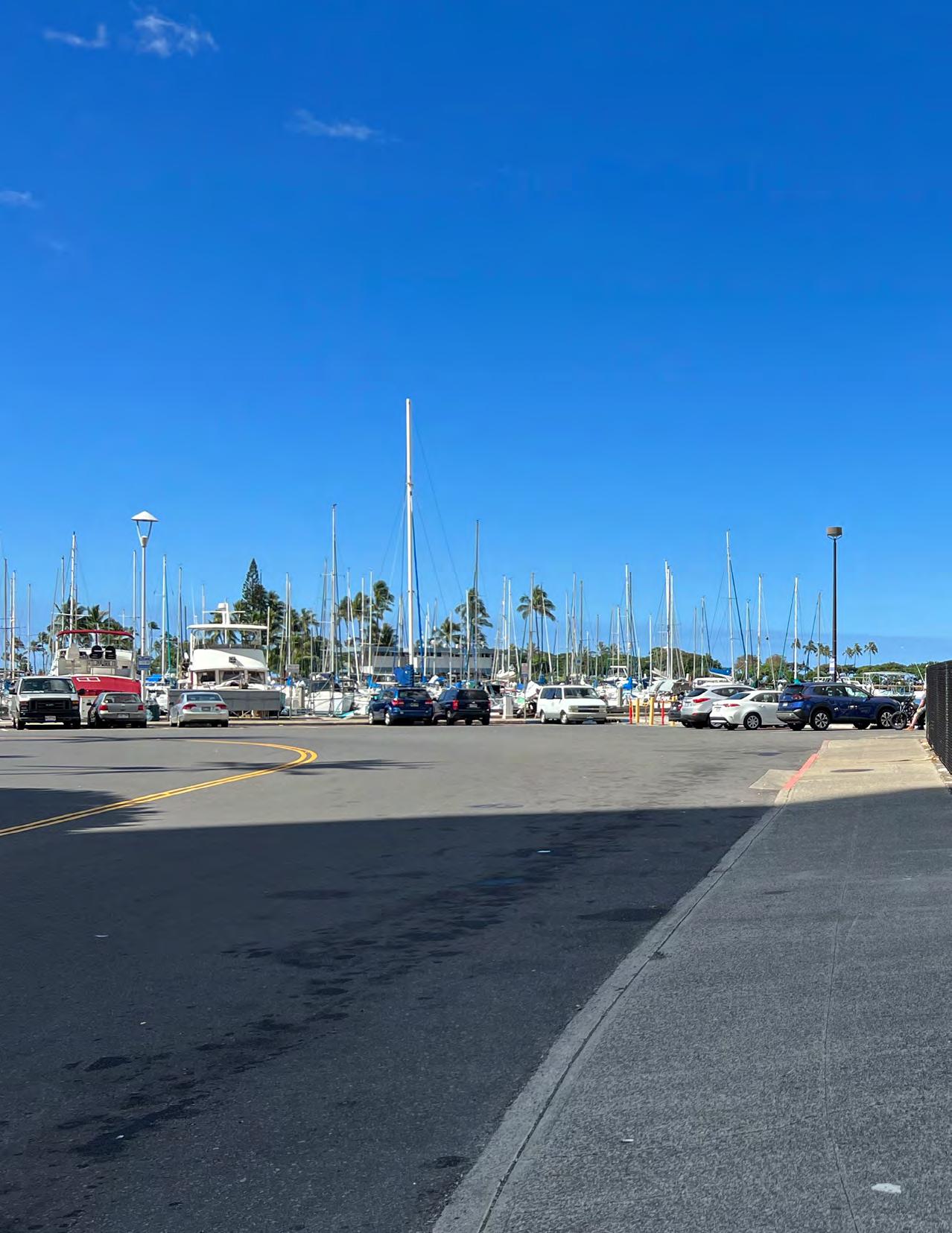
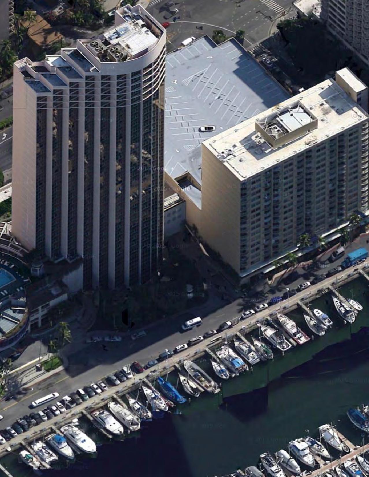
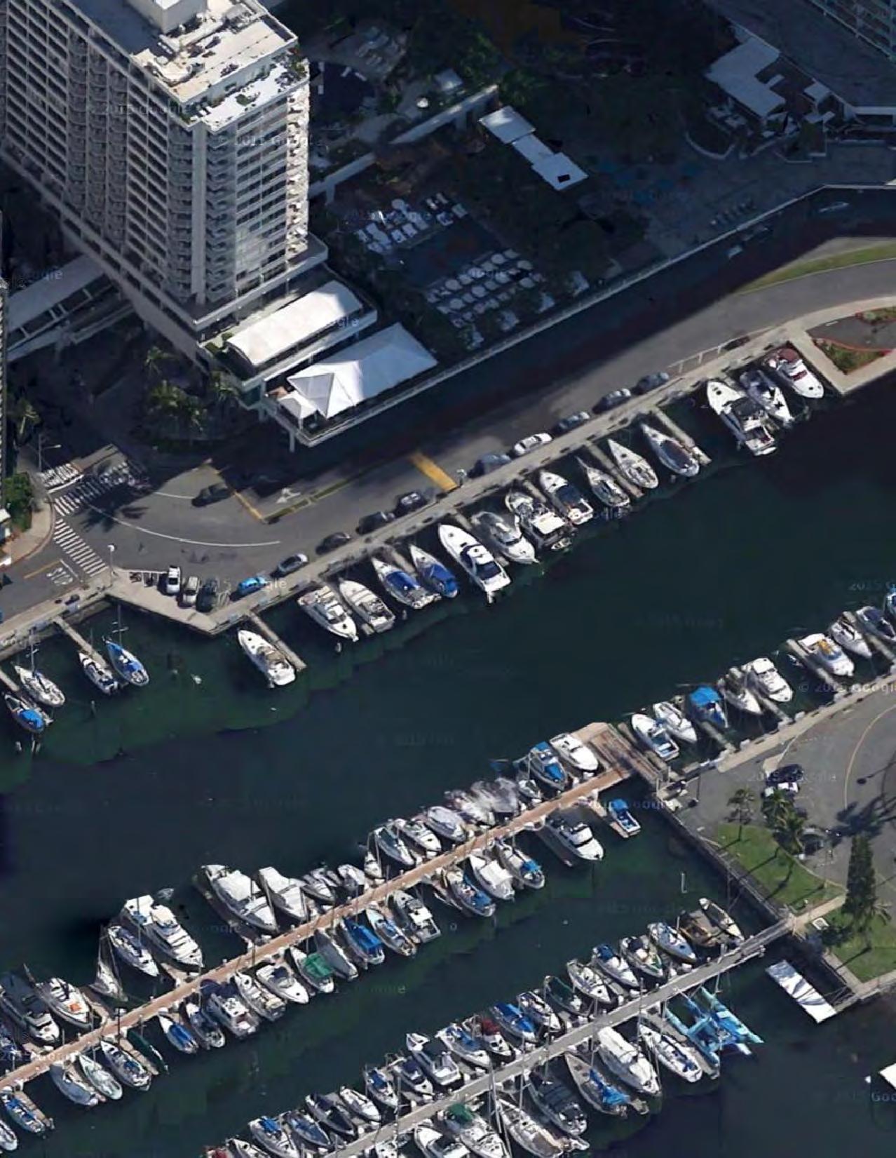
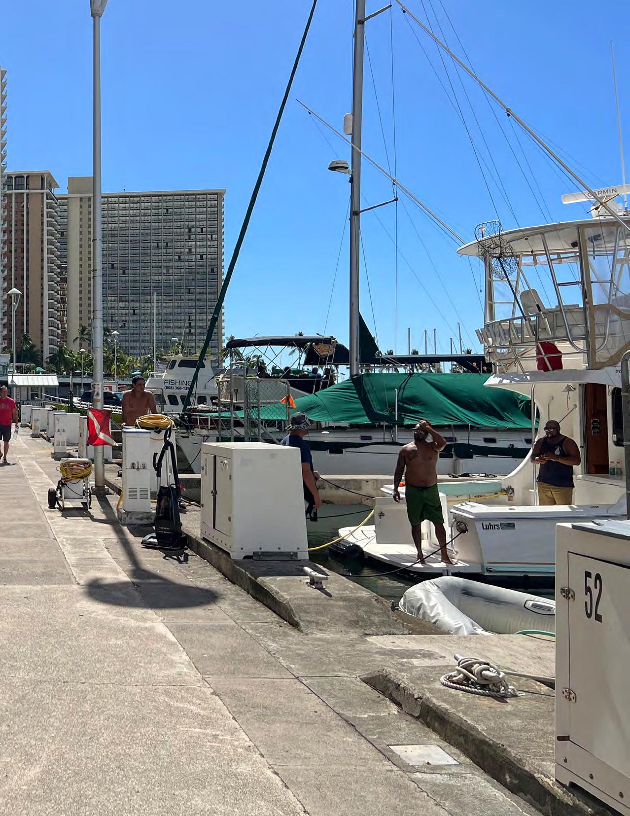
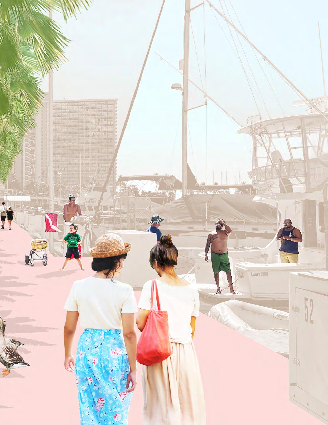
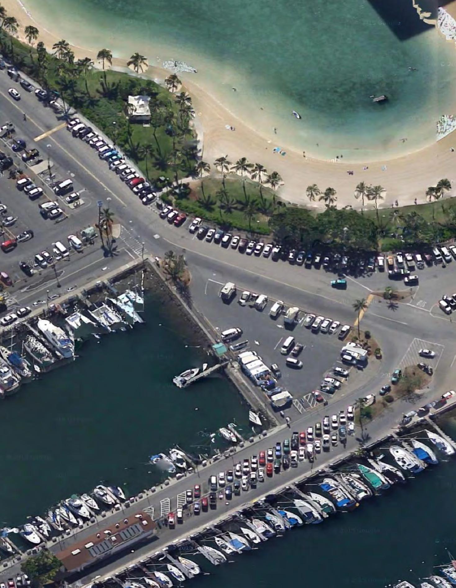
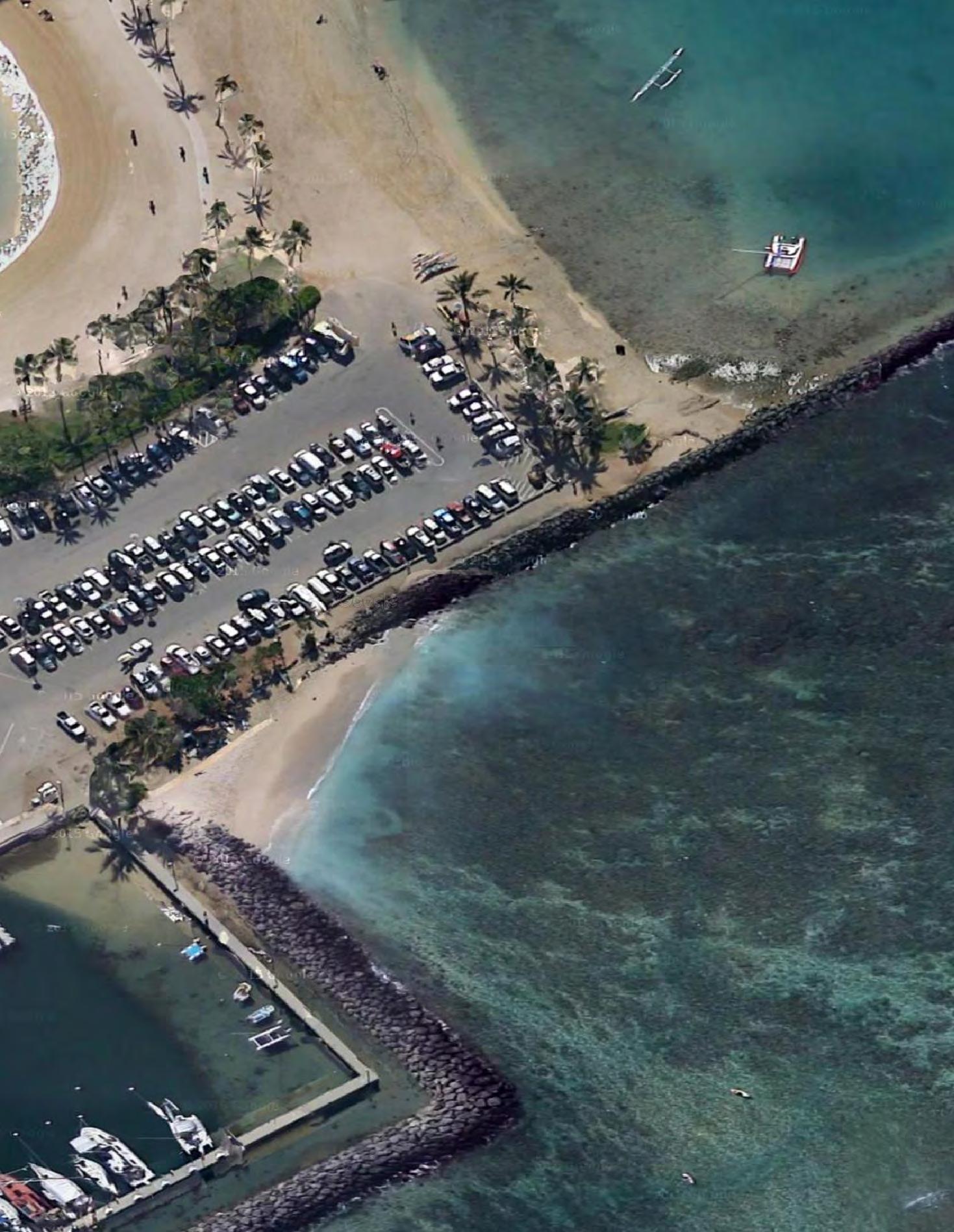
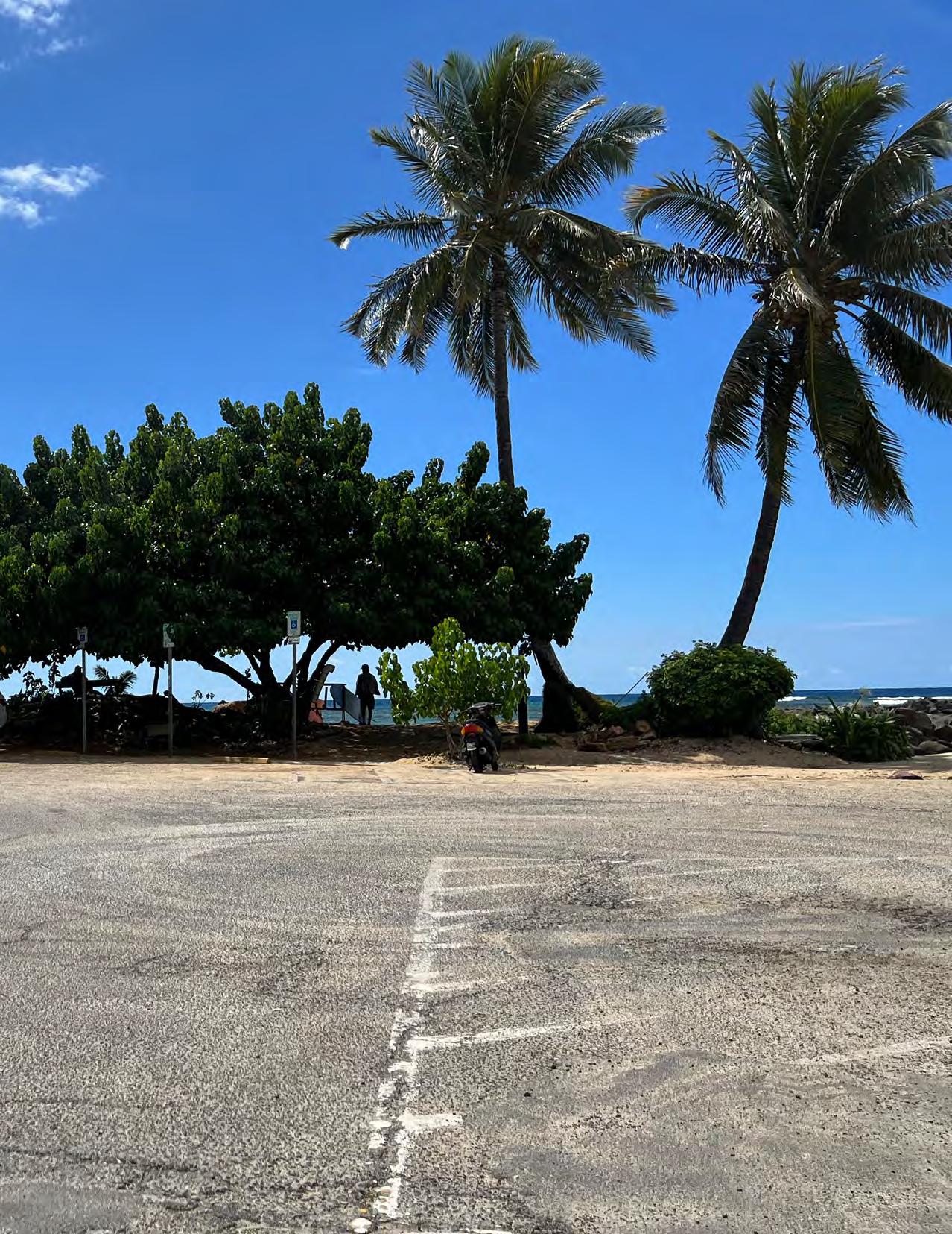
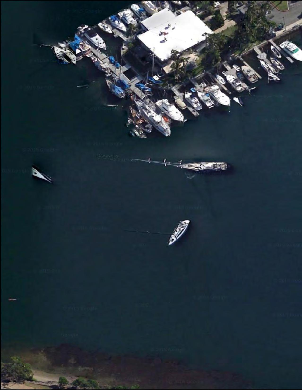
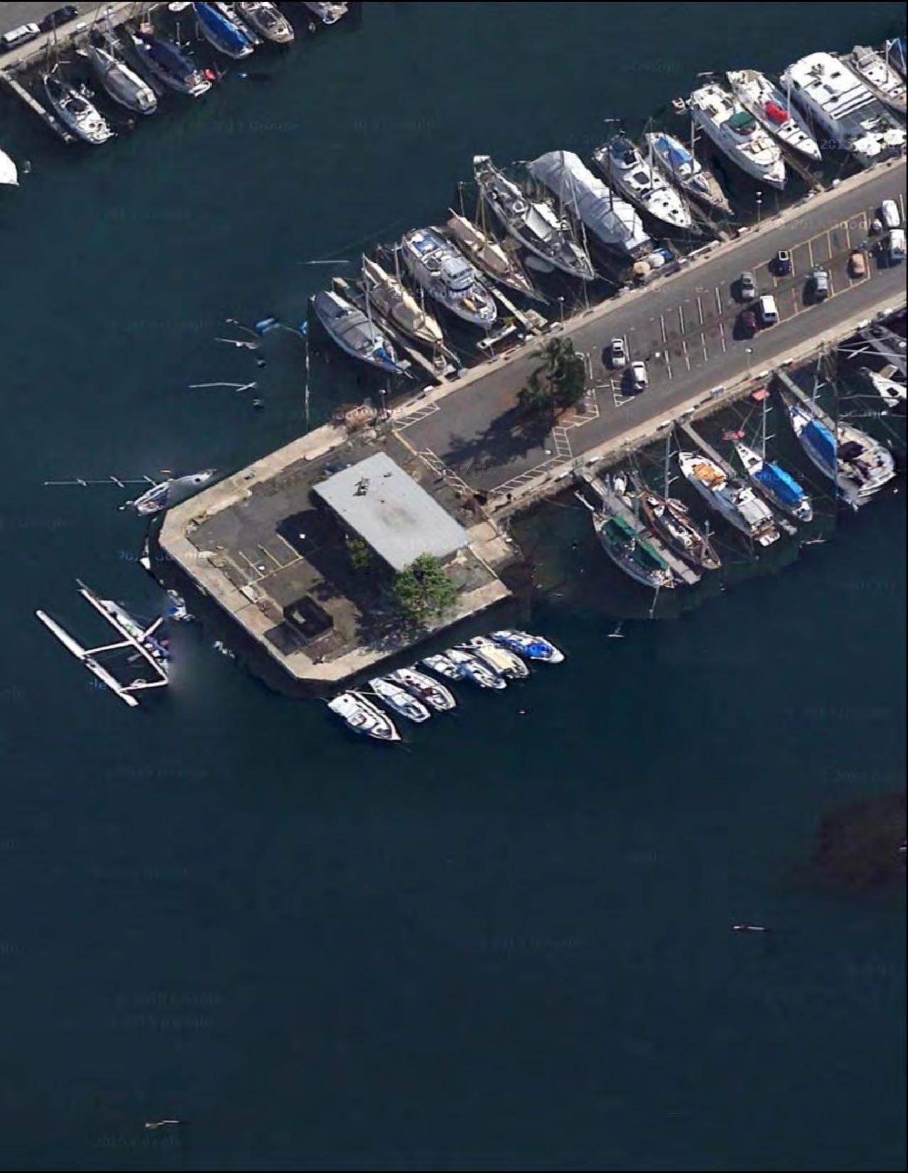
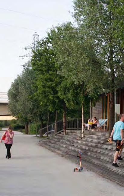
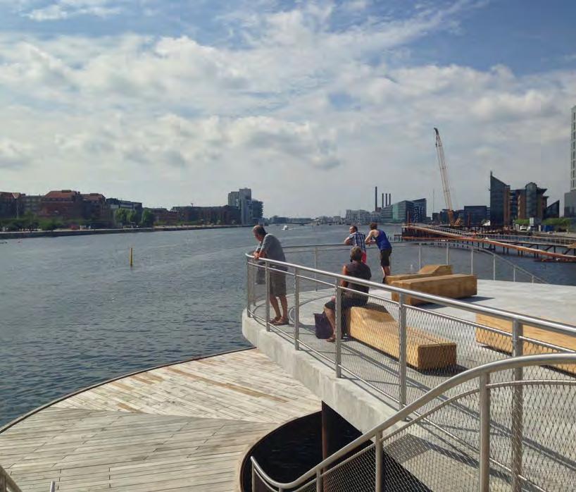
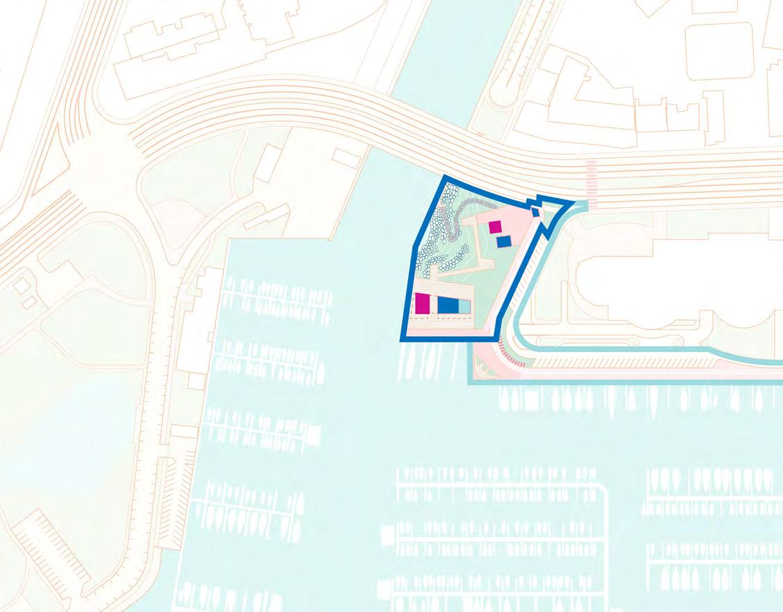
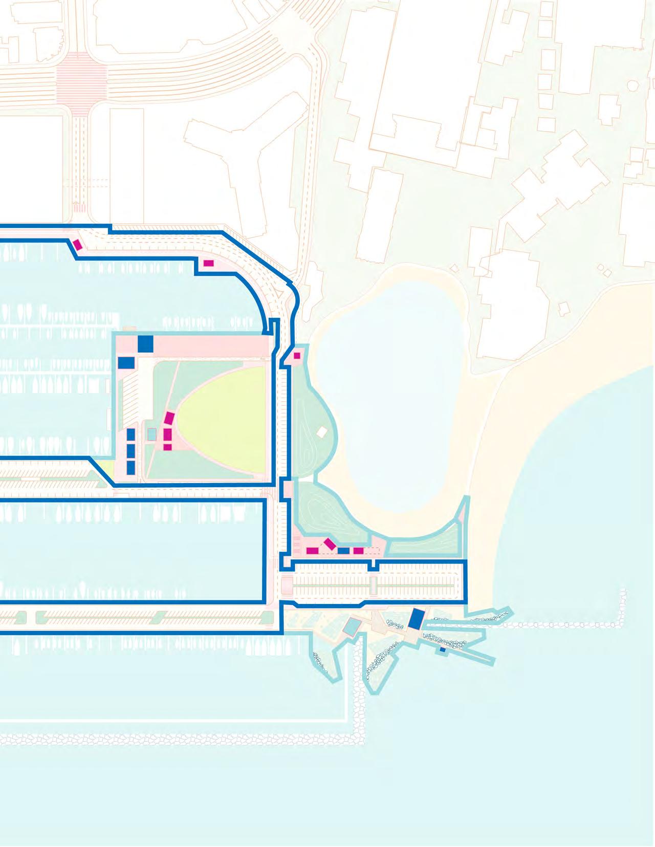
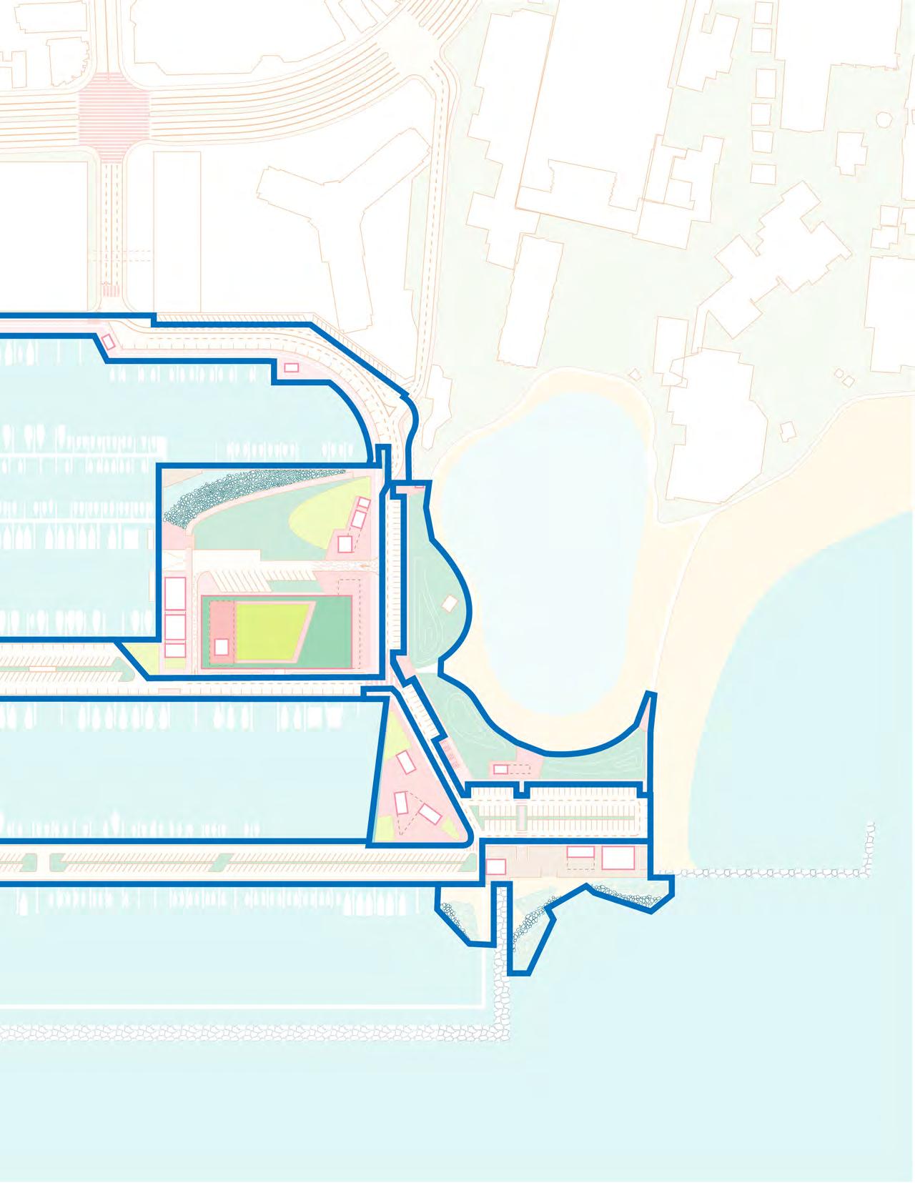
The Ala Wai Small Boat Harbor (AWSBH) is located between Ala Moana and Waikīkī on the island of O‘ahu. It is home to the Hawai‘i Yacht Club, Waikīkī Yacht Club, Anuenue Canoe Club, 129 liveaboard yachts, and has some of the most popular surfing spots along the south shores of O‘ahu. Adjacent to the Harbor are the Prince Waikīkī Hotel, The Modern Honolulu, the Hilton Hawaiian Village Resort, llikai Hotel, and the Duke Kahanamoku Lagoon and Beach.
The Harbor lies in the moku (district) of Kona, and the ahupua'a (land division) of Waikīkī, within the 'ili (subdivision) of Kālia, which was renowned for its bountiful fishponds and abundant reefs where he'e (octopus), i'a (fish), limu (seaweed), and 'opae (shrimp) were once gathered (DTL, 2017). Dredging the Ala Wai Canal to make room for development in Waikīkī in the early 1900s changed the landscape of Kālia. The excavated material from the reef was used to fill pristine Waikīkī marshland paving the way for urban development. This included building up the land to house
the Ala Moana Shopping Center and Magic Island, a constructed peninsula to close off the eastern end of the unused harborto-harbor-boating channel (DTL, 2017). The AWSBH was constructed in 1935. The Transpacific Yacht Race – a long-distance sailing contest – introduced by King Kalakaua in 1886 brought attention to the Ala Wai Harbor. A 1460-foot breakwater was constructed for mooring yachts2 which was also mentioned in the $6 million infrastructure improvement plans approved by Governor Linda Lingle in 2008 (DTL, 2017).
Today the AWSBH is managed by the State of Hawai'i Department of Land and Natural Resources Division of Boating and Ocean Recreation (DOBOR). It has 699 berths, 85 moorings, 22 dry storage spaces, a vessel washdown area, a small boat ramp, and a harbor office (DOBOR, 2020).
A team of faculty in the University of Hawai'i Community Design Center, School of Architecture, and the Department of Urban
2 About the Transpac Race. https://transpacyc.com/transpac-yc/welcome-to-transpacific-yacht-club
and Regional Planning were commissioned by DOBOR to create a concept/vision plan for the AWSBH and generate a conceptual cost estimate for the vision plan. The purpose was to offer insight for future requests for proposals for the harbor. This report summarizes the process and outcomes of the project. It should be noted that the project deliverables did not include feasibility assessments.
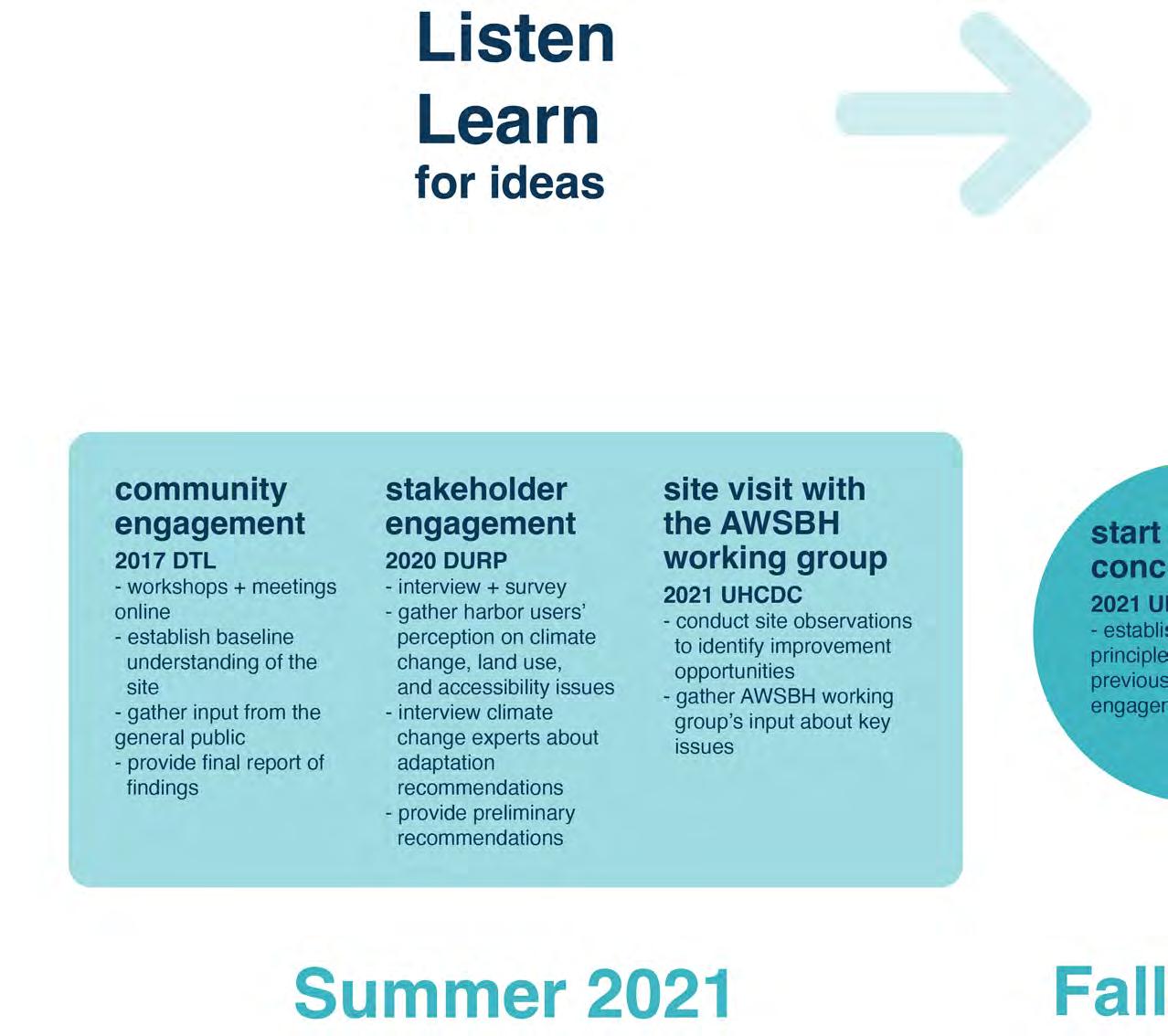
Drawing on the findings from community engagement facilitated by DTL in 2017, DOBOR’s Strategic Plan completed in 2019, and a guided site visit with Senator Sharon Moriwaki and the AWSBH Working Group, the team prepared two concepts for the harbor that they shared with key stakeholders to gather feedback. The concepts are also informed by other relevant reports and data.
(DTL, 2017). According to its report, Ala Wai Small Boat Harbor Community Engagement Findings & Conceptual Plan, people’s memories of the AWSBH coalesced around two themes: i) an ocean-based lifestyle – learning to surf, spending time at the yacht clubs, sailing, boating, fishing, and swimming; and ii) gathering for events or spending time with friends and family – watching the sunset and fireworks, BBQs, the annual Transpac race, and the homecoming of Hōkūle‘a.
In efforts to gather input from harbor stakeholders to inform future development on three state-owned parcels, DOBOR engaged the services of DTL, LLC, a Hawaiian strategy studio. Over a period of six months (July-December 2017), DTL conducted two public workshops that were attended by 274 people, and 8 stakeholder meetings with participation from 13 organizations and 52 individuals
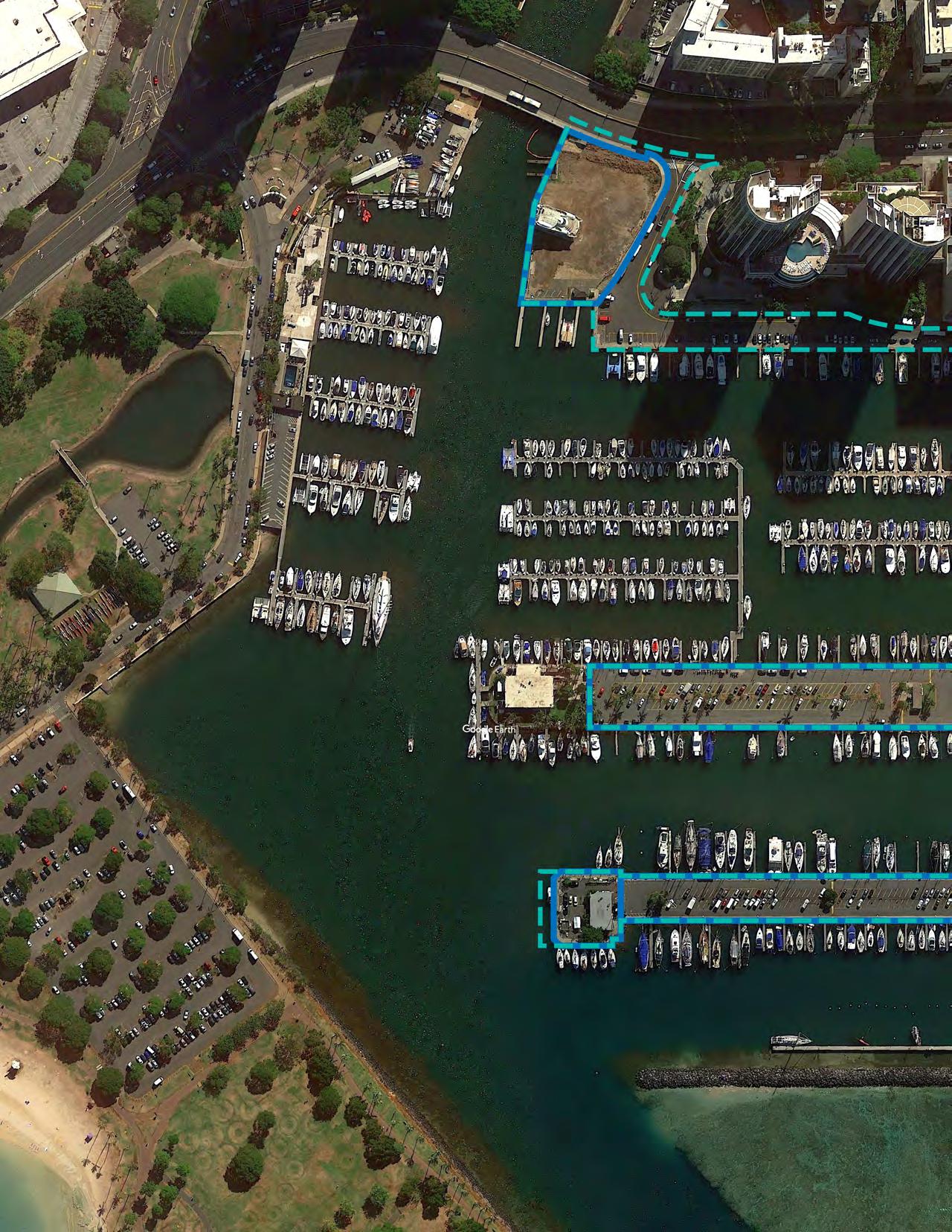
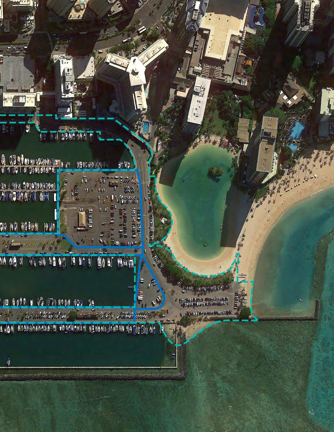
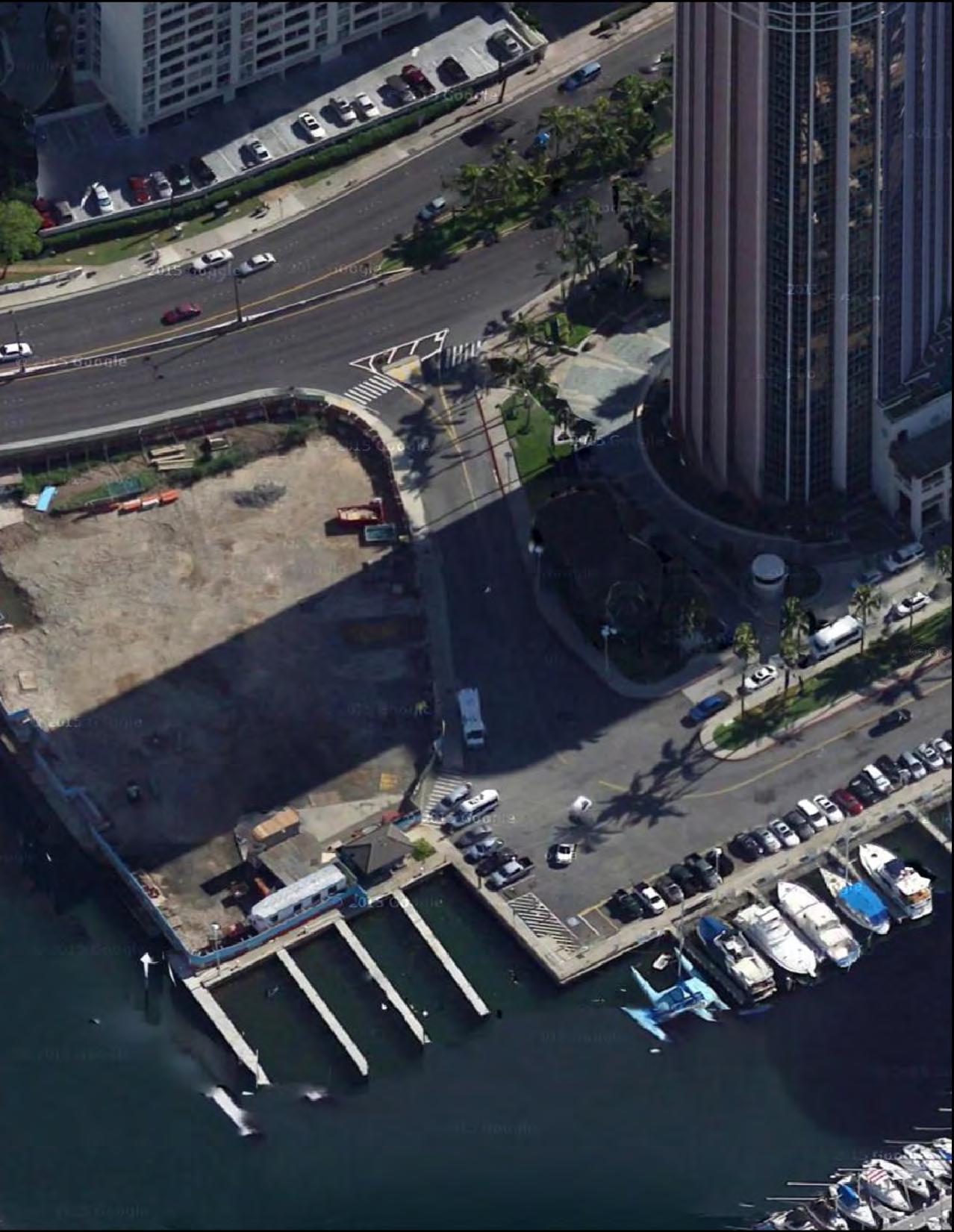
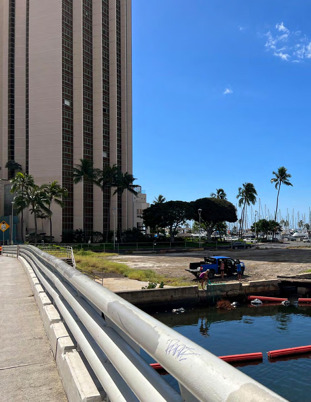
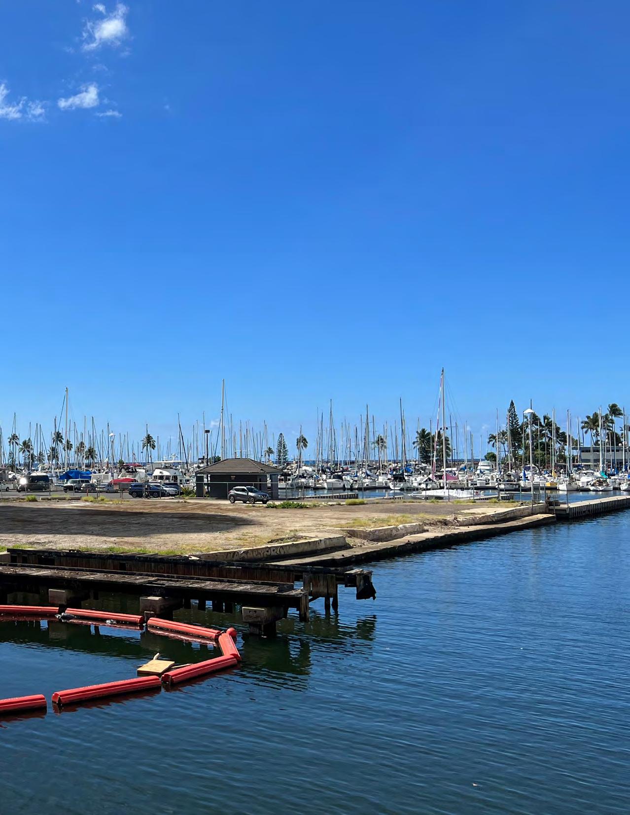
Existing conditions at the three stateowned parcels at the AWSBH described by DTL are:
Parcel A — 3.47 Acres
(Lagoon Parcel - Existing Harbor Management Office and Surrounding Parking Area)
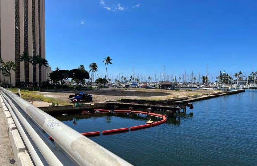
• The parking lot was leased to Diamond Parking Services, LLC; however, the lease has been terminated.
Parcel B — 1.34 Acres
(Ala Moana Blvd Site - Former Haul-Out Site)
• Mostly undeveloped besides the sidewalk.
• This site was leased to Ala Wai Marine Ltd. for boat haul out and repair, parking, and storage.
• Deteriorating fuel dock and convenience store, both of which are now inoperable.
• This site was leased to Magic Island Petroleum Inc. who notified the State that without a long-term lease, maintaining the fuel dock was not economically feasible.
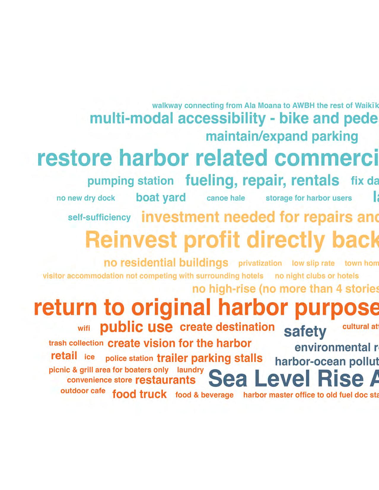
DTL’s stakeholder engagement highlighted the following concerns:
Landscaping; addressing pollution, safety, and parking issues; creating a pedestrian and bike-friendly pathway; showcasing the cultural and historical importance of the 'ili of Kālia; signage; storage units for boaters/ boat lockers.
Improved management model; the harbor is understaffed and poorly managed; reinvestment of revenue generated by the harbor for harbor improvements.
New construction should not be more than four stories; potential uses should include harbor-related commercial activities (i.e., fueling, repair, rentals), visitor accommodations (if not in competition with surrounding hotels) and food and small retail outlets, convenience stores, food trucks; services such as a haul-out, fuel dock, pump-out, and laundry facility are necessary to support harbor functions; the culture and history of Kālia are deeprooted and should be foregrounded; access and parking for ocean users should be prioritized (currently, the parking lot designated for ocean users is being used by hotels and construction workers); slips should be utilized for charters (drop-offs/ pick-ups); need to connect the harbor to the rest of Waikīkī; develop a vision for the harbor (e.g., Boston Harbor) instead of piecemeal parcel development.
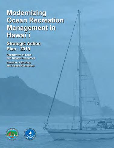
DOBOR’s Strategic Plan, Modernizing Ocean Recreation Management in Hawai‘i: Strategic Action Plan 2019, highlights two key challenges in managing the harbor efficiently – funding and human resources. It proposes shifting to a public-private partnership to align DOBOR’s staff priorities with governance (rulemaking, oversight, and enforcement) while leaving the day-today harbor management to the contracted
private entity. The Plan provides a roadmap for managing the harbor in the face of a growing visitor economy, communicating its strategic priorities clearly to its partners to facilitate implementation and identifying the priorities in the State’s annual budget for DOBOR and DLNR. The three goals outlined in the Plan are:
1. Expand ocean recreation management to meet DOBOR’s statutory mandate
2. Provide world-class boating facilities and services
3. Effectively manage DOBOR’s real property
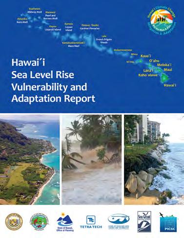
This report presents a statewide sea level rise vulnerability assessment and recommendations to minimize exposure through adaptation. The assessment utilizes the combined surface area of three hazards – passive flooding, annual high wave flooding, and coastal erosion – to project the sea level rise exposure area (SLR-XA) for four scenarios (0.5 ft., 1.0 ft., 2.0 ft., and 3.2 ft. of sea level rise). The report suggests that current and future development should plan for 3.2 ft. of sea
level rise.
Other sources of information and data, including interactive maps, were gathered from the Hawai‘i Sea Level Rise Viewer, a web-based app developed by the Pacific Islands Ocean Observing Systems at the University of Hawai‘i, and a practicum report prepared by a team of graduate students in the Department of Urban and Regional Planning in 2020. A community survey2 conducted for the practicum report reiterates some of the findings in the DTL report. The majority of survey respondents (62%) reported that they drive to the harbor, 22% reported that they walk or bike and only 4% take public transit. About 79% of respondents reported that the current status of the harbor does not foster connections among different users (harbor residents, recreational users, locals, and visitors). They generally expressed concern about the poor management of the harbor, empty and damaged slips, and impounded boats that generate no revenue for the harbor’s much-needed repairs and upkeep (DURP, 2020).
2 The survey was administered online and had 144 respondents.
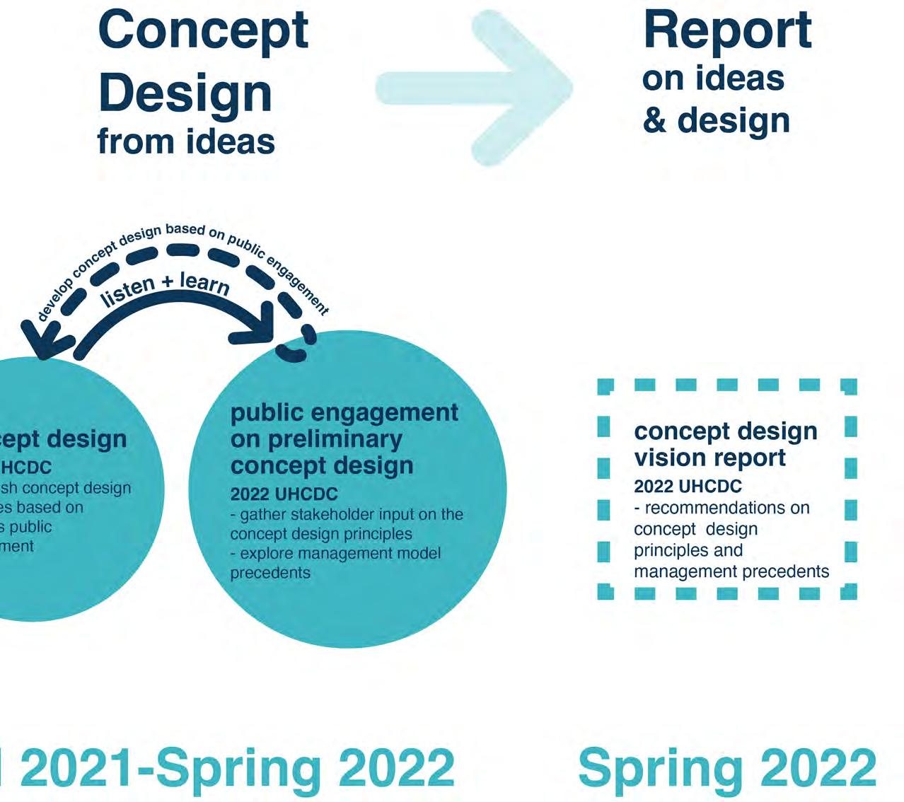
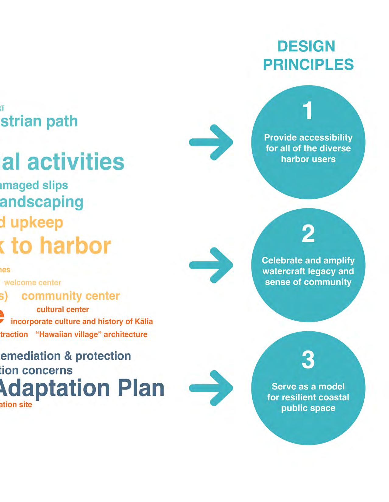
Drawing on the previous engagement and findings summarized above, the UHCDC team developed three design principles that provide the foundation for the conceptual plans.
1. Provide Accessibility for all of the Diverse Harbor Users
Envisioning the harbor as a public space that reaches into and connects the adjacent neighborhoods will increase opportunities for an array of users. The current land uses at the harbor offer limited connectivity –physical and visual.
2. Celebrate and Amplify Watercraft Legacy and Sense of Community
As highlighted in the previous community engagement, the cultural and historical significance of Kālia and people’s memories of the harbor are central to deepening their connections to the place.
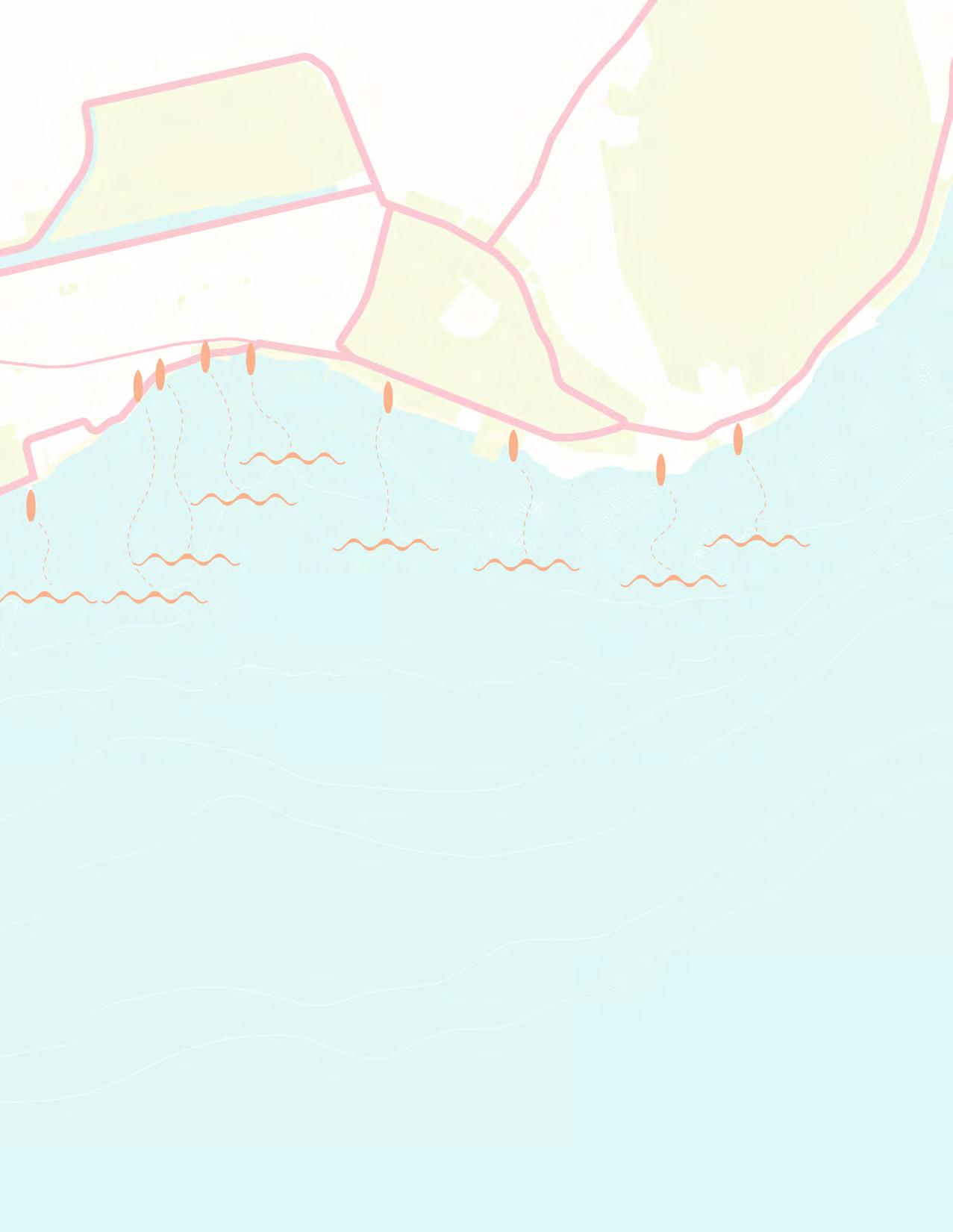
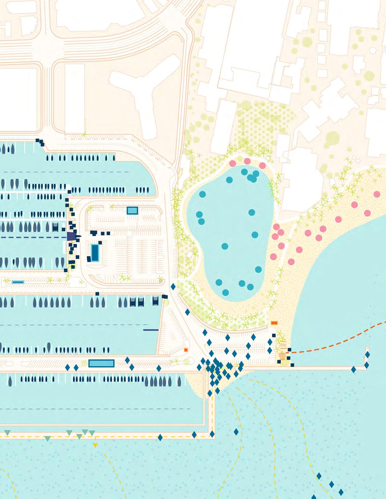
Adapting the AWSBH to a changing climate is a key consideration in the conceptual plans. Sea level rise projections suggest the need for any future development in the low-lying coastal areas on O‘ahu to consider its impacts. Photos taken during the Hawai‘i and Pacific Islands King Tides Project2 show flooding at the Ilikai Hotel parking, higher sea levels between Mole 1 and Parcel D, and the boat launch ramp (Hawai‘i Sea Grant King Tides Project, 2016). The AWSBH is also vulnerable to inland flooding, particularly during extreme events (Kim, 2015).
2 A publicly accessible crowd sourced dataset of photos, observations, date, time, and location of places throughout Hawai‘i and Oceania to inform research, policy, and decision making across the state and Pacific region. See Hawai‘i and the Pacific King Tides Project

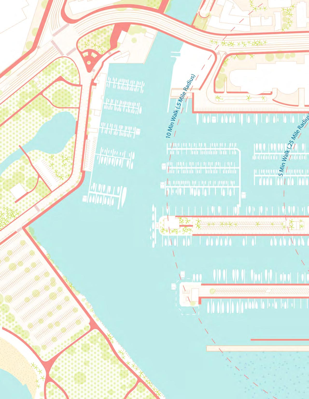
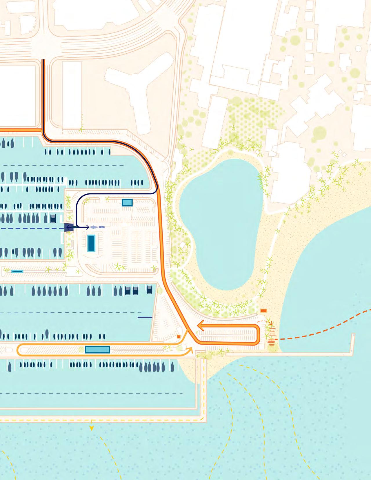
The main access to the harbor is at the intersection of Ala Moana Boulevard and Hobron Lane, a four-way intersection with signalized turning lights. Two other access points from Ala Moana Boulevard are at Holomoana Street, a right in/right out intersection with no signalized turning lights, and at Kahanamoku Street, a threeway intersection with signalized turning lights. The closest bus stop is located at the intersection of Ala Moana Boulevard and Hobron Lane, a five-minute walk from the harbor. However, the lack of signage makes it difficult to locate these access points (DURP, 2020).
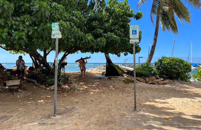
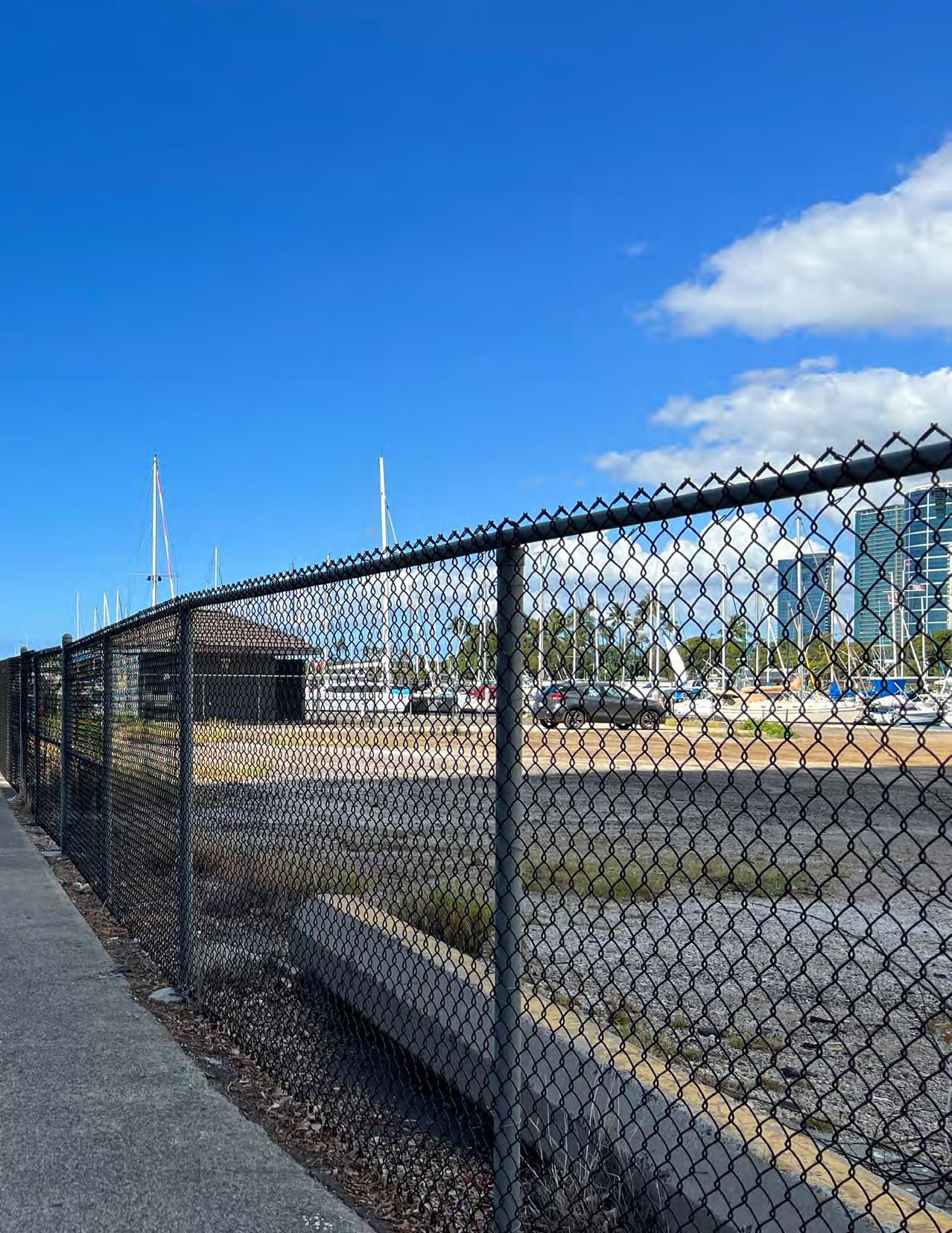
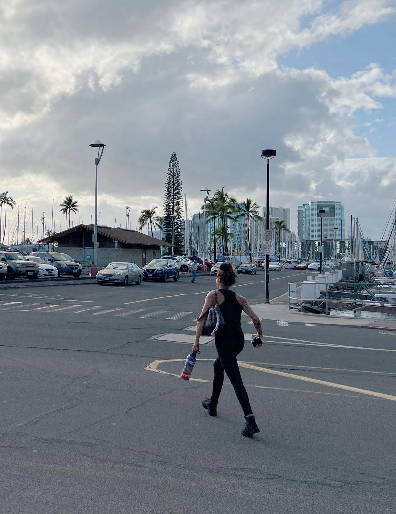
Pedestrian access to the harbor is challenging as it entails crossing the busy, six-lane Ala Moana Boulevard which has only one crosswalk to Hobron Lane. At the harbor, a lack of shade trees and appropriate signage for wayfinding are noticeable and make walking uncomfortable. There are no dedicated bike lanes and limited bike
parking in the area, making it uninviting for bicyclists.
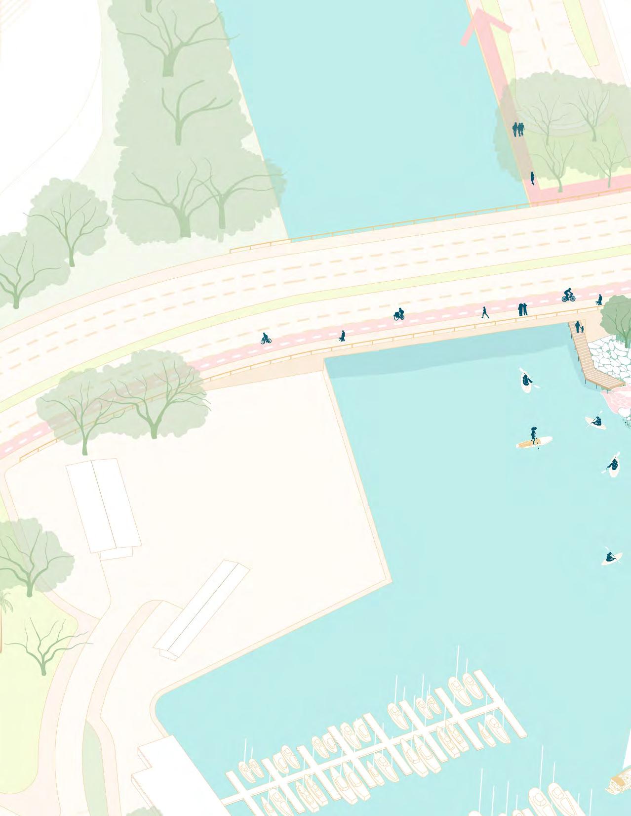
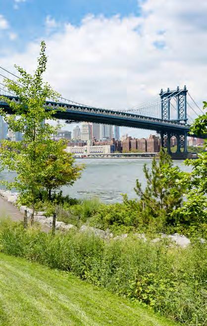
The Harbor is adjacent to several pedestrian networks. The Ala Moana Beach Park Walk and Magic Island running loop are a fiveminute walk west of the Harbor. The Ala Wai Promenade is also located just north of Ala Moana Boulevard, but currently lacks direct connection to the Harbor. Duke Kahanamoku Lagoon and Fort DeRussy Boardwalks are located on the eastern edge of the AWSBH. Creating direct pedestrian connections to these existing networks and a cohesive pedestrian route through the Harbor has the potential to create a unified pedestrian network throughout the South Coast of O‘ahu.
A new rail system is currently under construction. The closest rail station will be located at the Ala Moana Shopping Center which is a 10-minute walk.
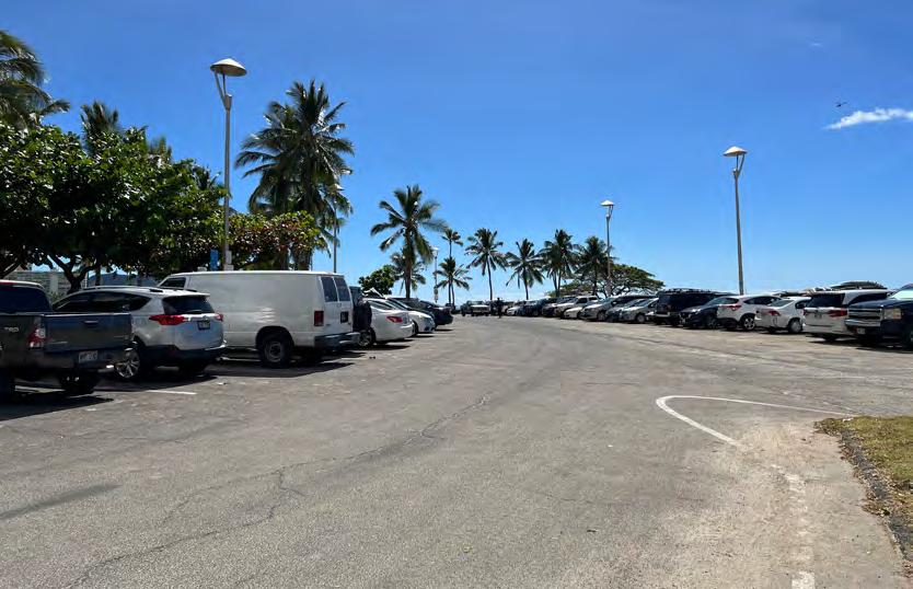
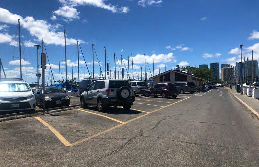
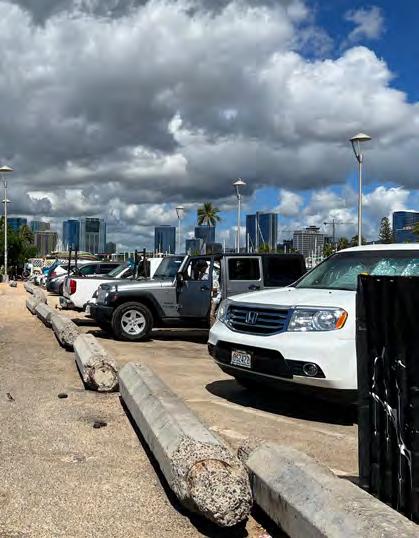
A parking inventory of the AWSBH shows that it has a total of 1,025 parking spaces along Holomoana Street, Mole 1, Mole
2, Parcel A, Parcel D, and the Ala Moana Bowls Parking Lot. The majority of these parking spaces are designated as free public parking (60.7%) with the remaining reserved for permit parking (35.5%) and boat and trailer parking (3.8%). There is limited metered parking, paid hourly parking, or private parking (DURP, 2020).
The AWSBH has limited capacity to accommodate transient boats (about 1-2% of the total number of boat slips). It lacks basic boating amenities and services such as fueling, maintenance, a convenience store, a pump-out station, and laundry facilities, making the harbor uninviting for boaters, especially those in transit from other harbors or crossing the Pacific Ocean (DURP, 2020).
Structures such as buildings, roads, and other infrastructure absorb and re-emit the sun's heat more than natural landscapes such as forests and water bodies. Urban areas where these structures are concentrated and vegetation and tree
canopy are limited become “islands” of higher temperatures relative to outlying areas. These pockets of heat are referred to as “heat islands." This effect increases energy costs (e.g., for air conditioning), air pollution levels, and heat-related illness.
According to the Hawai‘i Sea Level Rise Vulnerability and Adaptation Report (2017), tidal flooding in 2017 resulted in beach overwash and erosion at Waikīkī, and flooded roads and businesses in the Mapunapuna area of Oʻahu. Across all sectors, 3,800 structures and approximately 9,400 acres of land in the SLR-XA with 3.2 feet of projected sea level rise could potentially be damaged resulting in immense economic losses. A number of these structures are hotels in Waikīkī. The report, therefore, calls for long-term preparedness for sea level rise adaptation by private and public entities in Waikīkī (p. 160).
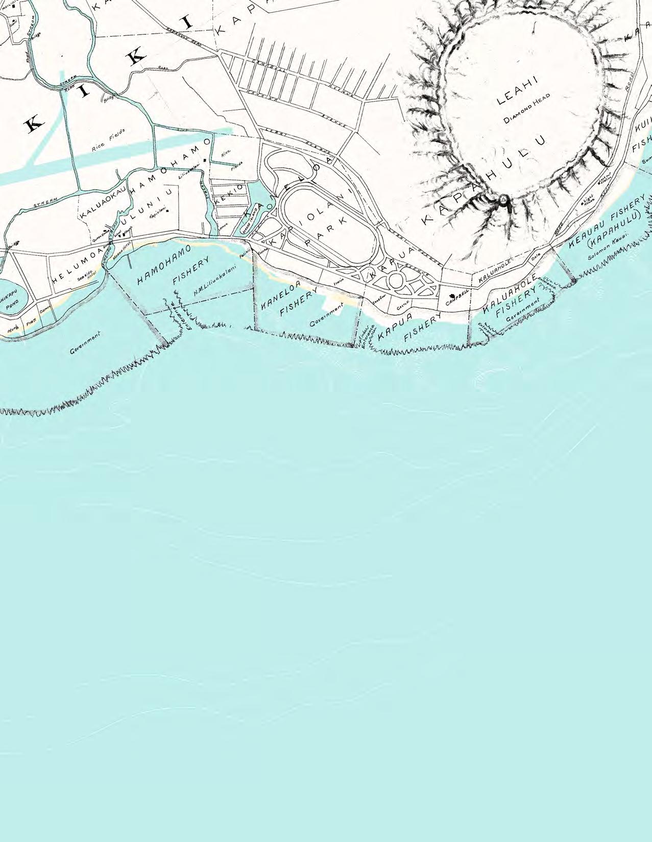
Source: 1909, M.D. Monsarrat
Ala
Public Park
Beach
Boat Launch
Canoe Launch
Surf Launch
Surf Break
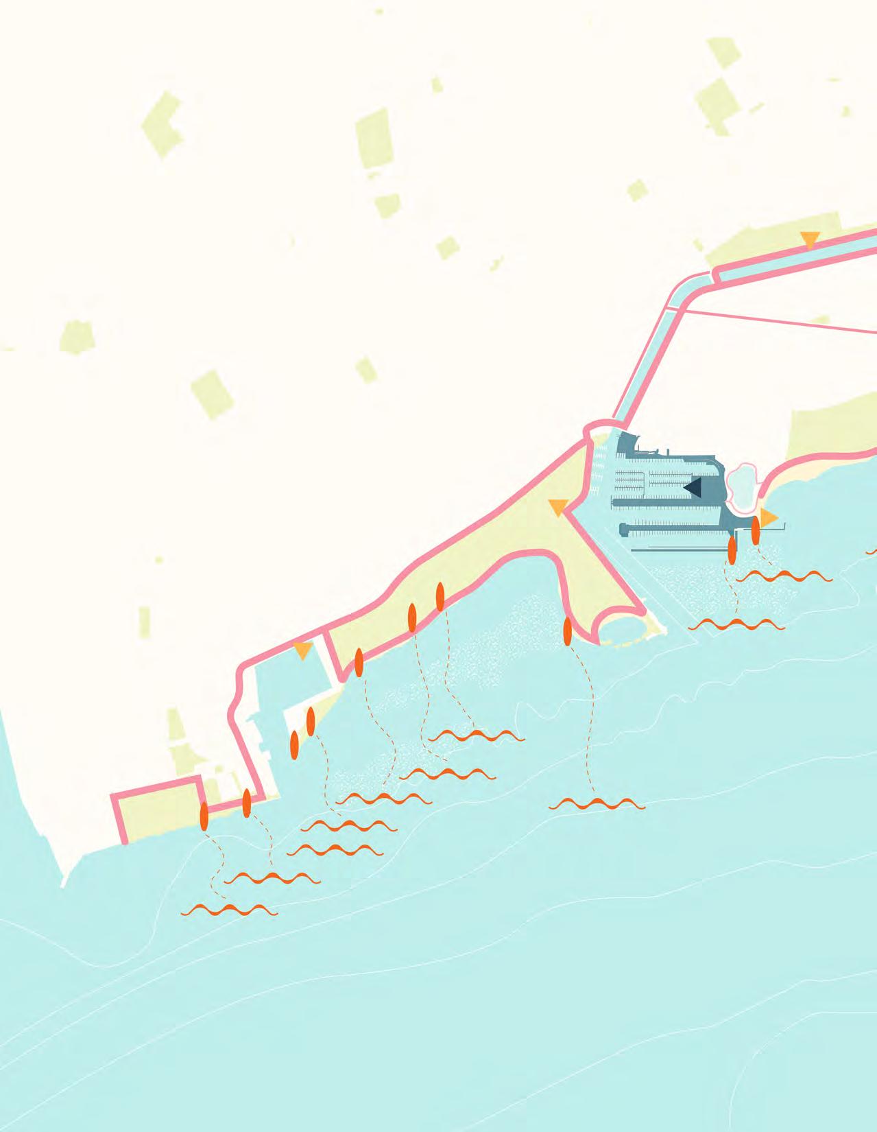
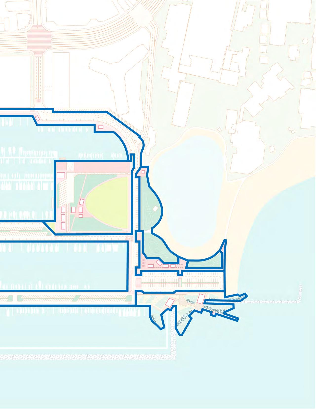
Lei of Parks + Primary Pedestrian Routes
Secondary Pedestrian Route
Existing Pedestrian + Watercraft Access on the South Coast
AWSBH Vision Report 28
McCully Mō‘ili‘ili
Ala Wai Community Park
Kaka`ako
Kaka`ako Beach Park
Ala Moana
Ala Moana Beach Park
Big Lefts
Tennis Courts
Concessions
Straightouts
Kewalo Point
Point Panic
Flies
Proposed Watercraft Access + Gateways
Big Bombaras
Fort DeRussy Park
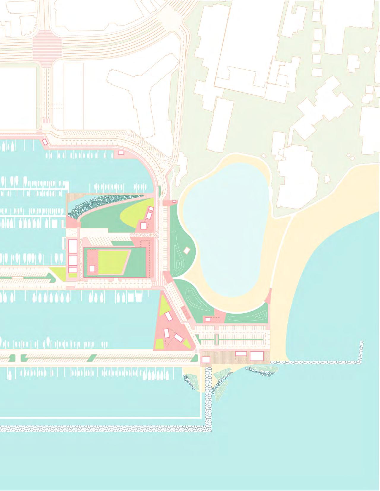
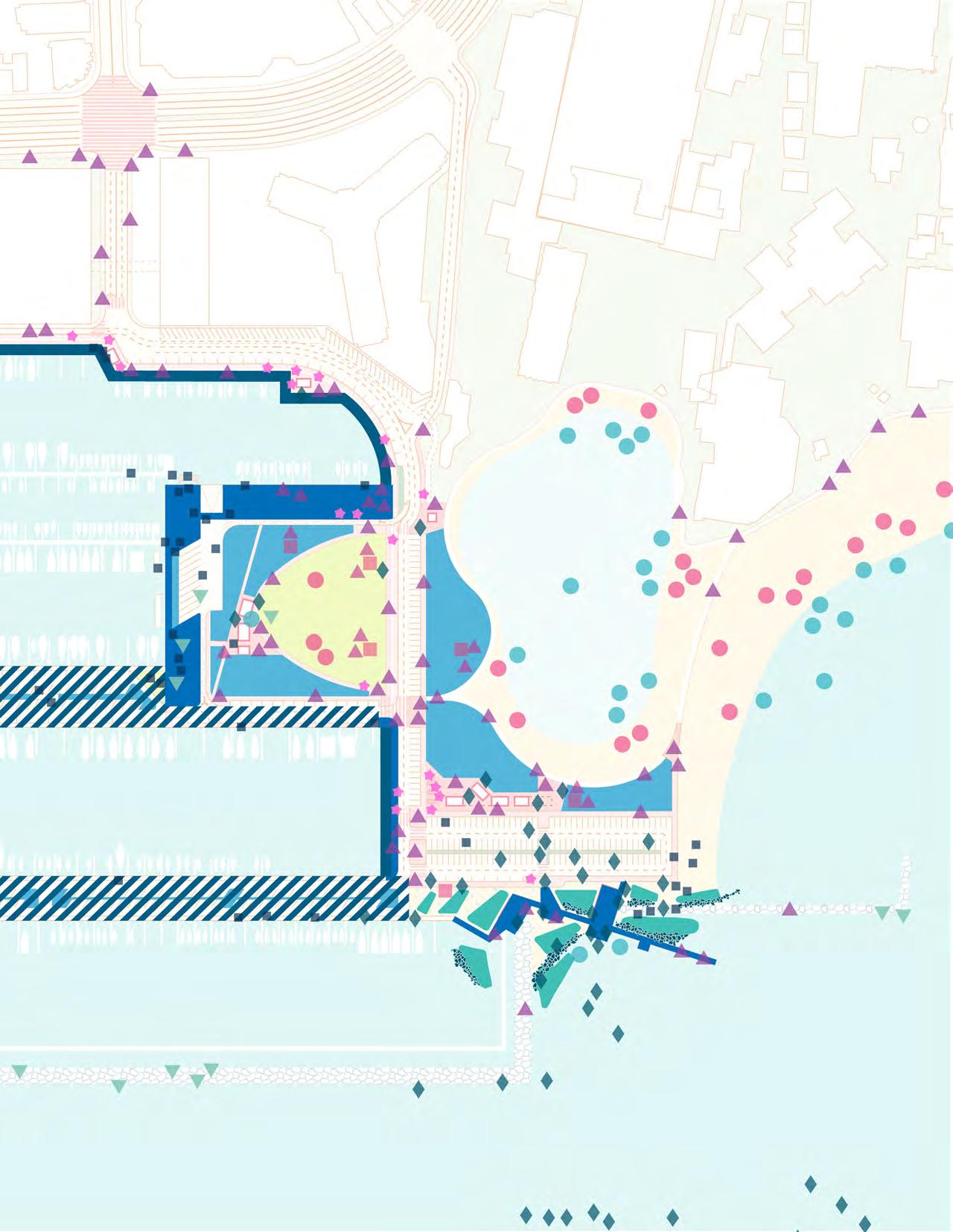
Ala Wai Small Boat Harbor as a Critical Link for Pedestrian and Watercraft Access on the South Coast of O'ahu
Inbetweens Kaisers
Bowls Rockpiles
Queens
Baby Queens
Baby Canoes
Threes Fours Populars First Break
Publics Castles
Old Mans
Tongs Baby Tongs
Suicides
Multi-Modal Lane
Physically separated from traffic and shared with walkers and runners
Shared Road - Low Stress
Low speeds and limited traffic
Shared Road - Medium Stress
25MPG speed limit, substantial traffic or some shoulder on high speed roads.
Shared Road - High Stress
Frequent fast traffic and limited to no shoulder
Biki Station
Scooter Station
Bus Route
Bus Stop
Source: Hawai'i Bicycling League
 Magic Island
The Prince
Transpac
Hawai'i Yacht Club
Ala Moana Canoe Halau
Waikīkī Yacht Club
Ala Moana Beach Park
Ala Wai Canal
Magic Island
The Prince
Transpac
Hawai'i Yacht Club
Ala Moana Canoe Halau
Waikīkī Yacht Club
Ala Moana Beach Park
Ala Wai Canal


 Looking East at Holomoana + Ala Moana Bowls Parking Lot

Boat Launch
Surf Launch
Canoe Launch
Vehicular Route for Boat Access
Vehicular Route for Surf Access
Vehicular Route for Canoe Access
Boating
Surfing
Swimming
Jogging/Walking
Fishing
Picnicking
Sunbathing
Food Trucks
Harbor Master's Quarters + Yacht Clubs
Public Comfort Station
High: 86 °F
Surface Temperature Taken August 05, 2021 at 12:00pm
Low: 77 °F
Pedestrian Paths
Crosswalks
Unmarked Intersection
Sources:
Landsat 8; United States EPA; Department of Urban & Regional Planning, University of Hawaii at Mānoa
Boating
Surfing
Swimming
Jogging/Walking
Fishing
Picnicking
Sunbathing
Food Trucks
Harbor Master's Quarters + Yacht Clubs
Public Comfort Station
Sources: NOAA
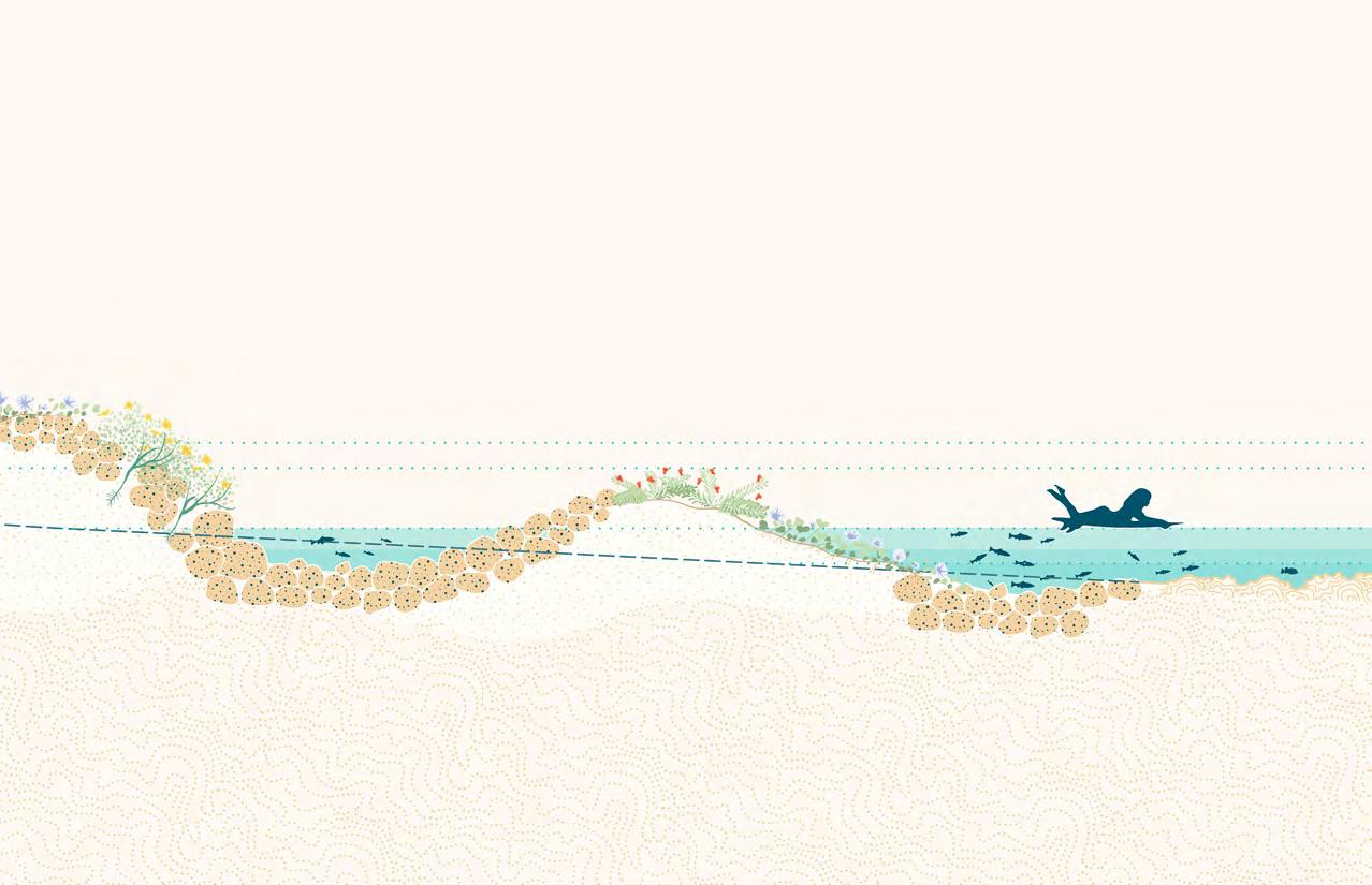
How can we utilize sea level rise adaptation as an opportunity to amplify a thriving watercraft community and create equitable, accessible public spaces for all harbor stakeholders?
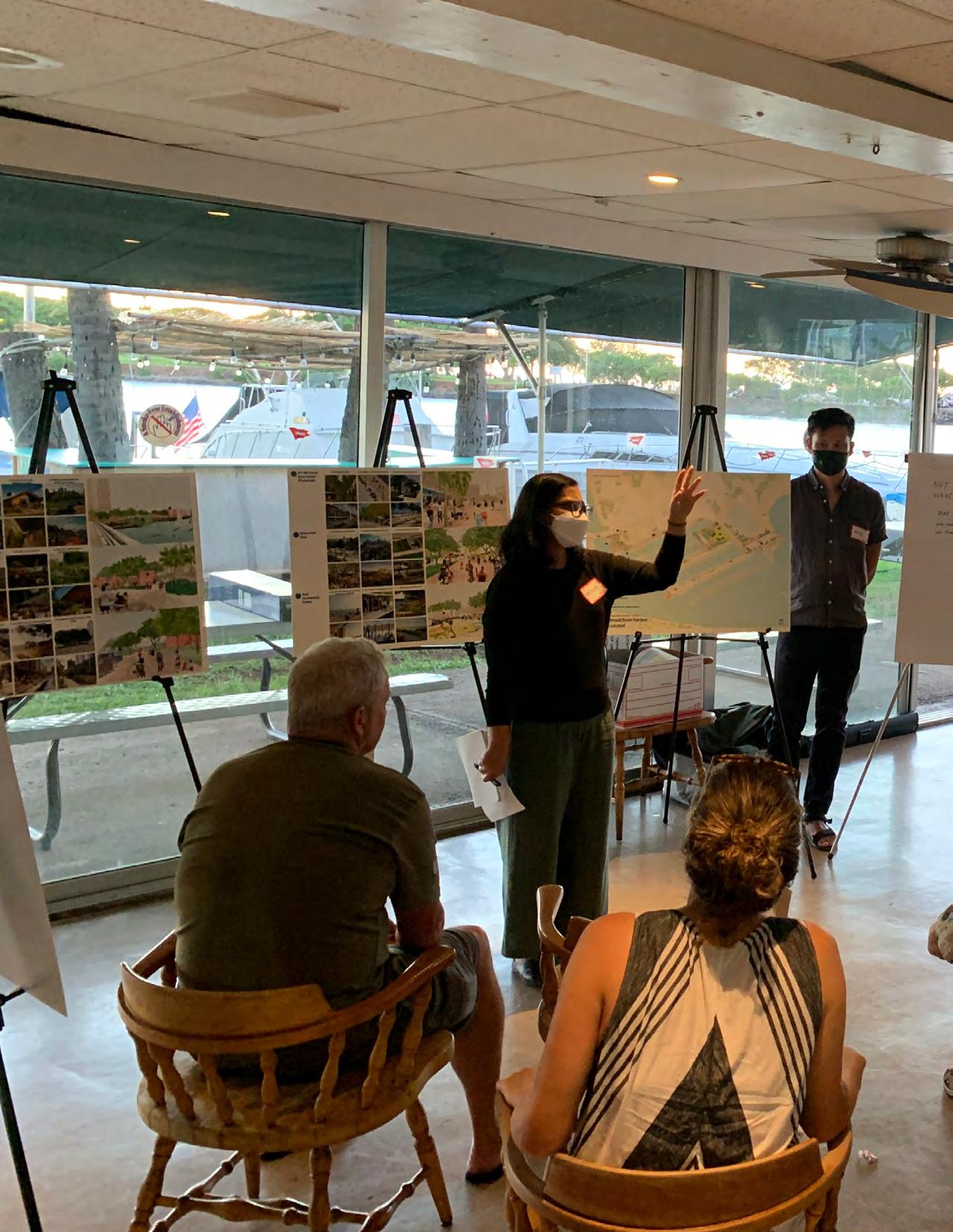
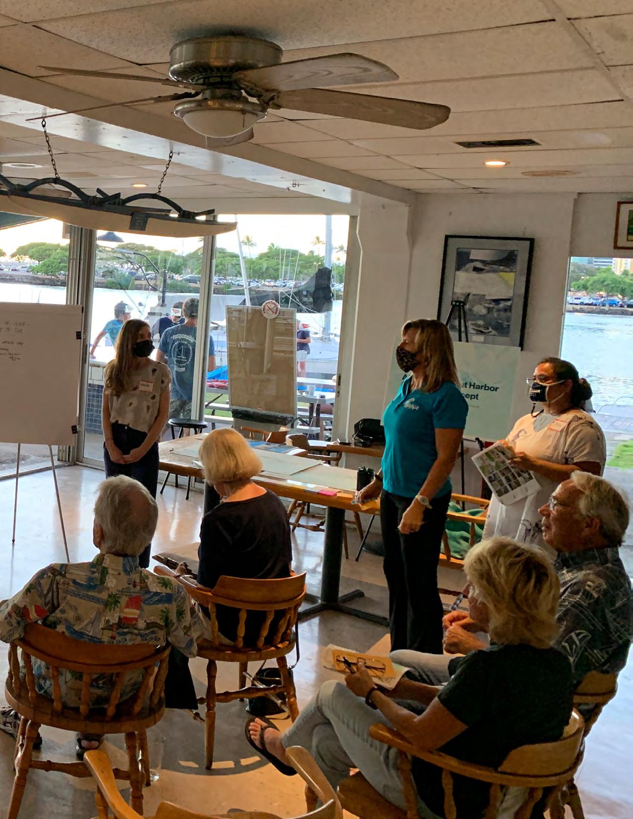
The UHCDC team decided to gather feedback from stakeholders through focus group discussions. Since the concepts generated took into consideration the comments from a previous engagement with stakeholders, the participants were asked to provide substantive feedback about the overarching design principles and specific features that sought to transform the harbor into an active and inclusive public space.
The team hosted four focus group discussions with stakeholders between December 2021 and April 2022. To maintain continuity, the names of those invited for the focus groups were drawn from the list of participants in the engagement workshops conducted by DTL in 2017. These included members from recreational user groups, the neighborhood board, business improvement associations, and liveaboards (Appendix A).
Each focus group had 4-12 participants and lasted between 1-2 hours. All meetings were scheduled on weekday evenings to
accommodate participants’ availability after work hours. The meetings typically entailed a short presentation by the UHCDC team to review key aspects of the concepts followed by a facilitated discussion. Each participant was provided a slide deck. They were able to review poster boards and other relevant materials before the discussion which focused on the following questions:
1. What features of the vision plan resonated with you/your group?
2. What do you think could be improved?
3. Is there anything you do not see in the vision plan that you would like the team to consider?
All responses were recorded. Participants also provided feedback on the poster boards. The information shared in the focus groups was posted on a website with public access. All participants were encouraged to share the URL with their respective constituencies.
Participants found the overarching design principles compelling. The features of the concept designs that resonated with them were the promenade, the park adjacent to the lagoon, amenities (shade trees, comfort station), identity/signage and wayfinding, watercraft access (commercial and public), and multimodal access to the harbor. There was support for turning the street adjacent to the businesses into a one-way street to accommodate the promenade. Participants stated that this could be feasible provided there is adequate surface parking for the businesses. Having a sign that welcomes visitors was very well-received, especially by Prince Waikīkī and the hotels adjacent to the harbor as was privileging people over cars.
Participants suggested that the team consider greening the roof of the
proposed parking structure (and even consider a community garden for the liveaboards like the ocean-friendly garden in Kaka‘ako), re-examine the location of the boat ramp, provide a pump-out station, storage spaces for small boats to include non-residents, and space for fuel polishing. They pointed out that residential areas in Waikīkī need access to public space including parks other than the pocket parks available to them. However, it is important to have ‘eyes on the street’ and keep such spaces active such as by hosting food vendors and encouraging neighborhood watch groups. Participants also suggested bringing public transit to the site (bus, trolley or shuttle running from Ala Moana) and considering precedents to adapt the existing moles to projected sea level rise. Another concern was traffic congestion on the proposed one-way street during large events such as fireworks (which coincides with the end of sailing) and the ability to reserve parking spaces for residents.
3. Is there anything you do not see in the vision plan that you would like the team to consider?
Participants expressed concern about trash mitigation, the state of disrepair of the moles, the lack of space and services for larger boats (800 Row), the maintenance of the large park space (homelessness, irrigation, trash collection), security issues, and the reduction in surface parking spaces. Some participants pointed out that commercial boat operations could require dredging.
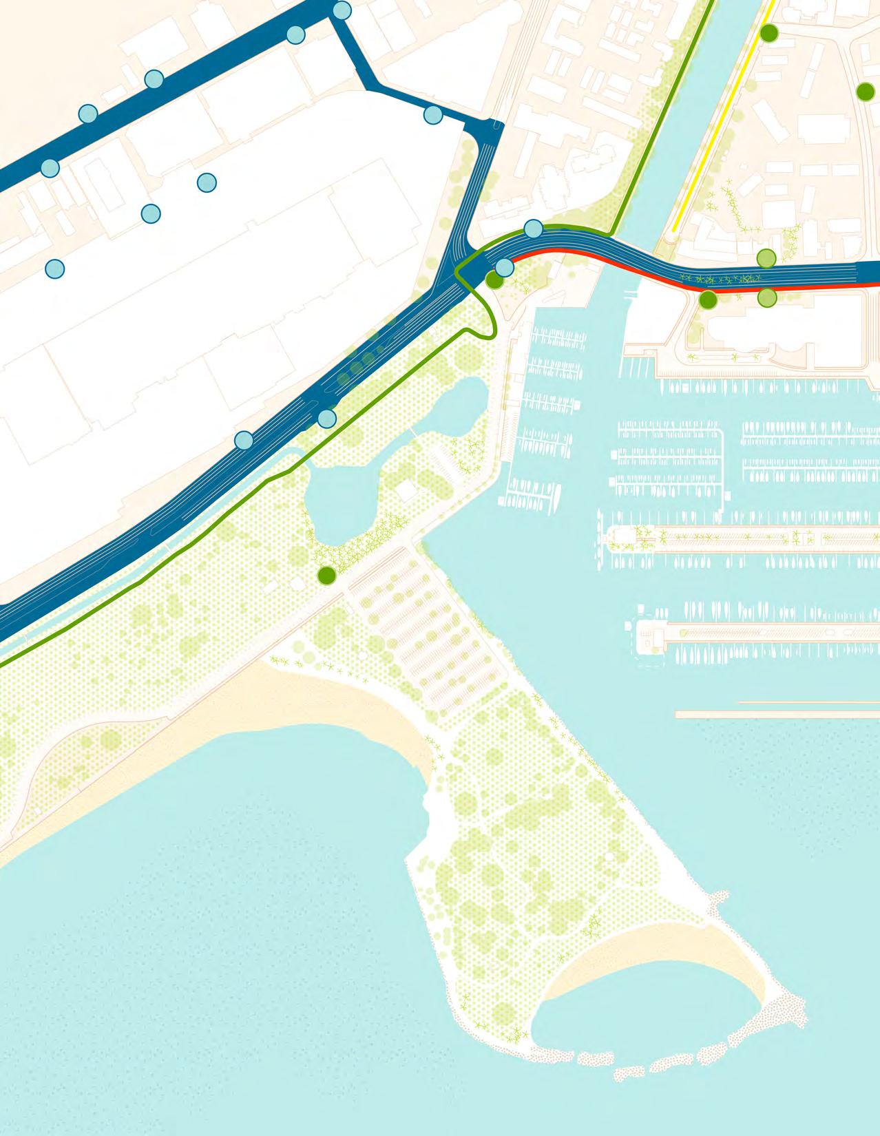
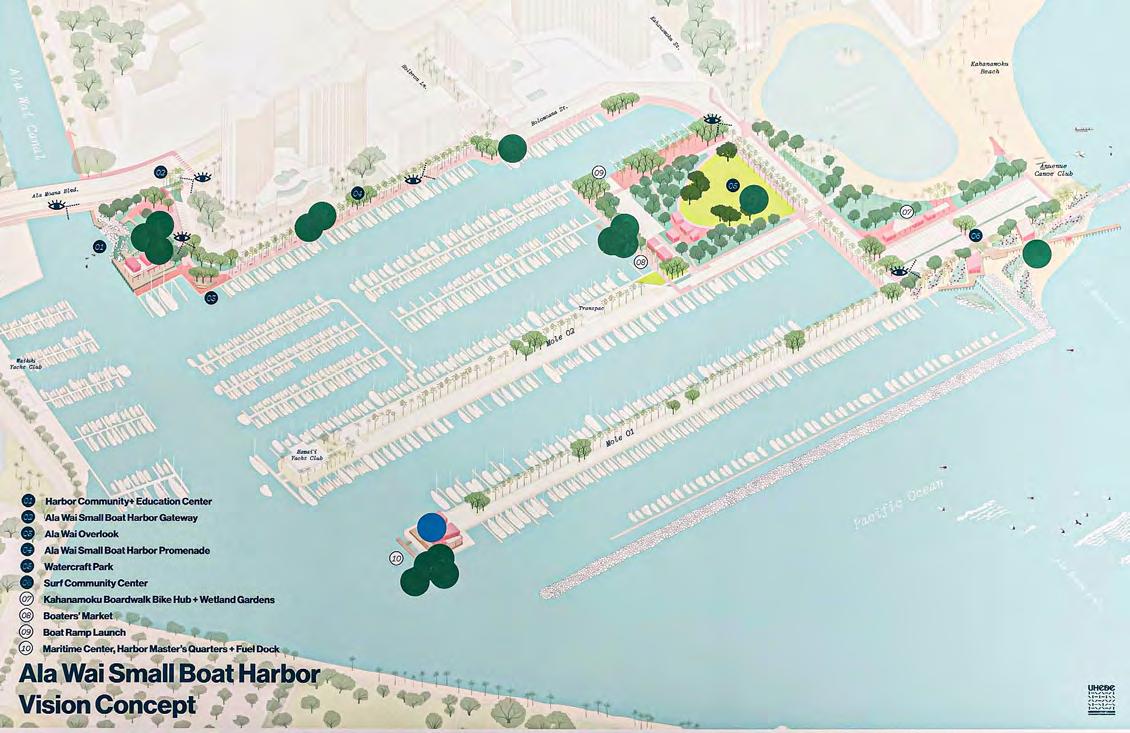
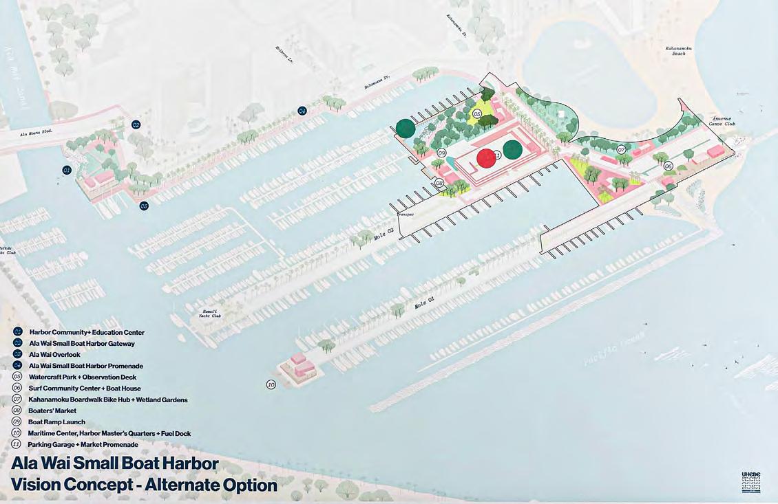
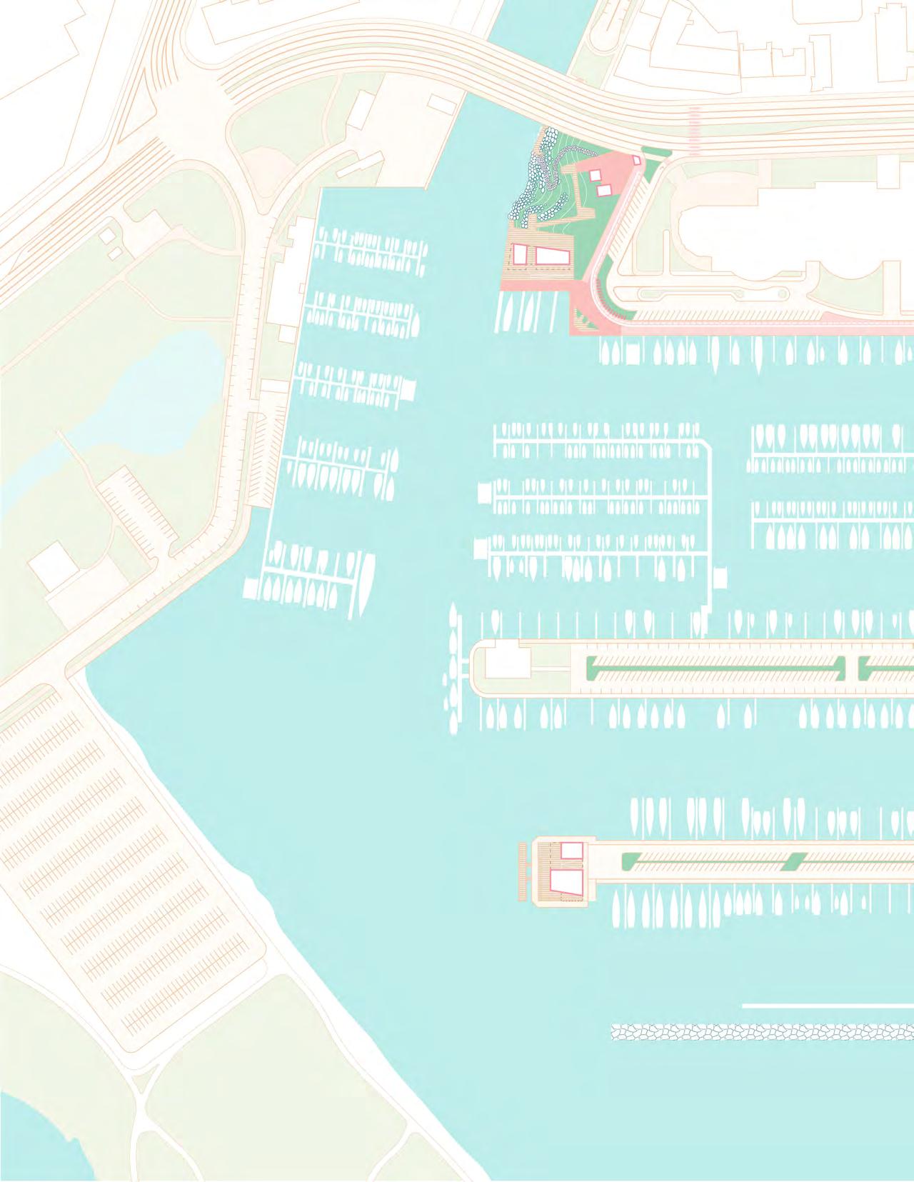
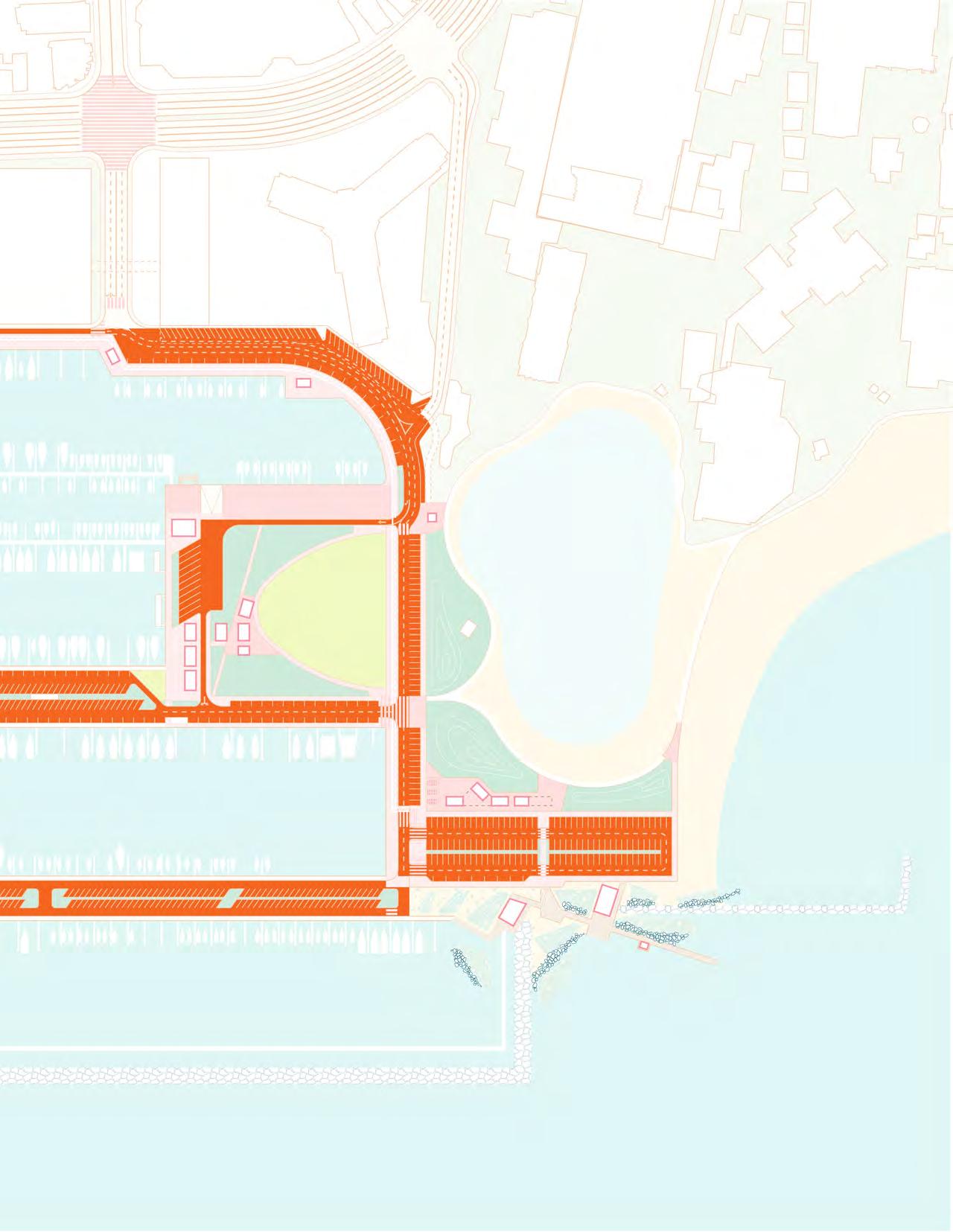
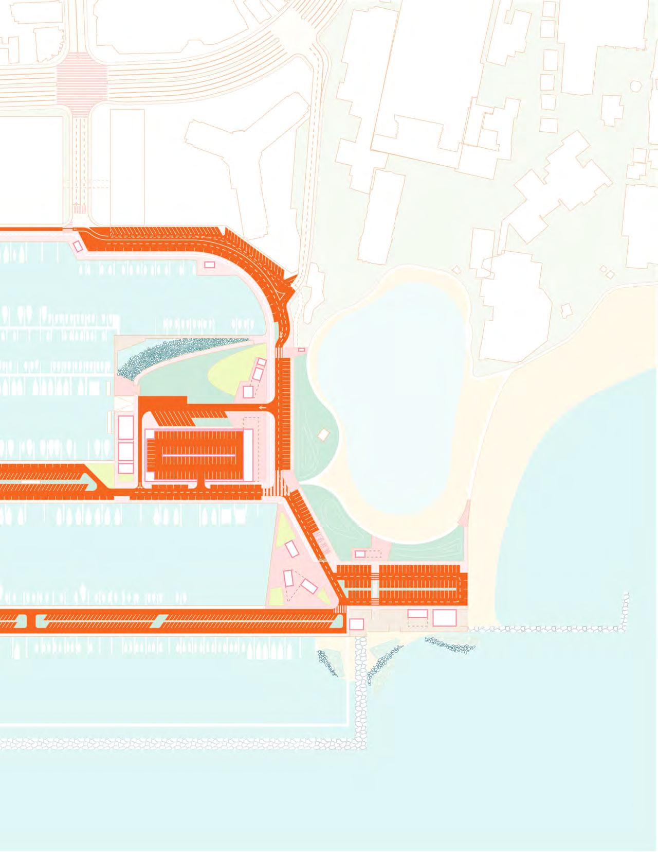
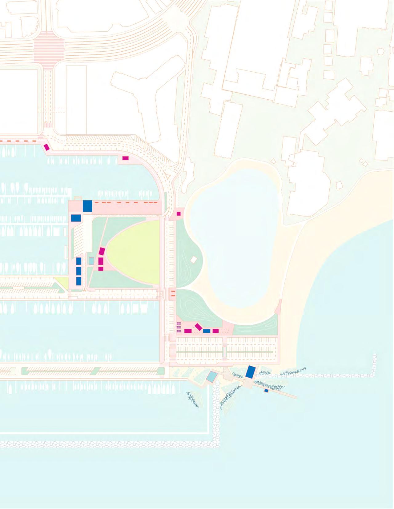
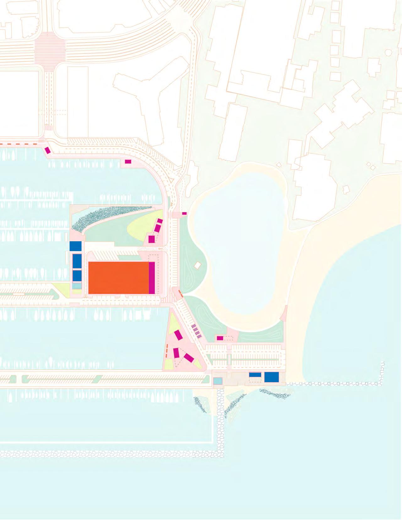
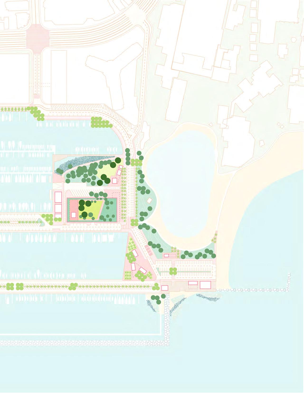
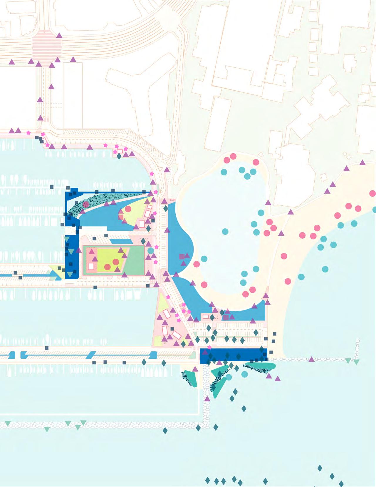
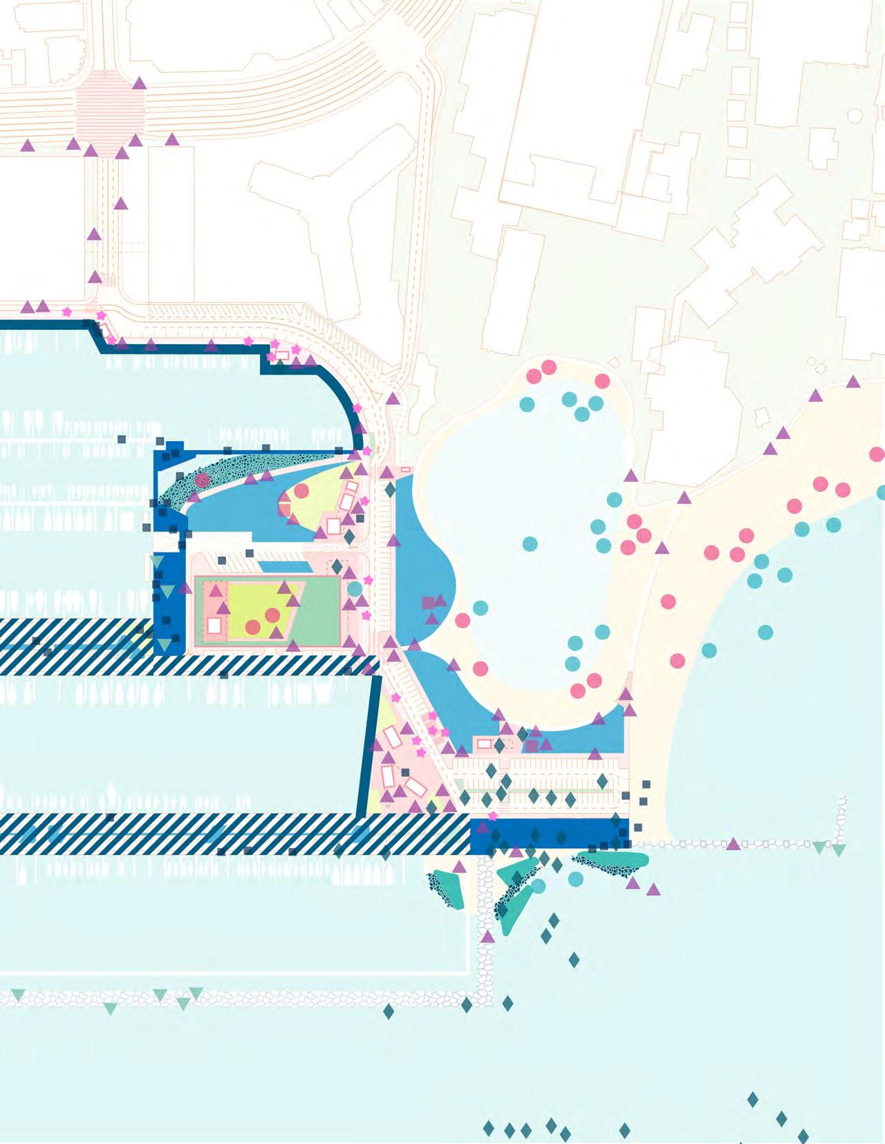
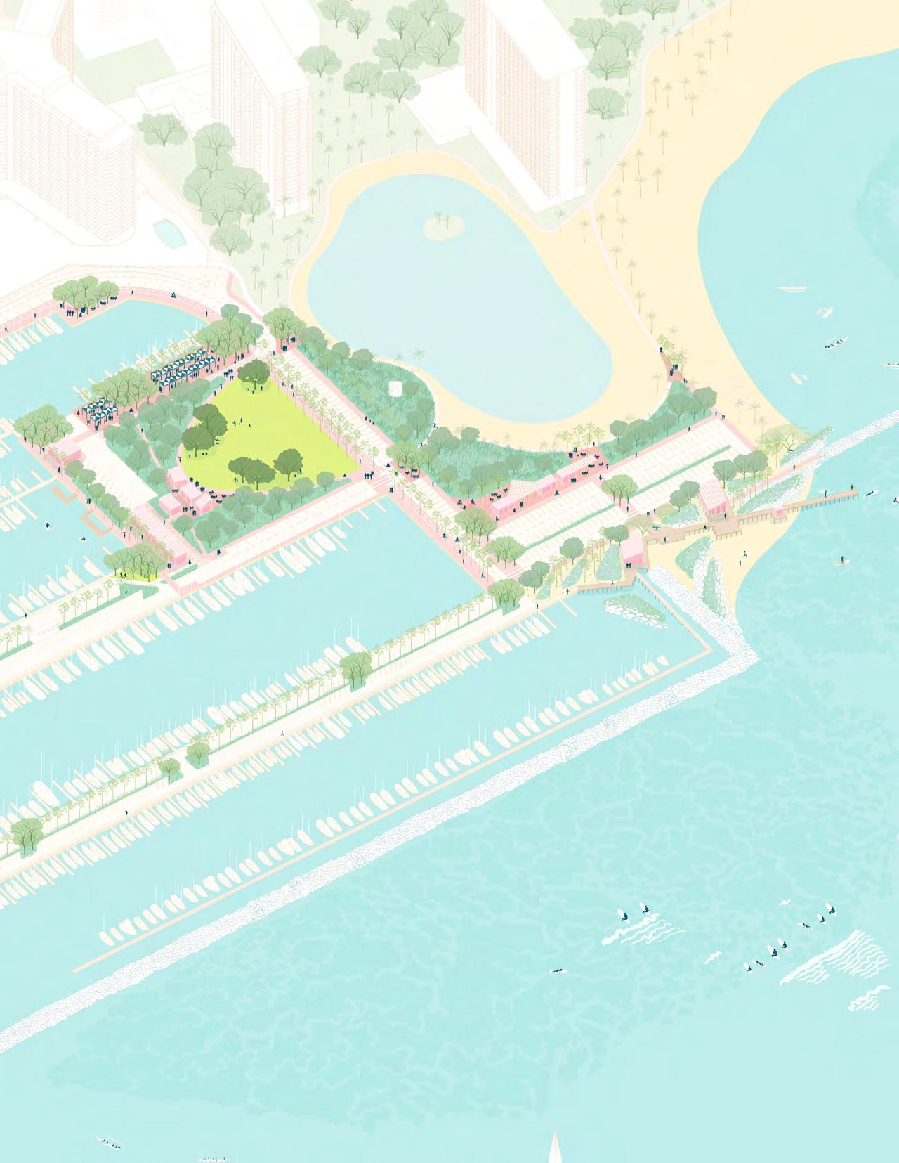
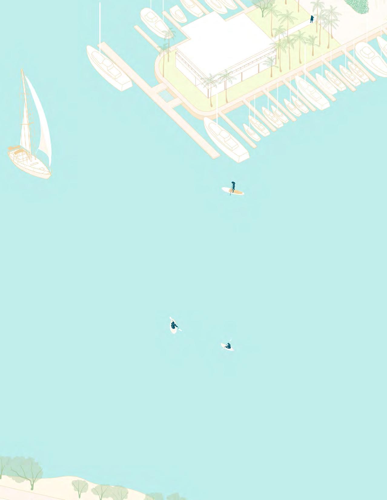
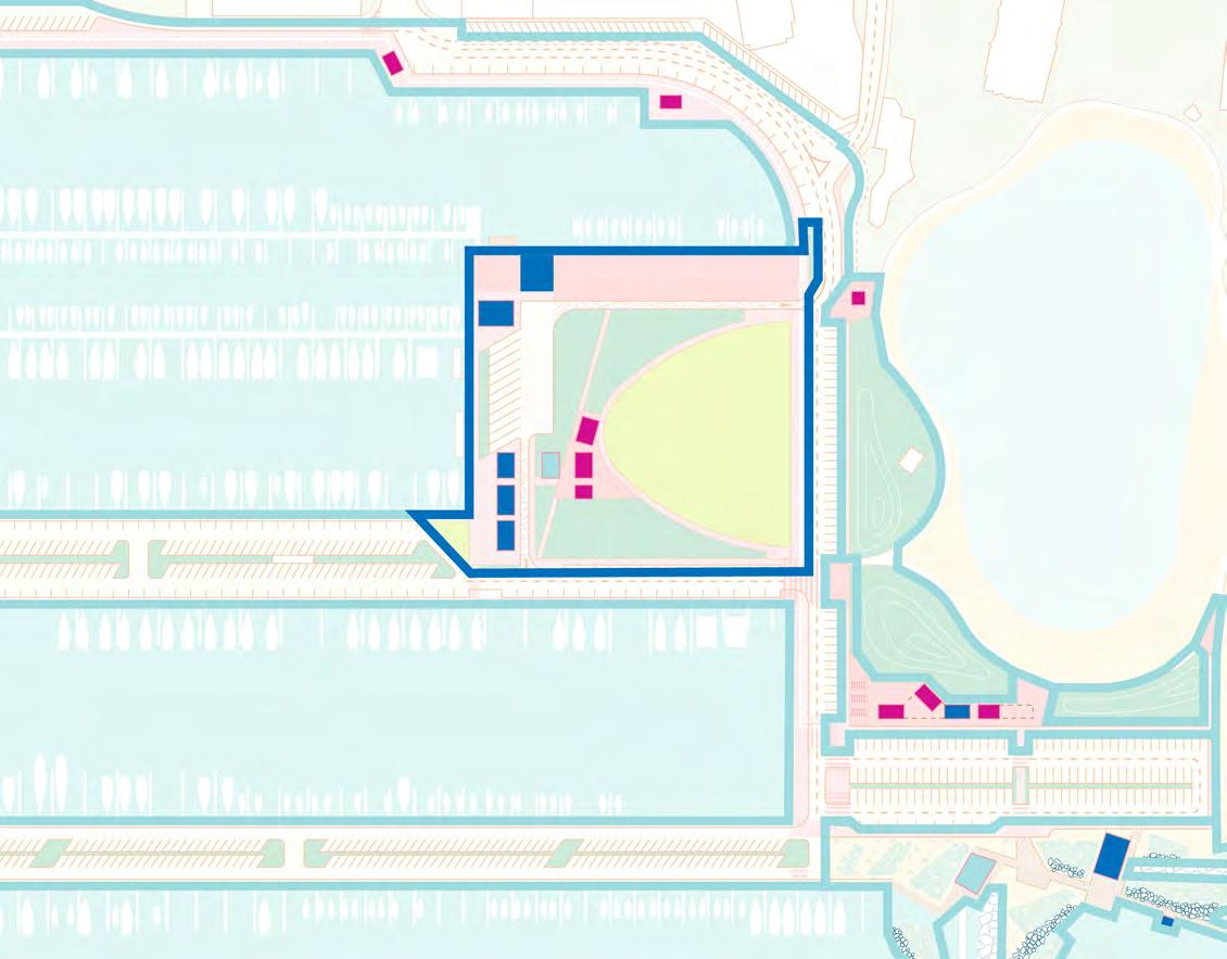
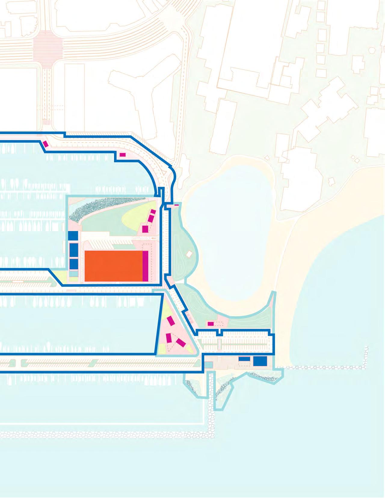
The UHCDC team developed and refined two concept design options based on the feedback received from the focus group participants: Option A and Option B. While both options propose the same programmatic elements, Option B maintains the existing location of the boat launch, the existing alignment of Parcel D’s eastern edge, and the Harbor’s existing parking numbers through the introduction of a proposed parking garage (see p. 66).
Both concept design options maintain essential Harbor functions, provide access to the water for many different scales of watercraft, provide inclusive community gathering spaces for all of the Harbor stakeholders, and incorporate sea level rise adaptation strategies that ensure these activities can thrive over time. The boat slips are not included in the scope of the Concept Designs. The slip amenities such as storage lockers, access, and parking on Moles 01 and 02 are unaltered in both design options.
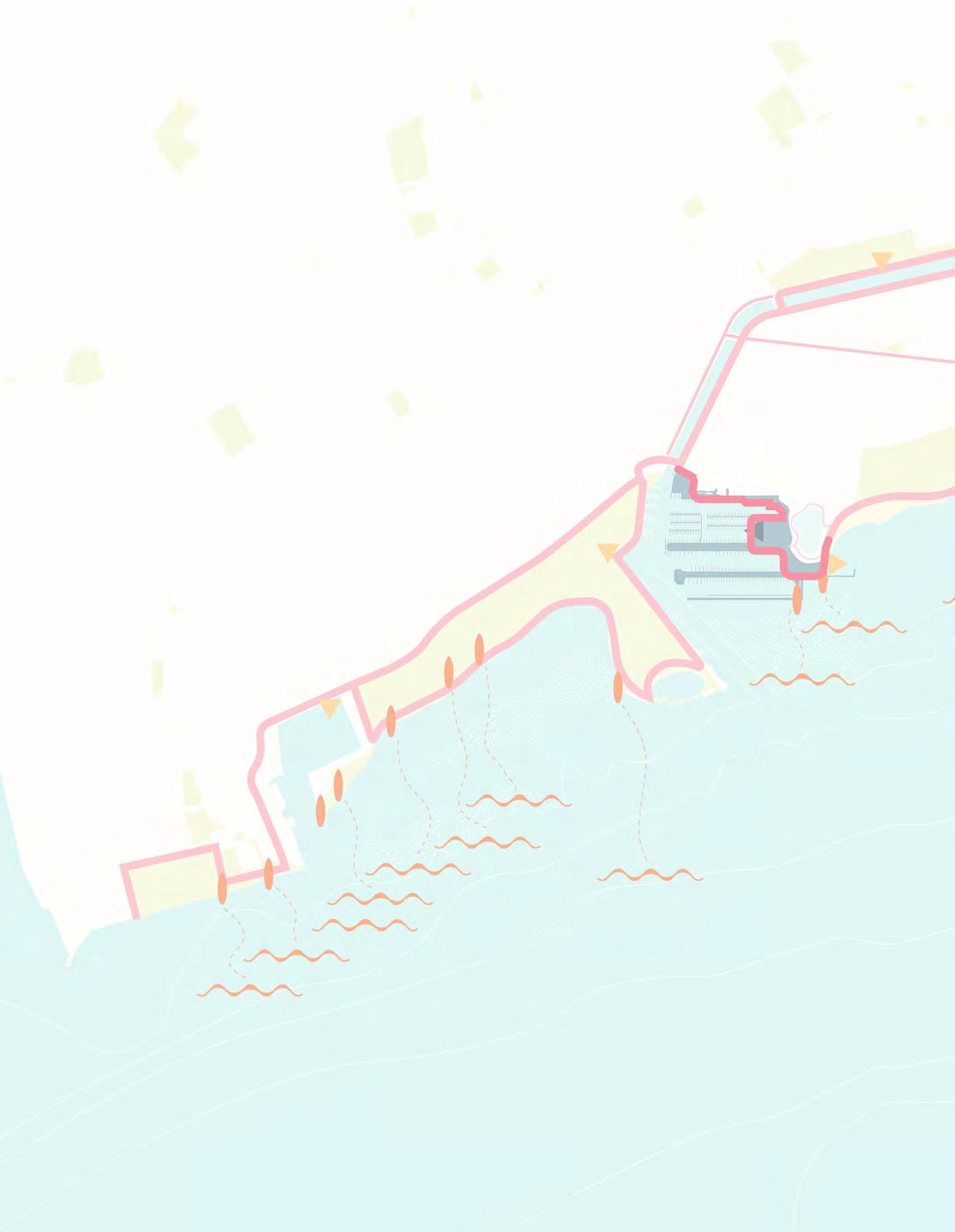
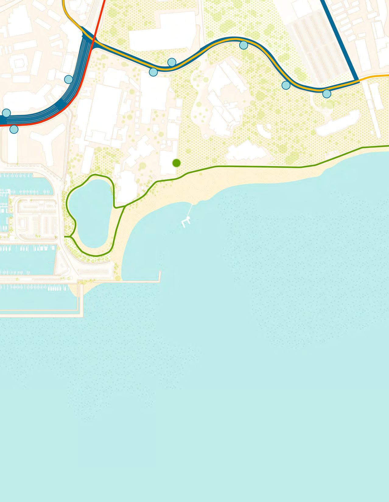
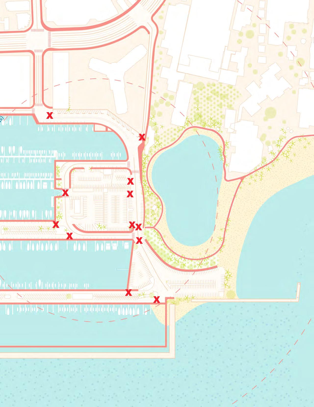
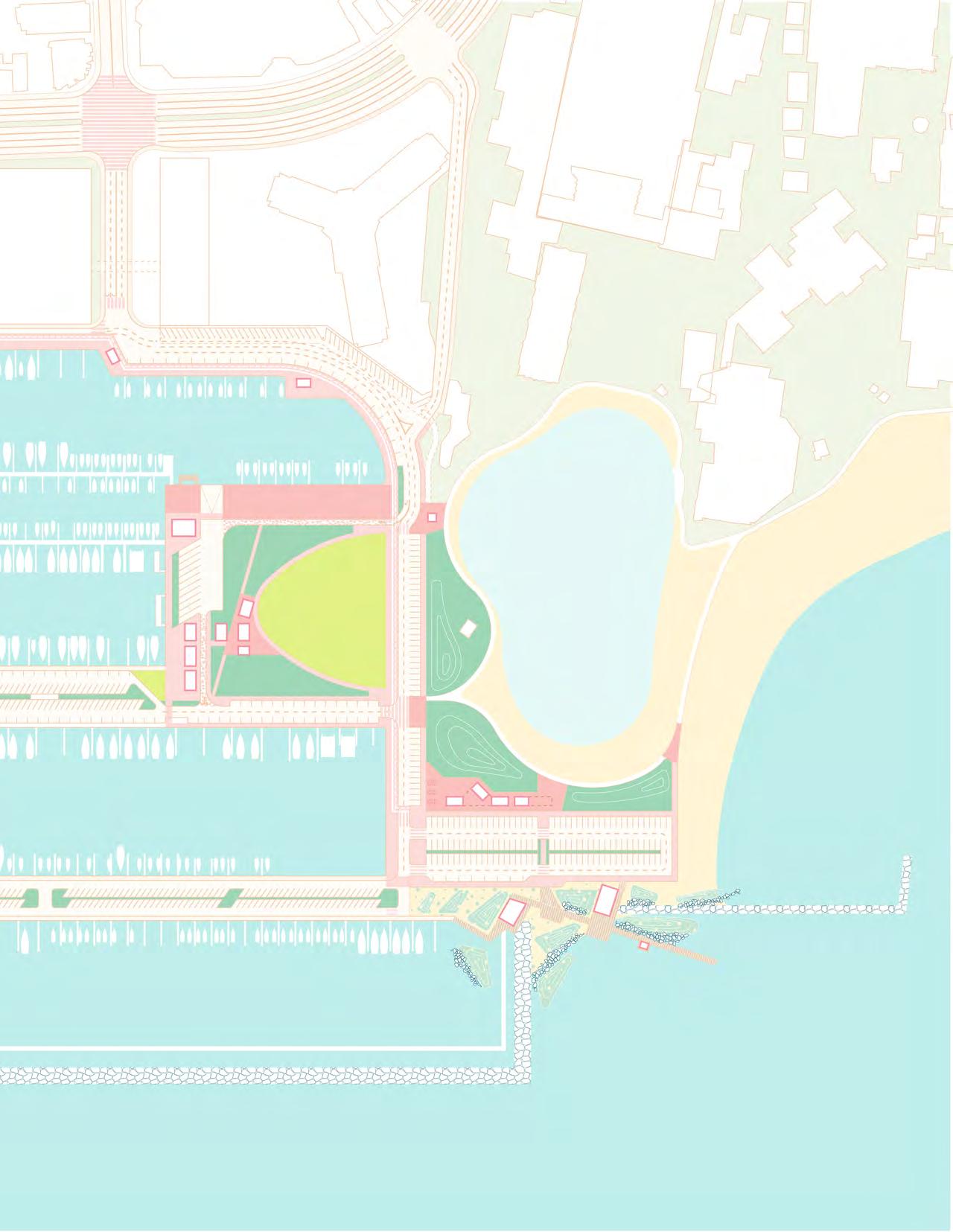
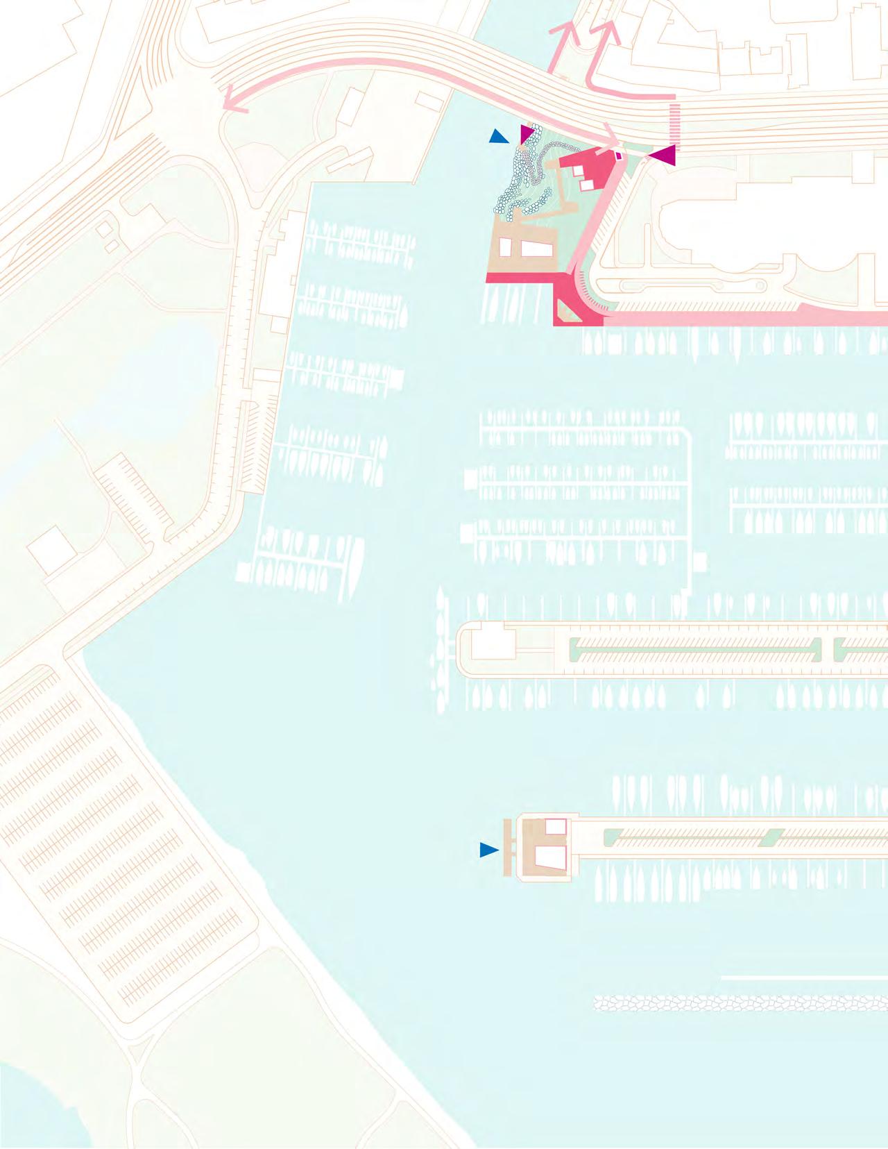
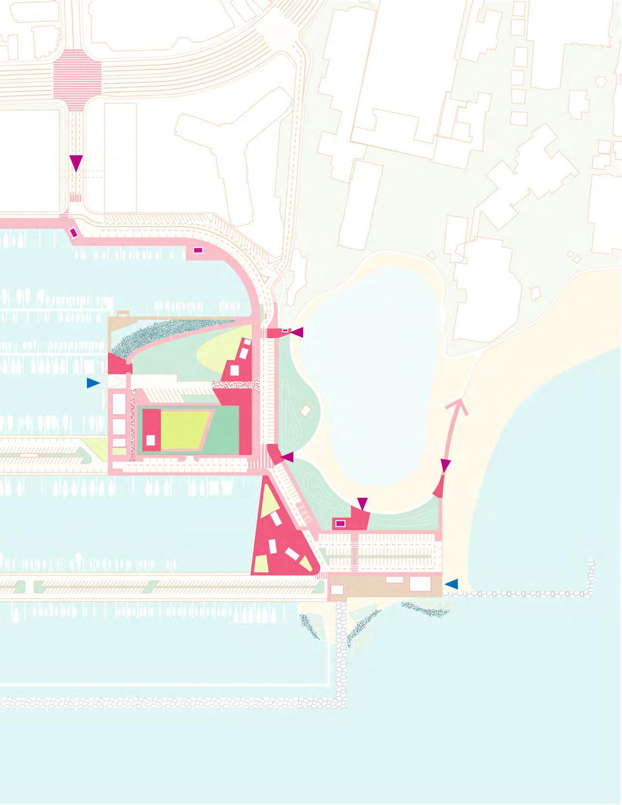
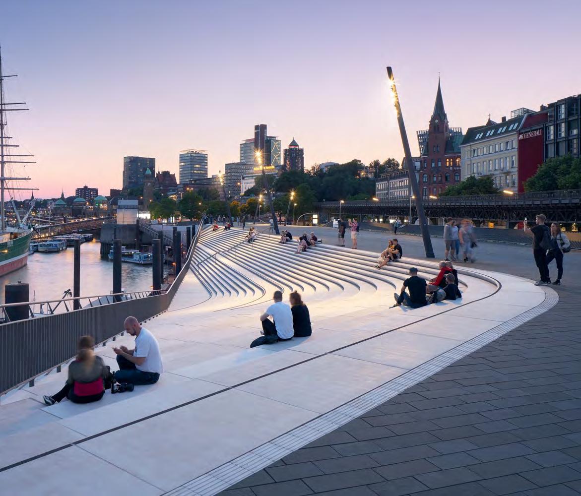
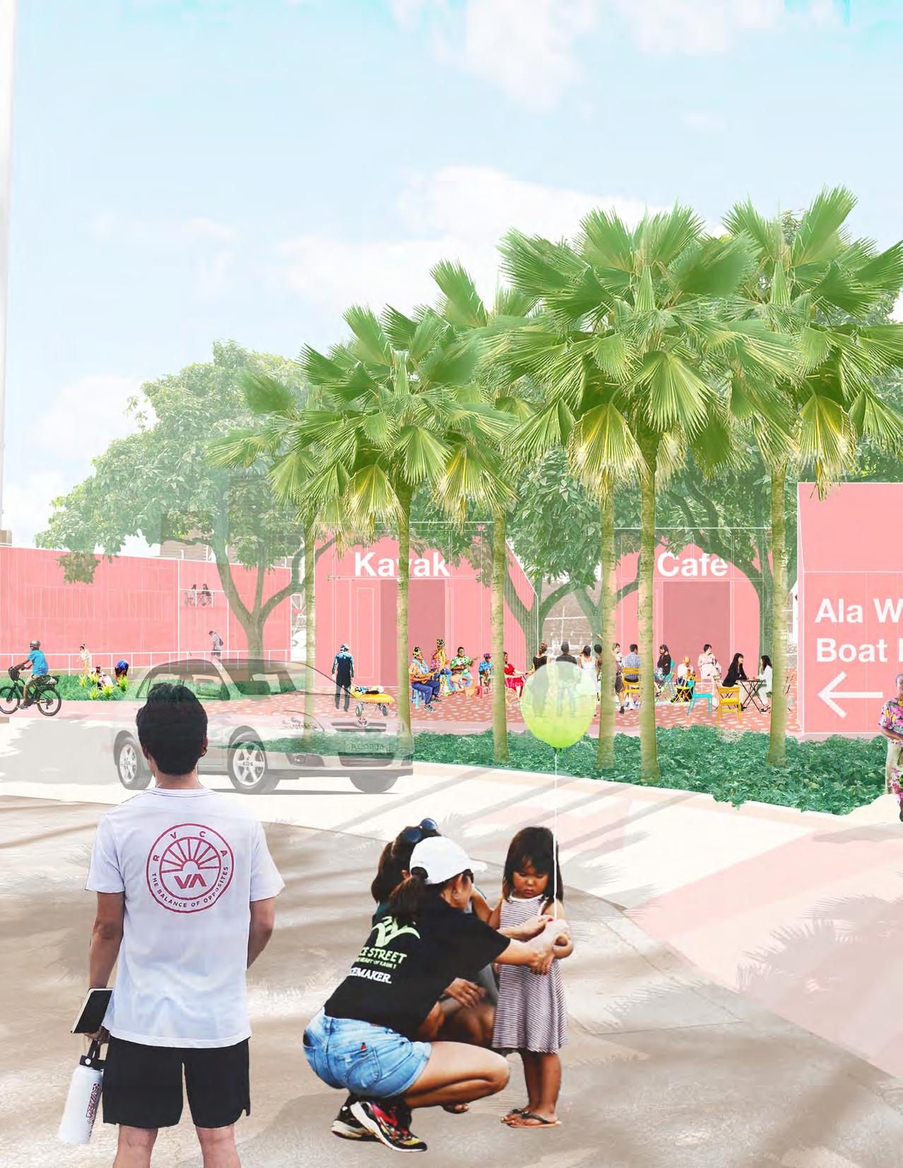
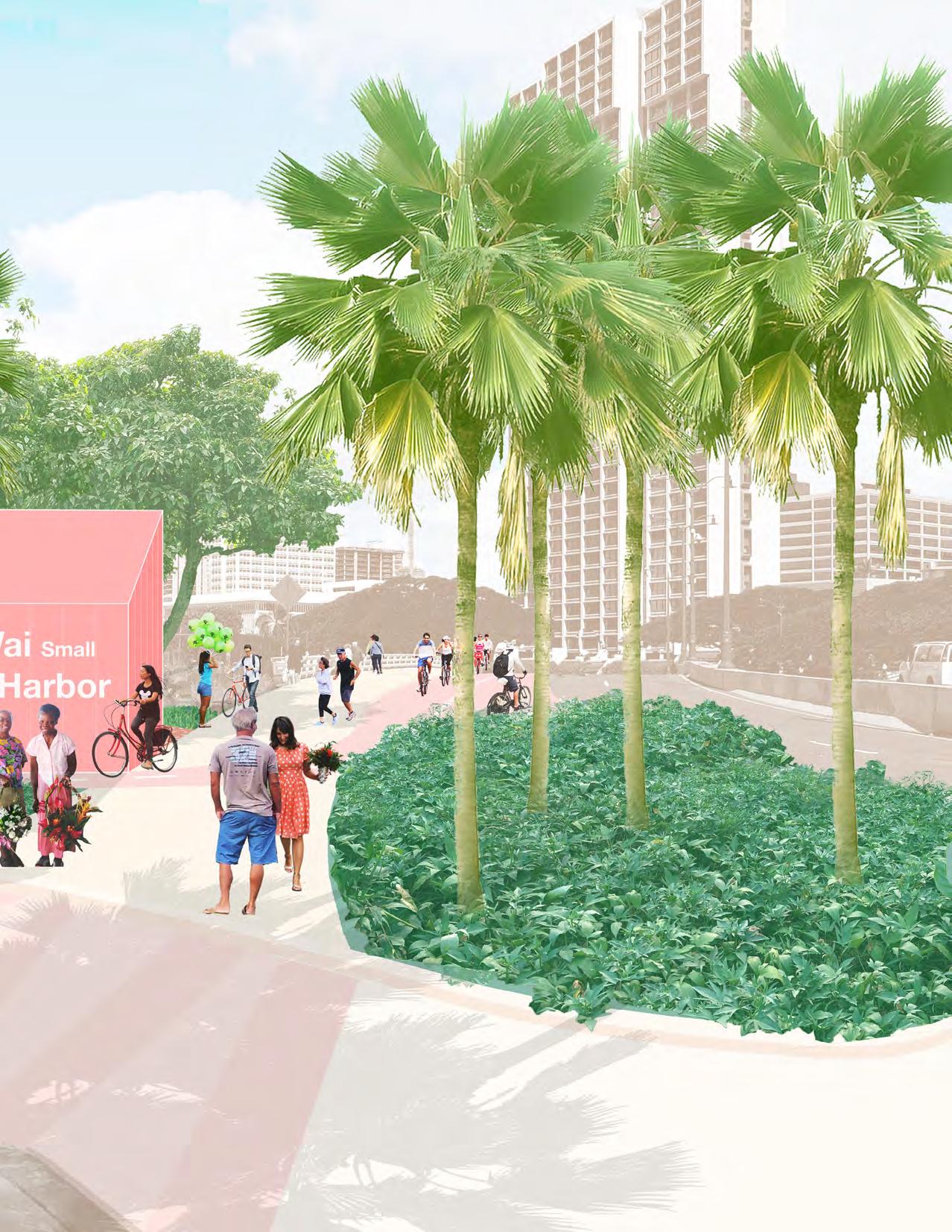
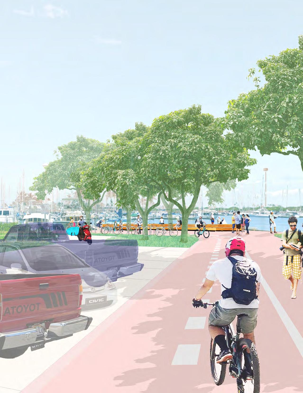
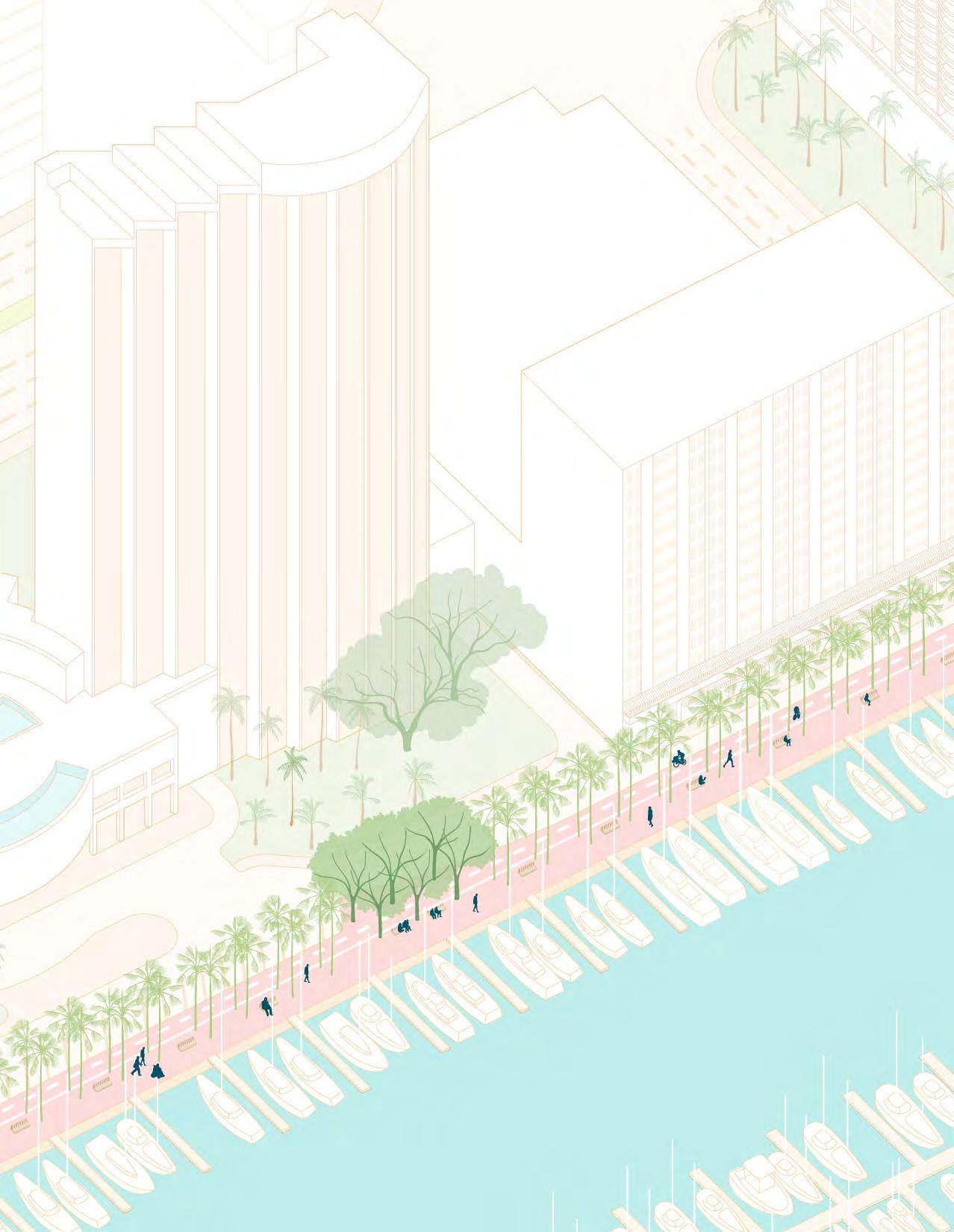
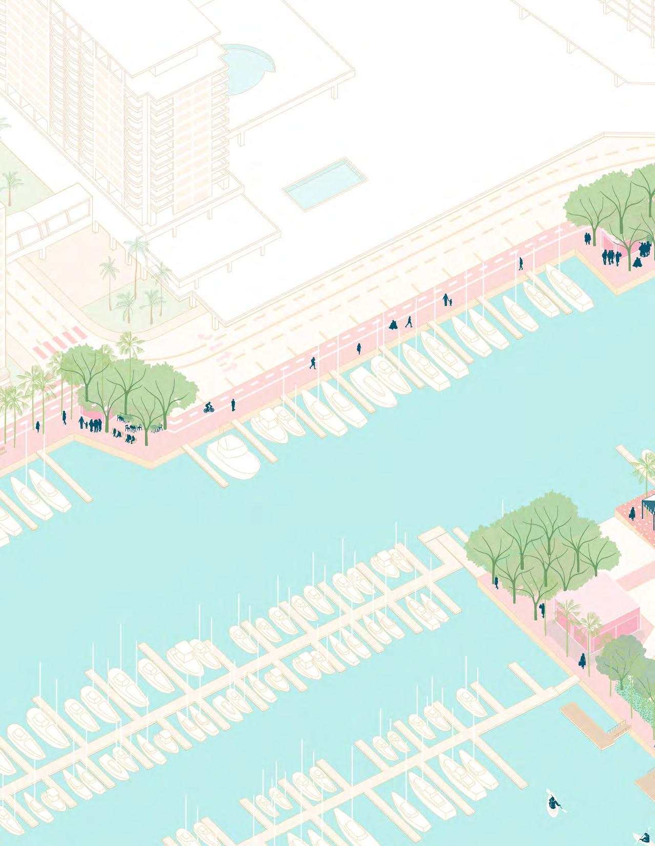
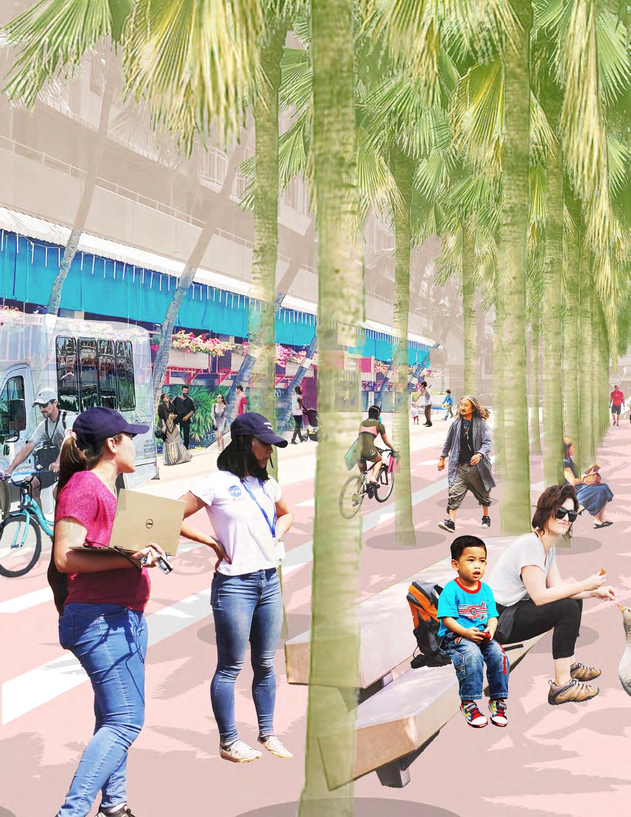
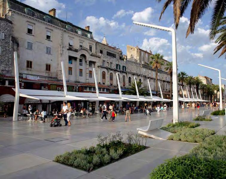
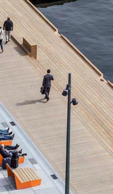
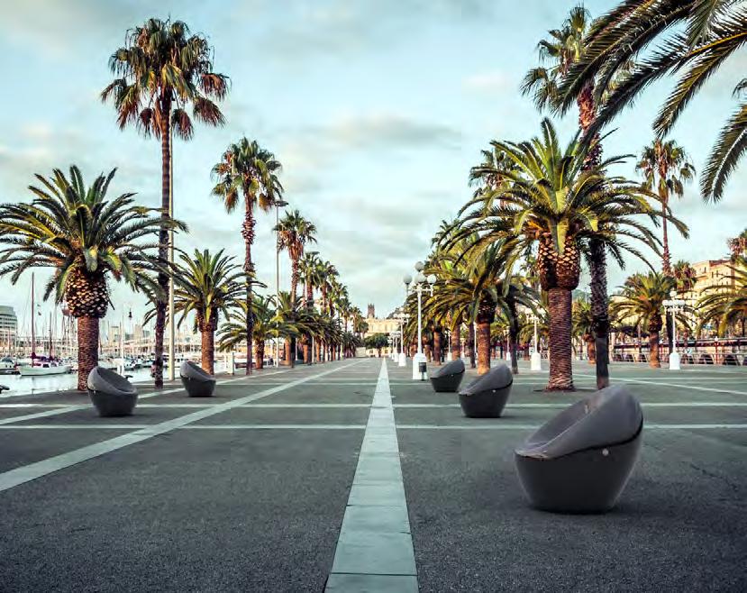
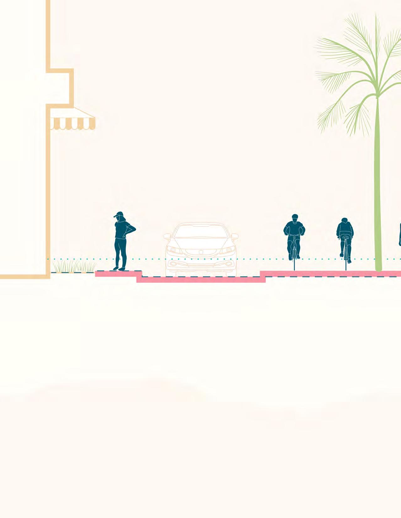
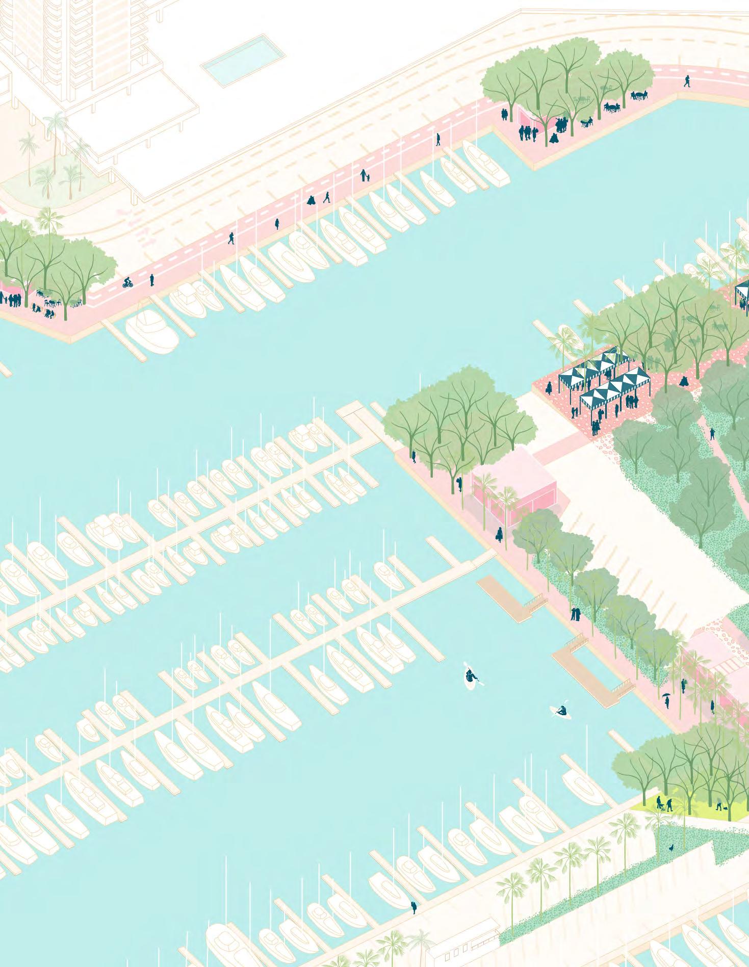
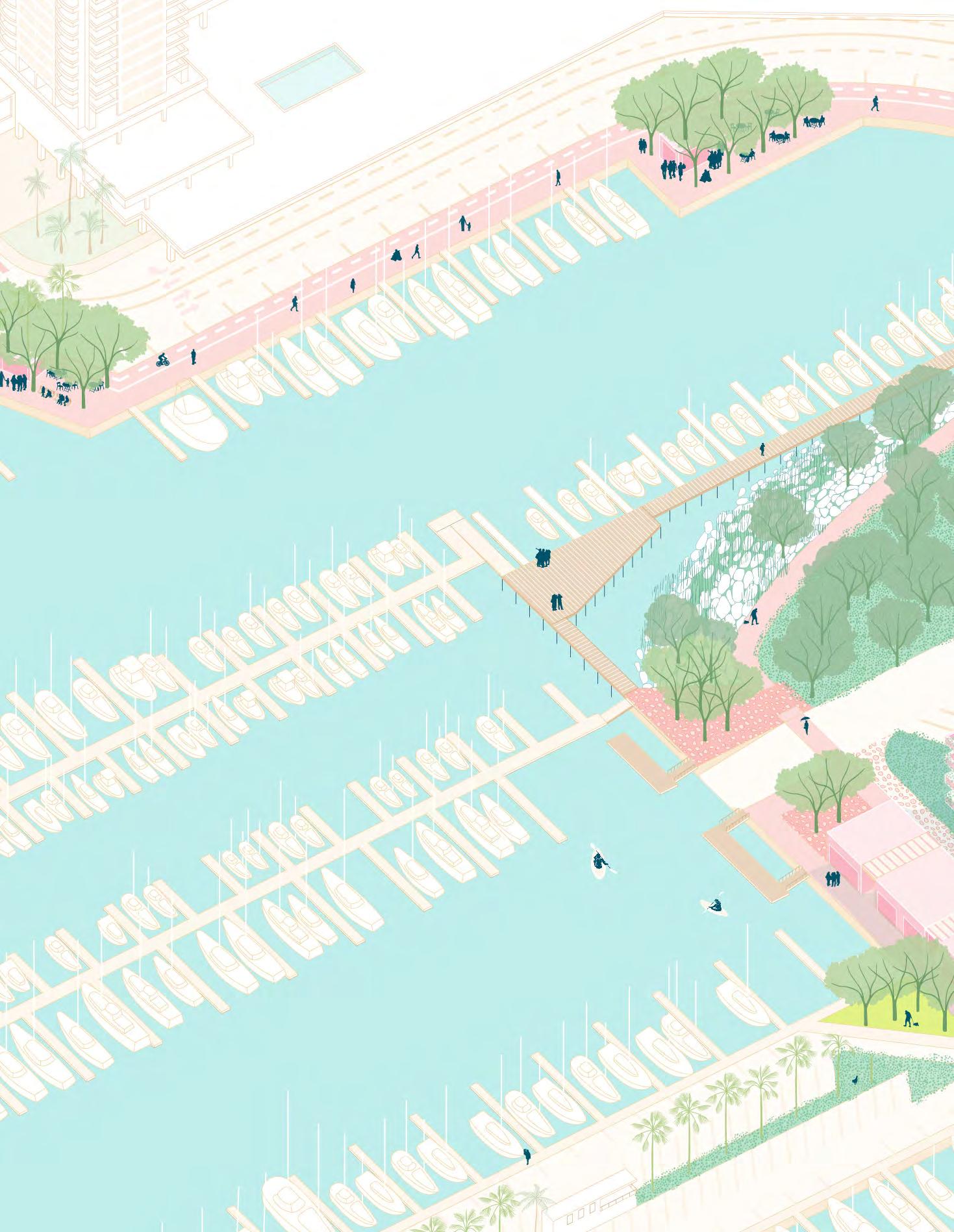
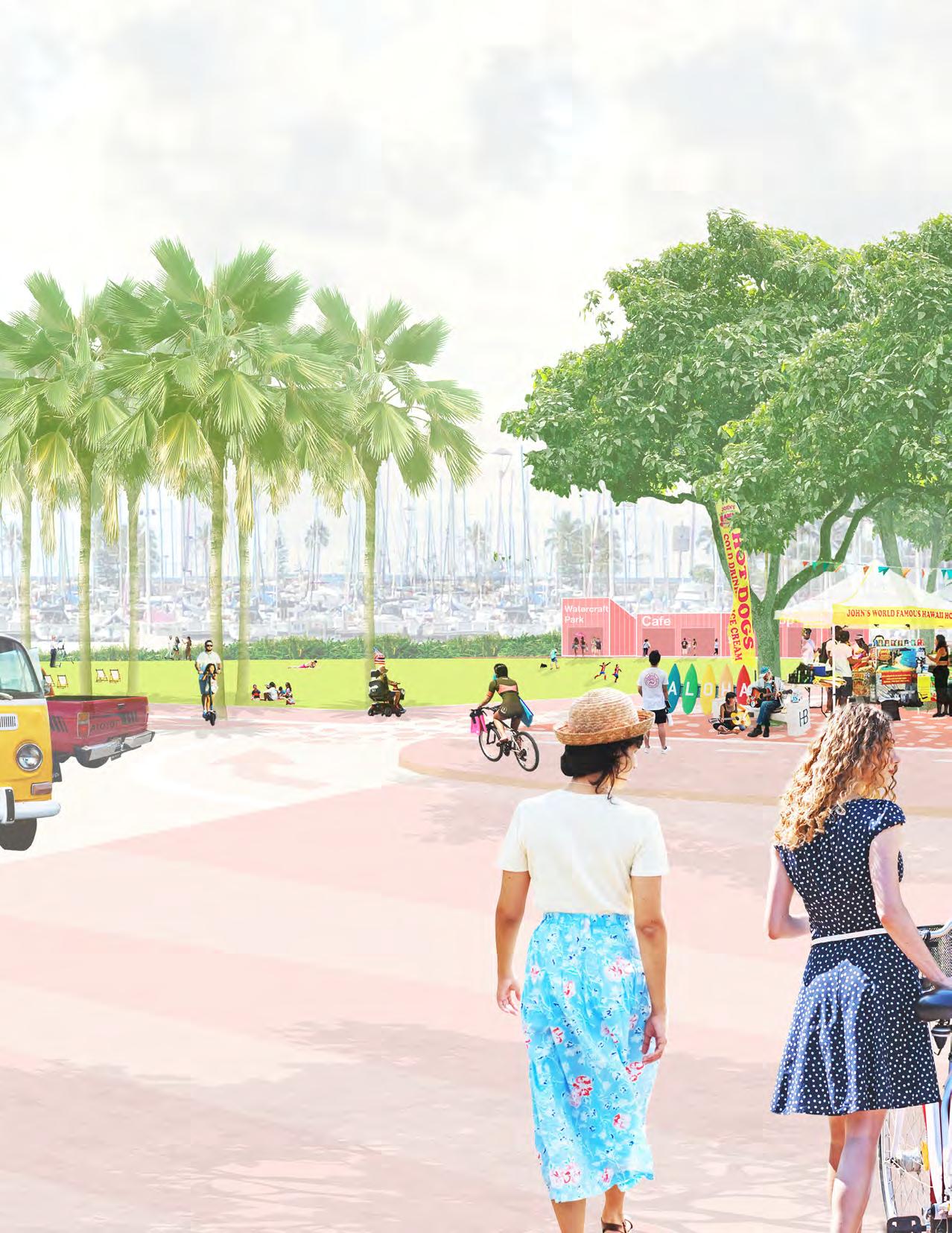
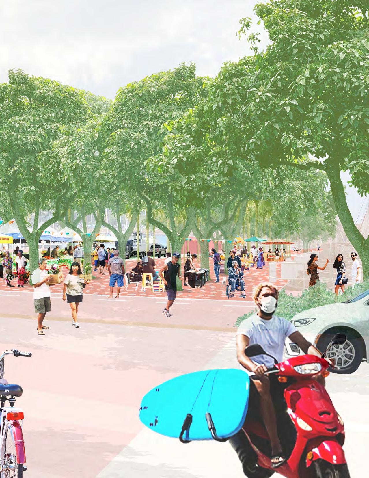
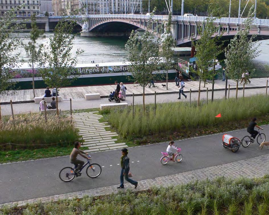
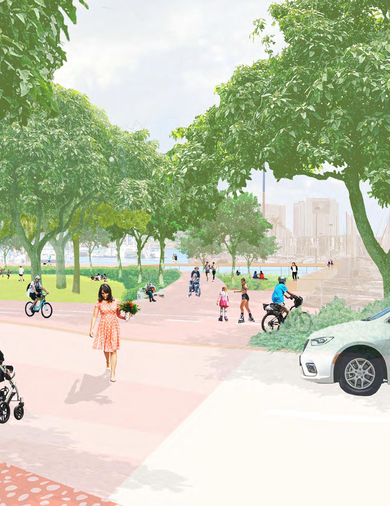
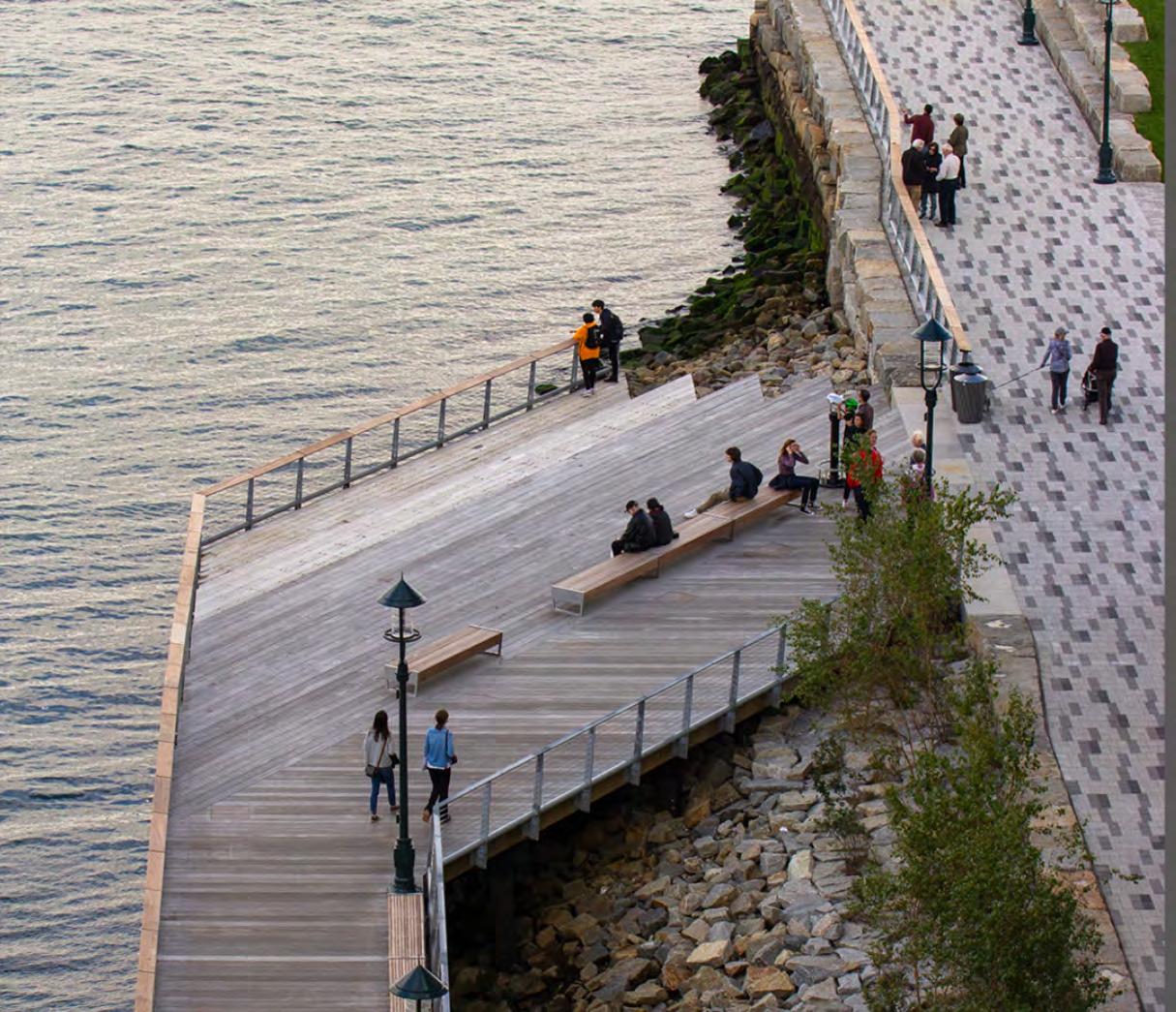
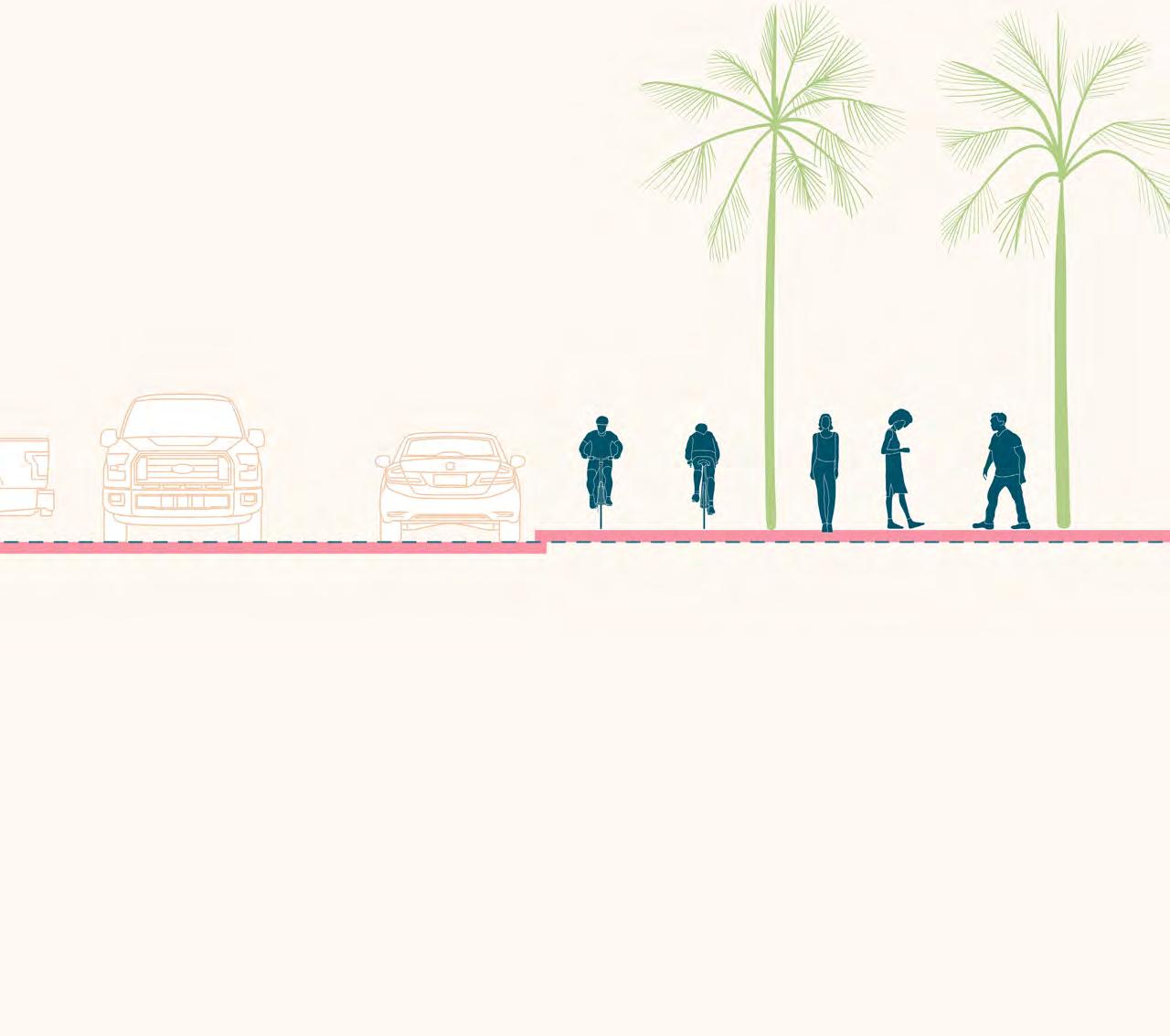
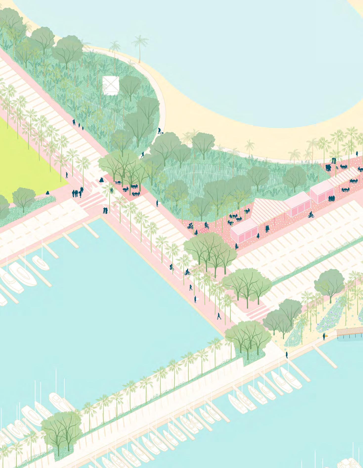
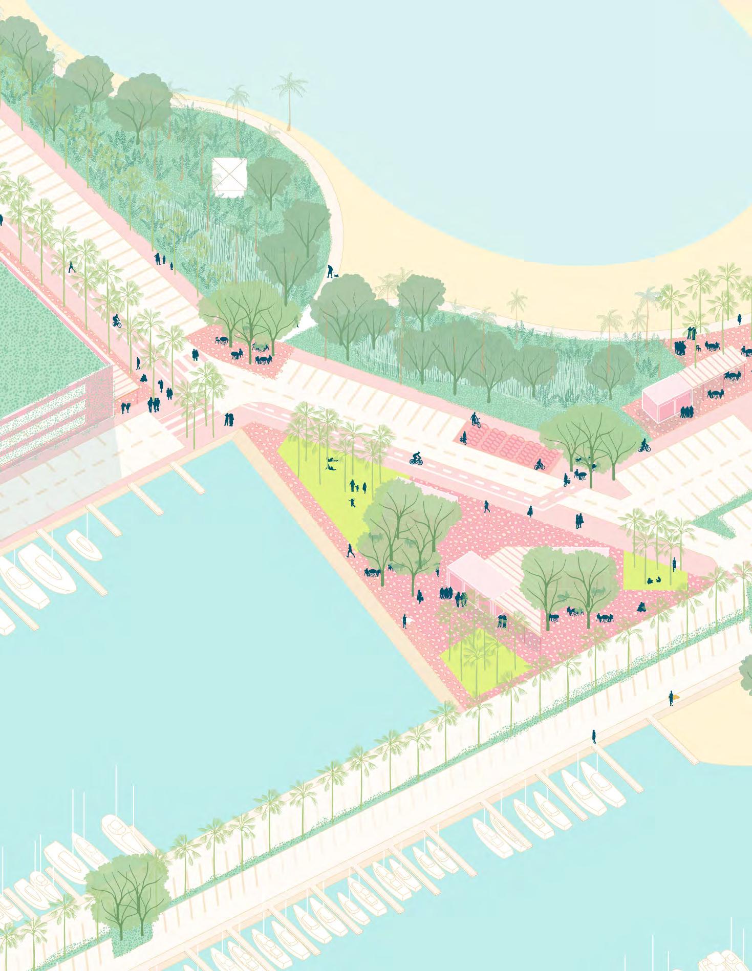
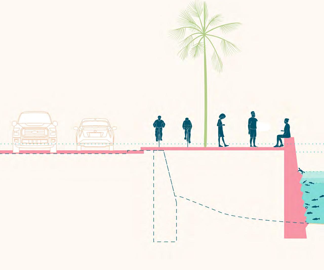
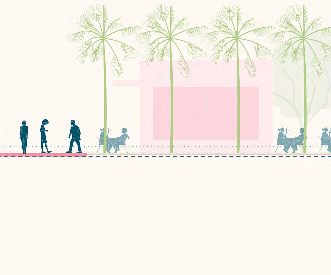
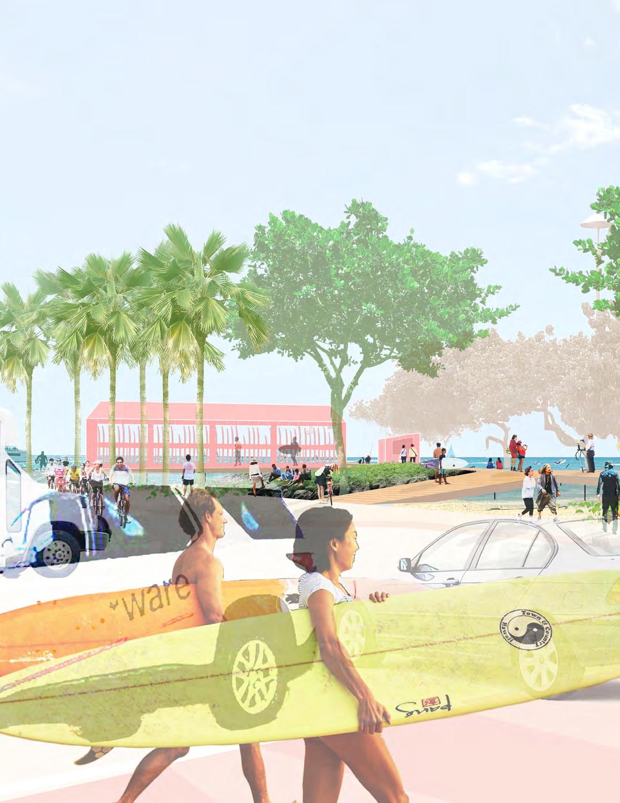
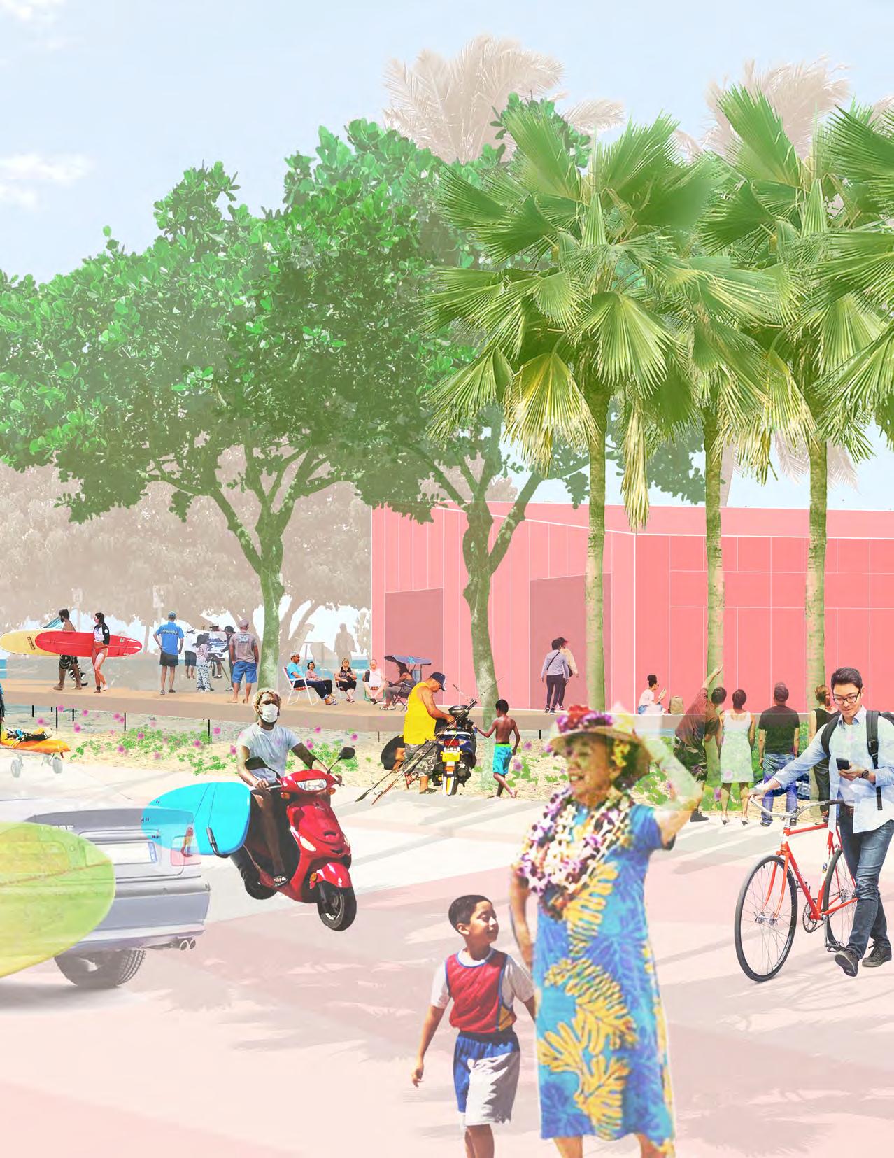
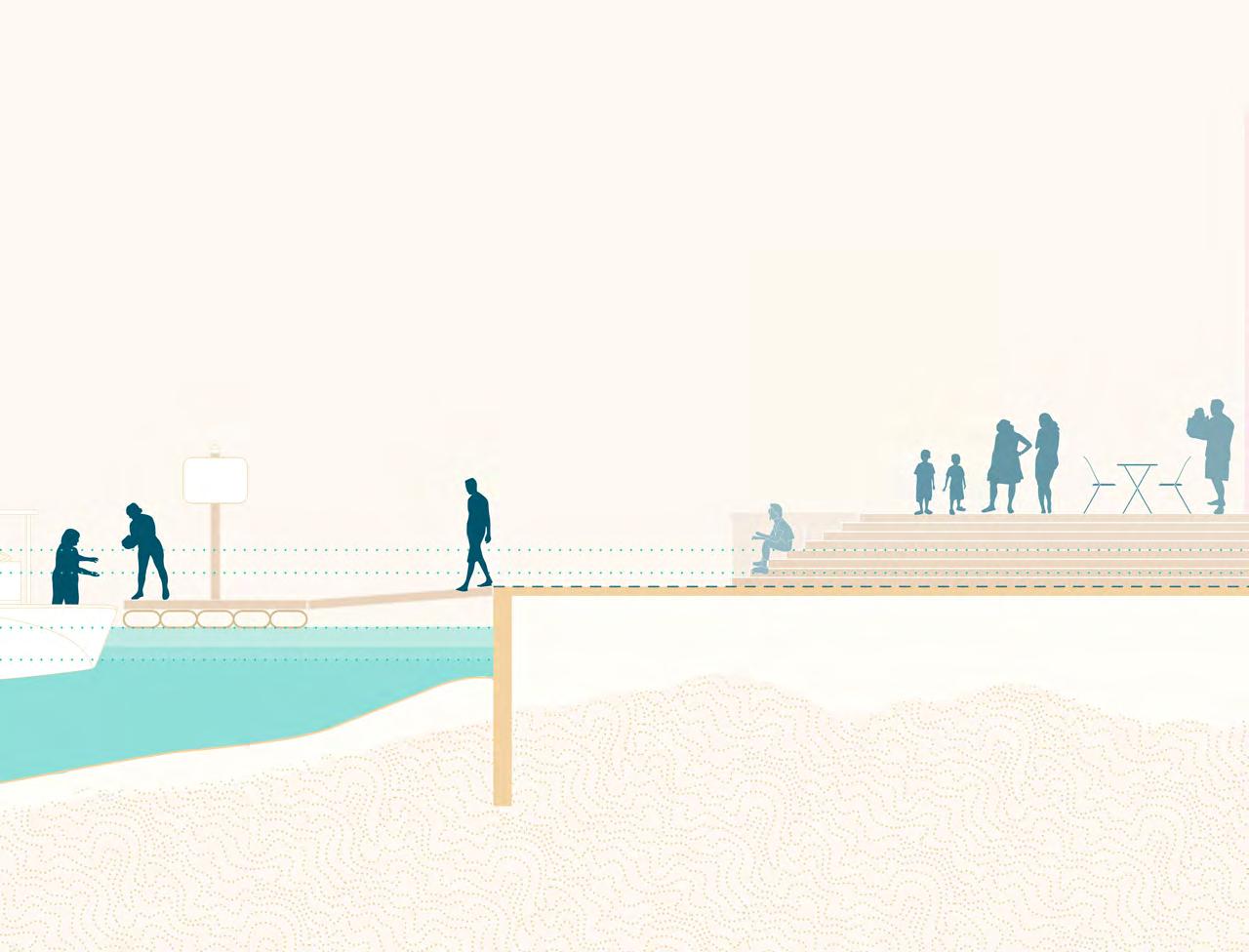
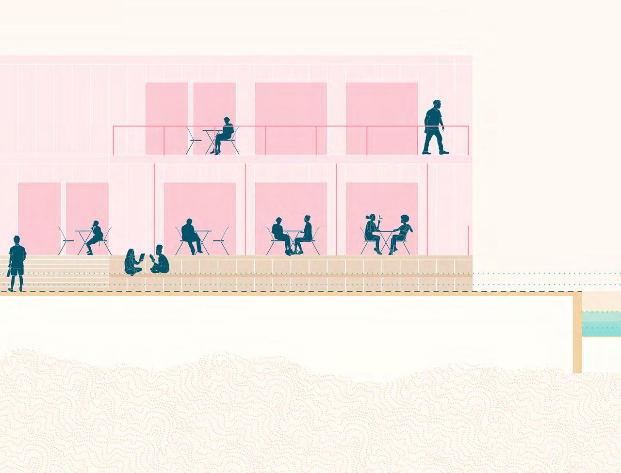
The Ala Wai Small Boat Harbor Promenade is the primary pedestrian connective fabric of the Concept Design Options. The Promenade provides identifiable and safe access to the water and the many watercraft activities of the Harbor. It includes a pedestrian walkway and a twolane bikeway. A single type of distinctive paving material, visually coherent trees that provide shade and a comfortable walking experience, and consistent seating elements reinforce the identity of The Promenade. Wayfinding Gateways with food kiosks are found at critical entrances and intersections including Ala Moana Boulevard, Hobron Lane, and Kahanamoku Street, along the edge of Duke Kahanamoku Lagoon Beach and Boardwalk.
These Promenade Gateways are meant to provide a cohesive identity for the harbor, signage to orient visitors, comfortable and shaded spaces for users to rest, and essential connections to the adjacent public parks and pedestrian networks such as the Ala Wai Promenade and Duke Kahanamoku
Boardwalk. Two Bike Hubs are also located along The Promenade - one at the Ala Wai Overlook and the other mauka of the Ala Moana Bowls parking lot, where the bikeway portion of The Promenade ends. The Bike Hubs include bike racks, canopy for shade, and seating areas. These multimodal connections have the potential to link a much larger pedestrian network on the South Coast of O‘ahu.
Future recommendations include dedicating an east-bound lane on Ala Moana Boulevard to the multi-modal bikeway portion of The Promenade. This would allow for The Promenade to connect to existing multi-modal lanes in Ala Moana Beach Park and the Ala Wai Promenade. Adapting the Duke Kahanamoku Boardwalk into a multimodal path would allow for the bikeway to extend beyond the Harbor and create a more extensive bike route along Waikīkī. A pedestrian crosswalk or scramble at the intersection of Ala Moana Boulevard and Holomoana Street would help to reinforce this space as the main pedestrian entry point for the Harbor and connect the Ala Wai Promenade. It would also provide safe
access to the Harbor for residents of the adjacent neighborhood.
The vehicular access to the AWSBH should support necessary harbor functions, and watercraft access, and not detract from the pedestrian experience of the Harbor. The treatment of vehicular access in the Concept Design Options primarily involves re-striping and adjustments to lane widths and the orientation of parking. Changes to the vehicular circulation pattern are found in the portion of Holomoana Street between Hobron Lane and Ala Moana Boulevard and in the vicinity of Watercraft Park. In both design options, Holomoana Street is converted into a westbound one-way road along the Prince Hotel to accommodate the width of The Promenade.
Kahanamoku Street is straightened so that its alignment is parallel to the western edge of Watercraft Park (Parcel A) and perpendicular to the Moles. This adjustment allows for more efficient vehicular circulation and
a consistent, visible, and safe pedestrian procession to the makai edge of the Harbor. In Option B, this adjustment to the road only occurs along the eastern edge of Watercraft Park, maintaining the vehicular circulation along the eastern edge of the Parcel D boundary.
In both options, the vehicular circulation in Watercraft Park (Parcel A) is converted into a one-way westbound road. The lane reduction is meant to encourage slower vehicular speeds and foster a safer pedestrian experience. In Option B, the main function of this road is to access the boat launch and the parking garage.
Future considerations include an indepth traffic engineering study to analyze vehicular circulation patterns and parking use and efficiency.
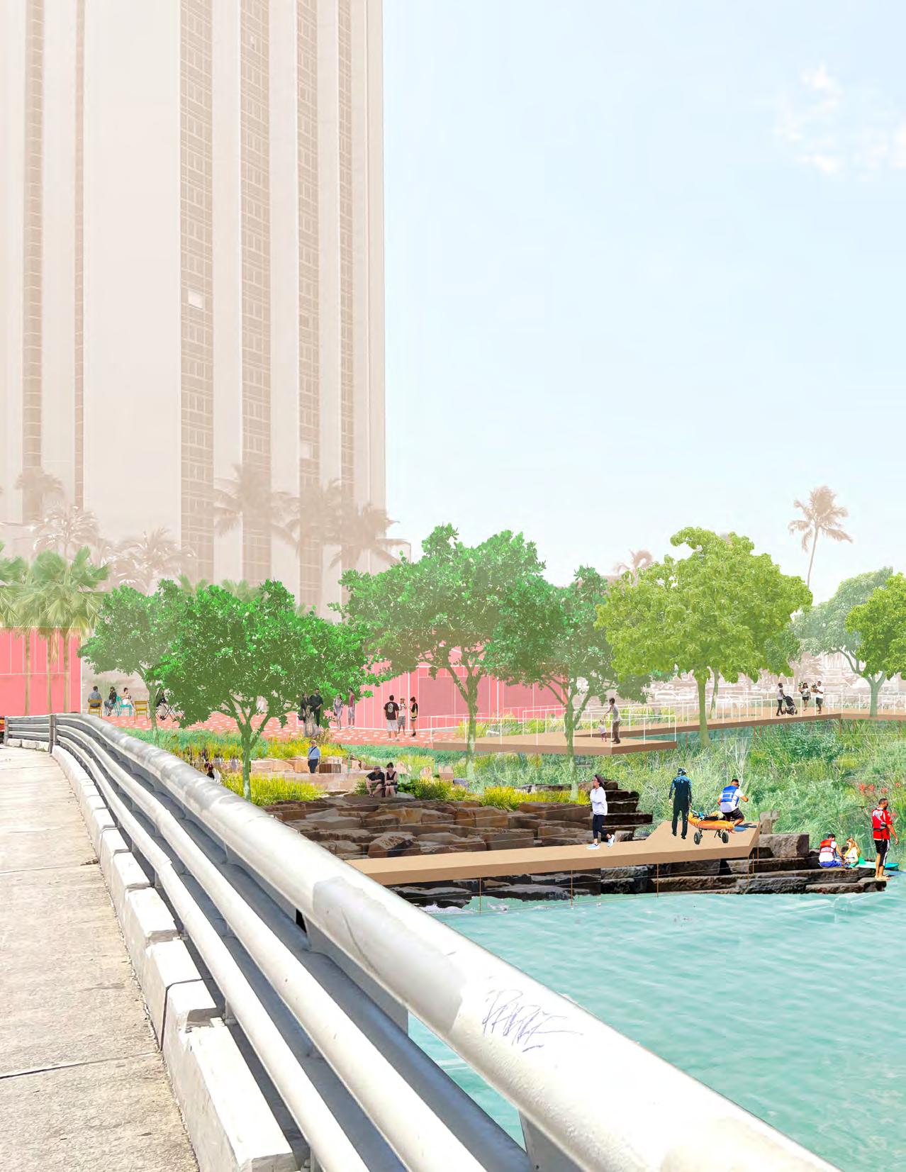
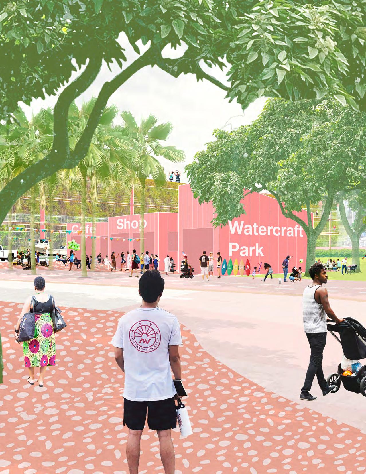
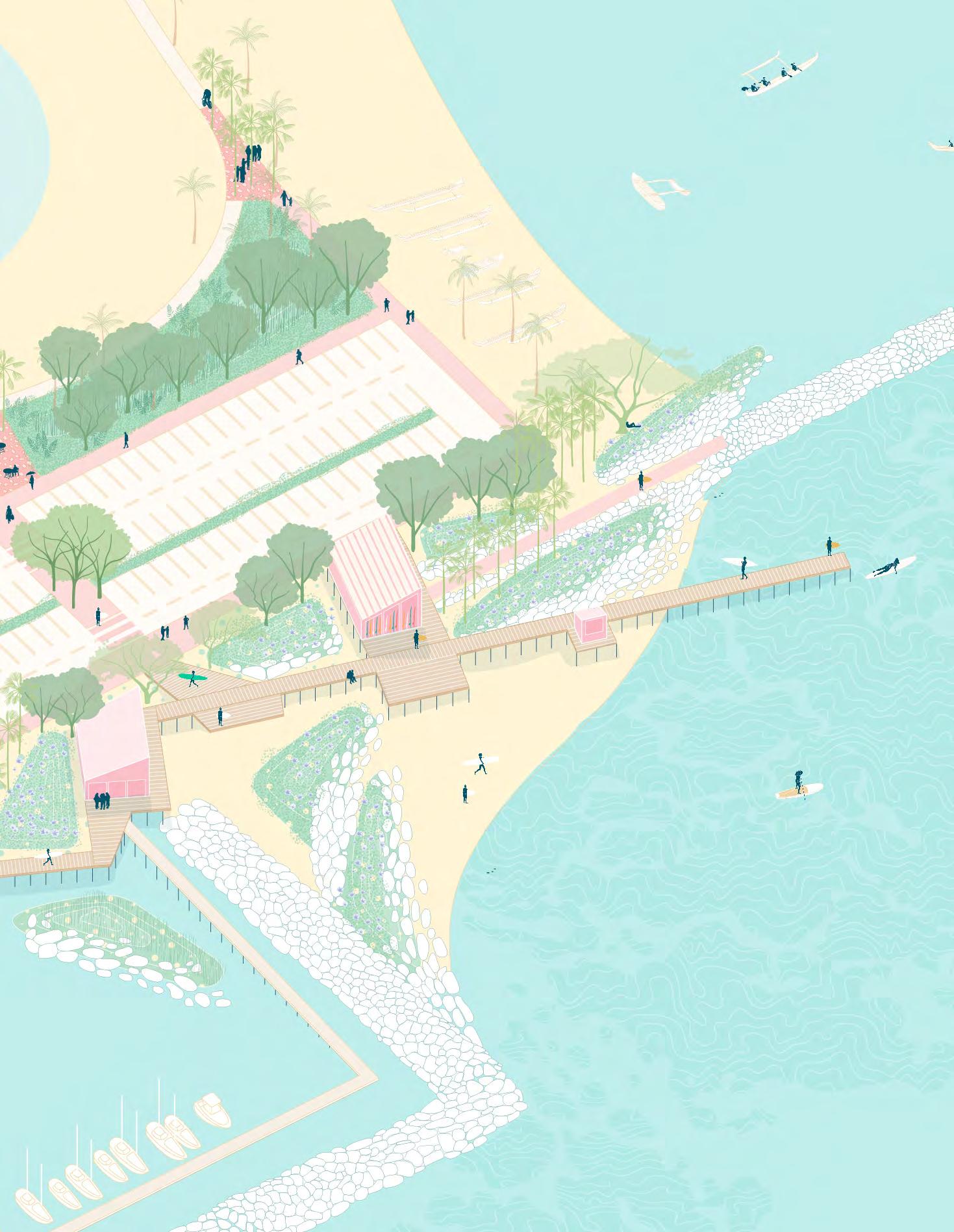
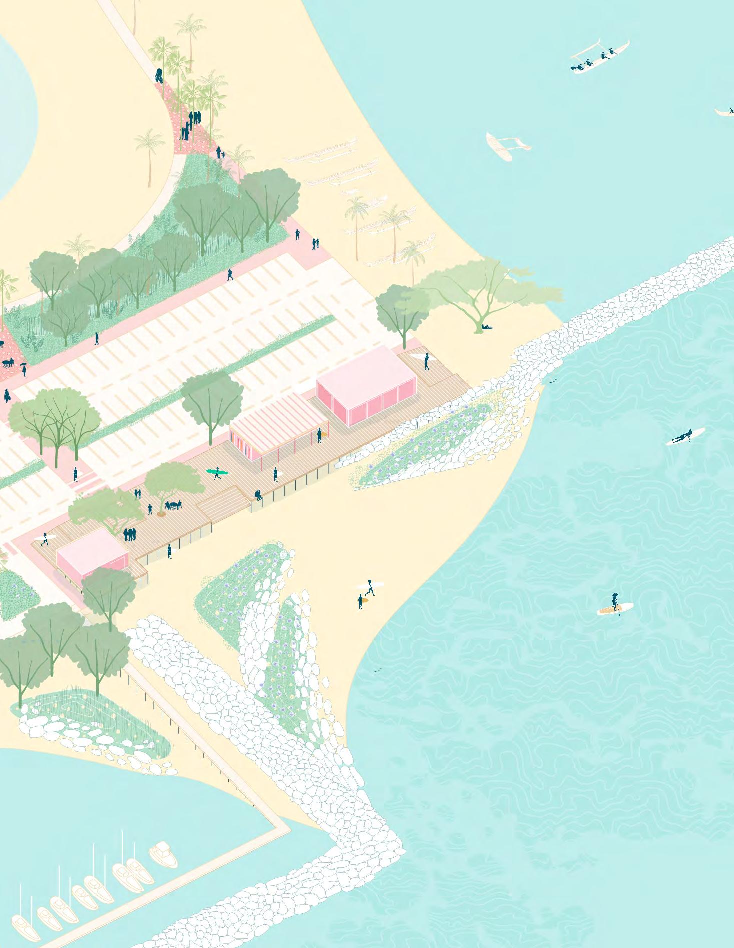
The Promenade provides access to several nodes of activity that celebrate and amplify the existing watercraft character and communities of the Harbor. Each node contains wayfinding elements, watercraft amenities, food, mixed-use, and public comfort stations. These nodes are meant to encourage a safe experience of the Harbor, use throughout the day, and provide gathering places for the existing Harbor communities.
The introduction of small watercraft, kayak, and surf locker storage and universallyaccessible kayak and surf launches expand the opportunities for unique experiences of the water and watercraft access in the Concept Design Options. Option A relocates
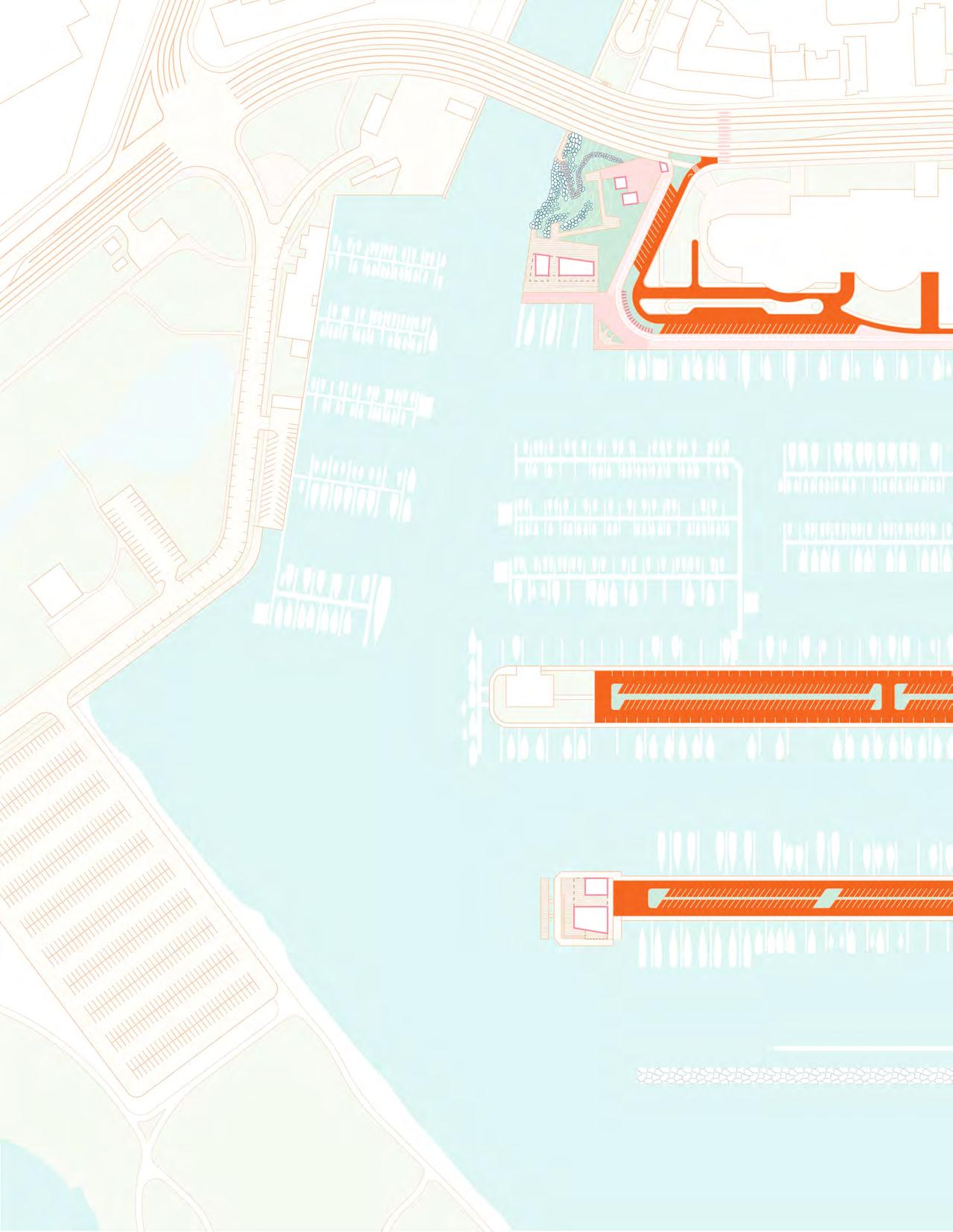
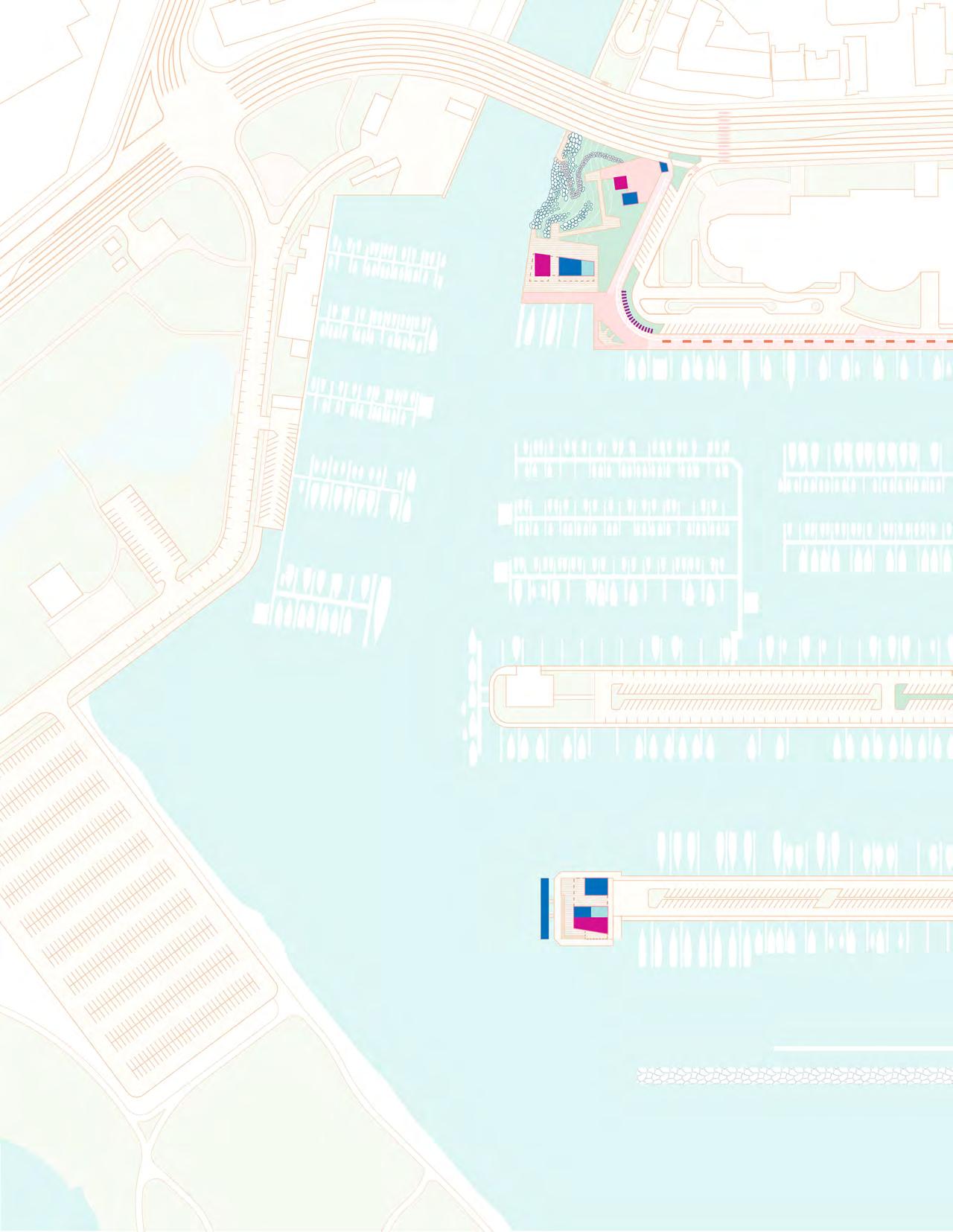
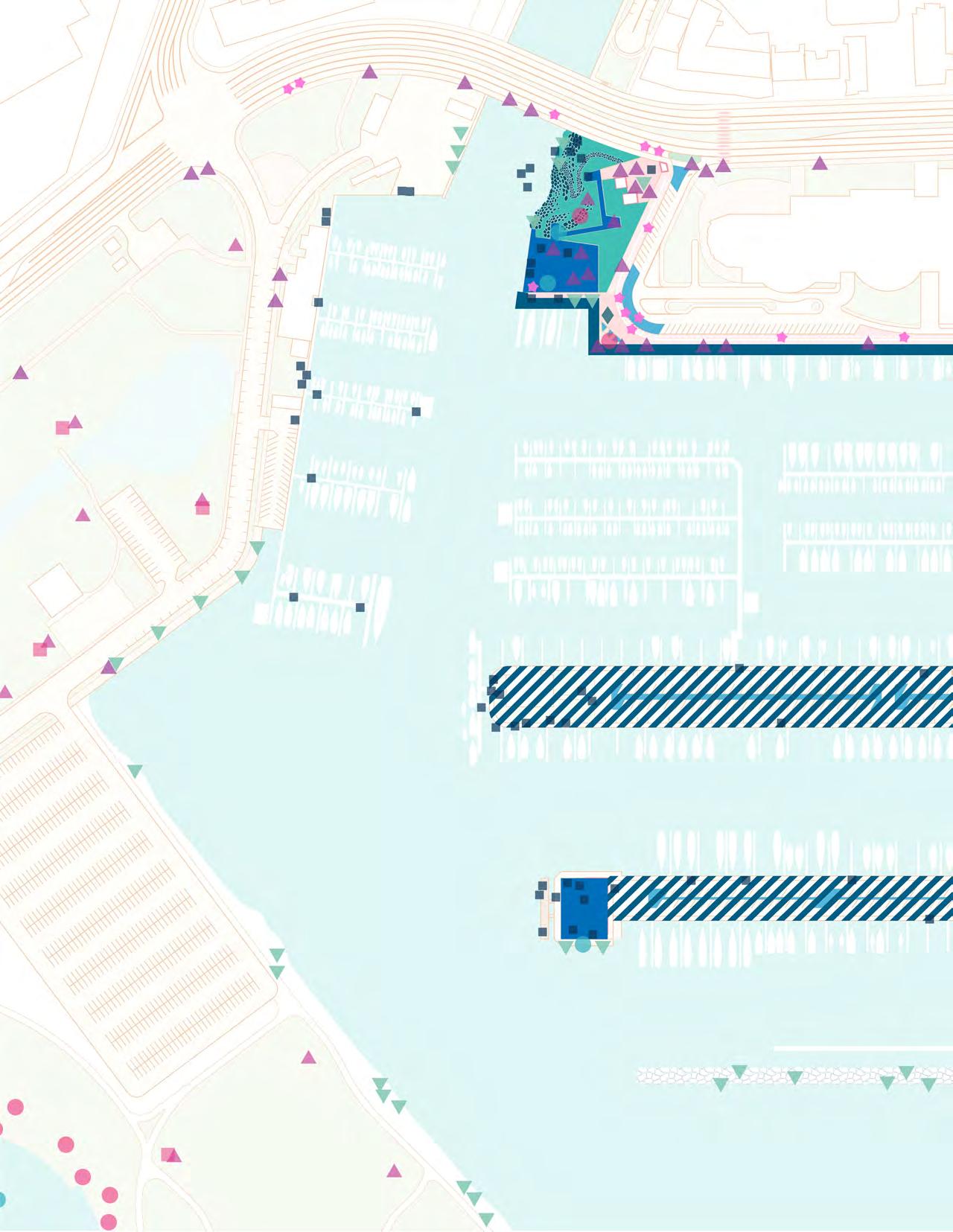
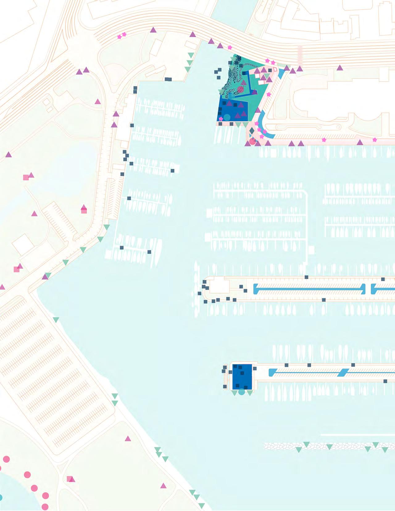
the boat launch to the northern edge of Watercraft Park (Parcel A) and maintains the current location of the Anuenue Canoe Club and boat storage. Option B maintains the existing location of the boat launch and proposes new canoe storage and launch for the Anuenue Canoe Club. The floating fuel dock at the Maritime Welcome Center (Parcel C) provides necessary access to fuel and acts as a gateway for watercraft arriving from their voyages throughout the Pacific.
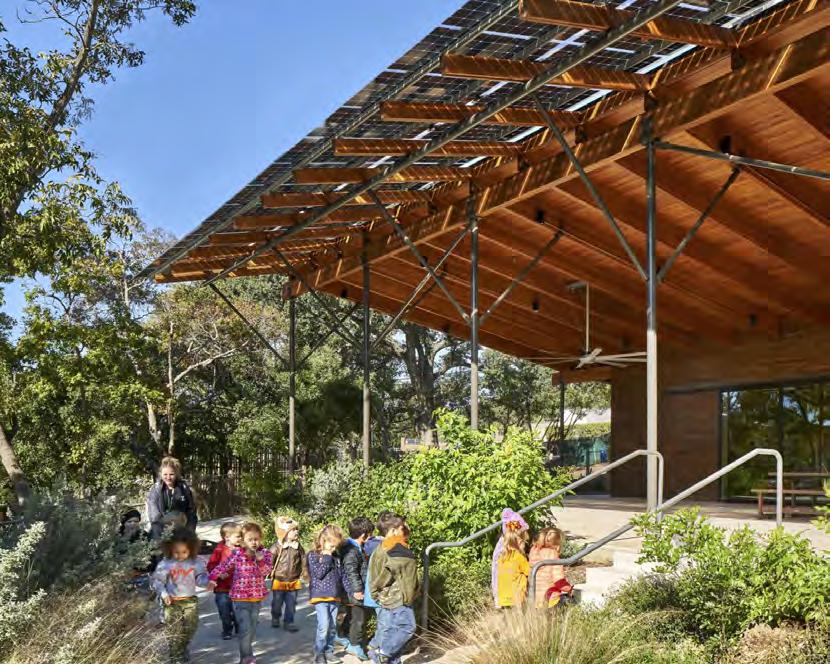
As a model for resilient coastal public space, the Ala Wai Small Boat Harbor built structures should incorporate sustainable building systems such as water catchment and recycling, passive cooling, and solar power, and incorporate sea level rise adaptation strategies.
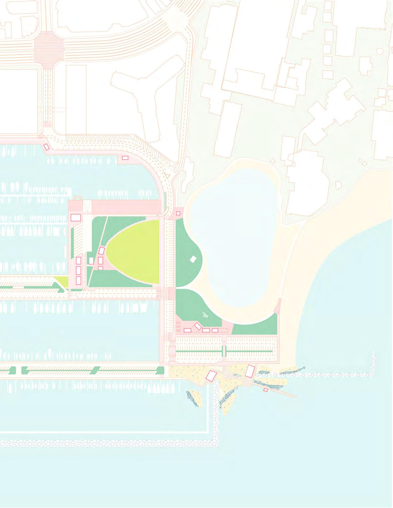
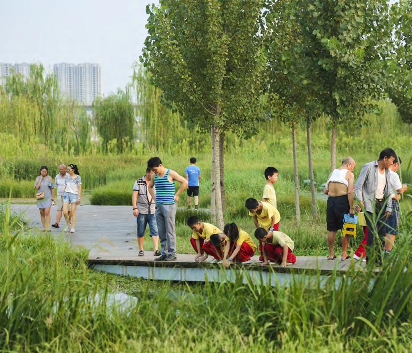
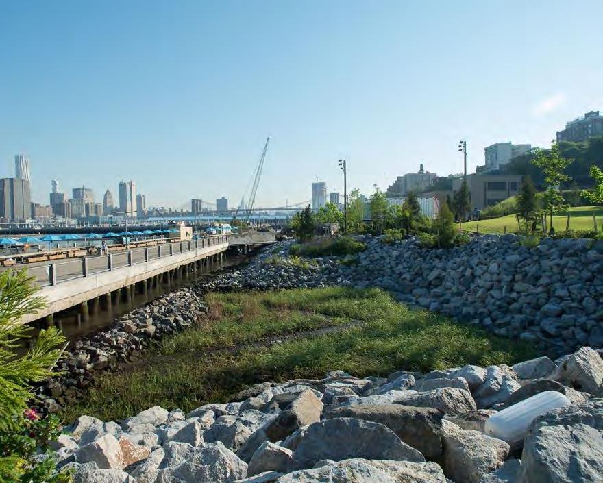
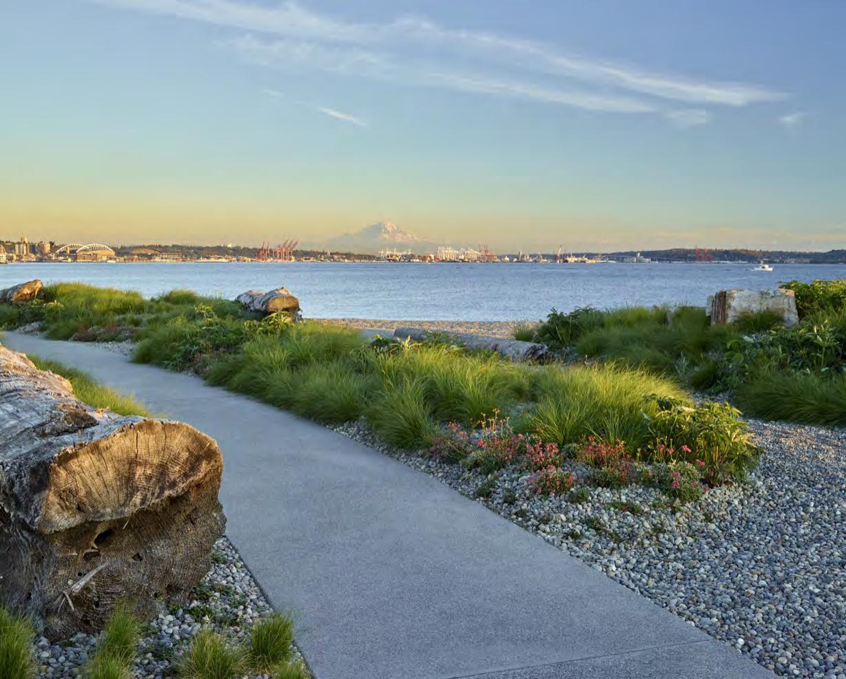
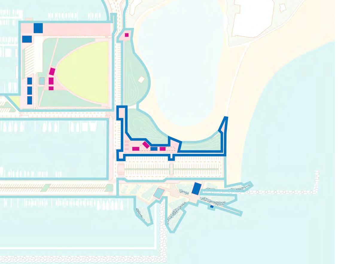
The Concept Design Options propose four different plant communities: Urban Marsh Habitat, Coastal Strand, Riparian/ Stormwater, and Lawn. The planting strategies are meant to help create a cooler and more comfortable coastal public space, catch and filter stormwater runoff generated from the impervious surfaces within the Harbor, improve the health of Waikīkī’s urban ecosystems, and create flood-adapted spaces that will remain resilient during king tide events in the near term and help to protect against sea level rise in the long term (New York City Department of Parks and Recreation, 2017).
(Parcel B) contains native riparian sedges, forbs, ferns, and shrubs that will provide essential habitat for diverse shore birds, fish, and crustaceans along the South Coast, where many of these species have been lost to land reclamation. Additionally, this habitat is adapted to coastal tidal and flood events, and will help minimize the impacts of wave action in storm events, and filter water and catch debris flowing down the Ala Wai Canal (New York City Department of Parks and Recreation, 2017).
The Coastal Strand plant community contains native salt-water tolerant and flood-resilient vines, forbs, and shrubs that will assist in stabilizing the Harbor’s beach and coastal edges, dissipating the impacts of heightened wave action in storm events and provide habitat for shore birds. This community will help restore many of the species that once thrived in the coastal areas of Kālia and Waikīkī as a means of creating a more resilient coastal edge that will remain resilient despite the impacts of sea level rise.
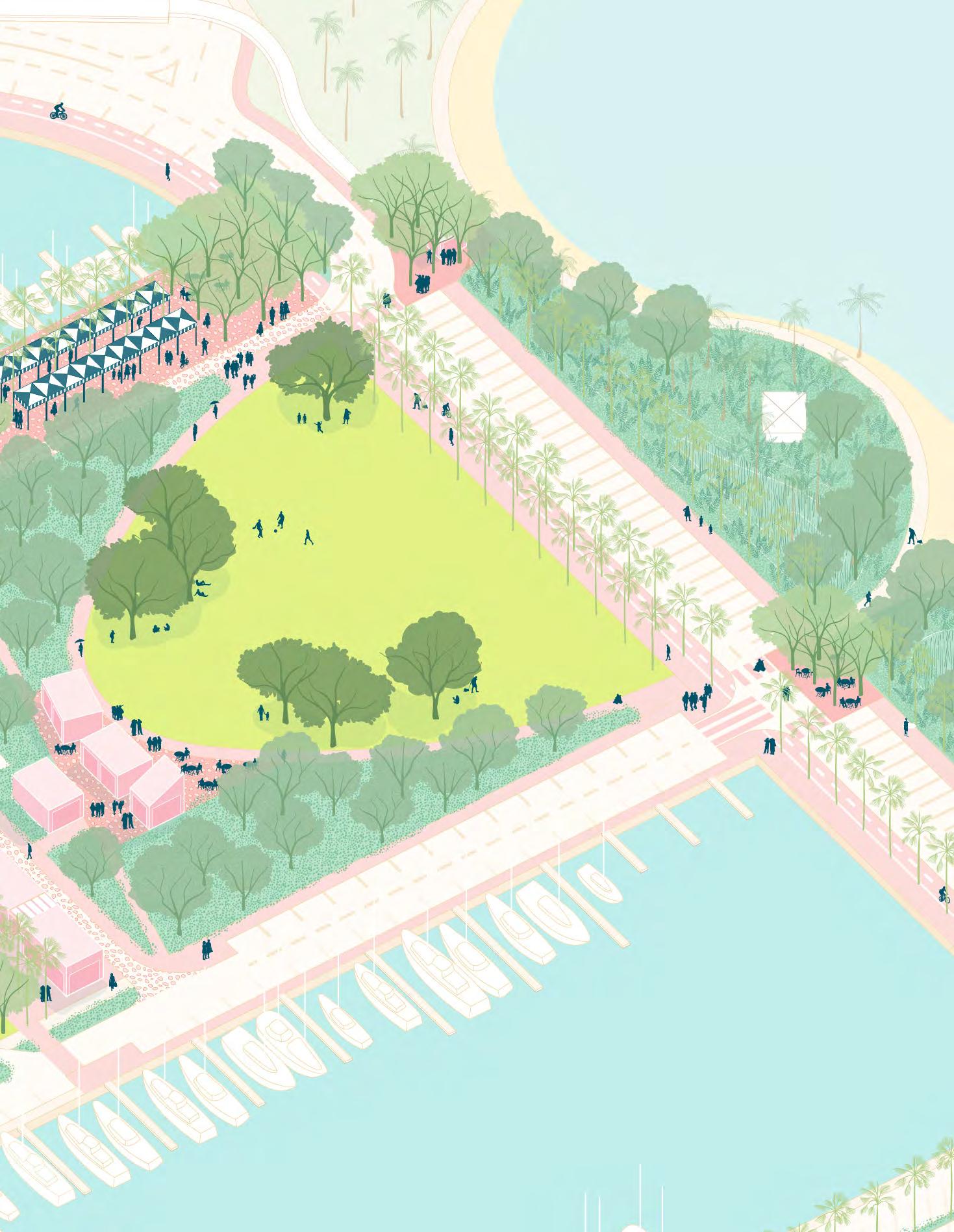
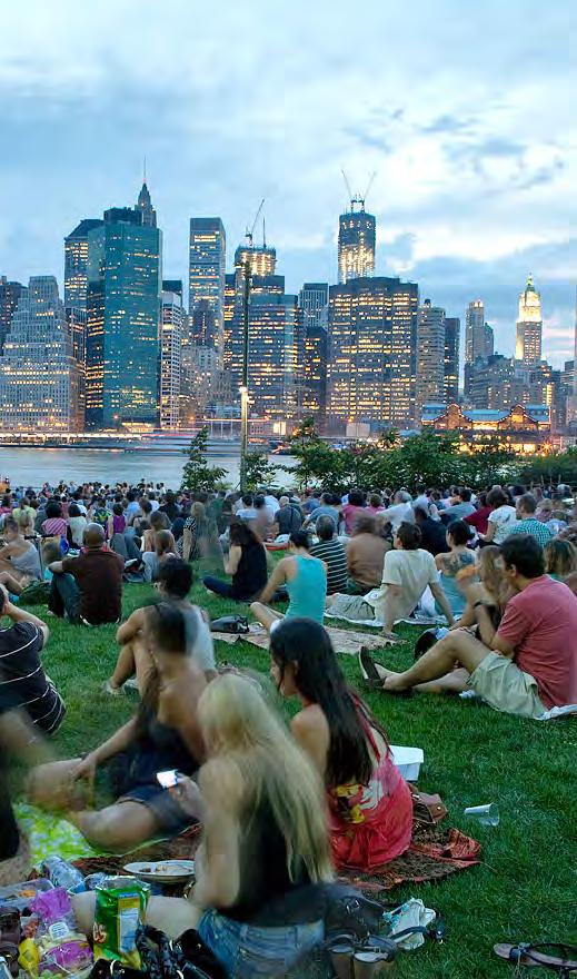
The Lawn community is found in Watercraft Park (Parcel A). It provides a space for Harbor users to seek respite or for children to play on a daily basis and where community members can gather for events such as the fireworks display, outdoor movie screenings, and concerts.
The Riparian/Stormwater community contains native sedges, forbs, and ferns and is proposed throughout the Harbor adjacent to roads and activity nodes. Its main purpose is to help minimize the urban heat island effect, reintroduce essential riparian habitat, and to catch, store, and filter urban and stormwater runoff before it
enters the sewer system or coastal waters. Each activity node should direct its urban runoff to these areas for on-site water filtration. In addition to providing every day best practices for managing urban runoff, this community is also adapted to storm surge and flood events. As a place that is so deeply tied to the ocean, it is important that the Harbor serve as an example of how plant communities can create more resilient coastal public spaces.
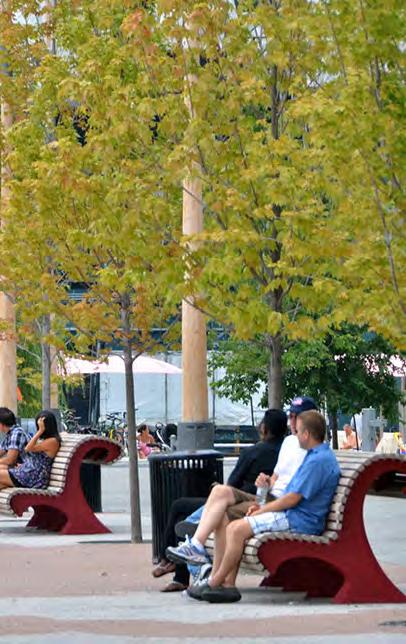
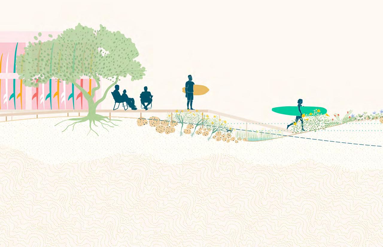
The Concept Design Options propose four different categories of tree canopy: Promenade Palm, Street Shade Tree, Riparian Tree, and Specimen Shade Tree. The Promenade Palms are found along The Promenade and are an essential element for reinforcing its identity. They provide a comfortable, shaded pedestrian experience throughout the Harbor. The Street Shade Trees are located in clusters along The Promenade and plazas. These trees are important for creating comfortable, shaded spaces where users can sit outside and enjoy the Harbor’s views. The Riparian Trees are located throughout the Harbor in the Urban Marsh and Riparian/Stormwater plant communities. This category includes native tree species that are salt-tolerant and adaptable to flood events. The Specimen Shade Trees are large, native species located in the community lawn. Their main purpose is to offer respite by providing plenty of shade.
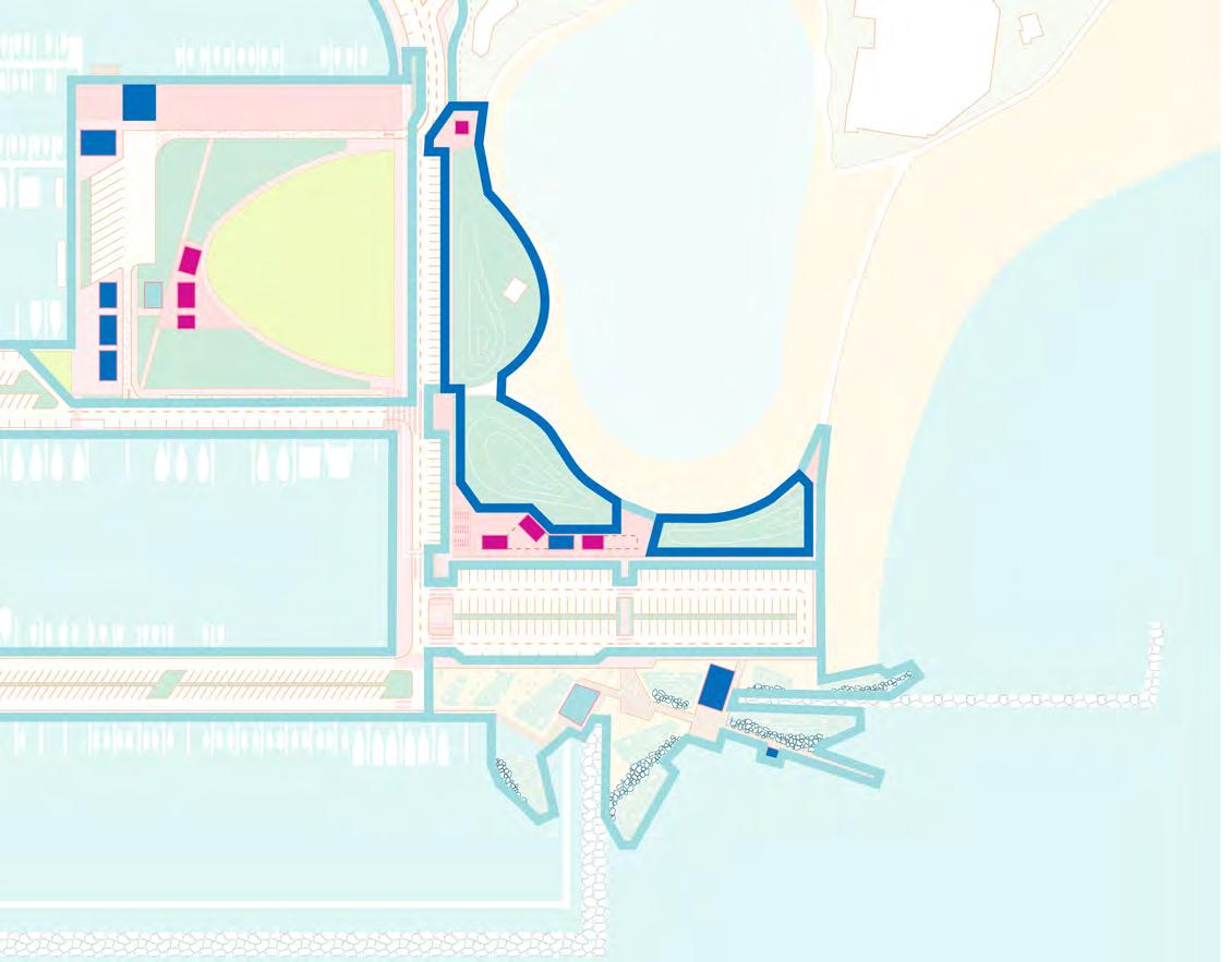
The Concept Design Options propose four strategies for coastal resiliency and sea
level rise adaptation. The first resiliency strategy is to insert Flood-Adapted Habitat areas that contain riparian/stormwater plant communities. While these areas do not deter the effects of sea level rise, they benefit the ecological health and biodiversity of the Harbor, catch and filter stormwater on an everyday basis, and help to absorb wave energy, and slow floodwaters in the event of a significant storm surge event (New York City Department of Parks and Recreation, 2017).
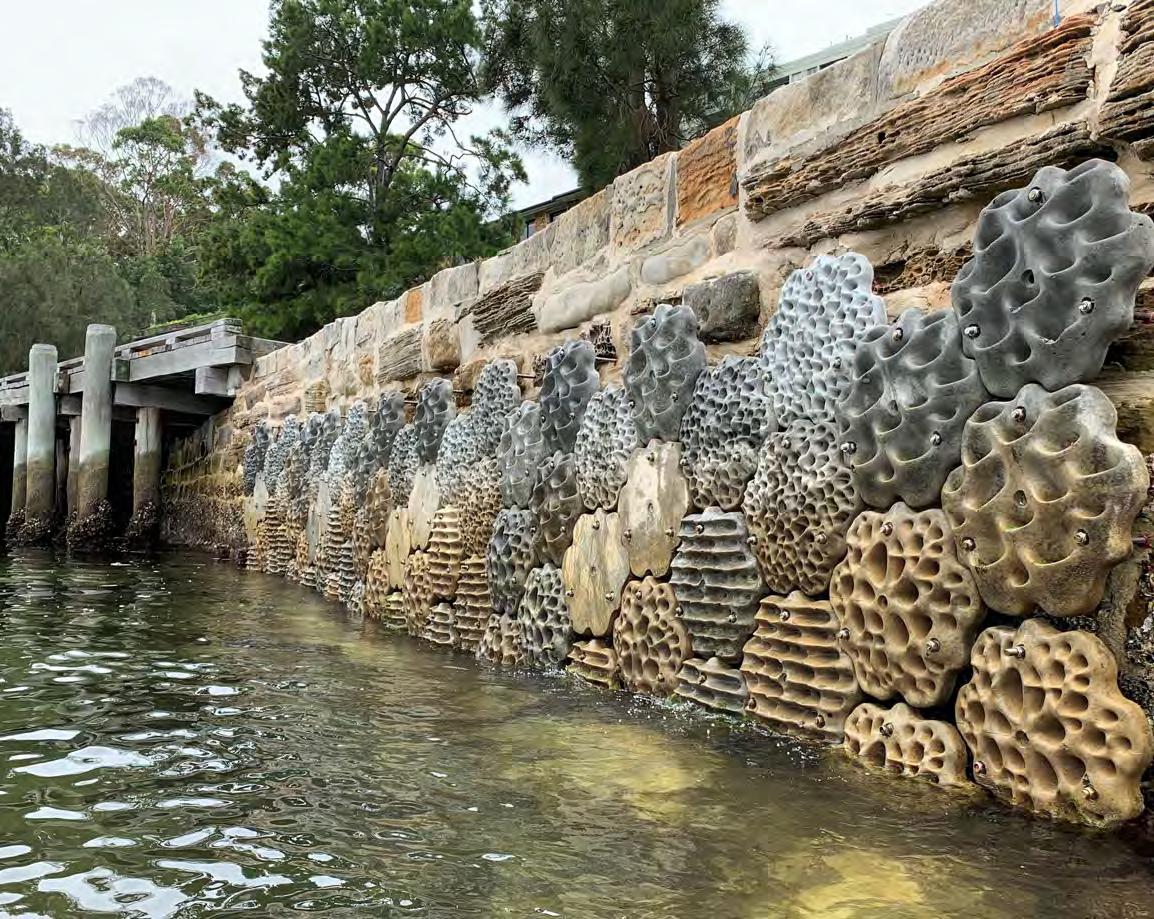
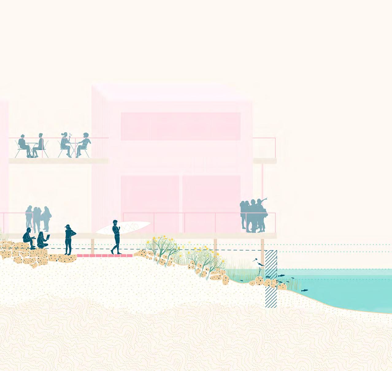
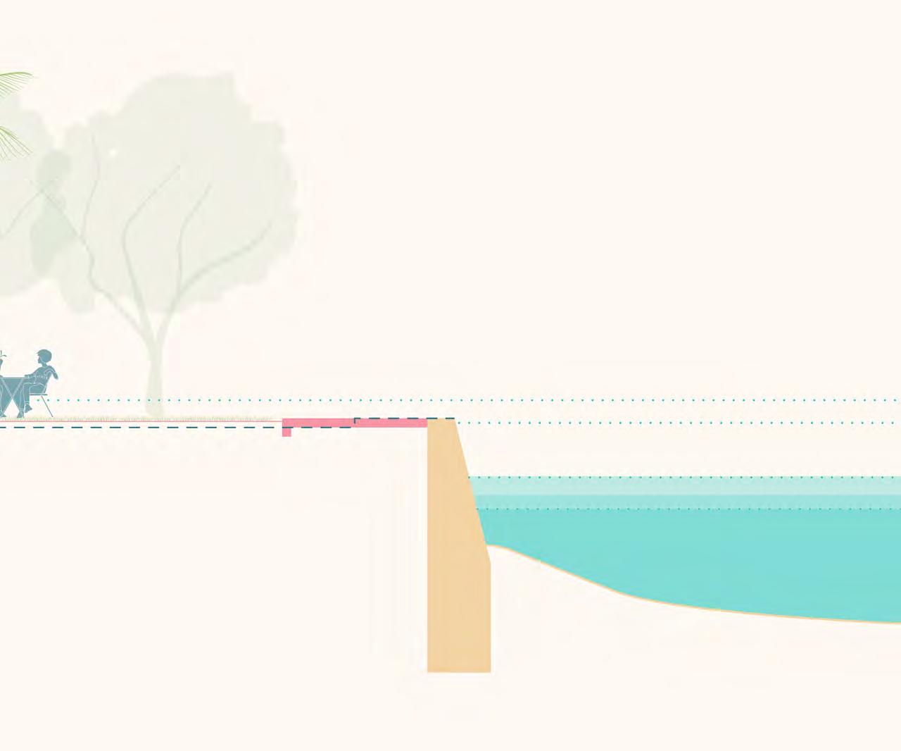
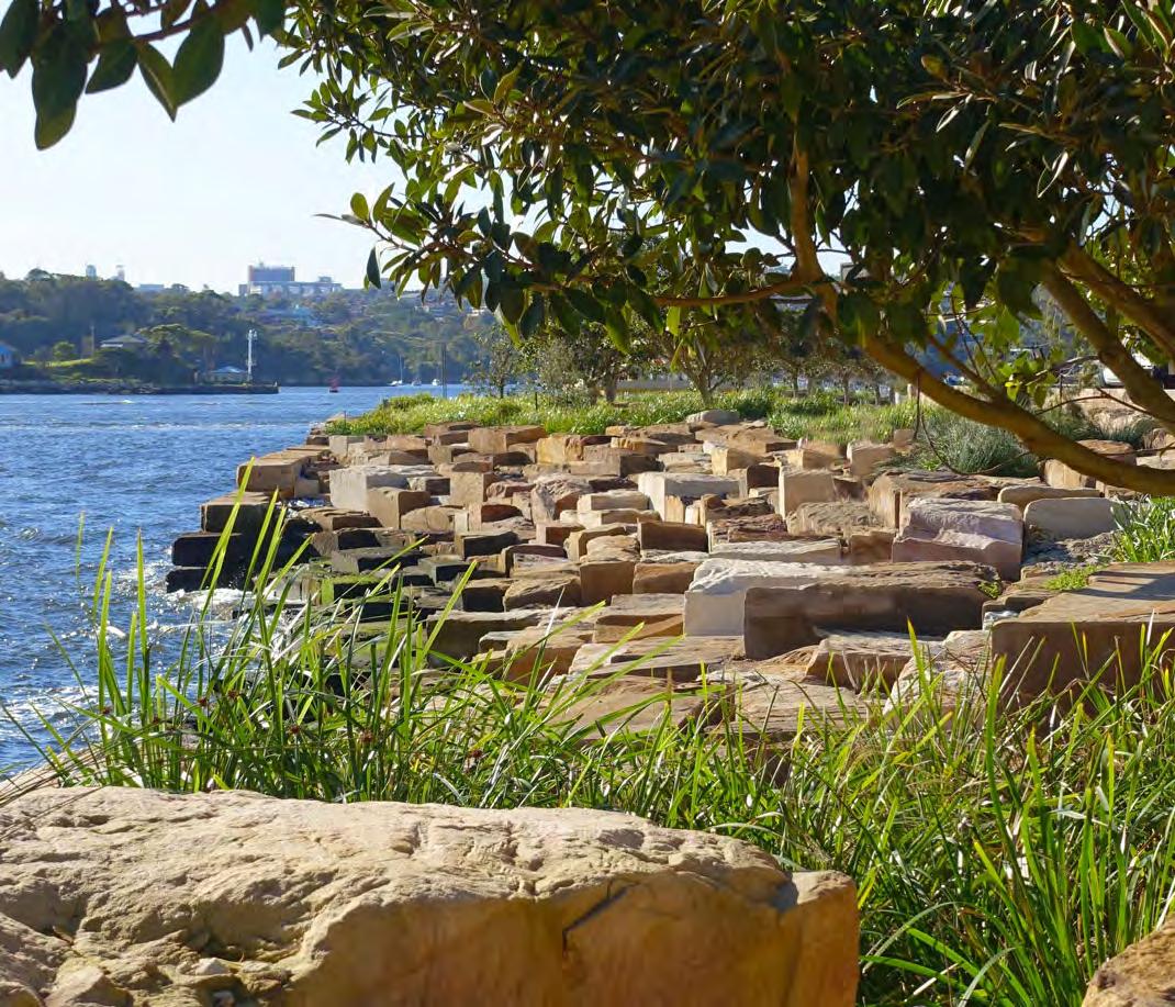
Living Shorelines are the second resiliency strategy proposed by the Concept Design Options. They are a type of coastal edge that use riparian plants and harder elements such as basalt rip-rap, stones, and intertidal reefs to protect against storm surge, reduce coastal erosion, dissipate wave energy, improve water quality, and provide flood-adapted habitat (New York City Department of Parks and Recreation, 2017 and Al, 2018).
Living Shorelines are an essential alternative to traditional shoreline armoring techniques such as bulkheads and seawalls because they offer an opportunity to restore coastal habitat for shore birds and fish, and could improve overall ecosystem health in Waikīkī and the greater South Coast of O‘ahu. The Living Shorelines proposed in the Concept Designs are unique to the Harbor as they are combined with watercraft access. The Living Shoreline in the Urban Educational Marsh also serves as a kayak launch while that at the Surf Community Center protects and adapts the beach to allow for continued surf access.
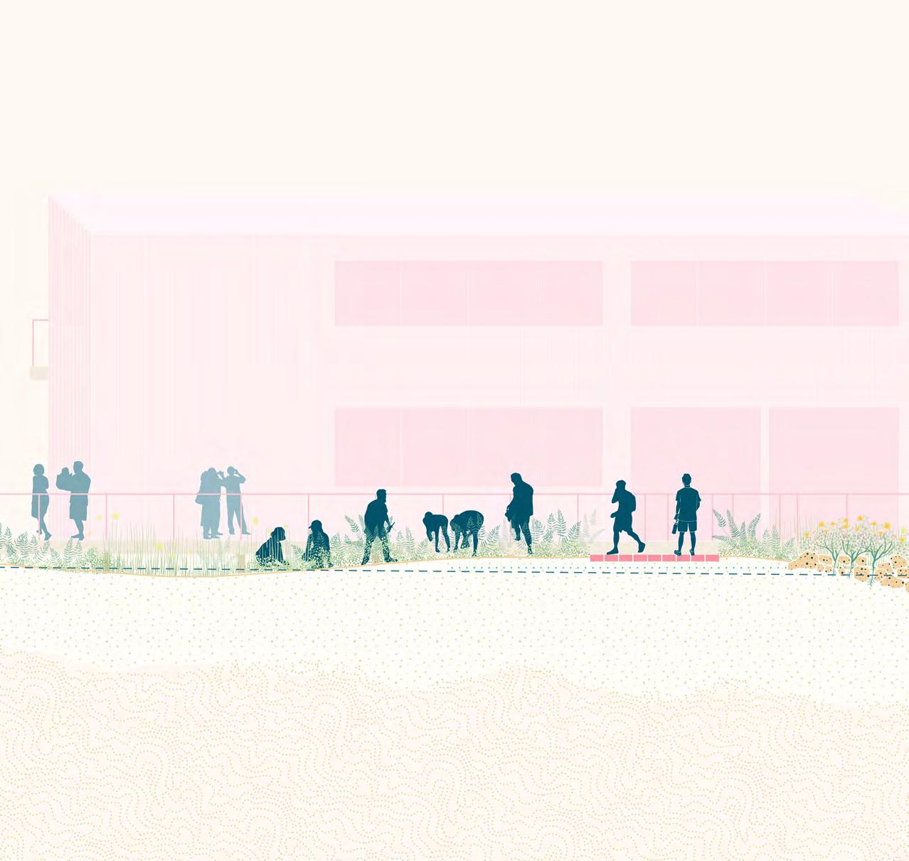
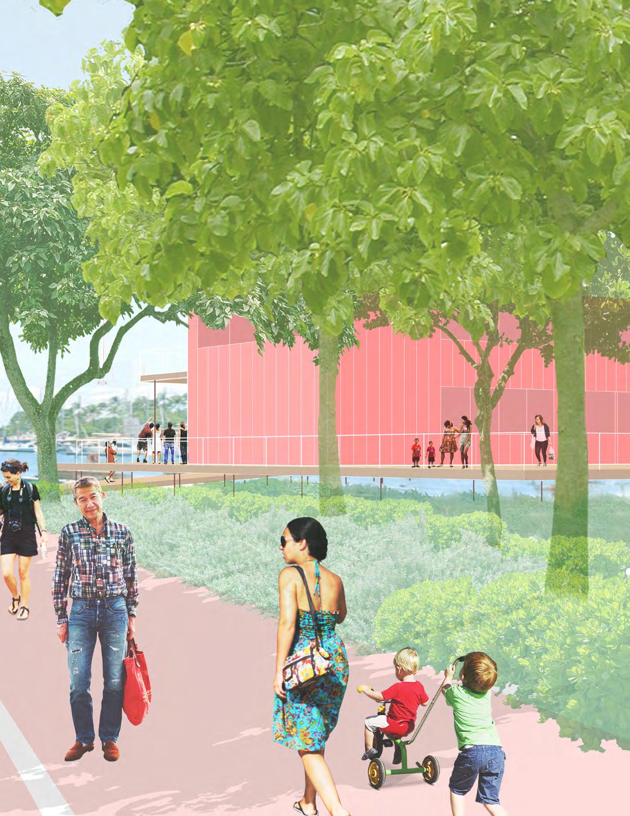
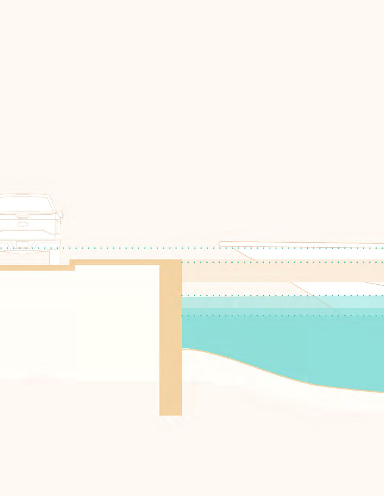
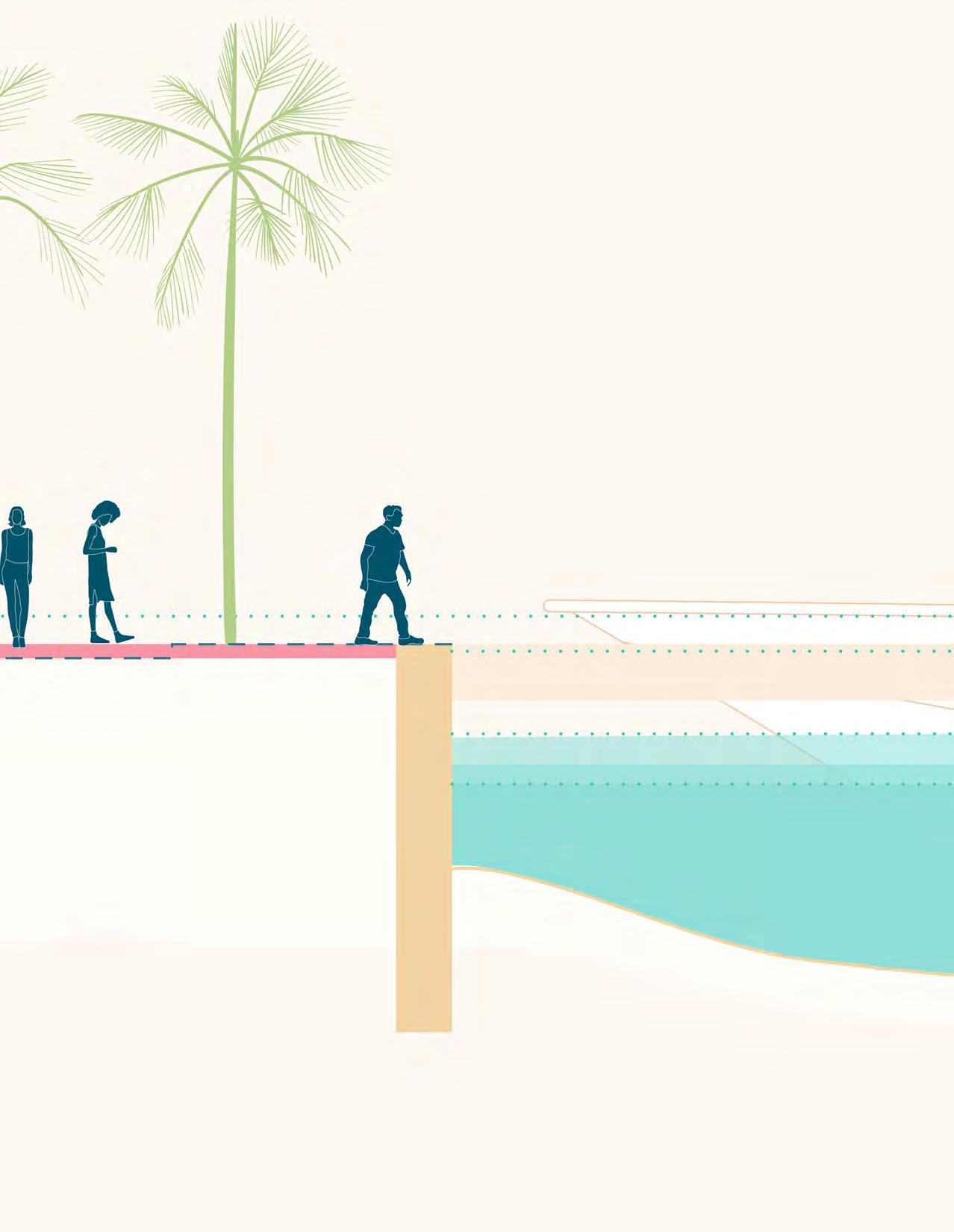
If located in a zone impacted by three feet of sea level rise, proposed structures are elevated on decks two to three feet above this zone. This Elevate strategy is evident in the Harbor Community and Education Center, the Surf Community Center, and the Maritime Welcome Center. Universallyaccessible boardwalks, sloped walks and ramps are available in each of these places to ensure equitable access. In areas that are a foot or less below the three-foot sea level rise elevation, fill is used as the Elevate strategy. This approach is found at the north and west edges of Watercraft Park in Option A and the west edge in Option B.
The fourth resiliency strategy is to Protect. In the near-term, the Protect option is found in Option A along the western edge of The Promenade south of Watercraft Park. In this option, a vertical living seawall provides seating for Harbor users, habitat for fish, shellfish, and crustaceans, and protects against floodwaters.
Longer-term sea level rise considerations for the Harbor include protection along the edge of The Promenade for the length of Holomoana and the elevation of the Moles. The Protect strategy for The Promenade could include a seawall that acts as seating and helps to protect against floodwaters. This approach would require elevating the moorings. Long-term sea level rise adaptation along this edge requires a more in-depth study, particularly for the existing infrastructure and hotels located in this portion of the Harbor.
The third resiliency strategy is to Elevate.
Parcels + Moles per DTL 2017 Conceptual Plan
* Slips and Moorings Not in Scope of Vision Concept
Existing Site
Ala Wai Small Boat Harbor
 Harbor Master's Quarters Maritime Welcome Center
Harbor Education + Community Center
The
Harbor Master's Quarters Maritime Welcome Center
Harbor Education + Community Center
The
Option B (Roof Plan)
Ala Wai Small Boat Harbor Concept Design
Pedestrian Gateway
Watercraft Gateway
Elevated Boardwalk/Deck
Wayfinding Gateway + Food Kiosk
Flexible Road
Crosswalks
Plazas
Multi-Modal Ala Wai Small Boat Harbor Promenade
Harbor Master's Quarters Maritime Welcome Center Harbor Education + Community Center The Prince Hawai'i Yacht Club Ala Moana Canoe Halau Waikīkī Yacht Club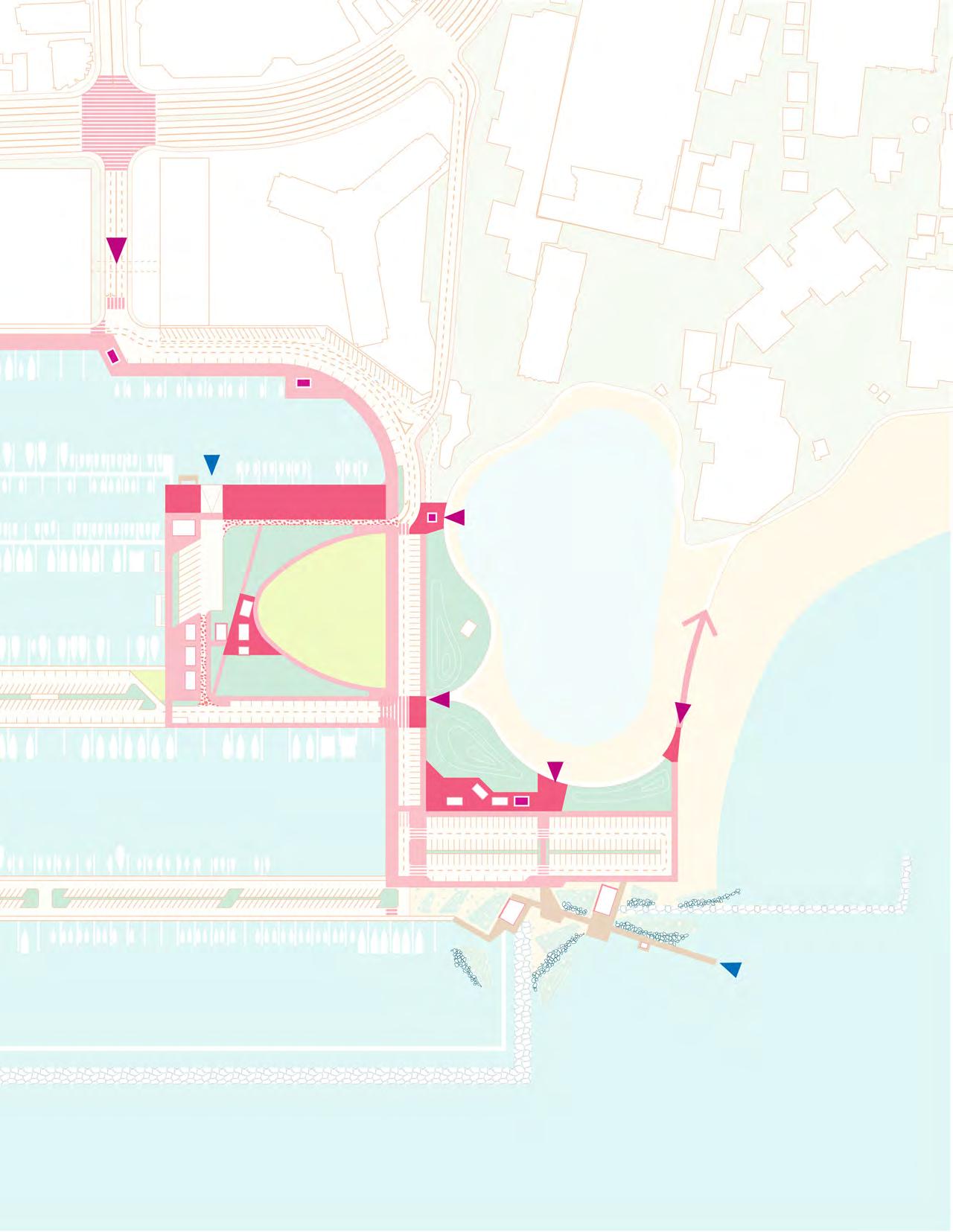
Pedestrian Gateway
Watercraft Gateway
Elevated Boardwalk/Deck
Wayfinding Gateway + Food Kiosk

Flexible Road
Crosswalks
Plazas
Multi-Modal Ala Wai Small Boat Harbor Promenade

Ala Wai Small Boat Harbor
Icon + Info Center/Wayfinding
Kayak Launch Market Kiosk
Kayak/Small Watercraft Storage
Mixed-Use Restaurant + Commercial Boating
Harbor Community + Education Center
Bike Rack Hub
Holomoana St.
Hobron Ln. Wayfinding Gateway+ Food
Re-Located Boat Launch
Watercraft
Boaters’ Boaters’ Boaters’
Mole 02
Public Comfort
Convenience Store, Laundry + Pump-Out
Harbor Master’s Quarters
Mailboxes
Harbor Cafe + Lanai Lounge
Public Comfort Station
Fuel Dock
Mole 01
Bike Racks
Promenade Seating
Public Comfort Station
Mixed-Use
Proposed Harbor/Watercraft Use
Option A
Amplify Watercraft Legacy: Amenities
Gateway+ Food Kiosk
Kahanamoku St. Wayfinding Gateway + Food Kiosk
Launch Ramp
Watercraft Storage
Boaters’ Market
Boaters’ Market
Boaters’ Market
Comfort Station
Mixed-Use Retail Cafe/Restaurant Food + Event Kiosk
Lagoon Beach Wayfinding Gateway + Food Kiosk
Bike Rack Hub
Mixed-Use/Retail Cafe/Restaurant
Surf Repair
Duke Kahanamoku
Boardwalk Wayfinding Gateway + Food Kiosk
Surf Community Center + Locker
Lifeguard
Public Comfort Station + Showers
Parking Garage
Bike Racks
Ala Wai Small Boat Harbor Icon + Info Center/Wayfinding

Kayak Launch Market Kiosk
Kayak/Small Watercraft Storage
Mixed-Use Restaurant + Commercial Boating
Harbor Community + Education Center
Bike Rack Hub
Holomoana St.
Hobron Ln. Wayfinding Gateway+ Food
Existing Boat Launch
Watercraft
Boaters’
Public Comfort
Mole 02
Parking Garage + Rooftop
Mixed-Use Retail Promenade
Convenience Store, Laundry + Pump-Out
Harbor Master’s Quarters
Mailboxes
Harbor Cafe + Lanai Lounge
Public Comfort Station
Fuel Dock
Mole 01
Promenade Seating
Public Comfort Station
Mixed-Use
Proposed Harbor/Watercraft Use
Amplify Watercraft Legacy: Amenities
Gateway+ Food Kiosk
Kahanamoku St. Wayfinding
Lagoon Beach
Wayfinding Gateway + Food Kiosk
Food + Event Kiosk
Mixed-Use Retail Cafe/Restaurant
Launch Ramp Watercraft Storage
Boaters’ Market
Comfort Station
Rooftop Park
Promenade
Mixed-Use/Retail
Cafe/Restaurant
Mixed-Use/Retail
Bike Rack Hub
Duke Kahanamoku
Boardwalk Wayfinding Gateway + Food Kiosk
Surf Community Center + Locker
Canoe Storage + Launch
Public Comfort Station + Showers

Riparian Tree
Specimen Shade Tree
Riparian Tree
Specimen Shade Tree

Boating
Surfing
Bicyclists
Swimming
Jogging/Walking
Fishing
Picnicking
Sunbathing
Protect
Living Shoreline

Flood-Adapted Habitat
Elevate
Harbor Master's Quarters Maritime Welcome Center Harbor Education + Community Center The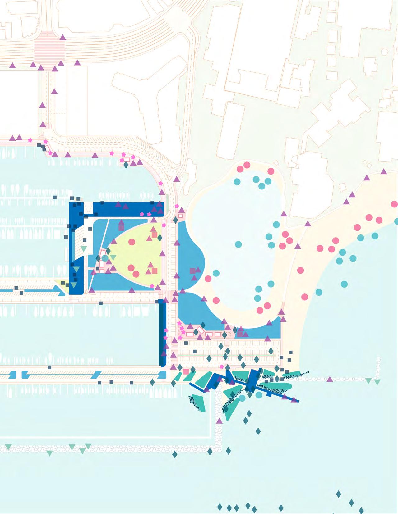
Boating
Surfing
Bicyclists
Swimming
Jogging/Walking
Fishing
Picnicking
Sunbathing
Elevate
Protect
Living Shoreline
Flood-Adapted Habitat
Elevate
Option A (Longer-Term)
Catalyze Coastal Ecologies: Resiliency Strategies
 Harbor Master's Quarters
Maritime Welcome Center
Harbor Education + Community Center
The Prince
Hawai'i Yacht Club
Ala Moana Canoe Halau
Waikīkī Yacht Club
Harbor Master's Quarters
Maritime Welcome Center
Harbor Education + Community Center
The Prince
Hawai'i Yacht Club
Ala Moana Canoe Halau
Waikīkī Yacht Club
Boating
Surfing
Bicyclists
Swimming
Jogging/Walking
Fishing
Picnicking
Sunbathing
Living Shoreline
Flood-Adapted Habitat
Elevate
Boating
Surfing
Bicyclists
Swimming
Jogging/Walking
Fishing
Picnicking
Sunbathing
Elevate
Protect
Living Shoreline
Flood-Adapted Habitat
Elevate
Option B (Longer-Term)
Catalyze Coastal Ecologies: Resiliency Strategies

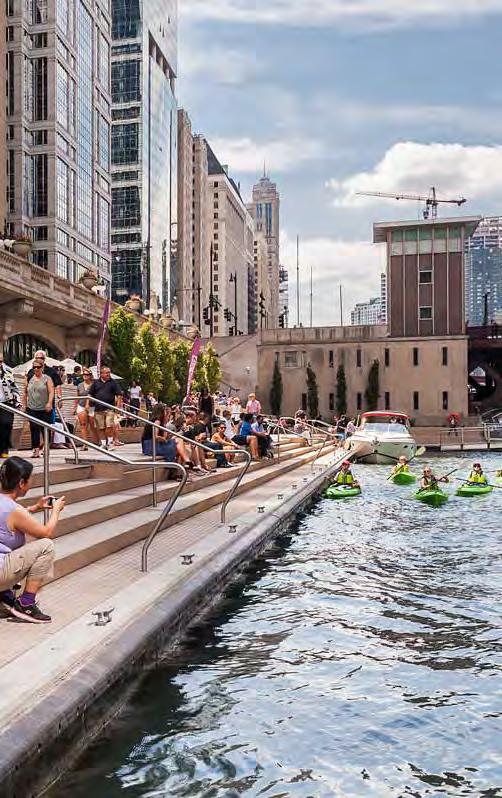
Chicago
* Slips and Moorings Not in Scope of Vision Concept Parcels + Moles per DTL 2017 Conceptual Plan AWSBH Vision Concept Public Realm Study Area
Ala Wai Small Boat Harbor
Existing Site

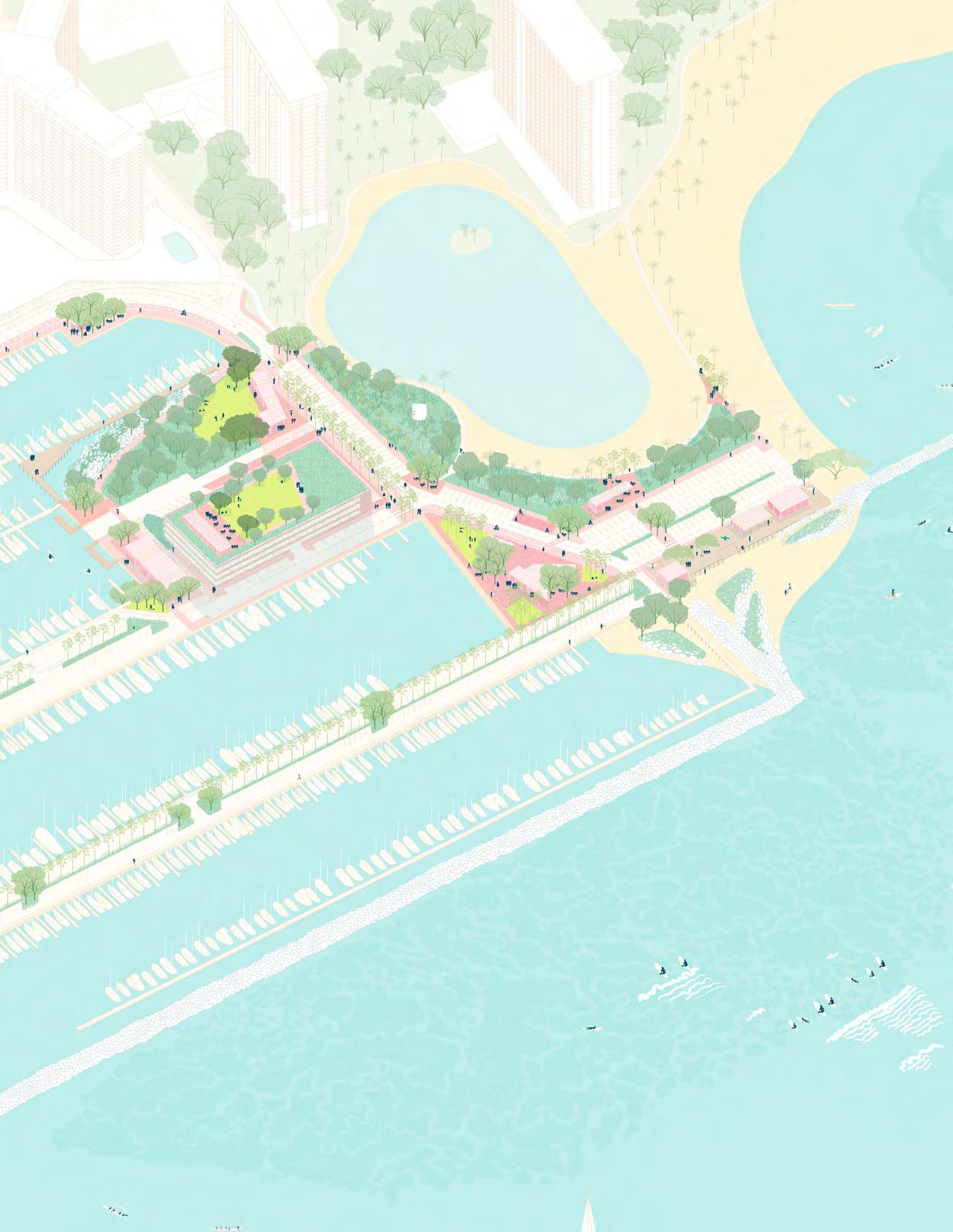
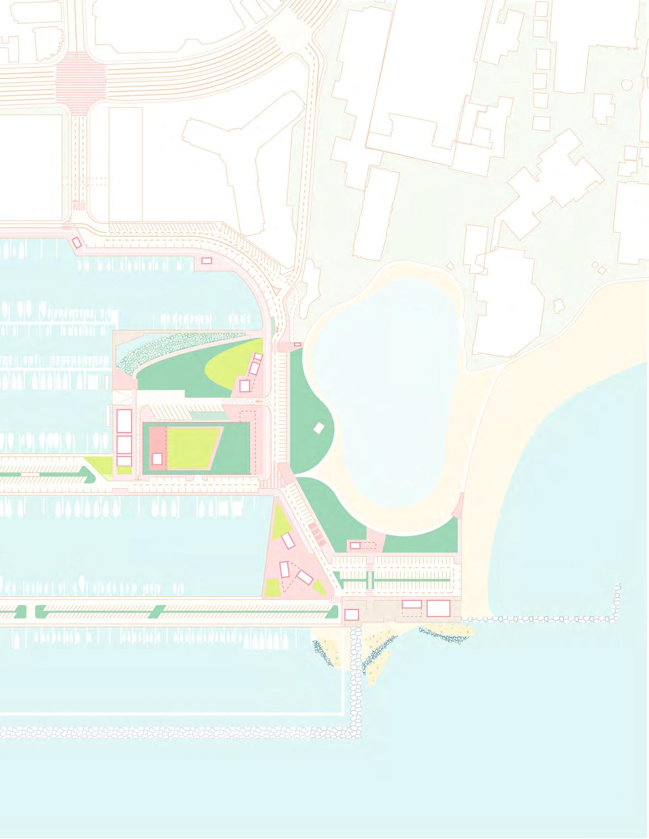
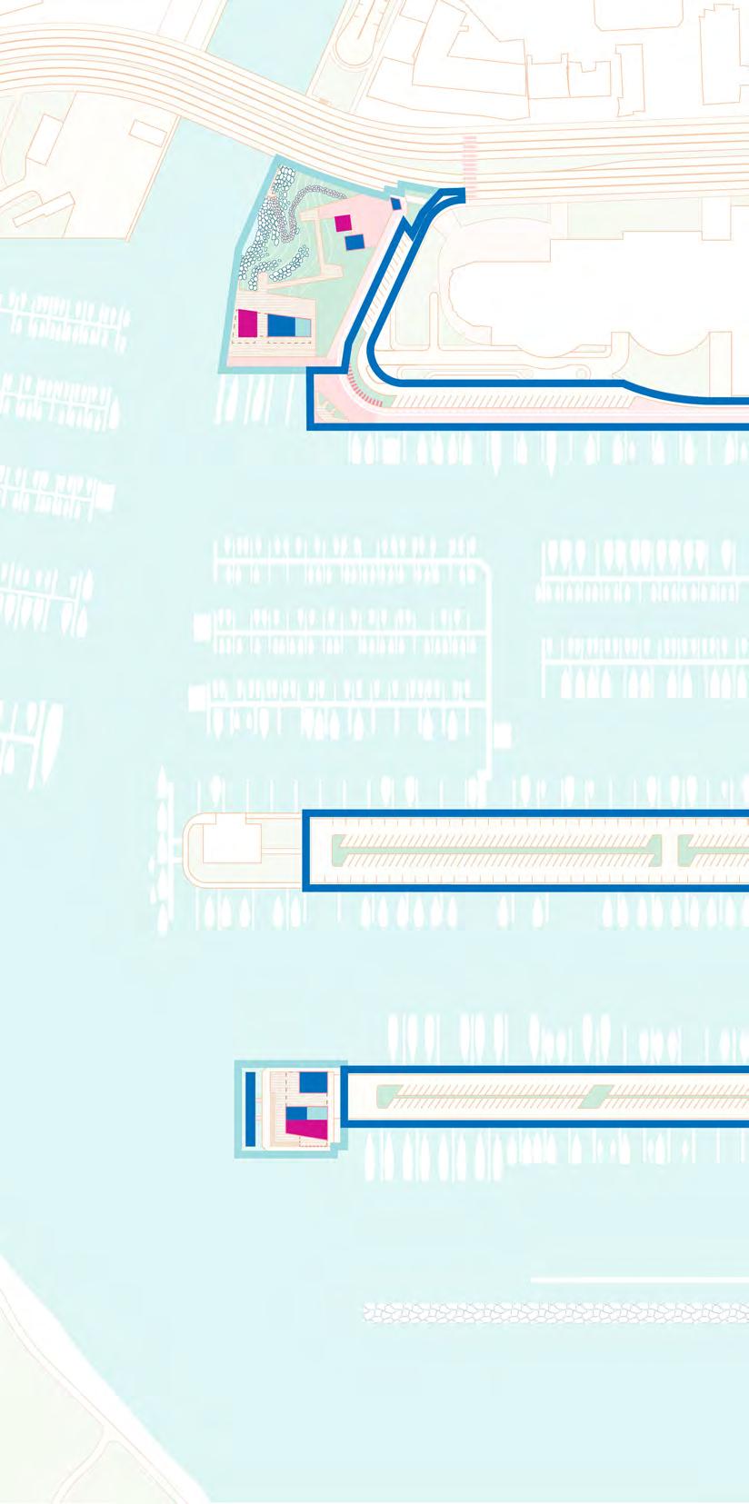
The Harbor Community and Education Center acts as the main pedestrian entry to the Ala Wai Small Boat Harbor and Promenade. A pedestrian gateway is located at the intersection of Ala Moana Boulevard and Holomoana Street. A plaza containing an iconic information kiosk, market and cafe, and kayak storage act as the attractors for this gateway. A pedestrian crosswalk at this intersection and a dedicated bike lane amplify this site’s identity as the main entrance to the Harbor.
The Ala Wai Small Boat Harbor Promenade and a universally-accessible elevated boardwalk connect this plaza to the Harbor Community and Education Center. Elevated on a deck above the threefoot sea level rise elevation, the Center houses conference rooms and classrooms for community meetings and school groups, a public comfort station, a restaurant, and mixed-use commercial space. The slips located makai of the Center are dedicated to commercial boating activities and offer an opportunity for local fishermen to dock and sell their catch in the market kiosk. The Ala Wai Overlook and Bike Hub is a comfortable shaded space where visitors can sit and watch the watercraft activities and competitions.
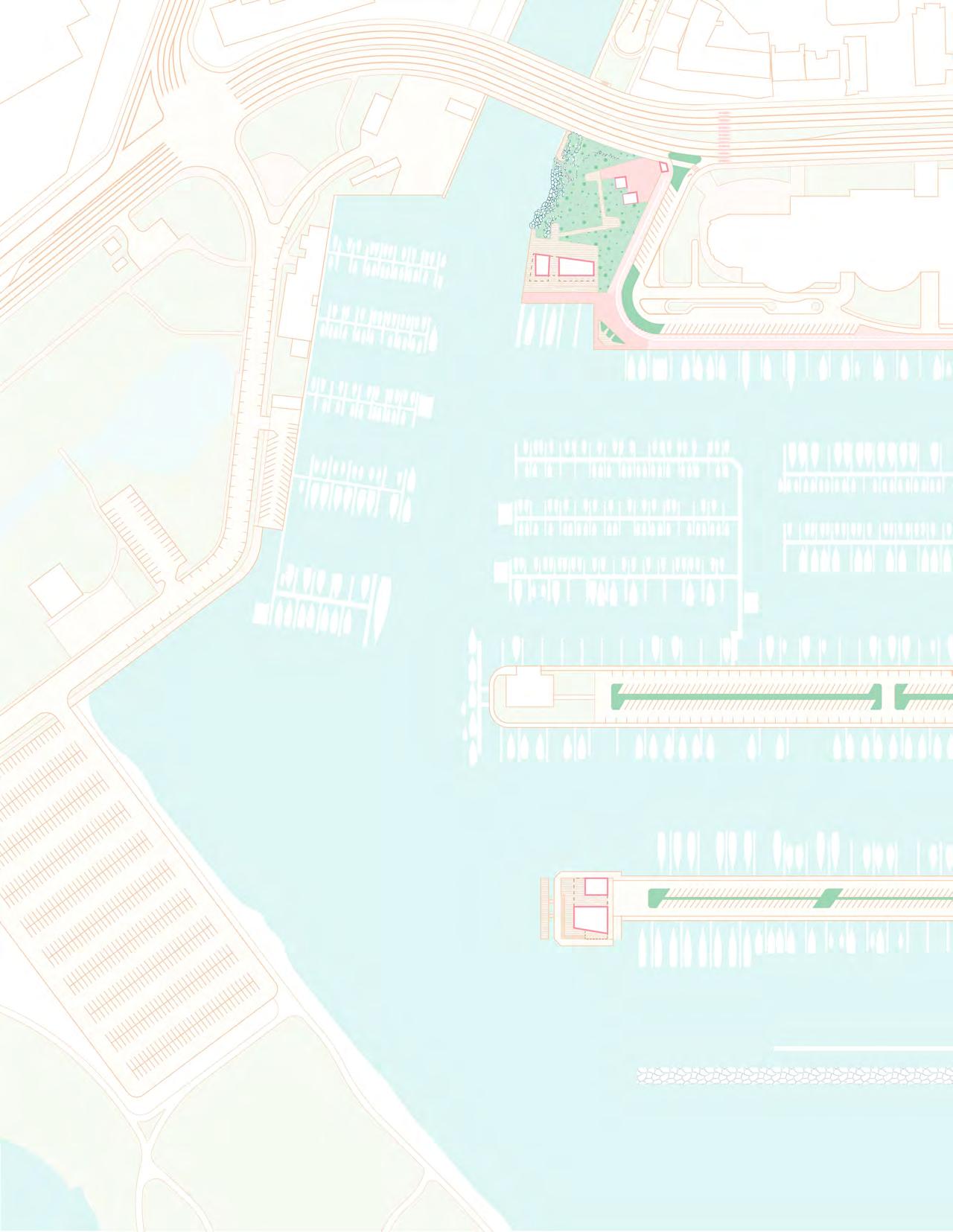
Unifying the site is the Urban Educational Marsh and kayak launch. The Marsh is a living shoreline that helps to restore native riparian habitat essential for shore birds, fish, and crustaceans, filter urban runoff, catch debris flowing down the Ala Wai Canal, and adapt this site to sea level rise and storm events. It creates opportunities for educating local school groups about habitat restoration and sea level rise adaptation. Outdoor classrooms are located on the elevated boardwalk and in an amphitheater adjacent to the kayak launch. The universallyaccessible kayak launch allows small watercraft access to the water and the Ala Wai Promenade Gateway - an elevated boardwalk that connects the site to the Ala Wai Promenade beneath the Ala Moana Boulevard Bridge.
Ala Wai Small Boat Harbor Icon + Info Center
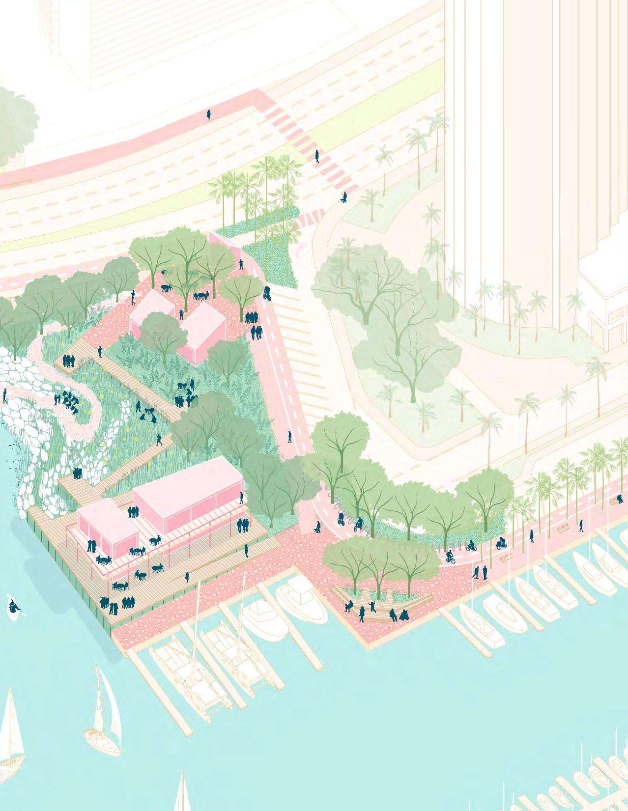
Market + Cafe Kiosk
Kayak Storage
Outdoor Classroom
Outdoor Classroom
Harbor Community Center + Conference Rooms
Restaurant
Mixed-Use
Public Comfort Station
Bike Hub
Commercial Boating
Ala wai Overlook
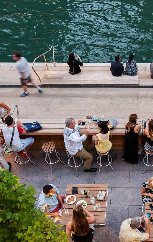
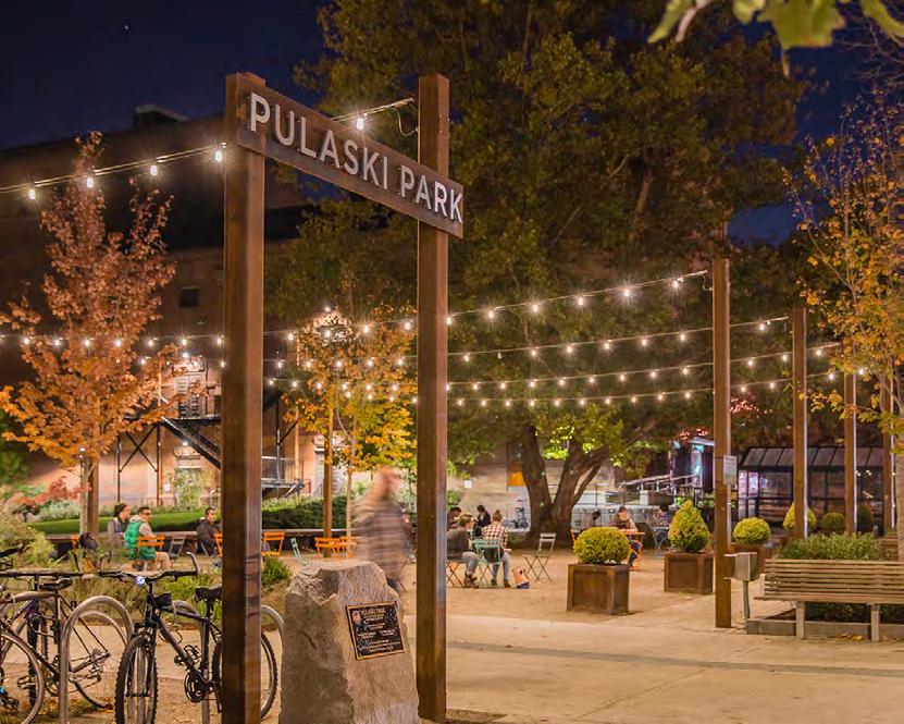


The Ala Wai Small Boat Harbor Promenade is the unifying feature of the Harbor’s public realm. It creates a unique, comfortable, and accessible experience for all Harbor stakeholders. It expands access to the Harbor through the introduction of a dedicated bikeway and several Wayfinding Gateways. Essential to this experience are consistent and identifiable canopy, seating elements, and paving treatment all unique to the Promenade. Wayfinding Gateways and Food Kiosks are essential for connecting the Harbor to adjacent neighborhoods, orienting users, and creating comfortable pockets of activity. Additionally, these Gateways create a more active streetlife and offer outdoor seating space for restaurants located along the Promenade.

Consistent + Comfortable

Watercraft Park is the Harbor’s largest social gathering space.
In Option A the identifying features of the Park are the central Community Event Lawn, the Flexible Market Promenade, the Boat Launch and Boaters’ Market. The Community Event Lawn provides a space for everyday recreation and relaxation for families, children, and community members and larger events such as observing the fireworks, outdoor movie nights, and performances. A series of Riparian Gardens border the lawn and frame views towards Diamond Head and the Lagoon Beach. These gardens filter stormwater runoff generated on-site, help to protect against storm surge and flood events, and contribute to the resilience of the Harbor. A cluster of kiosks and a public comfort station located at the center of the Park create an active node throughout the day.
Two entry plazas and prominent pedestrian crossings are located at the northern and southern corners of the Park, reinforcing connections to the adjacent Lagoon Beach and Duke Kahanamoku Boardwalk. The Flexible Market Promenade on the northern edge of the Park offers a comfortable, shaded space for regularly-scheduled farmers’ market and food truck events. The Boaters’ Market on the western edge of the Park contains a small watercraft storage structure, boat trailer parking, and a series of marine supplies shops that sell canvas, rope, bait and tackle, and other goods essential to watercraft and liveaboard activities.
A westbound, one-way road borders the edge of Watercraft Park and provides access to the relocated Boat Launch. Reducing the road width is meant to calm traffic speeds, create a safe pedestrian experience, and provide critical access to the Boat Launch. Special paving similar in character to the plaza paving is meant to further assist in calming traffic.
In Option B the characteristic features of Watercraft Park are the Community Event Lawn, the Observation Deck, Living Shoreline Intertidal Shelves, the Boat Launch and Boaters’ Market, the Parking Garage and Rooftop Park, and a Mixed-Use Retail Promenade. In this option, Watercraft Park is bisected by a one-way road and boat trailer parking that provides access to the existing Boat Launch. The Community Event Lawn is oriented towards the western views of the Harbor, as well as the Living Shoreline and elevated Observation Deck - two elements that provide resiliency strategies for Watercraft Park and unique experiences of the water. Another lawn space is located on the Rooftop Park, extending the opportunities for community events and performances. The Parking Garage preserves the amount of parking spaces in this portion of the Harbor, while also allowing for the majority of the site to serve community and Harbor functions.
Lagoon Beach Wayfinding Gateway + Food Kiosk
Event/Food Kiosk
Community Event
Lawn
Cafe Mixed-Use
Riparian Gardens
Rooftop Park + Parking Garage
Mixed-Use Retail Promenade
Gardens
Market
Public Comfort Station
Parking Garage
Vehicular Access
Duke Kahanamoku Boardwalk Stormwater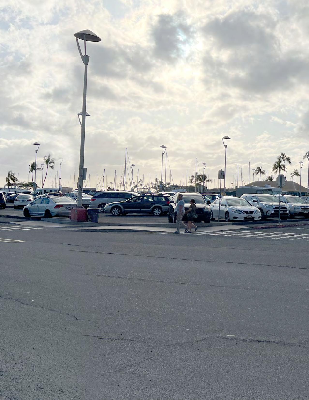
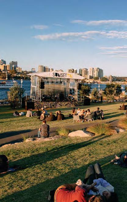

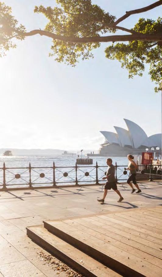
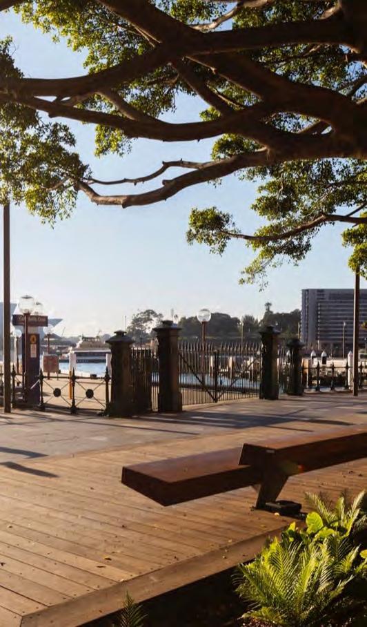
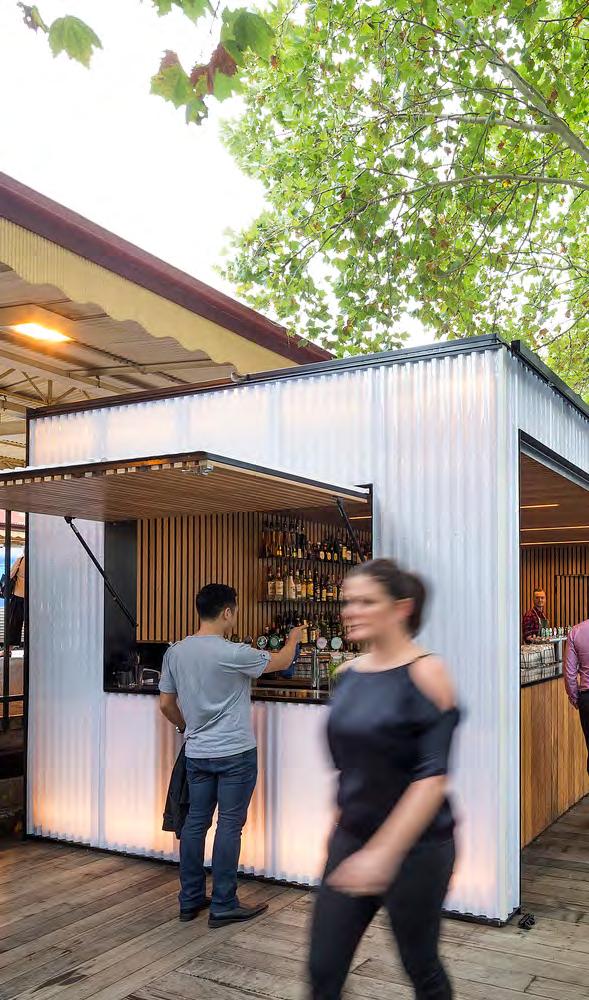
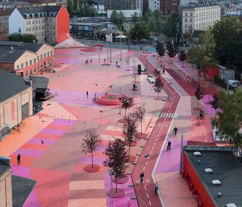
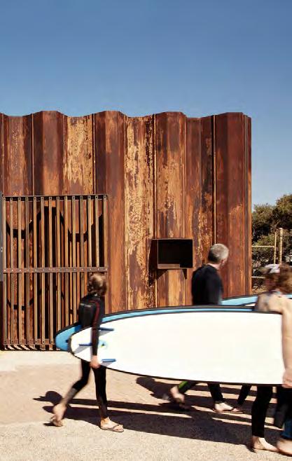
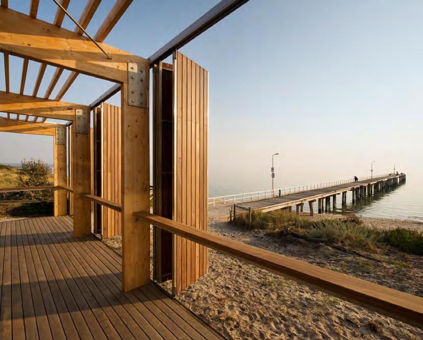
Architecture, Sydney, Australia


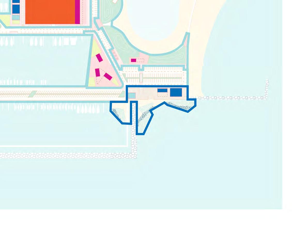
 New Sidewalk
The Surf Community Center and Duke Kahanamoku Boardwalk Kiosks and Bike Hub are an essential and historically significant site for surf and canoe ocean access. Both Concept Design Options propose amenities and resiliency strategies that ensure gathering space for the recreational users that revolve around this access. Living Shoreline Intertidal Shelves help to attenuate wave action, stabilize and adapt the beach to sea level rise, and increase coastal strand and juvenile fish habitat.
In Option A, a deck and boardwalk are elevated above the three-foot sea level rise elevation and host essential opportunities for community gathering as well as a Public Comfort Station and Surf Community Center and Locker. The Surf Community Center and Locker provides space for surfers to store their boards and hold community events. As sea levels rise, the boardwalk will act as the new surf launch.
The Duke Kahanamoku Boardwalk Wayfinding Gateway and Bike Hub are the terminus of the Promenade bikeway. This activity node enhances the connectivity between the Lagoon and Harbor. Bordering the Boardwalk Kiosks and Bike Hub are the Stormwater Gardens. These gardens filter stormwater runoff generated on-site, help to protect against storm surge and flood events, and contribute to the resilience of the Harbor. Future considerations include extending the bikeway to the Duke Kahanamoku Boardwalk, Fort DeRussy Boardwalk, and Waikiki Promenade.
Concept Design Option B proposes similar amenities and resiliency strategies to Option A, with the exception of the Flexible Market Plaza and Promenade and the Canoe Storage. In this Option, the alignment of Parcel D’s western wall and road are maintained. The resultant space is a Flexible Market Plaza and Promenade containing a cafe, mixed-use kiosks, small lawns for lounging, and flexible plaza space for hosting weekly farmers’ markets and food trucks.
Similar to Option A, Option B proposes an elevated Public Comfort Station and Surf Locker. Additionally, a Canoe Storage and elevated canoe launch for the Anuenue Canoe Club are also proposed as part of this option. The intention is to adapt canoe access to sea level rise.
 Boardwalk + Food Kiosk
Public Comfort Station
Surf Community Center + Locker
Canoe Storage
Living Shoreline Intertidal Shelves
Boardwalk + Food Kiosk
Public Comfort Station
Surf Community Center + Locker
Canoe Storage
Living Shoreline Intertidal Shelves


Intertidal Shelves +
Juvenile Fish Habitat
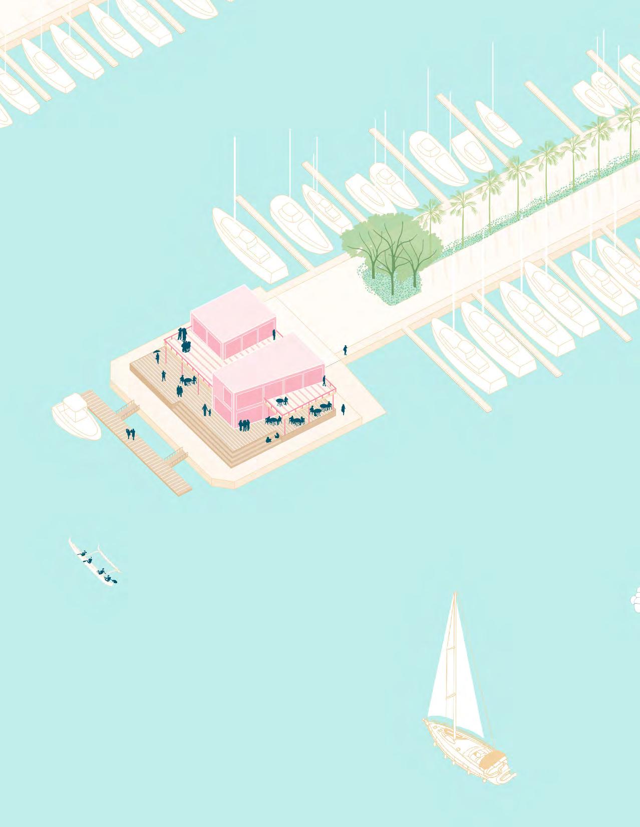
The Maritime Welcome Center is the ocean gateway to the Ala Wai Small Boat Harbor. It is the part of the Harbor that visiting boats first see upon arrival from their voyages. This site, therefore, houses several harbor functions and acts as a community space for liveaboards, boaters, and other users. The proposed building complex contains the Harbor Master’s Quarters, a Convenience Store, Laundromat, Pump Out Station, Mailboxes, Public Comfort Station, and Lanai Cafe. It is elevated on a deck above the projected three-foot sea level rise. The deck and rooftop lanai provide spaces for users to socialize and watch races and regattas, surf session, and the sunset. Upon arrival, visiting boats may moor at the proposed floating Fuel Dock, check in with the Harbor Master, and receive inspection.
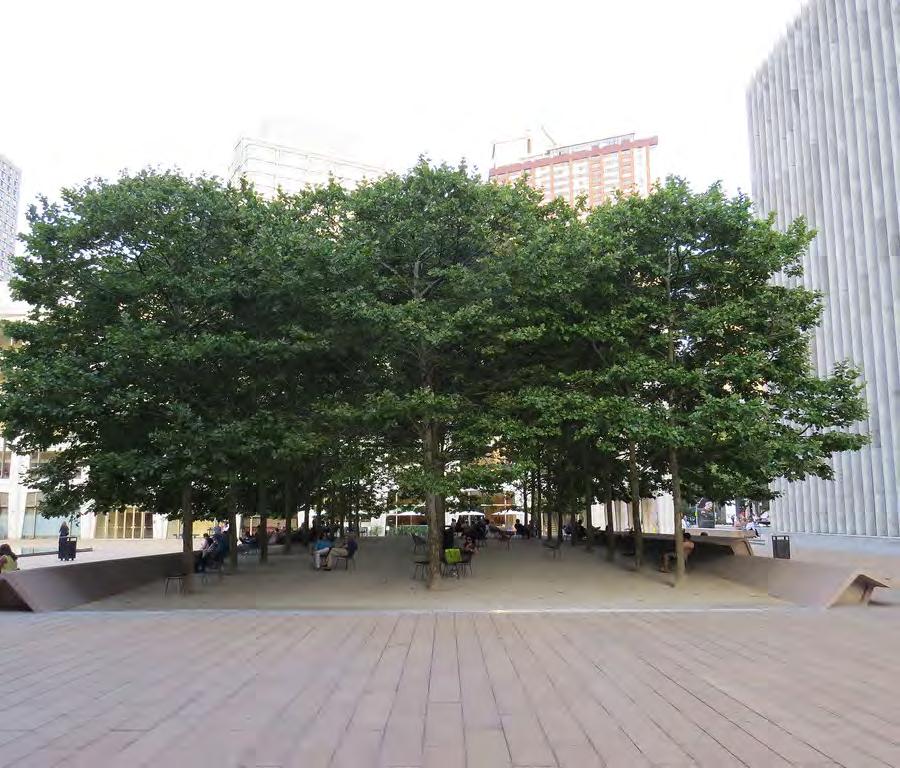
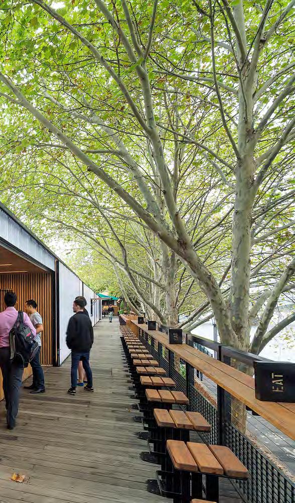
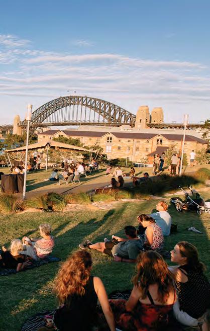
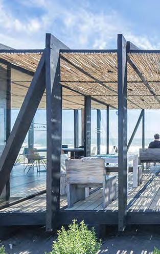
Landscape Architecture, Paris, France


DOBOR’s Strategic Plan calls for a publicprivate partnership for managing the AWSBH. The matrix on the following pages presents a summary of seven harbor management precedents that could be instructive. The precedents were selected for their similarities with the AWSBH.
OWNED BY:
OPERATED BY:
LOCATION: AREA:
LINKS:
State of Hawai`i
Department of Land & Natural Resources (DLNR)
Waikīkī , O’ahu
Land 11 acres
Harbor Map Official Website
OWNED BY:
OPERATED BY: LOCATION: AREA:
State of Hawai`i
Howard Hughes Corp.
Kaka`ako, O’ahu
Land 27 acres
Water 30 acres
MANAGEMENT TYPE: FINANCIAL MODEL:
Currently managed by DLNR, Parking is contracted to private company.
Revenue generated from three sources:
- Paid parking
- Slip fees
- Fast lands (FY 2018 = $1,914,816)
LINKS:
Harbor Map Official Website Rates Available Document
OWNED BY:
OPERATED BY:
LOCATION: AREA:
San Mateo County Harbor District
San Mateo County Harbor District
Half Moon Bay California
Land 20 acres Marina 45 acres
MANAGEMENT TYPE:
Publicly owned & Private operator Public-Private Partnership (PPP model)
FINANCIAL MODEL:
PPP to revitalize marina.
In 2014, the State entered a 35-year lease with Howard Hughes Corp. with the option to extend by 10 years.
The plan of the operating company includes:
- Approx. $20 million investment for renovating the dock, establishing waterfront promenade, and increasing security.
- Pay $14 million in lease rent for the first 30 years .
- Increase the number of boat slips from 144 to 244.
- Maintain/enhance harbor as commercial small boat harbor.
MANAGEMENT TYPE:
Publicly owned & operated with Private vendor contracts
LINKS:
Harbor Map Official Website Rates Available Document
FINANCIAL MODEL:
Special district property tax provides flexibility to encourage diverse uses
- Special district owner/operator receives $0.03/$1 of county property taxes (2/3 of district revenue)
Direct revenue: Commercial fishing
- Commercial fishing vessels occupy 50% of berths (98% occupancy)
- 3 Whole fishery leases on pier (4 hoists)
- Fresh fish sales permitted off boats
- Visitors drawn to restaurants & charter boats
FACILITIES:
- 699 Slips with dock
-22 Dry storage space
- Vessel washdown
- MSD pumpout
- Harbor office, restrooms, & showers
BUSINESSES & CLUBS:
SLIP MAX LENGTH:
30’ BERTH RATE:
- Hawai`i Yacht Club
- Waikīkī Yacht
- Royal Hawaiian Ocean Racing Club
85’
$390/month + other fees
FACILITIES:
- 144 Slips with dock
- Fuel dock, harbor master’s office
- Marine dry dock and shipyard
- Fish auction facilities on Ahui Street
-Tuna cannery
- Ice plant (only one in operation currently)
- Support services along the area adjacent to Ala Moana Park
- Wayne Marine Supply and Services and offices for cruise and excursion
- UH Kewalo Basin Marine Mammal Lab
RELEVANCE TO AWSBH:
Kewalo basin is a local example of Public Private Partnership (PPP).
The harbor is expected to keep its history and identity as a commercial boat harbor (commercial fleets, ex tuna packers cannery, fish market) while improving facilities for public access.
Developing commercial buildings and repurposing existing buildings are proposed with a new parking structure.
BUSINESSES & CLUBS:
- Sailing
- Sport fishing
- Whale watching
- Scuba diving
- Parasailing
- Submarine
SLIP MAX LENGTH:
30’ BERTH RATE:
100’
$610/month + other fees
FACILITIES:
- 369 Berths
- Commercial fishing facilities
- Floating docks
- Backlands building (harbor master’s office, commercial buildings, ice-making facilities etc.)
RELEVANCE TO AWSBH:
It may inform the type of businesses that can be brought into the AWSBH.
The harbor development is included in the Kaka’ako Makai Parks Master Plan so that the waterfront development in Kaka’ako area is coherent.
BUSINESSES & CLUBS:
- Year ‘Round Sport Fishing
- Seasonal Whale Watching
- Seafood Restaurants
- Kayak & Stand Up Paddling
- Surf Shop
- Pillar Point Fuel Dock - Fuel and Ice
- RV park
- Wholesale Fish Purveyors
SLIP MAX LENGTH:
30’ BERTH RATE:
n/a
$316/month + other fees
Although it has fewer berths than AWSBH, Pillar Point has a range of facilities and businesses related to water activities (sport fishing businesses, seafood restaurants, kayak & stand up paddling, surf shop, marine services, RV park, wholesale fish purveyors).
It may inform the type of businesses that can be brought into the AWSBH.
OWNED BY:
OPERATED BY:
LOCATION: AREA: LINKS:
City of South San Francisco
San Mateo County Harbor District
Oyster Point, California
Land 33 acres
MANAGEMENT
TYPE:
FINANCIAL MODEL:
Publicly owned & operated with Private vendor contracts
Revenue generated from:
- Slip rental (70.7% largest)
Increased average 1.6% /year from 2013-2018
- Rent & concessions (19.4%)
- Other fess (9.9%)
Official Website Rates Available Document
OWNED BY:
OPERATED BY: LOCATION: AREA:
City of Berkeley
City of Berkeley
Berkeley, California
100 acres (Total)
MANAGEMENT
TYPE:
FINANCIAL MODEL:
(Transient dockage, launching fees, dock box fees, etc.)
LINKS:
Harbor Map
Official Website Rates Available Document
OWNED BY:
OPERATED BY:
LOCATION: AREA:
LINKS:
City & County of San Francisco
City & County of San Francisco
Marina District, San Francisco, California
Land 19 acres
Water 39 acres
Harbor Map
Official Website Rates Available Document
MANAGEMENT
TYPE:
FINANCIAL MODEL:
Publicly owned & operated with Private vendor contracts
Operating Revenues (2019)
- Berth rental fees (55%)
- Hotel lease (21%)
- Other leases (14%)
- Other boating fees (5%)
- Youth programming (2%)
- Other (2%)
- Water-based recreation (1%)
The marina fund will see reserve depletion by end of 2022 so they are working on a new plan (BMASP) to close the funding gap.
They see 1) pier-ferry project
2) BMASP underway as two opportunities to increase revenue.
Publicly owned & operated with Private ventor contracts
Marina rebuild supported by higher fees & shift to larger slips
FACILITIES:
- 408 Berth Marina
- Boat launching ramp
- 300’ Fishing pier
- Park with hiking / jogging trails, picnic facilities, & a 2.5 acre sandy beach
- Ferry service
RELEVANCE TO AWSBH:
Slightly smaller than AWSBH, but Oyster Marian & Park is located near a large park and sandy beach.
It also has few facilities compared to the Pillar Point marina but is focused on water activities.
BUSINESSES & CLUBS:
- Oyster Point Yacht Club
- Vessel Charters
- Kite Surfing
- Dragon Boats
- Westwind Yacht Management
- Pump Out Services
SLIP MAX LENGTH:
30’ BERTH RATE:
n/a
$269/month + other fees
FACILITIES:
- 100 Dry storage space
- 1000 Total capacity for slips of tie-ups
- Transient Berths or Tie Ups
- Electricity, & Water on Dock
- Fishing Tackle & Fuel Sales
- Gear Lockers
- Day Use or Picnic Areas
- Restaurant, Snack Bar
- Restrooms, Showers
RELEVANCE TO AWSBH:
The strategic plan of the San Mateo County Harbor District says it has strong finance, which can be of interest.
BUSINESSES & CLUBS:
- Berkeley Yacht Club
- Cal Sailing Club
- Olympic Circle Sailing Club
- UC Berkeley Cal Adventures
- Berkeley Racing Canoe Center
Berkeley Marina has a similar financial issue to AWSBH.
With their current financial model, the revenue can’t cover the expense by end of 2022.
It also has few facilities offered to the public; other than slips, boat launching ramp, and fishing pier, there is not a lot of revenuegenerating activities to attract visitors.
The BMASP is proposed to close the financial gap by adding revenue-generating facilities, including a ferry stop.
SLIP MAX LENGTH:
30’ BERTH RATE:
100’
$394/month + other fees
FACILITIES:
- 727 Berths, includes 15 end ties for guest berthing vessels up to 90 feet LOA
- Free pump out stations & commercial fuel dock
- No liveaboards
RELEVANCE TO AWSBH:
San Francisco Marina has few facilities on its premises.
Instead of adding new facilities, they have increased the slip fee to cover the increasing cost.
BUSINESSES & CLUBS:
SLIP MAX LENGTH:
30’ BERTH RATE:
- St. Francis Yacht Club
- Golden Gate Yacht Club
90’
$448/month + other fees
No liveaboards are allowed in this marina.
OWNED BY:
OPERATED BY:
LOCATION: AREA:
City of Long Beach
City of Long Beach
Long Beach, California
Land 10 acres
Water 200 acres
MANAGEMENT
TYPE:
FINANCIAL MODEL:
Publicly owned & operated with Private vendor contracts
Marina rebuild supported by lean operating budget; upland development follows.
- Rebuild & reconfigured 1646 slips over 13 years
- $105M rebuild financed by bonds secured by marina fund net revenues (3 marinas): operating expenses = 56% gross revenue
- Slip fee increase average 2.3%/year
LINKS:
Harbor Map Official Website Rates
Available Document
OWNED BY:
OPERATED BY:
Orange County
Dana Point Harbor Partners LLC
Dana Point Harbor Partners Drystack LLC
MANAGEMENT
TYPE:
FINANCIAL MODEL:
Upland development of waterfront restaurant & brew pub (city land) + 215K sqft coastal mall (private land)
LOCATION: AREA: LINKS:
Orange County, California
Land 107 acres
Water 170 acres
Harbor Map Official Website Rates
Available Document
Businesses & Clubs
Publicly owned & Private operator Public-Private Partnership (PPP model)
Public-private partnership to vitalize marina and waterfront commercial district.
County entered into a 66-year ground lease with water development to operate the marina, replace/repair/reconfigure existing infrastructure, develop new revenue-generating projects in accordance with land use plan: 2 hotels with 266 rooms; 110,000 sqft commercial use
FACILITIES:
- 1,646 Slips
- On-site designated boater parking
- Mailboxes for live aboard boaters
- Showers and restrooms
- Pump out stations
- Lockable dock boxes
- Courtesy dock phones
- On-site fuel dock services
- Fee-based wi-fi services
- On-site oil recycling
- 24-hour security patrols
BUSINESSES & CLUBS:
- Alamitos Bay Yacht Club
- Long Beach Yacht Club
- Seal Beach Yacht Club
- Little Ships Fleet
- Navy Yacht Club of Long Beach
SLIP MAX LENGTH:
30’ BERTH RATE:
115’
$483/month + other fees
FACILITIES:
- 2,254 Slips
- Fuel dock
- Bilge pad exchange
- Bait station
- Shipyard (boat repair facility, hardware store)
RELEVANCE TO AWSBH: RELEVANCE TO AWSBH:
Alamitos Bay Marina has an issue with parking due to increased visitors after the redevelopment of the close-by private & public land, parking became a concern for liveaboards.
Currently, except for two rows of dedicated parking for liveaboards, all other parking is free public parking.
The city has conducted a study to understand how to utilize the parking space.
BUSINESSES & CLUBS:
Range of facilities for:
- Dining
- Dhopping
- Water activities
- Hotels, etc.
See links for full list
SLIP MAX LENGTH:
30’ BERTH RATE:
85’
$738/month + other fees
Dana Point Harbor is one example of public private partnership model.
The county leased the harbor to two private companies for 66-years.
The private companies have built hotels, commercial centers, and other water activity facilities.
Although AWSBH is not planning to be transformed into either commercial center or hotel, public private parnership can be a solution in designing and managing the waterfront redevelopment project.
A conceptual cost estimate was prepared by J. Uno and Associates on May 05, 2022 based on Concept Design Options A and B. The purpose of this cost estimate is to offer insight for potential phasing and to inform future requests for proposals for the Harbor.
Option A
Overall study area [Non-structures]
Structures only
Option B
Overall study area [Non-structures]
Structures only
J. Uno Associates Cost Estimate

Harbor Community & Education Center
Estimated cost: $14,135,407
Ala
Market Kiosk
Kayak/Small Watercraft Storage
Mixed-Use Restaurant + Commercial Boating
Icon + Info Center/Wayfinding Harbor Community + Education Center
Public Comfort Station
Mixed-Use
Proposed Harbor/Watercraft Use
Option A
Structures Only
Watercraft Park
Estimated cost: $9,804,968
Re-Located Boat Launch Ramp
Watercraft Storage
Boaters’ Market
Boaters’ Market Boaters’ Market
Public Comfort Station
Mixed-Use Retail Cafe/Restaurant
Food + Event Kiosk
Kiosks & Bike Hub
Estimated cost: $3,840,725
Public Comfort Station
Mixed-Use
Proposed Harbor/Watercraft Use
Option A
Structures Only
Bike Rack Hub
Mixed-Use/Retail
Cafe/Restaurant
Surf Repair
Duke Kahanamoku
Boardwalk Wayfinding
Gateway + Food Kiosk
Duke Kahanamoku Boardwalk
Stormwater Garden & Gateway
Estimated cost: $609,469
Maritime Welcome Center
Estimated cost: $19,150,162
Convenience Store, Laundry + Pump-Out
Harbor Master’s Quarters
Mailboxes
Harbor Cafe + Lanai Lounge
Public Comfort Station
Fuel Dock
Public Comfort Station
Mixed-Use
Proposed Harbor/Watercraft Use
Option A
Structures Only
Surf Community Center
Estimated cost: $7,265,514
Public Realm
Estimated cost: $1,037,167
Option A Structures Only

Harbor Community & Education Center
Estimated cost: $14,135,407
Ala
Market Kiosk
Kayak/Small Watercraft Storage
Mixed-Use Restaurant + Commercial Boating
Icon + Info Center/Wayfinding Harbor Community + Education Center
Public Comfort Station
Mixed-Use
Proposed Harbor/Watercraft Use
Option B
Structures Only
Watercraft Park
Estimated cost: $102,128,850
Kiosks & Bike Hub
Estimated cost: $5,363,328
Public Comfort Station
Mixed-Use
Proposed Harbor/Watercraft Use
Structures Only
Mixed-Use/Retail
Cafe/Restaurant
Mixed-Use/Retail
Bike Rack Hub
Duke Kahanamoku
Boardwalk Wayfinding
Gateway + Food Kiosk
Stormwater Garden & Gateway
Estimated cost: $609,469
Maritime Welcome Center
Estimated cost: $19,150,162
Convenience Store, Laundry + Pump-Out
Harbor Master’s Quarters
Mailboxes
Harbor Cafe + Lanai Lounge
Public Comfort Station
Fuel Dock
Public Comfort Station
Mixed-Use
Proposed Harbor/Watercraft Use
Option B
Structures Only
Surf Community Center
Estimated cost: $9,142,037
Public Realm
Estimated cost: $1,037,167
Structures Only
Al, Stefan (2018). Adapting Cities To Sea Level Rise: Green And Gray Strategies. Island Press.
City of Boston Greenovate (2018). Coastal Resilience Solutions for South Boston. https://www.boston.gov/sites/default/files/embed/file/2018-09/ climatereadysouthboston_execsum_v9.1s_web.pdf
Department of Urban and Regional Planning. (2020). Ala Wai Small Boat Harbor Conceptual Plan. Practicum report prepared for the Department of Land and Natural Resources Division of Boating and Ocean Recreation.
DOBOR. (2020). O`ahu Island – Ala Wai Harbor. https://dlnr.hawaii.gov/dobor/O‘ahu-island-facilities/alawai-harbor/
DOBOR. (2019). Modernizing Ocean Recreation Management in Hawai`i. https://dlnr. hawaii.gov/dobor/files/2019/09/DOBOR-Strategic-Plan-2019_webpost.pdf
DTL. (2017). Ala Wai Small Boat Harbor Community Engagement Findings & Conceptual Plan. https://dlnr.hawaii.gov/dobor/files/2018/08/AlaWai-CommMtg_Fina-lReport_ 17-1227_rev18-0111.pdf
Hawaii Sea Grant King Tides Project. (2016). King Tides Map. http://www.pacioos.hawaii.edu/king-tides/map.html
Hawai'i Climate Change Mitigation and Adaptation Commission. (2021). State of Hawai'i Sea Level Rise Viewer. Version 1.06. Prepared by the Pacific Islands Ocean Observing System (PacIOOS) for the University of Hawai'i Sea Grant College Program and the State of Hawai'i Department of Land and Natural Resources, Office of Conservation and Coastal Lands, with funding from National Oceanic and Atmospheric Administration Office for Coastal Management Award No. NA16NOS4730016 and under the State of
Hawai'i Department of Land and Natural Resources Contract No. 64064. http://hawaiisealevelriseviewer.or.
Hawai'i Climate Change Mitigation and Adaptation Commission. (2017). Hawai'i Sea Level Rise Vulnerability and Adaptation Report. Prepared by Tetra Tech, Inc. and the State of Hawai'i Department of Land and Natural Resources, Office of Conservation and Coastal Lands, under the State of Hawai'i Department of Land and Natural Resources Contract No: 64064.
Kim, K., Pant, P., and Yamashita, E. (2015). Evacuation Planning For Plausible Worst Case Inundation Scenarios In Honolulu, Hawaii. Journal Of Emergency Management, 13(2), 93-108.
New York City Department of City Planning. (2013). Coastal Climate Resilience: Urban Waterfront Adaptive Strategies.
New York City Department of Parks and Recreation. (2017). Design and Planning for Flood Resiliency: Guidelines for NYC Parks.
https://www.nycgovparks.org/pagefiles/128/NYCP-Design-and-Planning-FloodZone__5b0f0f5da8144.pdf
New York City Department of Parks and Recreation. (2010). Designing the Edge: Creating a Living Urban Shore at Harlem River Park.
https://www.nycgovparks.org/sub_opportunities/business_ops/pdf/designing_the_ edge_4-7-2010.pdf
Wolanski, E., Perillo, G. M. E., Cahoon, D.R., & Hopkinson, C.S. (2019). Living Shorelines for Coastal Resilience. In Coastal Wetlands - An Integrated Ecosystem Approach (2nd Edition, pp. 1–1). Elsevier.
Focus Group Participants
Ānuenue Canoe Club
Waikīkī Yacht Club
Hawai'i Yacht Club
Save Our Surf
Surfrider Foundation O‘ahu Chapter
Hilton Hawaiian Village Waikīkī
Beach Resort
The Modern Honolulu
Ilikai Hotel & Luxury Suites
Prince Waikīkī
Waikīkī Neighborhood Board
Waikīkī Beach Special Improvement District (WBSIDA)
Waikīkī Improvement Association (WIA)
Waikīkī Business Improvement District (WBID)
The Ilikai Apartment Building
Makai Society
Ala Wai Small Boat Harbor Working Group (liveaboards)
Sustainable Coastlines Hawai'i
Senator Waikīkī
City Parks Director
City Council Chair Waikīkī Representative Waikīkī