Irvine at 50: The changing landscape of housing, commuting, and amenities June, 2022
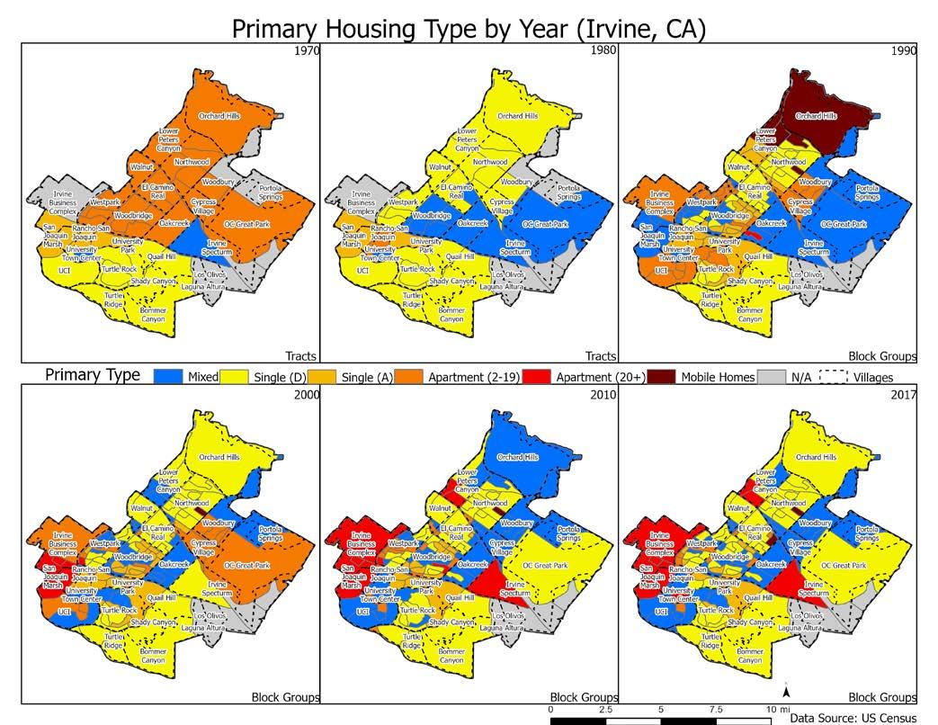
Figure 2.3 Housing Development over time The development of housing in the city of Irvine has followed the various annexations of portions of the city. Thus, the archaeology of the city can be seen in the age of housing. We demonstrate this in Figure 2.4, which shows the median age of housing across the blocks in the city (the median shows the age of the housing unit in which half of the units are newer and half are older). In nearly all of these blocks the units were built at the same time given the planned nature of the city. In Figure 2.4 the blue areas capturing the University Park neighborhood just north of UC Irvine were largely built in the 1960s before city incorporation. We can also see that Rancho San Joaquin, Northwood, El Camino Real, Oak Creek and the northern part of Woodbridge were built in the 1970s. Westpark and southern Woodbridge were built in the 1980s, along with portions of Turtle Rock. The areas around the edges of the city were developed in more recent years.
12