1 minute read
Chapter 5. Does Irvine really provide more access to amenities?

from Metropolitan Futures Initiative Report
by University of California, Irvine - School of Social Ecology

A goal of Irvine’s village model was to make it easy to access such amenities as commercial districts and parks. The expectation was that residents could easily reach these locations, which would provide for central meeting locations for residents that might increase levels of cohesion among residents within the villages. But was this model really successful in locating amenities nearby to residents? We address this question in this chapter by assessing how close parks and retail locations are to Irvine residents, and compare this to residents in the remainder of the county.
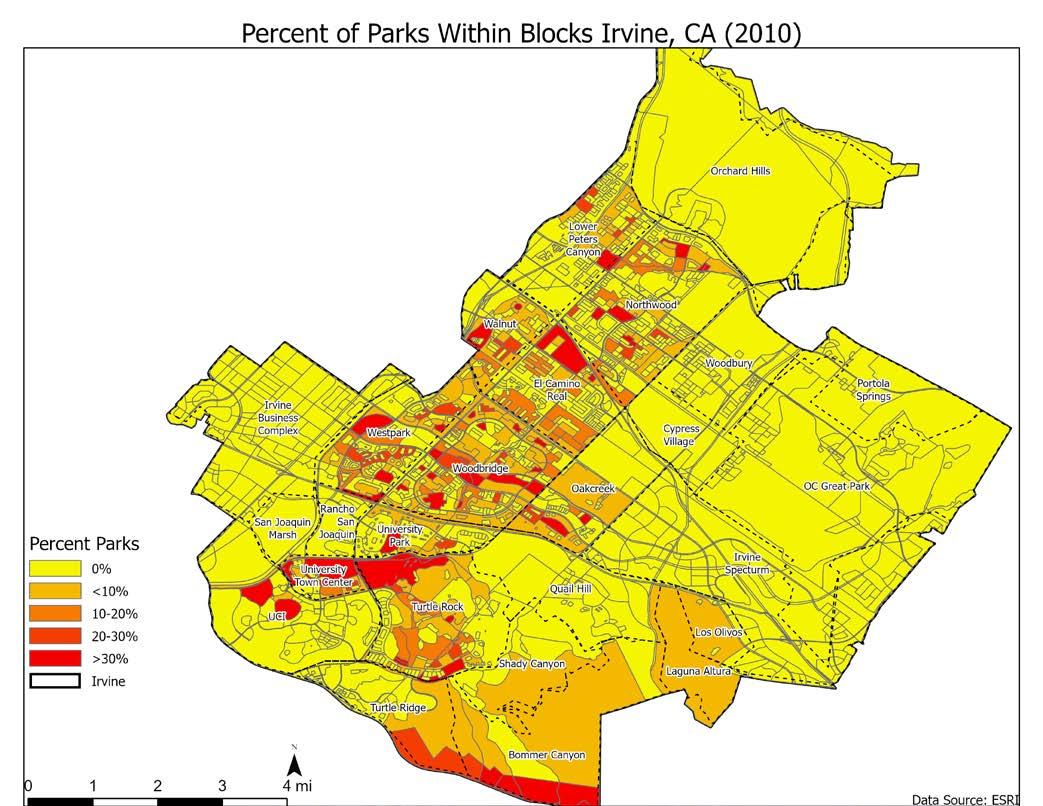
To begin, we show the current locations of parks and commercial districts in Irvine.26 We first show the locations of parks in 2010 in the map in Figure 5.1 (we do not have information for 2000).27 And we show the locations of retail and food-related jobs (e.g., restaurants, fast food locations, bars, etc.) in 2000 and 2010 in Figures 5.2a and 5.2b. The red areas in each of these maps show blocks with a relatively high concentration of parkland or retail or food jobs. These appear to be relatively spread throughout the city, which is a goal of the village model. But are there indeed more parks and retail near Irvine residents? We turn to this question next.
26 The data on parks comes from the ESRI dataset showing parks in 2010. The data on businesses comes from the Reference USA Historical Business Dataset, a proprietary source. 27 Note that the Great Park is not yet shown on this map in the eastern portion as it was still in development in 2010.
Figure 5.1

Figure 5.2a


